

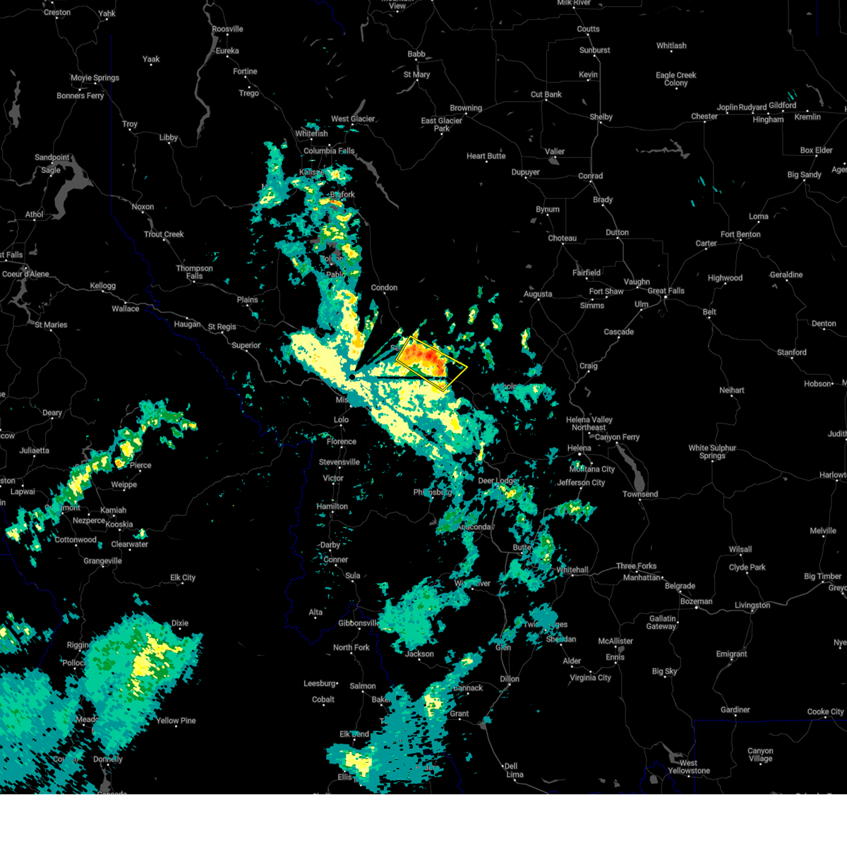
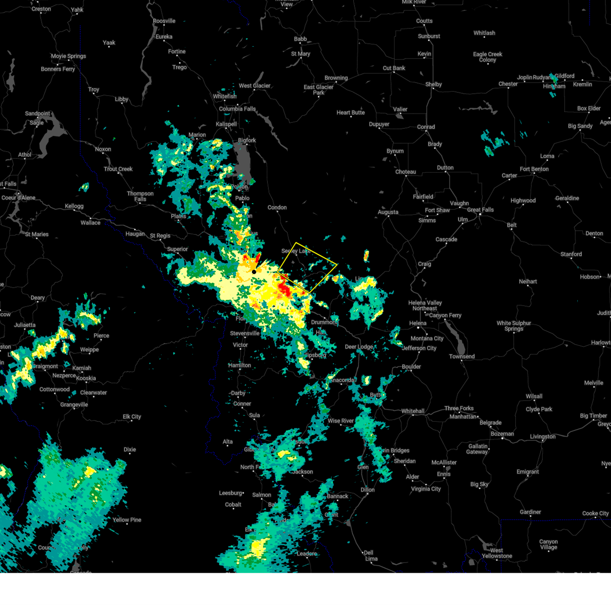
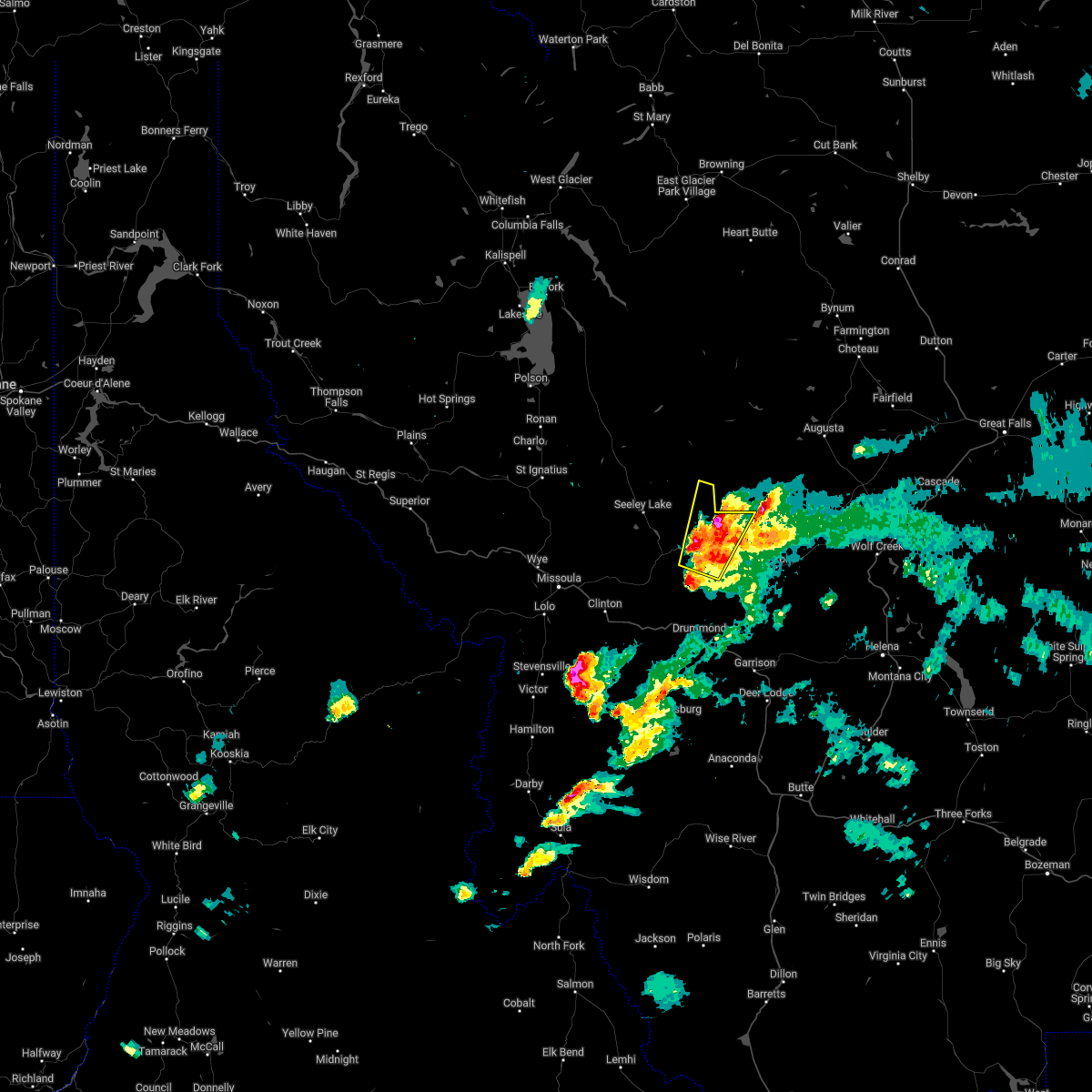
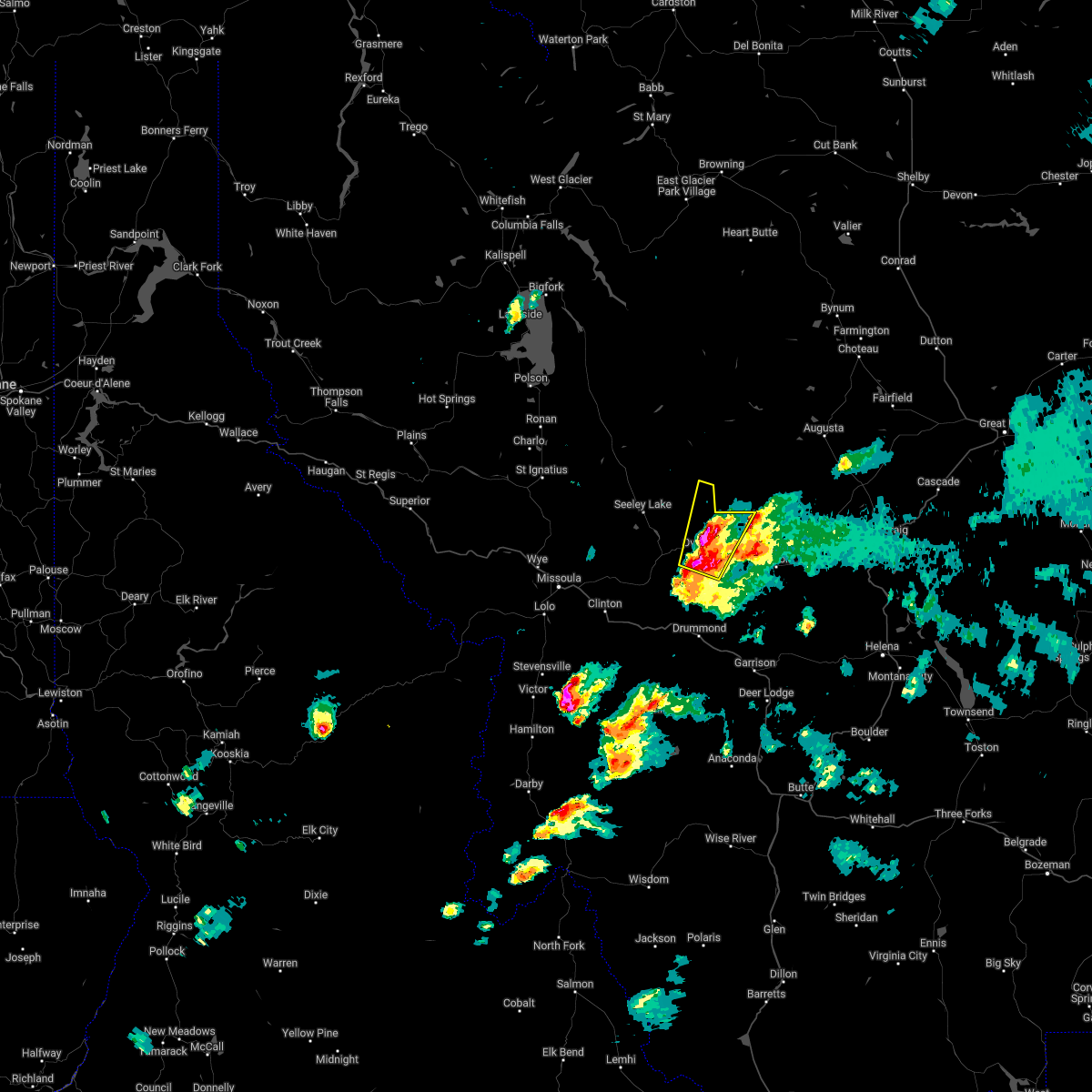
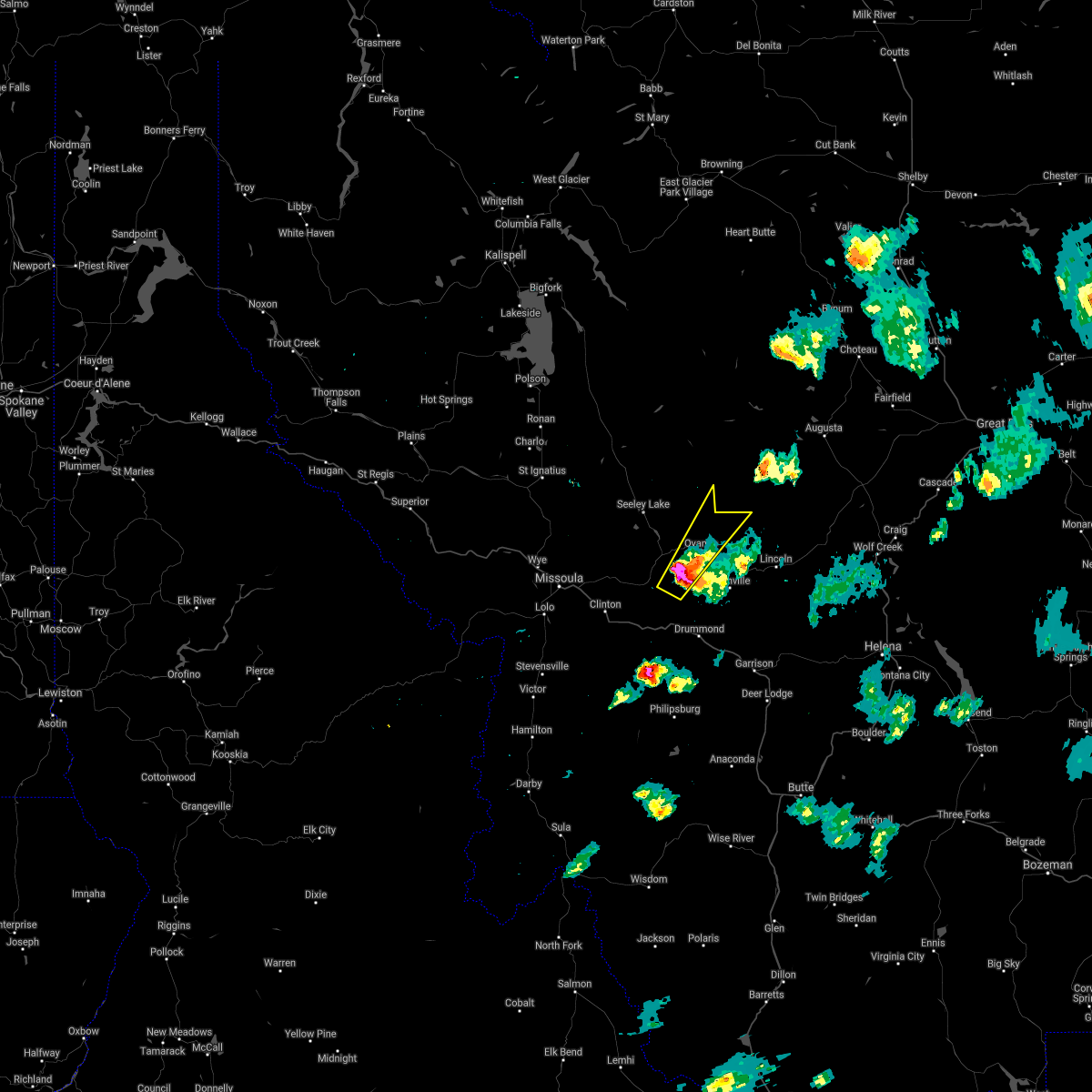
Hail Map for Ovando, MT
The Ovando, MT area has had 3 reports of on-the-ground hail by trained spotters, and has been under severe weather warnings 3 times during the past 12 months. Doppler radar has detected hail at or near Ovando, MT on 11 occasions, including 1 occasion during the past year.
| Name: | Ovando, MT |
| Where Located: | 41.3 miles ENE of Missoula, MT |
| Map: | Google Map for Ovando, MT |
| Population: | 81 |
| Housing Units: | 52 |
| More Info: | Search Google for Ovando, MT |
0
The Top Recent Hail Date for Ovando, MT is Sunday, August 18, 2024 (11th out of 11)

Hail and Wind Damage Spotted near Ovando, MT
| Date / Time | Report Details |
|---|---|
| 7/24/2024 9:55 PM MDT |
 The storm which prompted the warning has moved out of the area. therefore, the warning will be allowed to expire. The storm which prompted the warning has moved out of the area. therefore, the warning will be allowed to expire.
|
| 7/24/2024 9:50 PM MDT |
 At 950 pm mdt, a severe thunderstorm was located over seeley lake, or 33 miles northeast of missoula, moving northeast at 20 mph (radar indicated). Hazards include 60 mph wind gusts. Expect damage to roofs, siding, and trees. Locations impacted include, ovando, seeley lake, and woodworth. At 950 pm mdt, a severe thunderstorm was located over seeley lake, or 33 miles northeast of missoula, moving northeast at 20 mph (radar indicated). Hazards include 60 mph wind gusts. Expect damage to roofs, siding, and trees. Locations impacted include, ovando, seeley lake, and woodworth.
|
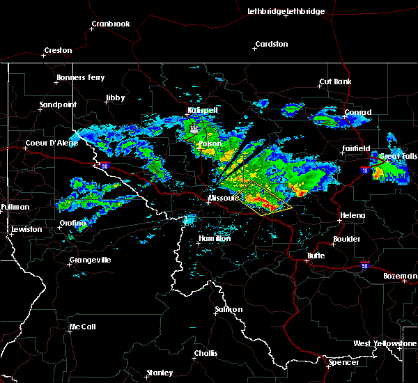
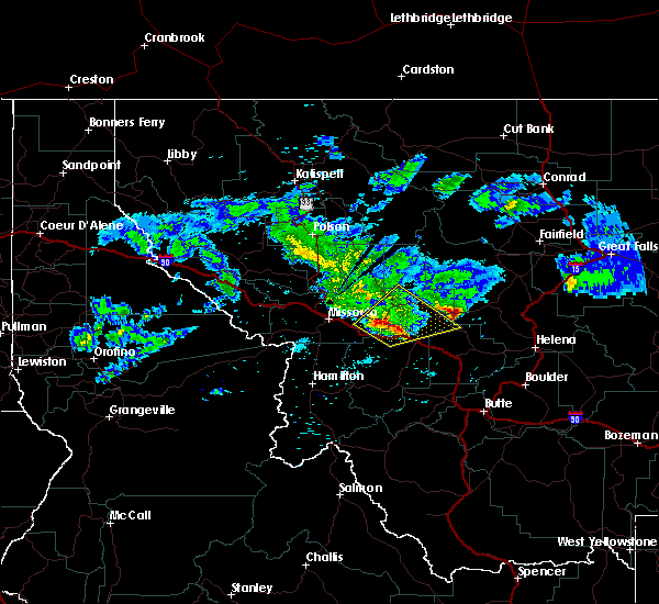
| 7/24/2024 9:28 PM MDT |
 Svrmso the national weather service in missoula has issued a * severe thunderstorm warning for, east central missoula county in west central montana, west central powell county in west central montana, * until 1000 pm mdt. * at 928 pm mdt, a severe thunderstorm was located 7 miles southwest of seeley lake, or 26 miles northeast of missoula, moving northeast at 20 mph (radar indicated). Hazards include 60 mph wind gusts. expect damage to roofs, siding, and trees Svrmso the national weather service in missoula has issued a * severe thunderstorm warning for, east central missoula county in west central montana, west central powell county in west central montana, * until 1000 pm mdt. * at 928 pm mdt, a severe thunderstorm was located 7 miles southwest of seeley lake, or 26 miles northeast of missoula, moving northeast at 20 mph (radar indicated). Hazards include 60 mph wind gusts. expect damage to roofs, siding, and trees
|
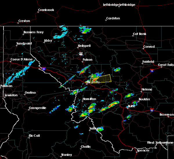
| 5/22/2023 12:10 PM MDT | Quarter sized hail reported 9.8 miles NNW of Ovando, MT, lots of penny sized hail with some quarter sized. brief intense wind but no damage noted. |
| 5/22/2023 12:06 PM MDT |
 At 1206 pm mdt, a severe thunderstorm was located 8 miles southeast of ovando, or 18 miles north of drummond, moving northeast at 40 mph (radar indicated). Hazards include 60 mph wind gusts and quarter size hail. Hail damage to vehicles is expected. Expect wind damage to roofs, siding, and trees. At 1206 pm mdt, a severe thunderstorm was located 8 miles southeast of ovando, or 18 miles north of drummond, moving northeast at 40 mph (radar indicated). Hazards include 60 mph wind gusts and quarter size hail. Hail damage to vehicles is expected. Expect wind damage to roofs, siding, and trees.
|
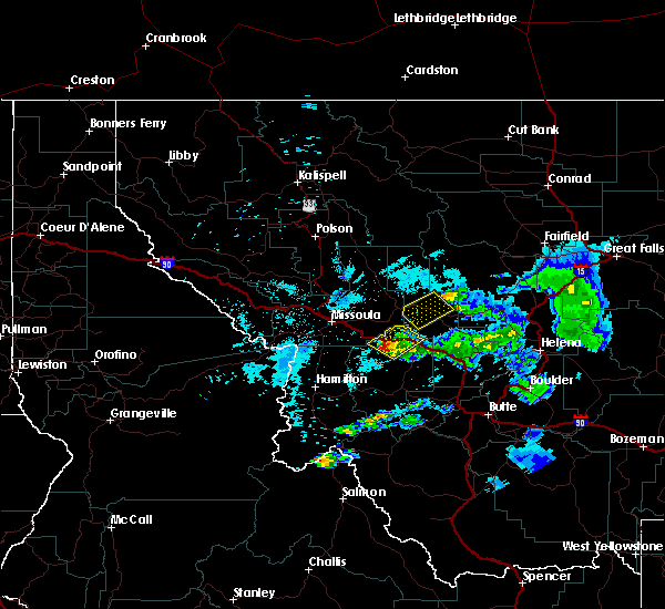
| 7/8/2022 8:08 PM MDT |
 The severe thunderstorm warning for northwestern powell county will expire at 815 pm mdt, the storm which prompted the warning has moved out of the area. therefore, the warning will be allowed to expire. a severe thunderstorm watch remains in effect until 1000 pm mdt for west central montana. The severe thunderstorm warning for northwestern powell county will expire at 815 pm mdt, the storm which prompted the warning has moved out of the area. therefore, the warning will be allowed to expire. a severe thunderstorm watch remains in effect until 1000 pm mdt for west central montana.
|
| 7/8/2022 7:57 PM MDT |
 The severe thunderstorm warning for east central missoula and west central powell counties will expire at 800 pm mdt, the storm which prompted the warning has moved out of the area. therefore, the warning will be allowed to expire. a severe thunderstorm watch remains in effect until 1000 pm mdt for west central montana. The severe thunderstorm warning for east central missoula and west central powell counties will expire at 800 pm mdt, the storm which prompted the warning has moved out of the area. therefore, the warning will be allowed to expire. a severe thunderstorm watch remains in effect until 1000 pm mdt for west central montana.
|
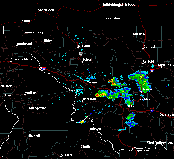
| 7/8/2022 7:56 PM MDT |
 At 756 pm mdt, a severe thunderstorm was located 7 miles northeast of ovando, or 29 miles north of drummond, moving north at 25 mph (radar indicated). Hazards include half dollar size hail. damage to vehicles is expected At 756 pm mdt, a severe thunderstorm was located 7 miles northeast of ovando, or 29 miles north of drummond, moving north at 25 mph (radar indicated). Hazards include half dollar size hail. damage to vehicles is expected
|
| 7/8/2022 7:28 PM MDT |
 At 728 pm mdt, a severe thunderstorm was located 7 miles southwest of ovando, or 18 miles north of drummond, moving north at 25 mph (radar indicated). Hazards include golf ball size hail and 60 mph wind gusts. People and animals outdoors will be injured. expect hail damage to roofs, siding, windows, and vehicles. Expect wind damage to roofs, siding, and trees. At 728 pm mdt, a severe thunderstorm was located 7 miles southwest of ovando, or 18 miles north of drummond, moving north at 25 mph (radar indicated). Hazards include golf ball size hail and 60 mph wind gusts. People and animals outdoors will be injured. expect hail damage to roofs, siding, windows, and vehicles. Expect wind damage to roofs, siding, and trees.
|
| 7/21/2021 7:30 PM MDT |
 At 729 pm mdt, a severe thunderstorm was located near ovando, or 19 miles north of drummond, moving northeast at 30 mph (radar indicated). Hazards include 60 mph wind gusts and quarter size hail. Hail damage to vehicles is expected. Expect wind damage to roofs, siding, and trees. At 729 pm mdt, a severe thunderstorm was located near ovando, or 19 miles north of drummond, moving northeast at 30 mph (radar indicated). Hazards include 60 mph wind gusts and quarter size hail. Hail damage to vehicles is expected. Expect wind damage to roofs, siding, and trees.
|
| 7/21/2021 6:54 PM MDT |
 At 654 pm mdt, a severe thunderstorm was located 17 miles northwest of drummond, moving northeast at 45 mph (radar indicated). Hazards include 60 mph wind gusts and quarter size hail. Hail damage to vehicles is expected. Expect wind damage to roofs, siding, and trees. At 654 pm mdt, a severe thunderstorm was located 17 miles northwest of drummond, moving northeast at 45 mph (radar indicated). Hazards include 60 mph wind gusts and quarter size hail. Hail damage to vehicles is expected. Expect wind damage to roofs, siding, and trees.
|
| 7/21/2021 5:45 PM MDT | Quarter sized hail reported 10.5 miles E of Ovando, MT, quarter-sized hail fell for 3-5 minutes. |
| 6/13/2021 7:20 PM MDT | Large tree down along highway 200... 2 miles east of clearwater junctio in missoula county MT, 9.5 miles E of Ovando, MT |
| 7/14/2019 1:47 PM MDT |
 At 146 pm mdt, a severe thunderstorm was located 13 miles southwest of seeley lake, or 19 miles northeast of missoula, moving east at 35 mph (radar indicated). Hazards include wind gusts up to 60 mph and quarter size hail. Hail damage to vehicles is expected. Expect wind damage to roofs, siding, and trees. At 146 pm mdt, a severe thunderstorm was located 13 miles southwest of seeley lake, or 19 miles northeast of missoula, moving east at 35 mph (radar indicated). Hazards include wind gusts up to 60 mph and quarter size hail. Hail damage to vehicles is expected. Expect wind damage to roofs, siding, and trees.
|
| 7/13/2019 10:51 PM MDT |
 At 1050 pm mdt, a severe thunderstorm was located 12 miles northeast of ovando, moving northeast at 30 mph (radar indicated). Hazards include quarter size hail. Hail damage to vehicles is expected. expect wind damage to roofs, siding, and trees. Locations impacted include, ovando. At 1050 pm mdt, a severe thunderstorm was located 12 miles northeast of ovando, moving northeast at 30 mph (radar indicated). Hazards include quarter size hail. Hail damage to vehicles is expected. expect wind damage to roofs, siding, and trees. Locations impacted include, ovando.
|
| 7/13/2019 10:21 PM MDT |
 At 1020 pm mdt, a severe thunderstorm was located near ovando, or 20 miles north of drummond, moving northeast at 25 mph (radar indicated). Hazards include 60 mph wind gusts and half dollar size hail. Hail damage to vehicles is expected. Expect wind damage to roofs, siding, and trees. At 1020 pm mdt, a severe thunderstorm was located near ovando, or 20 miles north of drummond, moving northeast at 25 mph (radar indicated). Hazards include 60 mph wind gusts and half dollar size hail. Hail damage to vehicles is expected. Expect wind damage to roofs, siding, and trees.
|
| 7/17/2016 10:49 PM MDT |
 At 1049 pm mdt, a dangerous storm with a history of producing quarter size hail and damaging winds in excess of 60 mph was located 8 miles north of ovando, or 32 miles north of drummond, moving northeast at 45 mph. locations impacted include, ovando, helmville, clearwater, greenough, garnet and woodworth. At 1049 pm mdt, a dangerous storm with a history of producing quarter size hail and damaging winds in excess of 60 mph was located 8 miles north of ovando, or 32 miles north of drummond, moving northeast at 45 mph. locations impacted include, ovando, helmville, clearwater, greenough, garnet and woodworth.
|
| 7/17/2016 10:35 PM MDT |
 At 1034 pm mdt, trained weather spotter just south of rock creek reported a severe thunderstorm producing quarter size hail. this storm was located 7 miles west of ovando, or 25 miles north of drummond, moving northeast at 45 mph. winds in excess of 60 mph and heavy rainfall should also be expected with this storm. localized flooding may occur as a result of heavy rainfall. locations impacted include, ovando, potomac, helmville, clearwater, greenough, woodworth, bearmouth, nimrod and garnet. At 1034 pm mdt, trained weather spotter just south of rock creek reported a severe thunderstorm producing quarter size hail. this storm was located 7 miles west of ovando, or 25 miles north of drummond, moving northeast at 45 mph. winds in excess of 60 mph and heavy rainfall should also be expected with this storm. localized flooding may occur as a result of heavy rainfall. locations impacted include, ovando, potomac, helmville, clearwater, greenough, woodworth, bearmouth, nimrod and garnet.
|
| 7/17/2016 10:31 PM MDT |
 At 1028 pm mdt, the public reported a severe thunderstorm producing up to quarter size hail and damaging winds in excess of 60 mph. this storm was located 10 miles west of ovando, or 22 miles northwest of drummond, moving northeast at 45 mph. heavy rain could cause localized flooding. in addition, a spotter from rock creek reported heavy amounts of nickel sized hail. this storm has a history of producing larger hail 1 inch in diameter, and should this storm intensify further, could produce large hail again. locations impacted include, ovando, potomac, helmville, clearwater, greenough, woodworth, bearmouth, nimrod and garnet. At 1028 pm mdt, the public reported a severe thunderstorm producing up to quarter size hail and damaging winds in excess of 60 mph. this storm was located 10 miles west of ovando, or 22 miles northwest of drummond, moving northeast at 45 mph. heavy rain could cause localized flooding. in addition, a spotter from rock creek reported heavy amounts of nickel sized hail. this storm has a history of producing larger hail 1 inch in diameter, and should this storm intensify further, could produce large hail again. locations impacted include, ovando, potomac, helmville, clearwater, greenough, woodworth, bearmouth, nimrod and garnet.
|
| 7/17/2016 10:08 PM MDT |
 At 1008 pm mdt, doppler radar indicated a severe thunderstorm capable of producing quarter size hail and damaging winds in excess of 60 mph. this storm was located 17 miles east of bonner- west riverside, or 20 miles northwest of drummond, and moving northeast at 45 mph. At 1008 pm mdt, doppler radar indicated a severe thunderstorm capable of producing quarter size hail and damaging winds in excess of 60 mph. this storm was located 17 miles east of bonner- west riverside, or 20 miles northwest of drummond, and moving northeast at 45 mph.
|
| 8/10/2015 7:09 PM MDT |
 At 707 pm mdt, a severe thunderstorm was located 16 miles south of seeley lake, moving northeast at 45 mph. this storm has had a history of producing wind gusts over 70 mph. any downed power lines could cause a new fire start (nws observation). Hazards include 70 mph wind gusts. Expect considerable tree damage. damage is likely to mobile homes, roofs, powerlines and outbuildings. Locations impacted include, seeley lake, ovando, clinton, potomac, clearwater, greenough, woodworth, twin creeks, nimrod and garnet. At 707 pm mdt, a severe thunderstorm was located 16 miles south of seeley lake, moving northeast at 45 mph. this storm has had a history of producing wind gusts over 70 mph. any downed power lines could cause a new fire start (nws observation). Hazards include 70 mph wind gusts. Expect considerable tree damage. damage is likely to mobile homes, roofs, powerlines and outbuildings. Locations impacted include, seeley lake, ovando, clinton, potomac, clearwater, greenough, woodworth, twin creeks, nimrod and garnet.
|
| 8/10/2015 6:44 PM MDT |
 At 642 pm mdt, doppler radar indicated a severe thunderstorm capable of producing damaging winds in excess of 60 mph. this storm was located 12 miles northeast of bonner-west riverside, or 16 miles east of missoula, and moving north at 25 mph. this storm has a history of damaging winds, capable of downing power lines and trees. At 642 pm mdt, doppler radar indicated a severe thunderstorm capable of producing damaging winds in excess of 60 mph. this storm was located 12 miles northeast of bonner-west riverside, or 16 miles east of missoula, and moving north at 25 mph. this storm has a history of damaging winds, capable of downing power lines and trees.
|
| 6/4/2012 4:40 PM MDT | Quarter sized hail reported 10.5 miles E of Ovando, MT |
Hail Maps for Ovando, MT


Connect with Interactive Hail Maps