

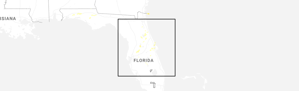
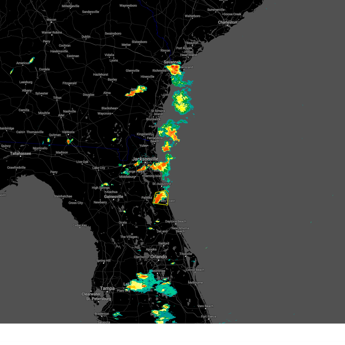
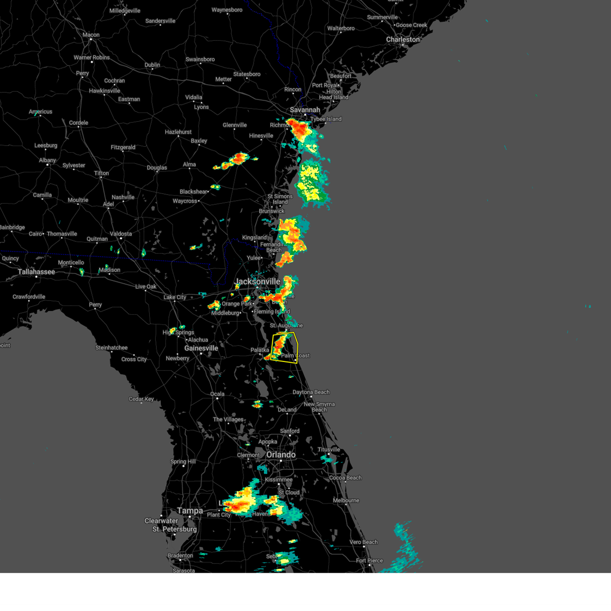
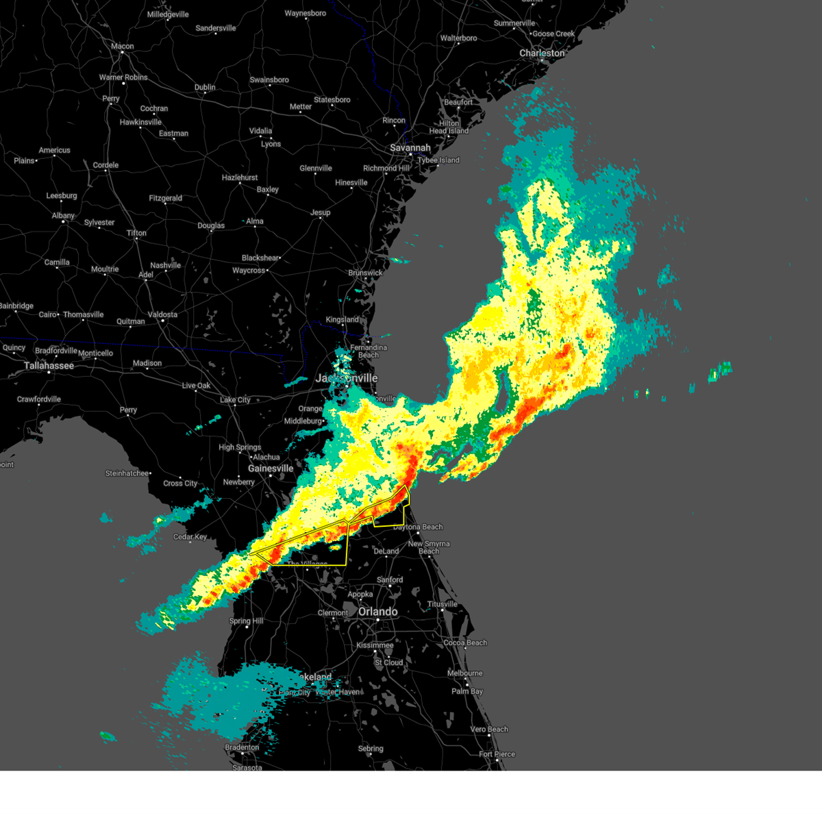
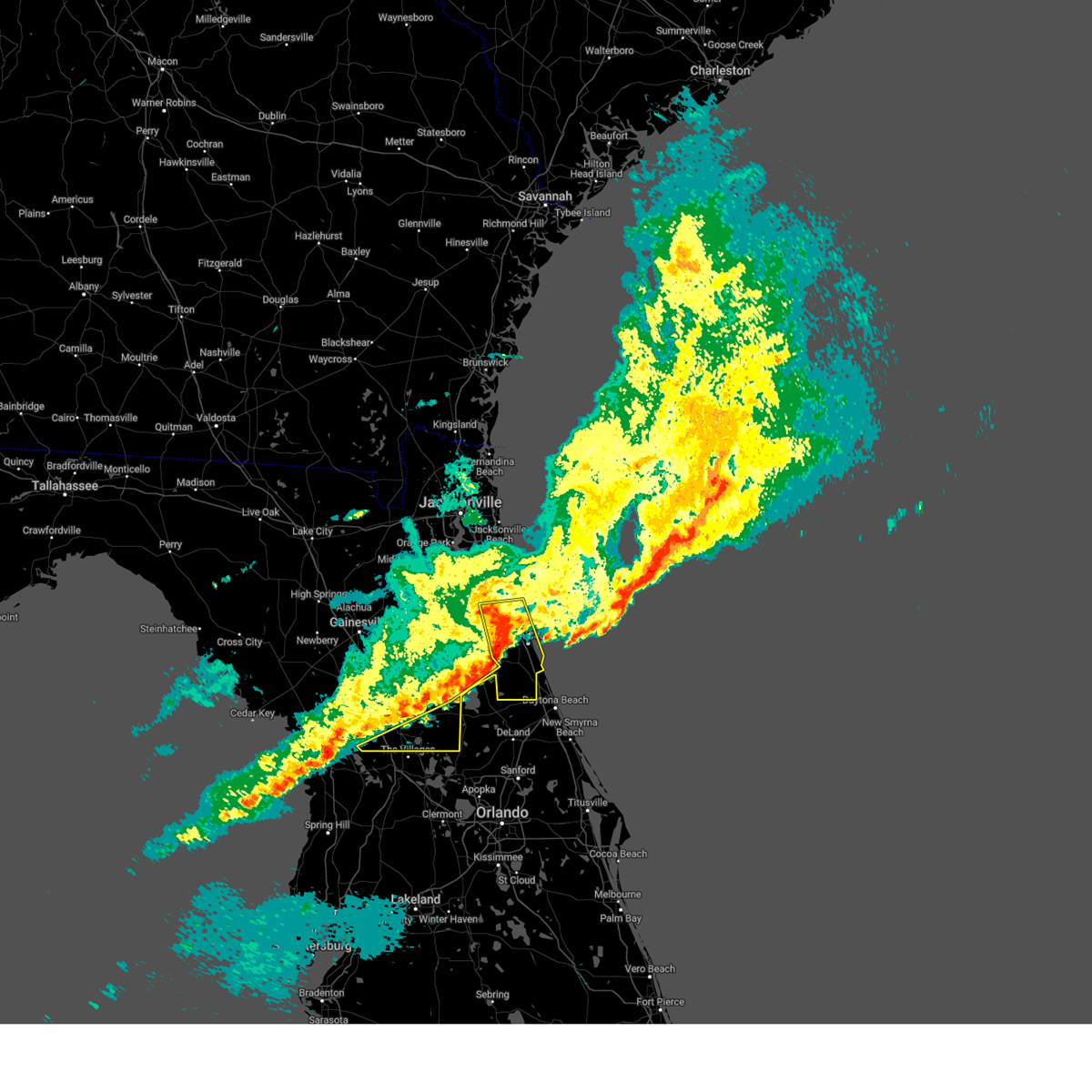
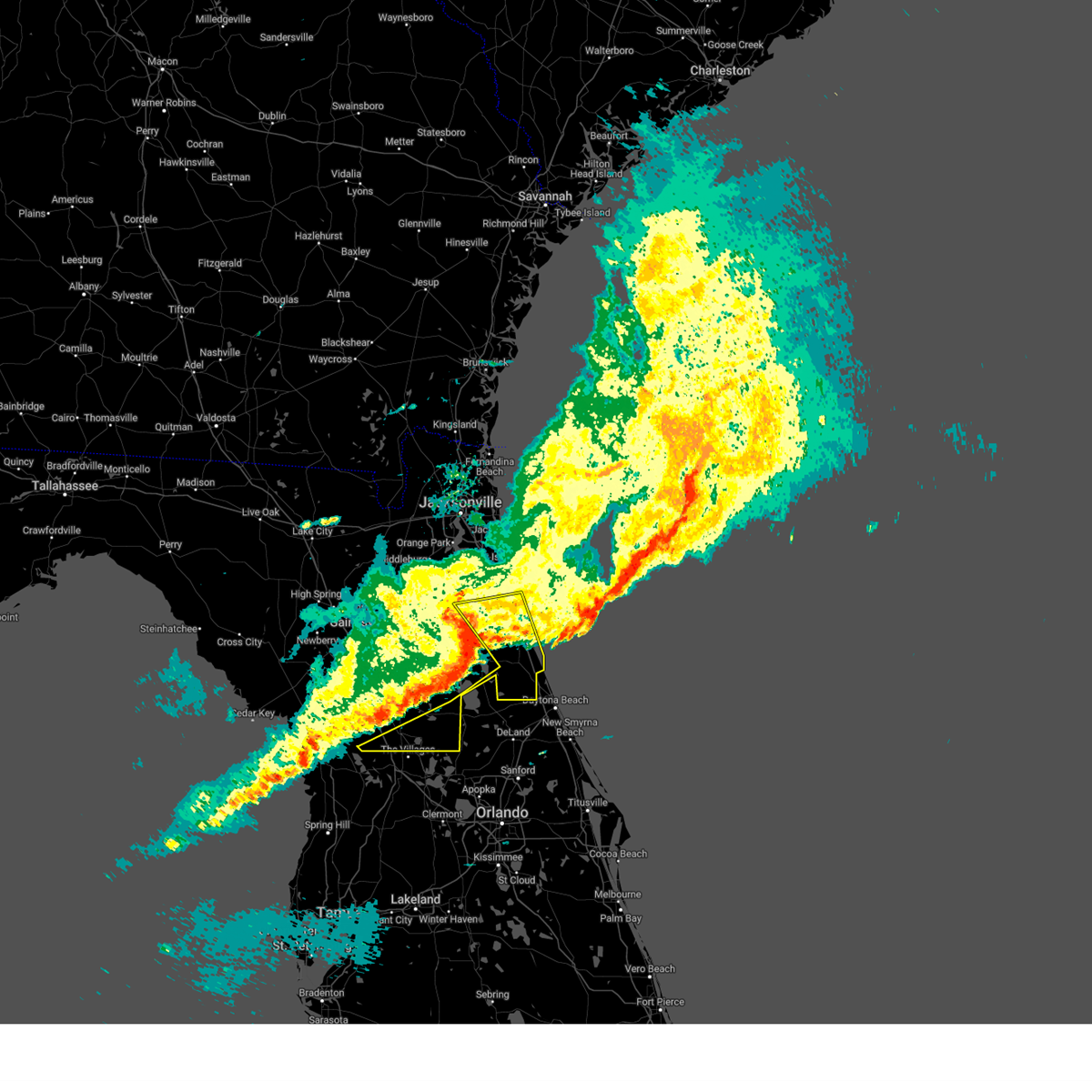
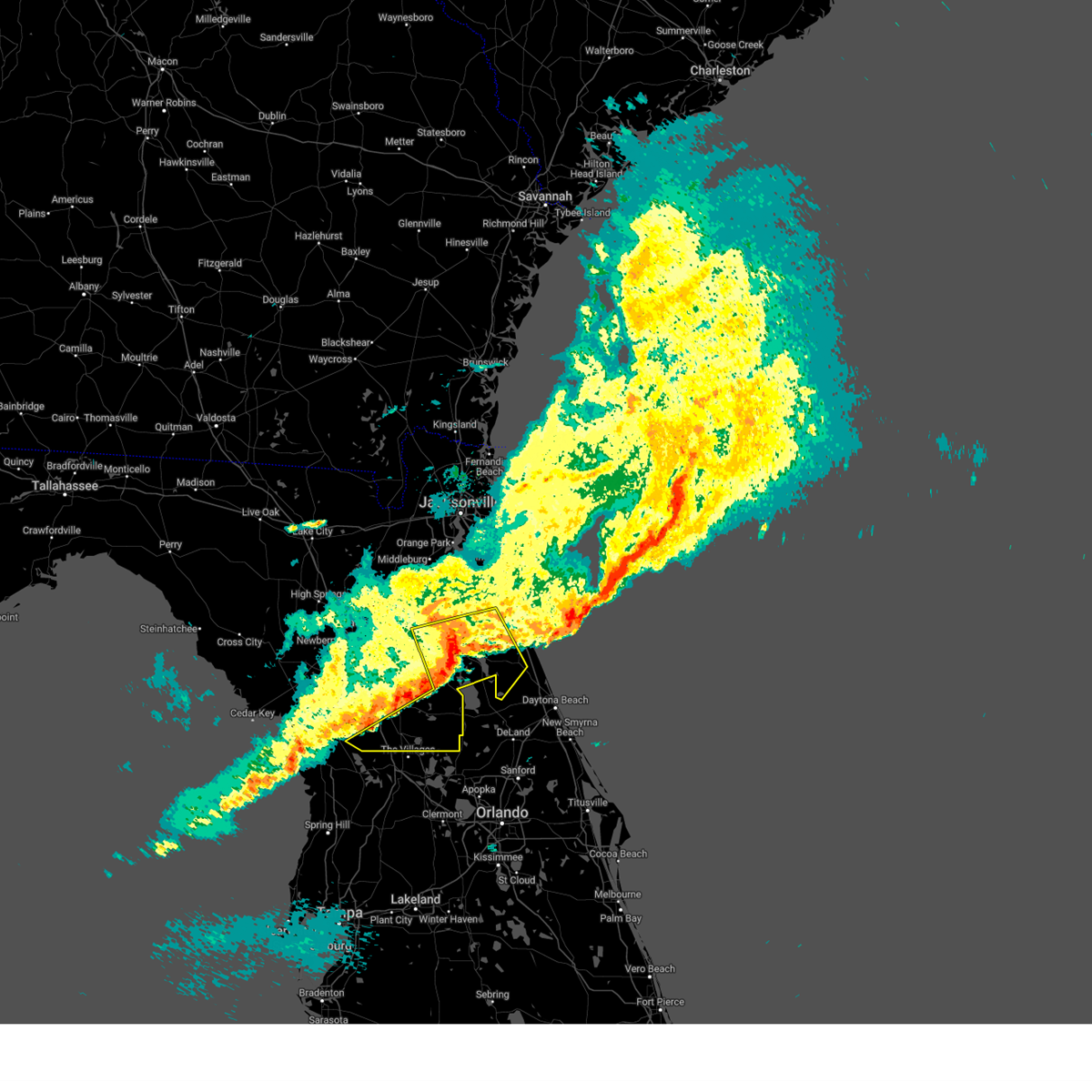
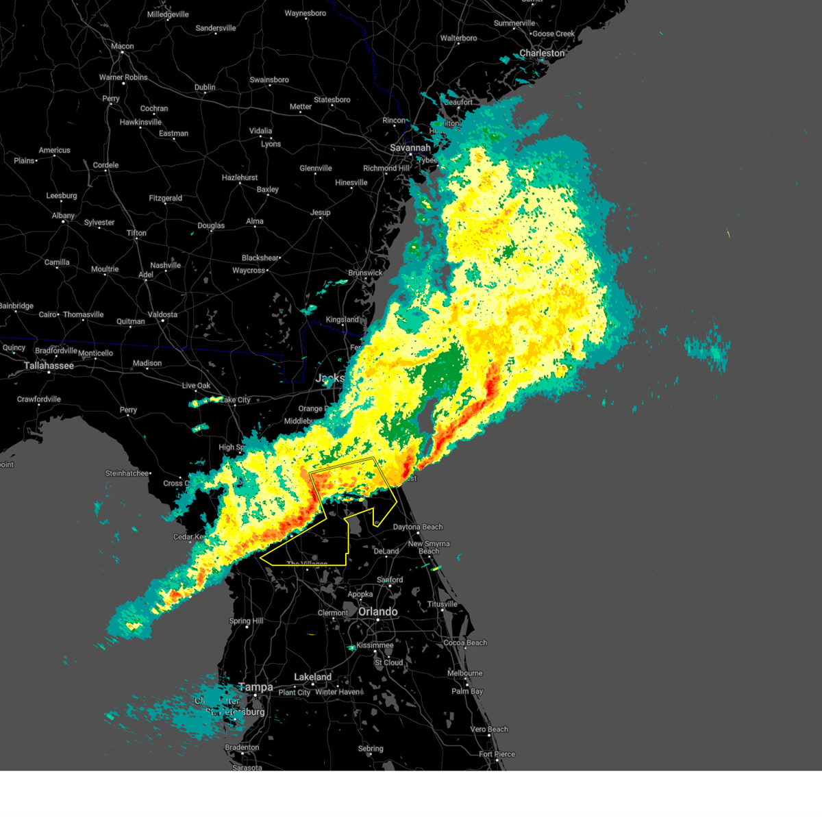
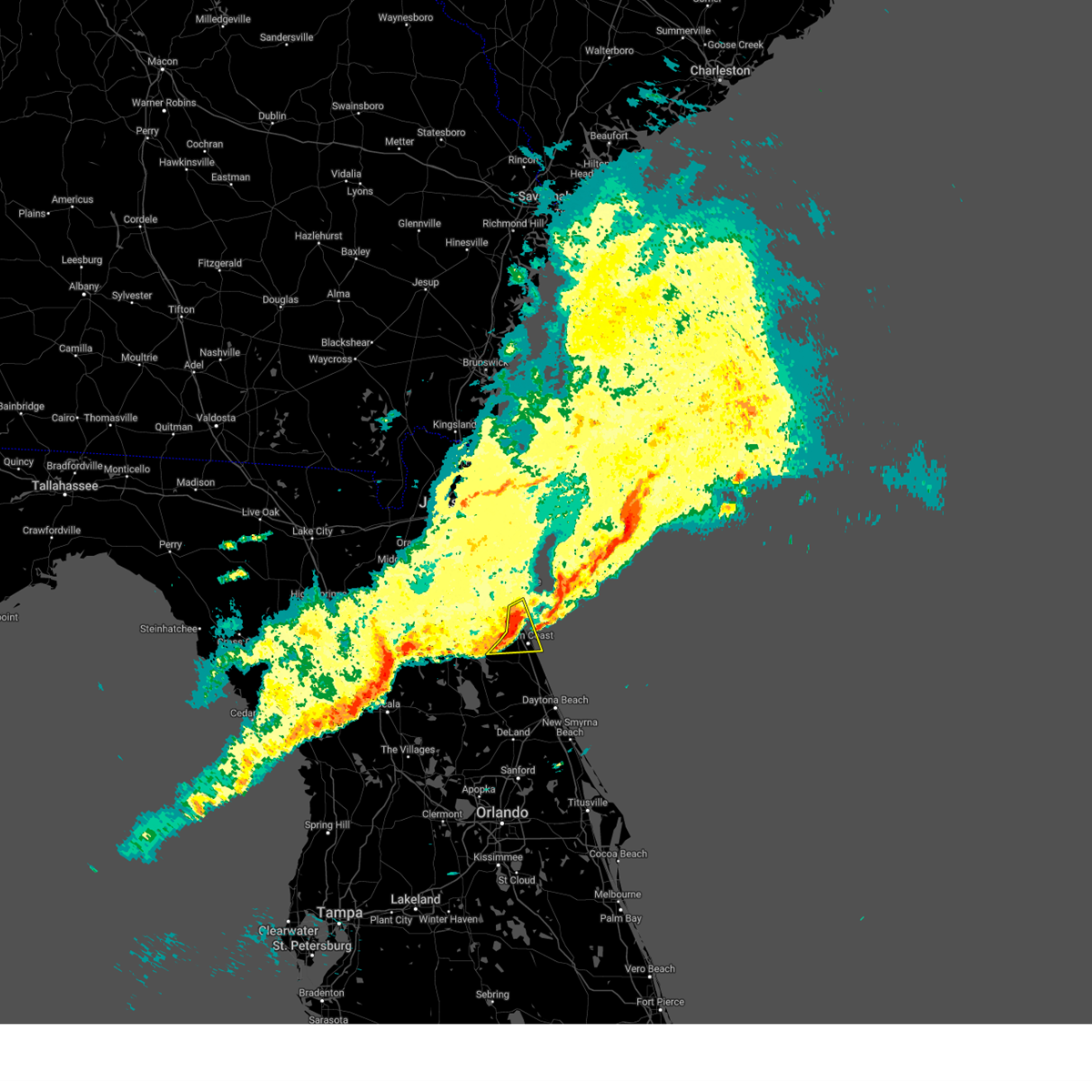
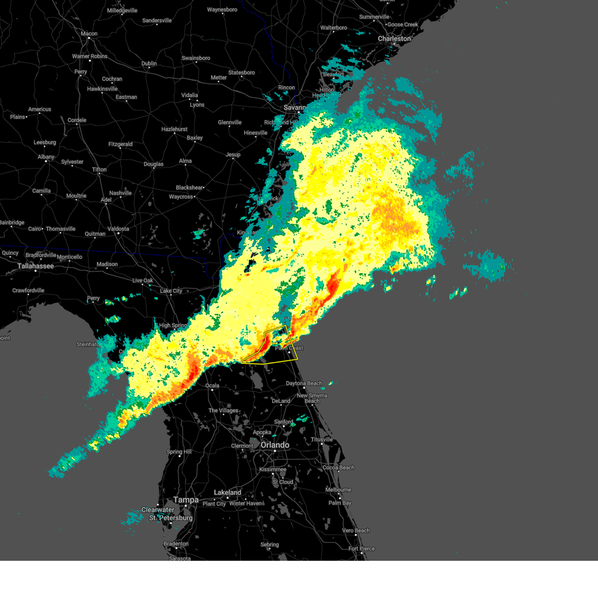
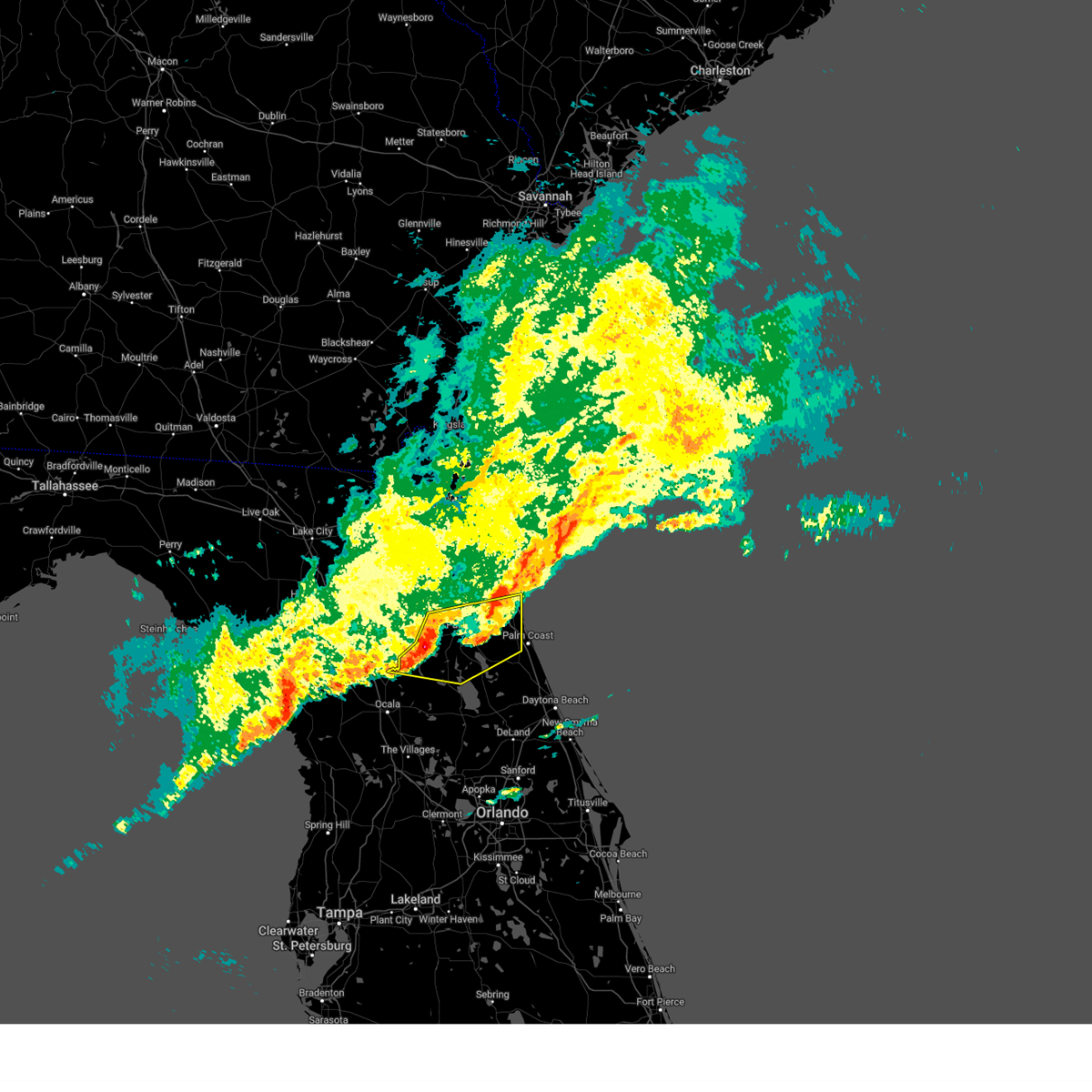
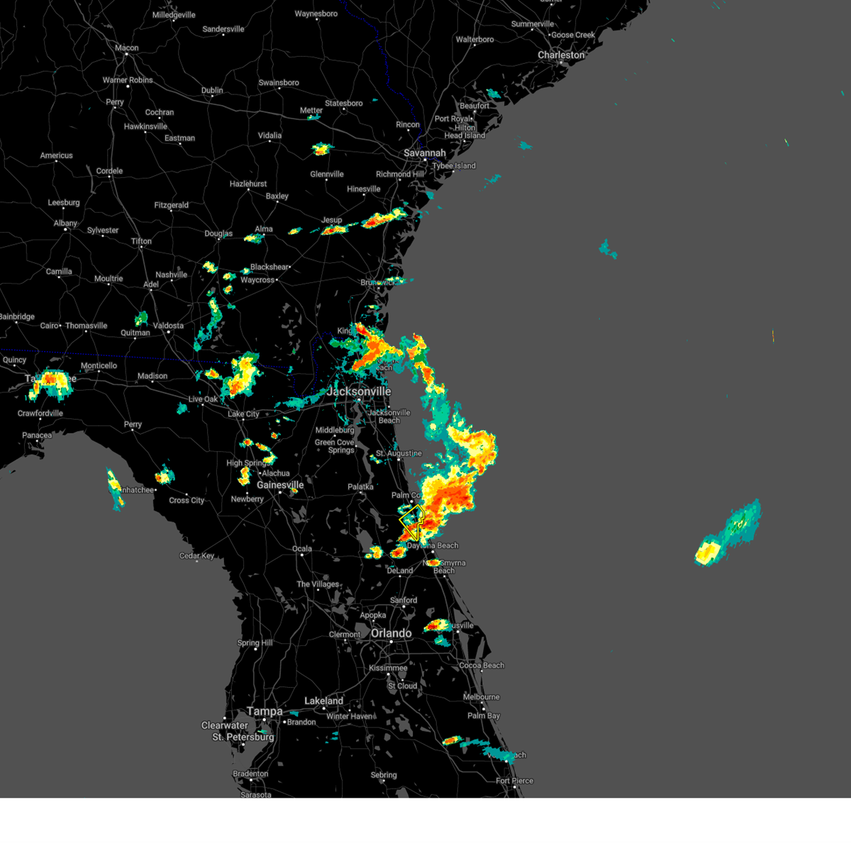
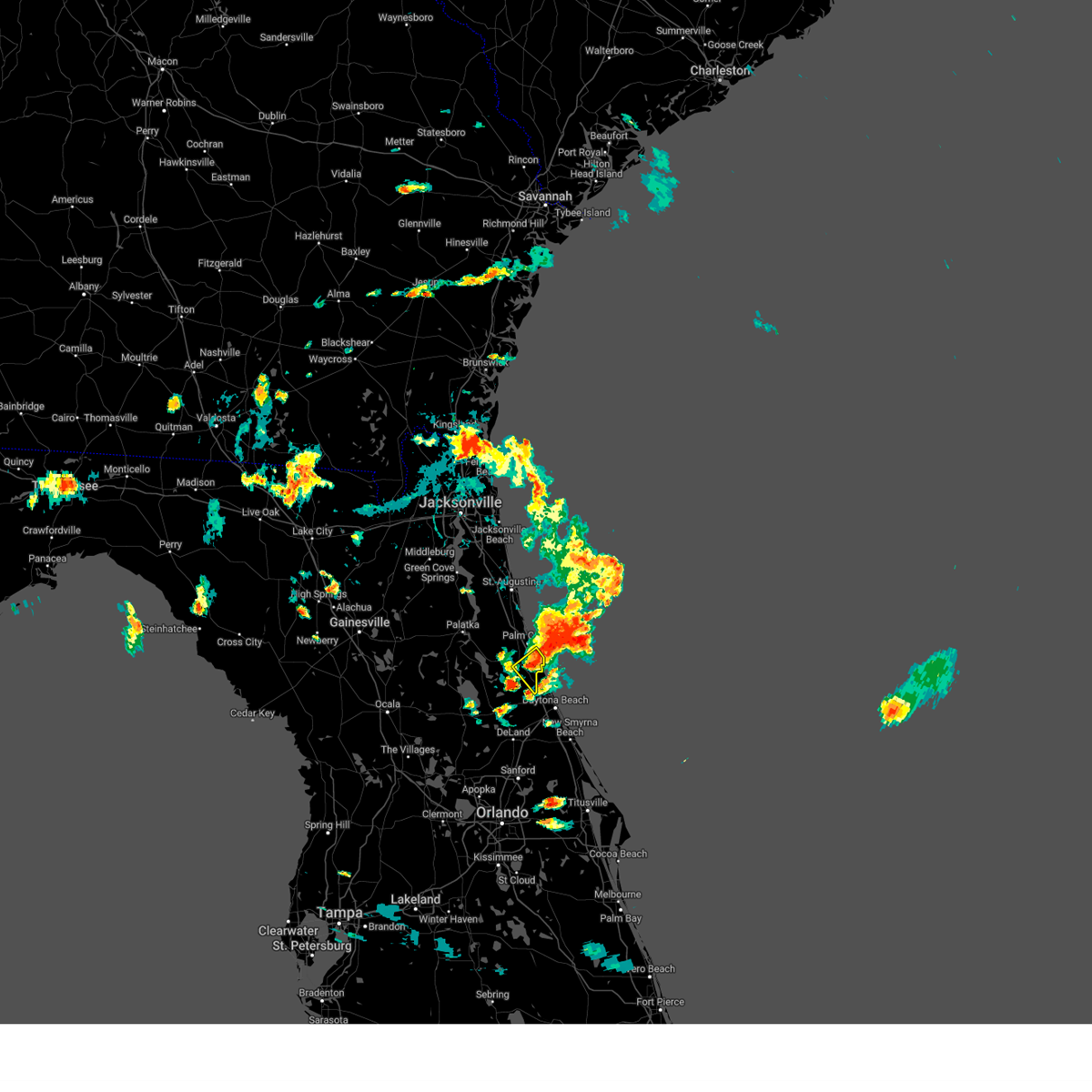
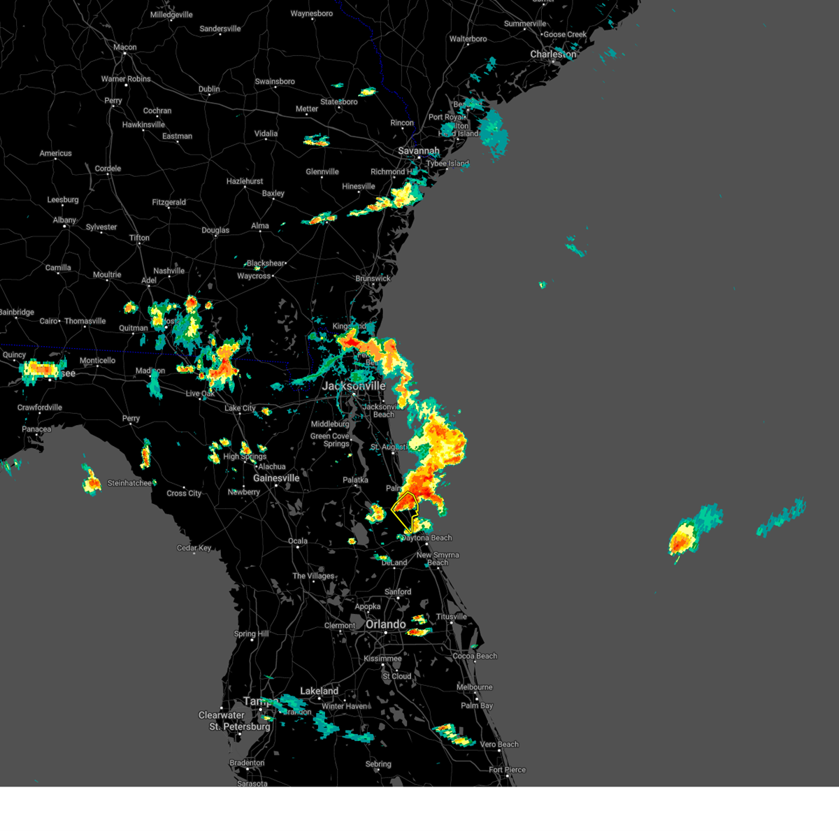
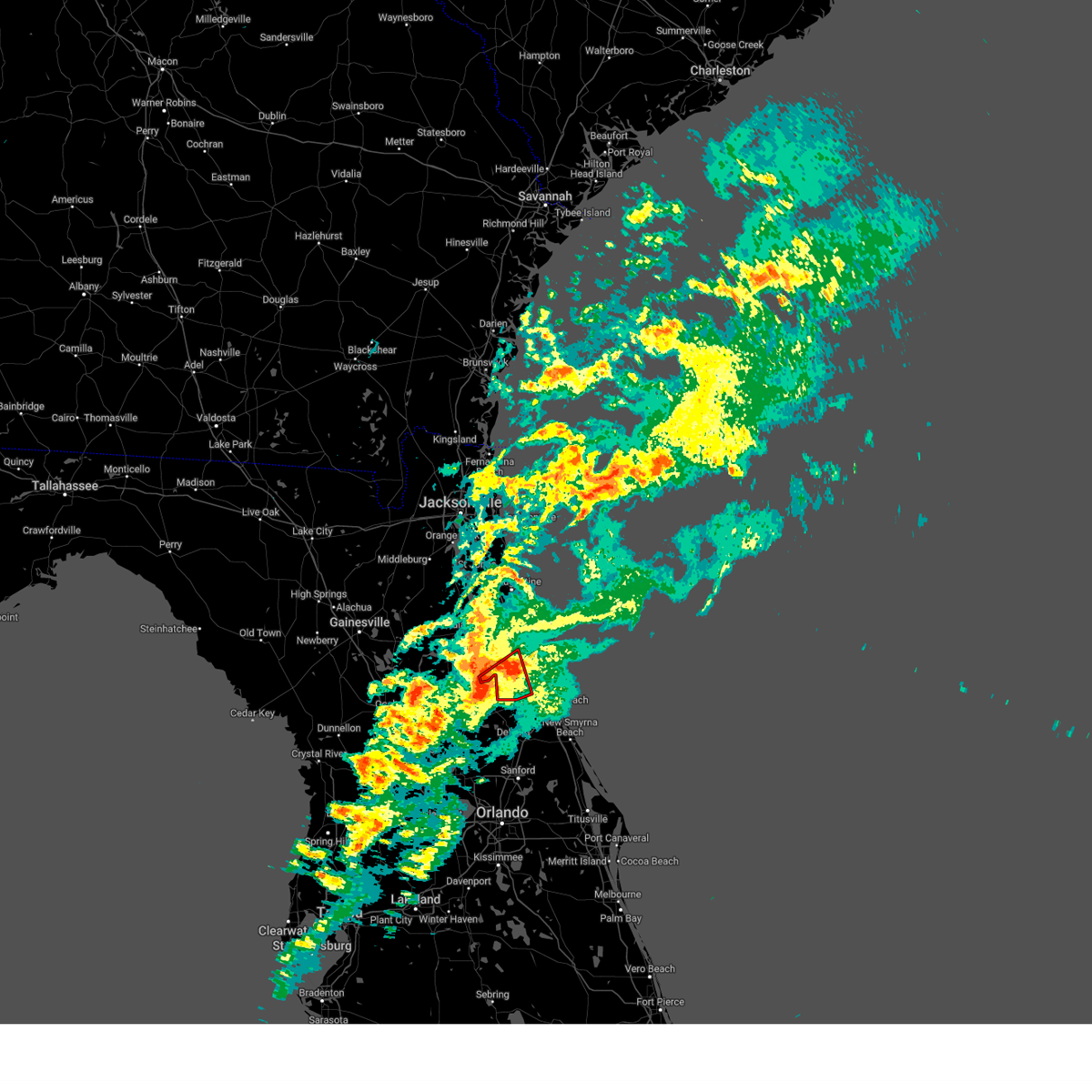
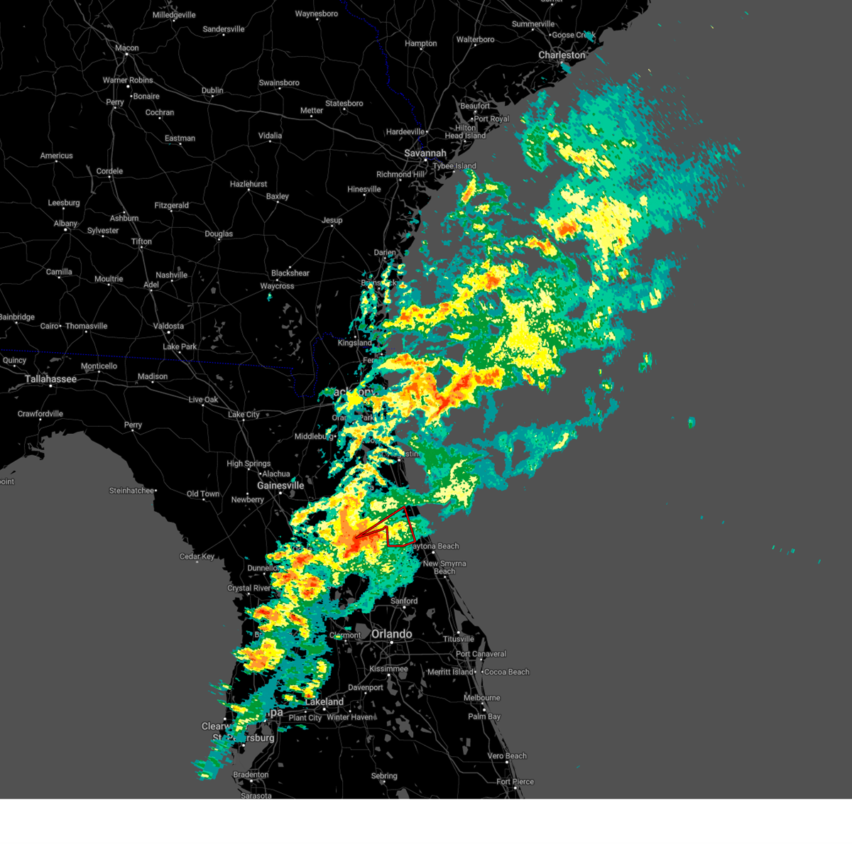
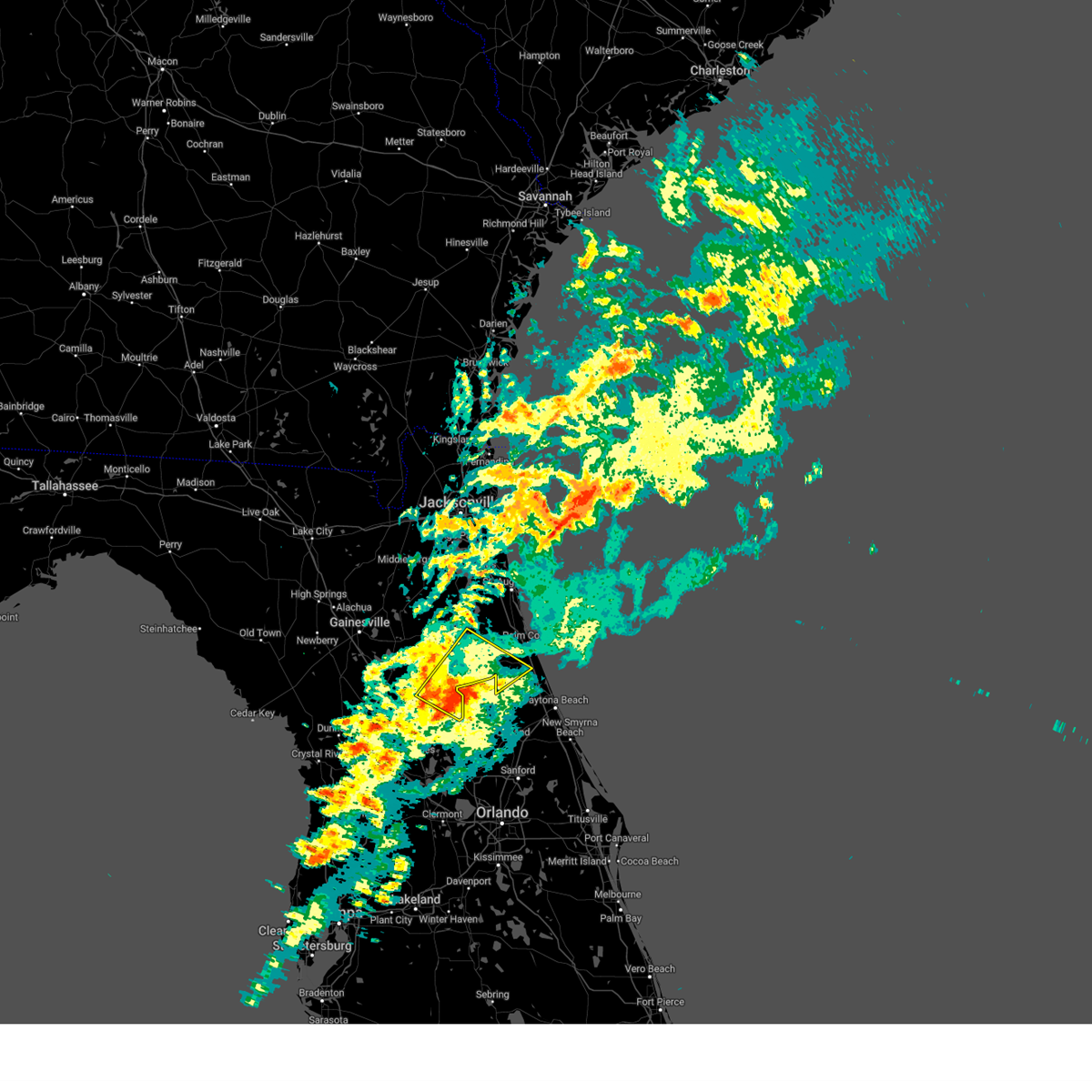
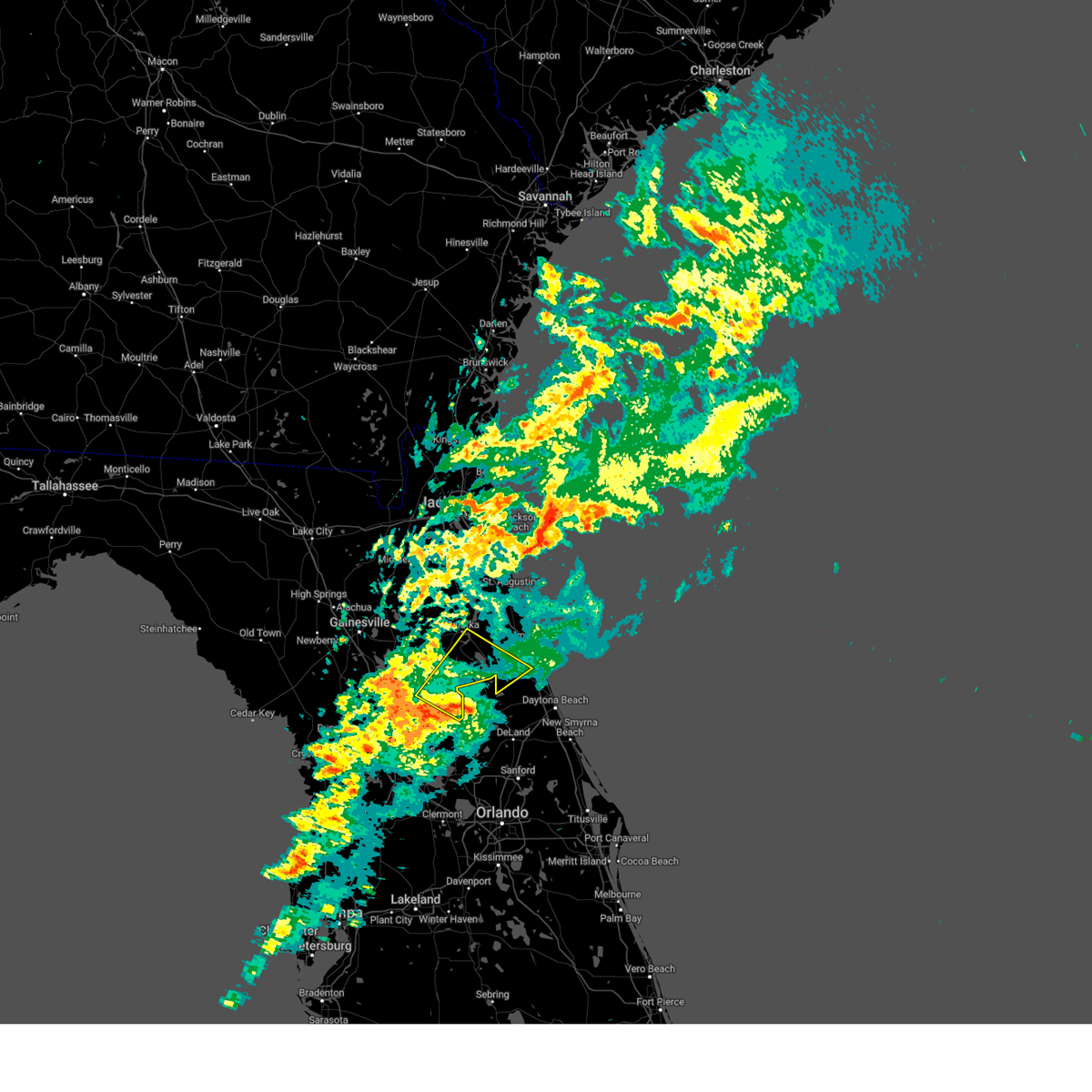
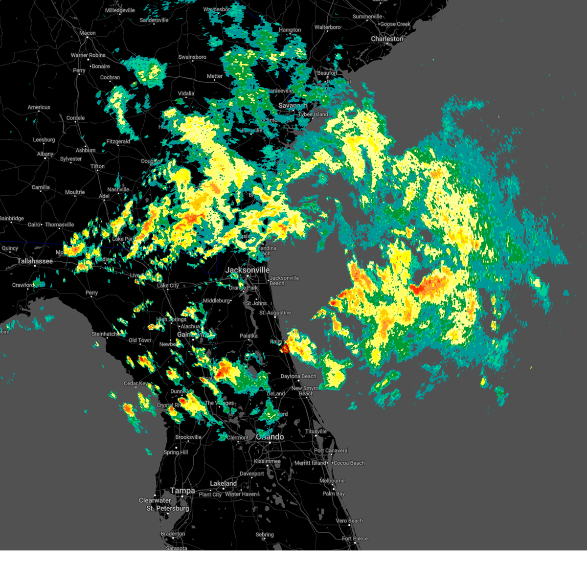
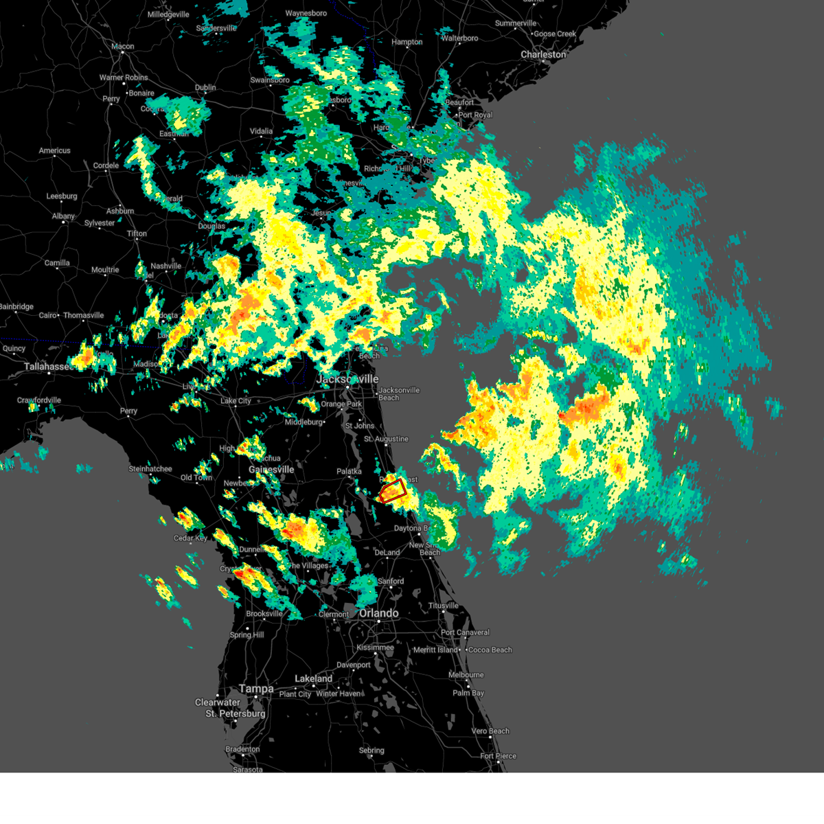
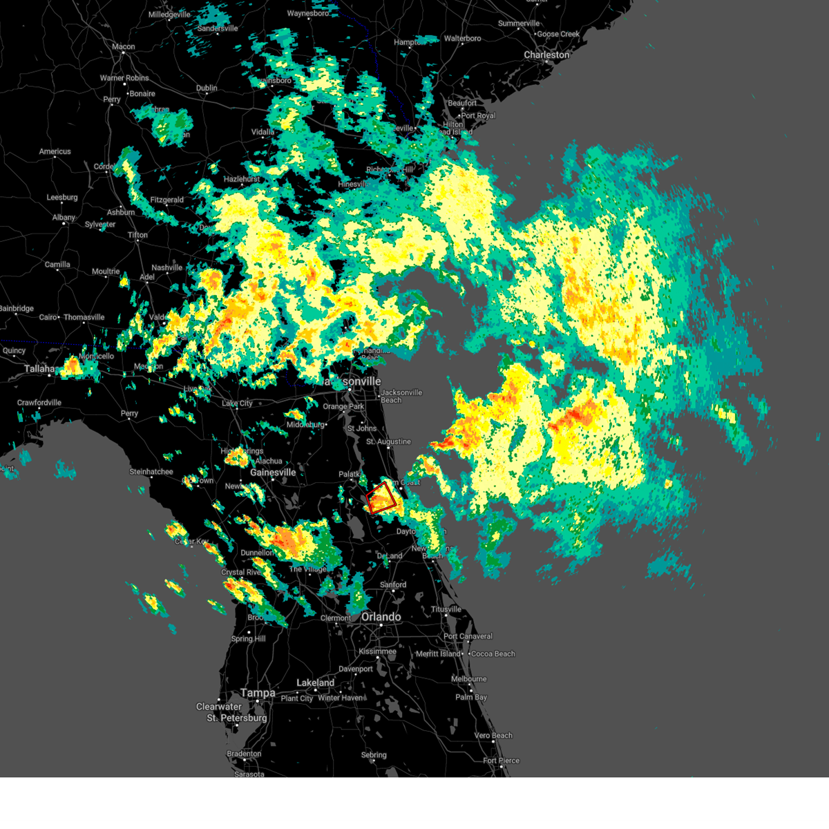
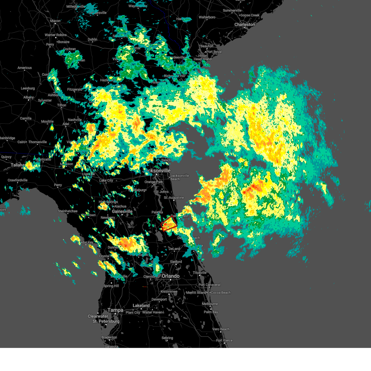
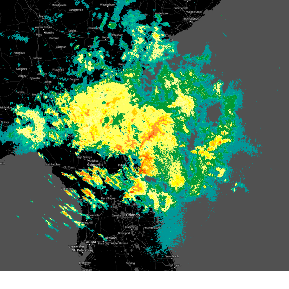
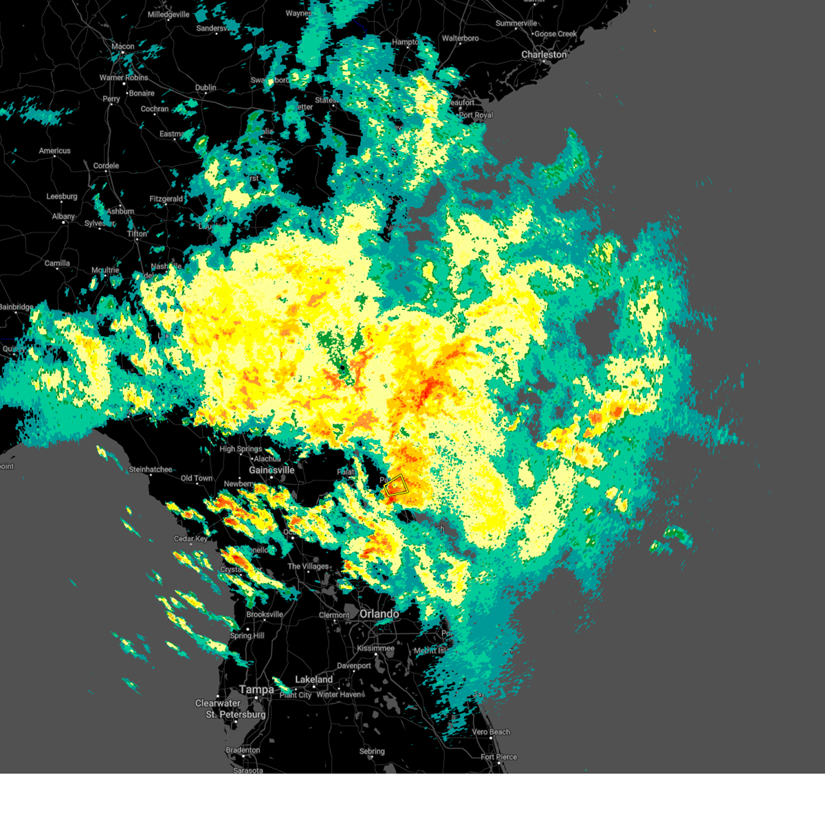
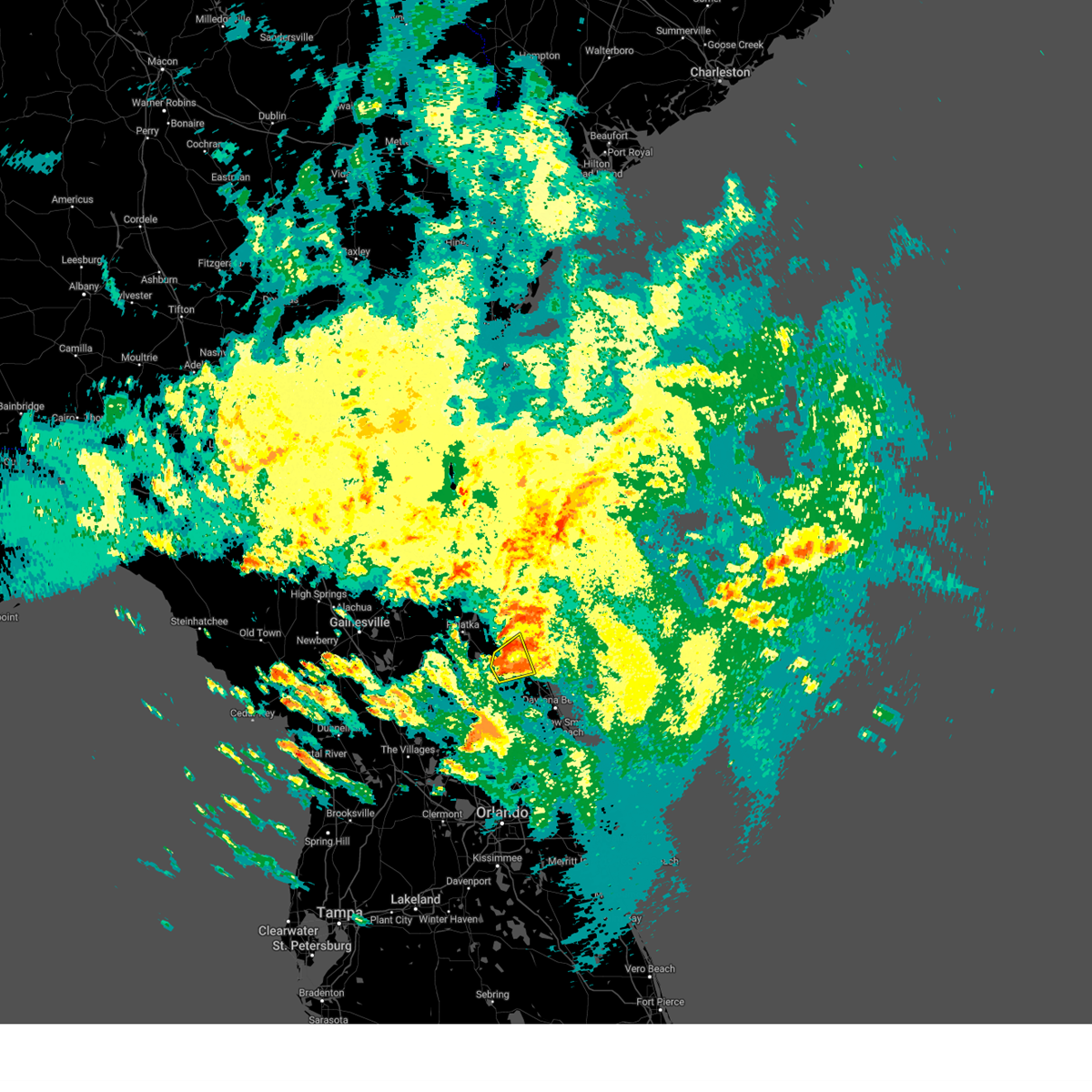
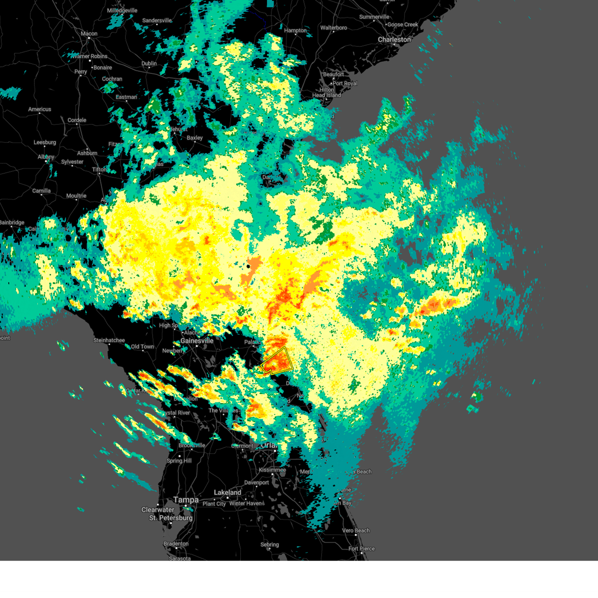
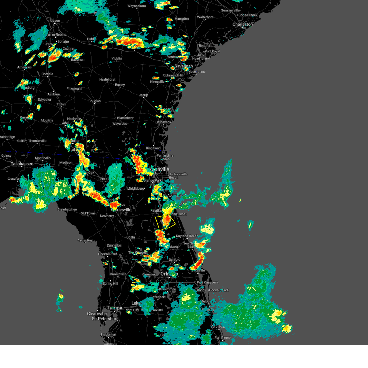
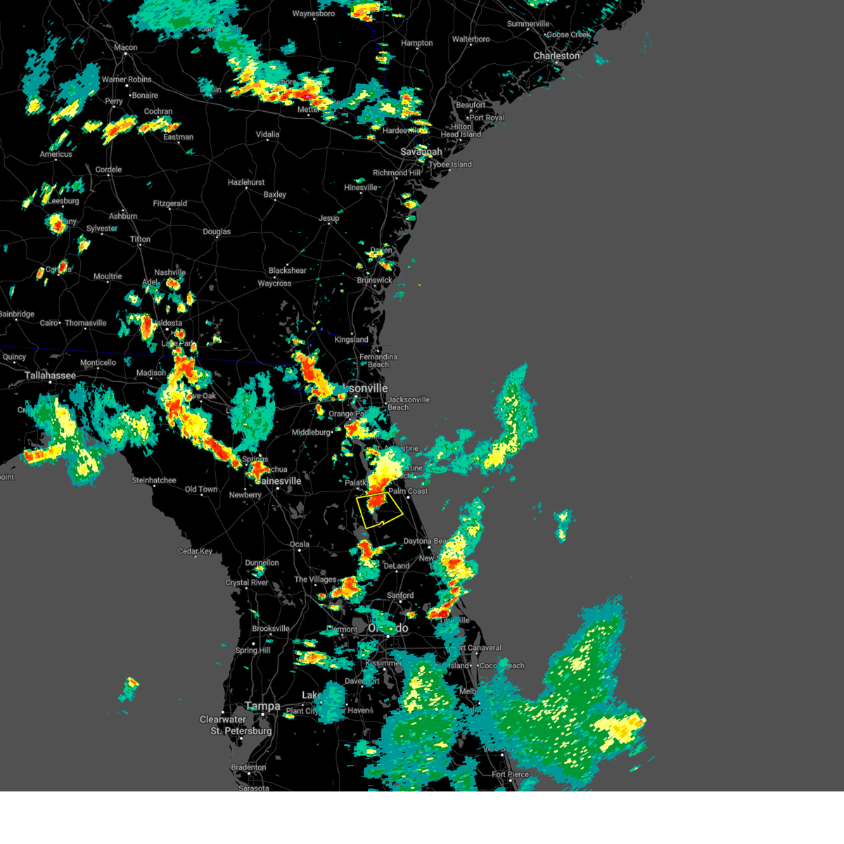
Hail Map for Palm Coast, FL
The Palm Coast, FL area has had 19 reports of on-the-ground hail by trained spotters, and has been under severe weather warnings 27 times during the past 12 months. Doppler radar has detected hail at or near Palm Coast, FL on 103 occasions, including 7 occasions during the past year.
| Name: | Palm Coast, FL |
| Where Located: | 61.3 miles SSE of Jacksonville, FL |
| Map: | Google Map for Palm Coast, FL |
| Population: | 75180 |
| Housing Units: | 35058 |
| More Info: | Search Google for Palm Coast, FL |
1
The Top Recent Hail Date for Palm Coast, FL is Friday, May 9, 2025 (17th out of 103)
Hail and Wind Damage Spotted near Palm Coast, FL
| Date / Time | Report Details |
|---|---|
| 5/28/2025 7:57 PM EDT |
 The storm which prompted the warning has weakened below severe limits, and no longer poses an immediate threat to life or property. therefore, the warning will be allowed to expire. however, gusty winds and heavy rain are still possible with this thunderstorm. to report severe weather, contact your nearest law enforcement agency. they will relay your report to the national weather service jacksonville. The storm which prompted the warning has weakened below severe limits, and no longer poses an immediate threat to life or property. therefore, the warning will be allowed to expire. however, gusty winds and heavy rain are still possible with this thunderstorm. to report severe weather, contact your nearest law enforcement agency. they will relay your report to the national weather service jacksonville.
|
| 5/28/2025 7:47 PM EDT |
 At 747 pm edt, a severe thunderstorm was located over palm coast, moving east at 10 mph (radar indicated). Hazards include 60 mph wind gusts and penny size hail. Expect damage to roofs, siding, and trees. Locations impacted include, palm coast, flagler beach, bunnell, beverly beach, and espanola. At 747 pm edt, a severe thunderstorm was located over palm coast, moving east at 10 mph (radar indicated). Hazards include 60 mph wind gusts and penny size hail. Expect damage to roofs, siding, and trees. Locations impacted include, palm coast, flagler beach, bunnell, beverly beach, and espanola.
|
| 5/28/2025 7:12 PM EDT |
 Svrjax the national weather service in jacksonville has issued a * severe thunderstorm warning for, central flagler county in northeastern florida, * until 800 pm edt. * at 712 pm edt, a severe thunderstorm was located near bunnell, moving east at 15 mph (radar indicated). Hazards include 60 mph wind gusts and penny size hail. expect damage to roofs, siding, and trees Svrjax the national weather service in jacksonville has issued a * severe thunderstorm warning for, central flagler county in northeastern florida, * until 800 pm edt. * at 712 pm edt, a severe thunderstorm was located near bunnell, moving east at 15 mph (radar indicated). Hazards include 60 mph wind gusts and penny size hail. expect damage to roofs, siding, and trees
|
| 5/28/2025 7:00 PM EDT |
 The storm which prompted the warning has weakened below severe limits, and no longer poses an immediate threat to life or property. therefore, the warning will be allowed to expire. however, gusty winds and heavy rain are still possible with this thunderstorm. The storm which prompted the warning has weakened below severe limits, and no longer poses an immediate threat to life or property. therefore, the warning will be allowed to expire. however, gusty winds and heavy rain are still possible with this thunderstorm.
|
| 5/28/2025 6:46 PM EDT |
 At 646 pm edt, a severe thunderstorm was located near crescent beach, or 11 miles east of hastings, moving east at 15 mph (radar indicated). Hazards include 60 mph wind gusts. Expect damage to roofs, siding, and trees. Locations impacted include, marineland, crescent beach, butler beach, saint augustine shores, dupont center, and elkton. At 646 pm edt, a severe thunderstorm was located near crescent beach, or 11 miles east of hastings, moving east at 15 mph (radar indicated). Hazards include 60 mph wind gusts. Expect damage to roofs, siding, and trees. Locations impacted include, marineland, crescent beach, butler beach, saint augustine shores, dupont center, and elkton.
|
| 5/28/2025 6:24 PM EDT |
 Svrjax the national weather service in jacksonville has issued a * severe thunderstorm warning for, northern flagler county in northeastern florida, southeastern st. johns county in northeastern florida, * until 700 pm edt. * at 624 pm edt, a severe thunderstorm was located near hastings, moving east at 15 mph (radar indicated). Hazards include 60 mph wind gusts. expect damage to roofs, siding, and trees Svrjax the national weather service in jacksonville has issued a * severe thunderstorm warning for, northern flagler county in northeastern florida, southeastern st. johns county in northeastern florida, * until 700 pm edt. * at 624 pm edt, a severe thunderstorm was located near hastings, moving east at 15 mph (radar indicated). Hazards include 60 mph wind gusts. expect damage to roofs, siding, and trees
|
| 5/9/2025 7:30 PM EDT | Local church in palm coast near palm coast parkway and us highway 1 reported some picnic tables blown over and a flagpole snapped. time is estimated based on radar imag in flagler county FL, 2.8 miles SE of Palm Coast, FL |
| 1/19/2025 8:15 AM EST |
 Svrjax the national weather service in jacksonville has issued a * severe thunderstorm warning for, southern flagler county in northeastern florida, southern marion county in northern florida, * until 845 am est. * at 814 am est, severe thunderstorms were located along a line extending from 9 miles east of marineland to 7 miles southwest of flagler beach to 7 miles south of lake george to homosassa springs, moving east at 50 mph (radar indicated). Hazards include 60 mph wind gusts and penny size hail. expect damage to roofs, siding, and trees Svrjax the national weather service in jacksonville has issued a * severe thunderstorm warning for, southern flagler county in northeastern florida, southern marion county in northern florida, * until 845 am est. * at 814 am est, severe thunderstorms were located along a line extending from 9 miles east of marineland to 7 miles southwest of flagler beach to 7 miles south of lake george to homosassa springs, moving east at 50 mph (radar indicated). Hazards include 60 mph wind gusts and penny size hail. expect damage to roofs, siding, and trees
|
| 1/19/2025 8:01 AM EST |
 At 801 am est, severe thunderstorms were located along a line extending from 7 miles west of saint augustine south to near butler beach to near palm coast to 7 miles southeast of crescent city to near silver springs shores, moving east at 65 mph (radar indicated). Hazards include 70 mph wind gusts and quarter size hail. Hail damage to vehicles is expected. expect considerable tree damage. wind damage is also likely to mobile homes, roofs, and outbuildings. Locations impacted include, palm coast, flagler beach, bunnell, hastings, juniper springs, saint augustine beach, marineland, weirsdale, the village of briar meadow, and ocklawaha. At 801 am est, severe thunderstorms were located along a line extending from 7 miles west of saint augustine south to near butler beach to near palm coast to 7 miles southeast of crescent city to near silver springs shores, moving east at 65 mph (radar indicated). Hazards include 70 mph wind gusts and quarter size hail. Hail damage to vehicles is expected. expect considerable tree damage. wind damage is also likely to mobile homes, roofs, and outbuildings. Locations impacted include, palm coast, flagler beach, bunnell, hastings, juniper springs, saint augustine beach, marineland, weirsdale, the village of briar meadow, and ocklawaha.
|
| 1/19/2025 7:48 AM EST |
 Svrjax the national weather service in jacksonville has issued a * severe thunderstorm warning for, flagler county in northeastern florida, southeastern st. johns county in northeastern florida, southeastern marion county in northern florida, eastern putnam county in northeastern florida, * until 815 am est. * at 748 am est, severe thunderstorms were located along a line extending from near bostwick to hastings to near andalusia to near lake george to 8 miles south of ocala airport, moving east at 70 mph (radar indicated). Hazards include 70 mph wind gusts and quarter size hail. Hail damage to vehicles is expected. expect considerable tree damage. Wind damage is also likely to mobile homes, roofs, and outbuildings. Svrjax the national weather service in jacksonville has issued a * severe thunderstorm warning for, flagler county in northeastern florida, southeastern st. johns county in northeastern florida, southeastern marion county in northern florida, eastern putnam county in northeastern florida, * until 815 am est. * at 748 am est, severe thunderstorms were located along a line extending from near bostwick to hastings to near andalusia to near lake george to 8 miles south of ocala airport, moving east at 70 mph (radar indicated). Hazards include 70 mph wind gusts and quarter size hail. Hail damage to vehicles is expected. expect considerable tree damage. Wind damage is also likely to mobile homes, roofs, and outbuildings.
|
| 1/19/2025 7:42 AM EST |
 At 742 am est, severe thunderstorms were located along a line extending from near palatka to fruitland to 10 miles southwest of ocala airport, moving east at 70 mph (radar indicated). Hazards include 70 mph wind gusts and quarter size hail. Hail damage to vehicles is expected. expect considerable tree damage. wind damage is also likely to mobile homes, roofs, and outbuildings. Locations impacted include, palatka, bunnell, crescent city, interlachen, pomona park, hastings, east palatka, salt springs, andalusia, and juniper springs. At 742 am est, severe thunderstorms were located along a line extending from near palatka to fruitland to 10 miles southwest of ocala airport, moving east at 70 mph (radar indicated). Hazards include 70 mph wind gusts and quarter size hail. Hail damage to vehicles is expected. expect considerable tree damage. wind damage is also likely to mobile homes, roofs, and outbuildings. Locations impacted include, palatka, bunnell, crescent city, interlachen, pomona park, hastings, east palatka, salt springs, andalusia, and juniper springs.
|
| 1/19/2025 7:32 AM EST |
 Svrjax the national weather service in jacksonville has issued a * severe thunderstorm warning for, western flagler county in northeastern florida, south central st. johns county in northeastern florida, eastern marion county in northern florida, putnam county in northeastern florida, * until 800 am est. * at 732 am est, severe thunderstorms were located along a line extending from near lake geneva to near fort mccoy to 8 miles southwest of rainbow lakes estates, moving east at 55 mph (radar indicated). Hazards include 70 mph wind gusts and quarter size hail. Hail damage to vehicles is expected. expect considerable tree damage. Wind damage is also likely to mobile homes, roofs, and outbuildings. Svrjax the national weather service in jacksonville has issued a * severe thunderstorm warning for, western flagler county in northeastern florida, south central st. johns county in northeastern florida, eastern marion county in northern florida, putnam county in northeastern florida, * until 800 am est. * at 732 am est, severe thunderstorms were located along a line extending from near lake geneva to near fort mccoy to 8 miles southwest of rainbow lakes estates, moving east at 55 mph (radar indicated). Hazards include 70 mph wind gusts and quarter size hail. Hail damage to vehicles is expected. expect considerable tree damage. Wind damage is also likely to mobile homes, roofs, and outbuildings.
|
| 1/19/2025 7:30 AM EST |
 the severe thunderstorm warning has been cancelled and is no longer in effect the severe thunderstorm warning has been cancelled and is no longer in effect
|
| 1/19/2025 7:25 AM EST |
 the severe thunderstorm warning has been cancelled and is no longer in effect the severe thunderstorm warning has been cancelled and is no longer in effect
|
| 1/19/2025 7:25 AM EST |
 At 724 am est, severe thunderstorms were located along a line extending from saint augustine beach to marineland to near palm coast to 6 miles northeast of andalusia, moving east at 55 mph (radar indicated). Hazards include 70 mph wind gusts and penny size hail. Expect considerable tree damage. damage is likely to mobile homes, roofs, and outbuildings. Locations impacted include, palm coast, saint augustine beach, marineland, crescent beach, butler beach, saint augustine shores, and dupont center. At 724 am est, severe thunderstorms were located along a line extending from saint augustine beach to marineland to near palm coast to 6 miles northeast of andalusia, moving east at 55 mph (radar indicated). Hazards include 70 mph wind gusts and penny size hail. Expect considerable tree damage. damage is likely to mobile homes, roofs, and outbuildings. Locations impacted include, palm coast, saint augustine beach, marineland, crescent beach, butler beach, saint augustine shores, and dupont center.
|
| 1/19/2025 7:12 AM EST |
 Svrjax the national weather service in jacksonville has issued a * severe thunderstorm warning for, northern flagler county in northeastern florida, southeastern st. johns county in northeastern florida, east central putnam county in northeastern florida, * until 745 am est. * at 711 am est, severe thunderstorms were located along a line extending from 6 miles northeast of federal point to near hastings to near pomona park to lake delancy, moving east at 60 mph (radar indicated). Hazards include 70 mph wind gusts and penny size hail. Expect considerable tree damage. Damage is likely to mobile homes, roofs, and outbuildings. Svrjax the national weather service in jacksonville has issued a * severe thunderstorm warning for, northern flagler county in northeastern florida, southeastern st. johns county in northeastern florida, east central putnam county in northeastern florida, * until 745 am est. * at 711 am est, severe thunderstorms were located along a line extending from 6 miles northeast of federal point to near hastings to near pomona park to lake delancy, moving east at 60 mph (radar indicated). Hazards include 70 mph wind gusts and penny size hail. Expect considerable tree damage. Damage is likely to mobile homes, roofs, and outbuildings.
|
| 1/19/2025 7:01 AM EST | At 701 am est, severe thunderstorms were located along a line extending from near bostwick to satsuma to near fort mccoy, moving east at 60 mph (radar indicated). Hazards include 60 mph wind gusts. Expect damage to roofs, siding, and trees. Locations impacted include, palatka, crescent city, pomona park, hastings, east palatka, andalusia, saint augustine beach, lake delancy, federal point, and orange springs. |
| 1/19/2025 6:51 AM EST |
 Svrjax the national weather service in jacksonville has issued a * severe thunderstorm warning for, northwestern flagler county in northeastern florida, southeastern st. johns county in northeastern florida, northeastern marion county in northern florida, putnam county in northeastern florida, * until 715 am est. * at 650 am est, severe thunderstorms were located along a line extending from near bardin to 6 miles south of hollister to near sparr, moving east at 55 mph (radar indicated). Hazards include 60 mph wind gusts. expect damage to roofs, siding, and trees Svrjax the national weather service in jacksonville has issued a * severe thunderstorm warning for, northwestern flagler county in northeastern florida, southeastern st. johns county in northeastern florida, northeastern marion county in northern florida, putnam county in northeastern florida, * until 715 am est. * at 650 am est, severe thunderstorms were located along a line extending from near bardin to 6 miles south of hollister to near sparr, moving east at 55 mph (radar indicated). Hazards include 60 mph wind gusts. expect damage to roofs, siding, and trees
|
| 9/30/2024 4:30 PM EDT | In grand haven in palm coast... a screen lanai was damaged from wind blown debris... with small twigs and branches down. possible small gustnado ahead of line of shower in flagler county FL, 3.1 miles WSW of Palm Coast, FL |
| 9/18/2024 5:55 PM EDT |
 The storms which prompted the warning have weakened below severe limits, and have exited the warned area. therefore, the warning will be allowed to expire. however, gusty winds of about 40 mph and heavy rain are still likely with these thunderstorms. The storms which prompted the warning have weakened below severe limits, and have exited the warned area. therefore, the warning will be allowed to expire. however, gusty winds of about 40 mph and heavy rain are still likely with these thunderstorms.
|
| 9/18/2024 5:40 PM EDT |
 At 540 pm edt, a severe thunderstorm was located just northwest of flagler beach, moving southeast at 15 mph (radar indicated). Hazards include 60 mph wind gusts. Expect damage to roofs, siding, and trees. Locations impacted include, palm coast, flagler beach, bunnell, and beverly beach. At 540 pm edt, a severe thunderstorm was located just northwest of flagler beach, moving southeast at 15 mph (radar indicated). Hazards include 60 mph wind gusts. Expect damage to roofs, siding, and trees. Locations impacted include, palm coast, flagler beach, bunnell, and beverly beach.
|
| 9/18/2024 5:25 PM EDT |
 Svrjax the national weather service in jacksonville has issued a * severe thunderstorm warning for, eastern flagler county in northeastern florida, * until 600 pm edt. * at 524 pm edt, a severe thunderstorm was located over palm coast, moving southeast at 15 mph (radar indicated). Hazards include 60 mph wind gusts. expect damage to roofs, siding, and trees Svrjax the national weather service in jacksonville has issued a * severe thunderstorm warning for, eastern flagler county in northeastern florida, * until 600 pm edt. * at 524 pm edt, a severe thunderstorm was located over palm coast, moving southeast at 15 mph (radar indicated). Hazards include 60 mph wind gusts. expect damage to roofs, siding, and trees
|
| 9/18/2024 5:20 PM EDT |
 At 519 pm edt, a severe thunderstorm was located near palm coast, moving southeast at 15 mph (radar indicated). Hazards include 60 mph wind gusts. Expect damage to roofs, siding, and trees. Locations impacted include, palm coast, flagler beach, and beverly beach. At 519 pm edt, a severe thunderstorm was located near palm coast, moving southeast at 15 mph (radar indicated). Hazards include 60 mph wind gusts. Expect damage to roofs, siding, and trees. Locations impacted include, palm coast, flagler beach, and beverly beach.
|
| 9/18/2024 5:20 PM EDT |
 the severe thunderstorm warning has been cancelled and is no longer in effect the severe thunderstorm warning has been cancelled and is no longer in effect
|
| 9/18/2024 5:04 PM EDT |
 At 503 pm edt, a severe thunderstorm was located near marineland, or 7 miles north of palm coast, moving southeast at 15 mph (radar indicated). Hazards include 60 mph wind gusts and small hail. Expect damage to roofs, siding, and trees. Locations impacted include, palm coast, flagler beach, marineland, crescent beach, and beverly beach. At 503 pm edt, a severe thunderstorm was located near marineland, or 7 miles north of palm coast, moving southeast at 15 mph (radar indicated). Hazards include 60 mph wind gusts and small hail. Expect damage to roofs, siding, and trees. Locations impacted include, palm coast, flagler beach, marineland, crescent beach, and beverly beach.
|
| 9/18/2024 4:46 PM EDT |
 Svrjax the national weather service in jacksonville has issued a * severe thunderstorm warning for, northeastern flagler county in northeastern florida, southeastern st. johns county in northeastern florida, * until 530 pm edt. * at 445 pm edt, a severe thunderstorm was located near marineland, or 10 miles north of palm coast, moving southeast at 15 mph (radar indicated). Hazards include 60 mph wind gusts. expect damage to roofs, siding, and trees Svrjax the national weather service in jacksonville has issued a * severe thunderstorm warning for, northeastern flagler county in northeastern florida, southeastern st. johns county in northeastern florida, * until 530 pm edt. * at 445 pm edt, a severe thunderstorm was located near marineland, or 10 miles north of palm coast, moving southeast at 15 mph (radar indicated). Hazards include 60 mph wind gusts. expect damage to roofs, siding, and trees
|
| 7/17/2024 5:12 PM EDT | The storm which prompted the warning has weakened below severe limits, and no longer poses an immediate threat to life or property. therefore, the warning will be allowed to expire. however, gusty winds and heavy rain are still expected with this thunderstorm. |
| 7/17/2024 4:49 PM EDT | At 448 pm edt, a severe thunderstorm was located near bunnell, moving east at 5 mph (radar indicated). Hazards include 60 mph wind gusts and penny size hail. Expect damage to roofs, siding, and trees. Locations impacted include, bunnell and espanola. |
| 7/17/2024 4:32 PM EDT | Svrjax the national weather service in jacksonville has issued a * severe thunderstorm warning for, western flagler county in northeastern florida, * until 515 pm edt. * at 432 pm edt, a severe thunderstorm was located near andalusia, moving northeast at 5 mph (radar indicated). Hazards include 60 mph wind gusts and penny size hail. expect damage to roofs, siding, and trees |
| 6/6/2024 5:29 PM EDT |
 Svrjax the national weather service in jacksonville has issued a * severe thunderstorm warning for, northwestern flagler county in northeastern florida, southeastern st. johns county in northeastern florida, northeastern putnam county in northeastern florida, * until 600 pm edt. * at 529 pm edt, a severe thunderstorm was located near hastings, moving east at 5 mph (radar indicated). Hazards include 60 mph wind gusts and penny size hail. expect damage to roofs, siding, and trees Svrjax the national weather service in jacksonville has issued a * severe thunderstorm warning for, northwestern flagler county in northeastern florida, southeastern st. johns county in northeastern florida, northeastern putnam county in northeastern florida, * until 600 pm edt. * at 529 pm edt, a severe thunderstorm was located near hastings, moving east at 5 mph (radar indicated). Hazards include 60 mph wind gusts and penny size hail. expect damage to roofs, siding, and trees
|
| 5/25/2024 9:11 PM EDT |
 At 910 pm edt, a severe thunderstorm was located 7 miles east of hastings, moving south at 30 mph (radar indicated). Hazards include 60 mph wind gusts and penny size hail. Expect damage to roofs, siding, and trees. Locations impacted include, palm coast, bunnell, and espanola. At 910 pm edt, a severe thunderstorm was located 7 miles east of hastings, moving south at 30 mph (radar indicated). Hazards include 60 mph wind gusts and penny size hail. Expect damage to roofs, siding, and trees. Locations impacted include, palm coast, bunnell, and espanola.
|
| 5/25/2024 8:59 PM EDT |
 Svrjax the national weather service in jacksonville has issued a * severe thunderstorm warning for, northern flagler county in northeastern florida, southeastern st. johns county in northeastern florida, * until 930 pm edt. * at 859 pm edt, a severe thunderstorm was located near hastings, moving south at 30 mph (radar indicated). Hazards include 60 mph wind gusts and penny size hail. expect damage to roofs, siding, and trees Svrjax the national weather service in jacksonville has issued a * severe thunderstorm warning for, northern flagler county in northeastern florida, southeastern st. johns county in northeastern florida, * until 930 pm edt. * at 859 pm edt, a severe thunderstorm was located near hastings, moving south at 30 mph (radar indicated). Hazards include 60 mph wind gusts and penny size hail. expect damage to roofs, siding, and trees
|
| 5/18/2024 4:43 PM EDT |
 At 443 pm edt, a severe thunderstorm was located 9 miles south of bunnell, moving northeast at 35 mph (radar indicated). Hazards include 60 mph wind gusts and quarter size hail. Hail damage to vehicles is expected. expect wind damage to roofs, siding, and trees. Locations impacted include, palm coast, flagler beach, bunnell, and beverly beach. At 443 pm edt, a severe thunderstorm was located 9 miles south of bunnell, moving northeast at 35 mph (radar indicated). Hazards include 60 mph wind gusts and quarter size hail. Hail damage to vehicles is expected. expect wind damage to roofs, siding, and trees. Locations impacted include, palm coast, flagler beach, bunnell, and beverly beach.
|
| 5/18/2024 4:28 PM EDT |
 Svrjax the national weather service in jacksonville has issued a * severe thunderstorm warning for, eastern flagler county in northeastern florida, * until 500 pm edt. * at 428 pm edt, a severe thunderstorm was located near barberville, moving northeast at 40 mph (radar indicated). Hazards include 60 mph wind gusts and quarter size hail. Hail damage to vehicles is expected. Expect wind damage to roofs, siding, and trees. Svrjax the national weather service in jacksonville has issued a * severe thunderstorm warning for, eastern flagler county in northeastern florida, * until 500 pm edt. * at 428 pm edt, a severe thunderstorm was located near barberville, moving northeast at 40 mph (radar indicated). Hazards include 60 mph wind gusts and quarter size hail. Hail damage to vehicles is expected. Expect wind damage to roofs, siding, and trees.
|
| 5/18/2024 4:10 PM EDT |
 Svrjax the national weather service in jacksonville has issued a * severe thunderstorm warning for, southeastern flagler county in northeastern florida, * until 445 pm edt. * at 410 pm edt, a severe thunderstorm was located 7 miles west of ormond-by-the-sea, moving northeast at 25 mph (radar indicated). Hazards include 60 mph wind gusts. possible tornado. expect damage to roofs, siding, and trees Svrjax the national weather service in jacksonville has issued a * severe thunderstorm warning for, southeastern flagler county in northeastern florida, * until 445 pm edt. * at 410 pm edt, a severe thunderstorm was located 7 miles west of ormond-by-the-sea, moving northeast at 25 mph (radar indicated). Hazards include 60 mph wind gusts. possible tornado. expect damage to roofs, siding, and trees
|
| 5/15/2024 4:36 AM EDT |
 The storm which prompted the warning has moved out of the area. therefore, the warning will be allowed to expire. however, small hail, gusty winds and heavy rain are still possible with this thunderstorm. a tornado watch remains in effect until 1100 am edt for northeastern florida. The storm which prompted the warning has moved out of the area. therefore, the warning will be allowed to expire. however, small hail, gusty winds and heavy rain are still possible with this thunderstorm. a tornado watch remains in effect until 1100 am edt for northeastern florida.
|
| 5/15/2024 4:12 AM EDT |
 Torjax the national weather service in jacksonville has issued a * tornado warning for, southeastern flagler county in northeastern florida, * until 445 am edt. * at 412 am edt, a severe thunderstorm capable of producing a tornado was located near barberville, moving east at 30 mph (radar indicated rotation). Hazards include tornado and quarter size hail. Flying debris will be dangerous to those caught without shelter. mobile homes will be damaged or destroyed. damage to roofs, windows, and vehicles will occur. tree damage is likely. This tornadic thunderstorm will remain over mainly rural areas of southeastern flagler county. Torjax the national weather service in jacksonville has issued a * tornado warning for, southeastern flagler county in northeastern florida, * until 445 am edt. * at 412 am edt, a severe thunderstorm capable of producing a tornado was located near barberville, moving east at 30 mph (radar indicated rotation). Hazards include tornado and quarter size hail. Flying debris will be dangerous to those caught without shelter. mobile homes will be damaged or destroyed. damage to roofs, windows, and vehicles will occur. tree damage is likely. This tornadic thunderstorm will remain over mainly rural areas of southeastern flagler county.
|
| 5/15/2024 4:03 AM EDT |
 At 403 am edt, a severe thunderstorm was located near bunnell, moving east at 30 mph (radar indicated). Hazards include 60 mph wind gusts and nickel size hail. Expect damage to roofs, siding, and trees. Locations impacted include, palm coast, flagler beach, bunnell, and beverly beach. At 403 am edt, a severe thunderstorm was located near bunnell, moving east at 30 mph (radar indicated). Hazards include 60 mph wind gusts and nickel size hail. Expect damage to roofs, siding, and trees. Locations impacted include, palm coast, flagler beach, bunnell, and beverly beach.
|
| 5/15/2024 3:32 AM EDT |
 Svrjax the national weather service in jacksonville has issued a * severe thunderstorm warning for, flagler county in northeastern florida, * until 430 am edt. * at 332 am edt, a severe thunderstorm was located near crescent city, moving east at 30 mph (radar indicated). Hazards include 60 mph wind gusts and quarter size hail. Hail damage to vehicles is expected. Expect wind damage to roofs, siding, and trees. Svrjax the national weather service in jacksonville has issued a * severe thunderstorm warning for, flagler county in northeastern florida, * until 430 am edt. * at 332 am edt, a severe thunderstorm was located near crescent city, moving east at 30 mph (radar indicated). Hazards include 60 mph wind gusts and quarter size hail. Hail damage to vehicles is expected. Expect wind damage to roofs, siding, and trees.
|
| 5/15/2024 3:23 AM EDT |
 The storm which prompted the warning has weakened below severe limits, and has exited the warned area. therefore, the warning will be allowed to expire. however, small hail, gusty winds and heavy rain are still possible with this thunderstorm. a tornado watch remains in effect until 1100 am edt for northeastern florida. The storm which prompted the warning has weakened below severe limits, and has exited the warned area. therefore, the warning will be allowed to expire. however, small hail, gusty winds and heavy rain are still possible with this thunderstorm. a tornado watch remains in effect until 1100 am edt for northeastern florida.
|
| 5/15/2024 3:14 AM EDT |
 At 314 am edt, a severe thunderstorm capable of producing a tornado was located over bunnell, moving east at 35 mph (radar indicated rotation). Hazards include tornado and quarter size hail. Flying debris will be dangerous to those caught without shelter. mobile homes will be damaged or destroyed. damage to roofs, windows, and vehicles will occur. tree damage is likely. this dangerous storm will be near, palm coast and flagler beach around 320 am edt. Other locations impacted by this tornadic thunderstorm include beverly beach and espanola. At 314 am edt, a severe thunderstorm capable of producing a tornado was located over bunnell, moving east at 35 mph (radar indicated rotation). Hazards include tornado and quarter size hail. Flying debris will be dangerous to those caught without shelter. mobile homes will be damaged or destroyed. damage to roofs, windows, and vehicles will occur. tree damage is likely. this dangerous storm will be near, palm coast and flagler beach around 320 am edt. Other locations impacted by this tornadic thunderstorm include beverly beach and espanola.
|
| 5/15/2024 3:07 AM EDT |
 At 307 am edt, a severe thunderstorm capable of producing a tornado was located near bunnell, moving east at 40 mph (radar indicated rotation). Hazards include tornado and quarter size hail. Flying debris will be dangerous to those caught without shelter. mobile homes will be damaged or destroyed. damage to roofs, windows, and vehicles will occur. tree damage is likely. this dangerous storm will be near, palm coast and bunnell around 310 am edt. flagler beach around 320 am edt. Other locations impacted by this tornadic thunderstorm include beverly beach and espanola. At 307 am edt, a severe thunderstorm capable of producing a tornado was located near bunnell, moving east at 40 mph (radar indicated rotation). Hazards include tornado and quarter size hail. Flying debris will be dangerous to those caught without shelter. mobile homes will be damaged or destroyed. damage to roofs, windows, and vehicles will occur. tree damage is likely. this dangerous storm will be near, palm coast and bunnell around 310 am edt. flagler beach around 320 am edt. Other locations impacted by this tornadic thunderstorm include beverly beach and espanola.
|
| 5/15/2024 2:59 AM EDT |
 At 259 am edt, a severe thunderstorm capable of producing a tornado was located near andalusia, moving east at 40 mph (radar indicated rotation). Hazards include tornado and quarter size hail. Flying debris will be dangerous to those caught without shelter. mobile homes will be damaged or destroyed. damage to roofs, windows, and vehicles will occur. tree damage is likely. this dangerous storm will be near, bunnell around 305 am edt. palm coast around 310 am edt. flagler beach around 320 am edt. Other locations impacted by this tornadic thunderstorm include beverly beach and espanola. At 259 am edt, a severe thunderstorm capable of producing a tornado was located near andalusia, moving east at 40 mph (radar indicated rotation). Hazards include tornado and quarter size hail. Flying debris will be dangerous to those caught without shelter. mobile homes will be damaged or destroyed. damage to roofs, windows, and vehicles will occur. tree damage is likely. this dangerous storm will be near, bunnell around 305 am edt. palm coast around 310 am edt. flagler beach around 320 am edt. Other locations impacted by this tornadic thunderstorm include beverly beach and espanola.
|
| 5/15/2024 2:41 AM EDT |
 Torjax the national weather service in jacksonville has issued a * tornado warning for, flagler county in northeastern florida, * until 330 am edt. * at 240 am edt, a severe thunderstorm capable of producing a tornado was located near fruitland, or near crescent city, moving east at 40 mph (radar indicated rotation). Hazards include tornado. Flying debris will be dangerous to those caught without shelter. mobile homes will be damaged or destroyed. damage to roofs, windows, and vehicles will occur. tree damage is likely. this dangerous storm will be near, bunnell around 305 am edt. palm coast around 310 am edt. flagler beach around 320 am edt. Other locations impacted by this tornadic thunderstorm include beverly beach and espanola. Torjax the national weather service in jacksonville has issued a * tornado warning for, flagler county in northeastern florida, * until 330 am edt. * at 240 am edt, a severe thunderstorm capable of producing a tornado was located near fruitland, or near crescent city, moving east at 40 mph (radar indicated rotation). Hazards include tornado. Flying debris will be dangerous to those caught without shelter. mobile homes will be damaged or destroyed. damage to roofs, windows, and vehicles will occur. tree damage is likely. this dangerous storm will be near, bunnell around 305 am edt. palm coast around 310 am edt. flagler beach around 320 am edt. Other locations impacted by this tornadic thunderstorm include beverly beach and espanola.
|
| 4/11/2024 1:58 PM EDT |
 The storm which prompted the warning has weakened below severe limits, and no longer poses an immediate threat to life or property. therefore, the warning will be allowed to expire. however, gusty winds and heavy rain are still possible with this thunderstorm. a tornado watch remains in effect until 300 pm edt for northeastern florida. to report severe weather, contact your nearest law enforcement agency. they will relay your report to the national weather service jacksonville. The storm which prompted the warning has weakened below severe limits, and no longer poses an immediate threat to life or property. therefore, the warning will be allowed to expire. however, gusty winds and heavy rain are still possible with this thunderstorm. a tornado watch remains in effect until 300 pm edt for northeastern florida. to report severe weather, contact your nearest law enforcement agency. they will relay your report to the national weather service jacksonville.
|
| 4/11/2024 1:52 PM EDT |
 At 152 pm edt, a severe thunderstorm was located 11 miles northeast of pierson, moving northeast at 55 mph (radar indicated). Hazards include 60 mph wind gusts. Expect damage to roofs, siding, and trees. Locations impacted include, flagler beach. At 152 pm edt, a severe thunderstorm was located 11 miles northeast of pierson, moving northeast at 55 mph (radar indicated). Hazards include 60 mph wind gusts. Expect damage to roofs, siding, and trees. Locations impacted include, flagler beach.
|
| 4/11/2024 1:41 PM EDT |
 Svrjax the national weather service in jacksonville has issued a * severe thunderstorm warning for, southeastern flagler county in northeastern florida, * until 200 pm edt. * at 141 pm edt, a severe thunderstorm was located over pierson, moving northeast at 50 mph (radar indicated). Hazards include 60 mph wind gusts. possible tornado. expect damage to roofs, siding, and trees Svrjax the national weather service in jacksonville has issued a * severe thunderstorm warning for, southeastern flagler county in northeastern florida, * until 200 pm edt. * at 141 pm edt, a severe thunderstorm was located over pierson, moving northeast at 50 mph (radar indicated). Hazards include 60 mph wind gusts. possible tornado. expect damage to roofs, siding, and trees
|
| 4/11/2024 1:11 PM EDT |
 The storm which prompted the warning has weakened below severe limits, and no longer poses an immediate threat to life or property. therefore, the warning will be allowed to expire. however, heavy rain is still possible with this thunderstorm. a tornado watch remains in effect until 300 pm edt for northeastern florida. The storm which prompted the warning has weakened below severe limits, and no longer poses an immediate threat to life or property. therefore, the warning will be allowed to expire. however, heavy rain is still possible with this thunderstorm. a tornado watch remains in effect until 300 pm edt for northeastern florida.
|
| 4/11/2024 1:06 PM EDT |
 The tornado threat has diminished and the tornado warning has been cancelled. however, large hail and damaging winds remain likely and a severe thunderstorm warning remains in effect for the area. a tornado watch remains in effect until 300 pm edt for northeastern florida. remember, a severe thunderstorm warning still remains in effect for central and eastern portions of flagler county. The tornado threat has diminished and the tornado warning has been cancelled. however, large hail and damaging winds remain likely and a severe thunderstorm warning remains in effect for the area. a tornado watch remains in effect until 300 pm edt for northeastern florida. remember, a severe thunderstorm warning still remains in effect for central and eastern portions of flagler county.
|
| 4/11/2024 1:05 PM EDT | Delayed report. emergency management reported two trees down. one on freemont turn and another on frontier drive. time estimated by rada in flagler county FL, 3.8 miles S of Palm Coast, FL |
| 4/11/2024 12:59 PM EDT |
 Svrjax the national weather service in jacksonville has issued a * severe thunderstorm warning for, central flagler county in northeastern florida, * until 115 pm edt. * at 1259 pm edt, a severe thunderstorm was located near bunnell, moving northeast at 60 mph (radar indicated). Hazards include 70 mph wind gusts. possible tornado. Expect considerable tree damage. Damage is likely to mobile homes, roofs, and outbuildings. Svrjax the national weather service in jacksonville has issued a * severe thunderstorm warning for, central flagler county in northeastern florida, * until 115 pm edt. * at 1259 pm edt, a severe thunderstorm was located near bunnell, moving northeast at 60 mph (radar indicated). Hazards include 70 mph wind gusts. possible tornado. Expect considerable tree damage. Damage is likely to mobile homes, roofs, and outbuildings.
|
| 4/11/2024 12:55 PM EDT |
 the tornado warning has been cancelled and is no longer in effect the tornado warning has been cancelled and is no longer in effect
|
| 4/11/2024 12:55 PM EDT |
 At 1255 pm edt, a severe thunderstorm capable of producing a tornado was located 7 miles southeast of andalusia, moving northeast at 60 mph (radar indicated rotation). Hazards include tornado. Flying debris will be dangerous to those caught without shelter. mobile homes will be damaged or destroyed. damage to roofs, windows, and vehicles will occur. tree damage is likely. this dangerous storm will be near, palm coast and bunnell around 100 pm edt. Other locations impacted by this tornadic thunderstorm include espanola. At 1255 pm edt, a severe thunderstorm capable of producing a tornado was located 7 miles southeast of andalusia, moving northeast at 60 mph (radar indicated rotation). Hazards include tornado. Flying debris will be dangerous to those caught without shelter. mobile homes will be damaged or destroyed. damage to roofs, windows, and vehicles will occur. tree damage is likely. this dangerous storm will be near, palm coast and bunnell around 100 pm edt. Other locations impacted by this tornadic thunderstorm include espanola.
|
| 4/11/2024 12:47 PM EDT |
 At 1247 pm edt, a severe thunderstorm capable of producing a tornado was located near crescent city, moving northeast at 55 mph (radar indicated rotation). Hazards include tornado. Flying debris will be dangerous to those caught without shelter. mobile homes will be damaged or destroyed. damage to roofs, windows, and vehicles will occur. tree damage is likely. this dangerous storm will be near, palm coast and bunnell around 100 pm edt. Other locations impacted by this tornadic thunderstorm include espanola. At 1247 pm edt, a severe thunderstorm capable of producing a tornado was located near crescent city, moving northeast at 55 mph (radar indicated rotation). Hazards include tornado. Flying debris will be dangerous to those caught without shelter. mobile homes will be damaged or destroyed. damage to roofs, windows, and vehicles will occur. tree damage is likely. this dangerous storm will be near, palm coast and bunnell around 100 pm edt. Other locations impacted by this tornadic thunderstorm include espanola.
|
| 4/11/2024 12:40 PM EDT |
 Torjax the national weather service in jacksonville has issued a * tornado warning for, southwestern flagler county in northeastern florida, southeastern putnam county in northeastern florida, * until 115 pm edt. * at 1239 pm edt, a severe thunderstorm capable of producing a tornado was located over lake george, or 7 miles northwest of pierson, moving northeast at 55 mph (radar indicated rotation). Hazards include tornado. Flying debris will be dangerous to those caught without shelter. mobile homes will be damaged or destroyed. damage to roofs, windows, and vehicles will occur. tree damage is likely. this dangerous storm will be near, bunnell around 100 pm edt. Other locations impacted by this tornadic thunderstorm include espanola. Torjax the national weather service in jacksonville has issued a * tornado warning for, southwestern flagler county in northeastern florida, southeastern putnam county in northeastern florida, * until 115 pm edt. * at 1239 pm edt, a severe thunderstorm capable of producing a tornado was located over lake george, or 7 miles northwest of pierson, moving northeast at 55 mph (radar indicated rotation). Hazards include tornado. Flying debris will be dangerous to those caught without shelter. mobile homes will be damaged or destroyed. damage to roofs, windows, and vehicles will occur. tree damage is likely. this dangerous storm will be near, bunnell around 100 pm edt. Other locations impacted by this tornadic thunderstorm include espanola.
|
| 4/11/2024 12:31 PM EDT |
 At 1230 pm edt, a severe thunderstorm was located near lynne, moving northeast at 55 mph (radar indicated). Hazards include 70 mph wind gusts. possible tornado heafing towards lake george. Expect considerable tree damage. damage is likely to mobile homes, roofs, and outbuildings. Locations impacted include, bunnell, crescent city, pomona park, salt springs, east palatka, andalusia, juniper springs, lake delancy, fruitland, and san mateo. At 1230 pm edt, a severe thunderstorm was located near lynne, moving northeast at 55 mph (radar indicated). Hazards include 70 mph wind gusts. possible tornado heafing towards lake george. Expect considerable tree damage. damage is likely to mobile homes, roofs, and outbuildings. Locations impacted include, bunnell, crescent city, pomona park, salt springs, east palatka, andalusia, juniper springs, lake delancy, fruitland, and san mateo.
|
| 4/11/2024 12:18 PM EDT |
 Svrjax the national weather service in jacksonville has issued a * severe thunderstorm warning for, southern flagler county in northeastern florida, northeastern marion county in northern florida, southeastern putnam county in northeastern florida, * until 1245 pm edt. * at 1217 pm edt, a severe thunderstorm was located near salt springs, moving northeast at 50 mph (radar indicated). Hazards include 60 mph wind gusts. expect damage to roofs, siding, and trees Svrjax the national weather service in jacksonville has issued a * severe thunderstorm warning for, southern flagler county in northeastern florida, northeastern marion county in northern florida, southeastern putnam county in northeastern florida, * until 1245 pm edt. * at 1217 pm edt, a severe thunderstorm was located near salt springs, moving northeast at 50 mph (radar indicated). Hazards include 60 mph wind gusts. expect damage to roofs, siding, and trees
|
| 2/4/2024 6:56 PM EST |
 At 655 pm est, a severe thunderstorm was located near palm coast, moving northeast at 40 mph (radar indicated). Hazards include 60 mph wind gusts and quarter size hail. Hail damage to vehicles is expected. expect wind damage to roofs, siding, and trees. locations impacted include, palm coast, flagler beach, bunnell, and beverly beach. hail threat, observed max hail size, 1. 00 in wind threat, radar indicated max wind gust, 60 mph. At 655 pm est, a severe thunderstorm was located near palm coast, moving northeast at 40 mph (radar indicated). Hazards include 60 mph wind gusts and quarter size hail. Hail damage to vehicles is expected. expect wind damage to roofs, siding, and trees. locations impacted include, palm coast, flagler beach, bunnell, and beverly beach. hail threat, observed max hail size, 1. 00 in wind threat, radar indicated max wind gust, 60 mph.
|
| 2/4/2024 6:50 PM EST | Quarter sized hail reported 2.5 miles SSW of Palm Coast, FL, quarter sized hail reported to the north of palm coast parkway ne in palm coast... fl. |
| 2/4/2024 6:44 PM EST |
 At 644 pm est, a severe thunderstorm was located near bunnell, moving northeast at 35 mph (radar indicated). Hazards include 60 mph wind gusts and quarter size hail. Hail damage to vehicles is expected. Expect wind damage to roofs, siding, and trees. At 644 pm est, a severe thunderstorm was located near bunnell, moving northeast at 35 mph (radar indicated). Hazards include 60 mph wind gusts and quarter size hail. Hail damage to vehicles is expected. Expect wind damage to roofs, siding, and trees.
|
| 2/4/2024 6:31 PM EST |
 At 631 pm est, a severe thunderstorm was located near bunnell, moving northeast at 40 mph (radar indicated). Hazards include 60 mph wind gusts and half dollar size hail. Hail damage to vehicles is expected. expect wind damage to roofs, siding, and trees. locations impacted include, palm coast, flagler beach, bunnell, beverly beach, and espanola. hail threat, radar indicated max hail size, 1. 25 in wind threat, radar indicated max wind gust, 60 mph. At 631 pm est, a severe thunderstorm was located near bunnell, moving northeast at 40 mph (radar indicated). Hazards include 60 mph wind gusts and half dollar size hail. Hail damage to vehicles is expected. expect wind damage to roofs, siding, and trees. locations impacted include, palm coast, flagler beach, bunnell, beverly beach, and espanola. hail threat, radar indicated max hail size, 1. 25 in wind threat, radar indicated max wind gust, 60 mph.
|
| 2/4/2024 6:11 PM EST |
 At 610 pm est, a severe thunderstorm was located near lake george, or near pierson, moving northeast at 45 mph (radar indicated). Hazards include 60 mph wind gusts and half dollar size hail. Hail damage to vehicles is expected. Expect wind damage to roofs, siding, and trees. At 610 pm est, a severe thunderstorm was located near lake george, or near pierson, moving northeast at 45 mph (radar indicated). Hazards include 60 mph wind gusts and half dollar size hail. Hail damage to vehicles is expected. Expect wind damage to roofs, siding, and trees.
|
| 1/9/2024 5:28 PM EST |
 At 528 pm est, a severe thunderstorm was located 10 miles northeast of barberville, moving northeast at 65 mph (radar indicated). Hazards include 60 mph wind gusts. expect damage to roofs, siding, and trees At 528 pm est, a severe thunderstorm was located 10 miles northeast of barberville, moving northeast at 65 mph (radar indicated). Hazards include 60 mph wind gusts. expect damage to roofs, siding, and trees
|
| 1/9/2024 5:28 PM EST |
 The tornado warning for flagler county will expire at 530 pm est, the tornado threat has diminished and the tornado warning has been cancelled. however, damaging winds remain likely and a severe thunderstorm warning remains in effect for the area. however, gusty winds are still possible with this thunderstorm. a tornado watch remains in effect until 600 pm est for northeastern florida. The tornado warning for flagler county will expire at 530 pm est, the tornado threat has diminished and the tornado warning has been cancelled. however, damaging winds remain likely and a severe thunderstorm warning remains in effect for the area. however, gusty winds are still possible with this thunderstorm. a tornado watch remains in effect until 600 pm est for northeastern florida.
|
| 1/9/2024 5:05 PM EST |
 A tornado warning remains in effect until 530 pm est for flagler county. at 504 pm est, a severe thunderstorm capable of producing a tornado was located 7 miles north of pierson, moving northeast at 55 mph. hazard. tornado. source. Radar indicated rotation. A tornado warning remains in effect until 530 pm est for flagler county. at 504 pm est, a severe thunderstorm capable of producing a tornado was located 7 miles north of pierson, moving northeast at 55 mph. hazard. tornado. source. Radar indicated rotation.
|
| 1/9/2024 5:02 PM EST |
 A severe thunderstorm warning remains in effect until 515 pm est for flagler. southeastern st. johns and southeastern putnam counties. At 501 pm est, severe thunderstorms were located along a line extending from near marineland to 6 miles northeast of eustis, moving east at 60 mph. A severe thunderstorm warning remains in effect until 515 pm est for flagler. southeastern st. johns and southeastern putnam counties. At 501 pm est, severe thunderstorms were located along a line extending from near marineland to 6 miles northeast of eustis, moving east at 60 mph.
|
| 1/9/2024 4:57 PM EST |
 At 457 pm est, a severe thunderstorm capable of producing a tornado was located near lake george, or near pierson, moving northeast at 55 mph (radar indicated rotation). Hazards include tornado. Flying debris will be dangerous to those caught without shelter. mobile homes will be damaged or destroyed. damage to roofs, windows, and vehicles will occur. tree damage is likely. this dangerous storm will be near, palm coast and bunnell around 515 pm est. flagler beach around 525 pm est. Other locations impacted by this tornadic thunderstorm include beverly beach and espanola. At 457 pm est, a severe thunderstorm capable of producing a tornado was located near lake george, or near pierson, moving northeast at 55 mph (radar indicated rotation). Hazards include tornado. Flying debris will be dangerous to those caught without shelter. mobile homes will be damaged or destroyed. damage to roofs, windows, and vehicles will occur. tree damage is likely. this dangerous storm will be near, palm coast and bunnell around 515 pm est. flagler beach around 525 pm est. Other locations impacted by this tornadic thunderstorm include beverly beach and espanola.
|
| 1/9/2024 4:42 PM EST |
 At 442 pm est, severe thunderstorms were located along a line extending from near hastings to lady lake, moving east at 60 mph (radar indicated). Hazards include 60 mph wind gusts. expect damage to roofs, siding, and trees At 442 pm est, severe thunderstorms were located along a line extending from near hastings to lady lake, moving east at 60 mph (radar indicated). Hazards include 60 mph wind gusts. expect damage to roofs, siding, and trees
|
| 1/9/2024 4:40 PM EST |
 The severe thunderstorm warning for western flagler, southeastern st. johns, eastern marion and eastern putnam counties will expire at 445 pm est, the storms that prompted this severe thunderstorm warning continue to impact putnam, marion, st johns and flagler counties. a new severe thunderstorm warning will reissued for these threatened areas. a tornado watch remains in effect until 600 pm est for northern and northeastern florida. The severe thunderstorm warning for western flagler, southeastern st. johns, eastern marion and eastern putnam counties will expire at 445 pm est, the storms that prompted this severe thunderstorm warning continue to impact putnam, marion, st johns and flagler counties. a new severe thunderstorm warning will reissued for these threatened areas. a tornado watch remains in effect until 600 pm est for northern and northeastern florida.
|
| 1/9/2024 4:30 PM EST |
 A severe thunderstorm warning remains in effect until 445 pm est for western flagler. southeastern st. johns. eastern marion and eastern putnam counties. at 430 pm est, severe thunderstorms were located along a line extending from near hastings to lady lake, moving east at 45 mph. hazard. 60 mph wind gusts. A severe thunderstorm warning remains in effect until 445 pm est for western flagler. southeastern st. johns. eastern marion and eastern putnam counties. at 430 pm est, severe thunderstorms were located along a line extending from near hastings to lady lake, moving east at 45 mph. hazard. 60 mph wind gusts.
|
| 1/9/2024 4:01 PM EST |
 At 401 pm est, severe thunderstorms were located along a line extending from near bardin to 9 miles northeast of inverness highlands north, moving east at 45 mph (radar indicated). Hazards include 60 mph wind gusts. expect damage to roofs, siding, and trees At 401 pm est, severe thunderstorms were located along a line extending from near bardin to 9 miles northeast of inverness highlands north, moving east at 45 mph (radar indicated). Hazards include 60 mph wind gusts. expect damage to roofs, siding, and trees
|
| 10/12/2023 8:10 AM EDT |
 At 810 am edt, a severe thunderstorm capable of producing a tornado was located 9 miles southeast of marineland, or 9 miles north of flagler beach, moving northeast at 55 mph (radar indicated rotation). Hazards include tornado. Flying debris will be dangerous to those caught without shelter. mobile homes will be damaged or destroyed. damage to roofs, windows, and vehicles will occur. tree damage is likely. This tornadic thunderstorm will remain over mainly rural areas of northeastern flagler county, including the following locations, beverly beach. At 810 am edt, a severe thunderstorm capable of producing a tornado was located 9 miles southeast of marineland, or 9 miles north of flagler beach, moving northeast at 55 mph (radar indicated rotation). Hazards include tornado. Flying debris will be dangerous to those caught without shelter. mobile homes will be damaged or destroyed. damage to roofs, windows, and vehicles will occur. tree damage is likely. This tornadic thunderstorm will remain over mainly rural areas of northeastern flagler county, including the following locations, beverly beach.
|
| 10/12/2023 7:55 AM EDT |
 At 755 am edt, a severe thunderstorm capable of producing a tornado was located over bunnell, moving northeast at 55 mph (radar indicated rotation). Hazards include tornado. Flying debris will be dangerous to those caught without shelter. mobile homes will be damaged or destroyed. damage to roofs, windows, and vehicles will occur. tree damage is likely. this dangerous storm will be near, palm coast and bunnell around 800 am edt. Other locations impacted by this tornadic thunderstorm include espanola and beverly beach. At 755 am edt, a severe thunderstorm capable of producing a tornado was located over bunnell, moving northeast at 55 mph (radar indicated rotation). Hazards include tornado. Flying debris will be dangerous to those caught without shelter. mobile homes will be damaged or destroyed. damage to roofs, windows, and vehicles will occur. tree damage is likely. this dangerous storm will be near, palm coast and bunnell around 800 am edt. Other locations impacted by this tornadic thunderstorm include espanola and beverly beach.
|
| 10/12/2023 7:46 AM EDT |
 At 746 am edt, thunderstorm capable of producing a tornado was located near andalusia, moving northeast at 55 mph (radar indicated rotation). Hazards include tornado. Flying debris will be dangerous to those caught without shelter. mobile homes will be damaged or destroyed. damage to roofs, windows, and vehicles will occur. tree damage is likely. Locations impacted include, bunnell, andalusia, and espanola. At 746 am edt, thunderstorm capable of producing a tornado was located near andalusia, moving northeast at 55 mph (radar indicated rotation). Hazards include tornado. Flying debris will be dangerous to those caught without shelter. mobile homes will be damaged or destroyed. damage to roofs, windows, and vehicles will occur. tree damage is likely. Locations impacted include, bunnell, andalusia, and espanola.
|
| 10/12/2023 7:36 AM EDT |
 At 736 am edt, a thunderstorm capable of producing a tornado was located over andalusia, moving northeast at 45 mph (radar indicated rotation). Hazards include tornado. Flying debris will be dangerous to those caught without shelter. mobile homes will be damaged or destroyed. damage to roofs, windows, and vehicles will occur. tree damage is likely. This tornadic thunderstorm will remain over mainly rural areas of northwestern flagler and southeastern putnam counties, including the following locations, espanola. At 736 am edt, a thunderstorm capable of producing a tornado was located over andalusia, moving northeast at 45 mph (radar indicated rotation). Hazards include tornado. Flying debris will be dangerous to those caught without shelter. mobile homes will be damaged or destroyed. damage to roofs, windows, and vehicles will occur. tree damage is likely. This tornadic thunderstorm will remain over mainly rural areas of northwestern flagler and southeastern putnam counties, including the following locations, espanola.
|
| 10/12/2023 4:55 AM EDT | Florida power and light reported utility pole damage due to strong winds along the 100 block of barrington driv in flagler county FL, 3.9 miles SSE of Palm Coast, FL |
| 10/12/2023 4:55 AM EDT |
 The severe thunderstorm warning for northeastern flagler county will expire at 500 am edt, the storm which prompted the warning has moved out of the area. therefore, the warning will be allowed to expire. however, gusty winds are still possible with this thunderstorm. a tornado watch remains in effect until 900 am edt for northeastern florida. The severe thunderstorm warning for northeastern flagler county will expire at 500 am edt, the storm which prompted the warning has moved out of the area. therefore, the warning will be allowed to expire. however, gusty winds are still possible with this thunderstorm. a tornado watch remains in effect until 900 am edt for northeastern florida.
|
| 10/12/2023 4:50 AM EDT | Multiple trees down around west part of palm coast. ema reported trees down near 160 bayside driv in flagler county FL, 3.4 miles SSE of Palm Coast, FL |
| 10/12/2023 4:50 AM EDT | Ema reported powerlines down and a vehicle that was rolled over. possible tornad in flagler county FL, 3.2 miles SSE of Palm Coast, FL |
| 10/12/2023 4:42 AM EDT |
 The severe thunderstorm warning for central flagler county will expire at 445 am edt, the severe thunderstorm which prompted the warning has moved out of the warned area. therefore, the warning will be allowed to expire. however, gusty winds are still possible with this thunderstorm. a tornado watch remains in effect until 900 am edt for northeastern florida. a new severe thunderstorm warning is in effect for northeastern flagler county. The severe thunderstorm warning for central flagler county will expire at 445 am edt, the severe thunderstorm which prompted the warning has moved out of the warned area. therefore, the warning will be allowed to expire. however, gusty winds are still possible with this thunderstorm. a tornado watch remains in effect until 900 am edt for northeastern florida. a new severe thunderstorm warning is in effect for northeastern flagler county.
|
| 10/12/2023 4:40 AM EDT |
 At 440 am edt, a severe thunderstorm was located near palm coast, moving northeast at 30 mph (radar indicated). Hazards include 60 mph wind gusts. expect damage to roofs, siding, and trees At 440 am edt, a severe thunderstorm was located near palm coast, moving northeast at 30 mph (radar indicated). Hazards include 60 mph wind gusts. expect damage to roofs, siding, and trees
|
| 10/12/2023 4:31 AM EDT |
 At 431 am edt, a severe thunderstorm was located near andalusia, moving northeast at 30 mph (radar indicated). Hazards include 60 mph wind gusts. Expect damage to roofs, siding, and trees. Locations impacted include, palm coast, bunnell, and espanola. At 431 am edt, a severe thunderstorm was located near andalusia, moving northeast at 30 mph (radar indicated). Hazards include 60 mph wind gusts. Expect damage to roofs, siding, and trees. Locations impacted include, palm coast, bunnell, and espanola.
|
| 10/12/2023 4:20 AM EDT |
 At 420 am edt, a severe thunderstorm was located near crescent city, moving northeast at 30 mph (radar indicated). Hazards include 60 mph wind gusts. expect damage to roofs, siding, and trees At 420 am edt, a severe thunderstorm was located near crescent city, moving northeast at 30 mph (radar indicated). Hazards include 60 mph wind gusts. expect damage to roofs, siding, and trees
|
| 10/12/2023 2:27 AM EDT |
 At 227 am edt, a severe thunderstorm was located over crescent beach, or 9 miles south of saint augustine, moving northeast at 20 mph (radar indicated). Hazards include 60 mph wind gusts. Expect damage to roofs, siding, and trees. Locations impacted include, saint augustine beach, crescent beach, saint augustine shores, butler beach, saint augustine south, and dupont center. At 227 am edt, a severe thunderstorm was located over crescent beach, or 9 miles south of saint augustine, moving northeast at 20 mph (radar indicated). Hazards include 60 mph wind gusts. Expect damage to roofs, siding, and trees. Locations impacted include, saint augustine beach, crescent beach, saint augustine shores, butler beach, saint augustine south, and dupont center.
|
| 10/12/2023 2:10 AM EDT |
 At 210 am edt, a severe thunderstorm capable of producing a tornado was located over crescent beach, or 11 miles south of saint augustine, moving northeast at 20 mph (radar indicated rotation). Hazards include tornado. Flying debris will be dangerous to those caught without shelter. mobile homes will be damaged or destroyed. damage to roofs, windows, and vehicles will occur. tree damage is likely. this dangerous storm will be near, crescent beach and butler beach around 215 am edt. Other locations impacted by this tornadic thunderstorm include dupont center. At 210 am edt, a severe thunderstorm capable of producing a tornado was located over crescent beach, or 11 miles south of saint augustine, moving northeast at 20 mph (radar indicated rotation). Hazards include tornado. Flying debris will be dangerous to those caught without shelter. mobile homes will be damaged or destroyed. damage to roofs, windows, and vehicles will occur. tree damage is likely. this dangerous storm will be near, crescent beach and butler beach around 215 am edt. Other locations impacted by this tornadic thunderstorm include dupont center.
|
| 10/12/2023 2:02 AM EDT |
 At 201 am edt, a severe thunderstorm capable of producing a tornado was located near crescent beach, or 11 miles east of hastings, moving northeast at 20 mph (radar indicated rotation). Hazards include tornado. Flying debris will be dangerous to those caught without shelter. mobile homes will be damaged or destroyed. damage to roofs, windows, and vehicles will occur. tree damage is likely. this dangerous storm will be near, crescent beach around 205 am edt. butler beach around 210 am edt. Other locations impacted by this tornadic thunderstorm include dupont center. At 201 am edt, a severe thunderstorm capable of producing a tornado was located near crescent beach, or 11 miles east of hastings, moving northeast at 20 mph (radar indicated rotation). Hazards include tornado. Flying debris will be dangerous to those caught without shelter. mobile homes will be damaged or destroyed. damage to roofs, windows, and vehicles will occur. tree damage is likely. this dangerous storm will be near, crescent beach around 205 am edt. butler beach around 210 am edt. Other locations impacted by this tornadic thunderstorm include dupont center.
|
| 10/12/2023 1:52 AM EDT |
 At 152 am edt, a severe thunderstorm was located 9 miles southeast of hastings, moving northeast at 15 mph (radar indicated). Hazards include 60 mph wind gusts. expect damage to roofs, siding, and trees At 152 am edt, a severe thunderstorm was located 9 miles southeast of hastings, moving northeast at 15 mph (radar indicated). Hazards include 60 mph wind gusts. expect damage to roofs, siding, and trees
|
| 9/8/2023 12:37 PM EDT |
 At 1236 pm edt, a severe thunderstorm was located near palm coast, moving northeast at 15 mph (radar indicated). Hazards include 60 mph wind gusts and quarter size hail. Hail damage to vehicles is expected. expect wind damage to roofs, siding, and trees. locations impacted include, palm coast, bunnell, marineland, beverly beach, and espanola. hail threat, radar indicated max hail size, 1. 00 in wind threat, radar indicated max wind gust, 60 mph. At 1236 pm edt, a severe thunderstorm was located near palm coast, moving northeast at 15 mph (radar indicated). Hazards include 60 mph wind gusts and quarter size hail. Hail damage to vehicles is expected. expect wind damage to roofs, siding, and trees. locations impacted include, palm coast, bunnell, marineland, beverly beach, and espanola. hail threat, radar indicated max hail size, 1. 00 in wind threat, radar indicated max wind gust, 60 mph.
|
| 9/8/2023 12:24 PM EDT |
 At 1224 pm edt, a severe thunderstorm was located near andalusia, moving northeast at 10 mph (radar indicated). Hazards include 60 mph wind gusts and quarter size hail. Hail damage to vehicles is expected. Expect wind damage to roofs, siding, and trees. At 1224 pm edt, a severe thunderstorm was located near andalusia, moving northeast at 10 mph (radar indicated). Hazards include 60 mph wind gusts and quarter size hail. Hail damage to vehicles is expected. Expect wind damage to roofs, siding, and trees.
|
| 7/30/2023 7:14 PM EDT |
 At 714 pm edt, severe thunderstorms were located along a line extending from saint augustine to near lake geneva, moving southeast at 25 mph (radar indicated). Hazards include 60 mph wind gusts and penny size hail. expect damage to roofs, siding, and trees At 714 pm edt, severe thunderstorms were located along a line extending from saint augustine to near lake geneva, moving southeast at 25 mph (radar indicated). Hazards include 60 mph wind gusts and penny size hail. expect damage to roofs, siding, and trees
|
| 7/30/2023 5:49 PM EDT |
 At 549 pm edt, a severe thunderstorm was located near ormond-by-the-sea, and is nearly stationary (radar indicated). Hazards include 60 mph wind gusts and quarter size hail. Hail damage to vehicles is expected. Expect wind damage to roofs, siding, and trees. At 549 pm edt, a severe thunderstorm was located near ormond-by-the-sea, and is nearly stationary (radar indicated). Hazards include 60 mph wind gusts and quarter size hail. Hail damage to vehicles is expected. Expect wind damage to roofs, siding, and trees.
|
| 7/29/2023 7:11 PM EDT |
 The severe thunderstorm warning for southeastern flagler county will expire at 715 pm edt, the storm which prompted the warning has weakened below severe limits, and no longer poses an immediate threat to life or property. therefore, the warning will be allowed to expire. however gusty winds and heavy rain are still possible with this thunderstorm. The severe thunderstorm warning for southeastern flagler county will expire at 715 pm edt, the storm which prompted the warning has weakened below severe limits, and no longer poses an immediate threat to life or property. therefore, the warning will be allowed to expire. however gusty winds and heavy rain are still possible with this thunderstorm.
|
| 7/29/2023 7:01 PM EDT |
 At 701 pm edt, a severe thunderstorm was located 7 miles south of bunnell, moving south at 20 mph (radar indicated). Hazards include 60 mph wind gusts and penny size hail. Expect damage to roofs, siding, and trees. locations impacted include, flagler beach, bunnell and beverly beach. hail threat, radar indicated max hail size, 0. 75 in wind threat, radar indicated max wind gust, 60 mph. At 701 pm edt, a severe thunderstorm was located 7 miles south of bunnell, moving south at 20 mph (radar indicated). Hazards include 60 mph wind gusts and penny size hail. Expect damage to roofs, siding, and trees. locations impacted include, flagler beach, bunnell and beverly beach. hail threat, radar indicated max hail size, 0. 75 in wind threat, radar indicated max wind gust, 60 mph.
|
| 7/29/2023 6:51 PM EDT |
 At 651 pm edt, a severe thunderstorm was located near bunnell, moving south at 20 mph (radar indicated). Hazards include 60 mph wind gusts and penny size hail. expect damage to roofs, siding, and trees At 651 pm edt, a severe thunderstorm was located near bunnell, moving south at 20 mph (radar indicated). Hazards include 60 mph wind gusts and penny size hail. expect damage to roofs, siding, and trees
|
| 7/29/2023 6:31 PM EDT |
 At 631 pm edt, a severe thunderstorm was located near marineland, or near palm coast, moving southeast at 15 mph (radar indicated). Hazards include 60 mph wind gusts and penny size hail. expect damage to roofs, siding, and trees At 631 pm edt, a severe thunderstorm was located near marineland, or near palm coast, moving southeast at 15 mph (radar indicated). Hazards include 60 mph wind gusts and penny size hail. expect damage to roofs, siding, and trees
|
| 7/9/2023 1:43 PM EDT |
 At 143 pm edt, a severe thunderstorm was located near marineland, or near palm coast, moving east at 40 mph (radar indicated). Hazards include 60 mph wind gusts. expect damage to roofs, siding, and trees At 143 pm edt, a severe thunderstorm was located near marineland, or near palm coast, moving east at 40 mph (radar indicated). Hazards include 60 mph wind gusts. expect damage to roofs, siding, and trees
|
| 7/9/2023 1:34 PM EDT |
 At 134 pm edt, severe thunderstorms were located along a line extending from near saint augustine to 6 miles northwest of bunnell, moving southeast at 40 mph (radar indicated). Hazards include 60 mph wind gusts. Expect damage to roofs, siding, and trees. locations impacted include, palm coast, saint augustine, bunnell, saint augustine beach, marineland, crescent beach, saint augustine shores, butler beach, saint augustine south and vilano beach. hail threat, radar indicated max hail size, <. 75 in wind threat, radar indicated max wind gust, 60 mph. At 134 pm edt, severe thunderstorms were located along a line extending from near saint augustine to 6 miles northwest of bunnell, moving southeast at 40 mph (radar indicated). Hazards include 60 mph wind gusts. Expect damage to roofs, siding, and trees. locations impacted include, palm coast, saint augustine, bunnell, saint augustine beach, marineland, crescent beach, saint augustine shores, butler beach, saint augustine south and vilano beach. hail threat, radar indicated max hail size, <. 75 in wind threat, radar indicated max wind gust, 60 mph.
|
| 7/9/2023 1:13 PM EDT |
 At 112 pm edt, severe thunderstorms were located along a line extending from near nocatee to near pomona park, moving east at 35 mph (radar indicated). Hazards include 60 mph wind gusts. expect damage to roofs, siding, and trees At 112 pm edt, severe thunderstorms were located along a line extending from near nocatee to near pomona park, moving east at 35 mph (radar indicated). Hazards include 60 mph wind gusts. expect damage to roofs, siding, and trees
|
| 7/7/2023 6:27 PM EDT |
 The severe thunderstorm warning for northwestern flagler and southeastern putnam counties will expire at 630 pm edt, the storm which prompted the warning has weakened below severe limits, and no longer poses an immediate threat to life or property. therefore, the warning will be allowed to expire. however gusty winds are still possible with this thunderstorm. The severe thunderstorm warning for northwestern flagler and southeastern putnam counties will expire at 630 pm edt, the storm which prompted the warning has weakened below severe limits, and no longer poses an immediate threat to life or property. therefore, the warning will be allowed to expire. however gusty winds are still possible with this thunderstorm.
|
| 7/7/2023 6:13 PM EDT |
 At 612 pm edt, a severe thunderstorm was located near andalusia, moving southeast at 20 mph (radar indicated). Hazards include 60 mph wind gusts and penny size hail. Expect damage to roofs, siding, and trees. locations impacted include, bunnell, crescent city, pomona park, andalusia, espanola and lake como. hail threat, radar indicated max hail size, 0. 75 in wind threat, radar indicated max wind gust, 60 mph. At 612 pm edt, a severe thunderstorm was located near andalusia, moving southeast at 20 mph (radar indicated). Hazards include 60 mph wind gusts and penny size hail. Expect damage to roofs, siding, and trees. locations impacted include, bunnell, crescent city, pomona park, andalusia, espanola and lake como. hail threat, radar indicated max hail size, 0. 75 in wind threat, radar indicated max wind gust, 60 mph.
|
| 7/7/2023 5:59 PM EDT |
 At 559 pm edt, a severe thunderstorm was located near san mateo, or near east palatka, moving southeast at 20 mph (radar indicated). Hazards include 60 mph wind gusts and penny size hail. expect damage to roofs, siding, and trees At 559 pm edt, a severe thunderstorm was located near san mateo, or near east palatka, moving southeast at 20 mph (radar indicated). Hazards include 60 mph wind gusts and penny size hail. expect damage to roofs, siding, and trees
|
| 7/7/2023 5:52 PM EDT |
 At 552 pm edt, a severe thunderstorm was located near andalusia, moving south at 30 mph (radar indicated). Hazards include 60 mph wind gusts and penny size hail. Expect damage to roofs, siding, and trees. Locations impacted include, palatka, pomona park, hastings, east palatka, andalusia, orange mills, san mateo, spuds, lake como and elkton. At 552 pm edt, a severe thunderstorm was located near andalusia, moving south at 30 mph (radar indicated). Hazards include 60 mph wind gusts and penny size hail. Expect damage to roofs, siding, and trees. Locations impacted include, palatka, pomona park, hastings, east palatka, andalusia, orange mills, san mateo, spuds, lake como and elkton.
|
| 7/7/2023 5:32 PM EDT |
 At 532 pm edt, a severe thunderstorm was located over orange mills, or over hastings, moving south at 30 mph (radar indicated). Hazards include 60 mph wind gusts and penny size hail. expect damage to roofs, siding, and trees At 532 pm edt, a severe thunderstorm was located over orange mills, or over hastings, moving south at 30 mph (radar indicated). Hazards include 60 mph wind gusts and penny size hail. expect damage to roofs, siding, and trees
|
| 6/22/2023 3:00 PM EDT | Twitter report of trampolines flipped over by winds and damage to a shed roof in the s section of palm coast. time estimated from rada in flagler county FL, 7.1 miles NNW of Palm Coast, FL |
| 6/19/2023 8:00 PM EDT | Tree down at the intersection of colbert lane at n village parkwa in flagler county FL, 3.1 miles WSW of Palm Coast, FL |
| 6/19/2023 7:50 PM EDT | All lanes are obstructed by debris at 5000 palm coast parkway near hammock dunes bridge. nearby hammock dunes bridge gusted to 57 mp in flagler county FL, 3.7 miles SSW of Palm Coast, FL |
| 6/19/2023 7:50 PM EDT | Report of fence down caused by tstm win in flagler county FL, 2.3 miles SE of Palm Coast, FL |
| 6/19/2023 7:45 PM EDT | Golf Ball sized hail reported 2.5 miles N of Palm Coast, FL, golfball... 1.75 inch hail... reported. |
| 6/19/2023 7:43 PM EDT | Golf Ball sized hail reported 2.5 miles N of Palm Coast, FL, corrects previous hail report from 3 ene bunnell. golfball... 1.75 inch hail... reported at palm coast fire department station 21 belle terre parkway and palm coast par |
| 6/19/2023 7:40 PM EDT |
 The severe thunderstorm warning for northeastern flagler county will expire at 745 pm edt, the storm which prompted the warning has weakened below severe limits, and no longer poses an immediate threat to life or property. therefore, the warning will be allowed to expire. however small hail, gusty winds and heavy rain are still possible with this thunderstorm. to report severe weather, contact your nearest law enforcement agency. they will relay your report to the national weather service jacksonville. The severe thunderstorm warning for northeastern flagler county will expire at 745 pm edt, the storm which prompted the warning has weakened below severe limits, and no longer poses an immediate threat to life or property. therefore, the warning will be allowed to expire. however small hail, gusty winds and heavy rain are still possible with this thunderstorm. to report severe weather, contact your nearest law enforcement agency. they will relay your report to the national weather service jacksonville.
|
| 6/19/2023 7:28 PM EDT |
 At 728 pm edt, a severe thunderstorm was located near flagler beach, moving east at 25 mph (radar indicated). Hazards include 60 mph wind gusts and nickel size hail. Expect damage to roofs, siding, and trees. locations impacted include, palm coast, flagler beach, bunnell, beverly beach and espanola. hail threat, radar indicated max hail size, 0. 88 in wind threat, radar indicated max wind gust, 60 mph. At 728 pm edt, a severe thunderstorm was located near flagler beach, moving east at 25 mph (radar indicated). Hazards include 60 mph wind gusts and nickel size hail. Expect damage to roofs, siding, and trees. locations impacted include, palm coast, flagler beach, bunnell, beverly beach and espanola. hail threat, radar indicated max hail size, 0. 88 in wind threat, radar indicated max wind gust, 60 mph.
|
| 6/19/2023 7:05 PM EDT |
 At 705 pm edt, a severe thunderstorm was located near bunnell, moving east at 25 mph (radar indicated). Hazards include 60 mph wind gusts and quarter size hail. Hail damage to vehicles is expected. Expect wind damage to roofs, siding, and trees. At 705 pm edt, a severe thunderstorm was located near bunnell, moving east at 25 mph (radar indicated). Hazards include 60 mph wind gusts and quarter size hail. Hail damage to vehicles is expected. Expect wind damage to roofs, siding, and trees.
|
| 6/16/2023 3:39 PM EDT |
 At 339 pm edt, a severe thunderstorm was located 7 miles south of bunnell, moving east at 45 mph (radar indicated). Hazards include 60 mph wind gusts and quarter size hail. Hail damage to vehicles is expected. expect wind damage to roofs, siding, and trees. this severe thunderstorm will remain over mainly rural areas of southeastern flagler county. hail threat, radar indicated max hail size, 1. 00 in wind threat, radar indicated max wind gust, 60 mph. At 339 pm edt, a severe thunderstorm was located 7 miles south of bunnell, moving east at 45 mph (radar indicated). Hazards include 60 mph wind gusts and quarter size hail. Hail damage to vehicles is expected. expect wind damage to roofs, siding, and trees. this severe thunderstorm will remain over mainly rural areas of southeastern flagler county. hail threat, radar indicated max hail size, 1. 00 in wind threat, radar indicated max wind gust, 60 mph.
|
| 6/14/2023 10:39 PM EDT |
 The severe thunderstorm warning for st. johns county will expire at 1045 pm edt, the storms which prompted the warning have weakened below severe limits, and no longer pose an immediate threat to life or property. therefore, the warning will be allowed to expire. however gusty winds are still possible with these thunderstorms. a severe thunderstorm watch remains in effect until 100 am edt for northeastern florida. The severe thunderstorm warning for st. johns county will expire at 1045 pm edt, the storms which prompted the warning have weakened below severe limits, and no longer pose an immediate threat to life or property. therefore, the warning will be allowed to expire. however gusty winds are still possible with these thunderstorms. a severe thunderstorm watch remains in effect until 100 am edt for northeastern florida.
|
| 6/14/2023 10:22 PM EDT |
 At 1022 pm edt, severe thunderstorms were located along a line extending from 12 miles east of sawgrass to near guana river state park to picolata, moving southeast at 45 mph (radar indicated). Hazards include 60 mph wind gusts. expect damage to roofs, siding, and trees At 1022 pm edt, severe thunderstorms were located along a line extending from 12 miles east of sawgrass to near guana river state park to picolata, moving southeast at 45 mph (radar indicated). Hazards include 60 mph wind gusts. expect damage to roofs, siding, and trees
|
| 5/18/2023 4:57 PM EDT |
 The severe thunderstorm warning for flagler and southeastern st. johns counties will expire at 500 pm edt, the storms which prompted the warning have weakened below severe limits, and no longer pose an immediate threat to life or property. therefore, the warning will be allowed to expire. however gusty winds and heavy rain are still possible with these thunderstorms. The severe thunderstorm warning for flagler and southeastern st. johns counties will expire at 500 pm edt, the storms which prompted the warning have weakened below severe limits, and no longer pose an immediate threat to life or property. therefore, the warning will be allowed to expire. however gusty winds and heavy rain are still possible with these thunderstorms.
|
| 5/18/2023 4:38 PM EDT |
 At 437 pm edt, severe thunderstorms were located along a line extending from near crescent beach to 11 miles south of bunnell, moving east at 15 mph (radar indicated). Hazards include 60 mph wind gusts and penny size hail. Expect damage to roofs, siding, and trees. locations impacted include, palm coast, flagler beach, bunnell, marineland, crescent beach, butler beach, beverly beach, espanola and dupont center. hail threat, radar indicated max hail size, 0. 75 in wind threat, radar indicated max wind gust, 60 mph. At 437 pm edt, severe thunderstorms were located along a line extending from near crescent beach to 11 miles south of bunnell, moving east at 15 mph (radar indicated). Hazards include 60 mph wind gusts and penny size hail. Expect damage to roofs, siding, and trees. locations impacted include, palm coast, flagler beach, bunnell, marineland, crescent beach, butler beach, beverly beach, espanola and dupont center. hail threat, radar indicated max hail size, 0. 75 in wind threat, radar indicated max wind gust, 60 mph.
|
| 5/18/2023 4:21 PM EDT |
 At 421 pm edt, severe thunderstorms were located along a line extending from near crescent beach to 9 miles northeast of pierson, moving east at 15 mph (radar indicated). Hazards include 60 mph wind gusts and penny size hail. Expect damage to roofs, siding, and trees. locations impacted include, palm coast, flagler beach, bunnell, marineland, crescent beach, butler beach, beverly beach, espanola and dupont center. hail threat, radar indicated max hail size, 0. 75 in wind threat, radar indicated max wind gust, 60 mph. At 421 pm edt, severe thunderstorms were located along a line extending from near crescent beach to 9 miles northeast of pierson, moving east at 15 mph (radar indicated). Hazards include 60 mph wind gusts and penny size hail. Expect damage to roofs, siding, and trees. locations impacted include, palm coast, flagler beach, bunnell, marineland, crescent beach, butler beach, beverly beach, espanola and dupont center. hail threat, radar indicated max hail size, 0. 75 in wind threat, radar indicated max wind gust, 60 mph.
|
| 5/18/2023 4:11 PM EDT |
 At 411 pm edt, severe thunderstorms were located along a line extending from 7 miles west of crescent beach to 7 miles northeast of pierson, moving east at 15 mph (radar indicated). Hazards include 60 mph wind gusts and penny size hail. expect damage to roofs, siding, and trees At 411 pm edt, severe thunderstorms were located along a line extending from 7 miles west of crescent beach to 7 miles northeast of pierson, moving east at 15 mph (radar indicated). Hazards include 60 mph wind gusts and penny size hail. expect damage to roofs, siding, and trees
|
| 5/18/2023 4:01 PM EDT |
 At 401 pm edt, a severe thunderstorm was located near andalusia, moving northeast at 10 mph (radar indicated). Hazards include 60 mph wind gusts and penny size hail. Expect damage to roofs, siding, and trees. locations impacted include, bunnell, andalusia and espanola. hail threat, radar indicated max hail size, 0. 75 in wind threat, radar indicated max wind gust, 60 mph. At 401 pm edt, a severe thunderstorm was located near andalusia, moving northeast at 10 mph (radar indicated). Hazards include 60 mph wind gusts and penny size hail. Expect damage to roofs, siding, and trees. locations impacted include, bunnell, andalusia and espanola. hail threat, radar indicated max hail size, 0. 75 in wind threat, radar indicated max wind gust, 60 mph.
|
| 5/18/2023 3:52 PM EDT |
 At 351 pm edt, a severe thunderstorm was located over andalusia, moving northeast at 10 mph (radar indicated). Hazards include 60 mph wind gusts and penny size hail. expect damage to roofs, siding, and trees At 351 pm edt, a severe thunderstorm was located over andalusia, moving northeast at 10 mph (radar indicated). Hazards include 60 mph wind gusts and penny size hail. expect damage to roofs, siding, and trees
|
| 5/17/2023 4:38 PM EDT |
 At 438 pm edt, a severe thunderstorm was located over flagler beach, and is nearly stationary (radar indicated). Hazards include 60 mph wind gusts and quarter size hail. Hail damage to vehicles is expected. expect wind damage to roofs, siding, and trees. locations impacted include, flagler beach. hail threat, radar indicated max hail size, 1. 00 in wind threat, radar indicated max wind gust, 60 mph. At 438 pm edt, a severe thunderstorm was located over flagler beach, and is nearly stationary (radar indicated). Hazards include 60 mph wind gusts and quarter size hail. Hail damage to vehicles is expected. expect wind damage to roofs, siding, and trees. locations impacted include, flagler beach. hail threat, radar indicated max hail size, 1. 00 in wind threat, radar indicated max wind gust, 60 mph.
|
| 5/17/2023 4:27 PM EDT |
 At 426 pm edt, a severe thunderstorm was located over flagler beach, and is nearly stationary (radar indicated). Hazards include 60 mph wind gusts and quarter size hail. Hail damage to vehicles is expected. Expect wind damage to roofs, siding, and trees. At 426 pm edt, a severe thunderstorm was located over flagler beach, and is nearly stationary (radar indicated). Hazards include 60 mph wind gusts and quarter size hail. Hail damage to vehicles is expected. Expect wind damage to roofs, siding, and trees.
|
| 4/27/2023 5:42 PM EDT |
 At 542 pm edt, a severe thunderstorm was located over crescent beach, or 12 miles north of palm coast, moving east at 25 mph (radar indicated). Hazards include 60 mph wind gusts and quarter size hail. Hail damage to vehicles is expected. expect wind damage to roofs, siding, and trees. Locations impacted include, marineland, crescent beach, butler beach and dupont center. At 542 pm edt, a severe thunderstorm was located over crescent beach, or 12 miles north of palm coast, moving east at 25 mph (radar indicated). Hazards include 60 mph wind gusts and quarter size hail. Hail damage to vehicles is expected. expect wind damage to roofs, siding, and trees. Locations impacted include, marineland, crescent beach, butler beach and dupont center.
|
| 4/27/2023 5:19 PM EDT |
 At 518 pm edt, a severe thunderstorm was located near hastings, moving east at 15 mph. this is a destructive storm for southern st johns and far northern flagler counties (radar indicated). Hazards include baseball size hail and 70 mph wind gusts. golf ball size has been observed. People and animals outdoors will be severely injured. expect shattered windows, extensive damage to roofs, siding, and vehicles. Locations impacted include, saint augustine beach, marineland, crescent beach, saint augustine shores, butler beach, spuds and dupont center. At 518 pm edt, a severe thunderstorm was located near hastings, moving east at 15 mph. this is a destructive storm for southern st johns and far northern flagler counties (radar indicated). Hazards include baseball size hail and 70 mph wind gusts. golf ball size has been observed. People and animals outdoors will be severely injured. expect shattered windows, extensive damage to roofs, siding, and vehicles. Locations impacted include, saint augustine beach, marineland, crescent beach, saint augustine shores, butler beach, spuds and dupont center.
|
| 4/27/2023 5:14 PM EDT |
 At 513 pm edt, a severe thunderstorm was located near hastings, moving east at 15 mph (radar indicated). Hazards include two inch hail and 70 mph wind gusts. People and animals outdoors will be injured. expect hail damage to roofs, siding, windows, and vehicles. expect considerable tree damage. Wind damage is also likely to mobile homes, roofs, and outbuildings. At 513 pm edt, a severe thunderstorm was located near hastings, moving east at 15 mph (radar indicated). Hazards include two inch hail and 70 mph wind gusts. People and animals outdoors will be injured. expect hail damage to roofs, siding, windows, and vehicles. expect considerable tree damage. Wind damage is also likely to mobile homes, roofs, and outbuildings.
|
| 4/13/2023 5:22 PM EDT |
 The severe thunderstorm warning for northern flagler and southeastern st. johns counties will expire at 530 pm edt, the storm which prompted the warning has weakened below severe limits, and has exited the warned area. therefore, the warning will be allowed to expire. a severe thunderstorm watch remains in effect until 1000 pm edt for northeastern florida. The severe thunderstorm warning for northern flagler and southeastern st. johns counties will expire at 530 pm edt, the storm which prompted the warning has weakened below severe limits, and has exited the warned area. therefore, the warning will be allowed to expire. a severe thunderstorm watch remains in effect until 1000 pm edt for northeastern florida.
|
| 4/13/2023 5:05 PM EDT | Quarter sized hail reported 2.5 miles N of Palm Coast, FL, public reports quarter size hail. |
| 4/13/2023 4:57 PM EDT |
 The severe thunderstorm warning for southeastern st. johns county will expire at 500 pm edt, the storm which prompted the warning has moved out of the area. therefore, the warning will be allowed to expire. however small hail and gusty winds are still possible with this thunderstorm. a severe thunderstorm watch remains in effect until 1000 pm edt for northeastern florida. to report severe weather, contact your nearest law enforcement agency. they will relay your report to the national weather service jacksonville. remember, a severe thunderstorm warning still remains in effect for southeastern st johns county and northeastern flagler county until 5:30pm. The severe thunderstorm warning for southeastern st. johns county will expire at 500 pm edt, the storm which prompted the warning has moved out of the area. therefore, the warning will be allowed to expire. however small hail and gusty winds are still possible with this thunderstorm. a severe thunderstorm watch remains in effect until 1000 pm edt for northeastern florida. to report severe weather, contact your nearest law enforcement agency. they will relay your report to the national weather service jacksonville. remember, a severe thunderstorm warning still remains in effect for southeastern st johns county and northeastern flagler county until 5:30pm.
|
| 4/13/2023 4:56 PM EDT |
 At 456 pm edt, a severe thunderstorm was located over crescent beach, or 12 miles north of palm coast, moving northeast at 25 mph (radar indicated). Hazards include 60 mph wind gusts and quarter size hail. Hail damage to vehicles is expected. Expect wind damage to roofs, siding, and trees. At 456 pm edt, a severe thunderstorm was located over crescent beach, or 12 miles north of palm coast, moving northeast at 25 mph (radar indicated). Hazards include 60 mph wind gusts and quarter size hail. Hail damage to vehicles is expected. Expect wind damage to roofs, siding, and trees.
|
| 4/13/2023 4:51 PM EDT |
 At 451 pm edt, a severe thunderstorm was located over bunnell, moving northeast at 25 mph (radar indicated). Hazards include 60 mph wind gusts and quarter size hail. Hail damage to vehicles is expected. Expect wind damage to roofs, siding, and trees. At 451 pm edt, a severe thunderstorm was located over bunnell, moving northeast at 25 mph (radar indicated). Hazards include 60 mph wind gusts and quarter size hail. Hail damage to vehicles is expected. Expect wind damage to roofs, siding, and trees.
|
| 4/13/2023 4:43 PM EDT |
 At 443 pm edt, a severe thunderstorm was located near crescent beach, or 11 miles south of saint augustine, moving northeast at 15 mph (radar indicated). Hazards include 60 mph wind gusts and quarter size hail. Hail damage to vehicles is expected. expect wind damage to roofs, siding, and trees. locations impacted include, marineland, butler beach, crescent beach and dupont center. hail threat, radar indicated max hail size, 1. 00 in wind threat, radar indicated max wind gust, 60 mph. At 443 pm edt, a severe thunderstorm was located near crescent beach, or 11 miles south of saint augustine, moving northeast at 15 mph (radar indicated). Hazards include 60 mph wind gusts and quarter size hail. Hail damage to vehicles is expected. expect wind damage to roofs, siding, and trees. locations impacted include, marineland, butler beach, crescent beach and dupont center. hail threat, radar indicated max hail size, 1. 00 in wind threat, radar indicated max wind gust, 60 mph.
|
| 4/13/2023 4:25 PM EDT |
 At 425 pm edt, a severe thunderstorm was located 7 miles southwest of crescent beach, or 9 miles east of hastings, moving northeast at 15 mph (radar indicated). Hazards include 60 mph wind gusts and quarter size hail. Hail damage to vehicles is expected. Expect wind damage to roofs, siding, and trees. At 425 pm edt, a severe thunderstorm was located 7 miles southwest of crescent beach, or 9 miles east of hastings, moving northeast at 15 mph (radar indicated). Hazards include 60 mph wind gusts and quarter size hail. Hail damage to vehicles is expected. Expect wind damage to roofs, siding, and trees.
|
| 1/4/2023 5:23 PM EST |
 At 523 pm est, a severe thunderstorm was located near butler beach, or 9 miles south of saint augustine, moving northeast at 35 mph (radar indicated). Hazards include 60 mph wind gusts and penny size hail. Expect damage to roofs, siding, and trees. locations impacted include, saint augustine beach, marineland, crescent beach, saint augustine shores, butler beach, saint augustine south and dupont center. hail threat, radar indicated max hail size, 0. 75 in wind threat, radar indicated max wind gust, 60 mph. At 523 pm est, a severe thunderstorm was located near butler beach, or 9 miles south of saint augustine, moving northeast at 35 mph (radar indicated). Hazards include 60 mph wind gusts and penny size hail. Expect damage to roofs, siding, and trees. locations impacted include, saint augustine beach, marineland, crescent beach, saint augustine shores, butler beach, saint augustine south and dupont center. hail threat, radar indicated max hail size, 0. 75 in wind threat, radar indicated max wind gust, 60 mph.
|
| 1/4/2023 5:14 PM EST |
 At 514 pm est, a severe thunderstorm was located over saint augustine shores, or 7 miles south of saint augustine, moving northeast at 45 mph (radar indicated). Hazards include 60 mph wind gusts and penny size hail. expect damage to roofs, siding, and trees At 514 pm est, a severe thunderstorm was located over saint augustine shores, or 7 miles south of saint augustine, moving northeast at 45 mph (radar indicated). Hazards include 60 mph wind gusts and penny size hail. expect damage to roofs, siding, and trees
|
| 8/19/2022 6:06 PM EDT |
 The severe thunderstorm warning for west central flagler county will expire at 615 pm edt, the storm which prompted the warning has weakened below severe limits, and no longer poses an immediate threat to life or property. therefore, the warning will be allowed to expire. however heavy rain is still possible with this thunderstorm. The severe thunderstorm warning for west central flagler county will expire at 615 pm edt, the storm which prompted the warning has weakened below severe limits, and no longer poses an immediate threat to life or property. therefore, the warning will be allowed to expire. however heavy rain is still possible with this thunderstorm.
|
| 8/19/2022 6:02 PM EDT |
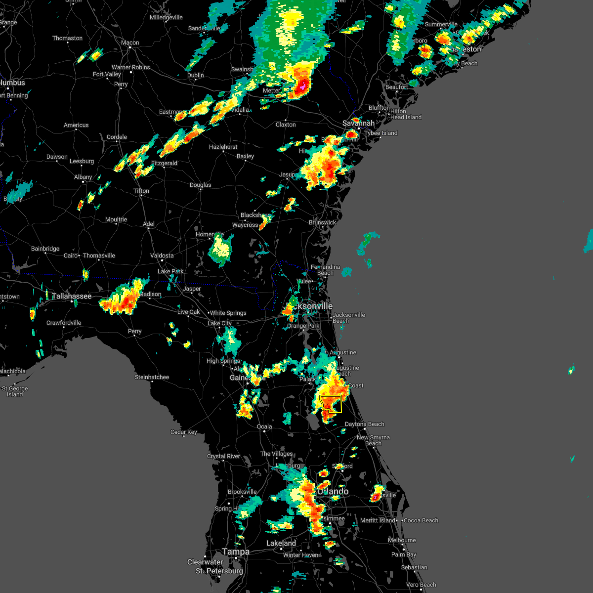 At 602 pm edt, a severe thunderstorm was located near crescent city, moving east at 10 mph (radar indicated). Hazards include 60 mph wind gusts and quarter size hail. Hail damage to vehicles is expected. expect wind damage to roofs, siding, and trees. locations impacted include, andalusia and espanola. hail threat, radar indicated max hail size, 1. 00 in wind threat, radar indicated max wind gust, 60 mph. At 602 pm edt, a severe thunderstorm was located near crescent city, moving east at 10 mph (radar indicated). Hazards include 60 mph wind gusts and quarter size hail. Hail damage to vehicles is expected. expect wind damage to roofs, siding, and trees. locations impacted include, andalusia and espanola. hail threat, radar indicated max hail size, 1. 00 in wind threat, radar indicated max wind gust, 60 mph.
|
| 8/19/2022 5:57 PM EDT |
 At 557 pm edt, a severe thunderstorm was located near crescent city, moving east at 10 mph (radar indicated). Hazards include 60 mph wind gusts and quarter size hail. Hail damage to vehicles is expected. expect wind damage to roofs, siding, and trees. locations impacted include, crescent city, andalusia and espanola. hail threat, radar indicated max hail size, 1. 00 in wind threat, radar indicated max wind gust, 60 mph. At 557 pm edt, a severe thunderstorm was located near crescent city, moving east at 10 mph (radar indicated). Hazards include 60 mph wind gusts and quarter size hail. Hail damage to vehicles is expected. expect wind damage to roofs, siding, and trees. locations impacted include, crescent city, andalusia and espanola. hail threat, radar indicated max hail size, 1. 00 in wind threat, radar indicated max wind gust, 60 mph.
|
| 8/19/2022 5:48 PM EDT |
 At 548 pm edt, a severe thunderstorm was located near crescent city, moving south at 10 mph (radar indicated). Hazards include 60 mph wind gusts and quarter size hail. Hail damage to vehicles is expected. expect wind damage to roofs, siding, and trees. locations impacted include, crescent city, andalusia and espanola. hail threat, radar indicated max hail size, 1. 00 in wind threat, radar indicated max wind gust, 60 mph. At 548 pm edt, a severe thunderstorm was located near crescent city, moving south at 10 mph (radar indicated). Hazards include 60 mph wind gusts and quarter size hail. Hail damage to vehicles is expected. expect wind damage to roofs, siding, and trees. locations impacted include, crescent city, andalusia and espanola. hail threat, radar indicated max hail size, 1. 00 in wind threat, radar indicated max wind gust, 60 mph.
|
| 8/19/2022 5:40 PM EDT |
 At 540 pm edt, a severe thunderstorm was located near andalusia, moving east at 10 mph (radar indicated). Hazards include 60 mph wind gusts and quarter size hail. Hail damage to vehicles is expected. Expect wind damage to roofs, siding, and trees. At 540 pm edt, a severe thunderstorm was located near andalusia, moving east at 10 mph (radar indicated). Hazards include 60 mph wind gusts and quarter size hail. Hail damage to vehicles is expected. Expect wind damage to roofs, siding, and trees.
|
| 8/17/2022 7:42 PM EDT |
 The severe thunderstorm warning for southeastern st. johns and northeastern putnam counties will expire at 745 pm edt, the storms which prompted the warning have weakened below severe limits, and have exited the warned area. therefore, the warning will be allowed to expire. however gusty winds and heavy rain are still possible with these thunderstorms. The severe thunderstorm warning for southeastern st. johns and northeastern putnam counties will expire at 745 pm edt, the storms which prompted the warning have weakened below severe limits, and have exited the warned area. therefore, the warning will be allowed to expire. however gusty winds and heavy rain are still possible with these thunderstorms.
|
| 8/17/2022 7:38 PM EDT |
 At 737 pm edt, severe thunderstorms were located along a line extending from near saint augustine beach to orange mills, moving east at 15 mph (radar indicated). Hazards include 60 mph wind gusts and penny size hail. Expect damage to roofs, siding, and trees. locations impacted include, hastings, east palatka, saint augustine beach, marineland, crescent beach, saint augustine shores, orange mills, butler beach, spuds and dupont center. hail threat, radar indicated max hail size, 0. 75 in wind threat, radar indicated max wind gust, 60 mph. At 737 pm edt, severe thunderstorms were located along a line extending from near saint augustine beach to orange mills, moving east at 15 mph (radar indicated). Hazards include 60 mph wind gusts and penny size hail. Expect damage to roofs, siding, and trees. locations impacted include, hastings, east palatka, saint augustine beach, marineland, crescent beach, saint augustine shores, orange mills, butler beach, spuds and dupont center. hail threat, radar indicated max hail size, 0. 75 in wind threat, radar indicated max wind gust, 60 mph.
|
| 8/17/2022 7:14 PM EDT |
 At 713 pm edt, severe thunderstorms were located along a line extending from saint augustine beach to near orange mills, moving southeast at 15 mph (radar indicated). Hazards include 60 mph wind gusts and penny size hail. expect damage to roofs, siding, and trees At 713 pm edt, severe thunderstorms were located along a line extending from saint augustine beach to near orange mills, moving southeast at 15 mph (radar indicated). Hazards include 60 mph wind gusts and penny size hail. expect damage to roofs, siding, and trees
|
| 8/2/2022 11:13 PM EDT |
 The severe thunderstorm warning for east central flagler county will expire at 1115 pm edt, the storm which prompted the warning has weakened below severe limits, and no longer poses an immediate threat to life or property. therefore, the warning will be allowed to expire. however heavy rain is expected with this thunderstorm. to report severe weather, contact your nearest law enforcement agency. they will relay your report to the national weather service jacksonville. The severe thunderstorm warning for east central flagler county will expire at 1115 pm edt, the storm which prompted the warning has weakened below severe limits, and no longer poses an immediate threat to life or property. therefore, the warning will be allowed to expire. however heavy rain is expected with this thunderstorm. to report severe weather, contact your nearest law enforcement agency. they will relay your report to the national weather service jacksonville.
|
| 8/2/2022 10:56 PM EDT |
 At 1055 pm edt, a severe thunderstorm was located just north of flagler beach, moving south at 10 mph (radar indicated). Hazards include 60 mph wind gusts. Expect damage to roofs, siding, and trees. locations impacted include, palm coast, flagler beach, bunnell and beverly beach. hail threat, radar indicated max hail size, <. 75 in wind threat, radar indicated max wind gust, 60 mph. At 1055 pm edt, a severe thunderstorm was located just north of flagler beach, moving south at 10 mph (radar indicated). Hazards include 60 mph wind gusts. Expect damage to roofs, siding, and trees. locations impacted include, palm coast, flagler beach, bunnell and beverly beach. hail threat, radar indicated max hail size, <. 75 in wind threat, radar indicated max wind gust, 60 mph.
|
| 8/2/2022 10:35 PM EDT |
 At 1035 pm edt, a severe thunderstorm was located near palm coast, moving south at 15 mph (radar indicated). Hazards include 60 mph wind gusts. expect damage to roofs, siding, and trees At 1035 pm edt, a severe thunderstorm was located near palm coast, moving south at 15 mph (radar indicated). Hazards include 60 mph wind gusts. expect damage to roofs, siding, and trees
|
| 7/19/2022 3:21 PM EDT |
 The severe thunderstorm warning for southeastern flagler county will expire at 330 pm edt, the storm which prompted the warning has weakened below severe limits, and has exited the warned area. therefore, the warning will be allowed to expire. however heavy rain is still possible with this thunderstorm. The severe thunderstorm warning for southeastern flagler county will expire at 330 pm edt, the storm which prompted the warning has weakened below severe limits, and has exited the warned area. therefore, the warning will be allowed to expire. however heavy rain is still possible with this thunderstorm.
|
| 7/19/2022 3:07 PM EDT |
 At 306 pm edt, a severe thunderstorm was located 10 miles west of ormond beach, moving east at 10 mph (radar indicated). Hazards include 60 mph wind gusts. Expect damage to roofs, siding, and trees. this severe thunderstorm will remain over mainly rural areas of southeastern flagler county. hail threat, radar indicated max hail size, <. 75 in wind threat, radar indicated max wind gust, 60 mph. At 306 pm edt, a severe thunderstorm was located 10 miles west of ormond beach, moving east at 10 mph (radar indicated). Hazards include 60 mph wind gusts. Expect damage to roofs, siding, and trees. this severe thunderstorm will remain over mainly rural areas of southeastern flagler county. hail threat, radar indicated max hail size, <. 75 in wind threat, radar indicated max wind gust, 60 mph.
|
| 7/19/2022 2:55 PM EDT |
 At 255 pm edt, a severe thunderstorm was located 9 miles northeast of pierson, moving east at 10 mph (radar indicated). Hazards include 60 mph wind gusts. Expect damage to roofs, siding, and trees. this severe thunderstorm will remain over mainly rural areas of southeastern flagler county. hail threat, radar indicated max hail size, <. 75 in wind threat, radar indicated max wind gust, 60 mph. At 255 pm edt, a severe thunderstorm was located 9 miles northeast of pierson, moving east at 10 mph (radar indicated). Hazards include 60 mph wind gusts. Expect damage to roofs, siding, and trees. this severe thunderstorm will remain over mainly rural areas of southeastern flagler county. hail threat, radar indicated max hail size, <. 75 in wind threat, radar indicated max wind gust, 60 mph.
|
| 7/19/2022 2:40 PM EDT |
 At 239 pm edt, a severe thunderstorm was located near pierson, moving east at 10 mph (radar indicated). Hazards include 60 mph wind gusts. Expect damage to roofs, siding, and trees. this severe thunderstorm will remain over mainly rural areas of southeastern flagler county. hail threat, radar indicated max hail size, <. 75 in wind threat, radar indicated max wind gust, 60 mph. At 239 pm edt, a severe thunderstorm was located near pierson, moving east at 10 mph (radar indicated). Hazards include 60 mph wind gusts. Expect damage to roofs, siding, and trees. this severe thunderstorm will remain over mainly rural areas of southeastern flagler county. hail threat, radar indicated max hail size, <. 75 in wind threat, radar indicated max wind gust, 60 mph.
|
| 7/3/2022 3:27 PM EDT |
 The severe thunderstorm warning for central flagler county will expire at 330 pm edt, the storm which prompted the warning has weakened below severe limits, and no longer poses an immediate threat to life or property. therefore, the warning will be allowed to expire. however gusty winds and heavy rain are still possible with this thunderstorm. The severe thunderstorm warning for central flagler county will expire at 330 pm edt, the storm which prompted the warning has weakened below severe limits, and no longer poses an immediate threat to life or property. therefore, the warning will be allowed to expire. however gusty winds and heavy rain are still possible with this thunderstorm.
|
| 7/3/2022 3:18 PM EDT |
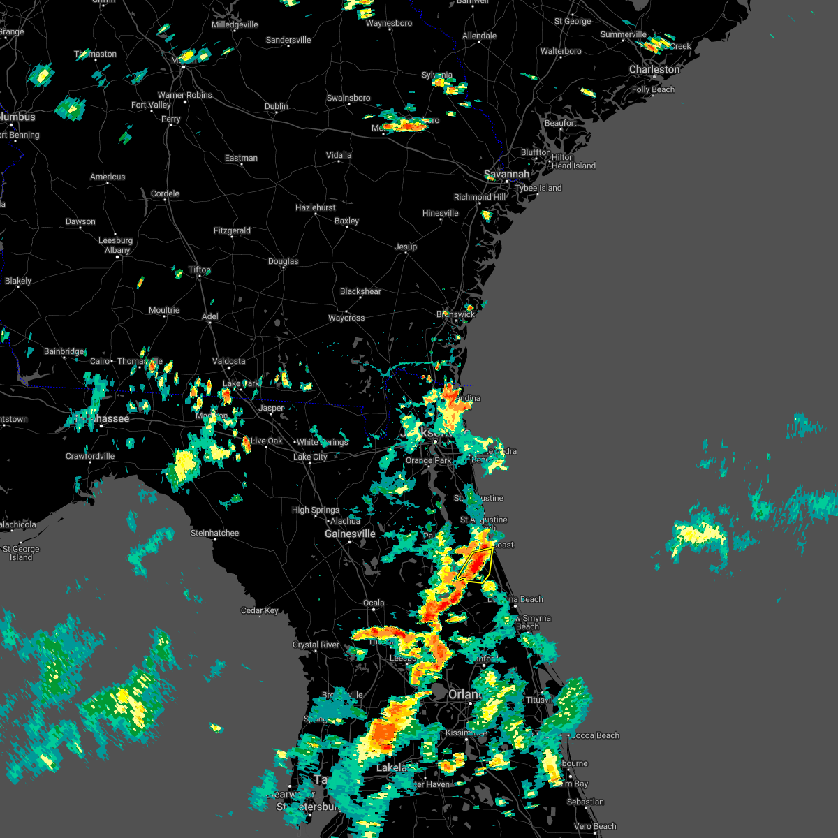 At 317 pm edt, a severe thunderstorm was located near bunnell, moving south at 10 mph (radar indicated). Hazards include 60 mph wind gusts. Expect damage to roofs, siding, and trees. locations impacted include, palm coast, bunnell and espanola. hail threat, radar indicated max hail size, <. 75 in wind threat, radar indicated max wind gust, 60 mph. At 317 pm edt, a severe thunderstorm was located near bunnell, moving south at 10 mph (radar indicated). Hazards include 60 mph wind gusts. Expect damage to roofs, siding, and trees. locations impacted include, palm coast, bunnell and espanola. hail threat, radar indicated max hail size, <. 75 in wind threat, radar indicated max wind gust, 60 mph.
|
| 7/3/2022 2:59 PM EDT |
 At 258 pm edt, a severe thunderstorm was located near palm coast, moving south at 10 mph (radar indicated). Hazards include 60 mph wind gusts. expect damage to roofs, siding, and trees At 258 pm edt, a severe thunderstorm was located near palm coast, moving south at 10 mph (radar indicated). Hazards include 60 mph wind gusts. expect damage to roofs, siding, and trees
|
| 6/24/2022 2:04 PM EDT |
 At 203 pm edt, a severe thunderstorm was located over crescent city, moving southwest at 10 mph (radar indicated). Hazards include 70 mph wind gusts and quarter size hail. Hail damage to vehicles is expected. expect considerable tree damage. wind damage is also likely to mobile homes, roofs, and outbuildings. locations impacted include, palatka, bunnell, crescent city, interlachen, pomona park, east palatka, andalusia, lake delancy, fruitland and melrose landing. thunderstorm damage threat, considerable hail threat, radar indicated max hail size, 1. 00 in wind threat, radar indicated max wind gust, 70 mph. At 203 pm edt, a severe thunderstorm was located over crescent city, moving southwest at 10 mph (radar indicated). Hazards include 70 mph wind gusts and quarter size hail. Hail damage to vehicles is expected. expect considerable tree damage. wind damage is also likely to mobile homes, roofs, and outbuildings. locations impacted include, palatka, bunnell, crescent city, interlachen, pomona park, east palatka, andalusia, lake delancy, fruitland and melrose landing. thunderstorm damage threat, considerable hail threat, radar indicated max hail size, 1. 00 in wind threat, radar indicated max wind gust, 70 mph.
|
| 6/24/2022 1:55 PM EDT |
 At 155 pm edt, a severe thunderstorm was located near andalusia, moving south at 15 mph (radar indicated). Hazards include 70 mph wind gusts and quarter size hail. Hail damage to vehicles is expected. expect considerable tree damage. wind damage is also likely to mobile homes, roofs, and outbuildings. locations impacted include, palatka, bunnell, crescent city, interlachen, pomona park, east palatka, andalusia, lake delancy, fruitland and melrose landing. thunderstorm damage threat, considerable hail threat, radar indicated max hail size, 1. 00 in wind threat, radar indicated max wind gust, 70 mph. At 155 pm edt, a severe thunderstorm was located near andalusia, moving south at 15 mph (radar indicated). Hazards include 70 mph wind gusts and quarter size hail. Hail damage to vehicles is expected. expect considerable tree damage. wind damage is also likely to mobile homes, roofs, and outbuildings. locations impacted include, palatka, bunnell, crescent city, interlachen, pomona park, east palatka, andalusia, lake delancy, fruitland and melrose landing. thunderstorm damage threat, considerable hail threat, radar indicated max hail size, 1. 00 in wind threat, radar indicated max wind gust, 70 mph.
|
| 6/24/2022 1:40 PM EDT |
 At 139 pm edt, a severe thunderstorm was located near san mateo, or near andalusia, moving southwest at 10 mph (radar indicated). Hazards include 60 mph wind gusts. expect damage to roofs, siding, and trees At 139 pm edt, a severe thunderstorm was located near san mateo, or near andalusia, moving southwest at 10 mph (radar indicated). Hazards include 60 mph wind gusts. expect damage to roofs, siding, and trees
|
| 6/10/2022 4:06 PM EDT |
 The severe thunderstorm warning for northeastern flagler and southeastern st. johns counties will expire at 415 pm edt, the storm which prompted the warning has weakened below severe limits, and no longer poses an immediate threat to life or property. therefore, the warning will be allowed to expire. however gusty winds are still possible with this thunderstorm. The severe thunderstorm warning for northeastern flagler and southeastern st. johns counties will expire at 415 pm edt, the storm which prompted the warning has weakened below severe limits, and no longer poses an immediate threat to life or property. therefore, the warning will be allowed to expire. however gusty winds are still possible with this thunderstorm.
|
| 6/10/2022 3:50 PM EDT |
 At 350 pm edt, a severe thunderstorm was located near crescent beach, or 10 miles east of hastings, moving east at 20 mph (radar indicated). Hazards include 60 mph wind gusts and nickel size hail. expect damage to roofs, siding, and trees At 350 pm edt, a severe thunderstorm was located near crescent beach, or 10 miles east of hastings, moving east at 20 mph (radar indicated). Hazards include 60 mph wind gusts and nickel size hail. expect damage to roofs, siding, and trees
|
| 6/6/2022 3:35 PM EDT | Delayed report. medium size tree branch down and blown into neighbors yard... photo on twitter. time estimated from rada in flagler county FL, 1.7 miles S of Palm Coast, FL |
| 6/6/2022 3:26 PM EDT |
 At 326 pm edt, a severe thunderstorm was located near flagler beach, moving southeast at 15 mph (radar indicated). Hazards include 60 mph wind gusts and quarter size hail. Hail damage to vehicles is expected. expect wind damage to roofs, siding, and trees. locations impacted include, palm coast, flagler beach and beverly beach. hail threat, radar indicated max hail size, 1. 00 in wind threat, radar indicated max wind gust, 60 mph. At 326 pm edt, a severe thunderstorm was located near flagler beach, moving southeast at 15 mph (radar indicated). Hazards include 60 mph wind gusts and quarter size hail. Hail damage to vehicles is expected. expect wind damage to roofs, siding, and trees. locations impacted include, palm coast, flagler beach and beverly beach. hail threat, radar indicated max hail size, 1. 00 in wind threat, radar indicated max wind gust, 60 mph.
|
| 6/6/2022 3:20 PM EDT | Half Dollar sized hail reported 1 miles SSW of Palm Coast, FL, spotter reports quarter to half dollar sized hail in palm coast... location approximated. |
| 6/6/2022 3:10 PM EDT | One hour delayed report. em reports of multiple screens blown out of lanias in nw palm coas in flagler county FL, 4.7 miles SSE of Palm Coast, FL |
| 6/6/2022 3:09 PM EDT |
 At 309 pm edt, a severe thunderstorm was located over palm coast, moving southeast at 15 mph (radar indicated). Hazards include 60 mph wind gusts and quarter size hail. Hail damage to vehicles is expected. Expect wind damage to roofs, siding, and trees. At 309 pm edt, a severe thunderstorm was located over palm coast, moving southeast at 15 mph (radar indicated). Hazards include 60 mph wind gusts and quarter size hail. Hail damage to vehicles is expected. Expect wind damage to roofs, siding, and trees.
|
| 6/6/2022 3:04 PM EDT | Quarter sized hail reported 3.2 miles SSW of Palm Coast, FL |
| 6/6/2022 3:03 PM EDT | Palm coast tree down into transformer wires reported by fcs in flagler county FL, 3.2 miles SSW of Palm Coast, FL |
| 5/21/2022 7:27 PM EDT |
 At 727 pm edt, a severe thunderstorm was located 9 miles southwest of bunnell, moving northeast at 15 mph (radar indicated). Hazards include 60 mph wind gusts and quarter size hail. Hail damage to vehicles is expected. expect wind damage to roofs, siding, and trees. locations impacted include, palm coast, flagler beach, bunnell and beverly beach. hail threat, radar indicated max hail size, 1. 00 in wind threat, radar indicated max wind gust, 60 mph. At 727 pm edt, a severe thunderstorm was located 9 miles southwest of bunnell, moving northeast at 15 mph (radar indicated). Hazards include 60 mph wind gusts and quarter size hail. Hail damage to vehicles is expected. expect wind damage to roofs, siding, and trees. locations impacted include, palm coast, flagler beach, bunnell and beverly beach. hail threat, radar indicated max hail size, 1. 00 in wind threat, radar indicated max wind gust, 60 mph.
|
| 5/21/2022 7:11 PM EDT |
 At 711 pm edt, a severe thunderstorm was located 9 miles northeast of pierson, moving northeast at 15 mph (radar indicated). Hazards include 60 mph wind gusts and quarter size hail. Hail damage to vehicles is expected. Expect wind damage to roofs, siding, and trees. At 711 pm edt, a severe thunderstorm was located 9 miles northeast of pierson, moving northeast at 15 mph (radar indicated). Hazards include 60 mph wind gusts and quarter size hail. Hail damage to vehicles is expected. Expect wind damage to roofs, siding, and trees.
|
| 5/6/2022 10:30 PM EDT |
 At 1029 pm edt, severe thunderstorms were located along a line extending from near durbin to near picolata to near bardin, moving east at 50 mph (radar indicated). Hazards include 60 mph wind gusts and penny size hail. expect damage to roofs, siding, and trees At 1029 pm edt, severe thunderstorms were located along a line extending from near durbin to near picolata to near bardin, moving east at 50 mph (radar indicated). Hazards include 60 mph wind gusts and penny size hail. expect damage to roofs, siding, and trees
|
| 4/17/2022 5:28 PM EDT |
 At 527 pm edt, severe thunderstorms were located along a line extending from saint augustine south to flagler beach, moving east at 15 mph (radar indicated). Hazards include 60 mph wind gusts and quarter size hail. Hail damage to vehicles is expected. expect wind damage to roofs, siding, and trees. locations impacted include, palm coast, saint augustine, flagler beach, saint augustine beach, marineland, crescent beach, saint augustine shores, butler beach, saint augustine south and beverly beach. hail threat, observed max hail size, 1. 00 in wind threat, radar indicated max wind gust, 60 mph. At 527 pm edt, severe thunderstorms were located along a line extending from saint augustine south to flagler beach, moving east at 15 mph (radar indicated). Hazards include 60 mph wind gusts and quarter size hail. Hail damage to vehicles is expected. expect wind damage to roofs, siding, and trees. locations impacted include, palm coast, saint augustine, flagler beach, saint augustine beach, marineland, crescent beach, saint augustine shores, butler beach, saint augustine south and beverly beach. hail threat, observed max hail size, 1. 00 in wind threat, radar indicated max wind gust, 60 mph.
|
| 4/17/2022 5:22 PM EDT | Quarter sized hail reported 3.8 miles SE of Palm Coast, FL, trained spotter reports quarter sized hail... relayed by em. |
| 4/17/2022 5:19 PM EDT |
 At 518 pm edt, severe thunderstorms were located along a line extending from saint augustine south to flagler beach, moving east at 15 mph (radar indicated). Hazards include two inch hail and 60 mph wind gusts. People and animals outdoors will be injured. expect hail damage to roofs, siding, windows, and vehicles. expect wind damage to roofs, siding, and trees. locations impacted include, palm coast, saint augustine, flagler beach, saint augustine beach, marineland, crescent beach, saint augustine shores, butler beach, saint augustine south and beverly beach. thunderstorm damage threat, considerable hail threat, radar indicated max hail size, 2. 00 in wind threat, radar indicated max wind gust, 60 mph. At 518 pm edt, severe thunderstorms were located along a line extending from saint augustine south to flagler beach, moving east at 15 mph (radar indicated). Hazards include two inch hail and 60 mph wind gusts. People and animals outdoors will be injured. expect hail damage to roofs, siding, windows, and vehicles. expect wind damage to roofs, siding, and trees. locations impacted include, palm coast, saint augustine, flagler beach, saint augustine beach, marineland, crescent beach, saint augustine shores, butler beach, saint augustine south and beverly beach. thunderstorm damage threat, considerable hail threat, radar indicated max hail size, 2. 00 in wind threat, radar indicated max wind gust, 60 mph.
|
| 4/17/2022 5:11 PM EDT |
 At 510 pm edt, severe thunderstorms were located along a line extending from near saint augustine south to near flagler beach, moving east at 10 mph (radar indicated). Hazards include two inch hail and 60 mph wind gusts. People and animals outdoors will be injured. expect hail damage to roofs, siding, windows, and vehicles. expect wind damage to roofs, siding, and trees. locations impacted include, palm coast, saint augustine, flagler beach, bunnell, saint augustine beach, marineland, crescent beach, saint augustine shores, butler beach and saint augustine south. thunderstorm damage threat, considerable hail threat, radar indicated max hail size, 2. 00 in wind threat, radar indicated max wind gust, 60 mph. At 510 pm edt, severe thunderstorms were located along a line extending from near saint augustine south to near flagler beach, moving east at 10 mph (radar indicated). Hazards include two inch hail and 60 mph wind gusts. People and animals outdoors will be injured. expect hail damage to roofs, siding, windows, and vehicles. expect wind damage to roofs, siding, and trees. locations impacted include, palm coast, saint augustine, flagler beach, bunnell, saint augustine beach, marineland, crescent beach, saint augustine shores, butler beach and saint augustine south. thunderstorm damage threat, considerable hail threat, radar indicated max hail size, 2. 00 in wind threat, radar indicated max wind gust, 60 mph.
|
| 4/17/2022 5:07 PM EDT |
 At 506 pm edt, severe thunderstorms were located along a line extending from near saint augustine shores to near bunnell, moving east at 10 mph (radar indicated). Hazards include two inch hail and 60 mph wind gusts. People and animals outdoors will be injured. expect hail damage to roofs, siding, windows, and vehicles. expect wind damage to roofs, siding, and trees. locations impacted include, palm coast, saint augustine, flagler beach, bunnell, saint augustine beach, marineland, crescent beach, saint augustine shores, butler beach and saint augustine south. thunderstorm damage threat, considerable hail threat, radar indicated max hail size, 2. 00 in wind threat, radar indicated max wind gust, 60 mph. At 506 pm edt, severe thunderstorms were located along a line extending from near saint augustine shores to near bunnell, moving east at 10 mph (radar indicated). Hazards include two inch hail and 60 mph wind gusts. People and animals outdoors will be injured. expect hail damage to roofs, siding, windows, and vehicles. expect wind damage to roofs, siding, and trees. locations impacted include, palm coast, saint augustine, flagler beach, bunnell, saint augustine beach, marineland, crescent beach, saint augustine shores, butler beach and saint augustine south. thunderstorm damage threat, considerable hail threat, radar indicated max hail size, 2. 00 in wind threat, radar indicated max wind gust, 60 mph.
|
| 4/17/2022 4:58 PM EDT |
 At 458 pm edt, severe thunderstorms were located along a line extending from near saint augustine shores to near flagler beach, moving east at 15 mph (radar indicated). Hazards include two inch hail and 60 mph wind gusts. People and animals outdoors will be injured. expect hail damage to roofs, siding, windows, and vehicles. Expect wind damage to roofs, siding, and trees. At 458 pm edt, severe thunderstorms were located along a line extending from near saint augustine shores to near flagler beach, moving east at 15 mph (radar indicated). Hazards include two inch hail and 60 mph wind gusts. People and animals outdoors will be injured. expect hail damage to roofs, siding, windows, and vehicles. Expect wind damage to roofs, siding, and trees.
|
| 4/17/2022 4:57 PM EDT |
 The severe thunderstorm warning for south central st. johns county will expire at 500 pm edt, severe weather continues and a new severe thunderstorm warning will be issued momentarily!. The severe thunderstorm warning for south central st. johns county will expire at 500 pm edt, severe weather continues and a new severe thunderstorm warning will be issued momentarily!.
|
| 4/17/2022 4:46 PM EDT |
 At 445 pm edt, a severe thunderstorm was located near hastings, moving south at 20 mph (radar indicated). Hazards include two inch hail and 60 mph wind gusts. People and animals outdoors will be injured. expect hail damage to roofs, siding, windows, and vehicles. expect wind damage to roofs, siding, and trees. locations impacted include, spuds. thunderstorm damage threat, considerable hail threat, radar indicated max hail size, 2. 00 in wind threat, radar indicated max wind gust, 60 mph. At 445 pm edt, a severe thunderstorm was located near hastings, moving south at 20 mph (radar indicated). Hazards include two inch hail and 60 mph wind gusts. People and animals outdoors will be injured. expect hail damage to roofs, siding, windows, and vehicles. expect wind damage to roofs, siding, and trees. locations impacted include, spuds. thunderstorm damage threat, considerable hail threat, radar indicated max hail size, 2. 00 in wind threat, radar indicated max wind gust, 60 mph.
|
| 4/17/2022 4:42 PM EDT |
 At 442 pm edt, a severe thunderstorm was located near hastings, moving south at 20 mph (radar indicated). Hazards include two inch hail and 60 mph wind gusts. People and animals outdoors will be injured. expect hail damage to roofs, siding, windows, and vehicles. expect wind damage to roofs, siding, and trees. locations impacted include, spuds and elkton. thunderstorm damage threat, considerable hail threat, radar indicated max hail size, 2. 00 in wind threat, radar indicated max wind gust, 60 mph. At 442 pm edt, a severe thunderstorm was located near hastings, moving south at 20 mph (radar indicated). Hazards include two inch hail and 60 mph wind gusts. People and animals outdoors will be injured. expect hail damage to roofs, siding, windows, and vehicles. expect wind damage to roofs, siding, and trees. locations impacted include, spuds and elkton. thunderstorm damage threat, considerable hail threat, radar indicated max hail size, 2. 00 in wind threat, radar indicated max wind gust, 60 mph.
|
| 4/17/2022 4:39 PM EDT |
 At 438 pm edt, a severe thunderstorm was located near hastings, moving southeast at 20 mph (radar indicated). Hazards include two inch hail and 60 mph wind gusts. People and animals outdoors will be injured. expect hail damage to roofs, siding, windows, and vehicles. expect wind damage to roofs, siding, and trees. locations impacted include, hastings, spuds and elkton. thunderstorm damage threat, considerable hail threat, radar indicated max hail size, 2. 00 in wind threat, radar indicated max wind gust, 60 mph. At 438 pm edt, a severe thunderstorm was located near hastings, moving southeast at 20 mph (radar indicated). Hazards include two inch hail and 60 mph wind gusts. People and animals outdoors will be injured. expect hail damage to roofs, siding, windows, and vehicles. expect wind damage to roofs, siding, and trees. locations impacted include, hastings, spuds and elkton. thunderstorm damage threat, considerable hail threat, radar indicated max hail size, 2. 00 in wind threat, radar indicated max wind gust, 60 mph.
|
| 4/17/2022 4:34 PM EDT |
 At 434 pm edt, a severe thunderstorm was located near hastings, moving southeast at 10 mph (radar indicated). Hazards include two inch hail and 60 mph wind gusts. People and animals outdoors will be injured. expect hail damage to roofs, siding, windows, and vehicles. expect wind damage to roofs, siding, and trees. locations impacted include, hastings, spuds and elkton. thunderstorm damage threat, considerable hail threat, radar indicated max hail size, 2. 00 in wind threat, radar indicated max wind gust, 60 mph. At 434 pm edt, a severe thunderstorm was located near hastings, moving southeast at 10 mph (radar indicated). Hazards include two inch hail and 60 mph wind gusts. People and animals outdoors will be injured. expect hail damage to roofs, siding, windows, and vehicles. expect wind damage to roofs, siding, and trees. locations impacted include, hastings, spuds and elkton. thunderstorm damage threat, considerable hail threat, radar indicated max hail size, 2. 00 in wind threat, radar indicated max wind gust, 60 mph.
|
| 4/17/2022 4:28 PM EDT |
 At 428 pm edt, a severe thunderstorm was located near hastings, moving southeast at 20 mph (radar indicated). Hazards include two inch hail and 60 mph wind gusts. People and animals outdoors will be injured. expect hail damage to roofs, siding, windows, and vehicles. Expect wind damage to roofs, siding, and trees. At 428 pm edt, a severe thunderstorm was located near hastings, moving southeast at 20 mph (radar indicated). Hazards include two inch hail and 60 mph wind gusts. People and animals outdoors will be injured. expect hail damage to roofs, siding, windows, and vehicles. Expect wind damage to roofs, siding, and trees.
|
| 4/7/2022 10:33 AM EDT |
 At 1033 am edt, a severe thunderstorm capable of producing a tornado was located over palm coast, moving east at 35 mph (radar indicated rotation). Hazards include tornado. Flying debris will be dangerous to those caught without shelter. mobile homes will be damaged or destroyed. damage to roofs, windows, and vehicles will occur. tree damage is likely. This tornadic thunderstorm will remain over mainly rural areas of northeastern flagler county, including the following locations, beverly beach and espanola. At 1033 am edt, a severe thunderstorm capable of producing a tornado was located over palm coast, moving east at 35 mph (radar indicated rotation). Hazards include tornado. Flying debris will be dangerous to those caught without shelter. mobile homes will be damaged or destroyed. damage to roofs, windows, and vehicles will occur. tree damage is likely. This tornadic thunderstorm will remain over mainly rural areas of northeastern flagler county, including the following locations, beverly beach and espanola.
|
| 4/7/2022 10:20 AM EDT |
 At 1019 am edt, a severe thunderstorm capable of producing a tornado was located near bunnell, moving east at 40 mph (radar indicated rotation). Hazards include tornado. Flying debris will be dangerous to those caught without shelter. mobile homes will be damaged or destroyed. damage to roofs, windows, and vehicles will occur. tree damage is likely. this dangerous storm will be near, palm coast around 1025 am edt. flagler beach around 1035 am edt. Other locations impacted by this tornadic thunderstorm include beverly beach and espanola. At 1019 am edt, a severe thunderstorm capable of producing a tornado was located near bunnell, moving east at 40 mph (radar indicated rotation). Hazards include tornado. Flying debris will be dangerous to those caught without shelter. mobile homes will be damaged or destroyed. damage to roofs, windows, and vehicles will occur. tree damage is likely. this dangerous storm will be near, palm coast around 1025 am edt. flagler beach around 1035 am edt. Other locations impacted by this tornadic thunderstorm include beverly beach and espanola.
|
| 4/7/2022 10:15 AM EDT |
 At 1014 am edt, a severe thunderstorm was located near andalusia, moving east at 30 mph (radar indicated). Hazards include 60 mph wind gusts and penny size hail. expect damage to roofs, siding, and trees At 1014 am edt, a severe thunderstorm was located near andalusia, moving east at 30 mph (radar indicated). Hazards include 60 mph wind gusts and penny size hail. expect damage to roofs, siding, and trees
|
| 4/7/2022 10:00 AM EDT |
 At 1000 am edt, a severe thunderstorm capable of producing a tornado was located over andalusia, moving east at 40 mph (radar indicated rotation). Hazards include tornado. Flying debris will be dangerous to those caught without shelter. mobile homes will be damaged or destroyed. damage to roofs, windows, and vehicles will occur. tree damage is likely. this dangerous storm will be near, palm coast and bunnell around 1025 am edt. Other locations impacted by this tornadic thunderstorm include espanola. At 1000 am edt, a severe thunderstorm capable of producing a tornado was located over andalusia, moving east at 40 mph (radar indicated rotation). Hazards include tornado. Flying debris will be dangerous to those caught without shelter. mobile homes will be damaged or destroyed. damage to roofs, windows, and vehicles will occur. tree damage is likely. this dangerous storm will be near, palm coast and bunnell around 1025 am edt. Other locations impacted by this tornadic thunderstorm include espanola.
|
| 4/7/2022 9:53 AM EDT |
 At 953 am edt, a severe thunderstorm capable of producing a tornado was located over crescent city, moving east at 40 mph (radar indicated rotation). Hazards include tornado. Flying debris will be dangerous to those caught without shelter. mobile homes will be damaged or destroyed. damage to roofs, windows, and vehicles will occur. tree damage is likely. this dangerous storm will be near, palm coast and bunnell around 1020 am edt. Other locations impacted by this tornadic thunderstorm include lake como and espanola. At 953 am edt, a severe thunderstorm capable of producing a tornado was located over crescent city, moving east at 40 mph (radar indicated rotation). Hazards include tornado. Flying debris will be dangerous to those caught without shelter. mobile homes will be damaged or destroyed. damage to roofs, windows, and vehicles will occur. tree damage is likely. this dangerous storm will be near, palm coast and bunnell around 1020 am edt. Other locations impacted by this tornadic thunderstorm include lake como and espanola.
|
| 4/7/2022 9:42 AM EDT |
 At 942 am edt, a severe thunderstorm capable of producing a tornado was located over fruitland, or near pomona park, moving east at 45 mph (radar indicated rotation). Hazards include tornado. Flying debris will be dangerous to those caught without shelter. mobile homes will be damaged or destroyed. damage to roofs, windows, and vehicles will occur. tree damage is likely. this dangerous storm will be near, pomona park around 945 am edt. crescent city around 950 am edt. andalusia around 955 am edt. palm coast and bunnell around 1015 am edt. Other locations impacted by this tornadic thunderstorm include espanola, lake como, welaka and georgetown. At 942 am edt, a severe thunderstorm capable of producing a tornado was located over fruitland, or near pomona park, moving east at 45 mph (radar indicated rotation). Hazards include tornado. Flying debris will be dangerous to those caught without shelter. mobile homes will be damaged or destroyed. damage to roofs, windows, and vehicles will occur. tree damage is likely. this dangerous storm will be near, pomona park around 945 am edt. crescent city around 950 am edt. andalusia around 955 am edt. palm coast and bunnell around 1015 am edt. Other locations impacted by this tornadic thunderstorm include espanola, lake como, welaka and georgetown.
|
| 4/7/2022 9:38 AM EDT |
 At 938 am edt, a severe thunderstorm was located over fruitland, or near pomona park, moving east at 50 mph (radar indicated). Hazards include 60 mph wind gusts and nickel size hail. Expect damage to roofs, siding, and trees. Locations impacted include, crescent city, pomona park, salt springs, andalusia, lake delancy, fruitland, satsuma, welaka, espanola and lake como. At 938 am edt, a severe thunderstorm was located over fruitland, or near pomona park, moving east at 50 mph (radar indicated). Hazards include 60 mph wind gusts and nickel size hail. Expect damage to roofs, siding, and trees. Locations impacted include, crescent city, pomona park, salt springs, andalusia, lake delancy, fruitland, satsuma, welaka, espanola and lake como.
|
| 4/7/2022 9:22 AM EDT |
 At 922 am edt, a severe thunderstorm was located near lake delancy, or near salt springs, moving east at 55 mph (radar indicated). Hazards include 60 mph wind gusts and nickel size hail. expect damage to roofs, siding, and trees At 922 am edt, a severe thunderstorm was located near lake delancy, or near salt springs, moving east at 55 mph (radar indicated). Hazards include 60 mph wind gusts and nickel size hail. expect damage to roofs, siding, and trees
|
| 4/6/2022 2:09 PM EDT |
 At 208 pm edt, severe thunderstorms were located along a line extending from 7 miles west of marineland to near bunnell, moving northeast at 35 mph (radar indicated). Hazards include 60 mph wind gusts and quarter size hail. Hail damage to vehicles is expected. expect wind damage to roofs, siding, and trees. locations impacted include, palm coast, flagler beach, bunnell, marineland, crescent beach, beverly beach, espanola and dupont center. hail threat, radar indicated max hail size, 1. 00 in wind threat, radar indicated max wind gust, 60 mph. At 208 pm edt, severe thunderstorms were located along a line extending from 7 miles west of marineland to near bunnell, moving northeast at 35 mph (radar indicated). Hazards include 60 mph wind gusts and quarter size hail. Hail damage to vehicles is expected. expect wind damage to roofs, siding, and trees. locations impacted include, palm coast, flagler beach, bunnell, marineland, crescent beach, beverly beach, espanola and dupont center. hail threat, radar indicated max hail size, 1. 00 in wind threat, radar indicated max wind gust, 60 mph.
|
| 4/6/2022 1:52 PM EDT |
 At 152 pm edt, severe thunderstorms were located along a line extending from near andalusia to 9 miles southeast of crescent city, moving northeast at 40 mph (radar indicated). Hazards include 60 mph wind gusts and quarter size hail. Hail damage to vehicles is expected. expect wind damage to roofs, siding, and trees. locations impacted include, palm coast, flagler beach, bunnell, crescent city, pomona park, andalusia, marineland, crescent beach, beverly beach and espanola. hail threat, radar indicated max hail size, 1. 00 in wind threat, radar indicated max wind gust, 60 mph. At 152 pm edt, severe thunderstorms were located along a line extending from near andalusia to 9 miles southeast of crescent city, moving northeast at 40 mph (radar indicated). Hazards include 60 mph wind gusts and quarter size hail. Hail damage to vehicles is expected. expect wind damage to roofs, siding, and trees. locations impacted include, palm coast, flagler beach, bunnell, crescent city, pomona park, andalusia, marineland, crescent beach, beverly beach and espanola. hail threat, radar indicated max hail size, 1. 00 in wind threat, radar indicated max wind gust, 60 mph.
|
| 4/6/2022 1:38 PM EDT |
 At 138 pm edt, severe thunderstorms were located along a line extending from near pomona park to near lake george, moving northeast at 35 mph (radar indicated). Hazards include 60 mph wind gusts and quarter size hail. Hail damage to vehicles is expected. Expect wind damage to roofs, siding, and trees. At 138 pm edt, severe thunderstorms were located along a line extending from near pomona park to near lake george, moving northeast at 35 mph (radar indicated). Hazards include 60 mph wind gusts and quarter size hail. Hail damage to vehicles is expected. Expect wind damage to roofs, siding, and trees.
|
| 4/2/2022 2:45 PM EDT | Media broadcast partner measured 71 mph around 245 p in flagler county FL, 6.2 miles SSW of Palm Coast, FL |
| 4/2/2022 2:30 PM EDT | Power lines were blown down along beckner lane in b-section of palm coast. the time of wind damage was based on rada in flagler county FL, 2.4 miles S of Palm Coast, FL |
| 4/2/2022 2:28 PM EDT |
 At 228 pm edt, severe thunderstorms were located along a line extending from crescent beach to 9 miles south of bunnell, moving east at 35 mph (radar indicated). Hazards include 60 mph wind gusts and quarter size hail. Hail damage to vehicles is expected. expect wind damage to roofs, siding, and trees. Locations impacted include, palm coast, flagler beach, bunnell, saint augustine beach, marineland, crescent beach, butler beach, beverly beach, espanola and dupont center. At 228 pm edt, severe thunderstorms were located along a line extending from crescent beach to 9 miles south of bunnell, moving east at 35 mph (radar indicated). Hazards include 60 mph wind gusts and quarter size hail. Hail damage to vehicles is expected. expect wind damage to roofs, siding, and trees. Locations impacted include, palm coast, flagler beach, bunnell, saint augustine beach, marineland, crescent beach, butler beach, beverly beach, espanola and dupont center.
|
| 4/2/2022 2:10 PM EDT |
 At 210 pm edt, severe thunderstorms were located along a line extending from 6 miles southwest of saint augustine shores to near pierson, moving east at 35 mph (radar indicated). Hazards include 60 mph wind gusts and quarter size hail. Hail damage to vehicles is expected. Expect wind damage to roofs, siding, and trees. At 210 pm edt, severe thunderstorms were located along a line extending from 6 miles southwest of saint augustine shores to near pierson, moving east at 35 mph (radar indicated). Hazards include 60 mph wind gusts and quarter size hail. Hail damage to vehicles is expected. Expect wind damage to roofs, siding, and trees.
|
| 4/2/2022 2:00 PM EDT |
 At 200 pm edt, a severe thunderstorm was located 7 miles northwest of bunnell, moving east at 45 mph (radar indicated). Hazards include 60 mph wind gusts and quarter size hail. Hail damage to vehicles is expected. expect wind damage to roofs, siding, and trees. locations impacted include, palm coast, flagler beach, bunnell, crescent city, pomona park, andalusia, marineland, crescent beach, san mateo and beverly beach. hail threat, radar indicated max hail size, 1. 00 in wind threat, radar indicated max wind gust, 60 mph. At 200 pm edt, a severe thunderstorm was located 7 miles northwest of bunnell, moving east at 45 mph (radar indicated). Hazards include 60 mph wind gusts and quarter size hail. Hail damage to vehicles is expected. expect wind damage to roofs, siding, and trees. locations impacted include, palm coast, flagler beach, bunnell, crescent city, pomona park, andalusia, marineland, crescent beach, san mateo and beverly beach. hail threat, radar indicated max hail size, 1. 00 in wind threat, radar indicated max wind gust, 60 mph.
|
| 4/2/2022 1:44 PM EDT |
 At 144 pm edt, a severe thunderstorm was located over pomona park, moving east at 45 mph (radar indicated). Hazards include 60 mph wind gusts and quarter size hail. Hail damage to vehicles is expected. Expect wind damage to roofs, siding, and trees. At 144 pm edt, a severe thunderstorm was located over pomona park, moving east at 45 mph (radar indicated). Hazards include 60 mph wind gusts and quarter size hail. Hail damage to vehicles is expected. Expect wind damage to roofs, siding, and trees.
|
| 3/12/2022 9:23 AM EST |
 The severe thunderstorm warning for flagler county will expire at 930 am est, the storm which prompted the warning has moved out of the area. therefore, the warning will be allowed to expire. however gusty winds and heavy rain are still possible with this thunderstorm. a tornado watch remains in effect until 1100 am est for northeastern florida. to report severe weather, contact your nearest law enforcement agency. they will relay your report to the national weather service jacksonville. The severe thunderstorm warning for flagler county will expire at 930 am est, the storm which prompted the warning has moved out of the area. therefore, the warning will be allowed to expire. however gusty winds and heavy rain are still possible with this thunderstorm. a tornado watch remains in effect until 1100 am est for northeastern florida. to report severe weather, contact your nearest law enforcement agency. they will relay your report to the national weather service jacksonville.
|
| 3/12/2022 9:10 AM EST |
 At 910 am est, a severe thunderstorm was located over bunnell, moving east at 45 mph (radar indicated). Hazards include 60 mph wind gusts. Expect damage to roofs, siding, and trees. Locations impacted include, palm coast, flagler beach, bunnell, beverly beach and espanola. At 910 am est, a severe thunderstorm was located over bunnell, moving east at 45 mph (radar indicated). Hazards include 60 mph wind gusts. Expect damage to roofs, siding, and trees. Locations impacted include, palm coast, flagler beach, bunnell, beverly beach and espanola.
|
| 3/12/2022 9:07 AM EST |
 At 907 am est, a severe thunderstorm was located near bunnell, moving east at 45 mph (radar indicated). Hazards include 60 mph wind gusts. Expect damage to roofs, siding, and trees. locations impacted include, palm coast, flagler beach, bunnell, andalusia, beverly beach and espanola. hail threat, radar indicated max hail size, <. 75 in wind threat, radar indicated max wind gust, 60 mph. At 907 am est, a severe thunderstorm was located near bunnell, moving east at 45 mph (radar indicated). Hazards include 60 mph wind gusts. Expect damage to roofs, siding, and trees. locations impacted include, palm coast, flagler beach, bunnell, andalusia, beverly beach and espanola. hail threat, radar indicated max hail size, <. 75 in wind threat, radar indicated max wind gust, 60 mph.
|
| 3/12/2022 8:52 AM EST |
 At 852 am est, a severe thunderstorm was located over crescent city, moving east at 55 mph (radar indicated). Hazards include 60 mph wind gusts. expect damage to roofs, siding, and trees At 852 am est, a severe thunderstorm was located over crescent city, moving east at 55 mph (radar indicated). Hazards include 60 mph wind gusts. expect damage to roofs, siding, and trees
|
| 3/11/2022 2:35 PM EST |
 The severe thunderstorm warning for north central flagler and southeastern st. johns counties will expire at 245 pm est, the storm which prompted the warning has moved out of the area. therefore, the warning will be allowed to expire. to report severe weather, contact your nearest law enforcement agency. they will relay your report to the national weather service jacksonville. The severe thunderstorm warning for north central flagler and southeastern st. johns counties will expire at 245 pm est, the storm which prompted the warning has moved out of the area. therefore, the warning will be allowed to expire. to report severe weather, contact your nearest law enforcement agency. they will relay your report to the national weather service jacksonville.
|
| 3/11/2022 2:26 PM EST |
 At 226 pm est, a severe thunderstorm was located over crescent beach, or 11 miles south of saint augustine, moving east at 25 mph (radar indicated). Hazards include 60 mph wind gusts and quarter size hail. Hail damage to vehicles is expected. expect wind damage to roofs, siding, and trees. Locations impacted include, marineland, butler beach, crescent beach, saint augustine shores and dupont center. At 226 pm est, a severe thunderstorm was located over crescent beach, or 11 miles south of saint augustine, moving east at 25 mph (radar indicated). Hazards include 60 mph wind gusts and quarter size hail. Hail damage to vehicles is expected. expect wind damage to roofs, siding, and trees. Locations impacted include, marineland, butler beach, crescent beach, saint augustine shores and dupont center.
|
| 3/11/2022 2:19 PM EST |
 At 219 pm est, a severe thunderstorm was located near crescent beach, or 11 miles east of hastings, moving east at 25 mph (radar indicated). Hazards include 60 mph wind gusts and penny size hail. expect damage to roofs, siding, and trees At 219 pm est, a severe thunderstorm was located near crescent beach, or 11 miles east of hastings, moving east at 25 mph (radar indicated). Hazards include 60 mph wind gusts and penny size hail. expect damage to roofs, siding, and trees
|
| 10/28/2021 2:28 PM EDT |
 The severe thunderstorm warning for flagler county will expire at 230 pm edt, the storm which prompted the warning has weakened below severe limits, and no longer poses an immediate threat to life or property. therefore, the warning will be allowed to expire. however gusty winds and heavy rain are still possible with this thunderstorm. a tornado watch remains in effect until 500 pm edt for northeastern florida. The severe thunderstorm warning for flagler county will expire at 230 pm edt, the storm which prompted the warning has weakened below severe limits, and no longer poses an immediate threat to life or property. therefore, the warning will be allowed to expire. however gusty winds and heavy rain are still possible with this thunderstorm. a tornado watch remains in effect until 500 pm edt for northeastern florida.
|
| 10/28/2021 2:14 PM EDT |
 At 214 pm edt, a severe thunderstorm was located 7 miles southeast of andalusia, moving northeast at 40 mph (radar indicated). Hazards include 60 mph wind gusts. Expect damage to roofs, siding, and trees. Locations impacted include, palm coast, flagler beach, bunnell, andalusia, marineland, beverly beach and espanola. At 214 pm edt, a severe thunderstorm was located 7 miles southeast of andalusia, moving northeast at 40 mph (radar indicated). Hazards include 60 mph wind gusts. Expect damage to roofs, siding, and trees. Locations impacted include, palm coast, flagler beach, bunnell, andalusia, marineland, beverly beach and espanola.
|
| 10/28/2021 1:56 PM EDT |
 At 156 pm edt, severe thunderstorms were located along a line extending from near andalusia to 7 miles northwest of pittman, moving east at 30 mph (radar indicated). Hazards include 60 mph wind gusts. Expect damage to roofs, siding, and trees. Locations impacted include, palm coast, flagler beach, bunnell, crescent city, andalusia, juniper springs, marineland, weirsdale, moss bluff and crescent beach. At 156 pm edt, severe thunderstorms were located along a line extending from near andalusia to 7 miles northwest of pittman, moving east at 30 mph (radar indicated). Hazards include 60 mph wind gusts. Expect damage to roofs, siding, and trees. Locations impacted include, palm coast, flagler beach, bunnell, crescent city, andalusia, juniper springs, marineland, weirsdale, moss bluff and crescent beach.
|
| 10/28/2021 1:25 PM EDT |
 At 125 pm edt, severe thunderstorms were located along a line extending from near pomona park to ocklawaha, moving east at 30 mph (radar indicated). Hazards include 60 mph wind gusts. expect damage to roofs, siding, and trees At 125 pm edt, severe thunderstorms were located along a line extending from near pomona park to ocklawaha, moving east at 30 mph (radar indicated). Hazards include 60 mph wind gusts. expect damage to roofs, siding, and trees
|
| 10/28/2021 1:20 PM EDT |
 The severe thunderstorm warning for northern flagler, st. johns and northeastern putnam counties will expire at 130 pm edt, the storms which prompted the warning have weakened below severe limits, and no longer pose an immediate threat to life or property. therefore, the warning will be allowed to expire. however gusty winds and heavy rain are still possible with these thunderstorms. a tornado watch remains in effect until 500 pm edt for northeastern florida. The severe thunderstorm warning for northern flagler, st. johns and northeastern putnam counties will expire at 130 pm edt, the storms which prompted the warning have weakened below severe limits, and no longer pose an immediate threat to life or property. therefore, the warning will be allowed to expire. however gusty winds and heavy rain are still possible with these thunderstorms. a tornado watch remains in effect until 500 pm edt for northeastern florida.
|
| 10/28/2021 12:58 PM EDT |
 At 1258 pm edt, severe thunderstorms were located along a line extending from near world golf village to palatka, moving northeast at 45 mph (radar indicated). Hazards include 60 mph wind gusts. Expect damage to roofs, siding, and trees. Locations impacted include, saint augustine, palatka, hastings, east palatka, world golf village, saint augustine beach, marineland, vilano beach, federal point and south ponte vedra. At 1258 pm edt, severe thunderstorms were located along a line extending from near world golf village to palatka, moving northeast at 45 mph (radar indicated). Hazards include 60 mph wind gusts. Expect damage to roofs, siding, and trees. Locations impacted include, saint augustine, palatka, hastings, east palatka, world golf village, saint augustine beach, marineland, vilano beach, federal point and south ponte vedra.
|
| 10/28/2021 12:33 PM EDT |
 At 1233 pm edt, severe thunderstorms were located along a line extending from 6 miles northeast of george`s lake to near orange springs, moving east at 35 mph (radar indicated). Hazards include 60 mph wind gusts. expect damage to roofs, siding, and trees At 1233 pm edt, severe thunderstorms were located along a line extending from 6 miles northeast of george`s lake to near orange springs, moving east at 35 mph (radar indicated). Hazards include 60 mph wind gusts. expect damage to roofs, siding, and trees
|
| 10/8/2021 3:10 PM EDT |
 The severe thunderstorm warning for northwestern flagler, south central st. johns and east central putnam counties will expire at 315 pm edt, the storm which prompted the warning has weakened below severe limits, and no longer poses an immediate threat to life or property. therefore, the warning will be allowed to expire. however gusty winds are still possible with this thunderstorm. The severe thunderstorm warning for northwestern flagler, south central st. johns and east central putnam counties will expire at 315 pm edt, the storm which prompted the warning has weakened below severe limits, and no longer poses an immediate threat to life or property. therefore, the warning will be allowed to expire. however gusty winds are still possible with this thunderstorm.
|
| 10/8/2021 3:02 PM EDT |
 At 302 pm edt, a severe thunderstorm was located over satsuma, or near pomona park, moving east at 35 mph (radar indicated). Hazards include 60 mph wind gusts and penny size hail. Expect damage to roofs, siding, and trees. locations impacted include, palatka, crescent city, pomona park, east palatka, andalusia, san mateo, satsuma, welaka and lake como. hail threat, radar indicated max hail size, 0. 75 in wind threat, radar indicated max wind gust, 60 mph. At 302 pm edt, a severe thunderstorm was located over satsuma, or near pomona park, moving east at 35 mph (radar indicated). Hazards include 60 mph wind gusts and penny size hail. Expect damage to roofs, siding, and trees. locations impacted include, palatka, crescent city, pomona park, east palatka, andalusia, san mateo, satsuma, welaka and lake como. hail threat, radar indicated max hail size, 0. 75 in wind threat, radar indicated max wind gust, 60 mph.
|
| 10/8/2021 2:47 PM EDT |
 At 247 pm edt, a severe thunderstorm was located near palatka, moving east at 40 mph (radar indicated). Hazards include 60 mph wind gusts and penny size hail. expect damage to roofs, siding, and trees At 247 pm edt, a severe thunderstorm was located near palatka, moving east at 40 mph (radar indicated). Hazards include 60 mph wind gusts and penny size hail. expect damage to roofs, siding, and trees
|
| 7/22/2021 7:11 PM EDT |
 The severe thunderstorm warning for northwestern flagler county will expire at 715 pm edt, the storm which prompted the warning has weakened below severe limits, and no longer poses an immediate threat to life or property. therefore, the warning will be allowed to expire. however gusty winds and heavy rain are still possible with this thunderstorm. The severe thunderstorm warning for northwestern flagler county will expire at 715 pm edt, the storm which prompted the warning has weakened below severe limits, and no longer poses an immediate threat to life or property. therefore, the warning will be allowed to expire. however gusty winds and heavy rain are still possible with this thunderstorm.
|
| 7/22/2021 7:03 PM EDT |
 At 703 pm edt, a severe thunderstorm was located 8 miles southeast of hastings, moving southeast at 10 mph (radar indicated). Hazards include 60 mph wind gusts. Expect damage to roofs, siding, and trees. Locations impacted include, andalusia. At 703 pm edt, a severe thunderstorm was located 8 miles southeast of hastings, moving southeast at 10 mph (radar indicated). Hazards include 60 mph wind gusts. Expect damage to roofs, siding, and trees. Locations impacted include, andalusia.
|
| 7/22/2021 6:47 PM EDT |
 At 646 pm edt, a severe thunderstorm was located near hastings, moving southeast at 10 mph (radar indicated). Hazards include 60 mph wind gusts. expect damage to roofs, siding, and trees At 646 pm edt, a severe thunderstorm was located near hastings, moving southeast at 10 mph (radar indicated). Hazards include 60 mph wind gusts. expect damage to roofs, siding, and trees
|
| 7/20/2021 7:10 PM EDT | Mesonet reported wind gust of 50 knots at the coast in palm coas in flagler county FL, 4.5 miles SW of Palm Coast, FL |
| 7/20/2021 7:02 PM EDT |
 At 702 pm edt, severe thunderstorms were located along a line extending from near marineland to 7 miles west of ormond-by-the-sea, moving northeast at 15 mph (radar indicated). Hazards include 60 mph wind gusts and quarter size hail. Hail damage to vehicles is expected. expect wind damage to roofs, siding, and trees. Locations impacted include, palm coast, flagler beach, bunnell, marineland and beverly beach. At 702 pm edt, severe thunderstorms were located along a line extending from near marineland to 7 miles west of ormond-by-the-sea, moving northeast at 15 mph (radar indicated). Hazards include 60 mph wind gusts and quarter size hail. Hail damage to vehicles is expected. expect wind damage to roofs, siding, and trees. Locations impacted include, palm coast, flagler beach, bunnell, marineland and beverly beach.
|
| 7/20/2021 7:00 PM EDT | Large tree down across palm harbor parkway near address 101 blocking entire road in flagler county FL, 3.7 miles SSW of Palm Coast, FL |
| 7/20/2021 6:44 PM EDT |
 At 643 pm edt, severe thunderstorms were located along a line extending from 6 miles northwest of palm coast to 10 miles south of bunnell, moving northeast at 15 mph (radar indicated). Hazards include 60 mph wind gusts and quarter size hail. Hail damage to vehicles is expected. expect wind damage to roofs, siding, and trees. Locations impacted include, palm coast, flagler beach, bunnell, marineland, beverly beach and espanola. At 643 pm edt, severe thunderstorms were located along a line extending from 6 miles northwest of palm coast to 10 miles south of bunnell, moving northeast at 15 mph (radar indicated). Hazards include 60 mph wind gusts and quarter size hail. Hail damage to vehicles is expected. expect wind damage to roofs, siding, and trees. Locations impacted include, palm coast, flagler beach, bunnell, marineland, beverly beach and espanola.
|
| 7/20/2021 6:23 PM EDT |
 At 623 pm edt, severe thunderstorms were located along a line extending from near andalusia to 8 miles northeast of pierson, moving northeast at 10 mph (radar indicated). Hazards include 60 mph wind gusts and quarter size hail. Hail damage to vehicles is expected. Expect wind damage to roofs, siding, and trees. At 623 pm edt, severe thunderstorms were located along a line extending from near andalusia to 8 miles northeast of pierson, moving northeast at 10 mph (radar indicated). Hazards include 60 mph wind gusts and quarter size hail. Hail damage to vehicles is expected. Expect wind damage to roofs, siding, and trees.
|
| 6/15/2021 5:46 PM EDT |
 At 546 pm edt, a severe thunderstorm was located over east palatka, moving east at 25 mph (radar indicated). Hazards include 60 mph wind gusts and quarter size hail. Hail damage to vehicles is expected. Expect wind damage to roofs, siding, and trees. At 546 pm edt, a severe thunderstorm was located over east palatka, moving east at 25 mph (radar indicated). Hazards include 60 mph wind gusts and quarter size hail. Hail damage to vehicles is expected. Expect wind damage to roofs, siding, and trees.
|
| 6/14/2021 3:42 PM EDT | Emergency manager reported trees down blocking road in sexton place in palm coas in flagler county FL, 8 miles NNW of Palm Coast, FL |
| 6/14/2021 3:36 PM EDT |
 The severe thunderstorm warning for southeastern flagler county will expire at 345 pm edt, the storm which prompted the warning has weakened below severe limits, and has exited the warned area. therefore, the warning will be allowed to expire. however heavy rain is still possible with this thunderstorm. The severe thunderstorm warning for southeastern flagler county will expire at 345 pm edt, the storm which prompted the warning has weakened below severe limits, and has exited the warned area. therefore, the warning will be allowed to expire. however heavy rain is still possible with this thunderstorm.
|
| 6/14/2021 3:26 PM EDT |
 At 325 pm edt, a severe thunderstorm was located over palm coast, and is nearly stationary (radar indicated). Hazards include 60 mph wind gusts and penny size hail. Expect damage to roofs, siding, and trees. Locations impacted include, palm coast, flagler beach, bunnell and beverly beach. At 325 pm edt, a severe thunderstorm was located over palm coast, and is nearly stationary (radar indicated). Hazards include 60 mph wind gusts and penny size hail. Expect damage to roofs, siding, and trees. Locations impacted include, palm coast, flagler beach, bunnell and beverly beach.
|
| 6/14/2021 3:07 PM EDT |
 At 307 pm edt, a severe thunderstorm was located over palm coast, and is nearly stationary (radar indicated). Hazards include 60 mph wind gusts and penny size hail. expect damage to roofs, siding, and trees At 307 pm edt, a severe thunderstorm was located over palm coast, and is nearly stationary (radar indicated). Hazards include 60 mph wind gusts and penny size hail. expect damage to roofs, siding, and trees
|
| 6/13/2021 3:43 PM EDT |
 At 343 pm edt, a severe thunderstorm capable of producing a tornado was located over bunnell, moving southeast at 15 mph (radar indicated rotation). Hazards include tornado and half dollar size hail. Flying debris will be dangerous to those caught without shelter. mobile homes will be damaged or destroyed. damage to roofs, windows, and vehicles will occur. tree damage is likely. this dangerous storm will be near, flagler beach around 355 pm edt. Other locations impacted by this tornadic thunderstorm include beverly beach. At 343 pm edt, a severe thunderstorm capable of producing a tornado was located over bunnell, moving southeast at 15 mph (radar indicated rotation). Hazards include tornado and half dollar size hail. Flying debris will be dangerous to those caught without shelter. mobile homes will be damaged or destroyed. damage to roofs, windows, and vehicles will occur. tree damage is likely. this dangerous storm will be near, flagler beach around 355 pm edt. Other locations impacted by this tornadic thunderstorm include beverly beach.
|
| 6/13/2021 3:32 PM EDT |
 At 332 pm edt, a severe thunderstorm was located over palm coast, moving southeast at 10 mph (radar indicated). Hazards include 60 mph wind gusts and half dollar size hail. Hail damage to vehicles is expected. expect wind damage to roofs, siding, and trees. Locations impacted include, palm coast, flagler beach, bunnell, beverly beach and espanola. At 332 pm edt, a severe thunderstorm was located over palm coast, moving southeast at 10 mph (radar indicated). Hazards include 60 mph wind gusts and half dollar size hail. Hail damage to vehicles is expected. expect wind damage to roofs, siding, and trees. Locations impacted include, palm coast, flagler beach, bunnell, beverly beach and espanola.
|
| 6/13/2021 3:23 PM EDT |
 At 322 pm edt, a severe thunderstorm was located over palm coast, moving south at 10 mph (radar indicated). Hazards include 60 mph wind gusts and quarter size hail. Hail damage to vehicles is expected. expect wind damage to roofs, siding, and trees. Locations impacted include, palm coast, flagler beach, bunnell, beverly beach and espanola. At 322 pm edt, a severe thunderstorm was located over palm coast, moving south at 10 mph (radar indicated). Hazards include 60 mph wind gusts and quarter size hail. Hail damage to vehicles is expected. expect wind damage to roofs, siding, and trees. Locations impacted include, palm coast, flagler beach, bunnell, beverly beach and espanola.
|
| 6/13/2021 3:10 PM EDT |
 At 310 pm edt, a severe thunderstorm was located near palm coast, moving southeast at 10 mph (radar indicated). Hazards include 60 mph wind gusts and quarter size hail. Hail damage to vehicles is expected. Expect wind damage to roofs, siding, and trees. At 310 pm edt, a severe thunderstorm was located near palm coast, moving southeast at 10 mph (radar indicated). Hazards include 60 mph wind gusts and quarter size hail. Hail damage to vehicles is expected. Expect wind damage to roofs, siding, and trees.
|
| 5/6/2021 1:56 PM EDT |
 The severe thunderstorm warning for southeastern flagler county will expire at 200 pm edt, the storm which prompted the warning has moved out of the area. therefore, the warning will be allowed to expire. to report severe weather, contact your nearest law enforcement agency. they will relay your report to the national weather service jacksonville. The severe thunderstorm warning for southeastern flagler county will expire at 200 pm edt, the storm which prompted the warning has moved out of the area. therefore, the warning will be allowed to expire. to report severe weather, contact your nearest law enforcement agency. they will relay your report to the national weather service jacksonville.
|
| 5/6/2021 1:44 PM EDT |
 At 144 pm edt, a severe thunderstorm was located 7 miles west of ormond-by-the-sea, moving east at 40 mph (radar indicated). Hazards include 60 mph wind gusts and quarter size hail. Hail damage to vehicles is expected. expect wind damage to roofs, siding, and trees. Locations impacted include, flagler beach and bunnell. At 144 pm edt, a severe thunderstorm was located 7 miles west of ormond-by-the-sea, moving east at 40 mph (radar indicated). Hazards include 60 mph wind gusts and quarter size hail. Hail damage to vehicles is expected. expect wind damage to roofs, siding, and trees. Locations impacted include, flagler beach and bunnell.
|
| 5/6/2021 1:38 PM EDT |
 At 138 pm edt, a severe thunderstorm was located near bunnell, moving east at 40 mph (radar indicated). Hazards include 60 mph wind gusts and penny size hail. Expect damage to roofs, siding, and trees. Locations impacted include, flagler beach and bunnell. At 138 pm edt, a severe thunderstorm was located near bunnell, moving east at 40 mph (radar indicated). Hazards include 60 mph wind gusts and penny size hail. Expect damage to roofs, siding, and trees. Locations impacted include, flagler beach and bunnell.
|
| 5/6/2021 1:29 PM EDT |
 At 129 pm edt, a severe thunderstorm was located 9 miles southwest of bunnell, moving east at 45 mph (radar indicated). Hazards include 60 mph wind gusts and quarter size hail. Hail damage to vehicles is expected. expect wind damage to roofs, siding, and trees. Locations impacted include, flagler beach and bunnell. At 129 pm edt, a severe thunderstorm was located 9 miles southwest of bunnell, moving east at 45 mph (radar indicated). Hazards include 60 mph wind gusts and quarter size hail. Hail damage to vehicles is expected. expect wind damage to roofs, siding, and trees. Locations impacted include, flagler beach and bunnell.
|
| 5/6/2021 1:19 PM EDT |
 At 118 pm edt, a severe thunderstorm was located near crescent city, moving east at 40 mph (radar indicated). Hazards include 60 mph wind gusts and quarter size hail. Hail damage to vehicles is expected. Expect wind damage to roofs, siding, and trees. At 118 pm edt, a severe thunderstorm was located near crescent city, moving east at 40 mph (radar indicated). Hazards include 60 mph wind gusts and quarter size hail. Hail damage to vehicles is expected. Expect wind damage to roofs, siding, and trees.
|
| 4/18/2021 10:45 AM EDT | Half Dollar sized hail reported 7.3 miles N of Palm Coast, FL, emergency mangager relayed multiple reports from seminole woods section of palm coast south of sr 100 of up to quarter to half dollar size hail posted in images and vid |
| 4/18/2021 10:44 AM EDT |
 At 1043 am edt, a severe thunderstorm was located near flagler beach, moving east at 45 mph (radar indicated. locations impacted include, flagler beach and beverly beach. 0.75in <50mph). Hazards include penny size hail is possible. At 1043 am edt, a severe thunderstorm was located near flagler beach, moving east at 45 mph (radar indicated. locations impacted include, flagler beach and beverly beach. 0.75in <50mph). Hazards include penny size hail is possible.
|
| 4/18/2021 10:43 AM EDT | Quarter sized hail reported 5.8 miles NNW of Palm Coast, FL, quarter size hail was observed along seminole woods section in palm coast. |
| 4/18/2021 10:25 AM EDT |
 At 1025 am edt, a severe thunderstorm was located near bunnell, moving east at 45 mph (radar indicated). Hazards include 60 mph wind gusts and penny size hail. expect damage to roofs, siding, and trees At 1025 am edt, a severe thunderstorm was located near bunnell, moving east at 45 mph (radar indicated). Hazards include 60 mph wind gusts and penny size hail. expect damage to roofs, siding, and trees
|
| 4/17/2021 8:53 PM EDT |
 At 853 pm edt, a severe thunderstorm was located over bunnell, moving east at 25 mph (radar indicated). Hazards include 70 mph wind gusts and nickel size hail. Expect considerable tree damage. damage is likely to mobile homes, roofs, and outbuildings. Locations impacted include, palm coast, flagler beach, bunnell, beverly beach and espanola. At 853 pm edt, a severe thunderstorm was located over bunnell, moving east at 25 mph (radar indicated). Hazards include 70 mph wind gusts and nickel size hail. Expect considerable tree damage. damage is likely to mobile homes, roofs, and outbuildings. Locations impacted include, palm coast, flagler beach, bunnell, beverly beach and espanola.
|
| 4/17/2021 8:48 PM EDT |
 At 848 pm edt, a severe thunderstorm was located near palm coast, moving east at 35 mph (radar indicated). Hazards include 70 mph wind gusts and nickel size hail. Expect considerable tree damage. damage is likely to mobile homes, roofs, and outbuildings. Locations impacted include, palm coast, flagler beach, bunnell, beverly beach and espanola. At 848 pm edt, a severe thunderstorm was located near palm coast, moving east at 35 mph (radar indicated). Hazards include 70 mph wind gusts and nickel size hail. Expect considerable tree damage. damage is likely to mobile homes, roofs, and outbuildings. Locations impacted include, palm coast, flagler beach, bunnell, beverly beach and espanola.
|
| 4/17/2021 8:40 PM EDT |
 At 840 pm edt, a severe thunderstorm was located over palm coast, moving east at 30 mph (radar indicated). Hazards include 70 mph wind gusts and nickel size hail. Expect considerable tree damage. damage is likely to mobile homes, roofs, and outbuildings. Locations impacted include, palm coast, flagler beach, bunnell, marineland, beverly beach and espanola. At 840 pm edt, a severe thunderstorm was located over palm coast, moving east at 30 mph (radar indicated). Hazards include 70 mph wind gusts and nickel size hail. Expect considerable tree damage. damage is likely to mobile homes, roofs, and outbuildings. Locations impacted include, palm coast, flagler beach, bunnell, marineland, beverly beach and espanola.
|
| 4/17/2021 8:25 PM EDT |
 At 825 pm edt, a severe thunderstorm was located near andalusia, moving east at 30 mph (radar indicated). Hazards include 60 mph wind gusts. expect damage to roofs, siding, and trees At 825 pm edt, a severe thunderstorm was located near andalusia, moving east at 30 mph (radar indicated). Hazards include 60 mph wind gusts. expect damage to roofs, siding, and trees
|
| 2/6/2021 8:52 PM EST |
 At 852 pm est, severe thunderstorms were located along a line extending from near marineland to near palm coast to near bunnell, moving east at 55 mph (radar indicated). Hazards include 60 mph wind gusts. Expect damage to roofs, siding, and trees. Locations impacted include, palm coast, flagler beach, bunnell, marineland and beverly beach. At 852 pm est, severe thunderstorms were located along a line extending from near marineland to near palm coast to near bunnell, moving east at 55 mph (radar indicated). Hazards include 60 mph wind gusts. Expect damage to roofs, siding, and trees. Locations impacted include, palm coast, flagler beach, bunnell, marineland and beverly beach.
|
| 2/6/2021 8:45 PM EST | Emergency manager relayed a report from fcso of a tree down on woodhaven drive near us1 in palm coas in flagler county FL, 2.4 miles ESE of Palm Coast, FL |
| 2/6/2021 8:44 PM EST |
 At 844 pm est, severe thunderstorms were located along a line extending from 9 miles southeast of hastings to 6 miles west of palm coast to near bunnell, moving northeast at 50 mph (radar indicated). Hazards include 60 mph wind gusts. Expect damage to roofs, siding, and trees. Locations impacted include, palm coast, flagler beach, bunnell, marineland, beverly beach and espanola. At 844 pm est, severe thunderstorms were located along a line extending from 9 miles southeast of hastings to 6 miles west of palm coast to near bunnell, moving northeast at 50 mph (radar indicated). Hazards include 60 mph wind gusts. Expect damage to roofs, siding, and trees. Locations impacted include, palm coast, flagler beach, bunnell, marineland, beverly beach and espanola.
|
| 2/6/2021 8:39 PM EST |
 At 839 pm est, severe thunderstorms were located along a line extending from 8 miles east of san mateo to 6 miles east of andalusia to 8 miles southwest of bunnell, moving east at 55 mph (radar indicated). Hazards include 60 mph wind gusts. expect damage to roofs, siding, and trees At 839 pm est, severe thunderstorms were located along a line extending from 8 miles east of san mateo to 6 miles east of andalusia to 8 miles southwest of bunnell, moving east at 55 mph (radar indicated). Hazards include 60 mph wind gusts. expect damage to roofs, siding, and trees
|
| 2/6/2021 6:28 PM EST |
 The severe thunderstorm warning for northeastern flagler and southeastern st. johns counties will expire at 630 pm est, the storm which prompted the warning has moved out of the area. therefore, the warning will be allowed to expire. however heavy rain is still possible with this thunderstorm. a tornado watch remains in effect until midnight est for northeastern florida. The severe thunderstorm warning for northeastern flagler and southeastern st. johns counties will expire at 630 pm est, the storm which prompted the warning has moved out of the area. therefore, the warning will be allowed to expire. however heavy rain is still possible with this thunderstorm. a tornado watch remains in effect until midnight est for northeastern florida.
|
| 2/6/2021 6:08 PM EST |
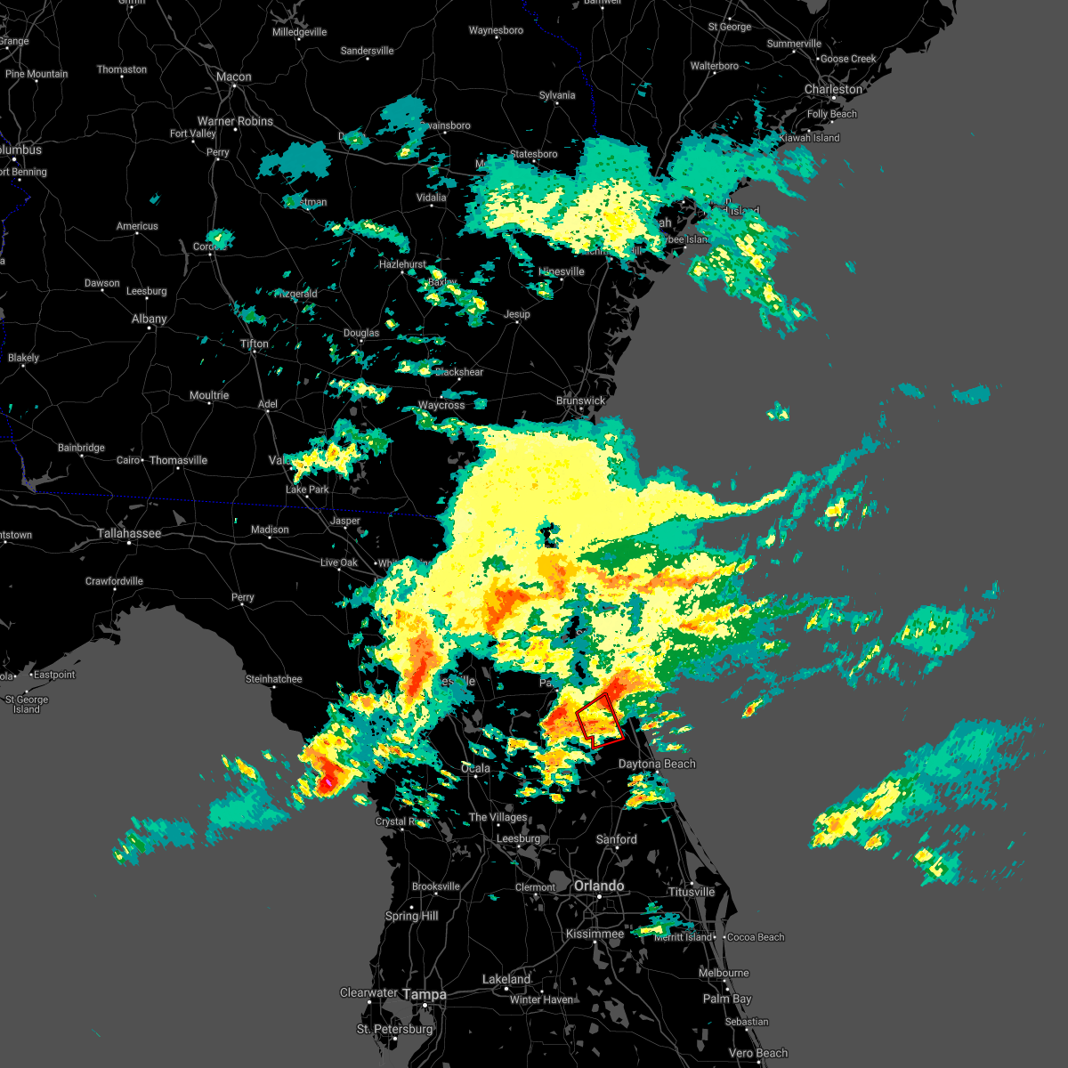 At 555 pm est, a severe thunderstorm capable of producing a tornado was located over andalusia, moving northeast at 30 mph (radar indicated rotation). Hazards include tornado. Flying debris will be dangerous to those caught without shelter. mobile homes will be damaged or destroyed. damage to roofs, windows, and vehicles will occur. tree damage is likely. this dangerous storm will be near, bunnell around 620 pm est. Other locations impacted by this tornadic thunderstorm include espanola. At 555 pm est, a severe thunderstorm capable of producing a tornado was located over andalusia, moving northeast at 30 mph (radar indicated rotation). Hazards include tornado. Flying debris will be dangerous to those caught without shelter. mobile homes will be damaged or destroyed. damage to roofs, windows, and vehicles will occur. tree damage is likely. this dangerous storm will be near, bunnell around 620 pm est. Other locations impacted by this tornadic thunderstorm include espanola.
|
| 2/6/2021 6:07 PM EST |
 At 607 pm est, a severe thunderstorm was located near bunnell, moving northeast at 40 mph (radar indicated). Hazards include 60 mph wind gusts and penny size hail. expect damage to roofs, siding, and trees At 607 pm est, a severe thunderstorm was located near bunnell, moving northeast at 40 mph (radar indicated). Hazards include 60 mph wind gusts and penny size hail. expect damage to roofs, siding, and trees
|
| 2/6/2021 5:56 PM EST |
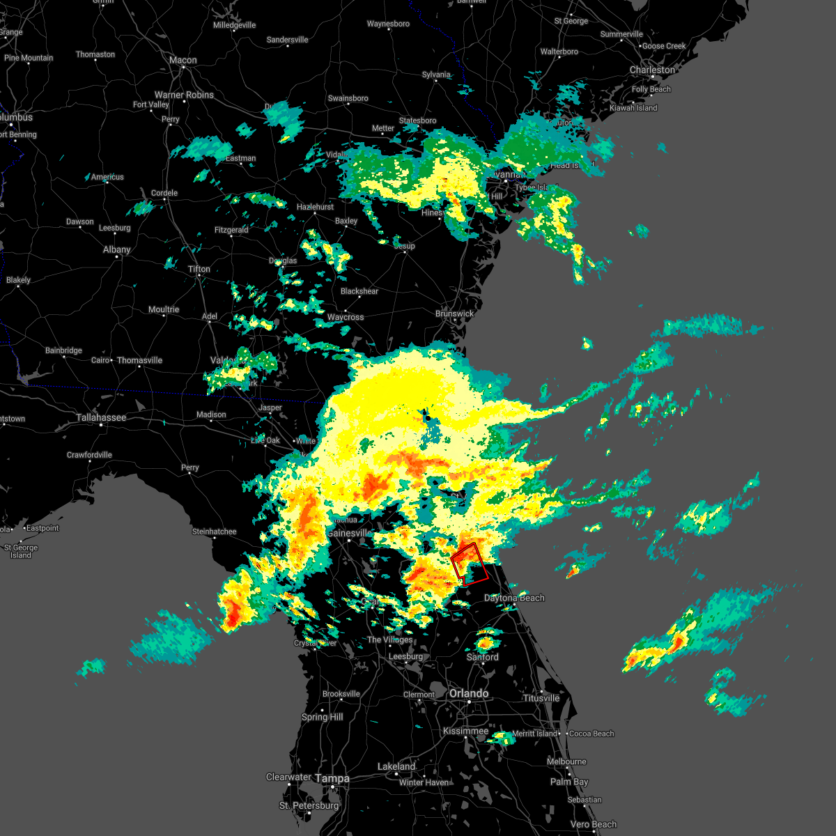 At 555 pm est, a severe thunderstorm capable of producing a tornado was located over andalusia, moving northeast at 30 mph (radar indicated rotation). Hazards include tornado. Flying debris will be dangerous to those caught without shelter. mobile homes will be damaged or destroyed. damage to roofs, windows, and vehicles will occur. tree damage is likely. this dangerous storm will be near, bunnell around 620 pm est. Other locations impacted by this tornadic thunderstorm include espanola. At 555 pm est, a severe thunderstorm capable of producing a tornado was located over andalusia, moving northeast at 30 mph (radar indicated rotation). Hazards include tornado. Flying debris will be dangerous to those caught without shelter. mobile homes will be damaged or destroyed. damage to roofs, windows, and vehicles will occur. tree damage is likely. this dangerous storm will be near, bunnell around 620 pm est. Other locations impacted by this tornadic thunderstorm include espanola.
|
| 2/6/2021 5:49 PM EST |
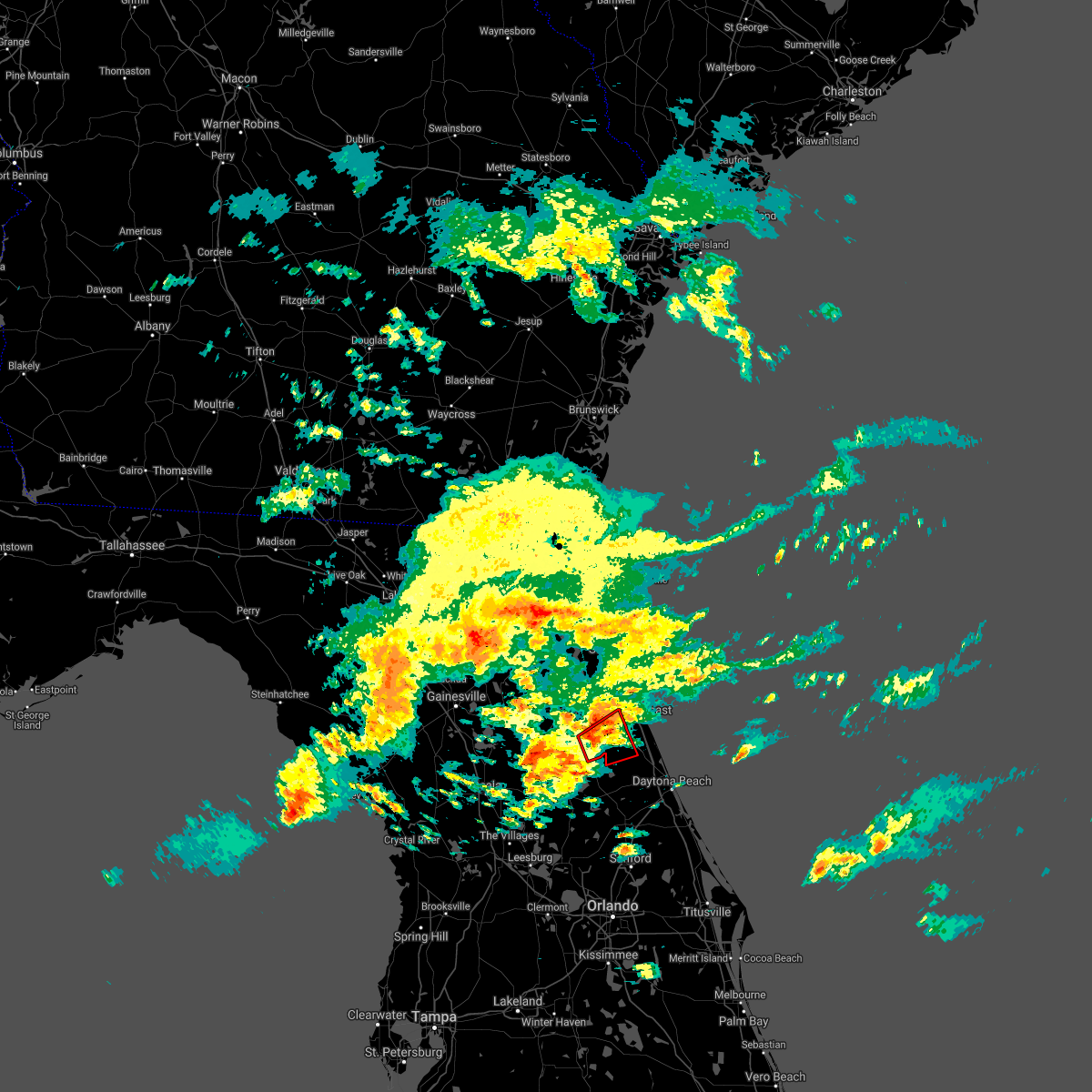 At 549 pm est, a severe thunderstorm capable of producing a tornado was located over andalusia, moving northeast at 30 mph (radar indicated rotation). Hazards include tornado. Flying debris will be dangerous to those caught without shelter. mobile homes will be damaged or destroyed. damage to roofs, windows, and vehicles will occur. tree damage is likely. this dangerous storm will be near, bunnell around 615 pm est. Other locations impacted by this tornadic thunderstorm include lake como and espanola. At 549 pm est, a severe thunderstorm capable of producing a tornado was located over andalusia, moving northeast at 30 mph (radar indicated rotation). Hazards include tornado. Flying debris will be dangerous to those caught without shelter. mobile homes will be damaged or destroyed. damage to roofs, windows, and vehicles will occur. tree damage is likely. this dangerous storm will be near, bunnell around 615 pm est. Other locations impacted by this tornadic thunderstorm include lake como and espanola.
|
| 2/6/2021 5:41 PM EST |
 At 541 pm est, a severe thunderstorm capable of producing a tornado was located near crescent city, moving northeast at 25 mph (radar indicated rotation). Hazards include tornado. Flying debris will be dangerous to those caught without shelter. mobile homes will be damaged or destroyed. damage to roofs, windows, and vehicles will occur. tree damage is likely. this dangerous storm will be near, crescent city around 550 pm est. andalusia around 600 pm est. Other locations impacted by this tornadic thunderstorm include lake como, espanola and georgetown. At 541 pm est, a severe thunderstorm capable of producing a tornado was located near crescent city, moving northeast at 25 mph (radar indicated rotation). Hazards include tornado. Flying debris will be dangerous to those caught without shelter. mobile homes will be damaged or destroyed. damage to roofs, windows, and vehicles will occur. tree damage is likely. this dangerous storm will be near, crescent city around 550 pm est. andalusia around 600 pm est. Other locations impacted by this tornadic thunderstorm include lake como, espanola and georgetown.
|
| 12/24/2020 7:50 PM EST | Tree down on powerline along fellowship dr... palm coast... f in flagler county FL, 4.4 miles S of Palm Coast, FL |
| 1/1/0001 12:00 AM | Power lines reported down on birch way and birchtree wa in flagler county FL, 3.9 miles SSE of Palm Coast, FL |
| 8/20/2020 6:55 PM EDT |
 At 655 pm edt, a severe thunderstorm was located near crescent beach, or 11 miles east of hastings, moving north at 20 mph (radar indicated). Hazards include 60 mph wind gusts and penny size hail. Expect damage to roofs, siding, and trees. Locations impacted include, saint augustine beach, marineland, crescent beach, saint augustine shores, butler beach, saint augustine south and dupont center. At 655 pm edt, a severe thunderstorm was located near crescent beach, or 11 miles east of hastings, moving north at 20 mph (radar indicated). Hazards include 60 mph wind gusts and penny size hail. Expect damage to roofs, siding, and trees. Locations impacted include, saint augustine beach, marineland, crescent beach, saint augustine shores, butler beach, saint augustine south and dupont center.
|
| 8/20/2020 6:45 PM EDT |
 At 645 pm edt, a severe thunderstorm was located 7 miles west of marineland, or 10 miles northwest of palm coast, moving north at 20 mph (radar indicated). Hazards include 60 mph wind gusts and penny size hail. expect damage to roofs, siding, and trees At 645 pm edt, a severe thunderstorm was located 7 miles west of marineland, or 10 miles northwest of palm coast, moving north at 20 mph (radar indicated). Hazards include 60 mph wind gusts and penny size hail. expect damage to roofs, siding, and trees
|
| 8/17/2020 5:37 PM EDT |
 The severe thunderstorm warning for eastern flagler county will expire at 545 pm edt, the storm which prompted the warning has weakened below severe limits, and no longer poses an immediate threat to life or property. therefore, the warning will be allowed to expire. The severe thunderstorm warning for eastern flagler county will expire at 545 pm edt, the storm which prompted the warning has weakened below severe limits, and no longer poses an immediate threat to life or property. therefore, the warning will be allowed to expire.
|
| 8/17/2020 5:20 PM EDT |
 At 520 pm edt, a severe thunderstorm was located near flagler beach, moving northeast at 10 mph (radar indicated). Hazards include 60 mph wind gusts and quarter size hail. Hail damage to vehicles is expected. expect wind damage to roofs, siding, and trees. Locations impacted include, palm coast, flagler beach, bunnell and beverly beach. At 520 pm edt, a severe thunderstorm was located near flagler beach, moving northeast at 10 mph (radar indicated). Hazards include 60 mph wind gusts and quarter size hail. Hail damage to vehicles is expected. expect wind damage to roofs, siding, and trees. Locations impacted include, palm coast, flagler beach, bunnell and beverly beach.
|
| 8/17/2020 5:05 PM EDT |
 At 505 pm edt, a severe thunderstorm was located near bunnell, moving northeast at 10 mph (radar indicated). Hazards include 60 mph wind gusts and nickel size hail. expect damage to roofs, siding, and trees At 505 pm edt, a severe thunderstorm was located near bunnell, moving northeast at 10 mph (radar indicated). Hazards include 60 mph wind gusts and nickel size hail. expect damage to roofs, siding, and trees
|
| 8/16/2020 5:53 PM EDT |
 At 553 pm edt, a severe thunderstorm was located near andalusia, moving east at 10 mph (radar indicated). Hazards include 60 mph wind gusts and nickel size hail. expect damage to roofs, siding, and trees At 553 pm edt, a severe thunderstorm was located near andalusia, moving east at 10 mph (radar indicated). Hazards include 60 mph wind gusts and nickel size hail. expect damage to roofs, siding, and trees
|
| 8/11/2020 3:15 PM EDT | Tree down blocking both lanes of colbert lane at waterfront park road. radar estimated tim in flagler county FL, 3.1 miles WSW of Palm Coast, FL |
| 7/11/2020 2:35 PM EDT | Tree fell onto house causing roof damagae near fischer lane and flamingo driv in flagler county FL, 2.4 miles S of Palm Coast, FL |
| 7/11/2020 2:29 PM EDT | Small tree limbs down with minor flooding at florida park drive and palm coast parkwa in flagler county FL, 2.5 miles SSW of Palm Coast, FL |
| 7/1/2020 1:56 PM EDT | A tree was blown down into power lines along 1250 belle terre parkwa in flagler county FL, 1.8 miles N of Palm Coast, FL |
| 6/30/2020 4:09 PM EDT |
 The severe thunderstorm warning for east central flagler county will expire at 415 pm edt, the storm which prompted the warning has weakened below severe limits, and has exited the warned area. therefore, the warning will be allowed to expire. however small hail, gusty winds and heavy rain are still possible with this thunderstorm. The severe thunderstorm warning for east central flagler county will expire at 415 pm edt, the storm which prompted the warning has weakened below severe limits, and has exited the warned area. therefore, the warning will be allowed to expire. however small hail, gusty winds and heavy rain are still possible with this thunderstorm.
|
| 6/30/2020 3:48 PM EDT |
 At 348 pm edt, a severe thunderstorm was located near palm coast, moving southeast at 15 mph (radar indicated). Hazards include 60 mph wind gusts and quarter size hail. Hail damage to vehicles is expected. Expect wind damage to roofs, siding, and trees. At 348 pm edt, a severe thunderstorm was located near palm coast, moving southeast at 15 mph (radar indicated). Hazards include 60 mph wind gusts and quarter size hail. Hail damage to vehicles is expected. Expect wind damage to roofs, siding, and trees.
|
| 6/24/2020 7:22 PM EDT | Tree down across creekside dr blocking the roa in flagler county FL, 3.1 miles WSW of Palm Coast, FL |
| 6/24/2020 7:20 PM EDT | Mesonet station 1334w 1.6 e palm coast (weatherstem in flagler county FL, 3.7 miles SSW of Palm Coast, FL |
| 6/24/2020 7:20 PM EDT | Mesonet station 1334w 1.6 e palm coast (weatherstem in flagler county FL, 3.7 miles SSW of Palm Coast, FL |
| 6/24/2020 7:20 PM EDT |
 At 719 pm edt, a severe thunderstorm was located over palm coast, moving southeast at 10 mph (radar indicated). Hazards include 60 mph wind gusts. expect damage to roofs, siding, and trees At 719 pm edt, a severe thunderstorm was located over palm coast, moving southeast at 10 mph (radar indicated). Hazards include 60 mph wind gusts. expect damage to roofs, siding, and trees
|
| 6/24/2020 7:01 PM EDT | Branches down near hammock dunes bridge from a downburst. radar estimated tim in flagler county FL, 3.7 miles SSW of Palm Coast, FL |
| 6/6/2020 9:35 PM EDT |
 At 934 pm edt, a severe thunderstorm was located near palm coast, moving north at 25 mph (radar indicated). Hazards include 60 mph wind gusts. Expect damage to roofs, siding, and trees. Locations impacted include, palm coast, bunnell, saint augustine shores, espanola and dupont center. At 934 pm edt, a severe thunderstorm was located near palm coast, moving north at 25 mph (radar indicated). Hazards include 60 mph wind gusts. Expect damage to roofs, siding, and trees. Locations impacted include, palm coast, bunnell, saint augustine shores, espanola and dupont center.
|
| 6/6/2020 9:16 PM EDT |
 At 916 pm edt, a severe thunderstorm was located near bunnell, moving north at 20 mph (radar indicated). Hazards include 60 mph wind gusts. expect damage to roofs, siding, and trees At 916 pm edt, a severe thunderstorm was located near bunnell, moving north at 20 mph (radar indicated). Hazards include 60 mph wind gusts. expect damage to roofs, siding, and trees
|
| 6/6/2020 9:04 PM EDT |
 At 904 pm edt, a severe thunderstorm was located near crescent beach, or 11 miles south of saint augustine, moving northwest at 35 mph (radar indicated). Hazards include 60 mph wind gusts. expect damage to roofs, siding, and trees At 904 pm edt, a severe thunderstorm was located near crescent beach, or 11 miles south of saint augustine, moving northwest at 35 mph (radar indicated). Hazards include 60 mph wind gusts. expect damage to roofs, siding, and trees
|
| 5/28/2020 3:29 PM EDT |
 At 329 pm edt, severe thunderstorms were located along a line extending from near picolata to 8 miles west of marineland, moving northeast at 20 mph (radar indicated). Hazards include 60 mph wind gusts and penny size hail. Expect damage to roofs, siding, and trees. Locations impacted include, saint augustine, world golf village, saint augustine beach, marineland, vilano beach, south ponte vedra, crescent beach, saint augustine shores, butler beach and saint augustine south. At 329 pm edt, severe thunderstorms were located along a line extending from near picolata to 8 miles west of marineland, moving northeast at 20 mph (radar indicated). Hazards include 60 mph wind gusts and penny size hail. Expect damage to roofs, siding, and trees. Locations impacted include, saint augustine, world golf village, saint augustine beach, marineland, vilano beach, south ponte vedra, crescent beach, saint augustine shores, butler beach and saint augustine south.
|
| 5/28/2020 3:14 PM EDT |
 At 314 pm edt, severe thunderstorms were located along a line extending from near picolata to 8 miles west of marineland, moving northeast at 25 mph (radar indicated). Hazards include 60 mph wind gusts and penny size hail. expect damage to roofs, siding, and trees At 314 pm edt, severe thunderstorms were located along a line extending from near picolata to 8 miles west of marineland, moving northeast at 25 mph (radar indicated). Hazards include 60 mph wind gusts and penny size hail. expect damage to roofs, siding, and trees
|
| 4/24/2020 5:19 AM EDT |
 The national weather service in jacksonville has issued a * severe thunderstorm warning for. southeastern flagler county in northeastern florida. until 600 am edt. At 519 am edt, a severe thunderstorm was located near pierson, moving east at 35 mph. The national weather service in jacksonville has issued a * severe thunderstorm warning for. southeastern flagler county in northeastern florida. until 600 am edt. At 519 am edt, a severe thunderstorm was located near pierson, moving east at 35 mph.
|
| 4/24/2020 5:00 AM EDT | A tree was blown down across 5800 old kings road in palm coast. the time of damage was based on rada in flagler county FL, 3.8 miles S of Palm Coast, FL |
| 4/24/2020 4:29 AM EDT |
 At 429 am edt, a severe thunderstorm was located over crescent city, moving east at 45 mph (radar indicated). Hazards include 60 mph wind gusts. expect damage to roofs, siding, and trees At 429 am edt, a severe thunderstorm was located over crescent city, moving east at 45 mph (radar indicated). Hazards include 60 mph wind gusts. expect damage to roofs, siding, and trees
|
| 4/20/2020 10:27 AM EDT | Flagler county emergency management reports a tree downed along palm harbor drive in the vicinity of the hammock dunes bridge. time of damage based on radar dat in flagler county FL, 3.7 miles SSW of Palm Coast, FL |
| 4/15/2020 1:39 PM EDT |
 The severe thunderstorm warning for northern flagler, st. johns and putnam counties will expire at 145 pm edt, the storm which prompted the warning has weakened below severe limits, and has exited the warned area. therefore, the warning will be allowed to expire. however gusty winds and heavy rain are still possible with this thunderstorm. The severe thunderstorm warning for northern flagler, st. johns and putnam counties will expire at 145 pm edt, the storm which prompted the warning has weakened below severe limits, and has exited the warned area. therefore, the warning will be allowed to expire. however gusty winds and heavy rain are still possible with this thunderstorm.
|
| 4/15/2020 1:14 PM EDT |
 At 114 pm edt, a severe thunderstorm was located over florahome, or near interlachen, moving east at 35 mph (radar indicated). Hazards include 60 mph wind gusts. Expect damage to roofs, siding, and trees. Locations impacted include, palm coast, saint augustine, palatka, interlachen, hastings, melrose, east palatka, world golf village, saint augustine beach and marineland. At 114 pm edt, a severe thunderstorm was located over florahome, or near interlachen, moving east at 35 mph (radar indicated). Hazards include 60 mph wind gusts. Expect damage to roofs, siding, and trees. Locations impacted include, palm coast, saint augustine, palatka, interlachen, hastings, melrose, east palatka, world golf village, saint augustine beach and marineland.
|
| 4/15/2020 1:02 PM EDT |
 At 101 pm edt, a severe thunderstorm was located over melrose landing, or near melrose, moving east at 35 mph (radar indicated). Hazards include 60 mph wind gusts. Expect damage to roofs, siding, and trees. Locations impacted include, palm coast, saint augustine, palatka, interlachen, keystone heights, hastings, melrose, east palatka, world golf village and saint augustine beach. At 101 pm edt, a severe thunderstorm was located over melrose landing, or near melrose, moving east at 35 mph (radar indicated). Hazards include 60 mph wind gusts. Expect damage to roofs, siding, and trees. Locations impacted include, palm coast, saint augustine, palatka, interlachen, keystone heights, hastings, melrose, east palatka, world golf village and saint augustine beach.
|
| 4/15/2020 12:45 PM EDT |
 At 1244 pm edt, a severe thunderstorm was located near orange heights, or 7 miles southwest of melrose, moving east at 35 mph (radar indicated). Hazards include 60 mph wind gusts. expect damage to roofs, siding, and trees At 1244 pm edt, a severe thunderstorm was located near orange heights, or 7 miles southwest of melrose, moving east at 35 mph (radar indicated). Hazards include 60 mph wind gusts. expect damage to roofs, siding, and trees
|
| 4/14/2020 4:06 PM EDT |
 At 405 pm edt, a severe thunderstorm was located over san mateo, or near east palatka, moving east at 25 mph (radar indicated). Hazards include 60 mph wind gusts. Expect damage to roofs, siding, and trees. Locations impacted include, palatka, east palatka, san mateo and satsuma. At 405 pm edt, a severe thunderstorm was located over san mateo, or near east palatka, moving east at 25 mph (radar indicated). Hazards include 60 mph wind gusts. Expect damage to roofs, siding, and trees. Locations impacted include, palatka, east palatka, san mateo and satsuma.
|
| 4/14/2020 3:58 PM EDT |
 At 357 pm edt, a severe thunderstorm was located over satsuma, or near palatka, moving east at 25 mph (radar indicated). Hazards include 60 mph wind gusts. expect damage to roofs, siding, and trees At 357 pm edt, a severe thunderstorm was located over satsuma, or near palatka, moving east at 25 mph (radar indicated). Hazards include 60 mph wind gusts. expect damage to roofs, siding, and trees
|
| 3/31/2020 8:45 PM EDT | Trees down on royal palms and belle terr in flagler county FL, 1.8 miles NNE of Palm Coast, FL |
| 2/6/2020 11:59 PM EST |
 At 1159 pm est, a severe thunderstorm was located 7 miles southwest of flagler beach, moving northeast at 55 mph (radar indicated). Hazards include 60 mph wind gusts. expect damage to roofs, siding, and trees At 1159 pm est, a severe thunderstorm was located 7 miles southwest of flagler beach, moving northeast at 55 mph (radar indicated). Hazards include 60 mph wind gusts. expect damage to roofs, siding, and trees
|
| 2/6/2020 11:42 PM EST |
 At 1141 pm est, severe thunderstorms were located along a line extending from near marineland to near pierson, moving northeast at 90 mph (radar indicated). Hazards include 60 to 70 mph wind gusts. Expect damage to roofs, siding, and trees. Locations impacted include, palm coast, flagler beach, bunnell, marineland, beverly beach and espanola. At 1141 pm est, severe thunderstorms were located along a line extending from near marineland to near pierson, moving northeast at 90 mph (radar indicated). Hazards include 60 to 70 mph wind gusts. Expect damage to roofs, siding, and trees. Locations impacted include, palm coast, flagler beach, bunnell, marineland, beverly beach and espanola.
|
| 2/6/2020 11:25 PM EST |
 At 1125 pm est, severe thunderstorms were located along a line extending from 6 miles southwest of crescent beach to near emeralda, moving east at 35 mph (radar indicated). Hazards include 60 mph wind gusts. Expect damage to roofs, siding, and trees. Locations impacted include, palm coast, flagler beach, bunnell, crescent city, pomona park, andalusia, juniper springs, marineland, fruitland and beverly beach. At 1125 pm est, severe thunderstorms were located along a line extending from 6 miles southwest of crescent beach to near emeralda, moving east at 35 mph (radar indicated). Hazards include 60 mph wind gusts. Expect damage to roofs, siding, and trees. Locations impacted include, palm coast, flagler beach, bunnell, crescent city, pomona park, andalusia, juniper springs, marineland, fruitland and beverly beach.
|
| 2/6/2020 10:57 PM EST |
 At 1056 pm est, severe thunderstorms were located along a line extending from near satsuma to near the villages, moving east at 45 mph (radar indicated). Hazards include 60 to 70 mph wind gusts. Expect considerable tree damage. Damage is likely to mobile homes, roofs, and outbuildings. At 1056 pm est, severe thunderstorms were located along a line extending from near satsuma to near the villages, moving east at 45 mph (radar indicated). Hazards include 60 to 70 mph wind gusts. Expect considerable tree damage. Damage is likely to mobile homes, roofs, and outbuildings.
|
| 12/14/2019 5:35 AM EST |
 At 535 am est, a severe thunderstorm capable of producing a tornado was located near flagler beach, moving east at 40 mph (radar indicated rotation). Hazards include tornado. Flying debris will be dangerous to those caught without shelter. mobile homes will be damaged or destroyed. damage to roofs, windows, and vehicles will occur. tree damage is likely. This dangerous storm will be near, flagler beach around 540 am est. At 535 am est, a severe thunderstorm capable of producing a tornado was located near flagler beach, moving east at 40 mph (radar indicated rotation). Hazards include tornado. Flying debris will be dangerous to those caught without shelter. mobile homes will be damaged or destroyed. damage to roofs, windows, and vehicles will occur. tree damage is likely. This dangerous storm will be near, flagler beach around 540 am est.
|
| 12/14/2019 5:30 AM EST | Trees down near us-1 and seminole woods blvd. radar estimated tim in flagler county FL, 7.3 miles N of Palm Coast, FL |
| 12/14/2019 5:26 AM EST |
 At 526 am est, a severe thunderstorm capable of producing a tornado was located near bunnell, moving east at 40 mph (radar indicated rotation). Hazards include tornado. Flying debris will be dangerous to those caught without shelter. mobile homes will be damaged or destroyed. damage to roofs, windows, and vehicles will occur. tree damage is likely. this dangerous storm will be near, palm coast around 530 am est. flagler beach around 540 am est. Other locations impacted by this tornadic thunderstorm include beverly beach. At 526 am est, a severe thunderstorm capable of producing a tornado was located near bunnell, moving east at 40 mph (radar indicated rotation). Hazards include tornado. Flying debris will be dangerous to those caught without shelter. mobile homes will be damaged or destroyed. damage to roofs, windows, and vehicles will occur. tree damage is likely. this dangerous storm will be near, palm coast around 530 am est. flagler beach around 540 am est. Other locations impacted by this tornadic thunderstorm include beverly beach.
|
| 12/14/2019 5:17 AM EST |
 At 516 am est, a severe thunderstorm capable of producing a tornado was located 8 miles southeast of crescent city, moving east at 40 mph (radar indicated rotation). Hazards include tornado. Flying debris will be dangerous to those caught without shelter. mobile homes will be damaged or destroyed. damage to roofs, windows, and vehicles will occur. tree damage is likely. this dangerous storm will be near, palm coast and bunnell around 535 am est. flagler beach around 540 am est. Other locations impacted by this tornadic thunderstorm include beverly beach. At 516 am est, a severe thunderstorm capable of producing a tornado was located 8 miles southeast of crescent city, moving east at 40 mph (radar indicated rotation). Hazards include tornado. Flying debris will be dangerous to those caught without shelter. mobile homes will be damaged or destroyed. damage to roofs, windows, and vehicles will occur. tree damage is likely. this dangerous storm will be near, palm coast and bunnell around 535 am est. flagler beach around 540 am est. Other locations impacted by this tornadic thunderstorm include beverly beach.
|
| 12/14/2019 5:08 AM EST |
 At 508 am est, a severe thunderstorm was located near crescent city, moving east at 50 mph (radar indicated). Hazards include 60 mph wind gusts. Expect damage to roofs, siding, and trees. Locations impacted include, palm coast, flagler beach, bunnell, crescent city, marineland, beverly beach and espanola. At 508 am est, a severe thunderstorm was located near crescent city, moving east at 50 mph (radar indicated). Hazards include 60 mph wind gusts. Expect damage to roofs, siding, and trees. Locations impacted include, palm coast, flagler beach, bunnell, crescent city, marineland, beverly beach and espanola.
|
| 12/14/2019 4:57 AM EST |
 The national weather service in jacksonville has issued a * severe thunderstorm warning for. flagler county in northeastern florida. east central marion county in northern florida. southeastern putnam county in northeastern florida. Until 545 am est. The national weather service in jacksonville has issued a * severe thunderstorm warning for. flagler county in northeastern florida. east central marion county in northern florida. southeastern putnam county in northeastern florida. Until 545 am est.
|
| 7/11/2019 5:08 PM EDT |
 A severe thunderstorm warning remains in effect until 545 pm edt for st. johns county. at 508 pm edt, a severe thunderstorm was located 7 miles southwest of saint augustine shores, or 8 miles east of hastings, moving north at 20 mph. hazard. 60 mph wind gusts and penny size hail. A severe thunderstorm warning remains in effect until 545 pm edt for st. johns county. at 508 pm edt, a severe thunderstorm was located 7 miles southwest of saint augustine shores, or 8 miles east of hastings, moving north at 20 mph. hazard. 60 mph wind gusts and penny size hail.
|
| 7/11/2019 4:56 PM EDT |
 The national weather service in jacksonville has issued a * severe thunderstorm warning for. st. johns county in northeastern florida. until 545 pm edt. At 456 pm edt, a severe thunderstorm was located 7 miles west of marineland, or 9 miles northwest of palm coast, moving north at 20. The national weather service in jacksonville has issued a * severe thunderstorm warning for. st. johns county in northeastern florida. until 545 pm edt. At 456 pm edt, a severe thunderstorm was located 7 miles west of marineland, or 9 miles northwest of palm coast, moving north at 20.
|
| 6/12/2019 1:02 PM EDT | Tree down in a yard across driveway in pines lake section of palm coas in flagler county FL, 3.2 miles SSW of Palm Coast, FL |
| 6/12/2019 12:31 PM EDT | Tree down in a yard across driveway in pines lake section of palm coast. corrected tim in flagler county FL, 3.2 miles SSW of Palm Coast, FL |
| 6/9/2019 12:30 PM EDT | Tree down near i-95 and near 289 milepos in flagler county FL, 2.4 miles S of Palm Coast, FL |
| 6/9/2019 12:30 PM EDT | Tree down near st johns av in flagler county FL, 4 miles SW of Palm Coast, FL |
| 5/5/2019 1:05 PM EDT |
 The severe thunderstorm warning for central flagler and southeastern st. johns counties will expire at 115 pm edt, the storms which prompted the warning have moved out of the area. therefore, the warning will be allowed to expire. however gusty winds and heavy rain are still possible with these thunderstorms. to report severe weather, contact your nearest law enforcement agency. they will relay your report to the national weather service jacksonville. The severe thunderstorm warning for central flagler and southeastern st. johns counties will expire at 115 pm edt, the storms which prompted the warning have moved out of the area. therefore, the warning will be allowed to expire. however gusty winds and heavy rain are still possible with these thunderstorms. to report severe weather, contact your nearest law enforcement agency. they will relay your report to the national weather service jacksonville.
|
| 5/5/2019 12:59 PM EDT | Tree down on powerline along hernandez av in flagler county FL, 5.2 miles S of Palm Coast, FL |
| 5/5/2019 12:53 PM EDT |
 At 1252 pm edt, severe thunderstorms were located along a line extending from 6 miles west of saint augustine to saint augustine shores to near bunnell, moving northeast at 60 mph. weak rotation was evident east of bakersville (radar indicated). Hazards include 60 mph wind gusts. Expect damage to roofs, siding, and trees. Locations impacted include, palm coast, saint augustine, flagler beach, bunnell, world golf village, saint augustine beach, marineland, vilano beach, south ponte vedra and crescent beach. At 1252 pm edt, severe thunderstorms were located along a line extending from 6 miles west of saint augustine to saint augustine shores to near bunnell, moving northeast at 60 mph. weak rotation was evident east of bakersville (radar indicated). Hazards include 60 mph wind gusts. Expect damage to roofs, siding, and trees. Locations impacted include, palm coast, saint augustine, flagler beach, bunnell, world golf village, saint augustine beach, marineland, vilano beach, south ponte vedra and crescent beach.
|
| 5/5/2019 12:44 PM EDT |
 At 1244 pm edt, severe thunderstorms were located along a line extending from 7 miles east of picolata to near saint augustine shores to near bunnell, moving northeast at 50 mph (radar indicated). Hazards include 60 mph wind gusts. Expect damage to roofs, siding, and trees. Locations impacted include, palm coast, saint augustine, flagler beach, bunnell, world golf village, saint augustine beach, marineland, vilano beach, picolata and south ponte vedra. At 1244 pm edt, severe thunderstorms were located along a line extending from 7 miles east of picolata to near saint augustine shores to near bunnell, moving northeast at 50 mph (radar indicated). Hazards include 60 mph wind gusts. Expect damage to roofs, siding, and trees. Locations impacted include, palm coast, saint augustine, flagler beach, bunnell, world golf village, saint augustine beach, marineland, vilano beach, picolata and south ponte vedra.
|
| 5/5/2019 12:25 PM EDT |
 At 1224 pm edt, severe thunderstorms were located along a line extending from near bostwick to near orange mills to near crescent city, moving northeast at 45 mph (radar indicated). Hazards include 60 mph wind gusts. expect damage to roofs, siding, and trees At 1224 pm edt, severe thunderstorms were located along a line extending from near bostwick to near orange mills to near crescent city, moving northeast at 45 mph (radar indicated). Hazards include 60 mph wind gusts. expect damage to roofs, siding, and trees
|
| 4/19/2019 2:52 PM EDT |
 The severe thunderstorm warning for southeastern flagler county will expire at 300 pm edt, the storm which prompted the warning has weakened below severe limits, and no longer poses an immediate threat to life or property. therefore, the warning will be allowed to expire. however gusty winds between 30 and 40 mph are still possible with this thunderstorm. a tornado watch remains in effect until 400 pm edt for northeastern florida. The severe thunderstorm warning for southeastern flagler county will expire at 300 pm edt, the storm which prompted the warning has weakened below severe limits, and no longer poses an immediate threat to life or property. therefore, the warning will be allowed to expire. however gusty winds between 30 and 40 mph are still possible with this thunderstorm. a tornado watch remains in effect until 400 pm edt for northeastern florida.
|
| 4/19/2019 2:50 PM EDT | Emergency manager relayed a report of tree down on a power line at 37 briarwood rd. time estimated by rada in flagler county FL, 3.2 miles N of Palm Coast, FL |
| 4/19/2019 2:44 PM EDT |
 At 244 pm edt, a severe thunderstorm was located over flagler beach, moving northeast at 45 mph (radar indicated). Hazards include 60 mph wind gusts. Expect damage to roofs, siding, and trees. Locations impacted include, flagler beach, bunnell and beverly beach. At 244 pm edt, a severe thunderstorm was located over flagler beach, moving northeast at 45 mph (radar indicated). Hazards include 60 mph wind gusts. Expect damage to roofs, siding, and trees. Locations impacted include, flagler beach, bunnell and beverly beach.
|
| 4/19/2019 2:27 PM EDT |
 At 226 pm edt, a severe thunderstorm was located 7 miles south of bunnell, moving northeast at 40 mph (radar indicated). Hazards include 60 mph wind gusts. expect damage to roofs, siding, and trees At 226 pm edt, a severe thunderstorm was located 7 miles south of bunnell, moving northeast at 40 mph (radar indicated). Hazards include 60 mph wind gusts. expect damage to roofs, siding, and trees
|
| 4/19/2019 2:08 PM EDT |
 At 208 pm edt, severe thunderstorms were located along a line extending from 27 miles east of sawgrass to 6 miles northeast of pittman, moving east at 40 mph (radar indicated). Hazards include 60 mph wind gusts. Expect damage to roofs, siding, and trees. Locations impacted include, palm coast, saint augustine, flagler beach, bunnell, andalusia, saint augustine beach, marineland, crescent beach, saint augustine shores and butler beach. At 208 pm edt, severe thunderstorms were located along a line extending from 27 miles east of sawgrass to 6 miles northeast of pittman, moving east at 40 mph (radar indicated). Hazards include 60 mph wind gusts. Expect damage to roofs, siding, and trees. Locations impacted include, palm coast, saint augustine, flagler beach, bunnell, andalusia, saint augustine beach, marineland, crescent beach, saint augustine shores and butler beach.
|
| 4/19/2019 2:03 PM EDT |
 At 203 pm edt, severe thunderstorms were located along a line extending from 24 miles east of sawgrass to near pittman, moving east at 40 mph (radar indicated). Hazards include 60 mph wind gusts. Expect damage to roofs, siding, and trees. Locations impacted include, palm coast, saint augustine, flagler beach, bunnell, crescent city, pomona park, andalusia, saint augustine beach, marineland and fruitland. At 203 pm edt, severe thunderstorms were located along a line extending from 24 miles east of sawgrass to near pittman, moving east at 40 mph (radar indicated). Hazards include 60 mph wind gusts. Expect damage to roofs, siding, and trees. Locations impacted include, palm coast, saint augustine, flagler beach, bunnell, crescent city, pomona park, andalusia, saint augustine beach, marineland and fruitland.
|
| 4/19/2019 1:56 PM EDT |
 At 156 pm edt, severe thunderstorms were located along a line extending from 20 miles east of sawgrass to near pittman, moving east at 40 mph (radar indicated). Hazards include 60 mph wind gusts. Expect damage to roofs, siding, and trees. Locations impacted include, palm coast, saint augustine, flagler beach, bunnell, crescent city, pomona park, hastings, salt springs, andalusia and juniper springs. At 156 pm edt, severe thunderstorms were located along a line extending from 20 miles east of sawgrass to near pittman, moving east at 40 mph (radar indicated). Hazards include 60 mph wind gusts. Expect damage to roofs, siding, and trees. Locations impacted include, palm coast, saint augustine, flagler beach, bunnell, crescent city, pomona park, hastings, salt springs, andalusia and juniper springs.
|
| 4/19/2019 1:25 PM EDT |
 At 125 pm edt, severe thunderstorms were located along a line extending from sawgrass to near lake weir, moving east at 40 mph (radar indicated). Hazards include 60 mph wind gusts. expect damage to roofs, siding, and trees At 125 pm edt, severe thunderstorms were located along a line extending from sawgrass to near lake weir, moving east at 40 mph (radar indicated). Hazards include 60 mph wind gusts. expect damage to roofs, siding, and trees
|
| 4/6/2019 5:54 PM EDT |
 At 554 pm edt, severe thunderstorms were located along a line extending from near crescent city to 6 miles southwest of bunnell, and are nearly stationary (radar indicated). Hazards include 60 mph wind gusts and half dollar size hail. Hail damage to vehicles is expected. expect wind damage to roofs, siding, and trees. Locations impacted include, bunnell. At 554 pm edt, severe thunderstorms were located along a line extending from near crescent city to 6 miles southwest of bunnell, and are nearly stationary (radar indicated). Hazards include 60 mph wind gusts and half dollar size hail. Hail damage to vehicles is expected. expect wind damage to roofs, siding, and trees. Locations impacted include, bunnell.
|
| 4/6/2019 5:30 PM EDT |
 At 530 pm edt, severe thunderstorms were located along a line extending from bunnell to 12 miles southwest of flagler beach, moving east at 10 mph (radar indicated). Hazards include 60 mph wind gusts and quarter size hail. Hail damage to vehicles is expected. Expect wind damage to roofs, siding, and trees. At 530 pm edt, severe thunderstorms were located along a line extending from bunnell to 12 miles southwest of flagler beach, moving east at 10 mph (radar indicated). Hazards include 60 mph wind gusts and quarter size hail. Hail damage to vehicles is expected. Expect wind damage to roofs, siding, and trees.
|
| 3/2/2019 5:05 PM EST |
 At 504 pm est, a severe thunderstorm was located near bunnell, moving east near 30 mph (radar indicated). Hazards include 60 mph wind gusts and penny size hail. Expect damage to roofs, siding, and trees. Locations impacted include, bunnell, andalusia and espanola. At 504 pm est, a severe thunderstorm was located near bunnell, moving east near 30 mph (radar indicated). Hazards include 60 mph wind gusts and penny size hail. Expect damage to roofs, siding, and trees. Locations impacted include, bunnell, andalusia and espanola.
|
| 3/2/2019 4:52 PM EST |
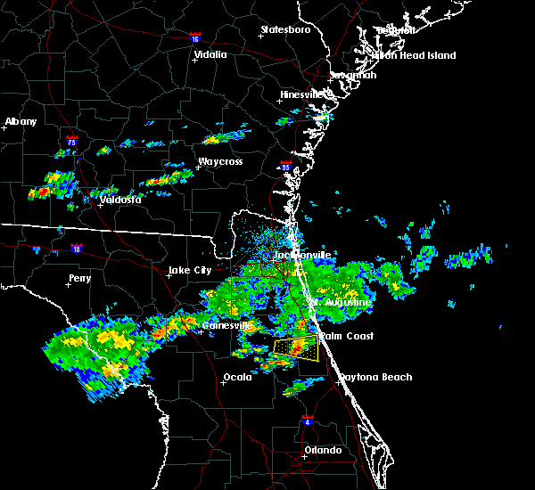 At 451 pm est, a severe thunderstorm was located over andalusia, moving east at 20 mph (radar indicated). Hazards include 60 mph wind gusts and penny size hail. Expect damage to roofs, siding, and trees. Locations impacted include, bunnell, andalusia and espanola. At 451 pm est, a severe thunderstorm was located over andalusia, moving east at 20 mph (radar indicated). Hazards include 60 mph wind gusts and penny size hail. Expect damage to roofs, siding, and trees. Locations impacted include, bunnell, andalusia and espanola.
|
| 3/2/2019 4:30 PM EST |
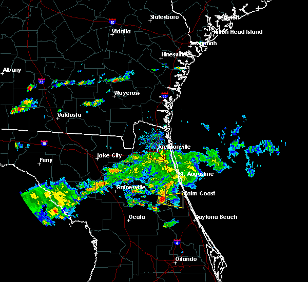 At 429 pm est, a severe thunderstorm was located over pomona park, moving east at 30 mph (radar indicated). Hazards include 60 mph wind gusts and penny size hail. expect damage to roofs, siding, and trees At 429 pm est, a severe thunderstorm was located over pomona park, moving east at 30 mph (radar indicated). Hazards include 60 mph wind gusts and penny size hail. expect damage to roofs, siding, and trees
|
| 3/1/2019 4:43 PM EST | Palm coast fire department passed on a report of several trees down near royal palms and belle terre parkway in palm coas in flagler county FL, 1.8 miles N of Palm Coast, FL |
| 3/1/2019 4:41 PM EST |
 At 440 pm est, a severe thunderstorm was located near palm coast, moving east at 40 mph (radar indicated). Hazards include 60 mph wind gusts and penny size hail. Expect damage to roofs, siding, and trees. Locations impacted include, palm coast, flagler beach, bunnell, beverly beach and espanola. At 440 pm est, a severe thunderstorm was located near palm coast, moving east at 40 mph (radar indicated). Hazards include 60 mph wind gusts and penny size hail. Expect damage to roofs, siding, and trees. Locations impacted include, palm coast, flagler beach, bunnell, beverly beach and espanola.
|
| 3/1/2019 4:35 PM EST |
 At 435 pm est, a severe thunderstorm was located near bunnell, moving east at 40 mph (radar indicated). Hazards include 60 mph wind gusts and penny size hail. Expect damage to roofs, siding, and trees. Locations impacted include, palm coast, flagler beach, bunnell, marineland, beverly beach and espanola. At 435 pm est, a severe thunderstorm was located near bunnell, moving east at 40 mph (radar indicated). Hazards include 60 mph wind gusts and penny size hail. Expect damage to roofs, siding, and trees. Locations impacted include, palm coast, flagler beach, bunnell, marineland, beverly beach and espanola.
|
| 3/1/2019 4:23 PM EST |
 At 422 pm est, a severe thunderstorm was located near andalusia, moving east at 30 mph (radar indicated). Hazards include 60 mph wind gusts and penny size hail. expect damage to roofs, siding, and trees At 422 pm est, a severe thunderstorm was located near andalusia, moving east at 30 mph (radar indicated). Hazards include 60 mph wind gusts and penny size hail. expect damage to roofs, siding, and trees
|
| 1/24/2019 6:10 AM EST |
 At 610 am est, a severe thunderstorm was located 10 miles northeast of marineland, or 13 miles northeast of palm coast, moving northeast at 55 mph (radar indicated). Hazards include 60 mph wind gusts. Expect damage to roofs, siding, and trees. Locations impacted include, palm coast, marineland and crescent beach. At 610 am est, a severe thunderstorm was located 10 miles northeast of marineland, or 13 miles northeast of palm coast, moving northeast at 55 mph (radar indicated). Hazards include 60 mph wind gusts. Expect damage to roofs, siding, and trees. Locations impacted include, palm coast, marineland and crescent beach.
|
| 1/24/2019 6:04 AM EST |
 At 603 am est, a severe thunderstorm capable of producing a tornado was located near marineland, or 9 miles northeast of palm coast, moving northeast at 55 mph (radar indicated rotation). Hazards include tornado. Flying debris will be dangerous to those caught without shelter. mobile homes will be damaged or destroyed. damage to roofs, windows, and vehicles will occur. tree damage is likely. Locations impacted include, marineland. At 603 am est, a severe thunderstorm capable of producing a tornado was located near marineland, or 9 miles northeast of palm coast, moving northeast at 55 mph (radar indicated rotation). Hazards include tornado. Flying debris will be dangerous to those caught without shelter. mobile homes will be damaged or destroyed. damage to roofs, windows, and vehicles will occur. tree damage is likely. Locations impacted include, marineland.
|
| 1/24/2019 5:57 AM EST |
 At 557 am est, a severe thunderstorm capable of producing a tornado was located over marineland, or near palm coast, moving northeast at 55 mph (radar indicated rotation). Hazards include tornado. Flying debris will be dangerous to those caught without shelter. mobile homes will be damaged or destroyed. damage to roofs, windows, and vehicles will occur. tree damage is likely. this tornadic thunderstorm will remain over mainly rural areas of northeastern flagler and southeastern st. Johns counties. At 557 am est, a severe thunderstorm capable of producing a tornado was located over marineland, or near palm coast, moving northeast at 55 mph (radar indicated rotation). Hazards include tornado. Flying debris will be dangerous to those caught without shelter. mobile homes will be damaged or destroyed. damage to roofs, windows, and vehicles will occur. tree damage is likely. this tornadic thunderstorm will remain over mainly rural areas of northeastern flagler and southeastern st. Johns counties.
|
| 1/24/2019 5:53 AM EST |
 At 552 am est, a severe thunderstorm was located 7 miles west of palm coast, moving northeast at 55 mph (radar indicated). Hazards include 60 mph wind gusts. expect damage to roofs, siding, and trees At 552 am est, a severe thunderstorm was located 7 miles west of palm coast, moving northeast at 55 mph (radar indicated). Hazards include 60 mph wind gusts. expect damage to roofs, siding, and trees
|
| 1/4/2019 4:10 PM EST | An emergency manager relayed a report of a tree down near whiteview parkway and belle terre parkway in palm coas in flagler county FL, 0.4 miles NNW of Palm Coast, FL |
| 1/4/2019 4:05 PM EST | An emergency manager relayed a report of a tree down on power lines near wellshire lane and wellstone drive in palm coas in flagler county FL, 2.3 miles SE of Palm Coast, FL |
| 11/2/2018 4:48 PM EDT |
 At 447 pm edt, a severe thunderstorm was located near hastings, moving northeast at 30 mph (radar indicated). Hazards include 60 mph wind gusts. Expect damage to roofs, siding, and trees. Locations impacted include, saint augustine, hastings, saint augustine shores, butler beach, saint augustine south, crescent beach, spuds, dupont center and elkton. At 447 pm edt, a severe thunderstorm was located near hastings, moving northeast at 30 mph (radar indicated). Hazards include 60 mph wind gusts. Expect damage to roofs, siding, and trees. Locations impacted include, saint augustine, hastings, saint augustine shores, butler beach, saint augustine south, crescent beach, spuds, dupont center and elkton.
|
| 11/2/2018 4:35 PM EDT |
 At 434 pm edt, a severe thunderstorm was located over orange mills, or over hastings, moving northeast at 25 mph (radar indicated). Hazards include 60 mph wind gusts. expect damage to roofs, siding, and trees At 434 pm edt, a severe thunderstorm was located over orange mills, or over hastings, moving northeast at 25 mph (radar indicated). Hazards include 60 mph wind gusts. expect damage to roofs, siding, and trees
|
| 10/9/2018 10:22 AM EDT | An emergency manager relayed a report of a small pine tree down on us 1 at north old kings road that was blocking one lane of us in flagler county FL, 8.8 miles SSE of Palm Coast, FL |
| 7/27/2018 5:24 PM EDT |
 At 523 pm edt, a severe thunderstorm was located over bunnell, moving east at 15 mph (radar indicated). Hazards include 60 mph wind gusts and penny size hail. expect damage to roofs, siding, and trees At 523 pm edt, a severe thunderstorm was located over bunnell, moving east at 15 mph (radar indicated). Hazards include 60 mph wind gusts and penny size hail. expect damage to roofs, siding, and trees
|
| 7/22/2018 1:19 PM EDT |
 At 118 pm edt, severe thunderstorms were located along a line extending from near palm coast to 8 miles southeast of crescent city, moving east at 50 mph (radar indicated). Hazards include 70 mph wind gusts and quarter size hail. Hail damage to vehicles is expected. expect considerable tree damage. wind damage is also likely to mobile homes, roofs, and outbuildings. Locations impacted include, palm coast, bunnell, andalusia, beverly beach and espanola. At 118 pm edt, severe thunderstorms were located along a line extending from near palm coast to 8 miles southeast of crescent city, moving east at 50 mph (radar indicated). Hazards include 70 mph wind gusts and quarter size hail. Hail damage to vehicles is expected. expect considerable tree damage. wind damage is also likely to mobile homes, roofs, and outbuildings. Locations impacted include, palm coast, bunnell, andalusia, beverly beach and espanola.
|
| 7/22/2018 1:09 PM EDT |
 At 109 pm edt, severe thunderstorms were located along a line extending from near palm coast to 7 miles southeast of crescent city, moving east at 50 mph (radar indicated). Hazards include 70 mph wind gusts and quarter size hail. Hail damage to vehicles is expected. expect considerable tree damage. wind damage is also likely to mobile homes, roofs, and outbuildings. Locations impacted include, palm coast, bunnell, crescent city, andalusia, beverly beach and espanola. At 109 pm edt, severe thunderstorms were located along a line extending from near palm coast to 7 miles southeast of crescent city, moving east at 50 mph (radar indicated). Hazards include 70 mph wind gusts and quarter size hail. Hail damage to vehicles is expected. expect considerable tree damage. wind damage is also likely to mobile homes, roofs, and outbuildings. Locations impacted include, palm coast, bunnell, crescent city, andalusia, beverly beach and espanola.
|
| 7/22/2018 1:03 PM EDT |
 At 103 pm edt, severe thunderstorms were located along a line extending from palm coast to 9 miles northeast of pierson, moving southeast at 35 mph (radar indicated). Hazards include 60 mph wind gusts and quarter size hail. Hail damage to vehicles is expected. expect wind damage to roofs, siding, and trees. Locations impacted include, palm coast, flagler beach, bunnell, crescent city, andalusia, marineland, beverly beach and espanola. At 103 pm edt, severe thunderstorms were located along a line extending from palm coast to 9 miles northeast of pierson, moving southeast at 35 mph (radar indicated). Hazards include 60 mph wind gusts and quarter size hail. Hail damage to vehicles is expected. expect wind damage to roofs, siding, and trees. Locations impacted include, palm coast, flagler beach, bunnell, crescent city, andalusia, marineland, beverly beach and espanola.
|
| 7/22/2018 12:56 PM EDT |
 At 1255 pm edt, a severe thunderstorm was located near palm coast, moving east at 25 mph (radar indicated). Hazards include 70 mph wind gusts and quarter size hail. Hail damage to vehicles is expected. expect considerable tree damage. wind damage is also likely to mobile homes, roofs, and outbuildings. Locations impacted include, saint augustine, saint augustine beach, marineland, crescent beach, saint augustine shores, butler beach, vilano beach, saint augustine south, spuds and anastasia. At 1255 pm edt, a severe thunderstorm was located near palm coast, moving east at 25 mph (radar indicated). Hazards include 70 mph wind gusts and quarter size hail. Hail damage to vehicles is expected. expect considerable tree damage. wind damage is also likely to mobile homes, roofs, and outbuildings. Locations impacted include, saint augustine, saint augustine beach, marineland, crescent beach, saint augustine shores, butler beach, vilano beach, saint augustine south, spuds and anastasia.
|
| 7/22/2018 12:48 PM EDT |
 At 1247 pm edt, severe thunderstorms were located along a line extending from near butler beach to near fruitland, moving east at 50 mph (radar indicated). Hazards include 60 mph wind gusts and quarter size hail. Hail damage to vehicles is expected. Expect wind damage to roofs, siding, and trees. At 1247 pm edt, severe thunderstorms were located along a line extending from near butler beach to near fruitland, moving east at 50 mph (radar indicated). Hazards include 60 mph wind gusts and quarter size hail. Hail damage to vehicles is expected. Expect wind damage to roofs, siding, and trees.
|
| 7/22/2018 12:23 PM EDT |
 At 1223 pm edt, a severe thunderstorm was located near hastings, moving east at 25 mph (radar indicated). Hazards include 70 mph wind gusts and quarter size hail. Hail damage to vehicles is expected. expect considerable tree damage. Wind damage is also likely to mobile homes, roofs, and outbuildings. At 1223 pm edt, a severe thunderstorm was located near hastings, moving east at 25 mph (radar indicated). Hazards include 70 mph wind gusts and quarter size hail. Hail damage to vehicles is expected. expect considerable tree damage. Wind damage is also likely to mobile homes, roofs, and outbuildings.
|
| 7/22/2018 12:01 PM EDT |
 At 1145 am edt, a severe thunderstorm was located 7 miles east of andalusia, moving southeast at 20 mph (radar indicated). Hazards include 70 mph wind gusts and quarter size hail. Hail damage to vehicles is expected. expect considerable tree damage. Wind damage is also likely to mobile homes, roofs, and outbuildings. At 1145 am edt, a severe thunderstorm was located 7 miles east of andalusia, moving southeast at 20 mph (radar indicated). Hazards include 70 mph wind gusts and quarter size hail. Hail damage to vehicles is expected. expect considerable tree damage. Wind damage is also likely to mobile homes, roofs, and outbuildings.
|
| 7/22/2018 11:46 AM EDT |
 At 1145 am edt, a severe thunderstorm was located 7 miles east of andalusia, moving southeast at 20 mph (radar indicated). Hazards include 70 mph wind gusts and quarter size hail. Hail damage to vehicles is expected. expect considerable tree damage. Wind damage is also likely to mobile homes, roofs, and outbuildings. At 1145 am edt, a severe thunderstorm was located 7 miles east of andalusia, moving southeast at 20 mph (radar indicated). Hazards include 70 mph wind gusts and quarter size hail. Hail damage to vehicles is expected. expect considerable tree damage. Wind damage is also likely to mobile homes, roofs, and outbuildings.
|
| 7/16/2018 5:33 PM EDT |
 At 533 pm edt, a severe thunderstorm was located 8 miles south of bunnell, moving northeast at 15 mph (radar indicated). Hazards include 60 mph wind gusts and nickel size hail. Expect damage to roofs, siding, and trees. Locations impacted include, palm coast, flagler beach, bunnell and beverly beach. At 533 pm edt, a severe thunderstorm was located 8 miles south of bunnell, moving northeast at 15 mph (radar indicated). Hazards include 60 mph wind gusts and nickel size hail. Expect damage to roofs, siding, and trees. Locations impacted include, palm coast, flagler beach, bunnell and beverly beach.
|
| 7/16/2018 5:22 PM EDT |
 At 522 pm edt, a severe thunderstorm was located 11 miles northeast of pierson, moving northeast at 15 mph (radar indicated). Hazards include 60 mph wind gusts and nickel size hail. expect damage to roofs, siding, and trees At 522 pm edt, a severe thunderstorm was located 11 miles northeast of pierson, moving northeast at 15 mph (radar indicated). Hazards include 60 mph wind gusts and nickel size hail. expect damage to roofs, siding, and trees
|
| 6/28/2018 3:46 PM EDT |
 At 346 pm edt, a severe thunderstorm was located over bunnell, moving southeast at 10 mph (radar indicated). Hazards include 60 mph wind gusts. expect damage to roofs, siding, and trees At 346 pm edt, a severe thunderstorm was located over bunnell, moving southeast at 10 mph (radar indicated). Hazards include 60 mph wind gusts. expect damage to roofs, siding, and trees
|
| 6/28/2018 3:37 PM EDT |
 At 337 pm edt, a severe thunderstorm was located over bunnell, moving southeast at 20 mph (radar indicated). Hazards include 60 mph wind gusts and penny size hail. Expect damage to roofs, siding, and trees. Locations impacted include, flagler beach, bunnell, beverly beach and espanola. At 337 pm edt, a severe thunderstorm was located over bunnell, moving southeast at 20 mph (radar indicated). Hazards include 60 mph wind gusts and penny size hail. Expect damage to roofs, siding, and trees. Locations impacted include, flagler beach, bunnell, beverly beach and espanola.
|
| 6/28/2018 3:21 PM EDT |
 At 321 pm edt, a severe thunderstorm was located near bunnell, moving southeast at 10 mph (radar indicated). Hazards include 60 mph wind gusts and penny size hail. expect damage to roofs, siding, and trees At 321 pm edt, a severe thunderstorm was located near bunnell, moving southeast at 10 mph (radar indicated). Hazards include 60 mph wind gusts and penny size hail. expect damage to roofs, siding, and trees
|
| 6/15/2018 6:14 PM EDT |
 At 614 pm edt, a severe thunderstorm was located over crescent beach, or 9 miles northwest of palm coast, moving northeast at 15 mph (radar indicated). Hazards include 60 mph wind gusts and quarter size hail. Hail damage to vehicles is expected. expect wind damage to roofs, siding, and trees. Locations impacted include, palm coast, saint augustine beach, marineland, crescent beach, saint augustine shores, butler beach and dupont center. At 614 pm edt, a severe thunderstorm was located over crescent beach, or 9 miles northwest of palm coast, moving northeast at 15 mph (radar indicated). Hazards include 60 mph wind gusts and quarter size hail. Hail damage to vehicles is expected. expect wind damage to roofs, siding, and trees. Locations impacted include, palm coast, saint augustine beach, marineland, crescent beach, saint augustine shores, butler beach and dupont center.
|
| 6/15/2018 5:57 PM EDT |
 The national weather service in jacksonville has issued a * severe thunderstorm warning for. northeastern flagler county in northeastern florida. southeastern st. johns county in northeastern florida. until 645 pm edt. At 557 pm edt, a severe thunderstorm was located 7 miles southwest. The national weather service in jacksonville has issued a * severe thunderstorm warning for. northeastern flagler county in northeastern florida. southeastern st. johns county in northeastern florida. until 645 pm edt. At 557 pm edt, a severe thunderstorm was located 7 miles southwest.
|
| 6/2/2018 7:26 PM EDT |
 The severe thunderstorm warning for northeastern flagler county will expire at 730 pm edt, the storm which prompted the warning has weakened below severe limits, and has exited the warned area. therefore, the warning will be allowed to expire. The severe thunderstorm warning for northeastern flagler county will expire at 730 pm edt, the storm which prompted the warning has weakened below severe limits, and has exited the warned area. therefore, the warning will be allowed to expire.
|
| 6/2/2018 7:20 PM EDT |
 At 720 pm edt, a severe thunderstorm was located just north of palm coast, moving east at 20 mph (radar indicated). Hazards include 60 mph wind gusts. Expect damage to roofs, siding, and trees. Locations impacted include, palm coast, flagler beach and beverly beach. At 720 pm edt, a severe thunderstorm was located just north of palm coast, moving east at 20 mph (radar indicated). Hazards include 60 mph wind gusts. Expect damage to roofs, siding, and trees. Locations impacted include, palm coast, flagler beach and beverly beach.
|
| 6/2/2018 7:09 PM EDT |
 At 709 pm edt, a severe thunderstorm was located near bunnell, moving east at 30 mph (radar indicated). Hazards include 60 mph wind gusts. Expect damage to roofs, siding, and trees. Locations impacted include, palm coast, flagler beach, bunnell and beverly beach. At 709 pm edt, a severe thunderstorm was located near bunnell, moving east at 30 mph (radar indicated). Hazards include 60 mph wind gusts. Expect damage to roofs, siding, and trees. Locations impacted include, palm coast, flagler beach, bunnell and beverly beach.
|
| 6/2/2018 6:45 PM EDT |
 At 645 pm edt, a severe thunderstorm was located over andalusia, moving east at 25 mph (radar indicated). Hazards include 60 mph wind gusts. expect damage to roofs, siding, and trees At 645 pm edt, a severe thunderstorm was located over andalusia, moving east at 25 mph (radar indicated). Hazards include 60 mph wind gusts. expect damage to roofs, siding, and trees
|
| 5/16/2018 5:50 PM EDT | Billboard sign was blown down near i-95 and old kings road. the time given was based on rada in flagler county FL, 1.9 miles SSW of Palm Coast, FL |
| 5/16/2018 5:43 PM EDT |
 At 543 pm edt, a severe thunderstorm was located over bunnell, moving northeast at 45 mph (radar indicated). Hazards include 60 mph wind gusts. expect damage to roofs, siding, and trees At 543 pm edt, a severe thunderstorm was located over bunnell, moving northeast at 45 mph (radar indicated). Hazards include 60 mph wind gusts. expect damage to roofs, siding, and trees
|
| 5/16/2018 5:19 PM EDT |
 At 518 pm edt, a severe thunderstorm was located 7 miles east of pierson, moving north at 45 mph (radar indicated). Hazards include 60 mph wind gusts. expect damage to roofs, siding, and trees At 518 pm edt, a severe thunderstorm was located 7 miles east of pierson, moving north at 45 mph (radar indicated). Hazards include 60 mph wind gusts. expect damage to roofs, siding, and trees
|
| 4/15/2018 3:50 PM EDT |
 At 350 pm edt, severe thunderstorms were located along a line extending from near fernandina beach to near palm valley to 7 miles south of bunnell, moving northeast at 50 mph (radar indicated). Hazards include 60 mph wind gusts. Expect damage to roofs, siding, and trees. locations impacted include, palm coast, saint augustine, fernandina beach, flagler beach, bunnell, ponte vedra beach, neptune beach, saint augustine beach, marineland and sawgrass. A tornado watch remains in effect until 600 pm edt for northeastern florida. At 350 pm edt, severe thunderstorms were located along a line extending from near fernandina beach to near palm valley to 7 miles south of bunnell, moving northeast at 50 mph (radar indicated). Hazards include 60 mph wind gusts. Expect damage to roofs, siding, and trees. locations impacted include, palm coast, saint augustine, fernandina beach, flagler beach, bunnell, ponte vedra beach, neptune beach, saint augustine beach, marineland and sawgrass. A tornado watch remains in effect until 600 pm edt for northeastern florida.
|
| 4/15/2018 3:35 PM EDT |
 At 334 pm edt, severe thunderstorms were located along a line extending from near fernandina beach to near world golf village to near pierson, moving northeast at 40 mph (radar indicated). Hazards include 60 mph wind gusts. Expect damage to roofs, siding, and trees. locations impacted include, palm coast, saint augustine, fernandina beach, flagler beach, bunnell, hastings, unf, fruit cove, arlington and andalusia. A tornado watch remains in effect until 600 pm edt for northeastern florida. At 334 pm edt, severe thunderstorms were located along a line extending from near fernandina beach to near world golf village to near pierson, moving northeast at 40 mph (radar indicated). Hazards include 60 mph wind gusts. Expect damage to roofs, siding, and trees. locations impacted include, palm coast, saint augustine, fernandina beach, flagler beach, bunnell, hastings, unf, fruit cove, arlington and andalusia. A tornado watch remains in effect until 600 pm edt for northeastern florida.
|
| 4/15/2018 3:22 PM EDT |
 At 321 pm edt, severe thunderstorms were located along a line extending from near baymeadows to near crescent city, moving northeast at 40 mph (radar indicated). Hazards include 60 mph wind gusts. expect damage to roofs, siding, and trees At 321 pm edt, severe thunderstorms were located along a line extending from near baymeadows to near crescent city, moving northeast at 40 mph (radar indicated). Hazards include 60 mph wind gusts. expect damage to roofs, siding, and trees
|
| 4/7/2018 6:57 PM EDT | Tree down at matanzas and us 1. a few other trees down in palm coast in flagler county FL, 5.6 miles SE of Palm Coast, FL |
| 3/20/2018 4:53 PM EDT |
 At 452 pm edt, a severe thunderstorm was located over crescent beach, or 9 miles north of palm coast, moving northeast at 60 mph (radar indicated). Hazards include 60 mph wind gusts and quarter size hail. Hail damage to vehicles is expected. expect wind damage to roofs, siding, and trees. locations impacted include, palm coast, saint augustine beach, marineland, crescent beach, saint augustine shores, butler beach and dupont center. A tornado watch remains in effect until 700 pm edt for northeastern florida. At 452 pm edt, a severe thunderstorm was located over crescent beach, or 9 miles north of palm coast, moving northeast at 60 mph (radar indicated). Hazards include 60 mph wind gusts and quarter size hail. Hail damage to vehicles is expected. expect wind damage to roofs, siding, and trees. locations impacted include, palm coast, saint augustine beach, marineland, crescent beach, saint augustine shores, butler beach and dupont center. A tornado watch remains in effect until 700 pm edt for northeastern florida.
|
| 3/20/2018 4:40 PM EDT |
 At 440 pm edt, a severe thunderstorm was located 9 miles southeast of hastings, moving northeast at 60 mph (radar indicated). Hazards include 60 mph wind gusts and quarter size hail. Hail damage to vehicles is expected. Expect wind damage to roofs, siding, and trees. At 440 pm edt, a severe thunderstorm was located 9 miles southeast of hastings, moving northeast at 60 mph (radar indicated). Hazards include 60 mph wind gusts and quarter size hail. Hail damage to vehicles is expected. Expect wind damage to roofs, siding, and trees.
|
| 9/10/2017 8:40 PM EDT |
 At 839 pm edt, a severe thunderstorm capable of producing a tornado was located near san mateo, or near east palatka, moving west at 45 mph. another storm capable of producing a tornado was around 3 miles north of marineland moving west at 40 mph (radar indicated rotation). Hazards include tornado. Flying debris will be dangerous to those caught without shelter. mobile homes will be damaged or destroyed. damage to roofs, windows, and vehicles will occur. tree damage is likely. Locations impacted include, marineland. At 839 pm edt, a severe thunderstorm capable of producing a tornado was located near san mateo, or near east palatka, moving west at 45 mph. another storm capable of producing a tornado was around 3 miles north of marineland moving west at 40 mph (radar indicated rotation). Hazards include tornado. Flying debris will be dangerous to those caught without shelter. mobile homes will be damaged or destroyed. damage to roofs, windows, and vehicles will occur. tree damage is likely. Locations impacted include, marineland.
|
| 9/10/2017 8:18 PM EDT |
 At 817 pm edt, a severe thunderstorm capable of producing a tornado just west of marineland, or just north of palm coast, moving west at 50 mph (radar indicated rotation). Hazards include tornado. Flying debris will be dangerous to those caught without shelter. mobile homes will be damaged or destroyed. damage to roofs, windows, and vehicles will occur. tree damage is likely. this tornadic thunderstorm will remain over mainly rural areas of northwestern flagler and southeastern st. Johns counties. At 817 pm edt, a severe thunderstorm capable of producing a tornado just west of marineland, or just north of palm coast, moving west at 50 mph (radar indicated rotation). Hazards include tornado. Flying debris will be dangerous to those caught without shelter. mobile homes will be damaged or destroyed. damage to roofs, windows, and vehicles will occur. tree damage is likely. this tornadic thunderstorm will remain over mainly rural areas of northwestern flagler and southeastern st. Johns counties.
|
| 9/10/2017 8:10 PM EDT |
 At 810 pm edt, a severe thunderstorm capable of producing a tornado was located near marineland, or near palm coast, moving west at 45 mph (radar indicated rotation). Hazards include tornado. Flying debris will be dangerous to those caught without shelter. mobile homes will be damaged or destroyed. damage to roofs, windows, and vehicles will occur. tree damage is likely. This dangerous storm will be near, marineland around 815 pm edt. At 810 pm edt, a severe thunderstorm capable of producing a tornado was located near marineland, or near palm coast, moving west at 45 mph (radar indicated rotation). Hazards include tornado. Flying debris will be dangerous to those caught without shelter. mobile homes will be damaged or destroyed. damage to roofs, windows, and vehicles will occur. tree damage is likely. This dangerous storm will be near, marineland around 815 pm edt.
|
| 9/10/2017 7:55 PM EDT |
 The tornado warning for southeastern flagler county will expire at 800 pm edt, the storm which prompted the warning has weakened below severe limits, and no longer appears capable of producing a tornado. therefore the warning will be allowed to expire. a tornado watch remains in effect until midnight edt for northeastern florida. The tornado warning for southeastern flagler county will expire at 800 pm edt, the storm which prompted the warning has weakened below severe limits, and no longer appears capable of producing a tornado. therefore the warning will be allowed to expire. a tornado watch remains in effect until midnight edt for northeastern florida.
|
| 9/10/2017 7:36 PM EDT |
 At 735 pm edt, a severe thunderstorm capable of producing a tornado was located near bunnell, moving west at 35 mph (radar indicated rotation). Hazards include tornado. Flying debris will be dangerous to those caught without shelter. mobile homes will be damaged or destroyed. damage to roofs, windows, and vehicles will occur. tree damage is likely. This dangerous storm will be near, bunnell around 740 pm edt. At 735 pm edt, a severe thunderstorm capable of producing a tornado was located near bunnell, moving west at 35 mph (radar indicated rotation). Hazards include tornado. Flying debris will be dangerous to those caught without shelter. mobile homes will be damaged or destroyed. damage to roofs, windows, and vehicles will occur. tree damage is likely. This dangerous storm will be near, bunnell around 740 pm edt.
|
| 9/10/2017 1:40 PM EDT |
 At 140 pm edt, a severe thunderstorm capable of producing a tornado was located 7 miles west of palm coast, moving west at 30 mph (radar indicated rotation). Hazards include tornado. Flying debris will be dangerous to those caught without shelter. mobile homes will be damaged or destroyed. damage to roofs, windows, and vehicles will occur. tree damage is likely. This tornadic thunderstorm will remain over mainly rural areas of northwestern flagler county. At 140 pm edt, a severe thunderstorm capable of producing a tornado was located 7 miles west of palm coast, moving west at 30 mph (radar indicated rotation). Hazards include tornado. Flying debris will be dangerous to those caught without shelter. mobile homes will be damaged or destroyed. damage to roofs, windows, and vehicles will occur. tree damage is likely. This tornadic thunderstorm will remain over mainly rural areas of northwestern flagler county.
|
| 9/10/2017 1:28 PM EDT |
 At 128 pm edt, a severe thunderstorm capable of producing a tornado was located over palm coast, moving west at 30 mph (radar indicated rotation). Hazards include tornado. Flying debris will be dangerous to those caught without shelter. mobile homes will be damaged or destroyed. damage to roofs, windows, and vehicles will occur. tree damage is likely. This tornadic thunderstorm will remain over mainly rural areas of northern flagler county, including the following locations: espanola and beverly beach. At 128 pm edt, a severe thunderstorm capable of producing a tornado was located over palm coast, moving west at 30 mph (radar indicated rotation). Hazards include tornado. Flying debris will be dangerous to those caught without shelter. mobile homes will be damaged or destroyed. damage to roofs, windows, and vehicles will occur. tree damage is likely. This tornadic thunderstorm will remain over mainly rural areas of northern flagler county, including the following locations: espanola and beverly beach.
|
| 9/10/2017 12:19 PM EDT |
 At 1219 pm edt, a severe thunderstorm capable of producing a tornado was located near crescent beach, or 11 miles northeast of palm coast, moving west at 25 mph (radar indicated rotation). Hazards include tornado. Flying debris will be dangerous to those caught without shelter. mobile homes will be damaged or destroyed. damage to roofs, windows, and vehicles will occur. tree damage is likely. this dangerous storm will be near, marineland around 1230 pm edt. crescent beach around 1235 pm edt. Other locations impacted by this tornadic thunderstorm include dupont center. At 1219 pm edt, a severe thunderstorm capable of producing a tornado was located near crescent beach, or 11 miles northeast of palm coast, moving west at 25 mph (radar indicated rotation). Hazards include tornado. Flying debris will be dangerous to those caught without shelter. mobile homes will be damaged or destroyed. damage to roofs, windows, and vehicles will occur. tree damage is likely. this dangerous storm will be near, marineland around 1230 pm edt. crescent beach around 1235 pm edt. Other locations impacted by this tornadic thunderstorm include dupont center.
|
| 9/1/2017 4:58 PM EDT |
 The severe thunderstorm warning for northeastern flagler county will expire at 500 pm edt, the storm which prompted the warning has weakened below severe limits, and has exited the warned area. therefore, the warning will be allowed to expire. however small hail, gusty winds and heavy rain are still possible with this thunderstorm. The severe thunderstorm warning for northeastern flagler county will expire at 500 pm edt, the storm which prompted the warning has weakened below severe limits, and has exited the warned area. therefore, the warning will be allowed to expire. however small hail, gusty winds and heavy rain are still possible with this thunderstorm.
|
| 9/1/2017 4:36 PM EDT |
 At 435 pm edt, a severe thunderstorm was located over palm coast, and is nearly stationary (radar indicated). Hazards include 60 mph wind gusts and penny size hail. expect damage to roofs, siding, and trees At 435 pm edt, a severe thunderstorm was located over palm coast, and is nearly stationary (radar indicated). Hazards include 60 mph wind gusts and penny size hail. expect damage to roofs, siding, and trees
|
| 7/29/2017 5:36 PM EDT |
 The severe thunderstorm warning for northeastern flagler county will expire at 545 pm edt, the storm which prompted the warning has weakened below severe limits, and has exited the warned area. therefore, the warning will be allowed to expire. The severe thunderstorm warning for northeastern flagler county will expire at 545 pm edt, the storm which prompted the warning has weakened below severe limits, and has exited the warned area. therefore, the warning will be allowed to expire.
|
| 7/29/2017 5:22 PM EDT |
 At 522 pm edt, a severe thunderstorm was located near bunnell, moving east at 25 mph (radar indicated). Hazards include 60 mph wind gusts. Expect damage to roofs, siding, and trees. Locations impacted include, palm coast, flagler beach, bunnell, marineland, beverly beach and espanola. At 522 pm edt, a severe thunderstorm was located near bunnell, moving east at 25 mph (radar indicated). Hazards include 60 mph wind gusts. Expect damage to roofs, siding, and trees. Locations impacted include, palm coast, flagler beach, bunnell, marineland, beverly beach and espanola.
|
| 7/29/2017 5:08 PM EDT |
 At 508 pm edt, a severe thunderstorm was located near bunnell, moving east at 25 mph (radar indicated). Hazards include 60 mph wind gusts. Expect damage to roofs, siding, and trees. Locations impacted include, palm coast, flagler beach, bunnell, marineland, beverly beach and espanola. At 508 pm edt, a severe thunderstorm was located near bunnell, moving east at 25 mph (radar indicated). Hazards include 60 mph wind gusts. Expect damage to roofs, siding, and trees. Locations impacted include, palm coast, flagler beach, bunnell, marineland, beverly beach and espanola.
|
| 7/29/2017 4:55 PM EDT |
 At 455 pm edt, a severe thunderstorm was located near andalusia, moving east at 25 mph (radar indicated). Hazards include 60 mph wind gusts. expect damage to roofs, siding, and trees At 455 pm edt, a severe thunderstorm was located near andalusia, moving east at 25 mph (radar indicated). Hazards include 60 mph wind gusts. expect damage to roofs, siding, and trees
|
| 7/22/2017 3:08 PM EDT | Several trees were blown over and a small tree was uprooted in the mantanzas woods section of palm coas in flagler county FL, 5.6 miles SSE of Palm Coast, FL |
| 7/18/2017 5:07 PM EDT |
 The severe thunderstorm warning for northwestern flagler, south central st. johns and east central putnam counties will expire at 515 pm edt, the storm which prompted the warning has weakened below severe limits, and no longer poses an immediate threat to life or property. therefore the warning will be allowed to expire. however gusty winds are still possible with this thunderstorm. The severe thunderstorm warning for northwestern flagler, south central st. johns and east central putnam counties will expire at 515 pm edt, the storm which prompted the warning has weakened below severe limits, and no longer poses an immediate threat to life or property. therefore the warning will be allowed to expire. however gusty winds are still possible with this thunderstorm.
|
| 7/18/2017 4:35 PM EDT |
 At 435 pm edt, a severe thunderstorm was located near andalusia, moving northwest at 5 mph (radar indicated). Hazards include 60 mph wind gusts and quarter size hail. Hail damage to vehicles is expected. Expect wind damage to roofs, siding, and trees. At 435 pm edt, a severe thunderstorm was located near andalusia, moving northwest at 5 mph (radar indicated). Hazards include 60 mph wind gusts and quarter size hail. Hail damage to vehicles is expected. Expect wind damage to roofs, siding, and trees.
|
| 7/17/2017 4:51 PM EDT |
 At 451 pm edt, a severe thunderstorm was located 9 miles northeast of pierson, moving northeast at 20 mph (radar indicated). Hazards include 60 mph wind gusts and penny size hail. expect damage to roofs, siding, and trees At 451 pm edt, a severe thunderstorm was located 9 miles northeast of pierson, moving northeast at 20 mph (radar indicated). Hazards include 60 mph wind gusts and penny size hail. expect damage to roofs, siding, and trees
|
| 7/17/2017 3:45 PM EDT |
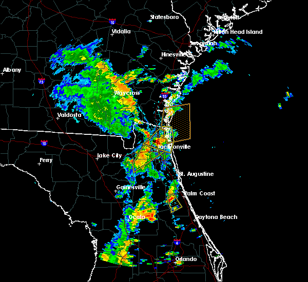 At 345 pm edt, a severe thunderstorm was located near andalusia, moving east at 5 mph (radar indicated). Hazards include 60 mph wind gusts and penny size hail. Expect damage to roofs, siding, and trees. This severe thunderstorm will remain over mainly rural areas of western flagler county. At 345 pm edt, a severe thunderstorm was located near andalusia, moving east at 5 mph (radar indicated). Hazards include 60 mph wind gusts and penny size hail. Expect damage to roofs, siding, and trees. This severe thunderstorm will remain over mainly rural areas of western flagler county.
|
| 7/17/2017 3:35 PM EDT |
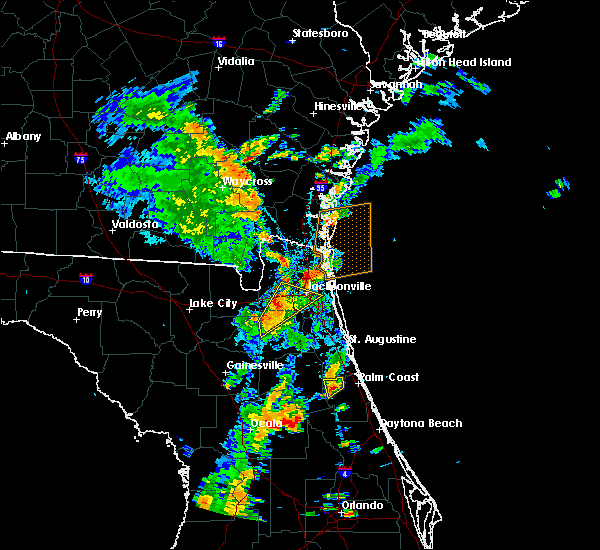 At 335 pm edt, a severe thunderstorm was located near andalusia, and is nearly stationary (radar indicated). Hazards include 60 mph wind gusts and penny size hail. Expect damage to roofs, siding, and trees. Locations impacted include, andalusia. At 335 pm edt, a severe thunderstorm was located near andalusia, and is nearly stationary (radar indicated). Hazards include 60 mph wind gusts and penny size hail. Expect damage to roofs, siding, and trees. Locations impacted include, andalusia.
|
| 7/17/2017 3:18 PM EDT |
 At 318 pm edt, a severe thunderstorm was located near hastings, moving southeast at 5 mph (radar indicated). Hazards include 60 mph wind gusts and penny size hail. expect damage to roofs, siding, and trees At 318 pm edt, a severe thunderstorm was located near hastings, moving southeast at 5 mph (radar indicated). Hazards include 60 mph wind gusts and penny size hail. expect damage to roofs, siding, and trees
|
| 6/30/2017 7:34 PM EDT | Lines down at zonal geranium court in palm coast. fire rescue enrout in flagler county FL, 5.2 miles N of Palm Coast, FL |
| 6/30/2017 6:50 PM EDT | Lines down at zonal geranium court in palm coast. fire rescue enrout in flagler county FL, 5.2 miles N of Palm Coast, FL |
| 6/26/2017 6:07 PM EDT |
 At 606 pm edt, severe thunderstorms were located along a line extending from near guana river state park to near george`s lake, moving south at 10 mph (radar indicated). Hazards include 60 mph wind gusts and penny size hail. Expect damage to roofs, siding, and trees. Locations impacted include, saint augustine, palatka, interlachen, hastings, east palatka, world golf village, saint augustine beach, marineland, vilano beach and florahome. At 606 pm edt, severe thunderstorms were located along a line extending from near guana river state park to near george`s lake, moving south at 10 mph (radar indicated). Hazards include 60 mph wind gusts and penny size hail. Expect damage to roofs, siding, and trees. Locations impacted include, saint augustine, palatka, interlachen, hastings, east palatka, world golf village, saint augustine beach, marineland, vilano beach and florahome.
|
| 6/26/2017 5:31 PM EDT |
 At 530 pm edt, severe thunderstorms were located along a line extending from near palm valley to near george`s lake, moving south at 20 mph (radar indicated). Hazards include 60 mph wind gusts and penny size hail. expect damage to roofs, siding, and trees At 530 pm edt, severe thunderstorms were located along a line extending from near palm valley to near george`s lake, moving south at 20 mph (radar indicated). Hazards include 60 mph wind gusts and penny size hail. expect damage to roofs, siding, and trees
|
| 6/14/2017 5:40 PM EDT |
 The severe thunderstorm warning for northwestern flagler, south central st. johns and northeastern putnam counties will expire at 545 pm edt, the storm which prompted the warning has weakened below severe limits, and no longer poses an immediate threat to life or property. therefore the warning will be allowed to expire. however gusty winds and heavy rain are still possible with this thunderstorm. The severe thunderstorm warning for northwestern flagler, south central st. johns and northeastern putnam counties will expire at 545 pm edt, the storm which prompted the warning has weakened below severe limits, and no longer poses an immediate threat to life or property. therefore the warning will be allowed to expire. however gusty winds and heavy rain are still possible with this thunderstorm.
|
| 6/14/2017 5:13 PM EDT |
 At 513 pm edt, a severe thunderstorm was located near federal point, or near hastings, moving south at 20 mph (radar indicated). Hazards include 60 mph wind gusts and nickel size hail. Expect damage to roofs, siding, and trees. Locations impacted include, hastings, federal point, spuds and elkton. At 513 pm edt, a severe thunderstorm was located near federal point, or near hastings, moving south at 20 mph (radar indicated). Hazards include 60 mph wind gusts and nickel size hail. Expect damage to roofs, siding, and trees. Locations impacted include, hastings, federal point, spuds and elkton.
|
| 6/14/2017 4:55 PM EDT |
 At 455 pm edt, a severe thunderstorm was located 7 miles northeast of federal point, or 7 miles northeast of hastings, moving south at 20 mph (radar indicated). Hazards include 60 mph wind gusts and nickel size hail. expect damage to roofs, siding, and trees At 455 pm edt, a severe thunderstorm was located 7 miles northeast of federal point, or 7 miles northeast of hastings, moving south at 20 mph (radar indicated). Hazards include 60 mph wind gusts and nickel size hail. expect damage to roofs, siding, and trees
|
| 5/30/2017 5:11 PM EDT |
 At 501 pm edt, a severe thunderstorm was located over andalusia, moving north at 15 mph (radar indicated). Hazards include 60 mph wind gusts and quarter size hail. Hail damage to vehicles is expected. expect wind damage to roofs, siding, and trees. Locations impacted include, palm coast, bunnell, andalusia, marineland and espanola. At 501 pm edt, a severe thunderstorm was located over andalusia, moving north at 15 mph (radar indicated). Hazards include 60 mph wind gusts and quarter size hail. Hail damage to vehicles is expected. expect wind damage to roofs, siding, and trees. Locations impacted include, palm coast, bunnell, andalusia, marineland and espanola.
|
| 5/30/2017 5:01 PM EDT |
 At 435 pm edt, a severe thunderstorm was located 7 miles east of crescent city, moving north at 20 mph (radar indicated). Hazards include 60 mph wind gusts and quarter size hail. Hail damage to vehicles is expected. Expect wind damage to roofs, siding, and trees. At 435 pm edt, a severe thunderstorm was located 7 miles east of crescent city, moving north at 20 mph (radar indicated). Hazards include 60 mph wind gusts and quarter size hail. Hail damage to vehicles is expected. Expect wind damage to roofs, siding, and trees.
|
| 5/30/2017 4:35 PM EDT |
 At 435 pm edt, a severe thunderstorm was located 7 miles east of crescent city, moving north at 20 mph (radar indicated). Hazards include 60 mph wind gusts and quarter size hail. Hail damage to vehicles is expected. Expect wind damage to roofs, siding, and trees. At 435 pm edt, a severe thunderstorm was located 7 miles east of crescent city, moving north at 20 mph (radar indicated). Hazards include 60 mph wind gusts and quarter size hail. Hail damage to vehicles is expected. Expect wind damage to roofs, siding, and trees.
|
| 5/4/2017 6:51 PM EDT |
 The severe thunderstorm warning for eastern flagler county will expire at 700 pm edt, the storm which prompted the warning has weakened below severe limits, and no longer poses an immediate threat to life or property. therefore the warning will be allowed to expire. however heavy rain is still possible with this thunderstorm. The severe thunderstorm warning for eastern flagler county will expire at 700 pm edt, the storm which prompted the warning has weakened below severe limits, and no longer poses an immediate threat to life or property. therefore the warning will be allowed to expire. however heavy rain is still possible with this thunderstorm.
|
| 5/4/2017 6:34 PM EDT |
 At 634 pm edt, a severe thunderstorm was located 9 miles south of bunnell, moving northeast at 30 mph (radar indicated). Hazards include 60 mph wind gusts and quarter size hail. Hail damage to vehicles is expected. expect wind damage to roofs, siding, and trees. this severe thunderstorm will be near, palm coast and bunnell around 650 pm edt. flagler beach around 655 pm edt. Other locations impacted by this severe thunderstorm include beverly beach. At 634 pm edt, a severe thunderstorm was located 9 miles south of bunnell, moving northeast at 30 mph (radar indicated). Hazards include 60 mph wind gusts and quarter size hail. Hail damage to vehicles is expected. expect wind damage to roofs, siding, and trees. this severe thunderstorm will be near, palm coast and bunnell around 650 pm edt. flagler beach around 655 pm edt. Other locations impacted by this severe thunderstorm include beverly beach.
|
| 2/7/2017 11:15 PM EST | Power lines reported down on pine grove drive in palm coast. time estimated by rada in flagler county FL, 0.9 miles WNW of Palm Coast, FL |
| 1/23/2017 12:38 PM EST | Emergency management received a report from a trained spotter that a few shingles were ripped from a roof in west palm coast. unknown exact tim in flagler county FL, 3.2 miles SSW of Palm Coast, FL |
| 1/22/2017 7:56 PM EST |
 The severe thunderstorm warning for eastern st. johns and northwestern flagler counties will expire at 800 pm est, the storms which prompted the warning have weakened below severe limits, and have exited the warned area. therefore the warning will be allowed to expire. however gusty winds are still possible with these thunderstorms. The severe thunderstorm warning for eastern st. johns and northwestern flagler counties will expire at 800 pm est, the storms which prompted the warning have weakened below severe limits, and have exited the warned area. therefore the warning will be allowed to expire. however gusty winds are still possible with these thunderstorms.
|
| 1/22/2017 7:55 PM EST |
 The severe thunderstorm warning for southeastern putnam, southeastern marion and flagler counties will expire at 800 pm est, the storms which prompted the warning have weakened below severe limits, and have exited the warned area. therefore the warning will be allowed to expire. however gusty winds are still possible with these thunderstorms. The severe thunderstorm warning for southeastern putnam, southeastern marion and flagler counties will expire at 800 pm est, the storms which prompted the warning have weakened below severe limits, and have exited the warned area. therefore the warning will be allowed to expire. however gusty winds are still possible with these thunderstorms.
|
| 1/22/2017 7:47 PM EST |
 At 747 pm est, severe thunderstorms were located along a line extending from 8 miles west of palm coast to near pittman, moving northeast at 50 mph (radar indicated). Hazards include 60 mph wind gusts and quarter size hail. Hail damage to vehicles is expected. expect wind damage to roofs, siding, and trees. Locations impacted include, palm coast, flagler beach, bunnell, crescent city, juniper springs, andalusia, fruitland, beverly beach, lake como and georgetown. At 747 pm est, severe thunderstorms were located along a line extending from 8 miles west of palm coast to near pittman, moving northeast at 50 mph (radar indicated). Hazards include 60 mph wind gusts and quarter size hail. Hail damage to vehicles is expected. expect wind damage to roofs, siding, and trees. Locations impacted include, palm coast, flagler beach, bunnell, crescent city, juniper springs, andalusia, fruitland, beverly beach, lake como and georgetown.
|
| 1/22/2017 7:45 PM EST |
 At 744 pm est, severe thunderstorms were located along a line extending from near guana river state park to 8 miles west of palm coast, moving east at 45 mph (radar indicated). Hazards include 60 mph wind gusts and penny size hail. Expect damage to roofs, siding, and trees. Locations impacted include, saint augustine, saint augustine beach, marineland, vilano beach, saint augustine shores, saint augustine south, south ponte vedra, butler beach, crescent beach and guana river state park. At 744 pm est, severe thunderstorms were located along a line extending from near guana river state park to 8 miles west of palm coast, moving east at 45 mph (radar indicated). Hazards include 60 mph wind gusts and penny size hail. Expect damage to roofs, siding, and trees. Locations impacted include, saint augustine, saint augustine beach, marineland, vilano beach, saint augustine shores, saint augustine south, south ponte vedra, butler beach, crescent beach and guana river state park.
|
| 1/22/2017 7:35 PM EST | Quarter sized hail reported 3.4 miles SSW of Palm Coast, FL, quarter size hail reported in c section of palm coast. |
| 1/22/2017 7:35 PM EST | Quarter sized hail reported 2 miles NNE of Palm Coast, FL, quarter size hail for 3 minutes reported in r section of palm coast. time of event estimated. |
| 1/22/2017 7:34 PM EST |
 At 734 pm est, a severe thunderstorm capable of producing a tornado was located near palm coast, moving northeast at 60 mph (radar indicated rotation). Hazards include tornado and quarter size hail. Flying debris will be dangerous to those caught without shelter. mobile homes will be damaged or destroyed. damage to roofs, windows, and vehicles will occur. tree damage is likely. Locations impacted include, palm coast and beverly beach. At 734 pm est, a severe thunderstorm capable of producing a tornado was located near palm coast, moving northeast at 60 mph (radar indicated rotation). Hazards include tornado and quarter size hail. Flying debris will be dangerous to those caught without shelter. mobile homes will be damaged or destroyed. damage to roofs, windows, and vehicles will occur. tree damage is likely. Locations impacted include, palm coast and beverly beach.
|
| 1/22/2017 7:31 PM EST |
 At 731 pm est, severe thunderstorms were located along a line extending from near andalusia to near emeralda, moving east at 35 mph (radar indicated). Hazards include 60 mph wind gusts and quarter size hail. Hail damage to vehicles is expected. expect wind damage to roofs, siding, and trees. locations impacted include, palm coast, flagler beach, bunnell, crescent city, pomona park, andalusia, juniper springs, salt springs, moss bluff and fruitland. A tornado watch remains in effect until 800 pm est for northern and northeastern florida. At 731 pm est, severe thunderstorms were located along a line extending from near andalusia to near emeralda, moving east at 35 mph (radar indicated). Hazards include 60 mph wind gusts and quarter size hail. Hail damage to vehicles is expected. expect wind damage to roofs, siding, and trees. locations impacted include, palm coast, flagler beach, bunnell, crescent city, pomona park, andalusia, juniper springs, salt springs, moss bluff and fruitland. A tornado watch remains in effect until 800 pm est for northern and northeastern florida.
|
| 1/22/2017 7:30 PM EST |
 At 728 pm est, severe thunderstorms were located along a line extending from 10 miles northeast of kings bay base to 6 miles northeast of federal point, moving east at 145 mph (radar indicated). Hazards include 60 mph wind gusts and quarter size hail. Hail damage to vehicles is expected. expect wind damage to roofs, siding, and trees. locations impacted include, saint augustine, fernandina beach, palatka, hastings, ponte vedra beach, unf, fruit cove, east palatka, neptune beach and world golf village. a tornado watch remains in effect until 800 pm est for northeastern florida, and southeastern georgia. Time, mot, loc 0028z 249deg 125kt 3090 8138 2980 8146. At 728 pm est, severe thunderstorms were located along a line extending from 10 miles northeast of kings bay base to 6 miles northeast of federal point, moving east at 145 mph (radar indicated). Hazards include 60 mph wind gusts and quarter size hail. Hail damage to vehicles is expected. expect wind damage to roofs, siding, and trees. locations impacted include, saint augustine, fernandina beach, palatka, hastings, ponte vedra beach, unf, fruit cove, east palatka, neptune beach and world golf village. a tornado watch remains in effect until 800 pm est for northeastern florida, and southeastern georgia. Time, mot, loc 0028z 249deg 125kt 3090 8138 2980 8146.
|
| 1/22/2017 7:25 PM EST |
 At 725 pm est, a severe thunderstorm capable of producing a tornado was located near bunnell, moving northeast at 60 mph (radar indicated rotation). Hazards include tornado and quarter size hail. Flying debris will be dangerous to those caught without shelter. mobile homes will be damaged or destroyed. damage to roofs, windows, and vehicles will occur. Tree damage is likely. At 725 pm est, a severe thunderstorm capable of producing a tornado was located near bunnell, moving northeast at 60 mph (radar indicated rotation). Hazards include tornado and quarter size hail. Flying debris will be dangerous to those caught without shelter. mobile homes will be damaged or destroyed. damage to roofs, windows, and vehicles will occur. Tree damage is likely.
|
| 1/22/2017 7:16 PM EST |
 At 716 pm est, a severe thunderstorm capable of producing a tornado was located near andalusia, moving northeast at 55 mph (radar indicated rotation). Hazards include tornado and quarter size hail. Flying debris will be dangerous to those caught without shelter. mobile homes will be damaged or destroyed. damage to roofs, windows, and vehicles will occur. tree damage is likely. Locations impacted include, palm coast, flagler beach, bunnell, beverly beach and espanola. At 716 pm est, a severe thunderstorm capable of producing a tornado was located near andalusia, moving northeast at 55 mph (radar indicated rotation). Hazards include tornado and quarter size hail. Flying debris will be dangerous to those caught without shelter. mobile homes will be damaged or destroyed. damage to roofs, windows, and vehicles will occur. tree damage is likely. Locations impacted include, palm coast, flagler beach, bunnell, beverly beach and espanola.
|
| 1/22/2017 7:15 PM EST |
 At 714 pm est, severe thunderstorms were located along a line extending from 6 miles northeast of kings bay base to near bostwick, moving northeast at 95 mph (radar indicated). Hazards include 60 mph wind gusts and quarter size hail. Hail damage to vehicles is expected. Expect wind damage to roofs, siding, and trees. At 714 pm est, severe thunderstorms were located along a line extending from 6 miles northeast of kings bay base to near bostwick, moving northeast at 95 mph (radar indicated). Hazards include 60 mph wind gusts and quarter size hail. Hail damage to vehicles is expected. Expect wind damage to roofs, siding, and trees.
|
| 1/22/2017 7:02 PM EST |
 At 702 pm est, severe thunderstorms were located along a line extending from lake delancy to near wildwood, moving northeast at 75 mph (radar indicated). Hazards include 60 mph wind gusts and quarter size hail. Hail damage to vehicles is expected. expect wind damage to roofs, siding, and trees. locations impacted include, palm coast, flagler beach, bunnell, crescent city, pomona park, fort mccoy, andalusia, juniper springs, salt springs and lynne. A tornado watch remains in effect until 800 pm est for northern and northeastern florida. At 702 pm est, severe thunderstorms were located along a line extending from lake delancy to near wildwood, moving northeast at 75 mph (radar indicated). Hazards include 60 mph wind gusts and quarter size hail. Hail damage to vehicles is expected. expect wind damage to roofs, siding, and trees. locations impacted include, palm coast, flagler beach, bunnell, crescent city, pomona park, fort mccoy, andalusia, juniper springs, salt springs and lynne. A tornado watch remains in effect until 800 pm est for northern and northeastern florida.
|
| 1/22/2017 7:01 PM EST |
 At 701 pm est, severe thunderstorms were located along a line extending from near kings bay base to near bostwick, moving northeast at 70 mph (radar indicated). Hazards include 60 mph wind gusts and quarter size hail. Hail damage to vehicles is expected. expect wind damage to roofs, siding, and trees. locations impacted include, jacksonville, saint augustine, fernandina beach, palatka, orange park, green cove springs, interlachen, callahan, hastings and jacksonville international arpt. A tornado watch remains in effect until 800 pm est for northern and northeastern florida. At 701 pm est, severe thunderstorms were located along a line extending from near kings bay base to near bostwick, moving northeast at 70 mph (radar indicated). Hazards include 60 mph wind gusts and quarter size hail. Hail damage to vehicles is expected. expect wind damage to roofs, siding, and trees. locations impacted include, jacksonville, saint augustine, fernandina beach, palatka, orange park, green cove springs, interlachen, callahan, hastings and jacksonville international arpt. A tornado watch remains in effect until 800 pm est for northern and northeastern florida.
|
| 1/22/2017 6:56 PM EST |
 At 656 pm est, a severe thunderstorm capable of producing a tornado was located near lake george, or near salt springs, moving northeast at 55 mph (radar indicated rotation). Hazards include tornado and quarter size hail. Flying debris will be dangerous to those caught without shelter. mobile homes will be damaged or destroyed. damage to roofs, windows, and vehicles will occur. Tree damage is likely. At 656 pm est, a severe thunderstorm capable of producing a tornado was located near lake george, or near salt springs, moving northeast at 55 mph (radar indicated rotation). Hazards include tornado and quarter size hail. Flying debris will be dangerous to those caught without shelter. mobile homes will be damaged or destroyed. damage to roofs, windows, and vehicles will occur. Tree damage is likely.
|
| 1/22/2017 6:55 PM EST |
 At 654 pm est, severe thunderstorms were located along a line extending from st. marys to near bardin, moving northeast at 70 mph (radar indicated). Hazards include 60 mph wind gusts and quarter size hail. Hail damage to vehicles is expected. expect wind damage to roofs, siding, and trees. locations impacted include, jacksonville, saint augustine, fernandina beach, palatka, orange park, green cove springs, interlachen, keystone heights, callahan and hastings. A tornado watch remains in effect until 800 pm est for northeastern and northern florida, and southeastern georgia. At 654 pm est, severe thunderstorms were located along a line extending from st. marys to near bardin, moving northeast at 70 mph (radar indicated). Hazards include 60 mph wind gusts and quarter size hail. Hail damage to vehicles is expected. expect wind damage to roofs, siding, and trees. locations impacted include, jacksonville, saint augustine, fernandina beach, palatka, orange park, green cove springs, interlachen, keystone heights, callahan and hastings. A tornado watch remains in effect until 800 pm est for northeastern and northern florida, and southeastern georgia.
|
| 1/22/2017 6:47 PM EST |
 At 647 pm est, severe thunderstorms were located along a line extending from near anthony to inverness highlands south, moving northeast at 75 mph (radar indicated). Hazards include 60 mph wind gusts and quarter size hail. Hail damage to vehicles is expected. expect wind damage to roofs, siding, and trees. locations impacted include, palm coast, ocala, flagler beach, bunnell, crescent city, pomona park, fort mccoy, andalusia, juniper springs and salt springs. A tornado watch remains in effect until 800 pm est for northern and northeastern florida. At 647 pm est, severe thunderstorms were located along a line extending from near anthony to inverness highlands south, moving northeast at 75 mph (radar indicated). Hazards include 60 mph wind gusts and quarter size hail. Hail damage to vehicles is expected. expect wind damage to roofs, siding, and trees. locations impacted include, palm coast, ocala, flagler beach, bunnell, crescent city, pomona park, fort mccoy, andalusia, juniper springs and salt springs. A tornado watch remains in effect until 800 pm est for northern and northeastern florida.
|
| 1/22/2017 6:46 PM EST |
 At 646 pm est, severe thunderstorms were located along a line extending from near yulee to interlachen, moving northeast at 70 mph (radar indicated). Hazards include 60 mph wind gusts and quarter size hail. Hail damage to vehicles is expected. expect wind damage to roofs, siding, and trees. locations impacted include, jacksonville, saint augustine, fernandina beach, palatka, orange park, green cove springs, starke, interlachen, keystone heights and callahan. A tornado watch remains in effect until 800 pm est for northeastern and northern florida, and southeastern georgia. At 646 pm est, severe thunderstorms were located along a line extending from near yulee to interlachen, moving northeast at 70 mph (radar indicated). Hazards include 60 mph wind gusts and quarter size hail. Hail damage to vehicles is expected. expect wind damage to roofs, siding, and trees. locations impacted include, jacksonville, saint augustine, fernandina beach, palatka, orange park, green cove springs, starke, interlachen, keystone heights and callahan. A tornado watch remains in effect until 800 pm est for northeastern and northern florida, and southeastern georgia.
|
| 1/22/2017 6:40 PM EST |
 At 640 pm est, severe thunderstorms were located along a line extending from near anthony to 6 miles southwest of inverness highlands south, moving northeast at 75 mph (radar indicated). Hazards include 60 mph wind gusts and quarter size hail. Hail damage to vehicles is expected. Expect wind damage to roofs, siding, and trees. At 640 pm est, severe thunderstorms were located along a line extending from near anthony to 6 miles southwest of inverness highlands south, moving northeast at 75 mph (radar indicated). Hazards include 60 mph wind gusts and quarter size hail. Hail damage to vehicles is expected. Expect wind damage to roofs, siding, and trees.
|
| 1/22/2017 6:32 PM EST |
 At 631 pm est, severe thunderstorms were located along a line extending from 6 miles west of ratliff to cross creek, moving northeast at 70 mph (radar indicated). Hazards include 60 mph wind gusts and quarter size hail. Hail damage to vehicles is expected. expect wind damage to roofs, siding, and trees. locations impacted include, jacksonville, gainesville, saint augustine, fernandina beach, palatka, orange park, green cove springs, starke, lake butler and interlachen. A tornado watch remains in effect until 800 pm est for northeastern and northern florida, and southeastern georgia. At 631 pm est, severe thunderstorms were located along a line extending from 6 miles west of ratliff to cross creek, moving northeast at 70 mph (radar indicated). Hazards include 60 mph wind gusts and quarter size hail. Hail damage to vehicles is expected. expect wind damage to roofs, siding, and trees. locations impacted include, jacksonville, gainesville, saint augustine, fernandina beach, palatka, orange park, green cove springs, starke, lake butler and interlachen. A tornado watch remains in effect until 800 pm est for northeastern and northern florida, and southeastern georgia.
|
| 1/22/2017 6:17 PM EST |
 At 617 pm est, severe thunderstorms were located along a line extending from 8 miles north of macclenny to near williston, moving northeast at 70 mph (radar indicated). Hazards include 60 mph wind gusts and quarter size hail. Hail damage to vehicles is expected. expect wind damage to roofs, siding, and trees. locations impacted include, jacksonville, gainesville, saint augustine, fernandina beach, palatka, orange park, green cove springs, starke, lake butler and interlachen. A tornado watch remains in effect until 800 pm est for northeastern and northern florida, and southeastern georgia. At 617 pm est, severe thunderstorms were located along a line extending from 8 miles north of macclenny to near williston, moving northeast at 70 mph (radar indicated). Hazards include 60 mph wind gusts and quarter size hail. Hail damage to vehicles is expected. expect wind damage to roofs, siding, and trees. locations impacted include, jacksonville, gainesville, saint augustine, fernandina beach, palatka, orange park, green cove springs, starke, lake butler and interlachen. A tornado watch remains in effect until 800 pm est for northeastern and northern florida, and southeastern georgia.
|
| 1/22/2017 6:06 PM EST |
 At 605 pm est, severe thunderstorms were located along a line extending from near sanderson to near williston highlands, moving northeast at 70 mph (radar indicated). Hazards include 60 mph wind gusts and quarter size hail. Hail damage to vehicles is expected. Expect wind damage to roofs, siding, and trees. At 605 pm est, severe thunderstorms were located along a line extending from near sanderson to near williston highlands, moving northeast at 70 mph (radar indicated). Hazards include 60 mph wind gusts and quarter size hail. Hail damage to vehicles is expected. Expect wind damage to roofs, siding, and trees.
|
| 1/22/2017 4:39 PM EST |
 The severe thunderstorm warning for southeastern st. johns and northeastern flagler counties will expire at 445 pm est, the storm which prompted the warning has moved out of the area. therefore the warning will be allowed to expire. however gusty winds are still possible with this thunderstorm. a tornado watch remains in effect until 800 pm est for northeastern florida. The severe thunderstorm warning for southeastern st. johns and northeastern flagler counties will expire at 445 pm est, the storm which prompted the warning has moved out of the area. therefore the warning will be allowed to expire. however gusty winds are still possible with this thunderstorm. a tornado watch remains in effect until 800 pm est for northeastern florida.
|
| 1/22/2017 4:35 PM EST |
 At 435 pm est, a severe thunderstorm was located over marineland, or near palm coast, moving northeast at 60 mph (radar indicated). Hazards include 60 mph wind gusts and quarter size hail. Hail damage to vehicles is expected. expect wind damage to roofs, siding, and trees. locations impacted include, palm coast, marineland and crescent beach. A tornado watch remains in effect until 800 pm est for northeastern florida. At 435 pm est, a severe thunderstorm was located over marineland, or near palm coast, moving northeast at 60 mph (radar indicated). Hazards include 60 mph wind gusts and quarter size hail. Hail damage to vehicles is expected. expect wind damage to roofs, siding, and trees. locations impacted include, palm coast, marineland and crescent beach. A tornado watch remains in effect until 800 pm est for northeastern florida.
|
| 1/22/2017 4:25 PM EST |
 At 425 pm est, a severe thunderstorm was located 7 miles west of palm coast, moving northeast at 60 mph (radar indicated). Hazards include 60 mph wind gusts and quarter size hail. Hail damage to vehicles is expected. expect wind damage to roofs, siding, and trees. locations impacted include, palm coast, marineland and crescent beach. A tornado watch remains in effect until 800 pm est for northeastern florida. At 425 pm est, a severe thunderstorm was located 7 miles west of palm coast, moving northeast at 60 mph (radar indicated). Hazards include 60 mph wind gusts and quarter size hail. Hail damage to vehicles is expected. expect wind damage to roofs, siding, and trees. locations impacted include, palm coast, marineland and crescent beach. A tornado watch remains in effect until 800 pm est for northeastern florida.
|
| 1/22/2017 4:20 PM EST |
 At 420 pm est, a severe thunderstorm was located 8 miles northeast of andalusia, moving northeast at 60 mph (radar indicated). Hazards include 60 mph wind gusts and quarter size hail. Hail damage to vehicles is expected. Expect wind damage to roofs, siding, and trees. At 420 pm est, a severe thunderstorm was located 8 miles northeast of andalusia, moving northeast at 60 mph (radar indicated). Hazards include 60 mph wind gusts and quarter size hail. Hail damage to vehicles is expected. Expect wind damage to roofs, siding, and trees.
|
| 7/14/2016 5:47 PM EDT |
 At 547 pm edt, a severe thunderstorm was located near hastings, moving south at 10 mph (radar indicated). Hazards include 60 mph wind gusts and quarter size hail. Hail damage to vehicles is expected. Expect wind damage to roofs, siding, and trees. At 547 pm edt, a severe thunderstorm was located near hastings, moving south at 10 mph (radar indicated). Hazards include 60 mph wind gusts and quarter size hail. Hail damage to vehicles is expected. Expect wind damage to roofs, siding, and trees.
|
| 7/7/2016 6:25 PM EDT | Small branches down on belle terre parkway near braddock lane and on pine cone driv in flagler county FL, 2.6 miles SSE of Palm Coast, FL |
| 7/7/2016 6:20 PM EDT |
 At 619 pm edt, a severe thunderstorm was located over palm coast, moving northeast at 15 mph (radar indicated). Hazards include 60 mph wind gusts and small hail. Expect damage to roofs. siding. and trees. Locations impacted include, palm coast, bunnell, marineland, crescent beach and espanola. At 619 pm edt, a severe thunderstorm was located over palm coast, moving northeast at 15 mph (radar indicated). Hazards include 60 mph wind gusts and small hail. Expect damage to roofs. siding. and trees. Locations impacted include, palm coast, bunnell, marineland, crescent beach and espanola.
|
| 7/7/2016 6:10 PM EDT | Wind gust measured at 40 mph in west palm coas in flagler county FL, 3.2 miles SSW of Palm Coast, FL |
| 7/7/2016 6:00 PM EDT |
 At 600 pm edt, a severe thunderstorm was located near andalusia, moving northeast at 20 mph (radar indicated). Hazards include 60 mph wind gusts. Expect damage to roofs. siding. And trees. At 600 pm edt, a severe thunderstorm was located near andalusia, moving northeast at 20 mph (radar indicated). Hazards include 60 mph wind gusts. Expect damage to roofs. siding. And trees.
|
| 6/29/2016 4:49 PM EDT | Tree across the road at 1 parkview parkway in flagler county FL, 0.4 miles SW of Palm Coast, FL |
| 6/6/2016 5:15 PM EDT |
 At 514 pm edt, a severe thunderstorm capable of producing a tornado was located over palm coast, moving northeast at 30 mph (radar indicated rotation). Hazards include tornado. Flying debris will be dangerous to those caught without shelter. mobile homes will be damaged or destroyed. damage to roofs, windows, and vehicles will occur. tree damage is likely. This tornadic thunderstorm will remain over mainly rural areas of northeastern flagler county. At 514 pm edt, a severe thunderstorm capable of producing a tornado was located over palm coast, moving northeast at 30 mph (radar indicated rotation). Hazards include tornado. Flying debris will be dangerous to those caught without shelter. mobile homes will be damaged or destroyed. damage to roofs, windows, and vehicles will occur. tree damage is likely. This tornadic thunderstorm will remain over mainly rural areas of northeastern flagler county.
|
| 6/6/2016 5:09 PM EDT |
 At 508 pm edt, a severe thunderstorm capable of producing a tornado was located near bunnell, moving northeast at 30 mph. a wall cloud was reported near bunnell (radar indicated rotation). Hazards include tornado. Flying debris will be dangerous to those caught without shelter. mobile homes will be damaged or destroyed. damage to roofs, windows, and vehicles will occur. tree damage is likely. This dangerous storm will be near, palm coast around 515 pm edt. At 508 pm edt, a severe thunderstorm capable of producing a tornado was located near bunnell, moving northeast at 30 mph. a wall cloud was reported near bunnell (radar indicated rotation). Hazards include tornado. Flying debris will be dangerous to those caught without shelter. mobile homes will be damaged or destroyed. damage to roofs, windows, and vehicles will occur. tree damage is likely. This dangerous storm will be near, palm coast around 515 pm edt.
|
| 6/6/2016 4:57 PM EDT |
 At 457 pm edt, a severe thunderstorm capable of producing a tornado was located over bunnell, moving northeast at 30 mph (radar indicated rotation). Hazards include tornado. Flying debris will be dangerous to those caught without shelter. mobile homes will be damaged or destroyed. damage to roofs, windows, and vehicles will occur. tree damage is likely. This dangerous storm will be near, palm coast and bunnell around 505 pm edt. At 457 pm edt, a severe thunderstorm capable of producing a tornado was located over bunnell, moving northeast at 30 mph (radar indicated rotation). Hazards include tornado. Flying debris will be dangerous to those caught without shelter. mobile homes will be damaged or destroyed. damage to roofs, windows, and vehicles will occur. tree damage is likely. This dangerous storm will be near, palm coast and bunnell around 505 pm edt.
|
| 5/31/2016 7:52 PM EDT |
 At 752 pm edt, a severe thunderstorm was located over andalusia, moving south at 10 mph (radar indicated). Hazards include 60 mph wind gusts and penny size hail. Expect damage to roofs. siding. and trees. Locations impacted include, crescent city, pomona park, andalusia and lake como. At 752 pm edt, a severe thunderstorm was located over andalusia, moving south at 10 mph (radar indicated). Hazards include 60 mph wind gusts and penny size hail. Expect damage to roofs. siding. and trees. Locations impacted include, crescent city, pomona park, andalusia and lake como.
|
| 5/31/2016 7:29 PM EDT |
 At 729 pm edt, a severe thunderstorm was located near andalusia, moving south at 10 mph (radar indicated). Hazards include 60 mph wind gusts and penny size hail. Expect damage to roofs. siding. And trees. At 729 pm edt, a severe thunderstorm was located near andalusia, moving south at 10 mph (radar indicated). Hazards include 60 mph wind gusts and penny size hail. Expect damage to roofs. siding. And trees.
|
| 5/31/2016 6:40 PM EDT |
 The severe thunderstorm warning for south central st. johns county will expire at 645 pm edt, the storm which prompted the warning has weakened below severe limits, and no longer pose an immediate threat to life or property. therefore the warning will be allowed to expire. however gusty winds are still possible with this thunderstorm. The severe thunderstorm warning for south central st. johns county will expire at 645 pm edt, the storm which prompted the warning has weakened below severe limits, and no longer pose an immediate threat to life or property. therefore the warning will be allowed to expire. however gusty winds are still possible with this thunderstorm.
|
| 5/31/2016 6:22 PM EDT |
 At 621 pm edt, a severe thunderstorm was located near federal point, or near hastings, moving south at 5 to 10 mph (radar indicated). Hazards include 60 mph wind gusts. Expect damage to roofs. siding. and trees. Locations impacted include, hastings, elkton and spuds. At 621 pm edt, a severe thunderstorm was located near federal point, or near hastings, moving south at 5 to 10 mph (radar indicated). Hazards include 60 mph wind gusts. Expect damage to roofs. siding. and trees. Locations impacted include, hastings, elkton and spuds.
|
| 5/31/2016 5:58 PM EDT |
 At 557 pm edt, a severe thunderstorm was located near federal point, or near hastings, moving south at 5 mph (radar indicated). Hazards include 60 mph wind gusts and penny size hail. Expect damage to roofs. siding. And trees. At 557 pm edt, a severe thunderstorm was located near federal point, or near hastings, moving south at 5 mph (radar indicated). Hazards include 60 mph wind gusts and penny size hail. Expect damage to roofs. siding. And trees.
|
| 5/19/2016 6:24 PM EDT | The national weather service in jacksonville has issued a * severe thunderstorm warning for. southeastern st. johns county in northeastern florida. northern flagler county in northeastern florida. until 715 pm edt * at 624 pm edt. A severe thunderstorm was located 7 miles northeast. |
| 5/13/2016 7:24 PM EDT |
 At 724 pm edt, a severe thunderstorm was located near crescent beach, or 11 miles northwest of palm coast, moving east at 20 mph (radar indicated). Hazards include 60 mph wind gusts and penny size hail. Expect damage to roofs. siding. and trees. Locations impacted include, palm coast, saint augustine, saint augustine beach, marineland, butler beach, crescent beach, saint augustine shores, saint augustine south, elkton and dupont center. At 724 pm edt, a severe thunderstorm was located near crescent beach, or 11 miles northwest of palm coast, moving east at 20 mph (radar indicated). Hazards include 60 mph wind gusts and penny size hail. Expect damage to roofs. siding. and trees. Locations impacted include, palm coast, saint augustine, saint augustine beach, marineland, butler beach, crescent beach, saint augustine shores, saint augustine south, elkton and dupont center.
|
| 5/13/2016 6:58 PM EDT |
 At 658 pm edt, a severe thunderstorm was located near hastings, moving east at 25 mph (radar indicated). Hazards include 60 mph wind gusts and penny size hail. Expect damage to roofs. siding. And trees. At 658 pm edt, a severe thunderstorm was located near hastings, moving east at 25 mph (radar indicated). Hazards include 60 mph wind gusts and penny size hail. Expect damage to roofs. siding. And trees.
|
| 5/4/2016 8:32 AM EDT |
 At 832 am edt, a severe thunderstorm was located near flagler beach, moving east at 30 mph (radar indicated). Hazards include ping pong ball size hail and 60 mph wind gusts. People and animals outdoors will be injured. expect hail damage to roofs, siding, windows, and vehicles. expect wind damage to roofs, siding, and trees. Locations impacted include, palm coast, flagler beach, bunnell and beverly beach. At 832 am edt, a severe thunderstorm was located near flagler beach, moving east at 30 mph (radar indicated). Hazards include ping pong ball size hail and 60 mph wind gusts. People and animals outdoors will be injured. expect hail damage to roofs, siding, windows, and vehicles. expect wind damage to roofs, siding, and trees. Locations impacted include, palm coast, flagler beach, bunnell and beverly beach.
|
| 5/4/2016 8:20 AM EDT | Quarter sized hail reported 4.7 miles SSE of Palm Coast, FL, trained spotter reports quarter-sized hail currently falling at time of report. |
| 5/4/2016 8:14 AM EDT |
 At 814 am edt, a severe thunderstorm was located near bunnell, moving east at 40 mph (radar indicated). Hazards include 60 mph wind gusts and quarter size hail. Hail damage to vehicles is expected. Expect wind damage to roofs, siding, and trees. At 814 am edt, a severe thunderstorm was located near bunnell, moving east at 40 mph (radar indicated). Hazards include 60 mph wind gusts and quarter size hail. Hail damage to vehicles is expected. Expect wind damage to roofs, siding, and trees.
|
| 1/22/2016 10:52 AM EST | At 1051 am est, a severe thunderstorm was located near flagler beach, moving east at 25 to 30 mph (radar indicated). Hazards include 60 mph wind gusts. Expect damage to roofs. siding and trees. Locations impacted include, palm coast, flagler beach and beverly beach. |
| 1/22/2016 10:37 AM EST | At 1036 am est, a severe thunderstorm was located near bunnell, moving east at 35 mph (radar indicated). Hazards include 60 mph wind gusts and penny size hail. Expect damage to roofs. Siding and trees. |
| 8/29/2015 11:50 PM EDT | Tree down on palm harbor parkway near fire station 24 in flagler county FL, 3.2 miles SSW of Palm Coast, FL |
| 8/23/2015 8:00 PM EDT | Several trees down in palm coast. estimated wind speed 50 mp in flagler county FL, 3.2 miles SSW of Palm Coast, FL |
| 8/13/2015 2:11 PM EDT |
 At 210 pm edt, doppler radar indicated a severe thunderstorm capable of producing damaging winds in excess of 60 mph. this storm was located 9 miles southeast of hastings, moving west at 15 mph. locations impacted include, palm coast, pomona park, hastings, east palatka, marineland, san mateo, crescent beach, orange mills and spuds. At 210 pm edt, doppler radar indicated a severe thunderstorm capable of producing damaging winds in excess of 60 mph. this storm was located 9 miles southeast of hastings, moving west at 15 mph. locations impacted include, palm coast, pomona park, hastings, east palatka, marineland, san mateo, crescent beach, orange mills and spuds.
|
| 8/13/2015 1:58 PM EDT |
 At 157 pm edt, doppler radar indicated a severe thunderstorm capable of producing damaging winds in excess of 60 mph. this storm was located 7 miles west of marineland, or 8 miles northwest of palm coast, and moving west at 10 mph. At 157 pm edt, doppler radar indicated a severe thunderstorm capable of producing damaging winds in excess of 60 mph. this storm was located 7 miles west of marineland, or 8 miles northwest of palm coast, and moving west at 10 mph.
|
| 7/6/2015 4:37 PM EDT |
 At 436 pm edt, doppler radar indicated a severe thunderstorm capable of producing quarter size hail and damaging winds in excess of 60 mph. this storm was located near pierson, and moving northeast at 15 mph. At 436 pm edt, doppler radar indicated a severe thunderstorm capable of producing quarter size hail and damaging winds in excess of 60 mph. this storm was located near pierson, and moving northeast at 15 mph.
|
| 6/25/2015 2:54 PM EDT | Em reported tree down on powerlines off of fort caroline lane. time estimated by rada in flagler county FL, 3.2 miles SSW of Palm Coast, FL |
| 6/24/2015 6:58 PM EDT | The severe thunderstorm warning for western flagler and south central st. johns counties will expire at 700 pm edt, the storms which prompted the warning have weakened below severe limits, and no longer poses an immediate threat to life or property. therefore the warning will be allowed to expire. however small. |
| 6/24/2015 6:52 PM EDT |
 A severe thunderstorm warning remains in effect until 700 pm edt for western flagler and south central st. johns counties. at 652 pm edt. doppler radar indicated a line of severe thunderstorms capable of producing quarter size hail and damaging winds in excess of 60 mph. these storms were located along a line extending from near bayard to near pierson. Moving east at 15 mph. A severe thunderstorm warning remains in effect until 700 pm edt for western flagler and south central st. johns counties. at 652 pm edt. doppler radar indicated a line of severe thunderstorms capable of producing quarter size hail and damaging winds in excess of 60 mph. these storms were located along a line extending from near bayard to near pierson. Moving east at 15 mph.
|
| 6/24/2015 6:46 PM EDT |
 At 646 pm edt, doppler radar indicated a line of severe thunderstorms capable of producing quarter size hail and damaging winds in excess of 60 mph. these storms were located along a line extending from near bayard to near pierson, moving east at 15 mph. locations impacted include, hastings, andalusia, world golf village, durbin, elkton, bakersville and spuds. At 646 pm edt, doppler radar indicated a line of severe thunderstorms capable of producing quarter size hail and damaging winds in excess of 60 mph. these storms were located along a line extending from near bayard to near pierson, moving east at 15 mph. locations impacted include, hastings, andalusia, world golf village, durbin, elkton, bakersville and spuds.
|
| 6/24/2015 6:42 PM EDT |
 At 641 pm edt, doppler radar indicated a line of severe thunderstorms capable of producing quarter size hail and damaging winds in excess of 60 mph. these storms were located along a line extending from near bayard to near pierson. these storms were nearly stationary. locations impacted include, green cove springs, crescent city, hastings, andalusia, fruit cove, world golf village, durbin, switzerland, federal point, picolata, orange mills, spuds, elkton and bakersville. At 641 pm edt, doppler radar indicated a line of severe thunderstorms capable of producing quarter size hail and damaging winds in excess of 60 mph. these storms were located along a line extending from near bayard to near pierson. these storms were nearly stationary. locations impacted include, green cove springs, crescent city, hastings, andalusia, fruit cove, world golf village, durbin, switzerland, federal point, picolata, orange mills, spuds, elkton and bakersville.
|
| 6/24/2015 6:29 PM EDT |
 At 629 pm edt, doppler radar indicated a line of severe thunderstorms capable of producing quarter size hail and damaging winds in excess of 60 mph. these storms were located along a line extending from near bayard to near pierson, and moving east at 15 mph. At 629 pm edt, doppler radar indicated a line of severe thunderstorms capable of producing quarter size hail and damaging winds in excess of 60 mph. these storms were located along a line extending from near bayard to near pierson, and moving east at 15 mph.
|
| 6/23/2015 5:22 PM EDT |
 The severe thunderstorm warning for st. johns county will expire at 530 pm edt, the storms which prompted the warning have weakened below severe limits, and no longer poses an immediate threat to life or property. therefore the warning will be allowed to expire. however gusty winds are still possible with these thunderstorms. The severe thunderstorm warning for st. johns county will expire at 530 pm edt, the storms which prompted the warning have weakened below severe limits, and no longer poses an immediate threat to life or property. therefore the warning will be allowed to expire. however gusty winds are still possible with these thunderstorms.
|
| 6/23/2015 5:04 PM EDT |
 At 504 pm edt, doppler radar indicated a line of severe thunderstorms capable of producing damaging winds in excess of 60 mph. these storms were located along a line extending from near doctors inlet to hastings. these storms were nearly stationary. nickel size hail may also accompany the damaging winds. locations impacted include, saint augustine, green cove springs, hastings, fruit cove, world golf village, saint augustine shores, switzerland, picolata, saint augustine south, butler beach, dupont center, spuds, elkton and bakersville. At 504 pm edt, doppler radar indicated a line of severe thunderstorms capable of producing damaging winds in excess of 60 mph. these storms were located along a line extending from near doctors inlet to hastings. these storms were nearly stationary. nickel size hail may also accompany the damaging winds. locations impacted include, saint augustine, green cove springs, hastings, fruit cove, world golf village, saint augustine shores, switzerland, picolata, saint augustine south, butler beach, dupont center, spuds, elkton and bakersville.
|
| 6/23/2015 4:50 PM EDT |
 At 449 pm edt, doppler radar indicated a line of severe thunderstorms capable of producing damaging winds in excess of 60 mph. these storms were located along a line extending from near hastings to near barberville, and moving east at 10 mph. nickel size hail may also accompany the damaging winds. At 449 pm edt, doppler radar indicated a line of severe thunderstorms capable of producing damaging winds in excess of 60 mph. these storms were located along a line extending from near hastings to near barberville, and moving east at 10 mph. nickel size hail may also accompany the damaging winds.
|
| 6/23/2015 4:38 PM EDT |
 At 437 pm edt, doppler radar indicated a line of severe thunderstorms capable of producing quarter size hail and damaging winds in excess of 60 mph. these storms were located along a line extending from near doctors inlet to hastings, and moving east at 10 mph. At 437 pm edt, doppler radar indicated a line of severe thunderstorms capable of producing quarter size hail and damaging winds in excess of 60 mph. these storms were located along a line extending from near doctors inlet to hastings, and moving east at 10 mph.
|
| 6/10/2015 3:12 PM EDT |
 At 311 pm edt, local law enforcement reported a line of severe thunderstorms producing damaging winds in excess of 60 mph. these storms were located along a line extending from near saint augustine to 9 miles northeast of deleon springs, and moving east at 20 mph. nickel size hail may also accompany the damaging winds. At 311 pm edt, local law enforcement reported a line of severe thunderstorms producing damaging winds in excess of 60 mph. these storms were located along a line extending from near saint augustine to 9 miles northeast of deleon springs, and moving east at 20 mph. nickel size hail may also accompany the damaging winds.
|
| 6/10/2015 2:46 PM EDT |
 At 245 pm edt, doppler radar indicated a line of severe thunderstorms capable of producing quarter size hail and damaging winds in excess of 60 mph. the strongest of the winds and hail will impact the greater st. augustine area. these storms were located along a line extending from bayard to 7 miles southeast of crescent city. these storms were nearly stationary. locations impacted include, palm coast, saint augustine, flagler beach, bunnell, crescent city, hastings, andalusia, world golf village, saint augustine beach, marineland, vilano beach, saint augustine shores, saint augustine south, federal point, south ponte vedra, butler beach, crescent beach, beverly beach, dupont center and anastasia. At 245 pm edt, doppler radar indicated a line of severe thunderstorms capable of producing quarter size hail and damaging winds in excess of 60 mph. the strongest of the winds and hail will impact the greater st. augustine area. these storms were located along a line extending from bayard to 7 miles southeast of crescent city. these storms were nearly stationary. locations impacted include, palm coast, saint augustine, flagler beach, bunnell, crescent city, hastings, andalusia, world golf village, saint augustine beach, marineland, vilano beach, saint augustine shores, saint augustine south, federal point, south ponte vedra, butler beach, crescent beach, beverly beach, dupont center and anastasia.
|
| 6/10/2015 2:28 PM EDT |
 At 228 pm edt, doppler radar indicated a line of severe thunderstorms capable of producing quarter size hail and damaging winds in excess of 60 mph. these storms were located along a line extending from bayard to 7 miles southeast of crescent city, and moving east at 25 mph. At 228 pm edt, doppler radar indicated a line of severe thunderstorms capable of producing quarter size hail and damaging winds in excess of 60 mph. these storms were located along a line extending from bayard to 7 miles southeast of crescent city, and moving east at 25 mph.
|
| 6/9/2015 4:25 PM EDT |
 The national weather service in jacksonville has issued a * severe thunderstorm warning for. northeastern flagler county in northeastern florida. southeastern st. johns county in northeastern florida. until 500 pm edt * at 424 pm edt. Doppler radar indicated a line of severe. The national weather service in jacksonville has issued a * severe thunderstorm warning for. northeastern flagler county in northeastern florida. southeastern st. johns county in northeastern florida. until 500 pm edt * at 424 pm edt. Doppler radar indicated a line of severe.
|
| 6/9/2015 4:06 PM EDT | Em reported tree down off rickenbacker driv in flagler county FL, 2.4 miles NE of Palm Coast, FL |
| 6/9/2015 4:00 PM EDT | Quarter sized hail reported 2.2 miles E of Palm Coast, FL, spotter reported quarter-size hail off wood cedar drive. |
| 6/9/2015 3:50 PM EDT |
 The national weather service in jacksonville has issued a * severe thunderstorm warning for. northeastern flagler county in northeastern florida. until 415 pm edt * at 350 pm edt. Doppler radar indicated a severe thunderstorm capable of producing quarter size hail and damaging winds in excess. The national weather service in jacksonville has issued a * severe thunderstorm warning for. northeastern flagler county in northeastern florida. until 415 pm edt * at 350 pm edt. Doppler radar indicated a severe thunderstorm capable of producing quarter size hail and damaging winds in excess.
|
| 6/1/2015 3:01 PM EDT | At 300 pm edt, doppler radar indicated a severe thunderstorm capable of producing quarter size hail and damaging winds in excess of 60 mph. this storm was located near andalusia, and moving east at 10 mph. |
| 6/1/2015 2:51 PM EDT | At 250 pm edt, doppler radar indicated a severe thunderstorm capable of producing a tornado. this dangerous storm was located near andalusia, moving east at 10 mph. locations impacted include, palm coast. |
| 6/1/2015 2:41 PM EDT | At 241 pm edt, doppler radar indicated a severe thunderstorm capable of producing quarter size hail and damaging winds in excess of 60 mph. this storm was located 8 miles southwest of bunnell, moving east at 10 mph. locations impacted include, palm coast, bunnell, andalusia and espanola. |
| 6/1/2015 2:38 PM EDT | At 237 pm edt, doppler radar indicated a severe thunderstorm capable of producing a tornado. this dangerous storm was located 7 miles east of san mateo, or 7 miles southeast of hastings, and moving east at 10 mph. |
| 6/1/2015 2:27 PM EDT | At 227 pm edt, doppler radar indicated a severe thunderstorm capable of producing quarter size hail and damaging winds in excess of 60 mph. this storm was located 9 miles southwest of bunnell, and moving east at 10 mph. |
| 6/1/2015 2:21 PM EDT | At 221 pm edt, doppler radar indicated a severe thunderstorm capable of producing quarter size hail and damaging winds in excess of 60 mph. this storm was located near hastings, and moving east at 10 mph. |
| 5/20/2015 5:29 PM EDT | At 528 pm edt, doppler radar indicated a line of severe thunderstorms capable of producing quarter size hail and damaging winds in excess of 60 mph. these storms were located along a line extending from near mandarin to near palm coast, and moving east at 30 mph. |
| 5/20/2015 5:17 PM EDT | At 516 pm edt, doppler radar indicated a line of severe thunderstorms capable of producing quarter size hail and damaging winds in excess of 60 mph. these storms were located along a line extending from near world golf village to 8 miles west of ormond beach, moving east at 35 mph. locations impacted include, palm coast, saint augustine, green cove springs, flagler beach, bunnell, hastings, fruit cove, world golf village, marineland, saint augustine shores, nocatee, durbin, saint augustine south, switzerland, orange mills, guana river state park, bayard, federal point, south ponte vedra and butler beach. |
| 5/20/2015 5:05 PM EDT | At 504 pm edt, doppler radar indicated a line of severe thunderstorms capable of producing quarter size hail and damaging winds in excess of 60 mph. these storms were located along a line extending from near switzerland to 9 miles northeast of barberville, and moving east at 35 mph. |
| 4/20/2015 4:36 PM EDT | The severe thunderstorm warning for flagler and southeastern st. johns counties will expire at 445 pm edt, the storms which prompted the warning have moved out of the area. therefore the warning will be allowed to expire. however gusty winds and heavy rain are still possible with remaining thunderstorm activity. to report severe weather, contact your nearest law enforcement agency. they will relay your report to the national weather service jacksonville. |
| 4/20/2015 4:26 PM EDT | At 425 pm edt, trained weather spotters reported a line of severe thunderstorms producing quarter size hail and destructive winds in excess of 70 mph. these storms were located along a line extending from near saint augustine shores to near flagler beach, moving east at 45 mph. locations impacted include, palm coast, saint augustine, flagler beach, bunnell, saint augustine beach, marineland, saint augustine shores, saint augustine south, butler beach, crescent beach, vilano beach, beverly beach, dupont center, anastasia, elkton and espanola. |
| 4/20/2015 4:20 PM EDT | At 419 pm edt, doppler radar indicated a line of severe thunderstorms capable of producing quarter size hail and damaging winds in excess of 60 mph. these storms were located along a line extending from near saint augustine beach to near bunnell, moving east at 45 mph. locations impacted include, palm coast, saint augustine, flagler beach, bunnell, hastings, andalusia, saint augustine beach, marineland, saint augustine shores, saint augustine south, butler beach, crescent beach, vilano beach, beverly beach, dupont center, anastasia, spuds, elkton and espanola. |
| 4/20/2015 4:18 PM EDT | Em reported a measured wind gust of 61 mph from an automated station in marinelan in flagler county FL, 9.3 miles S of Palm Coast, FL |
| 4/20/2015 4:18 PM EDT | Em reported tree downed completely blocking roadwa in flagler county FL, 3.1 miles S of Palm Coast, FL |
| 4/20/2015 4:15 PM EDT | Em reported tree downed on house which punctured hole in roof off ryeberry driv in flagler county FL, 2 miles NNE of Palm Coast, FL |
| 4/20/2015 4:03 PM EDT | At 402 pm edt, doppler radar indicated a line of severe thunderstorms capable of producing quarter size hail and damaging winds in excess of 60 mph. these storms were located along a line extending from 7 miles west of saint augustine south to near crescent city, moving east at 50 mph. locations impacted include, palm coast, saint augustine, flagler beach, bunnell, hastings, andalusia, saint augustine beach, marineland, saint augustine shores, saint augustine south, butler beach, crescent beach, vilano beach, beverly beach, dupont center, anastasia, spuds, elkton and espanola. |
| 4/20/2015 3:43 PM EDT | The national weather service in jacksonville has issued a * severe thunderstorm warning for. flagler county in northeastern florida. southern st. johns county in northeastern florida. until 445 pm edt * at 343 pm edt. Doppler radar indicated a line of severe. |
| 4/13/2015 1:20 PM EDT | One tree down on road at royal palms parkway and rymfire driv in flagler county FL, 2.4 miles NE of Palm Coast, FL |
| 3/19/2015 5:28 PM EDT | The national weather service in jacksonville has issued a * severe thunderstorm warning for. northeastern putnam county in northeastern florida. northwestern flagler county in northeastern florida. south central st. johns county in northeastern florida. Until 600 pm edt. |
| 11/17/2014 2:45 PM EST | Public report of small trees blown down one of which was uprooted. large tree limbs down greater than 2 inches in diameter. reported in palm coas in flagler county FL, 3.2 miles SSW of Palm Coast, FL |
| 7/14/2014 5:58 PM EDT | Flagler county emergency management relayed a report of a tree and powerlines downed by thunderstorm wind gusts along foster lane in palm coas in flagler county FL, 3.1 miles S of Palm Coast, FL |
| 6/22/2014 3:12 PM EDT | Fire rescue reported a tree downed onto power line in flagler county FL, 5.5 miles SSW of Palm Coast, FL |
| 6/22/2014 3:10 PM EDT | Fire rescue reported a tree across the roadwa in flagler county FL, 2.2 miles E of Palm Coast, FL |
| 6/14/2014 5:36 PM EDT | Tree on a power line reported at 34 brewster lane in palm coas in flagler county FL, 1.7 miles SSE of Palm Coast, FL |
| 2/21/2014 2:32 PM EST | Quarter sized hail reported 3.2 miles SSW of Palm Coast, FL, skywarn spotter had quarter size hail in the grand haven subdivision of palm coast. |
| 8/31/2013 4:40 PM EDT | Emergency management reported 4 tents and audio equipment destroyed by strong winds at palm coast wine festiva in flagler county FL, 2.8 miles NNW of Palm Coast, FL |
| 8/14/2013 6:27 PM EDT | Tree down across road on power lines at 31 porcupine drive in palm coas in flagler county FL, 2.3 miles NW of Palm Coast, FL |
| 7/22/2013 1:25 PM EDT | A tree fell across raemore drive in palm coast. time of event estimated by rada in flagler county FL, 3.2 miles SSW of Palm Coast, FL |
| 7/2/2013 2:40 PM EDT | The emergency management reported tree limbs down at randou place in the palm coast area. winds were estimated at 50 mph. the time given was based on rada in flagler county FL, 1.5 miles NE of Palm Coast, FL |
| 7/2/2013 2:40 PM EDT | The emergency management reported trees down at randou place in the palm coast area. the time given was based on rada in flagler county FL, 1.5 miles NE of Palm Coast, FL |
| 5/11/2013 8:00 PM EDT | Large tents were turned due to strong winds about 1 mile north of flagler county airpor in flagler county FL, 3.9 miles NNW of Palm Coast, FL |
| 5/11/2013 8:00 PM EDT | Large tents were turned over due to strong winds about 1 mile north of flagler county airpor in flagler county FL, 3.9 miles NNW of Palm Coast, FL |
| 4/29/2013 8:57 PM EDT | Emergency manager reports tree down on secretary trail blocking road in palm coas in flagler county FL, 8 miles NNW of Palm Coast, FL |
| 9/7/2012 5:20 PM EDT | Three houses had wind damage estimated at 15 to 20 thousand dollars on campbell court in palm coast due to a very small microburst. winds estimated around 45 to 55 mph in flagler county FL, 3.2 miles SSW of Palm Coast, FL |
| 8/15/2012 6:22 PM EDT | Ema reported a tree down on an automobile on us-1 south of bunnel in flagler county FL, 5.3 miles N of Palm Coast, FL |
| 8/2/2012 8:25 PM EDT | Power lines were damaged with widespread power outages near northern palm coas in flagler county FL, 8.5 miles SSE of Palm Coast, FL |
| 8/2/2012 8:10 PM EDT | Power lines were damaged with widespread power outages near northern palm coas in flagler county FL, 8.5 miles SSE of Palm Coast, FL |
| 6/10/2012 3:09 PM EDT | Quarter sized hail reported 5.2 miles S of Palm Coast, FL, emergency management reported quarter size hail in north central palm coast. |
| 5/31/2012 6:51 PM EDT | Fire rescue reported tree down on seminole woods parkway in southeast palm coas in flagler county FL, 3.2 miles SSW of Palm Coast, FL |
| 5/30/2012 5:31 PM EDT | Trees down on powerlines on old kings road in bulo in flagler county FL, 8.5 miles NNW of Palm Coast, FL |
| 5/30/2012 5:21 PM EDT | Trees down on powerlines on old kings road in bulo in flagler county FL, 8.5 miles NNW of Palm Coast, FL |
| 3/31/2012 9:00 PM EDT | Flagler county fire and rescue reported several trees and lines downed in north bunnel in flagler county FL, 2.8 miles NE of Palm Coast, FL |
| 1/1/0001 12:00 AM | A tree was blown down along ethan allen drive in palm coast. the time of the event was based on rada in flagler county FL, 2.6 miles NNE of Palm Coast, FL |
| 1/1/0001 12:00 AM | Trained spotter report of trees down on burning bush drive in palm coast. also reported estimated wind gusts around 50 mph and marble size hai in flagler county FL, 4.1 miles SSE of Palm Coast, FL |
| 1/1/0001 12:00 AM | Multiple reports of trees and limbs down in the indian trails and plm harbor subdivision in flagler county FL, 3.2 miles SSW of Palm Coast, FL |
| 1/1/0001 12:00 AM | Oak tree blown over on bunkerview drive in palm coas in flagler county FL, 3.2 miles SSW of Palm Coast, FL |
| 1/1/0001 12:00 AM | Wind gust to 60 mphkarge trees down at burning bush dr in flagler county FL, 1.7 miles SSE of Palm Coast, FL |
| 1/1/0001 12:00 AM | Quarter sized hail reported 1.7 miles SSE of Palm Coast, FL, nickle to quarter size hail reported at burning bush dr |
| 1/1/0001 12:00 AM | Quarter sized hail reported 3.2 miles SSW of Palm Coast, FL |
| 1/1/0001 12:00 AM | Quarter sized hail reported 3.2 miles SSW of Palm Coast, FL, dime to quarter size hail lasted for fifteen minutes at brenmar lane. |
| 1/1/0001 12:00 AM | Pool awning on bassett lane was heavily damaged by wind in flagler county FL, 3.2 miles SSW of Palm Coast, FL |
| 1/1/0001 12:00 AM | Palm coast fire rescue was dispatched for a tree on a house on willow lan in flagler county FL, 3.2 miles SSW of Palm Coast, FL |
| 1/1/0001 12:00 AM | Multiple trees and wires reported down in the lehigh woods section of palm coas in flagler county FL, 3.2 miles SSW of Palm Coast, FL |
| 1/1/0001 12:00 AM | A tree fell on a home off richland lane. no injuries were reporte in flagler county FL, 3.2 miles SSW of Palm Coast, FL |
| 1/1/0001 12:00 AM | Straight line winds tore a roof off a mobile home on starboard drive in beverly beac in flagler county FL, 4.5 miles W of Palm Coast, FL |
| 1/1/0001 12:00 AM | Emergency management reported a tree down on a house off richmond drive. power lines were also dow in flagler county FL, 3.2 miles SSW of Palm Coast, FL |
| 1/1/0001 12:00 AM | A trained spotter measured a wind gust of 62 mph in northeast palm coas in flagler county FL, 3.2 miles SSW of Palm Coast, FL |
| 1/1/0001 12:00 AM | Straight line winds damaged pool screens in northeast palm coast. dime size hail was also reporte in flagler county FL, 3.2 miles SSW of Palm Coast, FL |
| 1/1/0001 12:00 AM | Quarter sized hail reported 4.1 miles SSE of Palm Coast, FL, quarter size hail and a funnel cloud reported at bird of paradise drive and belle terre parkway. |
Hail Maps for Palm Coast, FL
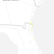
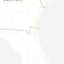


Connect with Interactive Hail Maps