

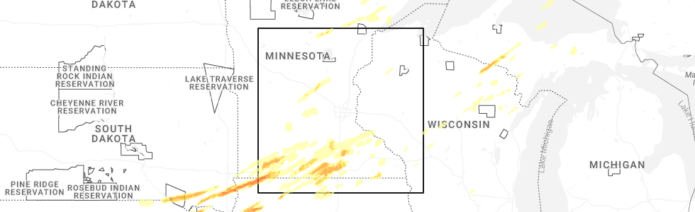
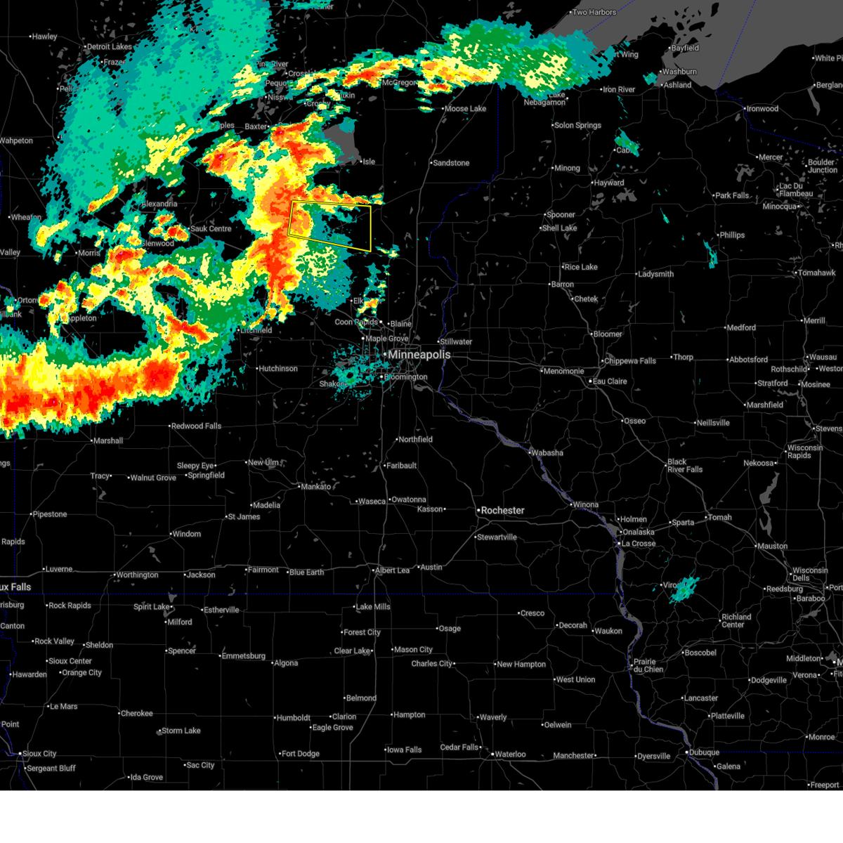
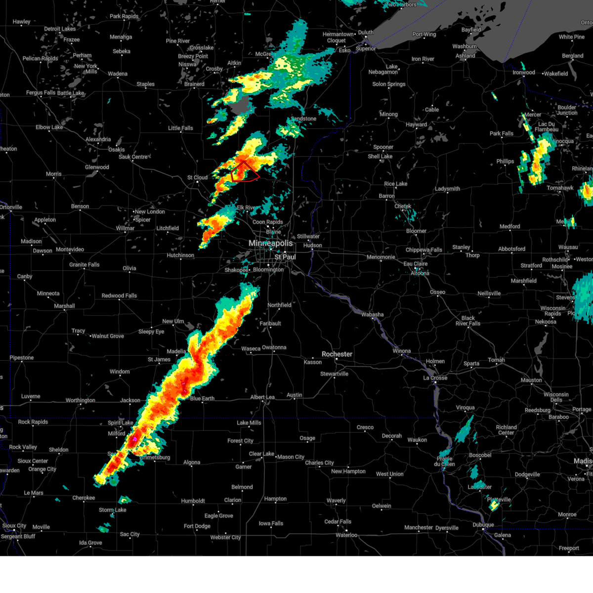
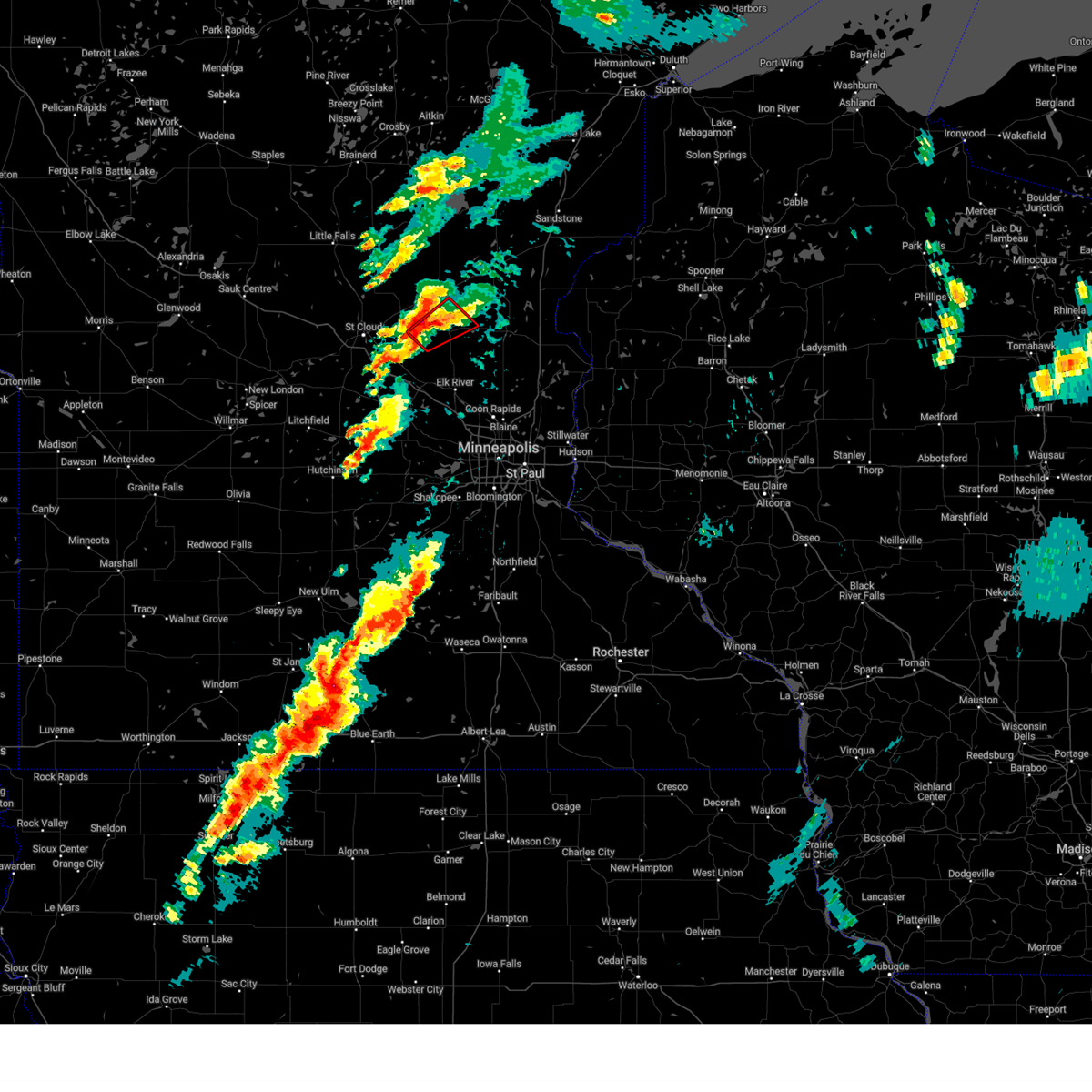
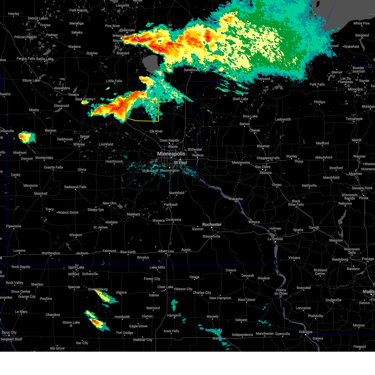
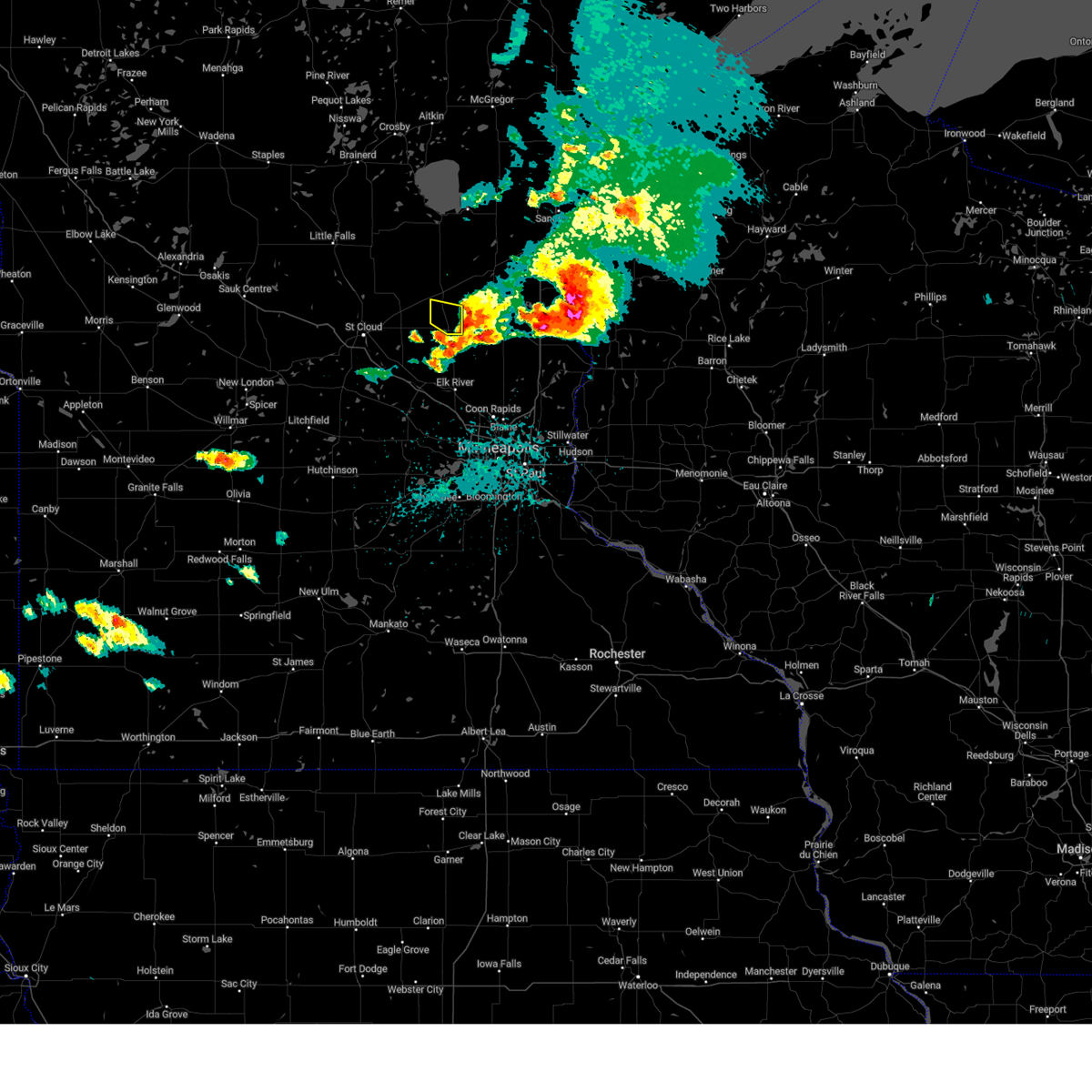
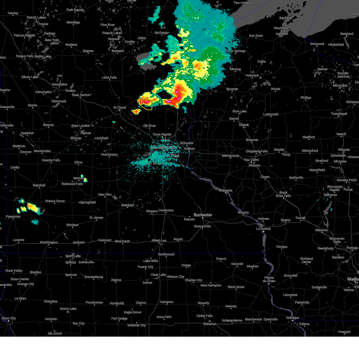
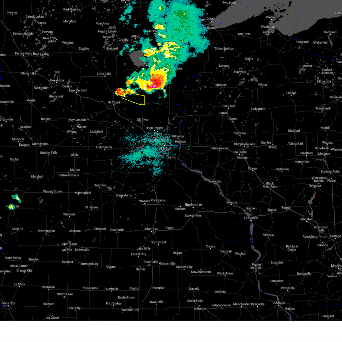
Hail Map for Pease, MN
The Pease, MN area has had 0 reports of on-the-ground hail by trained spotters, and has been under severe weather warnings 17 times during the past 12 months. Doppler radar has detected hail at or near Pease, MN on 47 occasions, including 7 occasions during the past year.
| Name: | Pease, MN |
| Where Located: | 53.2 miles NNW of Minneapolis, MN |
| Map: | Google Map for Pease, MN |
| Population: | 242 |
| Housing Units: | 93 |
| More Info: | Search Google for Pease, MN |
1
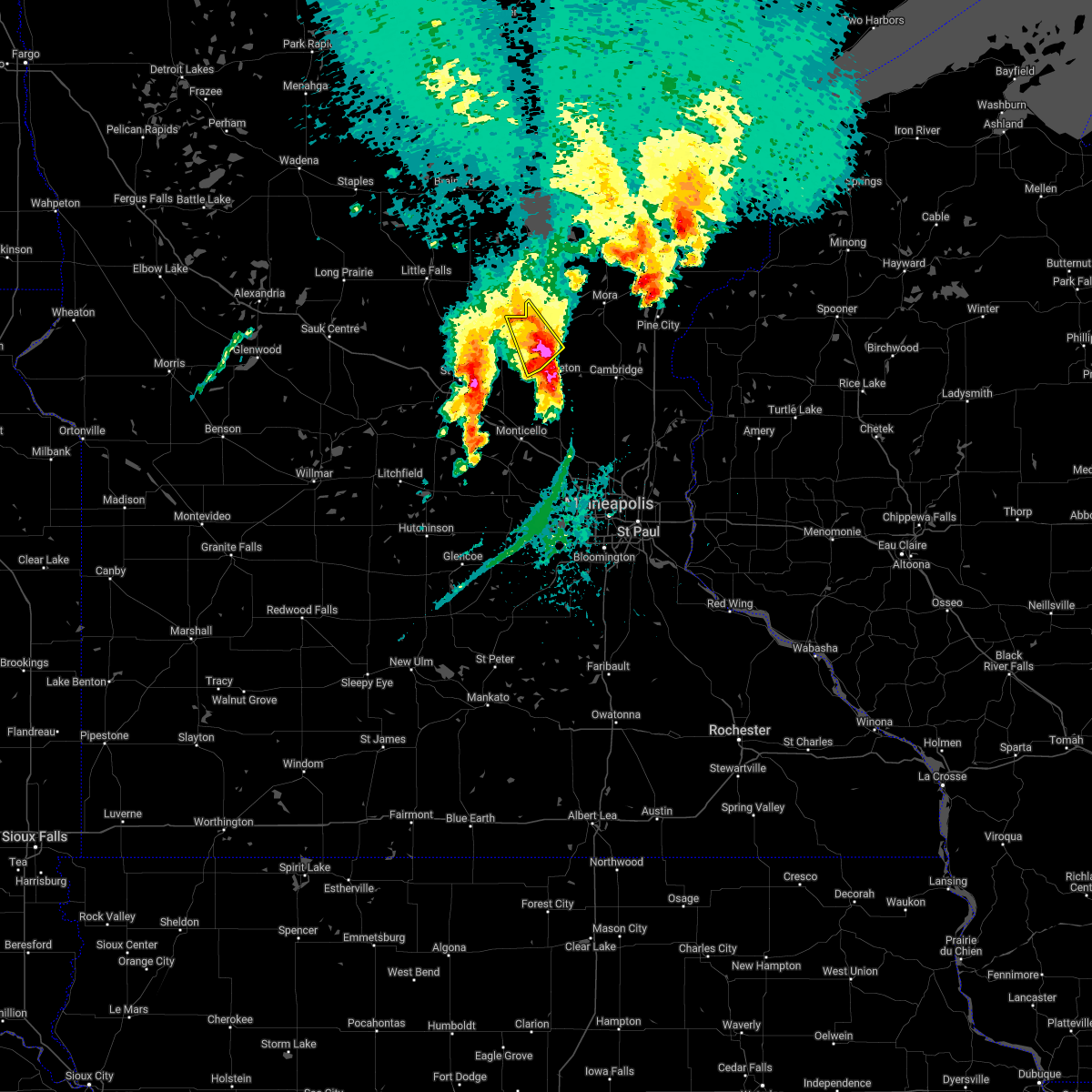
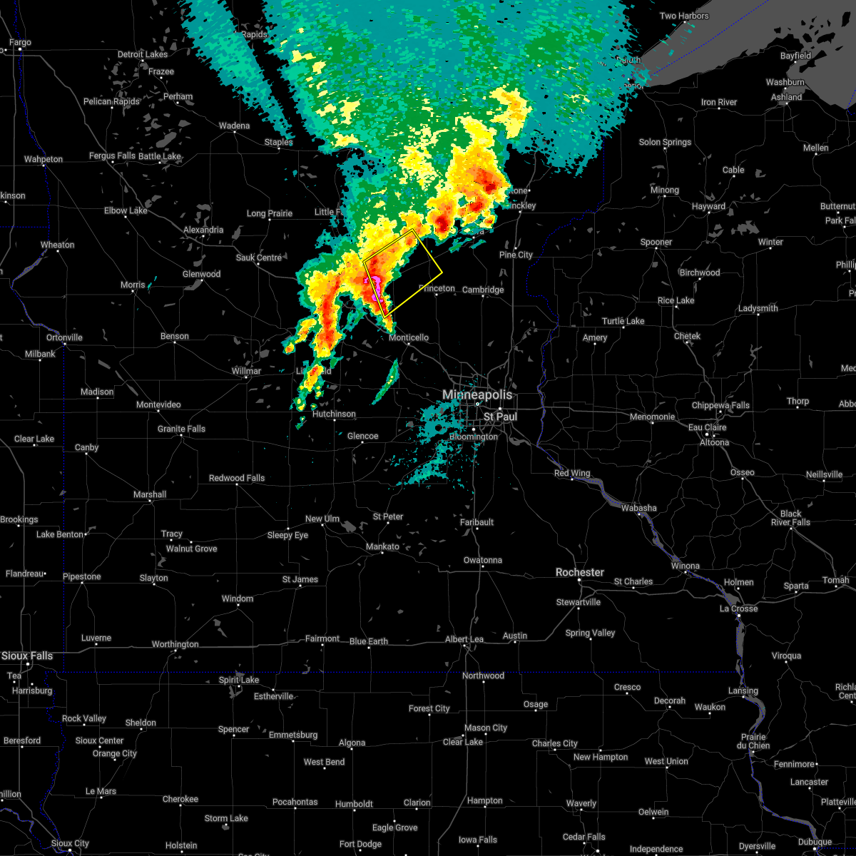
The Top Recent Hail Date for Pease, MN is Monday, April 28, 2025 (13th out of 47)
Hail and Wind Damage Spotted near Pease, MN
| Date / Time | Report Details |
|---|---|
| 6/28/2025 10:44 PM CDT |
 The severe thunderstorm warning that was previously in effect has been reissued for mille lacs, isanti, and kanabec counties and is in effect until 1130 pm cdt. please refer to that bulletin for the latest severe weather information. however, gusty winds are still possible with this thunderstorm. The severe thunderstorm warning that was previously in effect has been reissued for mille lacs, isanti, and kanabec counties and is in effect until 1130 pm cdt. please refer to that bulletin for the latest severe weather information. however, gusty winds are still possible with this thunderstorm.
|
| 6/28/2025 10:34 PM CDT |
 At 1034 pm cdt, a severe thunderstorm was located near bock, or 21 miles northwest of cambridge, moving east at 45 mph (radar indicated). Hazards include 60 mph wind gusts and small hail. Expect damage to roofs, siding, and trees. Locations impacted include, milaca, foreston, ogilvie, bock, dalbo, pease, oak park, rum river state forest and ronneby. At 1034 pm cdt, a severe thunderstorm was located near bock, or 21 miles northwest of cambridge, moving east at 45 mph (radar indicated). Hazards include 60 mph wind gusts and small hail. Expect damage to roofs, siding, and trees. Locations impacted include, milaca, foreston, ogilvie, bock, dalbo, pease, oak park, rum river state forest and ronneby.
|
| 6/28/2025 10:34 PM CDT |
 the severe thunderstorm warning has been cancelled and is no longer in effect the severe thunderstorm warning has been cancelled and is no longer in effect
|
| 6/28/2025 10:20 PM CDT |
 At 1020 pm cdt, a severe thunderstorm was located over foreston, or 28 miles northeast of st. cloud, moving east at 45 mph (radar indicated). Hazards include 60 mph wind gusts and small hail. Expect damage to roofs, siding, and trees. Locations impacted include, milaca, foley, foreston, ogilvie, bock, granite ledge, dalbo, morrill, pease, gilman, little rock, oak park, rum river, ronneby and rum river state forest. At 1020 pm cdt, a severe thunderstorm was located over foreston, or 28 miles northeast of st. cloud, moving east at 45 mph (radar indicated). Hazards include 60 mph wind gusts and small hail. Expect damage to roofs, siding, and trees. Locations impacted include, milaca, foley, foreston, ogilvie, bock, granite ledge, dalbo, morrill, pease, gilman, little rock, oak park, rum river, ronneby and rum river state forest.
|
| 6/28/2025 10:09 PM CDT |
 Svrmpx the national weather service in the twin cities has issued a * severe thunderstorm warning for, northeastern benton county in central minnesota, southeastern morrison county in central minnesota, northwestern isanti county in east central minnesota, southwestern kanabec county in east central minnesota, southern mille lacs county in east central minnesota, * until 1045 pm cdt. * at 1009 pm cdt, a severe thunderstorm was located 7 miles north of foley, or 21 miles northeast of st. cloud, moving east at 45 mph (radar indicated). Hazards include 60 mph wind gusts and small hail. expect damage to roofs, siding, and trees Svrmpx the national weather service in the twin cities has issued a * severe thunderstorm warning for, northeastern benton county in central minnesota, southeastern morrison county in central minnesota, northwestern isanti county in east central minnesota, southwestern kanabec county in east central minnesota, southern mille lacs county in east central minnesota, * until 1045 pm cdt. * at 1009 pm cdt, a severe thunderstorm was located 7 miles north of foley, or 21 miles northeast of st. cloud, moving east at 45 mph (radar indicated). Hazards include 60 mph wind gusts and small hail. expect damage to roofs, siding, and trees
|
| 6/28/2025 9:50 PM CDT |
 Svrmpx the national weather service in the twin cities has issued a * severe thunderstorm warning for, benton county in central minnesota, northern sherburne county in central minnesota, northeastern stearns county in central minnesota, southern mille lacs county in east central minnesota, * until 1030 pm cdt. * at 950 pm cdt, a severe thunderstorm was located over sartell, or 9 miles northwest of st. cloud, moving east at 60 mph (radar indicated). Hazards include 60 mph wind gusts and small hail. expect damage to roofs, siding, and trees Svrmpx the national weather service in the twin cities has issued a * severe thunderstorm warning for, benton county in central minnesota, northern sherburne county in central minnesota, northeastern stearns county in central minnesota, southern mille lacs county in east central minnesota, * until 1030 pm cdt. * at 950 pm cdt, a severe thunderstorm was located over sartell, or 9 miles northwest of st. cloud, moving east at 60 mph (radar indicated). Hazards include 60 mph wind gusts and small hail. expect damage to roofs, siding, and trees
|
| 6/16/2025 7:26 PM CDT |
 The storms which prompted the warning have moved out of the area. therefore, the warning will be allowed to expire. a tornado watch remains in effect until 900 pm cdt for a portion of east central minnesota. The storms which prompted the warning have moved out of the area. therefore, the warning will be allowed to expire. a tornado watch remains in effect until 900 pm cdt for a portion of east central minnesota.
|
| 6/16/2025 7:09 PM CDT | At 709 pm cdt, severe thunderstorms were located along a line from near grasston to near princeton, or along a line from 22 miles north of cambridge to 15 miles west of cambridge, moving east at 35 mph (radar indicated). Hazards include 60 mph wind gusts and quarter size hail. Hail damage to vehicles is expected. expect wind damage to roofs, siding, and trees. Locations impacted include, princeton, mora, brunswick, ogilvie, grasston, quamba, dalbo, lewis lake and mora airport. |
| 6/16/2025 7:09 PM CDT | the severe thunderstorm warning has been cancelled and is no longer in effect |
| 6/16/2025 6:40 PM CDT | Svrmpx the national weather service in the twin cities has issued a * severe thunderstorm warning for, southeastern benton county in central minnesota, northwestern isanti county in east central minnesota, kanabec county in east central minnesota, southern mille lacs county in east central minnesota, * until 730 pm cdt. * at 640 pm cdt, severe thunderstorms were located along a line from 7 miles north of quamba to over foley, or along a line from 33 miles north of cambridge to 17 miles northeast of st. cloud, moving east at 35 mph (radar indicated). Hazards include 60 mph wind gusts and quarter size hail. Hail damage to vehicles is expected. Expect wind damage to roofs, siding, and trees. |
| 4/28/2025 5:05 PM CDT |
 the tornado warning has been cancelled and is no longer in effect the tornado warning has been cancelled and is no longer in effect
|
| 4/28/2025 4:54 PM CDT |
 the tornado warning has been cancelled and is no longer in effect the tornado warning has been cancelled and is no longer in effect
|
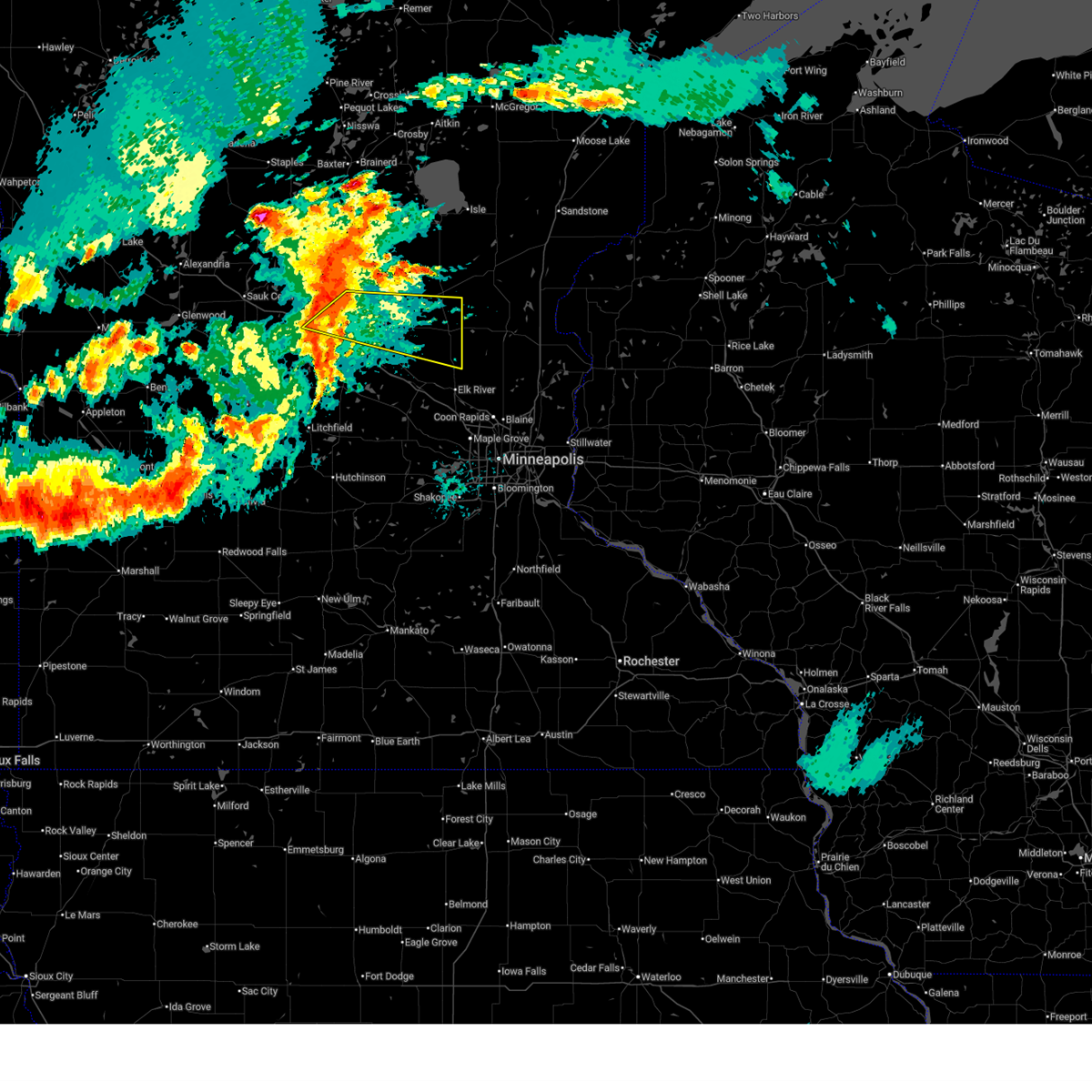
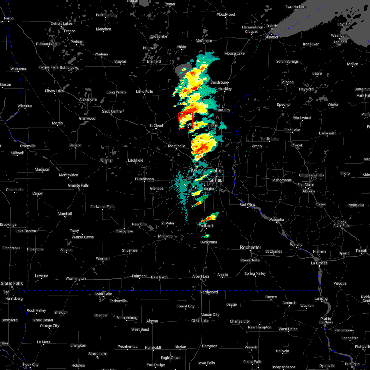
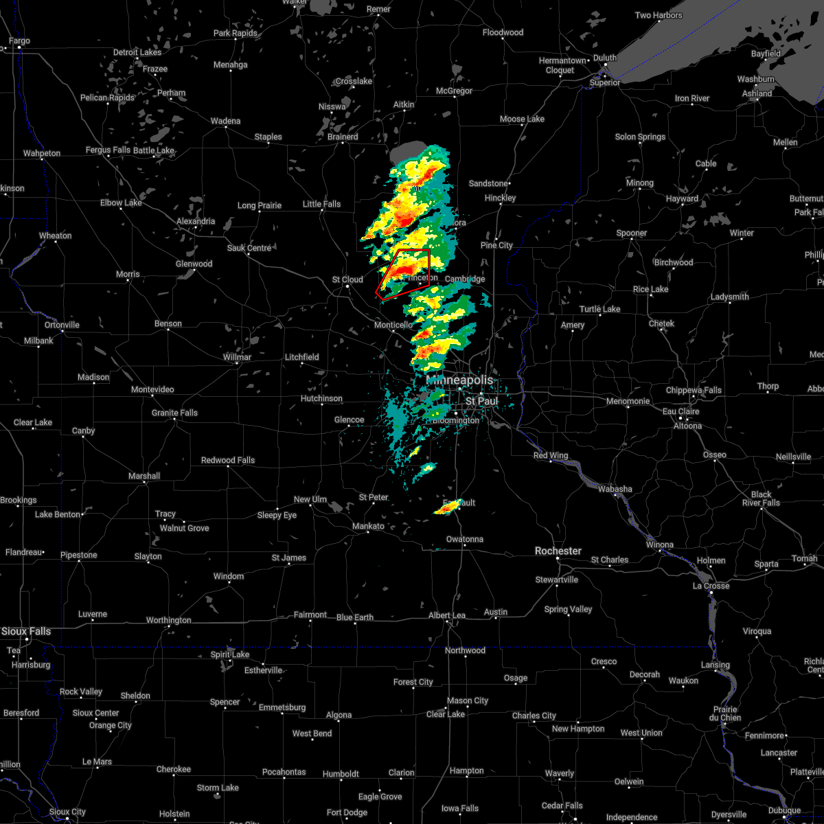
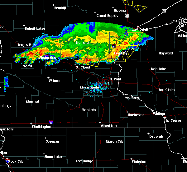
| 4/28/2025 4:54 PM CDT |
 At 454 pm cdt, a severe thunderstorm capable of producing a tornado was located over princeton, or 18 miles west of cambridge, moving northeast at 40 mph (radar indicated rotation). Hazards include tornado and quarter size hail. Flying debris will be dangerous to those caught without shelter. mobile homes will be damaged or destroyed. damage to roofs, windows and vehicles will occur. tree damage is likely. Locations impacted include, princeton, pease and princeton airport. At 454 pm cdt, a severe thunderstorm capable of producing a tornado was located over princeton, or 18 miles west of cambridge, moving northeast at 40 mph (radar indicated rotation). Hazards include tornado and quarter size hail. Flying debris will be dangerous to those caught without shelter. mobile homes will be damaged or destroyed. damage to roofs, windows and vehicles will occur. tree damage is likely. Locations impacted include, princeton, pease and princeton airport.
|
| 4/28/2025 4:43 PM CDT |
 Tormpx the national weather service in the twin cities has issued a * tornado warning for, southeastern benton county in central minnesota, north central sherburne county in central minnesota, west central isanti county in east central minnesota, south central mille lacs county in east central minnesota, * until 515 pm cdt. * at 443 pm cdt, a severe thunderstorm capable of producing a tornado was located 7 miles west of princeton, or 22 miles east of st. cloud, moving northeast at 45 mph (radar indicated rotation). Hazards include tornado and quarter size hail. Flying debris will be dangerous to those caught without shelter. mobile homes will be damaged or destroyed. damage to roofs, windows and vehicles will occur. Tree damage is likely. Tormpx the national weather service in the twin cities has issued a * tornado warning for, southeastern benton county in central minnesota, north central sherburne county in central minnesota, west central isanti county in east central minnesota, south central mille lacs county in east central minnesota, * until 515 pm cdt. * at 443 pm cdt, a severe thunderstorm capable of producing a tornado was located 7 miles west of princeton, or 22 miles east of st. cloud, moving northeast at 45 mph (radar indicated rotation). Hazards include tornado and quarter size hail. Flying debris will be dangerous to those caught without shelter. mobile homes will be damaged or destroyed. damage to roofs, windows and vehicles will occur. Tree damage is likely.
|
| 8/29/2024 4:21 PM CDT | The storms which prompted the warning have weakened below severe limits, and no longer pose an immediate threat to life or property. therefore, the warning will be allowed to expire. however, gusty winds are still possible with these thunderstorms. a severe thunderstorm watch remains in effect until 900 pm cdt for central and east central minnesota. |
| 8/29/2024 4:03 PM CDT |
 At 403 pm cdt, severe thunderstorms were located along a line extending from near vineland to near onamia to near foreston, moving northeast at 50 mph (radar indicated). Hazards include 60 mph wind gusts. Expect damage to roofs, siding, and trees. these severe storms will be near, mille lacs lake, isle, wahkon, and bock around 410 pm cdt. Other locations impacted by these severe thunderstorms include mille lacs kathio state park, glendorado, father hennepin state park, pease, oak park, rum river, lake mille lacs, rum river state forest, and bayview. At 403 pm cdt, severe thunderstorms were located along a line extending from near vineland to near onamia to near foreston, moving northeast at 50 mph (radar indicated). Hazards include 60 mph wind gusts. Expect damage to roofs, siding, and trees. these severe storms will be near, mille lacs lake, isle, wahkon, and bock around 410 pm cdt. Other locations impacted by these severe thunderstorms include mille lacs kathio state park, glendorado, father hennepin state park, pease, oak park, rum river, lake mille lacs, rum river state forest, and bayview.
|
| 8/29/2024 3:37 PM CDT | Svrmpx the national weather service in the twin cities has issued a * severe thunderstorm warning for, mille lacs county in east central minnesota, benton county in central minnesota, southeastern morrison county in central minnesota, * until 430 pm cdt. * at 337 pm cdt, severe thunderstorms were located along a line extending from near camp ripley to 7 miles south of pierz to near sauk rapids, moving northeast at 50 mph (radar indicated). Hazards include 60 mph wind gusts. Expect damage to roofs, siding, and trees. severe thunderstorms will be near, st. cloud, foley, pierz, and lastrup around 340 pm cdt. foreston around 355 pm cdt. mille lacs lake, milaca, onamia, and vineland around 400 pm cdt. bock around 405 pm cdt. wahkon around 410 pm cdt. isle around 415 pm cdt. Other locations impacted by these severe thunderstorms include duelm, mayhew, morrill, mille lacs kathio state park, glendorado, parent, father hennepin state park, pease, oak park, and lake mille lacs. |
| 6/12/2024 7:27 PM CDT |
 Svrmpx the national weather service in the twin cities has issued a * severe thunderstorm warning for, southern mille lacs county in east central minnesota, benton county in central minnesota, northern sherburne county in central minnesota, * until 815 pm cdt. * at 727 pm cdt, a severe thunderstorm was located near sauk rapids, or 10 miles north of st. cloud, moving east at 45 mph (radar indicated). Hazards include 60 mph wind gusts and quarter size hail. Hail damage to vehicles is expected. Expect wind damage to roofs, siding, and trees. Svrmpx the national weather service in the twin cities has issued a * severe thunderstorm warning for, southern mille lacs county in east central minnesota, benton county in central minnesota, northern sherburne county in central minnesota, * until 815 pm cdt. * at 727 pm cdt, a severe thunderstorm was located near sauk rapids, or 10 miles north of st. cloud, moving east at 45 mph (radar indicated). Hazards include 60 mph wind gusts and quarter size hail. Hail damage to vehicles is expected. Expect wind damage to roofs, siding, and trees.
|
| 8/11/2023 3:52 PM CDT |
 The severe thunderstorm warning for south central mille lacs county will expire at 400 pm cdt, the storm which prompted the warning has moved out of the area. therefore, the warning will be allowed to expire. a severe thunderstorm watch remains in effect until 1000 pm cdt for east central minnesota. The severe thunderstorm warning for south central mille lacs county will expire at 400 pm cdt, the storm which prompted the warning has moved out of the area. therefore, the warning will be allowed to expire. a severe thunderstorm watch remains in effect until 1000 pm cdt for east central minnesota.
|
| 8/11/2023 3:41 PM CDT |
 At 341 pm cdt, a severe thunderstorm was located near princeton, or 20 miles northwest of cambridge, moving east at 50 mph (radar indicated). Hazards include 60 mph wind gusts and quarter size hail. Hail damage to vehicles is expected. expect wind damage to roofs, siding, and trees. this severe thunderstorm will remain over mainly rural areas of south central mille lacs county, including the following locations, pease and princeton airport. hail threat, radar indicated max hail size, 1. 00 in wind threat, radar indicated max wind gust, 60 mph. At 341 pm cdt, a severe thunderstorm was located near princeton, or 20 miles northwest of cambridge, moving east at 50 mph (radar indicated). Hazards include 60 mph wind gusts and quarter size hail. Hail damage to vehicles is expected. expect wind damage to roofs, siding, and trees. this severe thunderstorm will remain over mainly rural areas of south central mille lacs county, including the following locations, pease and princeton airport. hail threat, radar indicated max hail size, 1. 00 in wind threat, radar indicated max wind gust, 60 mph.
|
| 8/11/2023 3:25 PM CDT |
 At 325 pm cdt, a severe thunderstorm was located over foley, or 17 miles northeast of st. cloud, moving east at 50 mph (radar indicated). Hazards include 60 mph wind gusts and half dollar size hail. Hail damage to vehicles is expected. expect wind damage to roofs, siding, and trees. this severe thunderstorm will be near, princeton around 345 pm cdt. hail threat, radar indicated max hail size, 1. 25 in wind threat, radar indicated max wind gust, 60 mph. At 325 pm cdt, a severe thunderstorm was located over foley, or 17 miles northeast of st. cloud, moving east at 50 mph (radar indicated). Hazards include 60 mph wind gusts and half dollar size hail. Hail damage to vehicles is expected. expect wind damage to roofs, siding, and trees. this severe thunderstorm will be near, princeton around 345 pm cdt. hail threat, radar indicated max hail size, 1. 25 in wind threat, radar indicated max wind gust, 60 mph.
|
| 5/30/2022 7:12 PM CDT |
 At 712 pm cdt, severe thunderstorms were located along a line extending from near milaca to 6 miles northwest of cambridge to near st. francis, moving northeast at 60 mph (public). Hazards include 60 mph wind gusts and half dollar size hail. Hail damage to vehicles is expected. expect wind damage to roofs, siding, and trees. severe thunderstorms will be near, bock around 715 pm cdt. cambridge and ogilvie around 720 pm cdt. mora and brunswick around 725 pm cdt. grasston around 730 pm cdt. other locations in the path of these severe thunderstorms include rush city and quamba. hail threat, radar indicated max hail size, 1. 25 in wind threat, radar indicated max wind gust, 60 mph. At 712 pm cdt, severe thunderstorms were located along a line extending from near milaca to 6 miles northwest of cambridge to near st. francis, moving northeast at 60 mph (public). Hazards include 60 mph wind gusts and half dollar size hail. Hail damage to vehicles is expected. expect wind damage to roofs, siding, and trees. severe thunderstorms will be near, bock around 715 pm cdt. cambridge and ogilvie around 720 pm cdt. mora and brunswick around 725 pm cdt. grasston around 730 pm cdt. other locations in the path of these severe thunderstorms include rush city and quamba. hail threat, radar indicated max hail size, 1. 25 in wind threat, radar indicated max wind gust, 60 mph.
|
| 5/30/2022 6:58 PM CDT |
 At 657 pm cdt, severe thunderstorms were located along a line extending from foley to near zimmerman to near ramsey, moving northeast at 65 mph (public). Hazards include 70 mph wind gusts and half dollar size hail. Hail damage to vehicles is expected. expect considerable tree damage. wind damage is also likely to mobile homes, roofs, and outbuildings. locations impacted include, ham lake, cambridge, east bethel, isanti, milaca and bock. thunderstorm damage threat, considerable hail threat, radar indicated max hail size, 1. 25 in wind threat, radar indicated max wind gust, 70 mph. At 657 pm cdt, severe thunderstorms were located along a line extending from foley to near zimmerman to near ramsey, moving northeast at 65 mph (public). Hazards include 70 mph wind gusts and half dollar size hail. Hail damage to vehicles is expected. expect considerable tree damage. wind damage is also likely to mobile homes, roofs, and outbuildings. locations impacted include, ham lake, cambridge, east bethel, isanti, milaca and bock. thunderstorm damage threat, considerable hail threat, radar indicated max hail size, 1. 25 in wind threat, radar indicated max wind gust, 70 mph.
|
| 5/30/2022 6:41 PM CDT |
 At 640 pm cdt, severe thunderstorms were located along a line extending from near waite park to monticello to near corcoran, moving northeast at 65 mph (public). Hazards include golf ball size hail and 70 mph wind gusts. People and animals outdoors will be injured. expect hail damage to roofs, siding, windows, and vehicles. expect considerable tree damage. wind damage is also likely to mobile homes, roofs, and outbuildings. severe thunderstorms will be near, maple grove, big lake and albertville around 645 pm cdt. brooklyn park, elk river, otsego, rogers and zimmerman around 650 pm cdt. coon rapids, ramsey, champlin, anoka and st. francis around 655 pm cdt. andover and princeton around 700 pm cdt. other locations in the path of these severe thunderstorms include cambridge and milaca. thunderstorm damage threat, considerable hail threat, radar indicated max hail size, 1. 75 in wind threat, radar indicated max wind gust, 70 mph. At 640 pm cdt, severe thunderstorms were located along a line extending from near waite park to monticello to near corcoran, moving northeast at 65 mph (public). Hazards include golf ball size hail and 70 mph wind gusts. People and animals outdoors will be injured. expect hail damage to roofs, siding, windows, and vehicles. expect considerable tree damage. wind damage is also likely to mobile homes, roofs, and outbuildings. severe thunderstorms will be near, maple grove, big lake and albertville around 645 pm cdt. brooklyn park, elk river, otsego, rogers and zimmerman around 650 pm cdt. coon rapids, ramsey, champlin, anoka and st. francis around 655 pm cdt. andover and princeton around 700 pm cdt. other locations in the path of these severe thunderstorms include cambridge and milaca. thunderstorm damage threat, considerable hail threat, radar indicated max hail size, 1. 75 in wind threat, radar indicated max wind gust, 70 mph.
|
| 5/30/2022 5:11 AM CDT |
 At 510 am cdt, severe thunderstorms were located along a line extending from near lastrup to 6 miles south of ogilvie, moving northeast at 70 mph (radar indicated). Hazards include 70 mph wind gusts. Expect considerable tree damage. damage is likely to mobile homes, roofs, and outbuildings. locations impacted include, brunswick, ogilvie, mora, grasston, quamba, vineland and mille lacs lake. thunderstorm damage threat, considerable hail threat, radar indicated max hail size, <. 75 in wind threat, radar indicated max wind gust, 70 mph. At 510 am cdt, severe thunderstorms were located along a line extending from near lastrup to 6 miles south of ogilvie, moving northeast at 70 mph (radar indicated). Hazards include 70 mph wind gusts. Expect considerable tree damage. damage is likely to mobile homes, roofs, and outbuildings. locations impacted include, brunswick, ogilvie, mora, grasston, quamba, vineland and mille lacs lake. thunderstorm damage threat, considerable hail threat, radar indicated max hail size, <. 75 in wind threat, radar indicated max wind gust, 70 mph.
|
| 5/30/2022 4:48 AM CDT |
 At 448 am cdt, severe thunderstorms were located along a line extending from near bowlus to 6 miles west of zimmerman, moving northeast at 70 mph (radar indicated). Hazards include 70 mph wind gusts. Expect considerable tree damage. damage is likely to mobile homes, roofs, and outbuildings. severe thunderstorms will be near, princeton around 455 am cdt. pierz, bock and lastrup around 505 am cdt. other locations in the path of these severe thunderstorms include ogilvie, mora, brunswick, grasston, quamba, vineland and mille lacs lake. thunderstorm damage threat, considerable hail threat, radar indicated max hail size, <. 75 in wind threat, radar indicated max wind gust, 70 mph. At 448 am cdt, severe thunderstorms were located along a line extending from near bowlus to 6 miles west of zimmerman, moving northeast at 70 mph (radar indicated). Hazards include 70 mph wind gusts. Expect considerable tree damage. damage is likely to mobile homes, roofs, and outbuildings. severe thunderstorms will be near, princeton around 455 am cdt. pierz, bock and lastrup around 505 am cdt. other locations in the path of these severe thunderstorms include ogilvie, mora, brunswick, grasston, quamba, vineland and mille lacs lake. thunderstorm damage threat, considerable hail threat, radar indicated max hail size, <. 75 in wind threat, radar indicated max wind gust, 70 mph.
|
| 5/12/2022 8:36 PM CDT |
 At 836 pm cdt, severe thunderstorms were located along a line extending from brunswick to 5 miles northeast of east bethel, moving east at 45 mph (radar indicated). Hazards include 60 mph wind gusts. Expect damage to roofs, siding, and trees. these severe thunderstorms will remain over mainly rural areas of southern mille lacs, isanti, eastern benton and northeastern sherburne counties, including the following locations, sherburne national wildlife refuge, orrock, glendorado, spencer brook, pease, oak park, athens, stanchfield, cambridge airport and princeton airport. hail threat, radar indicated max hail size, <. 75 in wind threat, radar indicated max wind gust, 60 mph. At 836 pm cdt, severe thunderstorms were located along a line extending from brunswick to 5 miles northeast of east bethel, moving east at 45 mph (radar indicated). Hazards include 60 mph wind gusts. Expect damage to roofs, siding, and trees. these severe thunderstorms will remain over mainly rural areas of southern mille lacs, isanti, eastern benton and northeastern sherburne counties, including the following locations, sherburne national wildlife refuge, orrock, glendorado, spencer brook, pease, oak park, athens, stanchfield, cambridge airport and princeton airport. hail threat, radar indicated max hail size, <. 75 in wind threat, radar indicated max wind gust, 60 mph.
|
| 5/12/2022 8:14 PM CDT |
 At 814 pm cdt, severe thunderstorms were located along a line extending from near milaca to near st. francis, moving east at 55 mph (radar indicated). Hazards include 60 mph wind gusts. Expect damage to roofs, siding, and trees. these severe storms will be near, st. francis around 820 pm cdt. cambridge and isanti around 825 pm cdt. east bethel around 830 pm cdt. other locations impacted by these severe thunderstorms include sherburne national wildlife refuge, mayhew, glendorado, parent, grandy, gilman, ronneby, dalbo, weber and granite ledge. hail threat, radar indicated max hail size, <. 75 in wind threat, radar indicated max wind gust, 60 mph. At 814 pm cdt, severe thunderstorms were located along a line extending from near milaca to near st. francis, moving east at 55 mph (radar indicated). Hazards include 60 mph wind gusts. Expect damage to roofs, siding, and trees. these severe storms will be near, st. francis around 820 pm cdt. cambridge and isanti around 825 pm cdt. east bethel around 830 pm cdt. other locations impacted by these severe thunderstorms include sherburne national wildlife refuge, mayhew, glendorado, parent, grandy, gilman, ronneby, dalbo, weber and granite ledge. hail threat, radar indicated max hail size, <. 75 in wind threat, radar indicated max wind gust, 60 mph.
|
| 5/12/2022 7:48 PM CDT |
 At 748 pm cdt, severe thunderstorms were located along a line extending from near rice to 6 miles east of sauk rapids to near maple lake, moving northeast at 55 mph (radar indicated). Hazards include 60 mph wind gusts. Expect damage to roofs, siding, and trees. severe thunderstorms will be near, foley around 755 pm cdt. zimmerman around 805 pm cdt. st. francis, milaca and foreston around 810 pm cdt. bock around 815 pm cdt. cambridge and isanti around 825 pm cdt. hail threat, radar indicated max hail size, <. 75 in wind threat, radar indicated max wind gust, 60 mph. At 748 pm cdt, severe thunderstorms were located along a line extending from near rice to 6 miles east of sauk rapids to near maple lake, moving northeast at 55 mph (radar indicated). Hazards include 60 mph wind gusts. Expect damage to roofs, siding, and trees. severe thunderstorms will be near, foley around 755 pm cdt. zimmerman around 805 pm cdt. st. francis, milaca and foreston around 810 pm cdt. bock around 815 pm cdt. cambridge and isanti around 825 pm cdt. hail threat, radar indicated max hail size, <. 75 in wind threat, radar indicated max wind gust, 60 mph.
|
| 5/12/2022 12:12 PM CDT |
 At 1212 pm cdt, a severe thunderstorm was located near princeton, or 15 miles west of cambridge, moving northeast at 35 mph (trained weather spotters). Hazards include 60 mph wind gusts and half dollar size hail. Hail damage to vehicles is expected. Expect wind damage to roofs, siding, and trees. At 1212 pm cdt, a severe thunderstorm was located near princeton, or 15 miles west of cambridge, moving northeast at 35 mph (trained weather spotters). Hazards include 60 mph wind gusts and half dollar size hail. Hail damage to vehicles is expected. Expect wind damage to roofs, siding, and trees.
|
| 5/12/2022 12:08 PM CDT |
 At 1207 pm cdt, a severe thunderstorm was located over foreston, or 25 miles northeast of st. cloud, moving northeast at 30 mph (radar indicated). Hazards include 60 mph wind gusts and half dollar size hail. Hail damage to vehicles is expected. expect wind damage to roofs, siding, and trees. locations impacted include, milaca, foreston, granite ledge, pease, oak park and rum river. hail threat, radar indicated max hail size, 1. 25 in wind threat, radar indicated max wind gust, 60 mph. At 1207 pm cdt, a severe thunderstorm was located over foreston, or 25 miles northeast of st. cloud, moving northeast at 30 mph (radar indicated). Hazards include 60 mph wind gusts and half dollar size hail. Hail damage to vehicles is expected. expect wind damage to roofs, siding, and trees. locations impacted include, milaca, foreston, granite ledge, pease, oak park and rum river. hail threat, radar indicated max hail size, 1. 25 in wind threat, radar indicated max wind gust, 60 mph.
|
| 5/12/2022 11:53 AM CDT |
 At 1153 am cdt, a severe thunderstorm was located near foley, or 18 miles east of st. cloud, moving northeast at 35 mph (radar indicated). Hazards include two inch hail and 60 mph wind gusts. People and animals outdoors will be injured. expect hail damage to roofs, siding, windows, and vehicles. expect wind damage to roofs, siding, and trees. locations impacted include, milaca, foley, foreston, glendorado, granite ledge, pease, gilman, oak park, ronneby and rum river. thunderstorm damage threat, considerable hail threat, radar indicated max hail size, 2. 00 in wind threat, radar indicated max wind gust, 60 mph. At 1153 am cdt, a severe thunderstorm was located near foley, or 18 miles east of st. cloud, moving northeast at 35 mph (radar indicated). Hazards include two inch hail and 60 mph wind gusts. People and animals outdoors will be injured. expect hail damage to roofs, siding, windows, and vehicles. expect wind damage to roofs, siding, and trees. locations impacted include, milaca, foley, foreston, glendorado, granite ledge, pease, gilman, oak park, ronneby and rum river. thunderstorm damage threat, considerable hail threat, radar indicated max hail size, 2. 00 in wind threat, radar indicated max wind gust, 60 mph.
|
| 5/12/2022 11:41 AM CDT |
 At 1140 am cdt, a severe thunderstorm was located near foley, or 10 miles east of st. cloud, moving northeast at 35 mph (emergency management for hail and asos for wind). Hazards include golf ball size hail and 60 mph wind gusts. People and animals outdoors will be injured. expect hail damage to roofs, siding, windows, and vehicles. expect wind damage to roofs, siding, and trees. locations impacted include, milaca, foley, foreston, santiago, glendorado, granite ledge, pease, gilman, oak park, duelm, mayhew and parent. thunderstorm damage threat, considerable hail threat, observed max hail size, 1. 75 in wind threat, observed max wind gust, 60 mph. At 1140 am cdt, a severe thunderstorm was located near foley, or 10 miles east of st. cloud, moving northeast at 35 mph (emergency management for hail and asos for wind). Hazards include golf ball size hail and 60 mph wind gusts. People and animals outdoors will be injured. expect hail damage to roofs, siding, windows, and vehicles. expect wind damage to roofs, siding, and trees. locations impacted include, milaca, foley, foreston, santiago, glendorado, granite ledge, pease, gilman, oak park, duelm, mayhew and parent. thunderstorm damage threat, considerable hail threat, observed max hail size, 1. 75 in wind threat, observed max wind gust, 60 mph.
|
| 5/12/2022 11:26 AM CDT |
 At 1125 am cdt, a severe thunderstorm was located over sauk rapids, or near st. cloud, moving northeast at 30 mph (trained weather spotters). Hazards include golf ball size hail and 60 mph wind gusts. People and animals outdoors will be injured. expect hail damage to roofs, siding, windows, and vehicles. Expect wind damage to roofs, siding, and trees. At 1125 am cdt, a severe thunderstorm was located over sauk rapids, or near st. cloud, moving northeast at 30 mph (trained weather spotters). Hazards include golf ball size hail and 60 mph wind gusts. People and animals outdoors will be injured. expect hail damage to roofs, siding, windows, and vehicles. Expect wind damage to roofs, siding, and trees.
|
| 5/11/2022 3:38 PM CDT |
 At 338 pm cdt, a severe thunderstorm was located near princeton, or 18 miles west of cambridge, moving north at 40 mph (radar indicated). Hazards include ping pong ball size hail. People and animals outdoors will be injured. expect damage to roofs, siding, windows, and vehicles. this severe thunderstorm will remain over mainly rural areas of south central mille lacs, west central isanti and northeastern sherburne counties, including the following locations, sherburne national wildlife refuge, pease, orrock, spencer brook and princeton airport. hail threat, radar indicated max hail size, 1. 50 in wind threat, radar indicated max wind gust, <50 mph. At 338 pm cdt, a severe thunderstorm was located near princeton, or 18 miles west of cambridge, moving north at 40 mph (radar indicated). Hazards include ping pong ball size hail. People and animals outdoors will be injured. expect damage to roofs, siding, windows, and vehicles. this severe thunderstorm will remain over mainly rural areas of south central mille lacs, west central isanti and northeastern sherburne counties, including the following locations, sherburne national wildlife refuge, pease, orrock, spencer brook and princeton airport. hail threat, radar indicated max hail size, 1. 50 in wind threat, radar indicated max wind gust, <50 mph.
|
| 5/11/2022 3:18 PM CDT |
 At 318 pm cdt, a severe thunderstorm was located near zimmerman, or 19 miles northeast of buffalo, moving north at 40 mph (radar indicated). Hazards include quarter size hail. Damage to vehicles is expected. this severe thunderstorm will be near, princeton around 335 pm cdt. hail threat, radar indicated max hail size, 1. 00 in wind threat, radar indicated max wind gust, <50 mph. At 318 pm cdt, a severe thunderstorm was located near zimmerman, or 19 miles northeast of buffalo, moving north at 40 mph (radar indicated). Hazards include quarter size hail. Damage to vehicles is expected. this severe thunderstorm will be near, princeton around 335 pm cdt. hail threat, radar indicated max hail size, 1. 00 in wind threat, radar indicated max wind gust, <50 mph.
|
| 5/9/2022 5:11 PM CDT |
 The tornado warning for southern mille lacs county will expire at 515 pm cdt, the storm which prompted the warning has moved out of the area. therefore, the warning will be allowed to expire. a tornado watch remains in effect until 1000 pm cdt for central and east central minnesota. The tornado warning for southern mille lacs county will expire at 515 pm cdt, the storm which prompted the warning has moved out of the area. therefore, the warning will be allowed to expire. a tornado watch remains in effect until 1000 pm cdt for central and east central minnesota.
|
| 5/9/2022 4:58 PM CDT |
 At 458 pm cdt, a severe thunderstorm capable of producing a tornado was located over milaca, or 22 miles northwest of cambridge, moving northeast at 60 mph (radar indicated rotation). Hazards include tornado and quarter size hail. Flying debris will be dangerous to those caught without shelter. mobile homes will be damaged or destroyed. damage to roofs, windows, and vehicles will occur. tree damage is likely. this dangerous storm will be near, ogilvie around 510 pm cdt. Mora around 515 pm cdt. At 458 pm cdt, a severe thunderstorm capable of producing a tornado was located over milaca, or 22 miles northwest of cambridge, moving northeast at 60 mph (radar indicated rotation). Hazards include tornado and quarter size hail. Flying debris will be dangerous to those caught without shelter. mobile homes will be damaged or destroyed. damage to roofs, windows, and vehicles will occur. tree damage is likely. this dangerous storm will be near, ogilvie around 510 pm cdt. Mora around 515 pm cdt.
|
| 5/9/2022 4:51 PM CDT |
 At 451 pm cdt, a severe thunderstorm capable of producing a tornado was located near foreston, or 22 miles east of st. cloud, moving northeast at 45 mph (radar indicated rotation). Hazards include tornado and quarter size hail. Flying debris will be dangerous to those caught without shelter. mobile homes will be damaged or destroyed. damage to roofs, windows, and vehicles will occur. tree damage is likely. This dangerous storm will be near, milaca and foreston around 500 pm cdt. At 451 pm cdt, a severe thunderstorm capable of producing a tornado was located near foreston, or 22 miles east of st. cloud, moving northeast at 45 mph (radar indicated rotation). Hazards include tornado and quarter size hail. Flying debris will be dangerous to those caught without shelter. mobile homes will be damaged or destroyed. damage to roofs, windows, and vehicles will occur. tree damage is likely. This dangerous storm will be near, milaca and foreston around 500 pm cdt.
|
| 5/9/2022 4:42 PM CDT |
 At 441 pm cdt, a severe thunderstorm capable of producing a tornado was located 7 miles southeast of foley, or 17 miles east of st. cloud, moving northeast at 50 mph (radar indicated rotation). Hazards include tornado and quarter size hail. Flying debris will be dangerous to those caught without shelter. mobile homes will be damaged or destroyed. damage to roofs, windows, and vehicles will occur. tree damage is likely. this dangerous storm will be near, foreston around 500 pm cdt. Other locations in the path of this tornadic thunderstorm include milaca. At 441 pm cdt, a severe thunderstorm capable of producing a tornado was located 7 miles southeast of foley, or 17 miles east of st. cloud, moving northeast at 50 mph (radar indicated rotation). Hazards include tornado and quarter size hail. Flying debris will be dangerous to those caught without shelter. mobile homes will be damaged or destroyed. damage to roofs, windows, and vehicles will occur. tree damage is likely. this dangerous storm will be near, foreston around 500 pm cdt. Other locations in the path of this tornadic thunderstorm include milaca.
|
| 8/28/2021 12:35 PM CDT |
 The tornado warning for southern mille lacs and southeastern benton counties will expire at 1245 pm cdt, the storm which prompted the warning has moved out of the area. therefore, the warning will be allowed to expire. a tornado watch remains in effect until 400 pm cdt for central and east central minnesota. The tornado warning for southern mille lacs and southeastern benton counties will expire at 1245 pm cdt, the storm which prompted the warning has moved out of the area. therefore, the warning will be allowed to expire. a tornado watch remains in effect until 400 pm cdt for central and east central minnesota.
|
| 8/28/2021 12:27 PM CDT |
 At 1226 pm cdt, severe thunderstorms were located along a line extending from 7 miles southwest of onamia to 6 miles north of bock to 7 miles west of zimmerman, moving east at 40 mph (trained weather spotters). Hazards include two inch hail and 70 mph wind gusts. People and animals outdoors will be injured. expect hail damage to roofs, siding, windows, and vehicles. expect considerable tree damage. wind damage is also likely to mobile homes, roofs, and outbuildings. severe thunderstorms will be near, bock around 1230 pm cdt. princeton and ogilvie around 1240 pm cdt. mora around 1245 pm cdt. brunswick around 1250 pm cdt. grasston and quamba around 1255 pm cdt. cambridge around 100 pm cdt. Other locations impacted by these severe thunderstorms include grandy, dalbo, pease, knife lake, stanchfield, and lewis lake. At 1226 pm cdt, severe thunderstorms were located along a line extending from 7 miles southwest of onamia to 6 miles north of bock to 7 miles west of zimmerman, moving east at 40 mph (trained weather spotters). Hazards include two inch hail and 70 mph wind gusts. People and animals outdoors will be injured. expect hail damage to roofs, siding, windows, and vehicles. expect considerable tree damage. wind damage is also likely to mobile homes, roofs, and outbuildings. severe thunderstorms will be near, bock around 1230 pm cdt. princeton and ogilvie around 1240 pm cdt. mora around 1245 pm cdt. brunswick around 1250 pm cdt. grasston and quamba around 1255 pm cdt. cambridge around 100 pm cdt. Other locations impacted by these severe thunderstorms include grandy, dalbo, pease, knife lake, stanchfield, and lewis lake.
|
| 8/28/2021 12:19 PM CDT |
 At 1219 pm cdt, a severe squall line capable of producing both tornadoes and extensive straight line wind damage was located near foreston, or 23 miles east of st. cloud, moving east at 45 mph (radar indicated rotation). Hazards include tornado and tennis ball size hail. Flying debris will be dangerous to those caught without shelter. mobile homes will be damaged or destroyed. damage to roofs, windows, and vehicles will occur. tree damage is likely. these dangerous storms will be near, milaca around 1225 pm cdt. princeton around 1230 pm cdt. bock around 1235 pm cdt. Other locations impacted by this tornadic thunderstorm include pease, oak park, glendorado, ronneby and princeton airport. At 1219 pm cdt, a severe squall line capable of producing both tornadoes and extensive straight line wind damage was located near foreston, or 23 miles east of st. cloud, moving east at 45 mph (radar indicated rotation). Hazards include tornado and tennis ball size hail. Flying debris will be dangerous to those caught without shelter. mobile homes will be damaged or destroyed. damage to roofs, windows, and vehicles will occur. tree damage is likely. these dangerous storms will be near, milaca around 1225 pm cdt. princeton around 1230 pm cdt. bock around 1235 pm cdt. Other locations impacted by this tornadic thunderstorm include pease, oak park, glendorado, ronneby and princeton airport.
|
| 8/28/2021 12:18 PM CDT |
 At 1218 pm cdt, severe thunderstorms were located along a line extending from 12 miles east of pierz to near milaca to 6 miles southeast of foley, moving east at 50 mph (trained weather spotters). Hazards include two inch hail and 70 mph wind gusts. People and animals outdoors will be injured. expect hail damage to roofs, siding, windows, and vehicles. expect considerable tree damage. wind damage is also likely to mobile homes, roofs, and outbuildings. these severe storms will be near, bock around 1225 pm cdt. Other locations impacted by these severe thunderstorms include duelm, mayhew, morrill, glendorado, parent, pease, oak park, and santiago. At 1218 pm cdt, severe thunderstorms were located along a line extending from 12 miles east of pierz to near milaca to 6 miles southeast of foley, moving east at 50 mph (trained weather spotters). Hazards include two inch hail and 70 mph wind gusts. People and animals outdoors will be injured. expect hail damage to roofs, siding, windows, and vehicles. expect considerable tree damage. wind damage is also likely to mobile homes, roofs, and outbuildings. these severe storms will be near, bock around 1225 pm cdt. Other locations impacted by these severe thunderstorms include duelm, mayhew, morrill, glendorado, parent, pease, oak park, and santiago.
|
| 8/28/2021 12:04 PM CDT |
 At 1203 pm cdt, severe thunderstorms capable of producing both tornadoes and extensive straight line wind damage were located near foley, or 11 miles east of st. cloud, moving east at 45 mph (radar indicated rotation). Hazards include tornado and tennis ball size hail. Flying debris will be dangerous to those caught without shelter. mobile homes will be damaged or destroyed. damage to roofs, windows, and vehicles will occur. tree damage is likely. these dangerous storms will be near, milaca and foreston around 1225 pm cdt. princeton around 1230 pm cdt. bock around 1235 pm cdt. Other locations impacted by this tornadic thunderstorm include duelm, mayhew, glendorado, parent, ronneby, pease, oak park and princeton airport. At 1203 pm cdt, severe thunderstorms capable of producing both tornadoes and extensive straight line wind damage were located near foley, or 11 miles east of st. cloud, moving east at 45 mph (radar indicated rotation). Hazards include tornado and tennis ball size hail. Flying debris will be dangerous to those caught without shelter. mobile homes will be damaged or destroyed. damage to roofs, windows, and vehicles will occur. tree damage is likely. these dangerous storms will be near, milaca and foreston around 1225 pm cdt. princeton around 1230 pm cdt. bock around 1235 pm cdt. Other locations impacted by this tornadic thunderstorm include duelm, mayhew, glendorado, parent, ronneby, pease, oak park and princeton airport.
|
| 8/28/2021 11:45 AM CDT |
 At 1145 am cdt, severe thunderstorms were located along a line extending from near bowlus to 5 miles north of sauk rapids to near rockville, moving east at 55 mph (trained weather spotters). Hazards include two inch hail and 70 mph wind gusts. People and animals outdoors will be injured. expect hail damage to roofs, siding, windows, and vehicles. expect considerable tree damage. wind damage is also likely to mobile homes, roofs, and outbuildings. severe thunderstorms will be near, st. cloud and foley around 1200 pm cdt. foreston around 1210 pm cdt. milaca around 1215 pm cdt. bock around 1220 pm cdt. princeton around 1225 pm cdt. Other locations impacted by these severe thunderstorms include duelm, mayhew, morrill, glendorado, parent, st cloud airport, pease, oak park, princeton airport and santiago. At 1145 am cdt, severe thunderstorms were located along a line extending from near bowlus to 5 miles north of sauk rapids to near rockville, moving east at 55 mph (trained weather spotters). Hazards include two inch hail and 70 mph wind gusts. People and animals outdoors will be injured. expect hail damage to roofs, siding, windows, and vehicles. expect considerable tree damage. wind damage is also likely to mobile homes, roofs, and outbuildings. severe thunderstorms will be near, st. cloud and foley around 1200 pm cdt. foreston around 1210 pm cdt. milaca around 1215 pm cdt. bock around 1220 pm cdt. princeton around 1225 pm cdt. Other locations impacted by these severe thunderstorms include duelm, mayhew, morrill, glendorado, parent, st cloud airport, pease, oak park, princeton airport and santiago.
|
| 4/5/2021 10:04 PM CDT |
 At 1004 pm cdt, a severe thunderstorm was located over foley, or 16 miles east of st. cloud, moving east at 30 mph (radar indicated). Hazards include 60 mph wind gusts and quarter size hail. Hail damage to vehicles is expected. expect wind damage to roofs, siding, and trees. this severe storm will be near, foreston around 1020 pm cdt. milaca around 1025 pm cdt. princeton around 1035 pm cdt. Other locations impacted by this severe thunderstorm include pease, oak park, glendorado, parent and ronneby. At 1004 pm cdt, a severe thunderstorm was located over foley, or 16 miles east of st. cloud, moving east at 30 mph (radar indicated). Hazards include 60 mph wind gusts and quarter size hail. Hail damage to vehicles is expected. expect wind damage to roofs, siding, and trees. this severe storm will be near, foreston around 1020 pm cdt. milaca around 1025 pm cdt. princeton around 1035 pm cdt. Other locations impacted by this severe thunderstorm include pease, oak park, glendorado, parent and ronneby.
|
| 4/5/2021 9:48 PM CDT |
 At 948 pm cdt, a severe thunderstorm was located near foley, or 9 miles northeast of st. cloud, moving east at 30 mph (radar indicated). Hazards include 60 mph wind gusts and quarter size hail. Hail damage to vehicles is expected. expect wind damage to roofs, siding, and trees. this severe thunderstorm will be near, foley around 1000 pm cdt. foreston around 1020 pm cdt. milaca around 1025 pm cdt. princeton around 1030 pm cdt. Other locations impacted by this severe thunderstorm include mayhew, glendorado, parent, ronneby, pease, oak park, princeton airport and gilman. At 948 pm cdt, a severe thunderstorm was located near foley, or 9 miles northeast of st. cloud, moving east at 30 mph (radar indicated). Hazards include 60 mph wind gusts and quarter size hail. Hail damage to vehicles is expected. expect wind damage to roofs, siding, and trees. this severe thunderstorm will be near, foley around 1000 pm cdt. foreston around 1020 pm cdt. milaca around 1025 pm cdt. princeton around 1030 pm cdt. Other locations impacted by this severe thunderstorm include mayhew, glendorado, parent, ronneby, pease, oak park, princeton airport and gilman.
|
| 8/14/2020 6:53 PM CDT |
 At 653 pm cdt, a severe thunderstorm was located over ogilvie, or 19 miles west of pine city, moving northeast at 65 mph (radar indicated). Hazards include 60 mph wind gusts and quarter size hail. Hail damage to vehicles is expected. expect wind damage to roofs, siding, and trees. this severe thunderstorm will be near, grasston around 700 pm cdt. quamba around 705 pm cdt. Other locations impacted by this severe thunderstorm include sherburne national wildlife refuge, mora airport, spencer brook, pease, stanchfield, cambridge airport, lewis lake, princeton airport, grandy and spring lake. At 653 pm cdt, a severe thunderstorm was located over ogilvie, or 19 miles west of pine city, moving northeast at 65 mph (radar indicated). Hazards include 60 mph wind gusts and quarter size hail. Hail damage to vehicles is expected. expect wind damage to roofs, siding, and trees. this severe thunderstorm will be near, grasston around 700 pm cdt. quamba around 705 pm cdt. Other locations impacted by this severe thunderstorm include sherburne national wildlife refuge, mora airport, spencer brook, pease, stanchfield, cambridge airport, lewis lake, princeton airport, grandy and spring lake.
|
| 8/14/2020 6:28 PM CDT |
 At 627 pm cdt, a severe thunderstorm capable of producing a tornado was located near foley, or 19 miles northeast of st. cloud, moving east at 55 mph (radar indicated rotation). Hazards include tornado and quarter size hail. Flying debris will be dangerous to those caught without shelter. mobile homes will be damaged or destroyed. damage to roofs, windows, and vehicles will occur. tree damage is likely. this dangerous storm will be near, milaca around 640 pm cdt. bock around 645 pm cdt. ogilvie around 650 pm cdt. Other locations impacted by this tornadic thunderstorm include ronneby, dalbo, pease, oak park, granite ledge, rum river and lewis lake. At 627 pm cdt, a severe thunderstorm capable of producing a tornado was located near foley, or 19 miles northeast of st. cloud, moving east at 55 mph (radar indicated rotation). Hazards include tornado and quarter size hail. Flying debris will be dangerous to those caught without shelter. mobile homes will be damaged or destroyed. damage to roofs, windows, and vehicles will occur. tree damage is likely. this dangerous storm will be near, milaca around 640 pm cdt. bock around 645 pm cdt. ogilvie around 650 pm cdt. Other locations impacted by this tornadic thunderstorm include ronneby, dalbo, pease, oak park, granite ledge, rum river and lewis lake.
|
| 7/18/2020 12:26 AM CDT |
 At 1226 am cdt, severe thunderstorms were located along a line extending from 9 miles north of foley to near st. cloud to near paynesville, moving southeast at 50 mph (radar indicated). Hazards include 60 mph wind gusts. Expect damage to roofs, siding, and trees. severe thunderstorms will be near, st. cloud, milaca and foreston around 1240 am cdt. clearwater, clear lake and bock around 1245 am cdt. watkins around 1250 am cdt. princeton, becker and kimball around 1255 am cdt. elk river, big lake, zimmerman and annandale around 105 am cdt. st. francis around 110 am cdt. Cambridge and maple lake around 115 am cdt. At 1226 am cdt, severe thunderstorms were located along a line extending from 9 miles north of foley to near st. cloud to near paynesville, moving southeast at 50 mph (radar indicated). Hazards include 60 mph wind gusts. Expect damage to roofs, siding, and trees. severe thunderstorms will be near, st. cloud, milaca and foreston around 1240 am cdt. clearwater, clear lake and bock around 1245 am cdt. watkins around 1250 am cdt. princeton, becker and kimball around 1255 am cdt. elk river, big lake, zimmerman and annandale around 105 am cdt. st. francis around 110 am cdt. Cambridge and maple lake around 115 am cdt.
|
| 6/7/2020 2:34 AM CDT |
 At 234 am cdt, severe thunderstorms were located along a line extending from 11 miles northwest of foreston to 7 miles southeast of milaca to near st. francis, moving northeast at 30 mph (radar indicated). Hazards include half dollar size hail. Damage to vehicles is expected. Locations impacted include, cambridge, princeton, milaca, foreston, bock, spencer brook, dalbo, granite ledge, pease, rum river, cambridge airport and princeton airport. At 234 am cdt, severe thunderstorms were located along a line extending from 11 miles northwest of foreston to 7 miles southeast of milaca to near st. francis, moving northeast at 30 mph (radar indicated). Hazards include half dollar size hail. Damage to vehicles is expected. Locations impacted include, cambridge, princeton, milaca, foreston, bock, spencer brook, dalbo, granite ledge, pease, rum river, cambridge airport and princeton airport.
|
| 6/7/2020 2:03 AM CDT |
 At 202 am cdt, severe thunderstorms were located along a line extending from near rice to near zimmerman, moving northeast at 25 mph (radar indicated). Hazards include half dollar size hail. damage to vehicles is expected At 202 am cdt, severe thunderstorms were located along a line extending from near rice to near zimmerman, moving northeast at 25 mph (radar indicated). Hazards include half dollar size hail. damage to vehicles is expected
|
| 9/2/2019 9:37 PM CDT |
 At 937 pm cdt, severe thunderstorms were located along a line extending from near milaca to 8 miles southeast of foley, moving east at 50 mph (radar indicated). Hazards include 60 mph wind gusts and quarter size hail. Hail damage to vehicles is expected. Expect wind damage to roofs, siding, and trees. At 937 pm cdt, severe thunderstorms were located along a line extending from near milaca to 8 miles southeast of foley, moving east at 50 mph (radar indicated). Hazards include 60 mph wind gusts and quarter size hail. Hail damage to vehicles is expected. Expect wind damage to roofs, siding, and trees.
|
| 7/26/2019 6:05 PM CDT |
 At 604 pm cdt, a severe thunderstorm was located near milaca, or 19 miles northwest of cambridge, moving east at 30 mph (radar indicated). Hazards include ping pong ball size hail and 60 mph wind gusts. People and animals outdoors will be injured. expect hail damage to roofs, siding, windows, and vehicles. expect wind damage to roofs, siding, and trees. This severe thunderstorm will remain over mainly rural areas of southwestern kanabec, southeastern mille lacs and northwestern isanti counties, including the following locations, lewis lake, pease and dalbo. At 604 pm cdt, a severe thunderstorm was located near milaca, or 19 miles northwest of cambridge, moving east at 30 mph (radar indicated). Hazards include ping pong ball size hail and 60 mph wind gusts. People and animals outdoors will be injured. expect hail damage to roofs, siding, windows, and vehicles. expect wind damage to roofs, siding, and trees. This severe thunderstorm will remain over mainly rural areas of southwestern kanabec, southeastern mille lacs and northwestern isanti counties, including the following locations, lewis lake, pease and dalbo.
|
| 7/26/2019 5:47 PM CDT |
 At 547 pm cdt, a severe thunderstorm was located over foreston, or 23 miles northeast of st. cloud, moving east at 30 mph (radar indicated). Hazards include golf ball size hail and 60 mph wind gusts. People and animals outdoors will be injured. expect hail damage to roofs, siding, windows, and vehicles. expect wind damage to roofs, siding, and trees. this severe thunderstorm will be near, milaca around 555 pm cdt. bock around 605 pm cdt. other locations impacted by this severe thunderstorm include lewis lake, pease and dalbo. this includes u. s. Highway 169 between mile markers 183 and 194. At 547 pm cdt, a severe thunderstorm was located over foreston, or 23 miles northeast of st. cloud, moving east at 30 mph (radar indicated). Hazards include golf ball size hail and 60 mph wind gusts. People and animals outdoors will be injured. expect hail damage to roofs, siding, windows, and vehicles. expect wind damage to roofs, siding, and trees. this severe thunderstorm will be near, milaca around 555 pm cdt. bock around 605 pm cdt. other locations impacted by this severe thunderstorm include lewis lake, pease and dalbo. this includes u. s. Highway 169 between mile markers 183 and 194.
|
| 7/14/2019 8:26 PM CDT |
 The tornado warning for southern mille lacs, northeastern benton and southeastern morrison counties will expire at 830 pm cdt, the storm which prompted the warning has weakened below severe limits, and no longer appears capable of producing a tornado. therefore, the warning will be allowed to expire. a severe thunderstorm watch remains in effect until midnight cdt for central and east central minnesota. to report severe weather, contact your nearest law enforcement agency. they will relay your report to the national weather service the twin cities. The tornado warning for southern mille lacs, northeastern benton and southeastern morrison counties will expire at 830 pm cdt, the storm which prompted the warning has weakened below severe limits, and no longer appears capable of producing a tornado. therefore, the warning will be allowed to expire. a severe thunderstorm watch remains in effect until midnight cdt for central and east central minnesota. to report severe weather, contact your nearest law enforcement agency. they will relay your report to the national weather service the twin cities.
|
| 7/14/2019 8:08 PM CDT |
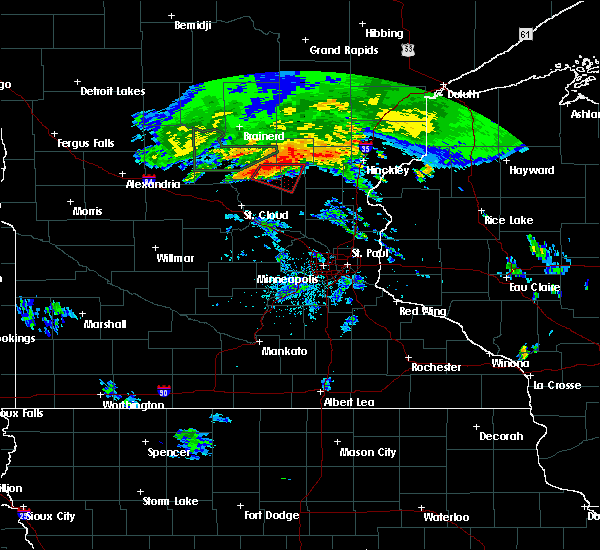 At 807 pm cdt, a severe thunderstorm capable of producing a tornado was located 7 miles north of milaca, or 31 miles northeast of st. cloud, moving east at 35 mph (radar indicated rotation). Hazards include tornado. Flying debris will be dangerous to those caught without shelter. mobile homes will be damaged or destroyed. damage to roofs, windows, and vehicles will occur. tree damage is likely. This tornadic thunderstorm will remain over mainly rural areas of southern mille lacs, northeastern benton and southeastern morrison counties, including the following locations, pease, granite ledge and rum river. At 807 pm cdt, a severe thunderstorm capable of producing a tornado was located 7 miles north of milaca, or 31 miles northeast of st. cloud, moving east at 35 mph (radar indicated rotation). Hazards include tornado. Flying debris will be dangerous to those caught without shelter. mobile homes will be damaged or destroyed. damage to roofs, windows, and vehicles will occur. tree damage is likely. This tornadic thunderstorm will remain over mainly rural areas of southern mille lacs, northeastern benton and southeastern morrison counties, including the following locations, pease, granite ledge and rum river.
|
| 7/14/2019 8:00 PM CDT |
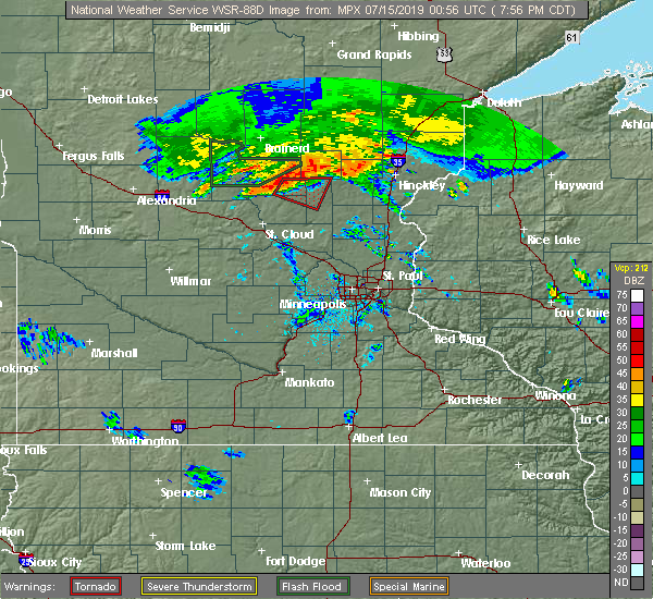 At 800 pm cdt, a severe thunderstorm capable of producing a tornado was located 11 miles northwest of milaca, or 27 miles east of little falls, moving east at 40 mph (radar indicated rotation). Hazards include tornado. Flying debris will be dangerous to those caught without shelter. mobile homes will be damaged or destroyed. damage to roofs, windows, and vehicles will occur. tree damage is likely. this dangerous storm will be near, milaca around 815 pm cdt. Other locations impacted by this tornadic thunderstorm include pease, granite ledge, morrill and rum river. At 800 pm cdt, a severe thunderstorm capable of producing a tornado was located 11 miles northwest of milaca, or 27 miles east of little falls, moving east at 40 mph (radar indicated rotation). Hazards include tornado. Flying debris will be dangerous to those caught without shelter. mobile homes will be damaged or destroyed. damage to roofs, windows, and vehicles will occur. tree damage is likely. this dangerous storm will be near, milaca around 815 pm cdt. Other locations impacted by this tornadic thunderstorm include pease, granite ledge, morrill and rum river.
|
| 7/14/2019 7:47 PM CDT |
 At 747 pm cdt, a severe thunderstorm capable of producing a tornado was located near pierz, or 17 miles east of little falls, moving east at 35 mph (radar indicated rotation). Hazards include tornado and quarter size hail. Flying debris will be dangerous to those caught without shelter. mobile homes will be damaged or destroyed. damage to roofs, windows, and vehicles will occur. tree damage is likely. this dangerous storm will be near, milaca and foreston around 820 pm cdt. other locations impacted by this tornadic thunderstorm include pease, buckman, granite ledge, morrill, rum river and genola. this includes u. s. Highway 169 between mile markers 189 and 207. At 747 pm cdt, a severe thunderstorm capable of producing a tornado was located near pierz, or 17 miles east of little falls, moving east at 35 mph (radar indicated rotation). Hazards include tornado and quarter size hail. Flying debris will be dangerous to those caught without shelter. mobile homes will be damaged or destroyed. damage to roofs, windows, and vehicles will occur. tree damage is likely. this dangerous storm will be near, milaca and foreston around 820 pm cdt. other locations impacted by this tornadic thunderstorm include pease, buckman, granite ledge, morrill, rum river and genola. this includes u. s. Highway 169 between mile markers 189 and 207.
|
| 6/30/2019 10:58 AM CDT |
 The severe thunderstorm warning for southern kanabec, southern mille lacs, northwestern isanti, northeastern benton and southeastern morrison counties will expire at 1100 am cdt, the storm which prompted the warning has weakened below severe limits, and no longer poses an immediate threat to life or property. therefore, the warning will be allowed to expire. however small hail and gusty winds are still possible with this thunderstorm. to report severe weather, contact your nearest law enforcement agency. they will relay your report to the national weather service the twin cities. The severe thunderstorm warning for southern kanabec, southern mille lacs, northwestern isanti, northeastern benton and southeastern morrison counties will expire at 1100 am cdt, the storm which prompted the warning has weakened below severe limits, and no longer poses an immediate threat to life or property. therefore, the warning will be allowed to expire. however small hail and gusty winds are still possible with this thunderstorm. to report severe weather, contact your nearest law enforcement agency. they will relay your report to the national weather service the twin cities.
|
| 6/30/2019 10:40 AM CDT |
 At 1038 am cdt, a severe thunderstorm was located over bock, or 20 miles northwest of cambridge, moving south at 60 mph (radar indicated). Hazards include 60 mph wind gusts and quarter size hail. Hail damage to vehicles is expected. expect wind damage to roofs, siding, and trees. Locations impacted include, mora, milaca, brunswick, foreston, ogilvie, grasston, bock, dalbo, granite ledge, pease, mora airport and lewis lake. At 1038 am cdt, a severe thunderstorm was located over bock, or 20 miles northwest of cambridge, moving south at 60 mph (radar indicated). Hazards include 60 mph wind gusts and quarter size hail. Hail damage to vehicles is expected. expect wind damage to roofs, siding, and trees. Locations impacted include, mora, milaca, brunswick, foreston, ogilvie, grasston, bock, dalbo, granite ledge, pease, mora airport and lewis lake.
|
| 6/30/2019 10:23 AM CDT |
 At 1023 am cdt, a severe thunderstorm was located near onamia, or 23 miles south of mille lacs lake, moving south at 55 mph (trained weather spotters). Hazards include 60 mph wind gusts and quarter size hail. Hail damage to vehicles is expected. Expect wind damage to roofs, siding, and trees. At 1023 am cdt, a severe thunderstorm was located near onamia, or 23 miles south of mille lacs lake, moving south at 55 mph (trained weather spotters). Hazards include 60 mph wind gusts and quarter size hail. Hail damage to vehicles is expected. Expect wind damage to roofs, siding, and trees.
|
| 8/27/2018 2:21 PM CDT |
 At 220 pm cdt, a severe thunderstorm was located near dalbo, or 16 miles northwest of cambridge, moving northeast at 45 mph (radar indicated). Hazards include 60 mph wind gusts and quarter size hail. Hail damage to vehicles is expected. expect wind damage to roofs, siding, and trees. Locations impacted include, princeton, mora, milaca, brunswick, foreston, ogilvie, grasston, bock, dalbo, pease, mora airport and lewis lake. At 220 pm cdt, a severe thunderstorm was located near dalbo, or 16 miles northwest of cambridge, moving northeast at 45 mph (radar indicated). Hazards include 60 mph wind gusts and quarter size hail. Hail damage to vehicles is expected. expect wind damage to roofs, siding, and trees. Locations impacted include, princeton, mora, milaca, brunswick, foreston, ogilvie, grasston, bock, dalbo, pease, mora airport and lewis lake.
|
| 8/27/2018 2:11 PM CDT |
 At 210 pm cdt, a severe thunderstorm was located near pease, or 19 miles northwest of cambridge, moving east at 40 mph (radar indicated). Hazards include 60 mph wind gusts and quarter size hail. Hail damage to vehicles is expected. expect wind damage to roofs, siding, and trees. Locations impacted include, princeton, mora, milaca, brunswick, foreston, ogilvie, grasston, bock, dalbo, pease, mora airport and lewis lake. At 210 pm cdt, a severe thunderstorm was located near pease, or 19 miles northwest of cambridge, moving east at 40 mph (radar indicated). Hazards include 60 mph wind gusts and quarter size hail. Hail damage to vehicles is expected. expect wind damage to roofs, siding, and trees. Locations impacted include, princeton, mora, milaca, brunswick, foreston, ogilvie, grasston, bock, dalbo, pease, mora airport and lewis lake.
|
| 8/27/2018 2:03 PM CDT |
 At 202 pm cdt, a severe thunderstorm was located over pease, or 23 miles northwest of cambridge, moving northeast at 45 mph (radar indicated). Hazards include 60 mph wind gusts and quarter size hail. Hail damage to vehicles is expected. Expect wind damage to roofs, siding, and trees. At 202 pm cdt, a severe thunderstorm was located over pease, or 23 miles northwest of cambridge, moving northeast at 45 mph (radar indicated). Hazards include 60 mph wind gusts and quarter size hail. Hail damage to vehicles is expected. Expect wind damage to roofs, siding, and trees.
|
| 8/26/2018 5:20 AM CDT |
 At 519 am cdt, severe thunderstorms were located along a line extending from 9 miles northwest of bock to near princeton airport to near becker, moving northeast at 45 mph (radar indicated). Hazards include half dollar size hail. damage to vehicles is expected At 519 am cdt, severe thunderstorms were located along a line extending from 9 miles northwest of bock to near princeton airport to near becker, moving northeast at 45 mph (radar indicated). Hazards include half dollar size hail. damage to vehicles is expected
|
| 8/26/2018 4:23 AM CDT |
 At 422 am cdt, a severe thunderstorm was located near bock, or 19 miles northwest of cambridge, moving east at 40 mph (public). Hazards include half dollar size hail. Damage to vehicles is expected. Locations impacted include, mora, rush city, milaca, brunswick, foreston, ogilvie, grasston, quamba, bock, stanchfield, dalbo and pease. At 422 am cdt, a severe thunderstorm was located near bock, or 19 miles northwest of cambridge, moving east at 40 mph (public). Hazards include half dollar size hail. Damage to vehicles is expected. Locations impacted include, mora, rush city, milaca, brunswick, foreston, ogilvie, grasston, quamba, bock, stanchfield, dalbo and pease.
|
| 8/26/2018 4:03 AM CDT |
 At 403 am cdt, a severe thunderstorm was located over foreston, or 23 miles northeast of st. cloud, moving east at 40 mph (radar indicated). Hazards include half dollar size hail. damage to vehicles is expected At 403 am cdt, a severe thunderstorm was located over foreston, or 23 miles northeast of st. cloud, moving east at 40 mph (radar indicated). Hazards include half dollar size hail. damage to vehicles is expected
|
| 5/28/2018 6:35 PM CDT |
 A severe thunderstorm warning remains in effect until 700 pm cdt for southwestern kanabec. southern mille lacs and northwestern isanti counties. at 635 pm cdt, a severe thunderstorm was located near bock, or 19 miles northwest of cambridge, moving north at 25 mph. hazard. 60 mph wind gusts and half dollar size hail. A severe thunderstorm warning remains in effect until 700 pm cdt for southwestern kanabec. southern mille lacs and northwestern isanti counties. at 635 pm cdt, a severe thunderstorm was located near bock, or 19 miles northwest of cambridge, moving north at 25 mph. hazard. 60 mph wind gusts and half dollar size hail.
|
| 5/28/2018 6:09 PM CDT |
 At 608 pm cdt, a severe thunderstorm was located over princeton, or 15 miles west of cambridge, moving north at 25 mph. this storm has a history of producing wind damage (public). Hazards include 60 mph wind gusts and half dollar size hail. Hail damage to vehicles is expected. expect wind damage to roofs, siding, and trees. this severe thunderstorm will be near, milaca around 640 pm cdt. bock around 645 pm cdt. other locations impacted by this severe thunderstorm include sherburne national wildlife refuge, orrock, spencer brook, dalbo, pease, lewis lake and princeton airport. this includes u. s. Highway 169 between mile markers 167 and 194. At 608 pm cdt, a severe thunderstorm was located over princeton, or 15 miles west of cambridge, moving north at 25 mph. this storm has a history of producing wind damage (public). Hazards include 60 mph wind gusts and half dollar size hail. Hail damage to vehicles is expected. expect wind damage to roofs, siding, and trees. this severe thunderstorm will be near, milaca around 640 pm cdt. bock around 645 pm cdt. other locations impacted by this severe thunderstorm include sherburne national wildlife refuge, orrock, spencer brook, dalbo, pease, lewis lake and princeton airport. this includes u. s. Highway 169 between mile markers 167 and 194.
|
| 9/20/2017 2:40 AM CDT |
 The severe thunderstorm warning for southern mille lacs, isanti, southeastern benton and northern sherburne counties will expire at 245 am cdt, the storms which prompted the warning have weakened below severe limits, and no longer pose an immediate threat to life or property. therefore the warning will be allowed to expire. however heavy rain is still possible with these thunderstorms. a severe thunderstorm watch remains in effect until 500 am cdt for central minnesota. a severe thunderstorm watch also remains in effect until 500 am cdt for central and east central minnesota. The severe thunderstorm warning for southern mille lacs, isanti, southeastern benton and northern sherburne counties will expire at 245 am cdt, the storms which prompted the warning have weakened below severe limits, and no longer pose an immediate threat to life or property. therefore the warning will be allowed to expire. however heavy rain is still possible with these thunderstorms. a severe thunderstorm watch remains in effect until 500 am cdt for central minnesota. a severe thunderstorm watch also remains in effect until 500 am cdt for central and east central minnesota.
|
| 9/20/2017 2:00 AM CDT |
 At 200 am cdt, severe thunderstorms were located along a line extending from granite ledge to duelm to near clearwater, moving northeast at 65 mph (radar indicated). Hazards include 60 mph wind gusts and nickel size hail. Expect damage to roofs, siding, and trees. severe thunderstorms will be near, foreston around 215 am cdt. princeton around 225 am cdt. Other locations impacted by these severe thunderstorms include sherburne national wildlife refuge, duelm, orrock, glendorado, spencer brook, pease, oak park, athens, and stanchfield. At 200 am cdt, severe thunderstorms were located along a line extending from granite ledge to duelm to near clearwater, moving northeast at 65 mph (radar indicated). Hazards include 60 mph wind gusts and nickel size hail. Expect damage to roofs, siding, and trees. severe thunderstorms will be near, foreston around 215 am cdt. princeton around 225 am cdt. Other locations impacted by these severe thunderstorms include sherburne national wildlife refuge, duelm, orrock, glendorado, spencer brook, pease, oak park, athens, and stanchfield.
|
| 9/20/2017 1:49 AM CDT |
 At 148 am cdt, severe thunderstorms were located along a line extending from near erskin lake to granite ledge to parent, moving northeast at 60 mph (radar indicated). Hazards include 60 mph wind gusts and nickel size hail. Expect damage to roofs, siding, and trees. severe thunderstorms will be near, vineland around 155 am cdt. foreston around 205 am cdt. mille lacs lake and milaca around 210 am cdt. bock around 215 am cdt. ogilvie around 220 am cdt. mora and brunswick around 225 am cdt. Quamba around 235 am cdt. At 148 am cdt, severe thunderstorms were located along a line extending from near erskin lake to granite ledge to parent, moving northeast at 60 mph (radar indicated). Hazards include 60 mph wind gusts and nickel size hail. Expect damage to roofs, siding, and trees. severe thunderstorms will be near, vineland around 155 am cdt. foreston around 205 am cdt. mille lacs lake and milaca around 210 am cdt. bock around 215 am cdt. ogilvie around 220 am cdt. mora and brunswick around 225 am cdt. Quamba around 235 am cdt.
|
| 7/17/2017 8:01 PM CDT |
 At 800 pm cdt, a severe thunderstorm was located near pease, or 21 miles west of cambridge, moving east at 25 mph (radar indicated). Hazards include 60 mph wind gusts. Expect damage to roofs, siding, and trees. this severe storm will be near, princeton around 815 pm cdt. Other locations impacted by this severe thunderstorm include spencer brook, princeton airport and pease. At 800 pm cdt, a severe thunderstorm was located near pease, or 21 miles west of cambridge, moving east at 25 mph (radar indicated). Hazards include 60 mph wind gusts. Expect damage to roofs, siding, and trees. this severe storm will be near, princeton around 815 pm cdt. Other locations impacted by this severe thunderstorm include spencer brook, princeton airport and pease.
|
| 7/17/2017 7:48 PM CDT |
 At 748 pm cdt, a severe thunderstorm was located near oak park, or 21 miles east of st. cloud, moving east at 35 mph (radar indicated). Hazards include 60 mph wind gusts and quarter size hail. Hail damage to vehicles is expected. expect wind damage to roofs, siding, and trees. this severe thunderstorm will be near, milaca around 755 pm cdt. princeton around 805 pm cdt. other locations impacted by this severe thunderstorm include glendorado, ronneby, spencer brook, dalbo, pease, oak park and princeton airport. this includes u. s. Highway 169 between mile markers 174 and 190. At 748 pm cdt, a severe thunderstorm was located near oak park, or 21 miles east of st. cloud, moving east at 35 mph (radar indicated). Hazards include 60 mph wind gusts and quarter size hail. Hail damage to vehicles is expected. expect wind damage to roofs, siding, and trees. this severe thunderstorm will be near, milaca around 755 pm cdt. princeton around 805 pm cdt. other locations impacted by this severe thunderstorm include glendorado, ronneby, spencer brook, dalbo, pease, oak park and princeton airport. this includes u. s. Highway 169 between mile markers 174 and 190.
|
| 7/12/2017 1:47 AM CDT |
 At 146 am cdt, severe thunderstorms were located along a line extending from near bock to near princeton to near st augusta, moving southeast at 45 mph (radar indicated). Hazards include 60 mph wind gusts. Expect damage to roofs, siding, and trees. severe thunderstorms will be near, princeton and bock around 150 am cdt. becker around 205 am cdt. monticello around 210 am cdt. cambridge, big lake and isanti around 215 am cdt. east bethel around 220 am cdt. Otsego around 230 am cdt. At 146 am cdt, severe thunderstorms were located along a line extending from near bock to near princeton to near st augusta, moving southeast at 45 mph (radar indicated). Hazards include 60 mph wind gusts. Expect damage to roofs, siding, and trees. severe thunderstorms will be near, princeton and bock around 150 am cdt. becker around 205 am cdt. monticello around 210 am cdt. cambridge, big lake and isanti around 215 am cdt. east bethel around 220 am cdt. Otsego around 230 am cdt.
|
| 7/12/2017 1:44 AM CDT |
 At 143 am cdt, severe thunderstorms were located along a line extending from near bock to near pease to near st augusta, moving southeast at 40 mph (radar indicated). Hazards include 60 mph wind gusts. Expect damage to roofs, siding, and trees. severe thunderstorms will be near, princeton around 150 am cdt. becker around 205 am cdt. monticello around 210 am cdt. cambridge, big lake and isanti around 215 am cdt. east bethel around 220 am cdt. Otsego around 230 am cdt. At 143 am cdt, severe thunderstorms were located along a line extending from near bock to near pease to near st augusta, moving southeast at 40 mph (radar indicated). Hazards include 60 mph wind gusts. Expect damage to roofs, siding, and trees. severe thunderstorms will be near, princeton around 150 am cdt. becker around 205 am cdt. monticello around 210 am cdt. cambridge, big lake and isanti around 215 am cdt. east bethel around 220 am cdt. Otsego around 230 am cdt.
|
| 7/9/2017 8:44 PM CDT |
 At 843 pm cdt, a severe thunderstorm was located near bock, or 27 miles northwest of cambridge, moving southeast at 30 mph (law enforcement). Hazards include ping pong ball size hail and 60 mph wind gusts. People and animals outdoors will be injured. expect hail damage to roofs, siding, windows, and vehicles. expect wind damage to roofs, siding, and trees. this severe storm will be near, milaca around 850 pm cdt. ogilvie and bock around 855 pm cdt. other locations impacted by this severe thunderstorm include lewis lake and pease. A tornado watch remains in effect until 100 am cdt for east central minnesota. At 843 pm cdt, a severe thunderstorm was located near bock, or 27 miles northwest of cambridge, moving southeast at 30 mph (law enforcement). Hazards include ping pong ball size hail and 60 mph wind gusts. People and animals outdoors will be injured. expect hail damage to roofs, siding, windows, and vehicles. expect wind damage to roofs, siding, and trees. this severe storm will be near, milaca around 850 pm cdt. ogilvie and bock around 855 pm cdt. other locations impacted by this severe thunderstorm include lewis lake and pease. A tornado watch remains in effect until 100 am cdt for east central minnesota.
|
| 7/9/2017 8:25 PM CDT |
 At 825 pm cdt, a severe thunderstorm was located near onamia, or 23 miles south of mille lacs lake, moving southeast at 30 mph (law enforcement). Hazards include tennis ball size hail. People and animals outdoors will be injured. expect damage to roofs, siding, windows, and vehicles. this severe thunderstorm will be near, milaca around 850 pm cdt. ogilvie and bock around 855 pm cdt. other locations impacted by this severe thunderstorm include lewis lake and pease. A tornado watch remains in effect until 100 am cdt for central and east central minnesota. At 825 pm cdt, a severe thunderstorm was located near onamia, or 23 miles south of mille lacs lake, moving southeast at 30 mph (law enforcement). Hazards include tennis ball size hail. People and animals outdoors will be injured. expect damage to roofs, siding, windows, and vehicles. this severe thunderstorm will be near, milaca around 850 pm cdt. ogilvie and bock around 855 pm cdt. other locations impacted by this severe thunderstorm include lewis lake and pease. A tornado watch remains in effect until 100 am cdt for central and east central minnesota.
|
| 7/6/2017 4:34 AM CDT |
 At 434 am cdt, severe thunderstorms were located along a line extending from near mcgrath to 8 miles southeast of onamia to rum river, moving southeast at 55 mph (radar indicated). Hazards include 60 mph wind gusts and quarter size hail. Hail damage to vehicles is expected. expect wind damage to roofs, siding, and trees. severe thunderstorms will be near, mora and bock around 450 am cdt. grasston and quamba around 455 am cdt. other locations impacted by these severe thunderstorms include grandy, mora airport, morrill, warman, dalbo, knife lake, granite ledge, rum river, stanchfield and lewis lake. this includes u. s. Highway 169 between mile markers 188 and 211. At 434 am cdt, severe thunderstorms were located along a line extending from near mcgrath to 8 miles southeast of onamia to rum river, moving southeast at 55 mph (radar indicated). Hazards include 60 mph wind gusts and quarter size hail. Hail damage to vehicles is expected. expect wind damage to roofs, siding, and trees. severe thunderstorms will be near, mora and bock around 450 am cdt. grasston and quamba around 455 am cdt. other locations impacted by these severe thunderstorms include grandy, mora airport, morrill, warman, dalbo, knife lake, granite ledge, rum river, stanchfield and lewis lake. this includes u. s. Highway 169 between mile markers 188 and 211.
|
| 8/10/2016 6:55 PM CDT |
 The severe thunderstorm warning for eastern sherburne, isanti, southern kanabec, northern anoka, southeastern mille lacs and western chisago counties will expire at 700 pm cdt, the storms which prompted the warning have moved out of the area. therefore the warning will be allowed to expire. however gusty winds of 40 to 50 mph and heavy rain are still occurring with these thunderstorms. a severe thunderstorm watch remains in effect until midnight cdt for central and east central minnesota, and northwestern wisconsin. The severe thunderstorm warning for eastern sherburne, isanti, southern kanabec, northern anoka, southeastern mille lacs and western chisago counties will expire at 700 pm cdt, the storms which prompted the warning have moved out of the area. therefore the warning will be allowed to expire. however gusty winds of 40 to 50 mph and heavy rain are still occurring with these thunderstorms. a severe thunderstorm watch remains in effect until midnight cdt for central and east central minnesota, and northwestern wisconsin.
|
| 8/10/2016 6:43 PM CDT |
 At 643 pm cdt, severe thunderstorms were located along a line extending from near grasston to cambridge to orrock, moving southeast at 45 mph (radar indicated). Hazards include 60 mph wind gusts. Expect damage to roofs. siding. and trees. these severe storms will be near, cambridge and isanti around 650 pm cdt. ramsey, east bethel, st. francis, rush city and stacy around 700 pm cdt. Other locations impacted by these severe thunderstorms include stanchfield, branch, grandy, athens, harris, spring lake, bethel, cedar and knife lake. At 643 pm cdt, severe thunderstorms were located along a line extending from near grasston to cambridge to orrock, moving southeast at 45 mph (radar indicated). Hazards include 60 mph wind gusts. Expect damage to roofs. siding. and trees. these severe storms will be near, cambridge and isanti around 650 pm cdt. ramsey, east bethel, st. francis, rush city and stacy around 700 pm cdt. Other locations impacted by these severe thunderstorms include stanchfield, branch, grandy, athens, harris, spring lake, bethel, cedar and knife lake.
|
| 8/10/2016 6:25 PM CDT |
 At 625 pm cdt, severe thunderstorms were located along a line extending from near knife lake to dalbo to duelm, moving southeast at 45 mph (radar indicated). Hazards include 60 mph wind gusts. Expect damage to roofs. siding. and trees. severe thunderstorms will be near, mora around 630 pm cdt. brunswick and quamba around 635 pm cdt. grasston around 640 pm cdt. cambridge, isanti and zimmerman around 650 pm cdt. elk river, east bethel and st. francis around 655 pm cdt. ramsey, rush city and stacy around 700 pm cdt. Other locations impacted by these severe thunderstorms include stanchfield, branch, grandy, athens, harris, spring lake, bethel, cedar and knife lake. At 625 pm cdt, severe thunderstorms were located along a line extending from near knife lake to dalbo to duelm, moving southeast at 45 mph (radar indicated). Hazards include 60 mph wind gusts. Expect damage to roofs. siding. and trees. severe thunderstorms will be near, mora around 630 pm cdt. brunswick and quamba around 635 pm cdt. grasston around 640 pm cdt. cambridge, isanti and zimmerman around 650 pm cdt. elk river, east bethel and st. francis around 655 pm cdt. ramsey, rush city and stacy around 700 pm cdt. Other locations impacted by these severe thunderstorms include stanchfield, branch, grandy, athens, harris, spring lake, bethel, cedar and knife lake.
|
| 7/12/2015 9:36 PM CDT |
 At 936 pm cdt, a severe thunderstorm was located near braham, or 11 miles north of cambridge, moving east at 25 mph (radar indicated). Hazards include 60 mph wind gusts and penny size hail. Expect damage to roofs. siding and trees. locations impacted include, cambridge, princeton, mora, milaca, braham, brunswick, foreston, ogilvie, grasston, bock, stanchfield and dalbo. A tornado watch remains in effect until 100 am cdt for east central minnesota. At 936 pm cdt, a severe thunderstorm was located near braham, or 11 miles north of cambridge, moving east at 25 mph (radar indicated). Hazards include 60 mph wind gusts and penny size hail. Expect damage to roofs. siding and trees. locations impacted include, cambridge, princeton, mora, milaca, braham, brunswick, foreston, ogilvie, grasston, bock, stanchfield and dalbo. A tornado watch remains in effect until 100 am cdt for east central minnesota.
|
| 7/12/2015 9:25 PM CDT |
 At 925 pm cdt, a severe thunderstorm was located over lewis lake, or 15 miles north of cambridge, moving southeast at 40 mph (radar indicated). Hazards include 60 mph wind gusts and quarter size hail. Hail damage to vehicles is expected. expect wind damage to roofs, siding and trees. this severe storm will be near, braham and grasston around 935 pm cdt. other locations impacted by this severe thunderstorm include stanchfield, lewis lake, grandy, pease, dalbo, cambridge airport, princeton airport and mora airport. A tornado watch remains in effect until 100 am cdt for east central minnesota. At 925 pm cdt, a severe thunderstorm was located over lewis lake, or 15 miles north of cambridge, moving southeast at 40 mph (radar indicated). Hazards include 60 mph wind gusts and quarter size hail. Hail damage to vehicles is expected. expect wind damage to roofs, siding and trees. this severe storm will be near, braham and grasston around 935 pm cdt. other locations impacted by this severe thunderstorm include stanchfield, lewis lake, grandy, pease, dalbo, cambridge airport, princeton airport and mora airport. A tornado watch remains in effect until 100 am cdt for east central minnesota.
|
| 7/12/2015 8:54 PM CDT |
 At 854 pm cdt, a severe thunderstorm was located 9 miles northeast of rum river, or 32 miles east of little falls, moving east at 20 mph (radar indicated). Hazards include 60 mph wind gusts and quarter size hail. Hail damage to vehicles is expected. expect wind damage to roofs, siding and trees. this severe thunderstorm will be near, ogilvie around 930 pm cdt. mora around 945 pm cdt. other locations impacted by this severe thunderstorm include stanchfield, lewis lake, grandy, pease, dalbo, cambridge airport, princeton airport, mora airport and bayview. A tornado watch remains in effect until 100 am cdt for east central minnesota. At 854 pm cdt, a severe thunderstorm was located 9 miles northeast of rum river, or 32 miles east of little falls, moving east at 20 mph (radar indicated). Hazards include 60 mph wind gusts and quarter size hail. Hail damage to vehicles is expected. expect wind damage to roofs, siding and trees. this severe thunderstorm will be near, ogilvie around 930 pm cdt. mora around 945 pm cdt. other locations impacted by this severe thunderstorm include stanchfield, lewis lake, grandy, pease, dalbo, cambridge airport, princeton airport, mora airport and bayview. A tornado watch remains in effect until 100 am cdt for east central minnesota.
|
| 7/11/2015 6:33 PM CDT |
 At 633 pm cdt, a severe thunderstorm was located over milaca, or 23 miles northwest of cambridge, moving northeast at 20 mph (radar indicated). Hazards include 60 mph wind gusts and quarter size hail. Hail damage to vehicles is expected. expect wind damage to roofs, siding and trees. this severe thunderstorm will be near, bock around 650 pm cdt. ogilvie around 710 pm cdt. Other locations impacted by this severe thunderstorm include lewis lake and pease. At 633 pm cdt, a severe thunderstorm was located over milaca, or 23 miles northwest of cambridge, moving northeast at 20 mph (radar indicated). Hazards include 60 mph wind gusts and quarter size hail. Hail damage to vehicles is expected. expect wind damage to roofs, siding and trees. this severe thunderstorm will be near, bock around 650 pm cdt. ogilvie around 710 pm cdt. Other locations impacted by this severe thunderstorm include lewis lake and pease.
|
Hail Maps for Pease, MN


Connect with Interactive Hail Maps