

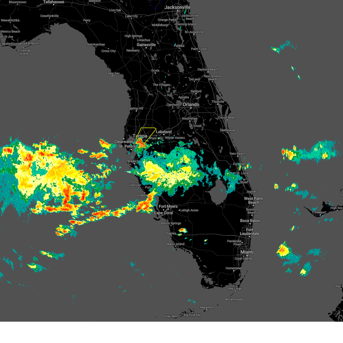
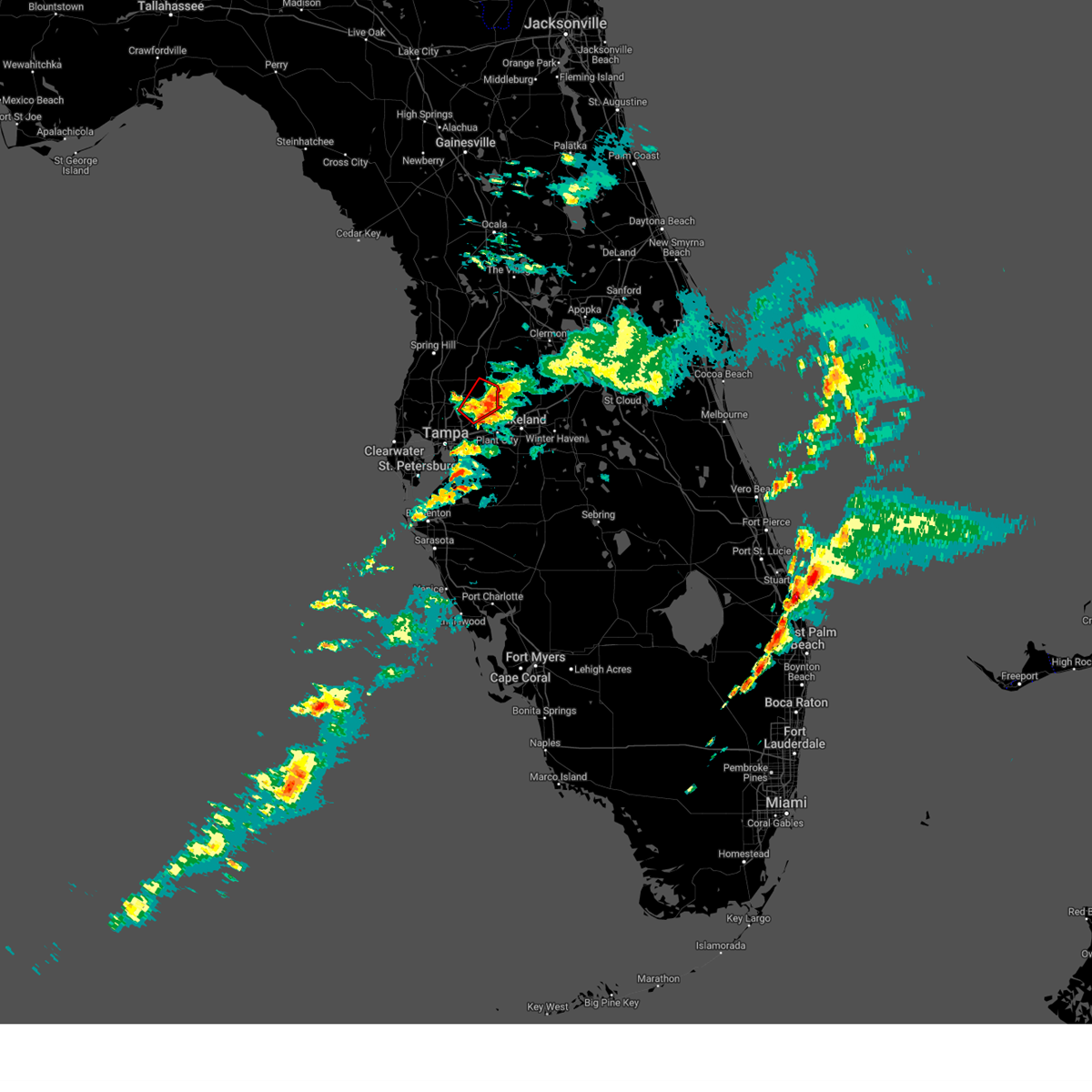
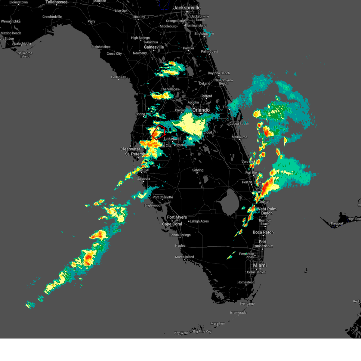
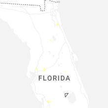
Hail Map for Pebble Creek, FL
The Pebble Creek, FL area has had 0 reports of on-the-ground hail by trained spotters, and has been under severe weather warnings 3 times during the past 12 months. Doppler radar has detected hail at or near Pebble Creek, FL on 46 occasions, including 4 occasions during the past year.
| Name: | Pebble Creek, FL |
| Where Located: | 47.7 miles NNE of Bradenton, FL |
| Map: | Google Map for Pebble Creek, FL |
| Population: | 7622 |
| Housing Units: | 2884 |
| More Info: | Search Google for Pebble Creek, FL |
0
The Top Recent Hail Date for Pebble Creek, FL is Friday, June 20, 2025 (45th out of 46)

Hail and Wind Damage Spotted near Pebble Creek, FL
| Date / Time | Report Details |
|---|---|
| 6/2/2025 11:02 AM EDT |
 Svrtbw the national weather service in ruskin has issued a * severe thunderstorm warning for, northeastern hillsborough county in west central florida, * until 1130 am edt. * at 1102 am edt, a severe thunderstorm was located over east lake-orient park, or over tampa, moving northeast at 25 mph (radar indicated). Hazards include 60 mph wind gusts and penny size hail. expect damage to roofs, siding, and trees Svrtbw the national weather service in ruskin has issued a * severe thunderstorm warning for, northeastern hillsborough county in west central florida, * until 1130 am edt. * at 1102 am edt, a severe thunderstorm was located over east lake-orient park, or over tampa, moving northeast at 25 mph (radar indicated). Hazards include 60 mph wind gusts and penny size hail. expect damage to roofs, siding, and trees
|
| 3/16/2025 7:16 PM EDT |
 the tornado warning has been cancelled and is no longer in effect the tornado warning has been cancelled and is no longer in effect
|
| 3/16/2025 7:00 PM EDT |
 Tortbw the national weather service in ruskin has issued a * tornado warning for, southeastern pasco county in west central florida, north central hillsborough county in west central florida, * until 730 pm edt. * at 659 pm edt, a severe thunderstorm capable of producing a tornado was located over hillsborough river state park, or 8 miles southwest of zephyrhills, moving northeast at 25 mph (radar indicated rotation). Hazards include tornado. Flying debris will be dangerous to those caught without shelter. mobile homes will be damaged or destroyed. damage to roofs, windows, and vehicles will occur. tree damage is likely. this dangerous storm will be near, wesley chapel south, hillsborough river state park, zephyrhills west, zephyrhills south, zephyrhills north, and zephyrhills around 705 pm edt. Other locations impacted by this tornadic thunderstorm include crystal springs, richland, zephyrhills municipal airport, meadow pointe, wesley chapel, and thonotosassa. Tortbw the national weather service in ruskin has issued a * tornado warning for, southeastern pasco county in west central florida, north central hillsborough county in west central florida, * until 730 pm edt. * at 659 pm edt, a severe thunderstorm capable of producing a tornado was located over hillsborough river state park, or 8 miles southwest of zephyrhills, moving northeast at 25 mph (radar indicated rotation). Hazards include tornado. Flying debris will be dangerous to those caught without shelter. mobile homes will be damaged or destroyed. damage to roofs, windows, and vehicles will occur. tree damage is likely. this dangerous storm will be near, wesley chapel south, hillsborough river state park, zephyrhills west, zephyrhills south, zephyrhills north, and zephyrhills around 705 pm edt. Other locations impacted by this tornadic thunderstorm include crystal springs, richland, zephyrhills municipal airport, meadow pointe, wesley chapel, and thonotosassa.
|
| 4/11/2024 1:16 PM EDT |
 Svrtbw the national weather service in ruskin has issued a * severe thunderstorm warning for, southeastern pasco county in west central florida, manatee county in west central florida, southeastern pinellas county in west central florida, northwestern polk county in central florida, hillsborough county in west central florida, * until 200 pm edt. * at 116 pm edt, severe thunderstorms were located along a line extending from near temple terrace to 12 miles southwest of anna maria, moving east at 40 mph (radar indicated). Hazards include 60 mph wind gusts. expect damage to roofs, siding, and trees Svrtbw the national weather service in ruskin has issued a * severe thunderstorm warning for, southeastern pasco county in west central florida, manatee county in west central florida, southeastern pinellas county in west central florida, northwestern polk county in central florida, hillsborough county in west central florida, * until 200 pm edt. * at 116 pm edt, severe thunderstorms were located along a line extending from near temple terrace to 12 miles southwest of anna maria, moving east at 40 mph (radar indicated). Hazards include 60 mph wind gusts. expect damage to roofs, siding, and trees
|
| 4/11/2024 1:04 PM EDT |
 At 104 pm edt, severe thunderstorms were located along a line extending from 7 miles southwest of bushnell to near pebble creek to near fort desoto park, moving east at 45 mph (radar indicated). Hazards include 60 mph wind gusts. Expect damage to roofs, siding, and trees. locations impacted include, tampa, st. petersburg, bradenton, plant city, temple terrace, zephyrhills, palmetto, gulfport, st. Pete beach, and wildwood. At 104 pm edt, severe thunderstorms were located along a line extending from 7 miles southwest of bushnell to near pebble creek to near fort desoto park, moving east at 45 mph (radar indicated). Hazards include 60 mph wind gusts. Expect damage to roofs, siding, and trees. locations impacted include, tampa, st. petersburg, bradenton, plant city, temple terrace, zephyrhills, palmetto, gulfport, st. Pete beach, and wildwood.
|
| 4/11/2024 12:30 PM EDT |
 Svrtbw the national weather service in ruskin has issued a * severe thunderstorm warning for, southeastern citrus county in west central florida, sumter county in central florida, pasco county in west central florida, hernando county in west central florida, northwestern manatee county in west central florida, pinellas county in west central florida, northwestern polk county in central florida, hillsborough county in west central florida, * until 115 pm edt. * at 1229 pm edt, severe thunderstorms were located along a line extending from near spring hill to 6 miles southwest of citrus park to 17 miles west of anna maria, moving east at 45 mph (radar indicated). Hazards include 60 mph wind gusts. expect damage to roofs, siding, and trees Svrtbw the national weather service in ruskin has issued a * severe thunderstorm warning for, southeastern citrus county in west central florida, sumter county in central florida, pasco county in west central florida, hernando county in west central florida, northwestern manatee county in west central florida, pinellas county in west central florida, northwestern polk county in central florida, hillsborough county in west central florida, * until 115 pm edt. * at 1229 pm edt, severe thunderstorms were located along a line extending from near spring hill to 6 miles southwest of citrus park to 17 miles west of anna maria, moving east at 45 mph (radar indicated). Hazards include 60 mph wind gusts. expect damage to roofs, siding, and trees
|
| 4/11/2024 11:47 AM EDT |
 Svrtbw the national weather service in ruskin has issued a * severe thunderstorm warning for, southern citrus county in west central florida, northwestern sumter county in central florida, pasco county in west central florida, hernando county in west central florida, pinellas county in west central florida, northwestern hillsborough county in west central florida, * until 1230 pm edt. * at 1146 am edt, severe thunderstorms were located along a line extending from 6 miles northwest of pine island to near hudson to near clearwater to 19 miles southwest of harbor bluffs, moving northeast at 50 mph (radar indicated). Hazards include 60 mph wind gusts. expect damage to roofs, siding, and trees Svrtbw the national weather service in ruskin has issued a * severe thunderstorm warning for, southern citrus county in west central florida, northwestern sumter county in central florida, pasco county in west central florida, hernando county in west central florida, pinellas county in west central florida, northwestern hillsborough county in west central florida, * until 1230 pm edt. * at 1146 am edt, severe thunderstorms were located along a line extending from 6 miles northwest of pine island to near hudson to near clearwater to 19 miles southwest of harbor bluffs, moving northeast at 50 mph (radar indicated). Hazards include 60 mph wind gusts. expect damage to roofs, siding, and trees
|
| 4/3/2024 2:42 PM EDT |
 The storm which prompted the warning has weakened below severe limits, and no longer poses an immediate threat to life or property. therefore, the warning will be allowed to expire. The storm which prompted the warning has weakened below severe limits, and no longer poses an immediate threat to life or property. therefore, the warning will be allowed to expire.
|
| 4/3/2024 2:32 PM EDT |
 At 232 pm edt, a severe thunderstorm was located over greater northdale, or near lutz, moving east at 40 mph (radar indicated). Hazards include 60 mph wind gusts. Expect damage to roofs, siding, and trees. Locations impacted include, tampa, temple terrace, west park, busch gardens, egypt lake-leto, pebble creek, carrollwood, citrus park, greater carrollwood, and lutz. At 232 pm edt, a severe thunderstorm was located over greater northdale, or near lutz, moving east at 40 mph (radar indicated). Hazards include 60 mph wind gusts. Expect damage to roofs, siding, and trees. Locations impacted include, tampa, temple terrace, west park, busch gardens, egypt lake-leto, pebble creek, carrollwood, citrus park, greater carrollwood, and lutz.
|
| 4/3/2024 2:32 PM EDT |
 the severe thunderstorm warning has been cancelled and is no longer in effect the severe thunderstorm warning has been cancelled and is no longer in effect
|
| 4/3/2024 2:21 PM EDT |
 At 221 pm edt, a severe thunderstorm was located near east lake, or 9 miles northeast of clearwater, moving east at 40 mph (radar indicated). Hazards include 60 mph wind gusts. Expect damage to roofs, siding, and trees. Locations impacted include, tampa, clearwater, temple terrace, safety harbor, west park, oldsmar, busch gardens, mango, lutz, and new tampa. At 221 pm edt, a severe thunderstorm was located near east lake, or 9 miles northeast of clearwater, moving east at 40 mph (radar indicated). Hazards include 60 mph wind gusts. Expect damage to roofs, siding, and trees. Locations impacted include, tampa, clearwater, temple terrace, safety harbor, west park, oldsmar, busch gardens, mango, lutz, and new tampa.
|
| 4/3/2024 2:14 PM EDT |
 Svrtbw the national weather service in ruskin has issued a * severe thunderstorm warning for, northeastern pinellas county in west central florida, northwestern hillsborough county in west central florida, * until 245 pm edt. * at 214 pm edt, a severe thunderstorm was located over palm harbor, or near clearwater, moving east at 40 mph (radar indicated). Hazards include 60 mph wind gusts. expect damage to roofs, siding, and trees Svrtbw the national weather service in ruskin has issued a * severe thunderstorm warning for, northeastern pinellas county in west central florida, northwestern hillsborough county in west central florida, * until 245 pm edt. * at 214 pm edt, a severe thunderstorm was located over palm harbor, or near clearwater, moving east at 40 mph (radar indicated). Hazards include 60 mph wind gusts. expect damage to roofs, siding, and trees
|
| 6/4/2023 5:58 PM EDT |
 At 557 pm edt, a severe thunderstorm was located near pebble creek, or near temple terrace, moving southeast at 15 mph (radar indicated). Hazards include 60 mph wind gusts and quarter size hail. Hail damage to vehicles is expected. expect wind damage to roofs, siding, and trees. locations impacted include, tampa, temple terrace, busch gardens, wesley chapel, hillsborough river state park, florida state fairgrounds, thonotosassa, pebble creek, lutz, and new tampa. hail threat, radar indicated max hail size, 1. 00 in wind threat, radar indicated max wind gust, 60 mph. At 557 pm edt, a severe thunderstorm was located near pebble creek, or near temple terrace, moving southeast at 15 mph (radar indicated). Hazards include 60 mph wind gusts and quarter size hail. Hail damage to vehicles is expected. expect wind damage to roofs, siding, and trees. locations impacted include, tampa, temple terrace, busch gardens, wesley chapel, hillsborough river state park, florida state fairgrounds, thonotosassa, pebble creek, lutz, and new tampa. hail threat, radar indicated max hail size, 1. 00 in wind threat, radar indicated max wind gust, 60 mph.
|
| 6/4/2023 5:46 PM EDT |
 At 545 pm edt, a severe thunderstorm was located over pebble creek, or near lutz, moving southeast at 10 mph (radar indicated). Hazards include 60 mph wind gusts and quarter size hail. Hail damage to vehicles is expected. Expect wind damage to roofs, siding, and trees. At 545 pm edt, a severe thunderstorm was located over pebble creek, or near lutz, moving southeast at 10 mph (radar indicated). Hazards include 60 mph wind gusts and quarter size hail. Hail damage to vehicles is expected. Expect wind damage to roofs, siding, and trees.
|
| 6/4/2023 5:20 PM EDT |
 At 519 pm edt, a severe thunderstorm was located over land o lakes, or near lutz, moving south at 15 mph (radar indicated). Hazards include 60 mph wind gusts and penny size hail. expect damage to roofs, siding, and trees At 519 pm edt, a severe thunderstorm was located over land o lakes, or near lutz, moving south at 15 mph (radar indicated). Hazards include 60 mph wind gusts and penny size hail. expect damage to roofs, siding, and trees
|
| 6/1/2023 5:50 PM EDT |
 The severe thunderstorm warning for south central pasco and north central hillsborough counties will expire at 600 pm edt, the storm which prompted the warning has weakened below severe limits, and no longer poses an immediate threat to life or property. therefore, the warning will be allowed to expire. however, small hail, gusty winds and heavy rain are still possible with this thunderstorm. The severe thunderstorm warning for south central pasco and north central hillsborough counties will expire at 600 pm edt, the storm which prompted the warning has weakened below severe limits, and no longer poses an immediate threat to life or property. therefore, the warning will be allowed to expire. however, small hail, gusty winds and heavy rain are still possible with this thunderstorm.
|
| 6/1/2023 5:27 PM EDT |
 At 527 pm edt, a severe thunderstorm was located over lutz, and is nearly stationary (radar indicated). Hazards include 60 mph wind gusts and quarter size hail. Hail damage to vehicles is expected. Expect wind damage to roofs, siding, and trees. At 527 pm edt, a severe thunderstorm was located over lutz, and is nearly stationary (radar indicated). Hazards include 60 mph wind gusts and quarter size hail. Hail damage to vehicles is expected. Expect wind damage to roofs, siding, and trees.
|
| 4/24/2023 2:41 PM EDT |
 At 241 pm edt, a severe thunderstorm was located over pebble creek, or near lutz, moving northeast at 5 mph (radar indicated). Hazards include 60 mph wind gusts and quarter size hail. Hail damage to vehicles is expected. Expect wind damage to roofs, siding, and trees. At 241 pm edt, a severe thunderstorm was located over pebble creek, or near lutz, moving northeast at 5 mph (radar indicated). Hazards include 60 mph wind gusts and quarter size hail. Hail damage to vehicles is expected. Expect wind damage to roofs, siding, and trees.
|
| 6/7/2022 7:21 PM EDT |
 The severe thunderstorm warning for southeastern pasco and north central hillsborough counties will expire at 730 pm edt, the storm which prompted the warning has weakened below severe limits, and no longer poses an immediate threat to life or property. therefore, the warning will be allowed to expire. however gusty winds and heavy rain are still possible with this thunderstorm. The severe thunderstorm warning for southeastern pasco and north central hillsborough counties will expire at 730 pm edt, the storm which prompted the warning has weakened below severe limits, and no longer poses an immediate threat to life or property. therefore, the warning will be allowed to expire. however gusty winds and heavy rain are still possible with this thunderstorm.
|
| 6/7/2022 7:09 PM EDT |
 At 709 pm edt, a severe thunderstorm was located over pebble creek, or 8 miles southwest of zephyrhills, moving northeast at 10 mph (radar indicated). Hazards include 60 mph wind gusts and quarter size hail. Hail damage to vehicles is expected. expect wind damage to roofs, siding, and trees. locations impacted include, zephyrhills, zephyrhills west, zephyrhills municipal airport, meadow pointe, wesley chapel, pebble creek, zephyrhills south, wesley chapel south and zephyrhills north. hail threat, radar indicated max hail size, 1. 00 in wind threat, radar indicated max wind gust, 60 mph. At 709 pm edt, a severe thunderstorm was located over pebble creek, or 8 miles southwest of zephyrhills, moving northeast at 10 mph (radar indicated). Hazards include 60 mph wind gusts and quarter size hail. Hail damage to vehicles is expected. expect wind damage to roofs, siding, and trees. locations impacted include, zephyrhills, zephyrhills west, zephyrhills municipal airport, meadow pointe, wesley chapel, pebble creek, zephyrhills south, wesley chapel south and zephyrhills north. hail threat, radar indicated max hail size, 1. 00 in wind threat, radar indicated max wind gust, 60 mph.
|
| 6/7/2022 6:54 PM EDT |
 At 653 pm edt, a severe thunderstorm was located over pebble creek, or 7 miles east of lutz, moving northeast at 10 mph (radar indicated). Hazards include 60 mph wind gusts and quarter size hail. Hail damage to vehicles is expected. Expect wind damage to roofs, siding, and trees. At 653 pm edt, a severe thunderstorm was located over pebble creek, or 7 miles east of lutz, moving northeast at 10 mph (radar indicated). Hazards include 60 mph wind gusts and quarter size hail. Hail damage to vehicles is expected. Expect wind damage to roofs, siding, and trees.
|
| 3/12/2022 9:26 AM EST |
 At 925 am est, severe thunderstorms were located along a line extending from near groveland to near zephyrhills west to egypt lake-leto to near fort desoto park to 23 miles southwest of anna maria, moving east at 35 mph (radar indicated). Hazards include 60 mph wind gusts. expect damage to roofs, siding, and trees At 925 am est, severe thunderstorms were located along a line extending from near groveland to near zephyrhills west to egypt lake-leto to near fort desoto park to 23 miles southwest of anna maria, moving east at 35 mph (radar indicated). Hazards include 60 mph wind gusts. expect damage to roofs, siding, and trees
|
| 3/12/2022 9:16 AM EST |
 At 915 am est, severe thunderstorms were located along a line extending from near mascotte to near st. leo to near citrus park to 8 miles west of tierra verde, moving east at 35 mph (radar indicated). Hazards include 60 mph wind gusts. Expect damage to roofs, siding, and trees. locations impacted include, tampa, st. petersburg, clearwater, largo, pinellas park, temple terrace, seminole, safety harbor, west park and oldsmar. hail threat, radar indicated max hail size, <. 75 in wind threat, radar indicated max wind gust, 60 mph. At 915 am est, severe thunderstorms were located along a line extending from near mascotte to near st. leo to near citrus park to 8 miles west of tierra verde, moving east at 35 mph (radar indicated). Hazards include 60 mph wind gusts. Expect damage to roofs, siding, and trees. locations impacted include, tampa, st. petersburg, clearwater, largo, pinellas park, temple terrace, seminole, safety harbor, west park and oldsmar. hail threat, radar indicated max hail size, <. 75 in wind threat, radar indicated max wind gust, 60 mph.
|
| 3/12/2022 8:45 AM EST |
 At 843 am est, severe thunderstorms were located along a line extending from near the villages to near hill n dale to near new port richey to 30 miles west of bay pines, moving east at 45 mph (radar indicated). Hazards include 60 mph wind gusts. expect damage to roofs, siding, and trees At 843 am est, severe thunderstorms were located along a line extending from near the villages to near hill n dale to near new port richey to 30 miles west of bay pines, moving east at 45 mph (radar indicated). Hazards include 60 mph wind gusts. expect damage to roofs, siding, and trees
|
| 10/28/2021 1:00 PM EDT |
 At 1259 pm edt, a severe thunderstorm was located near keystone, or near new port richey, moving east at 45 mph (radar indicated). Hazards include 60 mph wind gusts. expect damage to roofs, siding, and trees At 1259 pm edt, a severe thunderstorm was located near keystone, or near new port richey, moving east at 45 mph (radar indicated). Hazards include 60 mph wind gusts. expect damage to roofs, siding, and trees
|
| 4/11/2021 11:09 AM EDT |
 At 1108 am edt, severe thunderstorms were located along a line extending from 15 miles west of weeki wachee gardens to 8 miles west of beacon square to 17 miles west of harbor bluffs, moving east at 35 mph (radar indicated). Hazards include 60 mph wind gusts and nickel size hail. expect damage to roofs, siding, and trees At 1108 am edt, severe thunderstorms were located along a line extending from 15 miles west of weeki wachee gardens to 8 miles west of beacon square to 17 miles west of harbor bluffs, moving east at 35 mph (radar indicated). Hazards include 60 mph wind gusts and nickel size hail. expect damage to roofs, siding, and trees
|
| 2/13/2021 8:41 AM EST |
 The severe thunderstorm warning for south central pasco and north central hillsborough counties will expire at 845 am est, the storm which prompted the warning has moved out of the area. therefore, the warning will be allowed to expire. The severe thunderstorm warning for south central pasco and north central hillsborough counties will expire at 845 am est, the storm which prompted the warning has moved out of the area. therefore, the warning will be allowed to expire.
|
| 2/13/2021 8:25 AM EST |
 At 824 am est, a severe thunderstorm was located over temple terrace, moving northeast at 30 mph (radar indicated). Hazards include 60 mph wind gusts. Expect damage to roofs, siding, and trees. Locations impacted include, pebble creek, meadow pointe, thonotosassa, lettuce lake park, new tampa and wesley chapel. At 824 am est, a severe thunderstorm was located over temple terrace, moving northeast at 30 mph (radar indicated). Hazards include 60 mph wind gusts. Expect damage to roofs, siding, and trees. Locations impacted include, pebble creek, meadow pointe, thonotosassa, lettuce lake park, new tampa and wesley chapel.
|
| 2/13/2021 8:13 AM EST |
 At 813 am est, a severe thunderstorm was located over university, or near temple terrace, moving northeast at 35 mph (radar indicated). Hazards include 60 mph wind gusts. expect damage to roofs, siding, and trees At 813 am est, a severe thunderstorm was located over university, or near temple terrace, moving northeast at 35 mph (radar indicated). Hazards include 60 mph wind gusts. expect damage to roofs, siding, and trees
|
| 4/24/2020 5:41 AM EDT |
 At 540 am edt, severe thunderstorms were located along a line extending from 6 miles southeast of hernando county airport to near harbor bluffs, moving east at 40 mph (radar indicated). Hazards include 60 mph wind gusts. expect damage to roofs, siding, and trees At 540 am edt, severe thunderstorms were located along a line extending from 6 miles southeast of hernando county airport to near harbor bluffs, moving east at 40 mph (radar indicated). Hazards include 60 mph wind gusts. expect damage to roofs, siding, and trees
|
| 4/24/2020 5:25 AM EDT |
 At 525 am edt, severe thunderstorms were located along a line extending from near wildwood to 15 miles southwest of harbor bluffs, moving east at 30 mph (radar indicated). Hazards include 60 mph wind gusts. Expect damage to roofs, siding, and trees. locations impacted include, tampa, spring hill, clearwater, largo, pinellas park, seminole, new port richey, brooksville, wildwood, dade city, bushnell, hudson, holiday, lutz, st. petersburg, st. pete beach, st. Leo, weeki wachee, palm harbor and new port richey east. At 525 am edt, severe thunderstorms were located along a line extending from near wildwood to 15 miles southwest of harbor bluffs, moving east at 30 mph (radar indicated). Hazards include 60 mph wind gusts. Expect damage to roofs, siding, and trees. locations impacted include, tampa, spring hill, clearwater, largo, pinellas park, seminole, new port richey, brooksville, wildwood, dade city, bushnell, hudson, holiday, lutz, st. petersburg, st. pete beach, st. Leo, weeki wachee, palm harbor and new port richey east.
|
| 4/24/2020 4:59 AM EDT |
 At 458 am edt, severe thunderstorms were located along a line extending from near inverness highlands north to 27 miles west of harbor bluffs, moving east at 30 mph (radar indicated). Hazards include 60 mph wind gusts. expect damage to roofs, siding, and trees At 458 am edt, severe thunderstorms were located along a line extending from near inverness highlands north to 27 miles west of harbor bluffs, moving east at 30 mph (radar indicated). Hazards include 60 mph wind gusts. expect damage to roofs, siding, and trees
|
| 4/20/2020 11:48 AM EDT |
 At 1147 am edt, severe thunderstorms were located along a line extending from near wesley chapel south to lutz to near clearwater, moving east at 40 mph (radar indicated). Hazards include 60 mph wind gusts and nickel size hail. expect damage to roofs, siding, and trees At 1147 am edt, severe thunderstorms were located along a line extending from near wesley chapel south to lutz to near clearwater, moving east at 40 mph (radar indicated). Hazards include 60 mph wind gusts and nickel size hail. expect damage to roofs, siding, and trees
|
| 4/20/2020 11:15 AM EDT |
 At 1114 am edt, severe thunderstorms were located along a line extending from near new port richey to near holiday, moving east at 40 mph (radar indicated). Hazards include 60 mph wind gusts and penny size hail. expect damage to roofs, siding, and trees At 1114 am edt, severe thunderstorms were located along a line extending from near new port richey to near holiday, moving east at 40 mph (radar indicated). Hazards include 60 mph wind gusts and penny size hail. expect damage to roofs, siding, and trees
|
| 2/6/2020 10:50 PM EST |
 At 1049 pm est, severe thunderstorms were located along a line extending from 9 miles northeast of inverness to near land o lakes to 25 miles southwest of anna maria, moving east at 35 mph (radar indicated). Hazards include 60 mph wind gusts. expect damage to roofs, siding, and trees At 1049 pm est, severe thunderstorms were located along a line extending from 9 miles northeast of inverness to near land o lakes to 25 miles southwest of anna maria, moving east at 35 mph (radar indicated). Hazards include 60 mph wind gusts. expect damage to roofs, siding, and trees
|
| 5/5/2019 1:05 PM EDT |
 At 104 pm edt, severe thunderstorms were located along a line extending from near land o lakes to near lutz to east lake-orient park to near palm river-clair mel, moving east at 60 mph (radar indicated). Hazards include 60 mph wind gusts. expect damage to roofs, siding, and trees At 104 pm edt, severe thunderstorms were located along a line extending from near land o lakes to near lutz to east lake-orient park to near palm river-clair mel, moving east at 60 mph (radar indicated). Hazards include 60 mph wind gusts. expect damage to roofs, siding, and trees
|
| 4/19/2019 2:13 PM EDT |
 At 212 pm edt, severe thunderstorms were located along a line extending from zephyrhills west to 34 miles southwest of gulf gate estates, moving northeast at 65 mph (radar indicated). Hazards include 60 mph wind gusts. expect damage to roofs, siding, and trees At 212 pm edt, severe thunderstorms were located along a line extending from zephyrhills west to 34 miles southwest of gulf gate estates, moving northeast at 65 mph (radar indicated). Hazards include 60 mph wind gusts. expect damage to roofs, siding, and trees
|
| 4/19/2019 1:52 PM EDT |
 At 151 pm edt, severe thunderstorms were located along a line extending from moss bluff to near hill n dale to downtown saint petersburg, moving northeast at 65 mph (radar indicated). Hazards include 60 mph wind gusts. Expect damage to roofs, siding, and trees. locations impacted include, tampa, clearwater, largo, bradenton, pinellas park, plant city, temple terrace, seminole, zephyrhills, palmetto, wildwood, dade city, bushnell, downtown saint petersburg, fort desoto park, fish hawk, saint petersburg, lutz, brandon and st. Petersburg. At 151 pm edt, severe thunderstorms were located along a line extending from moss bluff to near hill n dale to downtown saint petersburg, moving northeast at 65 mph (radar indicated). Hazards include 60 mph wind gusts. Expect damage to roofs, siding, and trees. locations impacted include, tampa, clearwater, largo, bradenton, pinellas park, plant city, temple terrace, seminole, zephyrhills, palmetto, wildwood, dade city, bushnell, downtown saint petersburg, fort desoto park, fish hawk, saint petersburg, lutz, brandon and st. Petersburg.
|
| 4/19/2019 1:18 PM EDT |
 At 118 pm edt, severe thunderstorms were located along a line extending from 6 miles west of bushnell to keystone to 18 miles southwest of anna maria, moving northeast at 65 mph (radar indicated). Hazards include 60 mph wind gusts. expect damage to roofs, siding, and trees At 118 pm edt, severe thunderstorms were located along a line extending from 6 miles west of bushnell to keystone to 18 miles southwest of anna maria, moving northeast at 65 mph (radar indicated). Hazards include 60 mph wind gusts. expect damage to roofs, siding, and trees
|
| 1/24/2019 5:23 AM EST |
 At 523 am est, a severe thunderstorm was located near macdill air force base, or 7 miles east of downtown saint petersburg, moving northeast at 55 mph (radar indicated). Hazards include 60 mph wind gusts. expect damage to roofs, siding, and trees At 523 am est, a severe thunderstorm was located near macdill air force base, or 7 miles east of downtown saint petersburg, moving northeast at 55 mph (radar indicated). Hazards include 60 mph wind gusts. expect damage to roofs, siding, and trees
|
| 11/2/2018 3:23 PM EDT |
 At 322 pm edt, a severe thunderstorm capable of producing a tornado was located over university, or near temple terrace, moving northeast at 45 mph. this storm has a history of damage in pinellas and hillsborough counties. take cover now! (radar indicated rotation). Hazards include tornado. Flying debris will be dangerous to those caught without shelter. mobile homes will be damaged or destroyed. damage to roofs, windows, and vehicles will occur. tree damage is likely. this dangerous storm will be near, pebble creek around 335 pm edt. hillsborough river state park around 340 pm edt. Other locations impacted by this tornadic thunderstorm include busch gardens, seffner, florida state fairgrounds, mango, thonotosassa, carrollwood, dover, new tampa, plant city airport and tampa executive airport. At 322 pm edt, a severe thunderstorm capable of producing a tornado was located over university, or near temple terrace, moving northeast at 45 mph. this storm has a history of damage in pinellas and hillsborough counties. take cover now! (radar indicated rotation). Hazards include tornado. Flying debris will be dangerous to those caught without shelter. mobile homes will be damaged or destroyed. damage to roofs, windows, and vehicles will occur. tree damage is likely. this dangerous storm will be near, pebble creek around 335 pm edt. hillsborough river state park around 340 pm edt. Other locations impacted by this tornadic thunderstorm include busch gardens, seffner, florida state fairgrounds, mango, thonotosassa, carrollwood, dover, new tampa, plant city airport and tampa executive airport.
|
| 11/2/2018 3:15 PM EDT |
 At 315 pm edt, severe thunderstorms were located along a line extending from near hudson to near citrus park to near tierra verde, moving east at 45 mph (radar indicated). Hazards include 60 mph wind gusts. expect damage to roofs, siding, and trees At 315 pm edt, severe thunderstorms were located along a line extending from near hudson to near citrus park to near tierra verde, moving east at 45 mph (radar indicated). Hazards include 60 mph wind gusts. expect damage to roofs, siding, and trees
|
| 9/13/2018 5:18 PM EDT |
 At 518 pm edt, a severe thunderstorm was located over lutz, moving southeast at 15 mph (radar indicated). Hazards include 60 mph wind gusts. expect damage to roofs, siding, and trees At 518 pm edt, a severe thunderstorm was located over lutz, moving southeast at 15 mph (radar indicated). Hazards include 60 mph wind gusts. expect damage to roofs, siding, and trees
|
| 4/15/2018 4:01 PM EDT |
 At 400 pm edt, a severe thunderstorm was located over zephyrhills, moving northeast at 50 mph (radar indicated). Hazards include 60 mph wind gusts. Expect damage to roofs, siding, and trees. locations impacted include, zephyrhills, st. leo, zephyrhills west, hillsborough river state park, pebble creek, zephyrhills north, zephyrhills south, wesley chapel south, san antonio, saint leo, darby, zephyrhills municipal airport, wesley chapel, thonotosassa, dover, richland, meadow pointe, crystal springs, seffner and valrico. A tornado watch remains in effect until 600 pm edt for central and west central florida. At 400 pm edt, a severe thunderstorm was located over zephyrhills, moving northeast at 50 mph (radar indicated). Hazards include 60 mph wind gusts. Expect damage to roofs, siding, and trees. locations impacted include, zephyrhills, st. leo, zephyrhills west, hillsborough river state park, pebble creek, zephyrhills north, zephyrhills south, wesley chapel south, san antonio, saint leo, darby, zephyrhills municipal airport, wesley chapel, thonotosassa, dover, richland, meadow pointe, crystal springs, seffner and valrico. A tornado watch remains in effect until 600 pm edt for central and west central florida.
|
| 4/15/2018 3:46 PM EDT |
 At 345 pm edt, a severe thunderstorm was located over temple terrace, moving northeast at 60 mph (radar indicated). Hazards include 60 mph wind gusts. expect damage to roofs, siding, and trees At 345 pm edt, a severe thunderstorm was located over temple terrace, moving northeast at 60 mph (radar indicated). Hazards include 60 mph wind gusts. expect damage to roofs, siding, and trees
|
| 1/22/2017 8:03 PM EST |
 At 803 pm est, severe thunderstorms were located along a line extending from 5 miles southwest of mascotte to gandy, moving east at 50 mph (radar indicated). Hazards include 60 mph wind gusts. expect damage to roofs, siding, and trees At 803 pm est, severe thunderstorms were located along a line extending from 5 miles southwest of mascotte to gandy, moving east at 50 mph (radar indicated). Hazards include 60 mph wind gusts. expect damage to roofs, siding, and trees
|
| 7/19/2016 2:58 PM EDT |
 At 258 pm edt, a severe thunderstorm was located near zephyrhills north, or near zephyrhills, moving west at 45 mph (radar indicated). Hazards include 60 mph wind gusts and penny size hail. Expect damage to roofs. siding. And trees. At 258 pm edt, a severe thunderstorm was located near zephyrhills north, or near zephyrhills, moving west at 45 mph (radar indicated). Hazards include 60 mph wind gusts and penny size hail. Expect damage to roofs. siding. And trees.
|
| 7/11/2016 8:06 PM EDT |
 At 805 pm edt, severe thunderstorms were located along a line extending from university to pebble creek, moving west at 15 mph (radar indicated). Hazards include 60 mph wind gusts and quarter size hail. Expect wind damage to roofs. siding. and trees. Locations impacted include, tampa, temple terrace, lutz, pebble creek, university, lake magdalene, land o` lakes, land o lakes, wesley chapel south, egypt lake-leto, greater carrollwood, lettuce lake park, new tampa, busch gardens, tampa executive airport, meadow pointe, university of south florida and wesley chapel. At 805 pm edt, severe thunderstorms were located along a line extending from university to pebble creek, moving west at 15 mph (radar indicated). Hazards include 60 mph wind gusts and quarter size hail. Expect wind damage to roofs. siding. and trees. Locations impacted include, tampa, temple terrace, lutz, pebble creek, university, lake magdalene, land o` lakes, land o lakes, wesley chapel south, egypt lake-leto, greater carrollwood, lettuce lake park, new tampa, busch gardens, tampa executive airport, meadow pointe, university of south florida and wesley chapel.
|
| 7/11/2016 7:52 PM EDT |
 At 751 pm edt, a severe thunderstorm was located over pebble creek, or 8 miles northeast of lutz, moving west at 10 mph (radar indicated). Hazards include 60 mph wind gusts and quarter size hail. Hail damage to vehicles is expected. Expect wind damage to roofs, siding, and trees. At 751 pm edt, a severe thunderstorm was located over pebble creek, or 8 miles northeast of lutz, moving west at 10 mph (radar indicated). Hazards include 60 mph wind gusts and quarter size hail. Hail damage to vehicles is expected. Expect wind damage to roofs, siding, and trees.
|
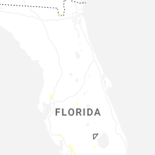
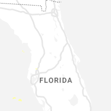
Hail Maps for Pebble Creek, FL


Connect with Interactive Hail Maps