

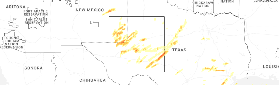
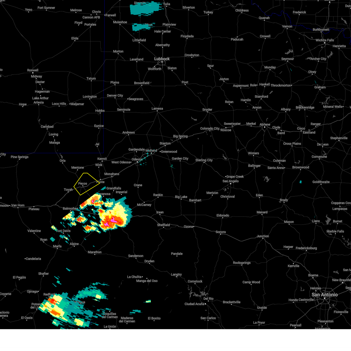
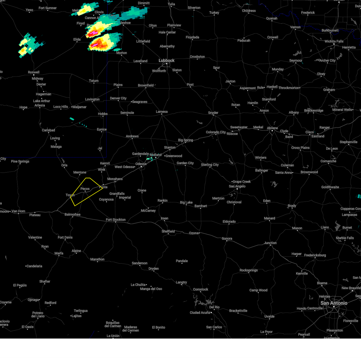
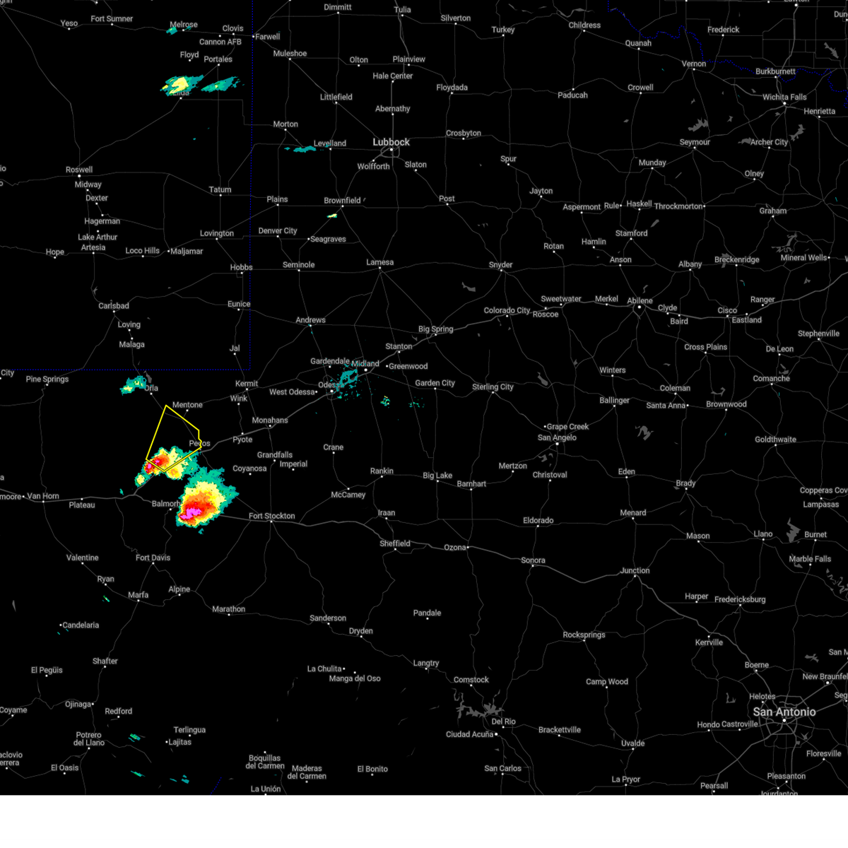
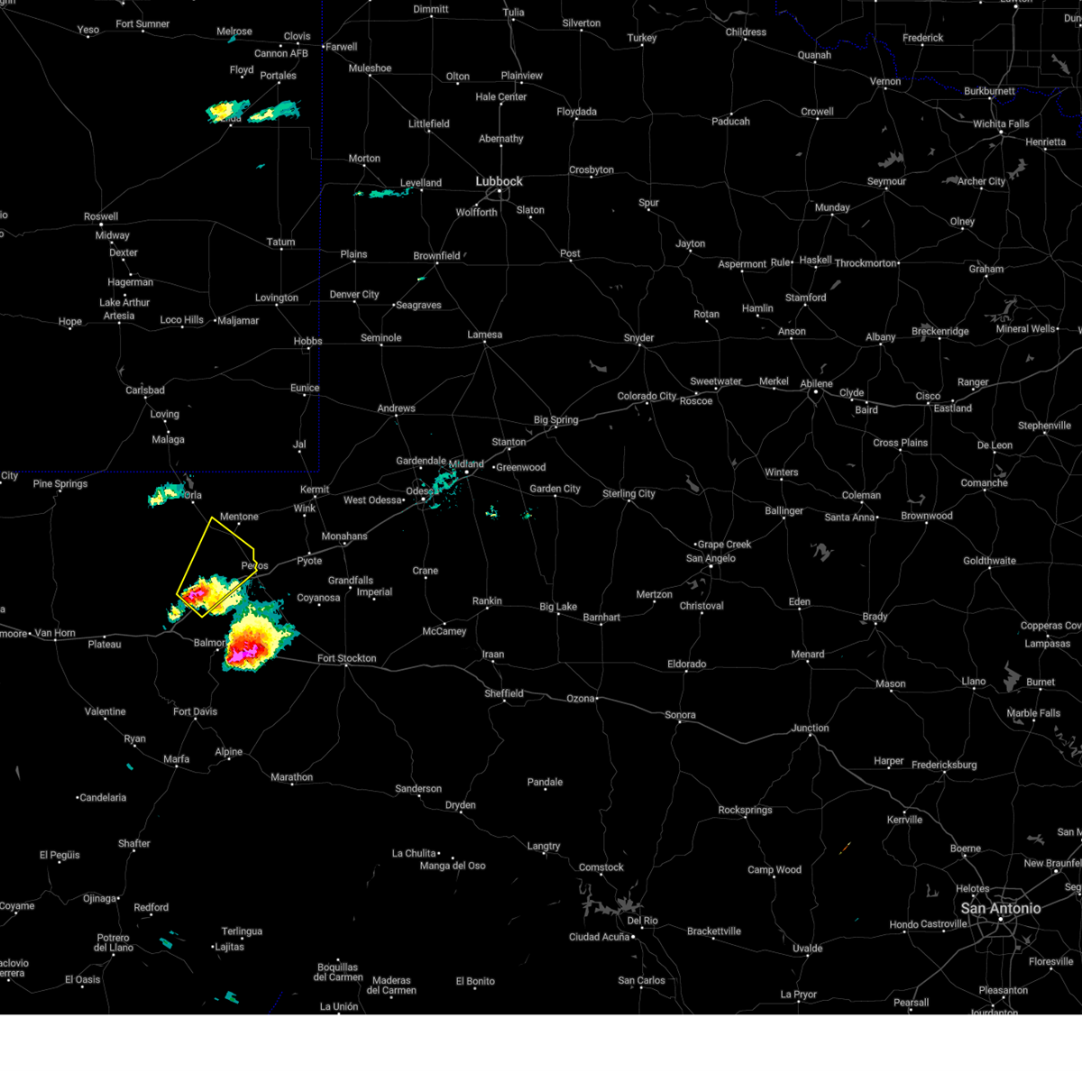
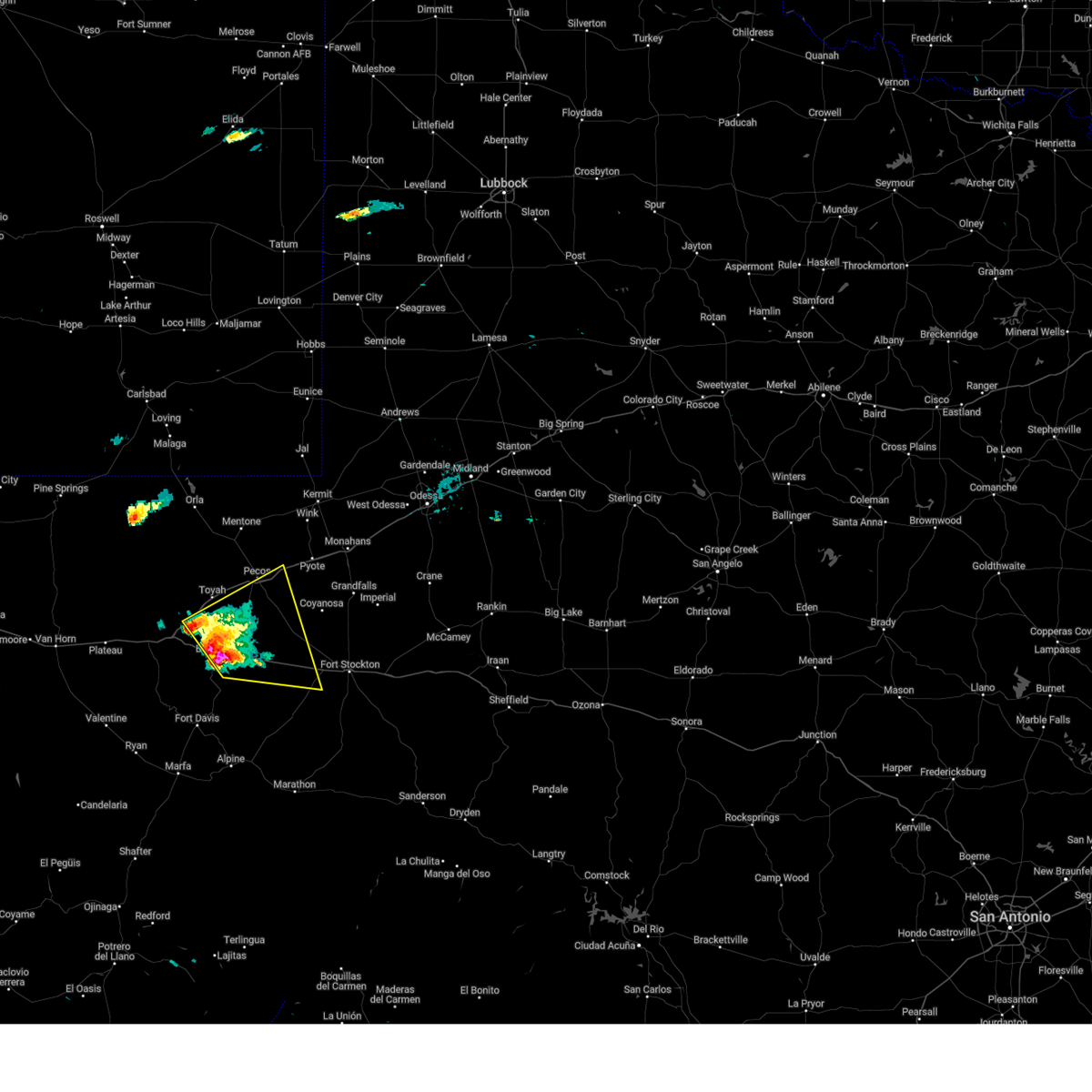
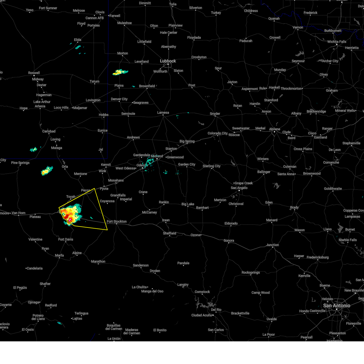
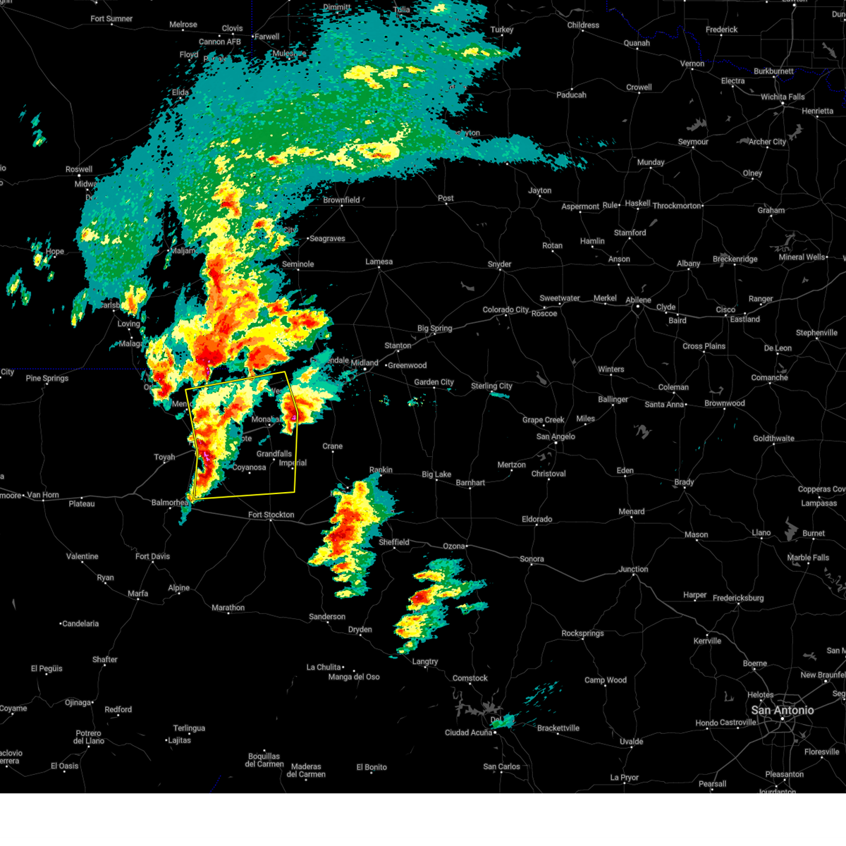
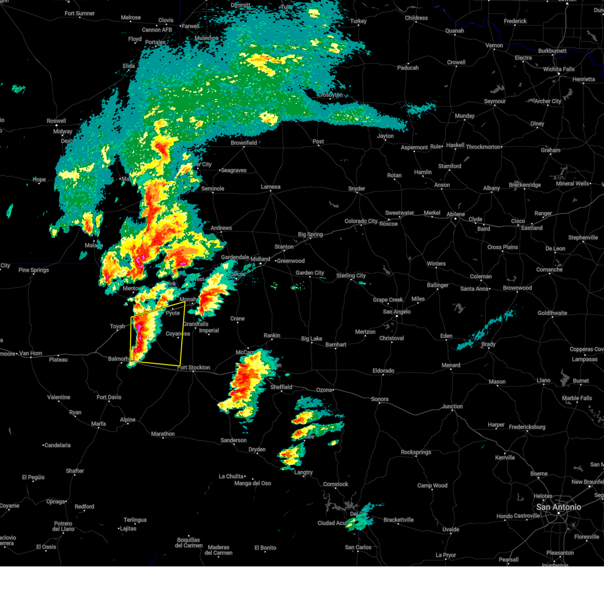
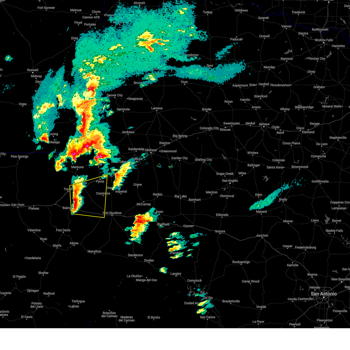
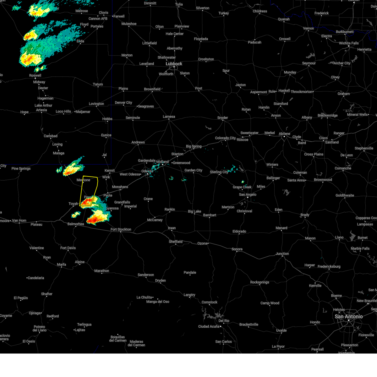
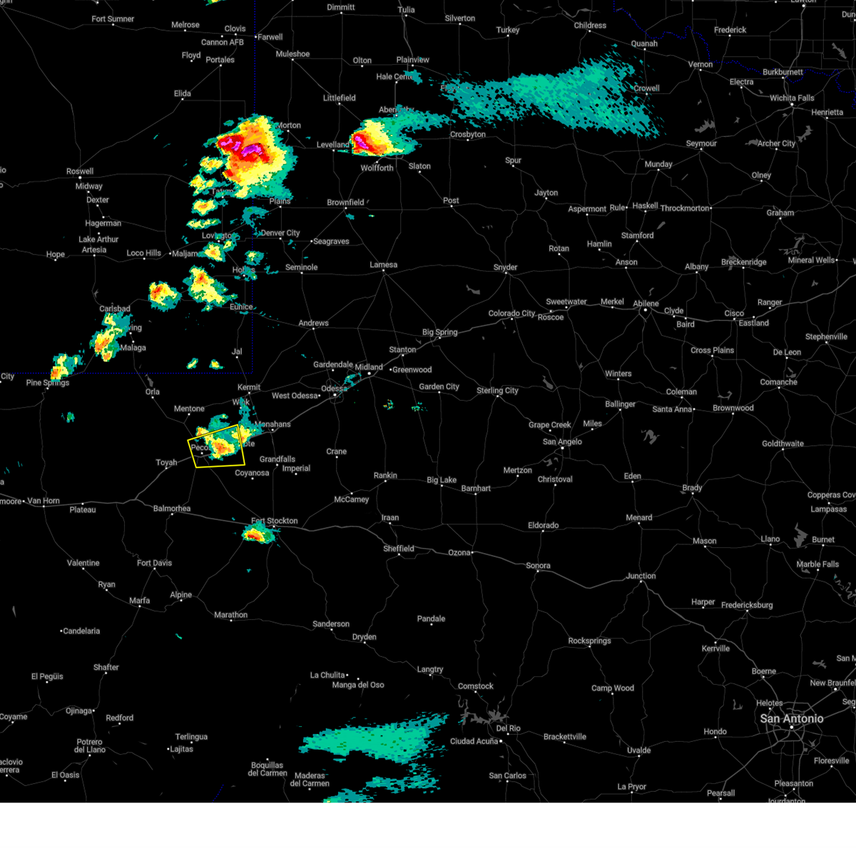
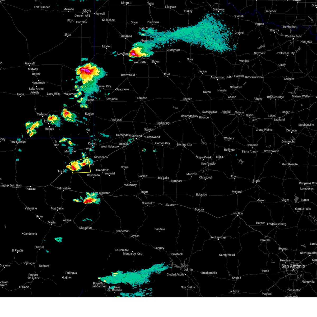
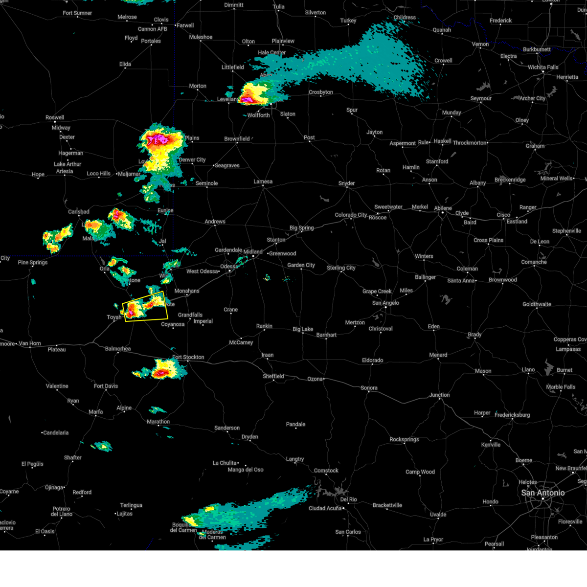
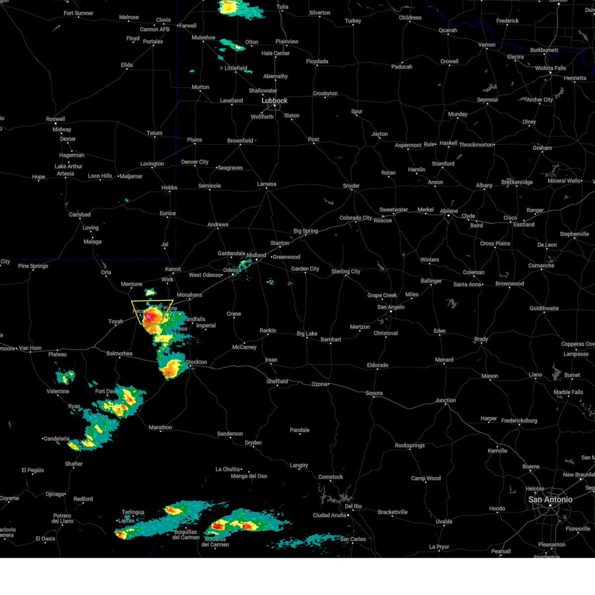
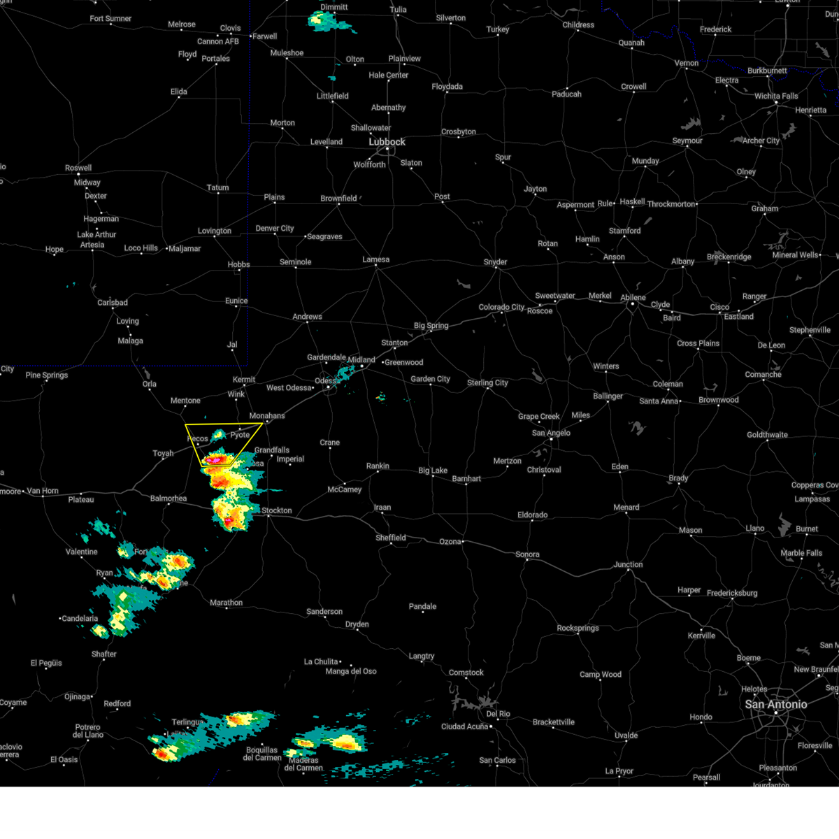
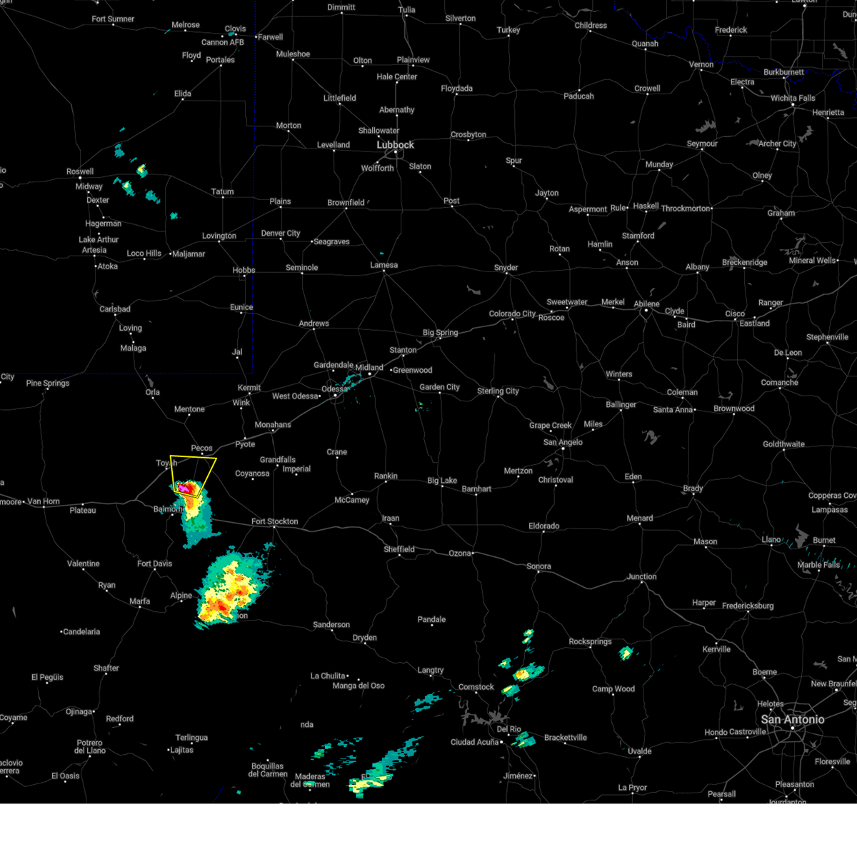
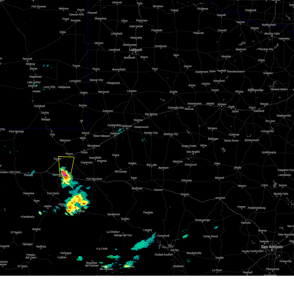
Hail Map for Pecos, TX
The Pecos, TX area has had 28 reports of on-the-ground hail by trained spotters, and has been under severe weather warnings 25 times during the past 12 months. Doppler radar has detected hail at or near Pecos, TX on 54 occasions, including 9 occasions during the past year.
| Name: | Pecos, TX |
| Where Located: | 73 miles N of Alpine, TX |
| Map: | Google Map for Pecos, TX |
| Population: | 8780 |
| Housing Units: | 3542 |
| More Info: | Search Google for Pecos, TX |
2
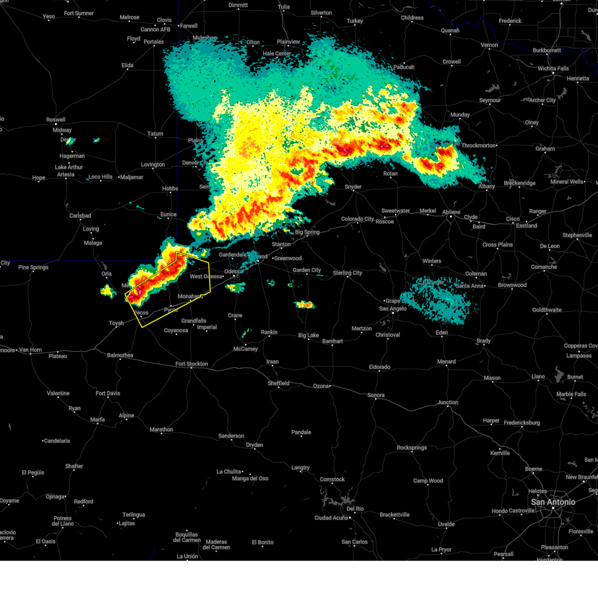
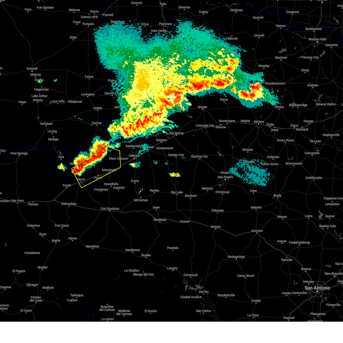
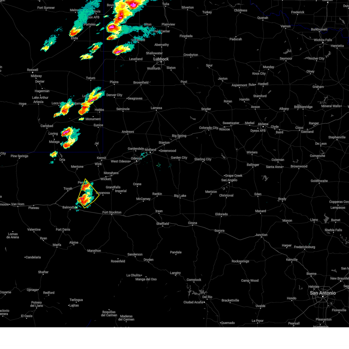
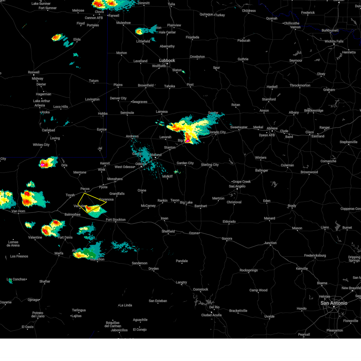
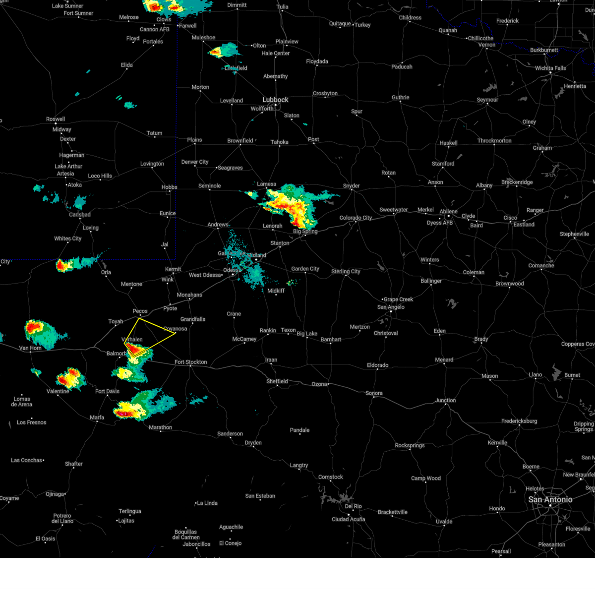
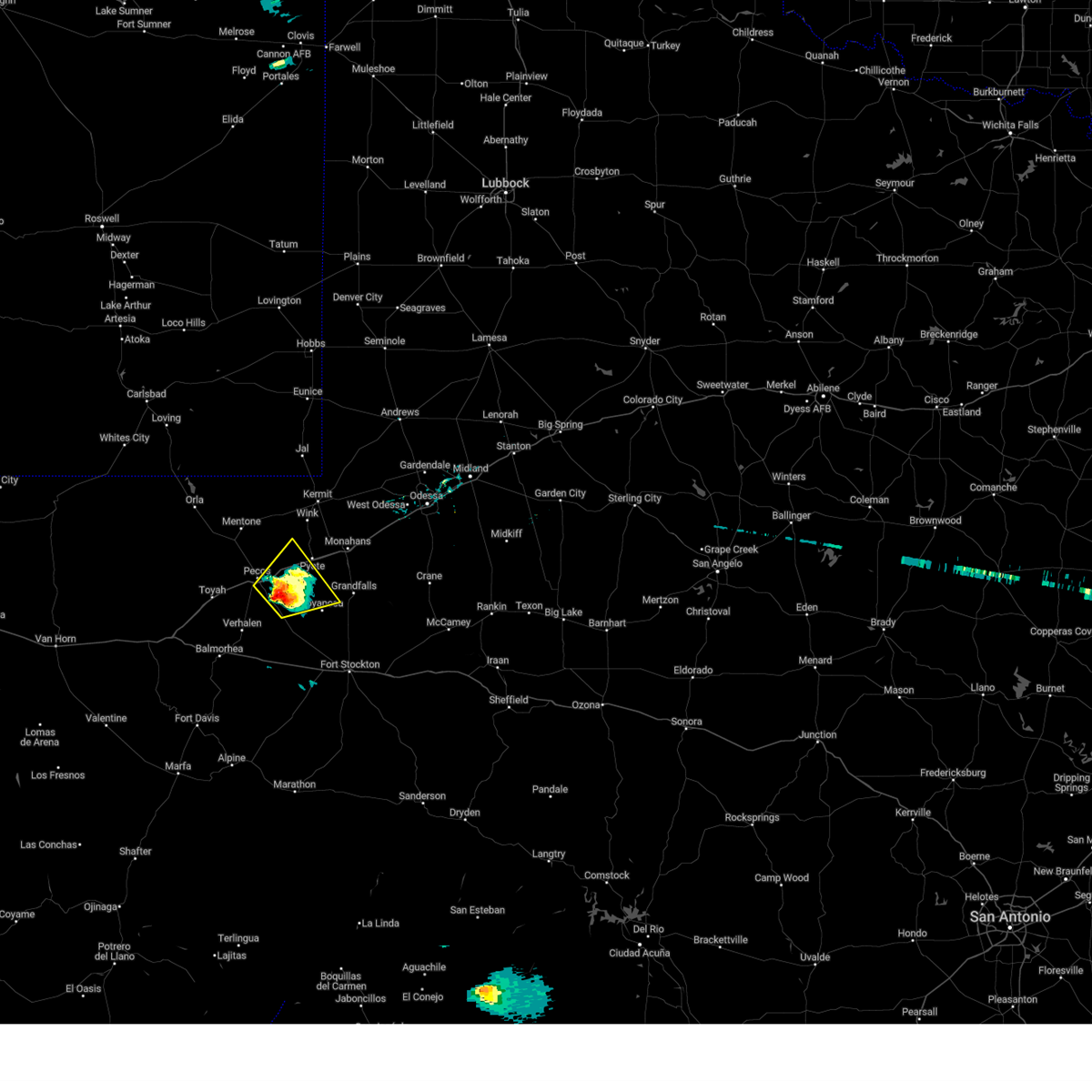
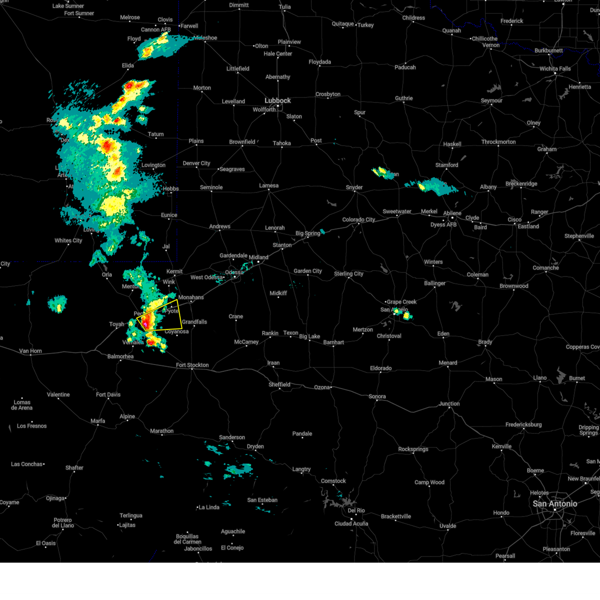
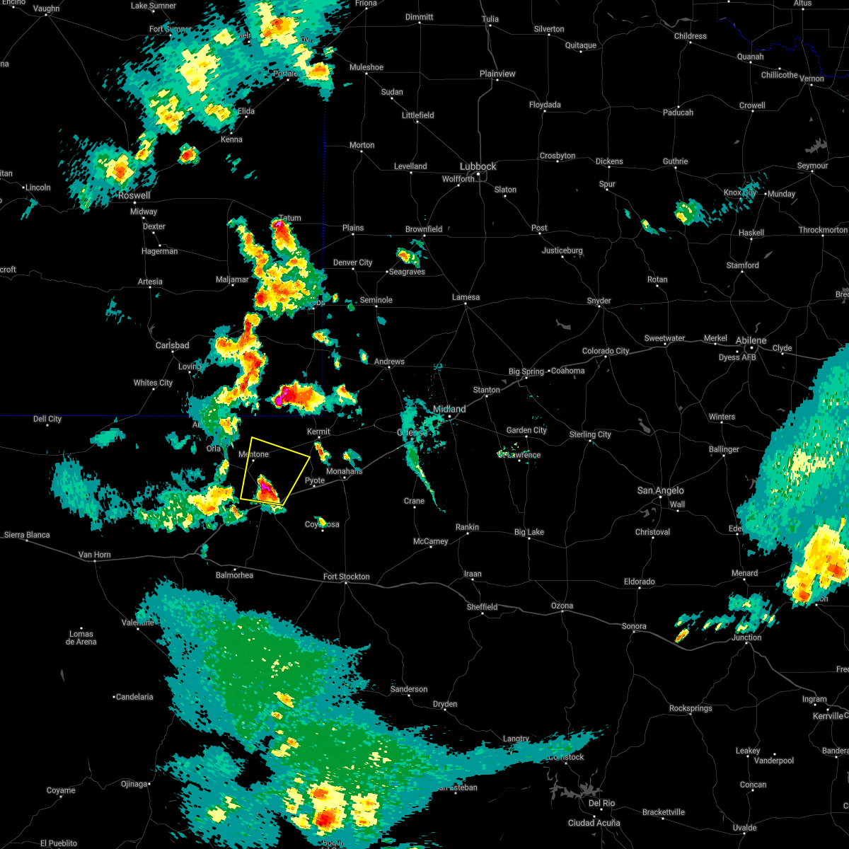
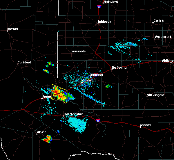
The Top Recent Hail Date for Pecos, TX is Monday, May 5, 2025 (4th out of 54)
Hail and Wind Damage Spotted near Pecos, TX
| Date / Time | Report Details |
|---|---|
| 6/10/2025 2:10 AM CDT |
 At 209 am cdt, severe thunderstorms were located along a line extending from 12 miles southeast of jal airport to near kermit to near mentone, moving southeast at 25 mph (radar indicated). Hazards include 60 mph wind gusts and quarter size hail. Hail damage to vehicles is expected. expect wind damage to roofs, siding, and trees. locations impacted include, pecos, monahans, kermit, wink, mentone, thorntonville, barstow, pyote, wickett, pecos municipal airport, roy hurd memorial airport, monahans sandhills state park, notrees, and winkler county airport. This includes interstate 20 between mile markers 39 and 80, between mile markers 83 and 88, and between mile markers 91 and 97. At 209 am cdt, severe thunderstorms were located along a line extending from 12 miles southeast of jal airport to near kermit to near mentone, moving southeast at 25 mph (radar indicated). Hazards include 60 mph wind gusts and quarter size hail. Hail damage to vehicles is expected. expect wind damage to roofs, siding, and trees. locations impacted include, pecos, monahans, kermit, wink, mentone, thorntonville, barstow, pyote, wickett, pecos municipal airport, roy hurd memorial airport, monahans sandhills state park, notrees, and winkler county airport. This includes interstate 20 between mile markers 39 and 80, between mile markers 83 and 88, and between mile markers 91 and 97.
|
| 6/10/2025 2:10 AM CDT |
 the severe thunderstorm warning has been cancelled and is no longer in effect the severe thunderstorm warning has been cancelled and is no longer in effect
|
| 6/10/2025 1:55 AM CDT |
 Svrmaf the national weather service in midland has issued a * severe thunderstorm warning for, southeastern lea county in southeastern new mexico, southwestern ector county in western texas, central reeves county in southwestern texas, northern ward county in western texas, winkler county in western texas, eastern loving county in western texas, * until 300 am cdt/200 am mdt/. * at 155 am cdt/1255 am mdt/, severe thunderstorms were located along a line extending from near jal airport to near kermit to mentone, moving southeast at 25 mph (radar indicated). Hazards include 60 mph wind gusts and quarter size hail. Hail damage to vehicles is expected. Expect wind damage to roofs, siding, and trees. Svrmaf the national weather service in midland has issued a * severe thunderstorm warning for, southeastern lea county in southeastern new mexico, southwestern ector county in western texas, central reeves county in southwestern texas, northern ward county in western texas, winkler county in western texas, eastern loving county in western texas, * until 300 am cdt/200 am mdt/. * at 155 am cdt/1255 am mdt/, severe thunderstorms were located along a line extending from near jal airport to near kermit to mentone, moving southeast at 25 mph (radar indicated). Hazards include 60 mph wind gusts and quarter size hail. Hail damage to vehicles is expected. Expect wind damage to roofs, siding, and trees.
|
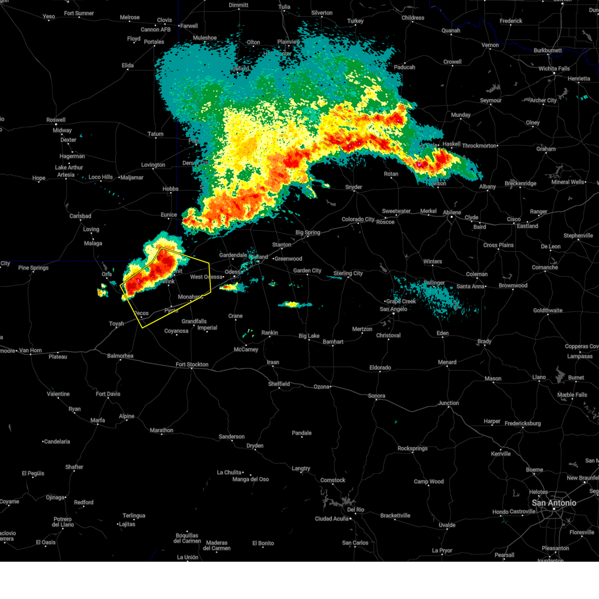
| 6/5/2025 4:51 PM CDT |
 At 451 pm cdt, a severe thunderstorm was located near pecos, moving northeast at 25 mph (radar indicated). Hazards include two inch hail and 60 mph wind gusts. People and animals outdoors will be injured. expect hail damage to roofs, siding, windows, and vehicles. expect wind damage to roofs, siding, and trees. locations impacted include, pecos, barstow, pecos municipal airport, and toyah lake. This includes interstate 20 between mile markers 32 and 61. At 451 pm cdt, a severe thunderstorm was located near pecos, moving northeast at 25 mph (radar indicated). Hazards include two inch hail and 60 mph wind gusts. People and animals outdoors will be injured. expect hail damage to roofs, siding, windows, and vehicles. expect wind damage to roofs, siding, and trees. locations impacted include, pecos, barstow, pecos municipal airport, and toyah lake. This includes interstate 20 between mile markers 32 and 61.
|
| 6/5/2025 4:48 PM CDT | Hen Egg sized hail reported 7.1 miles ESE of Pecos, TX, hen egg size hail partially shattering the windshield of a vehicle. time is estimated by radar. |
| 6/5/2025 4:42 PM CDT | Golf Ball sized hail reported 3.9 miles E of Pecos, TX, ping pong to golf ball size hail reported by public via social media. time is estimated by radar. |
| 6/5/2025 4:35 PM CDT | At 435 pm cdt, a severe thunderstorm was located near pecos, moving northeast at 25 mph (radar indicated). Hazards include golf ball size hail and 60 mph wind gusts. People and animals outdoors will be injured. expect hail damage to roofs, siding, windows, and vehicles. expect wind damage to roofs, siding, and trees. locations impacted include, pecos, barstow, pecos municipal airport, and toyah lake. This includes interstate 20 between mile markers 27 and 61. |
| 6/5/2025 4:24 PM CDT |
 Svrmaf the national weather service in midland has issued a * severe thunderstorm warning for, central reeves county in southwestern texas, northwestern ward county in western texas, * until 515 pm cdt. * at 424 pm cdt, a severe thunderstorm was located 9 miles east of toyah, moving northeast at 25 mph (radar indicated). Hazards include ping pong ball size hail and 60 mph wind gusts. People and animals outdoors will be injured. expect hail damage to roofs, siding, windows, and vehicles. Expect wind damage to roofs, siding, and trees. Svrmaf the national weather service in midland has issued a * severe thunderstorm warning for, central reeves county in southwestern texas, northwestern ward county in western texas, * until 515 pm cdt. * at 424 pm cdt, a severe thunderstorm was located 9 miles east of toyah, moving northeast at 25 mph (radar indicated). Hazards include ping pong ball size hail and 60 mph wind gusts. People and animals outdoors will be injured. expect hail damage to roofs, siding, windows, and vehicles. Expect wind damage to roofs, siding, and trees.
|
| 6/5/2025 3:04 PM CDT | At 303 pm cdt, a severe thunderstorm was located near toyah, moving northeast at 15 mph (radar indicated). Hazards include 60 mph wind gusts and quarter size hail. Hail damage to vehicles is expected. expect wind damage to roofs, siding, and trees. Locations impacted include, pecos and toyah. |
| 6/5/2025 2:53 PM CDT |
 At 253 pm cdt, a severe thunderstorm was located near toyah, moving northeast at 30 mph (radar indicated). Hazards include ping pong ball size hail and 60 mph wind gusts. People and animals outdoors will be injured. expect hail damage to roofs, siding, windows, and vehicles. expect wind damage to roofs, siding, and trees. locations impacted include, pecos and toyah. This includes interstate 20 between mile markers 19 and 38. At 253 pm cdt, a severe thunderstorm was located near toyah, moving northeast at 30 mph (radar indicated). Hazards include ping pong ball size hail and 60 mph wind gusts. People and animals outdoors will be injured. expect hail damage to roofs, siding, windows, and vehicles. expect wind damage to roofs, siding, and trees. locations impacted include, pecos and toyah. This includes interstate 20 between mile markers 19 and 38.
|
| 6/5/2025 2:43 PM CDT |
 Svrmaf the national weather service in midland has issued a * severe thunderstorm warning for, northwestern reeves county in southwestern texas, * until 330 pm cdt. * at 243 pm cdt, a severe thunderstorm was located near toyah, moving northeast at 30 mph (radar indicated). Hazards include 60 mph wind gusts and half dollar size hail. Hail damage to vehicles is expected. Expect wind damage to roofs, siding, and trees. Svrmaf the national weather service in midland has issued a * severe thunderstorm warning for, northwestern reeves county in southwestern texas, * until 330 pm cdt. * at 243 pm cdt, a severe thunderstorm was located near toyah, moving northeast at 30 mph (radar indicated). Hazards include 60 mph wind gusts and half dollar size hail. Hail damage to vehicles is expected. Expect wind damage to roofs, siding, and trees.
|
| 6/5/2025 2:20 PM CDT |
 At 220 pm cdt, a severe thunderstorm was located over saragosa, or 23 miles south of toyah, moving east at 30 mph (radar indicated). Hazards include golf ball size hail and 60 mph wind gusts. People and animals outdoors will be injured. expect hail damage to roofs, siding, windows, and vehicles. expect wind damage to roofs, siding, and trees. locations impacted include, pecos, balmorhea, barstow, balmorhea lake, balmorhea state park, saragosa, verhalen, toyah lake, b f goodrich testing track, pecos municipal airport, toyahvale, and firestone test track. this includes the following highways, interstate 10 between mile markers 201 and 246. Interstate 20 between mile markers 8 and 12, and between mile markers 40 and 53. At 220 pm cdt, a severe thunderstorm was located over saragosa, or 23 miles south of toyah, moving east at 30 mph (radar indicated). Hazards include golf ball size hail and 60 mph wind gusts. People and animals outdoors will be injured. expect hail damage to roofs, siding, windows, and vehicles. expect wind damage to roofs, siding, and trees. locations impacted include, pecos, balmorhea, barstow, balmorhea lake, balmorhea state park, saragosa, verhalen, toyah lake, b f goodrich testing track, pecos municipal airport, toyahvale, and firestone test track. this includes the following highways, interstate 10 between mile markers 201 and 246. Interstate 20 between mile markers 8 and 12, and between mile markers 40 and 53.
|
| 6/5/2025 2:11 PM CDT |
 Svrmaf the national weather service in midland has issued a * severe thunderstorm warning for, northwestern pecos county in southwestern texas, southern reeves county in southwestern texas, west central ward county in western texas, * until 245 pm cdt. * at 211 pm cdt, a severe thunderstorm was located over balmorhea, or 23 miles south of toyah, moving northeast at 30 mph (radar indicated). Hazards include 60 mph wind gusts and half dollar size hail. Hail damage to vehicles is expected. Expect wind damage to roofs, siding, and trees. Svrmaf the national weather service in midland has issued a * severe thunderstorm warning for, northwestern pecos county in southwestern texas, southern reeves county in southwestern texas, west central ward county in western texas, * until 245 pm cdt. * at 211 pm cdt, a severe thunderstorm was located over balmorhea, or 23 miles south of toyah, moving northeast at 30 mph (radar indicated). Hazards include 60 mph wind gusts and half dollar size hail. Hail damage to vehicles is expected. Expect wind damage to roofs, siding, and trees.
|
| 5/5/2025 11:58 PM CDT |
 Svrmaf the national weather service in midland has issued a * severe thunderstorm warning for, northwestern pecos county in southwestern texas, southwestern ector county in western texas, east central reeves county in southwestern texas, ward county in western texas, winkler county in western texas, northwestern crane county in western texas, southeastern loving county in western texas, * until 1245 am cdt. * at 1158 pm cdt, severe thunderstorms were located along a line extending from 11 miles west of wink to 6 miles east of barstow to 19 miles southeast of pecos, moving northeast at 55 mph (radar indicated). Hazards include 60 mph wind gusts and half dollar size hail. Hail damage to vehicles is expected. Expect wind damage to roofs, siding, and trees. Svrmaf the national weather service in midland has issued a * severe thunderstorm warning for, northwestern pecos county in southwestern texas, southwestern ector county in western texas, east central reeves county in southwestern texas, ward county in western texas, winkler county in western texas, northwestern crane county in western texas, southeastern loving county in western texas, * until 1245 am cdt. * at 1158 pm cdt, severe thunderstorms were located along a line extending from 11 miles west of wink to 6 miles east of barstow to 19 miles southeast of pecos, moving northeast at 55 mph (radar indicated). Hazards include 60 mph wind gusts and half dollar size hail. Hail damage to vehicles is expected. Expect wind damage to roofs, siding, and trees.
|
| 5/5/2025 11:45 PM CDT |
 At 1145 pm cdt, severe thunderstorms were located along a line extending from near pecos to 7 miles east of saragosa, moving northeast at 40 mph (radar indicated). Hazards include 60 mph wind gusts and quarter size hail. Hail damage to vehicles is expected. expect wind damage to roofs, siding, and trees. locations impacted include, pecos, barstow, pyote, wickett, verhalen, toyah lake, coyanosa, b f goodrich testing track, and pecos municipal airport. This includes interstate 20 between mile markers 33 and 74. At 1145 pm cdt, severe thunderstorms were located along a line extending from near pecos to 7 miles east of saragosa, moving northeast at 40 mph (radar indicated). Hazards include 60 mph wind gusts and quarter size hail. Hail damage to vehicles is expected. expect wind damage to roofs, siding, and trees. locations impacted include, pecos, barstow, pyote, wickett, verhalen, toyah lake, coyanosa, b f goodrich testing track, and pecos municipal airport. This includes interstate 20 between mile markers 33 and 74.
|
| 5/5/2025 11:31 PM CDT |
 Svrmaf the national weather service in midland has issued a * severe thunderstorm warning for, northwestern pecos county in southwestern texas, southeastern reeves county in southwestern texas, central ward county in western texas, * until midnight cdt. * at 1131 pm cdt, severe thunderstorms were located along a line extending from near pecos to near saragosa, moving northeast at 35 mph (radar indicated). Hazards include 60 mph wind gusts and quarter size hail. Hail damage to vehicles is expected. Expect wind damage to roofs, siding, and trees. Svrmaf the national weather service in midland has issued a * severe thunderstorm warning for, northwestern pecos county in southwestern texas, southeastern reeves county in southwestern texas, central ward county in western texas, * until midnight cdt. * at 1131 pm cdt, severe thunderstorms were located along a line extending from near pecos to near saragosa, moving northeast at 35 mph (radar indicated). Hazards include 60 mph wind gusts and quarter size hail. Hail damage to vehicles is expected. Expect wind damage to roofs, siding, and trees.
|
| 4/26/2025 6:47 PM CDT | Hen Egg sized hail reported 0.8 miles SSW of Pecos, TX, corrects previous hail report from 1 n pecos. multiple reports of golf ball to hen egg size hail in pecos. time verified by reports and radar. |
| 4/26/2025 6:38 PM CDT | Golf Ball sized hail reported 1.4 miles N of Pecos, TX, corrects previous hail report from 1 ssw pecos. golf ball size hail reported per broadcast media source. time estimated by radar and report. |
| 4/26/2025 5:47 PM CDT | Hen Egg sized hail reported 0.8 miles SSW of Pecos, TX, multiple reports of golf ball to hen egg size hail in pecos. time verified by reports and radar. |
| 4/26/2025 5:41 PM CDT |
 At 541 pm cdt, a severe thunderstorm was located over pecos, moving northeast at 50 mph (broadcast media). Hazards include golf ball size hail and 60 mph wind gusts. People and animals outdoors will be injured. expect hail damage to roofs, siding, windows, and vehicles. expect wind damage to roofs, siding, and trees. locations impacted include, pecos, mentone, and pecos municipal airport. This includes interstate 20 between mile markers 31 and 45. At 541 pm cdt, a severe thunderstorm was located over pecos, moving northeast at 50 mph (broadcast media). Hazards include golf ball size hail and 60 mph wind gusts. People and animals outdoors will be injured. expect hail damage to roofs, siding, windows, and vehicles. expect wind damage to roofs, siding, and trees. locations impacted include, pecos, mentone, and pecos municipal airport. This includes interstate 20 between mile markers 31 and 45.
|
| 4/26/2025 5:38 PM CDT | Golf Ball sized hail reported 1.4 miles N of Pecos, TX, golf ball size hail reported per broadcast media source. time estimated by radar and report. |
| 4/26/2025 5:31 PM CDT |
 Svrmaf the national weather service in midland has issued a * severe thunderstorm warning for, central reeves county in southwestern texas, northwestern ward county in western texas, southeastern loving county in western texas, * until 630 pm cdt. * at 531 pm cdt, a severe thunderstorm was located 7 miles southwest of pecos, moving north at 25 mph (radar indicated). Hazards include 60 mph wind gusts and quarter size hail. Hail damage to vehicles is expected. Expect wind damage to roofs, siding, and trees. Svrmaf the national weather service in midland has issued a * severe thunderstorm warning for, central reeves county in southwestern texas, northwestern ward county in western texas, southeastern loving county in western texas, * until 630 pm cdt. * at 531 pm cdt, a severe thunderstorm was located 7 miles southwest of pecos, moving north at 25 mph (radar indicated). Hazards include 60 mph wind gusts and quarter size hail. Hail damage to vehicles is expected. Expect wind damage to roofs, siding, and trees.
|
| 4/25/2025 8:23 PM CDT |
 The storm which prompted the warning has weakened below severe limits, and no longer poses an immediate threat to life or property. therefore, the warning will be allowed to expire. a severe thunderstorm watch remains in effect until 1000 pm cdt for western and southwestern texas. The storm which prompted the warning has weakened below severe limits, and no longer poses an immediate threat to life or property. therefore, the warning will be allowed to expire. a severe thunderstorm watch remains in effect until 1000 pm cdt for western and southwestern texas.
|
| 4/25/2025 7:58 PM CDT |
 At 758 pm cdt, a severe thunderstorm was located over pecos, moving east at 25 mph (radar indicated). Hazards include 60 mph wind gusts and quarter size hail. Hail damage to vehicles is expected. expect wind damage to roofs, siding, and trees. locations impacted include, pecos, barstow, and pecos municipal airport. This includes interstate 20 between mile markers 37 and 63. At 758 pm cdt, a severe thunderstorm was located over pecos, moving east at 25 mph (radar indicated). Hazards include 60 mph wind gusts and quarter size hail. Hail damage to vehicles is expected. expect wind damage to roofs, siding, and trees. locations impacted include, pecos, barstow, and pecos municipal airport. This includes interstate 20 between mile markers 37 and 63.
|
| 4/25/2025 7:50 PM CDT | Quarter sized hail reported 1.1 miles SW of Pecos, TX, quarter size hail reported by pecos fire dept. time was estimated by radar. |
| 4/25/2025 7:46 PM CDT |
 Svrmaf the national weather service in midland has issued a * severe thunderstorm warning for, central reeves county in southwestern texas, northwestern ward county in western texas, * until 830 pm cdt. * at 745 pm cdt, a severe thunderstorm was located near pecos, moving east at 20 mph (radar indicated). Hazards include 60 mph wind gusts and quarter size hail. Hail damage to vehicles is expected. Expect wind damage to roofs, siding, and trees. Svrmaf the national weather service in midland has issued a * severe thunderstorm warning for, central reeves county in southwestern texas, northwestern ward county in western texas, * until 830 pm cdt. * at 745 pm cdt, a severe thunderstorm was located near pecos, moving east at 20 mph (radar indicated). Hazards include 60 mph wind gusts and quarter size hail. Hail damage to vehicles is expected. Expect wind damage to roofs, siding, and trees.
|
| 4/23/2025 5:19 PM CDT |
 At 518 pm cdt, a severe thunderstorm was located near barstow, or 9 miles east of pecos, moving north at 20 mph (trained weather spotters). Hazards include ping pong ball size hail and 60 mph wind gusts. People and animals outdoors will be injured. expect hail damage to roofs, siding, windows, and vehicles. expect wind damage to roofs, siding, and trees. locations impacted include, barstow, pecos, pyote, and pecos municipal airport. This includes interstate 20 between mile markers 40 and 65. At 518 pm cdt, a severe thunderstorm was located near barstow, or 9 miles east of pecos, moving north at 20 mph (trained weather spotters). Hazards include ping pong ball size hail and 60 mph wind gusts. People and animals outdoors will be injured. expect hail damage to roofs, siding, windows, and vehicles. expect wind damage to roofs, siding, and trees. locations impacted include, barstow, pecos, pyote, and pecos municipal airport. This includes interstate 20 between mile markers 40 and 65.
|
| 4/23/2025 5:01 PM CDT |
 Svrmaf the national weather service in midland has issued a * severe thunderstorm warning for, east central reeves county in southwestern texas, central ward county in western texas, * until 545 pm cdt. * at 500 pm cdt, a severe thunderstorm was located 7 miles southeast of barstow, or 10 miles east of pecos, moving north at 20 mph (trained weather spotters). Hazards include 60 mph wind gusts and quarter size hail. Hail damage to vehicles is expected. Expect wind damage to roofs, siding, and trees. Svrmaf the national weather service in midland has issued a * severe thunderstorm warning for, east central reeves county in southwestern texas, central ward county in western texas, * until 545 pm cdt. * at 500 pm cdt, a severe thunderstorm was located 7 miles southeast of barstow, or 10 miles east of pecos, moving north at 20 mph (trained weather spotters). Hazards include 60 mph wind gusts and quarter size hail. Hail damage to vehicles is expected. Expect wind damage to roofs, siding, and trees.
|
| 4/23/2025 4:58 PM CDT | Quarter sized hail reported 14.1 miles WNW of Pecos, TX |
| 3/26/2025 5:02 PM CDT |
 At 502 pm cdt, a severe thunderstorm was located 11 miles southeast of toyah, moving north at 25 mph (radar indicated). Hazards include 60 mph wind gusts and quarter size hail. Hail damage to vehicles is expected. expect wind damage to roofs, siding, and trees. locations impacted include, verhalen, toyah lake, pecos municipal airport, and pecos. This includes interstate 20 between mile markers 25 and 36, and near mile marker 41. At 502 pm cdt, a severe thunderstorm was located 11 miles southeast of toyah, moving north at 25 mph (radar indicated). Hazards include 60 mph wind gusts and quarter size hail. Hail damage to vehicles is expected. expect wind damage to roofs, siding, and trees. locations impacted include, verhalen, toyah lake, pecos municipal airport, and pecos. This includes interstate 20 between mile markers 25 and 36, and near mile marker 41.
|
| 3/26/2025 4:37 PM CDT |
 Svrmaf the national weather service in midland has issued a * severe thunderstorm warning for, south central reeves county in southwestern texas, * until 515 pm cdt. * at 437 pm cdt, a severe thunderstorm was located near saragosa, or 20 miles southeast of toyah, moving north at 25 mph (radar indicated). Hazards include 60 mph wind gusts and half dollar size hail. Hail damage to vehicles is expected. Expect wind damage to roofs, siding, and trees. Svrmaf the national weather service in midland has issued a * severe thunderstorm warning for, south central reeves county in southwestern texas, * until 515 pm cdt. * at 437 pm cdt, a severe thunderstorm was located near saragosa, or 20 miles southeast of toyah, moving north at 25 mph (radar indicated). Hazards include 60 mph wind gusts and half dollar size hail. Hail damage to vehicles is expected. Expect wind damage to roofs, siding, and trees.
|
| 9/21/2024 6:14 PM CDT |
 At 614 pm cdt, a severe thunderstorm was located 15 miles northeast of saragosa, or 16 miles south of pecos, moving northeast at 25 mph (radar indicated). Hazards include 60 mph wind gusts and quarter size hail. Hail damage to vehicles is expected. expect wind damage to roofs, siding, and trees. locations impacted include, pecos, barstow, toyah lake, and b f goodrich testing track. This includes interstate 20 between mile markers 42 and 50. At 614 pm cdt, a severe thunderstorm was located 15 miles northeast of saragosa, or 16 miles south of pecos, moving northeast at 25 mph (radar indicated). Hazards include 60 mph wind gusts and quarter size hail. Hail damage to vehicles is expected. expect wind damage to roofs, siding, and trees. locations impacted include, pecos, barstow, toyah lake, and b f goodrich testing track. This includes interstate 20 between mile markers 42 and 50.
|
| 9/21/2024 5:43 PM CDT |
 Svrmaf the national weather service in midland has issued a * severe thunderstorm warning for, southeastern reeves county in southwestern texas, west central ward county in western texas, * until 645 pm cdt. * at 543 pm cdt, a severe thunderstorm was located near saragosa, or 19 miles southeast of toyah, moving northeast at 25 mph (radar indicated). Hazards include 60 mph wind gusts and quarter size hail. Hail damage to vehicles is expected. Expect wind damage to roofs, siding, and trees. Svrmaf the national weather service in midland has issued a * severe thunderstorm warning for, southeastern reeves county in southwestern texas, west central ward county in western texas, * until 645 pm cdt. * at 543 pm cdt, a severe thunderstorm was located near saragosa, or 19 miles southeast of toyah, moving northeast at 25 mph (radar indicated). Hazards include 60 mph wind gusts and quarter size hail. Hail damage to vehicles is expected. Expect wind damage to roofs, siding, and trees.
|
| 5/4/2024 4:32 PM CDT |
 At 432 pm cdt, a severe thunderstorm was located 8 miles southeast of toyah, moving east at 20 mph (radar indicated). Hazards include golf ball size hail and 60 mph wind gusts. People and animals outdoors will be injured. expect hail damage to roofs, siding, windows, and vehicles. expect wind damage to roofs, siding, and trees. This severe thunderstorm will remain over mainly rural areas of central reeves county. At 432 pm cdt, a severe thunderstorm was located 8 miles southeast of toyah, moving east at 20 mph (radar indicated). Hazards include golf ball size hail and 60 mph wind gusts. People and animals outdoors will be injured. expect hail damage to roofs, siding, windows, and vehicles. expect wind damage to roofs, siding, and trees. This severe thunderstorm will remain over mainly rural areas of central reeves county.
|
| 5/4/2024 4:20 PM CDT |
 At 420 pm cdt, a severe thunderstorm was located near toyah, moving east at 20 mph (radar indicated). Hazards include 60 mph wind gusts and half dollar size hail. Hail damage to vehicles is expected. expect wind damage to roofs, siding, and trees. locations impacted include, pecos, toyah, and pecos municipal airport. This includes interstate 20 between mile markers 16 and 23, and between mile markers 36 and 41. At 420 pm cdt, a severe thunderstorm was located near toyah, moving east at 20 mph (radar indicated). Hazards include 60 mph wind gusts and half dollar size hail. Hail damage to vehicles is expected. expect wind damage to roofs, siding, and trees. locations impacted include, pecos, toyah, and pecos municipal airport. This includes interstate 20 between mile markers 16 and 23, and between mile markers 36 and 41.
|
| 5/4/2024 4:06 PM CDT |
 Svrmaf the national weather service in midland has issued a * severe thunderstorm warning for, central reeves county in southwestern texas, * until 445 pm cdt. * at 405 pm cdt, a severe thunderstorm was located 8 miles southwest of toyah, moving east at 20 mph (radar indicated). Hazards include 60 mph wind gusts and half dollar size hail. Hail damage to vehicles is expected. Expect wind damage to roofs, siding, and trees. Svrmaf the national weather service in midland has issued a * severe thunderstorm warning for, central reeves county in southwestern texas, * until 445 pm cdt. * at 405 pm cdt, a severe thunderstorm was located 8 miles southwest of toyah, moving east at 20 mph (radar indicated). Hazards include 60 mph wind gusts and half dollar size hail. Hail damage to vehicles is expected. Expect wind damage to roofs, siding, and trees.
|
| 10/2/2023 4:37 PM CDT |
 At 436 pm cdt, a severe thunderstorm was located 9 miles northwest of barstow, or 11 miles north of pecos, moving north at 35 mph. this is a destructive storm for pecos city and barstow (radar indicated). Hazards include baseball size hail and 70 mph wind gusts. People and animals outdoors will be severely injured. expect shattered windows, extensive damage to roofs, siding, and vehicles. locations impacted include, pecos and barstow. thunderstorm damage threat, destructive hail threat, observed max hail size, 2. 75 in wind threat, radar indicated max wind gust, 70 mph. At 436 pm cdt, a severe thunderstorm was located 9 miles northwest of barstow, or 11 miles north of pecos, moving north at 35 mph. this is a destructive storm for pecos city and barstow (radar indicated). Hazards include baseball size hail and 70 mph wind gusts. People and animals outdoors will be severely injured. expect shattered windows, extensive damage to roofs, siding, and vehicles. locations impacted include, pecos and barstow. thunderstorm damage threat, destructive hail threat, observed max hail size, 2. 75 in wind threat, radar indicated max wind gust, 70 mph.
|
| 10/2/2023 4:21 PM CDT |
 At 420 pm cdt, a severe thunderstorm was located over pecos, moving northeast at 15 mph. this is a destructive storm for pecos city and surrounding area (emergency management reports baseball size hail in the city of pecos). Hazards include baseball size hail and 60 mph wind gusts. People and animals outdoors will be severely injured. expect shattered windows, extensive damage to roofs, siding, and vehicles. locations impacted include, pecos, barstow, toyah lake, b f goodrich testing track, and pecos municipal airport. this includes interstate 20 between mile markers 38 and 65. thunderstorm damage threat, destructive hail threat, observed max hail size, 2. 75 in wind threat, radar indicated max wind gust, 60 mph. At 420 pm cdt, a severe thunderstorm was located over pecos, moving northeast at 15 mph. this is a destructive storm for pecos city and surrounding area (emergency management reports baseball size hail in the city of pecos). Hazards include baseball size hail and 60 mph wind gusts. People and animals outdoors will be severely injured. expect shattered windows, extensive damage to roofs, siding, and vehicles. locations impacted include, pecos, barstow, toyah lake, b f goodrich testing track, and pecos municipal airport. this includes interstate 20 between mile markers 38 and 65. thunderstorm damage threat, destructive hail threat, observed max hail size, 2. 75 in wind threat, radar indicated max wind gust, 60 mph.
|
| 10/2/2023 4:20 PM CDT | Baseball sized hail reported 0.3 miles W of Pecos, TX |
| 10/2/2023 4:12 PM CDT |
 At 412 pm cdt, a severe thunderstorm was located over pecos, moving north at 25 mph (radar indicated). Hazards include two inch hail and 60 mph wind gusts. People and animals outdoors will be injured. expect hail damage to roofs, siding, windows, and vehicles. expect wind damage to roofs, siding, and trees. locations impacted include, pecos, barstow, toyah lake, b f goodrich testing track, and pecos municipal airport. this includes interstate 20 between mile markers 38 and 65. thunderstorm damage threat, considerable hail threat, radar indicated max hail size, 2. 00 in wind threat, radar indicated max wind gust, 60 mph. At 412 pm cdt, a severe thunderstorm was located over pecos, moving north at 25 mph (radar indicated). Hazards include two inch hail and 60 mph wind gusts. People and animals outdoors will be injured. expect hail damage to roofs, siding, windows, and vehicles. expect wind damage to roofs, siding, and trees. locations impacted include, pecos, barstow, toyah lake, b f goodrich testing track, and pecos municipal airport. this includes interstate 20 between mile markers 38 and 65. thunderstorm damage threat, considerable hail threat, radar indicated max hail size, 2. 00 in wind threat, radar indicated max wind gust, 60 mph.
|
| 10/2/2023 4:03 PM CDT |
 At 402 pm cdt, a severe thunderstorm was located 19 miles east of saragosa, or 22 miles southeast of pecos, moving northeast at 15 mph (radar indicated). Hazards include golf ball size hail and 60 mph wind gusts. People and animals outdoors will be injured. expect hail damage to roofs, siding, windows, and vehicles. Expect wind damage to roofs, siding, and trees. At 402 pm cdt, a severe thunderstorm was located 19 miles east of saragosa, or 22 miles southeast of pecos, moving northeast at 15 mph (radar indicated). Hazards include golf ball size hail and 60 mph wind gusts. People and animals outdoors will be injured. expect hail damage to roofs, siding, windows, and vehicles. Expect wind damage to roofs, siding, and trees.
|
| 9/11/2023 10:03 PM CDT |
 At 1002 pm cdt, a severe thunderstorm was located near thorntonville, or 8 miles southwest of monahans, moving southeast at 40 mph (a 65 mph wind gust was observed in pyote). Hazards include 70 mph wind gusts. Expect considerable tree damage. damage is likely to mobile homes, roofs, and outbuildings. locations impacted include, pecos, monahans, thorntonville, grandfalls, barstow, pyote, wickett, toyah lake, coyanosa, imperial reservoir, pecos municipal airport, roy hurd memorial airport, monahans sandhills state park, royalty, b f goodrich testing track, and imperial. this includes interstate 20 between mile markers 24 and 90. thunderstorm damage threat, considerable hail threat, radar indicated max hail size, <. 75 in wind threat, observed max wind gust, 70 mph. At 1002 pm cdt, a severe thunderstorm was located near thorntonville, or 8 miles southwest of monahans, moving southeast at 40 mph (a 65 mph wind gust was observed in pyote). Hazards include 70 mph wind gusts. Expect considerable tree damage. damage is likely to mobile homes, roofs, and outbuildings. locations impacted include, pecos, monahans, thorntonville, grandfalls, barstow, pyote, wickett, toyah lake, coyanosa, imperial reservoir, pecos municipal airport, roy hurd memorial airport, monahans sandhills state park, royalty, b f goodrich testing track, and imperial. this includes interstate 20 between mile markers 24 and 90. thunderstorm damage threat, considerable hail threat, radar indicated max hail size, <. 75 in wind threat, observed max wind gust, 70 mph.
|
| 9/11/2023 9:36 PM CDT |
 At 935 pm cdt, a severe thunderstorm was located over wink, moving southeast at 40 mph (68 mph wind gust was observed at wink asos at 929 pm cdt). Hazards include 70 mph wind gusts. Expect considerable tree damage. Damage is likely to mobile homes, roofs, and outbuildings. At 935 pm cdt, a severe thunderstorm was located over wink, moving southeast at 40 mph (68 mph wind gust was observed at wink asos at 929 pm cdt). Hazards include 70 mph wind gusts. Expect considerable tree damage. Damage is likely to mobile homes, roofs, and outbuildings.
|
| 7/12/2023 4:45 PM CDT | Mesonet station fw9692 peco in reeves county TX, 27 miles ESE of Pecos, TX |
| 6/3/2023 9:11 PM CDT |
 At 911 pm cdt, a severe thunderstorm was located 8 miles northeast of barstow, or 15 miles northeast of pecos, moving south at 25 mph (radar indicated). Hazards include two inch hail and 60 mph wind gusts. People and animals outdoors will be injured. expect hail damage to roofs, siding, windows, and vehicles. expect wind damage to roofs, siding, and trees. locations impacted include, pecos, barstow, toyah lake, coyanosa, b f goodrich testing track and pecos municipal airport. this includes interstate 20 between mile markers 40 and 63. thunderstorm damage threat, considerable hail threat, radar indicated max hail size, 2. 00 in wind threat, radar indicated max wind gust, 60 mph. At 911 pm cdt, a severe thunderstorm was located 8 miles northeast of barstow, or 15 miles northeast of pecos, moving south at 25 mph (radar indicated). Hazards include two inch hail and 60 mph wind gusts. People and animals outdoors will be injured. expect hail damage to roofs, siding, windows, and vehicles. expect wind damage to roofs, siding, and trees. locations impacted include, pecos, barstow, toyah lake, coyanosa, b f goodrich testing track and pecos municipal airport. this includes interstate 20 between mile markers 40 and 63. thunderstorm damage threat, considerable hail threat, radar indicated max hail size, 2. 00 in wind threat, radar indicated max wind gust, 60 mph.
|
| 6/3/2023 9:01 PM CDT |
 At 901 pm cdt, a severe thunderstorm was located 11 miles north of barstow, or 13 miles southwest of wink, moving south at 25 mph (radar indicated). Hazards include 60 mph wind gusts and half dollar size hail. Hail damage to vehicles is expected. Expect wind damage to roofs, siding, and trees. At 901 pm cdt, a severe thunderstorm was located 11 miles north of barstow, or 13 miles southwest of wink, moving south at 25 mph (radar indicated). Hazards include 60 mph wind gusts and half dollar size hail. Hail damage to vehicles is expected. Expect wind damage to roofs, siding, and trees.
|
| 5/26/2023 10:11 PM CDT |
 At 1011 pm cdt, a severe thunderstorm was located 7 miles west of pecos, moving southeast at 20 mph (radar indicated). Hazards include 60 mph wind gusts and quarter size hail. Hail damage to vehicles is expected. expect wind damage to roofs, siding, and trees. locations impacted include, pecos and pecos municipal airport. this includes interstate 20 between mile markers 29 and 47. hail threat, radar indicated max hail size, 1. 00 in wind threat, radar indicated max wind gust, 60 mph. At 1011 pm cdt, a severe thunderstorm was located 7 miles west of pecos, moving southeast at 20 mph (radar indicated). Hazards include 60 mph wind gusts and quarter size hail. Hail damage to vehicles is expected. expect wind damage to roofs, siding, and trees. locations impacted include, pecos and pecos municipal airport. this includes interstate 20 between mile markers 29 and 47. hail threat, radar indicated max hail size, 1. 00 in wind threat, radar indicated max wind gust, 60 mph.
|
| 5/26/2023 9:53 PM CDT |
 At 953 pm cdt, a severe thunderstorm was located 12 miles northwest of pecos, moving southeast at 20 mph (radar indicated). Hazards include 60 mph wind gusts and half dollar size hail. Hail damage to vehicles is expected. Expect wind damage to roofs, siding, and trees. At 953 pm cdt, a severe thunderstorm was located 12 miles northwest of pecos, moving southeast at 20 mph (radar indicated). Hazards include 60 mph wind gusts and half dollar size hail. Hail damage to vehicles is expected. Expect wind damage to roofs, siding, and trees.
|
| 5/26/2023 9:29 PM CDT |
 At 929 pm cdt, a severe thunderstorm was located 15 miles north of toyah, moving southeast at 25 mph (radar indicated). Hazards include golf ball size hail and 60 mph wind gusts. People and animals outdoors will be injured. expect hail damage to roofs, siding, windows, and vehicles. expect wind damage to roofs, siding, and trees. locations impacted include, pecos, toyah and pecos municipal airport. this includes interstate 20 between mile markers 19 and 39. thunderstorm damage threat, considerable hail threat, radar indicated max hail size, 1. 75 in wind threat, radar indicated max wind gust, 60 mph. At 929 pm cdt, a severe thunderstorm was located 15 miles north of toyah, moving southeast at 25 mph (radar indicated). Hazards include golf ball size hail and 60 mph wind gusts. People and animals outdoors will be injured. expect hail damage to roofs, siding, windows, and vehicles. expect wind damage to roofs, siding, and trees. locations impacted include, pecos, toyah and pecos municipal airport. this includes interstate 20 between mile markers 19 and 39. thunderstorm damage threat, considerable hail threat, radar indicated max hail size, 1. 75 in wind threat, radar indicated max wind gust, 60 mph.
|
| 5/26/2023 9:13 PM CDT |
 At 913 pm cdt, a severe thunderstorm was located 15 miles south of orla, or 17 miles southwest of mentone, moving southeast at 25 mph (radar indicated). Hazards include golf ball size hail and 60 mph wind gusts. People and animals outdoors will be injured. expect hail damage to roofs, siding, windows, and vehicles. Expect wind damage to roofs, siding, and trees. At 913 pm cdt, a severe thunderstorm was located 15 miles south of orla, or 17 miles southwest of mentone, moving southeast at 25 mph (radar indicated). Hazards include golf ball size hail and 60 mph wind gusts. People and animals outdoors will be injured. expect hail damage to roofs, siding, windows, and vehicles. Expect wind damage to roofs, siding, and trees.
|
| 5/26/2023 7:42 PM CDT |
 At 742 pm cdt, a severe thunderstorm was located 14 miles southeast of pecos, moving northeast at 30 mph (radar indicated). Hazards include 60 mph wind gusts and quarter size hail. Hail damage to vehicles is expected. expect wind damage to roofs, siding, and trees. locations impacted include, pecos, toyah lake, b f goodrich testing track and pecos municipal airport. hail threat, radar indicated max hail size, 1. 00 in wind threat, radar indicated max wind gust, 60 mph. At 742 pm cdt, a severe thunderstorm was located 14 miles southeast of pecos, moving northeast at 30 mph (radar indicated). Hazards include 60 mph wind gusts and quarter size hail. Hail damage to vehicles is expected. expect wind damage to roofs, siding, and trees. locations impacted include, pecos, toyah lake, b f goodrich testing track and pecos municipal airport. hail threat, radar indicated max hail size, 1. 00 in wind threat, radar indicated max wind gust, 60 mph.
|
| 5/26/2023 7:21 PM CDT |
 At 720 pm cdt, a severe thunderstorm was located 9 miles northeast of saragosa, or 19 miles southeast of toyah, moving northeast at 30 mph (radar indicated). Hazards include 60 mph wind gusts and quarter size hail. Hail damage to vehicles is expected. Expect wind damage to roofs, siding, and trees. At 720 pm cdt, a severe thunderstorm was located 9 miles northeast of saragosa, or 19 miles southeast of toyah, moving northeast at 30 mph (radar indicated). Hazards include 60 mph wind gusts and quarter size hail. Hail damage to vehicles is expected. Expect wind damage to roofs, siding, and trees.
|
| 5/10/2023 5:17 PM CDT |
 At 517 pm cdt, a severe thunderstorm was located 8 miles south of barstow, or 9 miles southeast of pecos, moving northeast at 15 mph (radar indicated). Hazards include 60 mph wind gusts and quarter size hail. Hail damage to vehicles is expected. expect wind damage to roofs, siding, and trees. locations impacted include, pecos, barstow, toyah lake, b f goodrich testing track and pecos municipal airport. this includes interstate 20 between mile markers 41 and 64. hail threat, radar indicated max hail size, 1. 00 in wind threat, radar indicated max wind gust, 60 mph. At 517 pm cdt, a severe thunderstorm was located 8 miles south of barstow, or 9 miles southeast of pecos, moving northeast at 15 mph (radar indicated). Hazards include 60 mph wind gusts and quarter size hail. Hail damage to vehicles is expected. expect wind damage to roofs, siding, and trees. locations impacted include, pecos, barstow, toyah lake, b f goodrich testing track and pecos municipal airport. this includes interstate 20 between mile markers 41 and 64. hail threat, radar indicated max hail size, 1. 00 in wind threat, radar indicated max wind gust, 60 mph.
|
| 5/10/2023 5:04 PM CDT | Golf Ball sized hail reported 5.1 miles NW of Pecos, TX, hail damaged windshield. |
| 5/10/2023 5:01 PM CDT |
 At 501 pm cdt, a severe thunderstorm was located 9 miles southeast of pecos, moving northeast at 15 mph (radar indicated). Hazards include 60 mph wind gusts and half dollar size hail. Hail damage to vehicles is expected. Expect wind damage to roofs, siding, and trees. At 501 pm cdt, a severe thunderstorm was located 9 miles southeast of pecos, moving northeast at 15 mph (radar indicated). Hazards include 60 mph wind gusts and half dollar size hail. Hail damage to vehicles is expected. Expect wind damage to roofs, siding, and trees.
|
| 5/3/2023 8:26 PM CDT |
 At 826 pm cdt, a severe thunderstorm was located near pecos, moving east at 20 mph (radar indicated). Hazards include 60 mph wind gusts and quarter size hail. Hail damage to vehicles is expected. Expect wind damage to roofs, siding, and trees. At 826 pm cdt, a severe thunderstorm was located near pecos, moving east at 20 mph (radar indicated). Hazards include 60 mph wind gusts and quarter size hail. Hail damage to vehicles is expected. Expect wind damage to roofs, siding, and trees.
|
| 5/3/2023 5:30 PM CDT |
 At 529 pm cdt, a severe thunderstorm was located 9 miles north of saragosa, or 13 miles southeast of toyah, moving east at 15 mph (radar indicated). Hazards include 60 mph wind gusts and quarter size hail. Hail damage to vehicles is expected. expect wind damage to roofs, siding, and trees. locations impacted include, pecos, verhalen, toyah lake and pecos municipal airport. this includes interstate 20 between mile markers 29 and 41. hail threat, radar indicated max hail size, 1. 00 in wind threat, radar indicated max wind gust, 60 mph. At 529 pm cdt, a severe thunderstorm was located 9 miles north of saragosa, or 13 miles southeast of toyah, moving east at 15 mph (radar indicated). Hazards include 60 mph wind gusts and quarter size hail. Hail damage to vehicles is expected. expect wind damage to roofs, siding, and trees. locations impacted include, pecos, verhalen, toyah lake and pecos municipal airport. this includes interstate 20 between mile markers 29 and 41. hail threat, radar indicated max hail size, 1. 00 in wind threat, radar indicated max wind gust, 60 mph.
|
| 5/3/2023 5:04 PM CDT |
 At 504 pm cdt, a severe thunderstorm was located 9 miles northwest of saragosa, or 12 miles south of toyah, moving east at 25 mph (radar indicated). Hazards include 60 mph wind gusts and quarter size hail. Hail damage to vehicles is expected. Expect wind damage to roofs, siding, and trees. At 504 pm cdt, a severe thunderstorm was located 9 miles northwest of saragosa, or 12 miles south of toyah, moving east at 25 mph (radar indicated). Hazards include 60 mph wind gusts and quarter size hail. Hail damage to vehicles is expected. Expect wind damage to roofs, siding, and trees.
|
| 6/1/2022 5:15 PM CDT |
 At 515 pm cdt, a severe thunderstorm was located 8 miles west of pecos, moving northeast at 20 mph (radar indicated). Hazards include 60 mph wind gusts and half dollar size hail. Hail damage to vehicles is expected. expect wind damage to roofs, siding, and trees. locations impacted include, pecos and pecos municipal airport. this includes interstate 20 between mile markers 28 and 44. hail threat, radar indicated max hail size, 1. 25 in wind threat, radar indicated max wind gust, 60 mph. At 515 pm cdt, a severe thunderstorm was located 8 miles west of pecos, moving northeast at 20 mph (radar indicated). Hazards include 60 mph wind gusts and half dollar size hail. Hail damage to vehicles is expected. expect wind damage to roofs, siding, and trees. locations impacted include, pecos and pecos municipal airport. this includes interstate 20 between mile markers 28 and 44. hail threat, radar indicated max hail size, 1. 25 in wind threat, radar indicated max wind gust, 60 mph.
|
| 6/1/2022 4:56 PM CDT |
 At 456 pm cdt, a severe thunderstorm was located near toyah, moving northeast at 30 mph (radar indicated). Hazards include 60 mph wind gusts and half dollar size hail. Hail damage to vehicles is expected. expect wind damage to roofs, siding, and trees. locations impacted include, pecos, toyah and pecos municipal airport. this includes interstate 20 between mile markers 19 and 44. hail threat, radar indicated max hail size, 1. 25 in wind threat, radar indicated max wind gust, 60 mph. At 456 pm cdt, a severe thunderstorm was located near toyah, moving northeast at 30 mph (radar indicated). Hazards include 60 mph wind gusts and half dollar size hail. Hail damage to vehicles is expected. expect wind damage to roofs, siding, and trees. locations impacted include, pecos, toyah and pecos municipal airport. this includes interstate 20 between mile markers 19 and 44. hail threat, radar indicated max hail size, 1. 25 in wind threat, radar indicated max wind gust, 60 mph.
|
| 6/1/2022 4:37 PM CDT |
 At 437 pm cdt, a severe thunderstorm was located over toyah, moving northeast at 25 mph (radar indicated). Hazards include 70 mph wind gusts and ping pong ball size hail. People and animals outdoors will be injured. expect hail damage to roofs, siding, windows, and vehicles. expect considerable tree damage. Wind damage is also likely to mobile homes, roofs, and outbuildings. At 437 pm cdt, a severe thunderstorm was located over toyah, moving northeast at 25 mph (radar indicated). Hazards include 70 mph wind gusts and ping pong ball size hail. People and animals outdoors will be injured. expect hail damage to roofs, siding, windows, and vehicles. expect considerable tree damage. Wind damage is also likely to mobile homes, roofs, and outbuildings.
|
| 6/2/2021 7:25 PM CDT |
 At 725 pm cdt, a severe thunderstorm was located 8 miles northwest of barstow, or 8 miles north of pecos, moving north at 15 mph (radar indicated). Hazards include two inch hail and 60 mph wind gusts. People and animals outdoors will be injured. expect hail damage to roofs, siding, windows, and vehicles. Expect wind damage to roofs, siding, and trees. At 725 pm cdt, a severe thunderstorm was located 8 miles northwest of barstow, or 8 miles north of pecos, moving north at 15 mph (radar indicated). Hazards include two inch hail and 60 mph wind gusts. People and animals outdoors will be injured. expect hail damage to roofs, siding, windows, and vehicles. Expect wind damage to roofs, siding, and trees.
|
| 5/31/2021 4:03 PM CDT |
 At 351 pm cdt/251 pm mdt/, severe thunderstorms were located along a line extending from 16 miles west of wink to 10 miles southwest of mentone, moving southeast at 30 mph (radar indicated). Hazards include golf ball size hail and 70 mph wind gusts. People and animals outdoors will be injured. expect hail damage to roofs, siding, windows, and vehicles. expect considerable tree damage. wind damage is also likely to mobile homes, roofs, and outbuildings. locations impacted include, pecos, wink, mentone, barstow, pecos municipal airport, slash ranch and winkler county airport. This includes interstate 20 between mile markers 30 and 46, and between mile markers 51 and 53. At 351 pm cdt/251 pm mdt/, severe thunderstorms were located along a line extending from 16 miles west of wink to 10 miles southwest of mentone, moving southeast at 30 mph (radar indicated). Hazards include golf ball size hail and 70 mph wind gusts. People and animals outdoors will be injured. expect hail damage to roofs, siding, windows, and vehicles. expect considerable tree damage. wind damage is also likely to mobile homes, roofs, and outbuildings. locations impacted include, pecos, wink, mentone, barstow, pecos municipal airport, slash ranch and winkler county airport. This includes interstate 20 between mile markers 30 and 46, and between mile markers 51 and 53.
|
| 5/31/2021 3:51 PM CDT |
 At 351 pm cdt/251 pm mdt/, severe thunderstorms were located along a line extending from 16 miles west of wink to 10 miles southwest of mentone, moving southeast at 30 mph (radar indicated). Hazards include golf ball size hail and 70 mph wind gusts. People and animals outdoors will be injured. expect hail damage to roofs, siding, windows, and vehicles. expect considerable tree damage. wind damage is also likely to mobile homes, roofs, and outbuildings. locations impacted include, pecos, wink, mentone, barstow, pecos municipal airport, slash ranch and winkler county airport. This includes interstate 20 between mile markers 30 and 46, and between mile markers 51 and 53. At 351 pm cdt/251 pm mdt/, severe thunderstorms were located along a line extending from 16 miles west of wink to 10 miles southwest of mentone, moving southeast at 30 mph (radar indicated). Hazards include golf ball size hail and 70 mph wind gusts. People and animals outdoors will be injured. expect hail damage to roofs, siding, windows, and vehicles. expect considerable tree damage. wind damage is also likely to mobile homes, roofs, and outbuildings. locations impacted include, pecos, wink, mentone, barstow, pecos municipal airport, slash ranch and winkler county airport. This includes interstate 20 between mile markers 30 and 46, and between mile markers 51 and 53.
|
| 5/31/2021 3:31 PM CDT |
 At 330 pm cdt/230 pm mdt/, severe thunderstorms were located along a line extending from 13 miles north of mentone to 12 miles southeast of orla, moving southeast at 30 mph (radar indicated). Hazards include tennis ball size hail and 70 mph wind gusts. People and animals outdoors will be injured. expect hail damage to roofs, siding, windows, and vehicles. expect considerable tree damage. wind damage is also likely to mobile homes, roofs, and outbuildings. locations impacted include, pecos, wink, mentone, barstow, pecos municipal airport, slash ranch and winkler county airport. This includes interstate 20 between mile markers 27 and 45, and between mile markers 51 and 52. At 330 pm cdt/230 pm mdt/, severe thunderstorms were located along a line extending from 13 miles north of mentone to 12 miles southeast of orla, moving southeast at 30 mph (radar indicated). Hazards include tennis ball size hail and 70 mph wind gusts. People and animals outdoors will be injured. expect hail damage to roofs, siding, windows, and vehicles. expect considerable tree damage. wind damage is also likely to mobile homes, roofs, and outbuildings. locations impacted include, pecos, wink, mentone, barstow, pecos municipal airport, slash ranch and winkler county airport. This includes interstate 20 between mile markers 27 and 45, and between mile markers 51 and 52.
|
| 5/31/2021 3:17 PM CDT |
 At 317 pm cdt/217 pm mdt/, severe thunderstorms were located along a line extending from 15 miles north of mentone to 8 miles southeast of orla, moving southeast at 30 mph. these are very dangerous storms (radar indicated). Hazards include baseball size hail and 60 mph wind gusts. People and animals outdoors will be severely injured. Expect shattered windows, extensive damage to roofs, siding, and vehicles. At 317 pm cdt/217 pm mdt/, severe thunderstorms were located along a line extending from 15 miles north of mentone to 8 miles southeast of orla, moving southeast at 30 mph. these are very dangerous storms (radar indicated). Hazards include baseball size hail and 60 mph wind gusts. People and animals outdoors will be severely injured. Expect shattered windows, extensive damage to roofs, siding, and vehicles.
|
| 5/31/2021 6:13 AM CDT |
 At 613 am cdt, a severe thunderstorm was located 12 miles northwest of toyah, moving east at 25 mph (radar indicated). Hazards include 60 mph wind gusts and half dollar size hail. Hail damage to vehicles is expected. expect wind damage to roofs, siding, and trees. locations impacted include, pecos, toyah, toyah lake and pecos municipal airport. This includes interstate 20 between mile markers 18 and 45. At 613 am cdt, a severe thunderstorm was located 12 miles northwest of toyah, moving east at 25 mph (radar indicated). Hazards include 60 mph wind gusts and half dollar size hail. Hail damage to vehicles is expected. expect wind damage to roofs, siding, and trees. locations impacted include, pecos, toyah, toyah lake and pecos municipal airport. This includes interstate 20 between mile markers 18 and 45.
|
| 5/31/2021 5:52 AM CDT |
 At 551 am cdt, a severe thunderstorm was located 20 miles north of kent, moving east at 45 mph (radar indicated). Hazards include 60 mph wind gusts and quarter size hail. Hail damage to vehicles is expected. Expect wind damage to roofs, siding, and trees. At 551 am cdt, a severe thunderstorm was located 20 miles north of kent, moving east at 45 mph (radar indicated). Hazards include 60 mph wind gusts and quarter size hail. Hail damage to vehicles is expected. Expect wind damage to roofs, siding, and trees.
|
| 5/29/2021 12:27 AM CDT |
 At 1227 am cdt, a severe thunderstorm was located 11 miles southwest of mentone, moving southeast at 30 mph (radar indicated). Hazards include 60 mph wind gusts and half dollar size hail. Hail damage to vehicles is expected. expect wind damage to roofs, siding, and trees. locations impacted include, pecos, toyah, mentone, barstow, toyah lake, pecos municipal airport and b f goodrich testing track. This includes interstate 20 between mile markers 1 and 52. At 1227 am cdt, a severe thunderstorm was located 11 miles southwest of mentone, moving southeast at 30 mph (radar indicated). Hazards include 60 mph wind gusts and half dollar size hail. Hail damage to vehicles is expected. expect wind damage to roofs, siding, and trees. locations impacted include, pecos, toyah, mentone, barstow, toyah lake, pecos municipal airport and b f goodrich testing track. This includes interstate 20 between mile markers 1 and 52.
|
| 5/29/2021 12:02 AM CDT |
 At 1201 am cdt, a severe thunderstorm was located 16 miles southwest of orla, or 27 miles northwest of toyah, moving southeast at 30 mph (radar indicated). Hazards include 60 mph wind gusts and half dollar size hail. Hail damage to vehicles is expected. expect wind damage to roofs, siding, and trees. locations impacted include, pecos, toyah, mentone, barstow, orla, red bluff reservoir, toyah lake, pecos municipal airport, red bluff and b f goodrich testing track. This includes interstate 20 between mile markers 1 and 52. At 1201 am cdt, a severe thunderstorm was located 16 miles southwest of orla, or 27 miles northwest of toyah, moving southeast at 30 mph (radar indicated). Hazards include 60 mph wind gusts and half dollar size hail. Hail damage to vehicles is expected. expect wind damage to roofs, siding, and trees. locations impacted include, pecos, toyah, mentone, barstow, orla, red bluff reservoir, toyah lake, pecos municipal airport, red bluff and b f goodrich testing track. This includes interstate 20 between mile markers 1 and 52.
|
| 5/28/2021 11:39 PM CDT |
 At 1138 pm cdt/1038 pm mdt/, a severe thunderstorm was located 14 miles west of orla, or 32 miles west of mentone, moving southeast at 30 mph (radar indicated). Hazards include two inch hail and 60 mph wind gusts. People and animals outdoors will be injured. expect hail damage to roofs, siding, windows, and vehicles. Expect wind damage to roofs, siding, and trees. At 1138 pm cdt/1038 pm mdt/, a severe thunderstorm was located 14 miles west of orla, or 32 miles west of mentone, moving southeast at 30 mph (radar indicated). Hazards include two inch hail and 60 mph wind gusts. People and animals outdoors will be injured. expect hail damage to roofs, siding, windows, and vehicles. Expect wind damage to roofs, siding, and trees.
|
| 5/28/2021 8:58 PM CDT |
 At 858 pm cdt, a severe thunderstorm was located near barstow, or 9 miles northeast of pecos, moving southeast at 15 mph (radar indicated). Hazards include 60 mph wind gusts and half dollar size hail. Hail damage to vehicles is expected. expect wind damage to roofs, siding, and trees. locations impacted include, pecos, wink, barstow, winkler county airport and pecos municipal airport. This includes interstate 20 between mile markers 39 and 53. At 858 pm cdt, a severe thunderstorm was located near barstow, or 9 miles northeast of pecos, moving southeast at 15 mph (radar indicated). Hazards include 60 mph wind gusts and half dollar size hail. Hail damage to vehicles is expected. expect wind damage to roofs, siding, and trees. locations impacted include, pecos, wink, barstow, winkler county airport and pecos municipal airport. This includes interstate 20 between mile markers 39 and 53.
|
| 5/28/2021 8:37 PM CDT |
 At 837 pm cdt, a severe thunderstorm was located 9 miles north of barstow, or 11 miles southeast of mentone, moving southeast at 15 mph (radar indicated). Hazards include 60 mph wind gusts and half dollar size hail. Hail damage to vehicles is expected. expect wind damage to roofs, siding, and trees. locations impacted include, pecos, wink, barstow, winkler county airport and pecos municipal airport. This includes interstate 20 between mile markers 39 and 53. At 837 pm cdt, a severe thunderstorm was located 9 miles north of barstow, or 11 miles southeast of mentone, moving southeast at 15 mph (radar indicated). Hazards include 60 mph wind gusts and half dollar size hail. Hail damage to vehicles is expected. expect wind damage to roofs, siding, and trees. locations impacted include, pecos, wink, barstow, winkler county airport and pecos municipal airport. This includes interstate 20 between mile markers 39 and 53.
|
| 5/28/2021 8:30 PM CDT |
 At 830 pm cdt, a severe thunderstorm was located 10 miles southeast of mentone, moving southeast at 25 mph (radar indicated). Hazards include 60 mph wind gusts and quarter size hail. Hail damage to vehicles is expected. expect wind damage to roofs, siding, and trees. locations impacted include, pecos, wink, barstow, winkler county airport and pecos municipal airport. This includes interstate 20 between mile markers 39 and 53. At 830 pm cdt, a severe thunderstorm was located 10 miles southeast of mentone, moving southeast at 25 mph (radar indicated). Hazards include 60 mph wind gusts and quarter size hail. Hail damage to vehicles is expected. expect wind damage to roofs, siding, and trees. locations impacted include, pecos, wink, barstow, winkler county airport and pecos municipal airport. This includes interstate 20 between mile markers 39 and 53.
|
| 5/11/2020 7:15 PM CDT | Storm damage reported in reeves county TX, 1.6 miles NE of Pecos, TX |
| 3/13/2020 8:02 PM CDT |
 At 802 pm cdt, a severe thunderstorm was located near pecos, moving northeast at 30 mph (radar indicated). Hazards include 60 mph wind gusts and quarter size hail. Hail damage to vehicles is expected. Expect wind damage to roofs, siding, and trees. At 802 pm cdt, a severe thunderstorm was located near pecos, moving northeast at 30 mph (radar indicated). Hazards include 60 mph wind gusts and quarter size hail. Hail damage to vehicles is expected. Expect wind damage to roofs, siding, and trees.
|
| 3/13/2020 7:51 PM CDT |
 At 750 pm cdt, a severe thunderstorm was located 10 miles west of pecos, moving east at 20 mph (radar indicated). Hazards include 60 mph wind gusts and quarter size hail. Hail damage to vehicles is expected. expect wind damage to roofs, siding, and trees. locations impacted include, pecos and pecos municipal airport. This includes interstate 20 between mile markers 30 and 42. At 750 pm cdt, a severe thunderstorm was located 10 miles west of pecos, moving east at 20 mph (radar indicated). Hazards include 60 mph wind gusts and quarter size hail. Hail damage to vehicles is expected. expect wind damage to roofs, siding, and trees. locations impacted include, pecos and pecos municipal airport. This includes interstate 20 between mile markers 30 and 42.
|
| 3/13/2020 7:37 PM CDT |
 At 736 pm cdt, a severe thunderstorm was located 7 miles north of toyah, moving east at 20 mph (radar indicated). Hazards include golf ball size hail and 60 mph wind gusts. People and animals outdoors will be injured. expect hail damage to roofs, siding, windows, and vehicles. Expect wind damage to roofs, siding, and trees. At 736 pm cdt, a severe thunderstorm was located 7 miles north of toyah, moving east at 20 mph (radar indicated). Hazards include golf ball size hail and 60 mph wind gusts. People and animals outdoors will be injured. expect hail damage to roofs, siding, windows, and vehicles. Expect wind damage to roofs, siding, and trees.
|
| 8/27/2019 8:56 PM CDT |
 At 855 pm cdt, a severe thunderstorm was located 7 miles southeast of barstow, or 10 miles east of pecos, moving south at 15 mph (radar indicated). Hazards include 60 mph wind gusts and half dollar size hail. Hail damage to vehicles is expected. expect wind damage to roofs, siding, and trees. locations impacted include, pecos, barstow, toyah lake and pecos municipal airport. This includes interstate 20 between mile markers 37 and 56. At 855 pm cdt, a severe thunderstorm was located 7 miles southeast of barstow, or 10 miles east of pecos, moving south at 15 mph (radar indicated). Hazards include 60 mph wind gusts and half dollar size hail. Hail damage to vehicles is expected. expect wind damage to roofs, siding, and trees. locations impacted include, pecos, barstow, toyah lake and pecos municipal airport. This includes interstate 20 between mile markers 37 and 56.
|
| 8/27/2019 8:50 PM CDT | Storm damage reported in reeves county TX, 1.6 miles NE of Pecos, TX |
| 8/27/2019 8:35 PM CDT | Power lines are down at 3rd street and peach stree in reeves county TX, 0.3 miles W of Pecos, TX |
| 8/27/2019 8:21 PM CDT |
 The national weather service in midland has issued a * severe thunderstorm warning for. central reeves county in southwestern texas. northwestern ward county in western texas. until 915 pm cdt. At 821 pm cdt, a severe thunderstorm was located near barstow, or. The national weather service in midland has issued a * severe thunderstorm warning for. central reeves county in southwestern texas. northwestern ward county in western texas. until 915 pm cdt. At 821 pm cdt, a severe thunderstorm was located near barstow, or.
|
| 8/27/2019 7:41 PM CDT |
 At 741 pm cdt, a severe thunderstorm capable of producing a tornado was located near pyote, or 12 miles south of wink, moving southwest at 15 mph (radar indicated rotation). Hazards include tornado and half dollar size hail. Flying debris will be dangerous to those caught without shelter. mobile homes will be damaged or destroyed. damage to roofs, windows, and vehicles will occur. tree damage is likely. this dangerous storm will be near, barstow around 815 pm cdt. This includes interstate 20 between mile markers 45 and 65. At 741 pm cdt, a severe thunderstorm capable of producing a tornado was located near pyote, or 12 miles south of wink, moving southwest at 15 mph (radar indicated rotation). Hazards include tornado and half dollar size hail. Flying debris will be dangerous to those caught without shelter. mobile homes will be damaged or destroyed. damage to roofs, windows, and vehicles will occur. tree damage is likely. this dangerous storm will be near, barstow around 815 pm cdt. This includes interstate 20 between mile markers 45 and 65.
|
| 6/18/2019 4:25 PM CDT |
 At 425 pm cdt, a severe thunderstorm was located 9 miles southeast of barstow, or 12 miles east of pecos, moving northeast at 25 mph (radar indicated). Hazards include 60 mph wind gusts and quarter size hail. Hail damage to vehicles is expected. expect wind damage to roofs, siding, and trees. locations impacted include, pecos, monahans, wink, thorntonville, barstow, pyote, wickett, toyah lake, b f goodrich testing track, pecos municipal airport, roy hurd memorial airport and winkler county airport. This includes interstate 20 between mile markers 39 and 82. At 425 pm cdt, a severe thunderstorm was located 9 miles southeast of barstow, or 12 miles east of pecos, moving northeast at 25 mph (radar indicated). Hazards include 60 mph wind gusts and quarter size hail. Hail damage to vehicles is expected. expect wind damage to roofs, siding, and trees. locations impacted include, pecos, monahans, wink, thorntonville, barstow, pyote, wickett, toyah lake, b f goodrich testing track, pecos municipal airport, roy hurd memorial airport and winkler county airport. This includes interstate 20 between mile markers 39 and 82.
|
| 6/18/2019 4:10 PM CDT |
 At 410 pm cdt, a severe thunderstorm was located 8 miles south of barstow, or 8 miles southeast of pecos, moving northeast at 35 mph (radar indicated). Hazards include ping pong ball size hail and 60 mph wind gusts. People and animals outdoors will be injured. expect hail damage to roofs, siding, windows, and vehicles. Expect wind damage to roofs, siding, and trees. At 410 pm cdt, a severe thunderstorm was located 8 miles south of barstow, or 8 miles southeast of pecos, moving northeast at 35 mph (radar indicated). Hazards include ping pong ball size hail and 60 mph wind gusts. People and animals outdoors will be injured. expect hail damage to roofs, siding, windows, and vehicles. Expect wind damage to roofs, siding, and trees.
|
| 6/18/2019 3:47 PM CDT |
 At 347 pm cdt, a severe thunderstorm was located 15 miles south of pecos, moving northeast at 20 mph (radar indicated). Hazards include 60 mph wind gusts and quarter size hail. Hail damage to vehicles is expected. expect wind damage to roofs, siding, and trees. locations impacted include, pecos, saragosa, verhalen, toyah lake and pecos municipal airport. this includes the following highways, interstate 10 between mile markers 209 and 221. Interstate 20 between mile markers 36 and 42. At 347 pm cdt, a severe thunderstorm was located 15 miles south of pecos, moving northeast at 20 mph (radar indicated). Hazards include 60 mph wind gusts and quarter size hail. Hail damage to vehicles is expected. expect wind damage to roofs, siding, and trees. locations impacted include, pecos, saragosa, verhalen, toyah lake and pecos municipal airport. this includes the following highways, interstate 10 between mile markers 209 and 221. Interstate 20 between mile markers 36 and 42.
|
| 6/18/2019 3:40 PM CDT |
 At 338 pm cdt, a severe thunderstorm was located 9 miles northeast of saragosa, or 17 miles southeast of toyah, moving northeast at 20 mph (public). Hazards include golf ball size hail and 60 mph wind gusts. golf ball sized hail was reported 2 miles north of verhalen along state highway 17. People and animals outdoors will be injured. expect hail damage to roofs, siding, windows, and vehicles. expect wind damage to roofs, siding, and trees. locations impacted include, pecos, saragosa, verhalen, toyah lake and pecos municipal airport. this includes the following highways, interstate 10 between mile markers 209 and 221. Interstate 20 between mile markers 36 and 42. At 338 pm cdt, a severe thunderstorm was located 9 miles northeast of saragosa, or 17 miles southeast of toyah, moving northeast at 20 mph (public). Hazards include golf ball size hail and 60 mph wind gusts. golf ball sized hail was reported 2 miles north of verhalen along state highway 17. People and animals outdoors will be injured. expect hail damage to roofs, siding, windows, and vehicles. expect wind damage to roofs, siding, and trees. locations impacted include, pecos, saragosa, verhalen, toyah lake and pecos municipal airport. this includes the following highways, interstate 10 between mile markers 209 and 221. Interstate 20 between mile markers 36 and 42.
|
| 6/18/2019 3:17 PM CDT |
 At 316 pm cdt, a severe thunderstorm was located near saragosa, or 18 miles south of toyah, moving northeast at 15 mph (radar indicated). Hazards include two inch hail and 60 mph wind gusts. People and animals outdoors will be injured. expect hail damage to roofs, siding, windows, and vehicles. expect wind damage to roofs, siding, and trees. locations impacted include, pecos, balmorhea, balmorhea lake, saragosa, verhalen, toyah lake and pecos municipal airport. this includes the following highways, interstate 10 between mile markers 203 and 221. Interstate 20 between mile markers 36 and 42. At 316 pm cdt, a severe thunderstorm was located near saragosa, or 18 miles south of toyah, moving northeast at 15 mph (radar indicated). Hazards include two inch hail and 60 mph wind gusts. People and animals outdoors will be injured. expect hail damage to roofs, siding, windows, and vehicles. expect wind damage to roofs, siding, and trees. locations impacted include, pecos, balmorhea, balmorhea lake, saragosa, verhalen, toyah lake and pecos municipal airport. this includes the following highways, interstate 10 between mile markers 203 and 221. Interstate 20 between mile markers 36 and 42.
|
| 6/18/2019 3:13 PM CDT |
 At 313 pm cdt, a severe thunderstorm was located near saragosa, or 18 miles south of toyah, moving northeast at 20 mph (radar indicated). Hazards include 60 mph wind gusts and half dollar size hail. Hail damage to vehicles is expected. Expect wind damage to roofs, siding, and trees. At 313 pm cdt, a severe thunderstorm was located near saragosa, or 18 miles south of toyah, moving northeast at 20 mph (radar indicated). Hazards include 60 mph wind gusts and half dollar size hail. Hail damage to vehicles is expected. Expect wind damage to roofs, siding, and trees.
|
| 6/1/2019 10:47 PM CDT |
 At 1047 pm cdt, a severe thunderstorm was located 8 miles southwest of mentone, moving southeast at 25 mph (radar indicated). Hazards include 60 mph wind gusts and half dollar size hail. Hail damage to vehicles is expected. expect wind damage to roofs, siding, and trees. locations impacted include, pecos, barstow and pecos municipal airport. This includes interstate 20 between mile markers 27 and 56. At 1047 pm cdt, a severe thunderstorm was located 8 miles southwest of mentone, moving southeast at 25 mph (radar indicated). Hazards include 60 mph wind gusts and half dollar size hail. Hail damage to vehicles is expected. expect wind damage to roofs, siding, and trees. locations impacted include, pecos, barstow and pecos municipal airport. This includes interstate 20 between mile markers 27 and 56.
|
| 6/1/2019 10:27 PM CDT |
 At 1027 pm cdt, a severe thunderstorm was located 11 miles southwest of mentone, moving southeast at 25 mph (radar indicated). Hazards include 60 mph wind gusts and quarter size hail. Hail damage to vehicles is expected. Expect wind damage to roofs, siding, and trees. At 1027 pm cdt, a severe thunderstorm was located 11 miles southwest of mentone, moving southeast at 25 mph (radar indicated). Hazards include 60 mph wind gusts and quarter size hail. Hail damage to vehicles is expected. Expect wind damage to roofs, siding, and trees.
|
| 6/1/2019 10:01 PM CDT |
 At 1001 pm cdt, a severe thunderstorm was located 10 miles west of wink, moving southeast at 25 mph (radar indicated). Hazards include 60 mph wind gusts and quarter size hail. Hail damage to vehicles is expected. expect wind damage to roofs, siding, and trees. locations impacted include, pecos, monahans, wink, mentone, thorntonville, barstow, pyote, wickett, toyah lake, winkler county airport and monahans sandhills state park. This includes interstate 20 between mile markers 42 and 77. At 1001 pm cdt, a severe thunderstorm was located 10 miles west of wink, moving southeast at 25 mph (radar indicated). Hazards include 60 mph wind gusts and quarter size hail. Hail damage to vehicles is expected. expect wind damage to roofs, siding, and trees. locations impacted include, pecos, monahans, wink, mentone, thorntonville, barstow, pyote, wickett, toyah lake, winkler county airport and monahans sandhills state park. This includes interstate 20 between mile markers 42 and 77.
|
| 6/1/2019 9:42 PM CDT |
 At 941 pm cdt, a severe thunderstorm was located 8 miles northeast of mentone, moving southeast at 25 mph (radar indicated). Hazards include ping pong ball size hail and 60 mph wind gusts. People and animals outdoors will be injured. expect hail damage to roofs, siding, windows, and vehicles. Expect wind damage to roofs, siding, and trees. At 941 pm cdt, a severe thunderstorm was located 8 miles northeast of mentone, moving southeast at 25 mph (radar indicated). Hazards include ping pong ball size hail and 60 mph wind gusts. People and animals outdoors will be injured. expect hail damage to roofs, siding, windows, and vehicles. Expect wind damage to roofs, siding, and trees.
|
| 6/1/2019 4:51 PM CDT |
 At 451 pm cdt, a severe thunderstorm was located 13 miles south of pecos, moving east at 15 mph (radar indicated). Hazards include ping pong ball size hail and 60 mph wind gusts. People and animals outdoors will be injured. expect hail damage to roofs, siding, windows, and vehicles. Expect wind damage to roofs, siding, and trees. At 451 pm cdt, a severe thunderstorm was located 13 miles south of pecos, moving east at 15 mph (radar indicated). Hazards include ping pong ball size hail and 60 mph wind gusts. People and animals outdoors will be injured. expect hail damage to roofs, siding, windows, and vehicles. Expect wind damage to roofs, siding, and trees.
|
| 6/1/2019 4:50 PM CDT | Ping Pong Ball sized hail reported 15.8 miles N of Pecos, TX, quarter to ping pong size hail |
| 5/3/2019 5:45 PM CDT | Baseball sized hail reported 26.3 miles WNW of Pecos, TX |
| 4/23/2019 9:09 PM CDT |
 At 907 pm cdt, a severe thunderstorm was located 9 miles southeast of barstow, or 12 miles east of pecos, moving east at 50 mph (radar indicated). Hazards include golf ball size hail and 60 mph wind gusts. People and animals outdoors will be injured. expect hail damage to roofs, siding, windows, and vehicles. expect wind damage to roofs, siding, and trees. locations impacted include, pecos, monahans, thorntonville, grandfalls, barstow, pyote, wickett, toyah lake, coyanosa, imperial reservoir, roy hurd memorial airport, monahans sandhills state park, royalty, b f goodrich testing track, imperial and cordona lake. This includes interstate 20 between mile markers 42 and 100. At 907 pm cdt, a severe thunderstorm was located 9 miles southeast of barstow, or 12 miles east of pecos, moving east at 50 mph (radar indicated). Hazards include golf ball size hail and 60 mph wind gusts. People and animals outdoors will be injured. expect hail damage to roofs, siding, windows, and vehicles. expect wind damage to roofs, siding, and trees. locations impacted include, pecos, monahans, thorntonville, grandfalls, barstow, pyote, wickett, toyah lake, coyanosa, imperial reservoir, roy hurd memorial airport, monahans sandhills state park, royalty, b f goodrich testing track, imperial and cordona lake. This includes interstate 20 between mile markers 42 and 100.
|
| 4/23/2019 8:50 PM CDT |
 At 849 pm cdt, a severe thunderstorm was located near pecos, moving east at 50 mph (radar indicated). Hazards include golf ball size hail and 60 mph wind gusts. People and animals outdoors will be injured. expect hail damage to roofs, siding, windows, and vehicles. Expect wind damage to roofs, siding, and trees. At 849 pm cdt, a severe thunderstorm was located near pecos, moving east at 50 mph (radar indicated). Hazards include golf ball size hail and 60 mph wind gusts. People and animals outdoors will be injured. expect hail damage to roofs, siding, windows, and vehicles. Expect wind damage to roofs, siding, and trees.
|
| 4/23/2019 8:37 PM CDT |
 At 832 pm cdt, law enforcement reported golf ball size hail in the town of toyah. at 832 cdt radar indicated a severe thunderstorm over toyah, moving east at 40 mph (law enforcement). Hazards include golf ball size hail. People and animals outdoors will be injured. expect damage to roofs, siding, windows, and vehicles. locations impacted include, pecos, toyah, verhalen, toyah lake, toyahvale and pecos municipal airport. this includes the following highways, interstate 10 between mile markers 179 and 223. Interstate 20 between mile markers 0 and 43. At 832 pm cdt, law enforcement reported golf ball size hail in the town of toyah. at 832 cdt radar indicated a severe thunderstorm over toyah, moving east at 40 mph (law enforcement). Hazards include golf ball size hail. People and animals outdoors will be injured. expect damage to roofs, siding, windows, and vehicles. locations impacted include, pecos, toyah, verhalen, toyah lake, toyahvale and pecos municipal airport. this includes the following highways, interstate 10 between mile markers 179 and 223. Interstate 20 between mile markers 0 and 43.
|
| 4/23/2019 8:31 PM CDT |
 At 829 pm cdt, a severe thunderstorm was located near toyah, moving east at 40 mph (radar indicated). Hazards include golf ball size hail and 60 mph wind gusts. People and animals outdoors will be injured. expect hail damage to roofs, siding, windows, and vehicles. expect wind damage to roofs, siding, and trees. locations impacted include, pecos, toyah, verhalen, toyah lake, toyahvale and pecos municipal airport. this includes the following highways, interstate 10 between mile markers 179 and 223. Interstate 20 between mile markers 0 and 43. At 829 pm cdt, a severe thunderstorm was located near toyah, moving east at 40 mph (radar indicated). Hazards include golf ball size hail and 60 mph wind gusts. People and animals outdoors will be injured. expect hail damage to roofs, siding, windows, and vehicles. expect wind damage to roofs, siding, and trees. locations impacted include, pecos, toyah, verhalen, toyah lake, toyahvale and pecos municipal airport. this includes the following highways, interstate 10 between mile markers 179 and 223. Interstate 20 between mile markers 0 and 43.
|
| 4/23/2019 7:57 PM CDT |
 At 757 pm cdt, a severe thunderstorm was located 16 miles west of toyah, moving northeast at 55 mph (radar indicated). Hazards include golf ball size hail and 60 mph wind gusts. People and animals outdoors will be injured. expect hail damage to roofs, siding, windows, and vehicles. Expect wind damage to roofs, siding, and trees. At 757 pm cdt, a severe thunderstorm was located 16 miles west of toyah, moving northeast at 55 mph (radar indicated). Hazards include golf ball size hail and 60 mph wind gusts. People and animals outdoors will be injured. expect hail damage to roofs, siding, windows, and vehicles. Expect wind damage to roofs, siding, and trees.
|
| 3/12/2019 8:35 PM CDT | Storm damage reported in reeves county TX, 0.3 miles W of Pecos, TX |
| 3/12/2019 8:18 PM CDT | Quarter sized hail reported 16.9 miles ESE of Pecos, TX |
| 3/12/2019 8:16 PM CDT | Baseball sized hail reported 6.2 miles S of Pecos, TX, destroyed vehicle. est 45 to 50 mph winds |
| 3/12/2019 8:15 PM CDT | Baseball sized hail reported 6.9 miles S of Pecos, TX, baseball sized hail observed along cr 200 north of pecos... severely damaged a vehicle |
| 3/12/2019 8:13 PM CDT |
 At 813 pm cdt, a severe thunderstorm was located 9 miles north of pecos, moving northeast at 55 mph (radar indicated). Hazards include 60 mph wind gusts and quarter size hail. Hail damage to vehicles is expected. Expect wind damage to roofs, siding, and trees. At 813 pm cdt, a severe thunderstorm was located 9 miles north of pecos, moving northeast at 55 mph (radar indicated). Hazards include 60 mph wind gusts and quarter size hail. Hail damage to vehicles is expected. Expect wind damage to roofs, siding, and trees.
|
| 3/12/2019 7:38 PM CDT | Quarter sized hail reported 16.9 miles ESE of Pecos, TX |
| 6/3/2018 10:45 PM CDT | Storm damage reported in reeves county TX, 3.4 miles NE of Pecos, TX |
| 6/3/2018 10:44 PM CDT |
 At 1044 pm cdt, severe thunderstorms were located along a line extending from 13 miles northeast of mentone to near barstow to 15 miles southeast of pecos, moving east at 35 mph (radar indicated). Hazards include 70 mph wind gusts and quarter size hail. Hail damage to vehicles is expected. expect considerable tree damage. Wind damage is also likely to mobile homes, roofs, and outbuildings. At 1044 pm cdt, severe thunderstorms were located along a line extending from 13 miles northeast of mentone to near barstow to 15 miles southeast of pecos, moving east at 35 mph (radar indicated). Hazards include 70 mph wind gusts and quarter size hail. Hail damage to vehicles is expected. expect considerable tree damage. Wind damage is also likely to mobile homes, roofs, and outbuildings.
|
| 9/25/2017 4:34 PM CDT |
 At 433 pm cdt, a severe thunderstorm was located 9 miles southeast of pecos, moving north at 20 mph (radar indicated). Hazards include 60 mph wind gusts and half dollar size hail. Hail damage to vehicles is expected. Expect wind damage to roofs, siding, and trees. At 433 pm cdt, a severe thunderstorm was located 9 miles southeast of pecos, moving north at 20 mph (radar indicated). Hazards include 60 mph wind gusts and half dollar size hail. Hail damage to vehicles is expected. Expect wind damage to roofs, siding, and trees.
|
| 6/23/2017 7:23 PM CDT |
 At 714 pm cdt a wind gust of 64 mph was reported in pecos. this storm was moving south at 30 mph (radar indicated). Hazards include 70 mph wind gusts and quarter size hail. Hail damage to vehicles is expected. expect considerable tree damage. wind damage is also likely to mobile homes, roofs, and outbuildings. Locations impacted include, pecos, monahans, crane, grandfalls, wickett, thorntonville, barstow, pyote, coyanosa, imperial reservoir, girvin, royalty, imperial, monahans sandhills state park, fort stockton-pecos county airport, toyah lake, crane county airport, pecos municipal airport, roy hurd memorial airport and b f goodrich testing track. At 714 pm cdt a wind gust of 64 mph was reported in pecos. this storm was moving south at 30 mph (radar indicated). Hazards include 70 mph wind gusts and quarter size hail. Hail damage to vehicles is expected. expect considerable tree damage. wind damage is also likely to mobile homes, roofs, and outbuildings. Locations impacted include, pecos, monahans, crane, grandfalls, wickett, thorntonville, barstow, pyote, coyanosa, imperial reservoir, girvin, royalty, imperial, monahans sandhills state park, fort stockton-pecos county airport, toyah lake, crane county airport, pecos municipal airport, roy hurd memorial airport and b f goodrich testing track.
|
| 6/23/2017 7:03 PM CDT | Power outages reported in pecos in reeves county TX, 0.3 miles W of Pecos, TX |
| 6/23/2017 6:46 PM CDT |
 At 646 pm cdt, a severe thunderstorm was located over monahans, moving south at 25 mph (radar indicated). Hazards include 70 mph wind gusts and quarter size hail. Hail damage to vehicles is expected. expect considerable tree damage. Wind damage is also likely to mobile homes, roofs, and outbuildings. At 646 pm cdt, a severe thunderstorm was located over monahans, moving south at 25 mph (radar indicated). Hazards include 70 mph wind gusts and quarter size hail. Hail damage to vehicles is expected. expect considerable tree damage. Wind damage is also likely to mobile homes, roofs, and outbuildings.
|
| 6/15/2017 5:26 PM CDT |
 At 525 pm cdt, a severe thunderstorm was located 11 miles southeast of pecos, moving southeast at 20 mph (radar indicated). Hazards include 60 mph wind gusts and quarter size hail. Hail damage to vehicles is expected. expect wind damage to roofs, siding, and trees. locations impacted include, pecos, toyah lake, b f goodrich testing track and pecos municipal airport. This includes interstate 20 between mile markers 40 and 45. At 525 pm cdt, a severe thunderstorm was located 11 miles southeast of pecos, moving southeast at 20 mph (radar indicated). Hazards include 60 mph wind gusts and quarter size hail. Hail damage to vehicles is expected. expect wind damage to roofs, siding, and trees. locations impacted include, pecos, toyah lake, b f goodrich testing track and pecos municipal airport. This includes interstate 20 between mile markers 40 and 45.
|
| 6/15/2017 5:04 PM CDT |
 At 504 pm cdt, a severe thunderstorm was located near pecos, moving east at 25 mph (radar indicated). Hazards include 60 mph wind gusts and quarter size hail. Hail damage to vehicles is expected. Expect wind damage to roofs, siding, and trees. At 504 pm cdt, a severe thunderstorm was located near pecos, moving east at 25 mph (radar indicated). Hazards include 60 mph wind gusts and quarter size hail. Hail damage to vehicles is expected. Expect wind damage to roofs, siding, and trees.
|
| 6/15/2017 4:55 PM CDT | Storm damage reported in reeves county TX, 2.1 miles N of Pecos, TX |
| 5/10/2017 12:48 AM CDT |
 At 1248 am cdt, severe thunderstorms were located along a line extending from 19 miles southwest of jal to near toyah, moving northeast at 30 mph (radar indicated). Hazards include 60 mph wind gusts and quarter size hail. Hail damage to vehicles is expected. expect wind damage to roofs, siding, and trees. locations impacted include, pecos, toyah, mentone, barstow, toyah lake, pecos municipal airport and slash ranch. This includes interstate 20 between mile markers 21 and 47. At 1248 am cdt, severe thunderstorms were located along a line extending from 19 miles southwest of jal to near toyah, moving northeast at 30 mph (radar indicated). Hazards include 60 mph wind gusts and quarter size hail. Hail damage to vehicles is expected. expect wind damage to roofs, siding, and trees. locations impacted include, pecos, toyah, mentone, barstow, toyah lake, pecos municipal airport and slash ranch. This includes interstate 20 between mile markers 21 and 47.
|
| 5/10/2017 12:34 AM CDT |
 At 1233 am cdt, severe thunderstorms were located along a line extending from 19 miles north of mentone to 9 miles west of pecos, moving northeast at 35 mph (radar indicated). Hazards include 60 mph wind gusts and quarter size hail. Hail damage to vehicles is expected. Expect wind damage to roofs, siding, and trees. At 1233 am cdt, severe thunderstorms were located along a line extending from 19 miles north of mentone to 9 miles west of pecos, moving northeast at 35 mph (radar indicated). Hazards include 60 mph wind gusts and quarter size hail. Hail damage to vehicles is expected. Expect wind damage to roofs, siding, and trees.
|
| 4/12/2017 7:15 PM CDT |
 At 715 pm cdt, a severe thunderstorm was located 8 miles south of pecos, moving east at 25 mph (radar indicated). Hazards include 60 mph wind gusts and quarter size hail. Hail damage to vehicles is expected. Expect wind damage to roofs, siding, and trees. At 715 pm cdt, a severe thunderstorm was located 8 miles south of pecos, moving east at 25 mph (radar indicated). Hazards include 60 mph wind gusts and quarter size hail. Hail damage to vehicles is expected. Expect wind damage to roofs, siding, and trees.
|
| 4/12/2017 6:53 PM CDT |
 At 652 pm cdt, a severe thunderstorm was located 7 miles southeast of barstow, or 10 miles east of pecos, moving east at 30 mph (trained weather spotters at 635 pm reported 1.5 inch hail 10 miles southeast of barstow). Hazards include ping pong ball size hail and 60 mph wind gusts. People and animals outdoors will be injured. expect hail damage to roofs, siding, windows, and vehicles. expect wind damage to roofs, siding, and trees. locations impacted include, pecos, toyah lake and pecos municipal airport. This includes interstate 20 between mile markers 37 and 47. At 652 pm cdt, a severe thunderstorm was located 7 miles southeast of barstow, or 10 miles east of pecos, moving east at 30 mph (trained weather spotters at 635 pm reported 1.5 inch hail 10 miles southeast of barstow). Hazards include ping pong ball size hail and 60 mph wind gusts. People and animals outdoors will be injured. expect hail damage to roofs, siding, windows, and vehicles. expect wind damage to roofs, siding, and trees. locations impacted include, pecos, toyah lake and pecos municipal airport. This includes interstate 20 between mile markers 37 and 47.
|
| 4/12/2017 6:35 PM CDT | Ping Pong Ball sized hail reported 13.7 miles WNW of Pecos, TX |
| 4/12/2017 6:23 PM CDT |
 At 623 pm cdt, a severe thunderstorm was located 9 miles south of pecos, moving northeast at 25 mph (radar indicated). Hazards include 60 mph wind gusts and quarter size hail. Hail damage to vehicles is expected. Expect wind damage to roofs, siding, and trees. At 623 pm cdt, a severe thunderstorm was located 9 miles south of pecos, moving northeast at 25 mph (radar indicated). Hazards include 60 mph wind gusts and quarter size hail. Hail damage to vehicles is expected. Expect wind damage to roofs, siding, and trees.
|
| 4/12/2017 5:30 PM CDT | Hen Egg sized hail reported 22.1 miles NNE of Pecos, TX |
| 4/12/2017 3:44 PM CDT |
 At 344 pm cdt, a severe thunderstorm was located 9 miles east of toyah, moving northeast at 30 mph (radar indicated). Hazards include 60 mph wind gusts and quarter size hail. Hail damage to vehicles is expected. expect wind damage to roofs, siding, and trees. locations impacted include, pecos, toyah, toyah lake and pecos municipal airport. This includes interstate 20 between mile markers 17 and 47. At 344 pm cdt, a severe thunderstorm was located 9 miles east of toyah, moving northeast at 30 mph (radar indicated). Hazards include 60 mph wind gusts and quarter size hail. Hail damage to vehicles is expected. expect wind damage to roofs, siding, and trees. locations impacted include, pecos, toyah, toyah lake and pecos municipal airport. This includes interstate 20 between mile markers 17 and 47.
|
| 4/12/2017 3:11 PM CDT |
 At 311 pm cdt, a severe thunderstorm was located near toyah, moving northeast at 35 mph (radar indicated). Hazards include 60 mph wind gusts and quarter size hail. Hail damage to vehicles is expected. Expect wind damage to roofs, siding, and trees. At 311 pm cdt, a severe thunderstorm was located near toyah, moving northeast at 35 mph (radar indicated). Hazards include 60 mph wind gusts and quarter size hail. Hail damage to vehicles is expected. Expect wind damage to roofs, siding, and trees.
|
| 3/11/2017 9:35 PM CDT | Storm damage reported in reeves county TX, 2.1 miles N of Pecos, TX |
| 3/11/2017 9:28 PM CDT |
 At 826 pm cst, the reeves county emergency manager reported quarter size hail with a severe thunderstorm located over pecos, moving east at 15 mph (emergency management). Hazards include quarter size hail. 60 mph also possible. Hail damage to vehicles is expected. expect wind damage to roofs, siding, and trees. locations impacted include, pecos, barstow, pyote, pecos municipal airport and b f goodrich testing track. This includes interstate 20 between mile markers 32 and 69. At 826 pm cst, the reeves county emergency manager reported quarter size hail with a severe thunderstorm located over pecos, moving east at 15 mph (emergency management). Hazards include quarter size hail. 60 mph also possible. Hail damage to vehicles is expected. expect wind damage to roofs, siding, and trees. locations impacted include, pecos, barstow, pyote, pecos municipal airport and b f goodrich testing track. This includes interstate 20 between mile markers 32 and 69.
|
| 3/11/2017 9:26 PM CDT | Quarter sized hail reported 0.3 miles W of Pecos, TX |
| 3/11/2017 9:07 PM CDT |
 At 807 pm cst, a severe thunderstorm was located near pecos, moving east at 15 mph (radar indicated). Hazards include golf ball size hail and 60 mph wind gusts. People and animals outdoors will be injured. expect hail damage to roofs, siding, windows, and vehicles. Expect wind damage to roofs, siding, and trees. At 807 pm cst, a severe thunderstorm was located near pecos, moving east at 15 mph (radar indicated). Hazards include golf ball size hail and 60 mph wind gusts. People and animals outdoors will be injured. expect hail damage to roofs, siding, windows, and vehicles. Expect wind damage to roofs, siding, and trees.
|
| 1/1/2017 6:05 PM MST |
 At 704 pm cst/604 pm mst/, severe thunderstorms were located along a line extending from near buckeye to 13 miles east of red bluff reservoir to 14 miles northwest of balmorhea, moving east at 45 mph (radar indicated). Hazards include 60 mph wind gusts and penny size hail. Expect damage to roofs, siding, and trees. locations impacted include, hobbs, lovington, pecos, eunice, jal, wink, tatum, toyah, orla, mentone, barstow, monument, humble city, maljamar, eunice airport, nadine, jal airport, mcdonald, buckeye and halfway. this includes the following highways, interstate 10 between mile markers 186 and 189. Interstate 20 between mile markers 0 and 63. At 704 pm cst/604 pm mst/, severe thunderstorms were located along a line extending from near buckeye to 13 miles east of red bluff reservoir to 14 miles northwest of balmorhea, moving east at 45 mph (radar indicated). Hazards include 60 mph wind gusts and penny size hail. Expect damage to roofs, siding, and trees. locations impacted include, hobbs, lovington, pecos, eunice, jal, wink, tatum, toyah, orla, mentone, barstow, monument, humble city, maljamar, eunice airport, nadine, jal airport, mcdonald, buckeye and halfway. this includes the following highways, interstate 10 between mile markers 186 and 189. Interstate 20 between mile markers 0 and 63.
|
| 1/1/2017 5:43 PM MST |
 At 642 pm cst/542 pm mst/, severe thunderstorms were located along a line extending from near loco hills to near red bluff reservoir to kent, moving east at 55 mph (radar indicated). Hazards include 60 mph wind gusts and penny size hail. expect damage to roofs, siding, and trees At 642 pm cst/542 pm mst/, severe thunderstorms were located along a line extending from near loco hills to near red bluff reservoir to kent, moving east at 55 mph (radar indicated). Hazards include 60 mph wind gusts and penny size hail. expect damage to roofs, siding, and trees
|
| 8/24/2016 2:33 AM CDT | Measured at the pecos municipal airport. also very heavy rain fell during stor in reeves county TX, 1.6 miles NE of Pecos, TX |
| 4/9/2016 1:07 AM CDT | Quarter sized hail reported 11.7 miles SSE of Pecos, TX |
| 4/9/2016 12:51 AM CDT |
 At 1251 am cdt, a severe thunderstorm was located 12 miles northwest of pecos, moving northeast at 30 mph (radar indicated). Hazards include 60 mph wind gusts and half dollar size hail. Hail damage to vehicles is expected. expect wind damage to roofs, siding, and trees. locations impacted include, pecos, mentone, toyah, pecos municipal airport and barstow. This includes interstate 20 between mile markers 18 and 48. At 1251 am cdt, a severe thunderstorm was located 12 miles northwest of pecos, moving northeast at 30 mph (radar indicated). Hazards include 60 mph wind gusts and half dollar size hail. Hail damage to vehicles is expected. expect wind damage to roofs, siding, and trees. locations impacted include, pecos, mentone, toyah, pecos municipal airport and barstow. This includes interstate 20 between mile markers 18 and 48.
|
| 4/9/2016 12:18 AM CDT |
 At 1218 am cdt, a severe thunderstorm was located 8 miles northwest of toyah, or 24 miles west of pecos, moving northeast at 30 mph (radar indicated). Hazards include 60 mph wind gusts and quarter size hail. Hail damage to vehicles is expected. Expect wind damage to roofs, siding, and trees. At 1218 am cdt, a severe thunderstorm was located 8 miles northwest of toyah, or 24 miles west of pecos, moving northeast at 30 mph (radar indicated). Hazards include 60 mph wind gusts and quarter size hail. Hail damage to vehicles is expected. Expect wind damage to roofs, siding, and trees.
|
| 10/21/2015 11:28 PM CDT |
 At 1128 pm cdt, a severe thunderstorm was located near pecos municipal airport, or near pecos, moving northeast at 45 mph (radar indicated). Hazards include 60 mph wind gusts and half dollar size hail. Hail damage to vehicles is expected. expect wind damage to roofs, siding and trees. locations impacted include, pecos, toyah, verhalen, toyah lake, pecos municipal airport, b f goodrich testing track and barstow. this includes the following highways, interstate 10 between mile markers 191 and 206. Interstate 20 between mile markers 12 and 51. At 1128 pm cdt, a severe thunderstorm was located near pecos municipal airport, or near pecos, moving northeast at 45 mph (radar indicated). Hazards include 60 mph wind gusts and half dollar size hail. Hail damage to vehicles is expected. expect wind damage to roofs, siding and trees. locations impacted include, pecos, toyah, verhalen, toyah lake, pecos municipal airport, b f goodrich testing track and barstow. this includes the following highways, interstate 10 between mile markers 191 and 206. Interstate 20 between mile markers 12 and 51.
|
| 10/21/2015 10:57 PM CDT |
 At 1056 pm cdt, a severe thunderstorm was located 9 miles northwest of balmorhea, or 30 miles southwest of pecos, moving northeast at 40 mph (radar indicated). Hazards include 60 mph wind gusts and half dollar size hail. Hail damage to vehicles is expected. Expect wind damage to roofs, siding and trees. At 1056 pm cdt, a severe thunderstorm was located 9 miles northwest of balmorhea, or 30 miles southwest of pecos, moving northeast at 40 mph (radar indicated). Hazards include 60 mph wind gusts and half dollar size hail. Hail damage to vehicles is expected. Expect wind damage to roofs, siding and trees.
|
| 10/2/2015 6:35 PM CDT | The pecos municipal airport awos reported a 58 mph gus in reeves county TX, 2.1 miles N of Pecos, TX |
| 9/23/2015 7:14 PM CDT |
 At 707 pm cdt, the public reported trees damaged in barstow. at 707 pm cdt the public reported wind damage in the city of pecos. at 708 pm cdt doppler radar indicated a severe thunderstorm near barstow, moving east at 20 mph (public). Hazards include 60 mph wind gusts and quarter size hail. Expect wind damage to roofs. siding and trees. locations impacted include, pecos, toyah lake, barstow pecos municipal airport and barstow. This includes interstate 20 between mile markers 33 and 53. At 707 pm cdt, the public reported trees damaged in barstow. at 707 pm cdt the public reported wind damage in the city of pecos. at 708 pm cdt doppler radar indicated a severe thunderstorm near barstow, moving east at 20 mph (public). Hazards include 60 mph wind gusts and quarter size hail. Expect wind damage to roofs. siding and trees. locations impacted include, pecos, toyah lake, barstow pecos municipal airport and barstow. This includes interstate 20 between mile markers 33 and 53.
|
| 9/23/2015 7:05 PM CDT | Tree was knocked down in the city of peco in reeves county TX, 0.3 miles W of Pecos, TX |
| 9/23/2015 6:42 PM CDT |
 At 642 pm cdt, doppler radar indicated a severe thunderstorm capable of producing quarter size hail and damaging winds in excess of 60 mph. this storm was located over pecos, and moving east at 10 mph. At 642 pm cdt, doppler radar indicated a severe thunderstorm capable of producing quarter size hail and damaging winds in excess of 60 mph. this storm was located over pecos, and moving east at 10 mph.
|
| 6/13/2015 4:40 PM CDT | Golf Ball sized hail reported 7.4 miles E of Pecos, TX |
| 6/13/2015 4:39 PM CDT |
 The national weather service in midland has issued a * severe thunderstorm warning for. central reeves county in southwest texas. western ward county in west texas. until 545 pm cdt * at 437 pm cdt. A severe thunderstorm was located 7 miles southwest. The national weather service in midland has issued a * severe thunderstorm warning for. central reeves county in southwest texas. western ward county in west texas. until 545 pm cdt * at 437 pm cdt. A severe thunderstorm was located 7 miles southwest.
|
| 5/28/2015 2:27 PM CDT | At 225 pm cdt, a severe thunderstorm was located 7 miles east of verhalen, and moving northeast at 20 mph (radar indicated). Hazards include 60 mph wind gusts and quarter size hail. Hail damage to vehicles is expected. Expect wind damage to roofs, siding and trees. |
| 5/27/2015 6:23 PM CDT | At 621 pm cdt, a severe thunderstorm was located near toyah lake, and moving northeast at 20 mph (radar indicated). Hazards include 60 mph wind gusts and half dollar size hail. Hail damage to vehicles is expected. Expect wind damage to roofs, siding and trees. |
| 5/18/2015 6:00 PM CDT | At 556 pm cdt, a confirmed tornado was located near b f goodrich testing track, and moving east at 10 mph. a spotter reported a short lived tornado four miles east of toyah lake earlier with this storm (weather spotters confirmed tornado). Hazards include tornado and tennis ball size hail. Flying debris will be dangerous to those caught without shelter. mobile homes will be damaged or destroyed. damage to roofs, windows and vehicles will occur. tree damage is likely. this tornadic storm will affect mainly rural areas of east central reeves, north central pecos and western ward counties. Observed. |
| 5/18/2015 5:48 PM CDT | At 546 pm cdt, a severe thunderstorm capable of producing a tornado was located 5 miles northwest of b f goodrich testing track, and moving east at 10 mph (radar indicated rotation). Hazards include tornado and tennis ball size hail. Flying debris will be dangerous to those caught without shelter. mobile homes will be damaged or destroyed. damage to roofs, windows and vehicles will occur. tree damage is likely. this dangerous storm will be near, b f goodrich testing track around 555 pm cdt. Radar indicated. |
| 5/18/2015 5:45 PM CDT | Quarter sized hail reported 5.1 miles NW of Pecos, TX, hail up to 1 foot deep covering us 285 5 miles southeast of pecos with near zero visibility. |
| 5/18/2015 5:36 PM CDT | At 532 pm cdt, a severe thunderstorm capable of producing a tornado was located near toyah lake, and moving northeast at 5 mph (radar indicated rotation). Hazards include tornado and tennis ball size hail. Flying debris will be dangerous to those caught without shelter. mobile homes will be damaged or destroyed. damage to roofs, windows and vehicles will occur. tree damage is likely. this dangerous storm will be near, pecos around 550 pm cdt. Radar indicated. |
| 5/18/2015 5:23 PM CDT | At 518 pm cdt, a severe thunderstorm was located 9 miles northeast of toyah lake, and moving northeast at 25 mph. hail is covering the ground just south of pecos on highway 17 (trained weather spotters). Hazards include golf ball size hail and 60 mph wind gusts. People and animals outdoors will be injured. expect hail damage to roofs, siding, windows and vehicles. expect wind damage to roofs, siding and trees. locations impacted include, pyote. 1. 75in. |
| 5/18/2015 5:17 PM CDT | Ping Pong Ball sized hail reported 4.6 miles WNW of Pecos, TX, ping pong sized hail |
| 5/18/2015 5:11 PM CDT | Golf Ball sized hail reported 0.3 miles W of Pecos, TX, report received from the reeves county sheriffs office. |
| 5/18/2015 5:07 PM CDT | At 504 pm cdt, a severe thunderstorm was located near toyah lake, and moving northeast at 25 mph (trained weather spotters). Hazards include golf ball size hail and 60 mph wind gusts. People and animals outdoors will be injured. expect hail damage to roofs, siding, windows and vehicles. Expect wind damage to roofs, siding and trees. |
| 5/18/2015 4:51 PM CDT | At 450 pm cdt, a severe thunderstorm was located near pecos municipal airport, and moving northeast at 15 mph (trained weather spotters). Hazards include ping pong ball size hail and 60 mph wind gusts. People and animals outdoors will be injured. expect hail damage to roofs, siding, windows and vehicles. expect wind damage to roofs, siding and trees. locations impacted include, pecos and barstow. 1. 50in. |
| 5/18/2015 4:45 PM CDT | Quarter sized hail reported 2.5 miles NE of Pecos, TX |
| 5/18/2015 4:38 PM CDT | At 434 pm cdt, a severe thunderstorm was located near pecos municipal airport, and moving northeast at 15 mph (radar indicated). Hazards include 60 mph wind gusts and half dollar size hail. Hail damage to vehicles is expected. Expect wind damage to roofs, siding and trees. |
| 5/4/2015 9:28 PM CDT | At 924 pm cdt, a severe thunderstorm was located 12 miles northeast of pecos or near barstow, and moving east at 10 mph (radar indicated). Hazards include golf ball size hail and 70 mph wind gusts. People and animals outdoors will be injured. expect hail damage to roofs, siding, windows and vehicles. expect considerable tree damage. wind damage is also likely to mobile homes, roofs and outbuildings. locations impacted include, barstow, pyote, interstate 20 between barstow and pyote. 1. 75in. |
| 5/4/2015 9:04 PM CDT | At 900 pm cdt, a severe thunderstorm was located 7 miles north of pecos, and moving northeast at 10 mph (radar indicated). Hazards include golf ball size hail and 70 mph wind gusts. People and animals outdoors will be injured. expect hail damage to roofs, siding, windows and vehicles. expect considerable tree damage. Wind damage is also likely to mobile homes, roofs and outbuildings. |
| 6/13/2014 7:26 PM CDT | Limbs blown down by thunderstorm outflow winds estimated at 55-60 mp in reeves county TX, 0.3 miles W of Pecos, TX |
| 6/8/2014 10:35 PM CDT | Pecos asos reported 51 knot gust in reeves county TX, 1.6 miles NE of Pecos, TX |
| 6/8/2014 10:31 PM CDT | Golf Ball sized hail reported 3.3 miles E of Pecos, TX |
| 6/8/2014 10:21 PM CDT | Quarter sized hail reported 0.3 miles W of Pecos, TX, at business 20 and 2119 in pecos. accompanied by strong winds and heavy rain. slight flooding... but location is a low spot. |
| 6/19/2013 7:45 PM CDT | Roof blown off of an appliance stor in reeves county TX, 0.3 miles W of Pecos, TX |
| 5/13/2012 8:15 PM CDT | Storm damage reported in reeves county TX, 1.6 miles NE of Pecos, TX |
| 4/9/2012 7:25 PM CDT | Grapefruit sized hail reported 34.1 miles SSE of Pecos, TX, 3 to 4 inch hail and gusts up to 70 to 75 mph |
Hail Maps for Pecos, TX
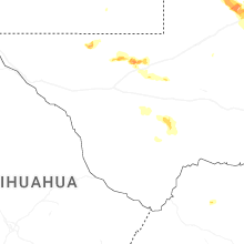
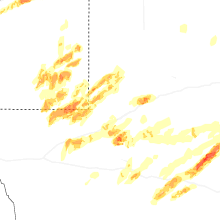
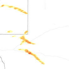
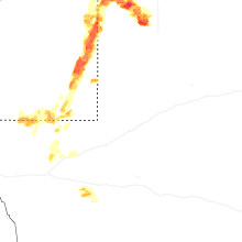
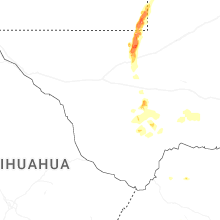


Connect with Interactive Hail Maps