

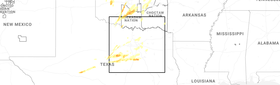
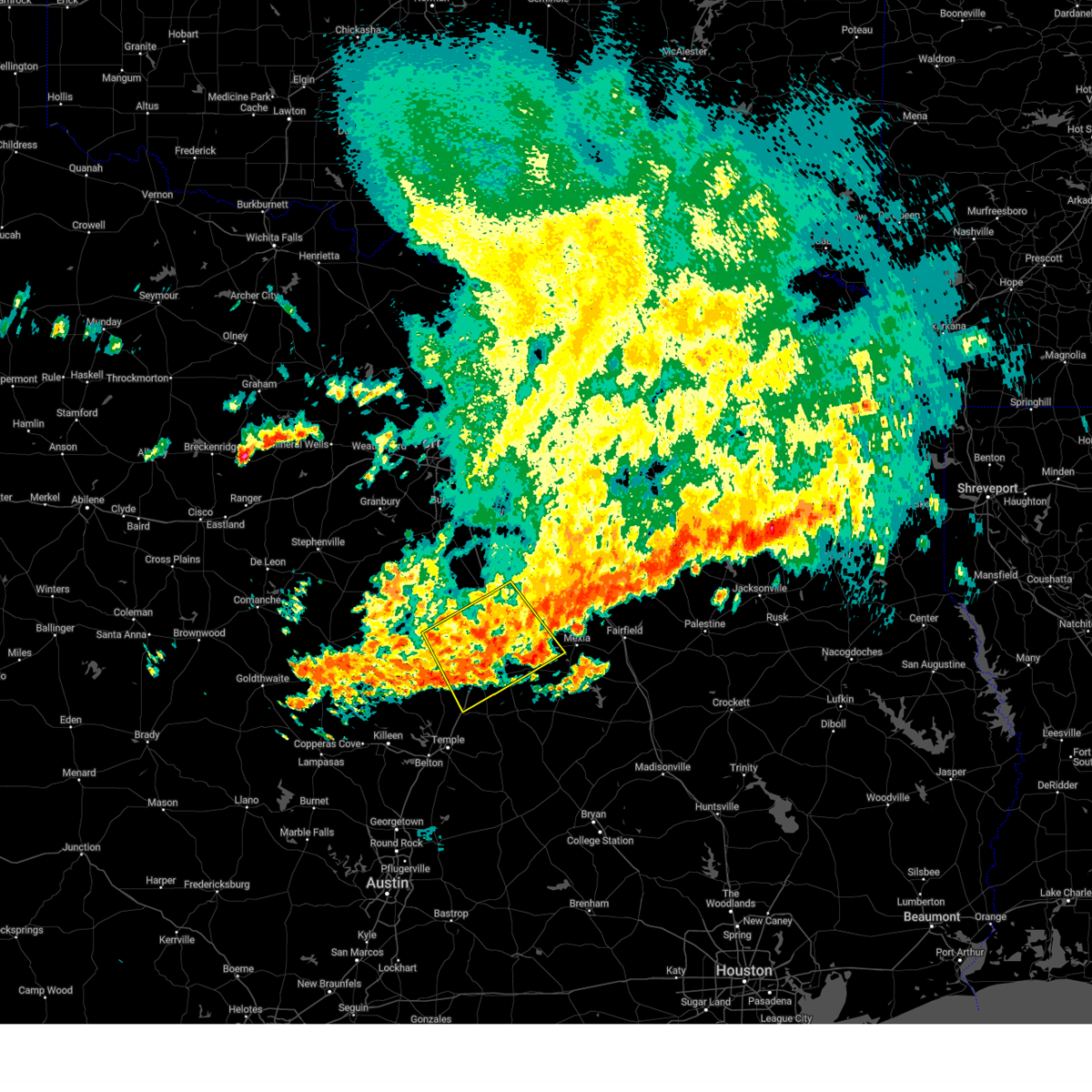
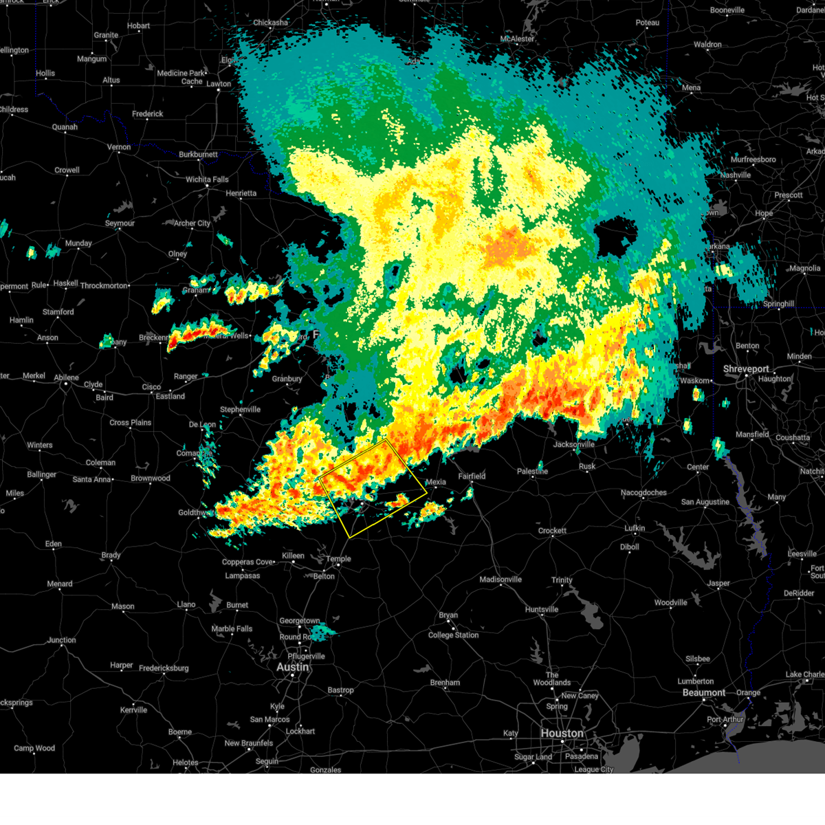
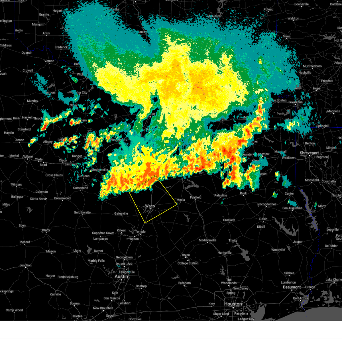
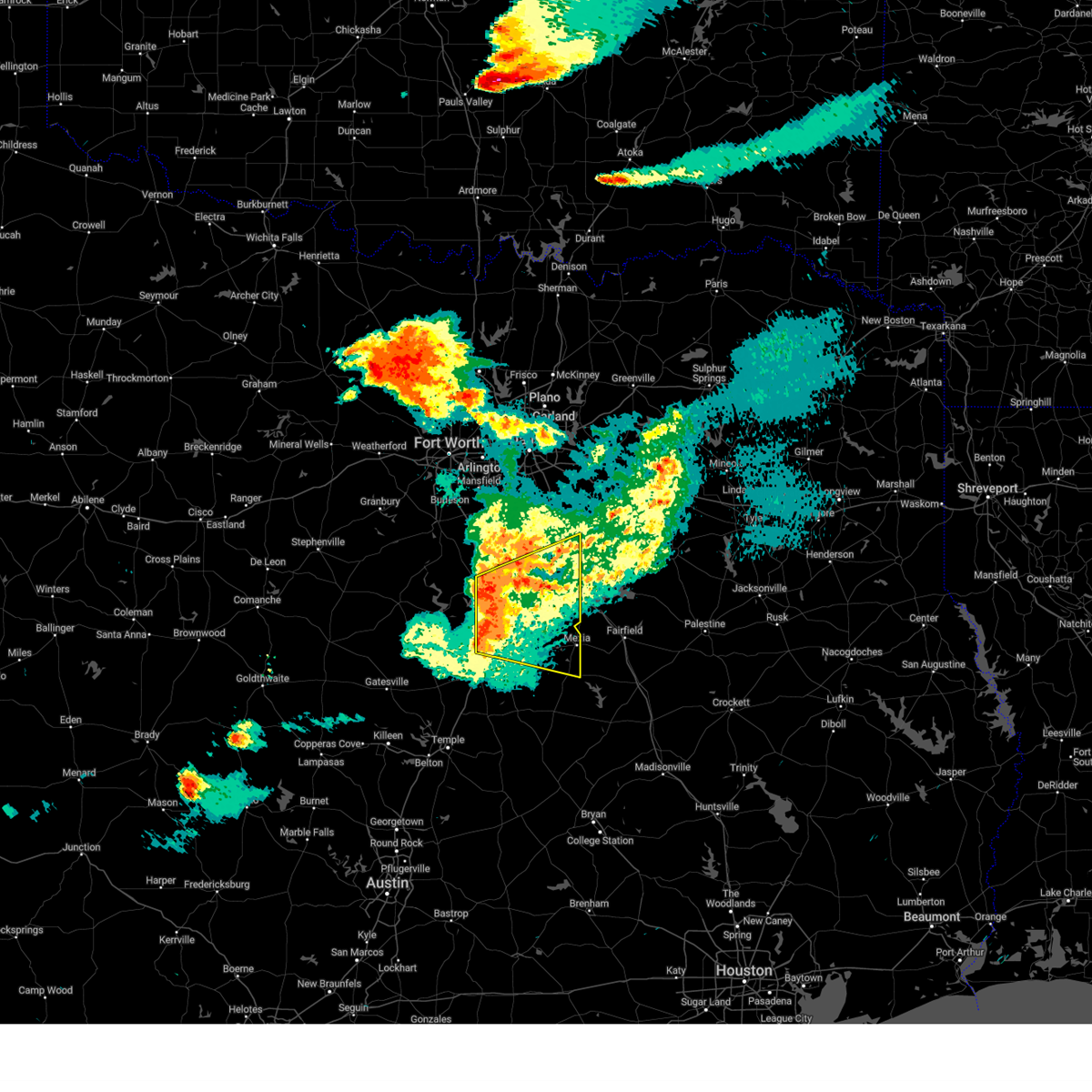
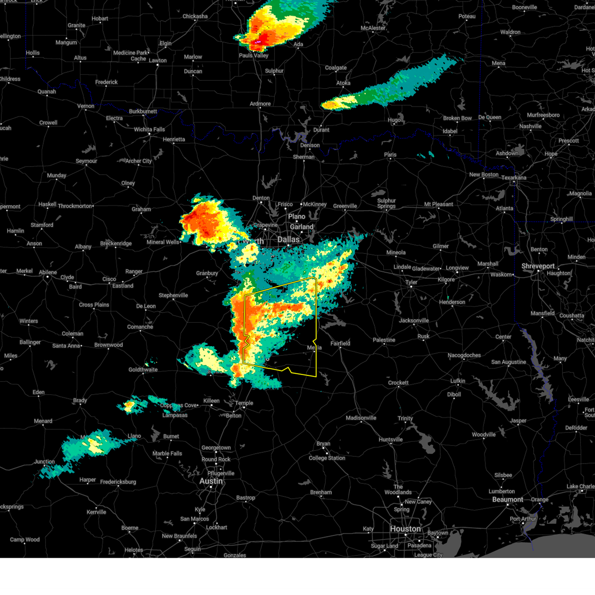
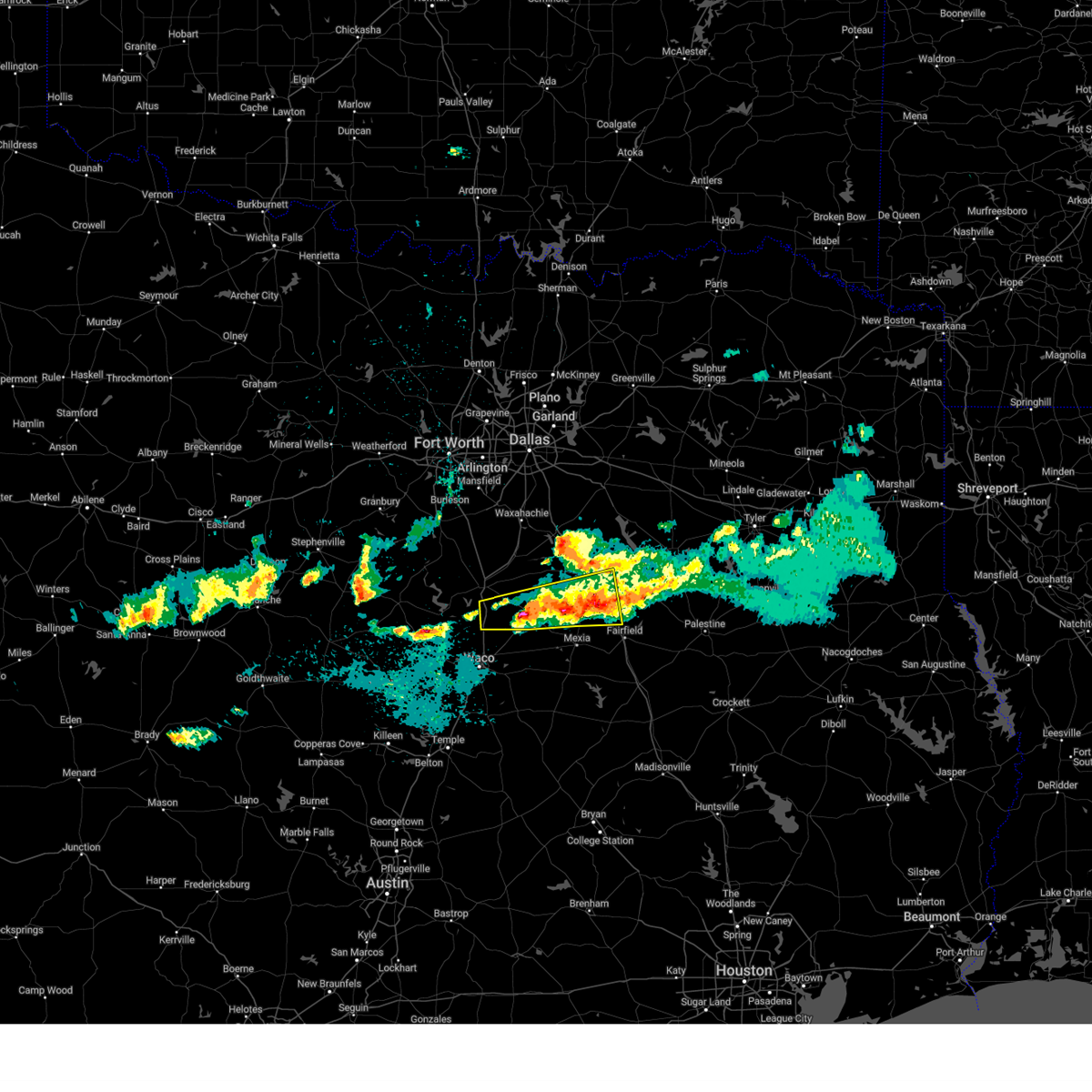
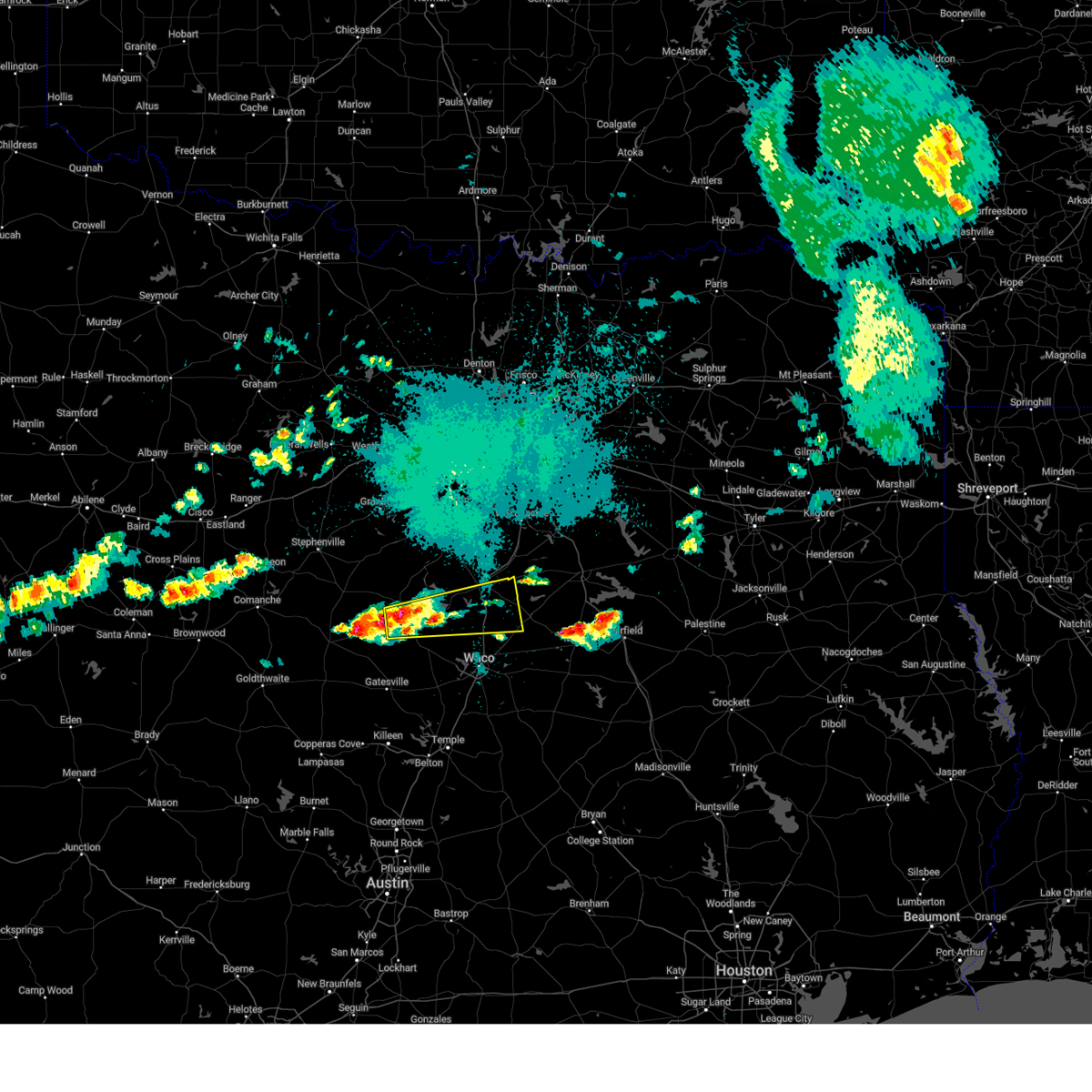
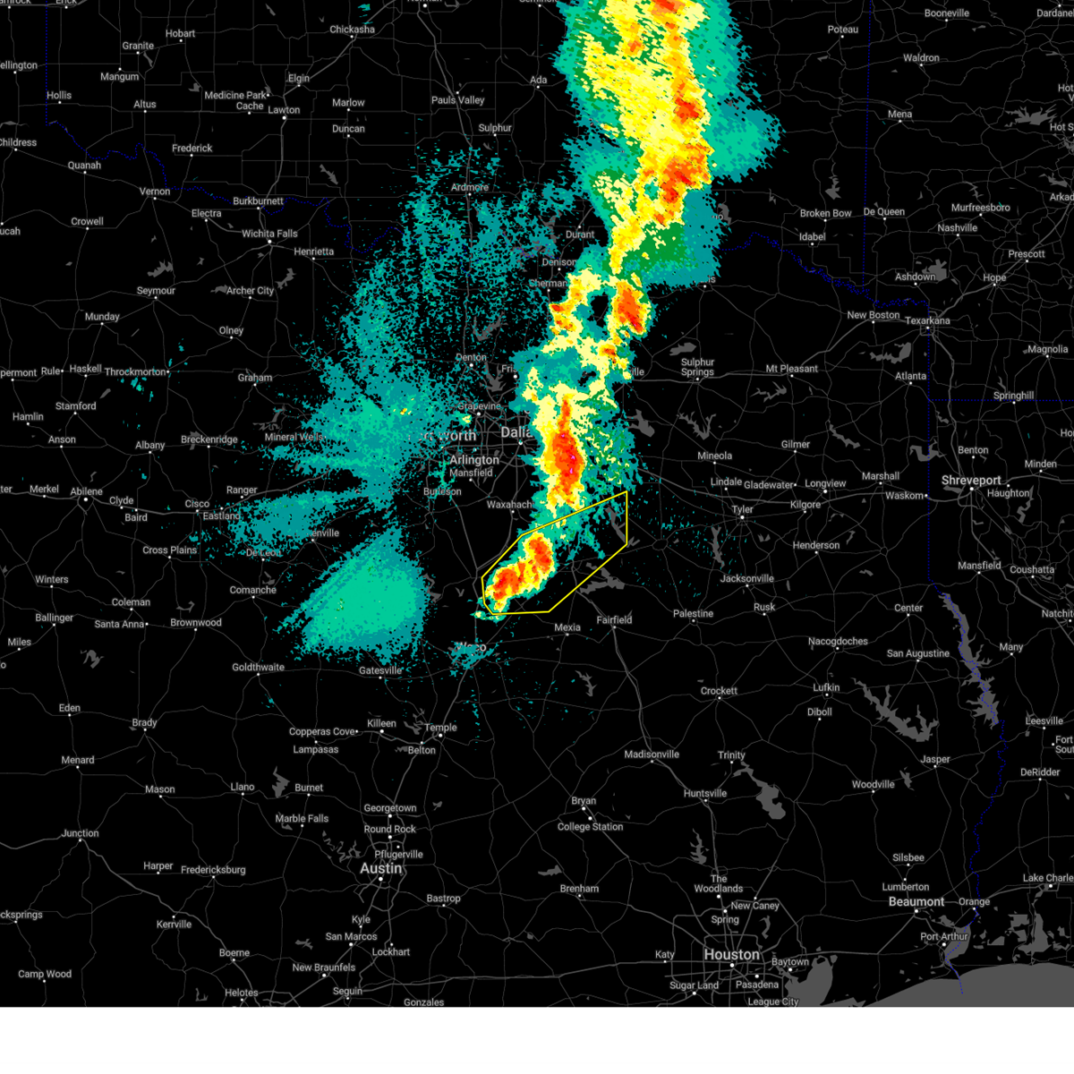
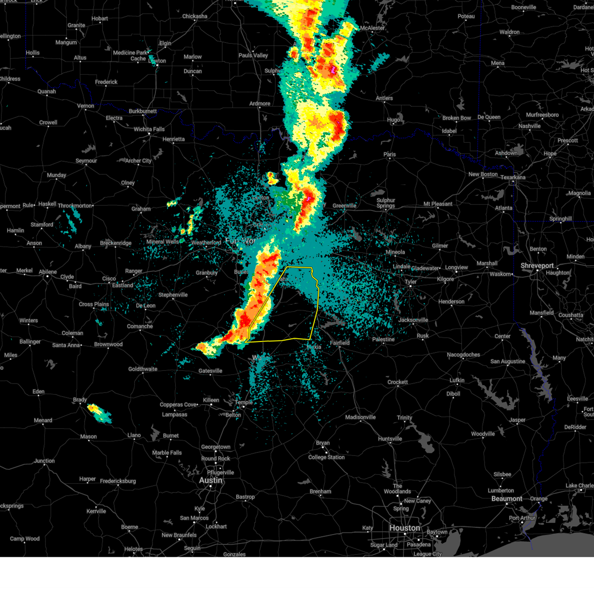
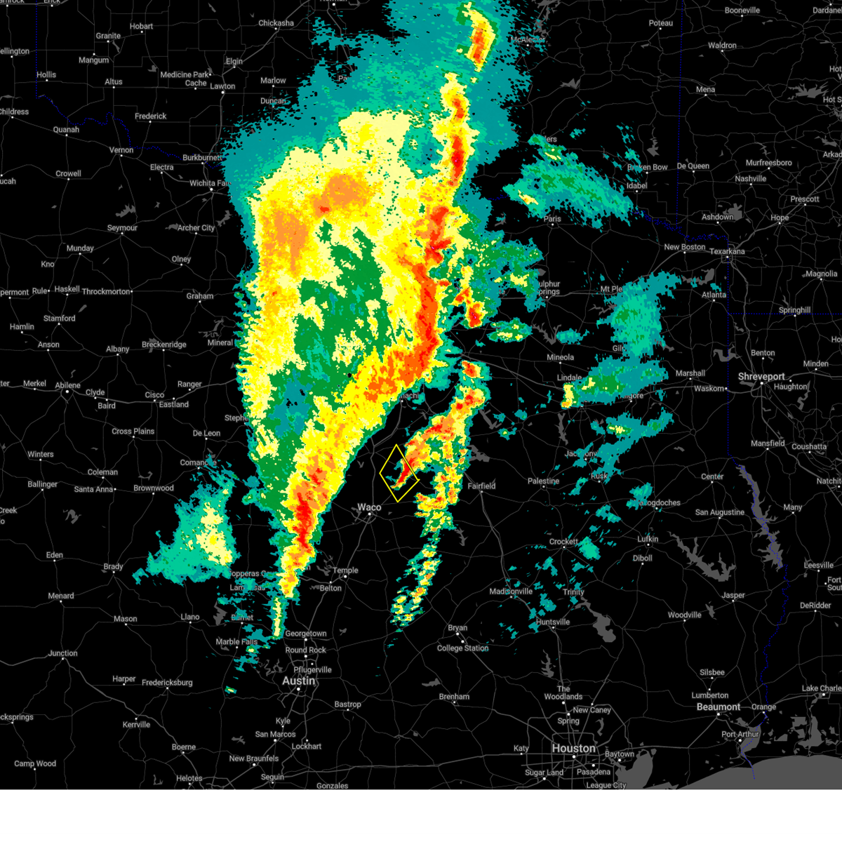
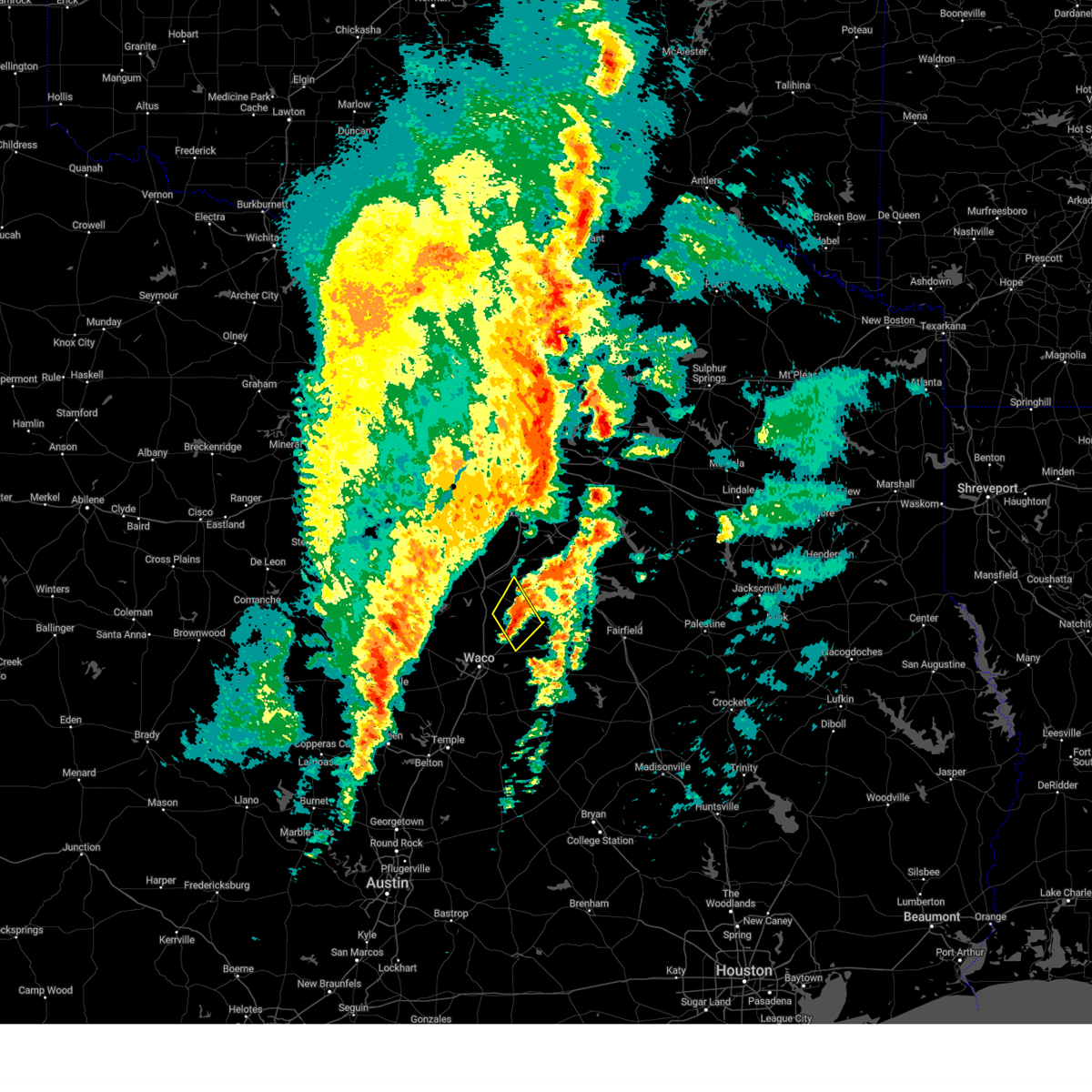
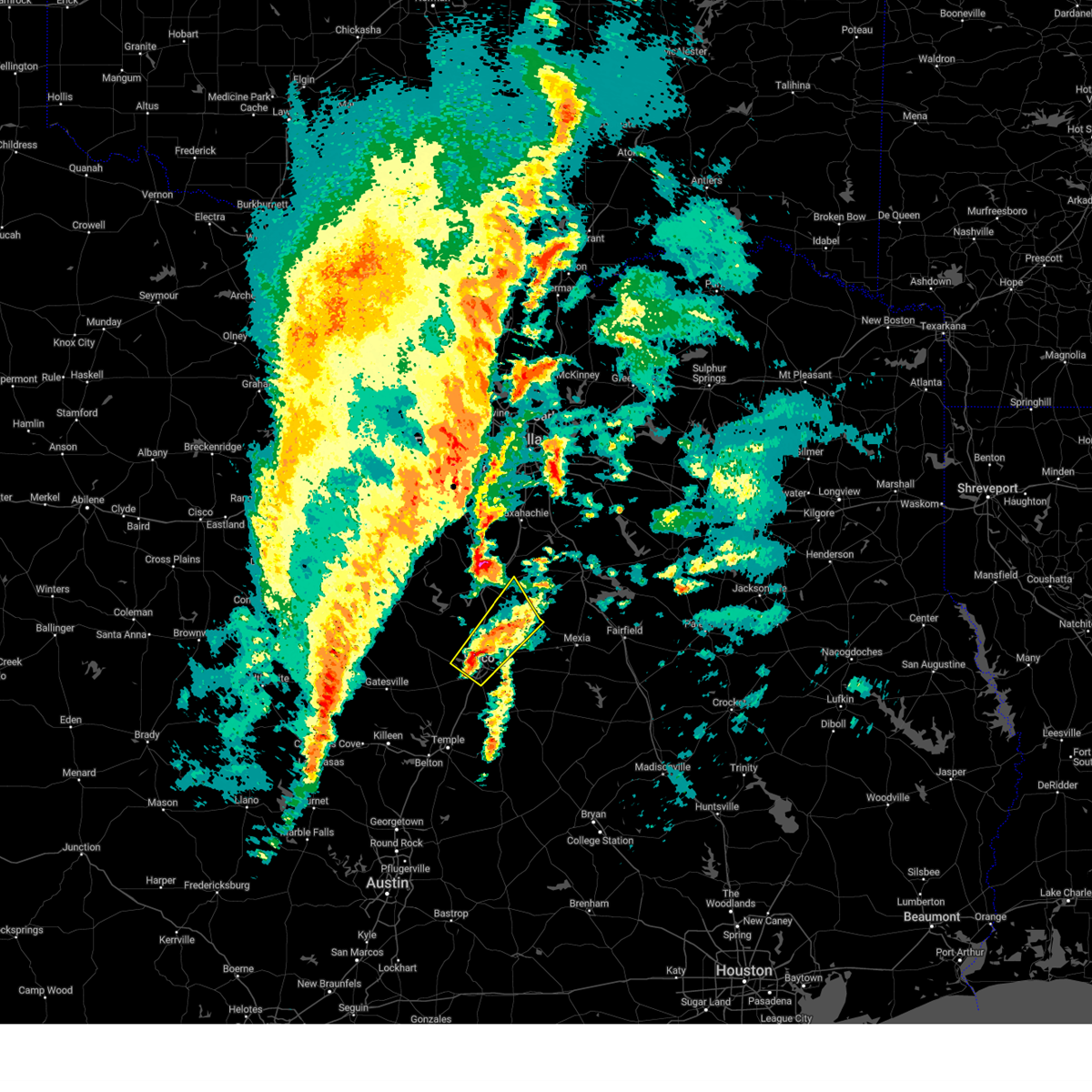
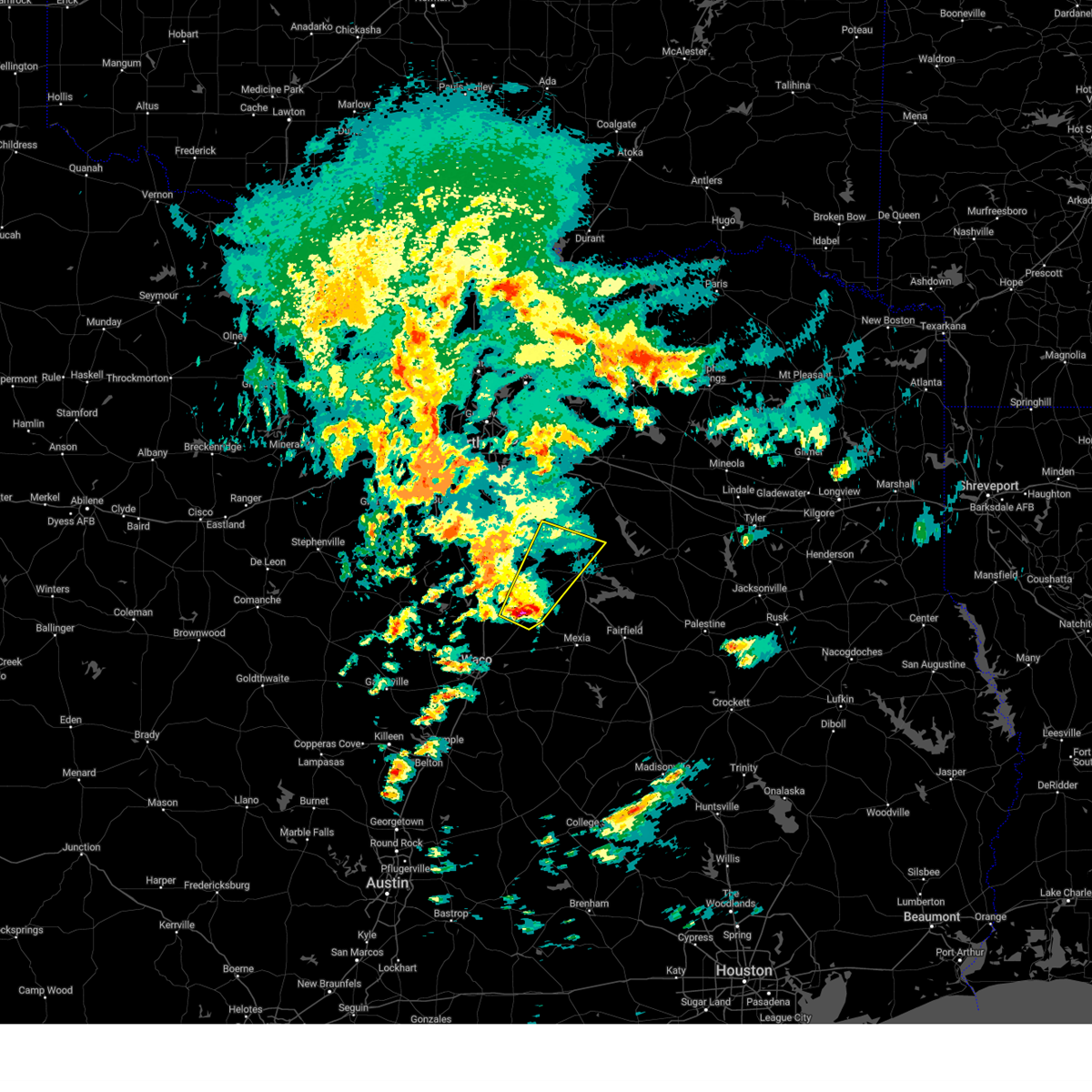
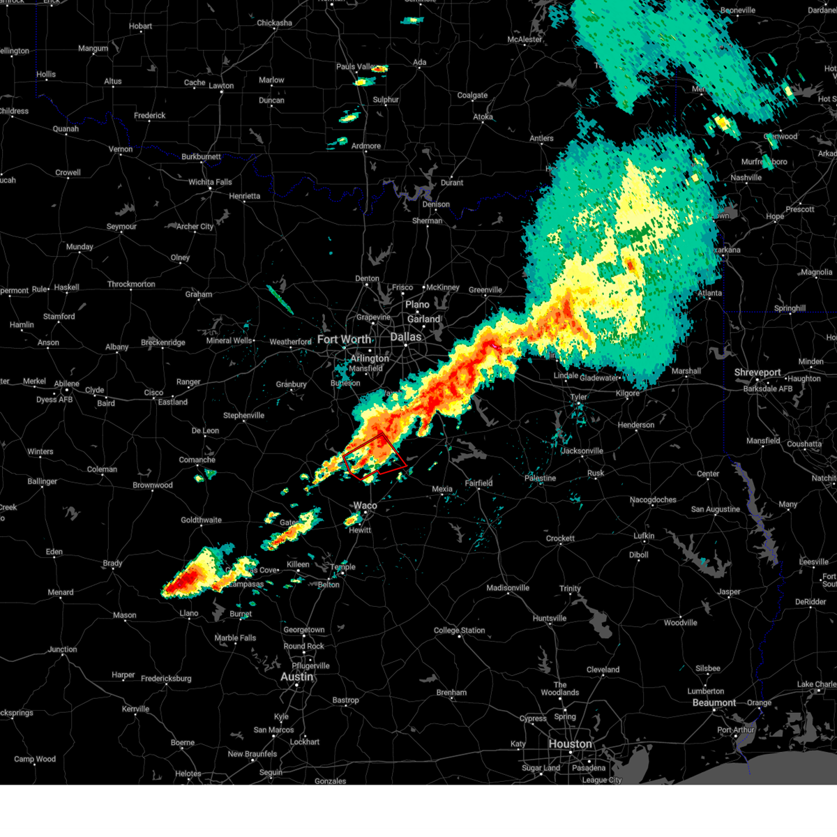
Hail Map for Penelope, TX
The Penelope, TX area has had 1 report of on-the-ground hail by trained spotters, and has been under severe weather warnings 31 times during the past 12 months. Doppler radar has detected hail at or near Penelope, TX on 63 occasions, including 6 occasions during the past year.
| Name: | Penelope, TX |
| Where Located: | 64 miles S of Dallas, TX |
| Map: | Google Map for Penelope, TX |
| Population: | 198 |
| Housing Units: | 100 |
| More Info: | Search Google for Penelope, TX |
1
The Top Recent Hail Date for Penelope, TX is Saturday, March 29, 2025 (15th out of 63)
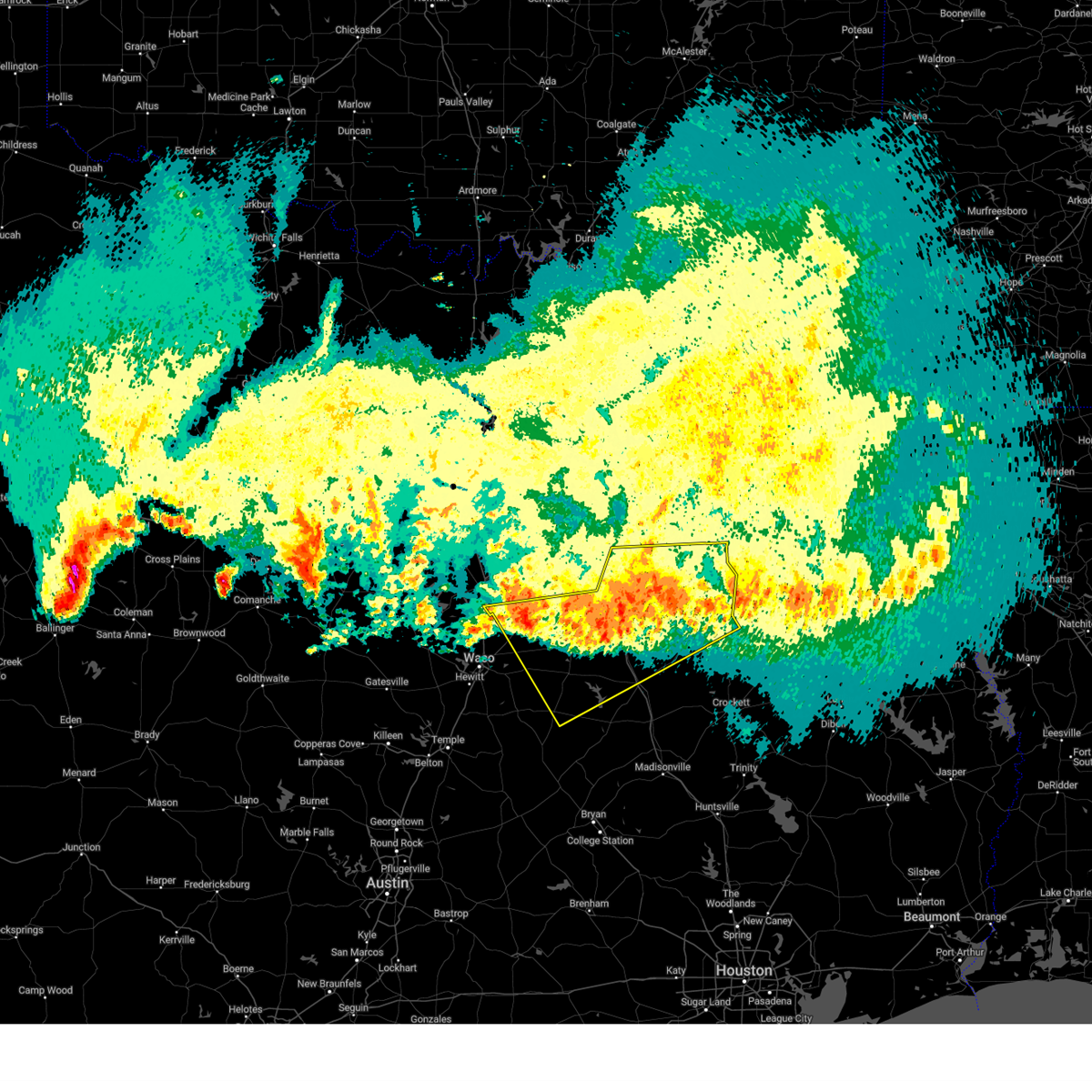
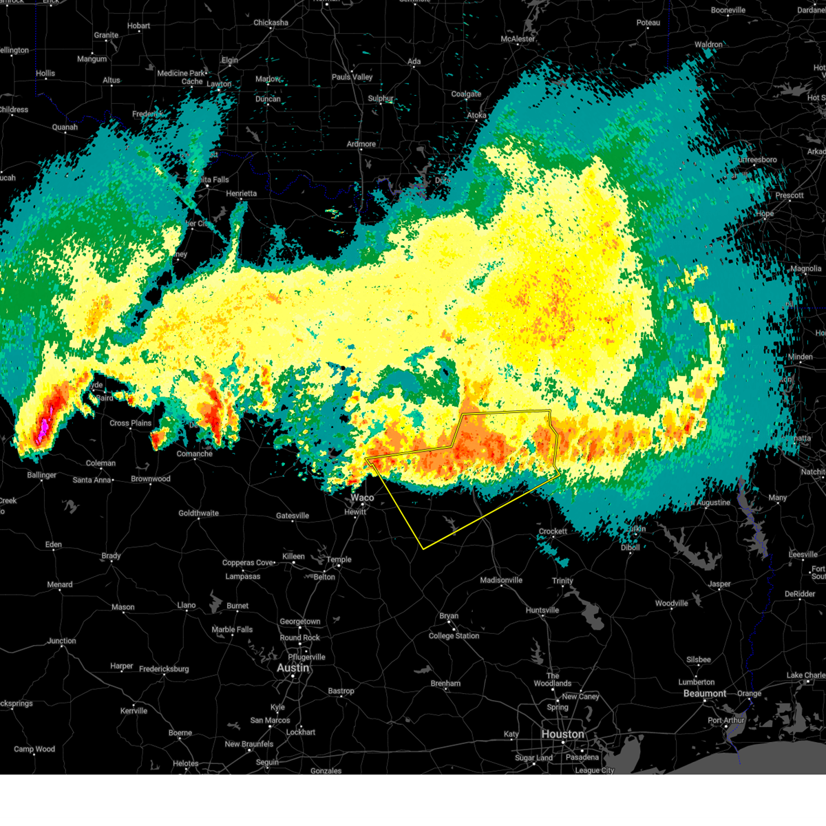
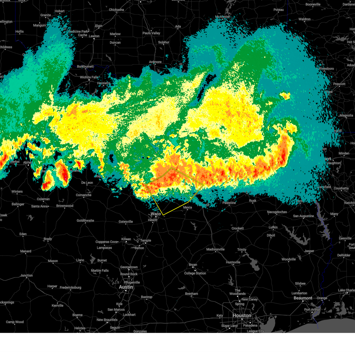
Hail and Wind Damage Spotted near Penelope, TX
| Date / Time | Report Details |
|---|---|
| 6/9/2025 1:30 AM CDT |
 the severe thunderstorm warning has been cancelled and is no longer in effect the severe thunderstorm warning has been cancelled and is no longer in effect
|
| 6/9/2025 1:17 AM CDT |
 the severe thunderstorm warning has been cancelled and is no longer in effect the severe thunderstorm warning has been cancelled and is no longer in effect
|
| 6/9/2025 1:17 AM CDT |
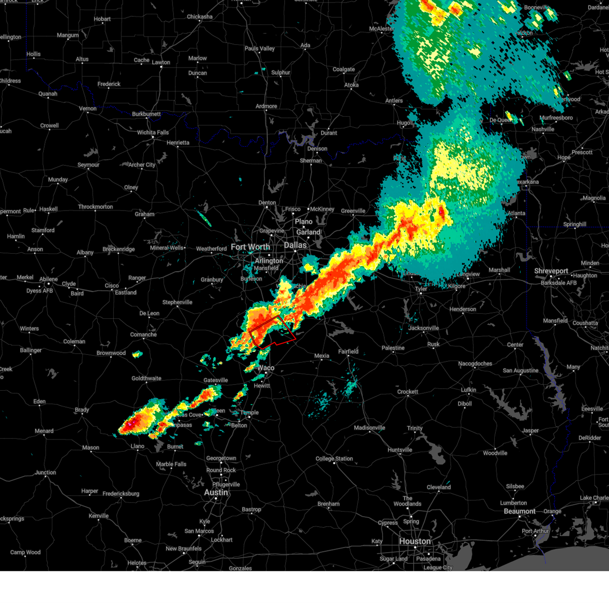
 At 116 am cdt, severe thunderstorms were located along a line extending from near lake palestine to near trinidad lake to 8 miles south of richland-chambers reservoir to near west, moving southeast at 30 mph (radar indicated). Hazards include 60 mph wind gusts and nickel size hail. Expect damage to roofs, siding, and trees. Locations impacted include, bradford, malakoff, streetman, donie, richland, poynor, fairfield lake, cayuga, lake mexia, cross roads, trinidad, oletha, bethel, kirvin, purdon, lanely, brushy creek, richland-chambers reservoir, fort parker state park, and mount calm. At 116 am cdt, severe thunderstorms were located along a line extending from near lake palestine to near trinidad lake to 8 miles south of richland-chambers reservoir to near west, moving southeast at 30 mph (radar indicated). Hazards include 60 mph wind gusts and nickel size hail. Expect damage to roofs, siding, and trees. Locations impacted include, bradford, malakoff, streetman, donie, richland, poynor, fairfield lake, cayuga, lake mexia, cross roads, trinidad, oletha, bethel, kirvin, purdon, lanely, brushy creek, richland-chambers reservoir, fort parker state park, and mount calm.
|
| 6/9/2025 1:02 AM CDT |
 Svrfwd the national weather service in fort worth has issued a * severe thunderstorm warning for, freestone county in central texas, southern kaufman county in north central texas, southern van zandt county in north central texas, northwestern leon county in central texas, henderson county in central texas, limestone county in central texas, southeastern hill county in central texas, anderson county in central texas, navarro county in north central texas, * until 215 am cdt. * at 102 am cdt, severe thunderstorms were located along a line extending from near kemp to near kerens to 8 miles northeast of wortham to 7 miles west of west, moving southeast at 45 mph (radar indicated). Hazards include 70 mph wind gusts and nickel size hail. Expect considerable tree damage. Damage is likely to mobile homes, roofs, and outbuildings. Svrfwd the national weather service in fort worth has issued a * severe thunderstorm warning for, freestone county in central texas, southern kaufman county in north central texas, southern van zandt county in north central texas, northwestern leon county in central texas, henderson county in central texas, limestone county in central texas, southeastern hill county in central texas, anderson county in central texas, navarro county in north central texas, * until 215 am cdt. * at 102 am cdt, severe thunderstorms were located along a line extending from near kemp to near kerens to 8 miles northeast of wortham to 7 miles west of west, moving southeast at 45 mph (radar indicated). Hazards include 70 mph wind gusts and nickel size hail. Expect considerable tree damage. Damage is likely to mobile homes, roofs, and outbuildings.
|
| 6/9/2025 12:55 AM CDT |
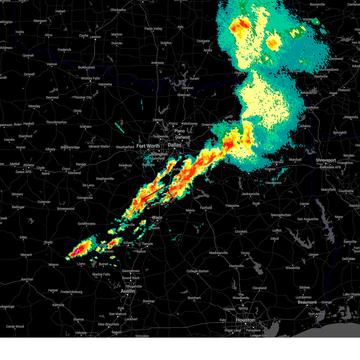
 At 1255 am cdt, severe thunderstorms were located along a line extending from 6 miles east of alma to near corsicana to 6 miles east of west, moving east at 40 mph (radar indicated). Hazards include 70 mph wind gusts and nickel size hail. Expect considerable tree damage. damage is likely to mobile homes, roofs, and outbuildings. Locations impacted include, dawson, malone, oak valley, watt, dresden, corsicana, irene, richland, corbet, aquilla lake, mildred, navarro mills lake, retreat, goodlow, navarro mills, angus, rice, purdon, mustang, and birome. At 1255 am cdt, severe thunderstorms were located along a line extending from 6 miles east of alma to near corsicana to 6 miles east of west, moving east at 40 mph (radar indicated). Hazards include 70 mph wind gusts and nickel size hail. Expect considerable tree damage. damage is likely to mobile homes, roofs, and outbuildings. Locations impacted include, dawson, malone, oak valley, watt, dresden, corsicana, irene, richland, corbet, aquilla lake, mildred, navarro mills lake, retreat, goodlow, navarro mills, angus, rice, purdon, mustang, and birome.
|
| 6/9/2025 12:55 AM CDT |
 the severe thunderstorm warning has been cancelled and is no longer in effect the severe thunderstorm warning has been cancelled and is no longer in effect
|
| 6/9/2025 12:29 AM CDT |
 Svrfwd the national weather service in fort worth has issued a * severe thunderstorm warning for, northeastern mclennan county in central texas, northwestern limestone county in central texas, hill county in central texas, southern ellis county in north central texas, navarro county in north central texas, * until 115 am cdt. * at 1229 am cdt, severe thunderstorms were located along a line extending from near palmer to near italy to near aquilla lake, moving east at 40 mph (radar indicated). Hazards include 70 mph wind gusts and quarter size hail. Hail damage to vehicles is expected. expect considerable tree damage. Wind damage is also likely to mobile homes, roofs, and outbuildings. Svrfwd the national weather service in fort worth has issued a * severe thunderstorm warning for, northeastern mclennan county in central texas, northwestern limestone county in central texas, hill county in central texas, southern ellis county in north central texas, navarro county in north central texas, * until 115 am cdt. * at 1229 am cdt, severe thunderstorms were located along a line extending from near palmer to near italy to near aquilla lake, moving east at 40 mph (radar indicated). Hazards include 70 mph wind gusts and quarter size hail. Hail damage to vehicles is expected. expect considerable tree damage. Wind damage is also likely to mobile homes, roofs, and outbuildings.
|
| 5/26/2025 5:50 AM CDT |
 The storm which prompted the warning has weakened below severe limits. therefore the warning will be allowed to expire. however gusty winds and heavy rain are still possible with this thunderstorm. The storm which prompted the warning has weakened below severe limits. therefore the warning will be allowed to expire. however gusty winds and heavy rain are still possible with this thunderstorm.
|
| 5/26/2025 5:36 AM CDT |
 At 536 am cdt, a severe thunderstorm was located near northcrest, or 7 miles northeast of lacy-lakeview, moving southeast at 35 mph (radar indicated). Hazards include 60 mph wind gusts. Expect damage to roofs, siding, and trees. this severe storm will be near, hallsburg around 540 am cdt. tradinghouse creek reservoir around 545 am cdt. mart around 555 am cdt. Other locations impacted by this severe thunderstorm include malone, birome, cayote, rock creek, watt, willow grove, elm mott, tours, mount calm, and penelope. At 536 am cdt, a severe thunderstorm was located near northcrest, or 7 miles northeast of lacy-lakeview, moving southeast at 35 mph (radar indicated). Hazards include 60 mph wind gusts. Expect damage to roofs, siding, and trees. this severe storm will be near, hallsburg around 540 am cdt. tradinghouse creek reservoir around 545 am cdt. mart around 555 am cdt. Other locations impacted by this severe thunderstorm include malone, birome, cayote, rock creek, watt, willow grove, elm mott, tours, mount calm, and penelope.
|
| 5/26/2025 5:03 AM CDT |
 Svrfwd the national weather service in fort worth has issued a * severe thunderstorm warning for, mclennan county in central texas, southeastern bosque county in central texas, northwestern limestone county in central texas, hill county in central texas, * until 600 am cdt. * at 503 am cdt, a severe thunderstorm was located near aquilla lake, or 10 miles southwest of hillsboro, moving southeast at 35 mph (radar indicated). Hazards include 65 mph wind gusts and quarter size hail. Hail damage to vehicles is expected. expect wind damage to roofs, siding, and trees. this severe thunderstorm will be near, west around 515 am cdt. hallsburg around 540 am cdt. tradinghouse creek reservoir around 545 am cdt. other locations impacted by this severe thunderstorm include malone, rock creek, watt, willow grove, irene, asa, prairie hill, gholson, aquilla, and peoria. this includes the following highways, interstate 35 between mile markers 316 and 369. interstate 35w between mile markers 1 and 4. Interstate 35e between mile markers 371 and 377. Svrfwd the national weather service in fort worth has issued a * severe thunderstorm warning for, mclennan county in central texas, southeastern bosque county in central texas, northwestern limestone county in central texas, hill county in central texas, * until 600 am cdt. * at 503 am cdt, a severe thunderstorm was located near aquilla lake, or 10 miles southwest of hillsboro, moving southeast at 35 mph (radar indicated). Hazards include 65 mph wind gusts and quarter size hail. Hail damage to vehicles is expected. expect wind damage to roofs, siding, and trees. this severe thunderstorm will be near, west around 515 am cdt. hallsburg around 540 am cdt. tradinghouse creek reservoir around 545 am cdt. other locations impacted by this severe thunderstorm include malone, rock creek, watt, willow grove, irene, asa, prairie hill, gholson, aquilla, and peoria. this includes the following highways, interstate 35 between mile markers 316 and 369. interstate 35w between mile markers 1 and 4. Interstate 35e between mile markers 371 and 377.
|
| 5/17/2025 6:06 PM CDT |
 the severe thunderstorm warning has been cancelled and is no longer in effect the severe thunderstorm warning has been cancelled and is no longer in effect
|
| 5/17/2025 6:06 PM CDT |
 At 605 pm cdt, a severe thunderstorm was located near bynum, or 11 miles southeast of hillsboro, moving east at 40 mph (radar indicated). Hazards include 60 mph wind gusts and quarter size hail. Hail damage to vehicles is expected. expect wind damage to roofs, siding, and trees. this severe storm will be near, hubbard around 615 pm cdt. navarro mills lake and dawson around 620 pm cdt. Other locations impacted by this severe thunderstorm include malone, oak valley, watt, dresden, irene, corbet, prairie hill, retreat, ross, and navarro mills. At 605 pm cdt, a severe thunderstorm was located near bynum, or 11 miles southeast of hillsboro, moving east at 40 mph (radar indicated). Hazards include 60 mph wind gusts and quarter size hail. Hail damage to vehicles is expected. expect wind damage to roofs, siding, and trees. this severe storm will be near, hubbard around 615 pm cdt. navarro mills lake and dawson around 620 pm cdt. Other locations impacted by this severe thunderstorm include malone, oak valley, watt, dresden, irene, corbet, prairie hill, retreat, ross, and navarro mills.
|
| 5/17/2025 5:41 PM CDT |
 Svrfwd the national weather service in fort worth has issued a * severe thunderstorm warning for, northeastern mclennan county in central texas, southeastern johnson county in north central texas, northwestern limestone county in central texas, hill county in central texas, central ellis county in north central texas, western navarro county in north central texas, * until 645 pm cdt. * at 541 pm cdt, severe thunderstorms were located along a line extending from near covington to near lake waco, moving east at 45 mph (radar indicated). Hazards include 60 mph wind gusts and quarter size hail. Hail damage to vehicles is expected. expect wind damage to roofs, siding, and trees. severe thunderstorms will be near, waco, aquilla lake, itasca, lacy-lakeview, grandview, hillsboro, and west around 545 pm cdt. bellmead, northcrest, and carl's corner around 550 pm cdt. bynum around 555 pm cdt. hallsburg and italy around 600 pm cdt. navarro mills lake and hubbard around 610 pm cdt. blooming grove, dawson, bardwell, and bardwell lake around 615 pm cdt. ennis, coolidge, and barry around 620 pm cdt. lake mexia and alma around 625 pm cdt. other locations impacted by these severe thunderstorms include oak valley, rock creek, avalon, osceola, howard, gholson, aquilla, retreat, peoria, and wiggins. this includes the following highways, interstate 35 between mile markers 333 and 369. interstate 35w between mile markers 1 and 17. interstate 35e between mile markers 371 and 397. Interstate 45 between mile markers 234 and 257. Svrfwd the national weather service in fort worth has issued a * severe thunderstorm warning for, northeastern mclennan county in central texas, southeastern johnson county in north central texas, northwestern limestone county in central texas, hill county in central texas, central ellis county in north central texas, western navarro county in north central texas, * until 645 pm cdt. * at 541 pm cdt, severe thunderstorms were located along a line extending from near covington to near lake waco, moving east at 45 mph (radar indicated). Hazards include 60 mph wind gusts and quarter size hail. Hail damage to vehicles is expected. expect wind damage to roofs, siding, and trees. severe thunderstorms will be near, waco, aquilla lake, itasca, lacy-lakeview, grandview, hillsboro, and west around 545 pm cdt. bellmead, northcrest, and carl's corner around 550 pm cdt. bynum around 555 pm cdt. hallsburg and italy around 600 pm cdt. navarro mills lake and hubbard around 610 pm cdt. blooming grove, dawson, bardwell, and bardwell lake around 615 pm cdt. ennis, coolidge, and barry around 620 pm cdt. lake mexia and alma around 625 pm cdt. other locations impacted by these severe thunderstorms include oak valley, rock creek, avalon, osceola, howard, gholson, aquilla, retreat, peoria, and wiggins. this includes the following highways, interstate 35 between mile markers 333 and 369. interstate 35w between mile markers 1 and 17. interstate 35e between mile markers 371 and 397. Interstate 45 between mile markers 234 and 257.
|
| 5/2/2025 2:31 PM CDT |
 Svrfwd the national weather service in fort worth has issued a * severe thunderstorm warning for, northeastern mclennan county in central texas, western limestone county in central texas, southeastern hill county in central texas, northeastern falls county in central texas, southwestern navarro county in north central texas, * until 330 pm cdt. * at 230 pm cdt, a severe thunderstorm was located over bynum, or near hillsboro, moving east at 30 mph (radar indicated). Hazards include 65 mph wind gusts and quarter size hail. Hail damage to vehicles is expected. expect wind damage to roofs, siding, and trees. this severe thunderstorm will be near, bynum around 235 pm cdt. navarro mills lake around 250 pm cdt. dawson and hubbard around 300 pm cdt. Other locations impacted by this severe thunderstorm include malone, birome, ben hur, watt, otto, mertens, brandon, tours, mount calm, and irene. Svrfwd the national weather service in fort worth has issued a * severe thunderstorm warning for, northeastern mclennan county in central texas, western limestone county in central texas, southeastern hill county in central texas, northeastern falls county in central texas, southwestern navarro county in north central texas, * until 330 pm cdt. * at 230 pm cdt, a severe thunderstorm was located over bynum, or near hillsboro, moving east at 30 mph (radar indicated). Hazards include 65 mph wind gusts and quarter size hail. Hail damage to vehicles is expected. expect wind damage to roofs, siding, and trees. this severe thunderstorm will be near, bynum around 235 pm cdt. navarro mills lake around 250 pm cdt. dawson and hubbard around 300 pm cdt. Other locations impacted by this severe thunderstorm include malone, birome, ben hur, watt, otto, mertens, brandon, tours, mount calm, and irene.
|
| 3/30/2025 6:30 AM CDT |
 At 630 am cdt, a severe thunderstorm was located 8 miles east of west, or 15 miles northeast of lacy-lakeview, moving east at 45 mph (radar indicated). Hazards include ping pong ball size hail and 60 mph wind gusts. People and animals outdoors will be injured. expect hail damage to roofs, siding, windows, and vehicles. expect wind damage to roofs, siding, and trees. this severe storm will be near, hubbard around 635 am cdt. coolidge around 650 am cdt. wortham around 705 am cdt. Other locations impacted by this severe thunderstorm include malone, birome, tours, mount calm, tehuacana, richland, penelope, cotton gin, kirvin, and purdon. At 630 am cdt, a severe thunderstorm was located 8 miles east of west, or 15 miles northeast of lacy-lakeview, moving east at 45 mph (radar indicated). Hazards include ping pong ball size hail and 60 mph wind gusts. People and animals outdoors will be injured. expect hail damage to roofs, siding, windows, and vehicles. expect wind damage to roofs, siding, and trees. this severe storm will be near, hubbard around 635 am cdt. coolidge around 650 am cdt. wortham around 705 am cdt. Other locations impacted by this severe thunderstorm include malone, birome, tours, mount calm, tehuacana, richland, penelope, cotton gin, kirvin, and purdon.
|
| 3/30/2025 6:18 AM CDT |
 Svrfwd the national weather service in fort worth has issued a * severe thunderstorm warning for, northeastern mclennan county in central texas, west central freestone county in central texas, northwestern limestone county in central texas, southeastern hill county in central texas, southwestern navarro county in north central texas, * until 715 am cdt. * at 618 am cdt, a severe thunderstorm was located over west, or 13 miles south of hillsboro, moving east at 45 mph (radar indicated). Hazards include 60 mph wind gusts and quarter size hail. Hail damage to vehicles is expected. expect wind damage to roofs, siding, and trees. this severe thunderstorm will be near, hubbard around 635 am cdt. dawson around 645 am cdt. wortham around 700 am cdt. other locations impacted by this severe thunderstorm include malone, birome, tours, mount calm, tehuacana, richland, penelope, abbott, cotton gin, and silver city. this includes the following highways, interstate 35 between mile markers 349 and 360. Interstate 45 between mile markers 212 and 224. Svrfwd the national weather service in fort worth has issued a * severe thunderstorm warning for, northeastern mclennan county in central texas, west central freestone county in central texas, northwestern limestone county in central texas, southeastern hill county in central texas, southwestern navarro county in north central texas, * until 715 am cdt. * at 618 am cdt, a severe thunderstorm was located over west, or 13 miles south of hillsboro, moving east at 45 mph (radar indicated). Hazards include 60 mph wind gusts and quarter size hail. Hail damage to vehicles is expected. expect wind damage to roofs, siding, and trees. this severe thunderstorm will be near, hubbard around 635 am cdt. dawson around 645 am cdt. wortham around 700 am cdt. other locations impacted by this severe thunderstorm include malone, birome, tours, mount calm, tehuacana, richland, penelope, abbott, cotton gin, and silver city. this includes the following highways, interstate 35 between mile markers 349 and 360. Interstate 45 between mile markers 212 and 224.
|
| 3/30/2025 5:24 AM CDT |
 The storm which prompted the warning has weakened below severe limits. therefore the warning will be allowed to expire. however small hail and gusty winds are still possible with this thunderstorm. The storm which prompted the warning has weakened below severe limits. therefore the warning will be allowed to expire. however small hail and gusty winds are still possible with this thunderstorm.
|
| 3/30/2025 4:34 AM CDT |
 At 433 am cdt, a severe thunderstorm was located near west, or 10 miles south of hillsboro, moving east at 30 mph (radar indicated). Hazards include quarter size hail. Damage to vehicles is possible. Locations impacted include, abbott, malone, birome, west, aquilla, penelope, aquilla lake, tours, and mount calm. At 433 am cdt, a severe thunderstorm was located near west, or 10 miles south of hillsboro, moving east at 30 mph (radar indicated). Hazards include quarter size hail. Damage to vehicles is possible. Locations impacted include, abbott, malone, birome, west, aquilla, penelope, aquilla lake, tours, and mount calm.
|
| 3/30/2025 4:32 AM CDT |
 Svrfwd the national weather service in fort worth has issued a * severe thunderstorm warning for, north central mclennan county in central texas, northwestern freestone county in central texas, north central limestone county in central texas, southeastern hill county in central texas, southern navarro county in north central texas, * until 530 am cdt. * at 432 am cdt, severe thunderstorms were located along a line extending from hubbard to near aquilla lake, moving east at 45 mph (radar indicated). Hazards include quarter size hail. Damage to vehicles is possible. severe thunderstorms will be near, dawson, west, and hubbard around 435 am cdt. navarro mills lake around 440 am cdt. richland-chambers reservoir and angus around 500 am cdt. navarro around 510 am cdt. other locations impacted by these severe thunderstorms include mustang, malone, birome, oak valley, stewards mill, streetman, richland, corbet, penelope, and mildred. this includes the following highways, interstate 35 between mile markers 350 and 361. Interstate 45 between mile markers 206 and 228. Svrfwd the national weather service in fort worth has issued a * severe thunderstorm warning for, north central mclennan county in central texas, northwestern freestone county in central texas, north central limestone county in central texas, southeastern hill county in central texas, southern navarro county in north central texas, * until 530 am cdt. * at 432 am cdt, severe thunderstorms were located along a line extending from hubbard to near aquilla lake, moving east at 45 mph (radar indicated). Hazards include quarter size hail. Damage to vehicles is possible. severe thunderstorms will be near, dawson, west, and hubbard around 435 am cdt. navarro mills lake around 440 am cdt. richland-chambers reservoir and angus around 500 am cdt. navarro around 510 am cdt. other locations impacted by these severe thunderstorms include mustang, malone, birome, oak valley, stewards mill, streetman, richland, corbet, penelope, and mildred. this includes the following highways, interstate 35 between mile markers 350 and 361. Interstate 45 between mile markers 206 and 228.
|
| 3/30/2025 4:29 AM CDT |
 the severe thunderstorm warning has been cancelled and is no longer in effect the severe thunderstorm warning has been cancelled and is no longer in effect
|
| 3/30/2025 4:29 AM CDT |
 At 429 am cdt, a severe thunderstorm was located near west, or 10 miles south of hillsboro, moving east at 55 mph (radar indicated). Hazards include quarter size hail. Damage to vehicles is possible. This severe thunderstorm will remain over mainly rural areas of north central mclennan and southeastern hill counties, including the following locations, abbott, malone, birome, aquilla, tours, wiggins, penelope, mount calm, ross, and leroy. At 429 am cdt, a severe thunderstorm was located near west, or 10 miles south of hillsboro, moving east at 55 mph (radar indicated). Hazards include quarter size hail. Damage to vehicles is possible. This severe thunderstorm will remain over mainly rural areas of north central mclennan and southeastern hill counties, including the following locations, abbott, malone, birome, aquilla, tours, wiggins, penelope, mount calm, ross, and leroy.
|
| 3/30/2025 4:12 AM CDT |
 At 412 am cdt, severe thunderstorms were located along a line extending from near aquilla lake to 6 miles south of meridian state park, moving east at 30 mph (radar indicated). Hazards include quarter size hail. Damage to vehicles is possible. these severe storms will be near, lake whitney, aquilla lake, lake whitney state park, clifton, hillsboro, and laguna park around 420 am cdt. bynum around 435 am cdt. Other locations impacted by these severe thunderstorms include malone, birome, cayote, cedar shores, brandon, tours, penelope, abbott, womack, and lakewood harbor. At 412 am cdt, severe thunderstorms were located along a line extending from near aquilla lake to 6 miles south of meridian state park, moving east at 30 mph (radar indicated). Hazards include quarter size hail. Damage to vehicles is possible. these severe storms will be near, lake whitney, aquilla lake, lake whitney state park, clifton, hillsboro, and laguna park around 420 am cdt. bynum around 435 am cdt. Other locations impacted by these severe thunderstorms include malone, birome, cayote, cedar shores, brandon, tours, penelope, abbott, womack, and lakewood harbor.
|
| 3/30/2025 4:02 AM CDT |
 At 402 am cdt, severe thunderstorms were located along a line extending from near laguna park to cranfills gap, moving east at 35 mph (radar indicated). Hazards include half dollar size hail. Damage to vehicles is possible. these severe storms will be near, lake whitney, aquilla lake, clifton, and laguna park around 410 am cdt. west around 420 am cdt. Other locations impacted by these severe thunderstorms include malone, birome, cayote, cedar shores, brandon, tours, penelope, abbott, womack, and lakewood harbor. At 402 am cdt, severe thunderstorms were located along a line extending from near laguna park to cranfills gap, moving east at 35 mph (radar indicated). Hazards include half dollar size hail. Damage to vehicles is possible. these severe storms will be near, lake whitney, aquilla lake, clifton, and laguna park around 410 am cdt. west around 420 am cdt. Other locations impacted by these severe thunderstorms include malone, birome, cayote, cedar shores, brandon, tours, penelope, abbott, womack, and lakewood harbor.
|
| 3/30/2025 3:48 AM CDT |
 Svrfwd the national weather service in fort worth has issued a * severe thunderstorm warning for, north central mclennan county in central texas, central bosque county in central texas, southern hill county in central texas, * until 445 am cdt. * at 347 am cdt, severe thunderstorms were located along a line extending from near laguna park to 6 miles west of cranfills gap, moving east at 35 mph (radar indicated). Hazards include ping pong ball size hail. People and animals outdoors will be injured. expect damage to roofs, siding, windows, and vehicles. severe thunderstorms will be near, lake whitney, clifton, and laguna park around 355 am cdt. aquilla lake around 405 am cdt. west around 420 am cdt. other locations impacted by these severe thunderstorms include malone, birome, cayote, cedar shores, brandon, tours, penelope, abbott, womack, and lakewood harbor. This includes interstate 35 between mile markers 349 and 368. Svrfwd the national weather service in fort worth has issued a * severe thunderstorm warning for, north central mclennan county in central texas, central bosque county in central texas, southern hill county in central texas, * until 445 am cdt. * at 347 am cdt, severe thunderstorms were located along a line extending from near laguna park to 6 miles west of cranfills gap, moving east at 35 mph (radar indicated). Hazards include ping pong ball size hail. People and animals outdoors will be injured. expect damage to roofs, siding, windows, and vehicles. severe thunderstorms will be near, lake whitney, clifton, and laguna park around 355 am cdt. aquilla lake around 405 am cdt. west around 420 am cdt. other locations impacted by these severe thunderstorms include malone, birome, cayote, cedar shores, brandon, tours, penelope, abbott, womack, and lakewood harbor. This includes interstate 35 between mile markers 349 and 368.
|
| 3/30/2025 12:43 AM CDT |
 Svrfwd the national weather service in fort worth has issued a * severe thunderstorm warning for, southeastern kaufman county in north central texas, northwestern henderson county in central texas, southeastern hill county in central texas, southeastern ellis county in north central texas, navarro county in north central texas, * until 145 am cdt. * at 1243 am cdt, severe thunderstorms were located along a line extending from near bardwell lake to near corsicana to near hubbard, moving northeast at 50 mph (radar indicated). Hazards include 60 mph wind gusts and quarter size hail. Hail damage to vehicles is expected. expect wind damage to roofs, siding, and trees. severe thunderstorms will be near, navarro mills lake, ennis, corsicana, dawson, alma, hubbard, and lake halbert around 1250 am cdt. richland-chambers reservoir and angus around 1255 am cdt. navarro, tool, seven points, kerens, and flag lake around 105 am cdt. enchanted oaks, trinidad, gun barrel city, kemp, and cedar creek reservoir around 110 am cdt. mabank around 115 am cdt. other locations impacted by these severe thunderstorms include malone, oak valley, dresden, avalon, irene, tolosa, corbet, payne springs, mildred, and retreat. This includes interstate 45 between mile markers 221 and 249. Svrfwd the national weather service in fort worth has issued a * severe thunderstorm warning for, southeastern kaufman county in north central texas, northwestern henderson county in central texas, southeastern hill county in central texas, southeastern ellis county in north central texas, navarro county in north central texas, * until 145 am cdt. * at 1243 am cdt, severe thunderstorms were located along a line extending from near bardwell lake to near corsicana to near hubbard, moving northeast at 50 mph (radar indicated). Hazards include 60 mph wind gusts and quarter size hail. Hail damage to vehicles is expected. expect wind damage to roofs, siding, and trees. severe thunderstorms will be near, navarro mills lake, ennis, corsicana, dawson, alma, hubbard, and lake halbert around 1250 am cdt. richland-chambers reservoir and angus around 1255 am cdt. navarro, tool, seven points, kerens, and flag lake around 105 am cdt. enchanted oaks, trinidad, gun barrel city, kemp, and cedar creek reservoir around 110 am cdt. mabank around 115 am cdt. other locations impacted by these severe thunderstorms include malone, oak valley, dresden, avalon, irene, tolosa, corbet, payne springs, mildred, and retreat. This includes interstate 45 between mile markers 221 and 249.
|
| 3/29/2025 11:51 PM CDT |
 Svrfwd the national weather service in fort worth has issued a * severe thunderstorm warning for, north central mclennan county in central texas, central hill county in central texas, ellis county in north central texas, western navarro county in north central texas, * until 1245 am cdt. * at 1150 pm cdt, severe thunderstorms were located along a line extending from near cedar hill to near carl's corner to near aquilla lake, moving east at 35 mph (radar indicated). Hazards include 60 mph wind gusts and quarter size hail. Hail damage to vehicles is expected. expect wind damage to roofs, siding, and trees. severe thunderstorms will be near, red oak, carl's corner, hillsboro, italy, bynum, waxahachie, west, and lancaster around 1155 pm cdt. ferris around 1205 am cdt. ennis, bardwell, palmer, and bardwell lake around 1210 am cdt. navarro mills lake and blooming grove around 1215 am cdt. barry and hubbard around 1220 am cdt. dawson and alma around 1225 am cdt. corsicana around 1230 am cdt. other locations impacted by these severe thunderstorms include malone, oak valley, dresden, avalon, irene, corbet, rockett, howard, bristol, and aquilla. this includes the following highways, interstate 35 between mile markers 351 and 369. interstate 35w between mile markers 1 and 5. interstate 35e between mile markers 371 and 410. Interstate 45 between mile markers 232 and 266. Svrfwd the national weather service in fort worth has issued a * severe thunderstorm warning for, north central mclennan county in central texas, central hill county in central texas, ellis county in north central texas, western navarro county in north central texas, * until 1245 am cdt. * at 1150 pm cdt, severe thunderstorms were located along a line extending from near cedar hill to near carl's corner to near aquilla lake, moving east at 35 mph (radar indicated). Hazards include 60 mph wind gusts and quarter size hail. Hail damage to vehicles is expected. expect wind damage to roofs, siding, and trees. severe thunderstorms will be near, red oak, carl's corner, hillsboro, italy, bynum, waxahachie, west, and lancaster around 1155 pm cdt. ferris around 1205 am cdt. ennis, bardwell, palmer, and bardwell lake around 1210 am cdt. navarro mills lake and blooming grove around 1215 am cdt. barry and hubbard around 1220 am cdt. dawson and alma around 1225 am cdt. corsicana around 1230 am cdt. other locations impacted by these severe thunderstorms include malone, oak valley, dresden, avalon, irene, corbet, rockett, howard, bristol, and aquilla. this includes the following highways, interstate 35 between mile markers 351 and 369. interstate 35w between mile markers 1 and 5. interstate 35e between mile markers 371 and 410. Interstate 45 between mile markers 232 and 266.
|
| 3/4/2025 5:51 AM CST |
 The storm which prompted the warning has weakened below severe limits. therefore the warning will be allowed to expire. a tornado watch remains in effect until 1100 am cst for central texas. The storm which prompted the warning has weakened below severe limits. therefore the warning will be allowed to expire. a tornado watch remains in effect until 1100 am cst for central texas.
|
| 3/4/2025 5:42 AM CST |
 At 541 am cst, a severe thunderstorm was located 8 miles east of west, moving east at 50 mph (radar indicated). Hazards include 60 mph wind gusts and quarter size hail. Hail damage to vehicles is expected. expect wind damage to roofs, siding, and trees. this severe storm will be near, hubbard around 550 am cst. Other locations impacted by this severe thunderstorm include malone, birome, mount calm, irene, mertens, and penelope. At 541 am cst, a severe thunderstorm was located 8 miles east of west, moving east at 50 mph (radar indicated). Hazards include 60 mph wind gusts and quarter size hail. Hail damage to vehicles is expected. expect wind damage to roofs, siding, and trees. this severe storm will be near, hubbard around 550 am cst. Other locations impacted by this severe thunderstorm include malone, birome, mount calm, irene, mertens, and penelope.
|
| 3/4/2025 5:42 AM CST |
 the severe thunderstorm warning has been cancelled and is no longer in effect the severe thunderstorm warning has been cancelled and is no longer in effect
|
| 3/4/2025 5:20 AM CST |
 Svrfwd the national weather service in fort worth has issued a * severe thunderstorm warning for, northeastern mclennan county in central texas, northwestern limestone county in central texas, southeastern hill county in central texas, * until 600 am cst. * at 520 am cst, a severe thunderstorm was located over waco, moving northeast at 50 mph (radar indicated). Hazards include 60 mph wind gusts and quarter size hail. Hail damage to vehicles is expected. expect wind damage to roofs, siding, and trees. this severe thunderstorm will be near, waco, bellmead, lacy-lakeview, and northcrest around 525 am cst. hubbard around 550 am cst. other locations impacted by this severe thunderstorm include malone, birome, elm mott, mertens, tours, mount calm, irene, penelope, axtell, and wiggins. This includes interstate 35 between mile markers 329 and 355. Svrfwd the national weather service in fort worth has issued a * severe thunderstorm warning for, northeastern mclennan county in central texas, northwestern limestone county in central texas, southeastern hill county in central texas, * until 600 am cst. * at 520 am cst, a severe thunderstorm was located over waco, moving northeast at 50 mph (radar indicated). Hazards include 60 mph wind gusts and quarter size hail. Hail damage to vehicles is expected. expect wind damage to roofs, siding, and trees. this severe thunderstorm will be near, waco, bellmead, lacy-lakeview, and northcrest around 525 am cst. hubbard around 550 am cst. other locations impacted by this severe thunderstorm include malone, birome, elm mott, mertens, tours, mount calm, irene, penelope, axtell, and wiggins. This includes interstate 35 between mile markers 329 and 355.
|
| 12/26/2024 10:26 AM CST |
 Svrfwd the national weather service in fort worth has issued a * severe thunderstorm warning for, southeastern hill county in central texas, central ellis county in north central texas, western navarro county in north central texas, * until 1115 am cst. * at 1025 am cst, a severe thunderstorm was located over hubbard, or 18 miles southeast of hillsboro, moving northeast at 55 mph (radar indicated). Hazards include quarter size hail. damage to vehicles is possible Svrfwd the national weather service in fort worth has issued a * severe thunderstorm warning for, southeastern hill county in central texas, central ellis county in north central texas, western navarro county in north central texas, * until 1115 am cst. * at 1025 am cst, a severe thunderstorm was located over hubbard, or 18 miles southeast of hillsboro, moving northeast at 55 mph (radar indicated). Hazards include quarter size hail. damage to vehicles is possible
|
| 6/2/2024 8:55 PM CDT |
 The storm that prompted the warning has weakened below severe limits, but small hail, gusty winds, and heavy rain are still possible in southeastern portions of hill county. The storm that prompted the warning has weakened below severe limits, but small hail, gusty winds, and heavy rain are still possible in southeastern portions of hill county.
|
| 6/2/2024 8:44 PM CDT |
 At 844 pm cdt, a severe thunderstorm was located near bynum, or 11 miles southeast of hillsboro, moving southeast at 25 mph (radar indicated). Hazards include 60 mph wind gusts and quarter size hail. Hail damage to vehicles is expected. Expect wind damage to roofs, siding, and trees. At 844 pm cdt, a severe thunderstorm was located near bynum, or 11 miles southeast of hillsboro, moving southeast at 25 mph (radar indicated). Hazards include 60 mph wind gusts and quarter size hail. Hail damage to vehicles is expected. Expect wind damage to roofs, siding, and trees.
|
| 6/2/2024 7:58 PM CDT |
 Svrfwd the national weather service in fort worth has issued a * severe thunderstorm warning for, hill county in central texas, * until 900 pm cdt. * at 758 pm cdt, a severe thunderstorm was located near hillsboro, moving east at 15 mph (radar indicated). Hazards include 60 mph wind gusts and half dollar size hail. Hail damage to vehicles is expected. expect wind damage to roofs, siding, and trees. this severe thunderstorm will be near, hillsboro around 805 pm cdt. Carl's corner around 810 pm cdt. Svrfwd the national weather service in fort worth has issued a * severe thunderstorm warning for, hill county in central texas, * until 900 pm cdt. * at 758 pm cdt, a severe thunderstorm was located near hillsboro, moving east at 15 mph (radar indicated). Hazards include 60 mph wind gusts and half dollar size hail. Hail damage to vehicles is expected. expect wind damage to roofs, siding, and trees. this severe thunderstorm will be near, hillsboro around 805 pm cdt. Carl's corner around 810 pm cdt.
|
| 5/30/2024 3:20 PM CDT |
 Svrfwd the national weather service in fort worth has issued a * severe thunderstorm warning for, northeastern mclennan county in central texas, east central bosque county in central texas, northwestern limestone county in central texas, hill county in central texas, southwestern ellis county in north central texas, southwestern navarro county in north central texas, * until 415 pm cdt. * at 318 pm cdt, a line of severe thunderstorms was located from whitney to hillsboro to milford, moving southeast at 25 mph (radar indicated). Hazards include 65 mph wind gusts and quarter size hail. Hail damage to vehicles is expected. expect wind damage to roofs, siding, and trees. this severe thunderstorm will be near, hillsboro and aquilla lake around 325 pm cdt. other locations impacted by this severe thunderstorm include malone, rock creek, watt, dresden, avalon, irene, prairie hill, gholson, aquilla, and peoria. this includes the following highways, interstate 35 between mile markers 331 and 369. interstate 35w between mile markers 1 and 2. Interstate 35e between mile markers 371 and 385. Svrfwd the national weather service in fort worth has issued a * severe thunderstorm warning for, northeastern mclennan county in central texas, east central bosque county in central texas, northwestern limestone county in central texas, hill county in central texas, southwestern ellis county in north central texas, southwestern navarro county in north central texas, * until 415 pm cdt. * at 318 pm cdt, a line of severe thunderstorms was located from whitney to hillsboro to milford, moving southeast at 25 mph (radar indicated). Hazards include 65 mph wind gusts and quarter size hail. Hail damage to vehicles is expected. expect wind damage to roofs, siding, and trees. this severe thunderstorm will be near, hillsboro and aquilla lake around 325 pm cdt. other locations impacted by this severe thunderstorm include malone, rock creek, watt, dresden, avalon, irene, prairie hill, gholson, aquilla, and peoria. this includes the following highways, interstate 35 between mile markers 331 and 369. interstate 35w between mile markers 1 and 2. Interstate 35e between mile markers 371 and 385.
|
| 5/24/2024 8:19 PM CDT |
 Svrfwd the national weather service in fort worth has issued a * severe thunderstorm warning for, northwestern freestone county in central texas, northern limestone county in central texas, southeastern hill county in central texas, southern navarro county in north central texas, * until 915 pm cdt. * at 819 pm cdt, a severe thunderstorm was located over dawson, or 19 miles southwest of corsicana, moving east at 30 mph (radar indicated). Hazards include 60 mph wind gusts and quarter size hail. Hail damage to vehicles is expected. expect wind damage to roofs, siding, and trees. this severe thunderstorm will be near, wortham around 845 pm cdt. other locations impacted by this severe thunderstorm include malone, mustang, oak valley, dresden, mount calm, stewards mill, irene, streetman, tehuacana, and richland. This includes interstate 45 between mile markers 200 and 227. Svrfwd the national weather service in fort worth has issued a * severe thunderstorm warning for, northwestern freestone county in central texas, northern limestone county in central texas, southeastern hill county in central texas, southern navarro county in north central texas, * until 915 pm cdt. * at 819 pm cdt, a severe thunderstorm was located over dawson, or 19 miles southwest of corsicana, moving east at 30 mph (radar indicated). Hazards include 60 mph wind gusts and quarter size hail. Hail damage to vehicles is expected. expect wind damage to roofs, siding, and trees. this severe thunderstorm will be near, wortham around 845 pm cdt. other locations impacted by this severe thunderstorm include malone, mustang, oak valley, dresden, mount calm, stewards mill, irene, streetman, tehuacana, and richland. This includes interstate 45 between mile markers 200 and 227.
|
| 5/22/2024 11:25 PM CDT |
 Svrfwd the national weather service in fort worth has issued a * severe thunderstorm warning for, northwestern freestone county in central texas, southeastern hill county in central texas, southern navarro county in north central texas, * until 1230 am cdt. * at 1125 pm cdt, a severe thunderstorm was located near navarro mills lake, or 15 miles east of hillsboro, moving east at 30 mph (radar indicated). Hazards include half dollar size hail. damage to vehicles is possible Svrfwd the national weather service in fort worth has issued a * severe thunderstorm warning for, northwestern freestone county in central texas, southeastern hill county in central texas, southern navarro county in north central texas, * until 1230 am cdt. * at 1125 pm cdt, a severe thunderstorm was located near navarro mills lake, or 15 miles east of hillsboro, moving east at 30 mph (radar indicated). Hazards include half dollar size hail. damage to vehicles is possible
|
| 5/22/2024 11:03 PM CDT |
 At 1103 pm cdt, a severe thunderstorm was located over bynum, or 7 miles southeast of hillsboro, moving east at 25 mph (radar indicated). Hazards include ping pong ball size hail. People and animals outdoors will be injured. expect damage to roofs, siding, windows, and vehicles. Locations impacted include, hillsboro, hubbard, blooming grove, dawson, bynum, aquilla lake, navarro mills lake, frost, abbott, malone, penelope, mertens, dresden, brandon, irene, silver city, pelham, navarro mills, and purdon. At 1103 pm cdt, a severe thunderstorm was located over bynum, or 7 miles southeast of hillsboro, moving east at 25 mph (radar indicated). Hazards include ping pong ball size hail. People and animals outdoors will be injured. expect damage to roofs, siding, windows, and vehicles. Locations impacted include, hillsboro, hubbard, blooming grove, dawson, bynum, aquilla lake, navarro mills lake, frost, abbott, malone, penelope, mertens, dresden, brandon, irene, silver city, pelham, navarro mills, and purdon.
|
| 5/22/2024 11:03 PM CDT |
 the severe thunderstorm warning has been cancelled and is no longer in effect the severe thunderstorm warning has been cancelled and is no longer in effect
|
| 5/22/2024 10:33 PM CDT |
 Svrfwd the national weather service in fort worth has issued a * severe thunderstorm warning for, central hill county in central texas, southwestern ellis county in north central texas, southwestern navarro county in north central texas, * until 1130 pm cdt. * at 1032 pm cdt, a severe thunderstorm was located over aquilla lake, or 7 miles southwest of hillsboro, moving east at 30 mph (radar indicated). Hazards include half dollar size hail. damage to vehicles is possible Svrfwd the national weather service in fort worth has issued a * severe thunderstorm warning for, central hill county in central texas, southwestern ellis county in north central texas, southwestern navarro county in north central texas, * until 1130 pm cdt. * at 1032 pm cdt, a severe thunderstorm was located over aquilla lake, or 7 miles southwest of hillsboro, moving east at 30 mph (radar indicated). Hazards include half dollar size hail. damage to vehicles is possible
|
| 5/22/2024 9:41 PM CDT |
 the severe thunderstorm warning has been cancelled and is no longer in effect the severe thunderstorm warning has been cancelled and is no longer in effect
|
| 5/22/2024 9:41 PM CDT |
 At 940 pm cdt, a severe thunderstorm was located near bynum, or 13 miles southeast of hillsboro, moving east at 40 mph (radar indicated). Hazards include quarter size hail. Damage to vehicles is possible. this severe storm will be near, navarro mills lake around 945 pm cdt. hubbard around 950 pm cdt. dawson around 955 pm cdt. Other locations impacted by this severe thunderstorm include malone, birome, silver city, dresden, pelham, irene, penelope, navarro mills, and purdon. At 940 pm cdt, a severe thunderstorm was located near bynum, or 13 miles southeast of hillsboro, moving east at 40 mph (radar indicated). Hazards include quarter size hail. Damage to vehicles is possible. this severe storm will be near, navarro mills lake around 945 pm cdt. hubbard around 950 pm cdt. dawson around 955 pm cdt. Other locations impacted by this severe thunderstorm include malone, birome, silver city, dresden, pelham, irene, penelope, navarro mills, and purdon.
|
| 5/22/2024 9:29 PM CDT |
 Svrfwd the national weather service in fort worth has issued a * severe thunderstorm warning for, north central mclennan county in central texas, southeastern hill county in central texas, southwestern navarro county in north central texas, * until 1015 pm cdt. * at 929 pm cdt, a severe thunderstorm was located near west, or 9 miles southeast of hillsboro, moving east at 45 mph (radar indicated). Hazards include half dollar size hail. Damage to vehicles is possible. this severe thunderstorm will be near, hubbard and navarro mills lake around 945 pm cdt. dawson around 950 pm cdt. other locations impacted by this severe thunderstorm include abbott, malone, birome, silver city, dresden, pelham, irene, wiggins, penelope, and navarro mills. This includes interstate 35 between mile markers 349 and 362. Svrfwd the national weather service in fort worth has issued a * severe thunderstorm warning for, north central mclennan county in central texas, southeastern hill county in central texas, southwestern navarro county in north central texas, * until 1015 pm cdt. * at 929 pm cdt, a severe thunderstorm was located near west, or 9 miles southeast of hillsboro, moving east at 45 mph (radar indicated). Hazards include half dollar size hail. Damage to vehicles is possible. this severe thunderstorm will be near, hubbard and navarro mills lake around 945 pm cdt. dawson around 950 pm cdt. other locations impacted by this severe thunderstorm include abbott, malone, birome, silver city, dresden, pelham, irene, wiggins, penelope, and navarro mills. This includes interstate 35 between mile markers 349 and 362.
|
| 5/9/2024 6:24 PM CDT |
 At 624 pm cdt, a severe thunderstorm was located near bynum, or 13 miles east of hillsboro, moving southeast at 30 mph (radar indicated). Hazards include two inch hail and 60 mph wind gusts. People and animals outdoors will be injured. expect hail damage to roofs, siding, windows, and vehicles. expect wind damage to roofs, siding, and trees. this severe storm will be near, navarro mills lake around 630 pm cdt. hubbard around 635 pm cdt. dawson around 640 pm cdt. Other locations impacted by this severe thunderstorm include malone, mertens, pelham, irene, frost, penelope, and navarro mills. At 624 pm cdt, a severe thunderstorm was located near bynum, or 13 miles east of hillsboro, moving southeast at 30 mph (radar indicated). Hazards include two inch hail and 60 mph wind gusts. People and animals outdoors will be injured. expect hail damage to roofs, siding, windows, and vehicles. expect wind damage to roofs, siding, and trees. this severe storm will be near, navarro mills lake around 630 pm cdt. hubbard around 635 pm cdt. dawson around 640 pm cdt. Other locations impacted by this severe thunderstorm include malone, mertens, pelham, irene, frost, penelope, and navarro mills.
|
| 5/9/2024 6:03 PM CDT |
 Svrfwd the national weather service in fort worth has issued a * severe thunderstorm warning for, southeastern hill county in central texas, southwestern navarro county in north central texas, * until 700 pm cdt. * at 602 pm cdt, a severe thunderstorm was located over carl's corner, or near hillsboro, moving southeast at 30 mph (radar indicated). Hazards include tennis ball size hail and 60 mph wind gusts. People and animals outdoors will be injured. expect hail damage to roofs, siding, windows, and vehicles. expect wind damage to roofs, siding, and trees. this severe thunderstorm will be near, bynum around 610 pm cdt. navarro mills lake around 630 pm cdt. hubbard around 635 pm cdt. dawson around 640 pm cdt. Other locations impacted by this severe thunderstorm include malone, mertens, pelham, irene, frost, penelope, navarro mills, and brandon. Svrfwd the national weather service in fort worth has issued a * severe thunderstorm warning for, southeastern hill county in central texas, southwestern navarro county in north central texas, * until 700 pm cdt. * at 602 pm cdt, a severe thunderstorm was located over carl's corner, or near hillsboro, moving southeast at 30 mph (radar indicated). Hazards include tennis ball size hail and 60 mph wind gusts. People and animals outdoors will be injured. expect hail damage to roofs, siding, windows, and vehicles. expect wind damage to roofs, siding, and trees. this severe thunderstorm will be near, bynum around 610 pm cdt. navarro mills lake around 630 pm cdt. hubbard around 635 pm cdt. dawson around 640 pm cdt. Other locations impacted by this severe thunderstorm include malone, mertens, pelham, irene, frost, penelope, navarro mills, and brandon.
|
| 4/26/2024 3:35 PM CDT |
 The tornado threat has diminished and the tornado warning has been cancelled. however, large hail and damaging winds remain likely and a severe thunderstorm warning remains in effect for the area. remember, a severe thunderstorm warning still remains in effect for hill county. The tornado threat has diminished and the tornado warning has been cancelled. however, large hail and damaging winds remain likely and a severe thunderstorm warning remains in effect for the area. remember, a severe thunderstorm warning still remains in effect for hill county.
|
| 4/26/2024 3:15 PM CDT |
 At 315 pm cdt, a severe thunderstorm capable of producing a tornado was located near aquilla lake, or near hillsboro, moving northeast at 40 mph (radar indicated rotation). Hazards include tornado and quarter size hail. Flying debris will be dangerous to those caught without shelter. mobile homes will be damaged or destroyed. damage to roofs, windows, and vehicles will occur. tree damage is likely. this dangerous storm will be near, hillsboro and bynum around 320 pm cdt. Other locations impacted by this tornadic thunderstorm include abbott, malone, brandon, penelope, aquilla, and peoria. At 315 pm cdt, a severe thunderstorm capable of producing a tornado was located near aquilla lake, or near hillsboro, moving northeast at 40 mph (radar indicated rotation). Hazards include tornado and quarter size hail. Flying debris will be dangerous to those caught without shelter. mobile homes will be damaged or destroyed. damage to roofs, windows, and vehicles will occur. tree damage is likely. this dangerous storm will be near, hillsboro and bynum around 320 pm cdt. Other locations impacted by this tornadic thunderstorm include abbott, malone, brandon, penelope, aquilla, and peoria.
|
| 4/26/2024 3:01 PM CDT |
 Torfwd the national weather service in fort worth has issued a * tornado warning for, central hill county in central texas, * until 345 pm cdt. * at 301 pm cdt, a severe thunderstorm capable of producing a tornado was located near lake whitney, or 15 miles southwest of hillsboro, moving east at 40 mph (radar indicated rotation). Hazards include tornado and half dollar size hail. Flying debris will be dangerous to those caught without shelter. mobile homes will be damaged or destroyed. damage to roofs, windows, and vehicles will occur. tree damage is likely. this dangerous storm will be near, aquilla lake around 305 pm cdt. hillsboro around 310 pm cdt. bynum around 325 pm cdt. other locations impacted by this tornadic thunderstorm include abbott, malone, brandon, penelope, aquilla, and peoria. This includes the following highways, interstate 35 between mile markers 355 and 369. Torfwd the national weather service in fort worth has issued a * tornado warning for, central hill county in central texas, * until 345 pm cdt. * at 301 pm cdt, a severe thunderstorm capable of producing a tornado was located near lake whitney, or 15 miles southwest of hillsboro, moving east at 40 mph (radar indicated rotation). Hazards include tornado and half dollar size hail. Flying debris will be dangerous to those caught without shelter. mobile homes will be damaged or destroyed. damage to roofs, windows, and vehicles will occur. tree damage is likely. this dangerous storm will be near, aquilla lake around 305 pm cdt. hillsboro around 310 pm cdt. bynum around 325 pm cdt. other locations impacted by this tornadic thunderstorm include abbott, malone, brandon, penelope, aquilla, and peoria. This includes the following highways, interstate 35 between mile markers 355 and 369.
|
| 4/26/2024 1:09 PM CDT |
 Torfwd the national weather service in fort worth has issued a * tornado warning for, southeastern hill county in central texas, southwestern navarro county in north central texas, * until 200 pm cdt. * at 108 pm cdt, a confirmed tornado was located near penelope, or 15 miles southeast of hillsboro, moving northeast at 30 mph (public confirmed tornado). Hazards include damaging tornado. Flying debris will be dangerous to those caught without shelter. mobile homes will be damaged or destroyed. damage to roofs, windows, and vehicles will occur. tree damage is likely. the tornado will be near, hubbard and navarro mills lake around 115 pm cdt. barry around 150 pm cdt. Other locations impacted by this tornadic thunderstorm include malone, silver city, dresden, pelham, irene, penelope, navarro mills, and purdon. Torfwd the national weather service in fort worth has issued a * tornado warning for, southeastern hill county in central texas, southwestern navarro county in north central texas, * until 200 pm cdt. * at 108 pm cdt, a confirmed tornado was located near penelope, or 15 miles southeast of hillsboro, moving northeast at 30 mph (public confirmed tornado). Hazards include damaging tornado. Flying debris will be dangerous to those caught without shelter. mobile homes will be damaged or destroyed. damage to roofs, windows, and vehicles will occur. tree damage is likely. the tornado will be near, hubbard and navarro mills lake around 115 pm cdt. barry around 150 pm cdt. Other locations impacted by this tornadic thunderstorm include malone, silver city, dresden, pelham, irene, penelope, navarro mills, and purdon.
|
| 4/26/2024 12:58 PM CDT |
 At 1258 pm cdt, a confirmed tornado was located near west, or 14 miles southeast of hillsboro, moving northeast at 35 mph (public confirmed tornado). Hazards include damaging tornado. Flying debris will be dangerous to those caught without shelter. mobile homes will be damaged or destroyed. damage to roofs, windows, and vehicles will occur. tree damage is likely. This tornadic thunderstorm will remain over mainly rural areas of northeastern mclennan and southeastern hill counties, including the following locations, abbott, malone, birome, mertens, brandon, tours, mount calm, irene, leroy, and penelope. At 1258 pm cdt, a confirmed tornado was located near west, or 14 miles southeast of hillsboro, moving northeast at 35 mph (public confirmed tornado). Hazards include damaging tornado. Flying debris will be dangerous to those caught without shelter. mobile homes will be damaged or destroyed. damage to roofs, windows, and vehicles will occur. tree damage is likely. This tornadic thunderstorm will remain over mainly rural areas of northeastern mclennan and southeastern hill counties, including the following locations, abbott, malone, birome, mertens, brandon, tours, mount calm, irene, leroy, and penelope.
|
| 4/26/2024 12:37 PM CDT |
 Torfwd the national weather service in fort worth has issued a * tornado warning for, northeastern mclennan county in central texas, southeastern hill county in central texas, * until 115 pm cdt. * at 1237 pm cdt, a severe thunderstorm capable of producing a tornado was located 7 miles northwest of northcrest, or 7 miles northwest of lacy-lakeview, moving northeast at 35 mph (radar indicated rotation). Hazards include tornado. Flying debris will be dangerous to those caught without shelter. mobile homes will be damaged or destroyed. damage to roofs, windows, and vehicles will occur. tree damage is likely. this dangerous storm will be near, west around 1240 pm cdt. other locations impacted by this tornadic thunderstorm include malone, birome, elm mott, mertens, brandon, tours, mount calm, irene, penelope, and abbott. This includes interstate 35 between mile markers 343 and 362. Torfwd the national weather service in fort worth has issued a * tornado warning for, northeastern mclennan county in central texas, southeastern hill county in central texas, * until 115 pm cdt. * at 1237 pm cdt, a severe thunderstorm capable of producing a tornado was located 7 miles northwest of northcrest, or 7 miles northwest of lacy-lakeview, moving northeast at 35 mph (radar indicated rotation). Hazards include tornado. Flying debris will be dangerous to those caught without shelter. mobile homes will be damaged or destroyed. damage to roofs, windows, and vehicles will occur. tree damage is likely. this dangerous storm will be near, west around 1240 pm cdt. other locations impacted by this tornadic thunderstorm include malone, birome, elm mott, mertens, brandon, tours, mount calm, irene, penelope, and abbott. This includes interstate 35 between mile markers 343 and 362.
|
| 2/11/2024 5:06 AM CST |
 The severe thunderstorm warning for north central mclennan and southeastern hill counties will expire at 515 am cst, the storm which prompted the warning has moved out of the area. therefore the warning will be allowed to expire. however small hail is still possible with this thunderstorm. a severe thunderstorm watch remains in effect until 1100 am cst for central and north central texas. The severe thunderstorm warning for north central mclennan and southeastern hill counties will expire at 515 am cst, the storm which prompted the warning has moved out of the area. therefore the warning will be allowed to expire. however small hail is still possible with this thunderstorm. a severe thunderstorm watch remains in effect until 1100 am cst for central and north central texas.
|
| 2/11/2024 4:40 AM CST |
 At 439 am cst, a severe thunderstorm was located near west, moving east at 45 mph (radar indicated). Hazards include quarter size hail. Damage to vehicles is possible. this severe storm will be near, hubbard around 450 am cst. other locations impacted by this severe thunderstorm include abbott, malone, birome, mertens, brandon, tours, mount calm, irene, penelope, and ross. hail threat, radar indicated max hail size, 1. 00 in wind threat, radar indicated max wind gust, <50 mph. At 439 am cst, a severe thunderstorm was located near west, moving east at 45 mph (radar indicated). Hazards include quarter size hail. Damage to vehicles is possible. this severe storm will be near, hubbard around 450 am cst. other locations impacted by this severe thunderstorm include abbott, malone, birome, mertens, brandon, tours, mount calm, irene, penelope, and ross. hail threat, radar indicated max hail size, 1. 00 in wind threat, radar indicated max wind gust, <50 mph.
|
| 2/11/2024 4:25 AM CST |
 At 424 am cst, a severe thunderstorm was located near aquilla lake, or 13 miles southwest of hillsboro, moving east at 45 mph (radar indicated). Hazards include ping pong ball size hail. People and animals outdoors will be injured. expect damage to roofs, siding, windows, and vehicles. this severe storm will be near, west and aquilla lake around 430 am cst. hubbard around 455 am cst. other locations impacted by this severe thunderstorm include malone, birome, mertens, brandon, tours, mount calm, irene, penelope, abbott, and aquilla. hail threat, radar indicated max hail size, 1. 50 in wind threat, radar indicated max wind gust, <50 mph. At 424 am cst, a severe thunderstorm was located near aquilla lake, or 13 miles southwest of hillsboro, moving east at 45 mph (radar indicated). Hazards include ping pong ball size hail. People and animals outdoors will be injured. expect damage to roofs, siding, windows, and vehicles. this severe storm will be near, west and aquilla lake around 430 am cst. hubbard around 455 am cst. other locations impacted by this severe thunderstorm include malone, birome, mertens, brandon, tours, mount calm, irene, penelope, abbott, and aquilla. hail threat, radar indicated max hail size, 1. 50 in wind threat, radar indicated max wind gust, <50 mph.
|
| 2/11/2024 4:16 AM CST |
 At 416 am cst, a severe thunderstorm was located near laguna park, moving east at 45 mph (radar indicated). Hazards include quarter size hail. Damage to vehicles is possible. this severe thunderstorm will be near, west around 430 am cst. hubbard around 455 am cst. other locations impacted by this severe thunderstorm include malone, birome, mertens, brandon, tours, mount calm, irene, penelope, abbott, and gholson. this includes the following highways, interstate 35 between mile markers 346 and 369. interstate 35w near mile marker 1. interstate 35e between mile markers 371 and 375. hail threat, radar indicated max hail size, 1. 00 in wind threat, radar indicated max wind gust, <50 mph. At 416 am cst, a severe thunderstorm was located near laguna park, moving east at 45 mph (radar indicated). Hazards include quarter size hail. Damage to vehicles is possible. this severe thunderstorm will be near, west around 430 am cst. hubbard around 455 am cst. other locations impacted by this severe thunderstorm include malone, birome, mertens, brandon, tours, mount calm, irene, penelope, abbott, and gholson. this includes the following highways, interstate 35 between mile markers 346 and 369. interstate 35w near mile marker 1. interstate 35e between mile markers 371 and 375. hail threat, radar indicated max hail size, 1. 00 in wind threat, radar indicated max wind gust, <50 mph.
|
| 10/4/2023 11:21 PM CDT |
 At 1121 pm cdt, severe thunderstorms were located along a line extending from corsicana to near dawson to penelope, moving southeast at 35 mph (radar indicated). Hazards include 60 mph wind gusts and quarter size hail. Hail damage to vehicles is expected. expect wind damage to roofs, siding, and trees. locations impacted include, corsicana, hubbard, coolidge, blooming grove, dawson, angus, barry, navarro, bynum, navarro mills lake, lake halbert, richland-chambers reservoir, frost, retreat, oak valley, mildred, abbott, mount calm, eureka and malone. hail threat, radar indicated max hail size, 1. 00 in wind threat, radar indicated max wind gust, 60 mph. At 1121 pm cdt, severe thunderstorms were located along a line extending from corsicana to near dawson to penelope, moving southeast at 35 mph (radar indicated). Hazards include 60 mph wind gusts and quarter size hail. Hail damage to vehicles is expected. expect wind damage to roofs, siding, and trees. locations impacted include, corsicana, hubbard, coolidge, blooming grove, dawson, angus, barry, navarro, bynum, navarro mills lake, lake halbert, richland-chambers reservoir, frost, retreat, oak valley, mildred, abbott, mount calm, eureka and malone. hail threat, radar indicated max hail size, 1. 00 in wind threat, radar indicated max wind gust, 60 mph.
|
| 10/4/2023 10:56 PM CDT |
 At 1055 pm cdt, severe thunderstorms were located along a line extending from bardwell to blooming grove to hillsboro, moving southeast at 40 mph (radar indicated). Hazards include 60 mph wind gusts and quarter size hail. Hail damage to vehicles is expected. Expect wind damage to roofs, siding, and trees. At 1055 pm cdt, severe thunderstorms were located along a line extending from bardwell to blooming grove to hillsboro, moving southeast at 40 mph (radar indicated). Hazards include 60 mph wind gusts and quarter size hail. Hail damage to vehicles is expected. Expect wind damage to roofs, siding, and trees.
|
| 10/4/2023 10:46 PM CDT |
 At 1046 pm cdt, severe thunderstorms were located along a line extending from near italy to bynum to aquilla lake, moving east at 35 mph (radar indicated). Hazards include 60 mph wind gusts and quarter size hail. Hail damage to vehicles is expected. expect wind damage to roofs, siding, and trees. locations impacted include, waxahachie, ennis, hillsboro, italy, itasca, hubbard, blooming grove, dawson, bardwell, bynum, carl`s corner, bardwell lake, navarro mills lake, aquilla lake, milford, frost, malone, mertens, dresden and avalon. hail threat, radar indicated max hail size, 1. 00 in wind threat, radar indicated max wind gust, 60 mph. At 1046 pm cdt, severe thunderstorms were located along a line extending from near italy to bynum to aquilla lake, moving east at 35 mph (radar indicated). Hazards include 60 mph wind gusts and quarter size hail. Hail damage to vehicles is expected. expect wind damage to roofs, siding, and trees. locations impacted include, waxahachie, ennis, hillsboro, italy, itasca, hubbard, blooming grove, dawson, bardwell, bynum, carl`s corner, bardwell lake, navarro mills lake, aquilla lake, milford, frost, malone, mertens, dresden and avalon. hail threat, radar indicated max hail size, 1. 00 in wind threat, radar indicated max wind gust, 60 mph.
|
| 6/16/2023 7:25 PM CDT |
 At 724 pm cdt, a severe thunderstorm was located 7 miles south of hubbard, or 17 miles northeast of bellmead, moving east at 15 mph (radar indicated). Hazards include ping pong ball size hail and 60 mph wind gusts. People and animals outdoors will be injured. expect hail damage to roofs, siding, windows, and vehicles. Expect wind damage to roofs, siding, and trees. At 724 pm cdt, a severe thunderstorm was located 7 miles south of hubbard, or 17 miles northeast of bellmead, moving east at 15 mph (radar indicated). Hazards include ping pong ball size hail and 60 mph wind gusts. People and animals outdoors will be injured. expect hail damage to roofs, siding, windows, and vehicles. Expect wind damage to roofs, siding, and trees.
|
| 6/16/2023 6:06 PM CDT |
 At 606 pm cdt, a severe thunderstorm was located near west, or 10 miles northeast of lacy-lakeview, moving southeast at 25 mph (radar indicated). Hazards include ping pong ball size hail and 60 mph wind gusts. People and animals outdoors will be injured. expect hail damage to roofs, siding, windows, and vehicles. Expect wind damage to roofs, siding, and trees. At 606 pm cdt, a severe thunderstorm was located near west, or 10 miles northeast of lacy-lakeview, moving southeast at 25 mph (radar indicated). Hazards include ping pong ball size hail and 60 mph wind gusts. People and animals outdoors will be injured. expect hail damage to roofs, siding, windows, and vehicles. Expect wind damage to roofs, siding, and trees.
|
| 6/11/2023 11:52 PM CDT |
 At 1151 pm cdt, a severe thunderstorm was located 8 miles northwest of northcrest, or 8 miles northwest of lacy-lakeview, moving south at 25 mph. this storm has a history of producing ping pong ball size hail near whitney (radar indicated). Hazards include ping pong ball size hail and 60 mph wind gusts. People and animals outdoors will be injured. expect hail damage to roofs, siding, windows, and vehicles. expect wind damage to roofs, siding, and trees. locations impacted include, waco, bellmead, hillsboro, lacy-lakeview, west, laguna park, valley mills, hallsburg, bynum, tradinghouse creek reservoir, aquilla lake, lake whitney, northcrest, lake waco, china spring, gholson, abbott, leroy, ross and aquilla. hail threat, radar indicated max hail size, 1. 50 in wind threat, radar indicated max wind gust, 60 mph. At 1151 pm cdt, a severe thunderstorm was located 8 miles northwest of northcrest, or 8 miles northwest of lacy-lakeview, moving south at 25 mph. this storm has a history of producing ping pong ball size hail near whitney (radar indicated). Hazards include ping pong ball size hail and 60 mph wind gusts. People and animals outdoors will be injured. expect hail damage to roofs, siding, windows, and vehicles. expect wind damage to roofs, siding, and trees. locations impacted include, waco, bellmead, hillsboro, lacy-lakeview, west, laguna park, valley mills, hallsburg, bynum, tradinghouse creek reservoir, aquilla lake, lake whitney, northcrest, lake waco, china spring, gholson, abbott, leroy, ross and aquilla. hail threat, radar indicated max hail size, 1. 50 in wind threat, radar indicated max wind gust, 60 mph.
|
| 6/11/2023 11:38 PM CDT |
 At 1138 pm cdt, a severe thunderstorm was located 8 miles west of west, or 13 miles northwest of lacy-lakeview, moving south at 30 mph (radar indicated). Hazards include ping pong ball size hail and 60 mph wind gusts. People and animals outdoors will be injured. expect hail damage to roofs, siding, windows, and vehicles. expect wind damage to roofs, siding, and trees. locations impacted include, waco, bellmead, hillsboro, lacy-lakeview, west, mart, whitney, hubbard, laguna park, valley mills, hallsburg, bynum, carl`s corner, tradinghouse creek reservoir, aquilla lake, lake whitney state park, lake whitney, northcrest, lake waco and china spring. hail threat, radar indicated max hail size, 1. 50 in wind threat, radar indicated max wind gust, 60 mph. At 1138 pm cdt, a severe thunderstorm was located 8 miles west of west, or 13 miles northwest of lacy-lakeview, moving south at 30 mph (radar indicated). Hazards include ping pong ball size hail and 60 mph wind gusts. People and animals outdoors will be injured. expect hail damage to roofs, siding, windows, and vehicles. expect wind damage to roofs, siding, and trees. locations impacted include, waco, bellmead, hillsboro, lacy-lakeview, west, mart, whitney, hubbard, laguna park, valley mills, hallsburg, bynum, carl`s corner, tradinghouse creek reservoir, aquilla lake, lake whitney state park, lake whitney, northcrest, lake waco and china spring. hail threat, radar indicated max hail size, 1. 50 in wind threat, radar indicated max wind gust, 60 mph.
|
| 6/11/2023 11:18 PM CDT |
 At 1117 pm cdt, a severe thunderstorm was located over whitney, or 12 miles southwest of hillsboro, moving south at 30 mph (radar indicated). Hazards include ping pong ball size hail and 60 mph wind gusts. People and animals outdoors will be injured. expect hail damage to roofs, siding, windows, and vehicles. Expect wind damage to roofs, siding, and trees. At 1117 pm cdt, a severe thunderstorm was located over whitney, or 12 miles southwest of hillsboro, moving south at 30 mph (radar indicated). Hazards include ping pong ball size hail and 60 mph wind gusts. People and animals outdoors will be injured. expect hail damage to roofs, siding, windows, and vehicles. Expect wind damage to roofs, siding, and trees.
|
| 6/11/2023 11:09 PM CDT |
 At 1109 pm cdt, a severe thunderstorm was located 9 miles north of tradinghouse creek reservoir, or 12 miles northeast of bellmead, moving south at 15 mph (radar indicated). Hazards include 60 mph wind gusts and quarter size hail. Hail damage to vehicles is expected. expect wind damage to roofs, siding, and trees. locations impacted include, west, mart, hubbard, coolidge, hallsburg, fort parker state park, tradinghouse creek reservoir, lake mexia, leroy, mount calm, tehuacana, ross, malone, penelope, birome, watt, tours, prairie hill, axtell and ben hur. hail threat, radar indicated max hail size, 1. 00 in wind threat, radar indicated max wind gust, 60 mph. At 1109 pm cdt, a severe thunderstorm was located 9 miles north of tradinghouse creek reservoir, or 12 miles northeast of bellmead, moving south at 15 mph (radar indicated). Hazards include 60 mph wind gusts and quarter size hail. Hail damage to vehicles is expected. expect wind damage to roofs, siding, and trees. locations impacted include, west, mart, hubbard, coolidge, hallsburg, fort parker state park, tradinghouse creek reservoir, lake mexia, leroy, mount calm, tehuacana, ross, malone, penelope, birome, watt, tours, prairie hill, axtell and ben hur. hail threat, radar indicated max hail size, 1. 00 in wind threat, radar indicated max wind gust, 60 mph.
|
| 6/11/2023 10:34 PM CDT |
 At 1034 pm cdt, a severe thunderstorm was located near west, or 14 miles northeast of lacy-lakeview, moving southeast at 25 mph (radar indicated). Hazards include two inch hail and 65 mph wind gusts. People and animals outdoors will be injured. expect hail damage to roofs, siding, windows, and vehicles. expect wind damage to roofs, siding, and trees. locations impacted include, waco, bellmead, lacy-lakeview, west, mart, hubbard, coolidge, hallsburg, tradinghouse creek reservoir, lake mexia, fort parker state park, northcrest, gholson, leroy, mount calm, ross, tehuacana, malone, penelope and watt. thunderstorm damage threat, considerable hail threat, radar indicated max hail size, 2. 00 in wind threat, radar indicated max wind gust, 65 mph. At 1034 pm cdt, a severe thunderstorm was located near west, or 14 miles northeast of lacy-lakeview, moving southeast at 25 mph (radar indicated). Hazards include two inch hail and 65 mph wind gusts. People and animals outdoors will be injured. expect hail damage to roofs, siding, windows, and vehicles. expect wind damage to roofs, siding, and trees. locations impacted include, waco, bellmead, lacy-lakeview, west, mart, hubbard, coolidge, hallsburg, tradinghouse creek reservoir, lake mexia, fort parker state park, northcrest, gholson, leroy, mount calm, ross, tehuacana, malone, penelope and watt. thunderstorm damage threat, considerable hail threat, radar indicated max hail size, 2. 00 in wind threat, radar indicated max wind gust, 65 mph.
|
| 6/11/2023 10:12 PM CDT |
 At 1011 pm cdt, a severe thunderstorm was located over west, or 11 miles south of hillsboro, moving southeast at 35 mph (radar indicated). Hazards include 65 mph wind gusts and quarter size hail. Hail damage to vehicles is expected. Expect wind damage to roofs, siding, and trees. At 1011 pm cdt, a severe thunderstorm was located over west, or 11 miles south of hillsboro, moving southeast at 35 mph (radar indicated). Hazards include 65 mph wind gusts and quarter size hail. Hail damage to vehicles is expected. Expect wind damage to roofs, siding, and trees.
|
| 6/11/2023 9:33 PM CDT |
 At 933 pm cdt, a severe thunderstorm was located over covington, or 11 miles northwest of hillsboro, moving east at 20 mph (radar indicated). Hazards include 60 mph wind gusts and half dollar size hail. Hail damage to vehicles is expected. Expect wind damage to roofs, siding, and trees. At 933 pm cdt, a severe thunderstorm was located over covington, or 11 miles northwest of hillsboro, moving east at 20 mph (radar indicated). Hazards include 60 mph wind gusts and half dollar size hail. Hail damage to vehicles is expected. Expect wind damage to roofs, siding, and trees.
|
| 6/10/2023 5:25 PM CDT |
 At 524 pm cdt, a severe thunderstorm was located over dawson, or 21 miles southwest of corsicana, moving east at 25 mph (radar indicated). Hazards include 60 mph wind gusts and half dollar size hail. Hail damage to vehicles is expected. expect wind damage to roofs, siding, and trees. locations impacted include, hubbard, dawson, navarro mills lake, malone, richland, penelope, mertens, birome, irene, silver city, pelham, navarro mills and purdon. hail threat, radar indicated max hail size, 1. 25 in wind threat, radar indicated max wind gust, 60 mph. At 524 pm cdt, a severe thunderstorm was located over dawson, or 21 miles southwest of corsicana, moving east at 25 mph (radar indicated). Hazards include 60 mph wind gusts and half dollar size hail. Hail damage to vehicles is expected. expect wind damage to roofs, siding, and trees. locations impacted include, hubbard, dawson, navarro mills lake, malone, richland, penelope, mertens, birome, irene, silver city, pelham, navarro mills and purdon. hail threat, radar indicated max hail size, 1. 25 in wind threat, radar indicated max wind gust, 60 mph.
|
| 6/10/2023 5:07 PM CDT |
 At 507 pm cdt, a severe thunderstorm was located near hubbard, or 16 miles southeast of hillsboro, moving east at 25 mph (radar indicated). Hazards include golf ball size hail and 60 mph wind gusts. People and animals outdoors will be injured. expect hail damage to roofs, siding, windows, and vehicles. Expect wind damage to roofs, siding, and trees. At 507 pm cdt, a severe thunderstorm was located near hubbard, or 16 miles southeast of hillsboro, moving east at 25 mph (radar indicated). Hazards include golf ball size hail and 60 mph wind gusts. People and animals outdoors will be injured. expect hail damage to roofs, siding, windows, and vehicles. Expect wind damage to roofs, siding, and trees.
|
| 4/28/2023 5:58 PM CDT |
 The severe thunderstorm warning for northeastern mclennan and southeastern hill counties will expire at 600 pm cdt, the storm which prompted the warning has moved out of the area. therefore the warning will be allowed to expire. a tornado watch remains in effect until 800 pm cdt for central texas. a severe thunderstorm watch remains in effect until 800 pm cdt for north central texas. The severe thunderstorm warning for northeastern mclennan and southeastern hill counties will expire at 600 pm cdt, the storm which prompted the warning has moved out of the area. therefore the warning will be allowed to expire. a tornado watch remains in effect until 800 pm cdt for central texas. a severe thunderstorm watch remains in effect until 800 pm cdt for north central texas.
|
| 4/28/2023 5:41 PM CDT |
 At 540 pm cdt, a severe thunderstorm was located 7 miles southwest of hubbard, or 16 miles northeast of lacy-lakeview, moving east at 25 mph (radar indicated). Hazards include 60 mph wind gusts and quarter size hail. Hail damage to vehicles is expected. Expect wind damage to roofs, siding, and trees. At 540 pm cdt, a severe thunderstorm was located 7 miles southwest of hubbard, or 16 miles northeast of lacy-lakeview, moving east at 25 mph (radar indicated). Hazards include 60 mph wind gusts and quarter size hail. Hail damage to vehicles is expected. Expect wind damage to roofs, siding, and trees.
|
| 4/28/2023 5:26 PM CDT |
 At 526 pm cdt, a severe thunderstorm was located 7 miles east of west, or 15 miles northeast of lacy-lakeview, moving east at 30 mph (radar indicated). Hazards include 60 mph wind gusts and quarter size hail. Hail damage to vehicles is expected. expect wind damage to roofs, siding, and trees. locations impacted include, hubbard, leroy, mount calm, ross, malone, penelope, birome, tours and pelham. hail threat, radar indicated max hail size, 1. 00 in wind threat, radar indicated max wind gust, 60 mph. At 526 pm cdt, a severe thunderstorm was located 7 miles east of west, or 15 miles northeast of lacy-lakeview, moving east at 30 mph (radar indicated). Hazards include 60 mph wind gusts and quarter size hail. Hail damage to vehicles is expected. expect wind damage to roofs, siding, and trees. locations impacted include, hubbard, leroy, mount calm, ross, malone, penelope, birome, tours and pelham. hail threat, radar indicated max hail size, 1. 00 in wind threat, radar indicated max wind gust, 60 mph.
|
| 4/28/2023 4:52 PM CDT |
 At 452 pm cdt, a severe thunderstorm was located near aquilla lake, or 11 miles south of hillsboro, moving east at 20 mph (radar indicated). Hazards include 60 mph wind gusts and quarter size hail. Hail damage to vehicles is expected. Expect wind damage to roofs, siding, and trees. At 452 pm cdt, a severe thunderstorm was located near aquilla lake, or 11 miles south of hillsboro, moving east at 20 mph (radar indicated). Hazards include 60 mph wind gusts and quarter size hail. Hail damage to vehicles is expected. Expect wind damage to roofs, siding, and trees.
|
| 3/2/2023 7:57 PM CST |
 The severe thunderstorm warning for mclennan and southeastern hill counties will expire at 800 pm cst, the storms which prompted the warning have weakened below severe limits. therefore the warning will be allowed to expire. however gusty winds are still possible with these thunderstorms. a tornado watch remains in effect until 1000 pm cst for central and north central texas. The severe thunderstorm warning for mclennan and southeastern hill counties will expire at 800 pm cst, the storms which prompted the warning have weakened below severe limits. therefore the warning will be allowed to expire. however gusty winds are still possible with these thunderstorms. a tornado watch remains in effect until 1000 pm cst for central and north central texas.
|
| 3/2/2023 7:41 PM CST |
 At 740 pm cst, severe thunderstorms were located along a line extending from near navarro mills lake to near golinda, moving east at 45 mph (radar indicated). Hazards include 60 mph wind gusts and penny size hail. Expect damage to roofs, siding, and trees. Locations impacted include, waco, hewitt, robinson, bellmead, hillsboro, woodway, lacy-lakeview, mcgregor, west, mart, beverly hills, lorena, bruceville-eddy, hubbard, moody, riesel, crawford, golinda, hallsburg and bynum. At 740 pm cst, severe thunderstorms were located along a line extending from near navarro mills lake to near golinda, moving east at 45 mph (radar indicated). Hazards include 60 mph wind gusts and penny size hail. Expect damage to roofs, siding, and trees. Locations impacted include, waco, hewitt, robinson, bellmead, hillsboro, woodway, lacy-lakeview, mcgregor, west, mart, beverly hills, lorena, bruceville-eddy, hubbard, moody, riesel, crawford, golinda, hallsburg and bynum.
|
| 3/2/2023 6:55 PM CST |
 At 654 pm cst, severe thunderstorms were located along a line extending from near whitney to 7 miles west of mother neff state park, moving east at 60 mph (radar indicated). Hazards include 60 mph wind gusts and penny size hail. expect damage to roofs, siding, and trees At 654 pm cst, severe thunderstorms were located along a line extending from near whitney to 7 miles west of mother neff state park, moving east at 60 mph (radar indicated). Hazards include 60 mph wind gusts and penny size hail. expect damage to roofs, siding, and trees
|
| 5/21/2022 8:30 PM CDT |
 At 829 pm cdt, severe thunderstorms were located along a line extending from near blooming grove to near wortham to near groesbeck, moving east at 25 mph (radar indicated). Hazards include 60 mph wind gusts and nickel size hail. Expect damage to roofs, siding, and trees. locations impacted include, mexia, groesbeck, mart, hubbard, coolidge, dawson, bynum, fort parker state park, frost, mount calm, tehuacana, malone, penelope and mertens. hail threat, radar indicated max hail size, 0. 88 in wind threat, radar indicated max wind gust, 60 mph. At 829 pm cdt, severe thunderstorms were located along a line extending from near blooming grove to near wortham to near groesbeck, moving east at 25 mph (radar indicated). Hazards include 60 mph wind gusts and nickel size hail. Expect damage to roofs, siding, and trees. locations impacted include, mexia, groesbeck, mart, hubbard, coolidge, dawson, bynum, fort parker state park, frost, mount calm, tehuacana, malone, penelope and mertens. hail threat, radar indicated max hail size, 0. 88 in wind threat, radar indicated max wind gust, 60 mph.
|
| 5/21/2022 8:17 PM CDT |
 At 817 pm cdt, severe thunderstorms were located along a line extending from near blooming grove to coolidge to groesbeck, moving east at 35 mph (radar indicated). Hazards include 60 mph wind gusts and nickel size hail. Expect damage to roofs, siding, and trees. locations impacted include, mexia, groesbeck, mart, hubbard, riesel, coolidge, dawson, hallsburg, bynum, fort parker state park, frost, mount calm, tehuacana, malone, penelope and mertens. hail threat, radar indicated max hail size, 0. 88 in wind threat, radar indicated max wind gust, 60 mph. At 817 pm cdt, severe thunderstorms were located along a line extending from near blooming grove to coolidge to groesbeck, moving east at 35 mph (radar indicated). Hazards include 60 mph wind gusts and nickel size hail. Expect damage to roofs, siding, and trees. locations impacted include, mexia, groesbeck, mart, hubbard, riesel, coolidge, dawson, hallsburg, bynum, fort parker state park, frost, mount calm, tehuacana, malone, penelope and mertens. hail threat, radar indicated max hail size, 0. 88 in wind threat, radar indicated max wind gust, 60 mph.
|
| 5/21/2022 7:51 PM CDT |
 At 750 pm cdt, a severe cluster of severe thunderstorms was located along a line from near malone to east of waco to golinda, moving east at 30 mph (radar indicated). Hazards include 60 mph wind gusts and nickel size hail. expect damage to roofs, siding, and trees At 750 pm cdt, a severe cluster of severe thunderstorms was located along a line from near malone to east of waco to golinda, moving east at 30 mph (radar indicated). Hazards include 60 mph wind gusts and nickel size hail. expect damage to roofs, siding, and trees
|
| 5/5/2022 12:37 PM CDT |
 At 1237 pm cdt, a severe thunderstorm was located over hubbard, or 21 miles northwest of mexia, moving northeast at 55 mph (radar indicated). Hazards include 65 mph wind gusts. Expect damage to roofs, siding, and trees. Locations impacted include, corsicana, hubbard, coolidge, blooming grove, dawson, angus, barry, oak valley, mount calm, malone, richland and penelope. At 1237 pm cdt, a severe thunderstorm was located over hubbard, or 21 miles northwest of mexia, moving northeast at 55 mph (radar indicated). Hazards include 65 mph wind gusts. Expect damage to roofs, siding, and trees. Locations impacted include, corsicana, hubbard, coolidge, blooming grove, dawson, angus, barry, oak valley, mount calm, malone, richland and penelope.
|
| 5/5/2022 12:29 PM CDT |
 At 1229 pm cdt, a severe thunderstorm was located near hubbard, or 19 miles southeast of hillsboro, moving northeast at 65 mph (radar indicated). Hazards include 60 mph wind gusts. expect damage to roofs, siding, and trees At 1229 pm cdt, a severe thunderstorm was located near hubbard, or 19 miles southeast of hillsboro, moving northeast at 65 mph (radar indicated). Hazards include 60 mph wind gusts. expect damage to roofs, siding, and trees
|
| 5/5/2022 9:27 AM CDT |
 At 927 am cdt, a severe thunderstorm was located over hubbard, or 19 miles southeast of hillsboro, moving northeast at 55 mph (radar indicated). Hazards include 60 mph wind gusts and quarter size hail. Hail damage to vehicles is expected. Expect wind damage to roofs, siding, and trees. At 927 am cdt, a severe thunderstorm was located over hubbard, or 19 miles southeast of hillsboro, moving northeast at 55 mph (radar indicated). Hazards include 60 mph wind gusts and quarter size hail. Hail damage to vehicles is expected. Expect wind damage to roofs, siding, and trees.
|
| 3/21/2022 7:52 PM CDT |
 The severe thunderstorm warning for east central johnson, central hill, ellis and northwestern navarro counties will expire at 800 pm cdt, the storms which prompted the warning have weakened below severe limits. therefore the warning will be allowed to expire. however small hail, gusty winds and heavy rain are still possible with these thunderstorms. a tornado watch remains in effect until 1000 pm cdt for central and north central texas. The severe thunderstorm warning for east central johnson, central hill, ellis and northwestern navarro counties will expire at 800 pm cdt, the storms which prompted the warning have weakened below severe limits. therefore the warning will be allowed to expire. however small hail, gusty winds and heavy rain are still possible with these thunderstorms. a tornado watch remains in effect until 1000 pm cdt for central and north central texas.
|
| 3/21/2022 7:32 PM CDT |
 At 730 pm cdt, a cluster of severe thunderstorms were located near hillsboro to waxahachie, moving northeast at 50 mph (radar indicated). Hazards include 60 mph wind gusts and penny size hail. Expect damage to roofs, siding, and trees. locations impacted include, grand prairie, mansfield, cedar hill, waxahachie, ennis, midlothian, glenn heights, red oak, hillsboro, ovilla, venus, ferris, palmer, italy, itasca, grandview, oak leaf, maypearl, blooming grove and bardwell. hail threat, radar indicated max hail size, 0. 75 in wind threat, radar indicated max wind gust, 60 mph. At 730 pm cdt, a cluster of severe thunderstorms were located near hillsboro to waxahachie, moving northeast at 50 mph (radar indicated). Hazards include 60 mph wind gusts and penny size hail. Expect damage to roofs, siding, and trees. locations impacted include, grand prairie, mansfield, cedar hill, waxahachie, ennis, midlothian, glenn heights, red oak, hillsboro, ovilla, venus, ferris, palmer, italy, itasca, grandview, oak leaf, maypearl, blooming grove and bardwell. hail threat, radar indicated max hail size, 0. 75 in wind threat, radar indicated max wind gust, 60 mph.
|
| 3/21/2022 6:57 PM CDT |
 At 655 pm cdt, severe thunderstorms were located along a line extending from near midlothian to 9 miles southeast of lake whitney state park, moving northeast at 40 mph (radar indicated). Hazards include 60 mph wind gusts and nickel size hail. expect damage to roofs, siding, and trees At 655 pm cdt, severe thunderstorms were located along a line extending from near midlothian to 9 miles southeast of lake whitney state park, moving northeast at 40 mph (radar indicated). Hazards include 60 mph wind gusts and nickel size hail. expect damage to roofs, siding, and trees
|
| 10/10/2021 11:03 PM CDT |
 At 1102 pm cdt, severe thunderstorms were located along a line extending from near kaufman to near corsicana to coolidge, moving east at 45 mph (radar indicated). Hazards include 60 mph wind gusts and penny size hail. Expect damage to roofs, siding, and trees. locations impacted include, corsicana, gun barrel city, mabank, tool, kerens, seven points, hubbard, kemp, wortham, coolidge, trinidad, blooming grove, dawson, angus, grays prairie, enchanted oaks, barry, navarro, cottonwood and rice. hail threat, radar indicated max hail size, 0. 75 in wind threat, radar indicated max wind gust, 60 mph. At 1102 pm cdt, severe thunderstorms were located along a line extending from near kaufman to near corsicana to coolidge, moving east at 45 mph (radar indicated). Hazards include 60 mph wind gusts and penny size hail. Expect damage to roofs, siding, and trees. locations impacted include, corsicana, gun barrel city, mabank, tool, kerens, seven points, hubbard, kemp, wortham, coolidge, trinidad, blooming grove, dawson, angus, grays prairie, enchanted oaks, barry, navarro, cottonwood and rice. hail threat, radar indicated max hail size, 0. 75 in wind threat, radar indicated max wind gust, 60 mph.
|
| 10/10/2021 10:10 PM CDT |
 At 1009 pm cdt, severe thunderstorms were located along a line extending from near midlothian to carl`s corner to 10 miles east of valley mills, moving east at 45 mph (radar indicated). Hazards include 60 mph wind gusts and penny size hail. expect damage to roofs, siding, and trees At 1009 pm cdt, severe thunderstorms were located along a line extending from near midlothian to carl`s corner to 10 miles east of valley mills, moving east at 45 mph (radar indicated). Hazards include 60 mph wind gusts and penny size hail. expect damage to roofs, siding, and trees
|
| 10/10/2021 9:16 PM CDT |
 At 916 pm cdt, severe thunderstorms were located along a line extending from near godley to 7 miles southwest of cleburne state park to near meridian state park, moving east at 55 mph (radar indicated). Hazards include 60 mph wind gusts and penny size hail. expect damage to roofs, siding, and trees At 916 pm cdt, severe thunderstorms were located along a line extending from near godley to 7 miles southwest of cleburne state park to near meridian state park, moving east at 55 mph (radar indicated). Hazards include 60 mph wind gusts and penny size hail. expect damage to roofs, siding, and trees
|
| 5/9/2021 4:38 PM CDT |
 At 438 pm cdt, a severe thunderstorm was located 7 miles east of west, or 14 miles northeast of lacy-lakeview, moving east at 30 mph (radar indicated). Hazards include 60 mph wind gusts and quarter size hail. Hail damage to vehicles is expected. expect wind damage to roofs, siding, and trees. Locations impacted include, waco, bellmead, lacy-lakeview, west, hubbard, northcrest, gholson, leroy, mount calm, ross, malone and penelope. At 438 pm cdt, a severe thunderstorm was located 7 miles east of west, or 14 miles northeast of lacy-lakeview, moving east at 30 mph (radar indicated). Hazards include 60 mph wind gusts and quarter size hail. Hail damage to vehicles is expected. expect wind damage to roofs, siding, and trees. Locations impacted include, waco, bellmead, lacy-lakeview, west, hubbard, northcrest, gholson, leroy, mount calm, ross, malone and penelope.
|
| 5/9/2021 4:15 PM CDT |
 At 415 pm cdt, a severe thunderstorm was located over west, or 12 miles north of lacy-lakeview, moving east at 25 mph. this storm will cross i-35 near west (radar indicated). Hazards include golf ball size hail and 60 mph wind gusts. People and animals outdoors will be injured. expect hail damage to roofs, siding, windows, and vehicles. expect wind damage to roofs, siding, and trees. Locations impacted include, waco, bellmead, lacy-lakeview, west, hubbard, bynum, northcrest, gholson, abbott, leroy, mount calm, ross, malone, penelope, mertens and aquilla. At 415 pm cdt, a severe thunderstorm was located over west, or 12 miles north of lacy-lakeview, moving east at 25 mph. this storm will cross i-35 near west (radar indicated). Hazards include golf ball size hail and 60 mph wind gusts. People and animals outdoors will be injured. expect hail damage to roofs, siding, windows, and vehicles. expect wind damage to roofs, siding, and trees. Locations impacted include, waco, bellmead, lacy-lakeview, west, hubbard, bynum, northcrest, gholson, abbott, leroy, mount calm, ross, malone, penelope, mertens and aquilla.
|
| 5/9/2021 4:08 PM CDT |
 At 407 pm cdt, a severe thunderstorm was located near west, or 12 miles north of lacy-lakeview, moving east at 25 mph (radar indicated). Hazards include 60 mph wind gusts and half dollar size hail. Hail damage to vehicles is expected. Expect wind damage to roofs, siding, and trees. At 407 pm cdt, a severe thunderstorm was located near west, or 12 miles north of lacy-lakeview, moving east at 25 mph (radar indicated). Hazards include 60 mph wind gusts and half dollar size hail. Hail damage to vehicles is expected. Expect wind damage to roofs, siding, and trees.
|
| 5/3/2021 9:49 PM CDT |
 At 947 pm cdt, severe thunderstorms were located along a line extending from near forney to alma to hillsboro, moving east at 30 mph (radar indicated). Hazards include 65 mph wind gusts and quarter size hail. Hail damage to vehicles is expected. Expect wind damage to roofs, siding, and trees. At 947 pm cdt, severe thunderstorms were located along a line extending from near forney to alma to hillsboro, moving east at 30 mph (radar indicated). Hazards include 65 mph wind gusts and quarter size hail. Hail damage to vehicles is expected. Expect wind damage to roofs, siding, and trees.
|
| 3/22/2021 10:24 PM CDT |
 At 1024 pm cdt, a severe thunderstorm was located near hubbard, or 19 miles northeast of lacy-lakeview, moving east at 50 mph (radar indicated). Hazards include 60 mph wind gusts and quarter size hail. Hail damage to vehicles is expected. Expect wind damage to roofs, siding, and trees. At 1024 pm cdt, a severe thunderstorm was located near hubbard, or 19 miles northeast of lacy-lakeview, moving east at 50 mph (radar indicated). Hazards include 60 mph wind gusts and quarter size hail. Hail damage to vehicles is expected. Expect wind damage to roofs, siding, and trees.
|
| 3/22/2021 10:20 PM CDT |
 At 1019 pm cdt, a severe thunderstorm was located 7 miles south of bynum, or 13 miles southeast of hillsboro, moving east at 40 mph (public). Hazards include 60 mph wind gusts and quarter size hail. quarter size hail was reported between west and abbott at 10:15 pm. Hail damage to vehicles is expected. expect wind damage to roofs, siding, and trees. Locations impacted include, waco, hillsboro, west, hubbard, bynum, gholson, abbott, leroy, mount calm, ross, malone, penelope, mertens and aquilla. At 1019 pm cdt, a severe thunderstorm was located 7 miles south of bynum, or 13 miles southeast of hillsboro, moving east at 40 mph (public). Hazards include 60 mph wind gusts and quarter size hail. quarter size hail was reported between west and abbott at 10:15 pm. Hail damage to vehicles is expected. expect wind damage to roofs, siding, and trees. Locations impacted include, waco, hillsboro, west, hubbard, bynum, gholson, abbott, leroy, mount calm, ross, malone, penelope, mertens and aquilla.
|
| 3/22/2021 9:58 PM CDT |
 At 958 pm cdt, a severe thunderstorm was located near west, or 13 miles southwest of hillsboro, moving east at 40 mph (radar indicated). Hazards include 60 mph wind gusts and quarter size hail. Hail damage to vehicles is expected. expect wind damage to roofs, siding, and trees. Locations impacted include, waco, hillsboro, west, whitney, hubbard, bynum, carl`s corner, lake whitney state park, gholson, abbott, leroy, mount calm, ross, malone, penelope, mertens and aquilla. At 958 pm cdt, a severe thunderstorm was located near west, or 13 miles southwest of hillsboro, moving east at 40 mph (radar indicated). Hazards include 60 mph wind gusts and quarter size hail. Hail damage to vehicles is expected. expect wind damage to roofs, siding, and trees. Locations impacted include, waco, hillsboro, west, whitney, hubbard, bynum, carl`s corner, lake whitney state park, gholson, abbott, leroy, mount calm, ross, malone, penelope, mertens and aquilla.
|
| 3/22/2021 9:30 PM CDT |
 At 929 pm cdt, a severe thunderstorm was located near clifton, moving east at 40 mph (radar indicated). Hazards include 60 mph wind gusts and quarter size hail. Hail damage to vehicles is expected. Expect wind damage to roofs, siding, and trees. At 929 pm cdt, a severe thunderstorm was located near clifton, moving east at 40 mph (radar indicated). Hazards include 60 mph wind gusts and quarter size hail. Hail damage to vehicles is expected. Expect wind damage to roofs, siding, and trees.
|
| 3/17/2021 5:38 AM CDT |
 The severe thunderstorm warning for western freestone, eastern mclennan, southeastern hill, limestone, northeastern falls and navarro counties will expire at 545 am cdt, the storms which prompted the warning have weakened below severe limits. therefore the warning will be allowed to expire. however gusty winds are still possible with these thunderstorms. a severe thunderstorm watch remains in effect until 1000 am cdt for central and north central texas. The severe thunderstorm warning for western freestone, eastern mclennan, southeastern hill, limestone, northeastern falls and navarro counties will expire at 545 am cdt, the storms which prompted the warning have weakened below severe limits. therefore the warning will be allowed to expire. however gusty winds are still possible with these thunderstorms. a severe thunderstorm watch remains in effect until 1000 am cdt for central and north central texas.
|
| 3/17/2021 4:57 AM CDT |
 At 456 am cdt, severe thunderstorms were located along a line extending from near bynum to troy, moving east at 55 mph (radar indicated). Hazards include 65 mph wind gusts. expect damage to roofs, siding, and trees At 456 am cdt, severe thunderstorms were located along a line extending from near bynum to troy, moving east at 55 mph (radar indicated). Hazards include 65 mph wind gusts. expect damage to roofs, siding, and trees
|
| 4/29/2020 2:12 AM CDT |
 At 212 am cdt, severe thunderstorms were located along a line extending from 10 miles south of maydelle to 13 miles west of elkhart to 6 miles south of hubbard, moving southeast at 30 mph (radar indicated). Hazards include 65 mph wind gusts and quarter size hail. Hail damage to vehicles is expected. expect wind damage to roofs, siding, and trees. Locations impacted include, palestine, hillsboro, mexia, groesbeck, teague, fairfield, mart, hubbard, elkhart, wortham, coolidge, dawson, angus, bynum, carl`s corner, fort parker state park, fairfield lake state park, thornton, oakwood and kosse. At 212 am cdt, severe thunderstorms were located along a line extending from 10 miles south of maydelle to 13 miles west of elkhart to 6 miles south of hubbard, moving southeast at 30 mph (radar indicated). Hazards include 65 mph wind gusts and quarter size hail. Hail damage to vehicles is expected. expect wind damage to roofs, siding, and trees. Locations impacted include, palestine, hillsboro, mexia, groesbeck, teague, fairfield, mart, hubbard, elkhart, wortham, coolidge, dawson, angus, bynum, carl`s corner, fort parker state park, fairfield lake state park, thornton, oakwood and kosse.
|
| 4/29/2020 2:02 AM CDT |
 At 201 am cdt, severe thunderstorms were located along a line extending from clifton to whitney to bynum, moving southeast at 40 mph (radar indicated). Hazards include 60 mph wind gusts and half dollar size hail. Hail damage to vehicles is expected. Expect wind damage to roofs, siding, and trees. At 201 am cdt, severe thunderstorms were located along a line extending from clifton to whitney to bynum, moving southeast at 40 mph (radar indicated). Hazards include 60 mph wind gusts and half dollar size hail. Hail damage to vehicles is expected. Expect wind damage to roofs, siding, and trees.
|
| 4/29/2020 1:35 AM CDT |
 At 133 am cdt, severe thunderstorms were located along a line extending from near dawson to palestine, moving southeast at 50 mph. strong winds to 70 mph will be possible in the wortham and kirvin areas in the next few minutes (radar indicated). Hazards include 70 mph wind gusts and quarter size hail. Hail damage to vehicles is expected. expect considerable tree damage. wind damage is also likely to mobile homes, roofs, and outbuildings. Locations impacted include, corsicana, palestine, athens, hillsboro, mexia, groesbeck, teague, fairfield, malakoff, mart, kerens, hubbard, elkhart, frankston, wortham, berryville, coolidge, trinidad, blooming grove and dawson. At 133 am cdt, severe thunderstorms were located along a line extending from near dawson to palestine, moving southeast at 50 mph. strong winds to 70 mph will be possible in the wortham and kirvin areas in the next few minutes (radar indicated). Hazards include 70 mph wind gusts and quarter size hail. Hail damage to vehicles is expected. expect considerable tree damage. wind damage is also likely to mobile homes, roofs, and outbuildings. Locations impacted include, corsicana, palestine, athens, hillsboro, mexia, groesbeck, teague, fairfield, malakoff, mart, kerens, hubbard, elkhart, frankston, wortham, berryville, coolidge, trinidad, blooming grove and dawson.
|
| 4/29/2020 1:12 AM CDT |
 At 111 am cdt, severe thunderstorms were located along a line extending from bynum to oak valley to kerens to athens, moving southeast at 50 mph (radar indicated). Hazards include 70 mph wind gusts and quarter size hail. Hail damage to vehicles is expected. expect considerable tree damage. Wind damage is also likely to mobile homes, roofs, and outbuildings. At 111 am cdt, severe thunderstorms were located along a line extending from bynum to oak valley to kerens to athens, moving southeast at 50 mph (radar indicated). Hazards include 70 mph wind gusts and quarter size hail. Hail damage to vehicles is expected. expect considerable tree damage. Wind damage is also likely to mobile homes, roofs, and outbuildings.
|
| 4/29/2020 12:21 AM CDT |
 At 1221 am cdt, a severe thunderstorm was located near cleburne, moving southeast at 35 mph (radar indicated). Hazards include 70 mph wind gusts and half dollar size hail. Hail damage to vehicles is expected. expect considerable tree damage. Wind damage is also likely to mobile homes, roofs, and outbuildings. At 1221 am cdt, a severe thunderstorm was located near cleburne, moving southeast at 35 mph (radar indicated). Hazards include 70 mph wind gusts and half dollar size hail. Hail damage to vehicles is expected. expect considerable tree damage. Wind damage is also likely to mobile homes, roofs, and outbuildings.
|
| 4/12/2020 5:25 AM CDT |
 The tornado warning for northeastern mclennan, southeastern hill and northwestern limestone counties will expire at 530 am cdt, the rotation associated with the storm that prompted the tornado warning has weakened, and no longer appears capable of producing a tornado. therefore the tornado warning will be allowed to expire at 530 am. a tornado watch remains in effect until 800 am cdt for central texas. The tornado warning for northeastern mclennan, southeastern hill and northwestern limestone counties will expire at 530 am cdt, the rotation associated with the storm that prompted the tornado warning has weakened, and no longer appears capable of producing a tornado. therefore the tornado warning will be allowed to expire at 530 am. a tornado watch remains in effect until 800 am cdt for central texas.
|
| 4/12/2020 5:16 AM CDT |
 At 515 am cdt, a severe thunderstorm capable of producing a tornado was located 8 miles southeast of west, or 10 miles northeast of lacy-lakeview, moving northeast at 35 mph (radar indicated rotation). Hazards include tornado and quarter size hail. Flying debris will be dangerous to those caught without shelter. mobile homes will be damaged or destroyed. damage to roofs, windows, and vehicles will occur. tree damage is likely. Locations impacted include, west, leroy, mount calm, malone and penelope. At 515 am cdt, a severe thunderstorm capable of producing a tornado was located 8 miles southeast of west, or 10 miles northeast of lacy-lakeview, moving northeast at 35 mph (radar indicated rotation). Hazards include tornado and quarter size hail. Flying debris will be dangerous to those caught without shelter. mobile homes will be damaged or destroyed. damage to roofs, windows, and vehicles will occur. tree damage is likely. Locations impacted include, west, leroy, mount calm, malone and penelope.
|
| 4/12/2020 5:04 AM CDT |
 At 503 am cdt, a severe thunderstorm capable of producing a tornado was located over northcrest, or near lacy-lakeview, moving northeast at 35 mph (radar indicated rotation). Hazards include tornado and quarter size hail. Flying debris will be dangerous to those caught without shelter. mobile homes will be damaged or destroyed. damage to roofs, windows, and vehicles will occur. tree damage is likely. this tornadic storm may impact areas near,. Elm mott, leroy, mount calm, ross, leroy, gholson, penelope and malone. At 503 am cdt, a severe thunderstorm capable of producing a tornado was located over northcrest, or near lacy-lakeview, moving northeast at 35 mph (radar indicated rotation). Hazards include tornado and quarter size hail. Flying debris will be dangerous to those caught without shelter. mobile homes will be damaged or destroyed. damage to roofs, windows, and vehicles will occur. tree damage is likely. this tornadic storm may impact areas near,. Elm mott, leroy, mount calm, ross, leroy, gholson, penelope and malone.
|
| 4/12/2020 4:51 AM CDT |
 At 450 am cdt, a severe thunderstorm capable of producing a tornado was located north of waco, moving northeast at 35 mph (radar indicated rotation). Hazards include tornado. Flying debris will be dangerous to those caught without shelter. mobile homes will be damaged or destroyed. damage to roofs, windows, and vehicles will occur. tree damage is likely. this dangerous storm will be near, bellmead, lacy-lakeview and northcrest around 500 am cdt. other locations impacted by this tornadic thunderstorm include mount calm, ross, leroy, gholson, penelope and malone. This includes interstate 35 between mile markers 337 and 354. At 450 am cdt, a severe thunderstorm capable of producing a tornado was located north of waco, moving northeast at 35 mph (radar indicated rotation). Hazards include tornado. Flying debris will be dangerous to those caught without shelter. mobile homes will be damaged or destroyed. damage to roofs, windows, and vehicles will occur. tree damage is likely. this dangerous storm will be near, bellmead, lacy-lakeview and northcrest around 500 am cdt. other locations impacted by this tornadic thunderstorm include mount calm, ross, leroy, gholson, penelope and malone. This includes interstate 35 between mile markers 337 and 354.
|
| 10/21/2019 2:40 AM CDT |
 At 240 am cdt, a severe thunderstorm was located near dawson, or 20 miles northwest of mexia, moving east at 55 mph (radar indicated). Hazards include 60 mph wind gusts. Expect damage to roofs, siding, and trees. locations impacted include, waco, bellmead, lacy-lakeview, west, hubbard, hallsburg, northcrest, gholson, leroy, mount calm, ross, malone and penelope. A tornado watch remains in effect until 1000 am cdt for central and north central texas. At 240 am cdt, a severe thunderstorm was located near dawson, or 20 miles northwest of mexia, moving east at 55 mph (radar indicated). Hazards include 60 mph wind gusts. Expect damage to roofs, siding, and trees. locations impacted include, waco, bellmead, lacy-lakeview, west, hubbard, hallsburg, northcrest, gholson, leroy, mount calm, ross, malone and penelope. A tornado watch remains in effect until 1000 am cdt for central and north central texas.
|
| 10/21/2019 2:21 AM CDT |
 At 220 am cdt, a cluster of severe thunderstorms was located from hillsboro to aquila to valley mills, moving east at 55 mph (radar indicated). Hazards include 60 mph wind gusts. Expect damage to roofs, siding, and trees. locations impacted include, waco, bellmead, hillsboro, lacy-lakeview, west, whitney, itasca, hubbard, valley mills, hallsburg, bynum, carl`s corner, lake whitney state park, northcrest, gholson, abbott, leroy, mount calm, ross and malone. A tornado watch remains in effect until 1000 am cdt for central and north central texas. At 220 am cdt, a cluster of severe thunderstorms was located from hillsboro to aquila to valley mills, moving east at 55 mph (radar indicated). Hazards include 60 mph wind gusts. Expect damage to roofs, siding, and trees. locations impacted include, waco, bellmead, hillsboro, lacy-lakeview, west, whitney, itasca, hubbard, valley mills, hallsburg, bynum, carl`s corner, lake whitney state park, northcrest, gholson, abbott, leroy, mount calm, ross and malone. A tornado watch remains in effect until 1000 am cdt for central and north central texas.
|
| 10/21/2019 2:01 AM CDT |
 At 200 am cdt, a cluster of severe thunderstorms was near lake whitney, moving east at 55 mph (radar indicated). Hazards include 60 mph wind gusts. expect damage to roofs, siding, and trees At 200 am cdt, a cluster of severe thunderstorms was near lake whitney, moving east at 55 mph (radar indicated). Hazards include 60 mph wind gusts. expect damage to roofs, siding, and trees
|
| 10/11/2019 12:12 AM CDT |
 The severe thunderstorm warning for northeastern mclennan, east central bosque and southern hill counties will expire at 1215 am cdt, the storm which prompted the warning has weakened below severe limits. therefore the warning will be allowed to expire. however small hail, gusty winds and heavy rain are still possible with this thunderstorm. a severe thunderstorm watch remains in effect until 100 am cdt for central texas. to report severe weather, contact your nearest law enforcement agency. they will relay your report to the national weather service fort worth. The severe thunderstorm warning for northeastern mclennan, east central bosque and southern hill counties will expire at 1215 am cdt, the storm which prompted the warning has weakened below severe limits. therefore the warning will be allowed to expire. however small hail, gusty winds and heavy rain are still possible with this thunderstorm. a severe thunderstorm watch remains in effect until 100 am cdt for central texas. to report severe weather, contact your nearest law enforcement agency. they will relay your report to the national weather service fort worth.
|
| 10/10/2019 11:18 PM CDT |
 At 1118 pm cdt, a severe thunderstorm was located 7 miles west of lake whitney state park, or 10 miles northeast of clifton, moving east at 35 mph (radar indicated). Hazards include 60 mph wind gusts and quarter size hail. Hail damage to vehicles is expected. Expect wind damage to roofs, siding, and trees. At 1118 pm cdt, a severe thunderstorm was located 7 miles west of lake whitney state park, or 10 miles northeast of clifton, moving east at 35 mph (radar indicated). Hazards include 60 mph wind gusts and quarter size hail. Hail damage to vehicles is expected. Expect wind damage to roofs, siding, and trees.
|
| 6/19/2019 10:24 PM CDT |
 At 1022 pm cdt, severe thunderstorms were located along a line extending from near copperas cove to near malone, moving southeast at 40 mph (trained weather spotters). Hazards include 65 mph wind gusts. Expect damage to roofs, siding, and trees. locations impacted include, killeen, waco, temple, copperas cove, harker heights, belton, gatesville, hewitt, robinson, bellmead, woodway, lampasas, lacy-lakeview, marlin, mcgregor, groesbeck, fort hood, nolanville, morgan`s point resort and west. A tornado watch remains in effect until midnight cdt for central and north central texas. At 1022 pm cdt, severe thunderstorms were located along a line extending from near copperas cove to near malone, moving southeast at 40 mph (trained weather spotters). Hazards include 65 mph wind gusts. Expect damage to roofs, siding, and trees. locations impacted include, killeen, waco, temple, copperas cove, harker heights, belton, gatesville, hewitt, robinson, bellmead, woodway, lampasas, lacy-lakeview, marlin, mcgregor, groesbeck, fort hood, nolanville, morgan`s point resort and west. A tornado watch remains in effect until midnight cdt for central and north central texas.
|
| 6/19/2019 10:03 PM CDT |
 At 1003 pm cdt, severe thunderstorms were located along a line extending from near west to 13 miles north of lampasas, moving southeast at 30 mph (radar indicated). Hazards include 65 mph wind gusts. expect damage to roofs, siding, and trees At 1003 pm cdt, severe thunderstorms were located along a line extending from near west to 13 miles north of lampasas, moving southeast at 30 mph (radar indicated). Hazards include 65 mph wind gusts. expect damage to roofs, siding, and trees
|
| 4/18/2019 12:44 AM CDT |
 At 1244 am cdt, severe thunderstorms were located along a line extending from 7 miles east of bynum to 9 miles north of mart to 6 miles northeast of marlin, moving east at 55 mph (radar indicated). Hazards include 60 mph wind gusts and quarter size hail. Hail damage to vehicles is expected. expect wind damage to roofs, siding, and trees. Locations impacted include, waco, bellmead, hillsboro, mexia, lacy-lakeview, marlin, groesbeck, west, mart, hubbard, riesel, coolidge, blooming grove, dawson, hallsburg, barry, bynum, fort parker state park, frost and thornton. At 1244 am cdt, severe thunderstorms were located along a line extending from 7 miles east of bynum to 9 miles north of mart to 6 miles northeast of marlin, moving east at 55 mph (radar indicated). Hazards include 60 mph wind gusts and quarter size hail. Hail damage to vehicles is expected. expect wind damage to roofs, siding, and trees. Locations impacted include, waco, bellmead, hillsboro, mexia, lacy-lakeview, marlin, groesbeck, west, mart, hubbard, riesel, coolidge, blooming grove, dawson, hallsburg, barry, bynum, fort parker state park, frost and thornton.
|
| 4/18/2019 12:24 AM CDT |
 At 1223 am cdt, severe thunderstorms were located along a line extending from 7 miles southwest of hillsboro to lacy-lakeview to near lorena, moving east at 55 mph (radar indicated. waco regional airport gusted to 60 mph winds). Hazards include 60 mph wind gusts and quarter size hail. Hail damage to vehicles is expected. Expect wind damage to roofs, siding, and trees. At 1223 am cdt, severe thunderstorms were located along a line extending from 7 miles southwest of hillsboro to lacy-lakeview to near lorena, moving east at 55 mph (radar indicated. waco regional airport gusted to 60 mph winds). Hazards include 60 mph wind gusts and quarter size hail. Hail damage to vehicles is expected. Expect wind damage to roofs, siding, and trees.
|
| 4/13/2018 7:48 PM CDT |
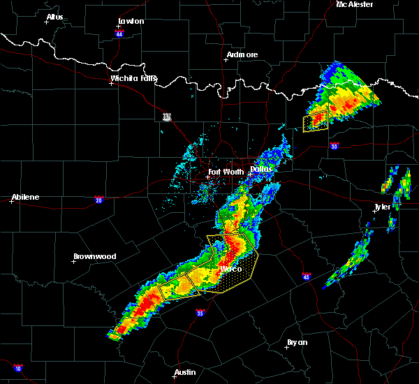 At 748 pm cdt, severe thunderstorms were located along a line extending from near hillsboro to near west to near woodway, moving east at 40 mph (radar indicated). Hazards include golf ball size hail and 60 mph wind gusts. People and animals outdoors will be injured. expect hail damage to roofs, siding, windows, and vehicles. expect wind damage to roofs, siding, and trees. locations impacted include, waco, hewitt, robinson, bellmead, hillsboro, woodway, lacy-lakeview, mcgregor, west, mart, beverly hills, hubbard, riesel, hallsburg, bynum, northcrest, gholson, abbott, leroy and mount calm. A tornado watch remains in effect until 1000 pm cdt for central and north central texas. At 748 pm cdt, severe thunderstorms were located along a line extending from near hillsboro to near west to near woodway, moving east at 40 mph (radar indicated). Hazards include golf ball size hail and 60 mph wind gusts. People and animals outdoors will be injured. expect hail damage to roofs, siding, windows, and vehicles. expect wind damage to roofs, siding, and trees. locations impacted include, waco, hewitt, robinson, bellmead, hillsboro, woodway, lacy-lakeview, mcgregor, west, mart, beverly hills, hubbard, riesel, hallsburg, bynum, northcrest, gholson, abbott, leroy and mount calm. A tornado watch remains in effect until 1000 pm cdt for central and north central texas.
|
| 4/13/2018 7:35 PM CDT |
 At 734 pm cdt, severe thunderstorms were located along a line extending from 6 miles west of hillsboro to near west to crawford, moving northeast at 30 mph (radar indicated). Hazards include two inch hail and 70 mph wind gusts. People and animals outdoors will be injured. expect hail damage to roofs, siding, windows, and vehicles. expect considerable tree damage. wind damage is also likely to mobile homes, roofs, and outbuildings. locations impacted include, waco, hewitt, robinson, bellmead, hillsboro, woodway, lacy-lakeview, mcgregor, west, mart, whitney, beverly hills, lorena, hubbard, valley mills, riesel, crawford, golinda, hallsburg and bynum. A tornado watch remains in effect until 1000 pm cdt for central and north central texas. At 734 pm cdt, severe thunderstorms were located along a line extending from 6 miles west of hillsboro to near west to crawford, moving northeast at 30 mph (radar indicated). Hazards include two inch hail and 70 mph wind gusts. People and animals outdoors will be injured. expect hail damage to roofs, siding, windows, and vehicles. expect considerable tree damage. wind damage is also likely to mobile homes, roofs, and outbuildings. locations impacted include, waco, hewitt, robinson, bellmead, hillsboro, woodway, lacy-lakeview, mcgregor, west, mart, whitney, beverly hills, lorena, hubbard, valley mills, riesel, crawford, golinda, hallsburg and bynum. A tornado watch remains in effect until 1000 pm cdt for central and north central texas.
|
| 4/13/2018 7:07 PM CDT |
 At 706 pm cdt, severe thunderstorms were located along a line extending from near whitney to 11 miles northeast of valley mills to near fort gates, moving east at 40 mph (radar indicated). Hazards include two inch hail and 70 mph wind gusts. several reports of quarter to golf ball sized hail have been received from parts of bosque and coryell counties. People and animals outdoors will be injured. expect hail damage to roofs, siding, windows, and vehicles. expect considerable tree damage. Wind damage is also likely to mobile homes, roofs, and outbuildings. At 706 pm cdt, severe thunderstorms were located along a line extending from near whitney to 11 miles northeast of valley mills to near fort gates, moving east at 40 mph (radar indicated). Hazards include two inch hail and 70 mph wind gusts. several reports of quarter to golf ball sized hail have been received from parts of bosque and coryell counties. People and animals outdoors will be injured. expect hail damage to roofs, siding, windows, and vehicles. expect considerable tree damage. Wind damage is also likely to mobile homes, roofs, and outbuildings.
|
| 4/6/2018 8:54 PM CDT |
 At 850 pm cdt, a severe thunderstorm was located near angus, or 9 miles south of corsicana, moving east at 55 mph (radar indicated). Hazards include quarter size hail. Damage to vehicles is possible. Locations impacted include, corsicana, hillsboro, west, italy, hubbard, blooming grove, dawson, bardwell, barry, bynum, carl`s corner, milford, frost, oak valley, abbott, leroy, mount calm, ross, malone and richland. At 850 pm cdt, a severe thunderstorm was located near angus, or 9 miles south of corsicana, moving east at 55 mph (radar indicated). Hazards include quarter size hail. Damage to vehicles is possible. Locations impacted include, corsicana, hillsboro, west, italy, hubbard, blooming grove, dawson, bardwell, barry, bynum, carl`s corner, milford, frost, oak valley, abbott, leroy, mount calm, ross, malone and richland.
|
| 4/6/2018 8:50 PM CDT |
 At 850 pm cdt, a severe thunderstorm was located near angus, or 9 miles south of corsicana, moving east at 55 mph (radar indicated). Hazards include quarter size hail. Damage to vehicles is possible. Locations impacted include, corsicana, hillsboro, west, italy, hubbard, blooming grove, dawson, bardwell, barry, bynum, carl`s corner, milford, frost, oak valley, abbott, leroy, mount calm, ross, malone and richland. At 850 pm cdt, a severe thunderstorm was located near angus, or 9 miles south of corsicana, moving east at 55 mph (radar indicated). Hazards include quarter size hail. Damage to vehicles is possible. Locations impacted include, corsicana, hillsboro, west, italy, hubbard, blooming grove, dawson, bardwell, barry, bynum, carl`s corner, milford, frost, oak valley, abbott, leroy, mount calm, ross, malone and richland.
|
| 4/6/2018 8:02 PM CDT |
 At 802 pm cdt, a severe thunderstorm was located near west, or 9 miles south of hillsboro, moving east at 45 mph (radar indicated). Hazards include ping pong ball size hail. People and animals outdoors will be injured. Expect damage to roofs, siding, windows, and vehicles. At 802 pm cdt, a severe thunderstorm was located near west, or 9 miles south of hillsboro, moving east at 45 mph (radar indicated). Hazards include ping pong ball size hail. People and animals outdoors will be injured. Expect damage to roofs, siding, windows, and vehicles.
|
| 3/18/2018 6:40 PM CDT |
 At 639 pm cdt, a severe thunderstorm was located near hubbard, or 17 miles northeast of lacy-lakeview, moving east at 30 mph (trained weather spotters). Hazards include two inch hail and 65 mph wind gusts. People and animals outdoors will be injured. expect hail damage to roofs, siding, windows, and vehicles. expect wind damage to roofs, siding, and trees. Locations impacted include, mexia, hubbard, coolidge, dawson, fort parker state park, mount calm, tehuacana, malone and penelope. At 639 pm cdt, a severe thunderstorm was located near hubbard, or 17 miles northeast of lacy-lakeview, moving east at 30 mph (trained weather spotters). Hazards include two inch hail and 65 mph wind gusts. People and animals outdoors will be injured. expect hail damage to roofs, siding, windows, and vehicles. expect wind damage to roofs, siding, and trees. Locations impacted include, mexia, hubbard, coolidge, dawson, fort parker state park, mount calm, tehuacana, malone and penelope.
|
| 3/18/2018 6:24 PM CDT |
 At 622 pm cdt, a severe thunderstorm was located near bynum, or 10 miles southeast of hillsboro, moving east at 35 mph (trained weather spotters). Hazards include tennis ball size hail and 65 mph wind gusts. People and animals outdoors will be injured. expect hail damage to roofs, siding, windows, and vehicles. Expect wind damage to roofs, siding, and trees. At 622 pm cdt, a severe thunderstorm was located near bynum, or 10 miles southeast of hillsboro, moving east at 35 mph (trained weather spotters). Hazards include tennis ball size hail and 65 mph wind gusts. People and animals outdoors will be injured. expect hail damage to roofs, siding, windows, and vehicles. Expect wind damage to roofs, siding, and trees.
|
| 2/6/2018 2:30 PM CST |
 At 230 pm cst, a severe thunderstorm was located near northcrest, or near lacy-lakeview, moving northeast at 45 mph (radar indicated). Hazards include quarter size hail. damage to vehicles is possible At 230 pm cst, a severe thunderstorm was located near northcrest, or near lacy-lakeview, moving northeast at 45 mph (radar indicated). Hazards include quarter size hail. damage to vehicles is possible
|
| 5/3/2017 3:11 PM CDT |
 The severe thunderstorm warning for southeastern hill county will expire at 315 pm cdt. the storm which prompted the warning has moved out of the area. therefore the warning will be allowed to expire. A severe thunderstorm watch remains in effect until 700 pm cdt for central and north central texas. The severe thunderstorm warning for southeastern hill county will expire at 315 pm cdt. the storm which prompted the warning has moved out of the area. therefore the warning will be allowed to expire. A severe thunderstorm watch remains in effect until 700 pm cdt for central and north central texas.
|
| 5/3/2017 2:57 PM CDT |
 At 256 pm cdt, a severe thunderstorm was located near hubbard, or 20 miles northeast of bellmead, moving east at 30 mph (radar indicated). Hazards include 60 mph wind gusts and half dollar size hail. Hail damage to vehicles is expected. expect wind damage to roofs, siding, and trees. Locations impacted include, hubbard, mount calm and penelope. At 256 pm cdt, a severe thunderstorm was located near hubbard, or 20 miles northeast of bellmead, moving east at 30 mph (radar indicated). Hazards include 60 mph wind gusts and half dollar size hail. Hail damage to vehicles is expected. expect wind damage to roofs, siding, and trees. Locations impacted include, hubbard, mount calm and penelope.
|
| 5/3/2017 2:45 PM CDT |
 At 244 pm cdt, a severe thunderstorm was located 7 miles east of west, or 14 miles northeast of lacy-lakeview, moving east at 30 mph (trained weather spotters). Hazards include 60 mph wind gusts and half dollar size hail. Hail damage to vehicles is expected. expect wind damage to roofs, siding, and trees. Locations impacted include, west, hubbard, leroy, mount calm, ross, malone and penelope. At 244 pm cdt, a severe thunderstorm was located 7 miles east of west, or 14 miles northeast of lacy-lakeview, moving east at 30 mph (trained weather spotters). Hazards include 60 mph wind gusts and half dollar size hail. Hail damage to vehicles is expected. expect wind damage to roofs, siding, and trees. Locations impacted include, west, hubbard, leroy, mount calm, ross, malone and penelope.
|
| 5/3/2017 2:33 PM CDT |
 At 233 pm cdt, a severe thunderstorm was located over west, or 12 miles north of lacy-lakeview, moving east at 25 mph (trained weather spotters). Hazards include 60 mph wind gusts and half dollar size hail. Hail damage to vehicles is expected. expect wind damage to roofs, siding, and trees. Locations impacted include, west, hubbard, gholson, abbott, leroy, mount calm, ross, malone and penelope. At 233 pm cdt, a severe thunderstorm was located over west, or 12 miles north of lacy-lakeview, moving east at 25 mph (trained weather spotters). Hazards include 60 mph wind gusts and half dollar size hail. Hail damage to vehicles is expected. expect wind damage to roofs, siding, and trees. Locations impacted include, west, hubbard, gholson, abbott, leroy, mount calm, ross, malone and penelope.
|
| 5/3/2017 2:16 PM CDT |
 At 216 pm cdt, a severe thunderstorm was located near west, or 12 miles south of hillsboro, moving east at 30 mph (radar indicated). Hazards include 60 mph wind gusts and quarter size hail. Hail damage to vehicles is expected. Expect wind damage to roofs, siding, and trees. At 216 pm cdt, a severe thunderstorm was located near west, or 12 miles south of hillsboro, moving east at 30 mph (radar indicated). Hazards include 60 mph wind gusts and quarter size hail. Hail damage to vehicles is expected. Expect wind damage to roofs, siding, and trees.
|
| 4/10/2017 9:58 PM CDT |
 At 958 pm cdt, a severe thunderstorm was located near waco, moving east at 20 mph (radar indicated). Hazards include 65 mph wind gusts and nickel size hail. expect damage to roofs, siding, and trees At 958 pm cdt, a severe thunderstorm was located near waco, moving east at 20 mph (radar indicated). Hazards include 65 mph wind gusts and nickel size hail. expect damage to roofs, siding, and trees
|
| 4/10/2017 9:27 PM CDT |
 At 927 pm cdt, a severe thunderstorm was located near west, or 8 miles north of lacy-lakeview, moving east at 5 mph (radar indicated). Hazards include 60 mph wind gusts and quarter size hail. Hail damage to vehicles is expected. Expect wind damage to roofs, siding, and trees. At 927 pm cdt, a severe thunderstorm was located near west, or 8 miles north of lacy-lakeview, moving east at 5 mph (radar indicated). Hazards include 60 mph wind gusts and quarter size hail. Hail damage to vehicles is expected. Expect wind damage to roofs, siding, and trees.
|
| 3/26/2017 9:47 PM CDT |
 At 947 pm cdt, a severe thunderstorm was located 8 miles south of bynum, or 14 miles southeast of hillsboro, moving east at 40 mph (radar indicated). Hazards include 65 mph wind gusts and half dollar size hail. Hail damage to vehicles is expected. expect wind damage to roofs, siding, and trees. this severe thunderstorm will be near, hubbard around 1000 pm cdt. dawson around 1010 pm cdt. coolidge around 1015 pm cdt. other locations impacted by this severe thunderstorm include malone, mustang, oak valley, emhouse, mertens, mount calm, frost, richland, penelope and mildred. This includes interstate 45 between mile markers 213 and 238. At 947 pm cdt, a severe thunderstorm was located 8 miles south of bynum, or 14 miles southeast of hillsboro, moving east at 40 mph (radar indicated). Hazards include 65 mph wind gusts and half dollar size hail. Hail damage to vehicles is expected. expect wind damage to roofs, siding, and trees. this severe thunderstorm will be near, hubbard around 1000 pm cdt. dawson around 1010 pm cdt. coolidge around 1015 pm cdt. other locations impacted by this severe thunderstorm include malone, mustang, oak valley, emhouse, mertens, mount calm, frost, richland, penelope and mildred. This includes interstate 45 between mile markers 213 and 238.
|
| 3/26/2017 9:28 PM CDT |
 At 926 pm cdt, a severe thunderstorm was located near abbott, moving east at 35 mph (radar indicated). Hazards include ping pong ball size hail and 60 mph wind gusts. People and animals outdoors will be injured. expect hail damage to roofs, siding, windows, and vehicles. expect wind damage to roofs, siding, and trees. Locations impacted include, abbott, aquailla, west, penelope, malone, hillsboro and hubbard. At 926 pm cdt, a severe thunderstorm was located near abbott, moving east at 35 mph (radar indicated). Hazards include ping pong ball size hail and 60 mph wind gusts. People and animals outdoors will be injured. expect hail damage to roofs, siding, windows, and vehicles. expect wind damage to roofs, siding, and trees. Locations impacted include, abbott, aquailla, west, penelope, malone, hillsboro and hubbard.
|
| 3/26/2017 8:56 PM CDT |
 At 856 pm cdt, a severe thunderstorm was located near hillsboro, moving east at 35 mph. there is also a severe thunderstorm located just east of meridian. this activity is also moving east at around 35 mph (radar indicated). Hazards include golf ball size hail and 60 mph wind gusts. People and animals outdoors will be injured. expect hail damage to roofs, siding, windows, and vehicles. expect wind damage to roofs, siding, and trees. this severe thunderstorm will be near, hillsboro around 905 pm cdt. bynum around 915 pm cdt. other locations impacted by this severe thunderstorm include abbott, malone, morgan, mertens, penelope and aquilla. this includes the following interstates, interstate 35 between mile markers 350 and 369. interstate 35w between mile markers 1 and 7. Interstate 35e between mile markers 371 and 378. At 856 pm cdt, a severe thunderstorm was located near hillsboro, moving east at 35 mph. there is also a severe thunderstorm located just east of meridian. this activity is also moving east at around 35 mph (radar indicated). Hazards include golf ball size hail and 60 mph wind gusts. People and animals outdoors will be injured. expect hail damage to roofs, siding, windows, and vehicles. expect wind damage to roofs, siding, and trees. this severe thunderstorm will be near, hillsboro around 905 pm cdt. bynum around 915 pm cdt. other locations impacted by this severe thunderstorm include abbott, malone, morgan, mertens, penelope and aquilla. this includes the following interstates, interstate 35 between mile markers 350 and 369. interstate 35w between mile markers 1 and 7. Interstate 35e between mile markers 371 and 378.
|
| 1/2/2017 5:24 AM CST |
 The severe thunderstorm warning for western limestone, northern falls, southeastern hill and mclennan counties will expire at 530 am cst, the storm which prompted the warning has moved out of the area. therefore the warning will be allowed to expire. a severe thunderstorm watch remains in effect until 900 am cst for central texas. The severe thunderstorm warning for western limestone, northern falls, southeastern hill and mclennan counties will expire at 530 am cst, the storm which prompted the warning has moved out of the area. therefore the warning will be allowed to expire. a severe thunderstorm watch remains in effect until 900 am cst for central texas.
|
| 1/2/2017 4:41 AM CST |
 At 439 am cst, a severe thunderstorm was located over bellmead, moving east at 50 mph (waco automated surface observation system). Hazards include 65 mph wind gusts. Expect damage to roofs, siding, and trees. this severe storm will be near, hallsburg around 450 am cst. mart around 455 am cst. coolidge around 510 am cst. Other locations impacted by this severe thunderstorm include mount calm, kosse, penelope, thornton, malone, gholson, ross and leroy. At 439 am cst, a severe thunderstorm was located over bellmead, moving east at 50 mph (waco automated surface observation system). Hazards include 65 mph wind gusts. Expect damage to roofs, siding, and trees. this severe storm will be near, hallsburg around 450 am cst. mart around 455 am cst. coolidge around 510 am cst. Other locations impacted by this severe thunderstorm include mount calm, kosse, penelope, thornton, malone, gholson, ross and leroy.
|
| 1/2/2017 4:28 AM CST |
 At 428 am cst, a severe thunderstorm was located over woodway, moving east at 65 mph (radar indicated). Hazards include 60 mph wind gusts. Expect damage to roofs, siding, and trees. this severe thunderstorm will be near, robinson and beverly hills around 435 am cst. bellmead around 440 am cst. riesel around 445 am cst. hallsburg around 450 am cst. mart around 455 am cst. other locations impacted by this severe thunderstorm include mount calm, kosse, penelope, thornton, malone, gholson, ross and leroy. This includes interstate 35 between mile markers 313 and 356. At 428 am cst, a severe thunderstorm was located over woodway, moving east at 65 mph (radar indicated). Hazards include 60 mph wind gusts. Expect damage to roofs, siding, and trees. this severe thunderstorm will be near, robinson and beverly hills around 435 am cst. bellmead around 440 am cst. riesel around 445 am cst. hallsburg around 450 am cst. mart around 455 am cst. other locations impacted by this severe thunderstorm include mount calm, kosse, penelope, thornton, malone, gholson, ross and leroy. This includes interstate 35 between mile markers 313 and 356.
|
| 5/10/2016 8:41 PM CDT |
 At 840 pm cdt, severe thunderstorms were located along a line extending from hubbard to 7 miles northeast of mart to near riesel, moving east at 30 mph (radar indicated). Hazards include 65 mph wind gusts and quarter size hail. Hail damage to vehicles is expected. expect wind damage to roofs, siding, and trees. these severe storms will be near, coolidge around 855 pm cdt. Other locations impacted by these severe thunderstorms include mount calm, mertens, malone, tehuacana, leroy and penelope. At 840 pm cdt, severe thunderstorms were located along a line extending from hubbard to 7 miles northeast of mart to near riesel, moving east at 30 mph (radar indicated). Hazards include 65 mph wind gusts and quarter size hail. Hail damage to vehicles is expected. expect wind damage to roofs, siding, and trees. these severe storms will be near, coolidge around 855 pm cdt. Other locations impacted by these severe thunderstorms include mount calm, mertens, malone, tehuacana, leroy and penelope.
|
| 5/10/2016 8:10 PM CDT |
 At 809 pm cdt, severe thunderstorms were located along a line extending from 6 miles south of bynum to near waco to beverly hills, moving east at 45 mph (radar indicated. winds in excess of 70 mph have been reported at the waco airport). Hazards include 70 mph wind gusts and quarter size hail. Hail damage to vehicles is expected. expect considerable tree damage. wind damage is also likely to mobile homes, roofs, and outbuildings. these severe storms will be near, bynum around 815 pm cdt. hubbard and riesel around 825 pm cdt. mart around 835 pm cdt. coolidge around 840 pm cdt. mexia around 850 pm cdt. Other locations impacted by these severe thunderstorms include mount calm, abbott, tehuacana, aquilla, penelope, mertens, malone, gholson, ross and leroy. At 809 pm cdt, severe thunderstorms were located along a line extending from 6 miles south of bynum to near waco to beverly hills, moving east at 45 mph (radar indicated. winds in excess of 70 mph have been reported at the waco airport). Hazards include 70 mph wind gusts and quarter size hail. Hail damage to vehicles is expected. expect considerable tree damage. wind damage is also likely to mobile homes, roofs, and outbuildings. these severe storms will be near, bynum around 815 pm cdt. hubbard and riesel around 825 pm cdt. mart around 835 pm cdt. coolidge around 840 pm cdt. mexia around 850 pm cdt. Other locations impacted by these severe thunderstorms include mount calm, abbott, tehuacana, aquilla, penelope, mertens, malone, gholson, ross and leroy.
|
| 5/10/2016 7:57 PM CDT |
 At 756 pm cdt, a severe thunderstorm was located over beverly hills, or near waco, moving east at 35 mph. a 67 mph wind gust was reported at waco regional airport over the last few minutes (radar indicated). Hazards include 65 mph wind gusts and quarter size hail. Hail damage to vehicles is expected. expect wind damage to roofs, siding, and trees. this severe thunderstorm will be near, robinson around 800 pm cdt. hallsburg around 815 pm cdt. riesel around 820 pm cdt. mart around 825 pm cdt. Other locations impacted by this severe thunderstorm include mount calm, abbott, tehuacana, aquilla, penelope, mertens, malone, gholson, ross and leroy. At 756 pm cdt, a severe thunderstorm was located over beverly hills, or near waco, moving east at 35 mph. a 67 mph wind gust was reported at waco regional airport over the last few minutes (radar indicated). Hazards include 65 mph wind gusts and quarter size hail. Hail damage to vehicles is expected. expect wind damage to roofs, siding, and trees. this severe thunderstorm will be near, robinson around 800 pm cdt. hallsburg around 815 pm cdt. riesel around 820 pm cdt. mart around 825 pm cdt. Other locations impacted by this severe thunderstorm include mount calm, abbott, tehuacana, aquilla, penelope, mertens, malone, gholson, ross and leroy.
|
| 4/29/2016 3:28 PM CDT |
 At 327 pm cdt, severe thunderstorms were located along a line extending from near blum to near clifton, moving north at 45 mph (radar indicated). Hazards include 60 mph wind gusts and quarter size hail. Hail damage to vehicles is expected. expect wind damage to roofs, siding, and trees. severe thunderstorms will be near, blum around 335 pm cdt. covington and meridian state park around 340 pm cdt. meridian around 345 pm cdt. keene and alvarado around 400 pm cdt. joshua and cross timber around 405 pm cdt. burleson around 410 pm cdt. cleburne state park around 415 pm cdt. mansfield around 420 pm cdt. other locations impacted by these severe thunderstorms include mount calm, morgan, rio vista, abbott, aquilla, penelope, mertens, malone, briaroaks and walnut springs. this includes the following interstates, interstate 35 between mile markers 355 and 369. interstate 35w between mile markers 1 and 37. interstate 35e between mile markers 371 and 378. A tornado watch remains in effect until 1000 pm cdt for north central texas. At 327 pm cdt, severe thunderstorms were located along a line extending from near blum to near clifton, moving north at 45 mph (radar indicated). Hazards include 60 mph wind gusts and quarter size hail. Hail damage to vehicles is expected. expect wind damage to roofs, siding, and trees. severe thunderstorms will be near, blum around 335 pm cdt. covington and meridian state park around 340 pm cdt. meridian around 345 pm cdt. keene and alvarado around 400 pm cdt. joshua and cross timber around 405 pm cdt. burleson around 410 pm cdt. cleburne state park around 415 pm cdt. mansfield around 420 pm cdt. other locations impacted by these severe thunderstorms include mount calm, morgan, rio vista, abbott, aquilla, penelope, mertens, malone, briaroaks and walnut springs. this includes the following interstates, interstate 35 between mile markers 355 and 369. interstate 35w between mile markers 1 and 37. interstate 35e between mile markers 371 and 378. A tornado watch remains in effect until 1000 pm cdt for north central texas.
|
| 12/27/2015 2:52 PM CST |
 At 252 pm cst, a severe thunderstorm was located near hubbard, or 17 miles northeast of lacy-lakeview, moving north at 55 mph (radar indicated). Hazards include quarter size hail. damage to vehicles is expected At 252 pm cst, a severe thunderstorm was located near hubbard, or 17 miles northeast of lacy-lakeview, moving north at 55 mph (radar indicated). Hazards include quarter size hail. damage to vehicles is expected
|
| 12/26/2015 5:52 PM CST |
 At 552 pm cst, a severe thunderstorm was located over hubbard, or 19 miles southeast of hillsboro, moving north at 50 mph (radar indicated). Hazards include 60 mph wind gusts and half dollar size hail. Hail damage to vehicles is expected. Expect wind damage to roofs, siding and trees. At 552 pm cst, a severe thunderstorm was located over hubbard, or 19 miles southeast of hillsboro, moving north at 50 mph (radar indicated). Hazards include 60 mph wind gusts and half dollar size hail. Hail damage to vehicles is expected. Expect wind damage to roofs, siding and trees.
|
| 12/26/2015 1:49 PM CST |
 At 149 pm cst, a severe thunderstorm capable of producing a tornado was located 7 miles southwest of hubbard, or 17 miles northeast of bellmead, moving north at 55 mph (radar indicated rotation). Hazards include tornado. Flying debris will be dangerous to those caught without shelter. mobile homes will be damaged or destroyed. damage to roofs, windows and vehicles will occur. tree damage is likely. this dangerous storm will be near, hubbard around 155 pm cst. dawson around 200 pm cst. blooming grove and barry around 215 pm cst. Other locations impacted by this tornadic thunderstorm include mount calm, malone, emhouse, penelope and frost. At 149 pm cst, a severe thunderstorm capable of producing a tornado was located 7 miles southwest of hubbard, or 17 miles northeast of bellmead, moving north at 55 mph (radar indicated rotation). Hazards include tornado. Flying debris will be dangerous to those caught without shelter. mobile homes will be damaged or destroyed. damage to roofs, windows and vehicles will occur. tree damage is likely. this dangerous storm will be near, hubbard around 155 pm cst. dawson around 200 pm cst. blooming grove and barry around 215 pm cst. Other locations impacted by this tornadic thunderstorm include mount calm, malone, emhouse, penelope and frost.
|
| 5/28/2015 4:17 PM CDT | At 416 pm cdt, a severe thunderstorm was located near hubbard, or 19 miles northeast of lacy-lakeview, moving north at 25 mph (radar indicated). Hazards include 60 mph wind gusts and quarter size hail. Hail damage to vehicles is expected. expect wind damage to roofs, siding and trees. locations impacted include, corsicana, hubbard, coolidge, blooming grove, dawson, angus, barry, navarro, frost, retreat, oak valley, mount calm, malone, penelope, emhouse, mertens and mustang. This includes interstate 45 between mile markers 221 and 228. |
| 5/28/2015 3:56 PM CDT | At 356 pm cdt, a severe thunderstorm was located 10 miles north of mart, or 14 miles northeast of bellmead, moving northeast at 35 mph (radar indicated). Hazards include 60 mph wind gusts and quarter size hail. Hail damage to vehicles is expected. Expect wind damage to roofs, siding and trees. |
| 5/25/2015 3:35 PM CDT | At 335 pm cdt, severe thunderstorms were located along a line extending from near italy to near bynum to near west, moving east at 40 mph (radar indicated). Hazards include 70 mph wind gusts and nickel size hail. Expect considerable tree damage. damage is likely to mobile homes, roofs and outbuildings. locations impacted include, waxahachie, corsicana, ennis, hillsboro, west, whitney, palmer, italy, itasca, hubbard, blooming grove, dawson, bardwell, angus, alma, barry, navarro, bynum, carl`s corner and rice. this includes the following interstates, interstate 35 between mile markers 350 and 369. interstate 35w between mile markers 1 and 12. interstate 35e between mile markers 371 and 398. interstate 45 between mile markers 213 and 262. a tornado watch remains in effect until 600 pm cdt for north central texas. A tornado watch also remains in effect until 1000 pm cdt for central texas. |
| 5/25/2015 3:07 PM CDT | At 307 pm cdt, severe thunderstorms were located along a line extending from near grandview to near whitney to 11 miles southwest of west, moving east at 40 mph (radar indicated). Hazards include 70 mph wind gusts and nickel size hail. Expect considerable tree damage. Damage is likely to mobile homes, roofs and outbuildings. |
| 5/10/2015 8:26 PM CDT | The tornado warning for southeastern hill and western navarro counties will expire at 830 pm cdt, the tornado threat has diminished, therefore the tornado warning has been cancelled. however, large hail and damaging winds remain likely and a severe thunderstorm warning remains in effect for the area. heavy rain and flooding is still possible with this thunderstorm. a tornado watch remains in effect until 900 pm cdt for north central texas. |
| 5/10/2015 7:51 PM CDT | At 749 pm cdt, a severe thunderstorm capable of producing a tornado was located near dawson, or 14 miles southwest of corsicana, moving east at 30 mph (radar indicated rotation). Hazards include tornado and golf ball size hail. Flying debris will be dangerous to those caught without shelter. mobile homes will be damaged or destroyed. damage to roofs, windows and vehicles will occur. tree damage is likely. oak valley and corsicana are in the direct path of this tornado, take cover immediately! locations impacted include, corsicana, hubbard, blooming grove, dawson, angus, barry, navarro, bynum, frost, retreat, oak valley, mount calm, malone, penelope, emhouse, mertens and mustang. this includes interstate 45 between mile markers 220 and 232. Radar indicated. |
| 5/10/2015 7:41 PM CDT | At 741 pm cdt, a severe thunderstorm capable of producing a tornado was located 8 miles northwest of dawson, or 19 miles east of hillsboro, moving east at 25 mph (weather spotters reported funnel cloud). Hazards include tornado and ping pong ball size hail. Flying debris will be dangerous to those caught without shelter. mobile homes will be damaged or destroyed. damage to roofs, windows and vehicles will occur. Tree damage is likely. |
| 5/10/2015 7:07 PM CDT | At 706 pm cdt, a severe thunderstorm was located 8 miles southwest of west, or 10 miles northwest of lacy-lakeview, moving east at 35 mph (radar indicated). Hazards include ping pong ball size hail and 60 mph wind gusts. People and animals outdoors will be injured. expect hail damage to roofs, siding, windows and vehicles. Expect wind damage to roofs, siding and trees. |
| 5/10/2015 6:24 PM CDT | At 623 pm cdt, a severe thunderstorm was located over hillsboro, moving east at 40 mph (radar indicated). Hazards include golf ball size hail and 60 mph wind gusts. People and animals outdoors will be injured. expect hail damage to roofs, siding, windows and vehicles. Expect wind damage to roofs, siding and trees. |
| 4/27/2015 12:50 AM CDT | At 1249 am cdt, severe thunderstorms were located along a line extending from 6 miles north of alma to near corsicana to near dawson, moving east at 40 mph (radar indicated). Hazards include 60 mph wind gusts and half dollar size hail. Hail damage to vehicles is expected. expect wind damage to roofs, siding and trees. locations impacted include, waxahachie, corsicana, ennis, navarro. a tornado watch remains in effect until 500 am cdt for north central texas. 1. 25in. |
| 4/27/2015 12:25 AM CDT | At 1224 am cdt, severe thunderstorms were located along a line extending from near bardwell to blooming grove to 7 miles west of hubbard, moving east at 35 mph (radar indicated). Hazards include 70 mph wind gusts and ping pong ball size hail. People and animals outdoors will be injured. expect hail damage to roofs, siding, windows and vehicles. expect considerable tree damage. wind damage is also likely to mobile homes, roofs and outbuildings. locations impacted include, waxahachie, corsicana, ennis, italy, kerens, hubbard, maypearl, blooming grove, dawson, bardwell, angus, alma, barry, navarro, bynum, rice, garrett, milford, frost and retreat. a tornado watch remains in effect until 500 am cdt for north central texas. 1. 50in. |
| 4/26/2015 11:57 PM CDT | At 1155 pm cdt, severe thunderstorms were located along a line extending from 6 miles northeast of itasca to near carl`s corner to 7 miles north of west, moving east at 45 mph. these are very dangerous storms (radar indicated). Hazards include 80 mph wind gusts and ping pong ball size hail. Flying debris will be dangerous to those caught without shelter. mobile homes will be heavily damaged. expect considerable damage to roofs, windows and vehicles. Extensive tree damage and power outages are likely. |
| 1/1/0001 12:00 AM | Quarter sized hail reported 0.5 miles NNE of Penelope, TX, quarter size hail reported 1sw of p |
Hail Maps for Penelope, TX

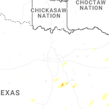
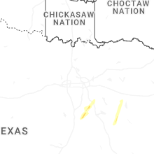
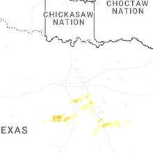


Connect with Interactive Hail Maps