

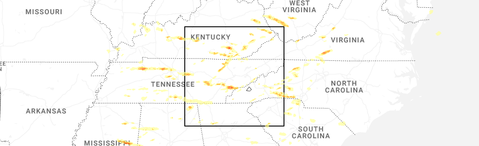
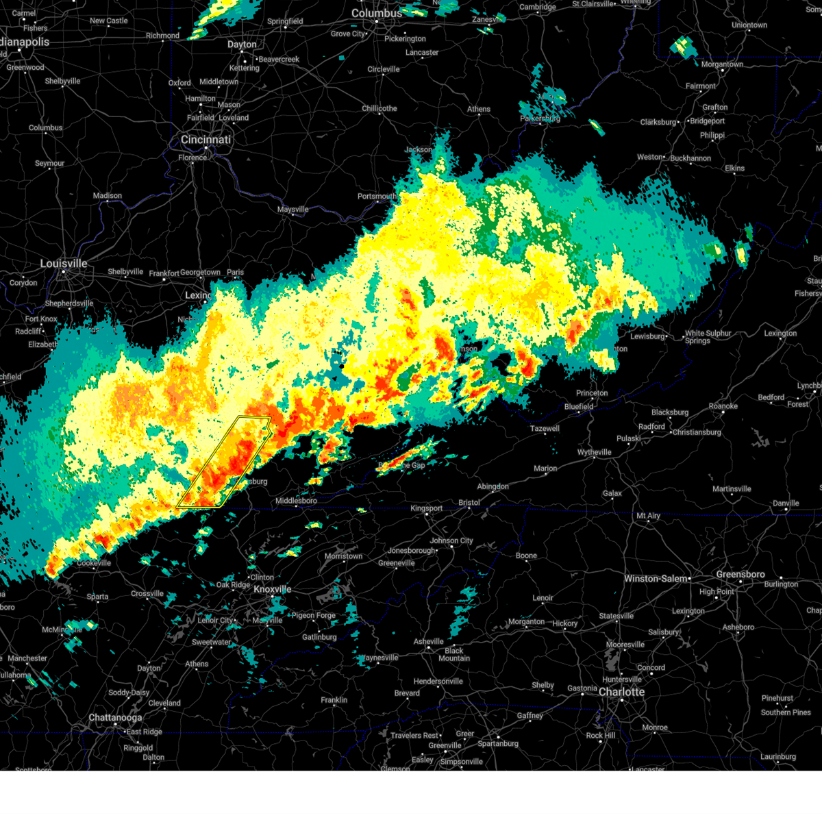
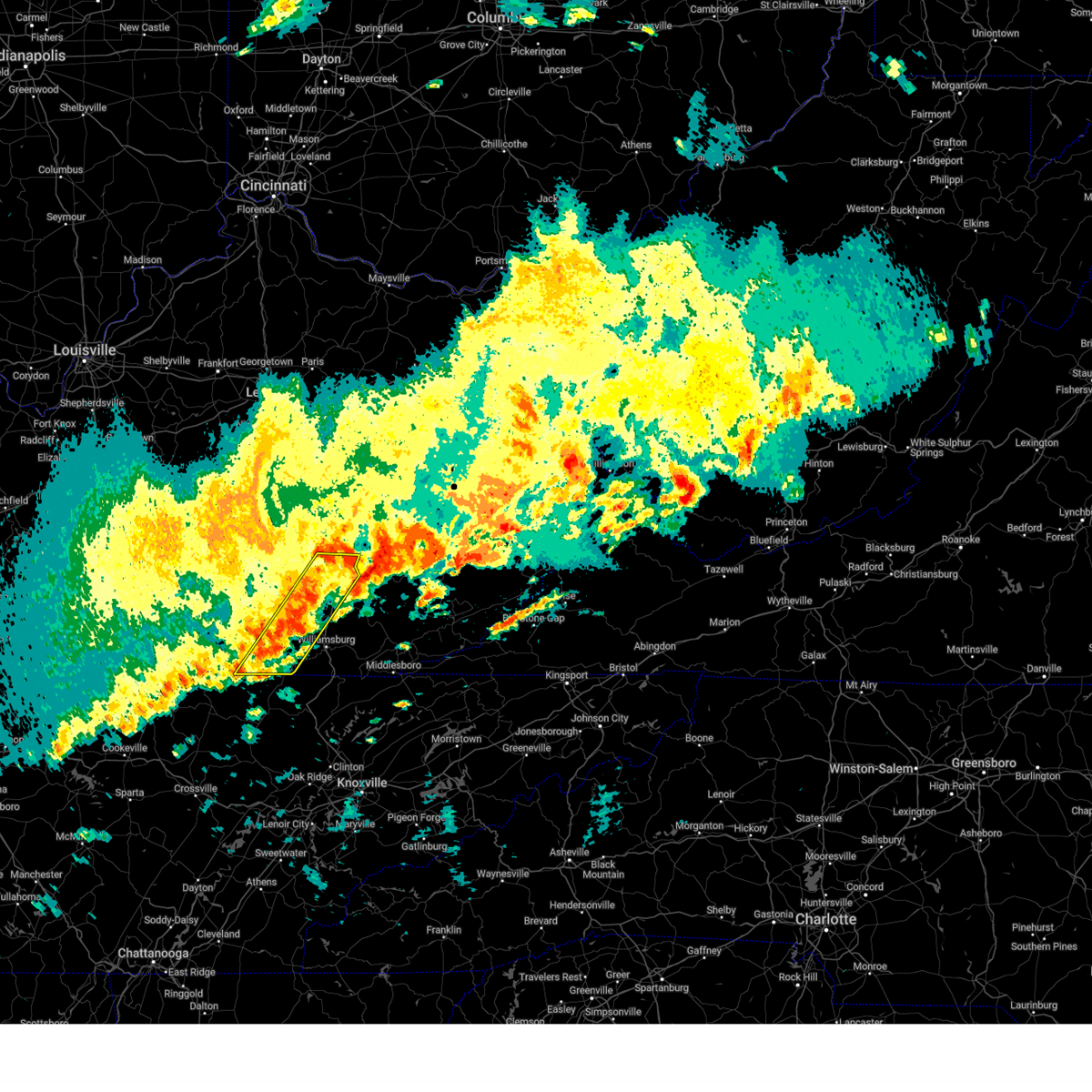
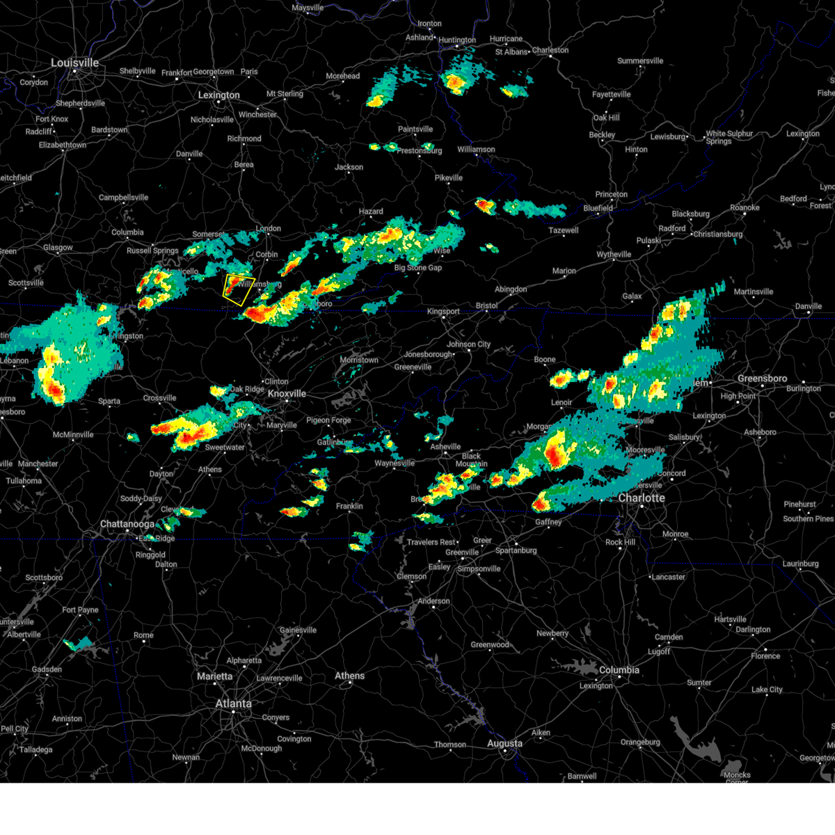
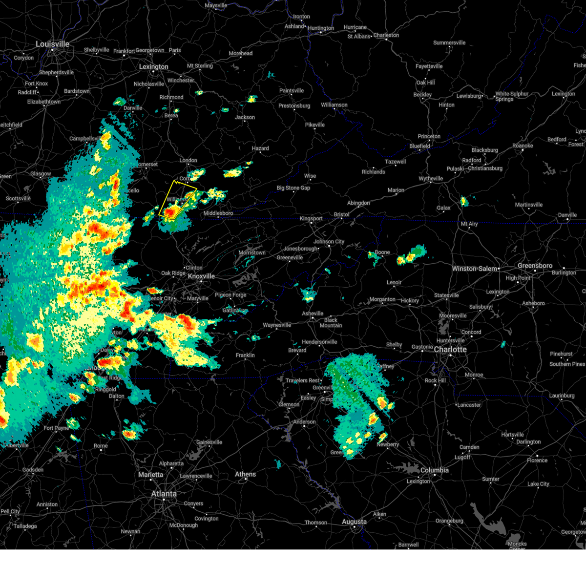
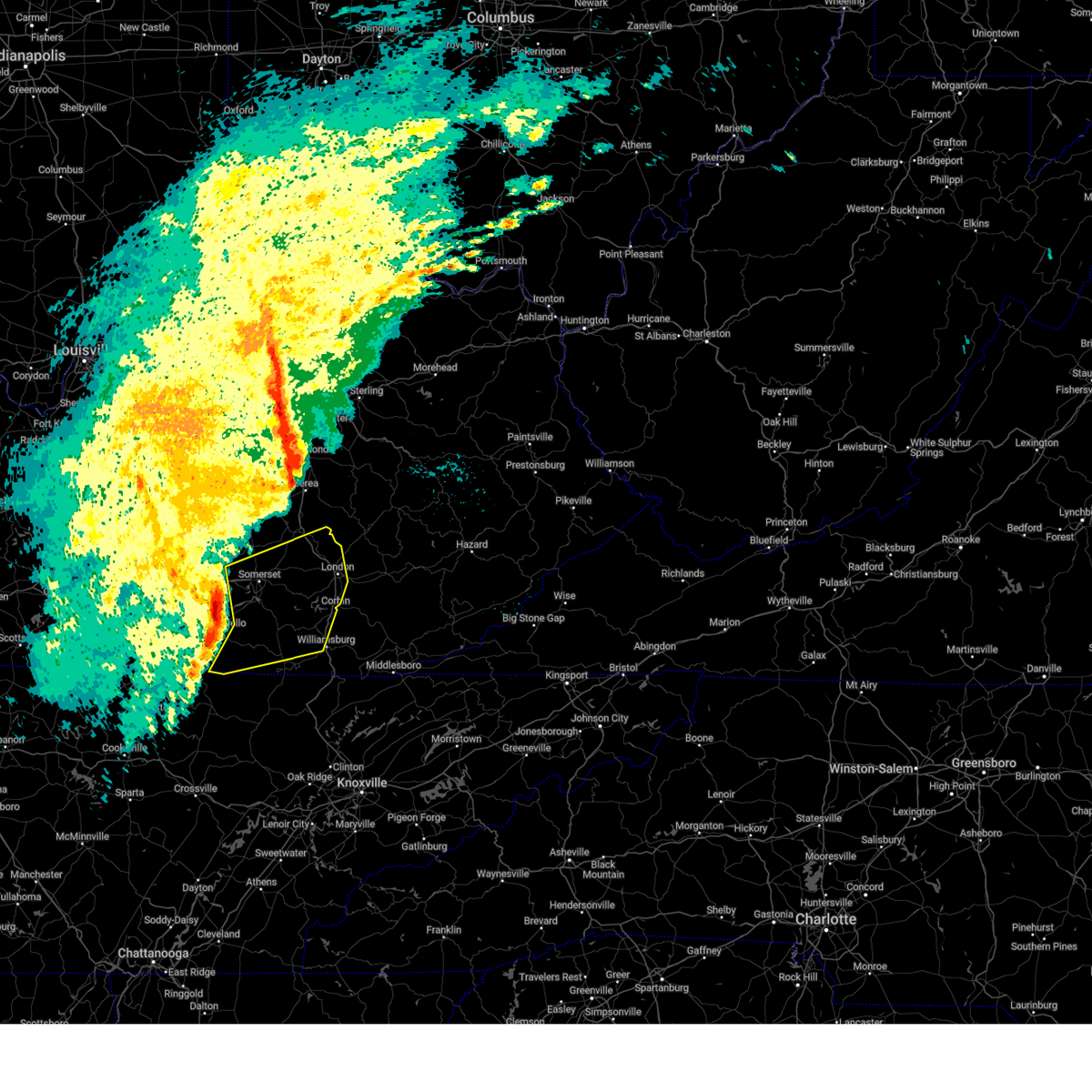
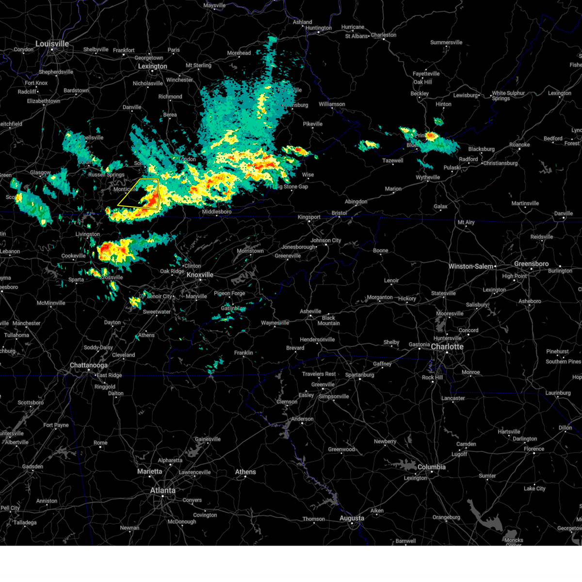
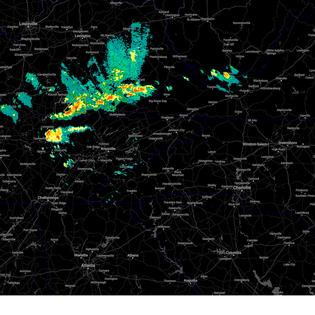
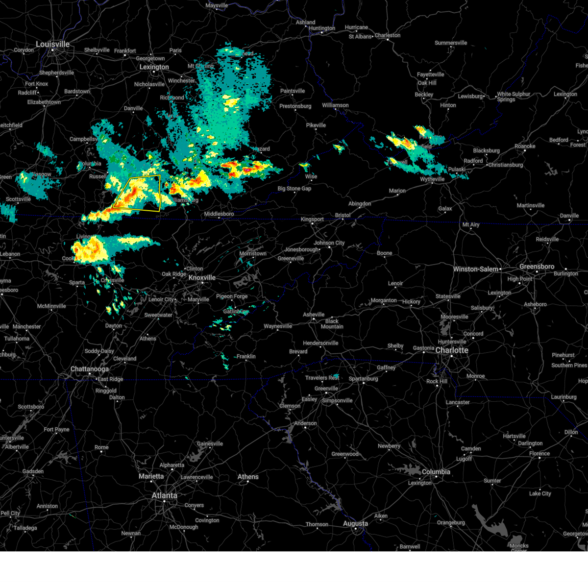
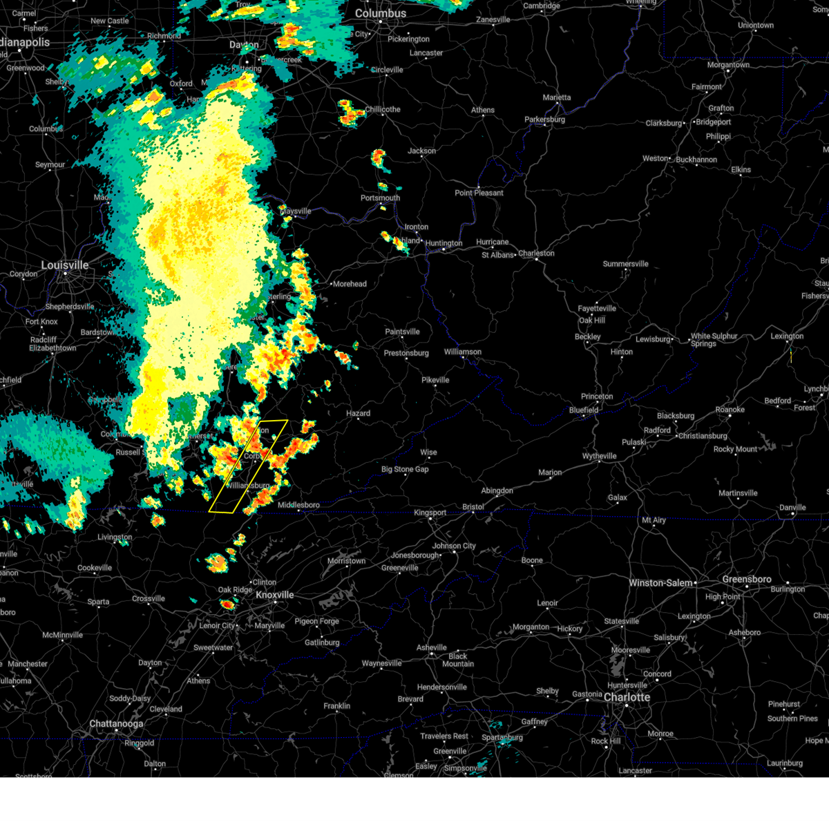
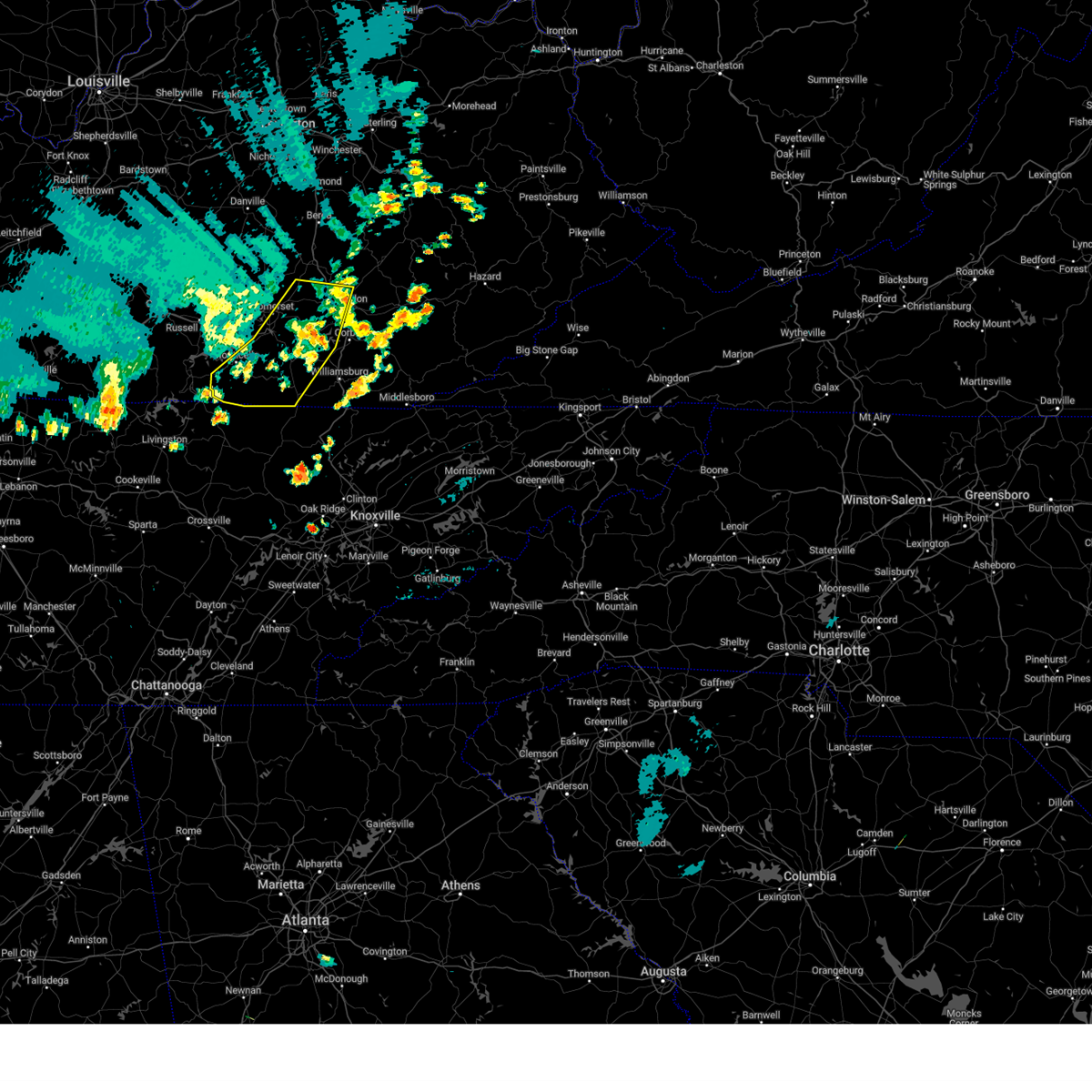
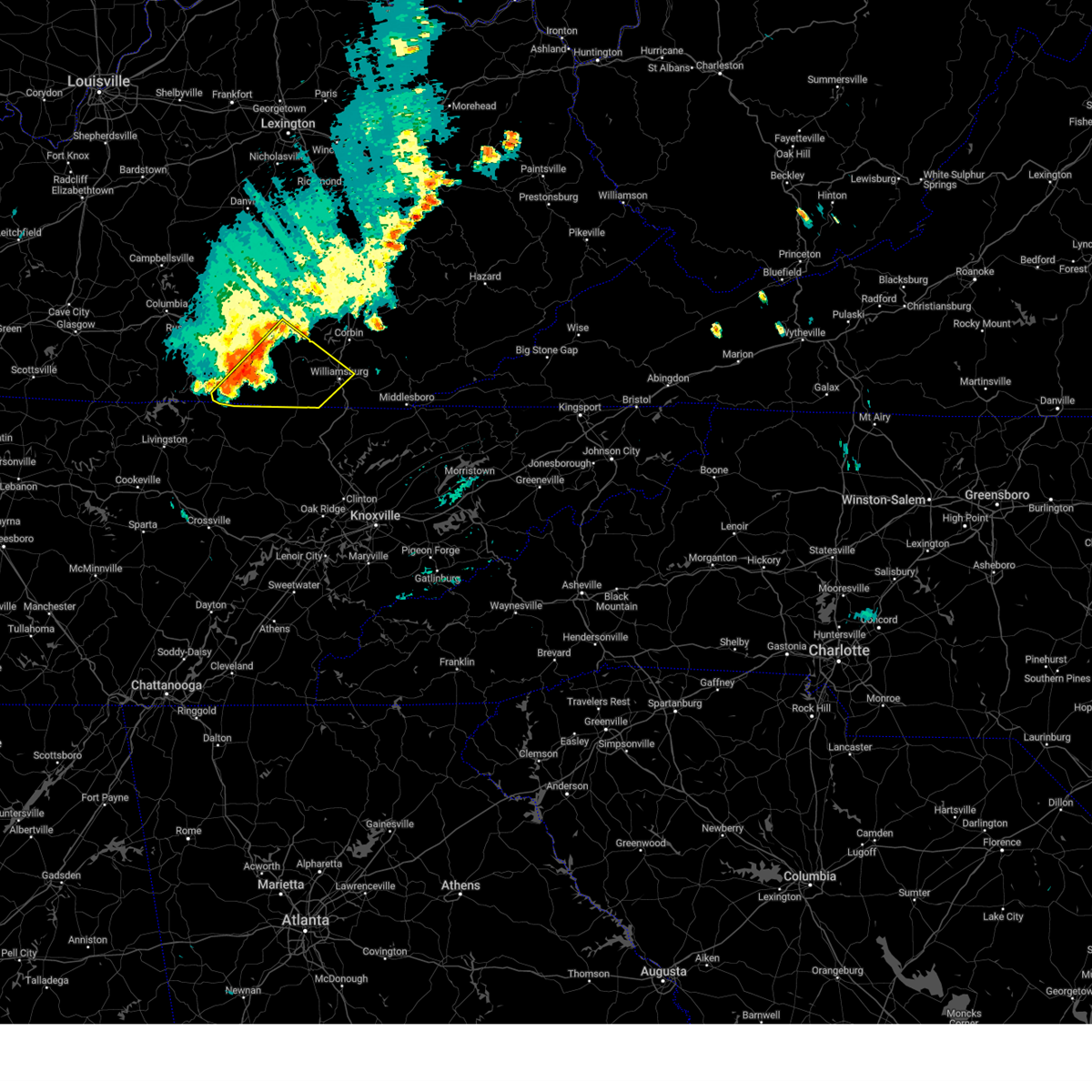
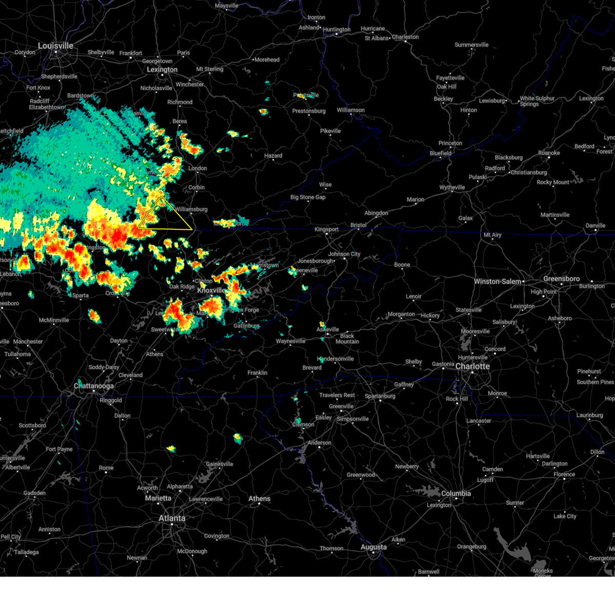
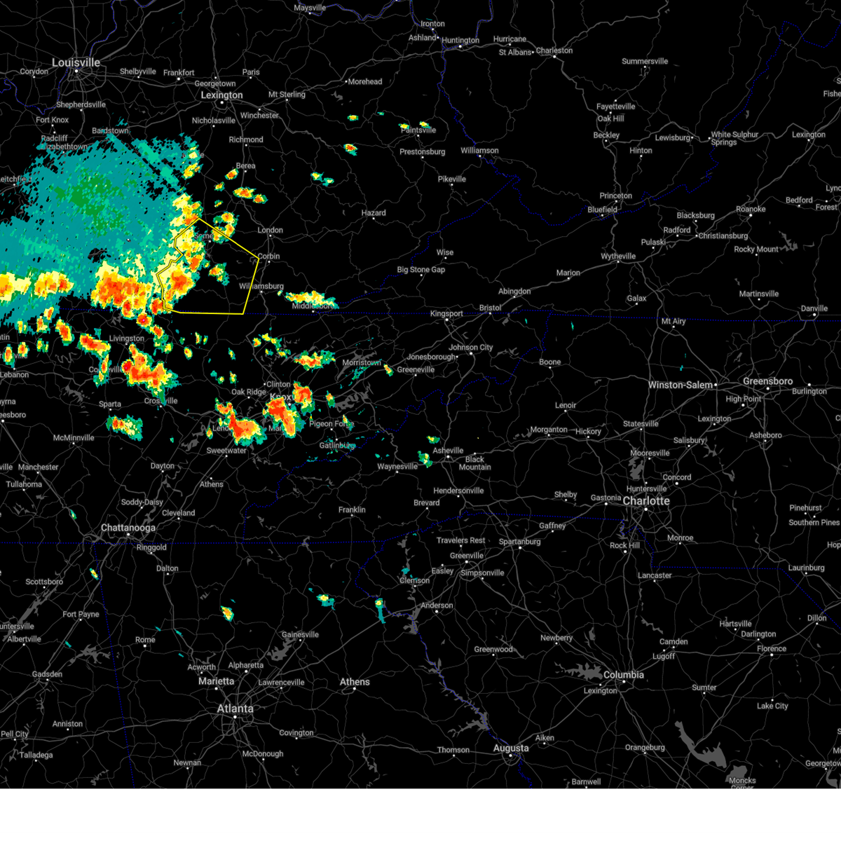
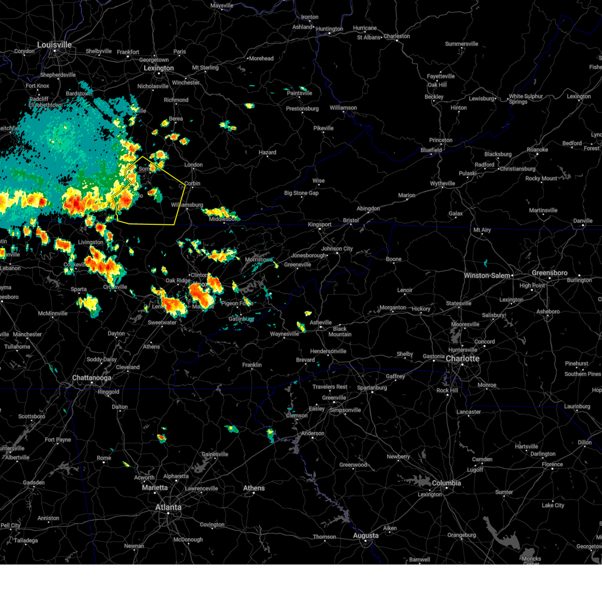
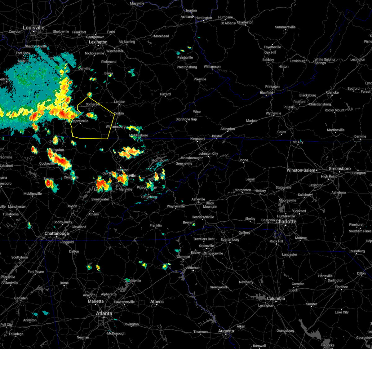
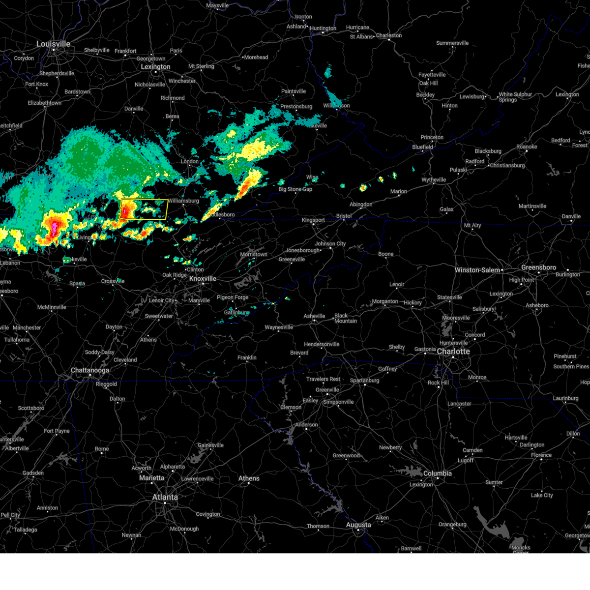
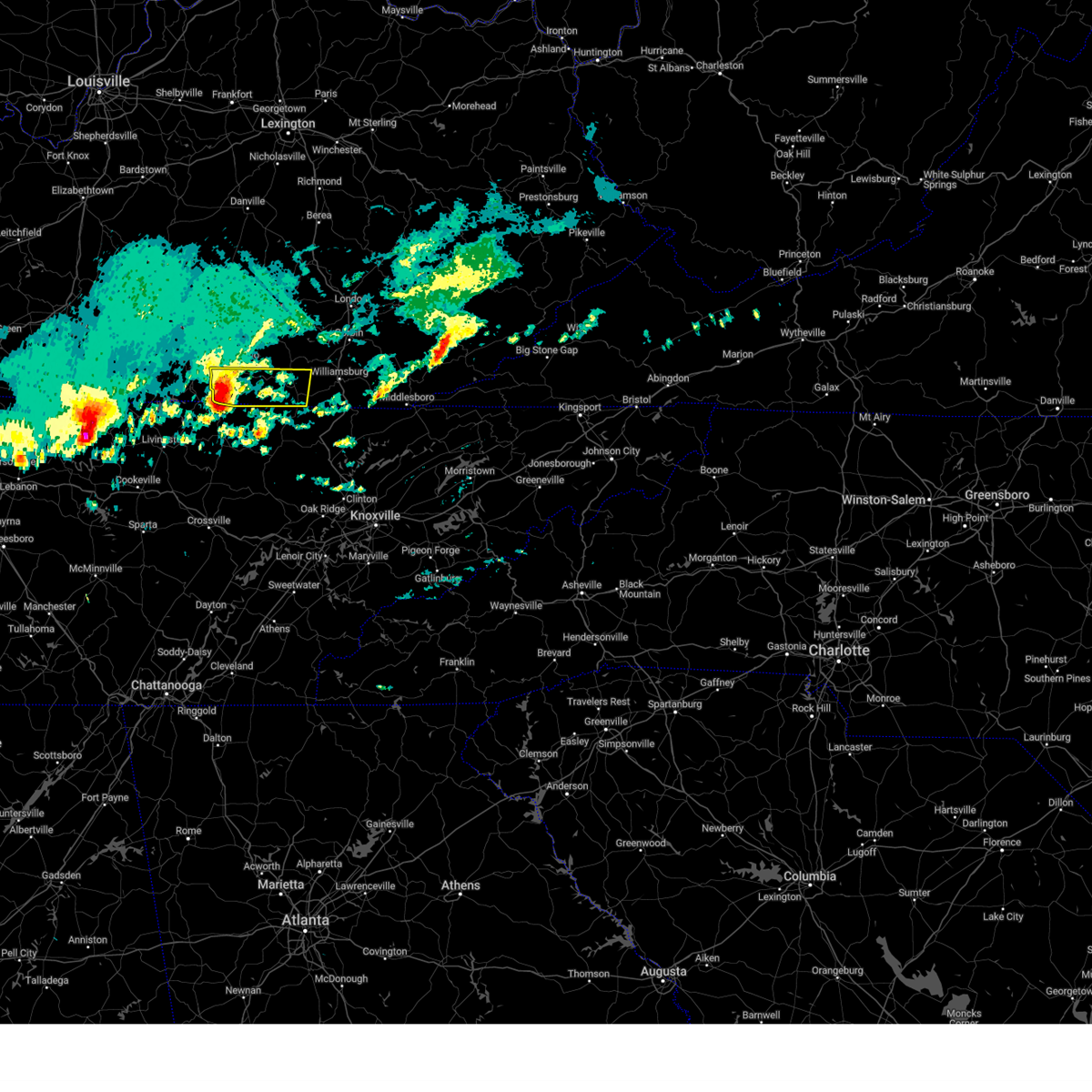
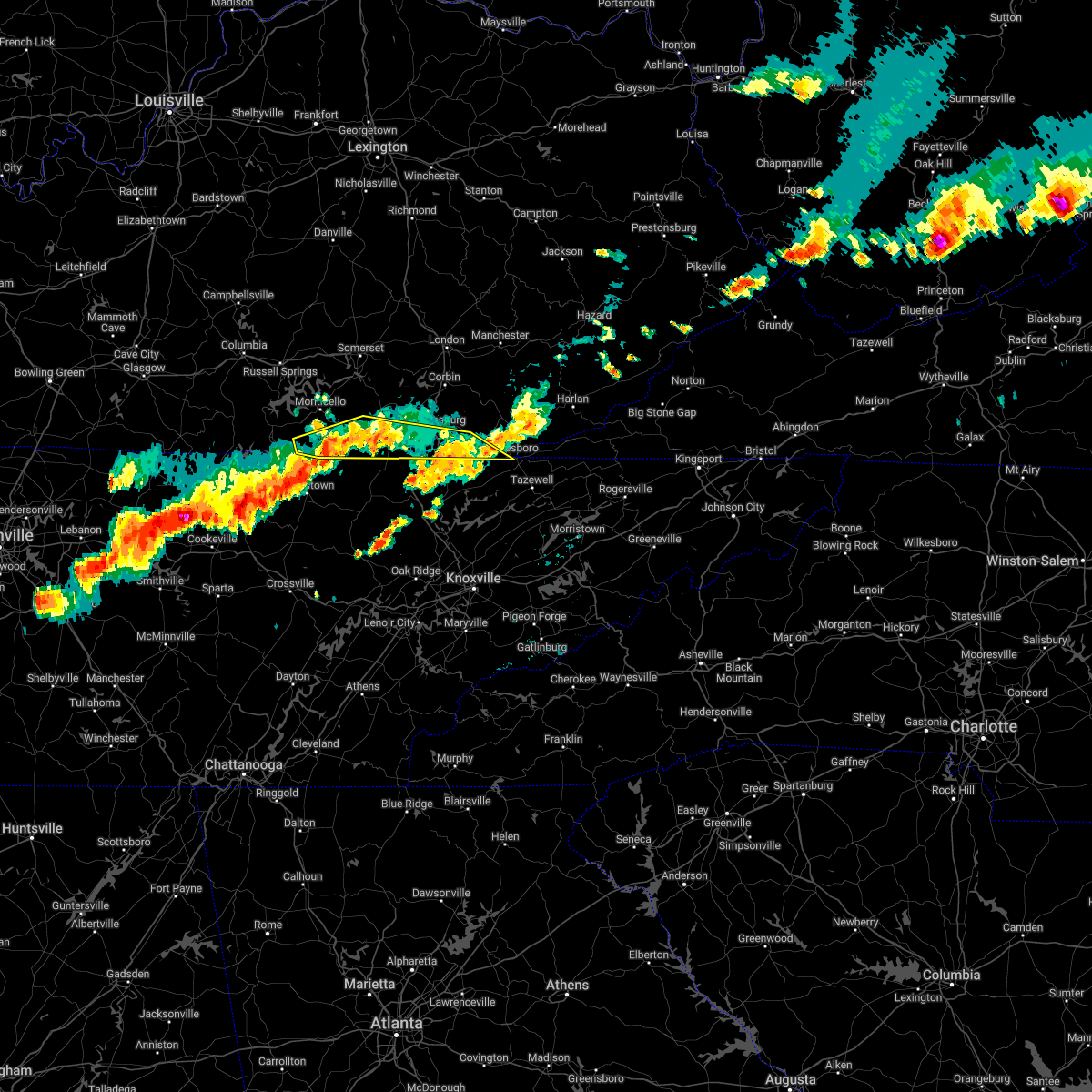
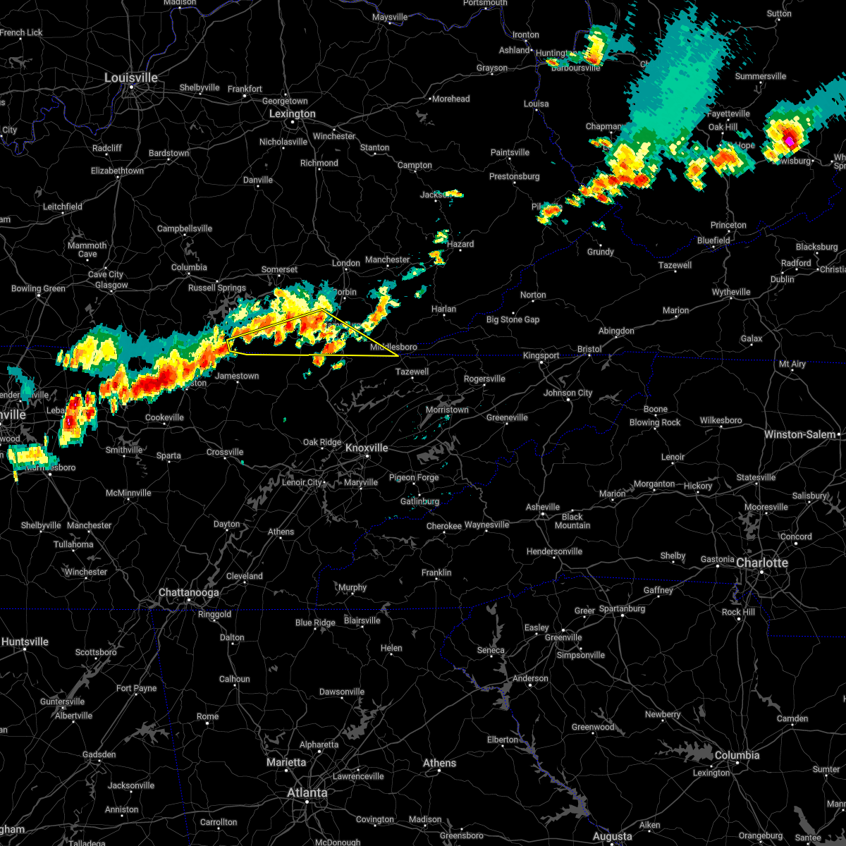
Hail Map for Pine Knot, KY
The Pine Knot, KY area has had 8 reports of on-the-ground hail by trained spotters, and has been under severe weather warnings 40 times during the past 12 months. Doppler radar has detected hail at or near Pine Knot, KY on 36 occasions, including 4 occasions during the past year.
| Name: | Pine Knot, KY |
| Where Located: | 56.5 miles NNW of Knoxville, TN |
| Map: | Google Map for Pine Knot, KY |
| Population: | 1621 |
| Housing Units: | 628 |
| More Info: | Search Google for Pine Knot, KY |
0
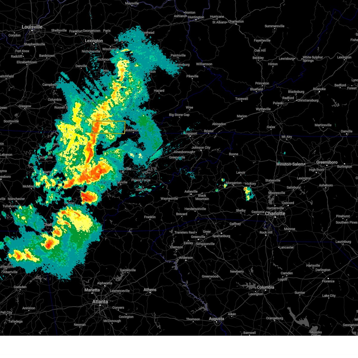
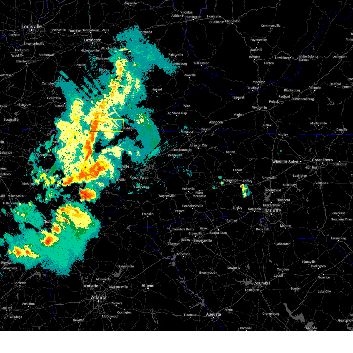
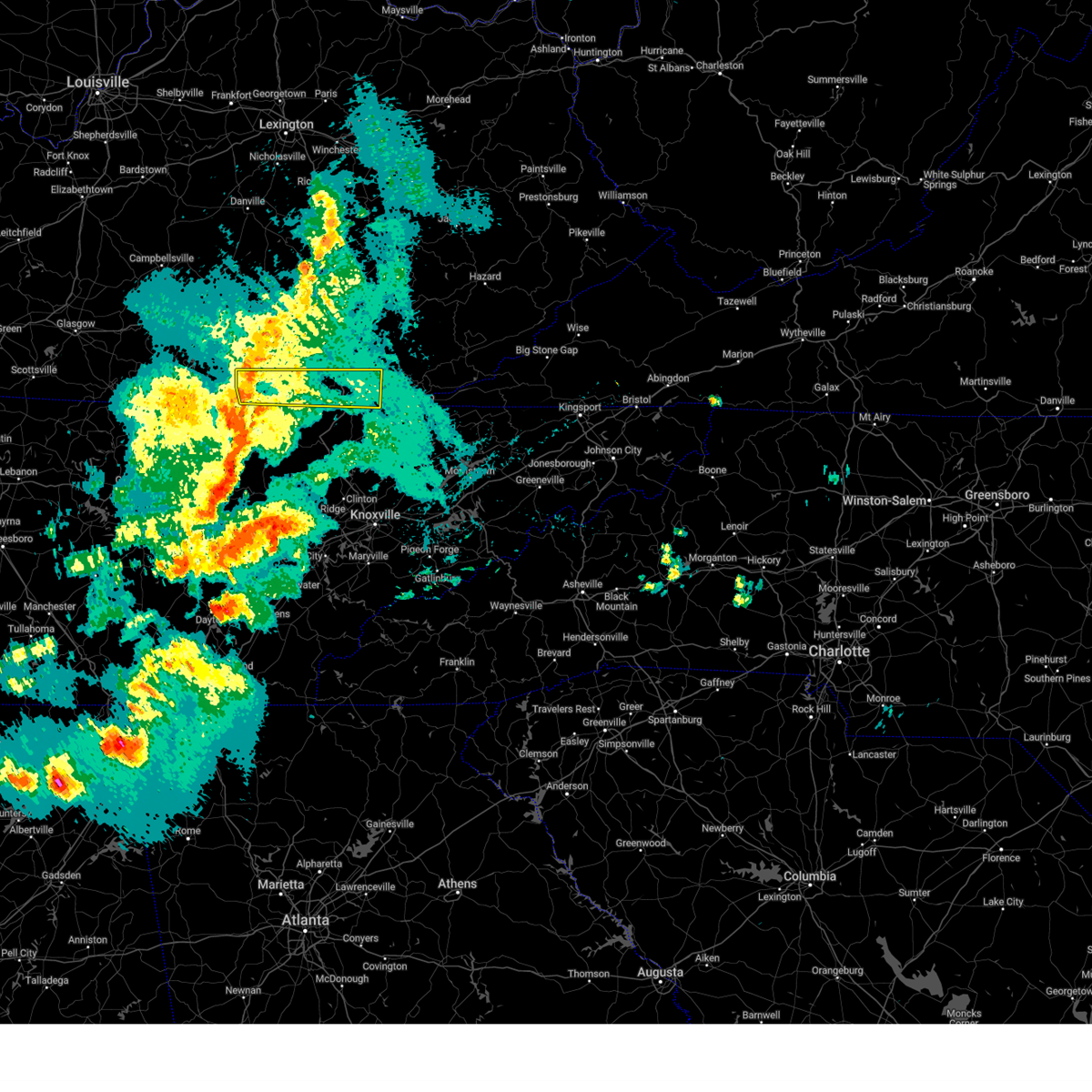
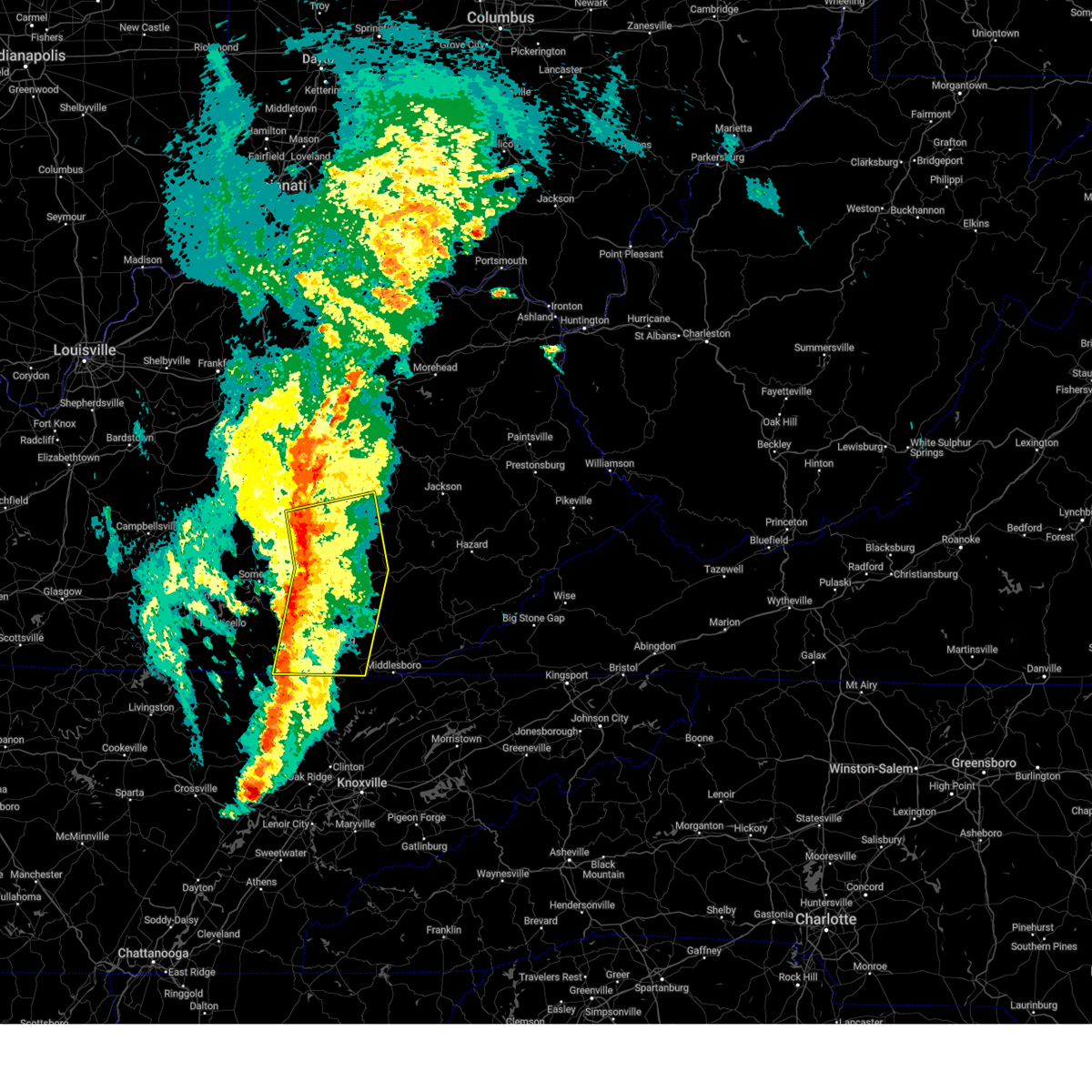
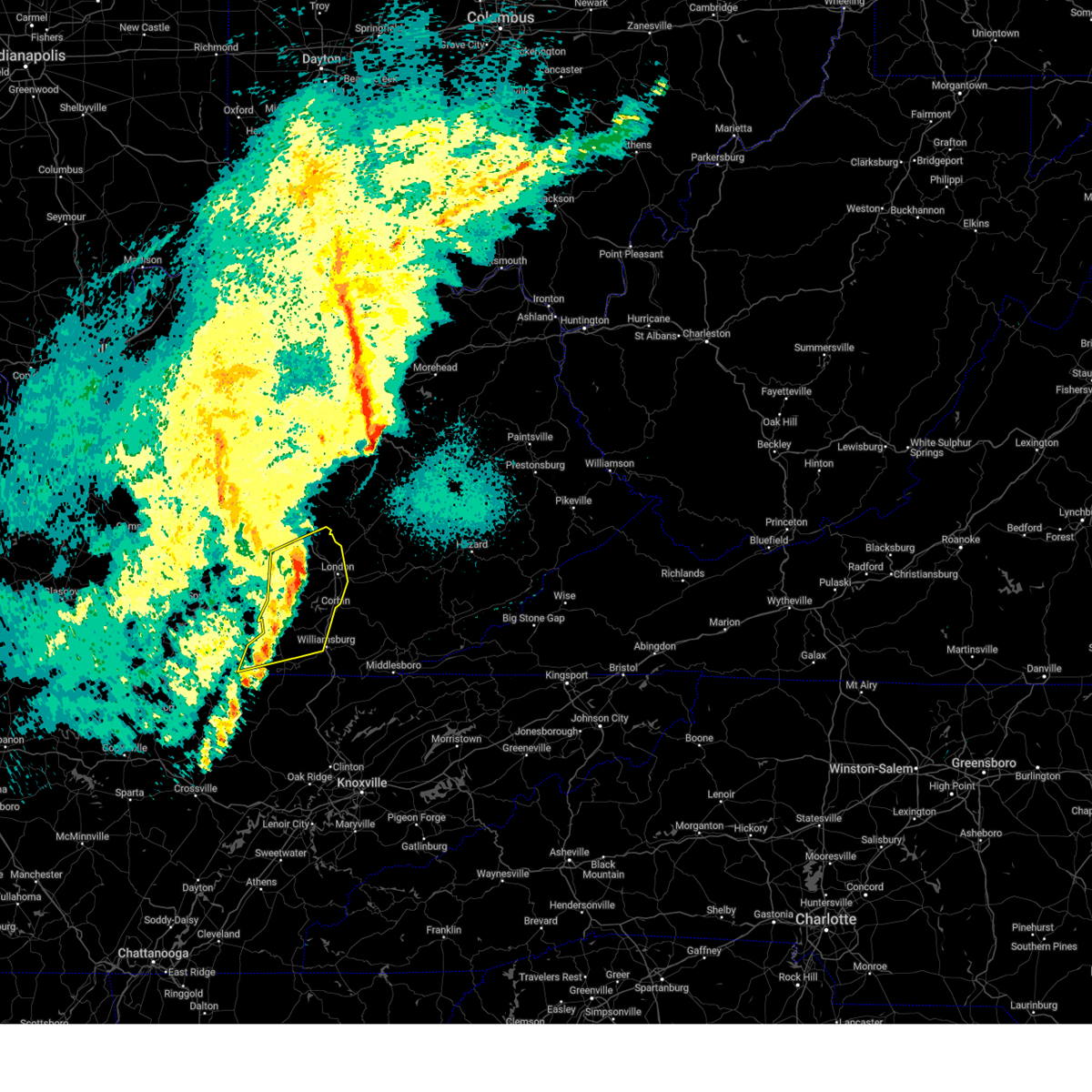
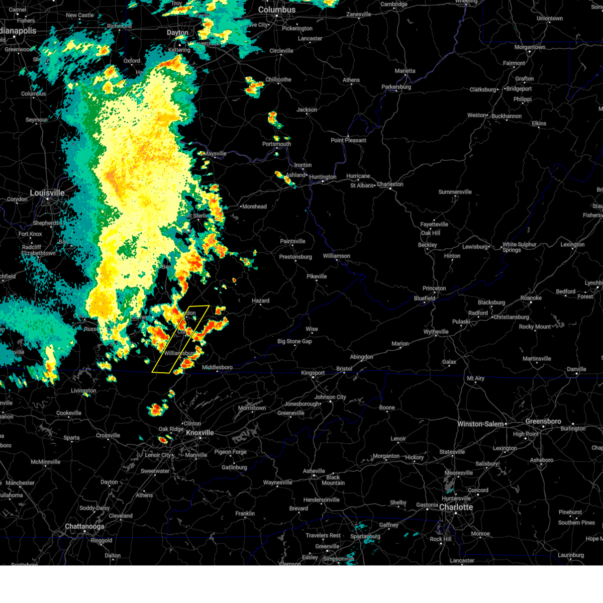
The Top Recent Hail Date for Pine Knot, KY is Thursday, May 8, 2025 (22nd out of 36)
Hail and Wind Damage Spotted near Pine Knot, KY
| Date / Time | Report Details |
|---|---|
| 5/20/2025 9:40 PM EDT |
 At 938 pm edt, severe thunderstorms were located along a line extending from near beulah heights to near pine knot to strunk, moving east at 50 mph (radar indicated). Hazards include 60 mph wind gusts and penny size hail. Expect damage to roofs, siding, and trees. Locations impacted include, ayers, williamsburg, lot, dixie, wilkerson and hubbs. At 938 pm edt, severe thunderstorms were located along a line extending from near beulah heights to near pine knot to strunk, moving east at 50 mph (radar indicated). Hazards include 60 mph wind gusts and penny size hail. Expect damage to roofs, siding, and trees. Locations impacted include, ayers, williamsburg, lot, dixie, wilkerson and hubbs.
|
| 5/20/2025 9:40 PM EDT |
 the severe thunderstorm warning has been cancelled and is no longer in effect the severe thunderstorm warning has been cancelled and is no longer in effect
|
| 5/20/2025 9:21 PM EDT |
 Svrjkl the national weather service in jackson ky has issued a * severe thunderstorm warning for, southeastern wayne county in south central kentucky, southwestern bell county in southeastern kentucky, southwestern knox county in southeastern kentucky, mccreary county in south central kentucky, whitley county in south central kentucky, * until 1015 pm edt. * at 921 pm edt, severe thunderstorms were located along a line extending from ritner to griffin to near co-operative to 6 miles southeast of great meadows campsites, moving east at 55 mph (radar indicated). Hazards include 60 mph wind gusts. Expect damage to roofs, siding, and trees. severe thunderstorms will be near, whitley city around 925 pm edt. strunk around 930 pm edt. hollyhill around 935 pm edt. ayers around 940 pm edt. Other locations in the path of these severe thunderstorms include williamsburg and lot. Svrjkl the national weather service in jackson ky has issued a * severe thunderstorm warning for, southeastern wayne county in south central kentucky, southwestern bell county in southeastern kentucky, southwestern knox county in southeastern kentucky, mccreary county in south central kentucky, whitley county in south central kentucky, * until 1015 pm edt. * at 921 pm edt, severe thunderstorms were located along a line extending from ritner to griffin to near co-operative to 6 miles southeast of great meadows campsites, moving east at 55 mph (radar indicated). Hazards include 60 mph wind gusts. Expect damage to roofs, siding, and trees. severe thunderstorms will be near, whitley city around 925 pm edt. strunk around 930 pm edt. hollyhill around 935 pm edt. ayers around 940 pm edt. Other locations in the path of these severe thunderstorms include williamsburg and lot.
|
| 5/20/2025 2:37 PM EDT |
 Svrjkl the national weather service in jackson ky has issued a * severe thunderstorm warning for, laurel county in south central kentucky, southwestern bell county in southeastern kentucky, knox county in southeastern kentucky, west central owsley county in southeastern kentucky, southeastern pulaski county in south central kentucky, jackson county in southeastern kentucky, eastern mccreary county in south central kentucky, rockcastle county in south central kentucky, whitley county in south central kentucky, southwestern lee county in southeastern kentucky, western clay county in southeastern kentucky, * until 315 pm edt. * at 237 pm edt, severe thunderstorms were located along a line extending from near hiatt to near billows to near strunk, moving east at 30 mph (radar indicated). Hazards include 60 mph wind gusts and quarter size hail. Hail damage to vehicles is expected. expect wind damage to roofs, siding, and trees. severe thunderstorms will be near, mount vernon around 240 pm edt. london around 245 pm edt. faber around 250 pm edt. carico around 255 pm edt. Other locations in the path of these severe thunderstorms include julip and lot. Svrjkl the national weather service in jackson ky has issued a * severe thunderstorm warning for, laurel county in south central kentucky, southwestern bell county in southeastern kentucky, knox county in southeastern kentucky, west central owsley county in southeastern kentucky, southeastern pulaski county in south central kentucky, jackson county in southeastern kentucky, eastern mccreary county in south central kentucky, rockcastle county in south central kentucky, whitley county in south central kentucky, southwestern lee county in southeastern kentucky, western clay county in southeastern kentucky, * until 315 pm edt. * at 237 pm edt, severe thunderstorms were located along a line extending from near hiatt to near billows to near strunk, moving east at 30 mph (radar indicated). Hazards include 60 mph wind gusts and quarter size hail. Hail damage to vehicles is expected. expect wind damage to roofs, siding, and trees. severe thunderstorms will be near, mount vernon around 240 pm edt. london around 245 pm edt. faber around 250 pm edt. carico around 255 pm edt. Other locations in the path of these severe thunderstorms include julip and lot.
|
| 5/17/2025 1:01 AM EDT |
 The storms which prompted the warning have weakened below severe limits, and have exited the warned area. therefore, the warning has been allowed to expire. however, gusty winds and heavy rain are still possible with these thunderstorms. a tornado watch remains in effect until 300 am edt for south central and southeastern kentucky. to report severe weather, contact your nearest law enforcement agency. they will relay your report to the national weather service jackson ky. The storms which prompted the warning have weakened below severe limits, and have exited the warned area. therefore, the warning has been allowed to expire. however, gusty winds and heavy rain are still possible with these thunderstorms. a tornado watch remains in effect until 300 am edt for south central and southeastern kentucky. to report severe weather, contact your nearest law enforcement agency. they will relay your report to the national weather service jackson ky.
|
| 5/17/2025 12:54 AM EDT |
 At 1253 am edt, severe thunderstorms were located along a line extending from hurley to near great meadows campsites, moving east at 65 mph (radar indicated). Hazards include 60 mph wind gusts and penny size hail. Expect damage to roofs, siding, and trees. locations impacted include, london, whitley city, fariston, pittsburg, cumberland falls s. p. Co- operative, mount victory, north corbin, krupp, hightop, hollyhill, and youngs creek. At 1253 am edt, severe thunderstorms were located along a line extending from hurley to near great meadows campsites, moving east at 65 mph (radar indicated). Hazards include 60 mph wind gusts and penny size hail. Expect damage to roofs, siding, and trees. locations impacted include, london, whitley city, fariston, pittsburg, cumberland falls s. p. Co- operative, mount victory, north corbin, krupp, hightop, hollyhill, and youngs creek.
|
| 5/17/2025 12:54 AM EDT |
 the severe thunderstorm warning has been cancelled and is no longer in effect the severe thunderstorm warning has been cancelled and is no longer in effect
|
| 5/17/2025 12:44 AM EDT | At 1243 am edt, severe thunderstorms were located along a line extending from johnetta to near mount pisgah, moving east at 65 mph (radar indicated). Hazards include 70 mph wind gusts and penny size hail. Expect considerable tree damage. damage is likely to mobile homes, roofs, and outbuildings. locations impacted include, great meadows campsites, london, levi jackson s. p. And faber. |
| 5/17/2025 12:19 AM EDT | Svrjkl the national weather service in jackson ky has issued a * severe thunderstorm warning for, wayne county in south central kentucky, laurel county in south central kentucky, pulaski county in south central kentucky, mccreary county in south central kentucky, south central rockcastle county in south central kentucky, northwestern whitley county in south central kentucky, * until 100 am edt. * at 1219 am edt, severe thunderstorms were located along a line extending from 8 miles south of stanford to 10 miles northwest of byrdstown, moving east at 65 mph (radar indicated). Hazards include 70 mph wind gusts and penny size hail. Expect considerable tree damage. damage is likely to mobile homes, roofs, and outbuildings. severe thunderstorms will be near, somerset around 1225 am edt. slickford around 1230 am edt. burnside around 1235 am edt. Other locations in the path of these severe thunderstorms include alpine, great meadows campsites and whitley city. |
| 5/8/2025 6:04 PM EDT |
 Svrjkl the national weather service in jackson ky has issued a * severe thunderstorm warning for, southeastern mccreary county in south central kentucky, west central whitley county in south central kentucky, * until 630 pm edt. * at 604 pm edt, a severe thunderstorm was located near duckrun, or near whitley city, moving east at 35 mph (radar indicated). Hazards include 60 mph wind gusts and quarter size hail. Hail damage to vehicles is expected. expect wind damage to roofs, siding, and trees. This severe thunderstorm will be near, duckrun around 610 pm edt. Svrjkl the national weather service in jackson ky has issued a * severe thunderstorm warning for, southeastern mccreary county in south central kentucky, west central whitley county in south central kentucky, * until 630 pm edt. * at 604 pm edt, a severe thunderstorm was located near duckrun, or near whitley city, moving east at 35 mph (radar indicated). Hazards include 60 mph wind gusts and quarter size hail. Hail damage to vehicles is expected. expect wind damage to roofs, siding, and trees. This severe thunderstorm will be near, duckrun around 610 pm edt.
|
| 5/2/2025 4:27 PM EDT |
 Svrjkl the national weather service in jackson ky has issued a * severe thunderstorm warning for, west central knox county in southeastern kentucky, southeastern mccreary county in south central kentucky, western whitley county in south central kentucky, * until 500 pm edt. * at 426 pm edt, a severe thunderstorm was located over hollyhill, or 8 miles southwest of williamsburg, moving northeast at 35 mph (radar indicated). Hazards include 60 mph wind gusts and quarter size hail. Hail damage to vehicles is expected. expect wind damage to roofs, siding, and trees. this severe thunderstorm will be near, redbird around 430 pm edt. williamsburg around 435 pm edt. clio around 440 pm edt. walden around 445 pm edt. Other locations in the path of this severe thunderstorm include rye and woodbine. Svrjkl the national weather service in jackson ky has issued a * severe thunderstorm warning for, west central knox county in southeastern kentucky, southeastern mccreary county in south central kentucky, western whitley county in south central kentucky, * until 500 pm edt. * at 426 pm edt, a severe thunderstorm was located over hollyhill, or 8 miles southwest of williamsburg, moving northeast at 35 mph (radar indicated). Hazards include 60 mph wind gusts and quarter size hail. Hail damage to vehicles is expected. expect wind damage to roofs, siding, and trees. this severe thunderstorm will be near, redbird around 430 pm edt. williamsburg around 435 pm edt. clio around 440 pm edt. walden around 445 pm edt. Other locations in the path of this severe thunderstorm include rye and woodbine.
|
| 4/5/2025 8:59 PM EDT |
 The storms which prompted the warning have weakened below severe limits, and no longer pose an immediate threat to life or property. therefore, the warning will be allowed to expire. a tornado watch remains in effect until 1100 pm edt for south central and southeastern kentucky. The storms which prompted the warning have weakened below severe limits, and no longer pose an immediate threat to life or property. therefore, the warning will be allowed to expire. a tornado watch remains in effect until 1100 pm edt for south central and southeastern kentucky.
|
| 4/5/2025 8:41 PM EDT |
 the severe thunderstorm warning has been cancelled and is no longer in effect the severe thunderstorm warning has been cancelled and is no longer in effect
|
| 4/5/2025 8:41 PM EDT |
 At 840 pm edt, severe thunderstorms were located along a line extending from bloss to near huxley to blue heron, moving east at 40 mph (radar indicated). Hazards include 60 mph wind gusts. Expect damage to roofs, siding, and trees. Locations impacted include, honeybee, rye, cruise, faber and bon. At 840 pm edt, severe thunderstorms were located along a line extending from bloss to near huxley to blue heron, moving east at 40 mph (radar indicated). Hazards include 60 mph wind gusts. Expect damage to roofs, siding, and trees. Locations impacted include, honeybee, rye, cruise, faber and bon.
|
| 4/5/2025 8:14 PM EDT |
 Svrjkl the national weather service in jackson ky has issued a * severe thunderstorm warning for, eastern wayne county in south central kentucky, laurel county in south central kentucky, pulaski county in south central kentucky, mccreary county in south central kentucky, southern rockcastle county in south central kentucky, northwestern whitley county in south central kentucky, * until 900 pm edt. * at 813 pm edt, severe thunderstorms were located along a line extending from near stab to near kidder to near mount pisgah, moving east at 50 mph (radar indicated). Hazards include 60 mph wind gusts. Expect damage to roofs, siding, and trees. severe thunderstorms will be near, science hill around 820 pm edt. grade around 825 pm edt. blue heron around 830 pm edt. Other locations in the path of these severe thunderstorms include honeybee, sand springs and gauley. Svrjkl the national weather service in jackson ky has issued a * severe thunderstorm warning for, eastern wayne county in south central kentucky, laurel county in south central kentucky, pulaski county in south central kentucky, mccreary county in south central kentucky, southern rockcastle county in south central kentucky, northwestern whitley county in south central kentucky, * until 900 pm edt. * at 813 pm edt, severe thunderstorms were located along a line extending from near stab to near kidder to near mount pisgah, moving east at 50 mph (radar indicated). Hazards include 60 mph wind gusts. Expect damage to roofs, siding, and trees. severe thunderstorms will be near, science hill around 820 pm edt. grade around 825 pm edt. blue heron around 830 pm edt. Other locations in the path of these severe thunderstorms include honeybee, sand springs and gauley.
|
| 4/4/2025 5:09 PM EDT | The storm which prompted the warning has weakened below severe limits, and no longer poses an immediate threat to life or property. therefore, the warning will be allowed to expire. however, small hail, gusty winds and heavy rain are still possible with this thunderstorm. a severe thunderstorm watch remains in effect until 1000 pm edt for south central kentucky. |
| 4/4/2025 4:54 PM EDT |
 At 454 pm edt, a severe thunderstorm was located near hollyhill, or 11 miles southeast of whitley city, moving northeast at 40 mph (radar indicated). Hazards include 60 mph wind gusts and quarter size hail. Hail damage to vehicles is expected. expect wind damage to roofs, siding, and trees. this severe storm will be near, ayers around 500 pm edt. Other locations in the path of this severe thunderstorm include mountain ash and nevisdale. At 454 pm edt, a severe thunderstorm was located near hollyhill, or 11 miles southeast of whitley city, moving northeast at 40 mph (radar indicated). Hazards include 60 mph wind gusts and quarter size hail. Hail damage to vehicles is expected. expect wind damage to roofs, siding, and trees. this severe storm will be near, ayers around 500 pm edt. Other locations in the path of this severe thunderstorm include mountain ash and nevisdale.
|
| 4/4/2025 4:42 PM EDT |
 Svrjkl the national weather service in jackson ky has issued a * severe thunderstorm warning for, southeastern mccreary county in south central kentucky, southwestern whitley county in south central kentucky, * until 515 pm edt. * at 442 pm edt, a severe thunderstorm was located near oneida, moving northeast at 40 mph (radar indicated). Hazards include 60 mph wind gusts and quarter size hail. Hail damage to vehicles is expected. expect wind damage to roofs, siding, and trees. this severe thunderstorm will be near, ayers around 455 pm edt. jellico creek around 500 pm edt. Other locations in the path of this severe thunderstorm include bon, suttons mill and packard. Svrjkl the national weather service in jackson ky has issued a * severe thunderstorm warning for, southeastern mccreary county in south central kentucky, southwestern whitley county in south central kentucky, * until 515 pm edt. * at 442 pm edt, a severe thunderstorm was located near oneida, moving northeast at 40 mph (radar indicated). Hazards include 60 mph wind gusts and quarter size hail. Hail damage to vehicles is expected. expect wind damage to roofs, siding, and trees. this severe thunderstorm will be near, ayers around 455 pm edt. jellico creek around 500 pm edt. Other locations in the path of this severe thunderstorm include bon, suttons mill and packard.
|
| 3/15/2025 7:07 PM EDT | The storm which prompted the warning has weakened below severe limits, and no longer poses an immediate threat to life or property. therefore, the warning will be allowed to expire. however, gusty winds are still possible with this thunderstorm. |
| 3/15/2025 6:54 PM EDT |
 At 653 pm edt, a severe thunderstorm was located near great meadows campsites, or 11 miles northwest of oneida, moving northeast at 45 mph (radar indicated). Hazards include 60 mph wind gusts and nickel size hail. Expect damage to roofs, siding, and trees. Locations impacted include, blue heron and stearns. At 653 pm edt, a severe thunderstorm was located near great meadows campsites, or 11 miles northwest of oneida, moving northeast at 45 mph (radar indicated). Hazards include 60 mph wind gusts and nickel size hail. Expect damage to roofs, siding, and trees. Locations impacted include, blue heron and stearns.
|
| 3/15/2025 6:38 PM EDT | Svrjkl the national weather service in jackson ky has issued a * severe thunderstorm warning for, southeastern wayne county in south central kentucky, southern mccreary county in south central kentucky, * until 715 pm edt. * at 638 pm edt, a severe thunderstorm was located 7 miles northeast of jamestown, moving northeast at 45 mph (radar indicated). Hazards include 60 mph wind gusts and nickel size hail. Expect damage to roofs, siding, and trees. this severe thunderstorm will be near, great meadows campsites around 645 pm edt. co-operative around 655 pm edt. Other locations in the path of this severe thunderstorm include blue heron and stearns. |
| 2/6/2025 7:54 PM EST |
 The storm which prompted the warning has weakened below severe limits, and no longer poses an immediate threat to life or property. therefore, the warning will be allowed to expire. a severe thunderstorm watch remains in effect until midnight est for south central kentucky. The storm which prompted the warning has weakened below severe limits, and no longer poses an immediate threat to life or property. therefore, the warning will be allowed to expire. a severe thunderstorm watch remains in effect until midnight est for south central kentucky.
|
| 2/6/2025 7:37 PM EST |
 At 737 pm est, a severe thunderstorm was located over delta, or 12 miles east of monticello, moving east at 35 mph (radar indicated). Hazards include 60 mph wind gusts and quarter size hail. Hail damage to vehicles is expected. expect wind damage to roofs, siding, and trees. this severe storm will be near, greenwood around 745 pm est. Other locations in the path of this severe thunderstorm include beulah heights. At 737 pm est, a severe thunderstorm was located over delta, or 12 miles east of monticello, moving east at 35 mph (radar indicated). Hazards include 60 mph wind gusts and quarter size hail. Hail damage to vehicles is expected. expect wind damage to roofs, siding, and trees. this severe storm will be near, greenwood around 745 pm est. Other locations in the path of this severe thunderstorm include beulah heights.
|
| 2/6/2025 7:29 PM EST |
 Svrjkl the national weather service in jackson ky has issued a * severe thunderstorm warning for, wayne county in south central kentucky, southwestern pulaski county in south central kentucky, central mccreary county in south central kentucky, * until 800 pm est. * at 729 pm est, a severe thunderstorm was located over gregory, or 7 miles east of monticello, moving east at 35 mph (radar indicated). Hazards include 60 mph wind gusts and quarter size hail. Hail damage to vehicles is expected. expect wind damage to roofs, siding, and trees. this severe thunderstorm will be near, denney around 735 pm est. greenwood around 745 pm est. Other locations in the path of this severe thunderstorm include beulah heights. Svrjkl the national weather service in jackson ky has issued a * severe thunderstorm warning for, wayne county in south central kentucky, southwestern pulaski county in south central kentucky, central mccreary county in south central kentucky, * until 800 pm est. * at 729 pm est, a severe thunderstorm was located over gregory, or 7 miles east of monticello, moving east at 35 mph (radar indicated). Hazards include 60 mph wind gusts and quarter size hail. Hail damage to vehicles is expected. expect wind damage to roofs, siding, and trees. this severe thunderstorm will be near, denney around 735 pm est. greenwood around 745 pm est. Other locations in the path of this severe thunderstorm include beulah heights.
|
| 8/1/2024 7:56 PM EDT |
 The storms which prompted the warning have moved out of the area. therefore, the warning will be allowed to expire. a severe thunderstorm watch remains in effect until midnight edt for south central and southeastern kentucky. The storms which prompted the warning have moved out of the area. therefore, the warning will be allowed to expire. a severe thunderstorm watch remains in effect until midnight edt for south central and southeastern kentucky.
|
| 8/1/2024 7:52 PM EDT |
 The storms which prompted the warning have moved out of the area. therefore, the warning will be allowed to expire. a severe thunderstorm watch remains in effect until midnight edt for south central kentucky. The storms which prompted the warning have moved out of the area. therefore, the warning will be allowed to expire. a severe thunderstorm watch remains in effect until midnight edt for south central kentucky.
|
| 8/1/2024 7:50 PM EDT |
 Svrjkl the national weather service in jackson ky has issued a * severe thunderstorm warning for, southeastern laurel county in south central kentucky, west central knox county in southeastern kentucky, southeastern mccreary county in south central kentucky, western whitley county in south central kentucky, west central clay county in southeastern kentucky, * until 800 pm edt. * at 750 pm edt, severe thunderstorms were located along a line extending from atlanta to 6 miles southwest of zion hill, moving east at 20 mph (radar indicated). Hazards include 60 mph wind gusts. Expect damage to roofs, siding, and trees. severe thunderstorms will be near, london around 755 pm edt. Fogertown around 800 pm edt. Svrjkl the national weather service in jackson ky has issued a * severe thunderstorm warning for, southeastern laurel county in south central kentucky, west central knox county in southeastern kentucky, southeastern mccreary county in south central kentucky, western whitley county in south central kentucky, west central clay county in southeastern kentucky, * until 800 pm edt. * at 750 pm edt, severe thunderstorms were located along a line extending from atlanta to 6 miles southwest of zion hill, moving east at 20 mph (radar indicated). Hazards include 60 mph wind gusts. Expect damage to roofs, siding, and trees. severe thunderstorms will be near, london around 755 pm edt. Fogertown around 800 pm edt.
|
| 8/1/2024 7:44 PM EDT |
 At 744 pm edt, severe thunderstorms were located along a line extending from near billows to alpine to slickford, moving east at 40 mph (radar indicated). Hazards include 60 mph wind gusts. Expect damage to roofs, siding, and trees. Locations impacted include, london, whitley city and pine knot. At 744 pm edt, severe thunderstorms were located along a line extending from near billows to alpine to slickford, moving east at 40 mph (radar indicated). Hazards include 60 mph wind gusts. Expect damage to roofs, siding, and trees. Locations impacted include, london, whitley city and pine knot.
|
| 8/1/2024 7:29 PM EDT |
 Svrjkl the national weather service in jackson ky has issued a * severe thunderstorm warning for, wayne county in south central kentucky, western laurel county in south central kentucky, pulaski county in south central kentucky, mccreary county in south central kentucky, southwestern rockcastle county in south central kentucky, northwestern whitley county in south central kentucky, * until 800 pm edt. * at 729 pm edt, severe thunderstorms were located along a line extending from near hansford to frazer to near zula, moving east at 40 mph (radar indicated). Hazards include 60 mph wind gusts. Expect damage to roofs, siding, and trees. severe thunderstorms will be near, somerset around 735 pm edt. hazel patch around 740 pm edt. slavens around 745 pm edt. Other locations in the path of these severe thunderstorms include parmleysville. Svrjkl the national weather service in jackson ky has issued a * severe thunderstorm warning for, wayne county in south central kentucky, western laurel county in south central kentucky, pulaski county in south central kentucky, mccreary county in south central kentucky, southwestern rockcastle county in south central kentucky, northwestern whitley county in south central kentucky, * until 800 pm edt. * at 729 pm edt, severe thunderstorms were located along a line extending from near hansford to frazer to near zula, moving east at 40 mph (radar indicated). Hazards include 60 mph wind gusts. Expect damage to roofs, siding, and trees. severe thunderstorms will be near, somerset around 735 pm edt. hazel patch around 740 pm edt. slavens around 745 pm edt. Other locations in the path of these severe thunderstorms include parmleysville.
|
| 7/31/2024 7:07 PM EDT | The storms which prompted the warning have moved out of the area. therefore, the warning will be allowed to expire. however, gusty winds are still possible with these thunderstorms. |
| 7/31/2024 7:06 PM EDT | At 706 pm edt, severe thunderstorms were located along a line extending from near cumberland falls s.p. to 7 miles west of oneida, moving southeast at 30 mph (radar indicated). Hazards include 60 mph wind gusts. Expect damage to roofs, siding, and trees. Locations impacted include, williamsburg and bon. |
| 7/31/2024 7:06 PM EDT | the severe thunderstorm warning has been cancelled and is no longer in effect |
| 7/31/2024 6:41 PM EDT |
 Svrjkl the national weather service in jackson ky has issued a * severe thunderstorm warning for, southeastern wayne county in south central kentucky, southeastern pulaski county in south central kentucky, mccreary county in south central kentucky, southwestern whitley county in south central kentucky, * until 715 pm edt. * at 641 pm edt, severe thunderstorms were located along a line extending from alpine to mount pisgah, moving southeast at 30 mph (radar indicated). Hazards include 60 mph wind gusts. Expect damage to roofs, siding, and trees. severe thunderstorms will be near, great meadows campsites around 645 pm edt. whitley city around 650 pm edt. pine knot around 655 pm edt. duckrun around 700 pm edt. Other locations in the path of these severe thunderstorms include strunk. Svrjkl the national weather service in jackson ky has issued a * severe thunderstorm warning for, southeastern wayne county in south central kentucky, southeastern pulaski county in south central kentucky, mccreary county in south central kentucky, southwestern whitley county in south central kentucky, * until 715 pm edt. * at 641 pm edt, severe thunderstorms were located along a line extending from alpine to mount pisgah, moving southeast at 30 mph (radar indicated). Hazards include 60 mph wind gusts. Expect damage to roofs, siding, and trees. severe thunderstorms will be near, great meadows campsites around 645 pm edt. whitley city around 650 pm edt. pine knot around 655 pm edt. duckrun around 700 pm edt. Other locations in the path of these severe thunderstorms include strunk.
|
| 7/30/2024 4:20 PM EDT | The storms which prompted the warning have moved out of the area. therefore, the warning has been allowed to expire. a severe thunderstorm watch remains in effect until 900 pm edt for south central kentucky. |
| 7/30/2024 4:05 PM EDT |
 the severe thunderstorm warning has been cancelled and is no longer in effect the severe thunderstorm warning has been cancelled and is no longer in effect
|
| 7/30/2024 4:05 PM EDT |
 At 404 pm edt, severe thunderstorms were located along a line extending from near greenwood to near great meadows campsites to 7 miles northeast of livingston, moving southeast at 25 mph (radar indicated). Hazards include 60 mph wind gusts and quarter size hail. Hail damage to vehicles is expected. expect wind damage to roofs, siding, and trees. Locations impacted include, whitley city, strunk and duckrun. At 404 pm edt, severe thunderstorms were located along a line extending from near greenwood to near great meadows campsites to 7 miles northeast of livingston, moving southeast at 25 mph (radar indicated). Hazards include 60 mph wind gusts and quarter size hail. Hail damage to vehicles is expected. expect wind damage to roofs, siding, and trees. Locations impacted include, whitley city, strunk and duckrun.
|
| 7/30/2024 3:40 PM EDT |
 The storms which prompted the warning have moved out of the area. therefore, the warning will be allowed to expire. however, gusty winds and heavy rain are still possible with these thunderstorms. a severe thunderstorm watch remains in effect until 900 pm edt for south central kentucky. The storms which prompted the warning have moved out of the area. therefore, the warning will be allowed to expire. however, gusty winds and heavy rain are still possible with these thunderstorms. a severe thunderstorm watch remains in effect until 900 pm edt for south central kentucky.
|
| 7/30/2024 3:39 PM EDT |
 Svrjkl the national weather service in jackson ky has issued a * severe thunderstorm warning for, wayne county in south central kentucky, southwestern pulaski county in south central kentucky, mccreary county in south central kentucky, southwestern whitley county in south central kentucky, * until 415 pm edt. * at 339 pm edt, severe thunderstorms were located along a line extending from near frazer to burfield to 8 miles east of celina, moving southeast at 25 mph (radar indicated). Hazards include 60 mph wind gusts and quarter size hail. Hail damage to vehicles is expected. expect wind damage to roofs, siding, and trees. severe thunderstorms will be near, burnside around 345 pm edt. co-operative around 350 pm edt. greenwood around 355 pm edt. Other locations in the path of these severe thunderstorms include blue heron. Svrjkl the national weather service in jackson ky has issued a * severe thunderstorm warning for, wayne county in south central kentucky, southwestern pulaski county in south central kentucky, mccreary county in south central kentucky, southwestern whitley county in south central kentucky, * until 415 pm edt. * at 339 pm edt, severe thunderstorms were located along a line extending from near frazer to burfield to 8 miles east of celina, moving southeast at 25 mph (radar indicated). Hazards include 60 mph wind gusts and quarter size hail. Hail damage to vehicles is expected. expect wind damage to roofs, siding, and trees. severe thunderstorms will be near, burnside around 345 pm edt. co-operative around 350 pm edt. greenwood around 355 pm edt. Other locations in the path of these severe thunderstorms include blue heron.
|
| 7/30/2024 3:34 PM EDT |
 At 334 pm edt, severe thunderstorms were located along a line extending from near science hill to barrier to 9 miles northeast of celina, moving southeast at 40 mph (radar indicated). Hazards include 60 mph wind gusts and quarter size hail. Hail damage to vehicles is expected. expect wind damage to roofs, siding, and trees. Locations impacted include, somerset, great meadows campsites, whitley city, marshes siding, honeybee and rockcastle springs. At 334 pm edt, severe thunderstorms were located along a line extending from near science hill to barrier to 9 miles northeast of celina, moving southeast at 40 mph (radar indicated). Hazards include 60 mph wind gusts and quarter size hail. Hail damage to vehicles is expected. expect wind damage to roofs, siding, and trees. Locations impacted include, somerset, great meadows campsites, whitley city, marshes siding, honeybee and rockcastle springs.
|
| 7/30/2024 3:07 PM EDT |
 Svrjkl the national weather service in jackson ky has issued a * severe thunderstorm warning for, wayne county in south central kentucky, southwestern laurel county in south central kentucky, pulaski county in south central kentucky, mccreary county in south central kentucky, northwestern whitley county in south central kentucky, * until 345 pm edt. * at 306 pm edt, severe thunderstorms were located along a line extending from near liberty to near cabell to near tompkinsville, moving southeast at 50 mph (radar indicated). Hazards include 60 mph wind gusts and quarter size hail. Hail damage to vehicles is expected. expect wind damage to roofs, siding, and trees. severe thunderstorms will be near, parnell around 310 pm edt. monticello around 315 pm edt. naomi around 320 pm edt. somerset around 325 pm edt. Other locations in the path of these severe thunderstorms include burnside and great meadows campsites. Svrjkl the national weather service in jackson ky has issued a * severe thunderstorm warning for, wayne county in south central kentucky, southwestern laurel county in south central kentucky, pulaski county in south central kentucky, mccreary county in south central kentucky, northwestern whitley county in south central kentucky, * until 345 pm edt. * at 306 pm edt, severe thunderstorms were located along a line extending from near liberty to near cabell to near tompkinsville, moving southeast at 50 mph (radar indicated). Hazards include 60 mph wind gusts and quarter size hail. Hail damage to vehicles is expected. expect wind damage to roofs, siding, and trees. severe thunderstorms will be near, parnell around 310 pm edt. monticello around 315 pm edt. naomi around 320 pm edt. somerset around 325 pm edt. Other locations in the path of these severe thunderstorms include burnside and great meadows campsites.
|
| 5/27/2024 2:06 AM EDT |
 the severe thunderstorm warning has been cancelled and is no longer in effect the severe thunderstorm warning has been cancelled and is no longer in effect
|
| 5/27/2024 2:06 AM EDT |
 At 206 am edt, severe thunderstorms were located along a line extending from green hill to lesbas to north corbin to faber to clio to near zion hill, moving east at 45 mph (radar indicated). Hazards include 60 mph wind gusts and penny size hail. Expect damage to roofs, siding, and trees. Locations impacted include, williamsburg, barbourville, seth, brush creek, dewitt and clear creek springs. At 206 am edt, severe thunderstorms were located along a line extending from green hill to lesbas to north corbin to faber to clio to near zion hill, moving east at 45 mph (radar indicated). Hazards include 60 mph wind gusts and penny size hail. Expect damage to roofs, siding, and trees. Locations impacted include, williamsburg, barbourville, seth, brush creek, dewitt and clear creek springs.
|
| 5/27/2024 1:47 AM EDT |
 The storms which prompted the warning have moved east and a new warning has been issued. therefore, this warning has been allowed to expire. a tornado watch remains in effect until 600 am edt for south central kentucky. remember, a new severe thunderstorm warning is in effect until 245 am edt for eastern wayne county and eastern pulaski county and points to the east. The storms which prompted the warning have moved east and a new warning has been issued. therefore, this warning has been allowed to expire. a tornado watch remains in effect until 600 am edt for south central kentucky. remember, a new severe thunderstorm warning is in effect until 245 am edt for eastern wayne county and eastern pulaski county and points to the east.
|
| 5/27/2024 1:41 AM EDT |
 Svrjkl the national weather service in jackson ky has issued a * severe thunderstorm warning for, eastern wayne county in south central kentucky, laurel county in south central kentucky, central bell county in southeastern kentucky, knox county in southeastern kentucky, southeastern owsley county in southeastern kentucky, eastern pulaski county in south central kentucky, south central jackson county in southeastern kentucky, mccreary county in south central kentucky, southern rockcastle county in south central kentucky, whitley county in south central kentucky, clay county in southeastern kentucky, * until 245 am edt. * at 141 am edt, severe thunderstorms were located along a line extending from luner to near rockcastle springs to near sloans valley to greenwood to near ritner to near great meadows campsites, moving east at 40 mph (radar indicated). Hazards include 60 mph wind gusts and penny size hail. Expect damage to roofs, siding, and trees. severe thunderstorms will be near, whitley city around 145 am edt. london around 150 am edt. levi jackson s. p. around 155 am edt. lesbas around 200 am edt. Other locations in the path of these severe thunderstorms include williamsburg and blackwater. Svrjkl the national weather service in jackson ky has issued a * severe thunderstorm warning for, eastern wayne county in south central kentucky, laurel county in south central kentucky, central bell county in southeastern kentucky, knox county in southeastern kentucky, southeastern owsley county in southeastern kentucky, eastern pulaski county in south central kentucky, south central jackson county in southeastern kentucky, mccreary county in south central kentucky, southern rockcastle county in south central kentucky, whitley county in south central kentucky, clay county in southeastern kentucky, * until 245 am edt. * at 141 am edt, severe thunderstorms were located along a line extending from luner to near rockcastle springs to near sloans valley to greenwood to near ritner to near great meadows campsites, moving east at 40 mph (radar indicated). Hazards include 60 mph wind gusts and penny size hail. Expect damage to roofs, siding, and trees. severe thunderstorms will be near, whitley city around 145 am edt. london around 150 am edt. levi jackson s. p. around 155 am edt. lesbas around 200 am edt. Other locations in the path of these severe thunderstorms include williamsburg and blackwater.
|
| 5/27/2024 1:20 AM EDT |
 At 119 am edt, severe thunderstorms were located along a line extending from science hill to naomi to near parnell to near hidalgo to powersburg to near sunnybrook, moving east at 55 mph (radar indicated). Hazards include 60 mph wind gusts and penny size hail. Expect damage to roofs, siding, and trees. Locations impacted include, somerset, great meadows campsites, blue heron, whitley city, hightop and london. At 119 am edt, severe thunderstorms were located along a line extending from science hill to naomi to near parnell to near hidalgo to powersburg to near sunnybrook, moving east at 55 mph (radar indicated). Hazards include 60 mph wind gusts and penny size hail. Expect damage to roofs, siding, and trees. Locations impacted include, somerset, great meadows campsites, blue heron, whitley city, hightop and london.
|
| 5/27/2024 12:50 AM EDT |
 Svrjkl the national weather service in jackson ky has issued a * severe thunderstorm warning for, wayne county in south central kentucky, southwestern laurel county in south central kentucky, pulaski county in south central kentucky, mccreary county in south central kentucky, south central rockcastle county in south central kentucky, northwestern whitley county in south central kentucky, * until 145 am edt. * at 1249 am edt, severe thunderstorms were located along a line extending from 11 miles southwest of liberty to near jamestown to 11 miles south of columbia to 12 miles northwest of albany to burkesville to 11 miles northeast of celina, moving east at 50 mph (radar indicated). Hazards include 60 mph wind gusts and quarter size hail. Hail damage to vehicles is expected. expect wind damage to roofs, siding, and trees. severe thunderstorms will be near, magnum around 100 am edt. zula around 105 am edt. Other locations in the path of these severe thunderstorms include monticello, somerset, burnside and great meadows campsites. Svrjkl the national weather service in jackson ky has issued a * severe thunderstorm warning for, wayne county in south central kentucky, southwestern laurel county in south central kentucky, pulaski county in south central kentucky, mccreary county in south central kentucky, south central rockcastle county in south central kentucky, northwestern whitley county in south central kentucky, * until 145 am edt. * at 1249 am edt, severe thunderstorms were located along a line extending from 11 miles southwest of liberty to near jamestown to 11 miles south of columbia to 12 miles northwest of albany to burkesville to 11 miles northeast of celina, moving east at 50 mph (radar indicated). Hazards include 60 mph wind gusts and quarter size hail. Hail damage to vehicles is expected. expect wind damage to roofs, siding, and trees. severe thunderstorms will be near, magnum around 100 am edt. zula around 105 am edt. Other locations in the path of these severe thunderstorms include monticello, somerset, burnside and great meadows campsites.
|
| 5/26/2024 1:45 PM EDT |
 A tornado watch remains in effect until 400 pm edt for south central and southeastern kentucky. A tornado watch remains in effect until 400 pm edt for south central and southeastern kentucky.
|
| 5/26/2024 1:23 PM EDT |
 At 123 pm edt, severe thunderstorms were located along a line extending from grade to near cumberland falls s.p. to near hollyhill, moving east at 60 mph (radar indicated). Hazards include 60 mph wind gusts and nickel size hail. Expect damage to roofs, siding, and trees. Locations impacted include, williamsburg, lot, barbourville, blackwater, pineville and middlesboro. At 123 pm edt, severe thunderstorms were located along a line extending from grade to near cumberland falls s.p. to near hollyhill, moving east at 60 mph (radar indicated). Hazards include 60 mph wind gusts and nickel size hail. Expect damage to roofs, siding, and trees. Locations impacted include, williamsburg, lot, barbourville, blackwater, pineville and middlesboro.
|
| 5/26/2024 1:01 PM EDT |
 The storms which prompted the warning have moved out of the area. therefore, the warning has been allowed to expire. however, gusty winds are still possible with these thunderstorms. a tornado watch remains in effect until 400 pm edt for south central kentucky. to report severe weather, contact your nearest law enforcement agency. they will relay your report to the national weather service jackson ky. The storms which prompted the warning have moved out of the area. therefore, the warning has been allowed to expire. however, gusty winds are still possible with these thunderstorms. a tornado watch remains in effect until 400 pm edt for south central kentucky. to report severe weather, contact your nearest law enforcement agency. they will relay your report to the national weather service jackson ky.
|
| 5/26/2024 12:54 PM EDT |
 Svrjkl the national weather service in jackson ky has issued a * severe thunderstorm warning for, southern laurel county in south central kentucky, bell county in southeastern kentucky, knox county in southeastern kentucky, southeastern pulaski county in south central kentucky, mccreary county in south central kentucky, whitley county in south central kentucky, * until 145 pm edt. * at 1254 pm edt, severe thunderstorms were located along a line extending from somerset to near helenwood, moving east at 60 mph (radar indicated). Hazards include 60 mph wind gusts and nickel size hail. Expect damage to roofs, siding, and trees. severe thunderstorms will be near, whitley city around 100 pm edt. bark camp around 105 pm edt. williamsburg around 110 pm edt. Other locations in the path of these severe thunderstorms include faber, julip and barbourville. Svrjkl the national weather service in jackson ky has issued a * severe thunderstorm warning for, southern laurel county in south central kentucky, bell county in southeastern kentucky, knox county in southeastern kentucky, southeastern pulaski county in south central kentucky, mccreary county in south central kentucky, whitley county in south central kentucky, * until 145 pm edt. * at 1254 pm edt, severe thunderstorms were located along a line extending from somerset to near helenwood, moving east at 60 mph (radar indicated). Hazards include 60 mph wind gusts and nickel size hail. Expect damage to roofs, siding, and trees. severe thunderstorms will be near, whitley city around 100 pm edt. bark camp around 105 pm edt. williamsburg around 110 pm edt. Other locations in the path of these severe thunderstorms include faber, julip and barbourville.
|
| 5/26/2024 12:45 PM EDT |
 At 1245 pm edt, severe thunderstorms were located along a line extending from naomi to near mount pisgah, moving east at 50 mph (radar indicated). Hazards include 60 mph wind gusts and nickel size hail. Expect damage to roofs, siding, and trees. Locations impacted include, somerset, blue heron, whitley city, strunk and honeybee. At 1245 pm edt, severe thunderstorms were located along a line extending from naomi to near mount pisgah, moving east at 50 mph (radar indicated). Hazards include 60 mph wind gusts and nickel size hail. Expect damage to roofs, siding, and trees. Locations impacted include, somerset, blue heron, whitley city, strunk and honeybee.
|
| 5/26/2024 12:17 PM EDT |
 Svrjkl the national weather service in jackson ky has issued a * severe thunderstorm warning for, wayne county in south central kentucky, southern pulaski county in south central kentucky, mccreary county in south central kentucky, * until 100 pm edt. * at 1217 pm edt, severe thunderstorms were located along a line extending from 7 miles west of jamestown to near byrdstown, moving east at 50 mph (radar indicated). Hazards include 60 mph wind gusts and nickel size hail. Expect damage to roofs, siding, and trees. severe thunderstorms will be near, zula around 1225 pm edt. monticello around 1230 pm edt. mount pisgah around 1235 pm edt. Other locations in the path of these severe thunderstorms include barrier, great meadows campsites and somerset. Svrjkl the national weather service in jackson ky has issued a * severe thunderstorm warning for, wayne county in south central kentucky, southern pulaski county in south central kentucky, mccreary county in south central kentucky, * until 100 pm edt. * at 1217 pm edt, severe thunderstorms were located along a line extending from 7 miles west of jamestown to near byrdstown, moving east at 50 mph (radar indicated). Hazards include 60 mph wind gusts and nickel size hail. Expect damage to roofs, siding, and trees. severe thunderstorms will be near, zula around 1225 pm edt. monticello around 1230 pm edt. mount pisgah around 1235 pm edt. Other locations in the path of these severe thunderstorms include barrier, great meadows campsites and somerset.
|
| 5/8/2024 9:12 AM EDT |
 The storm which prompted the warning has weakened below severe limits, and no longer poses an immediate threat to life or property. therefore, the warning will be allowed to expire. The storm which prompted the warning has weakened below severe limits, and no longer poses an immediate threat to life or property. therefore, the warning will be allowed to expire.
|
| 5/8/2024 8:41 AM EDT |
 the severe thunderstorm warning has been cancelled and is no longer in effect the severe thunderstorm warning has been cancelled and is no longer in effect
|
| 5/8/2024 8:41 AM EDT |
 At 840 am edt, a severe thunderstorm was located over blue heron, or near whitley city, moving east at 40 mph (radar indicated). Hazards include 60 mph wind gusts and quarter size hail. Hail damage to vehicles is expected. expect wind damage to roofs, siding, and trees. this severe storm will be near, whitley city around 845 am edt. Other locations in the path of this severe thunderstorm include hollyhill, ayers, mountain ash, lot and dixie. At 840 am edt, a severe thunderstorm was located over blue heron, or near whitley city, moving east at 40 mph (radar indicated). Hazards include 60 mph wind gusts and quarter size hail. Hail damage to vehicles is expected. expect wind damage to roofs, siding, and trees. this severe storm will be near, whitley city around 845 am edt. Other locations in the path of this severe thunderstorm include hollyhill, ayers, mountain ash, lot and dixie.
|
| 5/8/2024 8:28 AM EDT |
 The storm which prompted the warning has expired but has been replaced with a new warning. to report severe weather, contact your nearest law enforcement agency. they will relay your report to the national weather service jackson ky. remember, a severe thunderstorm warning still remains in effect for wayne, mccreary, and whitley counties. The storm which prompted the warning has expired but has been replaced with a new warning. to report severe weather, contact your nearest law enforcement agency. they will relay your report to the national weather service jackson ky. remember, a severe thunderstorm warning still remains in effect for wayne, mccreary, and whitley counties.
|
| 5/8/2024 8:26 AM EDT |
 Svrjkl the national weather service in jackson ky has issued a * severe thunderstorm warning for, southeastern wayne county in south central kentucky, mccreary county in south central kentucky, southwestern whitley county in south central kentucky, * until 915 am edt. * at 826 am edt, a severe thunderstorm was located over griffin, or 13 miles west of whitley city, moving east at 40 mph (radar indicated). Hazards include 60 mph wind gusts and quarter size hail. Hail damage to vehicles is expected. expect wind damage to roofs, siding, and trees. this severe thunderstorm will be near, co-operative around 830 am edt. stearns around 835 am edt. whitley city around 840 am edt. strunk around 845 am edt. Other locations in the path of this severe thunderstorm include hollyhill and ayers. Svrjkl the national weather service in jackson ky has issued a * severe thunderstorm warning for, southeastern wayne county in south central kentucky, mccreary county in south central kentucky, southwestern whitley county in south central kentucky, * until 915 am edt. * at 826 am edt, a severe thunderstorm was located over griffin, or 13 miles west of whitley city, moving east at 40 mph (radar indicated). Hazards include 60 mph wind gusts and quarter size hail. Hail damage to vehicles is expected. expect wind damage to roofs, siding, and trees. this severe thunderstorm will be near, co-operative around 830 am edt. stearns around 835 am edt. whitley city around 840 am edt. strunk around 845 am edt. Other locations in the path of this severe thunderstorm include hollyhill and ayers.
|
| 5/8/2024 8:17 AM EDT |
 At 817 am edt, a severe thunderstorm was located over parmleysville, or 12 miles southeast of monticello, moving east at 50 mph (radar indicated). Hazards include 60 mph wind gusts and quarter size hail. Hail damage to vehicles is expected. expect wind damage to roofs, siding, and trees. this severe storm will be near, great meadows campsites around 820 am edt. Other locations in the path of this severe thunderstorm include blue heron, stearns and strunk. At 817 am edt, a severe thunderstorm was located over parmleysville, or 12 miles southeast of monticello, moving east at 50 mph (radar indicated). Hazards include 60 mph wind gusts and quarter size hail. Hail damage to vehicles is expected. expect wind damage to roofs, siding, and trees. this severe storm will be near, great meadows campsites around 820 am edt. Other locations in the path of this severe thunderstorm include blue heron, stearns and strunk.
|
| 5/8/2024 8:04 AM EDT |
 Svrjkl the national weather service in jackson ky has issued a * severe thunderstorm warning for, southern wayne county in south central kentucky, southern mccreary county in south central kentucky, * until 830 am edt. * at 803 am edt, a severe thunderstorm was located over powersburg, or 12 miles southwest of monticello, moving east at 50 mph (radar indicated). Hazards include 60 mph wind gusts and quarter size hail. Hail damage to vehicles is expected. expect wind damage to roofs, siding, and trees. this severe thunderstorm will be near, slickford around 810 am edt. great meadows campsites around 815 am edt. Other locations in the path of this severe thunderstorm include co- operative. Svrjkl the national weather service in jackson ky has issued a * severe thunderstorm warning for, southern wayne county in south central kentucky, southern mccreary county in south central kentucky, * until 830 am edt. * at 803 am edt, a severe thunderstorm was located over powersburg, or 12 miles southwest of monticello, moving east at 50 mph (radar indicated). Hazards include 60 mph wind gusts and quarter size hail. Hail damage to vehicles is expected. expect wind damage to roofs, siding, and trees. this severe thunderstorm will be near, slickford around 810 am edt. great meadows campsites around 815 am edt. Other locations in the path of this severe thunderstorm include co- operative.
|
| 4/2/2024 7:20 PM EDT |
 Svrjkl the national weather service in jackson ky has issued a * severe thunderstorm warning for, southwestern laurel county in south central kentucky, west central knox county in southeastern kentucky, southeastern pulaski county in south central kentucky, central mccreary county in south central kentucky, northwestern whitley county in south central kentucky, * until 745 pm edt. * at 719 pm edt, a severe thunderstorm was located over honeybee, or 8 miles northeast of whitley city, moving northeast at 50 mph (radar indicated). Hazards include 60 mph wind gusts and quarter size hail. Hail damage to vehicles is expected. expect wind damage to roofs, siding, and trees. this severe thunderstorm will be near, bark camp around 725 pm edt. rye around 730 pm edt. barton around 735 pm edt. Other locations in the path of this severe thunderstorm include dorthae. Svrjkl the national weather service in jackson ky has issued a * severe thunderstorm warning for, southwestern laurel county in south central kentucky, west central knox county in southeastern kentucky, southeastern pulaski county in south central kentucky, central mccreary county in south central kentucky, northwestern whitley county in south central kentucky, * until 745 pm edt. * at 719 pm edt, a severe thunderstorm was located over honeybee, or 8 miles northeast of whitley city, moving northeast at 50 mph (radar indicated). Hazards include 60 mph wind gusts and quarter size hail. Hail damage to vehicles is expected. expect wind damage to roofs, siding, and trees. this severe thunderstorm will be near, bark camp around 725 pm edt. rye around 730 pm edt. barton around 735 pm edt. Other locations in the path of this severe thunderstorm include dorthae.
|
| 3/6/2024 10:07 AM EST |
 Torjkl the national weather service in jackson ky has issued a * this is a test message. tornado warning for, montgomery county in east central kentucky, mccreary county in south central kentucky, rowan county in east central kentucky, morgan county in southeastern kentucky, bath county in east central kentucky, leslie county in southeastern kentucky, estill county in east central kentucky, pulaski county in south central kentucky, rockcastle county in south central kentucky, clay county in southeastern kentucky, elliott county in east central kentucky, wayne county in south central kentucky, harlan county in southeastern kentucky, knox county in southeastern kentucky, owsley county in southeastern kentucky, jackson county in southeastern kentucky, knott county in southeastern kentucky, floyd county in southeastern kentucky, whitley county in south central kentucky, menifee county in east central kentucky, lee county in southeastern kentucky, fleming county in east central kentucky, wolfe county in southeastern kentucky, powell county in east central kentucky, laurel county in south central kentucky, martin county in northeastern kentucky, bell county in southeastern kentucky, johnson county in northeastern kentucky, letcher county in southeastern kentucky, perry county in southeastern kentucky, breathitt county in southeastern kentucky, pike county in southeastern kentucky, magoffin county in southeastern kentucky, * this is a test message. until 1030 am est. * this is a test message. repeat, this is a test tornado warning message. there is no severe weather occuring at this time. this test warning message is part of the annual kentucky tornado drill. if this were an actual severe weather event, you would be given information about the hazard. the national weather service, kentucky emergency management angency, and the kentucky weather preparedness committee, encourges the use of this time to activate and review your severe weather safety plans. repeating, this has been a test tornado warning message for the 2024 kentucky tornado drill. this concludes the test. * this is a test message. Torjkl the national weather service in jackson ky has issued a * this is a test message. tornado warning for, montgomery county in east central kentucky, mccreary county in south central kentucky, rowan county in east central kentucky, morgan county in southeastern kentucky, bath county in east central kentucky, leslie county in southeastern kentucky, estill county in east central kentucky, pulaski county in south central kentucky, rockcastle county in south central kentucky, clay county in southeastern kentucky, elliott county in east central kentucky, wayne county in south central kentucky, harlan county in southeastern kentucky, knox county in southeastern kentucky, owsley county in southeastern kentucky, jackson county in southeastern kentucky, knott county in southeastern kentucky, floyd county in southeastern kentucky, whitley county in south central kentucky, menifee county in east central kentucky, lee county in southeastern kentucky, fleming county in east central kentucky, wolfe county in southeastern kentucky, powell county in east central kentucky, laurel county in south central kentucky, martin county in northeastern kentucky, bell county in southeastern kentucky, johnson county in northeastern kentucky, letcher county in southeastern kentucky, perry county in southeastern kentucky, breathitt county in southeastern kentucky, pike county in southeastern kentucky, magoffin county in southeastern kentucky, * this is a test message. until 1030 am est. * this is a test message. repeat, this is a test tornado warning message. there is no severe weather occuring at this time. this test warning message is part of the annual kentucky tornado drill. if this were an actual severe weather event, you would be given information about the hazard. the national weather service, kentucky emergency management angency, and the kentucky weather preparedness committee, encourges the use of this time to activate and review your severe weather safety plans. repeating, this has been a test tornado warning message for the 2024 kentucky tornado drill. this concludes the test. * this is a test message.
|
| 6/26/2023 1:18 AM EDT |
 At 118 am edt, severe thunderstorms were located along a line extending from myrick to strunk, moving southeast at 45 mph (radar indicated). Hazards include 60 mph wind gusts and penny size hail. Expect damage to roofs, siding, and trees. severe thunderstorms will be near, ingram around 125 am edt. clear creek springs around 130 am edt. meldrum around 135 am edt. other locations in the path of these severe thunderstorms include middlesboro. hail threat, radar indicated max hail size, 0. 75 in wind threat, radar indicated max wind gust, 60 mph. At 118 am edt, severe thunderstorms were located along a line extending from myrick to strunk, moving southeast at 45 mph (radar indicated). Hazards include 60 mph wind gusts and penny size hail. Expect damage to roofs, siding, and trees. severe thunderstorms will be near, ingram around 125 am edt. clear creek springs around 130 am edt. meldrum around 135 am edt. other locations in the path of these severe thunderstorms include middlesboro. hail threat, radar indicated max hail size, 0. 75 in wind threat, radar indicated max wind gust, 60 mph.
|
| 6/26/2023 12:32 AM EDT |
 At 1231 am edt, severe thunderstorms were located along a line extending from eberle to near rockcastle springs to near zula, moving northeast at 40 mph (radar indicated). Hazards include 60 mph wind gusts and penny size hail. Expect damage to roofs, siding, and trees. severe thunderstorms will be near, bunch around 1240 am edt. london around 1250 am edt. other locations in the path of these severe thunderstorms include maplesville, mcwhorter, benge and datha. hail threat, radar indicated max hail size, 0. 75 in wind threat, radar indicated max wind gust, 60 mph. At 1231 am edt, severe thunderstorms were located along a line extending from eberle to near rockcastle springs to near zula, moving northeast at 40 mph (radar indicated). Hazards include 60 mph wind gusts and penny size hail. Expect damage to roofs, siding, and trees. severe thunderstorms will be near, bunch around 1240 am edt. london around 1250 am edt. other locations in the path of these severe thunderstorms include maplesville, mcwhorter, benge and datha. hail threat, radar indicated max hail size, 0. 75 in wind threat, radar indicated max wind gust, 60 mph.
|
| 6/11/2023 7:11 PM EDT |
 At 711 pm edt, a severe thunderstorm was located over clio, or near williamsburg, moving east at 50 mph (radar indicated). Hazards include 60 mph wind gusts and penny size hail. Expect damage to roofs, siding, and trees. this severe storm will be near, walden around 715 pm edt. Other locations in the path of this severe thunderstorm include rockholds, wilton and bertha station. At 711 pm edt, a severe thunderstorm was located over clio, or near williamsburg, moving east at 50 mph (radar indicated). Hazards include 60 mph wind gusts and penny size hail. Expect damage to roofs, siding, and trees. this severe storm will be near, walden around 715 pm edt. Other locations in the path of this severe thunderstorm include rockholds, wilton and bertha station.
|
| 6/11/2023 6:58 PM EDT |
 At 658 pm edt, a severe thunderstorm was located over beulah heights, or near whitley city, moving east at 50 mph (radar indicated). Hazards include 60 mph wind gusts and penny size hail. Expect damage to roofs, siding, and trees. this severe thunderstorm will be near, krupp around 710 pm edt. walden around 715 pm edt. other locations in the path of this severe thunderstorm include rockholds, wilton and bertha station. hail threat, radar indicated max hail size, 0. 75 in wind threat, radar indicated max wind gust, 60 mph. At 658 pm edt, a severe thunderstorm was located over beulah heights, or near whitley city, moving east at 50 mph (radar indicated). Hazards include 60 mph wind gusts and penny size hail. Expect damage to roofs, siding, and trees. this severe thunderstorm will be near, krupp around 710 pm edt. walden around 715 pm edt. other locations in the path of this severe thunderstorm include rockholds, wilton and bertha station. hail threat, radar indicated max hail size, 0. 75 in wind threat, radar indicated max wind gust, 60 mph.
|
| 7/12/2022 6:42 PM EDT |
 The severe thunderstorm warning for southern wayne, southwestern bell, mccreary and southern whitley counties will expire at 645 pm edt, the storm which prompted the warning has weakened below severe limits, and has exited the warned area. therefore, the warning will be allowed to expire. however small hail, gusty winds and heavy rain are still possible with this thunderstorm. to report severe weather, contact your nearest law enforcement agency. they will relay your report to the national weather service jackson ky. The severe thunderstorm warning for southern wayne, southwestern bell, mccreary and southern whitley counties will expire at 645 pm edt, the storm which prompted the warning has weakened below severe limits, and has exited the warned area. therefore, the warning will be allowed to expire. however small hail, gusty winds and heavy rain are still possible with this thunderstorm. to report severe weather, contact your nearest law enforcement agency. they will relay your report to the national weather service jackson ky.
|
| 7/12/2022 6:28 PM EDT |
 At 628 pm edt, a severe thunderstorm was located over bounty, or near williamsburg, moving east at 25 mph (radar indicated). Hazards include 60 mph wind gusts and quarter size hail. Hail damage to vehicles is expected. expect wind damage to roofs, siding, and trees. locations impacted include, jellico creek, bon, emlyn, pleasant view, verne and packard. hail threat, radar indicated max hail size, 1. 00 in wind threat, radar indicated max wind gust, 60 mph. At 628 pm edt, a severe thunderstorm was located over bounty, or near williamsburg, moving east at 25 mph (radar indicated). Hazards include 60 mph wind gusts and quarter size hail. Hail damage to vehicles is expected. expect wind damage to roofs, siding, and trees. locations impacted include, jellico creek, bon, emlyn, pleasant view, verne and packard. hail threat, radar indicated max hail size, 1. 00 in wind threat, radar indicated max wind gust, 60 mph.
|
| 7/12/2022 6:11 PM EDT |
 At 611 pm edt, a severe thunderstorm was located near whitley city, moving east at 25 mph (radar indicated). Hazards include 60 mph wind gusts and quarter size hail. Hail damage to vehicles is expected. expect wind damage to roofs, siding, and trees. this severe thunderstorm will be near, duckrun around 625 pm edt. bounty around 630 pm edt. other locations in the path of this severe thunderstorm include jellico creek, bon and emlyn. hail threat, radar indicated max hail size, 1. 00 in wind threat, radar indicated max wind gust, 60 mph. At 611 pm edt, a severe thunderstorm was located near whitley city, moving east at 25 mph (radar indicated). Hazards include 60 mph wind gusts and quarter size hail. Hail damage to vehicles is expected. expect wind damage to roofs, siding, and trees. this severe thunderstorm will be near, duckrun around 625 pm edt. bounty around 630 pm edt. other locations in the path of this severe thunderstorm include jellico creek, bon and emlyn. hail threat, radar indicated max hail size, 1. 00 in wind threat, radar indicated max wind gust, 60 mph.
|
| 7/12/2022 6:10 PM EDT | 911 call center reports that a tree was down near pine knot middle school near the intersection of ky-2792 and us 27. time estimated from rada in mccreary county KY, 0.3 miles NNE of Pine Knot, KY |
| 7/12/2022 6:10 PM EDT |
 At 609 pm edt, a severe thunderstorm was located over cumberland falls s.p., or 11 miles northeast of whitley city, moving east at 25 mph (radar indicated). Hazards include 60 mph wind gusts and quarter size hail. Hail damage to vehicles is expected. expect wind damage to roofs, siding, and trees. locations impacted include, krupp, clio, goldbug and wofford. hail threat, radar indicated max hail size, 1. 00 in wind threat, radar indicated max wind gust, 60 mph. At 609 pm edt, a severe thunderstorm was located over cumberland falls s.p., or 11 miles northeast of whitley city, moving east at 25 mph (radar indicated). Hazards include 60 mph wind gusts and quarter size hail. Hail damage to vehicles is expected. expect wind damage to roofs, siding, and trees. locations impacted include, krupp, clio, goldbug and wofford. hail threat, radar indicated max hail size, 1. 00 in wind threat, radar indicated max wind gust, 60 mph.
|
| 7/12/2022 6:00 PM EDT | Trained spotter reports numerous trees down on propert in mccreary county KY, 5 miles WNW of Pine Knot, KY |
| 7/12/2022 5:43 PM EDT |
 At 542 pm edt, a severe thunderstorm was located over alpine, or 12 miles north of whitley city, moving east at 25 mph (radar indicated). Hazards include 60 mph wind gusts and quarter size hail. Hail damage to vehicles is expected. expect wind damage to roofs, siding, and trees. this severe thunderstorm will be near, greenwood around 550 pm edt. parkers lake around 555 pm edt. other locations in the path of this severe thunderstorm include honeybee and cumberland falls s. p. hail threat, radar indicated max hail size, 1. 00 in wind threat, radar indicated max wind gust, 60 mph. At 542 pm edt, a severe thunderstorm was located over alpine, or 12 miles north of whitley city, moving east at 25 mph (radar indicated). Hazards include 60 mph wind gusts and quarter size hail. Hail damage to vehicles is expected. expect wind damage to roofs, siding, and trees. this severe thunderstorm will be near, greenwood around 550 pm edt. parkers lake around 555 pm edt. other locations in the path of this severe thunderstorm include honeybee and cumberland falls s. p. hail threat, radar indicated max hail size, 1. 00 in wind threat, radar indicated max wind gust, 60 mph.
|
| 7/12/2022 5:17 PM EDT |
 At 516 pm edt, a severe thunderstorm was located near steubenville, or near monticello, moving east at 25 mph (radar indicated). Hazards include 60 mph wind gusts and quarter size hail. Hail damage to vehicles is expected. expect wind damage to roofs, siding, and trees. this severe thunderstorm will be near, monticello around 525 pm edt. steubenville around 530 pm edt. betsey around 535 pm edt. other locations in the path of this severe thunderstorm include gregory, delta and denney. hail threat, radar indicated max hail size, 1. 00 in wind threat, radar indicated max wind gust, 60 mph. At 516 pm edt, a severe thunderstorm was located near steubenville, or near monticello, moving east at 25 mph (radar indicated). Hazards include 60 mph wind gusts and quarter size hail. Hail damage to vehicles is expected. expect wind damage to roofs, siding, and trees. this severe thunderstorm will be near, monticello around 525 pm edt. steubenville around 530 pm edt. betsey around 535 pm edt. other locations in the path of this severe thunderstorm include gregory, delta and denney. hail threat, radar indicated max hail size, 1. 00 in wind threat, radar indicated max wind gust, 60 mph.
|
| 7/12/2022 5:06 PM EDT |
 At 506 pm edt, a severe thunderstorm was located over grade, or 8 miles southeast of somerset, moving southeast at 30 mph (radar indicated). Hazards include 60 mph wind gusts and half dollar size hail. Hail damage to vehicles is expected. expect wind damage to roofs, siding, and trees. this severe thunderstorm will be near, mount victory around 515 pm edt. huxley around 525 pm edt. other locations in the path of this severe thunderstorm include bark camp, grove and youngs creek. hail threat, radar indicated max hail size, 1. 25 in wind threat, radar indicated max wind gust, 60 mph. At 506 pm edt, a severe thunderstorm was located over grade, or 8 miles southeast of somerset, moving southeast at 30 mph (radar indicated). Hazards include 60 mph wind gusts and half dollar size hail. Hail damage to vehicles is expected. expect wind damage to roofs, siding, and trees. this severe thunderstorm will be near, mount victory around 515 pm edt. huxley around 525 pm edt. other locations in the path of this severe thunderstorm include bark camp, grove and youngs creek. hail threat, radar indicated max hail size, 1. 25 in wind threat, radar indicated max wind gust, 60 mph.
|
| 7/7/2022 5:26 PM EDT |
 The severe thunderstorm warning for southeastern mccreary county will expire at 530 pm edt, the storm which prompted the warning has weakened below severe limits, and no longer poses an immediate threat to life or property. therefore, the warning will be allowed to expire. however heavy rain is still possible with this thunderstorm. The severe thunderstorm warning for southeastern mccreary county will expire at 530 pm edt, the storm which prompted the warning has weakened below severe limits, and no longer poses an immediate threat to life or property. therefore, the warning will be allowed to expire. however heavy rain is still possible with this thunderstorm.
|
| 7/7/2022 5:20 PM EDT | Multiple trees down in the strunk are in mccreary county KY, 2.4 miles N of Pine Knot, KY |
| 7/7/2022 5:14 PM EDT |
 At 514 pm edt, a severe thunderstorm was located over pine knot, or near whitley city, moving southeast at 15 mph (radar indicated). Hazards include 60 mph wind gusts and quarter size hail. Hail damage to vehicles is expected. expect wind damage to roofs, siding, and trees. locations impacted include, hollyhill. hail threat, radar indicated max hail size, 1. 00 in wind threat, radar indicated max wind gust, 60 mph. At 514 pm edt, a severe thunderstorm was located over pine knot, or near whitley city, moving southeast at 15 mph (radar indicated). Hazards include 60 mph wind gusts and quarter size hail. Hail damage to vehicles is expected. expect wind damage to roofs, siding, and trees. locations impacted include, hollyhill. hail threat, radar indicated max hail size, 1. 00 in wind threat, radar indicated max wind gust, 60 mph.
|
| 7/7/2022 5:01 PM EDT |
 At 501 pm edt, a severe thunderstorm was located over stearns, or over whitley city, moving southeast at 15 mph (radar indicated). Hazards include 60 mph wind gusts and quarter size hail. Hail damage to vehicles is expected. expect wind damage to roofs, siding, and trees. this severe thunderstorm will be near, pine knot around 510 pm edt. strunk around 520 pm edt. other locations in the path of this severe thunderstorm include hollyhill. hail threat, radar indicated max hail size, 1. 00 in wind threat, radar indicated max wind gust, 60 mph. At 501 pm edt, a severe thunderstorm was located over stearns, or over whitley city, moving southeast at 15 mph (radar indicated). Hazards include 60 mph wind gusts and quarter size hail. Hail damage to vehicles is expected. expect wind damage to roofs, siding, and trees. this severe thunderstorm will be near, pine knot around 510 pm edt. strunk around 520 pm edt. other locations in the path of this severe thunderstorm include hollyhill. hail threat, radar indicated max hail size, 1. 00 in wind threat, radar indicated max wind gust, 60 mph.
|
| 7/5/2022 7:24 PM EDT |
 The severe thunderstorm warning for southwestern mccreary county will expire at 730 pm edt, the storm which prompted the warning has weakened below severe limits, and no longer poses an immediate threat to life or property. therefore, the warning will be allowed to expire. The severe thunderstorm warning for southwestern mccreary county will expire at 730 pm edt, the storm which prompted the warning has weakened below severe limits, and no longer poses an immediate threat to life or property. therefore, the warning will be allowed to expire.
|
| 7/5/2022 7:14 PM EDT |
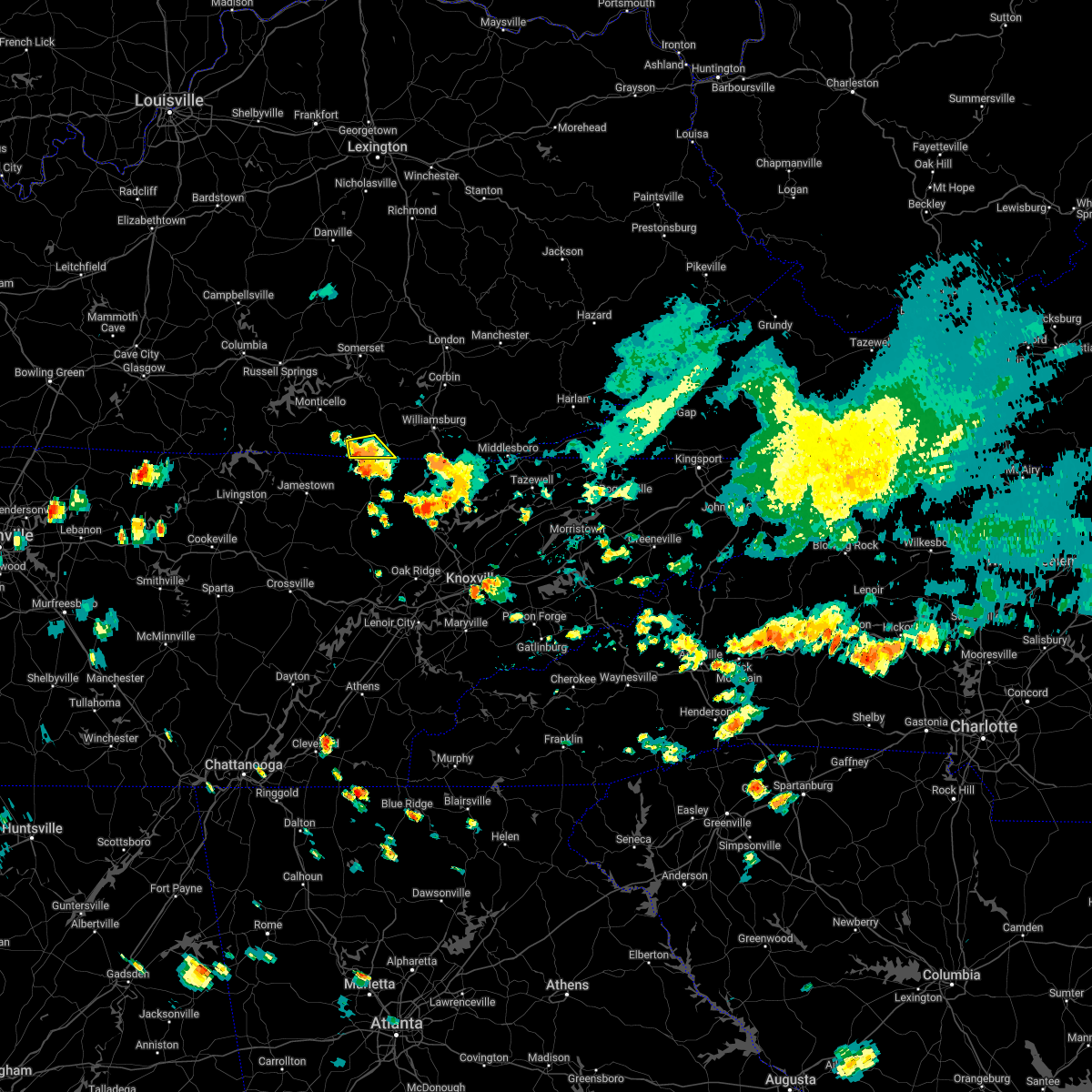 At 713 pm edt, a severe thunderstorm was located 7 miles southeast of great meadows campsites, or 7 miles west of oneida, moving south at 15 mph (radar indicated). Hazards include 60 mph wind gusts and penny size hail. Expect damage to roofs, siding, and trees. locations impacted include, blue heron, strunk, co-operative, stearns and pine knot. hail threat, radar indicated max hail size, 0. 75 in wind threat, radar indicated max wind gust, 60 mph. At 713 pm edt, a severe thunderstorm was located 7 miles southeast of great meadows campsites, or 7 miles west of oneida, moving south at 15 mph (radar indicated). Hazards include 60 mph wind gusts and penny size hail. Expect damage to roofs, siding, and trees. locations impacted include, blue heron, strunk, co-operative, stearns and pine knot. hail threat, radar indicated max hail size, 0. 75 in wind threat, radar indicated max wind gust, 60 mph.
|
| 7/5/2022 6:53 PM EDT |
 At 652 pm edt, a severe thunderstorm was located near co-operative, or 9 miles northwest of oneida, moving south at 15 mph (radar indicated). Hazards include 60 mph wind gusts and penny size hail. Expect damage to roofs, siding, and trees. this severe thunderstorm will remain over mainly rural areas of southwestern mccreary county. hail threat, radar indicated max hail size, 0. 75 in wind threat, radar indicated max wind gust, 60 mph. At 652 pm edt, a severe thunderstorm was located near co-operative, or 9 miles northwest of oneida, moving south at 15 mph (radar indicated). Hazards include 60 mph wind gusts and penny size hail. Expect damage to roofs, siding, and trees. this severe thunderstorm will remain over mainly rural areas of southwestern mccreary county. hail threat, radar indicated max hail size, 0. 75 in wind threat, radar indicated max wind gust, 60 mph.
|
| 6/17/2022 1:22 PM EDT |
 At 122 pm edt, severe thunderstorms were located along a line extending from goose rock to near zion hill, moving east at 45 mph (radar indicated). Hazards include 60 mph wind gusts and penny size hail. Expect damage to roofs, siding, and trees. locations impacted include, london, williamsburg, barbourville, manchester, julip, fariston, cumberland falls s. p. zion hill, goose rock, bush, cranes nest and krupp. hail threat, radar indicated max hail size, 0. 75 in wind threat, radar indicated max wind gust, 60 mph. At 122 pm edt, severe thunderstorms were located along a line extending from goose rock to near zion hill, moving east at 45 mph (radar indicated). Hazards include 60 mph wind gusts and penny size hail. Expect damage to roofs, siding, and trees. locations impacted include, london, williamsburg, barbourville, manchester, julip, fariston, cumberland falls s. p. zion hill, goose rock, bush, cranes nest and krupp. hail threat, radar indicated max hail size, 0. 75 in wind threat, radar indicated max wind gust, 60 mph.
|
| 6/17/2022 12:58 PM EDT | Mccreary county 911 reported many trees down county wide including the community of pine kno in mccreary county KY, 0.3 miles NNE of Pine Knot, KY |
| 6/17/2022 12:55 PM EDT |
 At 1254 pm edt, severe thunderstorms were located along a line extending from maplesville to near blue heron, moving east at 45 mph (radar indicated). Hazards include 60 mph wind gusts and penny size hail. expect damage to roofs, siding, and trees At 1254 pm edt, severe thunderstorms were located along a line extending from maplesville to near blue heron, moving east at 45 mph (radar indicated). Hazards include 60 mph wind gusts and penny size hail. expect damage to roofs, siding, and trees
|
| 6/17/2022 12:40 PM EDT |
 At 1240 pm edt, severe thunderstorms were located along a line extending from jep hill to near great meadows campsites, moving east at 45 mph (radar indicated). Hazards include 60 mph wind gusts and penny size hail. Expect damage to roofs, siding, and trees. locations impacted include, somerset, london, monticello, mount vernon, whitley city, science hill, burnside, cains store, donaro, robinet, cumberland falls s. p. and co-operative. hail threat, radar indicated max hail size, 0. 75 in wind threat, radar indicated max wind gust, 60 mph. At 1240 pm edt, severe thunderstorms were located along a line extending from jep hill to near great meadows campsites, moving east at 45 mph (radar indicated). Hazards include 60 mph wind gusts and penny size hail. Expect damage to roofs, siding, and trees. locations impacted include, somerset, london, monticello, mount vernon, whitley city, science hill, burnside, cains store, donaro, robinet, cumberland falls s. p. and co-operative. hail threat, radar indicated max hail size, 0. 75 in wind threat, radar indicated max wind gust, 60 mph.
|
| 6/17/2022 12:31 PM EDT |
 At 1231 pm edt, severe thunderstorms were located along a line extending from burr to near great meadows campsites, moving east at 45 mph (radar indicated). Hazards include 60 mph wind gusts and penny size hail. expect damage to roofs, siding, and trees At 1231 pm edt, severe thunderstorms were located along a line extending from burr to near great meadows campsites, moving east at 45 mph (radar indicated). Hazards include 60 mph wind gusts and penny size hail. expect damage to roofs, siding, and trees
|
| 5/5/2022 8:42 PM EDT |
 At 842 pm edt, a severe thunderstorm was located over strunk, or near whitley city, moving east at 35 mph (radar indicated). Hazards include 60 mph wind gusts. Expect damage to roofs, siding, and trees. locations impacted include, hollyhill. hail threat, radar indicated max hail size, <. 75 in wind threat, radar indicated max wind gust, 60 mph. At 842 pm edt, a severe thunderstorm was located over strunk, or near whitley city, moving east at 35 mph (radar indicated). Hazards include 60 mph wind gusts. Expect damage to roofs, siding, and trees. locations impacted include, hollyhill. hail threat, radar indicated max hail size, <. 75 in wind threat, radar indicated max wind gust, 60 mph.
|
| 5/5/2022 8:17 PM EDT |
 At 816 pm edt, a severe thunderstorm was located over great meadows campsites, or 12 miles northwest of oneida, moving east at 30 mph (radar indicated). Hazards include 60 mph wind gusts. Expect damage to roofs, siding, and trees. this severe thunderstorm will be near, blue heron around 835 pm edt. other locations in the path of this severe thunderstorm include strunk, pine knot and hollyhill. hail threat, radar indicated max hail size, <. 75 in wind threat, radar indicated max wind gust, 60 mph. At 816 pm edt, a severe thunderstorm was located over great meadows campsites, or 12 miles northwest of oneida, moving east at 30 mph (radar indicated). Hazards include 60 mph wind gusts. Expect damage to roofs, siding, and trees. this severe thunderstorm will be near, blue heron around 835 pm edt. other locations in the path of this severe thunderstorm include strunk, pine knot and hollyhill. hail threat, radar indicated max hail size, <. 75 in wind threat, radar indicated max wind gust, 60 mph.
|
| 7/30/2021 5:35 AM EDT |
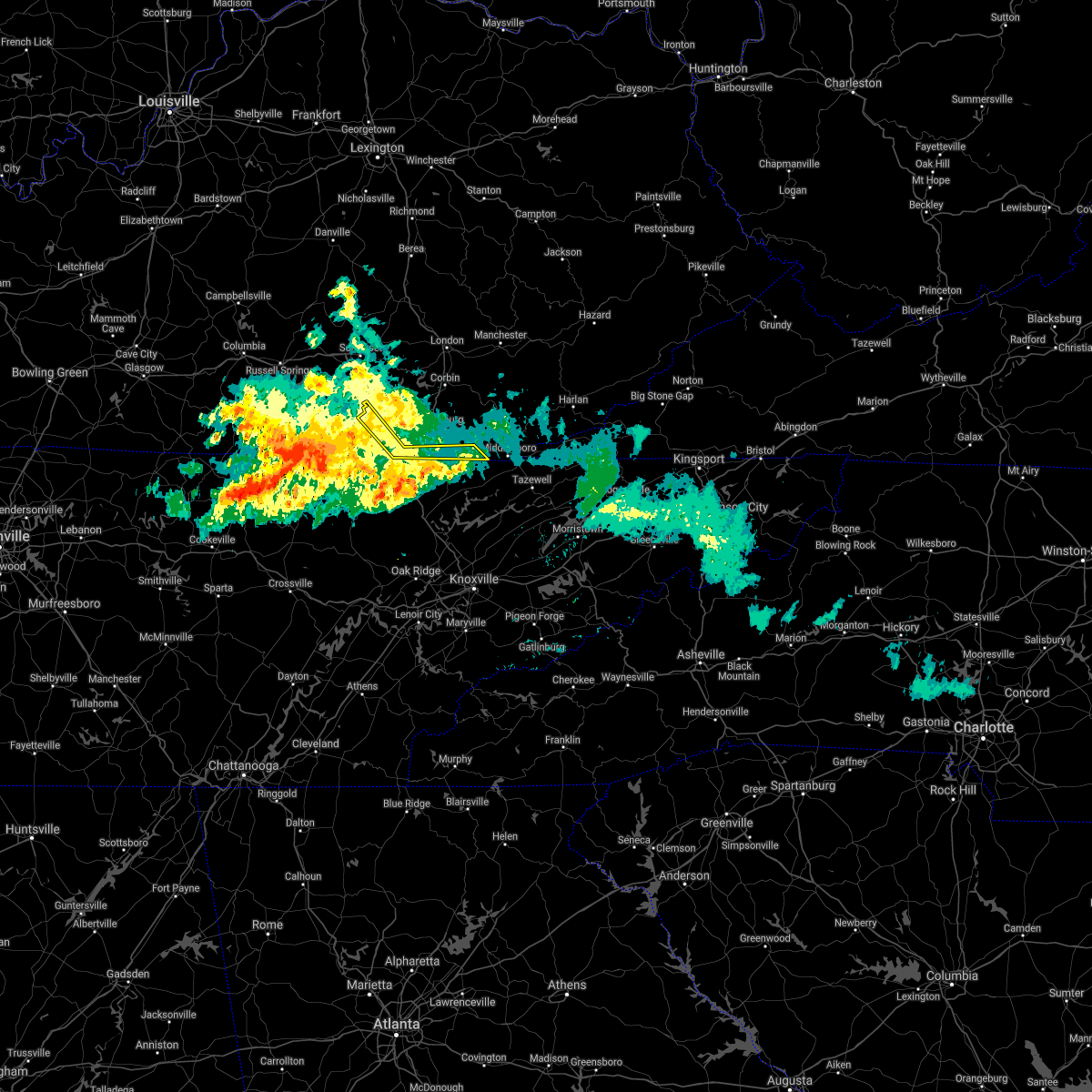 The severe thunderstorm warning for southwestern bell, southeastern mccreary and southern whitley counties will expire at 545 am edt, the storm which prompted the warning has weakened below severe limits, and has exited the warned area. therefore, the warning will be allowed to expire. however gusty winds and heavy rain are still possible with this thunderstorm. The severe thunderstorm warning for southwestern bell, southeastern mccreary and southern whitley counties will expire at 545 am edt, the storm which prompted the warning has weakened below severe limits, and has exited the warned area. therefore, the warning will be allowed to expire. however gusty winds and heavy rain are still possible with this thunderstorm.
|
| 7/30/2021 5:26 AM EDT |
 At 526 am edt, a severe thunderstorm was located over strunk, or near whitley city, moving southeast at 30 mph (radar indicated). Hazards include 60 mph wind gusts and nickel size hail. Expect damage to roofs, siding, and trees. Locations impacted include, whitley city, ayers, marshes siding, frakes, fonde, zion hill, wilkerson, stearns, red ash, lot, pearl and pine knot. At 526 am edt, a severe thunderstorm was located over strunk, or near whitley city, moving southeast at 30 mph (radar indicated). Hazards include 60 mph wind gusts and nickel size hail. Expect damage to roofs, siding, and trees. Locations impacted include, whitley city, ayers, marshes siding, frakes, fonde, zion hill, wilkerson, stearns, red ash, lot, pearl and pine knot.
|
| 7/30/2021 5:11 AM EDT |
 At 511 am edt, a severe thunderstorm was located over marshes siding, or over whitley city, moving southeast at 30 mph (radar indicated). Hazards include 60 mph wind gusts and nickel size hail. Expect damage to roofs, siding, and trees. Locations impacted include, pine knot, hollyhill, ayers and zion hill. At 511 am edt, a severe thunderstorm was located over marshes siding, or over whitley city, moving southeast at 30 mph (radar indicated). Hazards include 60 mph wind gusts and nickel size hail. Expect damage to roofs, siding, and trees. Locations impacted include, pine knot, hollyhill, ayers and zion hill.
|
| 7/30/2021 4:58 AM EDT |
 The severe thunderstorm warning for southwestern laurel, southeastern pulaski, eastern mccreary and whitley counties will expire at 500 am edt, the storm which prompted the warning has moved out of the area. therefore, the warning will be allowed to expire. however gusty winds and heavy rain are still possible with this thunderstorm. remember, an additional severe thunderstorm warning still remains in effect for whitley and mccreary counties. The severe thunderstorm warning for southwestern laurel, southeastern pulaski, eastern mccreary and whitley counties will expire at 500 am edt, the storm which prompted the warning has moved out of the area. therefore, the warning will be allowed to expire. however gusty winds and heavy rain are still possible with this thunderstorm. remember, an additional severe thunderstorm warning still remains in effect for whitley and mccreary counties.
|
| 7/30/2021 4:54 AM EDT |
 At 453 am edt, a severe thunderstorm was located over emlyn, or over williamsburg, moving southeast at 30 mph (radar indicated). Hazards include 60 mph wind gusts and nickel size hail. Expect damage to roofs, siding, and trees. this severe thunderstorm will be near, mountain ash around 500 am edt. saxton around 505 am edt. Lot around 510 am edt. At 453 am edt, a severe thunderstorm was located over emlyn, or over williamsburg, moving southeast at 30 mph (radar indicated). Hazards include 60 mph wind gusts and nickel size hail. Expect damage to roofs, siding, and trees. this severe thunderstorm will be near, mountain ash around 500 am edt. saxton around 505 am edt. Lot around 510 am edt.
|
| 7/30/2021 4:38 AM EDT |
 At 438 am edt, a severe thunderstorm was located over redbird, or over williamsburg, moving southeast at 30 mph (radar indicated). Hazards include 70 mph wind gusts and nickel size hail. Expect considerable tree damage. damage is likely to mobile homes, roofs, and outbuildings. Locations impacted include, emlyn, verne, nevisdale and gatliff. At 438 am edt, a severe thunderstorm was located over redbird, or over williamsburg, moving southeast at 30 mph (radar indicated). Hazards include 70 mph wind gusts and nickel size hail. Expect considerable tree damage. damage is likely to mobile homes, roofs, and outbuildings. Locations impacted include, emlyn, verne, nevisdale and gatliff.
|
| 7/30/2021 4:25 AM EDT |
 At 424 am edt, a severe thunderstorm was located over krupp, or near williamsburg, moving southeast at 25 mph (radar indicated). Hazards include 70 mph wind gusts and quarter size hail. Hail damage to vehicles is expected. expect considerable tree damage. wind damage is also likely to mobile homes, roofs, and outbuildings. this severe storm will be near, goldbug around 430 am edt. Other locations in the path of this severe thunderstorm include williamsburg, bon, emlyn and mountain ash. At 424 am edt, a severe thunderstorm was located over krupp, or near williamsburg, moving southeast at 25 mph (radar indicated). Hazards include 70 mph wind gusts and quarter size hail. Hail damage to vehicles is expected. expect considerable tree damage. wind damage is also likely to mobile homes, roofs, and outbuildings. this severe storm will be near, goldbug around 430 am edt. Other locations in the path of this severe thunderstorm include williamsburg, bon, emlyn and mountain ash.
|
| 7/30/2021 4:11 AM EDT |
 At 410 am edt, a severe thunderstorm was located near cumberland falls s.p., or 13 miles northwest of williamsburg, moving southeast at 45 mph (radar indicated). Hazards include 60 mph wind gusts. Expect damage to roofs, siding, and trees. this severe thunderstorm will be near, youngs creek around 415 am edt. krupp around 420 am edt. redbird around 425 am edt. bon around 430 am edt. Other locations in the path of this severe thunderstorm include mountain ash. At 410 am edt, a severe thunderstorm was located near cumberland falls s.p., or 13 miles northwest of williamsburg, moving southeast at 45 mph (radar indicated). Hazards include 60 mph wind gusts. Expect damage to roofs, siding, and trees. this severe thunderstorm will be near, youngs creek around 415 am edt. krupp around 420 am edt. redbird around 425 am edt. bon around 430 am edt. Other locations in the path of this severe thunderstorm include mountain ash.
|
| 3/27/2021 10:36 AM EDT |
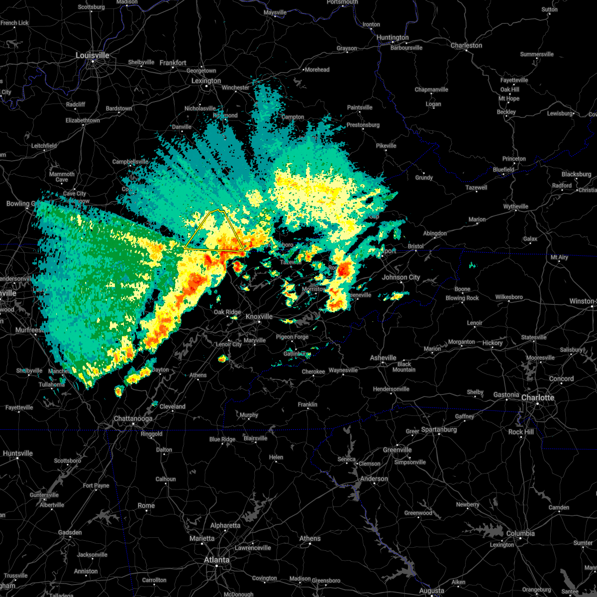 At 1036 am edt, a severe thunderstorm was located over ayers, or 8 miles southwest of williamsburg, moving northeast at 40 mph (radar indicated). Hazards include quarter size hail. Damage to vehicles is expected. locations impacted include, williamsburg, whitley city, great meadows campsites, ayers, parkers lake, cumberland falls s. p. Co- operative, zion hill, red ash, pine knot, krupp and hollyhill. At 1036 am edt, a severe thunderstorm was located over ayers, or 8 miles southwest of williamsburg, moving northeast at 40 mph (radar indicated). Hazards include quarter size hail. Damage to vehicles is expected. locations impacted include, williamsburg, whitley city, great meadows campsites, ayers, parkers lake, cumberland falls s. p. Co- operative, zion hill, red ash, pine knot, krupp and hollyhill.
|
| 3/27/2021 10:23 AM EDT |
 At 1022 am edt, a severe thunderstorm was located over strunk, or near whitley city, moving northeast at 50 mph (radar indicated). Hazards include 60 mph wind gusts and half dollar size hail. Hail damage to vehicles is expected. expect wind damage to roofs, siding, and trees. locations impacted include, williamsburg, whitley city, great meadows campsites, ayers, parkers lake, cumberland falls s. p. Co- operative, zion hill, red ash, pine knot, krupp and hollyhill. At 1022 am edt, a severe thunderstorm was located over strunk, or near whitley city, moving northeast at 50 mph (radar indicated). Hazards include 60 mph wind gusts and half dollar size hail. Hail damage to vehicles is expected. expect wind damage to roofs, siding, and trees. locations impacted include, williamsburg, whitley city, great meadows campsites, ayers, parkers lake, cumberland falls s. p. Co- operative, zion hill, red ash, pine knot, krupp and hollyhill.
|
| 3/27/2021 9:59 AM EDT |
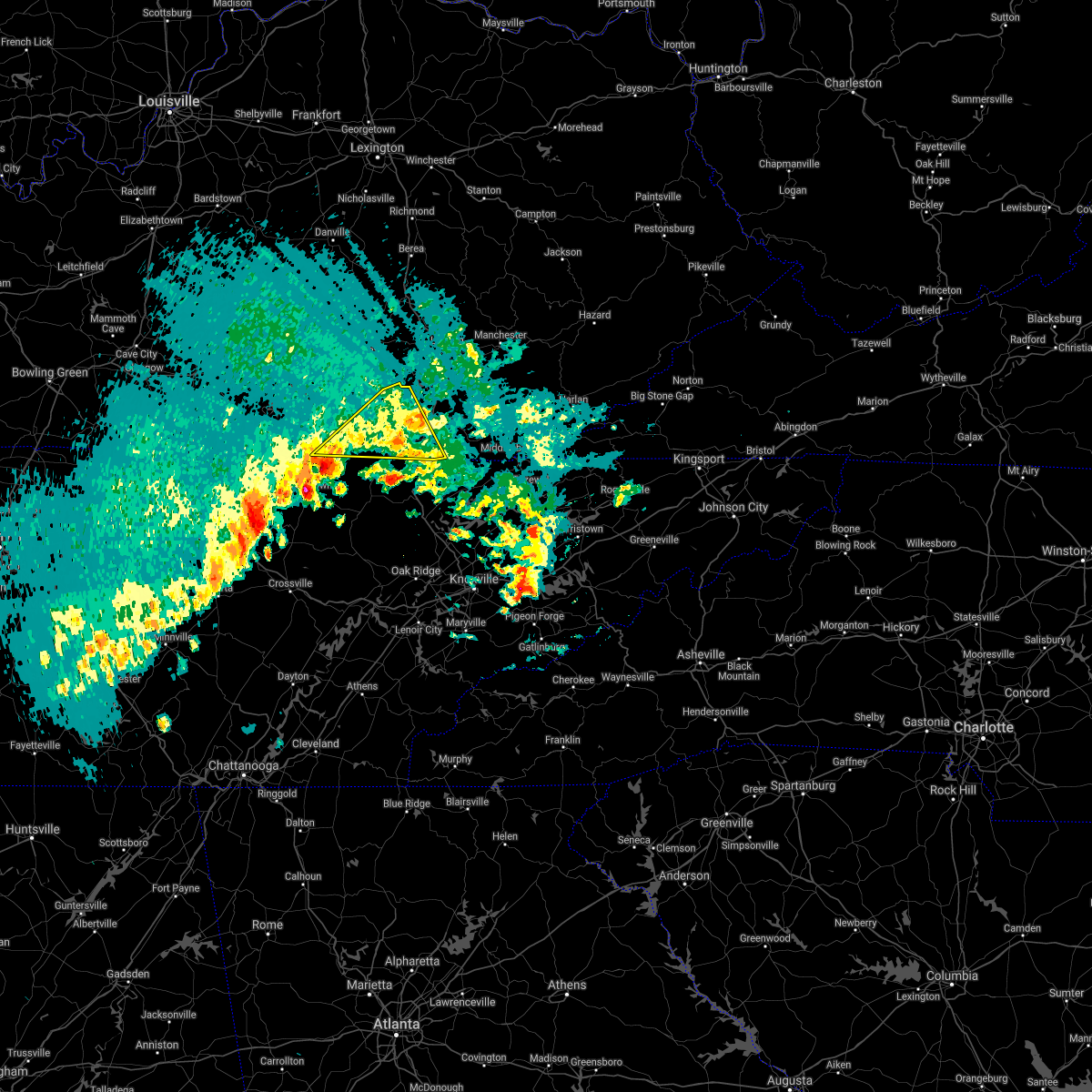 At 958 am edt, a severe thunderstorm was located over great meadows campsites, or 14 miles northwest of oneida, moving northeast at 40 mph (radar indicated). Hazards include 60 mph wind gusts and half dollar size hail. Hail damage to vehicles is expected. Expect wind damage to roofs, siding, and trees. At 958 am edt, a severe thunderstorm was located over great meadows campsites, or 14 miles northwest of oneida, moving northeast at 40 mph (radar indicated). Hazards include 60 mph wind gusts and half dollar size hail. Hail damage to vehicles is expected. Expect wind damage to roofs, siding, and trees.
|
| 3/27/2021 8:58 AM EDT |
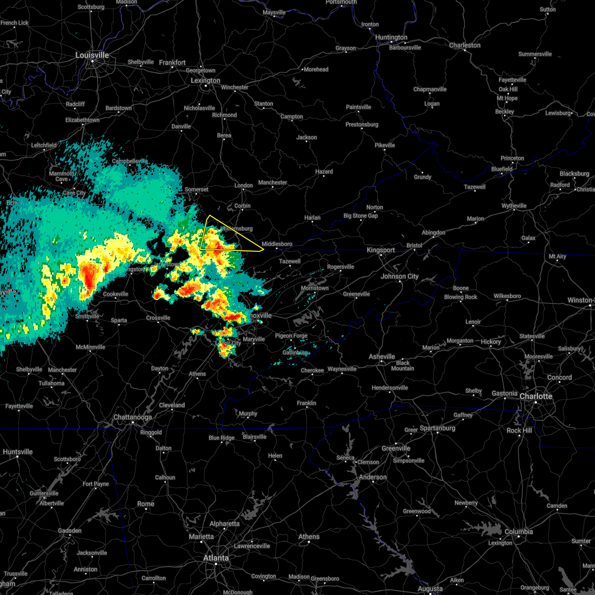 At 858 am edt, a severe thunderstorm was located over hollyhill, or 9 miles southeast of whitley city, moving northeast at 35 mph (radar indicated). Hazards include ping pong ball size hail and 60 mph wind gusts. People and animals outdoors will be injured. expect hail damage to roofs, siding, windows, and vehicles. expect wind damage to roofs, siding, and trees. Locations impacted include, williamsburg, whitley city, ayers, gatliff, emlyn, parkers lake, zion hill, red ash, pine knot, pleasant view, krupp and pruden. At 858 am edt, a severe thunderstorm was located over hollyhill, or 9 miles southeast of whitley city, moving northeast at 35 mph (radar indicated). Hazards include ping pong ball size hail and 60 mph wind gusts. People and animals outdoors will be injured. expect hail damage to roofs, siding, windows, and vehicles. expect wind damage to roofs, siding, and trees. Locations impacted include, williamsburg, whitley city, ayers, gatliff, emlyn, parkers lake, zion hill, red ash, pine knot, pleasant view, krupp and pruden.
|
| 3/27/2021 8:57 AM EDT | Half Dollar sized hail reported 5 miles WNW of Pine Knot, KY, spotter stated that some of the hail may have been slightly larger than half dollar. |
| 3/27/2021 8:43 AM EDT |
 At 843 am edt, a severe thunderstorm was located near oneida, moving northeast at 35 mph (radar indicated). Hazards include ping pong ball size hail and 60 mph wind gusts. People and animals outdoors will be injured. expect hail damage to roofs, siding, windows, and vehicles. Expect wind damage to roofs, siding, and trees. At 843 am edt, a severe thunderstorm was located near oneida, moving northeast at 35 mph (radar indicated). Hazards include ping pong ball size hail and 60 mph wind gusts. People and animals outdoors will be injured. expect hail damage to roofs, siding, windows, and vehicles. Expect wind damage to roofs, siding, and trees.
|
| 7/20/2020 5:17 PM EDT | Corrects previous non-tstm wnd dmg report from 2 ne pine knot. tree down along tj king rd. time estimated from rada in mccreary county KY, 1.9 miles SW of Pine Knot, KY |
| 7/20/2020 5:15 PM EDT | Multiple trees down near holly hill. wind estimated near 60 mp in mccreary county KY, 5 miles WNW of Pine Knot, KY |
| 7/20/2020 5:11 PM EDT |
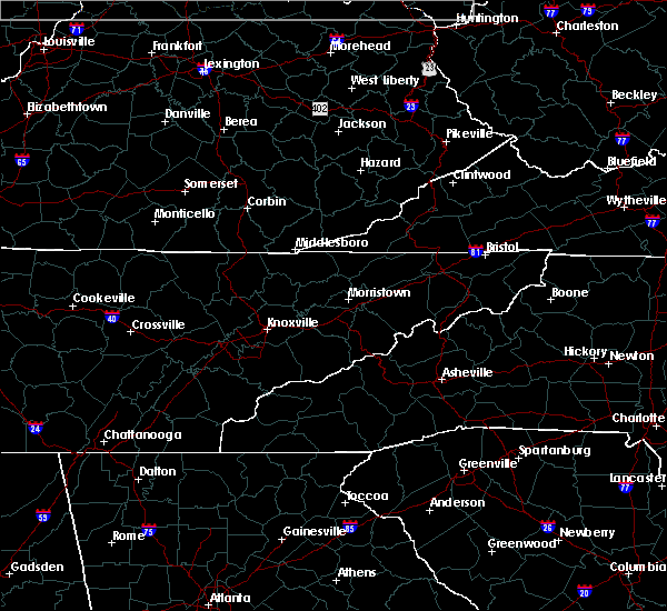 At 511 pm edt, a severe thunderstorm was located over hollyhill, or 9 miles southwest of williamsburg, moving east at 15 mph (radar indicated). Hazards include 60 mph wind gusts. Expect damage to roofs, siding, and trees. Locations impacted include, williamsburg, whitley city, ayers, emlyn, zion hill, red ash, clio, goldbug, pine knot, pleasant view, krupp and hollyhill. At 511 pm edt, a severe thunderstorm was located over hollyhill, or 9 miles southwest of williamsburg, moving east at 15 mph (radar indicated). Hazards include 60 mph wind gusts. Expect damage to roofs, siding, and trees. Locations impacted include, williamsburg, whitley city, ayers, emlyn, zion hill, red ash, clio, goldbug, pine knot, pleasant view, krupp and hollyhill.
|
| 7/20/2020 4:59 PM EDT | Tree down along mount pleasant rd. time estimated from rada in mccreary county KY, 2.7 miles NNE of Pine Knot, KY |
| 7/20/2020 4:58 PM EDT |
 At 458 pm edt, a severe thunderstorm was located over hollyhill, or 8 miles southeast of whitley city, moving east at 20 mph (radar indicated). Hazards include 60 mph wind gusts. expect damage to roofs, siding, and trees At 458 pm edt, a severe thunderstorm was located over hollyhill, or 8 miles southeast of whitley city, moving east at 20 mph (radar indicated). Hazards include 60 mph wind gusts. expect damage to roofs, siding, and trees
|
| 7/20/2020 4:55 PM EDT | Corrects previous tstm wnd dmg report from 1 sw hollyhill. at least 40 trees downed on farm near hollyhill with additional downed trees in adjacent forest. winds estima in mccreary county KY, 5 miles WNW of Pine Knot, KY |
| 6/21/2020 6:45 PM EDT |
 At 644 pm edt, a severe thunderstorm was located over cumberland falls s.p., or 10 miles northeast of whitley city, moving northeast at 40 mph (radar indicated). Hazards include 60 mph wind gusts. expect damage to roofs, siding, and trees At 644 pm edt, a severe thunderstorm was located over cumberland falls s.p., or 10 miles northeast of whitley city, moving northeast at 40 mph (radar indicated). Hazards include 60 mph wind gusts. expect damage to roofs, siding, and trees
|
| 6/21/2020 6:31 PM EDT |
 At 631 pm edt, a severe thunderstorm was located over whitley city, moving east at 50 mph (radar indicated). Hazards include 70 mph wind gusts and penny size hail. Expect considerable tree damage. damage is likely to mobile homes, roofs, and outbuildings. locations impacted include, williamsburg, whitley city, blue heron, honeybee, slavens, marshes siding, greenwood, duckrun, parkers lake, beulah heights, cumberland falls s. p. And co-operative. At 631 pm edt, a severe thunderstorm was located over whitley city, moving east at 50 mph (radar indicated). Hazards include 70 mph wind gusts and penny size hail. Expect considerable tree damage. damage is likely to mobile homes, roofs, and outbuildings. locations impacted include, williamsburg, whitley city, blue heron, honeybee, slavens, marshes siding, greenwood, duckrun, parkers lake, beulah heights, cumberland falls s. p. And co-operative.
|
| 6/21/2020 6:12 PM EDT |
 At 611 pm edt, a severe thunderstorm was located over great meadows campsites, or 11 miles northwest of oneida, moving northeast at 50 mph (radar indicated). Hazards include 60 mph wind gusts. expect damage to roofs, siding, and trees At 611 pm edt, a severe thunderstorm was located over great meadows campsites, or 11 miles northwest of oneida, moving northeast at 50 mph (radar indicated). Hazards include 60 mph wind gusts. expect damage to roofs, siding, and trees
|
| 5/3/2020 7:55 PM EDT |
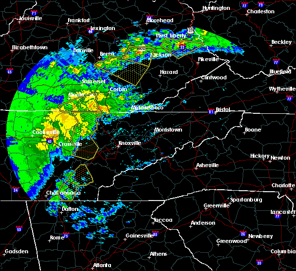 The severe thunderstorm warning for southern wayne and mccreary counties will expire at 800 pm edt, the storm which prompted the warning has weakened below severe limits, and no longer poses an immediate threat to life or property. therefore, the warning will be allowed to expire. a severe thunderstorm watch remains in effect until 1100 pm edt for south central kentucky. The severe thunderstorm warning for southern wayne and mccreary counties will expire at 800 pm edt, the storm which prompted the warning has weakened below severe limits, and no longer poses an immediate threat to life or property. therefore, the warning will be allowed to expire. a severe thunderstorm watch remains in effect until 1100 pm edt for south central kentucky.
|
| 5/3/2020 7:41 PM EDT |
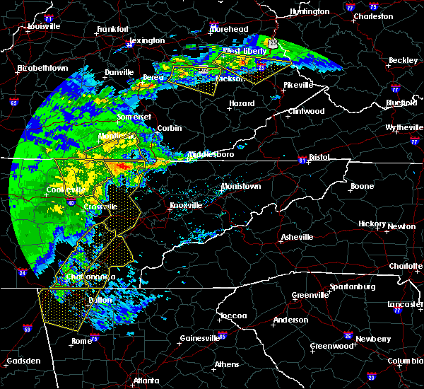 At 712 pm edt, a severe thunderstorm was located near mount pisgah, or 12 miles northeast of jamestown, moving northeast at 40 mph (radar indicated). Hazards include 60 mph wind gusts and quarter size hail. Hail damage to vehicles is expected. expect wind damage to roofs, siding, and trees. this severe thunderstorm will be near, great meadows campsites around 720 pm edt. blue heron around 735 pm edt. Whitley city around 745 pm edt. At 712 pm edt, a severe thunderstorm was located near mount pisgah, or 12 miles northeast of jamestown, moving northeast at 40 mph (radar indicated). Hazards include 60 mph wind gusts and quarter size hail. Hail damage to vehicles is expected. expect wind damage to roofs, siding, and trees. this severe thunderstorm will be near, great meadows campsites around 720 pm edt. blue heron around 735 pm edt. Whitley city around 745 pm edt.
|
| 5/3/2020 7:12 PM EDT |
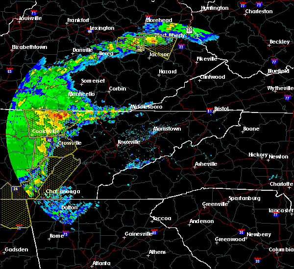 At 712 pm edt, a severe thunderstorm was located near mount pisgah, or 12 miles northeast of jamestown, moving northeast at 40 mph (radar indicated). Hazards include 60 mph wind gusts and quarter size hail. Hail damage to vehicles is expected. expect wind damage to roofs, siding, and trees. this severe thunderstorm will be near, great meadows campsites around 720 pm edt. blue heron around 735 pm edt. Whitley city around 745 pm edt. At 712 pm edt, a severe thunderstorm was located near mount pisgah, or 12 miles northeast of jamestown, moving northeast at 40 mph (radar indicated). Hazards include 60 mph wind gusts and quarter size hail. Hail damage to vehicles is expected. expect wind damage to roofs, siding, and trees. this severe thunderstorm will be near, great meadows campsites around 720 pm edt. blue heron around 735 pm edt. Whitley city around 745 pm edt.
|
| 3/12/2020 10:25 PM EDT |
 At 1024 pm edt, a severe thunderstorm was located over pleasant view, or near williamsburg, moving east at 60 mph (radar indicated). Hazards include 60 mph wind gusts and quarter size hail. Hail damage to vehicles is expected. expect wind damage to roofs, siding, and trees. Locations impacted include, williamsburg, julip, ayers, gatliff, emlyn, red ash, clio, verne, goldbug, pleasant view, louden and krupp. At 1024 pm edt, a severe thunderstorm was located over pleasant view, or near williamsburg, moving east at 60 mph (radar indicated). Hazards include 60 mph wind gusts and quarter size hail. Hail damage to vehicles is expected. expect wind damage to roofs, siding, and trees. Locations impacted include, williamsburg, julip, ayers, gatliff, emlyn, red ash, clio, verne, goldbug, pleasant view, louden and krupp.
|
| 3/12/2020 10:20 PM EDT | Quarter sized hail reported 5 miles WNW of Pine Knot, KY, 2-3 minutes of quarter-size hail. numerous limbs down. |
| 3/12/2020 10:02 PM EDT |
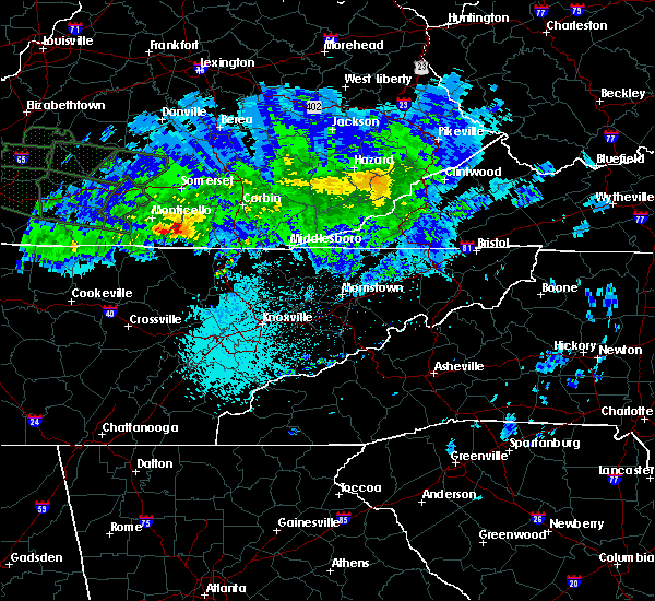 At 1002 pm edt, a severe thunderstorm was located over marshes siding, or over whitley city, moving east at 50 mph (radar indicated). Hazards include 60 mph wind gusts and quarter size hail. Hail damage to vehicles is expected. Expect wind damage to roofs, siding, and trees. At 1002 pm edt, a severe thunderstorm was located over marshes siding, or over whitley city, moving east at 50 mph (radar indicated). Hazards include 60 mph wind gusts and quarter size hail. Hail damage to vehicles is expected. Expect wind damage to roofs, siding, and trees.
|
| 8/13/2019 6:30 PM EDT |
 At 630 pm edt, a severe thunderstorm was located over great meadows campsites, or 12 miles southwest of whitley city, moving east at 35 mph (radar indicated). Hazards include 60 mph wind gusts and quarter size hail. Hail damage to vehicles is expected. expect wind damage to roofs, siding, and trees. Locations impacted include, whitley city, blue heron, parmleysville, great meadows campsites, slavens, marshes siding, burfield, kidds crossing, co- operative, stearns, rockeybranch and pine knot. At 630 pm edt, a severe thunderstorm was located over great meadows campsites, or 12 miles southwest of whitley city, moving east at 35 mph (radar indicated). Hazards include 60 mph wind gusts and quarter size hail. Hail damage to vehicles is expected. expect wind damage to roofs, siding, and trees. Locations impacted include, whitley city, blue heron, parmleysville, great meadows campsites, slavens, marshes siding, burfield, kidds crossing, co- operative, stearns, rockeybranch and pine knot.
|
| 8/13/2019 6:15 PM EDT |
 The national weather service in jackson ky has issued a * severe thunderstorm warning for. southeastern wayne county in south central kentucky. southwestern mccreary county in south central kentucky. until 645 pm edt. At 615 pm edt, a severe thunderstorm was located over mount pisgah,. The national weather service in jackson ky has issued a * severe thunderstorm warning for. southeastern wayne county in south central kentucky. southwestern mccreary county in south central kentucky. until 645 pm edt. At 615 pm edt, a severe thunderstorm was located over mount pisgah,.
|
| 7/2/2019 3:40 PM EDT | A tree and large limbs were blown down at a residenc in mccreary county KY, 5 miles WNW of Pine Knot, KY |
| 6/21/2019 10:55 PM EDT |
 At 1054 pm edt, severe thunderstorms were located along a line extending from bent to near cumberland falls s.p. to near hollyhill, moving east at 45 mph (radar indicated). Hazards include 60 mph wind gusts and penny size hail. expect damage to roofs, siding, and trees At 1054 pm edt, severe thunderstorms were located along a line extending from bent to near cumberland falls s.p. to near hollyhill, moving east at 45 mph (radar indicated). Hazards include 60 mph wind gusts and penny size hail. expect damage to roofs, siding, and trees
|
| 6/21/2019 10:44 PM EDT |
 A severe thunderstorm warning remains in effect until 1100 pm edt for southeastern pulaski and central mccreary counties. at 1044 pm edt, a severe thunderstorm was located near mount victory, or 11 miles southeast of somerset, moving east at 40 mph. hazard. 60 mph wind gusts and penny size hail. source. Radar indicated. A severe thunderstorm warning remains in effect until 1100 pm edt for southeastern pulaski and central mccreary counties. at 1044 pm edt, a severe thunderstorm was located near mount victory, or 11 miles southeast of somerset, moving east at 40 mph. hazard. 60 mph wind gusts and penny size hail. source. Radar indicated.
|
| 6/21/2019 10:29 PM EDT |
 The national weather service in jackson ky has issued a * severe thunderstorm warning for. eastern wayne county in south central kentucky. pulaski county in south central kentucky. mccreary county in south central kentucky. Until 1100 pm edt. The national weather service in jackson ky has issued a * severe thunderstorm warning for. eastern wayne county in south central kentucky. pulaski county in south central kentucky. mccreary county in south central kentucky. Until 1100 pm edt.
|
| 7/20/2018 8:54 PM EDT |
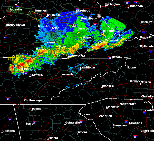 At 854 pm edt, a severe thunderstorm was located over griffin, or 11 miles southeast of monticello, moving southeast at 30 mph (radar indicated). Hazards include 60 mph wind gusts and nickel size hail. Expect damage to roofs, siding, and trees. locations impacted include, whitley city, parmleysville, great meadows campsites, slavens, sloans valley, parkers lake, cumberland falls s. p. Gregory, co- operative, pine knot, ritner and denney. At 854 pm edt, a severe thunderstorm was located over griffin, or 11 miles southeast of monticello, moving southeast at 30 mph (radar indicated). Hazards include 60 mph wind gusts and nickel size hail. Expect damage to roofs, siding, and trees. locations impacted include, whitley city, parmleysville, great meadows campsites, slavens, sloans valley, parkers lake, cumberland falls s. p. Gregory, co- operative, pine knot, ritner and denney.
|
| 7/20/2018 8:32 PM EDT |
 At 831 pm edt, a severe thunderstorm was located over cooper, or near monticello, moving southeast at 30 mph (radar indicated). Hazards include 70 mph wind gusts and nickel size hail. Expect considerable tree damage. Damage is likely to mobile homes, roofs, and outbuildings. At 831 pm edt, a severe thunderstorm was located over cooper, or near monticello, moving southeast at 30 mph (radar indicated). Hazards include 70 mph wind gusts and nickel size hail. Expect considerable tree damage. Damage is likely to mobile homes, roofs, and outbuildings.
|
| 6/25/2018 2:02 PM EDT |
 At 201 pm edt, severe thunderstorms were located along a line extending from near rockcastle springs to near zion hill, moving east at 45 mph (radar indicated). Hazards include 60 mph wind gusts. expect damage to roofs, siding, and trees At 201 pm edt, severe thunderstorms were located along a line extending from near rockcastle springs to near zion hill, moving east at 45 mph (radar indicated). Hazards include 60 mph wind gusts. expect damage to roofs, siding, and trees
|
| 5/31/2018 5:53 PM EDT |
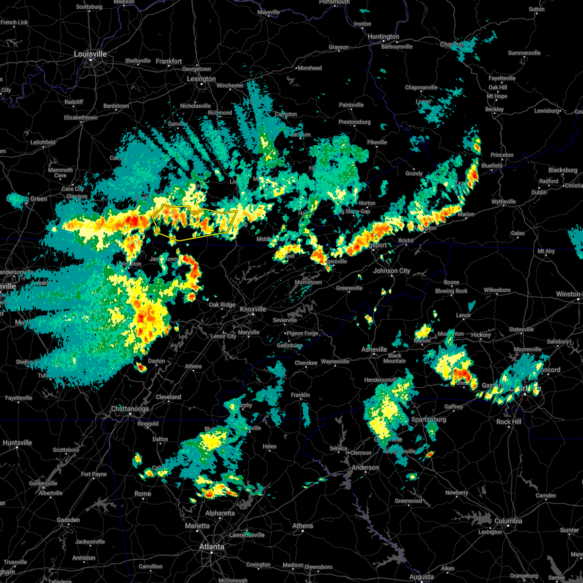 At 552 pm edt, severe thunderstorms were located along a line extending from bark camp to near marshes siding to near slickford, moving east at 45 mph (radar indicated). Hazards include 60 mph wind gusts. Expect damage to roofs, siding, and trees. locations impacted include, monticello, williamsburg, whitley city, parmleysville, parnell, cumberland falls s. p. Co- operative, goldbug, slickford, ritner, krupp, youngs creek, blue heron, honeybee, coopersville, greenwood, beulah heights, kidds crossing, hidalgo and rockeybranch. At 552 pm edt, severe thunderstorms were located along a line extending from bark camp to near marshes siding to near slickford, moving east at 45 mph (radar indicated). Hazards include 60 mph wind gusts. Expect damage to roofs, siding, and trees. locations impacted include, monticello, williamsburg, whitley city, parmleysville, parnell, cumberland falls s. p. Co- operative, goldbug, slickford, ritner, krupp, youngs creek, blue heron, honeybee, coopersville, greenwood, beulah heights, kidds crossing, hidalgo and rockeybranch.
|
| 5/31/2018 5:27 PM EDT |
 The national weather service in jackson ky has issued a * severe thunderstorm warning for. wayne county in south central kentucky. southern pulaski county in south central kentucky. mccreary county in south central kentucky. Northwestern whitley county in south central kentucky. The national weather service in jackson ky has issued a * severe thunderstorm warning for. wayne county in south central kentucky. southern pulaski county in south central kentucky. mccreary county in south central kentucky. Northwestern whitley county in south central kentucky.
|
| 4/4/2018 12:24 AM EDT |
 At 1223 am edt, a severe thunderstorm was located over rockholds, or 7 miles northeast of williamsburg, moving east at 65 mph (radar indicated). Hazards include 60 mph wind gusts. Expect damage to roofs, siding, and trees. locations impacted include, williamsburg, barbourville, pineville, middlesboro, julip, varilla, swan lake, cumberland falls s. p. Zion hill, ponza, gausdale, cranes nest, blanche, krupp, rella, bark camp, dixie, wasioto, avis and siler. At 1223 am edt, a severe thunderstorm was located over rockholds, or 7 miles northeast of williamsburg, moving east at 65 mph (radar indicated). Hazards include 60 mph wind gusts. Expect damage to roofs, siding, and trees. locations impacted include, williamsburg, barbourville, pineville, middlesboro, julip, varilla, swan lake, cumberland falls s. p. Zion hill, ponza, gausdale, cranes nest, blanche, krupp, rella, bark camp, dixie, wasioto, avis and siler.
|
| 4/4/2018 12:04 AM EDT |
 At 1203 am edt, a severe thunderstorm was located over whitley city, moving east at 60 mph (radar indicated). Hazards include 60 mph wind gusts. expect damage to roofs, siding, and trees At 1203 am edt, a severe thunderstorm was located over whitley city, moving east at 60 mph (radar indicated). Hazards include 60 mph wind gusts. expect damage to roofs, siding, and trees
|
| 3/17/2018 6:51 PM EDT |
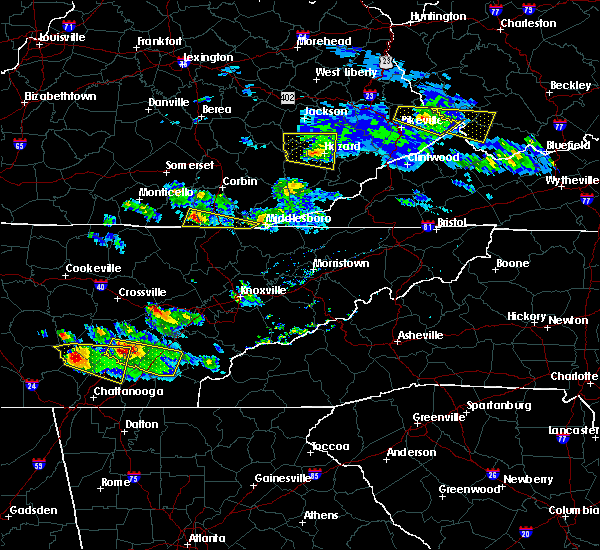 At 651 pm edt, a severe thunderstorm was located over hollyhill, or 9 miles east of whitley city, moving east at 50 mph (radar indicated). Hazards include 60 mph wind gusts and quarter size hail. Hail damage to vehicles is expected. Expect wind damage to roofs, siding, and trees. At 651 pm edt, a severe thunderstorm was located over hollyhill, or 9 miles east of whitley city, moving east at 50 mph (radar indicated). Hazards include 60 mph wind gusts and quarter size hail. Hail damage to vehicles is expected. Expect wind damage to roofs, siding, and trees.
|
| 3/17/2018 6:25 PM EDT |
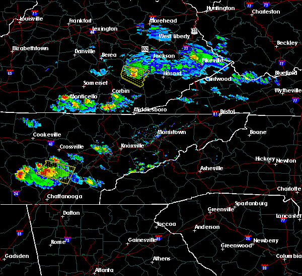 At 624 pm edt, a severe thunderstorm was located over parnell, or near monticello, moving east at 35 mph (radar indicated). Hazards include 60 mph wind gusts and nickel size hail. expect damage to roofs, siding, and trees At 624 pm edt, a severe thunderstorm was located over parnell, or near monticello, moving east at 35 mph (radar indicated). Hazards include 60 mph wind gusts and nickel size hail. expect damage to roofs, siding, and trees
|
| 7/6/2017 6:23 PM EDT |
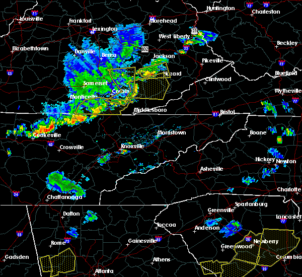 At 623 pm edt, severe thunderstorms were located along a line extending from dishman springs to jellico creek to near pine knot to near oneida, moving east at 40 mph (radar indicated). Hazards include 60 mph wind gusts and penny size hail. Expect damage to roofs, siding, and trees. locations impacted include, williamsburg, whitley city, julip, artemus, swan lake, cumberland falls s. p. Co- operative, zion hill, clate, birdseye, red ash, verne, goldbug, gausdale, king, louden, krupp, hollyhill, polly camp and youngs creek. At 623 pm edt, severe thunderstorms were located along a line extending from dishman springs to jellico creek to near pine knot to near oneida, moving east at 40 mph (radar indicated). Hazards include 60 mph wind gusts and penny size hail. Expect damage to roofs, siding, and trees. locations impacted include, williamsburg, whitley city, julip, artemus, swan lake, cumberland falls s. p. Co- operative, zion hill, clate, birdseye, red ash, verne, goldbug, gausdale, king, louden, krupp, hollyhill, polly camp and youngs creek.
|
| 7/6/2017 6:16 PM EDT | A tree was reported to have been blown down on ky 92 in the pine knot area. the time of the event is estimated from radar dat in mccreary county KY, 0.3 miles NNE of Pine Knot, KY |
| 7/6/2017 6:02 PM EDT |
 At 602 pm edt, severe thunderstorms were located along a line extending from woodbine to near duckrun to blue heron to 6 miles northwest of oneida, moving east at 40 mph (radar indicated). Hazards include 60 mph wind gusts and penny size hail. expect damage to roofs, siding, and trees At 602 pm edt, severe thunderstorms were located along a line extending from woodbine to near duckrun to blue heron to 6 miles northwest of oneida, moving east at 40 mph (radar indicated). Hazards include 60 mph wind gusts and penny size hail. expect damage to roofs, siding, and trees
|
| 7/6/2017 5:45 PM EDT |
 At 545 pm edt, severe thunderstorms were located along a line extending from greenmount to cumberland falls s.p. to near great meadows campsites, moving east at 45 mph (radar indicated). Hazards include 60 mph wind gusts and quarter size hail. Hail damage to vehicles is expected. expect wind damage to roofs, siding, and trees. locations impacted include, london, monticello, mount vernon, whitley city, donaro, robinet, fariston, cumberland falls s. p. Co- operative, horse lick, spiro, mount victory, renfro valley, krupp, mershons, hazel patch, pine hill, bark camp, blue heron and camp wildcat. At 545 pm edt, severe thunderstorms were located along a line extending from greenmount to cumberland falls s.p. to near great meadows campsites, moving east at 45 mph (radar indicated). Hazards include 60 mph wind gusts and quarter size hail. Hail damage to vehicles is expected. expect wind damage to roofs, siding, and trees. locations impacted include, london, monticello, mount vernon, whitley city, donaro, robinet, fariston, cumberland falls s. p. Co- operative, horse lick, spiro, mount victory, renfro valley, krupp, mershons, hazel patch, pine hill, bark camp, blue heron and camp wildcat.
|
| 7/6/2017 5:20 PM EDT |
 At 519 pm edt, severe thunderstorms were located along a line extending from wabp to kidder to near albany, moving east at 45 mph (radar indicated). Hazards include 60 mph wind gusts and quarter size hail. Hail damage to vehicles is expected. Expect wind damage to roofs, siding, and trees. At 519 pm edt, severe thunderstorms were located along a line extending from wabp to kidder to near albany, moving east at 45 mph (radar indicated). Hazards include 60 mph wind gusts and quarter size hail. Hail damage to vehicles is expected. Expect wind damage to roofs, siding, and trees.
|
| 3/1/2017 10:03 AM EST |
 At 1003 am est, severe thunderstorms were located along a line extending from near field to near great meadows campsites, moving southeast at 30 mph (radar indicated). Hazards include 60 mph wind gusts. expect damage to roofs, siding, and trees At 1003 am est, severe thunderstorms were located along a line extending from near field to near great meadows campsites, moving southeast at 30 mph (radar indicated). Hazards include 60 mph wind gusts. expect damage to roofs, siding, and trees
|
| 3/1/2017 9:39 AM EST |
 At 939 am est, severe thunderstorms were located along a line extending from boho to youngs creek to slickford, moving east at 15 mph (radar indicated). Hazards include 70 mph wind gusts. Expect considerable tree damage. damage is likely to mobile homes, roofs, and outbuildings. locations impacted include, williamsburg, barbourville, whitley city, julip, brightshade, swan lake, cumberland falls s. p. Co- operative, zion hill, goose rock, gausdale, erose, cranes nest, krupp, bark camp, dixie, blue heron, ice cliff, avis and siler. At 939 am est, severe thunderstorms were located along a line extending from boho to youngs creek to slickford, moving east at 15 mph (radar indicated). Hazards include 70 mph wind gusts. Expect considerable tree damage. damage is likely to mobile homes, roofs, and outbuildings. locations impacted include, williamsburg, barbourville, whitley city, julip, brightshade, swan lake, cumberland falls s. p. Co- operative, zion hill, goose rock, gausdale, erose, cranes nest, krupp, bark camp, dixie, blue heron, ice cliff, avis and siler.
|
| 3/1/2017 9:21 AM EST |
 At 921 am est, severe thunderstorms were located along a line extending from grace to near huxley to near cabell, moving southeast at 40 mph (radar indicated). Hazards include 70 mph wind gusts. Expect considerable tree damage. Damage is likely to mobile homes, roofs, and outbuildings. At 921 am est, severe thunderstorms were located along a line extending from grace to near huxley to near cabell, moving southeast at 40 mph (radar indicated). Hazards include 70 mph wind gusts. Expect considerable tree damage. Damage is likely to mobile homes, roofs, and outbuildings.
|
| 12/18/2016 2:17 AM EST |
 At 217 am est, a severe thunderstorm was located over griffin, or 13 miles southeast of monticello, moving east at 60 mph (radar indicated). Hazards include 60 mph wind gusts and quarter size hail. Hail damage to vehicles is expected. expect wind damage to roofs, siding, and trees. locations impacted include, whitley city, beulah heights, co- operative, pine knot, great meadows campsites, zion hill, denney, rockeybranch, parmleysville, coopersville, slavens, duckrun, greenwood, stearns, ritner, wiborg, hollyhill, cumberland falls s. p. Ayers and blue heron. At 217 am est, a severe thunderstorm was located over griffin, or 13 miles southeast of monticello, moving east at 60 mph (radar indicated). Hazards include 60 mph wind gusts and quarter size hail. Hail damage to vehicles is expected. expect wind damage to roofs, siding, and trees. locations impacted include, whitley city, beulah heights, co- operative, pine knot, great meadows campsites, zion hill, denney, rockeybranch, parmleysville, coopersville, slavens, duckrun, greenwood, stearns, ritner, wiborg, hollyhill, cumberland falls s. p. Ayers and blue heron.
|
| 12/18/2016 2:00 AM EST |
 At 200 am est, a severe thunderstorm was located near sunnybrook, or 11 miles east of byrdstown, moving east at 60 mph (radar indicated). Hazards include 60 mph wind gusts and quarter size hail. Hail damage to vehicles is expected. Expect wind damage to roofs, siding, and trees. At 200 am est, a severe thunderstorm was located near sunnybrook, or 11 miles east of byrdstown, moving east at 60 mph (radar indicated). Hazards include 60 mph wind gusts and quarter size hail. Hail damage to vehicles is expected. Expect wind damage to roofs, siding, and trees.
|
| 12/18/2016 1:40 AM EST |
 At 140 am est, a severe thunderstorm was located over monticello, moving northeast at 65 mph (radar indicated). Hazards include 70 mph wind gusts. Expect considerable tree damage. Damage is likely to mobile homes, roofs, and outbuildings. At 140 am est, a severe thunderstorm was located over monticello, moving northeast at 65 mph (radar indicated). Hazards include 70 mph wind gusts. Expect considerable tree damage. Damage is likely to mobile homes, roofs, and outbuildings.
|
| 7/7/2016 5:46 PM EDT |
 At 545 pm edt, severe thunderstorms were located along a line extending from quinton to near stearns, moving east at 45 mph (law enforcement and trained spotter). Hazards include 60 mph wind gusts. Expect damage to roofs. siding. and trees. locations impacted include, somerset, monticello, williamsburg, whitley city, burnside, pine knot, naomi, great meadows campsites, bent, mill springs, barrier, kidder, general burnside s. p,. denney, parmleysville, steubenville, coopersville, slavens, elihu and mountain ash. This includes interstate 75 in east central kentucky between mile markers 1 and 6, and between mile markers 9 and 12. At 545 pm edt, severe thunderstorms were located along a line extending from quinton to near stearns, moving east at 45 mph (law enforcement and trained spotter). Hazards include 60 mph wind gusts. Expect damage to roofs. siding. and trees. locations impacted include, somerset, monticello, williamsburg, whitley city, burnside, pine knot, naomi, great meadows campsites, bent, mill springs, barrier, kidder, general burnside s. p,. denney, parmleysville, steubenville, coopersville, slavens, elihu and mountain ash. This includes interstate 75 in east central kentucky between mile markers 1 and 6, and between mile markers 9 and 12.
|
| 7/7/2016 5:23 PM EDT |
 At 522 pm edt, severe thunderstorms were located along a line extending from near parnell to near great meadows campsites, moving east at 40 mph (law enforcement). Hazards include 60 mph wind gusts. Expect damage to roofs. siding. And trees. At 522 pm edt, severe thunderstorms were located along a line extending from near parnell to near great meadows campsites, moving east at 40 mph (law enforcement). Hazards include 60 mph wind gusts. Expect damage to roofs. siding. And trees.
|
| 7/14/2015 9:34 PM EDT |
 At 933 pm edt, severe thunderstorms were located along a line extending from permon to near hollyhill to near blue heron to mount pisgah, moving southeast at 40 mph (radar indicated). Hazards include quarter size hail and 60 mph wind gusts. Hail damage to vehicles is expected. expect wind damage to roofs, siding and trees. locations impacted include, monticello, williamsburg, whitley city, corbin, liberty, dixie, nevisdale, frakes, pine knot, great meadows campsites, moore hill, faber, cabell, suttons mill, wofford, powersburg, barrier, clio, packard and denney. This includes interstate 75 in east central kentucky between mile markers 1 and 27. At 933 pm edt, severe thunderstorms were located along a line extending from permon to near hollyhill to near blue heron to mount pisgah, moving southeast at 40 mph (radar indicated). Hazards include quarter size hail and 60 mph wind gusts. Hail damage to vehicles is expected. expect wind damage to roofs, siding and trees. locations impacted include, monticello, williamsburg, whitley city, corbin, liberty, dixie, nevisdale, frakes, pine knot, great meadows campsites, moore hill, faber, cabell, suttons mill, wofford, powersburg, barrier, clio, packard and denney. This includes interstate 75 in east central kentucky between mile markers 1 and 27.
|
| 7/14/2015 8:47 PM EDT |
 At 847 pm edt, severe thunderstorms were located along a line extending from billows to elihu to near mill springs to near jamestown, moving southeast at 40 mph (radar indicated). Hazards include quarter size hail and 60 mph wind gusts. Hail damage to vehicles is expected. Expect wind damage to roofs, siding and trees. At 847 pm edt, severe thunderstorms were located along a line extending from billows to elihu to near mill springs to near jamestown, moving southeast at 40 mph (radar indicated). Hazards include quarter size hail and 60 mph wind gusts. Hail damage to vehicles is expected. Expect wind damage to roofs, siding and trees.
|
| 7/14/2015 1:07 PM EDT |
 At 107 pm edt, a severe thunderstorm was located near zion hill, or 10 miles north of la follette, moving southeast at 45 mph (radar indicated). Hazards include quarter size hail and 60 mph wind gusts. Hail damage to vehicles is expected. expect wind damage to roofs, siding and trees. locations impacted include, pine knot, lot, strunk, ayers, zion hill, red ash and stearns. This includes interstate 75 in east central kentucky near mile marker 1. At 107 pm edt, a severe thunderstorm was located near zion hill, or 10 miles north of la follette, moving southeast at 45 mph (radar indicated). Hazards include quarter size hail and 60 mph wind gusts. Hail damage to vehicles is expected. expect wind damage to roofs, siding and trees. locations impacted include, pine knot, lot, strunk, ayers, zion hill, red ash and stearns. This includes interstate 75 in east central kentucky near mile marker 1.
|
| 7/14/2015 12:45 PM EDT |
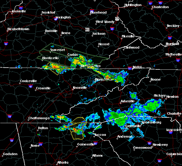 At 1245 pm edt, a severe thunderstorm was located over strunk, or near whitley city, moving southeast at 45 mph (radar indicated). Hazards include quarter size hail and 60 mph wind gusts. Hail damage to vehicles is expected. Expect wind damage to roofs, siding and trees. At 1245 pm edt, a severe thunderstorm was located over strunk, or near whitley city, moving southeast at 45 mph (radar indicated). Hazards include quarter size hail and 60 mph wind gusts. Hail damage to vehicles is expected. Expect wind damage to roofs, siding and trees.
|
| 7/14/2015 12:33 PM EDT |
 At 1233 pm edt, a severe thunderstorm capable of producing a tornado was located over co-operative, or 7 miles west of whitley city, moving southeast at 25 mph (radar indicated rotation). Hazards include tornado and golf ball size hail. Flying debris will be dangerous to those caught without shelter. mobile homes will be damaged or destroyed. damage to roofs, windows and vehicles will occur. tree damage is likely. this dangerous storm will be near, blue heron around 1240 pm edt. whitley city and stearns around 1245 pm edt. pine knot around 1250 pm edt. strunk around 1255 pm edt. hollyhill around 100 pm edt. Other locations impacted by this tornadic thunderstorm include jellico. At 1233 pm edt, a severe thunderstorm capable of producing a tornado was located over co-operative, or 7 miles west of whitley city, moving southeast at 25 mph (radar indicated rotation). Hazards include tornado and golf ball size hail. Flying debris will be dangerous to those caught without shelter. mobile homes will be damaged or destroyed. damage to roofs, windows and vehicles will occur. tree damage is likely. this dangerous storm will be near, blue heron around 1240 pm edt. whitley city and stearns around 1245 pm edt. pine knot around 1250 pm edt. strunk around 1255 pm edt. hollyhill around 100 pm edt. Other locations impacted by this tornadic thunderstorm include jellico.
|
| 7/14/2015 12:31 PM EDT |
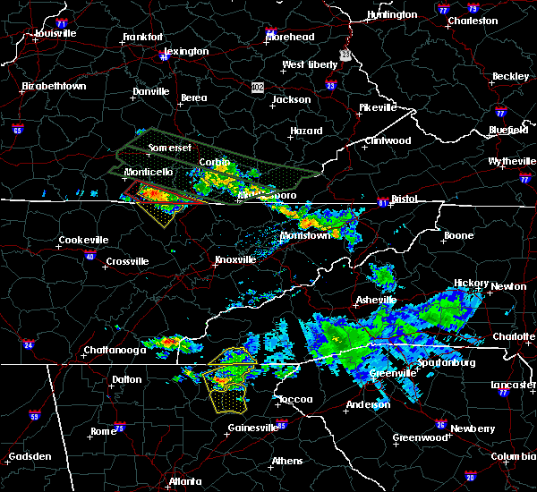 At 1231 pm edt, a severe thunderstorm was located over blue heron, or near whitley city, moving southeast at 30 mph (radar indicated). Hazards include golf ball size hail and 70 mph wind gusts. People and animals outdoors will be injured. expect hail damage to roofs, siding, windows and vehicles. expect considerable tree damage. wind damage is also likely to mobile homes, roofs and outbuildings. locations impacted include, whitley city, hollyhill, co-operative, pine knot, lot, strunk, ayers, blue heron, zion hill, red ash and stearns. This includes interstate 75 in east central kentucky between mile markers 1 and 2. At 1231 pm edt, a severe thunderstorm was located over blue heron, or near whitley city, moving southeast at 30 mph (radar indicated). Hazards include golf ball size hail and 70 mph wind gusts. People and animals outdoors will be injured. expect hail damage to roofs, siding, windows and vehicles. expect considerable tree damage. wind damage is also likely to mobile homes, roofs and outbuildings. locations impacted include, whitley city, hollyhill, co-operative, pine knot, lot, strunk, ayers, blue heron, zion hill, red ash and stearns. This includes interstate 75 in east central kentucky between mile markers 1 and 2.
|
| 7/14/2015 12:13 PM EDT |
 At 1213 pm edt, a severe thunderstorm capable of producing a tornado was located over kidds crossing, or 11 miles southeast of monticello, moving southeast at 45 mph (radar indicated rotation). Hazards include tornado and tennis ball size hail. Flying debris will be dangerous to those caught without shelter. mobile homes will be damaged or destroyed. damage to roofs, windows and vehicles will occur. tree damage is likely. this dangerous storm will be near, co-operative around 1220 pm edt. blue heron around 1225 pm edt. whitley city and stearns around 1230 pm edt. strunk and pine knot around 1235 pm edt. hollyhill around 1240 pm edt. zion hill and ayers around 1250 pm edt. This includes interstate 75 in east central kentucky near mile marker 1. At 1213 pm edt, a severe thunderstorm capable of producing a tornado was located over kidds crossing, or 11 miles southeast of monticello, moving southeast at 45 mph (radar indicated rotation). Hazards include tornado and tennis ball size hail. Flying debris will be dangerous to those caught without shelter. mobile homes will be damaged or destroyed. damage to roofs, windows and vehicles will occur. tree damage is likely. this dangerous storm will be near, co-operative around 1220 pm edt. blue heron around 1225 pm edt. whitley city and stearns around 1230 pm edt. strunk and pine knot around 1235 pm edt. hollyhill around 1240 pm edt. zion hill and ayers around 1250 pm edt. This includes interstate 75 in east central kentucky near mile marker 1.
|
| 7/14/2015 12:04 PM EDT |
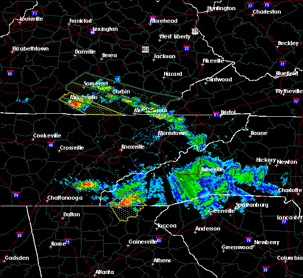 At 1204 pm edt, a severe thunderstorm was located over coopersville, or 7 miles southeast of monticello, moving southeast at 45 mph (radar indicated). Hazards include golf ball size hail and 70 mph wind gusts. People and animals outdoors will be injured. expect hail damage to roofs, siding, windows and vehicles. expect considerable tree damage. wind damage is also likely to mobile homes, roofs and outbuildings. locations impacted include, whitley city, beulah heights, co-operative, pine knot, delta, lot, zion hill, gregory, saxton, barrier, denney, rockeybranch, coopersville, slavens, mountain ash, red ash, duckrun, stearns, bounty and jellico creek. This includes interstate 75 in east central kentucky between mile markers 1 and 6. At 1204 pm edt, a severe thunderstorm was located over coopersville, or 7 miles southeast of monticello, moving southeast at 45 mph (radar indicated). Hazards include golf ball size hail and 70 mph wind gusts. People and animals outdoors will be injured. expect hail damage to roofs, siding, windows and vehicles. expect considerable tree damage. wind damage is also likely to mobile homes, roofs and outbuildings. locations impacted include, whitley city, beulah heights, co-operative, pine knot, delta, lot, zion hill, gregory, saxton, barrier, denney, rockeybranch, coopersville, slavens, mountain ash, red ash, duckrun, stearns, bounty and jellico creek. This includes interstate 75 in east central kentucky between mile markers 1 and 6.
|
| 7/14/2015 11:56 AM EDT |
 At 1156 am edt, a severe thunderstorm was located near gregory, or near monticello, and is nearly stationary (radar indicated). Hazards include half dollar size hail and 70 mph wind gusts. Hail damage to vehicles is expected. expect considerable tree damage. wind damage is also likely to mobile homes, roofs and outbuildings. locations impacted include, monticello, whitley city, beulah heights, co-operative, pine knot, delta, lot, mill springs, zion hill, gregory, saxton, barrier, denney, rockeybranch, steubenville, coopersville, slavens, mountain ash, red ash and duckrun. This includes interstate 75 in east central kentucky between mile markers 1 and 7. At 1156 am edt, a severe thunderstorm was located near gregory, or near monticello, and is nearly stationary (radar indicated). Hazards include half dollar size hail and 70 mph wind gusts. Hail damage to vehicles is expected. expect considerable tree damage. wind damage is also likely to mobile homes, roofs and outbuildings. locations impacted include, monticello, whitley city, beulah heights, co-operative, pine knot, delta, lot, mill springs, zion hill, gregory, saxton, barrier, denney, rockeybranch, steubenville, coopersville, slavens, mountain ash, red ash and duckrun. This includes interstate 75 in east central kentucky between mile markers 1 and 7.
|
| 7/14/2015 11:44 AM EDT |
 At 1144 am edt, a severe thunderstorm was located near parnell, or near monticello, moving southeast at 45 mph (radar indicated). Hazards include quarter size hail and 60 mph wind gusts. Hail damage to vehicles is expected. Expect wind damage to roofs, siding and trees. At 1144 am edt, a severe thunderstorm was located near parnell, or near monticello, moving southeast at 45 mph (radar indicated). Hazards include quarter size hail and 60 mph wind gusts. Hail damage to vehicles is expected. Expect wind damage to roofs, siding and trees.
|
| 6/21/2015 6:33 PM EDT |
 At 632 pm edt, severe thunderstorms were located along a line extending from near duckrun to hollyhill to near oneida, moving southeast at 35 mph (radar indicated). Hazards include quarter size hail and 60 mph wind gusts. Hail damage to vehicles is expected. expect wind damage to roofs, siding and trees. locations impacted include, williamsburg, whitley city, lucky, co-operative, pine knot, great meadows campsites, suttons mill, zion hill, saxton, yaden, mountain ash, red ash, duckrun, stearns, bounty, jellico creek, emlyn, bon, hollyhill and ayers. This includes interstate 75 in east central kentucky between mile markers 2 and 12. At 632 pm edt, severe thunderstorms were located along a line extending from near duckrun to hollyhill to near oneida, moving southeast at 35 mph (radar indicated). Hazards include quarter size hail and 60 mph wind gusts. Hail damage to vehicles is expected. expect wind damage to roofs, siding and trees. locations impacted include, williamsburg, whitley city, lucky, co-operative, pine knot, great meadows campsites, suttons mill, zion hill, saxton, yaden, mountain ash, red ash, duckrun, stearns, bounty, jellico creek, emlyn, bon, hollyhill and ayers. This includes interstate 75 in east central kentucky between mile markers 2 and 12.
|
| 6/21/2015 6:21 PM EDT |
 At 620 pm edt, severe thunderstorms were located along a line extending from beulah heights to near pine knot to near oneida, moving southeast at 35 mph (radar indicated). Hazards include quarter size hail and 60 mph wind gusts. Hail damage to vehicles is expected. Expect wind damage to roofs, siding and trees. At 620 pm edt, severe thunderstorms were located along a line extending from beulah heights to near pine knot to near oneida, moving southeast at 35 mph (radar indicated). Hazards include quarter size hail and 60 mph wind gusts. Hail damage to vehicles is expected. Expect wind damage to roofs, siding and trees.
|
| 4/7/2015 9:06 PM EDT | A severe thunderstorm warning remains in effect until 915 pm edt for south central laurel. eastern mccreary and whitley counties. at 903 pm edt. severe thunderstorms were located along a line extending from near huxley to near bark camp to cumberland falls s. p. to near hollyhill to near strunk. moving east at 20 mph. hazard. 60 mph wind gusts. |
| 4/7/2015 8:45 PM EDT | The national weather service in jackson ky has issued a * severe thunderstorm warning for. southwestern laurel county in south central kentucky. southeastern pulaski county in south central kentucky. mccreary county in south central kentucky. Whitley county in south central kentucky. |
| 7/27/2014 3:41 PM EDT | Golf Ball sized hail reported 3.2 miles NW of Pine Knot, KY |
| 7/27/2014 3:40 PM EDT | Quarter sized hail reported 3.2 miles NW of Pine Knot, KY |
| 7/27/2014 3:35 PM EDT | Baseball sized hail reported 2.6 miles NNW of Pine Knot, KY, in the community of murphy ridge. |
| 7/27/2014 3:35 PM EDT | Tea Cup sized hail reported 2.6 miles NNW of Pine Knot, KY, in the community of marsh creek. |
| 6/10/2014 5:35 PM EDT | Garage destroye in mccreary county KY, 0.3 miles NNE of Pine Knot, KY |
| 11/1/2013 2:10 AM EDT | Tree across road on hwy 92 at two seperate loca in mccreary county KY, 5.6 miles W of Pine Knot, KY |
| 7/9/2013 6:20 PM EDT | Trees down at the intersection of of highway 592 and 1470. trees also down on highway 1470 near mile marker 1 in mccreary county KY, 3.3 miles W of Pine Knot, KY |
| 5/21/2013 4:32 PM EDT | Limbs as big as forearm in yard. power is out. pea sized hai in mccreary county KY, 0.3 miles NNE of Pine Knot, KY |
| 12/17/2012 5:45 PM EST | Trees down across both lanes of mount pleasant road. pea sized hail also occurre in mccreary county KY, 0.3 miles NNE of Pine Knot, KY |
| 7/8/2012 9:15 PM EDT | Two trees down on hwy 167 in mccreary county KY, 6.8 miles WSW of Pine Knot, KY |
| 7/5/2012 4:53 PM EDT | Large tree between 18-24 inch dia. broke off approximately 4 feet off the ground along e 1470 east of strun in mccreary county KY, 3.7 miles NW of Pine Knot, KY |
| 1/1/0001 12:00 AM | 4 to 5 inch diameter limbs broke in mccreary county KY, 3.7 miles NW of Pine Knot, KY |
| 1/1/0001 12:00 AM | Damage to a church steeple at hwy 92 and sr 1044 near pine knott. also several trees down within a quarter mile of the church. one tree landed on a house. another was s in mccreary county KY, 1.9 miles SW of Pine Knot, KY |
| 1/1/0001 12:00 AM | Trees blown down with an estimated wind gust between 40 and 45 mp in mccreary county KY, 6 miles WNW of Pine Knot, KY |
| 1/1/0001 12:00 AM | Tree across road at bethe in mccreary county KY, 5.4 miles SW of Pine Knot, KY |
| 1/1/0001 12:00 AM | Quarter sized hail reported 3.7 miles NW of Pine Knot, KY, began hailing at 410pm as dime sized. |
| 1/1/0001 12:00 AM | Trees down on rock creek road...whirly circle and lum strunk roa in mccreary county KY, 2.4 miles N of Pine Knot, KY |
| 1/1/0001 12:00 AM | Damage to a mobile home and some 3 to 4 inch diameter tree limbs down on highway 9 in mccreary county KY, 2.9 miles WSW of Pine Knot, KY |
| 1/1/0001 12:00 AM | Roof blown off barn. board put through the window of a truck. top snapped out of a 20 inch diameter tre in mccreary county KY, 3.1 miles N of Pine Knot, KY |
| 1/1/0001 12:00 AM | Quarter sized hail reported 4.2 miles WNW of Pine Knot, KY |
Hail Maps for Pine Knot, KY

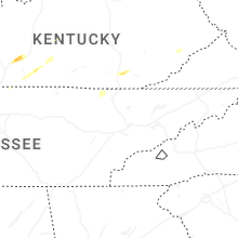
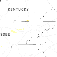


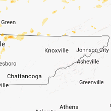


Connect with Interactive Hail Maps