

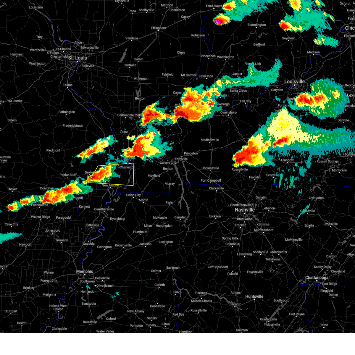
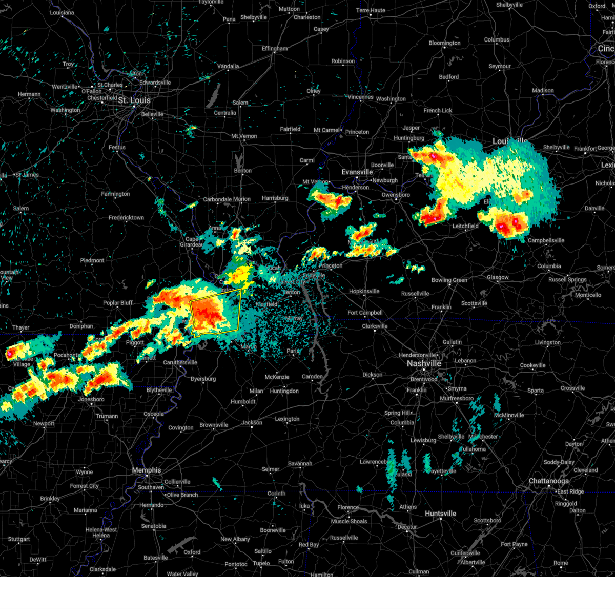
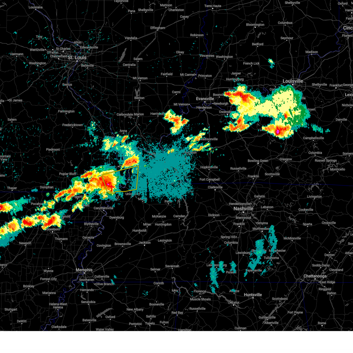
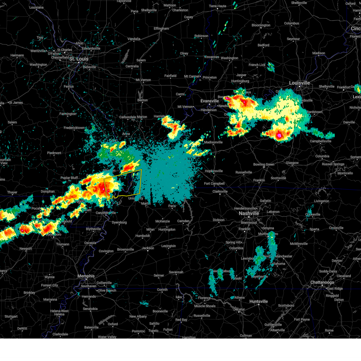
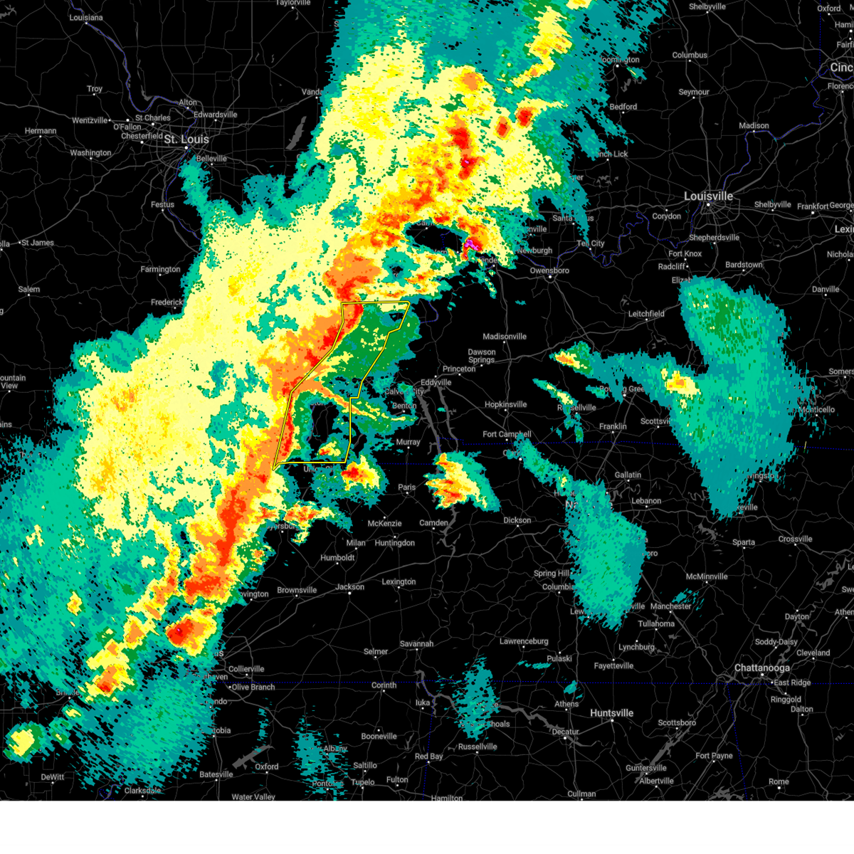
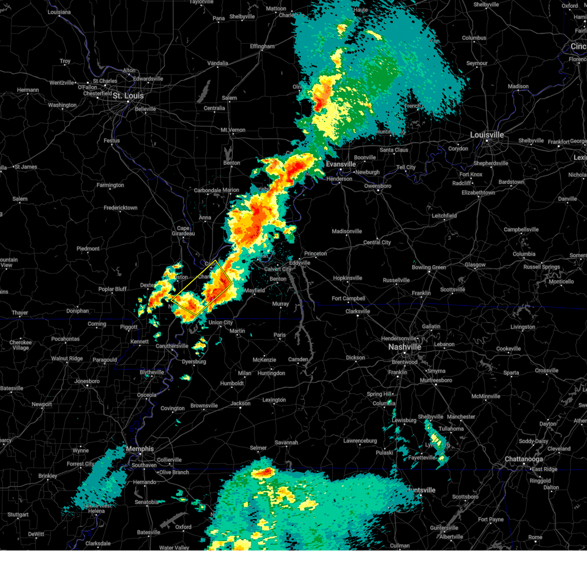
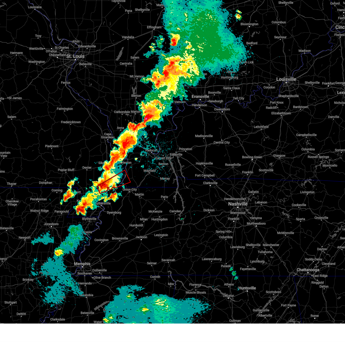
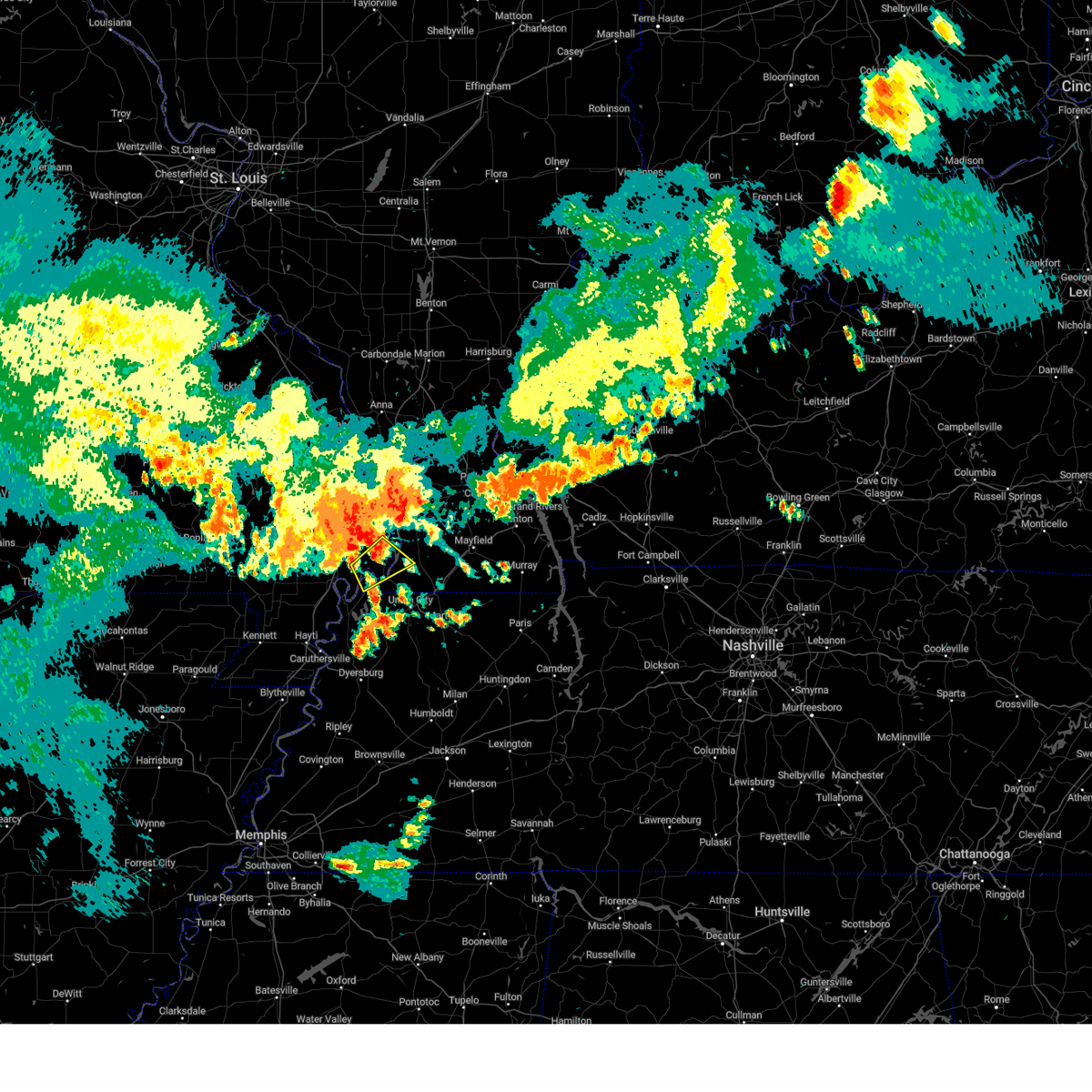
Hail Map for Pinhook, MO
The Pinhook, MO area has had 0 reports of on-the-ground hail by trained spotters, and has been under severe weather warnings 30 times during the past 12 months. Doppler radar has detected hail at or near Pinhook, MO on 59 occasions, including 6 occasions during the past year.
| Name: | Pinhook, MO |
| Where Located: | 41.8 miles SSE of Cape Girardeau, MO |
| Map: | Google Map for Pinhook, MO |
| Population: | 30 |
| Housing Units: | 19 |
| More Info: | Search Google for Pinhook, MO |
3
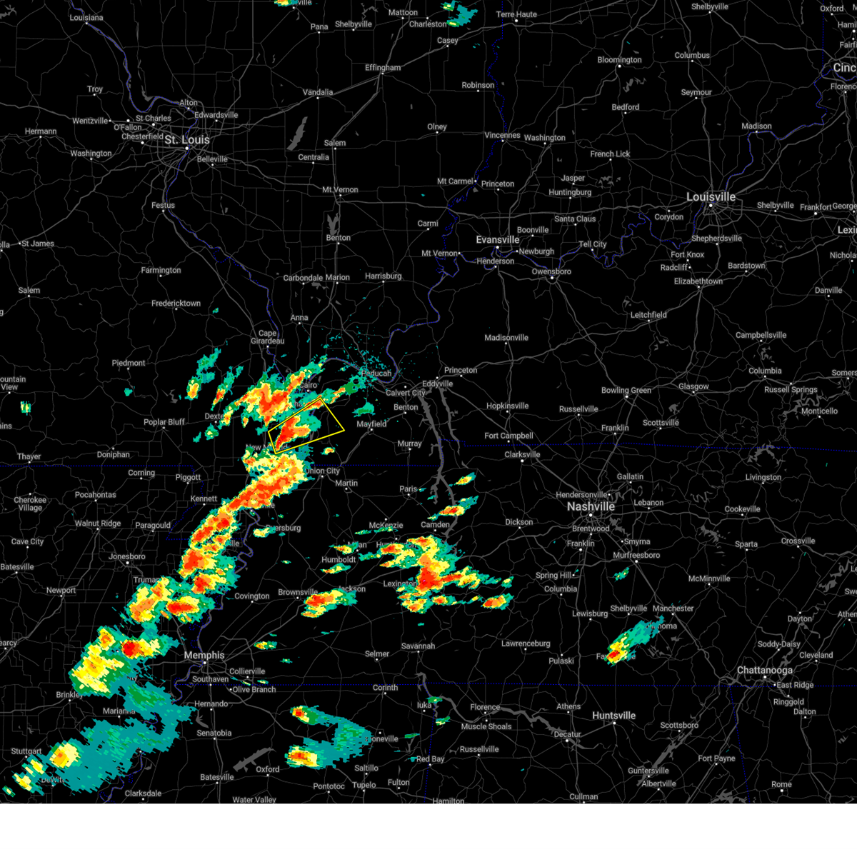
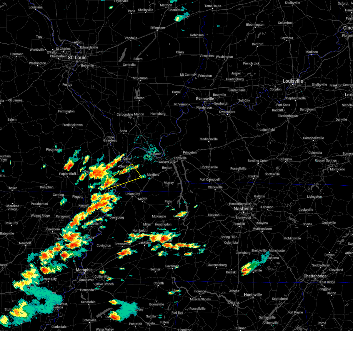
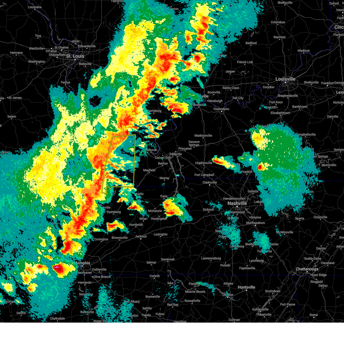
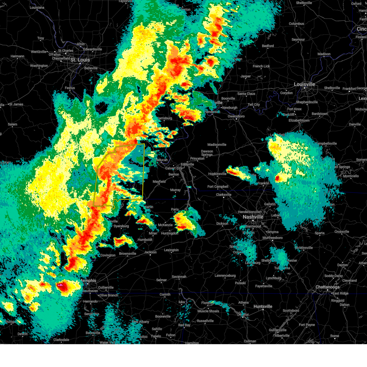
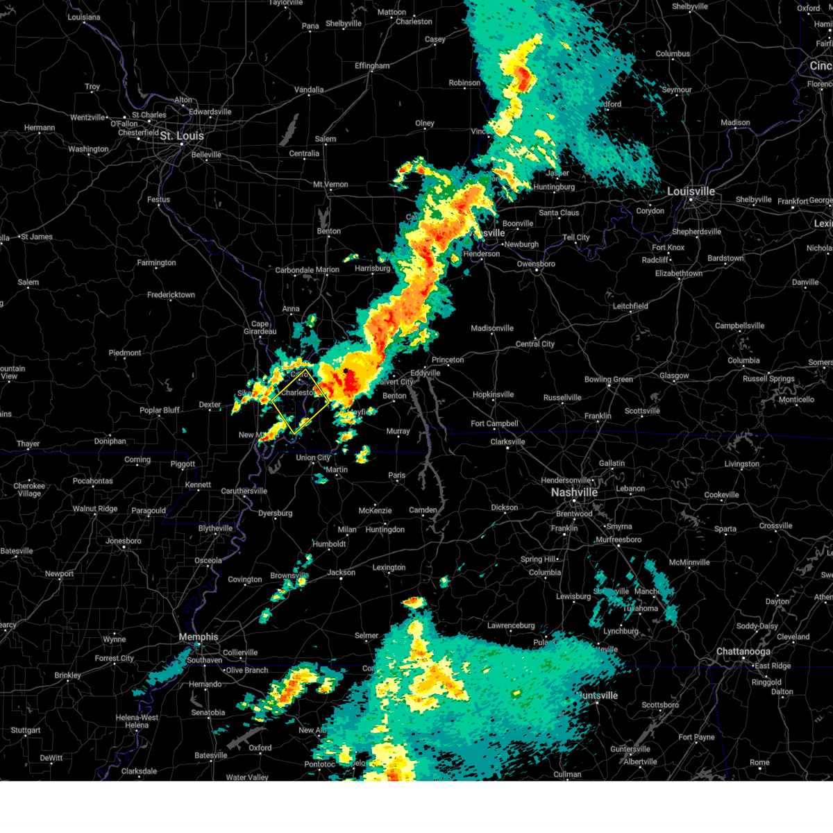
The Top Recent Hail Date for Pinhook, MO is Wednesday, April 2, 2025 (8th out of 59)

Hail and Wind Damage Spotted near Pinhook, MO
| Date / Time | Report Details |
|---|---|
| 5/20/2025 3:03 PM CDT | At 302 pm cdt, a severe thunderstorm was located near towosahgy state historic site, moving northeast at 45 mph (radar indicated). Hazards include 60 mph wind gusts and quarter size hail. Hail damage to vehicles is expected. expect wind damage to roofs, siding, and trees. Locations impacted include, east prairie, bardwell, towosahgy state historic site, big oak tree state park, anniston, arlington, and columbus. |
| 5/20/2025 3:03 PM CDT | the severe thunderstorm warning has been cancelled and is no longer in effect |
| 5/20/2025 2:51 PM CDT |
 At 251 pm cdt, a severe thunderstorm was located near big oak tree state park, moving east at 40 mph (radar indicated). Hazards include ping pong ball size hail and 60 mph wind gusts. People and animals outdoors will be injured. expect hail damage to roofs, siding, windows, and vehicles. expect wind damage to roofs, siding, and trees. Locations impacted include, east prairie, bardwell, towosahgy state historic site, big oak tree state park, anniston, arlington, and columbus. At 251 pm cdt, a severe thunderstorm was located near big oak tree state park, moving east at 40 mph (radar indicated). Hazards include ping pong ball size hail and 60 mph wind gusts. People and animals outdoors will be injured. expect hail damage to roofs, siding, windows, and vehicles. expect wind damage to roofs, siding, and trees. Locations impacted include, east prairie, bardwell, towosahgy state historic site, big oak tree state park, anniston, arlington, and columbus.
|
| 5/20/2025 2:39 PM CDT |
 Svrpah the national weather service in paducah has issued a * severe thunderstorm warning for, northwestern fulton county in western kentucky, western carlisle county in western kentucky, northern hickman county in western kentucky, south central ballard county in western kentucky, central mississippi county in southeastern missouri, east central new madrid county in southeastern missouri, * until 330 pm cdt. * at 239 pm cdt, a severe thunderstorm was located over farrenburg, or near hunter-dawson state historic site, moving northeast at 45 mph (radar indicated). Hazards include golf ball size hail and 60 mph wind gusts. People and animals outdoors will be injured. expect hail damage to roofs, siding, windows, and vehicles. Expect wind damage to roofs, siding, and trees. Svrpah the national weather service in paducah has issued a * severe thunderstorm warning for, northwestern fulton county in western kentucky, western carlisle county in western kentucky, northern hickman county in western kentucky, south central ballard county in western kentucky, central mississippi county in southeastern missouri, east central new madrid county in southeastern missouri, * until 330 pm cdt. * at 239 pm cdt, a severe thunderstorm was located over farrenburg, or near hunter-dawson state historic site, moving northeast at 45 mph (radar indicated). Hazards include golf ball size hail and 60 mph wind gusts. People and animals outdoors will be injured. expect hail damage to roofs, siding, windows, and vehicles. Expect wind damage to roofs, siding, and trees.
|
| 5/16/2025 8:17 PM CDT |
 At 817 pm cdt, severe thunderstorms were located along a line extending from 10 miles northwest of mayfield to dorena to 6 miles southeast of portageville, moving east at 50 mph (radar indicated). Hazards include 60 mph wind gusts and penny size hail. Expect damage to roofs, siding, and trees. locations impacted include, mayfield, portageville, new madrid, hickman, clinton, lilbourn, hunter-dawson state historic site, towosahgy state historic site, big oak tree state park, gideon, marston, howardville, risco, cayce, dorena, fulgham, arlington, columbus, tallapoosa, and catron. this includes the following highways, interstate 69 in kentucky between mile markers 17 and 26. Interstate 55 between mile markers 33 and 50. At 817 pm cdt, severe thunderstorms were located along a line extending from 10 miles northwest of mayfield to dorena to 6 miles southeast of portageville, moving east at 50 mph (radar indicated). Hazards include 60 mph wind gusts and penny size hail. Expect damage to roofs, siding, and trees. locations impacted include, mayfield, portageville, new madrid, hickman, clinton, lilbourn, hunter-dawson state historic site, towosahgy state historic site, big oak tree state park, gideon, marston, howardville, risco, cayce, dorena, fulgham, arlington, columbus, tallapoosa, and catron. this includes the following highways, interstate 69 in kentucky between mile markers 17 and 26. Interstate 55 between mile markers 33 and 50.
|
| 5/16/2025 8:17 PM CDT |
 the severe thunderstorm warning has been cancelled and is no longer in effect the severe thunderstorm warning has been cancelled and is no longer in effect
|
| 5/16/2025 7:55 PM CDT |
 Svrpah the national weather service in paducah has issued a * severe thunderstorm warning for, fulton county in western kentucky, southern carlisle county in western kentucky, hickman county in western kentucky, central graves county in western kentucky, southern mississippi county in southeastern missouri, new madrid county in southeastern missouri, southeastern stoddard county in southeastern missouri, * until 845 pm cdt. * at 755 pm cdt, severe thunderstorms were located along a line extending from 8 miles southwest of bardwell to new madrid to near wardell, moving east at 50 mph (radar indicated). Hazards include 60 mph wind gusts and penny size hail. expect damage to roofs, siding, and trees Svrpah the national weather service in paducah has issued a * severe thunderstorm warning for, fulton county in western kentucky, southern carlisle county in western kentucky, hickman county in western kentucky, central graves county in western kentucky, southern mississippi county in southeastern missouri, new madrid county in southeastern missouri, southeastern stoddard county in southeastern missouri, * until 845 pm cdt. * at 755 pm cdt, severe thunderstorms were located along a line extending from 8 miles southwest of bardwell to new madrid to near wardell, moving east at 50 mph (radar indicated). Hazards include 60 mph wind gusts and penny size hail. expect damage to roofs, siding, and trees
|
| 5/16/2025 7:51 PM CDT | At 751 pm cdt, a severe thunderstorm was located 8 miles northeast of towosahgy state historic site, moving east at 55 mph (radar indicated). Hazards include 60 mph wind gusts and penny size hail. Expect damage to roofs, siding, and trees. locations impacted include, east prairie, big oak tree state park, towosahgy state historic site, anniston, farrenburg, and columbus. This includes interstate 55 between mile markers 51 and 56. |
| 5/16/2025 7:51 PM CDT | the severe thunderstorm warning has been cancelled and is no longer in effect |
| 5/16/2025 7:31 PM CDT | At 731 pm cdt, a severe thunderstorm was located near east prairie, moving east at 55 mph (radar indicated). Hazards include 70 mph wind gusts and quarter size hail. Hail damage to vehicles is expected. expect considerable tree damage. wind damage is also likely to mobile homes, roofs, and outbuildings. locations impacted include, sikeston, charleston, east prairie, miner, wickliffe, towosahgy state historic site, big oak tree state park, morehouse, bertrand, matthews, canalou, wyatt, anniston, farrenburg, columbus, and wilson city. this includes the following highways, interstate 57 in missouri between mile markers 1 and 17. Interstate 55 between mile markers 51 and 67. |
| 5/16/2025 7:16 PM CDT |
 Svrpah the national weather service in paducah has issued a * severe thunderstorm warning for, northeastern fulton county in western kentucky, western carlisle county in western kentucky, northwestern hickman county in western kentucky, southwestern ballard county in western kentucky, mississippi county in southeastern missouri, southern scott county in southeastern missouri, northeastern new madrid county in southeastern missouri, southeastern stoddard county in southeastern missouri, * until 800 pm cdt. * at 716 pm cdt, a severe thunderstorm was located over canalou, or 9 miles southwest of sikeston, moving east at 55 mph (radar indicated). Hazards include 70 mph wind gusts and half dollar size hail. Hail damage to vehicles is expected. expect considerable tree damage. Wind damage is also likely to mobile homes, roofs, and outbuildings. Svrpah the national weather service in paducah has issued a * severe thunderstorm warning for, northeastern fulton county in western kentucky, western carlisle county in western kentucky, northwestern hickman county in western kentucky, southwestern ballard county in western kentucky, mississippi county in southeastern missouri, southern scott county in southeastern missouri, northeastern new madrid county in southeastern missouri, southeastern stoddard county in southeastern missouri, * until 800 pm cdt. * at 716 pm cdt, a severe thunderstorm was located over canalou, or 9 miles southwest of sikeston, moving east at 55 mph (radar indicated). Hazards include 70 mph wind gusts and half dollar size hail. Hail damage to vehicles is expected. expect considerable tree damage. Wind damage is also likely to mobile homes, roofs, and outbuildings.
|
| 5/16/2025 5:43 AM CDT |
 At 543 am cdt, a severe thunderstorm was located over towosahgy state historic site, moving east at 60 mph (radar indicated). Hazards include two inch hail and 70 mph wind gusts. People and animals outdoors will be injured. expect hail damage to roofs, siding, windows, and vehicles. expect considerable tree damage. wind damage is also likely to mobile homes, roofs, and outbuildings. locations impacted include, east prairie, hickman, clinton, bardwell, towosahgy state historic site, big oak tree state park, anniston, cayce, farrenburg, dorena, arlington, columbus, and boundurant. This includes interstate 55 between mile markers 60 and 61. At 543 am cdt, a severe thunderstorm was located over towosahgy state historic site, moving east at 60 mph (radar indicated). Hazards include two inch hail and 70 mph wind gusts. People and animals outdoors will be injured. expect hail damage to roofs, siding, windows, and vehicles. expect considerable tree damage. wind damage is also likely to mobile homes, roofs, and outbuildings. locations impacted include, east prairie, hickman, clinton, bardwell, towosahgy state historic site, big oak tree state park, anniston, cayce, farrenburg, dorena, arlington, columbus, and boundurant. This includes interstate 55 between mile markers 60 and 61.
|
| 5/16/2025 5:30 AM CDT |
 At 530 am cdt, a severe thunderstorm was located near hunter-dawson state historic site, moving east at 65 mph (radar indicated). Hazards include two inch hail and 70 mph wind gusts. People and animals outdoors will be injured. expect hail damage to roofs, siding, windows, and vehicles. expect considerable tree damage. wind damage is also likely to mobile homes, roofs, and outbuildings. locations impacted include, east prairie, new madrid, hickman, clinton, lilbourn, bardwell, hunter-dawson state historic site, towosahgy state historic site, big oak tree state park, matthews, howardville, anniston, cayce, farrenburg, dorena, arlington, columbus, and boundurant. This includes interstate 55 between mile markers 43 and 61. At 530 am cdt, a severe thunderstorm was located near hunter-dawson state historic site, moving east at 65 mph (radar indicated). Hazards include two inch hail and 70 mph wind gusts. People and animals outdoors will be injured. expect hail damage to roofs, siding, windows, and vehicles. expect considerable tree damage. wind damage is also likely to mobile homes, roofs, and outbuildings. locations impacted include, east prairie, new madrid, hickman, clinton, lilbourn, bardwell, hunter-dawson state historic site, towosahgy state historic site, big oak tree state park, matthews, howardville, anniston, cayce, farrenburg, dorena, arlington, columbus, and boundurant. This includes interstate 55 between mile markers 43 and 61.
|
| 5/16/2025 5:23 AM CDT |
 Svrpah the national weather service in paducah has issued a * severe thunderstorm warning for, fulton county in western kentucky, western carlisle county in western kentucky, northwestern hickman county in western kentucky, southern mississippi county in southeastern missouri, eastern new madrid county in southeastern missouri, * until 615 am cdt. * at 523 am cdt, a severe thunderstorm was located over howardville, or over lilbourn, moving northeast at 55 mph (radar indicated). Hazards include ping pong ball size hail and 60 mph wind gusts. People and animals outdoors will be injured. expect hail damage to roofs, siding, windows, and vehicles. Expect wind damage to roofs, siding, and trees. Svrpah the national weather service in paducah has issued a * severe thunderstorm warning for, fulton county in western kentucky, western carlisle county in western kentucky, northwestern hickman county in western kentucky, southern mississippi county in southeastern missouri, eastern new madrid county in southeastern missouri, * until 615 am cdt. * at 523 am cdt, a severe thunderstorm was located over howardville, or over lilbourn, moving northeast at 55 mph (radar indicated). Hazards include ping pong ball size hail and 60 mph wind gusts. People and animals outdoors will be injured. expect hail damage to roofs, siding, windows, and vehicles. Expect wind damage to roofs, siding, and trees.
|
| 4/2/2025 7:53 PM CDT |
 Svrpah the national weather service in paducah has issued a * severe thunderstorm warning for, central pulaski county in southern illinois, pope county in southern illinois, eastern johnson county in southern illinois, southeastern alexander county in southern illinois, northwestern hardin county in southern illinois, massac county in southern illinois, ballard county in western kentucky, western mccracken county in western kentucky, fulton county in western kentucky, carlisle county in western kentucky, hickman county in western kentucky, mississippi county in southeastern missouri, east central new madrid county in southeastern missouri, * until 845 pm cdt. * at 753 pm cdt, severe thunderstorms were located along a line extending from near lake of egypt area to near vienna to karnak to near cairo to 8 miles north of tiptonville, moving east at 45 mph (radar indicated). Hazards include 70 mph wind gusts and quarter size hail. Hail damage to vehicles is expected. expect considerable tree damage. Wind damage is also likely to mobile homes, roofs, and outbuildings. Svrpah the national weather service in paducah has issued a * severe thunderstorm warning for, central pulaski county in southern illinois, pope county in southern illinois, eastern johnson county in southern illinois, southeastern alexander county in southern illinois, northwestern hardin county in southern illinois, massac county in southern illinois, ballard county in western kentucky, western mccracken county in western kentucky, fulton county in western kentucky, carlisle county in western kentucky, hickman county in western kentucky, mississippi county in southeastern missouri, east central new madrid county in southeastern missouri, * until 845 pm cdt. * at 753 pm cdt, severe thunderstorms were located along a line extending from near lake of egypt area to near vienna to karnak to near cairo to 8 miles north of tiptonville, moving east at 45 mph (radar indicated). Hazards include 70 mph wind gusts and quarter size hail. Hail damage to vehicles is expected. expect considerable tree damage. Wind damage is also likely to mobile homes, roofs, and outbuildings.
|
| 4/2/2025 7:38 PM CDT |
 the severe thunderstorm warning has been cancelled and is no longer in effect the severe thunderstorm warning has been cancelled and is no longer in effect
|
| 4/2/2025 7:38 PM CDT |
 At 738 pm cdt, severe thunderstorms were located along a line extending from 8 miles northwest of tamms to near miner to near marston, moving northeast at 50 mph (radar indicated). Hazards include 70 mph wind gusts and quarter size hail. Hail damage to vehicles is expected. expect considerable tree damage. wind damage is also likely to mobile homes, roofs, and outbuildings. locations impacted include, charleston, cayce, mound city, new madrid, diehlstadt, anniston, towosahgy state historic site, bertrand, commerce, dorena, big oak tree state park, pulaski, mounds, bardwell, wilson city, ullin, karnak, wyatt, horseshoe lake conservation area, and olmsted. this includes the following highways, interstate 57 in illinois between mile markers 1 and 23. interstate 57 in missouri between mile markers 1 and 21. Interstate 55 between mile markers 39 and 71. At 738 pm cdt, severe thunderstorms were located along a line extending from 8 miles northwest of tamms to near miner to near marston, moving northeast at 50 mph (radar indicated). Hazards include 70 mph wind gusts and quarter size hail. Hail damage to vehicles is expected. expect considerable tree damage. wind damage is also likely to mobile homes, roofs, and outbuildings. locations impacted include, charleston, cayce, mound city, new madrid, diehlstadt, anniston, towosahgy state historic site, bertrand, commerce, dorena, big oak tree state park, pulaski, mounds, bardwell, wilson city, ullin, karnak, wyatt, horseshoe lake conservation area, and olmsted. this includes the following highways, interstate 57 in illinois between mile markers 1 and 23. interstate 57 in missouri between mile markers 1 and 21. Interstate 55 between mile markers 39 and 71.
|
| 4/2/2025 7:33 PM CDT |
 At 733 pm cdt, severe thunderstorms were located along a line extending from near tamms to near miner to near portageville, moving northeast at 55 mph (radar indicated). Hazards include 70 mph wind gusts and quarter size hail. Hail damage to vehicles is expected. expect considerable tree damage. wind damage is also likely to mobile homes, roofs, and outbuildings. locations impacted include, charleston, canalou, cayce, diehlstadt, anniston, morley, bertrand, commerce, dorena, big oak tree state park, mounds, bardwell, ullin, sikeston, hay-wood city, chaffee, arlington, bell city, hunter-dawson state historic site, and blandville. this includes the following highways, interstate 57 in illinois between mile markers 1 and 23. interstate 57 in missouri between mile markers 1 and 21. Interstate 55 between mile markers 33 and 91. At 733 pm cdt, severe thunderstorms were located along a line extending from near tamms to near miner to near portageville, moving northeast at 55 mph (radar indicated). Hazards include 70 mph wind gusts and quarter size hail. Hail damage to vehicles is expected. expect considerable tree damage. wind damage is also likely to mobile homes, roofs, and outbuildings. locations impacted include, charleston, canalou, cayce, diehlstadt, anniston, morley, bertrand, commerce, dorena, big oak tree state park, mounds, bardwell, ullin, sikeston, hay-wood city, chaffee, arlington, bell city, hunter-dawson state historic site, and blandville. this includes the following highways, interstate 57 in illinois between mile markers 1 and 23. interstate 57 in missouri between mile markers 1 and 21. Interstate 55 between mile markers 33 and 91.
|
| 4/2/2025 7:10 PM CDT | Svrpah the national weather service in paducah has issued a * severe thunderstorm warning for, southeastern union county in southern illinois, pulaski county in southern illinois, southwestern johnson county in southern illinois, alexander county in southern illinois, fulton county in western kentucky, western carlisle county in western kentucky, northwestern hickman county in western kentucky, ballard county in western kentucky, mississippi county in southeastern missouri, scott county in southeastern missouri, new madrid county in southeastern missouri, eastern stoddard county in southeastern missouri, * until 800 pm cdt. * at 710 pm cdt, severe thunderstorms were located along a line extending from near ware to near bell city to near holcomb, moving northeast at 55 mph (radar indicated). Hazards include 70 mph wind gusts and quarter size hail. Hail damage to vehicles is expected. expect considerable tree damage. Wind damage is also likely to mobile homes, roofs, and outbuildings. |
| 3/30/2025 7:43 PM CDT | Svrpah the national weather service in paducah has issued a * severe thunderstorm warning for, fulton county in western kentucky, west central hickman county in western kentucky, southeastern mississippi county in southeastern missouri, southeastern new madrid county in southeastern missouri, * until 830 pm cdt. * at 742 pm cdt, a severe thunderstorm was located near new madrid, moving east at 30 mph (radar indicated). Hazards include 60 mph wind gusts and quarter size hail. Hail damage to vehicles is expected. Expect wind damage to roofs, siding, and trees. |
| 3/30/2025 7:13 PM CDT | the tornado warning has been cancelled and is no longer in effect |
| 3/30/2025 7:02 PM CDT | At 701 pm cdt, a severe thunderstorm capable of producing a tornado was located over anniston, or over east prairie, moving east at 35 mph (radar indicated rotation). Hazards include tornado and quarter size hail. Flying debris will be dangerous to those caught without shelter. mobile homes will be damaged or destroyed. damage to roofs, windows, and vehicles will occur. tree damage is likely. this dangerous storm will be near, wyatt and anniston around 705 pm cdt. Other locations impacted by this tornadic thunderstorm include wilson city. |
| 3/30/2025 7:02 PM CDT | the tornado warning has been cancelled and is no longer in effect |
| 3/30/2025 6:53 PM CDT | Svrpah the national weather service in paducah has issued a * severe thunderstorm warning for, central fulton county in western kentucky, carlisle county in western kentucky, hickman county in western kentucky, mississippi county in southeastern missouri, northeastern new madrid county in southeastern missouri, * until 745 pm cdt. * at 652 pm cdt, a severe thunderstorm was located near east prairie, moving east at 40 mph (radar indicated). Hazards include 60 mph wind gusts and quarter size hail. Hail damage to vehicles is expected. Expect wind damage to roofs, siding, and trees. |
| 3/30/2025 6:42 PM CDT | Torpah the national weather service in paducah has issued a * tornado warning for, southwestern carlisle county in western kentucky, central mississippi county in southeastern missouri, northeastern new madrid county in southeastern missouri, * until 730 pm cdt. * at 641 pm cdt, a severe thunderstorm capable of producing a tornado was located over matthews, or 8 miles south of sikeston, moving east at 35 mph (radar indicated rotation). Hazards include tornado and quarter size hail. Flying debris will be dangerous to those caught without shelter. mobile homes will be damaged or destroyed. damage to roofs, windows, and vehicles will occur. tree damage is likely. this dangerous storm will be near, east prairie around 645 pm cdt. anniston around 650 pm cdt. charleston around 655 pm cdt. wyatt around 705 pm cdt. other locations impacted by this tornadic thunderstorm include wilson city. this includes the following highways, interstate 57 in missouri between mile markers 9 and 15. Interstate 55 between mile markers 55 and 64. |
| 3/15/2025 2:44 AM CDT |
 the severe thunderstorm warning has been cancelled and is no longer in effect the severe thunderstorm warning has been cancelled and is no longer in effect
|
| 3/15/2025 2:27 AM CDT | the severe thunderstorm warning has been cancelled and is no longer in effect |
| 3/15/2025 2:27 AM CDT | At 227 am cdt, severe thunderstorms were located along a line extending from near anniston to 8 miles southwest of bardwell, moving northeast at 70 mph (radar indicated). Hazards include 70 mph wind gusts. Expect considerable tree damage. damage is likely to mobile homes, roofs, and outbuildings. locations impacted include, wickliffe, charleston, anniston, bardwell, cairo, towosahgy state historic site, columbus, wilson city, wyatt, and arlington. This includes interstate 57 in missouri between mile markers 11 and 20. |
| 3/15/2025 2:13 AM CDT |
 Svrpah the national weather service in paducah has issued a * severe thunderstorm warning for, southeastern alexander county in southern illinois, central fulton county in western kentucky, western carlisle county in western kentucky, northwestern hickman county in western kentucky, southwestern ballard county in western kentucky, mississippi county in southeastern missouri, northeastern new madrid county in southeastern missouri, * until 300 am cdt. * at 212 am cdt, severe thunderstorms were located along a line extending from near farrenburg to 6 miles southwest of big oak tree state park, moving northeast at 60 mph (radar indicated). Hazards include 70 mph wind gusts. Expect considerable tree damage. Damage is likely to mobile homes, roofs, and outbuildings. Svrpah the national weather service in paducah has issued a * severe thunderstorm warning for, southeastern alexander county in southern illinois, central fulton county in western kentucky, western carlisle county in western kentucky, northwestern hickman county in western kentucky, southwestern ballard county in western kentucky, mississippi county in southeastern missouri, northeastern new madrid county in southeastern missouri, * until 300 am cdt. * at 212 am cdt, severe thunderstorms were located along a line extending from near farrenburg to 6 miles southwest of big oak tree state park, moving northeast at 60 mph (radar indicated). Hazards include 70 mph wind gusts. Expect considerable tree damage. Damage is likely to mobile homes, roofs, and outbuildings.
|
| 3/15/2025 1:36 AM CDT |
 Torpah the national weather service in paducah has issued a * tornado warning for, western fulton county in western kentucky, northwestern hickman county in western kentucky, southeastern mississippi county in southeastern missouri, southeastern new madrid county in southeastern missouri, * until 200 am cdt. * at 136 am cdt, a severe thunderstorm capable of producing a tornado was located near portageville, moving northeast at 55 mph (radar indicated rotation). Hazards include tornado. Flying debris will be dangerous to those caught without shelter. mobile homes will be damaged or destroyed. damage to roofs, windows, and vehicles will occur. tree damage is likely. this dangerous storm will be near, hunter-dawson state historic site, howardville, marston, and new madrid around 140 am cdt. big oak tree state park around 155 am cdt. other locations impacted by this tornadic thunderstorm include boundurant. This includes interstate 55 between mile markers 33 and 47. Torpah the national weather service in paducah has issued a * tornado warning for, western fulton county in western kentucky, northwestern hickman county in western kentucky, southeastern mississippi county in southeastern missouri, southeastern new madrid county in southeastern missouri, * until 200 am cdt. * at 136 am cdt, a severe thunderstorm capable of producing a tornado was located near portageville, moving northeast at 55 mph (radar indicated rotation). Hazards include tornado. Flying debris will be dangerous to those caught without shelter. mobile homes will be damaged or destroyed. damage to roofs, windows, and vehicles will occur. tree damage is likely. this dangerous storm will be near, hunter-dawson state historic site, howardville, marston, and new madrid around 140 am cdt. big oak tree state park around 155 am cdt. other locations impacted by this tornadic thunderstorm include boundurant. This includes interstate 55 between mile markers 33 and 47.
|
| 5/26/2024 9:34 PM CDT |
 the severe thunderstorm warning has been cancelled and is no longer in effect the severe thunderstorm warning has been cancelled and is no longer in effect
|
| 5/26/2024 9:34 PM CDT |
 At 933 pm cdt, severe thunderstorms were located along a line extending from 6 miles northeast of calvert city to 7 miles northwest of mayfield to near dorena, moving east at 125 mph (radar indicated). Hazards include 60 mph wind gusts and quarter size hail. Hail damage to vehicles is expected. expect wind damage to roofs, siding, and trees. locations impacted include, paducah, bardwell, lone oak, towosahgy state historic site, reidland, arlington, columbus, and lowes. this includes the following highways, interstate 24 in kentucky between mile markers 7 and 17. Interstate 55 near mile marker 54. At 933 pm cdt, severe thunderstorms were located along a line extending from 6 miles northeast of calvert city to 7 miles northwest of mayfield to near dorena, moving east at 125 mph (radar indicated). Hazards include 60 mph wind gusts and quarter size hail. Hail damage to vehicles is expected. expect wind damage to roofs, siding, and trees. locations impacted include, paducah, bardwell, lone oak, towosahgy state historic site, reidland, arlington, columbus, and lowes. this includes the following highways, interstate 24 in kentucky between mile markers 7 and 17. Interstate 55 near mile marker 54.
|
| 5/26/2024 8:41 PM CDT |
 Svrpah the national weather service in paducah has issued a * severe thunderstorm warning for, central pulaski county in southern illinois, southern massac county in southern illinois, southeastern alexander county in southern illinois, carlisle county in western kentucky, northwestern hickman county in western kentucky, ballard county in western kentucky, mccracken county in western kentucky, northwestern graves county in western kentucky, mississippi county in southeastern missouri, northeastern new madrid county in southeastern missouri, * until 945 pm cdt. * at 841 pm cdt, severe thunderstorms were located along a line extending from near karnak to near charleston to near bernie, moving southeast at 40 mph (radar indicated). Hazards include 60 mph wind gusts and quarter size hail. Hail damage to vehicles is expected. Expect wind damage to roofs, siding, and trees. Svrpah the national weather service in paducah has issued a * severe thunderstorm warning for, central pulaski county in southern illinois, southern massac county in southern illinois, southeastern alexander county in southern illinois, carlisle county in western kentucky, northwestern hickman county in western kentucky, ballard county in western kentucky, mccracken county in western kentucky, northwestern graves county in western kentucky, mississippi county in southeastern missouri, northeastern new madrid county in southeastern missouri, * until 945 pm cdt. * at 841 pm cdt, severe thunderstorms were located along a line extending from near karnak to near charleston to near bernie, moving southeast at 40 mph (radar indicated). Hazards include 60 mph wind gusts and quarter size hail. Hail damage to vehicles is expected. Expect wind damage to roofs, siding, and trees.
|
| 5/26/2024 7:42 AM CDT |
 Svrpah the national weather service in paducah has issued a * severe thunderstorm warning for, union county in southern illinois, pulaski county in southern illinois, southern pope county in southern illinois, johnson county in southern illinois, alexander county in southern illinois, massac county in southern illinois, south central williamson county in southern illinois, ballard county in western kentucky, mccracken county in western kentucky, fulton county in western kentucky, southwestern livingston county in western kentucky, carlisle county in western kentucky, hickman county in western kentucky, graves county in western kentucky, mississippi county in southeastern missouri, southeastern new madrid county in southeastern missouri, east central cape girardeau county in southeastern missouri, * until 830 am cdt. * at 741 am cdt, severe thunderstorms were located along a line extending from near cape girardeau to near cairo to near big oak tree state park to near tiptonville, moving northeast at 75 mph (radar indicated). Hazards include 70 mph wind gusts and penny size hail. Expect considerable tree damage. Damage is likely to mobile homes, roofs, and outbuildings. Svrpah the national weather service in paducah has issued a * severe thunderstorm warning for, union county in southern illinois, pulaski county in southern illinois, southern pope county in southern illinois, johnson county in southern illinois, alexander county in southern illinois, massac county in southern illinois, south central williamson county in southern illinois, ballard county in western kentucky, mccracken county in western kentucky, fulton county in western kentucky, southwestern livingston county in western kentucky, carlisle county in western kentucky, hickman county in western kentucky, graves county in western kentucky, mississippi county in southeastern missouri, southeastern new madrid county in southeastern missouri, east central cape girardeau county in southeastern missouri, * until 830 am cdt. * at 741 am cdt, severe thunderstorms were located along a line extending from near cape girardeau to near cairo to near big oak tree state park to near tiptonville, moving northeast at 75 mph (radar indicated). Hazards include 70 mph wind gusts and penny size hail. Expect considerable tree damage. Damage is likely to mobile homes, roofs, and outbuildings.
|
| 5/26/2024 7:31 AM CDT |
 the severe thunderstorm warning has been cancelled and is no longer in effect the severe thunderstorm warning has been cancelled and is no longer in effect
|
| 5/26/2024 7:31 AM CDT |
 At 730 am cdt, severe thunderstorms were located along a line extending from near chaffee to near miner to near portageville, moving northeast at 75 mph (radar indicated). Hazards include 70 mph wind gusts. Expect considerable tree damage. damage is likely to mobile homes, roofs, and outbuildings. locations impacted include, sikeston, charleston, scott city, portageville, east prairie, new madrid, cairo, oran, lilbourn, miner, benton, towosahgy state historic site, big oak tree state park, hunter-dawson state historic site, bertrand, mounds, morley, tamms, matthews, and kelso. this includes the following highways, interstate 57 in illinois between mile markers 1 and 21. interstate 57 in missouri between mile markers 1 and 21. Interstate 55 between mile markers 33 and 88. At 730 am cdt, severe thunderstorms were located along a line extending from near chaffee to near miner to near portageville, moving northeast at 75 mph (radar indicated). Hazards include 70 mph wind gusts. Expect considerable tree damage. damage is likely to mobile homes, roofs, and outbuildings. locations impacted include, sikeston, charleston, scott city, portageville, east prairie, new madrid, cairo, oran, lilbourn, miner, benton, towosahgy state historic site, big oak tree state park, hunter-dawson state historic site, bertrand, mounds, morley, tamms, matthews, and kelso. this includes the following highways, interstate 57 in illinois between mile markers 1 and 21. interstate 57 in missouri between mile markers 1 and 21. Interstate 55 between mile markers 33 and 88.
|
| 5/26/2024 7:12 AM CDT |
 At 712 am cdt, severe thunderstorms were located along a line extending from near bell city to near parma to holcomb, moving east at 70 mph (radar indicated). Hazards include 70 mph wind gusts. Expect considerable tree damage. damage is likely to mobile homes, roofs, and outbuildings. locations impacted include, sikeston, dexter, charleston, scott city, portageville, east prairie, new madrid, cairo, bernie, bloomfield, oran, lilbourn, miner, benton, big oak tree state park, hunter-dawson state historic site, towosahgy state historic site, malden, clarkton, and gideon. this includes the following highways, interstate 57 in illinois between mile markers 1 and 21. interstate 57 in missouri between mile markers 1 and 21. Interstate 55 between mile markers 33 and 88. At 712 am cdt, severe thunderstorms were located along a line extending from near bell city to near parma to holcomb, moving east at 70 mph (radar indicated). Hazards include 70 mph wind gusts. Expect considerable tree damage. damage is likely to mobile homes, roofs, and outbuildings. locations impacted include, sikeston, dexter, charleston, scott city, portageville, east prairie, new madrid, cairo, bernie, bloomfield, oran, lilbourn, miner, benton, big oak tree state park, hunter-dawson state historic site, towosahgy state historic site, malden, clarkton, and gideon. this includes the following highways, interstate 57 in illinois between mile markers 1 and 21. interstate 57 in missouri between mile markers 1 and 21. Interstate 55 between mile markers 33 and 88.
|
| 5/26/2024 7:12 AM CDT |
 the severe thunderstorm warning has been cancelled and is no longer in effect the severe thunderstorm warning has been cancelled and is no longer in effect
|
| 5/8/2024 10:29 PM CDT |
 the tornado warning has been cancelled and is no longer in effect the tornado warning has been cancelled and is no longer in effect
|
| 5/8/2024 10:08 PM CDT |
 At 1007 pm cdt, a severe thunderstorm capable of producing a tornado was located over east prairie, moving east at 30 mph (radar indicated rotation). Hazards include tornado and ping pong ball size hail. Flying debris will be dangerous to those caught without shelter. mobile homes will be damaged or destroyed. damage to roofs, windows, and vehicles will occur. tree damage is likely. this dangerous storm will be near, wyatt and anniston around 1015 pm cdt. bardwell around 1030 pm cdt. Other locations impacted by this tornadic thunderstorm include columbus, arlington, and blandville. At 1007 pm cdt, a severe thunderstorm capable of producing a tornado was located over east prairie, moving east at 30 mph (radar indicated rotation). Hazards include tornado and ping pong ball size hail. Flying debris will be dangerous to those caught without shelter. mobile homes will be damaged or destroyed. damage to roofs, windows, and vehicles will occur. tree damage is likely. this dangerous storm will be near, wyatt and anniston around 1015 pm cdt. bardwell around 1030 pm cdt. Other locations impacted by this tornadic thunderstorm include columbus, arlington, and blandville.
|
| 5/8/2024 10:08 PM CDT |
 the tornado warning has been cancelled and is no longer in effect the tornado warning has been cancelled and is no longer in effect
|
| 5/8/2024 9:54 PM CDT |
 Torpah the national weather service in paducah has issued a * tornado warning for, central carlisle county in western kentucky, northwestern hickman county in western kentucky, south central ballard county in western kentucky, central mississippi county in southeastern missouri, northeastern new madrid county in southeastern missouri, * until 1045 pm cdt. * at 954 pm cdt, a severe thunderstorm capable of producing a tornado was located near east prairie, moving east at 30 mph (radar indicated rotation). Hazards include tornado and ping pong ball size hail. Flying debris will be dangerous to those caught without shelter. mobile homes will be damaged or destroyed. damage to roofs, windows, and vehicles will occur. tree damage is likely. this dangerous storm will be near, charleston, east prairie, and anniston around 1000 pm cdt. wyatt around 1015 pm cdt. other locations impacted by this tornadic thunderstorm include columbus, arlington, and blandville. This includes interstate 55 between mile markers 55 and 65. Torpah the national weather service in paducah has issued a * tornado warning for, central carlisle county in western kentucky, northwestern hickman county in western kentucky, south central ballard county in western kentucky, central mississippi county in southeastern missouri, northeastern new madrid county in southeastern missouri, * until 1045 pm cdt. * at 954 pm cdt, a severe thunderstorm capable of producing a tornado was located near east prairie, moving east at 30 mph (radar indicated rotation). Hazards include tornado and ping pong ball size hail. Flying debris will be dangerous to those caught without shelter. mobile homes will be damaged or destroyed. damage to roofs, windows, and vehicles will occur. tree damage is likely. this dangerous storm will be near, charleston, east prairie, and anniston around 1000 pm cdt. wyatt around 1015 pm cdt. other locations impacted by this tornadic thunderstorm include columbus, arlington, and blandville. This includes interstate 55 between mile markers 55 and 65.
|
| 3/14/2024 8:19 PM CDT |
 the severe thunderstorm warning has been cancelled and is no longer in effect the severe thunderstorm warning has been cancelled and is no longer in effect
|
| 3/14/2024 8:19 PM CDT |
 At 819 pm cdt, severe thunderstorms were located along a line extending from near goreville to near barlow to near farrenburg, moving east at 50 mph (radar indicated). Hazards include 70 mph wind gusts. Expect considerable tree damage. damage is likely to mobile homes, roofs, and outbuildings. locations impacted include, charleston, east prairie, cairo, vienna, la center, bardwell, wickliffe, towosahgy state historic site, big oak tree state park, goreville, bertrand, mounds, dongola, barlow, tamms, mound city, karnak, wyatt, anniston, and dorena. this includes the following highways, interstate 24 in illinois between mile markers 2 and 23. interstate 57 in illinois between mile markers 1 and 25, and between mile markers 38 and 42. Interstate 57 in missouri between mile markers 3 and 21. At 819 pm cdt, severe thunderstorms were located along a line extending from near goreville to near barlow to near farrenburg, moving east at 50 mph (radar indicated). Hazards include 70 mph wind gusts. Expect considerable tree damage. damage is likely to mobile homes, roofs, and outbuildings. locations impacted include, charleston, east prairie, cairo, vienna, la center, bardwell, wickliffe, towosahgy state historic site, big oak tree state park, goreville, bertrand, mounds, dongola, barlow, tamms, mound city, karnak, wyatt, anniston, and dorena. this includes the following highways, interstate 24 in illinois between mile markers 2 and 23. interstate 57 in illinois between mile markers 1 and 25, and between mile markers 38 and 42. Interstate 57 in missouri between mile markers 3 and 21.
|
| 3/14/2024 7:56 PM CDT |
 Svrpah the national weather service in paducah has issued a * severe thunderstorm warning for, southeastern union county in southern illinois, pulaski county in southern illinois, northwestern massac county in southern illinois, johnson county in southern illinois, eastern alexander county in southern illinois, western carlisle county in western kentucky, northwestern hickman county in western kentucky, ballard county in western kentucky, northwestern mccracken county in western kentucky, mississippi county in southeastern missouri, northern new madrid county in southeastern missouri, southeastern stoddard county in southeastern missouri, * until 845 pm cdt. * at 756 pm cdt, severe thunderstorms were located along a line extending from near ware to 8 miles north of bertrand to near parma, moving east at 50 mph (radar indicated). Hazards include 70 mph wind gusts. Expect considerable tree damage. Damage is likely to mobile homes, roofs, and outbuildings. Svrpah the national weather service in paducah has issued a * severe thunderstorm warning for, southeastern union county in southern illinois, pulaski county in southern illinois, northwestern massac county in southern illinois, johnson county in southern illinois, eastern alexander county in southern illinois, western carlisle county in western kentucky, northwestern hickman county in western kentucky, ballard county in western kentucky, northwestern mccracken county in western kentucky, mississippi county in southeastern missouri, northern new madrid county in southeastern missouri, southeastern stoddard county in southeastern missouri, * until 845 pm cdt. * at 756 pm cdt, severe thunderstorms were located along a line extending from near ware to 8 miles north of bertrand to near parma, moving east at 50 mph (radar indicated). Hazards include 70 mph wind gusts. Expect considerable tree damage. Damage is likely to mobile homes, roofs, and outbuildings.
|
| 8/26/2023 3:06 PM CDT |
 The severe thunderstorm warning for central mississippi county will expire at 315 pm cdt, the storm which prompted the warning has weakened below severe limits, and no longer poses an immediate threat to life or property. therefore, the warning will be allowed to expire. however gusty winds are still possible with this thunderstorm. The severe thunderstorm warning for central mississippi county will expire at 315 pm cdt, the storm which prompted the warning has weakened below severe limits, and no longer poses an immediate threat to life or property. therefore, the warning will be allowed to expire. however gusty winds are still possible with this thunderstorm.
|
| 8/26/2023 2:59 PM CDT |
 At 258 pm cdt, a severe thunderstorm was located near anniston and charleston, moving southeast at 25 mph (radar indicated). Hazards include 60 mph wind gusts and nickel size hail. Expect damage to roofs, siding, and trees. locations impacted include, charleston, east prairie, bertrand and anniston. this includes interstate 57 in missouri between mile markers 2 and 13. hail threat, radar indicated max hail size, 0. 88 in wind threat, radar indicated max wind gust, 60 mph. At 258 pm cdt, a severe thunderstorm was located near anniston and charleston, moving southeast at 25 mph (radar indicated). Hazards include 60 mph wind gusts and nickel size hail. Expect damage to roofs, siding, and trees. locations impacted include, charleston, east prairie, bertrand and anniston. this includes interstate 57 in missouri between mile markers 2 and 13. hail threat, radar indicated max hail size, 0. 88 in wind threat, radar indicated max wind gust, 60 mph.
|
| 8/26/2023 2:44 PM CDT |
 At 243 pm cdt, a severe thunderstorm was located near charleston, moving southeast at 40 mph (radar indicated). Hazards include 60 mph wind gusts and quarter size hail. Hail damage to vehicles is expected. expect wind damage to roofs, siding, and trees. locations impacted include, charleston, east prairie, miner, bertrand, anniston and diehlstadt. this includes the following highways, interstate 57 in missouri between mile markers 1 and 13. interstate 55 between mile markers 66 and 67. hail threat, radar indicated max hail size, 1. 00 in wind threat, radar indicated max wind gust, 60 mph. At 243 pm cdt, a severe thunderstorm was located near charleston, moving southeast at 40 mph (radar indicated). Hazards include 60 mph wind gusts and quarter size hail. Hail damage to vehicles is expected. expect wind damage to roofs, siding, and trees. locations impacted include, charleston, east prairie, miner, bertrand, anniston and diehlstadt. this includes the following highways, interstate 57 in missouri between mile markers 1 and 13. interstate 55 between mile markers 66 and 67. hail threat, radar indicated max hail size, 1. 00 in wind threat, radar indicated max wind gust, 60 mph.
|
| 8/26/2023 2:26 PM CDT |
 At 226 pm cdt, a severe thunderstorm was located over hay-wood city, or just north of miner, moving southeast at 25 mph (radar indicated). Hazards include 70 mph wind gusts and half dollar size hail. Hail damage to vehicles is expected. expect considerable tree damage. Wind damage is also likely to mobile homes, roofs, and outbuildings. At 226 pm cdt, a severe thunderstorm was located over hay-wood city, or just north of miner, moving southeast at 25 mph (radar indicated). Hazards include 70 mph wind gusts and half dollar size hail. Hail damage to vehicles is expected. expect considerable tree damage. Wind damage is also likely to mobile homes, roofs, and outbuildings.
|
| 8/12/2023 8:48 AM CDT |
 At 848 am cdt, a severe thunderstorm was located over big oak tree state park, moving southeast at 30 mph (radar indicated). Hazards include 60 mph wind gusts and quarter size hail. Hail damage to vehicles is expected. expect wind damage to roofs, siding, and trees. locations impacted include, big oak tree state park, towosahgy state historic site and dorena. hail threat, radar indicated max hail size, 1. 00 in wind threat, radar indicated max wind gust, 60 mph. At 848 am cdt, a severe thunderstorm was located over big oak tree state park, moving southeast at 30 mph (radar indicated). Hazards include 60 mph wind gusts and quarter size hail. Hail damage to vehicles is expected. expect wind damage to roofs, siding, and trees. locations impacted include, big oak tree state park, towosahgy state historic site and dorena. hail threat, radar indicated max hail size, 1. 00 in wind threat, radar indicated max wind gust, 60 mph.
|
| 8/12/2023 8:32 AM CDT |
 At 832 am cdt, a severe thunderstorm was located over east prairie, moving southeast at 30 mph (radar indicated). Hazards include 60 mph wind gusts and quarter size hail. Hail damage to vehicles is expected. Expect wind damage to roofs, siding, and trees. At 832 am cdt, a severe thunderstorm was located over east prairie, moving southeast at 30 mph (radar indicated). Hazards include 60 mph wind gusts and quarter size hail. Hail damage to vehicles is expected. Expect wind damage to roofs, siding, and trees.
|
| 7/17/2023 7:40 PM CDT |
 At 739 pm cdt, severe thunderstorms were located along a line extending from wickliffe to towosahgy state historic site, moving east at 35 mph (radar indicated). Hazards include 70 mph wind gusts and half dollar size hail. Hail damage to vehicles is expected. expect considerable tree damage. wind damage is also likely to mobile homes, roofs, and outbuildings. locations impacted include, cairo, hickman, clinton, bardwell, wickliffe, towosahgy state historic site, big oak tree state park, barlow, wyatt, cayce, dorena, fulgham, lovelaceville, arlington, columbus and blandville. thunderstorm damage threat, considerable hail threat, radar indicated max hail size, 1. 25 in wind threat, radar indicated max wind gust, 70 mph. At 739 pm cdt, severe thunderstorms were located along a line extending from wickliffe to towosahgy state historic site, moving east at 35 mph (radar indicated). Hazards include 70 mph wind gusts and half dollar size hail. Hail damage to vehicles is expected. expect considerable tree damage. wind damage is also likely to mobile homes, roofs, and outbuildings. locations impacted include, cairo, hickman, clinton, bardwell, wickliffe, towosahgy state historic site, big oak tree state park, barlow, wyatt, cayce, dorena, fulgham, lovelaceville, arlington, columbus and blandville. thunderstorm damage threat, considerable hail threat, radar indicated max hail size, 1. 25 in wind threat, radar indicated max wind gust, 70 mph.
|
| 7/17/2023 7:24 PM CDT |
 At 723 pm cdt, severe thunderstorms were located along a line near charleston and near east prairie, moving east at 25 mph (radar indicated). Hazards include 60 mph wind gusts and quarter size hail. Hail damage to vehicles is expected. Expect wind damage to roofs, siding, and trees. At 723 pm cdt, severe thunderstorms were located along a line near charleston and near east prairie, moving east at 25 mph (radar indicated). Hazards include 60 mph wind gusts and quarter size hail. Hail damage to vehicles is expected. Expect wind damage to roofs, siding, and trees.
|
| 7/1/2023 9:05 PM CDT |
 At 905 pm cdt, a severe thunderstorm was located betweeen east prarie, mo and columbus, ky moving east at 45 mph (radar indicated). Hazards include 60 mph wind gusts. Expect damage to roofs, siding, and trees. locations impacted include, new madrid, hickman, hunter-dawson state historic site, towosahgy state historic site, big oak tree state park, marston and dorena. this includes interstate 55 between mile markers 41 and 45. hail threat, radar indicated max hail size, <. 75 in wind threat, radar indicated max wind gust, 60 mph. At 905 pm cdt, a severe thunderstorm was located betweeen east prarie, mo and columbus, ky moving east at 45 mph (radar indicated). Hazards include 60 mph wind gusts. Expect damage to roofs, siding, and trees. locations impacted include, new madrid, hickman, hunter-dawson state historic site, towosahgy state historic site, big oak tree state park, marston and dorena. this includes interstate 55 between mile markers 41 and 45. hail threat, radar indicated max hail size, <. 75 in wind threat, radar indicated max wind gust, 60 mph.
|
| 7/1/2023 8:59 PM CDT |
 At 859 pm cdt, severe thunderstorms were located along a line extending from near towosahgy state historic site to near big oak tree state park, moving east at 30 mph (radar indicated). Hazards include 60 mph wind gusts. expect damage to roofs, siding, and trees At 859 pm cdt, severe thunderstorms were located along a line extending from near towosahgy state historic site to near big oak tree state park, moving east at 30 mph (radar indicated). Hazards include 60 mph wind gusts. expect damage to roofs, siding, and trees
|
| 7/1/2023 8:57 PM CDT |
 At 857 pm cdt, a severe thunderstorm was located near towosahgy state historic site, moving southwest at 35 mph (radar indicated). Hazards include 60 mph wind gusts. Expect damage to roofs, siding, and trees. locations impacted include, charleston, east prairie, new madrid, hickman, lilbourn, hunter-dawson state historic site, towosahgy state historic site, big oak tree state park, marston, howardville, anniston, farrenburg, dorena and north lilbourn. this includes the following highways, interstate 57 in missouri between mile markers 12 and 13. interstate 55 between mile markers 39 and 58. hail threat, radar indicated max hail size, <. 75 in wind threat, radar indicated max wind gust, 60 mph. At 857 pm cdt, a severe thunderstorm was located near towosahgy state historic site, moving southwest at 35 mph (radar indicated). Hazards include 60 mph wind gusts. Expect damage to roofs, siding, and trees. locations impacted include, charleston, east prairie, new madrid, hickman, lilbourn, hunter-dawson state historic site, towosahgy state historic site, big oak tree state park, marston, howardville, anniston, farrenburg, dorena and north lilbourn. this includes the following highways, interstate 57 in missouri between mile markers 12 and 13. interstate 55 between mile markers 39 and 58. hail threat, radar indicated max hail size, <. 75 in wind threat, radar indicated max wind gust, 60 mph.
|
| 7/1/2023 8:47 PM CDT |
 At 847 pm cdt, a severe thunderstorm was located near farrenburg, or near east prairie, moving east at 45 mph (law enforcement). Hazards include 60 mph wind gusts. Expect damage to roofs, siding, and trees. locations impacted include, charleston, portageville, east prairie, new madrid, hickman, lilbourn, hunter-dawson state historic site, towosahgy state historic site, big oak tree state park, matthews, marston, howardville, canalou, anniston, farrenburg, dorena and north lilbourn. this includes the following highways, interstate 57 in missouri between mile markers 10 and 14. interstate 55 between mile markers 34 and 62. hail threat, radar indicated max hail size, <. 75 in wind threat, radar indicated max wind gust, 60 mph. At 847 pm cdt, a severe thunderstorm was located near farrenburg, or near east prairie, moving east at 45 mph (law enforcement). Hazards include 60 mph wind gusts. Expect damage to roofs, siding, and trees. locations impacted include, charleston, portageville, east prairie, new madrid, hickman, lilbourn, hunter-dawson state historic site, towosahgy state historic site, big oak tree state park, matthews, marston, howardville, canalou, anniston, farrenburg, dorena and north lilbourn. this includes the following highways, interstate 57 in missouri between mile markers 10 and 14. interstate 55 between mile markers 34 and 62. hail threat, radar indicated max hail size, <. 75 in wind threat, radar indicated max wind gust, 60 mph.
|
| 7/1/2023 8:43 PM CDT |
 At 842 pm cdt, a severe thunderstorm was located over from near marston to near matthews, moving east at 40 mph (law enforcement). Hazards include 60 mph wind gusts. Expect damage to roofs, siding, and trees. locations impacted include, charleston, portageville, east prairie, new madrid, hickman, lilbourn, hunter-dawson state historic site, towosahgy state historic site, big oak tree state park, matthews, marston, howardville, canalou, anniston, farrenburg, dorena, catron and north lilbourn. this includes the following highways, interstate 57 in missouri between mile markers 10 and 15. interstate 55 between mile markers 34 and 63. hail threat, radar indicated max hail size, <. 75 in wind threat, radar indicated max wind gust, 60 mph. At 842 pm cdt, a severe thunderstorm was located over from near marston to near matthews, moving east at 40 mph (law enforcement). Hazards include 60 mph wind gusts. Expect damage to roofs, siding, and trees. locations impacted include, charleston, portageville, east prairie, new madrid, hickman, lilbourn, hunter-dawson state historic site, towosahgy state historic site, big oak tree state park, matthews, marston, howardville, canalou, anniston, farrenburg, dorena, catron and north lilbourn. this includes the following highways, interstate 57 in missouri between mile markers 10 and 15. interstate 55 between mile markers 34 and 63. hail threat, radar indicated max hail size, <. 75 in wind threat, radar indicated max wind gust, 60 mph.
|
| 7/1/2023 8:37 PM CDT |
 At 837 pm cdt, a severe thunderstorm was located over farrenburg, or near hunter-dawson state historic site, moving east at 45 mph (radar indicated). Hazards include 60 mph wind gusts. expect damage to roofs, siding, and trees At 837 pm cdt, a severe thunderstorm was located over farrenburg, or near hunter-dawson state historic site, moving east at 45 mph (radar indicated). Hazards include 60 mph wind gusts. expect damage to roofs, siding, and trees
|
| 7/1/2023 5:47 PM CDT |
 At 547 pm cdt, a severe thunderstorm was located near big oak tree state park, moving northeast at 45 mph (radar indicated). Hazards include 60 mph wind gusts and quarter size hail. Hail damage to vehicles is expected. Expect wind damage to roofs, siding, and trees. At 547 pm cdt, a severe thunderstorm was located near big oak tree state park, moving northeast at 45 mph (radar indicated). Hazards include 60 mph wind gusts and quarter size hail. Hail damage to vehicles is expected. Expect wind damage to roofs, siding, and trees.
|
| 6/25/2023 8:32 PM CDT |
 At 831 pm cdt, a severe thunderstorm was located over dorena, or near hickman, moving east at 45 mph (radar indicated). Hazards include 60 mph wind gusts and quarter size hail. Hail damage to vehicles is expected. expect wind damage to roofs, siding, and trees. locations impacted include, hickman, big oak tree state park, towosahgy state historic site, dorena and cayce. hail threat, radar indicated max hail size, 1. 00 in wind threat, radar indicated max wind gust, 60 mph. At 831 pm cdt, a severe thunderstorm was located over dorena, or near hickman, moving east at 45 mph (radar indicated). Hazards include 60 mph wind gusts and quarter size hail. Hail damage to vehicles is expected. expect wind damage to roofs, siding, and trees. locations impacted include, hickman, big oak tree state park, towosahgy state historic site, dorena and cayce. hail threat, radar indicated max hail size, 1. 00 in wind threat, radar indicated max wind gust, 60 mph.
|
| 6/25/2023 8:16 PM CDT |
 At 815 pm cdt, a severe thunderstorm was located near farrenburg, or near hunter-dawson state historic site, moving east at 35 mph (radar indicated). Hazards include ping pong ball size hail and 60 mph wind gusts. People and animals outdoors will be injured. expect hail damage to roofs, siding, windows, and vehicles. expect wind damage to roofs, siding, and trees. locations impacted include, new madrid, hickman, hunter-dawson state historic site, towosahgy state historic site, big oak tree state park, cayce, farrenburg, dorena and boundurant. hail threat, radar indicated max hail size, 1. 50 in wind threat, radar indicated max wind gust, 60 mph. At 815 pm cdt, a severe thunderstorm was located near farrenburg, or near hunter-dawson state historic site, moving east at 35 mph (radar indicated). Hazards include ping pong ball size hail and 60 mph wind gusts. People and animals outdoors will be injured. expect hail damage to roofs, siding, windows, and vehicles. expect wind damage to roofs, siding, and trees. locations impacted include, new madrid, hickman, hunter-dawson state historic site, towosahgy state historic site, big oak tree state park, cayce, farrenburg, dorena and boundurant. hail threat, radar indicated max hail size, 1. 50 in wind threat, radar indicated max wind gust, 60 mph.
|
| 6/25/2023 8:08 PM CDT |
 At 807 pm cdt, a severe thunderstorm was located over hunter-dawson state historic site, moving east at 35 mph (radar indicated). Hazards include 60 mph wind gusts and quarter size hail. Hail damage to vehicles is expected. Expect wind damage to roofs, siding, and trees. At 807 pm cdt, a severe thunderstorm was located over hunter-dawson state historic site, moving east at 35 mph (radar indicated). Hazards include 60 mph wind gusts and quarter size hail. Hail damage to vehicles is expected. Expect wind damage to roofs, siding, and trees.
|
| 5/8/2023 11:38 PM CDT |
 The severe thunderstorm warning for pulaski, fulton, carlisle, hickman, ballard, western mccracken, southwestern graves, mississippi and east central new madrid counties will expire at 1145 pm cdt, the storms which prompted the warning have moved out of the area. therefore, the warning will be allowed to expire. a severe thunderstorm watch remains in effect until 200 am cdt for southern illinois, western kentucky, and southeastern missouri. The severe thunderstorm warning for pulaski, fulton, carlisle, hickman, ballard, western mccracken, southwestern graves, mississippi and east central new madrid counties will expire at 1145 pm cdt, the storms which prompted the warning have moved out of the area. therefore, the warning will be allowed to expire. a severe thunderstorm watch remains in effect until 200 am cdt for southern illinois, western kentucky, and southeastern missouri.
|
| 5/8/2023 10:51 PM CDT |
 At 1051 pm cdt, severe thunderstorms were located along a line extending from near tamms to near big oak tree state park to near tiptonville, moving east at 40 mph (radar indicated). Hazards include 60 mph wind gusts and nickel size hail. expect damage to roofs, siding, and trees At 1051 pm cdt, severe thunderstorms were located along a line extending from near tamms to near big oak tree state park to near tiptonville, moving east at 40 mph (radar indicated). Hazards include 60 mph wind gusts and nickel size hail. expect damage to roofs, siding, and trees
|
| 4/5/2023 1:07 PM CDT |
 At 105 pm cdt, severe thunderstorms were located from near miller city illinois to wyatt and wolf island missouri, moving northeast at 45 mph (radar indicated). Hazards include 60 mph wind gusts. expect damage to roofs, siding, and trees At 105 pm cdt, severe thunderstorms were located from near miller city illinois to wyatt and wolf island missouri, moving northeast at 45 mph (radar indicated). Hazards include 60 mph wind gusts. expect damage to roofs, siding, and trees
|
| 3/3/2023 8:26 AM CST |
 At 825 am cst, a severe thunderstorm was located over anniston, or near charleston, moving northeast at 80 mph (radar indicated). Hazards include 60 mph wind gusts and quarter size hail. Hail damage to vehicles is expected. Expect wind damage to roofs, siding, and trees. At 825 am cst, a severe thunderstorm was located over anniston, or near charleston, moving northeast at 80 mph (radar indicated). Hazards include 60 mph wind gusts and quarter size hail. Hail damage to vehicles is expected. Expect wind damage to roofs, siding, and trees.
|
| 2/22/2023 3:13 PM CST |
 At 312 pm cst, severe thunderstorms were located along a line extending from near towosahgy state historic site to 6 miles northwest of clayton, moving east at 50 mph (radar indicated). Hazards include 60 mph wind gusts. expect damage to roofs, siding, and trees At 312 pm cst, severe thunderstorms were located along a line extending from near towosahgy state historic site to 6 miles northwest of clayton, moving east at 50 mph (radar indicated). Hazards include 60 mph wind gusts. expect damage to roofs, siding, and trees
|
| 1/12/2023 2:15 AM CST |
 At 215 am cst, severe thunderstorms were located along a line extending from 6 miles northeast of towosahgy state historic site to near union city, moving northeast at 65 mph (radar indicated). Hazards include 60 mph wind gusts and quarter size hail. Hail damage to vehicles is expected. expect wind damage to roofs, siding, and trees. these severe storms will be near, fulton around 220 am cst. this includes interstate 69 in kentucky between mile markers 1 and 14. hail threat, radar indicated max hail size, 1. 00 in wind threat, radar indicated max wind gust, 60 mph. At 215 am cst, severe thunderstorms were located along a line extending from 6 miles northeast of towosahgy state historic site to near union city, moving northeast at 65 mph (radar indicated). Hazards include 60 mph wind gusts and quarter size hail. Hail damage to vehicles is expected. expect wind damage to roofs, siding, and trees. these severe storms will be near, fulton around 220 am cst. this includes interstate 69 in kentucky between mile markers 1 and 14. hail threat, radar indicated max hail size, 1. 00 in wind threat, radar indicated max wind gust, 60 mph.
|
| 1/12/2023 2:00 AM CST |
 At 200 am cst, severe thunderstorms were located along a line extending from near hunter-dawson state historic site to near obion, moving east at 65 mph (radar indicated). Hazards include 60 mph wind gusts and quarter size hail. Hail damage to vehicles is expected. expect wind damage to roofs, siding, and trees. severe thunderstorms will be near, big oak tree state park around 205 am cst. towosahgy state historic site and dorena around 210 am cst. clinton around 220 am cst. other locations in the path of these severe thunderstorms include fulton. this includes interstate 69 in kentucky between mile markers 1 and 14. hail threat, radar indicated max hail size, 1. 00 in wind threat, radar indicated max wind gust, 60 mph. At 200 am cst, severe thunderstorms were located along a line extending from near hunter-dawson state historic site to near obion, moving east at 65 mph (radar indicated). Hazards include 60 mph wind gusts and quarter size hail. Hail damage to vehicles is expected. expect wind damage to roofs, siding, and trees. severe thunderstorms will be near, big oak tree state park around 205 am cst. towosahgy state historic site and dorena around 210 am cst. clinton around 220 am cst. other locations in the path of these severe thunderstorms include fulton. this includes interstate 69 in kentucky between mile markers 1 and 14. hail threat, radar indicated max hail size, 1. 00 in wind threat, radar indicated max wind gust, 60 mph.
|
| 7/17/2022 10:09 PM CDT |
 The severe thunderstorm warning for northeastern pulaski, western hickman, northwestern carlisle, central ballard, mississippi and east central new madrid counties will expire at 1015 pm cdt, the storms which prompted the warning have moved out of the area. therefore, the warning will be allowed to expire. however gusty winds and heavy rain are still possible with these thunderstorms. to report severe weather, contact your nearest law enforcement agency. they will relay your report to the national weather service paducah. The severe thunderstorm warning for northeastern pulaski, western hickman, northwestern carlisle, central ballard, mississippi and east central new madrid counties will expire at 1015 pm cdt, the storms which prompted the warning have moved out of the area. therefore, the warning will be allowed to expire. however gusty winds and heavy rain are still possible with these thunderstorms. to report severe weather, contact your nearest law enforcement agency. they will relay your report to the national weather service paducah.
|
| 7/17/2022 9:51 PM CDT |
 At 951 pm cdt, severe thunderstorms were located along a line extending from near karnak to near la center to near wickliffe to near wyatt to near big oak tree state park, moving east at 40 mph (radar indicated). Hazards include 60 mph wind gusts and penny size hail. Expect damage to roofs, siding, and trees. locations impacted include, la center, barlow and bardwell. This includes interstate 57 in missouri between mile markers 11 and 14. At 951 pm cdt, severe thunderstorms were located along a line extending from near karnak to near la center to near wickliffe to near wyatt to near big oak tree state park, moving east at 40 mph (radar indicated). Hazards include 60 mph wind gusts and penny size hail. Expect damage to roofs, siding, and trees. locations impacted include, la center, barlow and bardwell. This includes interstate 57 in missouri between mile markers 11 and 14.
|
| 7/17/2022 9:23 PM CDT |
 At 923 pm cdt, severe thunderstorms were located along a line extending from near ware to tamms to near horseshoe lake conservation area to near miner to near new madrid, moving southeast at 30 mph (radar indicated). Hazards include 60 mph wind gusts and penny size hail. Expect damage to roofs, siding, and trees. severe thunderstorms will be near, mounds and mound city around 935 pm cdt. charleston and cairo around 940 pm cdt. other locations in the path of these severe thunderstorms include east prairie, big oak tree state park, wickliffe, anniston, barlow, wyatt, dorena, la center and bardwell. this includes the following highways, interstate 57 in illinois between mile markers 1 and 22. interstate 57 in missouri between mile markers 2 and 21. Interstate 55 between mile markers 46 and 62. At 923 pm cdt, severe thunderstorms were located along a line extending from near ware to tamms to near horseshoe lake conservation area to near miner to near new madrid, moving southeast at 30 mph (radar indicated). Hazards include 60 mph wind gusts and penny size hail. Expect damage to roofs, siding, and trees. severe thunderstorms will be near, mounds and mound city around 935 pm cdt. charleston and cairo around 940 pm cdt. other locations in the path of these severe thunderstorms include east prairie, big oak tree state park, wickliffe, anniston, barlow, wyatt, dorena, la center and bardwell. this includes the following highways, interstate 57 in illinois between mile markers 1 and 22. interstate 57 in missouri between mile markers 2 and 21. Interstate 55 between mile markers 46 and 62.
|
| 5/15/2022 5:32 PM CDT |
 At 532 pm cdt, a severe thunderstorm was located over towosahgy state historic site, moving northeast at 30 mph (radar indicated). Hazards include 60 mph wind gusts. Expect damage to roofs, siding, and trees. this severe thunderstorm will be near, clinton around 550 pm cdt. other locations in the path of this severe thunderstorm include bardwell. hail threat, radar indicated max hail size, <. 75 in wind threat, radar indicated max wind gust, 60 mph. At 532 pm cdt, a severe thunderstorm was located over towosahgy state historic site, moving northeast at 30 mph (radar indicated). Hazards include 60 mph wind gusts. Expect damage to roofs, siding, and trees. this severe thunderstorm will be near, clinton around 550 pm cdt. other locations in the path of this severe thunderstorm include bardwell. hail threat, radar indicated max hail size, <. 75 in wind threat, radar indicated max wind gust, 60 mph.
|
| 5/15/2022 5:32 PM CDT |
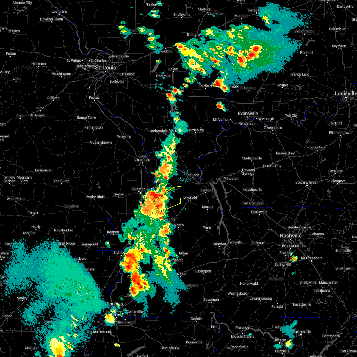 At 532 pm cdt, a severe thunderstorm was located over towosahgy state historic site, moving northeast at 30 mph (radar indicated). Hazards include 60 mph wind gusts. Expect damage to roofs, siding, and trees. this severe thunderstorm will be near, clinton around 550 pm cdt. other locations in the path of this severe thunderstorm include bardwell. hail threat, radar indicated max hail size, <. 75 in wind threat, radar indicated max wind gust, 60 mph. At 532 pm cdt, a severe thunderstorm was located over towosahgy state historic site, moving northeast at 30 mph (radar indicated). Hazards include 60 mph wind gusts. Expect damage to roofs, siding, and trees. this severe thunderstorm will be near, clinton around 550 pm cdt. other locations in the path of this severe thunderstorm include bardwell. hail threat, radar indicated max hail size, <. 75 in wind threat, radar indicated max wind gust, 60 mph.
|
| 5/15/2022 5:26 PM CDT |
 The severe thunderstorm warning for fulton, northwestern hickman, southeastern mississippi and east central new madrid counties will expire at 530 pm cdt, the storms which prompted the warning have weakened below severe limits, and no longer pose an immediate threat to life or property. therefore, the warning will be allowed to expire. however gusty winds are still possible with these thunderstorms. a severe thunderstorm watch remains in effect until 800 pm cdt for western kentucky, and southeastern missouri. The severe thunderstorm warning for fulton, northwestern hickman, southeastern mississippi and east central new madrid counties will expire at 530 pm cdt, the storms which prompted the warning have weakened below severe limits, and no longer pose an immediate threat to life or property. therefore, the warning will be allowed to expire. however gusty winds are still possible with these thunderstorms. a severe thunderstorm watch remains in effect until 800 pm cdt for western kentucky, and southeastern missouri.
|
| 5/15/2022 5:09 PM CDT |
 At 509 pm cdt, severe thunderstorms were located along a line extending from near east prairie to near hickman, moving northeast at 35 mph (radar indicated). Hazards include 60 mph wind gusts and penny size hail. Expect damage to roofs, siding, and trees. locations impacted include, towosahgy state historic site and cayce. hail threat, radar indicated max hail size, 0. 75 in wind threat, radar indicated max wind gust, 60 mph. At 509 pm cdt, severe thunderstorms were located along a line extending from near east prairie to near hickman, moving northeast at 35 mph (radar indicated). Hazards include 60 mph wind gusts and penny size hail. Expect damage to roofs, siding, and trees. locations impacted include, towosahgy state historic site and cayce. hail threat, radar indicated max hail size, 0. 75 in wind threat, radar indicated max wind gust, 60 mph.
|
| 5/15/2022 4:47 PM CDT |
 At 447 pm cdt, severe thunderstorms were located along a line extending from near hunter-dawson state historic site to near reelfoot lake state park, moving northeast at 35 mph (radar indicated). Hazards include 60 mph wind gusts and quarter size hail. Hail damage to vehicles is expected. expect wind damage to roofs, siding, and trees. severe thunderstorms will be near, big oak tree state park around 505 pm cdt. other locations in the path of these severe thunderstorms include hickman, dorena, towosahgy state historic site and cayce. this includes interstate 55 between mile markers 45 and 50. hail threat, radar indicated max hail size, 1. 00 in wind threat, radar indicated max wind gust, 60 mph. At 447 pm cdt, severe thunderstorms were located along a line extending from near hunter-dawson state historic site to near reelfoot lake state park, moving northeast at 35 mph (radar indicated). Hazards include 60 mph wind gusts and quarter size hail. Hail damage to vehicles is expected. expect wind damage to roofs, siding, and trees. severe thunderstorms will be near, big oak tree state park around 505 pm cdt. other locations in the path of these severe thunderstorms include hickman, dorena, towosahgy state historic site and cayce. this includes interstate 55 between mile markers 45 and 50. hail threat, radar indicated max hail size, 1. 00 in wind threat, radar indicated max wind gust, 60 mph.
|
| 4/13/2022 3:25 PM CDT |
 At 304 pm cdt, severe thunderstorms were located along a line extending from clarkton to near gosnell, moving northeast at 80 mph (radar indicated). Hazards include 60 mph wind gusts and quarter size hail. Hail damage to vehicles is expected. expect wind damage to roofs, siding, and trees. severe thunderstorms will be near, malden, clarkton and gideon around 310 pm cdt. parma and risco around 315 pm cdt. lilbourn and howardville around 320 pm cdt. other locations in the path of these severe thunderstorms include new madrid, hunter-dawson state historic site, matthews, farrenburg, east prairie, anniston and wyatt. This includes interstate 55 between mile markers 33 and 61. At 304 pm cdt, severe thunderstorms were located along a line extending from clarkton to near gosnell, moving northeast at 80 mph (radar indicated). Hazards include 60 mph wind gusts and quarter size hail. Hail damage to vehicles is expected. expect wind damage to roofs, siding, and trees. severe thunderstorms will be near, malden, clarkton and gideon around 310 pm cdt. parma and risco around 315 pm cdt. lilbourn and howardville around 320 pm cdt. other locations in the path of these severe thunderstorms include new madrid, hunter-dawson state historic site, matthews, farrenburg, east prairie, anniston and wyatt. This includes interstate 55 between mile markers 33 and 61.
|
| 4/13/2022 3:25 PM CDT |
 At 324 pm cdt, severe thunderstorms were located along a line extending from 6 miles south of canalou to near marston to caruthersville, moving northeast at 70 mph (radar indicated). Hazards include 70 mph wind gusts and quarter size hail. Hail damage to vehicles is expected. expect considerable tree damage. wind damage is also likely to mobile homes, roofs, and outbuildings. locations impacted include, new madrid, lilbourn, hunter-dawson state historic site, matthews, howardville, farrenburg, east prairie, big oak tree state park, towosahgy state historic site, anniston and wyatt. This includes interstate 55 between mile markers 33 and 61. At 324 pm cdt, severe thunderstorms were located along a line extending from 6 miles south of canalou to near marston to caruthersville, moving northeast at 70 mph (radar indicated). Hazards include 70 mph wind gusts and quarter size hail. Hail damage to vehicles is expected. expect considerable tree damage. wind damage is also likely to mobile homes, roofs, and outbuildings. locations impacted include, new madrid, lilbourn, hunter-dawson state historic site, matthews, howardville, farrenburg, east prairie, big oak tree state park, towosahgy state historic site, anniston and wyatt. This includes interstate 55 between mile markers 33 and 61.
|
| 4/13/2022 3:05 PM CDT |
 At 304 pm cdt, severe thunderstorms were located along a line extending from clarkton to near gosnell, moving northeast at 80 mph (radar indicated). Hazards include 60 mph wind gusts and quarter size hail. Hail damage to vehicles is expected. expect wind damage to roofs, siding, and trees. severe thunderstorms will be near, malden, clarkton and gideon around 310 pm cdt. parma and risco around 315 pm cdt. lilbourn and howardville around 320 pm cdt. other locations in the path of these severe thunderstorms include new madrid, hunter-dawson state historic site, matthews, farrenburg, east prairie, anniston and wyatt. This includes interstate 55 between mile markers 33 and 61. At 304 pm cdt, severe thunderstorms were located along a line extending from clarkton to near gosnell, moving northeast at 80 mph (radar indicated). Hazards include 60 mph wind gusts and quarter size hail. Hail damage to vehicles is expected. expect wind damage to roofs, siding, and trees. severe thunderstorms will be near, malden, clarkton and gideon around 310 pm cdt. parma and risco around 315 pm cdt. lilbourn and howardville around 320 pm cdt. other locations in the path of these severe thunderstorms include new madrid, hunter-dawson state historic site, matthews, farrenburg, east prairie, anniston and wyatt. This includes interstate 55 between mile markers 33 and 61.
|
| 3/30/2022 4:44 PM CDT |
 At 444 pm cdt, a severe thunderstorm capable of producing a tornado was located near towosahgy state historic site, moving northeast at 55 mph (radar indicated rotation). Hazards include tornado. Flying debris will be dangerous to those caught without shelter. mobile homes will be damaged or destroyed. damage to roofs, windows, and vehicles will occur. tree damage is likely. Locations impacted include, bardwell. At 444 pm cdt, a severe thunderstorm capable of producing a tornado was located near towosahgy state historic site, moving northeast at 55 mph (radar indicated rotation). Hazards include tornado. Flying debris will be dangerous to those caught without shelter. mobile homes will be damaged or destroyed. damage to roofs, windows, and vehicles will occur. tree damage is likely. Locations impacted include, bardwell.
|
| 3/30/2022 4:42 PM CDT |
 At 442 pm cdt, severe thunderstorms were located along a line extending from near anna to near barlow to near towosahgy state historic site, moving northeast at 65 mph (radar indicated). Hazards include 60 mph wind gusts. Expect damage to roofs, siding, and trees. locations impacted include, barlow, la center, bardwell, karnak and lovelaceville. this includes the following highways, interstate 57 in illinois between mile markers 1 and 21. Interstate 57 in missouri between mile markers 12 and 21. At 442 pm cdt, severe thunderstorms were located along a line extending from near anna to near barlow to near towosahgy state historic site, moving northeast at 65 mph (radar indicated). Hazards include 60 mph wind gusts. Expect damage to roofs, siding, and trees. locations impacted include, barlow, la center, bardwell, karnak and lovelaceville. this includes the following highways, interstate 57 in illinois between mile markers 1 and 21. Interstate 57 in missouri between mile markers 12 and 21.
|
| 3/30/2022 4:27 PM CDT |
 At 427 pm cdt, a severe thunderstorm capable of producing a tornado was located over big oak tree state park, moving northeast at 70 mph (radar indicated rotation). Hazards include tornado. Flying debris will be dangerous to those caught without shelter. mobile homes will be damaged or destroyed. damage to roofs, windows, and vehicles will occur. tree damage is likely. this dangerous storm will be near, towosahgy state historic site around 430 pm cdt. wyatt around 440 pm cdt. Bardwell around 445 pm cdt. At 427 pm cdt, a severe thunderstorm capable of producing a tornado was located over big oak tree state park, moving northeast at 70 mph (radar indicated rotation). Hazards include tornado. Flying debris will be dangerous to those caught without shelter. mobile homes will be damaged or destroyed. damage to roofs, windows, and vehicles will occur. tree damage is likely. this dangerous storm will be near, towosahgy state historic site around 430 pm cdt. wyatt around 440 pm cdt. Bardwell around 445 pm cdt.
|
| 3/30/2022 4:13 PM CDT |
 At 413 pm cdt, severe thunderstorms were located along a line extending from near benton to near big oak tree state park to near reelfoot lake state park, moving northeast at 65 mph (radar indicated). Hazards include 60 mph wind gusts. Expect damage to roofs, siding, and trees. severe thunderstorms will be near, scott city, anniston, olive branch and horseshoe lake conservation area around 420 pm cdt. charleston around 425 pm cdt. hickman, tamms and wyatt around 430 pm cdt. other locations in the path of these severe thunderstorms include cairo, wickliffe, big oak tree state park, dorena, mounds, barlow, mound city, la center, bardwell, karnak and lovelaceville. this includes the following highways, interstate 57 in illinois between mile markers 1 and 21. interstate 57 in missouri between mile markers 3 and 21. Interstate 55 between mile markers 75 and 83. At 413 pm cdt, severe thunderstorms were located along a line extending from near benton to near big oak tree state park to near reelfoot lake state park, moving northeast at 65 mph (radar indicated). Hazards include 60 mph wind gusts. Expect damage to roofs, siding, and trees. severe thunderstorms will be near, scott city, anniston, olive branch and horseshoe lake conservation area around 420 pm cdt. charleston around 425 pm cdt. hickman, tamms and wyatt around 430 pm cdt. other locations in the path of these severe thunderstorms include cairo, wickliffe, big oak tree state park, dorena, mounds, barlow, mound city, la center, bardwell, karnak and lovelaceville. this includes the following highways, interstate 57 in illinois between mile markers 1 and 21. interstate 57 in missouri between mile markers 3 and 21. Interstate 55 between mile markers 75 and 83.
|
| 3/30/2022 3:44 PM CDT |
 At 344 pm cdt, a severe thunderstorm was located near hayti, moving northeast at 75 mph (radar indicated). Hazards include 60 mph wind gusts. expect damage to roofs, siding, and trees At 344 pm cdt, a severe thunderstorm was located near hayti, moving northeast at 75 mph (radar indicated). Hazards include 60 mph wind gusts. expect damage to roofs, siding, and trees
|
| 3/18/2022 4:24 PM CDT |
 At 423 pm cdt, a severe thunderstorm was located near towosahgy state historic site, moving northeast at 40 mph (emergency management and law enforcement). Hazards include 60 mph wind gusts and quarter size hail. law enforcement reported wind damage to power lines from this storm near marston, mo. emergency management reported hail up to dime size near libourn, mo. Hail damage to vehicles is expected. expect wind damage to roofs, siding, and trees. Locations impacted include, bardwell. At 423 pm cdt, a severe thunderstorm was located near towosahgy state historic site, moving northeast at 40 mph (emergency management and law enforcement). Hazards include 60 mph wind gusts and quarter size hail. law enforcement reported wind damage to power lines from this storm near marston, mo. emergency management reported hail up to dime size near libourn, mo. Hail damage to vehicles is expected. expect wind damage to roofs, siding, and trees. Locations impacted include, bardwell.
|
| 3/18/2022 4:14 PM CDT |
 At 413 pm cdt, a severe thunderstorm was located near big oak tree state park, moving northeast at 45 mph (emergency management and law enforcement). Hazards include 60 mph wind gusts and quarter size hail. Hail damage to vehicles is expected. expect wind damage to roofs, siding, and trees. this severe thunderstorm will be near, towosahgy state historic site around 420 pm cdt. other locations in the path of this severe thunderstorm include bardwell. hail threat, radar indicated max hail size, 1. 00 in wind threat, radar indicated max wind gust, 60 mph. At 413 pm cdt, a severe thunderstorm was located near big oak tree state park, moving northeast at 45 mph (emergency management and law enforcement). Hazards include 60 mph wind gusts and quarter size hail. Hail damage to vehicles is expected. expect wind damage to roofs, siding, and trees. this severe thunderstorm will be near, towosahgy state historic site around 420 pm cdt. other locations in the path of this severe thunderstorm include bardwell. hail threat, radar indicated max hail size, 1. 00 in wind threat, radar indicated max wind gust, 60 mph.
|
| 3/18/2022 3:51 PM CDT |
 At 351 pm cdt, a severe thunderstorm was located over lilbourn, moving northeast at 40 mph (radar indicated). Hazards include 60 mph wind gusts and quarter size hail. Hail damage to vehicles is expected. expect wind damage to roofs, siding, and trees. this severe thunderstorm will be near, hunter-dawson state historic site around 355 pm cdt. farrenburg around 400 pm cdt. other locations in the path of this severe thunderstorm include east prairie, big oak tree state park and towosahgy state historic site. this includes interstate 55 between mile markers 39 and 54. hail threat, radar indicated max hail size, 1. 00 in wind threat, radar indicated max wind gust, 60 mph. At 351 pm cdt, a severe thunderstorm was located over lilbourn, moving northeast at 40 mph (radar indicated). Hazards include 60 mph wind gusts and quarter size hail. Hail damage to vehicles is expected. expect wind damage to roofs, siding, and trees. this severe thunderstorm will be near, hunter-dawson state historic site around 355 pm cdt. farrenburg around 400 pm cdt. other locations in the path of this severe thunderstorm include east prairie, big oak tree state park and towosahgy state historic site. this includes interstate 55 between mile markers 39 and 54. hail threat, radar indicated max hail size, 1. 00 in wind threat, radar indicated max wind gust, 60 mph.
|
| 7/9/2021 5:32 PM CDT |
 At 532 pm cdt, a severe thunderstorm was located over east prairie, moving northeast at 30 mph (radar indicated). Hazards include 60 mph wind gusts and quarter size hail. Hail damage to vehicles is expected. expect wind damage to roofs, siding, and trees. Locations impacted include, east prairie, anniston and farrenburg. At 532 pm cdt, a severe thunderstorm was located over east prairie, moving northeast at 30 mph (radar indicated). Hazards include 60 mph wind gusts and quarter size hail. Hail damage to vehicles is expected. expect wind damage to roofs, siding, and trees. Locations impacted include, east prairie, anniston and farrenburg.
|
| 7/9/2021 5:21 PM CDT |
 At 520 pm cdt, a severe thunderstorm was located over east prairie, moving northeast at 30 mph (radar indicated). Hazards include 60 mph wind gusts and quarter size hail. Hail damage to vehicles is expected. expect wind damage to roofs, siding, and trees. Locations impacted include, anniston. At 520 pm cdt, a severe thunderstorm was located over east prairie, moving northeast at 30 mph (radar indicated). Hazards include 60 mph wind gusts and quarter size hail. Hail damage to vehicles is expected. expect wind damage to roofs, siding, and trees. Locations impacted include, anniston.
|
| 7/9/2021 5:05 PM CDT |
 At 504 pm cdt, a severe thunderstorm was located over farrenburg, or near east prairie, moving northeast at 30 mph (radar indicated). Hazards include 60 mph wind gusts and quarter size hail. Hail damage to vehicles is expected. expect wind damage to roofs, siding, and trees. this severe thunderstorm will be near, east prairie around 520 pm cdt. Other locations in the path of this severe thunderstorm include anniston. At 504 pm cdt, a severe thunderstorm was located over farrenburg, or near east prairie, moving northeast at 30 mph (radar indicated). Hazards include 60 mph wind gusts and quarter size hail. Hail damage to vehicles is expected. expect wind damage to roofs, siding, and trees. this severe thunderstorm will be near, east prairie around 520 pm cdt. Other locations in the path of this severe thunderstorm include anniston.
|
| 5/4/2021 3:36 AM CDT |
 The severe thunderstorm warning for fulton, west central hickman, mississippi, southern scott, new madrid and stoddard counties will expire at 345 am cdt, the storms which prompted the warning have moved out of the area. therefore, the warning will be allowed to expire. a severe thunderstorm watch remains in effect until 800 am cdt for southern illinois, western kentucky, and southeastern missouri. The severe thunderstorm warning for fulton, west central hickman, mississippi, southern scott, new madrid and stoddard counties will expire at 345 am cdt, the storms which prompted the warning have moved out of the area. therefore, the warning will be allowed to expire. a severe thunderstorm watch remains in effect until 800 am cdt for southern illinois, western kentucky, and southeastern missouri.
|
| 5/4/2021 2:50 AM CDT |
 At 249 am cdt, severe thunderstorms were located along a line extending from 6 miles west of bloomfield to near gideon to near deering, moving east at 45 mph (radar indicated). Hazards include 60 mph wind gusts and quarter size hail. Hail damage to vehicles is expected. Expect wind damage to roofs, siding, and trees. At 249 am cdt, severe thunderstorms were located along a line extending from 6 miles west of bloomfield to near gideon to near deering, moving east at 45 mph (radar indicated). Hazards include 60 mph wind gusts and quarter size hail. Hail damage to vehicles is expected. Expect wind damage to roofs, siding, and trees.
|
| 5/4/2021 2:42 AM CDT |
 The severe thunderstorm warning for fulton, hickman, carlisle, graves, mississippi and east central new madrid counties will expire at 245 am cdt, the storms which prompted the warning have weakened below severe limits, and no longer pose an immediate threat to life or property. therefore, the warning will be allowed to expire. however small hail and gusty winds are still possible with these thunderstorms. a severe thunderstorm watch remains in effect until 800 am cdt for western kentucky, and southeastern missouri. The severe thunderstorm warning for fulton, hickman, carlisle, graves, mississippi and east central new madrid counties will expire at 245 am cdt, the storms which prompted the warning have weakened below severe limits, and no longer pose an immediate threat to life or property. therefore, the warning will be allowed to expire. however small hail and gusty winds are still possible with these thunderstorms. a severe thunderstorm watch remains in effect until 800 am cdt for western kentucky, and southeastern missouri.
|
| 5/4/2021 2:20 AM CDT |
 At 220 am cdt, strong to severe thunderstorms were located along a line extending from just north of new madrid to near clinton and mayfield, moving northeast at 55 mph. quarter inch hail was reported in east prairie mo at 2:20am (radar indicated). Hazards include 60 mph wind gusts and quarter size hail. Hail damage to vehicles is expected. expect wind damage to roofs, siding, and trees. Locations impacted include, mayfield, east prairie, new madrid, fulton, hickman, clinton, bardwell, towosahgy state historic site, big oak tree state park, hunter-dawson state historic site, marston, howardville, wyatt, anniston, cayce, dorena, fulgham, sedalia, farrenburg and wingo. At 220 am cdt, strong to severe thunderstorms were located along a line extending from just north of new madrid to near clinton and mayfield, moving northeast at 55 mph. quarter inch hail was reported in east prairie mo at 2:20am (radar indicated). Hazards include 60 mph wind gusts and quarter size hail. Hail damage to vehicles is expected. expect wind damage to roofs, siding, and trees. Locations impacted include, mayfield, east prairie, new madrid, fulton, hickman, clinton, bardwell, towosahgy state historic site, big oak tree state park, hunter-dawson state historic site, marston, howardville, wyatt, anniston, cayce, dorena, fulgham, sedalia, farrenburg and wingo.
|
| 5/4/2021 2:20 AM CDT |
 At 201 am cdt, severe thunderstorms were located along a line extending from near sedalia to lilbourn, moving northeast at 60 mph (radar indicated). Hazards include 60 mph wind gusts and quarter size hail. Hail damage to vehicles is expected. Expect wind damage to roofs, siding, and trees. At 201 am cdt, severe thunderstorms were located along a line extending from near sedalia to lilbourn, moving northeast at 60 mph (radar indicated). Hazards include 60 mph wind gusts and quarter size hail. Hail damage to vehicles is expected. Expect wind damage to roofs, siding, and trees.
|
| 5/4/2021 2:02 AM CDT |
 At 201 am cdt, severe thunderstorms were located along a line extending from near sedalia to lilbourn, moving northeast at 60 mph (radar indicated). Hazards include 60 mph wind gusts and quarter size hail. Hail damage to vehicles is expected. Expect wind damage to roofs, siding, and trees. At 201 am cdt, severe thunderstorms were located along a line extending from near sedalia to lilbourn, moving northeast at 60 mph (radar indicated). Hazards include 60 mph wind gusts and quarter size hail. Hail damage to vehicles is expected. Expect wind damage to roofs, siding, and trees.
|
| 6/30/2020 6:07 PM CDT |
 The severe thunderstorm warning for southeastern union, pulaski, alexander, mississippi and scott counties will expire at 615 pm cdt, the storms which prompted the warning have weakened below severe limits, and no longer pose an immediate threat to life or property. therefore, the warning will be allowed to expire. however gusty winds are still likely with these thunderstorms. The severe thunderstorm warning for southeastern union, pulaski, alexander, mississippi and scott counties will expire at 615 pm cdt, the storms which prompted the warning have weakened below severe limits, and no longer pose an immediate threat to life or property. therefore, the warning will be allowed to expire. however gusty winds are still likely with these thunderstorms.
|
| 6/30/2020 5:50 PM CDT |
 At 548 pm cdt, severe thunderstorms were located along a line extending from near morley missouri to cobden illinois, moving southeast at 40 mph (law enforcement. a couple of trees were blown down in cape girardeau county around 520 pm). Hazards include 60 mph wind gusts and penny size hail. Expect damage to roofs, siding, and trees. Locations impacted include, sikeston, charleston, scott city, east prairie, chaffee, cairo, and wyatt. At 548 pm cdt, severe thunderstorms were located along a line extending from near morley missouri to cobden illinois, moving southeast at 40 mph (law enforcement. a couple of trees were blown down in cape girardeau county around 520 pm). Hazards include 60 mph wind gusts and penny size hail. Expect damage to roofs, siding, and trees. Locations impacted include, sikeston, charleston, scott city, east prairie, chaffee, cairo, and wyatt.
|
| 6/30/2020 5:27 PM CDT |
 At 525 pm cdt, a cluster of severe thunderstorms was located along a line extending from kelso to near mounds, moving east at 10 mph. a separate line of severe thunderstorms was advancing southeast across cape girardeau county and will affect the warned area after 535 pn (radar indicated). Hazards include 60 mph wind gusts and quarter size hail. Hail damage to vehicles is expected. Expect wind damage to roofs, siding, and trees. At 525 pm cdt, a cluster of severe thunderstorms was located along a line extending from kelso to near mounds, moving east at 10 mph. a separate line of severe thunderstorms was advancing southeast across cape girardeau county and will affect the warned area after 535 pn (radar indicated). Hazards include 60 mph wind gusts and quarter size hail. Hail damage to vehicles is expected. Expect wind damage to roofs, siding, and trees.
|
| 5/3/2020 2:34 PM CDT |
 At 234 pm cdt, severe thunderstorms were located along a line extending from benton to near cairo to near bardwell to near clinton to union city, moving east at 50 mph (radar indicated). Hazards include 70 mph wind gusts and penny size hail. Expect considerable tree damage. damage is likely to mobile homes, roofs, and outbuildings. Locations impacted include, charleston, east prairie, fulton, clinton, bardwell, wickliffe, towosahgy state historic site, bertrand, wyatt, anniston, cayce, fulgham, arlington, water valley, columbus, wilson city and blandville. At 234 pm cdt, severe thunderstorms were located along a line extending from benton to near cairo to near bardwell to near clinton to union city, moving east at 50 mph (radar indicated). Hazards include 70 mph wind gusts and penny size hail. Expect considerable tree damage. damage is likely to mobile homes, roofs, and outbuildings. Locations impacted include, charleston, east prairie, fulton, clinton, bardwell, wickliffe, towosahgy state historic site, bertrand, wyatt, anniston, cayce, fulgham, arlington, water valley, columbus, wilson city and blandville.
|
| 5/3/2020 2:24 PM CDT |
 At 223 pm cdt, severe thunderstorms were located along a line extending from near oran to near bertrand to near anniston to near towosahgy state historic site to near clayton, moving east at 55 mph (radar indicated). Hazards include 70 mph wind gusts and nickel size hail. Expect considerable tree damage. damage is likely to mobile homes, roofs, and outbuildings. Locations impacted include, charleston, east prairie, cairo, fulton, hickman, clinton, oran, benton, bardwell, wickliffe, towosahgy state historic site, big oak tree state park, bertrand, morley, wyatt, anniston, cayce, dorena, fulgham and hay-wood city. At 223 pm cdt, severe thunderstorms were located along a line extending from near oran to near bertrand to near anniston to near towosahgy state historic site to near clayton, moving east at 55 mph (radar indicated). Hazards include 70 mph wind gusts and nickel size hail. Expect considerable tree damage. damage is likely to mobile homes, roofs, and outbuildings. Locations impacted include, charleston, east prairie, cairo, fulton, hickman, clinton, oran, benton, bardwell, wickliffe, towosahgy state historic site, big oak tree state park, bertrand, morley, wyatt, anniston, cayce, dorena, fulgham and hay-wood city.
|
| 5/3/2020 2:22 PM CDT |
 At 222 pm cdt, a severe thunderstorm capable of producing a tornado was located near anniston, or near towosahgy state historic site, moving east at 60 mph (radar indicated rotation. a spotter reported a funnel cloud with this storm when it moved over east prairie). Hazards include tornado. Flying debris will be dangerous to those caught without shelter. mobile homes will be damaged or destroyed. damage to roofs, windows, and vehicles will occur. tree damage is likely. this dangerous storm will be near, bardwell around 235 pm cdt. Other locations impacted by this tornadic thunderstorm include columbus and arlington. At 222 pm cdt, a severe thunderstorm capable of producing a tornado was located near anniston, or near towosahgy state historic site, moving east at 60 mph (radar indicated rotation. a spotter reported a funnel cloud with this storm when it moved over east prairie). Hazards include tornado. Flying debris will be dangerous to those caught without shelter. mobile homes will be damaged or destroyed. damage to roofs, windows, and vehicles will occur. tree damage is likely. this dangerous storm will be near, bardwell around 235 pm cdt. Other locations impacted by this tornadic thunderstorm include columbus and arlington.
|
| 5/3/2020 2:22 PM CDT |
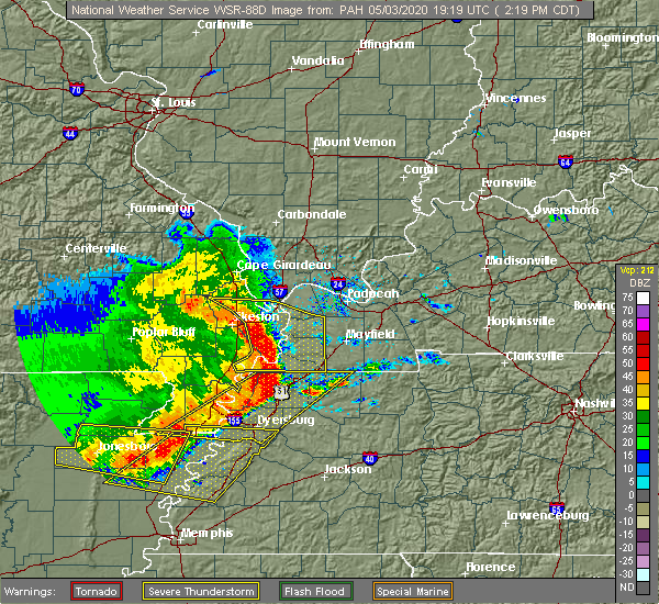 At 222 pm cdt, a severe thunderstorm capable of producing a tornado was located near anniston, or near towosahgy state historic site, moving east at 60 mph (radar indicated rotation. a spotter reported a funnel cloud with this storm when it moved over east prairie). Hazards include tornado. Flying debris will be dangerous to those caught without shelter. mobile homes will be damaged or destroyed. damage to roofs, windows, and vehicles will occur. tree damage is likely. this dangerous storm will be near, bardwell around 235 pm cdt. Other locations impacted by this tornadic thunderstorm include columbus and arlington. At 222 pm cdt, a severe thunderstorm capable of producing a tornado was located near anniston, or near towosahgy state historic site, moving east at 60 mph (radar indicated rotation. a spotter reported a funnel cloud with this storm when it moved over east prairie). Hazards include tornado. Flying debris will be dangerous to those caught without shelter. mobile homes will be damaged or destroyed. damage to roofs, windows, and vehicles will occur. tree damage is likely. this dangerous storm will be near, bardwell around 235 pm cdt. Other locations impacted by this tornadic thunderstorm include columbus and arlington.
|
| 5/3/2020 2:08 PM CDT |
 At 207 pm cdt, severe thunderstorms were located along a line extending from near advance to near hay-wood city to near east prairie to near farrenburg to near tiptonville, moving east at 50 mph (radar indicated). Hazards include 70 mph wind gusts and nickel size hail. Expect considerable tree damage. Damage is likely to mobile homes, roofs, and outbuildings. At 207 pm cdt, severe thunderstorms were located along a line extending from near advance to near hay-wood city to near east prairie to near farrenburg to near tiptonville, moving east at 50 mph (radar indicated). Hazards include 70 mph wind gusts and nickel size hail. Expect considerable tree damage. Damage is likely to mobile homes, roofs, and outbuildings.
|
| 5/3/2020 2:00 PM CDT |
 At 159 pm cdt, severe thunderstorms were located along a line extending from near advance to near bell city to matthews to howardville to near portageville, moving east at 60 mph (trained weather spotters. a car was reported flipped near brownwood with a possible tornado). Hazards include 70 mph wind gusts and nickel size hail. Expect considerable tree damage. damage is likely to mobile homes, roofs, and outbuildings. Locations impacted include, sikeston, charleston, portageville, east prairie, new madrid, cairo, bloomfield, advance, oran, lilbourn, miner, benton, towosahgy state historic site, big oak tree state park, hunter-dawson state historic site, gideon, morehouse, bertrand, morley and matthews. At 159 pm cdt, severe thunderstorms were located along a line extending from near advance to near bell city to matthews to howardville to near portageville, moving east at 60 mph (trained weather spotters. a car was reported flipped near brownwood with a possible tornado). Hazards include 70 mph wind gusts and nickel size hail. Expect considerable tree damage. damage is likely to mobile homes, roofs, and outbuildings. Locations impacted include, sikeston, charleston, portageville, east prairie, new madrid, cairo, bloomfield, advance, oran, lilbourn, miner, benton, towosahgy state historic site, big oak tree state park, hunter-dawson state historic site, gideon, morehouse, bertrand, morley and matthews.
|
| 5/3/2020 1:47 PM CDT |
 At 146 pm cdt, severe thunderstorms were located along a line extending from 10 miles southeast of grassy to 6 miles south of advance to near canalou to risco to near gideon, moving east at 65 mph (trained weather spotters. trees were reported snapped in dexter). Hazards include 70 mph wind gusts and nickel size hail. Expect considerable tree damage. damage is likely to mobile homes, roofs, and outbuildings. Locations impacted include, sikeston, dexter, charleston, portageville, east prairie, new madrid, cairo, bernie, bloomfield, advance, oran, lilbourn, miner, benton, towosahgy state historic site, big oak tree state park, hunter-dawson state historic site, malden, clarkton and gideon. At 146 pm cdt, severe thunderstorms were located along a line extending from 10 miles southeast of grassy to 6 miles south of advance to near canalou to risco to near gideon, moving east at 65 mph (trained weather spotters. trees were reported snapped in dexter). Hazards include 70 mph wind gusts and nickel size hail. Expect considerable tree damage. damage is likely to mobile homes, roofs, and outbuildings. Locations impacted include, sikeston, dexter, charleston, portageville, east prairie, new madrid, cairo, bernie, bloomfield, advance, oran, lilbourn, miner, benton, towosahgy state historic site, big oak tree state park, hunter-dawson state historic site, malden, clarkton and gideon.
|
| 5/3/2020 1:22 PM CDT |
 At 121 pm cdt, severe thunderstorms were located along a line extending from near greenville to fisk to near mcdougal, moving east at 65 mph (trained weather spotters). Hazards include 70 mph wind gusts and quarter size hail. Hail damage to vehicles is expected. expect considerable tree damage. Wind damage is also likely to mobile homes, roofs, and outbuildings. At 121 pm cdt, severe thunderstorms were located along a line extending from near greenville to fisk to near mcdougal, moving east at 65 mph (trained weather spotters). Hazards include 70 mph wind gusts and quarter size hail. Hail damage to vehicles is expected. expect considerable tree damage. Wind damage is also likely to mobile homes, roofs, and outbuildings.
|
| 4/8/2020 7:26 PM CDT |
 At 726 pm cdt, a severe thunderstorm was located 8 miles northeast of towosahgy state historic site, moving east southeast at 35 mph (radar indicated). Hazards include 60 mph wind gusts and quarter size hail. Hail damage to vehicles is expected. Expect wind damage to roofs, siding, and trees. At 726 pm cdt, a severe thunderstorm was located 8 miles northeast of towosahgy state historic site, moving east southeast at 35 mph (radar indicated). Hazards include 60 mph wind gusts and quarter size hail. Hail damage to vehicles is expected. Expect wind damage to roofs, siding, and trees.
|
| 4/8/2020 7:13 PM CDT |
 At 712 pm cdt, a severe thunderstorm was located over charleston, moving east southeast at 35 mph (radar indicated). Hazards include golf ball size hail and 60 mph wind gusts. People and animals outdoors will be injured. expect hail damage to roofs, siding, windows, and vehicles. expect wind damage to roofs, siding, and trees. Locations impacted include, charleston, east prairie, bertrand, wyatt, anniston and wilson city. At 712 pm cdt, a severe thunderstorm was located over charleston, moving east southeast at 35 mph (radar indicated). Hazards include golf ball size hail and 60 mph wind gusts. People and animals outdoors will be injured. expect hail damage to roofs, siding, windows, and vehicles. expect wind damage to roofs, siding, and trees. Locations impacted include, charleston, east prairie, bertrand, wyatt, anniston and wilson city.
|
| 4/8/2020 6:50 PM CDT |
 At 650 pm cdt, a severe thunderstorm was located over miner, moving east southeast at 35 mph (radar indicated). Hazards include 60 mph wind gusts and quarter size hail. Hail damage to vehicles is expected. Expect wind damage to roofs, siding, and trees. At 650 pm cdt, a severe thunderstorm was located over miner, moving east southeast at 35 mph (radar indicated). Hazards include 60 mph wind gusts and quarter size hail. Hail damage to vehicles is expected. Expect wind damage to roofs, siding, and trees.
|
| 3/28/2020 6:48 PM CDT |
 At 647 pm cdt, a severe thunderstorm capable of producing a tornado was located over east prairie, moving northeast at 55 mph (radar indicated rotation). Hazards include tornado and quarter size hail. Flying debris will be dangerous to those caught without shelter. mobile homes will be damaged or destroyed. damage to roofs, windows, and vehicles will occur. tree damage is likely. This tornadic thunderstorm will remain over mainly rural areas of central mississippi, south central scott and northeastern new madrid counties. At 647 pm cdt, a severe thunderstorm capable of producing a tornado was located over east prairie, moving northeast at 55 mph (radar indicated rotation). Hazards include tornado and quarter size hail. Flying debris will be dangerous to those caught without shelter. mobile homes will be damaged or destroyed. damage to roofs, windows, and vehicles will occur. tree damage is likely. This tornadic thunderstorm will remain over mainly rural areas of central mississippi, south central scott and northeastern new madrid counties.
|
| 3/28/2020 6:35 PM CDT |
 At 634 pm cdt, a severe thunderstorm capable of producing a tornado was located near farrenburg, or near hunter-dawson state historic site, moving northeast at 60 mph (radar indicated rotation). Hazards include tornado and quarter size hail. Flying debris will be dangerous to those caught without shelter. mobile homes will be damaged or destroyed. damage to roofs, windows, and vehicles will occur. tree damage is likely. this dangerous storm will be near, east prairie around 645 pm cdt. anniston around 650 pm cdt. this includes the following highways, interstate 57 in missouri between mile markers 1 and 13. Interstate 55 between mile markers 58 and 69. At 634 pm cdt, a severe thunderstorm capable of producing a tornado was located near farrenburg, or near hunter-dawson state historic site, moving northeast at 60 mph (radar indicated rotation). Hazards include tornado and quarter size hail. Flying debris will be dangerous to those caught without shelter. mobile homes will be damaged or destroyed. damage to roofs, windows, and vehicles will occur. tree damage is likely. this dangerous storm will be near, east prairie around 645 pm cdt. anniston around 650 pm cdt. this includes the following highways, interstate 57 in missouri between mile markers 1 and 13. Interstate 55 between mile markers 58 and 69.
|
| 3/20/2020 1:13 AM CDT |
 The severe thunderstorm warning for northern hickman, carlisle, ballard and east central mississippi counties will expire at 115 am cdt, the storms which prompted the warning have weakened below severe limits, and no longer pose an immediate threat to life or property. therefore, the warning will be allowed to expire. however gusty winds are still possible with these thunderstorms. a tornado watch remains in effect until 400 am cdt for western kentucky, and southeastern missouri. The severe thunderstorm warning for northern hickman, carlisle, ballard and east central mississippi counties will expire at 115 am cdt, the storms which prompted the warning have weakened below severe limits, and no longer pose an immediate threat to life or property. therefore, the warning will be allowed to expire. however gusty winds are still possible with these thunderstorms. a tornado watch remains in effect until 400 am cdt for western kentucky, and southeastern missouri.
|
| 3/20/2020 1:02 AM CDT |
 At 101 am cdt, severe thunderstorms were located along a line extending from near la center to near wickliffe to near towosahgy state historic site, moving northeast at 70 mph (radar indicated). Hazards include 60 mph wind gusts and nickel size hail. Expect damage to roofs, siding, and trees. Locations impacted include, la center, bardwell, wickliffe, barlow, lovelaceville, kevil, arlington, columbus and blandville. At 101 am cdt, severe thunderstorms were located along a line extending from near la center to near wickliffe to near towosahgy state historic site, moving northeast at 70 mph (radar indicated). Hazards include 60 mph wind gusts and nickel size hail. Expect damage to roofs, siding, and trees. Locations impacted include, la center, bardwell, wickliffe, barlow, lovelaceville, kevil, arlington, columbus and blandville.
|
| 3/20/2020 12:48 AM CDT |
 At 1248 am cdt, severe thunderstorms were located along a line extending from near cairo to near wyatt to near farrenburg, moving northeast at 65 mph (radar indicated). Hazards include 60 mph wind gusts and nickel size hail. expect damage to roofs, siding, and trees At 1248 am cdt, severe thunderstorms were located along a line extending from near cairo to near wyatt to near farrenburg, moving northeast at 65 mph (radar indicated). Hazards include 60 mph wind gusts and nickel size hail. expect damage to roofs, siding, and trees
|
| 3/2/2020 11:37 PM CST |
 The severe thunderstorm warning for central mississippi county will expire at 1145 pm cst, the storm which prompted the warning has weakened below severe limits, and no longer poses an immediate threat to life or property. therefore, the warning will be allowed to expire. a tornado watch remains in effect until 100 am cst for western kentucky, and southeastern missouri. The severe thunderstorm warning for central mississippi county will expire at 1145 pm cst, the storm which prompted the warning has weakened below severe limits, and no longer poses an immediate threat to life or property. therefore, the warning will be allowed to expire. a tornado watch remains in effect until 100 am cst for western kentucky, and southeastern missouri.
|
| 3/2/2020 11:27 PM CST |
 At 1126 pm cst, a severe thunderstorm was located near wyatt, or 9 miles southeast of charleston, moving east at 50 mph (radar indicated). Hazards include 60 mph wind gusts and quarter size hail. Hail damage to vehicles is expected. expect wind damage to roofs, siding, and trees. Locations impacted include, charleston, east prairie, wyatt, anniston and wilson city. At 1126 pm cst, a severe thunderstorm was located near wyatt, or 9 miles southeast of charleston, moving east at 50 mph (radar indicated). Hazards include 60 mph wind gusts and quarter size hail. Hail damage to vehicles is expected. expect wind damage to roofs, siding, and trees. Locations impacted include, charleston, east prairie, wyatt, anniston and wilson city.
|
| 3/2/2020 11:10 PM CST |
 At 1110 pm cst, a severe thunderstorm was located near east prairie, moving east at 50 mph (radar indicated). Hazards include 60 mph wind gusts and quarter size hail. Hail damage to vehicles is expected. Expect wind damage to roofs, siding, and trees. At 1110 pm cst, a severe thunderstorm was located near east prairie, moving east at 50 mph (radar indicated). Hazards include 60 mph wind gusts and quarter size hail. Hail damage to vehicles is expected. Expect wind damage to roofs, siding, and trees.
|
| 8/6/2019 6:26 PM CDT |
 At 626 pm cdt, a severe thunderstorm was located over farrenburg, or 7 miles southwest of east prairie, moving southeast at 25 mph (radar indicated). Hazards include 60 mph wind gusts and quarter size hail. Hail damage to vehicles is expected. expect wind damage to roofs, siding, and trees. Locations impacted include, east prairie, new madrid, lilbourn, hunter-dawson state historic site, matthews, howardville, anniston and farrenburg. At 626 pm cdt, a severe thunderstorm was located over farrenburg, or 7 miles southwest of east prairie, moving southeast at 25 mph (radar indicated). Hazards include 60 mph wind gusts and quarter size hail. Hail damage to vehicles is expected. expect wind damage to roofs, siding, and trees. Locations impacted include, east prairie, new madrid, lilbourn, hunter-dawson state historic site, matthews, howardville, anniston and farrenburg.
|
| 8/6/2019 6:07 PM CDT |
 At 607 pm cdt, a severe thunderstorm was located near matthews, or near sikeston, moving southeast at 25 mph (radar indicated). Hazards include 60 mph wind gusts and quarter size hail. Hail damage to vehicles is expected. Expect wind damage to roofs, siding, and trees. At 607 pm cdt, a severe thunderstorm was located near matthews, or near sikeston, moving southeast at 25 mph (radar indicated). Hazards include 60 mph wind gusts and quarter size hail. Hail damage to vehicles is expected. Expect wind damage to roofs, siding, and trees.
|
| 6/23/2019 4:09 PM CDT |
 At 409 pm cdt, severe thunderstorms were located along a line extending from near cobden to near cairo to near reelfoot lake state park, moving east at 40 mph (radar indicated). Hazards include 60 mph wind gusts and nickel size hail. Expect damage to roofs, siding, and trees. Locations impacted include, charleston, anna, east prairie, cairo, hickman, jonesboro, clinton, la center, bardwell, wickliffe, towosahgy state historic site, big oak tree state park, cobden, goreville, bertrand, mounds, dongola, barlow, tamms and mound city. At 409 pm cdt, severe thunderstorms were located along a line extending from near cobden to near cairo to near reelfoot lake state park, moving east at 40 mph (radar indicated). Hazards include 60 mph wind gusts and nickel size hail. Expect damage to roofs, siding, and trees. Locations impacted include, charleston, anna, east prairie, cairo, hickman, jonesboro, clinton, la center, bardwell, wickliffe, towosahgy state historic site, big oak tree state park, cobden, goreville, bertrand, mounds, dongola, barlow, tamms and mound city.
|
| 6/23/2019 3:52 PM CDT |
 At 352 pm cdt, severe thunderstorms were located along a line extending from near cedar lake area to near charleston to near bolton, moving east at 45 mph (radar indicated). Hazards include 60 mph wind gusts and nickel size hail. Expect damage to roofs, siding, and trees. Locations impacted include, cape girardeau, sikeston, charleston, scott city, anna, portageville, east prairie, new madrid, chaffee, cairo, hickman, jonesboro, clinton, oran, lilbourn, la center, miner, benton, bardwell and wickliffe. At 352 pm cdt, severe thunderstorms were located along a line extending from near cedar lake area to near charleston to near bolton, moving east at 45 mph (radar indicated). Hazards include 60 mph wind gusts and nickel size hail. Expect damage to roofs, siding, and trees. Locations impacted include, cape girardeau, sikeston, charleston, scott city, anna, portageville, east prairie, new madrid, chaffee, cairo, hickman, jonesboro, clinton, oran, lilbourn, la center, miner, benton, bardwell and wickliffe.
|
| 6/23/2019 3:31 PM CDT |
 At 330 pm cdt, severe thunderstorms were located along a line extending from near altenburg to near miner to near kennett, moving east at 45 mph (radar indicated). Hazards include 60 mph wind gusts and nickel size hail. expect damage to roofs, siding, and trees At 330 pm cdt, severe thunderstorms were located along a line extending from near altenburg to near miner to near kennett, moving east at 45 mph (radar indicated). Hazards include 60 mph wind gusts and nickel size hail. expect damage to roofs, siding, and trees
|
| 6/21/2019 5:19 PM CDT |
 A severe thunderstorm warning remains in effect until 530 pm cdt for western fulton. northwestern hickman. carlisle. western mccracken. ballard. mississippi and new madrid counties. At 516 pm cdt, severe thunderstorms were located along a line extending from near dixon springs to near bardwell to big oak tree state park to near marston to clarkton, moving east at 65 mph. A severe thunderstorm warning remains in effect until 530 pm cdt for western fulton. northwestern hickman. carlisle. western mccracken. ballard. mississippi and new madrid counties. At 516 pm cdt, severe thunderstorms were located along a line extending from near dixon springs to near bardwell to big oak tree state park to near marston to clarkton, moving east at 65 mph.
|
| 6/21/2019 5:19 PM CDT |
 At 516 pm cdt, severe thunderstorms were located along a line extending from near dixon springs to near bardwell to big oak tree state park to near marston to clarkton, moving east at 65 mph (trained weather spotters and automated weather observation systems indicated winds of 60 to 70 mph along with tree damage and power outages, as well as torrential rainfall. ). Hazards include 70 mph wind gusts and nickel size hail. Expect considerable tree damage. damage is likely to mobile homes, roofs, and outbuildings. Locations impacted include, metropolis, charleston, portageville, east prairie, new madrid, cairo, lilbourn, la center, bardwell, wickliffe, towosahgy state historic site, big oak tree state park, hunter-dawson state historic site, gideon, barlow, mound city, marston, howardville, risco and wyatt. At 516 pm cdt, severe thunderstorms were located along a line extending from near dixon springs to near bardwell to big oak tree state park to near marston to clarkton, moving east at 65 mph (trained weather spotters and automated weather observation systems indicated winds of 60 to 70 mph along with tree damage and power outages, as well as torrential rainfall. ). Hazards include 70 mph wind gusts and nickel size hail. Expect considerable tree damage. damage is likely to mobile homes, roofs, and outbuildings. Locations impacted include, metropolis, charleston, portageville, east prairie, new madrid, cairo, lilbourn, la center, bardwell, wickliffe, towosahgy state historic site, big oak tree state park, hunter-dawson state historic site, gideon, barlow, mound city, marston, howardville, risco and wyatt.
|
| 6/21/2019 4:49 PM CDT |
 The national weather service in paducah has issued a * severe thunderstorm warning for. western fulton county in western kentucky. northwestern hickman county in western kentucky. carlisle county in western kentucky. Western mccracken county in western kentucky. The national weather service in paducah has issued a * severe thunderstorm warning for. western fulton county in western kentucky. northwestern hickman county in western kentucky. carlisle county in western kentucky. Western mccracken county in western kentucky.
|
| 6/21/2019 4:49 PM CDT |
 At 447 pm cdt, severe thunderstorms were located along a line extending from 6 miles northeast of dongola to near horseshoe lake conservation area to near dexter to naylor, moving east at 55 mph (trained weather spotters and automated weather observation sites have been reporting winds of 60 to 70 mph, along with trees down and power outages with the line of storms). Hazards include 70 mph wind gusts and nickel size hail. Expect considerable tree damage. Damage is likely to mobile homes, roofs, and outbuildings. At 447 pm cdt, severe thunderstorms were located along a line extending from 6 miles northeast of dongola to near horseshoe lake conservation area to near dexter to naylor, moving east at 55 mph (trained weather spotters and automated weather observation sites have been reporting winds of 60 to 70 mph, along with trees down and power outages with the line of storms). Hazards include 70 mph wind gusts and nickel size hail. Expect considerable tree damage. Damage is likely to mobile homes, roofs, and outbuildings.
|
| 3/14/2019 7:52 AM CDT |
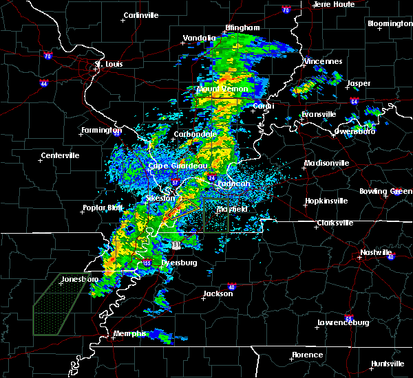 At 752 am cdt, a severe thunderstorm was located over towosahgy state historic site, moving northeast at 45 mph (radar indicated). Hazards include 70 mph wind gusts. Expect considerable tree damage. Damage is likely to mobile homes, roofs, and outbuildings. At 752 am cdt, a severe thunderstorm was located over towosahgy state historic site, moving northeast at 45 mph (radar indicated). Hazards include 70 mph wind gusts. Expect considerable tree damage. Damage is likely to mobile homes, roofs, and outbuildings.
|
| 6/28/2018 8:36 PM CDT |
 At 836 pm cdt, severe thunderstorms were located along a line extending from near fulgham to near east prairie, moving south at 50 mph (radar indicated). Hazards include 60 mph wind gusts. Expect damage to roofs, siding, and trees. Locations impacted include, charleston, east prairie, new madrid, fulton, hickman, clinton, bardwell, hunter-dawson state historic site, towosahgy state historic site, big oak tree state park, bertrand, wyatt, anniston, cayce, farrenburg, dorena, fulgham, arlington, columbus and diehlstadt. At 836 pm cdt, severe thunderstorms were located along a line extending from near fulgham to near east prairie, moving south at 50 mph (radar indicated). Hazards include 60 mph wind gusts. Expect damage to roofs, siding, and trees. Locations impacted include, charleston, east prairie, new madrid, fulton, hickman, clinton, bardwell, hunter-dawson state historic site, towosahgy state historic site, big oak tree state park, bertrand, wyatt, anniston, cayce, farrenburg, dorena, fulgham, arlington, columbus and diehlstadt.
|
| 6/28/2018 8:18 PM CDT |
 At 818 pm cdt, severe thunderstorms were located along a line extending from near lovelaceville to near charleston, moving south at 50 mph (radar indicated). Hazards include 60 mph wind gusts. expect damage to roofs, siding, and trees At 818 pm cdt, severe thunderstorms were located along a line extending from near lovelaceville to near charleston, moving south at 50 mph (radar indicated). Hazards include 60 mph wind gusts. expect damage to roofs, siding, and trees
|
| 6/28/2018 10:45 AM CDT |
 At 1042 am cdt, a severe thunderstorm was located near bardwell, moving southeast at 30 mph (radar indicated). Hazards include 60 mph wind gusts. Expect damage to roofs, siding, and trees. Locations impacted include, charleston, east prairie, cairo, hickman, clinton, bardwell, wickliffe, towosahgy state historic site, big oak tree state park, bertrand, wyatt, anniston, dorena, arlington, columbus, wilson city and blandville. At 1042 am cdt, a severe thunderstorm was located near bardwell, moving southeast at 30 mph (radar indicated). Hazards include 60 mph wind gusts. Expect damage to roofs, siding, and trees. Locations impacted include, charleston, east prairie, cairo, hickman, clinton, bardwell, wickliffe, towosahgy state historic site, big oak tree state park, bertrand, wyatt, anniston, dorena, arlington, columbus, wilson city and blandville.
|
| 6/28/2018 10:18 AM CDT |
 At 1018 am cdt, a severe thunderstorm was located near wyatt, or near charleston, moving southeast at 30 mph (radar indicated). Hazards include 70 mph wind gusts and quarter size hail. Hail damage to vehicles is expected. expect considerable tree damage. Wind damage is also likely to mobile homes, roofs, and outbuildings. At 1018 am cdt, a severe thunderstorm was located near wyatt, or near charleston, moving southeast at 30 mph (radar indicated). Hazards include 70 mph wind gusts and quarter size hail. Hail damage to vehicles is expected. expect considerable tree damage. Wind damage is also likely to mobile homes, roofs, and outbuildings.
|
| 5/31/2018 10:25 PM CDT |
 At 1024 pm cdt, a severe thunderstorm was located near charleston, moving east at 45 mph (radar indicated). Hazards include 60 mph wind gusts and penny size hail. Expect damage to roofs, siding, and trees. Locations impacted include, sikeston, charleston, east prairie, miner, bertrand, wyatt, anniston, diehlstadt and wilson city. At 1024 pm cdt, a severe thunderstorm was located near charleston, moving east at 45 mph (radar indicated). Hazards include 60 mph wind gusts and penny size hail. Expect damage to roofs, siding, and trees. Locations impacted include, sikeston, charleston, east prairie, miner, bertrand, wyatt, anniston, diehlstadt and wilson city.
|
| 5/31/2018 10:01 PM CDT |
 At 1001 pm cdt, a severe thunderstorm was located near hay-wood city, or 7 miles northwest of sikeston, moving east at 45 mph (radar indicated). Hazards include 60 mph wind gusts and penny size hail. expect damage to roofs, siding, and trees At 1001 pm cdt, a severe thunderstorm was located near hay-wood city, or 7 miles northwest of sikeston, moving east at 45 mph (radar indicated). Hazards include 60 mph wind gusts and penny size hail. expect damage to roofs, siding, and trees
|
| 5/19/2018 5:39 PM CDT |
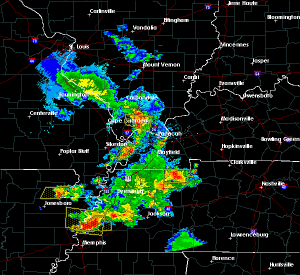 At 539 pm cdt, a severe thunderstorm was located near towosahgy state historic site, moving east at 35 mph (radar indicated). Hazards include 60 mph wind gusts and quarter size hail. Hail damage to vehicles is expected. expect wind damage to roofs, siding, and trees. Locations impacted include, towosahgy state historic site. At 539 pm cdt, a severe thunderstorm was located near towosahgy state historic site, moving east at 35 mph (radar indicated). Hazards include 60 mph wind gusts and quarter size hail. Hail damage to vehicles is expected. expect wind damage to roofs, siding, and trees. Locations impacted include, towosahgy state historic site.
|
| 5/19/2018 5:19 PM CDT |
 At 519 pm cdt, a severe thunderstorm was located over east prairie, moving east at 40 mph (radar indicated). Hazards include 60 mph wind gusts and quarter size hail. Hail damage to vehicles is expected. Expect wind damage to roofs, siding, and trees. At 519 pm cdt, a severe thunderstorm was located over east prairie, moving east at 40 mph (radar indicated). Hazards include 60 mph wind gusts and quarter size hail. Hail damage to vehicles is expected. Expect wind damage to roofs, siding, and trees.
|
| 5/16/2018 2:24 PM CDT |
 At 224 pm cdt, a severe thunderstorm was located near east prairie, moving south at 15 mph (radar indicated). Hazards include 60 mph wind gusts and quarter size hail. Hail damage to vehicles is expected. Expect wind damage to roofs, siding, and trees. At 224 pm cdt, a severe thunderstorm was located near east prairie, moving south at 15 mph (radar indicated). Hazards include 60 mph wind gusts and quarter size hail. Hail damage to vehicles is expected. Expect wind damage to roofs, siding, and trees.
|
| 4/3/2018 6:33 PM CDT |
 At 633 pm cdt, a severe thunderstorm capable of producing a tornado was located near east prairie, moving east at 35 mph (radar indicated rotation). Hazards include tornado and quarter size hail. Flying debris will be dangerous to those caught without shelter. mobile homes will be damaged or destroyed. damage to roofs, windows, and vehicles will occur. tree damage is likely. Locations impacted include, sikeston, charleston, east prairie, bertrand, matthews, anniston and farrenburg. At 633 pm cdt, a severe thunderstorm capable of producing a tornado was located near east prairie, moving east at 35 mph (radar indicated rotation). Hazards include tornado and quarter size hail. Flying debris will be dangerous to those caught without shelter. mobile homes will be damaged or destroyed. damage to roofs, windows, and vehicles will occur. tree damage is likely. Locations impacted include, sikeston, charleston, east prairie, bertrand, matthews, anniston and farrenburg.
|
| 4/3/2018 6:13 PM CDT |
 At 613 pm cdt, a severe thunderstorm capable of producing a tornado was located near canalou, or 7 miles southwest of sikeston, moving east at 35 mph (radar indicated rotation). Hazards include tornado and quarter size hail. Flying debris will be dangerous to those caught without shelter. mobile homes will be damaged or destroyed. damage to roofs, windows, and vehicles will occur. tree damage is likely. this dangerous storm will be near, sikeston around 620 pm cdt. east prairie and bertrand around 635 pm cdt. Charleston and anniston around 645 pm cdt. At 613 pm cdt, a severe thunderstorm capable of producing a tornado was located near canalou, or 7 miles southwest of sikeston, moving east at 35 mph (radar indicated rotation). Hazards include tornado and quarter size hail. Flying debris will be dangerous to those caught without shelter. mobile homes will be damaged or destroyed. damage to roofs, windows, and vehicles will occur. tree damage is likely. this dangerous storm will be near, sikeston around 620 pm cdt. east prairie and bertrand around 635 pm cdt. Charleston and anniston around 645 pm cdt.
|
| 4/3/2018 5:43 PM CDT |
 At 543 pm cdt, a severe thunderstorm was located near essex, or near dexter, moving east at 45 mph (radar indicated). Hazards include 60 mph wind gusts and quarter size hail. Hail damage to vehicles is expected. Expect wind damage to roofs, siding, and trees. At 543 pm cdt, a severe thunderstorm was located near essex, or near dexter, moving east at 45 mph (radar indicated). Hazards include 60 mph wind gusts and quarter size hail. Hail damage to vehicles is expected. Expect wind damage to roofs, siding, and trees.
|
| 5/27/2017 7:11 PM CDT |
 The severe thunderstorm warning for fulton, hickman, southern carlisle and southeastern mississippi counties will expire at 715 pm cdt, the storm which prompted the warning has moved out of the area. therefore the warning will be allowed to expire. a tornado watch remains in effect until 200 am cdt for southeastern missouri. a severe thunderstorm watch remains in effect until midnight cdt for western kentucky, and southeastern missouri. The severe thunderstorm warning for fulton, hickman, southern carlisle and southeastern mississippi counties will expire at 715 pm cdt, the storm which prompted the warning has moved out of the area. therefore the warning will be allowed to expire. a tornado watch remains in effect until 200 am cdt for southeastern missouri. a severe thunderstorm watch remains in effect until midnight cdt for western kentucky, and southeastern missouri.
|
| 5/27/2017 6:45 PM CDT |
 At 644 pm cdt, a severe thunderstorm was located near dorena, or near hickman, moving east at 85 mph (radar indicated. winds were measured on wolf island up to 66 mph as these storms moved through). Hazards include 70 mph wind gusts and penny size hail. Expect considerable tree damage. Damage is likely to mobile homes, roofs, and outbuildings. At 644 pm cdt, a severe thunderstorm was located near dorena, or near hickman, moving east at 85 mph (radar indicated. winds were measured on wolf island up to 66 mph as these storms moved through). Hazards include 70 mph wind gusts and penny size hail. Expect considerable tree damage. Damage is likely to mobile homes, roofs, and outbuildings.
|
| 5/27/2017 6:01 PM CDT |
 At 600 pm cdt, a severe thunderstorm was located over matthews, or near sikeston, moving east at 65 mph. this is a very dangerous storm (law enforcement. roofs were reported off of buildings in dexter missouri. law enforecement reported 80 mph winds near sikeston missouri). Hazards include 80 mph wind gusts and quarter size hail. Flying debris will be dangerous to those caught without shelter. mobile homes will be heavily damaged. expect considerable damage to roofs, windows, and vehicles. Extensive tree damage and power outages are likely. At 600 pm cdt, a severe thunderstorm was located over matthews, or near sikeston, moving east at 65 mph. this is a very dangerous storm (law enforcement. roofs were reported off of buildings in dexter missouri. law enforecement reported 80 mph winds near sikeston missouri). Hazards include 80 mph wind gusts and quarter size hail. Flying debris will be dangerous to those caught without shelter. mobile homes will be heavily damaged. expect considerable damage to roofs, windows, and vehicles. Extensive tree damage and power outages are likely.
|
| 4/30/2017 3:13 AM CDT |
 The severe thunderstorm warning for fulton, west central hickman, southern mississippi and east central new madrid counties will expire at 315 am cdt, the storm which prompted the warning has weakened below severe limits, and has exited the warned area. therefore, the warning will be allowed to expire. however gusty winds and heavy rain are still possible with this thunderstorm. a severe thunderstorm watch remains in effect until 700 am cdt for western kentucky, and southeastern missouri. The severe thunderstorm warning for fulton, west central hickman, southern mississippi and east central new madrid counties will expire at 315 am cdt, the storm which prompted the warning has weakened below severe limits, and has exited the warned area. therefore, the warning will be allowed to expire. however gusty winds and heavy rain are still possible with this thunderstorm. a severe thunderstorm watch remains in effect until 700 am cdt for western kentucky, and southeastern missouri.
|
| 4/30/2017 3:05 AM CDT |
 At 305 am cdt, a severe thunderstorm was located near hickman, moving northeast at 70 mph (radar indicated). Hazards include 60 mph wind gusts. Expect damage to roofs, siding, and trees. Locations impacted include, east prairie, fulton, hickman, pinhook, cayce, dorena and boundurant. At 305 am cdt, a severe thunderstorm was located near hickman, moving northeast at 70 mph (radar indicated). Hazards include 60 mph wind gusts. Expect damage to roofs, siding, and trees. Locations impacted include, east prairie, fulton, hickman, pinhook, cayce, dorena and boundurant.
|
| 4/30/2017 2:41 AM CDT |
 At 240 am cdt, a severe thunderstorm was located near tiptonville, or 7 miles southeast of portageville, moving northeast at 70 mph (radar indicated). Hazards include 60 mph wind gusts and penny size hail. expect damage to roofs, siding, and trees At 240 am cdt, a severe thunderstorm was located near tiptonville, or 7 miles southeast of portageville, moving northeast at 70 mph (radar indicated). Hazards include 60 mph wind gusts and penny size hail. expect damage to roofs, siding, and trees
|
| 3/9/2017 8:21 PM CST |
 At 820 pm cst, severe thunderstorms were located along a line extending from near pinhook to near clayton, moving east at 35 mph. these are very dangerous storms (radar indicated). Hazards include 80 mph wind gusts and nickel size hail. Flying debris will be dangerous to those caught without shelter. mobile homes will be heavily damaged. expect considerable damage to roofs, windows, and vehicles. Extensive tree damage and power outages are likely. At 820 pm cst, severe thunderstorms were located along a line extending from near pinhook to near clayton, moving east at 35 mph. these are very dangerous storms (radar indicated). Hazards include 80 mph wind gusts and nickel size hail. Flying debris will be dangerous to those caught without shelter. mobile homes will be heavily damaged. expect considerable damage to roofs, windows, and vehicles. Extensive tree damage and power outages are likely.
|
| 3/1/2017 4:53 AM CST |
 At 453 am cst, severe thunderstorms were located along a line extending from near charleston to near clayton, moving east at 70 mph (radar indicated). Hazards include 60 mph wind gusts and penny size hail. expect damage to roofs, siding, and trees At 453 am cst, severe thunderstorms were located along a line extending from near charleston to near clayton, moving east at 70 mph (radar indicated). Hazards include 60 mph wind gusts and penny size hail. expect damage to roofs, siding, and trees
|
| 7/8/2016 6:01 PM CDT |
 At 601 pm cdt, severe thunderstorms were located along a line extending from near cairo to near bardwell to 7 miles east of pinhook, moving east at 55 mph. bardwell is in line for potentially widespread wind damage. be in your shelter now (radar indicated). Hazards include 70 mph wind gusts and nickel size hail. Expect considerable tree damage. damage is likely to mobile homes, roofs, and outbuildings. Locations impacted include, charleston, cairo, clinton, bardwell, wickliffe, barlow, wyatt, anniston, pinhook, fulgham, arlington, columbus, wilson city and blandville. At 601 pm cdt, severe thunderstorms were located along a line extending from near cairo to near bardwell to 7 miles east of pinhook, moving east at 55 mph. bardwell is in line for potentially widespread wind damage. be in your shelter now (radar indicated). Hazards include 70 mph wind gusts and nickel size hail. Expect considerable tree damage. damage is likely to mobile homes, roofs, and outbuildings. Locations impacted include, charleston, cairo, clinton, bardwell, wickliffe, barlow, wyatt, anniston, pinhook, fulgham, arlington, columbus, wilson city and blandville.
|
| 7/8/2016 5:49 PM CDT |
 At 549 pm cdt, severe thunderstorms were located along a line extending from near bertrand to near anniston to near dorena, moving east at 50 mph (radar indicated). Hazards include 60 mph wind gusts and nickel size hail. Expect damage to roofs. siding. And trees. At 549 pm cdt, severe thunderstorms were located along a line extending from near bertrand to near anniston to near dorena, moving east at 50 mph (radar indicated). Hazards include 60 mph wind gusts and nickel size hail. Expect damage to roofs. siding. And trees.
|
| 7/7/2016 12:49 PM CDT |
 At 1248 pm cdt, a severe thunderstorm was located over pinhook, or 7 miles southeast of east prairie, moving east at 55 mph (radar indicated). Hazards include 60 mph wind gusts and quarter size hail. Hail damage to vehicles is expected. Expect wind damage to roofs, siding, and trees. At 1248 pm cdt, a severe thunderstorm was located over pinhook, or 7 miles southeast of east prairie, moving east at 55 mph (radar indicated). Hazards include 60 mph wind gusts and quarter size hail. Hail damage to vehicles is expected. Expect wind damage to roofs, siding, and trees.
|
| 7/7/2016 12:49 PM CDT |
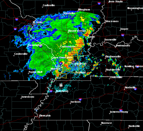 At 1248 pm cdt, a severe thunderstorm was located over pinhook, or 7 miles southeast of east prairie, moving east at 55 mph (radar indicated). Hazards include 60 mph wind gusts and quarter size hail. Hail damage to vehicles is expected. Expect wind damage to roofs, siding, and trees. At 1248 pm cdt, a severe thunderstorm was located over pinhook, or 7 miles southeast of east prairie, moving east at 55 mph (radar indicated). Hazards include 60 mph wind gusts and quarter size hail. Hail damage to vehicles is expected. Expect wind damage to roofs, siding, and trees.
|
| 7/6/2016 1:23 PM CDT |
 At 122 pm cdt, severe thunderstorms were located along a line extending from near vienna to near barlow to near clayton, moving east at 60 mph (trained weather spotters). Hazards include 60 mph wind gusts and nickel size hail. Expect damage to roofs. siding. and trees. Locations impacted include, charleston, anna, east prairie, cairo, hickman, vienna, clinton, la center, bardwell, wickliffe, mounds, dongola, barlow, mound city, karnak, wyatt, anniston, pinhook, cayce and dorena. At 122 pm cdt, severe thunderstorms were located along a line extending from near vienna to near barlow to near clayton, moving east at 60 mph (trained weather spotters). Hazards include 60 mph wind gusts and nickel size hail. Expect damage to roofs. siding. and trees. Locations impacted include, charleston, anna, east prairie, cairo, hickman, vienna, clinton, la center, bardwell, wickliffe, mounds, dongola, barlow, mound city, karnak, wyatt, anniston, pinhook, cayce and dorena.
|
| 7/6/2016 1:03 PM CDT |
 At 103 pm cdt, severe thunderstorms were located along a line extending from near jonesboro to near horseshoe lake conservation area to near risco, moving east at 50 mph (radar indicated). Hazards include 60 mph wind gusts. Expect damage to roofs. siding. And trees. At 103 pm cdt, severe thunderstorms were located along a line extending from near jonesboro to near horseshoe lake conservation area to near risco, moving east at 50 mph (radar indicated). Hazards include 60 mph wind gusts. Expect damage to roofs. siding. And trees.
|
| 6/15/2016 2:04 PM CDT |
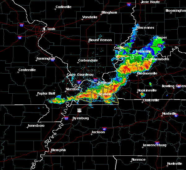 At 203 pm cdt, a severe thunderstorm was located 7 miles east of pinhook, or 8 miles west of clinton, moving east at 20 mph. this is a very dangerous storm (radar indicated). Hazards include 80 mph wind gusts and golf ball size hail. Flying debris will be dangerous to those caught without shelter. mobile homes will be heavily damaged. expect considerable damage to roofs, windows, and vehicles. extensive tree damage and power outages are likely. Locations impacted include, clinton, pinhook, fulgham, arlington and columbus. At 203 pm cdt, a severe thunderstorm was located 7 miles east of pinhook, or 8 miles west of clinton, moving east at 20 mph. this is a very dangerous storm (radar indicated). Hazards include 80 mph wind gusts and golf ball size hail. Flying debris will be dangerous to those caught without shelter. mobile homes will be heavily damaged. expect considerable damage to roofs, windows, and vehicles. extensive tree damage and power outages are likely. Locations impacted include, clinton, pinhook, fulgham, arlington and columbus.
|
| 6/15/2016 1:52 PM CDT |
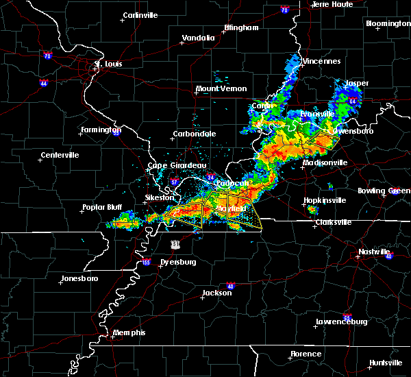 At 152 pm cdt, a severe thunderstorm was located 7 miles northwest of clinton, moving east at 30 mph (radar indicated). Hazards include 60 mph wind gusts and penny size hail. Expect damage to roofs. siding. And trees. At 152 pm cdt, a severe thunderstorm was located 7 miles northwest of clinton, moving east at 30 mph (radar indicated). Hazards include 60 mph wind gusts and penny size hail. Expect damage to roofs. siding. And trees.
|
| 5/9/2016 10:35 PM CDT |
 At 1035 pm cdt, severe thunderstorms were located along a line extending from near east cape girardeau to cairo to near pinhook, moving northeast at 55 mph (radar indicated). Hazards include 60 mph wind gusts and penny size hail. Expect damage to roofs. siding. and trees. Locations impacted include, charleston, east prairie, anniston, pinhook, dorena and boundurant. At 1035 pm cdt, severe thunderstorms were located along a line extending from near east cape girardeau to cairo to near pinhook, moving northeast at 55 mph (radar indicated). Hazards include 60 mph wind gusts and penny size hail. Expect damage to roofs. siding. and trees. Locations impacted include, charleston, east prairie, anniston, pinhook, dorena and boundurant.
|
| 5/9/2016 10:26 PM CDT |
 At 1025 pm cdt, severe thunderstorms were located along a line extending from kelso to charleston to near farrenburg, moving northeast at 50 mph (radar indicated. numerous trees were reported down throughout the city of sikeston as these storms moved through). Hazards include 60 mph wind gusts and penny size hail. Expect damage to roofs. siding. and trees. Locations impacted include, cape girardeau, charleston, scott city, east prairie, new madrid, benton, bertrand, kelso, marston, anniston, pinhook, dorena, farrenburg, blodgett, diehlstadt, commerce, boundurant and lambert. At 1025 pm cdt, severe thunderstorms were located along a line extending from kelso to charleston to near farrenburg, moving northeast at 50 mph (radar indicated. numerous trees were reported down throughout the city of sikeston as these storms moved through). Hazards include 60 mph wind gusts and penny size hail. Expect damage to roofs. siding. and trees. Locations impacted include, cape girardeau, charleston, scott city, east prairie, new madrid, benton, bertrand, kelso, marston, anniston, pinhook, dorena, farrenburg, blodgett, diehlstadt, commerce, boundurant and lambert.
|
| 5/9/2016 9:54 PM CDT |
 At 952 pm cdt, severe thunderstorms were located along a line extending from near advance to near canalou to gideon, moving northeast at 55 mph (radar indicated. these storms downed multiple trees in butler county as they moved through). Hazards include 60 mph wind gusts and penny size hail. Expect damage to roofs. siding. And trees. At 952 pm cdt, severe thunderstorms were located along a line extending from near advance to near canalou to gideon, moving northeast at 55 mph (radar indicated. these storms downed multiple trees in butler county as they moved through). Hazards include 60 mph wind gusts and penny size hail. Expect damage to roofs. siding. And trees.
|
| 12/23/2015 2:34 PM CST | At 234 pm cst, a severe thunderstorm was located over anniston, or near east prairie, moving northeast at 80 mph (radar indicated). Hazards include 60 mph wind gusts and nickel size hail. Expect damage to roofs. Siding and trees. |
| 12/23/2015 2:02 PM CST | At 202 pm cst, a severe thunderstorm was located over sikeston, moving northeast at 70 mph (radar indicated). Hazards include 60 mph wind gusts and penny size hail. Expect damage to roofs. Siding and trees. |
| 5/30/2015 12:49 PM CDT | At 1249 pm cdt, a severe thunderstorm was located over pinhook, or 9 miles southeast of east prairie, moving northeast at 50 mph (radar indicated). Hazards include 60 mph wind gusts and quarter size hail. Hail damage to vehicles is expected. Expect wind damage to roofs, siding and trees. |
| 3/26/2015 1:53 AM CDT | The national weather service in paducah has issued a * severe thunderstorm warning for. central fulton county in western kentucky. southeastern mississippi county in southeastern missouri. east central new madrid county in southeastern missouri. Until 215 am cdt. |
| 3/26/2015 1:53 AM CDT | The national weather service in paducah has issued a * severe thunderstorm warning for. central fulton county in western kentucky. southeastern mississippi county in southeastern missouri. east central new madrid county in southeastern missouri. Until 215 am cdt. |
Hail Maps for Pinhook, MO
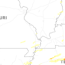
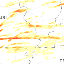


Connect with Interactive Hail Maps