

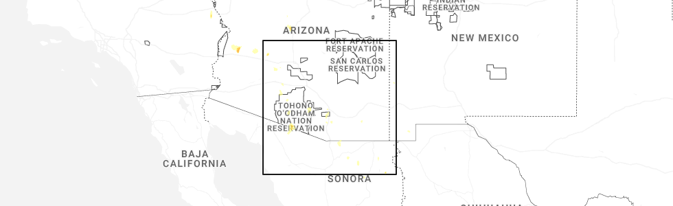
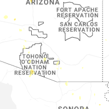
Hail Map for Pisinemo, AZ
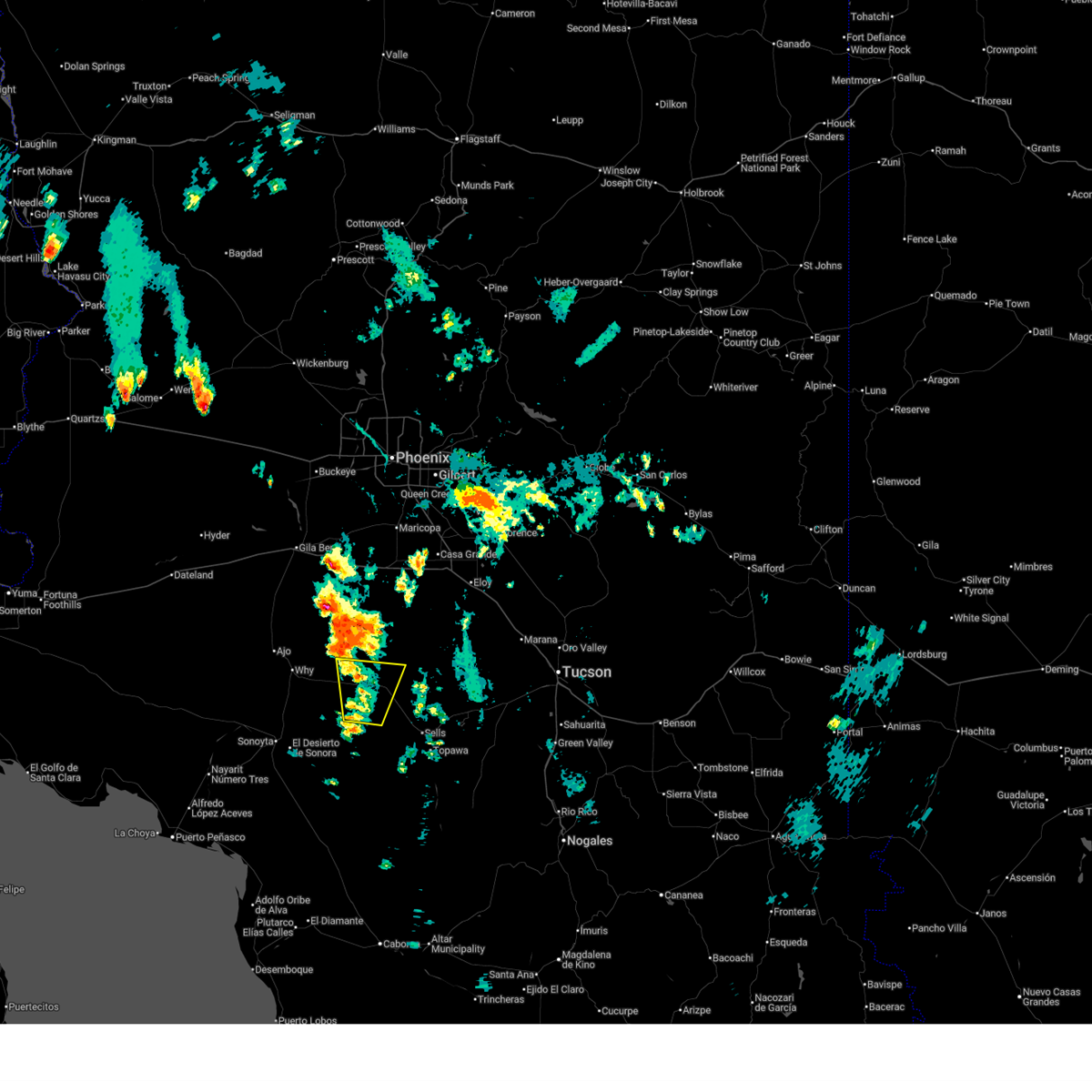
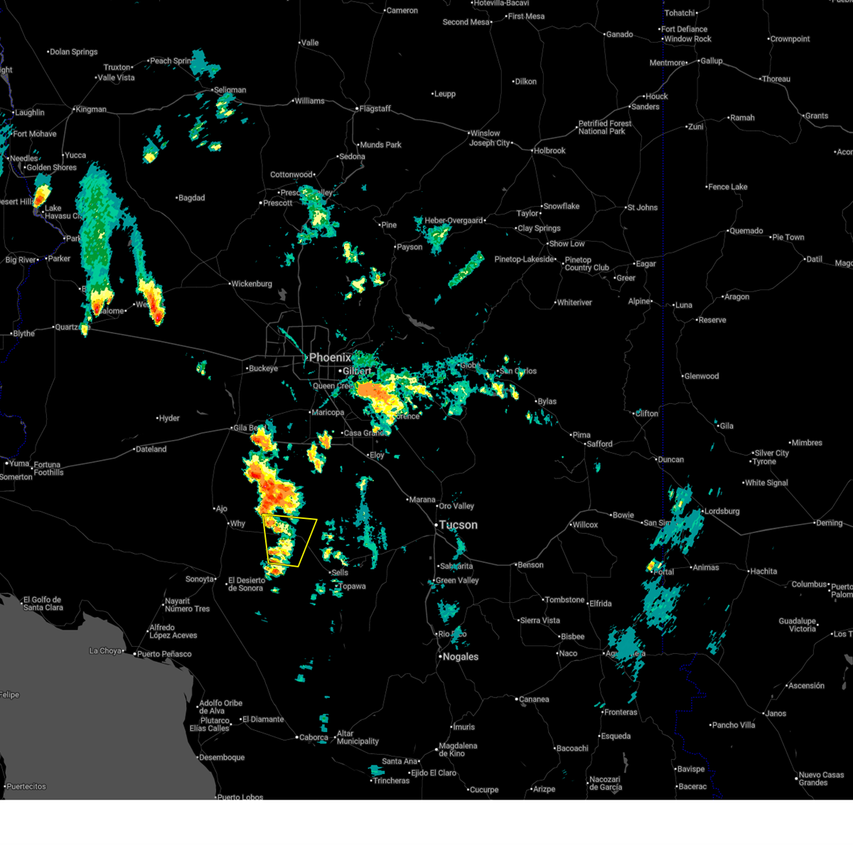
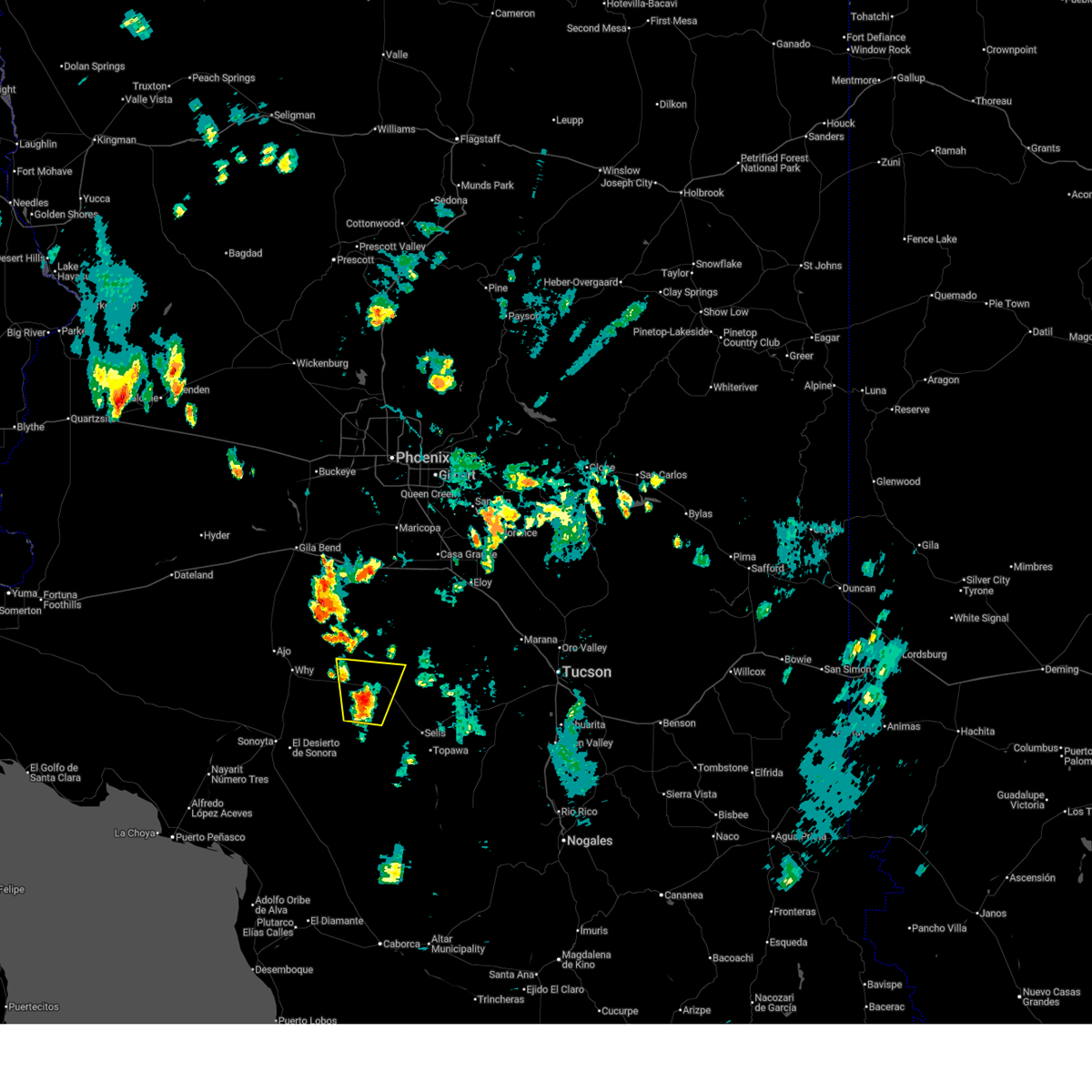
The Pisinemo, AZ area has had 0 reports of on-the-ground hail by trained spotters, and has been under severe weather warnings 17 times during the past 12 months. Doppler radar has detected hail at or near Pisinemo, AZ on 24 occasions, including 3 occasions during the past year.
| Name: | Pisinemo, AZ |
| Where Located: | 79.8 miles W of Tucson, AZ |
| Map: | Google Map for Pisinemo, AZ |
| Population: | 321 |
| Housing Units: | 116 |
| More Info: | Search Google for Pisinemo, AZ |
0
The Top Recent Hail Date for Pisinemo, AZ is Wednesday, July 2, 2025 (10th out of 24)
Hail and Wind Damage Spotted near Pisinemo, AZ
| Date / Time | Report Details |
|---|---|
| 7/2/2025 6:39 PM MST |
 The storm which prompted the warning has weakened below severe limits, and no longer poses an immediate threat to life or property. therefore, the warning will be allowed to expire. The storm which prompted the warning has weakened below severe limits, and no longer poses an immediate threat to life or property. therefore, the warning will be allowed to expire.
|
| 7/2/2025 6:32 PM MST |
 At 632 pm mst, a severe thunderstorm was located 13 miles southwest of santa rosa, moving north at 15 mph (radar indicated). Hazards include 60 mph wind gusts and small hail. Expect damage to roofs, siding, and trees. locations impacted include, pisinemo, covered wells, san simon, ak chin, mountain village and san simon west. This includes route 86 between mile markers 73 and 96. At 632 pm mst, a severe thunderstorm was located 13 miles southwest of santa rosa, moving north at 15 mph (radar indicated). Hazards include 60 mph wind gusts and small hail. Expect damage to roofs, siding, and trees. locations impacted include, pisinemo, covered wells, san simon, ak chin, mountain village and san simon west. This includes route 86 between mile markers 73 and 96.
|
| 7/2/2025 6:02 PM MST |
 Svrtwc the national weather service in tucson has issued a * severe thunderstorm warning for, north central pima county in southeastern arizona, * until 645 pm mst. * at 602 pm mst, a severe thunderstorm was located 8 miles north of pisinemo, moving north at 15 mph (radar indicated). Hazards include 60 mph wind gusts and small hail. expect damage to roofs, siding, and trees Svrtwc the national weather service in tucson has issued a * severe thunderstorm warning for, north central pima county in southeastern arizona, * until 645 pm mst. * at 602 pm mst, a severe thunderstorm was located 8 miles north of pisinemo, moving north at 15 mph (radar indicated). Hazards include 60 mph wind gusts and small hail. expect damage to roofs, siding, and trees
|
| 8/20/2024 8:07 PM MST |
 The storm which prompted the warning has weakened below severe limits. therefore, the warning will be allowed to expire. however, gusty winds and heavy rain are still possible with this thunderstorm. The storm which prompted the warning has weakened below severe limits. therefore, the warning will be allowed to expire. however, gusty winds and heavy rain are still possible with this thunderstorm.
|
| 8/20/2024 7:44 PM MST |
 At 744 pm mst, a severe thunderstorm was located near guvo, or 30 miles southeast of ajo, moving west at 20 mph (radar indicated). Hazards include 60 mph wind gusts and quarter size hail. Hail damage to vehicles is expected. expect wind damage to roofs, siding, and trees. Locations impacted include, pisinemo, guvo, pia oik, and santa cruz. At 744 pm mst, a severe thunderstorm was located near guvo, or 30 miles southeast of ajo, moving west at 20 mph (radar indicated). Hazards include 60 mph wind gusts and quarter size hail. Hail damage to vehicles is expected. expect wind damage to roofs, siding, and trees. Locations impacted include, pisinemo, guvo, pia oik, and santa cruz.
|
| 8/20/2024 7:29 PM MST |
 Svrtwc the national weather service in tucson has issued a * severe thunderstorm warning for, west central pima county in southeastern arizona, * until 815 pm mst. * at 728 pm mst, a severe thunderstorm was located near pisinemo, or 31 miles west of sells, moving west at 20 mph (radar indicated). Hazards include 60 mph wind gusts and quarter size hail. Hail damage to vehicles is expected. Expect wind damage to roofs, siding, and trees. Svrtwc the national weather service in tucson has issued a * severe thunderstorm warning for, west central pima county in southeastern arizona, * until 815 pm mst. * at 728 pm mst, a severe thunderstorm was located near pisinemo, or 31 miles west of sells, moving west at 20 mph (radar indicated). Hazards include 60 mph wind gusts and quarter size hail. Hail damage to vehicles is expected. Expect wind damage to roofs, siding, and trees.
|
| 7/25/2024 5:08 PM MST |
 At 507 pm mst, severe thunderstorms were located along a line extending from 10 miles north of pisinemo to near organ pipe cactus national monument, moving west at 10 mph (radar indicated). Hazards include 60 mph wind gusts and quarter size hail. Hail damage to vehicles is expected. expect wind damage to roofs, siding, and trees. locations impacted include, pisinemo, guvo, hickiwan, organ pipe cactus national monument, san simon, why, gunsight, charco 27, pia oik, vaya chin, santa cruz, kukatch, and san simon west. this includes the following highways, route 85 between mile markers 52 and 77. Route 86 between mile markers 53 and 89. At 507 pm mst, severe thunderstorms were located along a line extending from 10 miles north of pisinemo to near organ pipe cactus national monument, moving west at 10 mph (radar indicated). Hazards include 60 mph wind gusts and quarter size hail. Hail damage to vehicles is expected. expect wind damage to roofs, siding, and trees. locations impacted include, pisinemo, guvo, hickiwan, organ pipe cactus national monument, san simon, why, gunsight, charco 27, pia oik, vaya chin, santa cruz, kukatch, and san simon west. this includes the following highways, route 85 between mile markers 52 and 77. Route 86 between mile markers 53 and 89.
|
| 7/25/2024 4:54 PM MST |
 At 454 pm mst, severe thunderstorms were located along a line extending from near hickiwan to 8 miles southwest of guvo, moving northwest at 10 mph (radar indicated). Hazards include 60 mph wind gusts and quarter size hail. Hail damage to vehicles is expected. expect wind damage to roofs, siding, and trees. locations impacted include, pisinemo, guvo, hickiwan, organ pipe cactus national monument, ali chugk, san simon, why, gunsight, charco 27, pia oik, vaya chin, santa cruz, kukatch, lukeville, and san simon west. this includes the following highways, route 85 between mile markers 52 and 80. Route 86 between mile markers 53 and 89. At 454 pm mst, severe thunderstorms were located along a line extending from near hickiwan to 8 miles southwest of guvo, moving northwest at 10 mph (radar indicated). Hazards include 60 mph wind gusts and quarter size hail. Hail damage to vehicles is expected. expect wind damage to roofs, siding, and trees. locations impacted include, pisinemo, guvo, hickiwan, organ pipe cactus national monument, ali chugk, san simon, why, gunsight, charco 27, pia oik, vaya chin, santa cruz, kukatch, lukeville, and san simon west. this includes the following highways, route 85 between mile markers 52 and 80. Route 86 between mile markers 53 and 89.
|
| 7/25/2024 4:38 PM MST |
 Svrtwc the national weather service in tucson has issued a * severe thunderstorm warning for, northwestern pima county in southeastern arizona, * until 530 pm mst. * at 437 pm mst, severe thunderstorms were located along a line extending from 9 miles southeast of hickiwan to 8 miles southwest of guvo, moving northwest at 15 mph (radar indicated). Hazards include 60 mph wind gusts and quarter size hail. Hail damage to vehicles is expected. Expect wind damage to roofs, siding, and trees. Svrtwc the national weather service in tucson has issued a * severe thunderstorm warning for, northwestern pima county in southeastern arizona, * until 530 pm mst. * at 437 pm mst, severe thunderstorms were located along a line extending from 9 miles southeast of hickiwan to 8 miles southwest of guvo, moving northwest at 15 mph (radar indicated). Hazards include 60 mph wind gusts and quarter size hail. Hail damage to vehicles is expected. Expect wind damage to roofs, siding, and trees.
|
| 7/25/2024 4:16 PM MST |
 At 415 pm mst, a severe thunderstorm was located near guvo, or 33 miles southeast of ajo, moving southwest at 15 mph (radar indicated). Hazards include ping pong ball size hail and 60 mph wind gusts. People and animals outdoors will be injured. expect hail damage to roofs, siding, windows, and vehicles. expect wind damage to roofs, siding, and trees. locations impacted include, pisinemo, guvo, organ pipe cactus national monument, ali chugk, san simon, pia oik, santa cruz, san simon west, and papago farms. This includes route 86 between mile markers 72 and 77. At 415 pm mst, a severe thunderstorm was located near guvo, or 33 miles southeast of ajo, moving southwest at 15 mph (radar indicated). Hazards include ping pong ball size hail and 60 mph wind gusts. People and animals outdoors will be injured. expect hail damage to roofs, siding, windows, and vehicles. expect wind damage to roofs, siding, and trees. locations impacted include, pisinemo, guvo, organ pipe cactus national monument, ali chugk, san simon, pia oik, santa cruz, san simon west, and papago farms. This includes route 86 between mile markers 72 and 77.
|
| 7/25/2024 3:54 PM MST |
 Svrtwc the national weather service in tucson has issued a * severe thunderstorm warning for, west central pima county in southeastern arizona, * until 445 pm mst. * at 352 pm mst, a severe thunderstorm was located near pisinemo, or 30 miles west of sells, moving southwest at 15 mph (radar indicated). Hazards include 60 mph wind gusts. expect damage to roofs, siding, and trees Svrtwc the national weather service in tucson has issued a * severe thunderstorm warning for, west central pima county in southeastern arizona, * until 445 pm mst. * at 352 pm mst, a severe thunderstorm was located near pisinemo, or 30 miles west of sells, moving southwest at 15 mph (radar indicated). Hazards include 60 mph wind gusts. expect damage to roofs, siding, and trees
|
| 7/25/2024 3:36 PM MST |
 At 336 pm mst, a severe thunderstorm was located near pisinemo, or 28 miles northwest of sells, moving southwest at 15 mph (radar indicated). Hazards include 60 mph wind gusts. Expect damage to roofs, siding, and trees. locations impacted include, pisinemo, guvo, san simon, and san simon west. This includes route 86 between mile markers 73 and 87. At 336 pm mst, a severe thunderstorm was located near pisinemo, or 28 miles northwest of sells, moving southwest at 15 mph (radar indicated). Hazards include 60 mph wind gusts. Expect damage to roofs, siding, and trees. locations impacted include, pisinemo, guvo, san simon, and san simon west. This includes route 86 between mile markers 73 and 87.
|
| 7/25/2024 3:12 PM MST |
 Svrtwc the national weather service in tucson has issued a * severe thunderstorm warning for, north central pima county in southeastern arizona, * until 400 pm mst. * at 311 pm mst, a severe thunderstorm was located 8 miles north of pisinemo, or 27 miles northwest of sells, moving south at 15 mph (radar indicated). Hazards include 60 mph wind gusts. expect damage to roofs, siding, and trees Svrtwc the national weather service in tucson has issued a * severe thunderstorm warning for, north central pima county in southeastern arizona, * until 400 pm mst. * at 311 pm mst, a severe thunderstorm was located 8 miles north of pisinemo, or 27 miles northwest of sells, moving south at 15 mph (radar indicated). Hazards include 60 mph wind gusts. expect damage to roofs, siding, and trees
|
| 7/25/2024 2:07 PM MST |
 The storm which prompted the warning has weakened below severe limits, and no longer poses an immediate threat to life or property. therefore, the warning will be allowed to expire. however, gusty winds and heavy rain are still possible with this thunderstorm. to report severe weather, contact your nearest law enforcement agency. they will relay your report to the national weather service tucson. The storm which prompted the warning has weakened below severe limits, and no longer poses an immediate threat to life or property. therefore, the warning will be allowed to expire. however, gusty winds and heavy rain are still possible with this thunderstorm. to report severe weather, contact your nearest law enforcement agency. they will relay your report to the national weather service tucson.
|
| 7/25/2024 1:58 PM MST |
 Svrtwc the national weather service in tucson has issued a * severe thunderstorm warning for, central pima county in southeastern arizona, * until 215 pm mst. * at 158 pm mst, a severe thunderstorm was located 11 miles west of sells, moving south at 10 mph (radar indicated). Hazards include 60 mph wind gusts. expect damage to roofs, siding, and trees Svrtwc the national weather service in tucson has issued a * severe thunderstorm warning for, central pima county in southeastern arizona, * until 215 pm mst. * at 158 pm mst, a severe thunderstorm was located 11 miles west of sells, moving south at 10 mph (radar indicated). Hazards include 60 mph wind gusts. expect damage to roofs, siding, and trees
|
| 7/24/2024 4:00 PM MST |
 The severe thunderstorm which prompted the warning has weakened. therefore, the warning has been allowed to expire. a severe thunderstorm watch remains in effect until 900 pm mst for southeastern arizona. The severe thunderstorm which prompted the warning has weakened. therefore, the warning has been allowed to expire. a severe thunderstorm watch remains in effect until 900 pm mst for southeastern arizona.
|
| 7/24/2024 3:35 PM MST |
 Svrtwc the national weather service in tucson has issued a * severe thunderstorm warning for, central pima county in southeastern arizona, * until 400 pm mst. * at 334 pm mst, a severe thunderstorm was located near pisinemo, or 28 miles northwest of sells, moving southwest at 10 mph (radar indicated). Hazards include 60 mph wind gusts and quarter size hail. Hail damage to vehicles is expected. Expect wind damage to roofs, siding, and trees. Svrtwc the national weather service in tucson has issued a * severe thunderstorm warning for, central pima county in southeastern arizona, * until 400 pm mst. * at 334 pm mst, a severe thunderstorm was located near pisinemo, or 28 miles northwest of sells, moving southwest at 10 mph (radar indicated). Hazards include 60 mph wind gusts and quarter size hail. Hail damage to vehicles is expected. Expect wind damage to roofs, siding, and trees.
|
| 7/11/2024 8:38 PM MST |
 The storm which prompted the warning has weakened below severe limits, and no longer poses an immediate threat to life or property. therefore, the warning will be allowed to expire. however, heavy rain is still possible with this thunderstorm and a flash flood warning remains in effect until 1145 pm mst. The storm which prompted the warning has weakened below severe limits, and no longer poses an immediate threat to life or property. therefore, the warning will be allowed to expire. however, heavy rain is still possible with this thunderstorm and a flash flood warning remains in effect until 1145 pm mst.
|
| 7/11/2024 7:29 PM MST |
 Svrtwc the national weather service in tucson has issued a * severe thunderstorm warning for, northwestern pima county in southeastern arizona, * until 845 pm mst. * at 728 pm mst, an area of severe thunderstorms was located across western portions of the tohono o'odham nation into western pima county, moving west at 15 mph (radar indicated). Hazards include 60 mph wind gusts and penny size hail. expect damage to roofs, siding, and trees Svrtwc the national weather service in tucson has issued a * severe thunderstorm warning for, northwestern pima county in southeastern arizona, * until 845 pm mst. * at 728 pm mst, an area of severe thunderstorms was located across western portions of the tohono o'odham nation into western pima county, moving west at 15 mph (radar indicated). Hazards include 60 mph wind gusts and penny size hail. expect damage to roofs, siding, and trees
|
| 7/11/2024 6:52 PM MST |
 Svrtwc the national weather service in tucson has issued a * severe thunderstorm warning for, northwestern pima county in southeastern arizona, * until 730 pm mst. * at 652 pm mst, a severe thunderstorm was located 7 miles northwest of pisinemo, or 32 miles southeast of ajo, moving southwest at 15 mph (radar indicated). Hazards include 60 mph wind gusts and penny size hail. expect damage to roofs, siding, and trees Svrtwc the national weather service in tucson has issued a * severe thunderstorm warning for, northwestern pima county in southeastern arizona, * until 730 pm mst. * at 652 pm mst, a severe thunderstorm was located 7 miles northwest of pisinemo, or 32 miles southeast of ajo, moving southwest at 15 mph (radar indicated). Hazards include 60 mph wind gusts and penny size hail. expect damage to roofs, siding, and trees
|
| 7/11/2024 6:39 PM MST |
 At 639 pm mst, a severe thunderstorm was located 7 miles northwest of pisinemo, or 32 miles northwest of sells, moving southwest at 15 mph (radar indicated). Hazards include 60 mph wind gusts and penny size hail. Expect damage to roofs, siding, and trees. locations impacted include, pisinemo, san simon, charco 27, vaya chin, and san simon west. This includes route 86 between mile markers 62 and 87. At 639 pm mst, a severe thunderstorm was located 7 miles northwest of pisinemo, or 32 miles northwest of sells, moving southwest at 15 mph (radar indicated). Hazards include 60 mph wind gusts and penny size hail. Expect damage to roofs, siding, and trees. locations impacted include, pisinemo, san simon, charco 27, vaya chin, and san simon west. This includes route 86 between mile markers 62 and 87.
|
| 7/11/2024 6:09 PM MST |
 Svrtwc the national weather service in tucson has issued a * severe thunderstorm warning for, north central pima county in southeastern arizona, * until 700 pm mst. * at 608 pm mst, a severe thunderstorm was located 9 miles north of pisinemo, or 30 miles northwest of sells near highway 86, moving southwest at 15 mph (radar indicated). Hazards include 60 mph wind gusts. expect damage to roofs, siding, and trees Svrtwc the national weather service in tucson has issued a * severe thunderstorm warning for, north central pima county in southeastern arizona, * until 700 pm mst. * at 608 pm mst, a severe thunderstorm was located 9 miles north of pisinemo, or 30 miles northwest of sells near highway 86, moving southwest at 15 mph (radar indicated). Hazards include 60 mph wind gusts. expect damage to roofs, siding, and trees
|
| 8/31/2023 7:26 PM MST |
 The severe thunderstorm warning for north central pima county will expire at 730 pm mst, the storm which prompted the warning has weakened below severe limits, and no longer poses an immediate threat to life or property. therefore, the warning will be allowed to expire. The severe thunderstorm warning for north central pima county will expire at 730 pm mst, the storm which prompted the warning has weakened below severe limits, and no longer poses an immediate threat to life or property. therefore, the warning will be allowed to expire.
|
| 8/31/2023 7:03 PM MST |
 At 703 pm mst, a severe thunderstorm was located 9 miles northwest of pisinemo, or 32 miles southeast of ajo, moving west at 20 mph (radar indicated). Hazards include 60 mph wind gusts and quarter size hail. Hail damage to vehicles is expected. expect wind damage to roofs, siding, and trees. locations impacted include, pisinemo, gu vo, hickiwan, san simon, vaya chin and san simon west. hail threat, radar indicated max hail size, 1. 00 in wind threat, radar indicated max wind gust, 60 mph. At 703 pm mst, a severe thunderstorm was located 9 miles northwest of pisinemo, or 32 miles southeast of ajo, moving west at 20 mph (radar indicated). Hazards include 60 mph wind gusts and quarter size hail. Hail damage to vehicles is expected. expect wind damage to roofs, siding, and trees. locations impacted include, pisinemo, gu vo, hickiwan, san simon, vaya chin and san simon west. hail threat, radar indicated max hail size, 1. 00 in wind threat, radar indicated max wind gust, 60 mph.
|
| 8/31/2023 6:43 PM MST |
 At 643 pm mst, a severe thunderstorm was located 7 miles north of pisinemo, or 27 miles northwest of sells, moving west at 20 mph (radar indicated). Hazards include 60 mph wind gusts and quarter size hail. Hail damage to vehicles is expected. Expect wind damage to roofs, siding, and trees. At 643 pm mst, a severe thunderstorm was located 7 miles north of pisinemo, or 27 miles northwest of sells, moving west at 20 mph (radar indicated). Hazards include 60 mph wind gusts and quarter size hail. Hail damage to vehicles is expected. Expect wind damage to roofs, siding, and trees.
|
| 8/18/2023 4:43 PM MST |
 At 443 pm mst, a severe thunderstorm was located near ajo, moving north at 40 mph (radar indicated). Hazards include 70 mph wind gusts and quarter size hail. Hail damage to vehicles is expected. expect considerable tree damage. Wind damage is also likely to mobile homes, roofs, and outbuildings. At 443 pm mst, a severe thunderstorm was located near ajo, moving north at 40 mph (radar indicated). Hazards include 70 mph wind gusts and quarter size hail. Hail damage to vehicles is expected. expect considerable tree damage. Wind damage is also likely to mobile homes, roofs, and outbuildings.
|
| 8/18/2023 3:56 PM MST |
 At 355 pm mst, a severe thunderstorm was located near gu vo, or 24 miles southeast of ajo, moving north at 30 mph (radar indicated). Hazards include 70 mph wind gusts and quarter size hail. Hail damage to vehicles is expected. expect considerable tree damage. Wind damage is also likely to mobile homes, roofs, and outbuildings. At 355 pm mst, a severe thunderstorm was located near gu vo, or 24 miles southeast of ajo, moving north at 30 mph (radar indicated). Hazards include 70 mph wind gusts and quarter size hail. Hail damage to vehicles is expected. expect considerable tree damage. Wind damage is also likely to mobile homes, roofs, and outbuildings.
|
| 7/30/2023 9:01 PM MST |
 At 901 pm mst, a severe thunderstorm was located 11 miles south of hickiwan, or 27 miles southeast of ajo, moving west at 25 mph (radar indicated). Hazards include 60 mph wind gusts and quarter size hail. Hail damage to vehicles is expected. Expect wind damage to roofs, siding, and trees. At 901 pm mst, a severe thunderstorm was located 11 miles south of hickiwan, or 27 miles southeast of ajo, moving west at 25 mph (radar indicated). Hazards include 60 mph wind gusts and quarter size hail. Hail damage to vehicles is expected. Expect wind damage to roofs, siding, and trees.
|
| 7/25/2023 5:56 PM MST |
 At 555 pm mst, a severe thunderstorm was located over gu vo, or 29 miles southeast of ajo, moving northwest at 15 mph (radar indicated). Hazards include 60 mph wind gusts and quarter size hail. Hail damage to vehicles is expected. Expect wind damage to roofs, siding, and trees. At 555 pm mst, a severe thunderstorm was located over gu vo, or 29 miles southeast of ajo, moving northwest at 15 mph (radar indicated). Hazards include 60 mph wind gusts and quarter size hail. Hail damage to vehicles is expected. Expect wind damage to roofs, siding, and trees.
|
| 7/25/2023 5:41 PM MST |
 The severe thunderstorm warning for northwestern pima county will expire at 545 pm mst, the storm which prompted the warning has weakened below severe limits, and no longer poses an immediate threat to life or property. therefore, the warning will be allowed to expire. however strong gusty winds are still possible with this thunderstorm. The severe thunderstorm warning for northwestern pima county will expire at 545 pm mst, the storm which prompted the warning has weakened below severe limits, and no longer poses an immediate threat to life or property. therefore, the warning will be allowed to expire. however strong gusty winds are still possible with this thunderstorm.
|
| 7/25/2023 5:25 PM MST |
 At 524 pm mst, a severe thunderstorm was located 7 miles southwest of pisinemo, or 28 miles west of sells, moving northwest at 15 mph (radar indicated). Hazards include 60 mph wind gusts and nickel size hail. Expect damage to roofs, siding, and trees. locations impacted include, pisinemo, gu vo, organ pipe cactus national monument, ali chugk, san simon, pia oik, santa cruz, kots kug, kupk, san simon west and papago farms. hail threat, radar indicated max hail size, 0. 88 in wind threat, radar indicated max wind gust, 60 mph. At 524 pm mst, a severe thunderstorm was located 7 miles southwest of pisinemo, or 28 miles west of sells, moving northwest at 15 mph (radar indicated). Hazards include 60 mph wind gusts and nickel size hail. Expect damage to roofs, siding, and trees. locations impacted include, pisinemo, gu vo, organ pipe cactus national monument, ali chugk, san simon, pia oik, santa cruz, kots kug, kupk, san simon west and papago farms. hail threat, radar indicated max hail size, 0. 88 in wind threat, radar indicated max wind gust, 60 mph.
|
| 7/25/2023 5:05 PM MST |
 At 505 pm mst, a severe thunderstorm was located near pisinemo, or 25 miles west of sells, moving northwest at 15 mph (radar indicated). Hazards include 60 mph wind gusts and nickel size hail. expect damage to roofs, siding, and trees At 505 pm mst, a severe thunderstorm was located near pisinemo, or 25 miles west of sells, moving northwest at 15 mph (radar indicated). Hazards include 60 mph wind gusts and nickel size hail. expect damage to roofs, siding, and trees
|
| 7/16/2022 7:18 PM MST |
 At 717 pm mst, a severe thunderstorm was located near pisinemo, or 21 miles west of sells, moving west at 25 mph (radar indicated). Hazards include 60 mph wind gusts, quarter size hail, and blowing dust with visibility near zero. Hail damage to vehicles is expected. expect wind damage to roofs, siding, and trees. locations impacted include, pisinemo, covered wells, ali chugk, san simon, santa cruz, mountain village, kots kug, kupk and papago farms. hail threat, radar indicated max hail size, 1. 00 in wind threat, radar indicated max wind gust, 60 mph. At 717 pm mst, a severe thunderstorm was located near pisinemo, or 21 miles west of sells, moving west at 25 mph (radar indicated). Hazards include 60 mph wind gusts, quarter size hail, and blowing dust with visibility near zero. Hail damage to vehicles is expected. expect wind damage to roofs, siding, and trees. locations impacted include, pisinemo, covered wells, ali chugk, san simon, santa cruz, mountain village, kots kug, kupk and papago farms. hail threat, radar indicated max hail size, 1. 00 in wind threat, radar indicated max wind gust, 60 mph.
|
| 7/16/2022 6:57 PM MST |
 At 657 pm mst, a severe thunderstorm was located 12 miles east of pisinemo, or 14 miles northwest of sells, moving west at 25 mph (radar indicated). Hazards include 60 mph wind gusts and quarter size hail. Hail damage to vehicles is expected. Expect wind damage to roofs, siding, and trees. At 657 pm mst, a severe thunderstorm was located 12 miles east of pisinemo, or 14 miles northwest of sells, moving west at 25 mph (radar indicated). Hazards include 60 mph wind gusts and quarter size hail. Hail damage to vehicles is expected. Expect wind damage to roofs, siding, and trees.
|
| 7/16/2022 6:35 PM MST |
 At 635 pm mst, a severe thunderstorm was located near pisinemo, or 19 miles west of sells, moving west at 25 mph (radar indicated). Hazards include 60 mph wind gusts and quarter size hail. Hail damage to vehicles is expected. expect wind damage to roofs, siding, and trees. locations impacted include, pisinemo, gu oidak, no:ligk, santa cruz, mountain village and kupk. hail threat, radar indicated max hail size, 1. 00 in wind threat, radar indicated max wind gust, 60 mph. At 635 pm mst, a severe thunderstorm was located near pisinemo, or 19 miles west of sells, moving west at 25 mph (radar indicated). Hazards include 60 mph wind gusts and quarter size hail. Hail damage to vehicles is expected. expect wind damage to roofs, siding, and trees. locations impacted include, pisinemo, gu oidak, no:ligk, santa cruz, mountain village and kupk. hail threat, radar indicated max hail size, 1. 00 in wind threat, radar indicated max wind gust, 60 mph.
|
| 7/16/2022 6:09 PM MST |
 At 608 pm mst, a severe thunderstorm was located 9 miles northwest of sells, moving west at 25 mph (radar indicated). Hazards include 60 mph wind gusts and quarter size hail. Hail damage to vehicles is expected. Expect wind damage to roofs, siding, and trees. At 608 pm mst, a severe thunderstorm was located 9 miles northwest of sells, moving west at 25 mph (radar indicated). Hazards include 60 mph wind gusts and quarter size hail. Hail damage to vehicles is expected. Expect wind damage to roofs, siding, and trees.
|
| 8/26/2020 3:54 PM MST |
 At 353 pm mst, a severe thunderstorm was located near pisinemo, or 28 miles west of sells, moving west at 5 mph (radar indicated). Hazards include 60 mph wind gusts. Expect damage to roofs, siding, and trees. locations impacted include, pisinemo, san simon, santa cruz, papago farms and san simon west. This includes route 86 between mile markers 70 and 87. At 353 pm mst, a severe thunderstorm was located near pisinemo, or 28 miles west of sells, moving west at 5 mph (radar indicated). Hazards include 60 mph wind gusts. Expect damage to roofs, siding, and trees. locations impacted include, pisinemo, san simon, santa cruz, papago farms and san simon west. This includes route 86 between mile markers 70 and 87.
|
| 8/26/2020 3:33 PM MST |
 At 333 pm mst, a severe thunderstorm was located near pisinemo, or 26 miles west of sells, moving west at 5 mph (radar indicated). Hazards include 60 mph wind gusts. expect damage to roofs, siding, and trees At 333 pm mst, a severe thunderstorm was located near pisinemo, or 26 miles west of sells, moving west at 5 mph (radar indicated). Hazards include 60 mph wind gusts. expect damage to roofs, siding, and trees
|
| 8/20/2020 11:05 PM MST |
 At 1104 pm mst, severe thunderstorms were located along a line extending from near ajo to 8 miles south of santa rosa, moving southwest at 25 mph (radar indicated). Hazards include 60 mph wind gusts. Expect damage to roofs, siding, and trees. locations impacted include, ajo, santa rosa, pisinemo, hickiwan, covered wells, anegam, san simon, why, palo verde stand, ak chin, gunsight, vaya chin, mountain village, san luis, kuakatch, santa rosa school. this includes the following highways, route 85 between mile markers 33 and 61. Route 86 between mile markers 53 and 97. At 1104 pm mst, severe thunderstorms were located along a line extending from near ajo to 8 miles south of santa rosa, moving southwest at 25 mph (radar indicated). Hazards include 60 mph wind gusts. Expect damage to roofs, siding, and trees. locations impacted include, ajo, santa rosa, pisinemo, hickiwan, covered wells, anegam, san simon, why, palo verde stand, ak chin, gunsight, vaya chin, mountain village, san luis, kuakatch, santa rosa school. this includes the following highways, route 85 between mile markers 33 and 61. Route 86 between mile markers 53 and 97.
|
| 8/20/2020 10:30 PM MST |
 At 1028 pm mst, severe thunderstorms were located along a line extending from 10 miles north of ajo to 6 miles northeast of santa rosa, moving southwest at 20 mph (radar indicated). Hazards include 60 mph wind gusts. expect damage to roofs, siding, and trees At 1028 pm mst, severe thunderstorms were located along a line extending from 10 miles north of ajo to 6 miles northeast of santa rosa, moving southwest at 20 mph (radar indicated). Hazards include 60 mph wind gusts. expect damage to roofs, siding, and trees
|
| 9/24/2019 3:12 AM MST |
 The severe thunderstorm warning for north central pima county will expire at 315 am mst, the storm which prompted the warning has moved out of the area. therefore, the warning will be allowed to expire. however hail and gusty winds are still possible with this thunderstorm. The severe thunderstorm warning for north central pima county will expire at 315 am mst, the storm which prompted the warning has moved out of the area. therefore, the warning will be allowed to expire. however hail and gusty winds are still possible with this thunderstorm.
|
| 9/24/2019 2:52 AM MST |
 At 252 am mst, a severe thunderstorm was located near pisinemo, or 30 miles northwest of sells, moving northeast at 30 mph (radar indicated). Hazards include 60 mph wind gusts and quarter size hail. Hail damage to vehicles is expected. expect wind damage to roofs, siding, and trees. locations impacted include, san simon and san simon west. This includes route 86 between mile markers 70 and 83. At 252 am mst, a severe thunderstorm was located near pisinemo, or 30 miles northwest of sells, moving northeast at 30 mph (radar indicated). Hazards include 60 mph wind gusts and quarter size hail. Hail damage to vehicles is expected. expect wind damage to roofs, siding, and trees. locations impacted include, san simon and san simon west. This includes route 86 between mile markers 70 and 83.
|
| 9/24/2019 2:29 AM MST |
 At 229 am mst, a severe thunderstorm was located over gu vo, or 29 miles southeast of ajo, moving northeast at 25 mph (radar indicated). Hazards include 60 mph wind gusts. expect damage to roofs, siding, and trees At 229 am mst, a severe thunderstorm was located over gu vo, or 29 miles southeast of ajo, moving northeast at 25 mph (radar indicated). Hazards include 60 mph wind gusts. expect damage to roofs, siding, and trees
|
| 9/1/2019 4:08 PM MST |
 At 407 pm mst, a severe thunderstorm was located over pisinemo, or 25 miles west of sells, moving west at 20 mph (radar indicated). Hazards include 60 mph wind gusts and quarter size hail. Hail damage to vehicles is expected. expect wind damage to roofs, siding, and trees. locations impacted include, pisinemo, covered wells, san simon, santa cruz, mountain village and san simon west. This includes route 86 between mile markers 70 and 103. At 407 pm mst, a severe thunderstorm was located over pisinemo, or 25 miles west of sells, moving west at 20 mph (radar indicated). Hazards include 60 mph wind gusts and quarter size hail. Hail damage to vehicles is expected. expect wind damage to roofs, siding, and trees. locations impacted include, pisinemo, covered wells, san simon, santa cruz, mountain village and san simon west. This includes route 86 between mile markers 70 and 103.
|
| 9/1/2019 3:52 PM MST |
 At 352 pm mst, a severe thunderstorm was located 9 miles east of pisinemo, or 19 miles northwest of sells, moving west at 15 mph (radar indicated). Hazards include 60 mph wind gusts and quarter size hail. Hail damage to vehicles is expected. Expect wind damage to roofs, siding, and trees. At 352 pm mst, a severe thunderstorm was located 9 miles east of pisinemo, or 19 miles northwest of sells, moving west at 15 mph (radar indicated). Hazards include 60 mph wind gusts and quarter size hail. Hail damage to vehicles is expected. Expect wind damage to roofs, siding, and trees.
|
| 7/22/2019 7:17 PM MST |
 At 717 pm mst, a severe thunderstorm was located 11 miles southwest of santa rosa, or 27 miles northwest of sells, moving northwest at 10 mph. it has just passed covered wells. the storm is weakening and hail is no longer a threat but strong gusty winds may remain, therefore the warning will be allowed to run through 730 pm (radar indicated). Hazards include 60 mph wind gusts. Expect damage to roofs, siding, and trees. locations impacted include, santa rosa, pisinemo, gu vo, hickiwan, covered wells, san simon, palo verde stand, ventana, vaya chin, mountain village, san luis, santa rosa school and san simon west. This includes route 86 between mile markers 65 and 93. At 717 pm mst, a severe thunderstorm was located 11 miles southwest of santa rosa, or 27 miles northwest of sells, moving northwest at 10 mph. it has just passed covered wells. the storm is weakening and hail is no longer a threat but strong gusty winds may remain, therefore the warning will be allowed to run through 730 pm (radar indicated). Hazards include 60 mph wind gusts. Expect damage to roofs, siding, and trees. locations impacted include, santa rosa, pisinemo, gu vo, hickiwan, covered wells, san simon, palo verde stand, ventana, vaya chin, mountain village, san luis, santa rosa school and san simon west. This includes route 86 between mile markers 65 and 93.
|
| 7/22/2019 6:48 PM MST |
 At 647 pm mst, a severe thunderstorm was located 12 miles southwest of santa rosa, or 26 miles northwest of sells, moving northwest at 35 mph (radar indicated). Hazards include 70 mph wind gusts and penny size hail. Expect considerable tree damage. Damage is likely to mobile homes, roofs, and outbuildings. At 647 pm mst, a severe thunderstorm was located 12 miles southwest of santa rosa, or 26 miles northwest of sells, moving northwest at 35 mph (radar indicated). Hazards include 70 mph wind gusts and penny size hail. Expect considerable tree damage. Damage is likely to mobile homes, roofs, and outbuildings.
|
| 7/21/2019 5:02 PM MST |
 At 501 pm mst, a severe thunderstorm with heavy rain was located 8 miles south of pisinemo, or 28 miles west of sells, moving southwest at 15 mph (radar indicated). Hazards include 60 mph wind gusts and quarter size hail. Hail damage to vehicles is expected. expect wind damage to roofs, siding, and trees. Locations impacted include, pisinemo and santa cruz. At 501 pm mst, a severe thunderstorm with heavy rain was located 8 miles south of pisinemo, or 28 miles west of sells, moving southwest at 15 mph (radar indicated). Hazards include 60 mph wind gusts and quarter size hail. Hail damage to vehicles is expected. expect wind damage to roofs, siding, and trees. Locations impacted include, pisinemo and santa cruz.
|
| 7/21/2019 4:43 PM MST |
 The national weather service in tucson has issued a * severe thunderstorm warning for. central pima county in southeastern arizona. until 530 pm mst. At 442 pm mst, a severe thunderstorm with heavy rain was located near pisinemo, or 26 miles west of sells, moving southwest at 20. The national weather service in tucson has issued a * severe thunderstorm warning for. central pima county in southeastern arizona. until 530 pm mst. At 442 pm mst, a severe thunderstorm with heavy rain was located near pisinemo, or 26 miles west of sells, moving southwest at 20.
|
| 7/29/2018 6:37 PM MST |
 At 635 pm mst, severe thunderstorms were located along a line extending from 23 miles east of organ pipe national monument to 17 miles west of sells, or from near santa cruz to just west of big fields, moving northwest at 15 mph (radar indicated). Hazards include 60 mph wind gusts and quarter size hail. Hail damage to vehicles is expected. expect wind damage to roofs, siding, and trees. locations impacted include, santa cruz, gu vo, pisinemo and pia oik. This includes route 86 between mile markers 97 and 110. At 635 pm mst, severe thunderstorms were located along a line extending from 23 miles east of organ pipe national monument to 17 miles west of sells, or from near santa cruz to just west of big fields, moving northwest at 15 mph (radar indicated). Hazards include 60 mph wind gusts and quarter size hail. Hail damage to vehicles is expected. expect wind damage to roofs, siding, and trees. locations impacted include, santa cruz, gu vo, pisinemo and pia oik. This includes route 86 between mile markers 97 and 110.
|
| 7/29/2018 6:17 PM MST |
 At 615 pm mst, severe thunderstorms were located along a line extending from 27 miles east of organ pipe national monument to 11 miles west of sells, moving northwest at 15 mph (radar indicated). Hazards include 60 mph wind gusts and quarter size hail. Hail damage to vehicles is expected. Expect wind damage to roofs, siding, and trees. At 615 pm mst, severe thunderstorms were located along a line extending from 27 miles east of organ pipe national monument to 11 miles west of sells, moving northwest at 15 mph (radar indicated). Hazards include 60 mph wind gusts and quarter size hail. Hail damage to vehicles is expected. Expect wind damage to roofs, siding, and trees.
|
| 7/17/2018 10:15 PM MST |
 At 1012 pm mst, national weather service doppler radar was tracking two severe thunderstorms within the warning area. one was near santa rosa ranch and the other was east of quijotoa. both storms were moving west at 20 mph (radar indicated). Hazards include 60 mph wind gusts. Expect damage to roofs, siding, and trees. locations impacted include, sells, kitt peak, san luis, santa rosa ranch, pisinimo, pisinemo, pan tak, mountain village, covered wells, comobabi, nolic, san isidro and sil naggia. This includes route 86 between mile markers 81 and 110, and between mile markers 121 and 138. At 1012 pm mst, national weather service doppler radar was tracking two severe thunderstorms within the warning area. one was near santa rosa ranch and the other was east of quijotoa. both storms were moving west at 20 mph (radar indicated). Hazards include 60 mph wind gusts. Expect damage to roofs, siding, and trees. locations impacted include, sells, kitt peak, san luis, santa rosa ranch, pisinimo, pisinemo, pan tak, mountain village, covered wells, comobabi, nolic, san isidro and sil naggia. This includes route 86 between mile markers 81 and 110, and between mile markers 121 and 138.
|
| 7/17/2018 9:58 PM MST |
 At 957 pm mst, a severe thunderstorm was located 7 miles north of kitt peak, or 13 miles northeast of sells, moving west at 20 mph (radar indicated). Hazards include 60 mph wind gusts. expect damage to roofs, siding, and trees At 957 pm mst, a severe thunderstorm was located 7 miles north of kitt peak, or 13 miles northeast of sells, moving west at 20 mph (radar indicated). Hazards include 60 mph wind gusts. expect damage to roofs, siding, and trees
|
| 7/8/2018 6:10 PM MST |
 At 550 pm mst, a severe thunderstorm was located was located near to southwest of pisinimo on the tohono o`odham nation, or 30 miles west of sells, moving west at 10 to 15 mph. another storm was increasing in strength north of that area near highway 86 west of covered wells (radar indicated). Hazards include 60 mph wind gusts and quarter size hail. Hail damage to vehicles is expected. expect wind damage to roofs, siding, and trees. Locations impacted include, santa cruz, pisinemo and pisinimo. At 550 pm mst, a severe thunderstorm was located was located near to southwest of pisinimo on the tohono o`odham nation, or 30 miles west of sells, moving west at 10 to 15 mph. another storm was increasing in strength north of that area near highway 86 west of covered wells (radar indicated). Hazards include 60 mph wind gusts and quarter size hail. Hail damage to vehicles is expected. expect wind damage to roofs, siding, and trees. Locations impacted include, santa cruz, pisinemo and pisinimo.
|
| 7/8/2018 5:54 PM MST |
 At 550 pm mst, a severe thunderstorm was located was located near to southwest of pisinimo on the tohono o`odham nation, or 30 miles west of sells, moving west at 10 to 15 mph. another storm was increasing in strength north of that area near highway 86 west of covered wells (radar indicated). Hazards include 60 mph wind gusts and quarter size hail. Hail damage to vehicles is expected. expect wind damage to roofs, siding, and trees. Locations impacted include, santa cruz, pisinemo and pisinimo. At 550 pm mst, a severe thunderstorm was located was located near to southwest of pisinimo on the tohono o`odham nation, or 30 miles west of sells, moving west at 10 to 15 mph. another storm was increasing in strength north of that area near highway 86 west of covered wells (radar indicated). Hazards include 60 mph wind gusts and quarter size hail. Hail damage to vehicles is expected. expect wind damage to roofs, siding, and trees. Locations impacted include, santa cruz, pisinemo and pisinimo.
|
| 7/8/2018 5:33 PM MST |
 At 532 pm mst, a severe thunderstorm was located near pisinimo on the tohono o`odham nation, or 25 miles west of sells, moving west at 5 to 10 mph (radar indicated). Hazards include 60 mph wind gusts and quarter size hail. Hail damage to vehicles is expected. Expect wind damage to roofs, siding, and trees. At 532 pm mst, a severe thunderstorm was located near pisinimo on the tohono o`odham nation, or 25 miles west of sells, moving west at 5 to 10 mph (radar indicated). Hazards include 60 mph wind gusts and quarter size hail. Hail damage to vehicles is expected. Expect wind damage to roofs, siding, and trees.
|
| 7/13/2017 8:14 PM MST |
 At 812 pm mst, the line of severe thunderstorms were south of highway 86, moving southwest at 25 mph (radar indicated). Hazards include 60 mph wind gusts. Expect damage to roofs, siding, and trees. Locations impacted include, santa cruz, little tucson, kupk, pisinimo, papago farms, pisinemo, vamori, mountain village, topawa, covered wells, big fields, cowlic, artesa, comobabi, nolic and san isidro. At 812 pm mst, the line of severe thunderstorms were south of highway 86, moving southwest at 25 mph (radar indicated). Hazards include 60 mph wind gusts. Expect damage to roofs, siding, and trees. Locations impacted include, santa cruz, little tucson, kupk, pisinimo, papago farms, pisinemo, vamori, mountain village, topawa, covered wells, big fields, cowlic, artesa, comobabi, nolic and san isidro.
|
| 7/13/2017 7:10 PM MST |
 At 709 pm mst, several severe thunderstorms were located 9 miles north of sells, moving southwest at 25 mph (radar indicated). Hazards include 60 mph wind gusts and blowing dust with visibilities below 1 mile at times. expect damage to roofs, siding, and trees At 709 pm mst, several severe thunderstorms were located 9 miles north of sells, moving southwest at 25 mph (radar indicated). Hazards include 60 mph wind gusts and blowing dust with visibilities below 1 mile at times. expect damage to roofs, siding, and trees
|
| 7/9/2017 6:35 PM MST |
 At 632 pm mst, a line of severe thunderstorms was located 17 miles southwest of santa rosa, or 31 miles northwest of sells, moving west at 15 mph. received a report that a significant haboob has formed with a large area of blowing dust in advance of this line of storms (trained weather spotters). Hazards include 60 mph wind gusts, blowing dust ahead of the storm and very heavy rain and penny size hail directly under the storms. Expect damage to roofs, siding, and trees and water flowing in local washes. Locations impacted include, organ pipe national monument, santa rosa, santa cruz, ali chuk, kuakatch, kupk, pisinimo, ventana, papago farms, hickiwan, pisinemo, charco 27, ak chin, mountain village, lukeville, covered wells, anegam, gu vo, gunsight and vaya chin. At 632 pm mst, a line of severe thunderstorms was located 17 miles southwest of santa rosa, or 31 miles northwest of sells, moving west at 15 mph. received a report that a significant haboob has formed with a large area of blowing dust in advance of this line of storms (trained weather spotters). Hazards include 60 mph wind gusts, blowing dust ahead of the storm and very heavy rain and penny size hail directly under the storms. Expect damage to roofs, siding, and trees and water flowing in local washes. Locations impacted include, organ pipe national monument, santa rosa, santa cruz, ali chuk, kuakatch, kupk, pisinimo, ventana, papago farms, hickiwan, pisinemo, charco 27, ak chin, mountain village, lukeville, covered wells, anegam, gu vo, gunsight and vaya chin.
|
| 7/9/2017 6:13 PM MST |
 At 611 pm mst, a line of severe thunderstorms was located 14 miles southwest of santa rosa, or 26 miles northwest of sells, moving northwest at 15 mph. this group of storms continue to maintain their severe characteristics (radar indicated). Hazards include 60 mph wind gusts with blowing dust and very heavy rain with up to penny size hail directly under the storm. expect damage to roofs, siding, and trees, and water flowing in area washes At 611 pm mst, a line of severe thunderstorms was located 14 miles southwest of santa rosa, or 26 miles northwest of sells, moving northwest at 15 mph. this group of storms continue to maintain their severe characteristics (radar indicated). Hazards include 60 mph wind gusts with blowing dust and very heavy rain with up to penny size hail directly under the storm. expect damage to roofs, siding, and trees, and water flowing in area washes
|
| 9/2/2015 6:15 PM MST |
 At 614 pm mst, doppler radar indicated a severe thunderstorm capable of producing quarter size hail and damaging winds in excess of 60 mph. this storm was located over kupk, moving north at 15 mph. locations impacted include, big fields and kupk. At 614 pm mst, doppler radar indicated a severe thunderstorm capable of producing quarter size hail and damaging winds in excess of 60 mph. this storm was located over kupk, moving north at 15 mph. locations impacted include, big fields and kupk.
|
| 9/2/2015 5:58 PM MST |
 At 557 pm mst, doppler radar indicated a severe thunderstorm capable of producing quarter size hail and damaging winds in excess of 60 mph. this storm was located near kupk, and moving north at 15 mph. At 557 pm mst, doppler radar indicated a severe thunderstorm capable of producing quarter size hail and damaging winds in excess of 60 mph. this storm was located near kupk, and moving north at 15 mph.
|
| 7/17/2015 5:42 PM MST | The severe thunderstorm warning for central pima county will expire at 545 pm mst, the storms near the town of santa cruz which prompted the warning have weakened below severe limits. therefore the warning will be allowed to expire. however heavy rain is still expected with these thunderstorms, with flooding possible. |
| 7/17/2015 5:22 PM MST |
 At 521 pm mst, doppler radar indicated a severe thunderstorm capable of producing quarter size hail and damaging winds in excess of 60 mph. this storm was located in southwest portions of the tohono o`odham nation near the town of santa cruz, and moving northeast at 5 mph. At 521 pm mst, doppler radar indicated a severe thunderstorm capable of producing quarter size hail and damaging winds in excess of 60 mph. this storm was located in southwest portions of the tohono o`odham nation near the town of santa cruz, and moving northeast at 5 mph.
|
Hail Maps for Pisinemo, AZ


Connect with Interactive Hail Maps