

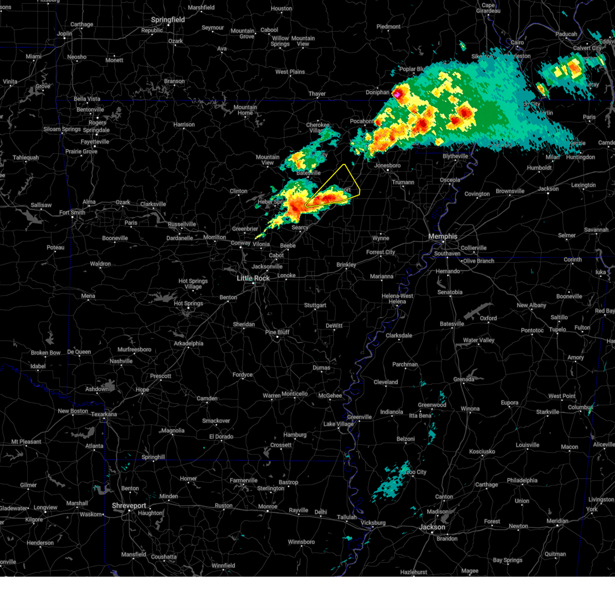
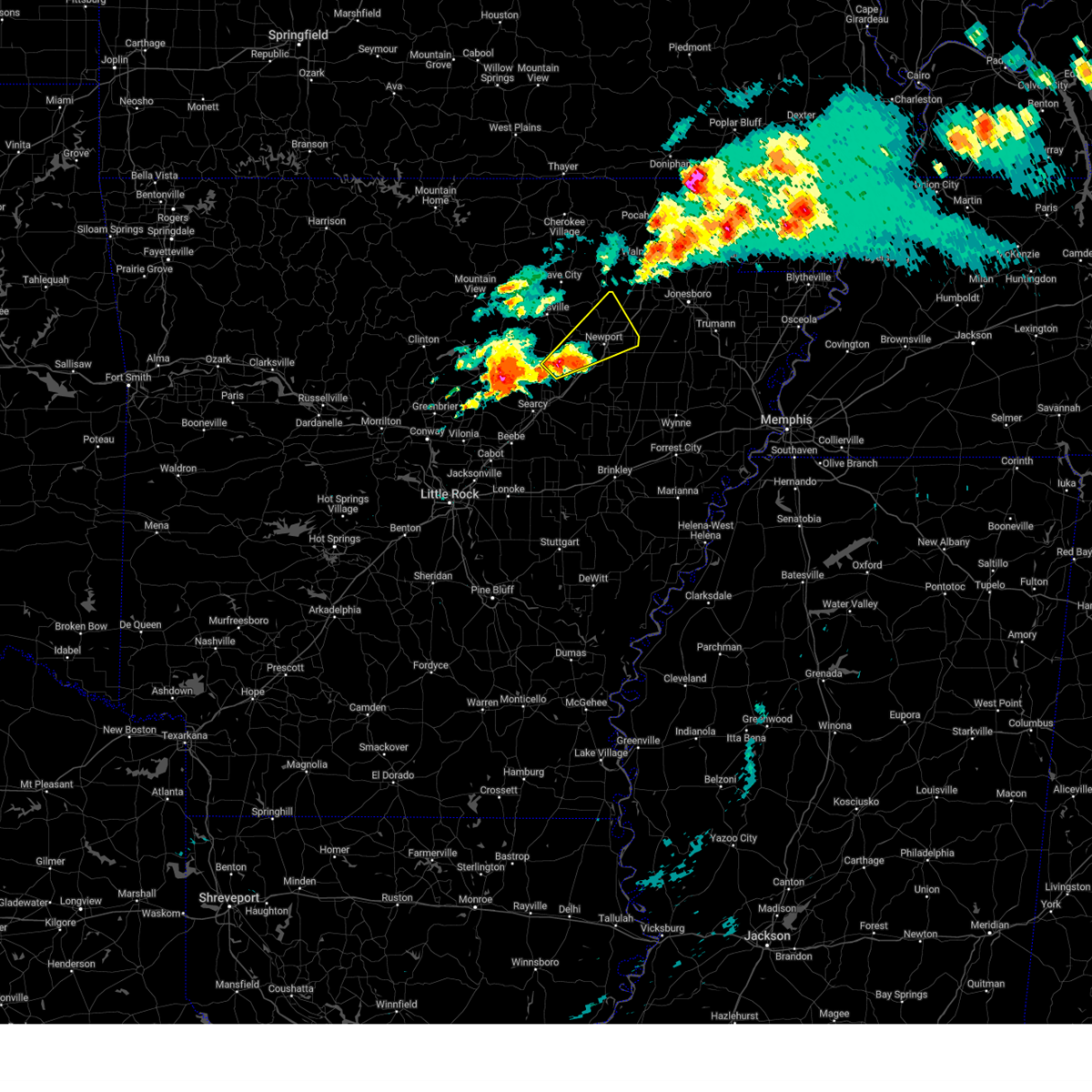
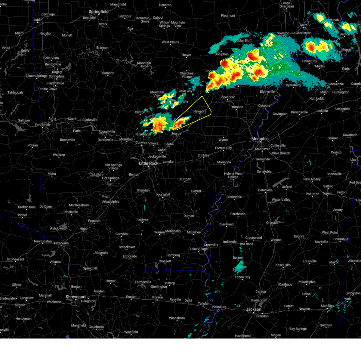
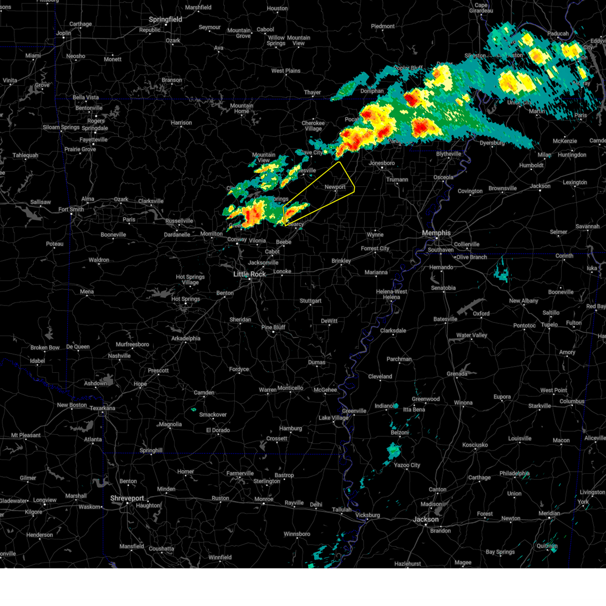
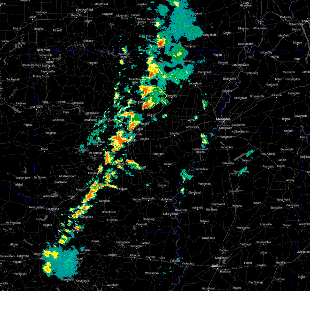
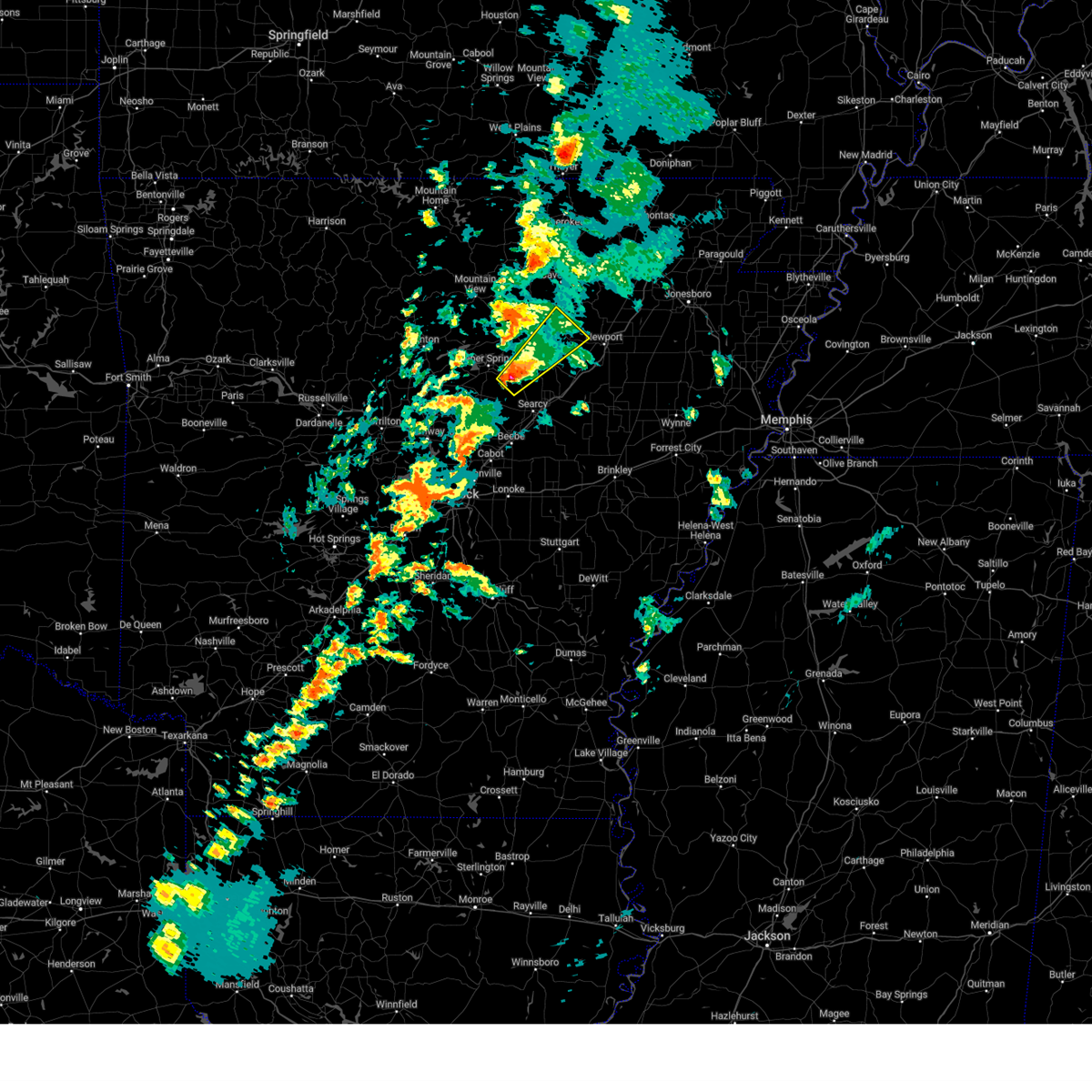
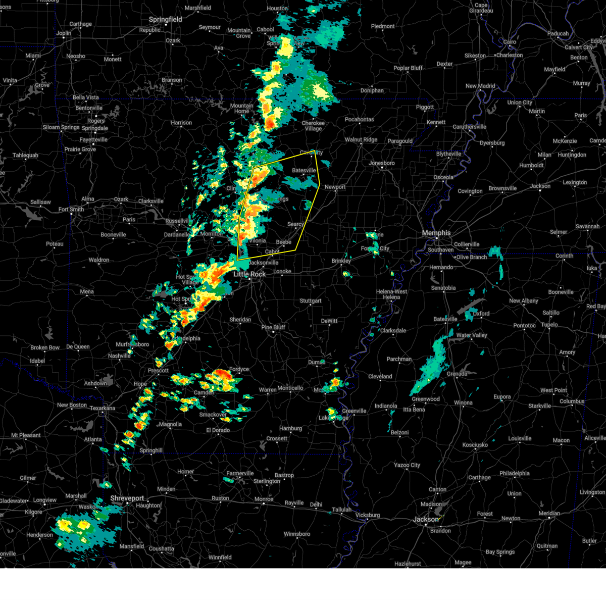
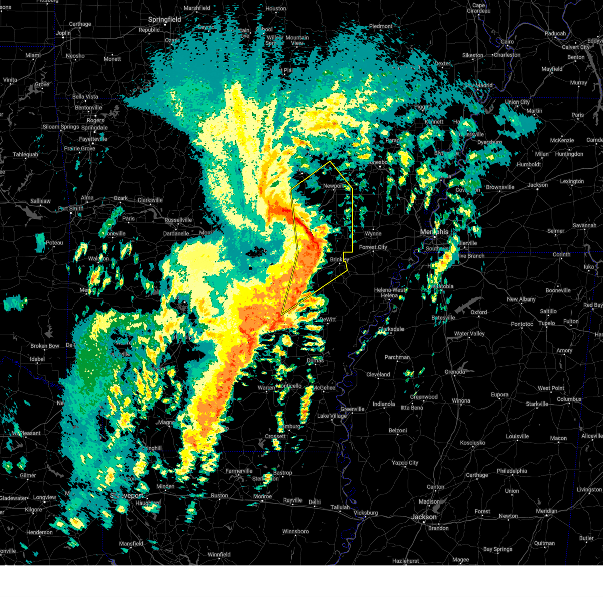
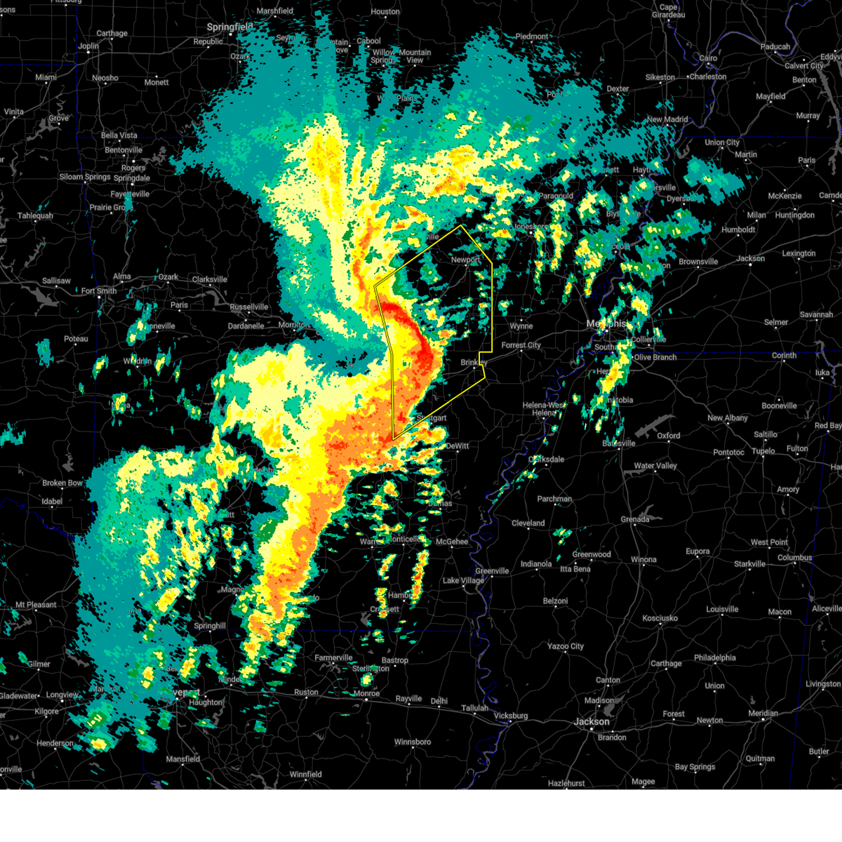
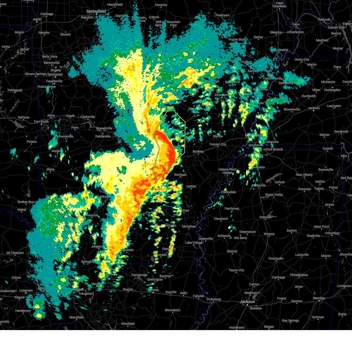
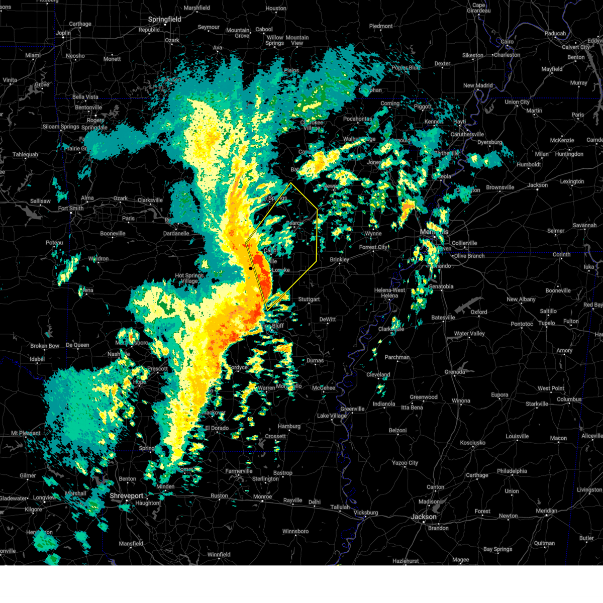
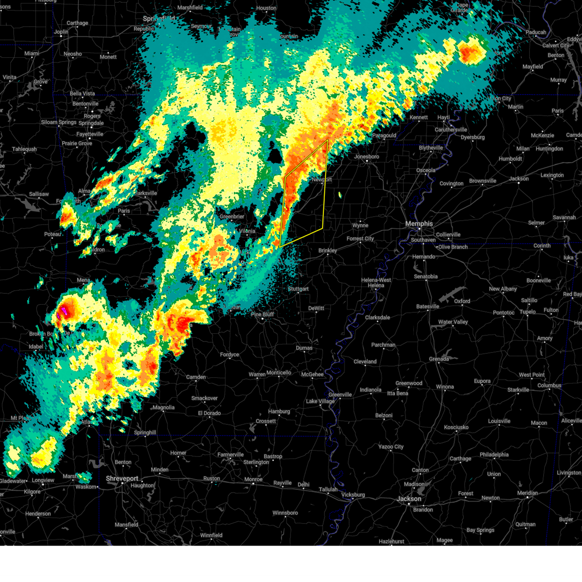
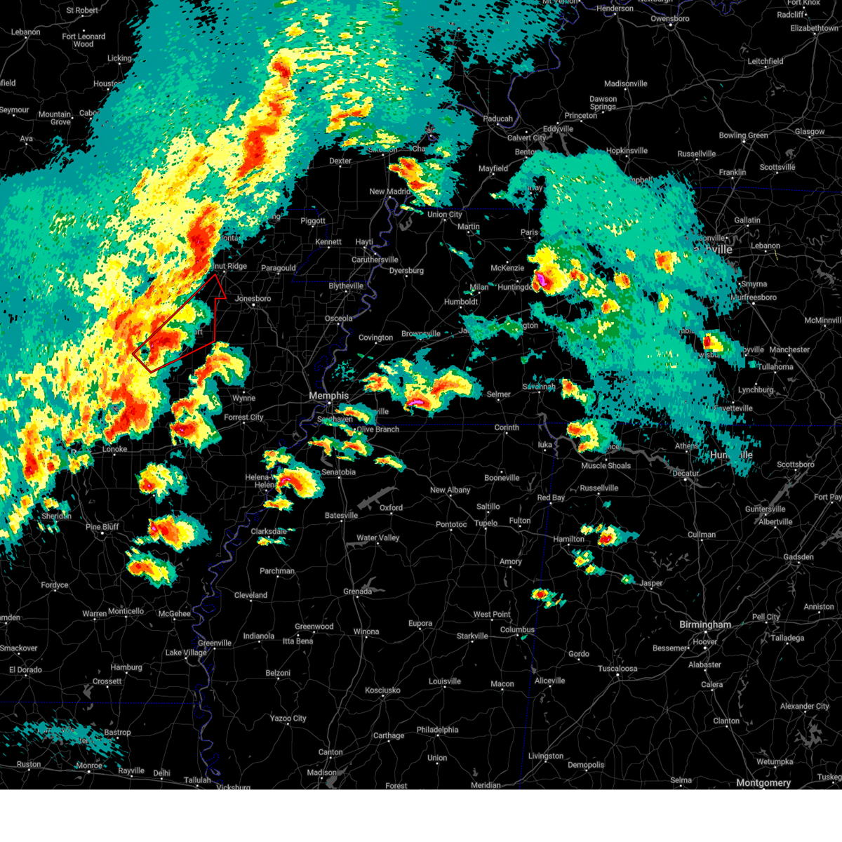
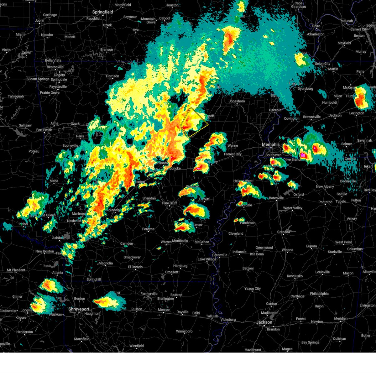
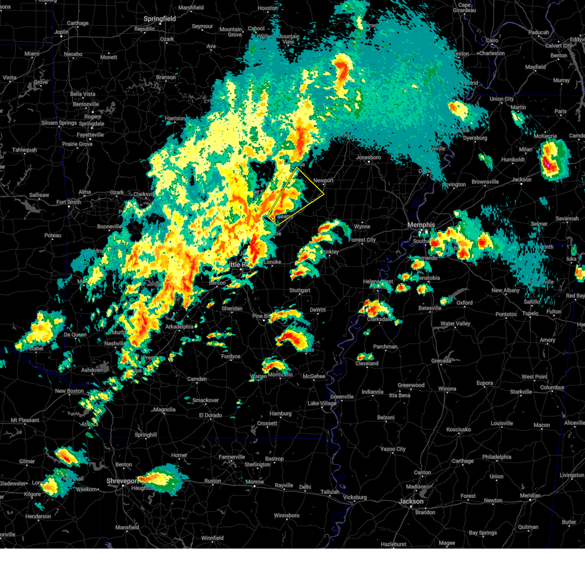
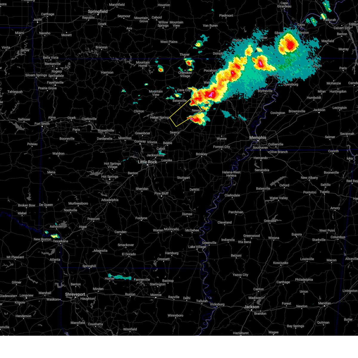
Hail Map for Pleasant Plains, AR
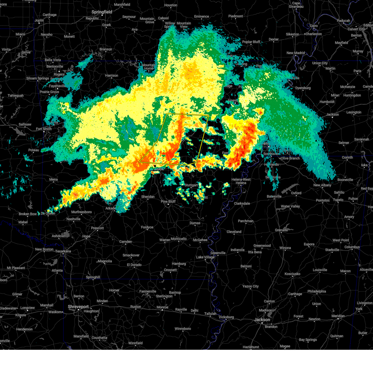
The Pleasant Plains, AR area has had 6 reports of on-the-ground hail by trained spotters, and has been under severe weather warnings 39 times during the past 12 months. Doppler radar has detected hail at or near Pleasant Plains, AR on 66 occasions, including 5 occasions during the past year.
| Name: | Pleasant Plains, AR |
| Where Located: | 66.4 miles NNE of Little Rock, AR |
| Map: | Google Map for Pleasant Plains, AR |
| Population: | 349 |
| Housing Units: | 144 |
| More Info: | Search Google for Pleasant Plains, AR |
2
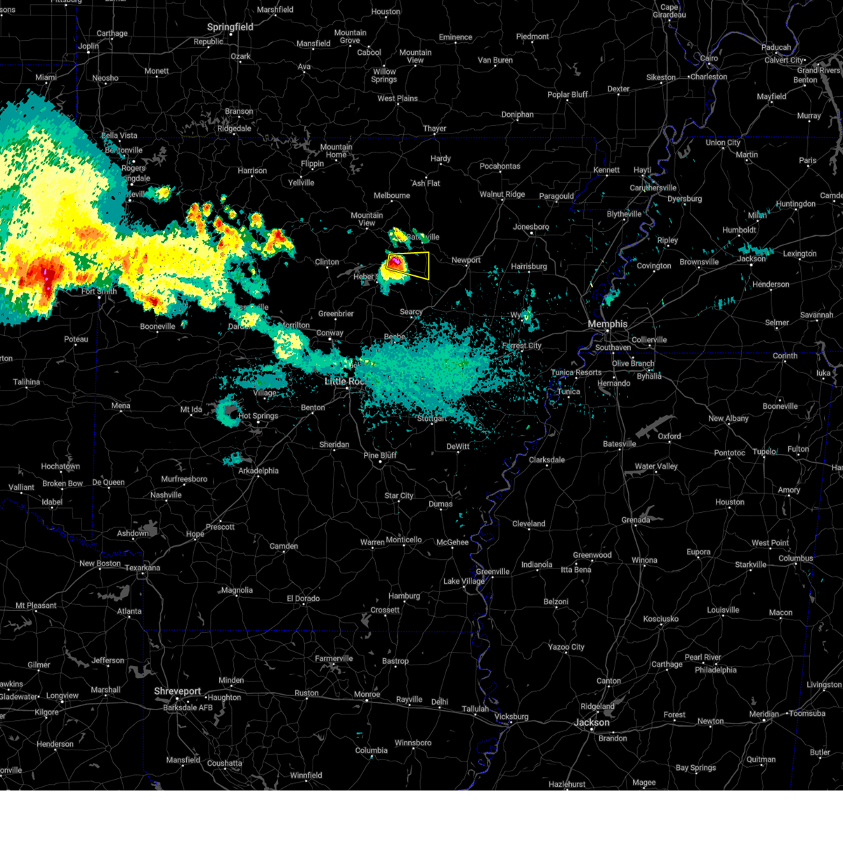
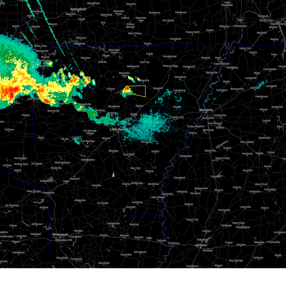
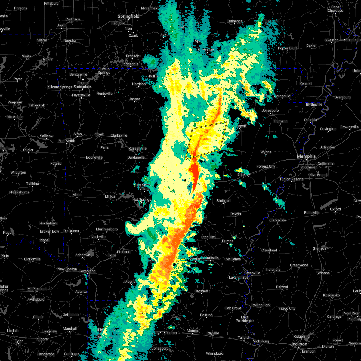
The Top Recent Hail Date for Pleasant Plains, AR is Wednesday, April 2, 2025 (11th out of 66)

Hail and Wind Damage Spotted near Pleasant Plains, AR
| Date / Time | Report Details |
|---|---|
| 6/7/2025 9:07 AM CDT |
 The storms which prompted the warning have weakened below severe limits, wind gusts up to 45 mph are still possible through 915 am. a tornado watch remains in effect until noon cdt for central, eastern and north central arkansas. The storms which prompted the warning have weakened below severe limits, wind gusts up to 45 mph are still possible through 915 am. a tornado watch remains in effect until noon cdt for central, eastern and north central arkansas.
|
| 6/7/2025 8:34 AM CDT |
 Svrlzk the national weather service in little rock has issued a * severe thunderstorm warning for, northwestern woodruff county in eastern arkansas, southern independence county in north central arkansas, northern prairie county in central arkansas, southwestern jackson county in eastern arkansas, eastern cleburne county in north central arkansas, northern lonoke county in central arkansas, southeastern faulkner county in central arkansas, white county in central arkansas, northeastern pulaski county in central arkansas, * until 915 am cdt. * at 833 am cdt, severe thunderstorms were located along a line extending from 6 miles northeast of heber springs to near mount vernon to mayflower, moving southeast at 45 mph (radar indicated). Hazards include 60 mph wind gusts and quarter size hail. Hail damage to vehicles is expected. Expect wind damage to roofs, siding, and trees. Svrlzk the national weather service in little rock has issued a * severe thunderstorm warning for, northwestern woodruff county in eastern arkansas, southern independence county in north central arkansas, northern prairie county in central arkansas, southwestern jackson county in eastern arkansas, eastern cleburne county in north central arkansas, northern lonoke county in central arkansas, southeastern faulkner county in central arkansas, white county in central arkansas, northeastern pulaski county in central arkansas, * until 915 am cdt. * at 833 am cdt, severe thunderstorms were located along a line extending from 6 miles northeast of heber springs to near mount vernon to mayflower, moving southeast at 45 mph (radar indicated). Hazards include 60 mph wind gusts and quarter size hail. Hail damage to vehicles is expected. Expect wind damage to roofs, siding, and trees.
|
| 5/19/2025 11:27 PM CDT |
 At 1126 pm cdt, a severe thunderstorm was located over concord, or 14 miles northeast of heber springs, moving east at 45 mph (radar indicated). Hazards include 60 mph wind gusts and penny size hail. Expect damage to roofs, siding, and trees. Locations impacted include, hickory flat, wilburn, marcella, desha, concord, ben, locust grove, hutchinson, pleasant grove, pleasant plains, almond, wolf bayou, bethesda, saint james, cushman, roosevelt, batesville,. At 1126 pm cdt, a severe thunderstorm was located over concord, or 14 miles northeast of heber springs, moving east at 45 mph (radar indicated). Hazards include 60 mph wind gusts and penny size hail. Expect damage to roofs, siding, and trees. Locations impacted include, hickory flat, wilburn, marcella, desha, concord, ben, locust grove, hutchinson, pleasant grove, pleasant plains, almond, wolf bayou, bethesda, saint james, cushman, roosevelt, batesville,.
|
| 5/19/2025 11:27 PM CDT |
 the severe thunderstorm warning has been cancelled and is no longer in effect the severe thunderstorm warning has been cancelled and is no longer in effect
|
| 5/19/2025 10:51 PM CDT |
 Svrlzk the national weather service in little rock has issued a * severe thunderstorm warning for, southeastern stone county in north central arkansas, western independence county in north central arkansas, northeastern van buren county in north central arkansas, cleburne county in north central arkansas, north central white county in central arkansas, * until 1145 pm cdt. * at 1051 pm cdt, a severe thunderstorm was located over fairfield bay marina, or near fairfield bay, moving east at 45 mph (radar indicated). Hazards include 60 mph wind gusts and penny size hail. expect damage to roofs, siding, and trees Svrlzk the national weather service in little rock has issued a * severe thunderstorm warning for, southeastern stone county in north central arkansas, western independence county in north central arkansas, northeastern van buren county in north central arkansas, cleburne county in north central arkansas, north central white county in central arkansas, * until 1145 pm cdt. * at 1051 pm cdt, a severe thunderstorm was located over fairfield bay marina, or near fairfield bay, moving east at 45 mph (radar indicated). Hazards include 60 mph wind gusts and penny size hail. expect damage to roofs, siding, and trees
|
| 5/16/2025 6:42 AM CDT |
 At 642 am cdt, a severe thunderstorm was located near oil trough, or 9 miles southwest of newport, moving northeast at 50 mph (radar indicated). Hazards include 60 mph wind gusts and quarter size hail. Hail damage to vehicles is expected. expect wind damage to roofs, siding, and trees. Locations impacted include, olyphant, newport, oil trough, thida, tuckerman, stegall, jacksonport, campbell station, grubbs, erwin, kenyon, elgin, macks, diaz, newark, pleasant plains,. At 642 am cdt, a severe thunderstorm was located near oil trough, or 9 miles southwest of newport, moving northeast at 50 mph (radar indicated). Hazards include 60 mph wind gusts and quarter size hail. Hail damage to vehicles is expected. expect wind damage to roofs, siding, and trees. Locations impacted include, olyphant, newport, oil trough, thida, tuckerman, stegall, jacksonport, campbell station, grubbs, erwin, kenyon, elgin, macks, diaz, newark, pleasant plains,.
|
| 5/16/2025 6:33 AM CDT |
 At 633 am cdt, a severe thunderstorm was located 8 miles east of pleasant plains, or 16 miles southwest of newport, moving east at 50 mph (radar indicated). Hazards include 60 mph wind gusts and quarter size hail. Hail damage to vehicles is expected. expect wind damage to roofs, siding, and trees. Locations impacted include, olyphant, newport, oil trough, thida, tuckerman, stegall, heffington, jacksonport, campbell station, grubbs, erwin, possum grape, denmark, kenyon, elgin, macks, diaz, newark, pleasant plains,. At 633 am cdt, a severe thunderstorm was located 8 miles east of pleasant plains, or 16 miles southwest of newport, moving east at 50 mph (radar indicated). Hazards include 60 mph wind gusts and quarter size hail. Hail damage to vehicles is expected. expect wind damage to roofs, siding, and trees. Locations impacted include, olyphant, newport, oil trough, thida, tuckerman, stegall, heffington, jacksonport, campbell station, grubbs, erwin, possum grape, denmark, kenyon, elgin, macks, diaz, newark, pleasant plains,.
|
| 5/16/2025 6:25 AM CDT |
 the severe thunderstorm warning has been cancelled and is no longer in effect the severe thunderstorm warning has been cancelled and is no longer in effect
|
| 5/16/2025 6:25 AM CDT |
 At 625 am cdt, a severe thunderstorm was located near pleasant plains, or 17 miles northeast of searcy, moving northeast at 50 mph (radar indicated). Hazards include 60 mph wind gusts and quarter size hail. Hail damage to vehicles is expected. expect wind damage to roofs, siding, and trees. Locations impacted include, newport, oil trough, hickory flat, thida, dewey, stegall, heffington, grubbs, pleasant plains, kenyon, elgin, velvet ridge, steprock, roosevelt, olyphant, providence, tuckerman, jacksonport, campbell station, erwin,. At 625 am cdt, a severe thunderstorm was located near pleasant plains, or 17 miles northeast of searcy, moving northeast at 50 mph (radar indicated). Hazards include 60 mph wind gusts and quarter size hail. Hail damage to vehicles is expected. expect wind damage to roofs, siding, and trees. Locations impacted include, newport, oil trough, hickory flat, thida, dewey, stegall, heffington, grubbs, pleasant plains, kenyon, elgin, velvet ridge, steprock, roosevelt, olyphant, providence, tuckerman, jacksonport, campbell station, erwin,.
|
| 5/16/2025 6:15 AM CDT |
 Svrlzk the national weather service in little rock has issued a * severe thunderstorm warning for, southeastern independence county in north central arkansas, central jackson county in eastern arkansas, southeastern cleburne county in north central arkansas, northeastern white county in central arkansas, * until 700 am cdt. * at 614 am cdt, a severe thunderstorm was located near pangburn, or 12 miles north of searcy, moving northeast at 50 mph (radar indicated). Hazards include 60 mph wind gusts and quarter size hail. Hail damage to vehicles is expected. Expect wind damage to roofs, siding, and trees. Svrlzk the national weather service in little rock has issued a * severe thunderstorm warning for, southeastern independence county in north central arkansas, central jackson county in eastern arkansas, southeastern cleburne county in north central arkansas, northeastern white county in central arkansas, * until 700 am cdt. * at 614 am cdt, a severe thunderstorm was located near pangburn, or 12 miles north of searcy, moving northeast at 50 mph (radar indicated). Hazards include 60 mph wind gusts and quarter size hail. Hail damage to vehicles is expected. Expect wind damage to roofs, siding, and trees.
|
| 5/16/2025 3:54 AM CDT |
 Svrlzk the national weather service in little rock has issued a * severe thunderstorm warning for, independence county in north central arkansas, southeastern randolph county in eastern arkansas, northeastern jackson county in eastern arkansas, northeastern cleburne county in north central arkansas, north central white county in central arkansas, lawrence county in eastern arkansas, southeastern sharp county in north central arkansas, * until 445 am cdt. * at 354 am cdt, a severe thunderstorm was located over southside in independence county, or near batesville, moving northeast at 55 mph (radar indicated). Hazards include 60 mph wind gusts and quarter size hail. Hail damage to vehicles is expected. Expect wind damage to roofs, siding, and trees. Svrlzk the national weather service in little rock has issued a * severe thunderstorm warning for, independence county in north central arkansas, southeastern randolph county in eastern arkansas, northeastern jackson county in eastern arkansas, northeastern cleburne county in north central arkansas, north central white county in central arkansas, lawrence county in eastern arkansas, southeastern sharp county in north central arkansas, * until 445 am cdt. * at 354 am cdt, a severe thunderstorm was located over southside in independence county, or near batesville, moving northeast at 55 mph (radar indicated). Hazards include 60 mph wind gusts and quarter size hail. Hail damage to vehicles is expected. Expect wind damage to roofs, siding, and trees.
|
| 4/30/2025 7:04 PM CDT |
 At 703 pm cdt, severe thunderstorms were located along a line extending from near pleasant plains to near pryor to near hazen, moving east at 30 mph (radar indicated). Hazards include 60 mph wind gusts. Expect damage to roofs, siding, and trees. Locations impacted include, hickory flat, salado, bradford, searcy, heffington, carlisle, judsonia, huff, worden, kensett, velvet ridge, georgetown, roosevelt, plainview in white county, thurman, screeton, mccreanor, providence, sand hill, pryor,. At 703 pm cdt, severe thunderstorms were located along a line extending from near pleasant plains to near pryor to near hazen, moving east at 30 mph (radar indicated). Hazards include 60 mph wind gusts. Expect damage to roofs, siding, and trees. Locations impacted include, hickory flat, salado, bradford, searcy, heffington, carlisle, judsonia, huff, worden, kensett, velvet ridge, georgetown, roosevelt, plainview in white county, thurman, screeton, mccreanor, providence, sand hill, pryor,.
|
| 4/30/2025 7:04 PM CDT |
 the severe thunderstorm warning has been cancelled and is no longer in effect the severe thunderstorm warning has been cancelled and is no longer in effect
|
| 4/30/2025 6:25 PM CDT |
 Svrlzk the national weather service in little rock has issued a * severe thunderstorm warning for, northwestern woodruff county in eastern arkansas, southwestern independence county in north central arkansas, prairie county in central arkansas, southwestern jackson county in eastern arkansas, southeastern cleburne county in north central arkansas, central lonoke county in central arkansas, white county in central arkansas, * until 715 pm cdt. * at 625 pm cdt, severe thunderstorms were located along a line extending from near heber springs to beebe to near lonoke, moving northeast at 35 mph (radar indicated). Hazards include 60 mph wind gusts. expect damage to roofs, siding, and trees Svrlzk the national weather service in little rock has issued a * severe thunderstorm warning for, northwestern woodruff county in eastern arkansas, southwestern independence county in north central arkansas, prairie county in central arkansas, southwestern jackson county in eastern arkansas, southeastern cleburne county in north central arkansas, central lonoke county in central arkansas, white county in central arkansas, * until 715 pm cdt. * at 625 pm cdt, severe thunderstorms were located along a line extending from near heber springs to beebe to near lonoke, moving northeast at 35 mph (radar indicated). Hazards include 60 mph wind gusts. expect damage to roofs, siding, and trees
|
| 4/20/2025 7:22 PM CDT |
 the tornado warning has been cancelled and is no longer in effect the tornado warning has been cancelled and is no longer in effect
|
| 4/20/2025 7:22 PM CDT |
 At 721 pm cdt, a severe thunderstorm capable of producing a tornado was located over pleasant plains, or 13 miles south of batesville, moving northeast at 40 mph (radar indicated rotation). Hazards include tornado. Flying debris will be dangerous to those caught without shelter. mobile homes will be damaged or destroyed. damage to roofs, windows, and vehicles will occur. tree damage is likely. Locations impacted include, oil trough, dowdy, pleasant plains, rosie, tuckerman, kenyon, newark, elgin, cord, magness, huff,. At 721 pm cdt, a severe thunderstorm capable of producing a tornado was located over pleasant plains, or 13 miles south of batesville, moving northeast at 40 mph (radar indicated rotation). Hazards include tornado. Flying debris will be dangerous to those caught without shelter. mobile homes will be damaged or destroyed. damage to roofs, windows, and vehicles will occur. tree damage is likely. Locations impacted include, oil trough, dowdy, pleasant plains, rosie, tuckerman, kenyon, newark, elgin, cord, magness, huff,.
|
| 4/20/2025 7:18 PM CDT | Torlzk the national weather service in little rock has issued a * tornado warning for, central independence county in north central arkansas, central jackson county in eastern arkansas, northeastern white county in central arkansas, * until 800 pm cdt. * at 718 pm cdt, a severe thunderstorm capable of producing a tornado was located over pleasant plains, or 14 miles south of batesville, moving northeast at 45 mph (radar indicated rotation). Hazards include tornado. Flying debris will be dangerous to those caught without shelter. mobile homes will be damaged or destroyed. damage to roofs, windows, and vehicles will occur. Tree damage is likely. |
| 4/20/2025 7:04 PM CDT |
 At 704 pm cdt, a severe thunderstorm was located near pangburn, or 13 miles east of heber springs, moving northeast at 40 mph (radar indicated). Hazards include 60 mph wind gusts and quarter size hail. Hail damage to vehicles is expected. expect wind damage to roofs, siding, and trees. Locations impacted include, oil trough, hickory flat, thida, rosie, salado, southside in independence count, dewey, moorefield, magness, huff, hutchinson, pleasant plains, sunnydale, roosevelt, sulphur rock, newark, batesville,. At 704 pm cdt, a severe thunderstorm was located near pangburn, or 13 miles east of heber springs, moving northeast at 40 mph (radar indicated). Hazards include 60 mph wind gusts and quarter size hail. Hail damage to vehicles is expected. expect wind damage to roofs, siding, and trees. Locations impacted include, oil trough, hickory flat, thida, rosie, salado, southside in independence count, dewey, moorefield, magness, huff, hutchinson, pleasant plains, sunnydale, roosevelt, sulphur rock, newark, batesville,.
|
| 4/20/2025 6:58 PM CDT |
 Svrlzk the national weather service in little rock has issued a * severe thunderstorm warning for, southwestern independence county in north central arkansas, west central jackson county in eastern arkansas, southeastern cleburne county in north central arkansas, north central white county in central arkansas, * until 745 pm cdt. * at 658 pm cdt, a severe thunderstorm was located over pangburn, or 11 miles southeast of heber springs, moving northeast at 40 mph (radar indicated). Hazards include 60 mph wind gusts and quarter size hail. Hail damage to vehicles is expected. Expect wind damage to roofs, siding, and trees. Svrlzk the national weather service in little rock has issued a * severe thunderstorm warning for, southwestern independence county in north central arkansas, west central jackson county in eastern arkansas, southeastern cleburne county in north central arkansas, north central white county in central arkansas, * until 745 pm cdt. * at 658 pm cdt, a severe thunderstorm was located over pangburn, or 11 miles southeast of heber springs, moving northeast at 40 mph (radar indicated). Hazards include 60 mph wind gusts and quarter size hail. Hail damage to vehicles is expected. Expect wind damage to roofs, siding, and trees.
|
| 4/20/2025 6:11 PM CDT |
 Svrlzk the national weather service in little rock has issued a * severe thunderstorm warning for, southeastern stone county in north central arkansas, independence county in north central arkansas, southeastern izard county in north central arkansas, northwestern prairie county in central arkansas, southwestern jackson county in eastern arkansas, southeastern van buren county in north central arkansas, cleburne county in north central arkansas, northwestern lonoke county in central arkansas, faulkner county in central arkansas, white county in central arkansas, southwestern sharp county in north central arkansas, northeastern pulaski county in central arkansas, * until 700 pm cdt. * at 611 pm cdt, severe thunderstorms were located along a line extending from mountain view to near quitman to near mayflower, moving northeast at 60 mph (radar indicated). Hazards include 60 mph wind gusts and penny size hail. expect damage to roofs, siding, and trees Svrlzk the national weather service in little rock has issued a * severe thunderstorm warning for, southeastern stone county in north central arkansas, independence county in north central arkansas, southeastern izard county in north central arkansas, northwestern prairie county in central arkansas, southwestern jackson county in eastern arkansas, southeastern van buren county in north central arkansas, cleburne county in north central arkansas, northwestern lonoke county in central arkansas, faulkner county in central arkansas, white county in central arkansas, southwestern sharp county in north central arkansas, northeastern pulaski county in central arkansas, * until 700 pm cdt. * at 611 pm cdt, severe thunderstorms were located along a line extending from mountain view to near quitman to near mayflower, moving northeast at 60 mph (radar indicated). Hazards include 60 mph wind gusts and penny size hail. expect damage to roofs, siding, and trees
|
| 4/5/2025 12:10 PM CDT |
 the severe thunderstorm warning has been cancelled and is no longer in effect the severe thunderstorm warning has been cancelled and is no longer in effect
|
| 4/5/2025 12:10 PM CDT |
 At 1210 pm cdt, severe thunderstorms were located along a line extending from pleasant plains to 7 miles southwest of patterson to 7 miles north of stuttgart municipal airport, moving northeast at 65 mph (radar indicated). Hazards include 70 mph wind gusts and quarter size hail. Hail damage to vehicles is expected. expect considerable tree damage. wind damage is also likely to mobile homes, roofs, and outbuildings. Locations impacted include, dobbs landing, mccrory, salado, bradford, mcfadden, judsonia, fitzhugh, fargo, georgetown, plainview in white county, olyphant, humnoke, dixie, hunter, providence, pryor, childers, hutchinson, russell, dowdy,. At 1210 pm cdt, severe thunderstorms were located along a line extending from pleasant plains to 7 miles southwest of patterson to 7 miles north of stuttgart municipal airport, moving northeast at 65 mph (radar indicated). Hazards include 70 mph wind gusts and quarter size hail. Hail damage to vehicles is expected. expect considerable tree damage. wind damage is also likely to mobile homes, roofs, and outbuildings. Locations impacted include, dobbs landing, mccrory, salado, bradford, mcfadden, judsonia, fitzhugh, fargo, georgetown, plainview in white county, olyphant, humnoke, dixie, hunter, providence, pryor, childers, hutchinson, russell, dowdy,.
|
| 4/5/2025 11:52 AM CDT |
 Svrlzk the national weather service in little rock has issued a * severe thunderstorm warning for, woodruff county in eastern arkansas, southeastern independence county in north central arkansas, prairie county in central arkansas, jackson county in eastern arkansas, southeastern cleburne county in north central arkansas, eastern lonoke county in central arkansas, northwestern monroe county in eastern arkansas, white county in central arkansas, north central jefferson county in southeastern arkansas, northern arkansas county in southeastern arkansas, * until 1230 pm cdt. * at 1151 am cdt, severe thunderstorms were located along a line extending from near pangburn to des arc to near humnoke, moving northeast at 65 mph (radar indicated). Hazards include 70 mph wind gusts and quarter size hail. Hail damage to vehicles is expected. expect considerable tree damage. Wind damage is also likely to mobile homes, roofs, and outbuildings. Svrlzk the national weather service in little rock has issued a * severe thunderstorm warning for, woodruff county in eastern arkansas, southeastern independence county in north central arkansas, prairie county in central arkansas, jackson county in eastern arkansas, southeastern cleburne county in north central arkansas, eastern lonoke county in central arkansas, northwestern monroe county in eastern arkansas, white county in central arkansas, north central jefferson county in southeastern arkansas, northern arkansas county in southeastern arkansas, * until 1230 pm cdt. * at 1151 am cdt, severe thunderstorms were located along a line extending from near pangburn to des arc to near humnoke, moving northeast at 65 mph (radar indicated). Hazards include 70 mph wind gusts and quarter size hail. Hail damage to vehicles is expected. expect considerable tree damage. Wind damage is also likely to mobile homes, roofs, and outbuildings.
|
| 4/5/2025 11:47 AM CDT |
 At 1147 am cdt, severe thunderstorms were located along a line extending from near crosby to 6 miles south of west point to near prairie center, moving northeast at 65 mph (radar indicated). Hazards include 70 mph wind gusts and quarter size hail. Hail damage to vehicles is expected. expect considerable tree damage. wind damage is also likely to mobile homes, roofs, and outbuildings. Locations impacted include, hickory flat, wilburn, old austin, crosby, searcy, heffington, england, furlow, parnell, carlisle, antioch in white county, judsonia, worden, estes, kensett, meto, pickens in white county, floyd, austin in lonoke county, velvet ridge,. At 1147 am cdt, severe thunderstorms were located along a line extending from near crosby to 6 miles south of west point to near prairie center, moving northeast at 65 mph (radar indicated). Hazards include 70 mph wind gusts and quarter size hail. Hail damage to vehicles is expected. expect considerable tree damage. wind damage is also likely to mobile homes, roofs, and outbuildings. Locations impacted include, hickory flat, wilburn, old austin, crosby, searcy, heffington, england, furlow, parnell, carlisle, antioch in white county, judsonia, worden, estes, kensett, meto, pickens in white county, floyd, austin in lonoke county, velvet ridge,.
|
| 4/5/2025 11:47 AM CDT |
 the severe thunderstorm warning has been cancelled and is no longer in effect the severe thunderstorm warning has been cancelled and is no longer in effect
|
| 4/5/2025 11:25 AM CDT |
 Svrlzk the national weather service in little rock has issued a * severe thunderstorm warning for, southwestern independence county in north central arkansas, northwestern prairie county in central arkansas, southwestern jackson county in eastern arkansas, southeastern cleburne county in north central arkansas, lonoke county in central arkansas, southeastern faulkner county in central arkansas, white county in central arkansas, northwestern jefferson county in southeastern arkansas, eastern pulaski county in central arkansas, * until noon cdt. * at 1124 am cdt, severe thunderstorms were located along a line extending from vilonia to parnell to near england, moving northeast at 85 mph (radar indicated). Hazards include 70 mph wind gusts and quarter size hail. Hail damage to vehicles is expected. expect considerable tree damage. Wind damage is also likely to mobile homes, roofs, and outbuildings. Svrlzk the national weather service in little rock has issued a * severe thunderstorm warning for, southwestern independence county in north central arkansas, northwestern prairie county in central arkansas, southwestern jackson county in eastern arkansas, southeastern cleburne county in north central arkansas, lonoke county in central arkansas, southeastern faulkner county in central arkansas, white county in central arkansas, northwestern jefferson county in southeastern arkansas, eastern pulaski county in central arkansas, * until noon cdt. * at 1124 am cdt, severe thunderstorms were located along a line extending from vilonia to parnell to near england, moving northeast at 85 mph (radar indicated). Hazards include 70 mph wind gusts and quarter size hail. Hail damage to vehicles is expected. expect considerable tree damage. Wind damage is also likely to mobile homes, roofs, and outbuildings.
|
| 4/4/2025 9:43 PM CDT |
 Svrlzk the national weather service in little rock has issued a * severe thunderstorm warning for, northwestern woodruff county in eastern arkansas, central independence county in north central arkansas, northwestern prairie county in central arkansas, central jackson county in eastern arkansas, eastern white county in central arkansas, southwestern lawrence county in eastern arkansas, southeastern sharp county in north central arkansas, * until 1030 pm cdt. * at 943 pm cdt, severe thunderstorms were located along a line extending from near steprock to near higginson, moving northeast at 50 mph (radar indicated). Hazards include 60 mph wind gusts and quarter size hail. Hail damage to vehicles is expected. Expect wind damage to roofs, siding, and trees. Svrlzk the national weather service in little rock has issued a * severe thunderstorm warning for, northwestern woodruff county in eastern arkansas, central independence county in north central arkansas, northwestern prairie county in central arkansas, central jackson county in eastern arkansas, eastern white county in central arkansas, southwestern lawrence county in eastern arkansas, southeastern sharp county in north central arkansas, * until 1030 pm cdt. * at 943 pm cdt, severe thunderstorms were located along a line extending from near steprock to near higginson, moving northeast at 50 mph (radar indicated). Hazards include 60 mph wind gusts and quarter size hail. Hail damage to vehicles is expected. Expect wind damage to roofs, siding, and trees.
|
| 4/2/2025 5:49 PM CDT | the tornado warning has been cancelled and is no longer in effect |
| 4/2/2025 5:49 PM CDT | At 549 pm cdt, a severe thunderstorm capable of producing a tornado was located near oil trough, or 15 miles southwest of newport, moving northeast at 60 mph (radar indicated rotation). Hazards include tornado. Flying debris will be dangerous to those caught without shelter. mobile homes will be damaged or destroyed. damage to roofs, windows, and vehicles will occur. tree damage is likely. Locations impacted include, newport, oil trough, thida, strangers home, stegall, heffington, amagon, grubbs, pleasant plains, kenyon, elgin, minturn, olyphant, ingleside, tuckerman, jacksonport, campbell station, erwin, possum grape, clover bend,. |
| 4/2/2025 5:47 PM CDT | the severe thunderstorm warning has been cancelled and is no longer in effect |
| 4/2/2025 5:41 PM CDT |
 Torlzk the national weather service in little rock has issued a * tornado warning for, southeastern independence county in north central arkansas, jackson county in eastern arkansas, northeastern white county in central arkansas, south central lawrence county in eastern arkansas, * until 630 pm cdt. * at 541 pm cdt, a severe thunderstorm capable of producing a tornado was located near steprock, or 16 miles northeast of searcy, moving northeast at 60 mph (radar indicated rotation). Hazards include tornado and quarter size hail. Flying debris will be dangerous to those caught without shelter. mobile homes will be damaged or destroyed. damage to roofs, windows, and vehicles will occur. Tree damage is likely. Torlzk the national weather service in little rock has issued a * tornado warning for, southeastern independence county in north central arkansas, jackson county in eastern arkansas, northeastern white county in central arkansas, south central lawrence county in eastern arkansas, * until 630 pm cdt. * at 541 pm cdt, a severe thunderstorm capable of producing a tornado was located near steprock, or 16 miles northeast of searcy, moving northeast at 60 mph (radar indicated rotation). Hazards include tornado and quarter size hail. Flying debris will be dangerous to those caught without shelter. mobile homes will be damaged or destroyed. damage to roofs, windows, and vehicles will occur. Tree damage is likely.
|
| 4/2/2025 5:36 PM CDT |
 At 536 pm cdt, a severe thunderstorm was located over steprock, or 14 miles north of searcy, moving northeast at 65 mph (radar indicated). Hazards include 60 mph wind gusts and quarter size hail. Hail damage to vehicles is expected. expect wind damage to roofs, siding, and trees. Locations impacted include, olyphant, oil trough, hickory flat, thida, providence, ingleside, rosie, salado, bradford, southside in independence count, heffington, huff, possum grape, hutchinson, pleasant plains, denmark, sunnydale, velvet ridge, steprock, roosevelt,. At 536 pm cdt, a severe thunderstorm was located over steprock, or 14 miles north of searcy, moving northeast at 65 mph (radar indicated). Hazards include 60 mph wind gusts and quarter size hail. Hail damage to vehicles is expected. expect wind damage to roofs, siding, and trees. Locations impacted include, olyphant, oil trough, hickory flat, thida, providence, ingleside, rosie, salado, bradford, southside in independence count, heffington, huff, possum grape, hutchinson, pleasant plains, denmark, sunnydale, velvet ridge, steprock, roosevelt,.
|
| 4/2/2025 5:36 PM CDT |
 the severe thunderstorm warning has been cancelled and is no longer in effect the severe thunderstorm warning has been cancelled and is no longer in effect
|
| 4/2/2025 5:22 PM CDT |
 Svrlzk the national weather service in little rock has issued a * severe thunderstorm warning for, south central independence county in north central arkansas, southwestern jackson county in eastern arkansas, southeastern cleburne county in north central arkansas, northern white county in central arkansas, * until 600 pm cdt. * at 522 pm cdt, a severe thunderstorm was located 8 miles northwest of beebe, or 11 miles north of cabot, moving northeast at 55 mph (radar indicated). Hazards include 60 mph wind gusts and quarter size hail. Hail damage to vehicles is expected. Expect wind damage to roofs, siding, and trees. Svrlzk the national weather service in little rock has issued a * severe thunderstorm warning for, south central independence county in north central arkansas, southwestern jackson county in eastern arkansas, southeastern cleburne county in north central arkansas, northern white county in central arkansas, * until 600 pm cdt. * at 522 pm cdt, a severe thunderstorm was located 8 miles northwest of beebe, or 11 miles north of cabot, moving northeast at 55 mph (radar indicated). Hazards include 60 mph wind gusts and quarter size hail. Hail damage to vehicles is expected. Expect wind damage to roofs, siding, and trees.
|
| 3/30/2025 6:55 PM CDT |
 the severe thunderstorm warning has been cancelled and is no longer in effect the severe thunderstorm warning has been cancelled and is no longer in effect
|
| 3/30/2025 6:29 PM CDT | Svrlzk the national weather service in little rock has issued a * severe thunderstorm warning for, eastern independence county in north central arkansas, central jackson county in eastern arkansas, east central cleburne county in north central arkansas, north central white county in central arkansas, * until 715 pm cdt. * at 628 pm cdt, a severe thunderstorm was located near steprock, or 17 miles north of searcy, moving northeast at 30 mph (radar indicated). Hazards include 60 mph wind gusts and quarter size hail. Hail damage to vehicles is expected. Expect wind damage to roofs, siding, and trees. |
| 3/14/2025 11:02 PM CDT | At 1102 pm cdt, a severe thunderstorm capable of producing a tornado was located near pleasant plains, or 18 miles south of batesville, moving northeast at 50 mph (radar indicated rotation). Hazards include tornado. Flying debris will be dangerous to those caught without shelter. mobile homes will be damaged or destroyed. damage to roofs, windows, and vehicles will occur. tree damage is likely. Locations impacted include, possum grape, olyphant, oil trough, thida, ingleside, heffington, denmark, macks, roosevelt, pleasant plains,. |
| 3/14/2025 10:52 PM CDT | Torlzk the national weather service in little rock has issued a * tornado warning for, south central independence county in north central arkansas, southwestern jackson county in eastern arkansas, northeastern white county in central arkansas, * until 1130 pm cdt. * at 1052 pm cdt, a severe thunderstorm capable of producing a tornado was located near crosby, or 10 miles northwest of searcy, moving northeast at 50 mph (radar indicated rotation). Hazards include tornado. Flying debris will be dangerous to those caught without shelter. mobile homes will be damaged or destroyed. damage to roofs, windows, and vehicles will occur. Tree damage is likely. |
| 3/14/2025 10:34 PM CDT | Svrlzk the national weather service in little rock has issued a * severe thunderstorm warning for, southwestern independence county in north central arkansas, southwestern jackson county in eastern arkansas, southeastern cleburne county in north central arkansas, northern white county in central arkansas, * until 1115 pm cdt. * at 1034 pm cdt, a severe thunderstorm was located near pangburn, or 12 miles southeast of heber springs, moving northeast at 50 mph (radar indicated). Hazards include 60 mph wind gusts and quarter size hail. Hail damage to vehicles is expected. Expect wind damage to roofs, siding, and trees. |
| 4/26/2024 8:30 PM CDT |
 At 828 pm cdt, severe thunderstorms were located along a line extending from near concord to 6 miles northwest of russell to near bald knob to near des arc, moving northeast at 60 mph (radar indicated). Hazards include 60 mph wind gusts and penny size hail. Expect damage to roofs, siding, and trees. Locations impacted include, augusta, bald knob, judsonia, pleasant plains, russell, west point, hurricane lake wma, steprock, pryor, southside in independence count, bradford, hickory flat, thida, dewey, heffington, mcclelland, gregory, fitzhugh, locust grove, huff,. At 828 pm cdt, severe thunderstorms were located along a line extending from near concord to 6 miles northwest of russell to near bald knob to near des arc, moving northeast at 60 mph (radar indicated). Hazards include 60 mph wind gusts and penny size hail. Expect damage to roofs, siding, and trees. Locations impacted include, augusta, bald knob, judsonia, pleasant plains, russell, west point, hurricane lake wma, steprock, pryor, southside in independence count, bradford, hickory flat, thida, dewey, heffington, mcclelland, gregory, fitzhugh, locust grove, huff,.
|
| 4/26/2024 8:30 PM CDT |
 the severe thunderstorm warning has been cancelled and is no longer in effect the severe thunderstorm warning has been cancelled and is no longer in effect
|
| 4/26/2024 8:13 PM CDT |
 Svrlzk the national weather service in little rock has issued a * severe thunderstorm warning for, southwestern independence county in north central arkansas, western woodruff county in eastern arkansas, northern prairie county in central arkansas, southwestern jackson county in eastern arkansas, southeastern cleburne county in north central arkansas, east central lonoke county in central arkansas, northwestern monroe county in eastern arkansas, white county in central arkansas, * until 900 pm cdt. * at 813 pm cdt, severe thunderstorms were located along a line extending from near pangburn to near searcy to 7 miles south of higginson to barrettsville, moving northeast at 60 mph (radar indicated). Hazards include 60 mph wind gusts and nickel size hail. expect damage to roofs, siding, and trees Svrlzk the national weather service in little rock has issued a * severe thunderstorm warning for, southwestern independence county in north central arkansas, western woodruff county in eastern arkansas, northern prairie county in central arkansas, southwestern jackson county in eastern arkansas, southeastern cleburne county in north central arkansas, east central lonoke county in central arkansas, northwestern monroe county in eastern arkansas, white county in central arkansas, * until 900 pm cdt. * at 813 pm cdt, severe thunderstorms were located along a line extending from near pangburn to near searcy to 7 miles south of higginson to barrettsville, moving northeast at 60 mph (radar indicated). Hazards include 60 mph wind gusts and nickel size hail. expect damage to roofs, siding, and trees
|
| 1/11/2024 11:59 PM CST |
 At 1159 pm cst, a severe thunderstorm was located near pleasant plains, or 18 miles southwest of newport, moving east at 55 mph (radar indicated). Hazards include 60 mph wind gusts and quarter size hail. Hail damage to vehicles is expected. Expect wind damage to roofs, siding, and trees. At 1159 pm cst, a severe thunderstorm was located near pleasant plains, or 18 miles southwest of newport, moving east at 55 mph (radar indicated). Hazards include 60 mph wind gusts and quarter size hail. Hail damage to vehicles is expected. Expect wind damage to roofs, siding, and trees.
|
| 1/11/2024 11:53 PM CST | Reports of trees and powerlines dow in independence county AR, 0.8 miles WSW of Pleasant Plains, AR |
| 1/11/2024 11:49 PM CST |
 At 1149 pm cst, a severe thunderstorm was located over steprock, or 11 miles north of searcy, moving east at 50 mph (radar indicated). Hazards include 60 mph wind gusts and quarter size hail. Hail damage to vehicles is expected. expect wind damage to roofs, siding, and trees. Locations impacted include, searcy, bald knob, judsonia, kensett, pangburn, pleasant plains, russell, crosby, steprock, letona, albion, hickory flat, clay, providence, dewey, center hill, huff, pickens in white county, denmark, armstrong springs,. At 1149 pm cst, a severe thunderstorm was located over steprock, or 11 miles north of searcy, moving east at 50 mph (radar indicated). Hazards include 60 mph wind gusts and quarter size hail. Hail damage to vehicles is expected. expect wind damage to roofs, siding, and trees. Locations impacted include, searcy, bald knob, judsonia, kensett, pangburn, pleasant plains, russell, crosby, steprock, letona, albion, hickory flat, clay, providence, dewey, center hill, huff, pickens in white county, denmark, armstrong springs,.
|
| 1/11/2024 11:46 PM CST |
 At 1146 pm cst, a severe thunderstorm was located near steprock, or 10 miles north of searcy, moving east at 50 mph (radar indicated). Hazards include 60 mph wind gusts and quarter size hail. Hail damage to vehicles is expected. expect wind damage to roofs, siding, and trees. Locations impacted include, searcy, bald knob, judsonia, kensett, pangburn, pleasant plains, russell, crosby, gravel hill, steprock, letona, albion, hickory flat, wilburn, dewey, huff, sidon, pickens in white county, armstrong springs, velvet ridge,. At 1146 pm cst, a severe thunderstorm was located near steprock, or 10 miles north of searcy, moving east at 50 mph (radar indicated). Hazards include 60 mph wind gusts and quarter size hail. Hail damage to vehicles is expected. expect wind damage to roofs, siding, and trees. Locations impacted include, searcy, bald knob, judsonia, kensett, pangburn, pleasant plains, russell, crosby, gravel hill, steprock, letona, albion, hickory flat, wilburn, dewey, huff, sidon, pickens in white county, armstrong springs, velvet ridge,.
|
| 1/11/2024 11:33 PM CST |
 At 1133 pm cst, a severe thunderstorm was located near gravel hill, or 12 miles southeast of heber springs, moving east at 45 mph (radar indicated). Hazards include 60 mph wind gusts and quarter size hail. Hail damage to vehicles is expected. expect wind damage to roofs, siding, and trees. Locations impacted include, searcy, heber springs, bald knob, judsonia, kensett, pangburn, rose bud, pleasant plains, russell, mount vernon, crosby, gravel hill, steprock, letona, albion, hickory flat, wilburn, dewey, huff, sidon,. At 1133 pm cst, a severe thunderstorm was located near gravel hill, or 12 miles southeast of heber springs, moving east at 45 mph (radar indicated). Hazards include 60 mph wind gusts and quarter size hail. Hail damage to vehicles is expected. expect wind damage to roofs, siding, and trees. Locations impacted include, searcy, heber springs, bald knob, judsonia, kensett, pangburn, rose bud, pleasant plains, russell, mount vernon, crosby, gravel hill, steprock, letona, albion, hickory flat, wilburn, dewey, huff, sidon,.
|
| 1/11/2024 11:24 PM CST |
 A severe thunderstorm warning remains in effect until midnight cst for southwestern independence. western jackson. southern cleburne. northeastern faulkner and central white counties. at 1124 pm cst, a severe thunderstorm was located over rose bud, or 12 miles south of heber springs, moving east at 50 mph. hazard. 60 mph wind gusts and quarter size hail. A severe thunderstorm warning remains in effect until midnight cst for southwestern independence. western jackson. southern cleburne. northeastern faulkner and central white counties. at 1124 pm cst, a severe thunderstorm was located over rose bud, or 12 miles south of heber springs, moving east at 50 mph. hazard. 60 mph wind gusts and quarter size hail.
|
| 1/11/2024 11:17 PM CST |
 At 1116 pm cst, a severe thunderstorm was located near mount vernon, or 16 miles southwest of heber springs, moving east at 50 mph (radar indicated). Hazards include 60 mph wind gusts and quarter size hail. Hail damage to vehicles is expected. Expect wind damage to roofs, siding, and trees. At 1116 pm cst, a severe thunderstorm was located near mount vernon, or 16 miles southwest of heber springs, moving east at 50 mph (radar indicated). Hazards include 60 mph wind gusts and quarter size hail. Hail damage to vehicles is expected. Expect wind damage to roofs, siding, and trees.
|
| 8/7/2023 6:37 AM CDT |
 At 637 am cdt, a severe thunderstorm was located near pleasant plains, or 11 miles south of batesville, moving east at 50 mph (radar indicated). Hazards include 60 mph wind gusts and quarter size hail. Hail damage to vehicles is expected. Expect wind damage to roofs, siding, and trees. At 637 am cdt, a severe thunderstorm was located near pleasant plains, or 11 miles south of batesville, moving east at 50 mph (radar indicated). Hazards include 60 mph wind gusts and quarter size hail. Hail damage to vehicles is expected. Expect wind damage to roofs, siding, and trees.
|
| 8/7/2023 6:25 AM CDT |
 At 625 am cdt, a severe thunderstorm was located near concord, or 13 miles southwest of batesville, moving southeast at 50 mph (radar indicated). Hazards include golf ball size hail and 60 mph wind gusts. People and animals outdoors will be injured. expect hail damage to roofs, siding, windows, and vehicles. expect wind damage to roofs, siding, and trees. locations impacted include, pleasant plains, concord, southside in independence count, salado, hutchinson, wolf bayou, huff, ida, thunderstorm damage threat, considerable hail threat, radar indicated max hail size, 1. 75 in wind threat, radar indicated max wind gust, 60 mph. At 625 am cdt, a severe thunderstorm was located near concord, or 13 miles southwest of batesville, moving southeast at 50 mph (radar indicated). Hazards include golf ball size hail and 60 mph wind gusts. People and animals outdoors will be injured. expect hail damage to roofs, siding, windows, and vehicles. expect wind damage to roofs, siding, and trees. locations impacted include, pleasant plains, concord, southside in independence count, salado, hutchinson, wolf bayou, huff, ida, thunderstorm damage threat, considerable hail threat, radar indicated max hail size, 1. 75 in wind threat, radar indicated max wind gust, 60 mph.
|
| 8/7/2023 6:18 AM CDT |
 At 617 am cdt, a severe thunderstorm was located 7 miles southwest of concord, or 8 miles north of heber springs, moving southeast at 50 mph (radar indicated). Hazards include golf ball size hail and 60 mph wind gusts. People and animals outdoors will be injured. expect hail damage to roofs, siding, windows, and vehicles. expect wind damage to roofs, siding, and trees. locations impacted include, pleasant plains, concord, southside in independence count, salado, drasco, hutchinson, wolf bayou, ida, brownsville, roosevelt, woodrow, huff, thunderstorm damage threat, considerable hail threat, radar indicated max hail size, 1. 75 in wind threat, radar indicated max wind gust, 60 mph. At 617 am cdt, a severe thunderstorm was located 7 miles southwest of concord, or 8 miles north of heber springs, moving southeast at 50 mph (radar indicated). Hazards include golf ball size hail and 60 mph wind gusts. People and animals outdoors will be injured. expect hail damage to roofs, siding, windows, and vehicles. expect wind damage to roofs, siding, and trees. locations impacted include, pleasant plains, concord, southside in independence count, salado, drasco, hutchinson, wolf bayou, ida, brownsville, roosevelt, woodrow, huff, thunderstorm damage threat, considerable hail threat, radar indicated max hail size, 1. 75 in wind threat, radar indicated max wind gust, 60 mph.
|
| 8/7/2023 6:09 AM CDT |
 At 609 am cdt, a severe thunderstorm was located 3 miles north of greers ferry, or 8 miles northeast of fairfield bay, moving east at 50 mph (radar indicated). Hazards include golf ball size hail and 60 mph wind gusts. People and animals outdoors will be injured. expect hail damage to roofs, siding, windows, and vehicles. expect wind damage to roofs, siding, and trees. locations impacted include, heber springs, fairfield bay, greers ferry, pleasant plains, concord, higden, southside in independence count, salado, almond, hickory flat, wilburn, ida, brownsville, huff, narrows marina, brewer, roosevelt, woodrow, edgemont, prim, thunderstorm damage threat, considerable hail threat, radar indicated max hail size, 1. 75 in wind threat, radar indicated max wind gust, 60 mph. At 609 am cdt, a severe thunderstorm was located 3 miles north of greers ferry, or 8 miles northeast of fairfield bay, moving east at 50 mph (radar indicated). Hazards include golf ball size hail and 60 mph wind gusts. People and animals outdoors will be injured. expect hail damage to roofs, siding, windows, and vehicles. expect wind damage to roofs, siding, and trees. locations impacted include, heber springs, fairfield bay, greers ferry, pleasant plains, concord, higden, southside in independence count, salado, almond, hickory flat, wilburn, ida, brownsville, huff, narrows marina, brewer, roosevelt, woodrow, edgemont, prim, thunderstorm damage threat, considerable hail threat, radar indicated max hail size, 1. 75 in wind threat, radar indicated max wind gust, 60 mph.
|
| 8/7/2023 6:06 AM CDT |
 At 606 am cdt, a severe thunderstorm was located 3 miles northwest of greers ferry, moving southeast at 50 mph (radar indicated). Hazards include 60 mph wind gusts and half dollar size hail. Hail damage to vehicles is expected. Expect wind damage to roofs, siding, and trees. At 606 am cdt, a severe thunderstorm was located 3 miles northwest of greers ferry, moving southeast at 50 mph (radar indicated). Hazards include 60 mph wind gusts and half dollar size hail. Hail damage to vehicles is expected. Expect wind damage to roofs, siding, and trees.
|
| 6/18/2023 3:28 AM CDT |
 At 328 am cdt, severe thunderstorms were located along a line extending from salado to near russell to near pryor, moving east at 50 mph (radar indicated). Hazards include 60 mph wind gusts and penny size hail. expect damage to roofs, siding, and trees At 328 am cdt, severe thunderstorms were located along a line extending from salado to near russell to near pryor, moving east at 50 mph (radar indicated). Hazards include 60 mph wind gusts and penny size hail. expect damage to roofs, siding, and trees
|
| 6/18/2023 2:56 AM CDT |
 At 256 am cdt, severe thunderstorms were located along a line extending from 10 miles west of concord to near pangburn to near ward, moving east at 55 mph (radar indicated). Hazards include 60 mph wind gusts and penny size hail. Expect damage to roofs, siding, and trees. locations impacted include, searcy, heber springs, beebe, bald knob, judsonia, kensett, greers ferry, higginson, pangburn, rose bud, pleasant plains, concord, russell, west point, crosby, pryor, gravel hill, steprock, mcrae, bradford, hail threat, radar indicated max hail size, 0. 75 in wind threat, radar indicated max wind gust, 60 mph. At 256 am cdt, severe thunderstorms were located along a line extending from 10 miles west of concord to near pangburn to near ward, moving east at 55 mph (radar indicated). Hazards include 60 mph wind gusts and penny size hail. Expect damage to roofs, siding, and trees. locations impacted include, searcy, heber springs, beebe, bald knob, judsonia, kensett, greers ferry, higginson, pangburn, rose bud, pleasant plains, concord, russell, west point, crosby, pryor, gravel hill, steprock, mcrae, bradford, hail threat, radar indicated max hail size, 0. 75 in wind threat, radar indicated max wind gust, 60 mph.
|
| 6/18/2023 2:20 AM CDT |
 At 219 am cdt, severe thunderstorms were located along a line extending from near clinton to near woolly hollow state park to near mayflower, moving east at 55 mph (radar indicated). Hazards include 60 mph wind gusts and penny size hail. expect damage to roofs, siding, and trees At 219 am cdt, severe thunderstorms were located along a line extending from near clinton to near woolly hollow state park to near mayflower, moving east at 55 mph (radar indicated). Hazards include 60 mph wind gusts and penny size hail. expect damage to roofs, siding, and trees
|
| 6/10/2023 1:00 PM CDT |
 At 1259 pm cdt, a severe thunderstorm was located over concord, or 13 miles northeast of heber springs, moving east at 30 mph (radar indicated). Hazards include 60 mph wind gusts and quarter size hail. Hail damage to vehicles is expected. expect wind damage to roofs, siding, and trees. locations impacted include, batesville, pleasant plains, concord, bethesda, ben, almond, drasco, hutchinson, wolf bayou, desha, ida, locust grove, hail threat, radar indicated max hail size, 1. 00 in wind threat, radar indicated max wind gust, 60 mph. At 1259 pm cdt, a severe thunderstorm was located over concord, or 13 miles northeast of heber springs, moving east at 30 mph (radar indicated). Hazards include 60 mph wind gusts and quarter size hail. Hail damage to vehicles is expected. expect wind damage to roofs, siding, and trees. locations impacted include, batesville, pleasant plains, concord, bethesda, ben, almond, drasco, hutchinson, wolf bayou, desha, ida, locust grove, hail threat, radar indicated max hail size, 1. 00 in wind threat, radar indicated max wind gust, 60 mph.
|
| 6/10/2023 12:39 PM CDT |
 At 1239 pm cdt, a severe thunderstorm was located 7 miles northeast of greers ferry, or 9 miles north of heber springs, moving east at 25 mph (radar indicated). Hazards include 60 mph wind gusts and quarter size hail. Hail damage to vehicles is expected. Expect wind damage to roofs, siding, and trees. At 1239 pm cdt, a severe thunderstorm was located 7 miles northeast of greers ferry, or 9 miles north of heber springs, moving east at 25 mph (radar indicated). Hazards include 60 mph wind gusts and quarter size hail. Hail damage to vehicles is expected. Expect wind damage to roofs, siding, and trees.
|
| 4/15/2023 6:56 PM CDT |
 At 655 pm cdt, severe thunderstorms were located along a line extending from portia to near cash to 9 miles northwest of tupelo, moving east at 45 mph. this storm recently produced a 57 knot wind gust at the newport observation site in jackson county (radar indicated). Hazards include 60 mph wind gusts. Expect damage to roofs, siding, and trees. locations impacted include, newport, walnut ridge, hoxie, black rock, lake charles state park, tuckerman, diaz, newark, swifton, pangburn, college city, portia, grubbs, pleasant plains, strawberry, lynn, oil trough, jacksonport, magness, tupelo, hail threat, radar indicated max hail size, <. 75 in wind threat, observed max wind gust, 60 mph. At 655 pm cdt, severe thunderstorms were located along a line extending from portia to near cash to 9 miles northwest of tupelo, moving east at 45 mph. this storm recently produced a 57 knot wind gust at the newport observation site in jackson county (radar indicated). Hazards include 60 mph wind gusts. Expect damage to roofs, siding, and trees. locations impacted include, newport, walnut ridge, hoxie, black rock, lake charles state park, tuckerman, diaz, newark, swifton, pangburn, college city, portia, grubbs, pleasant plains, strawberry, lynn, oil trough, jacksonport, magness, tupelo, hail threat, radar indicated max hail size, <. 75 in wind threat, observed max wind gust, 60 mph.
|
| 4/15/2023 6:40 PM CDT |
 At 640 pm cdt, severe thunderstorms were located along a line extending from near lake charles state park to near tuckerman to 9 miles north of russell, moving east at 45 mph (radar indicated). Hazards include 60 mph wind gusts. Expect damage to roofs, siding, and trees. locations impacted include, batesville, newport, heber springs, walnut ridge, hoxie, black rock, lake charles state park, cave city, tuckerman, diaz, newark, swifton, pangburn, college city, portia, grubbs, pleasant plains, strawberry, lynn, oil trough, hail threat, radar indicated max hail size, <. 75 in wind threat, radar indicated max wind gust, 60 mph. At 640 pm cdt, severe thunderstorms were located along a line extending from near lake charles state park to near tuckerman to 9 miles north of russell, moving east at 45 mph (radar indicated). Hazards include 60 mph wind gusts. Expect damage to roofs, siding, and trees. locations impacted include, batesville, newport, heber springs, walnut ridge, hoxie, black rock, lake charles state park, cave city, tuckerman, diaz, newark, swifton, pangburn, college city, portia, grubbs, pleasant plains, strawberry, lynn, oil trough, hail threat, radar indicated max hail size, <. 75 in wind threat, radar indicated max wind gust, 60 mph.
|
| 4/15/2023 6:26 PM CDT |
 At 625 pm cdt, severe thunderstorms were located along a line extending from 7 miles northwest of strawberry to near newark to near steprock, moving east at 45 mph (radar indicated). Hazards include 60 mph wind gusts and quarter size hail. Hail damage to vehicles is expected. Expect wind damage to roofs, siding, and trees. At 625 pm cdt, severe thunderstorms were located along a line extending from 7 miles northwest of strawberry to near newark to near steprock, moving east at 45 mph (radar indicated). Hazards include 60 mph wind gusts and quarter size hail. Hail damage to vehicles is expected. Expect wind damage to roofs, siding, and trees.
|
| 4/15/2023 6:14 PM CDT |
 At 614 pm cdt, a severe thunderstorm was located 8 miles south of concord, or 9 miles east of heber springs, moving east at 20 mph (radar indicated). Hazards include quarter size hail. damage to vehicles is expected At 614 pm cdt, a severe thunderstorm was located 8 miles south of concord, or 9 miles east of heber springs, moving east at 20 mph (radar indicated). Hazards include quarter size hail. damage to vehicles is expected
|
| 3/24/2023 5:30 PM CDT |
 At 530 pm cdt, severe thunderstorms were located along a line extending from magness to near russell to pryor, moving northeast at 55 mph (radar indicated). Hazards include 60 mph wind gusts and penny size hail. Expect damage to roofs, siding, and trees. locations impacted include, batesville, newport, augusta, bald knob, judsonia, tuckerman, kensett, diaz, newark, swifton, patterson, pleasant plains, oil trough, russell, jacksonport, magness, west point, tupelo, moorefield, algoa, hail threat, radar indicated max hail size, 0. 75 in wind threat, radar indicated max wind gust, 60 mph. At 530 pm cdt, severe thunderstorms were located along a line extending from magness to near russell to pryor, moving northeast at 55 mph (radar indicated). Hazards include 60 mph wind gusts and penny size hail. Expect damage to roofs, siding, and trees. locations impacted include, batesville, newport, augusta, bald knob, judsonia, tuckerman, kensett, diaz, newark, swifton, patterson, pleasant plains, oil trough, russell, jacksonport, magness, west point, tupelo, moorefield, algoa, hail threat, radar indicated max hail size, 0. 75 in wind threat, radar indicated max wind gust, 60 mph.
|
| 3/24/2023 5:17 PM CDT |
 At 517 pm cdt, severe thunderstorms were located along a line extending from near southside in independence county to steprock to higginson, moving east at 50 mph (radar indicated). Hazards include 60 mph wind gusts and penny size hail. expect damage to roofs, siding, and trees At 517 pm cdt, severe thunderstorms were located along a line extending from near southside in independence county to steprock to higginson, moving east at 50 mph (radar indicated). Hazards include 60 mph wind gusts and penny size hail. expect damage to roofs, siding, and trees
|
| 11/4/2022 11:30 PM CDT |
 At 1129 pm cdt, severe thunderstorms were located along a line extending from near batesville to 8 miles south of concord to near gravel hill, moving northeast at 40 mph (radar indicated). Hazards include 60 mph wind gusts. Expect damage to roofs, siding, and trees. locations impacted include, heber springs, greers ferry, quitman, pangburn, rose bud, pleasant plains, enola, concord, mount vernon, crosby, gravel hill, steprock, southside in independence count, salado, holland, letona, albion, barney, hickory flat, wilburn, hail threat, radar indicated max hail size, <. 75 in wind threat, radar indicated max wind gust, 60 mph. At 1129 pm cdt, severe thunderstorms were located along a line extending from near batesville to 8 miles south of concord to near gravel hill, moving northeast at 40 mph (radar indicated). Hazards include 60 mph wind gusts. Expect damage to roofs, siding, and trees. locations impacted include, heber springs, greers ferry, quitman, pangburn, rose bud, pleasant plains, enola, concord, mount vernon, crosby, gravel hill, steprock, southside in independence count, salado, holland, letona, albion, barney, hickory flat, wilburn, hail threat, radar indicated max hail size, <. 75 in wind threat, radar indicated max wind gust, 60 mph.
|
| 11/4/2022 11:02 PM CDT |
 At 1102 pm cdt, severe thunderstorms were located along a line extending from near mountain view to near heber springs to near pickles gap, moving east at 65 mph (radar indicated). Hazards include 60 mph wind gusts. expect damage to roofs, siding, and trees At 1102 pm cdt, severe thunderstorms were located along a line extending from near mountain view to near heber springs to near pickles gap, moving east at 65 mph (radar indicated). Hazards include 60 mph wind gusts. expect damage to roofs, siding, and trees
|
| 10/15/2022 7:46 PM CDT |
 At 746 pm cdt, a severe thunderstorm was located near pleasant plains, or 17 miles northwest of augusta, moving east at 30 mph (radar indicated). Hazards include half dollar size hail. damage to vehicles is expected At 746 pm cdt, a severe thunderstorm was located near pleasant plains, or 17 miles northwest of augusta, moving east at 30 mph (radar indicated). Hazards include half dollar size hail. damage to vehicles is expected
|
| 10/15/2022 7:21 PM CDT |
 At 721 pm cdt, a severe thunderstorm was located near pangburn, or 12 miles north of searcy, moving east at 30 mph (radar indicated). Hazards include 60 mph wind gusts and half dollar size hail. Hail damage to vehicles is expected. Expect wind damage to roofs, siding, and trees. At 721 pm cdt, a severe thunderstorm was located near pangburn, or 12 miles north of searcy, moving east at 30 mph (radar indicated). Hazards include 60 mph wind gusts and half dollar size hail. Hail damage to vehicles is expected. Expect wind damage to roofs, siding, and trees.
|
| 7/17/2022 10:50 PM CDT |
 At 1050 pm cdt, severe thunderstorms were located along a line extending from near swifton to diaz to 7 miles south of oil trough, moving southeast at 45 mph (radar indicated). Hazards include 60 mph wind gusts and penny size hail. expect damage to roofs, siding, and trees At 1050 pm cdt, severe thunderstorms were located along a line extending from near swifton to diaz to 7 miles south of oil trough, moving southeast at 45 mph (radar indicated). Hazards include 60 mph wind gusts and penny size hail. expect damage to roofs, siding, and trees
|
| 5/21/2022 6:28 PM CDT |
 At 627 pm cdt, severe thunderstorms were located along a line extending from 8 miles east of greers ferry to near hattieville, moving east at 45 mph (radar indicated). Hazards include 60 mph wind gusts and quarter size hail. Hail damage to vehicles is expected. Expect wind damage to roofs, siding, and trees. At 627 pm cdt, severe thunderstorms were located along a line extending from 8 miles east of greers ferry to near hattieville, moving east at 45 mph (radar indicated). Hazards include 60 mph wind gusts and quarter size hail. Hail damage to vehicles is expected. Expect wind damage to roofs, siding, and trees.
|
| 5/21/2022 6:09 PM CDT |
 At 608 pm cdt, severe thunderstorms were located along a line extending from 8 miles north of newark to 7 miles south of concord, moving east at 45 mph (radar indicated). Hazards include 60 mph wind gusts and quarter size hail. Hail damage to vehicles is expected. Expect wind damage to roofs, siding, and trees. At 608 pm cdt, severe thunderstorms were located along a line extending from 8 miles north of newark to 7 miles south of concord, moving east at 45 mph (radar indicated). Hazards include 60 mph wind gusts and quarter size hail. Hail damage to vehicles is expected. Expect wind damage to roofs, siding, and trees.
|
| 5/21/2022 5:31 PM CDT |
 At 531 pm cdt, severe thunderstorms were located along a line extending from near cushman to 8 miles west of concord, moving east at 65 mph (radar indicated). Hazards include 60 mph wind gusts and quarter size hail. Hail damage to vehicles is expected. Expect wind damage to roofs, siding, and trees. At 531 pm cdt, severe thunderstorms were located along a line extending from near cushman to 8 miles west of concord, moving east at 65 mph (radar indicated). Hazards include 60 mph wind gusts and quarter size hail. Hail damage to vehicles is expected. Expect wind damage to roofs, siding, and trees.
|
| 5/15/2022 3:55 PM CDT |
 At 354 pm cdt, severe thunderstorms were located along a line extending from mount pleasant to near magness to near bald knob to near vilonia, moving southeast at 40 mph (trained weather spotters). Hazards include 60 mph wind gusts and quarter size hail. Hail damage to vehicles is expected. expect wind damage to roofs, siding, and trees. locations impacted include, batesville, vilonia, newark, pangburn, rose bud, mount pleasant, pleasant plains, enola, oil trough, magness, sidney, mount vernon, moorefield, salado, crosby, gravel hill, steprock, southside in independence count, stella, holland, hail threat, radar indicated max hail size, 1. 00 in wind threat, observed max wind gust, 60 mph. At 354 pm cdt, severe thunderstorms were located along a line extending from mount pleasant to near magness to near bald knob to near vilonia, moving southeast at 40 mph (trained weather spotters). Hazards include 60 mph wind gusts and quarter size hail. Hail damage to vehicles is expected. expect wind damage to roofs, siding, and trees. locations impacted include, batesville, vilonia, newark, pangburn, rose bud, mount pleasant, pleasant plains, enola, oil trough, magness, sidney, mount vernon, moorefield, salado, crosby, gravel hill, steprock, southside in independence count, stella, holland, hail threat, radar indicated max hail size, 1. 00 in wind threat, observed max wind gust, 60 mph.
|
| 5/15/2022 3:29 PM CDT |
 At 328 pm cdt, severe thunderstorms were located along a line extending from pineville to near gid to 7 miles northeast of heber springs to near springfield, moving east at 35 mph (trained weather spotters have reported numerous trees down from damaging winds. wind damage is likely!). Hazards include 60 mph wind gusts and quarter size hail. Hail damage to vehicles is expected. Expect wind damage to roofs, siding, and trees. At 328 pm cdt, severe thunderstorms were located along a line extending from pineville to near gid to 7 miles northeast of heber springs to near springfield, moving east at 35 mph (trained weather spotters have reported numerous trees down from damaging winds. wind damage is likely!). Hazards include 60 mph wind gusts and quarter size hail. Hail damage to vehicles is expected. Expect wind damage to roofs, siding, and trees.
|
| 4/15/2022 8:50 PM CDT |
 At 849 pm cdt, a severe thunderstorm was located near steprock, or 15 miles east of heber springs, moving east at 45 mph (radar indicated). Hazards include 60 mph wind gusts and quarter size hail. Hail damage to vehicles is expected. Expect wind damage to roofs, siding, and trees. At 849 pm cdt, a severe thunderstorm was located near steprock, or 15 miles east of heber springs, moving east at 45 mph (radar indicated). Hazards include 60 mph wind gusts and quarter size hail. Hail damage to vehicles is expected. Expect wind damage to roofs, siding, and trees.
|
| 12/10/2021 7:19 PM CST |
 At 718 pm cst, a severe thunderstorm capable of producing a tornado was located near crosby, or 11 miles northwest of searcy, moving northeast at 45 mph (radar indicated rotation). Hazards include tornado. Flying debris will be dangerous to those caught without shelter. mobile homes will be damaged or destroyed. damage to roofs, windows, and vehicles will occur. Tree damage is likely. At 718 pm cst, a severe thunderstorm capable of producing a tornado was located near crosby, or 11 miles northwest of searcy, moving northeast at 45 mph (radar indicated rotation). Hazards include tornado. Flying debris will be dangerous to those caught without shelter. mobile homes will be damaged or destroyed. damage to roofs, windows, and vehicles will occur. Tree damage is likely.
|
| 7/9/2021 1:53 PM CDT |
 The severe thunderstorm warning for southern independence and west central jackson counties will expire at 200 pm cdt, the storm which prompted the warning has weakened. therefore, the warning will be allowed to expire. however heavy rain is still possible with this thunderstorm. The severe thunderstorm warning for southern independence and west central jackson counties will expire at 200 pm cdt, the storm which prompted the warning has weakened. therefore, the warning will be allowed to expire. however heavy rain is still possible with this thunderstorm.
|
| 7/9/2021 1:39 PM CDT | Quarter sized hail reported 4.7 miles SSW of Pleasant Plains, AR, pea to quarter sized hail was falling. |
| 7/9/2021 1:19 PM CDT |
 At 119 pm cdt, a severe thunderstorm was located over southside in independence county, or near batesville, moving southeast at 10 mph (radar indicated). Hazards include 60 mph wind gusts and quarter size hail. Hail damage to vehicles is expected. Expect wind damage to roofs, siding, and trees. At 119 pm cdt, a severe thunderstorm was located over southside in independence county, or near batesville, moving southeast at 10 mph (radar indicated). Hazards include 60 mph wind gusts and quarter size hail. Hail damage to vehicles is expected. Expect wind damage to roofs, siding, and trees.
|
| 5/4/2021 1:28 AM CDT |
 At 127 am cdt, severe thunderstorms were located along a line extending from near strawberry to 8 miles east of pleasant plains, moving east at 50 mph (radar indicated). Hazards include 60 mph wind gusts and quarter size hail. Hail damage to vehicles is expected. expect wind damage to roofs, siding, and trees. Locations impacted include, batesville, newport, hoxie, cave city, tuckerman, diaz, newark, swifton, grubbs, pleasant plains, strawberry, lynn, oil trough, jacksonport, magness, moorefield, alicia, minturn, algoa, salado, this includes us highway 67 between mile markers 71 and 101, and between mile markers 109 and 120. At 127 am cdt, severe thunderstorms were located along a line extending from near strawberry to 8 miles east of pleasant plains, moving east at 50 mph (radar indicated). Hazards include 60 mph wind gusts and quarter size hail. Hail damage to vehicles is expected. expect wind damage to roofs, siding, and trees. Locations impacted include, batesville, newport, hoxie, cave city, tuckerman, diaz, newark, swifton, grubbs, pleasant plains, strawberry, lynn, oil trough, jacksonport, magness, moorefield, alicia, minturn, algoa, salado, this includes us highway 67 between mile markers 71 and 101, and between mile markers 109 and 120.
|
| 5/4/2021 1:06 AM CDT |
 At 106 am cdt, severe thunderstorms were located along a line extending from 7 miles east of cushman to near pangburn, moving east at 50 mph (radar indicated). Hazards include 60 mph wind gusts and quarter size hail. Hail damage to vehicles is expected. Expect wind damage to roofs, siding, and trees. At 106 am cdt, severe thunderstorms were located along a line extending from 7 miles east of cushman to near pangburn, moving east at 50 mph (radar indicated). Hazards include 60 mph wind gusts and quarter size hail. Hail damage to vehicles is expected. Expect wind damage to roofs, siding, and trees.
|
| 4/7/2021 3:38 PM CDT |
 At 337 pm cdt, a severe thunderstorm was located near steprock, or 17 miles north of searcy, moving northeast at 55 mph (radar indicated). Hazards include 60 mph wind gusts and quarter size hail. Hail damage to vehicles is expected. expect wind damage to roofs, siding, and trees. Locations impacted include, pleasant plains, oil trough, magness, steprock, olyphant, hickory flat, thida, rosie, heffington, huff, denmark, sunnydale, roosevelt,. At 337 pm cdt, a severe thunderstorm was located near steprock, or 17 miles north of searcy, moving northeast at 55 mph (radar indicated). Hazards include 60 mph wind gusts and quarter size hail. Hail damage to vehicles is expected. expect wind damage to roofs, siding, and trees. Locations impacted include, pleasant plains, oil trough, magness, steprock, olyphant, hickory flat, thida, rosie, heffington, huff, denmark, sunnydale, roosevelt,.
|
| 4/7/2021 3:35 PM CDT |
 At 335 pm cdt, a severe thunderstorm was located near steprock, or 16 miles north of searcy, moving northeast at 55 mph (radar indicated). Hazards include 60 mph wind gusts and quarter size hail. Hail damage to vehicles is expected. expect wind damage to roofs, siding, and trees. Locations impacted include, pleasant plains, oil trough, magness, steprock, olyphant, hickory flat, thida, providence, rosie, dewey, heffington, huff, denmark, sunnydale, velvet ridge, roosevelt,. At 335 pm cdt, a severe thunderstorm was located near steprock, or 16 miles north of searcy, moving northeast at 55 mph (radar indicated). Hazards include 60 mph wind gusts and quarter size hail. Hail damage to vehicles is expected. expect wind damage to roofs, siding, and trees. Locations impacted include, pleasant plains, oil trough, magness, steprock, olyphant, hickory flat, thida, providence, rosie, dewey, heffington, huff, denmark, sunnydale, velvet ridge, roosevelt,.
|
| 4/7/2021 3:22 PM CDT |
 At 321 pm cdt, a severe thunderstorm was located near crosby, or 11 miles northwest of searcy, moving northeast at 55 mph (radar indicated). Hazards include 60 mph wind gusts and quarter size hail. Hail damage to vehicles is expected. expect wind damage to roofs, siding, and trees. Locations impacted include, pangburn, pleasant plains, oil trough, magness, crosby, gravel hill, steprock, bradford, letona, albion, hickory flat, thida, dewey, heffington, huff, sidon, pickens in white county, armstrong springs, velvet ridge, roosevelt, this includes us highway 67 between mile markers 65 and 76. At 321 pm cdt, a severe thunderstorm was located near crosby, or 11 miles northwest of searcy, moving northeast at 55 mph (radar indicated). Hazards include 60 mph wind gusts and quarter size hail. Hail damage to vehicles is expected. expect wind damage to roofs, siding, and trees. Locations impacted include, pangburn, pleasant plains, oil trough, magness, crosby, gravel hill, steprock, bradford, letona, albion, hickory flat, thida, dewey, heffington, huff, sidon, pickens in white county, armstrong springs, velvet ridge, roosevelt, this includes us highway 67 between mile markers 65 and 76.
|
| 4/7/2021 3:16 PM CDT |
 At 315 pm cdt, a severe thunderstorm was located over gravel hill, or 14 miles west of searcy, moving northeast at 55 mph (radar indicated). Hazards include 60 mph wind gusts and quarter size hail. Hail damage to vehicles is expected. Expect wind damage to roofs, siding, and trees. At 315 pm cdt, a severe thunderstorm was located over gravel hill, or 14 miles west of searcy, moving northeast at 55 mph (radar indicated). Hazards include 60 mph wind gusts and quarter size hail. Hail damage to vehicles is expected. Expect wind damage to roofs, siding, and trees.
|
| 3/27/2021 7:36 PM CDT |
 At 736 pm cdt, a severe thunderstorm was located near pleasant plains, or 17 miles northwest of augusta, moving northeast at 45 mph (radar indicated). Hazards include 60 mph wind gusts and quarter size hail. Hail damage to vehicles is expected. expect wind damage to roofs, siding, and trees. Locations impacted include, batesville, newport, cave city, tuckerman, diaz, newark, swifton, pleasant plains, oil trough, jacksonport, magness, sidney, moorefield, salado, southside in independence count, sulphur rock, campbell station, aetna, thida, charlotte,. At 736 pm cdt, a severe thunderstorm was located near pleasant plains, or 17 miles northwest of augusta, moving northeast at 45 mph (radar indicated). Hazards include 60 mph wind gusts and quarter size hail. Hail damage to vehicles is expected. expect wind damage to roofs, siding, and trees. Locations impacted include, batesville, newport, cave city, tuckerman, diaz, newark, swifton, pleasant plains, oil trough, jacksonport, magness, sidney, moorefield, salado, southside in independence count, sulphur rock, campbell station, aetna, thida, charlotte,.
|
| 3/27/2021 7:24 PM CDT |
 At 724 pm cdt, a severe thunderstorm was located near russell, or 12 miles northeast of searcy, moving northeast at 50 mph (radar indicated). Hazards include 60 mph wind gusts and quarter size hail. Hail damage to vehicles is expected. Expect wind damage to roofs, siding, and trees. At 724 pm cdt, a severe thunderstorm was located near russell, or 12 miles northeast of searcy, moving northeast at 50 mph (radar indicated). Hazards include 60 mph wind gusts and quarter size hail. Hail damage to vehicles is expected. Expect wind damage to roofs, siding, and trees.
|
| 9/1/2020 3:56 PM CDT |
 At 356 pm cdt, a severe thunderstorm capable of producing a tornado was located near pleasant plains, or 13 miles south of batesville, moving east at 30 mph (radar indicated rotation). Hazards include tornado. Flying debris will be dangerous to those caught without shelter. mobile homes will be damaged or destroyed. damage to roofs, windows, and vehicles will occur. tree damage is likely. Locations impacted include, newport, diaz, newark, pleasant plains, oil trough, jacksonport, magness, campbell station, blackville, olyphant, thida, rosie, erwin, huff, elgin, macks, cord, ingleside, this includes us highway 67 between mile markers 74 and 86. At 356 pm cdt, a severe thunderstorm capable of producing a tornado was located near pleasant plains, or 13 miles south of batesville, moving east at 30 mph (radar indicated rotation). Hazards include tornado. Flying debris will be dangerous to those caught without shelter. mobile homes will be damaged or destroyed. damage to roofs, windows, and vehicles will occur. tree damage is likely. Locations impacted include, newport, diaz, newark, pleasant plains, oil trough, jacksonport, magness, campbell station, blackville, olyphant, thida, rosie, erwin, huff, elgin, macks, cord, ingleside, this includes us highway 67 between mile markers 74 and 86.
|
| 9/1/2020 3:44 PM CDT |
 At 344 pm cdt, a severe thunderstorm capable of producing a tornado was located near pleasant plains, or 16 miles south of batesville, moving east at 30 mph (radar indicated rotation). Hazards include tornado and quarter size hail. Flying debris will be dangerous to those caught without shelter. mobile homes will be damaged or destroyed. damage to roofs, windows, and vehicles will occur. tree damage is likely. Locations impacted include, newport, diaz, newark, pleasant plains, oil trough, jacksonport, magness, southside in independence count, salado, sulphur rock, campbell station, blackville, olyphant, thida, rosie, ingleside, erwin, huff, elgin, macks, this includes us highway 67 between mile markers 73 and 86. At 344 pm cdt, a severe thunderstorm capable of producing a tornado was located near pleasant plains, or 16 miles south of batesville, moving east at 30 mph (radar indicated rotation). Hazards include tornado and quarter size hail. Flying debris will be dangerous to those caught without shelter. mobile homes will be damaged or destroyed. damage to roofs, windows, and vehicles will occur. tree damage is likely. Locations impacted include, newport, diaz, newark, pleasant plains, oil trough, jacksonport, magness, southside in independence count, salado, sulphur rock, campbell station, blackville, olyphant, thida, rosie, ingleside, erwin, huff, elgin, macks, this includes us highway 67 between mile markers 73 and 86.
|
| 9/1/2020 3:30 PM CDT |
 At 329 pm cdt, a severe thunderstorm capable of producing a tornado was located near pangburn, or 12 miles east of heber springs, moving east at 30 mph (radar indicated rotation). Hazards include tornado and quarter size hail. Flying debris will be dangerous to those caught without shelter. mobile homes will be damaged or destroyed. damage to roofs, windows, and vehicles will occur. Tree damage is likely. At 329 pm cdt, a severe thunderstorm capable of producing a tornado was located near pangburn, or 12 miles east of heber springs, moving east at 30 mph (radar indicated rotation). Hazards include tornado and quarter size hail. Flying debris will be dangerous to those caught without shelter. mobile homes will be damaged or destroyed. damage to roofs, windows, and vehicles will occur. Tree damage is likely.
|
| 4/28/2020 10:54 PM CDT |
 At 1054 pm cdt, severe thunderstorms were located along a line extending from near cash to near newport to 6 miles north of russell, moving east at 55 mph (radar indicated). Hazards include 60 mph wind gusts. Expect damage to roofs, siding, and trees. Locations impacted include, newport, tuckerman, diaz, swifton, grubbs, pleasant plains, oil trough, jacksonport, tupelo, algoa, mcfadden, bradford, campbell station, beedeville, amagon, weldon, balch, blackville, shoffner, thida, this includes us highway 67 between mile markers 64 and 101. At 1054 pm cdt, severe thunderstorms were located along a line extending from near cash to near newport to 6 miles north of russell, moving east at 55 mph (radar indicated). Hazards include 60 mph wind gusts. Expect damage to roofs, siding, and trees. Locations impacted include, newport, tuckerman, diaz, swifton, grubbs, pleasant plains, oil trough, jacksonport, tupelo, algoa, mcfadden, bradford, campbell station, beedeville, amagon, weldon, balch, blackville, shoffner, thida, this includes us highway 67 between mile markers 64 and 101.
|
| 4/28/2020 10:28 PM CDT |
 At 1028 pm cdt, severe thunderstorms were located along a line extending from near alicia to near southside in independence county to 8 miles southeast of concord, moving east at 50 mph (radar indicated). Hazards include 60 mph wind gusts. expect damage to roofs, siding, and trees At 1028 pm cdt, severe thunderstorms were located along a line extending from near alicia to near southside in independence county to 8 miles southeast of concord, moving east at 50 mph (radar indicated). Hazards include 60 mph wind gusts. expect damage to roofs, siding, and trees
|
| 4/12/2020 9:15 PM CDT |
 At 914 pm cdt, severe thunderstorms were located along a line extending from 7 miles east of pleasant plains to augusta to 7 miles northwest of hunter to near brinkley to near clarendon, moving east at 50 mph (radar indicated). Hazards include 60 mph wind gusts and quarter size hail. Hail damage to vehicles is expected. expect wind damage to roofs, siding, and trees. locations impacted include, newport, brinkley, augusta, clarendon, de valls bluff, diaz, patterson, grubbs, fredonia, pleasant plains, tupelo, hunter, algoa, alfrey, allendale, dobbs landing, mccrory, mcfadden, peppers landing, bradford, this includes the following highways, interstate 40 between mile markers 200 and 218. Us highway 67 between mile markers 60 and 85. At 914 pm cdt, severe thunderstorms were located along a line extending from 7 miles east of pleasant plains to augusta to 7 miles northwest of hunter to near brinkley to near clarendon, moving east at 50 mph (radar indicated). Hazards include 60 mph wind gusts and quarter size hail. Hail damage to vehicles is expected. expect wind damage to roofs, siding, and trees. locations impacted include, newport, brinkley, augusta, clarendon, de valls bluff, diaz, patterson, grubbs, fredonia, pleasant plains, tupelo, hunter, algoa, alfrey, allendale, dobbs landing, mccrory, mcfadden, peppers landing, bradford, this includes the following highways, interstate 40 between mile markers 200 and 218. Us highway 67 between mile markers 60 and 85.
|
| 4/12/2020 8:53 PM CDT |
 At 853 pm cdt, severe thunderstorms were located along a line extending from near pleasant plains to bald knob to 6 miles south of pryor to near des arc to near parkers corner, moving east at 40 mph (radar indicated). Hazards include 60 mph wind gusts and quarter size hail. Hail damage to vehicles is expected. Expect wind damage to roofs, siding, and trees. At 853 pm cdt, severe thunderstorms were located along a line extending from near pleasant plains to bald knob to 6 miles south of pryor to near des arc to near parkers corner, moving east at 40 mph (radar indicated). Hazards include 60 mph wind gusts and quarter size hail. Hail damage to vehicles is expected. Expect wind damage to roofs, siding, and trees.
|
| 4/12/2020 8:37 PM CDT |
 At 836 pm cdt, severe thunderstorms were located along a line extending from 8 miles south of mountain view to near pangburn to higginson to near thurman to 6 miles east of keo, moving east at 50 mph (radar indicated). Hazards include 60 mph wind gusts and quarter size hail. Hail damage to vehicles is expected. expect wind damage to roofs, siding, and trees. locations impacted include, searcy, heber springs, lonoke, mountain view, des arc, beebe, bald knob, carlisle, judsonia, kensett, higginson, pangburn, cushman, pleasant plains, concord, russell, west point, barrettsville, crosby, meto, this includes the following highways, interstate 40 between mile markers 168 and 191. Us highway 67 between mile markers 28 and 59. At 836 pm cdt, severe thunderstorms were located along a line extending from 8 miles south of mountain view to near pangburn to higginson to near thurman to 6 miles east of keo, moving east at 50 mph (radar indicated). Hazards include 60 mph wind gusts and quarter size hail. Hail damage to vehicles is expected. expect wind damage to roofs, siding, and trees. locations impacted include, searcy, heber springs, lonoke, mountain view, des arc, beebe, bald knob, carlisle, judsonia, kensett, higginson, pangburn, cushman, pleasant plains, concord, russell, west point, barrettsville, crosby, meto, this includes the following highways, interstate 40 between mile markers 168 and 191. Us highway 67 between mile markers 28 and 59.
|
| 4/12/2020 8:19 PM CDT |
 At 819 pm cdt, severe thunderstorms were located along a line extending from near old lexington to 6 miles southwest of heber springs to near gravel hill to cabot to near ironton, moving east at 45 mph (radar indicated). Hazards include 60 mph wind gusts and quarter size hail. Hail damage to vehicles is expected. Expect wind damage to roofs, siding, and trees. At 819 pm cdt, severe thunderstorms were located along a line extending from near old lexington to 6 miles southwest of heber springs to near gravel hill to cabot to near ironton, moving east at 45 mph (radar indicated). Hazards include 60 mph wind gusts and quarter size hail. Hail damage to vehicles is expected. Expect wind damage to roofs, siding, and trees.
|
| 3/28/2020 3:35 PM CDT |
 At 335 pm cdt, a severe thunderstorm was located over pleasant plains, or 15 miles south of batesville, moving northeast at 65 mph (radar indicated). Hazards include 60 mph wind gusts and quarter size hail. Hail damage to vehicles is expected. expect wind damage to roofs, siding, and trees. Locations impacted include, batesville, newark, pleasant plains, oil trough, magness, moorefield, salado, southside in independence count, sulphur rock, charlotte, rosie, gainesboro, desha, pfeiffer, huff, hutchinson, dowdy, denmark, sandtown, cord,. At 335 pm cdt, a severe thunderstorm was located over pleasant plains, or 15 miles south of batesville, moving northeast at 65 mph (radar indicated). Hazards include 60 mph wind gusts and quarter size hail. Hail damage to vehicles is expected. expect wind damage to roofs, siding, and trees. Locations impacted include, batesville, newark, pleasant plains, oil trough, magness, moorefield, salado, southside in independence count, sulphur rock, charlotte, rosie, gainesboro, desha, pfeiffer, huff, hutchinson, dowdy, denmark, sandtown, cord,.
|
| 3/28/2020 3:11 PM CDT |
 At 311 pm cdt, a severe thunderstorm was located near steprock, or 13 miles north of searcy, moving northeast at 55 mph (radar indicated). Hazards include 60 mph wind gusts and quarter size hail. Hail damage to vehicles is expected. Expect wind damage to roofs, siding, and trees. At 311 pm cdt, a severe thunderstorm was located near steprock, or 13 miles north of searcy, moving northeast at 55 mph (radar indicated). Hazards include 60 mph wind gusts and quarter size hail. Hail damage to vehicles is expected. Expect wind damage to roofs, siding, and trees.
|
| 1/11/2020 1:17 AM CST |
 At 116 am cst, severe thunderstorms were located along a line extending from near newark to near jacksonport to 7 miles northeast of russell to hurricane lake wma to near barrettsville, moving northeast at 25 mph (radar indicated). Hazards include 60 mph wind gusts. expect damage to roofs, siding, and trees At 116 am cst, severe thunderstorms were located along a line extending from near newark to near jacksonport to 7 miles northeast of russell to hurricane lake wma to near barrettsville, moving northeast at 25 mph (radar indicated). Hazards include 60 mph wind gusts. expect damage to roofs, siding, and trees
|
| 1/11/2020 12:08 AM CST |
 At 1207 am cst, severe thunderstorms were located along a line extending from 7 miles west of pleasant plains to near crosby to near beebe to cabot, moving east at 30 mph (radar indicated). Hazards include 60 mph wind gusts. expect damage to roofs, siding, and trees At 1207 am cst, severe thunderstorms were located along a line extending from 7 miles west of pleasant plains to near crosby to near beebe to cabot, moving east at 30 mph (radar indicated). Hazards include 60 mph wind gusts. expect damage to roofs, siding, and trees
|
| 9/25/2019 8:25 PM CDT |
 At 825 pm cdt, a severe thunderstorm was located near southside in independence county, or 10 miles south of batesville, moving southeast at 15 mph (radar indicated). Hazards include 60 mph wind gusts and quarter size hail. Hail damage to vehicles is expected. expect wind damage to roofs, siding, and trees. Locations impacted include, pleasant plains, oil trough, thida, hutchinson, rosie, heffington, denmark, huff,. At 825 pm cdt, a severe thunderstorm was located near southside in independence county, or 10 miles south of batesville, moving southeast at 15 mph (radar indicated). Hazards include 60 mph wind gusts and quarter size hail. Hail damage to vehicles is expected. expect wind damage to roofs, siding, and trees. Locations impacted include, pleasant plains, oil trough, thida, hutchinson, rosie, heffington, denmark, huff,.
|
| 9/25/2019 8:14 PM CDT |
 At 813 pm cdt, a severe thunderstorm was located near southside in independence county, or 8 miles southwest of batesville, moving southeast at 10 mph (radar indicated). Hazards include 60 mph wind gusts and quarter size hail. Hail damage to vehicles is expected. Expect wind damage to roofs, siding, and trees. At 813 pm cdt, a severe thunderstorm was located near southside in independence county, or 8 miles southwest of batesville, moving southeast at 10 mph (radar indicated). Hazards include 60 mph wind gusts and quarter size hail. Hail damage to vehicles is expected. Expect wind damage to roofs, siding, and trees.
|
| 8/27/2019 2:22 AM CDT |
 At 221 am cdt, severe thunderstorms were located along a line extending from near walcott to 6 miles southeast of strawberry to near cushman, moving southeast at 45 mph (radar indicated). Hazards include 60 mph wind gusts. Expect damage to roofs, siding, and trees. Locations impacted include, batesville, newport, walnut ridge, hoxie, melbourne, ash flat, black rock, lake charles state park, horseshoe bend, cave city, tuckerman, diaz, newark, highland in sharp county, swifton, imboden, oxford, college city, cushman, portia, this includes us highway 67 between mile markers 81 and 101, and between mile markers 109 and 121. At 221 am cdt, severe thunderstorms were located along a line extending from near walcott to 6 miles southeast of strawberry to near cushman, moving southeast at 45 mph (radar indicated). Hazards include 60 mph wind gusts. Expect damage to roofs, siding, and trees. Locations impacted include, batesville, newport, walnut ridge, hoxie, melbourne, ash flat, black rock, lake charles state park, horseshoe bend, cave city, tuckerman, diaz, newark, highland in sharp county, swifton, imboden, oxford, college city, cushman, portia, this includes us highway 67 between mile markers 81 and 101, and between mile markers 109 and 121.
|
| 8/27/2019 1:55 AM CDT |
 At 155 am cdt, severe thunderstorms were located along a line extending from near pocahontas to 8 miles north of cave city to lacrosse, moving southeast at 50 mph (radar indicated). Hazards include 60 mph wind gusts. expect damage to roofs, siding, and trees At 155 am cdt, severe thunderstorms were located along a line extending from near pocahontas to 8 miles north of cave city to lacrosse, moving southeast at 50 mph (radar indicated). Hazards include 60 mph wind gusts. expect damage to roofs, siding, and trees
|
| 8/13/2019 7:51 PM CDT |
 At 751 pm cdt, a severe thunderstorm was located near steprock, or 16 miles northeast of searcy, moving southeast at 20 mph (radar indicated). Hazards include 60 mph wind gusts and quarter size hail. Hail damage to vehicles is expected. expect wind damage to roofs, siding, and trees. Locations impacted include, bald knob, pleasant plains, russell, steprock, bradford, heffington, denmark, sunnydale, velvet ridge, roosevelt, huff, providence, this includes us highway 67 near mile marker 53, and between mile markers 58 and 65. At 751 pm cdt, a severe thunderstorm was located near steprock, or 16 miles northeast of searcy, moving southeast at 20 mph (radar indicated). Hazards include 60 mph wind gusts and quarter size hail. Hail damage to vehicles is expected. expect wind damage to roofs, siding, and trees. Locations impacted include, bald knob, pleasant plains, russell, steprock, bradford, heffington, denmark, sunnydale, velvet ridge, roosevelt, huff, providence, this includes us highway 67 near mile marker 53, and between mile markers 58 and 65.
|
| 8/13/2019 7:28 PM CDT |
 At 728 pm cdt, a severe thunderstorm was located over pleasant plains, or 14 miles south of batesville, moving southeast at 20 mph (radar indicated). Hazards include 60 mph wind gusts and quarter size hail. Hail damage to vehicles is expected. Expect wind damage to roofs, siding, and trees. At 728 pm cdt, a severe thunderstorm was located over pleasant plains, or 14 miles south of batesville, moving southeast at 20 mph (radar indicated). Hazards include 60 mph wind gusts and quarter size hail. Hail damage to vehicles is expected. Expect wind damage to roofs, siding, and trees.
|
| 6/23/2019 2:24 PM CDT |
 At 224 pm cdt, severe thunderstorms were located along a line extending from 7 miles south of oil trough to near crosby, moving southeast at 35 mph (radar indicated). Hazards include 60 mph wind gusts and quarter size hail. Hail damage to vehicles is expected. Expect wind damage to roofs, siding, and trees. At 224 pm cdt, severe thunderstorms were located along a line extending from 7 miles south of oil trough to near crosby, moving southeast at 35 mph (radar indicated). Hazards include 60 mph wind gusts and quarter size hail. Hail damage to vehicles is expected. Expect wind damage to roofs, siding, and trees.
|
| 5/29/2019 5:56 AM CDT |
 At 556 am cdt, severe thunderstorms were located along a line extending from mount pleasant to near pangburn, moving east at 45 mph (radar indicated). Hazards include 60 mph wind gusts and quarter size hail. Hail damage to vehicles is expected. Expect wind damage to roofs, siding, and trees. At 556 am cdt, severe thunderstorms were located along a line extending from mount pleasant to near pangburn, moving east at 45 mph (radar indicated). Hazards include 60 mph wind gusts and quarter size hail. Hail damage to vehicles is expected. Expect wind damage to roofs, siding, and trees.
|
| 5/29/2019 5:50 AM CDT |
 At 550 am cdt, severe thunderstorms were located along a line extending from near cave city to 7 miles north of pangburn, moving east at 45 mph (radar indicated). Hazards include 60 mph wind gusts and nickel size hail. Expect damage to roofs, siding, and trees. Locations impacted include, batesville, heber springs, fairfield bay, cave city, greers ferry, quitman, pangburn, cushman, mount pleasant, damascus, pleasant plains, shirley, concord, magness, sidney, moorefield, higden, salado, whipple, sugar loaf recreation area,. At 550 am cdt, severe thunderstorms were located along a line extending from near cave city to 7 miles north of pangburn, moving east at 45 mph (radar indicated). Hazards include 60 mph wind gusts and nickel size hail. Expect damage to roofs, siding, and trees. Locations impacted include, batesville, heber springs, fairfield bay, cave city, greers ferry, quitman, pangburn, cushman, mount pleasant, damascus, pleasant plains, shirley, concord, magness, sidney, moorefield, higden, salado, whipple, sugar loaf recreation area,.
|
| 5/29/2019 5:28 AM CDT |
 At 528 am cdt, severe thunderstorms were located along a line extending from near croker to heber springs, moving east at 45 mph (radar indicated). Hazards include 60 mph wind gusts and nickel size hail. Expect damage to roofs, siding, and trees. Locations impacted include, batesville, heber springs, mountain view, fairfield bay, melbourne, cave city, greers ferry, quitman, pangburn, cushman, mount pleasant, damascus, pleasant plains, shirley, concord, magness, sidney, moorefield, higden, salado,. At 528 am cdt, severe thunderstorms were located along a line extending from near croker to heber springs, moving east at 45 mph (radar indicated). Hazards include 60 mph wind gusts and nickel size hail. Expect damage to roofs, siding, and trees. Locations impacted include, batesville, heber springs, mountain view, fairfield bay, melbourne, cave city, greers ferry, quitman, pangburn, cushman, mount pleasant, damascus, pleasant plains, shirley, concord, magness, sidney, moorefield, higden, salado,.
|
| 5/29/2019 5:13 AM CDT |
 At 513 am cdt, severe thunderstorms were located along a line extending from herpel to near choctaw, moving east at 45 mph (radar indicated). Hazards include 60 mph wind gusts and nickel size hail. expect damage to roofs, siding, and trees At 513 am cdt, severe thunderstorms were located along a line extending from herpel to near choctaw, moving east at 45 mph (radar indicated). Hazards include 60 mph wind gusts and nickel size hail. expect damage to roofs, siding, and trees
|
| 5/15/2019 7:10 PM CDT |
 The national weather service in little rock has issued a * severe thunderstorm warning for. northwestern woodruff county in eastern arkansas. southeastern independence county in north central arkansas. southwestern jackson county in eastern arkansas. Northeastern white county in central arkansas. The national weather service in little rock has issued a * severe thunderstorm warning for. northwestern woodruff county in eastern arkansas. southeastern independence county in north central arkansas. southwestern jackson county in eastern arkansas. Northeastern white county in central arkansas.
|
| 3/9/2019 10:11 AM CST |
 The severe thunderstorm warning for woodruff, southeastern independence, northern prairie, jackson, northwestern lonoke, southeastern cleburne and white counties will expire at 1015 am cst, the storms which prompted the warning have weakened below severe limits, and no longer pose an immediate threat to life or property. therefore, the warning will be allowed to expire. however gusty winds and heavy rain are still possible with these thunderstorms. a severe thunderstorm watch remains in effect until 300 pm cst for central, eastern and north central arkansas. The severe thunderstorm warning for woodruff, southeastern independence, northern prairie, jackson, northwestern lonoke, southeastern cleburne and white counties will expire at 1015 am cst, the storms which prompted the warning have weakened below severe limits, and no longer pose an immediate threat to life or property. therefore, the warning will be allowed to expire. however gusty winds and heavy rain are still possible with these thunderstorms. a severe thunderstorm watch remains in effect until 300 pm cst for central, eastern and north central arkansas.
|
| 3/9/2019 9:46 AM CST |
 At 945 am cst, severe thunderstorms were located along a line extending from near pangburn to near crosby to near beebe, moving northeast at 80 mph (radar indicated). Hazards include 60 mph wind gusts and quarter size hail. Hail damage to vehicles is expected. expect wind damage to roofs, siding, and trees. Locations impacted include, cabot, searcy, newport, augusta, beebe, ward, bald knob, austin in lonoke county, judsonia, tuckerman, kensett, diaz, swifton, higginson, pangburn, patterson, grubbs, pleasant plains, oil trough, russell, this includes us highway 67 between mile markers 22 and 101. At 945 am cst, severe thunderstorms were located along a line extending from near pangburn to near crosby to near beebe, moving northeast at 80 mph (radar indicated). Hazards include 60 mph wind gusts and quarter size hail. Hail damage to vehicles is expected. expect wind damage to roofs, siding, and trees. Locations impacted include, cabot, searcy, newport, augusta, beebe, ward, bald knob, austin in lonoke county, judsonia, tuckerman, kensett, diaz, swifton, higginson, pangburn, patterson, grubbs, pleasant plains, oil trough, russell, this includes us highway 67 between mile markers 22 and 101.
|
| 3/9/2019 9:26 AM CST |
 At 926 am cst, severe thunderstorms were located along a line extending from near rose bud to near vilonia to near mayflower, moving northeast at 80 mph (radar indicated). Hazards include 60 mph wind gusts and quarter size hail. Hail damage to vehicles is expected. Expect wind damage to roofs, siding, and trees. At 926 am cst, severe thunderstorms were located along a line extending from near rose bud to near vilonia to near mayflower, moving northeast at 80 mph (radar indicated). Hazards include 60 mph wind gusts and quarter size hail. Hail damage to vehicles is expected. Expect wind damage to roofs, siding, and trees.
|
| 3/9/2019 9:24 AM CST |
 At 923 am cst, a severe thunderstorm was located near pangburn, or 8 miles east of heber springs, moving northeast at 55 mph (radar indicated). Hazards include 60 mph wind gusts and quarter size hail. Hail damage to vehicles is expected. Expect wind damage to roofs, siding, and trees. At 923 am cst, a severe thunderstorm was located near pangburn, or 8 miles east of heber springs, moving northeast at 55 mph (radar indicated). Hazards include 60 mph wind gusts and quarter size hail. Hail damage to vehicles is expected. Expect wind damage to roofs, siding, and trees.
|
| 12/1/2018 2:10 AM CST |
 At 209 am cst, severe thunderstorms were located along a line extending from near batesville to 6 miles north of pangburn to near rose bud, moving east at 45 mph (radar indicated). Hazards include 60 mph wind gusts. expect damage to roofs, siding, and trees At 209 am cst, severe thunderstorms were located along a line extending from near batesville to 6 miles north of pangburn to near rose bud, moving east at 45 mph (radar indicated). Hazards include 60 mph wind gusts. expect damage to roofs, siding, and trees
|
| 12/1/2018 1:23 AM CST |
 At 123 am cst, severe thunderstorms were located along a line extending from damascus to near springfield, moving northeast at 65 mph (radar indicated). Hazards include 60 mph wind gusts and penny size hail. expect damage to roofs, siding, and trees At 123 am cst, severe thunderstorms were located along a line extending from damascus to near springfield, moving northeast at 65 mph (radar indicated). Hazards include 60 mph wind gusts and penny size hail. expect damage to roofs, siding, and trees
|
| 8/19/2018 10:12 PM CDT |
 At 1012 pm cdt, a severe thunderstorm was located near heber springs, moving east at 40 mph (radar indicated). Hazards include 60 mph wind gusts. Expect damage to roofs, siding, and trees. Locations impacted include, heber springs, greers ferry, pangburn, rose bud, pleasant plains, steprock, letona, albion, dam site marina, hickory flat, clay, wilburn, providence, ida, dewey, eden isle, sidon, hopewell in cleburne county, pickens in white county, sunnydale, a tornado watch remains in effect until 1100 pm cdt for north central arkansas. At 1012 pm cdt, a severe thunderstorm was located near heber springs, moving east at 40 mph (radar indicated). Hazards include 60 mph wind gusts. Expect damage to roofs, siding, and trees. Locations impacted include, heber springs, greers ferry, pangburn, rose bud, pleasant plains, steprock, letona, albion, dam site marina, hickory flat, clay, wilburn, providence, ida, dewey, eden isle, sidon, hopewell in cleburne county, pickens in white county, sunnydale, a tornado watch remains in effect until 1100 pm cdt for north central arkansas.
|
| 8/19/2018 9:58 PM CDT |
 The national weather service in little rock has issued a * severe thunderstorm warning for. southwestern independence county in north central arkansas. southeastern van buren county in north central arkansas. cleburne county in north central arkansas. Northeastern faulkner county in central arkansas. The national weather service in little rock has issued a * severe thunderstorm warning for. southwestern independence county in north central arkansas. southeastern van buren county in north central arkansas. cleburne county in north central arkansas. Northeastern faulkner county in central arkansas.
|
| 8/7/2018 4:58 PM CDT |
 At 458 pm cdt, severe thunderstorms were located along a line extending from near jacksonport to near pleasant plains, moving east at 25 mph (radar indicated). Hazards include 60 mph wind gusts and nickel size hail. expect damage to roofs, siding, and trees At 458 pm cdt, severe thunderstorms were located along a line extending from near jacksonport to near pleasant plains, moving east at 25 mph (radar indicated). Hazards include 60 mph wind gusts and nickel size hail. expect damage to roofs, siding, and trees
|
| 7/21/2018 1:36 AM CDT |
 At 136 am cdt, severe thunderstorms were located along a line extending from near mountain view to near dabney, moving southeast at 45 mph (radar indicated). Hazards include 60 mph wind gusts and nickel size hail. expect damage to roofs, siding, and trees At 136 am cdt, severe thunderstorms were located along a line extending from near mountain view to near dabney, moving southeast at 45 mph (radar indicated). Hazards include 60 mph wind gusts and nickel size hail. expect damage to roofs, siding, and trees
|
| 7/20/2018 10:10 AM CDT |
 The severe thunderstorm warning for southeastern independence, woodruff, jackson, southern cleburne and white counties will expire at 1015 am cdt, the storms which prompted the warning have weakened below severe limits, and no longer pose an immediate threat to life or property. therefore, the warning will be allowed to expire. however small hail and gusty winds are still possible with these thunderstorms. The severe thunderstorm warning for southeastern independence, woodruff, jackson, southern cleburne and white counties will expire at 1015 am cdt, the storms which prompted the warning have weakened below severe limits, and no longer pose an immediate threat to life or property. therefore, the warning will be allowed to expire. however small hail and gusty winds are still possible with these thunderstorms.
|
| 7/20/2018 9:59 AM CDT |
 At 943 am cdt, severe thunderstorms were located along a line extending from near newport to near russell to 6 miles north of gravel hill, moving southeast at 50 mph (radar indicated). Hazards include 60 mph wind gusts and penny size hail. Expect damage to roofs, siding, and trees. Locations impacted include, searcy, newport, heber springs, augusta, bald knob, judsonia, tuckerman, kensett, diaz, newark, greers ferry, higginson, pangburn, patterson, grubbs, pleasant plains, oil trough, russell, jacksonport, magness,. At 943 am cdt, severe thunderstorms were located along a line extending from near newport to near russell to 6 miles north of gravel hill, moving southeast at 50 mph (radar indicated). Hazards include 60 mph wind gusts and penny size hail. Expect damage to roofs, siding, and trees. Locations impacted include, searcy, newport, heber springs, augusta, bald knob, judsonia, tuckerman, kensett, diaz, newark, greers ferry, higginson, pangburn, patterson, grubbs, pleasant plains, oil trough, russell, jacksonport, magness,.
|
| 7/20/2018 9:44 AM CDT |
 At 943 am cdt, severe thunderstorms were located along a line extending from near newport to near russell to 6 miles north of gravel hill, moving southeast at 50 mph (radar indicated). Hazards include 60 mph wind gusts and penny size hail. Expect damage to roofs, siding, and trees. Locations impacted include, searcy, newport, heber springs, augusta, bald knob, judsonia, tuckerman, kensett, diaz, newark, greers ferry, higginson, pangburn, patterson, grubbs, pleasant plains, oil trough, russell, jacksonport, magness,. At 943 am cdt, severe thunderstorms were located along a line extending from near newport to near russell to 6 miles north of gravel hill, moving southeast at 50 mph (radar indicated). Hazards include 60 mph wind gusts and penny size hail. Expect damage to roofs, siding, and trees. Locations impacted include, searcy, newport, heber springs, augusta, bald knob, judsonia, tuckerman, kensett, diaz, newark, greers ferry, higginson, pangburn, patterson, grubbs, pleasant plains, oil trough, russell, jacksonport, magness,.
|
| 7/20/2018 9:26 AM CDT |
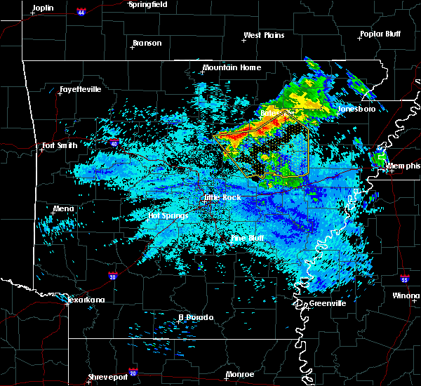 At 925 am cdt, severe thunderstorms were located along a line extending from 6 miles northeast of newark to pleasant plains to near greers ferry, moving southeast at 50 mph (radar indicated). Hazards include 60 mph wind gusts and penny size hail. expect damage to roofs, siding, and trees At 925 am cdt, severe thunderstorms were located along a line extending from 6 miles northeast of newark to pleasant plains to near greers ferry, moving southeast at 50 mph (radar indicated). Hazards include 60 mph wind gusts and penny size hail. expect damage to roofs, siding, and trees
|
| 7/6/2018 3:37 PM CDT |
 At 337 pm cdt, a severe thunderstorm was located over newark, or 12 miles west of newport, moving south at 15 mph (radar indicated). Hazards include 60 mph wind gusts and penny size hail. expect damage to roofs, siding, and trees At 337 pm cdt, a severe thunderstorm was located over newark, or 12 miles west of newport, moving south at 15 mph (radar indicated). Hazards include 60 mph wind gusts and penny size hail. expect damage to roofs, siding, and trees
|
| 5/28/2018 3:44 PM CDT |
 At 332 pm cdt, a severe thunderstorm was located 7 miles southeast of pleasant plains, or 17 miles southwest of newport, moving southwest at 30 mph (radar indicated). Hazards include 60 mph wind gusts and quarter size hail. Hail damage to vehicles is expected. Expect wind damage to roofs, siding, and trees. At 332 pm cdt, a severe thunderstorm was located 7 miles southeast of pleasant plains, or 17 miles southwest of newport, moving southwest at 30 mph (radar indicated). Hazards include 60 mph wind gusts and quarter size hail. Hail damage to vehicles is expected. Expect wind damage to roofs, siding, and trees.
|
| 5/28/2018 3:33 PM CDT |
 At 332 pm cdt, a severe thunderstorm was located 7 miles southeast of pleasant plains, or 17 miles southwest of newport, moving southwest at 30 mph (radar indicated). Hazards include 60 mph wind gusts and quarter size hail. Hail damage to vehicles is expected. Expect wind damage to roofs, siding, and trees. At 332 pm cdt, a severe thunderstorm was located 7 miles southeast of pleasant plains, or 17 miles southwest of newport, moving southwest at 30 mph (radar indicated). Hazards include 60 mph wind gusts and quarter size hail. Hail damage to vehicles is expected. Expect wind damage to roofs, siding, and trees.
|
| 5/3/2018 4:09 PM CDT |
 The severe thunderstorm warning for independence, central jackson, north central white and southeastern sharp counties will expire at 415 pm cdt, the storms which prompted the warning have weakened below severe limits, and no longer pose an immediate threat to life or property. therefore, the warning will be allowed to expire. however gusty winds are still possible with these thunderstorms. a severe thunderstorm watch remains in effect until 600 pm cdt for eastern, central and north central arkansas. The severe thunderstorm warning for independence, central jackson, north central white and southeastern sharp counties will expire at 415 pm cdt, the storms which prompted the warning have weakened below severe limits, and no longer pose an immediate threat to life or property. therefore, the warning will be allowed to expire. however gusty winds are still possible with these thunderstorms. a severe thunderstorm watch remains in effect until 600 pm cdt for eastern, central and north central arkansas.
|
| 5/3/2018 3:57 PM CDT |
 A severe thunderstorm warning remains in effect until 415 pm cdt for independence. central jackson. north central white and southeastern sharp counties. At 357 pm cdt, severe thunderstorms were located along a line extending from 6 miles northeast of concord to near southside in independence county to near pleasant plains, moving northeast at 45. A severe thunderstorm warning remains in effect until 415 pm cdt for independence. central jackson. north central white and southeastern sharp counties. At 357 pm cdt, severe thunderstorms were located along a line extending from 6 miles northeast of concord to near southside in independence county to near pleasant plains, moving northeast at 45.
|
| 5/3/2018 3:36 PM CDT |
 At 335 pm cdt, a severe thunderstorm was located 7 miles north of pangburn, or 9 miles east of heber springs, moving northeast at 70 mph (radar indicated). Hazards include 60 mph wind gusts. expect damage to roofs, siding, and trees At 335 pm cdt, a severe thunderstorm was located 7 miles north of pangburn, or 9 miles east of heber springs, moving northeast at 70 mph (radar indicated). Hazards include 60 mph wind gusts. expect damage to roofs, siding, and trees
|
| 4/13/2018 10:34 PM CDT |
 At 1033 pm cdt, severe thunderstorms were located along a line extending from 6 miles east of hardy to 7 miles northwest of lynn to oil trough to steprock, moving east at 40 mph (radar indicated). Hazards include 60 mph wind gusts. Expect damage to roofs, siding, and trees. Locations impacted include, batesville, newport, tuckerman, diaz, newark, swifton, pleasant plains, oil trough, jacksonport, magness, moorefield, salado, steprock, southside in independence count, bradford, sulphur rock, campbell station, weldon, williford, aetna, a tornado watch remains in effect until 600 am cdt for eastern, central and north central arkansas. At 1033 pm cdt, severe thunderstorms were located along a line extending from 6 miles east of hardy to 7 miles northwest of lynn to oil trough to steprock, moving east at 40 mph (radar indicated). Hazards include 60 mph wind gusts. Expect damage to roofs, siding, and trees. Locations impacted include, batesville, newport, tuckerman, diaz, newark, swifton, pleasant plains, oil trough, jacksonport, magness, moorefield, salado, steprock, southside in independence count, bradford, sulphur rock, campbell station, weldon, williford, aetna, a tornado watch remains in effect until 600 am cdt for eastern, central and north central arkansas.
|
| 4/13/2018 10:09 PM CDT |
 At 1008 pm cdt, severe thunderstorms were located along a line extending from ash flat to near sidney to near concord to 6 miles west of pangburn, moving east at 35 mph (radar indicated). Hazards include 60 mph wind gusts. expect damage to roofs, siding, and trees At 1008 pm cdt, severe thunderstorms were located along a line extending from ash flat to near sidney to near concord to 6 miles west of pangburn, moving east at 35 mph (radar indicated). Hazards include 60 mph wind gusts. expect damage to roofs, siding, and trees
|
| 4/13/2018 9:32 PM CDT |
 At 932 pm cdt, severe thunderstorms were located along a line extending from near salem in fulton county to near brandenberg to near fairfield bay to fairbanks, moving east at 40 mph (radar indicated). Hazards include 60 mph wind gusts and penny size hail. expect damage to roofs, siding, and trees At 932 pm cdt, severe thunderstorms were located along a line extending from near salem in fulton county to near brandenberg to near fairfield bay to fairbanks, moving east at 40 mph (radar indicated). Hazards include 60 mph wind gusts and penny size hail. expect damage to roofs, siding, and trees
|
| 4/3/2018 4:15 PM CDT | Quarter sized hail reported 0.3 miles NNW of Pleasant Plains, AR |
| 2/24/2018 4:27 PM CST |
 At 426 pm cst, severe thunderstorms were located along a line extending from near batesville to near salado to near oil trough to near bald knob, moving northeast at 75 mph (radar indicated). Hazards include 60 mph wind gusts. Expect damage to roofs, siding, and trees. locations impacted include, searcy, batesville, newport, augusta, bald knob, judsonia, tuckerman, kensett, diaz, newark, swifton, higginson, grubbs, pleasant plains, oil trough, russell, jacksonport, magness, tupelo, moorefield, this includes us highway 67 between mile markers 44 and 101. A tornado watch remains in effect until 600 pm cst for eastern, central and north central arkansas. At 426 pm cst, severe thunderstorms were located along a line extending from near batesville to near salado to near oil trough to near bald knob, moving northeast at 75 mph (radar indicated). Hazards include 60 mph wind gusts. Expect damage to roofs, siding, and trees. locations impacted include, searcy, batesville, newport, augusta, bald knob, judsonia, tuckerman, kensett, diaz, newark, swifton, higginson, grubbs, pleasant plains, oil trough, russell, jacksonport, magness, tupelo, moorefield, this includes us highway 67 between mile markers 44 and 101. A tornado watch remains in effect until 600 pm cst for eastern, central and north central arkansas.
|
| 2/24/2018 4:14 PM CST |
 At 413 pm cst, severe thunderstorms were located along a line extending from near concord to 9 miles west of pleasant plains to near steprock to near crosby, moving northeast at 45 mph (radar indicated). Hazards include 60 mph wind gusts. expect damage to roofs, siding, and trees At 413 pm cst, severe thunderstorms were located along a line extending from near concord to 9 miles west of pleasant plains to near steprock to near crosby, moving northeast at 45 mph (radar indicated). Hazards include 60 mph wind gusts. expect damage to roofs, siding, and trees
|
| 6/23/2017 3:57 PM CDT |
 The severe thunderstorm warning for south central stone, southwestern independence, southwestern jackson, cleburne and white counties will expire at 400 pm cdt, the storm which prompted the warning has weakened below severe limits, and no longer poses an immediate threat to life or property. therefore, the warning will be allowed to expire. however gusty winds and heavy rain are still possible with this thunderstorm. a severe thunderstorm watch remains in effect until 900 pm cdt for central, eastern and north central arkansas. The severe thunderstorm warning for south central stone, southwestern independence, southwestern jackson, cleburne and white counties will expire at 400 pm cdt, the storm which prompted the warning has weakened below severe limits, and no longer poses an immediate threat to life or property. therefore, the warning will be allowed to expire. however gusty winds and heavy rain are still possible with this thunderstorm. a severe thunderstorm watch remains in effect until 900 pm cdt for central, eastern and north central arkansas.
|
| 6/23/2017 3:17 PM CDT |
 At 317 pm cdt, a severe thunderstorm was located over heber springs, moving southeast at 55 mph (radar indicated). Hazards include 60 mph wind gusts and half dollar size hail. Hail damage to vehicles is expected. Expect wind damage to roofs, siding, and trees. At 317 pm cdt, a severe thunderstorm was located over heber springs, moving southeast at 55 mph (radar indicated). Hazards include 60 mph wind gusts and half dollar size hail. Hail damage to vehicles is expected. Expect wind damage to roofs, siding, and trees.
|
| 5/19/2017 6:50 PM CDT | Quarter sized hail reported 0.3 miles NNW of Pleasant Plains, AR |
| 5/19/2017 5:55 PM CDT |
 At 555 pm cdt, a severe thunderstorm was located over pleasant plains, or 16 miles south of batesville, moving north at 25 mph (radar indicated). Hazards include golf ball size hail and 60 mph wind gusts. People and animals outdoors will be injured. expect hail damage to roofs, siding, windows, and vehicles. expect wind damage to roofs, siding, and trees. Locations impacted include, batesville, newark, pleasant plains, oil trough, magness, moorefield, salado, southside in independence count, sulphur rock, bethesda, thida, rosie, desha, gainesboro, heffington, locust grove, huff, hutchinson, denmark, roosevelt,. At 555 pm cdt, a severe thunderstorm was located over pleasant plains, or 16 miles south of batesville, moving north at 25 mph (radar indicated). Hazards include golf ball size hail and 60 mph wind gusts. People and animals outdoors will be injured. expect hail damage to roofs, siding, windows, and vehicles. expect wind damage to roofs, siding, and trees. Locations impacted include, batesville, newark, pleasant plains, oil trough, magness, moorefield, salado, southside in independence count, sulphur rock, bethesda, thida, rosie, desha, gainesboro, heffington, locust grove, huff, hutchinson, denmark, roosevelt,.
|
| 5/19/2017 5:50 PM CDT | Quarter sized hail reported 0.3 miles NNW of Pleasant Plains, AR |
| 5/19/2017 5:45 PM CDT |
 At 544 pm cdt, a severe thunderstorm was located near steprock, or 16 miles north of searcy, moving north at 25 mph (radar indicated). Hazards include 60 mph wind gusts and quarter size hail. Hail damage to vehicles is expected. Expect wind damage to roofs, siding, and trees. At 544 pm cdt, a severe thunderstorm was located near steprock, or 16 miles north of searcy, moving north at 25 mph (radar indicated). Hazards include 60 mph wind gusts and quarter size hail. Hail damage to vehicles is expected. Expect wind damage to roofs, siding, and trees.
|
| 5/19/2017 4:59 PM CDT |
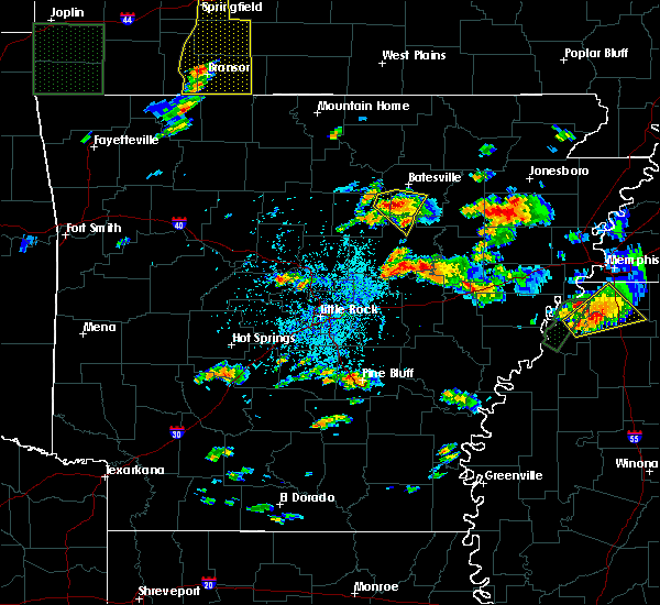 At 459 pm cdt, a severe thunderstorm was located 8 miles west of pleasant plains, or 14 miles east of heber springs, moving north at 25 mph (radar indicated). Hazards include 60 mph wind gusts and quarter size hail. Hail damage to vehicles is expected. expect wind damage to roofs, siding, and trees. Locations impacted include, pleasant plains, concord, southside in independence count, steprock, salado, almond, hickory flat, rosie, locust grove, huff, hutchinson, sunnydale, roosevelt, desha,. At 459 pm cdt, a severe thunderstorm was located 8 miles west of pleasant plains, or 14 miles east of heber springs, moving north at 25 mph (radar indicated). Hazards include 60 mph wind gusts and quarter size hail. Hail damage to vehicles is expected. expect wind damage to roofs, siding, and trees. Locations impacted include, pleasant plains, concord, southside in independence count, steprock, salado, almond, hickory flat, rosie, locust grove, huff, hutchinson, sunnydale, roosevelt, desha,.
|
| 5/19/2017 4:38 PM CDT |
 At 438 pm cdt, a severe thunderstorm was located over pangburn, or 11 miles southeast of heber springs, moving north at 25 mph (radar indicated). Hazards include 60 mph wind gusts and quarter size hail. Hail damage to vehicles is expected. Expect wind damage to roofs, siding, and trees. At 438 pm cdt, a severe thunderstorm was located over pangburn, or 11 miles southeast of heber springs, moving north at 25 mph (radar indicated). Hazards include 60 mph wind gusts and quarter size hail. Hail damage to vehicles is expected. Expect wind damage to roofs, siding, and trees.
|
| 4/29/2017 11:11 PM CDT |
 At 1110 pm cdt, severe thunderstorms were located along a line extending from near concord to near pleasant plains to pangburn, moving northeast at 40 mph (radar indicated). Hazards include 60 mph wind gusts and penny size hail. expect damage to roofs, siding, and trees At 1110 pm cdt, severe thunderstorms were located along a line extending from near concord to near pleasant plains to pangburn, moving northeast at 40 mph (radar indicated). Hazards include 60 mph wind gusts and penny size hail. expect damage to roofs, siding, and trees
|
| 4/29/2017 10:34 PM CDT |
 At 1034 pm cdt, a severe thunderstorm was located near pleasant plains, or 18 miles northeast of searcy, moving northeast at 35 mph (radar indicated). Hazards include 60 mph wind gusts and quarter size hail. Hail damage to vehicles is expected. expect wind damage to roofs, siding, and trees. Locations impacted include, batesville, newport, tuckerman, diaz, newark, pleasant plains, oil trough, jacksonport, magness, moorefield, steprock, salado, southside in independence count, bradford, sulphur rock, campbell station, thida, charlotte, heffington, huff, this includes us highway 67 between mile markers 86 and 87. At 1034 pm cdt, a severe thunderstorm was located near pleasant plains, or 18 miles northeast of searcy, moving northeast at 35 mph (radar indicated). Hazards include 60 mph wind gusts and quarter size hail. Hail damage to vehicles is expected. expect wind damage to roofs, siding, and trees. Locations impacted include, batesville, newport, tuckerman, diaz, newark, pleasant plains, oil trough, jacksonport, magness, moorefield, steprock, salado, southside in independence count, bradford, sulphur rock, campbell station, thida, charlotte, heffington, huff, this includes us highway 67 between mile markers 86 and 87.
|
| 4/29/2017 10:24 PM CDT |
 At 1024 pm cdt, a severe thunderstorm was located near steprock, or 12 miles northeast of searcy, moving northeast at 40 mph (radar indicated). Hazards include ping pong ball size hail and 60 mph wind gusts. People and animals outdoors will be injured. expect hail damage to roofs, siding, windows, and vehicles. Expect wind damage to roofs, siding, and trees. At 1024 pm cdt, a severe thunderstorm was located near steprock, or 12 miles northeast of searcy, moving northeast at 40 mph (radar indicated). Hazards include ping pong ball size hail and 60 mph wind gusts. People and animals outdoors will be injured. expect hail damage to roofs, siding, windows, and vehicles. Expect wind damage to roofs, siding, and trees.
|
| 4/29/2017 10:19 PM CDT |
 At 1019 pm cdt, a severe thunderstorm was located near steprock, or 10 miles northeast of searcy, moving north at 45 mph (radar indicated). Hazards include ping pong ball size hail and 60 mph wind gusts. People and animals outdoors will be injured. expect hail damage to roofs, siding, windows, and vehicles. expect wind damage to roofs, siding, and trees. Locations impacted include, searcy, bald knob, judsonia, pleasant plains, steprock, albion, hickory flat, clay, thida, providence, dewey, heffington, hutchinson, denmark, sunnydale, velvet ridge, roosevelt, plainview in white county, huff, this includes us highway 67 between mile markers 47 and 56. At 1019 pm cdt, a severe thunderstorm was located near steprock, or 10 miles northeast of searcy, moving north at 45 mph (radar indicated). Hazards include ping pong ball size hail and 60 mph wind gusts. People and animals outdoors will be injured. expect hail damage to roofs, siding, windows, and vehicles. expect wind damage to roofs, siding, and trees. Locations impacted include, searcy, bald knob, judsonia, pleasant plains, steprock, albion, hickory flat, clay, thida, providence, dewey, heffington, hutchinson, denmark, sunnydale, velvet ridge, roosevelt, plainview in white county, huff, this includes us highway 67 between mile markers 47 and 56.
|
| 4/29/2017 10:06 PM CDT |
 At 1006 pm cdt, a severe thunderstorm was located over searcy, moving northeast at 40 mph (radar indicated). Hazards include 60 mph wind gusts and quarter size hail. Hail damage to vehicles is expected. expect wind damage to roofs, siding, and trees. Locations impacted include, searcy, bald knob, judsonia, kensett, higginson, pleasant plains, west point, crosby, steprock, letona, albion, hickory flat, thida, dewey, heffington, armstrong springs, velvet ridge, roosevelt, plainview in white county, clay, this includes us highway 67 between mile markers 38 and 56. At 1006 pm cdt, a severe thunderstorm was located over searcy, moving northeast at 40 mph (radar indicated). Hazards include 60 mph wind gusts and quarter size hail. Hail damage to vehicles is expected. expect wind damage to roofs, siding, and trees. Locations impacted include, searcy, bald knob, judsonia, kensett, higginson, pleasant plains, west point, crosby, steprock, letona, albion, hickory flat, thida, dewey, heffington, armstrong springs, velvet ridge, roosevelt, plainview in white county, clay, this includes us highway 67 between mile markers 38 and 56.
|
| 4/29/2017 9:51 PM CDT |
 At 950 pm cdt, a severe thunderstorm was located over mcrae, or 10 miles southwest of searcy, moving north at 45 mph (radar indicated). Hazards include 60 mph wind gusts and quarter size hail. Hail damage to vehicles is expected. Expect wind damage to roofs, siding, and trees. At 950 pm cdt, a severe thunderstorm was located over mcrae, or 10 miles southwest of searcy, moving north at 45 mph (radar indicated). Hazards include 60 mph wind gusts and quarter size hail. Hail damage to vehicles is expected. Expect wind damage to roofs, siding, and trees.
|
| 3/25/2017 12:14 AM CDT |
 At 1213 am cdt, a severe thunderstorm was located over russell, or 11 miles northwest of augusta, moving northeast at 50 mph (radar indicated). Hazards include 60 mph wind gusts. expect damage to roofs, siding, and trees At 1213 am cdt, a severe thunderstorm was located over russell, or 11 miles northwest of augusta, moving northeast at 50 mph (radar indicated). Hazards include 60 mph wind gusts. expect damage to roofs, siding, and trees
|
| 3/9/2017 10:11 PM CST |
 At 1011 pm cst, a severe thunderstorm was located near pleasant plains, or 11 miles south of batesville, moving southeast at 45 mph (radar indicated). Hazards include 60 mph wind gusts and half dollar size hail. Hail damage to vehicles is expected. Expect wind damage to roofs, siding, and trees. At 1011 pm cst, a severe thunderstorm was located near pleasant plains, or 11 miles south of batesville, moving southeast at 45 mph (radar indicated). Hazards include 60 mph wind gusts and half dollar size hail. Hail damage to vehicles is expected. Expect wind damage to roofs, siding, and trees.
|
| 3/9/2017 10:03 PM CST |
 At 1002 pm cst, a severe thunderstorm was located near southside in independence county, or 10 miles south of batesville, moving southeast at 60 mph (radar indicated). Hazards include 60 mph wind gusts and quarter size hail. Hail damage to vehicles is expected. expect wind damage to roofs, siding, and trees. Locations impacted include, batesville, pleasant plains, oil trough, concord, magness, salado, southside in independence count, almond, rosie, desha, locust grove, huff, hutchinson, roosevelt,. At 1002 pm cst, a severe thunderstorm was located near southside in independence county, or 10 miles south of batesville, moving southeast at 60 mph (radar indicated). Hazards include 60 mph wind gusts and quarter size hail. Hail damage to vehicles is expected. expect wind damage to roofs, siding, and trees. Locations impacted include, batesville, pleasant plains, oil trough, concord, magness, salado, southside in independence count, almond, rosie, desha, locust grove, huff, hutchinson, roosevelt,.
|
| 3/9/2017 10:01 PM CST |
 At 1000 pm cst, a severe thunderstorm capable of producing a tornado was located near concord, or 11 miles southwest of batesville, moving southeast at 50 mph (radar indicated rotation). Hazards include tornado and half dollar size hail. Flying debris will be dangerous to those caught without shelter. mobile homes will be damaged or destroyed. damage to roofs, windows, and vehicles will occur. tree damage is likely. Locations impacted include, batesville, newark, pleasant plains, concord, magness, moorefield, salado, southside in independence count, sulphur rock, almond, rosie, desha, locust grove, huff, hutchinson,. At 1000 pm cst, a severe thunderstorm capable of producing a tornado was located near concord, or 11 miles southwest of batesville, moving southeast at 50 mph (radar indicated rotation). Hazards include tornado and half dollar size hail. Flying debris will be dangerous to those caught without shelter. mobile homes will be damaged or destroyed. damage to roofs, windows, and vehicles will occur. tree damage is likely. Locations impacted include, batesville, newark, pleasant plains, concord, magness, moorefield, salado, southside in independence count, sulphur rock, almond, rosie, desha, locust grove, huff, hutchinson,.
|
| 3/9/2017 9:41 PM CST |
 At 941 pm cst, a severe thunderstorm capable of producing a tornado was located 8 miles southeast of mountain view, moving southeast at 50 mph (radar indicated rotation). Hazards include tornado and half dollar size hail. Flying debris will be dangerous to those caught without shelter. mobile homes will be damaged or destroyed. damage to roofs, windows, and vehicles will occur. Tree damage is likely. At 941 pm cst, a severe thunderstorm capable of producing a tornado was located 8 miles southeast of mountain view, moving southeast at 50 mph (radar indicated rotation). Hazards include tornado and half dollar size hail. Flying debris will be dangerous to those caught without shelter. mobile homes will be damaged or destroyed. damage to roofs, windows, and vehicles will occur. Tree damage is likely.
|
| 3/9/2017 9:35 PM CST |
 At 934 pm cst, a severe thunderstorm was located near mountain view, moving southeast at 50 mph (radar indicated). Hazards include 60 mph wind gusts and half dollar size hail. Hail damage to vehicles is expected. Expect wind damage to roofs, siding, and trees. At 934 pm cst, a severe thunderstorm was located near mountain view, moving southeast at 50 mph (radar indicated). Hazards include 60 mph wind gusts and half dollar size hail. Hail damage to vehicles is expected. Expect wind damage to roofs, siding, and trees.
|
| 3/1/2017 3:05 AM CST |
 At 304 am cst, a line of severe thunderstorms were located along a line extending from near ash flat to near steprock, moving east at 75 mph (emergency management). Hazards include 70 mph wind gusts and nickel size hail. Expect considerable tree damage. Damage is likely to mobile homes, roofs, and outbuildings. At 304 am cst, a line of severe thunderstorms were located along a line extending from near ash flat to near steprock, moving east at 75 mph (emergency management). Hazards include 70 mph wind gusts and nickel size hail. Expect considerable tree damage. Damage is likely to mobile homes, roofs, and outbuildings.
|
| 3/1/2017 2:58 AM CST |
 At 256 am cst, a line of severe thunderstorms were located along a line extending from horseshoe bend to near heber springs, moving east at 65 mph (emergency management). Hazards include 70 mph wind gusts and nickel size hail. Expect considerable tree damage. damage is likely to mobile homes, roofs, and outbuildings. Locations impacted include, batesville, heber springs, cherokee village, melbourne, ash flat, horseshoe bend, cave city, newark, highland in sharp county, greers ferry, hardy, quitman, guy, oxford, pangburn, rose bud, cushman, mount pleasant, pleasant plains, twin groves, a tornado watch remains in effect until 600 am cst for central, eastern and north central arkansas. At 256 am cst, a line of severe thunderstorms were located along a line extending from horseshoe bend to near heber springs, moving east at 65 mph (emergency management). Hazards include 70 mph wind gusts and nickel size hail. Expect considerable tree damage. damage is likely to mobile homes, roofs, and outbuildings. Locations impacted include, batesville, heber springs, cherokee village, melbourne, ash flat, horseshoe bend, cave city, newark, highland in sharp county, greers ferry, hardy, quitman, guy, oxford, pangburn, rose bud, cushman, mount pleasant, pleasant plains, twin groves, a tornado watch remains in effect until 600 am cst for central, eastern and north central arkansas.
|
| 3/1/2017 2:47 AM CST |
 At 246 am cst, severe thunderstorms were located along a line extending from oxford to near heber springs, moving east at 65 mph (emergency management). Hazards include 70 mph wind gusts and nickel size hail. Expect considerable tree damage. damage is likely to mobile homes, roofs, and outbuildings. Locations impacted include, batesville, heber springs, cherokee village, mountain view, clinton, fairfield bay, melbourne, ash flat, horseshoe bend, cave city, calico rock, newark, highland in sharp county, greers ferry, hardy, quitman, guy, oxford, pangburn, rose bud, a tornado watch remains in effect until 600 am cst for central, eastern and north central arkansas. At 246 am cst, severe thunderstorms were located along a line extending from oxford to near heber springs, moving east at 65 mph (emergency management). Hazards include 70 mph wind gusts and nickel size hail. Expect considerable tree damage. damage is likely to mobile homes, roofs, and outbuildings. Locations impacted include, batesville, heber springs, cherokee village, mountain view, clinton, fairfield bay, melbourne, ash flat, horseshoe bend, cave city, calico rock, newark, highland in sharp county, greers ferry, hardy, quitman, guy, oxford, pangburn, rose bud, a tornado watch remains in effect until 600 am cst for central, eastern and north central arkansas.
|
| 3/1/2017 2:27 AM CST |
 At 227 am cst, severe thunderstorms were located along a line extending from herron to near whipple, moving east at 65 mph (radar indicated). Hazards include 70 mph wind gusts and nickel size hail. Expect considerable tree damage. Damage is likely to mobile homes, roofs, and outbuildings. At 227 am cst, severe thunderstorms were located along a line extending from herron to near whipple, moving east at 65 mph (radar indicated). Hazards include 70 mph wind gusts and nickel size hail. Expect considerable tree damage. Damage is likely to mobile homes, roofs, and outbuildings.
|
| 12/17/2016 4:10 PM CST |
 At 409 pm cst, a severe thunderstorm was located 8 miles south of oil trough, or 12 miles southwest of newport, moving northeast at 60 mph (radar indicated). Hazards include 60 mph wind gusts and penny size hail. Expect damage to roofs, siding, and trees. locations impacted include, searcy, newport, bald knob, judsonia, tuckerman, diaz, swifton, grubbs, pleasant plains, oil trough, russell, jacksonport, algoa, steprock, bradford, letona, campbell station, amagon, balch, albion, this includes us highway 67 between mile markers 49 and 54, and between mile markers 58 and 100. A tornado watch remains in effect until 900 pm cst for eastern and central arkansas. At 409 pm cst, a severe thunderstorm was located 8 miles south of oil trough, or 12 miles southwest of newport, moving northeast at 60 mph (radar indicated). Hazards include 60 mph wind gusts and penny size hail. Expect damage to roofs, siding, and trees. locations impacted include, searcy, newport, bald knob, judsonia, tuckerman, diaz, swifton, grubbs, pleasant plains, oil trough, russell, jacksonport, algoa, steprock, bradford, letona, campbell station, amagon, balch, albion, this includes us highway 67 between mile markers 49 and 54, and between mile markers 58 and 100. A tornado watch remains in effect until 900 pm cst for eastern and central arkansas.
|
| 12/17/2016 3:50 PM CST |
 At 349 pm cst, a severe thunderstorm was located near steprock, or 8 miles north of searcy, moving northeast at 55 mph (radar indicated). Hazards include 60 mph wind gusts and nickel size hail. expect damage to roofs, siding, and trees At 349 pm cst, a severe thunderstorm was located near steprock, or 8 miles north of searcy, moving northeast at 55 mph (radar indicated). Hazards include 60 mph wind gusts and nickel size hail. expect damage to roofs, siding, and trees
|
| 7/29/2016 1:41 PM CDT |
 At 141 pm cdt, a severe thunderstorm was located near pangburn, or 14 miles east of heber springs, moving east at 20 mph (radar indicated). Hazards include 60 mph wind gusts. Expect damage to roofs. siding. And trees. At 141 pm cdt, a severe thunderstorm was located near pangburn, or 14 miles east of heber springs, moving east at 20 mph (radar indicated). Hazards include 60 mph wind gusts. Expect damage to roofs. siding. And trees.
|
| 6/15/2016 7:16 PM CDT |
 At 715 pm cdt, a severe thunderstorm was located near pleasant plains, or 10 miles south of batesville, moving south at 15 mph (radar indicated). Hazards include 60 mph wind gusts and half dollar size hail. Hail damage to vehicles is expected. Expect wind damage to roofs, siding, and trees. At 715 pm cdt, a severe thunderstorm was located near pleasant plains, or 10 miles south of batesville, moving south at 15 mph (radar indicated). Hazards include 60 mph wind gusts and half dollar size hail. Hail damage to vehicles is expected. Expect wind damage to roofs, siding, and trees.
|
| 6/15/2016 6:51 PM CDT |
 At 650 pm cdt, severe thunderstorms were located along a line extending from near southside in independence county to near algoa, moving south at 25 mph (radar indicated). Hazards include up to golf ball size hail...especially just to the south of batesville, and 60 mph wind gusts. People and animals outdoors will be injured. expect hail damage to roofs, siding, windows, and vehicles. expect wind damage to roofs, siding, and trees. Locations impacted include, batesville, newport, diaz, newark, grubbs, pleasant plains, oil trough, jacksonport, magness, tupelo, moorefield, algoa, salado, southside in independence count, steprock, mcfadden, bradford, sulphur rock, campbell station, bethesda,. At 650 pm cdt, severe thunderstorms were located along a line extending from near southside in independence county to near algoa, moving south at 25 mph (radar indicated). Hazards include up to golf ball size hail...especially just to the south of batesville, and 60 mph wind gusts. People and animals outdoors will be injured. expect hail damage to roofs, siding, windows, and vehicles. expect wind damage to roofs, siding, and trees. Locations impacted include, batesville, newport, diaz, newark, grubbs, pleasant plains, oil trough, jacksonport, magness, tupelo, moorefield, algoa, salado, southside in independence count, steprock, mcfadden, bradford, sulphur rock, campbell station, bethesda,.
|
| 6/15/2016 6:30 PM CDT |
 At 630 pm cdt, severe thunderstorms were located along a line extending from near batesville to near grubbs, moving south at 25 mph (radar indicated). Hazards include 60 mph wind gusts and quarter size hail. Hail damage to vehicles is expected. Expect wind damage to roofs, siding, and trees. At 630 pm cdt, severe thunderstorms were located along a line extending from near batesville to near grubbs, moving south at 25 mph (radar indicated). Hazards include 60 mph wind gusts and quarter size hail. Hail damage to vehicles is expected. Expect wind damage to roofs, siding, and trees.
|
| 12/23/2015 9:05 AM CST | At 905 am cst, severe thunderstorms were located along a line extending from 7 miles south of mammoth spring to near batesville to 6 miles west of pangburn, moving northeast at 45 mph (radar indicated). Hazards include 60 mph wind gusts. Expect damage to roofs. siding. and trees. locations impacted include, batesville, cherokee village, ash flat, horseshoe bend, cave city, highland in sharp county, mammoth spring, hardy, pangburn, mount pleasant, pleasant plains, concord, magness, sidney, moorefield, ballard, mammoth spring state park, southside in independence county, myron and salado. A tornado watch remains in effect until 100 pm cst for northeastern arkansas. |
| 12/23/2015 8:37 AM CST | At 837 am cst, severe thunderstorms were located along a line extending from near byron to 10 miles west of concord to woolly hollow state park, moving northeast at 50 mph (radar indicated). Hazards include 60 mph wind gusts. Expect damage to roofs. siding. And trees. |
| 11/17/2015 3:47 PM CST |
 At 347 pm cst, severe thunderstorms were located along a line extending from steprock to near west point to near barrettsville, moving northeast at 45 mph (radar indicated). Hazards include 60 mph wind gusts. Expect damage to roofs. Siding and trees. At 347 pm cst, severe thunderstorms were located along a line extending from steprock to near west point to near barrettsville, moving northeast at 45 mph (radar indicated). Hazards include 60 mph wind gusts. Expect damage to roofs. Siding and trees.
|
| 5/25/2015 10:14 PM CDT | At 1013 pm cdt, severe thunderstorms were located along a line extending from 5 miles southwest of batesville to pleasant plains to west point, and moving northeast at 50 mph (radar indicated). Hazards include 60 mph wind gusts and penny size hail. Expect damage to roofs. Siding and trees. |
| 5/25/2015 9:55 PM CDT | At 952 pm cdt, severe thunderstorms were located along a line extending from 7 miles northeast of heber springs to steprock to higginson, and moving northeast at 45 mph (radar indicated). Hazards include 60 mph wind gusts and penny size hail. Expect damage to roofs. Siding and trees. |
| 5/25/2015 9:39 PM CDT | At 935 pm cdt, severe thunderstorms were located along a line extending from 5 miles south of greers ferry lake to gravel hill to mcrae, and moving northeast at 45 mph (radar indicated). Hazards include 60 mph wind gusts and penny size hail. Expect damage to roofs. Siding and trees. |
| 5/24/2015 5:38 PM CDT | At 536 pm cdt, severe thunderstorms were located along a line extending from 7 miles south of herpel to 7 miles west of pleasant plains to pryor, and moving northeast at 45 mph (radar indicated). Hazards include 60 mph wind gusts. Expect considerable tree damage. Damage is likely to mobile homes, roofs and outbuildings. |
| 5/24/2015 5:37 PM CDT | At 536 pm cdt, severe thunderstorms were located along a line extending from lone star to 7 miles southwest of cushman to 7 miles northwest of pleasant plains to bald knob, and moving northeast at 50 mph (radar indicated). Hazards include 60 mph wind gusts. Expect damage to roofs. Siding and trees. |
| 5/24/2015 5:19 PM CDT | At 517 pm cdt, severe thunderstorms were located along a line extending from greers ferry to heber springs to pangburn to mcrae, and moving northeast at 45 mph (radar indicated). Hazards include 70 mph wind gusts. Expect considerable tree damage. Damage is likely to mobile homes, roofs and outbuildings. |
| 5/24/2015 5:04 PM CDT | At 502 pm cdt, severe thunderstorms were located along a line extending from quitman to rose bud to 6 miles southeast of gravel hill to 6 miles southeast of sylvania, and moving northeast at 45 mph (radar indicated). Hazards include 70 mph wind gusts. Expect considerable tree damage. Damage is likely to mobile homes, roofs and outbuildings. |
| 5/10/2015 2:50 AM CDT | At 246 am cdt, a severe thunderstorm was located near concord, and moving east at 50 mph (radar indicated). Hazards include 60 mph wind gusts and quarter size hail. Hail damage to vehicles is expected. Expect wind damage to roofs, siding and trees. |
| 5/10/2015 2:36 AM CDT | At 232 am cdt, a severe thunderstorm was located 6 miles north of heber springs, and moving east at 50 mph (radar indicated). Hazards include 60 mph wind gusts and quarter size hail. Hail damage to vehicles is expected. Expect wind damage to roofs, siding and trees. |
| 4/19/2015 7:02 PM CDT | Large tree limbs dow in independence county AR, 0.3 miles NNW of Pleasant Plains, AR |
| 4/19/2015 7:01 PM CDT | At 659 pm cdt, severe thunderstorms were located along a line extending from pleasant plains to 7 miles east of steprock to judsonia, and moving east at 50 mph (radar indicated). Hazards include 70 mph wind gusts and half dollar size hail. Hail damage to vehicles is expected. expect considerable tree damage. Wind damage is also likely to mobile homes, roofs and outbuildings. |
| 4/19/2015 6:42 PM CDT | The national weather service in little rock has issued a * severe thunderstorm warning for. east central cleburne county in north central arkansas. southern independence county in north central arkansas. jackson county in eastern arkansas. Northeastern white county in central arkansas. |
| 4/9/2015 9:37 PM CDT | A severe thunderstorm warning remains in effect for northeastern jackson and southeastern independence counties until 1000 pm cdt. at 934 pm cdt. severe thunderstorms were located along a line extending from 7 miles southeast of strawberry to diaz to 6 miles southeast of oil trough. and moving east at 50 mph. hazard. 60 mph wind gusts. |
| 4/9/2015 9:26 PM CDT | The national weather service in little rock has issued a * severe thunderstorm warning for. eastern independence county in north central arkansas. northeastern jackson county in eastern arkansas. until 1000 pm cdt * at 923 pm cdt. Severe thunderstorms were located along a line. |
| 4/9/2015 6:58 PM CDT | Golf Ball sized hail reported 0.3 miles NNW of Pleasant Plains, AR |
| 4/9/2015 6:55 PM CDT | The national weather service in little rock has issued a * severe thunderstorm warning for. southern independence county in north central arkansas. southern jackson county in eastern arkansas. north central white county in central arkansas. Until 745 pm cdt. |
| 4/9/2015 6:30 PM CDT | The national weather service in little rock has issued a * severe thunderstorm warning for. east central cleburne county in north central arkansas. south central independence county in north central arkansas. extreme southwestern jackson county in eastern arkansas. North central white county in central arkansas. |
| 7/23/2014 4:00 PM CDT | A tree fell onto a brand new school bu in independence county AR, 0.3 miles NNW of Pleasant Plains, AR |
| 7/8/2012 2:43 PM CDT | Thunderstorm winds hit a truck broadside...pushing it off the road and into a ditc in independence county AR, 1.1 miles S of Pleasant Plains, AR |
| 1/1/0001 12:00 AM | Trees and power lines were blown down along u.s. hwy 16 in white county AR, 5 miles NNW of Pleasant Plains, AR |
| 1/1/0001 12:00 AM | Quarter sized hail reported 6.5 miles SSE of Pleasant Plains, AR |
Hail Maps for Pleasant Plains, AR
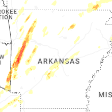


Connect with Interactive Hail Maps