

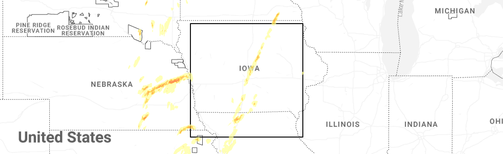
Hail Map for Pleasanton, IA
The Pleasanton, IA area has had 0 reports of on-the-ground hail by trained spotters, and has been under severe weather warnings 12 times during the past 12 months. Doppler radar has detected hail at or near Pleasanton, IA on 55 occasions, including 1 occasion during the past year.
| Name: | Pleasanton, IA |
| Where Located: | 70 miles S of Des Moines, IA |
| Map: | Google Map for Pleasanton, IA |
| Population: | 49 |
| Housing Units: | 26 |
| More Info: | Search Google for Pleasanton, IA |
0
The Top Recent Hail Date for Pleasanton, IA is Monday, May 19, 2025 (33rd out of 55)
Hail and Wind Damage Spotted near Pleasanton, IA
| Date / Time | Report Details |
|---|---|
| 4/2/2025 1:54 AM CDT |
 The storms which prompted the warning have weakened below severe limits, and no longer pose an immediate threat to life or property. therefore, the warning will be allowed to expire. however, gusty winds around 50 mph are still possible with these thunderstorms. a severe thunderstorm watch remains in effect until 300 am cdt for north central and northwestern missouri. The storms which prompted the warning have weakened below severe limits, and no longer pose an immediate threat to life or property. therefore, the warning will be allowed to expire. however, gusty winds around 50 mph are still possible with these thunderstorms. a severe thunderstorm watch remains in effect until 300 am cdt for north central and northwestern missouri.
|
| 4/2/2025 1:30 AM CDT |
 Svreax the national weather service in pleasant hill has issued a * severe thunderstorm warning for, northwestern daviess county in north central missouri, northwestern grundy county in north central missouri, southeastern gentry county in northwestern missouri, western mercer county in north central missouri, harrison county in north central missouri, northern dekalb county in northwestern missouri, * until 200 am cdt. * at 129 am cdt, severe thunderstorms were located along a line extending from 9 miles west of eagleville to 6 miles south of new hampton to near clarksdale, moving east at 45 mph (radar indicated). Hazards include 60 mph wind gusts. expect damage to roofs, siding, and trees Svreax the national weather service in pleasant hill has issued a * severe thunderstorm warning for, northwestern daviess county in north central missouri, northwestern grundy county in north central missouri, southeastern gentry county in northwestern missouri, western mercer county in north central missouri, harrison county in north central missouri, northern dekalb county in northwestern missouri, * until 200 am cdt. * at 129 am cdt, severe thunderstorms were located along a line extending from 9 miles west of eagleville to 6 miles south of new hampton to near clarksdale, moving east at 45 mph (radar indicated). Hazards include 60 mph wind gusts. expect damage to roofs, siding, and trees
|
| 3/14/2025 5:01 PM CDT |
 Svrdmx the national weather service in des moines has issued a * severe thunderstorm warning for, lucas county in south central iowa, decatur county in south central iowa, madison county in south central iowa, southern marion county in south central iowa, union county in south central iowa, western wayne county in south central iowa, northeastern ringgold county in south central iowa, clarke county in south central iowa, warren county in south central iowa, * until 545 pm cdt. * at 500 pm cdt, severe thunderstorms were located along a line extending from 4 miles southwest of macksburg to 4 miles west of woodburn to near lineville, moving north at 65 mph (radar indicated). Hazards include 70 mph wind gusts and nickel size hail. Expect considerable tree damage. Damage is likely to mobile homes, roofs, and outbuildings. Svrdmx the national weather service in des moines has issued a * severe thunderstorm warning for, lucas county in south central iowa, decatur county in south central iowa, madison county in south central iowa, southern marion county in south central iowa, union county in south central iowa, western wayne county in south central iowa, northeastern ringgold county in south central iowa, clarke county in south central iowa, warren county in south central iowa, * until 545 pm cdt. * at 500 pm cdt, severe thunderstorms were located along a line extending from 4 miles southwest of macksburg to 4 miles west of woodburn to near lineville, moving north at 65 mph (radar indicated). Hazards include 70 mph wind gusts and nickel size hail. Expect considerable tree damage. Damage is likely to mobile homes, roofs, and outbuildings.
|
| 3/14/2025 4:45 PM CDT |
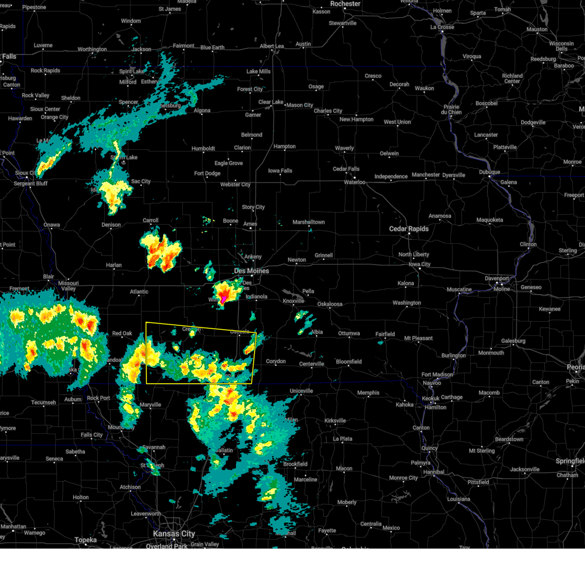 At 445 pm cdt, severe thunderstorms were located along a line extending from near nodaway to near diagonal to 4 miles south of leon, moving north at 65 mph (radar indicated). Hazards include 60 mph wind gusts and nickel size hail. Expect damage to roofs, siding, and trees. locations impacted include, sun valley lake, ellston, pleasanton, creston municipal airport, shannon city, osceola, arispe, green valley lake, nine eagles state park, lamoni municipal airport, green valley lake state park, mt ayr municipal airport, leon, tingley, lake of three fires state park, beaconsfield, redding, sharpsburg, grand river, and afton. This includes interstate 35 between mile markers 2 and 37. At 445 pm cdt, severe thunderstorms were located along a line extending from near nodaway to near diagonal to 4 miles south of leon, moving north at 65 mph (radar indicated). Hazards include 60 mph wind gusts and nickel size hail. Expect damage to roofs, siding, and trees. locations impacted include, sun valley lake, ellston, pleasanton, creston municipal airport, shannon city, osceola, arispe, green valley lake, nine eagles state park, lamoni municipal airport, green valley lake state park, mt ayr municipal airport, leon, tingley, lake of three fires state park, beaconsfield, redding, sharpsburg, grand river, and afton. This includes interstate 35 between mile markers 2 and 37.
|
| 3/14/2025 4:28 PM CDT |
 At 427 pm cdt, severe thunderstorms were located along a line extending from 5 miles south of new market to near irena to near cainsville, moving north at 65 mph (radar indicated). Hazards include 70 mph wind gusts and nickel size hail. Expect considerable tree damage. damage is likely to mobile homes, roofs, and outbuildings. locations impacted include, sun valley lake, ellston, pleasanton, creston municipal airport, shannon city, osceola, arispe, green valley lake, nine eagles state park, lamoni municipal airport, green valley lake state park, mt ayr municipal airport, leon, tingley, lake of three fires state park, beaconsfield, redding, sharpsburg, grand river, and afton. This includes interstate 35 between mile markers 2 and 37. At 427 pm cdt, severe thunderstorms were located along a line extending from 5 miles south of new market to near irena to near cainsville, moving north at 65 mph (radar indicated). Hazards include 70 mph wind gusts and nickel size hail. Expect considerable tree damage. damage is likely to mobile homes, roofs, and outbuildings. locations impacted include, sun valley lake, ellston, pleasanton, creston municipal airport, shannon city, osceola, arispe, green valley lake, nine eagles state park, lamoni municipal airport, green valley lake state park, mt ayr municipal airport, leon, tingley, lake of three fires state park, beaconsfield, redding, sharpsburg, grand river, and afton. This includes interstate 35 between mile markers 2 and 37.
|
| 3/14/2025 4:13 PM CDT |
 Svrdmx the national weather service in des moines has issued a * severe thunderstorm warning for, decatur county in south central iowa, union county in south central iowa, ringgold county in south central iowa, adams county in southwestern iowa, taylor county in southwestern iowa, clarke county in south central iowa, * until 500 pm cdt. * at 412 pm cdt, severe thunderstorms were located along a line extending from 5 miles southwest of pickering to near gentry to near gilman city, moving north at 65 mph (radar indicated). Hazards include 70 mph wind gusts and nickel size hail. Expect considerable tree damage. Damage is likely to mobile homes, roofs, and outbuildings. Svrdmx the national weather service in des moines has issued a * severe thunderstorm warning for, decatur county in south central iowa, union county in south central iowa, ringgold county in south central iowa, adams county in southwestern iowa, taylor county in southwestern iowa, clarke county in south central iowa, * until 500 pm cdt. * at 412 pm cdt, severe thunderstorms were located along a line extending from 5 miles southwest of pickering to near gentry to near gilman city, moving north at 65 mph (radar indicated). Hazards include 70 mph wind gusts and nickel size hail. Expect considerable tree damage. Damage is likely to mobile homes, roofs, and outbuildings.
|
| 7/31/2024 9:07 PM CDT |
 The storm which prompted the warning has weakened below severe limits, and no longer poses an immediate threat to life or property. therefore, the warning will be allowed to expire. a severe thunderstorm watch remains in effect until 100 am cdt for north central missouri. The storm which prompted the warning has weakened below severe limits, and no longer poses an immediate threat to life or property. therefore, the warning will be allowed to expire. a severe thunderstorm watch remains in effect until 100 am cdt for north central missouri.
|
| 7/31/2024 8:59 PM CDT |
 The storms which prompted the warning have weakened below severe limits, and no longer pose an immediate threat to life or property. therefore, the warning will be allowed to expire. a severe thunderstorm watch remains in effect until 100 am cdt for south central and southeastern iowa. The storms which prompted the warning have weakened below severe limits, and no longer pose an immediate threat to life or property. therefore, the warning will be allowed to expire. a severe thunderstorm watch remains in effect until 100 am cdt for south central and southeastern iowa.
|
| 7/31/2024 8:47 PM CDT |
 the severe thunderstorm warning has been cancelled and is no longer in effect the severe thunderstorm warning has been cancelled and is no longer in effect
|
| 7/31/2024 8:47 PM CDT |
 At 845 pm cdt, severe thunderstorms were located along a line extending from 4 miles east of melcher-dallas to 6 miles east of millerton to near south lineville, moving east at 50 mph (radar indicated). Hazards include 60 mph wind gusts. Expect damage to roofs, siding, and trees. locations impacted include, oskaloosa, centerville, osceola, chariton, albia, leon, corydon, lamoni, melcher-dallas, eddyville, lake sundown, rathbun lake, seymour, moravia, moulton, russell, lovilia, allerton, humeston, and beacon. This includes interstate 35 between mile markers 1 and 30. At 845 pm cdt, severe thunderstorms were located along a line extending from 4 miles east of melcher-dallas to 6 miles east of millerton to near south lineville, moving east at 50 mph (radar indicated). Hazards include 60 mph wind gusts. Expect damage to roofs, siding, and trees. locations impacted include, oskaloosa, centerville, osceola, chariton, albia, leon, corydon, lamoni, melcher-dallas, eddyville, lake sundown, rathbun lake, seymour, moravia, moulton, russell, lovilia, allerton, humeston, and beacon. This includes interstate 35 between mile markers 1 and 30.
|
| 7/31/2024 8:30 PM CDT |
 Svreax the national weather service in pleasant hill has issued a * severe thunderstorm warning for, northwestern sullivan county in north central missouri, mercer county in north central missouri, western putnam county in north central missouri, northern harrison county in north central missouri, * until 915 pm cdt. * at 830 pm cdt, a severe thunderstorm was located near cainsville, or 16 miles south of leon, moving east at 45 mph (radar indicated). Hazards include 60 mph wind gusts and penny size hail. expect damage to roofs, siding, and trees Svreax the national weather service in pleasant hill has issued a * severe thunderstorm warning for, northwestern sullivan county in north central missouri, mercer county in north central missouri, western putnam county in north central missouri, northern harrison county in north central missouri, * until 915 pm cdt. * at 830 pm cdt, a severe thunderstorm was located near cainsville, or 16 miles south of leon, moving east at 45 mph (radar indicated). Hazards include 60 mph wind gusts and penny size hail. expect damage to roofs, siding, and trees
|
| 7/31/2024 8:21 PM CDT |
 Svrdmx the national weather service in des moines has issued a * severe thunderstorm warning for, monroe county in south central iowa, lucas county in south central iowa, decatur county in south central iowa, southeastern madison county in south central iowa, southern marion county in south central iowa, wayne county in south central iowa, southwestern mahaska county in south central iowa, southeastern ringgold county in south central iowa, appanoose county in south central iowa, clarke county in south central iowa, southern warren county in south central iowa, * until 900 pm cdt. * at 821 pm cdt, severe thunderstorms were located along a line extending from near otter creek county park to humeston to near nine eagles state park, moving east at 70 mph (radar indicated). Hazards include 60 mph wind gusts. lamoni airport gusted to 59 mph. expect damage to roofs, siding, and trees Svrdmx the national weather service in des moines has issued a * severe thunderstorm warning for, monroe county in south central iowa, lucas county in south central iowa, decatur county in south central iowa, southeastern madison county in south central iowa, southern marion county in south central iowa, wayne county in south central iowa, southwestern mahaska county in south central iowa, southeastern ringgold county in south central iowa, appanoose county in south central iowa, clarke county in south central iowa, southern warren county in south central iowa, * until 900 pm cdt. * at 821 pm cdt, severe thunderstorms were located along a line extending from near otter creek county park to humeston to near nine eagles state park, moving east at 70 mph (radar indicated). Hazards include 60 mph wind gusts. lamoni airport gusted to 59 mph. expect damage to roofs, siding, and trees
|
| 7/2/2024 5:15 PM CDT |
 At 514 pm cdt, a severe thunderstorm was located over cainsville, or 16 miles northeast of bethany, moving northeast at 30 mph. additional severe storms were located east of the cities of princeton and mercer, moving northeast at 30 mph (radar indicated). Hazards include 60 mph wind gusts and quarter size hail. Hail damage to vehicles is expected. expect wind damage to roofs, siding, and trees. Locations impacted include, princeton, ridgeway, mercer, cainsville, mount moriah, pleasanton, south lineville, modena, and mill grove. At 514 pm cdt, a severe thunderstorm was located over cainsville, or 16 miles northeast of bethany, moving northeast at 30 mph. additional severe storms were located east of the cities of princeton and mercer, moving northeast at 30 mph (radar indicated). Hazards include 60 mph wind gusts and quarter size hail. Hail damage to vehicles is expected. expect wind damage to roofs, siding, and trees. Locations impacted include, princeton, ridgeway, mercer, cainsville, mount moriah, pleasanton, south lineville, modena, and mill grove.
|
| 7/2/2024 5:03 PM CDT |
 At 502 pm cdt, a severe thunderstorm was located near ridgeway, or 10 miles northeast of bethany, moving northeast at 30 mph. additional severe thunderstorms are located near the cities of princeton and mercer moving northeast at 30 mph (radar indicated). Hazards include 60 mph wind gusts and quarter size hail. Hail damage to vehicles is expected. expect wind damage to roofs, siding, and trees. locations impacted include, bethany, princeton, ridgeway, mercer, eagleville, cainsville, blythedale, mount moriah, pleasanton, south lineville, modena, and mill grove. This includes interstate 35 in missouri between mile markers 89 and 114. At 502 pm cdt, a severe thunderstorm was located near ridgeway, or 10 miles northeast of bethany, moving northeast at 30 mph. additional severe thunderstorms are located near the cities of princeton and mercer moving northeast at 30 mph (radar indicated). Hazards include 60 mph wind gusts and quarter size hail. Hail damage to vehicles is expected. expect wind damage to roofs, siding, and trees. locations impacted include, bethany, princeton, ridgeway, mercer, eagleville, cainsville, blythedale, mount moriah, pleasanton, south lineville, modena, and mill grove. This includes interstate 35 in missouri between mile markers 89 and 114.
|
| 7/2/2024 4:42 PM CDT |
 the severe thunderstorm warning has been cancelled and is no longer in effect the severe thunderstorm warning has been cancelled and is no longer in effect
|
| 7/2/2024 4:42 PM CDT |
 At 440 pm cdt, a severe thunderstorm was located over bethany, moving northeast at 30 mph. additional severe thunderstorms were located near the city of mercer headed northeast at 30 mph (radar indicated). Hazards include 60 mph wind gusts and quarter size hail. Hail damage to vehicles is expected. expect wind damage to roofs, siding, and trees. locations impacted include, bethany, princeton, ridgeway, mercer, eagleville, new hampton, cainsville, blythedale, mount moriah, pleasanton, south lineville, modena, mill grove, and martinsville. This includes interstate 35 in missouri between mile markers 83 and 114. At 440 pm cdt, a severe thunderstorm was located over bethany, moving northeast at 30 mph. additional severe thunderstorms were located near the city of mercer headed northeast at 30 mph (radar indicated). Hazards include 60 mph wind gusts and quarter size hail. Hail damage to vehicles is expected. expect wind damage to roofs, siding, and trees. locations impacted include, bethany, princeton, ridgeway, mercer, eagleville, new hampton, cainsville, blythedale, mount moriah, pleasanton, south lineville, modena, mill grove, and martinsville. This includes interstate 35 in missouri between mile markers 83 and 114.
|
| 7/2/2024 4:28 PM CDT |
 Svreax the national weather service in pleasant hill has issued a * severe thunderstorm warning for, northeastern gentry county in northwestern missouri, mercer county in north central missouri, harrison county in north central missouri, * until 530 pm cdt. * at 427 pm cdt, a severe thunderstorms was located near new hampton, or 8 miles southwest of bethany, moving northeast at 30 mph. other strong to severe thunderstorms were located in portion of mercer county moving northeast at 30 mph (radar indicated). Hazards include 60 mph wind gusts and quarter size hail. Hail damage to vehicles is expected. Expect wind damage to roofs, siding, and trees. Svreax the national weather service in pleasant hill has issued a * severe thunderstorm warning for, northeastern gentry county in northwestern missouri, mercer county in north central missouri, harrison county in north central missouri, * until 530 pm cdt. * at 427 pm cdt, a severe thunderstorms was located near new hampton, or 8 miles southwest of bethany, moving northeast at 30 mph. other strong to severe thunderstorms were located in portion of mercer county moving northeast at 30 mph (radar indicated). Hazards include 60 mph wind gusts and quarter size hail. Hail damage to vehicles is expected. Expect wind damage to roofs, siding, and trees.
|
| 6/26/2024 12:27 AM CDT |
 The storms which prompted the warning have moved out of the area. therefore, the warning will be allowed to expire. however, gusty winds and heavy rain are still possible with these thunderstorms. a severe thunderstorm watch remains in effect until 700 am cdt for north central and northwestern missouri. The storms which prompted the warning have moved out of the area. therefore, the warning will be allowed to expire. however, gusty winds and heavy rain are still possible with these thunderstorms. a severe thunderstorm watch remains in effect until 700 am cdt for north central and northwestern missouri.
|
| 6/25/2024 11:56 PM CDT |
 At 1155 pm cdt, severe thunderstorms were located along a line extending from near cainsville to near new hampton to near albany to 10 miles southeast of maryville, moving southeast at 65 mph (law enforcement 70 mph winds in albany). Hazards include 70 mph wind gusts and nickel size hail. Expect considerable tree damage. damage is likely to mobile homes, roofs, and outbuildings. locations impacted include, maryville, bethany, albany, stanberry, princeton, king city, ridgeway, ravenwood, gilman city, pattonsburg, mercer, eagleville, new hampton, cainsville, spickard, barnard, conception junction, blythedale, bolckow, and coffey. This includes interstate 35 in missouri between mile markers 75 and 107. At 1155 pm cdt, severe thunderstorms were located along a line extending from near cainsville to near new hampton to near albany to 10 miles southeast of maryville, moving southeast at 65 mph (law enforcement 70 mph winds in albany). Hazards include 70 mph wind gusts and nickel size hail. Expect considerable tree damage. damage is likely to mobile homes, roofs, and outbuildings. locations impacted include, maryville, bethany, albany, stanberry, princeton, king city, ridgeway, ravenwood, gilman city, pattonsburg, mercer, eagleville, new hampton, cainsville, spickard, barnard, conception junction, blythedale, bolckow, and coffey. This includes interstate 35 in missouri between mile markers 75 and 107.
|
| 6/25/2024 11:44 PM CDT |
 the severe thunderstorm warning has been cancelled and is no longer in effect the severe thunderstorm warning has been cancelled and is no longer in effect
|
| 6/25/2024 11:36 PM CDT |
 Svreax the national weather service in pleasant hill has issued a * severe thunderstorm warning for, northern daviess county in north central missouri, northwestern grundy county in north central missouri, gentry county in northwestern missouri, mercer county in north central missouri, harrison county in north central missouri, southeastern nodaway county in northwestern missouri, northeastern andrew county in northwestern missouri, * until 1230 am cdt. * at 1135 pm cdt, severe thunderstorms were located along a line extending from near lamoni to grant city to near ravenwood, moving southeast at 45 mph (radar indicated). Hazards include 70 mph wind gusts and nickel size hail. Expect considerable tree damage. Damage is likely to mobile homes, roofs, and outbuildings. Svreax the national weather service in pleasant hill has issued a * severe thunderstorm warning for, northern daviess county in north central missouri, northwestern grundy county in north central missouri, gentry county in northwestern missouri, mercer county in north central missouri, harrison county in north central missouri, southeastern nodaway county in northwestern missouri, northeastern andrew county in northwestern missouri, * until 1230 am cdt. * at 1135 pm cdt, severe thunderstorms were located along a line extending from near lamoni to grant city to near ravenwood, moving southeast at 45 mph (radar indicated). Hazards include 70 mph wind gusts and nickel size hail. Expect considerable tree damage. Damage is likely to mobile homes, roofs, and outbuildings.
|
| 6/25/2024 11:25 PM CDT |
 At 1124 pm cdt, a severe thunderstorm was located over shannon city, or 12 miles north of mount ayr, moving southeast at 45 mph (radar indicated). Hazards include 60 mph wind gusts and nickel size hail. Expect damage to roofs, siding, and trees. locations impacted include, leon, mount ayr, lamoni, lenox, sun valley lake, clearfield, diagonal, kellerton, grand river, van wert, davis city, decatur city, tingley, sharpsburg, pleasanton, ellston, benton, conway, beaconsfield, and nine eagles state park. This includes interstate 35 between mile markers 3 and 24. At 1124 pm cdt, a severe thunderstorm was located over shannon city, or 12 miles north of mount ayr, moving southeast at 45 mph (radar indicated). Hazards include 60 mph wind gusts and nickel size hail. Expect damage to roofs, siding, and trees. locations impacted include, leon, mount ayr, lamoni, lenox, sun valley lake, clearfield, diagonal, kellerton, grand river, van wert, davis city, decatur city, tingley, sharpsburg, pleasanton, ellston, benton, conway, beaconsfield, and nine eagles state park. This includes interstate 35 between mile markers 3 and 24.
|
| 6/25/2024 11:25 PM CDT |
 the severe thunderstorm warning has been cancelled and is no longer in effect the severe thunderstorm warning has been cancelled and is no longer in effect
|
| 6/25/2024 10:56 PM CDT |
 Svrdmx the national weather service in des moines has issued a * severe thunderstorm warning for, decatur county in south central iowa, southern union county in south central iowa, ringgold county in south central iowa, adams county in southwestern iowa, northern taylor county in southwestern iowa, southwestern clarke county in south central iowa, * until midnight cdt. * at 1055 pm cdt, a severe thunderstorm was located over corning, moving southeast at 45 mph (radar indicated). Hazards include 60 mph wind gusts and nickel size hail. expect damage to roofs, siding, and trees Svrdmx the national weather service in des moines has issued a * severe thunderstorm warning for, decatur county in south central iowa, southern union county in south central iowa, ringgold county in south central iowa, adams county in southwestern iowa, northern taylor county in southwestern iowa, southwestern clarke county in south central iowa, * until midnight cdt. * at 1055 pm cdt, a severe thunderstorm was located over corning, moving southeast at 45 mph (radar indicated). Hazards include 60 mph wind gusts and nickel size hail. expect damage to roofs, siding, and trees
|
| 6/25/2024 10:16 PM CDT |
 Svrdmx the national weather service in des moines has issued a * severe thunderstorm warning for, western decatur county in south central iowa, southern union county in south central iowa, ringgold county in south central iowa, adams county in southwestern iowa, northern taylor county in southwestern iowa, southwestern clarke county in south central iowa, * until 1100 pm cdt. * at 1016 pm cdt, a cluster of severe thunderstorms were located 5 miles southwest of beaconsfield, or 6 miles northeast of mount ayr, moving east at 20 mph (radar indicated). Hazards include 60 mph wind gusts and quarter size hail. Hail damage to vehicles is expected. Expect wind damage to roofs, siding, and trees. Svrdmx the national weather service in des moines has issued a * severe thunderstorm warning for, western decatur county in south central iowa, southern union county in south central iowa, ringgold county in south central iowa, adams county in southwestern iowa, northern taylor county in southwestern iowa, southwestern clarke county in south central iowa, * until 1100 pm cdt. * at 1016 pm cdt, a cluster of severe thunderstorms were located 5 miles southwest of beaconsfield, or 6 miles northeast of mount ayr, moving east at 20 mph (radar indicated). Hazards include 60 mph wind gusts and quarter size hail. Hail damage to vehicles is expected. Expect wind damage to roofs, siding, and trees.
|
| 5/26/2024 9:25 PM CDT |
 The storm which prompted the warning has moved out of the area. therefore, the warning will be allowed to expire. The storm which prompted the warning has moved out of the area. therefore, the warning will be allowed to expire.
|
| 5/26/2024 8:44 PM CDT |
 Svreax the national weather service in pleasant hill has issued a * severe thunderstorm warning for, northwestern mercer county in north central missouri, * until 930 pm cdt. * at 843 pm cdt, a severe thunderstorm was located 9 miles northwest of mercer, or 10 miles southeast of leon, moving southeast at 25 mph (radar indicated). Hazards include 60 mph wind gusts and quarter size hail. Hail damage to vehicles is expected. Expect wind damage to roofs, siding, and trees. Svreax the national weather service in pleasant hill has issued a * severe thunderstorm warning for, northwestern mercer county in north central missouri, * until 930 pm cdt. * at 843 pm cdt, a severe thunderstorm was located 9 miles northwest of mercer, or 10 miles southeast of leon, moving southeast at 25 mph (radar indicated). Hazards include 60 mph wind gusts and quarter size hail. Hail damage to vehicles is expected. Expect wind damage to roofs, siding, and trees.
|
| 5/21/2024 4:09 PM CDT |
 Svreax the national weather service in pleasant hill has issued a * severe thunderstorm warning for, northwestern mercer county in north central missouri, southeastern harrison county in north central missouri, * until 445 pm cdt. * at 408 pm cdt, a severe thunderstorm was located near pattonsburg, or 11 miles south of bethany, moving northeast at 85 mph (radar indicated). Hazards include 60 mph wind gusts and quarter size hail. Hail damage to vehicles is expected. Expect wind damage to roofs, siding, and trees. Svreax the national weather service in pleasant hill has issued a * severe thunderstorm warning for, northwestern mercer county in north central missouri, southeastern harrison county in north central missouri, * until 445 pm cdt. * at 408 pm cdt, a severe thunderstorm was located near pattonsburg, or 11 miles south of bethany, moving northeast at 85 mph (radar indicated). Hazards include 60 mph wind gusts and quarter size hail. Hail damage to vehicles is expected. Expect wind damage to roofs, siding, and trees.
|
| 5/7/2024 12:33 AM CDT |
 Svrdmx the national weather service in des moines has issued a * severe thunderstorm warning for, lucas county in south central iowa, decatur county in south central iowa, southeastern madison county in south central iowa, wayne county in south central iowa, clarke county in south central iowa, southwestern warren county in south central iowa, * until 115 am cdt. * at 1232 am cdt, severe thunderstorms were located along a line extending from 5 miles south of murray roadside rest area to nine eagles state park, moving north at 65 mph (radar indicated). Hazards include 60 mph wind gusts and penny size hail. expect damage to roofs, siding, and trees Svrdmx the national weather service in des moines has issued a * severe thunderstorm warning for, lucas county in south central iowa, decatur county in south central iowa, southeastern madison county in south central iowa, wayne county in south central iowa, clarke county in south central iowa, southwestern warren county in south central iowa, * until 115 am cdt. * at 1232 am cdt, severe thunderstorms were located along a line extending from 5 miles south of murray roadside rest area to nine eagles state park, moving north at 65 mph (radar indicated). Hazards include 60 mph wind gusts and penny size hail. expect damage to roofs, siding, and trees
|
| 5/7/2024 12:21 AM CDT |
 Svreax the national weather service in pleasant hill has issued a * severe thunderstorm warning for, northwestern chariton county in north central missouri, eastern daviess county in north central missouri, linn county in north central missouri, grundy county in north central missouri, sullivan county in north central missouri, mercer county in north central missouri, western putnam county in north central missouri, harrison county in north central missouri, northeastern caldwell county in north central missouri, livingston county in north central missouri, * until 115 am cdt. * at 1220 am cdt, severe thunderstorms were located along a line extending from near eagleville to near braymer, moving northeast at 45 mph (radar indicated). Hazards include 60 mph wind gusts. expect damage to roofs, siding, and trees Svreax the national weather service in pleasant hill has issued a * severe thunderstorm warning for, northwestern chariton county in north central missouri, eastern daviess county in north central missouri, linn county in north central missouri, grundy county in north central missouri, sullivan county in north central missouri, mercer county in north central missouri, western putnam county in north central missouri, harrison county in north central missouri, northeastern caldwell county in north central missouri, livingston county in north central missouri, * until 115 am cdt. * at 1220 am cdt, severe thunderstorms were located along a line extending from near eagleville to near braymer, moving northeast at 45 mph (radar indicated). Hazards include 60 mph wind gusts. expect damage to roofs, siding, and trees
|
| 7/12/2023 8:30 AM CDT |
 At 829 am cdt, severe thunderstorms were located along a line extending from near russell to near clio to near ridgeway, moving east at 60 mph (radar indicated). Hazards include 60 mph wind gusts and nickel size hail. Expect damage to roofs, siding, and trees. locations impacted include, rathbun lake, russell, melrose, honey creek state park and rathbun. hail threat, radar indicated max hail size, 0. 88 in wind threat, radar indicated max wind gust, 60 mph. At 829 am cdt, severe thunderstorms were located along a line extending from near russell to near clio to near ridgeway, moving east at 60 mph (radar indicated). Hazards include 60 mph wind gusts and nickel size hail. Expect damage to roofs, siding, and trees. locations impacted include, rathbun lake, russell, melrose, honey creek state park and rathbun. hail threat, radar indicated max hail size, 0. 88 in wind threat, radar indicated max wind gust, 60 mph.
|
| 7/12/2023 8:07 AM CDT |
 At 807 am cdt, severe thunderstorms were located along a line extending from 6 miles northeast of leon to near lamoni to near grant city, moving southeast at 65 mph (radar indicated). Hazards include 60 mph wind gusts and penny size hail. expect damage to roofs, siding, and trees At 807 am cdt, severe thunderstorms were located along a line extending from 6 miles northeast of leon to near lamoni to near grant city, moving southeast at 65 mph (radar indicated). Hazards include 60 mph wind gusts and penny size hail. expect damage to roofs, siding, and trees
|
| 7/12/2023 7:59 AM CDT |
 At 759 am cdt, severe thunderstorms were located along a line extending from near osceola to near decatur city to irena, moving east at 60 mph (radar indicated). Hazards include 60 mph wind gusts and nickel size hail. Expect damage to roofs, siding, and trees. severe thunderstorms will be near, leon, woodburn, decatur city and weldon around 805 am cdt. davis city, le roy and nine eagles state park around 810 am cdt. humeston and derby around 815 am cdt. other locations in the path of these severe thunderstorms include allerton, lineville, clio, millerton, rathbun lake, promise city, plano, mystic, numa, rathbun and honey creek state park. this includes interstate 35 between mile markers 1 and 33. hail threat, radar indicated max hail size, 0. 88 in wind threat, radar indicated max wind gust, 60 mph. At 759 am cdt, severe thunderstorms were located along a line extending from near osceola to near decatur city to irena, moving east at 60 mph (radar indicated). Hazards include 60 mph wind gusts and nickel size hail. Expect damage to roofs, siding, and trees. severe thunderstorms will be near, leon, woodburn, decatur city and weldon around 805 am cdt. davis city, le roy and nine eagles state park around 810 am cdt. humeston and derby around 815 am cdt. other locations in the path of these severe thunderstorms include allerton, lineville, clio, millerton, rathbun lake, promise city, plano, mystic, numa, rathbun and honey creek state park. this includes interstate 35 between mile markers 1 and 33. hail threat, radar indicated max hail size, 0. 88 in wind threat, radar indicated max wind gust, 60 mph.
|
| 7/12/2023 7:22 AM CDT |
 At 720 am cdt, severe thunderstorms were located along a line extending from 4 miles east of orient to near kent to near yorktown, moving southeast at 65 mph (radar indicated). Hazards include 60 mph wind gusts. expect damage to roofs, siding, and trees At 720 am cdt, severe thunderstorms were located along a line extending from 4 miles east of orient to near kent to near yorktown, moving southeast at 65 mph (radar indicated). Hazards include 60 mph wind gusts. expect damage to roofs, siding, and trees
|
| 6/30/2023 7:25 AM CDT |
 At 724 am cdt, severe thunderstorms were located along a line extending from macksburg to lamoni, moving east at 50 mph (law enforcement). Hazards include 70 mph wind gusts and quarter size hail. Hail damage to vehicles is expected. expect considerable tree damage. wind damage is also likely to mobile homes, roofs, and outbuildings. these severe storms will be near, davis city around 730 am cdt. other locations in the path of these severe thunderstorms include leon, decatur city, pleasanton, nine eagles state park, east peru, truro, st. charles, st. marys, clio, allerton, indianola, corydon, lake ahquabi state park and otter creek county park. this includes interstate 35 between mile markers 1 and 52. thunderstorm damage threat, considerable hail threat, radar indicated max hail size, 1. 00 in wind threat, observed max wind gust, 70 mph. At 724 am cdt, severe thunderstorms were located along a line extending from macksburg to lamoni, moving east at 50 mph (law enforcement). Hazards include 70 mph wind gusts and quarter size hail. Hail damage to vehicles is expected. expect considerable tree damage. wind damage is also likely to mobile homes, roofs, and outbuildings. these severe storms will be near, davis city around 730 am cdt. other locations in the path of these severe thunderstorms include leon, decatur city, pleasanton, nine eagles state park, east peru, truro, st. charles, st. marys, clio, allerton, indianola, corydon, lake ahquabi state park and otter creek county park. this includes interstate 35 between mile markers 1 and 52. thunderstorm damage threat, considerable hail threat, radar indicated max hail size, 1. 00 in wind threat, observed max wind gust, 70 mph.
|
| 6/30/2023 7:25 AM CDT |
 At 725 am cdt, severe thunderstorms were located along a line extending from 9 miles east of lamoni to 11 miles east of eagleville to near cainsville, moving east at 45 mph (public). Hazards include 60 mph wind gusts. Expect damage to roofs, siding, and trees. locations impacted include, unionville, princeton, mercer, cainsville, newtown, pollock, mount moriah, lucerne, powersville, pleasanton, south lineville and lemons. hail threat, radar indicated max hail size, <. 75 in wind threat, observed max wind gust, 60 mph. At 725 am cdt, severe thunderstorms were located along a line extending from 9 miles east of lamoni to 11 miles east of eagleville to near cainsville, moving east at 45 mph (public). Hazards include 60 mph wind gusts. Expect damage to roofs, siding, and trees. locations impacted include, unionville, princeton, mercer, cainsville, newtown, pollock, mount moriah, lucerne, powersville, pleasanton, south lineville and lemons. hail threat, radar indicated max hail size, <. 75 in wind threat, observed max wind gust, 60 mph.
|
| 6/30/2023 7:21 AM CDT |
 At 720 am cdt, severe thunderstorms were located along a line extending from 8 miles southeast of lamoni to near cainsville to near ridgeway, moving east at 50 mph (radar indicated). Hazards include 60 mph wind gusts. expect damage to roofs, siding, and trees At 720 am cdt, severe thunderstorms were located along a line extending from 8 miles southeast of lamoni to near cainsville to near ridgeway, moving east at 50 mph (radar indicated). Hazards include 60 mph wind gusts. expect damage to roofs, siding, and trees
|
| 6/30/2023 7:15 AM CDT |
 At 715 am cdt, severe thunderstorms were located along a line extending from near lamoni to near eagleville to near ridgeway, moving east at 45 mph (radar indicated). Hazards include 60 mph wind gusts and penny size hail. Expect damage to roofs, siding, and trees. locations impacted include, ridgeway, eagleville, cainsville, blythedale and pleasanton. this includes interstate 35 in missouri between mile markers 97 and 114. hail threat, radar indicated max hail size, 0. 75 in wind threat, radar indicated max wind gust, 60 mph. At 715 am cdt, severe thunderstorms were located along a line extending from near lamoni to near eagleville to near ridgeway, moving east at 45 mph (radar indicated). Hazards include 60 mph wind gusts and penny size hail. Expect damage to roofs, siding, and trees. locations impacted include, ridgeway, eagleville, cainsville, blythedale and pleasanton. this includes interstate 35 in missouri between mile markers 97 and 114. hail threat, radar indicated max hail size, 0. 75 in wind threat, radar indicated max wind gust, 60 mph.
|
| 6/30/2023 7:10 AM CDT |
 At 709 am cdt, severe thunderstorms were located along a line extending from macksburg to lamoni, moving east at 50 mph (law enforcement). Hazards include 70 mph wind gusts and quarter size hail. Hail damage to vehicles is expected. expect considerable tree damage. wind damage is also likely to mobile homes, roofs, and outbuildings. these severe storms will be near, davis city around 715 am cdt. leon, decatur city, pleasanton and nine eagles state park around 720 am cdt. other locations in the path of these severe thunderstorms include east peru, truro, avenue of the saints event center, st. charles, bevington, st. marys, clio, allerton, indianola, corydon, lake ahquabi state park and otter creek county park. this includes interstate 35 between mile markers 1 and 56. thunderstorm damage threat, considerable hail threat, radar indicated max hail size, 1. 00 in wind threat, observed max wind gust, 70 mph. At 709 am cdt, severe thunderstorms were located along a line extending from macksburg to lamoni, moving east at 50 mph (law enforcement). Hazards include 70 mph wind gusts and quarter size hail. Hail damage to vehicles is expected. expect considerable tree damage. wind damage is also likely to mobile homes, roofs, and outbuildings. these severe storms will be near, davis city around 715 am cdt. leon, decatur city, pleasanton and nine eagles state park around 720 am cdt. other locations in the path of these severe thunderstorms include east peru, truro, avenue of the saints event center, st. charles, bevington, st. marys, clio, allerton, indianola, corydon, lake ahquabi state park and otter creek county park. this includes interstate 35 between mile markers 1 and 56. thunderstorm damage threat, considerable hail threat, radar indicated max hail size, 1. 00 in wind threat, observed max wind gust, 70 mph.
|
| 6/30/2023 7:04 AM CDT |
 At 703 am cdt, severe thunderstorms were located along a line extending from near macksburg to near lamoni, moving east at 50 mph (law enforcement). Hazards include 60 mph wind gusts and quarter size hail. Hail damage to vehicles is expected. expect wind damage to roofs, siding, and trees. severe thunderstorms will be near, lamoni municipal airport around 710 am cdt. lorimor, davis city, decatur city and nine eagles state park around 715 am cdt. leon and pleasanton around 720 am cdt. other locations in the path of these severe thunderstorms include truro, east peru, avenue of the saints event center, st. charles, new virginia, st. marys, bevington, clio, allerton and lake ahquabi state park. this includes interstate 35 between mile markers 1 and 56. hail threat, radar indicated max hail size, 1. 00 in wind threat, observed max wind gust, 60 mph. At 703 am cdt, severe thunderstorms were located along a line extending from near macksburg to near lamoni, moving east at 50 mph (law enforcement). Hazards include 60 mph wind gusts and quarter size hail. Hail damage to vehicles is expected. expect wind damage to roofs, siding, and trees. severe thunderstorms will be near, lamoni municipal airport around 710 am cdt. lorimor, davis city, decatur city and nine eagles state park around 715 am cdt. leon and pleasanton around 720 am cdt. other locations in the path of these severe thunderstorms include truro, east peru, avenue of the saints event center, st. charles, new virginia, st. marys, bevington, clio, allerton and lake ahquabi state park. this includes interstate 35 between mile markers 1 and 56. hail threat, radar indicated max hail size, 1. 00 in wind threat, observed max wind gust, 60 mph.
|
| 6/30/2023 6:52 AM CDT |
 At 651 am cdt, severe thunderstorms were located along a line extending from 6 miles east of irena to 6 miles southeast of grant city to 6 miles north of albany, moving east at 40 mph (radar indicated). Hazards include 60 mph wind gusts and penny size hail. expect damage to roofs, siding, and trees At 651 am cdt, severe thunderstorms were located along a line extending from 6 miles east of irena to 6 miles southeast of grant city to 6 miles north of albany, moving east at 40 mph (radar indicated). Hazards include 60 mph wind gusts and penny size hail. expect damage to roofs, siding, and trees
|
| 6/29/2023 9:08 AM CDT |
 At 906 am cdt, severe thunderstorms were located along a line extending from 8 miles northeast of mercer to near green city to browning, moving east at 50 mph (radar indicated). Hazards include 70 mph wind gusts. Expect considerable tree damage. Damage is likely to mobile homes, roofs, and outbuildings. At 906 am cdt, severe thunderstorms were located along a line extending from 8 miles northeast of mercer to near green city to browning, moving east at 50 mph (radar indicated). Hazards include 70 mph wind gusts. Expect considerable tree damage. Damage is likely to mobile homes, roofs, and outbuildings.
|
| 6/29/2023 9:04 AM CDT |
 At 903 am cdt, a severe thunderstorm was located over leon, moving east at 45 mph (trained weather spotters. the lamoni airport recently reported a gust to 67 mph). Hazards include 60 mph wind gusts. Expect damage to roofs, siding, and trees. this severe thunderstorm will be near, garden grove around 915 am cdt. other locations in the path of this severe thunderstorm include allerton, corydon, millerton, promise city, rathbun lake, plano, mystic and honey creek state park. this includes interstate 35 between mile markers 6 and 20. hail threat, radar indicated max hail size, <. 75 in wind threat, observed max wind gust, 60 mph. At 903 am cdt, a severe thunderstorm was located over leon, moving east at 45 mph (trained weather spotters. the lamoni airport recently reported a gust to 67 mph). Hazards include 60 mph wind gusts. Expect damage to roofs, siding, and trees. this severe thunderstorm will be near, garden grove around 915 am cdt. other locations in the path of this severe thunderstorm include allerton, corydon, millerton, promise city, rathbun lake, plano, mystic and honey creek state park. this includes interstate 35 between mile markers 6 and 20. hail threat, radar indicated max hail size, <. 75 in wind threat, observed max wind gust, 60 mph.
|
| 5/17/2022 5:54 PM CDT |
 The severe thunderstorm warning for decatur county will expire at 600 pm cdt, the storm which prompted the warning has weakened below severe limits, and no longer poses an immediate threat to life or property. therefore, the warning will be allowed to expire. however gusty winds are still possible with this thunderstorm. a severe thunderstorm watch remains in effect until 1000 pm cdt for south central iowa. The severe thunderstorm warning for decatur county will expire at 600 pm cdt, the storm which prompted the warning has weakened below severe limits, and no longer poses an immediate threat to life or property. therefore, the warning will be allowed to expire. however gusty winds are still possible with this thunderstorm. a severe thunderstorm watch remains in effect until 1000 pm cdt for south central iowa.
|
| 5/17/2022 5:36 PM CDT |
 At 535 pm cdt, the strongest part of a severe thunderstorm cluster was located near leon, moving east at 40 mph (radar indicated). Hazards include 60 mph wind gusts and nickel size hail. Expect damage to roofs, siding, and trees. locations impacted include, leon, lamoni, grand river, garden grove, davis city, decatur city, pleasanton, le roy, nine eagles state park and lamoni municipal airport. hail threat, radar indicated max hail size, 0. 88 in wind threat, radar indicated max wind gust, 60 mph. At 535 pm cdt, the strongest part of a severe thunderstorm cluster was located near leon, moving east at 40 mph (radar indicated). Hazards include 60 mph wind gusts and nickel size hail. Expect damage to roofs, siding, and trees. locations impacted include, leon, lamoni, grand river, garden grove, davis city, decatur city, pleasanton, le roy, nine eagles state park and lamoni municipal airport. hail threat, radar indicated max hail size, 0. 88 in wind threat, radar indicated max wind gust, 60 mph.
|
| 5/17/2022 5:17 PM CDT |
 At 517 pm cdt, a severe thunderstorm was located near lamoni, or 12 miles east of mount ayr, moving east at 45 mph (radar indicated). Hazards include 60 mph wind gusts and nickel size hail. expect damage to roofs, siding, and trees At 517 pm cdt, a severe thunderstorm was located near lamoni, or 12 miles east of mount ayr, moving east at 45 mph (radar indicated). Hazards include 60 mph wind gusts and nickel size hail. expect damage to roofs, siding, and trees
|
| 5/17/2022 4:50 PM CDT |
 At 450 pm cdt, a severe thunderstorm was located near mercer, or 16 miles southeast of leon, moving northeast at 20 mph (radar indicated). Hazards include 60 mph wind gusts and quarter size hail. Hail damage to vehicles is expected. Expect wind damage to roofs, siding, and trees. At 450 pm cdt, a severe thunderstorm was located near mercer, or 16 miles southeast of leon, moving northeast at 20 mph (radar indicated). Hazards include 60 mph wind gusts and quarter size hail. Hail damage to vehicles is expected. Expect wind damage to roofs, siding, and trees.
|
| 3/5/2022 5:19 PM CST |
 At 519 pm cst, a severe thunderstorm capable of producing a tornado was located near mercer, or 13 miles southeast of leon, moving northeast at 45 mph (radar indicated rotation). Hazards include tornado and golf ball size hail. Flying debris will be dangerous to those caught without shelter. mobile homes will be damaged or destroyed. damage to roofs, windows, and vehicles will occur. tree damage is likely. Locations impacted include, pleasanton and south lineville. At 519 pm cst, a severe thunderstorm capable of producing a tornado was located near mercer, or 13 miles southeast of leon, moving northeast at 45 mph (radar indicated rotation). Hazards include tornado and golf ball size hail. Flying debris will be dangerous to those caught without shelter. mobile homes will be damaged or destroyed. damage to roofs, windows, and vehicles will occur. tree damage is likely. Locations impacted include, pleasanton and south lineville.
|
| 3/5/2022 5:16 PM CST |
 At 516 pm cst, a severe thunderstorm capable of producing a tornado was located 9 miles northwest of mercer, or 10 miles south of leon, moving northeast at 45 mph (radar indicated rotation). Hazards include tornado and golf ball size hail. Flying debris will be dangerous to those caught without shelter. mobile homes will be damaged or destroyed. damage to roofs, windows, and vehicles will occur. Tree damage is likely. At 516 pm cst, a severe thunderstorm capable of producing a tornado was located 9 miles northwest of mercer, or 10 miles south of leon, moving northeast at 45 mph (radar indicated rotation). Hazards include tornado and golf ball size hail. Flying debris will be dangerous to those caught without shelter. mobile homes will be damaged or destroyed. damage to roofs, windows, and vehicles will occur. Tree damage is likely.
|
| 3/5/2022 5:13 PM CST |
 At 512 pm cst, a severe thunderstorm was located 10 miles south of leon, moving northeast at 50 mph (radar indicated). Hazards include golf ball size hail and 60 mph wind gusts. People and animals outdoors will be injured. expect hail damage to roofs, siding, windows, and vehicles. Expect wind damage to roofs, siding, and trees. At 512 pm cst, a severe thunderstorm was located 10 miles south of leon, moving northeast at 50 mph (radar indicated). Hazards include golf ball size hail and 60 mph wind gusts. People and animals outdoors will be injured. expect hail damage to roofs, siding, windows, and vehicles. Expect wind damage to roofs, siding, and trees.
|
| 3/5/2022 5:13 PM CST |
 At 513 pm cst, a severe thunderstorm capable of producing a tornado was located 8 miles northeast of cainsville, or 13 miles south of leon, moving northeast at 45 mph (radar indicated rotation). Hazards include tornado and golf ball size hail. Flying debris will be dangerous to those caught without shelter. mobile homes will be damaged or destroyed. damage to roofs, windows, and vehicles will occur. Tree damage is likely. At 513 pm cst, a severe thunderstorm capable of producing a tornado was located 8 miles northeast of cainsville, or 13 miles south of leon, moving northeast at 45 mph (radar indicated rotation). Hazards include tornado and golf ball size hail. Flying debris will be dangerous to those caught without shelter. mobile homes will be damaged or destroyed. damage to roofs, windows, and vehicles will occur. Tree damage is likely.
|
| 3/5/2022 5:01 PM CST |
 At 501 pm cst, a severe thunderstorm was located near eagleville, or 16 miles south of leon, moving northeast at 50 mph (radar indicated). Hazards include golf ball size hail and 60 mph wind gusts. People and animals outdoors will be injured. expect hail damage to roofs, siding, windows, and vehicles. expect wind damage to roofs, siding, and trees. locations impacted include, eagleville, cainsville, blythedale and pleasanton. this includes interstate 35 in missouri between mile markers 104 and 114. thunderstorm damage threat, considerable hail threat, radar indicated max hail size, 1. 75 in wind threat, radar indicated max wind gust, 60 mph. At 501 pm cst, a severe thunderstorm was located near eagleville, or 16 miles south of leon, moving northeast at 50 mph (radar indicated). Hazards include golf ball size hail and 60 mph wind gusts. People and animals outdoors will be injured. expect hail damage to roofs, siding, windows, and vehicles. expect wind damage to roofs, siding, and trees. locations impacted include, eagleville, cainsville, blythedale and pleasanton. this includes interstate 35 in missouri between mile markers 104 and 114. thunderstorm damage threat, considerable hail threat, radar indicated max hail size, 1. 75 in wind threat, radar indicated max wind gust, 60 mph.
|
| 3/5/2022 4:56 PM CST |
 At 455 pm cst, a severe thunderstorm was located over eagleville, or 14 miles north of bethany, moving northeast at 55 mph (radar indicated). Hazards include 60 mph wind gusts and quarter size hail. Hail damage to vehicles is expected. Expect wind damage to roofs, siding, and trees. At 455 pm cst, a severe thunderstorm was located over eagleville, or 14 miles north of bethany, moving northeast at 55 mph (radar indicated). Hazards include 60 mph wind gusts and quarter size hail. Hail damage to vehicles is expected. Expect wind damage to roofs, siding, and trees.
|
| 12/15/2021 6:49 PM CST |
 At 649 pm cst, severe thunderstorms were located along a line extending from melcher-dallas to 12 miles south of corydon, moving east at 50 mph (radar indicated). Hazards include 60 mph wind gusts. Expect damage to roofs, siding, and trees. Locations impacted include, chariton, corydon, rathbun lake, seymour, russell, allerton, humeston, lineville, lucas, garden grove, woodburn, williamson, derby, melrose, promise city, clio, plano, marysville, pleasanton and millerton. At 649 pm cst, severe thunderstorms were located along a line extending from melcher-dallas to 12 miles south of corydon, moving east at 50 mph (radar indicated). Hazards include 60 mph wind gusts. Expect damage to roofs, siding, and trees. Locations impacted include, chariton, corydon, rathbun lake, seymour, russell, allerton, humeston, lineville, lucas, garden grove, woodburn, williamson, derby, melrose, promise city, clio, plano, marysville, pleasanton and millerton.
|
| 12/15/2021 6:13 PM CST |
 At 613 pm cst, severe thunderstorms were located along a line extending from near new virginia to 7 miles southeast of lamoni, moving east at 50 mph (radar indicated). Hazards include 60 mph wind gusts. Expect damage to roofs, siding, and trees. these severe thunderstorms will remain over mainly rural areas of western monroe, lucas, decatur, southwestern marion, wayne, western appanoose, clarke and southern warren counties, including the following locations, melrose, red haw lake state park, pleasanton, promise city, clio, williamson, nine eagles state park, decatur city, humeston and lineville. This includes interstate 35 between mile markers 4 and 44. At 613 pm cst, severe thunderstorms were located along a line extending from near new virginia to 7 miles southeast of lamoni, moving east at 50 mph (radar indicated). Hazards include 60 mph wind gusts. Expect damage to roofs, siding, and trees. these severe thunderstorms will remain over mainly rural areas of western monroe, lucas, decatur, southwestern marion, wayne, western appanoose, clarke and southern warren counties, including the following locations, melrose, red haw lake state park, pleasanton, promise city, clio, williamson, nine eagles state park, decatur city, humeston and lineville. This includes interstate 35 between mile markers 4 and 44.
|
| 6/20/2021 7:04 PM CDT |
 At 704 pm cdt, a severe thunderstorm was located 13 miles west of unionville, moving east at 35 mph (radar indicated). Hazards include 60 mph wind gusts and half dollar size hail. Hail damage to vehicles is expected. expect wind damage to roofs, siding, and trees. Locations impacted include, corydon, seymour, allerton, lineville, clio, pleasanton, south lineville and nine eagles state park. At 704 pm cdt, a severe thunderstorm was located 13 miles west of unionville, moving east at 35 mph (radar indicated). Hazards include 60 mph wind gusts and half dollar size hail. Hail damage to vehicles is expected. expect wind damage to roofs, siding, and trees. Locations impacted include, corydon, seymour, allerton, lineville, clio, pleasanton, south lineville and nine eagles state park.
|
| 6/20/2021 6:43 PM CDT |
 At 643 pm cdt, a severe thunderstorm was located near mercer, or 14 miles southwest of corydon, moving east at 40 mph (radar indicated). Hazards include 60 mph wind gusts and half dollar size hail. Hail damage to vehicles is expected. Expect wind damage to roofs, siding, and trees. At 643 pm cdt, a severe thunderstorm was located near mercer, or 14 miles southwest of corydon, moving east at 40 mph (radar indicated). Hazards include 60 mph wind gusts and half dollar size hail. Hail damage to vehicles is expected. Expect wind damage to roofs, siding, and trees.
|
| 6/20/2021 6:04 PM CDT |
 At 604 pm cdt, a severe thunderstorm capable of producing a tornado was located near lamoni, or 8 miles west of leon, moving east at 35 mph (radar indicated rotation). Hazards include tornado and ping pong ball size hail. Flying debris will be dangerous to those caught without shelter. mobile homes will be damaged or destroyed. damage to roofs, windows, and vehicles will occur. tree damage is likely. this dangerous storm will be near, leon around 615 pm cdt. This includes interstate 35 between mile markers 5 and 13. At 604 pm cdt, a severe thunderstorm capable of producing a tornado was located near lamoni, or 8 miles west of leon, moving east at 35 mph (radar indicated rotation). Hazards include tornado and ping pong ball size hail. Flying debris will be dangerous to those caught without shelter. mobile homes will be damaged or destroyed. damage to roofs, windows, and vehicles will occur. tree damage is likely. this dangerous storm will be near, leon around 615 pm cdt. This includes interstate 35 between mile markers 5 and 13.
|
| 6/20/2021 5:59 PM CDT |
 At 559 pm cdt, a severe thunderstorm was located near lamoni, or 9 miles southwest of leon, moving east at 35 mph (radar indicated). Hazards include 60 mph wind gusts and quarter size hail. Hail damage to vehicles is expected. expect wind damage to roofs, siding, and trees. this severe thunderstorm will remain over mainly rural areas of southern decatur and southwestern wayne counties, including the following locations, davis city, south lineville, nine eagles state park, decatur city, lamoni municipal airport, pleasanton, lineville and clio. This includes interstate 35 between mile markers 1 and 13. At 559 pm cdt, a severe thunderstorm was located near lamoni, or 9 miles southwest of leon, moving east at 35 mph (radar indicated). Hazards include 60 mph wind gusts and quarter size hail. Hail damage to vehicles is expected. expect wind damage to roofs, siding, and trees. this severe thunderstorm will remain over mainly rural areas of southern decatur and southwestern wayne counties, including the following locations, davis city, south lineville, nine eagles state park, decatur city, lamoni municipal airport, pleasanton, lineville and clio. This includes interstate 35 between mile markers 1 and 13.
|
| 10/12/2020 12:41 AM CDT |
 At 1231 am cdt, severe thunderstorms were located along a line extending from near lakeside casino to 10 miles southeast of irena, moving east at 45 mph (radar indicated). Hazards include 60 mph wind gusts. Expect damage to roofs, siding, and trees. Locations impacted include, osceola, leon, mount ayr, lamoni, sun valley lake, lakeside casino, afton, murray, new virginia, truro, lorimor, diagonal, kellerton, grand river, van wert, garden grove, davis city, woodburn, decatur city and tingley. At 1231 am cdt, severe thunderstorms were located along a line extending from near lakeside casino to 10 miles southeast of irena, moving east at 45 mph (radar indicated). Hazards include 60 mph wind gusts. Expect damage to roofs, siding, and trees. Locations impacted include, osceola, leon, mount ayr, lamoni, sun valley lake, lakeside casino, afton, murray, new virginia, truro, lorimor, diagonal, kellerton, grand river, van wert, garden grove, davis city, woodburn, decatur city and tingley.
|
| 10/12/2020 12:31 AM CDT |
 At 1231 am cdt, severe thunderstorms were located along a line extending from near lakeside casino to 10 miles southeast of irena, moving east at 45 mph (radar indicated). Hazards include 60 mph wind gusts. Expect damage to roofs, siding, and trees. Locations impacted include, osceola, leon, mount ayr, lamoni, sun valley lake, lakeside casino, afton, murray, new virginia, truro, lorimor, diagonal, kellerton, grand river, van wert, garden grove, davis city, woodburn, decatur city and tingley. At 1231 am cdt, severe thunderstorms were located along a line extending from near lakeside casino to 10 miles southeast of irena, moving east at 45 mph (radar indicated). Hazards include 60 mph wind gusts. Expect damage to roofs, siding, and trees. Locations impacted include, osceola, leon, mount ayr, lamoni, sun valley lake, lakeside casino, afton, murray, new virginia, truro, lorimor, diagonal, kellerton, grand river, van wert, garden grove, davis city, woodburn, decatur city and tingley.
|
| 10/12/2020 12:20 AM CDT |
 At 1219 am cdt, severe thunderstorms were located along a line extending from 12 miles west of lakeside casino to near grant city, moving east at 45 mph (radar indicated). Hazards include 60 mph wind gusts. Expect damage to roofs, siding, and trees. Locations impacted include, creston, osceola, greenfield, leon, mount ayr, lamoni, sun valley lake, green valley lake, lakeside casino, afton, murray, new virginia, truro, orient, lorimor, diagonal, kellerton, grand river, van wert and garden grove. At 1219 am cdt, severe thunderstorms were located along a line extending from 12 miles west of lakeside casino to near grant city, moving east at 45 mph (radar indicated). Hazards include 60 mph wind gusts. Expect damage to roofs, siding, and trees. Locations impacted include, creston, osceola, greenfield, leon, mount ayr, lamoni, sun valley lake, green valley lake, lakeside casino, afton, murray, new virginia, truro, orient, lorimor, diagonal, kellerton, grand river, van wert and garden grove.
|
| 10/11/2020 11:52 PM CDT |
 At 1152 pm cdt, severe thunderstorms were located along a line extending from near green valley lake to 7 miles west of athelstan, moving east at 50 mph (trained weather spotters). Hazards include 60 mph wind gusts. expect damage to roofs, siding, and trees At 1152 pm cdt, severe thunderstorms were located along a line extending from near green valley lake to 7 miles west of athelstan, moving east at 50 mph (trained weather spotters). Hazards include 60 mph wind gusts. expect damage to roofs, siding, and trees
|
| 8/10/2020 11:29 AM CDT |
 At 1128 am cdt, a severe thunderstorm gust front was located along a line extending from 7 miles northwest of mercer to near cainsville to near ridgeway to near bethany, moving east at 55 mph (automated surface observation). Hazards include 60 mph wind gusts. expect damage to roofs, siding, and trees At 1128 am cdt, a severe thunderstorm gust front was located along a line extending from 7 miles northwest of mercer to near cainsville to near ridgeway to near bethany, moving east at 55 mph (automated surface observation). Hazards include 60 mph wind gusts. expect damage to roofs, siding, and trees
|
| 8/10/2020 11:28 AM CDT |
 At 1128 am cdt, severe thunderstorms were located along a line extending from 6 miles southwest of monroe to 6 miles south of melcher-dallas to 11 miles northwest of corydon, moving east at 50 mph (radar indicated). Hazards include 60 mph wind gusts. expect damage to roofs, siding, and trees At 1128 am cdt, severe thunderstorms were located along a line extending from 6 miles southwest of monroe to 6 miles south of melcher-dallas to 11 miles northwest of corydon, moving east at 50 mph (radar indicated). Hazards include 60 mph wind gusts. expect damage to roofs, siding, and trees
|
| 5/14/2020 7:28 PM CDT |
 At 727 pm cdt, a severe thunderstorm was located near eagleville, or 11 miles north of bethany, moving east at 40 mph (radar indicated). Hazards include 60 mph wind gusts and quarter size hail. Hail damage to vehicles is expected. Expect wind damage to roofs, siding, and trees. At 727 pm cdt, a severe thunderstorm was located near eagleville, or 11 miles north of bethany, moving east at 40 mph (radar indicated). Hazards include 60 mph wind gusts and quarter size hail. Hail damage to vehicles is expected. Expect wind damage to roofs, siding, and trees.
|
| 4/11/2020 10:33 PM CDT |
 At 1030 pm cdt, a severe thunderstorm was located 9 miles southeast of leon, moving east at 35 mph (radar indicated). Hazards include quarter size hail. Damage to vehicles is expected. locations impacted include, leon, davis city, decatur city, pleasanton and nine eagles state park. This includes interstate 35 between mile markers 6 and 14. At 1030 pm cdt, a severe thunderstorm was located 9 miles southeast of leon, moving east at 35 mph (radar indicated). Hazards include quarter size hail. Damage to vehicles is expected. locations impacted include, leon, davis city, decatur city, pleasanton and nine eagles state park. This includes interstate 35 between mile markers 6 and 14.
|
| 4/11/2020 10:20 PM CDT |
 At 1020 pm cdt, a severe thunderstorm was located near lamoni, or 9 miles southwest of leon, moving east at 35 mph (radar indicated). Hazards include quarter size hail. Damage to vehicles is expected. locations impacted include, leon, lamoni, davis city, decatur city, pleasanton, nine eagles state park and lamoni municipal airport. This includes interstate 35 between mile markers 1 and 14. At 1020 pm cdt, a severe thunderstorm was located near lamoni, or 9 miles southwest of leon, moving east at 35 mph (radar indicated). Hazards include quarter size hail. Damage to vehicles is expected. locations impacted include, leon, lamoni, davis city, decatur city, pleasanton, nine eagles state park and lamoni municipal airport. This includes interstate 35 between mile markers 1 and 14.
|
| 4/11/2020 10:08 PM CDT |
 At 1008 pm cdt, a severe thunderstorm was located near lamoni, or 13 miles southeast of mount ayr, moving east at 40 mph (radar indicated). Hazards include quarter size hail. damage to vehicles is expected At 1008 pm cdt, a severe thunderstorm was located near lamoni, or 13 miles southeast of mount ayr, moving east at 40 mph (radar indicated). Hazards include quarter size hail. damage to vehicles is expected
|
| 9/27/2019 7:07 PM CDT |
 At 706 pm cdt, a severe thunderstorm was located near corydon, moving east at 40 mph (radar indicated). Hazards include 60 mph wind gusts and quarter size hail. Hail damage to vehicles is expected. expect wind damage to roofs, siding, and trees. Locations impacted include, leon, corydon, rathbun lake, seymour, allerton, lineville, garden grove, davis city, promise city, clio, pleasanton, millerton, south lineville and nine eagles state park. At 706 pm cdt, a severe thunderstorm was located near corydon, moving east at 40 mph (radar indicated). Hazards include 60 mph wind gusts and quarter size hail. Hail damage to vehicles is expected. expect wind damage to roofs, siding, and trees. Locations impacted include, leon, corydon, rathbun lake, seymour, allerton, lineville, garden grove, davis city, promise city, clio, pleasanton, millerton, south lineville and nine eagles state park.
|
| 9/27/2019 6:50 PM CDT |
 At 649 pm cdt, a severe thunderstorm was located 8 miles east of leon, moving east at 45 mph (radar indicated). Hazards include 60 mph wind gusts and quarter size hail. Hail damage to vehicles is expected. Expect wind damage to roofs, siding, and trees. At 649 pm cdt, a severe thunderstorm was located 8 miles east of leon, moving east at 45 mph (radar indicated). Hazards include 60 mph wind gusts and quarter size hail. Hail damage to vehicles is expected. Expect wind damage to roofs, siding, and trees.
|
| 9/27/2019 6:40 PM CDT |
 At 640 pm cdt, a severe thunderstorm was located near eagleville, or 16 miles north of bethany, moving east at 45 mph (radar indicated). Hazards include 60 mph wind gusts and quarter size hail. Hail damage to vehicles is expected. Expect wind damage to roofs, siding, and trees. At 640 pm cdt, a severe thunderstorm was located near eagleville, or 16 miles north of bethany, moving east at 45 mph (radar indicated). Hazards include 60 mph wind gusts and quarter size hail. Hail damage to vehicles is expected. Expect wind damage to roofs, siding, and trees.
|
| 6/28/2019 11:24 AM CDT |
 At 1123 am cdt, severe thunderstorms were located along a line extending from near leon to 10 miles southwest of centerville to 7 miles southwest of milton, moving south at 30 mph (radar indicated). Hazards include 60 mph wind gusts. expect damage to roofs, siding, and trees At 1123 am cdt, severe thunderstorms were located along a line extending from near leon to 10 miles southwest of centerville to 7 miles southwest of milton, moving south at 30 mph (radar indicated). Hazards include 60 mph wind gusts. expect damage to roofs, siding, and trees
|
| 6/25/2019 10:40 PM CDT |
 At 1039 pm cdt, a severe thunderstorm was located near lamoni, or 9 miles southwest of leon, moving southeast at 40 mph (radar indicated). Hazards include 60 mph wind gusts and quarter size hail. Hail damage to vehicles is expected. Expect wind damage to roofs, siding, and trees. At 1039 pm cdt, a severe thunderstorm was located near lamoni, or 9 miles southwest of leon, moving southeast at 40 mph (radar indicated). Hazards include 60 mph wind gusts and quarter size hail. Hail damage to vehicles is expected. Expect wind damage to roofs, siding, and trees.
|
| 6/25/2019 7:11 PM CDT |
 The severe thunderstorm warning for southeastern decatur and southwestern wayne counties will expire at 715 pm cdt, the storms which prompted the warning have moved out of the area. therefore, the warning will be allowed to expire. a severe thunderstorm watch remains in effect until 1000 pm cdt for south central iowa. The severe thunderstorm warning for southeastern decatur and southwestern wayne counties will expire at 715 pm cdt, the storms which prompted the warning have moved out of the area. therefore, the warning will be allowed to expire. a severe thunderstorm watch remains in effect until 1000 pm cdt for south central iowa.
|
| 6/25/2019 6:55 PM CDT |
 At 655 pm cdt, severe thunderstorms were located along a line extending from 10 miles southeast of leon to 8 miles northeast of cainsville, moving east at 45 mph (radar indicated). Hazards include 60 mph wind gusts and quarter size hail. Hail damage to vehicles is expected. Expect wind damage to roofs, siding, and trees. At 655 pm cdt, severe thunderstorms were located along a line extending from 10 miles southeast of leon to 8 miles northeast of cainsville, moving east at 45 mph (radar indicated). Hazards include 60 mph wind gusts and quarter size hail. Hail damage to vehicles is expected. Expect wind damage to roofs, siding, and trees.
|
| 6/22/2019 7:43 PM CDT |
 At 742 pm cdt, severe thunderstorms were located along a line extending from 8 miles northwest of mercer to near braymer, moving east at 40 mph (radar indicated). Hazards include 70 mph wind gusts and quarter size hail. Hail damage to vehicles is expected. expect considerable tree damage. Wind damage is also likely to mobile homes, roofs, and outbuildings. At 742 pm cdt, severe thunderstorms were located along a line extending from 8 miles northwest of mercer to near braymer, moving east at 40 mph (radar indicated). Hazards include 70 mph wind gusts and quarter size hail. Hail damage to vehicles is expected. expect considerable tree damage. Wind damage is also likely to mobile homes, roofs, and outbuildings.
|
| 5/28/2019 4:08 PM CDT |
 At 408 pm cdt, a severe thunderstorm was located 7 miles west of mercer, or 14 miles south of leon, moving northeast at 35 mph (radar indicated). Hazards include ping pong ball size hail. People and animals outdoors will be injured. expect damage to roofs, siding, windows, and vehicles. Locations impacted include, mercer, pleasanton and south lineville. At 408 pm cdt, a severe thunderstorm was located 7 miles west of mercer, or 14 miles south of leon, moving northeast at 35 mph (radar indicated). Hazards include ping pong ball size hail. People and animals outdoors will be injured. expect damage to roofs, siding, windows, and vehicles. Locations impacted include, mercer, pleasanton and south lineville.
|
| 5/28/2019 3:55 PM CDT |
 At 355 pm cdt, a severe thunderstorm was located over cainsville, or 17 miles northeast of bethany, moving northeast at 35 mph (radar indicated). Hazards include ping pong ball size hail. People and animals outdoors will be injured. Expect damage to roofs, siding, windows, and vehicles. At 355 pm cdt, a severe thunderstorm was located over cainsville, or 17 miles northeast of bethany, moving northeast at 35 mph (radar indicated). Hazards include ping pong ball size hail. People and animals outdoors will be injured. Expect damage to roofs, siding, windows, and vehicles.
|
| 5/28/2019 3:44 PM CDT |
 At 343 pm cdt, a severe thunderstorm was located near cainsville, or 17 miles south of leon, moving northeast at 45 mph (radar indicated). Hazards include ping pong ball size hail and 60 mph wind gusts. People and animals outdoors will be injured. expect hail damage to roofs, siding, windows, and vehicles. expect wind damage to roofs, siding, and trees. Locations impacted include, princeton, ridgeway, mercer, eagleville, cainsville, blythedale, mount moriah and pleasanton. At 343 pm cdt, a severe thunderstorm was located near cainsville, or 17 miles south of leon, moving northeast at 45 mph (radar indicated). Hazards include ping pong ball size hail and 60 mph wind gusts. People and animals outdoors will be injured. expect hail damage to roofs, siding, windows, and vehicles. expect wind damage to roofs, siding, and trees. Locations impacted include, princeton, ridgeway, mercer, eagleville, cainsville, blythedale, mount moriah and pleasanton.
|
| 5/28/2019 3:33 PM CDT |
 At 333 pm cdt, a severe thunderstorm was located over cainsville, or 15 miles northeast of bethany, moving east at 45 mph (radar indicated). Hazards include ping pong ball size hail and 60 mph wind gusts. People and animals outdoors will be injured. expect hail damage to roofs, siding, windows, and vehicles. expect wind damage to roofs, siding, and trees. Locations impacted include, bethany, princeton, ridgeway, mercer, eagleville, cainsville, blythedale, mount moriah and pleasanton. At 333 pm cdt, a severe thunderstorm was located over cainsville, or 15 miles northeast of bethany, moving east at 45 mph (radar indicated). Hazards include ping pong ball size hail and 60 mph wind gusts. People and animals outdoors will be injured. expect hail damage to roofs, siding, windows, and vehicles. expect wind damage to roofs, siding, and trees. Locations impacted include, bethany, princeton, ridgeway, mercer, eagleville, cainsville, blythedale, mount moriah and pleasanton.
|
| 5/28/2019 3:11 PM CDT |
 At 311 pm cdt, a severe thunderstorm was located near bethany, moving northeast at 45 mph (radar indicated). Hazards include 60 mph wind gusts and quarter size hail. Hail damage to vehicles is expected. Expect wind damage to roofs, siding, and trees. At 311 pm cdt, a severe thunderstorm was located near bethany, moving northeast at 45 mph (radar indicated). Hazards include 60 mph wind gusts and quarter size hail. Hail damage to vehicles is expected. Expect wind damage to roofs, siding, and trees.
|
| 5/27/2019 5:42 AM CDT |
 At 541 am cdt, a severe thunderstorm was located 7 miles south of pattonsburg, or 10 miles northeast of maysville, moving northeast at 45 mph (radar indicated). Hazards include 70 mph wind gusts. Expect considerable tree damage. Damage is likely to mobile homes, roofs, and outbuildings. At 541 am cdt, a severe thunderstorm was located 7 miles south of pattonsburg, or 10 miles northeast of maysville, moving northeast at 45 mph (radar indicated). Hazards include 70 mph wind gusts. Expect considerable tree damage. Damage is likely to mobile homes, roofs, and outbuildings.
|
| 5/24/2019 6:32 AM CDT |
 At 632 am cdt, severe thunderstorms were located along a line extending from 6 miles northwest of avenue of the saints event center to 6 miles southwest of leon, moving east at 60 mph (radar indicated). Hazards include 60 mph wind gusts. Expect damage to roofs, siding, and trees. locations impacted include, winterset, osceola, leon, lakeside casino, avenue of the saints event center, murray, st. charles, new virginia, truro, martensdale, van wert, garden grove, davis city, decatur city, patterson, st. marys, east peru, weldon, bevington and pleasanton. This includes interstate 35 between mile markers 6 and 61. At 632 am cdt, severe thunderstorms were located along a line extending from 6 miles northwest of avenue of the saints event center to 6 miles southwest of leon, moving east at 60 mph (radar indicated). Hazards include 60 mph wind gusts. Expect damage to roofs, siding, and trees. locations impacted include, winterset, osceola, leon, lakeside casino, avenue of the saints event center, murray, st. charles, new virginia, truro, martensdale, van wert, garden grove, davis city, decatur city, patterson, st. marys, east peru, weldon, bevington and pleasanton. This includes interstate 35 between mile markers 6 and 61.
|
| 5/24/2019 6:23 AM CDT |
 At 623 am cdt, severe thunderstorms were located along a line extending from winterset to lamoni, moving east at 55 mph (radar indicated). Hazards include 60 mph wind gusts. Expect damage to roofs, siding, and trees. locations impacted include, winterset, osceola, leon, lamoni, sun valley lake, lakeside casino, avenue of the saints event center, afton, murray, st. charles, new virginia, truro, martensdale, lorimor, kellerton, grand river, van wert, garden grove, davis city and decatur city. This includes interstate 35 between mile markers 1 and 61. At 623 am cdt, severe thunderstorms were located along a line extending from winterset to lamoni, moving east at 55 mph (radar indicated). Hazards include 60 mph wind gusts. Expect damage to roofs, siding, and trees. locations impacted include, winterset, osceola, leon, lamoni, sun valley lake, lakeside casino, avenue of the saints event center, afton, murray, st. charles, new virginia, truro, martensdale, lorimor, kellerton, grand river, van wert, garden grove, davis city and decatur city. This includes interstate 35 between mile markers 1 and 61.
|
| 5/24/2019 5:57 AM CDT |
 At 557 am cdt, severe thunderstorms were located along a line extending from near greenfield to 6 miles west of mount ayr, moving east at 60 mph (radar indicated). Hazards include 60 mph wind gusts. expect damage to roofs, siding, and trees At 557 am cdt, severe thunderstorms were located along a line extending from near greenfield to 6 miles west of mount ayr, moving east at 60 mph (radar indicated). Hazards include 60 mph wind gusts. expect damage to roofs, siding, and trees
|
| 10/8/2018 7:21 PM CDT |
 The severe thunderstorm warning for northwestern mercer and northeastern harrison counties will expire at 730 pm cdt, the storm which prompted the warning has moved out of the area. therefore, the warning will be allowed to expire. a tornado watch remains in effect until 1000 pm cdt for north central missouri. The severe thunderstorm warning for northwestern mercer and northeastern harrison counties will expire at 730 pm cdt, the storm which prompted the warning has moved out of the area. therefore, the warning will be allowed to expire. a tornado watch remains in effect until 1000 pm cdt for north central missouri.
|
| 10/8/2018 7:11 PM CDT |
 At 711 pm cdt, a severe thunderstorm was located near leon, moving northeast at 45 mph (radar indicated). Hazards include 60 mph wind gusts and quarter size hail. Hail damage to vehicles is expected. Expect wind damage to roofs, siding, and trees. At 711 pm cdt, a severe thunderstorm was located near leon, moving northeast at 45 mph (radar indicated). Hazards include 60 mph wind gusts and quarter size hail. Hail damage to vehicles is expected. Expect wind damage to roofs, siding, and trees.
|
| 10/8/2018 7:10 PM CDT |
 At 710 pm cdt, a severe thunderstorm was located near lamoni, or 14 miles south of leon, moving northeast at 35 mph (radar indicated). Hazards include 60 mph wind gusts and quarter size hail. Hail damage to vehicles is expected. expect wind damage to roofs, siding, and trees. locations impacted include, pleasanton. A tornado watch remains in effect until 1000 pm cdt for north central missouri. At 710 pm cdt, a severe thunderstorm was located near lamoni, or 14 miles south of leon, moving northeast at 35 mph (radar indicated). Hazards include 60 mph wind gusts and quarter size hail. Hail damage to vehicles is expected. expect wind damage to roofs, siding, and trees. locations impacted include, pleasanton. A tornado watch remains in effect until 1000 pm cdt for north central missouri.
|
| 10/8/2018 7:03 PM CDT |
 At 702 pm cdt, a severe thunderstorm capable of producing a tornado was located near cainsville, or 17 miles northeast of bethany, moving northeast at 35 mph (radar indicated rotation). Hazards include tornado and quarter size hail. Flying debris will be dangerous to those caught without shelter. mobile homes will be damaged or destroyed. damage to roofs, windows, and vehicles will occur. tree damage is likely. Locations impacted include, blythedale and pleasanton. At 702 pm cdt, a severe thunderstorm capable of producing a tornado was located near cainsville, or 17 miles northeast of bethany, moving northeast at 35 mph (radar indicated rotation). Hazards include tornado and quarter size hail. Flying debris will be dangerous to those caught without shelter. mobile homes will be damaged or destroyed. damage to roofs, windows, and vehicles will occur. tree damage is likely. Locations impacted include, blythedale and pleasanton.
|
| 10/8/2018 6:50 PM CDT |
 At 650 pm cdt, a severe thunderstorm capable of producing a tornado was located over ridgeway, or 10 miles northeast of bethany, moving northeast at 35 mph (radar indicated rotation). Hazards include tornado and quarter size hail. Flying debris will be dangerous to those caught without shelter. mobile homes will be damaged or destroyed. damage to roofs, windows, and vehicles will occur. Tree damage is likely. At 650 pm cdt, a severe thunderstorm capable of producing a tornado was located over ridgeway, or 10 miles northeast of bethany, moving northeast at 35 mph (radar indicated rotation). Hazards include tornado and quarter size hail. Flying debris will be dangerous to those caught without shelter. mobile homes will be damaged or destroyed. damage to roofs, windows, and vehicles will occur. Tree damage is likely.
|
| 10/8/2018 6:45 PM CDT |
 At 645 pm cdt, a severe thunderstorm was located over ridgeway, or near bethany, moving northeast at 35 mph (radar indicated). Hazards include 60 mph wind gusts and quarter size hail. Hail damage to vehicles is expected. Expect wind damage to roofs, siding, and trees. At 645 pm cdt, a severe thunderstorm was located over ridgeway, or near bethany, moving northeast at 35 mph (radar indicated). Hazards include 60 mph wind gusts and quarter size hail. Hail damage to vehicles is expected. Expect wind damage to roofs, siding, and trees.
|
| 9/18/2018 4:20 PM CDT |
 At 420 pm cdt, a severe thunderstorm was located near lamoni, or 12 miles southeast of mount ayr, moving southeast at 20 mph (radar indicated). Hazards include 60 mph wind gusts and half dollar size hail. Hail damage to vehicles is expected. Expect wind damage to roofs, siding, and trees. At 420 pm cdt, a severe thunderstorm was located near lamoni, or 12 miles southeast of mount ayr, moving southeast at 20 mph (radar indicated). Hazards include 60 mph wind gusts and half dollar size hail. Hail damage to vehicles is expected. Expect wind damage to roofs, siding, and trees.
|
| 8/28/2018 8:37 PM CDT |
 At 837 pm cdt, a severe thunderstorm was located 7 miles west of mercer, or 16 miles south of leon, moving east at 30 mph (radar indicated). Hazards include 60 mph wind gusts and quarter size hail. Hail damage to vehicles is expected. Expect wind damage to roofs, siding, and trees. At 837 pm cdt, a severe thunderstorm was located 7 miles west of mercer, or 16 miles south of leon, moving east at 30 mph (radar indicated). Hazards include 60 mph wind gusts and quarter size hail. Hail damage to vehicles is expected. Expect wind damage to roofs, siding, and trees.
|
| 8/28/2018 4:57 PM CDT |
 At 457 pm cdt, a severe thunderstorm was located 11 miles west of corydon, moving northeast at 45 mph (radar indicated). Hazards include ping pong ball size hail and 60 mph wind gusts. People and animals outdoors will be injured. expect hail damage to roofs, siding, windows, and vehicles. expect wind damage to roofs, siding, and trees. Locations impacted include, leon, allerton, humeston, lineville, davis city, clio, pleasanton, south lineville and nine eagles state park. At 457 pm cdt, a severe thunderstorm was located 11 miles west of corydon, moving northeast at 45 mph (radar indicated). Hazards include ping pong ball size hail and 60 mph wind gusts. People and animals outdoors will be injured. expect hail damage to roofs, siding, windows, and vehicles. expect wind damage to roofs, siding, and trees. Locations impacted include, leon, allerton, humeston, lineville, davis city, clio, pleasanton, south lineville and nine eagles state park.
|
| 8/28/2018 4:38 PM CDT |
 At 438 pm cdt, a severe thunderstorm was located 7 miles south of leon, moving northeast at 45 mph (radar indicated). Hazards include 60 mph wind gusts and half dollar size hail. Hail damage to vehicles is expected. Expect wind damage to roofs, siding, and trees. At 438 pm cdt, a severe thunderstorm was located 7 miles south of leon, moving northeast at 45 mph (radar indicated). Hazards include 60 mph wind gusts and half dollar size hail. Hail damage to vehicles is expected. Expect wind damage to roofs, siding, and trees.
|
| 6/28/2018 12:57 PM CDT |
 At 1256 pm cdt, severe thunderstorms were located along a line extending from near corydon to near mercer, moving east at 40 mph (radar indicated). Hazards include 60 mph wind gusts and penny size hail. expect damage to roofs, siding, and trees At 1256 pm cdt, severe thunderstorms were located along a line extending from near corydon to near mercer, moving east at 40 mph (radar indicated). Hazards include 60 mph wind gusts and penny size hail. expect damage to roofs, siding, and trees
|
| 6/28/2018 12:50 PM CDT |
 At 1250 pm cdt, severe thunderstorms were located along a line extending from near chariton to near corydon to 6 miles northwest of mercer, moving southeast at 50 mph. these are very dangerous storms (trained weather spotters. these storms have a history of widespread wind damage). Hazards include 80 mph wind gusts and nickel size hail. Flying debris will be dangerous to those caught without shelter. mobile homes will be heavily damaged. expect considerable damage to roofs, windows, and vehicles. extensive tree damage and power outages are likely. Locations impacted include, chariton, corydon, rathbun lake, seymour, russell, allerton, humeston, lineville, lucas, garden grove, woodburn, derby, promise city, clio, pleasanton, millerton, south lineville, le roy, red haw lake state park and chariton municipal airport. At 1250 pm cdt, severe thunderstorms were located along a line extending from near chariton to near corydon to 6 miles northwest of mercer, moving southeast at 50 mph. these are very dangerous storms (trained weather spotters. these storms have a history of widespread wind damage). Hazards include 80 mph wind gusts and nickel size hail. Flying debris will be dangerous to those caught without shelter. mobile homes will be heavily damaged. expect considerable damage to roofs, windows, and vehicles. extensive tree damage and power outages are likely. Locations impacted include, chariton, corydon, rathbun lake, seymour, russell, allerton, humeston, lineville, lucas, garden grove, woodburn, derby, promise city, clio, pleasanton, millerton, south lineville, le roy, red haw lake state park and chariton municipal airport.
|
| 6/28/2018 12:31 PM CDT |
 At 1230 pm cdt, severe thunderstorms were located along a line extending from 9 miles southwest of melcher-dallas to 7 miles west of chariton to near leon, moving east at 55 mph. these are very dangerous storms (trained weather spotters. a measured gust of 68 mph was reported in indianola at 1215pm. stronger winds to 80 mph are possible). Hazards include 80 mph wind gusts and nickel size hail. Flying debris will be dangerous to those caught without shelter. mobile homes will be heavily damaged. expect considerable damage to roofs, windows, and vehicles. extensive tree damage and power outages are likely. locations impacted include, osceola, chariton, leon, corydon, lamoni, lakeside casino, rathbun lake, seymour, russell, allerton, humeston, new virginia, van wert, lineville, lucas, garden grove, davis city, woodburn, decatur city and weldon. This includes interstate 35 between mile markers 1 and 51. At 1230 pm cdt, severe thunderstorms were located along a line extending from 9 miles southwest of melcher-dallas to 7 miles west of chariton to near leon, moving east at 55 mph. these are very dangerous storms (trained weather spotters. a measured gust of 68 mph was reported in indianola at 1215pm. stronger winds to 80 mph are possible). Hazards include 80 mph wind gusts and nickel size hail. Flying debris will be dangerous to those caught without shelter. mobile homes will be heavily damaged. expect considerable damage to roofs, windows, and vehicles. extensive tree damage and power outages are likely. locations impacted include, osceola, chariton, leon, corydon, lamoni, lakeside casino, rathbun lake, seymour, russell, allerton, humeston, new virginia, van wert, lineville, lucas, garden grove, davis city, woodburn, decatur city and weldon. This includes interstate 35 between mile markers 1 and 51.
|
| 6/28/2018 12:18 PM CDT |
 At 1217 pm cdt, severe thunderstorms were located along a line extending from 10 miles northeast of lakeside casino to 8 miles southeast of osceola to near lamoni, moving southeast at 50 mph (trained weather spotters. these storms have a history of producing widespread wind damage). Hazards include 70 mph wind gusts and nickel size hail. Expect considerable tree damage. damage is likely to mobile homes, roofs, and outbuildings. locations impacted include, osceola, chariton, leon, corydon, lamoni, lakeside casino, rathbun lake, murray, seymour, russell, allerton, humeston, new virginia, kellerton, grand river, van wert, lineville, lucas, garden grove and davis city. This includes interstate 35 between mile markers 1 and 51. At 1217 pm cdt, severe thunderstorms were located along a line extending from 10 miles northeast of lakeside casino to 8 miles southeast of osceola to near lamoni, moving southeast at 50 mph (trained weather spotters. these storms have a history of producing widespread wind damage). Hazards include 70 mph wind gusts and nickel size hail. Expect considerable tree damage. damage is likely to mobile homes, roofs, and outbuildings. locations impacted include, osceola, chariton, leon, corydon, lamoni, lakeside casino, rathbun lake, murray, seymour, russell, allerton, humeston, new virginia, kellerton, grand river, van wert, lineville, lucas, garden grove and davis city. This includes interstate 35 between mile markers 1 and 51.
|
| 6/28/2018 12:04 PM CDT |
 At 1202 pm cdt, severe thunderstorms were located along a line extending from 8 miles north of lakeside casino to 8 miles southwest of osceola to 7 miles east of mount ayr, moving southeast at 55 mph (trained weather spotters. these storms have produced widespread 60 to 70 mph wind gusts with widespread wind damage). Hazards include 70 mph wind gusts and nickel size hail. Expect considerable tree damage. Damage is likely to mobile homes, roofs, and outbuildings. At 1202 pm cdt, severe thunderstorms were located along a line extending from 8 miles north of lakeside casino to 8 miles southwest of osceola to 7 miles east of mount ayr, moving southeast at 55 mph (trained weather spotters. these storms have produced widespread 60 to 70 mph wind gusts with widespread wind damage). Hazards include 70 mph wind gusts and nickel size hail. Expect considerable tree damage. Damage is likely to mobile homes, roofs, and outbuildings.
|
| 6/11/2018 1:45 AM CDT |
 At 145 am cdt, severe thunderstorms were located along a line extending from 8 miles west of corydon to near cainsville, moving east at 35 mph (radar indicated). Hazards include 60 mph wind gusts and penny size hail. expect damage to roofs, siding, and trees At 145 am cdt, severe thunderstorms were located along a line extending from 8 miles west of corydon to near cainsville, moving east at 35 mph (radar indicated). Hazards include 60 mph wind gusts and penny size hail. expect damage to roofs, siding, and trees
|
| 6/11/2018 1:29 AM CDT |
 At 128 am cdt, severe thunderstorms were located along a line extending from 7 miles south of leon to 8 miles southeast of mount ayr, moving southeast at 20 mph (automated weather stations. as the storm moved into lamoni, the airport automated station recorded a 58 knot wind gust ). Hazards include 60 mph wind gusts and nickel size hail. Expect damage to roofs, siding, and trees. locations impacted include, leon, lamoni, kellerton, davis city, decatur city, pleasanton, nine eagles state park and lamoni municipal airport. This includes interstate 35 between mile markers 1 and 20. At 128 am cdt, severe thunderstorms were located along a line extending from 7 miles south of leon to 8 miles southeast of mount ayr, moving southeast at 20 mph (automated weather stations. as the storm moved into lamoni, the airport automated station recorded a 58 knot wind gust ). Hazards include 60 mph wind gusts and nickel size hail. Expect damage to roofs, siding, and trees. locations impacted include, leon, lamoni, kellerton, davis city, decatur city, pleasanton, nine eagles state park and lamoni municipal airport. This includes interstate 35 between mile markers 1 and 20.
|
| 6/11/2018 1:13 AM CDT |
 At 113 am cdt, severe thunderstorms were located along a line extending from near leon to near mount ayr, moving southeast at 20 mph (radar indicated). Hazards include 60 mph wind gusts and nickel size hail. Expect damage to roofs, siding, and trees. locations impacted include, leon, mount ayr, lamoni, kellerton, grand river, davis city, decatur city, pleasanton, ellston, beaconsfield, nine eagles state park, lamoni municipal airport and mt ayr municipal airport. This includes interstate 35 between mile markers 1 and 20. At 113 am cdt, severe thunderstorms were located along a line extending from near leon to near mount ayr, moving southeast at 20 mph (radar indicated). Hazards include 60 mph wind gusts and nickel size hail. Expect damage to roofs, siding, and trees. locations impacted include, leon, mount ayr, lamoni, kellerton, grand river, davis city, decatur city, pleasanton, ellston, beaconsfield, nine eagles state park, lamoni municipal airport and mt ayr municipal airport. This includes interstate 35 between mile markers 1 and 20.
|
| 6/11/2018 12:43 AM CDT |
 At 1243 am cdt, severe thunderstorms were located along a line extending from near leon to 6 miles north of mount ayr, moving southeast at 20 mph (radar indicated). Hazards include 60 mph wind gusts and nickel size hail. expect damage to roofs, siding, and trees At 1243 am cdt, severe thunderstorms were located along a line extending from near leon to 6 miles north of mount ayr, moving southeast at 20 mph (radar indicated). Hazards include 60 mph wind gusts and nickel size hail. expect damage to roofs, siding, and trees
|
| 5/14/2018 7:40 PM CDT |
 At 740 pm cdt, a severe thunderstorm was located 9 miles north of cainsville, or 11 miles south of leon, moving east at 15 mph (radar indicated). Hazards include 60 mph wind gusts and quarter size hail. Hail damage to vehicles is expected. Expect wind damage to roofs, siding, and trees. At 740 pm cdt, a severe thunderstorm was located 9 miles north of cainsville, or 11 miles south of leon, moving east at 15 mph (radar indicated). Hazards include 60 mph wind gusts and quarter size hail. Hail damage to vehicles is expected. Expect wind damage to roofs, siding, and trees.
|
| 6/16/2017 11:11 PM CDT |
 The severe thunderstorm warning for southern decatur and southeastern ringgold counties will expire at 1115 pm cdt, the storms which prompted the warning have moved out of the area. therefore the warning will be allowed to expire. however gusty winds are still possible with these thunderstorms. a severe thunderstorm watch remains in effect until 400 am cdt for south central iowa. The severe thunderstorm warning for southern decatur and southeastern ringgold counties will expire at 1115 pm cdt, the storms which prompted the warning have moved out of the area. therefore the warning will be allowed to expire. however gusty winds are still possible with these thunderstorms. a severe thunderstorm watch remains in effect until 400 am cdt for south central iowa.
|
| 6/16/2017 10:49 PM CDT |
 At 1049 pm cdt, severe thunderstorms were located along a line extending from 6 miles west of leon to near eagleville, moving east at 40 mph (radar indicated). Hazards include 60 mph wind gusts. Expect damage to roofs, siding, and trees. locations impacted include, leon, lamoni, kellerton, davis city, pleasanton, nine eagles state park and lamoni municipal airport. This includes interstate 35 between mile markers 1 and 12. At 1049 pm cdt, severe thunderstorms were located along a line extending from 6 miles west of leon to near eagleville, moving east at 40 mph (radar indicated). Hazards include 60 mph wind gusts. Expect damage to roofs, siding, and trees. locations impacted include, leon, lamoni, kellerton, davis city, pleasanton, nine eagles state park and lamoni municipal airport. This includes interstate 35 between mile markers 1 and 12.
|
| 6/16/2017 10:19 PM CDT |
 At 1019 pm cdt, severe thunderstorms were located along a line extending from 6 miles northwest of sun valley lake to near irena, moving east at 45 mph (radar indicated). Hazards include 60 mph wind gusts. expect damage to roofs, siding, and trees At 1019 pm cdt, severe thunderstorms were located along a line extending from 6 miles northwest of sun valley lake to near irena, moving east at 45 mph (radar indicated). Hazards include 60 mph wind gusts. expect damage to roofs, siding, and trees
|
| 5/17/2017 3:47 PM CDT |
 At 347 pm cdt, a severe thunderstorm was located 8 miles south of osceola, moving northeast at 65 mph (radar indicated). Hazards include 60 mph wind gusts. expect damage to roofs, siding, and trees At 347 pm cdt, a severe thunderstorm was located 8 miles south of osceola, moving northeast at 65 mph (radar indicated). Hazards include 60 mph wind gusts. expect damage to roofs, siding, and trees
|
| 3/6/2017 7:31 PM CST |
 At 731 pm cst, a severe thunderstorm was located near lamoni, or near leon, moving northeast at 60 mph (radar indicated). Hazards include 60 mph wind gusts and quarter size hail. Hail damage to vehicles is expected. Expect wind damage to roofs, siding, and trees. At 731 pm cst, a severe thunderstorm was located near lamoni, or near leon, moving northeast at 60 mph (radar indicated). Hazards include 60 mph wind gusts and quarter size hail. Hail damage to vehicles is expected. Expect wind damage to roofs, siding, and trees.
|
| 7/19/2016 2:42 PM CDT |
 At 241 pm cdt, severe thunderstorms were located along a line extending from near rathbun lake to 11 miles southeast of corydon to 8 miles northeast of mercer, moving southeast at 40 mph (radar indicated. at 220pm...60 mph winds were reported near chariton). Hazards include 70 mph wind gusts. Expect considerable tree damage. damage is likely to mobile homes, roofs, and outbuildings. Locations impacted include, centerville, chariton, leon, corydon, rathbun lake, seymour, russell, allerton, humeston, mystic, cincinnati, lineville, garden grove, davis city, exline, derby, promise city, numa, clio and plano. At 241 pm cdt, severe thunderstorms were located along a line extending from near rathbun lake to 11 miles southeast of corydon to 8 miles northeast of mercer, moving southeast at 40 mph (radar indicated. at 220pm...60 mph winds were reported near chariton). Hazards include 70 mph wind gusts. Expect considerable tree damage. damage is likely to mobile homes, roofs, and outbuildings. Locations impacted include, centerville, chariton, leon, corydon, rathbun lake, seymour, russell, allerton, humeston, mystic, cincinnati, lineville, garden grove, davis city, exline, derby, promise city, numa, clio and plano.
|
| 7/19/2016 2:23 PM CDT |
 At 222 pm cdt, severe thunderstorms were located along a line extending from near chariton to near corydon to near leon, moving southeast at 40 mph (radar indicated). Hazards include 70 mph wind gusts and quarter size hail. Hail damage to vehicles is expected. expect considerable tree damage. wind damage is also likely to mobile homes, roofs, and outbuildings. Locations impacted include, centerville, chariton, leon, corydon, rathbun lake, seymour, russell, allerton, humeston, mystic, cincinnati, van wert, lineville, lucas, garden grove, davis city, decatur city, exline, williamson and weldon. At 222 pm cdt, severe thunderstorms were located along a line extending from near chariton to near corydon to near leon, moving southeast at 40 mph (radar indicated). Hazards include 70 mph wind gusts and quarter size hail. Hail damage to vehicles is expected. expect considerable tree damage. wind damage is also likely to mobile homes, roofs, and outbuildings. Locations impacted include, centerville, chariton, leon, corydon, rathbun lake, seymour, russell, allerton, humeston, mystic, cincinnati, van wert, lineville, lucas, garden grove, davis city, decatur city, exline, williamson and weldon.
|
| 7/19/2016 2:11 PM CDT |
 At 211 pm cdt, severe thunderstorms were located along a line extending from near chariton to 10 miles northwest of corydon to near leon, moving southeast at 40 mph (radar indicated). Hazards include 60 mph wind gusts and penny size hail. Expect damage to roofs. siding. And trees. At 211 pm cdt, severe thunderstorms were located along a line extending from near chariton to 10 miles northwest of corydon to near leon, moving southeast at 40 mph (radar indicated). Hazards include 60 mph wind gusts and penny size hail. Expect damage to roofs. siding. And trees.
|
| 5/27/2016 7:53 PM CDT |
 The severe thunderstorm warning for northern mercer county will expire at 800 pm cdt, the storm which prompted the warning has weakened below severe limits, and no longer pose an immediate threat to life or property. therefore the warning will be allowed to expire. however heavy rain is still possible with this thunderstorm. to report severe weather, contact your nearest law enforcement agency. they will relay your report to the national weather service pleasant hill. The severe thunderstorm warning for northern mercer county will expire at 800 pm cdt, the storm which prompted the warning has weakened below severe limits, and no longer pose an immediate threat to life or property. therefore the warning will be allowed to expire. however heavy rain is still possible with this thunderstorm. to report severe weather, contact your nearest law enforcement agency. they will relay your report to the national weather service pleasant hill.
|
| 5/27/2016 7:46 PM CDT |
 At 745 pm cdt, a severe thunderstorm was located near mercer, or 16 miles southeast of leon, moving north at 30 mph. Hazards include 60 mph wind gusts and quarter size hail. Hail damage to vehicles is expected. expect wind damage to roofs, siding, and trees. Locations impacted include, princeton, mercer, cainsville, pleasanton and south lineville. At 745 pm cdt, a severe thunderstorm was located near mercer, or 16 miles southeast of leon, moving north at 30 mph. Hazards include 60 mph wind gusts and quarter size hail. Hail damage to vehicles is expected. expect wind damage to roofs, siding, and trees. Locations impacted include, princeton, mercer, cainsville, pleasanton and south lineville.
|
| 5/27/2016 7:30 PM CDT |
 At 729 pm cdt, a severe thunderstorm was located over princeton, or 22 miles south of leon, moving north at 30 mph (trained weather spotters). Hazards include 60 mph wind gusts and nickel size hail. Expect damage to roofs. siding. and trees. Locations impacted include, princeton, mercer, cainsville, pleasanton, south lineville, modena and mill grove. At 729 pm cdt, a severe thunderstorm was located over princeton, or 22 miles south of leon, moving north at 30 mph (trained weather spotters). Hazards include 60 mph wind gusts and nickel size hail. Expect damage to roofs. siding. and trees. Locations impacted include, princeton, mercer, cainsville, pleasanton, south lineville, modena and mill grove.
|
| 5/27/2016 7:14 PM CDT |
 At 714 pm cdt, a severe thunderstorm was located near princeton, or 17 miles north of trenton, moving north at 30 mph (trained weather spotters). Hazards include 60 mph wind gusts and nickel size hail. Expect damage to roofs. siding. and trees. Locations impacted include, princeton, mercer, cainsville, spickard, tindall, pleasanton, south lineville, mill grove and modena. At 714 pm cdt, a severe thunderstorm was located near princeton, or 17 miles north of trenton, moving north at 30 mph (trained weather spotters). Hazards include 60 mph wind gusts and nickel size hail. Expect damage to roofs. siding. and trees. Locations impacted include, princeton, mercer, cainsville, spickard, tindall, pleasanton, south lineville, mill grove and modena.
|
| 5/27/2016 7:13 PM CDT |
 At 714 pm cdt, a severe thunderstorm was located near princeton, or 17 miles north of trenton, moving north at 30 mph (trained weather spotters). Hazards include 60 mph wind gusts and nickel size hail. Expect damage to roofs. siding. and trees. Locations impacted include, princeton, mercer, cainsville, spickard, tindall, pleasanton, south lineville, mill grove and modena. At 714 pm cdt, a severe thunderstorm was located near princeton, or 17 miles north of trenton, moving north at 30 mph (trained weather spotters). Hazards include 60 mph wind gusts and nickel size hail. Expect damage to roofs. siding. and trees. Locations impacted include, princeton, mercer, cainsville, spickard, tindall, pleasanton, south lineville, mill grove and modena.
|
| 4/27/2016 6:27 PM CDT | The severe thunderstorm warning for mercer, western sullivan, western putnam, grundy and northwestern linn counties will expire at 630 pm cdt, the storms which prompted the warning have weakened below severe limits, and no longer pose an immediate threat to life or property. therefore the warning will be allowed to expire. however small hail and gusty winds are still possible with these thunderstorms. a tornado watch remains in effect until 900 pm cdt for north central missouri. |
| 4/27/2016 6:19 PM CDT |
 At 618 pm cdt, severe thunderstorms were located along a line extending from near mercer to near spickard to 11 miles south of galt, moving east at 30 mph (radar indicated). Hazards include 60 mph wind gusts and quarter size hail. Hail damage to vehicles is expected. expect wind damage to roofs, siding, and trees. locations impacted include, trenton, milan, princeton, mercer, browning, spickard, galt, laredo, newtown, humphreys, lucerne, tindall, harris, powersville, pleasanton, osgood, south lineville, mill grove, modena and reger. A tornado watch remains in effect until 900 pm cdt for north central missouri. At 618 pm cdt, severe thunderstorms were located along a line extending from near mercer to near spickard to 11 miles south of galt, moving east at 30 mph (radar indicated). Hazards include 60 mph wind gusts and quarter size hail. Hail damage to vehicles is expected. expect wind damage to roofs, siding, and trees. locations impacted include, trenton, milan, princeton, mercer, browning, spickard, galt, laredo, newtown, humphreys, lucerne, tindall, harris, powersville, pleasanton, osgood, south lineville, mill grove, modena and reger. A tornado watch remains in effect until 900 pm cdt for north central missouri.
|
| 4/27/2016 5:52 PM CDT |
 At 552 pm cdt, severe thunderstorms were located along a line extending from 6 miles southeast of lamoni to 7 miles west of spickard to 6 miles east of jamesport, moving east at 30 mph (radar indicated). Hazards include 60 mph wind gusts and quarter size hail. Hail damage to vehicles is expected. Expect wind damage to roofs, siding, and trees. At 552 pm cdt, severe thunderstorms were located along a line extending from 6 miles southeast of lamoni to 7 miles west of spickard to 6 miles east of jamesport, moving east at 30 mph (radar indicated). Hazards include 60 mph wind gusts and quarter size hail. Hail damage to vehicles is expected. Expect wind damage to roofs, siding, and trees.
|
| 11/11/2015 2:39 PM CST |
 At 239 pm cst, a severe thunderstorm was located near lamoni, or 9 miles southwest of leon, moving northeast at 55 mph (radar indicated). Hazards include quarter size hail. damage to vehicles is expected At 239 pm cst, a severe thunderstorm was located near lamoni, or 9 miles southwest of leon, moving northeast at 55 mph (radar indicated). Hazards include quarter size hail. damage to vehicles is expected
|
| 7/28/2015 9:55 PM CDT |
 At 955 pm cdt, severe thunderstorms were located along a line extending from 8 miles southwest of rathbun lake to 6 miles south of corydon to near mercer, moving southeast at 30 mph (radar indicated). Hazards include 60 mph wind gusts. Expect damage to roofs. siding and trees. Locations impacted include, unionville, princeton, mercer, lineville, lucerne, powersville, pleasanton and south lineville. At 955 pm cdt, severe thunderstorms were located along a line extending from 8 miles southwest of rathbun lake to 6 miles south of corydon to near mercer, moving southeast at 30 mph (radar indicated). Hazards include 60 mph wind gusts. Expect damage to roofs. siding and trees. Locations impacted include, unionville, princeton, mercer, lineville, lucerne, powersville, pleasanton and south lineville.
|
| 7/28/2015 9:53 PM CDT |
 At 953 pm cdt, severe thunderstorms were located along a line extending from 6 miles west of rathbun lake to 4 miles south of corydon to 7 miles northwest of mercer, moving southeast at 50 mph (radar indicated). Hazards include 60 mph wind gusts. Expect damage to roofs. siding and trees. Locations impacted include, leon, corydon, rathbun lake, seymour, allerton, humeston, lineville, garden grove, derby, promise city, clio, pleasanton, millerton, south lineville, le roy and nine eagles state park. At 953 pm cdt, severe thunderstorms were located along a line extending from 6 miles west of rathbun lake to 4 miles south of corydon to 7 miles northwest of mercer, moving southeast at 50 mph (radar indicated). Hazards include 60 mph wind gusts. Expect damage to roofs. siding and trees. Locations impacted include, leon, corydon, rathbun lake, seymour, allerton, humeston, lineville, garden grove, derby, promise city, clio, pleasanton, millerton, south lineville, le roy and nine eagles state park.
|
| 7/28/2015 9:40 PM CDT |
 At 940 pm cdt, severe thunderstorms were located along a line extending from near rathbun lake to near corydon to 9 miles south of leon, moving southeast at 30 mph (radar indicated). Hazards include 60 mph wind gusts. Expect damage to roofs. Siding and trees. At 940 pm cdt, severe thunderstorms were located along a line extending from near rathbun lake to near corydon to 9 miles south of leon, moving southeast at 30 mph (radar indicated). Hazards include 60 mph wind gusts. Expect damage to roofs. Siding and trees.
|
| 7/28/2015 9:26 PM CDT |
 At 926 pm cdt, severe thunderstorms were located along a line extending from 7 miles west of chariton to 9 miles northeast of leon to 6 miles northwest of lamoni, moving southeast at 40 mph (radar indicated). Hazards include 60 mph wind gusts. Expect damage to roofs. Siding and trees. At 926 pm cdt, severe thunderstorms were located along a line extending from 7 miles west of chariton to 9 miles northeast of leon to 6 miles northwest of lamoni, moving southeast at 40 mph (radar indicated). Hazards include 60 mph wind gusts. Expect damage to roofs. Siding and trees.
|
| 6/24/2015 10:00 PM CDT |
 At 959 pm cdt, severe thunderstorms were located along a line extending from 6 miles east of rathbun lake to near corydon to 8 miles northeast of leon, moving southeast at 30 mph (trained weather spotters). Hazards include 60 mph wind gusts and quarter size hail. Hail damage to vehicles is expected. expect wind damage to roofs, siding and trees. locations impacted include, centerville, corydon, rathbun lake, seymour, allerton, humeston, mystic, cincinnati, lineville, garden grove, exline, promise city, numa, clio, plano, pleasanton, millerton, le roy and centerville municipal airport. A tornado watch remains in effect until 200 am cdt for south central iowa. At 959 pm cdt, severe thunderstorms were located along a line extending from 6 miles east of rathbun lake to near corydon to 8 miles northeast of leon, moving southeast at 30 mph (trained weather spotters). Hazards include 60 mph wind gusts and quarter size hail. Hail damage to vehicles is expected. expect wind damage to roofs, siding and trees. locations impacted include, centerville, corydon, rathbun lake, seymour, allerton, humeston, mystic, cincinnati, lineville, garden grove, exline, promise city, numa, clio, plano, pleasanton, millerton, le roy and centerville municipal airport. A tornado watch remains in effect until 200 am cdt for south central iowa.
|
| 6/24/2015 9:17 PM CDT |
 At 917 pm cdt, severe thunderstorms were located along a line extending from 6 miles east of chariton to 9 miles southeast of osceola to 8 miles northeast of sun valley lake, moving southeast at 50 mph (trained weather spotters). Hazards include 60 mph wind gusts. Expect damage to roofs. Siding and trees. At 917 pm cdt, severe thunderstorms were located along a line extending from 6 miles east of chariton to 9 miles southeast of osceola to 8 miles northeast of sun valley lake, moving southeast at 50 mph (trained weather spotters). Hazards include 60 mph wind gusts. Expect damage to roofs. Siding and trees.
|
| 6/21/2015 6:09 PM CDT |
 At 607 pm cdt, a severe thunderstorm was located near eagleville, and moving east at 30 mph (radar indicated). Hazards include quarter size hail. damage to vehicles is expected At 607 pm cdt, a severe thunderstorm was located near eagleville, and moving east at 30 mph (radar indicated). Hazards include quarter size hail. damage to vehicles is expected
|
| 6/10/2015 6:30 PM CDT |
 A severe thunderstorm warning remains in effect for northwestern mercer county until 645 pm cdt. at 627 pm cdt. a severe thunderstorm was located 8 miles north of cainsville. and moving northeast at 25 mph. at 608 pm cdt. The public reported quarter size hail 5 miles north of blythedale. A severe thunderstorm warning remains in effect for northwestern mercer county until 645 pm cdt. at 627 pm cdt. a severe thunderstorm was located 8 miles north of cainsville. and moving northeast at 25 mph. at 608 pm cdt. The public reported quarter size hail 5 miles north of blythedale.
|
| 6/10/2015 6:23 PM CDT |
 At 623 pm cdt, a severe thunderstorm was located 9 miles northwest of mercer, or 10 miles southeast of leon, moving east at 25 mph (radar indicated). Hazards include 60 mph wind gusts and quarter size hail. Hail damage to vehicles is expected. Expect wind damage to roofs, siding and trees. At 623 pm cdt, a severe thunderstorm was located 9 miles northwest of mercer, or 10 miles southeast of leon, moving east at 25 mph (radar indicated). Hazards include 60 mph wind gusts and quarter size hail. Hail damage to vehicles is expected. Expect wind damage to roofs, siding and trees.
|
| 6/10/2015 6:14 PM CDT |
 At 610 pm cdt, a severe thunderstorm was located 7 miles northwest of cainsville, and moving east at 20 mph. at 608 pm cdt, the public reported quarter size hail 7 miles north of blythedale (trained weather spotters). Hazards include 60 mph wind gusts and half dollar size hail. Hail damage to vehicles is expected. expect wind damage to roofs, siding and trees. Locations impacted include, mainly rural areas of northeastern harrison and northwestern mercer counties. At 610 pm cdt, a severe thunderstorm was located 7 miles northwest of cainsville, and moving east at 20 mph. at 608 pm cdt, the public reported quarter size hail 7 miles north of blythedale (trained weather spotters). Hazards include 60 mph wind gusts and half dollar size hail. Hail damage to vehicles is expected. expect wind damage to roofs, siding and trees. Locations impacted include, mainly rural areas of northeastern harrison and northwestern mercer counties.
|
| 6/10/2015 5:59 PM CDT |
 At 556 pm cdt, a severe thunderstorm was located near eagleville, and moving northeast at 25 mph. at 543 pm cdt, trained weather spotters reported penny size hail 2 miles north of eagleville. at 540 pm cdt, trained weather spotters reported penny size hail in eagleville (radar indicated). Hazards include 60 mph wind gusts and half dollar size hail. Hail damage to vehicles is expected. Expect wind damage to roofs, siding and trees. At 556 pm cdt, a severe thunderstorm was located near eagleville, and moving northeast at 25 mph. at 543 pm cdt, trained weather spotters reported penny size hail 2 miles north of eagleville. at 540 pm cdt, trained weather spotters reported penny size hail in eagleville (radar indicated). Hazards include 60 mph wind gusts and half dollar size hail. Hail damage to vehicles is expected. Expect wind damage to roofs, siding and trees.
|
| 5/17/2015 1:03 AM CDT | At 101 am cdt, severe thunderstorms were located along a line extending from 5 miles northwest of cainsville to spickard, and moving northeast at 55 mph. at 1244 am, the public reported a 60 mph wind gust in jamesport (radar indicated). Hazards include 60 mph wind gusts. Expect damage to roofs. Siding and trees. |
| 1/1/0001 12:00 AM | Numerous tents and power lines blown down at state fair ground in mercer county MO, 3.4 miles N of Pleasanton, IA |
Hail Maps for Pleasanton, IA


Connect with Interactive Hail Maps