

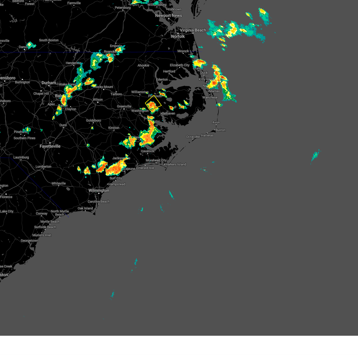
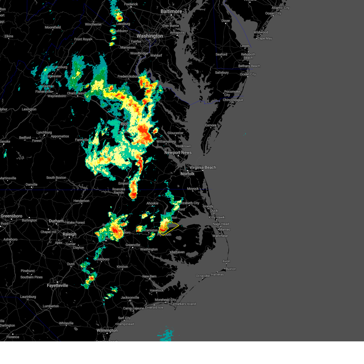
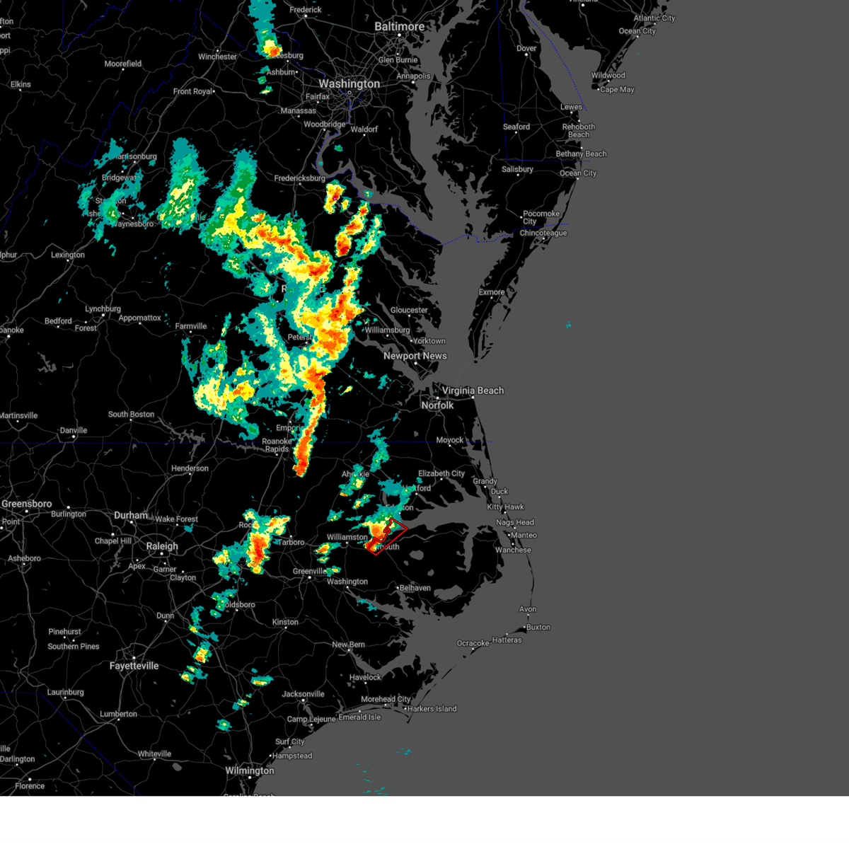
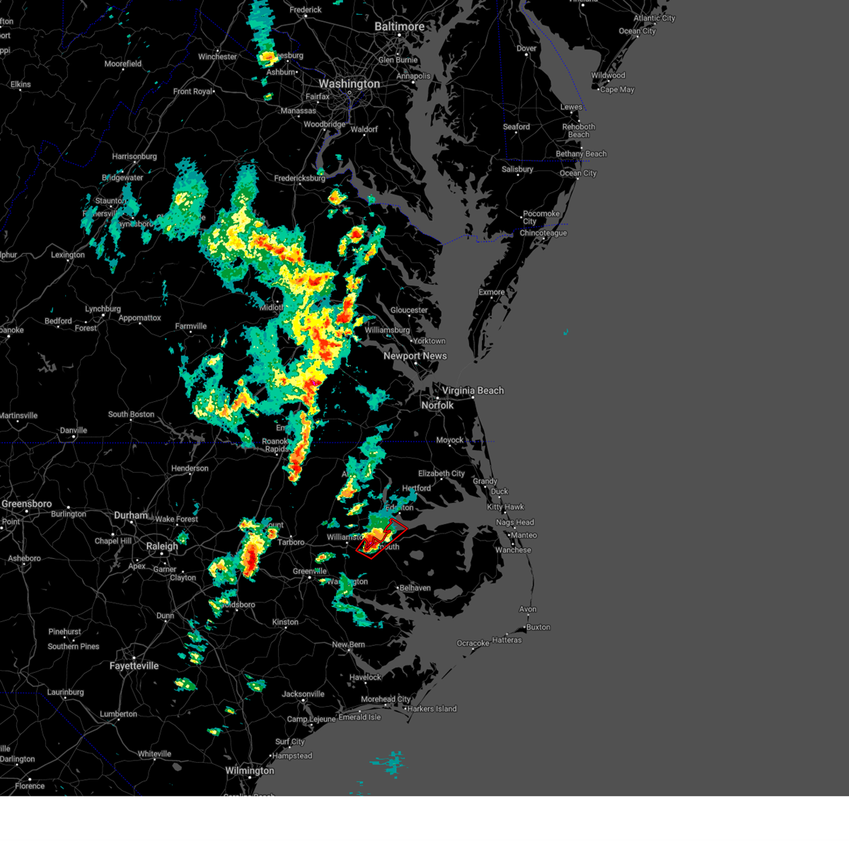
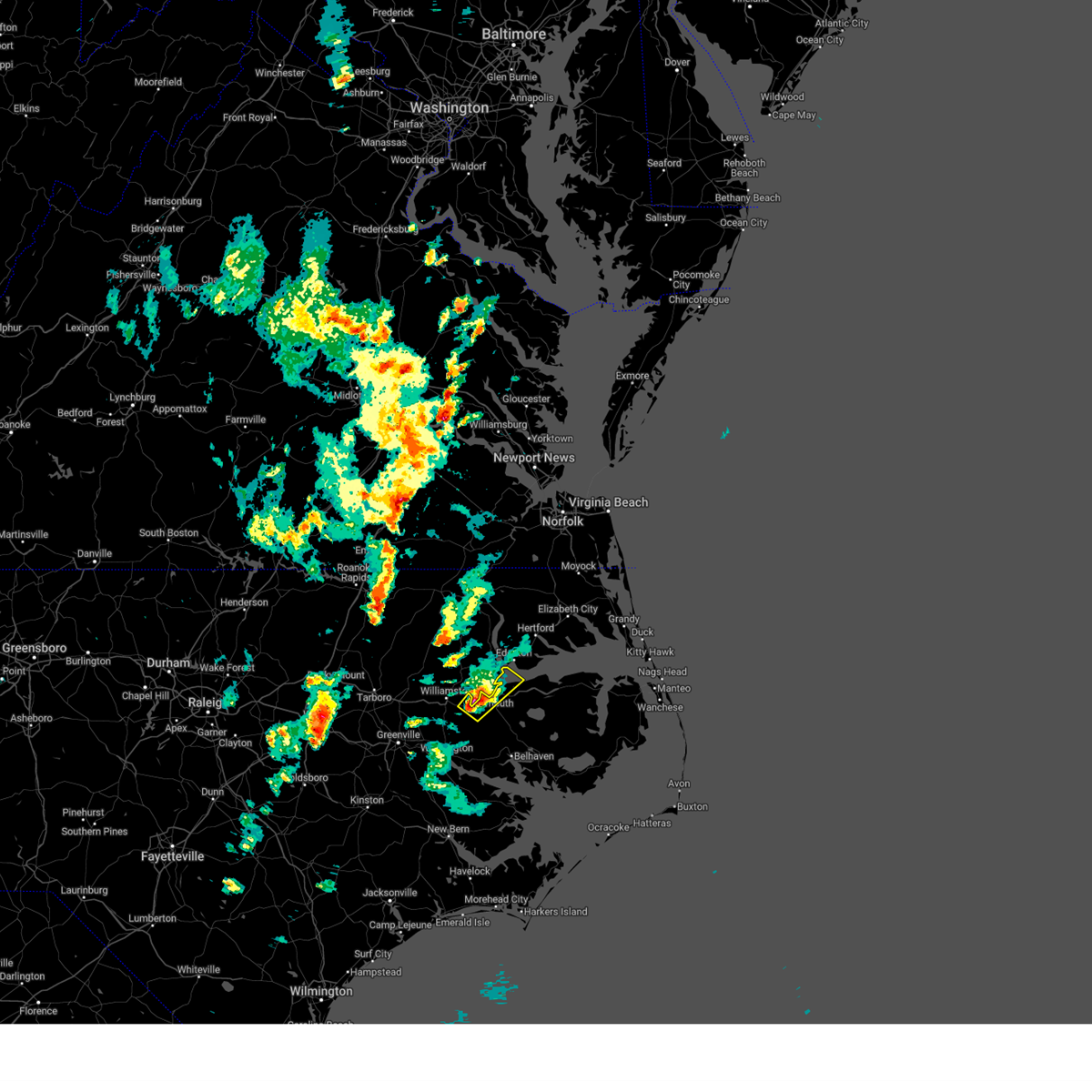
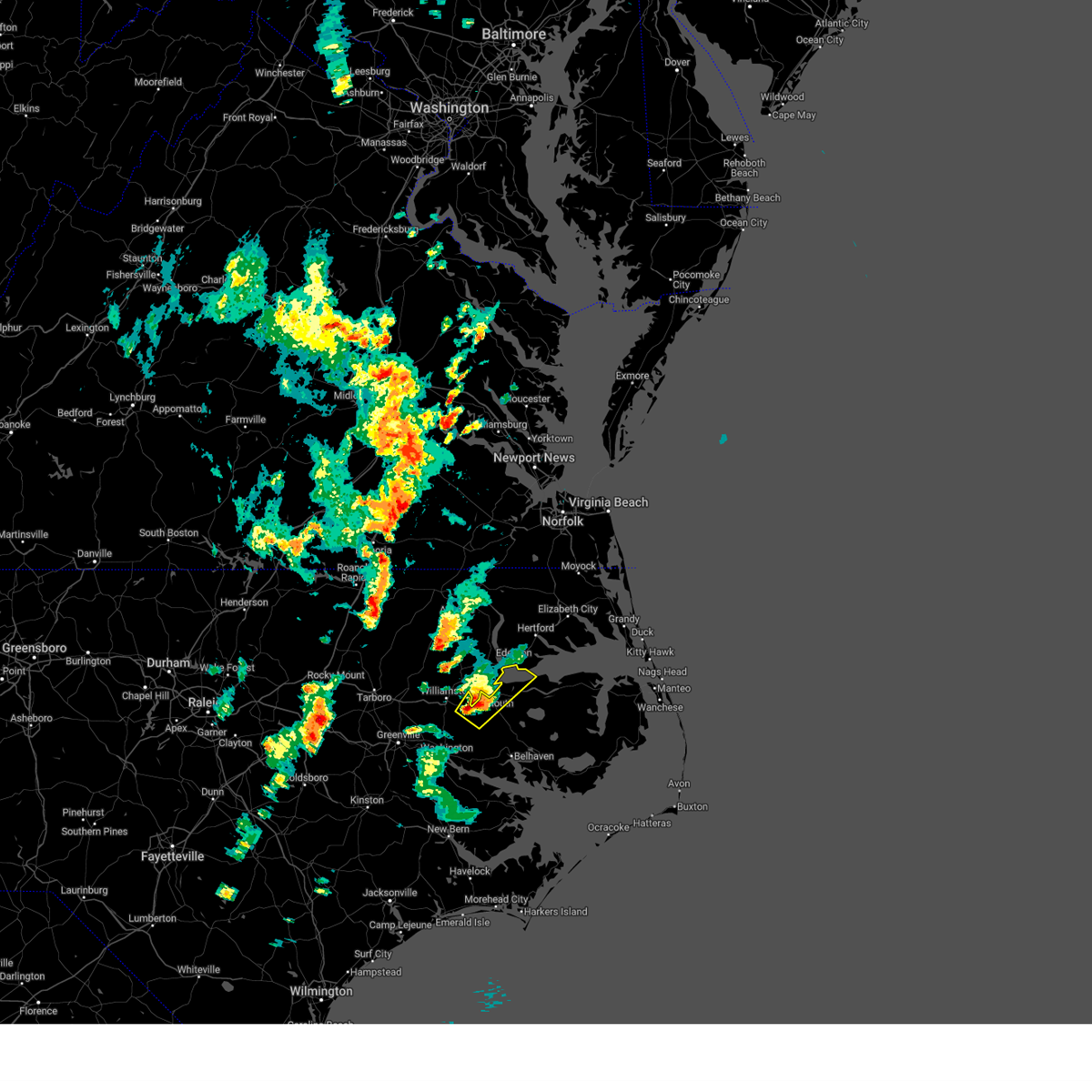
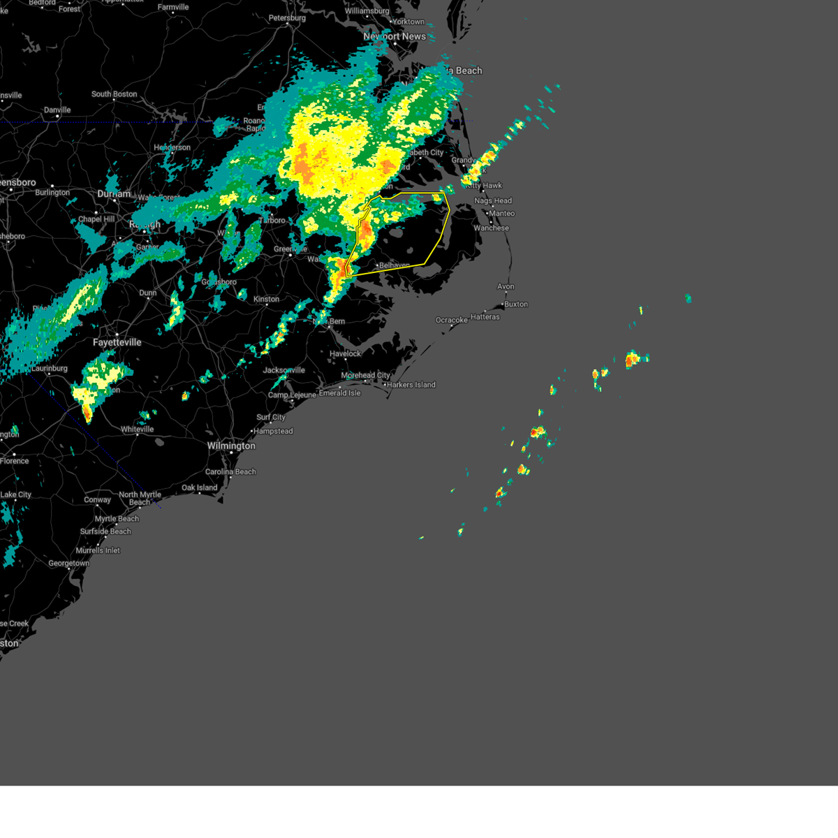
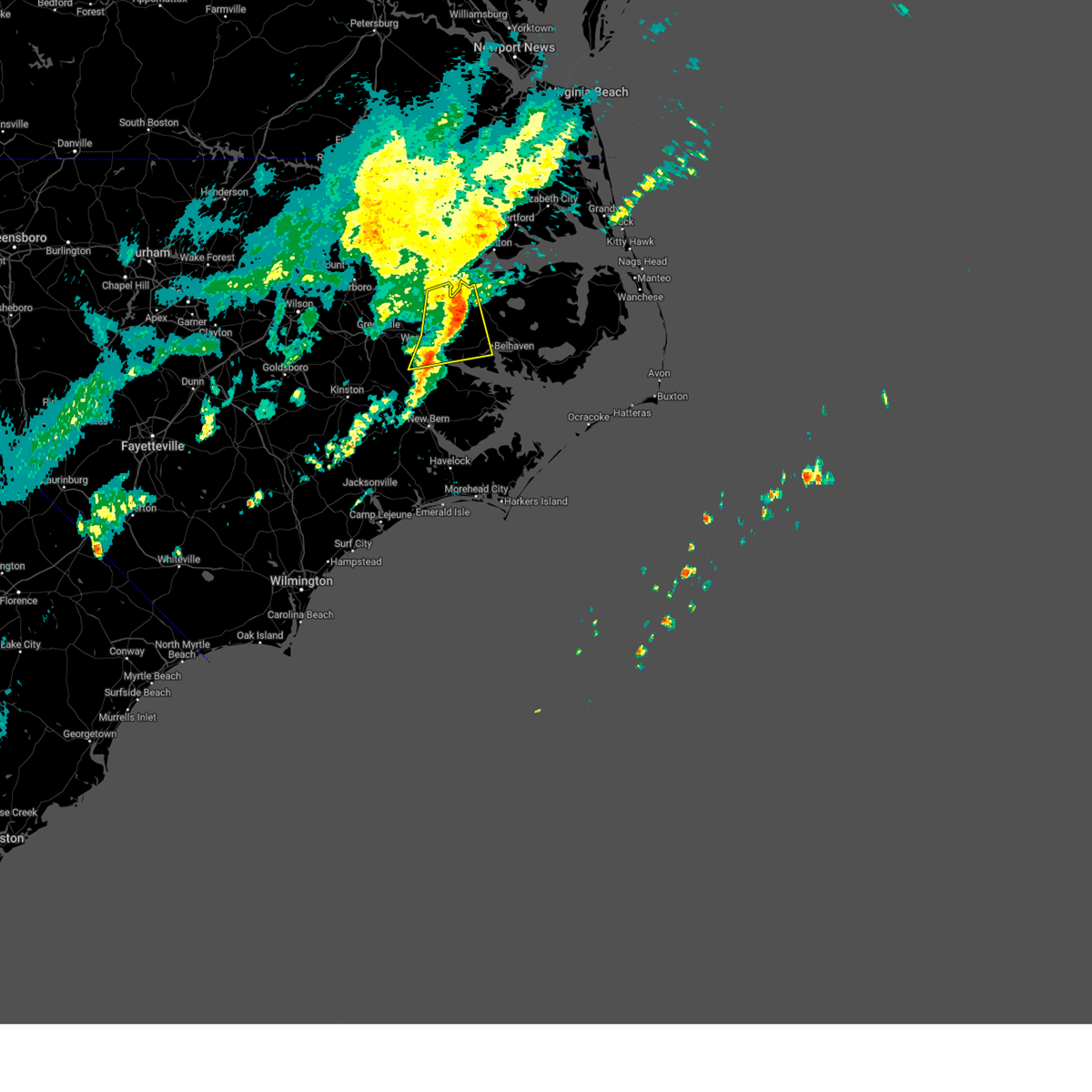
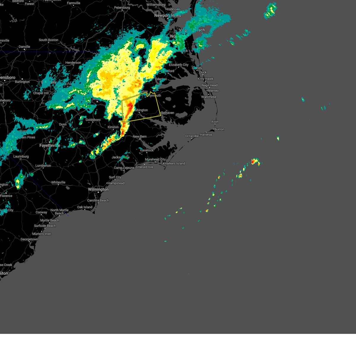
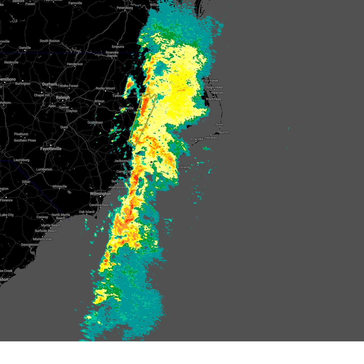
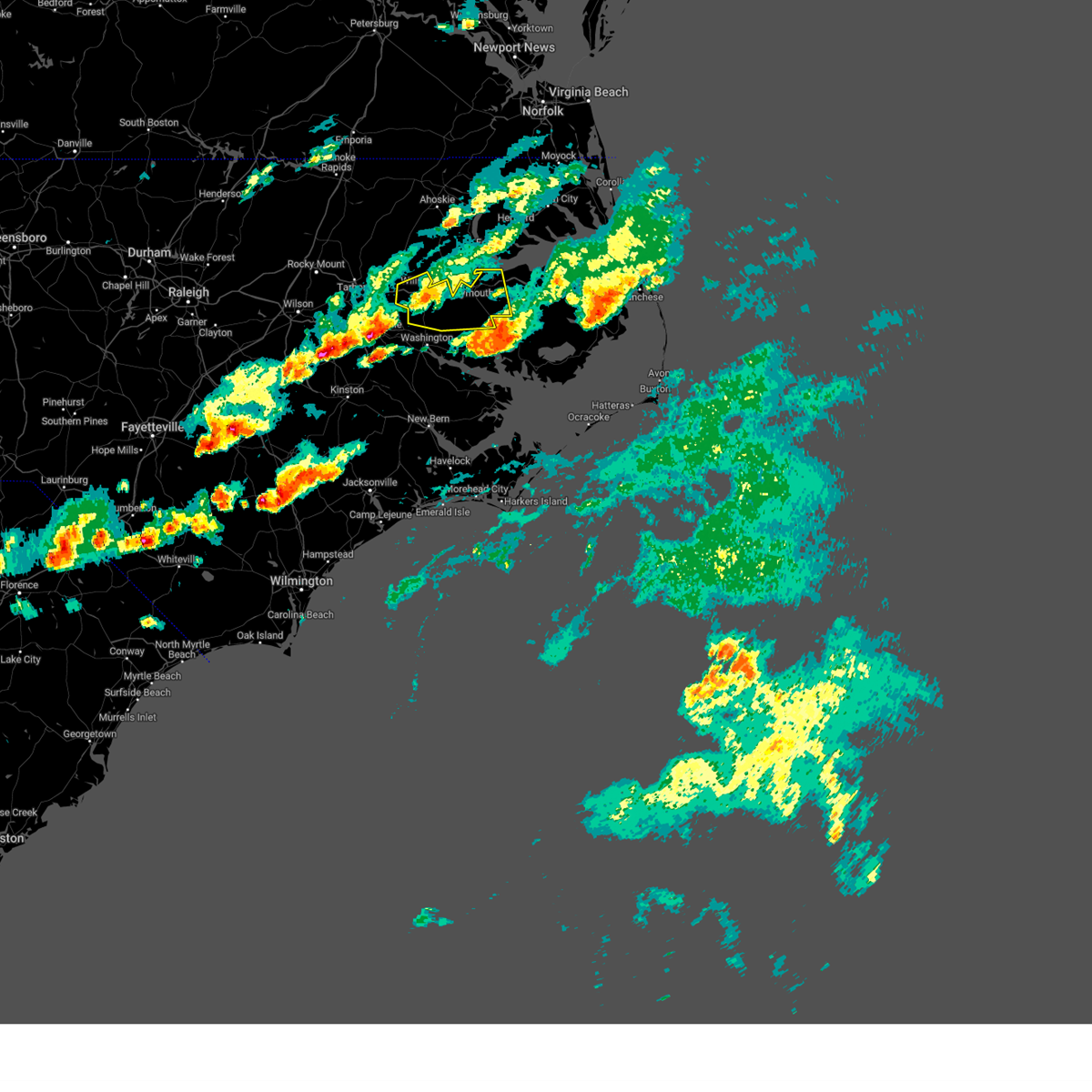
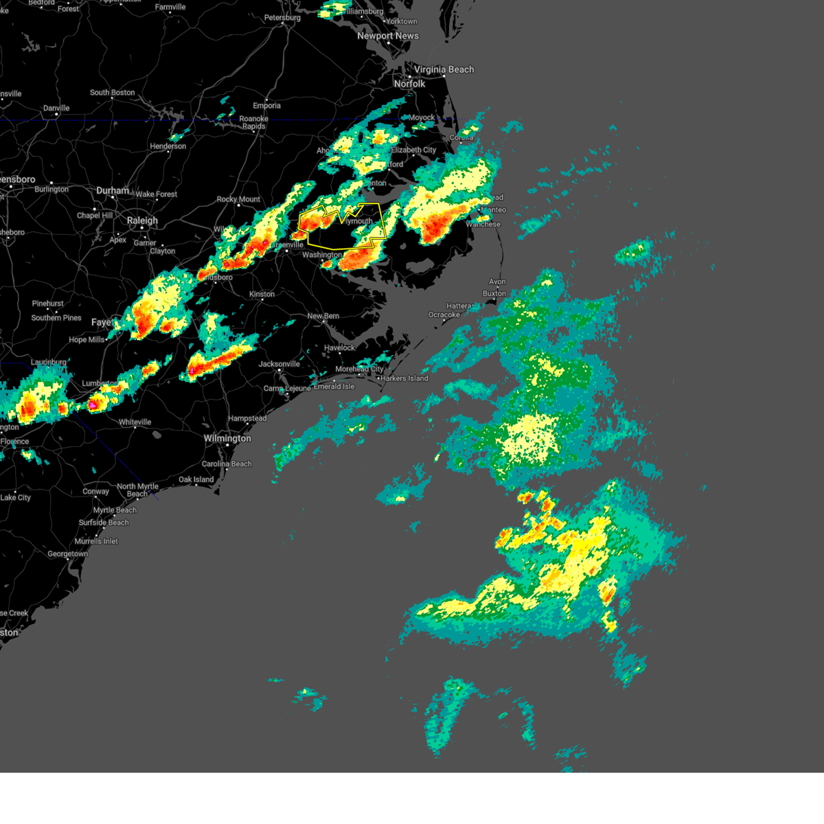
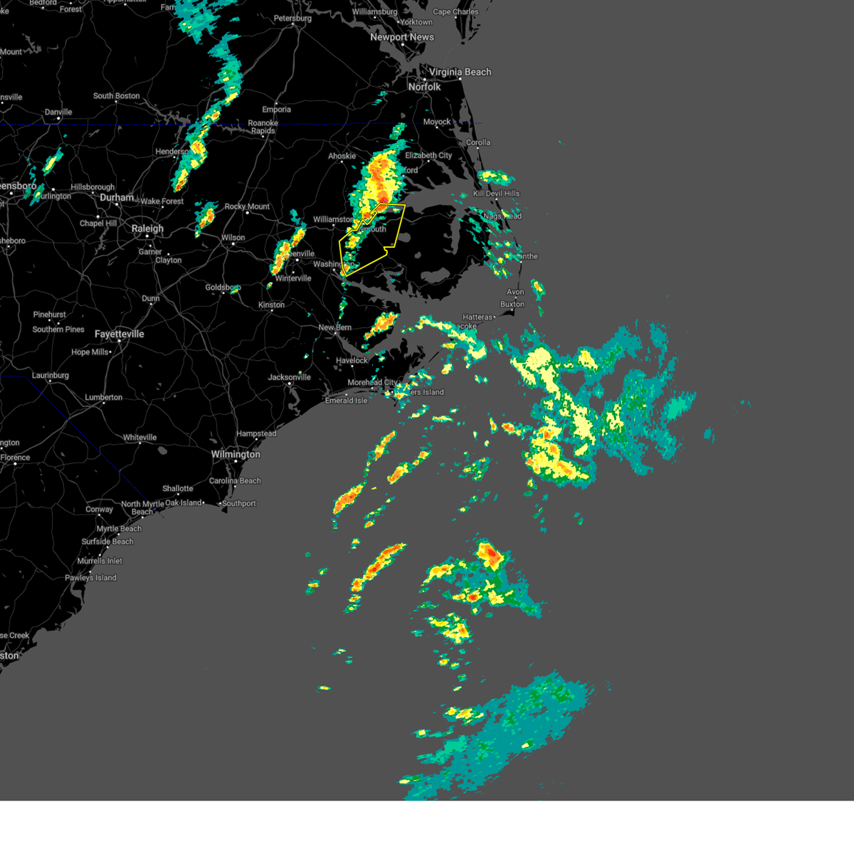
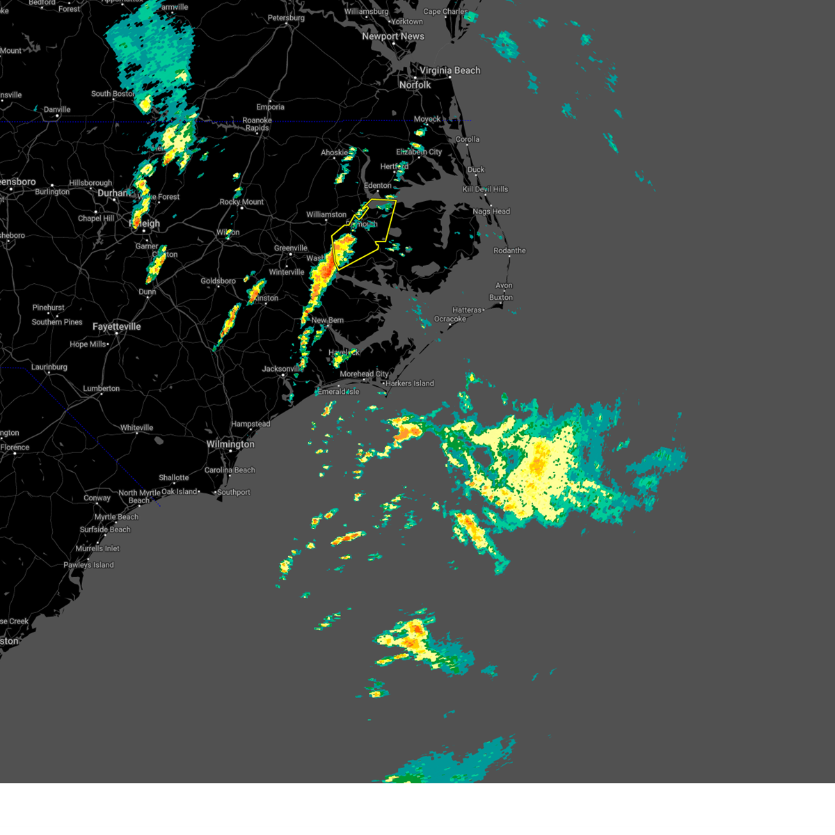
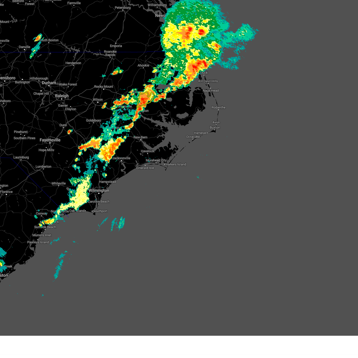
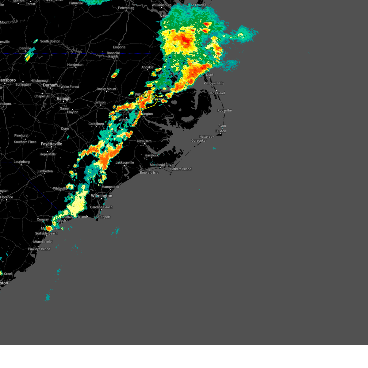
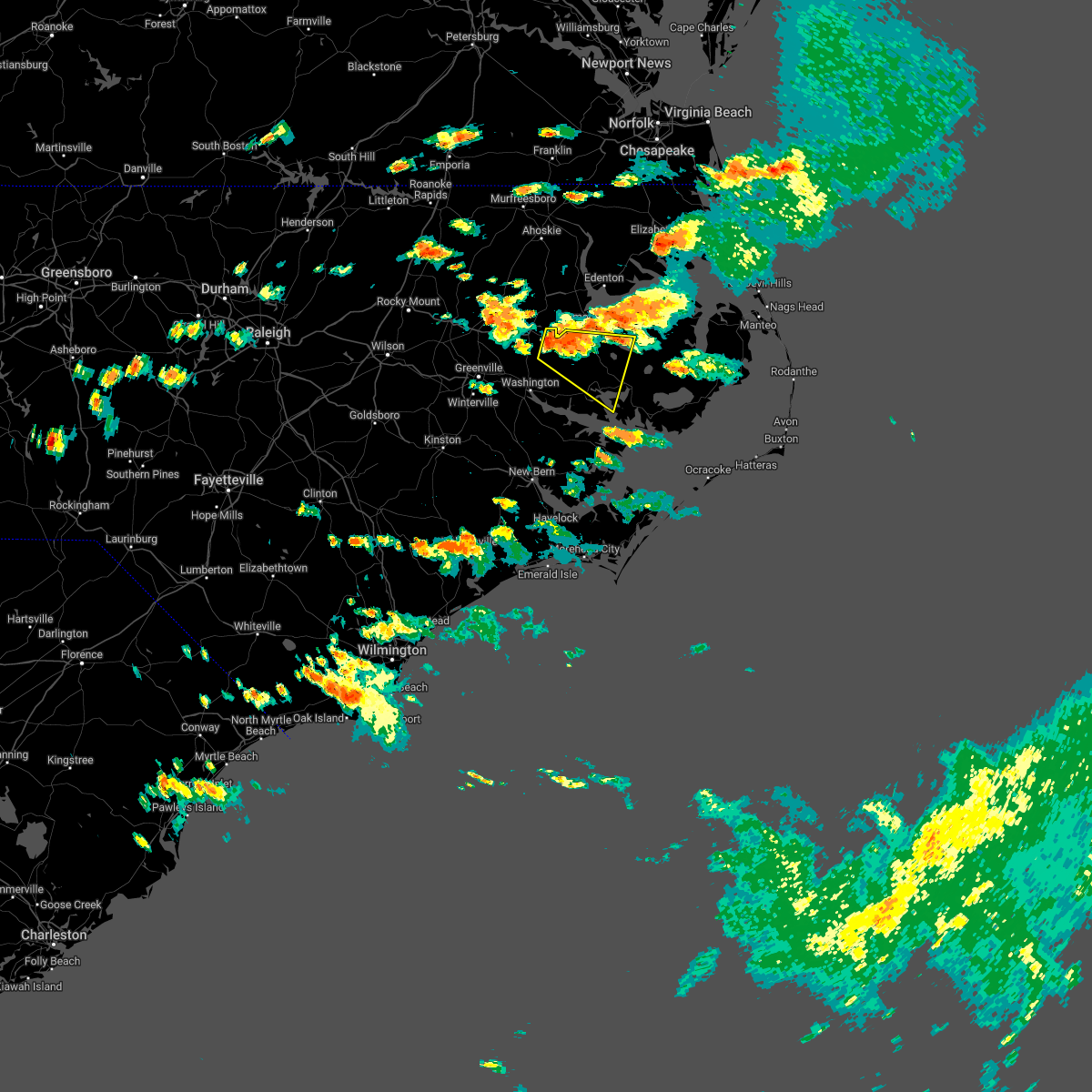
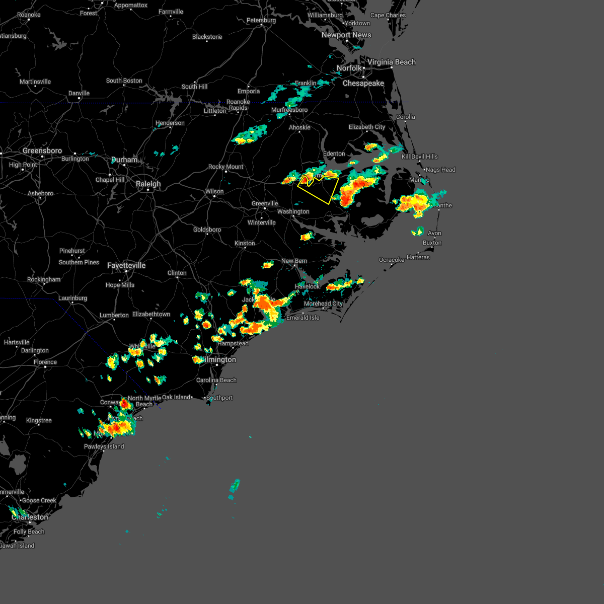
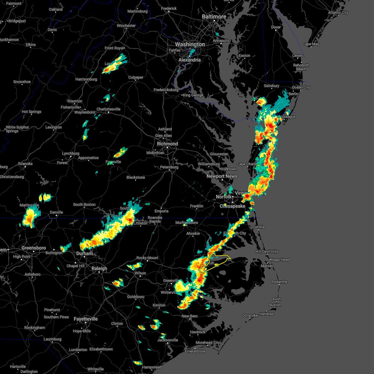
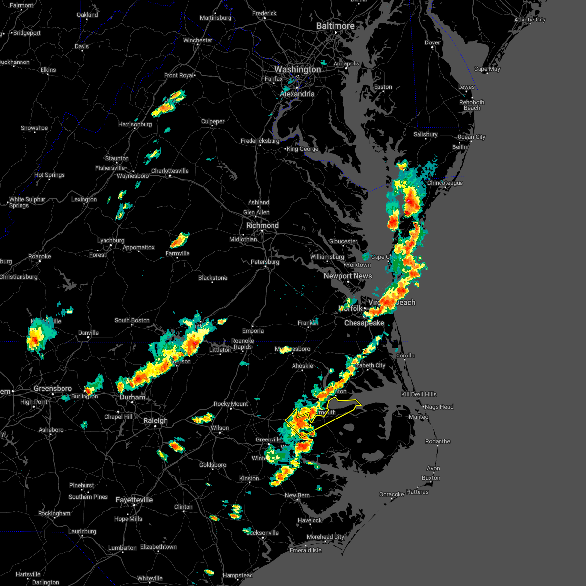
Hail Map for Plymouth, NC
The Plymouth, NC area has had 1 report of on-the-ground hail by trained spotters, and has been under severe weather warnings 20 times during the past 12 months. Doppler radar has detected hail at or near Plymouth, NC on 48 occasions, including 1 occasion during the past year.
| Name: | Plymouth, NC |
| Where Located: | 73 miles SSW of Virginia Beach, VA |
| Map: | Google Map for Plymouth, NC |
| Population: | 3878 |
| Housing Units: | 1856 |
| More Info: | Search Google for Plymouth, NC |
1
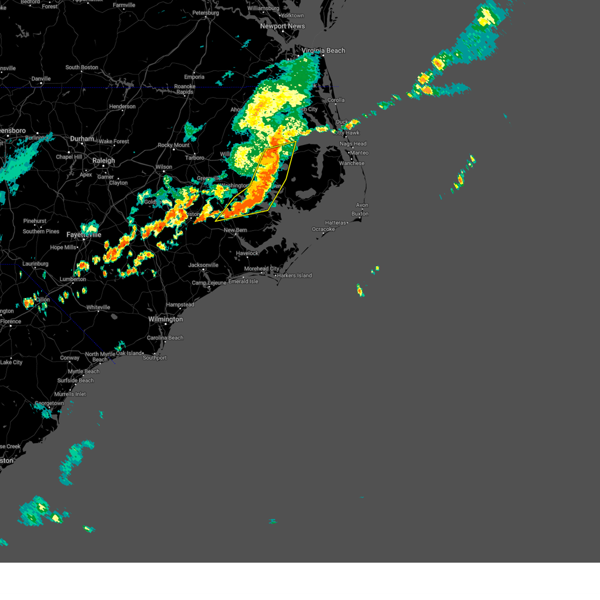
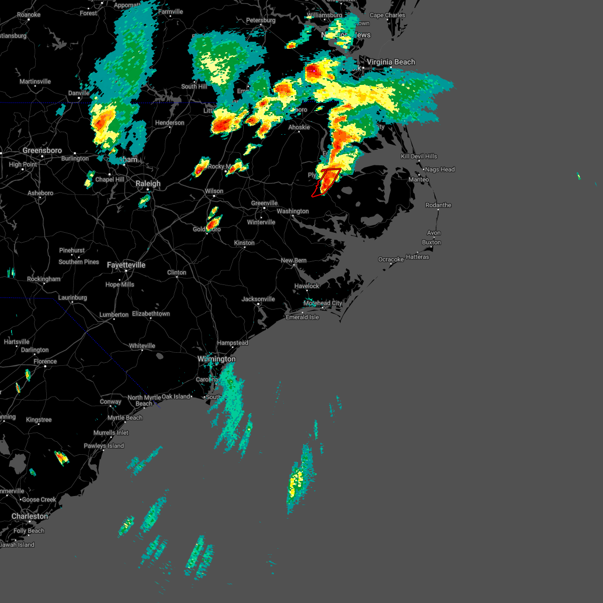
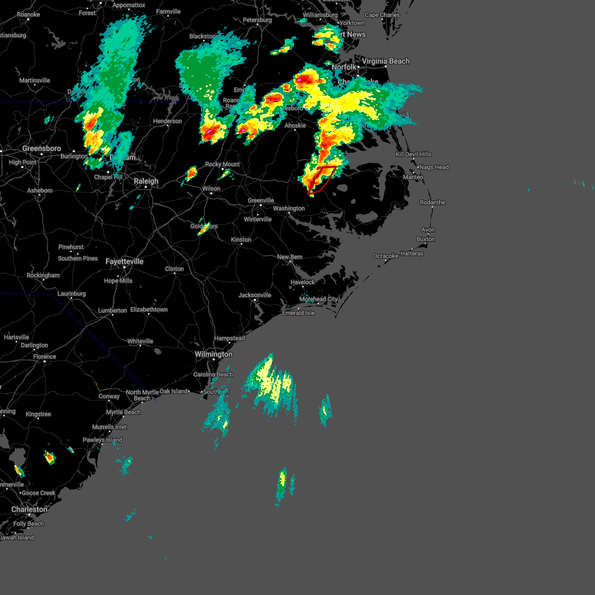
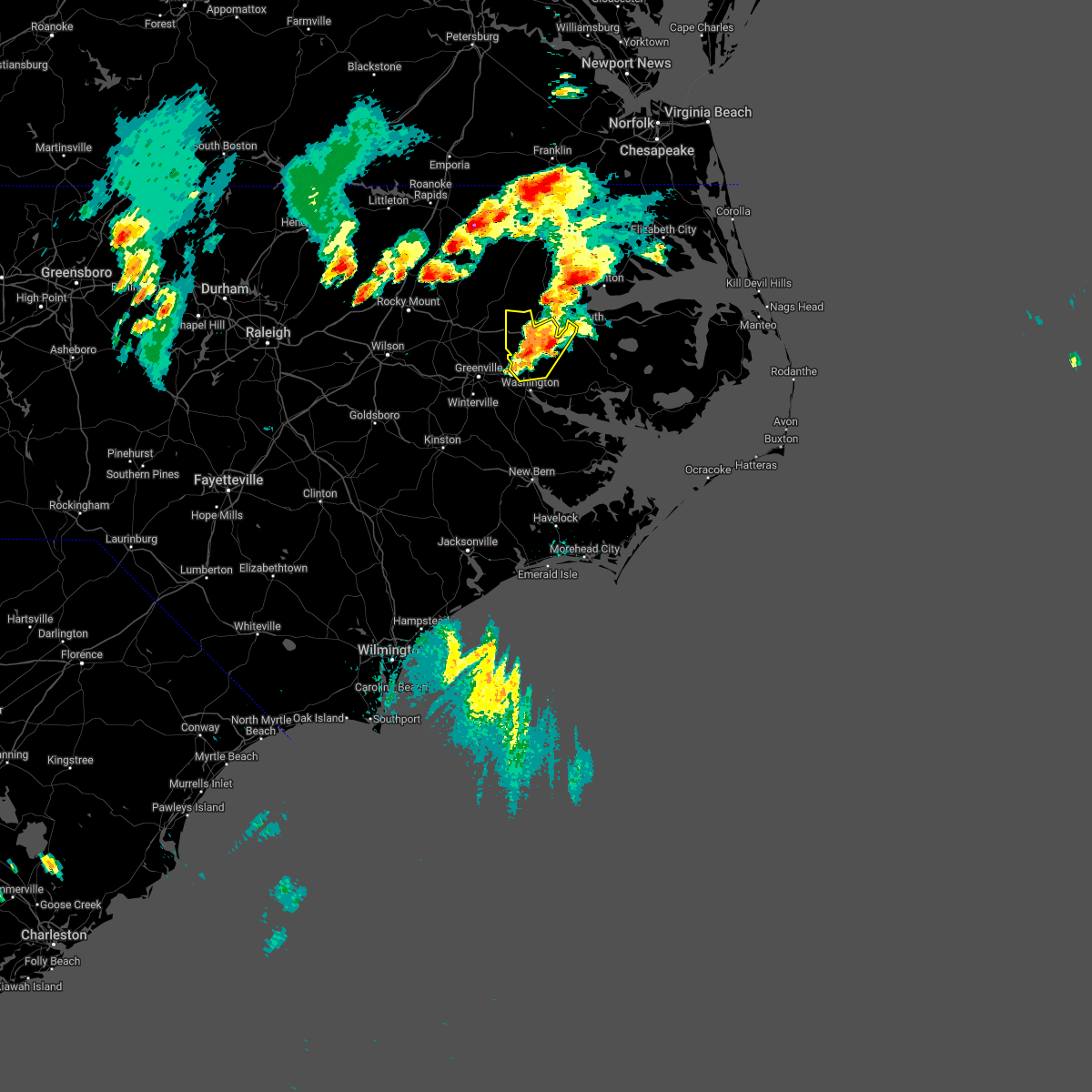
The Top Recent Hail Date for Plymouth, NC is Monday, May 5, 2025 (19th out of 48)

Hail and Wind Damage Spotted near Plymouth, NC
| Date / Time | Report Details |
|---|---|
| 6/7/2025 6:05 PM EDT |
 At 605 pm edt, a severe thunderstorm was located near pinetown, or 12 miles south of plymouth, moving northeast at 35 mph (radar indicated). Hazards include 60 mph wind gusts and quarter size hail. Hail damage to vehicles is expected. expect wind damage to roofs, siding, and trees. Locations impacted include, plymouth, pinetown, hinson, and long acre vfd. At 605 pm edt, a severe thunderstorm was located near pinetown, or 12 miles south of plymouth, moving northeast at 35 mph (radar indicated). Hazards include 60 mph wind gusts and quarter size hail. Hail damage to vehicles is expected. expect wind damage to roofs, siding, and trees. Locations impacted include, plymouth, pinetown, hinson, and long acre vfd.
|
| 6/7/2025 5:49 PM EDT |
 At 548 pm edt, a severe thunderstorm was located near old ford, or 8 miles northeast of washington, moving northeast at 35 mph (radar indicated). Hazards include 60 mph wind gusts and quarter size hail. Hail damage to vehicles is expected. expect wind damage to roofs, siding, and trees. Locations impacted include, plymouth, pinetown, hinson, long acre vfd, smithwick, and dardens. At 548 pm edt, a severe thunderstorm was located near old ford, or 8 miles northeast of washington, moving northeast at 35 mph (radar indicated). Hazards include 60 mph wind gusts and quarter size hail. Hail damage to vehicles is expected. expect wind damage to roofs, siding, and trees. Locations impacted include, plymouth, pinetown, hinson, long acre vfd, smithwick, and dardens.
|
| 6/7/2025 5:33 PM EDT |
 Svrmhx the national weather service in newport has issued a * severe thunderstorm warning for, southwestern washington county in eastern north carolina, southeastern martin county in eastern north carolina, northwestern beaufort county in eastern north carolina, * until 615 pm edt. * at 533 pm edt, a severe thunderstorm was located over old ford, or near washington, moving northeast at 35 mph (radar indicated). Hazards include 60 mph wind gusts and quarter size hail. Hail damage to vehicles is expected. Expect wind damage to roofs, siding, and trees. Svrmhx the national weather service in newport has issued a * severe thunderstorm warning for, southwestern washington county in eastern north carolina, southeastern martin county in eastern north carolina, northwestern beaufort county in eastern north carolina, * until 615 pm edt. * at 533 pm edt, a severe thunderstorm was located over old ford, or near washington, moving northeast at 35 mph (radar indicated). Hazards include 60 mph wind gusts and quarter size hail. Hail damage to vehicles is expected. Expect wind damage to roofs, siding, and trees.
|
| 5/5/2025 5:47 PM EDT |
 the severe thunderstorm warning has been cancelled and is no longer in effect the severe thunderstorm warning has been cancelled and is no longer in effect
|
| 5/5/2025 5:47 PM EDT |
 At 547 pm edt, a severe thunderstorm was located near westover, or near plymouth, moving northeast at 15 mph (radar indicated). Hazards include 60 mph wind gusts and quarter size hail. Hail damage to vehicles is expected. expect wind damage to roofs, siding, and trees. Locations impacted include, dardens, mackeys, pleasant grove, westover, and plymouth. At 547 pm edt, a severe thunderstorm was located near westover, or near plymouth, moving northeast at 15 mph (radar indicated). Hazards include 60 mph wind gusts and quarter size hail. Hail damage to vehicles is expected. expect wind damage to roofs, siding, and trees. Locations impacted include, dardens, mackeys, pleasant grove, westover, and plymouth.
|
| 5/5/2025 5:34 PM EDT |
 At 533 pm edt, a severe thunderstorm capable of producing a tornado was located over plymouth, moving northeast at 20 mph (weather spotters reported a funnel cloud. at 520 pm, 911 center reported multiple funnel clouds southwest of plymouth). Hazards include tornado and quarter size hail. Flying debris will be dangerous to those caught without shelter. mobile homes will be damaged or destroyed. damage to roofs, windows, and vehicles will occur. tree damage is likely. this dangerous storm will be near, plymouth and plymouth around 540 pm edt. Other locations impacted by this tornadic thunderstorm include dardens and mackeys. At 533 pm edt, a severe thunderstorm capable of producing a tornado was located over plymouth, moving northeast at 20 mph (weather spotters reported a funnel cloud. at 520 pm, 911 center reported multiple funnel clouds southwest of plymouth). Hazards include tornado and quarter size hail. Flying debris will be dangerous to those caught without shelter. mobile homes will be damaged or destroyed. damage to roofs, windows, and vehicles will occur. tree damage is likely. this dangerous storm will be near, plymouth and plymouth around 540 pm edt. Other locations impacted by this tornadic thunderstorm include dardens and mackeys.
|
| 5/5/2025 5:25 PM EDT | At 524 pm edt, a severe thunderstorm capable of producing a tornado was located near hinson, or near plymouth, moving northeast at 15 mph (weather spotters reported a funnel cloud. at 520 pm, 911 center reported multiple funnel cloud sightings southwest of plymouth). Hazards include tornado and quarter size hail. Flying debris will be dangerous to those caught without shelter. mobile homes will be damaged or destroyed. damage to roofs, windows, and vehicles will occur. tree damage is likely. this dangerous storm will be near, plymouth and plymouth around 530 pm edt. Other locations impacted by this tornadic thunderstorm include dardens, mackeys, and jamesville. |
| 5/5/2025 5:17 PM EDT |
 Tormhx the national weather service in newport has issued a * tornado warning for, northwestern washington county in eastern north carolina, east central martin county in eastern north carolina, * until 545 pm edt. * at 517 pm edt, a severe thunderstorm capable of producing a tornado was located near hinson, or 7 miles southwest of plymouth, moving northeast at 15 mph (radar indicated rotation). Hazards include tornado and quarter size hail. Flying debris will be dangerous to those caught without shelter. mobile homes will be damaged or destroyed. damage to roofs, windows, and vehicles will occur. tree damage is likely. this dangerous storm will be near, plymouth around 525 pm edt. Other locations impacted by this tornadic thunderstorm include dardens, mackeys, and jamesville. Tormhx the national weather service in newport has issued a * tornado warning for, northwestern washington county in eastern north carolina, east central martin county in eastern north carolina, * until 545 pm edt. * at 517 pm edt, a severe thunderstorm capable of producing a tornado was located near hinson, or 7 miles southwest of plymouth, moving northeast at 15 mph (radar indicated rotation). Hazards include tornado and quarter size hail. Flying debris will be dangerous to those caught without shelter. mobile homes will be damaged or destroyed. damage to roofs, windows, and vehicles will occur. tree damage is likely. this dangerous storm will be near, plymouth around 525 pm edt. Other locations impacted by this tornadic thunderstorm include dardens, mackeys, and jamesville.
|
| 5/5/2025 5:16 PM EDT |
 Svrmhx the national weather service in newport has issued a * severe thunderstorm warning for, northwestern washington county in eastern north carolina, east central martin county in eastern north carolina, * until 545 pm edt. * at 515 pm edt, a severe thunderstorm was located near hinson, or 7 miles west of plymouth, moving northeast at 15 mph (radar indicated). Hazards include quarter size hail. damage to vehicles is expected Svrmhx the national weather service in newport has issued a * severe thunderstorm warning for, northwestern washington county in eastern north carolina, east central martin county in eastern north carolina, * until 545 pm edt. * at 515 pm edt, a severe thunderstorm was located near hinson, or 7 miles west of plymouth, moving northeast at 15 mph (radar indicated). Hazards include quarter size hail. damage to vehicles is expected
|
| 5/5/2025 5:08 PM EDT |
 Svrmhx the national weather service in newport has issued a * severe thunderstorm warning for, western washington county in eastern north carolina, southeastern martin county in eastern north carolina, north central beaufort county in eastern north carolina, * until 600 pm edt. * at 508 pm edt, a severe thunderstorm was located near hinson, or near plymouth, moving northeast at 15 mph (radar indicated). Hazards include 60 mph wind gusts and quarter size hail. Hail damage to vehicles is expected. Expect wind damage to roofs, siding, and trees. Svrmhx the national weather service in newport has issued a * severe thunderstorm warning for, western washington county in eastern north carolina, southeastern martin county in eastern north carolina, north central beaufort county in eastern north carolina, * until 600 pm edt. * at 508 pm edt, a severe thunderstorm was located near hinson, or near plymouth, moving northeast at 15 mph (radar indicated). Hazards include 60 mph wind gusts and quarter size hail. Hail damage to vehicles is expected. Expect wind damage to roofs, siding, and trees.
|
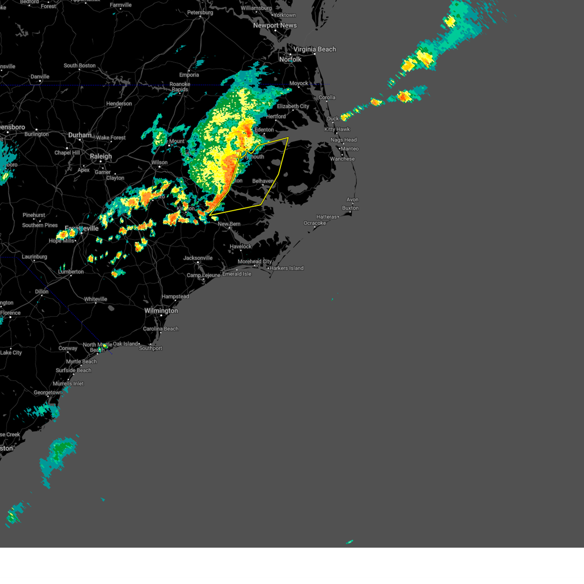
| 4/7/2025 4:42 PM EDT |
 Svrmhx the national weather service in newport has issued a * severe thunderstorm warning for, washington county in eastern north carolina, northwestern hyde county in eastern north carolina, northeastern beaufort county in eastern north carolina, tyrrell county in eastern north carolina, * until 545 pm edt. * at 442 pm edt, severe thunderstorms were located along a line extending from westover to wenona to near terra ceia to near core point, moving east at 55 mph (law enforcement. these thunderstorms have a history of producing strong to damaging winds, including tree damage). Hazards include 60 mph wind gusts and penny size hail. expect damage to roofs, siding, and trees Svrmhx the national weather service in newport has issued a * severe thunderstorm warning for, washington county in eastern north carolina, northwestern hyde county in eastern north carolina, northeastern beaufort county in eastern north carolina, tyrrell county in eastern north carolina, * until 545 pm edt. * at 442 pm edt, severe thunderstorms were located along a line extending from westover to wenona to near terra ceia to near core point, moving east at 55 mph (law enforcement. these thunderstorms have a history of producing strong to damaging winds, including tree damage). Hazards include 60 mph wind gusts and penny size hail. expect damage to roofs, siding, and trees
|
| 4/7/2025 4:35 PM EDT |
 At 433 pm edt, a severe thunderstorm was located over hinson, or 8 miles south of plymouth, moving east at 60 mph (trained weather spotters. this thunderstorm has a history of producing damaging winds). Hazards include 70 mph wind gusts and quarter size hail. Hail damage to vehicles is expected. expect considerable tree damage. wind damage is also likely to mobile homes, roofs, and outbuildings. Locations impacted include, terra ceia, pinetown, long acre vfd, plymouth, goose creek state park, pantego, washington, bunyan, yeatesville, old ford, chocowinity, dardens, washington park, smithwick, hinson, river road, jamesville, and sidney crossroads. At 433 pm edt, a severe thunderstorm was located over hinson, or 8 miles south of plymouth, moving east at 60 mph (trained weather spotters. this thunderstorm has a history of producing damaging winds). Hazards include 70 mph wind gusts and quarter size hail. Hail damage to vehicles is expected. expect considerable tree damage. wind damage is also likely to mobile homes, roofs, and outbuildings. Locations impacted include, terra ceia, pinetown, long acre vfd, plymouth, goose creek state park, pantego, washington, bunyan, yeatesville, old ford, chocowinity, dardens, washington park, smithwick, hinson, river road, jamesville, and sidney crossroads.
|
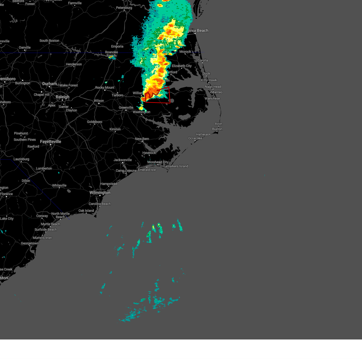
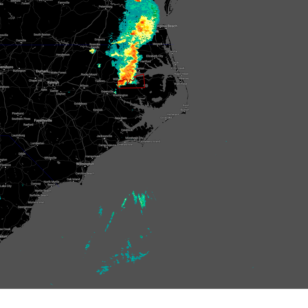
| 4/7/2025 4:15 PM EDT |
 Svrmhx the national weather service in newport has issued a * severe thunderstorm warning for, southwestern washington county in eastern north carolina, northern craven county in eastern north carolina, eastern pitt county in eastern north carolina, southern martin county in eastern north carolina, northern beaufort county in eastern north carolina, * until 445 pm edt. * at 413 pm edt, a severe thunderstorm was located near old ford, or 11 miles northwest of washington, moving east at 80 mph. this is a destructive storm for washington and rural martin county (law enforcement. this thunderstorm has a history of producing damaging winds and large hail up to golf ball size). Hazards include 80 mph wind gusts and golf ball size hail. Flying debris will be dangerous to those caught without shelter. mobile homes will be heavily damaged. expect considerable damage to roofs, windows, and vehicles. Extensive tree damage and power outages are likely. Svrmhx the national weather service in newport has issued a * severe thunderstorm warning for, southwestern washington county in eastern north carolina, northern craven county in eastern north carolina, eastern pitt county in eastern north carolina, southern martin county in eastern north carolina, northern beaufort county in eastern north carolina, * until 445 pm edt. * at 413 pm edt, a severe thunderstorm was located near old ford, or 11 miles northwest of washington, moving east at 80 mph. this is a destructive storm for washington and rural martin county (law enforcement. this thunderstorm has a history of producing damaging winds and large hail up to golf ball size). Hazards include 80 mph wind gusts and golf ball size hail. Flying debris will be dangerous to those caught without shelter. mobile homes will be heavily damaged. expect considerable damage to roofs, windows, and vehicles. Extensive tree damage and power outages are likely.
|
| 3/5/2025 4:14 PM EST |
 At 413 pm est, severe thunderstorms were located along a line extending from near williamston to near tuscarora, moving northeast at 60 mph (radar indicated). Hazards include 70 mph wind gusts. Expect considerable tree damage. damage is likely to mobile homes, roofs, and outbuildings. Locations impacted include, rhems, vanceboro, jamesville, wilmar, washington, bunyan, old ford, jasper, chocowinity, dardens, washington park, tuscarora, smithwick, river road, and williamston. At 413 pm est, severe thunderstorms were located along a line extending from near williamston to near tuscarora, moving northeast at 60 mph (radar indicated). Hazards include 70 mph wind gusts. Expect considerable tree damage. damage is likely to mobile homes, roofs, and outbuildings. Locations impacted include, rhems, vanceboro, jamesville, wilmar, washington, bunyan, old ford, jasper, chocowinity, dardens, washington park, tuscarora, smithwick, river road, and williamston.
|
| 3/5/2025 4:14 PM EST |
 the severe thunderstorm warning has been cancelled and is no longer in effect the severe thunderstorm warning has been cancelled and is no longer in effect
|
| 3/5/2025 3:35 PM EST |
 At 334 pm est, severe thunderstorms were located along a line extending from stokes to near phillips crossroads, moving northeast at 60 mph (radar indicated). Hazards include 70 mph wind gusts. Expect considerable tree damage. damage is likely to mobile homes, roofs, and outbuildings. Locations impacted include, rhems, vanceboro, black jack, wilmar, dowdy ficklen stadium, everetts, graingers, phillips crossroads, chocowinity, bethel, hassell, oak city, fort barnwell, greenville, house, shelmerdine, east carolina university, grifton, stokes, and cove city. At 334 pm est, severe thunderstorms were located along a line extending from stokes to near phillips crossroads, moving northeast at 60 mph (radar indicated). Hazards include 70 mph wind gusts. Expect considerable tree damage. damage is likely to mobile homes, roofs, and outbuildings. Locations impacted include, rhems, vanceboro, black jack, wilmar, dowdy ficklen stadium, everetts, graingers, phillips crossroads, chocowinity, bethel, hassell, oak city, fort barnwell, greenville, house, shelmerdine, east carolina university, grifton, stokes, and cove city.
|
| 3/5/2025 3:16 PM EST |
 Svrmhx the national weather service in newport has issued a * severe thunderstorm warning for, jones county in eastern north carolina, eastern greene county in eastern north carolina, lenoir county in eastern north carolina, northwestern craven county in eastern north carolina, pitt county in eastern north carolina, martin county in eastern north carolina, western beaufort county in eastern north carolina, * until 430 pm est. * at 315 pm est, severe thunderstorms were located along a line extending from near ormondsville to near potters hill, moving northeast at 60 mph (radar indicated). Hazards include 70 mph wind gusts. Expect considerable tree damage. Damage is likely to mobile homes, roofs, and outbuildings. Svrmhx the national weather service in newport has issued a * severe thunderstorm warning for, jones county in eastern north carolina, eastern greene county in eastern north carolina, lenoir county in eastern north carolina, northwestern craven county in eastern north carolina, pitt county in eastern north carolina, martin county in eastern north carolina, western beaufort county in eastern north carolina, * until 430 pm est. * at 315 pm est, severe thunderstorms were located along a line extending from near ormondsville to near potters hill, moving northeast at 60 mph (radar indicated). Hazards include 70 mph wind gusts. Expect considerable tree damage. Damage is likely to mobile homes, roofs, and outbuildings.
|
| 7/20/2024 10:33 PM EDT |
 the severe thunderstorm warning has been cancelled and is no longer in effect the severe thunderstorm warning has been cancelled and is no longer in effect
|
| 7/20/2024 10:33 PM EDT |
 At 1033 pm edt, severe thunderstorms were located along a line extending from near pleasant grove to near pungo to core point, moving northeast at 40 mph (radar indicated). Hazards include 60 mph wind gusts. Expect damage to roofs, siding, and trees. Locations impacted include, washington, plymouth, river road, belhaven, ransomville, ponzer, pungo, blounts creek, vanceboro, edward, bonnerton, cox crossroads, wenona, bayview, pike road, leechville, winsteadville, core point, south creek, and sidney crossroads. At 1033 pm edt, severe thunderstorms were located along a line extending from near pleasant grove to near pungo to core point, moving northeast at 40 mph (radar indicated). Hazards include 60 mph wind gusts. Expect damage to roofs, siding, and trees. Locations impacted include, washington, plymouth, river road, belhaven, ransomville, ponzer, pungo, blounts creek, vanceboro, edward, bonnerton, cox crossroads, wenona, bayview, pike road, leechville, winsteadville, core point, south creek, and sidney crossroads.
|
| 7/20/2024 10:01 PM EDT |
 Svrmhx the national weather service in newport has issued a * severe thunderstorm warning for, washington county in eastern north carolina, north central craven county in eastern north carolina, northwestern hyde county in eastern north carolina, southeastern martin county in eastern north carolina, beaufort county in eastern north carolina, northwestern tyrrell county in eastern north carolina, * until 1045 pm edt. * at 1000 pm edt, severe thunderstorms were located along a line extending from 6 miles northwest of hinson to river road to vanceboro, moving northeast at 40 mph (radar indicated). Hazards include 60 mph wind gusts. expect damage to roofs, siding, and trees Svrmhx the national weather service in newport has issued a * severe thunderstorm warning for, washington county in eastern north carolina, north central craven county in eastern north carolina, northwestern hyde county in eastern north carolina, southeastern martin county in eastern north carolina, beaufort county in eastern north carolina, northwestern tyrrell county in eastern north carolina, * until 1045 pm edt. * at 1000 pm edt, severe thunderstorms were located along a line extending from 6 miles northwest of hinson to river road to vanceboro, moving northeast at 40 mph (radar indicated). Hazards include 60 mph wind gusts. expect damage to roofs, siding, and trees
|
| 5/27/2024 6:42 PM EDT |
 The storm which prompted the warning has moved out of the area. therefore, the warning will be allowed to expire. a tornado watch remains in effect until 1100 pm edt for eastern north carolina. The storm which prompted the warning has moved out of the area. therefore, the warning will be allowed to expire. a tornado watch remains in effect until 1100 pm edt for eastern north carolina.
|
| 5/27/2024 6:27 PM EDT |
 At 626 pm edt, a severe thunderstorm was located over roper, or 8 miles east of plymouth, moving east at 35 mph (radar indicated). Hazards include 60 mph wind gusts and quarter size hail. Hail damage to vehicles is expected. expect wind damage to roofs, siding, and trees. Locations impacted include, plymouth, columbia, woodley, hinson, pleasant grove, westover, scuppernong, phelps lake, mackeys, roper, and creswell. At 626 pm edt, a severe thunderstorm was located over roper, or 8 miles east of plymouth, moving east at 35 mph (radar indicated). Hazards include 60 mph wind gusts and quarter size hail. Hail damage to vehicles is expected. expect wind damage to roofs, siding, and trees. Locations impacted include, plymouth, columbia, woodley, hinson, pleasant grove, westover, scuppernong, phelps lake, mackeys, roper, and creswell.
|
| 5/27/2024 6:02 PM EDT |
 At 602 pm edt, a severe thunderstorm was located near hinson, or near plymouth, moving east at 30 mph (radar indicated). Hazards include 60 mph wind gusts and quarter size hail. Hail damage to vehicles is expected. expect wind damage to roofs, siding, and trees. Locations impacted include, plymouth, columbia, woodley, hinson, westover, pleasant grove, scuppernong, phelps lake, mackeys, roper, jamesville, creswell, and dardens. At 602 pm edt, a severe thunderstorm was located near hinson, or near plymouth, moving east at 30 mph (radar indicated). Hazards include 60 mph wind gusts and quarter size hail. Hail damage to vehicles is expected. expect wind damage to roofs, siding, and trees. Locations impacted include, plymouth, columbia, woodley, hinson, westover, pleasant grove, scuppernong, phelps lake, mackeys, roper, jamesville, creswell, and dardens.
|
| 5/27/2024 6:01 PM EDT |
 At 601 pm edt, a severe thunderstorm capable of producing a tornado was located near hinson, or 8 miles southwest of plymouth, moving east at 35 mph (radar indicated rotation). Hazards include tornado and quarter size hail. Flying debris will be dangerous to those caught without shelter. mobile homes will be damaged or destroyed. damage to roofs, windows, and vehicles will occur. tree damage is likely. this dangerous storm will be near, plymouth and hinson around 605 pm edt. roper around 625 pm edt. Other locations impacted by this tornadic thunderstorm include dardens, mackeys, jamesville, and roper. At 601 pm edt, a severe thunderstorm capable of producing a tornado was located near hinson, or 8 miles southwest of plymouth, moving east at 35 mph (radar indicated rotation). Hazards include tornado and quarter size hail. Flying debris will be dangerous to those caught without shelter. mobile homes will be damaged or destroyed. damage to roofs, windows, and vehicles will occur. tree damage is likely. this dangerous storm will be near, plymouth and hinson around 605 pm edt. roper around 625 pm edt. Other locations impacted by this tornadic thunderstorm include dardens, mackeys, jamesville, and roper.
|
| 5/27/2024 5:44 PM EDT |
 Tormhx the national weather service in newport has issued a * tornado warning for, washington county in eastern north carolina, southeastern martin county in eastern north carolina, * until 615 pm edt. * at 543 pm edt, a severe thunderstorm capable of producing a tornado was located near williamston, moving east at 55 mph (radar indicated rotation). Hazards include tornado and quarter size hail. Flying debris will be dangerous to those caught without shelter. mobile homes will be damaged or destroyed. damage to roofs, windows, and vehicles will occur. tree damage is likely. this dangerous storm will be near, plymouth and hinson around 555 pm edt. Other locations impacted by this tornadic thunderstorm include dardens, mackeys, smithwick, jamesville, and roper. Tormhx the national weather service in newport has issued a * tornado warning for, washington county in eastern north carolina, southeastern martin county in eastern north carolina, * until 615 pm edt. * at 543 pm edt, a severe thunderstorm capable of producing a tornado was located near williamston, moving east at 55 mph (radar indicated rotation). Hazards include tornado and quarter size hail. Flying debris will be dangerous to those caught without shelter. mobile homes will be damaged or destroyed. damage to roofs, windows, and vehicles will occur. tree damage is likely. this dangerous storm will be near, plymouth and hinson around 555 pm edt. Other locations impacted by this tornadic thunderstorm include dardens, mackeys, smithwick, jamesville, and roper.
|
| 5/27/2024 5:41 PM EDT |
 Svrmhx the national weather service in newport has issued a * severe thunderstorm warning for, washington county in eastern north carolina, southeastern martin county in eastern north carolina, northwestern tyrrell county in eastern north carolina, * until 645 pm edt. * at 541 pm edt, a severe thunderstorm was located over williamston, moving east at 35 mph (radar indicated). Hazards include 60 mph wind gusts and quarter size hail. Hail damage to vehicles is expected. Expect wind damage to roofs, siding, and trees. Svrmhx the national weather service in newport has issued a * severe thunderstorm warning for, washington county in eastern north carolina, southeastern martin county in eastern north carolina, northwestern tyrrell county in eastern north carolina, * until 645 pm edt. * at 541 pm edt, a severe thunderstorm was located over williamston, moving east at 35 mph (radar indicated). Hazards include 60 mph wind gusts and quarter size hail. Hail damage to vehicles is expected. Expect wind damage to roofs, siding, and trees.
|
| 5/10/2024 5:02 PM EDT |
 the severe thunderstorm warning has been cancelled and is no longer in effect the severe thunderstorm warning has been cancelled and is no longer in effect
|
| 5/10/2024 4:43 PM EDT |
 Svrmhx the national weather service in newport has issued a * severe thunderstorm warning for, washington county in eastern north carolina, martin county in eastern north carolina, northern beaufort county in eastern north carolina, * until 530 pm edt. * at 443 pm edt, a severe thunderstorm was located near stokes, or 8 miles southwest of williamston, moving east at 35 mph (radar indicated). Hazards include 60 mph wind gusts and quarter size hail. Hail damage to vehicles is expected. Expect wind damage to roofs, siding, and trees. Svrmhx the national weather service in newport has issued a * severe thunderstorm warning for, washington county in eastern north carolina, martin county in eastern north carolina, northern beaufort county in eastern north carolina, * until 530 pm edt. * at 443 pm edt, a severe thunderstorm was located near stokes, or 8 miles southwest of williamston, moving east at 35 mph (radar indicated). Hazards include 60 mph wind gusts and quarter size hail. Hail damage to vehicles is expected. Expect wind damage to roofs, siding, and trees.
|
| 5/10/2024 3:50 PM EDT |
 At 348 pm edt, a severe thunderstorm was located near hinson, or near plymouth, moving east at 25 mph (radar indicated). Hazards include 60 mph wind gusts and quarter size hail. Hail damage to vehicles is expected. expect wind damage to roofs, siding, and trees. Locations impacted include, plymouth, wenona, hinson, pleasant grove, westover, scuppernong, pungo lake, phelps lake, and roper. At 348 pm edt, a severe thunderstorm was located near hinson, or near plymouth, moving east at 25 mph (radar indicated). Hazards include 60 mph wind gusts and quarter size hail. Hail damage to vehicles is expected. expect wind damage to roofs, siding, and trees. Locations impacted include, plymouth, wenona, hinson, pleasant grove, westover, scuppernong, pungo lake, phelps lake, and roper.
|
| 5/10/2024 3:50 PM EDT |
 the severe thunderstorm warning has been cancelled and is no longer in effect the severe thunderstorm warning has been cancelled and is no longer in effect
|
| 5/10/2024 3:38 PM EDT |
 Svrmhx the national weather service in newport has issued a * severe thunderstorm warning for, washington county in eastern north carolina, southeastern martin county in eastern north carolina, * until 430 pm edt. * at 338 pm edt, a severe thunderstorm was located over hinson, or near plymouth, moving east at 25 mph (radar indicated). Hazards include 60 mph wind gusts and quarter size hail. Hail damage to vehicles is expected. Expect wind damage to roofs, siding, and trees. Svrmhx the national weather service in newport has issued a * severe thunderstorm warning for, washington county in eastern north carolina, southeastern martin county in eastern north carolina, * until 430 pm edt. * at 338 pm edt, a severe thunderstorm was located over hinson, or near plymouth, moving east at 25 mph (radar indicated). Hazards include 60 mph wind gusts and quarter size hail. Hail damage to vehicles is expected. Expect wind damage to roofs, siding, and trees.
|
| 4/11/2024 11:42 PM EDT |
 the severe thunderstorm warning has been cancelled and is no longer in effect the severe thunderstorm warning has been cancelled and is no longer in effect
|
| 4/11/2024 11:08 PM EDT |
 Svrmhx the national weather service in newport has issued a * severe thunderstorm warning for, washington county in eastern north carolina, southeastern martin county in eastern north carolina, north central beaufort county in eastern north carolina, * until midnight edt. * at 1107 pm edt, severe thunderstorms were located along a line extending from 8 miles west of hinson to near pinetown to near bunyan, moving northeast at 40 mph (radar indicated). Hazards include 60 mph wind gusts. expect damage to roofs, siding, and trees Svrmhx the national weather service in newport has issued a * severe thunderstorm warning for, washington county in eastern north carolina, southeastern martin county in eastern north carolina, north central beaufort county in eastern north carolina, * until midnight edt. * at 1107 pm edt, severe thunderstorms were located along a line extending from 8 miles west of hinson to near pinetown to near bunyan, moving northeast at 40 mph (radar indicated). Hazards include 60 mph wind gusts. expect damage to roofs, siding, and trees
|
| 1/9/2024 8:44 PM EST |
 At 842 pm est, severe thunderstorms were located along a line extending from near windsor to near river road, moving northeast at 70 mph (radar indicated). Hazards include 70 mph wind gusts. Expect considerable tree damage. damage is likely to mobile homes, roofs, and outbuildings. locations impacted include, washington, plymouth, river road, belhaven, sladesville, ransomville, ponzer, pinetown, pungo, blounts creek, pamlico beach, cox crossroads, wenona, hinson, bayview, bunyan, pike road, leechville, winsteadville, and core point. thunderstorm damage threat, considerable hail threat, radar indicated max hail size, <. 75 in wind threat, radar indicated max wind gust, 70 mph. At 842 pm est, severe thunderstorms were located along a line extending from near windsor to near river road, moving northeast at 70 mph (radar indicated). Hazards include 70 mph wind gusts. Expect considerable tree damage. damage is likely to mobile homes, roofs, and outbuildings. locations impacted include, washington, plymouth, river road, belhaven, sladesville, ransomville, ponzer, pinetown, pungo, blounts creek, pamlico beach, cox crossroads, wenona, hinson, bayview, bunyan, pike road, leechville, winsteadville, and core point. thunderstorm damage threat, considerable hail threat, radar indicated max hail size, <. 75 in wind threat, radar indicated max wind gust, 70 mph.
|
| 1/9/2024 8:14 PM EST |
 At 813 pm est, severe thunderstorms were located along a line extending from near house to near wyse fork, moving northeast at 70 mph (radar indicated). Hazards include 70 mph wind gusts. Expect considerable tree damage. Damage is likely to mobile homes, roofs, and outbuildings. At 813 pm est, severe thunderstorms were located along a line extending from near house to near wyse fork, moving northeast at 70 mph (radar indicated). Hazards include 70 mph wind gusts. Expect considerable tree damage. Damage is likely to mobile homes, roofs, and outbuildings.
|
| 8/7/2023 10:02 PM EDT |
 At 1001 pm edt, severe thunderstorms were located along a line extending from near pleasant grove to near pungo lake to near winsteadville, moving east at 30 mph (radar indicated). Hazards include 60 mph wind gusts. Expect damage to roofs, siding, and trees. locations impacted include, plymouth, belhaven, sladesville, killkenny, ransomville, ponzer, swindell fork, scranton, gum neck, kilkenny, fairfield, pungo, pamlico beach, columbia, woodley, bonnerton, rose bay, wenona, hinson and bayview. hail threat, radar indicated max hail size, <. 75 in wind threat, radar indicated max wind gust, 60 mph. At 1001 pm edt, severe thunderstorms were located along a line extending from near pleasant grove to near pungo lake to near winsteadville, moving east at 30 mph (radar indicated). Hazards include 60 mph wind gusts. Expect damage to roofs, siding, and trees. locations impacted include, plymouth, belhaven, sladesville, killkenny, ransomville, ponzer, swindell fork, scranton, gum neck, kilkenny, fairfield, pungo, pamlico beach, columbia, woodley, bonnerton, rose bay, wenona, hinson and bayview. hail threat, radar indicated max hail size, <. 75 in wind threat, radar indicated max wind gust, 60 mph.
|
| 8/7/2023 9:25 PM EDT |
 At 925 pm edt, severe thunderstorms were located along a line extending from 6 miles east of williamston to 7 miles northwest of pinetown to near wilmar, moving east at 55 mph (radar indicated). Hazards include 60 mph wind gusts. expect damage to roofs, siding, and trees At 925 pm edt, severe thunderstorms were located along a line extending from 6 miles east of williamston to 7 miles northwest of pinetown to near wilmar, moving east at 55 mph (radar indicated). Hazards include 60 mph wind gusts. expect damage to roofs, siding, and trees
|
| 7/3/2023 4:49 PM EDT |
 At 449 pm edt, a severe thunderstorm was located 7 miles northwest of hinson, or 8 miles west of plymouth, moving northeast at 20 mph (radar indicated). Hazards include 60 mph wind gusts and quarter size hail. Hail damage to vehicles is expected. expect wind damage to roofs, siding, and trees. locations impacted include, williamston, jamesville, smithwick and dardens. hail threat, radar indicated max hail size, 1. 00 in wind threat, radar indicated max wind gust, 60 mph. At 449 pm edt, a severe thunderstorm was located 7 miles northwest of hinson, or 8 miles west of plymouth, moving northeast at 20 mph (radar indicated). Hazards include 60 mph wind gusts and quarter size hail. Hail damage to vehicles is expected. expect wind damage to roofs, siding, and trees. locations impacted include, williamston, jamesville, smithwick and dardens. hail threat, radar indicated max hail size, 1. 00 in wind threat, radar indicated max wind gust, 60 mph.
|
| 7/3/2023 4:37 PM EDT |
 At 436 pm edt, a severe thunderstorm was located near williamston, moving northeast at 20 mph (radar indicated). Hazards include 70 mph wind gusts and quarter size hail. Hail damage to vehicles is expected. expect considerable tree damage. wind damage is also likely to mobile homes, roofs, and outbuildings. locations impacted include, williamston, jamesville, smithwick, everetts, dardens and beargrass. thunderstorm damage threat, considerable hail threat, radar indicated max hail size, 1. 00 in wind threat, radar indicated max wind gust, 70 mph. At 436 pm edt, a severe thunderstorm was located near williamston, moving northeast at 20 mph (radar indicated). Hazards include 70 mph wind gusts and quarter size hail. Hail damage to vehicles is expected. expect considerable tree damage. wind damage is also likely to mobile homes, roofs, and outbuildings. locations impacted include, williamston, jamesville, smithwick, everetts, dardens and beargrass. thunderstorm damage threat, considerable hail threat, radar indicated max hail size, 1. 00 in wind threat, radar indicated max wind gust, 70 mph.
|
| 7/3/2023 4:20 PM EDT |
 At 420 pm edt, a severe thunderstorm was located near williamston, moving northeast at 20 mph (radar indicated). Hazards include 60 mph wind gusts and quarter size hail. Hail damage to vehicles is expected. Expect wind damage to roofs, siding, and trees. At 420 pm edt, a severe thunderstorm was located near williamston, moving northeast at 20 mph (radar indicated). Hazards include 60 mph wind gusts and quarter size hail. Hail damage to vehicles is expected. Expect wind damage to roofs, siding, and trees.
|
| 6/27/2023 1:36 AM EDT |
 At 136 am edt, severe thunderstorms were located along a line extending from near wenona to leechville to near maribel, moving east at 50 mph (radar indicated). Hazards include 70 mph wind gusts and quarter size hail. Hail damage to vehicles is expected. expect considerable tree damage. wind damage is also likely to mobile homes, roofs, and outbuildings. locations impacted include, new bern, plymouth, james city, trent woods, belhaven, killkenny, swindell fork, sladesville, ransomville, ponzer, scranton, gull rock, gum neck, kilkenny, fairfield, pungo, new holland, pamlico beach, lowland and columbia. thunderstorm damage threat, considerable hail threat, observed max hail size, 1. 00 in wind threat, observed max wind gust, 70 mph. At 136 am edt, severe thunderstorms were located along a line extending from near wenona to leechville to near maribel, moving east at 50 mph (radar indicated). Hazards include 70 mph wind gusts and quarter size hail. Hail damage to vehicles is expected. expect considerable tree damage. wind damage is also likely to mobile homes, roofs, and outbuildings. locations impacted include, new bern, plymouth, james city, trent woods, belhaven, killkenny, swindell fork, sladesville, ransomville, ponzer, scranton, gull rock, gum neck, kilkenny, fairfield, pungo, new holland, pamlico beach, lowland and columbia. thunderstorm damage threat, considerable hail threat, observed max hail size, 1. 00 in wind threat, observed max wind gust, 70 mph.
|
| 6/27/2023 1:16 AM EDT |
 At 115 am edt, severe thunderstorms were located along a line extending from near pinetown to near yeatesville to near olympia, moving east at 50 mph (radar indicated). Hazards include 70 mph wind gusts and quarter size hail. Hail damage to vehicles is expected. expect considerable tree damage. wind damage is also likely to mobile homes, roofs, and outbuildings. locations impacted include, new bern, washington, plymouth, river road, james city, trent woods, belhaven, killkenny, swindell fork, sladesville, ransomville, ponzer, scranton, pinetown, gull rock, gum neck, kilkenny, fairfield, pungo and new holland. thunderstorm damage threat, considerable hail threat, observed max hail size, 1. 00 in wind threat, observed max wind gust, 70 mph. At 115 am edt, severe thunderstorms were located along a line extending from near pinetown to near yeatesville to near olympia, moving east at 50 mph (radar indicated). Hazards include 70 mph wind gusts and quarter size hail. Hail damage to vehicles is expected. expect considerable tree damage. wind damage is also likely to mobile homes, roofs, and outbuildings. locations impacted include, new bern, washington, plymouth, river road, james city, trent woods, belhaven, killkenny, swindell fork, sladesville, ransomville, ponzer, scranton, pinetown, gull rock, gum neck, kilkenny, fairfield, pungo and new holland. thunderstorm damage threat, considerable hail threat, observed max hail size, 1. 00 in wind threat, observed max wind gust, 70 mph.
|
| 6/27/2023 1:00 AM EDT |
 At 1259 am edt, severe thunderstorms were located along a line extending from old ford to near cayton, moving east at 50 mph (radar indicated). Hazards include 60 mph wind gusts and quarter size hail. Hail damage to vehicles is expected. Expect wind damage to roofs, siding, and trees. At 1259 am edt, severe thunderstorms were located along a line extending from old ford to near cayton, moving east at 50 mph (radar indicated). Hazards include 60 mph wind gusts and quarter size hail. Hail damage to vehicles is expected. Expect wind damage to roofs, siding, and trees.
|
| 6/22/2023 2:45 PM EDT |
 At 245 pm edt, severe thunderstorms were located along a line extending from near plymouth to near hinson to pike road, moving northeast at 40 mph (radar indicated). Hazards include 60 mph wind gusts. expect damage to roofs, siding, and trees At 245 pm edt, severe thunderstorms were located along a line extending from near plymouth to near hinson to pike road, moving northeast at 40 mph (radar indicated). Hazards include 60 mph wind gusts. expect damage to roofs, siding, and trees
|
| 6/22/2023 2:27 PM EDT |
 At 226 pm edt, severe thunderstorms were located along a line extending from near powellsville to 6 miles west of cape colony to pike road, moving east at 60 mph (emergency management. this storm has a history of producing wind damage). Hazards include 70 mph wind gusts. Expect considerable tree damage. damage is likely to mobile homes, roofs, and outbuildings. Locations impacted include, williamston, plymouth, pinetown, pike road, wenona, hinson, westover, pleasant grove, terra ceia, scuppernong, mackeys, roper, long acre vfd, jamesville, smithwick and dardens. At 226 pm edt, severe thunderstorms were located along a line extending from near powellsville to 6 miles west of cape colony to pike road, moving east at 60 mph (emergency management. this storm has a history of producing wind damage). Hazards include 70 mph wind gusts. Expect considerable tree damage. damage is likely to mobile homes, roofs, and outbuildings. Locations impacted include, williamston, plymouth, pinetown, pike road, wenona, hinson, westover, pleasant grove, terra ceia, scuppernong, mackeys, roper, long acre vfd, jamesville, smithwick and dardens.
|
| 6/22/2023 1:45 PM EDT |
 At 144 pm edt, severe thunderstorms were located along a line extending from near bethel to near washington to ernul, moving northeast at 60 mph (emergency management. these thunderstorms have a history of producing tree and structure damage). Hazards include 70 mph wind gusts. Expect considerable tree damage. Damage is likely to mobile homes, roofs, and outbuildings. At 144 pm edt, severe thunderstorms were located along a line extending from near bethel to near washington to ernul, moving northeast at 60 mph (emergency management. these thunderstorms have a history of producing tree and structure damage). Hazards include 70 mph wind gusts. Expect considerable tree damage. Damage is likely to mobile homes, roofs, and outbuildings.
|
| 6/12/2023 7:04 PM EDT |
 At 704 pm edt, a severe thunderstorm was located over phelps lake, or 17 miles east of plymouth, moving east at 25 mph (radar indicated). Hazards include 60 mph wind gusts and quarter size hail. Hail damage to vehicles is expected. expect wind damage to roofs, siding, and trees. locations impacted include, plymouth, woodley, wenona, scuppernong, pungo lake, phelps lake, roper and creswell. hail threat, radar indicated max hail size, 1. 00 in wind threat, radar indicated max wind gust, 60 mph. At 704 pm edt, a severe thunderstorm was located over phelps lake, or 17 miles east of plymouth, moving east at 25 mph (radar indicated). Hazards include 60 mph wind gusts and quarter size hail. Hail damage to vehicles is expected. expect wind damage to roofs, siding, and trees. locations impacted include, plymouth, woodley, wenona, scuppernong, pungo lake, phelps lake, roper and creswell. hail threat, radar indicated max hail size, 1. 00 in wind threat, radar indicated max wind gust, 60 mph.
|
| 6/12/2023 6:41 PM EDT |
 At 641 pm edt, a severe thunderstorm was located near wenona, or 10 miles southeast of plymouth, moving east at 25 mph (radar indicated). Hazards include 60 mph wind gusts and quarter size hail. Hail damage to vehicles is expected. Expect wind damage to roofs, siding, and trees. At 641 pm edt, a severe thunderstorm was located near wenona, or 10 miles southeast of plymouth, moving east at 25 mph (radar indicated). Hazards include 60 mph wind gusts and quarter size hail. Hail damage to vehicles is expected. Expect wind damage to roofs, siding, and trees.
|
| 4/30/2023 4:23 PM EDT |
 At 423 pm edt, severe thunderstorms were located along a line extending from plymouth to near yeatesville, moving northeast at 60 mph (radar indicated). Hazards include 60 mph wind gusts and quarter size hail. Hail damage to vehicles is expected. expect wind damage to roofs, siding, and trees. locations impacted include, plymouth, belhaven, sladesville, ransomville, ponzer, scranton, pinetown, pungo, pamlico beach, cayton, edward, cox crossroads, bonnerton, wenona, hinson, bayview, pike road, leechville, winsteadville and core point. hail threat, radar indicated max hail size, 1. 00 in wind threat, radar indicated max wind gust, 60 mph. At 423 pm edt, severe thunderstorms were located along a line extending from plymouth to near yeatesville, moving northeast at 60 mph (radar indicated). Hazards include 60 mph wind gusts and quarter size hail. Hail damage to vehicles is expected. expect wind damage to roofs, siding, and trees. locations impacted include, plymouth, belhaven, sladesville, ransomville, ponzer, scranton, pinetown, pungo, pamlico beach, cayton, edward, cox crossroads, bonnerton, wenona, hinson, bayview, pike road, leechville, winsteadville and core point. hail threat, radar indicated max hail size, 1. 00 in wind threat, radar indicated max wind gust, 60 mph.
|
| 4/30/2023 4:02 PM EDT |
 At 401 pm edt, severe thunderstorms were located along a line extending from near old ford to near blounts creek, moving northeast at 60 mph (radar indicated). Hazards include 60 mph wind gusts and quarter size hail. Hail damage to vehicles is expected. Expect wind damage to roofs, siding, and trees. At 401 pm edt, severe thunderstorms were located along a line extending from near old ford to near blounts creek, moving northeast at 60 mph (radar indicated). Hazards include 60 mph wind gusts and quarter size hail. Hail damage to vehicles is expected. Expect wind damage to roofs, siding, and trees.
|
| 1/4/2023 3:25 PM EST |
 At 325 pm est, severe thunderstorms were located along a line extending from near roper to near fort landing to 8 miles east of south river, moving east at 60 mph (radar indicated). Hazards include 60 mph wind gusts. Expect damage to roofs, siding, and trees. Locations impacted include, plymouth, stumpy point, cedar island, killkenny, manns harbor, gull rock, alligator, gum neck, kilkenny, fairfield, mashoes, manteo, new holland, columbia, east lake, woodley, nebraska, lake landing, middletown and newfoundland. At 325 pm est, severe thunderstorms were located along a line extending from near roper to near fort landing to 8 miles east of south river, moving east at 60 mph (radar indicated). Hazards include 60 mph wind gusts. Expect damage to roofs, siding, and trees. Locations impacted include, plymouth, stumpy point, cedar island, killkenny, manns harbor, gull rock, alligator, gum neck, kilkenny, fairfield, mashoes, manteo, new holland, columbia, east lake, woodley, nebraska, lake landing, middletown and newfoundland.
|
| 1/4/2023 3:09 PM EST |
 At 307 pm est, severe thunderstorms were located along a line extending from near hinson to near rose bay to near south river, moving east at 60 mph (radar indicated). Hazards include 60 mph wind gusts. expect damage to roofs, siding, and trees At 307 pm est, severe thunderstorms were located along a line extending from near hinson to near rose bay to near south river, moving east at 60 mph (radar indicated). Hazards include 60 mph wind gusts. expect damage to roofs, siding, and trees
|
| 1/4/2023 2:56 PM EST |
 At 255 pm est, severe thunderstorms were located along a line extending from near hinson to near pamlico beach to near cherry branch ferry terminal, moving east at 50 mph (radar indicated). Hazards include 60 mph wind gusts. Expect damage to roofs, siding, and trees. Locations impacted include, havelock, plymouth, belhaven, swindell fork, sladesville, ransomville, ponzer, scranton, pinetown, fairfield, pungo, new holland, pamlico beach, lowland, florence, janeiro, rose bay, wenona, pike road and whortonsville. At 255 pm est, severe thunderstorms were located along a line extending from near hinson to near pamlico beach to near cherry branch ferry terminal, moving east at 50 mph (radar indicated). Hazards include 60 mph wind gusts. Expect damage to roofs, siding, and trees. Locations impacted include, havelock, plymouth, belhaven, swindell fork, sladesville, ransomville, ponzer, scranton, pinetown, fairfield, pungo, new holland, pamlico beach, lowland, florence, janeiro, rose bay, wenona, pike road and whortonsville.
|
| 1/4/2023 2:53 PM EST |
 At 252 pm est, a severe thunderstorm was located over windsor, moving northeast at 65 mph (radar indicated). Hazards include 70 mph wind gusts. Expect considerable tree damage. damage is likely to mobile homes, roofs, and outbuildings. locations impacted include, williamston, plymouth, robersonville, westover, mackeys, gold point, jamesville, hamilton, hobgood, oak city, parmele, everetts, dardens, hassell and beargrass. thunderstorm damage threat, considerable hail threat, radar indicated max hail size, <. 75 in wind threat, radar indicated max wind gust, 70 mph. At 252 pm est, a severe thunderstorm was located over windsor, moving northeast at 65 mph (radar indicated). Hazards include 70 mph wind gusts. Expect considerable tree damage. damage is likely to mobile homes, roofs, and outbuildings. locations impacted include, williamston, plymouth, robersonville, westover, mackeys, gold point, jamesville, hamilton, hobgood, oak city, parmele, everetts, dardens, hassell and beargrass. thunderstorm damage threat, considerable hail threat, radar indicated max hail size, <. 75 in wind threat, radar indicated max wind gust, 70 mph.
|
| 1/4/2023 2:38 PM EST |
 At 238 pm est, a severe thunderstorm was located near williamston, moving northeast at 70 mph (radar indicated). Hazards include 60 mph wind gusts. expect damage to roofs, siding, and trees At 238 pm est, a severe thunderstorm was located near williamston, moving northeast at 70 mph (radar indicated). Hazards include 60 mph wind gusts. expect damage to roofs, siding, and trees
|
| 1/4/2023 2:31 PM EST |
 At 231 pm est, severe thunderstorms were located along a line extending from black jack to near cox crossroads to catfish lake, moving east at 55 mph (radar indicated). Hazards include 60 mph wind gusts. expect damage to roofs, siding, and trees At 231 pm est, severe thunderstorms were located along a line extending from black jack to near cox crossroads to catfish lake, moving east at 55 mph (radar indicated). Hazards include 60 mph wind gusts. expect damage to roofs, siding, and trees
|
| 7/6/2022 10:29 PM EDT |
 At 1029 pm edt, severe thunderstorms were located along a line extending from near westover to near hinson to near pactolus, moving east at 25 mph (radar indicated). Hazards include 60 mph wind gusts. expect damage to roofs, siding, and trees At 1029 pm edt, severe thunderstorms were located along a line extending from near westover to near hinson to near pactolus, moving east at 25 mph (radar indicated). Hazards include 60 mph wind gusts. expect damage to roofs, siding, and trees
|
| 6/17/2022 8:45 PM EDT | Trees down and across the road on nc highway 32 south... just south of the split with highway 32 and highway 4 in washington county NC, 4.7 miles NNW of Plymouth, NC |
| 6/17/2022 8:30 PM EDT |
 At 830 pm edt, a severe thunderstorm was located over plymouth, moving southeast at 30 mph (radar indicated). Hazards include 60 mph wind gusts and quarter size hail. Hail damage to vehicles is expected. Expect wind damage to roofs, siding, and trees. At 830 pm edt, a severe thunderstorm was located over plymouth, moving southeast at 30 mph (radar indicated). Hazards include 60 mph wind gusts and quarter size hail. Hail damage to vehicles is expected. Expect wind damage to roofs, siding, and trees.
|
| 6/12/2022 3:31 PM EDT |
 At 331 pm edt, a severe thunderstorm was located over hinson, or 8 miles southwest of plymouth, moving east at 25 mph (radar indicated). Hazards include golf ball size hail and 60 mph wind gusts. People and animals outdoors will be injured. expect hail damage to roofs, siding, windows, and vehicles. expect wind damage to roofs, siding, and trees. locations impacted include, plymouth, belhaven, ponzer, pungo, pike road, wenona, hinson, terra ceia, phelps lake, pungo lake, long acre vfd, jamesville and pantego. thunderstorm damage threat, considerable hail threat, radar indicated max hail size, 1. 75 in wind threat, radar indicated max wind gust, 60 mph. At 331 pm edt, a severe thunderstorm was located over hinson, or 8 miles southwest of plymouth, moving east at 25 mph (radar indicated). Hazards include golf ball size hail and 60 mph wind gusts. People and animals outdoors will be injured. expect hail damage to roofs, siding, windows, and vehicles. expect wind damage to roofs, siding, and trees. locations impacted include, plymouth, belhaven, ponzer, pungo, pike road, wenona, hinson, terra ceia, phelps lake, pungo lake, long acre vfd, jamesville and pantego. thunderstorm damage threat, considerable hail threat, radar indicated max hail size, 1. 75 in wind threat, radar indicated max wind gust, 60 mph.
|
| 6/12/2022 3:27 PM EDT |
 At 327 pm edt, a severe thunderstorm was located near hinson, or 9 miles southwest of plymouth, moving east at 25 mph (radar indicated). Hazards include 60 mph wind gusts and half dollar size hail. Hail damage to vehicles is expected. Expect wind damage to roofs, siding, and trees. At 327 pm edt, a severe thunderstorm was located near hinson, or 9 miles southwest of plymouth, moving east at 25 mph (radar indicated). Hazards include 60 mph wind gusts and half dollar size hail. Hail damage to vehicles is expected. Expect wind damage to roofs, siding, and trees.
|
| 6/3/2022 3:20 PM EDT |
 At 320 pm edt, a severe thunderstorm was located near plymouth, moving east at 20 mph (radar indicated). Hazards include 60 mph wind gusts and quarter size hail. Hail damage to vehicles is expected. expect wind damage to roofs, siding, and trees. Locations impacted include, plymouth, wenona and roper. At 320 pm edt, a severe thunderstorm was located near plymouth, moving east at 20 mph (radar indicated). Hazards include 60 mph wind gusts and quarter size hail. Hail damage to vehicles is expected. expect wind damage to roofs, siding, and trees. Locations impacted include, plymouth, wenona and roper.
|
| 6/3/2022 2:48 PM EDT |
 At 247 pm edt, a severe thunderstorm was located 7 miles northwest of hinson, or 8 miles west of plymouth, moving east at 20 mph (radar indicated). Hazards include 60 mph wind gusts and quarter size hail. Hail damage to vehicles is expected. Expect wind damage to roofs, siding, and trees. At 247 pm edt, a severe thunderstorm was located 7 miles northwest of hinson, or 8 miles west of plymouth, moving east at 20 mph (radar indicated). Hazards include 60 mph wind gusts and quarter size hail. Hail damage to vehicles is expected. Expect wind damage to roofs, siding, and trees.
|
| 5/16/2022 3:05 PM EDT | Washington county emergency manager reported 10-12 power poles down... blocking hwy 99. time based on rada in washington county NC, 1.3 miles NNW of Plymouth, NC |
| 5/16/2022 3:01 PM EDT |
 At 301 pm edt, a severe thunderstorm was located over plymouth, moving northeast at 55 mph (radar indicated). Hazards include 60 mph wind gusts and penny size hail. Expect damage to roofs, siding, and trees. locations impacted include, plymouth, pleasant grove, westover, scuppernong, mackeys, roper and dardens. hail threat, radar indicated max hail size, 0. 75 in wind threat, radar indicated max wind gust, 60 mph. At 301 pm edt, a severe thunderstorm was located over plymouth, moving northeast at 55 mph (radar indicated). Hazards include 60 mph wind gusts and penny size hail. Expect damage to roofs, siding, and trees. locations impacted include, plymouth, pleasant grove, westover, scuppernong, mackeys, roper and dardens. hail threat, radar indicated max hail size, 0. 75 in wind threat, radar indicated max wind gust, 60 mph.
|
| 5/16/2022 2:43 PM EDT |
 At 243 pm edt, a severe thunderstorm was located near williamston, moving northeast at 55 mph (radar indicated). Hazards include 60 mph wind gusts and nickel size hail. expect damage to roofs, siding, and trees At 243 pm edt, a severe thunderstorm was located near williamston, moving northeast at 55 mph (radar indicated). Hazards include 60 mph wind gusts and nickel size hail. expect damage to roofs, siding, and trees
|
| 5/6/2022 5:23 PM EDT |
 The tornado warning for western washington county will expire at 530 pm edt, the storm which prompted the warning no longer appears capable of producing a tornado. therefore, the warning will be allowed to expire. however gusty winds are still possible with this thunderstorm. a tornado watch remains in effect until 1000 pm edt for eastern north carolina. remember, a severe thunderstorm warning still remains in effect for washington and tyrrell counties 6:15 pm. The tornado warning for western washington county will expire at 530 pm edt, the storm which prompted the warning no longer appears capable of producing a tornado. therefore, the warning will be allowed to expire. however gusty winds are still possible with this thunderstorm. a tornado watch remains in effect until 1000 pm edt for eastern north carolina. remember, a severe thunderstorm warning still remains in effect for washington and tyrrell counties 6:15 pm.
|
| 5/6/2022 5:21 PM EDT |
 At 520 pm edt, a severe thunderstorm was located over roper, or near plymouth, moving northeast at 40 mph (radar indicated). Hazards include 60 mph wind gusts and quarter size hail. Hail damage to vehicles is expected. Expect wind damage to roofs, siding, and trees. At 520 pm edt, a severe thunderstorm was located over roper, or near plymouth, moving northeast at 40 mph (radar indicated). Hazards include 60 mph wind gusts and quarter size hail. Hail damage to vehicles is expected. Expect wind damage to roofs, siding, and trees.
|
| 5/6/2022 5:10 PM EDT |
 At 510 pm edt, a severe thunderstorm capable of producing a tornado was located over plymouth, moving northeast at 25 mph (radar indicated rotation). Hazards include tornado and half dollar size hail. Flying debris will be dangerous to those caught without shelter. mobile homes will be damaged or destroyed. damage to roofs, windows, and vehicles will occur. tree damage is likely. Locations impacted include, plymouth, hinson, pleasant grove, westover, mackeys and roper. At 510 pm edt, a severe thunderstorm capable of producing a tornado was located over plymouth, moving northeast at 25 mph (radar indicated rotation). Hazards include tornado and half dollar size hail. Flying debris will be dangerous to those caught without shelter. mobile homes will be damaged or destroyed. damage to roofs, windows, and vehicles will occur. tree damage is likely. Locations impacted include, plymouth, hinson, pleasant grove, westover, mackeys and roper.
|
| 5/6/2022 5:01 PM EDT |
 At 500 pm edt, a severe thunderstorm capable of producing a tornado was located over hinson, or near plymouth, moving northeast at 25 mph (radar indicated rotation). Hazards include tornado and half dollar size hail. Flying debris will be dangerous to those caught without shelter. mobile homes will be damaged or destroyed. damage to roofs, windows, and vehicles will occur. tree damage is likely. Locations impacted include, plymouth, hinson, pleasant grove, westover, mackeys, roper, jamesville and dardens. At 500 pm edt, a severe thunderstorm capable of producing a tornado was located over hinson, or near plymouth, moving northeast at 25 mph (radar indicated rotation). Hazards include tornado and half dollar size hail. Flying debris will be dangerous to those caught without shelter. mobile homes will be damaged or destroyed. damage to roofs, windows, and vehicles will occur. tree damage is likely. Locations impacted include, plymouth, hinson, pleasant grove, westover, mackeys, roper, jamesville and dardens.
|
| 5/6/2022 4:48 PM EDT |
 At 447 pm edt, a severe thunderstorm was located 7 miles south of williamston, moving northeast at 35 mph (radar indicated). Hazards include 60 mph wind gusts and quarter size hail. Hail damage to vehicles is expected. expect wind damage to roofs, siding, and trees. Locations impacted include, williamston, jamesville, smithwick, dardens and beargrass. At 447 pm edt, a severe thunderstorm was located 7 miles south of williamston, moving northeast at 35 mph (radar indicated). Hazards include 60 mph wind gusts and quarter size hail. Hail damage to vehicles is expected. expect wind damage to roofs, siding, and trees. Locations impacted include, williamston, jamesville, smithwick, dardens and beargrass.
|
| 5/6/2022 4:45 PM EDT |
 At 445 pm edt, a severe thunderstorm capable of producing a tornado was located near hinson, or 11 miles southwest of plymouth, moving northeast at 25 mph (radar indicated rotation). Hazards include tornado. Flying debris will be dangerous to those caught without shelter. mobile homes will be damaged or destroyed. damage to roofs, windows, and vehicles will occur. Tree damage is likely. At 445 pm edt, a severe thunderstorm capable of producing a tornado was located near hinson, or 11 miles southwest of plymouth, moving northeast at 25 mph (radar indicated rotation). Hazards include tornado. Flying debris will be dangerous to those caught without shelter. mobile homes will be damaged or destroyed. damage to roofs, windows, and vehicles will occur. Tree damage is likely.
|
| 5/6/2022 4:41 PM EDT |
 At 440 pm edt, a severe thunderstorm was located near williamston, moving northeast at 35 mph (radar indicated). Hazards include 60 mph wind gusts and quarter size hail. Hail damage to vehicles is expected. expect wind damage to roofs, siding, and trees. Locations impacted include, washington, williamston, old ford, jamesville, smithwick, everetts, dardens and beargrass. At 440 pm edt, a severe thunderstorm was located near williamston, moving northeast at 35 mph (radar indicated). Hazards include 60 mph wind gusts and quarter size hail. Hail damage to vehicles is expected. expect wind damage to roofs, siding, and trees. Locations impacted include, washington, williamston, old ford, jamesville, smithwick, everetts, dardens and beargrass.
|
| 5/6/2022 4:27 PM EDT |
 At 427 pm edt, a severe thunderstorm was located near stokes, or 11 miles southwest of williamston, moving northeast at 30 mph (radar indicated). Hazards include 60 mph wind gusts and quarter size hail. Hail damage to vehicles is expected. expect wind damage to roofs, siding, and trees. Locations impacted include, washington, williamston, stokes, robersonville, pactolus, old ford, gold point, jamesville, smithwick, everetts, dardens and beargrass. At 427 pm edt, a severe thunderstorm was located near stokes, or 11 miles southwest of williamston, moving northeast at 30 mph (radar indicated). Hazards include 60 mph wind gusts and quarter size hail. Hail damage to vehicles is expected. expect wind damage to roofs, siding, and trees. Locations impacted include, washington, williamston, stokes, robersonville, pactolus, old ford, gold point, jamesville, smithwick, everetts, dardens and beargrass.
|
| 5/6/2022 4:04 PM EDT |
 At 404 pm edt, severe thunderstorms were located along a line extending from house to near black jack, moving northeast at 35 mph (radar indicated). Hazards include 60 mph wind gusts and quarter size hail. Hail damage to vehicles is expected. Expect wind damage to roofs, siding, and trees. At 404 pm edt, severe thunderstorms were located along a line extending from house to near black jack, moving northeast at 35 mph (radar indicated). Hazards include 60 mph wind gusts and quarter size hail. Hail damage to vehicles is expected. Expect wind damage to roofs, siding, and trees.
|
| 4/26/2022 7:23 PM EDT |
 The severe thunderstorm warning for washington, eastern pitt, northwestern hyde, southeastern martin and beaufort counties will expire at 730 pm edt, the storms which prompted the warning have weakened below severe limits, and no longer pose an immediate threat to life or property. therefore, the warning will be allowed to expire. however gusty winds and heavy rain are still possible with these thunderstorms. to report severe weather, contact your nearest law enforcement agency. they will relay your report to the national weather service newport. The severe thunderstorm warning for washington, eastern pitt, northwestern hyde, southeastern martin and beaufort counties will expire at 730 pm edt, the storms which prompted the warning have weakened below severe limits, and no longer pose an immediate threat to life or property. therefore, the warning will be allowed to expire. however gusty winds and heavy rain are still possible with these thunderstorms. to report severe weather, contact your nearest law enforcement agency. they will relay your report to the national weather service newport.
|
| 4/26/2022 7:16 PM EDT |
 At 715 pm edt, severe thunderstorms were located along a line extending from near scuppernong to near cox crossroads, moving east at 45 mph (radar indicated). Hazards include 60 mph wind gusts. Expect damage to roofs, siding, and trees. locations impacted include, washington, plymouth, river road, belhaven, sladesville, ransomville, ponzer, scranton, pinetown, pungo, blounts creek, pamlico beach, florence, bonnerton, wenona, pike road, winsteadville, sidney crossroads, edward and royal. hail threat, radar indicated max hail size, <. 75 in wind threat, radar indicated max wind gust, 60 mph. At 715 pm edt, severe thunderstorms were located along a line extending from near scuppernong to near cox crossroads, moving east at 45 mph (radar indicated). Hazards include 60 mph wind gusts. Expect damage to roofs, siding, and trees. locations impacted include, washington, plymouth, river road, belhaven, sladesville, ransomville, ponzer, scranton, pinetown, pungo, blounts creek, pamlico beach, florence, bonnerton, wenona, pike road, winsteadville, sidney crossroads, edward and royal. hail threat, radar indicated max hail size, <. 75 in wind threat, radar indicated max wind gust, 60 mph.
|
| 4/26/2022 6:28 PM EDT |
 At 626 pm edt, severe thunderstorms were located along a line extending from near williamston to near kinston, moving east at 45 mph (radar indicated). Hazards include 60 mph wind gusts and quarter size hail. Hail damage to vehicles is expected. Expect wind damage to roofs, siding, and trees. At 626 pm edt, severe thunderstorms were located along a line extending from near williamston to near kinston, moving east at 45 mph (radar indicated). Hazards include 60 mph wind gusts and quarter size hail. Hail damage to vehicles is expected. Expect wind damage to roofs, siding, and trees.
|
| 4/7/2022 7:14 PM EDT |
 At 713 pm edt, a severe thunderstorm was located over stokes, or 11 miles northeast of greenville, moving northeast at 55 mph (radar indicated). Hazards include 60 mph wind gusts and nickel size hail. expect damage to roofs, siding, and trees At 713 pm edt, a severe thunderstorm was located over stokes, or 11 miles northeast of greenville, moving northeast at 55 mph (radar indicated). Hazards include 60 mph wind gusts and nickel size hail. expect damage to roofs, siding, and trees
|
| 4/7/2022 7:08 PM EDT |
 At 707 pm edt, severe thunderstorms were located along a line extending from near lewiston woodville to dowdy ficklen stadium, moving northeast at 45 mph (radar indicated). Hazards include 60 mph wind gusts and quarter size hail. Hail damage to vehicles is expected. expect wind damage to roofs, siding, and trees. Locations impacted include, greenville, winterville, williamston, bethel, stokes, robersonville, house, pactolus, old ford, east carolina university, pitt greenville airport, dowdy ficklen stadium, gold point, jamesville, simpson, hamilton, oak city, smithwick, parmele and everetts. At 707 pm edt, severe thunderstorms were located along a line extending from near lewiston woodville to dowdy ficklen stadium, moving northeast at 45 mph (radar indicated). Hazards include 60 mph wind gusts and quarter size hail. Hail damage to vehicles is expected. expect wind damage to roofs, siding, and trees. Locations impacted include, greenville, winterville, williamston, bethel, stokes, robersonville, house, pactolus, old ford, east carolina university, pitt greenville airport, dowdy ficklen stadium, gold point, jamesville, simpson, hamilton, oak city, smithwick, parmele and everetts.
|
| 4/7/2022 6:53 PM EDT |
 At 652 pm edt, severe thunderstorms were located along a line extending from near lewiston woodville to black jack, moving northeast at 75 mph (radar indicated). Hazards include 60 mph wind gusts and nickel size hail. Expect damage to roofs, siding, and trees. locations impacted include, greenville, winterville, williamston, farmville, bethel, stokes, bell arthur, robersonville, pactolus, house, bruce, maury, ormondsville, roundtree, lizzie, old ford, pitt greenville airport, dowdy ficklen stadium, east carolina university and gold point. hail threat, radar indicated max hail size, 0. 88 in wind threat, radar indicated max wind gust, 60 mph. At 652 pm edt, severe thunderstorms were located along a line extending from near lewiston woodville to black jack, moving northeast at 75 mph (radar indicated). Hazards include 60 mph wind gusts and nickel size hail. Expect damage to roofs, siding, and trees. locations impacted include, greenville, winterville, williamston, farmville, bethel, stokes, bell arthur, robersonville, pactolus, house, bruce, maury, ormondsville, roundtree, lizzie, old ford, pitt greenville airport, dowdy ficklen stadium, east carolina university and gold point. hail threat, radar indicated max hail size, 0. 88 in wind threat, radar indicated max wind gust, 60 mph.
|
| 4/7/2022 6:28 PM EDT |
 At 627 pm edt, severe thunderstorms were located along a line extending from 8 miles northwest of bruce to near kinston, moving northeast at 75 mph (radar indicated). Hazards include 60 mph wind gusts and nickel size hail. expect damage to roofs, siding, and trees At 627 pm edt, severe thunderstorms were located along a line extending from 8 miles northwest of bruce to near kinston, moving northeast at 75 mph (radar indicated). Hazards include 60 mph wind gusts and nickel size hail. expect damage to roofs, siding, and trees
|
| 3/12/2022 9:19 AM EST |
 At 919 am est, severe thunderstorms were located along a line extending from 7 miles north of plymouth to washington, moving northeast at 60 mph (radar indicated). Hazards include 70 mph wind gusts. Expect considerable tree damage. Damage is likely to mobile homes, roofs, and outbuildings. At 919 am est, severe thunderstorms were located along a line extending from 7 miles north of plymouth to washington, moving northeast at 60 mph (radar indicated). Hazards include 70 mph wind gusts. Expect considerable tree damage. Damage is likely to mobile homes, roofs, and outbuildings.
|
| 7/28/2021 4:40 PM EDT |
 At 440 pm edt, severe thunderstorms were located along a line extending from near killkenny to roper, moving south at 20 mph (radar indicated). Hazards include 60 mph wind gusts and quarter size hail. Hail damage to vehicles is expected. expect wind damage to roofs, siding, and trees. Locations impacted include, plymouth, killkenny, ponzer, alligator, gum neck, kilkenny, fairfield, columbia, woodley, wenona, hinson, newfoundland, westover, pleasant grove, scuppernong, fort landing, phelps lake, frying pan landing, pungo lake and alligator lake. At 440 pm edt, severe thunderstorms were located along a line extending from near killkenny to roper, moving south at 20 mph (radar indicated). Hazards include 60 mph wind gusts and quarter size hail. Hail damage to vehicles is expected. expect wind damage to roofs, siding, and trees. Locations impacted include, plymouth, killkenny, ponzer, alligator, gum neck, kilkenny, fairfield, columbia, woodley, wenona, hinson, newfoundland, westover, pleasant grove, scuppernong, fort landing, phelps lake, frying pan landing, pungo lake and alligator lake.
|
| 7/28/2021 3:57 PM EDT |
 The national weather service in newport has issued a * severe thunderstorm warning for. washington county in eastern north carolina. northwestern hyde county in eastern north carolina. tyrrell county in eastern north carolina. Until 500 pm edt. The national weather service in newport has issued a * severe thunderstorm warning for. washington county in eastern north carolina. northwestern hyde county in eastern north carolina. tyrrell county in eastern north carolina. Until 500 pm edt.
|
| 2/22/2021 3:00 PM EST |
 At 259 pm est, severe thunderstorms were located along a line extending from ahoskie to 7 miles northeast of fremont, moving east at 70 mph (radar indicated). Hazards include 60 mph wind gusts. expect damage to roofs, siding, and trees At 259 pm est, severe thunderstorms were located along a line extending from ahoskie to 7 miles northeast of fremont, moving east at 70 mph (radar indicated). Hazards include 60 mph wind gusts. expect damage to roofs, siding, and trees
|
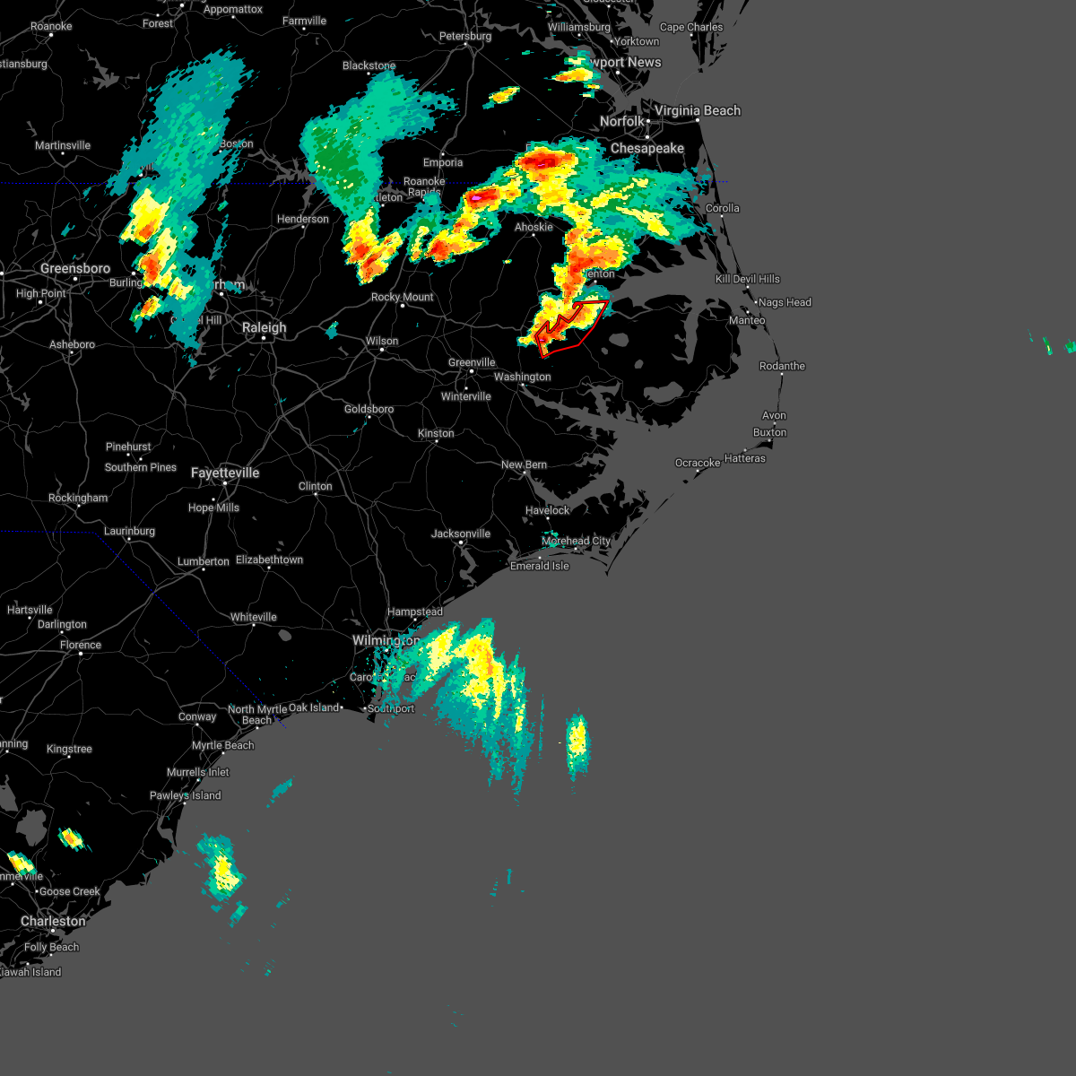
| 8/4/2020 1:18 AM EDT |
 At 117 am edt, a confirmed tornado was located near windsor, moving north at 40 mph (radar confirmed tornado). Hazards include damaging tornado. Flying debris will be dangerous to those caught without shelter. mobile homes will be damaged or destroyed. damage to roofs, windows, and vehicles will occur. tree damage is likely. This tornadic thunderstorm will remain over mainly rural areas of central bertie county, including the following locations, wakelon, askewville, whites crossroads, merry hill, woodard, rosemead, republican, midway and buena vista. At 117 am edt, a confirmed tornado was located near windsor, moving north at 40 mph (radar confirmed tornado). Hazards include damaging tornado. Flying debris will be dangerous to those caught without shelter. mobile homes will be damaged or destroyed. damage to roofs, windows, and vehicles will occur. tree damage is likely. This tornadic thunderstorm will remain over mainly rural areas of central bertie county, including the following locations, wakelon, askewville, whites crossroads, merry hill, woodard, rosemead, republican, midway and buena vista.
|
| 8/4/2020 1:09 AM EDT |
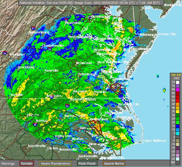 At 109 am edt, a severe thunderstorm capable of producing a tornado was located 7 miles west of plymouth, moving north at 45 mph (radar indicated rotation). Hazards include tornado. Flying debris will be dangerous to those caught without shelter. mobile homes will be damaged or destroyed. damage to roofs, windows, and vehicles will occur. tree damage is likely. this dangerous storm will be near, windsor around 125 am edt. Other locations impacted by this tornadic thunderstorm include wakelon, askewville, whites crossroads, merry hill, woodard, rosemead, republican, midway and buena vista. At 109 am edt, a severe thunderstorm capable of producing a tornado was located 7 miles west of plymouth, moving north at 45 mph (radar indicated rotation). Hazards include tornado. Flying debris will be dangerous to those caught without shelter. mobile homes will be damaged or destroyed. damage to roofs, windows, and vehicles will occur. tree damage is likely. this dangerous storm will be near, windsor around 125 am edt. Other locations impacted by this tornadic thunderstorm include wakelon, askewville, whites crossroads, merry hill, woodard, rosemead, republican, midway and buena vista.
|
| 8/4/2020 1:07 AM EDT |
 The tornado warning for southwestern washington, southeastern martin and north central beaufort counties will expire at 115 am edt, the storm which prompted the warning has moved out of the area. therefore, the warning will be allowed to expire. a tornado watch remains in effect until 600 am edt for eastern north carolina. The tornado warning for southwestern washington, southeastern martin and north central beaufort counties will expire at 115 am edt, the storm which prompted the warning has moved out of the area. therefore, the warning will be allowed to expire. a tornado watch remains in effect until 600 am edt for eastern north carolina.
|
| 8/4/2020 12:56 AM EDT |
 At 1256 am edt, a severe thunderstorm capable of producing a tornado was located over yeatesville, or 12 miles east of river road, moving northwest at 60 mph (radar indicated rotation). Hazards include tornado. Flying debris will be dangerous to those caught without shelter. mobile homes will be damaged or destroyed. damage to roofs, windows, and vehicles will occur. Tree damage is likely. At 1256 am edt, a severe thunderstorm capable of producing a tornado was located over yeatesville, or 12 miles east of river road, moving northwest at 60 mph (radar indicated rotation). Hazards include tornado. Flying debris will be dangerous to those caught without shelter. mobile homes will be damaged or destroyed. damage to roofs, windows, and vehicles will occur. Tree damage is likely.
|
| 8/4/2020 12:47 AM EDT |
 At 1246 am edt, a severe thunderstorm capable of producing a tornado was located over terra ceia, or 14 miles northeast of river road, moving north at 50 mph (radar indicated rotation). Hazards include tornado. Flying debris will be dangerous to those caught without shelter. mobile homes will be damaged or destroyed. damage to roofs, windows, and vehicles will occur. Tree damage is likely. At 1246 am edt, a severe thunderstorm capable of producing a tornado was located over terra ceia, or 14 miles northeast of river road, moving north at 50 mph (radar indicated rotation). Hazards include tornado. Flying debris will be dangerous to those caught without shelter. mobile homes will be damaged or destroyed. damage to roofs, windows, and vehicles will occur. Tree damage is likely.
|
| 4/13/2020 9:56 AM EDT |
 At 955 am edt, a severe thunderstorm capable of producing a tornado was located near plymouth, moving northeast at 65 mph (radar indicated rotation). Hazards include tornado. Flying debris will be dangerous to those caught without shelter. mobile homes will be damaged or destroyed. damage to roofs, windows, and vehicles will occur. Tree damage is likely. At 955 am edt, a severe thunderstorm capable of producing a tornado was located near plymouth, moving northeast at 65 mph (radar indicated rotation). Hazards include tornado. Flying debris will be dangerous to those caught without shelter. mobile homes will be damaged or destroyed. damage to roofs, windows, and vehicles will occur. Tree damage is likely.
|
| 4/13/2020 9:55 AM EDT | Large tree down on styons roa in washington county NC, 1.7 miles NW of Plymouth, NC |
| 4/13/2020 9:53 AM EDT | Trees down on 8th stree in washington county NC, 0.3 miles SSW of Plymouth, NC |
| 4/13/2020 9:52 AM EDT | Trees down near nc 45 and nc 3 in washington county NC, 1.3 miles NNW of Plymouth, NC |
| 4/13/2020 9:52 AM EDT | Power lines down at wilson st and hyman l in washington county NC, 0.6 miles NE of Plymouth, NC |
| 4/13/2020 9:46 AM EDT |
 At 946 am edt, severe thunderstorms were located along a line extending from near hinson to near tuscarora to edgecomb, moving east at 35 mph (law enforcement). Hazards include 60 mph wind gusts. Expect damage to roofs, siding, and trees. locations impacted include, jacksonville, new bern, havelock, washington, plymouth, pumpkin center, piney green, new river station, river road, half moon, camp lejeune center, trent woods, river bend, stella, swansboro, hubert, cape carteret, pinetown, blounts creek and maysville. A tornado watch remains in effect until noon edt for eastern north carolina. At 946 am edt, severe thunderstorms were located along a line extending from near hinson to near tuscarora to edgecomb, moving east at 35 mph (law enforcement). Hazards include 60 mph wind gusts. Expect damage to roofs, siding, and trees. locations impacted include, jacksonville, new bern, havelock, washington, plymouth, pumpkin center, piney green, new river station, river road, half moon, camp lejeune center, trent woods, river bend, stella, swansboro, hubert, cape carteret, pinetown, blounts creek and maysville. A tornado watch remains in effect until noon edt for eastern north carolina.
|
| 4/13/2020 9:28 AM EDT |
 At 927 am edt, severe thunderstorms were located along a line extending from near old ford to near phillips crossroads to near rocky point, moving east at 30 mph (radar indicated). Hazards include 60 mph wind gusts. expect damage to roofs, siding, and trees At 927 am edt, severe thunderstorms were located along a line extending from near old ford to near phillips crossroads to near rocky point, moving east at 30 mph (radar indicated). Hazards include 60 mph wind gusts. expect damage to roofs, siding, and trees
|
| 4/6/2020 6:32 PM EDT |
 At 631 pm edt, severe thunderstorms were located along a line extending from near phelps lake to core point to near wyse fork, moving east at 45 mph (law enforcement). Hazards include 60 mph wind gusts and nickel size hail. Expect damage to roofs, siding, and trees. Locations impacted include, new bern, washington, plymouth, river road, belhaven, ransomville, ponzer, pinetown, pungo, blounts creek, pamlico beach, vanceboro, askins, cayton, columbia, fort barnwell, tuscarora, jasper, wilmar and bonnerton. At 631 pm edt, severe thunderstorms were located along a line extending from near phelps lake to core point to near wyse fork, moving east at 45 mph (law enforcement). Hazards include 60 mph wind gusts and nickel size hail. Expect damage to roofs, siding, and trees. Locations impacted include, new bern, washington, plymouth, river road, belhaven, ransomville, ponzer, pinetown, pungo, blounts creek, pamlico beach, vanceboro, askins, cayton, columbia, fort barnwell, tuscarora, jasper, wilmar and bonnerton.
|
| 4/6/2020 6:10 PM EDT |
 At 610 pm edt, severe thunderstorms were located along a line extending from near plymouth to near washington to near kinston regional jetport, moving southeast at 45 mph (radar indicated). Hazards include 60 mph wind gusts and quarter size hail. Hail damage to vehicles is expected. Expect wind damage to roofs, siding, and trees. At 610 pm edt, severe thunderstorms were located along a line extending from near plymouth to near washington to near kinston regional jetport, moving southeast at 45 mph (radar indicated). Hazards include 60 mph wind gusts and quarter size hail. Hail damage to vehicles is expected. Expect wind damage to roofs, siding, and trees.
|
| 1/12/2020 3:04 AM EST |
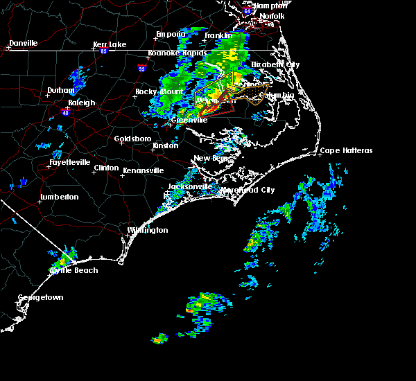 At 303 am est, a severe thunderstorm capable of producing a tornado was located near hinson, or near plymouth, moving northeast at 60 mph (radar indicated rotation). Hazards include tornado. Flying debris will be dangerous to those caught without shelter. mobile homes will be damaged or destroyed. damage to roofs, windows, and vehicles will occur. tree damage is likely. Locations impacted include, plymouth, hinson, westover, mackeys, roper, jamesville and dardens. At 303 am est, a severe thunderstorm capable of producing a tornado was located near hinson, or near plymouth, moving northeast at 60 mph (radar indicated rotation). Hazards include tornado. Flying debris will be dangerous to those caught without shelter. mobile homes will be damaged or destroyed. damage to roofs, windows, and vehicles will occur. tree damage is likely. Locations impacted include, plymouth, hinson, westover, mackeys, roper, jamesville and dardens.
|
| 1/12/2020 2:37 AM EST |
 At 237 am est, a severe thunderstorm capable of producing a tornado was located near williamston, moving northeast at 35 mph (radar indicated rotation). Hazards include tornado. Flying debris will be dangerous to those caught without shelter. mobile homes will be damaged or destroyed. damage to roofs, windows, and vehicles will occur. Tree damage is likely. At 237 am est, a severe thunderstorm capable of producing a tornado was located near williamston, moving northeast at 35 mph (radar indicated rotation). Hazards include tornado. Flying debris will be dangerous to those caught without shelter. mobile homes will be damaged or destroyed. damage to roofs, windows, and vehicles will occur. Tree damage is likely.
|
| 8/23/2019 8:02 PM EDT |
 At 801 pm edt, severe thunderstorms were located along a line extending from near pungo lake to terra ceia to near pactolus, moving east at 20 mph (radar indicated). Hazards include 60 mph wind gusts and nickel size hail. Expect damage to roofs, siding, and trees. Locations impacted include, washington, plymouth, belhaven, ponzer, pinetown, pungo, pactolus, black jack, wenona, hinson, bunyan, pike road, leechville, terra ceia, yeatesville, old ford, phelps lake, pungo lake, roper and long acre vfd. At 801 pm edt, severe thunderstorms were located along a line extending from near pungo lake to terra ceia to near pactolus, moving east at 20 mph (radar indicated). Hazards include 60 mph wind gusts and nickel size hail. Expect damage to roofs, siding, and trees. Locations impacted include, washington, plymouth, belhaven, ponzer, pinetown, pungo, pactolus, black jack, wenona, hinson, bunyan, pike road, leechville, terra ceia, yeatesville, old ford, phelps lake, pungo lake, roper and long acre vfd.
|
| 8/23/2019 7:32 PM EDT |
 At 731 pm edt, severe thunderstorms were located along a line extending from near wenona to near bunyan to near wilmar, moving northeast at 20 mph (radar indicated). Hazards include 60 mph wind gusts and nickel size hail. expect damage to roofs, siding, and trees At 731 pm edt, severe thunderstorms were located along a line extending from near wenona to near bunyan to near wilmar, moving northeast at 20 mph (radar indicated). Hazards include 60 mph wind gusts and nickel size hail. expect damage to roofs, siding, and trees
|
| 8/23/2019 5:41 PM EDT |
 At 541 pm edt, a severe thunderstorm was located 7 miles southeast of windsor, moving east at 25 mph (radar indicated). Hazards include 60 mph wind gusts and quarter size hail. Minor damage to vehicles is possible. expect wind damage to trees and powerlines. Locations impacted include, windsor and woodard. At 541 pm edt, a severe thunderstorm was located 7 miles southeast of windsor, moving east at 25 mph (radar indicated). Hazards include 60 mph wind gusts and quarter size hail. Minor damage to vehicles is possible. expect wind damage to trees and powerlines. Locations impacted include, windsor and woodard.
|
| 8/23/2019 5:18 PM EDT |
 At 517 pm edt, a severe thunderstorm was located over williamston, moving east at 25 mph (radar indicated). Hazards include 60 mph wind gusts and quarter size hail. Minor damage to vehicles is possible. expect wind damage to trees and powerlines. This severe thunderstorm will remain over mainly rural areas of southeastern bertie county, including the following locations, woodard. At 517 pm edt, a severe thunderstorm was located over williamston, moving east at 25 mph (radar indicated). Hazards include 60 mph wind gusts and quarter size hail. Minor damage to vehicles is possible. expect wind damage to trees and powerlines. This severe thunderstorm will remain over mainly rural areas of southeastern bertie county, including the following locations, woodard.
|
| 8/22/2019 8:56 PM EDT |
 The national weather service in newport has issued a * severe thunderstorm warning for. northern pitt county in eastern north carolina. martin county in eastern north carolina. northwestern beaufort county in eastern north carolina. Until 930 pm edt. The national weather service in newport has issued a * severe thunderstorm warning for. northern pitt county in eastern north carolina. martin county in eastern north carolina. northwestern beaufort county in eastern north carolina. Until 930 pm edt.
|
| 7/23/2019 5:20 PM EDT |
 A severe thunderstorm warning remains in effect until 530 pm edt for greene. west central washington. pitt. martin and northwestern beaufort counties. At 520 pm edt, severe thunderstorms were located along a line extending from near bethel to near east carolina university, and are nearly stationary. A severe thunderstorm warning remains in effect until 530 pm edt for greene. west central washington. pitt. martin and northwestern beaufort counties. At 520 pm edt, severe thunderstorms were located along a line extending from near bethel to near east carolina university, and are nearly stationary.
|
| 7/23/2019 4:52 PM EDT |
 The national weather service in newport has issued a * severe thunderstorm warning for. greene county in eastern north carolina. west central washington county in eastern north carolina. pitt county in eastern north carolina. Martin county in eastern north carolina. The national weather service in newport has issued a * severe thunderstorm warning for. greene county in eastern north carolina. west central washington county in eastern north carolina. pitt county in eastern north carolina. Martin county in eastern north carolina.
|
| 5/31/2019 6:01 PM EDT |
 At 600 pm edt, a severe thunderstorm was located near roper, or near plymouth, moving northeast at 35 mph (radar indicated). Hazards include ping pong ball size hail and 60 mph wind gusts. People and animals outdoors will be injured. expect hail damage to roofs, siding, windows, and vehicles. expect wind damage to roofs, siding, and trees. Locations impacted include, plymouth, pleasant grove, westover, phelps lake, mackeys, roper and dardens. At 600 pm edt, a severe thunderstorm was located near roper, or near plymouth, moving northeast at 35 mph (radar indicated). Hazards include ping pong ball size hail and 60 mph wind gusts. People and animals outdoors will be injured. expect hail damage to roofs, siding, windows, and vehicles. expect wind damage to roofs, siding, and trees. Locations impacted include, plymouth, pleasant grove, westover, phelps lake, mackeys, roper and dardens.
|
| 5/31/2019 5:37 PM EDT |
 At 536 pm edt, a severe thunderstorm was located near hinson, or 11 miles southwest of plymouth, moving northeast at 35 mph (radar indicated). Hazards include ping pong ball size hail and 60 mph wind gusts. People and animals outdoors will be injured. expect hail damage to roofs, siding, windows, and vehicles. Expect wind damage to roofs, siding, and trees. At 536 pm edt, a severe thunderstorm was located near hinson, or 11 miles southwest of plymouth, moving northeast at 35 mph (radar indicated). Hazards include ping pong ball size hail and 60 mph wind gusts. People and animals outdoors will be injured. expect hail damage to roofs, siding, windows, and vehicles. Expect wind damage to roofs, siding, and trees.
|
| 5/31/2019 2:50 PM EDT | Trees down on highway 3 in washington county NC, 8.7 miles N of Plymouth, NC |
| 5/31/2019 2:35 PM EDT |
 At 234 pm edt, a severe thunderstorm was located near hinson, or 10 miles southwest of plymouth, moving east at 35 mph (radar indicated). Hazards include two inch hail and 60 mph wind gusts. People and animals outdoors will be injured. expect hail damage to roofs, siding, windows, and vehicles. expect wind damage to roofs, siding, and trees. Locations impacted include, williamston, plymouth, wenona, hinson, long acre vfd, jamesville, smithwick and dardens. At 234 pm edt, a severe thunderstorm was located near hinson, or 10 miles southwest of plymouth, moving east at 35 mph (radar indicated). Hazards include two inch hail and 60 mph wind gusts. People and animals outdoors will be injured. expect hail damage to roofs, siding, windows, and vehicles. expect wind damage to roofs, siding, and trees. Locations impacted include, williamston, plymouth, wenona, hinson, long acre vfd, jamesville, smithwick and dardens.
|
| 5/31/2019 2:23 PM EDT |
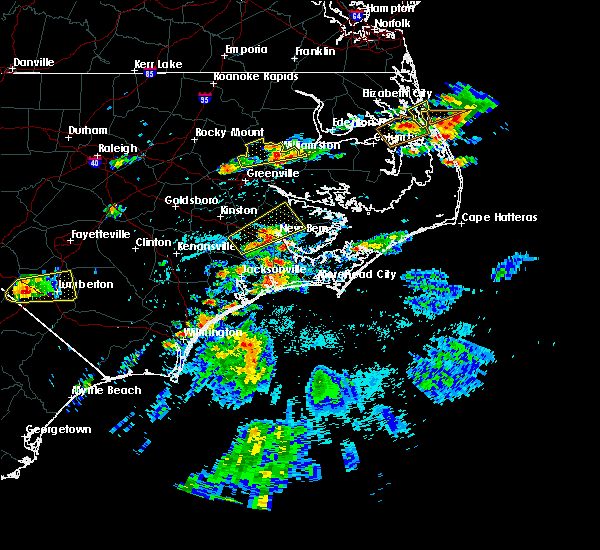 At 223 pm edt, a severe thunderstorm was located near williamston, moving east at 30 mph (radar indicated). Hazards include ping pong ball size hail and 60 mph wind gusts. People and animals outdoors will be injured. expect hail damage to roofs, siding, windows, and vehicles. Expect wind damage to roofs, siding, and trees. At 223 pm edt, a severe thunderstorm was located near williamston, moving east at 30 mph (radar indicated). Hazards include ping pong ball size hail and 60 mph wind gusts. People and animals outdoors will be injured. expect hail damage to roofs, siding, windows, and vehicles. Expect wind damage to roofs, siding, and trees.
|
| 5/13/2019 12:28 PM EDT |
 At 1228 pm edt, a severe thunderstorm was located near hinson, or near plymouth, moving east at 40 mph (law enforcement). Hazards include 60 mph wind gusts and half dollar size hail. Hail damage to vehicles is expected. Expect wind damage to roofs, siding, and trees. At 1228 pm edt, a severe thunderstorm was located near hinson, or near plymouth, moving east at 40 mph (law enforcement). Hazards include 60 mph wind gusts and half dollar size hail. Hail damage to vehicles is expected. Expect wind damage to roofs, siding, and trees.
|
| 5/13/2019 12:22 PM EDT |
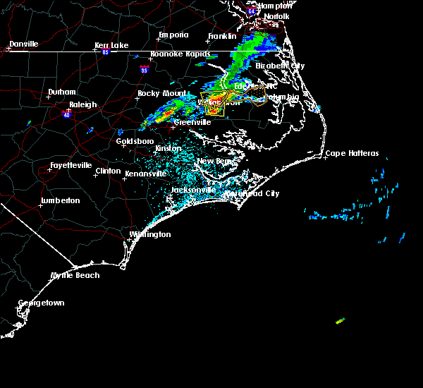 At 1221 pm edt, a severe thunderstorm was located near plymouth, moving east at 45 mph (radar indicated). Hazards include 60 mph wind gusts and half dollar size hail. Hail damage to vehicles is expected. expect wind damage to roofs, siding, and trees. Locations impacted include, plymouth, hinson, jamesville and dardens. At 1221 pm edt, a severe thunderstorm was located near plymouth, moving east at 45 mph (radar indicated). Hazards include 60 mph wind gusts and half dollar size hail. Hail damage to vehicles is expected. expect wind damage to roofs, siding, and trees. Locations impacted include, plymouth, hinson, jamesville and dardens.
|
| 5/13/2019 12:04 PM EDT |
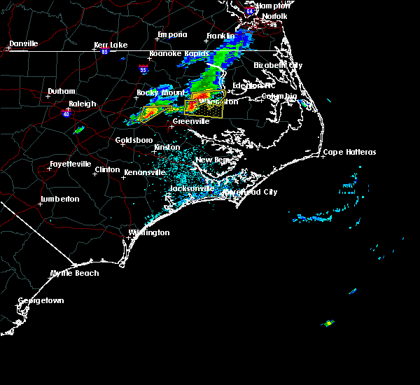 A severe thunderstorm warning remains in effect until 1230 pm edt for southwestern washington and central martin counties. at 1203 pm edt, a severe thunderstorm was located near williamston, moving east at 45 mph. hazard. 60 mph wind gusts and half dollar size hail. source. Radar indicated. A severe thunderstorm warning remains in effect until 1230 pm edt for southwestern washington and central martin counties. at 1203 pm edt, a severe thunderstorm was located near williamston, moving east at 45 mph. hazard. 60 mph wind gusts and half dollar size hail. source. Radar indicated.
|
| 5/13/2019 11:43 AM EDT |
 At 1143 am edt, a severe thunderstorm was located near robersonville, or 13 miles west of williamston, moving east at 50 mph (radar indicated). Hazards include 60 mph wind gusts and quarter size hail. Hail damage to vehicles is expected. Expect wind damage to roofs, siding, and trees. At 1143 am edt, a severe thunderstorm was located near robersonville, or 13 miles west of williamston, moving east at 50 mph (radar indicated). Hazards include 60 mph wind gusts and quarter size hail. Hail damage to vehicles is expected. Expect wind damage to roofs, siding, and trees.
|
| 4/19/2019 7:59 PM EDT |
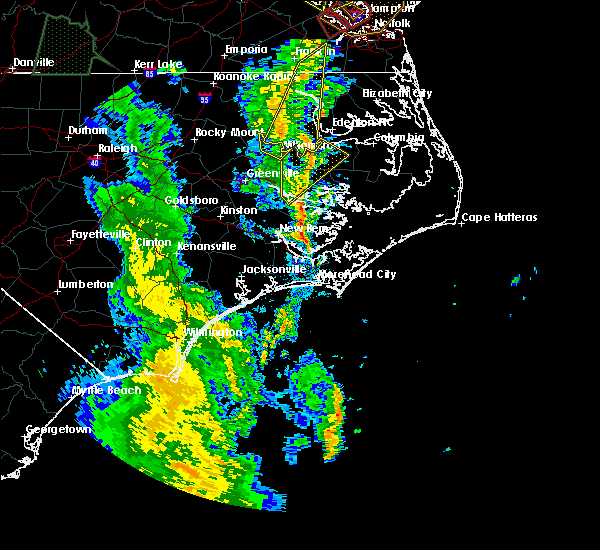 At 758 pm edt, a severe thunderstorm was located near hinson, or 7 miles southwest of plymouth, moving northeast at 50 mph (radar indicated). Hazards include 70 mph wind gusts. Expect considerable tree damage. damage is likely to mobile homes, roofs, and outbuildings. locations impacted include, washington, plymouth, river road, pinetown, bunyan, wenona, hinson, westover, terra ceia, goose creek state park, mackeys, roper, long acre vfd, jamesville, washington park, smithwick and dardens. A tornado watch remains in effect until midnight edt for eastern north carolina. At 758 pm edt, a severe thunderstorm was located near hinson, or 7 miles southwest of plymouth, moving northeast at 50 mph (radar indicated). Hazards include 70 mph wind gusts. Expect considerable tree damage. damage is likely to mobile homes, roofs, and outbuildings. locations impacted include, washington, plymouth, river road, pinetown, bunyan, wenona, hinson, westover, terra ceia, goose creek state park, mackeys, roper, long acre vfd, jamesville, washington park, smithwick and dardens. A tornado watch remains in effect until midnight edt for eastern north carolina.
|
| 4/19/2019 7:50 PM EDT |
 At 749 pm edt, severe thunderstorms were located along a line extending from near carrsville to near gates to 8 miles east of lewiston woodville, moving northeast at 50 mph (radar indicated). Hazards include 60 mph wind gusts. Expect damage to trees and powerlines. these severe storms will be near, gates and whaleyville around 755 pm edt. holland around 800 pm edt. ahoskie and colerain around 805 pm edt. cofield and harrellsville around 810 pm edt. gatesville, suffolk and roduco around 815 pm edt. other locations impacted by these severe thunderstorms include goose pond, whites crossroads, tunis, earleys, newsome store, chowan beach, topsy, republican, buckland and mount gould. A tornado watch remains in effect until midnight edt for northeastern north carolina, and southeastern virginia. At 749 pm edt, severe thunderstorms were located along a line extending from near carrsville to near gates to 8 miles east of lewiston woodville, moving northeast at 50 mph (radar indicated). Hazards include 60 mph wind gusts. Expect damage to trees and powerlines. these severe storms will be near, gates and whaleyville around 755 pm edt. holland around 800 pm edt. ahoskie and colerain around 805 pm edt. cofield and harrellsville around 810 pm edt. gatesville, suffolk and roduco around 815 pm edt. other locations impacted by these severe thunderstorms include goose pond, whites crossroads, tunis, earleys, newsome store, chowan beach, topsy, republican, buckland and mount gould. A tornado watch remains in effect until midnight edt for northeastern north carolina, and southeastern virginia.
|
| 4/19/2019 7:35 PM EDT |
 At 734 pm edt, severe thunderstorms were located along a line extending from 6 miles northeast of como to near winton to near aulander, moving northeast at 60 mph (radar indicated). Hazards include 60 mph wind gusts. Expect damage to trees and powerlines. severe thunderstorms will be near, harrellsville around 750 pm edt. gatesville and holland around 755 pm edt. gates and roduco around 800 pm edt. whaleyville around 810 pm edt. suffolk around 815 pm edt. other locations impacted by these severe thunderstorms include goose pond, whites crossroads, tunis, earleys, newsome store, chowan beach, topsy, republican, buckland and mount gould. A tornado watch remains in effect until midnight edt for northeastern north carolina, and southeastern virginia. At 734 pm edt, severe thunderstorms were located along a line extending from 6 miles northeast of como to near winton to near aulander, moving northeast at 60 mph (radar indicated). Hazards include 60 mph wind gusts. Expect damage to trees and powerlines. severe thunderstorms will be near, harrellsville around 750 pm edt. gatesville and holland around 755 pm edt. gates and roduco around 800 pm edt. whaleyville around 810 pm edt. suffolk around 815 pm edt. other locations impacted by these severe thunderstorms include goose pond, whites crossroads, tunis, earleys, newsome store, chowan beach, topsy, republican, buckland and mount gould. A tornado watch remains in effect until midnight edt for northeastern north carolina, and southeastern virginia.
|
| 4/19/2019 7:35 PM EDT |
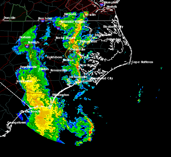 At 734 pm edt, a severe thunderstorm was located over washington, moving northeast at 50 mph (radar indicated). Hazards include 70 mph wind gusts. Expect considerable tree damage. Damage is likely to mobile homes, roofs, and outbuildings. At 734 pm edt, a severe thunderstorm was located over washington, moving northeast at 50 mph (radar indicated). Hazards include 70 mph wind gusts. Expect considerable tree damage. Damage is likely to mobile homes, roofs, and outbuildings.
|
| 4/19/2019 2:38 PM EDT |
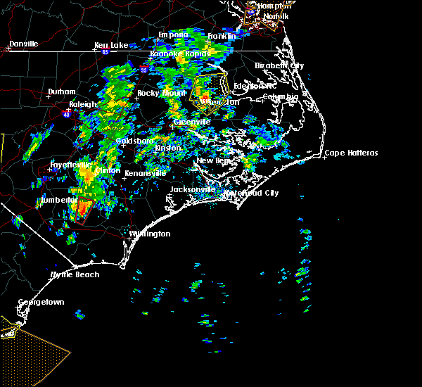 At 237 pm edt, a severe thunderstorm was located near williamston, moving northeast at 30 mph (radar indicated). Hazards include 60 mph wind gusts. Expect damage to roofs, siding, and trees. locations impacted include, williamston, jamesville and dardens. A tornado watch remains in effect until midnight edt for eastern north carolina. At 237 pm edt, a severe thunderstorm was located near williamston, moving northeast at 30 mph (radar indicated). Hazards include 60 mph wind gusts. Expect damage to roofs, siding, and trees. locations impacted include, williamston, jamesville and dardens. A tornado watch remains in effect until midnight edt for eastern north carolina.
|
| 4/19/2019 2:13 PM EDT |
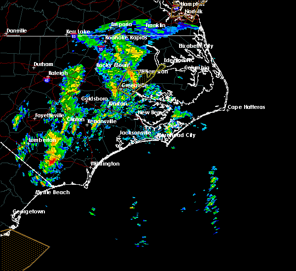 At 212 pm edt, a severe thunderstorm was located near williamston, moving northeast at 45 mph (radar indicated). Hazards include 60 mph wind gusts. expect damage to roofs, siding, and trees At 212 pm edt, a severe thunderstorm was located near williamston, moving northeast at 45 mph (radar indicated). Hazards include 60 mph wind gusts. expect damage to roofs, siding, and trees
|
| 4/19/2019 1:52 PM EDT |
 At 152 pm edt, a severe thunderstorm was located near pactolus, or near greenville, moving northeast at 55 mph (radar indicated). Hazards include 60 mph wind gusts. expect damage to roofs, siding, and trees At 152 pm edt, a severe thunderstorm was located near pactolus, or near greenville, moving northeast at 55 mph (radar indicated). Hazards include 60 mph wind gusts. expect damage to roofs, siding, and trees
|
| 4/15/2019 4:10 AM EDT |
 At 409 am edt, severe thunderstorms were located along a line extending from near pungo to broad creek, moving northeast at 55 mph (radar indicated). Hazards include 60 mph wind gusts. expect damage to roofs, siding, and trees At 409 am edt, severe thunderstorms were located along a line extending from near pungo to broad creek, moving northeast at 55 mph (radar indicated). Hazards include 60 mph wind gusts. expect damage to roofs, siding, and trees
|
| 11/13/2018 4:06 AM EST |
 At 405 am est, severe thunderstorms were located along a line extending from cape colony to wenona to bayview, moving northeast at 50 mph (radar indicated). Hazards include 60 mph wind gusts and nickel size hail. expect damage to roofs, siding, and trees At 405 am est, severe thunderstorms were located along a line extending from cape colony to wenona to bayview, moving northeast at 50 mph (radar indicated). Hazards include 60 mph wind gusts and nickel size hail. expect damage to roofs, siding, and trees
|
| 11/13/2018 3:50 AM EST |
 At 350 am est, severe thunderstorms were located along a line extending from near plymouth to near bunyan to near vanceboro, moving northeast at 70 mph (radar indicated). Hazards include 60 mph wind gusts and quarter size hail. Hail damage to vehicles is expected. expect wind damage to roofs, siding, and trees. locations impacted include, washington, plymouth, river road, pinetown, blounts creek, vanceboro, askins, cayton, wilmar, edward, bonnerton, cox crossroads, wenona, hinson, bayview, bunyan, pike road, core point, terra ceia and yeatesville. A tornado watch remains in effect until 800 am est for eastern north carolina. At 350 am est, severe thunderstorms were located along a line extending from near plymouth to near bunyan to near vanceboro, moving northeast at 70 mph (radar indicated). Hazards include 60 mph wind gusts and quarter size hail. Hail damage to vehicles is expected. expect wind damage to roofs, siding, and trees. locations impacted include, washington, plymouth, river road, pinetown, blounts creek, vanceboro, askins, cayton, wilmar, edward, bonnerton, cox crossroads, wenona, hinson, bayview, bunyan, pike road, core point, terra ceia and yeatesville. A tornado watch remains in effect until 800 am est for eastern north carolina.
|
| 11/13/2018 3:32 AM EST |
 At 332 am est, severe thunderstorms were located along a line extending from near williamston to near black jack to near fort barnwell, moving northeast at 50 mph (radar indicated). Hazards include 60 mph wind gusts and quarter size hail. Hail damage to vehicles is expected. Expect wind damage to roofs, siding, and trees. At 332 am est, severe thunderstorms were located along a line extending from near williamston to near black jack to near fort barnwell, moving northeast at 50 mph (radar indicated). Hazards include 60 mph wind gusts and quarter size hail. Hail damage to vehicles is expected. Expect wind damage to roofs, siding, and trees.
|
| 9/14/2018 9:37 AM EDT |
 At 937 am edt, a severe thunderstorm capable of producing a tornado was located over scuppernong, or 15 miles east of plymouth, moving west at 35 mph (radar indicated rotation). Hazards include tornado. Flying debris will be dangerous to those caught without shelter. mobile homes will be damaged or destroyed. damage to roofs, windows, and vehicles will occur. tree damage is likely. this dangerous storm will be near, roper and pleasant grove around 950 am edt. westover around 955 am edt. plymouth and plymouth around 1000 am edt. Other locations impacted by this tornadic thunderstorm include mackeys, creswell and roper. At 937 am edt, a severe thunderstorm capable of producing a tornado was located over scuppernong, or 15 miles east of plymouth, moving west at 35 mph (radar indicated rotation). Hazards include tornado. Flying debris will be dangerous to those caught without shelter. mobile homes will be damaged or destroyed. damage to roofs, windows, and vehicles will occur. tree damage is likely. this dangerous storm will be near, roper and pleasant grove around 950 am edt. westover around 955 am edt. plymouth and plymouth around 1000 am edt. Other locations impacted by this tornadic thunderstorm include mackeys, creswell and roper.
|
| 5/10/2018 9:24 PM EDT |
 At 921 pm edt, a severe thunderstorm was located over plymouth, moving east at 35 mph (quarter size hail was reported in jamesville). Hazards include 60 mph wind gusts and quarter size hail. Hail damage to vehicles is expected. expect wind damage to roofs, siding, and trees. Locations impacted include, plymouth, hinson, pleasant grove, westover, scuppernong, phelps lake, mackeys, roper and dardens. At 921 pm edt, a severe thunderstorm was located over plymouth, moving east at 35 mph (quarter size hail was reported in jamesville). Hazards include 60 mph wind gusts and quarter size hail. Hail damage to vehicles is expected. expect wind damage to roofs, siding, and trees. Locations impacted include, plymouth, hinson, pleasant grove, westover, scuppernong, phelps lake, mackeys, roper and dardens.
|
| 5/10/2018 9:22 PM EDT | Trees down on long ridge road and highway 64. time estimated by rada in washington county NC, 1.5 miles NE of Plymouth, NC |
| 5/10/2018 9:15 PM EDT | Quarter sized hail reported 3.9 miles N of Plymouth, NC |
| 5/10/2018 9:03 PM EDT |
 At 902 pm edt, a severe thunderstorm was located 8 miles northwest of hinson, or 8 miles east of williamston, moving east at 35 mph (radar indicated). Hazards include 60 mph wind gusts and quarter size hail. Hail damage to vehicles is expected. Expect wind damage to roofs, siding, and trees. At 902 pm edt, a severe thunderstorm was located 8 miles northwest of hinson, or 8 miles east of williamston, moving east at 35 mph (radar indicated). Hazards include 60 mph wind gusts and quarter size hail. Hail damage to vehicles is expected. Expect wind damage to roofs, siding, and trees.
|
| 8/23/2017 6:26 PM EDT |
 At 626 pm edt, severe thunderstorms were located along a line extending from 6 miles north of woodley to 6 miles west of hinson, moving east at 25 mph (radar indicated). Hazards include quarter size hail. damage to vehicles is expected At 626 pm edt, severe thunderstorms were located along a line extending from 6 miles north of woodley to 6 miles west of hinson, moving east at 25 mph (radar indicated). Hazards include quarter size hail. damage to vehicles is expected
|
| 7/6/2017 8:49 PM EDT |
 At 849 pm edt, a severe thunderstorm was located near robersonville, or near williamston, moving east at 40 mph (radar indicated). Hazards include 60 mph wind gusts and quarter size hail. Hail damage to vehicles is expected. Expect wind damage to roofs, siding, and trees. At 849 pm edt, a severe thunderstorm was located near robersonville, or near williamston, moving east at 40 mph (radar indicated). Hazards include 60 mph wind gusts and quarter size hail. Hail damage to vehicles is expected. Expect wind damage to roofs, siding, and trees.
|
| 5/5/2017 7:54 AM EDT |
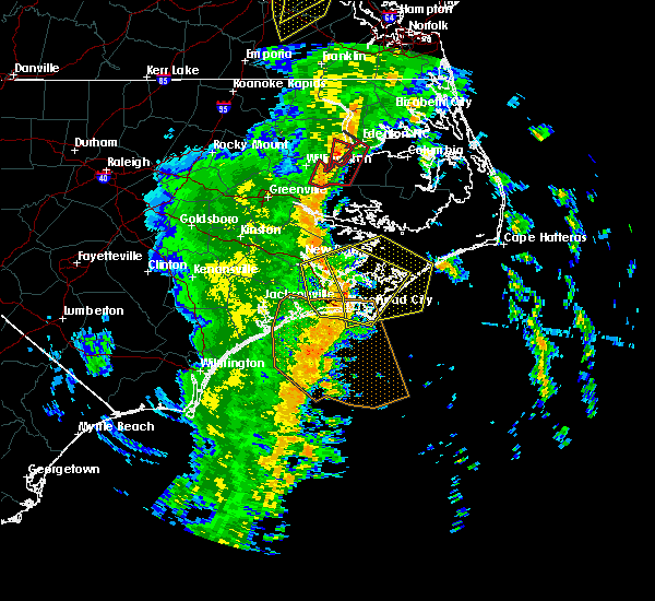 The tornado warning for western washington and southeastern martin counties will expire at 800 am edt, the storm which prompted the warning has moved out of the area. therefore the warning will be allowed to expire. a tornado watch remains in effect until 100 pm edt for eastern north carolina. The tornado warning for western washington and southeastern martin counties will expire at 800 am edt, the storm which prompted the warning has moved out of the area. therefore the warning will be allowed to expire. a tornado watch remains in effect until 100 pm edt for eastern north carolina.
|
| 5/5/2017 7:44 AM EDT |
 At 743 am edt, a severe thunderstorm capable of producing a tornado was located near plymouth, moving northeast at 40 mph (radar indicated rotation). Hazards include tornado. Flying debris will be dangerous to those caught without shelter. mobile homes will be damaged or destroyed. damage to roofs, windows, and vehicles will occur. tree damage is likely. this dangerous storm will be near, cape colony around 810 am edt. Other locations impacted by this tornadic thunderstorm include jamesville and roper. At 743 am edt, a severe thunderstorm capable of producing a tornado was located near plymouth, moving northeast at 40 mph (radar indicated rotation). Hazards include tornado. Flying debris will be dangerous to those caught without shelter. mobile homes will be damaged or destroyed. damage to roofs, windows, and vehicles will occur. tree damage is likely. this dangerous storm will be near, cape colony around 810 am edt. Other locations impacted by this tornadic thunderstorm include jamesville and roper.
|
| 5/5/2017 7:30 AM EDT |
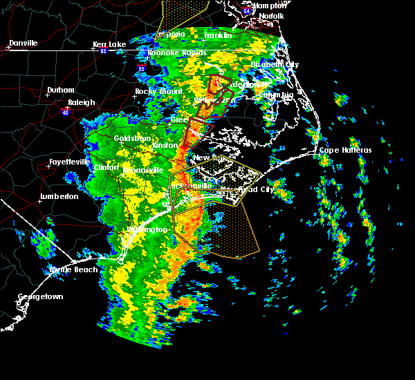 At 730 am edt, a severe thunderstorm capable of producing a tornado was located 8 miles north of pinetown, or 11 miles southwest of plymouth, moving northeast at 45 mph (radar indicated rotation). Hazards include tornado. Flying debris will be dangerous to those caught without shelter. mobile homes will be damaged or destroyed. damage to roofs, windows, and vehicles will occur. tree damage is likely. this dangerous storm will be near, plymouth and plymouth around 745 am edt. Other locations impacted by this tornadic thunderstorm include jamesville and roper. At 730 am edt, a severe thunderstorm capable of producing a tornado was located 8 miles north of pinetown, or 11 miles southwest of plymouth, moving northeast at 45 mph (radar indicated rotation). Hazards include tornado. Flying debris will be dangerous to those caught without shelter. mobile homes will be damaged or destroyed. damage to roofs, windows, and vehicles will occur. tree damage is likely. this dangerous storm will be near, plymouth and plymouth around 745 am edt. Other locations impacted by this tornadic thunderstorm include jamesville and roper.
|
| 7/30/2016 3:06 PM EDT |
 At 305 pm edt, a severe thunderstorm was located 9 miles east of plymouth, moving east at 20 mph (radar indicated). Hazards include 60 mph wind gusts. Expect damage to roofs. siding. and trees. Locations impacted include, roper. At 305 pm edt, a severe thunderstorm was located 9 miles east of plymouth, moving east at 20 mph (radar indicated). Hazards include 60 mph wind gusts. Expect damage to roofs. siding. and trees. Locations impacted include, roper.
|
| 7/30/2016 2:44 PM EDT |
 At 242 pm edt, a severe thunderstorm was located near plymouth, moving northeast at 15 mph (radar indicated). Hazards include 60 mph wind gusts and quarter size hail. Expect wind damage to roofs. siding. And trees. At 242 pm edt, a severe thunderstorm was located near plymouth, moving northeast at 15 mph (radar indicated). Hazards include 60 mph wind gusts and quarter size hail. Expect wind damage to roofs. siding. And trees.
|
| 7/5/2016 8:01 PM EDT |
 At 757 pm edt, severe thunderstorms were located along a line extending from 8 miles east of plymouth to 11 miles north of belhaven to 10 miles northeast of washington, moving east at 60 mph (radar indicated). Hazards include 60 mph wind gusts and quarter size hail. Hail damage to vehicles is expected. expect wind damage to roofs, siding, and trees. Locations impacted include, plymouth, belhaven, roper, creswell and pantego. At 757 pm edt, severe thunderstorms were located along a line extending from 8 miles east of plymouth to 11 miles north of belhaven to 10 miles northeast of washington, moving east at 60 mph (radar indicated). Hazards include 60 mph wind gusts and quarter size hail. Hail damage to vehicles is expected. expect wind damage to roofs, siding, and trees. Locations impacted include, plymouth, belhaven, roper, creswell and pantego.
|
| 7/5/2016 7:34 PM EDT |
 At 733 pm edt, severe thunderstorms were located along a line extending from 7 miles east of williamston to 9 miles southeast of robersonville, moving east at 45 mph (radar indicated). Hazards include 60 mph wind gusts and quarter size hail. Hail damage to vehicles is expected. Expect wind damage to roofs, siding, and trees. At 733 pm edt, severe thunderstorms were located along a line extending from 7 miles east of williamston to 9 miles southeast of robersonville, moving east at 45 mph (radar indicated). Hazards include 60 mph wind gusts and quarter size hail. Hail damage to vehicles is expected. Expect wind damage to roofs, siding, and trees.
|
| 7/5/2016 6:37 PM EDT |
 At 637 pm edt, a severe thunderstorm was located near windsor, moving southeast at 25 mph (radar indicated). Hazards include 60 mph wind gusts and quarter size hail. Hail damage to vehicles is expected. expect wind damage to roofs, siding, and trees. this severe thunderstorm will be near, windsor around 640 pm edt. Other locations impacted by this severe thunderstorm include merry hill, woodard, midway and edenhouse. At 637 pm edt, a severe thunderstorm was located near windsor, moving southeast at 25 mph (radar indicated). Hazards include 60 mph wind gusts and quarter size hail. Hail damage to vehicles is expected. expect wind damage to roofs, siding, and trees. this severe thunderstorm will be near, windsor around 640 pm edt. Other locations impacted by this severe thunderstorm include merry hill, woodard, midway and edenhouse.
|
| 2/24/2016 5:14 PM EST |
 At 513 pm est, doppler radar indicated a severe thunderstorm capable of producing destructive winds in excess of 70 mph. this storm was located over goose creek state park, or near river road, moving northeast at 50 mph. locations impacted include, washington, plymouth, belhaven, goose creek state park and pantego. a tornado watch remains in effect until 700 pm est for eastern north carolina. a tornado watch also remains in effect until 900 pm est for eastern north carolina. At 513 pm est, doppler radar indicated a severe thunderstorm capable of producing destructive winds in excess of 70 mph. this storm was located over goose creek state park, or near river road, moving northeast at 50 mph. locations impacted include, washington, plymouth, belhaven, goose creek state park and pantego. a tornado watch remains in effect until 700 pm est for eastern north carolina. a tornado watch also remains in effect until 900 pm est for eastern north carolina.
|
| 2/24/2016 5:11 PM EST |
 At 510 pm est, doppler radar indicated a severe thunderstorm capable of producing a tornado. this dangerous storm was located over goose creek state park, or near river road, and moving northeast at 55 mph. At 510 pm est, doppler radar indicated a severe thunderstorm capable of producing a tornado. this dangerous storm was located over goose creek state park, or near river road, and moving northeast at 55 mph.
|
| 2/24/2016 5:01 PM EST |
 At 501 pm est, doppler radar indicated a severe thunderstorm capable of producing damaging winds in excess of 60 mph. this storm was located 9 miles east of vanceboro, or 12 miles south of river road, and moving northeast at 55 mph. At 501 pm est, doppler radar indicated a severe thunderstorm capable of producing damaging winds in excess of 60 mph. this storm was located 9 miles east of vanceboro, or 12 miles south of river road, and moving northeast at 55 mph.
|
| 5/21/2015 4:59 PM EDT | At 422 pm edt, doppler radar indicated a line of severe thunderstorms capable of producing quarter size hail and damaging winds in excess of 60 mph. these storms were located along a line extending from near plymouth to near washington, and moving east at 35 mph. |
| 5/21/2015 4:22 PM EDT | At 422 pm edt, doppler radar indicated a line of severe thunderstorms capable of producing quarter size hail and damaging winds in excess of 60 mph. these storms were located along a line extending from near plymouth to near washington, and moving east at 35 mph. |
| 3/11/2015 11:56 AM EDT | A severe thunderstorm warning remains in effect until 630 pm edt for southern washington. western mainland hyde. southeastern martin and northern beaufort counties. at 555 pm edt. doppler radar indicated a severe thunderstorm capable of producing quarter size hail and damaging winds in excess of 60 mph. This storm was located 12 miles north of goose creek state. |
| 3/11/2015 11:42 AM EDT | The national weather service in newport has issued a * severe thunderstorm warning for. southern washington county in eastern north carolina. western mainland hyde county in eastern north carolina. southeastern martin county in eastern north carolina. Northern beaufort county in eastern north carolina. |
| 3/11/2015 11:23 AM EDT | A severe thunderstorm warning remains in effect until 545 pm edt for martin. northwestern beaufort and northeastern pitt counties. at 522 pm edt. doppler radar indicated a severe thunderstorm capable of producing quarter size hail and damaging winds in excess of 60 mph. this storm was located near robersonville. or 10 miles southwest of williamston. Moving east at 35 mph. |
| 3/11/2015 11:06 AM EDT | The national weather service in newport has issued a * severe thunderstorm warning for. martin county in eastern north carolina. northwestern beaufort county in eastern north carolina. northeastern pitt county in eastern north carolina. Until 545 pm edt. |
| 1/1/0001 12:00 AM | Tree down on shed in brinkley place in washington county NC, 0.3 miles SSW of Plymouth, NC |
| 1/1/0001 12:00 AM | Powerlines down on cherry st in washington county NC, 0.3 miles SSW of Plymouth, NC |
| 1/1/0001 12:00 AM | Tree down on highway 45 north 3 miles east of plymouth in washington county NC, 3.5 miles W of Plymouth, NC |
Hail Maps for Plymouth, NC


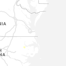


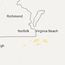


Connect with Interactive Hail Maps