

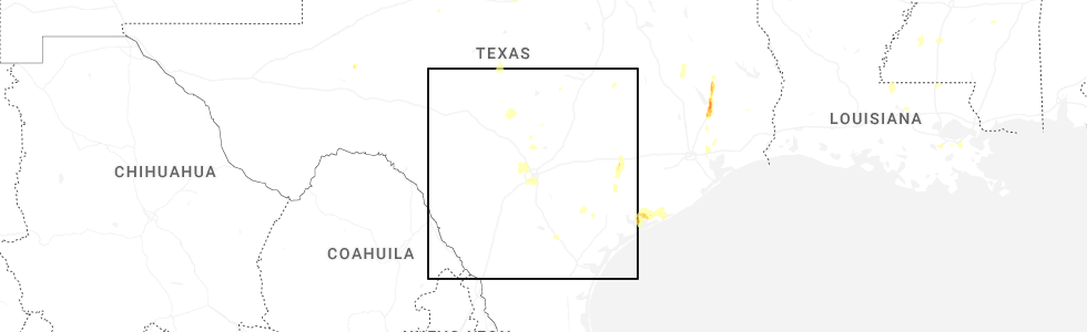
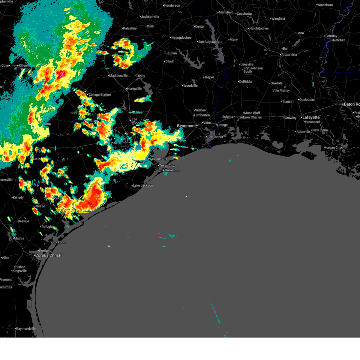
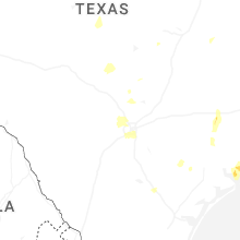
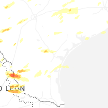
Hail Map for Point Comfort, TX
The Point Comfort, TX area has had 0 reports of on-the-ground hail by trained spotters, and has been under severe weather warnings 1 time during the past 12 months. Doppler radar has detected hail at or near Point Comfort, TX on 23 occasions, including 2 occasions during the past year.
| Name: | Point Comfort, TX |
| Where Located: | 79.4 miles NE of Corpus Christi, TX |
| Map: | Google Map for Point Comfort, TX |
| Population: | 737 |
| Housing Units: | 378 |
| More Info: | Search Google for Point Comfort, TX |
0
The Top Recent Hail Date for Point Comfort, TX is Wednesday, June 11, 2025 (12th out of 23)
Hail and Wind Damage Spotted near Point Comfort, TX
| Date / Time | Report Details |
|---|---|
| 6/12/2025 3:44 AM CDT |
 Svrhgx the national weather service in league city has issued a * severe thunderstorm warning for, south central wharton county in southeastern texas, southeastern jackson county in south central texas, northwestern matagorda county in southeastern texas, * until 445 am cdt. * at 344 am cdt, a cluster of training severe thunderstorms was located over palacios, moving northeast at 15 mph (radar indicated). Hazards include 60 mph wind gusts and quarter size hail. Hail damage to vehicles is expected. Expect wind damage to roofs, siding, and trees. Svrhgx the national weather service in league city has issued a * severe thunderstorm warning for, south central wharton county in southeastern texas, southeastern jackson county in south central texas, northwestern matagorda county in southeastern texas, * until 445 am cdt. * at 344 am cdt, a cluster of training severe thunderstorms was located over palacios, moving northeast at 15 mph (radar indicated). Hazards include 60 mph wind gusts and quarter size hail. Hail damage to vehicles is expected. Expect wind damage to roofs, siding, and trees.
|
| 6/5/2024 1:07 PM CDT |
 The storms which prompted the warning have weakened below severe limits, and no longer pose an immediate threat to life or property. therefore, the warning will be allowed to expire. however, gusty winds are still possible with these thunderstorms. The storms which prompted the warning have weakened below severe limits, and no longer pose an immediate threat to life or property. therefore, the warning will be allowed to expire. however, gusty winds are still possible with these thunderstorms.
|
| 6/5/2024 12:16 PM CDT |
 Svrhgx the national weather service in league city has issued a * severe thunderstorm warning for, southeastern jackson county in south central texas, central matagorda county in southeastern texas, * until 115 pm cdt. * at 1216 pm cdt, severe thunderstorms were located along a line extending from 10 miles east of matagorda to 6 miles northwest of port lavaca, moving southeast at 20 mph (radar indicated). Hazards include 60 mph wind gusts. expect damage to roofs, siding, and trees Svrhgx the national weather service in league city has issued a * severe thunderstorm warning for, southeastern jackson county in south central texas, central matagorda county in southeastern texas, * until 115 pm cdt. * at 1216 pm cdt, severe thunderstorms were located along a line extending from 10 miles east of matagorda to 6 miles northwest of port lavaca, moving southeast at 20 mph (radar indicated). Hazards include 60 mph wind gusts. expect damage to roofs, siding, and trees
|
| 6/1/2024 10:39 AM CDT |
 The storm which prompted the warning is moving off the coast and out of the area. therefore, the warning will be allowed to expire. however, small hail and gusty winds are still possible with this thunderstorm. remember, a severe thunderstorm warning still remains in effect for matagorda and jackson counties, including the barrier islands. The storm which prompted the warning is moving off the coast and out of the area. therefore, the warning will be allowed to expire. however, small hail and gusty winds are still possible with this thunderstorm. remember, a severe thunderstorm warning still remains in effect for matagorda and jackson counties, including the barrier islands.
|
| 6/1/2024 10:15 AM CDT |
 Svrcrp the national weather service in corpus christi has issued a * severe thunderstorm warning for, northeastern calhoun county in south texas, * until 1045 am cdt. * at 1014 am cdt, a severe thunderstorm was located over olivia, or 10 miles east of port lavaca, moving southeast at 30 mph (radar indicated). Hazards include 60 mph wind gusts and penny size hail. expect damage to roofs, siding, and trees Svrcrp the national weather service in corpus christi has issued a * severe thunderstorm warning for, northeastern calhoun county in south texas, * until 1045 am cdt. * at 1014 am cdt, a severe thunderstorm was located over olivia, or 10 miles east of port lavaca, moving southeast at 30 mph (radar indicated). Hazards include 60 mph wind gusts and penny size hail. expect damage to roofs, siding, and trees
|
| 6/1/2024 9:52 AM CDT |
 Svrcrp the national weather service in corpus christi has issued a * severe thunderstorm warning for, northeastern calhoun county in south texas, * until 1015 am cdt. * at 952 am cdt, a severe thunderstorm was located over point comfort, or near port lavaca, moving southeast at 10 mph (radar indicated). Hazards include 60 mph wind gusts and penny size hail. expect damage to roofs, siding, and trees Svrcrp the national weather service in corpus christi has issued a * severe thunderstorm warning for, northeastern calhoun county in south texas, * until 1015 am cdt. * at 952 am cdt, a severe thunderstorm was located over point comfort, or near port lavaca, moving southeast at 10 mph (radar indicated). Hazards include 60 mph wind gusts and penny size hail. expect damage to roofs, siding, and trees
|
| 6/1/2024 9:49 AM CDT |
 Svrhgx the national weather service in league city has issued a * severe thunderstorm warning for, southeastern jackson county in south central texas, southwestern matagorda county in southeastern texas, * until 1045 am cdt. * at 949 am cdt, a severe thunderstorm was located near olivia, or 9 miles northeast of port lavaca, moving east at 5 mph (radar indicated). Hazards include 60 mph wind gusts and penny size hail. expect damage to roofs, siding, and trees Svrhgx the national weather service in league city has issued a * severe thunderstorm warning for, southeastern jackson county in south central texas, southwestern matagorda county in southeastern texas, * until 1045 am cdt. * at 949 am cdt, a severe thunderstorm was located near olivia, or 9 miles northeast of port lavaca, moving east at 5 mph (radar indicated). Hazards include 60 mph wind gusts and penny size hail. expect damage to roofs, siding, and trees
|
| 6/1/2024 9:45 AM CDT | Mesonet station at point comfort... tx measured a wind gust of 61 mp in calhoun county TX, 1 miles S of Point Comfort, TX |
| 6/1/2024 9:45 AM CDT | Point comfort weatherflow site measured a 61 mph wind gus in jackson county TX, 2 miles SSE of Point Comfort, TX |
| 5/13/2024 3:22 PM CDT |
 At 321 pm cdt, a severe thunderstorm was located near olivia, or 10 miles northeast of port lavaca, moving east at 45 mph (radar indicated). Hazards include 60 mph wind gusts and quarter size hail. Hail damage to vehicles is expected. expect wind damage to roofs, siding, and trees. locations impacted include, port lavaca, point comfort, olivia, and schicke point. This includes us highway 87 between mile markers 838 and 840. At 321 pm cdt, a severe thunderstorm was located near olivia, or 10 miles northeast of port lavaca, moving east at 45 mph (radar indicated). Hazards include 60 mph wind gusts and quarter size hail. Hail damage to vehicles is expected. expect wind damage to roofs, siding, and trees. locations impacted include, port lavaca, point comfort, olivia, and schicke point. This includes us highway 87 between mile markers 838 and 840.
|
| 5/13/2024 3:22 PM CDT |
 the severe thunderstorm warning has been cancelled and is no longer in effect the severe thunderstorm warning has been cancelled and is no longer in effect
|
| 5/13/2024 3:11 PM CDT |
 At 311 pm cdt, a severe thunderstorm was located near point comfort, or near port lavaca, moving east at 55 mph (radar indicated). Hazards include 60 mph wind gusts and quarter size hail. Hail damage to vehicles is expected. expect wind damage to roofs, siding, and trees. locations impacted include, port lavaca, point comfort, placedo, and schicke point. This includes us highway 87 between mile markers 824 and 840. At 311 pm cdt, a severe thunderstorm was located near point comfort, or near port lavaca, moving east at 55 mph (radar indicated). Hazards include 60 mph wind gusts and quarter size hail. Hail damage to vehicles is expected. expect wind damage to roofs, siding, and trees. locations impacted include, port lavaca, point comfort, placedo, and schicke point. This includes us highway 87 between mile markers 824 and 840.
|
| 5/13/2024 3:07 PM CDT |
 Svrhgx the national weather service in league city has issued a * severe thunderstorm warning for, southeastern jackson county in south central texas, * until 330 pm cdt. * at 307 pm cdt, a severe thunderstorm was located near port lavaca, moving east at 25 mph (radar indicated). Hazards include 60 mph wind gusts and half dollar size hail. Hail damage to vehicles is expected. Expect wind damage to roofs, siding, and trees. Svrhgx the national weather service in league city has issued a * severe thunderstorm warning for, southeastern jackson county in south central texas, * until 330 pm cdt. * at 307 pm cdt, a severe thunderstorm was located near port lavaca, moving east at 25 mph (radar indicated). Hazards include 60 mph wind gusts and half dollar size hail. Hail damage to vehicles is expected. Expect wind damage to roofs, siding, and trees.
|
| 5/13/2024 3:02 PM CDT |
 Svrcrp the national weather service in corpus christi has issued a * severe thunderstorm warning for, northern calhoun county in south texas, east central victoria county in south central texas, * until 330 pm cdt. * at 302 pm cdt, a severe thunderstorm was located near placedo, or 11 miles northwest of port lavaca, moving east at 45 mph (radar indicated). Hazards include quarter size hail. damage to vehicles is expected Svrcrp the national weather service in corpus christi has issued a * severe thunderstorm warning for, northern calhoun county in south texas, east central victoria county in south central texas, * until 330 pm cdt. * at 302 pm cdt, a severe thunderstorm was located near placedo, or 11 miles northwest of port lavaca, moving east at 45 mph (radar indicated). Hazards include quarter size hail. damage to vehicles is expected
|
| 10/5/2023 8:48 AM CDT |
 At 847 am cdt, severe thunderstorms were located along a line extending from near lolita to near port lavaca to near mcfaddin, moving southeast at 35 mph (radar indicated). Hazards include 60 mph wind gusts. Expect damage to roofs, siding, and trees. locations impacted include, victoria, mcfaddin, guadalupe, alamo beach, dacosta, wood hi, bloomington, long mott, placedo, green lake, telferner, tivoli, and magnolia beach. this includes the following highways, us highway 59 between mile markers 628 and 642. us highway 77 between mile markers 586 and 606. us highway 87 between mile markers 814 and 840. hail threat, radar indicated max hail size, <. 75 in wind threat, radar indicated max wind gust, 60 mph. At 847 am cdt, severe thunderstorms were located along a line extending from near lolita to near port lavaca to near mcfaddin, moving southeast at 35 mph (radar indicated). Hazards include 60 mph wind gusts. Expect damage to roofs, siding, and trees. locations impacted include, victoria, mcfaddin, guadalupe, alamo beach, dacosta, wood hi, bloomington, long mott, placedo, green lake, telferner, tivoli, and magnolia beach. this includes the following highways, us highway 59 between mile markers 628 and 642. us highway 77 between mile markers 586 and 606. us highway 87 between mile markers 814 and 840. hail threat, radar indicated max hail size, <. 75 in wind threat, radar indicated max wind gust, 60 mph.
|
| 10/5/2023 8:39 AM CDT |
 At 839 am cdt, severe thunderstorms were located along a line extending from near wharton to 8 miles south of el campo to near lolita, moving southeast at 40 mph (radar indicated). Hazards include 60 mph wind gusts. Expect damage to roofs, siding, and trees. locations impacted include, el campo, edna, ganado, la ward, pierce, lolita, blessing, markham, cordele, vanderbilt, louise, midfield, lake texana dam, and danevang. hail threat, radar indicated max hail size, <. 75 in wind threat, observed max wind gust, 60 mph. At 839 am cdt, severe thunderstorms were located along a line extending from near wharton to 8 miles south of el campo to near lolita, moving southeast at 40 mph (radar indicated). Hazards include 60 mph wind gusts. Expect damage to roofs, siding, and trees. locations impacted include, el campo, edna, ganado, la ward, pierce, lolita, blessing, markham, cordele, vanderbilt, louise, midfield, lake texana dam, and danevang. hail threat, radar indicated max hail size, <. 75 in wind threat, observed max wind gust, 60 mph.
|
| 10/5/2023 8:30 AM CDT |
 At 830 am cdt, severe thunderstorms were located along a line extending from 6 miles south of edna to near placedo to near mcfaddin, moving southeast at 35 mph (radar indicated). Hazards include 60 mph wind gusts. Expect damage to roofs, siding, and trees. locations impacted include, victoria, goliad, mcfaddin, guadalupe, fannin, point comfort, victoria colony creek country club, long mott, victoria riverside park, victoria college, victoria mall, saxet lakes, green lake, brentwood subdivision, inez, salem, telferner, tivoli, downtown victoria, and alamo beach. this includes the following highways, us highway 183 between mile markers 638 and 640. us highway 59 between mile markers 624 and 664. us highway 77 between mile markers 562 and 606. us highway 87 between mile markers 804 and 840. hail threat, radar indicated max hail size, <. 75 in wind threat, radar indicated max wind gust, 60 mph. At 830 am cdt, severe thunderstorms were located along a line extending from 6 miles south of edna to near placedo to near mcfaddin, moving southeast at 35 mph (radar indicated). Hazards include 60 mph wind gusts. Expect damage to roofs, siding, and trees. locations impacted include, victoria, goliad, mcfaddin, guadalupe, fannin, point comfort, victoria colony creek country club, long mott, victoria riverside park, victoria college, victoria mall, saxet lakes, green lake, brentwood subdivision, inez, salem, telferner, tivoli, downtown victoria, and alamo beach. this includes the following highways, us highway 183 between mile markers 638 and 640. us highway 59 between mile markers 624 and 664. us highway 77 between mile markers 562 and 606. us highway 87 between mile markers 804 and 840. hail threat, radar indicated max hail size, <. 75 in wind threat, radar indicated max wind gust, 60 mph.
|
| 10/5/2023 8:21 AM CDT |
 At 820 am cdt, severe thunderstorms were located along a line extending from near pierce to near ganado to near inez, moving east at 40 mph. at 812 am cdt, victoria reported a 61 mph gust with this line of storms (radar indicated). Hazards include 60 mph wind gusts. expect damage to roofs, siding, and trees At 820 am cdt, severe thunderstorms were located along a line extending from near pierce to near ganado to near inez, moving east at 40 mph. at 812 am cdt, victoria reported a 61 mph gust with this line of storms (radar indicated). Hazards include 60 mph wind gusts. expect damage to roofs, siding, and trees
|
| 10/5/2023 8:13 AM CDT |
 At 813 am cdt, severe thunderstorms were located along a line extending from near inez to near telferner to coleto creek park, moving southeast at 35 mph (radar indicated). Hazards include 60 mph wind gusts. expect damage to roofs, siding, and trees At 813 am cdt, severe thunderstorms were located along a line extending from near inez to near telferner to coleto creek park, moving southeast at 35 mph (radar indicated). Hazards include 60 mph wind gusts. expect damage to roofs, siding, and trees
|
| 9/14/2023 3:38 PM CDT |
 At 337 pm cdt, a severe thunderstorm was located near point comfort, or near port lavaca, moving southeast at 15 mph (radar indicated). Hazards include 60 mph wind gusts and quarter size hail. Hail damage to vehicles is expected. expect wind damage to roofs, siding, and trees. locations impacted include, port lavaca, point comfort, alamo beach, olivia, magnolia beach, schicke point, and port alto. this includes us highway 87 between mile markers 832 and 840. hail threat, radar indicated max hail size, 1. 00 in wind threat, radar indicated max wind gust, 60 mph. At 337 pm cdt, a severe thunderstorm was located near point comfort, or near port lavaca, moving southeast at 15 mph (radar indicated). Hazards include 60 mph wind gusts and quarter size hail. Hail damage to vehicles is expected. expect wind damage to roofs, siding, and trees. locations impacted include, port lavaca, point comfort, alamo beach, olivia, magnolia beach, schicke point, and port alto. this includes us highway 87 between mile markers 832 and 840. hail threat, radar indicated max hail size, 1. 00 in wind threat, radar indicated max wind gust, 60 mph.
|
| 9/14/2023 3:23 PM CDT |
 At 323 pm cdt, a severe thunderstorm was located near point comfort, or near port lavaca, moving southeast at 15 mph (radar indicated). Hazards include 60 mph wind gusts and penny to nickel size hail. expect damage to roofs, siding, and trees At 323 pm cdt, a severe thunderstorm was located near point comfort, or near port lavaca, moving southeast at 15 mph (radar indicated). Hazards include 60 mph wind gusts and penny to nickel size hail. expect damage to roofs, siding, and trees
|
| 9/14/2023 3:20 PM CDT |
 At 319 pm cdt, a severe thunderstorm was located near point comfort, or near port lavaca, moving southeast at 15 mph (radar indicated). Hazards include 60 mph wind gusts and quarter size hail. Hail damage to vehicles is expected. Expect wind damage to roofs, siding, and trees. At 319 pm cdt, a severe thunderstorm was located near point comfort, or near port lavaca, moving southeast at 15 mph (radar indicated). Hazards include 60 mph wind gusts and quarter size hail. Hail damage to vehicles is expected. Expect wind damage to roofs, siding, and trees.
|
| 5/25/2022 2:55 AM CDT |
 The severe thunderstorm warning for aransas, calhoun, southeastern victoria, southeastern goliad and refugio counties will expire at 300 am cdt, the storms which prompted the warning have weakened below severe limits, and no longer pose an immediate threat to life or property. therefore, the warning will be allowed to expire. however heavy rain is still possible with these thunderstorms. a severe thunderstorm watch remains in effect until 500 am cdt for south central and south texas. to report severe weather, contact your nearest law enforcement agency. they will relay your report to the national weather service corpus christi. The severe thunderstorm warning for aransas, calhoun, southeastern victoria, southeastern goliad and refugio counties will expire at 300 am cdt, the storms which prompted the warning have weakened below severe limits, and no longer pose an immediate threat to life or property. therefore, the warning will be allowed to expire. however heavy rain is still possible with these thunderstorms. a severe thunderstorm watch remains in effect until 500 am cdt for south central and south texas. to report severe weather, contact your nearest law enforcement agency. they will relay your report to the national weather service corpus christi.
|
| 5/25/2022 2:02 AM CDT |
 At 201 am cdt, severe thunderstorms were located along a line extending from near speaks to near olivia to 21 miles southwest of matagorda island state park, moving east at 30 mph (radar indicated). Hazards include 60 mph wind gusts. expect damage to roofs, siding, and trees At 201 am cdt, severe thunderstorms were located along a line extending from near speaks to near olivia to 21 miles southwest of matagorda island state park, moving east at 30 mph (radar indicated). Hazards include 60 mph wind gusts. expect damage to roofs, siding, and trees
|
| 5/25/2022 1:56 AM CDT |
 At 155 am cdt, severe thunderstorms were located along a line extending from near inez to near bloomington to near quintana, moving southeast at 45 mph (radar indicated). Hazards include 70 mph wind gusts and penny size hail. Expect considerable tree damage. Damage is likely to mobile homes, roofs, and outbuildings. At 155 am cdt, severe thunderstorms were located along a line extending from near inez to near bloomington to near quintana, moving southeast at 45 mph (radar indicated). Hazards include 70 mph wind gusts and penny size hail. Expect considerable tree damage. Damage is likely to mobile homes, roofs, and outbuildings.
|
| 7/8/2021 5:22 PM CDT |
 At 522 pm cdt, a severe thunderstorm capable of producing a tornado was located near schicke point, or 10 miles north of port oconnor, moving northwest at 20 mph (radar indicated rotation). Hazards include tornado. Flying debris will be dangerous to those caught without shelter. mobile homes will be damaged or destroyed. damage to roofs, windows, and vehicles will occur. tree damage is likely. This dangerous storm will be near, point comfort around 555 pm cdt. At 522 pm cdt, a severe thunderstorm capable of producing a tornado was located near schicke point, or 10 miles north of port oconnor, moving northwest at 20 mph (radar indicated rotation). Hazards include tornado. Flying debris will be dangerous to those caught without shelter. mobile homes will be damaged or destroyed. damage to roofs, windows, and vehicles will occur. tree damage is likely. This dangerous storm will be near, point comfort around 555 pm cdt.
|
| 5/19/2021 3:25 AM CDT |
 At 325 am cdt, severe thunderstorms located near ganado, or near edna, moving east at 50-60 mph (radar indicated). Hazards include 60 mph wind gusts and penny size hail. expect damage to roofs, siding, and trees At 325 am cdt, severe thunderstorms located near ganado, or near edna, moving east at 50-60 mph (radar indicated). Hazards include 60 mph wind gusts and penny size hail. expect damage to roofs, siding, and trees
|
| 5/19/2021 12:30 AM CDT |
 At 1229 am cdt, a severe thunderstorm was located over green lake, or 9 miles north of seadrift, moving northeast at 35 mph (radar indicated). Hazards include ping pong ball size hail. People and animals outdoors will be injured. expect damage to roofs, siding, windows, and vehicles. locations impacted include, port lavaca, point comfort, alamo beach, green lake, magnolia beach, tivoli, long mott and austwell. This includes us highway 87 between mile markers 830 and 840. At 1229 am cdt, a severe thunderstorm was located over green lake, or 9 miles north of seadrift, moving northeast at 35 mph (radar indicated). Hazards include ping pong ball size hail. People and animals outdoors will be injured. expect damage to roofs, siding, windows, and vehicles. locations impacted include, port lavaca, point comfort, alamo beach, green lake, magnolia beach, tivoli, long mott and austwell. This includes us highway 87 between mile markers 830 and 840.
|
| 5/19/2021 12:17 AM CDT |
 At 1216 am cdt, a severe thunderstorm was located over tivoli, or 10 miles west of seadrift, moving northeast at 35 mph (radar indicated). Hazards include ping pong ball size hail. People and animals outdoors will be injured. Expect damage to roofs, siding, windows, and vehicles. At 1216 am cdt, a severe thunderstorm was located over tivoli, or 10 miles west of seadrift, moving northeast at 35 mph (radar indicated). Hazards include ping pong ball size hail. People and animals outdoors will be injured. Expect damage to roofs, siding, windows, and vehicles.
|
| 8/20/2020 4:29 PM CDT |
 At 428 pm cdt, a severe thunderstorm was located over point comfort, or 7 miles northeast of port lavaca, moving south at 10 mph (radar indicated). Hazards include 60 mph wind gusts and quarter size hail. Hail damage to vehicles is expected. Expect wind damage to roofs, siding, and trees. At 428 pm cdt, a severe thunderstorm was located over point comfort, or 7 miles northeast of port lavaca, moving south at 10 mph (radar indicated). Hazards include 60 mph wind gusts and quarter size hail. Hail damage to vehicles is expected. Expect wind damage to roofs, siding, and trees.
|
| 5/28/2020 7:13 PM CDT |
 At 712 pm cdt, a severe thunderstorm was located over magnolia beach, or near port lavaca, moving southeast at 10 mph (radar indicated). Hazards include 60 mph wind gusts and quarter size hail. Hail damage to vehicles is expected. expect wind damage to roofs, siding, and trees. Locations impacted include, port lavaca, port oconnor, alamo beach, indianola and magnolia beach. At 712 pm cdt, a severe thunderstorm was located over magnolia beach, or near port lavaca, moving southeast at 10 mph (radar indicated). Hazards include 60 mph wind gusts and quarter size hail. Hail damage to vehicles is expected. expect wind damage to roofs, siding, and trees. Locations impacted include, port lavaca, port oconnor, alamo beach, indianola and magnolia beach.
|
| 5/28/2020 6:41 PM CDT |
 At 640 pm cdt, a severe thunderstorm was located over port lavaca, moving southeast at 15 mph (radar indicated). Hazards include 60 mph wind gusts and quarter size hail. Hail damage to vehicles is expected. Expect wind damage to roofs, siding, and trees. At 640 pm cdt, a severe thunderstorm was located over port lavaca, moving southeast at 15 mph (radar indicated). Hazards include 60 mph wind gusts and quarter size hail. Hail damage to vehicles is expected. Expect wind damage to roofs, siding, and trees.
|
| 5/16/2020 2:11 AM CDT |
 The severe thunderstorm warning for south central wharton and jackson counties will expire at 215 am cdt, the storms which prompted the warning have weakened below severe limits, and have exited the warned area. therefore, the warning will be allowed to expire. a severe thunderstorm watch remains in effect until 500 am cdt for south central and southeastern texas. The severe thunderstorm warning for south central wharton and jackson counties will expire at 215 am cdt, the storms which prompted the warning have weakened below severe limits, and have exited the warned area. therefore, the warning will be allowed to expire. a severe thunderstorm watch remains in effect until 500 am cdt for south central and southeastern texas.
|
| 5/16/2020 1:54 AM CDT |
 At 154 am cdt, severe thunderstorms were located along a line extending from near edna to dacosta, moving east at 55 mph (radar indicated). Hazards include 60 mph wind gusts. Expect damage to roofs, siding, and trees. Locations impacted include, edna, ganado, point comfort, la ward, olivia, alamo beach, lolita, port alto, vanderbilt and lake texana dam. At 154 am cdt, severe thunderstorms were located along a line extending from near edna to dacosta, moving east at 55 mph (radar indicated). Hazards include 60 mph wind gusts. Expect damage to roofs, siding, and trees. Locations impacted include, edna, ganado, point comfort, la ward, olivia, alamo beach, lolita, port alto, vanderbilt and lake texana dam.
|
| 5/16/2020 1:33 AM CDT |
 At 133 am cdt, severe thunderstorms were located along a line extending from fordtran to near oak village, moving east at 55 mph (radar indicated). Hazards include 60 mph wind gusts. expect damage to roofs, siding, and trees At 133 am cdt, severe thunderstorms were located along a line extending from fordtran to near oak village, moving east at 55 mph (radar indicated). Hazards include 60 mph wind gusts. expect damage to roofs, siding, and trees
|
| 5/10/2019 12:11 AM CDT |
 At 1210 am cdt, severe thunderstorms were located along a line extending from near ganado to 23 miles south of matagorda island state park, moving east at 35 mph (radar indicated). Hazards include 60 mph wind gusts and penny size hail. Expect damage to roofs, siding, and trees. Locations impacted include, port lavaca, rockport, seadrift, port oconnor, lamar, point comfort, alamo beach, key allegro, indianola, magnolia beach, olivia, aransas national wildlife refuge, matagorda island state park and fulton. At 1210 am cdt, severe thunderstorms were located along a line extending from near ganado to 23 miles south of matagorda island state park, moving east at 35 mph (radar indicated). Hazards include 60 mph wind gusts and penny size hail. Expect damage to roofs, siding, and trees. Locations impacted include, port lavaca, rockport, seadrift, port oconnor, lamar, point comfort, alamo beach, key allegro, indianola, magnolia beach, olivia, aransas national wildlife refuge, matagorda island state park and fulton.
|
| 5/9/2019 11:46 PM CDT |
 At 1146 pm cdt, severe thunderstorms were located along a line extending from near salem to inez to near port lavaca to near seadrift, moving east at 40 mph (radar indicated). Hazards include 60 mph wind gusts. expect damage to roofs, siding, and trees At 1146 pm cdt, severe thunderstorms were located along a line extending from near salem to inez to near port lavaca to near seadrift, moving east at 40 mph (radar indicated). Hazards include 60 mph wind gusts. expect damage to roofs, siding, and trees
|
| 5/9/2019 11:41 PM CDT |
 At 1140 pm cdt, severe thunderstorms were located along a line extending from 8 miles northeast of salem to 18 miles east of key allegro, moving east at 35 mph (radar indicated). Hazards include 60 mph wind gusts and penny size hail. expect damage to roofs, siding, and trees At 1140 pm cdt, severe thunderstorms were located along a line extending from 8 miles northeast of salem to 18 miles east of key allegro, moving east at 35 mph (radar indicated). Hazards include 60 mph wind gusts and penny size hail. expect damage to roofs, siding, and trees
|
| 5/9/2019 11:30 PM CDT |
 At 1129 pm cdt, severe thunderstorms were located along a line extending from 9 miles northwest of point comfort to near aransas national wildlife refuge, moving east at 40 mph (radar indicated). Hazards include 60 mph wind gusts and penny size hail. Expect damage to roofs, siding, and trees. Locations impacted include, victoria, port lavaca, seadrift, mcfaddin, guadalupe, point comfort, quintana, victoria colony creek country club, alamo beach, dacosta, wood hi, bloomington, long mott, victoria riverside park, placedo, victoria college, saxet lakes, green lake, holiday beach and tivoli. At 1129 pm cdt, severe thunderstorms were located along a line extending from 9 miles northwest of point comfort to near aransas national wildlife refuge, moving east at 40 mph (radar indicated). Hazards include 60 mph wind gusts and penny size hail. Expect damage to roofs, siding, and trees. Locations impacted include, victoria, port lavaca, seadrift, mcfaddin, guadalupe, point comfort, quintana, victoria colony creek country club, alamo beach, dacosta, wood hi, bloomington, long mott, victoria riverside park, placedo, victoria college, saxet lakes, green lake, holiday beach and tivoli.
|
| 5/9/2019 10:56 PM CDT |
 At 1055 pm cdt, severe thunderstorms were located along a line extending from near saxet lakes to near quintana, moving east at 40 mph (radar indicated). Hazards include 60 mph wind gusts and quarter size hail. Hail damage to vehicles is expected. Expect wind damage to roofs, siding, and trees. At 1055 pm cdt, severe thunderstorms were located along a line extending from near saxet lakes to near quintana, moving east at 40 mph (radar indicated). Hazards include 60 mph wind gusts and quarter size hail. Hail damage to vehicles is expected. Expect wind damage to roofs, siding, and trees.
|
| 4/7/2019 10:09 AM CDT |
 At 1008 am cdt, severe thunderstorms were located along a line extending from green lake to matagorda island state park, moving northeast at 35 mph (radar indicated). Hazards include 60 mph wind gusts and penny size hail. expect damage to roofs, siding, and trees At 1008 am cdt, severe thunderstorms were located along a line extending from green lake to matagorda island state park, moving northeast at 35 mph (radar indicated). Hazards include 60 mph wind gusts and penny size hail. expect damage to roofs, siding, and trees
|
| 4/14/2018 2:14 AM CDT |
 At 213 am cdt, severe thunderstorms were located along a line extending from point comfort to 9 miles west of blanconia to near san patricio, moving southeast at 50 mph (radar indicated). Hazards include 60 mph wind gusts. Expect damage to roofs, siding, and trees. locations impacted include, portland, port lavaca, rockport, sinton, mathis, taft, refugio, woodsboro, seadrift, skidmore, lamar, ingleside, aransas pass, gregory, st. Paul, point comfort, lake city, bayside, quintana and palm harbor. At 213 am cdt, severe thunderstorms were located along a line extending from point comfort to 9 miles west of blanconia to near san patricio, moving southeast at 50 mph (radar indicated). Hazards include 60 mph wind gusts. Expect damage to roofs, siding, and trees. locations impacted include, portland, port lavaca, rockport, sinton, mathis, taft, refugio, woodsboro, seadrift, skidmore, lamar, ingleside, aransas pass, gregory, st. Paul, point comfort, lake city, bayside, quintana and palm harbor.
|
| 4/14/2018 2:07 AM CDT |
 At 207 am cdt, severe thunderstorms were located along a line extending from near point comfort to 7 miles south of berclair to san patricio, moving southeast at 50 mph (radar indicated). Hazards include 60 mph wind gusts. Expect damage to roofs, siding, and trees. Locations impacted include, victoria, portland, beeville, port lavaca, rockport, sinton, mathis, taft, refugio, goliad, woodsboro, seadrift, mcfaddin, port oconnor, skidmore, guadalupe, lamar, fannin, ingleside and aransas pass. At 207 am cdt, severe thunderstorms were located along a line extending from near point comfort to 7 miles south of berclair to san patricio, moving southeast at 50 mph (radar indicated). Hazards include 60 mph wind gusts. Expect damage to roofs, siding, and trees. Locations impacted include, victoria, portland, beeville, port lavaca, rockport, sinton, mathis, taft, refugio, goliad, woodsboro, seadrift, mcfaddin, port oconnor, skidmore, guadalupe, lamar, fannin, ingleside and aransas pass.
|
| 4/14/2018 1:45 AM CDT |
 At 144 am cdt, severe thunderstorms were located along a line extending from near inez to pettus to near mount lucas, moving southeast at 50 mph (radar indicated). Hazards include 60 mph wind gusts and penny size hail. expect damage to roofs, siding, and trees At 144 am cdt, severe thunderstorms were located along a line extending from near inez to pettus to near mount lucas, moving southeast at 50 mph (radar indicated). Hazards include 60 mph wind gusts and penny size hail. expect damage to roofs, siding, and trees
|
| 4/11/2017 3:54 PM CDT |
 At 353 pm cdt, a severe thunderstorm was located over port alto, or 12 miles west of palacios, moving southeast at 15 mph (radar indicated). Hazards include 60 mph wind gusts and quarter size hail. Hail damage to vehicles is expected. expect wind damage to roofs, siding, and trees. Locations impacted include, port alto, point comfort and schicke point. At 353 pm cdt, a severe thunderstorm was located over port alto, or 12 miles west of palacios, moving southeast at 15 mph (radar indicated). Hazards include 60 mph wind gusts and quarter size hail. Hail damage to vehicles is expected. expect wind damage to roofs, siding, and trees. Locations impacted include, port alto, point comfort and schicke point.
|
| 4/11/2017 3:38 PM CDT |
 At 337 pm cdt, a severe thunderstorm was located over olivia, or 10 miles northeast of port lavaca, moving southeast at 35 mph (radar indicated). Hazards include 60 mph wind gusts and half dollar size hail. Hail damage to vehicles is expected. Expect wind damage to roofs, siding, and trees. At 337 pm cdt, a severe thunderstorm was located over olivia, or 10 miles northeast of port lavaca, moving southeast at 35 mph (radar indicated). Hazards include 60 mph wind gusts and half dollar size hail. Hail damage to vehicles is expected. Expect wind damage to roofs, siding, and trees.
|
| 2/14/2017 8:12 AM CST |
 At 811 am cst, a line of strong thunderstorms capable of producing brief tornadoes was located along a line extending from near seadrift to near port aransas, moving east at 40 mph (radar indicated rotation). Hazards include tornado. Flying debris will be dangerous to those caught without shelter. mobile homes will be damaged or destroyed. damage to roofs, windows, and vehicles will occur. tree damage is likely. these dangerous storms will be near, seadrift around 815 am cst. Indianola and magnolia beach around 825 am cst. At 811 am cst, a line of strong thunderstorms capable of producing brief tornadoes was located along a line extending from near seadrift to near port aransas, moving east at 40 mph (radar indicated rotation). Hazards include tornado. Flying debris will be dangerous to those caught without shelter. mobile homes will be damaged or destroyed. damage to roofs, windows, and vehicles will occur. tree damage is likely. these dangerous storms will be near, seadrift around 815 am cst. Indianola and magnolia beach around 825 am cst.
|
| 2/14/2017 7:48 AM CST |
 At 746 am cst, line of strong thunderstorms capable of producing brief tornadoes was located along a line extending from near green lake to 9 miles north of holiday beach, moving east at 45 mph (radar indicated rotation). Hazards include tornado. Flying debris will be dangerous to those caught without shelter. mobile homes will be damaged or destroyed. damage to roofs, windows, and vehicles will occur. tree damage is likely. these dangerous storms will be near, green lake around 750 am cst. port lavaca, aransas national wildlife refuge and alamo beach around 800 am cst. point comfort around 805 am cst. seadrift, olivia and long mott around 810 am cst. port alto and schicke point around 815 am cst. Other locations impacted by these tornadic storms include austwell. At 746 am cst, line of strong thunderstorms capable of producing brief tornadoes was located along a line extending from near green lake to 9 miles north of holiday beach, moving east at 45 mph (radar indicated rotation). Hazards include tornado. Flying debris will be dangerous to those caught without shelter. mobile homes will be damaged or destroyed. damage to roofs, windows, and vehicles will occur. tree damage is likely. these dangerous storms will be near, green lake around 750 am cst. port lavaca, aransas national wildlife refuge and alamo beach around 800 am cst. point comfort around 805 am cst. seadrift, olivia and long mott around 810 am cst. port alto and schicke point around 815 am cst. Other locations impacted by these tornadic storms include austwell.
|
| 6/19/2016 4:47 AM CDT |
 At 447 am cdt, severe thunderstorms were located along a line extending from near tivoli to near ander, moving southwest at 50 mph (radar indicated). Hazards include 60 mph wind gusts. Expect damage to roofs. siding. and trees. Locations impacted include, victoria, port lavaca, mcfaddin, guadalupe, fannin, point comfort, point comfort, victoria detar hospital north, dacosta, coleto creek park, nursery, wood hi, victoria regional airport, downtown victoria, kamey, tivoli, kamay, victoria colony creek country club, victoria college and saxet lakes. At 447 am cdt, severe thunderstorms were located along a line extending from near tivoli to near ander, moving southwest at 50 mph (radar indicated). Hazards include 60 mph wind gusts. Expect damage to roofs. siding. and trees. Locations impacted include, victoria, port lavaca, mcfaddin, guadalupe, fannin, point comfort, point comfort, victoria detar hospital north, dacosta, coleto creek park, nursery, wood hi, victoria regional airport, downtown victoria, kamey, tivoli, kamay, victoria colony creek country club, victoria college and saxet lakes.
|
| 6/19/2016 4:10 AM CDT |
 At 410 am cdt, a severe thunderstorm was located over guadalupe, or near victoria, moving southwest at 55 mph (radar indicated). Hazards include 60 mph wind gusts. Expect damage to roofs. siding. And trees. At 410 am cdt, a severe thunderstorm was located over guadalupe, or near victoria, moving southwest at 55 mph (radar indicated). Hazards include 60 mph wind gusts. Expect damage to roofs. siding. And trees.
|
| 7/31/2015 4:23 PM CDT |
 The severe thunderstorm warning for east central victoria and northern calhoun counties will expire at 430 pm cdt, the storm which prompted the warning has weakened below severe limits, and no longer poses an immediate threat to life or property. therefore the warning will be allowed to expire. however gusty winds to around 40 mph and heavy rain are still possible with this thunderstorm. The severe thunderstorm warning for east central victoria and northern calhoun counties will expire at 430 pm cdt, the storm which prompted the warning has weakened below severe limits, and no longer poses an immediate threat to life or property. therefore the warning will be allowed to expire. however gusty winds to around 40 mph and heavy rain are still possible with this thunderstorm.
|
| 7/31/2015 3:57 PM CDT |
 At 356 pm cdt, doppler radar indicated a severe thunderstorm capable of producing damaging winds in excess of 60 mph. this storm was located near alamo beach, or near port lavaca, and moving southwest at 20 mph. penny size hail may also accompany the damaging winds. At 356 pm cdt, doppler radar indicated a severe thunderstorm capable of producing damaging winds in excess of 60 mph. this storm was located near alamo beach, or near port lavaca, and moving southwest at 20 mph. penny size hail may also accompany the damaging winds.
|
| 5/24/2015 3:12 AM CDT | At 312 am cdt, doppler radar indicated a line of severe thunderstorms capable of producing damaging winds in excess of 60 mph. these storms were located along a line extending from salem to near kamey to 10 miles southeast of aransas nwr, and moving northeast at 50 mph. |
| 4/22/2015 5:16 PM CDT | At 515 pm cdt, doppler radar indicated a severe thunderstorm capable of producing large hail up to ping pong ball size and damaging winds in excess of 60 mph. this storm was located near tivoli, or near mcfaddin, and moving east-southeast at 50 mph. |
| 4/16/2015 4:55 PM CDT | The severe thunderstorm warning for east central victoria and northwestern calhoun counties will expire at 500 pm cdt, the storm which prompted the warning is moving out of the area. therefore the warning will be allowed to expire. however small. |
| 4/16/2015 4:43 PM CDT | At 440 pm cdt, doppler radar indicated a severe thunderstorm capable of producing quarter size hail and damaging winds in excess of 60 mph. this storm was located over point comfort, or 7 miles northeast of port lavaca. this storm was moving northeast at 35 mph. in addition, at 433 pm cdt a spotter reported wind damage with limbs measuring 3 to 4 inches down across northern port lavaca. locations impacted include, port lavaca, point comfort, point comfort, long mott, kamey, magnolia beach, alamo beach, kamay and green lake. |
| 4/16/2015 4:27 PM CDT | At 424 pm cdt, doppler radar indicated a severe thunderstorm capable of producing quarter size hail and damaging winds in excess of 60 mph. this storm was located from kamay to over port lavaca and extending toward point comfort, moving northeast at 30 mph. locations impacted include, port lavaca, point comfort, long mott, kamey, magnolia beach, alamo beach, kamay and green lake. |
| 4/16/2015 4:12 PM CDT | At 409 pm cdt, doppler radar indicated a severe thunderstorm capable of producing quarter size hail and damaging winds in excess of 60 mph. this storm was located near kamay, or 7 miles southwest of port lavaca, and moving northeast at 35 mph. this storm has had a history of brief tornado touchdowns by law enforcement and the public. |
Hail Maps for Point Comfort, TX


Connect with Interactive Hail Maps