

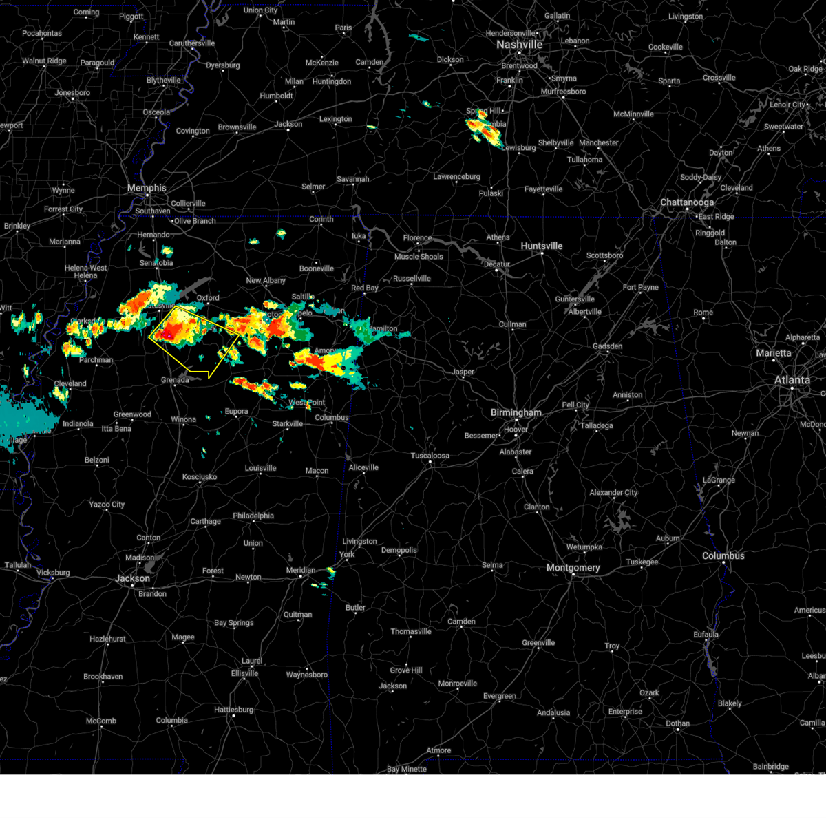
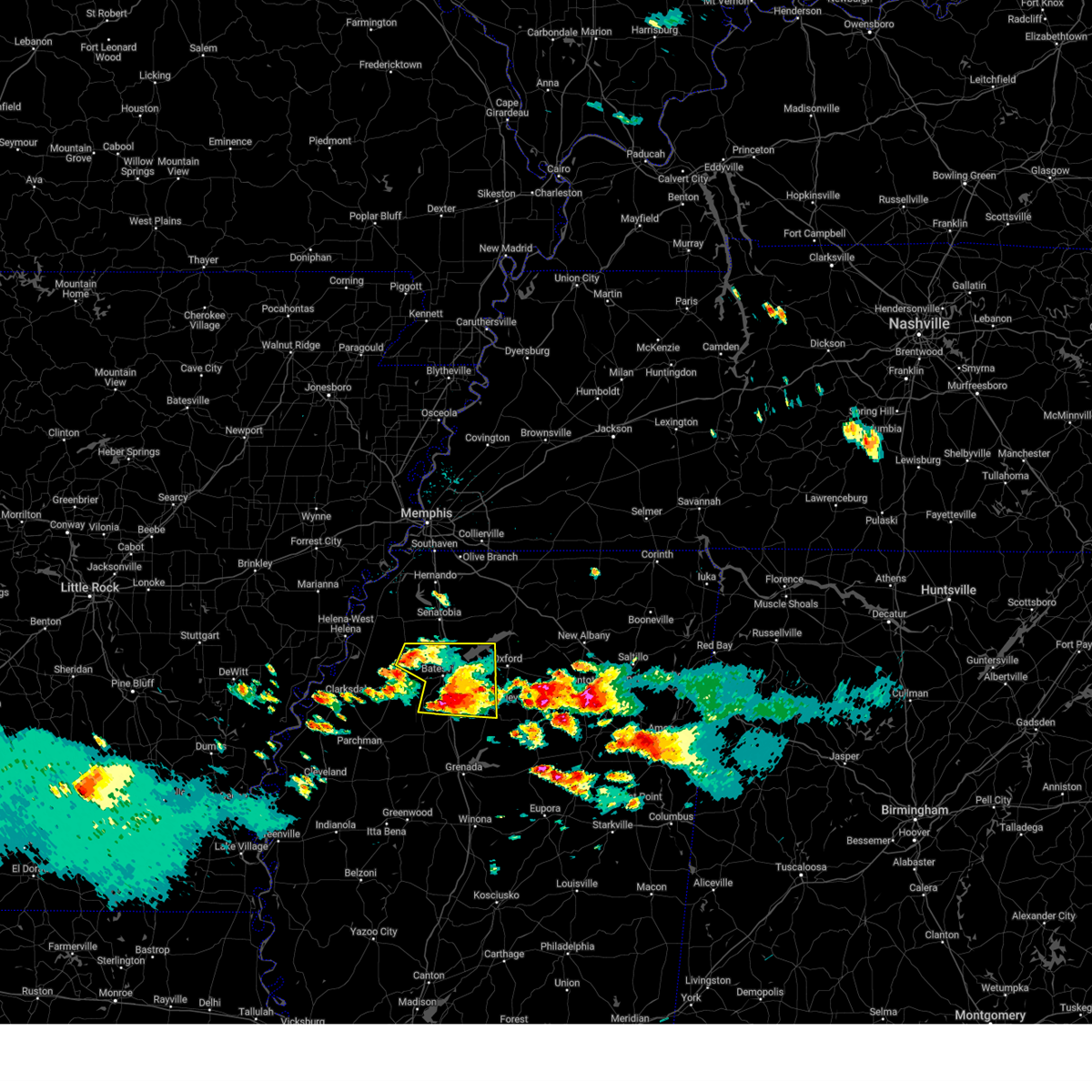
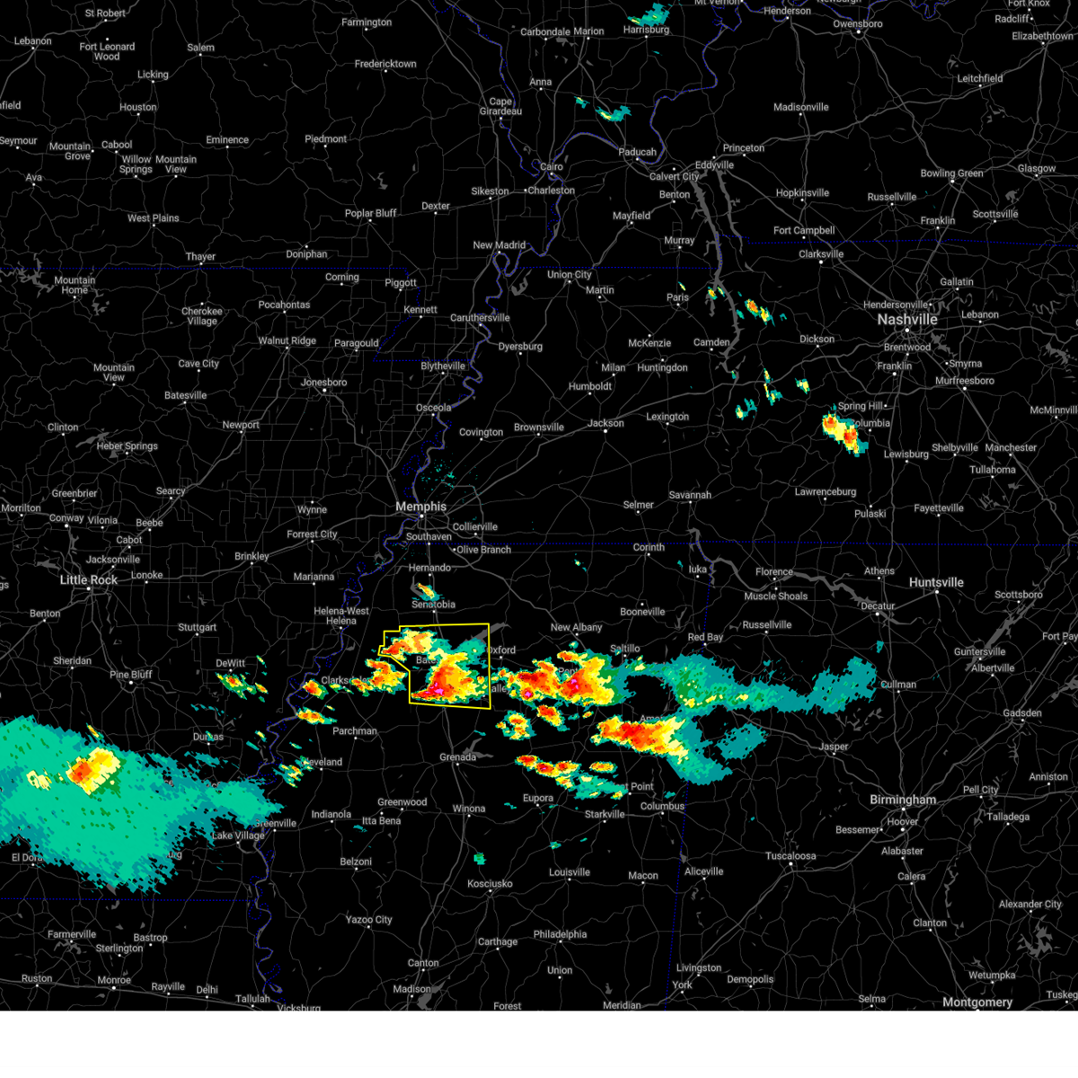
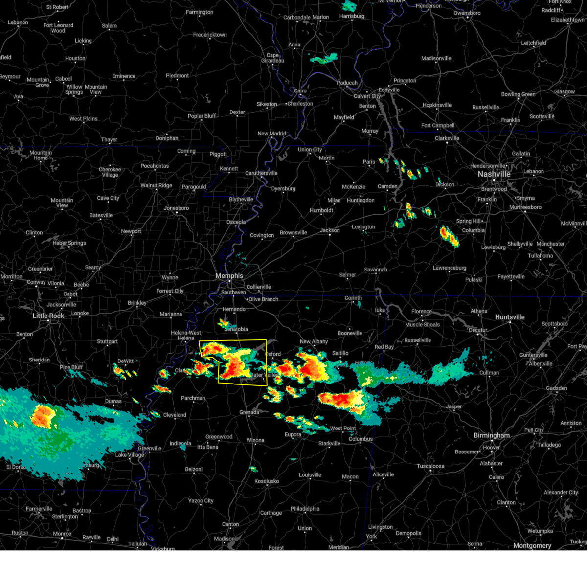
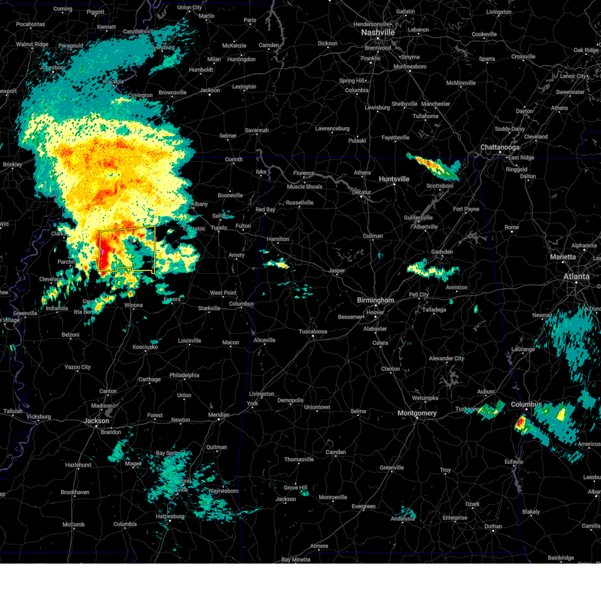
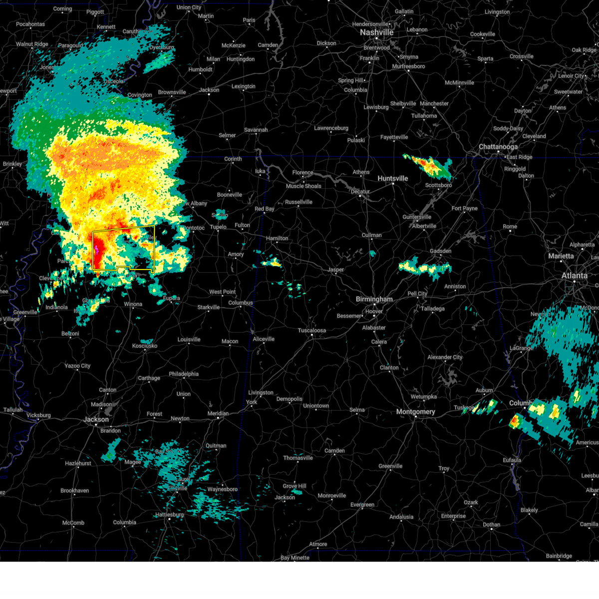
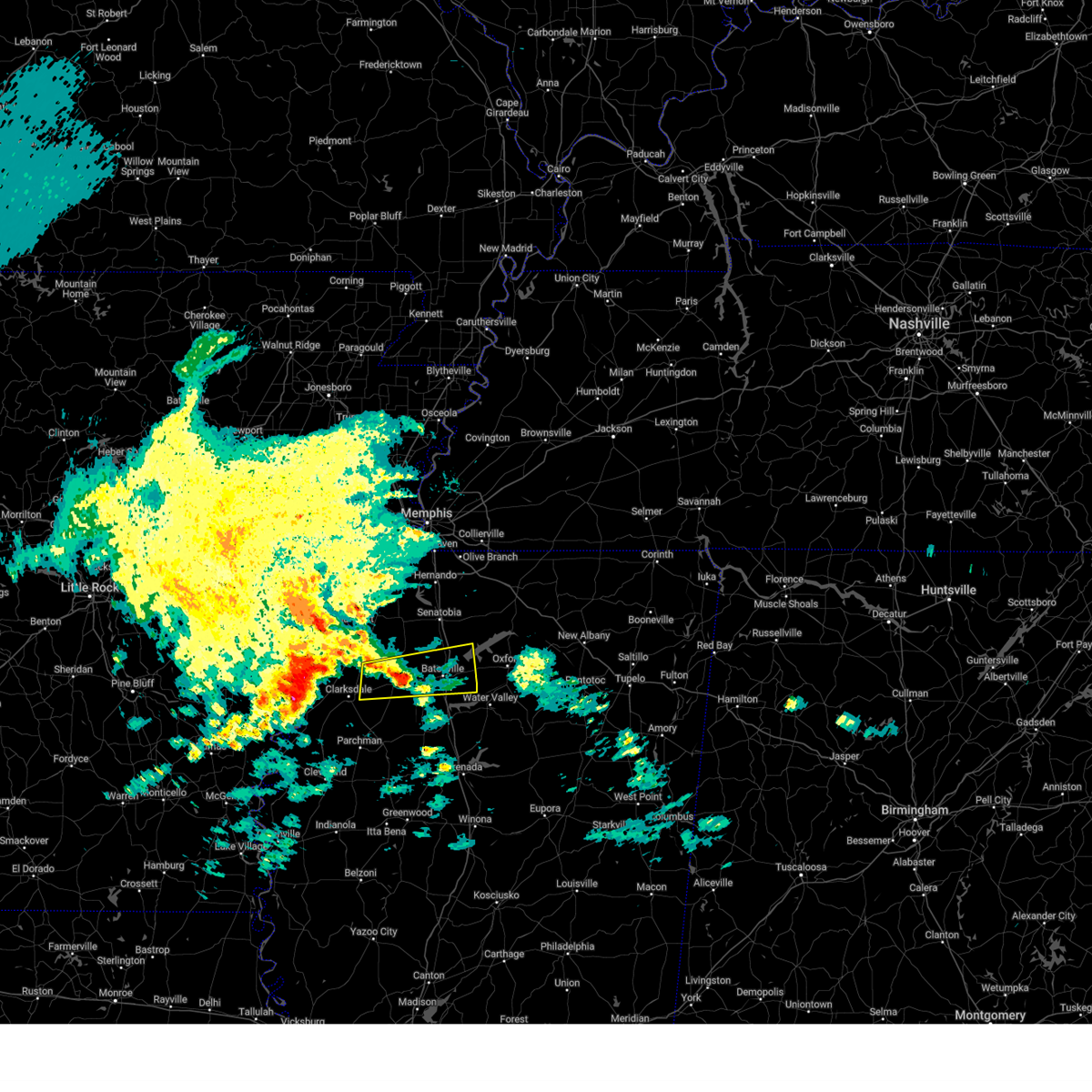
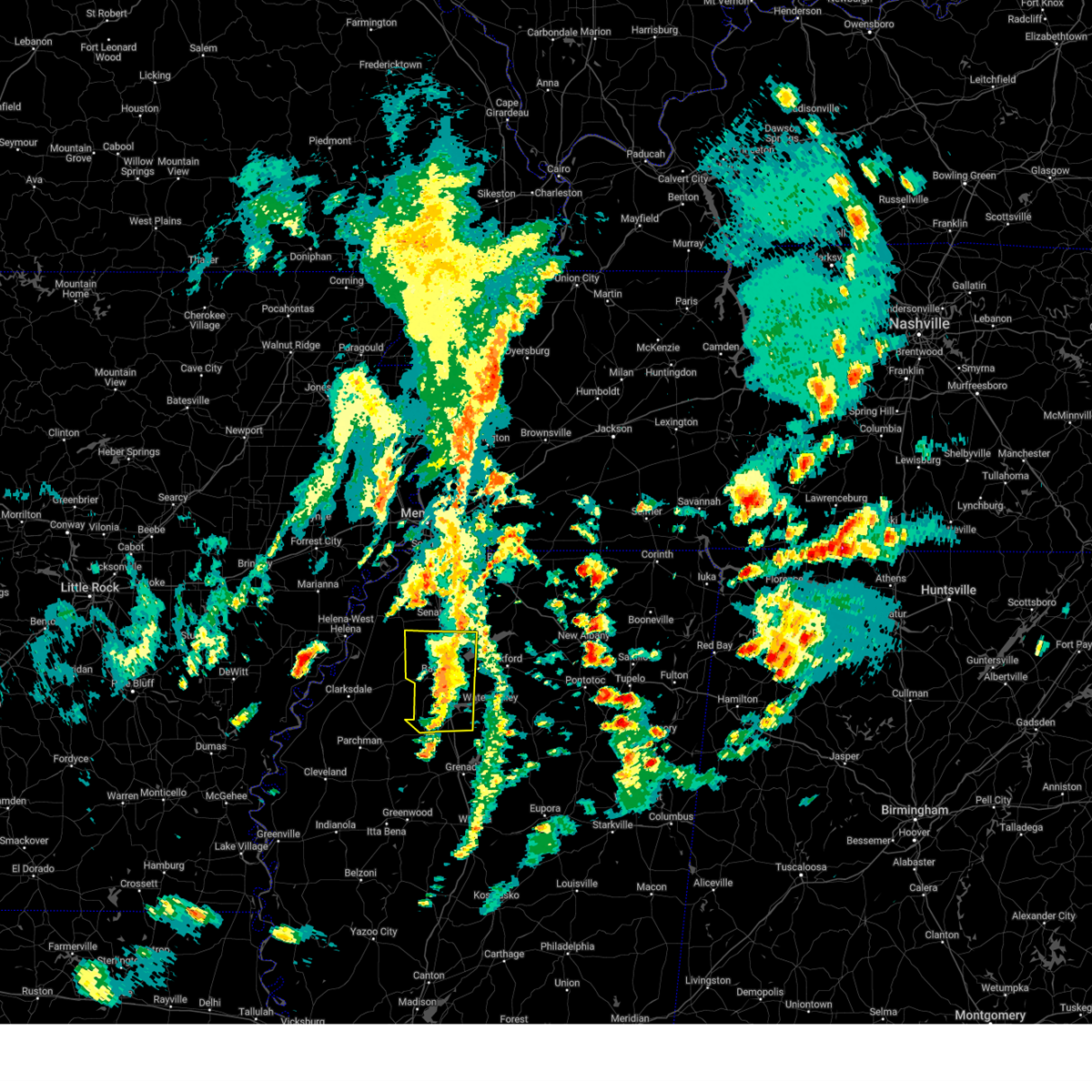
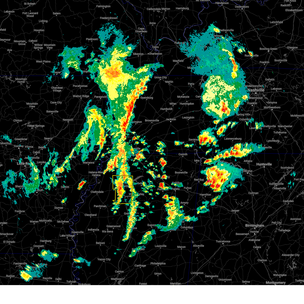
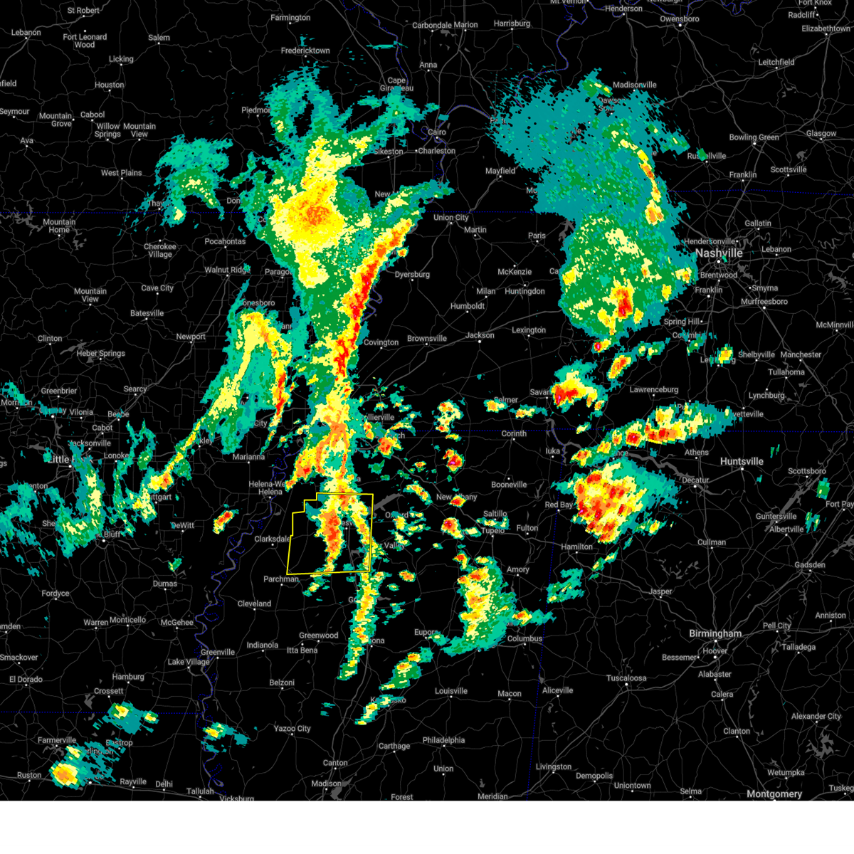
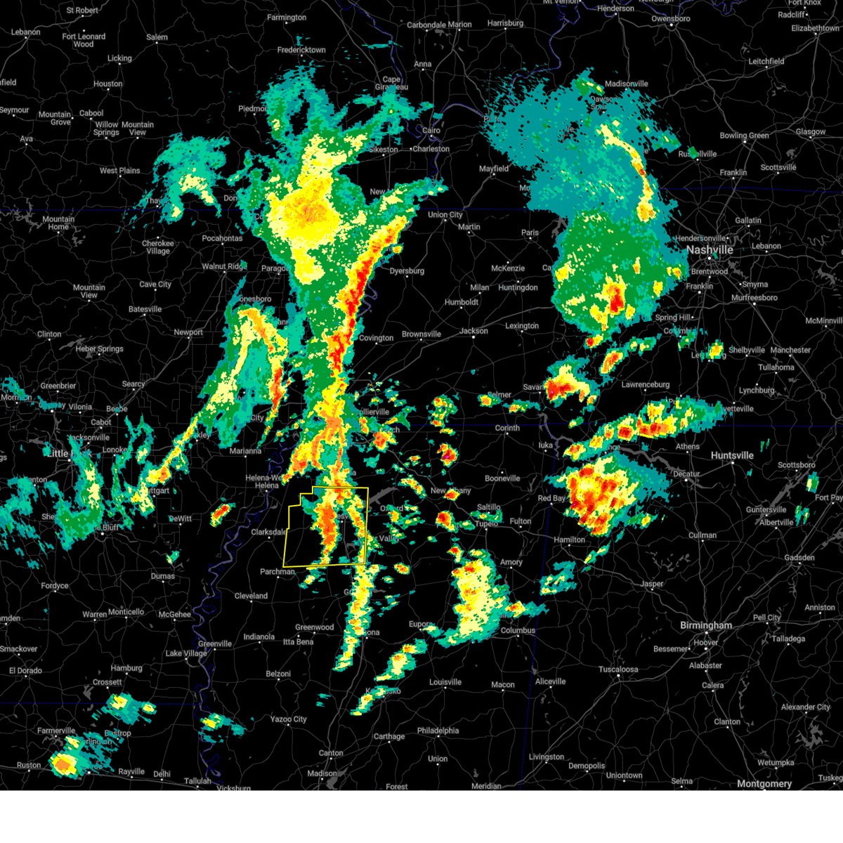
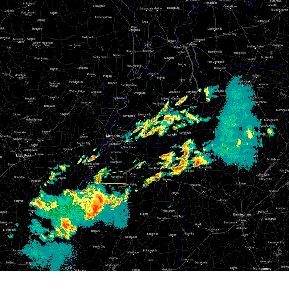
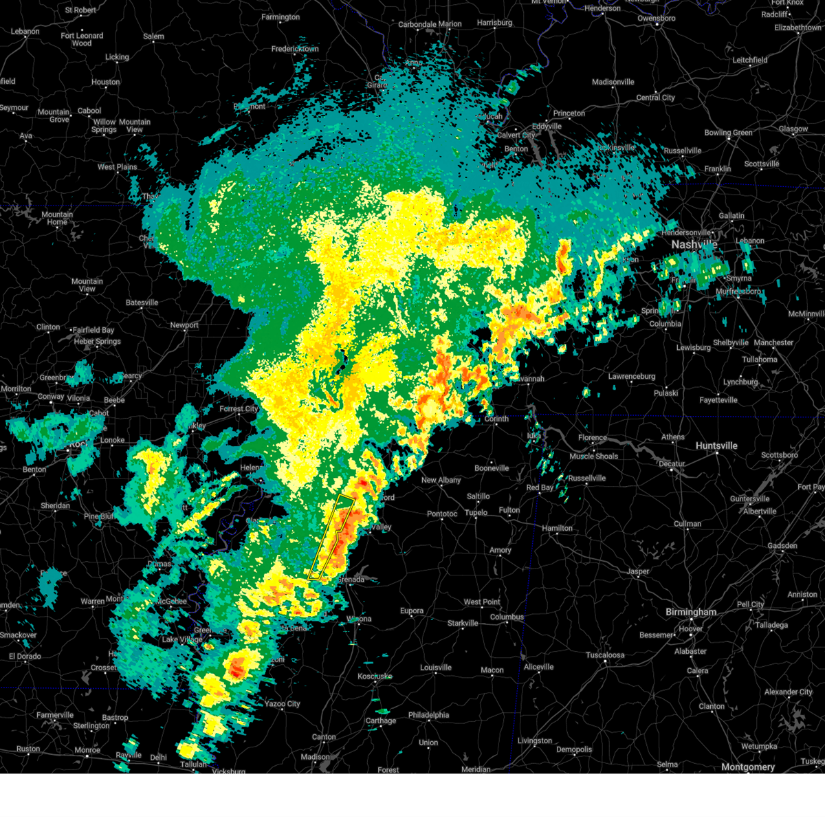
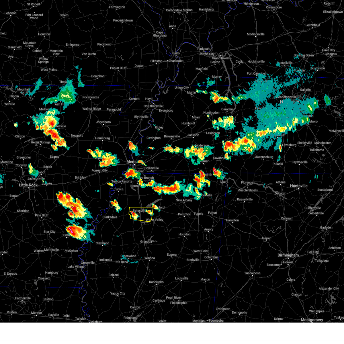
Hail Map for Pope, MS
The Pope, MS area has had 3 reports of on-the-ground hail by trained spotters, and has been under severe weather warnings 58 times during the past 12 months. Doppler radar has detected hail at or near Pope, MS on 70 occasions, including 11 occasions during the past year.
| Name: | Pope, MS |
| Where Located: | 64.7 miles S of Memphis, TN |
| Map: | Google Map for Pope, MS |
| Population: | 215 |
| Housing Units: | 92 |
| More Info: | Search Google for Pope, MS |
1
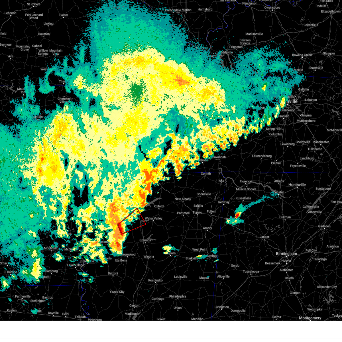
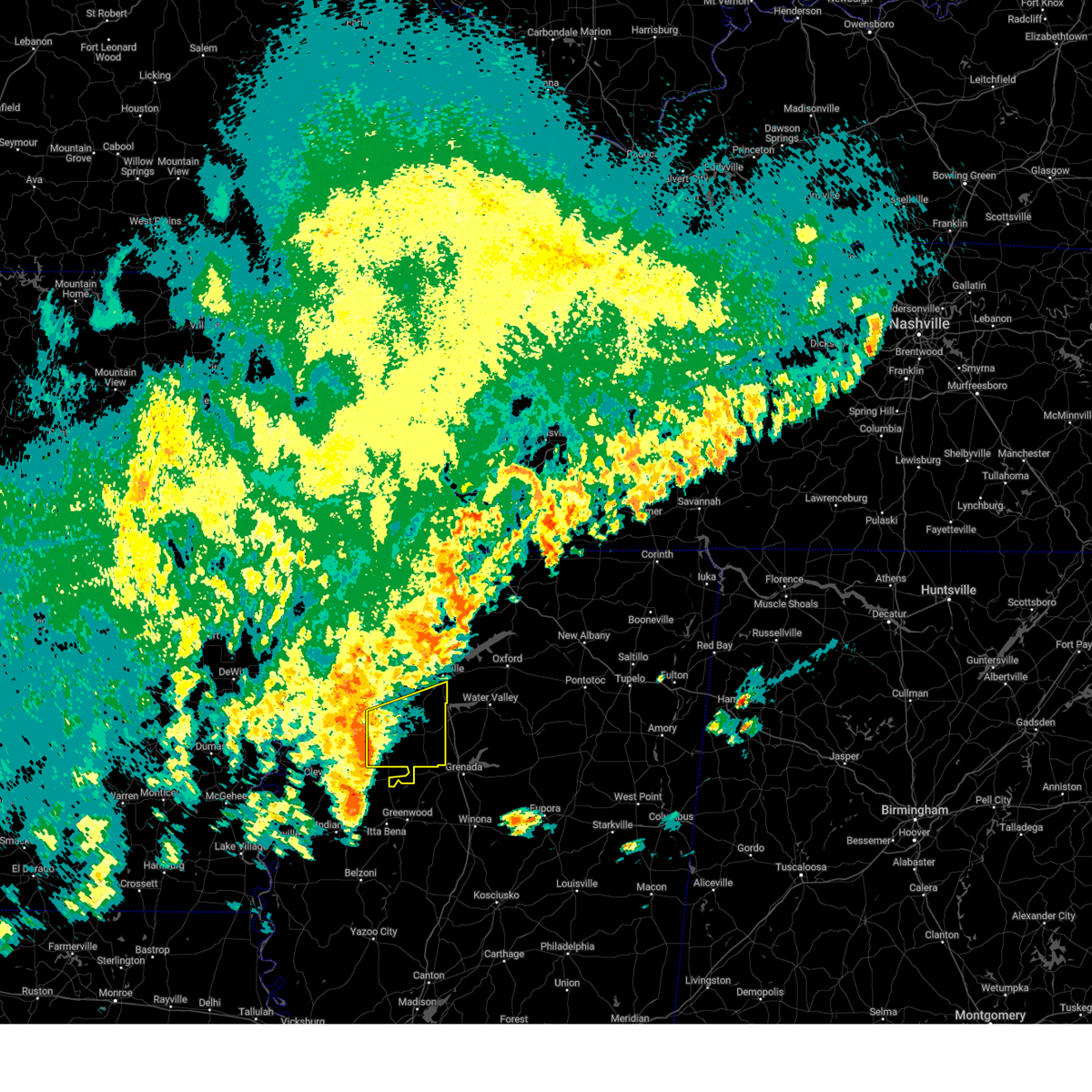
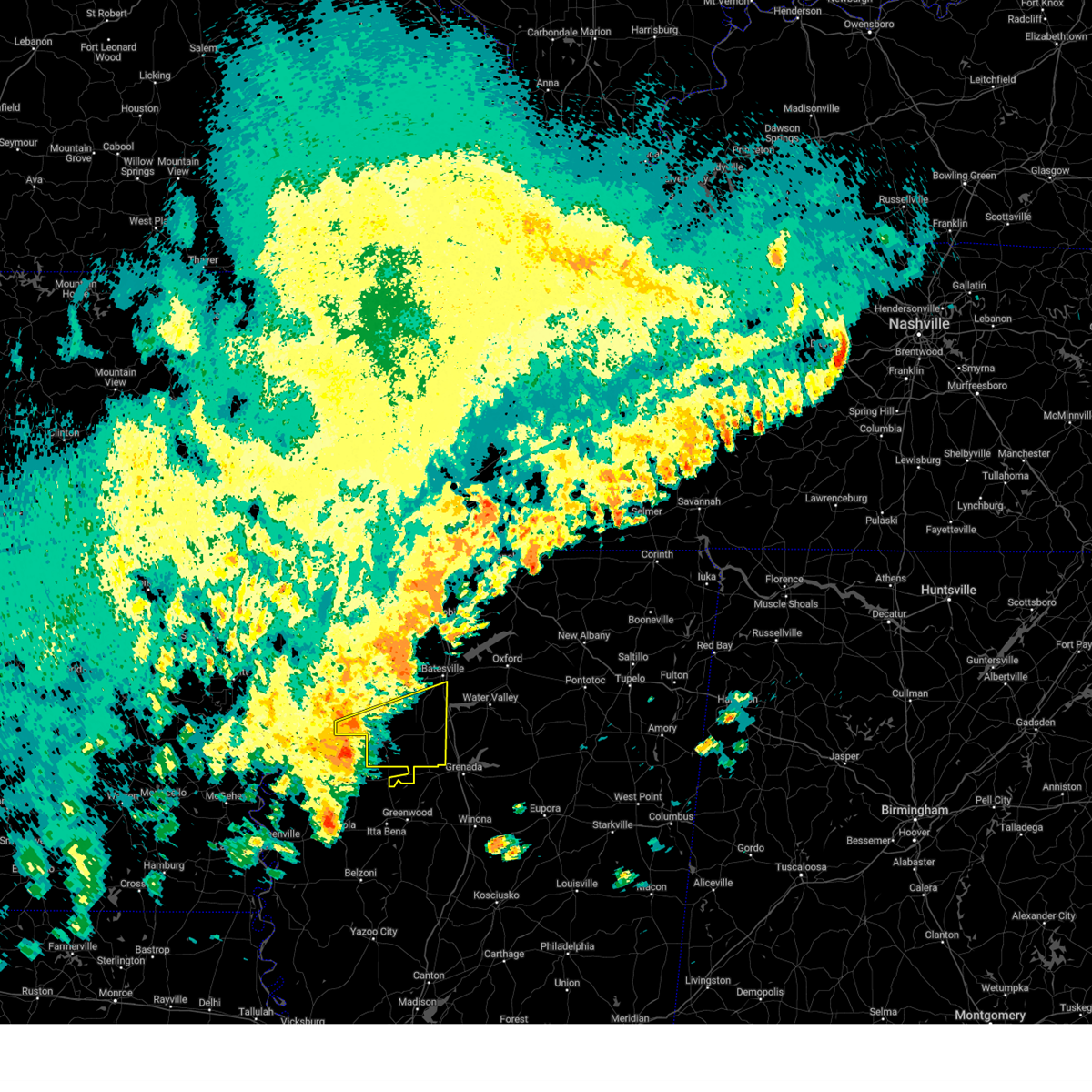
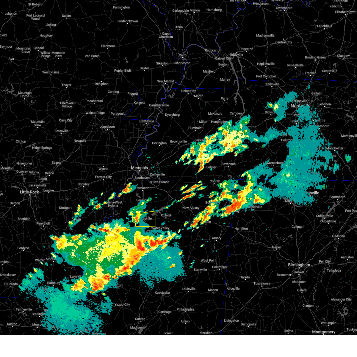
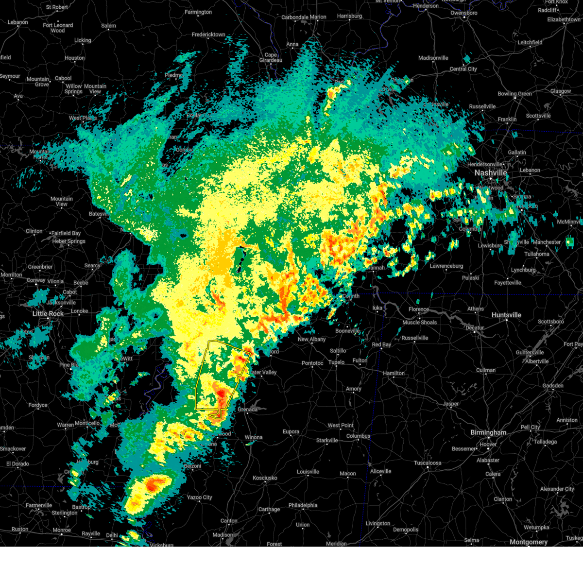
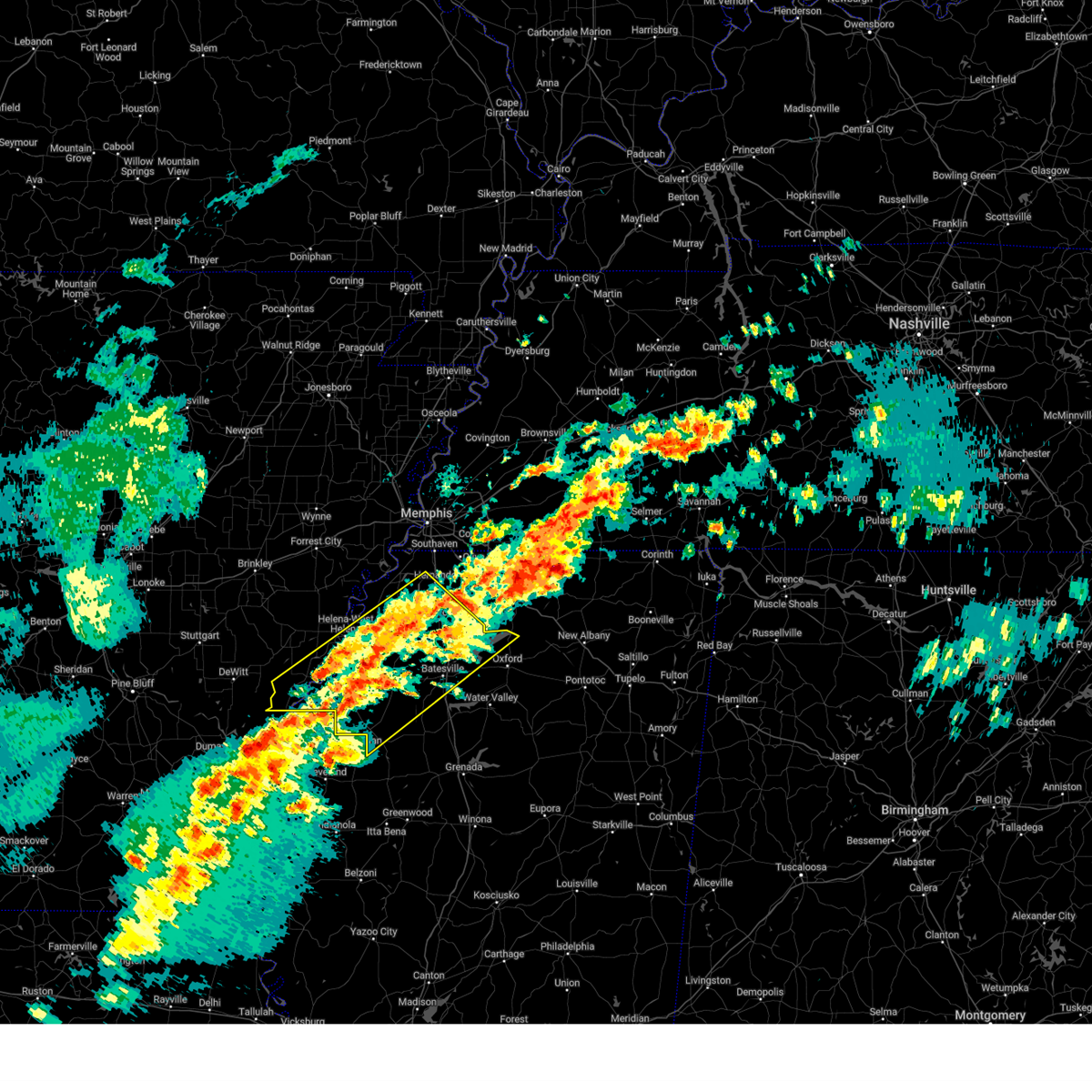
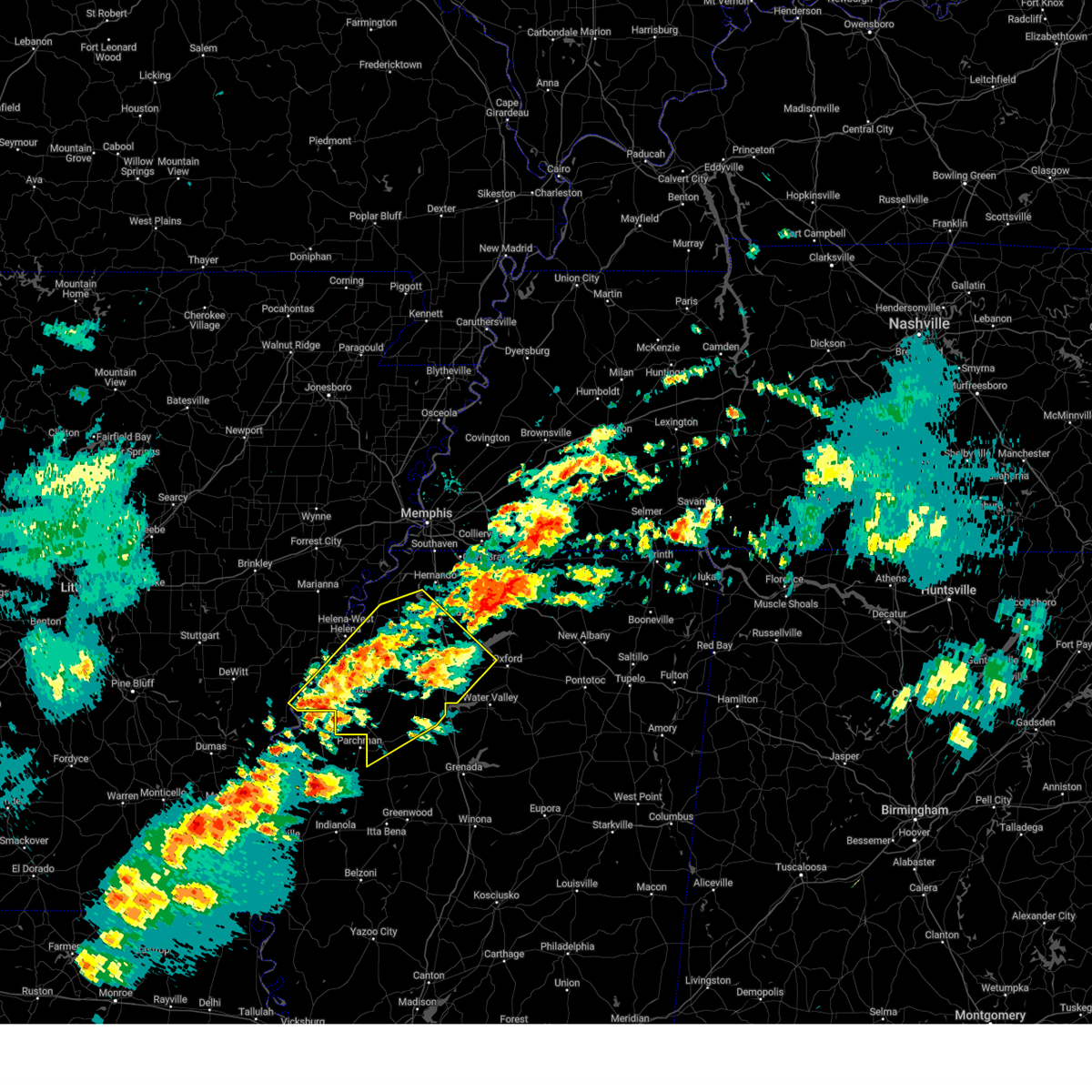
The Top Recent Hail Date for Pope, MS is Saturday, June 7, 2025 (18th out of 70)
Hail and Wind Damage Spotted near Pope, MS
| Date / Time | Report Details |
|---|---|
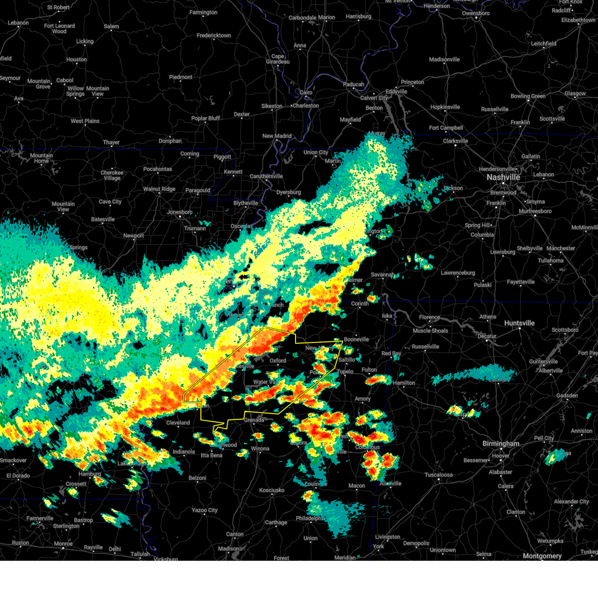
| 6/7/2025 11:52 PM CDT |
 Svrmeg the national weather service in memphis has issued a * severe thunderstorm warning for, southwestern lafayette county in northwestern mississippi, yalobusha county in northwestern mississippi, northwestern calhoun county in northeastern mississippi, northeastern tallahatchie county in northwestern mississippi, southeastern panola county in northwestern mississippi, * until 1230 am cdt. * at 1152 pm cdt, a severe thunderstorm was located near george payne state park, moving southeast at 30 mph (radar indicated). Hazards include ping pong ball size hail and 60 mph wind gusts. People and animals outdoors will be injured. expect hail damage to roofs, siding, windows, and vehicles. Expect wind damage to roofs, siding, and trees. Svrmeg the national weather service in memphis has issued a * severe thunderstorm warning for, southwestern lafayette county in northwestern mississippi, yalobusha county in northwestern mississippi, northwestern calhoun county in northeastern mississippi, northeastern tallahatchie county in northwestern mississippi, southeastern panola county in northwestern mississippi, * until 1230 am cdt. * at 1152 pm cdt, a severe thunderstorm was located near george payne state park, moving southeast at 30 mph (radar indicated). Hazards include ping pong ball size hail and 60 mph wind gusts. People and animals outdoors will be injured. expect hail damage to roofs, siding, windows, and vehicles. Expect wind damage to roofs, siding, and trees.
|
| 6/7/2025 11:45 PM CDT |
 At 1145 pm cdt, a severe thunderstorm was located near george payne state park, moving east at 30 mph (radar indicated). Hazards include ping pong ball size hail and 60 mph wind gusts. People and animals outdoors will be injured. expect hail damage to roofs, siding, windows, and vehicles. expect wind damage to roofs, siding, and trees. Locations impacted include, batesville, water valley, george payne state park, john w kyle state park, sardis, sledge, pope, springdale, curtis station, burgess, enid, pleasant grove, courtland, taylor, falcon, shuford, ballentine, hayes crossing, horatio, and eureka springs. At 1145 pm cdt, a severe thunderstorm was located near george payne state park, moving east at 30 mph (radar indicated). Hazards include ping pong ball size hail and 60 mph wind gusts. People and animals outdoors will be injured. expect hail damage to roofs, siding, windows, and vehicles. expect wind damage to roofs, siding, and trees. Locations impacted include, batesville, water valley, george payne state park, john w kyle state park, sardis, sledge, pope, springdale, curtis station, burgess, enid, pleasant grove, courtland, taylor, falcon, shuford, ballentine, hayes crossing, horatio, and eureka springs.
|
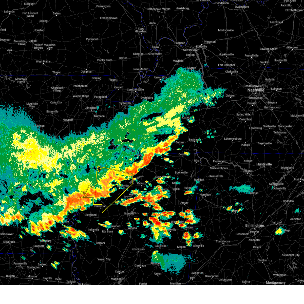
| 6/7/2025 11:40 PM CDT |
 At 1140 pm cdt, a severe thunderstorm was located over george payne state park, moving east at 35 mph (radar indicated). Hazards include 60 mph wind gusts and half dollar size hail. Hail damage to vehicles is expected. expect wind damage to roofs, siding, and trees. Locations impacted include, batesville, water valley, george payne state park, john w kyle state park, sardis, como, crenshaw, crowder, sledge, pope, enid, pleasant grove, harmontown, springdale, curtis station, burgess, courtland, taylor, falcon, and askew. At 1140 pm cdt, a severe thunderstorm was located over george payne state park, moving east at 35 mph (radar indicated). Hazards include 60 mph wind gusts and half dollar size hail. Hail damage to vehicles is expected. expect wind damage to roofs, siding, and trees. Locations impacted include, batesville, water valley, george payne state park, john w kyle state park, sardis, como, crenshaw, crowder, sledge, pope, enid, pleasant grove, harmontown, springdale, curtis station, burgess, courtland, taylor, falcon, and askew.
|
| 6/7/2025 11:40 PM CDT |
 the severe thunderstorm warning has been cancelled and is no longer in effect the severe thunderstorm warning has been cancelled and is no longer in effect
|
| 6/7/2025 11:29 PM CDT |
 At 1129 pm cdt, a severe thunderstorm was located near pope, or near batesville, moving southeast at 40 mph (radar indicated). Hazards include 60 mph wind gusts and quarter size hail. Hail damage to vehicles is expected. expect wind damage to roofs, siding, and trees. Locations impacted include, batesville, water valley, george payne state park, john w kyle state park, sardis, como, crenshaw, crowder, sledge, pope, enid, pleasant grove, harmontown, springdale, curtis station, burgess, courtland, taylor, falcon, and askew. At 1129 pm cdt, a severe thunderstorm was located near pope, or near batesville, moving southeast at 40 mph (radar indicated). Hazards include 60 mph wind gusts and quarter size hail. Hail damage to vehicles is expected. expect wind damage to roofs, siding, and trees. Locations impacted include, batesville, water valley, george payne state park, john w kyle state park, sardis, como, crenshaw, crowder, sledge, pope, enid, pleasant grove, harmontown, springdale, curtis station, burgess, courtland, taylor, falcon, and askew.
|
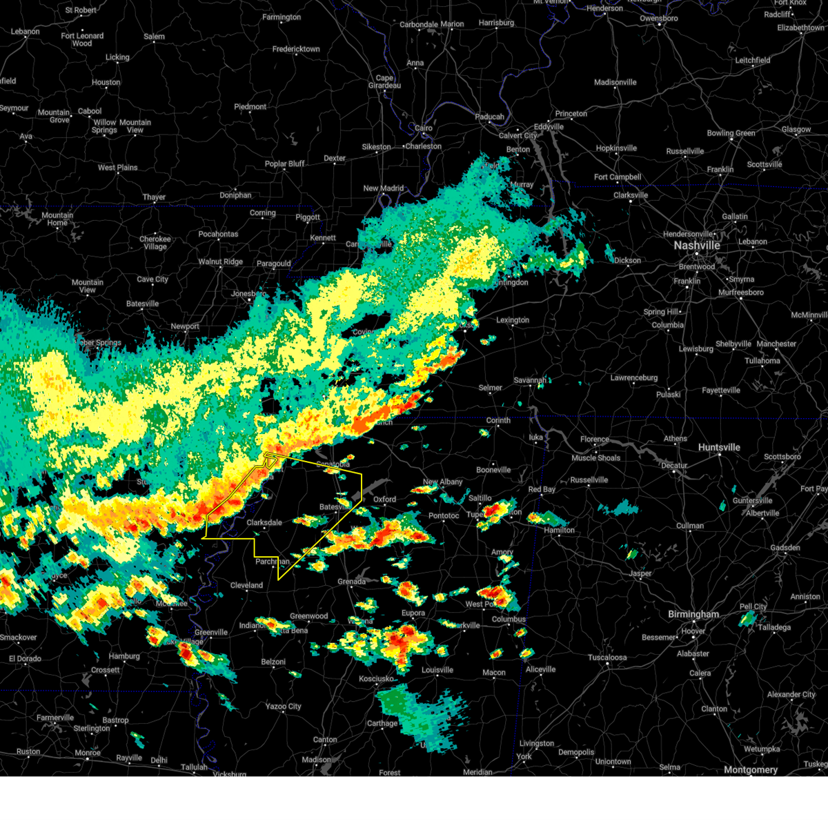
| 6/7/2025 11:14 PM CDT |
 Svrmeg the national weather service in memphis has issued a * severe thunderstorm warning for, western lafayette county in northwestern mississippi, northern yalobusha county in northwestern mississippi, southeastern tunica county in northwestern mississippi, northeastern tallahatchie county in northwestern mississippi, quitman county in northwestern mississippi, panola county in northwestern mississippi, * until midnight cdt. * at 1114 pm cdt, a severe thunderstorm was located near curtis station, or 15 miles west of batesville, moving east at 30 mph (radar indicated). Hazards include 60 mph wind gusts and quarter size hail. Hail damage to vehicles is expected. Expect wind damage to roofs, siding, and trees. Svrmeg the national weather service in memphis has issued a * severe thunderstorm warning for, western lafayette county in northwestern mississippi, northern yalobusha county in northwestern mississippi, southeastern tunica county in northwestern mississippi, northeastern tallahatchie county in northwestern mississippi, quitman county in northwestern mississippi, panola county in northwestern mississippi, * until midnight cdt. * at 1114 pm cdt, a severe thunderstorm was located near curtis station, or 15 miles west of batesville, moving east at 30 mph (radar indicated). Hazards include 60 mph wind gusts and quarter size hail. Hail damage to vehicles is expected. Expect wind damage to roofs, siding, and trees.
|
| 5/25/2025 7:09 PM CDT | the severe thunderstorm warning has been cancelled and is no longer in effect |
| 5/25/2025 7:09 PM CDT | At 708 pm cdt, severe thunderstorms were located along a line extending from near keownville to near paynes, moving east at 60 mph (radar indicated). Hazards include 70 mph wind gusts and quarter size hail. Hail damage to vehicles is expected. expect considerable tree damage. wind damage is also likely to mobile homes, roofs, and outbuildings. Locations impacted include, shari, robbs, charleston, esperanza, paynes, swan lake, pumpkin center, cambridge, tyson, gums, new harmony, rough edge, glenfield, rosebloom, bryant, altus, bethlehem, toccopola, cascilla, and alpine. |
| 5/25/2025 7:00 PM CDT |
 At 700 pm cdt, severe thunderstorms were located along a line extending from new albany to near paynes, moving east at 60 mph (radar indicated). Hazards include 70 mph wind gusts and quarter size hail. Hail damage to vehicles is expected. expect considerable tree damage. wind damage is also likely to mobile homes, roofs, and outbuildings. Locations impacted include, shari, robbs, charleston, esperanza, paynes, swan lake, pumpkin center, cambridge, chulahoma, tyson, gums, albin, new harmony, rough edge, glenfield, rosebloom, bryant, altus, bethlehem, and toccopola. At 700 pm cdt, severe thunderstorms were located along a line extending from new albany to near paynes, moving east at 60 mph (radar indicated). Hazards include 70 mph wind gusts and quarter size hail. Hail damage to vehicles is expected. expect considerable tree damage. wind damage is also likely to mobile homes, roofs, and outbuildings. Locations impacted include, shari, robbs, charleston, esperanza, paynes, swan lake, pumpkin center, cambridge, chulahoma, tyson, gums, albin, new harmony, rough edge, glenfield, rosebloom, bryant, altus, bethlehem, and toccopola.
|
| 5/25/2025 6:53 PM CDT |
 the severe thunderstorm warning has been cancelled and is no longer in effect the severe thunderstorm warning has been cancelled and is no longer in effect
|
| 5/25/2025 6:53 PM CDT |
 At 653 pm cdt, severe thunderstorms were located along a line extending from 6 miles northeast of etta to 7 miles east of webb, moving east at 60 mph (radar indicated). Hazards include 60 mph wind gusts and quarter size hail. Hail damage to vehicles is expected. expect wind damage to roofs, siding, and trees. Locations impacted include, shari, robbs, charleston, esperanza, paynes, swan lake, pumpkin center, cambridge, chulahoma, tyson, gums, albin, new harmony, rough edge, glenfield, rosebloom, bryant, altus, bethlehem, and toccopola. At 653 pm cdt, severe thunderstorms were located along a line extending from 6 miles northeast of etta to 7 miles east of webb, moving east at 60 mph (radar indicated). Hazards include 60 mph wind gusts and quarter size hail. Hail damage to vehicles is expected. expect wind damage to roofs, siding, and trees. Locations impacted include, shari, robbs, charleston, esperanza, paynes, swan lake, pumpkin center, cambridge, chulahoma, tyson, gums, albin, new harmony, rough edge, glenfield, rosebloom, bryant, altus, bethlehem, and toccopola.
|
| 5/25/2025 6:33 PM CDT |
 Svrmeg the national weather service in memphis has issued a * severe thunderstorm warning for, lafayette county in northwestern mississippi, yalobusha county in northwestern mississippi, southeastern coahoma county in northwestern mississippi, northern calhoun county in northeastern mississippi, union county in northeastern mississippi, pontotoc county in northeastern mississippi, southern marshall county in northwestern mississippi, southeastern tate county in northwestern mississippi, tallahatchie county in northwestern mississippi, quitman county in northwestern mississippi, panola county in northwestern mississippi, * until 730 pm cdt. * at 632 pm cdt, severe thunderstorms were located along a line extending from near wall doxey state park to near dublin, moving east at 60 mph (radar indicated). Hazards include 60 mph wind gusts and quarter size hail. Hail damage to vehicles is expected. Expect wind damage to roofs, siding, and trees. Svrmeg the national weather service in memphis has issued a * severe thunderstorm warning for, lafayette county in northwestern mississippi, yalobusha county in northwestern mississippi, southeastern coahoma county in northwestern mississippi, northern calhoun county in northeastern mississippi, union county in northeastern mississippi, pontotoc county in northeastern mississippi, southern marshall county in northwestern mississippi, southeastern tate county in northwestern mississippi, tallahatchie county in northwestern mississippi, quitman county in northwestern mississippi, panola county in northwestern mississippi, * until 730 pm cdt. * at 632 pm cdt, severe thunderstorms were located along a line extending from near wall doxey state park to near dublin, moving east at 60 mph (radar indicated). Hazards include 60 mph wind gusts and quarter size hail. Hail damage to vehicles is expected. Expect wind damage to roofs, siding, and trees.
|
| 5/25/2025 6:30 PM CDT | At 630 pm cdt, severe thunderstorms were located along a line extending from near como to marks to near dublin, moving east at 50 mph (radar indicated). Hazards include 60 mph wind gusts and quarter size hail. Hail damage to vehicles is expected. expect wind damage to roofs, siding, and trees. Locations impacted include, mattson, rena lara, askew, coahoma, gerlach mill, belen, rudyard, moon, buxton, savage, webb, dublin, senatobia, denton, falcon, beverly, como, glenville, clarksdale, and sabino. |
| 5/25/2025 6:27 PM CDT |
 the severe thunderstorm warning has been cancelled and is no longer in effect the severe thunderstorm warning has been cancelled and is no longer in effect
|
| 5/25/2025 6:27 PM CDT |
 At 627 pm cdt, severe thunderstorms were located along a line extending from near como to near belen to near dublin, moving east at 50 mph (radar indicated). Hazards include 60 mph wind gusts and quarter size hail. Hail damage to vehicles is expected. expect wind damage to roofs, siding, and trees. Locations impacted include, rena lara, askew, belen, rudyard, moon, savage, senatobia, austin, falcon, como, clarksdale, strayhorn, jonestown, dubbs, lurand, dooley, north tunica, longstreet, clayton, and hinchcliff. At 627 pm cdt, severe thunderstorms were located along a line extending from near como to near belen to near dublin, moving east at 50 mph (radar indicated). Hazards include 60 mph wind gusts and quarter size hail. Hail damage to vehicles is expected. expect wind damage to roofs, siding, and trees. Locations impacted include, rena lara, askew, belen, rudyard, moon, savage, senatobia, austin, falcon, como, clarksdale, strayhorn, jonestown, dubbs, lurand, dooley, north tunica, longstreet, clayton, and hinchcliff.
|
| 5/25/2025 5:55 PM CDT |
 Svrmeg the national weather service in memphis has issued a * severe thunderstorm warning for, phillips county in eastern arkansas, coahoma county in northwestern mississippi, tunica county in northwestern mississippi, southern tate county in northwestern mississippi, northwestern tallahatchie county in northwestern mississippi, quitman county in northwestern mississippi, panola county in northwestern mississippi, * until 645 pm cdt. * at 554 pm cdt, severe thunderstorms were located along a line extending from near tunica to near friars point to near crumrod, moving east at 50 mph (radar indicated). Hazards include 60 mph wind gusts and quarter size hail. Hail damage to vehicles is expected. Expect wind damage to roofs, siding, and trees. Svrmeg the national weather service in memphis has issued a * severe thunderstorm warning for, phillips county in eastern arkansas, coahoma county in northwestern mississippi, tunica county in northwestern mississippi, southern tate county in northwestern mississippi, northwestern tallahatchie county in northwestern mississippi, quitman county in northwestern mississippi, panola county in northwestern mississippi, * until 645 pm cdt. * at 554 pm cdt, severe thunderstorms were located along a line extending from near tunica to near friars point to near crumrod, moving east at 50 mph (radar indicated). Hazards include 60 mph wind gusts and quarter size hail. Hail damage to vehicles is expected. Expect wind damage to roofs, siding, and trees.
|
| 5/20/2025 5:49 PM CDT | the tornado warning has been cancelled and is no longer in effect |
| 5/20/2025 5:49 PM CDT | At 548 pm cdt, a severe thunderstorm capable of producing a tornado was located near pope, or near george payne state park, moving east at 40 mph (radar indicated rotation). Hazards include tornado and quarter size hail. Flying debris will be dangerous to those caught without shelter. mobile homes will be damaged or destroyed. damage to roofs, windows, and vehicles will occur. tree damage is likely. Locations impacted include, springdale, pope, courtland, burgess, shuford, george payne state park, taylor, water valley, eureka springs, and batesville. |
| 5/20/2025 5:34 PM CDT |
 Tormeg the national weather service in memphis has issued a * tornado warning for, southwestern lafayette county in northwestern mississippi, northern yalobusha county in northwestern mississippi, northeastern tallahatchie county in northwestern mississippi, southern panola county in northwestern mississippi, * until 615 pm cdt. * at 534 pm cdt, a severe thunderstorm capable of producing a tornado was located near crowder, or 9 miles west of george payne state park, moving east at 40 mph (radar indicated rotation). Hazards include tornado and quarter size hail. Flying debris will be dangerous to those caught without shelter. mobile homes will be damaged or destroyed. damage to roofs, windows, and vehicles will occur. Tree damage is likely. Tormeg the national weather service in memphis has issued a * tornado warning for, southwestern lafayette county in northwestern mississippi, northern yalobusha county in northwestern mississippi, northeastern tallahatchie county in northwestern mississippi, southern panola county in northwestern mississippi, * until 615 pm cdt. * at 534 pm cdt, a severe thunderstorm capable of producing a tornado was located near crowder, or 9 miles west of george payne state park, moving east at 40 mph (radar indicated rotation). Hazards include tornado and quarter size hail. Flying debris will be dangerous to those caught without shelter. mobile homes will be damaged or destroyed. damage to roofs, windows, and vehicles will occur. Tree damage is likely.
|
| 5/18/2025 9:43 AM CDT |
 At 942 am cdt, a severe thunderstorm was located near enid, or near charleston, moving east at 40 mph (radar indicated). Hazards include 60 mph wind gusts and quarter size hail. Hail damage to vehicles is expected. expect wind damage to roofs, siding, and trees. Locations impacted include, charleston, enid, mims, paynes, oakland, tyson, gums, eureka springs, rosebloom, spearman, springdale, bryant, benwood, shuford, george payne state park, taylor, pine valley, coffeeville, water valley, and tillatoba. At 942 am cdt, a severe thunderstorm was located near enid, or near charleston, moving east at 40 mph (radar indicated). Hazards include 60 mph wind gusts and quarter size hail. Hail damage to vehicles is expected. expect wind damage to roofs, siding, and trees. Locations impacted include, charleston, enid, mims, paynes, oakland, tyson, gums, eureka springs, rosebloom, spearman, springdale, bryant, benwood, shuford, george payne state park, taylor, pine valley, coffeeville, water valley, and tillatoba.
|
| 5/18/2025 9:43 AM CDT |
 the severe thunderstorm warning has been cancelled and is no longer in effect the severe thunderstorm warning has been cancelled and is no longer in effect
|
| 5/18/2025 9:34 AM CDT |
 Svrmeg the national weather service in memphis has issued a * severe thunderstorm warning for, southwestern lafayette county in northwestern mississippi, yalobusha county in northwestern mississippi, northwestern calhoun county in northeastern mississippi, northeastern tallahatchie county in northwestern mississippi, southeastern quitman county in northwestern mississippi, southern panola county in northwestern mississippi, * until 1015 am cdt. * at 933 am cdt, a severe thunderstorm was located near charleston, moving east at 40 mph (radar indicated). Hazards include 60 mph wind gusts and quarter size hail. Hail damage to vehicles is expected. Expect wind damage to roofs, siding, and trees. Svrmeg the national weather service in memphis has issued a * severe thunderstorm warning for, southwestern lafayette county in northwestern mississippi, yalobusha county in northwestern mississippi, northwestern calhoun county in northeastern mississippi, northeastern tallahatchie county in northwestern mississippi, southeastern quitman county in northwestern mississippi, southern panola county in northwestern mississippi, * until 1015 am cdt. * at 933 am cdt, a severe thunderstorm was located near charleston, moving east at 40 mph (radar indicated). Hazards include 60 mph wind gusts and quarter size hail. Hail damage to vehicles is expected. Expect wind damage to roofs, siding, and trees.
|
| 5/18/2025 8:48 AM CDT |
 the severe thunderstorm warning has been cancelled and is no longer in effect the severe thunderstorm warning has been cancelled and is no longer in effect
|
| 5/18/2025 8:42 AM CDT |
 the severe thunderstorm warning has been cancelled and is no longer in effect the severe thunderstorm warning has been cancelled and is no longer in effect
|
| 5/18/2025 8:42 AM CDT |
 At 842 am cdt, a severe thunderstorm was located over curtis station, or 14 miles west of batesville, moving east at 40 mph (radar indicated). Hazards include 60 mph wind gusts and quarter size hail. Hail damage to vehicles is expected. expect wind damage to roofs, siding, and trees. Locations impacted include, curtis station, sardis, shuford, mims, batesville, asa, ballentine, pope, pleasant grove, courtland, locke station, hayes crossing, horatio, john w kyle state park, eureka springs, and chapeltown. At 842 am cdt, a severe thunderstorm was located over curtis station, or 14 miles west of batesville, moving east at 40 mph (radar indicated). Hazards include 60 mph wind gusts and quarter size hail. Hail damage to vehicles is expected. expect wind damage to roofs, siding, and trees. Locations impacted include, curtis station, sardis, shuford, mims, batesville, asa, ballentine, pope, pleasant grove, courtland, locke station, hayes crossing, horatio, john w kyle state park, eureka springs, and chapeltown.
|
| 5/18/2025 8:36 AM CDT |
 Svrmeg the national weather service in memphis has issued a * severe thunderstorm warning for, east central coahoma county in northwestern mississippi, central quitman county in northwestern mississippi, panola county in northwestern mississippi, * until 915 am cdt. * at 828 am cdt, a severe thunderstorm was located over belen, or 14 miles northeast of clarksdale, moving east at 40 mph (radar indicated). Hazards include 60 mph wind gusts and quarter size hail. Hail damage to vehicles is expected. Expect wind damage to roofs, siding, and trees. Svrmeg the national weather service in memphis has issued a * severe thunderstorm warning for, east central coahoma county in northwestern mississippi, central quitman county in northwestern mississippi, panola county in northwestern mississippi, * until 915 am cdt. * at 828 am cdt, a severe thunderstorm was located over belen, or 14 miles northeast of clarksdale, moving east at 40 mph (radar indicated). Hazards include 60 mph wind gusts and quarter size hail. Hail damage to vehicles is expected. Expect wind damage to roofs, siding, and trees.
|
| 5/17/2025 1:17 AM CDT |
 At 117 am cdt, severe thunderstorms were located along a line extending from near oxford to near paris to near coffeeville, moving east at 45 mph (radar indicated). Hazards include 70 mph wind gusts and quarter size hail. Hail damage to vehicles is expected. expect considerable tree damage. wind damage is also likely to mobile homes, roofs, and outbuildings. Locations impacted include, charleston, keel, enid, mims, oakland, cambridge, delay, college hill station, college hill, tyson, oxford, eureka springs, springdale, altus, benwood, burgess, shuford, george payne state park, taylor, and banner. At 117 am cdt, severe thunderstorms were located along a line extending from near oxford to near paris to near coffeeville, moving east at 45 mph (radar indicated). Hazards include 70 mph wind gusts and quarter size hail. Hail damage to vehicles is expected. expect considerable tree damage. wind damage is also likely to mobile homes, roofs, and outbuildings. Locations impacted include, charleston, keel, enid, mims, oakland, cambridge, delay, college hill station, college hill, tyson, oxford, eureka springs, springdale, altus, benwood, burgess, shuford, george payne state park, taylor, and banner.
|
| 5/17/2025 1:06 AM CDT |
 At 106 am cdt, severe thunderstorms were located along a line extending from near holly springs national forest to near springdale to 7 miles northeast of scobey, moving east at 50 mph (radar indicated). Hazards include 70 mph wind gusts and quarter size hail. Hail damage to vehicles is expected. expect considerable tree damage. wind damage is also likely to mobile homes, roofs, and outbuildings. Locations impacted include, charleston, keel, enid, mims, denton, oakland, cambridge, vance, delay, asa, college hill station, college hill, tyson, oxford, eureka springs, springdale, altus, benwood, burgess, and shuford. At 106 am cdt, severe thunderstorms were located along a line extending from near holly springs national forest to near springdale to 7 miles northeast of scobey, moving east at 50 mph (radar indicated). Hazards include 70 mph wind gusts and quarter size hail. Hail damage to vehicles is expected. expect considerable tree damage. wind damage is also likely to mobile homes, roofs, and outbuildings. Locations impacted include, charleston, keel, enid, mims, denton, oakland, cambridge, vance, delay, asa, college hill station, college hill, tyson, oxford, eureka springs, springdale, altus, benwood, burgess, and shuford.
|
| 5/17/2025 12:45 AM CDT |
 Svrmeg the national weather service in memphis has issued a * severe thunderstorm warning for, lafayette county in northwestern mississippi, yalobusha county in northwestern mississippi, northwestern calhoun county in northeastern mississippi, northern tallahatchie county in northwestern mississippi, quitman county in northwestern mississippi, panola county in northwestern mississippi, * until 130 am cdt. * at 1245 am cdt, severe thunderstorms were located along a line extending from near sardis to near pope to 6 miles south of crowder, moving east at 45 mph (radar indicated). Hazards include 60 mph wind gusts and quarter size hail. Hail damage to vehicles is expected. Expect wind damage to roofs, siding, and trees. Svrmeg the national weather service in memphis has issued a * severe thunderstorm warning for, lafayette county in northwestern mississippi, yalobusha county in northwestern mississippi, northwestern calhoun county in northeastern mississippi, northern tallahatchie county in northwestern mississippi, quitman county in northwestern mississippi, panola county in northwestern mississippi, * until 130 am cdt. * at 1245 am cdt, severe thunderstorms were located along a line extending from near sardis to near pope to 6 miles south of crowder, moving east at 45 mph (radar indicated). Hazards include 60 mph wind gusts and quarter size hail. Hail damage to vehicles is expected. Expect wind damage to roofs, siding, and trees.
|
| 5/2/2025 12:25 PM CDT |
 The storms which prompted the warning have weakened below severe limits, and no longer pose an immediate threat to life or property. therefore, the warning will be allowed to expire. however, gusty winds are still possible with these thunderstorms. a severe thunderstorm watch remains in effect until 500 pm cdt for northwestern mississippi. The storms which prompted the warning have weakened below severe limits, and no longer pose an immediate threat to life or property. therefore, the warning will be allowed to expire. however, gusty winds are still possible with these thunderstorms. a severe thunderstorm watch remains in effect until 500 pm cdt for northwestern mississippi.
|
| 5/2/2025 12:17 PM CDT |
 the severe thunderstorm warning has been cancelled and is no longer in effect the severe thunderstorm warning has been cancelled and is no longer in effect
|
| 5/2/2025 12:17 PM CDT |
 At 1217 pm cdt, severe thunderstorms were located along a line extending from near dixonville to near lewisburg to near enid, moving east at 45 mph (radar indicated). Hazards include 60 mph wind gusts and quarter size hail. Hail damage to vehicles is expected. expect wind damage to roofs, siding, and trees. Locations impacted include, charleston, askew, enid, mims, buxton, oakland, como, asa, glenville, crenshaw, pleasant grove, hayes crossing, horatio, cypress corner, eureka springs, curtis station, sardis, shuford, george payne state park, and batesville. At 1217 pm cdt, severe thunderstorms were located along a line extending from near dixonville to near lewisburg to near enid, moving east at 45 mph (radar indicated). Hazards include 60 mph wind gusts and quarter size hail. Hail damage to vehicles is expected. expect wind damage to roofs, siding, and trees. Locations impacted include, charleston, askew, enid, mims, buxton, oakland, como, asa, glenville, crenshaw, pleasant grove, hayes crossing, horatio, cypress corner, eureka springs, curtis station, sardis, shuford, george payne state park, and batesville.
|
| 5/2/2025 12:12 PM CDT |
 the severe thunderstorm warning has been cancelled and is no longer in effect the severe thunderstorm warning has been cancelled and is no longer in effect
|
| 5/2/2025 12:12 PM CDT |
 At 1212 pm cdt, severe thunderstorms were located along a line extending from near meeman shelby forest state park to near lewisburg to near enid, moving east at 55 mph (radar indicated). Hazards include 60 mph wind gusts and quarter size hail. Hail damage to vehicles is expected. expect wind damage to roofs, siding, and trees. Locations impacted include, charleston, askew, belen, enid, buxton, denton, oakland, falcon, como, glenville, sabino, pleasant grove, brazil, curtis station, george payne state park, riverview, longstreet, hinchcliff, lambert, and courtland. At 1212 pm cdt, severe thunderstorms were located along a line extending from near meeman shelby forest state park to near lewisburg to near enid, moving east at 55 mph (radar indicated). Hazards include 60 mph wind gusts and quarter size hail. Hail damage to vehicles is expected. expect wind damage to roofs, siding, and trees. Locations impacted include, charleston, askew, belen, enid, buxton, denton, oakland, falcon, como, glenville, sabino, pleasant grove, brazil, curtis station, george payne state park, riverview, longstreet, hinchcliff, lambert, and courtland.
|
| 5/2/2025 11:53 AM CDT |
 At 1153 am cdt, severe thunderstorms were located along a line extending from near joiner to hernando to near crowder, moving east at 45 mph (radar indicated). Hazards include 60 mph wind gusts and quarter size hail. Hail damage to vehicles is expected. expect wind damage to roofs, siding, and trees. Locations impacted include, three forks, charleston, horn lake, louise, austin, bright, falcon, edmondson, strayhorn, prichard, presidents island, beck, dubbs, glover, locke, arlington, elmore park, alden, dooley, and north tunica. At 1153 am cdt, severe thunderstorms were located along a line extending from near joiner to hernando to near crowder, moving east at 45 mph (radar indicated). Hazards include 60 mph wind gusts and quarter size hail. Hail damage to vehicles is expected. expect wind damage to roofs, siding, and trees. Locations impacted include, three forks, charleston, horn lake, louise, austin, bright, falcon, edmondson, strayhorn, prichard, presidents island, beck, dubbs, glover, locke, arlington, elmore park, alden, dooley, and north tunica.
|
| 5/2/2025 11:53 AM CDT |
 the severe thunderstorm warning has been cancelled and is no longer in effect the severe thunderstorm warning has been cancelled and is no longer in effect
|
| 5/2/2025 11:26 AM CDT |
 Svrmeg the national weather service in memphis has issued a * severe thunderstorm warning for, northeastern st. francis county in eastern arkansas, crittenden county in eastern arkansas, northeastern cross county in eastern arkansas, desoto county in northwestern mississippi, northwestern yalobusha county in northwestern mississippi, eastern coahoma county in northwestern mississippi, tunica county in northwestern mississippi, tate county in northwestern mississippi, northern tallahatchie county in northwestern mississippi, quitman county in northwestern mississippi, panola county in northwestern mississippi, shelby county in west tennessee, * until 1230 pm cdt. * at 1126 am cdt, severe thunderstorms were located along a line extending from near tyronza to robinsonville to dublin, moving east at 45 mph (radar indicated). Hazards include 60 mph wind gusts and quarter size hail. Hail damage to vehicles is expected. Expect wind damage to roofs, siding, and trees. Svrmeg the national weather service in memphis has issued a * severe thunderstorm warning for, northeastern st. francis county in eastern arkansas, crittenden county in eastern arkansas, northeastern cross county in eastern arkansas, desoto county in northwestern mississippi, northwestern yalobusha county in northwestern mississippi, eastern coahoma county in northwestern mississippi, tunica county in northwestern mississippi, tate county in northwestern mississippi, northern tallahatchie county in northwestern mississippi, quitman county in northwestern mississippi, panola county in northwestern mississippi, shelby county in west tennessee, * until 1230 pm cdt. * at 1126 am cdt, severe thunderstorms were located along a line extending from near tyronza to robinsonville to dublin, moving east at 45 mph (radar indicated). Hazards include 60 mph wind gusts and quarter size hail. Hail damage to vehicles is expected. Expect wind damage to roofs, siding, and trees.
|
| 4/5/2025 5:23 PM CDT | Tormeg the national weather service in memphis has issued a * tornado warning for, western lafayette county in northwestern mississippi, northwestern yalobusha county in northwestern mississippi, northeastern tallahatchie county in northwestern mississippi, southern panola county in northwestern mississippi, * until 615 pm cdt. * at 523 pm cdt, a severe thunderstorm capable of producing a tornado was located over pope, or near batesville, moving northeast at 40 mph (radar indicated rotation). Hazards include tornado. Flying debris will be dangerous to those caught without shelter. mobile homes will be damaged or destroyed. damage to roofs, windows, and vehicles will occur. Tree damage is likely. |
| 4/5/2025 5:04 PM CDT |
 At 504 pm cdt, a severe thunderstorm capable of producing a tornado was located near crowder, or 10 miles northwest of charleston, moving northeast at 45 mph (radar indicated rotation). Hazards include tornado and quarter size hail. Flying debris will be dangerous to those caught without shelter. mobile homes will be damaged or destroyed. damage to roofs, windows, and vehicles will occur. tree damage is likely. Locations impacted include, charleston, george payne state park, enid, mims, crowder, mikoma, oakland, stover, vance, longstreet, asa, pope, courtland, waverly, brazil, chapeltown, and batesville. At 504 pm cdt, a severe thunderstorm capable of producing a tornado was located near crowder, or 10 miles northwest of charleston, moving northeast at 45 mph (radar indicated rotation). Hazards include tornado and quarter size hail. Flying debris will be dangerous to those caught without shelter. mobile homes will be damaged or destroyed. damage to roofs, windows, and vehicles will occur. tree damage is likely. Locations impacted include, charleston, george payne state park, enid, mims, crowder, mikoma, oakland, stover, vance, longstreet, asa, pope, courtland, waverly, brazil, chapeltown, and batesville.
|
| 4/5/2025 4:51 PM CDT |
 Tormeg the national weather service in memphis has issued a * tornado warning for, northwestern yalobusha county in northwestern mississippi, northern tallahatchie county in northwestern mississippi, southeastern quitman county in northwestern mississippi, southwestern panola county in northwestern mississippi, * until 530 pm cdt. * at 451 pm cdt, a severe thunderstorm capable of producing a tornado was located near vance, or 13 miles west of charleston, moving northeast at 35 mph (radar indicated rotation). Hazards include tornado and quarter size hail. Flying debris will be dangerous to those caught without shelter. mobile homes will be damaged or destroyed. damage to roofs, windows, and vehicles will occur. Tree damage is likely. Tormeg the national weather service in memphis has issued a * tornado warning for, northwestern yalobusha county in northwestern mississippi, northern tallahatchie county in northwestern mississippi, southeastern quitman county in northwestern mississippi, southwestern panola county in northwestern mississippi, * until 530 pm cdt. * at 451 pm cdt, a severe thunderstorm capable of producing a tornado was located near vance, or 13 miles west of charleston, moving northeast at 35 mph (radar indicated rotation). Hazards include tornado and quarter size hail. Flying debris will be dangerous to those caught without shelter. mobile homes will be damaged or destroyed. damage to roofs, windows, and vehicles will occur. Tree damage is likely.
|
| 4/5/2025 4:48 PM CDT |
 the severe thunderstorm warning has been cancelled and is no longer in effect the severe thunderstorm warning has been cancelled and is no longer in effect
|
| 4/5/2025 4:48 PM CDT |
 At 448 pm cdt, a severe thunderstorm was located near webb, or 14 miles west of charleston, moving northeast at 45 mph (radar indicated). Hazards include 60 mph wind gusts and quarter size hail. Hail damage to vehicles is expected. expect wind damage to roofs, siding, and trees. Locations impacted include, charleston, glendora, distall, enid, webb, paynes, swan lake, denton, vance, sumner, brazil, beaver dam, albin, effie, rosebloom, crowder, cascilla, mikoma, tippo, and stover. At 448 pm cdt, a severe thunderstorm was located near webb, or 14 miles west of charleston, moving northeast at 45 mph (radar indicated). Hazards include 60 mph wind gusts and quarter size hail. Hail damage to vehicles is expected. expect wind damage to roofs, siding, and trees. Locations impacted include, charleston, glendora, distall, enid, webb, paynes, swan lake, denton, vance, sumner, brazil, beaver dam, albin, effie, rosebloom, crowder, cascilla, mikoma, tippo, and stover.
|
| 4/5/2025 4:38 PM CDT |
 Svrmeg the national weather service in memphis has issued a * severe thunderstorm warning for, southeastern coahoma county in northwestern mississippi, tallahatchie county in northwestern mississippi, southern quitman county in northwestern mississippi, southwestern panola county in northwestern mississippi, * until 530 pm cdt. * at 438 pm cdt, a severe thunderstorm was located near webb, or 14 miles northeast of ruleville, moving northeast at 40 mph (radar indicated). Hazards include 60 mph wind gusts and quarter size hail. Hail damage to vehicles is expected. Expect wind damage to roofs, siding, and trees. Svrmeg the national weather service in memphis has issued a * severe thunderstorm warning for, southeastern coahoma county in northwestern mississippi, tallahatchie county in northwestern mississippi, southern quitman county in northwestern mississippi, southwestern panola county in northwestern mississippi, * until 530 pm cdt. * at 438 pm cdt, a severe thunderstorm was located near webb, or 14 miles northeast of ruleville, moving northeast at 40 mph (radar indicated). Hazards include 60 mph wind gusts and quarter size hail. Hail damage to vehicles is expected. Expect wind damage to roofs, siding, and trees.
|
| 3/31/2025 3:49 AM CDT |
 the severe thunderstorm warning has been cancelled and is no longer in effect the severe thunderstorm warning has been cancelled and is no longer in effect
|
| 3/31/2025 3:38 AM CDT |
 the severe thunderstorm warning has been cancelled and is no longer in effect the severe thunderstorm warning has been cancelled and is no longer in effect
|
| 3/31/2025 3:38 AM CDT |
 At 337 am cdt, a severe thunderstorm was located over curtis station, or 11 miles west of batesville, moving east at 40 mph (radar indicated). Hazards include 60 mph wind gusts and quarter size hail. Hail damage to vehicles is expected. expect wind damage to roofs, siding, and trees. Locations impacted include, curtis station, sardis, shuford, mims, batesville, asa, ballentine, courtland, locke station, hayes crossing, horatio, john w kyle state park, eureka springs, chapeltown, pleasant grove, and pope. At 337 am cdt, a severe thunderstorm was located over curtis station, or 11 miles west of batesville, moving east at 40 mph (radar indicated). Hazards include 60 mph wind gusts and quarter size hail. Hail damage to vehicles is expected. expect wind damage to roofs, siding, and trees. Locations impacted include, curtis station, sardis, shuford, mims, batesville, asa, ballentine, courtland, locke station, hayes crossing, horatio, john w kyle state park, eureka springs, chapeltown, pleasant grove, and pope.
|
| 3/31/2025 3:23 AM CDT |
 Svrmeg the national weather service in memphis has issued a * severe thunderstorm warning for, central quitman county in northwestern mississippi, panola county in northwestern mississippi, * until 415 am cdt. * at 322 am cdt, a severe thunderstorm was located near belen, or 16 miles northeast of clarksdale, moving east at 40 mph (radar indicated). Hazards include 60 mph wind gusts and quarter size hail. Hail damage to vehicles is expected. Expect wind damage to roofs, siding, and trees. Svrmeg the national weather service in memphis has issued a * severe thunderstorm warning for, central quitman county in northwestern mississippi, panola county in northwestern mississippi, * until 415 am cdt. * at 322 am cdt, a severe thunderstorm was located near belen, or 16 miles northeast of clarksdale, moving east at 40 mph (radar indicated). Hazards include 60 mph wind gusts and quarter size hail. Hail damage to vehicles is expected. Expect wind damage to roofs, siding, and trees.
|
| 3/23/2025 6:12 PM CDT |
 At 612 pm cdt, a severe thunderstorm was located near enid, or 7 miles west of george payne state park, moving east at 30 mph (radar indicated). Hazards include 60 mph wind gusts and quarter size hail. Hail damage to vehicles is expected. expect wind damage to roofs, siding, and trees. Locations impacted include, pope, courtland, shuford, george payne state park, enid, asa, eureka springs, chapeltown, oakland, and batesville. At 612 pm cdt, a severe thunderstorm was located near enid, or 7 miles west of george payne state park, moving east at 30 mph (radar indicated). Hazards include 60 mph wind gusts and quarter size hail. Hail damage to vehicles is expected. expect wind damage to roofs, siding, and trees. Locations impacted include, pope, courtland, shuford, george payne state park, enid, asa, eureka springs, chapeltown, oakland, and batesville.
|
| 3/23/2025 6:09 PM CDT |
 the severe thunderstorm warning has been cancelled and is no longer in effect the severe thunderstorm warning has been cancelled and is no longer in effect
|
| 3/23/2025 6:09 PM CDT |
 At 608 pm cdt, a severe thunderstorm was located near crowder, or 9 miles west of george payne state park, moving east at 30 mph (radar indicated). Hazards include 60 mph wind gusts and quarter size hail. Hail damage to vehicles is expected. expect wind damage to roofs, siding, and trees. Locations impacted include, pope, courtland, shuford, george payne state park, enid, mims, asa, eureka springs, chapeltown, oakland, crowder, and batesville. At 608 pm cdt, a severe thunderstorm was located near crowder, or 9 miles west of george payne state park, moving east at 30 mph (radar indicated). Hazards include 60 mph wind gusts and quarter size hail. Hail damage to vehicles is expected. expect wind damage to roofs, siding, and trees. Locations impacted include, pope, courtland, shuford, george payne state park, enid, mims, asa, eureka springs, chapeltown, oakland, crowder, and batesville.
|
| 3/23/2025 5:51 PM CDT | Svrmeg the national weather service in memphis has issued a * severe thunderstorm warning for, northwestern yalobusha county in northwestern mississippi, northeastern tallahatchie county in northwestern mississippi, southeastern quitman county in northwestern mississippi, southern panola county in northwestern mississippi, * until 630 pm cdt. * at 551 pm cdt, a severe thunderstorm was located near lambert, or 14 miles northwest of charleston, moving east at 30 mph (radar indicated). Hazards include 60 mph wind gusts and quarter size hail. Hail damage to vehicles is expected. Expect wind damage to roofs, siding, and trees. |
| 3/15/2025 10:59 AM CDT |
 The storm which prompted the warning has weakened below severe limits, and no longer poses an immediate threat to life or property. therefore, the warning will be allowed to expire. a tornado watch remains in effect until 100 pm cdt for northwestern mississippi. a tornado watch also remains in effect until 600 pm cdt for northwestern mississippi. The storm which prompted the warning has weakened below severe limits, and no longer poses an immediate threat to life or property. therefore, the warning will be allowed to expire. a tornado watch remains in effect until 100 pm cdt for northwestern mississippi. a tornado watch also remains in effect until 600 pm cdt for northwestern mississippi.
|
| 3/15/2025 10:45 AM CDT |
 At 1045 am cdt, a severe thunderstorm was located near marks, or 15 miles west of batesville, moving north at 55 mph (radar indicated). Hazards include ping pong ball size hail and 60 mph wind gusts. People and animals outdoors will be injured. expect hail damage to roofs, siding, windows, and vehicles. expect wind damage to roofs, siding, and trees. Locations impacted include, charleston, pope, courtland, leverett, enid, batesville, paynes, and eureka springs. At 1045 am cdt, a severe thunderstorm was located near marks, or 15 miles west of batesville, moving north at 55 mph (radar indicated). Hazards include ping pong ball size hail and 60 mph wind gusts. People and animals outdoors will be injured. expect hail damage to roofs, siding, windows, and vehicles. expect wind damage to roofs, siding, and trees. Locations impacted include, charleston, pope, courtland, leverett, enid, batesville, paynes, and eureka springs.
|
| 3/15/2025 10:45 AM CDT |
 the severe thunderstorm warning has been cancelled and is no longer in effect the severe thunderstorm warning has been cancelled and is no longer in effect
|
| 3/15/2025 10:28 AM CDT |
 At 1028 am cdt, a severe thunderstorm was located over vance, or 14 miles west of charleston, moving north at 55 mph (radar indicated). Hazards include ping pong ball size hail and 60 mph wind gusts. People and animals outdoors will be injured. expect hail damage to roofs, siding, windows, and vehicles. expect wind damage to roofs, siding, and trees. Locations impacted include, charleston, glendora, belen, distall, enid, mims, webb, paynes, swan lake, denton, marks, vance, falcon, darling, asa, crenshaw, pleasant grove, sumner, brazil, and beaver dam. At 1028 am cdt, a severe thunderstorm was located over vance, or 14 miles west of charleston, moving north at 55 mph (radar indicated). Hazards include ping pong ball size hail and 60 mph wind gusts. People and animals outdoors will be injured. expect hail damage to roofs, siding, windows, and vehicles. expect wind damage to roofs, siding, and trees. Locations impacted include, charleston, glendora, belen, distall, enid, mims, webb, paynes, swan lake, denton, marks, vance, falcon, darling, asa, crenshaw, pleasant grove, sumner, brazil, and beaver dam.
|
| 3/15/2025 10:15 AM CDT |
 Svrmeg the national weather service in memphis has issued a * severe thunderstorm warning for, tallahatchie county in northwestern mississippi, quitman county in northwestern mississippi, central panola county in northwestern mississippi, * until 1100 am cdt. * at 1015 am cdt, a severe thunderstorm was located near webb, or 13 miles northeast of ruleville, moving northeast at 55 mph (radar indicated). Hazards include 60 mph wind gusts. expect damage to roofs, siding, and trees Svrmeg the national weather service in memphis has issued a * severe thunderstorm warning for, tallahatchie county in northwestern mississippi, quitman county in northwestern mississippi, central panola county in northwestern mississippi, * until 1100 am cdt. * at 1015 am cdt, a severe thunderstorm was located near webb, or 13 miles northeast of ruleville, moving northeast at 55 mph (radar indicated). Hazards include 60 mph wind gusts. expect damage to roofs, siding, and trees
|
| 3/15/2025 7:11 AM CDT |
 Svrmeg the national weather service in memphis has issued a * severe thunderstorm warning for, central phillips county in eastern arkansas, northwestern lafayette county in northwestern mississippi, southwestern desoto county in northwestern mississippi, coahoma county in northwestern mississippi, tunica county in northwestern mississippi, tate county in northwestern mississippi, northwestern tallahatchie county in northwestern mississippi, quitman county in northwestern mississippi, panola county in northwestern mississippi, * until 800 am cdt. * at 710 am cdt, a cluster of severe thunderstorms was located 7 miles northwest of darling, or 16 miles southeast of helena-west helena, moving northeast at 50 mph (radar indicated). Hazards include 60 mph wind gusts and quarter size hail. Hail damage to vehicles is expected. Expect wind damage to roofs, siding, and trees. Svrmeg the national weather service in memphis has issued a * severe thunderstorm warning for, central phillips county in eastern arkansas, northwestern lafayette county in northwestern mississippi, southwestern desoto county in northwestern mississippi, coahoma county in northwestern mississippi, tunica county in northwestern mississippi, tate county in northwestern mississippi, northwestern tallahatchie county in northwestern mississippi, quitman county in northwestern mississippi, panola county in northwestern mississippi, * until 800 am cdt. * at 710 am cdt, a cluster of severe thunderstorms was located 7 miles northwest of darling, or 16 miles southeast of helena-west helena, moving northeast at 50 mph (radar indicated). Hazards include 60 mph wind gusts and quarter size hail. Hail damage to vehicles is expected. Expect wind damage to roofs, siding, and trees.
|
| 3/15/2025 6:48 AM CDT |
 Svrmeg the national weather service in memphis has issued a * severe thunderstorm warning for, southeastern phillips county in eastern arkansas, west central lafayette county in northwestern mississippi, south central desoto county in northwestern mississippi, coahoma county in northwestern mississippi, southern tunica county in northwestern mississippi, western tate county in northwestern mississippi, northern tallahatchie county in northwestern mississippi, quitman county in northwestern mississippi, panola county in northwestern mississippi, * until 730 am cdt. * at 647 am cdt, a cluster of severe thunderstorms were located near batesville, moving northeast at 60 mph (radar indicated). Hazards include 60 mph wind gusts and quarter size hail. Hail damage to vehicles is expected. Expect wind damage to roofs, siding, and trees. Svrmeg the national weather service in memphis has issued a * severe thunderstorm warning for, southeastern phillips county in eastern arkansas, west central lafayette county in northwestern mississippi, south central desoto county in northwestern mississippi, coahoma county in northwestern mississippi, southern tunica county in northwestern mississippi, western tate county in northwestern mississippi, northern tallahatchie county in northwestern mississippi, quitman county in northwestern mississippi, panola county in northwestern mississippi, * until 730 am cdt. * at 647 am cdt, a cluster of severe thunderstorms were located near batesville, moving northeast at 60 mph (radar indicated). Hazards include 60 mph wind gusts and quarter size hail. Hail damage to vehicles is expected. Expect wind damage to roofs, siding, and trees.
|
| 1/12/2024 7:40 AM CST |
 The severe thunderstorm warning for northwestern yalobusha, northern tallahatchie, southeastern quitman and southern panola counties will expire at 745 am cst, the storm which prompted the warning has weakened below severe limits, and no longer poses an immediate threat to life or property. therefore, the warning will be allowed to expire. however, gusty winds are still possible with this thunderstorm. a tornado watch remains in effect until 1100 am cst for northwestern mississippi. The severe thunderstorm warning for northwestern yalobusha, northern tallahatchie, southeastern quitman and southern panola counties will expire at 745 am cst, the storm which prompted the warning has weakened below severe limits, and no longer poses an immediate threat to life or property. therefore, the warning will be allowed to expire. however, gusty winds are still possible with this thunderstorm. a tornado watch remains in effect until 1100 am cst for northwestern mississippi.
|
| 1/12/2024 7:02 AM CST |
 At 701 am cst, a severe thunderstorm was located over parchman, or 10 miles north of ruleville, moving northeast at 60 mph (radar indicated). Hazards include 70 mph wind gusts. Expect considerable tree damage. Damage is likely to mobile homes, roofs, and outbuildings. At 701 am cst, a severe thunderstorm was located over parchman, or 10 miles north of ruleville, moving northeast at 60 mph (radar indicated). Hazards include 70 mph wind gusts. Expect considerable tree damage. Damage is likely to mobile homes, roofs, and outbuildings.
|
| 12/9/2023 4:38 PM CST |
 The severe thunderstorm warning for southwestern lafayette, northern yalobusha and southeastern panola counties will expire at 445 pm cst, the severe thunderstorm which prompted the warning has moved out of the warned area. therefore, the warning will be allowed to expire. a tornado watch remains in effect until 700 pm cst for northwestern mississippi. a tornado watch also remains in effect until midnight cst for northwestern mississippi. remember, a severe thunderstorm warning still remains in effect for panola and lafayette counties. The severe thunderstorm warning for southwestern lafayette, northern yalobusha and southeastern panola counties will expire at 445 pm cst, the severe thunderstorm which prompted the warning has moved out of the warned area. therefore, the warning will be allowed to expire. a tornado watch remains in effect until 700 pm cst for northwestern mississippi. a tornado watch also remains in effect until midnight cst for northwestern mississippi. remember, a severe thunderstorm warning still remains in effect for panola and lafayette counties.
|
| 12/9/2023 4:30 PM CST |
 At 430 pm cst, a severe thunderstorm was located near velma, or 7 miles southwest of water valley, moving east at 50 mph (radar indicated). Hazards include ping pong ball size hail and 60 mph wind gusts. People and animals outdoors will be injured. expect hail damage to roofs, siding, windows, and vehicles. expect wind damage to roofs, siding, and trees. locations impacted include, water valley, george payne state park, coffeeville, pope, springdale, velma, and shuford. hail threat, radar indicated max hail size, 1. 50 in wind threat, radar indicated max wind gust, 60 mph. At 430 pm cst, a severe thunderstorm was located near velma, or 7 miles southwest of water valley, moving east at 50 mph (radar indicated). Hazards include ping pong ball size hail and 60 mph wind gusts. People and animals outdoors will be injured. expect hail damage to roofs, siding, windows, and vehicles. expect wind damage to roofs, siding, and trees. locations impacted include, water valley, george payne state park, coffeeville, pope, springdale, velma, and shuford. hail threat, radar indicated max hail size, 1. 50 in wind threat, radar indicated max wind gust, 60 mph.
|
| 12/9/2023 4:18 PM CST |
 At 418 pm cst, a severe thunderstorm was located over enid, or near george payne state park, moving east at 50 mph (radar indicated). Hazards include ping pong ball size hail and 60 mph wind gusts. People and animals outdoors will be injured. expect hail damage to roofs, siding, windows, and vehicles. expect wind damage to roofs, siding, and trees. locations impacted include, water valley, charleston, george payne state park, coffeeville, crowder, pope, springdale, enid, velma, oakland, shuford, tillatoba, and waverly. hail threat, radar indicated max hail size, 1. 50 in wind threat, radar indicated max wind gust, 60 mph. At 418 pm cst, a severe thunderstorm was located over enid, or near george payne state park, moving east at 50 mph (radar indicated). Hazards include ping pong ball size hail and 60 mph wind gusts. People and animals outdoors will be injured. expect hail damage to roofs, siding, windows, and vehicles. expect wind damage to roofs, siding, and trees. locations impacted include, water valley, charleston, george payne state park, coffeeville, crowder, pope, springdale, enid, velma, oakland, shuford, tillatoba, and waverly. hail threat, radar indicated max hail size, 1. 50 in wind threat, radar indicated max wind gust, 60 mph.
|
| 12/9/2023 3:53 PM CST |
 At 352 pm cst, a severe thunderstorm was located near vance, or 13 miles west of charleston, moving east at 50 mph (radar indicated). Hazards include ping pong ball size hail and 60 mph wind gusts. People and animals outdoors will be injured. expect hail damage to roofs, siding, windows, and vehicles. Expect wind damage to roofs, siding, and trees. At 352 pm cst, a severe thunderstorm was located near vance, or 13 miles west of charleston, moving east at 50 mph (radar indicated). Hazards include ping pong ball size hail and 60 mph wind gusts. People and animals outdoors will be injured. expect hail damage to roofs, siding, windows, and vehicles. Expect wind damage to roofs, siding, and trees.
|
| 12/9/2023 3:47 PM CST |
 At 346 pm cst, a severe thunderstorm was located over batesville, moving east at 45 mph (radar indicated). Hazards include ping pong ball size hail and 60 mph wind gusts. People and animals outdoors will be injured. expect hail damage to roofs, siding, windows, and vehicles. Expect wind damage to roofs, siding, and trees. At 346 pm cst, a severe thunderstorm was located over batesville, moving east at 45 mph (radar indicated). Hazards include ping pong ball size hail and 60 mph wind gusts. People and animals outdoors will be injured. expect hail damage to roofs, siding, windows, and vehicles. Expect wind damage to roofs, siding, and trees.
|
| 9/6/2023 6:58 PM CDT |
 At 657 pm cdt, severe thunderstorms were located along a line extending from near denmark to 7 miles east of batesville to near sledge, moving southeast at 25 mph (radar indicated). Hazards include 60 mph wind gusts and quarter size hail. Hail damage to vehicles is expected. expect wind damage to roofs, siding, and trees. locations impacted include, oxford, batesville, water valley, holly springs national forest, john w kyle state park, sardis, crenshaw, crowder, sledge, pope, cambridge, pleasant grove, curtis station, darling, springdale, burgess, tula, denmark, paris and courtland. hail threat, radar indicated max hail size, 1. 00 in wind threat, radar indicated max wind gust, 60 mph. At 657 pm cdt, severe thunderstorms were located along a line extending from near denmark to 7 miles east of batesville to near sledge, moving southeast at 25 mph (radar indicated). Hazards include 60 mph wind gusts and quarter size hail. Hail damage to vehicles is expected. expect wind damage to roofs, siding, and trees. locations impacted include, oxford, batesville, water valley, holly springs national forest, john w kyle state park, sardis, crenshaw, crowder, sledge, pope, cambridge, pleasant grove, curtis station, darling, springdale, burgess, tula, denmark, paris and courtland. hail threat, radar indicated max hail size, 1. 00 in wind threat, radar indicated max wind gust, 60 mph.
|
| 9/6/2023 6:41 PM CDT |
 At 641 pm cdt, severe thunderstorms were located along a line extending from near cambridge to john w kyle state park to sledge, moving southeast at 25 mph (radar indicated). Hazards include 60 mph wind gusts and quarter size hail. Hail damage to vehicles is expected. Expect wind damage to roofs, siding, and trees. At 641 pm cdt, severe thunderstorms were located along a line extending from near cambridge to john w kyle state park to sledge, moving southeast at 25 mph (radar indicated). Hazards include 60 mph wind gusts and quarter size hail. Hail damage to vehicles is expected. Expect wind damage to roofs, siding, and trees.
|
| 8/27/2023 6:30 AM CDT |
 At 630 am cdt, a severe thunderstorm was located over velma, or 8 miles southwest of water valley, moving southeast at 30 mph (radar indicated). Hazards include 60 mph wind gusts. Expect damage to roofs, siding, and trees. locations impacted include, water valley, charleston, george payne state park, coffeeville, pope, enid, springdale, banner, velma, scobey, paris, oakland, taylor, ellard, tyson, gums, eureka springs, rosebloom, spearman and bryant. hail threat, radar indicated max hail size, <. 75 in wind threat, radar indicated max wind gust, 60 mph. At 630 am cdt, a severe thunderstorm was located over velma, or 8 miles southwest of water valley, moving southeast at 30 mph (radar indicated). Hazards include 60 mph wind gusts. Expect damage to roofs, siding, and trees. locations impacted include, water valley, charleston, george payne state park, coffeeville, pope, enid, springdale, banner, velma, scobey, paris, oakland, taylor, ellard, tyson, gums, eureka springs, rosebloom, spearman and bryant. hail threat, radar indicated max hail size, <. 75 in wind threat, radar indicated max wind gust, 60 mph.
|
| 8/27/2023 6:12 AM CDT |
 At 612 am cdt, a severe thunderstorm was located near george payne state park, moving southeast at 30 mph (radar indicated). Hazards include 60 mph wind gusts. expect damage to roofs, siding, and trees At 612 am cdt, a severe thunderstorm was located near george payne state park, moving southeast at 30 mph (radar indicated). Hazards include 60 mph wind gusts. expect damage to roofs, siding, and trees
|
| 6/25/2023 8:11 PM CDT |
 At 811 pm cdt, severe thunderstorms were located along a line extending from near harmontown to near enid, moving southeast at 45 mph (radar indicated). Hazards include 60 mph wind gusts and quarter size hail. Hail damage to vehicles is expected. Expect wind damage to roofs, siding, and trees. At 811 pm cdt, severe thunderstorms were located along a line extending from near harmontown to near enid, moving southeast at 45 mph (radar indicated). Hazards include 60 mph wind gusts and quarter size hail. Hail damage to vehicles is expected. Expect wind damage to roofs, siding, and trees.
|
| 6/14/2023 9:55 AM CDT |
 The severe thunderstorm warning for eastern coahoma, southeastern tunica, northern tallahatchie, quitman and panola counties will expire at 1000 am cdt, the storm which prompted the warning has moved out of the area. therefore, the warning will be allowed to expire. a severe thunderstorm watch remains in effect until 200 pm cdt for northwestern mississippi. The severe thunderstorm warning for eastern coahoma, southeastern tunica, northern tallahatchie, quitman and panola counties will expire at 1000 am cdt, the storm which prompted the warning has moved out of the area. therefore, the warning will be allowed to expire. a severe thunderstorm watch remains in effect until 200 pm cdt for northwestern mississippi.
|
| 6/14/2023 9:09 AM CDT |
 At 909 am cdt, a severe thunderstorm was located over friars point, or 10 miles east of elaine, moving east at 60 mph (radar indicated). Hazards include 60 mph wind gusts and quarter size hail. Hail damage to vehicles is expected. Expect wind damage to roofs, siding, and trees. At 909 am cdt, a severe thunderstorm was located over friars point, or 10 miles east of elaine, moving east at 60 mph (radar indicated). Hazards include 60 mph wind gusts and quarter size hail. Hail damage to vehicles is expected. Expect wind damage to roofs, siding, and trees.
|
| 6/11/2023 6:24 PM CDT |
 At 624 pm cdt, a severe thunderstorm was located near curtis station, or 8 miles west of batesville, moving east at 20 mph (radar indicated). Hazards include 60 mph wind gusts and quarter size hail. Hail damage to vehicles is expected. Expect wind damage to roofs, siding, and trees. At 624 pm cdt, a severe thunderstorm was located near curtis station, or 8 miles west of batesville, moving east at 20 mph (radar indicated). Hazards include 60 mph wind gusts and quarter size hail. Hail damage to vehicles is expected. Expect wind damage to roofs, siding, and trees.
|
| 3/24/2023 8:38 PM CDT |
 At 837 pm cdt, a severe thunderstorm capable of producing a tornado was located over george payne state park, moving northeast at 55 mph (radar indicated rotation). Hazards include tornado and quarter size hail. Flying debris will be dangerous to those caught without shelter. mobile homes will be damaged or destroyed. damage to roofs, windows, and vehicles will occur. tree damage is likely. Locations impacted include, oxford, batesville, water valley, george payne state park, holly springs national forest, pope, springdale, burgess, courtland, taylor, shuford, college hill and eureka springs. At 837 pm cdt, a severe thunderstorm capable of producing a tornado was located over george payne state park, moving northeast at 55 mph (radar indicated rotation). Hazards include tornado and quarter size hail. Flying debris will be dangerous to those caught without shelter. mobile homes will be damaged or destroyed. damage to roofs, windows, and vehicles will occur. tree damage is likely. Locations impacted include, oxford, batesville, water valley, george payne state park, holly springs national forest, pope, springdale, burgess, courtland, taylor, shuford, college hill and eureka springs.
|
| 3/24/2023 8:31 PM CDT | Tree branches dow in panola county MS, 0.4 miles SSE of Pope, MS |
| 3/24/2023 8:17 PM CDT |
 At 817 pm cdt, a severe thunderstorm capable of producing a tornado was located near charleston, moving northeast at 55 mph (radar indicated rotation). Hazards include tornado and quarter size hail. Flying debris will be dangerous to those caught without shelter. mobile homes will be damaged or destroyed. damage to roofs, windows, and vehicles will occur. Tree damage is likely. At 817 pm cdt, a severe thunderstorm capable of producing a tornado was located near charleston, moving northeast at 55 mph (radar indicated rotation). Hazards include tornado and quarter size hail. Flying debris will be dangerous to those caught without shelter. mobile homes will be damaged or destroyed. damage to roofs, windows, and vehicles will occur. Tree damage is likely.
|
| 1/3/2023 8:09 AM CST |
 At 809 am cst, a severe thunderstorm was located near scobey, or near charleston, moving northeast at 55 mph (radar indicated). Hazards include 60 mph wind gusts. Expect damage to roofs, siding, and trees. Locations impacted include, oxford, water valley, charleston, george payne state park, holly springs national forest, coffeeville, pope, enid, springdale, burgess, banner, velma, scobey, paris, oakland, courtland, taylor, ellard, gums and eureka springs. At 809 am cst, a severe thunderstorm was located near scobey, or near charleston, moving northeast at 55 mph (radar indicated). Hazards include 60 mph wind gusts. Expect damage to roofs, siding, and trees. Locations impacted include, oxford, water valley, charleston, george payne state park, holly springs national forest, coffeeville, pope, enid, springdale, burgess, banner, velma, scobey, paris, oakland, courtland, taylor, ellard, gums and eureka springs.
|
| 1/3/2023 7:56 AM CST |
 At 755 am cst, a severe thunderstorm was located near paynes, or 11 miles southwest of charleston, moving northeast at 55 mph (radar indicated). Hazards include 60 mph wind gusts. expect damage to roofs, siding, and trees At 755 am cst, a severe thunderstorm was located near paynes, or 11 miles southwest of charleston, moving northeast at 55 mph (radar indicated). Hazards include 60 mph wind gusts. expect damage to roofs, siding, and trees
|
| 1/3/2023 7:51 AM CST |
 At 750 am cst, a severe thunderstorm was located near john w kyle state park, moving northeast at 55 mph (radar indicated). Hazards include 60 mph wind gusts. Expect damage to roofs, siding, and trees. Locations impacted include, oxford, batesville, holly springs national forest, john w kyle state park, sardis, pope, burgess, cambridge, harmontown, laws hill, courtland, abbeville, malone, blackwater, teckville, glenville, college hill station, college hill, hayes crossing and spraggins. At 750 am cst, a severe thunderstorm was located near john w kyle state park, moving northeast at 55 mph (radar indicated). Hazards include 60 mph wind gusts. Expect damage to roofs, siding, and trees. Locations impacted include, oxford, batesville, holly springs national forest, john w kyle state park, sardis, pope, burgess, cambridge, harmontown, laws hill, courtland, abbeville, malone, blackwater, teckville, glenville, college hill station, college hill, hayes crossing and spraggins.
|
| 1/3/2023 7:34 AM CST |
 At 733 am cst, a severe thunderstorm was located near batesville, moving northeast at 55 mph (radar indicated). Hazards include 60 mph wind gusts. Expect damage to roofs, siding, and trees. Locations impacted include, oxford, batesville, holly springs national forest, john w kyle state park, sardis, crowder, pope, cambridge, harmontown, curtis station, burgess, laws hill, courtland, abbeville, malone, mims, asa, glenville, college hill station and college hill. At 733 am cst, a severe thunderstorm was located near batesville, moving northeast at 55 mph (radar indicated). Hazards include 60 mph wind gusts. Expect damage to roofs, siding, and trees. Locations impacted include, oxford, batesville, holly springs national forest, john w kyle state park, sardis, crowder, pope, cambridge, harmontown, curtis station, burgess, laws hill, courtland, abbeville, malone, mims, asa, glenville, college hill station and college hill.
|
| 1/3/2023 7:23 AM CST |
 At 720 am cst, a severe thunderstorm was located near crowder, or 15 miles northwest of charleston, moving northeast at 55 mph (radar indicated). Hazards include 60 mph wind gusts. expect damage to roofs, siding, and trees At 720 am cst, a severe thunderstorm was located near crowder, or 15 miles northwest of charleston, moving northeast at 55 mph (radar indicated). Hazards include 60 mph wind gusts. expect damage to roofs, siding, and trees
|
| 12/13/2022 10:58 PM CST |
 At 1058 pm cst, a severe thunderstorm capable of producing a tornado was located near george payne state park, moving northeast at 65 mph (radar indicated rotation). Hazards include tornado and 60 mph wind gusts. Flying debris will be dangerous to those caught without shelter. mobile homes will be damaged or destroyed. damage to roofs, windows, and vehicles will occur. tree damage is likely. Locations impacted include, batesville, water valley, charleston, george payne state park, john w kyle state park, pope, springdale, burgess, enid, velma, oakland, courtland, taylor, shuford, hayes crossing, eureka springs and chapeltown. At 1058 pm cst, a severe thunderstorm capable of producing a tornado was located near george payne state park, moving northeast at 65 mph (radar indicated rotation). Hazards include tornado and 60 mph wind gusts. Flying debris will be dangerous to those caught without shelter. mobile homes will be damaged or destroyed. damage to roofs, windows, and vehicles will occur. tree damage is likely. Locations impacted include, batesville, water valley, charleston, george payne state park, john w kyle state park, pope, springdale, burgess, enid, velma, oakland, courtland, taylor, shuford, hayes crossing, eureka springs and chapeltown.
|
| 12/13/2022 10:40 PM CST |
 At 1039 pm cst, a severe thunderstorm capable of producing a tornado was located near charleston, moving northeast at 65 mph (radar indicated rotation). Hazards include tornado. Flying debris will be dangerous to those caught without shelter. mobile homes will be damaged or destroyed. damage to roofs, windows, and vehicles will occur. Tree damage is likely. At 1039 pm cst, a severe thunderstorm capable of producing a tornado was located near charleston, moving northeast at 65 mph (radar indicated rotation). Hazards include tornado. Flying debris will be dangerous to those caught without shelter. mobile homes will be damaged or destroyed. damage to roofs, windows, and vehicles will occur. Tree damage is likely.
|
| 11/29/2022 10:38 AM CST |
 The severe thunderstorm warning for southwestern lafayette, northern yalobusha and southeastern panola counties will expire at 1045 am cst, the storm which prompted the warning has moved out of the area. therefore, the warning will be allowed to expire. The severe thunderstorm warning for southwestern lafayette, northern yalobusha and southeastern panola counties will expire at 1045 am cst, the storm which prompted the warning has moved out of the area. therefore, the warning will be allowed to expire.
|
| 11/29/2022 10:33 AM CST |
 At 1033 am cst, a severe thunderstorm was located near water valley, moving northeast at 55 mph (radar indicated). Hazards include 60 mph wind gusts and quarter size hail. Hail damage to vehicles is expected. expect wind damage to roofs, siding, and trees. locations impacted include, water valley, george payne state park, coffeeville, pope, springdale, velma, courtland, shuford, pine valley and eureka springs. hail threat, radar indicated max hail size, 1. 00 in wind threat, radar indicated max wind gust, 60 mph. At 1033 am cst, a severe thunderstorm was located near water valley, moving northeast at 55 mph (radar indicated). Hazards include 60 mph wind gusts and quarter size hail. Hail damage to vehicles is expected. expect wind damage to roofs, siding, and trees. locations impacted include, water valley, george payne state park, coffeeville, pope, springdale, velma, courtland, shuford, pine valley and eureka springs. hail threat, radar indicated max hail size, 1. 00 in wind threat, radar indicated max wind gust, 60 mph.
|
| 11/29/2022 10:25 AM CST |
 At 1025 am cst, a severe thunderstorm was located near george payne state park, moving northeast at 55 mph (radar indicated). Hazards include 60 mph wind gusts and quarter size hail. Hail damage to vehicles is expected. expect wind damage to roofs, siding, and trees. locations impacted include, water valley, george payne state park, coffeeville, pope, springdale, enid, velma, oakland, courtland, shuford, pine valley, tillatoba and eureka springs. hail threat, radar indicated max hail size, 1. 00 in wind threat, radar indicated max wind gust, 60 mph. At 1025 am cst, a severe thunderstorm was located near george payne state park, moving northeast at 55 mph (radar indicated). Hazards include 60 mph wind gusts and quarter size hail. Hail damage to vehicles is expected. expect wind damage to roofs, siding, and trees. locations impacted include, water valley, george payne state park, coffeeville, pope, springdale, enid, velma, oakland, courtland, shuford, pine valley, tillatoba and eureka springs. hail threat, radar indicated max hail size, 1. 00 in wind threat, radar indicated max wind gust, 60 mph.
|
| 11/29/2022 10:09 AM CST |
 At 1009 am cst, a severe thunderstorm was located over charleston, moving northeast at 45 mph (radar indicated). Hazards include 60 mph wind gusts and quarter size hail. Hail damage to vehicles is expected. Expect wind damage to roofs, siding, and trees. At 1009 am cst, a severe thunderstorm was located over charleston, moving northeast at 45 mph (radar indicated). Hazards include 60 mph wind gusts and quarter size hail. Hail damage to vehicles is expected. Expect wind damage to roofs, siding, and trees.
|
| 4/13/2022 6:18 PM CDT |
 At 618 pm cdt, severe thunderstorms were located along a line extending from near como to near batesville to webb, moving east at 40 mph (radar indicated). Hazards include 70 mph wind gusts. Expect considerable tree damage. damage is likely to mobile homes, roofs, and outbuildings. Locations impacted include, oxford, batesville, charleston, george payne state park, holly springs national forest, john w kyle state park, sardis, como, crowder, webb, sumner, pope, enid, paynes, harmontown, burgess, oakland, courtland, taylor and glendora. At 618 pm cdt, severe thunderstorms were located along a line extending from near como to near batesville to webb, moving east at 40 mph (radar indicated). Hazards include 70 mph wind gusts. Expect considerable tree damage. damage is likely to mobile homes, roofs, and outbuildings. Locations impacted include, oxford, batesville, charleston, george payne state park, holly springs national forest, john w kyle state park, sardis, como, crowder, webb, sumner, pope, enid, paynes, harmontown, burgess, oakland, courtland, taylor and glendora.
|
| 4/13/2022 6:06 PM CDT |
 At 605 pm cdt, severe thunderstorms were located along a line extending from pleasant grove to near pope to near parchman, moving east at 40 mph (radar indicated). Hazards include 70 mph wind gusts. Expect considerable tree damage. Damage is likely to mobile homes, roofs, and outbuildings. At 605 pm cdt, severe thunderstorms were located along a line extending from pleasant grove to near pope to near parchman, moving east at 40 mph (radar indicated). Hazards include 70 mph wind gusts. Expect considerable tree damage. Damage is likely to mobile homes, roofs, and outbuildings.
|
| 4/13/2022 5:28 PM CDT |
 At 528 pm cdt, severe thunderstorms were located along a line extending from near pleasant grove to near lambert to 6 miles northwest of rome, moving east at 40 mph (radar indicated). Hazards include 60 mph wind gusts. expect damage to roofs, siding, and trees At 528 pm cdt, severe thunderstorms were located along a line extending from near pleasant grove to near lambert to 6 miles northwest of rome, moving east at 40 mph (radar indicated). Hazards include 60 mph wind gusts. expect damage to roofs, siding, and trees
|
| 3/30/2022 4:45 PM CDT |
 At 444 pm cdt, severe thunderstorms were located along a line extending from near como to near george payne state park to near bew springs, moving east at 50 mph (radar indicated). Hazards include 60 mph wind gusts. expect damage to roofs, siding, and trees At 444 pm cdt, severe thunderstorms were located along a line extending from near como to near george payne state park to near bew springs, moving east at 50 mph (radar indicated). Hazards include 60 mph wind gusts. expect damage to roofs, siding, and trees
|
| 3/30/2022 4:35 PM CDT |
 At 435 pm cdt, severe thunderstorms were located along a line extending from near como to near batesville to enid, moving northeast at 60 mph (radar indicated). Hazards include 70 mph wind gusts. Expect considerable tree damage. damage is likely to mobile homes, roofs, and outbuildings. Locations impacted include, batesville, charleston, george payne state park, marks, sardis, lambert, como, crowder, sledge, pope, belen, enid, paynes, darling, pleasant grove, sunnyside, curtis station, scobey, oakland and courtland. At 435 pm cdt, severe thunderstorms were located along a line extending from near como to near batesville to enid, moving northeast at 60 mph (radar indicated). Hazards include 70 mph wind gusts. Expect considerable tree damage. damage is likely to mobile homes, roofs, and outbuildings. Locations impacted include, batesville, charleston, george payne state park, marks, sardis, lambert, como, crowder, sledge, pope, belen, enid, paynes, darling, pleasant grove, sunnyside, curtis station, scobey, oakland and courtland.
|
| 3/30/2022 4:23 PM CDT |
 At 423 pm cdt, severe thunderstorms were located along a line extending from near curtis station to crowder to near charleston, moving northeast at 60 mph (radar indicated). Hazards include 70 mph wind gusts. Expect considerable tree damage. damage is likely to mobile homes, roofs, and outbuildings. Locations impacted include, batesville, charleston, george payne state park, tutwiler, marks, sardis, lambert, como, crowder, webb, sledge, sumner, pope, belen, enid, paynes, pleasant grove, curtis station, vance and darling. At 423 pm cdt, severe thunderstorms were located along a line extending from near curtis station to crowder to near charleston, moving northeast at 60 mph (radar indicated). Hazards include 70 mph wind gusts. Expect considerable tree damage. damage is likely to mobile homes, roofs, and outbuildings. Locations impacted include, batesville, charleston, george payne state park, tutwiler, marks, sardis, lambert, como, crowder, webb, sledge, sumner, pope, belen, enid, paynes, pleasant grove, curtis station, vance and darling.
|
| 3/30/2022 3:57 PM CDT |
 At 357 pm cdt, severe thunderstorms were located along a line extending from near dublin to near sumner to 6 miles east of drew, moving northeast at 60 mph (radar indicated). Hazards include 70 mph wind gusts. Expect considerable tree damage. Damage is likely to mobile homes, roofs, and outbuildings. At 357 pm cdt, severe thunderstorms were located along a line extending from near dublin to near sumner to 6 miles east of drew, moving northeast at 60 mph (radar indicated). Hazards include 70 mph wind gusts. Expect considerable tree damage. Damage is likely to mobile homes, roofs, and outbuildings.
|
| 1/1/2022 1:59 PM CST |
 At 159 pm cst, a severe thunderstorm was located near pope, or near batesville, moving northeast at 45 mph (radar indicated). Hazards include 60 mph wind gusts and penny size hail. expect damage to roofs, siding, and trees At 159 pm cst, a severe thunderstorm was located near pope, or near batesville, moving northeast at 45 mph (radar indicated). Hazards include 60 mph wind gusts and penny size hail. expect damage to roofs, siding, and trees
|
| 3/28/2021 12:52 AM CDT |
 At 1251 am cdt, severe thunderstorms were located along a line extending from pope to near scobey to near leflore, moving east at 55 mph (radar indicated). Hazards include 60 mph wind gusts. Expect damage to roofs, siding, and trees. Locations impacted include, oxford, batesville, water valley, charleston, george payne state park, holly springs national forest, coffeeville, webb, sumner, pope, enid, paynes, springdale, burgess, velma, scobey, oakland, courtland, taylor and glendora. At 1251 am cdt, severe thunderstorms were located along a line extending from pope to near scobey to near leflore, moving east at 55 mph (radar indicated). Hazards include 60 mph wind gusts. Expect damage to roofs, siding, and trees. Locations impacted include, oxford, batesville, water valley, charleston, george payne state park, holly springs national forest, coffeeville, webb, sumner, pope, enid, paynes, springdale, burgess, velma, scobey, oakland, courtland, taylor and glendora.
|
| 3/28/2021 12:36 AM CDT |
 At 1236 am cdt, severe thunderstorms were located along a line extending from crowder to near paynes to minter city, moving east at 55 mph (radar indicated). Hazards include 60 mph wind gusts. Expect damage to roofs, siding, and trees. Locations impacted include, oxford, batesville, water valley, charleston, george payne state park, holly springs national forest, marks, lambert, coffeeville, crowder, webb, sumner, pope, belen, enid, paynes, curtis station, velma, vance and darling. At 1236 am cdt, severe thunderstorms were located along a line extending from crowder to near paynes to minter city, moving east at 55 mph (radar indicated). Hazards include 60 mph wind gusts. Expect damage to roofs, siding, and trees. Locations impacted include, oxford, batesville, water valley, charleston, george payne state park, holly springs national forest, marks, lambert, coffeeville, crowder, webb, sumner, pope, belen, enid, paynes, curtis station, velma, vance and darling.
|
| 3/28/2021 12:27 AM CDT |
 The national weather service in memphis has issued a * severe thunderstorm warning for. southwestern lafayette county in northwestern mississippi. yalobusha county in northwestern mississippi. northwestern calhoun county in northeastern mississippi. Tallahatchie county in northwestern mississippi. The national weather service in memphis has issued a * severe thunderstorm warning for. southwestern lafayette county in northwestern mississippi. yalobusha county in northwestern mississippi. northwestern calhoun county in northeastern mississippi. Tallahatchie county in northwestern mississippi.
|
| 3/27/2021 10:08 PM CDT |
 At 1008 pm cdt, a severe thunderstorm was located near darling, or 17 miles northeast of clarksdale, moving east at 35 mph (radar indicated). Hazards include 60 mph wind gusts. expect damage to roofs, siding, and trees At 1008 pm cdt, a severe thunderstorm was located near darling, or 17 miles northeast of clarksdale, moving east at 35 mph (radar indicated). Hazards include 60 mph wind gusts. expect damage to roofs, siding, and trees
|
| 3/17/2021 7:12 AM CDT |
 The national weather service in memphis has issued a * severe thunderstorm warning for. western lafayette county in northwestern mississippi. northern yalobusha county in northwestern mississippi. southwestern marshall county in northwestern mississippi. Southeastern tate county in northwestern mississippi. The national weather service in memphis has issued a * severe thunderstorm warning for. western lafayette county in northwestern mississippi. northern yalobusha county in northwestern mississippi. southwestern marshall county in northwestern mississippi. Southeastern tate county in northwestern mississippi.
|
| 3/17/2021 7:02 AM CDT |
 At 701 am cdt, a severe thunderstorm was located near crowder, or 14 miles southwest of batesville, moving east at 50 mph (radar indicated). Hazards include 60 mph wind gusts and quarter size hail. Hail damage to vehicles is expected. expect wind damage to roofs, siding, and trees. Locations impacted include, clarksdale, batesville, charleston, tutwiler, marks, lambert, jonestown, como, crenshaw, crowder, sledge, pope, belen, enid, dublin, pleasant grove, curtis station, dundee, vance and darling. At 701 am cdt, a severe thunderstorm was located near crowder, or 14 miles southwest of batesville, moving east at 50 mph (radar indicated). Hazards include 60 mph wind gusts and quarter size hail. Hail damage to vehicles is expected. expect wind damage to roofs, siding, and trees. Locations impacted include, clarksdale, batesville, charleston, tutwiler, marks, lambert, jonestown, como, crenshaw, crowder, sledge, pope, belen, enid, dublin, pleasant grove, curtis station, dundee, vance and darling.
|
| 3/17/2021 6:51 AM CDT |
 At 651 am cdt, a severe thunderstorm was located over lambert, or 14 miles east of clarksdale, moving east at 45 mph (radar indicated). Hazards include 60 mph wind gusts and quarter size hail. Hail damage to vehicles is expected. expect wind damage to roofs, siding, and trees. Locations impacted include, clarksdale, batesville, charleston, helena-west helena, tutwiler, marks, lambert, jonestown, como, friars point, crenshaw, crowder, sledge, pope, belen, enid, dublin, pleasant grove, curtis station and dundee. At 651 am cdt, a severe thunderstorm was located over lambert, or 14 miles east of clarksdale, moving east at 45 mph (radar indicated). Hazards include 60 mph wind gusts and quarter size hail. Hail damage to vehicles is expected. expect wind damage to roofs, siding, and trees. Locations impacted include, clarksdale, batesville, charleston, helena-west helena, tutwiler, marks, lambert, jonestown, como, friars point, crenshaw, crowder, sledge, pope, belen, enid, dublin, pleasant grove, curtis station and dundee.
|
| 3/17/2021 6:35 AM CDT |
 At 635 am cdt, a severe thunderstorm was located near clarksdale, moving east at 50 mph (radar indicated). Hazards include 60 mph wind gusts and quarter size hail. Hail damage to vehicles is expected. Expect wind damage to roofs, siding, and trees. At 635 am cdt, a severe thunderstorm was located near clarksdale, moving east at 50 mph (radar indicated). Hazards include 60 mph wind gusts and quarter size hail. Hail damage to vehicles is expected. Expect wind damage to roofs, siding, and trees.
|
| 8/27/2020 7:58 PM CDT |
 At 758 pm cdt, doppler radar indicated a severe thunderstorm producing a tornado was located over batesville, moving north at 45 mph (radar indicated rotation). Hazards include tornado. Flying debris will be dangerous to those caught without shelter. mobile homes will be damaged or destroyed. damage to roofs, windows, and vehicles will occur. Tree damage is likely. At 758 pm cdt, doppler radar indicated a severe thunderstorm producing a tornado was located over batesville, moving north at 45 mph (radar indicated rotation). Hazards include tornado. Flying debris will be dangerous to those caught without shelter. mobile homes will be damaged or destroyed. damage to roofs, windows, and vehicles will occur. Tree damage is likely.
|
| 6/5/2020 3:33 PM CDT |
 At 332 pm cdt, severe thunderstorms were located along a line extending from 7 miles southwest of banner to paynes, moving southeast at 45 mph (radar indicated). Hazards include 60 mph wind gusts. Expect damage to roofs, siding, and trees. Locations impacted include, oxford, batesville, water valley, charleston, george payne state park, bruce, calhoun city, marks, lambert, derma, coffeeville, crowder, webb, sumner, pope, pittsboro, slate springs, enid, paynes and sabougla. At 332 pm cdt, severe thunderstorms were located along a line extending from 7 miles southwest of banner to paynes, moving southeast at 45 mph (radar indicated). Hazards include 60 mph wind gusts. Expect damage to roofs, siding, and trees. Locations impacted include, oxford, batesville, water valley, charleston, george payne state park, bruce, calhoun city, marks, lambert, derma, coffeeville, crowder, webb, sumner, pope, pittsboro, slate springs, enid, paynes and sabougla.
|
| 6/5/2020 3:14 PM CDT |
 At 311 pm cdt, severe thunderstorms were located along a line extending from near springdale to 6 miles east of vance, moving southeast at 45 mph (radar indicated). Hazards include 60 mph wind gusts. expect damage to roofs, siding, and trees At 311 pm cdt, severe thunderstorms were located along a line extending from near springdale to 6 miles east of vance, moving southeast at 45 mph (radar indicated). Hazards include 60 mph wind gusts. expect damage to roofs, siding, and trees
|
| 6/5/2020 3:04 PM CDT |
 At 304 pm cdt, severe thunderstorms were located along a line extending from near tula to crowder, moving southeast at 50 mph (radar indicated). Hazards include 60 mph wind gusts. Expect damage to roofs, siding, and trees. Locations impacted include, oxford, batesville, water valley, charleston, george payne state park, holly springs national forest, john w kyle state park, marks, sardis, lambert, como, crowder, sledge, pope, enid, darling, pleasant grove, springdale, curtis station and burgess. At 304 pm cdt, severe thunderstorms were located along a line extending from near tula to crowder, moving southeast at 50 mph (radar indicated). Hazards include 60 mph wind gusts. Expect damage to roofs, siding, and trees. Locations impacted include, oxford, batesville, water valley, charleston, george payne state park, holly springs national forest, john w kyle state park, marks, sardis, lambert, como, crowder, sledge, pope, enid, darling, pleasant grove, springdale, curtis station and burgess.
|
| 6/5/2020 2:47 PM CDT |
 At 246 pm cdt, severe thunderstorms were located along a line extending from near holly springs national forest to near darling, moving southeast at 50 mph (radar indicated). Hazards include 60 mph wind gusts. expect damage to roofs, siding, and trees At 246 pm cdt, severe thunderstorms were located along a line extending from near holly springs national forest to near darling, moving southeast at 50 mph (radar indicated). Hazards include 60 mph wind gusts. expect damage to roofs, siding, and trees
|
| 4/12/2020 10:17 PM CDT |
 At 1017 pm cdt, severe thunderstorms were located along a line extending from whitehaven to 6 miles north of burgess to coffeeville, moving northeast at 75 mph (radar indicated). Hazards include 70 mph wind gusts. Expect considerable tree damage. damage is likely to mobile homes, roofs, and outbuildings. Locations impacted include, southaven, horn lake, oxford, hernando, senatobia, batesville, water valley, george payne state park, holly springs national forest, john w kyle state park, sardis, coldwater, como, walls, coffeeville, pope, lake cormorant, enid, harmontown and eudora. At 1017 pm cdt, severe thunderstorms were located along a line extending from whitehaven to 6 miles north of burgess to coffeeville, moving northeast at 75 mph (radar indicated). Hazards include 70 mph wind gusts. Expect considerable tree damage. damage is likely to mobile homes, roofs, and outbuildings. Locations impacted include, southaven, horn lake, oxford, hernando, senatobia, batesville, water valley, george payne state park, holly springs national forest, john w kyle state park, sardis, coldwater, como, walls, coffeeville, pope, lake cormorant, enid, harmontown and eudora.
|
| 4/12/2020 10:03 PM CDT |
 At 1001 pm cdt, severe thunderstorms were located along a line extending from near horseshoe lake to near batesville to near paynes, moving east at 75 mph (radar indicated. tunica airport reported 60 mph winds at 10 pm). Hazards include 70 mph wind gusts. Expect considerable tree damage. damage is likely to mobile homes, roofs, and outbuildings. Locations impacted include, southaven, horn lake, oxford, hernando, senatobia, batesville, water valley, charleston, george payne state park, holly springs national forest, john w kyle state park, sardis, coldwater, como, walls, tunica, coffeeville, crenshaw, crowder and pope. At 1001 pm cdt, severe thunderstorms were located along a line extending from near horseshoe lake to near batesville to near paynes, moving east at 75 mph (radar indicated. tunica airport reported 60 mph winds at 10 pm). Hazards include 70 mph wind gusts. Expect considerable tree damage. damage is likely to mobile homes, roofs, and outbuildings. Locations impacted include, southaven, horn lake, oxford, hernando, senatobia, batesville, water valley, charleston, george payne state park, holly springs national forest, john w kyle state park, sardis, coldwater, como, walls, tunica, coffeeville, crenshaw, crowder and pope.
|
| 4/12/2020 9:50 PM CDT |
 At 950 pm cdt, severe thunderstorms were located along a line extending from madison to 6 miles southeast of dundee to tutwiler, moving northeast at 70 mph (radar indicated). Hazards include 70 mph wind gusts. Expect considerable tree damage. Damage is likely to mobile homes, roofs, and outbuildings. At 950 pm cdt, severe thunderstorms were located along a line extending from madison to 6 miles southeast of dundee to tutwiler, moving northeast at 70 mph (radar indicated). Hazards include 70 mph wind gusts. Expect considerable tree damage. Damage is likely to mobile homes, roofs, and outbuildings.
|
| 3/28/2020 10:08 PM CDT |
 At 1008 pm cdt, a severe thunderstorm was located near batesville, moving northeast at 65 mph (radar indicated). Hazards include 60 mph wind gusts and quarter size hail. Hail damage to vehicles is expected. expect wind damage to roofs, siding, and trees. Locations impacted include, oxford, batesville, holly springs national forest, john w kyle state park, pope, burgess, cambridge, harmontown, laws hill, courtland, abbeville, taylor, malone, keel, blackwater, teckville, shuford, glenville, college hill station and college hill. At 1008 pm cdt, a severe thunderstorm was located near batesville, moving northeast at 65 mph (radar indicated). Hazards include 60 mph wind gusts and quarter size hail. Hail damage to vehicles is expected. expect wind damage to roofs, siding, and trees. Locations impacted include, oxford, batesville, holly springs national forest, john w kyle state park, pope, burgess, cambridge, harmontown, laws hill, courtland, abbeville, taylor, malone, keel, blackwater, teckville, shuford, glenville, college hill station and college hill.
|
| 3/28/2020 9:57 PM CDT |
 The national weather service in memphis has issued a * severe thunderstorm warning for. northern lafayette county in northwestern mississippi. southwestern marshall county in northwestern mississippi. northeastern tallahatchie county in northwestern mississippi. Southeastern panola county in northwestern mississippi. The national weather service in memphis has issued a * severe thunderstorm warning for. northern lafayette county in northwestern mississippi. southwestern marshall county in northwestern mississippi. northeastern tallahatchie county in northwestern mississippi. Southeastern panola county in northwestern mississippi.
|
| 3/28/2020 9:41 PM CDT |
 At 940 pm cdt, a severe thunderstorm was located over vance, or 13 miles northeast of parchman, moving northeast at 75 mph (radar indicated). Hazards include 60 mph wind gusts and quarter size hail. Hail damage to vehicles is expected. expect wind damage to roofs, siding, and trees. Locations impacted include, batesville, tutwiler, marks, sardis, lambert, crowder, pope, curtis station, vance, pleasant grove, courtland, west marks, shuford, mims, denton, stover, riverview, longstreet, asa and ballentine. At 940 pm cdt, a severe thunderstorm was located over vance, or 13 miles northeast of parchman, moving northeast at 75 mph (radar indicated). Hazards include 60 mph wind gusts and quarter size hail. Hail damage to vehicles is expected. expect wind damage to roofs, siding, and trees. Locations impacted include, batesville, tutwiler, marks, sardis, lambert, crowder, pope, curtis station, vance, pleasant grove, courtland, west marks, shuford, mims, denton, stover, riverview, longstreet, asa and ballentine.
|
| 3/28/2020 9:20 PM CDT |
 At 920 pm cdt, doppler radar indicated a severe thunderstorm producing a tornado was located near dublin, or 11 miles southeast of clarksdale, moving northeast at 75 mph (radar indicated rotation). Hazards include tornado. Flying debris will be dangerous to those caught without shelter. mobile homes will be damaged or destroyed. damage to roofs, windows, and vehicles will occur. Tree damage is likely. At 920 pm cdt, doppler radar indicated a severe thunderstorm producing a tornado was located near dublin, or 11 miles southeast of clarksdale, moving northeast at 75 mph (radar indicated rotation). Hazards include tornado. Flying debris will be dangerous to those caught without shelter. mobile homes will be damaged or destroyed. damage to roofs, windows, and vehicles will occur. Tree damage is likely.
|
| 3/28/2020 9:09 PM CDT |
 At 909 pm cdt, a severe thunderstorm was located 8 miles northeast of shelby, moving northeast at 65 mph (radar indicated). Hazards include 60 mph wind gusts and quarter size hail. Hail damage to vehicles is expected. Expect wind damage to roofs, siding, and trees. At 909 pm cdt, a severe thunderstorm was located 8 miles northeast of shelby, moving northeast at 65 mph (radar indicated). Hazards include 60 mph wind gusts and quarter size hail. Hail damage to vehicles is expected. Expect wind damage to roofs, siding, and trees.
|
| 3/28/2020 8:54 PM CDT |
 The severe thunderstorm warning for western lafayette and panola counties will expire at 900 pm cdt, the storm which prompted the warning has weakened below severe limits, and has exited the warned area. therefore, the warning will be allowed to expire. a tornado watch remains in effect until 200 am cdt for northwestern mississippi. The severe thunderstorm warning for western lafayette and panola counties will expire at 900 pm cdt, the storm which prompted the warning has weakened below severe limits, and has exited the warned area. therefore, the warning will be allowed to expire. a tornado watch remains in effect until 200 am cdt for northwestern mississippi.
|
| 3/28/2020 8:25 PM CDT |
 At 825 pm cdt, a severe thunderstorm was located near sardis, or near batesville, moving northeast at 50 mph (radar indicated). Hazards include 60 mph wind gusts. Expect damage to roofs, siding, and trees. Locations impacted include, batesville, john w kyle state park, sardis, como, pope, burgess, harmontown, courtland, abbeville, blackwater, teckville, shuford, mcghee, asa, glenville, college hill, hayes crossing, eureka springs and chapeltown. At 825 pm cdt, a severe thunderstorm was located near sardis, or near batesville, moving northeast at 50 mph (radar indicated). Hazards include 60 mph wind gusts. Expect damage to roofs, siding, and trees. Locations impacted include, batesville, john w kyle state park, sardis, como, pope, burgess, harmontown, courtland, abbeville, blackwater, teckville, shuford, mcghee, asa, glenville, college hill, hayes crossing, eureka springs and chapeltown.
|
| 3/28/2020 8:16 PM CDT |
 At 815 pm cdt, a severe thunderstorm was located near curtis station, or 8 miles west of batesville, moving northeast at 60 mph (radar indicated). Hazards include 60 mph wind gusts. expect damage to roofs, siding, and trees At 815 pm cdt, a severe thunderstorm was located near curtis station, or 8 miles west of batesville, moving northeast at 60 mph (radar indicated). Hazards include 60 mph wind gusts. expect damage to roofs, siding, and trees
|
| 3/28/2020 8:00 PM CDT |
 At 800 pm cdt, severe thunderstorms were located along a line extending from near como to drew, moving east at 35 mph (radar indicated). Hazards include 60 mph wind gusts. Expect damage to roofs, siding, and trees. Locations impacted include, senatobia, batesville, charleston, john w kyle state park, tutwiler, marks, sardis, coldwater, lambert, como, crenshaw, crowder, webb, sledge, sumner, pope, belen, strayhorn, pleasant grove and curtis station. At 800 pm cdt, severe thunderstorms were located along a line extending from near como to drew, moving east at 35 mph (radar indicated). Hazards include 60 mph wind gusts. Expect damage to roofs, siding, and trees. Locations impacted include, senatobia, batesville, charleston, john w kyle state park, tutwiler, marks, sardis, coldwater, lambert, como, crenshaw, crowder, webb, sledge, sumner, pope, belen, strayhorn, pleasant grove and curtis station.
|
| 3/28/2020 7:37 PM CDT |
 At 737 pm cdt, severe thunderstorms were located along a line extending from near crenshaw to renova, moving east at 35 mph (radar indicated). Hazards include 60 mph wind gusts. expect damage to roofs, siding, and trees At 737 pm cdt, severe thunderstorms were located along a line extending from near crenshaw to renova, moving east at 35 mph (radar indicated). Hazards include 60 mph wind gusts. expect damage to roofs, siding, and trees
|
| 1/11/2020 5:16 AM CST |
 At 516 am cst, severe thunderstorms were located along a line extending from near hernando to near barr to 7 miles southeast of enid, moving northeast at 55 mph (radar indicated). Hazards include 70 mph wind gusts. Expect considerable tree damage. damage is likely to mobile homes, roofs, and outbuildings. Locations impacted include, oxford, senatobia, holly springs, batesville, water valley, george payne state park, holly springs national forest, wall doxey state park, john w kyle state park, coffeeville, pope, enid, harmontown, velma, laws hill, barr, springdale, burgess, scobey and marianna. At 516 am cst, severe thunderstorms were located along a line extending from near hernando to near barr to 7 miles southeast of enid, moving northeast at 55 mph (radar indicated). Hazards include 70 mph wind gusts. Expect considerable tree damage. damage is likely to mobile homes, roofs, and outbuildings. Locations impacted include, oxford, senatobia, holly springs, batesville, water valley, george payne state park, holly springs national forest, wall doxey state park, john w kyle state park, coffeeville, pope, enid, harmontown, velma, laws hill, barr, springdale, burgess, scobey and marianna.
|
| 1/11/2020 5:09 AM CST |
 At 509 am cst, severe thunderstorms were located along a line extending from near coldwater to 6 miles northeast of crowder, moving northeast at 30 mph (radar indicated). Hazards include 60 mph wind gusts. Expect damage to roofs, siding, and trees. Locations impacted include, senatobia, batesville, sardis, coldwater, como, pope, pleasant grove, lewisburg, courtland, lurline, alphaba, mcghee, asa, ballentine, love, poagville, horatio, new town, cypress corner and chapeltown. At 509 am cst, severe thunderstorms were located along a line extending from near coldwater to 6 miles northeast of crowder, moving northeast at 30 mph (radar indicated). Hazards include 60 mph wind gusts. Expect damage to roofs, siding, and trees. Locations impacted include, senatobia, batesville, sardis, coldwater, como, pope, pleasant grove, lewisburg, courtland, lurline, alphaba, mcghee, asa, ballentine, love, poagville, horatio, new town, cypress corner and chapeltown.
|
| 1/11/2020 4:55 AM CST |
 At 454 am cst, severe thunderstorms were located along a line extending from near little texas to near batesville to near paynes, moving northeast at 50 mph (radar indicated). Hazards include 70 mph wind gusts. Expect considerable tree damage. Damage is likely to mobile homes, roofs, and outbuildings. At 454 am cst, severe thunderstorms were located along a line extending from near little texas to near batesville to near paynes, moving northeast at 50 mph (radar indicated). Hazards include 70 mph wind gusts. Expect considerable tree damage. Damage is likely to mobile homes, roofs, and outbuildings.
|
| 1/11/2020 4:51 AM CST |
 At 450 am cst, severe thunderstorms were located along a line extending from near strayhorn to near lambert, moving northeast at 30 mph (radar indicated). Hazards include 60 mph wind gusts. Expect damage to roofs, siding, and trees. Locations impacted include, senatobia, batesville, marks, sardis, coldwater, lambert, como, crenshaw, crowder, sledge, pope, vance, darling, strayhorn, pleasant grove, curtis station, arkabutla, lewisburg, courtland and falcon. At 450 am cst, severe thunderstorms were located along a line extending from near strayhorn to near lambert, moving northeast at 30 mph (radar indicated). Hazards include 60 mph wind gusts. Expect damage to roofs, siding, and trees. Locations impacted include, senatobia, batesville, marks, sardis, coldwater, lambert, como, crenshaw, crowder, sledge, pope, vance, darling, strayhorn, pleasant grove, curtis station, arkabutla, lewisburg, courtland and falcon.
|
| 1/11/2020 4:29 AM CST |
 At 428 am cst, severe thunderstorms were located along a line extending from near dubbs to near dublin, moving northeast at 30 mph (radar indicated). Hazards include 60 mph wind gusts. expect damage to roofs, siding, and trees At 428 am cst, severe thunderstorms were located along a line extending from near dubbs to near dublin, moving northeast at 30 mph (radar indicated). Hazards include 60 mph wind gusts. expect damage to roofs, siding, and trees
|
| 1/11/2020 4:22 AM CST |
 At 422 am cst, a severe thunderstorm was located over parchman, moving east at 50 mph (radar indicated). Hazards include 60 mph wind gusts. expect damage to roofs, siding, and trees At 422 am cst, a severe thunderstorm was located over parchman, moving east at 50 mph (radar indicated). Hazards include 60 mph wind gusts. expect damage to roofs, siding, and trees
|
| 12/16/2019 2:18 PM CST |
 At 218 pm cst, a severe thunderstorm was located near enid, or 7 miles west of george payne state park, moving northeast at 65 mph (radar indicated). Hazards include 60 mph wind gusts and quarter size hail. Hail damage to vehicles is expected. Expect wind damage to roofs, siding, and trees. At 218 pm cst, a severe thunderstorm was located near enid, or 7 miles west of george payne state park, moving northeast at 65 mph (radar indicated). Hazards include 60 mph wind gusts and quarter size hail. Hail damage to vehicles is expected. Expect wind damage to roofs, siding, and trees.
|
| 6/19/2019 11:50 PM CDT |
 At 1150 pm cdt, a severe thunderstorm was located over pope, or near george payne state park, moving northeast at 55 mph (radar indicated). Hazards include 60 mph wind gusts. Expect damage to roofs, siding, and trees. Locations impacted include, oxford, batesville, water valley, charleston, george payne state park, holly springs national forest, john w kyle state park, bruce, marks, lambert, coffeeville, crowder, pope, enid, paynes, velma, vance, springdale, burgess and banner. At 1150 pm cdt, a severe thunderstorm was located over pope, or near george payne state park, moving northeast at 55 mph (radar indicated). Hazards include 60 mph wind gusts. Expect damage to roofs, siding, and trees. Locations impacted include, oxford, batesville, water valley, charleston, george payne state park, holly springs national forest, john w kyle state park, bruce, marks, lambert, coffeeville, crowder, pope, enid, paynes, velma, vance, springdale, burgess and banner.
|
| 6/19/2019 11:28 PM CDT |
 At 1128 pm cdt, a severe thunderstorm was located near vance, or 11 miles northwest of charleston, moving northeast at 55 mph (radar indicated). Hazards include 60 mph wind gusts. expect damage to roofs, siding, and trees At 1128 pm cdt, a severe thunderstorm was located near vance, or 11 miles northwest of charleston, moving northeast at 55 mph (radar indicated). Hazards include 60 mph wind gusts. expect damage to roofs, siding, and trees
|
| 6/19/2019 10:52 PM CDT |
 At 1052 pm cdt, severe thunderstorms were located along a line extending from near kings to near moorhead, moving east at 55 mph (radar indicated). Hazards include 70 mph wind gusts. Expect considerable tree damage. Damage is likely to mobile homes, roofs, and outbuildings. At 1052 pm cdt, severe thunderstorms were located along a line extending from near kings to near moorhead, moving east at 55 mph (radar indicated). Hazards include 70 mph wind gusts. Expect considerable tree damage. Damage is likely to mobile homes, roofs, and outbuildings.
|
| 8/20/2018 6:50 PM CDT |
 At 650 pm cdt, a severe thunderstorm was located over george payne state park, moving east at 30 mph (radar indicated). Hazards include 60 mph wind gusts and quarter size hail. Hail damage to vehicles is expected. expect wind damage to roofs, siding, and trees. Locations impacted include, water valley, george payne state park, pope, springdale, velma, courtland, shuford and eureka springs. At 650 pm cdt, a severe thunderstorm was located over george payne state park, moving east at 30 mph (radar indicated). Hazards include 60 mph wind gusts and quarter size hail. Hail damage to vehicles is expected. expect wind damage to roofs, siding, and trees. Locations impacted include, water valley, george payne state park, pope, springdale, velma, courtland, shuford and eureka springs.
|
| 8/20/2018 6:42 PM CDT | Quarter sized hail reported 0.4 miles NNE of Pope, MS, hail up to a quarter size. |
| 8/20/2018 6:27 PM CDT |
 The national weather service in memphis has issued a * severe thunderstorm warning for. southwestern lafayette county in northwestern mississippi. northern yalobusha county in northwestern mississippi. northeastern tallahatchie county in northwestern mississippi. East central quitman county in northwestern mississippi. The national weather service in memphis has issued a * severe thunderstorm warning for. southwestern lafayette county in northwestern mississippi. northern yalobusha county in northwestern mississippi. northeastern tallahatchie county in northwestern mississippi. East central quitman county in northwestern mississippi.
|
| 6/3/2018 12:49 AM CDT |
 At 1248 am cdt, a severe thunderstorm was located near clarksdale, moving southeast at 60 mph (radar indicated). Hazards include 60 mph wind gusts and quarter size hail. Hail damage to vehicles is expected. expect wind damage to roofs, siding, and trees. Locations impacted include, clarksdale, batesville, charleston, elaine, tutwiler, marks, lambert, jonestown, friars point, crowder, webb, sumner, pope, belen, enid, paynes, dublin, curtis station, vance and darling. At 1248 am cdt, a severe thunderstorm was located near clarksdale, moving southeast at 60 mph (radar indicated). Hazards include 60 mph wind gusts and quarter size hail. Hail damage to vehicles is expected. expect wind damage to roofs, siding, and trees. Locations impacted include, clarksdale, batesville, charleston, elaine, tutwiler, marks, lambert, jonestown, friars point, crowder, webb, sumner, pope, belen, enid, paynes, dublin, curtis station, vance and darling.
|
| 6/3/2018 12:38 AM CDT |
 At 1237 am cdt, a severe thunderstorm was located near kings, or 9 miles northwest of clarksdale, moving southeast at 60 mph (radar indicated). Hazards include 60 mph wind gusts and quarter size hail. Hail damage to vehicles is expected. Expect wind damage to roofs, siding, and trees. At 1237 am cdt, a severe thunderstorm was located near kings, or 9 miles northwest of clarksdale, moving southeast at 60 mph (radar indicated). Hazards include 60 mph wind gusts and quarter size hail. Hail damage to vehicles is expected. Expect wind damage to roofs, siding, and trees.
|
| 6/1/2018 3:48 PM CDT |
 At 347 pm cdt, a severe thunderstorm was located over enid, or near george payne state park, moving south at 15 mph (radar indicated). Hazards include 60 mph wind gusts and quarter size hail. Hail damage to vehicles is expected. Expect wind damage to roofs, siding, and trees. At 347 pm cdt, a severe thunderstorm was located over enid, or near george payne state park, moving south at 15 mph (radar indicated). Hazards include 60 mph wind gusts and quarter size hail. Hail damage to vehicles is expected. Expect wind damage to roofs, siding, and trees.
|
| 6/1/2018 3:31 PM CDT |
 At 330 pm cdt, a severe thunderstorm was located over pope, or near george payne state park, moving south at 15 mph (trained weather spotters). Hazards include 60 mph wind gusts and quarter size hail. Hail damage to vehicles is expected. expect wind damage to roofs, siding, and trees. Locations impacted include, batesville, george payne state park, pope, enid, courtland, asa, chapeltown, eureka springs and shuford. At 330 pm cdt, a severe thunderstorm was located over pope, or near george payne state park, moving south at 15 mph (trained weather spotters). Hazards include 60 mph wind gusts and quarter size hail. Hail damage to vehicles is expected. expect wind damage to roofs, siding, and trees. Locations impacted include, batesville, george payne state park, pope, enid, courtland, asa, chapeltown, eureka springs and shuford.
|
| 6/1/2018 3:12 PM CDT |
 At 312 pm cdt, a severe thunderstorm was located near pope, or near batesville, moving south at 15 mph (radar indicated). Hazards include ping pong ball size hail and 60 mph wind gusts. People and animals outdoors will be injured. expect hail damage to roofs, siding, windows, and vehicles. expect wind damage to roofs, siding, and trees. Locations impacted include, batesville, george payne state park, pope, enid, courtland, shuford, asa, chapeltown and eureka springs. At 312 pm cdt, a severe thunderstorm was located near pope, or near batesville, moving south at 15 mph (radar indicated). Hazards include ping pong ball size hail and 60 mph wind gusts. People and animals outdoors will be injured. expect hail damage to roofs, siding, windows, and vehicles. expect wind damage to roofs, siding, and trees. Locations impacted include, batesville, george payne state park, pope, enid, courtland, shuford, asa, chapeltown and eureka springs.
|
| 6/1/2018 3:06 PM CDT |
 At 306 pm cdt, a severe thunderstorm was located over batesville, moving south at 15 mph (radar indicated). Hazards include 60 mph wind gusts and quarter size hail. Hail damage to vehicles is expected. Expect wind damage to roofs, siding, and trees. At 306 pm cdt, a severe thunderstorm was located over batesville, moving south at 15 mph (radar indicated). Hazards include 60 mph wind gusts and quarter size hail. Hail damage to vehicles is expected. Expect wind damage to roofs, siding, and trees.
|
| 8/31/2017 10:37 AM CDT |
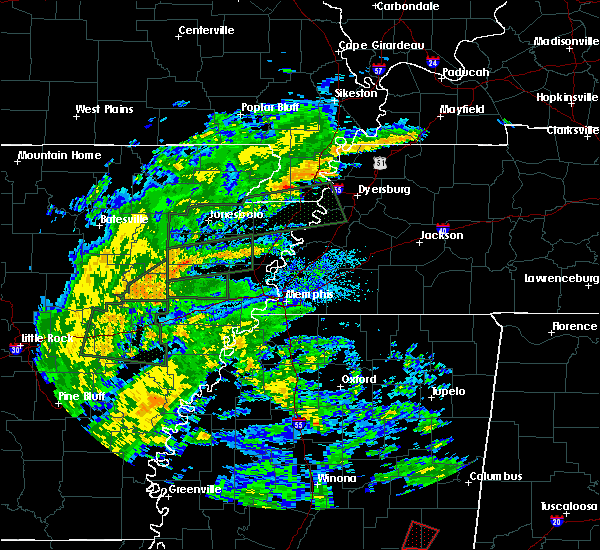 At 1035 am cdt, a severe thunderstorm was located near velma, or 9 miles southwest of water valley, moving northwest at 30 mph. this storm may produce fast moving short tracked tornadoes with little advanced warning. please be prepared to act quickly if the severe thunderstorm warning is upgraded to a tornado warning (radar indicated). Hazards include 60 mph wind gusts. short-lived brief tornadoes. expect damage to roofs, siding, and trees At 1035 am cdt, a severe thunderstorm was located near velma, or 9 miles southwest of water valley, moving northwest at 30 mph. this storm may produce fast moving short tracked tornadoes with little advanced warning. please be prepared to act quickly if the severe thunderstorm warning is upgraded to a tornado warning (radar indicated). Hazards include 60 mph wind gusts. short-lived brief tornadoes. expect damage to roofs, siding, and trees
|
| 4/30/2017 10:34 AM CDT |
 At 1034 am cdt, severe thunderstorms were located along a line extending from near curtis station to scobey, moving northeast at 40 mph (radar indicated). Hazards include 60 mph wind gusts. expect damage to roofs, siding, and trees At 1034 am cdt, severe thunderstorms were located along a line extending from near curtis station to scobey, moving northeast at 40 mph (radar indicated). Hazards include 60 mph wind gusts. expect damage to roofs, siding, and trees
|
| 4/29/2017 7:43 PM CDT |
 At 743 pm cdt, severe thunderstorms were located along a line extending from near tunica to near lambert, moving northeast at 35 mph (radar indicated). Hazards include 60 mph wind gusts. expect damage to roofs, siding, and trees At 743 pm cdt, severe thunderstorms were located along a line extending from near tunica to near lambert, moving northeast at 35 mph (radar indicated). Hazards include 60 mph wind gusts. expect damage to roofs, siding, and trees
|
| 4/2/2017 6:08 PM CDT |
 At 607 pm cdt, severe thunderstorms were located along a line extending from 6 miles southeast of dundee to 7 miles west of charleston, moving northeast at 60 mph (radar indicated). Hazards include 60 mph wind gusts and nickel size hail. Hail damage to vehicles is expected. expect wind damage to roofs, siding, and trees. Locations impacted include, batesville, charleston, george payne state park, john w kyle state park, tutwiler, marks, sardis, lambert, como, crenshaw, crowder, webb, sledge, sumner, pope, belen, enid, paynes, pleasant grove and curtis station. At 607 pm cdt, severe thunderstorms were located along a line extending from 6 miles southeast of dundee to 7 miles west of charleston, moving northeast at 60 mph (radar indicated). Hazards include 60 mph wind gusts and nickel size hail. Hail damage to vehicles is expected. expect wind damage to roofs, siding, and trees. Locations impacted include, batesville, charleston, george payne state park, john w kyle state park, tutwiler, marks, sardis, lambert, como, crenshaw, crowder, webb, sledge, sumner, pope, belen, enid, paynes, pleasant grove and curtis station.
|
| 4/2/2017 5:30 PM CDT |
 At 530 pm cdt, severe thunderstorms were located along a line extending from near crumrod to boyle, moving northeast at 70 mph (radar indicated). Hazards include 70 mph wind gusts and nickel size hail. Expect considerable tree damage. Wind damage is also likely to mobile homes, roofs, and outbuildings. At 530 pm cdt, severe thunderstorms were located along a line extending from near crumrod to boyle, moving northeast at 70 mph (radar indicated). Hazards include 70 mph wind gusts and nickel size hail. Expect considerable tree damage. Wind damage is also likely to mobile homes, roofs, and outbuildings.
|
| 3/25/2017 4:11 AM CDT |
 At 411 am cdt, a severe thunderstorm was located over pope, or near batesville, moving northeast at 50 mph (radar indicated). Hazards include 60 mph wind gusts. Expect damage to roofs, siding, and trees. Locations impacted include, oxford, batesville, water valley, charleston, george payne state park, holly springs national forest, john w kyle state park, sardis, pope, enid, harmontown, springdale, burgess, courtland, abbeville, taylor, glenville, college hill station, college hill and hayes crossing. At 411 am cdt, a severe thunderstorm was located over pope, or near batesville, moving northeast at 50 mph (radar indicated). Hazards include 60 mph wind gusts. Expect damage to roofs, siding, and trees. Locations impacted include, oxford, batesville, water valley, charleston, george payne state park, holly springs national forest, john w kyle state park, sardis, pope, enid, harmontown, springdale, burgess, courtland, abbeville, taylor, glenville, college hill station, college hill and hayes crossing.
|
| 3/25/2017 3:52 AM CDT |
 At 350 am cdt, a severe thunderstorm was located near crowder, or 7 miles northwest of charleston, moving northeast at 60 mph (radar indicated). Hazards include 60 mph wind gusts. expect damage to roofs, siding, and trees At 350 am cdt, a severe thunderstorm was located near crowder, or 7 miles northwest of charleston, moving northeast at 60 mph (radar indicated). Hazards include 60 mph wind gusts. expect damage to roofs, siding, and trees
|
| 1/21/2017 11:32 PM CST |
 At 1132 pm cst, a severe thunderstorm was located near pope, or near batesville, moving northeast at 45 mph (radar indicated). Hazards include 60 mph wind gusts and quarter size hail. Hail damage to vehicles is expected. expect wind damage to roofs, siding, and trees. Locations impacted include, batesville, john w kyle state park, sardis, como, pope, courtland, shuford, asa, glenville, hayes crossing, horatio, eureka springs, chapeltown and mc ghee. At 1132 pm cst, a severe thunderstorm was located near pope, or near batesville, moving northeast at 45 mph (radar indicated). Hazards include 60 mph wind gusts and quarter size hail. Hail damage to vehicles is expected. expect wind damage to roofs, siding, and trees. Locations impacted include, batesville, john w kyle state park, sardis, como, pope, courtland, shuford, asa, glenville, hayes crossing, horatio, eureka springs, chapeltown and mc ghee.
|
| 1/21/2017 11:14 PM CST |
 At 1114 pm cst, a severe thunderstorm was located near charleston, moving northeast at 45 mph (radar indicated). Hazards include 60 mph wind gusts and quarter size hail. Hail damage to vehicles is expected. Expect wind damage to roofs, siding, and trees. At 1114 pm cst, a severe thunderstorm was located near charleston, moving northeast at 45 mph (radar indicated). Hazards include 60 mph wind gusts and quarter size hail. Hail damage to vehicles is expected. Expect wind damage to roofs, siding, and trees.
|
| 3/31/2016 1:20 AM CDT |
 The severe thunderstorm warning for western yalobusha and south central panola counties will expire at 130 am cdt, the storm which prompted the warning has moved out of the area. therefore the warning will be allowed to expire. however heavy rain is still possible with this thunderstorm. a tornado watch remains in effect until 300 am cdt for northwestern mississippi. The severe thunderstorm warning for western yalobusha and south central panola counties will expire at 130 am cdt, the storm which prompted the warning has moved out of the area. therefore the warning will be allowed to expire. however heavy rain is still possible with this thunderstorm. a tornado watch remains in effect until 300 am cdt for northwestern mississippi.
|
| 3/31/2016 1:06 AM CDT |
 At 105 am cdt, a severe thunderstorm was located over velma, or near water valley, moving northeast at 80 mph (radar indicated). Hazards include 60 mph wind gusts and quarter size hail. Hail damage to vehicles is expected. expect wind damage to roofs, siding, and trees. locations impacted include, george payne state park, pope, scobey and tillatoba. A tornado watch remains in effect until 300 am cdt for northwestern mississippi. At 105 am cdt, a severe thunderstorm was located over velma, or near water valley, moving northeast at 80 mph (radar indicated). Hazards include 60 mph wind gusts and quarter size hail. Hail damage to vehicles is expected. expect wind damage to roofs, siding, and trees. locations impacted include, george payne state park, pope, scobey and tillatoba. A tornado watch remains in effect until 300 am cdt for northwestern mississippi.
|
| 3/31/2016 12:46 AM CDT |
 At 1246 am cdt, a severe thunderstorm was located over paynes, or 8 miles south of charleston, moving northeast at 80 mph (radar indicated). Hazards include 60 mph wind gusts and quarter size hail. Hail damage to vehicles is expected. Expect wind damage to roofs, siding, and trees. At 1246 am cdt, a severe thunderstorm was located over paynes, or 8 miles south of charleston, moving northeast at 80 mph (radar indicated). Hazards include 60 mph wind gusts and quarter size hail. Hail damage to vehicles is expected. Expect wind damage to roofs, siding, and trees.
|
| 12/28/2015 5:51 AM CST |
 At 551 am cst, severe thunderstorms were located along a line extending from near tunica to near minter city, moving north at 160 mph (radar indicated). Hazards include 60 mph wind gusts and penny size hail. Expect damage to roofs. Siding and trees. At 551 am cst, severe thunderstorms were located along a line extending from near tunica to near minter city, moving north at 160 mph (radar indicated). Hazards include 60 mph wind gusts and penny size hail. Expect damage to roofs. Siding and trees.
|
| 12/23/2015 4:34 PM CST | The national weather service in memphis has issued a * tornado warning for. northwestern yalobusha county in northwestern mississippi. northeastern tallahatchie county in northwestern mississippi. southeastern panola county in northwestern mississippi. Until 515 pm cst. |
| 12/23/2015 4:25 PM CST | At 424 pm cst, a confirmed large and extremely dangerous tornado was located near pope, or 7 miles west of george payne state park, moving northeast at 60 mph. another tornado may be forming near batesville. take cover now. this is a particularly dangerous situation (radar confirmed tornado). Hazards include damaging tornado. You are in a life threatening situation. flying debris may be deadly to those caught without shelter. mobile homes will be destroyed. considerable damage to homes, businesses and vehicles is likely and complete destruction is possible. the tornado will be near, batesville around 435 pm cst. john w kyle state park around 445 pm cst. Other locations impacted by this tornadic thunderstorm include eureka springs, shuford, courtland, chapeltown and hayes crossing. |
| 12/23/2015 4:12 PM CST | At 412 pm cst, a confirmed large and extremely dangerous tornado was located near crowder, or 9 miles northwest of charleston, moving northeast at 55 mph. this is a particularly dangerous situation (radar confirmed tornado). Hazards include damaging tornado. You are in a life threatening situation. flying debris may be deadly to those caught without shelter. mobile homes will be destroyed. considerable damage to homes, businesses and vehicles is likely and complete destruction is possible. the tornado will be near, crowder around 420 pm cst. enid around 425 pm cst. pope around 430 pm cst. batesville around 435 pm cst. john w kyle state park around 445 pm cst. Other locations impacted by this tornadic thunderstorm include eureka springs, shuford, courtland, chapeltown and hayes crossing. |
| 8/22/2015 6:40 PM CDT |
 At 639 pm cdt, a severe thunderstorm was located near batesville, moving east at 25 mph (trained weather spotters). Hazards include quarter size hail. Damage to vehicles is expected. Locations impacted include, oxford, batesville, water valley, pope, springdale, burgess, courtland, taylor, shuford and eureka springs. At 639 pm cdt, a severe thunderstorm was located near batesville, moving east at 25 mph (trained weather spotters). Hazards include quarter size hail. Damage to vehicles is expected. Locations impacted include, oxford, batesville, water valley, pope, springdale, burgess, courtland, taylor, shuford and eureka springs.
|
| 8/22/2015 6:33 PM CDT |
 At 632 pm cdt, a severe thunderstorm was located over lambert, or 17 miles east of clarksdale, moving northeast at 20 mph (radar indicated). Hazards include 60 mph wind gusts and half dollar size hail. Hail damage to vehicles is expected. Expect wind damage to roofs, siding and trees. At 632 pm cdt, a severe thunderstorm was located over lambert, or 17 miles east of clarksdale, moving northeast at 20 mph (radar indicated). Hazards include 60 mph wind gusts and half dollar size hail. Hail damage to vehicles is expected. Expect wind damage to roofs, siding and trees.
|
| 8/22/2015 6:25 PM CDT |
 At 625 pm cdt, a severe thunderstorm was located near pope, or near batesville, moving east at 25 mph (radar indicated). Hazards include 60 mph wind gusts and half dollar size hail. Hail damage to vehicles is expected. Expect wind damage to roofs, siding and trees. At 625 pm cdt, a severe thunderstorm was located near pope, or near batesville, moving east at 25 mph (radar indicated). Hazards include 60 mph wind gusts and half dollar size hail. Hail damage to vehicles is expected. Expect wind damage to roofs, siding and trees.
|
| 8/22/2015 6:07 PM CDT |
 At 606 pm cdt, a severe thunderstorm was located near curtis station, or 9 miles west of batesville, moving east at 20 mph (radar indicated). Hazards include 60 mph wind gusts and half dollar size hail. Hail damage to vehicles is expected. expect wind damage to roofs, siding and trees. Locations impacted include, batesville, sardis, pope, curtis station, courtland, locke station, ballentine, eureka springs, chapeltown, asa and mims. At 606 pm cdt, a severe thunderstorm was located near curtis station, or 9 miles west of batesville, moving east at 20 mph (radar indicated). Hazards include 60 mph wind gusts and half dollar size hail. Hail damage to vehicles is expected. expect wind damage to roofs, siding and trees. Locations impacted include, batesville, sardis, pope, curtis station, courtland, locke station, ballentine, eureka springs, chapeltown, asa and mims.
|
| 8/22/2015 5:46 PM CDT |
 At 546 pm cdt, a severe thunderstorm was located near marks, or 16 miles west of batesville, moving east at 20 mph (radar indicated). Hazards include 60 mph wind gusts and half dollar size hail. Hail damage to vehicles is expected. expect wind damage to roofs, siding and trees. Locations impacted include, batesville, marks, sardis, lambert, pope, darling, curtis station, pleasant grove, courtland, riverview, locke station, hinchcliff, horatio, essex, eureka springs, west marks, ballentine, chapeltown, asa and mims. At 546 pm cdt, a severe thunderstorm was located near marks, or 16 miles west of batesville, moving east at 20 mph (radar indicated). Hazards include 60 mph wind gusts and half dollar size hail. Hail damage to vehicles is expected. expect wind damage to roofs, siding and trees. Locations impacted include, batesville, marks, sardis, lambert, pope, darling, curtis station, pleasant grove, courtland, riverview, locke station, hinchcliff, horatio, essex, eureka springs, west marks, ballentine, chapeltown, asa and mims.
|
| 8/22/2015 5:38 PM CDT |
 At 538 pm cdt, a severe thunderstorm was located over marks, or 17 miles east of clarksdale, moving east at 20 mph (radar indicated). Hazards include 60 mph wind gusts. Expect damage to roofs. Siding and trees. At 538 pm cdt, a severe thunderstorm was located over marks, or 17 miles east of clarksdale, moving east at 20 mph (radar indicated). Hazards include 60 mph wind gusts. Expect damage to roofs. Siding and trees.
|
| 6/30/2015 2:20 AM CDT |
 The severe thunderstorm warning for southern panola county will expire at 230 am cdt, the storm which prompted the warning has weakened below severe limits and exited the warned area. therefore the warning will be allowed to expire. The severe thunderstorm warning for southern panola county will expire at 230 am cdt, the storm which prompted the warning has weakened below severe limits and exited the warned area. therefore the warning will be allowed to expire.
|
| 6/30/2015 2:07 AM CDT |
 At 206 am cdt, a severe thunderstorm was located near batesville, moving east at 30 mph (radar indicated). Hazards include 60 mph wind gusts and quarter size hail. Hail damage to vehicles is expected. expect wind damage to roofs, siding and trees. Locations impacted include, batesville, pope, courtland, locke station, eureka springs, chapeltown and asa. At 206 am cdt, a severe thunderstorm was located near batesville, moving east at 30 mph (radar indicated). Hazards include 60 mph wind gusts and quarter size hail. Hail damage to vehicles is expected. expect wind damage to roofs, siding and trees. Locations impacted include, batesville, pope, courtland, locke station, eureka springs, chapeltown and asa.
|
| 6/30/2015 1:43 AM CDT |
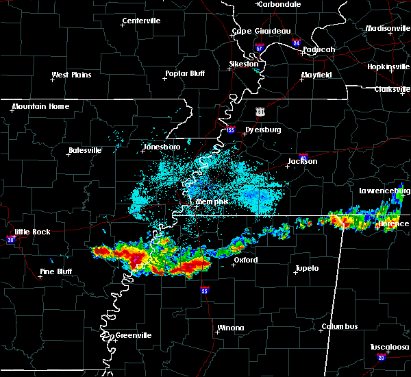 At 142 am cdt, a severe thunderstorm was located near curtis station, or 8 miles west of batesville, moving east at 30 mph (radar indicated). Hazards include 60 mph wind gusts and quarter size hail. Hail damage to vehicles is expected. Expect wind damage to roofs, siding and trees. At 142 am cdt, a severe thunderstorm was located near curtis station, or 8 miles west of batesville, moving east at 30 mph (radar indicated). Hazards include 60 mph wind gusts and quarter size hail. Hail damage to vehicles is expected. Expect wind damage to roofs, siding and trees.
|
| 6/9/2015 1:16 AM CDT | At 116 am cdt, a severe thunderstorm was located over pope, or near batesville, moving southeast at 25 mph (radar indicated). Hazards include 60 mph wind gusts and quarter size hail. Hail damage to vehicles is expected. Expect wind damage to roofs, siding and trees. |
| 5/24/2015 6:38 PM CDT | At 637 pm cdt, a severe thunderstorm was located near crowder, or 10 miles southwest of batesville, moving north at 45 mph (radar indicated). Hazards include 60 mph wind gusts and penny size hail. Expect damage to roofs. Siding and trees. |
| 4/19/2015 10:09 PM CDT | Golf Ball sized hail reported 0.4 miles NNE of Pope, MS |
| 3/28/2014 7:25 PM CDT | 7 road off macedonia rd which connects to highway 6 has several trees down some of which took power lines down. a mobile home was blown off its foundation and several h in panola county MS, 5.6 miles ENE of Pope, MS |
| 4/27/2013 9:45 PM CDT | Multiple trees down and structures damaged in the area. a flipped pickup truck wrapped around a tree and an rv moved several fee in panola county MS, 1 miles WNW of Pope, MS |
| 8/13/2012 5:46 PM CDT | Golf Ball sized hail reported 3.2 miles NW of Pope, MS |
Hail Maps for Pope, MS
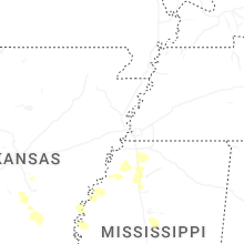
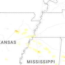
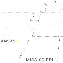
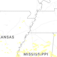
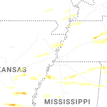

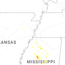
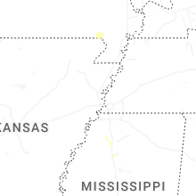
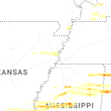
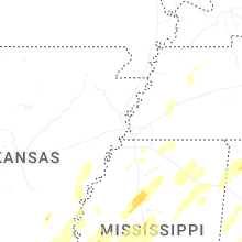


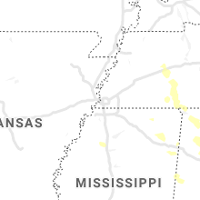


Connect with Interactive Hail Maps