

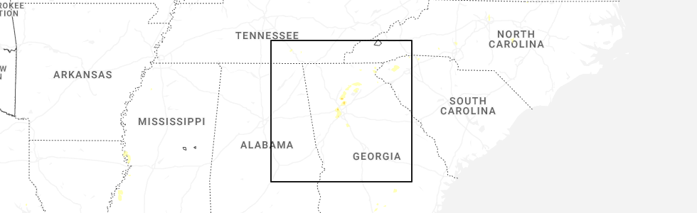
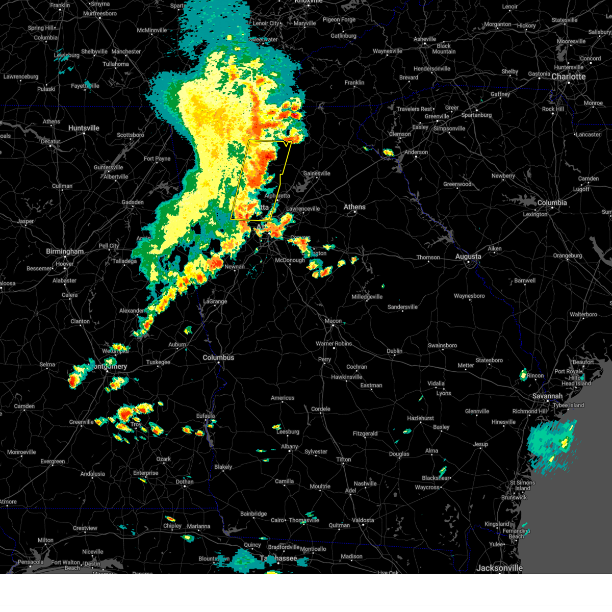
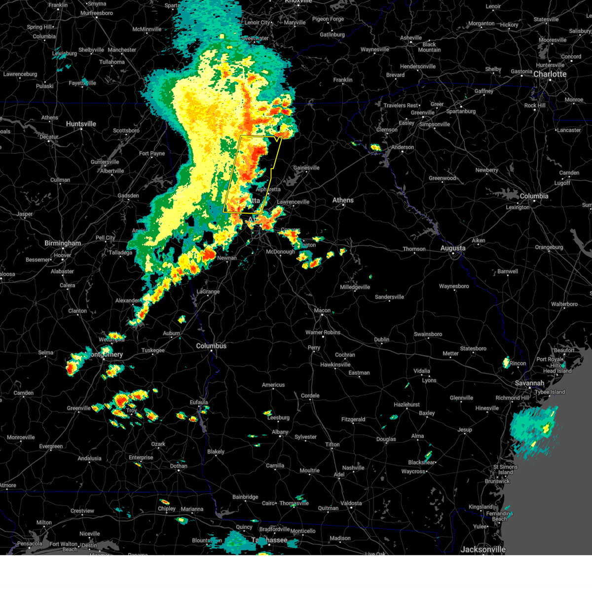
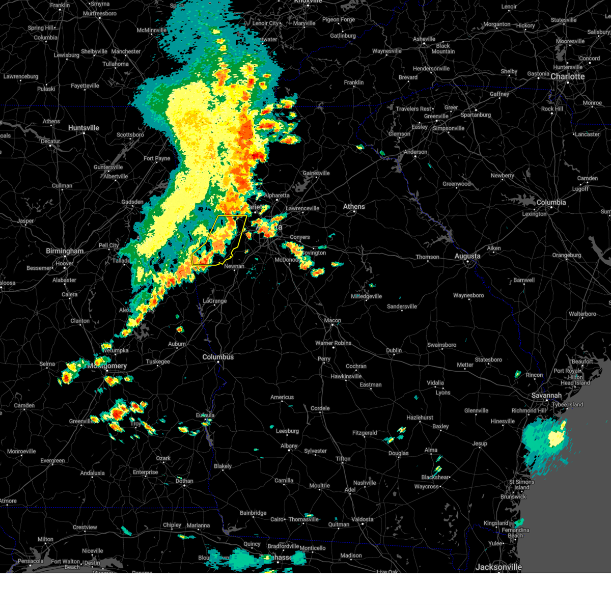
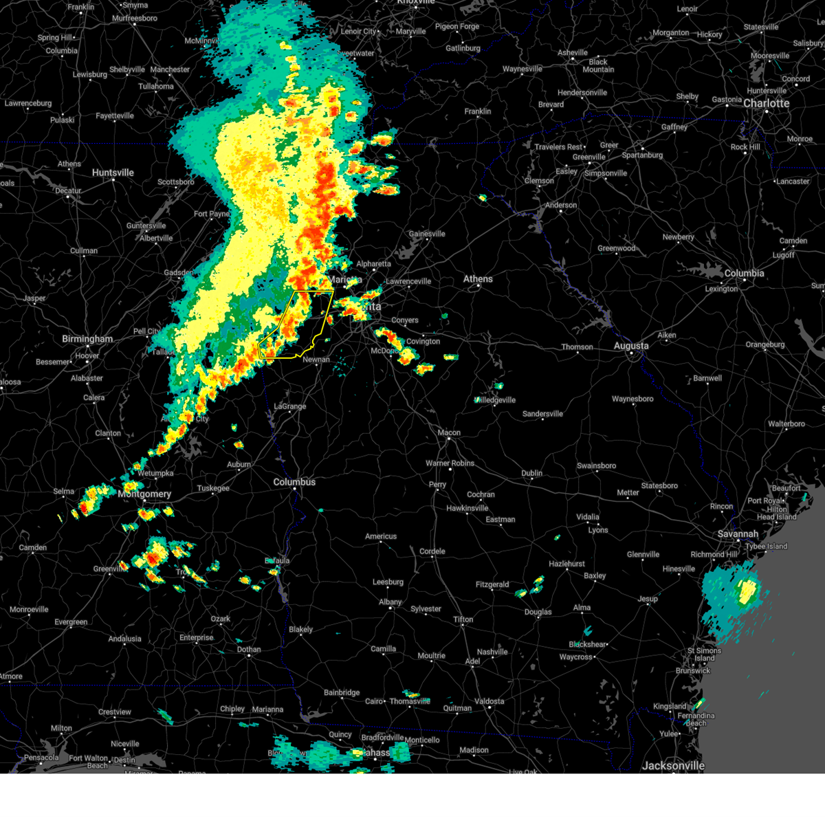
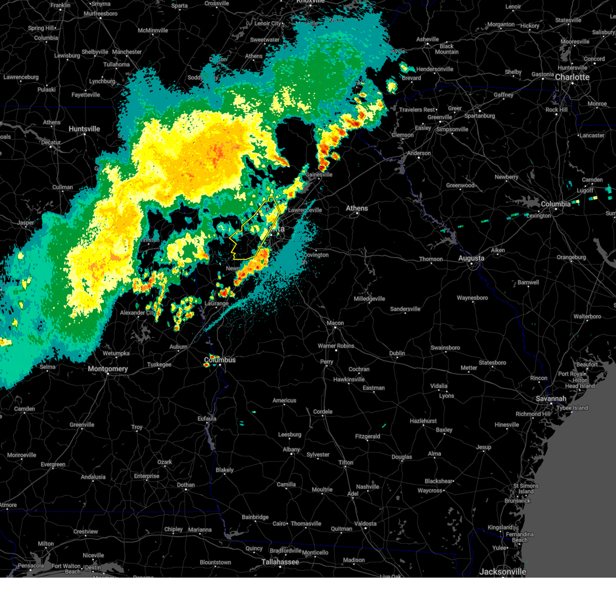
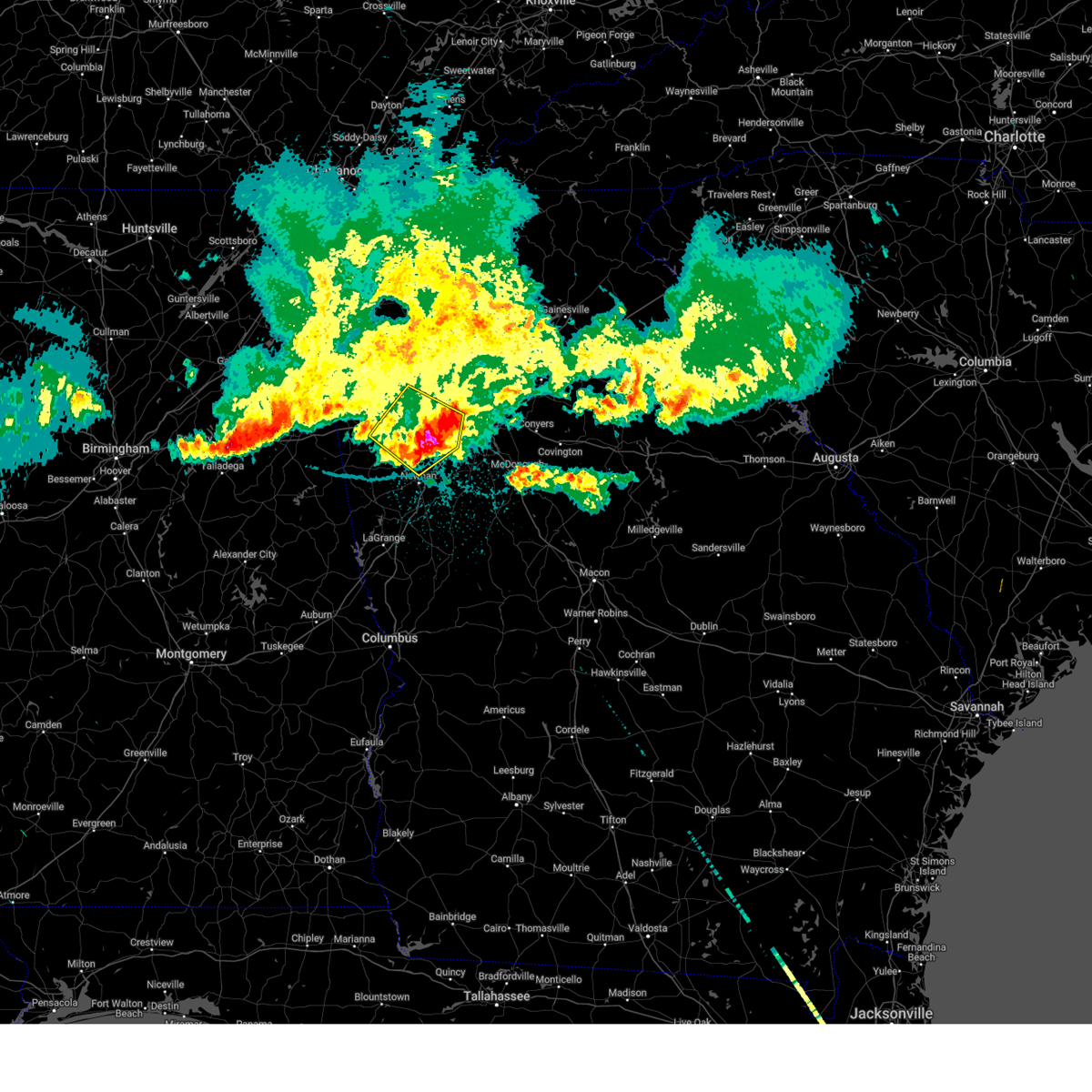
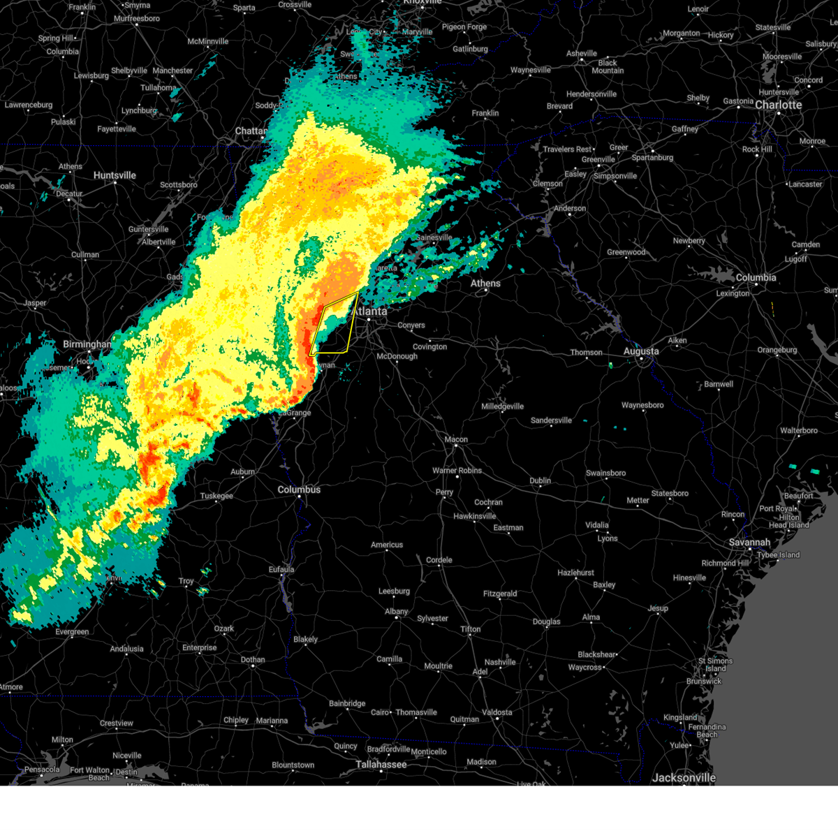
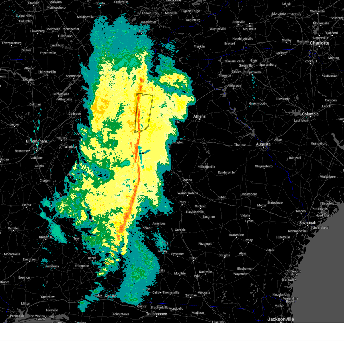
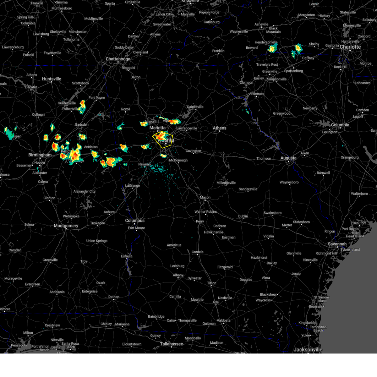
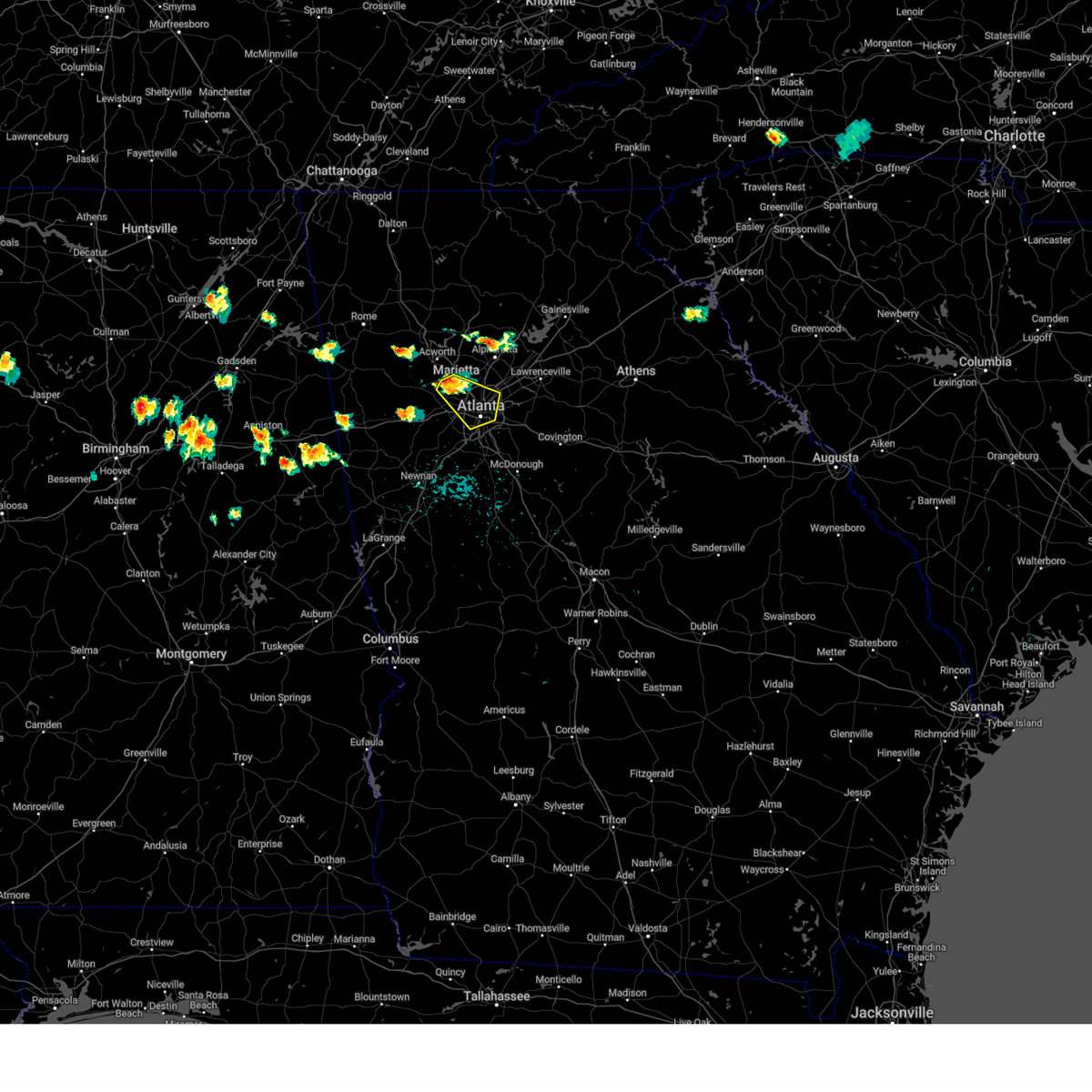
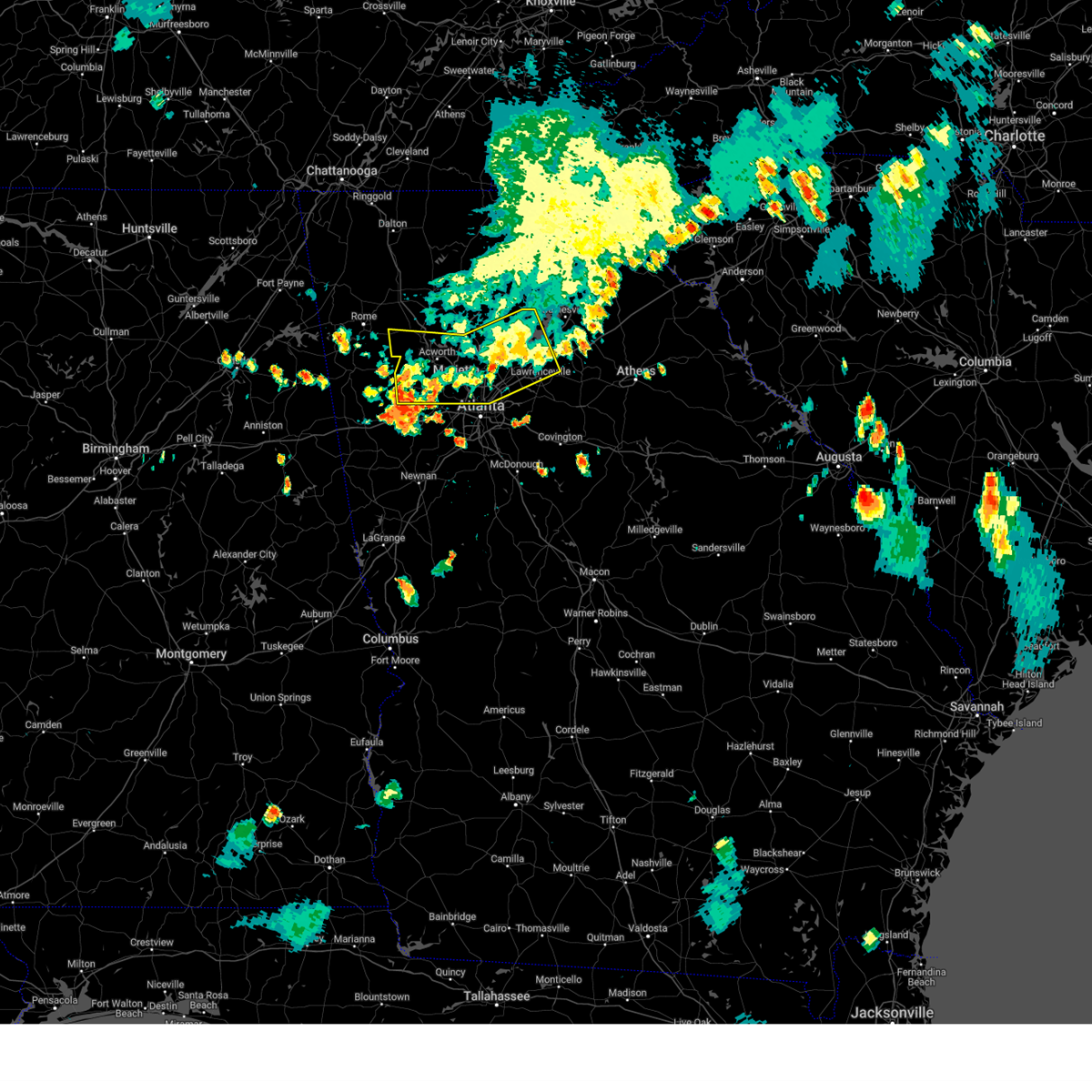
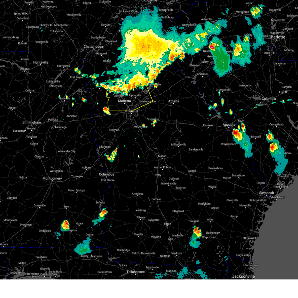
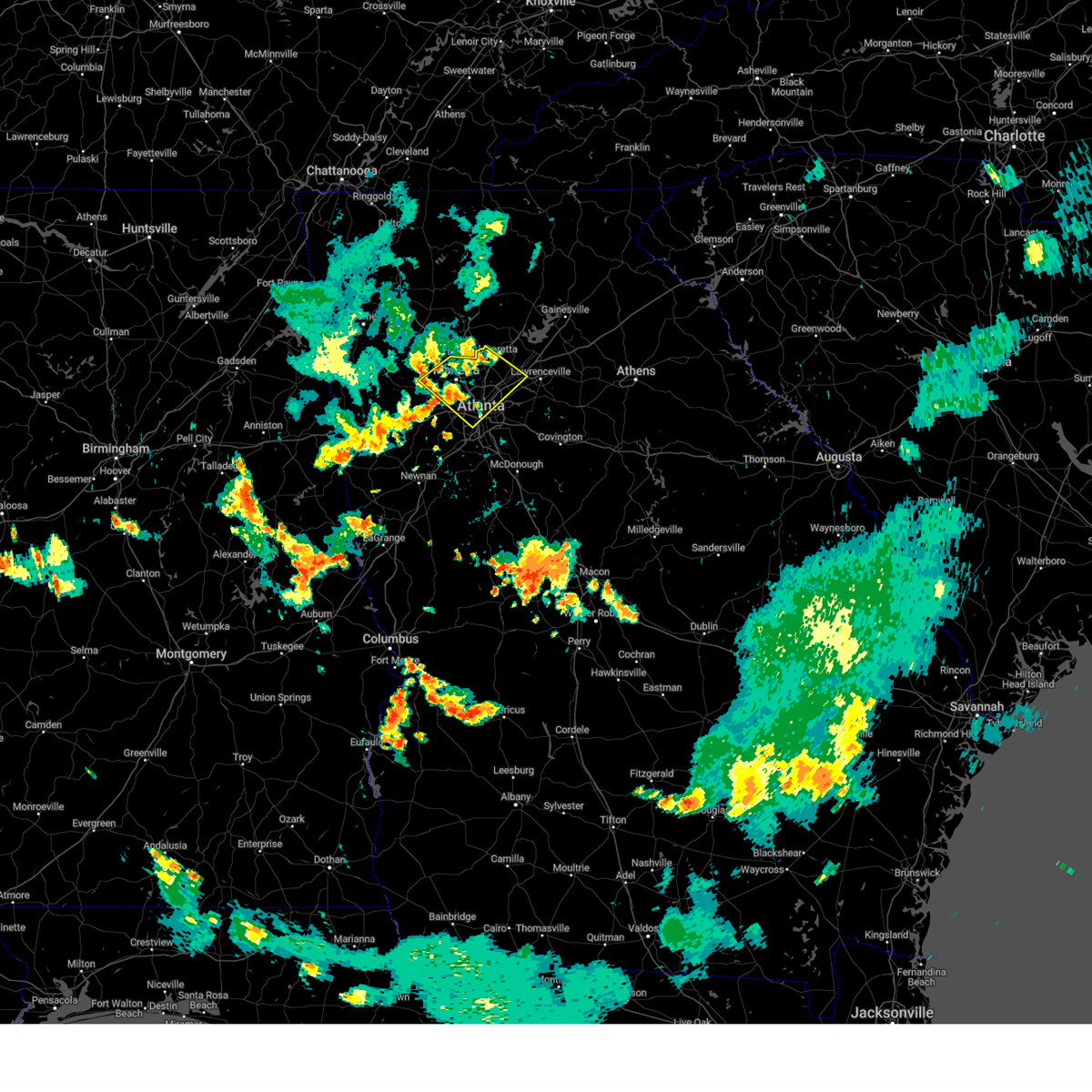
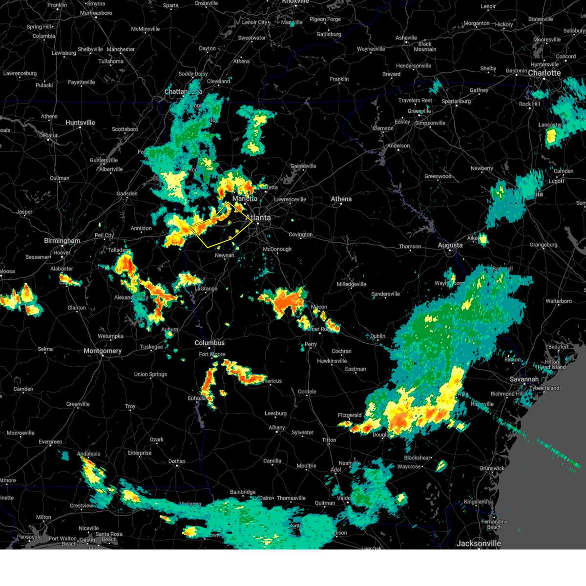
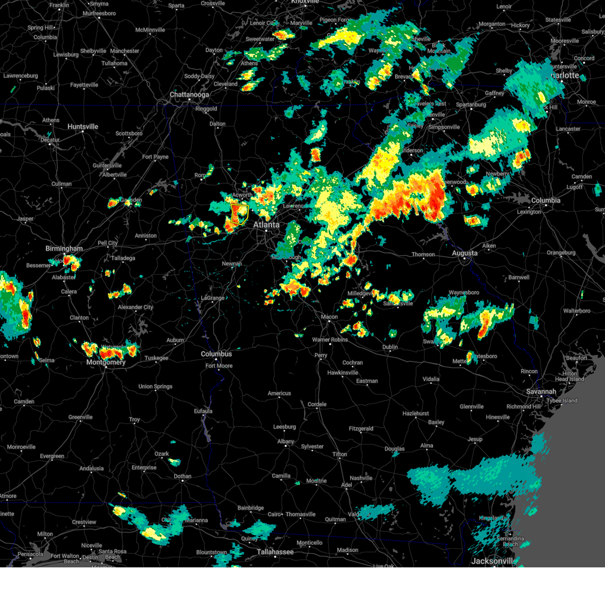
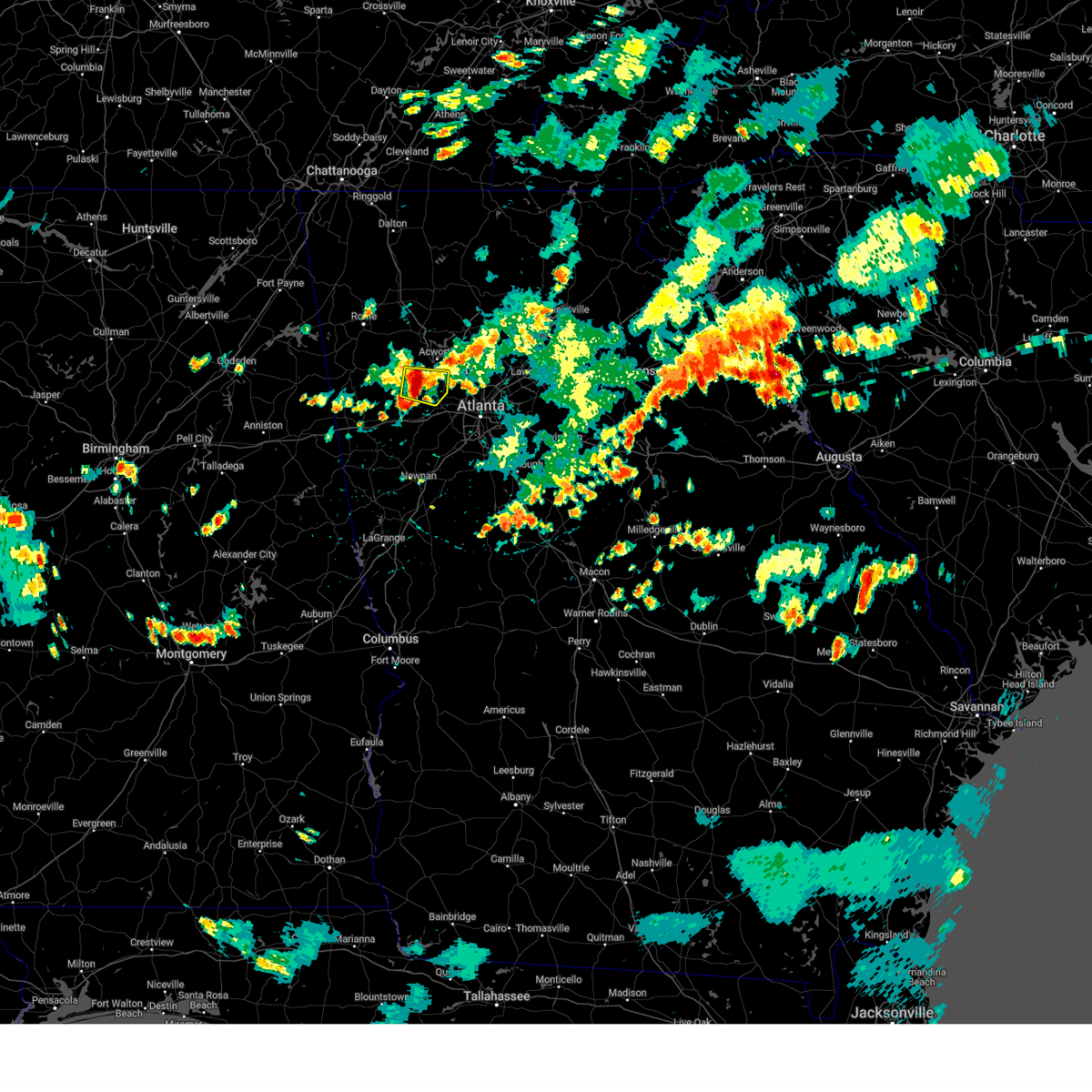
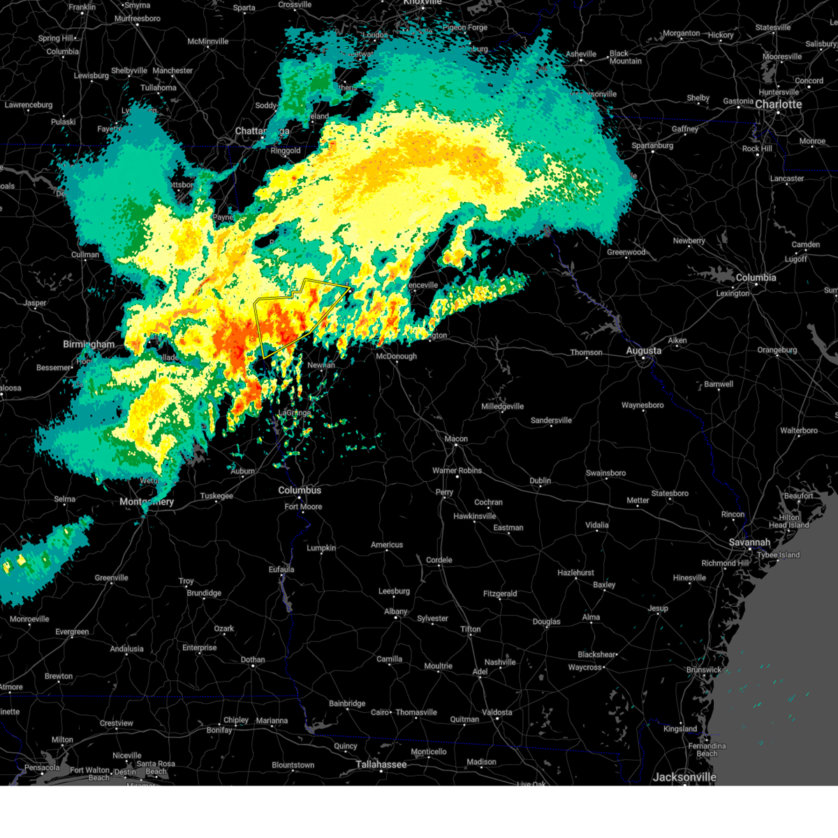
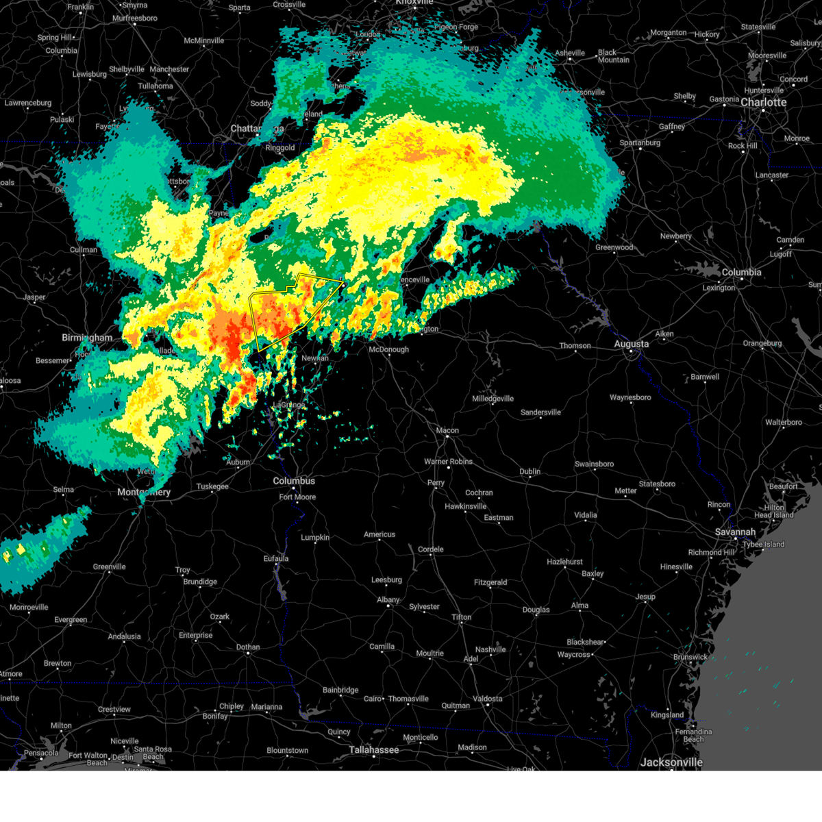
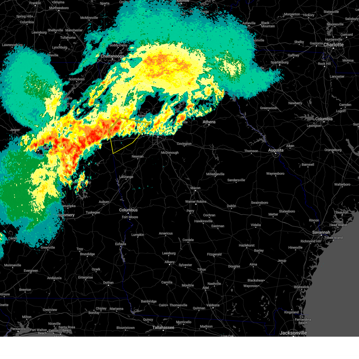
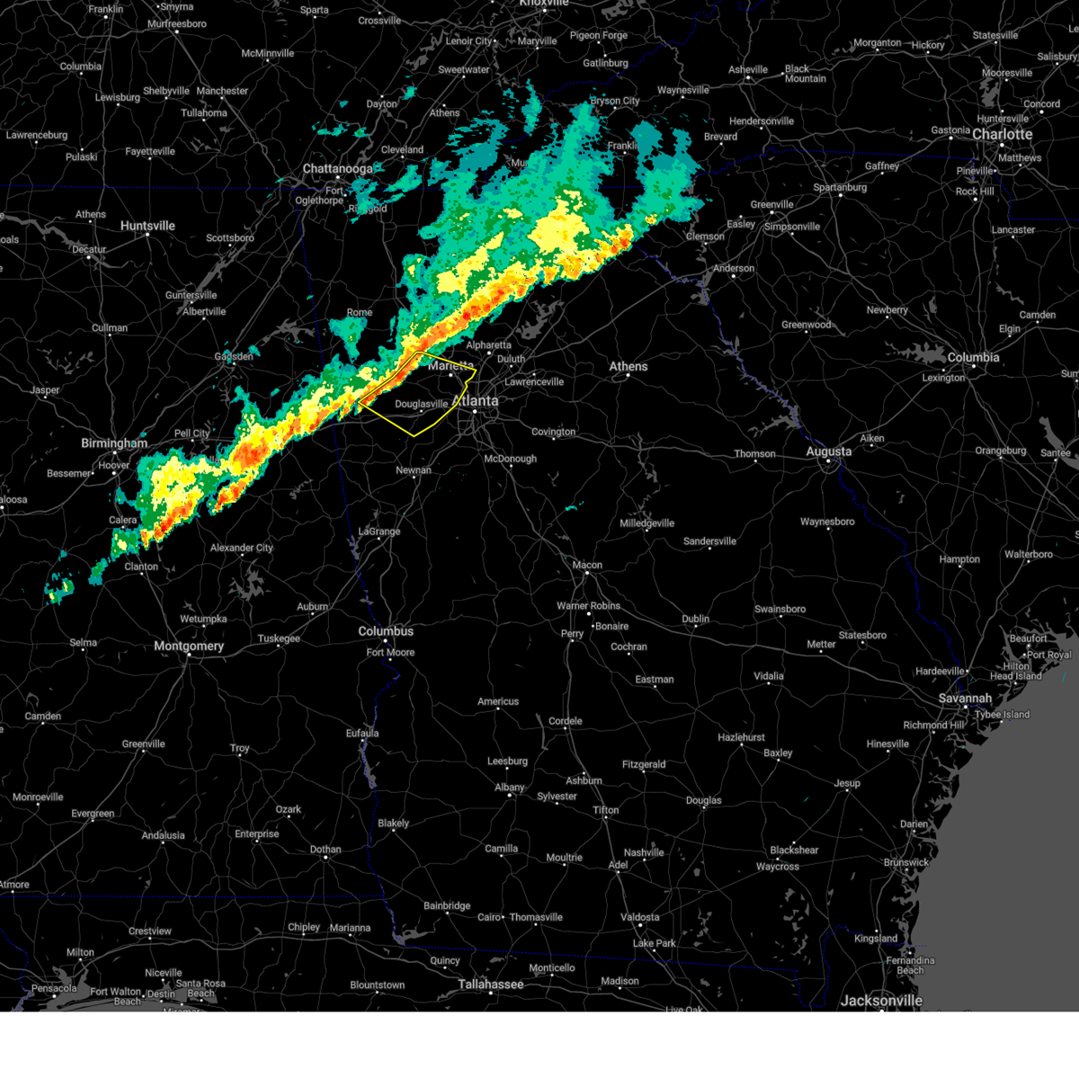
Hail Map for Powder Springs, GA
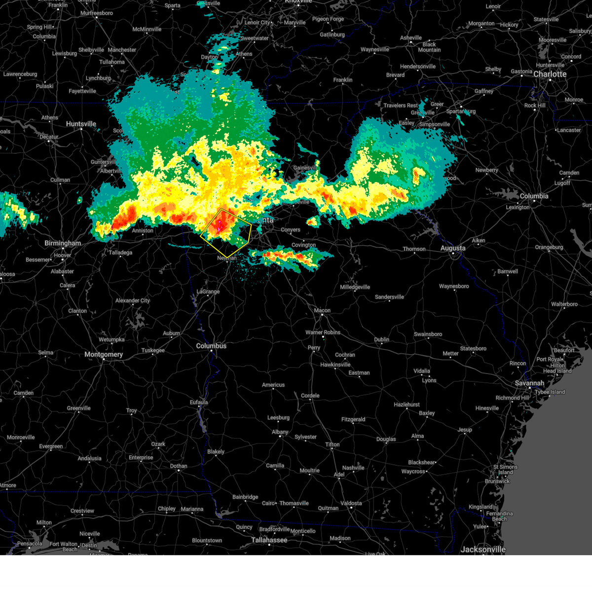
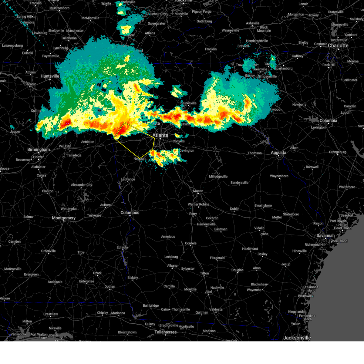
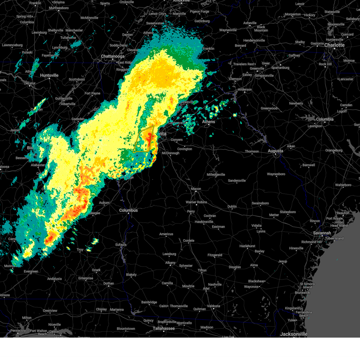
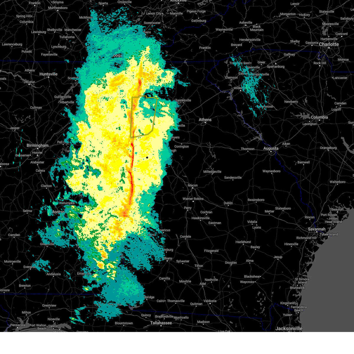
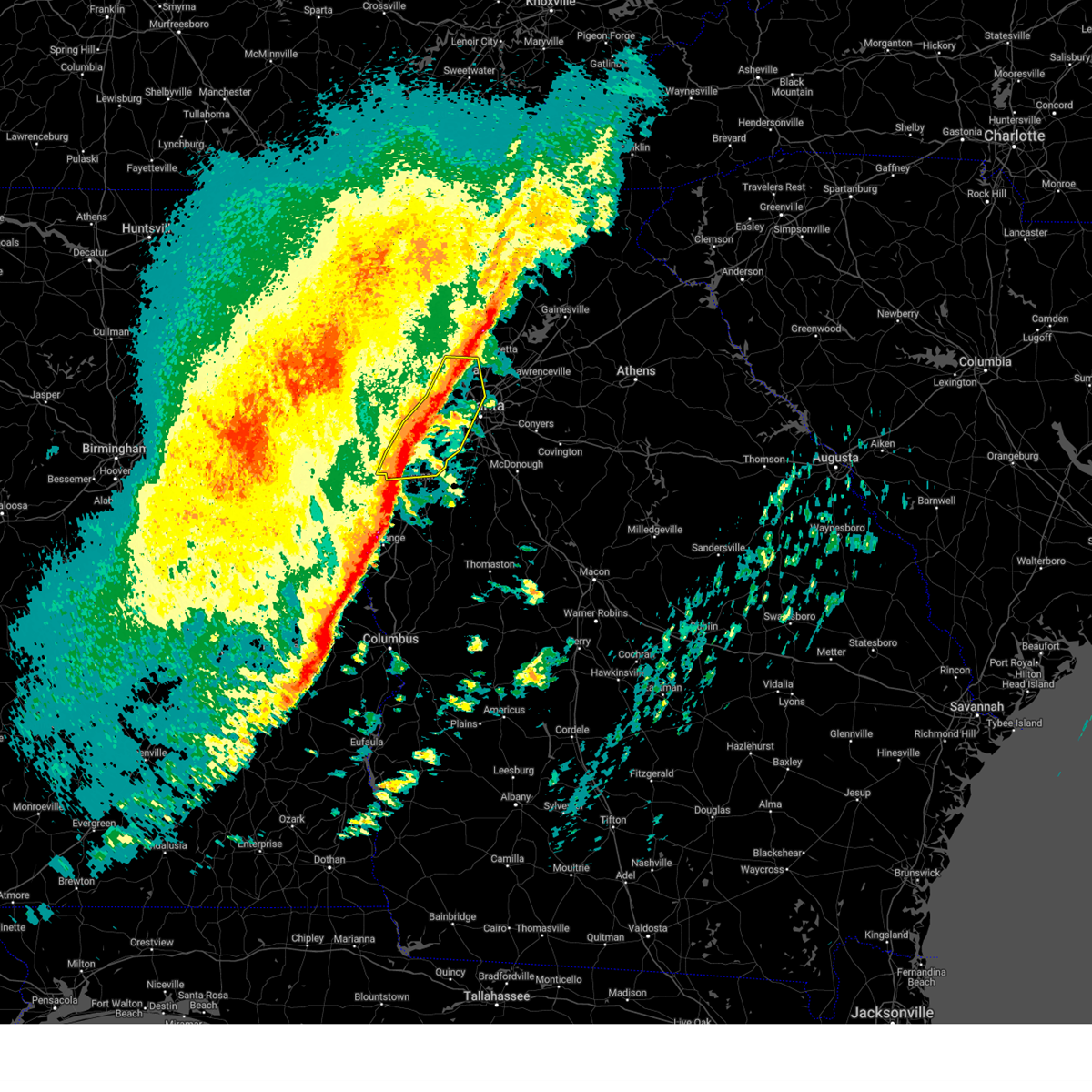
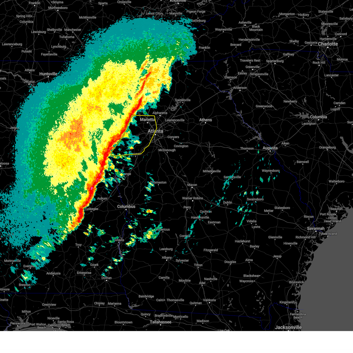
The Powder Springs, GA area has had 2 reports of on-the-ground hail by trained spotters, and has been under severe weather warnings 54 times during the past 12 months. Doppler radar has detected hail at or near Powder Springs, GA on 47 occasions, including 5 occasions during the past year.
| Name: | Powder Springs, GA |
| Where Located: | 18.8 miles WNW of Atlanta, GA |
| Map: | Google Map for Powder Springs, GA |
| Population: | 13940 |
| Housing Units: | 5477 |
| More Info: | Search Google for Powder Springs, GA |
0
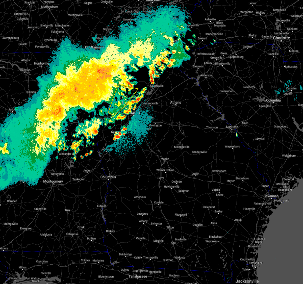
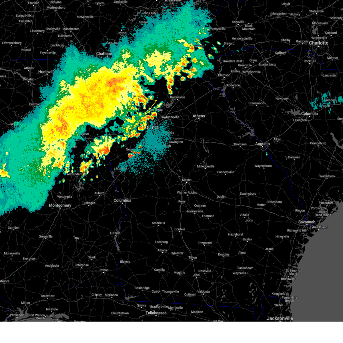
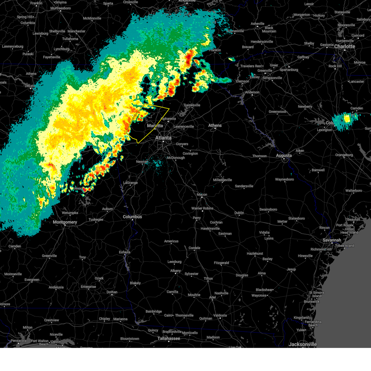
The Top Recent Hail Date for Powder Springs, GA is Thursday, June 26, 2025 (23rd out of 47)
Hail and Wind Damage Spotted near Powder Springs, GA
| Date / Time | Report Details |
|---|---|
| 6/26/2025 5:47 PM EDT |
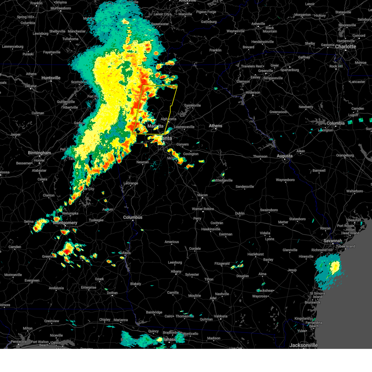
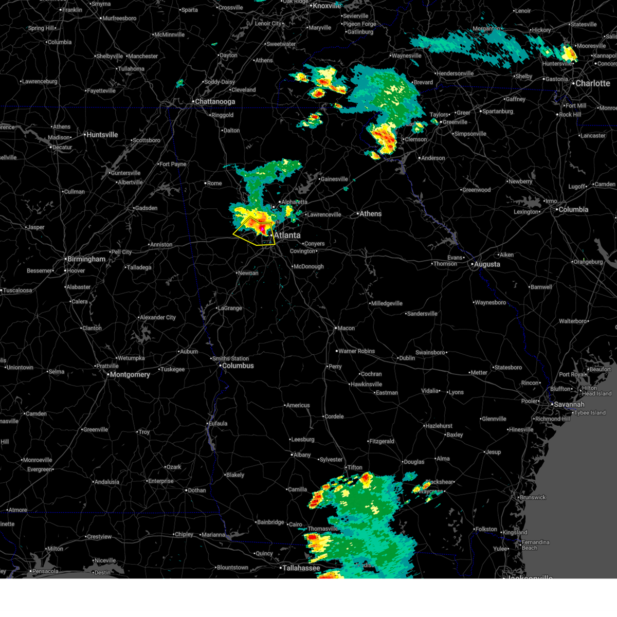 At 547 pm edt, severe thunderstorms were located along a line extending from austell to six flags over georgia to sweet auburn, moving south at 10 mph (radar indicated). Hazards include 60 mph wind gusts and quarter size hail. Hail damage to vehicles is expected. expect wind damage to roofs, siding, and trees. Locations impacted include, atlanta, douglasville, city of south fulton, smyrna, east point, college park, powder springs, austell, hapeville, lithia springs, midtown, grant park-zoo atlanta, vinings, brownsville, sweet auburn, cascade heights, lakewood park, sandtown, atlantic station, and mableton. At 547 pm edt, severe thunderstorms were located along a line extending from austell to six flags over georgia to sweet auburn, moving south at 10 mph (radar indicated). Hazards include 60 mph wind gusts and quarter size hail. Hail damage to vehicles is expected. expect wind damage to roofs, siding, and trees. Locations impacted include, atlanta, douglasville, city of south fulton, smyrna, east point, college park, powder springs, austell, hapeville, lithia springs, midtown, grant park-zoo atlanta, vinings, brownsville, sweet auburn, cascade heights, lakewood park, sandtown, atlantic station, and mableton.
|
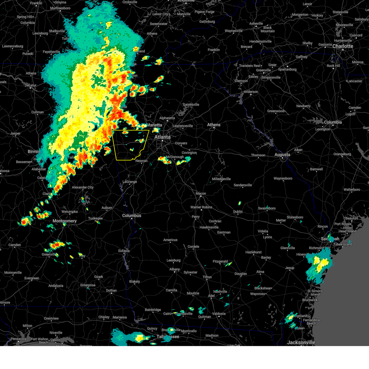
| 6/26/2025 5:15 PM EDT | Svrffc the national weather service in peachtree city has issued a * severe thunderstorm warning for, southeastern paulding county in northwestern georgia, cobb county in north central georgia, northeastern douglas county in north central georgia, south central fulton county in north central georgia, * until 600 pm edt. * at 514 pm edt, severe thunderstorms were located along a line extending from near jim r miller park to smyrna to near brookhaven, moving south at 10 mph (radar indicated). Hazards include 60 mph wind gusts and quarter size hail. Hail damage to vehicles is expected. Expect wind damage to roofs, siding, and trees. |
| 6/7/2025 5:53 PM EDT |
 The storms which prompted the warning have weakened below severe limits, and no longer pose an immediate threat to life or property. therefore, the warning will be allowed to expire. however, gusty winds are still possible with these thunderstorms. a severe thunderstorm watch remains in effect until 900 pm edt for north central and west central georgia. The storms which prompted the warning have weakened below severe limits, and no longer pose an immediate threat to life or property. therefore, the warning will be allowed to expire. however, gusty winds are still possible with these thunderstorms. a severe thunderstorm watch remains in effect until 900 pm edt for north central and west central georgia.
|
| 6/7/2025 5:46 PM EDT |
 At 546 pm edt, severe thunderstorms were located along a line extending from near mableton to near cannongate to near corinth, moving east at 50 mph (radar indicated). Hazards include 60 mph wind gusts. Expect damage to roofs, siding, and trees. Locations impacted include, atlanta, newnan, douglasville, decatur, fayetteville, jonesboro, city of south fulton, sandy springs, smyrna, peachtree city, east point, union city, forest park, riverdale, college park, powder springs, fairburn, chamblee, tyrone, and austell. At 546 pm edt, severe thunderstorms were located along a line extending from near mableton to near cannongate to near corinth, moving east at 50 mph (radar indicated). Hazards include 60 mph wind gusts. Expect damage to roofs, siding, and trees. Locations impacted include, atlanta, newnan, douglasville, decatur, fayetteville, jonesboro, city of south fulton, sandy springs, smyrna, peachtree city, east point, union city, forest park, riverdale, college park, powder springs, fairburn, chamblee, tyrone, and austell.
|
| 6/7/2025 5:46 PM EDT |
 the severe thunderstorm warning has been cancelled and is no longer in effect the severe thunderstorm warning has been cancelled and is no longer in effect
|
| 6/7/2025 5:35 PM EDT | Tree reported down on a powerline on old douglasville rd near the intersection with n sweetwater r in douglas county GA, 3.9 miles N of Powder Springs, GA |
| 6/7/2025 5:35 PM EDT |
 At 535 pm edt, severe thunderstorms were located along a line extending from near talona to near powder springs, moving east at 45 mph (radar indicated). Hazards include 60 mph wind gusts. Expect damage to roofs, siding, and trees. Locations impacted include, atlanta, marietta, canton, cartersville, dallas, jasper, mountain park, sandy springs, roswell, alpharetta, smyrna, milton, kennesaw, woodstock, acworth, powder springs, holly springs, hiram, emerson, and ball ground. At 535 pm edt, severe thunderstorms were located along a line extending from near talona to near powder springs, moving east at 45 mph (radar indicated). Hazards include 60 mph wind gusts. Expect damage to roofs, siding, and trees. Locations impacted include, atlanta, marietta, canton, cartersville, dallas, jasper, mountain park, sandy springs, roswell, alpharetta, smyrna, milton, kennesaw, woodstock, acworth, powder springs, holly springs, hiram, emerson, and ball ground.
|
| 6/7/2025 5:35 PM EDT |
 the severe thunderstorm warning has been cancelled and is no longer in effect the severe thunderstorm warning has been cancelled and is no longer in effect
|
| 6/7/2025 5:29 PM EDT | Tree down on two vehicles near the intersection of indian creek dr and indian creek ct. the corner of a home was damaged... and powerlines were also down in the roadway in paulding county GA, 5.4 miles NE of Powder Springs, GA |
| 6/7/2025 5:28 PM EDT |
 The storms which prompted the warning have moved out of the area. therefore, the warning will be allowed to expire. however, gusty winds are still possible with these thunderstorms. a severe thunderstorm watch remains in effect until 900 pm edt for north central, northwestern and west central georgia. remember, a severe thunderstorm warning still remains in effect for northeast heard, southeast carroll, western douglas, and southeast paulding counties. The storms which prompted the warning have moved out of the area. therefore, the warning will be allowed to expire. however, gusty winds are still possible with these thunderstorms. a severe thunderstorm watch remains in effect until 900 pm edt for north central, northwestern and west central georgia. remember, a severe thunderstorm warning still remains in effect for northeast heard, southeast carroll, western douglas, and southeast paulding counties.
|
| 6/7/2025 5:26 PM EDT |
 At 526 pm edt, severe thunderstorms were located along a line extending from hiram to near hannah to near frolona, moving east at 50 mph (radar indicated). Hazards include 60 mph wind gusts. Expect damage to roofs, siding, and trees. Locations impacted include, atlanta, newnan, douglasville, decatur, fayetteville, jonesboro, franklin, city of south fulton, sandy springs, smyrna, peachtree city, east point, union city, forest park, riverdale, villa rica, college park, powder springs, fairburn, and chamblee. At 526 pm edt, severe thunderstorms were located along a line extending from hiram to near hannah to near frolona, moving east at 50 mph (radar indicated). Hazards include 60 mph wind gusts. Expect damage to roofs, siding, and trees. Locations impacted include, atlanta, newnan, douglasville, decatur, fayetteville, jonesboro, franklin, city of south fulton, sandy springs, smyrna, peachtree city, east point, union city, forest park, riverdale, villa rica, college park, powder springs, fairburn, and chamblee.
|
| 6/7/2025 5:21 PM EDT |
 the severe thunderstorm warning has been cancelled and is no longer in effect the severe thunderstorm warning has been cancelled and is no longer in effect
|
| 6/7/2025 5:21 PM EDT |
 At 521 pm edt, severe thunderstorms were located along a line extending from dallas to near carrollton, moving east at 55 mph (radar indicated). Hazards include 70 mph wind gusts. Expect considerable tree damage. damage is likely to mobile homes, roofs, and outbuildings. Locations impacted include, douglasville, carrollton, dallas, villa rica, powder springs, temple, hiram, bowdon, mount zion, whitesburg, roopville, brownsville, bill arp, seaton lake, fairplay, clem, abilene, lake val-do-mar, winston, and john tanner state park. At 521 pm edt, severe thunderstorms were located along a line extending from dallas to near carrollton, moving east at 55 mph (radar indicated). Hazards include 70 mph wind gusts. Expect considerable tree damage. damage is likely to mobile homes, roofs, and outbuildings. Locations impacted include, douglasville, carrollton, dallas, villa rica, powder springs, temple, hiram, bowdon, mount zion, whitesburg, roopville, brownsville, bill arp, seaton lake, fairplay, clem, abilene, lake val-do-mar, winston, and john tanner state park.
|
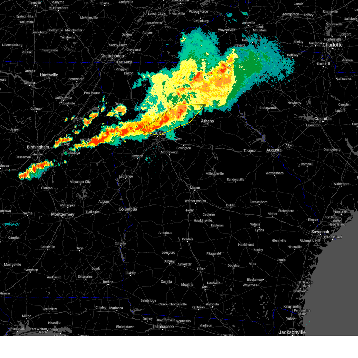
| 6/7/2025 5:18 PM EDT |
 Svrffc the national weather service in peachtree city has issued a * severe thunderstorm warning for, southeastern paulding county in northwestern georgia, southwestern dekalb county in north central georgia, fayette county in north central georgia, northwestern meriwether county in west central georgia, eastern carroll county in northwestern georgia, southern cobb county in north central georgia, douglas county in north central georgia, northern heard county in west central georgia, coweta county in west central georgia, clayton county in north central georgia, fulton county in north central georgia, * until 600 pm edt. * at 517 pm edt, severe thunderstorms were located along a line extending from near dallas to near clem to near frolona, moving east at 50 mph (radar indicated). Hazards include 70 mph wind gusts. Expect considerable tree damage. Damage is likely to mobile homes, roofs, and outbuildings. Svrffc the national weather service in peachtree city has issued a * severe thunderstorm warning for, southeastern paulding county in northwestern georgia, southwestern dekalb county in north central georgia, fayette county in north central georgia, northwestern meriwether county in west central georgia, eastern carroll county in northwestern georgia, southern cobb county in north central georgia, douglas county in north central georgia, northern heard county in west central georgia, coweta county in west central georgia, clayton county in north central georgia, fulton county in north central georgia, * until 600 pm edt. * at 517 pm edt, severe thunderstorms were located along a line extending from near dallas to near clem to near frolona, moving east at 50 mph (radar indicated). Hazards include 70 mph wind gusts. Expect considerable tree damage. Damage is likely to mobile homes, roofs, and outbuildings.
|
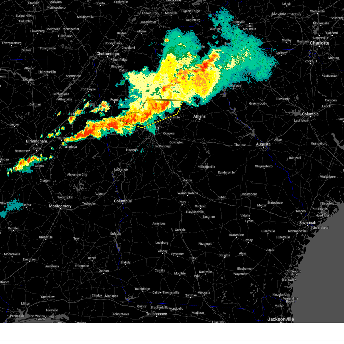
| 6/7/2025 5:14 PM EDT |
 Svrffc the national weather service in peachtree city has issued a * severe thunderstorm warning for, central paulding county in northwestern georgia, cherokee county in north central georgia, cobb county in north central georgia, west central lumpkin county in north central georgia, southern gilmer county in north central georgia, south central murray county in northwestern georgia, western dawson county in north central georgia, eastern gordon county in northwestern georgia, north central fulton county in north central georgia, pickens county in north central georgia, bartow county in northwestern georgia, * until 600 pm edt. * at 513 pm edt, severe thunderstorms were located along a line extending from carters to near yorkville, moving east at 40 mph (radar indicated). Hazards include 60 mph wind gusts. expect damage to roofs, siding, and trees Svrffc the national weather service in peachtree city has issued a * severe thunderstorm warning for, central paulding county in northwestern georgia, cherokee county in north central georgia, cobb county in north central georgia, west central lumpkin county in north central georgia, southern gilmer county in north central georgia, south central murray county in northwestern georgia, western dawson county in north central georgia, eastern gordon county in northwestern georgia, north central fulton county in north central georgia, pickens county in north central georgia, bartow county in northwestern georgia, * until 600 pm edt. * at 513 pm edt, severe thunderstorms were located along a line extending from carters to near yorkville, moving east at 40 mph (radar indicated). Hazards include 60 mph wind gusts. expect damage to roofs, siding, and trees
|
| 6/7/2025 4:46 PM EDT |
 Svrffc the national weather service in peachtree city has issued a * severe thunderstorm warning for, southern paulding county in northwestern georgia, haralson county in northwestern georgia, carroll county in northwestern georgia, west central cobb county in north central georgia, douglas county in north central georgia, southwestern polk county in northwestern georgia, * until 530 pm edt. * at 446 pm edt, severe thunderstorms were located along a line extending from near mars hills to camp sequoyah, moving east at 55 mph (radar indicated). Hazards include 70 mph wind gusts. Expect considerable tree damage. Damage is likely to mobile homes, roofs, and outbuildings. Svrffc the national weather service in peachtree city has issued a * severe thunderstorm warning for, southern paulding county in northwestern georgia, haralson county in northwestern georgia, carroll county in northwestern georgia, west central cobb county in north central georgia, douglas county in north central georgia, southwestern polk county in northwestern georgia, * until 530 pm edt. * at 446 pm edt, severe thunderstorms were located along a line extending from near mars hills to camp sequoyah, moving east at 55 mph (radar indicated). Hazards include 70 mph wind gusts. Expect considerable tree damage. Damage is likely to mobile homes, roofs, and outbuildings.
|
| 5/21/2025 1:09 AM EDT |
 the severe thunderstorm warning has been cancelled and is no longer in effect the severe thunderstorm warning has been cancelled and is no longer in effect
|
| 5/21/2025 12:54 AM EDT |
 The storms which prompted the warning have moved out of the area. therefore, the warning will be allowed to expire. a tornado watch remains in effect until 200 am edt for north central and northwestern georgia. remember, a severe thunderstorm warning still remains in effect for cobb, fulton, forsyth, hall, gwinnett, and dekalb. The storms which prompted the warning have moved out of the area. therefore, the warning will be allowed to expire. a tornado watch remains in effect until 200 am edt for north central and northwestern georgia. remember, a severe thunderstorm warning still remains in effect for cobb, fulton, forsyth, hall, gwinnett, and dekalb.
|
| 5/21/2025 12:50 AM EDT |
 Svrffc the national weather service in peachtree city has issued a * severe thunderstorm warning for, northwestern barrow county in north central georgia, northwestern dekalb county in north central georgia, central forsyth county in north central georgia, central cobb county in north central georgia, gwinnett county in north central georgia, southwestern banks county in northeastern georgia, southern hall county in north central georgia, northwestern jackson county in northeastern georgia, northeastern fulton county in north central georgia, * until 130 am edt. * at 1250 am edt, severe thunderstorms were located along a line extending from near oscarville to near roswell to near hiram, moving east at 45 mph (radar indicated). Hazards include 60 mph wind gusts and penny size hail. expect damage to roofs, siding, and trees Svrffc the national weather service in peachtree city has issued a * severe thunderstorm warning for, northwestern barrow county in north central georgia, northwestern dekalb county in north central georgia, central forsyth county in north central georgia, central cobb county in north central georgia, gwinnett county in north central georgia, southwestern banks county in northeastern georgia, southern hall county in north central georgia, northwestern jackson county in northeastern georgia, northeastern fulton county in north central georgia, * until 130 am edt. * at 1250 am edt, severe thunderstorms were located along a line extending from near oscarville to near roswell to near hiram, moving east at 45 mph (radar indicated). Hazards include 60 mph wind gusts and penny size hail. expect damage to roofs, siding, and trees
|
| 5/21/2025 12:47 AM EDT |
 the severe thunderstorm warning has been cancelled and is no longer in effect the severe thunderstorm warning has been cancelled and is no longer in effect
|
| 5/21/2025 12:47 AM EDT |
 At 1247 am edt, severe thunderstorms were located along a line extending from murrayville to near sugar hill to white water park, moving east at 50 mph (radar indicated). Hazards include 60 mph wind gusts and quarter size hail. Hail damage to vehicles is expected. expect wind damage to roofs, siding, and trees. Locations impacted include, atlanta, marietta, gainesville, canton, dallas, cumming, peachtree corners, mountain park, sandy springs, roswell, johns creek, alpharetta, smyrna, dunwoody, milton, kennesaw, duluth, woodstock, acworth, and sugar hill. At 1247 am edt, severe thunderstorms were located along a line extending from murrayville to near sugar hill to white water park, moving east at 50 mph (radar indicated). Hazards include 60 mph wind gusts and quarter size hail. Hail damage to vehicles is expected. expect wind damage to roofs, siding, and trees. Locations impacted include, atlanta, marietta, gainesville, canton, dallas, cumming, peachtree corners, mountain park, sandy springs, roswell, johns creek, alpharetta, smyrna, dunwoody, milton, kennesaw, duluth, woodstock, acworth, and sugar hill.
|
| 5/21/2025 12:19 AM EDT |
 Svrffc the national weather service in peachtree city has issued a * severe thunderstorm warning for, central paulding county in northwestern georgia, cherokee county in north central georgia, northwestern dekalb county in north central georgia, forsyth county in north central georgia, cobb county in north central georgia, northern gwinnett county in north central georgia, southern dawson county in north central georgia, hall county in north central georgia, northeastern fulton county in north central georgia, southeastern pickens county in north central georgia, * until 100 am edt. * at 1219 am edt, severe thunderstorms were located along a line extending from near marblehill to lebanon to near braswell, moving east at 50 mph (radar indicated). Hazards include 60 mph wind gusts and quarter size hail. Hail damage to vehicles is expected. Expect wind damage to roofs, siding, and trees. Svrffc the national weather service in peachtree city has issued a * severe thunderstorm warning for, central paulding county in northwestern georgia, cherokee county in north central georgia, northwestern dekalb county in north central georgia, forsyth county in north central georgia, cobb county in north central georgia, northern gwinnett county in north central georgia, southern dawson county in north central georgia, hall county in north central georgia, northeastern fulton county in north central georgia, southeastern pickens county in north central georgia, * until 100 am edt. * at 1219 am edt, severe thunderstorms were located along a line extending from near marblehill to lebanon to near braswell, moving east at 50 mph (radar indicated). Hazards include 60 mph wind gusts and quarter size hail. Hail damage to vehicles is expected. Expect wind damage to roofs, siding, and trees.
|
| 5/2/2025 9:52 PM EDT |
 The storms which prompted the warning have moved out of the area. therefore, the warning will be allowed to expire. a severe thunderstorm watch remains in effect until 200 am edt for north central, northwestern and west central georgia. The storms which prompted the warning have moved out of the area. therefore, the warning will be allowed to expire. a severe thunderstorm watch remains in effect until 200 am edt for north central, northwestern and west central georgia.
|
| 5/2/2025 9:29 PM EDT |
 the severe thunderstorm warning has been cancelled and is no longer in effect the severe thunderstorm warning has been cancelled and is no longer in effect
|
| 5/2/2025 9:21 PM EDT |
 At 920 pm edt, severe thunderstorms were located along a line extending from birmingham to near douglasville, moving east at 45 mph (radar indicated). Hazards include 60 mph wind gusts and penny size hail. Expect damage to roofs, siding, and trees. Locations impacted include, marietta, canton, cartersville, dallas, kennesaw, woodstock, acworth, villa rica, powder springs, holly springs, hiram, emerson, white, waleska, buffington, hickory flat, burnt hickory ridge, kellogg creek, lost mountain park, and red top mountain state park. At 920 pm edt, severe thunderstorms were located along a line extending from birmingham to near douglasville, moving east at 45 mph (radar indicated). Hazards include 60 mph wind gusts and penny size hail. Expect damage to roofs, siding, and trees. Locations impacted include, marietta, canton, cartersville, dallas, kennesaw, woodstock, acworth, villa rica, powder springs, holly springs, hiram, emerson, white, waleska, buffington, hickory flat, burnt hickory ridge, kellogg creek, lost mountain park, and red top mountain state park.
|
| 5/2/2025 9:21 PM EDT |
 the severe thunderstorm warning has been cancelled and is no longer in effect the severe thunderstorm warning has been cancelled and is no longer in effect
|
| 5/2/2025 9:12 PM EDT | Svrffc the national weather service in peachtree city has issued a * severe thunderstorm warning for, northwestern dekalb county in north central georgia, central cobb county in north central georgia, douglas county in north central georgia, central fulton county in north central georgia, * until 1000 pm edt. * at 912 pm edt, severe thunderstorms were located along a line extending from smyrna to chattahoochee hill, moving east at 45 mph (radar indicated). Hazards include 60 mph wind gusts. expect damage to roofs, siding, and trees |
| 5/2/2025 8:49 PM EDT |
 Svrffc the national weather service in peachtree city has issued a * severe thunderstorm warning for, paulding county in northwestern georgia, cherokee county in north central georgia, northeastern haralson county in northwestern georgia, northwestern cobb county in north central georgia, northwestern douglas county in north central georgia, eastern polk county in northwestern georgia, southeastern bartow county in northwestern georgia, * until 945 pm edt. * at 849 pm edt, severe thunderstorms were located along a line extending from near sutallee to near draketown, moving southeast at 45 mph (radar indicated). Hazards include 60 mph wind gusts. expect damage to roofs, siding, and trees Svrffc the national weather service in peachtree city has issued a * severe thunderstorm warning for, paulding county in northwestern georgia, cherokee county in north central georgia, northeastern haralson county in northwestern georgia, northwestern cobb county in north central georgia, northwestern douglas county in north central georgia, eastern polk county in northwestern georgia, southeastern bartow county in northwestern georgia, * until 945 pm edt. * at 849 pm edt, severe thunderstorms were located along a line extending from near sutallee to near draketown, moving southeast at 45 mph (radar indicated). Hazards include 60 mph wind gusts. expect damage to roofs, siding, and trees
|
| 4/10/2025 9:16 PM EDT |
 The storm which prompted the warning has moved out of the area. therefore, the warning has been allowed to expire. a severe thunderstorm watch remains in effect until midnight edt for north central, northwestern and west central georgia. The storm which prompted the warning has moved out of the area. therefore, the warning has been allowed to expire. a severe thunderstorm watch remains in effect until midnight edt for north central, northwestern and west central georgia.
|
| 4/10/2025 8:55 PM EDT |
 At 855 pm edt, a severe thunderstorm was located over winston, or near douglasville, moving southeast at 50 mph (radar indicated). Hazards include 60 mph wind gusts and quarter size hail. Hail damage to vehicles is expected. expect wind damage to roofs, siding, and trees. Locations impacted include, chattahoochee hill, lithia springs, brownsville, union city, bill arp, seaton lake, fairplay, city of south fulton, dunaway gardens, abilene, winston, lake val-do-mar, campbellton, sandtown, sweetwater creek state park, byers crossroads, fairburn, hannah, palmetto, and villa rica. At 855 pm edt, a severe thunderstorm was located over winston, or near douglasville, moving southeast at 50 mph (radar indicated). Hazards include 60 mph wind gusts and quarter size hail. Hail damage to vehicles is expected. expect wind damage to roofs, siding, and trees. Locations impacted include, chattahoochee hill, lithia springs, brownsville, union city, bill arp, seaton lake, fairplay, city of south fulton, dunaway gardens, abilene, winston, lake val-do-mar, campbellton, sandtown, sweetwater creek state park, byers crossroads, fairburn, hannah, palmetto, and villa rica.
|
| 4/10/2025 8:55 PM EDT |
 the severe thunderstorm warning has been cancelled and is no longer in effect the severe thunderstorm warning has been cancelled and is no longer in effect
|
| 4/10/2025 8:33 PM EDT |
 Svrffc the national weather service in peachtree city has issued a * severe thunderstorm warning for, southern paulding county in northwestern georgia, haralson county in northwestern georgia, eastern carroll county in northwestern georgia, southwestern cobb county in north central georgia, douglas county in north central georgia, north central coweta county in west central georgia, southwestern fulton county in north central georgia, southeastern polk county in northwestern georgia, * until 915 pm edt. * at 831 pm edt, a severe thunderstorm was located near eubank lake, or near buchanan, moving southeast at 50 mph (radar indicated). Hazards include 60 mph wind gusts and quarter size hail. Hail damage to vehicles is expected. Expect wind damage to roofs, siding, and trees. Svrffc the national weather service in peachtree city has issued a * severe thunderstorm warning for, southern paulding county in northwestern georgia, haralson county in northwestern georgia, eastern carroll county in northwestern georgia, southwestern cobb county in north central georgia, douglas county in north central georgia, north central coweta county in west central georgia, southwestern fulton county in north central georgia, southeastern polk county in northwestern georgia, * until 915 pm edt. * at 831 pm edt, a severe thunderstorm was located near eubank lake, or near buchanan, moving southeast at 50 mph (radar indicated). Hazards include 60 mph wind gusts and quarter size hail. Hail damage to vehicles is expected. Expect wind damage to roofs, siding, and trees.
|
| 4/6/2025 1:12 PM EDT |
 The storms which prompted the warning have moved out of the area. therefore, the warning will be allowed to expire. however, heavy rain is still possible with these thunderstorms. a tornado watch remains in effect until 700 pm edt for north central, northwestern and west central georgia. The storms which prompted the warning have moved out of the area. therefore, the warning will be allowed to expire. however, heavy rain is still possible with these thunderstorms. a tornado watch remains in effect until 700 pm edt for north central, northwestern and west central georgia.
|
| 4/6/2025 12:39 PM EDT |
 Svrffc the national weather service in peachtree city has issued a * severe thunderstorm warning for, southeastern paulding county in northwestern georgia, east central carroll county in northwestern georgia, southwestern cobb county in north central georgia, douglas county in north central georgia, southwestern fulton county in north central georgia, * until 115 pm edt. * at 1239 pm edt, severe thunderstorms were located along a line extending from powder springs to byers crossroads, moving northeast at 40 mph (radar indicated). Hazards include 60 mph wind gusts. expect damage to roofs, siding, and trees Svrffc the national weather service in peachtree city has issued a * severe thunderstorm warning for, southeastern paulding county in northwestern georgia, east central carroll county in northwestern georgia, southwestern cobb county in north central georgia, douglas county in north central georgia, southwestern fulton county in north central georgia, * until 115 pm edt. * at 1239 pm edt, severe thunderstorms were located along a line extending from powder springs to byers crossroads, moving northeast at 40 mph (radar indicated). Hazards include 60 mph wind gusts. expect damage to roofs, siding, and trees
|
| 3/16/2025 12:05 AM EDT |
 the severe thunderstorm warning has been cancelled and is no longer in effect the severe thunderstorm warning has been cancelled and is no longer in effect
|
| 3/15/2025 11:55 PM EDT |
 the severe thunderstorm warning has been cancelled and is no longer in effect the severe thunderstorm warning has been cancelled and is no longer in effect
|
| 3/15/2025 11:55 PM EDT |
 At 1155 pm edt, severe thunderstorms were located along a line extending from near new hope to near powder springs to near winston, moving northeast at 45 mph (radar indicated). Hazards include 60 mph wind gusts. Expect damage to roofs, siding, and trees. Locations impacted include, white water park, lost mountain park, jim r miller park, marietta, fair oaks, due west, sandy plains, dobbins air reserve base, new hope, hiram, kennesaw, powder springs, and smyrna. At 1155 pm edt, severe thunderstorms were located along a line extending from near new hope to near powder springs to near winston, moving northeast at 45 mph (radar indicated). Hazards include 60 mph wind gusts. Expect damage to roofs, siding, and trees. Locations impacted include, white water park, lost mountain park, jim r miller park, marietta, fair oaks, due west, sandy plains, dobbins air reserve base, new hope, hiram, kennesaw, powder springs, and smyrna.
|
| 3/15/2025 11:38 PM EDT |
 Svrffc the national weather service in peachtree city has issued a * severe thunderstorm warning for, southern paulding county in northwestern georgia, northeastern carroll county in northwestern georgia, cobb county in north central georgia, douglas county in north central georgia, * until 1230 am edt. * at 1138 pm edt, severe thunderstorms were located along a line extending from near yorkville to near lake val-do-mar to near temple, moving northeast at 45 mph (radar indicated). Hazards include 70 mph wind gusts. Expect considerable tree damage. Damage is likely to mobile homes, roofs, and outbuildings. Svrffc the national weather service in peachtree city has issued a * severe thunderstorm warning for, southern paulding county in northwestern georgia, northeastern carroll county in northwestern georgia, cobb county in north central georgia, douglas county in north central georgia, * until 1230 am edt. * at 1138 pm edt, severe thunderstorms were located along a line extending from near yorkville to near lake val-do-mar to near temple, moving northeast at 45 mph (radar indicated). Hazards include 70 mph wind gusts. Expect considerable tree damage. Damage is likely to mobile homes, roofs, and outbuildings.
|
| 3/15/2025 11:24 PM EDT |
 At 1123 pm edt, severe thunderstorms were located along a line extending from near lindale to john tanner state park, moving northeast at 55 mph (radar indicated). Hazards include 60 mph wind gusts. Expect damage to roofs, siding, and trees. Locations impacted include, ranger, carrollton, brownsville, aragon, bill arp, fairplay, cross roads, abilene, draketown, winston, lake val-do-mar, new hope, funkhouser, rockmart, cassville, bowdon junction, acworth, emerson, van wert, and buchanan. At 1123 pm edt, severe thunderstorms were located along a line extending from near lindale to john tanner state park, moving northeast at 55 mph (radar indicated). Hazards include 60 mph wind gusts. Expect damage to roofs, siding, and trees. Locations impacted include, ranger, carrollton, brownsville, aragon, bill arp, fairplay, cross roads, abilene, draketown, winston, lake val-do-mar, new hope, funkhouser, rockmart, cassville, bowdon junction, acworth, emerson, van wert, and buchanan.
|
| 3/15/2025 11:24 PM EDT |
 the severe thunderstorm warning has been cancelled and is no longer in effect the severe thunderstorm warning has been cancelled and is no longer in effect
|
| 3/15/2025 10:55 PM EDT |
 Svrffc the national weather service in peachtree city has issued a * severe thunderstorm warning for, paulding county in northwestern georgia, haralson county in northwestern georgia, carroll county in northwestern georgia, northwestern cobb county in north central georgia, douglas county in north central georgia, southeastern floyd county in northwestern georgia, northern heard county in west central georgia, northwestern coweta county in west central georgia, southwestern fulton county in north central georgia, southeastern gordon county in northwestern georgia, polk county in northwestern georgia, bartow county in northwestern georgia, * until midnight edt. * at 1054 pm edt, severe thunderstorms were located along a line extending from esom hill to corinth, moving northeast at 70 mph (radar indicated). Hazards include 60 mph wind gusts. expect damage to roofs, siding, and trees Svrffc the national weather service in peachtree city has issued a * severe thunderstorm warning for, paulding county in northwestern georgia, haralson county in northwestern georgia, carroll county in northwestern georgia, northwestern cobb county in north central georgia, douglas county in north central georgia, southeastern floyd county in northwestern georgia, northern heard county in west central georgia, northwestern coweta county in west central georgia, southwestern fulton county in north central georgia, southeastern gordon county in northwestern georgia, polk county in northwestern georgia, bartow county in northwestern georgia, * until midnight edt. * at 1054 pm edt, severe thunderstorms were located along a line extending from esom hill to corinth, moving northeast at 70 mph (radar indicated). Hazards include 60 mph wind gusts. expect damage to roofs, siding, and trees
|
| 3/5/2025 1:52 AM EST |
 At 151 am est, severe thunderstorms were located along a line extending from near salacoa valley to sweetwater creek state park, moving east at 25 mph (radar indicated). Hazards include 60 mph wind gusts. Expect damage to roofs, siding, and trees. Locations impacted include, marietta, douglasville, canton, mountain park, roswell, smyrna, kennesaw, woodstock, acworth, powder springs, holly springs, austell, ball ground, nelson, waleska, lithia springs, fair oaks, buffington, hickory flat, and kellogg creek. At 151 am est, severe thunderstorms were located along a line extending from near salacoa valley to sweetwater creek state park, moving east at 25 mph (radar indicated). Hazards include 60 mph wind gusts. Expect damage to roofs, siding, and trees. Locations impacted include, marietta, douglasville, canton, mountain park, roswell, smyrna, kennesaw, woodstock, acworth, powder springs, holly springs, austell, ball ground, nelson, waleska, lithia springs, fair oaks, buffington, hickory flat, and kellogg creek.
|
| 3/5/2025 1:52 AM EST |
 the severe thunderstorm warning has been cancelled and is no longer in effect the severe thunderstorm warning has been cancelled and is no longer in effect
|
| 3/5/2025 1:25 AM EST |
 Svrffc the national weather service in peachtree city has issued a * severe thunderstorm warning for, paulding county in northwestern georgia, cherokee county in north central georgia, cobb county in north central georgia, northern douglas county in north central georgia, eastern bartow county in northwestern georgia, * until 215 am est. * at 125 am est, severe thunderstorms were located along a line extending from funkhouser to winston, moving east at 25 mph (radar indicated). Hazards include 60 mph wind gusts. expect damage to roofs, siding, and trees Svrffc the national weather service in peachtree city has issued a * severe thunderstorm warning for, paulding county in northwestern georgia, cherokee county in north central georgia, cobb county in north central georgia, northern douglas county in north central georgia, eastern bartow county in northwestern georgia, * until 215 am est. * at 125 am est, severe thunderstorms were located along a line extending from funkhouser to winston, moving east at 25 mph (radar indicated). Hazards include 60 mph wind gusts. expect damage to roofs, siding, and trees
|
| 3/5/2025 12:51 AM EST |
 Svrffc the national weather service in peachtree city has issued a * severe thunderstorm warning for, paulding county in northwestern georgia, northeastern carroll county in northwestern georgia, northern douglas county in north central georgia, southeastern floyd county in northwestern georgia, gordon county in northwestern georgia, western cherokee county in north central georgia, northeastern haralson county in northwestern georgia, cobb county in north central georgia, southwestern gilmer county in north central georgia, southern murray county in northwestern georgia, eastern polk county in northwestern georgia, pickens county in north central georgia, bartow county in northwestern georgia, * until 130 am est. * at 1250 am est, severe thunderstorms were located along a line extending from near resaca to near euharlee to near abilene, moving east at 30 mph (radar indicated). Hazards include 60 mph wind gusts. expect damage to roofs, siding, and trees Svrffc the national weather service in peachtree city has issued a * severe thunderstorm warning for, paulding county in northwestern georgia, northeastern carroll county in northwestern georgia, northern douglas county in north central georgia, southeastern floyd county in northwestern georgia, gordon county in northwestern georgia, western cherokee county in north central georgia, northeastern haralson county in northwestern georgia, cobb county in north central georgia, southwestern gilmer county in north central georgia, southern murray county in northwestern georgia, eastern polk county in northwestern georgia, pickens county in north central georgia, bartow county in northwestern georgia, * until 130 am est. * at 1250 am est, severe thunderstorms were located along a line extending from near resaca to near euharlee to near abilene, moving east at 30 mph (radar indicated). Hazards include 60 mph wind gusts. expect damage to roofs, siding, and trees
|
| 2/16/2025 4:17 AM EST |
 the severe thunderstorm warning has been cancelled and is no longer in effect the severe thunderstorm warning has been cancelled and is no longer in effect
|
| 2/16/2025 4:17 AM EST |
 At 417 am est, severe thunderstorms were located along a line extending from near due west to near powder springs to near hannah to near roopville, moving east at 45 mph (radar indicated). Hazards include 60 mph wind gusts. Expect damage to roofs, siding, and trees. Locations impacted include, atlanta, marietta, douglasville, city of south fulton, sandy springs, roswell, smyrna, east point, kennesaw, acworth, union city, villa rica, college park, powder springs, fairburn, tyrone, austell, palmetto, whitesburg, and lithia springs. At 417 am est, severe thunderstorms were located along a line extending from near due west to near powder springs to near hannah to near roopville, moving east at 45 mph (radar indicated). Hazards include 60 mph wind gusts. Expect damage to roofs, siding, and trees. Locations impacted include, atlanta, marietta, douglasville, city of south fulton, sandy springs, roswell, smyrna, east point, kennesaw, acworth, union city, villa rica, college park, powder springs, fairburn, tyrone, austell, palmetto, whitesburg, and lithia springs.
|
| 2/16/2025 3:56 AM EST |
 Svrffc the national weather service in peachtree city has issued a * severe thunderstorm warning for, paulding county in northwestern georgia, carroll county in northwestern georgia, cobb county in north central georgia, douglas county in north central georgia, northwestern heard county in west central georgia, northwestern coweta county in west central georgia, western fulton county in north central georgia, * until 445 am est. * at 356 am est, severe thunderstorms were located along a line extending from near burnt hickory ridge to near new georgia to john tanner state park to near graham, moving east at 45 mph (radar indicated). Hazards include 60 mph wind gusts. expect damage to roofs, siding, and trees Svrffc the national weather service in peachtree city has issued a * severe thunderstorm warning for, paulding county in northwestern georgia, carroll county in northwestern georgia, cobb county in north central georgia, douglas county in north central georgia, northwestern heard county in west central georgia, northwestern coweta county in west central georgia, western fulton county in north central georgia, * until 445 am est. * at 356 am est, severe thunderstorms were located along a line extending from near burnt hickory ridge to near new georgia to john tanner state park to near graham, moving east at 45 mph (radar indicated). Hazards include 60 mph wind gusts. expect damage to roofs, siding, and trees
|
| 8/18/2024 3:37 PM EDT |
 At 337 pm edt, a severe thunderstorm was located over vinings, or near atlanta, moving southeast at 30 mph (radar indicated). Hazards include 60 mph wind gusts and penny size hail. Expect damage to roofs, siding, and trees. Locations impacted include, atlanta, marietta, decatur, city of south fulton, sandy springs, smyrna, east point, chamblee, doraville, north decatur, fair oaks, north atlanta, north druid hills, midtown, grant park-zoo atlanta, druid hills, candler-mcafee, belvedere park, vinings, and sweet auburn. At 337 pm edt, a severe thunderstorm was located over vinings, or near atlanta, moving southeast at 30 mph (radar indicated). Hazards include 60 mph wind gusts and penny size hail. Expect damage to roofs, siding, and trees. Locations impacted include, atlanta, marietta, decatur, city of south fulton, sandy springs, smyrna, east point, chamblee, doraville, north decatur, fair oaks, north atlanta, north druid hills, midtown, grant park-zoo atlanta, druid hills, candler-mcafee, belvedere park, vinings, and sweet auburn.
|
| 8/18/2024 3:27 PM EDT |
 Svrffc the national weather service in peachtree city has issued a * severe thunderstorm warning for, west central dekalb county in north central georgia, central cobb county in north central georgia, central fulton county in north central georgia, * until 415 pm edt. * at 326 pm edt, a severe thunderstorm was located over jim r miller park, or near marietta, moving southeast at 30 mph (radar indicated). Hazards include 60 mph wind gusts and penny size hail. expect damage to roofs, siding, and trees Svrffc the national weather service in peachtree city has issued a * severe thunderstorm warning for, west central dekalb county in north central georgia, central cobb county in north central georgia, central fulton county in north central georgia, * until 415 pm edt. * at 326 pm edt, a severe thunderstorm was located over jim r miller park, or near marietta, moving southeast at 30 mph (radar indicated). Hazards include 60 mph wind gusts and penny size hail. expect damage to roofs, siding, and trees
|
| 7/30/2024 8:21 PM EDT |
 The storms which prompted the warning have weakened below severe limits, and no longer pose an immediate threat to life or property. therefore, the warning will be allowed to expire. a severe thunderstorm watch remains in effect until 1100 pm edt for north central and northwestern georgia. The storms which prompted the warning have weakened below severe limits, and no longer pose an immediate threat to life or property. therefore, the warning will be allowed to expire. a severe thunderstorm watch remains in effect until 1100 pm edt for north central and northwestern georgia.
|
| 7/30/2024 7:52 PM EDT |
 Svrffc the national weather service in peachtree city has issued a * severe thunderstorm warning for, paulding county in northwestern georgia, southern cherokee county in north central georgia, northwestern dekalb county in north central georgia, forsyth county in north central georgia, cobb county in north central georgia, central gwinnett county in north central georgia, southwestern hall county in north central georgia, northeastern fulton county in north central georgia, southern bartow county in northwestern georgia, * until 830 pm edt. * at 752 pm edt, severe thunderstorms were located along a line extending from near silver city to holly springs to near kingston, moving south at 30 mph (radar indicated). Hazards include 60 mph wind gusts and quarter size hail. Hail damage to vehicles is expected. Expect wind damage to roofs, siding, and trees. Svrffc the national weather service in peachtree city has issued a * severe thunderstorm warning for, paulding county in northwestern georgia, southern cherokee county in north central georgia, northwestern dekalb county in north central georgia, forsyth county in north central georgia, cobb county in north central georgia, central gwinnett county in north central georgia, southwestern hall county in north central georgia, northeastern fulton county in north central georgia, southern bartow county in northwestern georgia, * until 830 pm edt. * at 752 pm edt, severe thunderstorms were located along a line extending from near silver city to holly springs to near kingston, moving south at 30 mph (radar indicated). Hazards include 60 mph wind gusts and quarter size hail. Hail damage to vehicles is expected. Expect wind damage to roofs, siding, and trees.
|
| 7/29/2024 8:05 PM EDT |
 Svrffc the national weather service in peachtree city has issued a * severe thunderstorm warning for, east central paulding county in northwestern georgia, northwestern dekalb county in north central georgia, cobb county in north central georgia, west central gwinnett county in north central georgia, central fulton county in north central georgia, * until 845 pm edt. * at 805 pm edt, severe thunderstorms were located along a line extending from mountain park to near powder springs, moving southeast at 25 mph (radar indicated). Hazards include 60 mph wind gusts and quarter size hail. Hail damage to vehicles is expected. Expect wind damage to roofs, siding, and trees. Svrffc the national weather service in peachtree city has issued a * severe thunderstorm warning for, east central paulding county in northwestern georgia, northwestern dekalb county in north central georgia, cobb county in north central georgia, west central gwinnett county in north central georgia, central fulton county in north central georgia, * until 845 pm edt. * at 805 pm edt, severe thunderstorms were located along a line extending from mountain park to near powder springs, moving southeast at 25 mph (radar indicated). Hazards include 60 mph wind gusts and quarter size hail. Hail damage to vehicles is expected. Expect wind damage to roofs, siding, and trees.
|
| 7/29/2024 7:56 PM EDT |
 Svrffc the national weather service in peachtree city has issued a * severe thunderstorm warning for, southeastern paulding county in northwestern georgia, southeastern haralson county in northwestern georgia, central carroll county in northwestern georgia, southwestern cobb county in north central georgia, douglas county in north central georgia, southwestern fulton county in north central georgia, * until 830 pm edt. * at 756 pm edt, severe thunderstorms were located along a line extending from near lost mountain park to lake val-do-mar to waco, moving southeast at 25 mph (radar indicated). Hazards include 60 mph wind gusts and quarter size hail. Hail damage to vehicles is expected. Expect wind damage to roofs, siding, and trees. Svrffc the national weather service in peachtree city has issued a * severe thunderstorm warning for, southeastern paulding county in northwestern georgia, southeastern haralson county in northwestern georgia, central carroll county in northwestern georgia, southwestern cobb county in north central georgia, douglas county in north central georgia, southwestern fulton county in north central georgia, * until 830 pm edt. * at 756 pm edt, severe thunderstorms were located along a line extending from near lost mountain park to lake val-do-mar to waco, moving southeast at 25 mph (radar indicated). Hazards include 60 mph wind gusts and quarter size hail. Hail damage to vehicles is expected. Expect wind damage to roofs, siding, and trees.
|
| 7/18/2024 5:43 PM EDT |
 At 543 pm edt, a severe thunderstorm was located over lost mountain park, or near dallas, moving east at 20 mph (radar indicated). Hazards include 60 mph wind gusts and penny size hail. Expect damage to roofs, siding, and trees. Locations impacted include, marietta, kennesaw, powder springs, austell, hiram, due west, lost mountain park, and new hope. At 543 pm edt, a severe thunderstorm was located over lost mountain park, or near dallas, moving east at 20 mph (radar indicated). Hazards include 60 mph wind gusts and penny size hail. Expect damage to roofs, siding, and trees. Locations impacted include, marietta, kennesaw, powder springs, austell, hiram, due west, lost mountain park, and new hope.
|
| 7/18/2024 5:28 PM EDT |
 Svrffc the national weather service in peachtree city has issued a * severe thunderstorm warning for, eastern paulding county in northwestern georgia, west central cobb county in north central georgia, * until 600 pm edt. * at 528 pm edt, a severe thunderstorm was located over dallas, moving east at 20 mph (radar indicated). Hazards include 60 mph wind gusts and penny size hail. expect damage to roofs, siding, and trees Svrffc the national weather service in peachtree city has issued a * severe thunderstorm warning for, eastern paulding county in northwestern georgia, west central cobb county in north central georgia, * until 600 pm edt. * at 528 pm edt, a severe thunderstorm was located over dallas, moving east at 20 mph (radar indicated). Hazards include 60 mph wind gusts and penny size hail. expect damage to roofs, siding, and trees
|
| 5/27/2024 8:35 AM EDT |
 Svrffc the national weather service in peachtree city has issued a * severe thunderstorm warning for, southeastern paulding county in northwestern georgia, northwestern fayette county in north central georgia, southern cobb county in north central georgia, eastern douglas county in north central georgia, northeastern coweta county in west central georgia, southwestern fulton county in north central georgia, * until 845 am edt. * at 835 am edt, severe thunderstorms were located along a line extending from near hiram to near chattahoochee hills to near arnco-sargent, moving east at 70 mph (radar indicated). Hazards include 60 mph wind gusts and penny size hail. expect damage to roofs, siding, and trees Svrffc the national weather service in peachtree city has issued a * severe thunderstorm warning for, southeastern paulding county in northwestern georgia, northwestern fayette county in north central georgia, southern cobb county in north central georgia, eastern douglas county in north central georgia, northeastern coweta county in west central georgia, southwestern fulton county in north central georgia, * until 845 am edt. * at 835 am edt, severe thunderstorms were located along a line extending from near hiram to near chattahoochee hills to near arnco-sargent, moving east at 70 mph (radar indicated). Hazards include 60 mph wind gusts and penny size hail. expect damage to roofs, siding, and trees
|
| 5/27/2024 7:51 AM EDT |
 At 751 am edt, severe thunderstorms were located along a line extending from near trickem to near temple to near dallas, moving east at 30 mph (radar indicated). Hazards include 60 mph wind gusts and penny size hail. Expect damage to roofs, siding, and trees. Locations impacted include, marietta, carrollton, dallas, buchanan, kennesaw, villa rica, powder springs, bremen, temple, hiram, tallapoosa, bowdon, mount zion, waco, braswell, yorkville, burnt hickory ridge, lost mountain park, brownsville, and cross roads. At 751 am edt, severe thunderstorms were located along a line extending from near trickem to near temple to near dallas, moving east at 30 mph (radar indicated). Hazards include 60 mph wind gusts and penny size hail. Expect damage to roofs, siding, and trees. Locations impacted include, marietta, carrollton, dallas, buchanan, kennesaw, villa rica, powder springs, bremen, temple, hiram, tallapoosa, bowdon, mount zion, waco, braswell, yorkville, burnt hickory ridge, lost mountain park, brownsville, and cross roads.
|
| 5/27/2024 7:51 AM EDT |
 the severe thunderstorm warning has been cancelled and is no longer in effect the severe thunderstorm warning has been cancelled and is no longer in effect
|
| 5/27/2024 7:18 AM EDT |
 Svrffc the national weather service in peachtree city has issued a * severe thunderstorm warning for, paulding county in northwestern georgia, haralson county in northwestern georgia, central carroll county in northwestern georgia, west central cobb county in north central georgia, northwestern douglas county in north central georgia, central polk county in northwestern georgia, * until 800 am edt. * at 718 am edt, severe thunderstorms were located along a line extending from dearmanville to near tallapoosa to fish creek, moving east at 30 mph (radar indicated). Hazards include 60 mph wind gusts and penny size hail. expect damage to roofs, siding, and trees Svrffc the national weather service in peachtree city has issued a * severe thunderstorm warning for, paulding county in northwestern georgia, haralson county in northwestern georgia, central carroll county in northwestern georgia, west central cobb county in north central georgia, northwestern douglas county in north central georgia, central polk county in northwestern georgia, * until 800 am edt. * at 718 am edt, severe thunderstorms were located along a line extending from dearmanville to near tallapoosa to fish creek, moving east at 30 mph (radar indicated). Hazards include 60 mph wind gusts and penny size hail. expect damage to roofs, siding, and trees
|
| 5/9/2024 7:42 AM EDT |
 Svrffc the national weather service in peachtree city has issued a * severe thunderstorm warning for, paulding county in northwestern georgia, southern cherokee county in north central georgia, northwestern dekalb county in north central georgia, southwestern forsyth county in north central georgia, northeastern haralson county in northwestern georgia, cobb county in north central georgia, northeastern douglas county in north central georgia, northern gwinnett county in north central georgia, northeastern fulton county in north central georgia, eastern polk county in northwestern georgia, southern bartow county in northwestern georgia, * until 830 am edt. * at 742 am edt, a severe thunderstorm was located over acworth, or 10 miles northwest of marietta, moving southeast at 65 mph (radar indicated). Hazards include 60 mph wind gusts and penny size hail. expect damage to roofs, siding, and trees Svrffc the national weather service in peachtree city has issued a * severe thunderstorm warning for, paulding county in northwestern georgia, southern cherokee county in north central georgia, northwestern dekalb county in north central georgia, southwestern forsyth county in north central georgia, northeastern haralson county in northwestern georgia, cobb county in north central georgia, northeastern douglas county in north central georgia, northern gwinnett county in north central georgia, northeastern fulton county in north central georgia, eastern polk county in northwestern georgia, southern bartow county in northwestern georgia, * until 830 am edt. * at 742 am edt, a severe thunderstorm was located over acworth, or 10 miles northwest of marietta, moving southeast at 65 mph (radar indicated). Hazards include 60 mph wind gusts and penny size hail. expect damage to roofs, siding, and trees
|
| 2/28/2024 2:58 PM EST |
 Svrffc the national weather service in peachtree city has issued a * severe thunderstorm warning for, southeastern paulding county in northwestern georgia, northwestern dekalb county in north central georgia, central cobb county in north central georgia, douglas county in north central georgia, west central gwinnett county in north central georgia, fulton county in north central georgia, * until 330 pm est. * at 258 pm est, severe thunderstorms were located along a line extending from near roswell to smyrna to winston, moving southeast at 35 mph (radar indicated). Hazards include 60 mph wind gusts and penny size hail. expect damage to roofs, siding, and trees Svrffc the national weather service in peachtree city has issued a * severe thunderstorm warning for, southeastern paulding county in northwestern georgia, northwestern dekalb county in north central georgia, central cobb county in north central georgia, douglas county in north central georgia, west central gwinnett county in north central georgia, fulton county in north central georgia, * until 330 pm est. * at 258 pm est, severe thunderstorms were located along a line extending from near roswell to smyrna to winston, moving southeast at 35 mph (radar indicated). Hazards include 60 mph wind gusts and penny size hail. expect damage to roofs, siding, and trees
|
| 2/28/2024 2:35 PM EST |
 Svrffc the national weather service in peachtree city has issued a * severe thunderstorm warning for, paulding county in northwestern georgia, east central haralson county in northwestern georgia, northeastern carroll county in northwestern georgia, cobb county in north central georgia, douglas county in north central georgia, * until 300 pm est. * at 235 pm est, severe thunderstorms were located along a line extending from near acworth to dallas to near draketown, moving east at 35 mph (radar indicated). Hazards include 60 mph wind gusts and penny size hail. expect damage to roofs, siding, and trees Svrffc the national weather service in peachtree city has issued a * severe thunderstorm warning for, paulding county in northwestern georgia, east central haralson county in northwestern georgia, northeastern carroll county in northwestern georgia, cobb county in north central georgia, douglas county in north central georgia, * until 300 pm est. * at 235 pm est, severe thunderstorms were located along a line extending from near acworth to dallas to near draketown, moving east at 35 mph (radar indicated). Hazards include 60 mph wind gusts and penny size hail. expect damage to roofs, siding, and trees
|
| 9/12/2023 5:28 PM EDT |
 At 528 pm edt, a severe thunderstorm was located over due west, or near marietta, moving southeast at 15 mph (radar indicated). Hazards include 60 mph wind gusts and half dollar size hail. Hail damage to vehicles is expected. expect wind damage to roofs, siding, and trees. locations impacted include, marietta, smyrna, kennesaw, acworth, powder springs, austell, fair oaks, white water park, lost mountain park, kennesaw state university, jim r miller park, cross roads, due west, sandy plains, dobbins air reserve base, new hope, and mableton. hail threat, observed max hail size, 1. 25 in wind threat, radar indicated max wind gust, 60 mph. At 528 pm edt, a severe thunderstorm was located over due west, or near marietta, moving southeast at 15 mph (radar indicated). Hazards include 60 mph wind gusts and half dollar size hail. Hail damage to vehicles is expected. expect wind damage to roofs, siding, and trees. locations impacted include, marietta, smyrna, kennesaw, acworth, powder springs, austell, fair oaks, white water park, lost mountain park, kennesaw state university, jim r miller park, cross roads, due west, sandy plains, dobbins air reserve base, new hope, and mableton. hail threat, observed max hail size, 1. 25 in wind threat, radar indicated max wind gust, 60 mph.
|
| 9/12/2023 5:17 PM EDT |
 At 517 pm edt, a severe thunderstorm was located over due west, or 8 miles northeast of dallas, moving southeast at 15 mph (radar indicated). Hazards include 60 mph wind gusts and quarter size hail. Hail damage to vehicles is expected. Expect wind damage to roofs, siding, and trees. At 517 pm edt, a severe thunderstorm was located over due west, or 8 miles northeast of dallas, moving southeast at 15 mph (radar indicated). Hazards include 60 mph wind gusts and quarter size hail. Hail damage to vehicles is expected. Expect wind damage to roofs, siding, and trees.
|
| 8/28/2023 6:30 PM EDT |
 At 630 pm edt, a severe thunderstorm was located near new hope, or near dallas, moving north at 15 mph (radar indicated). Hazards include 60 mph wind gusts and nickel size hail. expect damage to roofs, siding, and trees At 630 pm edt, a severe thunderstorm was located near new hope, or near dallas, moving north at 15 mph (radar indicated). Hazards include 60 mph wind gusts and nickel size hail. expect damage to roofs, siding, and trees
|
| 8/28/2023 5:50 PM EDT |
 At 550 pm edt, severe thunderstorms were located along a line extending from near campbellton to hannah, moving north at 20 mph (radar indicated). Hazards include 60 mph wind gusts and nickel size hail. expect damage to roofs, siding, and trees At 550 pm edt, severe thunderstorms were located along a line extending from near campbellton to hannah, moving north at 20 mph (radar indicated). Hazards include 60 mph wind gusts and nickel size hail. expect damage to roofs, siding, and trees
|
| 8/7/2023 6:11 PM EDT |
 The severe thunderstorm warning for dekalb, south central forsyth, cobb, douglas, western gwinnett, fulton and northwestern clayton counties will expire at 615 pm edt, the storms which prompted the warning have moved out of the area. therefore, the warning will be allowed to expire. a severe thunderstorm watch remains in effect until 800 pm edt for north central and northwestern georgia. The severe thunderstorm warning for dekalb, south central forsyth, cobb, douglas, western gwinnett, fulton and northwestern clayton counties will expire at 615 pm edt, the storms which prompted the warning have moved out of the area. therefore, the warning will be allowed to expire. a severe thunderstorm watch remains in effect until 800 pm edt for north central and northwestern georgia.
|
| 8/7/2023 5:40 PM EDT |
 The severe thunderstorm warning for paulding, southwestern cherokee, western cobb, northeastern carroll, northern douglas and southeastern bartow counties will expire at 545 pm edt, the storm which prompted the warning has moved out of the area. therefore, the warning will be allowed to expire. however, gusty winds are still possible with this thunderstorm. a severe thunderstorm watch remains in effect until 800 pm edt for north central and northwestern georgia. remember, a severe thunderstorm warning still remains in effect for douglas and cobb counties. The severe thunderstorm warning for paulding, southwestern cherokee, western cobb, northeastern carroll, northern douglas and southeastern bartow counties will expire at 545 pm edt, the storm which prompted the warning has moved out of the area. therefore, the warning will be allowed to expire. however, gusty winds are still possible with this thunderstorm. a severe thunderstorm watch remains in effect until 800 pm edt for north central and northwestern georgia. remember, a severe thunderstorm warning still remains in effect for douglas and cobb counties.
|
| 8/7/2023 5:27 PM EDT |
 At 527 pm edt, severe thunderstorms were located along a line extending from near sandy plains to treasure lake, moving east at 50 mph (radar indicated). Hazards include 60 mph wind gusts and quarter size hail. Hail damage to vehicles is expected. Expect wind damage to roofs, siding, and trees. At 527 pm edt, severe thunderstorms were located along a line extending from near sandy plains to treasure lake, moving east at 50 mph (radar indicated). Hazards include 60 mph wind gusts and quarter size hail. Hail damage to vehicles is expected. Expect wind damage to roofs, siding, and trees.
|
| 8/7/2023 5:00 PM EDT |
 At 500 pm edt, a severe thunderstorm was located over braswell, or near dallas, moving east at 35 mph (radar indicated). Hazards include 60 mph wind gusts and penny size hail. expect damage to roofs, siding, and trees At 500 pm edt, a severe thunderstorm was located over braswell, or near dallas, moving east at 35 mph (radar indicated). Hazards include 60 mph wind gusts and penny size hail. expect damage to roofs, siding, and trees
|
| 8/6/2023 6:42 PM EDT |
 The severe thunderstorm warning for paulding, northeastern haralson, northeastern carroll and northwestern douglas counties will expire at 645 pm edt, the storm which prompted the warning has weakened below severe limits, and no longer poses an immediate threat to life or property. therefore, the warning will be allowed to expire. however, gusty winds are still possible with this thunderstorm. a severe thunderstorm watch remains in effect until 900 pm edt for north central and northwestern georgia. The severe thunderstorm warning for paulding, northeastern haralson, northeastern carroll and northwestern douglas counties will expire at 645 pm edt, the storm which prompted the warning has weakened below severe limits, and no longer poses an immediate threat to life or property. therefore, the warning will be allowed to expire. however, gusty winds are still possible with this thunderstorm. a severe thunderstorm watch remains in effect until 900 pm edt for north central and northwestern georgia.
|
| 8/6/2023 6:28 PM EDT |
 At 628 pm edt, a severe thunderstorm was located over hiram, or near dallas, moving east at 35 mph (radar indicated). Hazards include 60 mph wind gusts and penny size hail. Expect damage to roofs, siding, and trees. locations impacted include, douglasville, dallas, villa rica, powder springs, temple, hiram, braswell, yorkville, burnt hickory ridge, eubank lake, brownsville, draketown, winston, lake val-do-mar, new hope, and new georgia. hail threat, radar indicated max hail size, 0. 75 in wind threat, radar indicated max wind gust, 60 mph. At 628 pm edt, a severe thunderstorm was located over hiram, or near dallas, moving east at 35 mph (radar indicated). Hazards include 60 mph wind gusts and penny size hail. Expect damage to roofs, siding, and trees. locations impacted include, douglasville, dallas, villa rica, powder springs, temple, hiram, braswell, yorkville, burnt hickory ridge, eubank lake, brownsville, draketown, winston, lake val-do-mar, new hope, and new georgia. hail threat, radar indicated max hail size, 0. 75 in wind threat, radar indicated max wind gust, 60 mph.
|
| 8/6/2023 6:00 PM EDT |
 At 600 pm edt, a severe thunderstorm was located over draketown, or near buchanan, moving east at 35 mph (radar indicated). Hazards include 60 mph wind gusts and penny size hail. expect damage to roofs, siding, and trees At 600 pm edt, a severe thunderstorm was located over draketown, or near buchanan, moving east at 35 mph (radar indicated). Hazards include 60 mph wind gusts and penny size hail. expect damage to roofs, siding, and trees
|
| 8/6/2023 3:39 PM EDT |
 At 339 pm edt, a severe thunderstorm was located near braswell, or 10 miles northwest of dallas, moving east at 20 mph (radar indicated). Hazards include 60 mph wind gusts and penny size hail. expect damage to roofs, siding, and trees At 339 pm edt, a severe thunderstorm was located near braswell, or 10 miles northwest of dallas, moving east at 20 mph (radar indicated). Hazards include 60 mph wind gusts and penny size hail. expect damage to roofs, siding, and trees
|
| 8/3/2023 4:30 PM EDT |
 At 430 pm edt, a severe thunderstorm was located over brownsville, or near douglasville, moving southeast at 25 mph (radar indicated). Hazards include 60 mph wind gusts. expect damage to roofs, siding, and trees At 430 pm edt, a severe thunderstorm was located over brownsville, or near douglasville, moving southeast at 25 mph (radar indicated). Hazards include 60 mph wind gusts. expect damage to roofs, siding, and trees
|
| 7/20/2023 5:57 PM EDT |
 At 557 pm edt, severe thunderstorms were located along a line extending from duluth to chattoogaville, moving southeast at 50 mph (radar indicated). Hazards include 70 mph wind gusts and penny size hail. Expect considerable tree damage. Damage is likely to mobile homes, roofs, and outbuildings. At 557 pm edt, severe thunderstorms were located along a line extending from duluth to chattoogaville, moving southeast at 50 mph (radar indicated). Hazards include 70 mph wind gusts and penny size hail. Expect considerable tree damage. Damage is likely to mobile homes, roofs, and outbuildings.
|
| 6/25/2023 6:24 PM EDT |
 At 623 pm edt, severe thunderstorms were located along a line extending from near lilburn to hiram to winston to near arnco-sargent, moving southeast at 45 mph (radar indicated). Hazards include 60 mph wind gusts and penny size hail. Expect damage to roofs, siding, and trees. locations impacted include, atlanta, marietta, douglasville, lawrenceville, decatur, fayetteville, conyers, covington, dallas, jonesboro, peachtree corners, city of south fulton, sandy springs, roswell, smyrna, dunwoody, east point, kennesaw, duluth and stockbridge. hail threat, radar indicated max hail size, 0. 75 in wind threat, radar indicated max wind gust, 60 mph. At 623 pm edt, severe thunderstorms were located along a line extending from near lilburn to hiram to winston to near arnco-sargent, moving southeast at 45 mph (radar indicated). Hazards include 60 mph wind gusts and penny size hail. Expect damage to roofs, siding, and trees. locations impacted include, atlanta, marietta, douglasville, lawrenceville, decatur, fayetteville, conyers, covington, dallas, jonesboro, peachtree corners, city of south fulton, sandy springs, roswell, smyrna, dunwoody, east point, kennesaw, duluth and stockbridge. hail threat, radar indicated max hail size, 0. 75 in wind threat, radar indicated max wind gust, 60 mph.
|
| 6/25/2023 6:00 PM EDT |
 At 600 pm edt, severe thunderstorms were located along a line extending from near alpharetta to near taylorsville to near yorkville to near clem, moving southeast at 45 mph (radar indicated). Hazards include 60 mph wind gusts and penny size hail. expect damage to roofs, siding, and trees At 600 pm edt, severe thunderstorms were located along a line extending from near alpharetta to near taylorsville to near yorkville to near clem, moving southeast at 45 mph (radar indicated). Hazards include 60 mph wind gusts and penny size hail. expect damage to roofs, siding, and trees
|
| 5/16/2023 5:41 PM EDT |
 At 540 pm edt, a severe thunderstorm was located over brownsville, or near douglasville, moving east at 15 mph (radar indicated). Hazards include 60 mph wind gusts and quarter size hail. Hail damage to vehicles is expected. expect wind damage to roofs, siding, and trees. locations impacted include, atlanta, douglasville, city of south fulton, smyrna, powder springs, austell, lithia springs, sweetwater creek state park, brownsville, chapel hill, six flags over georgia, campbellton, sandtown and mableton. hail threat, radar indicated max hail size, 1. 00 in wind threat, radar indicated max wind gust, 60 mph. At 540 pm edt, a severe thunderstorm was located over brownsville, or near douglasville, moving east at 15 mph (radar indicated). Hazards include 60 mph wind gusts and quarter size hail. Hail damage to vehicles is expected. expect wind damage to roofs, siding, and trees. locations impacted include, atlanta, douglasville, city of south fulton, smyrna, powder springs, austell, lithia springs, sweetwater creek state park, brownsville, chapel hill, six flags over georgia, campbellton, sandtown and mableton. hail threat, radar indicated max hail size, 1. 00 in wind threat, radar indicated max wind gust, 60 mph.
|
| 5/16/2023 5:26 PM EDT |
 At 526 pm edt, a severe thunderstorm was located over brownsville, or near douglasville, moving east at 15 mph (radar indicated). Hazards include 60 mph wind gusts and quarter size hail. Hail damage to vehicles is expected. Expect wind damage to roofs, siding, and trees. At 526 pm edt, a severe thunderstorm was located over brownsville, or near douglasville, moving east at 15 mph (radar indicated). Hazards include 60 mph wind gusts and quarter size hail. Hail damage to vehicles is expected. Expect wind damage to roofs, siding, and trees.
|
| 3/3/2023 4:31 PM EST |
 At 431 pm est, severe thunderstorms were located along a line extending from kennesaw to abilene, moving east at 40 mph (radar indicated). Hazards include 60 mph wind gusts. expect damage to roofs, siding, and trees At 431 pm est, severe thunderstorms were located along a line extending from kennesaw to abilene, moving east at 40 mph (radar indicated). Hazards include 60 mph wind gusts. expect damage to roofs, siding, and trees
|
| 1/12/2023 3:31 PM EST |
 At 331 pm est, severe thunderstorms were located along a line extending from sandy plains to near mableton to chattahoochee hills, moving northeast at 55 mph (radar indicated). Hazards include 60 mph wind gusts. expect damage to roofs, siding, and trees At 331 pm est, severe thunderstorms were located along a line extending from sandy plains to near mableton to chattahoochee hills, moving northeast at 55 mph (radar indicated). Hazards include 60 mph wind gusts. expect damage to roofs, siding, and trees
|
| 1/3/2023 5:51 PM EST |
 At 550 pm est, severe thunderstorms were located along a line extending from lithia springs to sweetwater creek state park to city of south fulton to union city to near sandy creek, moving east at 40 mph (radar indicated). Hazards include 60 mph wind gusts. Expect damage to roofs, siding, and trees. Locations impacted include, atlanta, douglasville, city of south fulton, smyrna, east point, union city, forest park, riverdale, college park, powder springs, fairburn, austell, morrow, hapeville, lake city, lithia springs, hartsfield-jackson airport, midtown, grant park-zoo atlanta and druid hills. At 550 pm est, severe thunderstorms were located along a line extending from lithia springs to sweetwater creek state park to city of south fulton to union city to near sandy creek, moving east at 40 mph (radar indicated). Hazards include 60 mph wind gusts. Expect damage to roofs, siding, and trees. Locations impacted include, atlanta, douglasville, city of south fulton, smyrna, east point, union city, forest park, riverdale, college park, powder springs, fairburn, austell, morrow, hapeville, lake city, lithia springs, hartsfield-jackson airport, midtown, grant park-zoo atlanta and druid hills.
|
| 1/3/2023 5:39 PM EST |
 At 539 pm est, severe thunderstorms were located along a line extending from near winston to chapel hill to campbellton to near palmetto to near cannongate, moving east at 45 mph (radar indicated). Hazards include 60 mph wind gusts. expect damage to roofs, siding, and trees At 539 pm est, severe thunderstorms were located along a line extending from near winston to chapel hill to campbellton to near palmetto to near cannongate, moving east at 45 mph (radar indicated). Hazards include 60 mph wind gusts. expect damage to roofs, siding, and trees
|
| 7/19/2022 4:12 PM EDT |
 At 411 pm edt, severe thunderstorms were located along a line extending from near new hope to near douglasville to near fairplay, moving east at 20 mph (radar indicated). Hazards include 60 mph wind gusts and penny size hail. expect damage to roofs, siding, and trees At 411 pm edt, severe thunderstorms were located along a line extending from near new hope to near douglasville to near fairplay, moving east at 20 mph (radar indicated). Hazards include 60 mph wind gusts and penny size hail. expect damage to roofs, siding, and trees
|
| 6/17/2022 5:36 PM EDT |
 At 534 pm edt, a severe thunderstorm was located near mount bethel, or near marietta, moving southeast at 25 mph (radar indicated). Hazards include 60 mph wind gusts and quarter size hail. Hail damage to vehicles is expected. expect wind damage to roofs, siding, and trees. locations impacted include, marietta, roswell, alpharetta, fair oaks, white water park and sandy plains. hail threat, radar indicated max hail size, 1. 00 in wind threat, radar indicated max wind gust, 60 mph. At 534 pm edt, a severe thunderstorm was located near mount bethel, or near marietta, moving southeast at 25 mph (radar indicated). Hazards include 60 mph wind gusts and quarter size hail. Hail damage to vehicles is expected. expect wind damage to roofs, siding, and trees. locations impacted include, marietta, roswell, alpharetta, fair oaks, white water park and sandy plains. hail threat, radar indicated max hail size, 1. 00 in wind threat, radar indicated max wind gust, 60 mph.
|
| 6/17/2022 5:11 PM EDT |
 At 510 pm edt, a severe thunderstorm was located over kennesaw state university, or 7 miles north of marietta, moving southeast at 25 mph (radar indicated). Hazards include 60 mph wind gusts and quarter size hail. Hail damage to vehicles is expected. Expect wind damage to roofs, siding, and trees. At 510 pm edt, a severe thunderstorm was located over kennesaw state university, or 7 miles north of marietta, moving southeast at 25 mph (radar indicated). Hazards include 60 mph wind gusts and quarter size hail. Hail damage to vehicles is expected. Expect wind damage to roofs, siding, and trees.
|
| 6/16/2022 11:28 PM EDT |
 At 1127 pm edt, a severe thunderstorm was located near new georgia, or near douglasville, moving west at 15 mph (radar indicated). Hazards include 60 mph wind gusts and half dollar size hail. Hail damage to vehicles is expected. Expect wind damage to roofs, siding, and trees. At 1127 pm edt, a severe thunderstorm was located near new georgia, or near douglasville, moving west at 15 mph (radar indicated). Hazards include 60 mph wind gusts and half dollar size hail. Hail damage to vehicles is expected. Expect wind damage to roofs, siding, and trees.
|
| 6/16/2022 11:05 PM EDT | 3 large trees down in paulding county GA, 5.8 miles NE of Powder Springs, GA |
| 6/16/2022 11:00 PM EDT | Half Dollar sized hail reported 2.6 miles N of Powder Springs, GA, quarter to golf ball size hail |
| 6/16/2022 10:49 PM EDT |
 At 1048 pm edt, a severe thunderstorm was located over lithia springs, or near douglasville, moving west at 10 mph (radar indicated). Hazards include 60 mph wind gusts and quarter size hail. Hail damage to vehicles is expected. Expect wind damage to roofs, siding, and trees. At 1048 pm edt, a severe thunderstorm was located over lithia springs, or near douglasville, moving west at 10 mph (radar indicated). Hazards include 60 mph wind gusts and quarter size hail. Hail damage to vehicles is expected. Expect wind damage to roofs, siding, and trees.
|
| 12/31/2021 6:34 PM EST |
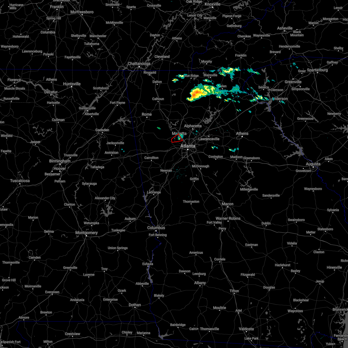 At 632 pm est, a confirmed tornado was located near powder springs, or 7 miles southwest of marietta, moving northeast at 25 mph (weather spotters confirmed tornado. these are very abnormal storms for this area, but spotters have confirmed sighting the tornado near powder springs and tornadic damage has been reported). Hazards include damaging tornado. Flying debris will be dangerous to those caught without shelter. mobile homes will be damaged or destroyed. damage to roofs, windows, and vehicles will occur. tree damage is likely. Locations impacted include, marietta, smyrna, powder springs, fair oaks, dobbins air reserve base and jim r miller park. At 632 pm est, a confirmed tornado was located near powder springs, or 7 miles southwest of marietta, moving northeast at 25 mph (weather spotters confirmed tornado. these are very abnormal storms for this area, but spotters have confirmed sighting the tornado near powder springs and tornadic damage has been reported). Hazards include damaging tornado. Flying debris will be dangerous to those caught without shelter. mobile homes will be damaged or destroyed. damage to roofs, windows, and vehicles will occur. tree damage is likely. Locations impacted include, marietta, smyrna, powder springs, fair oaks, dobbins air reserve base and jim r miller park.
|
| 12/31/2021 6:27 PM EST |
 At 625 pm est, a severe thunderstorm capable of producing a tornado was located over powder springs, or 8 miles east of dallas, moving northeast at 25 mph (radar indicated rotation. damage has been reported with this storm, including areas with downed trees some of which have fallen on structures). Hazards include tornado. Flying debris will be dangerous to those caught without shelter. mobile homes will be damaged or destroyed. damage to roofs, windows, and vehicles will occur. tree damage is likely. Locations impacted include, marietta, smyrna, powder springs, fair oaks, dobbins air reserve base and jim r miller park. At 625 pm est, a severe thunderstorm capable of producing a tornado was located over powder springs, or 8 miles east of dallas, moving northeast at 25 mph (radar indicated rotation. damage has been reported with this storm, including areas with downed trees some of which have fallen on structures). Hazards include tornado. Flying debris will be dangerous to those caught without shelter. mobile homes will be damaged or destroyed. damage to roofs, windows, and vehicles will occur. tree damage is likely. Locations impacted include, marietta, smyrna, powder springs, fair oaks, dobbins air reserve base and jim r miller park.
|
| 12/31/2021 6:20 PM EST |
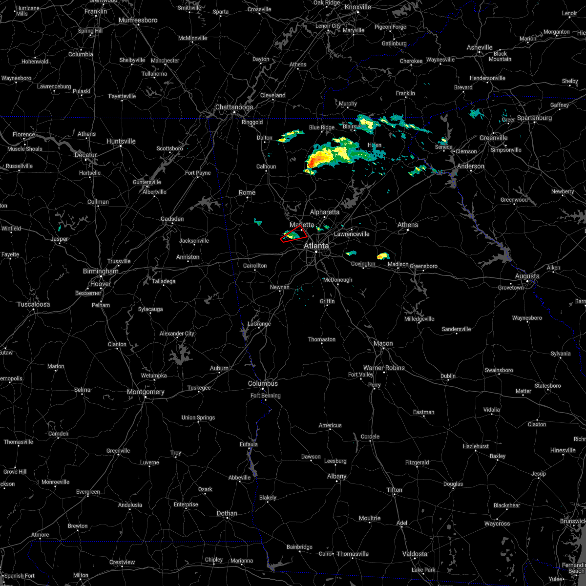 At 620 pm est, a severe thunderstorm capable of producing a tornado was located over hiram, or 7 miles southeast of dallas, moving northeast at 25 mph (radar indicated rotation). Hazards include tornado. Flying debris will be dangerous to those caught without shelter. mobile homes will be damaged or destroyed. damage to roofs, windows, and vehicles will occur. Tree damage is likely. At 620 pm est, a severe thunderstorm capable of producing a tornado was located over hiram, or 7 miles southeast of dallas, moving northeast at 25 mph (radar indicated rotation). Hazards include tornado. Flying debris will be dangerous to those caught without shelter. mobile homes will be damaged or destroyed. damage to roofs, windows, and vehicles will occur. Tree damage is likely.
|
| 12/31/2021 6:20 PM EST |
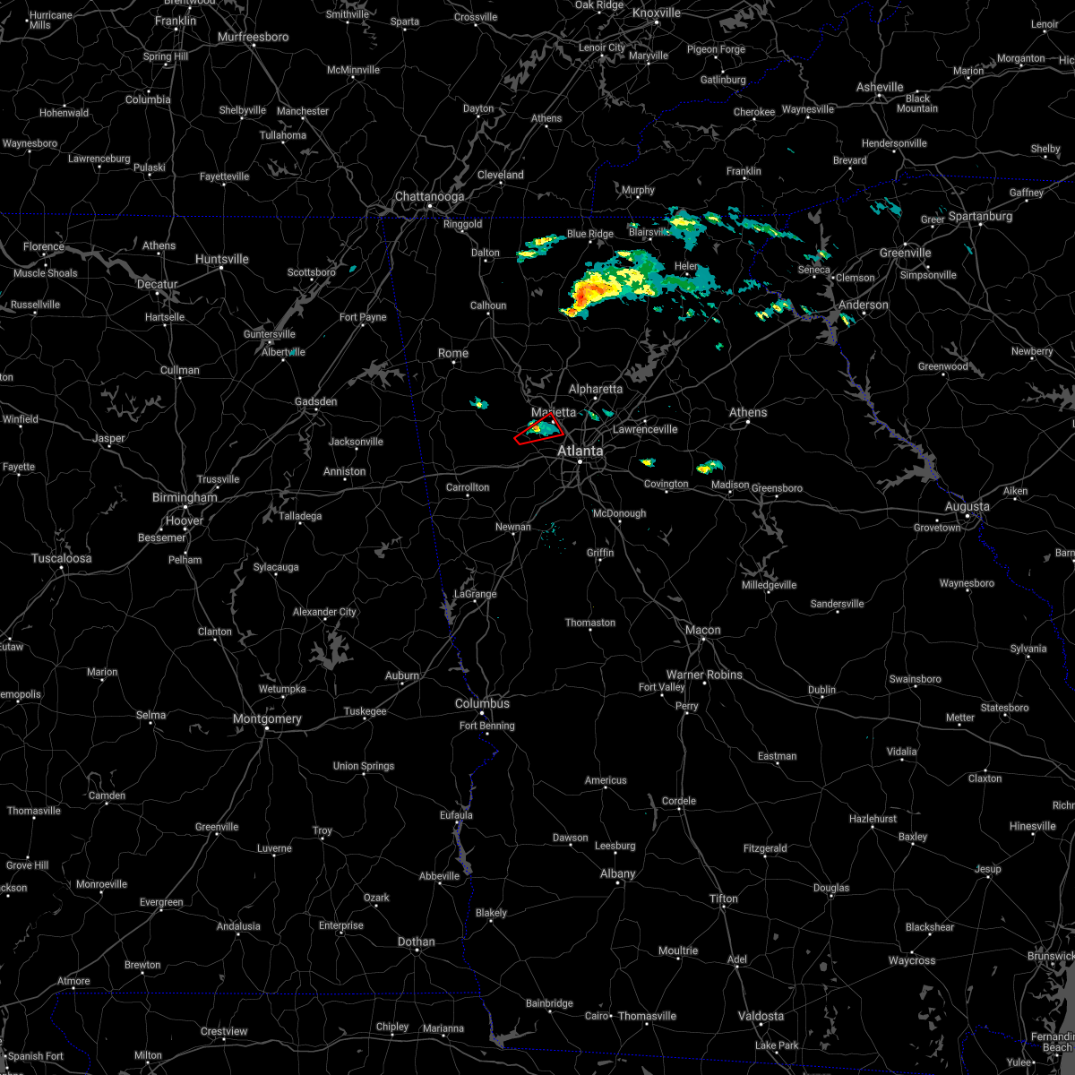 At 620 pm est, a severe thunderstorm capable of producing a tornado was located over hiram, or 7 miles southeast of dallas, moving northeast at 25 mph (radar indicated rotation). Hazards include tornado. Flying debris will be dangerous to those caught without shelter. mobile homes will be damaged or destroyed. damage to roofs, windows, and vehicles will occur. Tree damage is likely. At 620 pm est, a severe thunderstorm capable of producing a tornado was located over hiram, or 7 miles southeast of dallas, moving northeast at 25 mph (radar indicated rotation). Hazards include tornado. Flying debris will be dangerous to those caught without shelter. mobile homes will be damaged or destroyed. damage to roofs, windows, and vehicles will occur. Tree damage is likely.
|
| 12/29/2021 11:51 PM EST |
 The severe thunderstorm warning for southern paulding, central haralson, central cobb, northern carroll and douglas counties will expire at midnight est, the storms which prompted the warning have weakened below severe limits, and no longer pose an immediate threat to life or property. therefore, the warning will be allowed to expire. however lightning and very heavy rain are still possible with these thunderstorms. a tornado watch remains in effect until 500 am est for north central and northwestern georgia. The severe thunderstorm warning for southern paulding, central haralson, central cobb, northern carroll and douglas counties will expire at midnight est, the storms which prompted the warning have weakened below severe limits, and no longer pose an immediate threat to life or property. therefore, the warning will be allowed to expire. however lightning and very heavy rain are still possible with these thunderstorms. a tornado watch remains in effect until 500 am est for north central and northwestern georgia.
|
| 12/29/2021 11:31 PM EST |
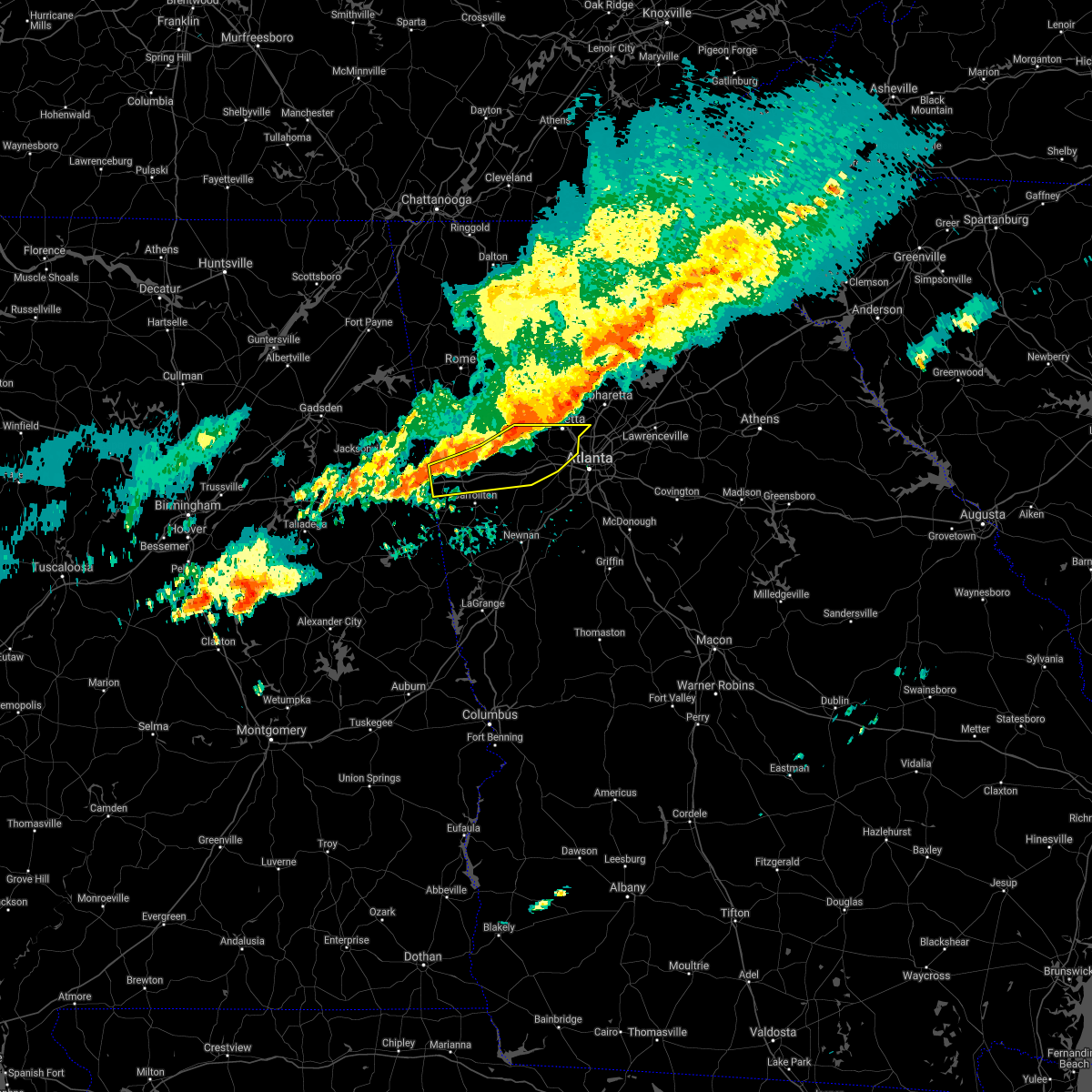 At 1131 pm est, severe thunderstorms were located along a line extending from near due west to near draketown to near i 20 welcome center, moving south at 25 mph (radar indicated). Hazards include 60 mph wind gusts. Expect damage to roofs, siding, and trees. locations impacted include, marietta, douglasville, dallas, buchanan, smyrna, villa rica, powder springs, austell, bremen, temple, hiram, tallapoosa, mount zion, waco, lithia springs, fair oaks, mount bethel, lost mountain park, vinings and brownsville. hail threat, radar indicated max hail size, <. 75 in wind threat, radar indicated max wind gust, 60 mph. At 1131 pm est, severe thunderstorms were located along a line extending from near due west to near draketown to near i 20 welcome center, moving south at 25 mph (radar indicated). Hazards include 60 mph wind gusts. Expect damage to roofs, siding, and trees. locations impacted include, marietta, douglasville, dallas, buchanan, smyrna, villa rica, powder springs, austell, bremen, temple, hiram, tallapoosa, mount zion, waco, lithia springs, fair oaks, mount bethel, lost mountain park, vinings and brownsville. hail threat, radar indicated max hail size, <. 75 in wind threat, radar indicated max wind gust, 60 mph.
|
| 12/29/2021 11:12 PM EST |
 At 1112 pm est, severe thunderstorms were located along a line extending from near braswell to yorkville to near eubank lake to near tallapoosa, moving east at 50 mph (radar indicated). Hazards include 60 mph wind gusts. expect damage to roofs, siding, and trees At 1112 pm est, severe thunderstorms were located along a line extending from near braswell to yorkville to near eubank lake to near tallapoosa, moving east at 50 mph (radar indicated). Hazards include 60 mph wind gusts. expect damage to roofs, siding, and trees
|
| 6/30/2021 8:50 PM EDT | Tree downed onto a power line near the intersection of dallas hwy and holland r in cobb county GA, 5.3 miles SSE of Powder Springs, GA |
| 5/4/2021 2:57 PM EDT |
 The national weather service in peachtree city has issued a * severe thunderstorm warning for. paulding county in northwestern georgia. southwestern cherokee county in north central georgia. haralson county in northwestern georgia. Cobb county in north central georgia. The national weather service in peachtree city has issued a * severe thunderstorm warning for. paulding county in northwestern georgia. southwestern cherokee county in north central georgia. haralson county in northwestern georgia. Cobb county in north central georgia.
|
| 5/4/2021 1:52 PM EDT |
 At 152 pm edt, severe thunderstorms were located along a line extending from near mount bethel to near lithia springs, moving east at 50 mph (trained weather spotters). Hazards include 60 mph wind gusts. Expect damage to roofs, siding, and trees. Locations impacted include, marietta, douglasville, smyrna, kennesaw, villa rica, powder springs, austell, hiram, lithia springs, fair oaks, mount bethel, sweetwater creek state park, white water park, vinings, brownsville, jim r miller park, winston, lake val-do-mar, sandy plains and dobbins air reserve base. At 152 pm edt, severe thunderstorms were located along a line extending from near mount bethel to near lithia springs, moving east at 50 mph (trained weather spotters). Hazards include 60 mph wind gusts. Expect damage to roofs, siding, and trees. Locations impacted include, marietta, douglasville, smyrna, kennesaw, villa rica, powder springs, austell, hiram, lithia springs, fair oaks, mount bethel, sweetwater creek state park, white water park, vinings, brownsville, jim r miller park, winston, lake val-do-mar, sandy plains and dobbins air reserve base.
|
| 5/4/2021 1:28 PM EDT |
 At 128 pm edt, severe thunderstorms were located along a line extending from new hope to temple, moving east at 50 mph (trained weather spotters). Hazards include 60 mph wind gusts. expect damage to roofs, siding, and trees At 128 pm edt, severe thunderstorms were located along a line extending from new hope to temple, moving east at 50 mph (trained weather spotters). Hazards include 60 mph wind gusts. expect damage to roofs, siding, and trees
|
| 4/24/2021 8:52 PM EDT |
 The severe thunderstorm warning for southeastern paulding, northwestern dekalb, northwestern fayette, cobb, douglas, west central gwinnett, northern heard, northern coweta, fulton and northwestern clayton counties will expire at 900 pm edt, the storms which prompted the warning have moved out of the area. therefore, the warning will be allowed to expire. a severe thunderstorm watch remains in effect until 1000 pm edt for north central, northwestern and west central georgia. The severe thunderstorm warning for southeastern paulding, northwestern dekalb, northwestern fayette, cobb, douglas, west central gwinnett, northern heard, northern coweta, fulton and northwestern clayton counties will expire at 900 pm edt, the storms which prompted the warning have moved out of the area. therefore, the warning will be allowed to expire. a severe thunderstorm watch remains in effect until 1000 pm edt for north central, northwestern and west central georgia.
|
| 4/24/2021 8:19 PM EDT |
 At 818 pm edt, severe thunderstorms were located along a line extending from due west to near lithia springs to plant wansley, moving northeast at 70 mph (radar indicated). Hazards include 70 mph wind gusts and quarter size hail. Hail damage to vehicles is expected. expect considerable tree damage. wind damage is also likely to mobile homes, roofs, and outbuildings. Locations impacted include, atlanta, marietta, newnan, douglasville, decatur, fayetteville, dallas, sandy springs, roswell, johns creek, alpharetta, smyrna, dunwoody, peachtree city, east point, kennesaw, duluth, union city, forest park and riverdale. At 818 pm edt, severe thunderstorms were located along a line extending from due west to near lithia springs to plant wansley, moving northeast at 70 mph (radar indicated). Hazards include 70 mph wind gusts and quarter size hail. Hail damage to vehicles is expected. expect considerable tree damage. wind damage is also likely to mobile homes, roofs, and outbuildings. Locations impacted include, atlanta, marietta, newnan, douglasville, decatur, fayetteville, dallas, sandy springs, roswell, johns creek, alpharetta, smyrna, dunwoody, peachtree city, east point, kennesaw, duluth, union city, forest park and riverdale.
|
| 4/24/2021 8:10 PM EDT | A tree and power line were downed on floral path at highway 9 in paulding county GA, 5.8 miles NE of Powder Springs, GA |
| 4/24/2021 8:07 PM EDT |
 At 807 pm edt, severe thunderstorms were located along a line extending from near new hope to near douglasville to centralhatchee, moving east at 70 mph (radar indicated). Hazards include 60 mph wind gusts and quarter size hail. Hail damage to vehicles is expected. Expect wind damage to roofs, siding, and trees. At 807 pm edt, severe thunderstorms were located along a line extending from near new hope to near douglasville to centralhatchee, moving east at 70 mph (radar indicated). Hazards include 60 mph wind gusts and quarter size hail. Hail damage to vehicles is expected. Expect wind damage to roofs, siding, and trees.
|
| 7/18/2020 5:42 PM EDT |
 At 540 pm edt, severe thunderstorms were located along a line extending from near smyrna to austell to near brownsville, and are nearly stationary (radar indicated). Hazards include 60 mph wind gusts and quarter size hail. Hail damage to vehicles is expected. expect wind damage to roofs, siding, and trees. Locations impacted include, marietta, douglasville, smyrna, powder springs, austell, lithia springs, fair oaks, sweetwater creek state park, six flags over georgia, jim r miller park and mableton. At 540 pm edt, severe thunderstorms were located along a line extending from near smyrna to austell to near brownsville, and are nearly stationary (radar indicated). Hazards include 60 mph wind gusts and quarter size hail. Hail damage to vehicles is expected. expect wind damage to roofs, siding, and trees. Locations impacted include, marietta, douglasville, smyrna, powder springs, austell, lithia springs, fair oaks, sweetwater creek state park, six flags over georgia, jim r miller park and mableton.
|
| 7/18/2020 5:37 PM EDT | In the 4000 block of duncan drive... multiple trees were reported down with some blocking the roadwa in cobb county GA, 2.1 miles NNE of Powder Springs, GA |
| 7/18/2020 5:08 PM EDT |
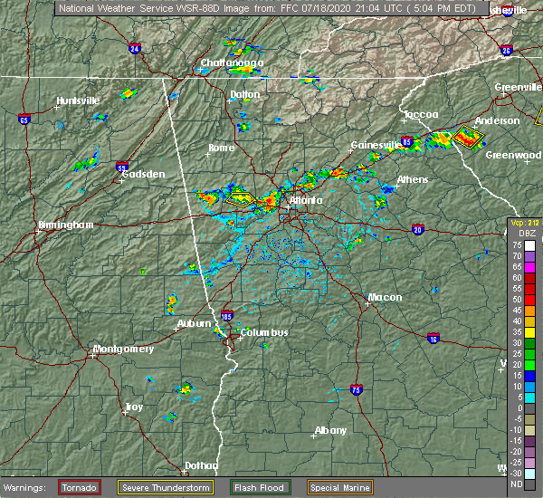 At 508 pm edt, severe thunderstorms were located along a line extending from near mableton to austell to brownsville, and are nearly stationary (radar indicated). Hazards include 60 mph wind gusts and quarter size hail. Hail damage to vehicles is expected. Expect wind damage to roofs, siding, and trees. At 508 pm edt, severe thunderstorms were located along a line extending from near mableton to austell to brownsville, and are nearly stationary (radar indicated). Hazards include 60 mph wind gusts and quarter size hail. Hail damage to vehicles is expected. Expect wind damage to roofs, siding, and trees.
|
| 6/14/2020 7:18 PM EDT |
 At 718 pm edt, a severe thunderstorm was located over new hope, or near dallas, moving southeast at 10 mph (radar indicated). Hazards include 60 mph wind gusts and quarter size hail. Hail damage to vehicles is expected. Expect wind damage to roofs, siding, and trees. At 718 pm edt, a severe thunderstorm was located over new hope, or near dallas, moving southeast at 10 mph (radar indicated). Hazards include 60 mph wind gusts and quarter size hail. Hail damage to vehicles is expected. Expect wind damage to roofs, siding, and trees.
|
| 4/13/2020 1:05 AM EDT |
 At 105 am edt, severe thunderstorms were located along a line extending from near white to van wert, moving east at 55 mph (radar indicated). Hazards include 60 mph wind gusts. Expect damage to roofs, siding, and trees. Locations impacted include, marietta, canton, cartersville, dallas, buchanan, kennesaw, woodstock, acworth, powder springs, holly springs, adairsville, rockmart, euharlee, hiram, emerson, ball ground, aragon, white, waleska and kingston. At 105 am edt, severe thunderstorms were located along a line extending from near white to van wert, moving east at 55 mph (radar indicated). Hazards include 60 mph wind gusts. Expect damage to roofs, siding, and trees. Locations impacted include, marietta, canton, cartersville, dallas, buchanan, kennesaw, woodstock, acworth, powder springs, holly springs, adairsville, rockmart, euharlee, hiram, emerson, ball ground, aragon, white, waleska and kingston.
|
| 4/13/2020 12:54 AM EDT |
 At 1254 am edt, severe thunderstorms were located along a line extending from near kingston to near antioch, moving east at 55 mph (radar indicated). Hazards include 60 mph wind gusts. expect damage to roofs, siding, and trees At 1254 am edt, severe thunderstorms were located along a line extending from near kingston to near antioch, moving east at 55 mph (radar indicated). Hazards include 60 mph wind gusts. expect damage to roofs, siding, and trees
|
| 4/9/2020 5:07 AM EDT |
 The severe thunderstorm warning for southeastern paulding, southern cobb, northeastern carroll and douglas counties will expire at 515 am edt, the storms which prompted the warning have weakened below severe limits, and no longer pose an immediate threat to life or property. therefore, the warning will be allowed to expire. however gusty winds are still possible with these thunderstorms. The severe thunderstorm warning for southeastern paulding, southern cobb, northeastern carroll and douglas counties will expire at 515 am edt, the storms which prompted the warning have weakened below severe limits, and no longer pose an immediate threat to life or property. therefore, the warning will be allowed to expire. however gusty winds are still possible with these thunderstorms.
|
| 4/9/2020 4:54 AM EDT |
 At 454 am edt, severe thunderstorms were located along a line extending from near dallas to near new georgia to near temple, moving east at 50 mph (radar indicated). Hazards include 60 mph wind gusts and penny size hail. Expect damage to roofs, siding, and trees. Locations impacted include, douglasville, dallas, smyrna, villa rica, powder springs, austell, temple, hiram, lithia springs, sweetwater creek state park, vinings, brownsville, chapel hill, bill arp, six flags over georgia, winston, lake val-do-mar, new georgia and mableton. At 454 am edt, severe thunderstorms were located along a line extending from near dallas to near new georgia to near temple, moving east at 50 mph (radar indicated). Hazards include 60 mph wind gusts and penny size hail. Expect damage to roofs, siding, and trees. Locations impacted include, douglasville, dallas, smyrna, villa rica, powder springs, austell, temple, hiram, lithia springs, sweetwater creek state park, vinings, brownsville, chapel hill, bill arp, six flags over georgia, winston, lake val-do-mar, new georgia and mableton.
|
| 4/9/2020 4:40 AM EDT |
 At 440 am edt, severe thunderstorms were located along a line extending from eubank lake to near draketown to buchanan, moving east at 50 mph (radar indicated). Hazards include 60 mph wind gusts and penny size hail. expect damage to roofs, siding, and trees At 440 am edt, severe thunderstorms were located along a line extending from eubank lake to near draketown to buchanan, moving east at 50 mph (radar indicated). Hazards include 60 mph wind gusts and penny size hail. expect damage to roofs, siding, and trees
|
| 1/11/2020 4:51 PM EST |
 At 450 pm est, severe thunderstorms were located along a line extending from salacoa valley to whitesburg, moving east at 45 mph (radar indicated). Hazards include 60 mph wind gusts. expect damage to roofs, siding, and trees At 450 pm est, severe thunderstorms were located along a line extending from salacoa valley to whitesburg, moving east at 45 mph (radar indicated). Hazards include 60 mph wind gusts. expect damage to roofs, siding, and trees
|
| 7/30/2019 5:37 PM EDT |
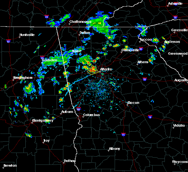 At 536 pm edt, a severe thunderstorm was located over lithia springs, or near douglasville, and is nearly stationary (radar indicated). Hazards include 60 mph wind gusts and quarter size hail. Hail damage to vehicles is expected. expect wind damage to roofs, siding, and trees. Locations impacted include, atlanta, douglasville, smyrna, powder springs, austell, lithia springs, sweetwater creek state park, six flags over georgia, jim r miller park and mableton. At 536 pm edt, a severe thunderstorm was located over lithia springs, or near douglasville, and is nearly stationary (radar indicated). Hazards include 60 mph wind gusts and quarter size hail. Hail damage to vehicles is expected. expect wind damage to roofs, siding, and trees. Locations impacted include, atlanta, douglasville, smyrna, powder springs, austell, lithia springs, sweetwater creek state park, six flags over georgia, jim r miller park and mableton.
|
| 7/30/2019 5:26 PM EDT |
 At 525 pm edt, a severe thunderstorm was located over lithia springs, or near douglasville, and is nearly stationary (radar indicated). Hazards include 60 mph wind gusts and quarter size hail. Hail damage to vehicles is expected. Expect wind damage to roofs, siding, and trees. At 525 pm edt, a severe thunderstorm was located over lithia springs, or near douglasville, and is nearly stationary (radar indicated). Hazards include 60 mph wind gusts and quarter size hail. Hail damage to vehicles is expected. Expect wind damage to roofs, siding, and trees.
|
| 7/5/2019 6:36 PM EDT |
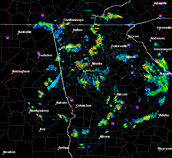 At 633 pm edt, a severe thunderstorm was located over brownsville, or over douglasville, and is nearly stationary (radar indicated). Hazards include 60 mph wind gusts and penny size hail. expect damage to roofs, siding, and trees At 633 pm edt, a severe thunderstorm was located over brownsville, or over douglasville, and is nearly stationary (radar indicated). Hazards include 60 mph wind gusts and penny size hail. expect damage to roofs, siding, and trees
|
| 6/24/2019 6:39 PM EDT |
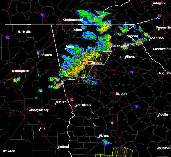 At 638 pm edt, a severe thunderstorm was located over mount bethel, or 7 miles east of marietta, moving east at 35 mph (radar indicated). Hazards include 60 mph wind gusts and penny size hail. expect damage to roofs, siding, and trees At 638 pm edt, a severe thunderstorm was located over mount bethel, or 7 miles east of marietta, moving east at 35 mph (radar indicated). Hazards include 60 mph wind gusts and penny size hail. expect damage to roofs, siding, and trees
|
| 6/24/2019 6:20 PM EDT | Tree blown down on woodlore dr near due west rd in cobb county GA, 7.6 miles SSE of Powder Springs, GA |
| 6/24/2019 6:15 PM EDT |
 At 615 pm edt, a severe thunderstorm was located over due west, or 8 miles northeast of dallas, moving east at 30 mph (radar indicated). Hazards include 60 mph wind gusts and quarter size hail. Hail damage to vehicles is expected. Expect wind damage to roofs, siding, and trees. At 615 pm edt, a severe thunderstorm was located over due west, or 8 miles northeast of dallas, moving east at 30 mph (radar indicated). Hazards include 60 mph wind gusts and quarter size hail. Hail damage to vehicles is expected. Expect wind damage to roofs, siding, and trees.
|
| 3/14/2019 8:51 PM EDT |
 At 851 pm edt, a severe thunderstorm was located over yorkville, or 7 miles west of dallas, moving east at 40 mph (radar indicated). Hazards include 60 mph wind gusts and quarter size hail. Hail damage to vehicles is expected. Expect wind damage to roofs, siding, and trees. At 851 pm edt, a severe thunderstorm was located over yorkville, or 7 miles west of dallas, moving east at 40 mph (radar indicated). Hazards include 60 mph wind gusts and quarter size hail. Hail damage to vehicles is expected. Expect wind damage to roofs, siding, and trees.
|
| 7/21/2018 8:35 PM EDT |
 At 835 pm edt, a severe thunderstorm was located near burnt hickory ridge, or near cartersville, moving southeast at 30 mph (radar indicated). Hazards include 60 mph wind gusts and half dollar size hail. Hail damage to vehicles is expected. Expect wind damage to roofs, siding, and trees. At 835 pm edt, a severe thunderstorm was located near burnt hickory ridge, or near cartersville, moving southeast at 30 mph (radar indicated). Hazards include 60 mph wind gusts and half dollar size hail. Hail damage to vehicles is expected. Expect wind damage to roofs, siding, and trees.
|
| 6/1/2018 3:51 PM EDT |
 At 351 pm edt, severe thunderstorms were located along a line extending from near sandy plains to douglasville to near clem, moving east at 45 mph (radar indicated). Hazards include 60 mph wind gusts and quarter size hail. Hail damage to vehicles is expected. Expect wind damage to roofs, siding, and trees. At 351 pm edt, severe thunderstorms were located along a line extending from near sandy plains to douglasville to near clem, moving east at 45 mph (radar indicated). Hazards include 60 mph wind gusts and quarter size hail. Hail damage to vehicles is expected. Expect wind damage to roofs, siding, and trees.
|
| 3/19/2018 10:51 PM EDT |
 At 1050 pm edt, a severe thunderstorm was located over powder springs, or 8 miles southwest of marietta, moving southeast at 35 mph (radar indicated). Hazards include 60 mph wind gusts and penny size hail. expect damage to roofs, siding, and trees At 1050 pm edt, a severe thunderstorm was located over powder springs, or 8 miles southwest of marietta, moving southeast at 35 mph (radar indicated). Hazards include 60 mph wind gusts and penny size hail. expect damage to roofs, siding, and trees
|
| 3/19/2018 10:36 PM EDT |
 At 1036 pm edt, a severe thunderstorm was located near dallas, moving east at 40 mph (radar indicated). Hazards include 60 mph wind gusts and penny size hail. Expect damage to roofs, siding, and trees. locations impacted include, marietta, dallas, kennesaw, acworth, powder springs, austell, hiram, burnt hickory ridge, lost mountain park, jim r miller park, cross roads, due west and new hope. A tornado watch remains in effect until 400 am edt for north central and northwestern georgia. At 1036 pm edt, a severe thunderstorm was located near dallas, moving east at 40 mph (radar indicated). Hazards include 60 mph wind gusts and penny size hail. Expect damage to roofs, siding, and trees. locations impacted include, marietta, dallas, kennesaw, acworth, powder springs, austell, hiram, burnt hickory ridge, lost mountain park, jim r miller park, cross roads, due west and new hope. A tornado watch remains in effect until 400 am edt for north central and northwestern georgia.
|
| 3/19/2018 10:14 PM EDT |
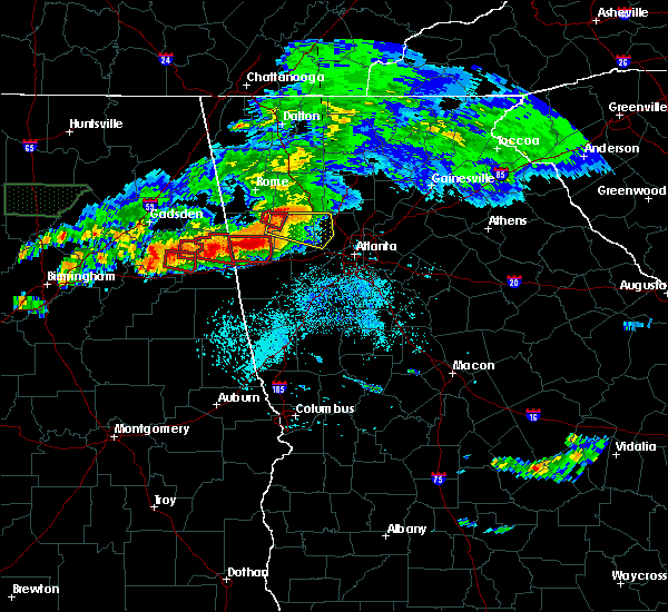 At 1013 pm edt, a severe thunderstorm was located over rockmart, or 10 miles northwest of dallas, moving east at 40 mph (radar indicated). Hazards include 60 mph wind gusts and penny size hail. expect damage to roofs, siding, and trees At 1013 pm edt, a severe thunderstorm was located over rockmart, or 10 miles northwest of dallas, moving east at 40 mph (radar indicated). Hazards include 60 mph wind gusts and penny size hail. expect damage to roofs, siding, and trees
|
| 7/5/2017 6:38 PM EDT |
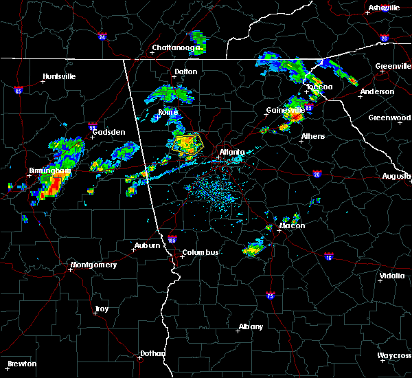 The severe thunderstorm warning for paulding and northwestern cobb counties will expire at 645 pm edt, the storm which prompted the warning has weakened below severe limits and no longer poses an immediate threat to life or property and the warning will be allowed to expire. however, small hail, gusty winds up to 45 mph and heavy rain are still likely with this thunderstorm. to report severe weather, contact your nearest law enforcement agency. they will relay your report to the national weather service peachtree city. The severe thunderstorm warning for paulding and northwestern cobb counties will expire at 645 pm edt, the storm which prompted the warning has weakened below severe limits and no longer poses an immediate threat to life or property and the warning will be allowed to expire. however, small hail, gusty winds up to 45 mph and heavy rain are still likely with this thunderstorm. to report severe weather, contact your nearest law enforcement agency. they will relay your report to the national weather service peachtree city.
|
| 7/5/2017 6:19 PM EDT |
 At 618 pm edt, a severe thunderstorm was located near dallas, moving east at 25 mph (radar indicated). Hazards include 60 mph wind gusts and penny size hail. expect damage to roofs, siding, and trees At 618 pm edt, a severe thunderstorm was located near dallas, moving east at 25 mph (radar indicated). Hazards include 60 mph wind gusts and penny size hail. expect damage to roofs, siding, and trees
|
| 7/4/2017 5:22 PM EDT |
 The severe thunderstorm warning for southeastern paulding, southern cobb, douglas and south central fulton counties will expire at 530 pm edt, the storms that prompted the warning have weakened below severe limits, and no longer poses an immediate threat to life or property. therefore the warning will be allowed to expire. however small hail, gusty winds over 40 mph and heavy rain are still likely with these thunderstorms. to report severe weather, contact your nearest law enforcement agency. they will relay your report to the national weather service peachtree city. The severe thunderstorm warning for southeastern paulding, southern cobb, douglas and south central fulton counties will expire at 530 pm edt, the storms that prompted the warning have weakened below severe limits, and no longer poses an immediate threat to life or property. therefore the warning will be allowed to expire. however small hail, gusty winds over 40 mph and heavy rain are still likely with these thunderstorms. to report severe weather, contact your nearest law enforcement agency. they will relay your report to the national weather service peachtree city.
|
| 7/4/2017 4:52 PM EDT |
 At 451 pm edt, a severe thunderstorm was located near douglasville, moving east at 35 mph (radar indicated). Hazards include 60 mph wind gusts and penny size hail. expect damage to roofs, siding, and trees At 451 pm edt, a severe thunderstorm was located near douglasville, moving east at 35 mph (radar indicated). Hazards include 60 mph wind gusts and penny size hail. expect damage to roofs, siding, and trees
|
| 6/23/2017 7:59 PM EDT |
 At 757 pm edt, severe thunderstorms were located along a line extending from near free home to near milton to alpharetta, moving northeast at 45 mph. a second storm was located along a line from kennesaw to jim miller park moving northeast at 45 mph (radar indicated). Hazards include 60 mph wind gusts. Expect damage to roofs, siding, and trees. Locations impacted include, marietta, canton, cumming, sandy springs, roswell, johns creek, alpharetta, dunwoody, milton, kennesaw, woodstock, acworth, sugar hill, powder springs, holly springs, berkeley lake, free home, fair oaks, buffington and mount bethel. At 757 pm edt, severe thunderstorms were located along a line extending from near free home to near milton to alpharetta, moving northeast at 45 mph. a second storm was located along a line from kennesaw to jim miller park moving northeast at 45 mph (radar indicated). Hazards include 60 mph wind gusts. Expect damage to roofs, siding, and trees. Locations impacted include, marietta, canton, cumming, sandy springs, roswell, johns creek, alpharetta, dunwoody, milton, kennesaw, woodstock, acworth, sugar hill, powder springs, holly springs, berkeley lake, free home, fair oaks, buffington and mount bethel.
|
| 6/23/2017 7:26 PM EDT |
 At 726 pm edt, severe thunderstorms were located along a line extending from hobgood park to kennesaw state university to lost mountain park, moving northeast at 40 mph (radar indicated). Hazards include 60 mph wind gusts. expect damage to roofs, siding, and trees At 726 pm edt, severe thunderstorms were located along a line extending from hobgood park to kennesaw state university to lost mountain park, moving northeast at 40 mph (radar indicated). Hazards include 60 mph wind gusts. expect damage to roofs, siding, and trees
|
| 6/23/2017 7:19 PM EDT |
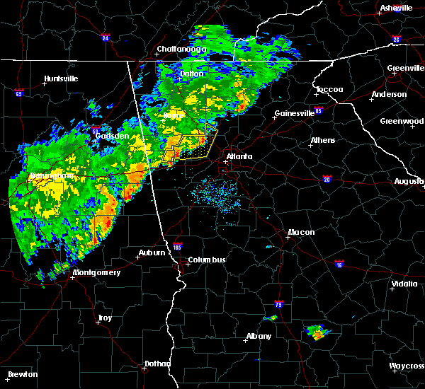 At 717 pm edt, severe thunderstorms were located along a line extending from near cartersville to near acworth to near dallas, moving east at 40 mph (radar indicated). Hazards include 60 mph wind gusts. Expect damage to roofs, siding, and trees. Locations impacted include, marietta, dallas, buchanan, kennesaw, woodstock, acworth, powder springs, austell, hiram, braswell, yorkville, burnt hickory ridge, kellogg creek, lost mountain park, cross roads, draketown, due west, new hope, hobgood park and eubank lake. At 717 pm edt, severe thunderstorms were located along a line extending from near cartersville to near acworth to near dallas, moving east at 40 mph (radar indicated). Hazards include 60 mph wind gusts. Expect damage to roofs, siding, and trees. Locations impacted include, marietta, dallas, buchanan, kennesaw, woodstock, acworth, powder springs, austell, hiram, braswell, yorkville, burnt hickory ridge, kellogg creek, lost mountain park, cross roads, draketown, due west, new hope, hobgood park and eubank lake.
|
| 6/23/2017 6:45 PM EDT |
 At 644 pm edt, severe thunderstorms were located along a line extending from near seney to near van wert to buchanan, moving east at 40 mph (radar indicated). Hazards include 60 mph wind gusts. expect damage to roofs, siding, and trees At 644 pm edt, severe thunderstorms were located along a line extending from near seney to near van wert to buchanan, moving east at 40 mph (radar indicated). Hazards include 60 mph wind gusts. expect damage to roofs, siding, and trees
|
| 6/15/2017 5:50 PM EDT |
 At 549 pm edt, severe thunderstorms were located along a line extending from near powder springs to near treasure lake to graham, moving southeast at 35 mph (radar indicated). Hazards include 60 mph wind gusts. expect damage to roofs, siding, and trees At 549 pm edt, severe thunderstorms were located along a line extending from near powder springs to near treasure lake to graham, moving southeast at 35 mph (radar indicated). Hazards include 60 mph wind gusts. expect damage to roofs, siding, and trees
|
| 6/14/2017 9:06 PM EDT |
 At 906 pm edt, a severe thunderstorm was centered near austell, or 7 miles northeast of douglasville, moving south at 15 mph (radar indicated). Hazards include 60 mph wind gusts and penny size hail. Expect damage to roofs, siding, and trees. Locations impacted include, powder springs, austell, lithia springs, jim r miller park and mableton. At 906 pm edt, a severe thunderstorm was centered near austell, or 7 miles northeast of douglasville, moving south at 15 mph (radar indicated). Hazards include 60 mph wind gusts and penny size hail. Expect damage to roofs, siding, and trees. Locations impacted include, powder springs, austell, lithia springs, jim r miller park and mableton.
|
| 6/14/2017 8:41 PM EDT |
 At 840 pm edt, severe thunderstorms were located along a line extending from new hope to lost mountain park, moving south at 10 mph (radar indicated). Hazards include 60 mph wind gusts and penny size hail. expect damage to roofs, siding, and trees At 840 pm edt, severe thunderstorms were located along a line extending from new hope to lost mountain park, moving south at 10 mph (radar indicated). Hazards include 60 mph wind gusts and penny size hail. expect damage to roofs, siding, and trees
|
| 6/14/2017 7:48 PM EDT |
 At 748 pm edt, a severe thunderstorm was located over jim r miller park, or near marietta, and is nearly stationary (radar indicated). Hazards include 60 mph wind gusts. expect damage to roofs, siding, and trees At 748 pm edt, a severe thunderstorm was located over jim r miller park, or near marietta, and is nearly stationary (radar indicated). Hazards include 60 mph wind gusts. expect damage to roofs, siding, and trees
|
| 5/28/2017 6:08 AM EDT |
 The severe thunderstorm warning for southeastern paulding, carroll, cobb and douglas counties will expire at 615 am edt, the storms which prompted the warning have moved out of the area. therefore the warning will be allowed to expire. a severe thunderstorm watch remains in effect until 1100 am edt for north central and west central georgia. The severe thunderstorm warning for southeastern paulding, carroll, cobb and douglas counties will expire at 615 am edt, the storms which prompted the warning have moved out of the area. therefore the warning will be allowed to expire. a severe thunderstorm watch remains in effect until 1100 am edt for north central and west central georgia.
|
| 5/28/2017 5:48 AM EDT |
 At 548 am edt, severe thunderstorms were located along a line extending from near mableton to hannah to near lowell, moving east at 45 mph (radar indicated). Hazards include 60 mph wind gusts. Expect damage to roofs, siding, and trees. Locations impacted include, marietta, douglasville, carrollton, dallas, smyrna, kennesaw, acworth, villa rica, powder springs, austell, hiram, bowdon, whitesburg, roopville, lithia springs, fair oaks, lost mountain park, vinings, brownsville and bill arp. At 548 am edt, severe thunderstorms were located along a line extending from near mableton to hannah to near lowell, moving east at 45 mph (radar indicated). Hazards include 60 mph wind gusts. Expect damage to roofs, siding, and trees. Locations impacted include, marietta, douglasville, carrollton, dallas, smyrna, kennesaw, acworth, villa rica, powder springs, austell, hiram, bowdon, whitesburg, roopville, lithia springs, fair oaks, lost mountain park, vinings, brownsville and bill arp.
|
| 5/28/2017 5:24 AM EDT |
 At 524 am edt, severe thunderstorms were located along a line extending from draketown to near ranburne to micaville, moving east at 50 mph (radar indicated). Hazards include 60 mph wind gusts. expect damage to roofs, siding, and trees At 524 am edt, severe thunderstorms were located along a line extending from draketown to near ranburne to micaville, moving east at 50 mph (radar indicated). Hazards include 60 mph wind gusts. expect damage to roofs, siding, and trees
|
| 4/5/2017 10:32 AM EDT |
 At 1032 am edt, severe thunderstorms were located along a line extending from felton to near mount zion, moving northeast at 55 mph (radar indicated). Hazards include 60 mph wind gusts and quarter size hail. Hail damage to vehicles is expected. Expect wind damage to roofs, siding, and trees. At 1032 am edt, severe thunderstorms were located along a line extending from felton to near mount zion, moving northeast at 55 mph (radar indicated). Hazards include 60 mph wind gusts and quarter size hail. Hail damage to vehicles is expected. Expect wind damage to roofs, siding, and trees.
|
| 4/3/2017 11:52 AM EDT |
 The severe thunderstorm warning for northwestern dekalb, central cobb, northeastern douglas and central fulton counties will expire at noon edt, the storm which prompted the warning has moved out of the area. therefore the warning will be allowed to expire. however gusty winds and heavy rain are still possible with this thunderstorm. a severe thunderstorm watch remains in effect until 500 pm edt for north central georgia. The severe thunderstorm warning for northwestern dekalb, central cobb, northeastern douglas and central fulton counties will expire at noon edt, the storm which prompted the warning has moved out of the area. therefore the warning will be allowed to expire. however gusty winds and heavy rain are still possible with this thunderstorm. a severe thunderstorm watch remains in effect until 500 pm edt for north central georgia.
|
| 4/3/2017 11:32 AM EDT |
 At 1131 am edt, a severe thunderstorm was located over austell, or 8 miles northeast of douglasville, moving northeast at 55 mph (radar indicated). Hazards include 60 mph wind gusts. expect damage to roofs, siding, and trees At 1131 am edt, a severe thunderstorm was located over austell, or 8 miles northeast of douglasville, moving northeast at 55 mph (radar indicated). Hazards include 60 mph wind gusts. expect damage to roofs, siding, and trees
|
| 3/21/2017 8:40 PM EDT |
 At 838 pm edt, severe thunderstorms were located extending from near milton to sandy plains to near eubank lake to near piedmont, moving southeast at 40 mph (radar indicated, plus multiple reports of downed trees and powerlines due to the very strong winds). Hazards include 60 mph wind gusts and penny size hail. expect damage to roofs, siding, and trees At 838 pm edt, severe thunderstorms were located extending from near milton to sandy plains to near eubank lake to near piedmont, moving southeast at 40 mph (radar indicated, plus multiple reports of downed trees and powerlines due to the very strong winds). Hazards include 60 mph wind gusts and penny size hail. expect damage to roofs, siding, and trees
|
| 11/30/2016 1:15 PM EST |
 At 115 pm est, severe thunderstorms were located along a line extending from new georgia to near douglasville to hannah, moving northeast at 60 mph (radar indicated). Hazards include 60 mph wind gusts. Expect damage to roofs. siding. And trees. At 115 pm est, severe thunderstorms were located along a line extending from new georgia to near douglasville to hannah, moving northeast at 60 mph (radar indicated). Hazards include 60 mph wind gusts. Expect damage to roofs. siding. And trees.
|
| 7/6/2016 12:20 PM EDT |
 At 1220 pm edt, a severe thunderstorm was located near lithia springs, or 7 miles east of douglasville, moving east at 40 mph (radar indicated). Hazards include 60 mph wind gusts. Expect damage to roofs. siding. and trees. Other locations in the warning include but are not limited to atlanta, douglasville, smyrna, east point, college park, powder springs, austell, hapeville, midtown, grant park-zoo atlanta, lithia springs, sweetwater creek state park, turner field, lakewood park, sweet auburn, atlantic station, west end, six flags over georgia, cascade heights and piedmont park. At 1220 pm edt, a severe thunderstorm was located near lithia springs, or 7 miles east of douglasville, moving east at 40 mph (radar indicated). Hazards include 60 mph wind gusts. Expect damage to roofs. siding. and trees. Other locations in the warning include but are not limited to atlanta, douglasville, smyrna, east point, college park, powder springs, austell, hapeville, midtown, grant park-zoo atlanta, lithia springs, sweetwater creek state park, turner field, lakewood park, sweet auburn, atlantic station, west end, six flags over georgia, cascade heights and piedmont park.
|
| 7/6/2016 12:11 PM EDT |
 At 1211 pm edt, a severe thunderstorm was located over douglasville, moving east at 40 mph (radar indicated). Hazards include 60 mph wind gusts. Expect damage to roofs. siding. and trees. Other locations in the warning include but are not limited to atlanta, douglasville, smyrna, east point, college park, powder springs, austell, hapeville, hiram, midtown, grant park-zoo atlanta, lithia springs, sweetwater creek state park, turner field, lakewood park, sweet auburn, atlantic station, west end, six flags over georgia and cascade heights. At 1211 pm edt, a severe thunderstorm was located over douglasville, moving east at 40 mph (radar indicated). Hazards include 60 mph wind gusts. Expect damage to roofs. siding. and trees. Other locations in the warning include but are not limited to atlanta, douglasville, smyrna, east point, college park, powder springs, austell, hapeville, hiram, midtown, grant park-zoo atlanta, lithia springs, sweetwater creek state park, turner field, lakewood park, sweet auburn, atlantic station, west end, six flags over georgia and cascade heights.
|
| 6/17/2016 2:17 PM EDT |
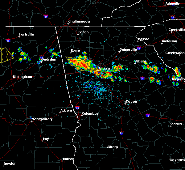 At 216 pm edt, severe thunderstorms were located along a line extending from near cedartown to hiram, moving southeast at 25 mph (radar indicated). Hazards include 60 mph wind gusts and quarter size hail. Hail damage to vehicles is expected. expect wind damage to roofs, siding, and trees. Other locations in the warning include but are not limited to dallas, cedartown, powder springs, austell, rockmart, hiram, aragon, braswell, yorkville, brownsville, new hope, van wert, new georgia, fish creek and antioch. At 216 pm edt, severe thunderstorms were located along a line extending from near cedartown to hiram, moving southeast at 25 mph (radar indicated). Hazards include 60 mph wind gusts and quarter size hail. Hail damage to vehicles is expected. expect wind damage to roofs, siding, and trees. Other locations in the warning include but are not limited to dallas, cedartown, powder springs, austell, rockmart, hiram, aragon, braswell, yorkville, brownsville, new hope, van wert, new georgia, fish creek and antioch.
|
| 6/17/2016 2:01 PM EDT |
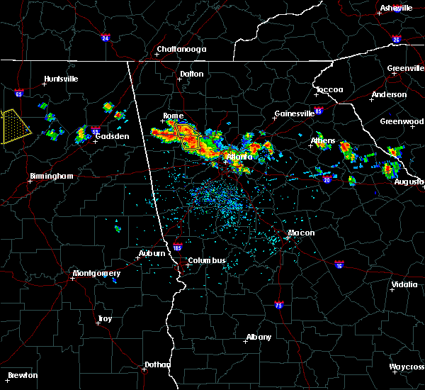 At 201 pm edt, severe thunderstorms were located along a line extending from 6 miles northwest of aragon to 7 miles north of dallas, moving southeast at 30 mph (radar indicated). Hazards include 60 mph wind gusts and quarter size hail. Hail damage to vehicles is expected. expect wind damage to roofs, siding, and trees. Other locations in the warning include but are not limited to dallas, cedartown, powder springs, austell, rockmart, hiram, aragon, braswell, taylorsville, yorkville, brownsville, new hope, van wert, new georgia, seney, burnt hickory ridge, fish creek, cross roads and antioch. At 201 pm edt, severe thunderstorms were located along a line extending from 6 miles northwest of aragon to 7 miles north of dallas, moving southeast at 30 mph (radar indicated). Hazards include 60 mph wind gusts and quarter size hail. Hail damage to vehicles is expected. expect wind damage to roofs, siding, and trees. Other locations in the warning include but are not limited to dallas, cedartown, powder springs, austell, rockmart, hiram, aragon, braswell, taylorsville, yorkville, brownsville, new hope, van wert, new georgia, seney, burnt hickory ridge, fish creek, cross roads and antioch.
|
| 6/1/2016 5:42 PM EDT | The severe thunderstorm warning for northwestern cobb county will expire at 545 pm edt, the storm which prompted the warning has weakened below severe limits, and no longer pose an immediate threat to life or property. therefore the warning will be allowed to expire. however gusty winds and heavy rain are still possible with this thunderstorm. |
| 6/1/2016 5:18 PM EDT |
 At 518 pm edt, a severe thunderstorm was located near fair oaks, or near marietta, moving north at 10 mph (radar indicated). Hazards include 60 mph wind gusts and quarter size hail. Hail damage to vehicles is expected. expect wind damage to roofs, siding, and trees. Other locations in the warning include but are not limited to marietta, kennesaw, powder springs, fair oaks, due west, jim r miller park, lost mountain park, white water park and mableton. At 518 pm edt, a severe thunderstorm was located near fair oaks, or near marietta, moving north at 10 mph (radar indicated). Hazards include 60 mph wind gusts and quarter size hail. Hail damage to vehicles is expected. expect wind damage to roofs, siding, and trees. Other locations in the warning include but are not limited to marietta, kennesaw, powder springs, fair oaks, due west, jim r miller park, lost mountain park, white water park and mableton.
|
| 4/6/2016 11:44 PM EDT | 60 mph winds and nickel sized hail persisted for several minute in cobb county GA, 0.5 miles NNW of Powder Springs, GA |
| 4/6/2016 11:41 PM EDT |
 At 1141 pm edt, severe thunderstorms were located along a line extending from near marietta to near lithia springs to near newnan, moving east at 50 mph (radar indicated). Hazards include 60 mph wind gusts and quarter size hail. Hail damage to vehicles is expected. expect wind damage to roofs, siding, and trees. Other locations in the warning include but are not limited to atlanta, marietta, newnan, douglasville, decatur, fayetteville, jonesboro, sandy springs, smyrna, dunwoody, peachtree city, east point, stockbridge, union city, forest park, snellville, riverdale, college park, powder springs and fairburn. At 1141 pm edt, severe thunderstorms were located along a line extending from near marietta to near lithia springs to near newnan, moving east at 50 mph (radar indicated). Hazards include 60 mph wind gusts and quarter size hail. Hail damage to vehicles is expected. expect wind damage to roofs, siding, and trees. Other locations in the warning include but are not limited to atlanta, marietta, newnan, douglasville, decatur, fayetteville, jonesboro, sandy springs, smyrna, dunwoody, peachtree city, east point, stockbridge, union city, forest park, snellville, riverdale, college park, powder springs and fairburn.
|
| 4/6/2016 10:45 PM EDT |
 At 1045 pm edt, a severe thunderstorm was located over dallas, moving east at 35 mph (radar indicated. at 1030 pm quarter sized hail was reported west of dallas). Hazards include 60 mph wind gusts and quarter size hail. Hail damage to vehicles is expected. expect wind damage to roofs, siding, and trees. Other locations in the warning include but are not limited to marietta, dallas, smyrna, kennesaw, acworth, powder springs, hiram, braswell, fair oaks, white water park, due west, mount bethel, kennesaw state university, jim r miller park, sweat mountain, new hope, sandy plains, lost mountain park, dobbins air reserve base and burnt hickory ridge. At 1045 pm edt, a severe thunderstorm was located over dallas, moving east at 35 mph (radar indicated. at 1030 pm quarter sized hail was reported west of dallas). Hazards include 60 mph wind gusts and quarter size hail. Hail damage to vehicles is expected. expect wind damage to roofs, siding, and trees. Other locations in the warning include but are not limited to marietta, dallas, smyrna, kennesaw, acworth, powder springs, hiram, braswell, fair oaks, white water park, due west, mount bethel, kennesaw state university, jim r miller park, sweat mountain, new hope, sandy plains, lost mountain park, dobbins air reserve base and burnt hickory ridge.
|
| 7/21/2015 3:31 PM EDT |
 At 330 pm edt, severe thunderstorms were located extending from near smyrna to near union city to near chattahoochee hills, moving southeast at 30 mph (radar indicated). Hazards include 60 mph wind gusts and penny size hail. Expect damage to roofs. siding and trees. Other locations in the warning include but are not limited to atlanta, douglasville, smyrna, east point, union city, college park, fairburn, austell, palmetto, chattahoochee hills, lithia springs, west end, sweetwater creek state park, six flags over georgia, cascade heights, turner field, campbellton, chapel hill, sandtown and bill arp. At 330 pm edt, severe thunderstorms were located extending from near smyrna to near union city to near chattahoochee hills, moving southeast at 30 mph (radar indicated). Hazards include 60 mph wind gusts and penny size hail. Expect damage to roofs. siding and trees. Other locations in the warning include but are not limited to atlanta, douglasville, smyrna, east point, union city, college park, fairburn, austell, palmetto, chattahoochee hills, lithia springs, west end, sweetwater creek state park, six flags over georgia, cascade heights, turner field, campbellton, chapel hill, sandtown and bill arp.
|
| 7/21/2015 3:13 PM EDT |
 At 312 pm edt, severe thunderstorms were located extending from near lithia springs to near douglasville to near villa rica, moving southeast at 25 mph (radar indicated). Hazards include 60 mph wind gusts and penny size hail. Expect damage to roofs. siding and trees. Other locations in the warning include but are not limited to atlanta, douglasville, smyrna, east point, union city, villa rica, college park, powder springs, fairburn, austell, palmetto, hiram, chattahoochee hills, lithia springs, sweetwater creek state park, turner field, new georgia, campbellton, lake val-do-mar and hannah. At 312 pm edt, severe thunderstorms were located extending from near lithia springs to near douglasville to near villa rica, moving southeast at 25 mph (radar indicated). Hazards include 60 mph wind gusts and penny size hail. Expect damage to roofs. siding and trees. Other locations in the warning include but are not limited to atlanta, douglasville, smyrna, east point, union city, villa rica, college park, powder springs, fairburn, austell, palmetto, hiram, chattahoochee hills, lithia springs, sweetwater creek state park, turner field, new georgia, campbellton, lake val-do-mar and hannah.
|
| 7/14/2015 9:06 PM EDT |
 At 905 pm edt, severe thunderstorms were located extending from near milton to sandy springs, austell, douglasville and dallas, moving southeast at 45 mph (radar indicated). Hazards include 60 mph wind gusts and quarter size hail. Hail damage to vehicles is expected. expect wind damage to roofs, siding and trees. Other locations in the warning include but are not limited to atlanta, marietta, douglasville, lawrenceville, canton, cartersville, decatur, dallas, sandy springs, roswell, johns creek, alpharetta, smyrna, dunwoody, east point, milton, kennesaw, duluth, woodstock and acworth. At 905 pm edt, severe thunderstorms were located extending from near milton to sandy springs, austell, douglasville and dallas, moving southeast at 45 mph (radar indicated). Hazards include 60 mph wind gusts and quarter size hail. Hail damage to vehicles is expected. expect wind damage to roofs, siding and trees. Other locations in the warning include but are not limited to atlanta, marietta, douglasville, lawrenceville, canton, cartersville, decatur, dallas, sandy springs, roswell, johns creek, alpharetta, smyrna, dunwoody, east point, milton, kennesaw, duluth, woodstock and acworth.
|
| 7/14/2015 8:44 PM EDT |
 At 843 pm edt, severe thunderstorms were located extending from near waleska to woodstock to southwest of kennesaw to near dallas to aragon, moving southeast at 55 mph (radar indicated). Hazards include 70 mph wind gusts and quarter size hail. Hail damage to vehicles is expected. expect considerable tree damage. wind damage is also likely to mobile homes, roofs and outbuildings. Other locations in the warning include but are not limited to atlanta, marietta, douglasville, lawrenceville, canton, cartersville, decatur, dallas, buchanan, sandy springs, roswell, johns creek, alpharetta, smyrna, dunwoody, east point, milton, kennesaw, duluth and woodstock. At 843 pm edt, severe thunderstorms were located extending from near waleska to woodstock to southwest of kennesaw to near dallas to aragon, moving southeast at 55 mph (radar indicated). Hazards include 70 mph wind gusts and quarter size hail. Hail damage to vehicles is expected. expect considerable tree damage. wind damage is also likely to mobile homes, roofs and outbuildings. Other locations in the warning include but are not limited to atlanta, marietta, douglasville, lawrenceville, canton, cartersville, decatur, dallas, buchanan, sandy springs, roswell, johns creek, alpharetta, smyrna, dunwoody, east point, milton, kennesaw, duluth and woodstock.
|
| 7/14/2015 8:36 PM EDT |
 At 835 pm edt, severe thunderstorms were located extending from near waleska to near canton to acworth to southwest of emerson to near braswell, moving southeast at 45 mph (radar indicated). Hazards include 70 mph wind gusts and quarter size hail. Hail damage to vehicles is expected. expect considerable tree damage. wind damage is also likely to mobile homes, roofs and outbuildings. Other locations in the warning include but are not limited to marietta, canton, cartersville, jasper, smyrna, kennesaw, woodstock, acworth, powder springs, holly springs, hiram, emerson, ball ground, nelson, white, waleska, talking rock, buffington, fair oaks and fairmount. At 835 pm edt, severe thunderstorms were located extending from near waleska to near canton to acworth to southwest of emerson to near braswell, moving southeast at 45 mph (radar indicated). Hazards include 70 mph wind gusts and quarter size hail. Hail damage to vehicles is expected. expect considerable tree damage. wind damage is also likely to mobile homes, roofs and outbuildings. Other locations in the warning include but are not limited to marietta, canton, cartersville, jasper, smyrna, kennesaw, woodstock, acworth, powder springs, holly springs, hiram, emerson, ball ground, nelson, white, waleska, talking rock, buffington, fair oaks and fairmount.
|
| 7/14/2015 8:30 PM EDT | 911 call center received numerous reports of downed trees and powerlines across a majority of the county but particularly across powder springs and kennesa in cobb county GA, 0.5 miles NNW of Powder Springs, GA |
| 7/14/2015 8:22 PM EDT |
 At 821 pm edt, severe thunderstorms were located extending from east of resaca to west of waleska to near white and euharlee to northwest of taylorsville, moving southeast at 50 mph (radar indicated). Hazards include 60 mph wind gusts and quarter size hail. Hail damage to vehicles is expected. expect wind damage to roofs, siding and trees. Other locations in the warning include but are not limited to marietta, canton, cartersville, jasper, smyrna, kennesaw, woodstock, acworth, powder springs, holly springs, hiram, emerson, ball ground, nelson, white, waleska, talking rock, buffington, fair oaks and fairmount. At 821 pm edt, severe thunderstorms were located extending from east of resaca to west of waleska to near white and euharlee to northwest of taylorsville, moving southeast at 50 mph (radar indicated). Hazards include 60 mph wind gusts and quarter size hail. Hail damage to vehicles is expected. expect wind damage to roofs, siding and trees. Other locations in the warning include but are not limited to marietta, canton, cartersville, jasper, smyrna, kennesaw, woodstock, acworth, powder springs, holly springs, hiram, emerson, ball ground, nelson, white, waleska, talking rock, buffington, fair oaks and fairmount.
|
| 6/24/2015 5:16 PM EDT |
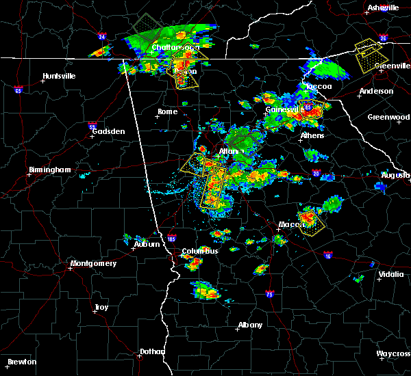 At 515 pm edt, a severe thunderstorm was located over austell, or 9 miles south of marietta, moving south at 5 mph (radar indicated). Hazards include 60 mph wind gusts and quarter size hail. Hail damage to vehicles is expected. expect wind damage to roofs, siding and trees. Other locations in the warning include but are not limited to douglasville, smyrna, powder springs, austell, lithia springs, sweetwater creek state park and mableton. At 515 pm edt, a severe thunderstorm was located over austell, or 9 miles south of marietta, moving south at 5 mph (radar indicated). Hazards include 60 mph wind gusts and quarter size hail. Hail damage to vehicles is expected. expect wind damage to roofs, siding and trees. Other locations in the warning include but are not limited to douglasville, smyrna, powder springs, austell, lithia springs, sweetwater creek state park and mableton.
|
| 6/24/2015 2:34 PM EDT |
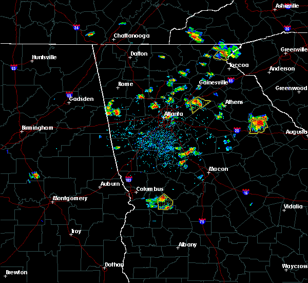 At 234 pm edt, a severe thunderstorm was located over fair oaks, or near marietta, moving south at 10 mph (radar indicated). Hazards include 60 mph wind gusts and penny size hail. Expect damage to roofs. siding and trees. Other locations in the warning include but are not limited to marietta, smyrna, powder springs, austell, fair oaks, lithia springs, dobbins air reserve base, white water park, vinings, jim r miller park, six flags over georgia and mableton. At 234 pm edt, a severe thunderstorm was located over fair oaks, or near marietta, moving south at 10 mph (radar indicated). Hazards include 60 mph wind gusts and penny size hail. Expect damage to roofs. siding and trees. Other locations in the warning include but are not limited to marietta, smyrna, powder springs, austell, fair oaks, lithia springs, dobbins air reserve base, white water park, vinings, jim r miller park, six flags over georgia and mableton.
|
| 5/19/2013 11:40 AM EDT | A trained spotter reported a power line down on macland road near hira in cobb county GA, 1.5 miles ENE of Powder Springs, GA |
| 1/1/0001 12:00 AM | Quarter sized hail reported 1.7 miles ESE of Powder Springs, GA |
Hail Maps for Powder Springs, GA


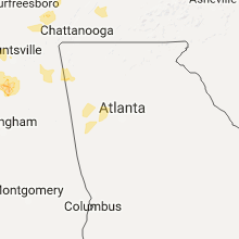


Connect with Interactive Hail Maps