

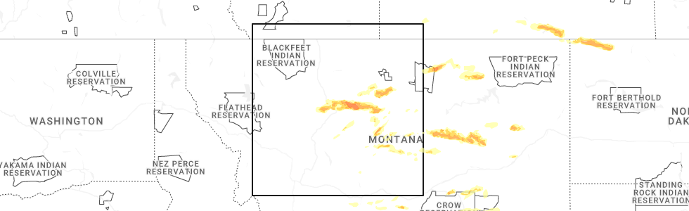
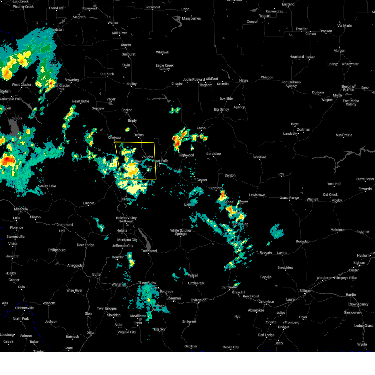
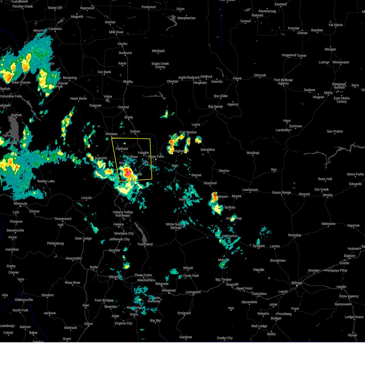
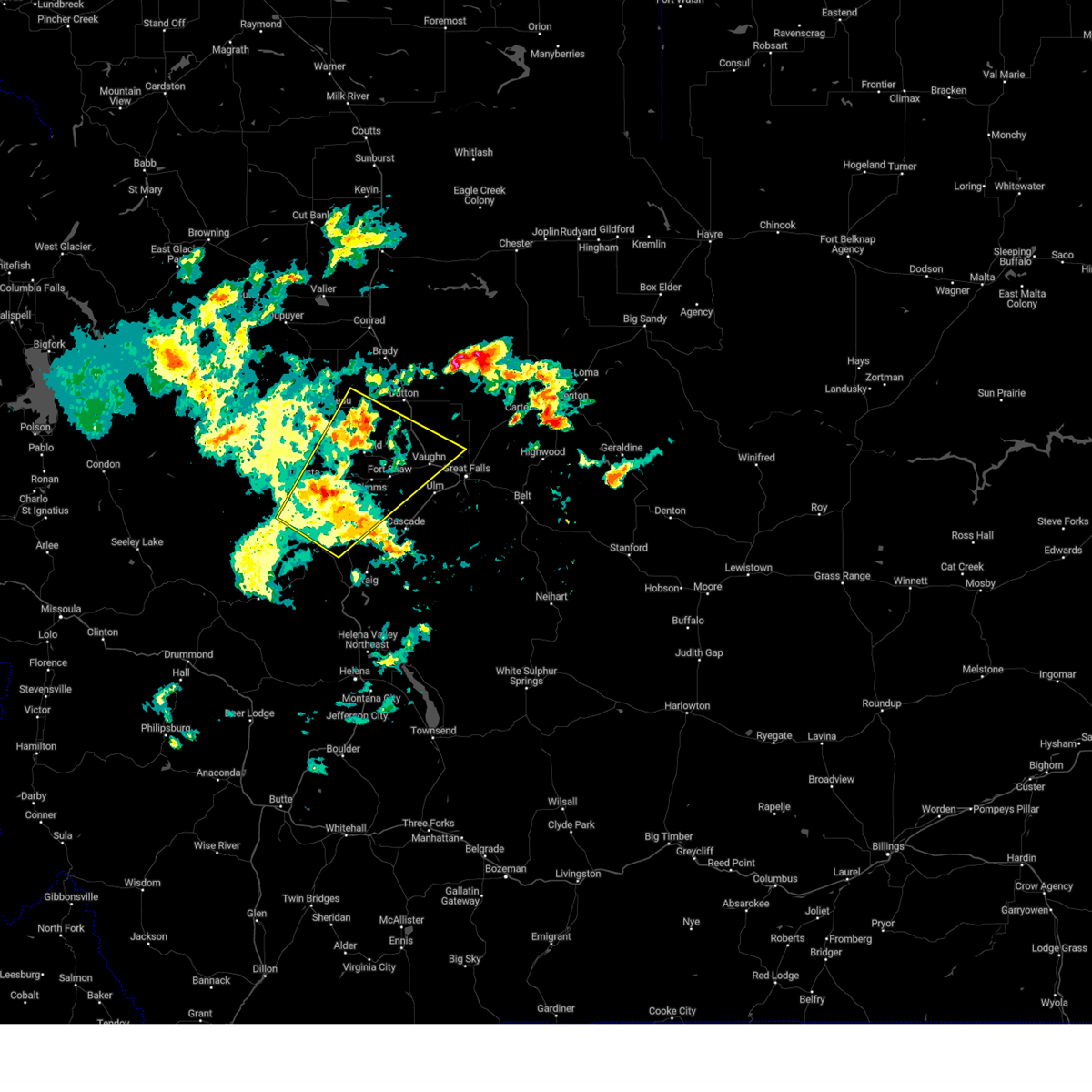
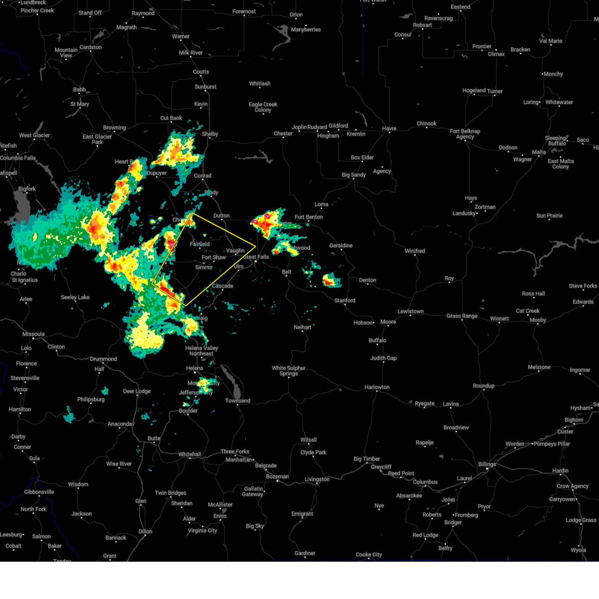
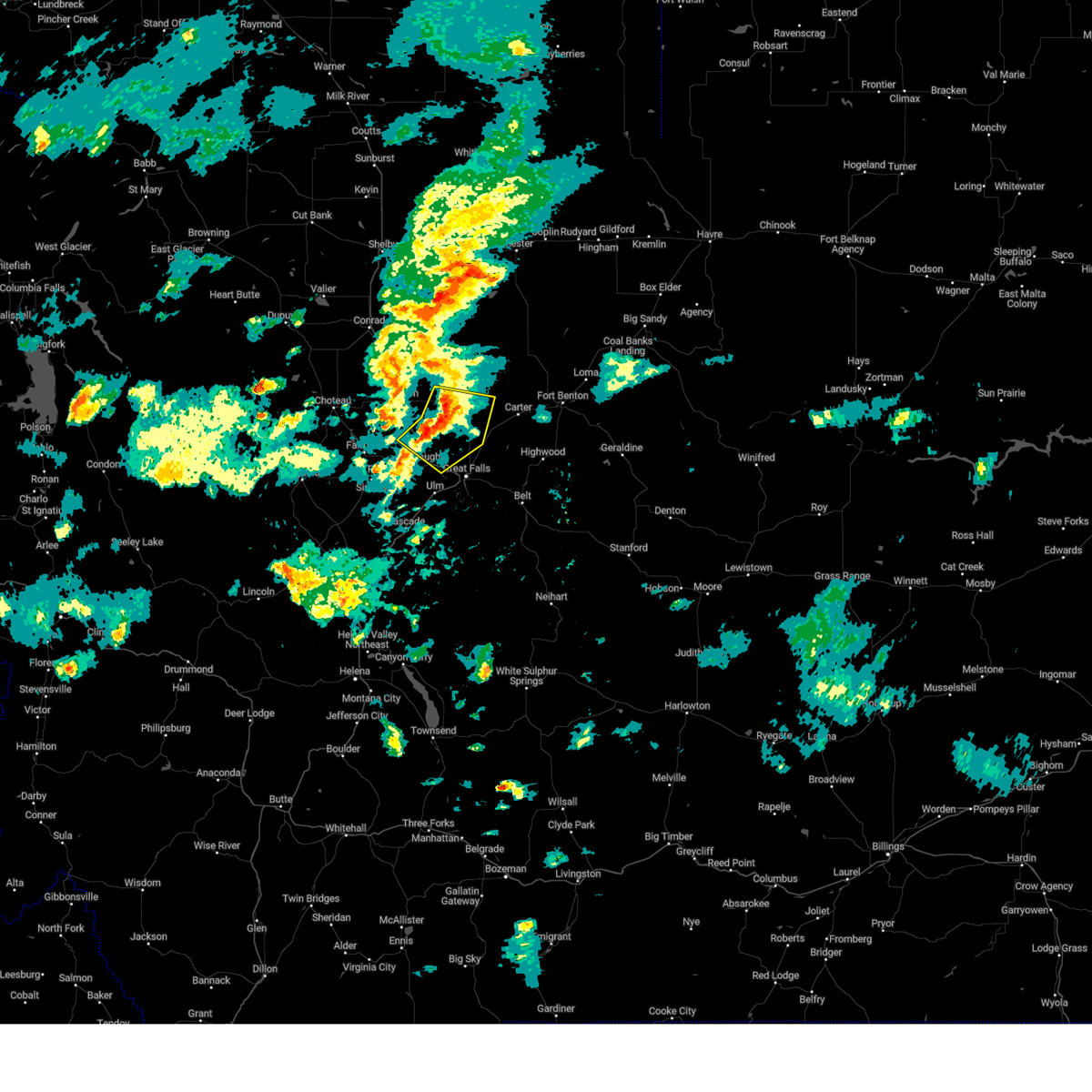
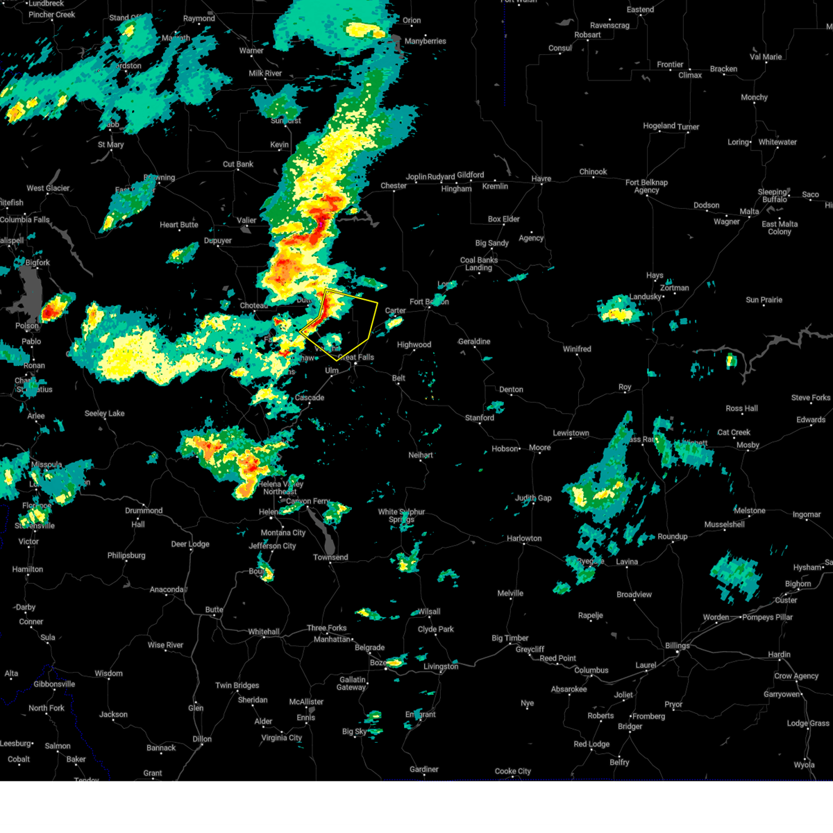
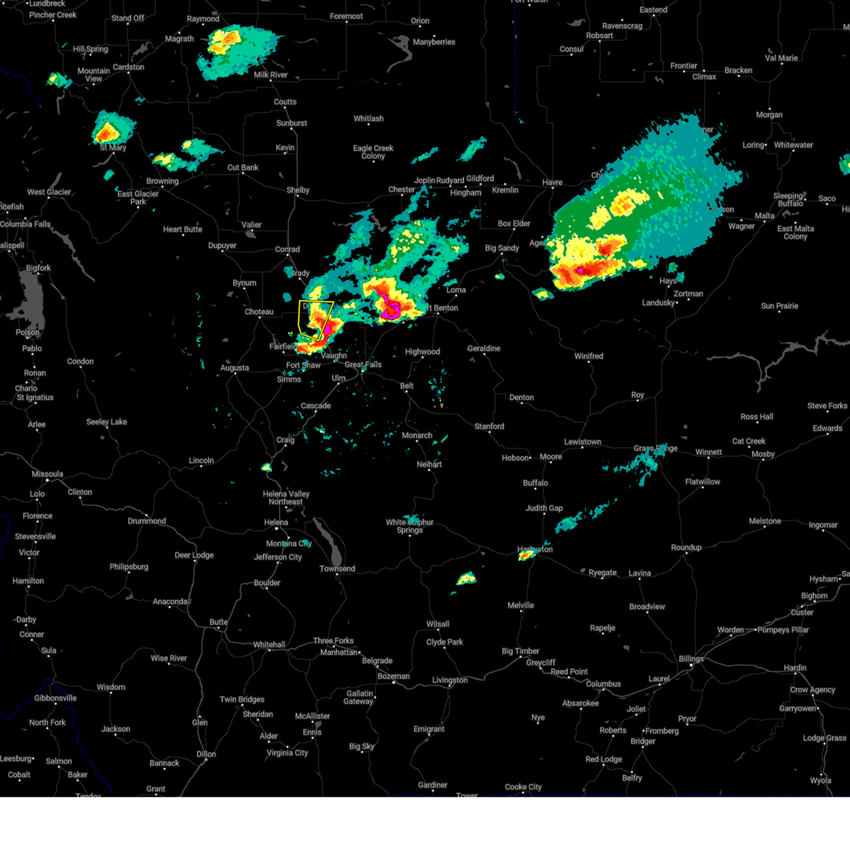
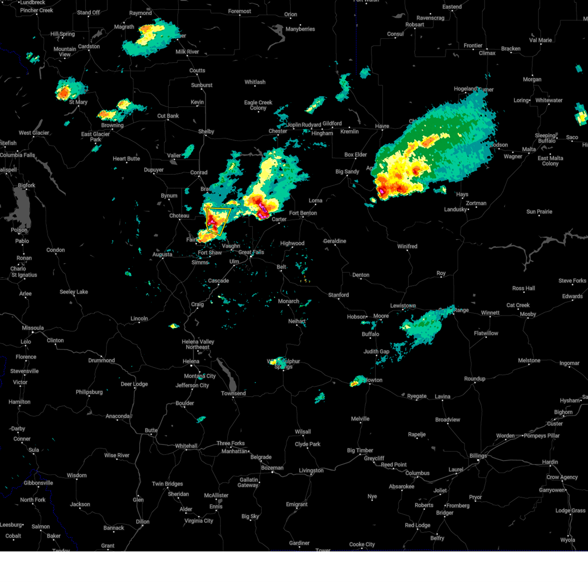
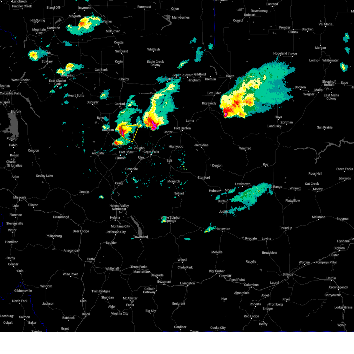
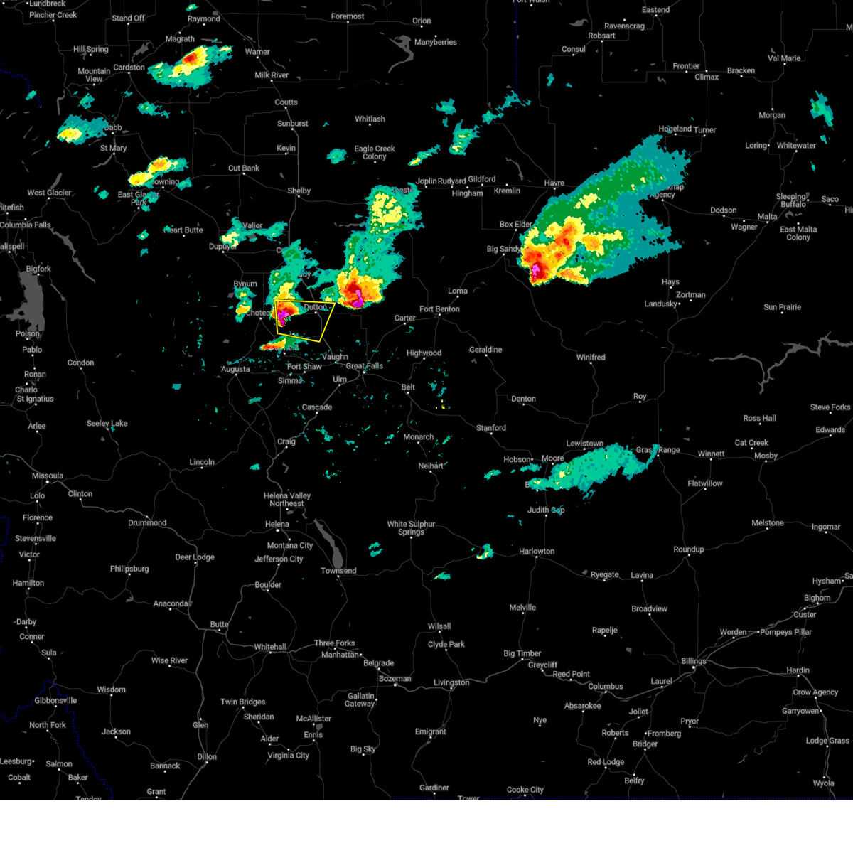
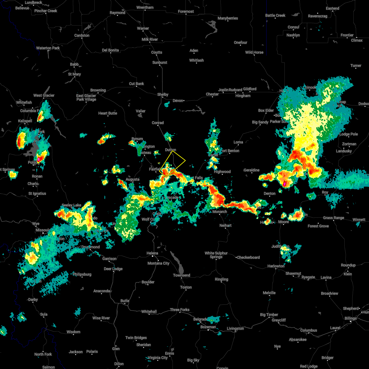
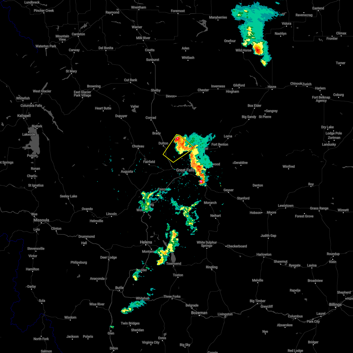
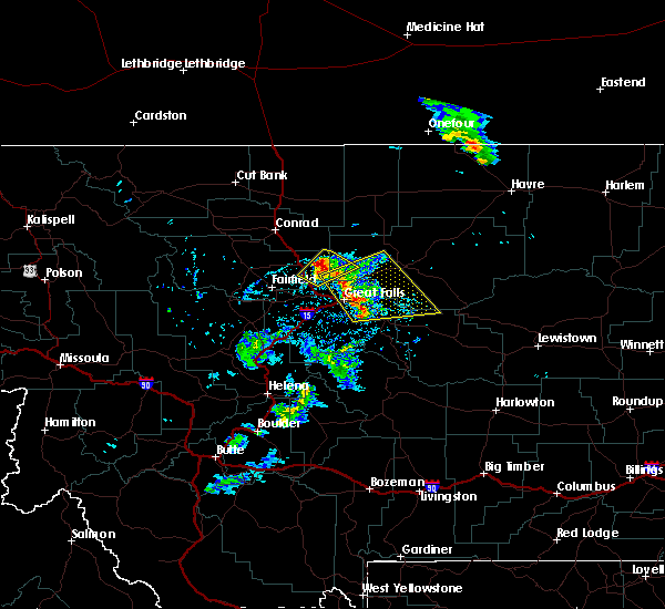
Hail Map for Power, MT
The Power, MT area has had 9 reports of on-the-ground hail by trained spotters, and has been under severe weather warnings 9 times during the past 12 months. Doppler radar has detected hail at or near Power, MT on 22 occasions, including 2 occasions during the past year.
| Name: | Power, MT |
| Where Located: | 23.4 miles NW of Great Falls, MT |
| Map: | Google Map for Power, MT |
| Population: | 179 |
| Housing Units: | 71 |
| More Info: | Search Google for Power, MT |
1
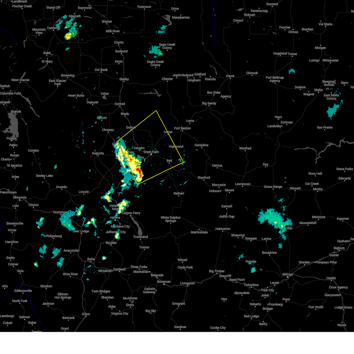
The Top Recent Hail Date for Power, MT is Sunday, June 15, 2025 (6th out of 22)
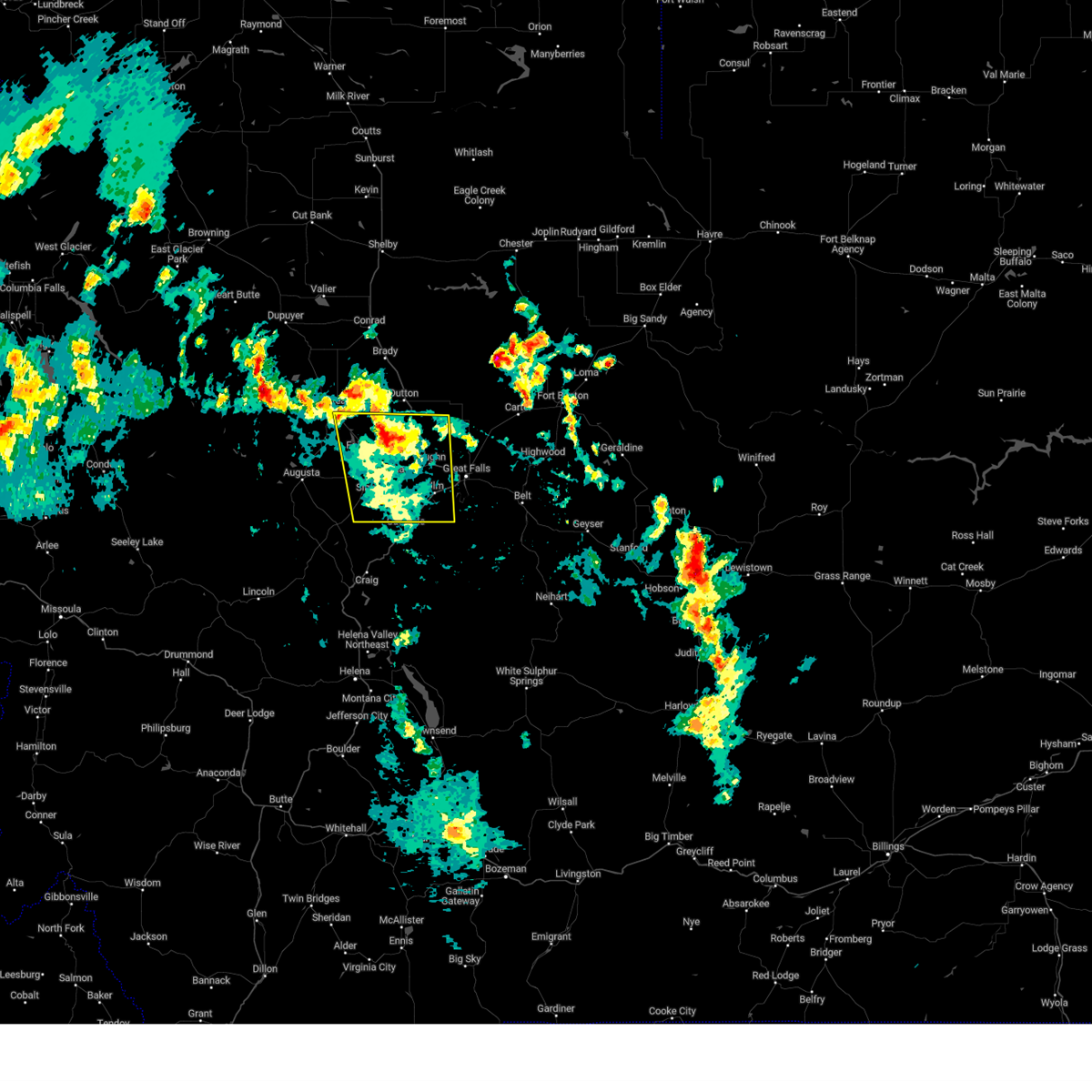
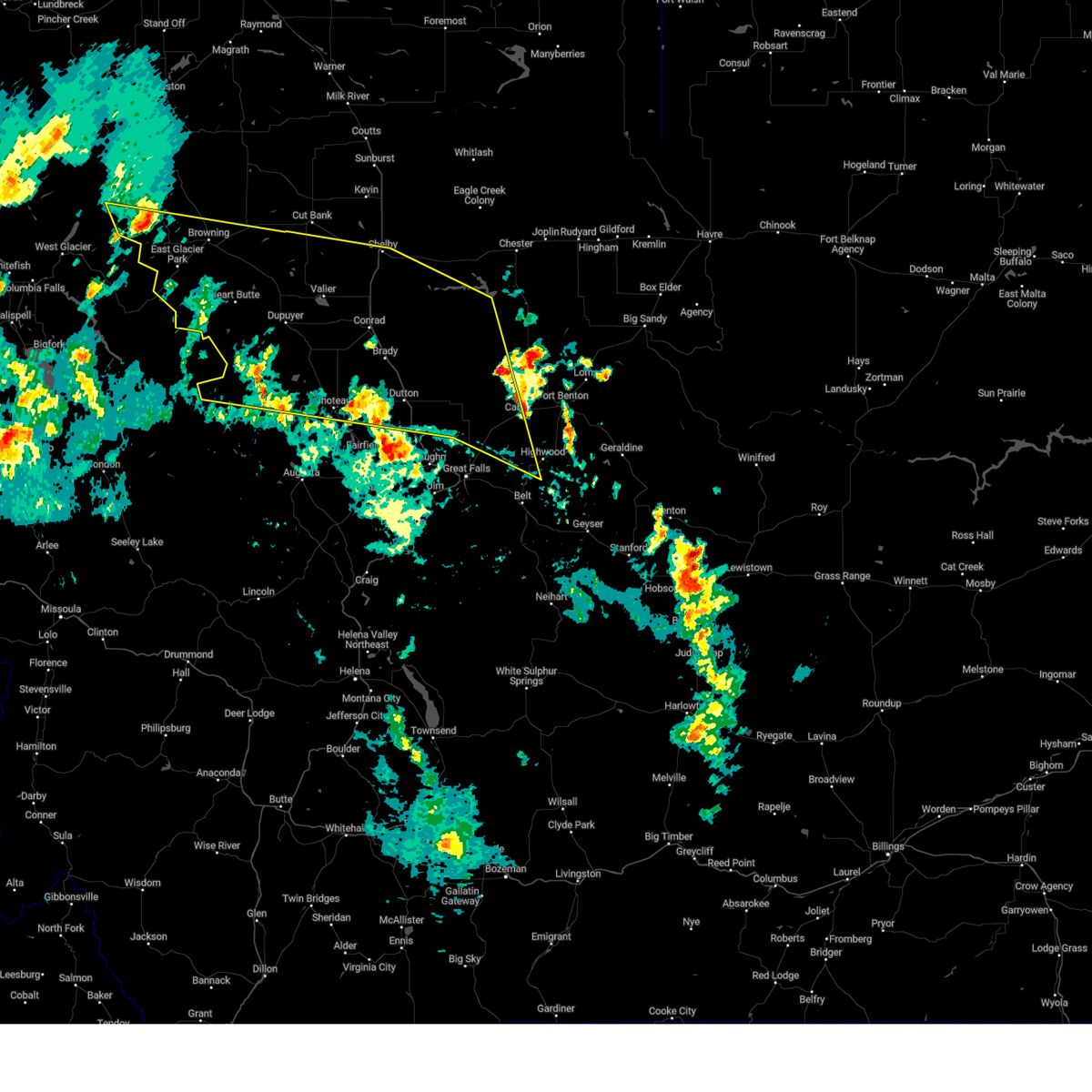
Hail and Wind Damage Spotted near Power, MT
| Date / Time | Report Details |
|---|---|
| 5/11/2025 2:44 PM MDT |
 Svrtfx the national weather service in great falls has issued a * severe thunderstorm warning for, southeastern pondera county in north central montana, southeastern teton county in north central montana, southwestern chouteau county in north central montana, northern cascade county in central montana, * until 330 pm mdt. * at 242 pm mdt, severe thunderstorms were located along a line extending from near power to 11 miles east of cascade, moving northeast at 40 mph (radar indicated). Hazards include 60 mph wind gusts. expect damage to roofs, siding, and trees Svrtfx the national weather service in great falls has issued a * severe thunderstorm warning for, southeastern pondera county in north central montana, southeastern teton county in north central montana, southwestern chouteau county in north central montana, northern cascade county in central montana, * until 330 pm mdt. * at 242 pm mdt, severe thunderstorms were located along a line extending from near power to 11 miles east of cascade, moving northeast at 40 mph (radar indicated). Hazards include 60 mph wind gusts. expect damage to roofs, siding, and trees
|
| 8/23/2024 5:30 PM MDT | Estimated 60 mph wind gust east of i-15. debris being lofted in the ai in teton county MT, 3 miles WSW of Power, MT |
| 8/23/2024 5:30 PM MDT |
 The storm which prompted the warning has moved out of the area. therefore, the warning will be allowed to expire. however, gusty winds to 55 mph are still possible with this thunderstorm. a severe thunderstorm watch remains in effect until 900 pm mdt for central, north central and west central montana. remember, a severe thunderstorm warning still remains in effect for northwestern lewis and clark, teton, and northeastern cascade counties until 630 pm. The storm which prompted the warning has moved out of the area. therefore, the warning will be allowed to expire. however, gusty winds to 55 mph are still possible with this thunderstorm. a severe thunderstorm watch remains in effect until 900 pm mdt for central, north central and west central montana. remember, a severe thunderstorm warning still remains in effect for northwestern lewis and clark, teton, and northeastern cascade counties until 630 pm.
|
| 8/23/2024 5:27 PM MDT |
 Svrtfx the national weather service in great falls has issued a * severe thunderstorm warning for, northwestern lewis and clark county in west central montana, pondera county in north central montana, southwestern liberty county in north central montana, southern glacier county in north central montana, southern toole county in north central montana, teton county in north central montana, southwestern chouteau county in north central montana, northeastern cascade county in central montana, * until 630 pm mdt. * at 526 pm mdt, severe thunderstorms were located along a line extending from 28 miles southwest of heart butte to 11 miles east of power to 9 miles west of highwood, moving north at 40 mph (radar indicated). Hazards include 70 mph wind gusts. Expect considerable tree damage. Damage is likely to mobile homes, roofs, and outbuildings. Svrtfx the national weather service in great falls has issued a * severe thunderstorm warning for, northwestern lewis and clark county in west central montana, pondera county in north central montana, southwestern liberty county in north central montana, southern glacier county in north central montana, southern toole county in north central montana, teton county in north central montana, southwestern chouteau county in north central montana, northeastern cascade county in central montana, * until 630 pm mdt. * at 526 pm mdt, severe thunderstorms were located along a line extending from 28 miles southwest of heart butte to 11 miles east of power to 9 miles west of highwood, moving north at 40 mph (radar indicated). Hazards include 70 mph wind gusts. Expect considerable tree damage. Damage is likely to mobile homes, roofs, and outbuildings.
|
| 8/23/2024 5:12 PM MDT |
 At 510 pm mdt, a severe thunderstorm was located over fort shaw, or 16 miles northwest of cascade, moving north at 45 mph. this is a destructive storm for fort shaw power, ulm, vaughn, and first peoples buffalo jump state park (automated weather sensor near ulm reported a wind gust of 77 mph). Hazards include 80 mph wind gusts. Flying debris will be dangerous to those caught without shelter. mobile homes will be heavily damaged. expect considerable damage to roofs, windows, and vehicles. extensive tree damage and power outages are likely. Locations impacted include, fairfield, fort shaw, fort shaw, power, ulm, vaughn, first peoples buffalo jump state park, simms, and sun river. At 510 pm mdt, a severe thunderstorm was located over fort shaw, or 16 miles northwest of cascade, moving north at 45 mph. this is a destructive storm for fort shaw power, ulm, vaughn, and first peoples buffalo jump state park (automated weather sensor near ulm reported a wind gust of 77 mph). Hazards include 80 mph wind gusts. Flying debris will be dangerous to those caught without shelter. mobile homes will be heavily damaged. expect considerable damage to roofs, windows, and vehicles. extensive tree damage and power outages are likely. Locations impacted include, fairfield, fort shaw, fort shaw, power, ulm, vaughn, first peoples buffalo jump state park, simms, and sun river.
|
| 8/23/2024 4:59 PM MDT |
 Svrtfx the national weather service in great falls has issued a * severe thunderstorm warning for, central lewis and clark county in west central montana, southeastern teton county in north central montana, northwestern cascade county in central montana, * until 530 pm mdt. * at 459 pm mdt, a severe thunderstorm was located 9 miles northwest of cascade, moving north at 45 mph (radar indicated). Hazards include 60 mph wind gusts. expect damage to roofs, siding, and trees Svrtfx the national weather service in great falls has issued a * severe thunderstorm warning for, central lewis and clark county in west central montana, southeastern teton county in north central montana, northwestern cascade county in central montana, * until 530 pm mdt. * at 459 pm mdt, a severe thunderstorm was located 9 miles northwest of cascade, moving north at 45 mph (radar indicated). Hazards include 60 mph wind gusts. expect damage to roofs, siding, and trees
|
| 8/18/2024 8:30 PM MDT |
 The storms which prompted the warning have weakened below severe limits, and no longer pose an immediate threat to life or property. therefore, the warning has been allowed to expire. however, gusty winds are still possible with these thunderstorms. The storms which prompted the warning have weakened below severe limits, and no longer pose an immediate threat to life or property. therefore, the warning has been allowed to expire. however, gusty winds are still possible with these thunderstorms.
|
| 8/18/2024 8:04 PM MDT |
 Svrtfx the national weather service in great falls has issued a * severe thunderstorm warning for, central lewis and clark county in west central montana, southeastern teton county in north central montana, northwestern cascade county in central montana, * until 830 pm mdt. * at 804 pm mdt, severe thunderstorms were located along a line extending from 7 miles south of augusta to 14 miles west of cascade, moving northeast at 55 mph (radar indicated). Hazards include 70 mph wind gusts. Expect considerable tree damage. Damage is likely to mobile homes, roofs, and outbuildings. Svrtfx the national weather service in great falls has issued a * severe thunderstorm warning for, central lewis and clark county in west central montana, southeastern teton county in north central montana, northwestern cascade county in central montana, * until 830 pm mdt. * at 804 pm mdt, severe thunderstorms were located along a line extending from 7 miles south of augusta to 14 miles west of cascade, moving northeast at 55 mph (radar indicated). Hazards include 70 mph wind gusts. Expect considerable tree damage. Damage is likely to mobile homes, roofs, and outbuildings.
|
| 8/6/2024 8:36 PM MDT |
 At 835 pm mdt, severe thunderstorms were located along a line extending from 15 miles south of the knees to 14 miles northwest of black eagle to 6 miles southeast of power, moving east at 35 mph (radar indicated). Hazards include 60 mph wind gusts. Expect damage to roofs, siding, and trees. Locations impacted include, power and vaughn. At 835 pm mdt, severe thunderstorms were located along a line extending from 15 miles south of the knees to 14 miles northwest of black eagle to 6 miles southeast of power, moving east at 35 mph (radar indicated). Hazards include 60 mph wind gusts. Expect damage to roofs, siding, and trees. Locations impacted include, power and vaughn.
|
| 8/6/2024 8:35 PM MDT | Tree branches broken off of ash tre in teton county MT, 8.3 miles WSW of Power, MT |
| 8/6/2024 8:23 PM MDT |
 Svrtfx the national weather service in great falls has issued a * severe thunderstorm warning for, east central teton county in north central montana, west central chouteau county in north central montana, north central cascade county in central montana, * until 915 pm mdt. * at 823 pm mdt, severe thunderstorms were located along a line extending from 10 miles east of dutton to near power, moving southeast at 25 mph (radar indicated). Hazards include 60 mph wind gusts. expect damage to roofs, siding, and trees Svrtfx the national weather service in great falls has issued a * severe thunderstorm warning for, east central teton county in north central montana, west central chouteau county in north central montana, north central cascade county in central montana, * until 915 pm mdt. * at 823 pm mdt, severe thunderstorms were located along a line extending from 10 miles east of dutton to near power, moving southeast at 25 mph (radar indicated). Hazards include 60 mph wind gusts. expect damage to roofs, siding, and trees
|
| 6/21/2024 5:23 PM MDT |
 The storm which prompted the warning has moved out of the area. therefore, the warning will be allowed to expire and a new warning will be issued with this storm. a severe thunderstorm watch remains in effect until 800 pm mdt for north central montana. The storm which prompted the warning has moved out of the area. therefore, the warning will be allowed to expire and a new warning will be issued with this storm. a severe thunderstorm watch remains in effect until 800 pm mdt for north central montana.
|
| 6/21/2024 5:11 PM MDT |
 At 511 pm mdt, a severe thunderstorm was located near power, or 22 miles east of choteau, moving east at 25 mph (radar indicated). Hazards include 60 mph wind gusts and half dollar size hail. Hail damage to vehicles is expected. expect wind damage to roofs, siding, and trees. Locations impacted include, dutton and power. At 511 pm mdt, a severe thunderstorm was located near power, or 22 miles east of choteau, moving east at 25 mph (radar indicated). Hazards include 60 mph wind gusts and half dollar size hail. Hail damage to vehicles is expected. expect wind damage to roofs, siding, and trees. Locations impacted include, dutton and power.
|
| 6/21/2024 5:04 PM MDT |
 At 504 pm mdt, a severe thunderstorm was located near dutton, or 19 miles east of choteau, moving east at 25 mph (radar indicated). Hazards include golf ball size hail and 60 mph wind gusts. People and animals outdoors will be injured. expect hail damage to roofs, siding, windows, and vehicles. expect wind damage to roofs, siding, and trees. Locations impacted include, dutton and power. At 504 pm mdt, a severe thunderstorm was located near dutton, or 19 miles east of choteau, moving east at 25 mph (radar indicated). Hazards include golf ball size hail and 60 mph wind gusts. People and animals outdoors will be injured. expect hail damage to roofs, siding, windows, and vehicles. expect wind damage to roofs, siding, and trees. Locations impacted include, dutton and power.
|
| 6/21/2024 4:58 PM MDT |
 At 458 pm mdt, a severe thunderstorm was located near dutton, or 16 miles east of choteau, moving east at 25 mph (radar indicated). Hazards include golf ball size hail and 60 mph wind gusts. People and animals outdoors will be injured. expect hail damage to roofs, siding, windows, and vehicles. expect wind damage to roofs, siding, and trees. Locations impacted include, dutton and power. At 458 pm mdt, a severe thunderstorm was located near dutton, or 16 miles east of choteau, moving east at 25 mph (radar indicated). Hazards include golf ball size hail and 60 mph wind gusts. People and animals outdoors will be injured. expect hail damage to roofs, siding, windows, and vehicles. expect wind damage to roofs, siding, and trees. Locations impacted include, dutton and power.
|
| 6/21/2024 4:52 PM MDT |
 At 452 pm mdt, a severe thunderstorm was located 8 miles west of dutton, or 13 miles east of choteau, moving east at 25 mph (radar indicated). Hazards include golf ball size hail and 60 mph wind gusts. People and animals outdoors will be injured. expect hail damage to roofs, siding, windows, and vehicles. expect wind damage to roofs, siding, and trees. Locations impacted include, dutton and power. At 452 pm mdt, a severe thunderstorm was located 8 miles west of dutton, or 13 miles east of choteau, moving east at 25 mph (radar indicated). Hazards include golf ball size hail and 60 mph wind gusts. People and animals outdoors will be injured. expect hail damage to roofs, siding, windows, and vehicles. expect wind damage to roofs, siding, and trees. Locations impacted include, dutton and power.
|
| 6/21/2024 4:45 PM MDT |
 Svrtfx the national weather service in great falls has issued a * severe thunderstorm warning for, east central teton county in north central montana, * until 530 pm mdt. * at 445 pm mdt, a severe thunderstorm was located 10 miles east of choteau, moving east at 25 mph (radar indicated). Hazards include ping pong ball size hail and 60 mph wind gusts. People and animals outdoors will be injured. expect hail damage to roofs, siding, windows, and vehicles. Expect wind damage to roofs, siding, and trees. Svrtfx the national weather service in great falls has issued a * severe thunderstorm warning for, east central teton county in north central montana, * until 530 pm mdt. * at 445 pm mdt, a severe thunderstorm was located 10 miles east of choteau, moving east at 25 mph (radar indicated). Hazards include ping pong ball size hail and 60 mph wind gusts. People and animals outdoors will be injured. expect hail damage to roofs, siding, windows, and vehicles. Expect wind damage to roofs, siding, and trees.
|
| 8/29/2023 7:24 PM MDT |
 At 724 pm mdt, severe thunderstorms were located along a line extending from 8 miles east of dutton to 6 miles northwest of great falls to 11 miles east of cascade, moving east at 35 mph (radar indicated). Hazards include 70 mph wind gusts. Expect considerable tree damage. damage is likely to mobile homes, roofs, and outbuildings. locations impacted include, great falls, black eagle, power, malmstrom afb, eden, stockett, tracy, vaughn, first peoples buffalo jump state park, centerville, sun river, ulm, and sand coulee. thunderstorm damage threat, considerable hail threat, radar indicated max hail size, <. 75 in wind threat, radar indicated max wind gust, 70 mph. At 724 pm mdt, severe thunderstorms were located along a line extending from 8 miles east of dutton to 6 miles northwest of great falls to 11 miles east of cascade, moving east at 35 mph (radar indicated). Hazards include 70 mph wind gusts. Expect considerable tree damage. damage is likely to mobile homes, roofs, and outbuildings. locations impacted include, great falls, black eagle, power, malmstrom afb, eden, stockett, tracy, vaughn, first peoples buffalo jump state park, centerville, sun river, ulm, and sand coulee. thunderstorm damage threat, considerable hail threat, radar indicated max hail size, <. 75 in wind threat, radar indicated max wind gust, 70 mph.
|
| 8/29/2023 6:52 PM MDT |
 At 651 pm mdt, an outflow boundary with strong wind gusts from severe thunderstorms were located along a line extending from 9 miles north of fairfield to near fort shaw to 6 miles north of cascade, moving east at 35 mph (radar indicated). Hazards include 70 mph wind gusts. Expect considerable tree damage. Damage is likely to mobile homes, roofs, and outbuildings. At 651 pm mdt, an outflow boundary with strong wind gusts from severe thunderstorms were located along a line extending from 9 miles north of fairfield to near fort shaw to 6 miles north of cascade, moving east at 35 mph (radar indicated). Hazards include 70 mph wind gusts. Expect considerable tree damage. Damage is likely to mobile homes, roofs, and outbuildings.
|
| 9/7/2022 6:13 PM MDT |
 At 611 pm mdt, severe thunderstorms were located along a line extending from 9 miles east of dutton to 19 miles south of belt to near townsend, moving east at 50 mph (radar indicated). Hazards include 70 mph wind gusts, and blowing dust. Expect considerable tree damage. damage is likely to mobile homes, roofs, and outbuildings. visibility will be reduced to less than 2 miles at times in blowing dust. locations impacted include, great falls, townsend, fort benton, white sulphur springs, stanford, belt, dutton, highwood, black eagle, geyser, power, carter, neihart, fort logan on the smith river, floweree, eden, sapphire village, fort logan, stockett and first peoples buffalo jump state park. thunderstorm damage threat, considerable hail threat, radar indicated max hail size, <. 75 in wind threat, radar indicated max wind gust, 70 mph. At 611 pm mdt, severe thunderstorms were located along a line extending from 9 miles east of dutton to 19 miles south of belt to near townsend, moving east at 50 mph (radar indicated). Hazards include 70 mph wind gusts, and blowing dust. Expect considerable tree damage. damage is likely to mobile homes, roofs, and outbuildings. visibility will be reduced to less than 2 miles at times in blowing dust. locations impacted include, great falls, townsend, fort benton, white sulphur springs, stanford, belt, dutton, highwood, black eagle, geyser, power, carter, neihart, fort logan on the smith river, floweree, eden, sapphire village, fort logan, stockett and first peoples buffalo jump state park. thunderstorm damage threat, considerable hail threat, radar indicated max hail size, <. 75 in wind threat, radar indicated max wind gust, 70 mph.
|
| 9/7/2022 5:57 PM MDT |
 At 556 pm mdt, severe thunderstorms were located along a line extending from near dutton to 23 miles southeast of cascade to 10 miles southwest of townsend, moving east at 50 mph (radar indicated). Hazards include 70 mph wind gusts. Expect considerable tree damage. Damage is likely to mobile homes, roofs, and outbuildings. At 556 pm mdt, severe thunderstorms were located along a line extending from near dutton to 23 miles southeast of cascade to 10 miles southwest of townsend, moving east at 50 mph (radar indicated). Hazards include 70 mph wind gusts. Expect considerable tree damage. Damage is likely to mobile homes, roofs, and outbuildings.
|
| 9/3/2022 10:38 PM MDT |
 The severe thunderstorm warning for pondera, eastern glacier, toole and central teton counties will expire at 1045 pm mdt, the storms which prompted the warning have moved out of the area. therefore, the warning will be allowed to expire. however gusty winds are still possible with these thunderstorms. The severe thunderstorm warning for pondera, eastern glacier, toole and central teton counties will expire at 1045 pm mdt, the storms which prompted the warning have moved out of the area. therefore, the warning will be allowed to expire. however gusty winds are still possible with these thunderstorms.
|
| 9/3/2022 10:09 PM MDT |
 At 1008 pm mdt, severe thunderstorms were located along a line extending from 31 miles northwest of cut bank to 7 miles north of valier to near fairfield, moving east at 35 mph (radar indicated). Hazards include 60 mph wind gusts. Expect damage to roofs, siding, and trees. locations impacted include, shelby, cut bank, conrad, choteau, valier, sunburst, dutton, kevin, brady, power, ethridge, oilmont, ledger, collins, bynum, santa rita, pendroy, ferdig, devon and dunkirk. a peak wind gust of 68 mph occurred at the cut bank airport with this storm. hail threat, radar indicated max hail size, <. 75 in wind threat, radar indicated max wind gust, 60 mph. At 1008 pm mdt, severe thunderstorms were located along a line extending from 31 miles northwest of cut bank to 7 miles north of valier to near fairfield, moving east at 35 mph (radar indicated). Hazards include 60 mph wind gusts. Expect damage to roofs, siding, and trees. locations impacted include, shelby, cut bank, conrad, choteau, valier, sunburst, dutton, kevin, brady, power, ethridge, oilmont, ledger, collins, bynum, santa rita, pendroy, ferdig, devon and dunkirk. a peak wind gust of 68 mph occurred at the cut bank airport with this storm. hail threat, radar indicated max hail size, <. 75 in wind threat, radar indicated max wind gust, 60 mph.
|
| 9/3/2022 9:48 PM MDT |
 At 947 pm mdt, severe thunderstorms were located along a line extending from 28 miles north of north browning to 13 miles northwest of valier to 11 miles south of choteau, moving east at 35 mph (radar indicated). Hazards include 60 mph wind gusts. expect damage to roofs, siding, and trees At 947 pm mdt, severe thunderstorms were located along a line extending from 28 miles north of north browning to 13 miles northwest of valier to 11 miles south of choteau, moving east at 35 mph (radar indicated). Hazards include 60 mph wind gusts. expect damage to roofs, siding, and trees
|
| 8/25/2022 7:04 PM MDT | At 703 pm mdt, a severe thunderstorm was located 8 miles west of dutton, or 12 miles east of choteau, moving east at 15 mph (radar indicated). Hazards include 60 mph wind gusts and quarter size hail. Hail damage to vehicles is expected. expect wind damage to roofs, siding, and trees. locations impacted include, dutton, power and collins. hail threat, radar indicated max hail size, 1. 00 in wind threat, radar indicated max wind gust, 60 mph. |
| 8/25/2022 6:51 PM MDT | At 650 pm mdt, a severe thunderstorm was located 9 miles east of choteau, moving east at 15 mph (radar indicated). Hazards include 60 mph wind gusts and quarter size hail. Hail damage to vehicles is expected. expect wind damage to roofs, siding, and trees. locations impacted include, choteau, dutton, power, collins and farmington. hail threat, radar indicated max hail size, 1. 00 in wind threat, radar indicated max wind gust, 60 mph. |
| 8/25/2022 6:24 PM MDT | At 622 pm mdt, a severe thunderstorm was located near choteau, moving east at 15 mph (radar indicated). Hazards include two inch hail and 70 mph wind gusts. People and animals outdoors will be injured. expect hail damage to roofs, siding, windows, and vehicles. expect considerable tree damage. Wind damage is also likely to mobile homes, roofs, and outbuildings. |
| 8/12/2022 7:36 PM MDT |
 The severe thunderstorm warning for southeastern pondera, southeastern teton and northwestern cascade counties will expire at 745 pm mdt, the storms which prompted the warning have weakened below severe limits, and have exited the warned area. therefore, the warning will be allowed to expire. however small hail, gusty winds and heavy rain are still possible with these thunderstorms. The severe thunderstorm warning for southeastern pondera, southeastern teton and northwestern cascade counties will expire at 745 pm mdt, the storms which prompted the warning have weakened below severe limits, and have exited the warned area. therefore, the warning will be allowed to expire. however small hail, gusty winds and heavy rain are still possible with these thunderstorms.
|
| 8/12/2022 7:13 PM MDT |
 At 713 pm mdt, severe thunderstorms were located along a line extending from 8 miles northeast of fairfield to cascade, moving northeast at 35 mph (radar indicated). Hazards include 60 mph wind gusts. expect damage to roofs, siding, and trees At 713 pm mdt, severe thunderstorms were located along a line extending from 8 miles northeast of fairfield to cascade, moving northeast at 35 mph (radar indicated). Hazards include 60 mph wind gusts. expect damage to roofs, siding, and trees
|
| 7/15/2022 12:13 PM MDT |
 At 1213 pm mdt, severe thunderstorms were located along a line extending from near choteau to 14 miles north of white sulphur springs, moving northeast at 35 mph (radar indicated). Hazards include 60 mph wind gusts. expect damage to roofs, siding, and trees At 1213 pm mdt, severe thunderstorms were located along a line extending from near choteau to 14 miles north of white sulphur springs, moving northeast at 35 mph (radar indicated). Hazards include 60 mph wind gusts. expect damage to roofs, siding, and trees
|
| 7/7/2022 8:40 PM MDT |
 At 839 pm mdt, a severe thunderstorm was located near fort shaw, or 22 miles southeast of choteau, moving northeast at 20 mph (radar indicated). Hazards include quarter size hail. damage to vehicles is expected At 839 pm mdt, a severe thunderstorm was located near fort shaw, or 22 miles southeast of choteau, moving northeast at 20 mph (radar indicated). Hazards include quarter size hail. damage to vehicles is expected
|
| 7/7/2022 5:23 PM MDT |
 At 522 pm mdt, severe thunderstorms were located along a line extending from near power to 11 miles southeast of dutton to 12 miles northwest of black eagle, moving east at 15 mph (radar indicated). Hazards include 60 mph wind gusts and quarter size hail. Hail damage to vehicles is expected. expect wind damage to roofs, siding, and trees. these storms have a history of producing funnel clouds. Locations impacted include, great falls, dutton, the knees, black eagle, power, carter, floweree, portage, vaughn, first peoples buffalo jump state park and malmstrom afb. At 522 pm mdt, severe thunderstorms were located along a line extending from near power to 11 miles southeast of dutton to 12 miles northwest of black eagle, moving east at 15 mph (radar indicated). Hazards include 60 mph wind gusts and quarter size hail. Hail damage to vehicles is expected. expect wind damage to roofs, siding, and trees. these storms have a history of producing funnel clouds. Locations impacted include, great falls, dutton, the knees, black eagle, power, carter, floweree, portage, vaughn, first peoples buffalo jump state park and malmstrom afb.
|
| 7/7/2022 5:11 PM MDT |
 At 510 pm mdt, severe thunderstorms were located along a line extending from near dutton to 6 miles east of power to 13 miles northwest of great falls, moving northeast at 20 mph (radar indicated). Hazards include 60 mph wind gusts and quarter size hail. Hail damage to vehicles is expected. expect wind damage to roofs, siding, and trees. funnel clouds have been reported between vaughn and sun prairie. Locations impacted include, great falls, dutton, the knees, black eagle, power, carter, floweree, portage, vaughn, first peoples buffalo jump state park and malmstrom afb. At 510 pm mdt, severe thunderstorms were located along a line extending from near dutton to 6 miles east of power to 13 miles northwest of great falls, moving northeast at 20 mph (radar indicated). Hazards include 60 mph wind gusts and quarter size hail. Hail damage to vehicles is expected. expect wind damage to roofs, siding, and trees. funnel clouds have been reported between vaughn and sun prairie. Locations impacted include, great falls, dutton, the knees, black eagle, power, carter, floweree, portage, vaughn, first peoples buffalo jump state park and malmstrom afb.
|
| 7/7/2022 5:06 PM MDT | Quarter sized hail reported 12.8 miles NNW of Power, MT, report from mping: quarter (1.00 in.). |
| 7/7/2022 5:06 PM MDT | Tennis Ball sized hail reported 12 miles NNW of Power, MT, storm chaser submitted photos of very large hail along interstate 15. largest stone measured was 2.25 inches. traffic on interstate 15 was brought to a halt. hail laste |
| 7/7/2022 5:05 PM MDT |
 At 504 pm mdt, severe thunderstorms were located along a line extending from near dutton to near power to 13 miles northeast of fort shaw, moving east at 20 mph (radar indicated). Hazards include 60 mph wind gusts and quarter size hail. Hail damage to vehicles is expected. expect wind damage to roofs, siding, and trees. Locations impacted include, great falls, dutton, the knees, black eagle, power, carter, floweree, portage, vaughn, first peoples buffalo jump state park and malmstrom afb. At 504 pm mdt, severe thunderstorms were located along a line extending from near dutton to near power to 13 miles northeast of fort shaw, moving east at 20 mph (radar indicated). Hazards include 60 mph wind gusts and quarter size hail. Hail damage to vehicles is expected. expect wind damage to roofs, siding, and trees. Locations impacted include, great falls, dutton, the knees, black eagle, power, carter, floweree, portage, vaughn, first peoples buffalo jump state park and malmstrom afb.
|
| 7/7/2022 4:56 PM MDT |
 The severe thunderstorm warning for southeastern teton and northwestern cascade counties will expire at 500 pm mdt, this will be replaced by another severe thunderstorm warning. a severe thunderstorm watch remains in effect until 900 pm mdt for central and north central montana. The severe thunderstorm warning for southeastern teton and northwestern cascade counties will expire at 500 pm mdt, this will be replaced by another severe thunderstorm warning. a severe thunderstorm watch remains in effect until 900 pm mdt for central and north central montana.
|
| 7/7/2022 4:51 PM MDT |
 At 451 pm mdt, severe thunderstorms were located along a line extending from dutton to near power to 11 miles northeast of fort shaw, moving east northeast at 25 mph (radar indicated). Hazards include 60 mph wind gusts and quarter size hail. Hail damage to vehicles is expected. Expect wind damage to roofs, siding, and trees. At 451 pm mdt, severe thunderstorms were located along a line extending from dutton to near power to 11 miles northeast of fort shaw, moving east northeast at 25 mph (radar indicated). Hazards include 60 mph wind gusts and quarter size hail. Hail damage to vehicles is expected. Expect wind damage to roofs, siding, and trees.
|
| 7/7/2022 4:49 PM MDT |
 At 449 pm mdt, severe thunderstorms were located along a line extending from 7 miles west of dutton to near power to 7 miles northeast of fort shaw, moving east northeast at 20 mph (radar indicated). Hazards include 60 mph wind gusts and quarter size hail. Hail damage to vehicles is expected. expect wind damage to roofs, siding, and trees. locations impacted include, dutton, fort shaw, fort shaw, power, ulm, vaughn, first peoples buffalo jump state park and sun river. hail threat, radar indicated max hail size, 1. 00 in wind threat, radar indicated max wind gust, 60 mph. At 449 pm mdt, severe thunderstorms were located along a line extending from 7 miles west of dutton to near power to 7 miles northeast of fort shaw, moving east northeast at 20 mph (radar indicated). Hazards include 60 mph wind gusts and quarter size hail. Hail damage to vehicles is expected. expect wind damage to roofs, siding, and trees. locations impacted include, dutton, fort shaw, fort shaw, power, ulm, vaughn, first peoples buffalo jump state park and sun river. hail threat, radar indicated max hail size, 1. 00 in wind threat, radar indicated max wind gust, 60 mph.
|
| 7/7/2022 4:41 PM MDT |
 At 441 pm mdt, severe thunderstorms were located along a line extending from 9 miles west of dutton to near power to near fort shaw, moving east northeast at 20 mph (radar indicated). Hazards include 60 mph wind gusts and half dollar size hail. Hail damage to vehicles is expected. expect wind damage to roofs, siding, and trees. locations impacted include, dutton, fort shaw, fort shaw, power, ulm, vaughn, first peoples buffalo jump state park and sun river. hail threat, radar indicated max hail size, 1. 25 in wind threat, radar indicated max wind gust, 60 mph. At 441 pm mdt, severe thunderstorms were located along a line extending from 9 miles west of dutton to near power to near fort shaw, moving east northeast at 20 mph (radar indicated). Hazards include 60 mph wind gusts and half dollar size hail. Hail damage to vehicles is expected. expect wind damage to roofs, siding, and trees. locations impacted include, dutton, fort shaw, fort shaw, power, ulm, vaughn, first peoples buffalo jump state park and sun river. hail threat, radar indicated max hail size, 1. 25 in wind threat, radar indicated max wind gust, 60 mph.
|
| 7/7/2022 4:25 PM MDT |
 At 425 pm mdt, severe thunderstorms were located along a line extending from 10 miles east of choteau to near fairfield to near fort shaw, moving northeast at 20 mph (radar indicated). Hazards include 60 mph wind gusts and half dollar size hail. Hail damage to vehicles is expected. expect wind damage to roofs, siding, and trees. locations impacted include, fairfield, dutton, fort shaw, fort shaw, power, ulm, vaughn, first peoples buffalo jump state park, simms and sun river. hail threat, radar indicated max hail size, 1. 25 in wind threat, radar indicated max wind gust, 60 mph. At 425 pm mdt, severe thunderstorms were located along a line extending from 10 miles east of choteau to near fairfield to near fort shaw, moving northeast at 20 mph (radar indicated). Hazards include 60 mph wind gusts and half dollar size hail. Hail damage to vehicles is expected. expect wind damage to roofs, siding, and trees. locations impacted include, fairfield, dutton, fort shaw, fort shaw, power, ulm, vaughn, first peoples buffalo jump state park, simms and sun river. hail threat, radar indicated max hail size, 1. 25 in wind threat, radar indicated max wind gust, 60 mph.
|
| 7/7/2022 4:22 PM MDT |
 At 422 pm mdt, severe thunderstorms were located along a line extending from 10 miles east of choteau to near fairfield to near fort shaw, moving northeast at 20 mph (radar indicated). Hazards include ping pong ball size hail and 60 mph wind gusts. People and animals outdoors will be injured. expect hail damage to roofs, siding, windows, and vehicles. expect wind damage to roofs, siding, and trees. locations impacted include, fairfield, dutton, fort shaw, fort shaw, power, ulm, vaughn, first peoples buffalo jump state park, simms and sun river. hail threat, radar indicated max hail size, 1. 50 in wind threat, radar indicated max wind gust, 60 mph. At 422 pm mdt, severe thunderstorms were located along a line extending from 10 miles east of choteau to near fairfield to near fort shaw, moving northeast at 20 mph (radar indicated). Hazards include ping pong ball size hail and 60 mph wind gusts. People and animals outdoors will be injured. expect hail damage to roofs, siding, windows, and vehicles. expect wind damage to roofs, siding, and trees. locations impacted include, fairfield, dutton, fort shaw, fort shaw, power, ulm, vaughn, first peoples buffalo jump state park, simms and sun river. hail threat, radar indicated max hail size, 1. 50 in wind threat, radar indicated max wind gust, 60 mph.
|
| 7/7/2022 4:09 PM MDT |
 At 409 pm mdt, severe thunderstorms were located along a line extending from 10 miles east of choteau to near fairfield to near fort shaw, moving east northeast at 20 mph (radar indicated). Hazards include 60 mph wind gusts and half dollar size hail. Hail damage to vehicles is expected. Expect wind damage to roofs, siding, and trees. At 409 pm mdt, severe thunderstorms were located along a line extending from 10 miles east of choteau to near fairfield to near fort shaw, moving east northeast at 20 mph (radar indicated). Hazards include 60 mph wind gusts and half dollar size hail. Hail damage to vehicles is expected. Expect wind damage to roofs, siding, and trees.
|
| 7/2/2022 8:25 PM MDT |
 At 825 pm mdt, severe thunderstorms were located along a line extending from 7 miles west of power to 14 miles southwest of belt, moving northeast at 50 mph (radar indicated). Hazards include 60 mph wind gusts. expect damage to roofs, siding, and trees At 825 pm mdt, severe thunderstorms were located along a line extending from 7 miles west of power to 14 miles southwest of belt, moving northeast at 50 mph (radar indicated). Hazards include 60 mph wind gusts. expect damage to roofs, siding, and trees
|
| 6/18/2022 3:25 PM MDT | Awos station k1jm juliett observed a peak wind gust of 67 knot in teton county MT, 6.7 miles WSW of Power, MT |
| 6/18/2022 3:12 PM MDT | Numerous power poles snapped along i-15. pea size hail and water filling the ditch. time/location estimate in cascade county MT, 4.2 miles NW of Power, MT |
| 8/20/2020 3:28 PM MDT |
 At 328 pm mdt, severe thunderstorms were located along a line extending from 8 miles northeast of brady to 10 miles northeast of augusta, moving east at 25 mph (radar indicated). Hazards include 60 mph wind gusts and quarter size hail. Hail damage to vehicles is expected. Expect wind damage to roofs, siding, and trees. At 328 pm mdt, severe thunderstorms were located along a line extending from 8 miles northeast of brady to 10 miles northeast of augusta, moving east at 25 mph (radar indicated). Hazards include 60 mph wind gusts and quarter size hail. Hail damage to vehicles is expected. Expect wind damage to roofs, siding, and trees.
|
| 8/20/2020 2:55 PM MDT |
 At 254 pm mdt, severe thunderstorms were located along a line extending from near conrad to 9 miles northeast of augusta, moving northeast at 25 mph (radar indicated). Hazards include ping pong ball size hail and 60 mph wind gusts. People and animals outdoors will be injured. expect hail damage to roofs, siding, windows, and vehicles. Expect wind damage to roofs, siding, and trees. At 254 pm mdt, severe thunderstorms were located along a line extending from near conrad to 9 miles northeast of augusta, moving northeast at 25 mph (radar indicated). Hazards include ping pong ball size hail and 60 mph wind gusts. People and animals outdoors will be injured. expect hail damage to roofs, siding, windows, and vehicles. Expect wind damage to roofs, siding, and trees.
|
| 6/24/2020 7:36 PM MDT | Ping Pong Ball sized hail reported 11.4 miles WSW of Power, MT, a lot of quarter to ping pong sized hail. also reports wind shredded pine trees and a lot of branches down. |
| 5/20/2020 2:12 AM MDT |
 At 211 am mdt, severe thunderstorms were located along a line extending from 6 miles east of power to 6 miles northwest of black eagle, moving northeast at 35 mph (radar indicated). Hazards include 60 mph wind gusts and quarter size hail. Hail damage to vehicles is expected. expect wind damage to roofs, siding, and trees. Locations impacted include, power and carter. At 211 am mdt, severe thunderstorms were located along a line extending from 6 miles east of power to 6 miles northwest of black eagle, moving northeast at 35 mph (radar indicated). Hazards include 60 mph wind gusts and quarter size hail. Hail damage to vehicles is expected. expect wind damage to roofs, siding, and trees. Locations impacted include, power and carter.
|
| 5/20/2020 2:01 AM MDT | Quarter sized hail reported 13.9 miles NW of Power, MT |
| 5/20/2020 2:00 AM MDT |
 At 200 am mdt, severe thunderstorms were located along a line extending from near power to 6 miles northwest of great falls, moving northeast at 35 mph (trained weather spotters). Hazards include 60 mph wind gusts and quarter size hail. Hail damage to vehicles is expected. Expect wind damage to roofs, siding, and trees. At 200 am mdt, severe thunderstorms were located along a line extending from near power to 6 miles northwest of great falls, moving northeast at 35 mph (trained weather spotters). Hazards include 60 mph wind gusts and quarter size hail. Hail damage to vehicles is expected. Expect wind damage to roofs, siding, and trees.
|
| 5/18/2020 8:18 PM MDT | Time estimated on rada in teton county MT, 1 miles N of Power, MT |
| 5/18/2020 7:53 PM MDT |
 At 752 pm mdt, severe thunderstorms were located along a line extending from near fairfield to near fort shaw, moving northeast at 40 mph (radar indicated). Hazards include 60 mph wind gusts and penny size hail. expect damage to roofs, siding, and trees At 752 pm mdt, severe thunderstorms were located along a line extending from near fairfield to near fort shaw, moving northeast at 40 mph (radar indicated). Hazards include 60 mph wind gusts and penny size hail. expect damage to roofs, siding, and trees
|
| 7/13/2019 2:53 PM MDT | Quarter sized hail reported 8 miles ESE of Power, MT |
| 7/6/2019 5:28 PM MDT |
 The severe thunderstorm warning for southeastern teton, southwestern chouteau and northwestern cascade counties will expire at 530 pm mdt, the storms which prompted the warning have moved out of the warned area. a new warning was issued downwind. The severe thunderstorm warning for southeastern teton, southwestern chouteau and northwestern cascade counties will expire at 530 pm mdt, the storms which prompted the warning have moved out of the warned area. a new warning was issued downwind.
|
| 7/6/2019 5:27 PM MDT |
 At 526 pm mdt, severe thunderstorms were located along a line extending from 8 miles east of dutton to near cascade, moving east at 20 mph (radar indicated). Hazards include 60 mph wind gusts and quarter size hail. Hail damage to vehicles is expected. Expect wind damage to roofs, siding, and trees. At 526 pm mdt, severe thunderstorms were located along a line extending from 8 miles east of dutton to near cascade, moving east at 20 mph (radar indicated). Hazards include 60 mph wind gusts and quarter size hail. Hail damage to vehicles is expected. Expect wind damage to roofs, siding, and trees.
|
| 7/6/2019 5:20 PM MDT |
 At 519 pm mdt, severe thunderstorms were located along a line extending from 7 miles east of dutton to 6 miles north of cascade, moving east at 30 mph (radar indicated). Hazards include 60 mph wind gusts and quarter size hail. Hail damage to vehicles is expected. expect wind damage to roofs, siding, and trees. Locations impacted include, great falls, black eagle, fort shaw, fort shaw, power, carter, floweree, portage, eden, malmstrom afb, stockett, tracy, vaughn, first peoples buffalo jump state park, centerville, sun river, ulm and sand coulee. At 519 pm mdt, severe thunderstorms were located along a line extending from 7 miles east of dutton to 6 miles north of cascade, moving east at 30 mph (radar indicated). Hazards include 60 mph wind gusts and quarter size hail. Hail damage to vehicles is expected. expect wind damage to roofs, siding, and trees. Locations impacted include, great falls, black eagle, fort shaw, fort shaw, power, carter, floweree, portage, eden, malmstrom afb, stockett, tracy, vaughn, first peoples buffalo jump state park, centerville, sun river, ulm and sand coulee.
|
| 7/6/2019 5:05 PM MDT |
 At 504 pm mdt, severe thunderstorms were located along a line extending from near dutton to 8 miles south of fort shaw, moving east at 50 mph (radar indicated). Hazards include 60 mph wind gusts and quarter size hail. Hail damage to vehicles is expected. Expect wind damage to roofs, siding, and trees. At 504 pm mdt, severe thunderstorms were located along a line extending from near dutton to 8 miles south of fort shaw, moving east at 50 mph (radar indicated). Hazards include 60 mph wind gusts and quarter size hail. Hail damage to vehicles is expected. Expect wind damage to roofs, siding, and trees.
|
| 6/18/2019 3:28 PM MDT | Quarter sized hail reported 8.3 miles WSW of Power, MT, quarter size or larger hail measured (after some melting). |
| 7/25/2018 9:32 PM MDT |
 At 931 pm mdt, a severe thunderstorm was located 9 miles east of choteau, moving southeast at 30 mph (trained weather spotters). Hazards include 60 mph wind gusts and quarter size hail. Hail damage appears to be diminishing. expect wind damage to roofs, siding, and trees. Locations impacted include, choteau, power, pendroy, farmington and bynum. At 931 pm mdt, a severe thunderstorm was located 9 miles east of choteau, moving southeast at 30 mph (trained weather spotters). Hazards include 60 mph wind gusts and quarter size hail. Hail damage appears to be diminishing. expect wind damage to roofs, siding, and trees. Locations impacted include, choteau, power, pendroy, farmington and bynum.
|
| 7/25/2018 8:44 PM MDT |
 At 844 pm mdt, a severe thunderstorm was located 15 miles northwest of choteau, moving southeast at 30 mph (radar indicated). Hazards include 60 mph wind gusts and half dollar size hail. Hail damage to vehicles is expected. Expect wind damage to roofs, siding, and trees. At 844 pm mdt, a severe thunderstorm was located 15 miles northwest of choteau, moving southeast at 30 mph (radar indicated). Hazards include 60 mph wind gusts and half dollar size hail. Hail damage to vehicles is expected. Expect wind damage to roofs, siding, and trees.
|
| 6/25/2018 7:28 PM MDT |
 The severe thunderstorm warning for east central teton, west central chouteau and northwestern cascade counties will expire at 730 pm mdt, the storm which prompted the warning has weakened below severe limits, and no longer poses an immediate threat to life or property. therefore, the warning will be allowed to expire. however small hail, gusty winds and heavy rain are still possible with this thunderstorm. The severe thunderstorm warning for east central teton, west central chouteau and northwestern cascade counties will expire at 730 pm mdt, the storm which prompted the warning has weakened below severe limits, and no longer poses an immediate threat to life or property. therefore, the warning will be allowed to expire. however small hail, gusty winds and heavy rain are still possible with this thunderstorm.
|
| 6/25/2018 7:20 PM MDT |
 At 720 pm mdt, a severe thunderstorm was located 11 miles east of dutton, or 22 miles north of great falls, moving northeast at 45 mph (radar indicated). Hazards include 60 mph wind gusts and quarter size hail. Hail damage to vehicles is expected. expect wind damage to roofs, siding, and trees. Locations impacted include, power. At 720 pm mdt, a severe thunderstorm was located 11 miles east of dutton, or 22 miles north of great falls, moving northeast at 45 mph (radar indicated). Hazards include 60 mph wind gusts and quarter size hail. Hail damage to vehicles is expected. expect wind damage to roofs, siding, and trees. Locations impacted include, power.
|
| 6/25/2018 7:05 PM MDT | Reports a lot of wind and a lot of pea sized hail. hail covering the ground. power went out. window screens destroyed with some minor glass damage. paint on house sidin in teton county MT, 4.7 miles NNE of Power, MT |
| 6/25/2018 7:05 PM MDT | Facebook report of downed trees... small hail... and no electricity south of power. also reports 2 inches of rai in teton county MT, 1.7 miles N of Power, MT |
| 6/25/2018 7:04 PM MDT |
 At 703 pm mdt, a severe thunderstorm was located near power, or 19 miles northwest of great falls, moving northeast at 35 mph (radar indicated). Hazards include 60 mph wind gusts and quarter size hail. Hail damage to vehicles is expected. Expect wind damage to roofs, siding, and trees. At 703 pm mdt, a severe thunderstorm was located near power, or 19 miles northwest of great falls, moving northeast at 35 mph (radar indicated). Hazards include 60 mph wind gusts and quarter size hail. Hail damage to vehicles is expected. Expect wind damage to roofs, siding, and trees.
|
| 5/6/2017 6:36 PM MDT |
 At 636 pm mdt, severe thunderstorms were located along a line extending from 11 miles east of highwood to 10 miles southeast of power, moving northeast at 30 mph (trained weather spotters reported gusts of 60 to 70 mph). Hazards include 60 mph wind gusts and penny size hail. Expect damage to roofs, siding, and trees. Locations impacted include, fort benton, the knees, highwood, power, carter, shonkin, floweree, portage and vaughn. At 636 pm mdt, severe thunderstorms were located along a line extending from 11 miles east of highwood to 10 miles southeast of power, moving northeast at 30 mph (trained weather spotters reported gusts of 60 to 70 mph). Hazards include 60 mph wind gusts and penny size hail. Expect damage to roofs, siding, and trees. Locations impacted include, fort benton, the knees, highwood, power, carter, shonkin, floweree, portage and vaughn.
|
| 5/6/2017 6:14 PM MDT |
 At 613 pm mdt, severe thunderstorms were located along a line extending from 8 miles northeast of belt to near fort shaw, moving northeast at 30 mph (radar and trained spotter indicated). Hazards include 60 mph wind gusts and quarter size hail. Hail damage to vehicles is expected. Expect wind damage to roofs, siding, and trees. At 613 pm mdt, severe thunderstorms were located along a line extending from 8 miles northeast of belt to near fort shaw, moving northeast at 30 mph (radar and trained spotter indicated). Hazards include 60 mph wind gusts and quarter size hail. Hail damage to vehicles is expected. Expect wind damage to roofs, siding, and trees.
|
| 5/6/2017 6:05 PM MDT |
 At 604 pm mdt, severe thunderstorms were located along a line extending from 6 miles south of power to 6 miles southeast of highwood, moving northeast at 55 mph (trained weather spotters reported estimated wind gusts of 60 mph on the southwest end of great falls). Hazards include 60 mph wind gusts and half dollar size hail. Hail damage to vehicles is expected. expect wind damage to roofs, siding, and trees. Locations impacted include, great falls, belt, black eagle, fort shaw, highwood, fort shaw, power, carter, floweree, portage, malmstrom afb, tracy, vaughn, first peoples buffalo jump state park, sun river, shonkin, armington, ulm and sand coulee. At 604 pm mdt, severe thunderstorms were located along a line extending from 6 miles south of power to 6 miles southeast of highwood, moving northeast at 55 mph (trained weather spotters reported estimated wind gusts of 60 mph on the southwest end of great falls). Hazards include 60 mph wind gusts and half dollar size hail. Hail damage to vehicles is expected. expect wind damage to roofs, siding, and trees. Locations impacted include, great falls, belt, black eagle, fort shaw, highwood, fort shaw, power, carter, floweree, portage, malmstrom afb, tracy, vaughn, first peoples buffalo jump state park, sun river, shonkin, armington, ulm and sand coulee.
|
| 5/6/2017 5:44 PM MDT |
 At 544 pm mdt, severe thunderstorms were located along a line extending from 6 miles south of fort shaw to 7 miles south of belt, moving northeast at 55 mph (radar indicated). Hazards include 70 mph wind gusts and half dollar size hail. Hail damage to vehicles is expected. expect considerable tree damage. Wind damage is also likely to mobile homes, roofs, and outbuildings. At 544 pm mdt, severe thunderstorms were located along a line extending from 6 miles south of fort shaw to 7 miles south of belt, moving northeast at 55 mph (radar indicated). Hazards include 70 mph wind gusts and half dollar size hail. Hail damage to vehicles is expected. expect considerable tree damage. Wind damage is also likely to mobile homes, roofs, and outbuildings.
|
| 7/24/2013 8:20 PM MDT | Half Dollar sized hail reported 2.2 miles SW of Power, MT, benton lake area |
| 6/4/2012 7:08 PM MDT | Quarter sized hail reported 0.4 miles N of Power, MT, estimated 1 inch hail near power |
| 6/4/2012 7:01 PM MDT | Golf Ball sized hail reported 5.8 miles NW of Power, MT, golf ball size hail a few miles southeast of power. |
| 1/1/0001 12:00 AM | Winds estimated at 60-70 mph at onset of storm with breif heavy rain and pea sized hail in teton county MT, 4.7 miles NE of Power, MT |
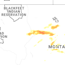
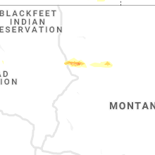
Hail Maps for Power, MT


Connect with Interactive Hail Maps