

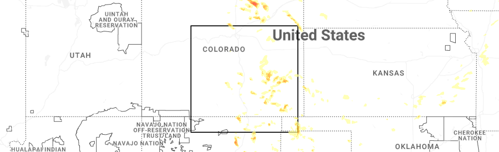
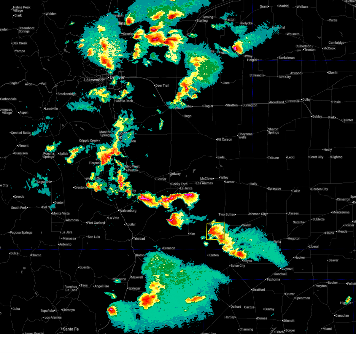
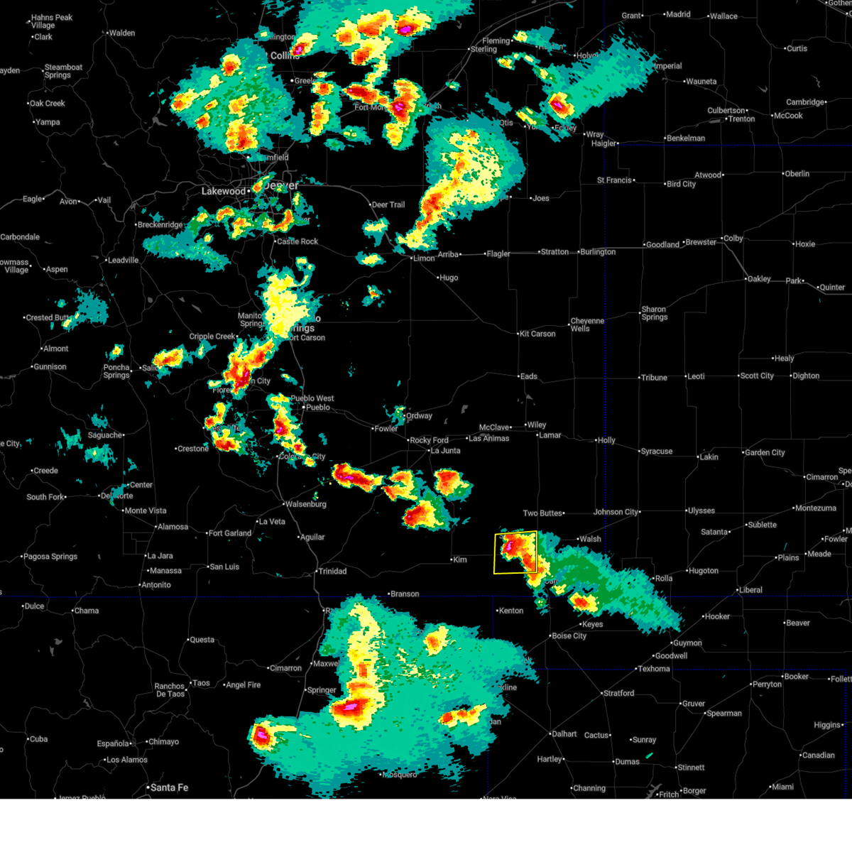
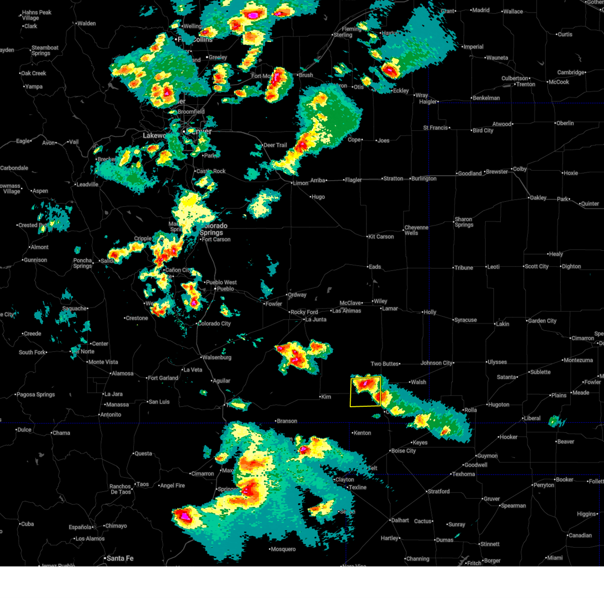
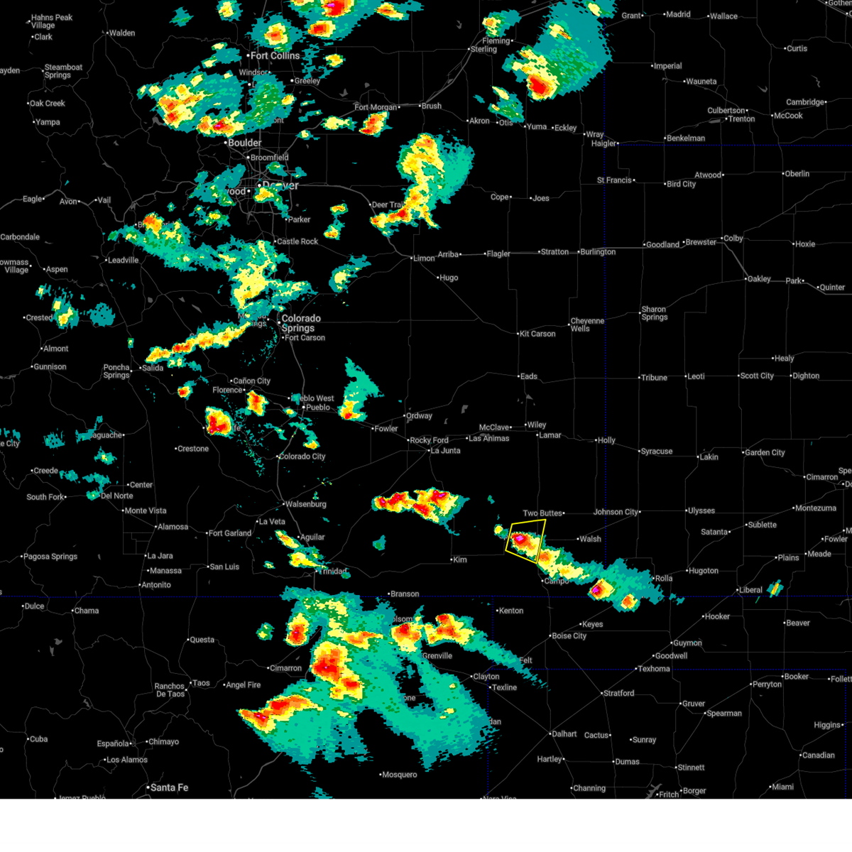
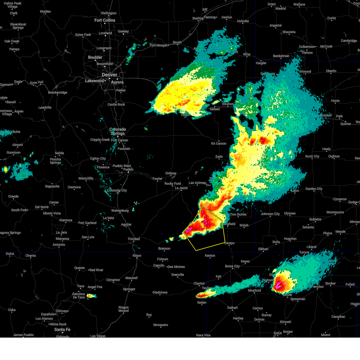
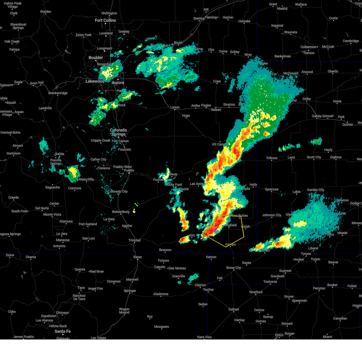
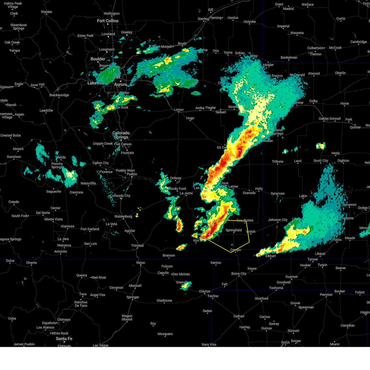
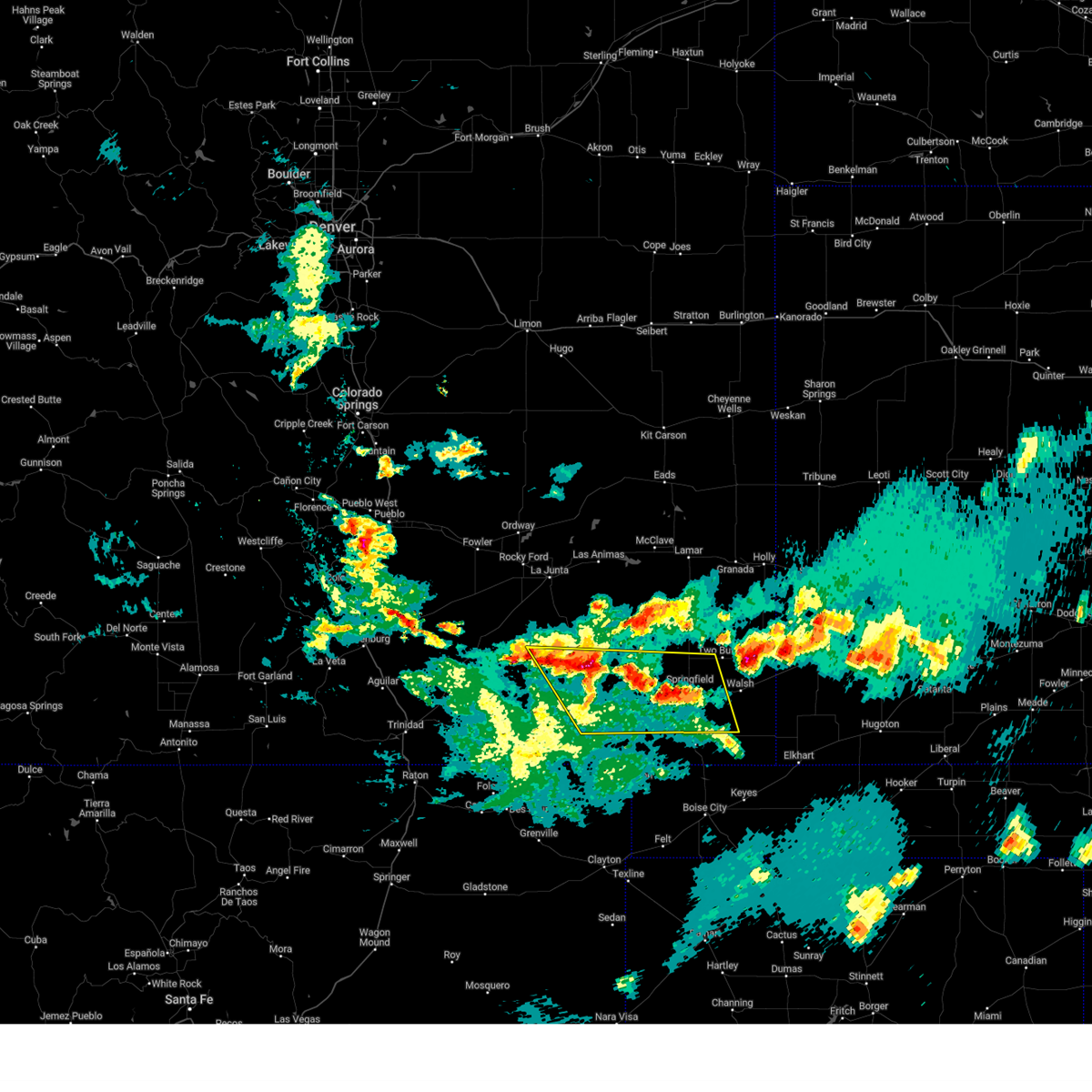
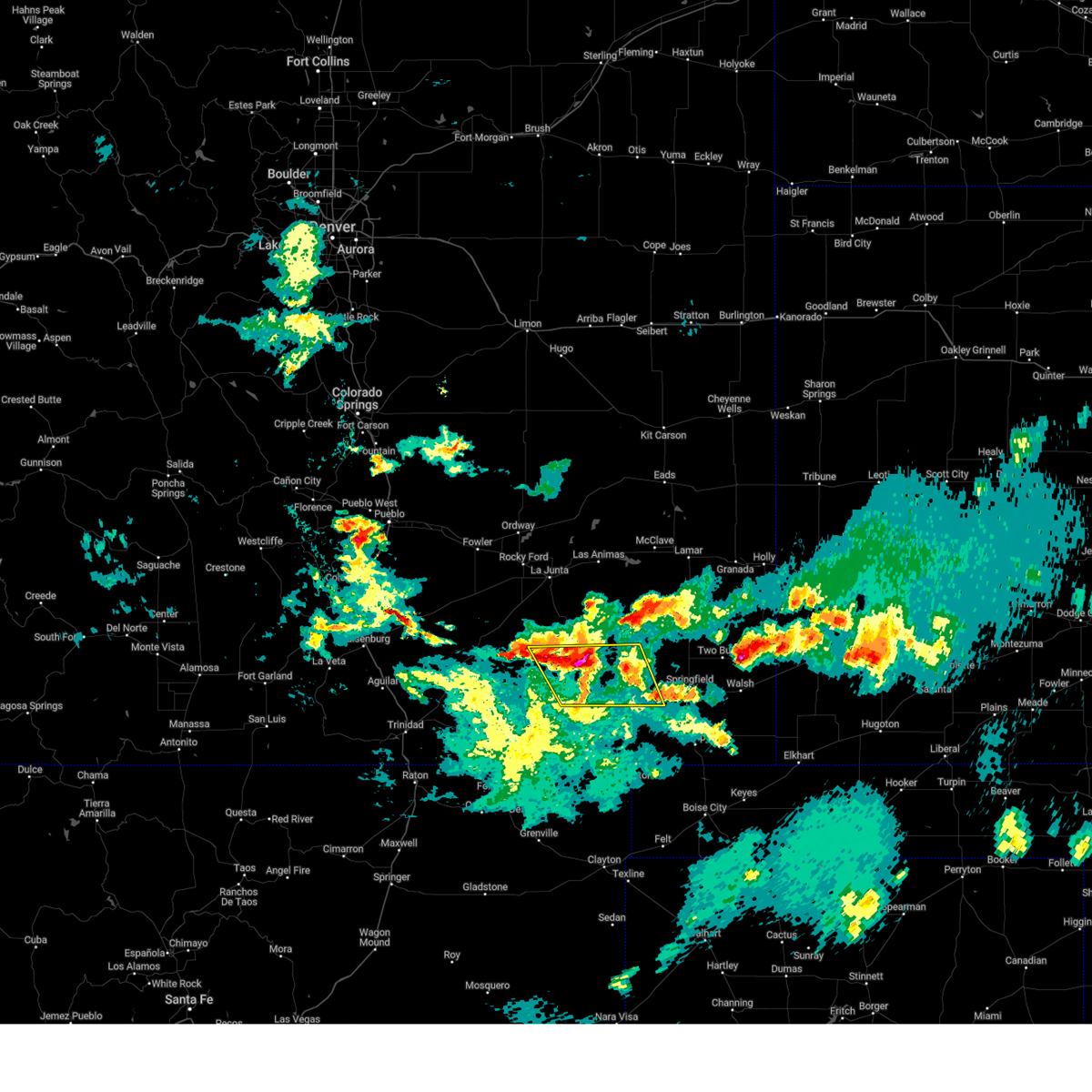
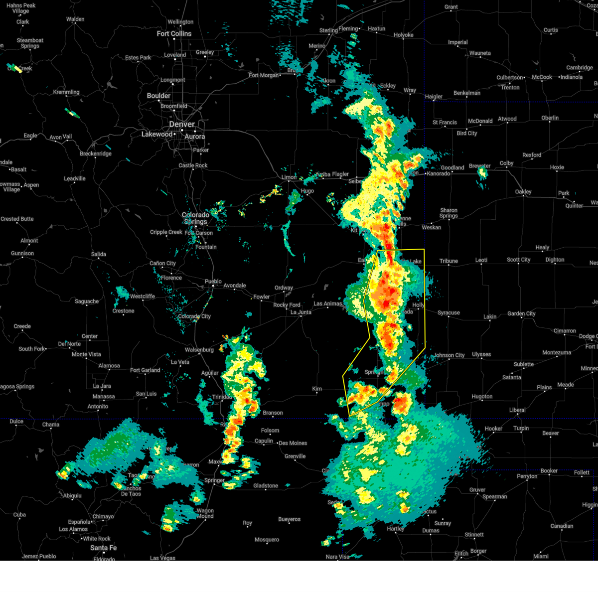
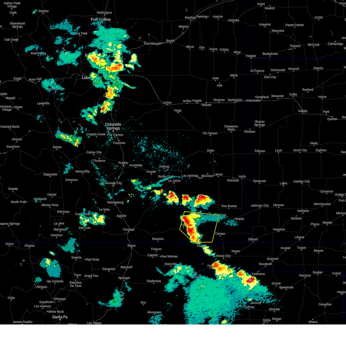
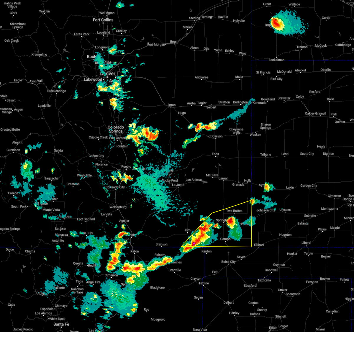
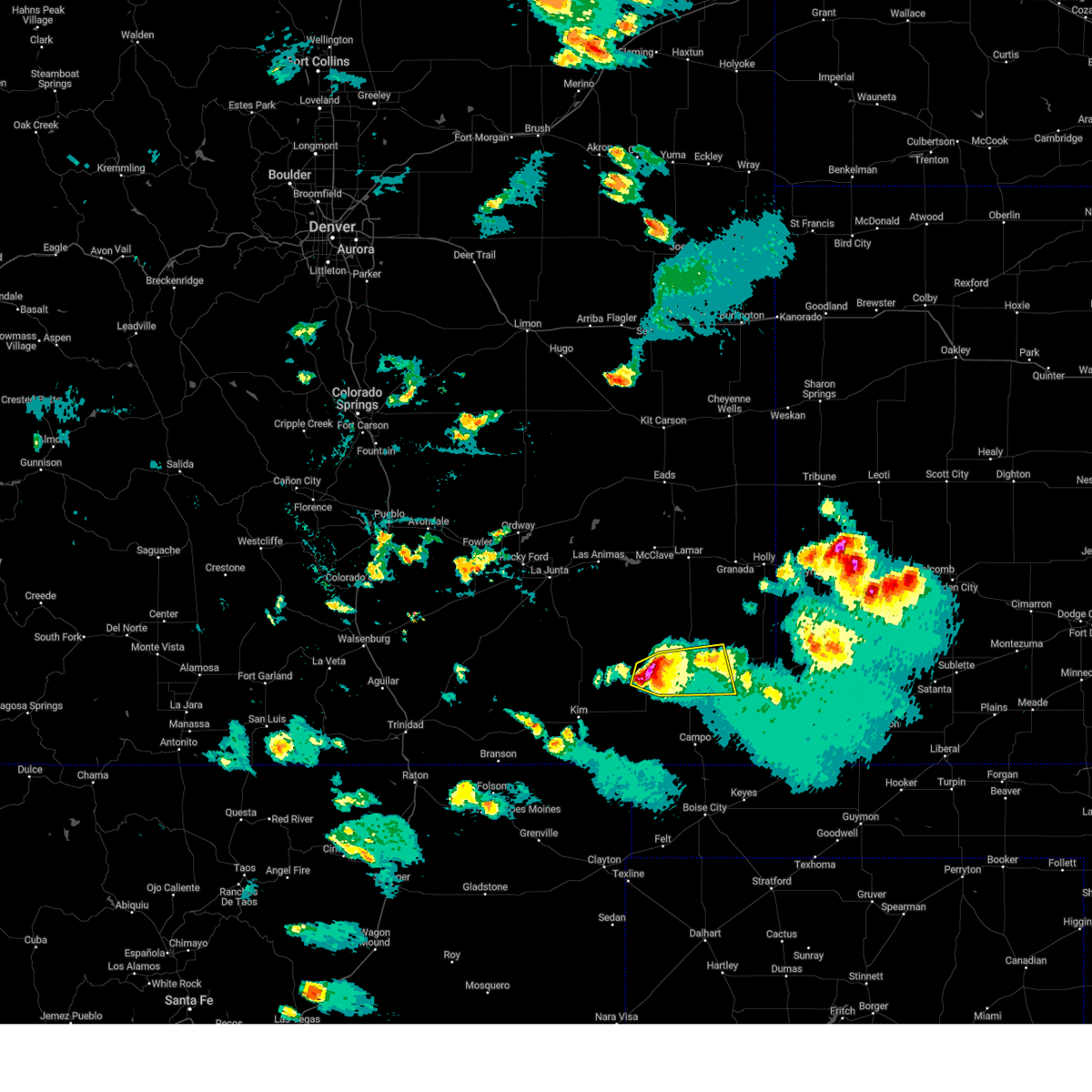
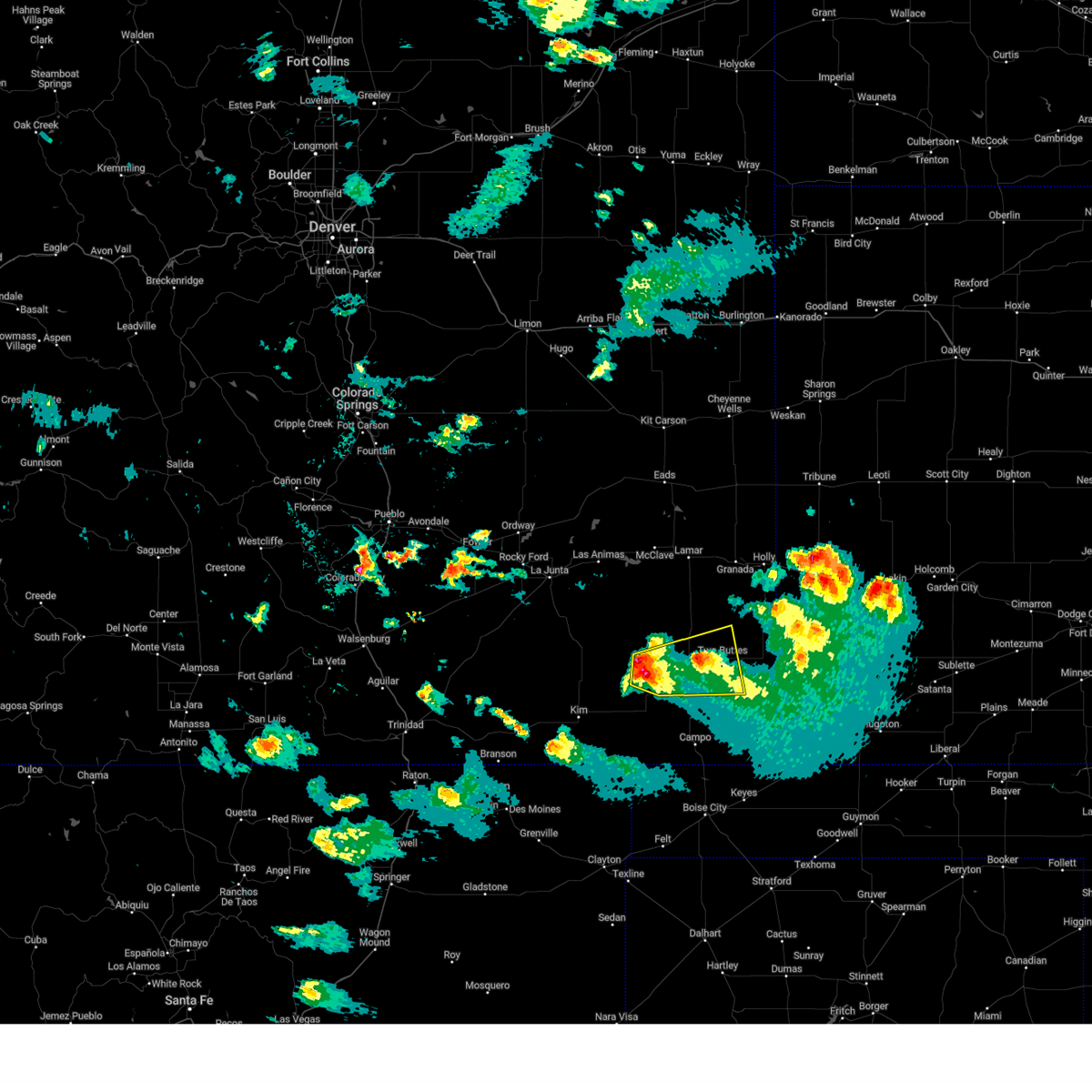
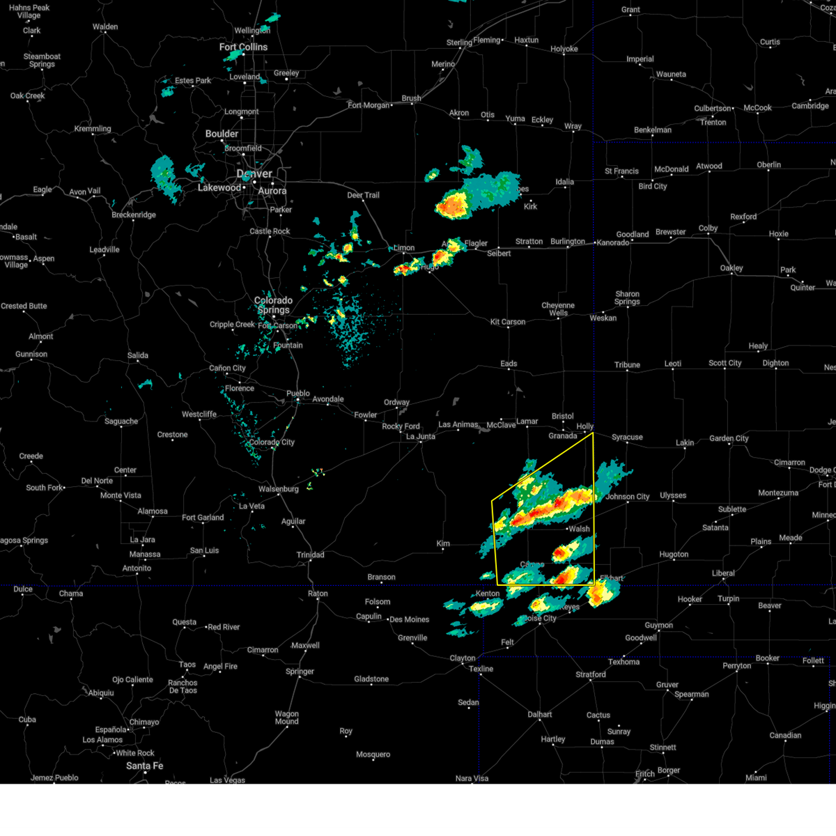
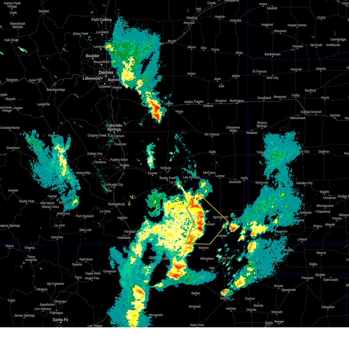
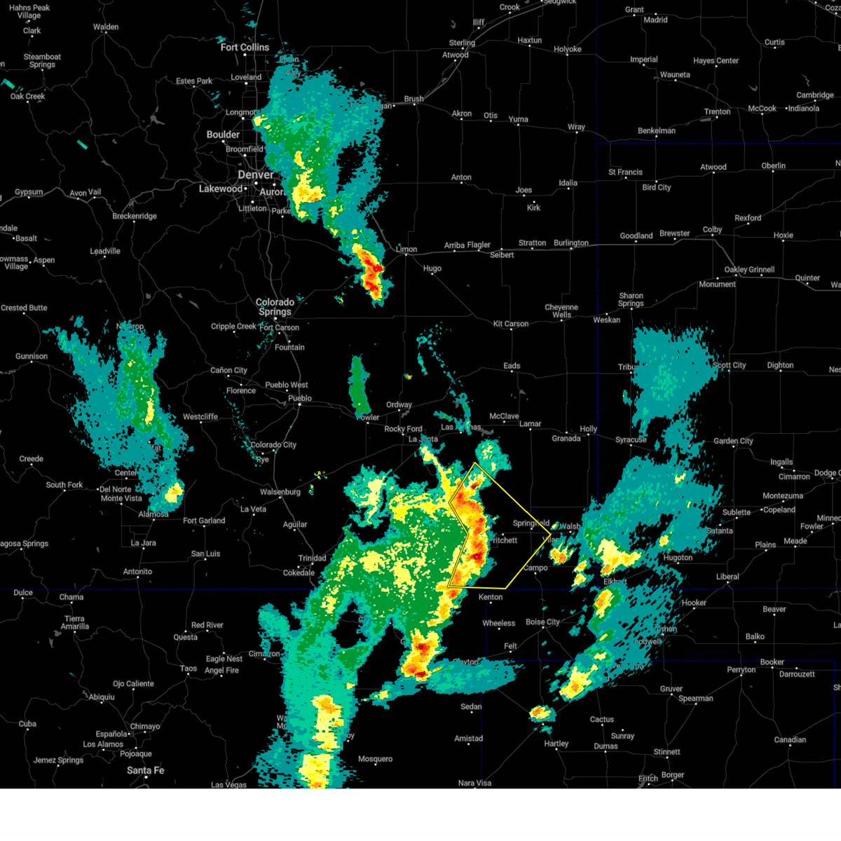
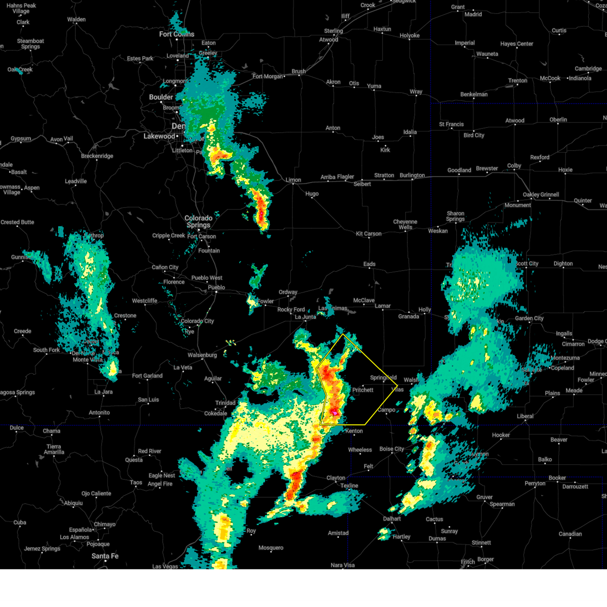
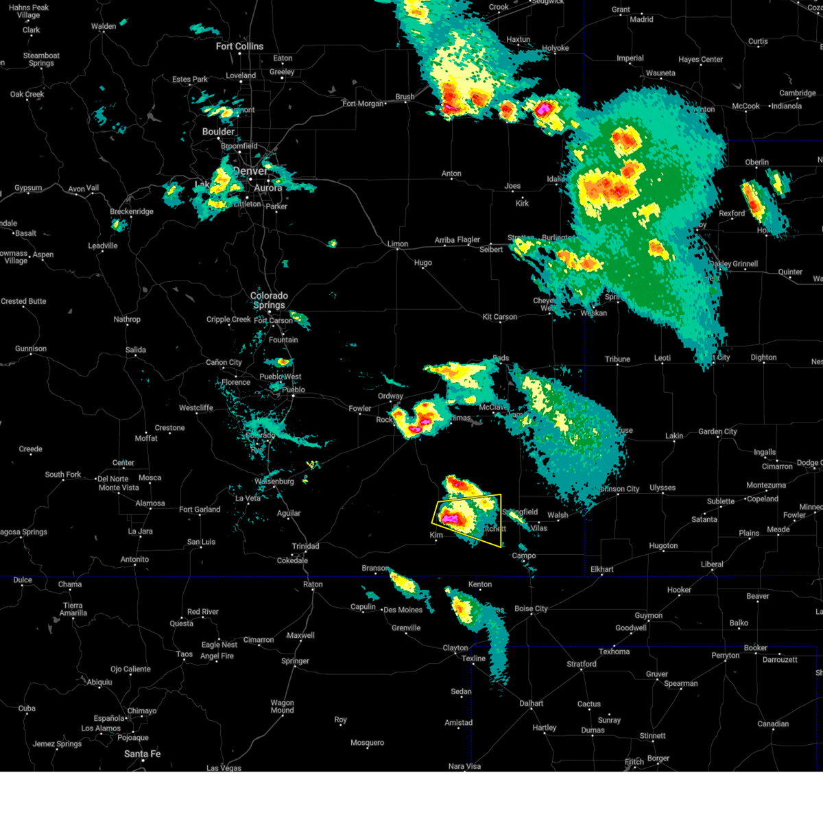
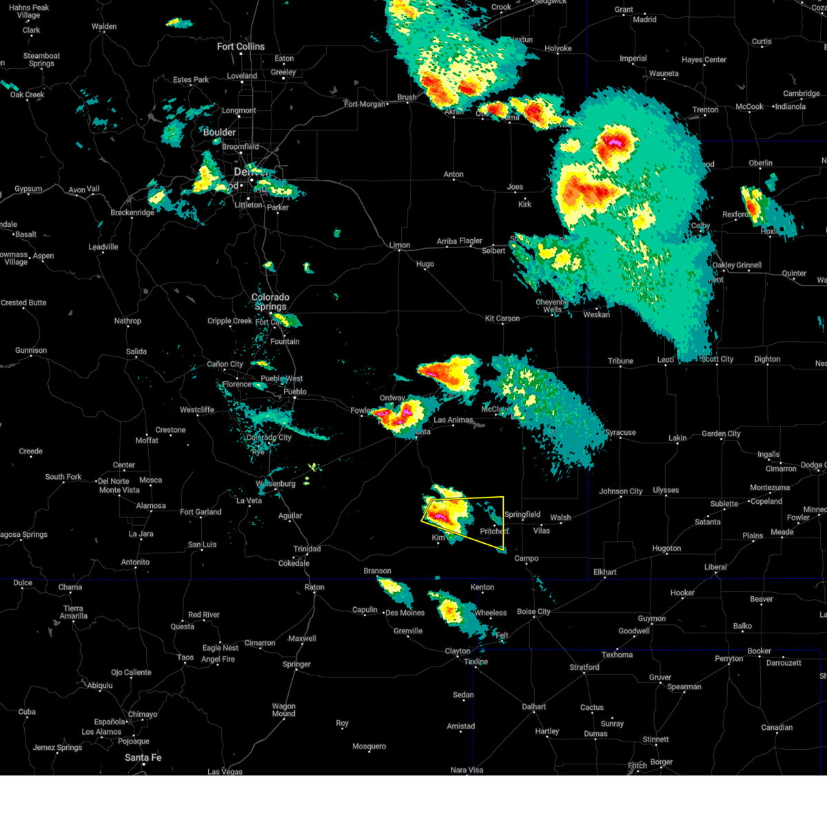
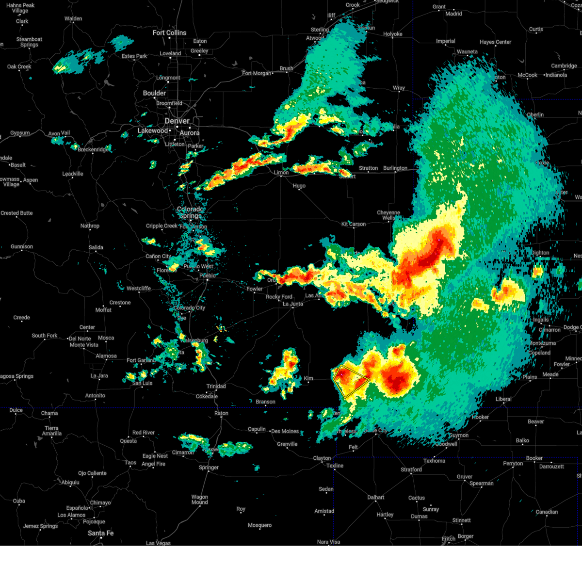
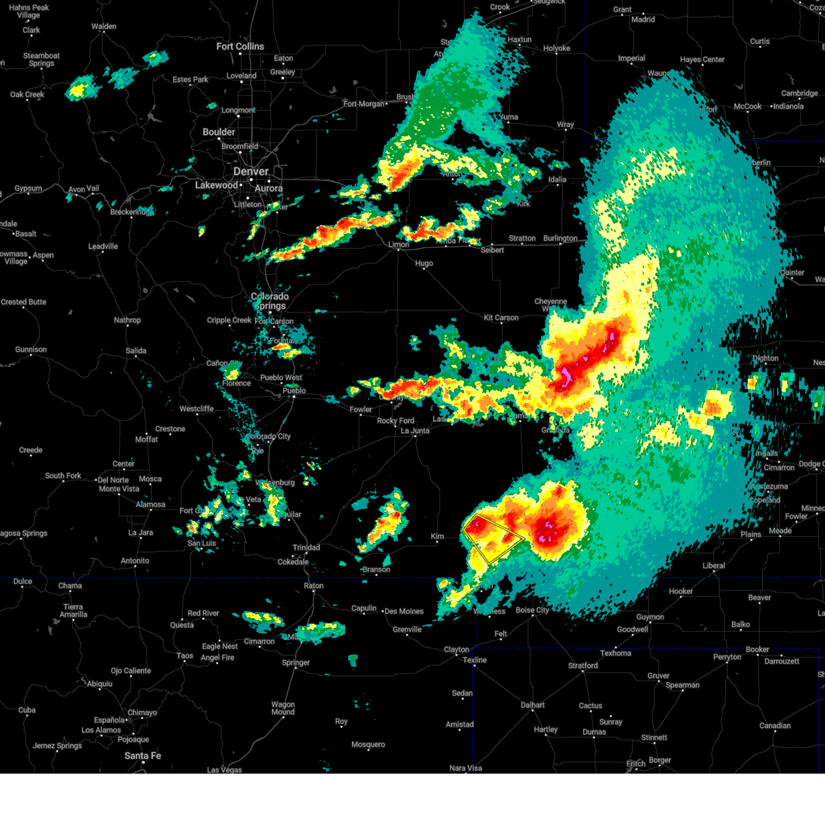
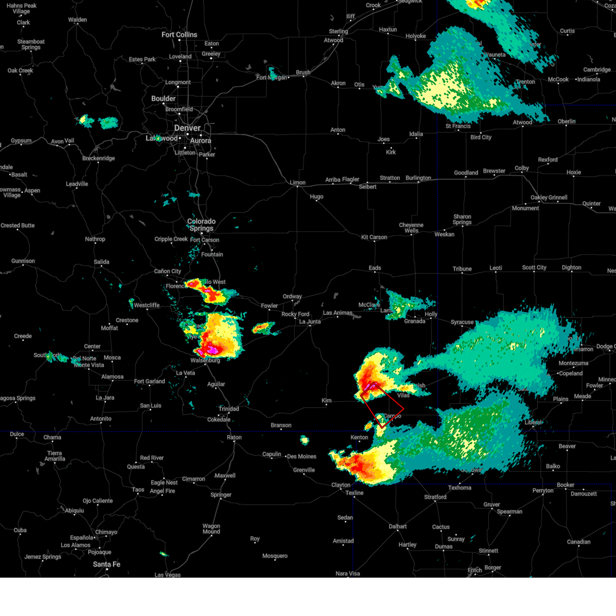
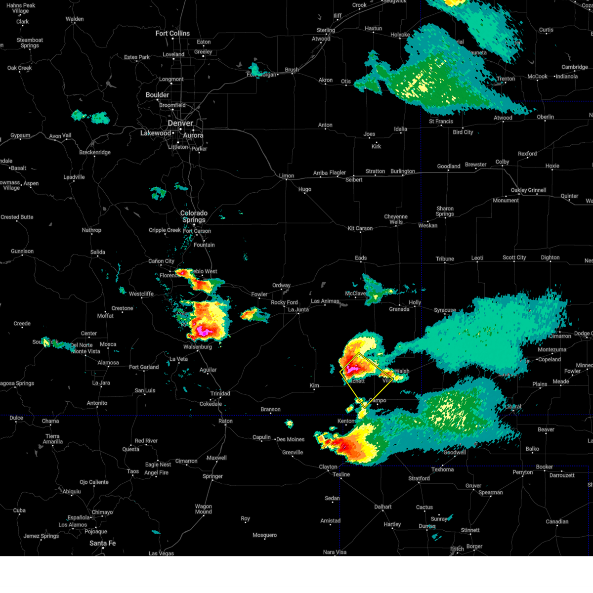
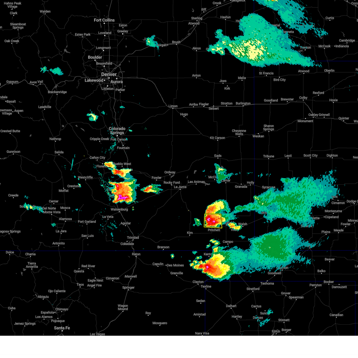
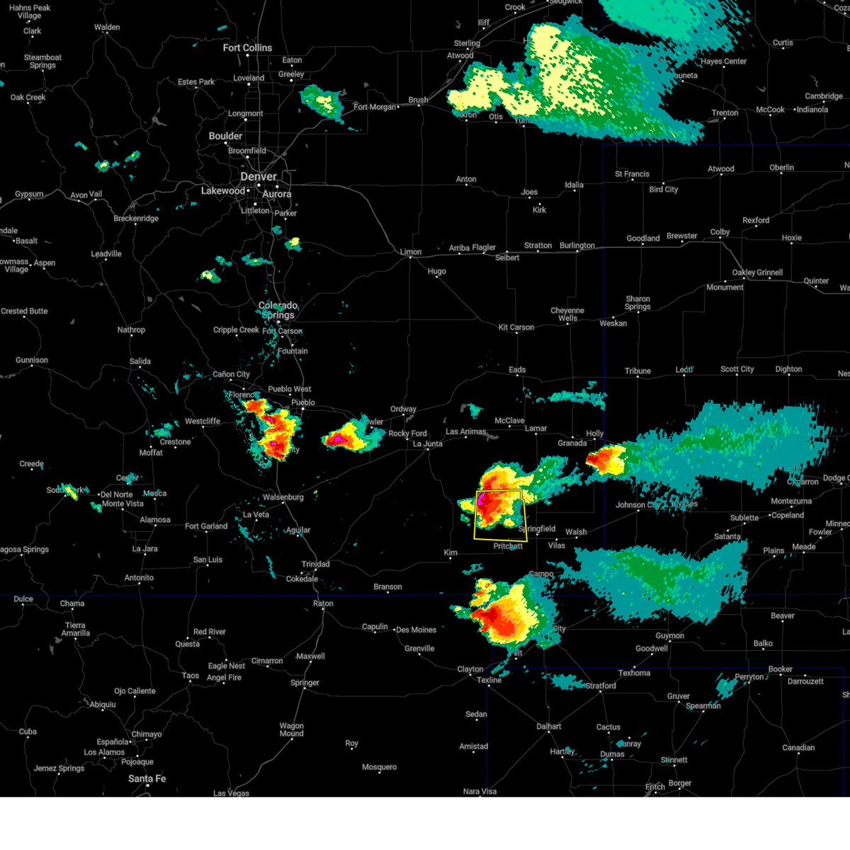
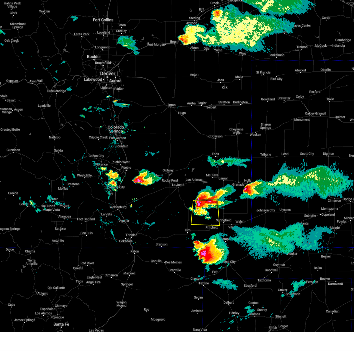
Hail Map for Pritchett, CO
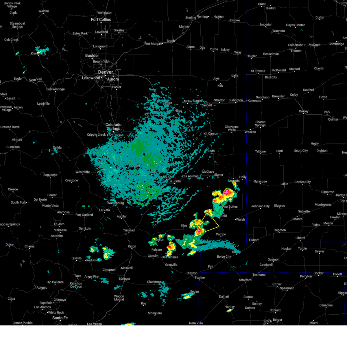
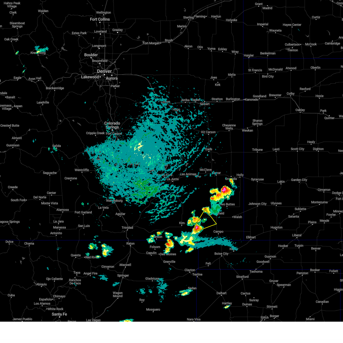
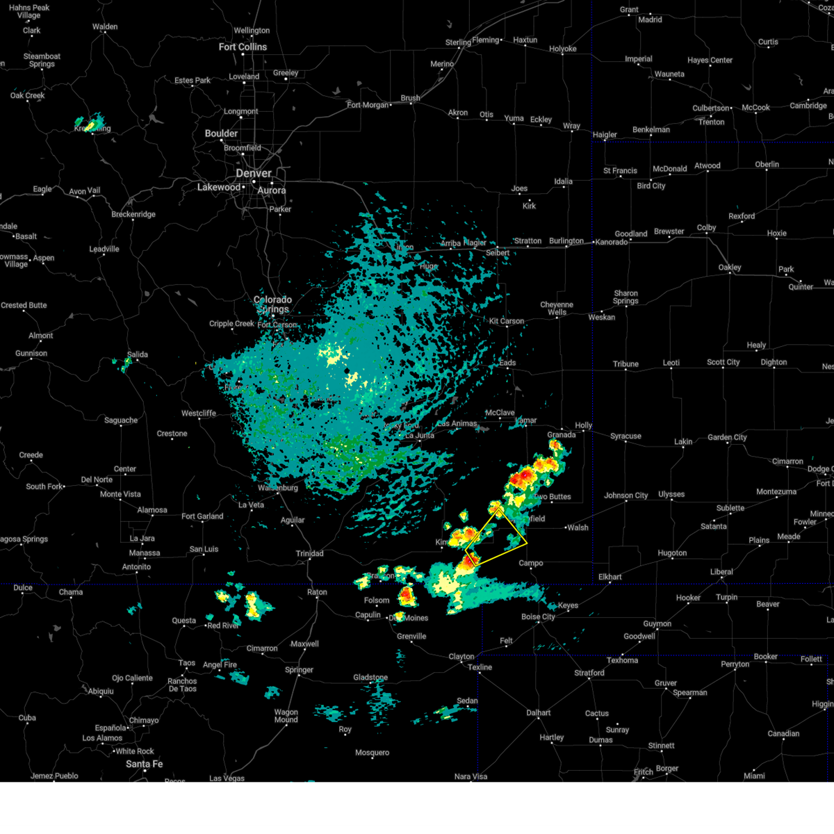
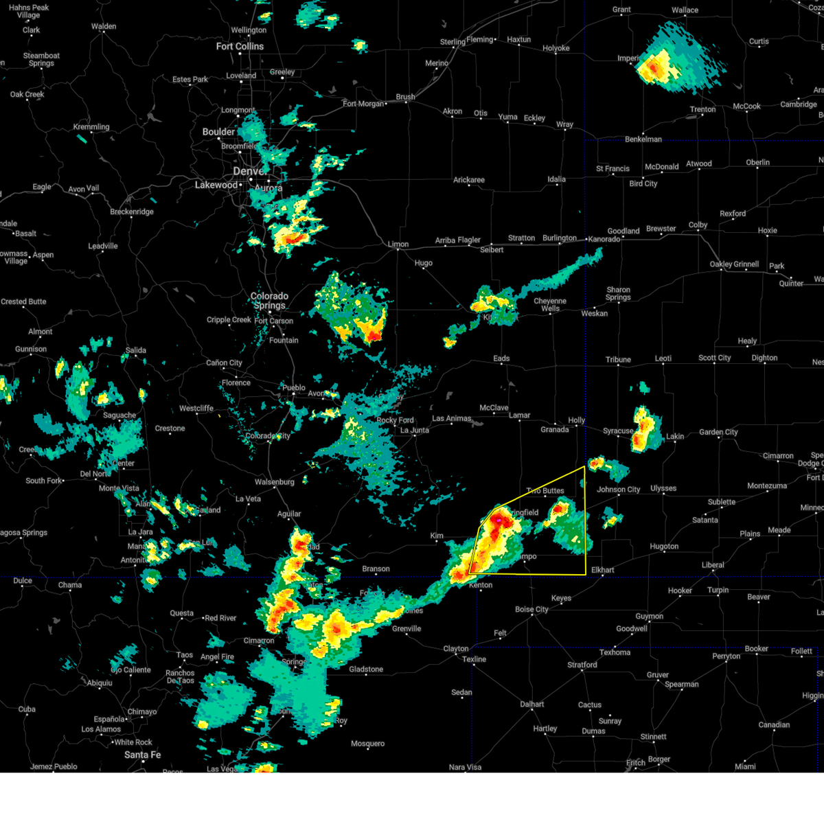
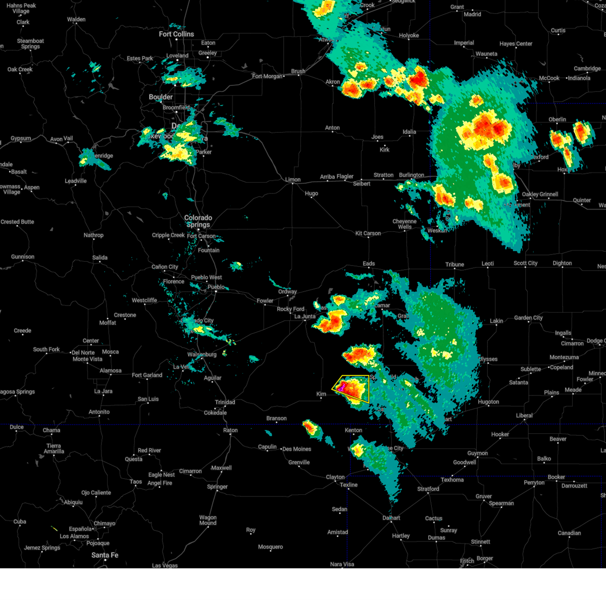
The Pritchett, CO area has had 13 reports of on-the-ground hail by trained spotters, and has been under severe weather warnings 27 times during the past 12 months. Doppler radar has detected hail at or near Pritchett, CO on 65 occasions, including 6 occasions during the past year.
| Name: | Pritchett, CO |
| Where Located: | 113.9 miles ESE of Pueblo, CO |
| Map: | Google Map for Pritchett, CO |
| Population: | 140 |
| Housing Units: | 76 |
| More Info: | Search Google for Pritchett, CO |
0
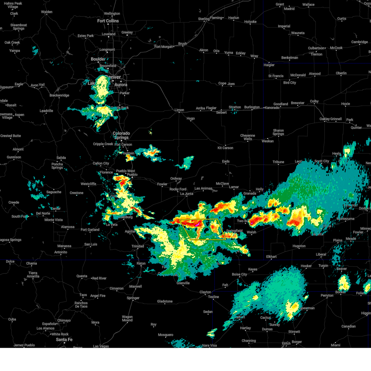
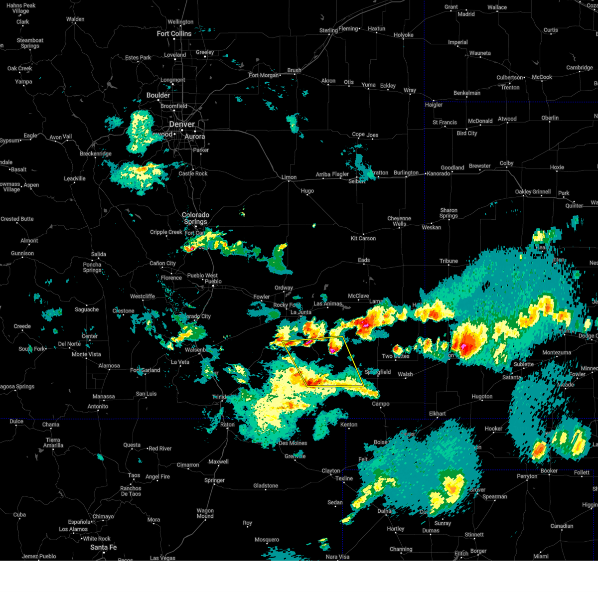
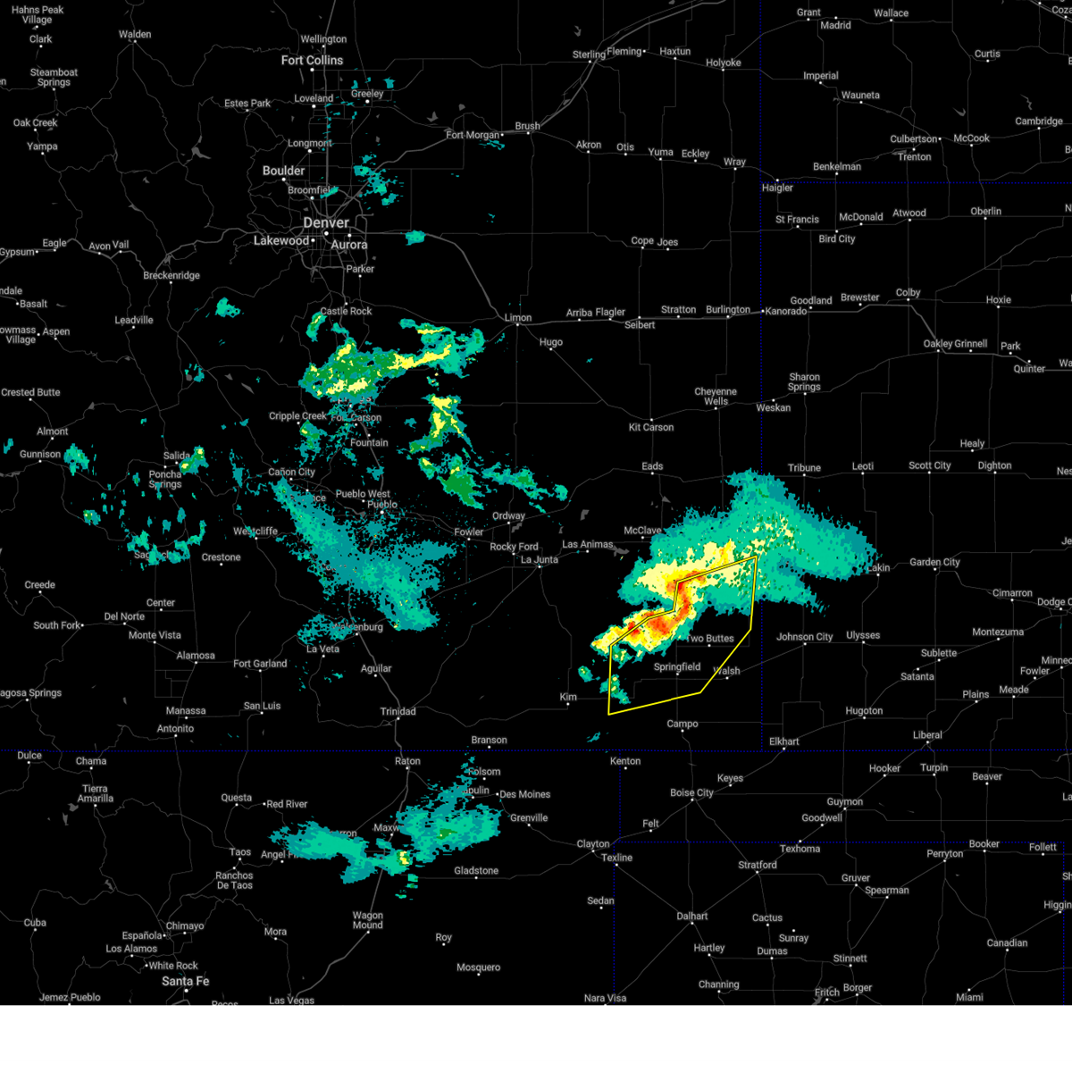
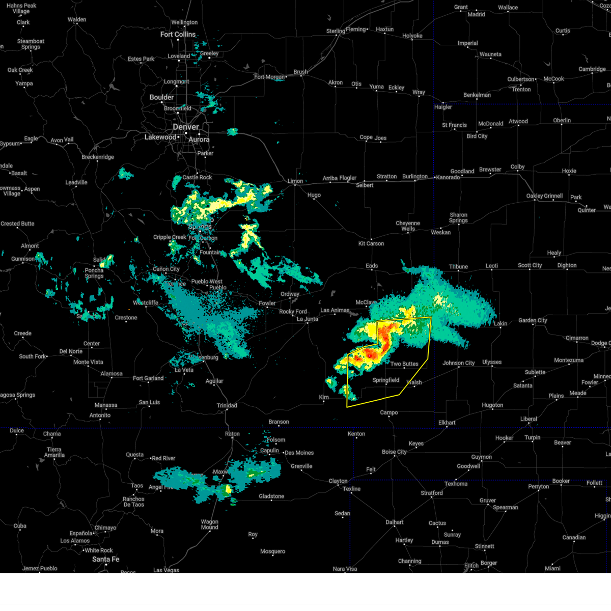
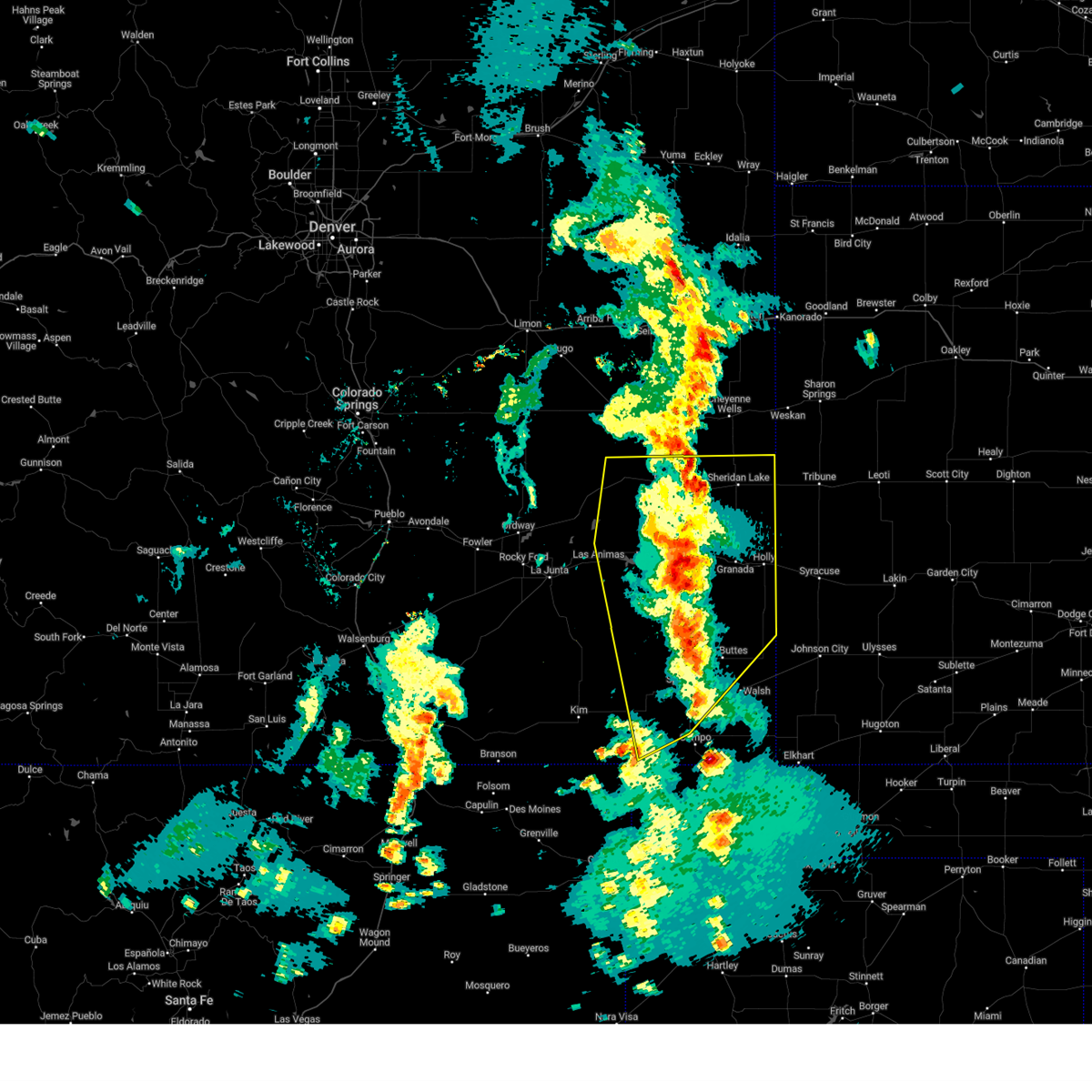
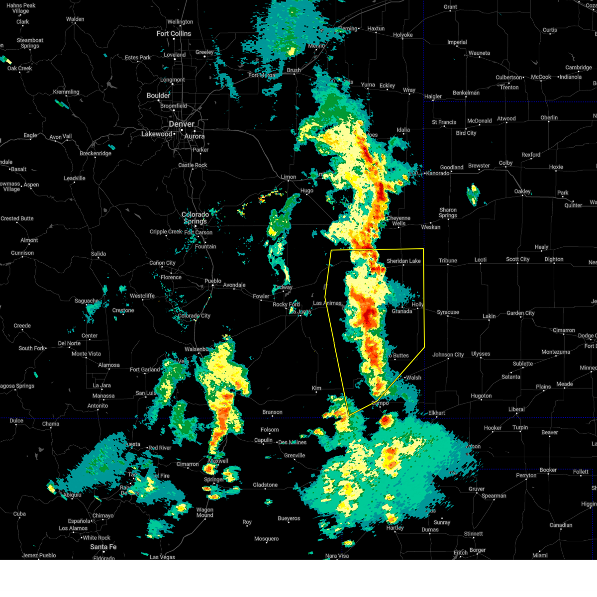
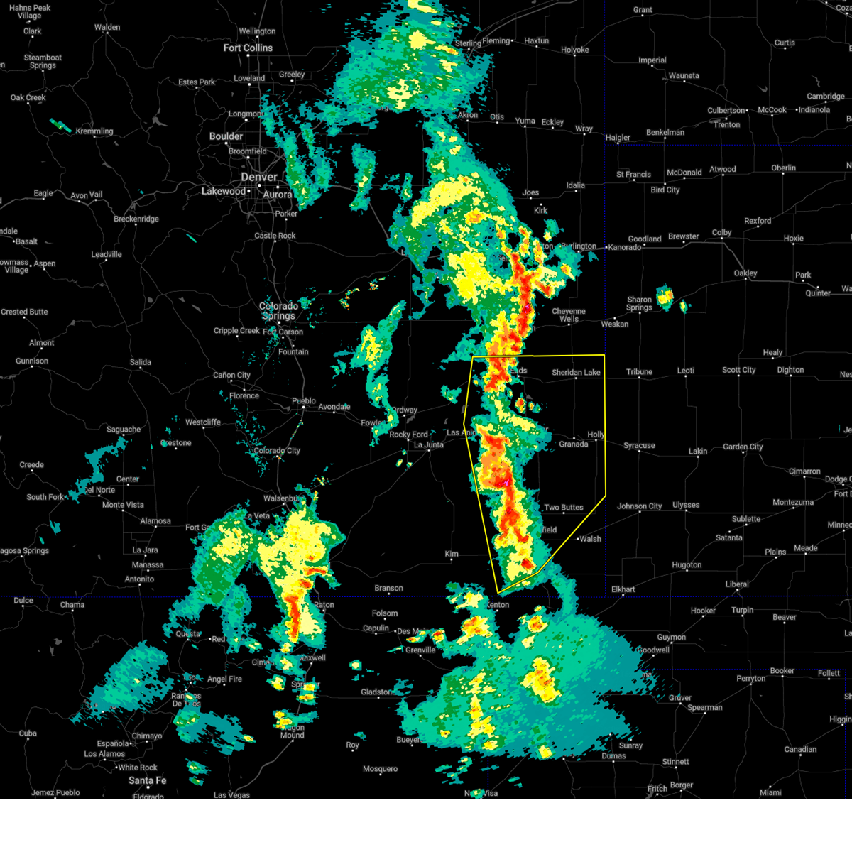
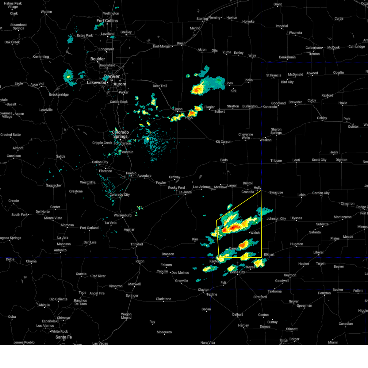
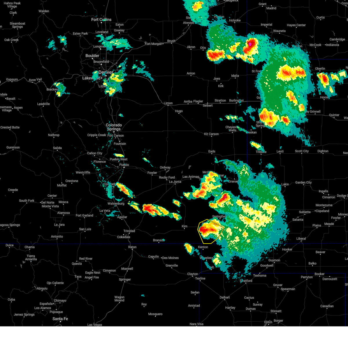
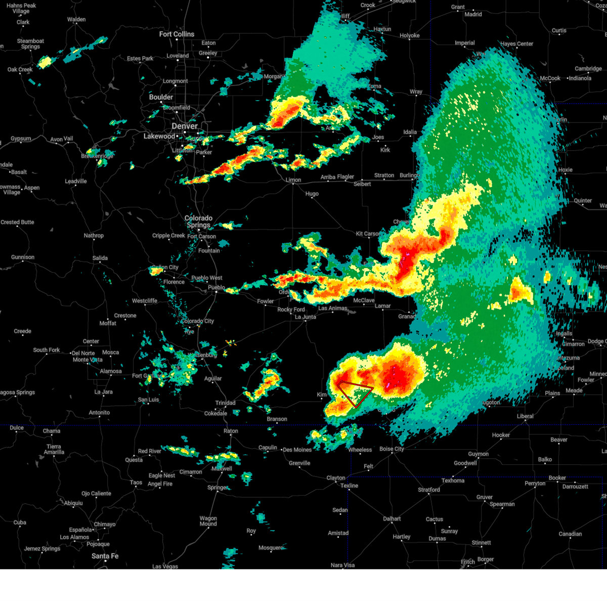
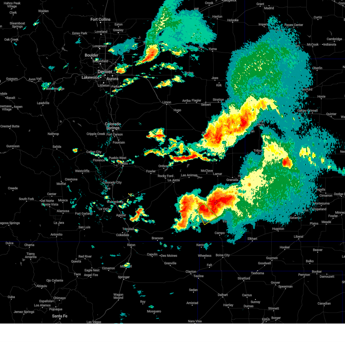
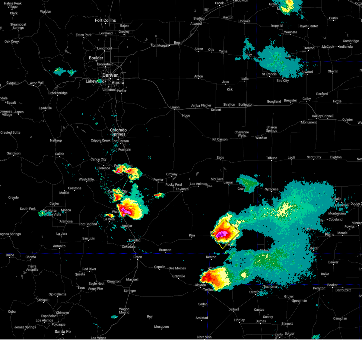
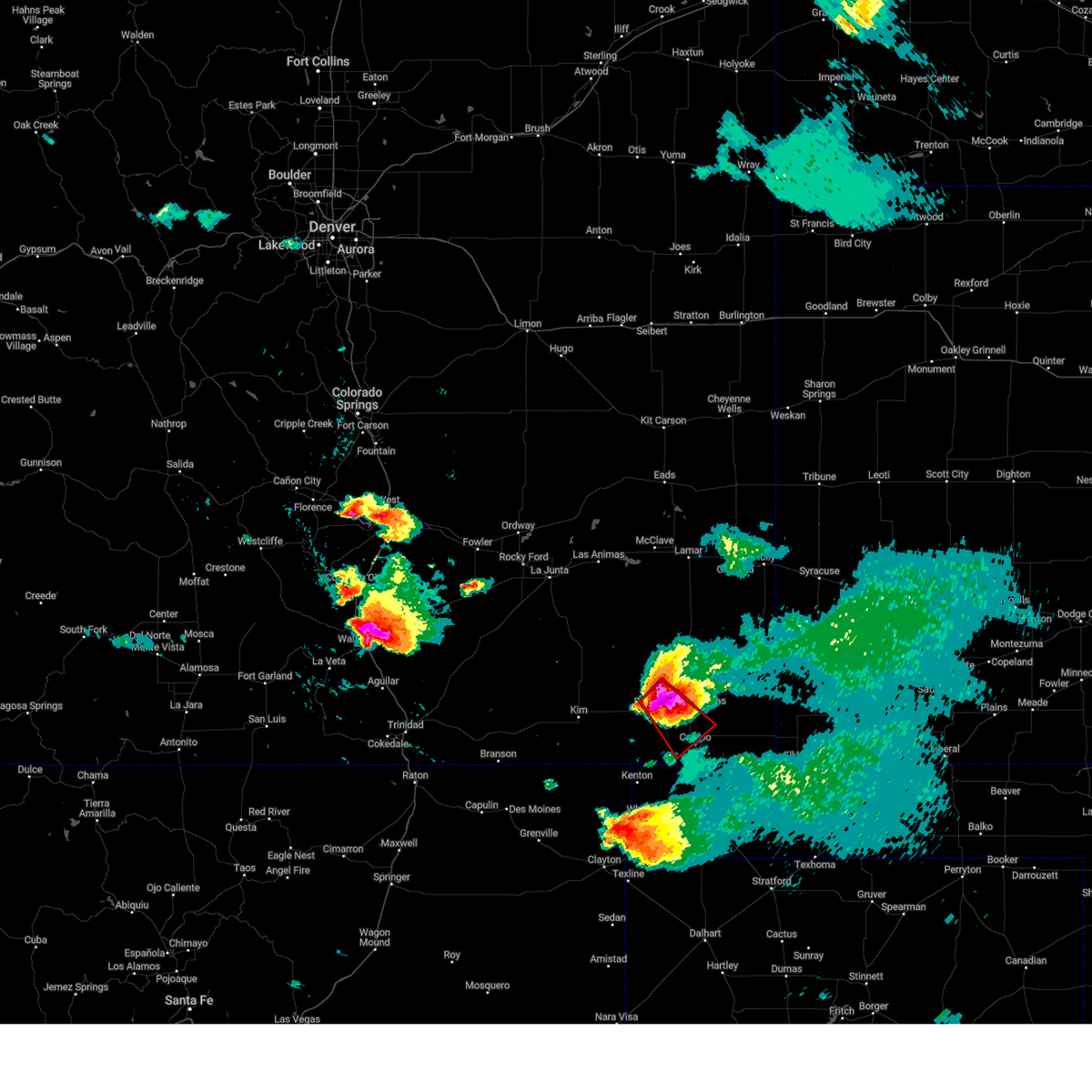
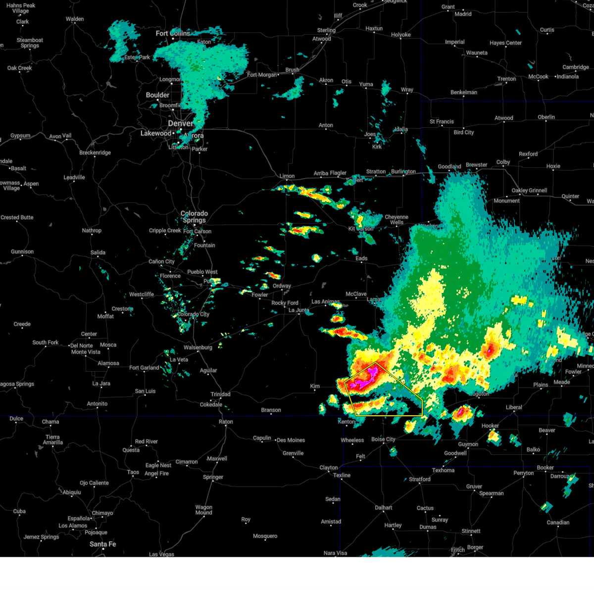
The Top Recent Hail Date for Pritchett, CO is Friday, July 11, 2025 (17th out of 65)
Hail and Wind Damage Spotted near Pritchett, CO
| Date / Time | Report Details |
|---|---|
| 7/11/2025 6:46 PM MDT |
 The storm which prompted the warning has weakened below severe limits, and no longer poses an immediate threat to life or property. therefore, the warning has been allowed to expire. however, small hail, gusty winds and heavy rain are still possible with this thunderstorm. a severe thunderstorm watch remains in effect until midnight mdt for southeastern colorado. The storm which prompted the warning has weakened below severe limits, and no longer poses an immediate threat to life or property. therefore, the warning has been allowed to expire. however, small hail, gusty winds and heavy rain are still possible with this thunderstorm. a severe thunderstorm watch remains in effect until midnight mdt for southeastern colorado.
|
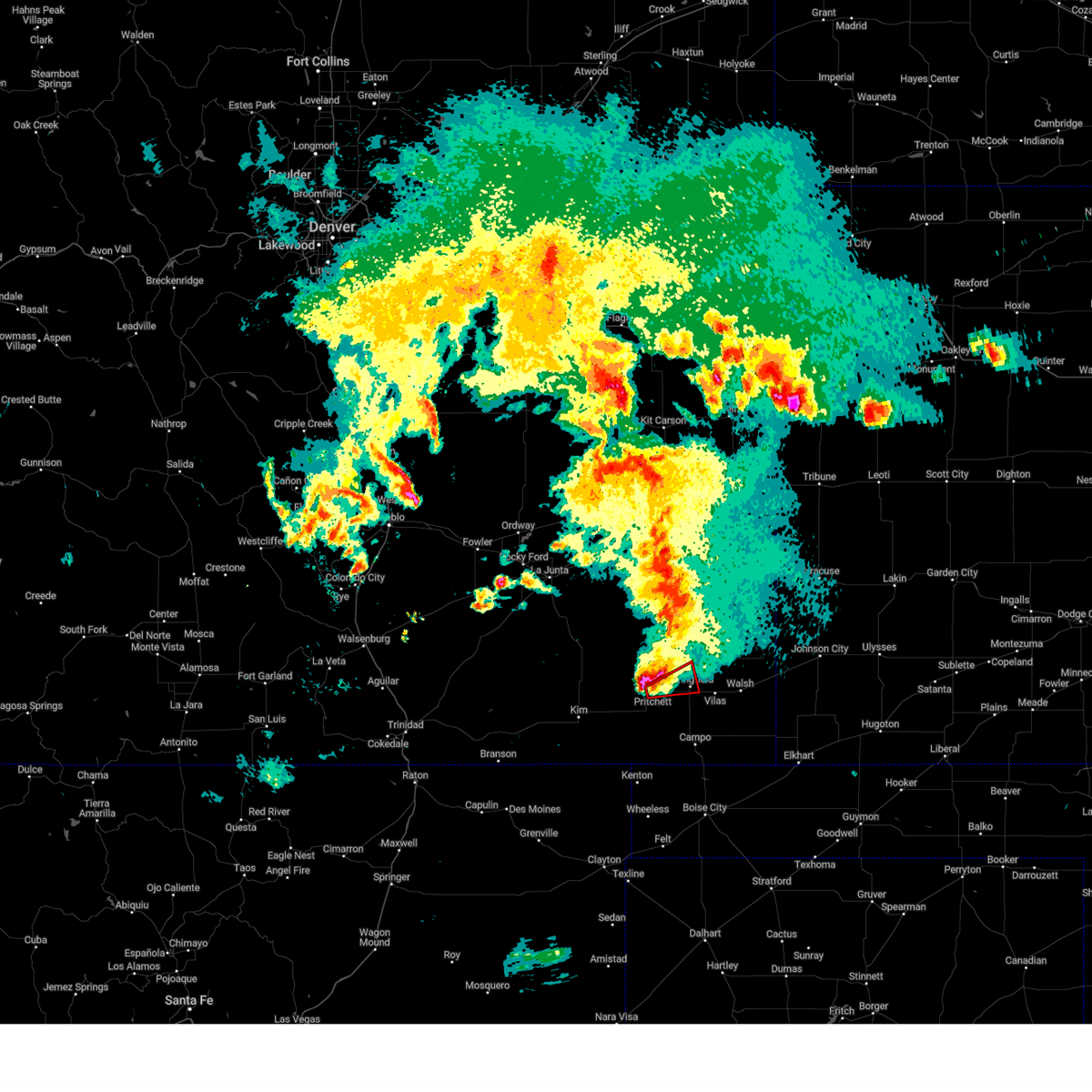
| 7/11/2025 6:30 PM MDT |
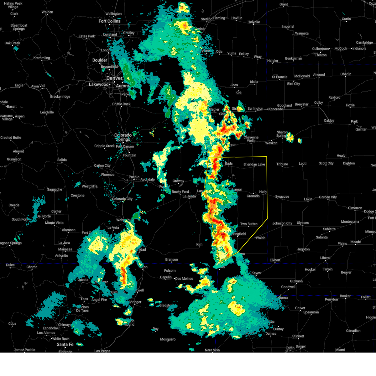
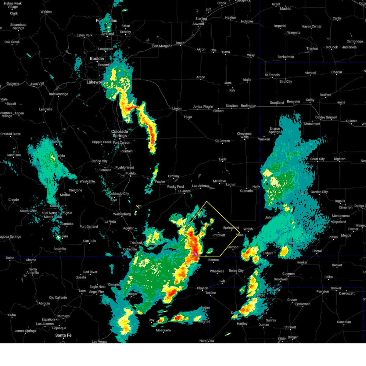
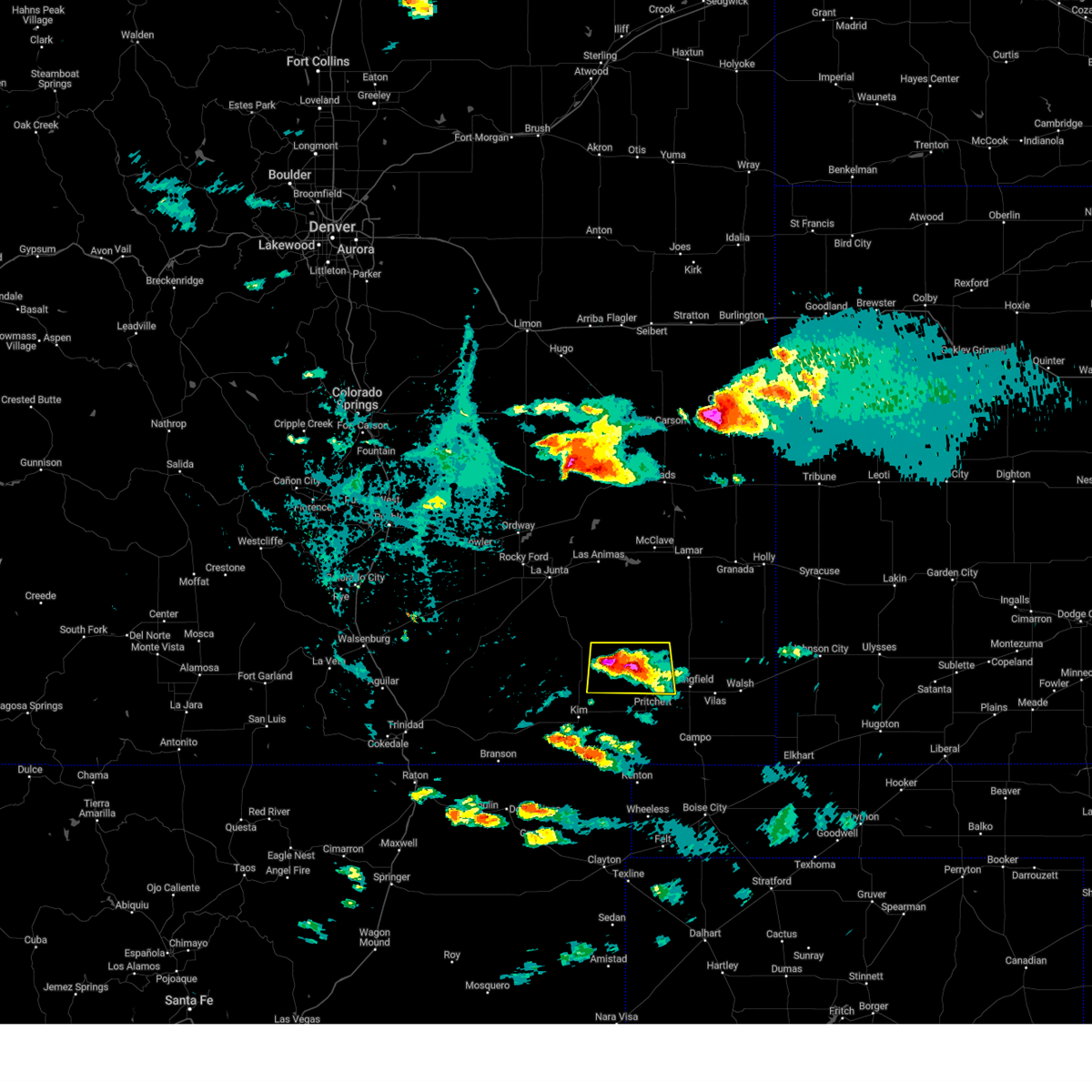
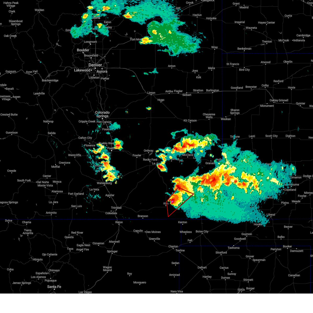
 At 630 pm mdt, a severe thunderstorm was located near pritchett, or 14 miles southwest of springfield, moving south at 10 mph (radar indicated). Hazards include 60 mph wind gusts and half dollar size hail. Hail damage to vehicles is expected. expect wind damage to roofs, siding, and trees. Locations impacted include, pritchett. At 630 pm mdt, a severe thunderstorm was located near pritchett, or 14 miles southwest of springfield, moving south at 10 mph (radar indicated). Hazards include 60 mph wind gusts and half dollar size hail. Hail damage to vehicles is expected. expect wind damage to roofs, siding, and trees. Locations impacted include, pritchett.
|
| 7/11/2025 6:10 PM MDT |
 Svrpub the national weather service in pueblo has issued a * severe thunderstorm warning for, west central baca county in southeastern colorado, * until 645 pm mdt. * at 609 pm mdt, a severe thunderstorm was located near pritchett, or 10 miles west of springfield, moving south at 10 mph (radar indicated). Hazards include ping pong ball size hail and 60 mph wind gusts. People and animals outdoors will be injured. expect hail damage to roofs, siding, windows, and vehicles. Expect wind damage to roofs, siding, and trees. Svrpub the national weather service in pueblo has issued a * severe thunderstorm warning for, west central baca county in southeastern colorado, * until 645 pm mdt. * at 609 pm mdt, a severe thunderstorm was located near pritchett, or 10 miles west of springfield, moving south at 10 mph (radar indicated). Hazards include ping pong ball size hail and 60 mph wind gusts. People and animals outdoors will be injured. expect hail damage to roofs, siding, windows, and vehicles. Expect wind damage to roofs, siding, and trees.
|
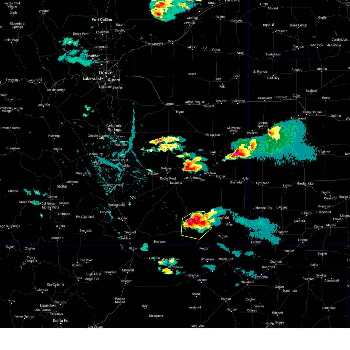
| 7/11/2025 5:48 PM MDT | At 547 pm mdt, a severe thunderstorm was located near pritchett, or 7 miles west of springfield, moving east at 5 mph (radar indicated). Hazards include golf ball size hail and 60 mph wind gusts. People and animals outdoors will be injured. expect hail damage to roofs, siding, windows, and vehicles. expect wind damage to roofs, siding, and trees. Locations impacted include, springfield and pritchett. |
| 7/11/2025 5:38 PM MDT |
 Svrpub the national weather service in pueblo has issued a * severe thunderstorm warning for, northwestern baca county in southeastern colorado, * until 615 pm mdt. * at 538 pm mdt, a severe thunderstorm was located near pritchett, or 8 miles west of springfield, moving east at 5 mph (radar indicated). Hazards include 60 mph wind gusts and half dollar size hail. Hail damage to vehicles is expected. Expect wind damage to roofs, siding, and trees. Svrpub the national weather service in pueblo has issued a * severe thunderstorm warning for, northwestern baca county in southeastern colorado, * until 615 pm mdt. * at 538 pm mdt, a severe thunderstorm was located near pritchett, or 8 miles west of springfield, moving east at 5 mph (radar indicated). Hazards include 60 mph wind gusts and half dollar size hail. Hail damage to vehicles is expected. Expect wind damage to roofs, siding, and trees.
|
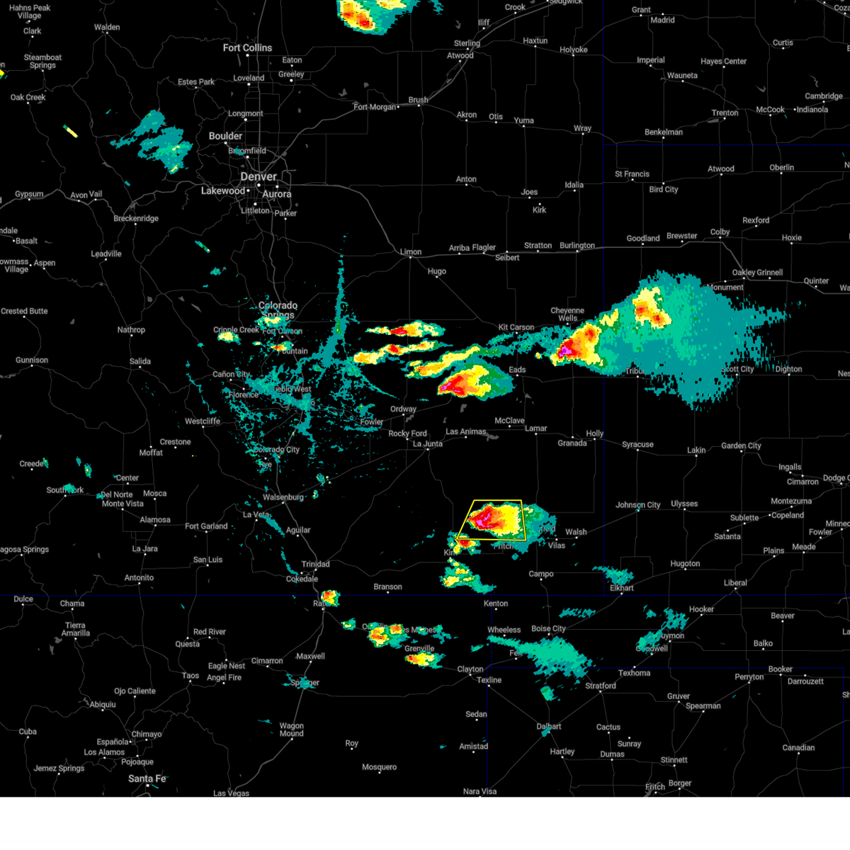
| 7/5/2025 5:35 PM MDT |
 Svrpub the national weather service in pueblo has issued a * severe thunderstorm warning for, northwestern baca county in southeastern colorado, * until 615 pm mdt. * at 535 pm mdt, a severe thunderstorm was located near pritchett, or 8 miles west of springfield, moving northeast at 20 mph (radar indicated). Hazards include 60 mph wind gusts and quarter size hail. Hail damage to vehicles is expected. Expect wind damage to roofs, siding, and trees. Svrpub the national weather service in pueblo has issued a * severe thunderstorm warning for, northwestern baca county in southeastern colorado, * until 615 pm mdt. * at 535 pm mdt, a severe thunderstorm was located near pritchett, or 8 miles west of springfield, moving northeast at 20 mph (radar indicated). Hazards include 60 mph wind gusts and quarter size hail. Hail damage to vehicles is expected. Expect wind damage to roofs, siding, and trees.
|
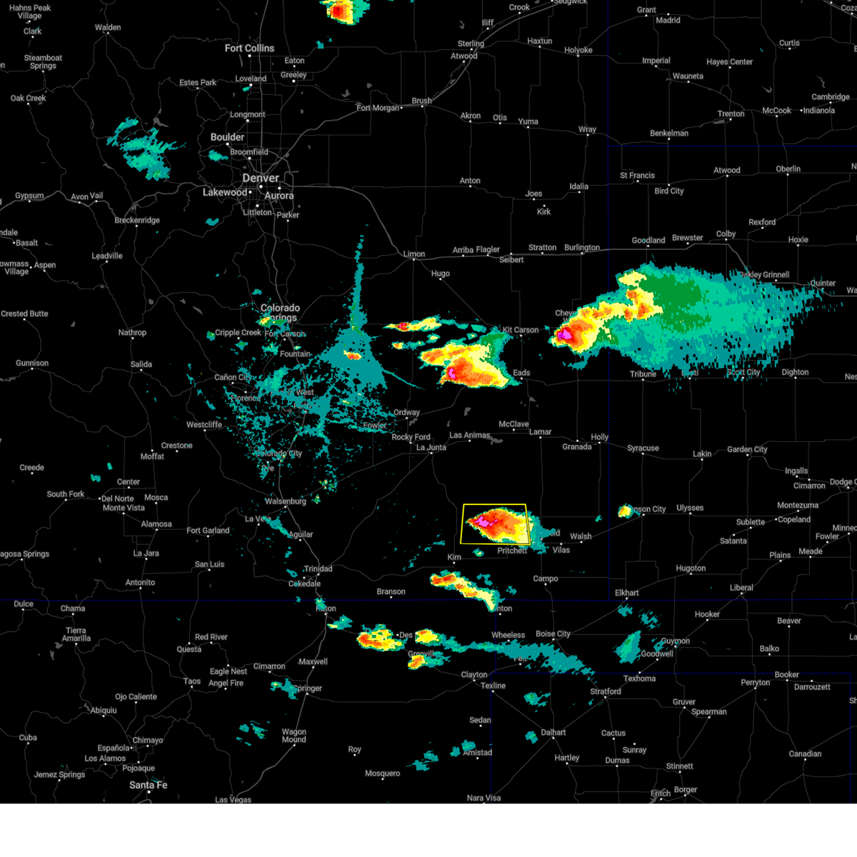
| 6/6/2025 7:51 PM MDT | Golf Ball sized hail reported 0 miles NNW of Pritchett, CO |
| 6/6/2025 7:43 PM MDT |
 Svrpub the national weather service in pueblo has issued a * severe thunderstorm warning for, western baca county in southeastern colorado, southeastern las animas county in southeastern colorado, * until 815 pm mdt. * at 743 pm mdt, severe thunderstorms were located along a line extending from 6 miles north of pritchett to 12 miles southwest of springfield to near kim, moving southeast at 20 mph (radar indicated). Hazards include ping pong ball size hail and 60 mph wind gusts. People and animals outdoors will be injured. expect hail damage to roofs, siding, windows, and vehicles. Expect wind damage to roofs, siding, and trees. Svrpub the national weather service in pueblo has issued a * severe thunderstorm warning for, western baca county in southeastern colorado, southeastern las animas county in southeastern colorado, * until 815 pm mdt. * at 743 pm mdt, severe thunderstorms were located along a line extending from 6 miles north of pritchett to 12 miles southwest of springfield to near kim, moving southeast at 20 mph (radar indicated). Hazards include ping pong ball size hail and 60 mph wind gusts. People and animals outdoors will be injured. expect hail damage to roofs, siding, windows, and vehicles. Expect wind damage to roofs, siding, and trees.
|
| 6/6/2025 7:36 PM MDT |
 At 736 pm mdt, severe thunderstorms were located along a line extending from 21 miles west of two buttes reservoir to near pritchett to near kim, moving southeast at 35 mph (radar indicated). Hazards include ping pong ball size hail and 60 mph wind gusts. People and animals outdoors will be injured. expect hail damage to roofs, siding, windows, and vehicles. expect wind damage to roofs, siding, and trees. Locations impacted include, pritchett and kim. At 736 pm mdt, severe thunderstorms were located along a line extending from 21 miles west of two buttes reservoir to near pritchett to near kim, moving southeast at 35 mph (radar indicated). Hazards include ping pong ball size hail and 60 mph wind gusts. People and animals outdoors will be injured. expect hail damage to roofs, siding, windows, and vehicles. expect wind damage to roofs, siding, and trees. Locations impacted include, pritchett and kim.
|
| 6/6/2025 7:21 PM MDT |
 Svrpub the national weather service in pueblo has issued a * severe thunderstorm warning for, western baca county in southeastern colorado, southeastern las animas county in southeastern colorado, south central bent county in southeastern colorado, * until 745 pm mdt. * at 721 pm mdt, severe thunderstorms were located along a line extending from 22 miles east of higbee to 7 miles west of pritchett to near kim, moving southeast at 35 mph (radar indicated). Hazards include ping pong ball size hail and 60 mph wind gusts. People and animals outdoors will be injured. expect hail damage to roofs, siding, windows, and vehicles. Expect wind damage to roofs, siding, and trees. Svrpub the national weather service in pueblo has issued a * severe thunderstorm warning for, western baca county in southeastern colorado, southeastern las animas county in southeastern colorado, south central bent county in southeastern colorado, * until 745 pm mdt. * at 721 pm mdt, severe thunderstorms were located along a line extending from 22 miles east of higbee to 7 miles west of pritchett to near kim, moving southeast at 35 mph (radar indicated). Hazards include ping pong ball size hail and 60 mph wind gusts. People and animals outdoors will be injured. expect hail damage to roofs, siding, windows, and vehicles. Expect wind damage to roofs, siding, and trees.
|
| 6/6/2025 3:34 PM MDT | Hen Egg sized hail reported 18.2 miles NE of Pritchett, CO |
| 6/5/2025 8:21 PM MDT |
 At 820 pm mdt, a severe thunderstorm was located over vilas, or 7 miles southeast of springfield, moving east at 40 mph (radar indicated). Hazards include 70 mph wind gusts and ping pong ball size hail. People and animals outdoors will be injured. expect hail damage to roofs, siding, windows, and vehicles. expect considerable tree damage. wind damage is also likely to mobile homes, roofs, and outbuildings. Locations impacted include, springfield, pritchett, vilas, and two buttes. At 820 pm mdt, a severe thunderstorm was located over vilas, or 7 miles southeast of springfield, moving east at 40 mph (radar indicated). Hazards include 70 mph wind gusts and ping pong ball size hail. People and animals outdoors will be injured. expect hail damage to roofs, siding, windows, and vehicles. expect considerable tree damage. wind damage is also likely to mobile homes, roofs, and outbuildings. Locations impacted include, springfield, pritchett, vilas, and two buttes.
|
| 6/5/2025 8:16 PM MDT |
 the severe thunderstorm warning has been cancelled and is no longer in effect the severe thunderstorm warning has been cancelled and is no longer in effect
|
| 6/5/2025 8:16 PM MDT |
 At 816 pm mdt, a severe thunderstorm was located near springfield, moving east at 40 mph (radar indicated). Hazards include 70 mph wind gusts and quarter size hail. Hail damage to vehicles is expected. expect considerable tree damage. wind damage is also likely to mobile homes, roofs, and outbuildings. Locations impacted include, springfield, pritchett, vilas, and two buttes. At 816 pm mdt, a severe thunderstorm was located near springfield, moving east at 40 mph (radar indicated). Hazards include 70 mph wind gusts and quarter size hail. Hail damage to vehicles is expected. expect considerable tree damage. wind damage is also likely to mobile homes, roofs, and outbuildings. Locations impacted include, springfield, pritchett, vilas, and two buttes.
|
| 6/5/2025 8:09 PM MDT |
 At 809 pm mdt, a severe thunderstorm was located over springfield, moving east at 40 mph (radar indicated). Hazards include golf ball size hail and 70 mph wind gusts. People and animals outdoors will be injured. expect hail damage to roofs, siding, windows, and vehicles. expect considerable tree damage. wind damage is also likely to mobile homes, roofs, and outbuildings. Locations impacted include, springfield, pritchett, vilas, and two buttes. At 809 pm mdt, a severe thunderstorm was located over springfield, moving east at 40 mph (radar indicated). Hazards include golf ball size hail and 70 mph wind gusts. People and animals outdoors will be injured. expect hail damage to roofs, siding, windows, and vehicles. expect considerable tree damage. wind damage is also likely to mobile homes, roofs, and outbuildings. Locations impacted include, springfield, pritchett, vilas, and two buttes.
|
| 6/5/2025 8:04 PM MDT |
 At 804 pm mdt, a severe thunderstorm was located near springfield, moving east at 40 mph (radar indicated). Hazards include 70 mph wind gusts and quarter size hail. Hail damage to vehicles is expected. expect considerable tree damage. wind damage is also likely to mobile homes, roofs, and outbuildings. Locations impacted include, springfield, pritchett, vilas, and two buttes. At 804 pm mdt, a severe thunderstorm was located near springfield, moving east at 40 mph (radar indicated). Hazards include 70 mph wind gusts and quarter size hail. Hail damage to vehicles is expected. expect considerable tree damage. wind damage is also likely to mobile homes, roofs, and outbuildings. Locations impacted include, springfield, pritchett, vilas, and two buttes.
|
| 6/5/2025 7:42 PM MDT |
 Svrpub the national weather service in pueblo has issued a * severe thunderstorm warning for, western baca county in southeastern colorado, east central las animas county in southeastern colorado, * until 830 pm mdt. * at 742 pm mdt, a severe thunderstorm was located 8 miles northwest of pritchett, or 19 miles west of springfield, moving east at 40 mph (radar indicated). Hazards include 60 mph wind gusts and quarter size hail. Hail damage to vehicles is expected. Expect wind damage to roofs, siding, and trees. Svrpub the national weather service in pueblo has issued a * severe thunderstorm warning for, western baca county in southeastern colorado, east central las animas county in southeastern colorado, * until 830 pm mdt. * at 742 pm mdt, a severe thunderstorm was located 8 miles northwest of pritchett, or 19 miles west of springfield, moving east at 40 mph (radar indicated). Hazards include 60 mph wind gusts and quarter size hail. Hail damage to vehicles is expected. Expect wind damage to roofs, siding, and trees.
|
| 5/28/2025 6:59 PM MDT |
 Svrpub the national weather service in pueblo has issued a * severe thunderstorm warning for, northwestern baca county in southeastern colorado, east central las animas county in southeastern colorado, * until 730 pm mdt. * at 659 pm mdt, a severe thunderstorm was located 17 miles northeast of kim, or 32 miles west of springfield, moving southeast at 20 mph (radar indicated). Hazards include 60 mph wind gusts and quarter size hail. Hail damage to vehicles is expected. Expect wind damage to roofs, siding, and trees. Svrpub the national weather service in pueblo has issued a * severe thunderstorm warning for, northwestern baca county in southeastern colorado, east central las animas county in southeastern colorado, * until 730 pm mdt. * at 659 pm mdt, a severe thunderstorm was located 17 miles northeast of kim, or 32 miles west of springfield, moving southeast at 20 mph (radar indicated). Hazards include 60 mph wind gusts and quarter size hail. Hail damage to vehicles is expected. Expect wind damage to roofs, siding, and trees.
|
| 5/28/2025 6:54 PM MDT |
 At 653 pm mdt, a severe thunderstorm was located 19 miles southeast of higbee, or 34 miles southeast of north la junta, moving southeast at 30 mph (radar indicated). Hazards include ping pong ball size hail and 60 mph wind gusts. People and animals outdoors will be injured. expect hail damage to roofs, siding, windows, and vehicles. expect wind damage to roofs, siding, and trees. Locations impacted include, pritchett. At 653 pm mdt, a severe thunderstorm was located 19 miles southeast of higbee, or 34 miles southeast of north la junta, moving southeast at 30 mph (radar indicated). Hazards include ping pong ball size hail and 60 mph wind gusts. People and animals outdoors will be injured. expect hail damage to roofs, siding, windows, and vehicles. expect wind damage to roofs, siding, and trees. Locations impacted include, pritchett.
|
| 5/28/2025 6:54 PM MDT |
 the severe thunderstorm warning has been cancelled and is no longer in effect the severe thunderstorm warning has been cancelled and is no longer in effect
|
| 5/28/2025 6:23 PM MDT |
 Svrpub the national weather service in pueblo has issued a * severe thunderstorm warning for, southeastern otero county in southeastern colorado, northwestern baca county in southeastern colorado, northeastern las animas county in southeastern colorado, southwestern bent county in southeastern colorado, * until 700 pm mdt. * at 623 pm mdt, a severe thunderstorm was located near higbee, or 19 miles south of north la junta, moving southeast at 30 mph (radar indicated). Hazards include ping pong ball size hail and 60 mph wind gusts. People and animals outdoors will be injured. expect hail damage to roofs, siding, windows, and vehicles. Expect wind damage to roofs, siding, and trees. Svrpub the national weather service in pueblo has issued a * severe thunderstorm warning for, southeastern otero county in southeastern colorado, northwestern baca county in southeastern colorado, northeastern las animas county in southeastern colorado, southwestern bent county in southeastern colorado, * until 700 pm mdt. * at 623 pm mdt, a severe thunderstorm was located near higbee, or 19 miles south of north la junta, moving southeast at 30 mph (radar indicated). Hazards include ping pong ball size hail and 60 mph wind gusts. People and animals outdoors will be injured. expect hail damage to roofs, siding, windows, and vehicles. Expect wind damage to roofs, siding, and trees.
|
| 5/27/2025 10:02 PM MDT |
 At 1002 pm mdt, severe thunderstorms were located along a line extending from 10 miles southwest of granada to 12 miles north of two buttes to two buttes reservoir to 18 miles northwest of springfield, moving east at 30 mph (radar indicated). Hazards include 60 mph wind gusts and quarter size hail. Hail damage to vehicles is expected. expect wind damage to roofs, siding, and trees. Locations impacted include, two buttes, springfield, vilas, pritchett, and two buttes reservoir. At 1002 pm mdt, severe thunderstorms were located along a line extending from 10 miles southwest of granada to 12 miles north of two buttes to two buttes reservoir to 18 miles northwest of springfield, moving east at 30 mph (radar indicated). Hazards include 60 mph wind gusts and quarter size hail. Hail damage to vehicles is expected. expect wind damage to roofs, siding, and trees. Locations impacted include, two buttes, springfield, vilas, pritchett, and two buttes reservoir.
|
| 5/27/2025 9:46 PM MDT |
 Svrpub the national weather service in pueblo has issued a * severe thunderstorm warning for, southern prowers county in southeastern colorado, northern baca county in southeastern colorado, southeastern bent county in southeastern colorado, * until 1045 pm mdt. * at 945 pm mdt, severe thunderstorms were located along a line extending from 9 miles south of lamar to 7 miles north of two buttes reservoir to 19 miles northwest of springfield to 19 miles north of pritchett, moving east at 30 mph (radar indicated). Hazards include 60 mph wind gusts and quarter size hail. Hail damage to vehicles is expected. Expect wind damage to roofs, siding, and trees. Svrpub the national weather service in pueblo has issued a * severe thunderstorm warning for, southern prowers county in southeastern colorado, northern baca county in southeastern colorado, southeastern bent county in southeastern colorado, * until 1045 pm mdt. * at 945 pm mdt, severe thunderstorms were located along a line extending from 9 miles south of lamar to 7 miles north of two buttes reservoir to 19 miles northwest of springfield to 19 miles north of pritchett, moving east at 30 mph (radar indicated). Hazards include 60 mph wind gusts and quarter size hail. Hail damage to vehicles is expected. Expect wind damage to roofs, siding, and trees.
|
| 9/17/2024 5:53 PM MDT |
 the severe thunderstorm warning has been cancelled and is no longer in effect the severe thunderstorm warning has been cancelled and is no longer in effect
|
| 9/17/2024 5:53 PM MDT |
 At 550 pm mdt, a broken line of strong to severe thunderstorms was located from northeast kiowa county to lamar and southward into central baca county. the line of storms was moving northeast at 50 mph. the most intense storm was just east of lamar. a wind gusts to over 70 mph was observed at the lamar airport at 5:38 pm. a wind gust of 56 mph was reported in the springfield area at around 5:35 pm (radar indicated). Hazards include 70 mph wind gusts and nickel size hail. Expect considerable tree damage. damage is likely to mobile homes, roofs, and outbuildings. Locations impacted include, lamar, springfield, holly, granada, wiley, pritchett, vilas, sheridan lake, hartman, two buttes, neeoshe reservoir, chivington, brandon, towner, bristol, two buttes reservoir, and queens reservoir. At 550 pm mdt, a broken line of strong to severe thunderstorms was located from northeast kiowa county to lamar and southward into central baca county. the line of storms was moving northeast at 50 mph. the most intense storm was just east of lamar. a wind gusts to over 70 mph was observed at the lamar airport at 5:38 pm. a wind gust of 56 mph was reported in the springfield area at around 5:35 pm (radar indicated). Hazards include 70 mph wind gusts and nickel size hail. Expect considerable tree damage. damage is likely to mobile homes, roofs, and outbuildings. Locations impacted include, lamar, springfield, holly, granada, wiley, pritchett, vilas, sheridan lake, hartman, two buttes, neeoshe reservoir, chivington, brandon, towner, bristol, two buttes reservoir, and queens reservoir.
|
| 9/17/2024 5:39 PM MDT |
 At 538 pm mdt, a severe thunderstorm was located over lamar, moving northeast at 50 mph (the lamar weather station reported a wind gusts to 72 mph at 5:38 pm). Hazards include 72 mph wind gusts and nickel size hail. Expect considerable tree damage. damage is likely to mobile homes, roofs, and outbuildings. Locations impacted include, lamar, springfield, las animas, holly, eads, granada, wiley, pritchett, vilas, sheridan lake, hartman, haswell, two buttes, neeoshe reservoir, chivington, bristol, sweetwater reservoir, two buttes reservoir, hasty, and john martin reservoir. At 538 pm mdt, a severe thunderstorm was located over lamar, moving northeast at 50 mph (the lamar weather station reported a wind gusts to 72 mph at 5:38 pm). Hazards include 72 mph wind gusts and nickel size hail. Expect considerable tree damage. damage is likely to mobile homes, roofs, and outbuildings. Locations impacted include, lamar, springfield, las animas, holly, eads, granada, wiley, pritchett, vilas, sheridan lake, hartman, haswell, two buttes, neeoshe reservoir, chivington, bristol, sweetwater reservoir, two buttes reservoir, hasty, and john martin reservoir.
|
| 9/17/2024 5:34 PM MDT |
 At 533 pm mdt, a severe thunderstorm was located near lamar, moving northeast at 50 mph. other strong to severe storms were noted in northcentral kiowa county and 15 miles north of springfield (radar indicated). Hazards include 70 mph wind gusts and nickel size hail. Expect considerable tree damage. damage is likely to mobile homes, roofs, and outbuildings. Locations impacted include, lamar, springfield, las animas, holly, eads, granada, wiley, pritchett, vilas, sheridan lake, hartman, haswell, two buttes, neeoshe reservoir, chivington, bristol, sweetwater reservoir, two buttes reservoir, hasty, and john martin reservoir. At 533 pm mdt, a severe thunderstorm was located near lamar, moving northeast at 50 mph. other strong to severe storms were noted in northcentral kiowa county and 15 miles north of springfield (radar indicated). Hazards include 70 mph wind gusts and nickel size hail. Expect considerable tree damage. damage is likely to mobile homes, roofs, and outbuildings. Locations impacted include, lamar, springfield, las animas, holly, eads, granada, wiley, pritchett, vilas, sheridan lake, hartman, haswell, two buttes, neeoshe reservoir, chivington, bristol, sweetwater reservoir, two buttes reservoir, hasty, and john martin reservoir.
|
| 9/17/2024 5:18 PM MDT |
 At 513 pm mdt, a broken line of strong to severe thunderstorms extended southward from 5 miles west of eads, to 15 miles west of lamar, to 4 miles west of springfield. the line of storms were moving northeast at 50 mph. the most intense storms were in southeastern bent county and northwest baca county. these storms will affect highway 50 from east of the town of las animas to the kansas border, and highway 287 from near springfield to the kiowa and cheyenne county line (radar indicated). Hazards include 60 mph wind gusts and nickel size hail. Expect damage to roofs, siding, and trees. Locations impacted include, lamar, springfield, las animas, holly, eads, granada, wiley, pritchett, vilas, sheridan lake, hartman, haswell, two buttes, neeoshe reservoir, chivington, bristol, sweetwater reservoir, two buttes reservoir, hasty, and john martin reservoir. At 513 pm mdt, a broken line of strong to severe thunderstorms extended southward from 5 miles west of eads, to 15 miles west of lamar, to 4 miles west of springfield. the line of storms were moving northeast at 50 mph. the most intense storms were in southeastern bent county and northwest baca county. these storms will affect highway 50 from east of the town of las animas to the kansas border, and highway 287 from near springfield to the kiowa and cheyenne county line (radar indicated). Hazards include 60 mph wind gusts and nickel size hail. Expect damage to roofs, siding, and trees. Locations impacted include, lamar, springfield, las animas, holly, eads, granada, wiley, pritchett, vilas, sheridan lake, hartman, haswell, two buttes, neeoshe reservoir, chivington, bristol, sweetwater reservoir, two buttes reservoir, hasty, and john martin reservoir.
|
| 9/17/2024 5:09 PM MDT |
 Svrpub the national weather service in pueblo has issued a * severe thunderstorm warning for, prowers county in southeastern colorado, northwestern baca county in southeastern colorado, kiowa county in southeastern colorado, east central las animas county in southeastern colorado, bent county in southeastern colorado, * until 615 pm mdt. * at 508 pm mdt, a severe thunderstorm was located 19 miles west of two buttes reservoir, or 27 miles northwest of springfield, moving northeast at 50 mph (radar indicated). Hazards include 60 mph wind gusts and nickel size hail. expect damage to roofs, siding, and trees Svrpub the national weather service in pueblo has issued a * severe thunderstorm warning for, prowers county in southeastern colorado, northwestern baca county in southeastern colorado, kiowa county in southeastern colorado, east central las animas county in southeastern colorado, bent county in southeastern colorado, * until 615 pm mdt. * at 508 pm mdt, a severe thunderstorm was located 19 miles west of two buttes reservoir, or 27 miles northwest of springfield, moving northeast at 50 mph (radar indicated). Hazards include 60 mph wind gusts and nickel size hail. expect damage to roofs, siding, and trees
|
| 7/16/2024 5:12 PM MDT |
 Svrpub the national weather service in pueblo has issued a * severe thunderstorm warning for, southeastern otero county in southeastern colorado, southwestern prowers county in southeastern colorado, northwestern baca county in southeastern colorado, northeastern las animas county in southeastern colorado, bent county in southeastern colorado, * until 600 pm mdt. * at 512 pm mdt, severe thunderstorms were located along a line extending from 7 miles west of las animas to near higbee to 20 miles southeast of timpas to 8 miles southwest of pritchett, moving east at 30 mph (radar indicated). Hazards include 60 mph wind gusts. expect damage to roofs, siding, and trees Svrpub the national weather service in pueblo has issued a * severe thunderstorm warning for, southeastern otero county in southeastern colorado, southwestern prowers county in southeastern colorado, northwestern baca county in southeastern colorado, northeastern las animas county in southeastern colorado, bent county in southeastern colorado, * until 600 pm mdt. * at 512 pm mdt, severe thunderstorms were located along a line extending from 7 miles west of las animas to near higbee to 20 miles southeast of timpas to 8 miles southwest of pritchett, moving east at 30 mph (radar indicated). Hazards include 60 mph wind gusts. expect damage to roofs, siding, and trees
|
| 6/26/2024 5:24 PM MDT |
 At 524 pm mdt, a severe thunderstorm was located 13 miles east of kim, or 29 miles southwest of springfield, moving southeast at 25 mph (radar indicated). Hazards include 70 mph wind gusts and quarter size hail. Hail damage to vehicles is expected. expect considerable tree damage. wind damage is also likely to mobile homes, roofs, and outbuildings. Locations impacted include, springfield and pritchett. At 524 pm mdt, a severe thunderstorm was located 13 miles east of kim, or 29 miles southwest of springfield, moving southeast at 25 mph (radar indicated). Hazards include 70 mph wind gusts and quarter size hail. Hail damage to vehicles is expected. expect considerable tree damage. wind damage is also likely to mobile homes, roofs, and outbuildings. Locations impacted include, springfield and pritchett.
|
| 6/26/2024 5:10 PM MDT |
 Svrpub the national weather service in pueblo has issued a * severe thunderstorm warning for, southwestern baca county in southeastern colorado, southeastern las animas county in southeastern colorado, * until 615 pm mdt. * at 509 pm mdt, a severe thunderstorm was located 8 miles east of kim, or 33 miles west of springfield, moving southeast at 25 mph (radar indicated). Hazards include 70 mph wind gusts and quarter size hail. Hail damage to vehicles is expected. expect considerable tree damage. Wind damage is also likely to mobile homes, roofs, and outbuildings. Svrpub the national weather service in pueblo has issued a * severe thunderstorm warning for, southwestern baca county in southeastern colorado, southeastern las animas county in southeastern colorado, * until 615 pm mdt. * at 509 pm mdt, a severe thunderstorm was located 8 miles east of kim, or 33 miles west of springfield, moving southeast at 25 mph (radar indicated). Hazards include 70 mph wind gusts and quarter size hail. Hail damage to vehicles is expected. expect considerable tree damage. Wind damage is also likely to mobile homes, roofs, and outbuildings.
|
| 6/23/2024 2:42 PM MDT |
 The storm which prompted the warning has weakened below severe limits, and no longer poses an immediate threat to life or property. therefore, the warning will be allowed to expire. however, gusty winds are still possible with this thunderstorm. to report severe weather, contact your nearest law enforcement agency. they will relay your report to the national weather service pueblo. The storm which prompted the warning has weakened below severe limits, and no longer poses an immediate threat to life or property. therefore, the warning will be allowed to expire. however, gusty winds are still possible with this thunderstorm. to report severe weather, contact your nearest law enforcement agency. they will relay your report to the national weather service pueblo.
|
| 6/23/2024 2:26 PM MDT |
 At 226 pm mdt, a severe thunderstorm was located 8 miles southwest of pritchett, or 19 miles southwest of springfield, moving northeast at 25 mph (radar indicated). Hazards include 60 mph wind gusts and quarter size hail. Hail damage to vehicles is expected. expect wind damage to roofs, siding, and trees. Locations impacted include, pritchett. At 226 pm mdt, a severe thunderstorm was located 8 miles southwest of pritchett, or 19 miles southwest of springfield, moving northeast at 25 mph (radar indicated). Hazards include 60 mph wind gusts and quarter size hail. Hail damage to vehicles is expected. expect wind damage to roofs, siding, and trees. Locations impacted include, pritchett.
|
| 6/23/2024 2:15 PM MDT |
 the severe thunderstorm warning has been cancelled and is no longer in effect the severe thunderstorm warning has been cancelled and is no longer in effect
|
| 6/23/2024 2:15 PM MDT |
 At 214 pm mdt, a severe thunderstorm was located 12 miles southwest of pritchett, or 24 miles southwest of springfield, moving northeast at 30 mph (radar indicated). Hazards include 60 mph wind gusts and quarter size hail. Hail damage to vehicles is expected. expect wind damage to roofs, siding, and trees. Locations impacted include, pritchett. At 214 pm mdt, a severe thunderstorm was located 12 miles southwest of pritchett, or 24 miles southwest of springfield, moving northeast at 30 mph (radar indicated). Hazards include 60 mph wind gusts and quarter size hail. Hail damage to vehicles is expected. expect wind damage to roofs, siding, and trees. Locations impacted include, pritchett.
|
| 6/23/2024 2:06 PM MDT |
 Svrpub the national weather service in pueblo has issued a * severe thunderstorm warning for, west central baca county in southeastern colorado, eastern las animas county in southeastern colorado, * until 245 pm mdt. * at 206 pm mdt, a severe thunderstorm was located 14 miles southwest of pritchett, or 26 miles southwest of springfield, moving northeast at 30 mph (radar indicated). Hazards include 60 mph wind gusts and quarter size hail. Hail damage to vehicles is expected. Expect wind damage to roofs, siding, and trees. Svrpub the national weather service in pueblo has issued a * severe thunderstorm warning for, west central baca county in southeastern colorado, eastern las animas county in southeastern colorado, * until 245 pm mdt. * at 206 pm mdt, a severe thunderstorm was located 14 miles southwest of pritchett, or 26 miles southwest of springfield, moving northeast at 30 mph (radar indicated). Hazards include 60 mph wind gusts and quarter size hail. Hail damage to vehicles is expected. Expect wind damage to roofs, siding, and trees.
|
| 6/7/2024 3:05 PM MDT |
 At 303 pm mdt, a severe thunderstorm was located near walsh, or 14 miles east of springfield, moving east at 20 mph. another strong to severe storms were noted west of springfield, and they were also moving east at 20 mph (radar indicated). Hazards include 70 mph wind gusts and ping pong ball size hail. People and animals outdoors will be injured. expect hail damage to roofs, siding, windows, and vehicles. expect considerable tree damage. wind damage is also likely to mobile homes, roofs, and outbuildings. Locations impacted include, springfield, walsh, pritchett, vilas, campo, two buttes, and stonington. At 303 pm mdt, a severe thunderstorm was located near walsh, or 14 miles east of springfield, moving east at 20 mph. another strong to severe storms were noted west of springfield, and they were also moving east at 20 mph (radar indicated). Hazards include 70 mph wind gusts and ping pong ball size hail. People and animals outdoors will be injured. expect hail damage to roofs, siding, windows, and vehicles. expect considerable tree damage. wind damage is also likely to mobile homes, roofs, and outbuildings. Locations impacted include, springfield, walsh, pritchett, vilas, campo, two buttes, and stonington.
|
| 6/7/2024 3:05 PM MDT |
 the severe thunderstorm warning has been cancelled and is no longer in effect the severe thunderstorm warning has been cancelled and is no longer in effect
|
| 6/7/2024 2:42 PM MDT |
 Svrpub the national weather service in pueblo has issued a * severe thunderstorm warning for, southeastern prowers county in southeastern colorado, baca county in southeastern colorado, southeastern las animas county in southeastern colorado, * until 330 pm mdt. * at 241 pm mdt, a severe thunderstorm was located near vilas, or 7 miles east of springfield, moving east at 20 mph. other strong to severe storms were noted across extreme southeast las animas county and western baca county (radar indicated). Hazards include 60 mph wind gusts and quarter size hail. Hail damage to vehicles is expected. Expect wind damage to roofs, siding, and trees. Svrpub the national weather service in pueblo has issued a * severe thunderstorm warning for, southeastern prowers county in southeastern colorado, baca county in southeastern colorado, southeastern las animas county in southeastern colorado, * until 330 pm mdt. * at 241 pm mdt, a severe thunderstorm was located near vilas, or 7 miles east of springfield, moving east at 20 mph. other strong to severe storms were noted across extreme southeast las animas county and western baca county (radar indicated). Hazards include 60 mph wind gusts and quarter size hail. Hail damage to vehicles is expected. Expect wind damage to roofs, siding, and trees.
|
| 6/1/2024 4:30 PM MDT |
 the severe thunderstorm warning has been cancelled and is no longer in effect the severe thunderstorm warning has been cancelled and is no longer in effect
|
| 6/1/2024 4:30 PM MDT |
 At 429 pm mdt, a severe thunderstorm was located 10 miles northwest of springfield, moving east at 30 mph (radar indicated). Hazards include two inch hail and 60 mph wind gusts. People and animals outdoors will be injured. expect hail damage to roofs, siding, windows, and vehicles. expect wind damage to roofs, siding, and trees. Locations impacted include, springfield, pritchett, vilas, and two buttes. At 429 pm mdt, a severe thunderstorm was located 10 miles northwest of springfield, moving east at 30 mph (radar indicated). Hazards include two inch hail and 60 mph wind gusts. People and animals outdoors will be injured. expect hail damage to roofs, siding, windows, and vehicles. expect wind damage to roofs, siding, and trees. Locations impacted include, springfield, pritchett, vilas, and two buttes.
|
| 6/1/2024 4:13 PM MDT |
 Svrpub the national weather service in pueblo has issued a * severe thunderstorm warning for, south central prowers county in southeastern colorado, northern baca county in southeastern colorado, * until 445 pm mdt. * at 412 pm mdt, a severe thunderstorm was located 8 miles north of pritchett, or 16 miles west of springfield, moving east at 30 mph (radar indicated). Hazards include ping pong ball size hail and 60 mph wind gusts. People and animals outdoors will be injured. expect hail damage to roofs, siding, windows, and vehicles. Expect wind damage to roofs, siding, and trees. Svrpub the national weather service in pueblo has issued a * severe thunderstorm warning for, south central prowers county in southeastern colorado, northern baca county in southeastern colorado, * until 445 pm mdt. * at 412 pm mdt, a severe thunderstorm was located 8 miles north of pritchett, or 16 miles west of springfield, moving east at 30 mph (radar indicated). Hazards include ping pong ball size hail and 60 mph wind gusts. People and animals outdoors will be injured. expect hail damage to roofs, siding, windows, and vehicles. Expect wind damage to roofs, siding, and trees.
|
| 5/19/2024 1:50 PM MDT |
 At 149 pm mdt, a severe thunderstorm was located near two buttes, or 9 miles northeast of springfield, moving northeast at 35 mph. other strong to severe storms were noted over far southern baca county and were moving northeast at 35 mph (radar indicated). Hazards include 70 mph wind gusts and ping pong ball size hail. People and animals outdoors will be injured. expect hail damage to roofs, siding, windows, and vehicles. expect considerable tree damage. wind damage is also likely to mobile homes, roofs, and outbuildings. Locations impacted include, springfield, walsh, pritchett, vilas, campo, two buttes, two buttes reservoir, and stonington. At 149 pm mdt, a severe thunderstorm was located near two buttes, or 9 miles northeast of springfield, moving northeast at 35 mph. other strong to severe storms were noted over far southern baca county and were moving northeast at 35 mph (radar indicated). Hazards include 70 mph wind gusts and ping pong ball size hail. People and animals outdoors will be injured. expect hail damage to roofs, siding, windows, and vehicles. expect considerable tree damage. wind damage is also likely to mobile homes, roofs, and outbuildings. Locations impacted include, springfield, walsh, pritchett, vilas, campo, two buttes, two buttes reservoir, and stonington.
|
| 5/19/2024 1:38 PM MDT |
 Svrpub the national weather service in pueblo has issued a * severe thunderstorm warning for, southern prowers county in southeastern colorado, baca county in southeastern colorado, southeastern bent county in southeastern colorado, * until 245 pm mdt. * at 138 pm mdt, a severe thunderstorm was located near springfield, moving northeast at 35 mph (radar indicated). Hazards include 70 mph wind gusts and ping pong ball size hail. People and animals outdoors will be injured. expect hail damage to roofs, siding, windows, and vehicles. expect considerable tree damage. Wind damage is also likely to mobile homes, roofs, and outbuildings. Svrpub the national weather service in pueblo has issued a * severe thunderstorm warning for, southern prowers county in southeastern colorado, baca county in southeastern colorado, southeastern bent county in southeastern colorado, * until 245 pm mdt. * at 138 pm mdt, a severe thunderstorm was located near springfield, moving northeast at 35 mph (radar indicated). Hazards include 70 mph wind gusts and ping pong ball size hail. People and animals outdoors will be injured. expect hail damage to roofs, siding, windows, and vehicles. expect considerable tree damage. Wind damage is also likely to mobile homes, roofs, and outbuildings.
|
| 10/2/2023 6:56 PM MDT |
 The severe thunderstorm warning for western baca, southeastern las animas and south central bent counties will expire at 700 pm mdt, the storms which prompted the warning have weakened below severe limits, and no longer pose an immediate threat to life or property. therefore, the warning will be allowed to expire. however gusty winds and heavy rain are still possible with these thunderstorms. The severe thunderstorm warning for western baca, southeastern las animas and south central bent counties will expire at 700 pm mdt, the storms which prompted the warning have weakened below severe limits, and no longer pose an immediate threat to life or property. therefore, the warning will be allowed to expire. however gusty winds and heavy rain are still possible with these thunderstorms.
|
| 10/2/2023 6:47 PM MDT |
 At 647 pm mdt, severe thunderstorms were located along a line extending from 21 miles southeast of higbee to 13 miles northwest of pritchett to 15 miles east of kim, moving northeast at 50 mph (radar indicated). Hazards include 70 mph wind gusts and quarter size hail. Hail damage to vehicles is expected. expect considerable tree damage. wind damage is also likely to mobile homes, roofs, and outbuildings. locations impacted include, springfield and pritchett. thunderstorm damage threat, considerable hail threat, radar indicated max hail size, 1. 00 in wind threat, radar indicated max wind gust, 70 mph. At 647 pm mdt, severe thunderstorms were located along a line extending from 21 miles southeast of higbee to 13 miles northwest of pritchett to 15 miles east of kim, moving northeast at 50 mph (radar indicated). Hazards include 70 mph wind gusts and quarter size hail. Hail damage to vehicles is expected. expect considerable tree damage. wind damage is also likely to mobile homes, roofs, and outbuildings. locations impacted include, springfield and pritchett. thunderstorm damage threat, considerable hail threat, radar indicated max hail size, 1. 00 in wind threat, radar indicated max wind gust, 70 mph.
|
| 10/2/2023 6:37 PM MDT |
 At 637 pm mdt, severe thunderstorms were located along a line extending from 22 miles southeast of higbee to 17 miles west of pritchett to 12 miles southeast of kim, moving northeast at 40 mph (radar indicated). Hazards include 70 mph wind gusts and ping pong ball size hail. People and animals outdoors will be injured. expect hail damage to roofs, siding, windows, and vehicles. expect considerable tree damage. wind damage is also likely to mobile homes, roofs, and outbuildings. Locations impacted include, springfield and pritchett. At 637 pm mdt, severe thunderstorms were located along a line extending from 22 miles southeast of higbee to 17 miles west of pritchett to 12 miles southeast of kim, moving northeast at 40 mph (radar indicated). Hazards include 70 mph wind gusts and ping pong ball size hail. People and animals outdoors will be injured. expect hail damage to roofs, siding, windows, and vehicles. expect considerable tree damage. wind damage is also likely to mobile homes, roofs, and outbuildings. Locations impacted include, springfield and pritchett.
|
| 10/2/2023 6:20 PM MDT |
 At 619 pm mdt, severe thunderstorms were located along a line extending from 26 miles south of higbee to near kim to 19 miles northwest of kenton, moving northeast at 45 mph (radar indicated). Hazards include 70 mph wind gusts and ping pong ball size hail. People and animals outdoors will be injured. expect hail damage to roofs, siding, windows, and vehicles. expect considerable tree damage. Wind damage is also likely to mobile homes, roofs, and outbuildings. At 619 pm mdt, severe thunderstorms were located along a line extending from 26 miles south of higbee to near kim to 19 miles northwest of kenton, moving northeast at 45 mph (radar indicated). Hazards include 70 mph wind gusts and ping pong ball size hail. People and animals outdoors will be injured. expect hail damage to roofs, siding, windows, and vehicles. expect considerable tree damage. Wind damage is also likely to mobile homes, roofs, and outbuildings.
|
| 8/5/2023 6:11 PM MDT |
 At 611 pm mdt, a severe thunderstorm was located 9 miles southwest of pritchett, or 21 miles southwest of springfield, moving southeast at 30 mph (radar indicated). Hazards include ping pong ball size hail and 60 mph wind gusts. People and animals outdoors will be injured. expect hail damage to roofs, siding, windows, and vehicles. expect wind damage to roofs, siding, and trees. locations impacted include, pritchett. hail threat, radar indicated max hail size, 1. 50 in wind threat, radar indicated max wind gust, 60 mph. At 611 pm mdt, a severe thunderstorm was located 9 miles southwest of pritchett, or 21 miles southwest of springfield, moving southeast at 30 mph (radar indicated). Hazards include ping pong ball size hail and 60 mph wind gusts. People and animals outdoors will be injured. expect hail damage to roofs, siding, windows, and vehicles. expect wind damage to roofs, siding, and trees. locations impacted include, pritchett. hail threat, radar indicated max hail size, 1. 50 in wind threat, radar indicated max wind gust, 60 mph.
|
| 8/5/2023 5:57 PM MDT |
 At 556 pm mdt, a severe thunderstorm was located 11 miles southwest of pritchett, or 24 miles west of springfield, moving southeast at 30 mph (radar indicated). Hazards include two inch hail and 60 mph wind gusts. People and animals outdoors will be injured. expect hail damage to roofs, siding, windows, and vehicles. Expect wind damage to roofs, siding, and trees. At 556 pm mdt, a severe thunderstorm was located 11 miles southwest of pritchett, or 24 miles west of springfield, moving southeast at 30 mph (radar indicated). Hazards include two inch hail and 60 mph wind gusts. People and animals outdoors will be injured. expect hail damage to roofs, siding, windows, and vehicles. Expect wind damage to roofs, siding, and trees.
|
| 8/5/2023 5:53 PM MDT |
 At 552 pm mdt, a severe thunderstorm was located 12 miles west of pritchett, or 26 miles west of springfield, moving east at 25 mph (radar indicated). Hazards include two inch hail and 60 mph wind gusts. People and animals outdoors will be injured. expect hail damage to roofs, siding, windows, and vehicles. expect wind damage to roofs, siding, and trees. locations impacted include, pritchett. thunderstorm damage threat, considerable hail threat, radar indicated max hail size, 2. 00 in wind threat, radar indicated max wind gust, 60 mph. At 552 pm mdt, a severe thunderstorm was located 12 miles west of pritchett, or 26 miles west of springfield, moving east at 25 mph (radar indicated). Hazards include two inch hail and 60 mph wind gusts. People and animals outdoors will be injured. expect hail damage to roofs, siding, windows, and vehicles. expect wind damage to roofs, siding, and trees. locations impacted include, pritchett. thunderstorm damage threat, considerable hail threat, radar indicated max hail size, 2. 00 in wind threat, radar indicated max wind gust, 60 mph.
|
| 8/5/2023 5:39 PM MDT |
 At 539 pm mdt, a severe thunderstorm was located 14 miles west of pritchett, or 27 miles west of springfield, moving east at 35 mph (radar indicated). Hazards include 60 mph wind gusts and half dollar size hail. Hail damage to vehicles is expected. expect wind damage to roofs, siding, and trees. locations impacted include, pritchett. hail threat, radar indicated max hail size, 1. 25 in wind threat, radar indicated max wind gust, 60 mph. At 539 pm mdt, a severe thunderstorm was located 14 miles west of pritchett, or 27 miles west of springfield, moving east at 35 mph (radar indicated). Hazards include 60 mph wind gusts and half dollar size hail. Hail damage to vehicles is expected. expect wind damage to roofs, siding, and trees. locations impacted include, pritchett. hail threat, radar indicated max hail size, 1. 25 in wind threat, radar indicated max wind gust, 60 mph.
|
| 8/5/2023 5:30 PM MDT |
 At 530 pm mdt, a severe thunderstorm was located 14 miles northeast of kim, or 30 miles west of springfield, moving east at 40 mph (radar indicated). Hazards include ping pong ball size hail and 60 mph wind gusts. People and animals outdoors will be injured. expect hail damage to roofs, siding, windows, and vehicles. expect wind damage to roofs, siding, and trees. Locations impacted include, pritchett. At 530 pm mdt, a severe thunderstorm was located 14 miles northeast of kim, or 30 miles west of springfield, moving east at 40 mph (radar indicated). Hazards include ping pong ball size hail and 60 mph wind gusts. People and animals outdoors will be injured. expect hail damage to roofs, siding, windows, and vehicles. expect wind damage to roofs, siding, and trees. Locations impacted include, pritchett.
|
| 8/5/2023 5:21 PM MDT |
 At 521 pm mdt, a severe thunderstorm was located 12 miles north of kim, or 36 miles west of springfield, moving east at 40 mph (radar indicated). Hazards include 60 mph wind gusts and half dollar size hail. Hail damage to vehicles is expected. Expect wind damage to roofs, siding, and trees. At 521 pm mdt, a severe thunderstorm was located 12 miles north of kim, or 36 miles west of springfield, moving east at 40 mph (radar indicated). Hazards include 60 mph wind gusts and half dollar size hail. Hail damage to vehicles is expected. Expect wind damage to roofs, siding, and trees.
|
| 7/20/2023 9:08 PM MDT |
 At 908 pm mdt, a severe thunderstorm was located near pritchett, or 17 miles west of springfield, moving southeast at 25 mph (radar indicated). Hazards include 60 mph wind gusts and half dollar size hail. Hail damage to vehicles is expected. expect wind damage to roofs, siding, and trees. Locations impacted include, pritchett. At 908 pm mdt, a severe thunderstorm was located near pritchett, or 17 miles west of springfield, moving southeast at 25 mph (radar indicated). Hazards include 60 mph wind gusts and half dollar size hail. Hail damage to vehicles is expected. expect wind damage to roofs, siding, and trees. Locations impacted include, pritchett.
|
| 7/20/2023 8:55 PM MDT |
 At 854 pm mdt, a severe thunderstorm was located 7 miles west of pritchett, or 21 miles west of springfield, moving southeast at 25 mph (radar indicated). Hazards include 60 mph wind gusts and half dollar size hail. Hail damage to vehicles is expected. Expect wind damage to roofs, siding, and trees. At 854 pm mdt, a severe thunderstorm was located 7 miles west of pritchett, or 21 miles west of springfield, moving southeast at 25 mph (radar indicated). Hazards include 60 mph wind gusts and half dollar size hail. Hail damage to vehicles is expected. Expect wind damage to roofs, siding, and trees.
|
| 7/20/2023 8:38 PM MDT |
 At 838 pm mdt, a severe thunderstorm capable of producing a tornado was located 13 miles west of pritchett, or 26 miles west of springfield, moving southeast at 35 mph (radar indicated rotation). Hazards include tornado and quarter size hail. Flying debris will be dangerous to those caught without shelter. mobile homes will be damaged or destroyed. damage to roofs, windows, and vehicles will occur. Tree damage is likely. At 838 pm mdt, a severe thunderstorm capable of producing a tornado was located 13 miles west of pritchett, or 26 miles west of springfield, moving southeast at 35 mph (radar indicated rotation). Hazards include tornado and quarter size hail. Flying debris will be dangerous to those caught without shelter. mobile homes will be damaged or destroyed. damage to roofs, windows, and vehicles will occur. Tree damage is likely.
|
| 7/20/2023 8:10 PM MDT |
 At 810 pm mdt, a severe thunderstorm was located 11 miles northwest of pritchett, or 19 miles northwest of springfield, moving southeast at 20 mph (radar indicated). Hazards include 60 mph wind gusts and half dollar size hail. Hail damage to vehicles is expected. Expect wind damage to roofs, siding, and trees. At 810 pm mdt, a severe thunderstorm was located 11 miles northwest of pritchett, or 19 miles northwest of springfield, moving southeast at 20 mph (radar indicated). Hazards include 60 mph wind gusts and half dollar size hail. Hail damage to vehicles is expected. Expect wind damage to roofs, siding, and trees.
|
| 7/13/2023 7:14 PM MDT |
 At 713 pm mdt, a severe thunderstorm was located near pritchett, or 10 miles west of springfield, moving southeast at 20 mph. this is a destructive storm for pritchett and campo (radar indicated). Hazards include softball size hail and 70 mph wind gusts. People and animals outdoors will be severely injured. expect shattered windows, extensive damage to roofs, siding, and vehicles. Locations impacted include, springfield, pritchett and vilas. At 713 pm mdt, a severe thunderstorm was located near pritchett, or 10 miles west of springfield, moving southeast at 20 mph. this is a destructive storm for pritchett and campo (radar indicated). Hazards include softball size hail and 70 mph wind gusts. People and animals outdoors will be severely injured. expect shattered windows, extensive damage to roofs, siding, and vehicles. Locations impacted include, springfield, pritchett and vilas.
|
| 7/13/2023 7:11 PM MDT |
 At 711 pm mdt, a severe thunderstorm capable of producing a tornado was located 7 miles southeast of pritchett, or 11 miles southwest of springfield, moving southeast at 25 mph (radar indicated rotation). Hazards include tornado and softball size hail. Flying debris will be dangerous to those caught without shelter. mobile homes will be damaged or destroyed. damage to roofs, windows, and vehicles will occur. tree damage is likely. Locations impacted include, pritchett. At 711 pm mdt, a severe thunderstorm capable of producing a tornado was located 7 miles southeast of pritchett, or 11 miles southwest of springfield, moving southeast at 25 mph (radar indicated rotation). Hazards include tornado and softball size hail. Flying debris will be dangerous to those caught without shelter. mobile homes will be damaged or destroyed. damage to roofs, windows, and vehicles will occur. tree damage is likely. Locations impacted include, pritchett.
|
| 1/1/0001 12:00 AM | Power pole blown down cr w and 17. time estimated by rada in baca county CO, 7.6 miles NW of Pritchett, CO |
| 7/13/2023 7:02 PM MDT |
 At 702 pm mdt, a severe thunderstorm capable of producing a tornado was located over pritchett, or 12 miles southwest of springfield, moving southeast at 25 mph (radar indicated rotation). Hazards include tornado and tennis ball size hail. Flying debris will be dangerous to those caught without shelter. mobile homes will be damaged or destroyed. damage to roofs, windows, and vehicles will occur. Tree damage is likely. At 702 pm mdt, a severe thunderstorm capable of producing a tornado was located over pritchett, or 12 miles southwest of springfield, moving southeast at 25 mph (radar indicated rotation). Hazards include tornado and tennis ball size hail. Flying debris will be dangerous to those caught without shelter. mobile homes will be damaged or destroyed. damage to roofs, windows, and vehicles will occur. Tree damage is likely.
|
| 7/13/2023 6:54 PM MDT |
 At 654 pm mdt, a severe thunderstorm was located over pritchett, or 14 miles west of springfield, moving southeast at 20 mph (radar indicated). Hazards include tennis ball size hail and 70 mph wind gusts. People and animals outdoors will be injured. expect hail damage to roofs, siding, windows, and vehicles. expect considerable tree damage. Wind damage is also likely to mobile homes, roofs, and outbuildings. At 654 pm mdt, a severe thunderstorm was located over pritchett, or 14 miles west of springfield, moving southeast at 20 mph (radar indicated). Hazards include tennis ball size hail and 70 mph wind gusts. People and animals outdoors will be injured. expect hail damage to roofs, siding, windows, and vehicles. expect considerable tree damage. Wind damage is also likely to mobile homes, roofs, and outbuildings.
|
| 7/13/2023 6:43 PM MDT |
 At 642 pm mdt, severe thunderstorms were located along a line extending from near pritchett to 8 miles northwest of springfield, moving southeast at 25 mph (radar indicated). Hazards include 70 mph wind gusts and ping pong ball size hail. People and animals outdoors will be injured. expect hail damage to roofs, siding, windows, and vehicles. expect considerable tree damage. wind damage is also likely to mobile homes, roofs, and outbuildings. locations impacted include, pritchett. thunderstorm damage threat, considerable hail threat, radar indicated max hail size, 1. 50 in wind threat, radar indicated max wind gust, 70 mph. At 642 pm mdt, severe thunderstorms were located along a line extending from near pritchett to 8 miles northwest of springfield, moving southeast at 25 mph (radar indicated). Hazards include 70 mph wind gusts and ping pong ball size hail. People and animals outdoors will be injured. expect hail damage to roofs, siding, windows, and vehicles. expect considerable tree damage. wind damage is also likely to mobile homes, roofs, and outbuildings. locations impacted include, pritchett. thunderstorm damage threat, considerable hail threat, radar indicated max hail size, 1. 50 in wind threat, radar indicated max wind gust, 70 mph.
|
| 7/13/2023 6:24 PM MDT |
 At 624 pm mdt, severe thunderstorms were located along a line extending from 21 miles southeast of higbee to 10 miles west of two buttes reservoir, moving southeast at 25 mph (radar indicated). Hazards include two inch hail and 60 mph wind gusts. People and animals outdoors will be injured. expect hail damage to roofs, siding, windows, and vehicles. expect wind damage to roofs, siding, and trees. Locations impacted include, pritchett. At 624 pm mdt, severe thunderstorms were located along a line extending from 21 miles southeast of higbee to 10 miles west of two buttes reservoir, moving southeast at 25 mph (radar indicated). Hazards include two inch hail and 60 mph wind gusts. People and animals outdoors will be injured. expect hail damage to roofs, siding, windows, and vehicles. expect wind damage to roofs, siding, and trees. Locations impacted include, pritchett.
|
| 7/13/2023 6:11 PM MDT |
 At 611 pm mdt, severe thunderstorms were located along a line extending from 17 miles east of higbee to 13 miles northwest of two buttes reservoir, moving southeast at 25 mph. these are destructive storms for southern bent and northwest baca county (radar indicated). Hazards include baseball size hail and 70 mph wind gusts. People and animals outdoors will be severely injured. Expect shattered windows, extensive damage to roofs, siding, and vehicles. At 611 pm mdt, severe thunderstorms were located along a line extending from 17 miles east of higbee to 13 miles northwest of two buttes reservoir, moving southeast at 25 mph. these are destructive storms for southern bent and northwest baca county (radar indicated). Hazards include baseball size hail and 70 mph wind gusts. People and animals outdoors will be severely injured. Expect shattered windows, extensive damage to roofs, siding, and vehicles.
|
| 7/13/2023 4:29 PM MDT |
 At 429 pm mdt, a severe thunderstorm was located 10 miles northeast of kim, or 34 miles west of springfield, moving southeast at 15 mph (radar indicated). Hazards include tennis ball size hail and 70 mph wind gusts. People and animals outdoors will be injured. expect hail damage to roofs, siding, windows, and vehicles. expect considerable tree damage. wind damage is also likely to mobile homes, roofs, and outbuildings. this severe thunderstorm will remain over mainly rural areas of west central baca and east central las animas counties. thunderstorm damage threat, considerable hail threat, radar indicated max hail size, 2. 50 in wind threat, radar indicated max wind gust, 70 mph. At 429 pm mdt, a severe thunderstorm was located 10 miles northeast of kim, or 34 miles west of springfield, moving southeast at 15 mph (radar indicated). Hazards include tennis ball size hail and 70 mph wind gusts. People and animals outdoors will be injured. expect hail damage to roofs, siding, windows, and vehicles. expect considerable tree damage. wind damage is also likely to mobile homes, roofs, and outbuildings. this severe thunderstorm will remain over mainly rural areas of west central baca and east central las animas counties. thunderstorm damage threat, considerable hail threat, radar indicated max hail size, 2. 50 in wind threat, radar indicated max wind gust, 70 mph.
|
| 7/13/2023 4:08 PM MDT |
 At 408 pm mdt, a severe thunderstorm was located 16 miles west of pritchett, or 28 miles west of springfield, moving south at 10 mph (radar indicated). Hazards include golf ball size hail and 70 mph wind gusts. People and animals outdoors will be injured. expect hail damage to roofs, siding, windows, and vehicles. expect considerable tree damage. wind damage is also likely to mobile homes, roofs, and outbuildings. Locations impacted include, pritchett. At 408 pm mdt, a severe thunderstorm was located 16 miles west of pritchett, or 28 miles west of springfield, moving south at 10 mph (radar indicated). Hazards include golf ball size hail and 70 mph wind gusts. People and animals outdoors will be injured. expect hail damage to roofs, siding, windows, and vehicles. expect considerable tree damage. wind damage is also likely to mobile homes, roofs, and outbuildings. Locations impacted include, pritchett.
|
| 7/13/2023 3:44 PM MDT |
 At 343 pm mdt, a severe thunderstorm was located 18 miles northwest of pritchett, or 30 miles west of springfield, moving southeast at 15 mph (radar indicated). Hazards include tennis ball size hail and 70 mph wind gusts. People and animals outdoors will be injured. expect hail damage to roofs, siding, windows, and vehicles. expect considerable tree damage. wind damage is also likely to mobile homes, roofs, and outbuildings. Locations impacted include, pritchett, open country north of highway 160 in northwest baca and northeast las animas counties. At 343 pm mdt, a severe thunderstorm was located 18 miles northwest of pritchett, or 30 miles west of springfield, moving southeast at 15 mph (radar indicated). Hazards include tennis ball size hail and 70 mph wind gusts. People and animals outdoors will be injured. expect hail damage to roofs, siding, windows, and vehicles. expect considerable tree damage. wind damage is also likely to mobile homes, roofs, and outbuildings. Locations impacted include, pritchett, open country north of highway 160 in northwest baca and northeast las animas counties.
|
| 7/13/2023 3:27 PM MDT |
 At 326 pm mdt, a severe thunderstorm was located 20 miles northwest of pritchett, or 30 miles west of springfield, moving south at 10 mph (radar indicated). Hazards include tennis ball size hail and 70 mph wind gusts. People and animals outdoors will be injured. expect hail damage to roofs, siding, windows, and vehicles. expect considerable tree damage. Wind damage is also likely to mobile homes, roofs, and outbuildings. At 326 pm mdt, a severe thunderstorm was located 20 miles northwest of pritchett, or 30 miles west of springfield, moving south at 10 mph (radar indicated). Hazards include tennis ball size hail and 70 mph wind gusts. People and animals outdoors will be injured. expect hail damage to roofs, siding, windows, and vehicles. expect considerable tree damage. Wind damage is also likely to mobile homes, roofs, and outbuildings.
|
| 7/10/2023 5:09 PM MDT |
 The severe thunderstorm warning for southwestern prowers and northwestern baca counties will expire at 515 pm mdt, the storm which prompted the warning has moved out of portions of the warned area. therefore, the warning will be allowed to expire. a severe thunderstorm watch remains in effect until 700 pm mdt for southeastern colorado. remember, a severe thunderstorm warning still remains in effect for southeastern prowers and northern baca counties!. The severe thunderstorm warning for southwestern prowers and northwestern baca counties will expire at 515 pm mdt, the storm which prompted the warning has moved out of portions of the warned area. therefore, the warning will be allowed to expire. a severe thunderstorm watch remains in effect until 700 pm mdt for southeastern colorado. remember, a severe thunderstorm warning still remains in effect for southeastern prowers and northern baca counties!.
|
| 7/10/2023 4:42 PM MDT |
 At 441 pm mdt, a severe thunderstorm was located near springfield, moving east at 45 mph (radar indicated). Hazards include 60 mph wind gusts and quarter size hail. Hail damage to vehicles is expected. Expect wind damage to roofs, siding, and trees. At 441 pm mdt, a severe thunderstorm was located near springfield, moving east at 45 mph (radar indicated). Hazards include 60 mph wind gusts and quarter size hail. Hail damage to vehicles is expected. Expect wind damage to roofs, siding, and trees.
|
| 7/8/2023 9:30 PM MDT |
 At 928 pm mdt, a severe thunderstorm was located 14 miles east of kim, or 31 miles southwest of springfield, moving southeast at 20 mph. there is a another storm 5 miles northwest of pritchett moving se towards pritchett and campo (radar indicated). Hazards include two inch hail and 70 mph wind gusts. People and animals outdoors will be injured. expect hail damage to roofs, siding, windows, and vehicles. expect considerable tree damage. Wind damage is also likely to mobile homes, roofs, and outbuildings. At 928 pm mdt, a severe thunderstorm was located 14 miles east of kim, or 31 miles southwest of springfield, moving southeast at 20 mph. there is a another storm 5 miles northwest of pritchett moving se towards pritchett and campo (radar indicated). Hazards include two inch hail and 70 mph wind gusts. People and animals outdoors will be injured. expect hail damage to roofs, siding, windows, and vehicles. expect considerable tree damage. Wind damage is also likely to mobile homes, roofs, and outbuildings.
|
| 7/8/2023 8:56 PM MDT |
 At 855 pm mdt, a confirmed tornado was located near kim, or 35 miles west of springfield, moving southeast at 20 mph. another storm capable of producing a tornado was located 15 miles northeast of kim (storm chaser confirmed tornado). Hazards include damaging tornado and ping pong ball size hail. Flying debris will be dangerous to those caught without shelter. mobile homes will be damaged or destroyed. damage to roofs, windows, and vehicles will occur. Tree damage is likely. At 855 pm mdt, a confirmed tornado was located near kim, or 35 miles west of springfield, moving southeast at 20 mph. another storm capable of producing a tornado was located 15 miles northeast of kim (storm chaser confirmed tornado). Hazards include damaging tornado and ping pong ball size hail. Flying debris will be dangerous to those caught without shelter. mobile homes will be damaged or destroyed. damage to roofs, windows, and vehicles will occur. Tree damage is likely.
|
| 7/5/2023 11:46 PM MDT |
 At 1146 pm mdt, a severe thunderstorm was located near springfield, moving southeast at 55 mph (radar indicated). Hazards include 70 mph wind gusts and ping pong ball size hail. People and animals outdoors will be injured. expect hail damage to roofs, siding, windows, and vehicles. expect considerable tree damage. wind damage is also likely to mobile homes, roofs, and outbuildings. this severe thunderstorm will be near, campo around 1200 am mdt. thunderstorm damage threat, considerable hail threat, radar indicated max hail size, 1. 50 in wind threat, radar indicated max wind gust, 70 mph. At 1146 pm mdt, a severe thunderstorm was located near springfield, moving southeast at 55 mph (radar indicated). Hazards include 70 mph wind gusts and ping pong ball size hail. People and animals outdoors will be injured. expect hail damage to roofs, siding, windows, and vehicles. expect considerable tree damage. wind damage is also likely to mobile homes, roofs, and outbuildings. this severe thunderstorm will be near, campo around 1200 am mdt. thunderstorm damage threat, considerable hail threat, radar indicated max hail size, 1. 50 in wind threat, radar indicated max wind gust, 70 mph.
|
| 7/5/2023 11:29 PM MDT |
 At 1128 pm mdt, a severe thunderstorm was located over springfield, moving southeast at 40 mph (radar indicated). Hazards include golf ball size hail and 70 mph wind gusts. People and animals outdoors will be injured. expect hail damage to roofs, siding, windows, and vehicles. expect considerable tree damage. wind damage is also likely to mobile homes, roofs, and outbuildings. Locations impacted include, springfield, pritchett and vilas. At 1128 pm mdt, a severe thunderstorm was located over springfield, moving southeast at 40 mph (radar indicated). Hazards include golf ball size hail and 70 mph wind gusts. People and animals outdoors will be injured. expect hail damage to roofs, siding, windows, and vehicles. expect considerable tree damage. wind damage is also likely to mobile homes, roofs, and outbuildings. Locations impacted include, springfield, pritchett and vilas.
|
| 7/5/2023 11:02 PM MDT |
 At 1101 pm mdt, a severe thunderstorm was located 14 miles west of two buttes reservoir, or 19 miles northwest of springfield, moving southeast at 40 mph (radar indicated). Hazards include 60 mph wind gusts and quarter size hail. Hail damage to vehicles is expected. expect wind damage to roofs, siding, and trees. Locations impacted include, springfield, walsh, pritchett, vilas, two buttes and two buttes reservoir. At 1101 pm mdt, a severe thunderstorm was located 14 miles west of two buttes reservoir, or 19 miles northwest of springfield, moving southeast at 40 mph (radar indicated). Hazards include 60 mph wind gusts and quarter size hail. Hail damage to vehicles is expected. expect wind damage to roofs, siding, and trees. Locations impacted include, springfield, walsh, pritchett, vilas, two buttes and two buttes reservoir.
|
| 6/30/2023 5:40 PM MDT |
 At 539 pm mdt, severe thunderstorms were located along a line extending from near coolidge to 9 miles south of springfield to 12 miles west of campo, moving east at 45 mph (radar indicated). Hazards include 70 mph wind gusts and quarter size hail. Hail damage to vehicles is expected. expect considerable tree damage. wind damage is also likely to mobile homes, roofs, and outbuildings. Locations impacted include, lamar, springfield, holly, walsh, granada, pritchett, vilas, campo, hartman, two buttes, bristol, two buttes reservoir and stonington. At 539 pm mdt, severe thunderstorms were located along a line extending from near coolidge to 9 miles south of springfield to 12 miles west of campo, moving east at 45 mph (radar indicated). Hazards include 70 mph wind gusts and quarter size hail. Hail damage to vehicles is expected. expect considerable tree damage. wind damage is also likely to mobile homes, roofs, and outbuildings. Locations impacted include, lamar, springfield, holly, walsh, granada, pritchett, vilas, campo, hartman, two buttes, bristol, two buttes reservoir and stonington.
|
| 6/30/2023 5:27 PM MDT |
 At 527 pm mdt, severe thunderstorms were located along a line extending from near holly to 9 miles southeast of pritchett to 9 miles north of kenton, moving east at 45 mph (radar indicated). Hazards include 70 mph wind gusts and nickel size hail. Expect considerable tree damage. Damage is likely to mobile homes, roofs, and outbuildings. At 527 pm mdt, severe thunderstorms were located along a line extending from near holly to 9 miles southeast of pritchett to 9 miles north of kenton, moving east at 45 mph (radar indicated). Hazards include 70 mph wind gusts and nickel size hail. Expect considerable tree damage. Damage is likely to mobile homes, roofs, and outbuildings.
|
| 6/30/2023 5:14 PM MDT |
 At 514 pm mdt, severe thunderstorms were located along a line extending from near leoti to 10 miles southwest of holly, moving northeast at 130 mph (radar indicated). Hazards include 70 mph wind gusts and quarter size hail. Hail damage to vehicles is expected. expect considerable tree damage. wind damage is also likely to mobile homes, roofs, and outbuildings. locations impacted include, springfield, holly, granada, pritchett, two buttes and two buttes reservoir. Time, mot, loc 2314z 233deg 114kt 3851 10139 3791 10221. At 514 pm mdt, severe thunderstorms were located along a line extending from near leoti to 10 miles southwest of holly, moving northeast at 130 mph (radar indicated). Hazards include 70 mph wind gusts and quarter size hail. Hail damage to vehicles is expected. expect considerable tree damage. wind damage is also likely to mobile homes, roofs, and outbuildings. locations impacted include, springfield, holly, granada, pritchett, two buttes and two buttes reservoir. Time, mot, loc 2314z 233deg 114kt 3851 10139 3791 10221.
|
| 6/30/2023 5:05 PM MDT |
 At 505 pm mdt, severe thunderstorms were located along a line extending from 9 miles southeast of tribune to 9 miles northeast of two buttes reservoir, moving northeast at 130 mph (radar indicated). Hazards include 70 mph wind gusts and quarter size hail. Hail damage to vehicles is expected. expect considerable tree damage. wind damage is also likely to mobile homes, roofs, and outbuildings. locations impacted include, springfield, holly, granada, pritchett, two buttes and two buttes reservoir. Time, mot, loc 2305z 233deg 114kt 3835 10167 3775 10248. At 505 pm mdt, severe thunderstorms were located along a line extending from 9 miles southeast of tribune to 9 miles northeast of two buttes reservoir, moving northeast at 130 mph (radar indicated). Hazards include 70 mph wind gusts and quarter size hail. Hail damage to vehicles is expected. expect considerable tree damage. wind damage is also likely to mobile homes, roofs, and outbuildings. locations impacted include, springfield, holly, granada, pritchett, two buttes and two buttes reservoir. Time, mot, loc 2305z 233deg 114kt 3835 10167 3775 10248.
|
| 6/30/2023 4:55 PM MDT |
 At 455 pm mdt, severe thunderstorms were located along a line extending from 8 miles north of coolidge to 11 miles southwest of two buttes reservoir, moving northeast at 130 mph (radar indicated). Hazards include 70 mph wind gusts and quarter size hail. Hail damage to vehicles is expected. expect considerable tree damage. wind damage is also likely to mobile homes, roofs, and outbuildings. locations impacted include, springfield, holly, granada, pritchett, two buttes and two buttes reservoir. Time, mot, loc 2255z 233deg 114kt 3817 10198 3757 10278. At 455 pm mdt, severe thunderstorms were located along a line extending from 8 miles north of coolidge to 11 miles southwest of two buttes reservoir, moving northeast at 130 mph (radar indicated). Hazards include 70 mph wind gusts and quarter size hail. Hail damage to vehicles is expected. expect considerable tree damage. wind damage is also likely to mobile homes, roofs, and outbuildings. locations impacted include, springfield, holly, granada, pritchett, two buttes and two buttes reservoir. Time, mot, loc 2255z 233deg 114kt 3817 10198 3757 10278.
|
| 6/30/2023 4:42 PM MDT |
 At 442 pm mdt, severe thunderstorms were located along a line extending from 9 miles southwest of granada to 11 miles northeast of kim, moving northeast at 130 mph (radar indicated). Hazards include 60 mph wind gusts and half dollar size hail. Hail damage to vehicles is expected. Expect wind damage to roofs, siding, and trees. At 442 pm mdt, severe thunderstorms were located along a line extending from 9 miles southwest of granada to 11 miles northeast of kim, moving northeast at 130 mph (radar indicated). Hazards include 60 mph wind gusts and half dollar size hail. Hail damage to vehicles is expected. Expect wind damage to roofs, siding, and trees.
|
| 6/16/2023 7:56 PM MDT |
 At 756 pm mdt, a severe thunderstorm capable of producing a tornado was located over pritchett, or 12 miles west of springfield, moving east at 25 mph (radar indicated rotation). Hazards include tornado and ping pong ball size hail. Flying debris will be dangerous to those caught without shelter. mobile homes will be damaged or destroyed. damage to roofs, windows, and vehicles will occur. Tree damage is likely. At 756 pm mdt, a severe thunderstorm capable of producing a tornado was located over pritchett, or 12 miles west of springfield, moving east at 25 mph (radar indicated rotation). Hazards include tornado and ping pong ball size hail. Flying debris will be dangerous to those caught without shelter. mobile homes will be damaged or destroyed. damage to roofs, windows, and vehicles will occur. Tree damage is likely.
|
| 6/16/2023 7:29 PM MDT |
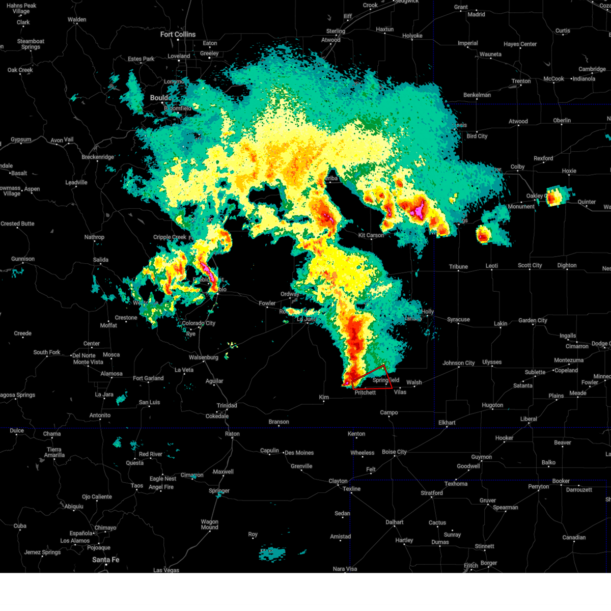 At 729 pm mdt, a severe thunderstorm capable of producing a tornado was located near pritchett, or 17 miles west of springfield, moving east at 35 mph (radar indicated rotation). Hazards include tornado and quarter size hail. Flying debris will be dangerous to those caught without shelter. mobile homes will be damaged or destroyed. damage to roofs, windows, and vehicles will occur. tree damage is likely. this dangerous storm will be near, pritchett around 735 pm mdt. Other locations in the path of this tornadic thunderstorm include springfield. At 729 pm mdt, a severe thunderstorm capable of producing a tornado was located near pritchett, or 17 miles west of springfield, moving east at 35 mph (radar indicated rotation). Hazards include tornado and quarter size hail. Flying debris will be dangerous to those caught without shelter. mobile homes will be damaged or destroyed. damage to roofs, windows, and vehicles will occur. tree damage is likely. this dangerous storm will be near, pritchett around 735 pm mdt. Other locations in the path of this tornadic thunderstorm include springfield.
|
| 6/10/2023 5:44 PM MDT |
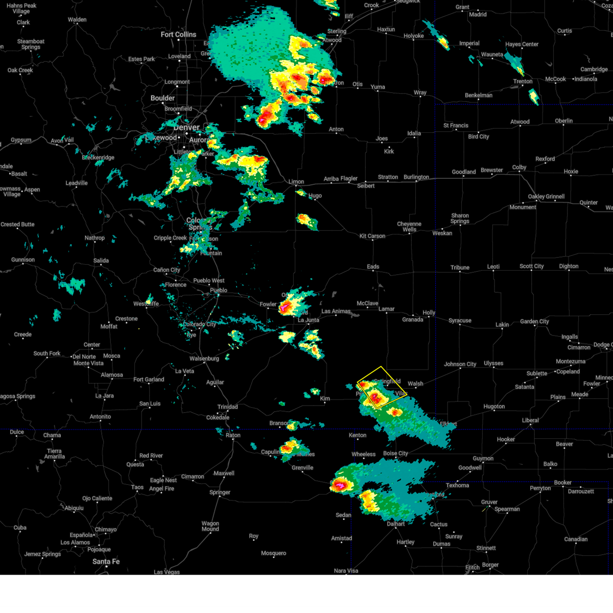 At 543 pm mdt, a severe thunderstorm was located near pritchett, and another severe storms was 9 miles southwest of springfield. both storms were moving northeast at 25 mph (radar indicated). Hazards include 60 mph wind gusts and quarter size hail. Hail damage to vehicles is expected. Expect wind damage to roofs, siding, and trees. At 543 pm mdt, a severe thunderstorm was located near pritchett, and another severe storms was 9 miles southwest of springfield. both storms were moving northeast at 25 mph (radar indicated). Hazards include 60 mph wind gusts and quarter size hail. Hail damage to vehicles is expected. Expect wind damage to roofs, siding, and trees.
|
| 6/10/2023 5:30 PM MDT |
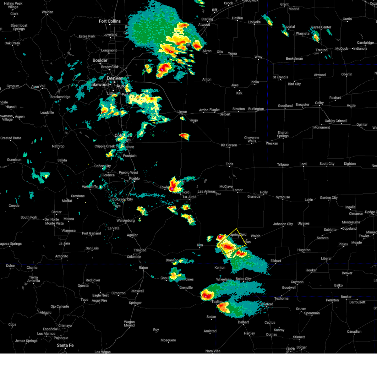 At 530 pm mdt, a severe thunderstorm was located near pritchett, or 10 miles southwest of springfield, moving northeast at 30 mph (radar indicated). Hazards include 60 mph wind gusts and half dollar size hail. Hail damage to vehicles is expected. expect wind damage to roofs, siding, and trees. locations impacted include, springfield. hail threat, radar indicated max hail size, 1. 25 in wind threat, radar indicated max wind gust, 60 mph. At 530 pm mdt, a severe thunderstorm was located near pritchett, or 10 miles southwest of springfield, moving northeast at 30 mph (radar indicated). Hazards include 60 mph wind gusts and half dollar size hail. Hail damage to vehicles is expected. expect wind damage to roofs, siding, and trees. locations impacted include, springfield. hail threat, radar indicated max hail size, 1. 25 in wind threat, radar indicated max wind gust, 60 mph.
|
| 6/10/2023 5:19 PM MDT |
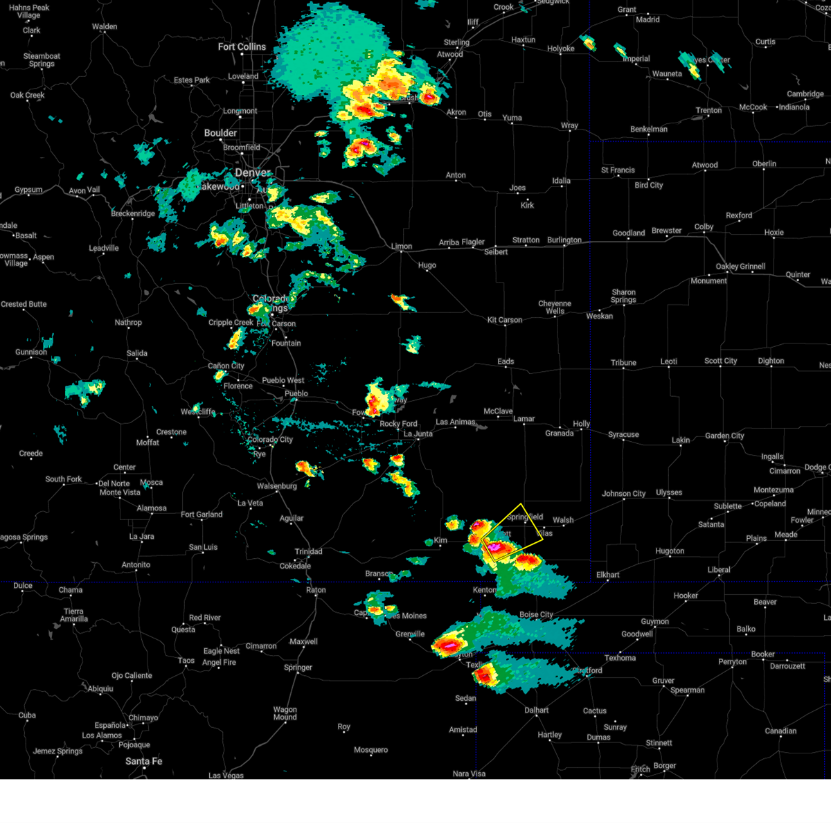 At 519 pm mdt, a severe thunderstorm was located 7 miles south of pritchett, or 16 miles southwest of springfield, moving northeast at 30 mph (radar indicated). Hazards include 60 mph wind gusts and half dollar size hail. Hail damage to vehicles is expected. expect wind damage to roofs, siding, and trees. this severe thunderstorm will be near, pritchett around 525 pm mdt. other locations in the path of this severe thunderstorm include springfield. hail threat, radar indicated max hail size, 1. 25 in wind threat, radar indicated max wind gust, 60 mph. At 519 pm mdt, a severe thunderstorm was located 7 miles south of pritchett, or 16 miles southwest of springfield, moving northeast at 30 mph (radar indicated). Hazards include 60 mph wind gusts and half dollar size hail. Hail damage to vehicles is expected. expect wind damage to roofs, siding, and trees. this severe thunderstorm will be near, pritchett around 525 pm mdt. other locations in the path of this severe thunderstorm include springfield. hail threat, radar indicated max hail size, 1. 25 in wind threat, radar indicated max wind gust, 60 mph.
|
| 6/9/2023 4:43 PM MDT |
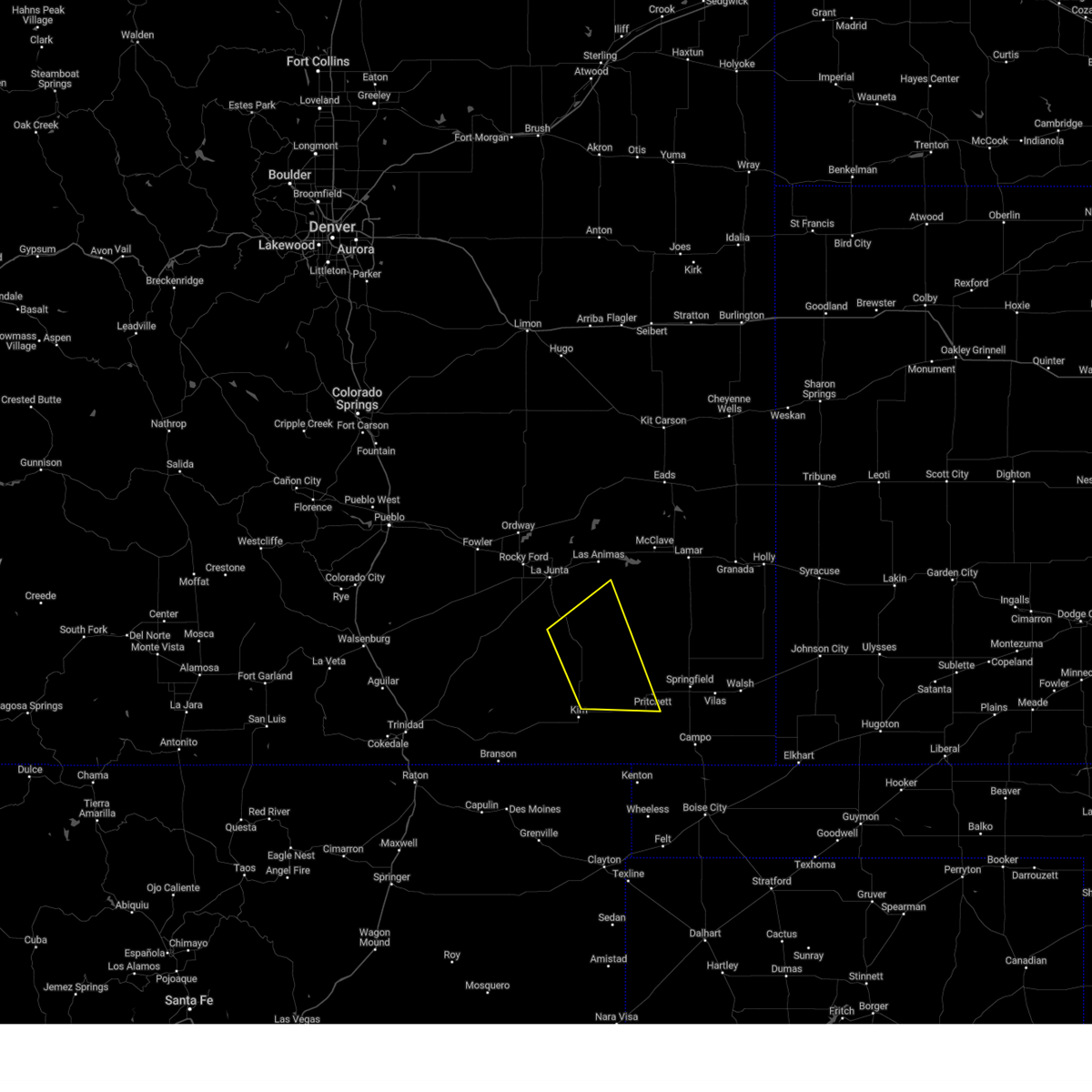 The severe thunderstorm warning for southeastern otero, northwestern baca, northeastern las animas and southwestern bent counties will expire at 445 pm mdt, the storms which prompted the warning have weakened below severe limits, and no longer pose an immediate threat to life or property. therefore, the warning will be allowed to expire. however gusty winds and heavy rain are still possible with these thunderstorms. The severe thunderstorm warning for southeastern otero, northwestern baca, northeastern las animas and southwestern bent counties will expire at 445 pm mdt, the storms which prompted the warning have weakened below severe limits, and no longer pose an immediate threat to life or property. therefore, the warning will be allowed to expire. however gusty winds and heavy rain are still possible with these thunderstorms.
|
| 6/9/2023 4:23 PM MDT |
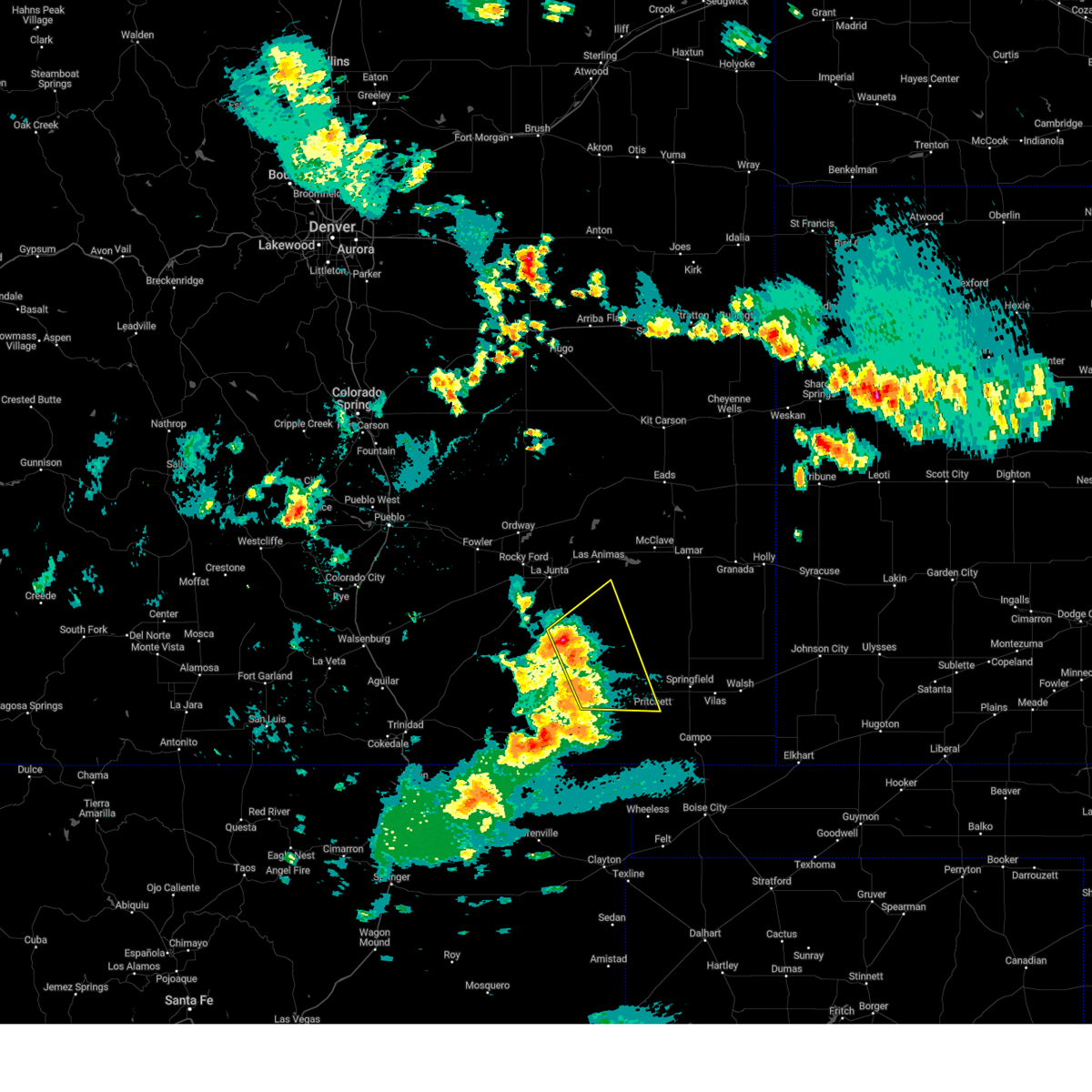 At 422 pm mdt, severe thunderstorms were located along a line extending from 8 miles south of higbee to 11 miles north of kim, moving east at 25 mph (radar indicated). Hazards include 60 mph wind gusts. Expect damage to roofs, siding, and trees. locations impacted include, pritchett and higbee. hail threat, radar indicated max hail size, <. 75 in wind threat, radar indicated max wind gust, 60 mph. At 422 pm mdt, severe thunderstorms were located along a line extending from 8 miles south of higbee to 11 miles north of kim, moving east at 25 mph (radar indicated). Hazards include 60 mph wind gusts. Expect damage to roofs, siding, and trees. locations impacted include, pritchett and higbee. hail threat, radar indicated max hail size, <. 75 in wind threat, radar indicated max wind gust, 60 mph.
|
| 6/9/2023 4:11 PM MDT |
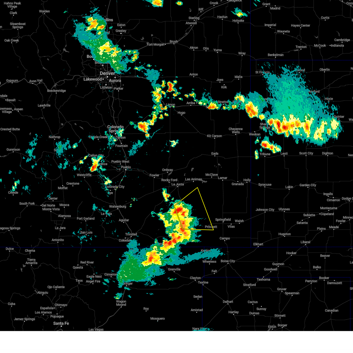 At 410 pm mdt, severe thunderstorms were located along a line extending from 10 miles south of higbee to 10 miles north of kim, moving east at 25 mph (radar indicated). Hazards include 60 mph wind gusts and quarter size hail. Hail damage to vehicles is expected. Expect wind damage to roofs, siding, and trees. At 410 pm mdt, severe thunderstorms were located along a line extending from 10 miles south of higbee to 10 miles north of kim, moving east at 25 mph (radar indicated). Hazards include 60 mph wind gusts and quarter size hail. Hail damage to vehicles is expected. Expect wind damage to roofs, siding, and trees.
|
| 5/17/2023 4:13 PM MDT |
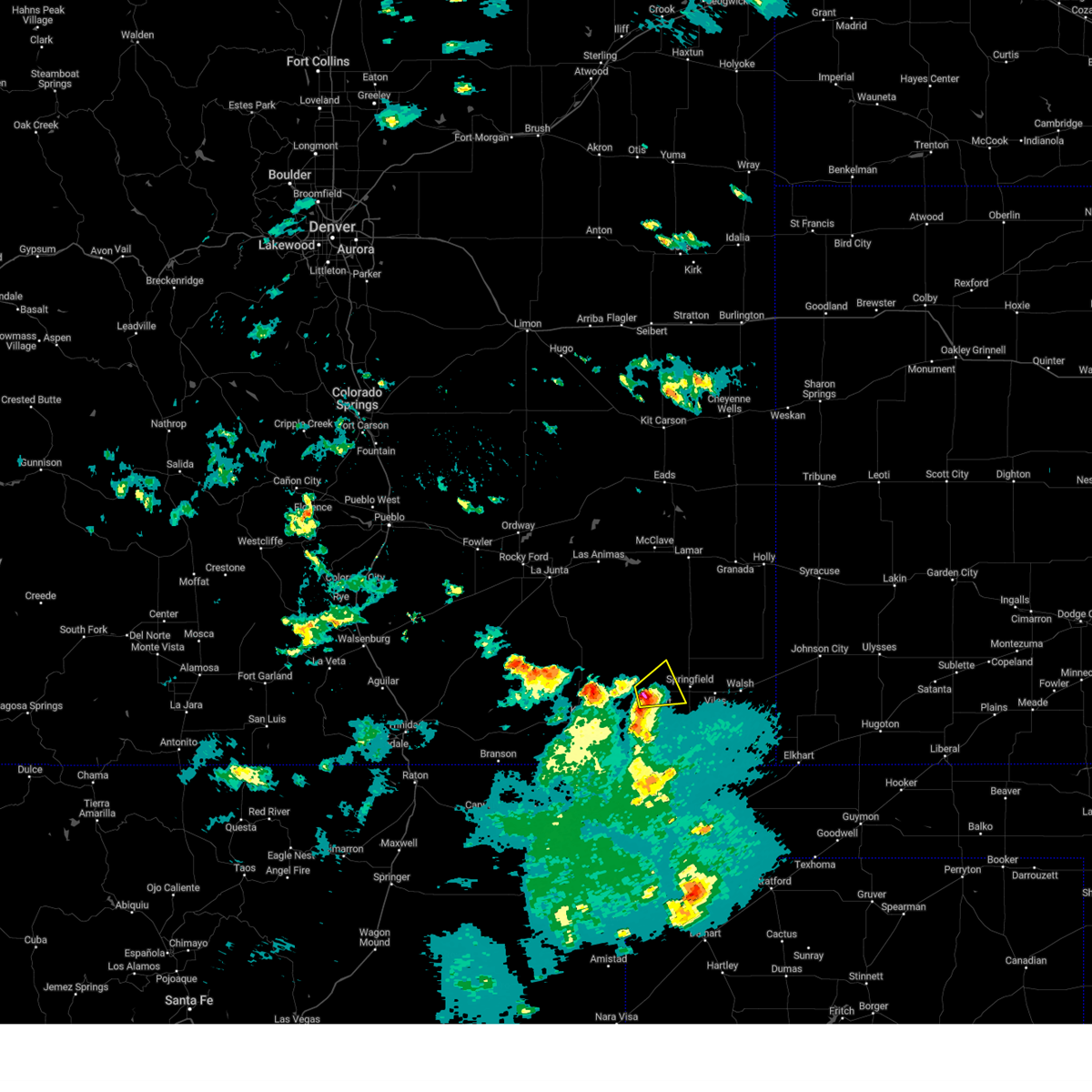 At 413 pm mdt, a severe thunderstorm was located over pritchett, or 15 miles west of springfield, moving northeast at 15 mph (radar indicated). Hazards include 60 mph wind gusts and quarter size hail. Hail damage to vehicles is expected. Expect wind damage to roofs, siding, and trees. At 413 pm mdt, a severe thunderstorm was located over pritchett, or 15 miles west of springfield, moving northeast at 15 mph (radar indicated). Hazards include 60 mph wind gusts and quarter size hail. Hail damage to vehicles is expected. Expect wind damage to roofs, siding, and trees.
|
| 5/17/2023 3:49 PM MDT |
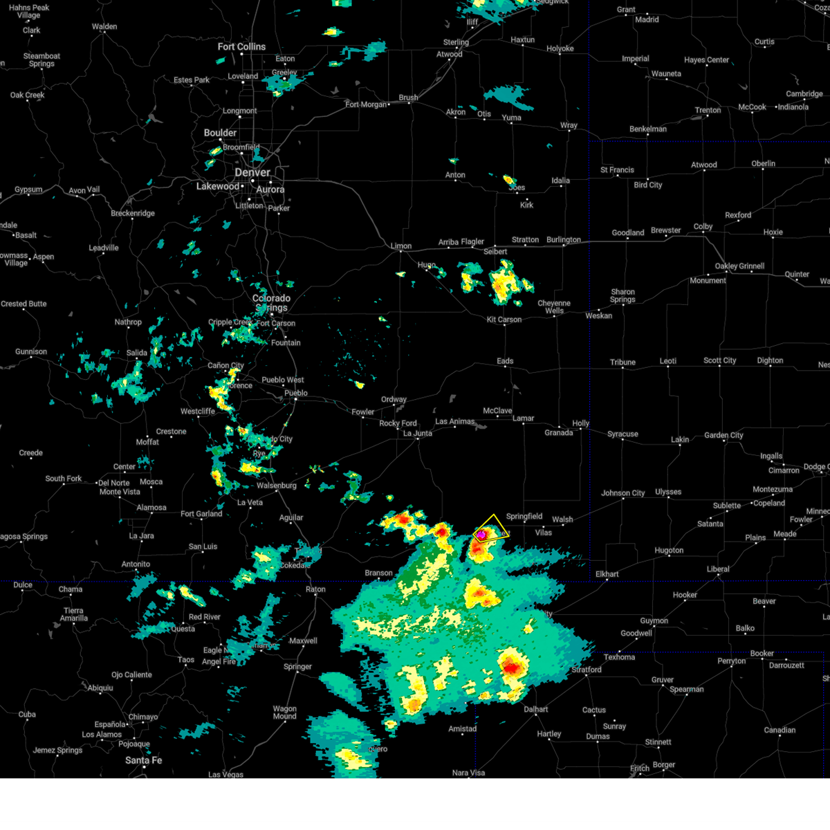 At 349 pm mdt, a severe thunderstorm was located near pritchett, or 20 miles west of springfield, moving northeast at 15 mph (radar indicated). Hazards include golf ball size hail and 60 mph wind gusts. People and animals outdoors will be injured. expect hail damage to roofs, siding, windows, and vehicles. expect wind damage to roofs, siding, and trees. locations impacted include, pritchett. thunderstorm damage threat, considerable hail threat, radar indicated max hail size, 1. 75 in wind threat, radar indicated max wind gust, 60 mph. At 349 pm mdt, a severe thunderstorm was located near pritchett, or 20 miles west of springfield, moving northeast at 15 mph (radar indicated). Hazards include golf ball size hail and 60 mph wind gusts. People and animals outdoors will be injured. expect hail damage to roofs, siding, windows, and vehicles. expect wind damage to roofs, siding, and trees. locations impacted include, pritchett. thunderstorm damage threat, considerable hail threat, radar indicated max hail size, 1. 75 in wind threat, radar indicated max wind gust, 60 mph.
|
| 5/17/2023 3:33 PM MDT |
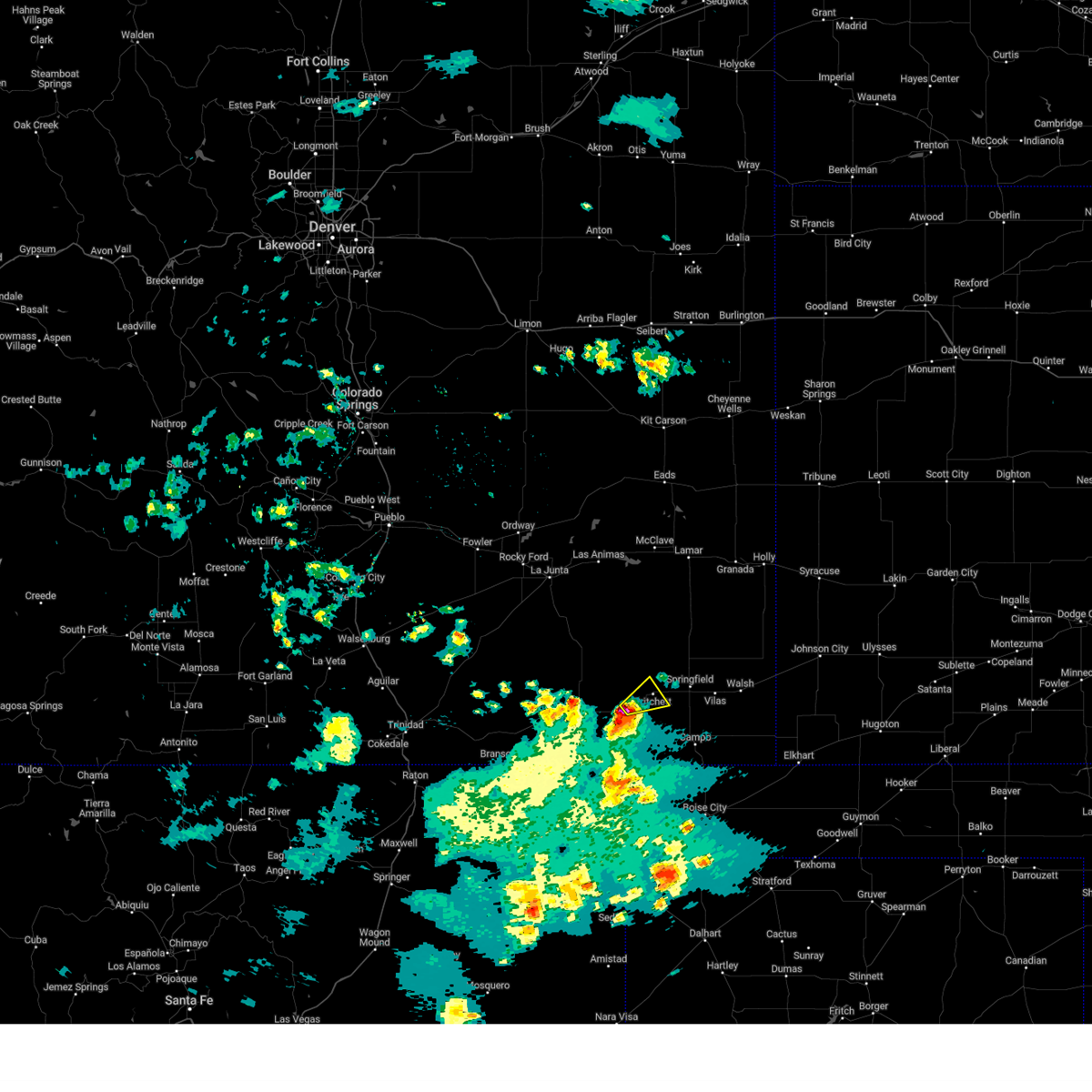 At 333 pm mdt, a severe thunderstorm was located 10 miles southwest of pritchett, or 23 miles west of springfield, moving northeast at 15 mph (radar indicated). Hazards include ping pong ball size hail and 60 mph wind gusts. People and animals outdoors will be injured. expect hail damage to roofs, siding, windows, and vehicles. Expect wind damage to roofs, siding, and trees. At 333 pm mdt, a severe thunderstorm was located 10 miles southwest of pritchett, or 23 miles west of springfield, moving northeast at 15 mph (radar indicated). Hazards include ping pong ball size hail and 60 mph wind gusts. People and animals outdoors will be injured. expect hail damage to roofs, siding, windows, and vehicles. Expect wind damage to roofs, siding, and trees.
|
| 6/7/2022 7:09 PM MDT |
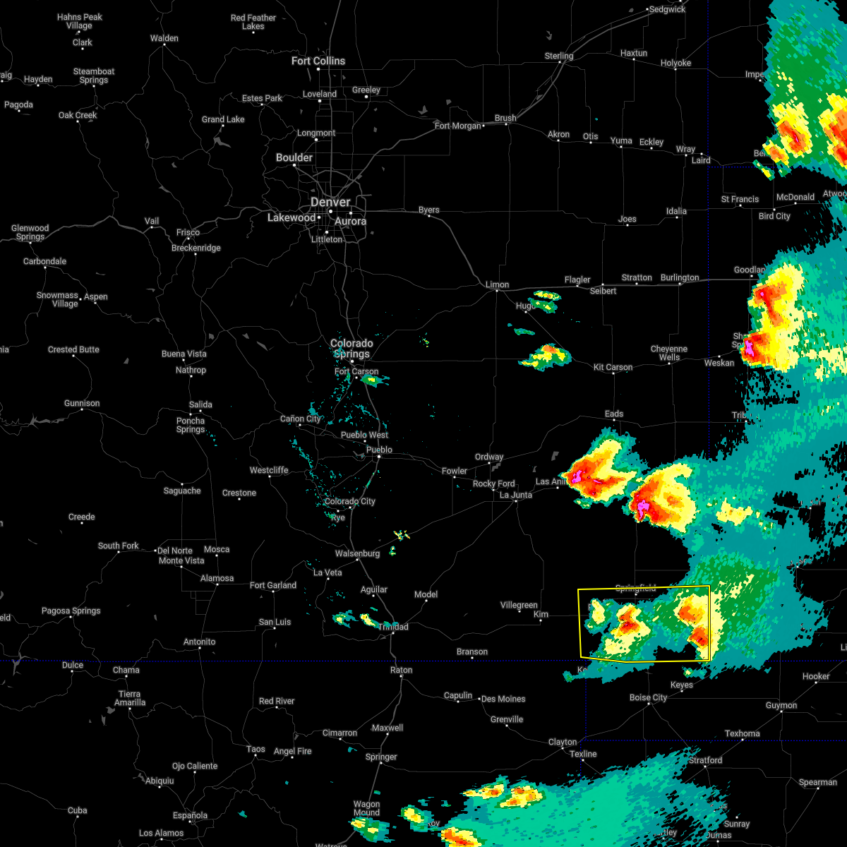 At 709 pm mdt, severe thunderstorms were located along a line extending from 14 miles west of elkhart to 7 miles west of campo, moving southeast at 50 mph (radar indicated). Hazards include 60 mph wind gusts and quarter size hail. Hail damage to vehicles is expected. Expect wind damage to roofs, siding, and trees. At 709 pm mdt, severe thunderstorms were located along a line extending from 14 miles west of elkhart to 7 miles west of campo, moving southeast at 50 mph (radar indicated). Hazards include 60 mph wind gusts and quarter size hail. Hail damage to vehicles is expected. Expect wind damage to roofs, siding, and trees.
|
| 6/6/2022 3:36 PM MDT |
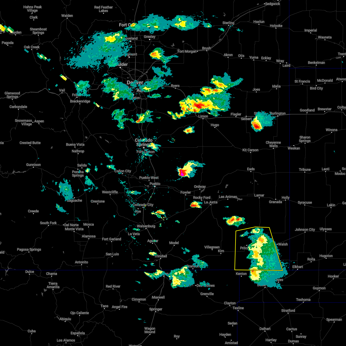 The severe thunderstorm warning for baca county will expire at 345 pm mdt, the storms which prompted the warning are weakening below severe limits. therefore, the warning will be allowed to expire. however gusty winds are still possible with these thunderstorms. a severe thunderstorm watch remains in effect until 1000 pm mdt for southeastern colorado. The severe thunderstorm warning for baca county will expire at 345 pm mdt, the storms which prompted the warning are weakening below severe limits. therefore, the warning will be allowed to expire. however gusty winds are still possible with these thunderstorms. a severe thunderstorm watch remains in effect until 1000 pm mdt for southeastern colorado.
|
| 6/6/2022 3:07 PM MDT |
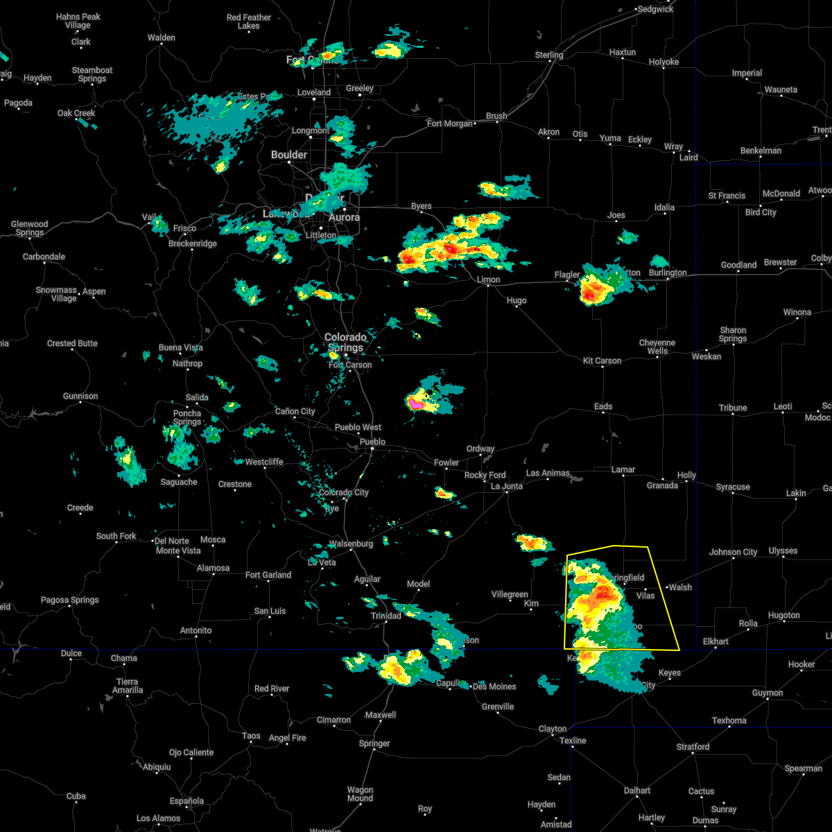 At 307 pm mdt, severe thunderstorms were located along a line extending from 12 miles north of pritchett to near campo, moving east at 25 mph (radar indicated). Hazards include 60 mph wind gusts and quarter size hail. Hail damage to vehicles is expected. expect wind damage to roofs, siding, and trees. locations impacted include, springfield, pritchett, vilas, campo, two buttes and two buttes reservoir. hail threat, radar indicated max hail size, 1. 00 in wind threat, radar indicated max wind gust, 60 mph. At 307 pm mdt, severe thunderstorms were located along a line extending from 12 miles north of pritchett to near campo, moving east at 25 mph (radar indicated). Hazards include 60 mph wind gusts and quarter size hail. Hail damage to vehicles is expected. expect wind damage to roofs, siding, and trees. locations impacted include, springfield, pritchett, vilas, campo, two buttes and two buttes reservoir. hail threat, radar indicated max hail size, 1. 00 in wind threat, radar indicated max wind gust, 60 mph.
|
| 6/6/2022 2:56 PM MDT |
 At 256 pm mdt, severe thunderstorms were located along a line extending from 12 miles north of pritchett to 7 miles southwest of campo, moving east at 35 mph (radar indicated). Hazards include 60 mph wind gusts and quarter size hail. Hail damage to vehicles is expected. expect wind damage to roofs, siding, and trees. locations impacted include, springfield, pritchett, vilas, campo, two buttes and two buttes reservoir. hail threat, radar indicated max hail size, 1. 00 in wind threat, radar indicated max wind gust, 60 mph. At 256 pm mdt, severe thunderstorms were located along a line extending from 12 miles north of pritchett to 7 miles southwest of campo, moving east at 35 mph (radar indicated). Hazards include 60 mph wind gusts and quarter size hail. Hail damage to vehicles is expected. expect wind damage to roofs, siding, and trees. locations impacted include, springfield, pritchett, vilas, campo, two buttes and two buttes reservoir. hail threat, radar indicated max hail size, 1. 00 in wind threat, radar indicated max wind gust, 60 mph.
|
| 6/6/2022 2:33 PM MDT |
 At 232 pm mdt, severe thunderstorms were located along a line extending from 19 miles southeast of higbee to 7 miles north of kenton, moving east at 25 mph (radar indicated). Hazards include 60 mph wind gusts and quarter size hail. Hail damage to vehicles is expected. Expect wind damage to roofs, siding, and trees. At 232 pm mdt, severe thunderstorms were located along a line extending from 19 miles southeast of higbee to 7 miles north of kenton, moving east at 25 mph (radar indicated). Hazards include 60 mph wind gusts and quarter size hail. Hail damage to vehicles is expected. Expect wind damage to roofs, siding, and trees.
|
| 6/3/2022 6:52 PM MDT |
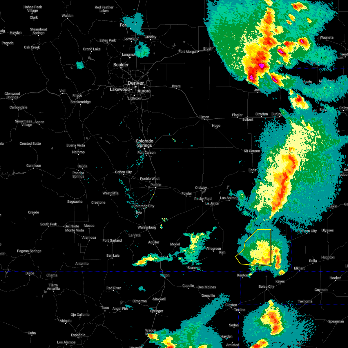 The severe thunderstorm warning for western baca and eastern las animas counties will expire at 700 pm mdt, the storm which prompted the warning has weakened below severe limits, and no longer poses an immediate threat to life or property. therefore, the warning will be allowed to expire. however small hail and gusty winds are still possible with this thunderstorm. a severe thunderstorm watch remains in effect until 1000 pm mdt for southeastern colorado. The severe thunderstorm warning for western baca and eastern las animas counties will expire at 700 pm mdt, the storm which prompted the warning has weakened below severe limits, and no longer poses an immediate threat to life or property. therefore, the warning will be allowed to expire. however small hail and gusty winds are still possible with this thunderstorm. a severe thunderstorm watch remains in effect until 1000 pm mdt for southeastern colorado.
|
| 6/3/2022 6:26 PM MDT |
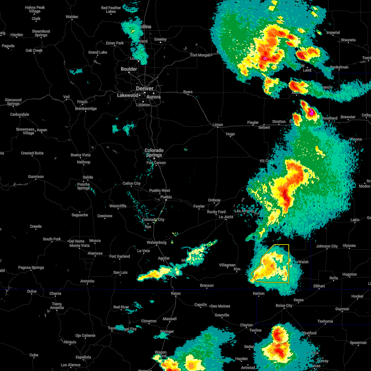 At 625 pm mdt, a severe thunderstorm was located near pritchett, or 11 miles west of springfield, moving northeast at 30 mph (radar indicated). Hazards include 60 mph wind gusts and quarter size hail. Hail damage to vehicles is expected. expect wind damage to roofs, siding, and trees. Locations impacted include, springfield, pritchett, vilas, campo and two buttes reservoir. At 625 pm mdt, a severe thunderstorm was located near pritchett, or 11 miles west of springfield, moving northeast at 30 mph (radar indicated). Hazards include 60 mph wind gusts and quarter size hail. Hail damage to vehicles is expected. expect wind damage to roofs, siding, and trees. Locations impacted include, springfield, pritchett, vilas, campo and two buttes reservoir.
|
| 6/3/2022 6:17 PM MDT |
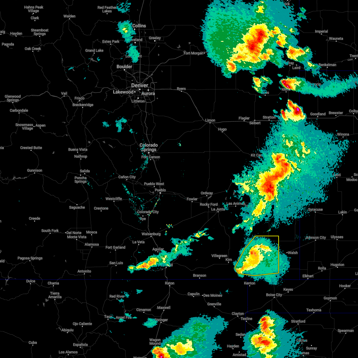 At 617 pm mdt, a severe thunderstorm was located over pritchett, or 14 miles west of springfield, moving northeast at 30 mph (radar indicated). Hazards include 60 mph wind gusts and quarter size hail. Hail damage to vehicles is expected. Expect wind damage to roofs, siding, and trees. At 617 pm mdt, a severe thunderstorm was located over pritchett, or 14 miles west of springfield, moving northeast at 30 mph (radar indicated). Hazards include 60 mph wind gusts and quarter size hail. Hail damage to vehicles is expected. Expect wind damage to roofs, siding, and trees.
|
| 6/3/2022 6:03 PM MDT |
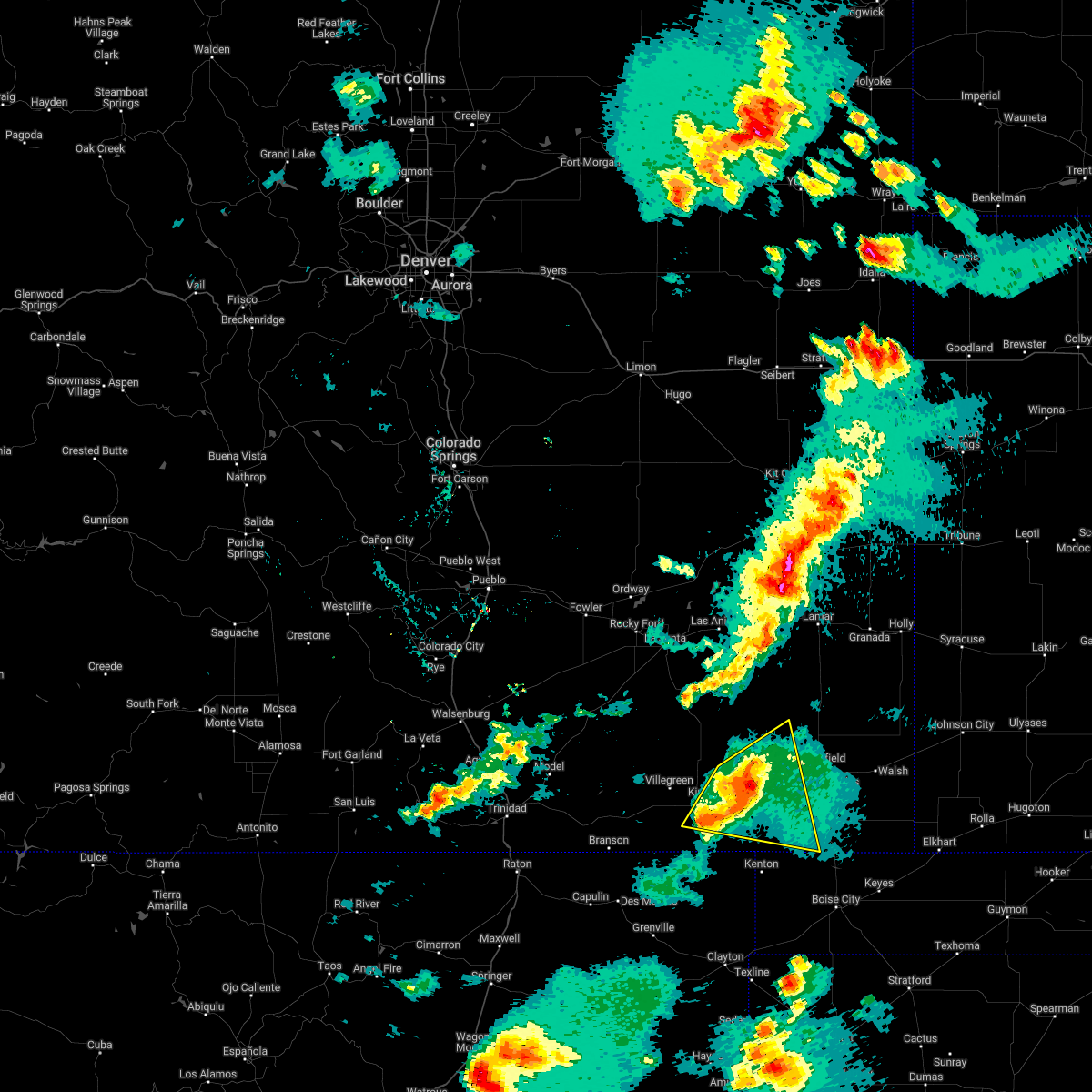 At 601 pm mdt, a severe thunderstorm was located 7 miles southwest of pritchett, or 21 miles west of springfield, moving east at 30 mph (radar indicated). Hazards include 70 mph wind gusts and half dollar size hail. Hail damage to vehicles is expected. expect considerable tree damage. wind damage is also likely to mobile homes, roofs, and outbuildings. locations impacted include, pritchett and kim. weather radar was showing this storm becoming better organized between 550 pm and 600 pm. thunderstorm damage threat, considerable hail threat, radar indicated max hail size, 1. 25 in wind threat, radar indicated max wind gust, 70 mph. At 601 pm mdt, a severe thunderstorm was located 7 miles southwest of pritchett, or 21 miles west of springfield, moving east at 30 mph (radar indicated). Hazards include 70 mph wind gusts and half dollar size hail. Hail damage to vehicles is expected. expect considerable tree damage. wind damage is also likely to mobile homes, roofs, and outbuildings. locations impacted include, pritchett and kim. weather radar was showing this storm becoming better organized between 550 pm and 600 pm. thunderstorm damage threat, considerable hail threat, radar indicated max hail size, 1. 25 in wind threat, radar indicated max wind gust, 70 mph.
|
| 6/3/2022 5:52 PM MDT |
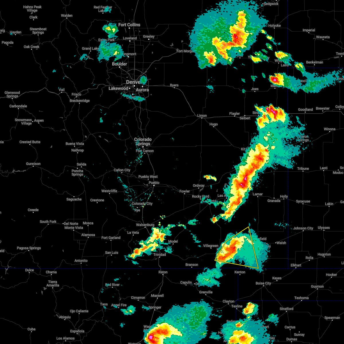 At 552 pm mdt, a severe thunderstorm was located 12 miles west of pritchett, or 25 miles west of springfield, moving east at 30 mph (radar indicated). Hazards include 60 mph wind gusts and quarter size hail. Hail damage to vehicles is expected. Expect wind damage to roofs, siding, and trees. At 552 pm mdt, a severe thunderstorm was located 12 miles west of pritchett, or 25 miles west of springfield, moving east at 30 mph (radar indicated). Hazards include 60 mph wind gusts and quarter size hail. Hail damage to vehicles is expected. Expect wind damage to roofs, siding, and trees.
|
| 7/17/2021 5:52 PM MDT | Quarter sized hail reported 0 miles NNW of Pritchett, CO |
| 7/17/2021 5:52 PM MDT |
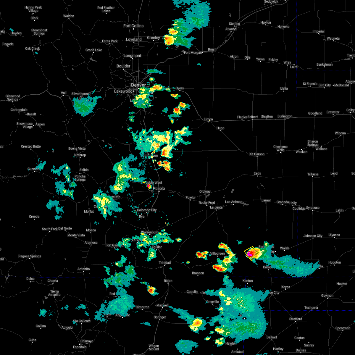 At 551 pm mdt, a severe thunderstorm was located near pritchett, or 17 miles west of springfield, moving west at 15 mph (public reported quarter size hail that occurred earlier with this storm as it moved over pritchett). Hazards include 60 mph wind gusts and quarter size hail. Hail damage to vehicles is expected. expect wind damage to roofs, siding, and trees. Locations impacted include, pritchett. At 551 pm mdt, a severe thunderstorm was located near pritchett, or 17 miles west of springfield, moving west at 15 mph (public reported quarter size hail that occurred earlier with this storm as it moved over pritchett). Hazards include 60 mph wind gusts and quarter size hail. Hail damage to vehicles is expected. expect wind damage to roofs, siding, and trees. Locations impacted include, pritchett.
|
| 7/17/2021 5:47 PM MDT |
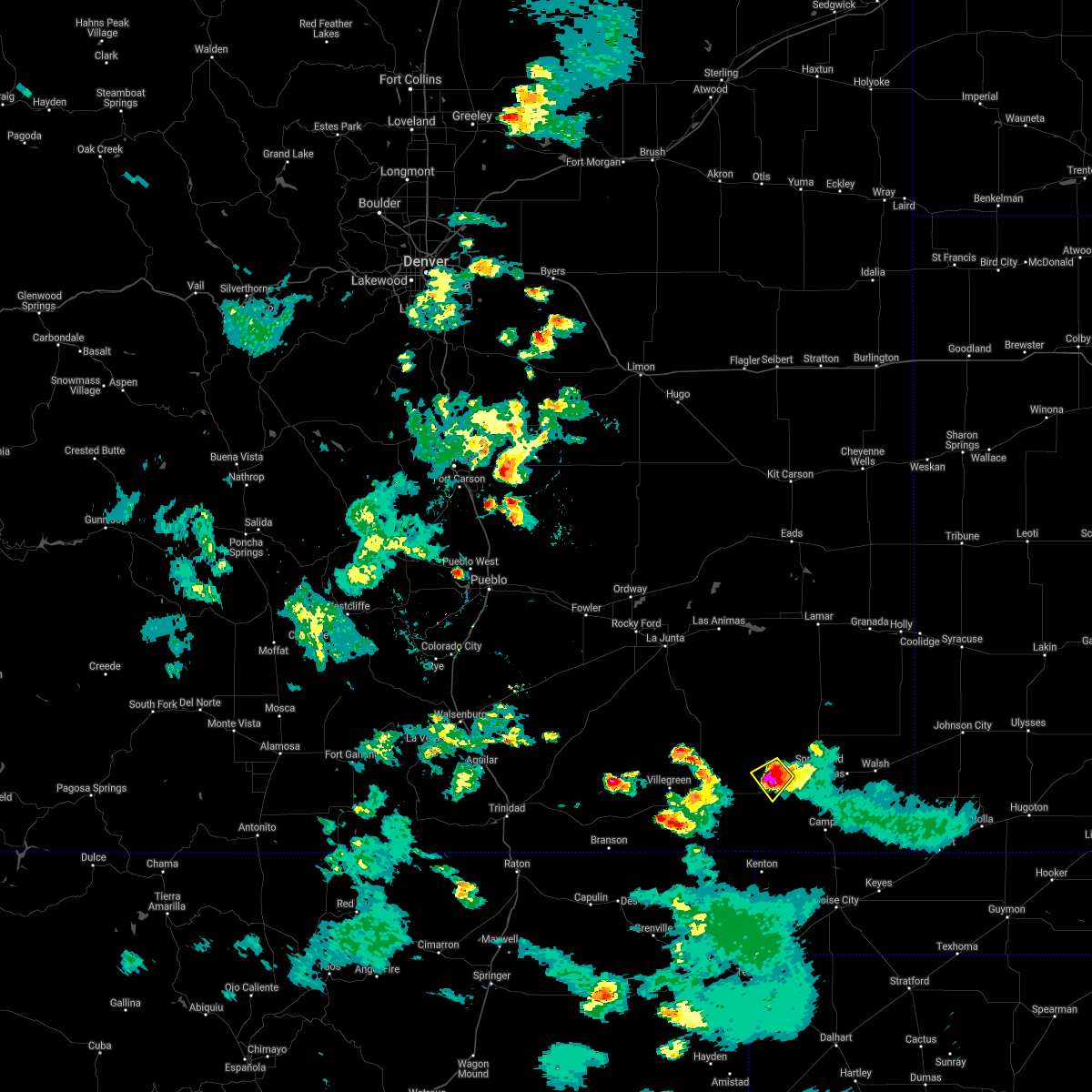 At 547 pm mdt, a severe thunderstorm was located near pritchett, or 16 miles west of springfield, moving southwest at 15 mph (radar indicated). Hazards include 60 mph wind gusts and quarter size hail. Hail damage to vehicles is expected. expect wind damage to roofs, siding, and trees. Locations impacted include, pritchett. At 547 pm mdt, a severe thunderstorm was located near pritchett, or 16 miles west of springfield, moving southwest at 15 mph (radar indicated). Hazards include 60 mph wind gusts and quarter size hail. Hail damage to vehicles is expected. expect wind damage to roofs, siding, and trees. Locations impacted include, pritchett.
|
| 7/17/2021 5:41 PM MDT | Quarter sized hail reported 0 miles NNW of Pritchett, CO, corrects previous hail report from pritchett. |
| 7/17/2021 5:37 PM MDT |
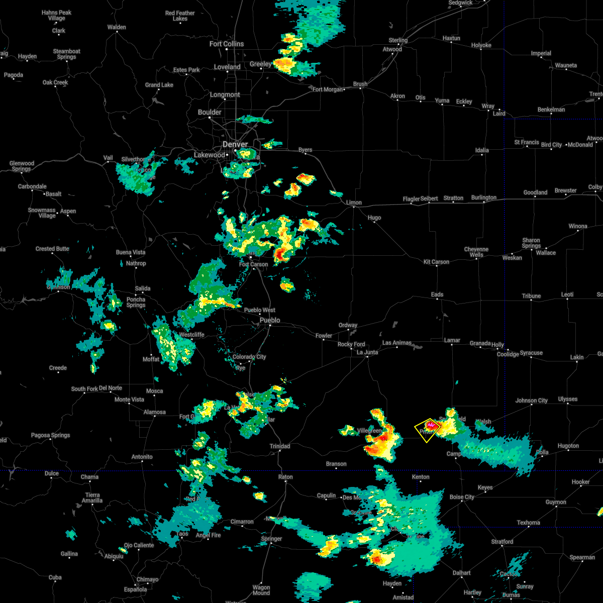 At 537 pm mdt, a severe thunderstorm was located over pritchett, or 13 miles west of springfield, moving west at 15 mph (radar indicated). Hazards include 60 mph wind gusts and quarter size hail. Hail damage to vehicles is expected. Expect wind damage to roofs, siding, and trees. At 537 pm mdt, a severe thunderstorm was located over pritchett, or 13 miles west of springfield, moving west at 15 mph (radar indicated). Hazards include 60 mph wind gusts and quarter size hail. Hail damage to vehicles is expected. Expect wind damage to roofs, siding, and trees.
|
| 7/4/2021 9:02 PM MDT |
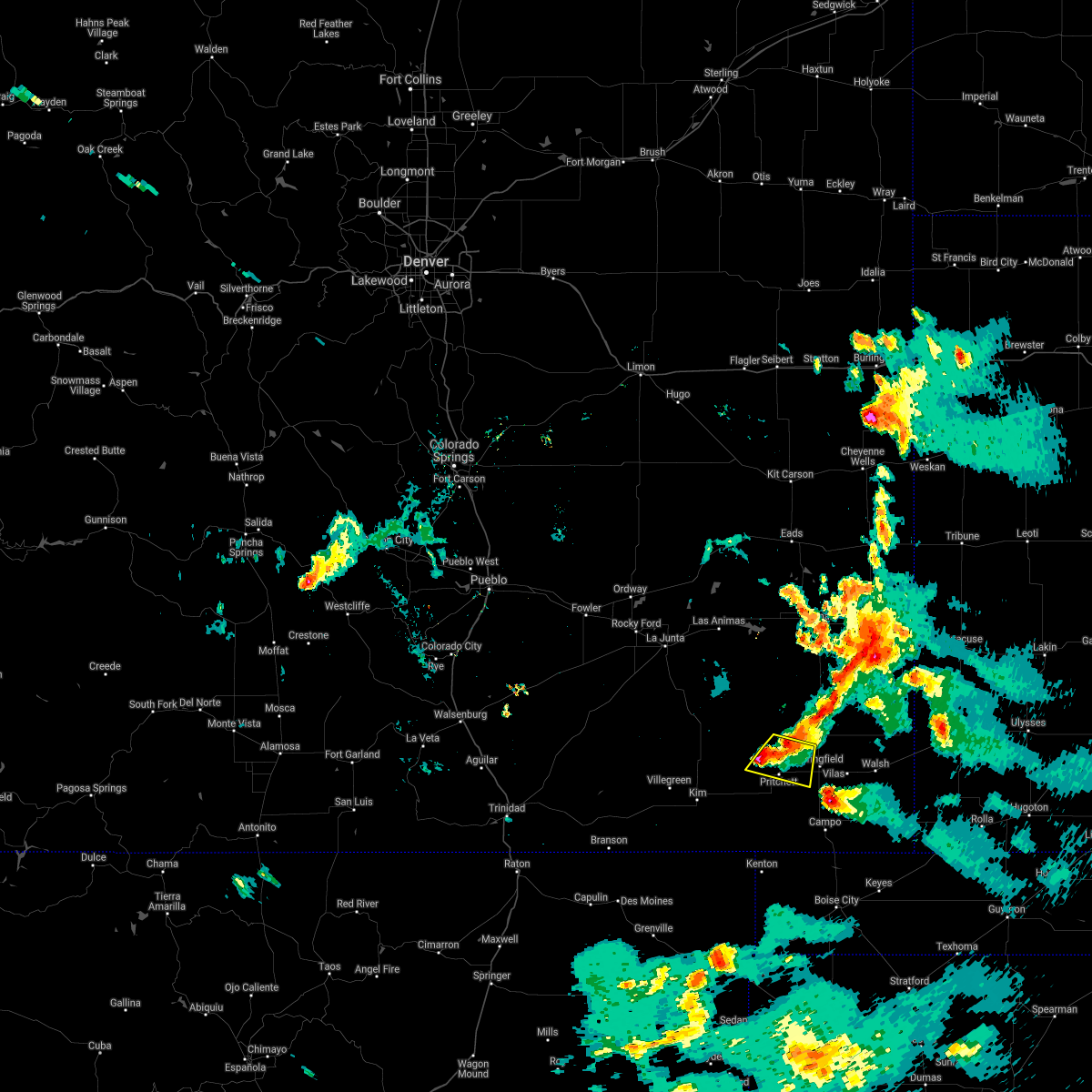 At 902 pm mdt, a severe thunderstorm was located near pritchett, or 11 miles west of springfield, moving south at 40 mph (radar indicated). Hazards include 60 mph wind gusts and quarter size hail. Hail damage to vehicles is expected. expect wind damage to roofs, siding, and trees. Locations impacted include, pritchett. At 902 pm mdt, a severe thunderstorm was located near pritchett, or 11 miles west of springfield, moving south at 40 mph (radar indicated). Hazards include 60 mph wind gusts and quarter size hail. Hail damage to vehicles is expected. expect wind damage to roofs, siding, and trees. Locations impacted include, pritchett.
|
| 7/4/2021 8:53 PM MDT |
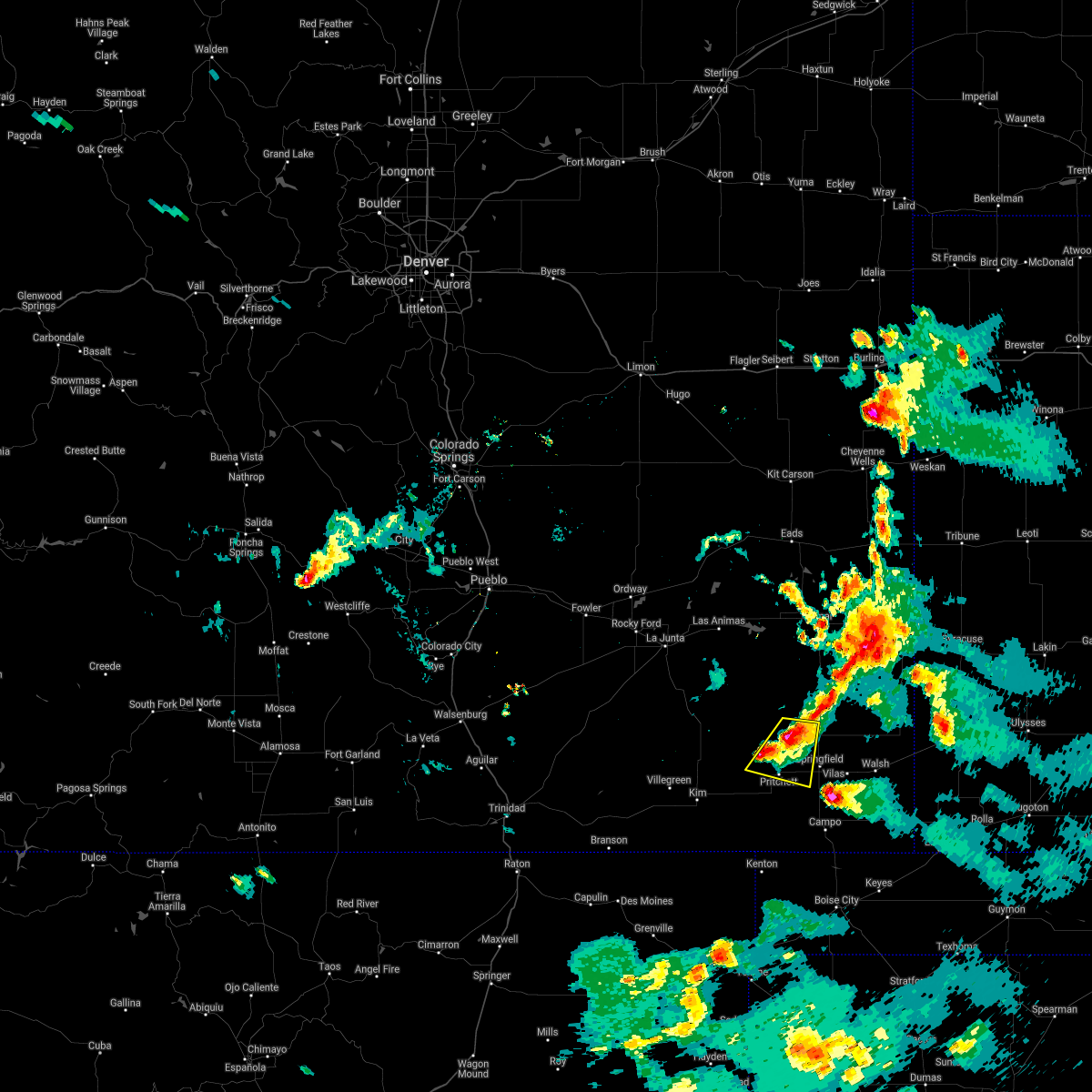 At 853 pm mdt, a severe thunderstorm was located 12 miles north of pritchett, or 13 miles northwest of springfield, moving southwest at 40 mph (radar indicated). Hazards include 60 mph wind gusts and quarter size hail. Hail damage to vehicles is expected. expect wind damage to roofs, siding, and trees. Locations impacted include, pritchett. At 853 pm mdt, a severe thunderstorm was located 12 miles north of pritchett, or 13 miles northwest of springfield, moving southwest at 40 mph (radar indicated). Hazards include 60 mph wind gusts and quarter size hail. Hail damage to vehicles is expected. expect wind damage to roofs, siding, and trees. Locations impacted include, pritchett.
|
| 7/4/2021 8:44 PM MDT |
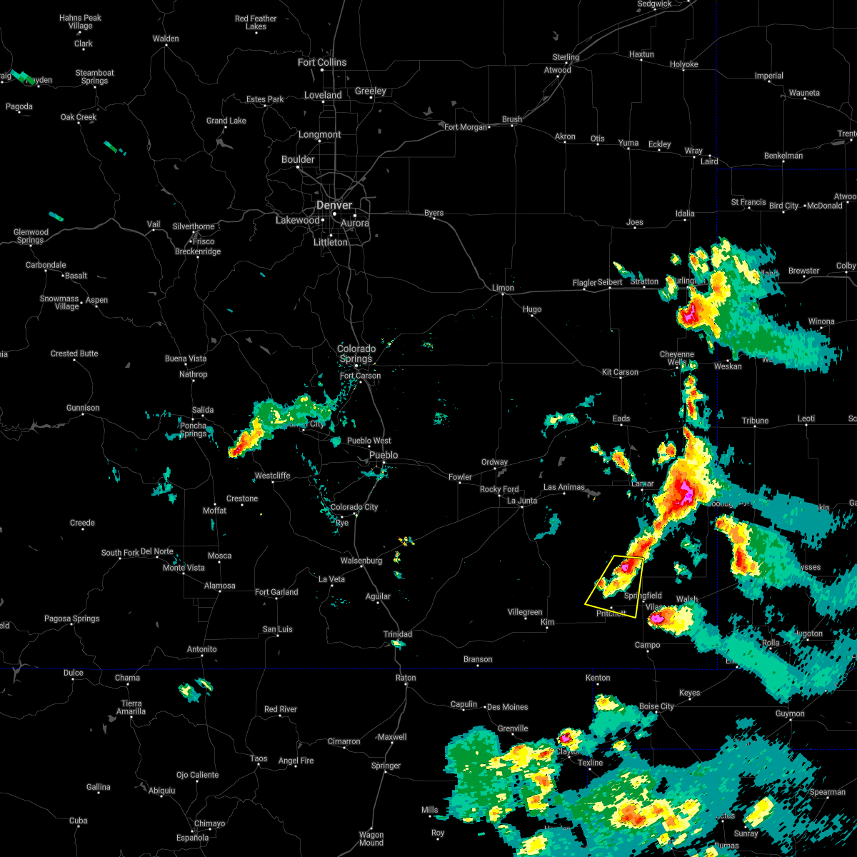 At 844 pm mdt, a severe thunderstorm was located 8 miles west of two buttes reservoir, or 15 miles northwest of springfield, moving south at 40 mph (radar indicated). Hazards include ping pong ball size hail and 60 mph wind gusts. People and animals outdoors will be injured. expect hail damage to roofs, siding, windows, and vehicles. Expect wind damage to roofs, siding, and trees. At 844 pm mdt, a severe thunderstorm was located 8 miles west of two buttes reservoir, or 15 miles northwest of springfield, moving south at 40 mph (radar indicated). Hazards include ping pong ball size hail and 60 mph wind gusts. People and animals outdoors will be injured. expect hail damage to roofs, siding, windows, and vehicles. Expect wind damage to roofs, siding, and trees.
|
| 6/19/2021 8:27 PM MDT |
 The severe thunderstorm warning for baca county will expire at 830 pm mdt, the storms which prompted the warning have weakened below severe limits, and no longer pose an immediate threat to life or property. therefore, the warning will be allowed to expire. however gusty winds are still possible with these thunderstorms. a severe thunderstorm watch remains in effect until 900 pm mdt for southeastern colorado. The severe thunderstorm warning for baca county will expire at 830 pm mdt, the storms which prompted the warning have weakened below severe limits, and no longer pose an immediate threat to life or property. therefore, the warning will be allowed to expire. however gusty winds are still possible with these thunderstorms. a severe thunderstorm watch remains in effect until 900 pm mdt for southeastern colorado.
|
| 6/19/2021 7:23 PM MDT |
 At 722 pm mdt, the leading edge of an area of winds to 60 mph was located along a line extending from 12 miles west of pritchett to 11 miles west of two buttes reservoir, moving east at 20 mph (radar indicated). Hazards include 60 mph wind gusts. expect damage to roofs, siding, and trees At 722 pm mdt, the leading edge of an area of winds to 60 mph was located along a line extending from 12 miles west of pritchett to 11 miles west of two buttes reservoir, moving east at 20 mph (radar indicated). Hazards include 60 mph wind gusts. expect damage to roofs, siding, and trees
|
| 6/12/2021 8:37 PM MDT |
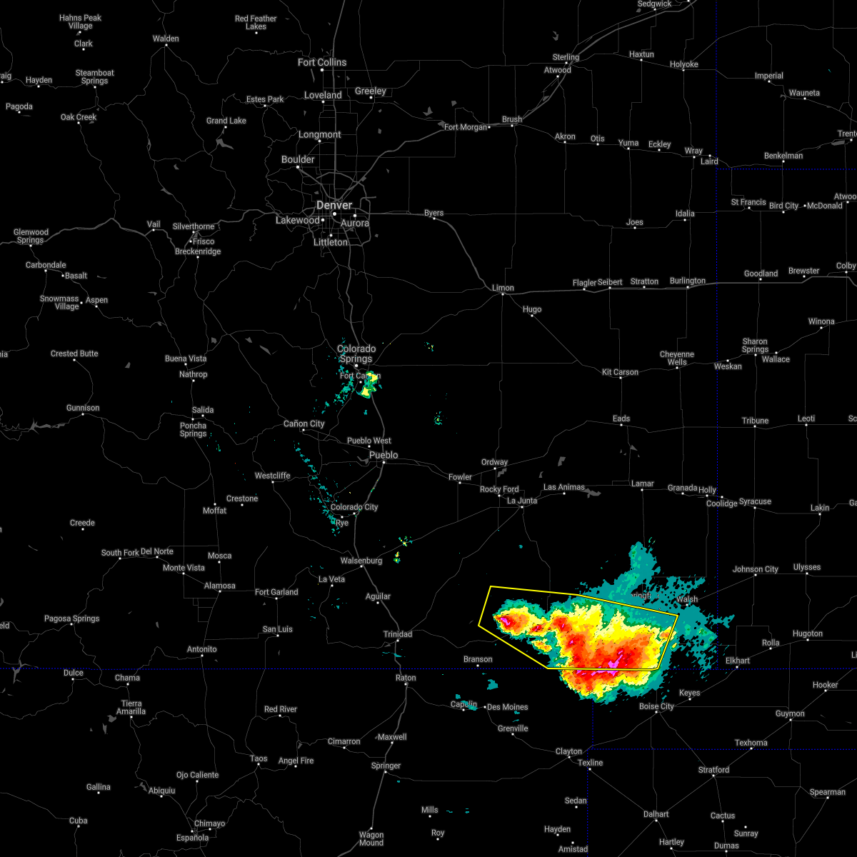 At 837 pm mdt, severe thunderstorms were located along a line extending from 17 miles west of kim to 6 miles south of campo, moving southeast at 30 mph (radar indicated). Hazards include 70 mph wind gusts and half dollar size hail. Hail damage to vehicles is expected. expect considerable tree damage. wind damage is also likely to mobile homes, roofs, and outbuildings. Locations impacted include, pritchett, campo and kim. At 837 pm mdt, severe thunderstorms were located along a line extending from 17 miles west of kim to 6 miles south of campo, moving southeast at 30 mph (radar indicated). Hazards include 70 mph wind gusts and half dollar size hail. Hail damage to vehicles is expected. expect considerable tree damage. wind damage is also likely to mobile homes, roofs, and outbuildings. Locations impacted include, pritchett, campo and kim.
|
| 6/12/2021 8:26 PM MDT |
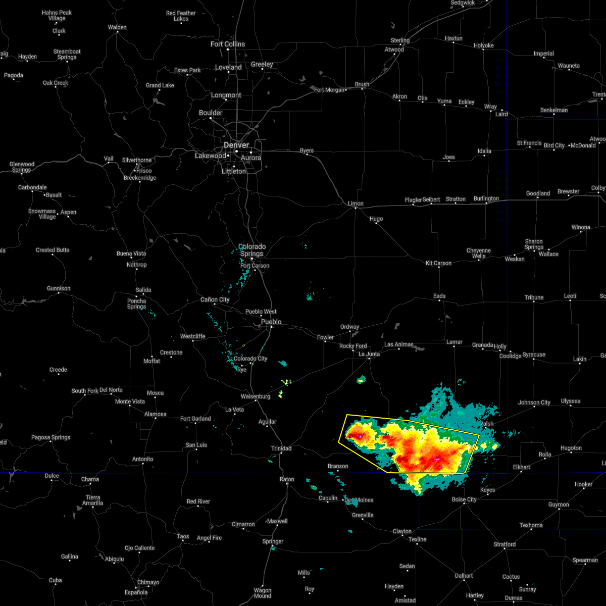 At 825 pm mdt, severe thunderstorms were located along a line extending from 18 miles west of kim to campo, moving southeast at 15 mph (radar indicated). Hazards include ping pong ball size hail and 60 mph wind gusts. People and animals outdoors will be injured. expect hail damage to roofs, siding, windows, and vehicles. Expect wind damage to roofs, siding, and trees. At 825 pm mdt, severe thunderstorms were located along a line extending from 18 miles west of kim to campo, moving southeast at 15 mph (radar indicated). Hazards include ping pong ball size hail and 60 mph wind gusts. People and animals outdoors will be injured. expect hail damage to roofs, siding, windows, and vehicles. Expect wind damage to roofs, siding, and trees.
|
| 5/29/2021 6:03 PM MDT |
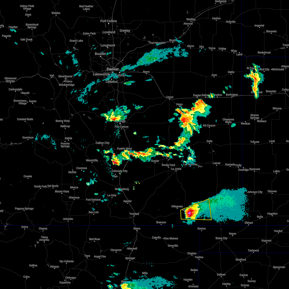 At 602 pm mdt, a severe thunderstorm was located 10 miles east of kim, or 31 miles west of springfield, moving east at 30 mph (radar indicated). Hazards include two inch hail and 70 mph wind gusts. People and animals outdoors will be injured. expect hail damage to roofs, siding, windows, and vehicles. expect considerable tree damage. wind damage is also likely to mobile homes, roofs, and outbuildings. Locations impacted include, pritchett and kim. At 602 pm mdt, a severe thunderstorm was located 10 miles east of kim, or 31 miles west of springfield, moving east at 30 mph (radar indicated). Hazards include two inch hail and 70 mph wind gusts. People and animals outdoors will be injured. expect hail damage to roofs, siding, windows, and vehicles. expect considerable tree damage. wind damage is also likely to mobile homes, roofs, and outbuildings. Locations impacted include, pritchett and kim.
|
| 5/29/2021 5:53 PM MDT |
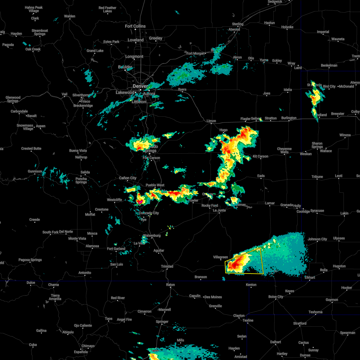 At 553 pm mdt, a severe thunderstorm was located near kim, or 36 miles west of springfield, moving east at 30 mph (radar indicated). Hazards include ping pong ball size hail and 60 mph wind gusts. People and animals outdoors will be injured. expect hail damage to roofs, siding, windows, and vehicles. Expect wind damage to roofs, siding, and trees. At 553 pm mdt, a severe thunderstorm was located near kim, or 36 miles west of springfield, moving east at 30 mph (radar indicated). Hazards include ping pong ball size hail and 60 mph wind gusts. People and animals outdoors will be injured. expect hail damage to roofs, siding, windows, and vehicles. Expect wind damage to roofs, siding, and trees.
|
| 5/17/2021 8:09 PM MDT |
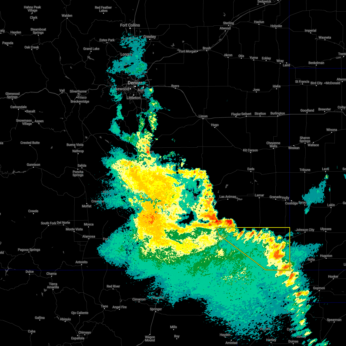 The severe thunderstorm warning for baca and east central las animas counties will expire at 815 pm mdt, the storms which prompted the warning have weakened below severe limits, and no longer pose an immediate threat to life or property. therefore, the warning will be allowed to expire. however small hail and gusty winds are still possible with these thunderstorms. a severe thunderstorm watch remains in effect until 1000 pm mdt for southeastern colorado. The severe thunderstorm warning for baca and east central las animas counties will expire at 815 pm mdt, the storms which prompted the warning have weakened below severe limits, and no longer pose an immediate threat to life or property. therefore, the warning will be allowed to expire. however small hail and gusty winds are still possible with these thunderstorms. a severe thunderstorm watch remains in effect until 1000 pm mdt for southeastern colorado.
|
| 5/17/2021 8:03 PM MDT |
 At 803 pm mdt, severe thunderstorms were located along a line extending from 21 miles southeast of higbee to 6 miles east of stonington, moving northeast at 45 mph (radar indicated). Hazards include 60 mph wind gusts and penny size hail. Expect damage to roofs, siding, and trees. Locations impacted include, springfield, walsh, pritchett, vilas, campo, two buttes, stonington and two buttes reservoir. At 803 pm mdt, severe thunderstorms were located along a line extending from 21 miles southeast of higbee to 6 miles east of stonington, moving northeast at 45 mph (radar indicated). Hazards include 60 mph wind gusts and penny size hail. Expect damage to roofs, siding, and trees. Locations impacted include, springfield, walsh, pritchett, vilas, campo, two buttes, stonington and two buttes reservoir.
|
| 5/17/2021 7:52 PM MDT |
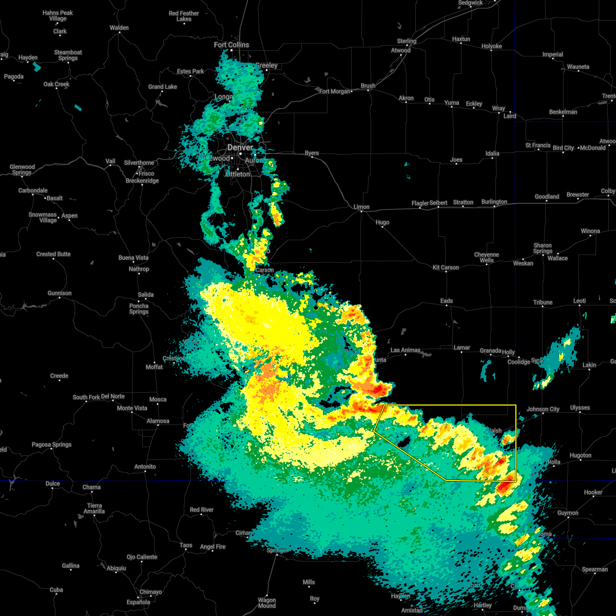 At 752 pm mdt, severe thunderstorms were located along a line extending from 15 miles southeast of higbee to 9 miles northwest of elkhart, moving northeast at 45 mph (radar indicated). Hazards include 60 mph wind gusts and penny size hail. Expect damage to roofs, siding, and trees. Locations impacted include, springfield, walsh, pritchett, vilas, campo, two buttes, stonington and two buttes reservoir. At 752 pm mdt, severe thunderstorms were located along a line extending from 15 miles southeast of higbee to 9 miles northwest of elkhart, moving northeast at 45 mph (radar indicated). Hazards include 60 mph wind gusts and penny size hail. Expect damage to roofs, siding, and trees. Locations impacted include, springfield, walsh, pritchett, vilas, campo, two buttes, stonington and two buttes reservoir.
|
| 5/17/2021 7:48 PM MDT |
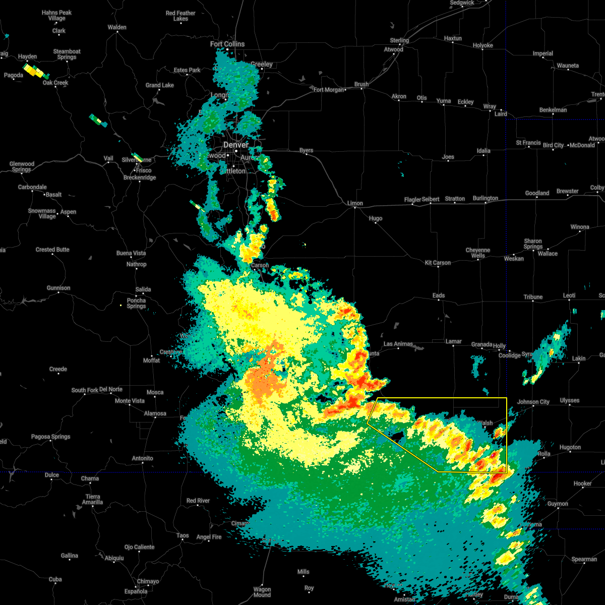 At 748 pm mdt, severe thunderstorms were located along a line extending from 14 miles southeast of higbee to 10 miles west of elkhart, moving northeast at 45 mph (radar indicated). Hazards include 60 mph wind gusts and penny size hail. Expect damage to roofs, siding, and trees. Locations impacted include, springfield, walsh, pritchett, vilas, campo, two buttes, stonington and two buttes reservoir. At 748 pm mdt, severe thunderstorms were located along a line extending from 14 miles southeast of higbee to 10 miles west of elkhart, moving northeast at 45 mph (radar indicated). Hazards include 60 mph wind gusts and penny size hail. Expect damage to roofs, siding, and trees. Locations impacted include, springfield, walsh, pritchett, vilas, campo, two buttes, stonington and two buttes reservoir.
|
| 5/17/2021 7:38 PM MDT |
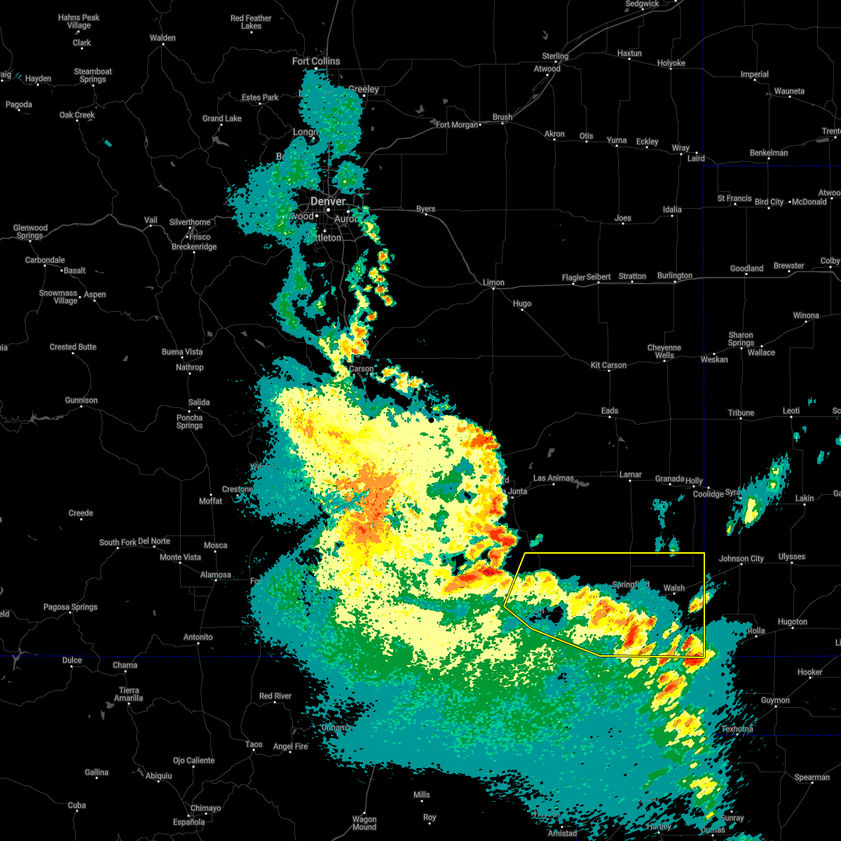 At 738 pm mdt, severe thunderstorms were located along a line extending from 16 miles south of higbee to 12 miles southeast of stonington, moving northeast at 45 mph (radar indicated). Hazards include 60 mph wind gusts and penny size hail. Expect damage to roofs, siding, and trees. Locations impacted include, springfield, walsh, pritchett, vilas, campo, kim, two buttes, stonington and two buttes reservoir. At 738 pm mdt, severe thunderstorms were located along a line extending from 16 miles south of higbee to 12 miles southeast of stonington, moving northeast at 45 mph (radar indicated). Hazards include 60 mph wind gusts and penny size hail. Expect damage to roofs, siding, and trees. Locations impacted include, springfield, walsh, pritchett, vilas, campo, kim, two buttes, stonington and two buttes reservoir.
|
| 5/17/2021 7:30 PM MDT |
 At 730 pm mdt, severe thunderstorms were located along a line extending from 15 miles north of kim to 13 miles west of elkhart, moving north at 45 mph (radar indicated). Hazards include 60 mph wind gusts and quarter size hail. Hail damage to vehicles is expected. expect wind damage to roofs, siding, and trees. Locations impacted include, springfield, walsh, pritchett, vilas, campo, kim, two buttes, stonington and two buttes reservoir. At 730 pm mdt, severe thunderstorms were located along a line extending from 15 miles north of kim to 13 miles west of elkhart, moving north at 45 mph (radar indicated). Hazards include 60 mph wind gusts and quarter size hail. Hail damage to vehicles is expected. expect wind damage to roofs, siding, and trees. Locations impacted include, springfield, walsh, pritchett, vilas, campo, kim, two buttes, stonington and two buttes reservoir.
|
| 5/17/2021 7:20 PM MDT |
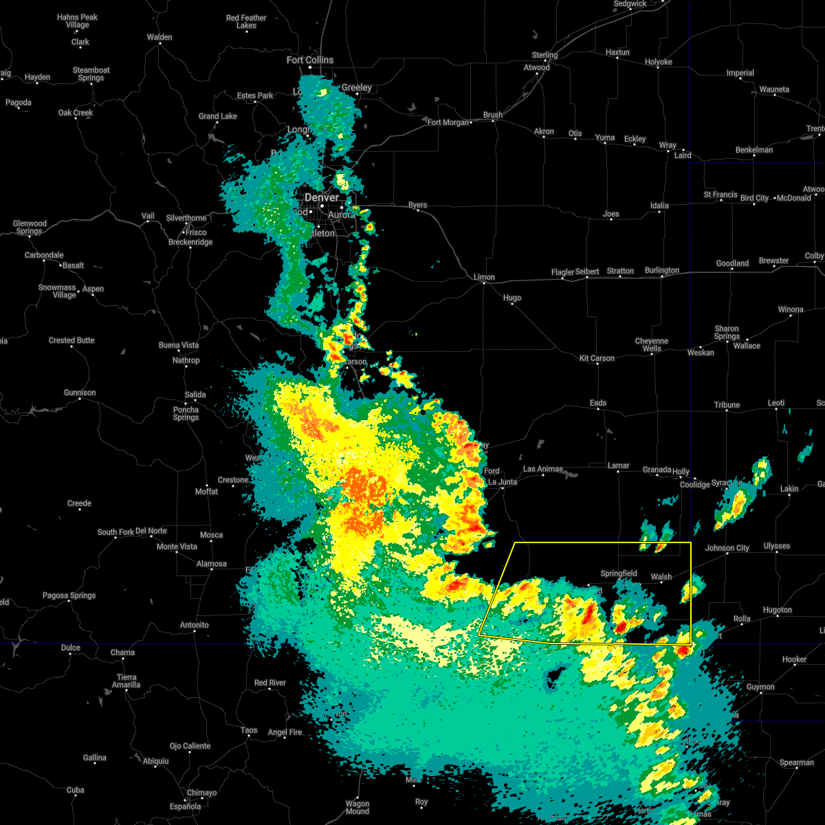 At 720 pm mdt, severe thunderstorms were located along a line extending from 9 miles north of kim to 11 miles west of elkhart, moving northeast at 60 mph (radar indicated). Hazards include 60 mph wind gusts and quarter size hail. Hail damage to vehicles is expected. expect wind damage to roofs, siding, and trees. Locations impacted include, springfield, walsh, pritchett, vilas, campo, kim, two buttes, stonington and two buttes reservoir. At 720 pm mdt, severe thunderstorms were located along a line extending from 9 miles north of kim to 11 miles west of elkhart, moving northeast at 60 mph (radar indicated). Hazards include 60 mph wind gusts and quarter size hail. Hail damage to vehicles is expected. expect wind damage to roofs, siding, and trees. Locations impacted include, springfield, walsh, pritchett, vilas, campo, kim, two buttes, stonington and two buttes reservoir.
|
| 5/17/2021 7:06 PM MDT |
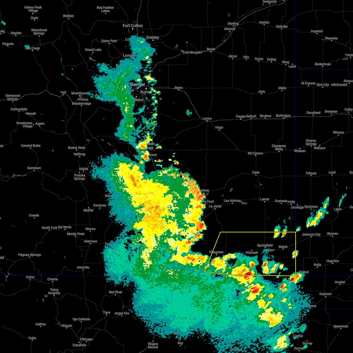 At 706 pm mdt, severe thunderstorms were located along a line extending from 8 miles southwest of kim to 7 miles northwest of boise city, moving northeast at 45 mph (radar indicated). Hazards include 60 mph wind gusts and quarter size hail. Hail damage to vehicles is expected. Expect wind damage to roofs, siding, and trees. At 706 pm mdt, severe thunderstorms were located along a line extending from 8 miles southwest of kim to 7 miles northwest of boise city, moving northeast at 45 mph (radar indicated). Hazards include 60 mph wind gusts and quarter size hail. Hail damage to vehicles is expected. Expect wind damage to roofs, siding, and trees.
|
| 5/14/2021 5:24 PM MDT |
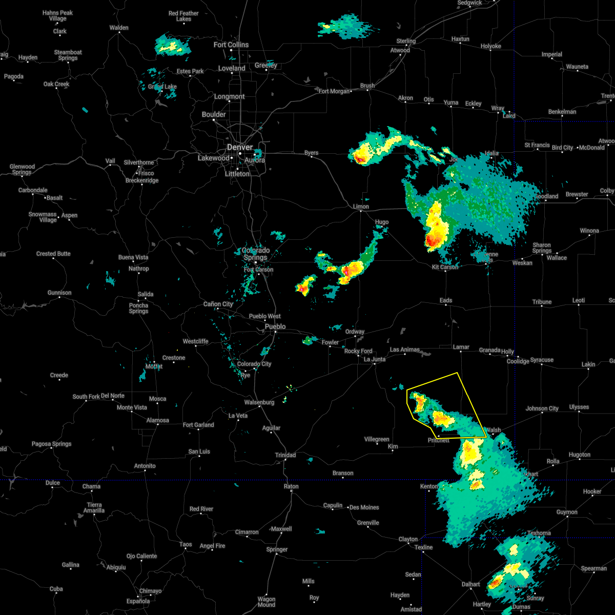 At 523 pm mdt, severe thunderstorms were located along a line extending from 20 miles northwest of pritchett to springfield, moving east at 25 mph (radar indicated). Hazards include 60 mph wind gusts. Expect damage to roofs, siding, and trees. Locations impacted include, springfield, pritchett, vilas and two buttes reservoir. At 523 pm mdt, severe thunderstorms were located along a line extending from 20 miles northwest of pritchett to springfield, moving east at 25 mph (radar indicated). Hazards include 60 mph wind gusts. Expect damage to roofs, siding, and trees. Locations impacted include, springfield, pritchett, vilas and two buttes reservoir.
|
| 5/14/2021 5:07 PM MDT |
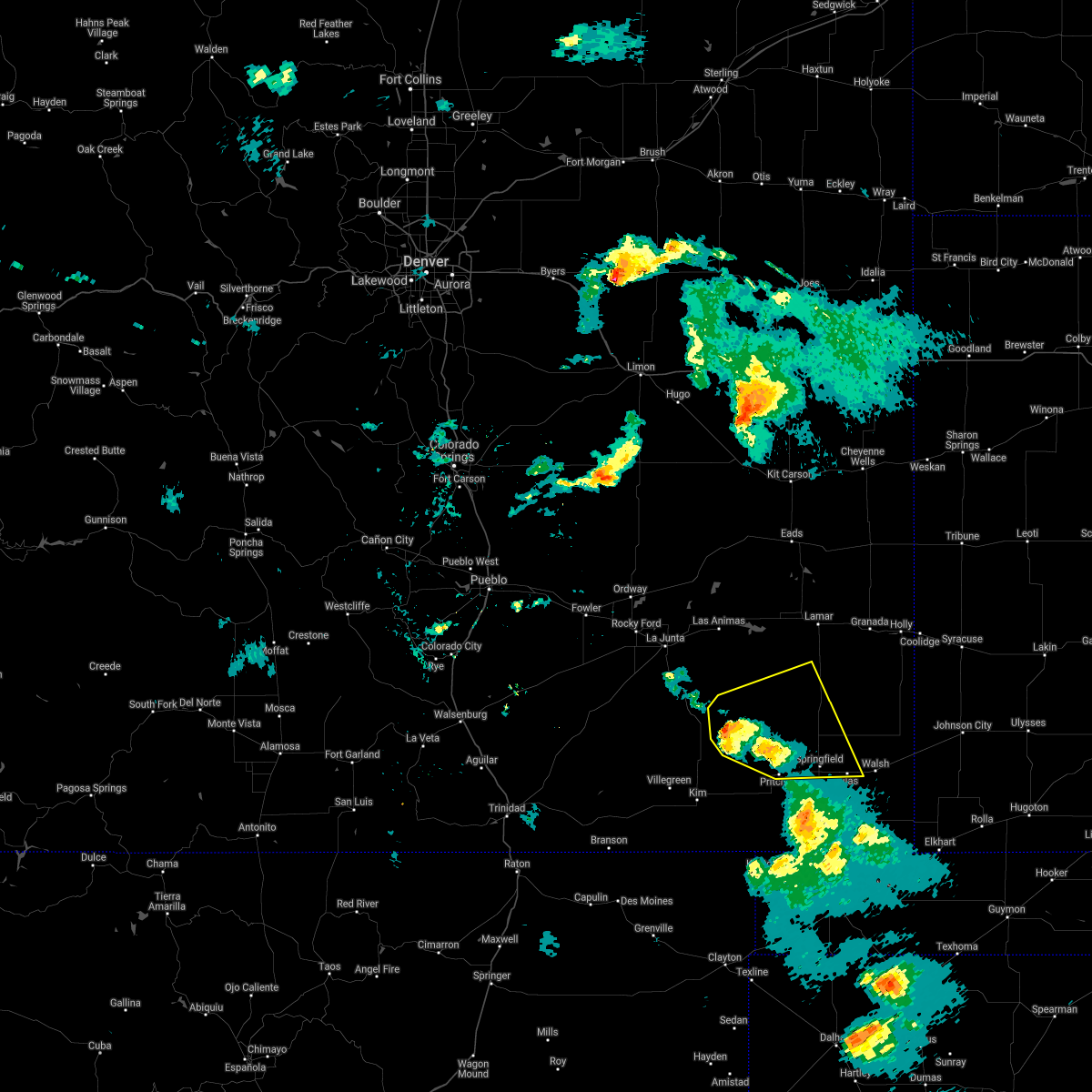 At 507 pm mdt, severe thunderstorms were located along a line extending from 18 miles southeast of higbee to 6 miles east of pritchett, moving east at 30 mph (radar indicated). Hazards include 60 mph wind gusts and quarter size hail. Hail damage to vehicles is expected. expect wind damage to roofs, siding, and trees. Locations impacted include, springfield, pritchett, vilas and two buttes reservoir. At 507 pm mdt, severe thunderstorms were located along a line extending from 18 miles southeast of higbee to 6 miles east of pritchett, moving east at 30 mph (radar indicated). Hazards include 60 mph wind gusts and quarter size hail. Hail damage to vehicles is expected. expect wind damage to roofs, siding, and trees. Locations impacted include, springfield, pritchett, vilas and two buttes reservoir.
|
| 5/14/2021 4:58 PM MDT |
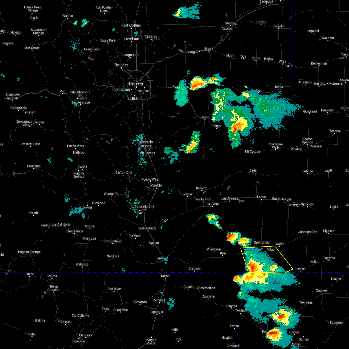 At 457 pm mdt, severe thunderstorms were located along a line extending from 16 miles south of pritchett to 10 miles south of campo, moving northeast at 20 mph (radar indicated). Hazards include 60 mph wind gusts and quarter size hail. Hail damage to vehicles is expected. expect wind damage to roofs, siding, and trees. Locations impacted include, pritchett, vilas and campo. At 457 pm mdt, severe thunderstorms were located along a line extending from 16 miles south of pritchett to 10 miles south of campo, moving northeast at 20 mph (radar indicated). Hazards include 60 mph wind gusts and quarter size hail. Hail damage to vehicles is expected. expect wind damage to roofs, siding, and trees. Locations impacted include, pritchett, vilas and campo.
|
| 5/14/2021 4:57 PM MDT |
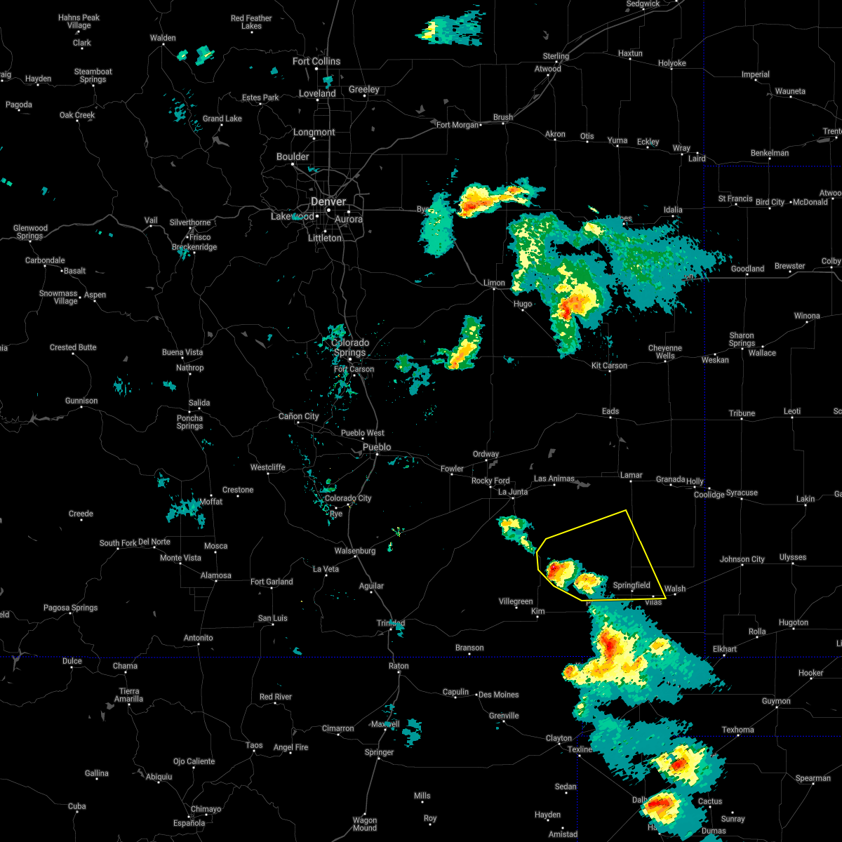 At 457 pm mdt, severe thunderstorms were located along a line extending from 12 miles southeast of higbee to near pritchett, moving east at 20 mph (radar indicated). Hazards include 60 mph wind gusts and quarter size hail. Hail damage to vehicles is expected. expect wind damage to roofs, siding, and trees. Locations impacted include, springfield, pritchett, vilas and two buttes reservoir. At 457 pm mdt, severe thunderstorms were located along a line extending from 12 miles southeast of higbee to near pritchett, moving east at 20 mph (radar indicated). Hazards include 60 mph wind gusts and quarter size hail. Hail damage to vehicles is expected. expect wind damage to roofs, siding, and trees. Locations impacted include, springfield, pritchett, vilas and two buttes reservoir.
|
| 5/14/2021 4:47 PM MDT |
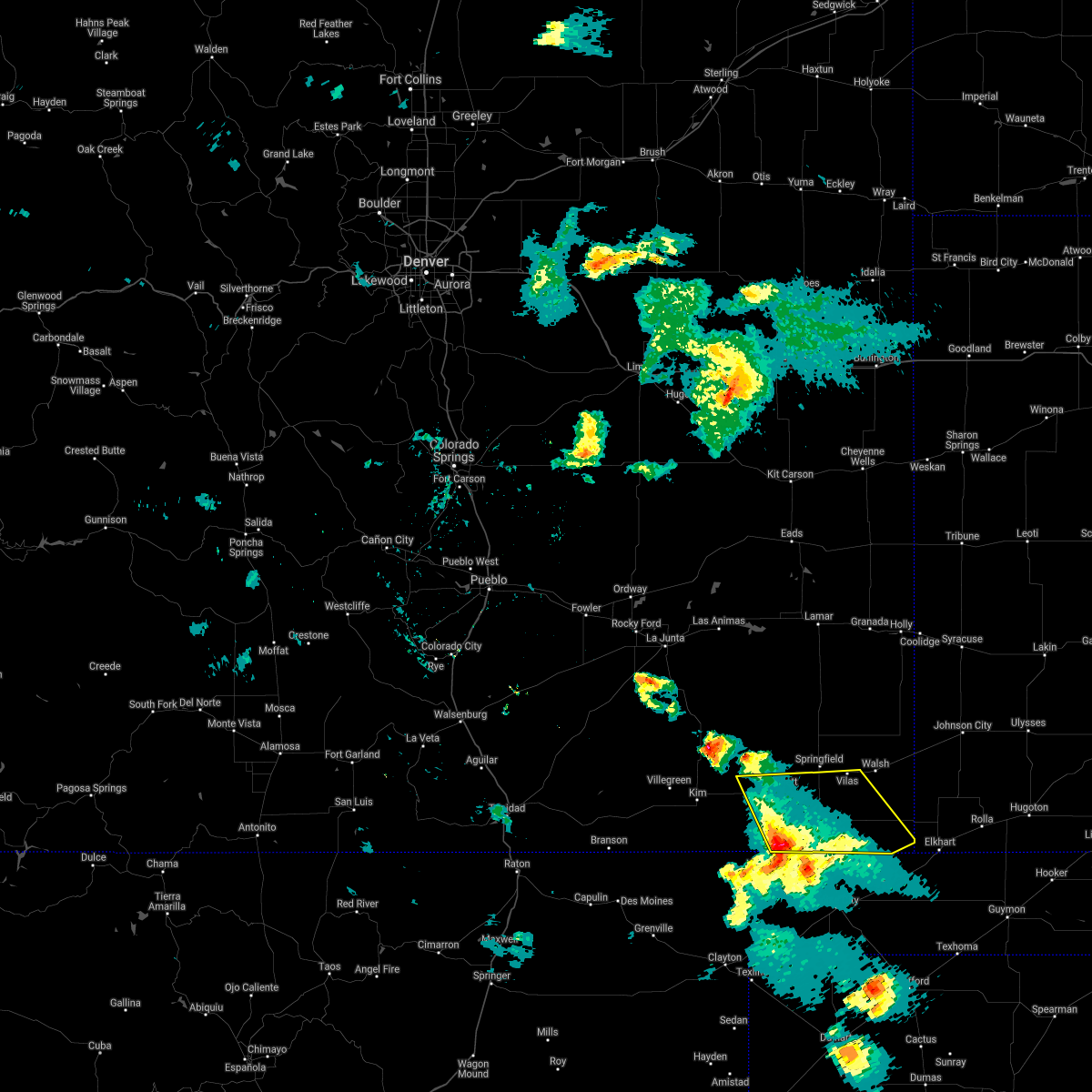 At 447 pm mdt, severe thunderstorms were located along a line extending from 15 miles north of kenton to 12 miles south of campo, moving northeast at 20 mph (radar indicated). Hazards include 60 mph wind gusts and quarter size hail. Hail damage to vehicles is expected. Expect wind damage to roofs, siding, and trees. At 447 pm mdt, severe thunderstorms were located along a line extending from 15 miles north of kenton to 12 miles south of campo, moving northeast at 20 mph (radar indicated). Hazards include 60 mph wind gusts and quarter size hail. Hail damage to vehicles is expected. Expect wind damage to roofs, siding, and trees.
|
| 5/14/2021 4:46 PM MDT |
 At 445 pm mdt, severe thunderstorms were located along a line extending from 11 miles south of higbee to 6 miles west of pritchett, moving east at 25 mph (radar indicated). Hazards include 60 mph wind gusts and quarter size hail. Hail damage to vehicles is expected. Expect wind damage to roofs, siding, and trees. At 445 pm mdt, severe thunderstorms were located along a line extending from 11 miles south of higbee to 6 miles west of pritchett, moving east at 25 mph (radar indicated). Hazards include 60 mph wind gusts and quarter size hail. Hail damage to vehicles is expected. Expect wind damage to roofs, siding, and trees.
|
| 5/8/2021 7:06 PM MDT |
 At 705 pm mdt, severe thunderstorms were located along a line extending from 12 miles southwest of two buttes reservoir to 8 miles southeast of pritchett to 17 miles north of kenton, moving southeast at 30 mph (radar indicated). Hazards include 70 mph wind gusts and quarter size hail. Hail damage to vehicles is expected. expect considerable tree damage. wind damage is also likely to mobile homes, roofs, and outbuildings. Locations impacted include, springfield, pritchett, vilas and two buttes. At 705 pm mdt, severe thunderstorms were located along a line extending from 12 miles southwest of two buttes reservoir to 8 miles southeast of pritchett to 17 miles north of kenton, moving southeast at 30 mph (radar indicated). Hazards include 70 mph wind gusts and quarter size hail. Hail damage to vehicles is expected. expect considerable tree damage. wind damage is also likely to mobile homes, roofs, and outbuildings. Locations impacted include, springfield, pritchett, vilas and two buttes.
|
| 5/8/2021 6:52 PM MDT |
 At 651 pm mdt, severe thunderstorms were located along a line extending from 16 miles west of two buttes reservoir to near pritchett to 20 miles east of kim, moving southeast at 35 mph (radar indicated). Hazards include 70 mph wind gusts and quarter size hail. Hail damage to vehicles is expected. expect considerable tree damage. wind damage is also likely to mobile homes, roofs, and outbuildings. Locations impacted include, springfield, pritchett, vilas and two buttes. At 651 pm mdt, severe thunderstorms were located along a line extending from 16 miles west of two buttes reservoir to near pritchett to 20 miles east of kim, moving southeast at 35 mph (radar indicated). Hazards include 70 mph wind gusts and quarter size hail. Hail damage to vehicles is expected. expect considerable tree damage. wind damage is also likely to mobile homes, roofs, and outbuildings. Locations impacted include, springfield, pritchett, vilas and two buttes.
|
| 5/8/2021 6:35 PM MDT |
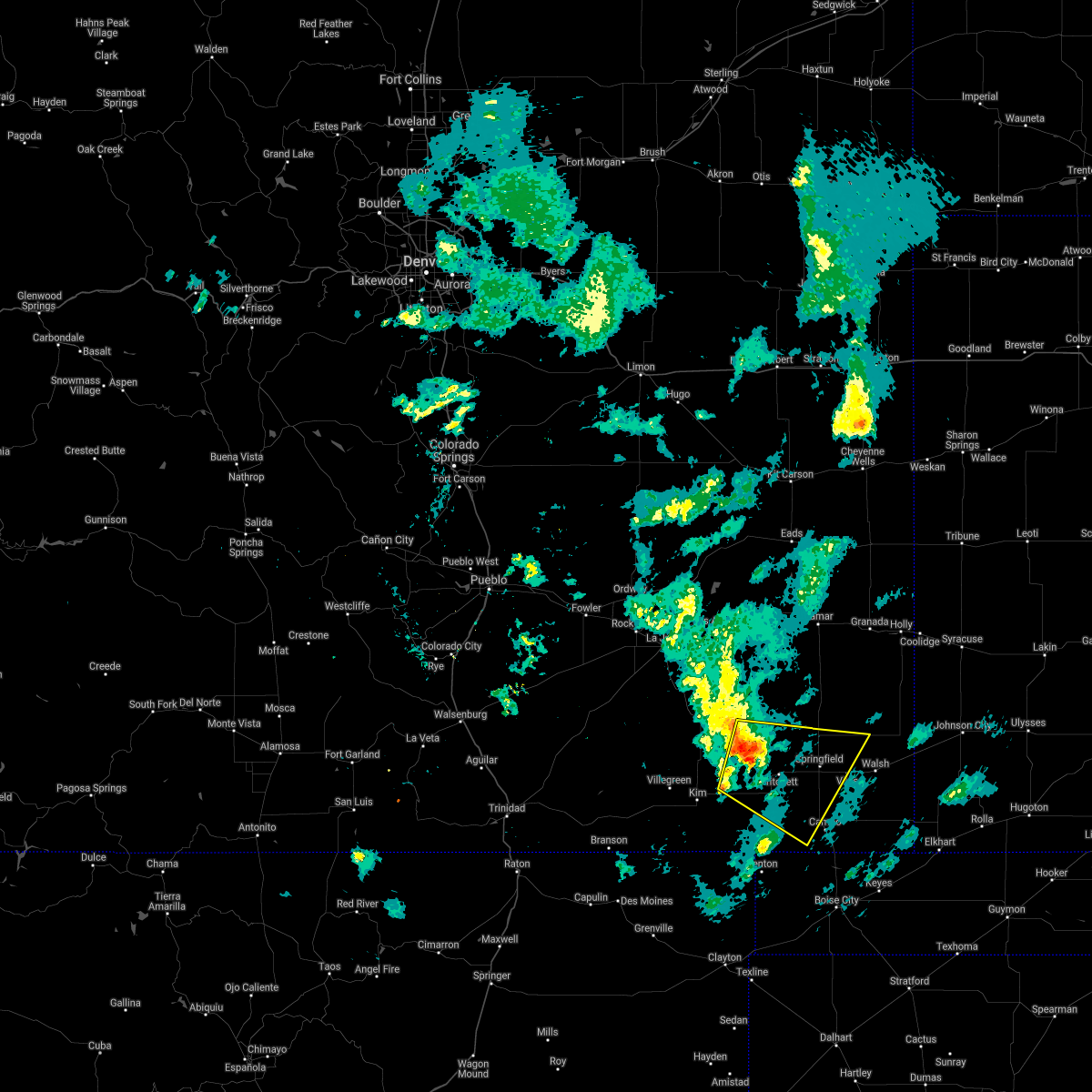 At 634 pm mdt, severe thunderstorms were located along a line extending from 24 miles west of two buttes reservoir to 9 miles northwest of pritchett to 11 miles east of kim, moving southeast at 30 mph (radar indicated). Hazards include 70 mph wind gusts and quarter size hail. Hail damage to vehicles is expected. expect considerable tree damage. Wind damage is also likely to mobile homes, roofs, and outbuildings. At 634 pm mdt, severe thunderstorms were located along a line extending from 24 miles west of two buttes reservoir to 9 miles northwest of pritchett to 11 miles east of kim, moving southeast at 30 mph (radar indicated). Hazards include 70 mph wind gusts and quarter size hail. Hail damage to vehicles is expected. expect considerable tree damage. Wind damage is also likely to mobile homes, roofs, and outbuildings.
|
| 8/28/2020 7:54 PM MDT |
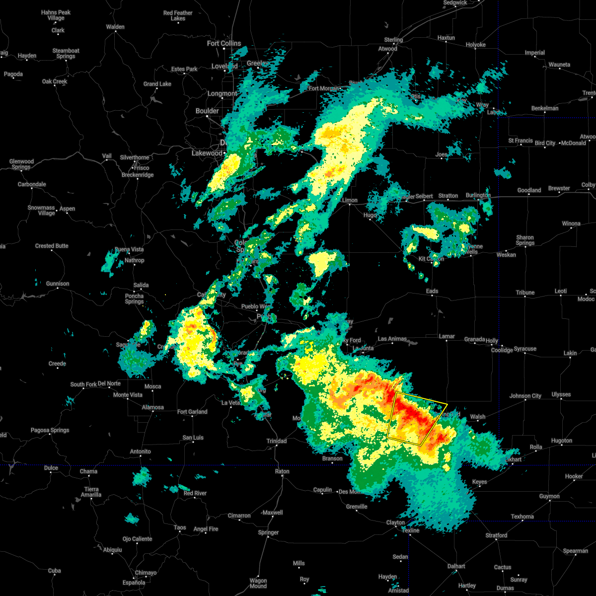 The severe thunderstorm warning for northwestern baca and east central las animas counties will expire at 800 pm mdt, the storm which prompted the warning has weakened below severe limits, and no longer poses an immediate threat to life or property. therefore, the warning will be allowed to expire. however small hail, gusty winds and heavy rain are still possible with this thunderstorm. The severe thunderstorm warning for northwestern baca and east central las animas counties will expire at 800 pm mdt, the storm which prompted the warning has weakened below severe limits, and no longer poses an immediate threat to life or property. therefore, the warning will be allowed to expire. however small hail, gusty winds and heavy rain are still possible with this thunderstorm.
|
| 8/28/2020 7:36 PM MDT |
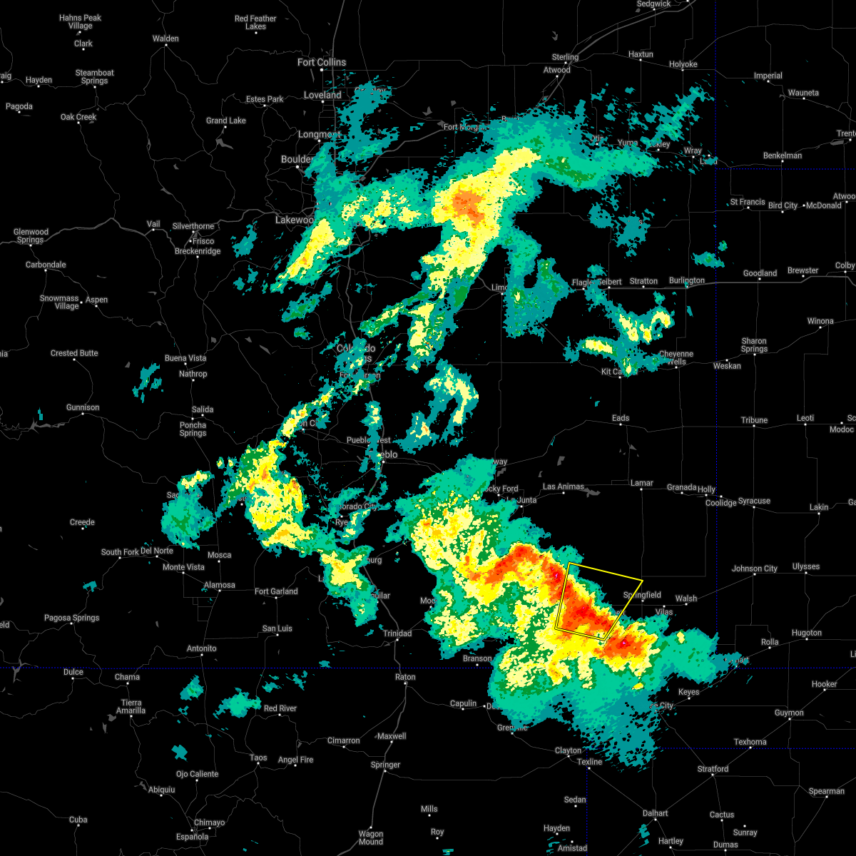 At 736 pm mdt, a severe thunderstorm was located 8 miles west of pritchett, or 21 miles west of springfield, moving north at 35 mph (radar indicated). Hazards include 60 mph wind gusts and quarter size hail. Hail damage to vehicles is expected. expect wind damage to roofs, siding, and trees. Locations impacted include, pritchett. At 736 pm mdt, a severe thunderstorm was located 8 miles west of pritchett, or 21 miles west of springfield, moving north at 35 mph (radar indicated). Hazards include 60 mph wind gusts and quarter size hail. Hail damage to vehicles is expected. expect wind damage to roofs, siding, and trees. Locations impacted include, pritchett.
|
| 8/28/2020 7:22 PM MDT |
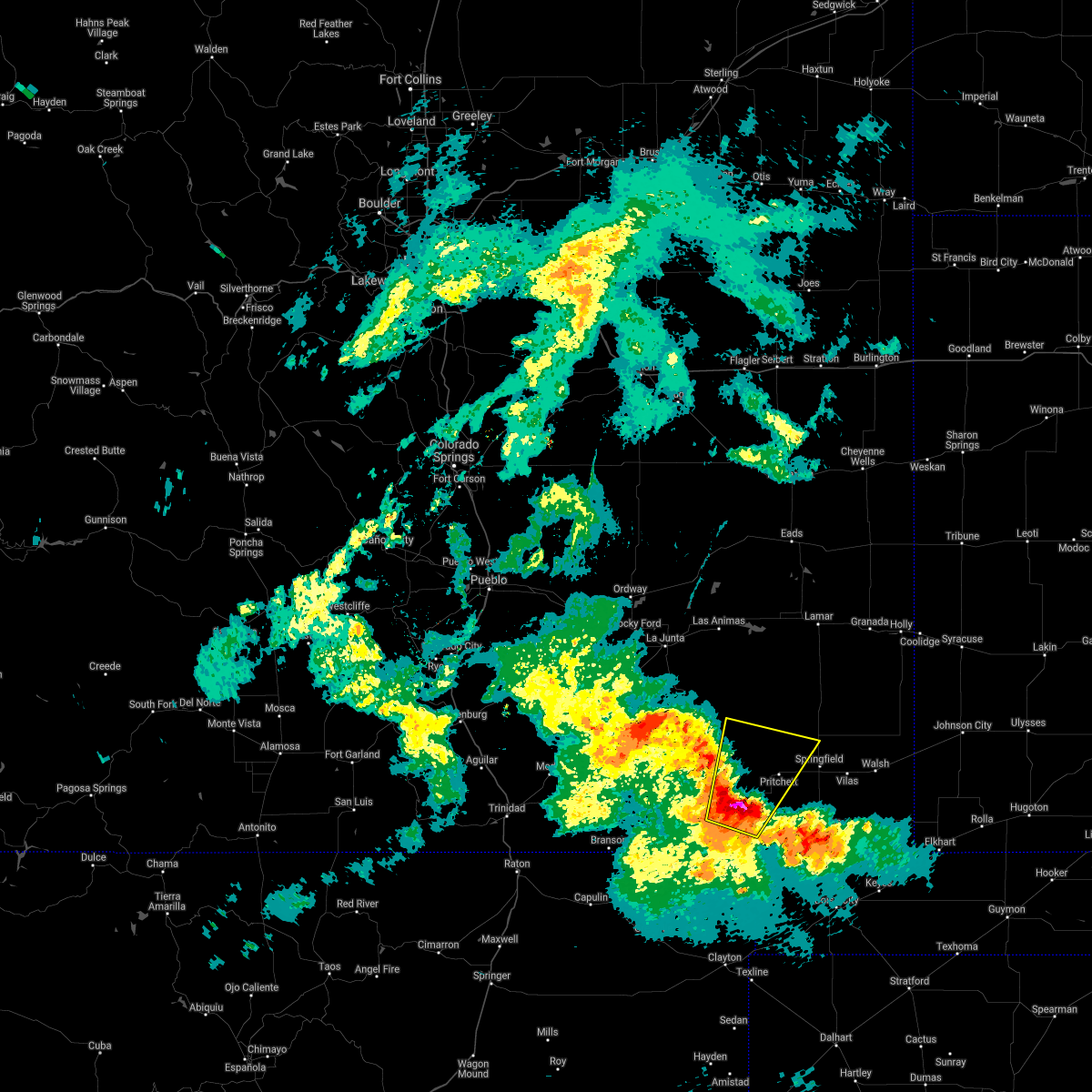 At 721 pm mdt, a severe thunderstorm was located 14 miles southwest of pritchett, or 27 miles southwest of springfield, moving northeast at 35 mph (radar indicated). Hazards include 60 mph wind gusts and quarter size hail. Hail damage to vehicles is expected. Expect wind damage to roofs, siding, and trees. At 721 pm mdt, a severe thunderstorm was located 14 miles southwest of pritchett, or 27 miles southwest of springfield, moving northeast at 35 mph (radar indicated). Hazards include 60 mph wind gusts and quarter size hail. Hail damage to vehicles is expected. Expect wind damage to roofs, siding, and trees.
|
| 8/4/2020 5:56 PM MDT |
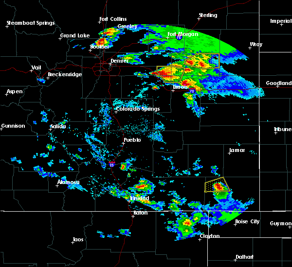 At 555 pm mdt, a severe thunderstorm was located 9 miles north of pritchett, or 14 miles northwest of springfield, moving east at 30 mph (radar indicated). Hazards include 60 mph wind gusts and half dollar size hail. Hail damage to vehicles is expected. expect wind damage to roofs, siding, and trees. Locations impacted include, springfield and pritchett. At 555 pm mdt, a severe thunderstorm was located 9 miles north of pritchett, or 14 miles northwest of springfield, moving east at 30 mph (radar indicated). Hazards include 60 mph wind gusts and half dollar size hail. Hail damage to vehicles is expected. expect wind damage to roofs, siding, and trees. Locations impacted include, springfield and pritchett.
|
| 8/4/2020 5:43 PM MDT |
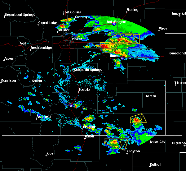 At 542 pm mdt, a severe thunderstorm was located 8 miles northwest of pritchett, or 18 miles west of springfield, moving east at 30 mph (radar indicated). Hazards include 60 mph wind gusts and quarter size hail. Hail damage to vehicles is expected. Expect wind damage to roofs, siding, and trees. At 542 pm mdt, a severe thunderstorm was located 8 miles northwest of pritchett, or 18 miles west of springfield, moving east at 30 mph (radar indicated). Hazards include 60 mph wind gusts and quarter size hail. Hail damage to vehicles is expected. Expect wind damage to roofs, siding, and trees.
|
| 8/3/2020 8:57 PM MDT |
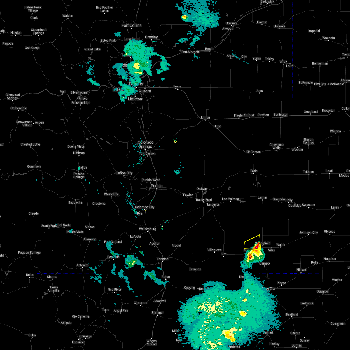 The severe thunderstorm warning for northwestern baca county will expire at 900 pm mdt, the storm which prompted the warning has weakened below severe limits, and no longer poses an immediate threat to life or property. therefore, the warning will be allowed to expire. however small hail and gusty winds are still possible with this thunderstorm. The severe thunderstorm warning for northwestern baca county will expire at 900 pm mdt, the storm which prompted the warning has weakened below severe limits, and no longer poses an immediate threat to life or property. therefore, the warning will be allowed to expire. however small hail and gusty winds are still possible with this thunderstorm.
|
| 8/3/2020 8:41 PM MDT |
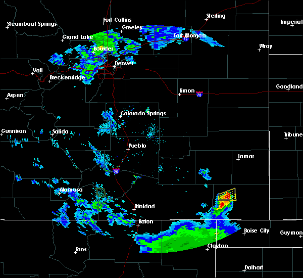 At 841 pm mdt, a severe thunderstorm was located near pritchett, or 12 miles west of springfield, moving east at 25 mph (radar indicated). Hazards include 60 mph wind gusts and half dollar size hail. Hail damage to vehicles is expected. expect wind damage to roofs, siding, and trees. Locations impacted include, pritchett. At 841 pm mdt, a severe thunderstorm was located near pritchett, or 12 miles west of springfield, moving east at 25 mph (radar indicated). Hazards include 60 mph wind gusts and half dollar size hail. Hail damage to vehicles is expected. expect wind damage to roofs, siding, and trees. Locations impacted include, pritchett.
|
| 8/3/2020 8:27 PM MDT |
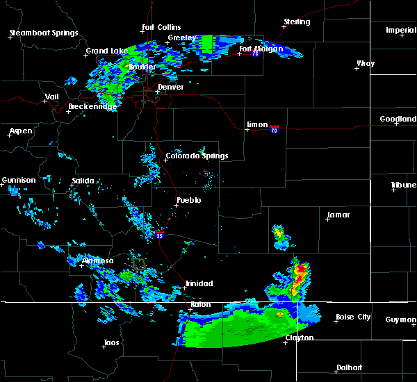 At 827 pm mdt, a severe thunderstorm was located 7 miles northwest of pritchett, or 19 miles west of springfield, moving east at 25 mph (radar indicated). Hazards include 60 mph wind gusts and half dollar size hail. Hail damage to vehicles is expected. Expect wind damage to roofs, siding, and trees. At 827 pm mdt, a severe thunderstorm was located 7 miles northwest of pritchett, or 19 miles west of springfield, moving east at 25 mph (radar indicated). Hazards include 60 mph wind gusts and half dollar size hail. Hail damage to vehicles is expected. Expect wind damage to roofs, siding, and trees.
|
| 7/14/2020 8:11 PM MDT |
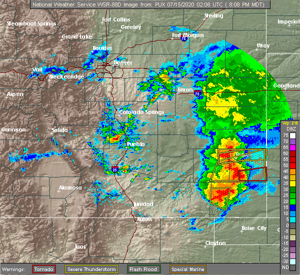 The severe thunderstorm warning for western baca county will expire at 815 pm mdt, the storm which prompted the warning has weakened below severe limits, and no longer poses an immediate threat to life or property. therefore, the warning will be allowed to expire. however gusty winds and heavy rain are still possible with this thunderstorm. a severe thunderstorm watch remains in effect until 900 pm mdt for southeastern colorado. to report severe weather, contact your nearest law enforcement agency. they will relay your report to the national weather service pueblo. The severe thunderstorm warning for western baca county will expire at 815 pm mdt, the storm which prompted the warning has weakened below severe limits, and no longer poses an immediate threat to life or property. therefore, the warning will be allowed to expire. however gusty winds and heavy rain are still possible with this thunderstorm. a severe thunderstorm watch remains in effect until 900 pm mdt for southeastern colorado. to report severe weather, contact your nearest law enforcement agency. they will relay your report to the national weather service pueblo.
|
| 7/14/2020 8:06 PM MDT |
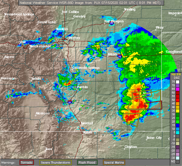 At 805 pm mdt, a severe thunderstorm was located over pritchett, or 14 miles west of springfield, moving east at 40 mph (radar indicated). Hazards include 70 mph wind gusts and quarter size hail. Hail damage to vehicles is expected. expect considerable tree damage. wind damage is also likely to mobile homes, roofs, and outbuildings. Locations impacted include, pritchett. At 805 pm mdt, a severe thunderstorm was located over pritchett, or 14 miles west of springfield, moving east at 40 mph (radar indicated). Hazards include 70 mph wind gusts and quarter size hail. Hail damage to vehicles is expected. expect considerable tree damage. wind damage is also likely to mobile homes, roofs, and outbuildings. Locations impacted include, pritchett.
|
| 7/14/2020 7:53 PM MDT |
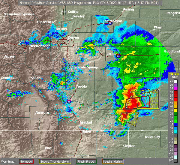 At 752 pm mdt, a severe thunderstorm was located 10 miles west of pritchett, or 23 miles west of springfield, moving east at 30 mph (radar indicated). Hazards include 70 mph wind gusts and half dollar size hail. Hail damage to vehicles is expected. expect considerable tree damage. wind damage is also likely to mobile homes, roofs, and outbuildings. Locations impacted include, pritchett. At 752 pm mdt, a severe thunderstorm was located 10 miles west of pritchett, or 23 miles west of springfield, moving east at 30 mph (radar indicated). Hazards include 70 mph wind gusts and half dollar size hail. Hail damage to vehicles is expected. expect considerable tree damage. wind damage is also likely to mobile homes, roofs, and outbuildings. Locations impacted include, pritchett.
|
| 7/14/2020 7:42 PM MDT |
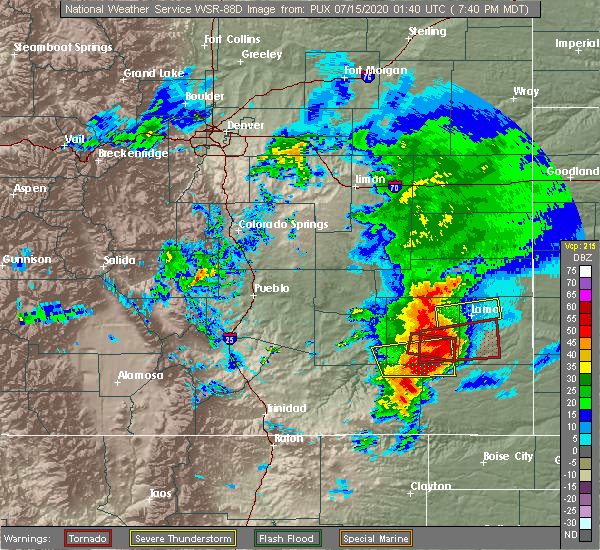 At 742 pm mdt, a severe thunderstorm was located 15 miles west of pritchett, or 28 miles west of springfield, moving east at 40 mph (radar indicated). Hazards include 70 mph wind gusts and half dollar size hail. Hail damage to vehicles is expected. expect considerable tree damage. Wind damage is also likely to mobile homes, roofs, and outbuildings. At 742 pm mdt, a severe thunderstorm was located 15 miles west of pritchett, or 28 miles west of springfield, moving east at 40 mph (radar indicated). Hazards include 70 mph wind gusts and half dollar size hail. Hail damage to vehicles is expected. expect considerable tree damage. Wind damage is also likely to mobile homes, roofs, and outbuildings.
|
| 5/24/2020 5:52 PM MDT |
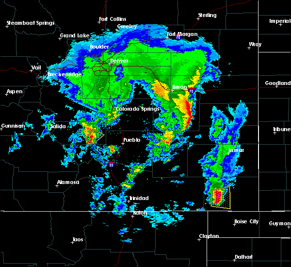 At 551 pm mdt, a severe thunderstorm was located 10 miles south of pritchett, or 17 miles southwest of springfield, moving east at 20 mph (radar indicated). Hazards include ping pong ball size hail and 60 mph wind gusts. People and animals outdoors will be injured. expect hail damage to roofs, siding, windows, and vehicles. expect wind damage to roofs, siding, and trees. Locations impacted include, springfield and pritchett. At 551 pm mdt, a severe thunderstorm was located 10 miles south of pritchett, or 17 miles southwest of springfield, moving east at 20 mph (radar indicated). Hazards include ping pong ball size hail and 60 mph wind gusts. People and animals outdoors will be injured. expect hail damage to roofs, siding, windows, and vehicles. expect wind damage to roofs, siding, and trees. Locations impacted include, springfield and pritchett.
|
| 5/24/2020 5:44 PM MDT |
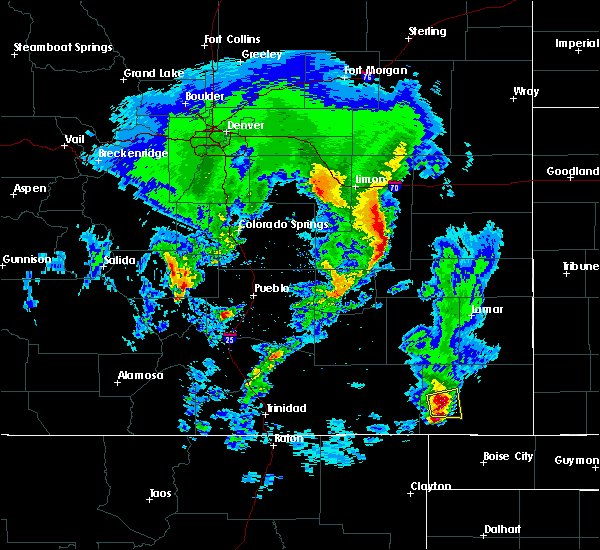 At 542 pm mdt, a cluster of severe thunderstorms was located 10 miles south of pritchett, or 20 miles southwest of springfield, moving east at 20 mph (radar indicated). Hazards include 60 mph wind gusts and quarter size hail. Hail damage to vehicles is expected. Expect wind damage to roofs, siding, and trees. At 542 pm mdt, a cluster of severe thunderstorms was located 10 miles south of pritchett, or 20 miles southwest of springfield, moving east at 20 mph (radar indicated). Hazards include 60 mph wind gusts and quarter size hail. Hail damage to vehicles is expected. Expect wind damage to roofs, siding, and trees.
|
| 5/24/2020 5:33 PM MDT |
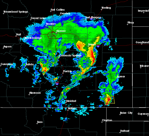 At 532 pm mdt, a severe thunderstorm was located 7 miles south of pritchett, or 18 miles southwest of springfield, moving east at 20 mph (radar indicated). Hazards include 60 mph wind gusts and half dollar size hail. Hail damage to vehicles is expected. expect wind damage to roofs, siding, and trees. Locations impacted include, pritchett and mainly rural areas of western baca county. At 532 pm mdt, a severe thunderstorm was located 7 miles south of pritchett, or 18 miles southwest of springfield, moving east at 20 mph (radar indicated). Hazards include 60 mph wind gusts and half dollar size hail. Hail damage to vehicles is expected. expect wind damage to roofs, siding, and trees. Locations impacted include, pritchett and mainly rural areas of western baca county.
|
| 5/24/2020 5:25 PM MDT |
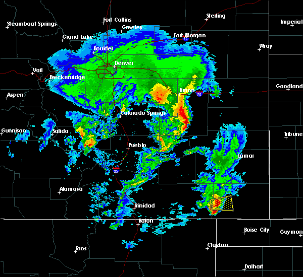 At 524 pm mdt, a severe thunderstorm was located 9 miles southwest of pritchett, or 21 miles southwest of springfield, moving east at 20 mph (radar indicated). Hazards include 60 mph wind gusts and half dollar size hail. Hail damage to vehicles is expected. expect wind damage to roofs, siding, and trees. Locations impacted include, pritchett. At 524 pm mdt, a severe thunderstorm was located 9 miles southwest of pritchett, or 21 miles southwest of springfield, moving east at 20 mph (radar indicated). Hazards include 60 mph wind gusts and half dollar size hail. Hail damage to vehicles is expected. expect wind damage to roofs, siding, and trees. Locations impacted include, pritchett.
|
| 5/24/2020 5:16 PM MDT |
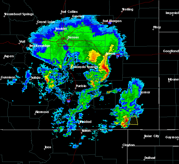 At 515 pm mdt, a severe thunderstorm was located 11 miles southwest of pritchett, or 24 miles southwest of springfield, moving east at 20 mph (radar indicated). Hazards include 60 mph wind gusts and quarter size hail. Hail damage to vehicles is expected. Expect wind damage to roofs, siding, and trees. At 515 pm mdt, a severe thunderstorm was located 11 miles southwest of pritchett, or 24 miles southwest of springfield, moving east at 20 mph (radar indicated). Hazards include 60 mph wind gusts and quarter size hail. Hail damage to vehicles is expected. Expect wind damage to roofs, siding, and trees.
|
| 5/15/2020 12:17 AM MDT |
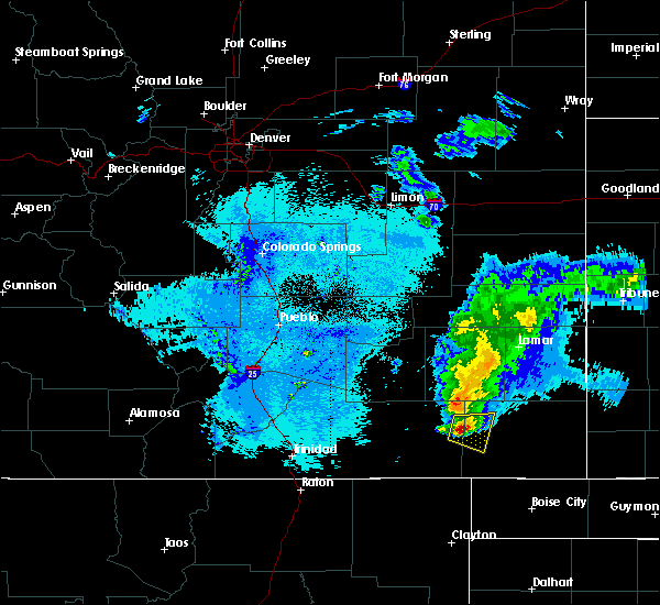 At 1216 am mdt, a severe thunderstorm was located 13 miles west of pritchett, or 26 miles west of springfield, moving east at 15 mph (radar indicated). Hazards include 60 mph wind gusts and half dollar size hail. Hail damage to vehicles is expected. expect wind damage to roofs, siding, and trees. Locations impacted include, pritchett. At 1216 am mdt, a severe thunderstorm was located 13 miles west of pritchett, or 26 miles west of springfield, moving east at 15 mph (radar indicated). Hazards include 60 mph wind gusts and half dollar size hail. Hail damage to vehicles is expected. expect wind damage to roofs, siding, and trees. Locations impacted include, pritchett.
|
| 5/14/2020 11:59 PM MDT |
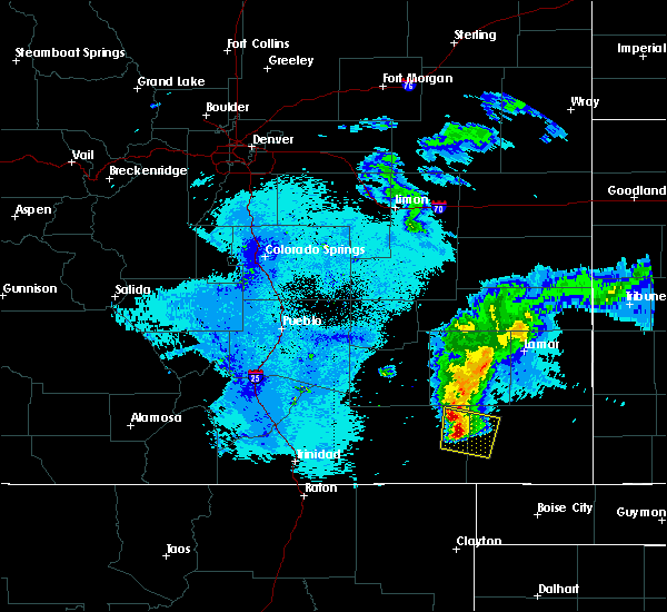 At 1156 pm mdt, a severe thunderstorm was located 15 miles northeast of kim, or 30 miles west of springfield, moving east at 15 mph (radar indicated). Hazards include ping pong ball size hail and 60 mph wind gusts. People and animals outdoors have the potential of being injured. Wind damage to roofs, siding, and trees will also be possible. At 1156 pm mdt, a severe thunderstorm was located 15 miles northeast of kim, or 30 miles west of springfield, moving east at 15 mph (radar indicated). Hazards include ping pong ball size hail and 60 mph wind gusts. People and animals outdoors have the potential of being injured. Wind damage to roofs, siding, and trees will also be possible.
|
| 6/22/2019 9:37 PM MDT |
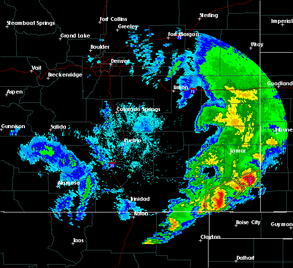 At 935 pm mdt, severe thunderstorms were located along a line extending from 6 miles south of two buttes to 13 miles northeast of kenton, moving east at 45 mph (radar indicated. at 917 pm a wind gust to 59 mph was reported 9 miles south of springfield). Hazards include 60 mph wind gusts and half dollar size hail. Hail damage to vehicles is expected. expect wind damage to roofs, siding, and trees. Locations impacted include, springfield, pritchett and vilas. At 935 pm mdt, severe thunderstorms were located along a line extending from 6 miles south of two buttes to 13 miles northeast of kenton, moving east at 45 mph (radar indicated. at 917 pm a wind gust to 59 mph was reported 9 miles south of springfield). Hazards include 60 mph wind gusts and half dollar size hail. Hail damage to vehicles is expected. expect wind damage to roofs, siding, and trees. Locations impacted include, springfield, pritchett and vilas.
|
| 6/22/2019 9:22 PM MDT |
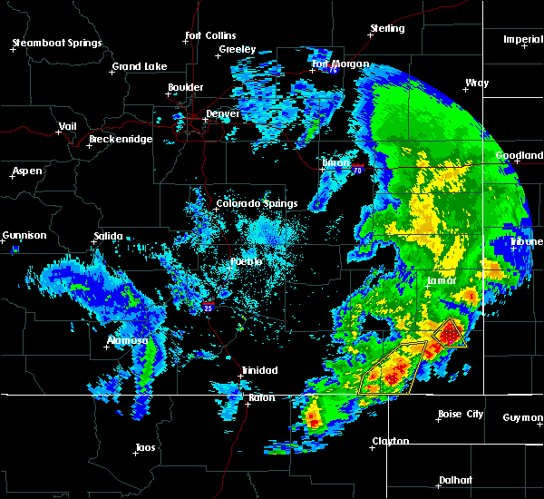 At 921 pm mdt, severe thunderstorms were located along a line extending from near springfield to 15 miles north of kenton, moving east at 45 mph (radar indicated). Hazards include 60 mph wind gusts and half dollar size hail. Hail damage to vehicles is expected. Expect wind damage to roofs, siding, and trees. At 921 pm mdt, severe thunderstorms were located along a line extending from near springfield to 15 miles north of kenton, moving east at 45 mph (radar indicated). Hazards include 60 mph wind gusts and half dollar size hail. Hail damage to vehicles is expected. Expect wind damage to roofs, siding, and trees.
|
| 6/22/2019 9:14 PM MDT |
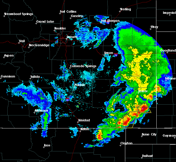 At 857 pm mdt, severe thunderstorms were located along a line extending from near pritchett to 15 miles southeast of kim, moving east at 35 mph (radar indicated). Hazards include golf ball size hail and 60 mph wind gusts. People and animals outdoors will be injured. expect hail damage to roofs, siding, windows, and vehicles. expect wind damage to roofs, siding, and trees. Locations impacted include, pritchett. At 857 pm mdt, severe thunderstorms were located along a line extending from near pritchett to 15 miles southeast of kim, moving east at 35 mph (radar indicated). Hazards include golf ball size hail and 60 mph wind gusts. People and animals outdoors will be injured. expect hail damage to roofs, siding, windows, and vehicles. expect wind damage to roofs, siding, and trees. Locations impacted include, pritchett.
|
| 6/22/2019 8:58 PM MDT |
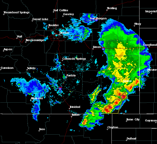 At 857 pm mdt, severe thunderstorms were located along a line extending from near pritchett to 15 miles southeast of kim, moving east at 35 mph (radar indicated). Hazards include golf ball size hail and 60 mph wind gusts. People and animals outdoors will be injured. expect hail damage to roofs, siding, windows, and vehicles. expect wind damage to roofs, siding, and trees. Locations impacted include, pritchett. At 857 pm mdt, severe thunderstorms were located along a line extending from near pritchett to 15 miles southeast of kim, moving east at 35 mph (radar indicated). Hazards include golf ball size hail and 60 mph wind gusts. People and animals outdoors will be injured. expect hail damage to roofs, siding, windows, and vehicles. expect wind damage to roofs, siding, and trees. Locations impacted include, pritchett.
|
| 6/22/2019 8:46 PM MDT |
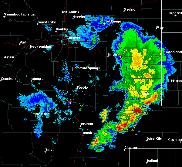 At 844 pm mdt, severe thunderstorms were located along a line extending from near pritchett to 10 miles south of kim, moving east at 45 mph (radar indicated). Hazards include golf ball size hail and 60 mph wind gusts. People and animals outdoors will be injured. expect hail damage to roofs, siding, windows, and vehicles. Expect wind damage to roofs, siding, and trees. At 844 pm mdt, severe thunderstorms were located along a line extending from near pritchett to 10 miles south of kim, moving east at 45 mph (radar indicated). Hazards include golf ball size hail and 60 mph wind gusts. People and animals outdoors will be injured. expect hail damage to roofs, siding, windows, and vehicles. Expect wind damage to roofs, siding, and trees.
|
| 6/22/2019 8:39 PM MDT |
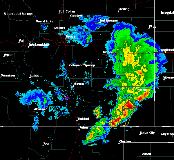 At 838 pm mdt, severe thunderstorms were located along a line extending from 6 miles north of pritchett to 11 miles south of kim, moving east at 45 mph (radar indicated). Hazards include golf ball size hail and 60 mph wind gusts. People and animals outdoors will be injured. expect hail damage to roofs, siding, windows, and vehicles. expect wind damage to roofs, siding, and trees. Locations impacted include, pritchett and kim. At 838 pm mdt, severe thunderstorms were located along a line extending from 6 miles north of pritchett to 11 miles south of kim, moving east at 45 mph (radar indicated). Hazards include golf ball size hail and 60 mph wind gusts. People and animals outdoors will be injured. expect hail damage to roofs, siding, windows, and vehicles. expect wind damage to roofs, siding, and trees. Locations impacted include, pritchett and kim.
|
| 6/22/2019 8:29 PM MDT |
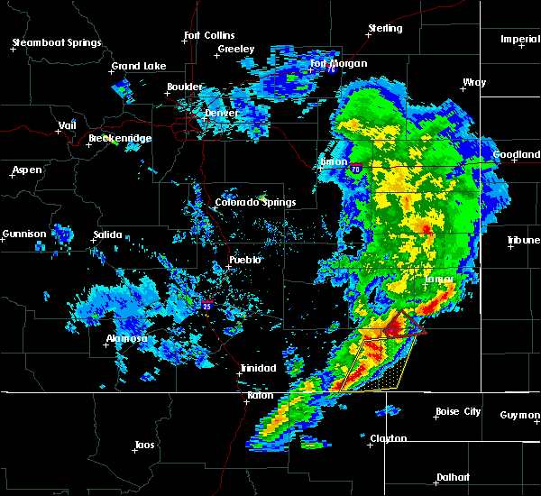 At 817 pm mdt, severe thunderstorms were located along a line extending from 18 miles northwest of pritchett to 13 miles south of kim, moving east at 50 mph (radar indicated). Hazards include golf ball size hail and 60 mph wind gusts. People and animals outdoors will be injured. expect hail damage to roofs, siding, windows, and vehicles. Expect wind damage to roofs, siding, and trees. At 817 pm mdt, severe thunderstorms were located along a line extending from 18 miles northwest of pritchett to 13 miles south of kim, moving east at 50 mph (radar indicated). Hazards include golf ball size hail and 60 mph wind gusts. People and animals outdoors will be injured. expect hail damage to roofs, siding, windows, and vehicles. Expect wind damage to roofs, siding, and trees.
|
| 6/22/2019 8:17 PM MDT |
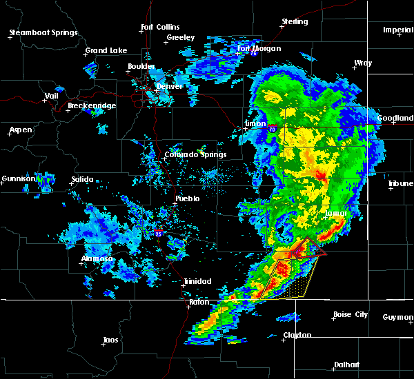 At 817 pm mdt, severe thunderstorms were located along a line extending from 18 miles northwest of pritchett to 13 miles south of kim, moving east at 50 mph (radar indicated). Hazards include golf ball size hail and 60 mph wind gusts. People and animals outdoors will be injured. expect hail damage to roofs, siding, windows, and vehicles. Expect wind damage to roofs, siding, and trees. At 817 pm mdt, severe thunderstorms were located along a line extending from 18 miles northwest of pritchett to 13 miles south of kim, moving east at 50 mph (radar indicated). Hazards include golf ball size hail and 60 mph wind gusts. People and animals outdoors will be injured. expect hail damage to roofs, siding, windows, and vehicles. Expect wind damage to roofs, siding, and trees.
|
| 6/18/2019 4:22 PM MDT |
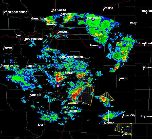 At 421 pm mdt, a severe thunderstorm was located 15 miles northeast of kim, or 31 miles west of springfield, moving northeast at 25 mph (radar indicated). Hazards include 60 mph wind gusts and half dollar size hail. Hail damage to vehicles is expected. expect wind damage to roofs, siding, and trees. Locations impacted include, pritchett. At 421 pm mdt, a severe thunderstorm was located 15 miles northeast of kim, or 31 miles west of springfield, moving northeast at 25 mph (radar indicated). Hazards include 60 mph wind gusts and half dollar size hail. Hail damage to vehicles is expected. expect wind damage to roofs, siding, and trees. Locations impacted include, pritchett.
|
| 6/18/2019 4:17 PM MDT |
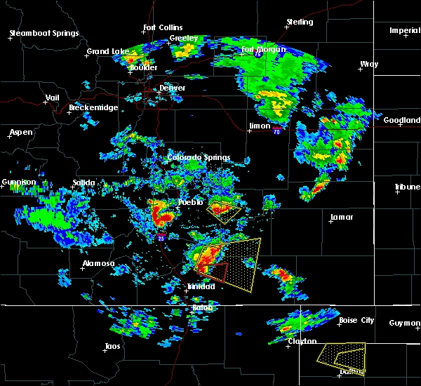 At 416 pm mdt, a severe thunderstorm was located 12 miles northeast of kim, or 33 miles west of springfield, moving northeast at 20 mph (radar indicated). Hazards include 60 mph wind gusts and quarter size hail. Hail damage to vehicles is expected. Expect wind damage to roofs, siding, and trees. At 416 pm mdt, a severe thunderstorm was located 12 miles northeast of kim, or 33 miles west of springfield, moving northeast at 20 mph (radar indicated). Hazards include 60 mph wind gusts and quarter size hail. Hail damage to vehicles is expected. Expect wind damage to roofs, siding, and trees.
|
| 5/26/2019 12:43 PM MDT |
 At 1243 pm mdt, a severe thunderstorm was located 10 miles south of springfield, moving northeast at 45 mph (radar indicated). Hazards include 60 mph wind gusts and half dollar size hail. Hail damage to vehicles is expected. Expect wind damage to roofs, siding, and trees. At 1243 pm mdt, a severe thunderstorm was located 10 miles south of springfield, moving northeast at 45 mph (radar indicated). Hazards include 60 mph wind gusts and half dollar size hail. Hail damage to vehicles is expected. Expect wind damage to roofs, siding, and trees.
|
| 5/6/2019 5:29 PM MDT |
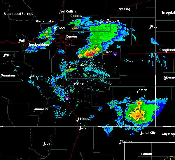 At 528 pm mdt, a severe thunderstorm was located near springfield, moving east at 40 mph (trained weather spotters reported a 69 mph wind gust 7 miles south of springfield). Hazards include 70 mph wind gusts and quarter size hail. Hail damage to vehicles is expected. expect considerable tree damage. wind damage is also likely to mobile homes, roofs, and outbuildings. Locations impacted include, springfield and pritchett. At 528 pm mdt, a severe thunderstorm was located near springfield, moving east at 40 mph (trained weather spotters reported a 69 mph wind gust 7 miles south of springfield). Hazards include 70 mph wind gusts and quarter size hail. Hail damage to vehicles is expected. expect considerable tree damage. wind damage is also likely to mobile homes, roofs, and outbuildings. Locations impacted include, springfield and pritchett.
|
| 5/6/2019 5:17 PM MDT |
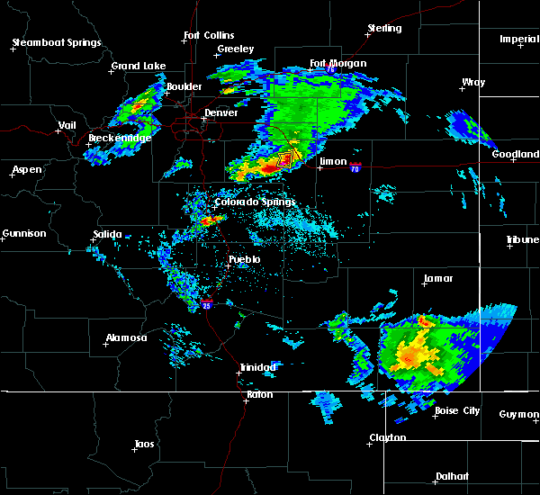 At 516 pm mdt, a severe thunderstorm was located near pritchett, or 10 miles southwest of springfield, moving northeast at 20 mph (radar indicated). Hazards include 60 mph wind gusts and quarter size hail. Hail damage to vehicles is expected. Expect wind damage to roofs, siding, and trees. At 516 pm mdt, a severe thunderstorm was located near pritchett, or 10 miles southwest of springfield, moving northeast at 20 mph (radar indicated). Hazards include 60 mph wind gusts and quarter size hail. Hail damage to vehicles is expected. Expect wind damage to roofs, siding, and trees.
|
| 9/3/2018 4:16 PM MDT |
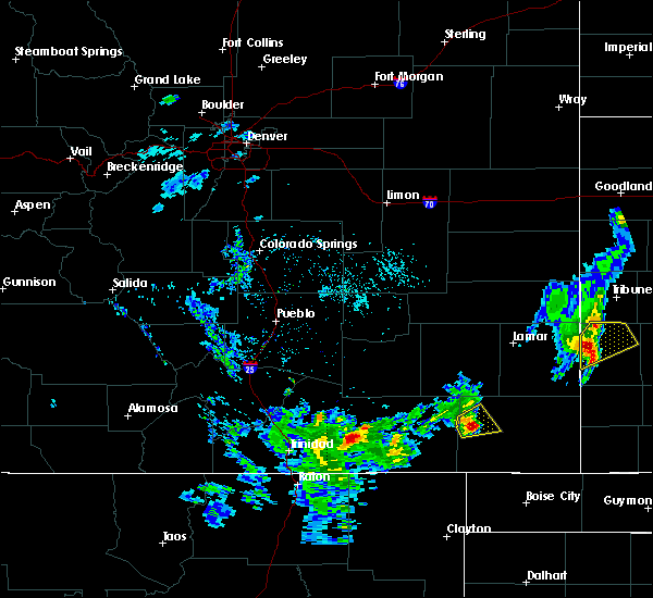 At 415 pm mdt, a severe thunderstorm was located near pritchett, or 18 miles west of springfield, moving northeast at 20 mph (radar indicated). Hazards include 60 mph wind gusts and quarter size hail. Hail damage to vehicles is expected. expect wind damage to roofs, siding, and trees. Locations impacted include, pritchett. At 415 pm mdt, a severe thunderstorm was located near pritchett, or 18 miles west of springfield, moving northeast at 20 mph (radar indicated). Hazards include 60 mph wind gusts and quarter size hail. Hail damage to vehicles is expected. expect wind damage to roofs, siding, and trees. Locations impacted include, pritchett.
|
| 9/3/2018 3:59 PM MDT |
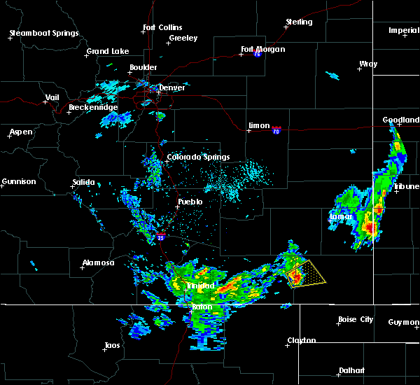 At 358 pm mdt, a severe thunderstorm was located 9 miles west of pritchett, or 23 miles west of springfield, moving northeast at 20 mph (radar indicated). Hazards include 60 mph wind gusts and quarter size hail. Hail damage to vehicles is expected. Expect wind damage to roofs, siding, and trees. At 358 pm mdt, a severe thunderstorm was located 9 miles west of pritchett, or 23 miles west of springfield, moving northeast at 20 mph (radar indicated). Hazards include 60 mph wind gusts and quarter size hail. Hail damage to vehicles is expected. Expect wind damage to roofs, siding, and trees.
|
| 8/21/2018 6:06 PM MDT |
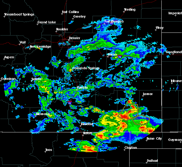 At 606 pm mdt, a severe thunderstorm was located 8 miles south of springfield, moving north at 20 mph (radar indicated). Hazards include 60 mph wind gusts and quarter size hail. Hail damage to vehicles is expected. expect wind damage to roofs, siding, and trees. Locations impacted include, springfield and vilas. At 606 pm mdt, a severe thunderstorm was located 8 miles south of springfield, moving north at 20 mph (radar indicated). Hazards include 60 mph wind gusts and quarter size hail. Hail damage to vehicles is expected. expect wind damage to roofs, siding, and trees. Locations impacted include, springfield and vilas.
|
| 8/21/2018 5:53 PM MDT |
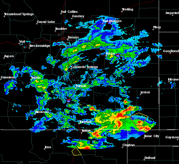 At 552 pm mdt, a severe thunderstorm was located 10 miles northwest of campo, or 12 miles south of springfield, moving north at 20 mph (radar indicated). Hazards include 60 mph wind gusts and quarter size hail. Hail damage to vehicles is expected. expect wind damage to roofs, siding, and trees. Locations impacted include, springfield, pritchett and vilas. At 552 pm mdt, a severe thunderstorm was located 10 miles northwest of campo, or 12 miles south of springfield, moving north at 20 mph (radar indicated). Hazards include 60 mph wind gusts and quarter size hail. Hail damage to vehicles is expected. expect wind damage to roofs, siding, and trees. Locations impacted include, springfield, pritchett and vilas.
|
| 8/21/2018 5:38 PM MDT |
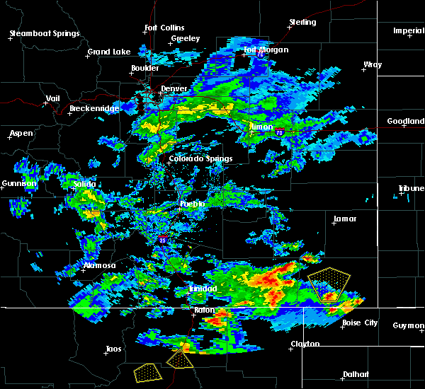 At 537 pm mdt, a severe thunderstorm was located near campo, or 17 miles south of springfield, moving north at 20 mph (radar indicated). Hazards include 60 mph wind gusts and quarter size hail. Hail damage to vehicles is expected. Expect wind damage to roofs, siding, and trees. At 537 pm mdt, a severe thunderstorm was located near campo, or 17 miles south of springfield, moving north at 20 mph (radar indicated). Hazards include 60 mph wind gusts and quarter size hail. Hail damage to vehicles is expected. Expect wind damage to roofs, siding, and trees.
|
| 7/22/2018 10:07 PM MDT |
 At 1007 pm mdt, a severe thunderstorm was located 8 miles south of vilas, or 16 miles southeast of springfield, moving east at 20 mph (radar indicated). Hazards include 60 mph wind gusts. Expect damage to roofs, siding, and trees. Locations impacted include, springfield, walsh, pritchett, vilas, campo, two buttes and stonington. At 1007 pm mdt, a severe thunderstorm was located 8 miles south of vilas, or 16 miles southeast of springfield, moving east at 20 mph (radar indicated). Hazards include 60 mph wind gusts. Expect damage to roofs, siding, and trees. Locations impacted include, springfield, walsh, pritchett, vilas, campo, two buttes and stonington.
|
| 7/22/2018 9:49 PM MDT |
 At 948 pm mdt, a severe thunderstorm was located 8 miles southwest of vilas, or 11 miles southeast of springfield, moving east at 25 mph (radar indicated). Hazards include 60 mph wind gusts and nickel size hail. Expect damage to roofs, siding, and trees. Locations impacted include, springfield, walsh, pritchett, vilas, campo, two buttes and stonington. At 948 pm mdt, a severe thunderstorm was located 8 miles southwest of vilas, or 11 miles southeast of springfield, moving east at 25 mph (radar indicated). Hazards include 60 mph wind gusts and nickel size hail. Expect damage to roofs, siding, and trees. Locations impacted include, springfield, walsh, pritchett, vilas, campo, two buttes and stonington.
|
| 7/22/2018 9:33 PM MDT |
 At 933 pm mdt, a severe thunderstorm was located 10 miles south of springfield, moving east at 20 mph (radar indicated). Hazards include 60 mph wind gusts and nickel size hail. Expect damage to roofs, siding, and trees. Locations impacted include, springfield, walsh, pritchett, vilas, campo, two buttes and stonington. At 933 pm mdt, a severe thunderstorm was located 10 miles south of springfield, moving east at 20 mph (radar indicated). Hazards include 60 mph wind gusts and nickel size hail. Expect damage to roofs, siding, and trees. Locations impacted include, springfield, walsh, pritchett, vilas, campo, two buttes and stonington.
|
| 7/22/2018 9:28 PM MDT |
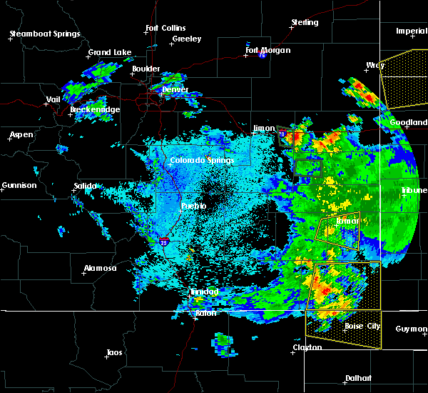 At 927 pm mdt, a severe thunderstorm was located 10 miles south of springfield, moving east at 20 mph (radar indicated). Hazards include 60 mph wind gusts. expect damage to roofs, siding, and trees At 927 pm mdt, a severe thunderstorm was located 10 miles south of springfield, moving east at 20 mph (radar indicated). Hazards include 60 mph wind gusts. expect damage to roofs, siding, and trees
|
| 7/22/2018 9:20 PM MDT |
 At 920 pm mdt, a severe thunderstorm was located 10 miles southeast of pritchett, or 11 miles southwest of springfield, moving east at 25 mph (radar indicated). Hazards include 60 mph wind gusts. Expect damage to roofs, siding, and trees. Locations impacted include, springfield, walsh, pritchett, vilas, campo, two buttes and stonington. At 920 pm mdt, a severe thunderstorm was located 10 miles southeast of pritchett, or 11 miles southwest of springfield, moving east at 25 mph (radar indicated). Hazards include 60 mph wind gusts. Expect damage to roofs, siding, and trees. Locations impacted include, springfield, walsh, pritchett, vilas, campo, two buttes and stonington.
|
| 7/22/2018 9:04 PM MDT |
 At 903 pm mdt, a severe thunderstorm was located 7 miles south of pritchett, or 15 miles southwest of springfield, moving east at 25 mph (radar indicated, springfield asos report). Hazards include 60 mph wind gusts. expect damage to roofs, siding, and trees At 903 pm mdt, a severe thunderstorm was located 7 miles south of pritchett, or 15 miles southwest of springfield, moving east at 25 mph (radar indicated, springfield asos report). Hazards include 60 mph wind gusts. expect damage to roofs, siding, and trees
|
| 6/29/2018 6:26 PM MDT |
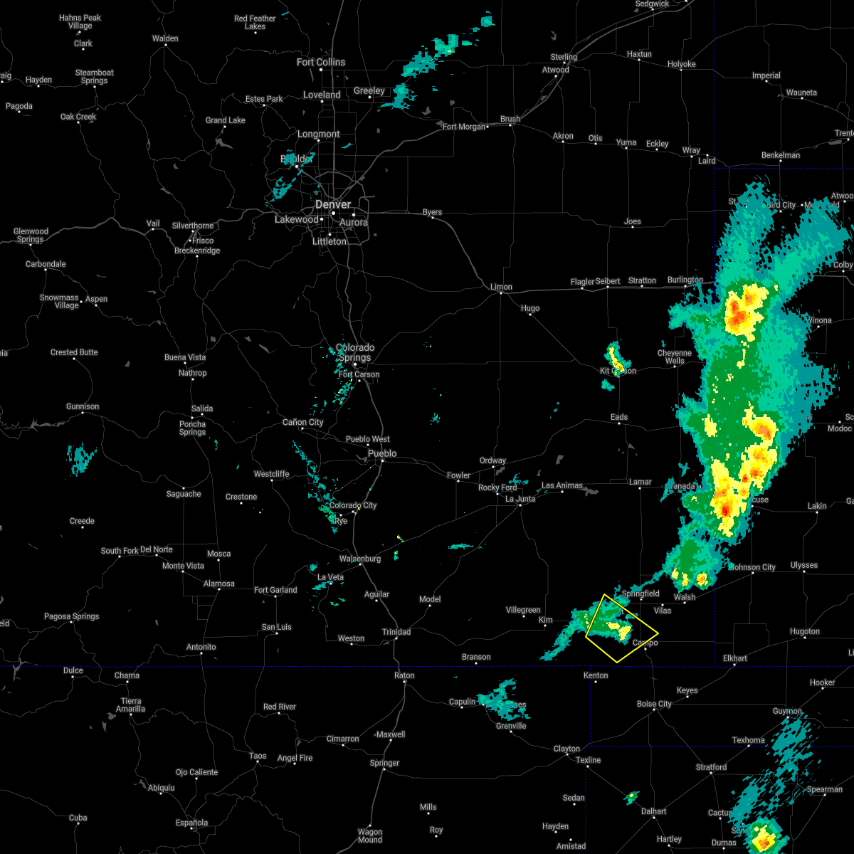 The severe thunderstorm warning for southwestern baca county will expire at 630 pm mdt, the storm which prompted the warning has weakened below severe limits, and no longer poses an immediate threat to life or property. therefore, the warning will be allowed to expire. however gusty winds are still possible with this thunderstorm. The severe thunderstorm warning for southwestern baca county will expire at 630 pm mdt, the storm which prompted the warning has weakened below severe limits, and no longer poses an immediate threat to life or property. therefore, the warning will be allowed to expire. however gusty winds are still possible with this thunderstorm.
|
| 6/29/2018 6:21 PM MDT |
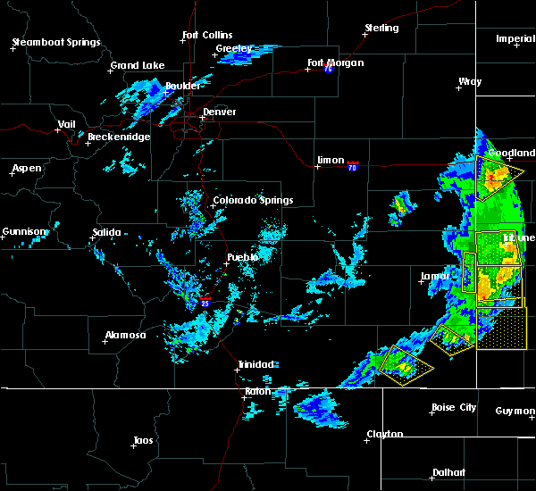 At 620 pm mdt, a severe thunderstorm was located 10 miles south of pritchett, or 16 miles southwest of springfield, moving northeast at 25 mph (radar indicated). Hazards include 60 mph wind gusts. Expect damage to roofs, siding, and trees. Locations impacted include, pritchett. At 620 pm mdt, a severe thunderstorm was located 10 miles south of pritchett, or 16 miles southwest of springfield, moving northeast at 25 mph (radar indicated). Hazards include 60 mph wind gusts. Expect damage to roofs, siding, and trees. Locations impacted include, pritchett.
|
| 6/29/2018 6:09 PM MDT |
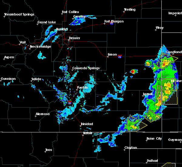 At 608 pm mdt, a severe thunderstorm was located 14 miles south of pritchett, or 21 miles southwest of springfield, moving northeast at 25 mph (radar indicated). Hazards include 60 mph wind gusts. Expect damage to roofs, siding, and trees. Locations impacted include, pritchett. At 608 pm mdt, a severe thunderstorm was located 14 miles south of pritchett, or 21 miles southwest of springfield, moving northeast at 25 mph (radar indicated). Hazards include 60 mph wind gusts. Expect damage to roofs, siding, and trees. Locations impacted include, pritchett.
|
| 6/29/2018 5:57 PM MDT |
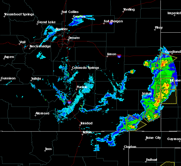 At 557 pm mdt, a severe thunderstorm was located 15 miles north of kenton, or 25 miles southwest of springfield, moving northeast at 25 mph (radar indicated). Hazards include 60 mph wind gusts. expect damage to roofs, siding, and trees At 557 pm mdt, a severe thunderstorm was located 15 miles north of kenton, or 25 miles southwest of springfield, moving northeast at 25 mph (radar indicated). Hazards include 60 mph wind gusts. expect damage to roofs, siding, and trees
|
| 6/22/2018 3:54 PM MDT |
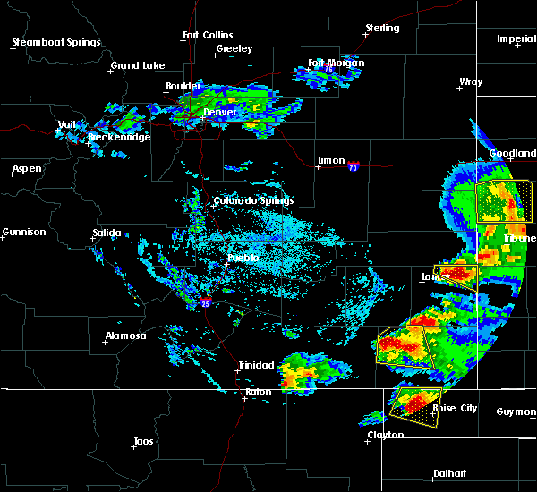 At 354 pm mdt, a severe thunderstorm was located near pritchett, or 12 miles west of springfield, moving east at 20 mph (radar indicated). Hazards include 70 mph wind gusts and half dollar size hail. Hail damage to vehicles is expected. expect considerable tree damage. wind damage is also likely to mobile homes, roofs, and outbuildings. Locations impacted include, springfield and pritchett. At 354 pm mdt, a severe thunderstorm was located near pritchett, or 12 miles west of springfield, moving east at 20 mph (radar indicated). Hazards include 70 mph wind gusts and half dollar size hail. Hail damage to vehicles is expected. expect considerable tree damage. wind damage is also likely to mobile homes, roofs, and outbuildings. Locations impacted include, springfield and pritchett.
|
| 6/22/2018 3:40 PM MDT |
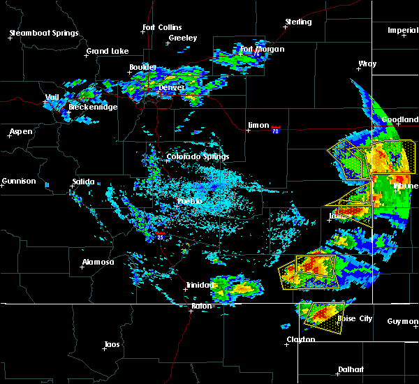 At 339 pm mdt, a severe thunderstorm was located 8 miles northwest of pritchett, or 17 miles west of springfield, moving east at 20 mph. other strong to severe thunderstorms were noted over extreme western las animas county (radar indicated). Hazards include 70 mph wind gusts and half dollar size hail. Hail damage to vehicles is expected. expect considerable tree damage. Wind damage is also likely to mobile homes, roofs, and outbuildings. At 339 pm mdt, a severe thunderstorm was located 8 miles northwest of pritchett, or 17 miles west of springfield, moving east at 20 mph. other strong to severe thunderstorms were noted over extreme western las animas county (radar indicated). Hazards include 70 mph wind gusts and half dollar size hail. Hail damage to vehicles is expected. expect considerable tree damage. Wind damage is also likely to mobile homes, roofs, and outbuildings.
|
| 6/19/2018 10:42 PM MDT |
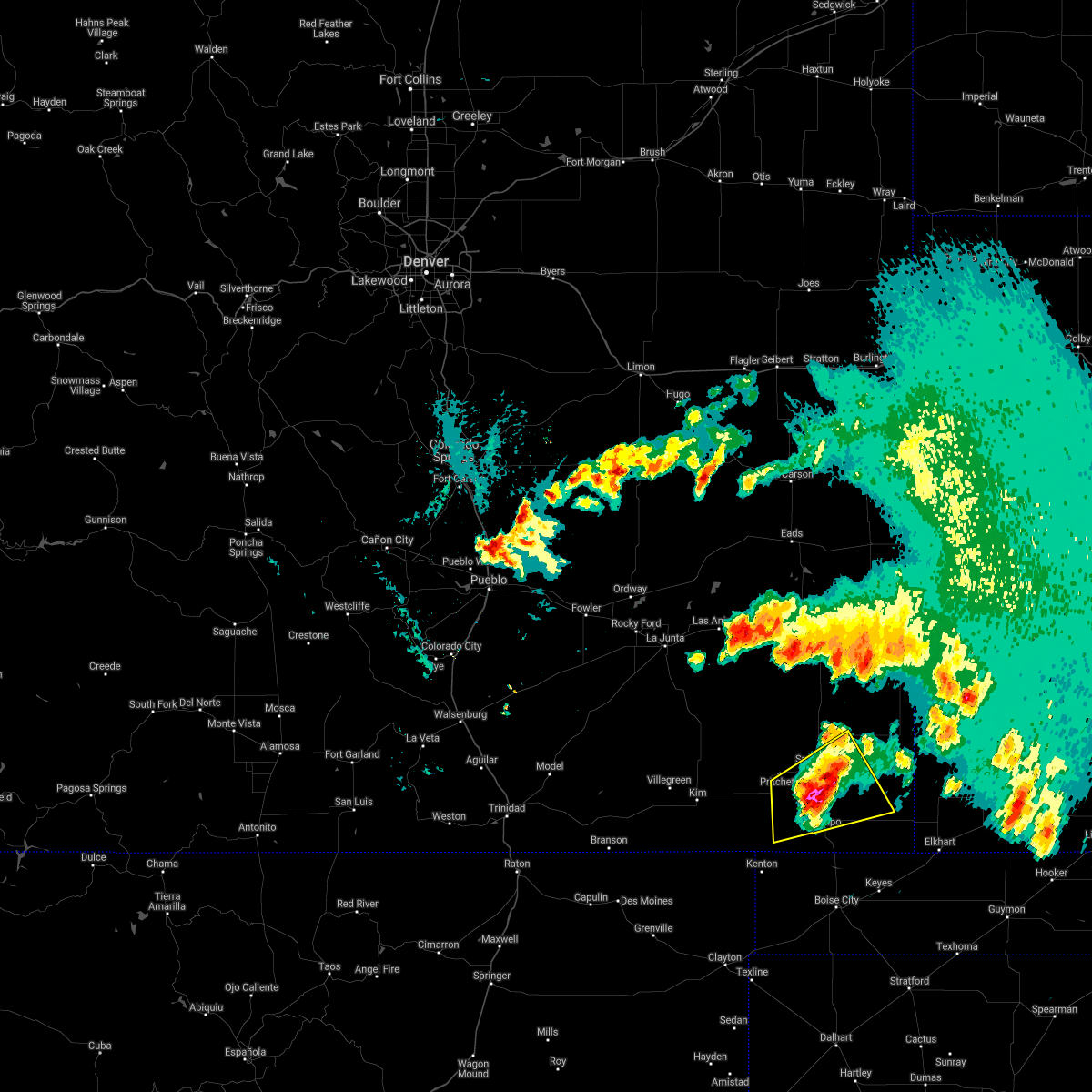 At 1041 pm mdt, a severe thunderstorm was located 9 miles south of springfield, moving east at 20 mph (radar indicated). Hazards include ping pong ball size hail and 60 mph wind gusts. People and animals outdoors will be injured. expect hail damage to roofs, siding, windows, and vehicles. expect wind damage to roofs, siding, and trees. Locations impacted include, springfield, pritchett, vilas and campo. At 1041 pm mdt, a severe thunderstorm was located 9 miles south of springfield, moving east at 20 mph (radar indicated). Hazards include ping pong ball size hail and 60 mph wind gusts. People and animals outdoors will be injured. expect hail damage to roofs, siding, windows, and vehicles. expect wind damage to roofs, siding, and trees. Locations impacted include, springfield, pritchett, vilas and campo.
|
| 6/19/2018 10:37 PM MDT |
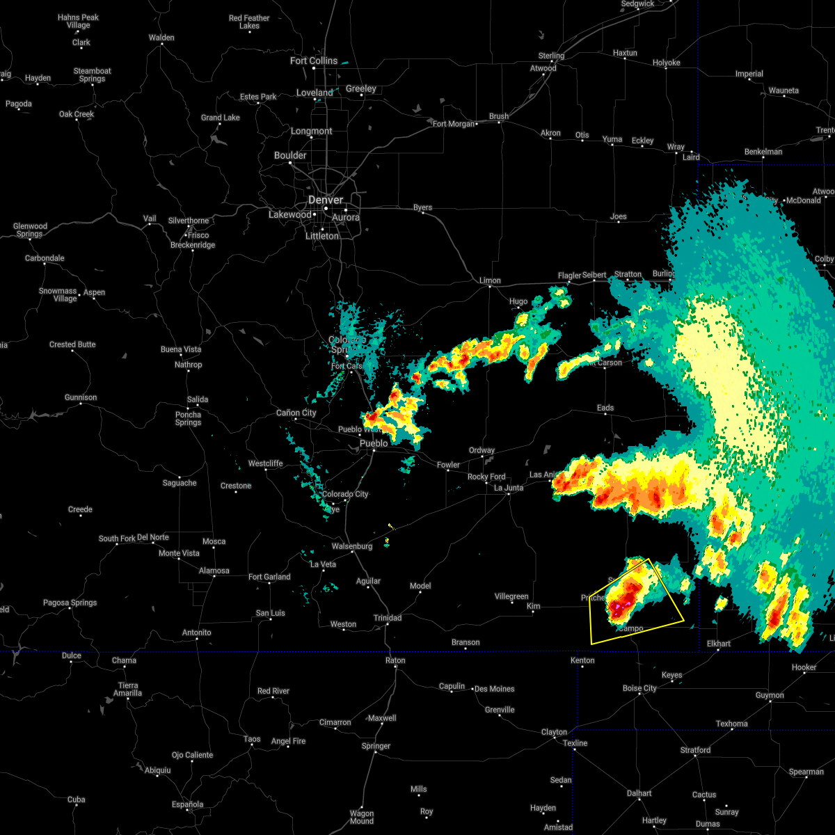 At 1035 pm mdt, a severe thunderstorm was located 7 miles south of springfield, moving east at 25 mph (public). Hazards include quarter size hail. Damage to vehicles is expected. locations impacted include, springfield, pritchett, vilas and campo. The quarter size hail was reported 9 miles southwest of springfield at 10:33 pm. At 1035 pm mdt, a severe thunderstorm was located 7 miles south of springfield, moving east at 25 mph (public). Hazards include quarter size hail. Damage to vehicles is expected. locations impacted include, springfield, pritchett, vilas and campo. The quarter size hail was reported 9 miles southwest of springfield at 10:33 pm.
|
| 6/19/2018 10:31 PM MDT |
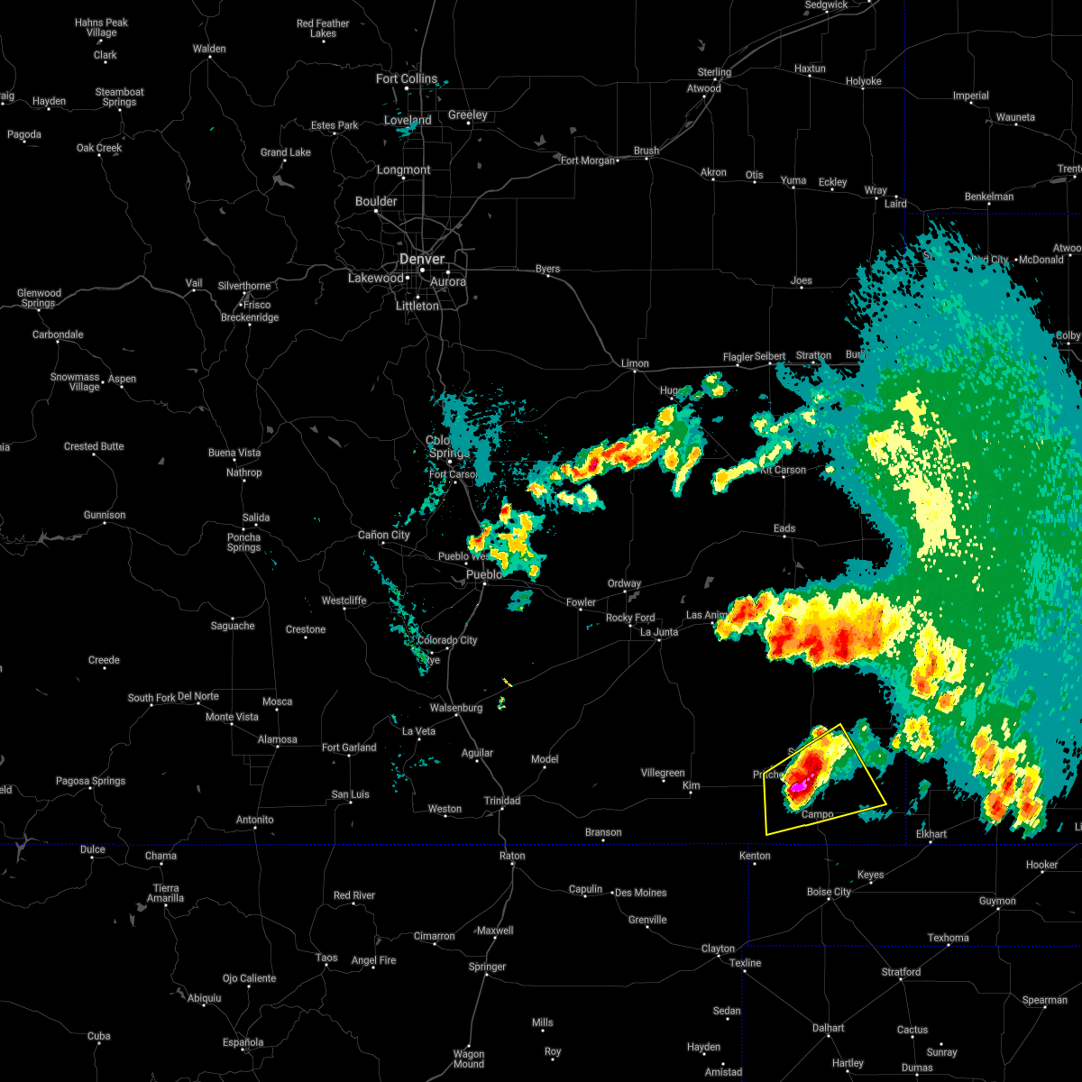 At 1031 pm mdt, a severe thunderstorm was located 7 miles south of springfield, moving east at 25 mph (radar indicated). Hazards include ping pong ball size hail and 60 mph wind gusts. People and animals outdoors will be injured. expect hail damage to roofs, siding, windows, and vehicles. Expect wind damage to roofs, siding, and trees. At 1031 pm mdt, a severe thunderstorm was located 7 miles south of springfield, moving east at 25 mph (radar indicated). Hazards include ping pong ball size hail and 60 mph wind gusts. People and animals outdoors will be injured. expect hail damage to roofs, siding, windows, and vehicles. Expect wind damage to roofs, siding, and trees.
|
| 6/6/2018 5:22 PM MDT |
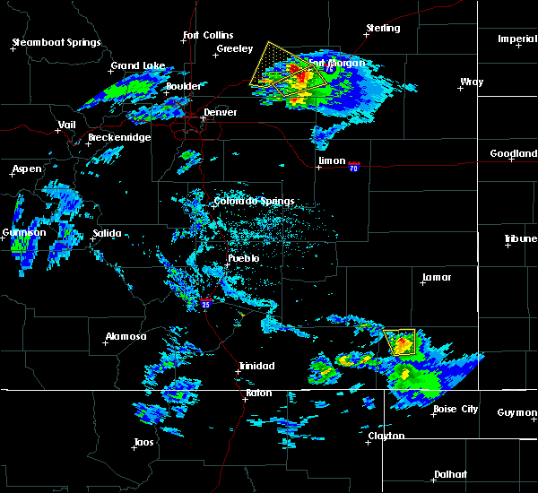 At 522 pm mdt, a severe thunderstorm was located 8 miles north of pritchett, or 13 miles northwest of springfield, moving north at 20 mph (radar indicated). Hazards include 60 mph wind gusts and quarter size hail. Hail damage to vehicles is expected. expect wind damage to roofs, siding, and trees. Locations impacted include, pritchett. At 522 pm mdt, a severe thunderstorm was located 8 miles north of pritchett, or 13 miles northwest of springfield, moving north at 20 mph (radar indicated). Hazards include 60 mph wind gusts and quarter size hail. Hail damage to vehicles is expected. expect wind damage to roofs, siding, and trees. Locations impacted include, pritchett.
|
| 6/6/2018 5:13 PM MDT |
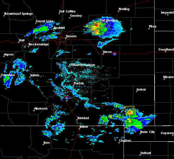 At 513 pm mdt, a severe thunderstorm was located near pritchett, or 12 miles west of springfield, moving north at 20 mph (radar indicated). Hazards include 60 mph wind gusts and quarter size hail. Hail damage to vehicles is expected. Expect wind damage to roofs, siding, and trees. At 513 pm mdt, a severe thunderstorm was located near pritchett, or 12 miles west of springfield, moving north at 20 mph (radar indicated). Hazards include 60 mph wind gusts and quarter size hail. Hail damage to vehicles is expected. Expect wind damage to roofs, siding, and trees.
|
| 7/16/2017 4:56 PM MDT |
 At 455 pm mdt, a severe thunderstorm was located 14 miles west of pritchett, or 27 miles west of springfield, moving southeast at 10 mph. another severe storm was located 3 miles west of kim, and was also moving southeast at 10 mph (radar indicated). Hazards include 60 mph wind gusts and quarter size hail. Hail damage to vehicles is expected. expect wind damage to roofs, siding, and trees. Locations impacted include, pritchett and kim. At 455 pm mdt, a severe thunderstorm was located 14 miles west of pritchett, or 27 miles west of springfield, moving southeast at 10 mph. another severe storm was located 3 miles west of kim, and was also moving southeast at 10 mph (radar indicated). Hazards include 60 mph wind gusts and quarter size hail. Hail damage to vehicles is expected. expect wind damage to roofs, siding, and trees. Locations impacted include, pritchett and kim.
|
| 7/16/2017 4:45 PM MDT |
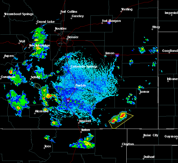 At 444 pm mdt, a severe thunderstorm was located 14 miles northeast of kim, or 30 miles west of springfield, moving southeast at 10 mph. another severe storm was located 2 miles west of kim and was also moving southeast at 10 mph (radar indicated). Hazards include 60 mph wind gusts and quarter size hail. Hail damage to vehicles is expected. Expect wind damage to roofs, siding, and trees. At 444 pm mdt, a severe thunderstorm was located 14 miles northeast of kim, or 30 miles west of springfield, moving southeast at 10 mph. another severe storm was located 2 miles west of kim and was also moving southeast at 10 mph (radar indicated). Hazards include 60 mph wind gusts and quarter size hail. Hail damage to vehicles is expected. Expect wind damage to roofs, siding, and trees.
|
| 6/6/2017 5:38 PM MDT |
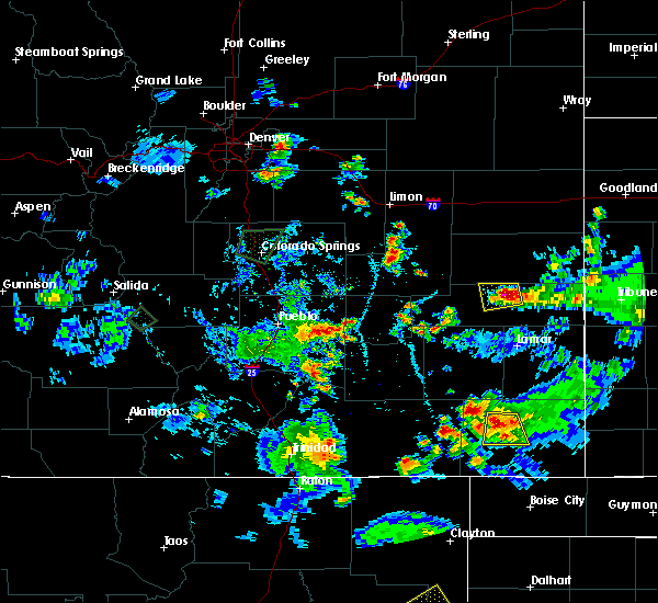 At 538 pm mdt, a severe thunderstorm was located near springfield, moving south at 20 mph (radar indicated). Hazards include 60 mph wind gusts and quarter size hail. Hail damage to vehicles is expected. expect wind damage to roofs, siding, and trees. Locations impacted include, springfield and pritchett. At 538 pm mdt, a severe thunderstorm was located near springfield, moving south at 20 mph (radar indicated). Hazards include 60 mph wind gusts and quarter size hail. Hail damage to vehicles is expected. expect wind damage to roofs, siding, and trees. Locations impacted include, springfield and pritchett.
|
| 6/6/2017 5:29 PM MDT |
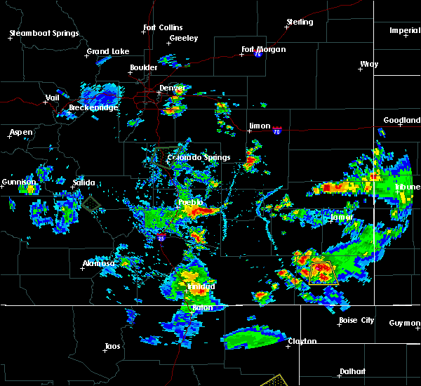 At 528 pm mdt, a severe thunderstorm was located 8 miles northwest of springfield, moving south at 10 mph. the public reported quarter size hail 9 miles northwest of springfield (public). Hazards include 60 mph wind gusts and quarter size hail. Hail damage to vehicles is expected. expect wind damage to roofs, siding, and trees. Locations impacted include, springfield and pritchett. At 528 pm mdt, a severe thunderstorm was located 8 miles northwest of springfield, moving south at 10 mph. the public reported quarter size hail 9 miles northwest of springfield (public). Hazards include 60 mph wind gusts and quarter size hail. Hail damage to vehicles is expected. expect wind damage to roofs, siding, and trees. Locations impacted include, springfield and pritchett.
|
| 6/6/2017 5:22 PM MDT |
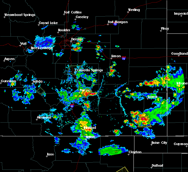 At 522 pm mdt, a severe thunderstorm was located 8 miles northwest of springfield, moving south at 20 mph (radar indicated). Hazards include 60 mph wind gusts and quarter size hail. Hail damage to vehicles is expected. Expect wind damage to roofs, siding, and trees. At 522 pm mdt, a severe thunderstorm was located 8 miles northwest of springfield, moving south at 20 mph (radar indicated). Hazards include 60 mph wind gusts and quarter size hail. Hail damage to vehicles is expected. Expect wind damage to roofs, siding, and trees.
|
| 9/17/2016 3:40 PM MDT |
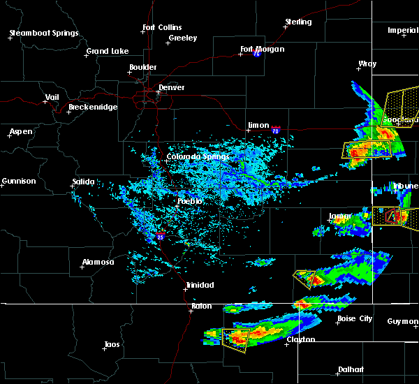 At 339 pm mdt, a severe thunderstorm was located near pritchett, or 14 miles southwest of springfield, moving east at 20 mph (radar indicated). Hazards include 60 mph wind gusts and quarter size hail. Hail damage to vehicles is expected. expect wind damage to roofs, siding, and trees. Locations impacted include, pritchett. At 339 pm mdt, a severe thunderstorm was located near pritchett, or 14 miles southwest of springfield, moving east at 20 mph (radar indicated). Hazards include 60 mph wind gusts and quarter size hail. Hail damage to vehicles is expected. expect wind damage to roofs, siding, and trees. Locations impacted include, pritchett.
|
| 9/17/2016 3:28 PM MDT |
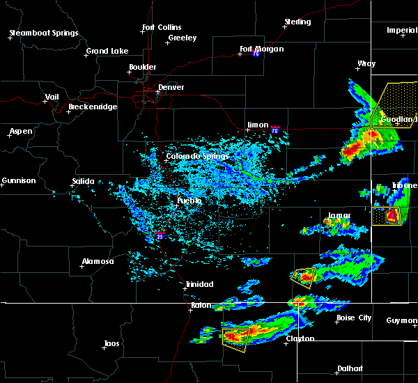 At 328 pm mdt, a severe thunderstorm was located near pritchett, or 17 miles west of springfield, moving east at 20 mph (radar indicated). Hazards include 60 mph wind gusts and quarter size hail. Hail damage to vehicles is expected. expect wind damage to roofs, siding, and trees. Locations impacted include, pritchett. At 328 pm mdt, a severe thunderstorm was located near pritchett, or 17 miles west of springfield, moving east at 20 mph (radar indicated). Hazards include 60 mph wind gusts and quarter size hail. Hail damage to vehicles is expected. expect wind damage to roofs, siding, and trees. Locations impacted include, pritchett.
|
| 9/17/2016 3:19 PM MDT |
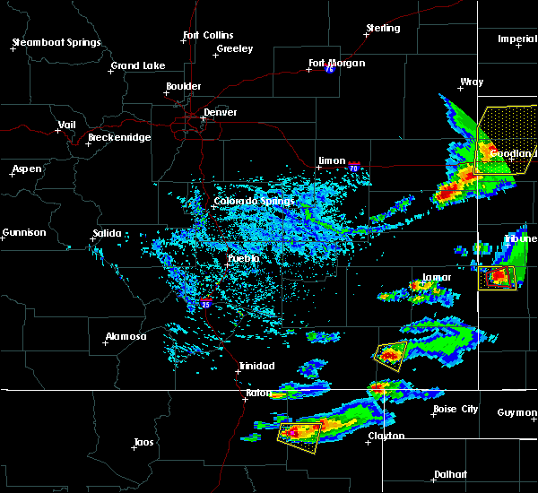 At 318 pm mdt, a severe thunderstorm was located 8 miles west of pritchett, or 21 miles west of springfield, moving east at 20 mph (radar indicated). Hazards include 60 mph wind gusts and quarter size hail. Hail damage to vehicles is expected. expect wind damage to roofs, siding, and trees. Locations impacted include, pritchett. At 318 pm mdt, a severe thunderstorm was located 8 miles west of pritchett, or 21 miles west of springfield, moving east at 20 mph (radar indicated). Hazards include 60 mph wind gusts and quarter size hail. Hail damage to vehicles is expected. expect wind damage to roofs, siding, and trees. Locations impacted include, pritchett.
|
| 9/17/2016 3:11 PM MDT |
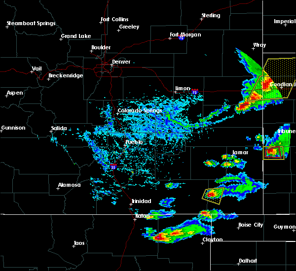 At 310 pm mdt, a severe thunderstorm was located 11 miles west of pritchett, or 24 miles west of springfield, moving east at 20 mph (radar indicated). Hazards include 60 mph wind gusts and quarter size hail. Hail damage to vehicles is expected. Expect wind damage to roofs, siding, and trees. At 310 pm mdt, a severe thunderstorm was located 11 miles west of pritchett, or 24 miles west of springfield, moving east at 20 mph (radar indicated). Hazards include 60 mph wind gusts and quarter size hail. Hail damage to vehicles is expected. Expect wind damage to roofs, siding, and trees.
|
| 7/9/2016 7:29 PM MDT |
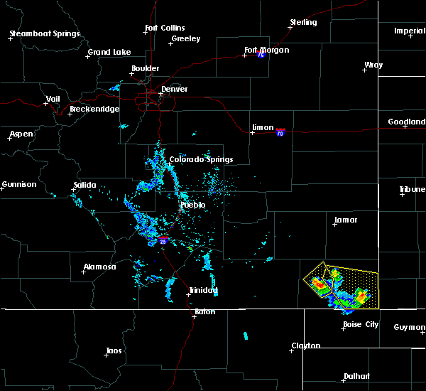 At 729 pm mdt, a severe thunderstorm was located near pritchett, or 12 miles southwest of springfield, moving southeast at 15 mph (radar indicated). Hazards include ping pong ball size hail and 60 mph wind gusts. People and animals outdoors will be injured. expect hail damage to roofs, siding, windows, and vehicles. expect wind damage to roofs, siding, and trees. Locations impacted include, rural areas south and southeast or pritchett. At 729 pm mdt, a severe thunderstorm was located near pritchett, or 12 miles southwest of springfield, moving southeast at 15 mph (radar indicated). Hazards include ping pong ball size hail and 60 mph wind gusts. People and animals outdoors will be injured. expect hail damage to roofs, siding, windows, and vehicles. expect wind damage to roofs, siding, and trees. Locations impacted include, rural areas south and southeast or pritchett.
|
| 7/9/2016 7:14 PM MDT |
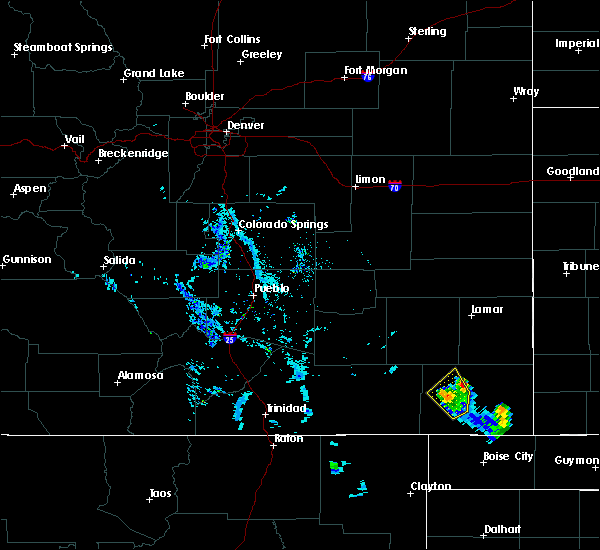 At 713 pm mdt, a severe thunderstorm was located over pritchett, or 12 miles west of springfield, moving south at 10 mph (trained weather spotters). Hazards include golf ball size hail and 60 mph wind gusts. People and animals outdoors will be injured. expect hail damage to roofs, siding, windows, and vehicles. expect wind damage to roofs, siding, and trees. Locations impacted include, pritchett. At 713 pm mdt, a severe thunderstorm was located over pritchett, or 12 miles west of springfield, moving south at 10 mph (trained weather spotters). Hazards include golf ball size hail and 60 mph wind gusts. People and animals outdoors will be injured. expect hail damage to roofs, siding, windows, and vehicles. expect wind damage to roofs, siding, and trees. Locations impacted include, pritchett.
|
| 7/9/2016 7:13 PM MDT | Golf Ball sized hail reported 0 miles NNW of Pritchett, CO, . |
| 7/9/2016 7:07 PM MDT | Ping Pong Ball sized hail reported 0.9 miles SE of Pritchett, CO, . |
| 7/9/2016 7:07 PM MDT |
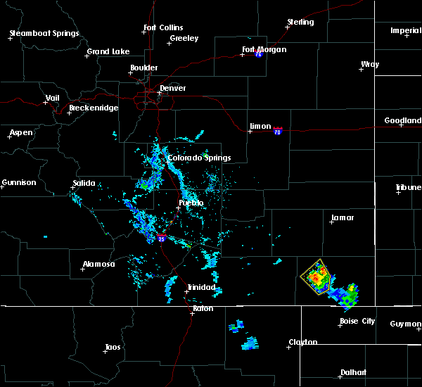 At 706 pm mdt, a severe thunderstorm was located over pritchett, or 11 miles west of springfield, moving southeast at 5 mph (radar indicated). Hazards include 60 mph wind gusts and quarter size hail. Hail damage to vehicles is expected. expect wind damage to roofs, siding, and trees. Locations impacted include, pritchett. At 706 pm mdt, a severe thunderstorm was located over pritchett, or 11 miles west of springfield, moving southeast at 5 mph (radar indicated). Hazards include 60 mph wind gusts and quarter size hail. Hail damage to vehicles is expected. expect wind damage to roofs, siding, and trees. Locations impacted include, pritchett.
|
| 7/9/2016 6:58 PM MDT |
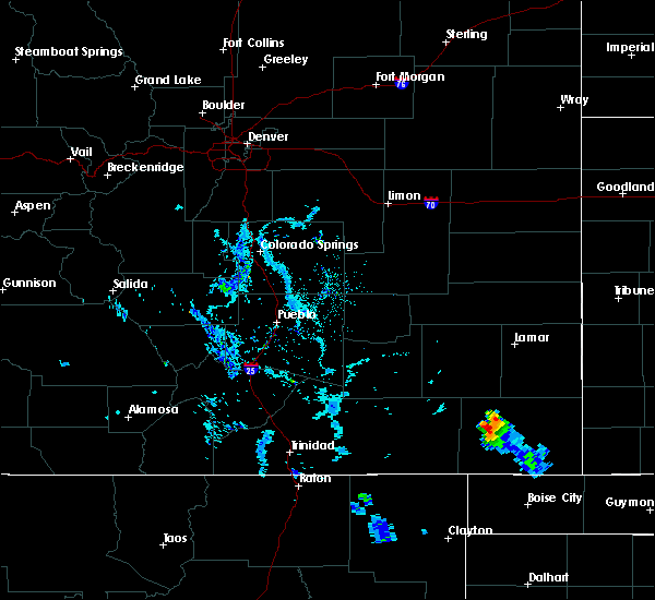 At 658 pm mdt, a severe thunderstorm was located over pritchett, or 11 miles west of springfield, moving southeast at 5 mph (radar indicated). Hazards include 60 mph wind gusts and quarter size hail. Hail damage to vehicles is expected. Expect wind damage to roofs, siding, and trees. At 658 pm mdt, a severe thunderstorm was located over pritchett, or 11 miles west of springfield, moving southeast at 5 mph (radar indicated). Hazards include 60 mph wind gusts and quarter size hail. Hail damage to vehicles is expected. Expect wind damage to roofs, siding, and trees.
|
| 6/30/2016 3:48 PM MDT |
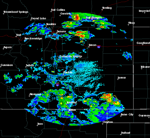 At 348 pm mdt, a severe thunderstorm was located over pritchett, or 11 miles west of springfield, moving northeast at 30 mph (radar indicated). Hazards include 60 mph wind gusts and half dollar size hail. Hail damage to vehicles is expected. expect wind damage to roofs, siding, and trees. Locations impacted include, pritchett. At 348 pm mdt, a severe thunderstorm was located over pritchett, or 11 miles west of springfield, moving northeast at 30 mph (radar indicated). Hazards include 60 mph wind gusts and half dollar size hail. Hail damage to vehicles is expected. expect wind damage to roofs, siding, and trees. Locations impacted include, pritchett.
|
| 6/30/2016 3:37 PM MDT |
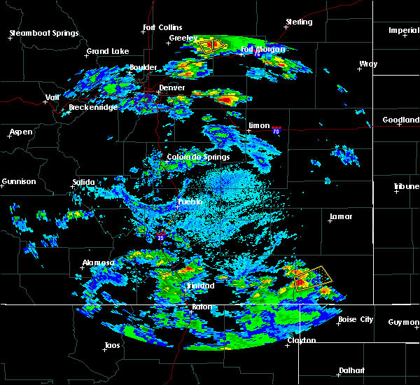 At 337 pm mdt, a severe thunderstorm was located around 5 miles southwest of pritchett, or 20 miles west of springfield, moving northeast at 30 mph (radar indicated). Hazards include 60 mph wind gusts and half dollar size hail. Hail damage to vehicles is expected. expect wind damage to roofs, siding, and trees. Locations impacted include, pritchett. At 337 pm mdt, a severe thunderstorm was located around 5 miles southwest of pritchett, or 20 miles west of springfield, moving northeast at 30 mph (radar indicated). Hazards include 60 mph wind gusts and half dollar size hail. Hail damage to vehicles is expected. expect wind damage to roofs, siding, and trees. Locations impacted include, pritchett.
|
| 6/30/2016 3:28 PM MDT |
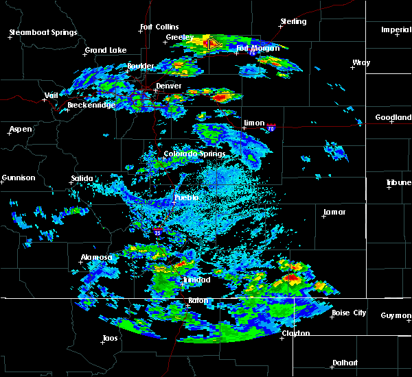 At 327 pm mdt, a severe thunderstorm was located 9 miles southwest of pritchett, or 22 miles west of springfield, moving northeast at 30 mph (radar indicated). Hazards include 60 mph wind gusts and quarter size hail. Hail damage to vehicles is expected. Expect wind damage to roofs, siding, and trees. At 327 pm mdt, a severe thunderstorm was located 9 miles southwest of pritchett, or 22 miles west of springfield, moving northeast at 30 mph (radar indicated). Hazards include 60 mph wind gusts and quarter size hail. Hail damage to vehicles is expected. Expect wind damage to roofs, siding, and trees.
|
| 6/23/2016 8:20 PM MDT |
 At 820 pm mdt, a severe thunderstorm was located 13 miles northeast of two buttes reservoir, or 19 miles south of lamar, moving east at 45 mph (radar indicated). Hazards include 70 mph wind gusts and quarter size hail. Hail damage to vehicles is expected. expect considerable tree damage. wind damage is also likely to mobile homes, roofs, and outbuildings. Locations impacted include, lamar, springfield, holly, walsh, granada, pritchett, vilas, two buttes and two buttes reservoir. At 820 pm mdt, a severe thunderstorm was located 13 miles northeast of two buttes reservoir, or 19 miles south of lamar, moving east at 45 mph (radar indicated). Hazards include 70 mph wind gusts and quarter size hail. Hail damage to vehicles is expected. expect considerable tree damage. wind damage is also likely to mobile homes, roofs, and outbuildings. Locations impacted include, lamar, springfield, holly, walsh, granada, pritchett, vilas, two buttes and two buttes reservoir.
|
| 6/23/2016 8:15 PM MDT |
 At 812 pm mdt, a severe thunderstorm was located 11 miles north of two buttes reservoir, or 18 miles south of lamar, moving east at 45 mph (radar indicated). Hazards include 70 mph wind gusts and quarter size hail. Hail damage to vehicles is expected. expect considerable tree damage. wind damage is also likely to mobile homes, roofs, and outbuildings. in addition,. at 812 pm, wind gusts to 52 mph was measured at the lamar airport. this storm will produce strong west winds along highway 287 between lamar and the prowers and baca county line. these winds have the potential to tip over tractor trailers along highway 287. Locations impacted include, lamar, springfield, holly, walsh, granada, pritchett, vilas, two buttes and two buttes reservoir. At 812 pm mdt, a severe thunderstorm was located 11 miles north of two buttes reservoir, or 18 miles south of lamar, moving east at 45 mph (radar indicated). Hazards include 70 mph wind gusts and quarter size hail. Hail damage to vehicles is expected. expect considerable tree damage. wind damage is also likely to mobile homes, roofs, and outbuildings. in addition,. at 812 pm, wind gusts to 52 mph was measured at the lamar airport. this storm will produce strong west winds along highway 287 between lamar and the prowers and baca county line. these winds have the potential to tip over tractor trailers along highway 287. Locations impacted include, lamar, springfield, holly, walsh, granada, pritchett, vilas, two buttes and two buttes reservoir.
|
| 6/23/2016 8:07 PM MDT |
 At 806 pm mdt, a severe thunderstorm was located 11 miles northwest of two buttes reservoir, or 19 miles south of lamar, moving east at 45 mph (radar indicated). Hazards include 60 mph wind gusts and quarter size hail. Hail damage to vehicles is expected. Expect wind damage to roofs, siding, and trees. At 806 pm mdt, a severe thunderstorm was located 11 miles northwest of two buttes reservoir, or 19 miles south of lamar, moving east at 45 mph (radar indicated). Hazards include 60 mph wind gusts and quarter size hail. Hail damage to vehicles is expected. Expect wind damage to roofs, siding, and trees.
|
| 6/12/2016 4:38 PM MDT |
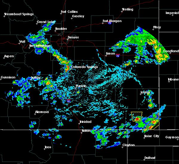 At 438 pm mdt, a severe thunderstorm was located 7 miles east of pritchett, or 8 miles southwest of springfield, moving north at 10 mph (radar indicated). Hazards include 60 mph wind gusts and quarter size hail. Hail damage to vehicles is expected. Expect wind damage to roofs, siding, and trees. At 438 pm mdt, a severe thunderstorm was located 7 miles east of pritchett, or 8 miles southwest of springfield, moving north at 10 mph (radar indicated). Hazards include 60 mph wind gusts and quarter size hail. Hail damage to vehicles is expected. Expect wind damage to roofs, siding, and trees.
|
| 4/15/2016 5:34 PM MDT |
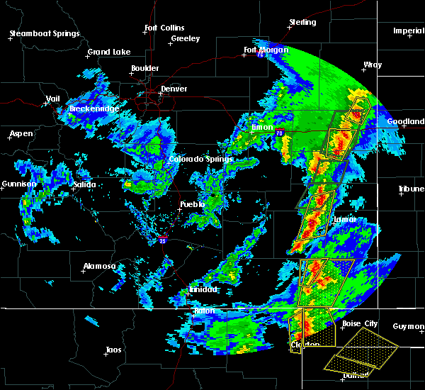 At 534 pm mdt, a severe thunderstorm was located near pritchett, or 10 miles west of springfield, moving north at 60 mph (radar indicated). Hazards include 60 mph wind gusts and quarter size hail. Hail damage to vehicles is expected. expect wind damage to roofs, siding, and trees. locations impacted include, pritchett and two buttes reservoir. A tornado watch remains in effect until 900 pm mdt for southeastern colorado. At 534 pm mdt, a severe thunderstorm was located near pritchett, or 10 miles west of springfield, moving north at 60 mph (radar indicated). Hazards include 60 mph wind gusts and quarter size hail. Hail damage to vehicles is expected. expect wind damage to roofs, siding, and trees. locations impacted include, pritchett and two buttes reservoir. A tornado watch remains in effect until 900 pm mdt for southeastern colorado.
|
| 4/15/2016 5:15 PM MDT |
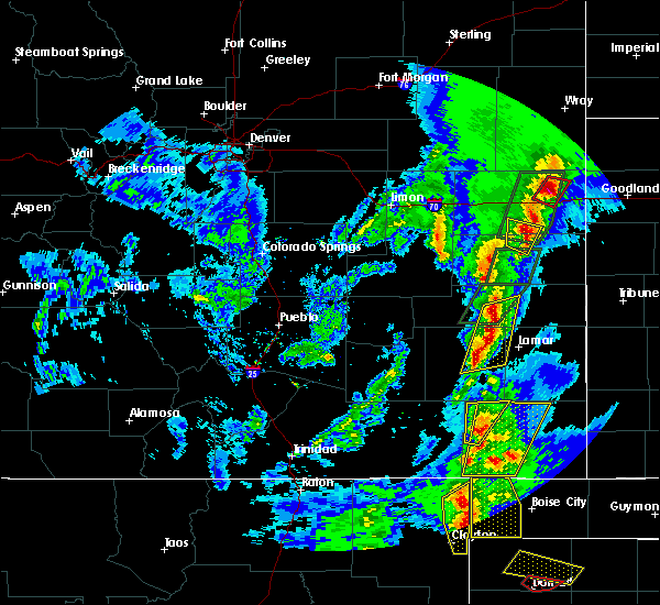 At 515 pm mdt, a severe thunderstorm was located 12 miles south of pritchett, or 17 miles southwest of springfield, moving northeast at 50 mph (radar indicated). Hazards include 70 mph wind gusts and half dollar size hail. Hail damage to vehicles is expected. expect considerable tree damage. Wind damage is also likely to mobile homes, roofs, and outbuildings. At 515 pm mdt, a severe thunderstorm was located 12 miles south of pritchett, or 17 miles southwest of springfield, moving northeast at 50 mph (radar indicated). Hazards include 70 mph wind gusts and half dollar size hail. Hail damage to vehicles is expected. expect considerable tree damage. Wind damage is also likely to mobile homes, roofs, and outbuildings.
|
| 4/15/2016 4:51 PM MDT |
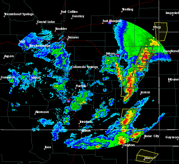 At 451 pm mdt, a severe thunderstorm was located 13 miles southwest of pritchett, or 26 miles west of springfield, moving northeast at 40 mph (radar indicated). Hazards include two inch hail and 70 mph wind gusts. People and animals outdoors will be injured. expect hail damage to roofs, siding, windows, and vehicles. expect considerable tree damage. wind damage is also likely to mobile homes, roofs, and outbuildings. locations impacted include, pritchett. A tornado watch remains in effect until 900 pm mdt for southeastern colorado. At 451 pm mdt, a severe thunderstorm was located 13 miles southwest of pritchett, or 26 miles west of springfield, moving northeast at 40 mph (radar indicated). Hazards include two inch hail and 70 mph wind gusts. People and animals outdoors will be injured. expect hail damage to roofs, siding, windows, and vehicles. expect considerable tree damage. wind damage is also likely to mobile homes, roofs, and outbuildings. locations impacted include, pritchett. A tornado watch remains in effect until 900 pm mdt for southeastern colorado.
|
| 4/15/2016 4:38 PM MDT |
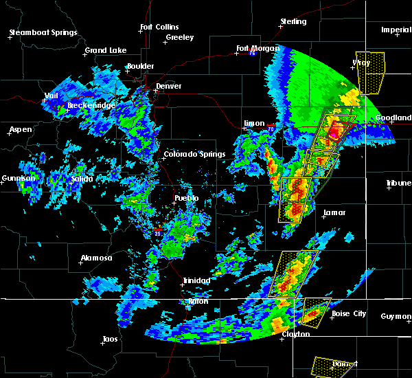 At 438 pm mdt, a severe thunderstorm was located 12 miles east of kim, or 30 miles southwest of springfield, moving north at 40 mph (radar indicated). Hazards include 70 mph wind gusts and ping pong ball size hail. People and animals outdoors will be injured. expect hail damage to roofs, siding, windows, and vehicles. expect considerable tree damage. Wind damage is also likely to mobile homes, roofs, and outbuildings. At 438 pm mdt, a severe thunderstorm was located 12 miles east of kim, or 30 miles southwest of springfield, moving north at 40 mph (radar indicated). Hazards include 70 mph wind gusts and ping pong ball size hail. People and animals outdoors will be injured. expect hail damage to roofs, siding, windows, and vehicles. expect considerable tree damage. Wind damage is also likely to mobile homes, roofs, and outbuildings.
|
| 8/17/2015 8:35 PM MDT |
 At 835 pm mdt, severe thunderstorms were located along a line extending from near coolidge to near vilas, moving southeast at 60 mph (radar indicated). Hazards include 70 mph wind gusts and quarter size hail. Hail damage to vehicles is expected. expect considerable tree damage. wind damage is also likely to mobile homes, roofs and outbuildings. locations impacted include, springfield, holly, walsh, granada, pritchett, vilas, hartman, two buttes, stonington, bristol and two buttes reservoir. A tornado watch remains in effect until 1100 pm mdt for southeastern colorado. At 835 pm mdt, severe thunderstorms were located along a line extending from near coolidge to near vilas, moving southeast at 60 mph (radar indicated). Hazards include 70 mph wind gusts and quarter size hail. Hail damage to vehicles is expected. expect considerable tree damage. wind damage is also likely to mobile homes, roofs and outbuildings. locations impacted include, springfield, holly, walsh, granada, pritchett, vilas, hartman, two buttes, stonington, bristol and two buttes reservoir. A tornado watch remains in effect until 1100 pm mdt for southeastern colorado.
|
| 8/17/2015 8:21 PM MDT |
 At 821 pm mdt, severe thunderstorms were located along a line extending from near hartman to near springfield, moving southeast at 55 mph (radar indicated). Hazards include 70 mph wind gusts and quarter size hail. Hail damage to vehicles is expected. expect considerable tree damage. wind damage is also likely to mobile homes, roofs and outbuildings. locations impacted include, springfield, holly, walsh, granada, pritchett, vilas, hartman, two buttes, stonington, bristol and two buttes reservoir. A tornado watch remains in effect until 1100 pm mdt for southeastern colorado. At 821 pm mdt, severe thunderstorms were located along a line extending from near hartman to near springfield, moving southeast at 55 mph (radar indicated). Hazards include 70 mph wind gusts and quarter size hail. Hail damage to vehicles is expected. expect considerable tree damage. wind damage is also likely to mobile homes, roofs and outbuildings. locations impacted include, springfield, holly, walsh, granada, pritchett, vilas, hartman, two buttes, stonington, bristol and two buttes reservoir. A tornado watch remains in effect until 1100 pm mdt for southeastern colorado.
|
| 8/17/2015 8:04 PM MDT |
 At 804 pm mdt, severe thunderstorms were located along a line extending from 9 miles northwest of bristol to 10 miles north of pritchett, moving southeast at 45 mph (radar indicated). Hazards include 70 mph wind gusts and quarter size hail. Hail damage to vehicles is expected. expect considerable tree damage. wind damage is also likely to mobile homes, roofs and outbuildings. locations impacted include, lamar, springfield, holly, walsh, granada, wiley, pritchett, vilas, hartman, two buttes, stonington, bristol and two buttes reservoir. A tornado watch remains in effect until 1100 pm mdt for southeastern colorado. At 804 pm mdt, severe thunderstorms were located along a line extending from 9 miles northwest of bristol to 10 miles north of pritchett, moving southeast at 45 mph (radar indicated). Hazards include 70 mph wind gusts and quarter size hail. Hail damage to vehicles is expected. expect considerable tree damage. wind damage is also likely to mobile homes, roofs and outbuildings. locations impacted include, lamar, springfield, holly, walsh, granada, wiley, pritchett, vilas, hartman, two buttes, stonington, bristol and two buttes reservoir. A tornado watch remains in effect until 1100 pm mdt for southeastern colorado.
|
| 8/17/2015 7:52 PM MDT |
 At 752 pm mdt, severe thunderstorms were located along a line extending from 11 miles northwest of bristol to 10 miles northwest of pritchett, moving southeast at 60 mph (radar indicated). Hazards include 70 mph wind gusts and nickel size hail. Expect considerable tree damage. Damage is likely to mobile homes, roofs and outbuildings. At 752 pm mdt, severe thunderstorms were located along a line extending from 11 miles northwest of bristol to 10 miles northwest of pritchett, moving southeast at 60 mph (radar indicated). Hazards include 70 mph wind gusts and nickel size hail. Expect considerable tree damage. Damage is likely to mobile homes, roofs and outbuildings.
|
| 8/16/2015 8:11 PM MDT |
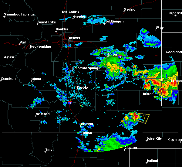 At 811 pm mdt, a severe thunderstorm was located 7 miles northeast of pritchett, or 9 miles west of springfield, moving east at 25 mph (radar indicated). Hazards include ping pong ball size hail and 60 mph wind gusts. People and animals outdoors will be injured. expect hail damage to roofs, siding, windows and vehicles. expect wind damage to roofs, siding and trees. Locations impacted include, springfield. At 811 pm mdt, a severe thunderstorm was located 7 miles northeast of pritchett, or 9 miles west of springfield, moving east at 25 mph (radar indicated). Hazards include ping pong ball size hail and 60 mph wind gusts. People and animals outdoors will be injured. expect hail damage to roofs, siding, windows and vehicles. expect wind damage to roofs, siding and trees. Locations impacted include, springfield.
|
| 8/16/2015 8:05 PM MDT |
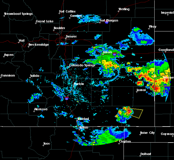 At 804 pm mdt, a severe thunderstorm was located 7 miles north of pritchett, or 13 miles west of springfield, moving east at 25 mph (radar indicated). Hazards include ping pong ball size hail and 60 mph wind gusts. People and animals outdoors will be injured. expect hail damage to roofs, siding, windows and vehicles. Expect wind damage to roofs, siding and trees. At 804 pm mdt, a severe thunderstorm was located 7 miles north of pritchett, or 13 miles west of springfield, moving east at 25 mph (radar indicated). Hazards include ping pong ball size hail and 60 mph wind gusts. People and animals outdoors will be injured. expect hail damage to roofs, siding, windows and vehicles. Expect wind damage to roofs, siding and trees.
|
| 8/13/2015 6:25 PM MDT |
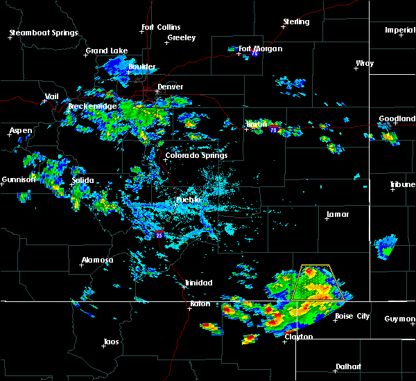 The severe thunderstorm warning for southwestern baca county will expire at 630 pm mdt, the storm which prompted the warning has weakened below severe limits, and no longer pose an immediate threat to life or property. therefore the warning will be allowed to expire. however gusty winds and heavy rain are still possible with this thunderstorm. The severe thunderstorm warning for southwestern baca county will expire at 630 pm mdt, the storm which prompted the warning has weakened below severe limits, and no longer pose an immediate threat to life or property. therefore the warning will be allowed to expire. however gusty winds and heavy rain are still possible with this thunderstorm.
|
| 8/13/2015 6:18 PM MDT |
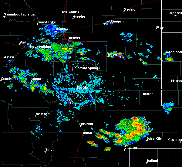 At 617 pm mdt, a severe thunderstorm was located 7 miles northwest of campo, or 15 miles south of springfield, moving southeast at 20 mph (radar indicated). Hazards include 60 mph wind gusts. Expect damage to roofs. siding and trees. Locations impacted include, springfield, pritchett and campo. At 617 pm mdt, a severe thunderstorm was located 7 miles northwest of campo, or 15 miles south of springfield, moving southeast at 20 mph (radar indicated). Hazards include 60 mph wind gusts. Expect damage to roofs. siding and trees. Locations impacted include, springfield, pritchett and campo.
|
| 8/13/2015 6:09 PM MDT |
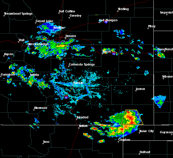 At 608 pm mdt, a severe thunderstorm was located 11 miles southeast of pritchett, or 15 miles southwest of springfield, moving southeast at 20 mph (radar indicated). Hazards include 60 mph wind gusts and penny size hail. Expect damage to roofs. siding and trees. Locations impacted include, pritchett and campo. At 608 pm mdt, a severe thunderstorm was located 11 miles southeast of pritchett, or 15 miles southwest of springfield, moving southeast at 20 mph (radar indicated). Hazards include 60 mph wind gusts and penny size hail. Expect damage to roofs. siding and trees. Locations impacted include, pritchett and campo.
|
| 8/13/2015 5:52 PM MDT |
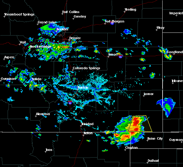 At 551 pm mdt, a severe thunderstorm was located 7 miles southeast of pritchett, or 13 miles southwest of springfield, moving south at 30 mph (radar indicated). Hazards include 60 mph wind gusts and nickel size hail. Expect damage to roofs. siding and trees. Locations impacted include, springfield, pritchett and campo. At 551 pm mdt, a severe thunderstorm was located 7 miles southeast of pritchett, or 13 miles southwest of springfield, moving south at 30 mph (radar indicated). Hazards include 60 mph wind gusts and nickel size hail. Expect damage to roofs. siding and trees. Locations impacted include, springfield, pritchett and campo.
|
| 8/13/2015 5:43 PM MDT |
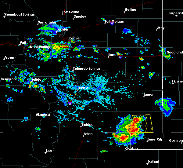 At 543 pm mdt, a severe thunderstorm was located near pritchett, or 9 miles west of springfield, moving southeast at 15 mph (radar indicated). Hazards include 60 mph wind gusts and quarter size hail. Hail damage to vehicles is expected. expect wind damage to roofs, siding and trees. Locations impacted include, springfield, pritchett, vilas and campo. At 543 pm mdt, a severe thunderstorm was located near pritchett, or 9 miles west of springfield, moving southeast at 15 mph (radar indicated). Hazards include 60 mph wind gusts and quarter size hail. Hail damage to vehicles is expected. expect wind damage to roofs, siding and trees. Locations impacted include, springfield, pritchett, vilas and campo.
|
| 8/13/2015 5:39 PM MDT |
 At 539 pm mdt, a severe thunderstorm was located over pritchett, or 10 miles west of springfield, moving northeast at 25 mph (radar indicated). Hazards include 60 mph wind gusts and quarter size hail. Hail damage to vehicles is expected. Expect wind damage to roofs, siding and trees. At 539 pm mdt, a severe thunderstorm was located over pritchett, or 10 miles west of springfield, moving northeast at 25 mph (radar indicated). Hazards include 60 mph wind gusts and quarter size hail. Hail damage to vehicles is expected. Expect wind damage to roofs, siding and trees.
|
| 7/26/2015 4:54 PM MDT |
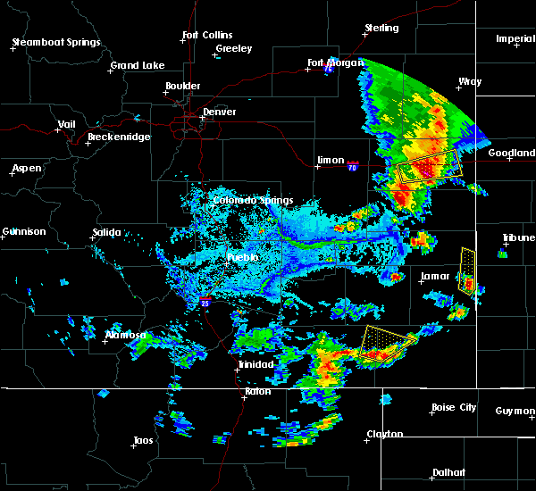 At 454 pm mdt, a severe thunderstorm was located 13 miles west of pritchett, or 27 miles west of springfield, moving northeast at 30 mph (radar indicated). Hazards include 60 mph wind gusts and quarter size hail. Hail damage to vehicles is expected. expect wind damage to roofs, siding and trees. Locations impacted include, pritchett. At 454 pm mdt, a severe thunderstorm was located 13 miles west of pritchett, or 27 miles west of springfield, moving northeast at 30 mph (radar indicated). Hazards include 60 mph wind gusts and quarter size hail. Hail damage to vehicles is expected. expect wind damage to roofs, siding and trees. Locations impacted include, pritchett.
|
| 7/26/2015 4:45 PM MDT |
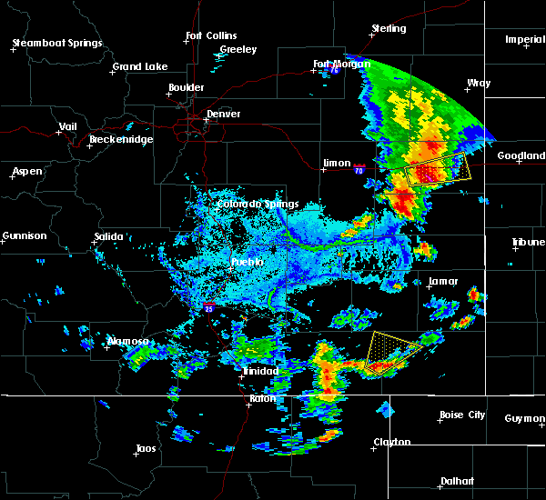 At 445 pm mdt, a severe thunderstorm was located 11 miles east of kim, or 30 miles west of springfield, moving northeast at 30 mph (radar indicated). Hazards include 60 mph wind gusts and quarter size hail. Hail damage to vehicles is expected. Expect wind damage to roofs, siding and trees. At 445 pm mdt, a severe thunderstorm was located 11 miles east of kim, or 30 miles west of springfield, moving northeast at 30 mph (radar indicated). Hazards include 60 mph wind gusts and quarter size hail. Hail damage to vehicles is expected. Expect wind damage to roofs, siding and trees.
|
| 7/15/2015 5:31 PM MDT |
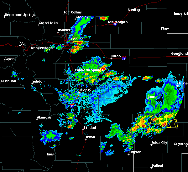 At 531 pm mdt, a severe thunderstorm was located 7 miles southeast of pritchett, or 10 miles southwest of springfield, moving northeast at 20 mph (radar indicated). Hazards include 60 mph wind gusts and quarter size hail. Hail damage to vehicles is expected. expect wind damage to roofs, siding and trees. Locations impacted include, springfield, pritchett and two buttes reservoir. At 531 pm mdt, a severe thunderstorm was located 7 miles southeast of pritchett, or 10 miles southwest of springfield, moving northeast at 20 mph (radar indicated). Hazards include 60 mph wind gusts and quarter size hail. Hail damage to vehicles is expected. expect wind damage to roofs, siding and trees. Locations impacted include, springfield, pritchett and two buttes reservoir.
|
| 7/15/2015 5:16 PM MDT |
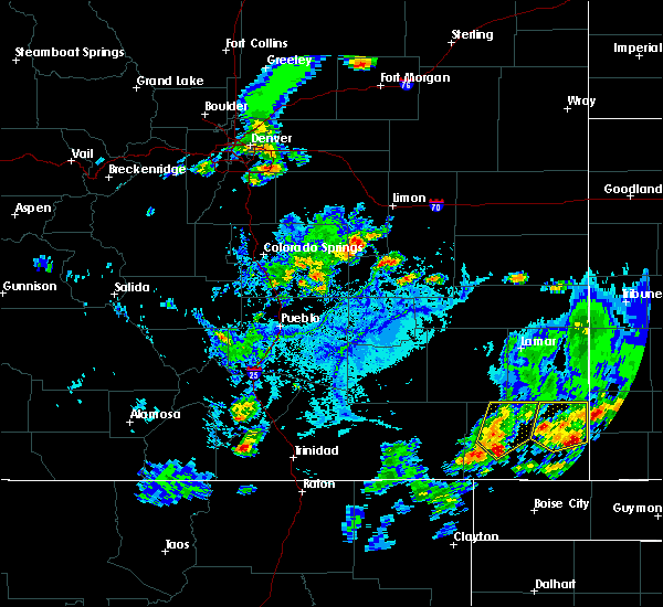 At 516 pm mdt, a severe thunderstorm was located 8 miles south of pritchett, or 15 miles southwest of springfield, moving northeast at 20 mph (radar indicated). Hazards include 60 mph wind gusts and quarter size hail. Hail damage to vehicles is expected. Expect wind damage to roofs, siding and trees. At 516 pm mdt, a severe thunderstorm was located 8 miles south of pritchett, or 15 miles southwest of springfield, moving northeast at 20 mph (radar indicated). Hazards include 60 mph wind gusts and quarter size hail. Hail damage to vehicles is expected. Expect wind damage to roofs, siding and trees.
|
| 7/14/2015 5:37 PM MDT |
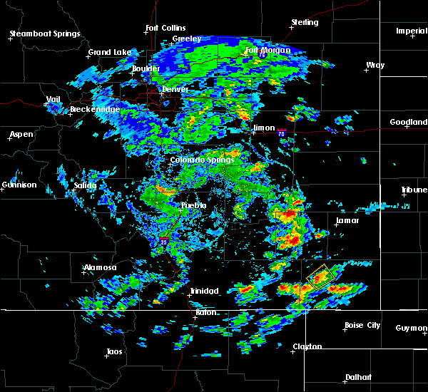 The severe thunderstorm warning for northwestern baca county will expire at 545 pm mdt, the storm which prompted the warning has weakened below severe limits, and no longer pose an immediate threat to life or property. therefore the warning will be allowed to expire. however heavy rain is still possible with this thunderstorm. The severe thunderstorm warning for northwestern baca county will expire at 545 pm mdt, the storm which prompted the warning has weakened below severe limits, and no longer pose an immediate threat to life or property. therefore the warning will be allowed to expire. however heavy rain is still possible with this thunderstorm.
|
| 7/14/2015 5:30 PM MDT |
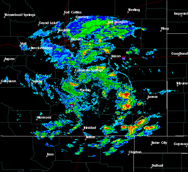 At 530 pm mdt, a severe thunderstorm was located over pritchett, or 12 miles west of springfield, moving northeast at 10 mph (radar indicated). Hazards include 60 mph wind gusts and quarter size hail. Hail damage to vehicles is expected. expect wind damage to roofs, siding and trees. Locations impacted include, springfield and pritchett. At 530 pm mdt, a severe thunderstorm was located over pritchett, or 12 miles west of springfield, moving northeast at 10 mph (radar indicated). Hazards include 60 mph wind gusts and quarter size hail. Hail damage to vehicles is expected. expect wind damage to roofs, siding and trees. Locations impacted include, springfield and pritchett.
|
| 7/14/2015 5:17 PM MDT |
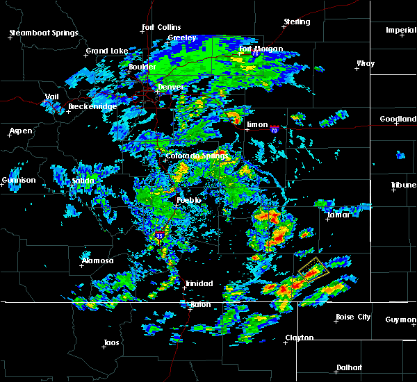 At 517 pm mdt, a severe thunderstorm was located over pritchett, or 13 miles west of springfield, moving northeast at 10 mph (radar indicated). Hazards include 60 mph wind gusts and quarter size hail. Hail damage to vehicles is expected. Expect wind damage to roofs, siding and trees. At 517 pm mdt, a severe thunderstorm was located over pritchett, or 13 miles west of springfield, moving northeast at 10 mph (radar indicated). Hazards include 60 mph wind gusts and quarter size hail. Hail damage to vehicles is expected. Expect wind damage to roofs, siding and trees.
|
| 6/25/2015 10:33 PM MDT |
 At 1032 pm mdt, severe thunderstorms were located along a line extending from near coolidge to 7 miles southwest of vilas, moving east at 60 mph (radar indicated). Hazards include 60 mph wind gusts and half dollar size hail. Hail damage to vehicles is expected. expect wind damage to roofs, siding and trees. Locations impacted include, springfield, holly, walsh, granada, pritchett, vilas, campo, hartman, two buttes, bristol and two buttes reservoir. At 1032 pm mdt, severe thunderstorms were located along a line extending from near coolidge to 7 miles southwest of vilas, moving east at 60 mph (radar indicated). Hazards include 60 mph wind gusts and half dollar size hail. Hail damage to vehicles is expected. expect wind damage to roofs, siding and trees. Locations impacted include, springfield, holly, walsh, granada, pritchett, vilas, campo, hartman, two buttes, bristol and two buttes reservoir.
|
| 6/25/2015 10:26 PM MDT |
 At 1025 pm mdt, severe thunderstorms were located along a line extending from near coolidge to near springfield, moving east at 40 mph (radar indicated). Hazards include 60 mph wind gusts and quarter size hail. Hail damage to vehicles is expected. expect wind damage to roofs, siding and trees. Locations impacted include, springfield, holly, walsh, granada, pritchett, vilas, campo, hartman, two buttes, bristol and two buttes reservoir. At 1025 pm mdt, severe thunderstorms were located along a line extending from near coolidge to near springfield, moving east at 40 mph (radar indicated). Hazards include 60 mph wind gusts and quarter size hail. Hail damage to vehicles is expected. expect wind damage to roofs, siding and trees. Locations impacted include, springfield, holly, walsh, granada, pritchett, vilas, campo, hartman, two buttes, bristol and two buttes reservoir.
|
| 6/25/2015 10:22 PM MDT |
 At 1022 pm mdt, severe thunderstorms were located along a line extending from near granada to near pritchett, moving east at 60 mph (radar indicated). Hazards include 60 mph wind gusts and quarter size hail. Hail damage to vehicles is expected. Expect wind damage to roofs, siding and trees. At 1022 pm mdt, severe thunderstorms were located along a line extending from near granada to near pritchett, moving east at 60 mph (radar indicated). Hazards include 60 mph wind gusts and quarter size hail. Hail damage to vehicles is expected. Expect wind damage to roofs, siding and trees.
|
| 6/25/2015 10:07 PM MDT |
 At 1007 pm mdt, severe thunderstorms were located along a line extending from neeoshe reservoir to 20 miles east of higbee, moving southeast at 10 mph (radar indicated). Hazards include 70 mph wind gusts and quarter size hail. Hail damage to vehicles is expected. expect considerable tree damage. wind damage is also likely to mobile homes, roofs and outbuildings. Locations impacted include, lamar, granada, wiley, pritchett, hartman and bristol. At 1007 pm mdt, severe thunderstorms were located along a line extending from neeoshe reservoir to 20 miles east of higbee, moving southeast at 10 mph (radar indicated). Hazards include 70 mph wind gusts and quarter size hail. Hail damage to vehicles is expected. expect considerable tree damage. wind damage is also likely to mobile homes, roofs and outbuildings. Locations impacted include, lamar, granada, wiley, pritchett, hartman and bristol.
|
| 6/25/2015 9:57 PM MDT |
 At 951 pm mdt, severe thunderstorms were located along a line extending from sweetwater reservoir to 17 miles east of higbee, moving southeast at 10 mph (radar indicated). Hazards include 70 mph wind gusts and nickel size hail. strong winds are now approaching the lamar area from the west. Expect considerable tree damage. damage is likely to mobile homes, roofs and outbuildings. Locations impacted include, lamar, granada, wiley, pritchett, hartman and bristol. At 951 pm mdt, severe thunderstorms were located along a line extending from sweetwater reservoir to 17 miles east of higbee, moving southeast at 10 mph (radar indicated). Hazards include 70 mph wind gusts and nickel size hail. strong winds are now approaching the lamar area from the west. Expect considerable tree damage. damage is likely to mobile homes, roofs and outbuildings. Locations impacted include, lamar, granada, wiley, pritchett, hartman and bristol.
|
| 6/25/2015 9:52 PM MDT |
 At 951 pm mdt, severe thunderstorms were located along a line extending from sweetwater reservoir to 17 miles east of higbee, moving southeast at 10 mph (radar indicated). Hazards include 70 mph wind gusts and nickel size hail. strong winds are now approaching the lamar area from the west. Expect considerable tree damage. damage is likely to mobile homes, roofs and outbuildings. Locations impacted include, lamar, granada, wiley, pritchett, hartman and bristol. At 951 pm mdt, severe thunderstorms were located along a line extending from sweetwater reservoir to 17 miles east of higbee, moving southeast at 10 mph (radar indicated). Hazards include 70 mph wind gusts and nickel size hail. strong winds are now approaching the lamar area from the west. Expect considerable tree damage. damage is likely to mobile homes, roofs and outbuildings. Locations impacted include, lamar, granada, wiley, pritchett, hartman and bristol.
|
| 6/25/2015 9:47 PM MDT |
 At 946 pm mdt, severe thunderstorms were located along a line extending from sweetwater reservoir to 17 miles east of higbee, moving southeast at 10 mph (radar indicated). Hazards include 60 mph wind gusts and nickel size hail. Expect damage to roofs. Siding and trees. At 946 pm mdt, severe thunderstorms were located along a line extending from sweetwater reservoir to 17 miles east of higbee, moving southeast at 10 mph (radar indicated). Hazards include 60 mph wind gusts and nickel size hail. Expect damage to roofs. Siding and trees.
|
| 6/7/2015 2:10 PM MDT | Quarter sized hail reported 17.8 miles NNE of Pritchett, CO, fell over the past 5 minutes. |
| 6/1/2015 6:07 PM MDT | At 605 pm mdt, a severe thunderstorm was located 12 miles southwest of pritchett, or 24 miles southwest of springfield, moving east at 15 mph (radar indicated. at 6:00 pm...a trained weather spotter reported golf ball size hail with this storm). Hazards include two inch hail and 60 mph wind gusts. People and animals outdoors will be injured. expect hail damage to roofs, siding, windows and vehicles. expect wind damage to roofs, siding and trees. Locations impacted include, pritchett and other areas of west central baca county. |
| 6/1/2015 6:00 PM MDT | Golf Ball sized hail reported 15.9 miles ENE of Pritchett, CO |
| 6/1/2015 5:50 PM MDT | At 547 pm mdt, a severe thunderstorm was located 14 miles east of kim, or 28 miles southwest of springfield, moving east at 25 mph (the public reported ping pong ball size hail with this storm at 5:45 pm). Hazards include two inch hail and 60 mph wind gusts. People and animals outdoors will be injured. expect hail damage to roofs, siding, windows and vehicles. expect wind damage to roofs, siding and trees. Locations impacted include, pritchett. |
| 6/1/2015 5:46 PM MDT | Ping Pong Ball sized hail reported 18 miles ENE of Pritchett, CO |
| 6/1/2015 5:42 PM MDT | At 541 pm mdt, a severe thunderstorm was located 12 miles east of kim, or 29 miles west of springfield, moving east at 25 mph (radar indicated). Hazards include 60 mph wind gusts and half dollar size hail. Hail damage to vehicles is expected. Expect wind damage to roofs, siding and trees. |
| 5/27/2015 2:09 PM MDT | At 208 pm mdt, a severe thunderstorm was located 10 miles northwest of pritchett, or 22 miles west of springfield, moving northeast at 15 mph (radar indicated). Hazards include 60 mph wind gusts and half dollar size hail. Hail damage to vehicles is expected. Expect wind damage to roofs, siding and trees. |
| 5/24/2015 5:01 PM MDT | Quarter sized hail reported 0 miles NNW of Pritchett, CO |
| 5/24/2015 4:51 PM MDT | At 451 pm mdt, severe thunderstorms were located along a line extending from 11 miles north of two buttes reservoir to near pritchett, moving east at 40 mph (radar indicated). Hazards include 70 mph wind gusts and half dollar size hail. Hail damage to vehicles is expected. expect considerable tree damage. wind damage is also likely to mobile homes, roofs and outbuildings. locations impacted include, springfield, pritchett, vilas, two buttes and two buttes reservoir. A tornado watch remains in effect until midnight mdt for southeastern colorado. |
| 5/24/2015 4:45 PM MDT | At 445 pm mdt, severe thunderstorms were located along a line extending from 11 miles northwest of two buttes reservoir to near pritchett, moving northeast at 40 mph (radar indicated). Hazards include 60 mph wind gusts and quarter size hail. Hail damage to vehicles is expected. expect wind damage to roofs, siding and trees. locations impacted include, springfield, pritchett, vilas, two buttes and two buttes reservoir. A tornado watch remains in effect until midnight mdt for southeastern colorado. |
| 5/24/2015 4:26 PM MDT | At 425 pm mdt, severe thunderstorms were located along a line extending from 15 miles west of two buttes reservoir to 8 miles southwest of pritchett, moving east at 40 mph (radar indicated). Hazards include 60 mph wind gusts and quarter size hail. Hail damage to vehicles is expected. Expect wind damage to roofs, siding and trees. |
| 7/19/2014 7:07 PM MDT | Golf Ball sized hail reported 10 miles NNE of Pritchett, CO |
| 7/8/2012 5:05 PM MDT | Penny size hail was also reported with this stor in baca county CO, 0 miles NNW of Pritchett, CO |
| 6/12/2012 4:25 PM MDT | Quarter sized hail reported 2.8 miles N of Pritchett, CO |
| 6/12/2012 3:39 PM MDT | Half Dollar sized hail reported 2.7 miles S of Pritchett, CO |
Hail Maps for Pritchett, CO
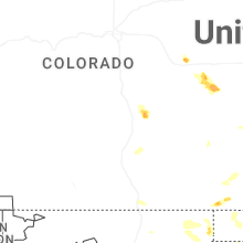
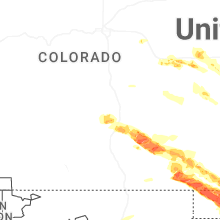
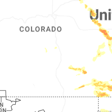
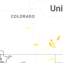


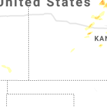


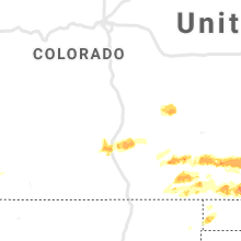


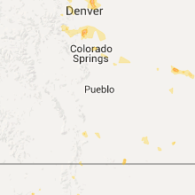


Connect with Interactive Hail Maps