

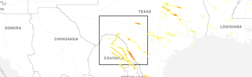
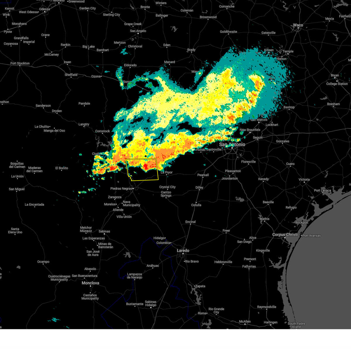
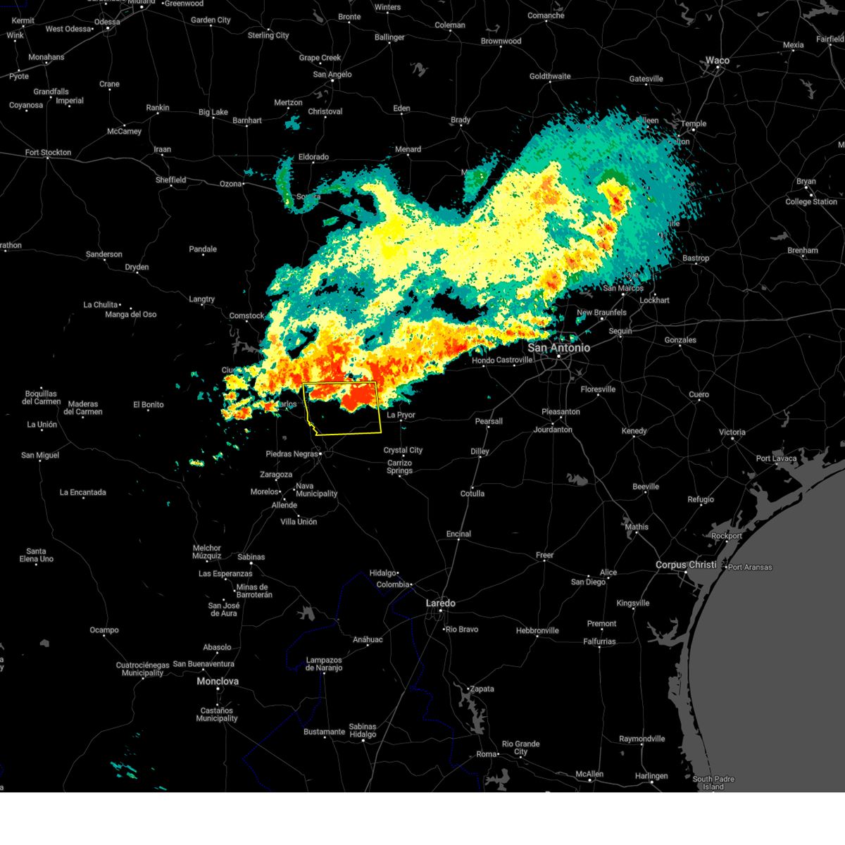
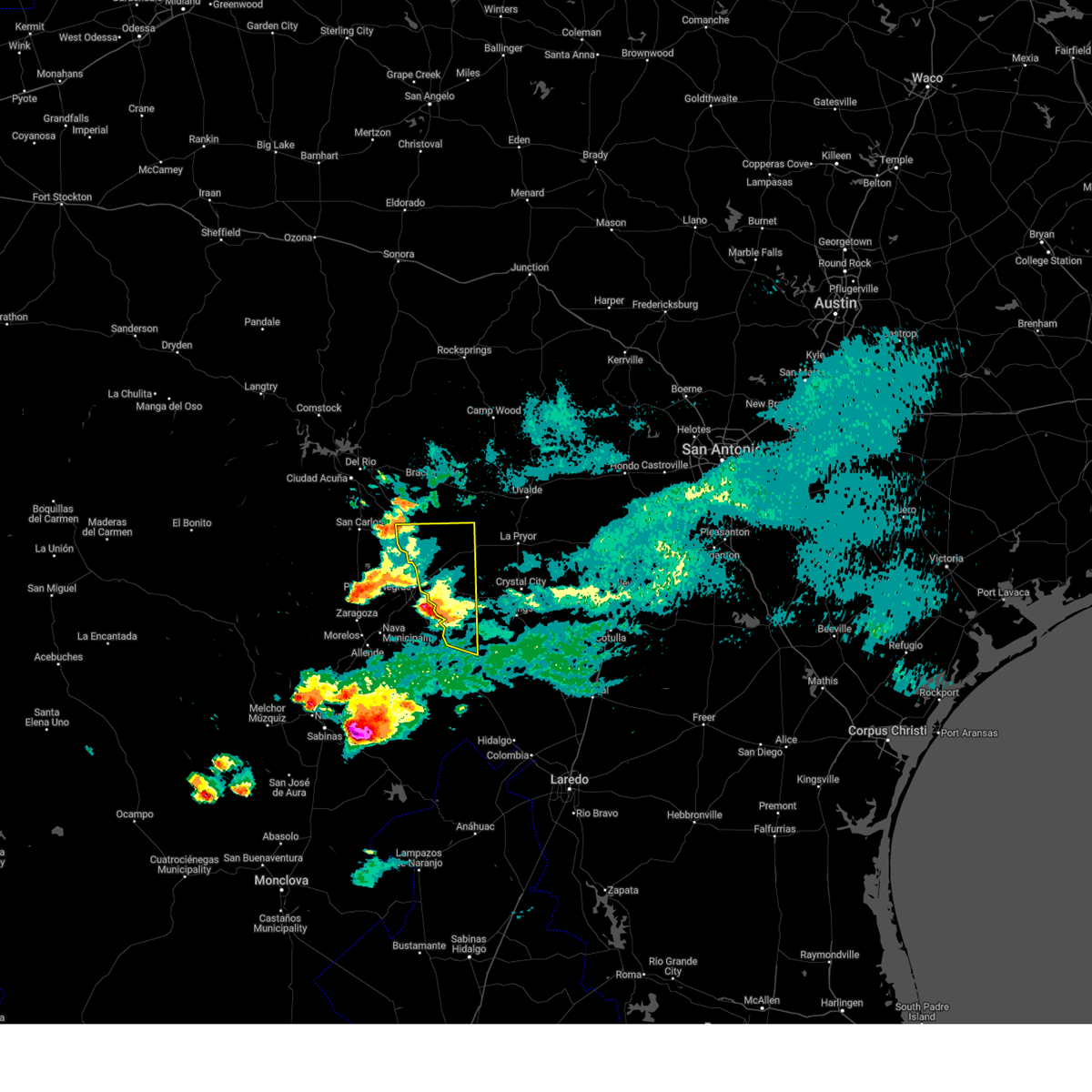
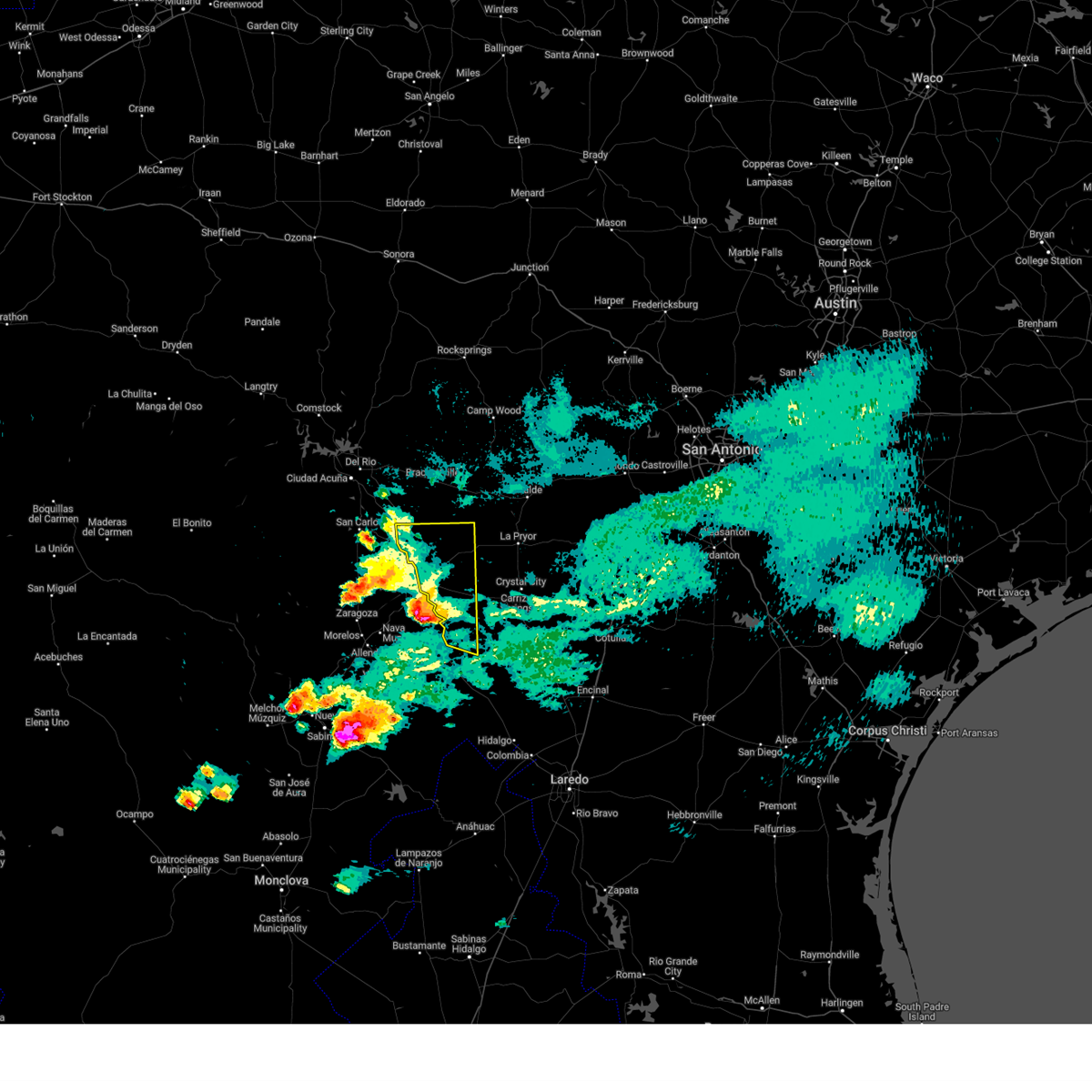
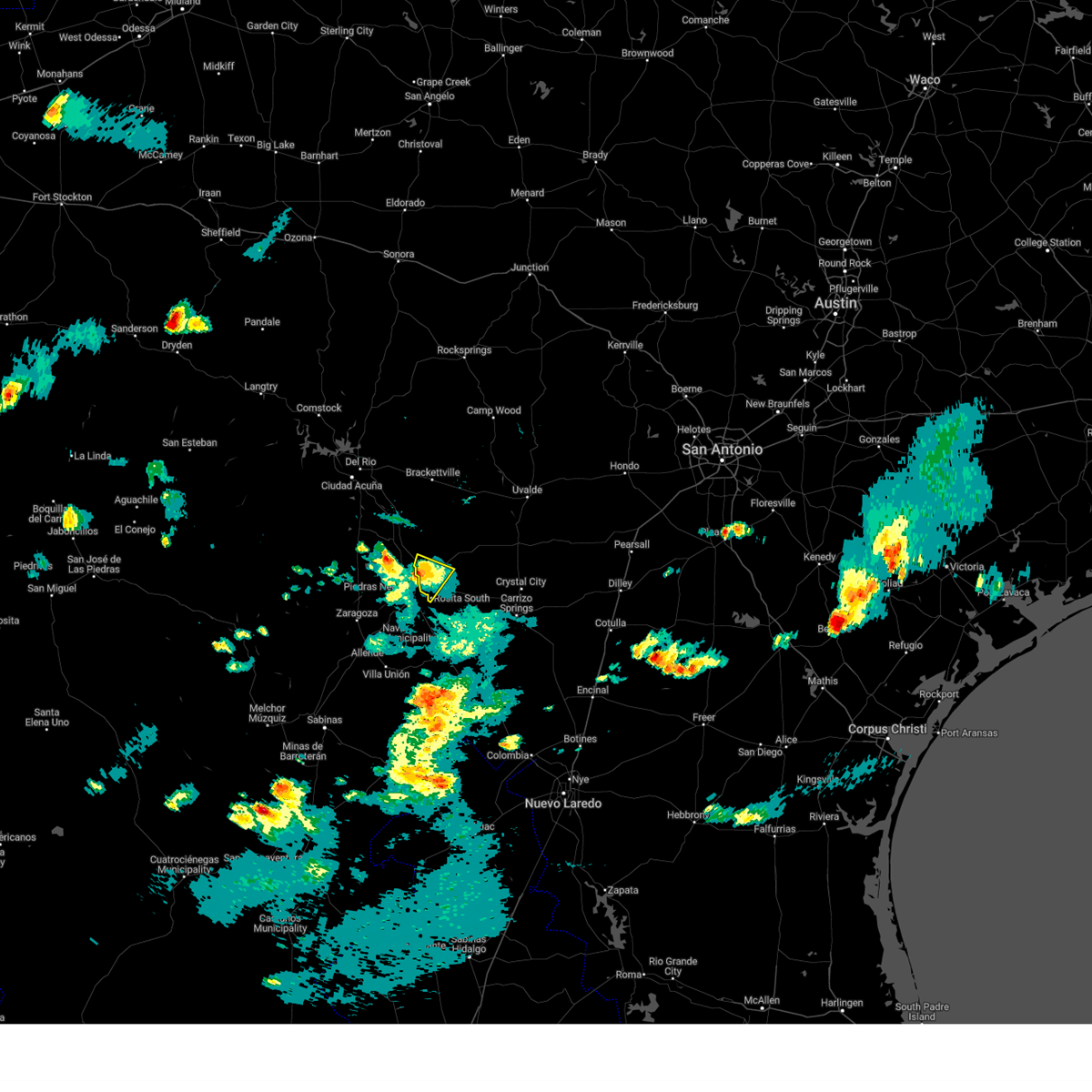
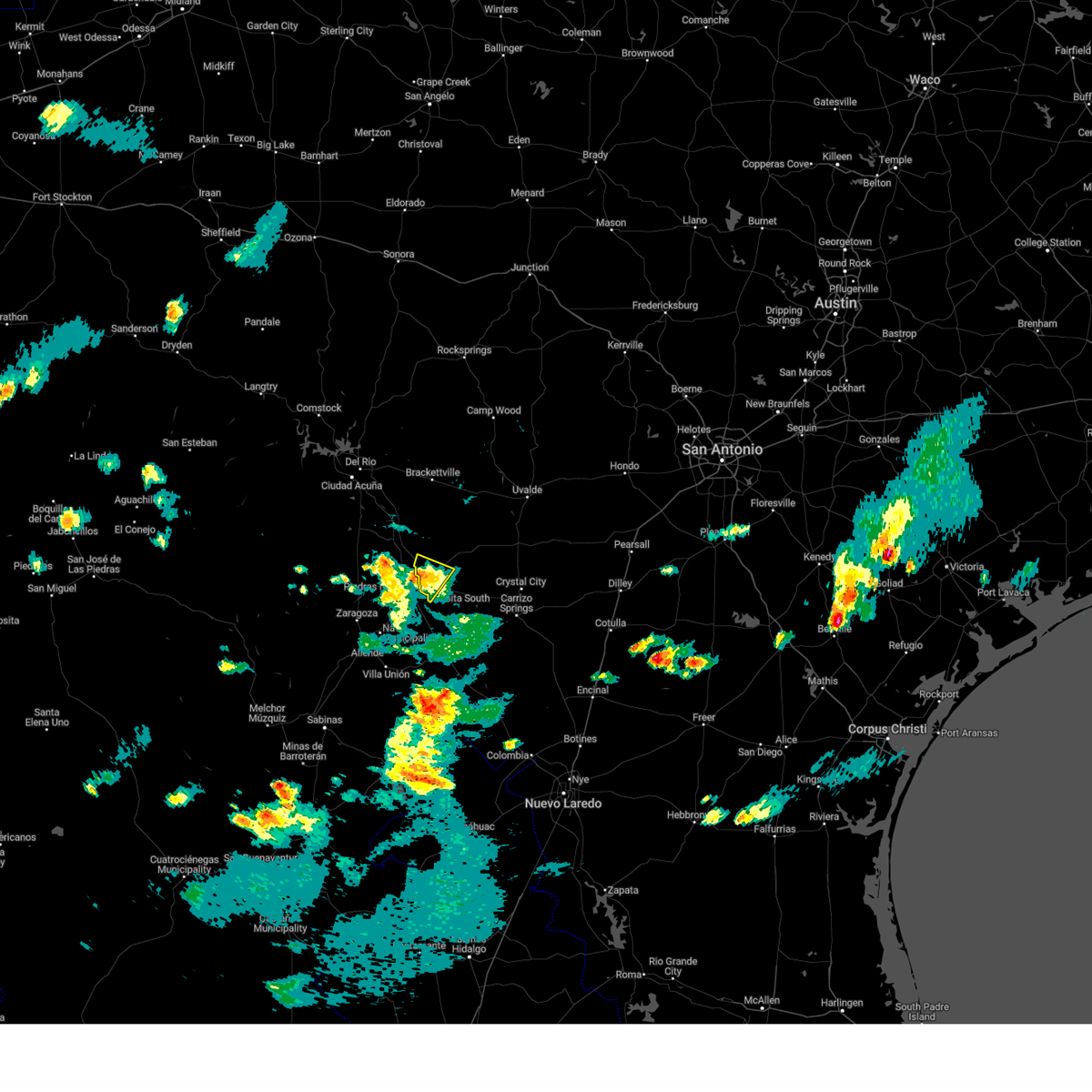
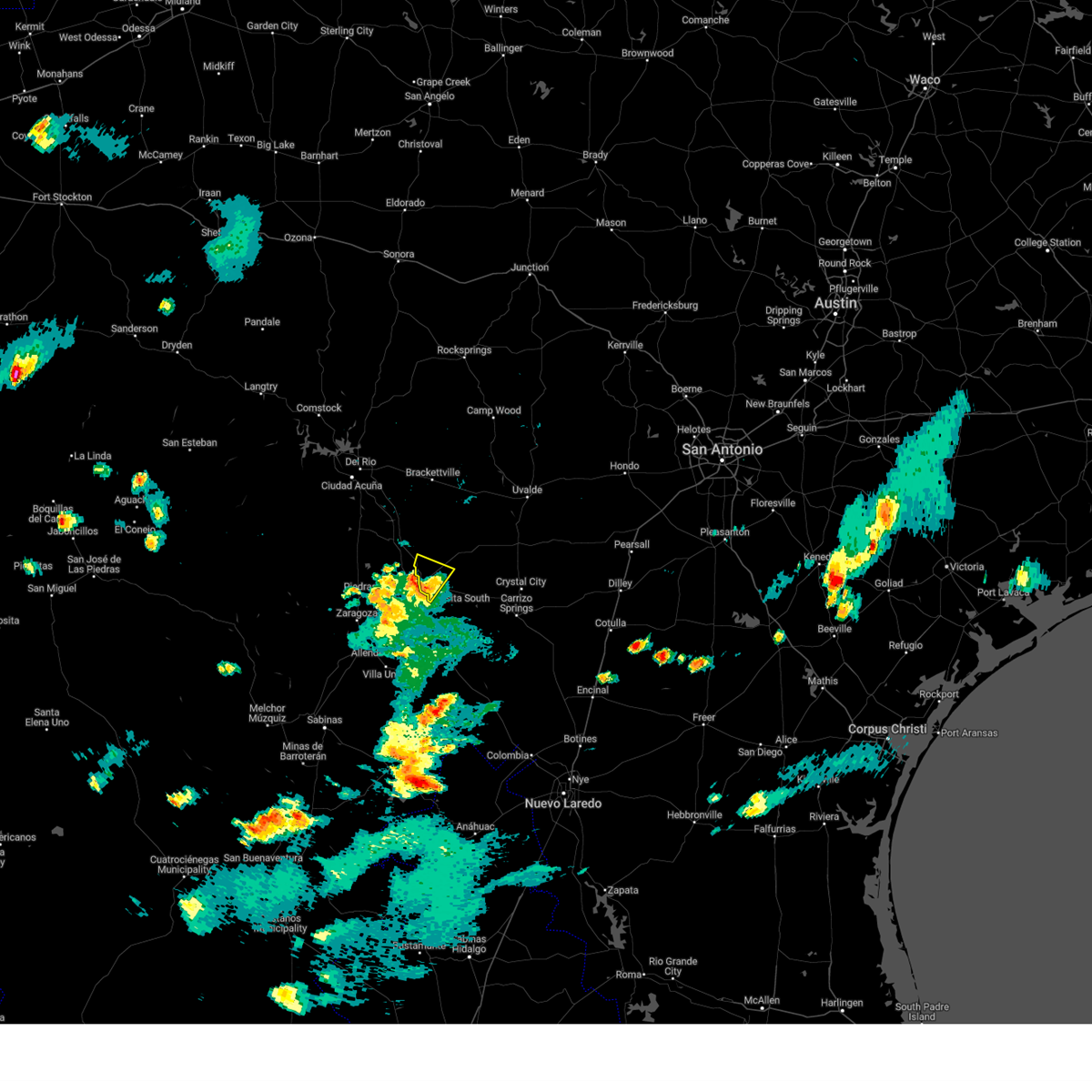
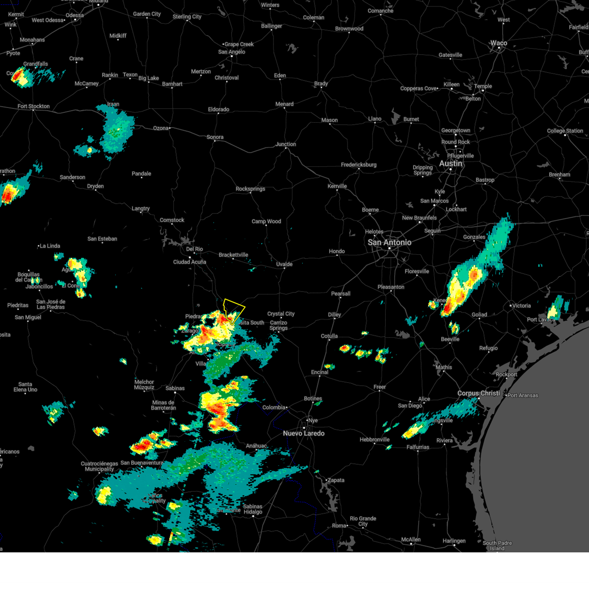
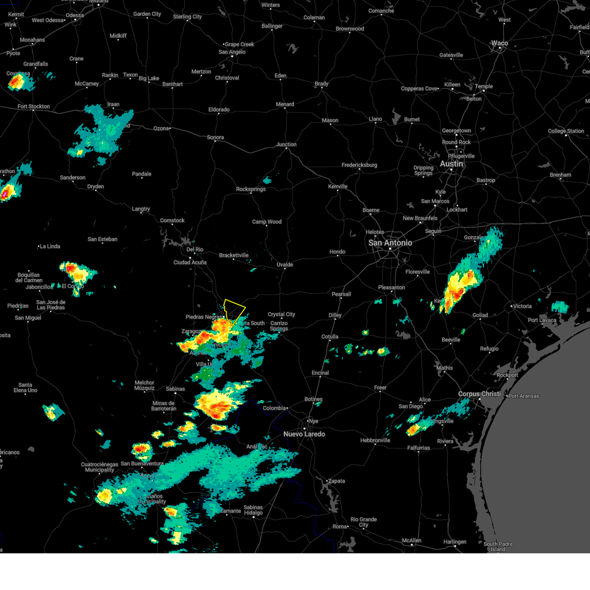
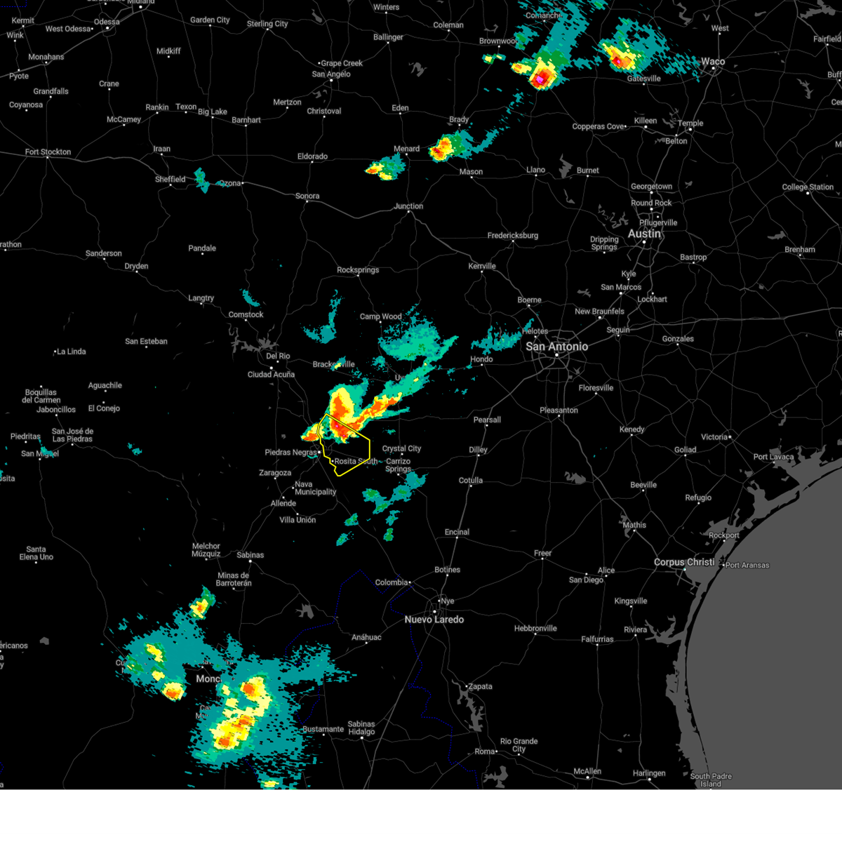
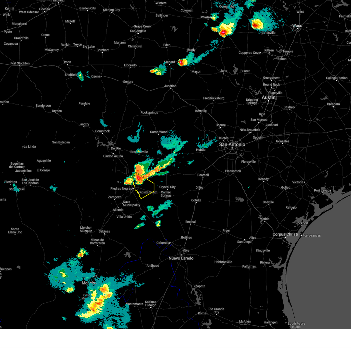
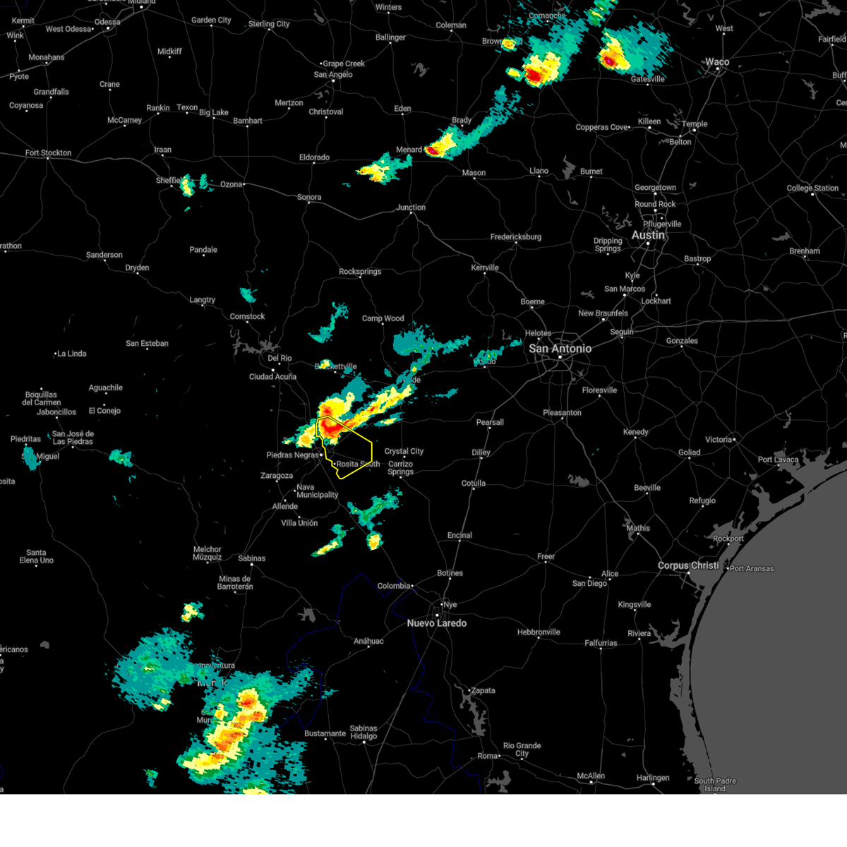
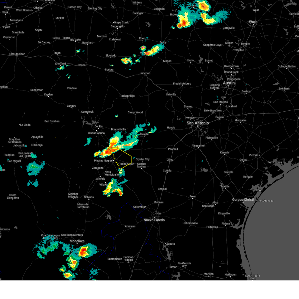
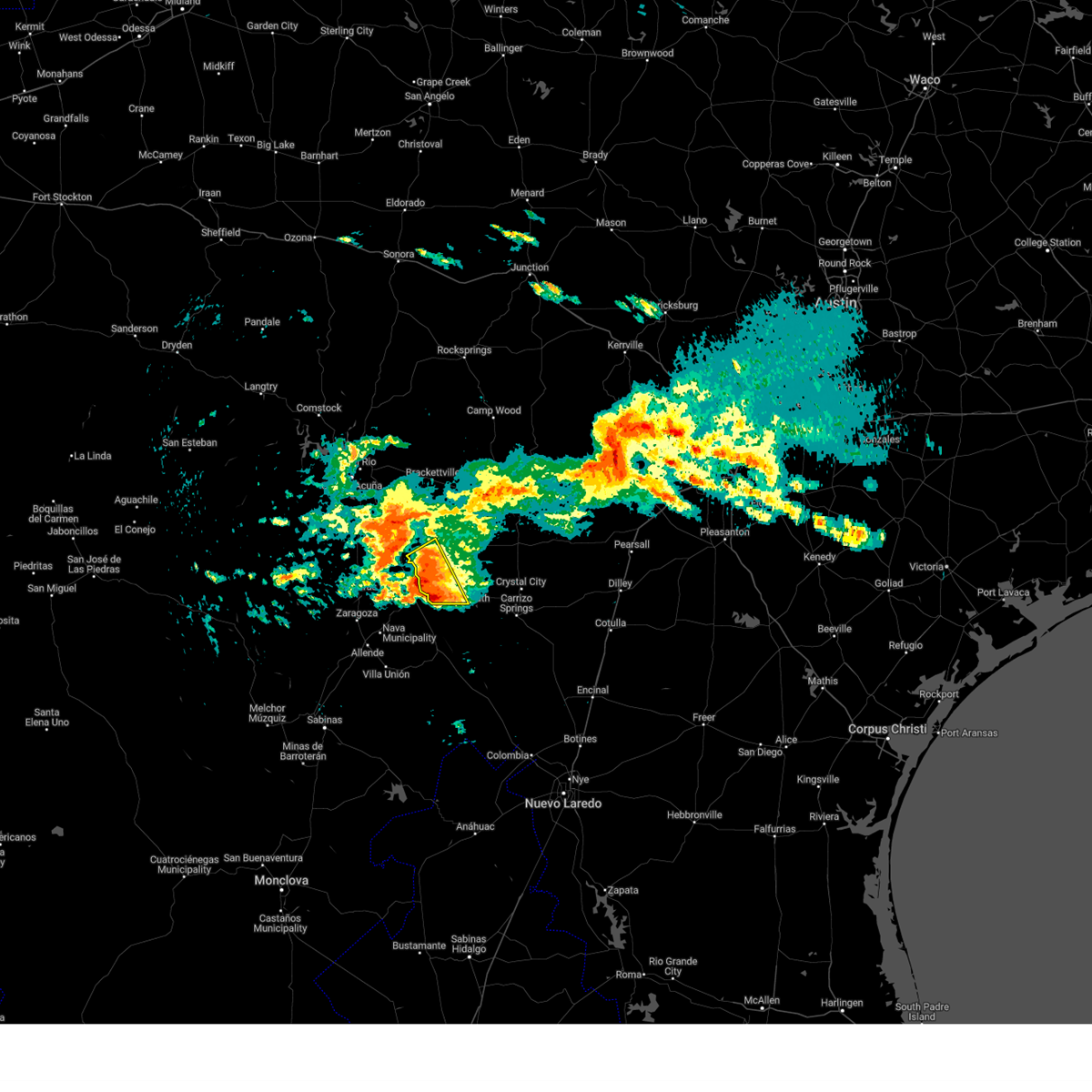
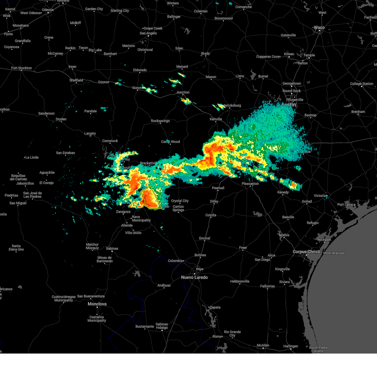
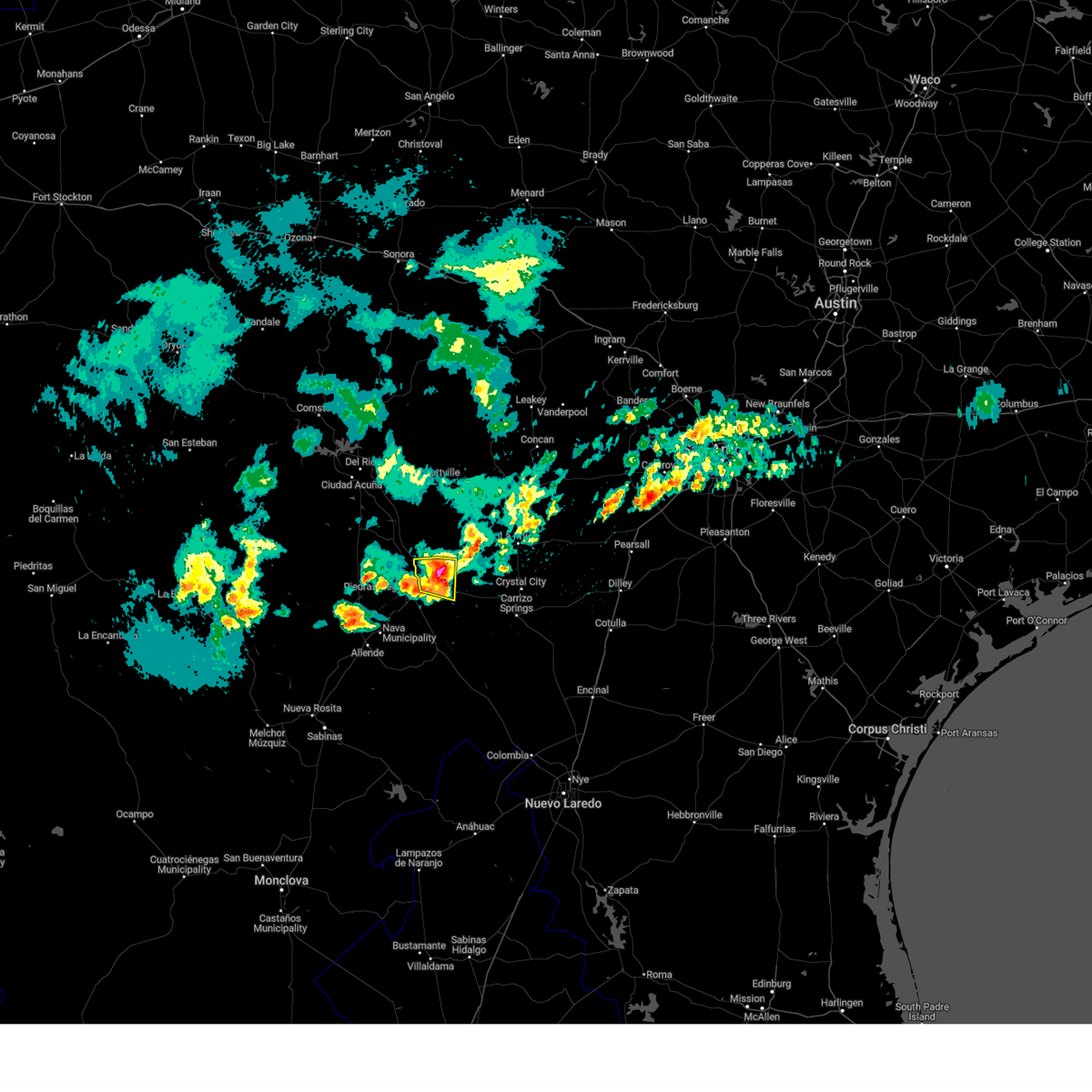
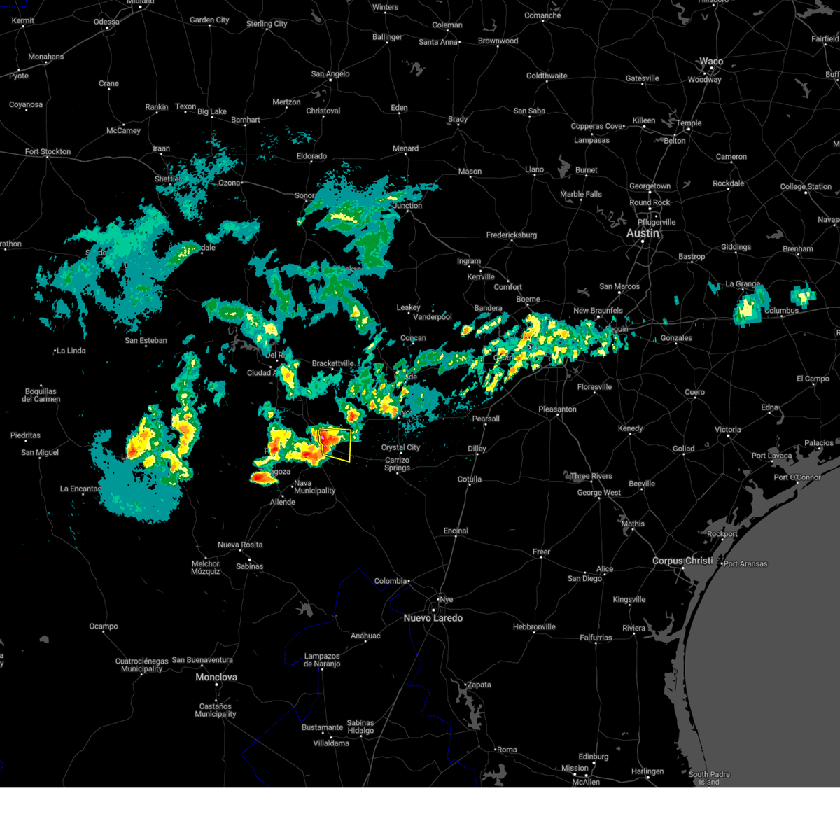
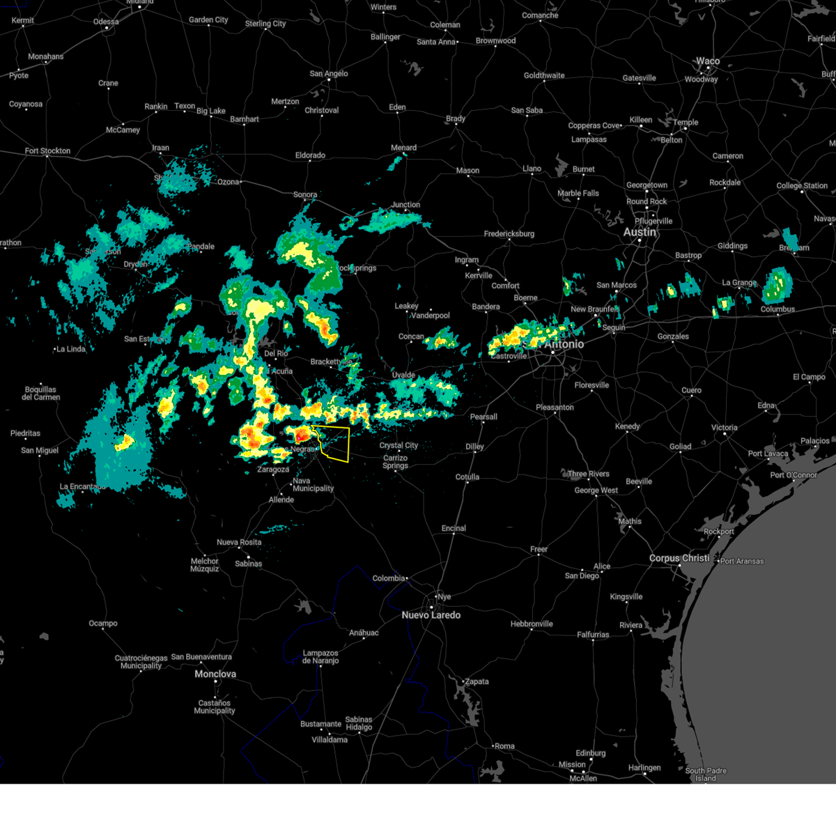
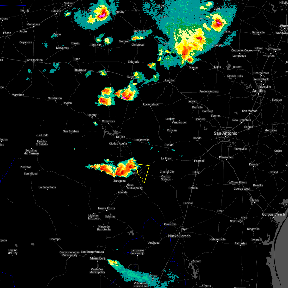
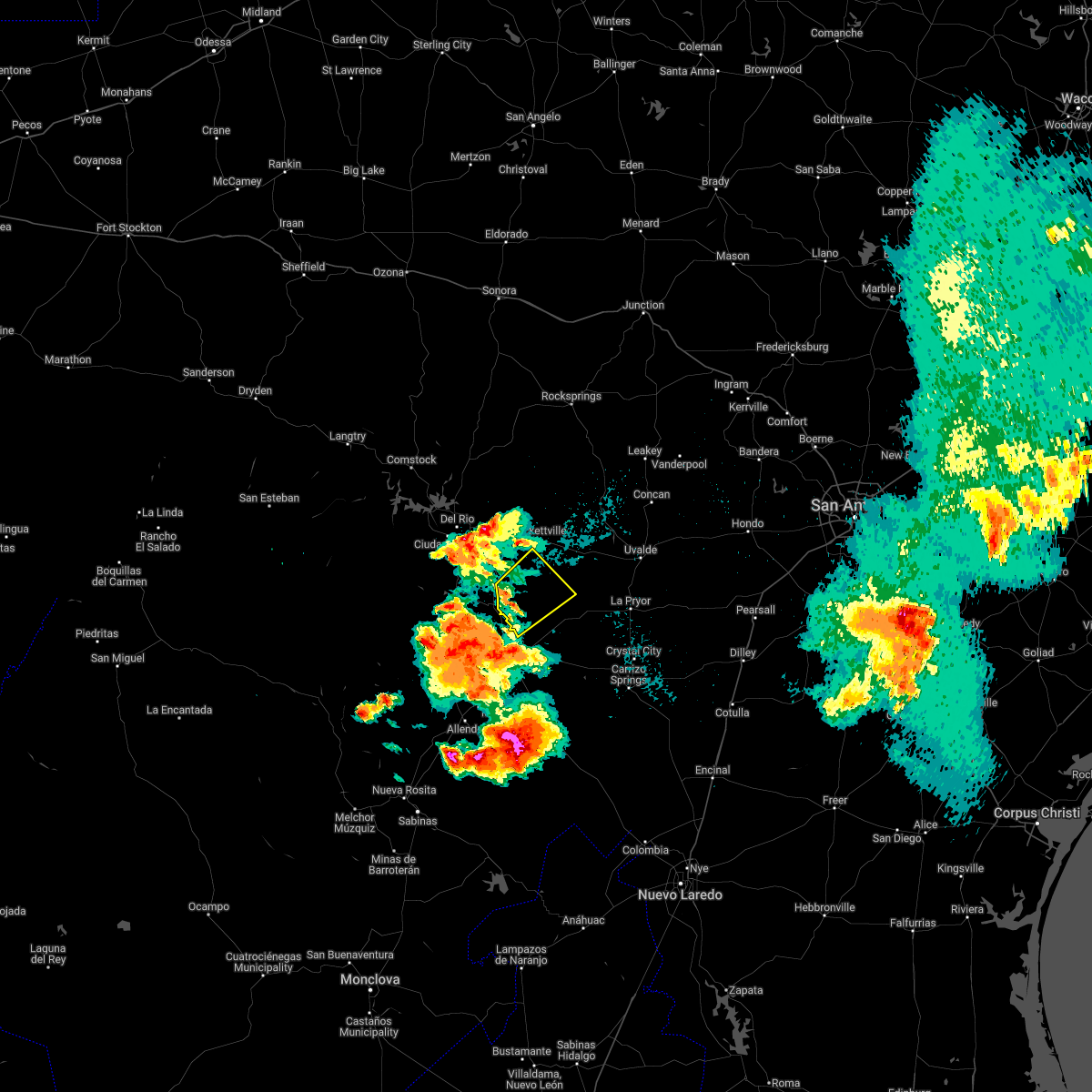
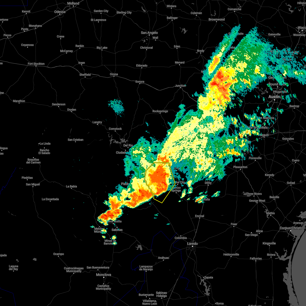
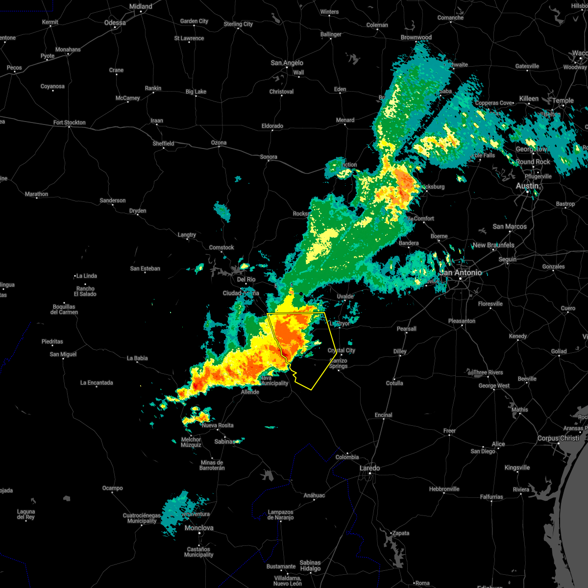
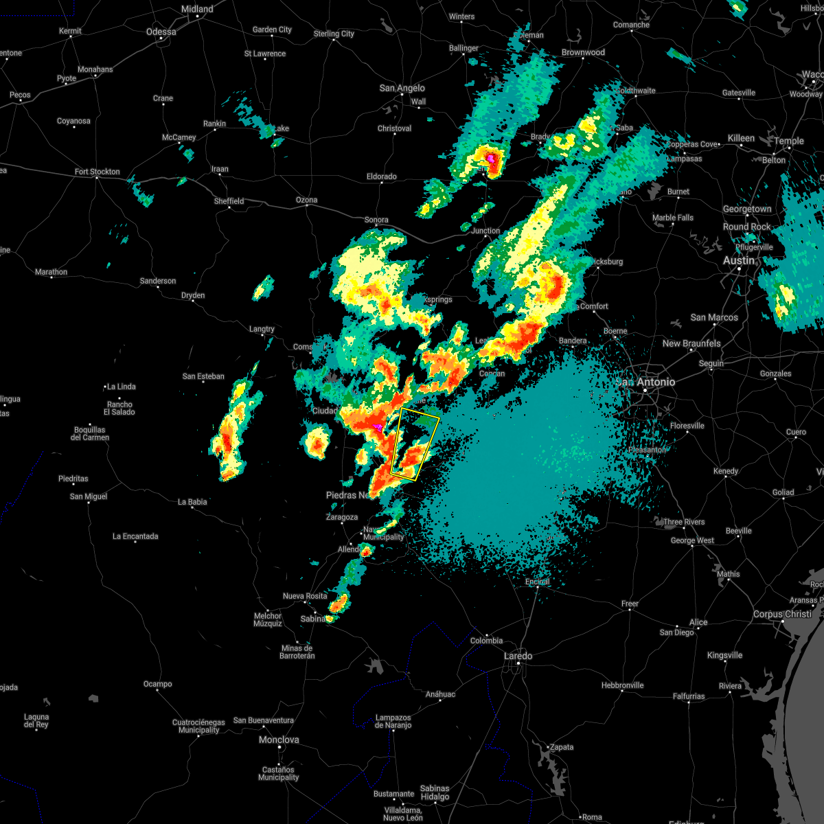
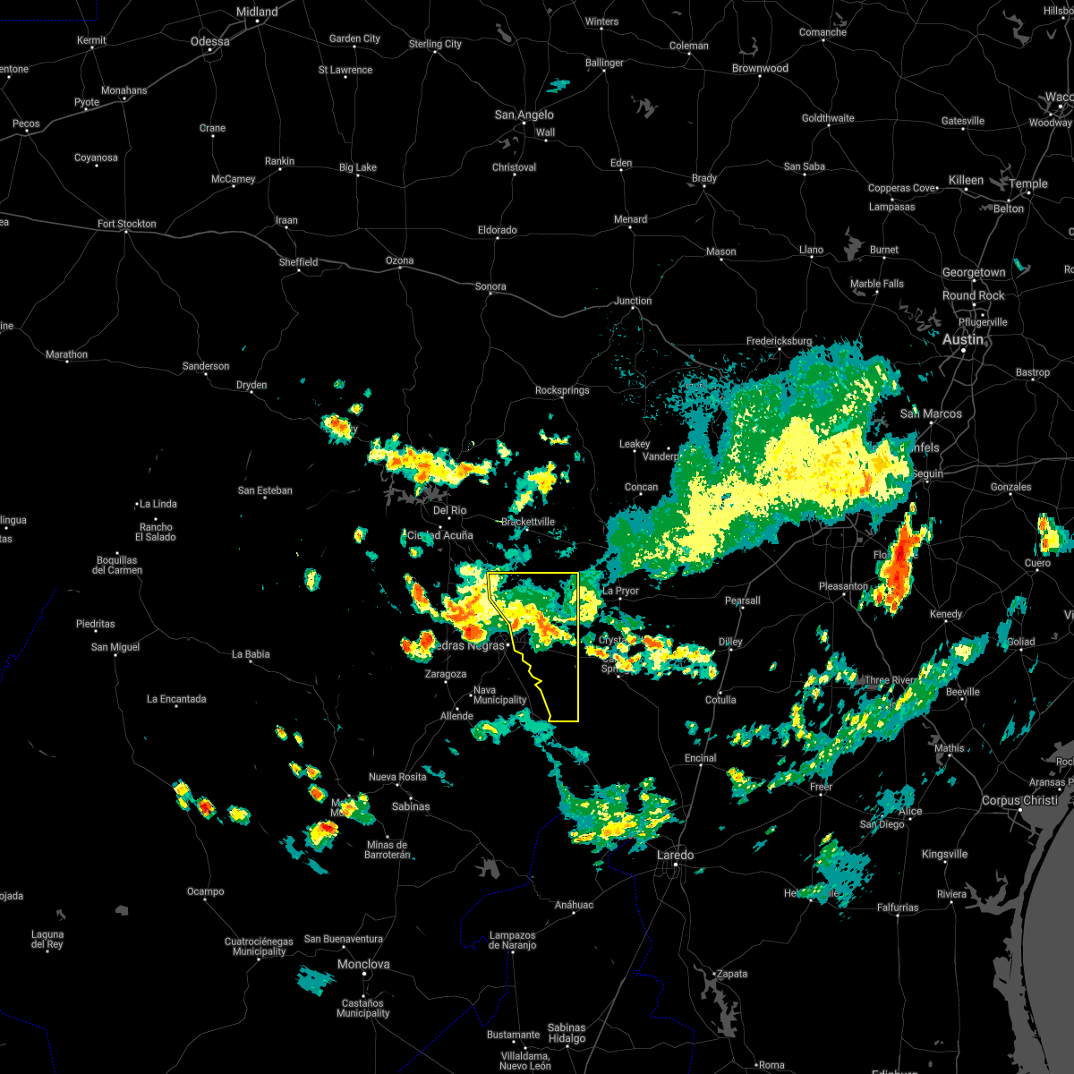
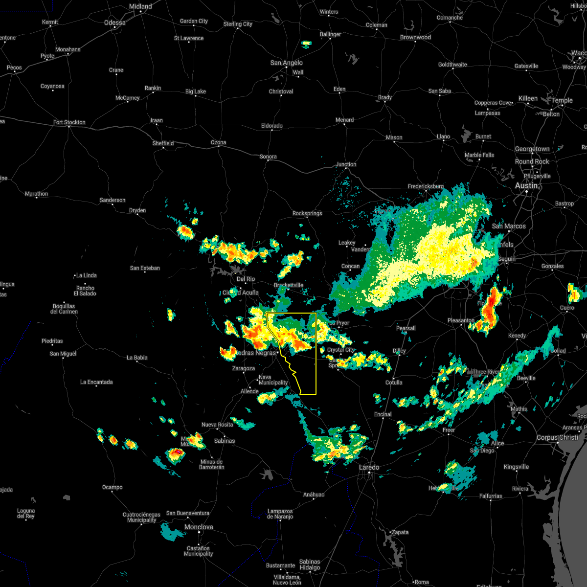
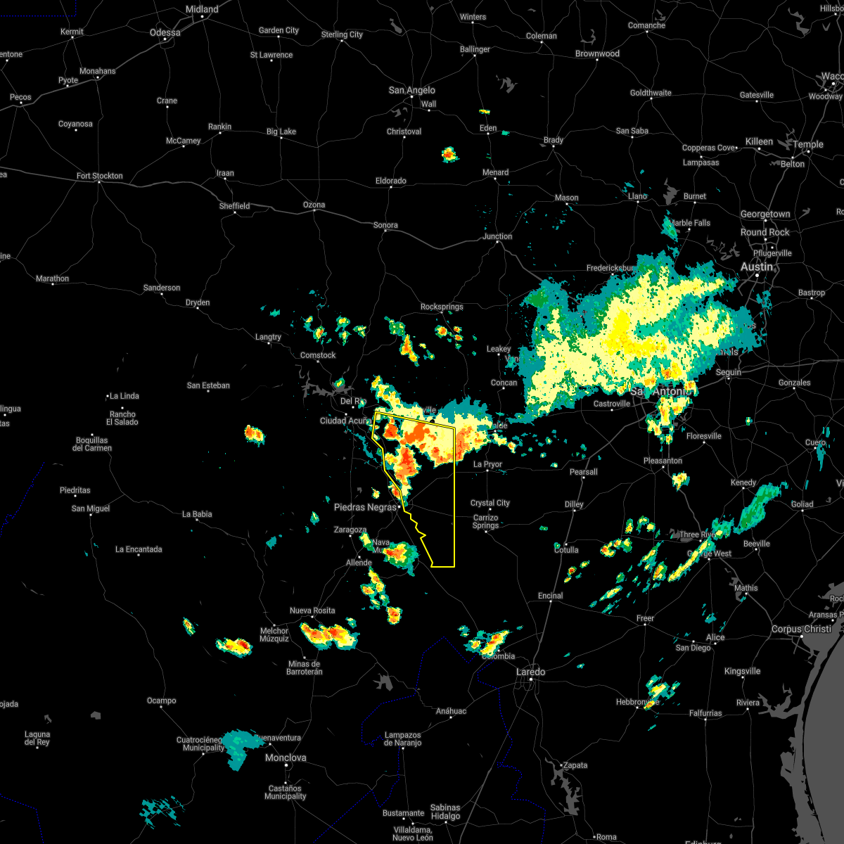
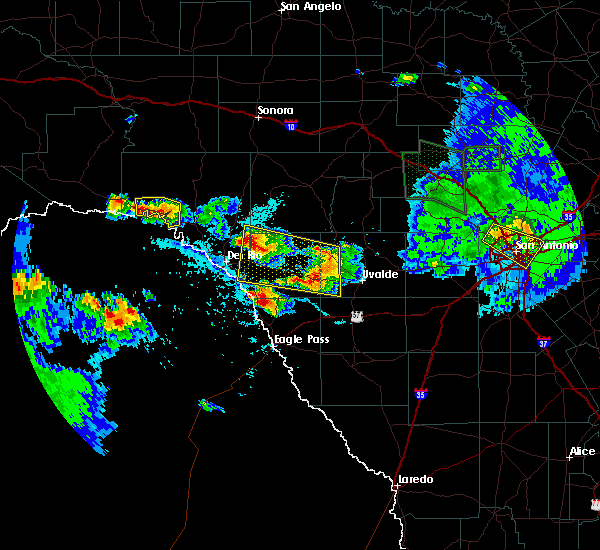
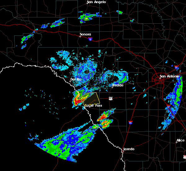
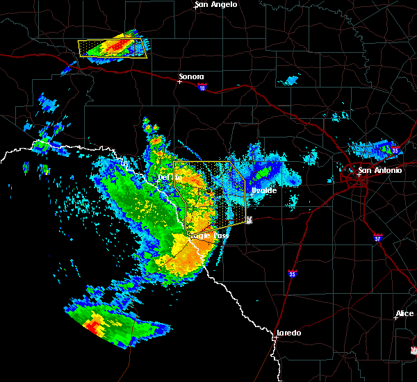
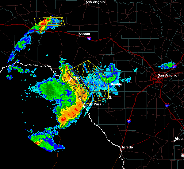
Hail Map for Radar Base, TX
The Radar Base, TX area has had 3 reports of on-the-ground hail by trained spotters, and has been under severe weather warnings 8 times during the past 12 months. Doppler radar has detected hail at or near Radar Base, TX on 47 occasions, including 2 occasions during the past year.
| Name: | Radar Base, TX |
| Where Located: | 41.6 miles SSE of Del Rio, TX |
| Map: | Google Map for Radar Base, TX |
| Population: | 762 |
| Housing Units: | 61 |
| More Info: | Search Google for Radar Base, TX |
0
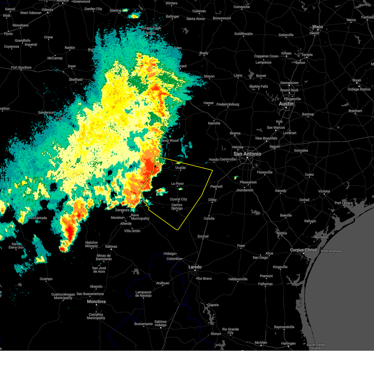
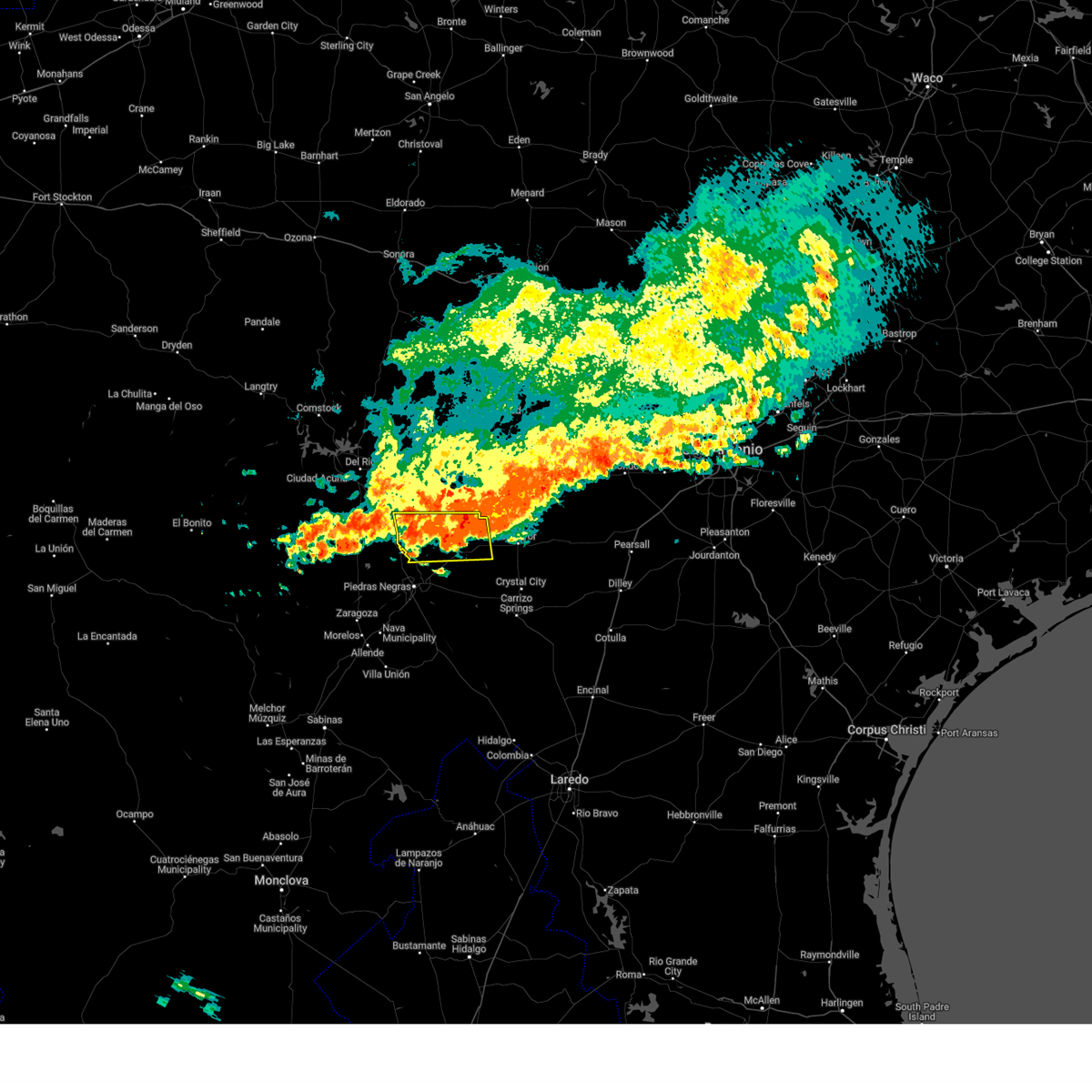
The Top Recent Hail Date for Radar Base, TX is Friday, May 2, 2025 (47th out of 47)
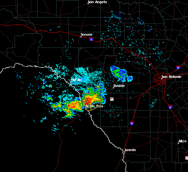
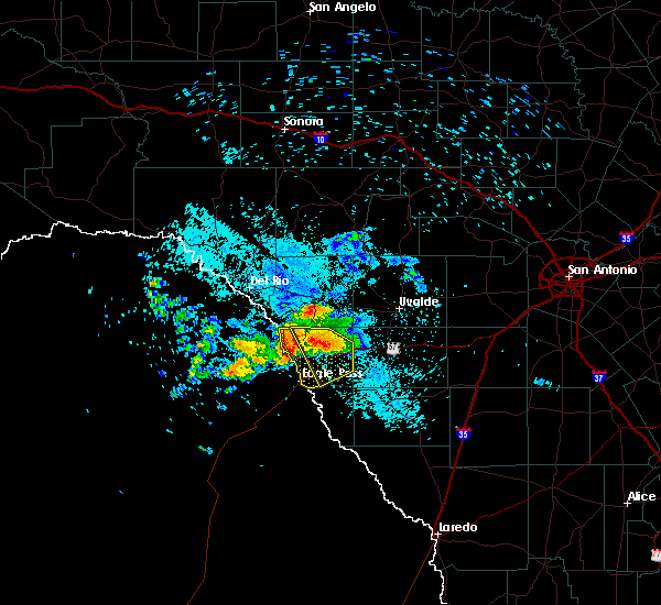
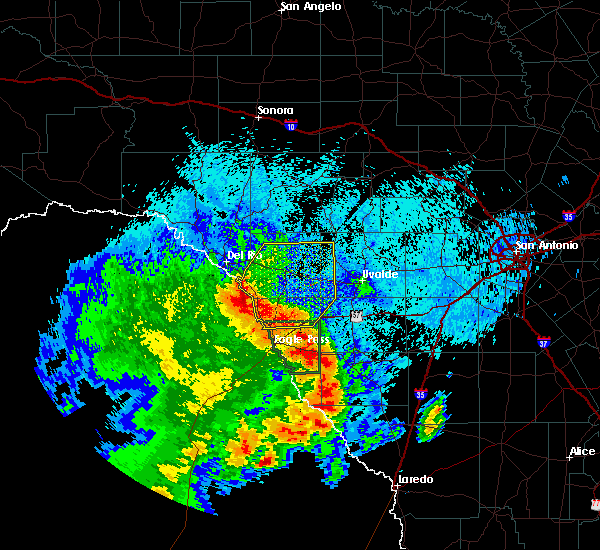
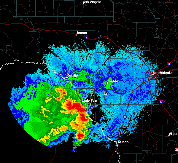
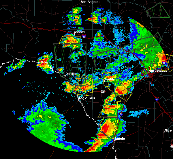
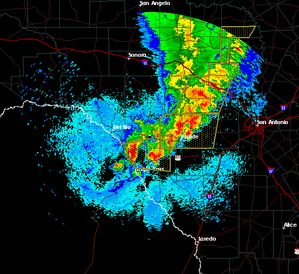
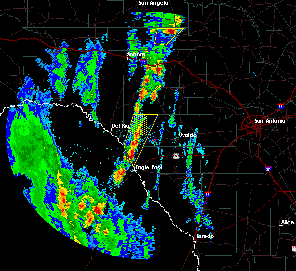
Hail and Wind Damage Spotted near Radar Base, TX
| Date / Time | Report Details |
|---|---|
| 6/10/2025 9:52 PM CDT |
 Svrewx the national weather service in austin san antonio has issued a * severe thunderstorm warning for, southwestern medina county in south central texas, southeastern kinney county in south central texas, maverick county in south central texas, western dimmit county in south central texas, southern uvalde county in south central texas, zavala county in south central texas, northwestern frio county in south central texas, * until 1045 pm cdt. * at 951 pm cdt, severe thunderstorms were located along a line extending from 8 miles southeast of laguna to near blewett to 14 miles northwest of cometa, moving southeast at 35 mph (radar indicated). Hazards include ping pong ball size hail and 60 mph wind gusts. People and animals outdoors will be injured. expect hail damage to roofs, siding, windows, and vehicles. Expect wind damage to roofs, siding, and trees. Svrewx the national weather service in austin san antonio has issued a * severe thunderstorm warning for, southwestern medina county in south central texas, southeastern kinney county in south central texas, maverick county in south central texas, western dimmit county in south central texas, southern uvalde county in south central texas, zavala county in south central texas, northwestern frio county in south central texas, * until 1045 pm cdt. * at 951 pm cdt, severe thunderstorms were located along a line extending from 8 miles southeast of laguna to near blewett to 14 miles northwest of cometa, moving southeast at 35 mph (radar indicated). Hazards include ping pong ball size hail and 60 mph wind gusts. People and animals outdoors will be injured. expect hail damage to roofs, siding, windows, and vehicles. Expect wind damage to roofs, siding, and trees.
|
| 5/30/2025 4:18 AM CDT |
 the severe thunderstorm warning has been cancelled and is no longer in effect the severe thunderstorm warning has been cancelled and is no longer in effect
|
| 5/30/2025 4:18 AM CDT |
 At 418 am cdt, a severe thunderstorm was located 8 miles southeast of darling, or 18 miles southeast of spofford, moving east at 15 mph (radar indicated). Hazards include 60 mph wind gusts and quarter size hail. Hail damage to vehicles is expected. expect wind damage to roofs, siding, and trees. Locations impacted include, quemado, radar base, normandy, darling, paloma, and laughlin afb aux field. At 418 am cdt, a severe thunderstorm was located 8 miles southeast of darling, or 18 miles southeast of spofford, moving east at 15 mph (radar indicated). Hazards include 60 mph wind gusts and quarter size hail. Hail damage to vehicles is expected. expect wind damage to roofs, siding, and trees. Locations impacted include, quemado, radar base, normandy, darling, paloma, and laughlin afb aux field.
|
| 5/30/2025 4:03 AM CDT |
 At 403 am cdt, a severe thunderstorm was located 7 miles east of darling, or 16 miles southeast of spofford, moving south at 15 mph (radar indicated). Hazards include ping pong ball size hail and 60 mph wind gusts. People and animals outdoors will be injured. expect hail damage to roofs, siding, windows, and vehicles. expect wind damage to roofs, siding, and trees. Locations impacted include, spofford, quemado, dabney, paloma, anacacho, radar base, normandy, darling, and laughlin afb aux field. At 403 am cdt, a severe thunderstorm was located 7 miles east of darling, or 16 miles southeast of spofford, moving south at 15 mph (radar indicated). Hazards include ping pong ball size hail and 60 mph wind gusts. People and animals outdoors will be injured. expect hail damage to roofs, siding, windows, and vehicles. expect wind damage to roofs, siding, and trees. Locations impacted include, spofford, quemado, dabney, paloma, anacacho, radar base, normandy, darling, and laughlin afb aux field.
|
| 5/30/2025 3:52 AM CDT |
 Svrewx the national weather service in austin san antonio has issued a * severe thunderstorm warning for, southern kinney county in south central texas, northern maverick county in south central texas, southwestern uvalde county in south central texas, northwestern zavala county in south central texas, * until 430 am cdt. * at 352 am cdt, a severe thunderstorm was located near darling, or 14 miles southeast of spofford, moving south at 15 mph (radar indicated). Hazards include 60 mph wind gusts and half dollar size hail. Hail damage to vehicles is expected. Expect wind damage to roofs, siding, and trees. Svrewx the national weather service in austin san antonio has issued a * severe thunderstorm warning for, southern kinney county in south central texas, northern maverick county in south central texas, southwestern uvalde county in south central texas, northwestern zavala county in south central texas, * until 430 am cdt. * at 352 am cdt, a severe thunderstorm was located near darling, or 14 miles southeast of spofford, moving south at 15 mph (radar indicated). Hazards include 60 mph wind gusts and half dollar size hail. Hail damage to vehicles is expected. Expect wind damage to roofs, siding, and trees.
|
| 5/17/2025 10:05 PM CDT |
 the severe thunderstorm warning has been cancelled and is no longer in effect the severe thunderstorm warning has been cancelled and is no longer in effect
|
| 5/17/2025 9:59 PM CDT |
 At 959 pm cdt, a severe thunderstorm was located near rosita, or 7 miles northwest of el indio, moving east at 25 mph (radar indicated). Hazards include 60 mph wind gusts and quarter size hail. Hail damage to vehicles is expected. expect wind damage to roofs, siding, and trees. Locations impacted include, eagle pass, quemado, el indio, chula vista, paloma, darling, radar base, normandy, rosita, fabrica, las quintas fronterizas, siesta acres, eidson road, farias lake, elm creek, and seco mines. At 959 pm cdt, a severe thunderstorm was located near rosita, or 7 miles northwest of el indio, moving east at 25 mph (radar indicated). Hazards include 60 mph wind gusts and quarter size hail. Hail damage to vehicles is expected. expect wind damage to roofs, siding, and trees. Locations impacted include, eagle pass, quemado, el indio, chula vista, paloma, darling, radar base, normandy, rosita, fabrica, las quintas fronterizas, siesta acres, eidson road, farias lake, elm creek, and seco mines.
|
| 5/17/2025 9:44 PM CDT |
 Svrewx the national weather service in austin san antonio has issued a * severe thunderstorm warning for, maverick county in south central texas, * until 1045 pm cdt. * at 944 pm cdt, a severe thunderstorm was located 8 miles south of rosita, or 8 miles west of el indio, moving east at 25 mph (radar indicated). Hazards include ping pong ball size hail and 60 mph wind gusts. People and animals outdoors will be injured. expect hail damage to roofs, siding, windows, and vehicles. Expect wind damage to roofs, siding, and trees. Svrewx the national weather service in austin san antonio has issued a * severe thunderstorm warning for, maverick county in south central texas, * until 1045 pm cdt. * at 944 pm cdt, a severe thunderstorm was located 8 miles south of rosita, or 8 miles west of el indio, moving east at 25 mph (radar indicated). Hazards include ping pong ball size hail and 60 mph wind gusts. People and animals outdoors will be injured. expect hail damage to roofs, siding, windows, and vehicles. Expect wind damage to roofs, siding, and trees.
|
| 6/11/2024 8:29 PM CDT |
 At 829 pm cdt, a severe thunderstorm was located over paloma, or 11 miles north of eagle pass, moving southeast at 25 mph (radar indicated). Hazards include 60 mph wind gusts and quarter size hail. Hail damage to vehicles is expected. expect wind damage to roofs, siding, and trees. Locations impacted include, eagle pass, crystal city, el indio, chula vista, paloma, darling, cometa, radar base, rosita, fabrica, las quintas fronterizas, siesta acres, eidson road, farias lake, elm creek, and seco mines. At 829 pm cdt, a severe thunderstorm was located over paloma, or 11 miles north of eagle pass, moving southeast at 25 mph (radar indicated). Hazards include 60 mph wind gusts and quarter size hail. Hail damage to vehicles is expected. expect wind damage to roofs, siding, and trees. Locations impacted include, eagle pass, crystal city, el indio, chula vista, paloma, darling, cometa, radar base, rosita, fabrica, las quintas fronterizas, siesta acres, eidson road, farias lake, elm creek, and seco mines.
|
| 6/11/2024 8:11 PM CDT |
 Svrewx the national weather service in austin san antonio has issued a * severe thunderstorm warning for, maverick county in south central texas, northwestern dimmit county in south central texas, southwestern zavala county in south central texas, * until 915 pm cdt. * at 811 pm cdt, a severe thunderstorm was located near darling, or 7 miles east of quemado, moving southeast at 25 mph (radar indicated). Hazards include golf ball size hail and 60 mph wind gusts. People and animals outdoors will be injured. expect hail damage to roofs, siding, windows, and vehicles. Expect wind damage to roofs, siding, and trees. Svrewx the national weather service in austin san antonio has issued a * severe thunderstorm warning for, maverick county in south central texas, northwestern dimmit county in south central texas, southwestern zavala county in south central texas, * until 915 pm cdt. * at 811 pm cdt, a severe thunderstorm was located near darling, or 7 miles east of quemado, moving southeast at 25 mph (radar indicated). Hazards include golf ball size hail and 60 mph wind gusts. People and animals outdoors will be injured. expect hail damage to roofs, siding, windows, and vehicles. Expect wind damage to roofs, siding, and trees.
|
| 5/28/2024 7:52 PM CDT |
 Svrewx the national weather service in austin san antonio has issued a * severe thunderstorm warning for, maverick county in south central texas, western dimmit county in south central texas, western zavala county in south central texas, * until 845 pm cdt. * at 752 pm cdt, severe thunderstorms were located along a line extending from 6 miles northeast of darling to 7 miles west of cometa to 8 miles northwest of chupadera ranch airport, moving east at 25 mph (radar indicated). Hazards include 60 mph wind gusts and quarter size hail. Hail damage to vehicles is expected. Expect wind damage to roofs, siding, and trees. Svrewx the national weather service in austin san antonio has issued a * severe thunderstorm warning for, maverick county in south central texas, western dimmit county in south central texas, western zavala county in south central texas, * until 845 pm cdt. * at 752 pm cdt, severe thunderstorms were located along a line extending from 6 miles northeast of darling to 7 miles west of cometa to 8 miles northwest of chupadera ranch airport, moving east at 25 mph (radar indicated). Hazards include 60 mph wind gusts and quarter size hail. Hail damage to vehicles is expected. Expect wind damage to roofs, siding, and trees.
|
| 9/15/2023 6:53 PM CDT |
 The severe thunderstorm warning for central maverick county will expire at 700 pm cdt, the severe thunderstorm which prompted the warning has weakened. therefore, the warning will be allowed to expire. however gusty winds are still possible with this thunderstorm. The severe thunderstorm warning for central maverick county will expire at 700 pm cdt, the severe thunderstorm which prompted the warning has weakened. therefore, the warning will be allowed to expire. however gusty winds are still possible with this thunderstorm.
|
| 9/15/2023 6:42 PM CDT |
 At 642 pm cdt, a severe thunderstorm was located near eagle pass, moving northeast at 10 mph (radar indicated). Hazards include 60 mph wind gusts. Expect damage to roofs, siding, and trees. locations impacted include, eagle pass, chula vista, radar base, rosita, siesta acres, eidson road, fabrica, elm creek, las quintas fronterizas, and seco mines. hail threat, radar indicated max hail size, <. 75 in wind threat, radar indicated max wind gust, 60 mph. At 642 pm cdt, a severe thunderstorm was located near eagle pass, moving northeast at 10 mph (radar indicated). Hazards include 60 mph wind gusts. Expect damage to roofs, siding, and trees. locations impacted include, eagle pass, chula vista, radar base, rosita, siesta acres, eidson road, fabrica, elm creek, las quintas fronterizas, and seco mines. hail threat, radar indicated max hail size, <. 75 in wind threat, radar indicated max wind gust, 60 mph.
|
| 9/15/2023 6:26 PM CDT |
 At 626 pm cdt, a severe thunderstorm was located over eagle pass, moving northeast at 10 mph (radar indicated). Hazards include 60 mph wind gusts and penny size hail. Expect damage to roofs, siding, and trees. locations impacted include, eagle pass, chula vista, radar base, rosita, siesta acres, eidson road, fabrica, elm creek, las quintas fronterizas, and seco mines. hail threat, radar indicated max hail size, 0. 75 in wind threat, radar indicated max wind gust, 60 mph. At 626 pm cdt, a severe thunderstorm was located over eagle pass, moving northeast at 10 mph (radar indicated). Hazards include 60 mph wind gusts and penny size hail. Expect damage to roofs, siding, and trees. locations impacted include, eagle pass, chula vista, radar base, rosita, siesta acres, eidson road, fabrica, elm creek, las quintas fronterizas, and seco mines. hail threat, radar indicated max hail size, 0. 75 in wind threat, radar indicated max wind gust, 60 mph.
|
| 9/15/2023 6:12 PM CDT |
 At 612 pm cdt, a severe thunderstorm was located over eagle pass, moving northeast at 10 mph (radar indicated). Hazards include 60 mph wind gusts and quarter size hail. Hail damage to vehicles is expected. expect wind damage to roofs, siding, and trees. locations impacted include, eagle pass, chula vista, radar base, rosita, siesta acres, eidson road, fabrica, elm creek, las quintas fronterizas, and seco mines. hail threat, radar indicated max hail size, 1. 00 in wind threat, radar indicated max wind gust, 60 mph. At 612 pm cdt, a severe thunderstorm was located over eagle pass, moving northeast at 10 mph (radar indicated). Hazards include 60 mph wind gusts and quarter size hail. Hail damage to vehicles is expected. expect wind damage to roofs, siding, and trees. locations impacted include, eagle pass, chula vista, radar base, rosita, siesta acres, eidson road, fabrica, elm creek, las quintas fronterizas, and seco mines. hail threat, radar indicated max hail size, 1. 00 in wind threat, radar indicated max wind gust, 60 mph.
|
| 9/15/2023 5:58 PM CDT |
 At 558 pm cdt, a severe thunderstorm was located over eagle pass, moving northeast at 10 mph (radar indicated). Hazards include 60 mph wind gusts and quarter size hail. Hail damage to vehicles is expected. Expect wind damage to roofs, siding, and trees. At 558 pm cdt, a severe thunderstorm was located over eagle pass, moving northeast at 10 mph (radar indicated). Hazards include 60 mph wind gusts and quarter size hail. Hail damage to vehicles is expected. Expect wind damage to roofs, siding, and trees.
|
| 6/8/2023 12:52 AM CDT |
 At 1252 am cdt, severe thunderstorms were located along a line extending from 13 miles northwest of quemado to 9 miles southwest of normandy to 29 miles southwest of rosita, moving east at 45 mph (radar indicated). Hazards include 60 mph wind gusts. expect damage to roofs, siding, and trees At 1252 am cdt, severe thunderstorms were located along a line extending from 13 miles northwest of quemado to 9 miles southwest of normandy to 29 miles southwest of rosita, moving east at 45 mph (radar indicated). Hazards include 60 mph wind gusts. expect damage to roofs, siding, and trees
|
| 6/2/2023 10:28 PM CDT |
 At 1027 pm cdt, severe thunderstorms were located along a line extending from near camp wood to near cline to near spofford to 20 miles west of quemado, moving south at 30 mph (public reported large hail near bracketville at 1020 pm). Hazards include two inch hail and 70 mph wind gusts. People and animals outdoors will be injured. expect hail damage to roofs, siding, windows, and vehicles. expect considerable tree damage. wind damage is also likely to mobile homes, roofs, and outbuildings. locations impacted include, brackettville, spofford, quemado, camp wood, laguna, blewett, paloma, barksdale, darling, montell, dabney, cline, anacacho, reagan wells, radar base, alamo village, normandy, laughlin afb aux field, turkey mountain and fort clark springs. thunderstorm damage threat, considerable hail threat, observed max hail size, 2. 00 in wind threat, radar indicated max wind gust, 70 mph. At 1027 pm cdt, severe thunderstorms were located along a line extending from near camp wood to near cline to near spofford to 20 miles west of quemado, moving south at 30 mph (public reported large hail near bracketville at 1020 pm). Hazards include two inch hail and 70 mph wind gusts. People and animals outdoors will be injured. expect hail damage to roofs, siding, windows, and vehicles. expect considerable tree damage. wind damage is also likely to mobile homes, roofs, and outbuildings. locations impacted include, brackettville, spofford, quemado, camp wood, laguna, blewett, paloma, barksdale, darling, montell, dabney, cline, anacacho, reagan wells, radar base, alamo village, normandy, laughlin afb aux field, turkey mountain and fort clark springs. thunderstorm damage threat, considerable hail threat, observed max hail size, 2. 00 in wind threat, radar indicated max wind gust, 70 mph.
|
| 6/2/2023 10:17 PM CDT |
 At 1016 pm cdt, severe thunderstorms were located along a line extending from near camp wood to near cline to near spofford to 20 miles west of quemado, moving south at 30 mph (radar indicated). Hazards include golf ball size hail and 70 mph wind gusts. People and animals outdoors will be injured. expect hail damage to roofs, siding, windows, and vehicles. expect considerable tree damage. wind damage is also likely to mobile homes, roofs, and outbuildings. these severe storms will be near, spofford around 1020 pm cdt. cline around 1025 pm cdt. darling and reagan wells around 1035 pm cdt. dabney, blewett and laguna around 1040 pm cdt. paloma around 1050 pm cdt. other locations impacted by these severe thunderstorms include turkey mountain, fort clark springs, escondido estates, laughlin afb aux field and kickapoo cavern state park. thunderstorm damage threat, considerable hail threat, radar indicated max hail size, 1. 75 in wind threat, radar indicated max wind gust, 70 mph. At 1016 pm cdt, severe thunderstorms were located along a line extending from near camp wood to near cline to near spofford to 20 miles west of quemado, moving south at 30 mph (radar indicated). Hazards include golf ball size hail and 70 mph wind gusts. People and animals outdoors will be injured. expect hail damage to roofs, siding, windows, and vehicles. expect considerable tree damage. wind damage is also likely to mobile homes, roofs, and outbuildings. these severe storms will be near, spofford around 1020 pm cdt. cline around 1025 pm cdt. darling and reagan wells around 1035 pm cdt. dabney, blewett and laguna around 1040 pm cdt. paloma around 1050 pm cdt. other locations impacted by these severe thunderstorms include turkey mountain, fort clark springs, escondido estates, laughlin afb aux field and kickapoo cavern state park. thunderstorm damage threat, considerable hail threat, radar indicated max hail size, 1. 75 in wind threat, radar indicated max wind gust, 70 mph.
|
| 6/2/2023 10:04 PM CDT |
 At 1003 pm cdt, severe thunderstorms were located along a line extending from barksdale to 11 miles east of alamo village to near spofford to 15 miles south of cienegas terrace, moving south at 30 mph (radar indicated). Hazards include 70 mph wind gusts and half dollar size hail. Hail damage to vehicles is expected. expect considerable tree damage. wind damage is also likely to mobile homes, roofs, and outbuildings. severe thunderstorms will be near, spofford around 1010 pm cdt. anacacho around 1015 pm cdt. cline around 1025 pm cdt. montell around 1030 pm cdt. darling and reagan wells around 1035 pm cdt. dabney and blewett around 1040 pm cdt. laguna around 1045 pm cdt. paloma around 1050 pm cdt. other locations impacted by these severe thunderstorms include turkey mountain, fort clark springs, escondido estates, laughlin afb aux field and kickapoo cavern state park. thunderstorm damage threat, considerable hail threat, radar indicated max hail size, 1. 25 in wind threat, radar indicated max wind gust, 70 mph. At 1003 pm cdt, severe thunderstorms were located along a line extending from barksdale to 11 miles east of alamo village to near spofford to 15 miles south of cienegas terrace, moving south at 30 mph (radar indicated). Hazards include 70 mph wind gusts and half dollar size hail. Hail damage to vehicles is expected. expect considerable tree damage. wind damage is also likely to mobile homes, roofs, and outbuildings. severe thunderstorms will be near, spofford around 1010 pm cdt. anacacho around 1015 pm cdt. cline around 1025 pm cdt. montell around 1030 pm cdt. darling and reagan wells around 1035 pm cdt. dabney and blewett around 1040 pm cdt. laguna around 1045 pm cdt. paloma around 1050 pm cdt. other locations impacted by these severe thunderstorms include turkey mountain, fort clark springs, escondido estates, laughlin afb aux field and kickapoo cavern state park. thunderstorm damage threat, considerable hail threat, radar indicated max hail size, 1. 25 in wind threat, radar indicated max wind gust, 70 mph.
|
| 5/28/2023 12:08 AM CDT |
 At 1208 am cdt, severe thunderstorms were located along a line extending from 9 miles northwest of alamo village to darling to 22 miles southwest of el indio, moving east at 45 mph (radar indicated). Hazards include 60 mph wind gusts. expect damage to roofs, siding, and trees At 1208 am cdt, severe thunderstorms were located along a line extending from 9 miles northwest of alamo village to darling to 22 miles southwest of el indio, moving east at 45 mph (radar indicated). Hazards include 60 mph wind gusts. expect damage to roofs, siding, and trees
|
| 5/12/2023 8:04 PM CDT |
 At 804 pm cdt, severe thunderstorms were located along a line extending from near barksdale to near montell to 9 miles west of washer, moving northeast at 70 mph (radar indicated). Hazards include 70 mph wind gusts and half dollar size hail. Hail damage to vehicles is expected. expect considerable tree damage. wind damage is also likely to mobile homes, roofs, and outbuildings. locations impacted include, eagle pass, crystal city, carrizo springs, spofford, quemado, la pryor, el indio, chula vista, darling, dabney, cline, anacacho, rosita, blewett, paloma, washer, winter haven, cometa, radar base and normandy. thunderstorm damage threat, considerable hail threat, radar indicated max hail size, 1. 25 in wind threat, radar indicated max wind gust, 70 mph. At 804 pm cdt, severe thunderstorms were located along a line extending from near barksdale to near montell to 9 miles west of washer, moving northeast at 70 mph (radar indicated). Hazards include 70 mph wind gusts and half dollar size hail. Hail damage to vehicles is expected. expect considerable tree damage. wind damage is also likely to mobile homes, roofs, and outbuildings. locations impacted include, eagle pass, crystal city, carrizo springs, spofford, quemado, la pryor, el indio, chula vista, darling, dabney, cline, anacacho, rosita, blewett, paloma, washer, winter haven, cometa, radar base and normandy. thunderstorm damage threat, considerable hail threat, radar indicated max hail size, 1. 25 in wind threat, radar indicated max wind gust, 70 mph.
|
| 5/12/2023 7:59 PM CDT |
 At 759 pm cdt, severe thunderstorms were located along a line extending from near barksdale to laguna to 12 miles south of dabney, moving northeast at 70 mph (radar indicated). Hazards include 70 mph wind gusts and quarter size hail. Hail damage to vehicles is expected. expect considerable tree damage. wind damage is also likely to mobile homes, roofs, and outbuildings. locations impacted include, eagle pass, crystal city, carrizo springs, spofford, quemado, la pryor, el indio, chula vista, darling, dabney, cline, anacacho, rosita, blewett, paloma, washer, winter haven, cometa, radar base and normandy. thunderstorm damage threat, considerable hail threat, radar indicated max hail size, 1. 00 in wind threat, radar indicated max wind gust, 70 mph. At 759 pm cdt, severe thunderstorms were located along a line extending from near barksdale to laguna to 12 miles south of dabney, moving northeast at 70 mph (radar indicated). Hazards include 70 mph wind gusts and quarter size hail. Hail damage to vehicles is expected. expect considerable tree damage. wind damage is also likely to mobile homes, roofs, and outbuildings. locations impacted include, eagle pass, crystal city, carrizo springs, spofford, quemado, la pryor, el indio, chula vista, darling, dabney, cline, anacacho, rosita, blewett, paloma, washer, winter haven, cometa, radar base and normandy. thunderstorm damage threat, considerable hail threat, radar indicated max hail size, 1. 00 in wind threat, radar indicated max wind gust, 70 mph.
|
| 5/12/2023 7:44 PM CDT |
 At 743 pm cdt, severe thunderstorms were located along a line extending from 8 miles northeast of alamo village to 6 miles southwest of cline to 13 miles southeast of paloma, moving northeast at 70 mph (radar indicated). Hazards include 70 mph wind gusts and quarter size hail. Hail damage to vehicles is expected. expect considerable tree damage. wind damage is also likely to mobile homes, roofs, and outbuildings. locations impacted include, eagle pass, crystal city, carrizo springs, spofford, quemado, la pryor, el indio, chula vista, darling, dabney, cline, anacacho, rosita, blewett, paloma, washer, winter haven, cometa, radar base and normandy. thunderstorm damage threat, considerable hail threat, radar indicated max hail size, 1. 00 in wind threat, radar indicated max wind gust, 70 mph. At 743 pm cdt, severe thunderstorms were located along a line extending from 8 miles northeast of alamo village to 6 miles southwest of cline to 13 miles southeast of paloma, moving northeast at 70 mph (radar indicated). Hazards include 70 mph wind gusts and quarter size hail. Hail damage to vehicles is expected. expect considerable tree damage. wind damage is also likely to mobile homes, roofs, and outbuildings. locations impacted include, eagle pass, crystal city, carrizo springs, spofford, quemado, la pryor, el indio, chula vista, darling, dabney, cline, anacacho, rosita, blewett, paloma, washer, winter haven, cometa, radar base and normandy. thunderstorm damage threat, considerable hail threat, radar indicated max hail size, 1. 00 in wind threat, radar indicated max wind gust, 70 mph.
|
| 5/12/2023 7:28 PM CDT |
 At 727 pm cdt, severe thunderstorms were located along a line extending from near brackettville to near darling to near rosita, moving northeast at 70 mph (radar indicated). Hazards include 70 mph wind gusts and nickel size hail. Expect considerable tree damage. damage is likely to mobile homes, roofs, and outbuildings. locations impacted include, eagle pass, crystal city, carrizo springs, spofford, quemado, la pryor, el indio, chula vista, darling, dabney, cline, anacacho, rosita, blewett, paloma, washer, winter haven, cometa, radar base and normandy. thunderstorm damage threat, considerable hail threat, radar indicated max hail size, 0. 88 in wind threat, radar indicated max wind gust, 70 mph. At 727 pm cdt, severe thunderstorms were located along a line extending from near brackettville to near darling to near rosita, moving northeast at 70 mph (radar indicated). Hazards include 70 mph wind gusts and nickel size hail. Expect considerable tree damage. damage is likely to mobile homes, roofs, and outbuildings. locations impacted include, eagle pass, crystal city, carrizo springs, spofford, quemado, la pryor, el indio, chula vista, darling, dabney, cline, anacacho, rosita, blewett, paloma, washer, winter haven, cometa, radar base and normandy. thunderstorm damage threat, considerable hail threat, radar indicated max hail size, 0. 88 in wind threat, radar indicated max wind gust, 70 mph.
|
| 5/12/2023 7:11 PM CDT |
 At 711 pm cdt, severe thunderstorms were located along a line extending from 10 miles north of quemado to radar base to 18 miles southwest of rosita, moving northeast at 70 mph (radar indicated). Hazards include 70 mph wind gusts and quarter size hail. Hail damage to vehicles is expected. expect considerable tree damage. Wind damage is also likely to mobile homes, roofs, and outbuildings. At 711 pm cdt, severe thunderstorms were located along a line extending from 10 miles north of quemado to radar base to 18 miles southwest of rosita, moving northeast at 70 mph (radar indicated). Hazards include 70 mph wind gusts and quarter size hail. Hail damage to vehicles is expected. expect considerable tree damage. Wind damage is also likely to mobile homes, roofs, and outbuildings.
|
| 5/4/2023 8:48 PM CDT |
 At 847 pm cdt, a severe thunderstorm was located over chula vista, or near eagle pass, moving southeast at 25 mph (radar indicated). Hazards include ping pong ball size hail and 60 mph wind gusts. People and animals outdoors will be injured. expect hail damage to roofs, siding, windows, and vehicles. expect wind damage to roofs, siding, and trees. Locations impacted include, eagle pass, chula vista, paloma, radar base, rosita, siesta acres, eidson road, fabrica, elm creek, las quintas fronterizas and seco mines. At 847 pm cdt, a severe thunderstorm was located over chula vista, or near eagle pass, moving southeast at 25 mph (radar indicated). Hazards include ping pong ball size hail and 60 mph wind gusts. People and animals outdoors will be injured. expect hail damage to roofs, siding, windows, and vehicles. expect wind damage to roofs, siding, and trees. Locations impacted include, eagle pass, chula vista, paloma, radar base, rosita, siesta acres, eidson road, fabrica, elm creek, las quintas fronterizas and seco mines.
|
| 5/4/2023 8:44 PM CDT |
 At 844 pm cdt, a severe thunderstorm was located over chula vista, or near eagle pass, moving southeast at 25 mph (radar indicated). Hazards include ping pong ball size hail and 60 mph wind gusts. People and animals outdoors will be injured. expect hail damage to roofs, siding, windows, and vehicles. expect wind damage to roofs, siding, and trees. this severe thunderstorm will remain over mainly rural areas of central maverick county, including the following locations, fabrica, siesta acres, elm creek, las quintas fronterizas, eidson road and seco mines. hail threat, radar indicated max hail size, 1. 50 in wind threat, radar indicated max wind gust, 60 mph. At 844 pm cdt, a severe thunderstorm was located over chula vista, or near eagle pass, moving southeast at 25 mph (radar indicated). Hazards include ping pong ball size hail and 60 mph wind gusts. People and animals outdoors will be injured. expect hail damage to roofs, siding, windows, and vehicles. expect wind damage to roofs, siding, and trees. this severe thunderstorm will remain over mainly rural areas of central maverick county, including the following locations, fabrica, siesta acres, elm creek, las quintas fronterizas, eidson road and seco mines. hail threat, radar indicated max hail size, 1. 50 in wind threat, radar indicated max wind gust, 60 mph.
|
| 5/4/2023 8:34 PM CDT |
 At 834 pm cdt, a severe thunderstorm was located over eagle pass, moving southeast at 25 mph (radar indicated). Hazards include 60 mph wind gusts and quarter size hail. Hail damage to vehicles is expected. expect wind damage to roofs, siding, and trees. this severe storm will be near, rosita around 845 pm cdt. chula vista around 850 pm cdt. other locations impacted by this severe thunderstorm include fabrica, siesta acres, elm creek, las quintas fronterizas, eidson road and seco mines. hail threat, radar indicated max hail size, 1. 00 in wind threat, radar indicated max wind gust, 60 mph. At 834 pm cdt, a severe thunderstorm was located over eagle pass, moving southeast at 25 mph (radar indicated). Hazards include 60 mph wind gusts and quarter size hail. Hail damage to vehicles is expected. expect wind damage to roofs, siding, and trees. this severe storm will be near, rosita around 845 pm cdt. chula vista around 850 pm cdt. other locations impacted by this severe thunderstorm include fabrica, siesta acres, elm creek, las quintas fronterizas, eidson road and seco mines. hail threat, radar indicated max hail size, 1. 00 in wind threat, radar indicated max wind gust, 60 mph.
|
| 5/4/2023 8:15 PM CDT |
 At 815 pm cdt, a severe thunderstorm was located near radar base, or 8 miles northwest of eagle pass, moving southeast at 25 mph (radar indicated). Hazards include 60 mph wind gusts and quarter size hail. Hail damage to vehicles is expected. expect wind damage to roofs, siding, and trees. this severe thunderstorm will be near, eagle pass around 835 pm cdt. chula vista and rosita around 850 pm cdt. other locations impacted by this severe thunderstorm include fabrica, siesta acres, elm creek, las quintas fronterizas, eidson road and seco mines. hail threat, radar indicated max hail size, 1. 00 in wind threat, radar indicated max wind gust, 60 mph. At 815 pm cdt, a severe thunderstorm was located near radar base, or 8 miles northwest of eagle pass, moving southeast at 25 mph (radar indicated). Hazards include 60 mph wind gusts and quarter size hail. Hail damage to vehicles is expected. expect wind damage to roofs, siding, and trees. this severe thunderstorm will be near, eagle pass around 835 pm cdt. chula vista and rosita around 850 pm cdt. other locations impacted by this severe thunderstorm include fabrica, siesta acres, elm creek, las quintas fronterizas, eidson road and seco mines. hail threat, radar indicated max hail size, 1. 00 in wind threat, radar indicated max wind gust, 60 mph.
|
| 4/28/2023 4:26 PM CDT |
 At 425 pm cdt, a severe thunderstorm was located near elm creek, moving east at 30 mph (radar indicated). Hazards include 60 mph wind gusts and quarter size hail. Hail damage to vehicles is expected. expect wind damage to roofs, siding, and trees. locations impacted include, radar base, darling, paloma and elm creek. hail threat, radar indicated max hail size, 1. 00 in wind threat, radar indicated max wind gust, 60 mph. At 425 pm cdt, a severe thunderstorm was located near elm creek, moving east at 30 mph (radar indicated). Hazards include 60 mph wind gusts and quarter size hail. Hail damage to vehicles is expected. expect wind damage to roofs, siding, and trees. locations impacted include, radar base, darling, paloma and elm creek. hail threat, radar indicated max hail size, 1. 00 in wind threat, radar indicated max wind gust, 60 mph.
|
| 4/28/2023 4:07 PM CDT |
 At 404 pm cdt, a severe thunderstorm was located near darling, or 10 miles northeast of quemado, moving east at 25 mph. another severe thunderstorm was located 2 miles northwest of elm creek and was moving southeast at 25 mph (radar indicated). Hazards include 60 mph wind gusts and quarter size hail. Hail damage to vehicles is expected. expect wind damage to roofs, siding, and trees. locations impacted include, quemado, radar base, normandy, darling, paloma and elm creek. hail threat, radar indicated max hail size, 1. 00 in wind threat, radar indicated max wind gust, 60 mph. At 404 pm cdt, a severe thunderstorm was located near darling, or 10 miles northeast of quemado, moving east at 25 mph. another severe thunderstorm was located 2 miles northwest of elm creek and was moving southeast at 25 mph (radar indicated). Hazards include 60 mph wind gusts and quarter size hail. Hail damage to vehicles is expected. expect wind damage to roofs, siding, and trees. locations impacted include, quemado, radar base, normandy, darling, paloma and elm creek. hail threat, radar indicated max hail size, 1. 00 in wind threat, radar indicated max wind gust, 60 mph.
|
| 4/28/2023 3:51 PM CDT |
 At 350 pm cdt, a severe thunderstorm was located 8 miles northwest of darling, or 9 miles northeast of quemado, moving east at 25 mph (radar indicated). Hazards include ping pong ball size hail and 60 mph wind gusts. People and animals outdoors will be injured. expect hail damage to roofs, siding, windows, and vehicles. Expect wind damage to roofs, siding, and trees. At 350 pm cdt, a severe thunderstorm was located 8 miles northwest of darling, or 9 miles northeast of quemado, moving east at 25 mph (radar indicated). Hazards include ping pong ball size hail and 60 mph wind gusts. People and animals outdoors will be injured. expect hail damage to roofs, siding, windows, and vehicles. Expect wind damage to roofs, siding, and trees.
|
| 4/23/2023 5:40 AM CDT |
 At 539 am cdt, a severe thunderstorm was located over eagle pass, moving east at 20 mph (trained weather spotters reported numerous nickel size hail stones 1/2 mile north of eagle pass at 5:33 am). Hazards include 60 mph wind gusts and quarter size hail. Hail damage to vehicles is expected. expect wind damage to roofs, siding, and trees. this severe storm will be near, chula vista around 550 am cdt. other locations impacted by this severe thunderstorm include fabrica, siesta acres, elm creek, las quintas fronterizas, eidson road and seco mines. hail threat, observed max hail size, 1. 00 in wind threat, radar indicated max wind gust, 60 mph. At 539 am cdt, a severe thunderstorm was located over eagle pass, moving east at 20 mph (trained weather spotters reported numerous nickel size hail stones 1/2 mile north of eagle pass at 5:33 am). Hazards include 60 mph wind gusts and quarter size hail. Hail damage to vehicles is expected. expect wind damage to roofs, siding, and trees. this severe storm will be near, chula vista around 550 am cdt. other locations impacted by this severe thunderstorm include fabrica, siesta acres, elm creek, las quintas fronterizas, eidson road and seco mines. hail threat, observed max hail size, 1. 00 in wind threat, radar indicated max wind gust, 60 mph.
|
| 4/23/2023 5:30 AM CDT |
 At 529 am cdt, a severe thunderstorm was located over eagle pass, moving east at 20 mph (radar indicated). Hazards include 60 mph wind gusts and half dollar size hail. Hail damage to vehicles is expected. expect wind damage to roofs, siding, and trees. this severe thunderstorm will be near, eagle pass around 540 am cdt. rosita around 545 am cdt. chula vista around 550 am cdt. other locations impacted by this severe thunderstorm include fabrica, siesta acres, elm creek, las quintas fronterizas, eidson road and seco mines. hail threat, radar indicated max hail size, 1. 25 in wind threat, radar indicated max wind gust, 60 mph. At 529 am cdt, a severe thunderstorm was located over eagle pass, moving east at 20 mph (radar indicated). Hazards include 60 mph wind gusts and half dollar size hail. Hail damage to vehicles is expected. expect wind damage to roofs, siding, and trees. this severe thunderstorm will be near, eagle pass around 540 am cdt. rosita around 545 am cdt. chula vista around 550 am cdt. other locations impacted by this severe thunderstorm include fabrica, siesta acres, elm creek, las quintas fronterizas, eidson road and seco mines. hail threat, radar indicated max hail size, 1. 25 in wind threat, radar indicated max wind gust, 60 mph.
|
| 3/17/2023 12:41 AM CDT |
 The severe thunderstorm warning for central maverick county will expire at 1245 am cdt, the storm which prompted the warning has moved out of the area. therefore, the warning will be allowed to expire. remember, a severe thunderstorm warning still remains in effect for portions of maverick, dimmit, and zavala counties until 115 am cst. The severe thunderstorm warning for central maverick county will expire at 1245 am cdt, the storm which prompted the warning has moved out of the area. therefore, the warning will be allowed to expire. remember, a severe thunderstorm warning still remains in effect for portions of maverick, dimmit, and zavala counties until 115 am cst.
|
| 3/17/2023 12:25 AM CDT |
 At 1225 am cdt, a severe thunderstorm was located near eagle pass, moving east at 25 mph (radar indicated). Hazards include 60 mph wind gusts and quarter size hail. Hail damage to vehicles is expected. expect wind damage to roofs, siding, and trees. locations impacted include, eagle pass, chula vista, radar base, rosita, siesta acres, eidson road, fabrica, elm creek, las quintas fronterizas and seco mines. hail threat, radar indicated max hail size, 1. 00 in wind threat, radar indicated max wind gust, 60 mph. At 1225 am cdt, a severe thunderstorm was located near eagle pass, moving east at 25 mph (radar indicated). Hazards include 60 mph wind gusts and quarter size hail. Hail damage to vehicles is expected. expect wind damage to roofs, siding, and trees. locations impacted include, eagle pass, chula vista, radar base, rosita, siesta acres, eidson road, fabrica, elm creek, las quintas fronterizas and seco mines. hail threat, radar indicated max hail size, 1. 00 in wind threat, radar indicated max wind gust, 60 mph.
|
| 3/17/2023 12:07 AM CDT |
 At 1206 am cdt, a severe thunderstorm was located 7 miles southwest of radar base, or 8 miles northwest of eagle pass, moving east at 25 mph (radar indicated). Hazards include 60 mph wind gusts and half dollar size hail. Hail damage to vehicles is expected. Expect wind damage to roofs, siding, and trees. At 1206 am cdt, a severe thunderstorm was located 7 miles southwest of radar base, or 8 miles northwest of eagle pass, moving east at 25 mph (radar indicated). Hazards include 60 mph wind gusts and half dollar size hail. Hail damage to vehicles is expected. Expect wind damage to roofs, siding, and trees.
|
| 5/25/2022 1:31 AM CDT |
 At 131 am cdt, severe thunderstorms were located along a line extending from near normandy to near loma vista, moving southeast at 35 mph (radar indicated). Hazards include 60 mph wind gusts and half dollar size hail. Hail damage to vehicles is expected. Expect wind damage to roofs, siding, and trees. At 131 am cdt, severe thunderstorms were located along a line extending from near normandy to near loma vista, moving southeast at 35 mph (radar indicated). Hazards include 60 mph wind gusts and half dollar size hail. Hail damage to vehicles is expected. Expect wind damage to roofs, siding, and trees.
|
| 5/24/2022 6:37 PM CDT |
 At 636 pm cdt, a severe thunderstorm was located 9 miles southwest of normandy, or 10 miles south of quemado, moving east at 25 mph (radar indicated). Hazards include 60 mph wind gusts and quarter size hail. Hail damage to vehicles is expected. Expect wind damage to roofs, siding, and trees. At 636 pm cdt, a severe thunderstorm was located 9 miles southwest of normandy, or 10 miles south of quemado, moving east at 25 mph (radar indicated). Hazards include 60 mph wind gusts and quarter size hail. Hail damage to vehicles is expected. Expect wind damage to roofs, siding, and trees.
|
| 5/22/2022 12:55 AM CDT |
 At 1255 am cdt, a severe thunderstorm was located near normandy, or near quemado, moving northeast at 35 mph (radar indicated). Hazards include 70 mph wind gusts and quarter size hail. Hail damage to vehicles is expected. expect considerable tree damage. Wind damage is also likely to mobile homes, roofs, and outbuildings. At 1255 am cdt, a severe thunderstorm was located near normandy, or near quemado, moving northeast at 35 mph (radar indicated). Hazards include 70 mph wind gusts and quarter size hail. Hail damage to vehicles is expected. expect considerable tree damage. Wind damage is also likely to mobile homes, roofs, and outbuildings.
|
| 6/1/2021 12:38 AM CDT |
 At 1238 am cdt, severe thunderstorms were located along a line extending from 12 miles south of dabney to near cometa to near el indio, moving southeast at 35 mph (radar indicated). Hazards include 60 mph wind gusts and penny size hail. Expect damage to roofs, siding, and trees. Locations impacted include, eagle pass, el indio, chula vista, paloma, darling, cometa, radar base, rosita, fabrica, las quintas fronterizas, siesta acres, eidson road, farias lake, elm creek and seco mines. At 1238 am cdt, severe thunderstorms were located along a line extending from 12 miles south of dabney to near cometa to near el indio, moving southeast at 35 mph (radar indicated). Hazards include 60 mph wind gusts and penny size hail. Expect damage to roofs, siding, and trees. Locations impacted include, eagle pass, el indio, chula vista, paloma, darling, cometa, radar base, rosita, fabrica, las quintas fronterizas, siesta acres, eidson road, farias lake, elm creek and seco mines.
|
| 6/1/2021 12:08 AM CDT |
 At 1208 am cdt, severe thunderstorms were located along a line extending from 7 miles southeast of spofford to 8 miles southeast of paloma to 6 miles southwest of rosita, moving east at 20 mph (radar indicated). Hazards include 60 mph wind gusts and quarter size hail. Hail damage to vehicles is expected. Expect wind damage to roofs, siding, and trees. At 1208 am cdt, severe thunderstorms were located along a line extending from 7 miles southeast of spofford to 8 miles southeast of paloma to 6 miles southwest of rosita, moving east at 20 mph (radar indicated). Hazards include 60 mph wind gusts and quarter size hail. Hail damage to vehicles is expected. Expect wind damage to roofs, siding, and trees.
|
| 5/31/2021 11:41 PM CDT |
 At 1141 pm cdt, severe thunderstorms were located along a line extending from near spofford to near darling to paloma, moving southeast at 35 mph (radar indicated). Hazards include 60 mph wind gusts and nickel size hail. Expect damage to roofs, siding, and trees. Locations impacted include, spofford, quemado, paloma, anacacho, radar base, normandy, darling and laughlin afb aux field. At 1141 pm cdt, severe thunderstorms were located along a line extending from near spofford to near darling to paloma, moving southeast at 35 mph (radar indicated). Hazards include 60 mph wind gusts and nickel size hail. Expect damage to roofs, siding, and trees. Locations impacted include, spofford, quemado, paloma, anacacho, radar base, normandy, darling and laughlin afb aux field.
|
| 5/31/2021 11:15 PM CDT |
 At 1115 pm cdt, severe thunderstorms were located along a line extending from 6 miles southwest of standart to 9 miles southwest of spofford to quemado, moving east at 20 mph (radar indicated). Hazards include 60 mph wind gusts and quarter size hail. Hail damage to vehicles is expected. Expect wind damage to roofs, siding, and trees. At 1115 pm cdt, severe thunderstorms were located along a line extending from 6 miles southwest of standart to 9 miles southwest of spofford to quemado, moving east at 20 mph (radar indicated). Hazards include 60 mph wind gusts and quarter size hail. Hail damage to vehicles is expected. Expect wind damage to roofs, siding, and trees.
|
| 4/28/2021 11:49 PM CDT |
 At 1149 pm cdt, a severe thunderstorm was located near darling, or 11 miles southeast of spofford, moving northeast at 25 mph (radar indicated). Hazards include half dollar size hail. Damage to vehicles is expected. Locations impacted include, spofford, paloma, anacacho, radar base, darling, fort clark springs and laughlin afb aux field. At 1149 pm cdt, a severe thunderstorm was located near darling, or 11 miles southeast of spofford, moving northeast at 25 mph (radar indicated). Hazards include half dollar size hail. Damage to vehicles is expected. Locations impacted include, spofford, paloma, anacacho, radar base, darling, fort clark springs and laughlin afb aux field.
|
| 4/28/2021 11:43 PM CDT |
 At 1143 pm cdt, a severe thunderstorm was located near eagle pass, moving east at 35 mph (radar indicated). Hazards include golf ball size hail. People and animals outdoors will be injured. Expect damage to roofs, siding, windows, and vehicles. At 1143 pm cdt, a severe thunderstorm was located near eagle pass, moving east at 35 mph (radar indicated). Hazards include golf ball size hail. People and animals outdoors will be injured. Expect damage to roofs, siding, windows, and vehicles.
|
| 4/28/2021 11:31 PM CDT |
 At 1130 pm cdt, a severe thunderstorm was located over paloma, or 13 miles north of eagle pass, moving north at 25 mph (radar indicated). Hazards include half dollar size hail. damage to vehicles is expected At 1130 pm cdt, a severe thunderstorm was located over paloma, or 13 miles north of eagle pass, moving north at 25 mph (radar indicated). Hazards include half dollar size hail. damage to vehicles is expected
|
| 9/3/2020 7:13 PM CDT |
 The severe thunderstorm warning for maverick county will expire at 715 pm cdt, the storms which prompted the warning have weakened below severe limits, and no longer pose an immediate threat to life or property. therefore, the warning will be allowed to expire. however gusty winds are still possible with these thunderstorms. The severe thunderstorm warning for maverick county will expire at 715 pm cdt, the storms which prompted the warning have weakened below severe limits, and no longer pose an immediate threat to life or property. therefore, the warning will be allowed to expire. however gusty winds are still possible with these thunderstorms.
|
| 9/3/2020 7:08 PM CDT |
 At 707 pm cdt, severe thunderstorms were located near elm creek and eagle pass , moving south at 20 mph. damaging winds may proceed the rain (radar indicated). Hazards include 60 mph wind gusts and nickel size hail. Expect damage to roofs, siding, and trees. Locations impacted include, eagle pass, quemado, el indio, chula vista, paloma, darling, radar base, normandy, rosita, fabrica, las quintas fronterizas, siesta acres, eidson road, farias lake, elm creek and seco mines. At 707 pm cdt, severe thunderstorms were located near elm creek and eagle pass , moving south at 20 mph. damaging winds may proceed the rain (radar indicated). Hazards include 60 mph wind gusts and nickel size hail. Expect damage to roofs, siding, and trees. Locations impacted include, eagle pass, quemado, el indio, chula vista, paloma, darling, radar base, normandy, rosita, fabrica, las quintas fronterizas, siesta acres, eidson road, farias lake, elm creek and seco mines.
|
| 9/3/2020 6:22 PM CDT |
 At 621 pm cdt, severe thunderstorms were located along a line extending from 14 miles southwest of standart to quemado to near paloma to 11 miles northwest of cometa, moving south at 35 mph. damaging winds may occur out ahead of where it is raining (radar indicated). Hazards include 60 mph wind gusts and nickel size hail. expect damage to roofs, siding, and trees At 621 pm cdt, severe thunderstorms were located along a line extending from 14 miles southwest of standart to quemado to near paloma to 11 miles northwest of cometa, moving south at 35 mph. damaging winds may occur out ahead of where it is raining (radar indicated). Hazards include 60 mph wind gusts and nickel size hail. expect damage to roofs, siding, and trees
|
| 5/28/2020 6:27 PM CDT |
 At 627 pm cdt, a severe thunderstorm was located 8 miles north of quemado, moving southwest at 10 mph (radar indicated). Hazards include 60 mph wind gusts and quarter size hail. Hail damage to vehicles is expected. expect wind damage to roofs, siding, and trees. Locations impacted include, quemado, radar base and normandy. At 627 pm cdt, a severe thunderstorm was located 8 miles north of quemado, moving southwest at 10 mph (radar indicated). Hazards include 60 mph wind gusts and quarter size hail. Hail damage to vehicles is expected. expect wind damage to roofs, siding, and trees. Locations impacted include, quemado, radar base and normandy.
|
| 5/28/2020 6:07 PM CDT |
 At 606 pm cdt, a cluster of severe thunderstorms were located across portions of southern kinney and northern maverick counties, moving south at 25 mph (radar indicated). Hazards include ping pong ball size hail and 60 mph wind gusts. People and animals outdoors will be injured. expect hail damage to roofs, siding, windows, and vehicles. expect wind damage to roofs, siding, and trees. Locations impacted include, spofford, quemado, paloma, anacacho, radar base, normandy, darling, elm creek, laughlin afb aux field and siesta acres. At 606 pm cdt, a cluster of severe thunderstorms were located across portions of southern kinney and northern maverick counties, moving south at 25 mph (radar indicated). Hazards include ping pong ball size hail and 60 mph wind gusts. People and animals outdoors will be injured. expect hail damage to roofs, siding, windows, and vehicles. expect wind damage to roofs, siding, and trees. Locations impacted include, spofford, quemado, paloma, anacacho, radar base, normandy, darling, elm creek, laughlin afb aux field and siesta acres.
|
| 5/28/2020 5:46 PM CDT |
 At 546 pm cdt, a severe thunderstorm was located near anacacho, or 12 miles east of spofford, moving south at 25 mph (radar indicated). Hazards include 60 mph wind gusts and quarter size hail. Hail damage to vehicles is expected. Expect wind damage to roofs, siding, and trees. At 546 pm cdt, a severe thunderstorm was located near anacacho, or 12 miles east of spofford, moving south at 25 mph (radar indicated). Hazards include 60 mph wind gusts and quarter size hail. Hail damage to vehicles is expected. Expect wind damage to roofs, siding, and trees.
|
| 5/24/2020 7:14 PM CDT |
 At 714 pm cdt, a severe thunderstorm was located 7 miles northeast of chula vista, or 9 miles east of eagle pass, moving east at 40 mph (radar indicated). Hazards include 60 mph wind gusts and quarter size hail. Hail damage to vehicles is expected. expect wind damage to roofs, siding, and trees. Locations impacted include, eagle pass, chula vista, paloma, radar base, rosita, siesta acres, eidson road, fabrica, farias lake, elm creek, las quintas fronterizas and seco mines. At 714 pm cdt, a severe thunderstorm was located 7 miles northeast of chula vista, or 9 miles east of eagle pass, moving east at 40 mph (radar indicated). Hazards include 60 mph wind gusts and quarter size hail. Hail damage to vehicles is expected. expect wind damage to roofs, siding, and trees. Locations impacted include, eagle pass, chula vista, paloma, radar base, rosita, siesta acres, eidson road, fabrica, farias lake, elm creek, las quintas fronterizas and seco mines.
|
| 5/24/2020 6:41 PM CDT |
 At 640 pm cdt, a severe thunderstorm was located 14 miles west of eagle pass, moving east at 40 mph (radar indicated). Hazards include ping pong ball size hail and 60 mph wind gusts. People and animals outdoors will be injured. expect hail damage to roofs, siding, windows, and vehicles. Expect wind damage to roofs, siding, and trees. At 640 pm cdt, a severe thunderstorm was located 14 miles west of eagle pass, moving east at 40 mph (radar indicated). Hazards include ping pong ball size hail and 60 mph wind gusts. People and animals outdoors will be injured. expect hail damage to roofs, siding, windows, and vehicles. Expect wind damage to roofs, siding, and trees.
|
| 5/15/2020 7:56 PM CDT |
 At 756 pm cdt, a severe thunderstorm was located 9 miles southwest of spofford, moving southeast at 35 mph (radar indicated). Hazards include 60 mph wind gusts and nickel size hail. expect damage to roofs, siding, and trees At 756 pm cdt, a severe thunderstorm was located 9 miles southwest of spofford, moving southeast at 35 mph (radar indicated). Hazards include 60 mph wind gusts and nickel size hail. expect damage to roofs, siding, and trees
|
| 3/19/2020 7:59 PM CDT |
 At 758 pm cdt, a severe thunderstorm was located near radar base, or 8 miles south of quemado, moving east at 40 mph (radar indicated). Hazards include tennis ball size hail and 60 mph wind gusts. People and animals outdoors will be injured. expect hail damage to roofs, siding, windows, and vehicles. expect wind damage to roofs, siding, and trees. Locations impacted include, quemado, paloma, radar base, normandy, darling, siesta acres, elm creek and seco mines. At 758 pm cdt, a severe thunderstorm was located near radar base, or 8 miles south of quemado, moving east at 40 mph (radar indicated). Hazards include tennis ball size hail and 60 mph wind gusts. People and animals outdoors will be injured. expect hail damage to roofs, siding, windows, and vehicles. expect wind damage to roofs, siding, and trees. Locations impacted include, quemado, paloma, radar base, normandy, darling, siesta acres, elm creek and seco mines.
|
| 3/19/2020 7:47 PM CDT |
 At 747 pm cdt, a severe thunderstorm was located 8 miles southwest of normandy, or 9 miles southwest of quemado, moving east at 35 mph (radar indicated). Hazards include golf ball size hail and 60 mph wind gusts. People and animals outdoors will be injured. expect hail damage to roofs, siding, windows, and vehicles. Expect wind damage to roofs, siding, and trees. At 747 pm cdt, a severe thunderstorm was located 8 miles southwest of normandy, or 9 miles southwest of quemado, moving east at 35 mph (radar indicated). Hazards include golf ball size hail and 60 mph wind gusts. People and animals outdoors will be injured. expect hail damage to roofs, siding, windows, and vehicles. Expect wind damage to roofs, siding, and trees.
|
| 10/24/2019 7:29 PM CDT |
 At 715 pm cdt, a wind gust of 58 mph was reported at the maverick county airport. at 726 pm cdt, a severe thunderstorm was located over paloma, or 12 miles northeast of eagle pass, moving east at 25 mph (radar indicated). Hazards include 60 mph wind gusts and quarter size hail. Hail damage to vehicles is expected. expect wind damage to roofs, siding, and trees. Locations impacted include, eagle pass, paloma, radar base, siesta acres, fabrica, elm creek and seco mines. At 715 pm cdt, a wind gust of 58 mph was reported at the maverick county airport. at 726 pm cdt, a severe thunderstorm was located over paloma, or 12 miles northeast of eagle pass, moving east at 25 mph (radar indicated). Hazards include 60 mph wind gusts and quarter size hail. Hail damage to vehicles is expected. expect wind damage to roofs, siding, and trees. Locations impacted include, eagle pass, paloma, radar base, siesta acres, fabrica, elm creek and seco mines.
|
| 10/24/2019 7:15 PM CDT |
 At 714 pm cdt, a severe thunderstorm was located near radar base, or 8 miles east of quemado, moving east at 25 mph (radar indicated). Hazards include 60 mph wind gusts and quarter size hail. Hail damage to vehicles is expected. expect wind damage to roofs, siding, and trees. Locations impacted include, eagle pass, quemado, paloma, radar base, normandy, siesta acres, fabrica, elm creek and seco mines and state highway 131. At 714 pm cdt, a severe thunderstorm was located near radar base, or 8 miles east of quemado, moving east at 25 mph (radar indicated). Hazards include 60 mph wind gusts and quarter size hail. Hail damage to vehicles is expected. expect wind damage to roofs, siding, and trees. Locations impacted include, eagle pass, quemado, paloma, radar base, normandy, siesta acres, fabrica, elm creek and seco mines and state highway 131.
|
| 10/24/2019 7:02 PM CDT |
 At 702 pm cdt, a severe thunderstorm was located over normandy, or near quemado, moving east at 15 mph (radar indicated). Hazards include 60 mph wind gusts and quarter size hail. Hail damage to vehicles is expected. expect wind damage to roofs, siding, and trees. Locations impacted include, eagle pass, quemado, paloma, radar base, normandy, siesta acres, fabrica, elm creek and seco mines. At 702 pm cdt, a severe thunderstorm was located over normandy, or near quemado, moving east at 15 mph (radar indicated). Hazards include 60 mph wind gusts and quarter size hail. Hail damage to vehicles is expected. expect wind damage to roofs, siding, and trees. Locations impacted include, eagle pass, quemado, paloma, radar base, normandy, siesta acres, fabrica, elm creek and seco mines.
|
| 10/24/2019 6:56 PM CDT |
 At 655 pm cdt, a severe thunderstorm was located over normandy, or near quemado, moving east at 25 mph (radar indicated). Hazards include 60 mph wind gusts and quarter size hail. Hail damage to vehicles is expected. Expect wind damage to roofs, siding, and trees. At 655 pm cdt, a severe thunderstorm was located over normandy, or near quemado, moving east at 25 mph (radar indicated). Hazards include 60 mph wind gusts and quarter size hail. Hail damage to vehicles is expected. Expect wind damage to roofs, siding, and trees.
|
| 6/21/2019 10:43 PM CDT |
 The severe thunderstorm warning for kinney, northern maverick, western uvalde and northwestern zavala counties will expire at 1045 pm cdt, the storms which prompted the warning have weakened below severe limits, and no longer pose an immediate threat to life or property. therefore, the warning will be allowed to expire. The severe thunderstorm warning for kinney, northern maverick, western uvalde and northwestern zavala counties will expire at 1045 pm cdt, the storms which prompted the warning have weakened below severe limits, and no longer pose an immediate threat to life or property. therefore, the warning will be allowed to expire.
|
| 6/21/2019 10:22 PM CDT |
 At 1021 pm cdt, severe thunderstorms were located along a line extending from 13 miles southeast of carta valley to 8 miles northeast of alamo village to cline to 15 miles northwest of cometa, moving northeast at 45 mph (radar indicated). Hazards include 60 mph wind gusts and penny size hail. Expect damage to roofs, siding, and trees. Locations impacted include, brackettville, spofford, la pryor, laguna, darling, dabney, cline, anacacho, alamo village, blewett, paloma, amanda, washer, montell, standart, radar base, uvalde estates, kickapoo cavern state park, turkey mountain and seco mines. At 1021 pm cdt, severe thunderstorms were located along a line extending from 13 miles southeast of carta valley to 8 miles northeast of alamo village to cline to 15 miles northwest of cometa, moving northeast at 45 mph (radar indicated). Hazards include 60 mph wind gusts and penny size hail. Expect damage to roofs, siding, and trees. Locations impacted include, brackettville, spofford, la pryor, laguna, darling, dabney, cline, anacacho, alamo village, blewett, paloma, amanda, washer, montell, standart, radar base, uvalde estates, kickapoo cavern state park, turkey mountain and seco mines.
|
| 6/21/2019 9:50 PM CDT |
 At 949 pm cdt, severe thunderstorms were located along a line extending from 8 miles northeast of amistad recreation area - long point to standart to near spofford to eagle pass, moving northeast at 45 mph (radar indicated). Hazards include 70 mph wind gusts and nickel size hail. Expect considerable tree damage. Damage is likely to mobile homes, roofs, and outbuildings. At 949 pm cdt, severe thunderstorms were located along a line extending from 8 miles northeast of amistad recreation area - long point to standart to near spofford to eagle pass, moving northeast at 45 mph (radar indicated). Hazards include 70 mph wind gusts and nickel size hail. Expect considerable tree damage. Damage is likely to mobile homes, roofs, and outbuildings.
|
| 6/20/2019 8:41 PM CDT |
 At 841 pm cdt, a severe thunderstorm was located near paloma, or 9 miles north of eagle pass, moving south at 15 mph (radar indicated). Hazards include 60 mph wind gusts and quarter size hail. Hail damage to vehicles is expected. Expect wind damage to roofs, siding, and trees. At 841 pm cdt, a severe thunderstorm was located near paloma, or 9 miles north of eagle pass, moving south at 15 mph (radar indicated). Hazards include 60 mph wind gusts and quarter size hail. Hail damage to vehicles is expected. Expect wind damage to roofs, siding, and trees.
|
| 5/19/2019 7:18 AM CDT |
 At 718 am cdt, a severe thunderstorm was located near radar base, or near eagle pass, moving southeast at 20 mph (radar indicated). Hazards include 60 mph wind gusts and quarter size hail. Hail damage to vehicles is expected. expect wind damage to roofs, siding, and trees. Locations impacted include, eagle pass, chula vista, radar base, rosita, siesta acres, eidson road, fabrica, elm creek, las quintas fronterizas and seco mines. At 718 am cdt, a severe thunderstorm was located near radar base, or near eagle pass, moving southeast at 20 mph (radar indicated). Hazards include 60 mph wind gusts and quarter size hail. Hail damage to vehicles is expected. expect wind damage to roofs, siding, and trees. Locations impacted include, eagle pass, chula vista, radar base, rosita, siesta acres, eidson road, fabrica, elm creek, las quintas fronterizas and seco mines.
|
| 5/19/2019 6:50 AM CDT |
 At 649 am cdt, a severe thunderstorm was located over normandy, or near quemado, moving southeast at 20 mph (radar indicated). Hazards include 60 mph wind gusts and quarter size hail. Hail damage to vehicles is expected. Expect wind damage to roofs, siding, and trees. At 649 am cdt, a severe thunderstorm was located over normandy, or near quemado, moving southeast at 20 mph (radar indicated). Hazards include 60 mph wind gusts and quarter size hail. Hail damage to vehicles is expected. Expect wind damage to roofs, siding, and trees.
|
| 4/7/2019 3:27 AM CDT |
 At 326 am cdt, a severe thunderstorm was located 9 miles northwest of darling, or 10 miles southwest of spofford, moving northeast at 45 mph (radar indicated). Hazards include 70 mph wind gusts and quarter size hail. Hail damage to vehicles is expected. expect considerable tree damage. Wind damage is also likely to mobile homes, roofs, and outbuildings. At 326 am cdt, a severe thunderstorm was located 9 miles northwest of darling, or 10 miles southwest of spofford, moving northeast at 45 mph (radar indicated). Hazards include 70 mph wind gusts and quarter size hail. Hail damage to vehicles is expected. expect considerable tree damage. Wind damage is also likely to mobile homes, roofs, and outbuildings.
|
| 4/7/2019 3:14 AM CDT |
 At 313 am cdt, severe thunderstorms were located along a line extending from near paloma to 11 miles southeast of darling to 9 miles west of cometa, moving north at 45 mph (radar indicated). Hazards include 70 mph wind gusts and quarter size hail. Hail damage to vehicles is expected. expect considerable tree damage. wind damage is also likely to mobile homes, roofs, and outbuildings. Locations impacted include, eagle pass, el indio, quemado, chula vista, paloma, darling, radar base, normandy, rosita, fabrica, las quintas fronterizas, siesta acres, eidson road, farias lake, elm creek and seco mines. At 313 am cdt, severe thunderstorms were located along a line extending from near paloma to 11 miles southeast of darling to 9 miles west of cometa, moving north at 45 mph (radar indicated). Hazards include 70 mph wind gusts and quarter size hail. Hail damage to vehicles is expected. expect considerable tree damage. wind damage is also likely to mobile homes, roofs, and outbuildings. Locations impacted include, eagle pass, el indio, quemado, chula vista, paloma, darling, radar base, normandy, rosita, fabrica, las quintas fronterizas, siesta acres, eidson road, farias lake, elm creek and seco mines.
|
| 4/7/2019 2:43 AM CDT |
 At 242 am cdt, severe thunderstorms were located along a line extending from 11 miles southwest of normandy to near eagle pass to 9 miles southwest of el indio, moving northeast at 50 mph (radar indicated). Hazards include 70 mph wind gusts and quarter size hail. Hail damage to vehicles is expected. expect considerable tree damage. Wind damage is also likely to mobile homes, roofs, and outbuildings. At 242 am cdt, severe thunderstorms were located along a line extending from 11 miles southwest of normandy to near eagle pass to 9 miles southwest of el indio, moving northeast at 50 mph (radar indicated). Hazards include 70 mph wind gusts and quarter size hail. Hail damage to vehicles is expected. expect considerable tree damage. Wind damage is also likely to mobile homes, roofs, and outbuildings.
|
| 5/28/2017 8:09 PM CDT |
 At 808 pm cdt, a severe thunderstorm was located over darling, or 10 miles south of spofford, moving east southeast at 20 mph (radar indicated). Hazards include 60 mph wind gusts and quarter size hail. Hail damage to vehicles is expected. Expect wind damage to roofs, siding, and trees. At 808 pm cdt, a severe thunderstorm was located over darling, or 10 miles south of spofford, moving east southeast at 20 mph (radar indicated). Hazards include 60 mph wind gusts and quarter size hail. Hail damage to vehicles is expected. Expect wind damage to roofs, siding, and trees.
|
| 3/29/2017 12:44 AM CDT |
 At 1244 am cdt, a severe thunderstorm was located near darling, or 12 miles southeast of spofford, moving east at 35 mph (radar indicated). Hazards include 60 mph wind gusts and quarter size hail. Hail damage to vehicles is expected. expect wind damage to roofs, siding, and trees. Locations impacted include, quemado, dabney, blewett, paloma, anacacho, radar base, normandy, darling and elm creek. At 1244 am cdt, a severe thunderstorm was located near darling, or 12 miles southeast of spofford, moving east at 35 mph (radar indicated). Hazards include 60 mph wind gusts and quarter size hail. Hail damage to vehicles is expected. expect wind damage to roofs, siding, and trees. Locations impacted include, quemado, dabney, blewett, paloma, anacacho, radar base, normandy, darling and elm creek.
|
| 3/29/2017 12:20 AM CDT |
 At 1218 am cdt, severe thunderstorms were located 8 miles southeast 18 miles southeast of spofford and 3 miles north of quemado, moving east at 35 mph (radar indicated). Hazards include 60 mph wind gusts and quarter size hail. Hail damage to vehicles is expected. expect wind damage to roofs, siding, and trees. Locations impacted include, spofford, quemado, dabney, blewett, paloma, anacacho, radar base, normandy, darling, laughlin afb aux field and elm creek. At 1218 am cdt, severe thunderstorms were located 8 miles southeast 18 miles southeast of spofford and 3 miles north of quemado, moving east at 35 mph (radar indicated). Hazards include 60 mph wind gusts and quarter size hail. Hail damage to vehicles is expected. expect wind damage to roofs, siding, and trees. Locations impacted include, spofford, quemado, dabney, blewett, paloma, anacacho, radar base, normandy, darling, laughlin afb aux field and elm creek.
|
| 3/28/2017 11:55 PM CDT |
 At 1154 pm cdt, a severe thunderstorm was located over radar base, or 7 miles southeast of quemado, moving east at 35 mph (radar indicated). Hazards include quarter size hail. damage to vehicles is expected At 1154 pm cdt, a severe thunderstorm was located over radar base, or 7 miles southeast of quemado, moving east at 35 mph (radar indicated). Hazards include quarter size hail. damage to vehicles is expected
|
| 3/28/2017 11:04 PM CDT |
 At 1103 pm cdt, severe thunderstorms were located along a line extending from 9 miles south of laughlin afb to 13 miles northwest of quemado to 27 miles southwest of normandy, moving east at 40 mph (radar indicated). Hazards include 70 mph wind gusts and quarter size hail. Hail damage to vehicles is expected. expect considerable tree damage. Wind damage is also likely to mobile homes, roofs, and outbuildings. At 1103 pm cdt, severe thunderstorms were located along a line extending from 9 miles south of laughlin afb to 13 miles northwest of quemado to 27 miles southwest of normandy, moving east at 40 mph (radar indicated). Hazards include 70 mph wind gusts and quarter size hail. Hail damage to vehicles is expected. expect considerable tree damage. Wind damage is also likely to mobile homes, roofs, and outbuildings.
|
| 2/19/2017 6:22 PM CST |
 At 620 pm cst, severe thunderstorms were located along a line extending from 12 miles northeast of alamo village to spofford, moving northeast at 30 mph. another severe storm is crossing the border south of quemado. a new severe thunderstorm warning will likely be issued for these storms before 630 pm cst (radar indicated). Hazards include 60 mph wind gusts and quarter size hail. Hail damage to vehicles is expected. expect wind damage to roofs, siding, and trees. Locations impacted include, brackettville, spofford, quemado, alamo village, radar base, normandy, laughlin afb aux field and elm creek. At 620 pm cst, severe thunderstorms were located along a line extending from 12 miles northeast of alamo village to spofford, moving northeast at 30 mph. another severe storm is crossing the border south of quemado. a new severe thunderstorm warning will likely be issued for these storms before 630 pm cst (radar indicated). Hazards include 60 mph wind gusts and quarter size hail. Hail damage to vehicles is expected. expect wind damage to roofs, siding, and trees. Locations impacted include, brackettville, spofford, quemado, alamo village, radar base, normandy, laughlin afb aux field and elm creek.
|
| 2/19/2017 6:01 PM CST |
 At 559 pm cst, severe thunderstorms were located along a line extending from 6 miles northeast of alamo village to 7 miles west of darling, moving northeast at 30 mph. radar indicates an especially strong portion of the storm 8 miles east of jimenez that could produce damaging hail up to tennis ball size. another severe storm may cross the border just south of quemado by 620 pm (radar indicated). Hazards include tennis ball size hail and 60 mph wind gusts. People and animals outdoors will be injured. expect hail damage to roofs, siding, windows, and vehicles. expect wind damage to roofs, siding, and trees. Locations impacted include, brackettville, spofford, quemado, alamo village, radar base, normandy, laughlin afb aux field, kickapoo cavern state park and elm creek. At 559 pm cst, severe thunderstorms were located along a line extending from 6 miles northeast of alamo village to 7 miles west of darling, moving northeast at 30 mph. radar indicates an especially strong portion of the storm 8 miles east of jimenez that could produce damaging hail up to tennis ball size. another severe storm may cross the border just south of quemado by 620 pm (radar indicated). Hazards include tennis ball size hail and 60 mph wind gusts. People and animals outdoors will be injured. expect hail damage to roofs, siding, windows, and vehicles. expect wind damage to roofs, siding, and trees. Locations impacted include, brackettville, spofford, quemado, alamo village, radar base, normandy, laughlin afb aux field, kickapoo cavern state park and elm creek.
|
| 2/19/2017 5:51 PM CST |
 At 550 pm cst, severe thunderstorms were located along a line extending from near alamo village to near normandy, moving northeast at 30 mph. hail up to 2 inches in diameter and damaging winds have been reported with this storm cluster from near quemado to brackettville since 545 pm (radar indicated). Hazards include two inch hail and 70 mph wind gusts. People and animals outdoors will be injured. expect hail damage to roofs, siding, windows, and vehicles. expect considerable tree damage. wind damage is also likely to mobile homes, roofs, and outbuildings. Locations impacted include, brackettville, spofford, quemado, alamo village, radar base, normandy, laughlin afb aux field, kickapoo cavern state park and elm creek. At 550 pm cst, severe thunderstorms were located along a line extending from near alamo village to near normandy, moving northeast at 30 mph. hail up to 2 inches in diameter and damaging winds have been reported with this storm cluster from near quemado to brackettville since 545 pm (radar indicated). Hazards include two inch hail and 70 mph wind gusts. People and animals outdoors will be injured. expect hail damage to roofs, siding, windows, and vehicles. expect considerable tree damage. wind damage is also likely to mobile homes, roofs, and outbuildings. Locations impacted include, brackettville, spofford, quemado, alamo village, radar base, normandy, laughlin afb aux field, kickapoo cavern state park and elm creek.
|
| 2/19/2017 5:40 PM CST |
 At 539 pm cst, a severe thunderstorm was located over brackettville, moving northeast at 25 mph. additional severe storms extend south to between quemado and eagle pass. the strongest storm could produce damaging hail over the city of brackettville through 6 pm (radar indicated). Hazards include 60 mph wind gusts and half dollar size hail. Hail damage to vehicles is expected. expect wind damage to roofs, siding, and trees. Locations impacted include, brackettville, spofford, quemado, alamo village, radar base, normandy, laughlin afb aux field, kickapoo cavern state park and elm creek. At 539 pm cst, a severe thunderstorm was located over brackettville, moving northeast at 25 mph. additional severe storms extend south to between quemado and eagle pass. the strongest storm could produce damaging hail over the city of brackettville through 6 pm (radar indicated). Hazards include 60 mph wind gusts and half dollar size hail. Hail damage to vehicles is expected. expect wind damage to roofs, siding, and trees. Locations impacted include, brackettville, spofford, quemado, alamo village, radar base, normandy, laughlin afb aux field, kickapoo cavern state park and elm creek.
|
| 2/19/2017 5:35 PM CST |
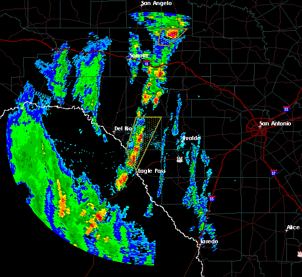 At 534 pm cst, a severe thunderstorm was located near spofford, moving north at 15 mph. two additional strong to severe storms extend south to between quemado and eagle pass, also moving north at 15 mph (radar indicated). Hazards include 60 mph wind gusts and quarter size hail. Hail damage to vehicles is expected. Expect wind damage to roofs, siding, and trees. At 534 pm cst, a severe thunderstorm was located near spofford, moving north at 15 mph. two additional strong to severe storms extend south to between quemado and eagle pass, also moving north at 15 mph (radar indicated). Hazards include 60 mph wind gusts and quarter size hail. Hail damage to vehicles is expected. Expect wind damage to roofs, siding, and trees.
|
| 6/2/2016 12:08 AM CDT |
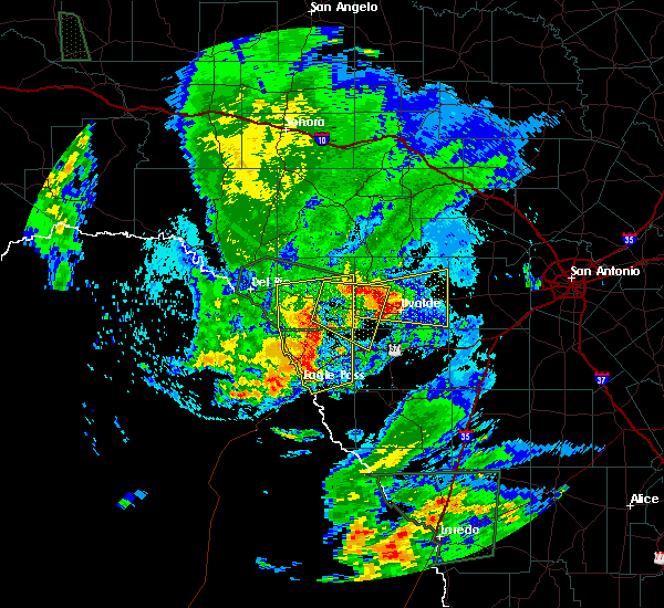 At 1207 am cdt, severe thunderstorms were located along a line extending from near brackettville to darling to 6 miles northeast of eagle pass to 14 miles southwest of eagle pass, moving southeast at 30 mph (radar indicated). Hazards include 60 mph wind gusts and quarter size hail. Hail damage to vehicles is expected. expect wind damage to roofs, siding, and trees. Locations impacted include, eagle pass, brackettville, spofford, quemado, radar base, darling, paloma, alamo village, standart, rosita north, amanda, rosita south, anacacho, normandy, laughlin afb aux field, eidson road, elm creek, turkey mountain, seco mines and las quintas fronterizas. At 1207 am cdt, severe thunderstorms were located along a line extending from near brackettville to darling to 6 miles northeast of eagle pass to 14 miles southwest of eagle pass, moving southeast at 30 mph (radar indicated). Hazards include 60 mph wind gusts and quarter size hail. Hail damage to vehicles is expected. expect wind damage to roofs, siding, and trees. Locations impacted include, eagle pass, brackettville, spofford, quemado, radar base, darling, paloma, alamo village, standart, rosita north, amanda, rosita south, anacacho, normandy, laughlin afb aux field, eidson road, elm creek, turkey mountain, seco mines and las quintas fronterizas.
|
| 6/1/2016 11:36 PM CDT |
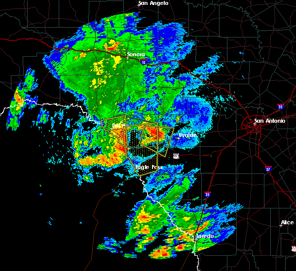 At 1135 pm cdt, severe thunderstorms were located along a line extending from standart to near normandy to 22 miles southwest of quemado, moving east at 25 mph (radar indicated). Hazards include 60 mph wind gusts and quarter size hail. Hail damage to vehicles is expected. Expect wind damage to roofs, siding, and trees. At 1135 pm cdt, severe thunderstorms were located along a line extending from standart to near normandy to 22 miles southwest of quemado, moving east at 25 mph (radar indicated). Hazards include 60 mph wind gusts and quarter size hail. Hail damage to vehicles is expected. Expect wind damage to roofs, siding, and trees.
|
| 4/29/2016 4:20 PM CDT |
 At 418 pm cdt, a severe thunderstorm was located over quemado, moving east at 25 mph. a social media report just in from the area reported one quarter sized hail over the quemado area. the severe thunderstorm warning to be extended and expanded shortly (radar indicated). Hazards include up to ping pong ball size hail and 60 mph wind gusts. People and animals outdoors will be injured. expect hail damage to roofs, siding, windows, and vehicles. expect wind damage to roofs, siding, and trees. Locations impacted include, quemado, radar base and normandy. At 418 pm cdt, a severe thunderstorm was located over quemado, moving east at 25 mph. a social media report just in from the area reported one quarter sized hail over the quemado area. the severe thunderstorm warning to be extended and expanded shortly (radar indicated). Hazards include up to ping pong ball size hail and 60 mph wind gusts. People and animals outdoors will be injured. expect hail damage to roofs, siding, windows, and vehicles. expect wind damage to roofs, siding, and trees. Locations impacted include, quemado, radar base and normandy.
|
| 4/29/2016 3:46 PM CDT |
 At 344 pm cdt, a severe thunderstorm was located 13 miles west of quemado, moving east at 25 mph (radar indicated). Hazards include two inch hail and 60 mph wind gusts. People and animals outdoors will be injured. expect hail damage to roofs, siding, windows, and vehicles. Expect wind damage to roofs, siding, and trees. At 344 pm cdt, a severe thunderstorm was located 13 miles west of quemado, moving east at 25 mph (radar indicated). Hazards include two inch hail and 60 mph wind gusts. People and animals outdoors will be injured. expect hail damage to roofs, siding, windows, and vehicles. Expect wind damage to roofs, siding, and trees.
|
| 4/12/2016 10:53 PM CDT |
 The severe thunderstorm warning for maverick county will expire at 1100 pm cdt, the storm which prompted the warning has weakened below severe limits, and no longer pose an immediate threat to life or property. therefore the warning will be allowed to expire. however small. The severe thunderstorm warning for maverick county will expire at 1100 pm cdt, the storm which prompted the warning has weakened below severe limits, and no longer pose an immediate threat to life or property. therefore the warning will be allowed to expire. however small.
|
| 4/12/2016 10:12 PM CDT |
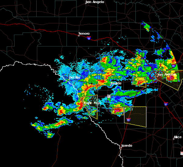 At 1011 pm cdt, a severe thunderstorm was located near eagle pass, moving east at 35 mph. this storm will move east along highway 277 and across highway 57 (radar indicated). Hazards include 60 mph wind gusts and quarter size hail. Hail damage to vehicles is expected. Expect wind damage to roofs, siding, and trees. At 1011 pm cdt, a severe thunderstorm was located near eagle pass, moving east at 35 mph. this storm will move east along highway 277 and across highway 57 (radar indicated). Hazards include 60 mph wind gusts and quarter size hail. Hail damage to vehicles is expected. Expect wind damage to roofs, siding, and trees.
|
| 4/12/2016 8:32 PM CDT |
 At 831 pm cdt, a severe thunderstorm was located near eagle pass, moving east at 25 mph. this storm will move across highway 277 between eagle pass and elm creek (radar indicated). Hazards include two inch hail and 60 mph wind gusts. People and animals outdoors will be injured. expect hail damage to roofs, siding, windows, and vehicles. expect wind damage to roofs, siding, and trees. Locations impacted include, eagle pass, radar base, rosita north, rosita south, paloma, farias lake, elm creek, eidson road, seco mines and las quintas fronterizas. At 831 pm cdt, a severe thunderstorm was located near eagle pass, moving east at 25 mph. this storm will move across highway 277 between eagle pass and elm creek (radar indicated). Hazards include two inch hail and 60 mph wind gusts. People and animals outdoors will be injured. expect hail damage to roofs, siding, windows, and vehicles. expect wind damage to roofs, siding, and trees. Locations impacted include, eagle pass, radar base, rosita north, rosita south, paloma, farias lake, elm creek, eidson road, seco mines and las quintas fronterizas.
|
| 4/12/2016 8:11 PM CDT |
 At 809 pm cdt, a severe thunderstorm was located 11 miles west of eagle pass, moving east at 30 mph. this storm will move across highway 277 over to just north of eagle pass (radar indicated). Hazards include two inch hail and 60 mph wind gusts. People and animals outdoors will be injured. expect hail damage to roofs, siding, windows, and vehicles. Expect wind damage to roofs, siding, and trees. At 809 pm cdt, a severe thunderstorm was located 11 miles west of eagle pass, moving east at 30 mph. this storm will move across highway 277 over to just north of eagle pass (radar indicated). Hazards include two inch hail and 60 mph wind gusts. People and animals outdoors will be injured. expect hail damage to roofs, siding, windows, and vehicles. Expect wind damage to roofs, siding, and trees.
|
| 8/12/2015 5:40 PM CDT |
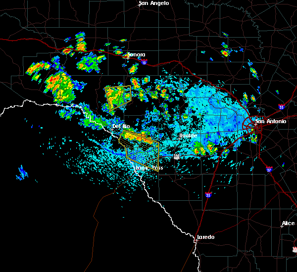 At 537 pm cdt, severe thunderstorms were located along a line extending from near laughlin afb to near dabney, moving south at 25 mph. these storms are also producing strong outflow winds well ahead of the main line moving south at 40 mph. these winds could be as high as 40 to 50 mph (radar indicated). Hazards include 70 mph wind gusts. Expect considerable tree damage. damage is likely to mobile homes, roofs and outbuildings. Locations impacted include, spofford, quemado, radar base, darling, anacacho, normandy, paloma and laughlin afb aux field. At 537 pm cdt, severe thunderstorms were located along a line extending from near laughlin afb to near dabney, moving south at 25 mph. these storms are also producing strong outflow winds well ahead of the main line moving south at 40 mph. these winds could be as high as 40 to 50 mph (radar indicated). Hazards include 70 mph wind gusts. Expect considerable tree damage. damage is likely to mobile homes, roofs and outbuildings. Locations impacted include, spofford, quemado, radar base, darling, anacacho, normandy, paloma and laughlin afb aux field.
|
| 8/12/2015 5:25 PM CDT |
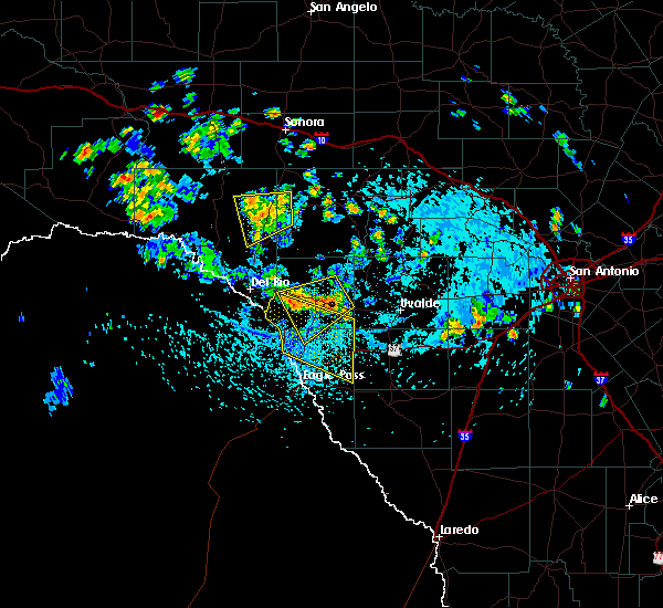 At 525 pm cdt, severe thunderstorms were located along a line extending from near laughlin afb to near dabney, moving south at 30 mph (radar indicated). Hazards include 70 mph wind gusts. Expect considerable tree damage. Damage is likely to mobile homes, roofs and outbuildings. At 525 pm cdt, severe thunderstorms were located along a line extending from near laughlin afb to near dabney, moving south at 30 mph (radar indicated). Hazards include 70 mph wind gusts. Expect considerable tree damage. Damage is likely to mobile homes, roofs and outbuildings.
|
| 5/11/2015 7:59 PM CDT | At 759 pm cdt, severe thunderstorms were located along a line extending from 9 miles east of paloma to near rosita north, moving east at 30 mph (radar indicated). Hazards include 60 mph wind gusts and quarter size hail. Hail damage to vehicles is expected. Expect wind damage to roofs, siding and trees. |
| 5/11/2015 7:27 PM CDT | At 727 pm cdt, severe thunderstorms were located along a line extending from near paloma to 14 miles southwest of eagle pass, moving southeast at 20 mph (radar indicated). Hazards include 60 mph wind gusts and quarter size hail. Hail damage to vehicles is expected. Expect wind damage to roofs, siding and trees. |
| 5/11/2015 7:04 PM CDT | At 702 pm cdt, a severe thunderstorm was located over radar base, or 9 miles southeast of quemado, moving southeast at 10 mph. golfball-size hail and winds to 60 mph were reported at the laughlin afb auxiliary airfield at 700 pm (law enforcement). Hazards include golf ball size hail and 60 mph wind gusts. People and animals outdoors will be injured. expect hail damage to roofs, siding, windows and vehicles. expect wind damage to roofs, siding and trees. locations impacted include, radar base, normandy, paloma, laughlin afb aux field and elm creek. 1. 75in. |
| 5/11/2015 7:00 PM CDT | Golf Ball sized hail reported 0.4 miles SSW of Radar Base, TX |
| 5/11/2015 7:00 PM CDT | Estimated 55 to 60 mph gusts in maverick county TX, 0.4 miles SSW of Radar Base, TX |
| 5/11/2015 7:00 PM CDT | Tennis Ball sized hail reported 0.4 miles SSW of Radar Base, TX |
| 5/11/2015 6:36 PM CDT | At 636 pm cdt, a severe thunderstorm was located over normandy, or near quemado, moving east at 10 mph (law enforcement). Hazards include golf ball size hail and 60 mph wind gusts. People and animals outdoors will be injured. expect hail damage to roofs, siding, windows and vehicles. expect wind damage to roofs, siding and trees. locations impacted include, quemado, radar base, darling, normandy, paloma, laughlin afb aux field and elm creek. 1. 75in. |
| 5/11/2015 6:28 PM CDT | At 628 pm cdt, a severe thunderstorm was located over normandy, or near quemado, moving east at 10 mph (radar indicated). Hazards include 60 mph wind gusts and quarter size hail. Hail damage to vehicles is expected. Expect wind damage to roofs, siding and trees. |
| 5/11/2015 6:20 PM CDT | At 620 pm cdt, a severe thunderstorm was located over normandy, or near quemado, moving east at 20 mph (radar indicated). Hazards include 60 mph wind gusts and quarter size hail. Hail damage to vehicles is expected. expect wind damage to roofs, siding and trees. locations impacted include, quemado, radar base, normandy, darling and laughlin afb aux field. 1. 00in. |
| 5/11/2015 5:38 PM CDT | At 538 pm cdt, a severe thunderstorm was located 9 miles northwest of quemado, moving southeast at 35 mph (radar indicated). Hazards include 60 mph wind gusts and quarter size hail. Hail damage to vehicles is expected. Expect wind damage to roofs, siding and trees. |
| 5/9/2015 9:15 PM CDT | At 914 pm cdt, a severe thunderstorm was located near normandy, or near quemado, moving east at 25 mph. a spotter reported quarter-size hail 1 mile south of normandy at 902 pm (trained weather spotters). Hazards include quarter size hail. Damage to vehicles is expected. locations impacted include, quemado, radar base, normandy, paloma and laughlin afb aux field. 1. 00in. |
| 5/9/2015 8:50 PM CDT | At 850 pm cdt, a severe thunderstorm was located over normandy, or near quemado, moving east at 35 mph (radar indicated). Hazards include quarter size hail. damage to vehicles is expected |
| 5/9/2015 7:57 PM CDT | At 756 pm cdt, a severe thunderstorm was located near rosita north, or 9 miles east of eagle pass, moving north at 35 mph. at 753 pm, a spotter reported quarter-size hail near el indio (trained weather spotters). Hazards include half dollar size hail. damage to vehicles is expected |
| 4/24/2015 6:50 PM CDT | Quarter sized hail reported 0.6 miles SE of Radar Base, TX, nickel to quarter size hail reported by border patrol. |
| 4/24/2015 6:37 PM CDT | At 637 pm cdt, a severe thunderstorm was located near radar base, or 7 miles northwest of eagle pass, moving east at 30 mph (radar indicated). Hazards include 60 mph wind gusts and quarter size hail. Hail damage to vehicles is expected. Expect wind damage to roofs, siding and trees. |
| 4/12/2015 7:37 PM CDT | A severe thunderstorm warning remains in effect until 800 pm cdt for maverick. western zavala. southeastern kinney and western dimmit counties. at 736 pm cdt. severe thunderstorms were located along a line extending from 7 miles northeast of quemado to 8 miles west of cometa to 7 miles east of chupadera ranch airport. Moving east at 45 mph. |
| 4/12/2015 7:12 PM CDT | A severe thunderstorm warning remains in effect until 800 pm cdt for maverick. western zavala. southeastern kinney and western dimmit counties. at 711 pm cdt. severe thunderstorms were located along a line extending from 7 miles west of quemado to near rosita south to 13 miles southwest of chupadera ranch airport. Moving east at 45 mph. |
| 4/12/2015 6:56 PM CDT | The national weather service in austin san antonio has issued a * severe thunderstorm warning for. maverick county in south central texas. western zavala county in south central texas. southeastern kinney county in south central texas. Western dimmit county in south central texas. |
Hail Maps for Radar Base, TX


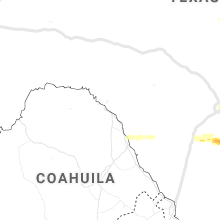


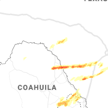

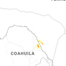
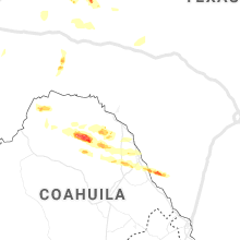


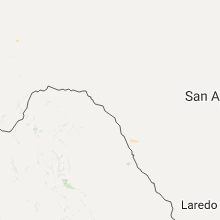


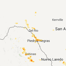


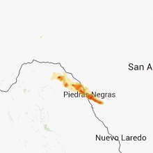


Connect with Interactive Hail Maps