

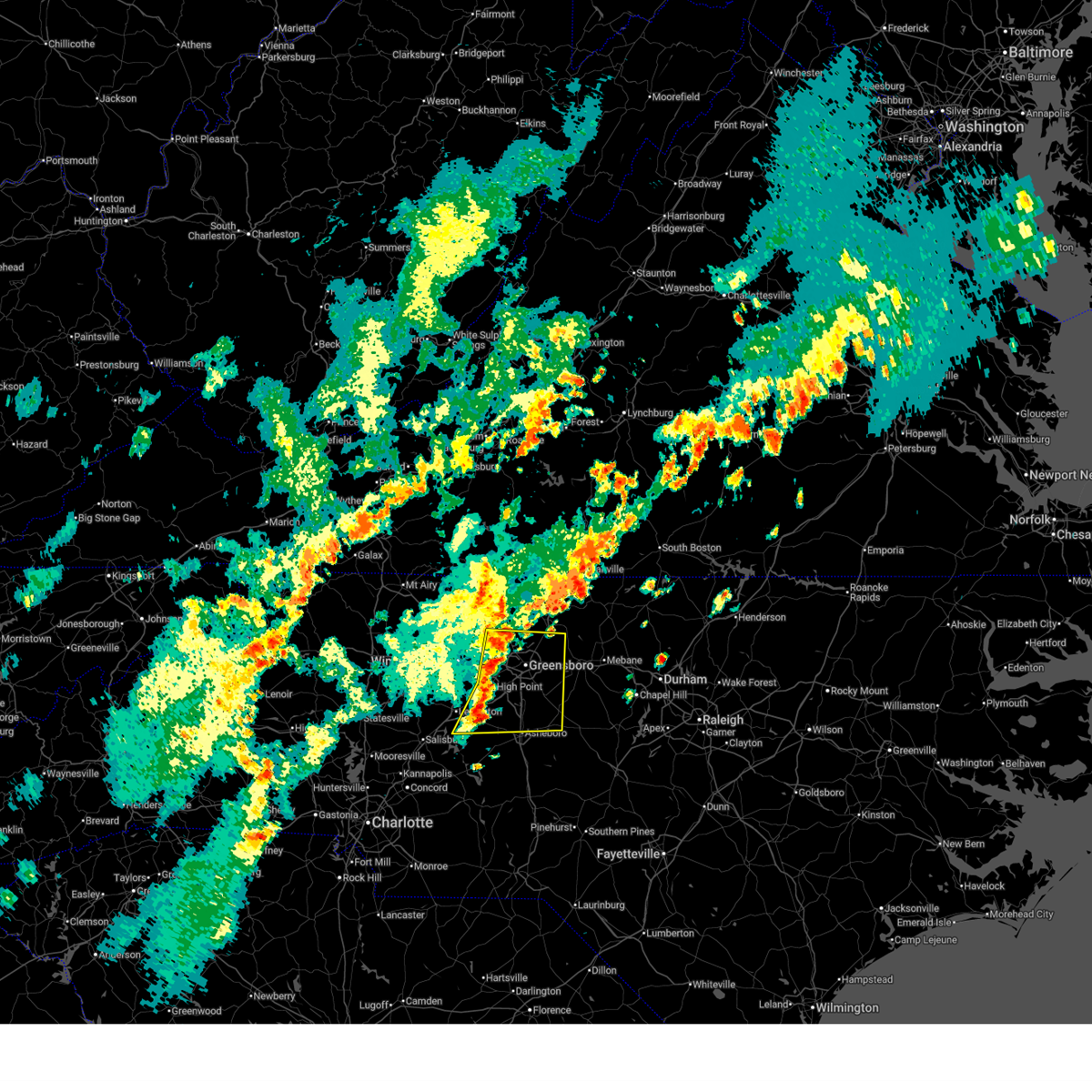
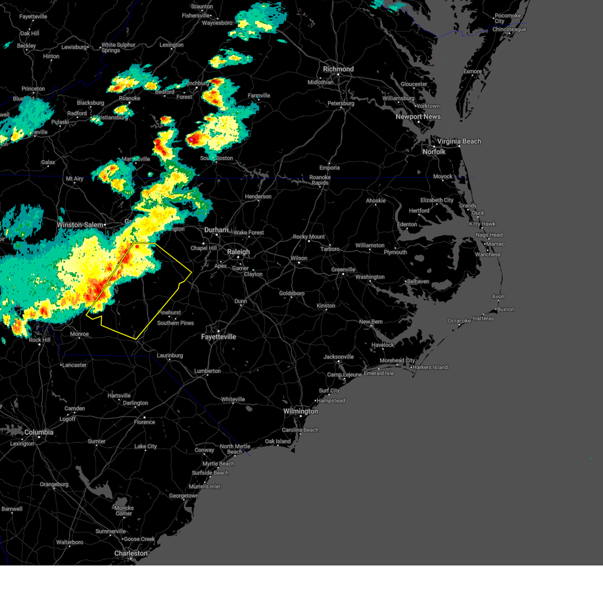
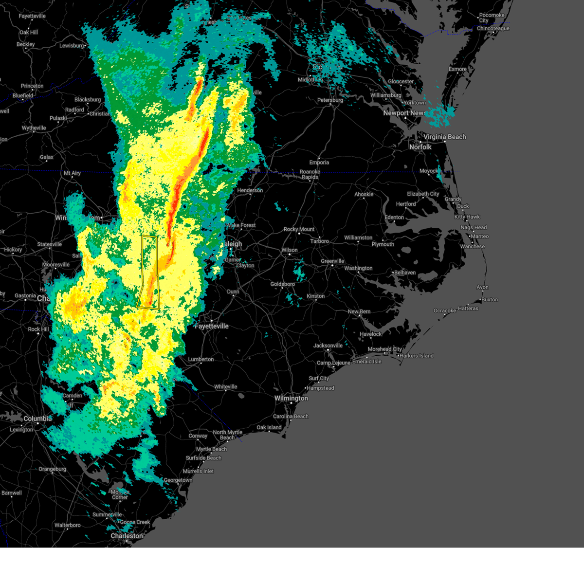
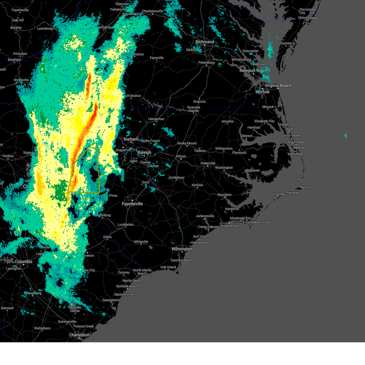
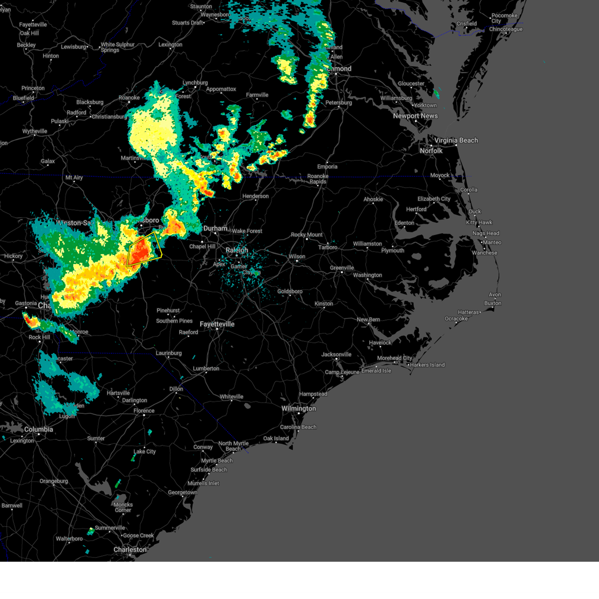
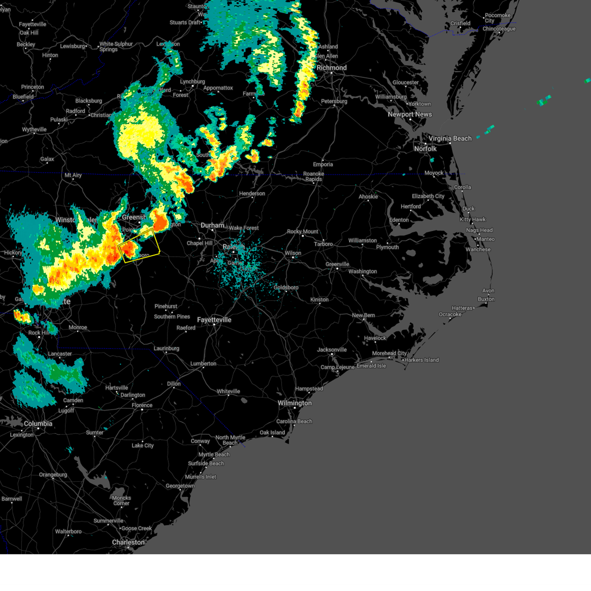
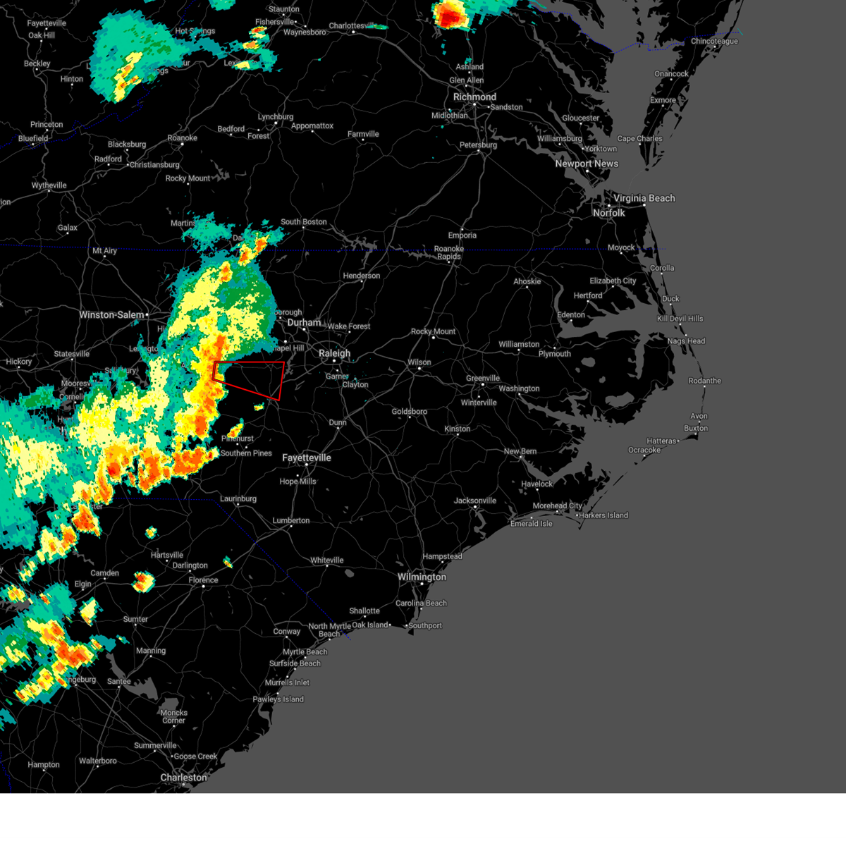
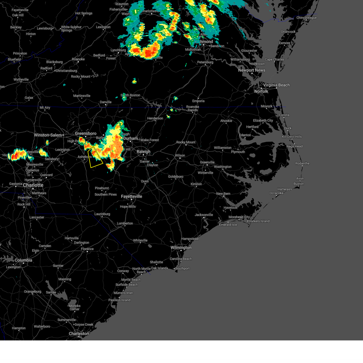
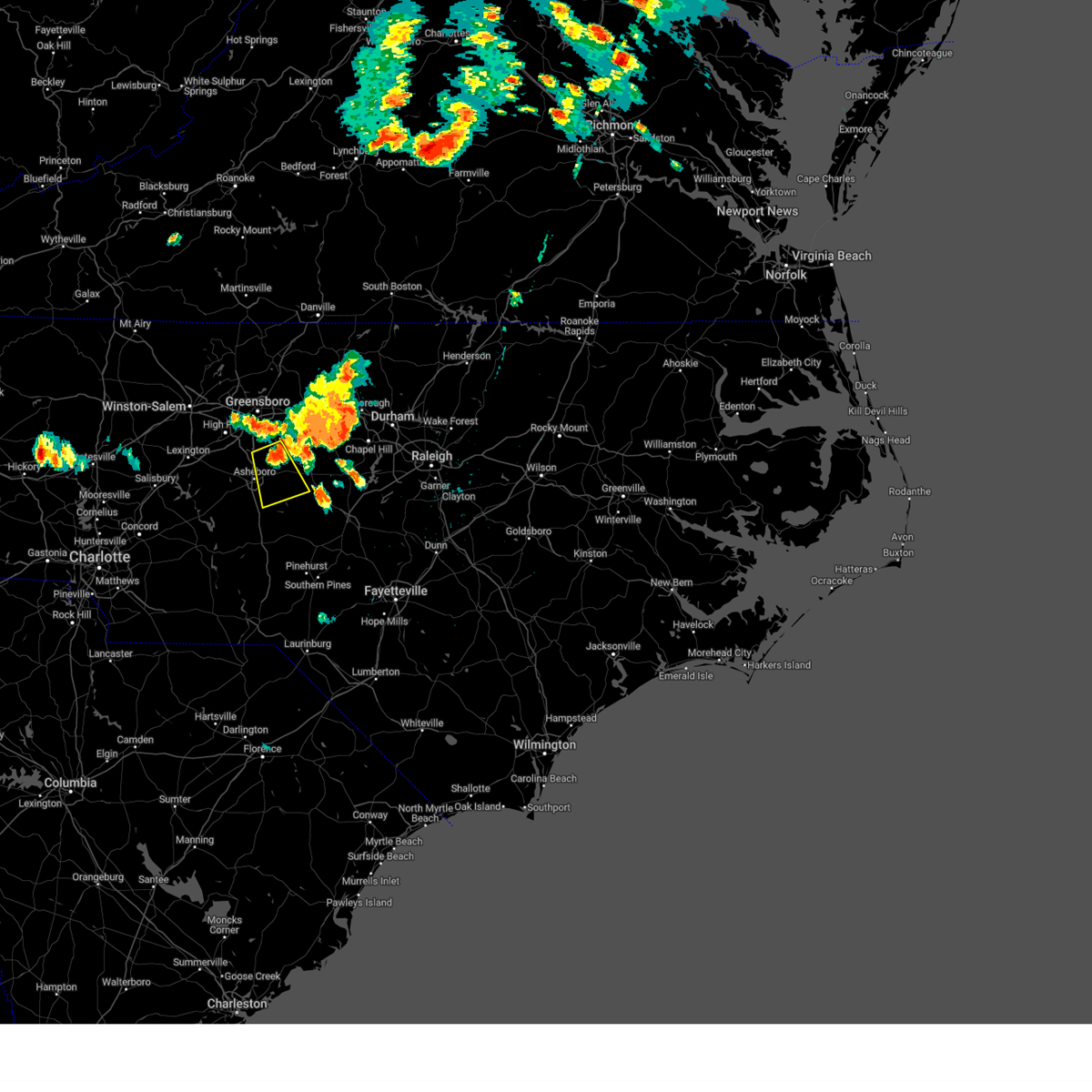
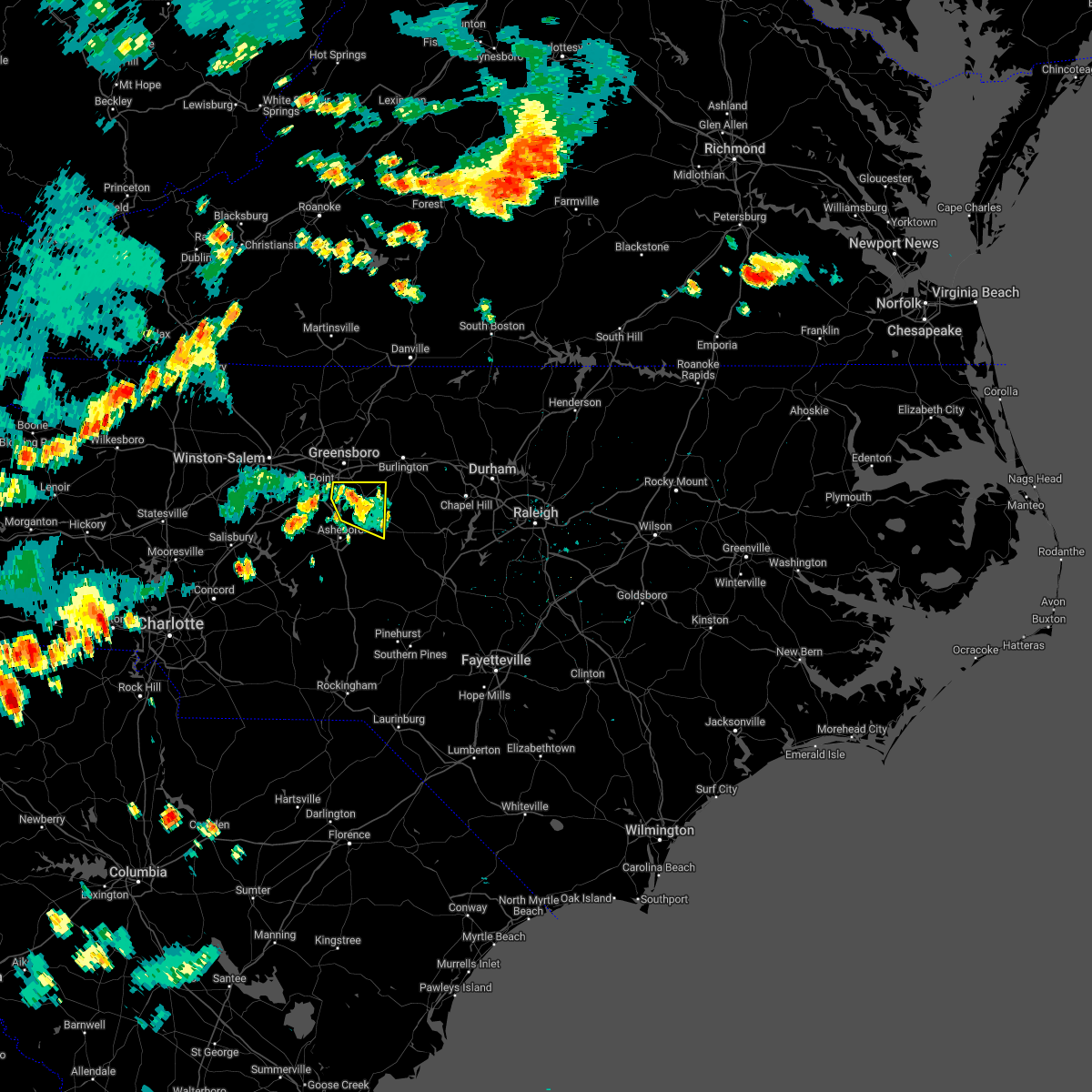
Hail Map for Ramseur, NC
The Ramseur, NC area has had 0 reports of on-the-ground hail by trained spotters, and has been under severe weather warnings 27 times during the past 12 months. Doppler radar has detected hail at or near Ramseur, NC on 41 occasions, including 2 occasions during the past year.
| Name: | Ramseur, NC |
| Where Located: | 57.3 miles W of Raleigh, NC |
| Map: | Google Map for Ramseur, NC |
| Population: | 1692 |
| Housing Units: | 747 |
| More Info: | Search Google for Ramseur, NC |
0
The Top Recent Hail Date for Ramseur, NC is Tuesday, April 22, 2025 (22nd out of 41)

Hail and Wind Damage Spotted near Ramseur, NC
| Date / Time | Report Details |
|---|---|
| 7/1/2025 8:05 PM EDT |
 Svrrah the national weather service in raleigh has issued a * severe thunderstorm warning for, east central forsyth county in central north carolina, northeastern davidson county in central north carolina, northern randolph county in central north carolina, guilford county in central north carolina, * until 845 pm edt. * at 804 pm edt, a severe thunderstorm was located near the greensboro airport and near archdale, moving northeast at 25 mph (radar indicated). Hazards include 60 mph wind gusts. expect damage to roofs, siding, and trees Svrrah the national weather service in raleigh has issued a * severe thunderstorm warning for, east central forsyth county in central north carolina, northeastern davidson county in central north carolina, northern randolph county in central north carolina, guilford county in central north carolina, * until 845 pm edt. * at 804 pm edt, a severe thunderstorm was located near the greensboro airport and near archdale, moving northeast at 25 mph (radar indicated). Hazards include 60 mph wind gusts. expect damage to roofs, siding, and trees
|
| 5/13/2025 3:24 PM EDT | Tree down on friendly l in randolph county NC, 1.2 miles N of Ramseur, NC |
| 5/13/2025 3:18 PM EDT |
 Svrrah the national weather service in raleigh has issued a * severe thunderstorm warning for, eastern randolph county in central north carolina, western chatham county in central north carolina, * until 400 pm edt. * at 317 pm edt, a severe thunderstorm was located 5 miles southeast of asheboro, moving northeast at 30 mph (radar indicated). Hazards include 60 mph wind gusts and quarter size hail. Hail damage to vehicles is expected. Expect wind damage to roofs, siding, and trees. Svrrah the national weather service in raleigh has issued a * severe thunderstorm warning for, eastern randolph county in central north carolina, western chatham county in central north carolina, * until 400 pm edt. * at 317 pm edt, a severe thunderstorm was located 5 miles southeast of asheboro, moving northeast at 30 mph (radar indicated). Hazards include 60 mph wind gusts and quarter size hail. Hail damage to vehicles is expected. Expect wind damage to roofs, siding, and trees.
|
| 5/8/2025 8:50 PM EDT |
 At 849 pm edt, severe thunderstorms were located along a line extending from 13 miles east of randleman to 8 miles southwest of siler city to near seagrove to 7 miles north of ansonville, moving east at 40 mph (radar indicated). Hazards include 60 mph wind gusts and penny size hail. Expect damage to roofs, siding, and trees. Locations impacted include, asheboro, albemarle, troy, siler city, north carolina zoo, badin lake, biscoe, ansonville, goldston, and seagrove. At 849 pm edt, severe thunderstorms were located along a line extending from 13 miles east of randleman to 8 miles southwest of siler city to near seagrove to 7 miles north of ansonville, moving east at 40 mph (radar indicated). Hazards include 60 mph wind gusts and penny size hail. Expect damage to roofs, siding, and trees. Locations impacted include, asheboro, albemarle, troy, siler city, north carolina zoo, badin lake, biscoe, ansonville, goldston, and seagrove.
|
| 5/8/2025 8:50 PM EDT |
 the severe thunderstorm warning has been cancelled and is no longer in effect the severe thunderstorm warning has been cancelled and is no longer in effect
|
| 5/8/2025 8:45 PM EDT | Large tree blocking both lanes on brady street extension. report from randolph co 911 emai in randolph county NC, 1.1 miles SW of Ramseur, NC |
| 5/8/2025 8:35 PM EDT |
 At 835 pm edt, severe thunderstorms were located along a line extending from 6 miles northeast of randleman to near north carolina zoo to 7 miles north of troy to near albemarle, moving east at 45 mph (radar indicated). Hazards include 60 mph wind gusts and penny size hail. Expect damage to roofs, siding, and trees. Locations impacted include, asheboro, albemarle, randleman, troy, siler city, badin lake, north carolina zoo, biscoe, ansonville, and goldston. At 835 pm edt, severe thunderstorms were located along a line extending from 6 miles northeast of randleman to near north carolina zoo to 7 miles north of troy to near albemarle, moving east at 45 mph (radar indicated). Hazards include 60 mph wind gusts and penny size hail. Expect damage to roofs, siding, and trees. Locations impacted include, asheboro, albemarle, randleman, troy, siler city, badin lake, north carolina zoo, biscoe, ansonville, and goldston.
|
| 5/8/2025 8:27 PM EDT | At 827 pm edt, severe thunderstorms were located along a line extending from 8 miles northeast of randleman to 6 miles south of albemarle, moving east at 40 mph (radar indicated). Hazards include 60 mph wind gusts and quarter size hail. Hail damage to vehicles is expected. expect wind damage to roofs, siding, and trees. Locations impacted include, asheboro, albemarle, randleman, troy, siler city, badin lake, north carolina zoo, biscoe, ansonville, and goldston. |
| 5/8/2025 8:14 PM EDT |
 Svrrah the national weather service in raleigh has issued a * severe thunderstorm warning for, northwestern moore county in central north carolina, southeastern davidson county in central north carolina, northern anson county in central north carolina, montgomery county in central north carolina, northwestern richmond county in central north carolina, randolph county in central north carolina, stanly county in central north carolina, southwestern chatham county in central north carolina, * until 900 pm edt. * at 814 pm edt, severe thunderstorms were located along a line extending from 6 miles north of randleman to near plyler, moving southeast at 40 mph (radar indicated). Hazards include 60 mph wind gusts and quarter size hail. Hail damage to vehicles is expected. Expect wind damage to roofs, siding, and trees. Svrrah the national weather service in raleigh has issued a * severe thunderstorm warning for, northwestern moore county in central north carolina, southeastern davidson county in central north carolina, northern anson county in central north carolina, montgomery county in central north carolina, northwestern richmond county in central north carolina, randolph county in central north carolina, stanly county in central north carolina, southwestern chatham county in central north carolina, * until 900 pm edt. * at 814 pm edt, severe thunderstorms were located along a line extending from 6 miles north of randleman to near plyler, moving southeast at 40 mph (radar indicated). Hazards include 60 mph wind gusts and quarter size hail. Hail damage to vehicles is expected. Expect wind damage to roofs, siding, and trees.
|
| 5/8/2025 7:58 PM EDT | At 757 pm edt, severe thunderstorms were located along a line extending from near thomasville to near mt pleasant, moving east at 35 mph (radar indicated). Hazards include 60 mph wind gusts and quarter size hail. Hail damage to vehicles is expected. expect wind damage to roofs, siding, and trees. Locations impacted include, high point, asheboro, lexington, albemarle, randleman, troy, badin lake, north carolina zoo, thomasville, and seagrove. |
| 5/8/2025 7:47 PM EDT | At 745 pm edt, severe thunderstorms were located along a line extending from near lexington to 6 miles east of kannapolis, moving east at 30 mph (radar indicated). Hazards include 60 mph wind gusts and half dollar size hail. Hail damage to vehicles is expected. expect wind damage to roofs, siding, and trees. Locations impacted include, high point, asheboro, lexington, albemarle, randleman, troy, badin lake, north carolina zoo, thomasville, and seagrove. |
| 5/8/2025 7:47 PM EDT | the severe thunderstorm warning has been cancelled and is no longer in effect |
| 5/8/2025 7:31 PM EDT | At 731 pm edt, severe thunderstorms were located along a line extending from 6 miles northwest of lexington to near china grove, moving east at 15 mph (radar indicated). Hazards include 60 mph wind gusts and half dollar size hail. Hail damage to vehicles is expected. expect wind damage to roofs, siding, and trees. Locations impacted include, high point, asheboro, lexington, albemarle, randleman, troy, badin lake, north carolina zoo, thomasville, and clemmons. |
| 5/8/2025 7:14 PM EDT |
 Svrrah the national weather service in raleigh has issued a * severe thunderstorm warning for, south central forsyth county in central north carolina, davidson county in central north carolina, western montgomery county in central north carolina, randolph county in central north carolina, stanly county in central north carolina, southwestern guilford county in central north carolina, * until 815 pm edt. * at 713 pm edt, severe thunderstorms were located along a line extending from near bermuda run to kannapolis, moving southeast at 35 mph (radar indicated). Hazards include 60 mph wind gusts and quarter size hail. Hail damage to vehicles is expected. Expect wind damage to roofs, siding, and trees. Svrrah the national weather service in raleigh has issued a * severe thunderstorm warning for, south central forsyth county in central north carolina, davidson county in central north carolina, western montgomery county in central north carolina, randolph county in central north carolina, stanly county in central north carolina, southwestern guilford county in central north carolina, * until 815 pm edt. * at 713 pm edt, severe thunderstorms were located along a line extending from near bermuda run to kannapolis, moving southeast at 35 mph (radar indicated). Hazards include 60 mph wind gusts and quarter size hail. Hail damage to vehicles is expected. Expect wind damage to roofs, siding, and trees.
|
| 4/22/2025 3:53 PM EDT |
 At 353 pm edt, a severe thunderstorm was located 8 miles northwest of siler city, moving east at 25 mph (radar indicated). Hazards include ping pong ball size hail and 60 mph wind gusts. People and animals outdoors will be injured. expect hail damage to roofs, siding, windows, and vehicles. expect wind damage to roofs, siding, and trees. Locations impacted include, staley, bynum, snow camp, siler city, hasty, sutphin, liberty, cane creek reservoir, saxapahaw, and pittsboro. At 353 pm edt, a severe thunderstorm was located 8 miles northwest of siler city, moving east at 25 mph (radar indicated). Hazards include ping pong ball size hail and 60 mph wind gusts. People and animals outdoors will be injured. expect hail damage to roofs, siding, windows, and vehicles. expect wind damage to roofs, siding, and trees. Locations impacted include, staley, bynum, snow camp, siler city, hasty, sutphin, liberty, cane creek reservoir, saxapahaw, and pittsboro.
|
| 4/22/2025 3:41 PM EDT |
 Svrrah the national weather service in raleigh has issued a * severe thunderstorm warning for, southern alamance county in central north carolina, southwestern orange county in central north carolina, east central randolph county in central north carolina, northwestern chatham county in central north carolina, * until 430 pm edt. * at 340 pm edt, a severe thunderstorm was located 8 miles east of randleman, moving east at 25 mph (radar indicated). Hazards include ping pong ball size hail and 60 mph wind gusts. People and animals outdoors will be injured. expect hail damage to roofs, siding, windows, and vehicles. Expect wind damage to roofs, siding, and trees. Svrrah the national weather service in raleigh has issued a * severe thunderstorm warning for, southern alamance county in central north carolina, southwestern orange county in central north carolina, east central randolph county in central north carolina, northwestern chatham county in central north carolina, * until 430 pm edt. * at 340 pm edt, a severe thunderstorm was located 8 miles east of randleman, moving east at 25 mph (radar indicated). Hazards include ping pong ball size hail and 60 mph wind gusts. People and animals outdoors will be injured. expect hail damage to roofs, siding, windows, and vehicles. Expect wind damage to roofs, siding, and trees.
|
| 3/5/2025 10:22 AM EST |
 The storms which prompted the warning have moved out of the area. therefore, the warning will be allowed to expire. a tornado watch remains in effect until 100 pm est for central north carolina. The storms which prompted the warning have moved out of the area. therefore, the warning will be allowed to expire. a tornado watch remains in effect until 100 pm est for central north carolina.
|
| 3/5/2025 10:07 AM EST |
 the severe thunderstorm warning has been cancelled and is no longer in effect the severe thunderstorm warning has been cancelled and is no longer in effect
|
| 3/5/2025 10:07 AM EST |
 At 1007 am est, severe thunderstorms were located along a line extending from near monroeton to near randleman, moving northeast at 75 mph (radar indicated). Hazards include 60 mph wind gusts and penny size hail. Expect damage to roofs, siding, and trees. Locations impacted include, franklinville, ramseur, seven lakes, candor, coleridge, eagle springs, liberty, robbins, foxfire and north carolina zoo. At 1007 am est, severe thunderstorms were located along a line extending from near monroeton to near randleman, moving northeast at 75 mph (radar indicated). Hazards include 60 mph wind gusts and penny size hail. Expect damage to roofs, siding, and trees. Locations impacted include, franklinville, ramseur, seven lakes, candor, coleridge, eagle springs, liberty, robbins, foxfire and north carolina zoo.
|
| 3/5/2025 10:05 AM EST |
 Svrrah the national weather service in raleigh has issued a * severe thunderstorm warning for, moore county in central north carolina, southeastern montgomery county in central north carolina, southeastern randolph county in central north carolina, western lee county in central north carolina, chatham county in central north carolina, * until 1045 am est. * at 1004 am est, severe thunderstorms were located along a line extending from 9 miles northwest of siler city to 11 miles south of biscoe, moving northeast at 45 mph (radar indicated). Hazards include 60 mph wind gusts and penny size hail. expect damage to roofs, siding, and trees Svrrah the national weather service in raleigh has issued a * severe thunderstorm warning for, moore county in central north carolina, southeastern montgomery county in central north carolina, southeastern randolph county in central north carolina, western lee county in central north carolina, chatham county in central north carolina, * until 1045 am est. * at 1004 am est, severe thunderstorms were located along a line extending from 9 miles northwest of siler city to 11 miles south of biscoe, moving northeast at 45 mph (radar indicated). Hazards include 60 mph wind gusts and penny size hail. expect damage to roofs, siding, and trees
|
| 3/5/2025 9:28 AM EST |
 Svrrah the national weather service in raleigh has issued a * severe thunderstorm warning for, northwestern moore county in central north carolina, montgomery county in central north carolina, randolph county in central north carolina, southeastern stanly county in central north carolina, * until 1030 am est. * at 928 am est, severe thunderstorms were located along a line extending from 13 miles west of asheboro to 8 miles north of ansonville, moving northeast at 75 mph (radar indicated). Hazards include 60 mph wind gusts and penny size hail. expect damage to roofs, siding, and trees Svrrah the national weather service in raleigh has issued a * severe thunderstorm warning for, northwestern moore county in central north carolina, montgomery county in central north carolina, randolph county in central north carolina, southeastern stanly county in central north carolina, * until 1030 am est. * at 928 am est, severe thunderstorms were located along a line extending from 13 miles west of asheboro to 8 miles north of ansonville, moving northeast at 75 mph (radar indicated). Hazards include 60 mph wind gusts and penny size hail. expect damage to roofs, siding, and trees
|
| 2/16/2025 8:34 AM EST |
 At 834 am est, severe thunderstorms were located along a line extending from near roxboro to chapel hill to near pittsboro, moving east at 75 mph (radar indicated). Hazards include 60 mph wind gusts. Expect damage to roofs, siding, and trees. Locations impacted include, pittsboro, graham, steeds, alamance, siler city, harpers crossroads, parkwood, bahama, altamahaw-ossipee, and staley. At 834 am est, severe thunderstorms were located along a line extending from near roxboro to chapel hill to near pittsboro, moving east at 75 mph (radar indicated). Hazards include 60 mph wind gusts. Expect damage to roofs, siding, and trees. Locations impacted include, pittsboro, graham, steeds, alamance, siler city, harpers crossroads, parkwood, bahama, altamahaw-ossipee, and staley.
|
| 2/16/2025 8:11 AM EST | Tree down at nc highway 22/42 and brush creek r in randolph county NC, 11.8 miles NNW of Ramseur, NC |
| 2/16/2025 8:08 AM EST |
 Svrrah the national weather service in raleigh has issued a * severe thunderstorm warning for, alamance county in central north carolina, northwestern moore county in central north carolina, person county in central north carolina, orange county in central north carolina, granville county in central north carolina, northeastern montgomery county in central north carolina, eastern randolph county in central north carolina, eastern guilford county in central north carolina, northwestern lee county in central north carolina, northwestern wake county in central north carolina, durham county in central north carolina, chatham county in central north carolina, * until 900 am est. * at 808 am est, severe thunderstorms were located along a line extending from near camp springs to 10 miles east of randleman to near seagrove, moving northeast at 55 mph (radar indicated). Hazards include 60 mph wind gusts. expect damage to roofs, siding, and trees Svrrah the national weather service in raleigh has issued a * severe thunderstorm warning for, alamance county in central north carolina, northwestern moore county in central north carolina, person county in central north carolina, orange county in central north carolina, granville county in central north carolina, northeastern montgomery county in central north carolina, eastern randolph county in central north carolina, eastern guilford county in central north carolina, northwestern lee county in central north carolina, northwestern wake county in central north carolina, durham county in central north carolina, chatham county in central north carolina, * until 900 am est. * at 808 am est, severe thunderstorms were located along a line extending from near camp springs to 10 miles east of randleman to near seagrove, moving northeast at 55 mph (radar indicated). Hazards include 60 mph wind gusts. expect damage to roofs, siding, and trees
|
| 2/16/2025 7:30 AM EST |
 Svrrah the national weather service in raleigh has issued a * severe thunderstorm warning for, western alamance county in central north carolina, forsyth county in central north carolina, northwestern moore county in central north carolina, davidson county in central north carolina, northwestern montgomery county in central north carolina, randolph county in central north carolina, northern stanly county in central north carolina, guilford county in central north carolina, * until 815 am est. * at 729 am est, severe thunderstorms were located along a line extending from winston-salem to near lexington to near high rock lake, moving northeast at 80 mph (radar indicated). Hazards include 60 mph wind gusts. expect damage to roofs, siding, and trees Svrrah the national weather service in raleigh has issued a * severe thunderstorm warning for, western alamance county in central north carolina, forsyth county in central north carolina, northwestern moore county in central north carolina, davidson county in central north carolina, northwestern montgomery county in central north carolina, randolph county in central north carolina, northern stanly county in central north carolina, guilford county in central north carolina, * until 815 am est. * at 729 am est, severe thunderstorms were located along a line extending from winston-salem to near lexington to near high rock lake, moving northeast at 80 mph (radar indicated). Hazards include 60 mph wind gusts. expect damage to roofs, siding, and trees
|
| 12/29/2024 10:43 AM EST |
 At 1043 am est, severe thunderstorms were located along a line extending from near kernersville to 6 miles west of randleman to near biscoe to near hamlet, moving east at 45 mph (radar indicated). Hazards include 60 mph wind gusts. Expect damage to roofs, siding, and trees. Locations impacted include, greensboro, winston-salem, high point, asheboro, laurinburg, rockingham, randleman, troy, north carolina zoo, and badin lake. At 1043 am est, severe thunderstorms were located along a line extending from near kernersville to 6 miles west of randleman to near biscoe to near hamlet, moving east at 45 mph (radar indicated). Hazards include 60 mph wind gusts. Expect damage to roofs, siding, and trees. Locations impacted include, greensboro, winston-salem, high point, asheboro, laurinburg, rockingham, randleman, troy, north carolina zoo, and badin lake.
|
| 12/29/2024 10:43 AM EST |
 the severe thunderstorm warning has been cancelled and is no longer in effect the severe thunderstorm warning has been cancelled and is no longer in effect
|
| 12/29/2024 10:21 AM EST |
 Svrrah the national weather service in raleigh has issued a * severe thunderstorm warning for, forsyth county in central north carolina, western moore county in central north carolina, scotland county in central north carolina, davidson county in central north carolina, eastern anson county in central north carolina, montgomery county in central north carolina, richmond county in central north carolina, randolph county in central north carolina, eastern stanly county in central north carolina, western guilford county in central north carolina, * until 1100 am est. * at 1021 am est, severe thunderstorms were located along a line extending from bermuda run to near high rock lake to 6 miles north of ansonville to 8 miles north of chesterfield, moving northeast at 40 mph (radar indicated). Hazards include 60 mph wind gusts. expect damage to roofs, siding, and trees Svrrah the national weather service in raleigh has issued a * severe thunderstorm warning for, forsyth county in central north carolina, western moore county in central north carolina, scotland county in central north carolina, davidson county in central north carolina, eastern anson county in central north carolina, montgomery county in central north carolina, richmond county in central north carolina, randolph county in central north carolina, eastern stanly county in central north carolina, western guilford county in central north carolina, * until 1100 am est. * at 1021 am est, severe thunderstorms were located along a line extending from bermuda run to near high rock lake to 6 miles north of ansonville to 8 miles north of chesterfield, moving northeast at 40 mph (radar indicated). Hazards include 60 mph wind gusts. expect damage to roofs, siding, and trees
|
| 7/18/2024 6:28 PM EDT |
 At 628 pm edt, a severe thunderstorm was located 8 miles southwest of siler city, moving east at 35 mph (emergency management reported tree down in asheboro, nc). Hazards include 60 mph wind gusts and quarter size hail. Hail damage to vehicles is expected. expect wind damage to roofs, siding, and trees. Locations impacted include, siler city, goldston, ramseur, cumnock, harpers crossroads, coleridge, and hasty. At 628 pm edt, a severe thunderstorm was located 8 miles southwest of siler city, moving east at 35 mph (emergency management reported tree down in asheboro, nc). Hazards include 60 mph wind gusts and quarter size hail. Hail damage to vehicles is expected. expect wind damage to roofs, siding, and trees. Locations impacted include, siler city, goldston, ramseur, cumnock, harpers crossroads, coleridge, and hasty.
|
| 7/18/2024 6:11 PM EDT |
 Svrrah the national weather service in raleigh has issued a * severe thunderstorm warning for, southeastern randolph county in central north carolina, northwestern lee county in central north carolina, southwestern chatham county in central north carolina, * until 700 pm edt. * at 610 pm edt, a severe thunderstorm was located over asheboro, moving east at 35 mph (radar indicated). Hazards include 60 mph wind gusts and quarter size hail. Hail damage to vehicles is expected. Expect wind damage to roofs, siding, and trees. Svrrah the national weather service in raleigh has issued a * severe thunderstorm warning for, southeastern randolph county in central north carolina, northwestern lee county in central north carolina, southwestern chatham county in central north carolina, * until 700 pm edt. * at 610 pm edt, a severe thunderstorm was located over asheboro, moving east at 35 mph (radar indicated). Hazards include 60 mph wind gusts and quarter size hail. Hail damage to vehicles is expected. Expect wind damage to roofs, siding, and trees.
|
| 5/26/2024 10:29 PM EDT |
 At 1029 pm edt, severe thunderstorms were located along a line extending from near elon to near pittsboro to 7 miles north of carthage, moving east at 45 mph (radar indicated). Hazards include 60 mph wind gusts. Expect damage to roofs, siding, and trees. Locations impacted include, burlington, sanford, graham, pittsboro, siler city, carrboro, mebane, goldston, elon, and mcleansville. At 1029 pm edt, severe thunderstorms were located along a line extending from near elon to near pittsboro to 7 miles north of carthage, moving east at 45 mph (radar indicated). Hazards include 60 mph wind gusts. Expect damage to roofs, siding, and trees. Locations impacted include, burlington, sanford, graham, pittsboro, siler city, carrboro, mebane, goldston, elon, and mcleansville.
|
| 5/26/2024 10:16 PM EDT |
 At 1016 pm edt, severe thunderstorms were located along a line extending from near mcleansville to near siler city to 8 miles east of seagrove, moving east at 45 mph (radar indicated). Hazards include 60 mph wind gusts. Expect damage to roofs, siding, and trees. Locations impacted include, greensboro, burlington, sanford, asheboro, graham, pittsboro, siler city, north carolina zoo, carrboro, and mebane. At 1016 pm edt, severe thunderstorms were located along a line extending from near mcleansville to near siler city to 8 miles east of seagrove, moving east at 45 mph (radar indicated). Hazards include 60 mph wind gusts. Expect damage to roofs, siding, and trees. Locations impacted include, greensboro, burlington, sanford, asheboro, graham, pittsboro, siler city, north carolina zoo, carrboro, and mebane.
|
| 5/26/2024 9:57 PM EDT |
 Svrrah the national weather service in raleigh has issued a * severe thunderstorm warning for, alamance county in central north carolina, northwestern moore county in central north carolina, southwestern orange county in central north carolina, eastern randolph county in central north carolina, central guilford county in central north carolina, lee county in central north carolina, chatham county in central north carolina, * until 1045 pm edt. * at 956 pm edt, severe thunderstorms were located along a line extending from 6 miles east of kernersville to 6 miles east of randleman to 6 miles west of seagrove, moving east at 45 mph (radar indicated). Hazards include 60 mph wind gusts. expect damage to roofs, siding, and trees Svrrah the national weather service in raleigh has issued a * severe thunderstorm warning for, alamance county in central north carolina, northwestern moore county in central north carolina, southwestern orange county in central north carolina, eastern randolph county in central north carolina, central guilford county in central north carolina, lee county in central north carolina, chatham county in central north carolina, * until 1045 pm edt. * at 956 pm edt, severe thunderstorms were located along a line extending from 6 miles east of kernersville to 6 miles east of randleman to 6 miles west of seagrove, moving east at 45 mph (radar indicated). Hazards include 60 mph wind gusts. expect damage to roofs, siding, and trees
|
| 5/26/2024 9:55 PM EDT |
 At 955 pm edt, a severe thunderstorm was located over randleman, moving east at 20 mph (radar indicated). Hazards include 60 mph wind gusts and quarter size hail. Hail damage to vehicles is expected. expect wind damage to roofs, siding, and trees. Locations impacted include, asheboro, randleman, pleasant garden, liberty, ramseur, franklinville, staley, climax, randleman regional reservior marina, and forest oaks. At 955 pm edt, a severe thunderstorm was located over randleman, moving east at 20 mph (radar indicated). Hazards include 60 mph wind gusts and quarter size hail. Hail damage to vehicles is expected. expect wind damage to roofs, siding, and trees. Locations impacted include, asheboro, randleman, pleasant garden, liberty, ramseur, franklinville, staley, climax, randleman regional reservior marina, and forest oaks.
|
| 5/26/2024 9:37 PM EDT |
 Svrrah the national weather service in raleigh has issued a * severe thunderstorm warning for, northern randolph county in central north carolina, southeastern guilford county in central north carolina, * until 1015 pm edt. * at 937 pm edt, a severe thunderstorm was located 7 miles west of randleman, moving east at 20 mph (radar indicated). Hazards include 60 mph wind gusts and quarter size hail. Hail damage to vehicles is expected. Expect wind damage to roofs, siding, and trees. Svrrah the national weather service in raleigh has issued a * severe thunderstorm warning for, northern randolph county in central north carolina, southeastern guilford county in central north carolina, * until 1015 pm edt. * at 937 pm edt, a severe thunderstorm was located 7 miles west of randleman, moving east at 20 mph (radar indicated). Hazards include 60 mph wind gusts and quarter size hail. Hail damage to vehicles is expected. Expect wind damage to roofs, siding, and trees.
|
| 4/11/2024 9:18 PM EDT |
 At 918 pm edt, a severe thunderstorm was located near siler city, moving northeast at 60 mph (radar indicated). Hazards include 60 mph wind gusts. Expect damage to roofs, siding, and trees. Locations impacted include, sanford, asheboro, pittsboro, carthage, siler city, north carolina zoo, goldston, seagrove, liberty, and ramseur. At 918 pm edt, a severe thunderstorm was located near siler city, moving northeast at 60 mph (radar indicated). Hazards include 60 mph wind gusts. Expect damage to roofs, siding, and trees. Locations impacted include, sanford, asheboro, pittsboro, carthage, siler city, north carolina zoo, goldston, seagrove, liberty, and ramseur.
|
| 4/11/2024 8:58 PM EDT |
 Svrrah the national weather service in raleigh has issued a * severe thunderstorm warning for, southwestern alamance county in central north carolina, northwestern moore county in central north carolina, eastern montgomery county in central north carolina, eastern randolph county in central north carolina, lee county in central north carolina, chatham county in central north carolina, * until 945 pm edt. * at 857 pm edt, a severe thunderstorm was located near seagrove, or 8 miles southeast of north carolina zoo, moving northeast at 60 mph (radar indicated). Hazards include 60 mph wind gusts. expect damage to roofs, siding, and trees Svrrah the national weather service in raleigh has issued a * severe thunderstorm warning for, southwestern alamance county in central north carolina, northwestern moore county in central north carolina, eastern montgomery county in central north carolina, eastern randolph county in central north carolina, lee county in central north carolina, chatham county in central north carolina, * until 945 pm edt. * at 857 pm edt, a severe thunderstorm was located near seagrove, or 8 miles southeast of north carolina zoo, moving northeast at 60 mph (radar indicated). Hazards include 60 mph wind gusts. expect damage to roofs, siding, and trees
|
| 1/9/2024 4:19 PM EST |
 At 419 pm est, severe thunderstorms were located along a line extending from 12 miles south of mcleansville to 8 miles east of seagrove to 11 miles south of biscoe, moving northeast at 65 mph (radar indicated). Hazards include 60 mph wind gusts. expect damage to roofs, siding, and trees At 419 pm est, severe thunderstorms were located along a line extending from 12 miles south of mcleansville to 8 miles east of seagrove to 11 miles south of biscoe, moving northeast at 65 mph (radar indicated). Hazards include 60 mph wind gusts. expect damage to roofs, siding, and trees
|
| 1/9/2024 3:22 PM EST |
 At 322 pm est, severe thunderstorms were located along a line extending from 7 miles east of rockwell to near sturdivants, moving northeast at 70 mph (radar indicated). Hazards include 60 mph wind gusts. expect damage to roofs, siding, and trees At 322 pm est, severe thunderstorms were located along a line extending from 7 miles east of rockwell to near sturdivants, moving northeast at 70 mph (radar indicated). Hazards include 60 mph wind gusts. expect damage to roofs, siding, and trees
|
| 1/9/2024 2:45 PM EST |
 At 244 pm est, severe thunderstorms were located along a line extending from near greensboro to randleman to 6 miles northeast of badin lake, moving northeast at 70 mph (radar indicated). Hazards include 60 mph wind gusts. expect damage to roofs, siding, and trees At 244 pm est, severe thunderstorms were located along a line extending from near greensboro to randleman to 6 miles northeast of badin lake, moving northeast at 70 mph (radar indicated). Hazards include 60 mph wind gusts. expect damage to roofs, siding, and trees
|
| 8/15/2023 3:24 PM EDT |
 At 323 pm edt, a severe thunderstorm was located 10 miles south of mcleansville, or 12 miles southeast of greensboro, moving east at 60 mph (radar indicated). Hazards include 80 mph wind gusts and half dollar size hail. Flying debris will be dangerous to those caught without shelter. mobile homes will be heavily damaged. expect considerable damage to roofs, windows, and vehicles. extensive tree damage and power outages are likely. locations impacted include, greensboro, randleman, mcleansville, gibsonville, pleasant garden, liberty, ramseur, staley, climax and lake guilford mackintosh marina. thunderstorm damage threat, destructive hail threat, radar indicated max hail size, 1. 25 in wind threat, radar indicated max wind gust, 80 mph. At 323 pm edt, a severe thunderstorm was located 10 miles south of mcleansville, or 12 miles southeast of greensboro, moving east at 60 mph (radar indicated). Hazards include 80 mph wind gusts and half dollar size hail. Flying debris will be dangerous to those caught without shelter. mobile homes will be heavily damaged. expect considerable damage to roofs, windows, and vehicles. extensive tree damage and power outages are likely. locations impacted include, greensboro, randleman, mcleansville, gibsonville, pleasant garden, liberty, ramseur, staley, climax and lake guilford mackintosh marina. thunderstorm damage threat, destructive hail threat, radar indicated max hail size, 1. 25 in wind threat, radar indicated max wind gust, 80 mph.
|
| 8/15/2023 3:19 PM EDT |
 At 319 pm edt, a severe thunderstorm was located near greensboro, moving east at 40 mph (public). Hazards include 70 mph wind gusts. Expect considerable tree damage. damage is likely to mobile homes, roofs, and outbuildings. locations impacted include, greensboro, high point, randleman, mcleansville, archdale, gibsonville, pleasant garden, jamestown, liberty and ramseur. thunderstorm damage threat, considerable hail threat, observed max hail size, <. 75 in wind threat, radar indicated max wind gust, 70 mph. At 319 pm edt, a severe thunderstorm was located near greensboro, moving east at 40 mph (public). Hazards include 70 mph wind gusts. Expect considerable tree damage. damage is likely to mobile homes, roofs, and outbuildings. locations impacted include, greensboro, high point, randleman, mcleansville, archdale, gibsonville, pleasant garden, jamestown, liberty and ramseur. thunderstorm damage threat, considerable hail threat, observed max hail size, <. 75 in wind threat, radar indicated max wind gust, 70 mph.
|
| 8/15/2023 3:10 PM EDT |
 At 309 pm edt, a severe thunderstorm was located over high point, moving east at 40 mph (radar indicated). Hazards include ping pong ball size hail and 60 mph wind gusts. People and animals outdoors will be injured. expect hail damage to roofs, siding, windows, and vehicles. expect wind damage to roofs, siding, and trees. locations impacted include, greensboro, high point, randleman, mcleansville, archdale, summerfield, trinity, gibsonville, pleasant garden and jamestown. hail threat, observed max hail size, 1. 50 in wind threat, radar indicated max wind gust, 60 mph. At 309 pm edt, a severe thunderstorm was located over high point, moving east at 40 mph (radar indicated). Hazards include ping pong ball size hail and 60 mph wind gusts. People and animals outdoors will be injured. expect hail damage to roofs, siding, windows, and vehicles. expect wind damage to roofs, siding, and trees. locations impacted include, greensboro, high point, randleman, mcleansville, archdale, summerfield, trinity, gibsonville, pleasant garden and jamestown. hail threat, observed max hail size, 1. 50 in wind threat, radar indicated max wind gust, 60 mph.
|
| 8/15/2023 2:56 PM EDT |
 At 256 pm edt, a severe thunderstorm was located near thomasville, or 7 miles west of high point, moving east at 40 mph (radar indicated). Hazards include 60 mph wind gusts and half dollar size hail. Hail damage to vehicles is expected. Expect wind damage to roofs, siding, and trees. At 256 pm edt, a severe thunderstorm was located near thomasville, or 7 miles west of high point, moving east at 40 mph (radar indicated). Hazards include 60 mph wind gusts and half dollar size hail. Hail damage to vehicles is expected. Expect wind damage to roofs, siding, and trees.
|
| 8/7/2023 6:34 PM EDT |
 At 634 pm edt, severe thunderstorms were located along a line extending from graham to 12 miles southwest of goldston, moving east at 50 mph (radar indicated). Hazards include 70 mph wind gusts. Expect considerable tree damage. damage is likely to mobile homes, roofs, and outbuildings. Locations impacted include, chapel hill, burlington, sanford, graham, hillsborough, pittsboro, siler city, north carolina zoo, carrboro and mebane. At 634 pm edt, severe thunderstorms were located along a line extending from graham to 12 miles southwest of goldston, moving east at 50 mph (radar indicated). Hazards include 70 mph wind gusts. Expect considerable tree damage. damage is likely to mobile homes, roofs, and outbuildings. Locations impacted include, chapel hill, burlington, sanford, graham, hillsborough, pittsboro, siler city, north carolina zoo, carrboro and mebane.
|
| 8/7/2023 6:27 PM EDT |
 At 627 pm edt, a severe thunderstorm capable of producing a tornado was located 8 miles west of siler city, moving east at 50 mph (radar indicated rotation). Hazards include tornado. Flying debris will be dangerous to those caught without shelter. mobile homes will be damaged or destroyed. damage to roofs, windows, and vehicles will occur. tree damage is likely. this dangerous storm will be near, siler city around 635 pm edt. goldston around 645 pm edt. pittsboro around 655 pm edt. Other locations impacted by this tornadic thunderstorm include cumnock, coleridge, hasty, bynum and ramseur. At 627 pm edt, a severe thunderstorm capable of producing a tornado was located 8 miles west of siler city, moving east at 50 mph (radar indicated rotation). Hazards include tornado. Flying debris will be dangerous to those caught without shelter. mobile homes will be damaged or destroyed. damage to roofs, windows, and vehicles will occur. tree damage is likely. this dangerous storm will be near, siler city around 635 pm edt. goldston around 645 pm edt. pittsboro around 655 pm edt. Other locations impacted by this tornadic thunderstorm include cumnock, coleridge, hasty, bynum and ramseur.
|
| 8/7/2023 6:24 PM EDT |
 At 623 pm edt, severe thunderstorms were located along a line extending from near greensboro to 7 miles west of seagrove, moving east at 50 mph (radar indicated). Hazards include 70 mph wind gusts. Expect considerable tree damage. Damage is likely to mobile homes, roofs, and outbuildings. At 623 pm edt, severe thunderstorms were located along a line extending from near greensboro to 7 miles west of seagrove, moving east at 50 mph (radar indicated). Hazards include 70 mph wind gusts. Expect considerable tree damage. Damage is likely to mobile homes, roofs, and outbuildings.
|
| 8/7/2023 6:19 PM EDT |
 At 618 pm edt, severe thunderstorms were located along a line extending from near camp springs to 8 miles south of biscoe, moving east at 55 mph (radar indicated). Hazards include 70 mph wind gusts. Expect considerable tree damage. damage is likely to mobile homes, roofs, and outbuildings. Locations impacted include, greensboro, high point, asheboro, albemarle, randleman, troy, badin lake, north carolina zoo, biscoe and seagrove. At 618 pm edt, severe thunderstorms were located along a line extending from near camp springs to 8 miles south of biscoe, moving east at 55 mph (radar indicated). Hazards include 70 mph wind gusts. Expect considerable tree damage. damage is likely to mobile homes, roofs, and outbuildings. Locations impacted include, greensboro, high point, asheboro, albemarle, randleman, troy, badin lake, north carolina zoo, biscoe and seagrove.
|
| 8/7/2023 6:13 PM EDT |
 At 613 pm edt, severe thunderstorms were located along a line extending from monroeton to 6 miles south of troy, moving east at 50 mph (radar indicated). Hazards include 70 mph wind gusts. Expect considerable tree damage. damage is likely to mobile homes, roofs, and outbuildings. Locations impacted include, greensboro, high point, asheboro, albemarle, randleman, troy, badin lake, north carolina zoo, thomasville and kernersville. At 613 pm edt, severe thunderstorms were located along a line extending from monroeton to 6 miles south of troy, moving east at 50 mph (radar indicated). Hazards include 70 mph wind gusts. Expect considerable tree damage. damage is likely to mobile homes, roofs, and outbuildings. Locations impacted include, greensboro, high point, asheboro, albemarle, randleman, troy, badin lake, north carolina zoo, thomasville and kernersville.
|
| 8/7/2023 6:01 PM EDT |
 At 600 pm edt, severe thunderstorms were located along a line extending from near bethany to 9 miles southeast of albemarle, moving east at 60 mph (radar indicated). Hazards include 70 mph wind gusts. Expect considerable tree damage. damage is likely to mobile homes, roofs, and outbuildings. Locations impacted include, greensboro, winston-salem, high point, asheboro, lexington, albemarle, randleman, troy, badin lake and north carolina zoo. At 600 pm edt, severe thunderstorms were located along a line extending from near bethany to 9 miles southeast of albemarle, moving east at 60 mph (radar indicated). Hazards include 70 mph wind gusts. Expect considerable tree damage. damage is likely to mobile homes, roofs, and outbuildings. Locations impacted include, greensboro, winston-salem, high point, asheboro, lexington, albemarle, randleman, troy, badin lake and north carolina zoo.
|
| 8/7/2023 5:48 PM EDT |
 At 547 pm edt, severe thunderstorms were located along a line extending from near ellisboro to near plyler, moving east at 50 mph (radar indicated). Hazards include 60 mph wind gusts. Expect damage to roofs, siding, and trees. Locations impacted include, greensboro, winston-salem, high point, asheboro, lexington, albemarle, randleman, troy, badin lake and north carolina zoo. At 547 pm edt, severe thunderstorms were located along a line extending from near ellisboro to near plyler, moving east at 50 mph (radar indicated). Hazards include 60 mph wind gusts. Expect damage to roofs, siding, and trees. Locations impacted include, greensboro, winston-salem, high point, asheboro, lexington, albemarle, randleman, troy, badin lake and north carolina zoo.
|
| 8/7/2023 5:27 PM EDT |
 At 526 pm edt, severe thunderstorms were located along a line extending from germanton to near downtown concord, moving east at 50 mph (radar indicated). Hazards include 60 mph wind gusts. expect damage to roofs, siding, and trees At 526 pm edt, severe thunderstorms were located along a line extending from germanton to near downtown concord, moving east at 50 mph (radar indicated). Hazards include 60 mph wind gusts. expect damage to roofs, siding, and trees
|
| 8/6/2023 5:51 PM EDT |
 The severe thunderstorm warning for northwestern moore, northeastern montgomery, randolph and southern guilford counties will expire at 600 pm edt, the storms which prompted the warning have weakened below severe limits, and no longer pose an immediate threat to life or property. therefore, the warning will be allowed to expire. however gusty winds are still possible with these thunderstorms. The severe thunderstorm warning for northwestern moore, northeastern montgomery, randolph and southern guilford counties will expire at 600 pm edt, the storms which prompted the warning have weakened below severe limits, and no longer pose an immediate threat to life or property. therefore, the warning will be allowed to expire. however gusty winds are still possible with these thunderstorms.
|
| 8/6/2023 5:38 PM EDT |
 At 537 pm edt, severe thunderstorms were located along a line extending from near mcleansville to 7 miles northeast of north carolina zoo to 7 miles south of biscoe, moving east at 30 mph (radar indicated). Hazards include 60 mph wind gusts. Expect damage to roofs, siding, and trees. locations impacted include, greensboro, high point, asheboro, randleman, troy, north carolina zoo, biscoe, seagrove, mcleansville and gibsonville. hail threat, radar indicated max hail size, <. 75 in wind threat, radar indicated max wind gust, 60 mph. At 537 pm edt, severe thunderstorms were located along a line extending from near mcleansville to 7 miles northeast of north carolina zoo to 7 miles south of biscoe, moving east at 30 mph (radar indicated). Hazards include 60 mph wind gusts. Expect damage to roofs, siding, and trees. locations impacted include, greensboro, high point, asheboro, randleman, troy, north carolina zoo, biscoe, seagrove, mcleansville and gibsonville. hail threat, radar indicated max hail size, <. 75 in wind threat, radar indicated max wind gust, 60 mph.
|
| 8/6/2023 5:28 PM EDT |
 At 528 pm edt, severe thunderstorms were located along a line extending from near greensboro to near asheboro to 8 miles south of troy, moving east at 30 mph (radar indicated). Hazards include 60 mph wind gusts. Expect damage to roofs, siding, and trees. locations impacted include, greensboro, high point, asheboro, randleman, troy, north carolina zoo, biscoe, seagrove, mcleansville and archdale. hail threat, radar indicated max hail size, <. 75 in wind threat, radar indicated max wind gust, 60 mph. At 528 pm edt, severe thunderstorms were located along a line extending from near greensboro to near asheboro to 8 miles south of troy, moving east at 30 mph (radar indicated). Hazards include 60 mph wind gusts. Expect damage to roofs, siding, and trees. locations impacted include, greensboro, high point, asheboro, randleman, troy, north carolina zoo, biscoe, seagrove, mcleansville and archdale. hail threat, radar indicated max hail size, <. 75 in wind threat, radar indicated max wind gust, 60 mph.
|
| 8/6/2023 5:19 PM EDT |
 At 518 pm edt, severe thunderstorms were located along a line extending from near greensboro to asheboro to 8 miles south of troy, moving east at 35 mph (radar indicated). Hazards include 60 mph wind gusts. Expect damage to roofs, siding, and trees. locations impacted include, greensboro, high point, asheboro, randleman, troy, north carolina zoo, badin lake, thomasville, biscoe and seagrove. hail threat, radar indicated max hail size, <. 75 in wind threat, radar indicated max wind gust, 60 mph. At 518 pm edt, severe thunderstorms were located along a line extending from near greensboro to asheboro to 8 miles south of troy, moving east at 35 mph (radar indicated). Hazards include 60 mph wind gusts. Expect damage to roofs, siding, and trees. locations impacted include, greensboro, high point, asheboro, randleman, troy, north carolina zoo, badin lake, thomasville, biscoe and seagrove. hail threat, radar indicated max hail size, <. 75 in wind threat, radar indicated max wind gust, 60 mph.
|
| 8/6/2023 5:00 PM EDT |
 At 500 pm edt, severe thunderstorms were located along a line extending from near kernersville to 9 miles northeast of ansonville, moving east at 30 mph (radar indicated). Hazards include 60 mph wind gusts. expect damage to roofs, siding, and trees At 500 pm edt, severe thunderstorms were located along a line extending from near kernersville to 9 miles northeast of ansonville, moving east at 30 mph (radar indicated). Hazards include 60 mph wind gusts. expect damage to roofs, siding, and trees
|
| 7/9/2023 12:47 PM EDT |
 At 1246 pm edt, severe thunderstorms were located along a line extending from near virgilina to near carrboro to near siler city to near north carolina zoo, moving east at 45 mph (radar indicated). Hazards include 60 mph wind gusts and quarter size hail. Hail damage to vehicles is expected. expect wind damage to roofs, siding, and trees. locations impacted include, raleigh, durham, cary, chapel hill, burlington, asheboro, graham, oxford, roxboro and hillsborough. hail threat, radar indicated max hail size, 1. 00 in wind threat, radar indicated max wind gust, 60 mph. At 1246 pm edt, severe thunderstorms were located along a line extending from near virgilina to near carrboro to near siler city to near north carolina zoo, moving east at 45 mph (radar indicated). Hazards include 60 mph wind gusts and quarter size hail. Hail damage to vehicles is expected. expect wind damage to roofs, siding, and trees. locations impacted include, raleigh, durham, cary, chapel hill, burlington, asheboro, graham, oxford, roxboro and hillsborough. hail threat, radar indicated max hail size, 1. 00 in wind threat, radar indicated max wind gust, 60 mph.
|
| 7/9/2023 12:31 PM EDT |
 At 1229 pm edt, a cluster of severe thunderstorms were located along a line extending from person county to randolph county moving east at 40 mph (radar indicated). Hazards include 60 mph wind gusts and quarter size hail heavy rainf and minor flooding. Hail damage to vehicles is expected. Expect wind damage to roofs, siding, and trees. At 1229 pm edt, a cluster of severe thunderstorms were located along a line extending from person county to randolph county moving east at 40 mph (radar indicated). Hazards include 60 mph wind gusts and quarter size hail heavy rainf and minor flooding. Hail damage to vehicles is expected. Expect wind damage to roofs, siding, and trees.
|
| 7/9/2023 11:47 AM EDT |
 At 1147 am edt, severe thunderstorms were located along a line extending from near monroeton to near mcleansville to 8 miles east of high point to 8 miles south of thomasville to near spencer, moving east at 40 mph (radar indicated). Hazards include 60 mph wind gusts and quarter size hail. Hail damage to vehicles is expected. Expect wind damage to roofs, siding, and trees. At 1147 am edt, severe thunderstorms were located along a line extending from near monroeton to near mcleansville to 8 miles east of high point to 8 miles south of thomasville to near spencer, moving east at 40 mph (radar indicated). Hazards include 60 mph wind gusts and quarter size hail. Hail damage to vehicles is expected. Expect wind damage to roofs, siding, and trees.
|
| 7/1/2023 5:25 PM EDT |
 At 525 pm edt, a severe thunderstorm was located 8 miles east of randleman, moving southeast at 20 mph (radar indicated). Hazards include 60 mph wind gusts and quarter size hail. Hail damage to vehicles is expected. expect wind damage to roofs, siding, and trees. locations impacted include, ramseur, franklinville, staley and coleridge. hail threat, radar indicated max hail size, 1. 00 in wind threat, radar indicated max wind gust, 60 mph. At 525 pm edt, a severe thunderstorm was located 8 miles east of randleman, moving southeast at 20 mph (radar indicated). Hazards include 60 mph wind gusts and quarter size hail. Hail damage to vehicles is expected. expect wind damage to roofs, siding, and trees. locations impacted include, ramseur, franklinville, staley and coleridge. hail threat, radar indicated max hail size, 1. 00 in wind threat, radar indicated max wind gust, 60 mph.
|
| 7/1/2023 5:11 PM EDT |
 At 511 pm edt, a severe thunderstorm was located near randleman, moving south at 20 mph (radar indicated). Hazards include 60 mph wind gusts and quarter size hail. Hail damage to vehicles is expected. Expect wind damage to roofs, siding, and trees. At 511 pm edt, a severe thunderstorm was located near randleman, moving south at 20 mph (radar indicated). Hazards include 60 mph wind gusts and quarter size hail. Hail damage to vehicles is expected. Expect wind damage to roofs, siding, and trees.
|
| 6/26/2023 10:26 PM EDT |
 The severe thunderstorm warning for northwestern moore, southeastern davidson, northern montgomery, southern randolph, northwestern lee and chatham counties will expire at 1030 pm edt, the storms which prompted the warning have moved out of this warning area. therefore, the warning will be allowed to expire. however, gusty winds are still possible with these thunderstorms. also, another severe thunderstorm warning has been issued for areas south and east of this warning. a severe thunderstorm watch remains in effect until 1100 pm edt for central north carolina. The severe thunderstorm warning for northwestern moore, southeastern davidson, northern montgomery, southern randolph, northwestern lee and chatham counties will expire at 1030 pm edt, the storms which prompted the warning have moved out of this warning area. therefore, the warning will be allowed to expire. however, gusty winds are still possible with these thunderstorms. also, another severe thunderstorm warning has been issued for areas south and east of this warning. a severe thunderstorm watch remains in effect until 1100 pm edt for central north carolina.
|
| 6/26/2023 9:41 PM EDT |
 At 941 pm edt, severe thunderstorms were located along a line extending from near pittsboro to near badin lake, moving east at 25 mph (radar indicated). Hazards include 60 mph wind gusts and half dollar size hail. Hail damage to vehicles is expected. Expect wind damage to roofs, siding, and trees. At 941 pm edt, severe thunderstorms were located along a line extending from near pittsboro to near badin lake, moving east at 25 mph (radar indicated). Hazards include 60 mph wind gusts and half dollar size hail. Hail damage to vehicles is expected. Expect wind damage to roofs, siding, and trees.
|
| 4/22/2023 10:04 AM EDT |
 At 1004 am edt, severe thunderstorms were located along a line extending from near jericho to near graham to 7 miles west of siler city, moving northeast at 50 mph (radar indicated). Hazards include 60 mph wind gusts and quarter size hail. Hail damage to vehicles is expected. expect wind damage to roofs, siding, and trees. locations impacted include, burlington, graham, siler city, mebane, elon, gibsonville, liberty, haw river, ramseur and swepsonville. hail threat, radar indicated max hail size, 1. 00 in wind threat, radar indicated max wind gust, 60 mph. At 1004 am edt, severe thunderstorms were located along a line extending from near jericho to near graham to 7 miles west of siler city, moving northeast at 50 mph (radar indicated). Hazards include 60 mph wind gusts and quarter size hail. Hail damage to vehicles is expected. expect wind damage to roofs, siding, and trees. locations impacted include, burlington, graham, siler city, mebane, elon, gibsonville, liberty, haw river, ramseur and swepsonville. hail threat, radar indicated max hail size, 1. 00 in wind threat, radar indicated max wind gust, 60 mph.
|
| 4/22/2023 9:40 AM EDT | Tree down near the intersection of 22 south and parks crossroads church road. time estimated by rada in randolph county NC, 5.8 miles NNW of Ramseur, NC |
| 4/22/2023 9:29 AM EDT |
 At 928 am edt, severe thunderstorms were located along a line extending from near monroeton to randleman to near biscoe, moving northeast at 60 mph (radar indicated). Hazards include 60 mph wind gusts and quarter size hail. Hail damage to vehicles is expected. Expect wind damage to roofs, siding, and trees. At 928 am edt, severe thunderstorms were located along a line extending from near monroeton to randleman to near biscoe, moving northeast at 60 mph (radar indicated). Hazards include 60 mph wind gusts and quarter size hail. Hail damage to vehicles is expected. Expect wind damage to roofs, siding, and trees.
|
| 1/12/2023 7:48 PM EST |
 At 748 pm est, severe thunderstorms were located along a line extending from 10 miles east of randleman to sturdivants, moving east at 60 mph (radar indicated). Hazards include 60 mph wind gusts. expect damage to roofs, siding, and trees At 748 pm est, severe thunderstorms were located along a line extending from 10 miles east of randleman to sturdivants, moving east at 60 mph (radar indicated). Hazards include 60 mph wind gusts. expect damage to roofs, siding, and trees
|
| 1/12/2023 7:30 PM EST |
 At 729 pm est, severe thunderstorms were located along a line extending from near randleman to 10 miles north of marshville, moving northeast at 65 mph (radar indicated). Hazards include 60 mph wind gusts and penny size hail. Expect damage to roofs, siding, and trees. locations impacted include, asheboro, albemarle, troy, badin lake, north carolina zoo, ansonville, seagrove, plyler, midland and polkton. hail threat, radar indicated max hail size, 0. 75 in wind threat, radar indicated max wind gust, 60 mph. At 729 pm est, severe thunderstorms were located along a line extending from near randleman to 10 miles north of marshville, moving northeast at 65 mph (radar indicated). Hazards include 60 mph wind gusts and penny size hail. Expect damage to roofs, siding, and trees. locations impacted include, asheboro, albemarle, troy, badin lake, north carolina zoo, ansonville, seagrove, plyler, midland and polkton. hail threat, radar indicated max hail size, 0. 75 in wind threat, radar indicated max wind gust, 60 mph.
|
| 1/12/2023 7:10 PM EST |
 At 710 pm est, severe thunderstorms were located along a line extending from 6 miles southeast of lexington to wesley chapel, moving east at 65 mph (radar indicated). Hazards include 60 mph wind gusts and penny size hail. expect damage to roofs, siding, and trees At 710 pm est, severe thunderstorms were located along a line extending from 6 miles southeast of lexington to wesley chapel, moving east at 65 mph (radar indicated). Hazards include 60 mph wind gusts and penny size hail. expect damage to roofs, siding, and trees
|
| 11/11/2022 7:50 AM EST |
 The tornado warning for northeastern randolph and northwestern chatham counties will expire at 800 am est, the storm which prompted the warning has weakened below severe limits, and no longer appears capable of producing a tornado. therefore, the warning will be allowed to expire. a tornado watch remains in effect until 300 pm est for central north carolina. The tornado warning for northeastern randolph and northwestern chatham counties will expire at 800 am est, the storm which prompted the warning has weakened below severe limits, and no longer appears capable of producing a tornado. therefore, the warning will be allowed to expire. a tornado watch remains in effect until 300 pm est for central north carolina.
|
| 11/11/2022 7:47 AM EST |
 At 747 am est, a severe thunderstorm capable of producing a tornado was located near siler city, moving north at 30 mph (radar indicated rotation). Hazards include tornado. Flying debris will be dangerous to those caught without shelter. mobile homes will be damaged or destroyed. damage to roofs, windows, and vehicles will occur. tree damage is likely. this dangerous storm will be near, siler city around 755 am est. Other locations impacted by this tornadic thunderstorm include staley, hasty, liberty and ramseur. At 747 am est, a severe thunderstorm capable of producing a tornado was located near siler city, moving north at 30 mph (radar indicated rotation). Hazards include tornado. Flying debris will be dangerous to those caught without shelter. mobile homes will be damaged or destroyed. damage to roofs, windows, and vehicles will occur. tree damage is likely. this dangerous storm will be near, siler city around 755 am est. Other locations impacted by this tornadic thunderstorm include staley, hasty, liberty and ramseur.
|
| 11/11/2022 7:39 AM EST |
 At 739 am est, a severe thunderstorm capable of producing a tornado was located 7 miles southwest of siler city, moving north at 30 mph (radar indicated rotation). Hazards include tornado. Flying debris will be dangerous to those caught without shelter. mobile homes will be damaged or destroyed. damage to roofs, windows, and vehicles will occur. tree damage is likely. this dangerous storm will be near, siler city around 755 am est. Other locations impacted by this tornadic thunderstorm include staley, coleridge, hasty, liberty and ramseur. At 739 am est, a severe thunderstorm capable of producing a tornado was located 7 miles southwest of siler city, moving north at 30 mph (radar indicated rotation). Hazards include tornado. Flying debris will be dangerous to those caught without shelter. mobile homes will be damaged or destroyed. damage to roofs, windows, and vehicles will occur. tree damage is likely. this dangerous storm will be near, siler city around 755 am est. Other locations impacted by this tornadic thunderstorm include staley, coleridge, hasty, liberty and ramseur.
|
| 11/11/2022 7:31 AM EST |
 At 731 am est, a severe thunderstorm capable of producing a tornado was located 12 miles southwest of siler city, moving north at 30 mph (radar indicated rotation). Hazards include tornado. Flying debris will be dangerous to those caught without shelter. mobile homes will be damaged or destroyed. damage to roofs, windows, and vehicles will occur. tree damage is likely. this dangerous storm will be near, siler city around 755 am est. Other locations impacted by this tornadic thunderstorm include harpers crossroads, staley, coleridge, hasty and liberty. At 731 am est, a severe thunderstorm capable of producing a tornado was located 12 miles southwest of siler city, moving north at 30 mph (radar indicated rotation). Hazards include tornado. Flying debris will be dangerous to those caught without shelter. mobile homes will be damaged or destroyed. damage to roofs, windows, and vehicles will occur. tree damage is likely. this dangerous storm will be near, siler city around 755 am est. Other locations impacted by this tornadic thunderstorm include harpers crossroads, staley, coleridge, hasty and liberty.
|
| 8/10/2022 6:54 PM EDT |
 The severe thunderstorm warning for northeastern randolph and southeastern guilford counties will expire at 700 pm edt, the storm which prompted the warning has weakened below severe limits, and no longer poses an immediate threat to life or property. therefore, the warning will be allowed to expire. however gusty winds are still possible with this thunderstorm. The severe thunderstorm warning for northeastern randolph and southeastern guilford counties will expire at 700 pm edt, the storm which prompted the warning has weakened below severe limits, and no longer poses an immediate threat to life or property. therefore, the warning will be allowed to expire. however gusty winds are still possible with this thunderstorm.
|
| 8/10/2022 6:31 PM EDT |
 At 631 pm edt, a severe thunderstorm was located 8 miles north of randleman, moving northeast at 20 mph (radar indicated). Hazards include 60 mph wind gusts. Expect damage to roofs, siding, and trees. locations impacted include, greensboro, high point, randleman, archdale, pleasant garden, liberty, ramseur, franklinville, staley and climax. hail threat, radar indicated max hail size, <. 75 in wind threat, radar indicated max wind gust, 60 mph. At 631 pm edt, a severe thunderstorm was located 8 miles north of randleman, moving northeast at 20 mph (radar indicated). Hazards include 60 mph wind gusts. Expect damage to roofs, siding, and trees. locations impacted include, greensboro, high point, randleman, archdale, pleasant garden, liberty, ramseur, franklinville, staley and climax. hail threat, radar indicated max hail size, <. 75 in wind threat, radar indicated max wind gust, 60 mph.
|
| 8/10/2022 6:09 PM EDT |
 At 609 pm edt, a severe thunderstorm was located 7 miles east of high point, moving northeast at 25 mph (radar indicated). Hazards include 60 mph wind gusts. expect damage to roofs, siding, and trees At 609 pm edt, a severe thunderstorm was located 7 miles east of high point, moving northeast at 25 mph (radar indicated). Hazards include 60 mph wind gusts. expect damage to roofs, siding, and trees
|
| 7/6/2022 6:50 PM EDT |
 The severe thunderstorm warning for southwestern alamance, randolph, southeastern guilford and northwestern chatham counties will expire at 700 pm edt, the storm which prompted the warning has weakened below severe limits, and has exited the warned area. therefore, the warning will be allowed to expire. however heavy rain is still possible with this thunderstorm. a severe thunderstorm watch remains in effect until 1100 pm edt for central north carolina. to report severe weather, contact your nearest law enforcement agency. they will relay your report to the national weather service raleigh. The severe thunderstorm warning for southwestern alamance, randolph, southeastern guilford and northwestern chatham counties will expire at 700 pm edt, the storm which prompted the warning has weakened below severe limits, and has exited the warned area. therefore, the warning will be allowed to expire. however heavy rain is still possible with this thunderstorm. a severe thunderstorm watch remains in effect until 1100 pm edt for central north carolina. to report severe weather, contact your nearest law enforcement agency. they will relay your report to the national weather service raleigh.
|
| 7/6/2022 6:28 PM EDT |
 At 628 pm edt, a severe thunderstorm was located 10 miles northeast of randleman, moving southeast at 20 mph (radar indicated). Hazards include 60 mph wind gusts. Expect damage to roofs, siding, and trees. locations impacted include, asheboro, randleman, north carolina zoo, siler city, seagrove, pleasant garden, liberty, ramseur, franklinville and staley. hail threat, radar indicated max hail size, <. 75 in wind threat, radar indicated max wind gust, 60 mph. At 628 pm edt, a severe thunderstorm was located 10 miles northeast of randleman, moving southeast at 20 mph (radar indicated). Hazards include 60 mph wind gusts. Expect damage to roofs, siding, and trees. locations impacted include, asheboro, randleman, north carolina zoo, siler city, seagrove, pleasant garden, liberty, ramseur, franklinville and staley. hail threat, radar indicated max hail size, <. 75 in wind threat, radar indicated max wind gust, 60 mph.
|
| 7/6/2022 5:59 PM EDT |
 At 559 pm edt, a severe thunderstorm was located over randleman, moving east at 25 mph (radar indicated). Hazards include 60 mph wind gusts. expect damage to roofs, siding, and trees At 559 pm edt, a severe thunderstorm was located over randleman, moving east at 25 mph (radar indicated). Hazards include 60 mph wind gusts. expect damage to roofs, siding, and trees
|
| 7/6/2022 5:39 PM EDT |
 At 539 pm edt, a severe thunderstorm was located 7 miles northeast of randleman, moving east at 15 mph (radar indicated). Hazards include 60 mph wind gusts. Expect damage to roofs, siding, and trees. locations impacted include, randleman, pleasant garden, liberty, ramseur, franklinville, staley, climax, and forest oaks. hail threat, radar indicated max hail size, <. 75 in wind threat, radar indicated max wind gust, 60 mph. At 539 pm edt, a severe thunderstorm was located 7 miles northeast of randleman, moving east at 15 mph (radar indicated). Hazards include 60 mph wind gusts. Expect damage to roofs, siding, and trees. locations impacted include, randleman, pleasant garden, liberty, ramseur, franklinville, staley, climax, and forest oaks. hail threat, radar indicated max hail size, <. 75 in wind threat, radar indicated max wind gust, 60 mph.
|
| 7/6/2022 5:13 PM EDT |
 At 513 pm edt, a severe thunderstorm was located near randleman, moving east at 15 mph (radar indicated). Hazards include 60 mph wind gusts. expect damage to roofs, siding, and trees At 513 pm edt, a severe thunderstorm was located near randleman, moving east at 15 mph (radar indicated). Hazards include 60 mph wind gusts. expect damage to roofs, siding, and trees
|
| 7/5/2022 7:57 PM EDT |
 At 757 pm edt, severe thunderstorms were located along a line extending from near north carolina zoo to 7 miles west of seagrove to 8 miles northwest of badin lake, moving southeast at 25 mph (radar indicated). Hazards include 60 mph wind gusts. Expect damage to roofs, siding, and trees. locations impacted include, asheboro, randleman, north carolina zoo, ramseur, franklinville, staley, newsom, ulah, high rock and high rock lake. hail threat, radar indicated max hail size, <. 75 in wind threat, radar indicated max wind gust, 60 mph. At 757 pm edt, severe thunderstorms were located along a line extending from near north carolina zoo to 7 miles west of seagrove to 8 miles northwest of badin lake, moving southeast at 25 mph (radar indicated). Hazards include 60 mph wind gusts. Expect damage to roofs, siding, and trees. locations impacted include, asheboro, randleman, north carolina zoo, ramseur, franklinville, staley, newsom, ulah, high rock and high rock lake. hail threat, radar indicated max hail size, <. 75 in wind threat, radar indicated max wind gust, 60 mph.
|
| 7/5/2022 7:28 PM EDT |
 At 727 pm edt, severe thunderstorms were located along a line extending from 9 miles west of asheboro to 9 miles east of high rock lake, moving southeast at 35 mph (radar indicated). Hazards include 60 mph wind gusts. Expect damage to roofs, siding, and trees. locations impacted include, asheboro, lexington, randleman, north carolina zoo, linwood, ramseur, denton, franklinville, staley and gordontown. hail threat, radar indicated max hail size, <. 75 in wind threat, radar indicated max wind gust, 60 mph. At 727 pm edt, severe thunderstorms were located along a line extending from 9 miles west of asheboro to 9 miles east of high rock lake, moving southeast at 35 mph (radar indicated). Hazards include 60 mph wind gusts. Expect damage to roofs, siding, and trees. locations impacted include, asheboro, lexington, randleman, north carolina zoo, linwood, ramseur, denton, franklinville, staley and gordontown. hail threat, radar indicated max hail size, <. 75 in wind threat, radar indicated max wind gust, 60 mph.
|
| 7/5/2022 7:14 PM EDT |
 At 713 pm edt, severe thunderstorms were located along a line extending from near thomasville to linwood, moving southeast at 25 mph (radar indicated). Hazards include 60 mph wind gusts. expect damage to roofs, siding, and trees At 713 pm edt, severe thunderstorms were located along a line extending from near thomasville to linwood, moving southeast at 25 mph (radar indicated). Hazards include 60 mph wind gusts. expect damage to roofs, siding, and trees
|
| 6/17/2022 6:04 PM EDT |
 At 603 pm edt, severe thunderstorms were located along a line extending from 8 miles east of roxboro to 13 miles northeast of siler city to near rockwell, moving southeast at 30 mph (emergency management). Hazards include 70 mph wind gusts and quarter size hail. Hail damage to vehicles is expected. expect considerable tree damage. wind damage is also likely to mobile homes, roofs, and outbuildings. locations impacted include, durham, chapel hill, burlington, asheboro, albemarle, graham, oxford, roxboro, hillsborough and creedmoor. thunderstorm damage threat, considerable hail threat, radar indicated max hail size, 1. 00 in wind threat, radar indicated max wind gust, 70 mph. At 603 pm edt, severe thunderstorms were located along a line extending from 8 miles east of roxboro to 13 miles northeast of siler city to near rockwell, moving southeast at 30 mph (emergency management). Hazards include 70 mph wind gusts and quarter size hail. Hail damage to vehicles is expected. expect considerable tree damage. wind damage is also likely to mobile homes, roofs, and outbuildings. locations impacted include, durham, chapel hill, burlington, asheboro, albemarle, graham, oxford, roxboro, hillsborough and creedmoor. thunderstorm damage threat, considerable hail threat, radar indicated max hail size, 1. 00 in wind threat, radar indicated max wind gust, 70 mph.
|
| 6/17/2022 5:45 PM EDT |
 At 543 pm edt, severe thunderstorms were located along a line extending from near roxboro to 8 miles southwest of graham to near granite quarry, moving southeast at 30 mph (emergency management reported. at 5:40 pm, several trees were reported down near exit 157 of i-40 and i-85 in mebane). Hazards include 70 mph wind gusts and quarter size hail. Hail damage to vehicles is expected. expect considerable tree damage. wind damage is also likely to mobile homes, roofs, and outbuildings. locations impacted include, durham, high point, chapel hill, burlington, asheboro, lexington, albemarle, graham, oxford and roxboro. thunderstorm damage threat, considerable hail threat, radar indicated max hail size, 1. 00 in wind threat, radar indicated max wind gust, 70 mph. At 543 pm edt, severe thunderstorms were located along a line extending from near roxboro to 8 miles southwest of graham to near granite quarry, moving southeast at 30 mph (emergency management reported. at 5:40 pm, several trees were reported down near exit 157 of i-40 and i-85 in mebane). Hazards include 70 mph wind gusts and quarter size hail. Hail damage to vehicles is expected. expect considerable tree damage. wind damage is also likely to mobile homes, roofs, and outbuildings. locations impacted include, durham, high point, chapel hill, burlington, asheboro, lexington, albemarle, graham, oxford and roxboro. thunderstorm damage threat, considerable hail threat, radar indicated max hail size, 1. 00 in wind threat, radar indicated max wind gust, 70 mph.
|
| 6/17/2022 5:34 PM EDT |
 At 534 pm edt, severe thunderstorms were located along a line extending from near roxboro to 8 miles south of elon to near salisbury, moving southeast at 30 mph (radar indicated). Hazards include 70 mph wind gusts and quarter size hail. Hail damage to vehicles is expected. expect considerable tree damage. Wind damage is also likely to mobile homes, roofs, and outbuildings. At 534 pm edt, severe thunderstorms were located along a line extending from near roxboro to 8 miles south of elon to near salisbury, moving southeast at 30 mph (radar indicated). Hazards include 70 mph wind gusts and quarter size hail. Hail damage to vehicles is expected. expect considerable tree damage. Wind damage is also likely to mobile homes, roofs, and outbuildings.
|
| 6/16/2022 5:23 PM EDT |
 At 522 pm edt, severe thunderstorms were located along a line extending from 8 miles northwest of cary to 8 miles southeast of pittsboro to near seagrove, moving southeast at 35 mph (radar indicated). Hazards include 60 mph wind gusts and nickel size hail. Expect damage to roofs, siding, and trees. locations impacted include, raleigh, durham, cary, chapel hill, asheboro, randleman, pittsboro, siler city, north carolina zoo and carrboro. hail threat, radar indicated max hail size, 0. 88 in wind threat, radar indicated max wind gust, 60 mph. At 522 pm edt, severe thunderstorms were located along a line extending from 8 miles northwest of cary to 8 miles southeast of pittsboro to near seagrove, moving southeast at 35 mph (radar indicated). Hazards include 60 mph wind gusts and nickel size hail. Expect damage to roofs, siding, and trees. locations impacted include, raleigh, durham, cary, chapel hill, asheboro, randleman, pittsboro, siler city, north carolina zoo and carrboro. hail threat, radar indicated max hail size, 0. 88 in wind threat, radar indicated max wind gust, 60 mph.
|
| 6/16/2022 4:47 PM EDT |
 At 446 pm edt, severe thunderstorms were located along a line extending from near hillsborough to 8 miles north of siler city to randleman, moving southeast at 20 mph (radar indicated). Hazards include 60 mph wind gusts and quarter size hail. Hail damage to vehicles is expected. expect wind damage to roofs, siding, and trees. locations impacted include, high point, asheboro, randleman, siler city, archdale, trinity, liberty, ramseur, franklinville and swepsonville. hail threat, radar indicated max hail size, 1. 00 in wind threat, radar indicated max wind gust, 60 mph. At 446 pm edt, severe thunderstorms were located along a line extending from near hillsborough to 8 miles north of siler city to randleman, moving southeast at 20 mph (radar indicated). Hazards include 60 mph wind gusts and quarter size hail. Hail damage to vehicles is expected. expect wind damage to roofs, siding, and trees. locations impacted include, high point, asheboro, randleman, siler city, archdale, trinity, liberty, ramseur, franklinville and swepsonville. hail threat, radar indicated max hail size, 1. 00 in wind threat, radar indicated max wind gust, 60 mph.
|
| 6/16/2022 4:43 PM EDT |
 At 441 pm edt, severe thunderstorms were located along a line extending from near hillsborough to near siler city to asheboro, moving southeast at 25 mph (radar indicated). Hazards include 60 mph wind gusts and nickel size hail. expect damage to roofs, siding, and trees At 441 pm edt, severe thunderstorms were located along a line extending from near hillsborough to near siler city to asheboro, moving southeast at 25 mph (radar indicated). Hazards include 60 mph wind gusts and nickel size hail. expect damage to roofs, siding, and trees
|
| 6/16/2022 4:37 PM EDT |
 At 436 pm edt, severe thunderstorms were located along a line extending from near mebane to 9 miles north of siler city to randleman, moving east at 20 mph (radar indicated). Hazards include 60 mph wind gusts and quarter size hail. Hail damage to vehicles is expected. expect wind damage to roofs, siding, and trees. locations impacted include, high point, burlington, asheboro, graham, randleman, siler city, mebane, archdale, trinity and pleasant garden. hail threat, radar indicated max hail size, 1. 00 in wind threat, radar indicated max wind gust, 60 mph. At 436 pm edt, severe thunderstorms were located along a line extending from near mebane to 9 miles north of siler city to randleman, moving east at 20 mph (radar indicated). Hazards include 60 mph wind gusts and quarter size hail. Hail damage to vehicles is expected. expect wind damage to roofs, siding, and trees. locations impacted include, high point, burlington, asheboro, graham, randleman, siler city, mebane, archdale, trinity and pleasant garden. hail threat, radar indicated max hail size, 1. 00 in wind threat, radar indicated max wind gust, 60 mph.
|
| 6/16/2022 4:18 PM EDT |
 At 417 pm edt, severe thunderstorms were located along a line extending from near baynes to 9 miles south of mcleansville to near high point, moving southeast at 20 mph (radar indicated). Hazards include 70 mph wind gusts and nickel size hail. Expect considerable tree damage. Damage is likely to mobile homes, roofs, and outbuildings. At 417 pm edt, severe thunderstorms were located along a line extending from near baynes to 9 miles south of mcleansville to near high point, moving southeast at 20 mph (radar indicated). Hazards include 70 mph wind gusts and nickel size hail. Expect considerable tree damage. Damage is likely to mobile homes, roofs, and outbuildings.
|
| 6/8/2022 7:13 PM EDT |
 At 713 pm edt, severe thunderstorms were located along a line extending from 6 miles west of asheboro to 9 miles east of north carolina zoo, moving northeast at 20 mph (radar indicated). Hazards include 60 mph wind gusts. Expect damage to roofs, siding, and trees. locations impacted include, high point, asheboro, randleman, north carolina zoo, siler city, liberty, ramseur, franklinville, staley and harpers crossroads. hail threat, radar indicated max hail size, <. 75 in wind threat, radar indicated max wind gust, 60 mph. At 713 pm edt, severe thunderstorms were located along a line extending from 6 miles west of asheboro to 9 miles east of north carolina zoo, moving northeast at 20 mph (radar indicated). Hazards include 60 mph wind gusts. Expect damage to roofs, siding, and trees. locations impacted include, high point, asheboro, randleman, north carolina zoo, siler city, liberty, ramseur, franklinville, staley and harpers crossroads. hail threat, radar indicated max hail size, <. 75 in wind threat, radar indicated max wind gust, 60 mph.
|
| 6/8/2022 6:50 PM EDT |
 At 649 pm edt, severe thunderstorms were located along a line extending from 12 miles west of asheboro to near seagrove, moving northeast at 20 mph (radar indicated). Hazards include 60 mph wind gusts and penny size hail. expect damage to roofs, siding, and trees At 649 pm edt, severe thunderstorms were located along a line extending from 12 miles west of asheboro to near seagrove, moving northeast at 20 mph (radar indicated). Hazards include 60 mph wind gusts and penny size hail. expect damage to roofs, siding, and trees
|
| 5/27/2022 7:46 AM EDT |
 At 746 am edt, severe thunderstorms were located along a line extending from mcleansville to 9 miles east of randleman to north carolina zoo, moving northeast at 25 mph (radar indicated). Hazards include 60 mph wind gusts. expect damage to roofs, siding, and trees At 746 am edt, severe thunderstorms were located along a line extending from mcleansville to 9 miles east of randleman to north carolina zoo, moving northeast at 25 mph (radar indicated). Hazards include 60 mph wind gusts. expect damage to roofs, siding, and trees
|
| 5/23/2022 3:23 PM EDT |
 The severe thunderstorm warning for north central moore, central randolph and western chatham counties will expire at 330 pm edt, the storms which prompted the warning have moved out of the area. therefore, the warning will be allowed to expire. however gusty winds are still possible with these thunderstorms. The severe thunderstorm warning for north central moore, central randolph and western chatham counties will expire at 330 pm edt, the storms which prompted the warning have moved out of the area. therefore, the warning will be allowed to expire. however gusty winds are still possible with these thunderstorms.
|
| 5/23/2022 3:04 PM EDT |
 At 304 pm edt, severe thunderstorms were located along a line extending from 7 miles west of randleman to 8 miles northeast of north carolina zoo to 8 miles west of goldston, moving northeast at 45 mph (radar indicated). Hazards include 70 mph wind gusts. Expect considerable tree damage. damage is likely to mobile homes, roofs, and outbuildings. Locations impacted include, high point, asheboro, randleman, siler city, goldston, archdale, liberty, ramseur, franklinville and robbins. At 304 pm edt, severe thunderstorms were located along a line extending from 7 miles west of randleman to 8 miles northeast of north carolina zoo to 8 miles west of goldston, moving northeast at 45 mph (radar indicated). Hazards include 70 mph wind gusts. Expect considerable tree damage. damage is likely to mobile homes, roofs, and outbuildings. Locations impacted include, high point, asheboro, randleman, siler city, goldston, archdale, liberty, ramseur, franklinville and robbins.
|
| 5/23/2022 2:52 PM EDT |
 At 251 pm edt, severe thunderstorms were located along a line extending from 11 miles south of thomasville to near asheboro to 6 miles east of biscoe, moving northeast at 45 mph (radar indicated). Hazards include 70 mph wind gusts. Expect considerable tree damage. damage is likely to mobile homes, roofs, and outbuildings. Locations impacted include, high point, asheboro, randleman, siler city, north carolina zoo, biscoe, goldston, seagrove, archdale and trinity. At 251 pm edt, severe thunderstorms were located along a line extending from 11 miles south of thomasville to near asheboro to 6 miles east of biscoe, moving northeast at 45 mph (radar indicated). Hazards include 70 mph wind gusts. Expect considerable tree damage. damage is likely to mobile homes, roofs, and outbuildings. Locations impacted include, high point, asheboro, randleman, siler city, north carolina zoo, biscoe, goldston, seagrove, archdale and trinity.
|
| 5/23/2022 2:26 PM EDT |
 At 226 pm edt, severe thunderstorms were located along a line extending from 11 miles southeast of high rock lake to 7 miles east of badin lake to 10 miles south of troy, moving northeast at 40 mph (radar indicated). Hazards include 60 mph wind gusts. expect damage to roofs, siding, and trees At 226 pm edt, severe thunderstorms were located along a line extending from 11 miles southeast of high rock lake to 7 miles east of badin lake to 10 miles south of troy, moving northeast at 40 mph (radar indicated). Hazards include 60 mph wind gusts. expect damage to roofs, siding, and trees
|
| 5/19/2022 11:27 PM EDT |
 At 1127 pm edt, severe thunderstorms were located along a line extending from durham to 6 miles southwest of carrboro to 6 miles northwest of siler city, moving east at 30 mph (radar indicated). Hazards include 60 mph wind gusts and quarter size hail. Hail damage to vehicles is expected. Expect wind damage to roofs, siding, and trees. At 1127 pm edt, severe thunderstorms were located along a line extending from durham to 6 miles southwest of carrboro to 6 miles northwest of siler city, moving east at 30 mph (radar indicated). Hazards include 60 mph wind gusts and quarter size hail. Hail damage to vehicles is expected. Expect wind damage to roofs, siding, and trees.
|
| 5/19/2022 11:20 PM EDT |
 At 1119 pm edt, severe thunderstorms were located along a line extending from near chapel hill to 9 miles west of carrboro to 9 miles northwest of siler city, moving east at 25 mph (radar indicated). Hazards include 60 mph wind gusts and quarter size hail. Hail damage to vehicles is expected. expect wind damage to roofs, siding, and trees. locations impacted include, durham, chapel hill, asheboro, randleman, pittsboro, siler city, carrboro, liberty, ramseur and franklinville. hail threat, radar indicated max hail size, 1. 00 in wind threat, radar indicated max wind gust, 60 mph. At 1119 pm edt, severe thunderstorms were located along a line extending from near chapel hill to 9 miles west of carrboro to 9 miles northwest of siler city, moving east at 25 mph (radar indicated). Hazards include 60 mph wind gusts and quarter size hail. Hail damage to vehicles is expected. expect wind damage to roofs, siding, and trees. locations impacted include, durham, chapel hill, asheboro, randleman, pittsboro, siler city, carrboro, liberty, ramseur and franklinville. hail threat, radar indicated max hail size, 1. 00 in wind threat, radar indicated max wind gust, 60 mph.
|
| 5/19/2022 11:00 PM EDT |
 At 1059 pm edt, severe thunderstorms were located along a line extending from 6 miles southwest of hillsborough to 9 miles south of graham to 11 miles north of siler city to near randleman, moving east at 25 mph (radar indicated). Hazards include 60 mph wind gusts and quarter size hail. Hail damage to vehicles is expected. expect wind damage to roofs, siding, and trees. locations impacted include, durham, high point, chapel hill, asheboro, hillsborough, randleman, pittsboro, siler city, north carolina zoo and carrboro. hail threat, radar indicated max hail size, 1. 00 in wind threat, radar indicated max wind gust, 60 mph. At 1059 pm edt, severe thunderstorms were located along a line extending from 6 miles southwest of hillsborough to 9 miles south of graham to 11 miles north of siler city to near randleman, moving east at 25 mph (radar indicated). Hazards include 60 mph wind gusts and quarter size hail. Hail damage to vehicles is expected. expect wind damage to roofs, siding, and trees. locations impacted include, durham, high point, chapel hill, asheboro, hillsborough, randleman, pittsboro, siler city, north carolina zoo and carrboro. hail threat, radar indicated max hail size, 1. 00 in wind threat, radar indicated max wind gust, 60 mph.
|
| 5/19/2022 10:45 PM EDT |
 At 1045 pm edt, severe thunderstorms were located along a line extending from near mebane to 8 miles south of graham to 14 miles northwest of siler city to 7 miles west of randleman, moving southeast at 25 mph (radar indicated). Hazards include 60 mph wind gusts and quarter size hail. Hail damage to vehicles is expected. Expect wind damage to roofs, siding, and trees. At 1045 pm edt, severe thunderstorms were located along a line extending from near mebane to 8 miles south of graham to 14 miles northwest of siler city to 7 miles west of randleman, moving southeast at 25 mph (radar indicated). Hazards include 60 mph wind gusts and quarter size hail. Hail damage to vehicles is expected. Expect wind damage to roofs, siding, and trees.
|
| 5/6/2022 9:52 PM EDT |
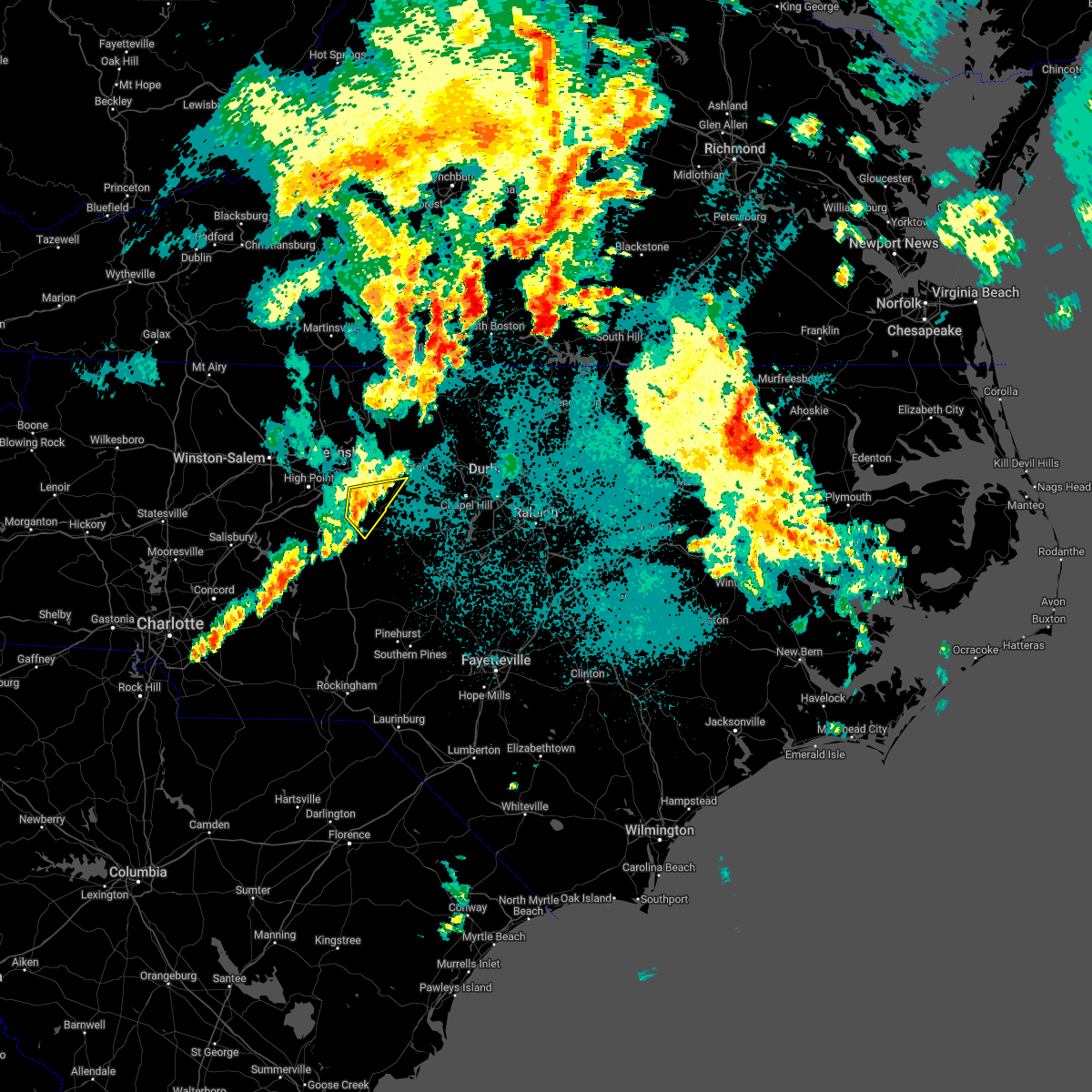 At 952 pm edt, a severe thunderstorm was located 8 miles east of randleman, moving east at 40 mph (radar indicated). Hazards include 60 mph wind gusts. Expect damage to roofs, siding, and trees. locations impacted include, liberty, ramseur, franklinville and climax. hail threat, radar indicated max hail size, <. 75 in wind threat, radar indicated max wind gust, 60 mph. At 952 pm edt, a severe thunderstorm was located 8 miles east of randleman, moving east at 40 mph (radar indicated). Hazards include 60 mph wind gusts. Expect damage to roofs, siding, and trees. locations impacted include, liberty, ramseur, franklinville and climax. hail threat, radar indicated max hail size, <. 75 in wind threat, radar indicated max wind gust, 60 mph.
|
| 5/6/2022 9:45 PM EDT |
 At 945 pm edt, a severe thunderstorm was located near randleman, moving east at 45 mph (radar indicated). Hazards include 60 mph wind gusts. Expect damage to roofs, siding, and trees. locations impacted include, asheboro, randleman, north carolina zoo, seagrove, pleasant garden, liberty, ramseur, franklinville, climax and ulah. hail threat, radar indicated max hail size, <. 75 in wind threat, radar indicated max wind gust, 60 mph. At 945 pm edt, a severe thunderstorm was located near randleman, moving east at 45 mph (radar indicated). Hazards include 60 mph wind gusts. Expect damage to roofs, siding, and trees. locations impacted include, asheboro, randleman, north carolina zoo, seagrove, pleasant garden, liberty, ramseur, franklinville, climax and ulah. hail threat, radar indicated max hail size, <. 75 in wind threat, radar indicated max wind gust, 60 mph.
|
| 5/6/2022 9:38 PM EDT |
 At 938 pm edt, a severe thunderstorm was located over randleman, moving east at 40 mph (radar indicated). Hazards include 60 mph wind gusts. Expect damage to roofs, siding, and trees. locations impacted include, high point, asheboro, randleman, north carolina zoo, seagrove, archdale, trinity, pleasant garden, liberty and ramseur. hail threat, radar indicated max hail size, <. 75 in wind threat, radar indicated max wind gust, 60 mph. At 938 pm edt, a severe thunderstorm was located over randleman, moving east at 40 mph (radar indicated). Hazards include 60 mph wind gusts. Expect damage to roofs, siding, and trees. locations impacted include, high point, asheboro, randleman, north carolina zoo, seagrove, archdale, trinity, pleasant garden, liberty and ramseur. hail threat, radar indicated max hail size, <. 75 in wind threat, radar indicated max wind gust, 60 mph.
|
| 5/6/2022 9:25 PM EDT |
 At 924 pm edt, a severe thunderstorm was located 10 miles west of asheboro, moving east at 40 mph (radar indicated). Hazards include 60 mph wind gusts. expect damage to roofs, siding, and trees At 924 pm edt, a severe thunderstorm was located 10 miles west of asheboro, moving east at 40 mph (radar indicated). Hazards include 60 mph wind gusts. expect damage to roofs, siding, and trees
|
| 5/6/2022 8:12 PM EDT |
 At 812 pm edt, a severe thunderstorm was located 11 miles northwest of siler city, moving northeast at 50 mph (radar indicated). Hazards include 60 mph wind gusts and quarter size hail. Hail damage to vehicles is expected. expect wind damage to roofs, siding, and trees. Locations impacted include, burlington, graham, gibsonville, liberty, ramseur, swepsonville, alamance, staley, lake guilford mackintosh marina and snow camp. At 812 pm edt, a severe thunderstorm was located 11 miles northwest of siler city, moving northeast at 50 mph (radar indicated). Hazards include 60 mph wind gusts and quarter size hail. Hail damage to vehicles is expected. expect wind damage to roofs, siding, and trees. Locations impacted include, burlington, graham, gibsonville, liberty, ramseur, swepsonville, alamance, staley, lake guilford mackintosh marina and snow camp.
|
| 5/6/2022 8:05 PM EDT |
 At 804 pm edt, a severe thunderstorm was located 7 miles east of randleman, moving northeast at 55 mph (radar indicated). Hazards include 60 mph wind gusts and quarter size hail. Hail damage to vehicles is expected. expect wind damage to roofs, siding, and trees. Locations impacted include, burlington, asheboro, graham, randleman, gibsonville, liberty, ramseur, franklinville, swepsonville and alamance. At 804 pm edt, a severe thunderstorm was located 7 miles east of randleman, moving northeast at 55 mph (radar indicated). Hazards include 60 mph wind gusts and quarter size hail. Hail damage to vehicles is expected. expect wind damage to roofs, siding, and trees. Locations impacted include, burlington, asheboro, graham, randleman, gibsonville, liberty, ramseur, franklinville, swepsonville and alamance.
|
| 5/6/2022 7:57 PM EDT |
 At 757 pm edt, a severe thunderstorm was located over asheboro, moving northeast at 50 mph (radar indicated). Hazards include 60 mph wind gusts and quarter size hail. Hail damage to vehicles is expected. Expect wind damage to roofs, siding, and trees. At 757 pm edt, a severe thunderstorm was located over asheboro, moving northeast at 50 mph (radar indicated). Hazards include 60 mph wind gusts and quarter size hail. Hail damage to vehicles is expected. Expect wind damage to roofs, siding, and trees.
|
| 5/1/2022 3:26 PM EDT |
 At 325 pm edt, severe thunderstorms were located along a line extending from near greensboro to 9 miles northeast of randleman to near asheboro, moving east at 30 mph (radar indicated). Hazards include 60 mph wind gusts and quarter size hail. Hail damage to vehicles is expected. expect wind damage to roofs, siding, and trees. locations impacted include, greensboro, high point, asheboro, lexington, randleman, north carolina zoo, thomasville, kernersville, linwood and mcleansville. hail threat, radar indicated max hail size, 1. 00 in wind threat, radar indicated max wind gust, 60 mph. At 325 pm edt, severe thunderstorms were located along a line extending from near greensboro to 9 miles northeast of randleman to near asheboro, moving east at 30 mph (radar indicated). Hazards include 60 mph wind gusts and quarter size hail. Hail damage to vehicles is expected. expect wind damage to roofs, siding, and trees. locations impacted include, greensboro, high point, asheboro, lexington, randleman, north carolina zoo, thomasville, kernersville, linwood and mcleansville. hail threat, radar indicated max hail size, 1. 00 in wind threat, radar indicated max wind gust, 60 mph.
|
| 5/1/2022 3:13 PM EDT |
 At 313 pm edt, severe thunderstorms were located along a line extending from greensboro to near randleman to near asheboro, moving east at 30 mph (radar indicated). Hazards include 60 mph wind gusts and quarter size hail. Hail damage to vehicles is expected. expect wind damage to roofs, siding, and trees. locations impacted include, greensboro, high point, asheboro, lexington, randleman, north carolina zoo, thomasville, kernersville, linwood and mcleansville. hail threat, radar indicated max hail size, 1. 00 in wind threat, radar indicated max wind gust, 60 mph. At 313 pm edt, severe thunderstorms were located along a line extending from greensboro to near randleman to near asheboro, moving east at 30 mph (radar indicated). Hazards include 60 mph wind gusts and quarter size hail. Hail damage to vehicles is expected. expect wind damage to roofs, siding, and trees. locations impacted include, greensboro, high point, asheboro, lexington, randleman, north carolina zoo, thomasville, kernersville, linwood and mcleansville. hail threat, radar indicated max hail size, 1. 00 in wind threat, radar indicated max wind gust, 60 mph.
|
| 5/1/2022 3:05 PM EDT |
 At 304 pm edt, severe thunderstorms were located along a line extending from near high point to 7 miles west of randleman to 9 miles west of asheboro, moving east at 35 mph (radar indicated). Hazards include 60 mph wind gusts and quarter size hail. Hail damage to vehicles is expected. expect wind damage to roofs, siding, and trees. locations impacted include, greensboro, high point, asheboro, lexington, randleman, north carolina zoo, thomasville, kernersville, linwood and mcleansville. hail threat, radar indicated max hail size, 1. 00 in wind threat, radar indicated max wind gust, 60 mph. At 304 pm edt, severe thunderstorms were located along a line extending from near high point to 7 miles west of randleman to 9 miles west of asheboro, moving east at 35 mph (radar indicated). Hazards include 60 mph wind gusts and quarter size hail. Hail damage to vehicles is expected. expect wind damage to roofs, siding, and trees. locations impacted include, greensboro, high point, asheboro, lexington, randleman, north carolina zoo, thomasville, kernersville, linwood and mcleansville. hail threat, radar indicated max hail size, 1. 00 in wind threat, radar indicated max wind gust, 60 mph.
|
| 5/1/2022 2:54 PM EDT |
 At 254 pm edt, severe thunderstorms were located along a line extending from near high point to 6 miles southeast of thomasville to 13 miles north of badin lake, moving northeast at 30 mph (radar indicated). Hazards include 60 mph wind gusts and quarter size hail. Hail damage to vehicles is expected. Expect wind damage to roofs, siding, and trees. At 254 pm edt, severe thunderstorms were located along a line extending from near high point to 6 miles southeast of thomasville to 13 miles north of badin lake, moving northeast at 30 mph (radar indicated). Hazards include 60 mph wind gusts and quarter size hail. Hail damage to vehicles is expected. Expect wind damage to roofs, siding, and trees.
|
| 4/26/2022 3:12 PM EDT |
 The severe thunderstorm warning for alamance, moore, western orange, east central anson, eastern montgomery, northern richmond, eastern randolph, southeastern guilford, west central lee and western chatham counties will expire at 315 pm edt, the storms which prompted the warning have moved east and new warnings have been issued to include areas farther east. therefore, the original warning will be allowed to expire. The severe thunderstorm warning for alamance, moore, western orange, east central anson, eastern montgomery, northern richmond, eastern randolph, southeastern guilford, west central lee and western chatham counties will expire at 315 pm edt, the storms which prompted the warning have moved east and new warnings have been issued to include areas farther east. therefore, the original warning will be allowed to expire.
|
| 4/26/2022 2:44 PM EDT |
 At 243 pm edt, severe thunderstorms were located along a line extending from near burlington to 6 miles east of north carolina zoo to 11 miles southeast of biscoe, moving northeast at 35 mph (radar indicated). Hazards include 60 mph wind gusts and quarter size hail. Hail damage to vehicles is expected. expect wind damage to roofs, siding, and trees. these severe storms will be near, burlington and elon around 250 pm edt. graham around 250 pm edt. mebane around 255 pm edt. siler city and pinehurst around 300 pm edt. southern pines around 305 pm edt. carthage around 310 pm edt. other locations impacted by these severe thunderstorms include franklinville, snow camp, pinebluff, alamance and candor. hail threat, radar indicated max hail size, 1. 00 in wind threat, radar indicated max wind gust, 60 mph. At 243 pm edt, severe thunderstorms were located along a line extending from near burlington to 6 miles east of north carolina zoo to 11 miles southeast of biscoe, moving northeast at 35 mph (radar indicated). Hazards include 60 mph wind gusts and quarter size hail. Hail damage to vehicles is expected. expect wind damage to roofs, siding, and trees. these severe storms will be near, burlington and elon around 250 pm edt. graham around 250 pm edt. mebane around 255 pm edt. siler city and pinehurst around 300 pm edt. southern pines around 305 pm edt. carthage around 310 pm edt. other locations impacted by these severe thunderstorms include franklinville, snow camp, pinebluff, alamance and candor. hail threat, radar indicated max hail size, 1. 00 in wind threat, radar indicated max wind gust, 60 mph.
|
| 4/26/2022 2:16 PM EDT |
 At 215 pm edt, severe thunderstorms were located along a line extending from 10 miles south of mcleansville to 6 miles west of seagrove to 9 miles east of ansonville, moving northeast at 35 mph (radar indicated). Hazards include 60 mph wind gusts and quarter size hail. Hail damage to vehicles is expected. expect wind damage to roofs, siding, and trees. severe thunderstorms will be near, seagrove around 225 pm edt. north carolina zoo and mcleansville around 230 pm edt. elon around 240 pm edt. burlington and graham around 250 pm edt. siler city, pinehurst and mebane around 300 pm edt. southern pines around 305 pm edt. hillsborough around 310 pm edt. carthage around 315 pm edt. other locations impacted by these severe thunderstorms include steeds, alamance, harpers crossroads, covington and pekin. hail threat, radar indicated max hail size, 1. 00 in wind threat, radar indicated max wind gust, 60 mph. At 215 pm edt, severe thunderstorms were located along a line extending from 10 miles south of mcleansville to 6 miles west of seagrove to 9 miles east of ansonville, moving northeast at 35 mph (radar indicated). Hazards include 60 mph wind gusts and quarter size hail. Hail damage to vehicles is expected. expect wind damage to roofs, siding, and trees. severe thunderstorms will be near, seagrove around 225 pm edt. north carolina zoo and mcleansville around 230 pm edt. elon around 240 pm edt. burlington and graham around 250 pm edt. siler city, pinehurst and mebane around 300 pm edt. southern pines around 305 pm edt. hillsborough around 310 pm edt. carthage around 315 pm edt. other locations impacted by these severe thunderstorms include steeds, alamance, harpers crossroads, covington and pekin. hail threat, radar indicated max hail size, 1. 00 in wind threat, radar indicated max wind gust, 60 mph.
|
| 12/11/2021 7:10 PM EST |
 The severe thunderstorm warning for southern alamance, orange, northeastern randolph, southeastern guilford and northwestern chatham counties will expire at 715 pm est, the storm which prompted the warning has weakened below severe limits, and has exited the warned area. therefore, the warning will be allowed to expire. to report severe weather, contact your nearest law enforcement agency. they will relay your report to the national weather service raleigh. The severe thunderstorm warning for southern alamance, orange, northeastern randolph, southeastern guilford and northwestern chatham counties will expire at 715 pm est, the storm which prompted the warning has weakened below severe limits, and has exited the warned area. therefore, the warning will be allowed to expire. to report severe weather, contact your nearest law enforcement agency. they will relay your report to the national weather service raleigh.
|
| 12/11/2021 6:30 PM EST |
 At 630 pm est, a severe thunderstorm was located 11 miles north of siler city, moving east at 40 mph (radar indicated). Hazards include 60 mph wind gusts. expect damage to roofs, siding, and trees At 630 pm est, a severe thunderstorm was located 11 miles north of siler city, moving east at 40 mph (radar indicated). Hazards include 60 mph wind gusts. expect damage to roofs, siding, and trees
|
| 12/11/2021 6:26 PM EST | Two trees down on foushee r in randolph county NC, 2.2 miles NW of Ramseur, NC |
| 12/11/2021 6:16 PM EST |
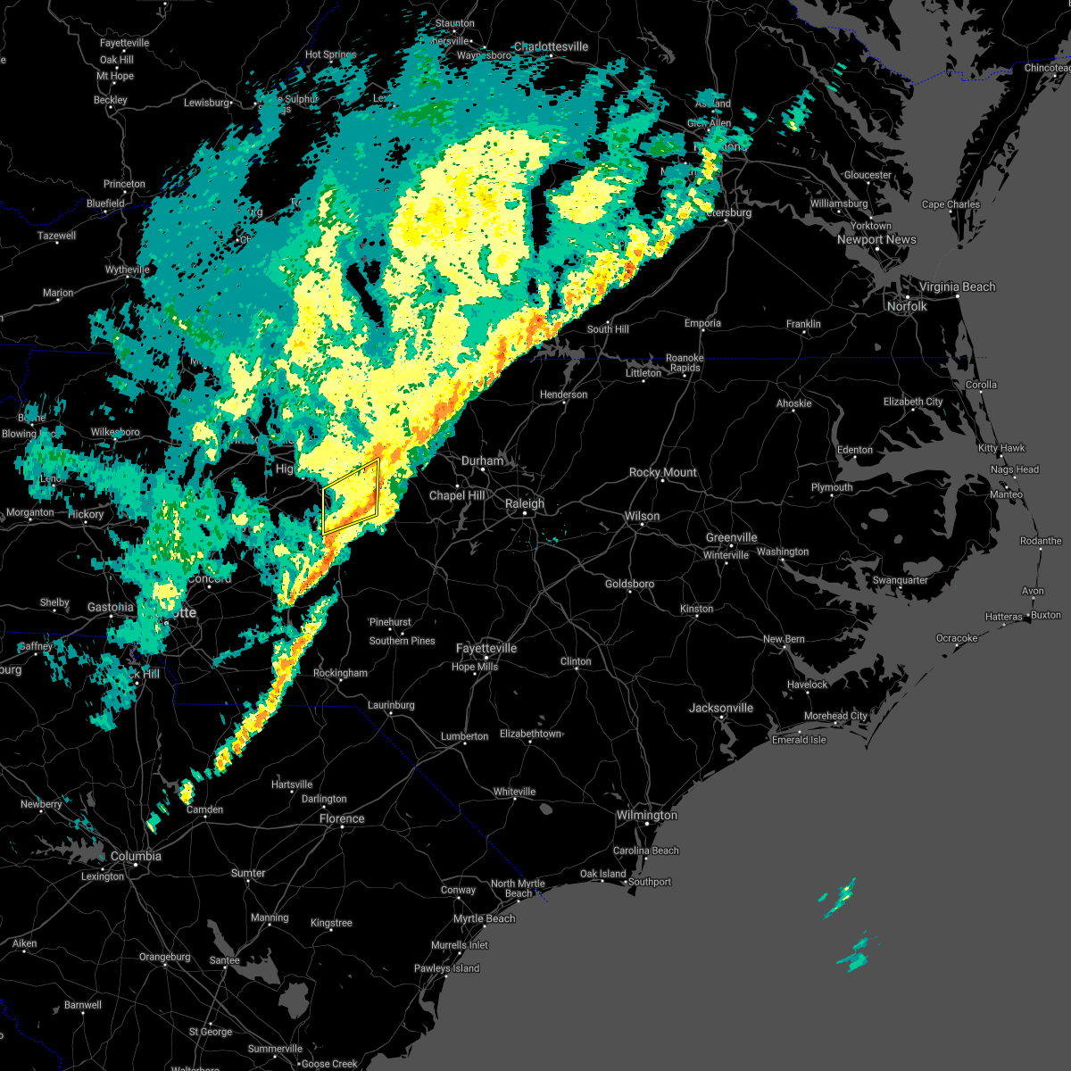 At 615 pm est, a severe thunderstorm was located 8 miles east of randleman, moving east at 50 mph (law enforcement). Hazards include 60 mph wind gusts. Expect damage to roofs, siding, and trees. locations impacted include, asheboro, randleman, pleasant garden, liberty, ramseur, franklinville, staley, climax, randleman regional reservior marina and forest oaks. hail threat, radar indicated max hail size, <. 75 in wind threat, radar indicated max wind gust, 60 mph. At 615 pm est, a severe thunderstorm was located 8 miles east of randleman, moving east at 50 mph (law enforcement). Hazards include 60 mph wind gusts. Expect damage to roofs, siding, and trees. locations impacted include, asheboro, randleman, pleasant garden, liberty, ramseur, franklinville, staley, climax, randleman regional reservior marina and forest oaks. hail threat, radar indicated max hail size, <. 75 in wind threat, radar indicated max wind gust, 60 mph.
|
| 12/11/2021 6:13 PM EST |
 At 613 pm est, severe thunderstorms were located along a line extending from north carolina zoo to 8 miles northwest of chesterfield, moving east at 40 mph (radar indicated). Hazards include 60 mph wind gusts. expect damage to roofs, siding, and trees At 613 pm est, severe thunderstorms were located along a line extending from north carolina zoo to 8 miles northwest of chesterfield, moving east at 40 mph (radar indicated). Hazards include 60 mph wind gusts. expect damage to roofs, siding, and trees
|
| 12/11/2021 5:54 PM EST |
 At 554 pm est, a severe thunderstorm was located 11 miles south of thomasville, or 12 miles southeast of lexington, moving northeast at 60 mph (radar indicated). Hazards include 60 mph wind gusts. expect damage to roofs, siding, and trees At 554 pm est, a severe thunderstorm was located 11 miles south of thomasville, or 12 miles southeast of lexington, moving northeast at 60 mph (radar indicated). Hazards include 60 mph wind gusts. expect damage to roofs, siding, and trees
|
| 10/25/2021 8:01 PM EDT |
 At 800 pm edt, a severe thunderstorm was located near mcleansville, or 9 miles west of burlington, moving east at 40 mph (radar indicated). Hazards include 60 mph wind gusts. Expect damage to roofs, siding, and trees. Locations impacted include, greensboro, high point, asheboro, randleman, mcleansville, archdale, trinity, gibsonville, pleasant garden and liberty. At 800 pm edt, a severe thunderstorm was located near mcleansville, or 9 miles west of burlington, moving east at 40 mph (radar indicated). Hazards include 60 mph wind gusts. Expect damage to roofs, siding, and trees. Locations impacted include, greensboro, high point, asheboro, randleman, mcleansville, archdale, trinity, gibsonville, pleasant garden and liberty.
|
| 10/25/2021 7:43 PM EDT |
 At 743 pm edt, a severe thunderstorm was located over greensboro, moving east at 40 mph (radar indicated). Hazards include 60 mph wind gusts. Expect damage to roofs, siding, and trees. Locations impacted include, greensboro, high point, asheboro, lexington, randleman, thomasville, mcleansville, linwood, archdale and trinity. At 743 pm edt, a severe thunderstorm was located over greensboro, moving east at 40 mph (radar indicated). Hazards include 60 mph wind gusts. Expect damage to roofs, siding, and trees. Locations impacted include, greensboro, high point, asheboro, lexington, randleman, thomasville, mcleansville, linwood, archdale and trinity.
|
| 10/25/2021 7:27 PM EDT |
 At 726 pm edt, a severe thunderstorm was located near kernersville, or near high point, moving east at 40 mph (radar indicated). Hazards include 60 mph wind gusts. expect damage to roofs, siding, and trees At 726 pm edt, a severe thunderstorm was located near kernersville, or near high point, moving east at 40 mph (radar indicated). Hazards include 60 mph wind gusts. expect damage to roofs, siding, and trees
|
| 8/18/2021 3:40 AM EDT |
 The severe thunderstorm warning for southern alamance, eastern randolph and northwestern chatham counties will expire at 345 am edt, the storm which prompted the warning has weakened below severe limits, and no longer poses an immediate threat to life or property. therefore, the warning will be allowed to expire. however, gusty winds up to 40 mph are still possible with this thunderstorm. to report severe weather, contact your nearest law enforcement agency. they will relay your report to the national weather service raleigh. The severe thunderstorm warning for southern alamance, eastern randolph and northwestern chatham counties will expire at 345 am edt, the storm which prompted the warning has weakened below severe limits, and no longer poses an immediate threat to life or property. therefore, the warning will be allowed to expire. however, gusty winds up to 40 mph are still possible with this thunderstorm. to report severe weather, contact your nearest law enforcement agency. they will relay your report to the national weather service raleigh.
|
| 8/18/2021 3:26 AM EDT |
 At 325 am edt, a severe thunderstorm was located 2 miles southwest of ramseur, moving northeast at 30 mph (radar indicated). Hazards include 60 mph wind gusts. Expect damage to roofs, siding, and trees. locations impacted include, siler city, north carolina zoo, liberty, ramseur, franklinville, swepsonville, staley, snow camp, coleridge and hasty. hail threat, radar indicated max hail size, <. 75 in wind threat, radar indicated max wind gust, 60 mph. At 325 am edt, a severe thunderstorm was located 2 miles southwest of ramseur, moving northeast at 30 mph (radar indicated). Hazards include 60 mph wind gusts. Expect damage to roofs, siding, and trees. locations impacted include, siler city, north carolina zoo, liberty, ramseur, franklinville, swepsonville, staley, snow camp, coleridge and hasty. hail threat, radar indicated max hail size, <. 75 in wind threat, radar indicated max wind gust, 60 mph.
|
| 8/18/2021 3:10 AM EDT |
 At 310 am edt, a severe thunderstorm was located over north carolina zoo, moving northeast at 35 mph (radar indicated). Hazards include 60 mph wind gusts. Expect damage to roofs, siding, and trees. locations impacted include, north carolina zoo, siler city, seagrove, liberty, ramseur, franklinville, swepsonville, staley, snow camp and sutphin. hail threat, radar indicated max hail size, <. 75 in wind threat, radar indicated max wind gust, 60 mph. At 310 am edt, a severe thunderstorm was located over north carolina zoo, moving northeast at 35 mph (radar indicated). Hazards include 60 mph wind gusts. Expect damage to roofs, siding, and trees. locations impacted include, north carolina zoo, siler city, seagrove, liberty, ramseur, franklinville, swepsonville, staley, snow camp and sutphin. hail threat, radar indicated max hail size, <. 75 in wind threat, radar indicated max wind gust, 60 mph.
|
| 8/18/2021 2:58 AM EDT |
 At 257 am edt, a severe thunderstorm was located over seagrove, or 9 miles south of north carolina zoo, moving northeast at 45 mph (radar indicated). Hazards include 60 mph wind gusts. expect damage to roofs, siding, and trees At 257 am edt, a severe thunderstorm was located over seagrove, or 9 miles south of north carolina zoo, moving northeast at 45 mph (radar indicated). Hazards include 60 mph wind gusts. expect damage to roofs, siding, and trees
|
| 8/1/2021 2:50 PM EDT | 911 call center reports numerous trees down with some on vehicles and houses east of asheboro and south of ramseur. time estimated by rada in randolph county NC, 5.3 miles N of Ramseur, NC |
| 8/1/2021 2:42 PM EDT |
 At 242 pm edt, a severe thunderstorm was located near asheboro, moving southeast at 35 mph (radar indicated). Hazards include 60 mph wind gusts and quarter size hail. Hail damage to vehicles is expected. Expect wind damage to roofs, siding, and trees. At 242 pm edt, a severe thunderstorm was located near asheboro, moving southeast at 35 mph (radar indicated). Hazards include 60 mph wind gusts and quarter size hail. Hail damage to vehicles is expected. Expect wind damage to roofs, siding, and trees.
|
| 5/29/2021 5:01 PM EDT |
 A severe thunderstorm warning remains in effect until 545 pm edt for southern randolph county. at 500 pm edt, a severe thunderstorm was located 11 miles southwest of asheboro, moving east at 20 mph. hazard. 60 mph wind gusts and quarter size hail. source. Radar indicated. A severe thunderstorm warning remains in effect until 545 pm edt for southern randolph county. at 500 pm edt, a severe thunderstorm was located 11 miles southwest of asheboro, moving east at 20 mph. hazard. 60 mph wind gusts and quarter size hail. source. Radar indicated.
|
| 5/29/2021 4:45 PM EDT |
 At 444 pm edt, a severe thunderstorm was located 11 miles north of badin lake, moving east at 20 mph (radar indicated). Hazards include 60 mph wind gusts and quarter size hail. Hail damage to vehicles is expected. Expect wind damage to roofs, siding, and trees. At 444 pm edt, a severe thunderstorm was located 11 miles north of badin lake, moving east at 20 mph (radar indicated). Hazards include 60 mph wind gusts and quarter size hail. Hail damage to vehicles is expected. Expect wind damage to roofs, siding, and trees.
|
| 5/29/2021 3:11 PM EDT |
 At 310 pm edt, a cluster of severe thunderstorms were located along a line extending from near high point to near greensboro, moving east at 15 mph (radar indicated). Hazards include 60 mph wind gusts. Expect damage to roofs, siding, and trees. Locations impacted include, greensboro, high point, burlington, graham, randleman, elon, mcleansville, archdale, trinity and gibsonville. At 310 pm edt, a cluster of severe thunderstorms were located along a line extending from near high point to near greensboro, moving east at 15 mph (radar indicated). Hazards include 60 mph wind gusts. Expect damage to roofs, siding, and trees. Locations impacted include, greensboro, high point, burlington, graham, randleman, elon, mcleansville, archdale, trinity and gibsonville.
|
| 5/29/2021 2:54 PM EDT |
 At 254 pm edt, severe thunderstorms were located along a line extending from near greensboro to near high point, moving east at 15 mph (radar indicated). Hazards include 60 mph wind gusts. Expect damage to roofs, siding, and trees. Locations impacted include, greensboro, high point, burlington, asheboro, graham, randleman, elon, mcleansville, archdale and summerfield. At 254 pm edt, severe thunderstorms were located along a line extending from near greensboro to near high point, moving east at 15 mph (radar indicated). Hazards include 60 mph wind gusts. Expect damage to roofs, siding, and trees. Locations impacted include, greensboro, high point, burlington, asheboro, graham, randleman, elon, mcleansville, archdale and summerfield.
|
| 5/29/2021 2:34 PM EDT |
 At 234 pm edt, a cluster of severe thunderstorms were located along a line extending from 6 miles west of greensboro to thomasville, moving east at 15 mph (radar indicated). Hazards include 60 mph wind gusts. expect damage to roofs, siding, and trees At 234 pm edt, a cluster of severe thunderstorms were located along a line extending from 6 miles west of greensboro to thomasville, moving east at 15 mph (radar indicated). Hazards include 60 mph wind gusts. expect damage to roofs, siding, and trees
|
| 3/27/2021 4:47 PM EDT |
 At 446 pm edt, severe thunderstorms were located along a line extending from near randleman to near asheboro to 8 miles northwest of seagrove, moving east at 40 mph (radar indicated). Hazards include 60 mph wind gusts and penny size hail. Expect damage to roofs, siding, and trees. Locations impacted include, asheboro, randleman, pittsboro, north carolina zoo, siler city, goldston, seagrove, liberty, ramseur and franklinville. At 446 pm edt, severe thunderstorms were located along a line extending from near randleman to near asheboro to 8 miles northwest of seagrove, moving east at 40 mph (radar indicated). Hazards include 60 mph wind gusts and penny size hail. Expect damage to roofs, siding, and trees. Locations impacted include, asheboro, randleman, pittsboro, north carolina zoo, siler city, goldston, seagrove, liberty, ramseur and franklinville.
|
| 3/27/2021 4:26 PM EDT |
 At 426 pm edt, severe thunderstorms were located along a line extending from near high point to 8 miles west of asheboro to 9 miles north of badin lake, moving east at 40 mph (radar indicated). Hazards include 60 mph wind gusts. expect damage to roofs, siding, and trees At 426 pm edt, severe thunderstorms were located along a line extending from near high point to 8 miles west of asheboro to 9 miles north of badin lake, moving east at 40 mph (radar indicated). Hazards include 60 mph wind gusts. expect damage to roofs, siding, and trees
|
| 3/27/2021 3:26 PM EDT |
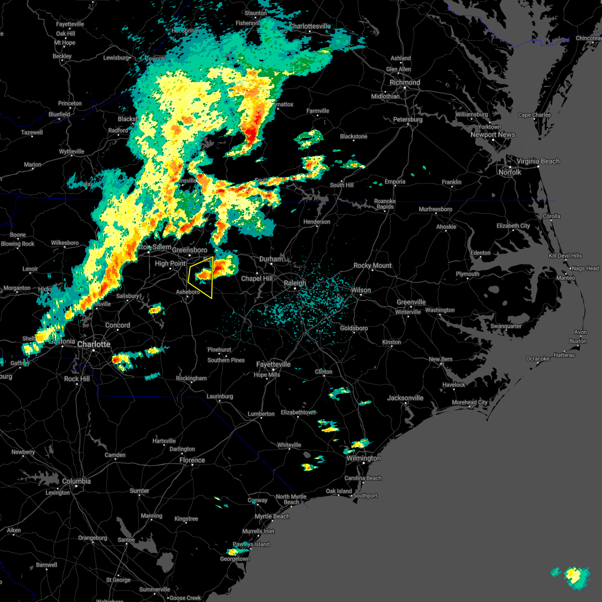 The severe thunderstorm warning for northeastern randolph and southeastern guilford counties will expire at 330 pm edt, the storm which prompted the warning has moved out of the area. therefore, the warning will be allowed to expire. a severe thunderstorm watch remains in effect until 800 pm edt for central north carolina. to report severe weather, contact your nearest law enforcement agency. they will relay your report to the national weather service raleigh. remember, a severe thunderstorm warning still remains in effect for northeast randolph county. The severe thunderstorm warning for northeastern randolph and southeastern guilford counties will expire at 330 pm edt, the storm which prompted the warning has moved out of the area. therefore, the warning will be allowed to expire. a severe thunderstorm watch remains in effect until 800 pm edt for central north carolina. to report severe weather, contact your nearest law enforcement agency. they will relay your report to the national weather service raleigh. remember, a severe thunderstorm warning still remains in effect for northeast randolph county.
|
| 3/27/2021 3:08 PM EDT |
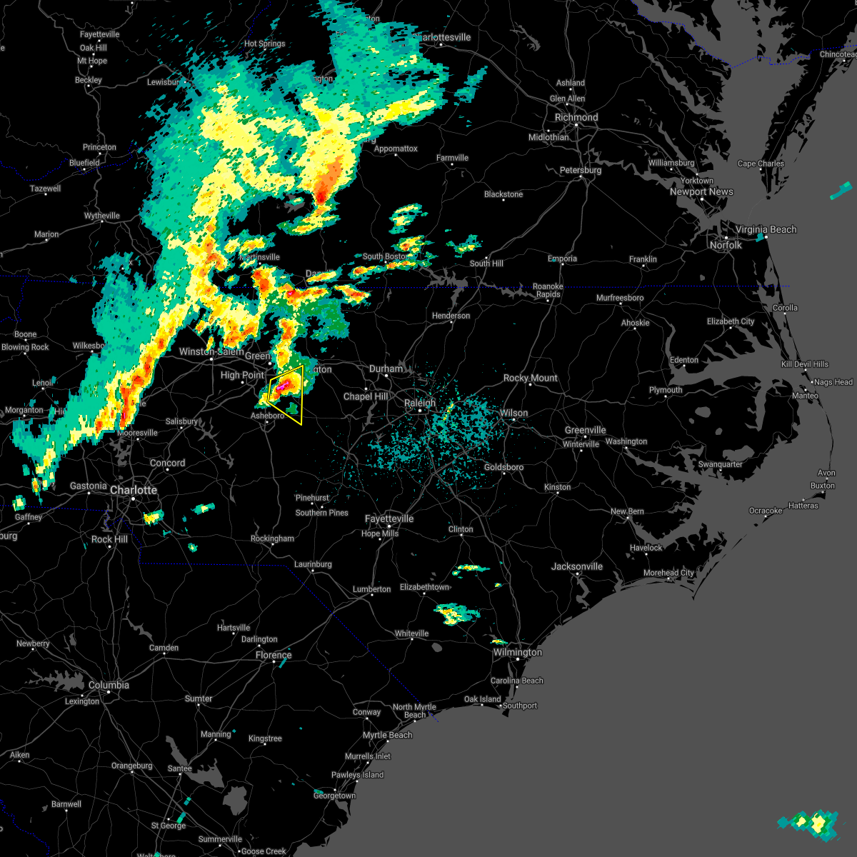 At 307 pm edt, a severe thunderstorm was located over climax or 9 miles northeast of randleman, moving east at 35 mph (radar indicated). Hazards include quarter to ping pong ball size hail and 60 mph wind gusts. People and animals outdoors will be injured. expect hail damage to roofs, siding, windows, and vehicles. expect wind damage to roofs, siding, and trees. Locations impacted include, randleman, pleasant garden, liberty, ramseur, staley, climax and forest oaks. At 307 pm edt, a severe thunderstorm was located over climax or 9 miles northeast of randleman, moving east at 35 mph (radar indicated). Hazards include quarter to ping pong ball size hail and 60 mph wind gusts. People and animals outdoors will be injured. expect hail damage to roofs, siding, windows, and vehicles. expect wind damage to roofs, siding, and trees. Locations impacted include, randleman, pleasant garden, liberty, ramseur, staley, climax and forest oaks.
|
| 3/27/2021 2:56 PM EDT |
 At 255 pm edt, a severe thunderstorm was located near randleman, moving east at 40 mph (radar indicated). Hazards include quarter to ping pong ball size hail and 60 mph wind gusts. People and animals outdoors will be injured. expect hail damage to roofs, siding, windows, and vehicles. expect wind damage to roofs, siding, and trees. Locations impacted include, greensboro, asheboro, randleman, pleasant garden, liberty, ramseur, franklinville, staley, climax and lake guilford mackintosh marina. At 255 pm edt, a severe thunderstorm was located near randleman, moving east at 40 mph (radar indicated). Hazards include quarter to ping pong ball size hail and 60 mph wind gusts. People and animals outdoors will be injured. expect hail damage to roofs, siding, windows, and vehicles. expect wind damage to roofs, siding, and trees. Locations impacted include, greensboro, asheboro, randleman, pleasant garden, liberty, ramseur, franklinville, staley, climax and lake guilford mackintosh marina.
|
| 3/27/2021 2:47 PM EDT |
 At 246 pm edt, a severe thunderstorm was located near high point, moving east at 45 mph (radar indicated). Hazards include 60 mph wind gusts and quarter size hail. Hail damage to vehicles is expected. expect wind damage to roofs, siding, and trees. Locations impacted include, greensboro, high point, asheboro, randleman, archdale, trinity, pleasant garden, jamestown, liberty and ramseur. At 246 pm edt, a severe thunderstorm was located near high point, moving east at 45 mph (radar indicated). Hazards include 60 mph wind gusts and quarter size hail. Hail damage to vehicles is expected. expect wind damage to roofs, siding, and trees. Locations impacted include, greensboro, high point, asheboro, randleman, archdale, trinity, pleasant garden, jamestown, liberty and ramseur.
|
| 3/27/2021 2:31 PM EDT |
 At 230 pm edt, a severe thunderstorm was located near thomasville, or 8 miles southwest of high point, moving east at 35 mph (radar indicated). Hazards include 60 mph wind gusts and quarter size hail. Hail damage to vehicles is expected. Expect wind damage to roofs, siding, and trees. At 230 pm edt, a severe thunderstorm was located near thomasville, or 8 miles southwest of high point, moving east at 35 mph (radar indicated). Hazards include 60 mph wind gusts and quarter size hail. Hail damage to vehicles is expected. Expect wind damage to roofs, siding, and trees.
|
| 3/18/2021 6:12 PM EDT |
 The severe thunderstorm warning for alamance, eastern randolph, southeastern guilford and northwestern chatham counties will expire at 615 pm edt, the storms which prompted the warning have weakened across randolph, guilford, and chatham counties. therefore, the warning will be allowed to expire. a severe thunderstorm warning still remains in effect for alamance county. a tornado watch remains in effect until 900 pm edt for central north carolina. The severe thunderstorm warning for alamance, eastern randolph, southeastern guilford and northwestern chatham counties will expire at 615 pm edt, the storms which prompted the warning have weakened across randolph, guilford, and chatham counties. therefore, the warning will be allowed to expire. a severe thunderstorm warning still remains in effect for alamance county. a tornado watch remains in effect until 900 pm edt for central north carolina.
|
| 3/18/2021 5:44 PM EDT |
 At 544 pm edt, severe thunderstorms were located along a line extending from burlington to 6 miles southeast of randleman, moving northeast at 50 mph (radar indicated). Hazards include 60 mph wind gusts and quarter size hail. Hail damage to vehicles is expected. expect wind damage to roofs, siding, and trees. Locations impacted include, burlington, asheboro, graham, randleman, mebane, elon, mcleansville, gibsonville, pleasant garden and liberty. At 544 pm edt, severe thunderstorms were located along a line extending from burlington to 6 miles southeast of randleman, moving northeast at 50 mph (radar indicated). Hazards include 60 mph wind gusts and quarter size hail. Hail damage to vehicles is expected. expect wind damage to roofs, siding, and trees. Locations impacted include, burlington, asheboro, graham, randleman, mebane, elon, mcleansville, gibsonville, pleasant garden and liberty.
|
| 3/18/2021 5:13 PM EDT |
 At 513 pm edt, severe thunderstorms were located along a line extending from near randleman to 11 miles east of high rock lake, moving northeast at 55 mph (radar indicated). Hazards include 60 mph wind gusts and quarter size hail. Hail damage to vehicles is expected. Expect wind damage to roofs, siding, and trees. At 513 pm edt, severe thunderstorms were located along a line extending from near randleman to 11 miles east of high rock lake, moving northeast at 55 mph (radar indicated). Hazards include 60 mph wind gusts and quarter size hail. Hail damage to vehicles is expected. Expect wind damage to roofs, siding, and trees.
|
| 9/29/2020 5:38 PM EDT |
 The severe thunderstorm warning for east central randolph and west central chatham counties will expire at 545 pm edt, the storm which prompted the warning has weakened below severe limits, and no longer poses an immediate threat to life or property. therefore, the warning will be allowed to expire. however gusty winds are still possible with this thunderstorm. The severe thunderstorm warning for east central randolph and west central chatham counties will expire at 545 pm edt, the storm which prompted the warning has weakened below severe limits, and no longer poses an immediate threat to life or property. therefore, the warning will be allowed to expire. however gusty winds are still possible with this thunderstorm.
|
| 9/29/2020 5:17 PM EDT |
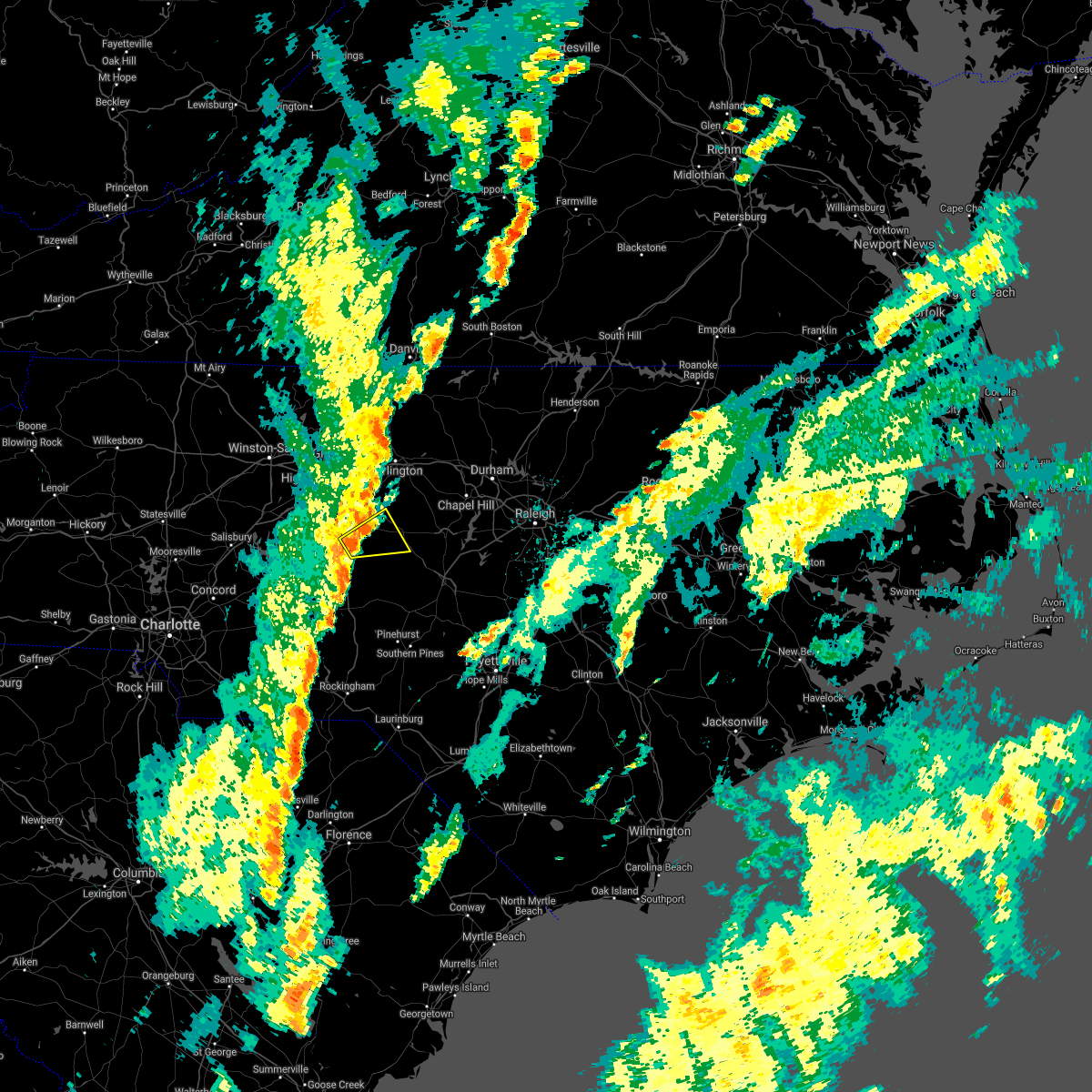 At 517 pm edt, a severe thunderstorm was located near north carolina zoo, moving northeast at 40 mph (radar indicated). Hazards include 60 mph wind gusts and penny size hail. Expect damage to roofs, siding, and trees. Locations impacted include, asheboro, north carolina zoo, siler city, ramseur, franklinville, staley, coleridge and hasty. At 517 pm edt, a severe thunderstorm was located near north carolina zoo, moving northeast at 40 mph (radar indicated). Hazards include 60 mph wind gusts and penny size hail. Expect damage to roofs, siding, and trees. Locations impacted include, asheboro, north carolina zoo, siler city, ramseur, franklinville, staley, coleridge and hasty.
|
| 9/29/2020 5:02 PM EDT |
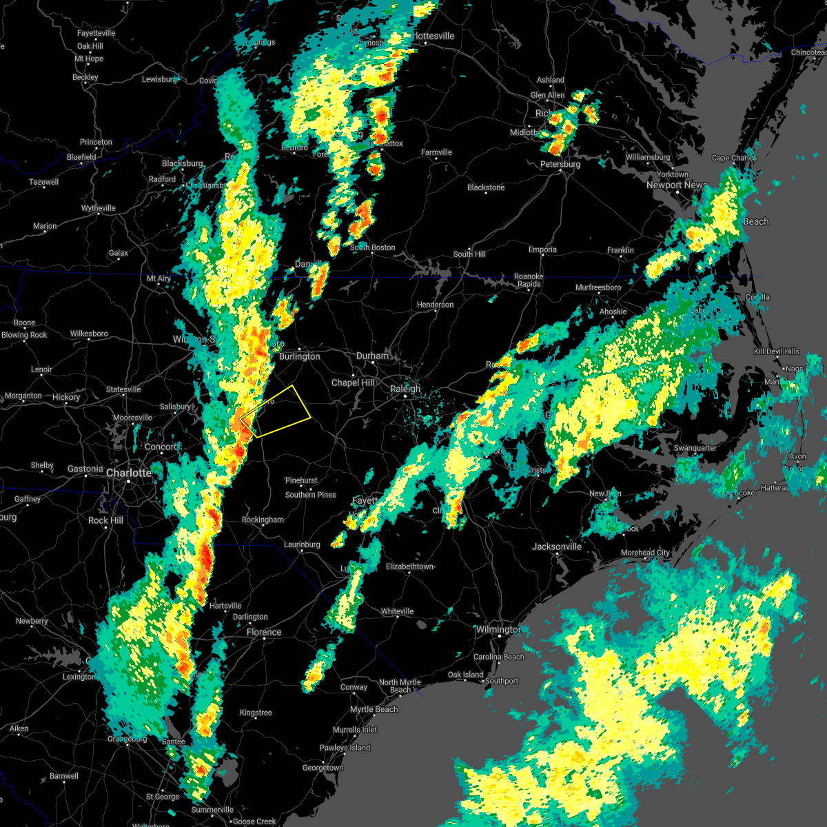 At 501 pm edt, a severe thunderstorm was located near seagrove, or near north carolina zoo, moving northeast at 30 mph (radar indicated). Hazards include 60 mph wind gusts. expect damage to roofs, siding, and trees At 501 pm edt, a severe thunderstorm was located near seagrove, or near north carolina zoo, moving northeast at 30 mph (radar indicated). Hazards include 60 mph wind gusts. expect damage to roofs, siding, and trees
|
| 6/22/2020 8:35 PM EDT |
 At 835 pm edt, severe thunderstorms were located along a line extending from 6 miles southwest of seagrove to 9 miles east of biscoe, moving east at 20 mph (radar indicated). Hazards include 60 mph wind gusts. Expect damage to roofs, siding, and trees. Locations impacted include, asheboro, southern pines, troy, carthage, north carolina zoo, pinehurst, biscoe, seagrove, whispering pines and ramseur. At 835 pm edt, severe thunderstorms were located along a line extending from 6 miles southwest of seagrove to 9 miles east of biscoe, moving east at 20 mph (radar indicated). Hazards include 60 mph wind gusts. Expect damage to roofs, siding, and trees. Locations impacted include, asheboro, southern pines, troy, carthage, north carolina zoo, pinehurst, biscoe, seagrove, whispering pines and ramseur.
|
| 6/22/2020 8:01 PM EDT |
 At 801 pm edt, severe thunderstorms were located along a line extending from badin lake to near plyler to 7 miles southwest of troy, moving east at 35 mph (radar indicated). Hazards include 60 mph wind gusts. expect damage to roofs, siding, and trees At 801 pm edt, severe thunderstorms were located along a line extending from badin lake to near plyler to 7 miles southwest of troy, moving east at 35 mph (radar indicated). Hazards include 60 mph wind gusts. expect damage to roofs, siding, and trees
|
| 6/11/2020 8:15 PM EDT |
 At 814 pm edt, severe thunderstorms were located along a line extending from near cary to near seagrove, moving southeast at 15 mph (radar indicated). Hazards include 60 mph wind gusts. Expect damage to roofs, siding, and trees. Locations impacted include, pittsboro, troy, siler city, north carolina zoo, biscoe, goldston, seagrove, liberty, ramseur and franklinville. At 814 pm edt, severe thunderstorms were located along a line extending from near cary to near seagrove, moving southeast at 15 mph (radar indicated). Hazards include 60 mph wind gusts. Expect damage to roofs, siding, and trees. Locations impacted include, pittsboro, troy, siler city, north carolina zoo, biscoe, goldston, seagrove, liberty, ramseur and franklinville.
|
| 6/11/2020 7:44 PM EDT |
 At 744 pm edt, severe thunderstorms were located along a line extending from 7 miles west of rdu international to near seagrove, moving southeast at 15 mph (radar indicated). Hazards include 60 mph wind gusts. expect damage to roofs, siding, and trees At 744 pm edt, severe thunderstorms were located along a line extending from 7 miles west of rdu international to near seagrove, moving southeast at 15 mph (radar indicated). Hazards include 60 mph wind gusts. expect damage to roofs, siding, and trees
|
| 5/28/2020 5:56 PM EDT |
 The severe thunderstorm warning for northwestern moore, montgomery, randolph, lee and chatham counties will expire at 600 pm edt, the storms which prompted the warning have weakened and therefore the warning will be allowed to expire. however gusty winds are still possible with these thunderstorms, and additional warnings may be needed this evening. be ready to seek shelter if severe weather threatens your area. The severe thunderstorm warning for northwestern moore, montgomery, randolph, lee and chatham counties will expire at 600 pm edt, the storms which prompted the warning have weakened and therefore the warning will be allowed to expire. however gusty winds are still possible with these thunderstorms, and additional warnings may be needed this evening. be ready to seek shelter if severe weather threatens your area.
|
| 5/28/2020 5:28 PM EDT |
 At 527 pm edt, severe thunderstorms were located along a line extending from near pittsboro to 8 miles northeast of carthage to 6 miles southwest of seagrove, moving north at 45 mph (radar indicated). Hazards include 60 mph wind gusts and quarter size hail. Hail damage to vehicles is expected. expect wind damage to roofs, siding, and trees. Locations impacted include, sanford, asheboro, randleman, pittsboro, troy, carthage, siler city, badin lake, north carolina zoo and biscoe. At 527 pm edt, severe thunderstorms were located along a line extending from near pittsboro to 8 miles northeast of carthage to 6 miles southwest of seagrove, moving north at 45 mph (radar indicated). Hazards include 60 mph wind gusts and quarter size hail. Hail damage to vehicles is expected. expect wind damage to roofs, siding, and trees. Locations impacted include, sanford, asheboro, randleman, pittsboro, troy, carthage, siler city, badin lake, north carolina zoo and biscoe.
|
| 5/28/2020 5:11 PM EDT |
 At 511 pm edt, severe thunderstorms were located along a line extending from 6 miles south of pittsboro to 6 miles northeast of carthage to 7 miles northwest of wakulla, moving north at 30 mph (radar indicated). Hazards include 60 mph wind gusts and quarter size hail. Hail damage to vehicles is expected. Expect wind damage to roofs, siding, and trees. At 511 pm edt, severe thunderstorms were located along a line extending from 6 miles south of pittsboro to 6 miles northeast of carthage to 7 miles northwest of wakulla, moving north at 30 mph (radar indicated). Hazards include 60 mph wind gusts and quarter size hail. Hail damage to vehicles is expected. Expect wind damage to roofs, siding, and trees.
|
| 4/25/2020 11:53 PM EDT |
 The severe thunderstorm warning for northwestern moore, southeastern davidson, northern anson, montgomery, northwestern richmond, randolph and stanly counties will expire at midnight edt, the storms which prompted the warning have weakened below severe limits, and no longer pose an immediate threat to life or property. therefore, the warning will be allowed to expire. to report severe weather, contact your nearest law enforcement agency. they will relay your report to the national weather service raleigh. The severe thunderstorm warning for northwestern moore, southeastern davidson, northern anson, montgomery, northwestern richmond, randolph and stanly counties will expire at midnight edt, the storms which prompted the warning have weakened below severe limits, and no longer pose an immediate threat to life or property. therefore, the warning will be allowed to expire. to report severe weather, contact your nearest law enforcement agency. they will relay your report to the national weather service raleigh.
|
| 4/25/2020 11:37 PM EDT |
 At 1136 pm edt, severe thunderstorms were located along a line extending from 9 miles east of randleman to 6 miles east of north carolina zoo to 7 miles southeast of albemarle, moving east at 30 mph (radar indicated). Hazards include 60 mph wind gusts and half dollar size hail. Hail damage to vehicles is expected. expect wind damage to roofs, siding, and trees. Locations impacted include, asheboro, albemarle, randleman, troy, badin lake, north carolina zoo, biscoe, ansonville, seagrove and plyler. At 1136 pm edt, severe thunderstorms were located along a line extending from 9 miles east of randleman to 6 miles east of north carolina zoo to 7 miles southeast of albemarle, moving east at 30 mph (radar indicated). Hazards include 60 mph wind gusts and half dollar size hail. Hail damage to vehicles is expected. expect wind damage to roofs, siding, and trees. Locations impacted include, asheboro, albemarle, randleman, troy, badin lake, north carolina zoo, biscoe, ansonville, seagrove and plyler.
|
| 4/25/2020 11:18 PM EDT |
 At 1118 pm edt, severe thunderstorms were located along a line extending from near randleman to near north carolina zoo to 9 miles south of plyler, moving northeast at 55 mph (radar indicated). Hazards include 60 mph wind gusts and half dollar size hail. Hail damage to vehicles is expected. expect wind damage to roofs, siding, and trees. Locations impacted include, asheboro, albemarle, randleman, troy, badin lake, north carolina zoo, biscoe, ansonville, seagrove and plyler. At 1118 pm edt, severe thunderstorms were located along a line extending from near randleman to near north carolina zoo to 9 miles south of plyler, moving northeast at 55 mph (radar indicated). Hazards include 60 mph wind gusts and half dollar size hail. Hail damage to vehicles is expected. expect wind damage to roofs, siding, and trees. Locations impacted include, asheboro, albemarle, randleman, troy, badin lake, north carolina zoo, biscoe, ansonville, seagrove and plyler.
|
| 4/25/2020 10:57 PM EDT |
 At 1056 pm edt, severe thunderstorms were located along a line extending from 9 miles southeast of lexington to near badin lake to 6 miles southeast of midland, moving east at 30 mph (radar indicated). Hazards include 60 mph wind gusts and quarter size hail. Hail damage to vehicles is expected. Expect wind damage to roofs, siding, and trees. At 1056 pm edt, severe thunderstorms were located along a line extending from 9 miles southeast of lexington to near badin lake to 6 miles southeast of midland, moving east at 30 mph (radar indicated). Hazards include 60 mph wind gusts and quarter size hail. Hail damage to vehicles is expected. Expect wind damage to roofs, siding, and trees.
|
| 4/25/2020 10:57 PM EDT |
 The national weather service in raleigh has issued a * severe thunderstorm warning for. northwestern moore county in central north carolina. southeastern davidson county in central north carolina. northern anson county in central north carolina. Montgomery county in central north carolina. The national weather service in raleigh has issued a * severe thunderstorm warning for. northwestern moore county in central north carolina. southeastern davidson county in central north carolina. northern anson county in central north carolina. Montgomery county in central north carolina.
|
| 4/13/2020 6:55 AM EDT |
 At 655 am edt, severe thunderstorms were located along a line extending from 7 miles southwest of virgilina to 9 miles northeast of siler city, moving northeast at 45 mph (radar indicated). Hazards include 60 mph wind gusts. Expect damage to roofs, siding, and trees. Locations impacted include, raleigh, durham, chapel hill, burlington, asheboro, graham, oxford, roxboro, hillsborough and creedmoor. At 655 am edt, severe thunderstorms were located along a line extending from 7 miles southwest of virgilina to 9 miles northeast of siler city, moving northeast at 45 mph (radar indicated). Hazards include 60 mph wind gusts. Expect damage to roofs, siding, and trees. Locations impacted include, raleigh, durham, chapel hill, burlington, asheboro, graham, oxford, roxboro, hillsborough and creedmoor.
|
| 4/13/2020 6:19 AM EDT |
 At 619 am edt, severe thunderstorms were located along a line extending from milton to north carolina zoo, moving northeast at 60 mph (radar indicated). Hazards include 60 mph wind gusts. expect damage to roofs, siding, and trees At 619 am edt, severe thunderstorms were located along a line extending from milton to north carolina zoo, moving northeast at 60 mph (radar indicated). Hazards include 60 mph wind gusts. expect damage to roofs, siding, and trees
|
| 4/13/2020 5:59 AM EDT |
 At 559 am edt, severe thunderstorms were located along a line extending from 7 miles southwest of camp springs to near randleman to 8 miles west of seagrove, moving east at 45 mph (radar indicated). Hazards include 60 mph wind gusts. Expect damage to roofs, siding, and trees. Locations impacted include, greensboro, high point, burlington, asheboro, graham, randleman, siler city, north carolina zoo, thomasville and mebane. At 559 am edt, severe thunderstorms were located along a line extending from 7 miles southwest of camp springs to near randleman to 8 miles west of seagrove, moving east at 45 mph (radar indicated). Hazards include 60 mph wind gusts. Expect damage to roofs, siding, and trees. Locations impacted include, greensboro, high point, burlington, asheboro, graham, randleman, siler city, north carolina zoo, thomasville and mebane.
|
| 4/13/2020 5:56 AM EDT |
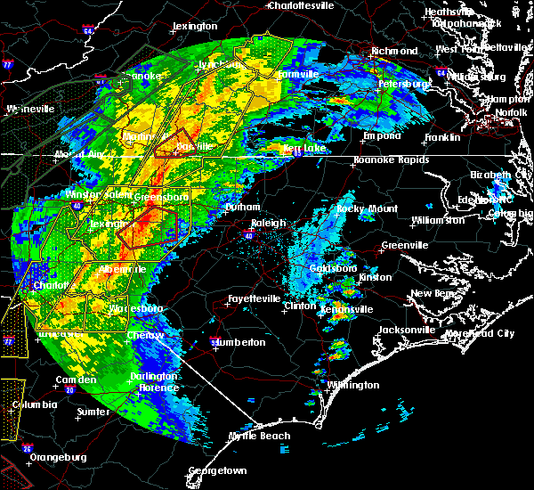 At 556 am edt, a severe thunderstorm capable of producing a tornado was located 11 miles northeast of randleman, moving northeast at 60 mph (radar indicated rotation). Hazards include tornado. Flying debris will be dangerous to those caught without shelter. mobile homes will be damaged or destroyed. damage to roofs, windows, and vehicles will occur. tree damage is likely. Locations impacted include, randleman, siler city, liberty, ramseur, franklinville, staley, climax, forest oaks, snow camp and randleman regional reservior marina. At 556 am edt, a severe thunderstorm capable of producing a tornado was located 11 miles northeast of randleman, moving northeast at 60 mph (radar indicated rotation). Hazards include tornado. Flying debris will be dangerous to those caught without shelter. mobile homes will be damaged or destroyed. damage to roofs, windows, and vehicles will occur. tree damage is likely. Locations impacted include, randleman, siler city, liberty, ramseur, franklinville, staley, climax, forest oaks, snow camp and randleman regional reservior marina.
|
| 4/13/2020 5:45 AM EDT |
 At 544 am edt, a severe thunderstorm capable of producing a tornado was located over randleman, moving northeast at 60 mph (radar indicated rotation). Hazards include tornado. Flying debris will be dangerous to those caught without shelter. mobile homes will be damaged or destroyed. damage to roofs, windows, and vehicles will occur. tree damage is likely. This tornadic thunderstorm will remain over mainly rural areas of southwestern alamance, northern randolph, southeastern guilford and northwestern chatham counties, including the following locations, franklinville, staley, climax, snow camp and ulah. At 544 am edt, a severe thunderstorm capable of producing a tornado was located over randleman, moving northeast at 60 mph (radar indicated rotation). Hazards include tornado. Flying debris will be dangerous to those caught without shelter. mobile homes will be damaged or destroyed. damage to roofs, windows, and vehicles will occur. tree damage is likely. This tornadic thunderstorm will remain over mainly rural areas of southwestern alamance, northern randolph, southeastern guilford and northwestern chatham counties, including the following locations, franklinville, staley, climax, snow camp and ulah.
|
| 4/13/2020 5:28 AM EDT |
 At 527 am edt, severe thunderstorms were located along a line extending from 7 miles southwest of bethany to 11 miles east of high rock lake, moving northeast at 55 mph (radar indicated). Hazards include 60 mph wind gusts. expect damage to roofs, siding, and trees At 527 am edt, severe thunderstorms were located along a line extending from 7 miles southwest of bethany to 11 miles east of high rock lake, moving northeast at 55 mph (radar indicated). Hazards include 60 mph wind gusts. expect damage to roofs, siding, and trees
|
| 2/6/2020 1:13 PM EST |
 At 112 pm est, severe thunderstorms were located along a line extending from near seagrove to near biscoe to near ansonville, moving east at 75 mph (radar indicated). Hazards include 60 mph wind gusts. expect damage to roofs, siding, and trees At 112 pm est, severe thunderstorms were located along a line extending from near seagrove to near biscoe to near ansonville, moving east at 75 mph (radar indicated). Hazards include 60 mph wind gusts. expect damage to roofs, siding, and trees
|
| 2/6/2020 12:31 PM EST |
 At 1230 pm est, a severe thunderstorm capable of producing a tornado was located 11 miles northwest of siler city, moving east at 60 mph (radar indicated rotation). Hazards include tornado. Flying debris will be dangerous to those caught without shelter. mobile homes will be damaged or destroyed. damage to roofs, windows, and vehicles will occur. tree damage is likely. This tornadic thunderstorm will remain over mainly rural areas of southern alamance, northeastern randolph, southeastern guilford and northwestern chatham counties, including the following locations, franklinville, staley, snow camp, ramseur and sutphin. At 1230 pm est, a severe thunderstorm capable of producing a tornado was located 11 miles northwest of siler city, moving east at 60 mph (radar indicated rotation). Hazards include tornado. Flying debris will be dangerous to those caught without shelter. mobile homes will be damaged or destroyed. damage to roofs, windows, and vehicles will occur. tree damage is likely. This tornadic thunderstorm will remain over mainly rural areas of southern alamance, northeastern randolph, southeastern guilford and northwestern chatham counties, including the following locations, franklinville, staley, snow camp, ramseur and sutphin.
|
| 2/6/2020 12:27 PM EST |
 At 1227 pm est, severe thunderstorms were located along a line extending from near mcleansville to near asheboro to 9 miles west of seagrove, moving east at 55 mph (radar indicated). Hazards include 60 mph wind gusts. expect damage to roofs, siding, and trees At 1227 pm est, severe thunderstorms were located along a line extending from near mcleansville to near asheboro to 9 miles west of seagrove, moving east at 55 mph (radar indicated). Hazards include 60 mph wind gusts. expect damage to roofs, siding, and trees
|
| 2/6/2020 12:20 PM EST |
 At 1219 pm est, severe thunderstorms were located along a line extending from 6 miles south of mcleansville to 10 miles southwest of asheboro to 8 miles northwest of badin lake, moving northeast at 60 mph (radar indicated). Hazards include 60 mph wind gusts. Expect damage to roofs, siding, and trees. Locations impacted include, asheboro, albemarle, troy, north carolina zoo, badin lake, seagrove, plyler, badin, ramseur and denton. At 1219 pm est, severe thunderstorms were located along a line extending from 6 miles south of mcleansville to 10 miles southwest of asheboro to 8 miles northwest of badin lake, moving northeast at 60 mph (radar indicated). Hazards include 60 mph wind gusts. Expect damage to roofs, siding, and trees. Locations impacted include, asheboro, albemarle, troy, north carolina zoo, badin lake, seagrove, plyler, badin, ramseur and denton.
|
| 2/6/2020 12:16 PM EST |
 At 1215 pm est, severe thunderstorms were located along a line extending from near greensboro to 12 miles southwest of asheboro to 6 miles north of badin lake, moving east at 75 mph (radar indicated). Hazards include 60 mph wind gusts. Expect damage to roofs, siding, and trees. Locations impacted include, greensboro, high point, asheboro, randleman, mcleansville, archdale, trinity, gibsonville, pleasant garden and jamestown. At 1215 pm est, severe thunderstorms were located along a line extending from near greensboro to 12 miles southwest of asheboro to 6 miles north of badin lake, moving east at 75 mph (radar indicated). Hazards include 60 mph wind gusts. Expect damage to roofs, siding, and trees. Locations impacted include, greensboro, high point, asheboro, randleman, mcleansville, archdale, trinity, gibsonville, pleasant garden and jamestown.
|
| 2/6/2020 11:49 AM EST |
 At 1148 am est, severe thunderstorms were located along a line extending from 6 miles east of linwood to east charlotte, moving east at 35 mph (radar indicated). Hazards include 60 mph wind gusts. expect damage to roofs, siding, and trees At 1148 am est, severe thunderstorms were located along a line extending from 6 miles east of linwood to east charlotte, moving east at 35 mph (radar indicated). Hazards include 60 mph wind gusts. expect damage to roofs, siding, and trees
|
| 2/6/2020 11:46 AM EST |
 At 1145 am est, severe thunderstorms were located along a line extending from near bethany to near greensboro to near lexington, moving northeast at 55 mph (radar indicated). Hazards include 60 mph wind gusts. Expect damage to roofs, siding, and trees. Locations impacted include, greensboro, high point, asheboro, lexington, randleman, thomasville, mcleansville, archdale, summerfield and trinity. At 1145 am est, severe thunderstorms were located along a line extending from near bethany to near greensboro to near lexington, moving northeast at 55 mph (radar indicated). Hazards include 60 mph wind gusts. Expect damage to roofs, siding, and trees. Locations impacted include, greensboro, high point, asheboro, lexington, randleman, thomasville, mcleansville, archdale, summerfield and trinity.
|
| 2/6/2020 11:26 AM EST |
 At 1125 am est, severe thunderstorms were located along a line extending from near pine hall to 7 miles west of high point to linwood, moving northeast at 55 mph (radar indicated). Hazards include 60 mph wind gusts. expect damage to roofs, siding, and trees At 1125 am est, severe thunderstorms were located along a line extending from near pine hall to 7 miles west of high point to linwood, moving northeast at 55 mph (radar indicated). Hazards include 60 mph wind gusts. expect damage to roofs, siding, and trees
|
| 1/11/2020 11:39 PM EST |
 The severe thunderstorm warning for eastern randolph and eastern guilford counties will expire at 1145 pm est, the storms which prompted the warning have moved out of the area. therefore, the warning will be allowed to expire. a severe thunderstorm watch remains in effect until 200 am est for central north carolina. to report severe weather, contact your nearest law enforcement agency. they will relay your report to the national weather service raleigh. The severe thunderstorm warning for eastern randolph and eastern guilford counties will expire at 1145 pm est, the storms which prompted the warning have moved out of the area. therefore, the warning will be allowed to expire. a severe thunderstorm watch remains in effect until 200 am est for central north carolina. to report severe weather, contact your nearest law enforcement agency. they will relay your report to the national weather service raleigh.
|
| 1/11/2020 11:31 PM EST |
 At 1131 pm est, severe thunderstorms were located along a line extending from 6 miles east of monroeton to 7 miles northwest of siler city to 8 miles southeast of biscoe, moving south at 15 mph (radar indicated). Hazards include 60 mph wind gusts. Expect damage to roofs, siding, and trees. Locations impacted include, mcleansville, gibsonville, liberty, ramseur, franklinville, staley, lake guilford mackintosh marina, forest oaks, monticello and coleridge. At 1131 pm est, severe thunderstorms were located along a line extending from 6 miles east of monroeton to 7 miles northwest of siler city to 8 miles southeast of biscoe, moving south at 15 mph (radar indicated). Hazards include 60 mph wind gusts. Expect damage to roofs, siding, and trees. Locations impacted include, mcleansville, gibsonville, liberty, ramseur, franklinville, staley, lake guilford mackintosh marina, forest oaks, monticello and coleridge.
|
| 1/11/2020 11:13 PM EST |
 At 1113 pm est, severe thunderstorms were located along a line extending from near reidsville to 12 miles northwest of siler city to near biscoe, moving northeast at 65 mph (radar indicated). Hazards include 60 mph wind gusts. Expect damage to roofs, siding, and trees. Locations impacted include, greensboro, high point, asheboro, randleman, north carolina zoo, thomasville, kernersville, seagrove, mcleansville and archdale. At 1113 pm est, severe thunderstorms were located along a line extending from near reidsville to 12 miles northwest of siler city to near biscoe, moving northeast at 65 mph (radar indicated). Hazards include 60 mph wind gusts. Expect damage to roofs, siding, and trees. Locations impacted include, greensboro, high point, asheboro, randleman, north carolina zoo, thomasville, kernersville, seagrove, mcleansville and archdale.
|
| 1/11/2020 11:05 PM EST |
 At 1105 pm est, severe thunderstorms were located along a line extending from harrisons crossroads to near randleman to troy, moving northeast at 60 mph (radar indicated). Hazards include 60 mph wind gusts. Expect damage to roofs, siding, and trees. Locations impacted include, greensboro, winston-salem, high point, asheboro, lexington, randleman, north carolina zoo, thomasville, kernersville and seagrove. At 1105 pm est, severe thunderstorms were located along a line extending from harrisons crossroads to near randleman to troy, moving northeast at 60 mph (radar indicated). Hazards include 60 mph wind gusts. Expect damage to roofs, siding, and trees. Locations impacted include, greensboro, winston-salem, high point, asheboro, lexington, randleman, north carolina zoo, thomasville, kernersville and seagrove.
|
| 1/11/2020 10:41 PM EST |
 At 1041 pm est, severe thunderstorms were located along a line extending from eden to monroeton to near rockwell, moving northeast at 60 mph (radar indicated). Hazards include 60 mph wind gusts. expect damage to roofs, siding, and trees At 1041 pm est, severe thunderstorms were located along a line extending from eden to monroeton to near rockwell, moving northeast at 60 mph (radar indicated). Hazards include 60 mph wind gusts. expect damage to roofs, siding, and trees
|
| 10/31/2019 7:27 PM EDT |
 At 725 pm edt, severe thunderstorms were located along a line extending from near mebane to near biscoe, moving northeast at 55 mph (radar indicated). Hazards include 70 mph wind gusts. the primary location for this wind will be just west of swepsonville and saxapahaw. Expect considerable tree damage. damage is likely to mobile homes, roofs, and outbuildings. locations impacted include, burlington, asheboro, graham, rockingham, wadesboro, troy, siler city, north carolina zoo, mebane and hamlet. A tornado watch remains in effect until 1100 pm edt for central north carolina. At 725 pm edt, severe thunderstorms were located along a line extending from near mebane to near biscoe, moving northeast at 55 mph (radar indicated). Hazards include 70 mph wind gusts. the primary location for this wind will be just west of swepsonville and saxapahaw. Expect considerable tree damage. damage is likely to mobile homes, roofs, and outbuildings. locations impacted include, burlington, asheboro, graham, rockingham, wadesboro, troy, siler city, north carolina zoo, mebane and hamlet. A tornado watch remains in effect until 1100 pm edt for central north carolina.
|
| 10/31/2019 6:48 PM EDT |
 At 647 pm edt, severe thunderstorms were located along a line extending from near randleman to 7 miles west of ansonville, moving northeast at 50 mph (radar indicated). Hazards include 60 mph wind gusts. expect damage to roofs, siding, and trees At 647 pm edt, severe thunderstorms were located along a line extending from near randleman to 7 miles west of ansonville, moving northeast at 50 mph (radar indicated). Hazards include 60 mph wind gusts. expect damage to roofs, siding, and trees
|
| 10/31/2019 6:24 PM EDT |
 At 623 pm edt, a severe thunderstorm beginning to show signs of rotation was located near greensboro, moving northeast at 45 mph (radar indicated). Hazards include 60 mph wind gusts. Expect damage to roofs, siding, and trees. locations impacted include, greensboro, burlington, asheboro, graham, randleman, mebane, elon, mcleansville, summerfield and gibsonville. A tornado watch remains in effect until 1100 pm edt for central north carolina. At 623 pm edt, a severe thunderstorm beginning to show signs of rotation was located near greensboro, moving northeast at 45 mph (radar indicated). Hazards include 60 mph wind gusts. Expect damage to roofs, siding, and trees. locations impacted include, greensboro, burlington, asheboro, graham, randleman, mebane, elon, mcleansville, summerfield and gibsonville. A tornado watch remains in effect until 1100 pm edt for central north carolina.
|
| 10/31/2019 6:14 PM EDT |
 At 614 pm edt, a severe thunderstorm was located near greensboro, moving east at 45 mph (radar indicated). Hazards include 60 mph wind gusts. expect damage to roofs, siding, and trees At 614 pm edt, a severe thunderstorm was located near greensboro, moving east at 45 mph (radar indicated). Hazards include 60 mph wind gusts. expect damage to roofs, siding, and trees
|
| 8/22/2019 5:20 PM EDT |
 At 519 pm edt, severe thunderstorms were located along a line extending from near jericho to 7 miles south of mcleansville to near randleman to near lexington, moving east at 20 mph. while the overall intensity of the line of storms has weakened, wind gusts capable of sporadic tree damage are still likely (radar indicated). Hazards include 60 mph wind gusts. Expect damage to roofs, siding, and trees. Locations impacted include, high point, burlington, asheboro, graham, randleman, thomasville, mebane, elon, archdale and trinity. At 519 pm edt, severe thunderstorms were located along a line extending from near jericho to 7 miles south of mcleansville to near randleman to near lexington, moving east at 20 mph. while the overall intensity of the line of storms has weakened, wind gusts capable of sporadic tree damage are still likely (radar indicated). Hazards include 60 mph wind gusts. Expect damage to roofs, siding, and trees. Locations impacted include, high point, burlington, asheboro, graham, randleman, thomasville, mebane, elon, archdale and trinity.
|
| 8/22/2019 4:50 PM EDT |
 A severe thunderstorm warning remains in effect until 600 pm edt for alamance. northern davidson. northern randolph and southeastern guilford counties. At 450 pm edt, severe thunderstorms were located along a line extending from near monroeton to near greensboro to near thomasville to near lexington, moving east at 20 mph. A severe thunderstorm warning remains in effect until 600 pm edt for alamance. northern davidson. northern randolph and southeastern guilford counties. At 450 pm edt, severe thunderstorms were located along a line extending from near monroeton to near greensboro to near thomasville to near lexington, moving east at 20 mph.
|
| 8/22/2019 4:39 PM EDT |
 The national weather service in raleigh has issued a * severe thunderstorm warning for. alamance county in central north carolina. northern davidson county in central north carolina. northern randolph county in central north carolina. Southeastern guilford county in central north carolina. The national weather service in raleigh has issued a * severe thunderstorm warning for. alamance county in central north carolina. northern davidson county in central north carolina. northern randolph county in central north carolina. Southeastern guilford county in central north carolina.
|
| 8/22/2019 2:42 PM EDT |
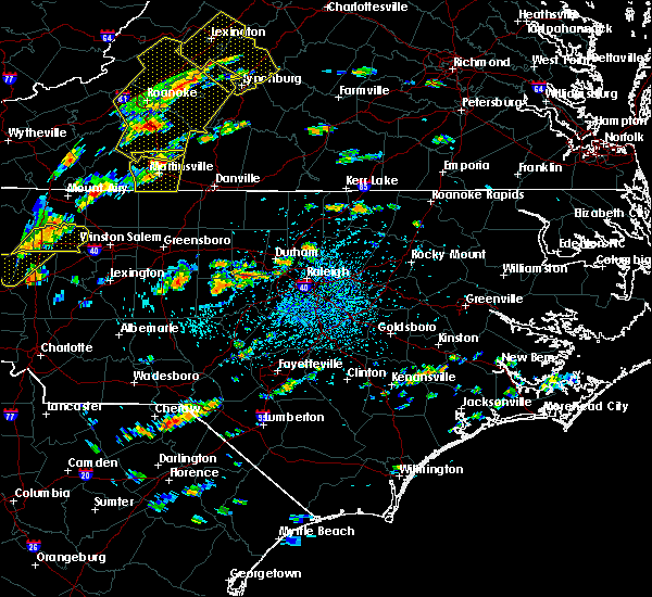 At 241 pm edt, a severe thunderstorm was located 7 miles east of randleman, moving east at 15 mph (radar indicated). Hazards include 60 mph wind gusts. expect damage to roofs, siding, and trees At 241 pm edt, a severe thunderstorm was located 7 miles east of randleman, moving east at 15 mph (radar indicated). Hazards include 60 mph wind gusts. expect damage to roofs, siding, and trees
|
| 8/21/2019 7:05 PM EDT |
 At 705 pm edt, severe thunderstorms were located along a line extending from near butner to 10 miles northwest of pittsboro, moving east at 50 mph (radar indicated). Hazards include 60 mph wind gusts. Expect damage to roofs, siding, and trees. Locations impacted include, durham, chapel hill, asheboro, hillsborough, randleman, pittsboro, siler city, carrboro, mebane and goldston. At 705 pm edt, severe thunderstorms were located along a line extending from near butner to 10 miles northwest of pittsboro, moving east at 50 mph (radar indicated). Hazards include 60 mph wind gusts. Expect damage to roofs, siding, and trees. Locations impacted include, durham, chapel hill, asheboro, hillsborough, randleman, pittsboro, siler city, carrboro, mebane and goldston.
|
| 8/21/2019 6:29 PM EDT |
 The national weather service in raleigh has issued a * severe thunderstorm warning for. alamance county in central north carolina. orange county in central north carolina. northeastern randolph county in central north carolina. Southeastern guilford county in central north carolina. The national weather service in raleigh has issued a * severe thunderstorm warning for. alamance county in central north carolina. orange county in central north carolina. northeastern randolph county in central north carolina. Southeastern guilford county in central north carolina.
|
| 8/19/2019 6:05 PM EDT |
 The severe thunderstorm warning for southeastern randolph and southwestern chatham counties will expire at 615 pm edt, the storms which prompted the warning have weakened below severe limits, and no longer pose an immediate threat to life or property. therefore the warning will be allowed to expire. however gusty winds and heavy rain are still possible with these thunderstorms. to report severe weather, contact your nearest law enforcement agency. they will relay your report to the national weather service raleigh. The severe thunderstorm warning for southeastern randolph and southwestern chatham counties will expire at 615 pm edt, the storms which prompted the warning have weakened below severe limits, and no longer pose an immediate threat to life or property. therefore the warning will be allowed to expire. however gusty winds and heavy rain are still possible with these thunderstorms. to report severe weather, contact your nearest law enforcement agency. they will relay your report to the national weather service raleigh.
|
| 8/19/2019 5:55 PM EDT |
 At 555 pm edt, severe thunderstorms were located along a line extending from near north carolina zoo to near siler city, moving south at 5 mph (radar indicated). Hazards include 60 mph wind gusts and penny size hail. Expect damage to roofs, siding, and trees. Locations impacted include, asheboro, randleman, north carolina zoo, siler city, seagrove, ramseur, franklinville, staley, ulah and harpers crossroads. At 555 pm edt, severe thunderstorms were located along a line extending from near north carolina zoo to near siler city, moving south at 5 mph (radar indicated). Hazards include 60 mph wind gusts and penny size hail. Expect damage to roofs, siding, and trees. Locations impacted include, asheboro, randleman, north carolina zoo, siler city, seagrove, ramseur, franklinville, staley, ulah and harpers crossroads.
|
| 8/19/2019 5:25 PM EDT |
 At 525 pm edt, a severe thunderstorm was located 7 miles west of siler city, moving west at 20 mph (radar indicated). Hazards include 60 mph wind gusts and quarter size hail. Hail damage to vehicles is expected. Expect wind damage to roofs, siding, and trees. At 525 pm edt, a severe thunderstorm was located 7 miles west of siler city, moving west at 20 mph (radar indicated). Hazards include 60 mph wind gusts and quarter size hail. Hail damage to vehicles is expected. Expect wind damage to roofs, siding, and trees.
|
| 8/19/2019 5:21 PM EDT |
 A severe thunderstorm warning remains in effect until 530 pm edt for davidson. randolph and northwestern chatham counties. at 520 pm edt, severe thunderstorms were located along a line extending from 6 miles northwest of siler city to near high rock lake, moving west at 20 mph. hazard. 60 mph wind gusts and quarter size hail. A severe thunderstorm warning remains in effect until 530 pm edt for davidson. randolph and northwestern chatham counties. at 520 pm edt, severe thunderstorms were located along a line extending from 6 miles northwest of siler city to near high rock lake, moving west at 20 mph. hazard. 60 mph wind gusts and quarter size hail.
|
| 8/19/2019 5:05 PM EDT |
 At 504 pm edt, severe thunderstorms were located along a line extending from near siler city to 8 miles southeast of high rock lake, moving north at 5 mph (radar indicated). Hazards include 60 mph wind gusts and quarter size hail. Hail damage to vehicles is expected. expect wind damage to roofs, siding, and trees. Locations impacted include, high point, asheboro, lexington, albemarle, randleman, siler city, badin lake, north carolina zoo, thomasville and goldston. At 504 pm edt, severe thunderstorms were located along a line extending from near siler city to 8 miles southeast of high rock lake, moving north at 5 mph (radar indicated). Hazards include 60 mph wind gusts and quarter size hail. Hail damage to vehicles is expected. expect wind damage to roofs, siding, and trees. Locations impacted include, high point, asheboro, lexington, albemarle, randleman, siler city, badin lake, north carolina zoo, thomasville and goldston.
|
| 8/19/2019 4:43 PM EDT |
 The national weather service in raleigh has issued a * severe thunderstorm warning for. southern alamance county in central north carolina. northwestern moore county in central north carolina. davidson county in central north carolina. Northern montgomery county in central north carolina. The national weather service in raleigh has issued a * severe thunderstorm warning for. southern alamance county in central north carolina. northwestern moore county in central north carolina. davidson county in central north carolina. Northern montgomery county in central north carolina.
|
| 8/13/2019 5:41 PM EDT |
 At 541 pm edt, a severe thunderstorm was located near seagrove, or 8 miles southwest of north carolina zoo, moving southeast at 30 mph (radar indicated). Hazards include 60 mph wind gusts and nickel size hail. Expect damage to roofs, siding, and trees. Locations impacted include, troy, north carolina zoo, badin lake, biscoe, seagrove, robbins, star, steeds, eldorado and harpers crossroads. At 541 pm edt, a severe thunderstorm was located near seagrove, or 8 miles southwest of north carolina zoo, moving southeast at 30 mph (radar indicated). Hazards include 60 mph wind gusts and nickel size hail. Expect damage to roofs, siding, and trees. Locations impacted include, troy, north carolina zoo, badin lake, biscoe, seagrove, robbins, star, steeds, eldorado and harpers crossroads.
|
| 8/13/2019 5:26 PM EDT |
 At 525 pm edt, a severe thunderstorm was located 11 miles northeast of badin lake, moving southeast at 30 mph (radar indicated). Hazards include 60 mph wind gusts and nickel size hail. expect damage to roofs, siding, and trees At 525 pm edt, a severe thunderstorm was located 11 miles northeast of badin lake, moving southeast at 30 mph (radar indicated). Hazards include 60 mph wind gusts and nickel size hail. expect damage to roofs, siding, and trees
|
| 8/13/2019 5:08 PM EDT |
 At 508 pm edt, severe thunderstorms were located along a line extending from 8 miles south of elon to near high rock lake, moving southeast at 35 mph (law enforcement). Hazards include 60 mph wind gusts. Expect damage to roofs, siding, and trees. Locations impacted include, asheboro, randleman, north carolina zoo, seagrove, high rock lake, gibsonville, liberty, ramseur, denton and franklinville. At 508 pm edt, severe thunderstorms were located along a line extending from 8 miles south of elon to near high rock lake, moving southeast at 35 mph (law enforcement). Hazards include 60 mph wind gusts. Expect damage to roofs, siding, and trees. Locations impacted include, asheboro, randleman, north carolina zoo, seagrove, high rock lake, gibsonville, liberty, ramseur, denton and franklinville.
|
| 8/13/2019 4:55 PM EDT |
 At 454 pm edt, severe thunderstorms were located along a line extending from near mcleansville to near linwood, moving southeast at 35 mph (law enforcement). Hazards include 60 mph wind gusts and penny size hail. Expect damage to roofs, siding, and trees. Locations impacted include, greensboro, high point, asheboro, lexington, randleman, north carolina zoo, thomasville, seagrove, linwood and mcleansville. At 454 pm edt, severe thunderstorms were located along a line extending from near mcleansville to near linwood, moving southeast at 35 mph (law enforcement). Hazards include 60 mph wind gusts and penny size hail. Expect damage to roofs, siding, and trees. Locations impacted include, greensboro, high point, asheboro, lexington, randleman, north carolina zoo, thomasville, seagrove, linwood and mcleansville.
|
| 8/13/2019 4:35 PM EDT |
 At 433 pm edt, severe thunderstorms were located along a line extending from near greensboro to near lexington, moving southeast at 35 mph (law enforcement). Hazards include 60 mph wind gusts and penny size hail. expect minor damage to roofs, siding, and trees At 433 pm edt, severe thunderstorms were located along a line extending from near greensboro to near lexington, moving southeast at 35 mph (law enforcement). Hazards include 60 mph wind gusts and penny size hail. expect minor damage to roofs, siding, and trees
|
| 8/7/2019 1:06 PM EDT |
 At 106 pm edt, severe thunderstorms were located along a line extending from near prospect hill to near graham to near asheboro, moving east at 30 mph (radar indicated). Hazards include 60 mph wind gusts. Expect damage to roofs, siding, and trees. Locations impacted include, chapel hill, burlington, asheboro, graham, hillsborough, randleman, pittsboro, siler city, north carolina zoo and carrboro. At 106 pm edt, severe thunderstorms were located along a line extending from near prospect hill to near graham to near asheboro, moving east at 30 mph (radar indicated). Hazards include 60 mph wind gusts. Expect damage to roofs, siding, and trees. Locations impacted include, chapel hill, burlington, asheboro, graham, hillsborough, randleman, pittsboro, siler city, north carolina zoo and carrboro.
|
| 8/7/2019 12:45 PM EDT |
 At 1245 pm edt, severe thunderstorms were located along a line extending from near burlington to 11 miles southwest of asheboro, moving east at 20 mph (radar indicated). Hazards include 60 mph wind gusts. expect damage to roofs, siding, and trees At 1245 pm edt, severe thunderstorms were located along a line extending from near burlington to 11 miles southwest of asheboro, moving east at 20 mph (radar indicated). Hazards include 60 mph wind gusts. expect damage to roofs, siding, and trees
|
| 7/23/2019 1:27 PM EDT |
 The severe thunderstorm warning for southwestern alamance. randolph. guilford and western chatham counties will expire at 130 pm edt. the storms which prompted the warning have weakened below severe limits, and no longer pose an immediate threat to life or property. therefore the warning will be allowed to expire. However gusty winds. The severe thunderstorm warning for southwestern alamance. randolph. guilford and western chatham counties will expire at 130 pm edt. the storms which prompted the warning have weakened below severe limits, and no longer pose an immediate threat to life or property. therefore the warning will be allowed to expire. However gusty winds.
|
| 7/23/2019 1:15 PM EDT |
 A severe thunderstorm warning remains in effect until 130 pm edt for southwestern alamance. randolph. guilford and western chatham counties. At 115 pm edt, severe thunderstorms were located along a line extending from 7 miles southeast of high point to randleman to north carolina zoo, moving northeast at 35 mph. A severe thunderstorm warning remains in effect until 130 pm edt for southwestern alamance. randolph. guilford and western chatham counties. At 115 pm edt, severe thunderstorms were located along a line extending from 7 miles southeast of high point to randleman to north carolina zoo, moving northeast at 35 mph.
|
| 7/23/2019 1:02 PM EDT |
 A severe thunderstorm warning remains in effect until 130 pm edt for southwestern alamance. randolph. guilford and western chatham counties. At 102 pm edt, severe thunderstorms were located along a line extending from near thomasville to near asheboro to near seagrove, moving northeast at 35 mph. A severe thunderstorm warning remains in effect until 130 pm edt for southwestern alamance. randolph. guilford and western chatham counties. At 102 pm edt, severe thunderstorms were located along a line extending from near thomasville to near asheboro to near seagrove, moving northeast at 35 mph.
|
| 7/23/2019 12:54 PM EDT |
 The national weather service in raleigh has issued a * severe thunderstorm warning for. southwestern alamance county in central north carolina. northeastern davidson county in central north carolina. randolph county in central north carolina. Guilford county in central north carolina. The national weather service in raleigh has issued a * severe thunderstorm warning for. southwestern alamance county in central north carolina. northeastern davidson county in central north carolina. randolph county in central north carolina. Guilford county in central north carolina.
|
| 6/30/2019 6:41 PM EDT | Trees were reported down on power lines near buffalo ford road and mill creek roa in randolph county NC, 5.5 miles NNW of Ramseur, NC |
| 6/30/2019 6:33 PM EDT | Tree down at w jones st and brooklyn ave in ramseu in randolph county NC, 1.9 miles N of Ramseur, NC |
| 6/30/2019 6:27 PM EDT |
 At 627 pm edt, a severe thunderstorm was located near asheboro, moving southeast at 20 mph (radar indicated). Hazards include 60 mph wind gusts and penny size hail. expect damage to roofs, siding, and trees At 627 pm edt, a severe thunderstorm was located near asheboro, moving southeast at 20 mph (radar indicated). Hazards include 60 mph wind gusts and penny size hail. expect damage to roofs, siding, and trees
|
| 6/20/2019 5:35 PM EDT |
 At 535 pm edt, a severe thunderstorm was located over seagrove, or near north carolina zoo, moving east at 60 mph (radar indicated). Hazards include 60 mph wind gusts. expect damage to roofs, siding, and trees At 535 pm edt, a severe thunderstorm was located over seagrove, or near north carolina zoo, moving east at 60 mph (radar indicated). Hazards include 60 mph wind gusts. expect damage to roofs, siding, and trees
|
| 6/20/2019 4:57 PM EDT |
 At 457 pm edt, a severe thunderstorm was located 7 miles east of north carolina zoo, moving east at 50 mph (radar indicated). Hazards include 60 mph wind gusts. expect damage to roofs, siding, and trees At 457 pm edt, a severe thunderstorm was located 7 miles east of north carolina zoo, moving east at 50 mph (radar indicated). Hazards include 60 mph wind gusts. expect damage to roofs, siding, and trees
|
| 6/20/2019 4:49 PM EDT |
 At 448 pm edt, a severe thunderstorm was located over north carolina zoo, moving east at 50 mph (radar indicated). Hazards include 60 mph wind gusts. Expect damage to roofs, siding, and trees. Locations impacted include, asheboro, north carolina zoo, seagrove, ramseur, franklinville, staley, ulah and coleridge. At 448 pm edt, a severe thunderstorm was located over north carolina zoo, moving east at 50 mph (radar indicated). Hazards include 60 mph wind gusts. Expect damage to roofs, siding, and trees. Locations impacted include, asheboro, north carolina zoo, seagrove, ramseur, franklinville, staley, ulah and coleridge.
|
| 6/20/2019 4:38 PM EDT |
 A severe thunderstorm warning remains in effect until 500 pm edt for randolph county. at 438 pm edt, a severe thunderstorm was located 8 miles northwest of seagrove, or 8 miles west of north carolina zoo, moving east at 55 mph. hazard. 60 mph wind gusts. A severe thunderstorm warning remains in effect until 500 pm edt for randolph county. at 438 pm edt, a severe thunderstorm was located 8 miles northwest of seagrove, or 8 miles west of north carolina zoo, moving east at 55 mph. hazard. 60 mph wind gusts.
|
| 6/20/2019 4:30 PM EDT |
 The national weather service in raleigh has issued a * severe thunderstorm warning for. southeastern davidson county in central north carolina. randolph county in central north carolina. Until 500 pm edt * at 430 pm edt, a severe thunderstorm was located 11 miles north of. The national weather service in raleigh has issued a * severe thunderstorm warning for. southeastern davidson county in central north carolina. randolph county in central north carolina. Until 500 pm edt * at 430 pm edt, a severe thunderstorm was located 11 miles north of.
|
| 6/20/2019 3:22 PM EDT |
 At 321 pm edt, severe thunderstorms were located along a line extending from near hillsborough to 6 miles northwest of siler city to 6 miles northwest of seagrove, moving east at 50 mph (emergency management reports several powerlines and trees down within the city of burlington). Hazards include 70 mph wind gusts and quarter size hail. Hail damage to vehicles is expected. expect considerable tree damage. wind damage is also likely to mobile homes, roofs, and outbuildings. Locations impacted include, chapel hill, asheboro, hillsborough, pittsboro, siler city, north carolina zoo, carrboro, goldston, seagrove and liberty. At 321 pm edt, severe thunderstorms were located along a line extending from near hillsborough to 6 miles northwest of siler city to 6 miles northwest of seagrove, moving east at 50 mph (emergency management reports several powerlines and trees down within the city of burlington). Hazards include 70 mph wind gusts and quarter size hail. Hail damage to vehicles is expected. expect considerable tree damage. wind damage is also likely to mobile homes, roofs, and outbuildings. Locations impacted include, chapel hill, asheboro, hillsborough, pittsboro, siler city, north carolina zoo, carrboro, goldston, seagrove and liberty.
|
| 6/20/2019 3:14 PM EDT |
 At 313 pm edt, severe thunderstorms with a history of producing wind damage were located along a line extending from mebane through 8 miles east of randleman to 11 miles northeast of badin lake, moving east at 50 mph. this includes portions of jordan lake (radar indicated). Hazards include 70 mph wind gusts and quarter size hail. Hail damage to vehicles is expected. expect considerable tree damage. Wind damage is also likely to mobile homes, roofs, and outbuildings. At 313 pm edt, severe thunderstorms with a history of producing wind damage were located along a line extending from mebane through 8 miles east of randleman to 11 miles northeast of badin lake, moving east at 50 mph. this includes portions of jordan lake (radar indicated). Hazards include 70 mph wind gusts and quarter size hail. Hail damage to vehicles is expected. expect considerable tree damage. Wind damage is also likely to mobile homes, roofs, and outbuildings.
|
| 6/20/2019 3:05 PM EDT |
 At 305 pm edt, severe thunderstorms were located along a line extending from 11 miles south of greensboro to near randleman to 12 miles west of asheboro, moving east at 40 mph (radar indicated). Hazards include 60 mph wind gusts and quarter size hail. Hail damage to vehicles is expected. expect wind damage to roofs, siding, and trees. Locations impacted include, asheboro, randleman, north carolina zoo, seagrove, liberty, ramseur, franklinville, staley, climax and ulah. At 305 pm edt, severe thunderstorms were located along a line extending from 11 miles south of greensboro to near randleman to 12 miles west of asheboro, moving east at 40 mph (radar indicated). Hazards include 60 mph wind gusts and quarter size hail. Hail damage to vehicles is expected. expect wind damage to roofs, siding, and trees. Locations impacted include, asheboro, randleman, north carolina zoo, seagrove, liberty, ramseur, franklinville, staley, climax and ulah.
|
| 6/20/2019 2:47 PM EDT |
 At 247 pm edt, severe thunderstorms were located along a line extending from near high point to near thomasville to near high rock lake, moving east at 35 mph (radar indicated). Hazards include 60 mph wind gusts and quarter size hail. Hail damage to vehicles is expected. expect wind damage to roofs, siding, and trees. Locations impacted include, high point, asheboro, lexington, randleman, north carolina zoo, thomasville, seagrove, linwood, archdale and trinity. At 247 pm edt, severe thunderstorms were located along a line extending from near high point to near thomasville to near high rock lake, moving east at 35 mph (radar indicated). Hazards include 60 mph wind gusts and quarter size hail. Hail damage to vehicles is expected. expect wind damage to roofs, siding, and trees. Locations impacted include, high point, asheboro, lexington, randleman, north carolina zoo, thomasville, seagrove, linwood, archdale and trinity.
|
| 6/20/2019 2:19 PM EDT |
 At 219 pm edt, severe thunderstorms with a history of producing intermittent tree damage were located along a line extending from near thomasville through lexington to salisbury, moving east at 40 mph (radar indicated). Hazards include 60 mph wind gusts and quarter size hail. Hail damage to vehicles is expected. Expect wind damage to roofs, siding, and trees. At 219 pm edt, severe thunderstorms with a history of producing intermittent tree damage were located along a line extending from near thomasville through lexington to salisbury, moving east at 40 mph (radar indicated). Hazards include 60 mph wind gusts and quarter size hail. Hail damage to vehicles is expected. Expect wind damage to roofs, siding, and trees.
|
| 5/26/2019 1:01 AM EDT |
 At 100 am edt, a severe thunderstorm was located near siler city, moving east at 30 mph (radar indicated). Hazards include 60 mph wind gusts and penny size hail. Expect damage to roofs, siding, and trees. Locations impacted include, pittsboro, siler city, liberty, staley, bynum, snow camp, hasty and sutphin. At 100 am edt, a severe thunderstorm was located near siler city, moving east at 30 mph (radar indicated). Hazards include 60 mph wind gusts and penny size hail. Expect damage to roofs, siding, and trees. Locations impacted include, pittsboro, siler city, liberty, staley, bynum, snow camp, hasty and sutphin.
|
| 5/26/2019 12:44 AM EDT |
 The national weather service in raleigh has issued a * severe thunderstorm warning for. southern alamance county in central north carolina. southwestern orange county in central north carolina. northeastern randolph county in central north carolina. Northwestern chatham county in central north carolina. The national weather service in raleigh has issued a * severe thunderstorm warning for. southern alamance county in central north carolina. southwestern orange county in central north carolina. northeastern randolph county in central north carolina. Northwestern chatham county in central north carolina.
|
| 5/11/2019 4:13 PM EDT |
 At 413 pm edt, a severe thunderstorm was located near north carolina zoo, moving east at 35 mph (radar indicated). Hazards include 60 mph wind gusts. Expect damage to roofs, siding, and trees. Locations impacted include, asheboro, randleman, north carolina zoo, seagrove, ramseur, franklinville, staley, ulah and coleridge. At 413 pm edt, a severe thunderstorm was located near north carolina zoo, moving east at 35 mph (radar indicated). Hazards include 60 mph wind gusts. Expect damage to roofs, siding, and trees. Locations impacted include, asheboro, randleman, north carolina zoo, seagrove, ramseur, franklinville, staley, ulah and coleridge.
|
| 5/11/2019 3:48 PM EDT |
 At 347 pm edt, a severe thunderstorm was located 8 miles west of asheboro, moving east at 35 mph (radar indicated). Hazards include 60 mph wind gusts. Expect damage to roofs, siding, and trees. Locations impacted include, asheboro, randleman, north carolina zoo, seagrove, liberty, ramseur, franklinville, staley, ulah and randleman regional reservior marina. At 347 pm edt, a severe thunderstorm was located 8 miles west of asheboro, moving east at 35 mph (radar indicated). Hazards include 60 mph wind gusts. Expect damage to roofs, siding, and trees. Locations impacted include, asheboro, randleman, north carolina zoo, seagrove, liberty, ramseur, franklinville, staley, ulah and randleman regional reservior marina.
|
| 5/11/2019 3:42 PM EDT |
 At 342 pm edt, a severe thunderstorm was located 11 miles west of asheboro, moving east at 35 mph (radar indicated). Hazards include 60 mph wind gusts. expect damage to roofs, siding, and trees At 342 pm edt, a severe thunderstorm was located 11 miles west of asheboro, moving east at 35 mph (radar indicated). Hazards include 60 mph wind gusts. expect damage to roofs, siding, and trees
|
| 4/19/2019 4:52 PM EDT |
 The severe thunderstorm warning for north central montgomery and central randolph counties will expire at 500 pm edt, the severe thunderstorm which prompted the warning has moved out of the warned area. therefore, the warning will be allowed to expire. a tornado watch remains in effect until 800 pm edt for central north carolina. The severe thunderstorm warning for north central montgomery and central randolph counties will expire at 500 pm edt, the severe thunderstorm which prompted the warning has moved out of the warned area. therefore, the warning will be allowed to expire. a tornado watch remains in effect until 800 pm edt for central north carolina.
|
| 4/19/2019 4:34 PM EDT |
 At 433 pm edt, a severe thunderstorm was located over randleman, moving north at 60 mph (radar indicated). Hazards include 60 mph wind gusts. Expect damage to roofs, siding, and trees. locations impacted include, asheboro, randleman, north carolina zoo, seagrove, ramseur, franklinville, steeds, ulah and randleman regional reservior marina. A tornado watch remains in effect until 800 pm edt for central north carolina. At 433 pm edt, a severe thunderstorm was located over randleman, moving north at 60 mph (radar indicated). Hazards include 60 mph wind gusts. Expect damage to roofs, siding, and trees. locations impacted include, asheboro, randleman, north carolina zoo, seagrove, ramseur, franklinville, steeds, ulah and randleman regional reservior marina. A tornado watch remains in effect until 800 pm edt for central north carolina.
|
| 4/19/2019 3:58 PM EDT |
 At 357 pm edt, a line of severe thunderstorms were located from badin lake to lexington, moving northeast at 55 mph (radar indicated). Hazards include 60 mph wind gusts. expect damage to roofs, siding, and trees At 357 pm edt, a line of severe thunderstorms were located from badin lake to lexington, moving northeast at 55 mph (radar indicated). Hazards include 60 mph wind gusts. expect damage to roofs, siding, and trees
|
| 4/19/2019 3:47 PM EDT |
 At 347 pm edt, severe thunderstorms were located along a line extending from near hightowers to 7 miles west of carthage, moving northeast at 30 mph (radar indicated). Hazards include 60 mph wind gusts. expect damage to roofs, siding, and trees At 347 pm edt, severe thunderstorms were located along a line extending from near hightowers to 7 miles west of carthage, moving northeast at 30 mph (radar indicated). Hazards include 60 mph wind gusts. expect damage to roofs, siding, and trees
|
| 4/19/2019 3:31 PM EDT |
 At 330 pm edt, a severe thunderstorm capable of producing a tornado was located near siler city, moving north at 55 mph (radar indicated rotation). Hazards include tornado. Flying debris will be dangerous to those caught without shelter. mobile homes will be damaged or destroyed. damage to roofs, windows, and vehicles will occur. tree damage is likely. Locations impacted include, siler city, liberty, ramseur, staley, hasty and snow camp. At 330 pm edt, a severe thunderstorm capable of producing a tornado was located near siler city, moving north at 55 mph (radar indicated rotation). Hazards include tornado. Flying debris will be dangerous to those caught without shelter. mobile homes will be damaged or destroyed. damage to roofs, windows, and vehicles will occur. tree damage is likely. Locations impacted include, siler city, liberty, ramseur, staley, hasty and snow camp.
|
| 4/19/2019 3:13 PM EDT |
 At 313 pm edt, a severe thunderstorm capable of producing a tornado was located 8 miles east of seagrove, or 10 miles southeast of north carolina zoo, moving north at 55 mph (radar indicated rotation). Hazards include tornado. Flying debris will be dangerous to those caught without shelter. mobile homes will be damaged or destroyed. damage to roofs, windows, and vehicles will occur. Tree damage is likely. At 313 pm edt, a severe thunderstorm capable of producing a tornado was located 8 miles east of seagrove, or 10 miles southeast of north carolina zoo, moving north at 55 mph (radar indicated rotation). Hazards include tornado. Flying debris will be dangerous to those caught without shelter. mobile homes will be damaged or destroyed. damage to roofs, windows, and vehicles will occur. Tree damage is likely.
|
| 4/19/2019 3:08 PM EDT |
 At 307 pm edt, a severe thunderstorm capable of producing a tornado was located 11 miles southeast of seagrove, or 12 miles northwest of carthage, moving northeast at 50 mph (radar indicated rotation). Hazards include tornado. Flying debris will be dangerous to those caught without shelter. mobile homes will be damaged or destroyed. damage to roofs, windows, and vehicles will occur. tree damage is likely. Locations impacted include, siler city, seagrove, ramseur, franklinville, robbins, star, steeds, harpers crossroads, highfalls and coleridge. At 307 pm edt, a severe thunderstorm capable of producing a tornado was located 11 miles southeast of seagrove, or 12 miles northwest of carthage, moving northeast at 50 mph (radar indicated rotation). Hazards include tornado. Flying debris will be dangerous to those caught without shelter. mobile homes will be damaged or destroyed. damage to roofs, windows, and vehicles will occur. tree damage is likely. Locations impacted include, siler city, seagrove, ramseur, franklinville, robbins, star, steeds, harpers crossroads, highfalls and coleridge.
|
| 4/19/2019 2:59 PM EDT |
 At 259 pm edt, a severe thunderstorm capable of producing a tornado was located near biscoe, or 11 miles east of troy, moving northeast at 50 mph (radar indicated rotation). Hazards include tornado. Flying debris will be dangerous to those caught without shelter. mobile homes will be damaged or destroyed. damage to roofs, windows, and vehicles will occur. tree damage is likely. Locations impacted include, troy, siler city, north carolina zoo, biscoe, seagrove, ramseur, franklinville, robbins, star and candor. At 259 pm edt, a severe thunderstorm capable of producing a tornado was located near biscoe, or 11 miles east of troy, moving northeast at 50 mph (radar indicated rotation). Hazards include tornado. Flying debris will be dangerous to those caught without shelter. mobile homes will be damaged or destroyed. damage to roofs, windows, and vehicles will occur. tree damage is likely. Locations impacted include, troy, siler city, north carolina zoo, biscoe, seagrove, ramseur, franklinville, robbins, star and candor.
|
| 4/19/2019 2:58 PM EDT |
 At 258 pm edt, a severe thunderstorm capable of producing a tornado was located 9 miles northwest of siler city, moving northeast at 45 mph (radar indicated rotation). Hazards include tornado and quarter size hail. Flying debris will be dangerous to those caught without shelter. mobile homes will be damaged or destroyed. damage to roofs, windows, and vehicles will occur. tree damage is likely. Locations impacted include, liberty, ramseur, franklinville, staley, sutphin and snow camp. At 258 pm edt, a severe thunderstorm capable of producing a tornado was located 9 miles northwest of siler city, moving northeast at 45 mph (radar indicated rotation). Hazards include tornado and quarter size hail. Flying debris will be dangerous to those caught without shelter. mobile homes will be damaged or destroyed. damage to roofs, windows, and vehicles will occur. tree damage is likely. Locations impacted include, liberty, ramseur, franklinville, staley, sutphin and snow camp.
|
| 4/19/2019 2:53 PM EDT |
 At 253 pm edt, a severe thunderstorm capable of producing a tornado was located near biscoe, or 9 miles southeast of troy, moving northeast at 50 mph (radar indicated rotation). Hazards include tornado. Flying debris will be dangerous to those caught without shelter. mobile homes will be damaged or destroyed. damage to roofs, windows, and vehicles will occur. tree damage is likely. Locations impacted include, troy, siler city, north carolina zoo, biscoe, goldston, seagrove, ramseur, franklinville, robbins and star. At 253 pm edt, a severe thunderstorm capable of producing a tornado was located near biscoe, or 9 miles southeast of troy, moving northeast at 50 mph (radar indicated rotation). Hazards include tornado. Flying debris will be dangerous to those caught without shelter. mobile homes will be damaged or destroyed. damage to roofs, windows, and vehicles will occur. tree damage is likely. Locations impacted include, troy, siler city, north carolina zoo, biscoe, goldston, seagrove, ramseur, franklinville, robbins and star.
|
| 4/19/2019 2:47 PM EDT |
 At 247 pm edt, a severe thunderstorm capable of producing a tornado was located 7 miles south of biscoe, or 9 miles southeast of troy, moving northeast at 50 mph (radar indicated rotation). Hazards include tornado. Flying debris will be dangerous to those caught without shelter. mobile homes will be damaged or destroyed. damage to roofs, windows, and vehicles will occur. Tree damage is likely. At 247 pm edt, a severe thunderstorm capable of producing a tornado was located 7 miles south of biscoe, or 9 miles southeast of troy, moving northeast at 50 mph (radar indicated rotation). Hazards include tornado. Flying debris will be dangerous to those caught without shelter. mobile homes will be damaged or destroyed. damage to roofs, windows, and vehicles will occur. Tree damage is likely.
|
| 4/19/2019 2:46 PM EDT |
 At 245 pm edt, a severe thunderstorm capable of producing a tornado was located near north carolina zoo, moving northeast at 45 mph (radar indicated rotation). Hazards include tornado and quarter size hail. Flying debris will be dangerous to those caught without shelter. mobile homes will be damaged or destroyed. damage to roofs, windows, and vehicles will occur. Tree damage is likely. At 245 pm edt, a severe thunderstorm capable of producing a tornado was located near north carolina zoo, moving northeast at 45 mph (radar indicated rotation). Hazards include tornado and quarter size hail. Flying debris will be dangerous to those caught without shelter. mobile homes will be damaged or destroyed. damage to roofs, windows, and vehicles will occur. Tree damage is likely.
|
| 4/12/2019 4:18 PM EDT |
 At 417 pm edt, severe thunderstorms were located along a line extending from 7 miles west of siler city to 7 miles northwest of pinehurst, moving northeast at 25 mph (radar indicated). Hazards include 60 mph wind gusts and nickel size hail. expect damage to roofs, siding, and trees At 417 pm edt, severe thunderstorms were located along a line extending from 7 miles west of siler city to 7 miles northwest of pinehurst, moving northeast at 25 mph (radar indicated). Hazards include 60 mph wind gusts and nickel size hail. expect damage to roofs, siding, and trees
|
| 4/12/2019 4:11 PM EDT |
 The severe thunderstorm warning for northeastern randolph and eastern guilford counties will expire at 415 pm edt, the storms which prompted the warning have moved out of the area. therefore the warning will be allowed to expire. however heavy rain is still possible with these thunderstorms. to report severe weather, contact your nearest law enforcement agency. they will relay your report to the national weather service raleigh. The severe thunderstorm warning for northeastern randolph and eastern guilford counties will expire at 415 pm edt, the storms which prompted the warning have moved out of the area. therefore the warning will be allowed to expire. however heavy rain is still possible with these thunderstorms. to report severe weather, contact your nearest law enforcement agency. they will relay your report to the national weather service raleigh.
|
| 4/12/2019 3:50 PM EDT | Thunderstorm winds downed a few trees along area roadways near ramseur cit in randolph county NC, 1.2 miles NNE of Ramseur, NC |
| 4/12/2019 3:44 PM EDT |
 At 343 pm edt, severe thunderstorms showing weak signs of rotation were located along a line extending from 6 miles south of bethany to near mcleansville to 11 miles southwest of elon college, moving northeast at 35 mph (emergency management reports wind damage across northern randolph county). Hazards include 60 mph wind gusts and nickel size hail. Expect damage to roofs, siding, and trees. Locations impacted include, greensboro, asheboro, mcleansville, summerfield, gibsonville, pleasant garden, liberty, ramseur, franklinville and lake guilford mackintosh marina. At 343 pm edt, severe thunderstorms showing weak signs of rotation were located along a line extending from 6 miles south of bethany to near mcleansville to 11 miles southwest of elon college, moving northeast at 35 mph (emergency management reports wind damage across northern randolph county). Hazards include 60 mph wind gusts and nickel size hail. Expect damage to roofs, siding, and trees. Locations impacted include, greensboro, asheboro, mcleansville, summerfield, gibsonville, pleasant garden, liberty, ramseur, franklinville and lake guilford mackintosh marina.
|
| 4/12/2019 3:34 PM EDT |
 At 333 pm edt, severe thunderstorms were located along a line extending from 8 miles south of bethany through greensboro to 7 miles northeast of randleman, moving northeast at 45 mph (emergency management reports wind damage in the form of downed trees and powerlines across the city of high point). Hazards include 60 mph wind gusts, heavy rainfall, and nickel size hail. Expect damage to roofs, siding, and trees. Locations impacted include, greensboro, asheboro, randleman, mcleansville, summerfield, gibsonville, stokesdale, pleasant garden, liberty and ramseur. At 333 pm edt, severe thunderstorms were located along a line extending from 8 miles south of bethany through greensboro to 7 miles northeast of randleman, moving northeast at 45 mph (emergency management reports wind damage in the form of downed trees and powerlines across the city of high point). Hazards include 60 mph wind gusts, heavy rainfall, and nickel size hail. Expect damage to roofs, siding, and trees. Locations impacted include, greensboro, asheboro, randleman, mcleansville, summerfield, gibsonville, stokesdale, pleasant garden, liberty and ramseur.
|
| 4/12/2019 3:21 PM EDT |
 At 320 pm edt, severe thunderstorms were located along a line extending from 6 miles east of kernersville to 7 miles northwest of randleman to near asheboro, moving northeast at 35 mph (emergency management reports wind damage in the form of downed trees and powerlines across the city of high point). Hazards include 60 mph wind gusts and penny size hail. expect damage to roofs, siding, and trees At 320 pm edt, severe thunderstorms were located along a line extending from 6 miles east of kernersville to 7 miles northwest of randleman to near asheboro, moving northeast at 35 mph (emergency management reports wind damage in the form of downed trees and powerlines across the city of high point). Hazards include 60 mph wind gusts and penny size hail. expect damage to roofs, siding, and trees
|
| 10/11/2018 4:21 PM EDT |
 At 418 pm edt,a line of damaging winds mixing south along the western side of michael were located along a line extending from 7 miles west through 9 miles east of goldston to sanford to 8 miles east of southern pines, moving southeast at 50 mph. this line of winds has a history of producing structural damage. a quick and short lived spinup also can`t be ruled out (radar indicated and em reported damage within siler city). Hazards include 60 mph wind gusts. Expect damage to roofs, siding, and trees. locations impacted include, chapel hill, burlington, asheboro, graham, hillsborough, pittsboro, siler city, north carolina zoo, carrboro and mebane. A tornado watch remains in effect until 900 pm edt for central north carolina. At 418 pm edt,a line of damaging winds mixing south along the western side of michael were located along a line extending from 7 miles west through 9 miles east of goldston to sanford to 8 miles east of southern pines, moving southeast at 50 mph. this line of winds has a history of producing structural damage. a quick and short lived spinup also can`t be ruled out (radar indicated and em reported damage within siler city). Hazards include 60 mph wind gusts. Expect damage to roofs, siding, and trees. locations impacted include, chapel hill, burlington, asheboro, graham, hillsborough, pittsboro, siler city, north carolina zoo, carrboro and mebane. A tornado watch remains in effect until 900 pm edt for central north carolina.
|
| 10/11/2018 3:56 PM EDT |
 At 353 pm edt, a line of damaging winds mixing south along the western side of michael were located along a line extending from 6 miles north of burlington through 13 miles northwest of pittsboro to near siler city to near carthage, moving southeast at 50 mph. a quick and short lived tornado spinup also can`t be ruled out (radar indicated). Hazards include 60 mph wind gusts. expect damage to roofs, siding, and trees At 353 pm edt, a line of damaging winds mixing south along the western side of michael were located along a line extending from 6 miles north of burlington through 13 miles northwest of pittsboro to near siler city to near carthage, moving southeast at 50 mph. a quick and short lived tornado spinup also can`t be ruled out (radar indicated). Hazards include 60 mph wind gusts. expect damage to roofs, siding, and trees
|
| 9/27/2018 11:26 PM EDT |
 At 1126 pm edt, severe thunderstorms were located along a line extending from near mebane to near goldston to 6 miles west of hoffman, moving northeast at 35 mph (radar indicated). Hazards include 60 mph wind gusts. Expect damage to roofs, siding, and trees. Locations impacted include, burlington, asheboro, graham, rockingham, wadesboro, troy, carthage, siler city, north carolina zoo and pinehurst. At 1126 pm edt, severe thunderstorms were located along a line extending from near mebane to near goldston to 6 miles west of hoffman, moving northeast at 35 mph (radar indicated). Hazards include 60 mph wind gusts. Expect damage to roofs, siding, and trees. Locations impacted include, burlington, asheboro, graham, rockingham, wadesboro, troy, carthage, siler city, north carolina zoo and pinehurst.
|
| 9/27/2018 10:42 PM EDT |
 At 1041 pm edt, severe thunderstorms were located along a line extending from 7 miles northeast of randleman to troy to 6 miles north of chesterfield, moving northeast at 50 mph (radar indicated). Hazards include 60 mph wind gusts. expect damage to roofs, siding, and trees At 1041 pm edt, severe thunderstorms were located along a line extending from 7 miles northeast of randleman to troy to 6 miles north of chesterfield, moving northeast at 50 mph (radar indicated). Hazards include 60 mph wind gusts. expect damage to roofs, siding, and trees
|
| 9/27/2018 9:41 PM EDT |
 At 939 pm edt, severe thunderstorms were located along a line extending from near china grove to fairview in union county to near heath springs, moving northeast at 60 mph (radar indicated). Hazards include 60 mph wind gusts. expect damage to roofs, siding, and trees At 939 pm edt, severe thunderstorms were located along a line extending from near china grove to fairview in union county to near heath springs, moving northeast at 60 mph (radar indicated). Hazards include 60 mph wind gusts. expect damage to roofs, siding, and trees
|
| 9/26/2018 6:49 PM EDT |
 At 648 pm edt, a severe thunderstorm was located 11 miles south of graham, moving east at 30 mph (radar indicated). Hazards include 60 mph wind gusts. Expect damage to roofs, siding, and trees. Locations impacted include, burlington, asheboro, graham, siler city, north carolina zoo, mebane, seagrove, elon college, gibsonville and liberty. At 648 pm edt, a severe thunderstorm was located 11 miles south of graham, moving east at 30 mph (radar indicated). Hazards include 60 mph wind gusts. Expect damage to roofs, siding, and trees. Locations impacted include, burlington, asheboro, graham, siler city, north carolina zoo, mebane, seagrove, elon college, gibsonville and liberty.
|
| 9/26/2018 6:36 PM EDT |
 At 636 pm edt, a severe thunderstorm was located 12 miles north of siler city, moving east at 20 mph (radar indicated). Hazards include 60 mph wind gusts. Expect damage to roofs, siding, and trees. Locations impacted include, greensboro, burlington, asheboro, graham, randleman, siler city, north carolina zoo, mebane, seagrove and mcleansville. At 636 pm edt, a severe thunderstorm was located 12 miles north of siler city, moving east at 20 mph (radar indicated). Hazards include 60 mph wind gusts. Expect damage to roofs, siding, and trees. Locations impacted include, greensboro, burlington, asheboro, graham, randleman, siler city, north carolina zoo, mebane, seagrove and mcleansville.
|
| 9/26/2018 6:17 PM EDT |
 At 617 pm edt, a severe thunderstorm was located 9 miles northeast of randleman, moving east at 20 mph (radar indicated). Hazards include 60 mph wind gusts. expect damage to roofs, siding, and trees At 617 pm edt, a severe thunderstorm was located 9 miles northeast of randleman, moving east at 20 mph (radar indicated). Hazards include 60 mph wind gusts. expect damage to roofs, siding, and trees
|
| 9/10/2018 6:00 PM EDT |
 At 559 pm edt, a severe thunderstorm was located near biscoe, or 11 miles northeast of troy, moving northeast at 25 mph (radar indicated). Hazards include 60 mph wind gusts and penny size hail. Expect damage to roofs, siding, and trees. Locations impacted include, north carolina zoo, goldston, seagrove, ramseur, franklinville, robbins, harpers crossroads, highfalls and coleridge. At 559 pm edt, a severe thunderstorm was located near biscoe, or 11 miles northeast of troy, moving northeast at 25 mph (radar indicated). Hazards include 60 mph wind gusts and penny size hail. Expect damage to roofs, siding, and trees. Locations impacted include, north carolina zoo, goldston, seagrove, ramseur, franklinville, robbins, harpers crossroads, highfalls and coleridge.
|
| 9/10/2018 5:42 PM EDT |
 At 541 pm edt, a severe thunderstorm was located near biscoe, or 8 miles east of troy, moving northeast at 25 mph (radar indicated). Hazards include 60 mph wind gusts and penny size hail. Expect damage to roofs, siding, and trees. This storm did produce isolated wind damage in northern anson county. At 541 pm edt, a severe thunderstorm was located near biscoe, or 8 miles east of troy, moving northeast at 25 mph (radar indicated). Hazards include 60 mph wind gusts and penny size hail. Expect damage to roofs, siding, and trees. This storm did produce isolated wind damage in northern anson county.
|
| 9/1/2018 7:24 PM EDT |
 The severe thunderstorm warning for southwestern alamance, eastern randolph and western chatham counties will expire at 730 pm edt, the storms which prompted the warning have weakened below severe limits, and no longer pose an immediate threat to life or property. therefore the warning will be allowed to expire. however gusty winds and heavy rain are still possible with these thunderstorms. to report severe weather, contact your nearest law enforcement agency. they will relay your report to the national weather service raleigh. The severe thunderstorm warning for southwestern alamance, eastern randolph and western chatham counties will expire at 730 pm edt, the storms which prompted the warning have weakened below severe limits, and no longer pose an immediate threat to life or property. therefore the warning will be allowed to expire. however gusty winds and heavy rain are still possible with these thunderstorms. to report severe weather, contact your nearest law enforcement agency. they will relay your report to the national weather service raleigh.
|
| 9/1/2018 7:15 PM EDT |
 At 715 pm edt, severe thunderstorms were located along a line extending from 9 miles east of randleman to 10 miles northwest of siler city to 7 miles east of asheboro, and are nearly stationary (radar indicated). Hazards include 60 mph wind gusts. Expect damage to roofs, siding, and trees. Locations impacted include, asheboro, north carolina zoo, siler city, seagrove, liberty, ramseur, franklinville, staley, snow camp and harpers crossroads. At 715 pm edt, severe thunderstorms were located along a line extending from 9 miles east of randleman to 10 miles northwest of siler city to 7 miles east of asheboro, and are nearly stationary (radar indicated). Hazards include 60 mph wind gusts. Expect damage to roofs, siding, and trees. Locations impacted include, asheboro, north carolina zoo, siler city, seagrove, liberty, ramseur, franklinville, staley, snow camp and harpers crossroads.
|
| 9/1/2018 6:53 PM EDT |
 At 652 pm edt, severe thunderstorms were located along a line extending from 10 miles south of mcleansville to 9 miles east of randleman to near asheboro, moving east at 5 mph (radar indicated). Hazards include 60 mph wind gusts. Expect damage to roofs, siding, and trees. Locations impacted include, asheboro, randleman, north carolina zoo, siler city, seagrove, pleasant garden, liberty, ramseur, franklinville and staley. At 652 pm edt, severe thunderstorms were located along a line extending from 10 miles south of mcleansville to 9 miles east of randleman to near asheboro, moving east at 5 mph (radar indicated). Hazards include 60 mph wind gusts. Expect damage to roofs, siding, and trees. Locations impacted include, asheboro, randleman, north carolina zoo, siler city, seagrove, pleasant garden, liberty, ramseur, franklinville and staley.
|
| 9/1/2018 6:28 PM EDT |
 At 628 pm edt, severe thunderstorms were located along a line extending from near mcleansville to 7 miles east of randleman to near north carolina zoo, moving east at 5 mph (radar indicated). Hazards include 60 mph wind gusts. expect damage to roofs, siding, and trees At 628 pm edt, severe thunderstorms were located along a line extending from near mcleansville to 7 miles east of randleman to near north carolina zoo, moving east at 5 mph (radar indicated). Hazards include 60 mph wind gusts. expect damage to roofs, siding, and trees
|
| 8/8/2018 7:29 PM EDT |
 At 729 pm edt, severe thunderstorms were located along a line extending from near asheboro to seagrove to near troy, moving east at 40 mph (radar indicated). Hazards include 60 mph wind gusts. expect damage to roofs, siding, and trees At 729 pm edt, severe thunderstorms were located along a line extending from near asheboro to seagrove to near troy, moving east at 40 mph (radar indicated). Hazards include 60 mph wind gusts. expect damage to roofs, siding, and trees
|
| 8/8/2018 6:09 PM EDT | Tree down at old liberty rd and benny lineberry r in randolph county NC, 5.8 miles S of Ramseur, NC |
| 8/8/2018 5:49 PM EDT |
 At 548 pm edt, a severe thunderstorm was located over sutphin and saxapahaw, moving east at 10 mph (radar indicated). Hazards include 60 mph wind gusts. Expect damage to roofs, siding, and trees. Locations impacted include, randleman, liberty, ramseur, franklinville, staley, snow camp, randleman regional reservior marina, sutphin and saxapahaw. At 548 pm edt, a severe thunderstorm was located over sutphin and saxapahaw, moving east at 10 mph (radar indicated). Hazards include 60 mph wind gusts. Expect damage to roofs, siding, and trees. Locations impacted include, randleman, liberty, ramseur, franklinville, staley, snow camp, randleman regional reservior marina, sutphin and saxapahaw.
|
| 8/8/2018 5:21 PM EDT |
 At 519 pm edt, a severe thunderstorm was located over alamance, burlington and near graham, moving southeast at 15 mph (radar indicated). Hazards include 60 mph wind gusts. Expect damage to roofs, siding, and trees. Locations impacted include, burlington, graham, randleman, mebane, pleasant garden, liberty, haw river, ramseur, franklinville and swepsonville. At 519 pm edt, a severe thunderstorm was located over alamance, burlington and near graham, moving southeast at 15 mph (radar indicated). Hazards include 60 mph wind gusts. Expect damage to roofs, siding, and trees. Locations impacted include, burlington, graham, randleman, mebane, pleasant garden, liberty, haw river, ramseur, franklinville and swepsonville.
|
| 8/8/2018 4:54 PM EDT |
 At 452 pm edt, a severe thunderstorm was located over elon college, or over burlington, moving east at 10 mph. another severe thunderstorm was located over forest oaks, moving east at 15 mph (radar indicated). Hazards include 60 mph wind gusts. expect damage to roofs, siding, and trees At 452 pm edt, a severe thunderstorm was located over elon college, or over burlington, moving east at 10 mph. another severe thunderstorm was located over forest oaks, moving east at 15 mph (radar indicated). Hazards include 60 mph wind gusts. expect damage to roofs, siding, and trees
|
| 8/7/2018 10:43 PM EDT |
 At 1041 pm edt, a severe thunderstorm extended from seagrove to siler city, moving east at 35 mph (radar indicated). Hazards include 60 mph wind gusts. Expect damage to trees. Locations impacted include, asheboro, north carolina zoo, siler city, goldston, seagrove, ramseur, franklinville, ulah, harpers crossroads and coleridge. At 1041 pm edt, a severe thunderstorm extended from seagrove to siler city, moving east at 35 mph (radar indicated). Hazards include 60 mph wind gusts. Expect damage to trees. Locations impacted include, asheboro, north carolina zoo, siler city, goldston, seagrove, ramseur, franklinville, ulah, harpers crossroads and coleridge.
|
| 8/7/2018 10:25 PM EDT | Thunderstorm winds downed a tree near the intersection of nc42 e and doc hayworth road. time estimated via rada in randolph county NC, 8.3 miles NNW of Ramseur, NC |
| 8/7/2018 10:22 PM EDT | Tree down at nc-22 s and stout acres r in randolph county NC, 2.8 miles NNW of Ramseur, NC |
| 8/7/2018 10:11 PM EDT |
 At 1009 pm edt, a severe thunderstorm was located over asheboro, moving east at 30 mph. another severe thunderstorm was located 4 miles west of randleman moving east at 30 mph (radar indicated). Hazards include 60 mph wind gusts. expect damage to trees At 1009 pm edt, a severe thunderstorm was located over asheboro, moving east at 30 mph. another severe thunderstorm was located 4 miles west of randleman moving east at 30 mph (radar indicated). Hazards include 60 mph wind gusts. expect damage to trees
|
| 8/7/2018 7:53 PM EDT |
 At 751 pm edt, a severe thunderstorm was located 10 miles south of elon college, or 10 miles southwest of burlington, moving southeast at 10 mph. this storm was located 5 miles northwest of saxapahaw and sutphin (radar indicated). Hazards include 60 mph wind gusts. Expect damage to roofs, siding, and trees. Locations impacted include, graham, mebane, liberty, swepsonville, staley, snow camp, sutphin and saxapahaw. At 751 pm edt, a severe thunderstorm was located 10 miles south of elon college, or 10 miles southwest of burlington, moving southeast at 10 mph. this storm was located 5 miles northwest of saxapahaw and sutphin (radar indicated). Hazards include 60 mph wind gusts. Expect damage to roofs, siding, and trees. Locations impacted include, graham, mebane, liberty, swepsonville, staley, snow camp, sutphin and saxapahaw.
|
| 8/7/2018 7:32 PM EDT |
 At 731 pm edt, a severe thunderstorm was located 9 miles southwest of elon college, or 11 miles southwest of burlington, moving southeast at 10 mph (radar indicated). Hazards include 60 mph wind gusts. expect damage to trees At 731 pm edt, a severe thunderstorm was located 9 miles southwest of elon college, or 11 miles southwest of burlington, moving southeast at 10 mph (radar indicated). Hazards include 60 mph wind gusts. expect damage to trees
|
| 7/22/2018 7:38 PM EDT |
 At 737 pm edt, severe thunderstorms were located along a line extending from near carrboro to siler city to near randleman, moving northwest at 15 mph (radar indicated). Hazards include 60 mph wind gusts and penny size hail. Expect damage to roofs, siding, and trees. Locations impacted include, greensboro, high point, burlington, asheboro, graham, hillsborough, randleman, siler city, carrboro and mebane. At 737 pm edt, severe thunderstorms were located along a line extending from near carrboro to siler city to near randleman, moving northwest at 15 mph (radar indicated). Hazards include 60 mph wind gusts and penny size hail. Expect damage to roofs, siding, and trees. Locations impacted include, greensboro, high point, burlington, asheboro, graham, hillsborough, randleman, siler city, carrboro and mebane.
|
| 7/22/2018 7:26 PM EDT | One tree was reported down on reed creek rd near jordan roa in randolph county NC, 1.7 miles NW of Ramseur, NC |
| 7/22/2018 7:18 PM EDT |
 At 717 pm edt, severe thunderstorms were located along a line extending from 6 miles northeast of pittsboro to asheboro, moving northwest at 15 mph (radar indicated). Hazards include 60 mph wind gusts and quarter size hail. Hail damage to vehicles is expected. Expect wind damage to roofs, siding, and trees. At 717 pm edt, severe thunderstorms were located along a line extending from 6 miles northeast of pittsboro to asheboro, moving northwest at 15 mph (radar indicated). Hazards include 60 mph wind gusts and quarter size hail. Hail damage to vehicles is expected. Expect wind damage to roofs, siding, and trees.
|
| 6/25/2018 8:21 PM EDT |
 At 820 pm edt, severe thunderstorms with a history of producing wind damage were located along a line extending from asheboro through seagrove to 9 miles northeast of ansonville, moving southeast at 35 mph (emergency management). Hazards include 60 mph wind gusts and penny size hail. Expect damage to roofs, siding, and trees. Locations impacted include, asheboro, randleman, troy, north carolina zoo, biscoe, seagrove, liberty, norwood, ramseur and mount gilead. At 820 pm edt, severe thunderstorms with a history of producing wind damage were located along a line extending from asheboro through seagrove to 9 miles northeast of ansonville, moving southeast at 35 mph (emergency management). Hazards include 60 mph wind gusts and penny size hail. Expect damage to roofs, siding, and trees. Locations impacted include, asheboro, randleman, troy, north carolina zoo, biscoe, seagrove, liberty, norwood, ramseur and mount gilead.
|
| 6/25/2018 7:17 PM EDT |
 At 716 pm edt, a line of severe thunderstorms was moving southeast at 40 to 50 mph into the warning area (radar indicated). Hazards include 60 mph wind gusts. expect damage to trees and crops At 716 pm edt, a line of severe thunderstorms was moving southeast at 40 to 50 mph into the warning area (radar indicated). Hazards include 60 mph wind gusts. expect damage to trees and crops
|
| 5/10/2018 7:07 PM EDT |
 At 707 pm edt, a severe thunderstorm was located near asheboro, moving east at 35 mph (radar indicated). Hazards include 60 mph wind gusts and quarter size hail. Hail damage to vehicles is expected. Expect wind damage to roofs, siding, and trees. At 707 pm edt, a severe thunderstorm was located near asheboro, moving east at 35 mph (radar indicated). Hazards include 60 mph wind gusts and quarter size hail. Hail damage to vehicles is expected. Expect wind damage to roofs, siding, and trees.
|
| 4/15/2018 5:06 PM EDT |
 At 505 pm edt, a severe thunderstorm was located near greensboro, moving north at 55 mph (radar indicated). Hazards include 70 mph wind gusts and quarter size hail. Hail damage to vehicles is expected. expect considerable tree damage. wind damage is also likely to mobile homes, roofs, and outbuildings. locations impacted include, greensboro, winston-salem, high point, asheboro, randleman, north carolina zoo, kernersville, seagrove, mcleansville and archdale. A tornado watch remains in effect until 1100 pm edt for central north carolina. At 505 pm edt, a severe thunderstorm was located near greensboro, moving north at 55 mph (radar indicated). Hazards include 70 mph wind gusts and quarter size hail. Hail damage to vehicles is expected. expect considerable tree damage. wind damage is also likely to mobile homes, roofs, and outbuildings. locations impacted include, greensboro, winston-salem, high point, asheboro, randleman, north carolina zoo, kernersville, seagrove, mcleansville and archdale. A tornado watch remains in effect until 1100 pm edt for central north carolina.
|
| 4/15/2018 4:35 PM EDT |
 At 434 pm edt, a severe thunderstorm was located 10 miles southeast of lexington, moving north at 55 mph (radar indicated). Hazards include 70 mph wind gusts and quarter size hail. Hail damage to vehicles is possible. expect considerable tree damage. Wind damage is also likely, especially to mobile homes, roofs, and outbuildings. At 434 pm edt, a severe thunderstorm was located 10 miles southeast of lexington, moving north at 55 mph (radar indicated). Hazards include 70 mph wind gusts and quarter size hail. Hail damage to vehicles is possible. expect considerable tree damage. Wind damage is also likely, especially to mobile homes, roofs, and outbuildings.
|
| 9/1/2017 3:45 PM EDT | Tree down on foushee rd and utility lines on tree on brooklyn av in randolph county NC, 2 miles NNW of Ramseur, NC |
| 9/1/2017 3:45 PM EDT |
 At 345 pm edt, a severe thunderstorm was located 9 miles west of siler city, moving northeast at 25 mph (radar indicated). Hazards include 60 mph wind gusts and penny size hail. expect damage to roofs, siding, and trees At 345 pm edt, a severe thunderstorm was located 9 miles west of siler city, moving northeast at 25 mph (radar indicated). Hazards include 60 mph wind gusts and penny size hail. expect damage to roofs, siding, and trees
|
| 9/1/2017 3:18 PM EDT |
 At 317 pm edt, a severe thunderstorm was located near north carolina zoo, moving northeast at 25 mph (radar indicated). Hazards include 60 mph wind gusts and penny size hail. Expect damage to roofs, siding, and trees. locations impacted include, north carolina zoo, seagrove, ramseur, coleridge and ulah. A tornado watch remains in effect until 1000 pm edt for central north carolina. At 317 pm edt, a severe thunderstorm was located near north carolina zoo, moving northeast at 25 mph (radar indicated). Hazards include 60 mph wind gusts and penny size hail. Expect damage to roofs, siding, and trees. locations impacted include, north carolina zoo, seagrove, ramseur, coleridge and ulah. A tornado watch remains in effect until 1000 pm edt for central north carolina.
|
| 9/1/2017 3:05 PM EDT |
 At 304 pm edt, a severe thunderstorm was located near seagrove, or 7 miles southwest of north carolina zoo, moving northeast at 30 mph (radar indicated). Hazards include 60 mph wind gusts. Expect damage to roofs, siding, and trees. locations impacted include, north carolina zoo, seagrove, ramseur, steeds, ulah, harpers crossroads, highfalls and coleridge. A tornado watch remains in effect until 1000 pm edt for central north carolina. At 304 pm edt, a severe thunderstorm was located near seagrove, or 7 miles southwest of north carolina zoo, moving northeast at 30 mph (radar indicated). Hazards include 60 mph wind gusts. Expect damage to roofs, siding, and trees. locations impacted include, north carolina zoo, seagrove, ramseur, steeds, ulah, harpers crossroads, highfalls and coleridge. A tornado watch remains in effect until 1000 pm edt for central north carolina.
|
| 9/1/2017 2:54 PM EDT |
 At 254 pm edt, a severe thunderstorm was located 8 miles northeast of badin lake, moving northeast at 25 mph (radar indicated). Hazards include 60 mph wind gusts. expect damage to roofs, siding, and trees At 254 pm edt, a severe thunderstorm was located 8 miles northeast of badin lake, moving northeast at 25 mph (radar indicated). Hazards include 60 mph wind gusts. expect damage to roofs, siding, and trees
|
| 7/8/2017 6:27 PM EDT |
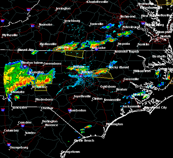 At 627 pm edt, a severe thunderstorm was located 7 miles east of north carolina zoo, moving east at 30 mph (public). Hazards include 60 mph wind gusts and quarter size hail. Hail damage to vehicles is expected. expect wind damage to roofs, siding, and trees. Locations impacted include, asheboro, north carolina zoo, seagrove, ramseur, franklinville, staley, ulah, coleridge and martha. At 627 pm edt, a severe thunderstorm was located 7 miles east of north carolina zoo, moving east at 30 mph (public). Hazards include 60 mph wind gusts and quarter size hail. Hail damage to vehicles is expected. expect wind damage to roofs, siding, and trees. Locations impacted include, asheboro, north carolina zoo, seagrove, ramseur, franklinville, staley, ulah, coleridge and martha.
|
| 7/8/2017 5:56 PM EDT |
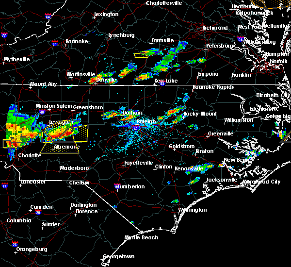 At 556 pm edt, a severe thunderstorm was located near asheboro, moving east at 30 mph (radar indicated). Hazards include 60 mph wind gusts and quarter size hail. Hail damage to vehicles is expected. Expect wind damage to roofs, siding, and trees. At 556 pm edt, a severe thunderstorm was located near asheboro, moving east at 30 mph (radar indicated). Hazards include 60 mph wind gusts and quarter size hail. Hail damage to vehicles is expected. Expect wind damage to roofs, siding, and trees.
|
| 6/24/2017 2:17 AM EDT |
 At 217 am edt, severe thunderstorms were located along a line extending from near prospect hill to 11 miles south of graham to 8 miles east of albemarle, moving northeast at 60 mph (radar indicated). Hazards include 60 mph wind gusts. Expect damage to roofs, siding, and trees. Locations impacted include, burlington, asheboro, albemarle, graham, hillsborough, pittsboro, troy, carthage, siler city and north carolina zoo. At 217 am edt, severe thunderstorms were located along a line extending from near prospect hill to 11 miles south of graham to 8 miles east of albemarle, moving northeast at 60 mph (radar indicated). Hazards include 60 mph wind gusts. Expect damage to roofs, siding, and trees. Locations impacted include, burlington, asheboro, albemarle, graham, hillsborough, pittsboro, troy, carthage, siler city and north carolina zoo.
|
| 6/24/2017 2:03 AM EDT |
 At 202 am edt, severe thunderstorms were located along a line extending from 7 miles south of jericho to 9 miles northwest of siler city to 9 miles south of plyler, moving northeast at 60 mph (radar indicated). Hazards include 60 mph wind gusts. Expect damage to roofs, siding, and trees. Locations impacted include, burlington, asheboro, albemarle, graham, hillsborough, randleman, pittsboro, troy, carthage and siler city. At 202 am edt, severe thunderstorms were located along a line extending from 7 miles south of jericho to 9 miles northwest of siler city to 9 miles south of plyler, moving northeast at 60 mph (radar indicated). Hazards include 60 mph wind gusts. Expect damage to roofs, siding, and trees. Locations impacted include, burlington, asheboro, albemarle, graham, hillsborough, randleman, pittsboro, troy, carthage and siler city.
|
| 6/24/2017 1:46 AM EDT |
 At 146 am edt, severe thunderstorms were located along a line extending from near mcleansville to near asheboro to 9 miles south of plyler, moving northeast at 60 mph (radar indicated). Hazards include 60 mph wind gusts. expect damage to roofs, siding, and trees At 146 am edt, severe thunderstorms were located along a line extending from near mcleansville to near asheboro to 9 miles south of plyler, moving northeast at 60 mph (radar indicated). Hazards include 60 mph wind gusts. expect damage to roofs, siding, and trees
|
| 6/19/2017 12:38 AM EDT |
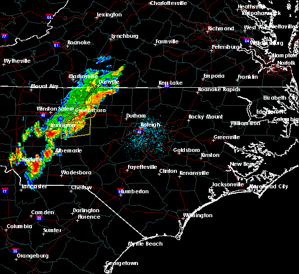 The severe thunderstorm warning for northern randolph and southeastern guilford counties will expire at 1245 am edt, the storm which prompted the warning has weakened below severe limits, and no longer poses an immediate threat to life or property. therefore the warning will be allowed to expire. however gusty winds and heavy rain are still possible with this thunderstorm. to report severe weather, contact your nearest law enforcement agency. they will relay your report to the national weather service raleigh. The severe thunderstorm warning for northern randolph and southeastern guilford counties will expire at 1245 am edt, the storm which prompted the warning has weakened below severe limits, and no longer poses an immediate threat to life or property. therefore the warning will be allowed to expire. however gusty winds and heavy rain are still possible with this thunderstorm. to report severe weather, contact your nearest law enforcement agency. they will relay your report to the national weather service raleigh.
|
| 6/19/2017 12:15 AM EDT |
 A severe thunderstorm warning remains in effect until 1245 am edt for northern randolph and southeastern guilford counties. at 1215 am edt, a severe thunderstorm was located near randleman, moving northeast at 40 mph. hazard. 60 mph wind gusts. source. Radar indicated. A severe thunderstorm warning remains in effect until 1245 am edt for northern randolph and southeastern guilford counties. at 1215 am edt, a severe thunderstorm was located near randleman, moving northeast at 40 mph. hazard. 60 mph wind gusts. source. Radar indicated.
|
| 6/19/2017 12:01 AM EDT |
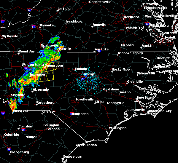 At 1200 am edt, a severe thunderstorm was located 9 miles south of thomasville, or 12 miles west of asheboro, moving northeast at 40 mph (radar indicated). Hazards include 60 mph wind gusts. expect damage to roofs, siding, and trees At 1200 am edt, a severe thunderstorm was located 9 miles south of thomasville, or 12 miles west of asheboro, moving northeast at 40 mph (radar indicated). Hazards include 60 mph wind gusts. expect damage to roofs, siding, and trees
|
| 5/28/2017 3:13 AM EDT |
 At 311 am edt, severe thunderstorms were located along a line extending from near thomasville to 8 miles east of lexington to near high rock lake, moving east at 45 mph (radar indicated). Hazards include 60 mph wind gusts. Expect damage to roofs, siding, and trees. Locations impacted include, high point, asheboro, lexington, randleman, thomasville, linwood, archdale. At 311 am edt, severe thunderstorms were located along a line extending from near thomasville to 8 miles east of lexington to near high rock lake, moving east at 45 mph (radar indicated). Hazards include 60 mph wind gusts. Expect damage to roofs, siding, and trees. Locations impacted include, high point, asheboro, lexington, randleman, thomasville, linwood, archdale.
|
| 5/28/2017 3:05 AM EDT |
 At 304 am edt, severe thunderstorms were located along a line extending from 7 miles northwest of thomasville to near lexington to near rockwell, moving east at 45 mph (radar indicated). Hazards include 60 mph wind gusts. Expect damage to roofs, siding, and trees. Locations impacted include, high point, asheboro, lexington, albemarle, randleman, badin lake, north carolina zoo, and thomasville. At 304 am edt, severe thunderstorms were located along a line extending from 7 miles northwest of thomasville to near lexington to near rockwell, moving east at 45 mph (radar indicated). Hazards include 60 mph wind gusts. Expect damage to roofs, siding, and trees. Locations impacted include, high point, asheboro, lexington, albemarle, randleman, badin lake, north carolina zoo, and thomasville.
|
| 5/28/2017 2:38 AM EDT |
 At 237 am edt, severe thunderstorms were located along a line extending from near mocksville to near harrisburg, moving east at 45 mph (radar indicated). Hazards include 60 mph wind gusts. expect damage to roofs, siding, and trees At 237 am edt, severe thunderstorms were located along a line extending from near mocksville to near harrisburg, moving east at 45 mph (radar indicated). Hazards include 60 mph wind gusts. expect damage to roofs, siding, and trees
|
| 5/5/2017 3:37 AM EDT |
 At 337 am edt, severe thunderstorms were located along a line extending from near bethany to 6 miles southwest of camp springs to 8 miles southeast of mcleansville, moving northeast at 50 mph (radar indicated). Hazards include 60 mph wind gusts. Expect damage to roofs, siding, and trees. locations impacted include, mcleansville, gibsonville, liberty, ramseur, franklinville and lake guilford mackintosh marina. A tornado watch remains in effect until 900 am edt for central north carolina. At 337 am edt, severe thunderstorms were located along a line extending from near bethany to 6 miles southwest of camp springs to 8 miles southeast of mcleansville, moving northeast at 50 mph (radar indicated). Hazards include 60 mph wind gusts. Expect damage to roofs, siding, and trees. locations impacted include, mcleansville, gibsonville, liberty, ramseur, franklinville and lake guilford mackintosh marina. A tornado watch remains in effect until 900 am edt for central north carolina.
|
| 5/5/2017 3:25 AM EDT |
 At 325 am edt, severe thunderstorms were located along a line extending from near north carolina zoo to 7 miles east of seagrove to 9 miles southeast of biscoe, moving northeast at 65 mph (radar indicated). Hazards include 60 mph wind gusts. Expect damage to roofs, siding, and trees. locations impacted include, north carolina zoo, siler city, goldston, liberty, ramseur, franklinville, robbins, staley, harpers crossroads and highfalls. A tornado watch remains in effect until 900 am edt for central north carolina. At 325 am edt, severe thunderstorms were located along a line extending from near north carolina zoo to 7 miles east of seagrove to 9 miles southeast of biscoe, moving northeast at 65 mph (radar indicated). Hazards include 60 mph wind gusts. Expect damage to roofs, siding, and trees. locations impacted include, north carolina zoo, siler city, goldston, liberty, ramseur, franklinville, robbins, staley, harpers crossroads and highfalls. A tornado watch remains in effect until 900 am edt for central north carolina.
|
| 5/5/2017 3:21 AM EDT |
 At 307 am edt, severe thunderstorms were located along a line extending from 6 miles south of high point to 9 miles north of asheboro to near randleman, moving northeast at 50 mph (radar indicated). Hazards include 60 mph wind gusts. Expect damage to roofs, siding, and trees. locations impacted include, greensboro, high point, asheboro, randleman, north carolina zoo, mcleansville, archdale, summerfield, gibsonville and pleasant garden. A tornado watch remains in effect until 900 am edt for central north carolina. At 307 am edt, severe thunderstorms were located along a line extending from 6 miles south of high point to 9 miles north of asheboro to near randleman, moving northeast at 50 mph (radar indicated). Hazards include 60 mph wind gusts. Expect damage to roofs, siding, and trees. locations impacted include, greensboro, high point, asheboro, randleman, north carolina zoo, mcleansville, archdale, summerfield, gibsonville and pleasant garden. A tornado watch remains in effect until 900 am edt for central north carolina.
|
| 5/5/2017 3:08 AM EDT |
 At 307 am edt, severe thunderstorms were located along a line extending from 6 miles south of high point to 9 miles north of asheboro to near randleman, moving northeast at 50 mph (radar indicated). Hazards include 60 mph wind gusts. Expect damage to roofs, siding, and trees. locations impacted include, greensboro, high point, asheboro, randleman, north carolina zoo, mcleansville, archdale, summerfield, gibsonville and pleasant garden. A tornado watch remains in effect until 900 am edt for central north carolina. At 307 am edt, severe thunderstorms were located along a line extending from 6 miles south of high point to 9 miles north of asheboro to near randleman, moving northeast at 50 mph (radar indicated). Hazards include 60 mph wind gusts. Expect damage to roofs, siding, and trees. locations impacted include, greensboro, high point, asheboro, randleman, north carolina zoo, mcleansville, archdale, summerfield, gibsonville and pleasant garden. A tornado watch remains in effect until 900 am edt for central north carolina.
|
| 5/5/2017 3:04 AM EDT |
 At 303 am edt, severe thunderstorms were located along a line extending from 6 miles southeast of badin lake to near troy to 11 miles east of ansonville, moving northeast at 55 mph (radar indicated). Hazards include 60 mph wind gusts. expect damage to roofs, siding, and trees At 303 am edt, severe thunderstorms were located along a line extending from 6 miles southeast of badin lake to near troy to 11 miles east of ansonville, moving northeast at 55 mph (radar indicated). Hazards include 60 mph wind gusts. expect damage to roofs, siding, and trees
|
| 5/5/2017 2:42 AM EDT |
 At 242 am edt, severe thunderstorms were located along a line extending from 8 miles east of high rock lake to 6 miles northeast of badin lake, moving northeast at 50 mph (radar indicated). Hazards include 60 mph wind gusts. expect damage to roofs, siding, and trees At 242 am edt, severe thunderstorms were located along a line extending from 8 miles east of high rock lake to 6 miles northeast of badin lake, moving northeast at 50 mph (radar indicated). Hazards include 60 mph wind gusts. expect damage to roofs, siding, and trees
|
| 5/1/2017 6:57 PM EDT |
 The national weather service in raleigh has issued a * severe thunderstorm warning for. southern alamance county in central north carolina. southern orange county in central north carolina. eastern randolph county in central north carolina. Chatham county in central north carolina. The national weather service in raleigh has issued a * severe thunderstorm warning for. southern alamance county in central north carolina. southern orange county in central north carolina. eastern randolph county in central north carolina. Chatham county in central north carolina.
|
| 5/1/2017 6:50 PM EDT |
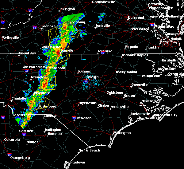 At 650 pm edt, a severe thunderstorm was located 6 miles northeast of north carolina zoo, moving east at 65 mph (radar indicated). Hazards include 60 mph wind gusts. Expect damage to roofs, siding, and trees. Locations impacted include, asheboro, randleman, north carolina zoo, seagrove, liberty, ramseur, franklinville, staley, ulah and coleridge. At 650 pm edt, a severe thunderstorm was located 6 miles northeast of north carolina zoo, moving east at 65 mph (radar indicated). Hazards include 60 mph wind gusts. Expect damage to roofs, siding, and trees. Locations impacted include, asheboro, randleman, north carolina zoo, seagrove, liberty, ramseur, franklinville, staley, ulah and coleridge.
|
| 5/1/2017 6:45 PM EDT |
 At 645 pm edt, a severe thunderstorm was located near asheboro, moving northeast at 60 mph (radar indicated). Hazards include 60 mph wind gusts. Expect damage to roofs, siding, and trees. Locations impacted include, asheboro, randleman, north carolina zoo, seagrove, liberty, ramseur, franklinville, staley, ulah and coleridge. At 645 pm edt, a severe thunderstorm was located near asheboro, moving northeast at 60 mph (radar indicated). Hazards include 60 mph wind gusts. Expect damage to roofs, siding, and trees. Locations impacted include, asheboro, randleman, north carolina zoo, seagrove, liberty, ramseur, franklinville, staley, ulah and coleridge.
|
| 5/1/2017 6:34 PM EDT |
 At 633 pm edt, a severe thunderstorm was located near asheboro, moving east at 60 mph (radar indicated). Hazards include 60 mph wind gusts. Expect damage to roofs, siding, and trees. Locations impacted include, asheboro, randleman, north carolina zoo, seagrove, liberty, ramseur, franklinville, staley, ulah and coleridge. At 633 pm edt, a severe thunderstorm was located near asheboro, moving east at 60 mph (radar indicated). Hazards include 60 mph wind gusts. Expect damage to roofs, siding, and trees. Locations impacted include, asheboro, randleman, north carolina zoo, seagrove, liberty, ramseur, franklinville, staley, ulah and coleridge.
|
| 5/1/2017 6:19 PM EDT |
 At 619 pm edt, a severe thunderstorm was located 11 miles north of badin lake, moving east at 50 mph (radar indicated). Hazards include 60 mph wind gusts. expect damage to roofs, siding, and trees At 619 pm edt, a severe thunderstorm was located 11 miles north of badin lake, moving east at 50 mph (radar indicated). Hazards include 60 mph wind gusts. expect damage to roofs, siding, and trees
|
| 4/6/2017 5:40 AM EDT |
 At 540 am edt, a severe thunderstorm was located 7 miles northeast of randleman, moving northeast at 80 mph (radar indicated). Hazards include penny to quarter size hail. Damage to vehicles is possible. Locations impacted include, greensboro, burlington, asheboro, graham, randleman, north carolina zoo, mcleansville, elon college, gibsonville and pleasant garden. At 540 am edt, a severe thunderstorm was located 7 miles northeast of randleman, moving northeast at 80 mph (radar indicated). Hazards include penny to quarter size hail. Damage to vehicles is possible. Locations impacted include, greensboro, burlington, asheboro, graham, randleman, north carolina zoo, mcleansville, elon college, gibsonville and pleasant garden.
|
| 4/6/2017 5:26 AM EDT |
 At 526 am edt, a severe thunderstorm was located near asheboro, moving northeast at 85 mph (radar indicated). Hazards include penny to quarter size hail. damage to vehicles is possible At 526 am edt, a severe thunderstorm was located near asheboro, moving northeast at 85 mph (radar indicated). Hazards include penny to quarter size hail. damage to vehicles is possible
|
| 4/3/2017 5:44 PM EDT |
 At 544 pm edt, severe thunderstorms were located along a line extending from near mcleansville to near seagrove, moving east at 45 mph (radar indicated). Hazards include 60 mph wind gusts. expect damage to roofs, siding, and trees At 544 pm edt, severe thunderstorms were located along a line extending from near mcleansville to near seagrove, moving east at 45 mph (radar indicated). Hazards include 60 mph wind gusts. expect damage to roofs, siding, and trees
|
| 3/1/2017 6:47 PM EST |
 At 646 pm est, a severe thunderstorm was located near randleman, moving east at 60 mph. this storm has a history of producing hail a little larger than quarters (radar indicated). Hazards include 60 mph wind gusts and half dollar size hail. Hail damage to vehicles is expected. Expect wind damage to roofs, siding, and trees. At 646 pm est, a severe thunderstorm was located near randleman, moving east at 60 mph. this storm has a history of producing hail a little larger than quarters (radar indicated). Hazards include 60 mph wind gusts and half dollar size hail. Hail damage to vehicles is expected. Expect wind damage to roofs, siding, and trees.
|
| 11/30/2016 7:51 PM EST |
 The severe thunderstorm warning for randolph, guilford and eastern forsyth counties will expire at 800 pm est, the storms which prompted the warning have weakened below severe limits, and have exited the warned area. therefore the warning will be allowed to expire. to report severe weather, contact your nearest law enforcement agency. they will relay your report to the national weather service raleigh. The severe thunderstorm warning for randolph, guilford and eastern forsyth counties will expire at 800 pm est, the storms which prompted the warning have weakened below severe limits, and have exited the warned area. therefore the warning will be allowed to expire. to report severe weather, contact your nearest law enforcement agency. they will relay your report to the national weather service raleigh.
|
| 11/30/2016 7:39 PM EST |
 At 738 pm est, severe thunderstorms were located along a line extending from near camp springs to near mcleansville to near high point, moving northeast at 45 mph (radar indicated). Hazards include 60 mph wind gusts. Expect damage to roofs. siding. and trees. Locations impacted include, greensboro, winston-salem, high point, asheboro, randleman, north carolina zoo, kernersville, seagrove, mcleansville and summerfield. At 738 pm est, severe thunderstorms were located along a line extending from near camp springs to near mcleansville to near high point, moving northeast at 45 mph (radar indicated). Hazards include 60 mph wind gusts. Expect damage to roofs. siding. and trees. Locations impacted include, greensboro, winston-salem, high point, asheboro, randleman, north carolina zoo, kernersville, seagrove, mcleansville and summerfield.
|
| 11/30/2016 7:22 PM EST |
 At 722 pm est, severe thunderstorms were located along a line extending from monroeton to near greensboro to 6 miles east of high rock lake, moving northeast at 40 mph (radar indicated). Hazards include 60 mph wind gusts. Expect damage to roofs. siding. and trees. Locations impacted include, greensboro, winston-salem, high point, asheboro, lexington, randleman, north carolina zoo, thomasville, kernersville and clemmons. At 722 pm est, severe thunderstorms were located along a line extending from monroeton to near greensboro to 6 miles east of high rock lake, moving northeast at 40 mph (radar indicated). Hazards include 60 mph wind gusts. Expect damage to roofs. siding. and trees. Locations impacted include, greensboro, winston-salem, high point, asheboro, lexington, randleman, north carolina zoo, thomasville, kernersville and clemmons.
|
| 11/30/2016 6:57 PM EST |
 At 656 pm est, severe thunderstorms were located along a line extending from near walnut cove to 8 miles northwest of thomasville to enochville, moving northeast at 35 mph (radar indicated). Hazards include 60 mph wind gusts. Expect damage to roofs. siding. And trees. At 656 pm est, severe thunderstorms were located along a line extending from near walnut cove to 8 miles northwest of thomasville to enochville, moving northeast at 35 mph (radar indicated). Hazards include 60 mph wind gusts. Expect damage to roofs. siding. And trees.
|
| 7/31/2016 9:09 PM EDT |
 The severe thunderstorm warning for randolph and eastern davidson counties will expire at 915 pm edt, the storm which prompted the warning has weakened below severe limits, and no longer poses an immediate threat to life or property. therefore the warning will be allowed to expire. however gusty winds and heavy rain are still possible with this thunderstorm. The severe thunderstorm warning for randolph and eastern davidson counties will expire at 915 pm edt, the storm which prompted the warning has weakened below severe limits, and no longer poses an immediate threat to life or property. therefore the warning will be allowed to expire. however gusty winds and heavy rain are still possible with this thunderstorm.
|
| 7/31/2016 8:26 PM EDT |
 At 825 pm edt, a severe thunderstorm was located 7 miles south of thomasville, or 11 miles east of lexington, moving south at 5 mph (radar indicated). Hazards include 60 mph wind gusts. Expect damage to roofs. siding. And trees. At 825 pm edt, a severe thunderstorm was located 7 miles south of thomasville, or 11 miles east of lexington, moving south at 5 mph (radar indicated). Hazards include 60 mph wind gusts. Expect damage to roofs. siding. And trees.
|
| 7/27/2016 7:32 PM EDT |
 At 731 pm edt, severe thunderstorms were located along a line extending from near winston-salem to elon college, moving east at 35 mph (radar indicated). Hazards include 60 mph wind gusts and nickel size hail. Expect damage to roofs. siding. And trees. At 731 pm edt, severe thunderstorms were located along a line extending from near winston-salem to elon college, moving east at 35 mph (radar indicated). Hazards include 60 mph wind gusts and nickel size hail. Expect damage to roofs. siding. And trees.
|
| 7/8/2016 8:39 PM EDT |
 At 838 pm edt, severe thunderstorms were located along a line extending from near randleman to 6 miles southeast of high rock lake, moving southeast at 55 mph (radar indicated). Hazards include 60 mph wind gusts and quarter size hail. Hail damage to vehicles is expected. Expect wind damage to roofs, siding, and trees. At 838 pm edt, severe thunderstorms were located along a line extending from near randleman to 6 miles southeast of high rock lake, moving southeast at 55 mph (radar indicated). Hazards include 60 mph wind gusts and quarter size hail. Hail damage to vehicles is expected. Expect wind damage to roofs, siding, and trees.
|
| 7/8/2016 7:43 PM EDT |
 At 743 pm edt, severe thunderstorms were located along a line extending from clemmons to near greensboro, moving southeast at 25 mph (radar indicated). Hazards include 60 mph wind gusts and quarter size hail. Hail damage to vehicles is expected. Expect wind damage to roofs, siding, and trees. At 743 pm edt, severe thunderstorms were located along a line extending from clemmons to near greensboro, moving southeast at 25 mph (radar indicated). Hazards include 60 mph wind gusts and quarter size hail. Hail damage to vehicles is expected. Expect wind damage to roofs, siding, and trees.
|
| 7/7/2016 6:40 PM EDT |
 At 640 pm edt, severe thunderstorms were located along a line extending from near elon college to 10 miles south of graham to near asheboro, moving east at 30 mph (radar indicated). Hazards include 60 mph wind gusts. Expect damage to roofs. siding. and trees. locations impacted include, burlington, asheboro, graham, siler city, mebane, elon college, mcleansville, gibsonville, liberty and haw river. A severe thunderstorm watch remains in effect until 1100 pm edt for central north carolina. At 640 pm edt, severe thunderstorms were located along a line extending from near elon college to 10 miles south of graham to near asheboro, moving east at 30 mph (radar indicated). Hazards include 60 mph wind gusts. Expect damage to roofs. siding. and trees. locations impacted include, burlington, asheboro, graham, siler city, mebane, elon college, mcleansville, gibsonville, liberty and haw river. A severe thunderstorm watch remains in effect until 1100 pm edt for central north carolina.
|
| 7/7/2016 6:30 PM EDT |
 At 629 pm edt, severe thunderstorms were located along a line extending from near mcleansville to 12 miles southwest of elon college to near randleman, moving east at 30 mph (radar indicated). Hazards include 60 mph wind gusts. Expect damage to roofs. siding. and trees. locations impacted include, greensboro, burlington, asheboro, graham, randleman, siler city, mebane, mcleansville, elon college and gibsonville. A severe thunderstorm watch remains in effect until 1100 pm edt for central north carolina. At 629 pm edt, severe thunderstorms were located along a line extending from near mcleansville to 12 miles southwest of elon college to near randleman, moving east at 30 mph (radar indicated). Hazards include 60 mph wind gusts. Expect damage to roofs. siding. and trees. locations impacted include, greensboro, burlington, asheboro, graham, randleman, siler city, mebane, mcleansville, elon college and gibsonville. A severe thunderstorm watch remains in effect until 1100 pm edt for central north carolina.
|
| 7/7/2016 6:17 PM EDT |
 At 617 pm edt, a severe thunderstorm was located near randleman, moving east at 25 mph (radar indicated). Hazards include 60 mph wind gusts and penny size hail. Expect damage to roofs. siding. And trees. At 617 pm edt, a severe thunderstorm was located near randleman, moving east at 25 mph (radar indicated). Hazards include 60 mph wind gusts and penny size hail. Expect damage to roofs. siding. And trees.
|
| 7/5/2016 5:36 PM EDT |
 At 535 pm edt, severe thunderstorms were located along a line extending from 7 miles east of randleman to 8 miles northeast of north carolina zoo, moving east at 40 mph (radar indicated). Hazards include 60 mph wind gusts. Expect damage to roofs. siding. And trees. At 535 pm edt, severe thunderstorms were located along a line extending from 7 miles east of randleman to 8 miles northeast of north carolina zoo, moving east at 40 mph (radar indicated). Hazards include 60 mph wind gusts. Expect damage to roofs. siding. And trees.
|
| 7/5/2016 5:26 PM EDT |
 At 526 pm edt, severe thunderstorms were located along a line extending from 6 miles southeast of high point to 6 miles east of asheboro to near troy, moving east at 35 mph (radar indicated). Hazards include 60 mph wind gusts. Expect damage to roofs. siding. and trees. locations impacted include, high point, asheboro, randleman, troy, north carolina zoo, biscoe, seagrove, archdale, trinity and pleasant garden. A severe thunderstorm watch remains in effect until 1000 pm edt for central north carolina. At 526 pm edt, severe thunderstorms were located along a line extending from 6 miles southeast of high point to 6 miles east of asheboro to near troy, moving east at 35 mph (radar indicated). Hazards include 60 mph wind gusts. Expect damage to roofs. siding. and trees. locations impacted include, high point, asheboro, randleman, troy, north carolina zoo, biscoe, seagrove, archdale, trinity and pleasant garden. A severe thunderstorm watch remains in effect until 1000 pm edt for central north carolina.
|
| 7/5/2016 4:53 PM EDT |
 At 453 pm edt, severe thunderstorms were located along a line extending from near winston-salem to 12 miles southeast of lexington to near albemarle, moving east at 45 mph (radar indicated). Hazards include 60 mph wind gusts. Expect damage to roofs. siding. And trees. At 453 pm edt, severe thunderstorms were located along a line extending from near winston-salem to 12 miles southeast of lexington to near albemarle, moving east at 45 mph (radar indicated). Hazards include 60 mph wind gusts. Expect damage to roofs. siding. And trees.
|
| 6/15/2016 6:58 PM EDT |
 At 657 pm edt, a severe thunderstorm was located near goldston, or near siler city, moving east at 20 mph (radar indicated). Hazards include 60 mph wind gusts and penny size hail. Expect damage to roofs. siding. And trees. At 657 pm edt, a severe thunderstorm was located near goldston, or near siler city, moving east at 20 mph (radar indicated). Hazards include 60 mph wind gusts and penny size hail. Expect damage to roofs. siding. And trees.
|
| 6/15/2016 6:49 PM EDT |
 At 649 pm edt, a severe thunderstorm was located 7 miles east of north carolina zoo, moving east at 20 mph (radar indicated). Hazards include 60 mph wind gusts and penny size hail. Expect damage to roofs. siding. and trees. Locations impacted include, troy, carthage, siler city, north carolina zoo, biscoe, goldston, seagrove, whispering pines, ramseur and franklinville. At 649 pm edt, a severe thunderstorm was located 7 miles east of north carolina zoo, moving east at 20 mph (radar indicated). Hazards include 60 mph wind gusts and penny size hail. Expect damage to roofs. siding. and trees. Locations impacted include, troy, carthage, siler city, north carolina zoo, biscoe, goldston, seagrove, whispering pines, ramseur and franklinville.
|
| 6/15/2016 6:48 PM EDT | One tree was reported down near nc-highway 49 in ramseu in randolph county NC, 2 miles NNW of Ramseur, NC |
| 6/15/2016 6:22 PM EDT |
 At 621 pm edt, a severe thunderstorm was located over north carolina zoo, moving east at 20 mph (radar indicated). Hazards include 60 mph wind gusts and penny size hail. Expect damage to roofs. siding. And trees. At 621 pm edt, a severe thunderstorm was located over north carolina zoo, moving east at 20 mph (radar indicated). Hazards include 60 mph wind gusts and penny size hail. Expect damage to roofs. siding. And trees.
|
| 5/3/2016 8:51 PM EDT |
 At 851 pm edt, a severe thunderstorm was located 11 miles south of siler city, moving east at 55 mph (law enforcement). Hazards include 60 mph wind gusts and quarter size hail. Hail damage to vehicles is expected. expect wind damage to roofs, siding, and trees. Locations impacted include, asheboro, north carolina zoo, seagrove, robbins, ulah and coleridge. At 851 pm edt, a severe thunderstorm was located 11 miles south of siler city, moving east at 55 mph (law enforcement). Hazards include 60 mph wind gusts and quarter size hail. Hail damage to vehicles is expected. expect wind damage to roofs, siding, and trees. Locations impacted include, asheboro, north carolina zoo, seagrove, robbins, ulah and coleridge.
|
| 5/3/2016 8:29 PM EDT |
 At 828 pm edt, a severe thunderstorm was located 7 miles northwest of seagrove, or 8 miles west of north carolina zoo, moving east at 55 mph (golf ball hail was recently reported in denton with this storm). Hazards include golf ball size hail and 60 mph wind gusts. People and animals outdoors will be injured. expect hail damage to roofs, siding, windows, and vehicles. Expect wind damage to roofs, siding, and trees. At 828 pm edt, a severe thunderstorm was located 7 miles northwest of seagrove, or 8 miles west of north carolina zoo, moving east at 55 mph (golf ball hail was recently reported in denton with this storm). Hazards include golf ball size hail and 60 mph wind gusts. People and animals outdoors will be injured. expect hail damage to roofs, siding, windows, and vehicles. Expect wind damage to roofs, siding, and trees.
|
| 5/3/2016 4:28 PM EDT |
 At 427 pm edt, a severe thunderstorm was located 9 miles northeast of randleman, moving east at 35 mph (radar indicated). Hazards include 60 mph wind gusts and quarter size hail. Hail damage to vehicles is expected. expect wind damage to roofs, siding, and trees. Locations impacted include, burlington, graham, siler city, mebane, mcleansville, elon college, gibsonville, pleasant garden, liberty and haw river. At 427 pm edt, a severe thunderstorm was located 9 miles northeast of randleman, moving east at 35 mph (radar indicated). Hazards include 60 mph wind gusts and quarter size hail. Hail damage to vehicles is expected. expect wind damage to roofs, siding, and trees. Locations impacted include, burlington, graham, siler city, mebane, mcleansville, elon college, gibsonville, pleasant garden, liberty and haw river.
|
| 5/3/2016 4:11 PM EDT |
 At 411 pm edt, a severe thunderstorm was located near randleman, moving east at 40 mph (radar indicated). Hazards include 60 mph wind gusts and quarter size hail. Hail damage to vehicles is expected. Expect wind damage to roofs, siding, and trees. At 411 pm edt, a severe thunderstorm was located near randleman, moving east at 40 mph (radar indicated). Hazards include 60 mph wind gusts and quarter size hail. Hail damage to vehicles is expected. Expect wind damage to roofs, siding, and trees.
|
| 5/2/2016 4:38 PM EDT |
 At 437 pm edt, severe thunderstorms were located along a line extending from clemmons to 9 miles northwest of siler city, moving northeast at 35 mph (radar indicated). Hazards include 60 mph wind gusts and quarter size hail. Hail damage to vehicles is expected. expect wind damage to roofs, siding, and trees. Locations impacted include, greensboro, winston-salem, high point, burlington, graham, randleman, thomasville, kernersville, clemmons and bermuda run. At 437 pm edt, severe thunderstorms were located along a line extending from clemmons to 9 miles northwest of siler city, moving northeast at 35 mph (radar indicated). Hazards include 60 mph wind gusts and quarter size hail. Hail damage to vehicles is expected. expect wind damage to roofs, siding, and trees. Locations impacted include, greensboro, winston-salem, high point, burlington, graham, randleman, thomasville, kernersville, clemmons and bermuda run.
|
| 5/2/2016 4:28 PM EDT |
 At 428 pm edt, severe thunderstorms were located along a line extending from near bermuda run to randleman, moving northeast at 45 mph (radar indicated). Hazards include 60 mph wind gusts and quarter size hail. Hail damage to vehicles is expected. Expect wind damage to roofs, siding, and trees. At 428 pm edt, severe thunderstorms were located along a line extending from near bermuda run to randleman, moving northeast at 45 mph (radar indicated). Hazards include 60 mph wind gusts and quarter size hail. Hail damage to vehicles is expected. Expect wind damage to roofs, siding, and trees.
|
| 5/2/2016 4:16 PM EDT |
 At 415 pm edt, a severe thunderstorm was located 8 miles southeast of thomasville, or 10 miles west of randleman, moving northeast at 45 mph (radar indicated). Hazards include 60 mph wind gusts and quarter size hail. Hail damage to vehicles is expected. expect wind damage to roofs, siding, and trees. Locations impacted include, high point, asheboro, lexington, randleman, thomasville, linwood, archdale, trinity, denton and franklinville. At 415 pm edt, a severe thunderstorm was located 8 miles southeast of thomasville, or 10 miles west of randleman, moving northeast at 45 mph (radar indicated). Hazards include 60 mph wind gusts and quarter size hail. Hail damage to vehicles is expected. expect wind damage to roofs, siding, and trees. Locations impacted include, high point, asheboro, lexington, randleman, thomasville, linwood, archdale, trinity, denton and franklinville.
|
| 5/2/2016 4:04 PM EDT |
 At 404 pm edt, a severe thunderstorm was located 9 miles southeast of lexington, moving northeast at 25 mph (radar indicated). Hazards include 60 mph wind gusts and quarter size hail. Hail damage to vehicles is expected. Expect wind damage to roofs, siding, and trees. At 404 pm edt, a severe thunderstorm was located 9 miles southeast of lexington, moving northeast at 25 mph (radar indicated). Hazards include 60 mph wind gusts and quarter size hail. Hail damage to vehicles is expected. Expect wind damage to roofs, siding, and trees.
|
| 2/24/2016 3:16 PM EST |
 At 313 pm est, doppler radar continued to indicate a line of discrete supercell thunderstorms capable of producing large damaging hail up to golf ball size and destructive winds in excess of 70 mph. these storms were located along a line extending from near altamahaw to alamance to coleridge, moving northeast at 55 mph. locations impacted include, burlington, graham, siler city, north carolina zoo, mebane, goldston, seagrove, mcleansville, elon college and gibsonville. not all locations within the line of storms will experience severe weather. instead, concentrated swaths of damaging winds and hail up to the size of golfballs will accompany the individual supercell thunderstorms. a tornado watch remains in effect until 700 pm est for central north carolina. At 313 pm est, doppler radar continued to indicate a line of discrete supercell thunderstorms capable of producing large damaging hail up to golf ball size and destructive winds in excess of 70 mph. these storms were located along a line extending from near altamahaw to alamance to coleridge, moving northeast at 55 mph. locations impacted include, burlington, graham, siler city, north carolina zoo, mebane, goldston, seagrove, mcleansville, elon college and gibsonville. not all locations within the line of storms will experience severe weather. instead, concentrated swaths of damaging winds and hail up to the size of golfballs will accompany the individual supercell thunderstorms. a tornado watch remains in effect until 700 pm est for central north carolina.
|
| 2/24/2016 3:15 PM EST | Partial garage collapse onto a vehicle. time estimated in randolph county NC, 9.4 miles NNW of Ramseur, NC |
| 2/24/2016 3:10 PM EST | Trees down in the 6600 block of nc hwy 42 south near deep river church r in randolph county NC, 8.4 miles NNW of Ramseur, NC |
| 2/24/2016 2:44 PM EST |
 At 244 pm est, doppler radar indicated a line of severe thunderstorms capable of producing damaging winds in excess of 58 mph. these storms were located along a line extending from near reidsville to near seagrove, and moving east at 25 mph. At 244 pm est, doppler radar indicated a line of severe thunderstorms capable of producing damaging winds in excess of 58 mph. these storms were located along a line extending from near reidsville to near seagrove, and moving east at 25 mph.
|
| 2/24/2016 2:30 PM EST |
 At 230 pm est, local law enforcement reported a line of severe thunderstorms producing damaging winds in excess of 58 mph. these storms were located along a line extending from near monroeton to 7 miles southwest of seagrove, moving southeast at 30 mph. locations impacted include, greensboro, high point, asheboro, randleman, north carolina zoo, thomasville, kernersville, seagrove, mcleansville and archdale. a tornado watch remains in effect until 700 pm est for central north carolina. At 230 pm est, local law enforcement reported a line of severe thunderstorms producing damaging winds in excess of 58 mph. these storms were located along a line extending from near monroeton to 7 miles southwest of seagrove, moving southeast at 30 mph. locations impacted include, greensboro, high point, asheboro, randleman, north carolina zoo, thomasville, kernersville, seagrove, mcleansville and archdale. a tornado watch remains in effect until 700 pm est for central north carolina.
|
| 2/24/2016 1:59 PM EST |
 At 159 pm est, doppler radar indicated a line of severe thunderstorms capable of producing destructive winds in excess of 65 mph. these storms were located along a line extending from near bethany to 6 miles northeast of badin lake, and moving northeast at 40 mph. At 159 pm est, doppler radar indicated a line of severe thunderstorms capable of producing destructive winds in excess of 65 mph. these storms were located along a line extending from near bethany to 6 miles northeast of badin lake, and moving northeast at 40 mph.
|
| 2/3/2016 1:54 PM EST |
 The severe thunderstorm warning for northern montgomery, northwestern moore and randolph counties will expire at 200 pm est, the storm which prompted the warning has weakened below severe limits, and no longer poses an immediate threat to life or property. therefore the warning will be allowed to expire. The severe thunderstorm warning for northern montgomery, northwestern moore and randolph counties will expire at 200 pm est, the storm which prompted the warning has weakened below severe limits, and no longer poses an immediate threat to life or property. therefore the warning will be allowed to expire.
|
| 2/3/2016 1:42 PM EST |
 At 142 pm est, doppler radar continued to indicate a severe thunderstorm capable of producing damaging winds in excess of 58 mph. this storm was located near north carolina zoo, moving northeast at 45 mph. locations impacted include, asheboro, randleman, badin lake, north carolina zoo, seagrove, liberty, badin, ramseur, franklinville and robbins. At 142 pm est, doppler radar continued to indicate a severe thunderstorm capable of producing damaging winds in excess of 58 mph. this storm was located near north carolina zoo, moving northeast at 45 mph. locations impacted include, asheboro, randleman, badin lake, north carolina zoo, seagrove, liberty, badin, ramseur, franklinville and robbins.
|
| 2/3/2016 1:35 PM EST | Tree down on powerlines at 5900 block of highway 64 west. time estimated by rada in randolph county NC, 1.9 miles NNE of Ramseur, NC |
| 2/3/2016 1:15 PM EST |
 At 114 pm est, doppler radar indicated a severe thunderstorm capable of producing damaging winds in excess of 58 mph. this storm was located 7 miles north of badin lake, and moving northeast at 45 mph. At 114 pm est, doppler radar indicated a severe thunderstorm capable of producing damaging winds in excess of 58 mph. this storm was located 7 miles north of badin lake, and moving northeast at 45 mph.
|
| 9/10/2015 7:29 PM EDT |
 At 729 pm edt, doppler radar continued to indicate a severe thunderstorm capable of producing damaging winds in excess of 58 mph. this storm was located 8 miles southwest of siler city, moving east at 45 mph. locations impacted include, siler city, seagrove, ramseur, franklinville, robbins, staley, harpers crossroads, highfalls, hasty and glendon. At 729 pm edt, doppler radar continued to indicate a severe thunderstorm capable of producing damaging winds in excess of 58 mph. this storm was located 8 miles southwest of siler city, moving east at 45 mph. locations impacted include, siler city, seagrove, ramseur, franklinville, robbins, staley, harpers crossroads, highfalls, hasty and glendon.
|
| 9/10/2015 7:16 PM EDT |
 At 715 pm edt, doppler radar continued to indicate a severe thunderstorm capable of producing damaging winds in excess of 58 mph. this storm was located over north carolina zoo, moving east at 15 mph. locations impacted include, asheboro, siler city, north carolina zoo, seagrove, ramseur, franklinville, robbins, staley, harpers crossroads and glendon. At 715 pm edt, doppler radar continued to indicate a severe thunderstorm capable of producing damaging winds in excess of 58 mph. this storm was located over north carolina zoo, moving east at 15 mph. locations impacted include, asheboro, siler city, north carolina zoo, seagrove, ramseur, franklinville, robbins, staley, harpers crossroads and glendon.
|
| 9/10/2015 6:59 PM EDT |
 At 659 pm edt, doppler radar indicated a severe thunderstorm capable of producing damaging winds in excess of 58 mph. this storm was located near asheboro, and moving east at 40 mph. At 659 pm edt, doppler radar indicated a severe thunderstorm capable of producing damaging winds in excess of 58 mph. this storm was located near asheboro, and moving east at 40 mph.
|
| 8/6/2015 4:04 PM EDT |
 At 403 pm edt, doppler radar indicated a severe thunderstorm capable of producing damaging wind gusts as high as 60 mph. this storm was located 8 miles northeast of the north carolina zoo, moving east at 15 mph. locations impacted include, asheboro, siler city, ramseur, franklinville, hasty and coleridge. At 403 pm edt, doppler radar indicated a severe thunderstorm capable of producing damaging wind gusts as high as 60 mph. this storm was located 8 miles northeast of the north carolina zoo, moving east at 15 mph. locations impacted include, asheboro, siler city, ramseur, franklinville, hasty and coleridge.
|
| 8/6/2015 3:57 PM EDT | Tree down on kildee church r in randolph county NC, 5.8 miles WNW of Ramseur, NC |
| 8/6/2015 3:48 PM EDT | Tree down on nc hwy 2 in randolph county NC, 7.8 miles NNW of Ramseur, NC |
| 8/6/2015 3:48 PM EDT |
 At 345 pm edt, doppler radar indicated a severe thunderstorm capable of producing quarter size hail and damaging wind gusts as high as 65 mph. this storm was located over or near the north carolina zoo, moving east at 20 mph. locations impacted include, asheboro, siler city, north carolina zoo, seagrove, ramseur, franklinville, harpers crossroads, hasty, ulah and coleridge. At 345 pm edt, doppler radar indicated a severe thunderstorm capable of producing quarter size hail and damaging wind gusts as high as 65 mph. this storm was located over or near the north carolina zoo, moving east at 20 mph. locations impacted include, asheboro, siler city, north carolina zoo, seagrove, ramseur, franklinville, harpers crossroads, hasty, ulah and coleridge.
|
| 8/6/2015 3:42 PM EDT | Tree on a powerline on holly spring r in randolph county NC, 7.4 miles N of Ramseur, NC |
| 8/6/2015 3:41 PM EDT |
 At 340 pm edt, doppler radar indicated a severe thunderstorm capable of producing quarter size hail and damaging wind gusts as high as 65 mph. this storm was located over the north carolina zoo, moving east at 25 mph. locations impacted include, asheboro, siler city, north carolina zoo, seagrove, ramseur, franklinville, harpers crossroads, hasty, ulah and coleridge. At 340 pm edt, doppler radar indicated a severe thunderstorm capable of producing quarter size hail and damaging wind gusts as high as 65 mph. this storm was located over the north carolina zoo, moving east at 25 mph. locations impacted include, asheboro, siler city, north carolina zoo, seagrove, ramseur, franklinville, harpers crossroads, hasty, ulah and coleridge.
|
| 8/6/2015 3:36 PM EDT |
 At 336 pm edt, doppler radar indicated a severe thunderstorm capable of producing damaging winds up to 60 mph. this storm was located over north carolina zoo, and moving east at 25 mph. At 336 pm edt, doppler radar indicated a severe thunderstorm capable of producing damaging winds up to 60 mph. this storm was located over north carolina zoo, and moving east at 25 mph.
|
| 7/13/2015 9:26 PM EDT |
 At 925 pm edt, doppler radar continued to indicate a severe thunderstorm capable of producing damaging winds in excess of 58 mph. this storm was located near high rock lake, or 9 miles south of lexington, moving east at 40 mph. locations impacted include, high point, asheboro, lexington, randleman, north carolina zoo, thomasville, linwood, archdale, trinity and liberty. At 925 pm edt, doppler radar continued to indicate a severe thunderstorm capable of producing damaging winds in excess of 58 mph. this storm was located near high rock lake, or 9 miles south of lexington, moving east at 40 mph. locations impacted include, high point, asheboro, lexington, randleman, north carolina zoo, thomasville, linwood, archdale, trinity and liberty.
|
| 7/13/2015 8:46 PM EDT |
 At 843 pm edt, doppler radar indicated a line of severe thunderstorm capable of producing damaging winds to near 65 mph. this line extended from belews lake to clemmons to 10 miles west of high rock, moving east at 35 mph. At 843 pm edt, doppler radar indicated a line of severe thunderstorm capable of producing damaging winds to near 65 mph. this line extended from belews lake to clemmons to 10 miles west of high rock, moving east at 35 mph.
|
| 7/8/2015 7:48 PM EDT |
 At 747 pm edt, doppler radar continued to indicate a severe thunderstorm capable of producing quarter size hail and damaging winds in excess of 58 mph. this storm was located 11 miles northwest of siler city, moving east at 30 mph. locations impacted include, burlington, siler city, liberty, ramseur, franklinville, alamance, staley, forest oaks, lake mackintosh marina and hasty. At 747 pm edt, doppler radar continued to indicate a severe thunderstorm capable of producing quarter size hail and damaging winds in excess of 58 mph. this storm was located 11 miles northwest of siler city, moving east at 30 mph. locations impacted include, burlington, siler city, liberty, ramseur, franklinville, alamance, staley, forest oaks, lake mackintosh marina and hasty.
|
| 7/8/2015 7:36 PM EDT |
 At 736 pm edt, doppler radar indicated a severe thunderstorm capable of producing quarter size hail and damaging winds in excess of 58 mph. this storm was located 8 miles northeast of randleman, and moving east at 30 mph. At 736 pm edt, doppler radar indicated a severe thunderstorm capable of producing quarter size hail and damaging winds in excess of 58 mph. this storm was located 8 miles northeast of randleman, and moving east at 30 mph.
|
| 7/1/2015 8:39 PM EDT |
 The severe thunderstorm warning for western chatham and southeastern randolph counties will expire at 845 pm edt, the line of storms which prompted the warning have weakened below severe limits, and no longer poses an immediate threat to life or property. therefore the warning will be allowed to expire. The severe thunderstorm warning for western chatham and southeastern randolph counties will expire at 845 pm edt, the line of storms which prompted the warning have weakened below severe limits, and no longer poses an immediate threat to life or property. therefore the warning will be allowed to expire.
|
| 7/1/2015 8:26 PM EDT |
 At 823 pm edt, doppler radar continued to indicate a line of severe thunderstorms capable of producing damaging winds in excess of 58 mph. these storms were located along a line extending from 8 miles west of siler city to north carolina zoo, moving east at 20 mph. locations impacted include, asheboro, siler city, north carolina zoo, seagrove, ramseur, franklinville, staley, harpers crossroads, hasty and ulah. At 823 pm edt, doppler radar continued to indicate a line of severe thunderstorms capable of producing damaging winds in excess of 58 mph. these storms were located along a line extending from 8 miles west of siler city to north carolina zoo, moving east at 20 mph. locations impacted include, asheboro, siler city, north carolina zoo, seagrove, ramseur, franklinville, staley, harpers crossroads, hasty and ulah.
|
| 7/1/2015 8:06 PM EDT |
 At 805 pm edt, doppler radar continued to indicate a broken line of severe thunderstorms capable of producing quarter size hail and damaging winds in excess of 58 mph. these storms were located along a line extending from 6 miles south of monroeton to 8 miles east of asheboro to 7 miles west of north carolina zoo, moving east at 20 mph. locations impacted include, greensboro, burlington, asheboro, graham, randleman, siler city, north carolina zoo, mebane, seagrove and mcleansville. At 805 pm edt, doppler radar continued to indicate a broken line of severe thunderstorms capable of producing quarter size hail and damaging winds in excess of 58 mph. these storms were located along a line extending from 6 miles south of monroeton to 8 miles east of asheboro to 7 miles west of north carolina zoo, moving east at 20 mph. locations impacted include, greensboro, burlington, asheboro, graham, randleman, siler city, north carolina zoo, mebane, seagrove and mcleansville.
|
| 7/1/2015 7:50 PM EDT |
 At 749 pm edt, doppler radar indicated a line of severe thunderstorms capable of producing quarter size hail and damaging winds in excess of 58 mph. these storms were located along a line extending from near greensboro to near randleman to 10 miles southwest of asheboro, and moving east at 25 mph. At 749 pm edt, doppler radar indicated a line of severe thunderstorms capable of producing quarter size hail and damaging winds in excess of 58 mph. these storms were located along a line extending from near greensboro to near randleman to 10 miles southwest of asheboro, and moving east at 25 mph.
|
| 6/30/2015 6:26 PM EDT |
 At 626 pm edt, doppler radar continued to indicate a severe thunderstorm capable of producing damaging winds in excess of 58 mph. this storm was located 7 miles south of siler city, moving northeast at 25 mph. locations impacted include, siler city, north carolina zoo, goldston, seagrove, ramseur, franklinville, staley, harpers crossroads, hasty and coleridge. At 626 pm edt, doppler radar continued to indicate a severe thunderstorm capable of producing damaging winds in excess of 58 mph. this storm was located 7 miles south of siler city, moving northeast at 25 mph. locations impacted include, siler city, north carolina zoo, goldston, seagrove, ramseur, franklinville, staley, harpers crossroads, hasty and coleridge.
|
| 6/30/2015 6:06 PM EDT |
 At 605 pm edt, doppler radar indicated a severe thunderstorm capable of producing damaging winds in excess of 58 mph. this storm was located 9 miles southeast of north carolina zoo, and moving northeast at 25 mph. At 605 pm edt, doppler radar indicated a severe thunderstorm capable of producing damaging winds in excess of 58 mph. this storm was located 9 miles southeast of north carolina zoo, and moving northeast at 25 mph.
|
| 6/27/2015 4:44 PM EDT |
 At 443 pm edt, doppler radar indicated a severe thunderstorm capable of producing quarter size hail and damaging winds in excess of 58 mph. this storm was located 7 miles northeast of north carolina zoo, and moving east at 20 mph. At 443 pm edt, doppler radar indicated a severe thunderstorm capable of producing quarter size hail and damaging winds in excess of 58 mph. this storm was located 7 miles northeast of north carolina zoo, and moving east at 20 mph.
|
| 6/26/2015 6:05 PM EDT | Numerous trees and power lines down between ramseur and siler city off of us hwy 64 e. most activity occurred between eastern randolph rd and hicks farm r in randolph county NC, 4.8 miles WNW of Ramseur, NC |
| 6/26/2015 5:55 PM EDT | At 553 pm edt, doppler radar indicated a severe thunderstorm capable of producing quarter size hail and damaging winds in excess of 58 mph. this storm was located near siler city, and moving southeast at 15 mph. |
| 6/25/2015 5:09 AM EDT |
 At 507 am edt, doppler radar continued to indicate a severe thunderstorm capable of producing damaging winds in excess of 58 mph. this storm was located 7 miles south of siler city, moving east at 20 mph. locations impacted include, pittsboro, siler city, goldston, ramseur, harpers crossroads, hasty and coleridge. At 507 am edt, doppler radar continued to indicate a severe thunderstorm capable of producing damaging winds in excess of 58 mph. this storm was located 7 miles south of siler city, moving east at 20 mph. locations impacted include, pittsboro, siler city, goldston, ramseur, harpers crossroads, hasty and coleridge.
|
| 6/25/2015 4:35 AM EDT |
 At 435 am edt, doppler radar indicated a severe thunderstorm capable of producing damaging winds in excess of 58 mph. this storm was located 9 miles west of siler city, and moving east at 15 mph. At 435 am edt, doppler radar indicated a severe thunderstorm capable of producing damaging winds in excess of 58 mph. this storm was located 9 miles west of siler city, and moving east at 15 mph.
|
| 6/20/2015 6:38 PM EDT |
 The severe thunderstorm warning for southern guilford and northeastern randolph counties will expire at 645 pm edt, the storm that prompted the warning has begun to exit the warned area, and has steadily weakened over the past 15 minutes. as a result, the warning will be allowed to expire. wind gusts as high as 40 to 50 mph will remain possible along the gust front at the leading edge of this thunderstorm as it tracks into northeast guilford county and alamance county through 700 pm. The severe thunderstorm warning for southern guilford and northeastern randolph counties will expire at 645 pm edt, the storm that prompted the warning has begun to exit the warned area, and has steadily weakened over the past 15 minutes. as a result, the warning will be allowed to expire. wind gusts as high as 40 to 50 mph will remain possible along the gust front at the leading edge of this thunderstorm as it tracks into northeast guilford county and alamance county through 700 pm.
|
| 6/20/2015 6:17 PM EDT |
 At 616 pm edt, doppler radar continued to indicate a severe thunderstorm capable of producing damaging wind gusts up to 60 mph. this storm was located near high point, moving northeast at 35 mph. locations impacted include, greensboro, high point, asheboro, randleman, pleasant garden, jamestown, liberty, ramseur, franklinville and staley. At 616 pm edt, doppler radar continued to indicate a severe thunderstorm capable of producing damaging wind gusts up to 60 mph. this storm was located near high point, moving northeast at 35 mph. locations impacted include, greensboro, high point, asheboro, randleman, pleasant garden, jamestown, liberty, ramseur, franklinville and staley.
|
| 6/19/2015 3:50 PM EDT |
 At 349 pm edt, doppler radar continued to indicate a severe thunderstorm capable of producing quarter size hail and damaging winds in excess of 58 mph. this storm was located 9 miles west of north carolina zoo, moving east at 15 mph. locations impacted include, asheboro, north carolina zoo, seagrove, ramseur, ulah, coleridge and martha. At 349 pm edt, doppler radar continued to indicate a severe thunderstorm capable of producing quarter size hail and damaging winds in excess of 58 mph. this storm was located 9 miles west of north carolina zoo, moving east at 15 mph. locations impacted include, asheboro, north carolina zoo, seagrove, ramseur, ulah, coleridge and martha.
|
| 6/19/2015 3:20 PM EDT |
 At 320 pm edt, doppler radar indicated a severe thunderstorm capable of producing quarter size hail and damaging winds in excess of 58 mph. this storm was located 9 miles southwest of asheboro, and moving east at 20 mph. At 320 pm edt, doppler radar indicated a severe thunderstorm capable of producing quarter size hail and damaging winds in excess of 58 mph. this storm was located 9 miles southwest of asheboro, and moving east at 20 mph.
|
| 4/20/2015 6:49 PM EDT | At 648 pm edt, doppler radar indicated a line of severe thunderstorms capable of producing quarter size hail and damaging winds in excess of 58 mph. these storms were located along a line extending from 8 miles west of siler city to 8 miles east of seagrove to 6 miles south of troy, moving northeast at 30 mph. locations impacted include, troy, north carolina zoo, biscoe, seagrove, liberty, ramseur, franklinville, robbins, star and candor. |
| 4/20/2015 6:27 PM EDT | At 625 pm edt, doppler radar indicated a line of severe thunderstorms capable of producing damaging winds in excess of 58 mph. these storms were located along a line extending from 12 miles southwest of asheboro to near badin lake to 6 miles south of seagrove, moving northeast at 45 mph. locations impacted include, asheboro, albemarle, troy, badin lake, north carolina zoo, biscoe, seagrove, liberty, norwood and badin. |
| 4/20/2015 6:15 PM EDT | At 615 pm edt, doppler radar indicated a line of severe thunderstorms capable of producing damaging winds in excess of 58 mph. these storms were located along a line extending from 6 miles north of badin lake to near albemarle to 8 miles southeast of plyler, moving northeast at 40 mph. locations impacted include, asheboro, albemarle, troy, badin lake, north carolina zoo, biscoe, seagrove, plyler, liberty and norwood. |
| 4/20/2015 5:58 PM EDT | At 557 pm edt, doppler radar indicated a line of severe thunderstorms capable of producing quarter size hail and damaging winds in excess of 58 mph. these storms were located along a line extending from near rockwell to 6 miles southeast of mt pleasant to near midland, and moving northeast at 50 mph. |
| 4/20/2015 5:50 PM EDT | At 549 pm edt, doppler radar indicated a severe thunderstorm capable of producing quarter size hail and damaging winds in excess of 58 mph. this storm was located near north carolina zoo, moving east at 35 mph. locations impacted include, asheboro, randleman, north carolina zoo, liberty, ramseur, franklinville, staley and coleridge. |
| 4/20/2015 5:29 PM EDT | At 528 pm edt, doppler radar indicated a severe thunderstorm capable of producing quarter size hail and damaging winds in excess of 58 mph. this storm was located 9 miles west of north carolina zoo, and moving east at 35 mph. |
| 6/9/2014 9:05 PM EDT | Trees reported down in ramseur... time estimated by radar in randolph county NC, 2 miles NNW of Ramseur, NC |
| 4/12/2013 5:40 AM EDT | Trees down on holly springs rd and hinshaw town rd. radar estimated tim in randolph county NC, 6.8 miles N of Ramseur, NC |
| 4/12/2013 5:33 AM EDT | Tree blown down at tommy cox road and hinshaw town road. time estimate in randolph county NC, 7.4 miles N of Ramseur, NC |
| 7/27/2012 1:59 PM EDT | Tree blown down on a house... time estimated by radar in randolph county NC, 3.2 miles SSW of Ramseur, NC |
| 7/24/2012 3:04 PM EDT | Tree down across church street in randolph county NC, 2 miles NNW of Ramseur, NC |
| 7/24/2012 3:04 PM EDT | Tree down across nc hwy 49n in randolph county NC, 1.9 miles WNW of Ramseur, NC |
| 7/24/2012 2:58 PM EDT | Tree down across ramseur julian road in randolph county NC, 2 miles SW of Ramseur, NC |
| 7/24/2012 2:54 PM EDT | Multiple trees down in the vicinity of ramseur julian rd and sandy creek church r in randolph county NC, 4.5 miles SSW of Ramseur, NC |
| 7/24/2012 2:53 PM EDT | Tree blocking old liberty rd in randolph county NC, 5.8 miles S of Ramseur, NC |
| 1/1/0001 12:00 AM | Tree down at pleasant ridge church road and roundleaf road in randolph county NC, 2.5 miles N of Ramseur, NC |
| 1/1/0001 12:00 AM | Tree down at lee layne road and foushee road in randolph county NC, 3 miles NW of Ramseur, NC |
| 1/1/0001 12:00 AM | One tree was reported down along old liberty road at benny lineberry roa in randolph county NC, 5.8 miles S of Ramseur, NC |
Hail Maps for Ramseur, NC
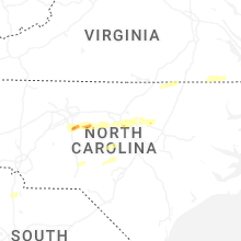


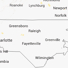


Connect with Interactive Hail Maps