

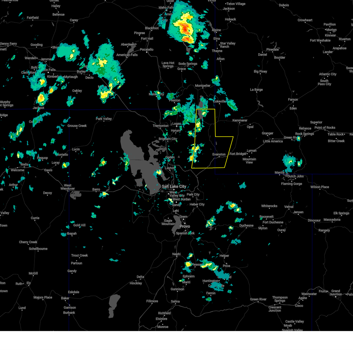
Hail Map for Randolph, UT
The Randolph, UT area has had 0 reports of on-the-ground hail by trained spotters, and has been under severe weather warnings 1 time during the past 12 months. Doppler radar has detected hail at or near Randolph, UT on 3 occasions.
| Name: | Randolph, UT |
| Where Located: | 72.3 miles NNE of Salt Lake City, UT |
| Map: | Google Map for Randolph, UT |
| Population: | 464 |
| Housing Units: | 207 |
| More Info: | Search Google for Randolph, UT |
0
The Top Recent Hail Date for Randolph, UT is Thursday, August 17, 2023 (3rd out of 3)

Hail and Wind Damage Spotted near Randolph, UT
| Date / Time | Report Details |
|---|---|
| 5/11/2025 2:45 PM MDT |
 Svrslc the national weather service in salt lake city has issued a * severe thunderstorm warning for, east central weber county in northern utah, east central cache county in northern utah, rich county in northern utah, northeastern morgan county in northern utah, northwestern summit county in northern utah, western uinta county in southwestern wyoming, * until 315 pm mdt. * at 244 pm mdt, severe thunderstorms were located along a line extending from 10 miles east of franklin to 8 miles southwest of woodruff to near wanship, moving northeast at 55 mph (radar indicated). Hazards include 70 mph wind gusts. Expect considerable tree damage. Damage is likely to mobile homes, roofs, and outbuildings. Svrslc the national weather service in salt lake city has issued a * severe thunderstorm warning for, east central weber county in northern utah, east central cache county in northern utah, rich county in northern utah, northeastern morgan county in northern utah, northwestern summit county in northern utah, western uinta county in southwestern wyoming, * until 315 pm mdt. * at 244 pm mdt, severe thunderstorms were located along a line extending from 10 miles east of franklin to 8 miles southwest of woodruff to near wanship, moving northeast at 55 mph (radar indicated). Hazards include 70 mph wind gusts. Expect considerable tree damage. Damage is likely to mobile homes, roofs, and outbuildings.
|
| 7/3/2023 7:18 PM MDT |
 At 718 pm mdt, severe thunderstorms were located along a line extending from near randolph to 10 miles east of woodruff to 12 miles east of evanston, moving northeast at 40 mph (radar indicated). Hazards include 70 mph wind gusts and half dollar size hail. Hail damage to vehicles is expected. expect considerable tree damage. wind damage is also likely to mobile homes, roofs, and outbuildings. locations impacted include, evanston, randolph, woodruff, robertson, mountain view, millburne, fort bridger, almy, altamont, ragen, piedmont, leroy and carter. this includes the following highways, interstate 80 in utah between mile markers 193 and 196. utah route 30 between mile markers 131 and 135. thunderstorm damage threat, considerable hail threat, radar indicated max hail size, 1. 25 in wind threat, observed max wind gust, 70 mph. At 718 pm mdt, severe thunderstorms were located along a line extending from near randolph to 10 miles east of woodruff to 12 miles east of evanston, moving northeast at 40 mph (radar indicated). Hazards include 70 mph wind gusts and half dollar size hail. Hail damage to vehicles is expected. expect considerable tree damage. wind damage is also likely to mobile homes, roofs, and outbuildings. locations impacted include, evanston, randolph, woodruff, robertson, mountain view, millburne, fort bridger, almy, altamont, ragen, piedmont, leroy and carter. this includes the following highways, interstate 80 in utah between mile markers 193 and 196. utah route 30 between mile markers 131 and 135. thunderstorm damage threat, considerable hail threat, radar indicated max hail size, 1. 25 in wind threat, observed max wind gust, 70 mph.
|
| 7/3/2023 6:59 PM MDT |
 At 659 pm mdt, severe thunderstorms were located along a line extending from 12 miles southwest of randolph to 8 miles south of woodruff to 11 miles south of evanston, moving northeast at 40 mph (radar indicated). Hazards include 70 mph wind gusts and penny size hail. Expect considerable tree damage. damage is likely to mobile homes, roofs, and outbuildings. locations impacted include, evanston, randolph, woodruff, robertson, mountain view, millburne, fort bridger, almy, altamont, ragen, wahsatch, castle rock, piedmont, leroy and carter. this includes the following highways, interstate 80 in utah between mile markers 186 and 196. utah route 30 between mile markers 131 and 135. thunderstorm damage threat, considerable hail threat, radar indicated max hail size, 0. 75 in wind threat, observed max wind gust, 70 mph. At 659 pm mdt, severe thunderstorms were located along a line extending from 12 miles southwest of randolph to 8 miles south of woodruff to 11 miles south of evanston, moving northeast at 40 mph (radar indicated). Hazards include 70 mph wind gusts and penny size hail. Expect considerable tree damage. damage is likely to mobile homes, roofs, and outbuildings. locations impacted include, evanston, randolph, woodruff, robertson, mountain view, millburne, fort bridger, almy, altamont, ragen, wahsatch, castle rock, piedmont, leroy and carter. this includes the following highways, interstate 80 in utah between mile markers 186 and 196. utah route 30 between mile markers 131 and 135. thunderstorm damage threat, considerable hail threat, radar indicated max hail size, 0. 75 in wind threat, observed max wind gust, 70 mph.
|
| 7/3/2023 6:55 PM MDT |
 At 655 pm mdt, severe thunderstorms were located along a line extending from 14 miles southwest of randolph to 9 miles south of woodruff to 11 miles south of evanston, moving northeast at 40 mph (radar indicated). Hazards include 60 mph wind gusts and penny size hail. expect damage to roofs, siding, and trees At 655 pm mdt, severe thunderstorms were located along a line extending from 14 miles southwest of randolph to 9 miles south of woodruff to 11 miles south of evanston, moving northeast at 40 mph (radar indicated). Hazards include 60 mph wind gusts and penny size hail. expect damage to roofs, siding, and trees
|
| 8/21/2021 6:40 PM MDT |
 At 639 pm mdt, severe thunderstorms were located along a line extending from 12 miles east of hyrum to farmington to 7 miles southeast of skull valley, moving east at 40 mph (trained weather spotters reported wind gusts to 73 mph with widespread property damage). Hazards include 70 mph wind gusts and penny size hail. Expect considerable tree damage. Damage is likely to mobile homes, roofs, and outbuildings. At 639 pm mdt, severe thunderstorms were located along a line extending from 12 miles east of hyrum to farmington to 7 miles southeast of skull valley, moving east at 40 mph (trained weather spotters reported wind gusts to 73 mph with widespread property damage). Hazards include 70 mph wind gusts and penny size hail. Expect considerable tree damage. Damage is likely to mobile homes, roofs, and outbuildings.
|
| 8/21/2021 6:23 PM MDT |
 At 622 pm mdt, severe thunderstorms were located along a line extending from near hyrum to 7 miles south of syracuse to near skull valley, moving east at 40 mph (trained weather spotters have reported wind gusts to 65 mph and large branches down causing property damage). Hazards include 70 mph wind gusts. Expect considerable tree damage. damage is likely to mobile homes, roofs, and outbuildings. locations impacted include, salt lake city, west valley city, ogden, layton, murray, bountiful, tooele, farmington, brigham city, grantsville, morgan, randolph, hill air force base, dugway english village, west jordan, taylorsville, south jordan, roy, clearfield and midvale. this includes the following highways, interstate 15 between mile markers 299 and 371. interstate 84 between mile markers 82 and 113. interstate 80 in utah between mile markers 48 and 127. thunderstorm damage threat, considerable hail threat, radar indicated max hail size, <. 75 in wind threat, observed max wind gust, 70 mph. At 622 pm mdt, severe thunderstorms were located along a line extending from near hyrum to 7 miles south of syracuse to near skull valley, moving east at 40 mph (trained weather spotters have reported wind gusts to 65 mph and large branches down causing property damage). Hazards include 70 mph wind gusts. Expect considerable tree damage. damage is likely to mobile homes, roofs, and outbuildings. locations impacted include, salt lake city, west valley city, ogden, layton, murray, bountiful, tooele, farmington, brigham city, grantsville, morgan, randolph, hill air force base, dugway english village, west jordan, taylorsville, south jordan, roy, clearfield and midvale. this includes the following highways, interstate 15 between mile markers 299 and 371. interstate 84 between mile markers 82 and 113. interstate 80 in utah between mile markers 48 and 127. thunderstorm damage threat, considerable hail threat, radar indicated max hail size, <. 75 in wind threat, observed max wind gust, 70 mph.
|
| 8/21/2021 6:06 PM MDT |
 At 605 pm mdt, severe thunderstorms were located along a line extending from near wellsville to 7 miles east of great salt lake south of the causeway to 13 miles west of skull valley, moving east at 40 mph (trained weather spotters). Hazards include 70 mph wind gusts. Expect considerable tree damage. Damage is likely to mobile homes, roofs, and outbuildings. At 605 pm mdt, severe thunderstorms were located along a line extending from near wellsville to 7 miles east of great salt lake south of the causeway to 13 miles west of skull valley, moving east at 40 mph (trained weather spotters). Hazards include 70 mph wind gusts. Expect considerable tree damage. Damage is likely to mobile homes, roofs, and outbuildings.
|
| 5/30/2020 5:31 PM MDT |
 At 530 pm mdt, a severe thunderstorm was located near woodruff, or near randolph, moving north at 45 mph (radar indicated). Hazards include 60 mph wind gusts. Expect damage to roofs, siding, and trees. locations impacted include, randolph and woodruff. This includes utah route 30 between mile markers 125 and 135. At 530 pm mdt, a severe thunderstorm was located near woodruff, or near randolph, moving north at 45 mph (radar indicated). Hazards include 60 mph wind gusts. Expect damage to roofs, siding, and trees. locations impacted include, randolph and woodruff. This includes utah route 30 between mile markers 125 and 135.
|
| 5/30/2020 5:13 PM MDT |
 At 513 pm mdt, a severe thunderstorm was located 10 miles southwest of woodruff, or 19 miles northwest of evanston, moving north at 45 mph (radar indicated). Hazards include 60 mph wind gusts. expect damage to roofs, siding, and trees At 513 pm mdt, a severe thunderstorm was located 10 miles southwest of woodruff, or 19 miles northwest of evanston, moving north at 45 mph (radar indicated). Hazards include 60 mph wind gusts. expect damage to roofs, siding, and trees
|
| 9/28/2019 10:02 AM MDT |
 At 1001 am mdt, a severe thunderstorm was located near woodruff, or near randolph, moving east at 50 mph (radar indicated). Hazards include 60 mph wind gusts. Expect damage to roofs, siding, and trees. Locations impacted include, randolph and woodruff. At 1001 am mdt, a severe thunderstorm was located near woodruff, or near randolph, moving east at 50 mph (radar indicated). Hazards include 60 mph wind gusts. Expect damage to roofs, siding, and trees. Locations impacted include, randolph and woodruff.
|
| 9/28/2019 9:44 AM MDT |
 At 944 am mdt, a severe thunderstorm was located 15 miles west of woodruff, or 18 miles southwest of randolph, moving east at 50 mph (radar indicated). Hazards include 70 mph wind gusts. Expect considerable tree damage. Damage is likely to mobile homes, roofs, and outbuildings. At 944 am mdt, a severe thunderstorm was located 15 miles west of woodruff, or 18 miles southwest of randolph, moving east at 50 mph (radar indicated). Hazards include 70 mph wind gusts. Expect considerable tree damage. Damage is likely to mobile homes, roofs, and outbuildings.
|
| 9/22/2016 4:22 PM MDT |
 At 420 pm mdt, doppler radar indicated a line of severe thunderstorms capable of producing destructive winds in excess of 70 mph. these storms were located along a line extending from near lewiston to 20 miles west of woodruff, and moving northeast at 40 mph. penny size hail may also accompany the damaging winds. At 420 pm mdt, doppler radar indicated a line of severe thunderstorms capable of producing destructive winds in excess of 70 mph. these storms were located along a line extending from near lewiston to 20 miles west of woodruff, and moving northeast at 40 mph. penny size hail may also accompany the damaging winds.
|
| 6/3/2015 9:43 PM MDT | The severe thunderstorm warning for northeastern cache and rich counties will expire at 945 pm mdt, the storm which prompted the warning has weakened below severe limits. wind gusts to 50 mph are still possible with this storm. this includes bear lake. |
| 6/3/2015 9:12 PM MDT | At 912 pm mdt, trained weather spotters reported a severe thunderstorm producing damaging winds in excess of 60 mph. this storm was located 8 miles southwest of garden, or 10 miles west of laketown, and moving northeast at 30 mph. |
Hail Maps for Randolph, UT


Connect with Interactive Hail Maps