

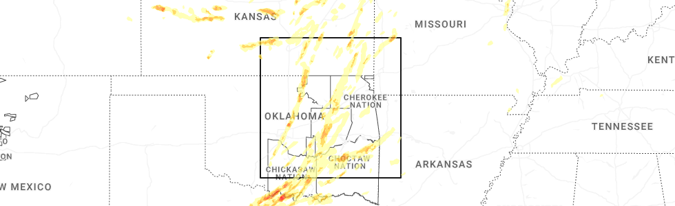
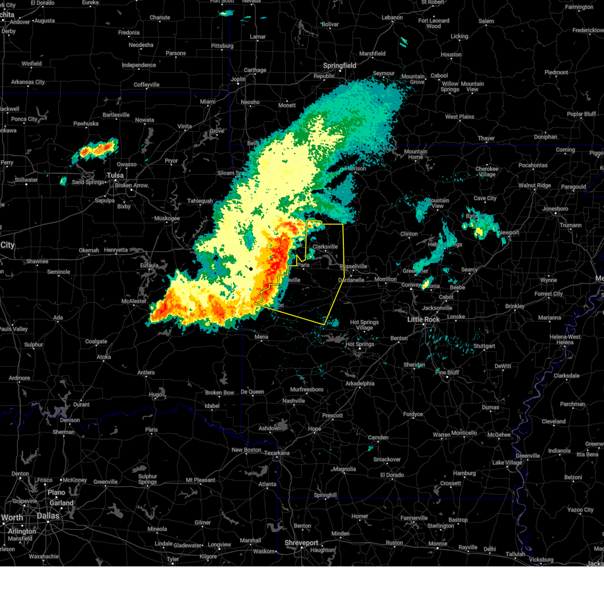
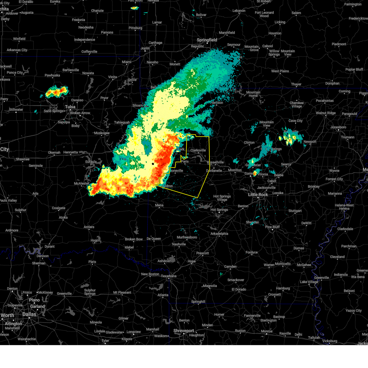
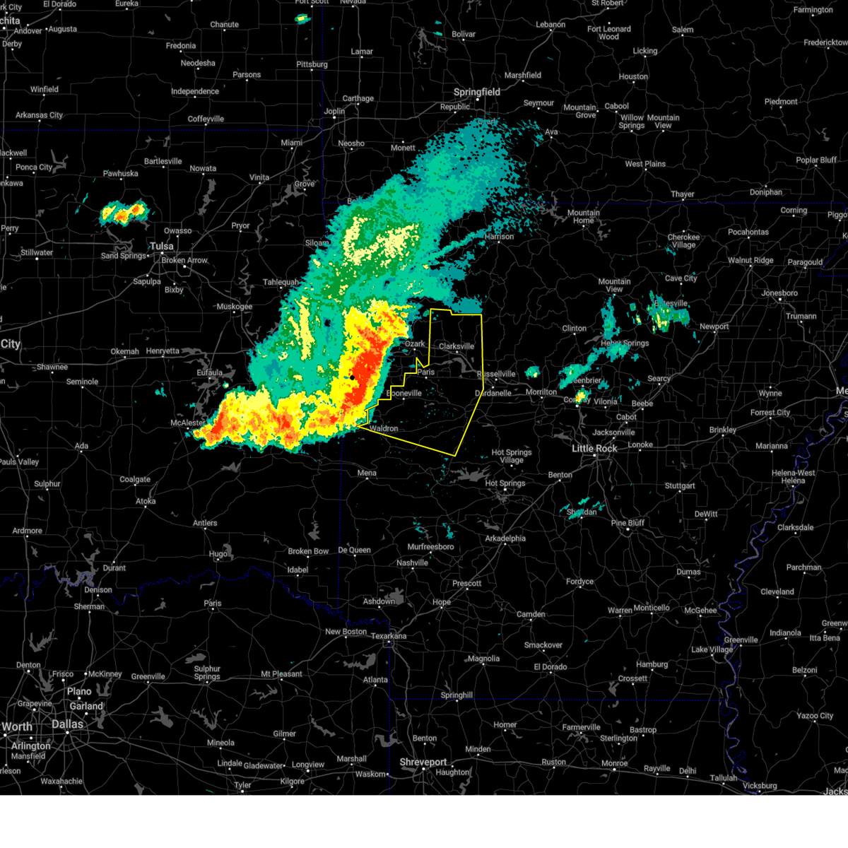
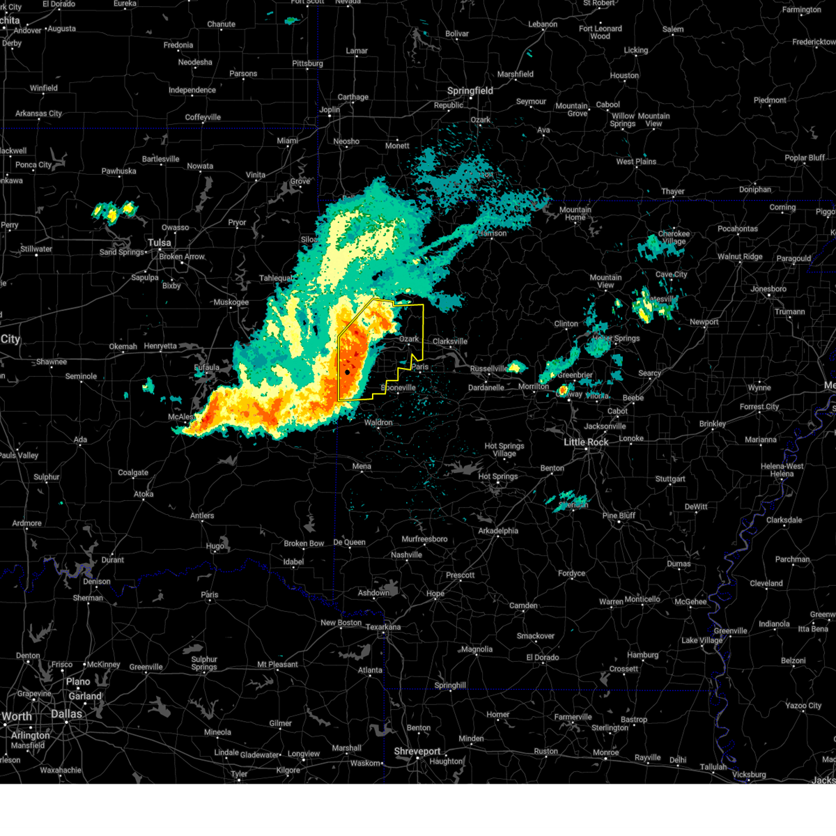
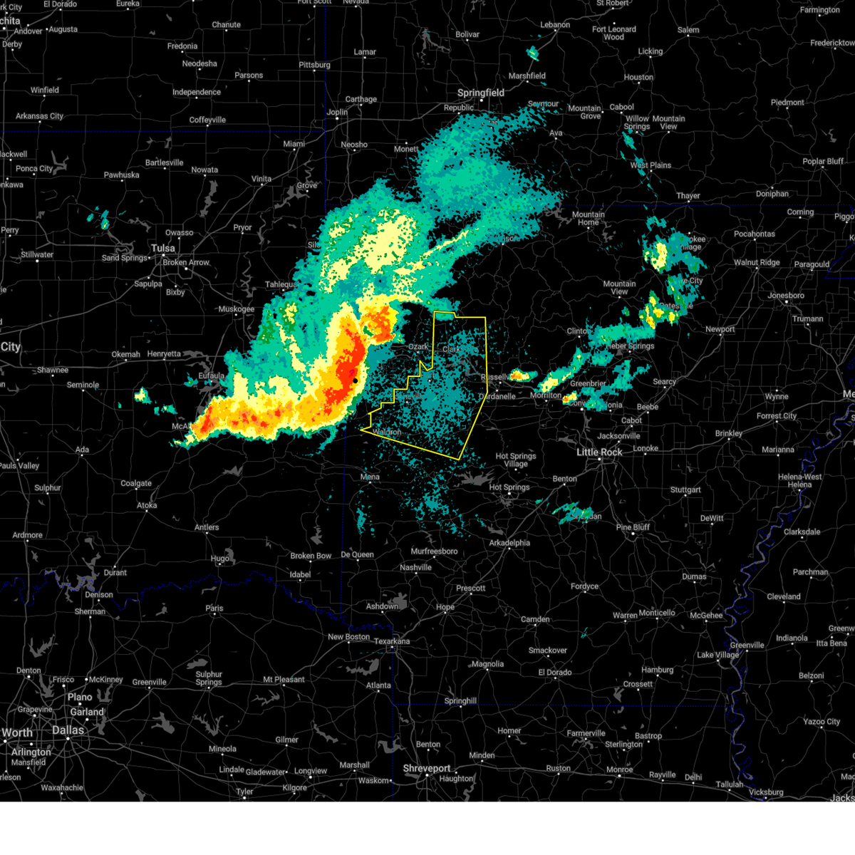
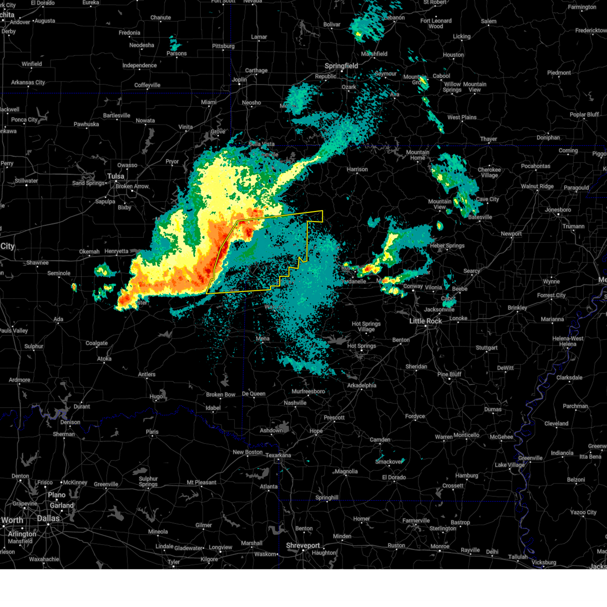
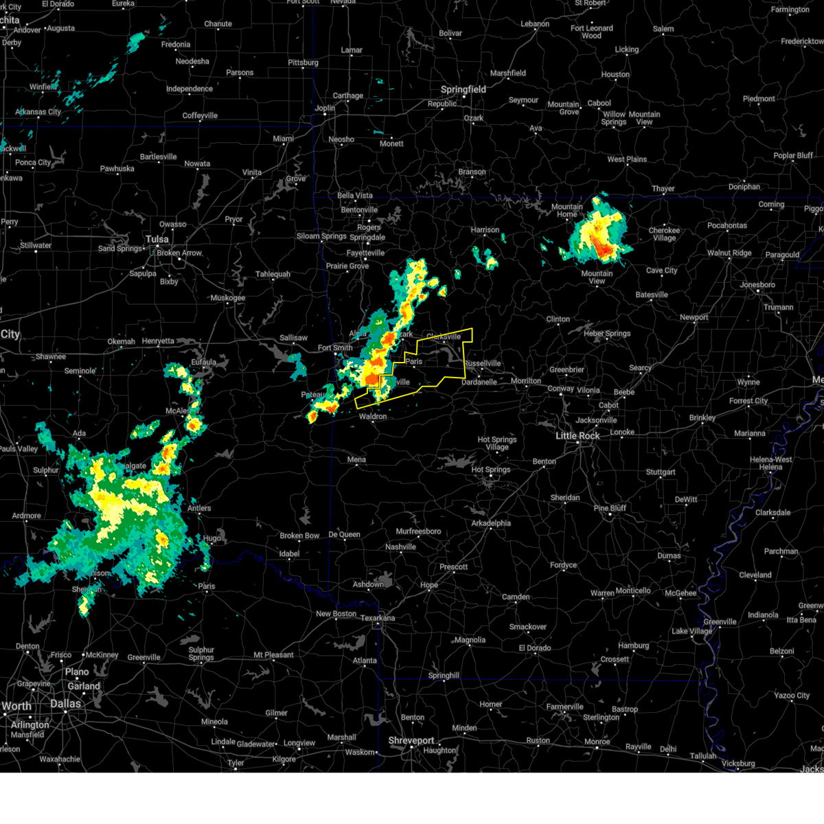
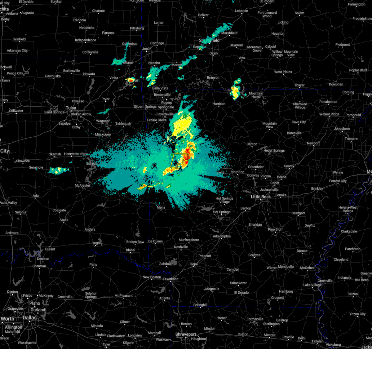
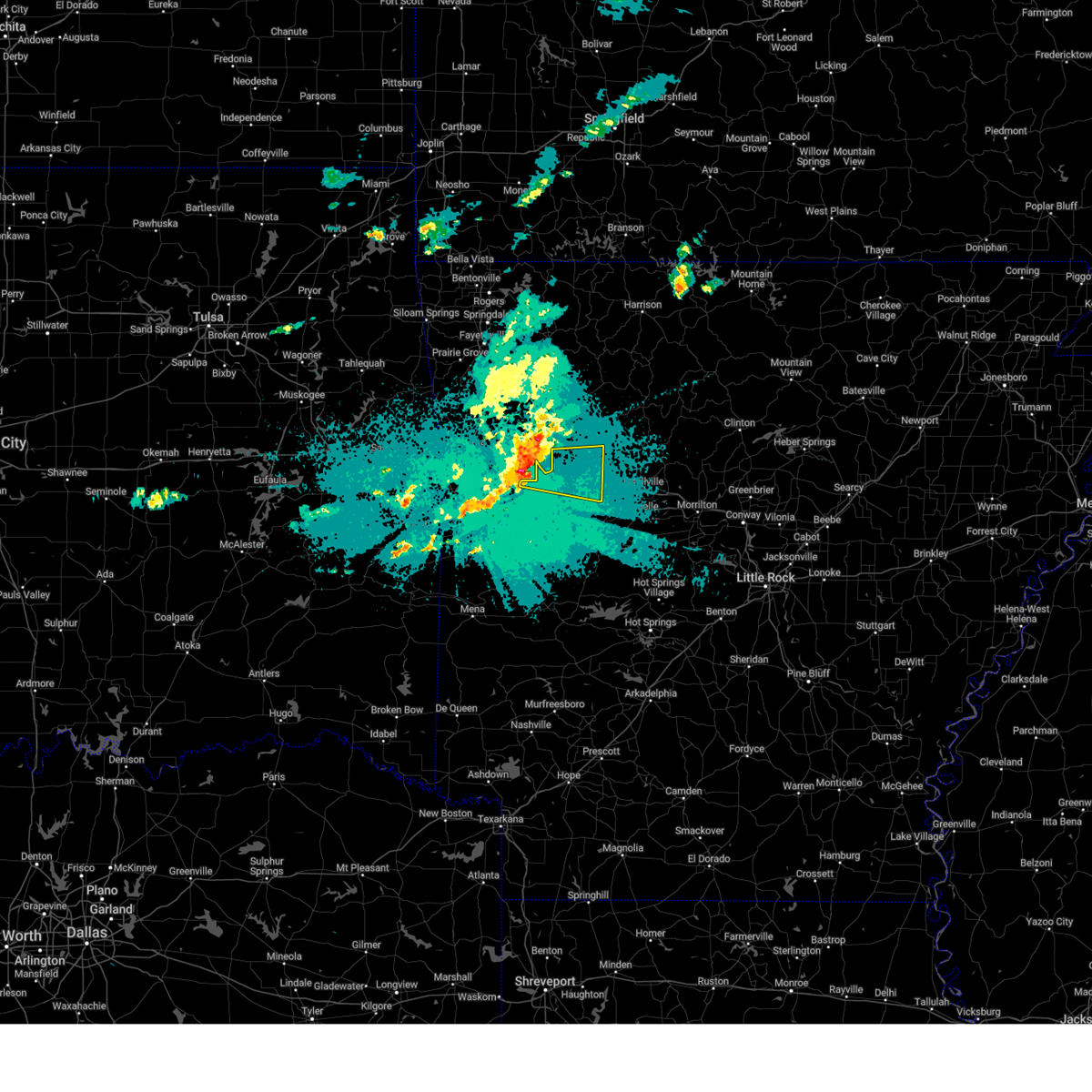
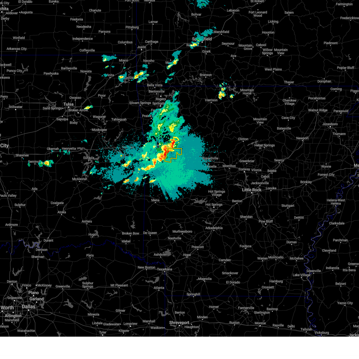
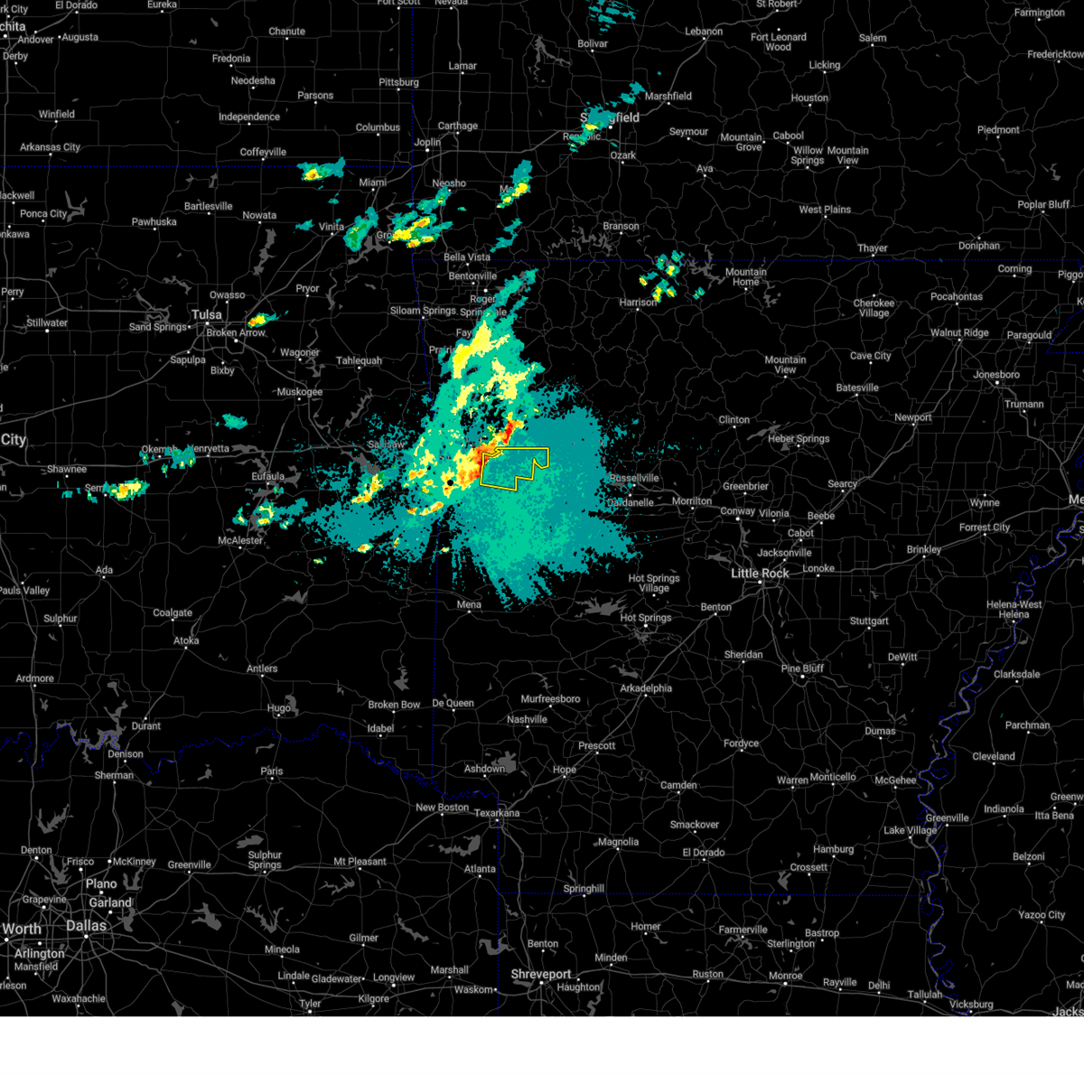
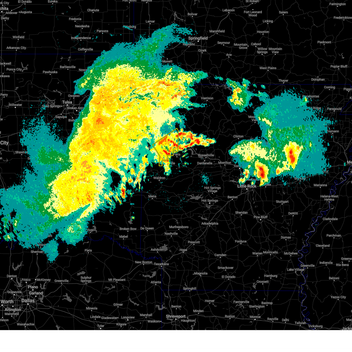
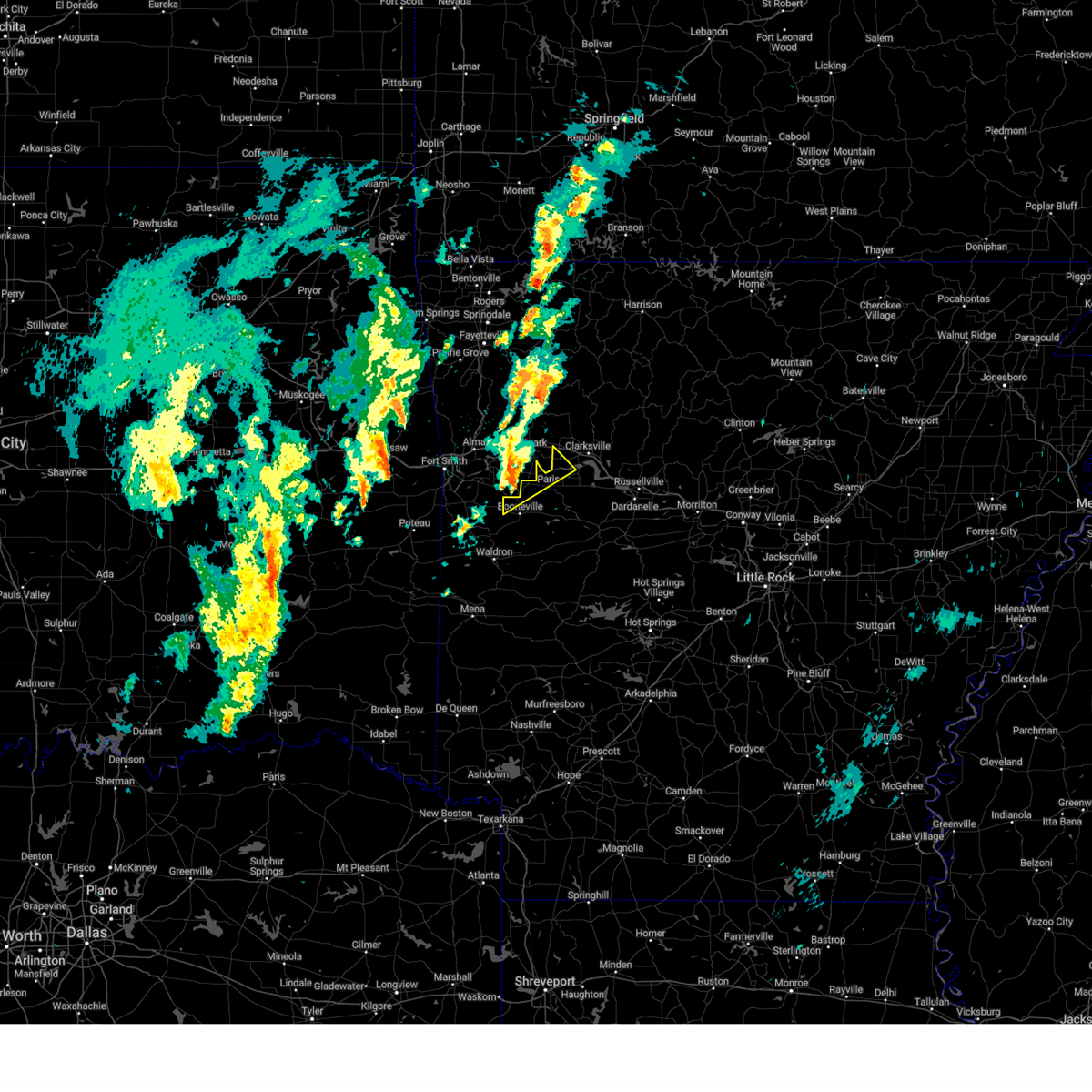
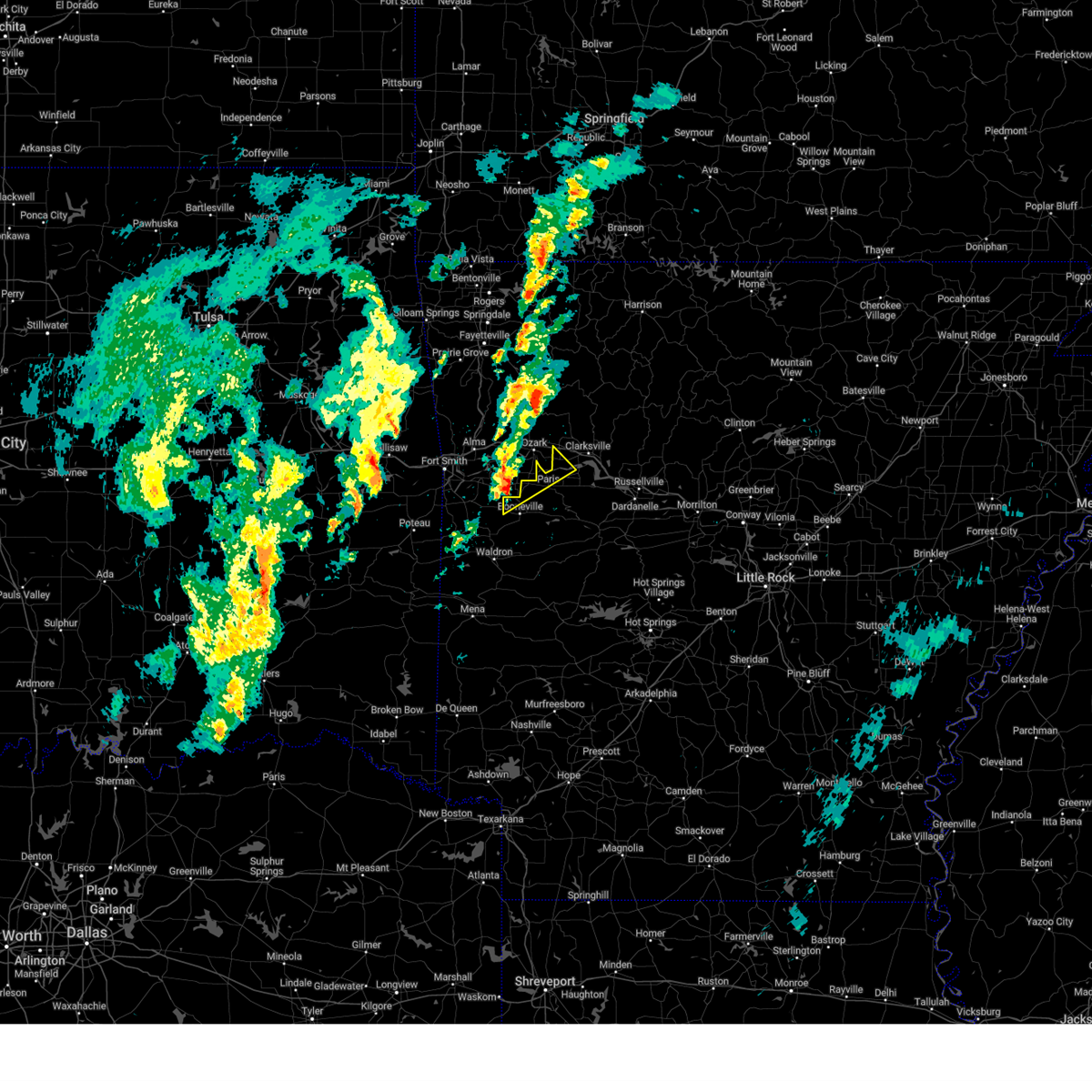
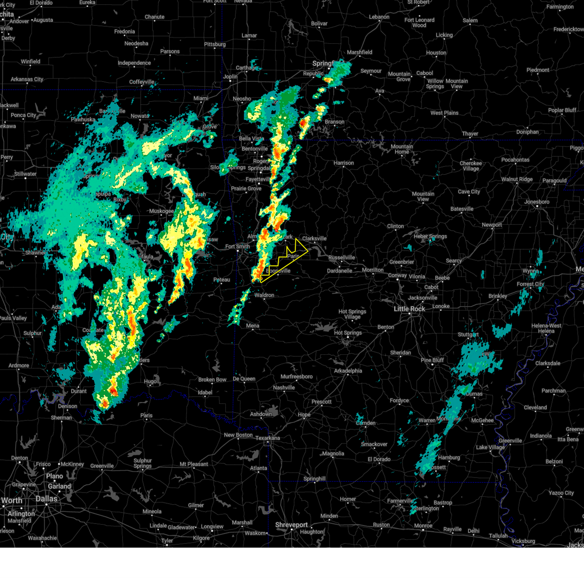
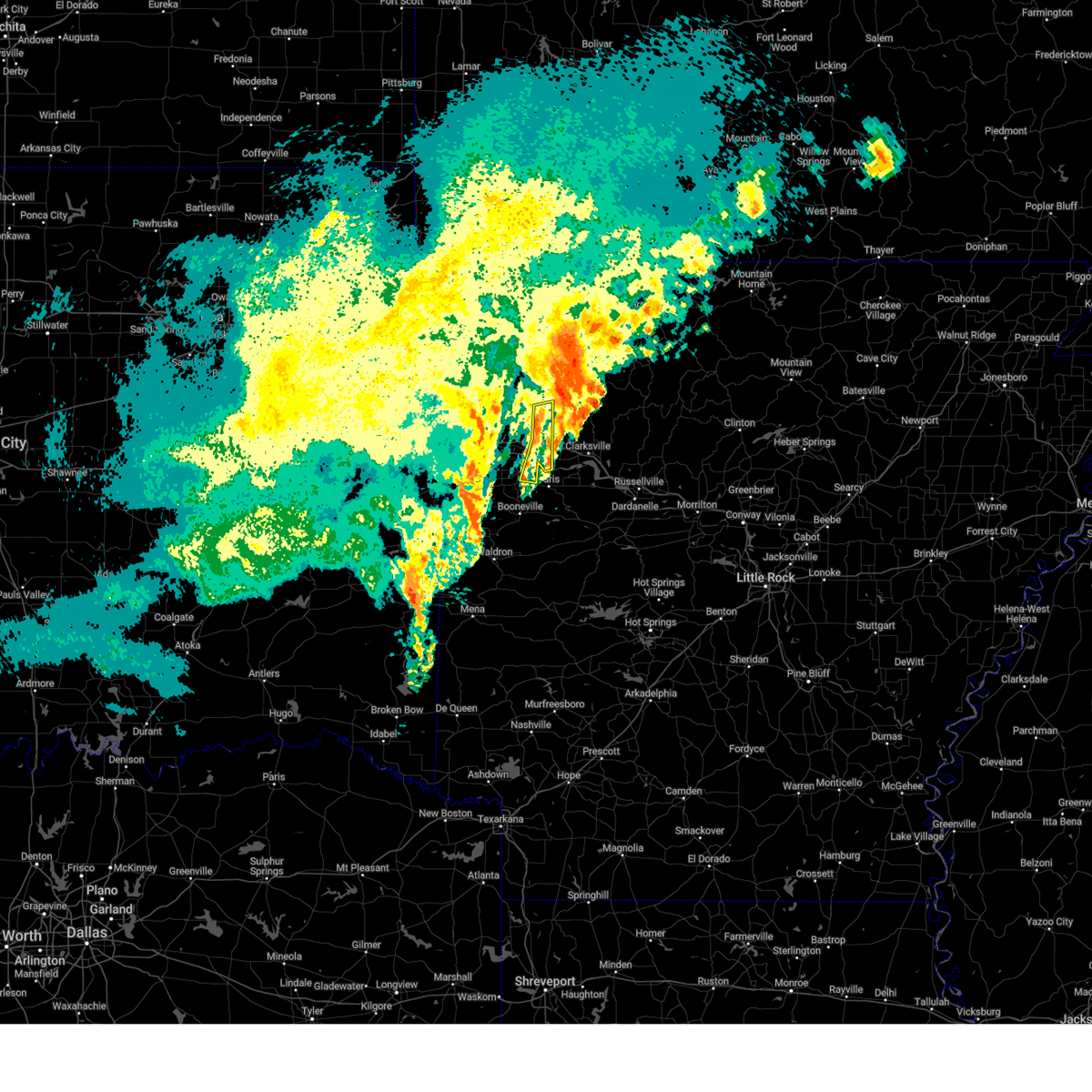
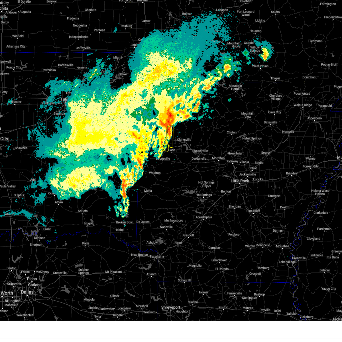
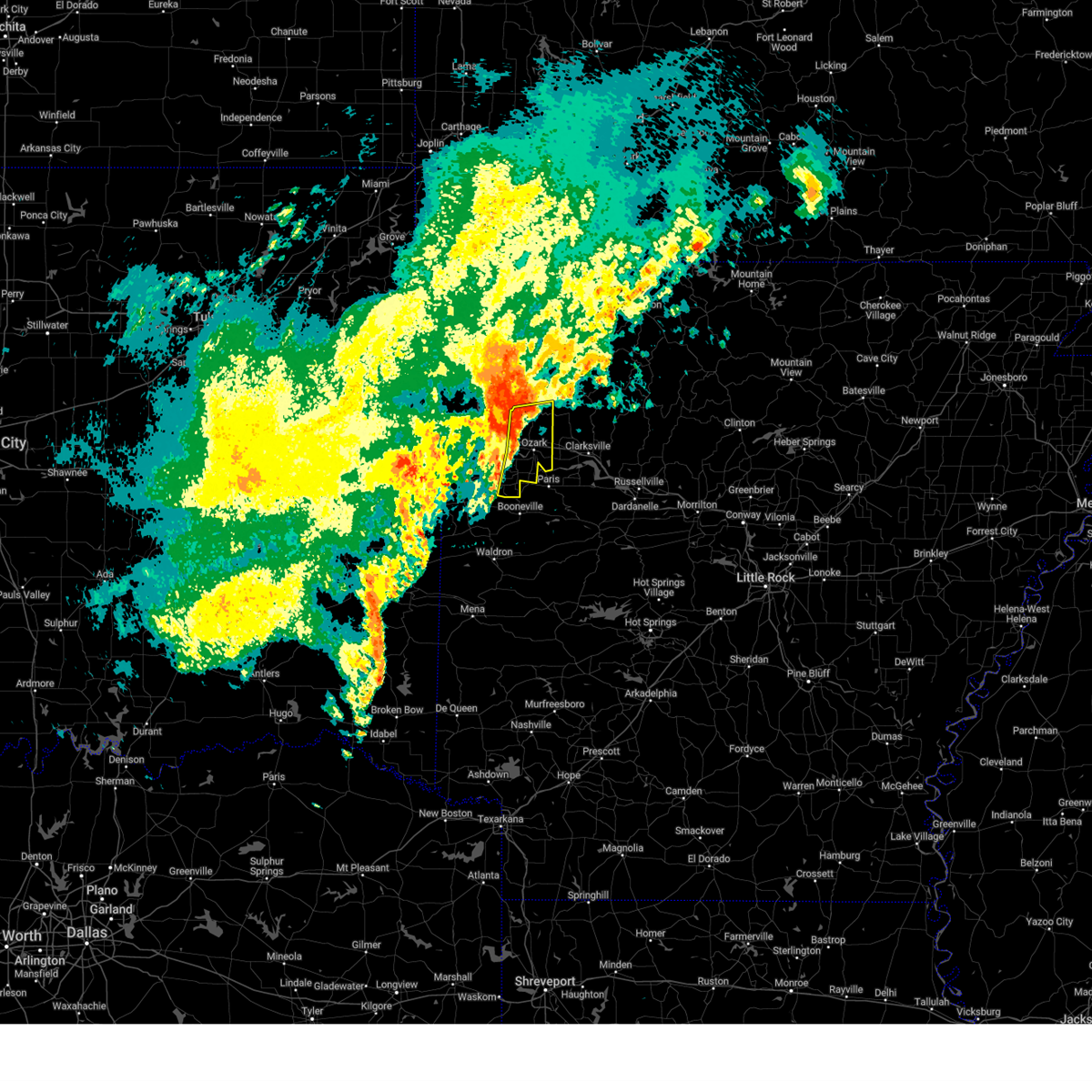
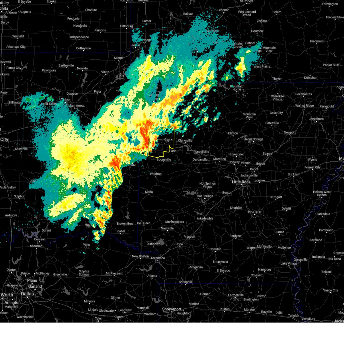
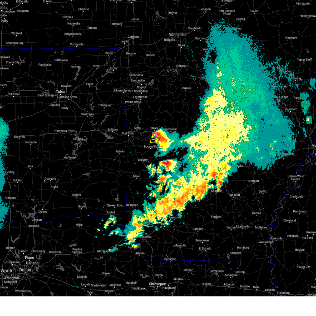
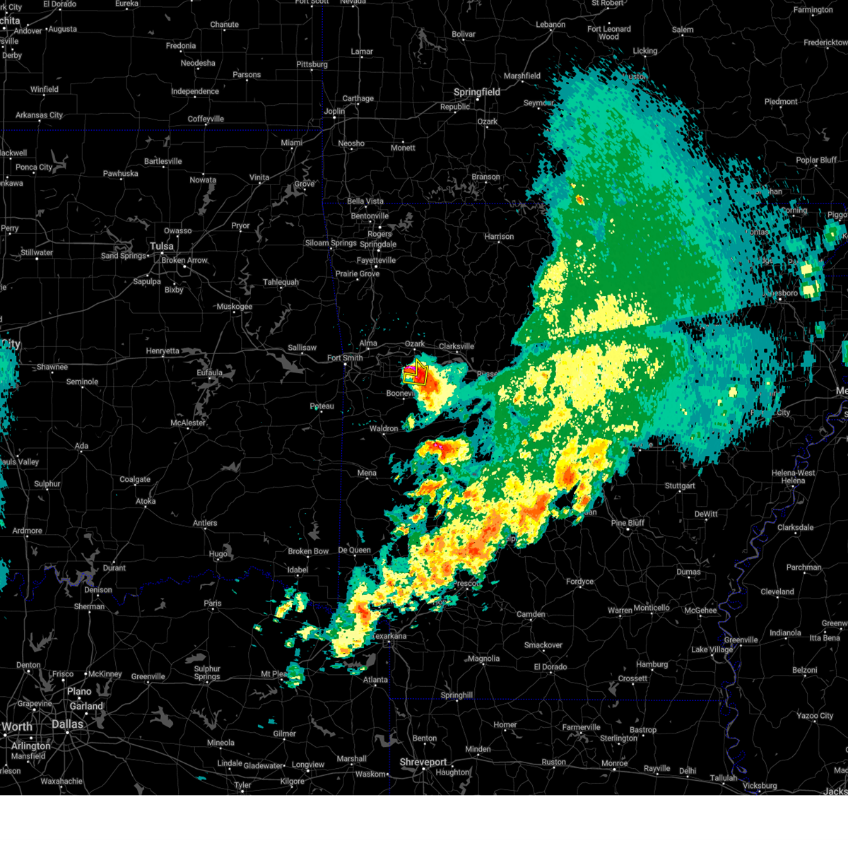
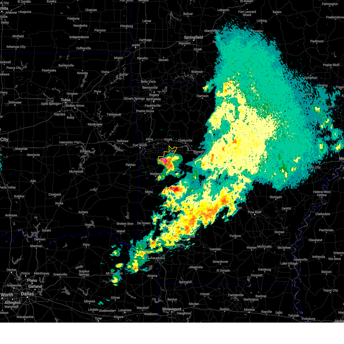
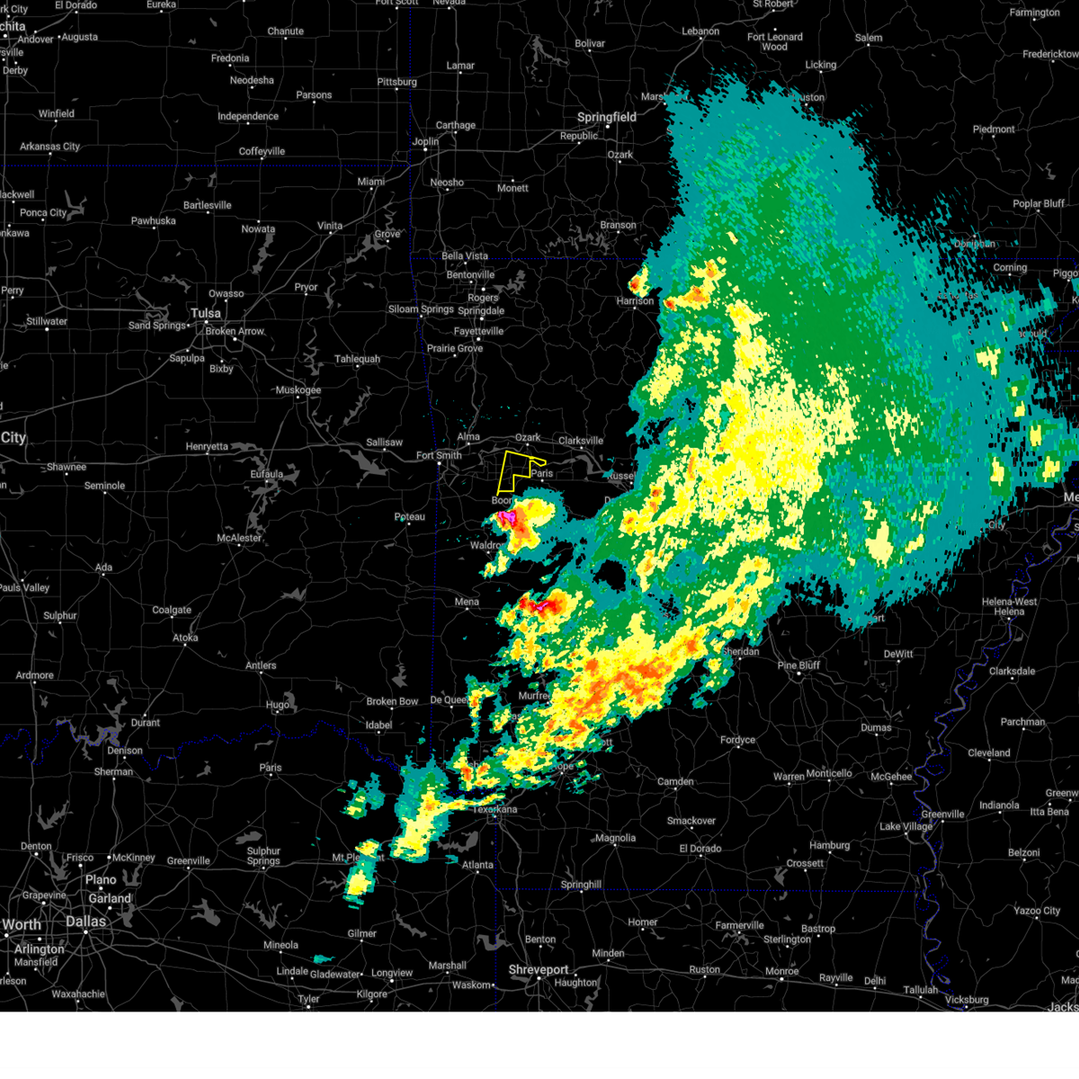
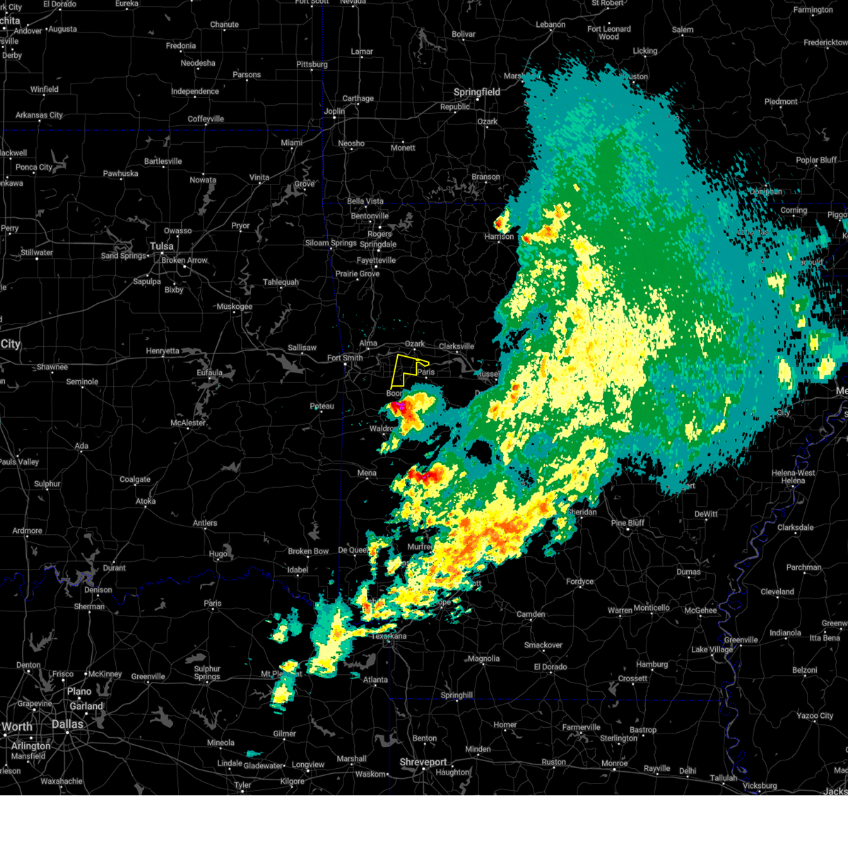
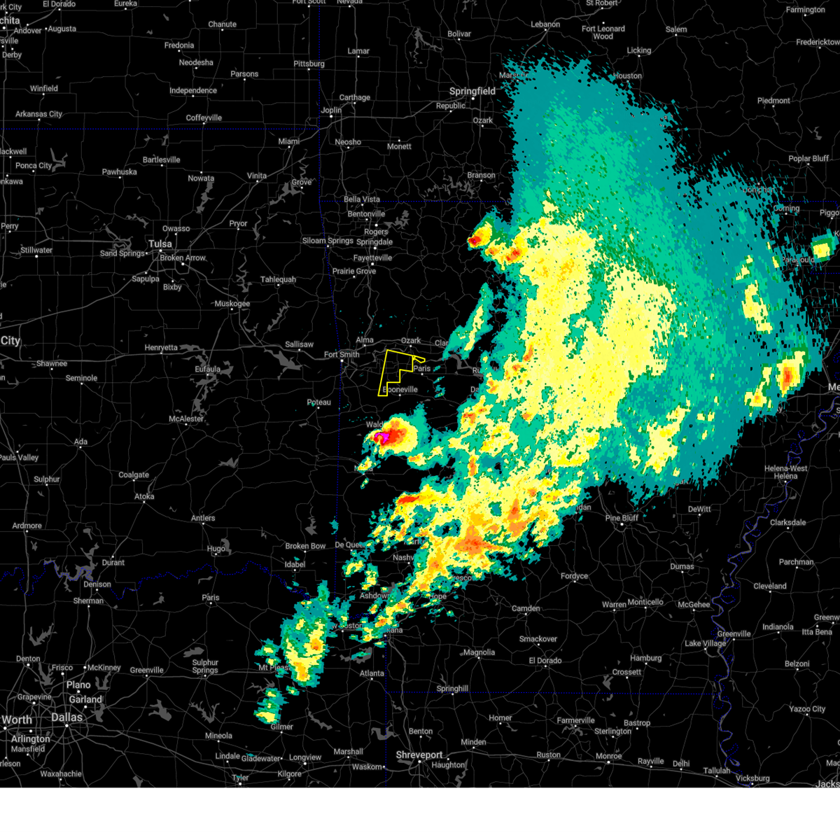
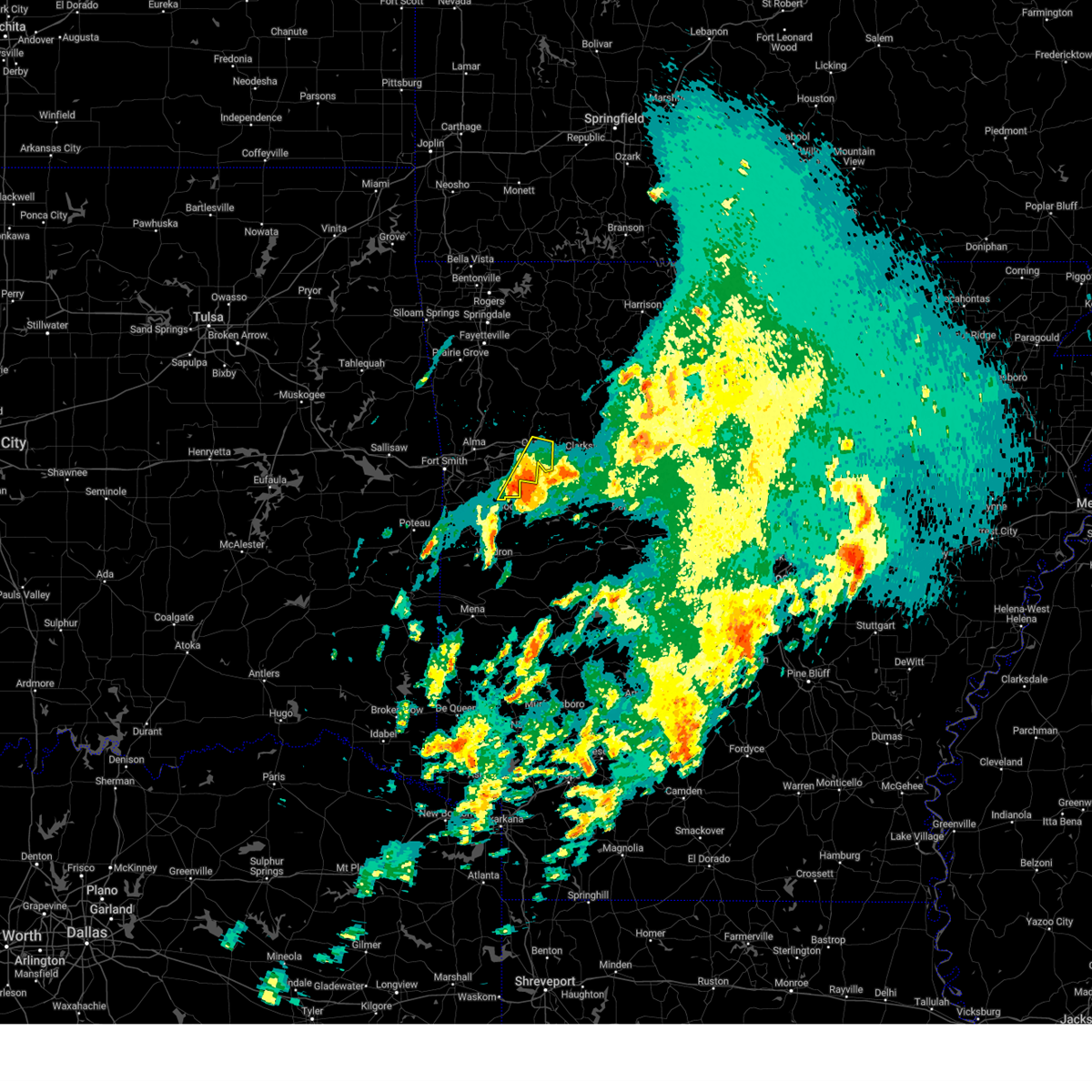
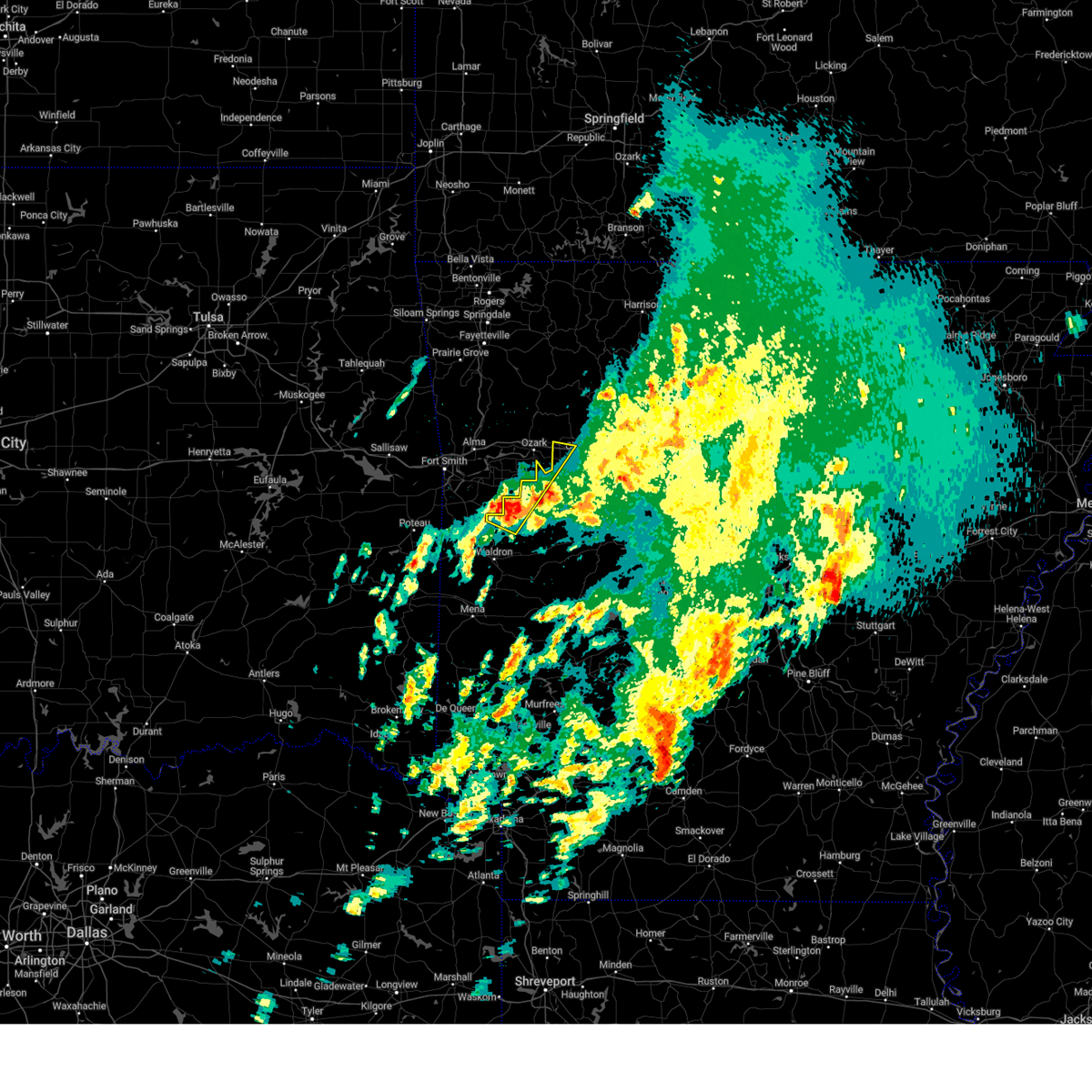
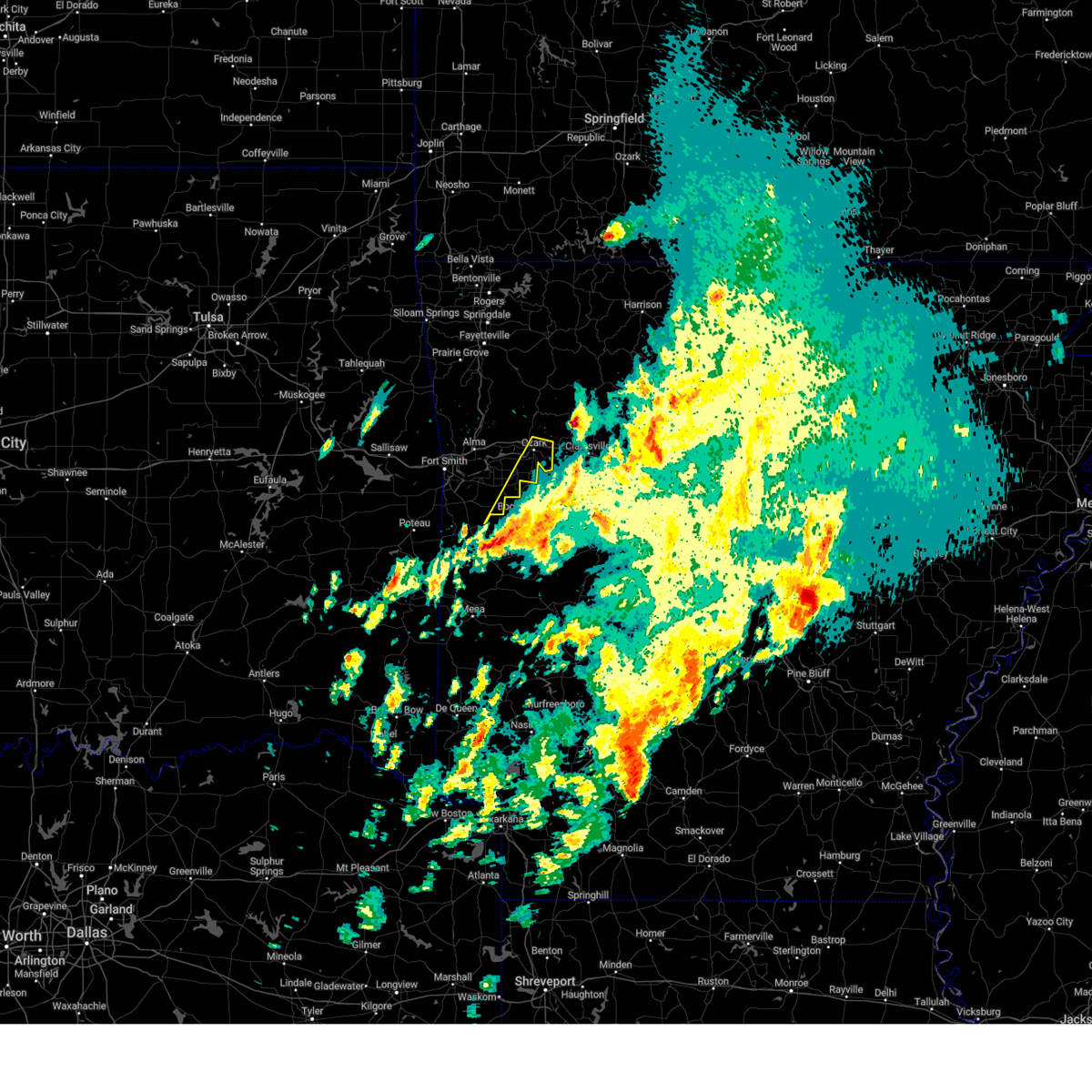
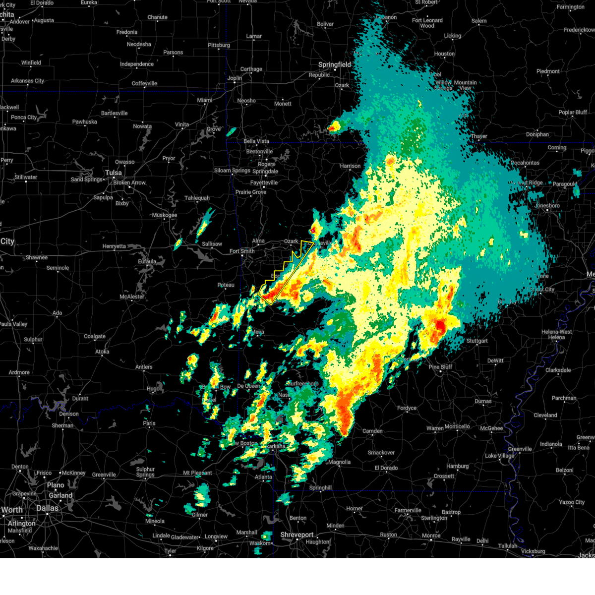
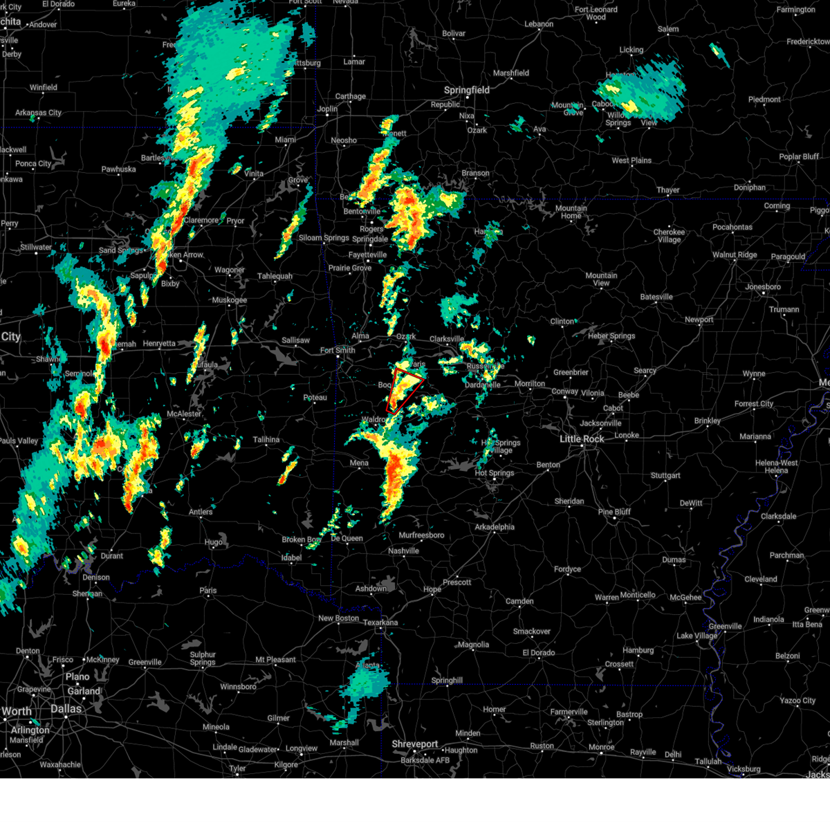
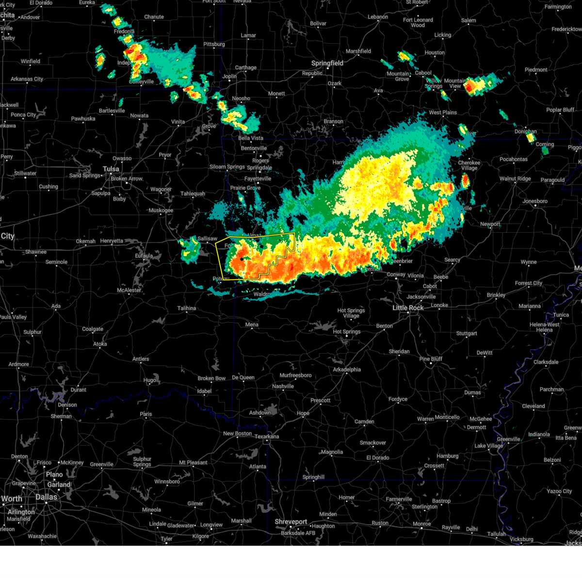
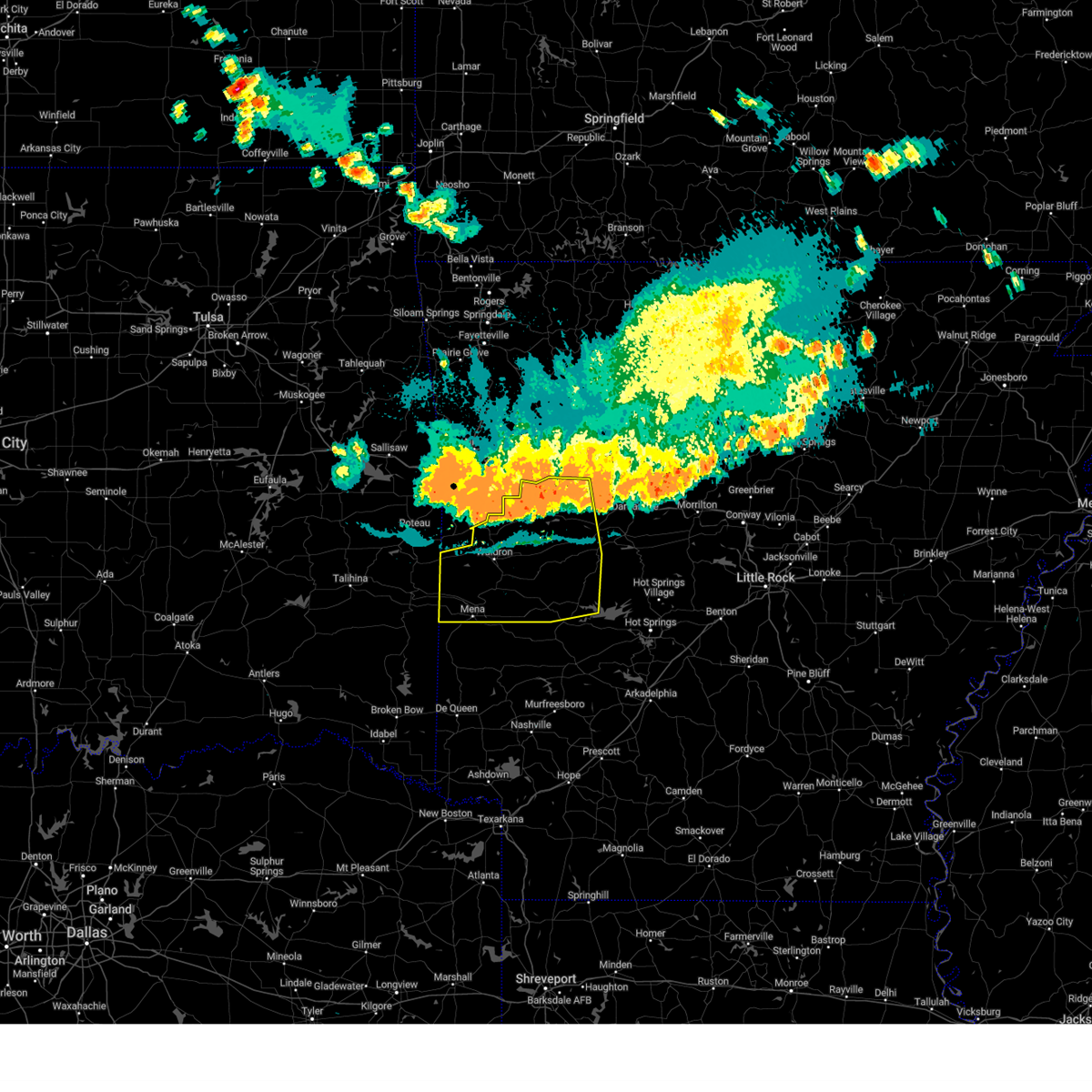
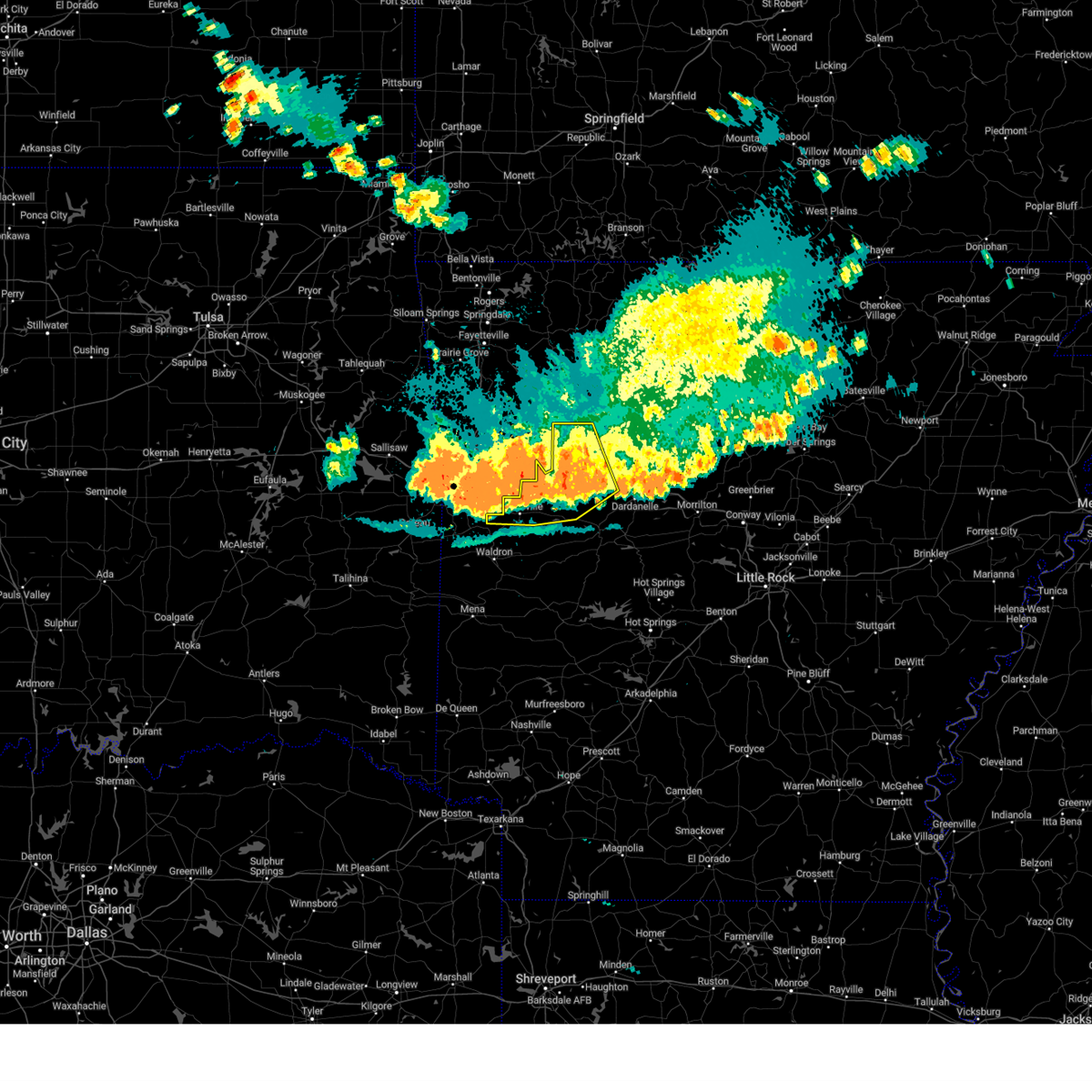
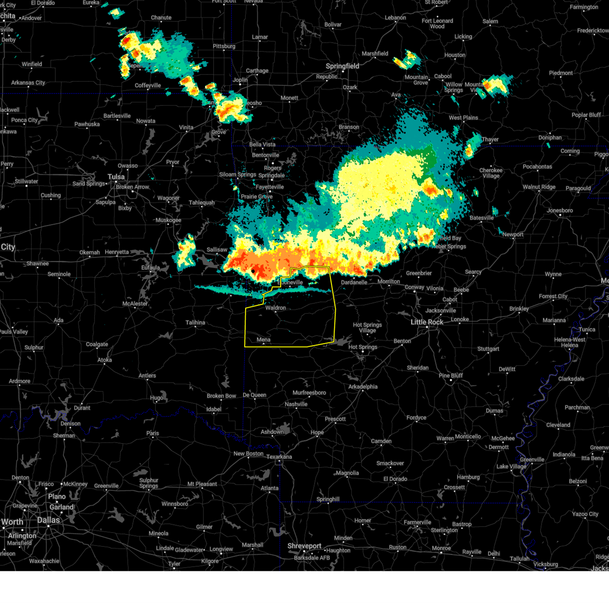
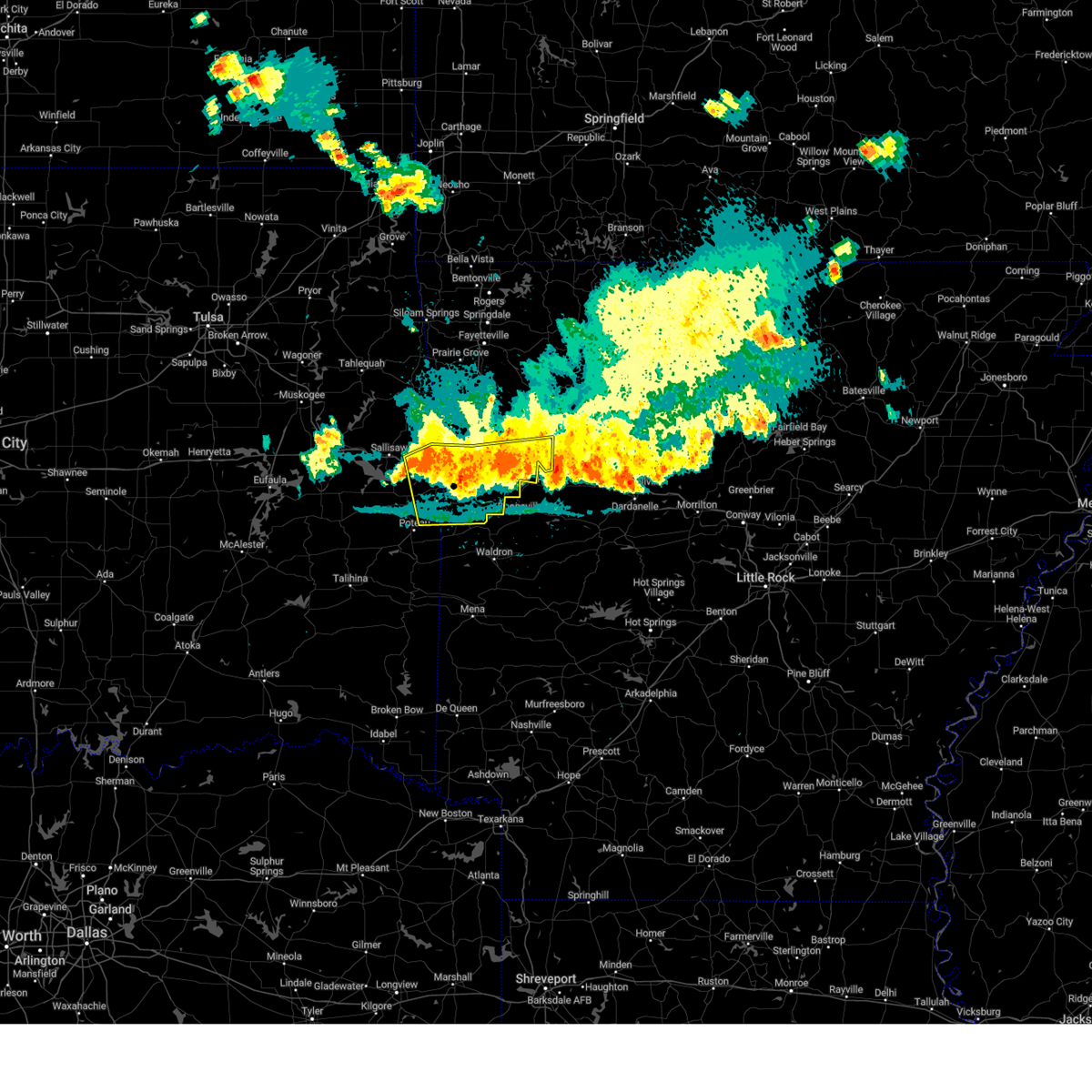
Hail Map for Ratcliff, AR
The Ratcliff, AR area has had 9 reports of on-the-ground hail by trained spotters, and has been under severe weather warnings 85 times during the past 12 months. Doppler radar has detected hail at or near Ratcliff, AR on 90 occasions, including 4 occasions during the past year.
| Name: | Ratcliff, AR |
| Where Located: | 30.6 miles E of Fort Smith, AR |
| Map: | Google Map for Ratcliff, AR |
| Population: | 202 |
| Housing Units: | 94 |
| More Info: | Search Google for Ratcliff, AR |
0
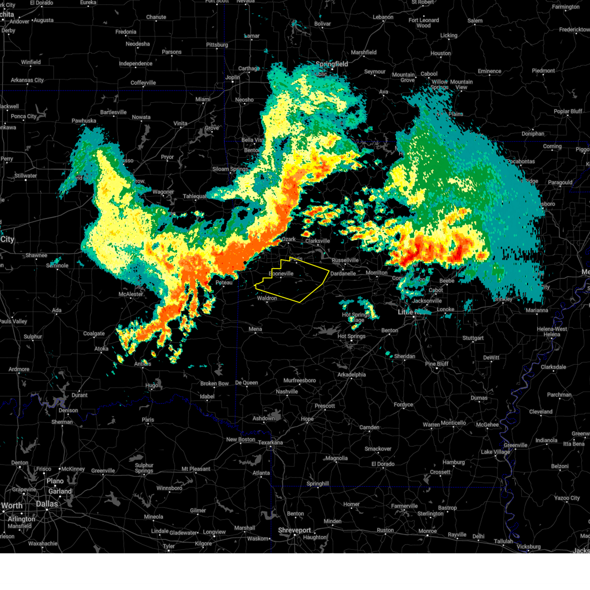
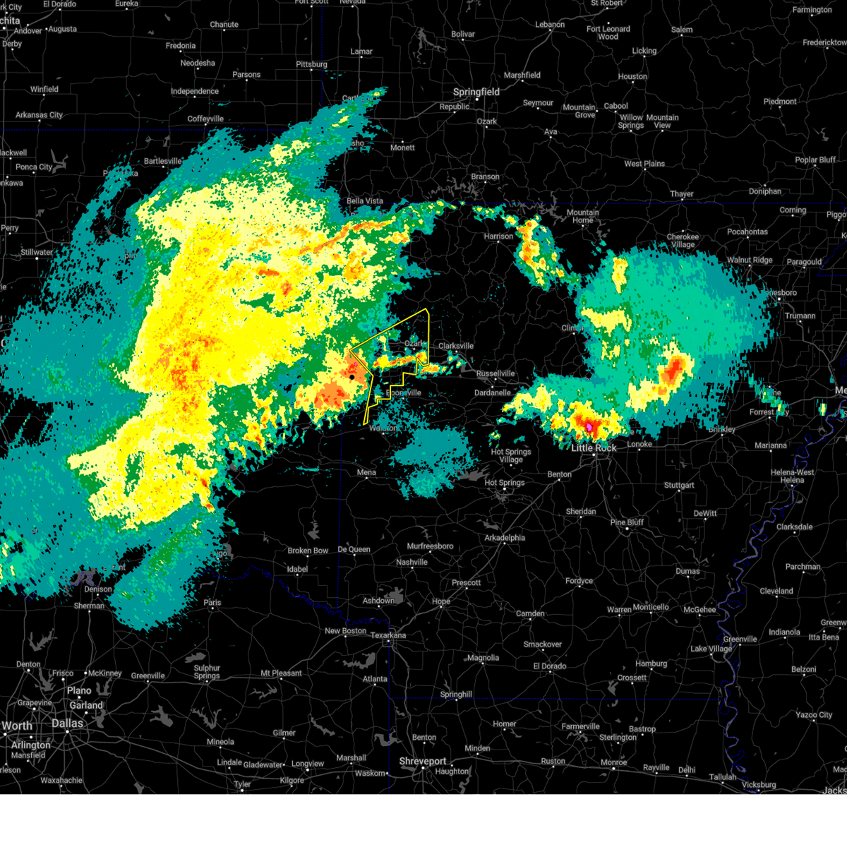
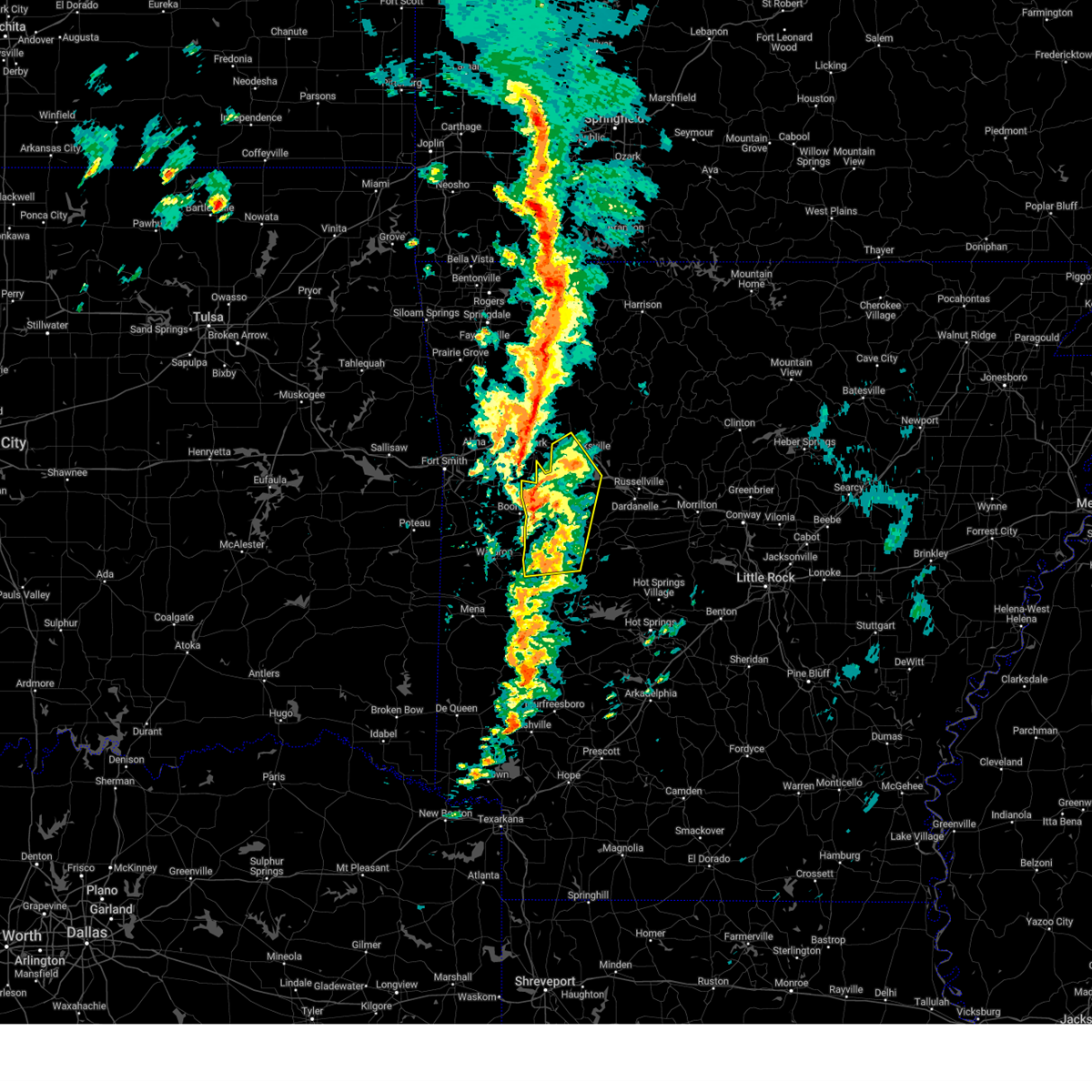
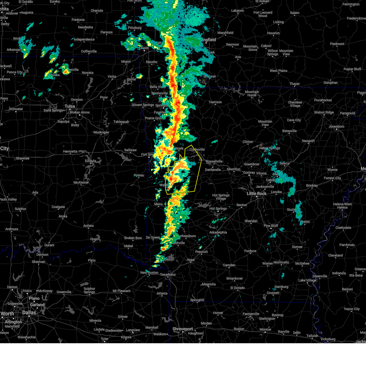
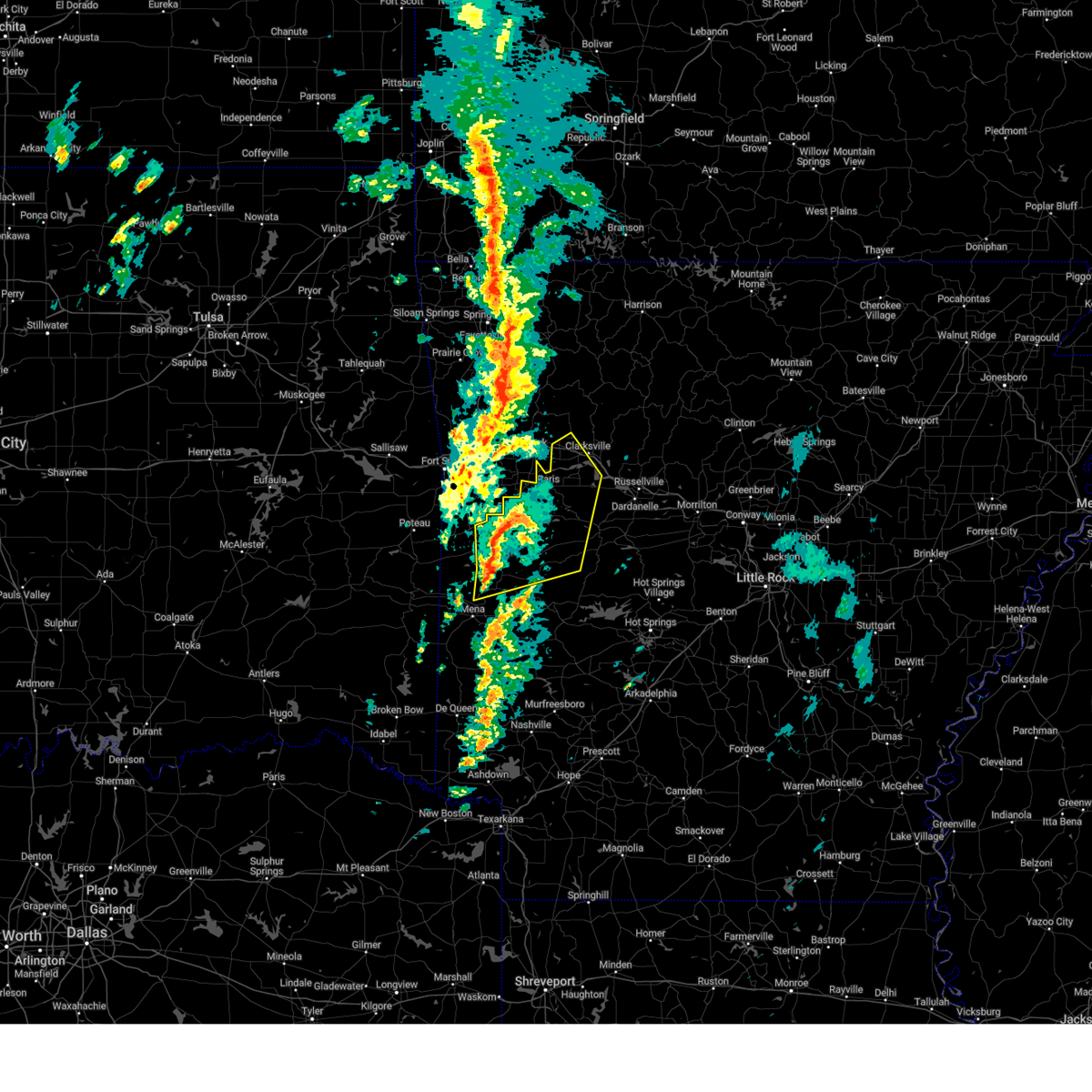
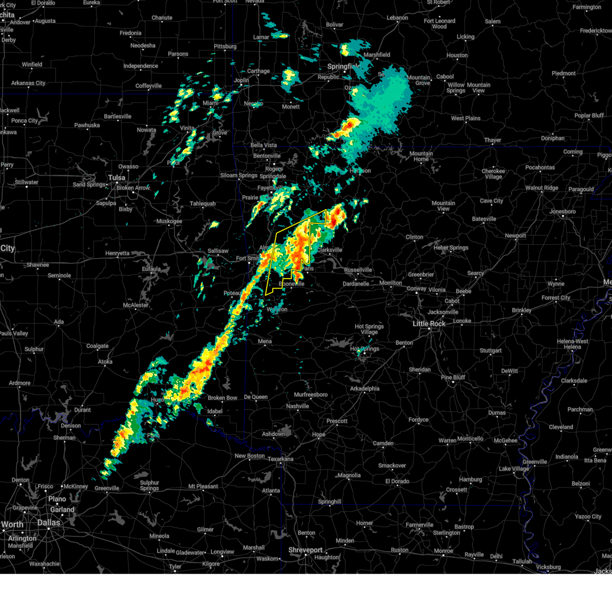
The Top Recent Hail Date for Ratcliff, AR is Monday, May 19, 2025 (33rd out of 90)
Hail and Wind Damage Spotted near Ratcliff, AR
| Date / Time | Report Details |
|---|---|
| 6/7/2025 6:39 AM CDT |
 Svrlzk the national weather service in little rock has issued a * severe thunderstorm warning for, logan county in western arkansas, northeastern scott county in western arkansas, northwestern yell county in central arkansas, * until 730 am cdt. * at 638 am cdt, severe thunderstorms were located along a line extending from near mulberry to near lavaca to near cameron, moving southeast at 55 mph (radar indicated). Hazards include 60 mph wind gusts and quarter size hail. Hail damage to vehicles is expected. Expect wind damage to roofs, siding, and trees. Svrlzk the national weather service in little rock has issued a * severe thunderstorm warning for, logan county in western arkansas, northeastern scott county in western arkansas, northwestern yell county in central arkansas, * until 730 am cdt. * at 638 am cdt, severe thunderstorms were located along a line extending from near mulberry to near lavaca to near cameron, moving southeast at 55 mph (radar indicated). Hazards include 60 mph wind gusts and quarter size hail. Hail damage to vehicles is expected. Expect wind damage to roofs, siding, and trees.
|
| 5/19/2025 9:28 PM CDT |
 the severe thunderstorm warning has been cancelled and is no longer in effect the severe thunderstorm warning has been cancelled and is no longer in effect
|
| 5/19/2025 9:00 PM CDT |
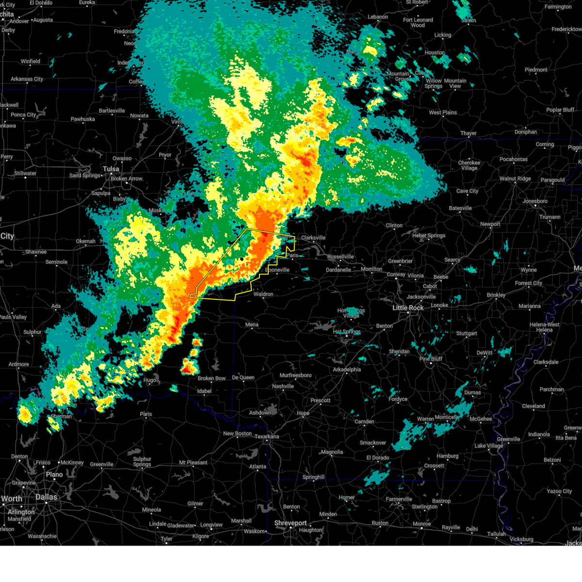
 Svrtsa the national weather service in tulsa has issued a * severe thunderstorm warning for, southern franklin county in west central arkansas, sebastian county in west central arkansas, east central le flore county in southeastern oklahoma, * until 945 pm cdt. * at 900 pm cdt, severe thunderstorms were located along a line extending from near branch to 6 miles east of heavener, moving east at 25 mph (radar indicated). Hazards include 60 mph wind gusts. Expect damage to roofs, siding, and trees. Locations in or near the path include, charleston, arkola, huntington, crossroads, central city, witcherville, dayton, poteau, milltown, branch, howe, excelsior, vesta, cecil, ursula, lavaca, denning, etna, alix, greenwood,. Svrtsa the national weather service in tulsa has issued a * severe thunderstorm warning for, southern franklin county in west central arkansas, sebastian county in west central arkansas, east central le flore county in southeastern oklahoma, * until 945 pm cdt. * at 900 pm cdt, severe thunderstorms were located along a line extending from near branch to 6 miles east of heavener, moving east at 25 mph (radar indicated). Hazards include 60 mph wind gusts. Expect damage to roofs, siding, and trees. Locations in or near the path include, charleston, arkola, huntington, crossroads, central city, witcherville, dayton, poteau, milltown, branch, howe, excelsior, vesta, cecil, ursula, lavaca, denning, etna, alix, greenwood,.
|
| 5/19/2025 8:50 PM CDT |
 At 850 pm cdt, severe thunderstorms were located along a line extending from 2 miles east of denning to 2 miles northwest of huntington to 2 miles west of heavener, moving east at 20 mph (radar indicated). Hazards include 60 mph wind gusts and nickel size hail. Expect damage to roofs, siding, and trees. locations in or near the path include, alma, charleston, shibley, dyer, kibler, central city, cameron, panama, howe, vesta, lonelm, ursula, altus, mulberry, alix, greenwood, bloomer, hackett, patterson, arkoma, this includes the following highways, interstate 40 in arkansas between mile markers 7 and 42. interstate 540 between mile markers 1 and 14. Interstate 49 near mile marker 22. At 850 pm cdt, severe thunderstorms were located along a line extending from 2 miles east of denning to 2 miles northwest of huntington to 2 miles west of heavener, moving east at 20 mph (radar indicated). Hazards include 60 mph wind gusts and nickel size hail. Expect damage to roofs, siding, and trees. locations in or near the path include, alma, charleston, shibley, dyer, kibler, central city, cameron, panama, howe, vesta, lonelm, ursula, altus, mulberry, alix, greenwood, bloomer, hackett, patterson, arkoma, this includes the following highways, interstate 40 in arkansas between mile markers 7 and 42. interstate 540 between mile markers 1 and 14. Interstate 49 near mile marker 22.
|
| 5/19/2025 8:50 PM CDT |
 the severe thunderstorm warning has been cancelled and is no longer in effect the severe thunderstorm warning has been cancelled and is no longer in effect
|
| 5/19/2025 8:34 PM CDT |
 Svrlzk the national weather service in little rock has issued a * severe thunderstorm warning for, northern logan county in western arkansas, western newton county in north central arkansas, johnson county in western arkansas, * until 930 pm cdt. * at 833 pm cdt, severe thunderstorms were located along a line extending from cass to ozark to near branch, moving northeast at 55 mph (radar indicated). Hazards include 60 mph wind gusts. expect damage to roofs, siding, and trees Svrlzk the national weather service in little rock has issued a * severe thunderstorm warning for, northern logan county in western arkansas, western newton county in north central arkansas, johnson county in western arkansas, * until 930 pm cdt. * at 833 pm cdt, severe thunderstorms were located along a line extending from cass to ozark to near branch, moving northeast at 55 mph (radar indicated). Hazards include 60 mph wind gusts. expect damage to roofs, siding, and trees
|
| 5/19/2025 8:30 PM CDT |
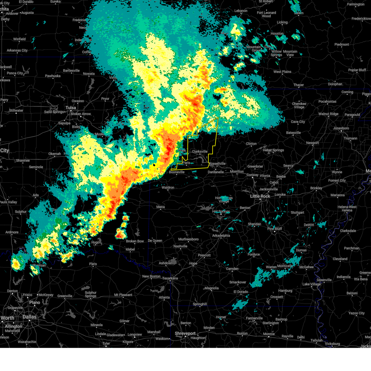
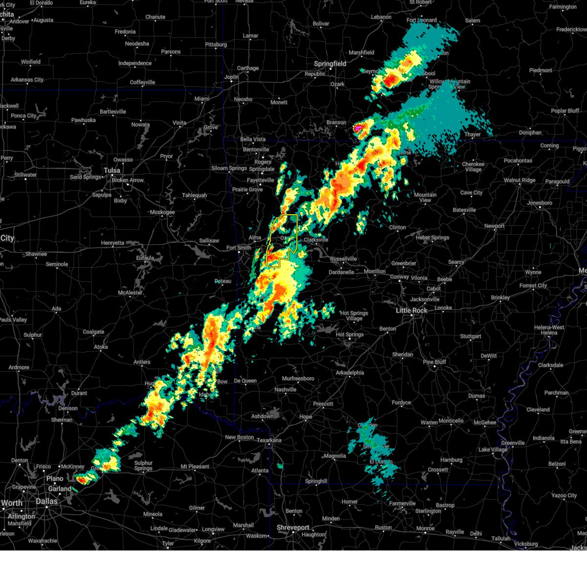
 Tortsa the national weather service in tulsa has issued a * tornado warning for, southern franklin county in west central arkansas, * until 900 pm cdt. * at 830 pm cdt, a severe thunderstorm capable of producing a tornado was located 5 miles north of ratcliff, moving east at 35 mph (radar indicated rotation). Hazards include tornado. Flying debris will be dangerous to those caught without shelter. mobile homes will be damaged or destroyed. damage to roofs, windows, and vehicles will occur. tree damage is likely. Locations in or near the path include, altus, denning, etna, alix, peter pender, wiederkehr village, cecil, meg, branch, ozark, this includes interstate 40 in arkansas between mile markers 39 and 42. Tortsa the national weather service in tulsa has issued a * tornado warning for, southern franklin county in west central arkansas, * until 900 pm cdt. * at 830 pm cdt, a severe thunderstorm capable of producing a tornado was located 5 miles north of ratcliff, moving east at 35 mph (radar indicated rotation). Hazards include tornado. Flying debris will be dangerous to those caught without shelter. mobile homes will be damaged or destroyed. damage to roofs, windows, and vehicles will occur. tree damage is likely. Locations in or near the path include, altus, denning, etna, alix, peter pender, wiederkehr village, cecil, meg, branch, ozark, this includes interstate 40 in arkansas between mile markers 39 and 42.
|
| 5/19/2025 8:27 PM CDT |
 Svrtsa the national weather service in tulsa has issued a * severe thunderstorm warning for, southern franklin county in west central arkansas, southern crawford county in northwestern arkansas, sebastian county in west central arkansas, southeastern sequoyah county in east central oklahoma, northern le flore county in southeastern oklahoma, * until 915 pm cdt. * at 827 pm cdt, severe thunderstorms were located along a line extending from near ozark to mansfield to near lake wister state park, moving east at 30 mph (radar indicated). Hazards include 60 mph wind gusts. Expect damage to roofs, siding, and trees. locations in or near the path include, alma, charleston, shibley, dyer, kibler, central city, cameron, spiro, moffett, panama, howe, vesta, lonelm, ursula, rudy, altus, mulberry, alix, greenwood, bloomer, this includes the following highways, interstate 40 in arkansas between mile markers 0 and 42. interstate 40 in oklahoma between mile markers 327 and 328. interstate 540 between mile markers 1 and 14. Interstate 49 between mile markers 22 and 27. Svrtsa the national weather service in tulsa has issued a * severe thunderstorm warning for, southern franklin county in west central arkansas, southern crawford county in northwestern arkansas, sebastian county in west central arkansas, southeastern sequoyah county in east central oklahoma, northern le flore county in southeastern oklahoma, * until 915 pm cdt. * at 827 pm cdt, severe thunderstorms were located along a line extending from near ozark to mansfield to near lake wister state park, moving east at 30 mph (radar indicated). Hazards include 60 mph wind gusts. Expect damage to roofs, siding, and trees. locations in or near the path include, alma, charleston, shibley, dyer, kibler, central city, cameron, spiro, moffett, panama, howe, vesta, lonelm, ursula, rudy, altus, mulberry, alix, greenwood, bloomer, this includes the following highways, interstate 40 in arkansas between mile markers 0 and 42. interstate 40 in oklahoma between mile markers 327 and 328. interstate 540 between mile markers 1 and 14. Interstate 49 between mile markers 22 and 27.
|
| 5/19/2025 7:46 PM CDT | Svrtsa the national weather service in tulsa has issued a * severe thunderstorm warning for, southern franklin county in west central arkansas, southern crawford county in northwestern arkansas, sebastian county in west central arkansas, southeastern sequoyah county in east central oklahoma, northern le flore county in southeastern oklahoma, * until 830 pm cdt. * at 746 pm cdt, severe thunderstorms were located along a line extending from 4 miles north of rudy to 3 miles northwest of midland to 2 miles east of fanshawe, moving northeast at 40 mph (radar indicated). Hazards include 70 mph wind gusts. Expect considerable tree damage. damage is likely to mobile homes, roofs, and outbuildings. locations in or near the path include, alma, charleston, shibley, dyer, kibler, central city, cameron, spiro, moffett, panama, howe, vesta, lonelm, ursula, rudy, altus, mulberry, alix, greenwood, bloomer, this includes the following highways, interstate 40 in arkansas between mile markers 0 and 42. interstate 40 in oklahoma between mile markers 322 and 328. interstate 540 between mile markers 1 and 14. Interstate 49 between mile markers 22 and 27. |
| 5/18/2025 5:10 AM CDT |
 Svrlzk the national weather service in little rock has issued a * severe thunderstorm warning for, logan county in western arkansas, johnson county in western arkansas, perry county in central arkansas, northwestern van buren county in north central arkansas, central conway county in central arkansas, northwestern garland county in central arkansas, northeastern scott county in western arkansas, northwestern saline county in central arkansas, yell county in central arkansas, northeastern montgomery county in western arkansas, pope county in central arkansas, * until 600 am cdt. * at 509 am cdt, severe thunderstorms were located along a line extending from 6 miles northwest of woodland to near subiaco to blue mountain to 6 miles west of gravelly, moving east at 50 mph (radar indicated). Hazards include 70 mph wind gusts and quarter size hail. Hail damage to vehicles is expected. expect considerable tree damage. Wind damage is also likely to mobile homes, roofs, and outbuildings. Svrlzk the national weather service in little rock has issued a * severe thunderstorm warning for, logan county in western arkansas, johnson county in western arkansas, perry county in central arkansas, northwestern van buren county in north central arkansas, central conway county in central arkansas, northwestern garland county in central arkansas, northeastern scott county in western arkansas, northwestern saline county in central arkansas, yell county in central arkansas, northeastern montgomery county in western arkansas, pope county in central arkansas, * until 600 am cdt. * at 509 am cdt, severe thunderstorms were located along a line extending from 6 miles northwest of woodland to near subiaco to blue mountain to 6 miles west of gravelly, moving east at 50 mph (radar indicated). Hazards include 70 mph wind gusts and quarter size hail. Hail damage to vehicles is expected. expect considerable tree damage. Wind damage is also likely to mobile homes, roofs, and outbuildings.
|
| 5/18/2025 5:06 AM CDT |
 the severe thunderstorm warning has been cancelled and is no longer in effect the severe thunderstorm warning has been cancelled and is no longer in effect
|
| 5/18/2025 5:06 AM CDT |
 At 506 am cdt, a severe thunderstorm was located over hartman, moving east at 60 mph (radar indicated). Hazards include 60 mph wind gusts and quarter size hail. Hail damage to vehicles is expected. expect wind damage to roofs, siding, and trees. Locations in or near the path include, altus, charleston, denning, etna, alix, barnes, redding, washburn, watalula, crossroads, meg, milltown, peter pender, branch, wiederkehr village, cecil, taft, ozark, fort chaffee, paradise, this includes interstate 40 in arkansas between mile markers 31 and 42. At 506 am cdt, a severe thunderstorm was located over hartman, moving east at 60 mph (radar indicated). Hazards include 60 mph wind gusts and quarter size hail. Hail damage to vehicles is expected. expect wind damage to roofs, siding, and trees. Locations in or near the path include, altus, charleston, denning, etna, alix, barnes, redding, washburn, watalula, crossroads, meg, milltown, peter pender, branch, wiederkehr village, cecil, taft, ozark, fort chaffee, paradise, this includes interstate 40 in arkansas between mile markers 31 and 42.
|
| 5/18/2025 5:04 AM CDT |
 At 504 am cdt, severe thunderstorms were located along a line extending from near denning to paris to near magazine to near blue mountain to near cardiff, moving east at 60 mph (radar indicated). Hazards include 70 mph wind gusts and quarter size hail. Hail damage to vehicles is expected. expect considerable tree damage. wind damage is also likely to mobile homes, roofs, and outbuildings. Locations impacted include, clarksville, ranger, wing, cardiff, yale, dublin, piney bay recreation area, bluffton, oark, ratcliff, barber, hunt, rover, wolf pen campground, hartman, corinth, blue ball, devils knob, glendale in logan county, spring lake campground,. At 504 am cdt, severe thunderstorms were located along a line extending from near denning to paris to near magazine to near blue mountain to near cardiff, moving east at 60 mph (radar indicated). Hazards include 70 mph wind gusts and quarter size hail. Hail damage to vehicles is expected. expect considerable tree damage. wind damage is also likely to mobile homes, roofs, and outbuildings. Locations impacted include, clarksville, ranger, wing, cardiff, yale, dublin, piney bay recreation area, bluffton, oark, ratcliff, barber, hunt, rover, wolf pen campground, hartman, corinth, blue ball, devils knob, glendale in logan county, spring lake campground,.
|
| 5/18/2025 4:58 AM CDT |
 Svrtsa the national weather service in tulsa has issued a * severe thunderstorm warning for, franklin county in west central arkansas, eastern crawford county in northwestern arkansas, northeastern sebastian county in west central arkansas, * until 530 am cdt. * at 458 am cdt, a severe thunderstorm was located over altus, moving east at 60 mph (radar indicated). Hazards include 60 mph wind gusts and quarter size hail. Hail damage to vehicles is expected. expect wind damage to roofs, siding, and trees. Locations in or near the path include, jethro, cass, charleston, bidville, crossroads, milltown, branch, locke, turners bend, vesta, cecil, lonelm, ursula, altus, mulberry, denning, etna, alix, barnes, bloomer, this includes interstate 40 in arkansas between mile markers 19 and 42. Svrtsa the national weather service in tulsa has issued a * severe thunderstorm warning for, franklin county in west central arkansas, eastern crawford county in northwestern arkansas, northeastern sebastian county in west central arkansas, * until 530 am cdt. * at 458 am cdt, a severe thunderstorm was located over altus, moving east at 60 mph (radar indicated). Hazards include 60 mph wind gusts and quarter size hail. Hail damage to vehicles is expected. expect wind damage to roofs, siding, and trees. Locations in or near the path include, jethro, cass, charleston, bidville, crossroads, milltown, branch, locke, turners bend, vesta, cecil, lonelm, ursula, altus, mulberry, denning, etna, alix, barnes, bloomer, this includes interstate 40 in arkansas between mile markers 19 and 42.
|
| 5/18/2025 4:58 AM CDT |
 At 458 am cdt, severe thunderstorms were located along a line extending from near altus to near ratcliff to near magazine to near booneville to near waldron, moving east at 60 mph (radar indicated). Hazards include 70 mph wind gusts and quarter size hail. Hail damage to vehicles is expected. expect considerable tree damage. wind damage is also likely to mobile homes, roofs, and outbuildings. Locations impacted include, clarksville, ranger, wing, cardiff, yale, dublin, piney bay recreation area, bluffton, oark, ratcliff, barber, hunt, rover, wolf pen campground, hartman, corinth, blue ball, devils knob, glendale in logan county, spring lake campground,. At 458 am cdt, severe thunderstorms were located along a line extending from near altus to near ratcliff to near magazine to near booneville to near waldron, moving east at 60 mph (radar indicated). Hazards include 70 mph wind gusts and quarter size hail. Hail damage to vehicles is expected. expect considerable tree damage. wind damage is also likely to mobile homes, roofs, and outbuildings. Locations impacted include, clarksville, ranger, wing, cardiff, yale, dublin, piney bay recreation area, bluffton, oark, ratcliff, barber, hunt, rover, wolf pen campground, hartman, corinth, blue ball, devils knob, glendale in logan county, spring lake campground,.
|
| 5/18/2025 4:52 AM CDT |
 At 452 am cdt, severe thunderstorms were located along a line extending from near pettigrew to 5 miles northeast of ozark to 4 miles southwest of branch, moving east at 70 mph (radar indicated). Hazards include 60 mph wind gusts and quarter size hail. Hail damage to vehicles is expected. expect wind damage to roofs, siding, and trees. Locations in or near the path include, jethro, cass, charleston, crossroads, dayton, milltown, branch, turners bend, vesta, cecil, lonelm, ursula, lavaca, altus, mulberry, denning, etna, alix, barnes, bloomer, this includes interstate 40 in arkansas between mile markers 20 and 42. At 452 am cdt, severe thunderstorms were located along a line extending from near pettigrew to 5 miles northeast of ozark to 4 miles southwest of branch, moving east at 70 mph (radar indicated). Hazards include 60 mph wind gusts and quarter size hail. Hail damage to vehicles is expected. expect wind damage to roofs, siding, and trees. Locations in or near the path include, jethro, cass, charleston, crossroads, dayton, milltown, branch, turners bend, vesta, cecil, lonelm, ursula, lavaca, altus, mulberry, denning, etna, alix, barnes, bloomer, this includes interstate 40 in arkansas between mile markers 20 and 42.
|
| 5/18/2025 4:52 AM CDT |
 the severe thunderstorm warning has been cancelled and is no longer in effect the severe thunderstorm warning has been cancelled and is no longer in effect
|
| 5/18/2025 4:48 AM CDT |
 At 448 am cdt, severe thunderstorms were located along a line extending from near ozark to near charleston to near washburn to 6 miles south of echo, moving east at 60 mph (radar indicated). Hazards include 70 mph wind gusts and quarter size hail. Hail damage to vehicles is expected. expect considerable tree damage. wind damage is also likely to mobile homes, roofs, and outbuildings. Locations impacted include, clarksville, ranger, wing, cardiff, yale, dublin, piney bay recreation area, bluffton, oark, ratcliff, barber, hunt, rover, wolf pen campground, hartman, corinth, blue ball, devils knob, glendale in logan county, spring lake campground,. At 448 am cdt, severe thunderstorms were located along a line extending from near ozark to near charleston to near washburn to 6 miles south of echo, moving east at 60 mph (radar indicated). Hazards include 70 mph wind gusts and quarter size hail. Hail damage to vehicles is expected. expect considerable tree damage. wind damage is also likely to mobile homes, roofs, and outbuildings. Locations impacted include, clarksville, ranger, wing, cardiff, yale, dublin, piney bay recreation area, bluffton, oark, ratcliff, barber, hunt, rover, wolf pen campground, hartman, corinth, blue ball, devils knob, glendale in logan county, spring lake campground,.
|
| 5/18/2025 4:41 AM CDT |
 At 440 am cdt, severe thunderstorms were located along a line extending from dyer to lavaca to burnville to near huntington, moving east at 55 mph (radar indicated). Hazards include 70 mph wind gusts and quarter size hail. Hail damage to vehicles is expected. expect considerable tree damage. wind damage is also likely to mobile homes, roofs, and outbuildings. Locations impacted include, clarksville, ranger, wing, cardiff, yale, dublin, piney bay recreation area, bluffton, oark, ratcliff, barber, hunt, rover, wolf pen campground, hartman, corinth, blue ball, devils knob, glendale in logan county, spring lake campground,. At 440 am cdt, severe thunderstorms were located along a line extending from dyer to lavaca to burnville to near huntington, moving east at 55 mph (radar indicated). Hazards include 70 mph wind gusts and quarter size hail. Hail damage to vehicles is expected. expect considerable tree damage. wind damage is also likely to mobile homes, roofs, and outbuildings. Locations impacted include, clarksville, ranger, wing, cardiff, yale, dublin, piney bay recreation area, bluffton, oark, ratcliff, barber, hunt, rover, wolf pen campground, hartman, corinth, blue ball, devils knob, glendale in logan county, spring lake campground,.
|
| 5/18/2025 4:37 AM CDT |
 At 436 am cdt, severe thunderstorms were located along a line extending from 7 miles northwest of cass to mulberry to near excelsior, moving east at 70 mph (radar indicated). Hazards include 60 mph wind gusts and quarter size hail. Hail damage to vehicles is expected. expect wind damage to roofs, siding, and trees. locations in or near the path include, jethro, alma, charleston, shibley, dyer, kibler, central city, winslow, locke, turners bend, mount gayler, vesta, lonelm, ursula, rudy, altus, mulberry, alix, greenwood, bloomer, this includes the following highways, interstate 40 in arkansas between mile markers 0 and 42. interstate 540 between mile markers 1 and 14. Interstate 49 between mile markers 22 and 41. At 436 am cdt, severe thunderstorms were located along a line extending from 7 miles northwest of cass to mulberry to near excelsior, moving east at 70 mph (radar indicated). Hazards include 60 mph wind gusts and quarter size hail. Hail damage to vehicles is expected. expect wind damage to roofs, siding, and trees. locations in or near the path include, jethro, alma, charleston, shibley, dyer, kibler, central city, winslow, locke, turners bend, mount gayler, vesta, lonelm, ursula, rudy, altus, mulberry, alix, greenwood, bloomer, this includes the following highways, interstate 40 in arkansas between mile markers 0 and 42. interstate 540 between mile markers 1 and 14. Interstate 49 between mile markers 22 and 41.
|
| 5/18/2025 4:37 AM CDT |
 the severe thunderstorm warning has been cancelled and is no longer in effect the severe thunderstorm warning has been cancelled and is no longer in effect
|
| 5/18/2025 4:29 AM CDT |
 Svrlzk the national weather service in little rock has issued a * severe thunderstorm warning for, logan county in western arkansas, johnson county in western arkansas, northern scott county in western arkansas, yell county in central arkansas, west central pope county in central arkansas, * until 515 am cdt. * at 429 am cdt, severe thunderstorms were located along a line extending from rudy to jenny lind to near hartford, moving east at 60 mph (radar indicated). Hazards include 60 mph wind gusts and quarter size hail. Hail damage to vehicles is expected. Expect wind damage to roofs, siding, and trees. Svrlzk the national weather service in little rock has issued a * severe thunderstorm warning for, logan county in western arkansas, johnson county in western arkansas, northern scott county in western arkansas, yell county in central arkansas, west central pope county in central arkansas, * until 515 am cdt. * at 429 am cdt, severe thunderstorms were located along a line extending from rudy to jenny lind to near hartford, moving east at 60 mph (radar indicated). Hazards include 60 mph wind gusts and quarter size hail. Hail damage to vehicles is expected. Expect wind damage to roofs, siding, and trees.
|
| 5/18/2025 4:11 AM CDT |
 Svrtsa the national weather service in tulsa has issued a * severe thunderstorm warning for, southern madison county in northwestern arkansas, franklin county in west central arkansas, crawford county in northwestern arkansas, sebastian county in west central arkansas, southeastern washington county in northwestern arkansas, eastern sequoyah county in east central oklahoma, southeastern adair county in northeastern oklahoma, northeastern le flore county in southeastern oklahoma, * until 500 am cdt. * at 410 am cdt, severe thunderstorms were located along a line extending from 3 miles northwest of natural dam to 3 miles north of muldrow to 3 miles south of bokoshe, moving east at 70 mph (radar indicated). Hazards include 60 mph wind gusts and quarter size hail. Hail damage to vehicles is expected. expect wind damage to roofs, siding, and trees. locations in or near the path include, alma, charleston, shibley, dyer, kibler, spiro, winslow, moffett, panama, locke, odell, turners bend, mount gayler, vesta, ursula, gans, rudy, boston, dutton, altus, this includes the following highways, interstate 40 in arkansas between mile markers 0 and 42. interstate 40 in oklahoma between mile markers 309 and 328. interstate 540 between mile markers 1 and 14. Interstate 49 between mile markers 22 and 44. Svrtsa the national weather service in tulsa has issued a * severe thunderstorm warning for, southern madison county in northwestern arkansas, franklin county in west central arkansas, crawford county in northwestern arkansas, sebastian county in west central arkansas, southeastern washington county in northwestern arkansas, eastern sequoyah county in east central oklahoma, southeastern adair county in northeastern oklahoma, northeastern le flore county in southeastern oklahoma, * until 500 am cdt. * at 410 am cdt, severe thunderstorms were located along a line extending from 3 miles northwest of natural dam to 3 miles north of muldrow to 3 miles south of bokoshe, moving east at 70 mph (radar indicated). Hazards include 60 mph wind gusts and quarter size hail. Hail damage to vehicles is expected. expect wind damage to roofs, siding, and trees. locations in or near the path include, alma, charleston, shibley, dyer, kibler, spiro, winslow, moffett, panama, locke, odell, turners bend, mount gayler, vesta, ursula, gans, rudy, boston, dutton, altus, this includes the following highways, interstate 40 in arkansas between mile markers 0 and 42. interstate 40 in oklahoma between mile markers 309 and 328. interstate 540 between mile markers 1 and 14. Interstate 49 between mile markers 22 and 44.
|
| 5/15/2025 1:06 PM CDT |
 Svrlzk the national weather service in little rock has issued a * severe thunderstorm warning for, logan county in western arkansas, southern johnson county in western arkansas, north central scott county in western arkansas, * until 145 pm cdt. * at 105 pm cdt, a severe thunderstorm was located over mansfield, or 14 miles northwest of waldron, moving northeast at 60 mph (radar indicated). Hazards include 60 mph wind gusts and quarter size hail. Hail damage to vehicles is expected. Expect wind damage to roofs, siding, and trees. Svrlzk the national weather service in little rock has issued a * severe thunderstorm warning for, logan county in western arkansas, southern johnson county in western arkansas, north central scott county in western arkansas, * until 145 pm cdt. * at 105 pm cdt, a severe thunderstorm was located over mansfield, or 14 miles northwest of waldron, moving northeast at 60 mph (radar indicated). Hazards include 60 mph wind gusts and quarter size hail. Hail damage to vehicles is expected. Expect wind damage to roofs, siding, and trees.
|
| 5/7/2025 10:25 PM CDT |
 The storm which prompted the warning has moved out of the area. therefore, the warning will be allowed to expire. The storm which prompted the warning has moved out of the area. therefore, the warning will be allowed to expire.
|
| 5/7/2025 10:10 PM CDT |
 Svrlzk the national weather service in little rock has issued a * severe thunderstorm warning for, northeastern logan county in western arkansas, southwestern johnson county in western arkansas, * until 1100 pm cdt. * at 1009 pm cdt, a severe thunderstorm was located near ratcliff, or 8 miles south of ozark, moving east at 25 mph (radar indicated). Hazards include ping pong ball size hail and 60 mph wind gusts. People and animals outdoors will be injured. expect hail damage to roofs, siding, windows, and vehicles. Expect wind damage to roofs, siding, and trees. Svrlzk the national weather service in little rock has issued a * severe thunderstorm warning for, northeastern logan county in western arkansas, southwestern johnson county in western arkansas, * until 1100 pm cdt. * at 1009 pm cdt, a severe thunderstorm was located near ratcliff, or 8 miles south of ozark, moving east at 25 mph (radar indicated). Hazards include ping pong ball size hail and 60 mph wind gusts. People and animals outdoors will be injured. expect hail damage to roofs, siding, windows, and vehicles. Expect wind damage to roofs, siding, and trees.
|
| 5/7/2025 10:05 PM CDT |
 At 1005 pm cdt, a severe thunderstorm was located 4 miles north of ratcliff, moving east at 35 mph (radar indicated). Hazards include 60 mph wind gusts and quarter size hail. Hail damage to vehicles is expected. expect wind damage to roofs, siding, and trees. Locations in or near the path include, altus, denning, etna, alix, peter pender, branch, cecil, meg, wiederkehr village, charleston,. At 1005 pm cdt, a severe thunderstorm was located 4 miles north of ratcliff, moving east at 35 mph (radar indicated). Hazards include 60 mph wind gusts and quarter size hail. Hail damage to vehicles is expected. expect wind damage to roofs, siding, and trees. Locations in or near the path include, altus, denning, etna, alix, peter pender, branch, cecil, meg, wiederkehr village, charleston,.
|
| 5/7/2025 10:05 PM CDT |
 the severe thunderstorm warning has been cancelled and is no longer in effect the severe thunderstorm warning has been cancelled and is no longer in effect
|
| 5/7/2025 9:42 PM CDT |
 Svrtsa the national weather service in tulsa has issued a * severe thunderstorm warning for, southern franklin county in west central arkansas, northeastern sebastian county in west central arkansas, * until 1030 pm cdt. * at 941 pm cdt, a severe thunderstorm was located 4 miles northeast of lavaca, moving east at 35 mph (radar indicated). Hazards include 60 mph wind gusts and quarter size hail. Hail damage to vehicles is expected. expect wind damage to roofs, siding, and trees. Locations in or near the path include, charleston, altus, denning, etna, alix, bloomer, meg, peter pender, branch, vesta, cecil, ursula, wiederkehr village,. Svrtsa the national weather service in tulsa has issued a * severe thunderstorm warning for, southern franklin county in west central arkansas, northeastern sebastian county in west central arkansas, * until 1030 pm cdt. * at 941 pm cdt, a severe thunderstorm was located 4 miles northeast of lavaca, moving east at 35 mph (radar indicated). Hazards include 60 mph wind gusts and quarter size hail. Hail damage to vehicles is expected. expect wind damage to roofs, siding, and trees. Locations in or near the path include, charleston, altus, denning, etna, alix, bloomer, meg, peter pender, branch, vesta, cecil, ursula, wiederkehr village,.
|
| 5/2/2025 6:32 AM CDT |
 At 632 am cdt, severe thunderstorms were located along a line extending from 6 miles south of cass to 2 miles southeast of wiederkehr village to 2 miles south of magazine, moving east at 50 mph (radar indicated). Hazards include 60 mph wind gusts. Expect damage to roofs, siding, and trees. Locations in or near the path include, jethro, alma, cass, charleston, dyer, branch, turners bend, vesta, cecil, lonelm, ursula, altus, mulberry, denning, etna, alix, barnes, redding, washburn, watalula, this includes interstate 40 in arkansas between mile markers 13 and 42. At 632 am cdt, severe thunderstorms were located along a line extending from 6 miles south of cass to 2 miles southeast of wiederkehr village to 2 miles south of magazine, moving east at 50 mph (radar indicated). Hazards include 60 mph wind gusts. Expect damage to roofs, siding, and trees. Locations in or near the path include, jethro, alma, cass, charleston, dyer, branch, turners bend, vesta, cecil, lonelm, ursula, altus, mulberry, denning, etna, alix, barnes, redding, washburn, watalula, this includes interstate 40 in arkansas between mile markers 13 and 42.
|
| 5/2/2025 6:07 AM CDT |
 Svrtsa the national weather service in tulsa has issued a * severe thunderstorm warning for, franklin county in west central arkansas, southern crawford county in northwestern arkansas, eastern sebastian county in west central arkansas, * until 645 am cdt. * at 606 am cdt, severe thunderstorms were located along a line extending from 2 miles north of alma to 6 miles northeast of lavaca to 3 miles southeast of mansfield, moving east at 40 mph (radar indicated). Hazards include 60 mph wind gusts and quarter size hail. Hail damage to vehicles is expected. expect wind damage to roofs, siding, and trees. locations in or near the path include, jethro, alma, cass, charleston, shibley, dyer, kibler, crossroads, liberty, milltown, branch, turners bend, vesta, cecil, lonelm, ursula, rudy, lavaca, altus, mulberry, this includes the following highways, interstate 40 in arkansas between mile markers 4 and 42. interstate 540 between mile markers 1 and 2. Interstate 49 between mile markers 22 and 24. Svrtsa the national weather service in tulsa has issued a * severe thunderstorm warning for, franklin county in west central arkansas, southern crawford county in northwestern arkansas, eastern sebastian county in west central arkansas, * until 645 am cdt. * at 606 am cdt, severe thunderstorms were located along a line extending from 2 miles north of alma to 6 miles northeast of lavaca to 3 miles southeast of mansfield, moving east at 40 mph (radar indicated). Hazards include 60 mph wind gusts and quarter size hail. Hail damage to vehicles is expected. expect wind damage to roofs, siding, and trees. locations in or near the path include, jethro, alma, cass, charleston, shibley, dyer, kibler, crossroads, liberty, milltown, branch, turners bend, vesta, cecil, lonelm, ursula, rudy, lavaca, altus, mulberry, this includes the following highways, interstate 40 in arkansas between mile markers 4 and 42. interstate 540 between mile markers 1 and 2. Interstate 49 between mile markers 22 and 24.
|
| 4/20/2025 3:28 PM CDT |
 At 328 pm cdt, severe thunderstorms were located along a line extending from 7 miles east of cass to near mount magazine to 6 miles east of cardiff, moving northeast at 55 mph (radar indicated). Hazards include 60 mph wind gusts and nickel size hail. Expect damage to roofs, siding, and trees. Locations impacted include, stonehouse recreation area, clarksville, subiaco, olio, roseville, dublin, ludwig, bluffton, union city, hinkle, ratcliff, hunt, coal hill, wilkins, blue mountain, scranton, gravelly, hartman, corley, fourche valley,. At 328 pm cdt, severe thunderstorms were located along a line extending from 7 miles east of cass to near mount magazine to 6 miles east of cardiff, moving northeast at 55 mph (radar indicated). Hazards include 60 mph wind gusts and nickel size hail. Expect damage to roofs, siding, and trees. Locations impacted include, stonehouse recreation area, clarksville, subiaco, olio, roseville, dublin, ludwig, bluffton, union city, hinkle, ratcliff, hunt, coal hill, wilkins, blue mountain, scranton, gravelly, hartman, corley, fourche valley,.
|
| 4/20/2025 3:09 PM CDT |
 At 309 pm cdt, severe thunderstorms were located along a line extending from near ozark to 7 miles southeast of booneville to 8 miles southeast of waldron, moving northeast at 55 mph (radar indicated). Hazards include 60 mph wind gusts and nickel size hail. Expect damage to roofs, siding, and trees. Locations impacted include, clarksville, cardiff, dublin, bluffton, ratcliff, barber, hunt, hartman, blue ball, glendale in logan county, hoyt, union hill, morrison bluff, harmony, caulksville, waltreak, booneville, midway in logan county, nola, driggs,. At 309 pm cdt, severe thunderstorms were located along a line extending from near ozark to 7 miles southeast of booneville to 8 miles southeast of waldron, moving northeast at 55 mph (radar indicated). Hazards include 60 mph wind gusts and nickel size hail. Expect damage to roofs, siding, and trees. Locations impacted include, clarksville, cardiff, dublin, bluffton, ratcliff, barber, hunt, hartman, blue ball, glendale in logan county, hoyt, union hill, morrison bluff, harmony, caulksville, waltreak, booneville, midway in logan county, nola, driggs,.
|
| 4/20/2025 3:09 PM CDT |
 the severe thunderstorm warning has been cancelled and is no longer in effect the severe thunderstorm warning has been cancelled and is no longer in effect
|
| 4/20/2025 2:57 PM CDT |
 Svrlzk the national weather service in little rock has issued a * severe thunderstorm warning for, logan county in western arkansas, southwestern johnson county in western arkansas, scott county in western arkansas, north central polk county in western arkansas, western yell county in central arkansas, * until 345 pm cdt. * at 257 pm cdt, severe thunderstorms were located along a line extending from 7 miles southeast of mulberry to near cardiff to 10 miles northeast of mena, moving northeast at 55 mph (radar indicated). Hazards include 60 mph wind gusts and nickel size hail. expect damage to roofs, siding, and trees Svrlzk the national weather service in little rock has issued a * severe thunderstorm warning for, logan county in western arkansas, southwestern johnson county in western arkansas, scott county in western arkansas, north central polk county in western arkansas, western yell county in central arkansas, * until 345 pm cdt. * at 257 pm cdt, severe thunderstorms were located along a line extending from 7 miles southeast of mulberry to near cardiff to 10 miles northeast of mena, moving northeast at 55 mph (radar indicated). Hazards include 60 mph wind gusts and nickel size hail. expect damage to roofs, siding, and trees
|
| 4/20/2025 6:55 AM CDT |
 the severe thunderstorm warning has been cancelled and is no longer in effect the severe thunderstorm warning has been cancelled and is no longer in effect
|
| 4/20/2025 6:44 AM CDT |
 At 644 am cdt, a severe thunderstorm was located over charleston, moving northeast at 40 mph (radar indicated). Hazards include 60 mph wind gusts and quarter size hail. Hail damage to vehicles is expected. expect wind damage to roofs, siding, and trees. Locations impacted include, coal hill, roseville, carbon city, caulksville, chismville, hartman, ratcliff, paris,. At 644 am cdt, a severe thunderstorm was located over charleston, moving northeast at 40 mph (radar indicated). Hazards include 60 mph wind gusts and quarter size hail. Hail damage to vehicles is expected. expect wind damage to roofs, siding, and trees. Locations impacted include, coal hill, roseville, carbon city, caulksville, chismville, hartman, ratcliff, paris,.
|
| 4/20/2025 6:30 AM CDT |
 Svrlzk the national weather service in little rock has issued a * severe thunderstorm warning for, northwestern logan county in western arkansas, southwestern johnson county in western arkansas, * until 715 am cdt. * at 630 am cdt, a severe thunderstorm was located over washburn, or 10 miles south of charleston, moving northeast at 40 mph (radar indicated). Hazards include 60 mph wind gusts and quarter size hail. Hail damage to vehicles is expected. Expect wind damage to roofs, siding, and trees. Svrlzk the national weather service in little rock has issued a * severe thunderstorm warning for, northwestern logan county in western arkansas, southwestern johnson county in western arkansas, * until 715 am cdt. * at 630 am cdt, a severe thunderstorm was located over washburn, or 10 miles south of charleston, moving northeast at 40 mph (radar indicated). Hazards include 60 mph wind gusts and quarter size hail. Hail damage to vehicles is expected. Expect wind damage to roofs, siding, and trees.
|
| 4/19/2025 8:39 AM CDT |
 The storms which prompted the warning have moved out of the area. therefore, the warning will be allowed to expire. The storms which prompted the warning have moved out of the area. therefore, the warning will be allowed to expire.
|
| 4/19/2025 8:27 AM CDT |
 At 827 am cdt, severe thunderstorms were located along a line extending from 3 miles southwest of pettigrew to 5 miles northeast of wiederkehr village to 4 miles southwest of denning, moving east at 40 mph (radar indicated). Hazards include 60 mph wind gusts. Expect damage to roofs, siding, and trees. Locations in or near the path include, altus, cass, denning, etna, alix, barnes, redding, watalula, meg, turners bend, wiederkehr village, taft, ozark, paradise, this includes interstate 40 in arkansas between mile markers 35 and 42. At 827 am cdt, severe thunderstorms were located along a line extending from 3 miles southwest of pettigrew to 5 miles northeast of wiederkehr village to 4 miles southwest of denning, moving east at 40 mph (radar indicated). Hazards include 60 mph wind gusts. Expect damage to roofs, siding, and trees. Locations in or near the path include, altus, cass, denning, etna, alix, barnes, redding, watalula, meg, turners bend, wiederkehr village, taft, ozark, paradise, this includes interstate 40 in arkansas between mile markers 35 and 42.
|
| 4/19/2025 8:10 AM CDT |
 the severe thunderstorm warning has been cancelled and is no longer in effect the severe thunderstorm warning has been cancelled and is no longer in effect
|
| 4/19/2025 8:10 AM CDT |
 At 810 am cdt, severe thunderstorms were located along a line extending from 3 miles northwest of cass to 3 miles west of ozark to 2 miles northwest of branch, moving east at 50 mph (radar indicated). Hazards include 60 mph wind gusts. Expect damage to roofs, siding, and trees. Locations in or near the path include, jethro, altus, charleston, cass, denning, etna, alix, barnes, redding, watalula, meg, toney, peter pender, branch, turners bend, wiederkehr village, cecil, lonelm, taft, ozark, this includes interstate 40 in arkansas between mile markers 26 and 42. At 810 am cdt, severe thunderstorms were located along a line extending from 3 miles northwest of cass to 3 miles west of ozark to 2 miles northwest of branch, moving east at 50 mph (radar indicated). Hazards include 60 mph wind gusts. Expect damage to roofs, siding, and trees. Locations in or near the path include, jethro, altus, charleston, cass, denning, etna, alix, barnes, redding, watalula, meg, toney, peter pender, branch, turners bend, wiederkehr village, cecil, lonelm, taft, ozark, this includes interstate 40 in arkansas between mile markers 26 and 42.
|
| 4/19/2025 7:51 AM CDT |
 Svrtsa the national weather service in tulsa has issued a * severe thunderstorm warning for, franklin county in west central arkansas, central crawford county in northwestern arkansas, northeastern sebastian county in west central arkansas, * until 845 am cdt. * at 751 am cdt, severe thunderstorms were located along a line extending from 4 miles northeast of rudy to near greenwood, moving east at 40 mph (radar indicated). Hazards include 60 mph wind gusts. Expect damage to roofs, siding, and trees. locations in or near the path include, jethro, alma, charleston, cass, dyer, kibler, mountainburg, branch, locke, turners bend, vesta, cecil, lonelm, ursula, lavaca, altus, mulberry, denning, etna, alix, this includes the following highways, interstate 40 in arkansas between mile markers 12 and 42. Interstate 49 between mile markers 25 and 32. Svrtsa the national weather service in tulsa has issued a * severe thunderstorm warning for, franklin county in west central arkansas, central crawford county in northwestern arkansas, northeastern sebastian county in west central arkansas, * until 845 am cdt. * at 751 am cdt, severe thunderstorms were located along a line extending from 4 miles northeast of rudy to near greenwood, moving east at 40 mph (radar indicated). Hazards include 60 mph wind gusts. Expect damage to roofs, siding, and trees. locations in or near the path include, jethro, alma, charleston, cass, dyer, kibler, mountainburg, branch, locke, turners bend, vesta, cecil, lonelm, ursula, lavaca, altus, mulberry, denning, etna, alix, this includes the following highways, interstate 40 in arkansas between mile markers 12 and 42. Interstate 49 between mile markers 25 and 32.
|
| 4/5/2025 2:44 AM CDT |
 The storm which prompted the warning has moved out of the area. therefore, the warning will be allowed to expire. to report severe weather, contact your nearest law enforcement agency. they will relay your report to the national weather service little rock. The storm which prompted the warning has moved out of the area. therefore, the warning will be allowed to expire. to report severe weather, contact your nearest law enforcement agency. they will relay your report to the national weather service little rock.
|
| 4/5/2025 2:38 AM CDT |
 Svrtsa the national weather service in tulsa has issued a * severe thunderstorm warning for, southeastern madison county in northwestern arkansas, eastern franklin county in west central arkansas, * until 330 am cdt. * at 237 am cdt, a severe thunderstorm was located 4 miles southwest of denning, moving north at 60 mph (radar indicated). Hazards include golf ball size hail and 60 mph wind gusts. People and animals outdoors will be injured. expect hail damage to roofs, siding, windows, and vehicles. expect wind damage to roofs, siding, and trees. locations in or near the path include, cass, red star, aurora, turners bend, boston, dutton, altus, denning, etna, alix, barnes, pettigrew, st. Paul, redding, weathers, watalula, witter, brashears, meg, peter pender, this includes interstate 40 in arkansas between mile markers 32 and 42. Svrtsa the national weather service in tulsa has issued a * severe thunderstorm warning for, southeastern madison county in northwestern arkansas, eastern franklin county in west central arkansas, * until 330 am cdt. * at 237 am cdt, a severe thunderstorm was located 4 miles southwest of denning, moving north at 60 mph (radar indicated). Hazards include golf ball size hail and 60 mph wind gusts. People and animals outdoors will be injured. expect hail damage to roofs, siding, windows, and vehicles. expect wind damage to roofs, siding, and trees. locations in or near the path include, cass, red star, aurora, turners bend, boston, dutton, altus, denning, etna, alix, barnes, pettigrew, st. Paul, redding, weathers, watalula, witter, brashears, meg, peter pender, this includes interstate 40 in arkansas between mile markers 32 and 42.
|
| 4/5/2025 2:37 AM CDT |
 At 236 am cdt, a severe thunderstorm was located near ratcliff, or 7 miles northwest of paris, moving north at 50 mph (radar indicated). Hazards include 60 mph wind gusts and quarter size hail. Hail damage to vehicles is expected. expect wind damage to roofs, siding, and trees. Locations impacted include, carbon city, caulksville, roseville, ratcliff, paris,. At 236 am cdt, a severe thunderstorm was located near ratcliff, or 7 miles northwest of paris, moving north at 50 mph (radar indicated). Hazards include 60 mph wind gusts and quarter size hail. Hail damage to vehicles is expected. expect wind damage to roofs, siding, and trees. Locations impacted include, carbon city, caulksville, roseville, ratcliff, paris,.
|
| 4/5/2025 2:37 AM CDT |
 the severe thunderstorm warning has been cancelled and is no longer in effect the severe thunderstorm warning has been cancelled and is no longer in effect
|
| 4/5/2025 2:35 AM CDT | Quarter sized hail reported 3.7 miles SSW of Ratcliff, AR, timing estimated from radar. |
| 4/5/2025 2:24 AM CDT |
 At 223 am cdt, a severe thunderstorm was located near booneville, moving north at 55 mph (radar indicated). Hazards include 60 mph wind gusts and half dollar size hail. Hail damage to vehicles is expected. expect wind damage to roofs, siding, and trees. Locations impacted include, roseville, driggs, carbon city, caulksville, chismville, booneville, magazine, paris, glendale in logan county, ratcliff,. At 223 am cdt, a severe thunderstorm was located near booneville, moving north at 55 mph (radar indicated). Hazards include 60 mph wind gusts and half dollar size hail. Hail damage to vehicles is expected. expect wind damage to roofs, siding, and trees. Locations impacted include, roseville, driggs, carbon city, caulksville, chismville, booneville, magazine, paris, glendale in logan county, ratcliff,.
|
| 4/5/2025 2:24 AM CDT |
 the severe thunderstorm warning has been cancelled and is no longer in effect the severe thunderstorm warning has been cancelled and is no longer in effect
|
| 4/5/2025 2:19 AM CDT |
 At 218 am cdt, a severe thunderstorm was located near booneville, moving north at 55 mph (radar indicated). Hazards include two inch hail and 60 mph wind gusts. People and animals outdoors will be injured. expect hail damage to roofs, siding, windows, and vehicles. expect wind damage to roofs, siding, and trees. Locations in or near the path include, cecil, etna, peter pender, branch, meg,. At 218 am cdt, a severe thunderstorm was located near booneville, moving north at 55 mph (radar indicated). Hazards include two inch hail and 60 mph wind gusts. People and animals outdoors will be injured. expect hail damage to roofs, siding, windows, and vehicles. expect wind damage to roofs, siding, and trees. Locations in or near the path include, cecil, etna, peter pender, branch, meg,.
|
| 4/5/2025 2:19 AM CDT |
 the severe thunderstorm warning has been cancelled and is no longer in effect the severe thunderstorm warning has been cancelled and is no longer in effect
|
| 4/5/2025 2:02 AM CDT |
 Svrtsa the national weather service in tulsa has issued a * severe thunderstorm warning for, southern franklin county in west central arkansas, east central sebastian county in west central arkansas, * until 245 am cdt. * at 202 am cdt, a severe thunderstorm was located near waldron, moving north at 50 mph (radar indicated). Hazards include ping pong ball size hail and 60 mph wind gusts. People and animals outdoors will be injured. expect hail damage to roofs, siding, windows, and vehicles. expect wind damage to roofs, siding, and trees. Locations in or near the path include, charleston, etna, peter pender, branch, washburn, vesta, cecil, fort chaffee, meg,. Svrtsa the national weather service in tulsa has issued a * severe thunderstorm warning for, southern franklin county in west central arkansas, east central sebastian county in west central arkansas, * until 245 am cdt. * at 202 am cdt, a severe thunderstorm was located near waldron, moving north at 50 mph (radar indicated). Hazards include ping pong ball size hail and 60 mph wind gusts. People and animals outdoors will be injured. expect hail damage to roofs, siding, windows, and vehicles. expect wind damage to roofs, siding, and trees. Locations in or near the path include, charleston, etna, peter pender, branch, washburn, vesta, cecil, fort chaffee, meg,.
|
| 4/5/2025 1:59 AM CDT |
 Svrlzk the national weather service in little rock has issued a * severe thunderstorm warning for, western logan county in western arkansas, southwestern johnson county in western arkansas, northeastern scott county in western arkansas, * until 245 am cdt. * at 159 am cdt, a severe thunderstorm was located over waldron, moving north at 50 mph (radar indicated). Hazards include ping pong ball size hail and 60 mph wind gusts. People and animals outdoors will be injured. expect hail damage to roofs, siding, windows, and vehicles. Expect wind damage to roofs, siding, and trees. Svrlzk the national weather service in little rock has issued a * severe thunderstorm warning for, western logan county in western arkansas, southwestern johnson county in western arkansas, northeastern scott county in western arkansas, * until 245 am cdt. * at 159 am cdt, a severe thunderstorm was located over waldron, moving north at 50 mph (radar indicated). Hazards include ping pong ball size hail and 60 mph wind gusts. People and animals outdoors will be injured. expect hail damage to roofs, siding, windows, and vehicles. Expect wind damage to roofs, siding, and trees.
|
| 4/5/2025 12:27 AM CDT |
 At 1227 am cdt, a severe thunderstorm was located over ratcliff, or 7 miles east of charleston, moving northeast at 55 mph (radar indicated). Hazards include quarter size hail. Damage to vehicles is expected. Locations impacted include, coal hill, roseville, carbon city, caulksville, chismville, hartman, ratcliff, paris, booneville,. At 1227 am cdt, a severe thunderstorm was located over ratcliff, or 7 miles east of charleston, moving northeast at 55 mph (radar indicated). Hazards include quarter size hail. Damage to vehicles is expected. Locations impacted include, coal hill, roseville, carbon city, caulksville, chismville, hartman, ratcliff, paris, booneville,.
|
| 4/5/2025 12:23 AM CDT |
 the severe thunderstorm warning has been cancelled and is no longer in effect the severe thunderstorm warning has been cancelled and is no longer in effect
|
| 4/5/2025 12:23 AM CDT |
 At 1223 am cdt, a severe thunderstorm was located over ratcliff, moving northeast at 55 mph (radar indicated). Hazards include quarter size hail. Damage to vehicles is expected. Locations in or near the path include, altus, denning, etna, alix, peter pender, branch, wiederkehr village, ozark, meg, charleston, this includes interstate 40 in arkansas between mile markers 34 and 42. At 1223 am cdt, a severe thunderstorm was located over ratcliff, moving northeast at 55 mph (radar indicated). Hazards include quarter size hail. Damage to vehicles is expected. Locations in or near the path include, altus, denning, etna, alix, peter pender, branch, wiederkehr village, ozark, meg, charleston, this includes interstate 40 in arkansas between mile markers 34 and 42.
|
| 4/5/2025 12:14 AM CDT |
 the severe thunderstorm warning has been cancelled and is no longer in effect the severe thunderstorm warning has been cancelled and is no longer in effect
|
| 4/5/2025 12:14 AM CDT |
 At 1213 am cdt, a severe thunderstorm was located near fort chaffee, or near booneville, moving northeast at 55 mph (radar indicated). Hazards include quarter size hail. Damage to vehicles is expected. Locations impacted include, roseville, caulksville, chismville, booneville, ratcliff, barber, coal hill, carbon city, hartman, carolan, glendale in logan county, echo, ione, paris,. At 1213 am cdt, a severe thunderstorm was located near fort chaffee, or near booneville, moving northeast at 55 mph (radar indicated). Hazards include quarter size hail. Damage to vehicles is expected. Locations impacted include, roseville, caulksville, chismville, booneville, ratcliff, barber, coal hill, carbon city, hartman, carolan, glendale in logan county, echo, ione, paris,.
|
| 4/5/2025 12:03 AM CDT |
 Svrtsa the national weather service in tulsa has issued a * severe thunderstorm warning for, southern franklin county in west central arkansas, east central sebastian county in west central arkansas, * until 1245 am cdt. * at 1203 am cdt, a severe thunderstorm was located 5 miles southeast of echo, moving northeast at 45 to 50 mph (radar indicated). Hazards include quarter size hail. Damage to vehicles is expected. Locations in or near the path include, altus, denning, etna, alix, peter pender, branch, washburn, wiederkehr village, ozark, fort chaffee, meg, charleston, this includes interstate 40 in arkansas between mile markers 34 and 42. Svrtsa the national weather service in tulsa has issued a * severe thunderstorm warning for, southern franklin county in west central arkansas, east central sebastian county in west central arkansas, * until 1245 am cdt. * at 1203 am cdt, a severe thunderstorm was located 5 miles southeast of echo, moving northeast at 45 to 50 mph (radar indicated). Hazards include quarter size hail. Damage to vehicles is expected. Locations in or near the path include, altus, denning, etna, alix, peter pender, branch, washburn, wiederkehr village, ozark, fort chaffee, meg, charleston, this includes interstate 40 in arkansas between mile markers 34 and 42.
|
| 4/5/2025 12:01 AM CDT |
 Svrlzk the national weather service in little rock has issued a * severe thunderstorm warning for, western logan county in western arkansas, west central johnson county in western arkansas, north central scott county in western arkansas, * until 1245 am cdt. * at 1201 am cdt, a severe thunderstorm was located near echo, or 9 miles north of waldron, moving northeast at 55 mph (radar indicated). Hazards include quarter size hail. damage to vehicles is expected Svrlzk the national weather service in little rock has issued a * severe thunderstorm warning for, western logan county in western arkansas, west central johnson county in western arkansas, north central scott county in western arkansas, * until 1245 am cdt. * at 1201 am cdt, a severe thunderstorm was located near echo, or 9 miles north of waldron, moving northeast at 55 mph (radar indicated). Hazards include quarter size hail. damage to vehicles is expected
|
| 4/4/2025 11:13 PM CDT | The storms which prompted the warning have weakened below severe limits, and no longer pose an immediate threat to life or property. therefore, the warning will be allowed to expire. however small hail is still possible with these thunderstorms. |
| 4/4/2025 11:03 PM CDT |
 At 1102 pm cdt, severe thunderstorms were located along a line extending from near washburn to near magazine, moving north at 50 mph (radar indicated). Hazards include 60 mph wind gusts and quarter size hail. Hail damage to vehicles is expected. expect wind damage to roofs, siding, and trees. Locations impacted include, caulksville, chismville, booneville, ratcliff, barber, blue mountain, driggs, carbon city, sugar grove, carolan, grayson, magazine, paris, glendale in logan county, ione, corley, lucas, subiaco, mount magazine,. At 1102 pm cdt, severe thunderstorms were located along a line extending from near washburn to near magazine, moving north at 50 mph (radar indicated). Hazards include 60 mph wind gusts and quarter size hail. Hail damage to vehicles is expected. expect wind damage to roofs, siding, and trees. Locations impacted include, caulksville, chismville, booneville, ratcliff, barber, blue mountain, driggs, carbon city, sugar grove, carolan, grayson, magazine, paris, glendale in logan county, ione, corley, lucas, subiaco, mount magazine,.
|
| 4/4/2025 11:03 PM CDT |
 the severe thunderstorm warning has been cancelled and is no longer in effect the severe thunderstorm warning has been cancelled and is no longer in effect
|
| 4/4/2025 10:51 PM CDT | At 1050 pm cdt, severe thunderstorms were located along a line extending from 6 miles north of waldron to near cardiff, moving northeast at 50 mph (radar indicated). Hazards include ping pong ball size hail and 60 mph wind gusts. People and animals outdoors will be injured. expect hail damage to roofs, siding, windows, and vehicles. expect wind damage to roofs, siding, and trees. Locations impacted include, union hill, mansfield, echo, lucas, caulksville, chismville, liberty, booneville, ratcliff, barber, blue mountain, driggs, carbon city, sugar grove, carolan, grayson, magazine, paris, elm park, glendale in logan county,. |
| 4/4/2025 10:36 PM CDT |
 At 1036 pm cdt, severe thunderstorms were located along a line extending from near beauchamp to 6 miles southwest of cardiff, moving northeast at 50 mph (radar indicated). Hazards include two inch hail and 60 mph wind gusts. People and animals outdoors will be injured. expect hail damage to roofs, siding, windows, and vehicles. expect wind damage to roofs, siding, and trees. Locations impacted include, stonehouse recreation area, mansfield, cardiff, olio, winfield, chismville, beauchamp, waldron, liberty, ratcliff, barber, blue mountain, boles, corley, grayson, elm park, glendale in logan county, ione, union hill, mount magazine,. At 1036 pm cdt, severe thunderstorms were located along a line extending from near beauchamp to 6 miles southwest of cardiff, moving northeast at 50 mph (radar indicated). Hazards include two inch hail and 60 mph wind gusts. People and animals outdoors will be injured. expect hail damage to roofs, siding, windows, and vehicles. expect wind damage to roofs, siding, and trees. Locations impacted include, stonehouse recreation area, mansfield, cardiff, olio, winfield, chismville, beauchamp, waldron, liberty, ratcliff, barber, blue mountain, boles, corley, grayson, elm park, glendale in logan county, ione, union hill, mount magazine,.
|
| 4/4/2025 10:36 PM CDT |
 Svrtsa the national weather service in tulsa has issued a * severe thunderstorm warning for, southwestern franklin county in west central arkansas, eastern sebastian county in west central arkansas, * until 1115 pm cdt. * at 1036 pm cdt, a severe thunderstorm was located 3 miles northeast of beauchamp, moving north at 60 mph (radar indicated). Hazards include half dollar size hail. Damage to vehicles is expected. Locations in or near the path include, lavaca, charleston, bloomer, washburn, crossroads, liberty, dayton, milltown, peter pender, branch, burnville, vesta, ursula, fort chaffee, huntington, greenwood,. Svrtsa the national weather service in tulsa has issued a * severe thunderstorm warning for, southwestern franklin county in west central arkansas, eastern sebastian county in west central arkansas, * until 1115 pm cdt. * at 1036 pm cdt, a severe thunderstorm was located 3 miles northeast of beauchamp, moving north at 60 mph (radar indicated). Hazards include half dollar size hail. Damage to vehicles is expected. Locations in or near the path include, lavaca, charleston, bloomer, washburn, crossroads, liberty, dayton, milltown, peter pender, branch, burnville, vesta, ursula, fort chaffee, huntington, greenwood,.
|
| 4/4/2025 10:36 PM CDT |
 the severe thunderstorm warning has been cancelled and is no longer in effect the severe thunderstorm warning has been cancelled and is no longer in effect
|
| 4/4/2025 10:24 PM CDT | Svrlzk the national weather service in little rock has issued a * severe thunderstorm warning for, logan county in western arkansas, scott county in western arkansas, northeastern polk county in western arkansas, west central yell county in central arkansas, * until 1115 pm cdt. * at 1024 pm cdt, severe thunderstorms were located along a line extending from near beauchamp to 11 miles north of opal, moving north at 50 mph (radar indicated). Hazards include 60 mph wind gusts and half dollar size hail. Hail damage to vehicles is expected. Expect wind damage to roofs, siding, and trees. |
| 4/2/2025 1:33 PM CDT |
 At 133 pm cdt, a severe thunderstorm was located 6 miles north of branch, moving northeast at 60 mph (radar indicated). Hazards include 60 mph wind gusts and quarter size hail. Hail damage to vehicles is expected. expect wind damage to roofs, siding, and trees. Locations in or near the path include, jethro, altus, charleston, cass, denning, etna, alix, barnes, redding, watalula, meg, toney, peter pender, branch, turners bend, wiederkehr village, vesta, cecil, lonelm, taft, this includes interstate 40 in arkansas between mile markers 24 and 42. At 133 pm cdt, a severe thunderstorm was located 6 miles north of branch, moving northeast at 60 mph (radar indicated). Hazards include 60 mph wind gusts and quarter size hail. Hail damage to vehicles is expected. expect wind damage to roofs, siding, and trees. Locations in or near the path include, jethro, altus, charleston, cass, denning, etna, alix, barnes, redding, watalula, meg, toney, peter pender, branch, turners bend, wiederkehr village, vesta, cecil, lonelm, taft, this includes interstate 40 in arkansas between mile markers 24 and 42.
|
| 4/2/2025 1:33 PM CDT |
 the severe thunderstorm warning has been cancelled and is no longer in effect the severe thunderstorm warning has been cancelled and is no longer in effect
|
| 4/2/2025 1:20 PM CDT |
 Svrtsa the national weather service in tulsa has issued a * severe thunderstorm warning for, franklin county in west central arkansas, eastern crawford county in northwestern arkansas, northeastern sebastian county in west central arkansas, * until 200 pm cdt. * at 120 pm cdt, a severe thunderstorm was located over fort chaffee, moving northeast at 60 mph (radar indicated). Hazards include 60 mph wind gusts and quarter size hail. Hail damage to vehicles is expected. expect wind damage to roofs, siding, and trees. Locations in or near the path include, jethro, charleston, cass, milltown, branch, turners bend, vesta, cecil, lonelm, ursula, lavaca, altus, mulberry, denning, etna, greenwood, alix, barnes, bloomer, redding, this includes interstate 40 in arkansas between mile markers 21 and 42. Svrtsa the national weather service in tulsa has issued a * severe thunderstorm warning for, franklin county in west central arkansas, eastern crawford county in northwestern arkansas, northeastern sebastian county in west central arkansas, * until 200 pm cdt. * at 120 pm cdt, a severe thunderstorm was located over fort chaffee, moving northeast at 60 mph (radar indicated). Hazards include 60 mph wind gusts and quarter size hail. Hail damage to vehicles is expected. expect wind damage to roofs, siding, and trees. Locations in or near the path include, jethro, charleston, cass, milltown, branch, turners bend, vesta, cecil, lonelm, ursula, lavaca, altus, mulberry, denning, etna, greenwood, alix, barnes, bloomer, redding, this includes interstate 40 in arkansas between mile markers 21 and 42.
|
| 4/2/2025 11:39 AM CDT |
 The storm which prompted the warning has moved out of the area. therefore, the warning will be allowed to expire. however, small hail and gusty winds are still possible with this thunderstorm. a tornado watch remains in effect until noon cdt for northwestern and west central arkansas. The storm which prompted the warning has moved out of the area. therefore, the warning will be allowed to expire. however, small hail and gusty winds are still possible with this thunderstorm. a tornado watch remains in effect until noon cdt for northwestern and west central arkansas.
|
| 4/2/2025 11:28 AM CDT |
 Svrlzk the national weather service in little rock has issued a * severe thunderstorm warning for, central logan county in western arkansas, southwestern johnson county in western arkansas, * until 1215 pm cdt. * at 1128 am cdt, a severe thunderstorm was located near branch, or near charleston, moving northeast at 50 mph (radar indicated). Hazards include 60 mph wind gusts and quarter size hail. Hail damage to vehicles is expected. Expect wind damage to roofs, siding, and trees. Svrlzk the national weather service in little rock has issued a * severe thunderstorm warning for, central logan county in western arkansas, southwestern johnson county in western arkansas, * until 1215 pm cdt. * at 1128 am cdt, a severe thunderstorm was located near branch, or near charleston, moving northeast at 50 mph (radar indicated). Hazards include 60 mph wind gusts and quarter size hail. Hail damage to vehicles is expected. Expect wind damage to roofs, siding, and trees.
|
| 4/2/2025 11:20 AM CDT |
 At 1120 am cdt, a severe thunderstorm was located 6 miles southwest of ozark, moving northeast at 60 mph (radar indicated). Hazards include 60 mph wind gusts and quarter size hail. Hail damage to vehicles is expected. expect wind damage to roofs, siding, and trees. Locations in or near the path include, jethro, charleston, cass, dyer, red star, crossroads, milltown, branch, locke, turners bend, vesta, cecil, lonelm, ursula, boston, dutton, altus, mulberry, denning, etna, this includes interstate 40 in arkansas between mile markers 18 and 42. At 1120 am cdt, a severe thunderstorm was located 6 miles southwest of ozark, moving northeast at 60 mph (radar indicated). Hazards include 60 mph wind gusts and quarter size hail. Hail damage to vehicles is expected. expect wind damage to roofs, siding, and trees. Locations in or near the path include, jethro, charleston, cass, dyer, red star, crossroads, milltown, branch, locke, turners bend, vesta, cecil, lonelm, ursula, boston, dutton, altus, mulberry, denning, etna, this includes interstate 40 in arkansas between mile markers 18 and 42.
|
| 4/2/2025 11:00 AM CDT | Svrtsa the national weather service in tulsa has issued a * severe thunderstorm warning for, southeastern madison county in northwestern arkansas, franklin county in west central arkansas, central crawford county in northwestern arkansas, northeastern sebastian county in west central arkansas, * until 1145 am cdt. * at 1100 am cdt, a severe thunderstorm was located 4 miles southwest of lavaca, moving northeast at 60 mph (radar indicated). Hazards include 60 mph wind gusts and quarter size hail. Hail damage to vehicles is expected. expect wind damage to roofs, siding, and trees. locations in or near the path include, jethro, alma, charleston, shibley, dyer, kibler, central city, locke, turners bend, vesta, lonelm, ursula, rudy, boston, dutton, altus, mulberry, greenwood, alix, bloomer, this includes the following highways, interstate 40 in arkansas between mile markers 3 and 42. interstate 540 between mile markers 1 and 4. Interstate 49 between mile markers 22 and 31. |
| 11/4/2024 1:18 PM CST |
 the tornado warning has been cancelled and is no longer in effect the tornado warning has been cancelled and is no longer in effect
|
| 11/4/2024 1:06 PM CST |
 Torlzk the national weather service in little rock has issued a * tornado warning for, southwestern logan county in western arkansas, north central scott county in western arkansas, * until 145 pm cst. * at 106 pm cst, a severe thunderstorm capable of producing a tornado was located near cardiff, or 8 miles south of booneville, moving northeast at 25 mph (radar indicated rotation). Hazards include tornado. Flying debris will be dangerous to those caught without shelter. mobile homes will be damaged or destroyed. damage to roofs, windows, and vehicles will occur. Tree damage is likely. Torlzk the national weather service in little rock has issued a * tornado warning for, southwestern logan county in western arkansas, north central scott county in western arkansas, * until 145 pm cst. * at 106 pm cst, a severe thunderstorm capable of producing a tornado was located near cardiff, or 8 miles south of booneville, moving northeast at 25 mph (radar indicated rotation). Hazards include tornado. Flying debris will be dangerous to those caught without shelter. mobile homes will be damaged or destroyed. damage to roofs, windows, and vehicles will occur. Tree damage is likely.
|
| 8/16/2024 11:57 PM CDT |
 The line of storms which prompted the warning have weakened below severe limits, and are gradually exiting the warned area. therefore, the warning will be allowed to expire. however, gusty winds to 40 mph are still possible with the ongoing thunderstorms. a severe thunderstorm watch remains in effect until 200 am cdt for northwestern and west central arkansas, and southeastern and east central oklahoma. The line of storms which prompted the warning have weakened below severe limits, and are gradually exiting the warned area. therefore, the warning will be allowed to expire. however, gusty winds to 40 mph are still possible with the ongoing thunderstorms. a severe thunderstorm watch remains in effect until 200 am cdt for northwestern and west central arkansas, and southeastern and east central oklahoma.
|
| 8/16/2024 11:50 PM CDT |
 At 1149 pm cdt, severe thunderstorms were located along a line extending from near danville to cardiff to near morgan springs, moving south at 40 mph. this storm has a history of producing severe wind gusts, most recently 58 mph winds were observed near booneville in logan county (radar indicated). Hazards include 60 mph wind gusts. Expect damage to roofs, siding, and trees. Locations impacted include, mena, booneville, waldron, paris, danville, mansfield, magazine, subiaco, oden, ratcliff, blue mountain, beauchamp, cardiff, mountain fork, midway in logan county, mauldin, muddy creek wma, stonehouse recreation area, gravelly, polk county fairgrounds,. At 1149 pm cdt, severe thunderstorms were located along a line extending from near danville to cardiff to near morgan springs, moving south at 40 mph. this storm has a history of producing severe wind gusts, most recently 58 mph winds were observed near booneville in logan county (radar indicated). Hazards include 60 mph wind gusts. Expect damage to roofs, siding, and trees. Locations impacted include, mena, booneville, waldron, paris, danville, mansfield, magazine, subiaco, oden, ratcliff, blue mountain, beauchamp, cardiff, mountain fork, midway in logan county, mauldin, muddy creek wma, stonehouse recreation area, gravelly, polk county fairgrounds,.
|
| 8/16/2024 11:42 PM CDT |
 The storm which prompted the warning has weakened below severe limits, and has exited the warned area. therefore, the warning will be allowed to expire. however gusty winds are still possible with this thunderstorm. a severe thunderstorm watch remains in effect until 200 am cdt for western and central arkansas. remember, a severe thunderstorm warning still remains in effect for portions of logan county until 1215 am cdt. The storm which prompted the warning has weakened below severe limits, and has exited the warned area. therefore, the warning will be allowed to expire. however gusty winds are still possible with this thunderstorm. a severe thunderstorm watch remains in effect until 200 am cdt for western and central arkansas. remember, a severe thunderstorm warning still remains in effect for portions of logan county until 1215 am cdt.
|
| 8/16/2024 11:36 PM CDT |
 Svrlzk the national weather service in little rock has issued a * severe thunderstorm warning for, logan county in western arkansas, scott county in western arkansas, northern polk county in western arkansas, western yell county in central arkansas, northern montgomery county in western arkansas, * until 1215 am cdt. * at 1136 pm cdt, severe thunderstorms were located along a line extending from near mount magazine to near booneville to near midland, moving south at 45 mph (radar indicated). Hazards include 60 mph wind gusts. expect damage to roofs, siding, and trees Svrlzk the national weather service in little rock has issued a * severe thunderstorm warning for, logan county in western arkansas, scott county in western arkansas, northern polk county in western arkansas, western yell county in central arkansas, northern montgomery county in western arkansas, * until 1215 am cdt. * at 1136 pm cdt, severe thunderstorms were located along a line extending from near mount magazine to near booneville to near midland, moving south at 45 mph (radar indicated). Hazards include 60 mph wind gusts. expect damage to roofs, siding, and trees
|
| 8/16/2024 11:33 PM CDT |
 At 1133 pm cdt, severe thunderstorms were located along a line extending from 5 miles north of spiro to near greenwood to 3 miles northeast of ratcliff, moving southeast at 40 mph (radar indicated). Hazards include 60 mph wind gusts. Expect damage to roofs, siding, and trees. locations in or near the path include, fort smith, van buren, ozark, charleston, greenwood, alma, barling, pocola, muldrow, roland, lavaca, spiro, arkoma, mulberry, dyer, hackett, altus, bonanza, branch, midland, this includes the following highways, interstate 40 in arkansas between mile markers 0 and 20, and between mile markers 23 and 42. interstate 40 in oklahoma between mile markers 315 and 328. Interstate 540 between mile markers 1 and 14. At 1133 pm cdt, severe thunderstorms were located along a line extending from 5 miles north of spiro to near greenwood to 3 miles northeast of ratcliff, moving southeast at 40 mph (radar indicated). Hazards include 60 mph wind gusts. Expect damage to roofs, siding, and trees. locations in or near the path include, fort smith, van buren, ozark, charleston, greenwood, alma, barling, pocola, muldrow, roland, lavaca, spiro, arkoma, mulberry, dyer, hackett, altus, bonanza, branch, midland, this includes the following highways, interstate 40 in arkansas between mile markers 0 and 20, and between mile markers 23 and 42. interstate 40 in oklahoma between mile markers 315 and 328. Interstate 540 between mile markers 1 and 14.
|
| 8/16/2024 11:15 PM CDT |
 Svrlzk the national weather service in little rock has issued a * severe thunderstorm warning for, logan county in western arkansas, southwestern johnson county in western arkansas, northwestern yell county in central arkansas, * until 1145 pm cdt. * at 1114 pm cdt, a severe thunderstorm was located near denning, or 8 miles southeast of ozark, moving southeast at 45 mph (radar indicated). Hazards include 60 mph wind gusts and quarter size hail. Hail damage to vehicles is expected. Expect wind damage to roofs, siding, and trees. Svrlzk the national weather service in little rock has issued a * severe thunderstorm warning for, logan county in western arkansas, southwestern johnson county in western arkansas, northwestern yell county in central arkansas, * until 1145 pm cdt. * at 1114 pm cdt, a severe thunderstorm was located near denning, or 8 miles southeast of ozark, moving southeast at 45 mph (radar indicated). Hazards include 60 mph wind gusts and quarter size hail. Hail damage to vehicles is expected. Expect wind damage to roofs, siding, and trees.
|
| 8/16/2024 11:13 PM CDT |
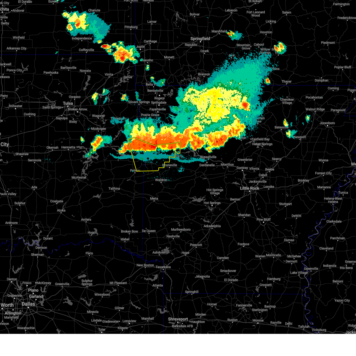 At 1113 pm cdt, severe thunderstorms were located along a line extending from 2 miles east of gans to 3 miles north of lavaca to altus, moving southeast at 40 mph (radar indicated). Hazards include 70 mph wind gusts and penny size hail. Expect considerable tree damage. damage is likely to mobile homes, roofs, and outbuildings. locations in or near the path include, fort smith, van buren, ozark, charleston, greenwood, alma, barling, pocola, muldrow, roland, lavaca, spiro, arkoma, mulberry, dyer, hackett, altus, bonanza, branch, midland, this includes the following highways, interstate 40 in arkansas between mile markers 0 and 20, and between mile markers 23 and 42. interstate 40 in oklahoma between mile markers 313 and 328. Interstate 540 between mile markers 1 and 14. At 1113 pm cdt, severe thunderstorms were located along a line extending from 2 miles east of gans to 3 miles north of lavaca to altus, moving southeast at 40 mph (radar indicated). Hazards include 70 mph wind gusts and penny size hail. Expect considerable tree damage. damage is likely to mobile homes, roofs, and outbuildings. locations in or near the path include, fort smith, van buren, ozark, charleston, greenwood, alma, barling, pocola, muldrow, roland, lavaca, spiro, arkoma, mulberry, dyer, hackett, altus, bonanza, branch, midland, this includes the following highways, interstate 40 in arkansas between mile markers 0 and 20, and between mile markers 23 and 42. interstate 40 in oklahoma between mile markers 313 and 328. Interstate 540 between mile markers 1 and 14.
|
| 8/16/2024 11:01 PM CDT |
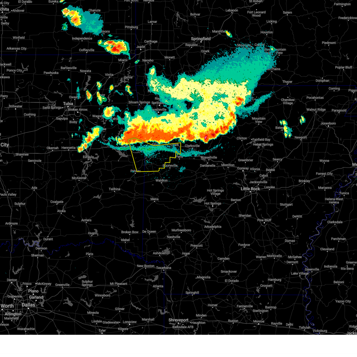 Svrtsa the national weather service in tulsa has issued a * severe thunderstorm warning for, southern franklin county in west central arkansas, southern crawford county in northwestern arkansas, sebastian county in west central arkansas, eastern sequoyah county in east central oklahoma, northeastern le flore county in southeastern oklahoma, * until midnight cdt. * at 1101 pm cdt, severe thunderstorms were located along a line extending from 3 miles northwest of muldrow to 2 miles southeast of dyer to 7 miles northeast of wiederkehr village, moving southeast at 40 mph (radar indicated). Hazards include 80 mph wind gusts and penny size hail. Flying debris will be dangerous to those caught without shelter. mobile homes will be heavily damaged. expect considerable damage to roofs, windows, and vehicles. extensive tree damage and power outages are likely. locations in or near the path include, fort smith, van buren, ozark, charleston, greenwood, alma, barling, pocola, muldrow, roland, lavaca, spiro, arkoma, mulberry, dyer, hackett, altus, bonanza, branch, midland, this includes the following highways, interstate 40 in arkansas between mile markers 0 and 20, and between mile markers 23 and 42. interstate 40 in oklahoma between mile markers 313 and 328. Interstate 540 between mile markers 1 and 14. Svrtsa the national weather service in tulsa has issued a * severe thunderstorm warning for, southern franklin county in west central arkansas, southern crawford county in northwestern arkansas, sebastian county in west central arkansas, eastern sequoyah county in east central oklahoma, northeastern le flore county in southeastern oklahoma, * until midnight cdt. * at 1101 pm cdt, severe thunderstorms were located along a line extending from 3 miles northwest of muldrow to 2 miles southeast of dyer to 7 miles northeast of wiederkehr village, moving southeast at 40 mph (radar indicated). Hazards include 80 mph wind gusts and penny size hail. Flying debris will be dangerous to those caught without shelter. mobile homes will be heavily damaged. expect considerable damage to roofs, windows, and vehicles. extensive tree damage and power outages are likely. locations in or near the path include, fort smith, van buren, ozark, charleston, greenwood, alma, barling, pocola, muldrow, roland, lavaca, spiro, arkoma, mulberry, dyer, hackett, altus, bonanza, branch, midland, this includes the following highways, interstate 40 in arkansas between mile markers 0 and 20, and between mile markers 23 and 42. interstate 40 in oklahoma between mile markers 313 and 328. Interstate 540 between mile markers 1 and 14.
|
| 6/3/2024 2:39 PM CDT |
 Svrlzk the national weather service in little rock has issued a * severe thunderstorm warning for, central logan county in western arkansas, southwestern johnson county in western arkansas, west central yell county in central arkansas, * until 315 pm cdt. * at 239 pm cdt, a severe thunderstorm was located near ratcliff, or near booneville, moving east at 30 mph (radar indicated). Hazards include 60 mph wind gusts and quarter size hail. Hail damage to vehicles is expected. Expect wind damage to roofs, siding, and trees. Svrlzk the national weather service in little rock has issued a * severe thunderstorm warning for, central logan county in western arkansas, southwestern johnson county in western arkansas, west central yell county in central arkansas, * until 315 pm cdt. * at 239 pm cdt, a severe thunderstorm was located near ratcliff, or near booneville, moving east at 30 mph (radar indicated). Hazards include 60 mph wind gusts and quarter size hail. Hail damage to vehicles is expected. Expect wind damage to roofs, siding, and trees.
|
| 5/8/2024 9:40 PM CDT |
 Svrlzk the national weather service in little rock has issued a * severe thunderstorm warning for, logan county in western arkansas, southwestern johnson county in western arkansas, northeastern scott county in western arkansas, northwestern yell county in central arkansas, southwestern pope county in central arkansas, * until 1030 pm cdt. * at 940 pm cdt, severe thunderstorms were located along a line extending from near magazine to near booneville to 8 miles north of cardiff, moving east at 45 mph (radar indicated). Hazards include 60 mph wind gusts and quarter size hail. Hail damage to vehicles is expected. Expect wind damage to roofs, siding, and trees. Svrlzk the national weather service in little rock has issued a * severe thunderstorm warning for, logan county in western arkansas, southwestern johnson county in western arkansas, northeastern scott county in western arkansas, northwestern yell county in central arkansas, southwestern pope county in central arkansas, * until 1030 pm cdt. * at 940 pm cdt, severe thunderstorms were located along a line extending from near magazine to near booneville to 8 miles north of cardiff, moving east at 45 mph (radar indicated). Hazards include 60 mph wind gusts and quarter size hail. Hail damage to vehicles is expected. Expect wind damage to roofs, siding, and trees.
|
| 5/7/2024 3:45 AM CDT |
 At 344 am cdt, severe thunderstorms were located along a line extending from near lost valley state park to 7 miles east of walnut to near rosetta to lamar, moving northeast at 60 mph (radar indicated). Hazards include 60 mph wind gusts and nickel size hail. Expect damage to roofs, siding, and trees. Locations impacted include, russellville, harrison, clarksville, booneville, paris, jasper, lamar, dover, london, knoxville, subiaco, hartman, scranton, ratcliff, erbie, upper buffalo wilderness area, devils knob, lost valley state park, pruitt, holman,. At 344 am cdt, severe thunderstorms were located along a line extending from near lost valley state park to 7 miles east of walnut to near rosetta to lamar, moving northeast at 60 mph (radar indicated). Hazards include 60 mph wind gusts and nickel size hail. Expect damage to roofs, siding, and trees. Locations impacted include, russellville, harrison, clarksville, booneville, paris, jasper, lamar, dover, london, knoxville, subiaco, hartman, scranton, ratcliff, erbie, upper buffalo wilderness area, devils knob, lost valley state park, pruitt, holman,.
|
| 5/7/2024 3:30 AM CDT |
 At 330 am cdt, severe thunderstorms were located along a line extending from near lost valley state park to near upper buffalo wilderness area to near devils knob to 7 miles north of woodland to near hartman, moving east at 50 mph (radar indicated). Hazards include 60 mph wind gusts and half dollar size hail. Hail damage to vehicles is expected. expect wind damage to roofs, siding, and trees. Locations impacted include, russellville, harrison, clarksville, booneville, paris, jasper, lamar, dover, london, knoxville, subiaco, hartman, scranton, ratcliff, erbie, upper buffalo wilderness area, devils knob, lost valley state park, pruitt, holman,. At 330 am cdt, severe thunderstorms were located along a line extending from near lost valley state park to near upper buffalo wilderness area to near devils knob to 7 miles north of woodland to near hartman, moving east at 50 mph (radar indicated). Hazards include 60 mph wind gusts and half dollar size hail. Hail damage to vehicles is expected. expect wind damage to roofs, siding, and trees. Locations impacted include, russellville, harrison, clarksville, booneville, paris, jasper, lamar, dover, london, knoxville, subiaco, hartman, scranton, ratcliff, erbie, upper buffalo wilderness area, devils knob, lost valley state park, pruitt, holman,.
|
| 5/7/2024 3:12 AM CDT |
 Svrlzk the national weather service in little rock has issued a * severe thunderstorm warning for, central logan county in western arkansas, newton county in north central arkansas, johnson county in western arkansas, southwestern boone county in north central arkansas, northeastern yell county in central arkansas, northwestern pope county in central arkansas, * until 400 am cdt. * at 312 am cdt, severe thunderstorms were located along a line extending from near japton to near witter to near cass to near ozark, moving east at 55 mph (radar indicated). Hazards include 60 mph wind gusts and half dollar size hail. Hail damage to vehicles is expected. Expect wind damage to roofs, siding, and trees. Svrlzk the national weather service in little rock has issued a * severe thunderstorm warning for, central logan county in western arkansas, newton county in north central arkansas, johnson county in western arkansas, southwestern boone county in north central arkansas, northeastern yell county in central arkansas, northwestern pope county in central arkansas, * until 400 am cdt. * at 312 am cdt, severe thunderstorms were located along a line extending from near japton to near witter to near cass to near ozark, moving east at 55 mph (radar indicated). Hazards include 60 mph wind gusts and half dollar size hail. Hail damage to vehicles is expected. Expect wind damage to roofs, siding, and trees.
|
| 4/28/2024 9:55 PM CDT |
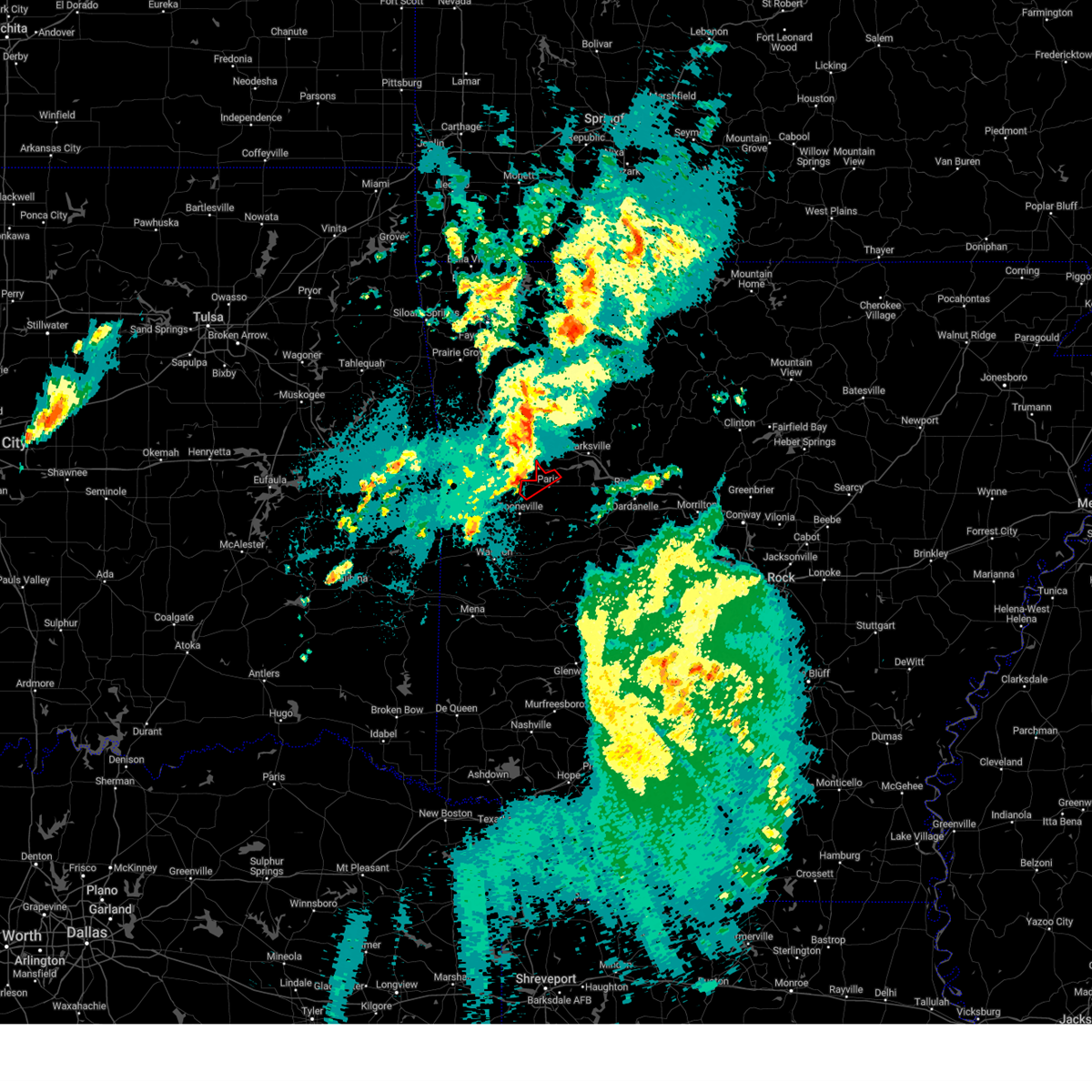 At 955 pm cdt, a severe thunderstorm capable of producing a tornado was located over ratcliff, or 8 miles east of charleston, moving northeast at 35 mph (radar indicated rotation). Hazards include tornado and quarter size hail. Flying debris will be dangerous to those caught without shelter. mobile homes will be damaged or destroyed. damage to roofs, windows, and vehicles will occur. tree damage is likely. Locations impacted include, paris, ratcliff, caulksville, carbon city, roseville,. At 955 pm cdt, a severe thunderstorm capable of producing a tornado was located over ratcliff, or 8 miles east of charleston, moving northeast at 35 mph (radar indicated rotation). Hazards include tornado and quarter size hail. Flying debris will be dangerous to those caught without shelter. mobile homes will be damaged or destroyed. damage to roofs, windows, and vehicles will occur. tree damage is likely. Locations impacted include, paris, ratcliff, caulksville, carbon city, roseville,.
|
| 4/28/2024 9:43 PM CDT |
 At 942 pm cdt, a severe thunderstorm capable of producing a tornado was located 3 miles south of branch, moving northeast at 30 mph (radar indicated rotation). Hazards include tornado. Flying debris will be dangerous to those caught without shelter. mobile homes will be damaged or destroyed. damage to roofs, windows, and vehicles will occur. tree damage is likely. Locations in or near the path include, ozark, charleston, altus, branch, denning, etna, peter pender, cecil, meg, this includes interstate 40 in arkansas between mile markers 34 and 35. At 942 pm cdt, a severe thunderstorm capable of producing a tornado was located 3 miles south of branch, moving northeast at 30 mph (radar indicated rotation). Hazards include tornado. Flying debris will be dangerous to those caught without shelter. mobile homes will be damaged or destroyed. damage to roofs, windows, and vehicles will occur. tree damage is likely. Locations in or near the path include, ozark, charleston, altus, branch, denning, etna, peter pender, cecil, meg, this includes interstate 40 in arkansas between mile markers 34 and 35.
|
| 4/28/2024 9:43 PM CDT |
 the tornado warning has been cancelled and is no longer in effect the tornado warning has been cancelled and is no longer in effect
|
| 4/28/2024 9:28 PM CDT |
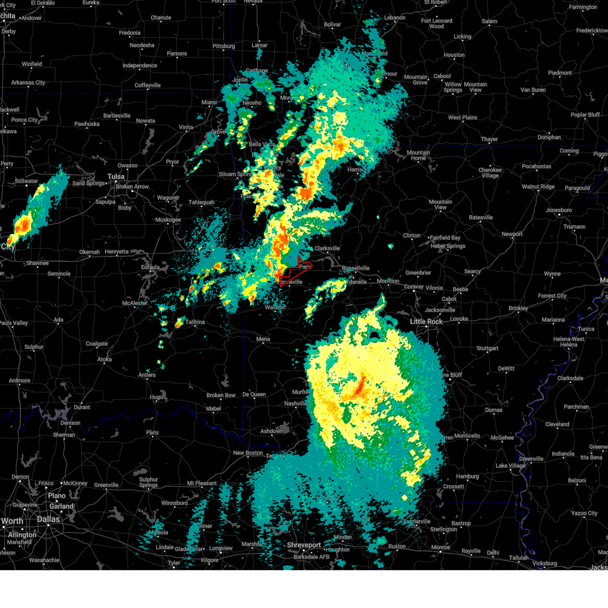 Torlzk the national weather service in little rock has issued a * tornado warning for, northwestern logan county in western arkansas, * until 1015 pm cdt. * at 928 pm cdt, a severe thunderstorm capable of producing a tornado was located over washburn, or 9 miles south of charleston, moving northeast at 35 mph (radar indicated rotation). Hazards include tornado. Flying debris will be dangerous to those caught without shelter. mobile homes will be damaged or destroyed. damage to roofs, windows, and vehicles will occur. Tree damage is likely. Torlzk the national weather service in little rock has issued a * tornado warning for, northwestern logan county in western arkansas, * until 1015 pm cdt. * at 928 pm cdt, a severe thunderstorm capable of producing a tornado was located over washburn, or 9 miles south of charleston, moving northeast at 35 mph (radar indicated rotation). Hazards include tornado. Flying debris will be dangerous to those caught without shelter. mobile homes will be damaged or destroyed. damage to roofs, windows, and vehicles will occur. Tree damage is likely.
|
| 4/28/2024 9:27 PM CDT |
 Tortsa the national weather service in tulsa has issued a * tornado warning for, southern franklin county in west central arkansas, east central sebastian county in west central arkansas, * until 1015 pm cdt. * at 926 pm cdt, a severe thunderstorm capable of producing a tornado was located over fort chaffee, moving northeast at 30 mph (radar indicated rotation). Hazards include tornado. Flying debris will be dangerous to those caught without shelter. mobile homes will be damaged or destroyed. damage to roofs, windows, and vehicles will occur. tree damage is likely. Locations in or near the path include, ozark, charleston, greenwood, altus, branch, denning, washburn, fort chaffee, etna, peter pender, cecil, meg, this includes interstate 40 in arkansas between mile markers 34 and 35. Tortsa the national weather service in tulsa has issued a * tornado warning for, southern franklin county in west central arkansas, east central sebastian county in west central arkansas, * until 1015 pm cdt. * at 926 pm cdt, a severe thunderstorm capable of producing a tornado was located over fort chaffee, moving northeast at 30 mph (radar indicated rotation). Hazards include tornado. Flying debris will be dangerous to those caught without shelter. mobile homes will be damaged or destroyed. damage to roofs, windows, and vehicles will occur. tree damage is likely. Locations in or near the path include, ozark, charleston, greenwood, altus, branch, denning, washburn, fort chaffee, etna, peter pender, cecil, meg, this includes interstate 40 in arkansas between mile markers 34 and 35.
|
| 3/14/2024 9:08 PM CDT |
 the severe thunderstorm warning has been cancelled and is no longer in effect the severe thunderstorm warning has been cancelled and is no longer in effect
|
| 3/14/2024 8:43 PM CDT |
 Svrtsa the national weather service in tulsa has issued a * severe thunderstorm warning for, southern franklin county in west central arkansas, east central sebastian county in west central arkansas, * until 930 pm cdt. * at 843 pm cdt, a severe thunderstorm was located near burnville, moving east at 45 mph (radar indicated). Hazards include 60 mph wind gusts and quarter size hail. Hail damage to vehicles is expected. expect wind damage to roofs, siding, and trees. Locations in or near the path include, charleston, greenwood, branch, denning, bloomer, washburn, burnville, fort chaffee, etna, alix, crossroads, milltown, peter pender,. Svrtsa the national weather service in tulsa has issued a * severe thunderstorm warning for, southern franklin county in west central arkansas, east central sebastian county in west central arkansas, * until 930 pm cdt. * at 843 pm cdt, a severe thunderstorm was located near burnville, moving east at 45 mph (radar indicated). Hazards include 60 mph wind gusts and quarter size hail. Hail damage to vehicles is expected. expect wind damage to roofs, siding, and trees. Locations in or near the path include, charleston, greenwood, branch, denning, bloomer, washburn, burnville, fort chaffee, etna, alix, crossroads, milltown, peter pender,.
|
| 3/14/2024 8:41 PM CDT |
 The storm which prompted the warning has weakened below severe limits, and has exited the warned area. therefore, the warning will be allowed to expire. however, heavy rain is still possible with this thunderstorm. a severe thunderstorm watch remains in effect until midnight cdt for northwestern and west central arkansas. to report severe weather, contact your nearest law enforcement agency. they will relay your report to the national weather service tulsa. The storm which prompted the warning has weakened below severe limits, and has exited the warned area. therefore, the warning will be allowed to expire. however, heavy rain is still possible with this thunderstorm. a severe thunderstorm watch remains in effect until midnight cdt for northwestern and west central arkansas. to report severe weather, contact your nearest law enforcement agency. they will relay your report to the national weather service tulsa.
|
| 3/14/2024 8:27 PM CDT |
 At 826 pm cdt, a severe thunderstorm was located 4 miles west of denning, moving northeast at 45 mph. a second severe thunderstorm was located near fort smith, also moving eastward toward the warned area (radar indicated). Hazards include 60 mph wind gusts and quarter size hail. Hail damage to vehicles is expected. expect wind damage to roofs, siding, and trees. Locations in or near the path include, ozark, charleston, altus, branch, denning, wiederkehr village, etna, alix, watalula, meg, peter pender, vesta, cecil, ursula, this includes interstate 40 in arkansas between mile markers 30 and 42. At 826 pm cdt, a severe thunderstorm was located 4 miles west of denning, moving northeast at 45 mph. a second severe thunderstorm was located near fort smith, also moving eastward toward the warned area (radar indicated). Hazards include 60 mph wind gusts and quarter size hail. Hail damage to vehicles is expected. expect wind damage to roofs, siding, and trees. Locations in or near the path include, ozark, charleston, altus, branch, denning, wiederkehr village, etna, alix, watalula, meg, peter pender, vesta, cecil, ursula, this includes interstate 40 in arkansas between mile markers 30 and 42.
|
| 3/14/2024 8:07 PM CDT |
 Svrtsa the national weather service in tulsa has issued a * severe thunderstorm warning for, central franklin county in west central arkansas, northeastern sebastian county in west central arkansas, * until 845 pm cdt. * at 806 pm cdt, a severe thunderstorm was located 4 miles north of charleston, moving east at 50 mph (trained weather spotters. at 755 pm, quarter size hail was reported in lavaca). Hazards include 60 mph wind gusts and quarter size hail. Hail damage to vehicles is expected. expect wind damage to roofs, siding, and trees. Locations in or near the path include, ozark, charleston, altus, branch, denning, wiederkehr village, etna, alix, watalula, meg, peter pender, vesta, cecil, ursula, this includes interstate 40 in arkansas between mile markers 30 and 42. Svrtsa the national weather service in tulsa has issued a * severe thunderstorm warning for, central franklin county in west central arkansas, northeastern sebastian county in west central arkansas, * until 845 pm cdt. * at 806 pm cdt, a severe thunderstorm was located 4 miles north of charleston, moving east at 50 mph (trained weather spotters. at 755 pm, quarter size hail was reported in lavaca). Hazards include 60 mph wind gusts and quarter size hail. Hail damage to vehicles is expected. expect wind damage to roofs, siding, and trees. Locations in or near the path include, ozark, charleston, altus, branch, denning, wiederkehr village, etna, alix, watalula, meg, peter pender, vesta, cecil, ursula, this includes interstate 40 in arkansas between mile markers 30 and 42.
|
| 3/14/2024 7:09 PM CDT |
 Svrtsa the national weather service in tulsa has issued a * severe thunderstorm warning for, franklin county in west central arkansas, * until 745 pm cdt. * at 708 pm cdt, a severe thunderstorm was located 3 miles southwest of ozark, moving northeast at 45 mph (radar indicated). Hazards include 60 mph wind gusts and quarter size hail. Hail damage to vehicles is expected. expect wind damage to roofs, siding, and trees. Locations in or near the path include, ozark, mulberry, altus, branch, denning, wiederkehr village, cass, jethro, etna, alix, barnes, redding, watalula, meg, toney, peter pender, turners bend, cecil, lonelm, taft, this includes interstate 40 in arkansas between mile markers 24 and 42. Svrtsa the national weather service in tulsa has issued a * severe thunderstorm warning for, franklin county in west central arkansas, * until 745 pm cdt. * at 708 pm cdt, a severe thunderstorm was located 3 miles southwest of ozark, moving northeast at 45 mph (radar indicated). Hazards include 60 mph wind gusts and quarter size hail. Hail damage to vehicles is expected. expect wind damage to roofs, siding, and trees. Locations in or near the path include, ozark, mulberry, altus, branch, denning, wiederkehr village, cass, jethro, etna, alix, barnes, redding, watalula, meg, toney, peter pender, turners bend, cecil, lonelm, taft, this includes interstate 40 in arkansas between mile markers 24 and 42.
|
| 3/14/2024 7:04 PM CDT |
 At 703 pm cdt, a severe thunderstorm was located 4 miles southwest of ozark, moving northeast at 40 mph (radar indicated). Hazards include 60 mph wind gusts and quarter size hail. Hail damage to vehicles is expected. expect wind damage to roofs, siding, and trees. Locations in or near the path include, ozark, charleston, lavaca, mulberry, dyer, branch, bloomer, jethro, etna, meg, piney, toney, peter pender, vesta, cecil, lonelm, ursula, cravens, this includes interstate 40 in arkansas between mile markers 14 and 34. At 703 pm cdt, a severe thunderstorm was located 4 miles southwest of ozark, moving northeast at 40 mph (radar indicated). Hazards include 60 mph wind gusts and quarter size hail. Hail damage to vehicles is expected. expect wind damage to roofs, siding, and trees. Locations in or near the path include, ozark, charleston, lavaca, mulberry, dyer, branch, bloomer, jethro, etna, meg, piney, toney, peter pender, vesta, cecil, lonelm, ursula, cravens, this includes interstate 40 in arkansas between mile markers 14 and 34.
|
| 3/14/2024 7:04 PM CDT |
 the severe thunderstorm warning has been cancelled and is no longer in effect the severe thunderstorm warning has been cancelled and is no longer in effect
|
| 3/14/2024 6:50 PM CDT |
 At 649 pm cdt, a severe thunderstorm was located 3 miles north of barling, moving northeast at 50 mph (radar indicated). Hazards include 60 mph wind gusts and quarter size hail. Hail damage to vehicles is expected. expect wind damage to roofs, siding, and trees. locations in or near the path include, fort smith, van buren, ozark, charleston, alma, barling, pocola, lavaca, arkoma, mulberry, dyer, bonanza, branch, moffett, rudy, fort smith regional airport, bloomer, jenny lind, kibler, central city, this includes the following highways, interstate 40 in arkansas between mile markers 0 and 34. interstate 40 in oklahoma between mile markers 327 and 328. interstate 540 between mile markers 1 and 14. Interstate 49 between mile markers 22 and 24. At 649 pm cdt, a severe thunderstorm was located 3 miles north of barling, moving northeast at 50 mph (radar indicated). Hazards include 60 mph wind gusts and quarter size hail. Hail damage to vehicles is expected. expect wind damage to roofs, siding, and trees. locations in or near the path include, fort smith, van buren, ozark, charleston, alma, barling, pocola, lavaca, arkoma, mulberry, dyer, bonanza, branch, moffett, rudy, fort smith regional airport, bloomer, jenny lind, kibler, central city, this includes the following highways, interstate 40 in arkansas between mile markers 0 and 34. interstate 40 in oklahoma between mile markers 327 and 328. interstate 540 between mile markers 1 and 14. Interstate 49 between mile markers 22 and 24.
|
| 3/14/2024 6:24 PM CDT |
 Svrtsa the national weather service in tulsa has issued a * severe thunderstorm warning for, western franklin county in west central arkansas, southern crawford county in northwestern arkansas, northern sebastian county in west central arkansas, southeastern sequoyah county in east central oklahoma, northeastern le flore county in southeastern oklahoma, * until 715 pm cdt. * at 624 pm cdt, a severe thunderstorm was located 3 miles southeast of van buren, moving east at 30 mph (radar indicated). Hazards include 60 mph wind gusts and half dollar size hail. Hail damage to vehicles is expected. expect wind damage to roofs, siding, and trees. locations in or near the path include, fort smith, van buren, ozark, charleston, greenwood, alma, barling, pocola, roland, lavaca, spiro, arkoma, mulberry, dyer, bonanza, branch, moffett, rudy, fort smith regional airport, bloomer, this includes the following highways, interstate 40 in arkansas between mile markers 0 and 34. interstate 40 in oklahoma between mile markers 323 and 328. interstate 540 between mile markers 1 and 14. Interstate 49 between mile markers 22 and 24. Svrtsa the national weather service in tulsa has issued a * severe thunderstorm warning for, western franklin county in west central arkansas, southern crawford county in northwestern arkansas, northern sebastian county in west central arkansas, southeastern sequoyah county in east central oklahoma, northeastern le flore county in southeastern oklahoma, * until 715 pm cdt. * at 624 pm cdt, a severe thunderstorm was located 3 miles southeast of van buren, moving east at 30 mph (radar indicated). Hazards include 60 mph wind gusts and half dollar size hail. Hail damage to vehicles is expected. expect wind damage to roofs, siding, and trees. locations in or near the path include, fort smith, van buren, ozark, charleston, greenwood, alma, barling, pocola, roland, lavaca, spiro, arkoma, mulberry, dyer, bonanza, branch, moffett, rudy, fort smith regional airport, bloomer, this includes the following highways, interstate 40 in arkansas between mile markers 0 and 34. interstate 40 in oklahoma between mile markers 323 and 328. interstate 540 between mile markers 1 and 14. Interstate 49 between mile markers 22 and 24.
|
| 8/11/2023 11:14 PM CDT |
 At 1114 pm cdt, severe thunderstorms were located along a line extending from hartman to near ratcliff, moving southeast at 45 mph (radar indicated). Hazards include 60 mph wind gusts and penny size hail. Expect damage to roofs, siding, and trees. locations impacted include, clarksville, paris, danville, dardanelle, magazine, knoxville, subiaco, hartman, scranton, ratcliff, blue mountain, stonehouse recreation area, lake dardanelle state park, hinkle, mt nebo state park, hoyt, mount magazine, midway in logan county, spadra, mosley, hail threat, radar indicated max hail size, 0. 75 in wind threat, radar indicated max wind gust, 60 mph. At 1114 pm cdt, severe thunderstorms were located along a line extending from hartman to near ratcliff, moving southeast at 45 mph (radar indicated). Hazards include 60 mph wind gusts and penny size hail. Expect damage to roofs, siding, and trees. locations impacted include, clarksville, paris, danville, dardanelle, magazine, knoxville, subiaco, hartman, scranton, ratcliff, blue mountain, stonehouse recreation area, lake dardanelle state park, hinkle, mt nebo state park, hoyt, mount magazine, midway in logan county, spadra, mosley, hail threat, radar indicated max hail size, 0. 75 in wind threat, radar indicated max wind gust, 60 mph.
|
| 8/11/2023 11:13 PM CDT |
 At 1112 pm cdt, severe thunderstorms were located along a line extending from 4 miles south of cass to 2 miles east of altus to 4 miles southeast of ratcliff, moving southeast at 40 mph (radar indicated). Hazards include 60 to 70 mph wind gusts and penny size hail. Expect damage to roofs, siding, and trees. locations in or near the path include, ozark, altus, denning, wiederkehr village, jethro, etna, alix, barnes, watalula, meg, toney, peter pender, turners bend, cecil, lonelm, cravens, paradise, this includes interstate 40 in arkansas between mile markers 26 and 42. hail threat, radar indicated max hail size, 0. 75 in wind threat, radar indicated max wind gust, 60 mph. At 1112 pm cdt, severe thunderstorms were located along a line extending from 4 miles south of cass to 2 miles east of altus to 4 miles southeast of ratcliff, moving southeast at 40 mph (radar indicated). Hazards include 60 to 70 mph wind gusts and penny size hail. Expect damage to roofs, siding, and trees. locations in or near the path include, ozark, altus, denning, wiederkehr village, jethro, etna, alix, barnes, watalula, meg, toney, peter pender, turners bend, cecil, lonelm, cravens, paradise, this includes interstate 40 in arkansas between mile markers 26 and 42. hail threat, radar indicated max hail size, 0. 75 in wind threat, radar indicated max wind gust, 60 mph.
|
| 8/11/2023 11:02 PM CDT |
 At 1102 pm cdt, severe thunderstorms were located along a line extending from 5 miles southeast of cass to near wiederkehr village to 2 miles northeast of ratcliff to near charleston, moving southeast at 30 mph (radar indicated). Hazards include 60 mph wind gusts and nickel size hail. Expect damage to roofs, siding, and trees. locations in or near the path include, ozark, charleston, mulberry, dyer, altus, branch, denning, wiederkehr village, bloomer, fern, fort chaffee, jethro, turners bend, vesta, cecil, lonelm, ursula, etna, alix, barnes, this includes interstate 40 in arkansas between mile markers 19 and 42. hail threat, radar indicated max hail size, 0. 88 in wind threat, radar indicated max wind gust, 60 mph. At 1102 pm cdt, severe thunderstorms were located along a line extending from 5 miles southeast of cass to near wiederkehr village to 2 miles northeast of ratcliff to near charleston, moving southeast at 30 mph (radar indicated). Hazards include 60 mph wind gusts and nickel size hail. Expect damage to roofs, siding, and trees. locations in or near the path include, ozark, charleston, mulberry, dyer, altus, branch, denning, wiederkehr village, bloomer, fern, fort chaffee, jethro, turners bend, vesta, cecil, lonelm, ursula, etna, alix, barnes, this includes interstate 40 in arkansas between mile markers 19 and 42. hail threat, radar indicated max hail size, 0. 88 in wind threat, radar indicated max wind gust, 60 mph.
|
| 8/11/2023 10:51 PM CDT |
 At 1050 pm cdt, severe thunderstorms were located along a line extending from 6 miles north of ozark to lavaca, moving southeast at 40 mph (radar indicated). Hazards include 60 mph wind gusts and penny size hail. expect damage to roofs, siding, and trees At 1050 pm cdt, severe thunderstorms were located along a line extending from 6 miles north of ozark to lavaca, moving southeast at 40 mph (radar indicated). Hazards include 60 mph wind gusts and penny size hail. expect damage to roofs, siding, and trees
|
| 8/11/2023 10:47 PM CDT |
 At 1046 pm cdt, severe thunderstorms were located along a line extending from 2 miles southwest of cass to 2 miles northwest of ozark to 7 miles southeast of mulberry to 2 miles north of lavaca, moving southeast at 35 mph (radar indicated). Hazards include 60 mph wind gusts and nickel size hail. Expect damage to roofs, siding, and trees. locations in or near the path include, ozark, charleston, mountainburg, alma, lavaca, mulberry, dyer, altus, branch, denning, chester, wiederkehr village, bloomer, lake fort smith, fern, fort chaffee, kibler, jethro, bidville, locke, this includes the following highways, interstate 40 in arkansas between mile markers 12 and 42. interstate 49 between mile markers 23 and 35. hail threat, radar indicated max hail size, 0. 88 in wind threat, radar indicated max wind gust, 60 mph. At 1046 pm cdt, severe thunderstorms were located along a line extending from 2 miles southwest of cass to 2 miles northwest of ozark to 7 miles southeast of mulberry to 2 miles north of lavaca, moving southeast at 35 mph (radar indicated). Hazards include 60 mph wind gusts and nickel size hail. Expect damage to roofs, siding, and trees. locations in or near the path include, ozark, charleston, mountainburg, alma, lavaca, mulberry, dyer, altus, branch, denning, chester, wiederkehr village, bloomer, lake fort smith, fern, fort chaffee, kibler, jethro, bidville, locke, this includes the following highways, interstate 40 in arkansas between mile markers 12 and 42. interstate 49 between mile markers 23 and 35. hail threat, radar indicated max hail size, 0. 88 in wind threat, radar indicated max wind gust, 60 mph.
|
| 8/11/2023 10:37 PM CDT |
 At 1037 pm cdt, severe thunderstorms were located along a line extending from 5 miles northwest of cass to 6 miles southeast of fern to near mulberry to 2 miles west of alma, moving southeast at 40 mph (radar indicated). Hazards include 60 mph wind gusts and quarter size hail. Hail damage to vehicles is expected. expect wind damage to roofs, siding, and trees. locations in or near the path include, fort smith, van buren, ozark, charleston, cedarville, mountainburg, alma, barling, lavaca, mulberry, dyer, altus, branch, denning, chester, rudy, wiederkehr village, bloomer, lake fort smith, fern, this includes the following highways, interstate 40 in arkansas between mile markers 6 and 42. interstate 540 between mile markers 1 and 3. interstate 49 between mile markers 22 and 40. hail threat, radar indicated max hail size, 1. 00 in wind threat, radar indicated max wind gust, 60 mph. At 1037 pm cdt, severe thunderstorms were located along a line extending from 5 miles northwest of cass to 6 miles southeast of fern to near mulberry to 2 miles west of alma, moving southeast at 40 mph (radar indicated). Hazards include 60 mph wind gusts and quarter size hail. Hail damage to vehicles is expected. expect wind damage to roofs, siding, and trees. locations in or near the path include, fort smith, van buren, ozark, charleston, cedarville, mountainburg, alma, barling, lavaca, mulberry, dyer, altus, branch, denning, chester, rudy, wiederkehr village, bloomer, lake fort smith, fern, this includes the following highways, interstate 40 in arkansas between mile markers 6 and 42. interstate 540 between mile markers 1 and 3. interstate 49 between mile markers 22 and 40. hail threat, radar indicated max hail size, 1. 00 in wind threat, radar indicated max wind gust, 60 mph.
|
| 8/11/2023 10:14 PM CDT |
 At 1013 pm cdt, severe thunderstorms were located along a line extending from 6 miles northeast of brentwood to 6 miles southeast of winslow to 2 miles west of chester to 3 miles northwest of lee creek, moving southeast at 35 mph (radar indicated). Hazards include 60 mph wind gusts and quarter size hail. Hail damage to vehicles is expected. expect wind damage to roofs, siding, and trees. locations in or near the path include, fort smith, van buren, ozark, charleston, cedarville, mountainburg, natural dam, alma, barling, west fork, lavaca, mulberry, dyer, altus, winslow, branch, denning, chester, rudy, wiederkehr village, this includes the following highways, interstate 40 in arkansas between mile markers 2 and 42. interstate 540 between mile markers 1 and 9. interstate 49 between mile markers 22 and 51. hail threat, radar indicated max hail size, 1. 00 in wind threat, radar indicated max wind gust, 60 mph. At 1013 pm cdt, severe thunderstorms were located along a line extending from 6 miles northeast of brentwood to 6 miles southeast of winslow to 2 miles west of chester to 3 miles northwest of lee creek, moving southeast at 35 mph (radar indicated). Hazards include 60 mph wind gusts and quarter size hail. Hail damage to vehicles is expected. expect wind damage to roofs, siding, and trees. locations in or near the path include, fort smith, van buren, ozark, charleston, cedarville, mountainburg, natural dam, alma, barling, west fork, lavaca, mulberry, dyer, altus, winslow, branch, denning, chester, rudy, wiederkehr village, this includes the following highways, interstate 40 in arkansas between mile markers 2 and 42. interstate 540 between mile markers 1 and 9. interstate 49 between mile markers 22 and 51. hail threat, radar indicated max hail size, 1. 00 in wind threat, radar indicated max wind gust, 60 mph.
|
| 8/11/2023 4:30 AM CDT |
 At 430 am cdt, a severe thunderstorm was located 6 miles northwest of branch, moving east at 45 mph (radar indicated). Hazards include 60 mph wind gusts and quarter size hail. Hail damage to vehicles is expected. expect wind damage to roofs, siding, and trees. locations in or near the path include, ozark, charleston, mulberry, altus, branch, denning, wiederkehr village, etna, alix, meg, peter pender, vesta, cecil, this includes interstate 40 in arkansas between mile markers 37 and 42. hail threat, radar indicated max hail size, 1. 00 in wind threat, radar indicated max wind gust, 60 mph. At 430 am cdt, a severe thunderstorm was located 6 miles northwest of branch, moving east at 45 mph (radar indicated). Hazards include 60 mph wind gusts and quarter size hail. Hail damage to vehicles is expected. expect wind damage to roofs, siding, and trees. locations in or near the path include, ozark, charleston, mulberry, altus, branch, denning, wiederkehr village, etna, alix, meg, peter pender, vesta, cecil, this includes interstate 40 in arkansas between mile markers 37 and 42. hail threat, radar indicated max hail size, 1. 00 in wind threat, radar indicated max wind gust, 60 mph.
|
| 8/7/2023 7:31 AM CDT |
 At 731 am cdt, severe thunderstorms were located along a line extending from 2 miles northeast of altus to near paris to near magazine, moving east at 50 mph (radar indicated). Hazards include 60 mph wind gusts. Expect damage to roofs, siding, and trees. locations in or near the path include, altus, branch, denning, wiederkehr village, etna, alix, peter pender, meg, hail threat, radar indicated max hail size, <. 75 in wind threat, radar indicated max wind gust, 60 mph. At 731 am cdt, severe thunderstorms were located along a line extending from 2 miles northeast of altus to near paris to near magazine, moving east at 50 mph (radar indicated). Hazards include 60 mph wind gusts. Expect damage to roofs, siding, and trees. locations in or near the path include, altus, branch, denning, wiederkehr village, etna, alix, peter pender, meg, hail threat, radar indicated max hail size, <. 75 in wind threat, radar indicated max wind gust, 60 mph.
|
| 8/7/2023 7:30 AM CDT |
 At 730 am cdt, a severe thunderstorm was located near subiaco, or 7 miles east of paris, moving east at 65 mph (radar indicated). Hazards include 60 mph wind gusts. Expect damage to roofs, siding, and trees. locations impacted include, russellville, clarksville, booneville, paris, danville, dardanelle, lamar, dover, london, magazine, knoxville, subiaco, hartman, scranton, ratcliff, blue mountain, lake dardanelle state park, hoyt, petit jean river wma, midway in logan county, hail threat, radar indicated max hail size, <. 75 in wind threat, radar indicated max wind gust, 60 mph. At 730 am cdt, a severe thunderstorm was located near subiaco, or 7 miles east of paris, moving east at 65 mph (radar indicated). Hazards include 60 mph wind gusts. Expect damage to roofs, siding, and trees. locations impacted include, russellville, clarksville, booneville, paris, danville, dardanelle, lamar, dover, london, magazine, knoxville, subiaco, hartman, scranton, ratcliff, blue mountain, lake dardanelle state park, hoyt, petit jean river wma, midway in logan county, hail threat, radar indicated max hail size, <. 75 in wind threat, radar indicated max wind gust, 60 mph.
|
| 8/7/2023 7:16 AM CDT |
 At 716 am cdt, severe thunderstorms were located along a line extending from 4 miles west of ozark to 4 miles north of ratcliff to 4 miles north of booneville, moving east at 60 mph (radar indicated). Hazards include 60 mph wind gusts. Expect damage to roofs, siding, and trees. locations in or near the path include, ozark, altus, branch, denning, wiederkehr village, etna, alix, peter pender, cecil, meg, this includes interstate 40 in arkansas between mile markers 39 and 42. hail threat, radar indicated max hail size, <. 75 in wind threat, radar indicated max wind gust, 60 mph. At 716 am cdt, severe thunderstorms were located along a line extending from 4 miles west of ozark to 4 miles north of ratcliff to 4 miles north of booneville, moving east at 60 mph (radar indicated). Hazards include 60 mph wind gusts. Expect damage to roofs, siding, and trees. locations in or near the path include, ozark, altus, branch, denning, wiederkehr village, etna, alix, peter pender, cecil, meg, this includes interstate 40 in arkansas between mile markers 39 and 42. hail threat, radar indicated max hail size, <. 75 in wind threat, radar indicated max wind gust, 60 mph.
|
| 8/7/2023 7:15 AM CDT |
 At 714 am cdt, a severe thunderstorm was located over ratcliff, or 7 miles east of charleston, moving east at 60 mph (radar indicated). Hazards include 60 mph wind gusts and quarter size hail. Hail damage to vehicles is expected. Expect wind damage to roofs, siding, and trees. At 714 am cdt, a severe thunderstorm was located over ratcliff, or 7 miles east of charleston, moving east at 60 mph (radar indicated). Hazards include 60 mph wind gusts and quarter size hail. Hail damage to vehicles is expected. Expect wind damage to roofs, siding, and trees.
|
| 7/14/2023 10:10 PM CDT |
 The severe thunderstorm warning for franklin, southeastern crawford, sebastian, southeastern sequoyah and northeastern le flore counties will expire at 1015 pm cdt, the storms which prompted the warning have weakened below severe limits, and have exited the warned area. therefore, the warning will be allowed to expire. however gusty winds and heavy rain are still possible with these thunderstorms. a severe thunderstorm watch remains in effect until midnight cdt for northwestern arkansas, and east central oklahoma. a severe thunderstorm watch also remains in effect until 200 am cdt for west central arkansas, and southeastern oklahoma. The severe thunderstorm warning for franklin, southeastern crawford, sebastian, southeastern sequoyah and northeastern le flore counties will expire at 1015 pm cdt, the storms which prompted the warning have weakened below severe limits, and have exited the warned area. therefore, the warning will be allowed to expire. however gusty winds and heavy rain are still possible with these thunderstorms. a severe thunderstorm watch remains in effect until midnight cdt for northwestern arkansas, and east central oklahoma. a severe thunderstorm watch also remains in effect until 200 am cdt for west central arkansas, and southeastern oklahoma.
|
| 7/14/2023 9:53 PM CDT |
 At 951 pm cdt, severe thunderstorms were located along a line extending from ozark to 4 miles north of spiro, moving southeast at 60 mph (radar indicated. at 9:43 pm, wind damage to trees and 65 mph wind gusts were reported in van buren). Hazards include 60 mph wind gusts. Expect damage to roofs, siding, and trees. locations in or near the path include, fort smith, van buren, poteau, ozark, charleston, cedarville, mountainburg, greenwood, alma, barling, pocola, muldrow, roland, lavaca, spiro, arkoma, mulberry, panama, dyer, hackett, this includes the following highways, interstate 40 in arkansas between mile markers 0 and 42. interstate 40 in oklahoma between mile markers 311 and 328. interstate 540 between mile markers 1 and 14. interstate 49 between mile markers 22 and 29. hail threat, radar indicated max hail size, <. 75 in wind threat, radar indicated max wind gust, 60 mph. At 951 pm cdt, severe thunderstorms were located along a line extending from ozark to 4 miles north of spiro, moving southeast at 60 mph (radar indicated. at 9:43 pm, wind damage to trees and 65 mph wind gusts were reported in van buren). Hazards include 60 mph wind gusts. Expect damage to roofs, siding, and trees. locations in or near the path include, fort smith, van buren, poteau, ozark, charleston, cedarville, mountainburg, greenwood, alma, barling, pocola, muldrow, roland, lavaca, spiro, arkoma, mulberry, panama, dyer, hackett, this includes the following highways, interstate 40 in arkansas between mile markers 0 and 42. interstate 40 in oklahoma between mile markers 311 and 328. interstate 540 between mile markers 1 and 14. interstate 49 between mile markers 22 and 29. hail threat, radar indicated max hail size, <. 75 in wind threat, radar indicated max wind gust, 60 mph.
|
| 7/14/2023 9:33 PM CDT |
 At 933 pm cdt, severe thunderstorms were located along a line extending from 3 miles east of lake fort smith to 4 miles northwest of sallisaw, moving southeast at 55 mph (radar indicated). Hazards include 60 mph wind gusts. Expect damage to roofs, siding, and trees. locations in or near the path include, fort smith, van buren, sallisaw, poteau, ozark, charleston, cedarville, mountainburg, natural dam, greenwood, alma, barling, pocola, muldrow, roland, lavaca, spiro, arkoma, mulberry, vian, this includes the following highways, interstate 40 in arkansas between mile markers 0 and 42. interstate 40 in oklahoma between mile markers 293 and 328. interstate 540 between mile markers 1 and 14. interstate 49 between mile markers 22 and 38. hail threat, radar indicated max hail size, <. 75 in wind threat, radar indicated max wind gust, 60 mph. At 933 pm cdt, severe thunderstorms were located along a line extending from 3 miles east of lake fort smith to 4 miles northwest of sallisaw, moving southeast at 55 mph (radar indicated). Hazards include 60 mph wind gusts. Expect damage to roofs, siding, and trees. locations in or near the path include, fort smith, van buren, sallisaw, poteau, ozark, charleston, cedarville, mountainburg, natural dam, greenwood, alma, barling, pocola, muldrow, roland, lavaca, spiro, arkoma, mulberry, vian, this includes the following highways, interstate 40 in arkansas between mile markers 0 and 42. interstate 40 in oklahoma between mile markers 293 and 328. interstate 540 between mile markers 1 and 14. interstate 49 between mile markers 22 and 38. hail threat, radar indicated max hail size, <. 75 in wind threat, radar indicated max wind gust, 60 mph.
|
| 6/27/2023 12:21 PM CDT |
 At 1221 pm cdt, a severe thunderstorm was located near booneville, moving east at 55 mph (radar indicated). Hazards include 70 mph wind gusts and quarter size hail. Hail damage to vehicles is expected. expect considerable tree damage. wind damage is also likely to mobile homes, roofs, and outbuildings. locations impacted include, booneville, waldron, paris, danville, mansfield, magazine, subiaco, ratcliff, blue mountain, cardiff, midway in logan county, stonehouse recreation area, mt nebo state park, gravelly, fourche valley, mount magazine, oliver, echo, lake dardanelle, belleville, thunderstorm damage threat, considerable hail threat, radar indicated max hail size, 1. 00 in wind threat, radar indicated max wind gust, 70 mph. At 1221 pm cdt, a severe thunderstorm was located near booneville, moving east at 55 mph (radar indicated). Hazards include 70 mph wind gusts and quarter size hail. Hail damage to vehicles is expected. expect considerable tree damage. wind damage is also likely to mobile homes, roofs, and outbuildings. locations impacted include, booneville, waldron, paris, danville, mansfield, magazine, subiaco, ratcliff, blue mountain, cardiff, midway in logan county, stonehouse recreation area, mt nebo state park, gravelly, fourche valley, mount magazine, oliver, echo, lake dardanelle, belleville, thunderstorm damage threat, considerable hail threat, radar indicated max hail size, 1. 00 in wind threat, radar indicated max wind gust, 70 mph.
|
| 6/27/2023 12:16 PM CDT |
 At 1216 pm cdt, a severe thunderstorm was located near fort chaffee, moving east at 45 mph (radar indicated). Hazards include 60 mph wind gusts. Expect damage to roofs, siding, and trees. locations in or near the path include, charleston, greenwood, lavaca, branch, bloomer, washburn, burnville, fort chaffee, central city, etna, meg, milltown, peter pender, vesta, ursula, hail threat, radar indicated max hail size, <. 75 in wind threat, radar indicated max wind gust, 60 mph. At 1216 pm cdt, a severe thunderstorm was located near fort chaffee, moving east at 45 mph (radar indicated). Hazards include 60 mph wind gusts. Expect damage to roofs, siding, and trees. locations in or near the path include, charleston, greenwood, lavaca, branch, bloomer, washburn, burnville, fort chaffee, central city, etna, meg, milltown, peter pender, vesta, ursula, hail threat, radar indicated max hail size, <. 75 in wind threat, radar indicated max wind gust, 60 mph.
|
| 6/27/2023 12:11 PM CDT |
 At 1211 pm cdt, a severe thunderstorm was located over fort chaffee, or near charleston, moving east at 55 mph (radar indicated). Hazards include 60 mph wind gusts and penny size hail. expect damage to roofs, siding, and trees At 1211 pm cdt, a severe thunderstorm was located over fort chaffee, or near charleston, moving east at 55 mph (radar indicated). Hazards include 60 mph wind gusts and penny size hail. expect damage to roofs, siding, and trees
|
| 6/27/2023 12:07 PM CDT |
 At 1207 pm cdt, a severe thunderstorm was located over bloomer, moving east at 45 mph (radar indicated). Hazards include 60 mph wind gusts. Expect damage to roofs, siding, and trees. locations in or near the path include, charleston, greenwood, lavaca, branch, bloomer, washburn, burnville, fort chaffee, central city, etna, meg, milltown, peter pender, vesta, ursula, hail threat, radar indicated max hail size, <. 75 in wind threat, radar indicated max wind gust, 60 mph. At 1207 pm cdt, a severe thunderstorm was located over bloomer, moving east at 45 mph (radar indicated). Hazards include 60 mph wind gusts. Expect damage to roofs, siding, and trees. locations in or near the path include, charleston, greenwood, lavaca, branch, bloomer, washburn, burnville, fort chaffee, central city, etna, meg, milltown, peter pender, vesta, ursula, hail threat, radar indicated max hail size, <. 75 in wind threat, radar indicated max wind gust, 60 mph.
|
| 6/18/2023 1:22 AM CDT |
 The severe thunderstorm warning for franklin county will expire at 130 am cdt, the storms which prompted the warning have moved out of the area. therefore, the warning will be allowed to expire. a severe thunderstorm watch remains in effect until 400 am cdt for northwestern and west central arkansas. The severe thunderstorm warning for franklin county will expire at 130 am cdt, the storms which prompted the warning have moved out of the area. therefore, the warning will be allowed to expire. a severe thunderstorm watch remains in effect until 400 am cdt for northwestern and west central arkansas.
|
| 6/18/2023 1:15 AM CDT |
 At 115 am cdt, severe thunderstorms were located along a line extending from 2 miles west of winslow to 5 miles north of hartman, moving northeast at 55 mph (radar indicated). Hazards include 60 mph wind gusts. Expect damage to roofs, siding, and trees. locations in or near the path include, ozark, charleston, mulberry, altus, branch, denning, wiederkehr village, cass, jethro, etna, alix, barnes, redding, watalula, meg, toney, peter pender, turners bend, vesta, cecil, this includes interstate 40 in arkansas between mile markers 25 and 42. hail threat, radar indicated max hail size, <. 75 in wind threat, radar indicated max wind gust, 60 mph. At 115 am cdt, severe thunderstorms were located along a line extending from 2 miles west of winslow to 5 miles north of hartman, moving northeast at 55 mph (radar indicated). Hazards include 60 mph wind gusts. Expect damage to roofs, siding, and trees. locations in or near the path include, ozark, charleston, mulberry, altus, branch, denning, wiederkehr village, cass, jethro, etna, alix, barnes, redding, watalula, meg, toney, peter pender, turners bend, vesta, cecil, this includes interstate 40 in arkansas between mile markers 25 and 42. hail threat, radar indicated max hail size, <. 75 in wind threat, radar indicated max wind gust, 60 mph.
|
| 6/18/2023 1:07 AM CDT |
 At 106 am cdt, severe thunderstorms were located along a line extending from 3 miles southwest of devils den state park to denning, moving east at 55 mph (radar indicated). Hazards include 60 mph wind gusts and penny size hail. Expect damage to roofs, siding, and trees. locations in or near the path include, fort smith, van buren, ozark, charleston, mountainburg, alma, barling, lavaca, mulberry, dyer, altus, winslow, branch, denning, chester, rudy, wiederkehr village, bloomer, lake fort smith, cass, this includes the following highways, interstate 40 in arkansas between mile markers 4 and 42. interstate 540 between mile markers 1 and 8. interstate 49 between mile markers 22 and 36. hail threat, radar indicated max hail size, 0. 75 in wind threat, radar indicated max wind gust, 60 mph. At 106 am cdt, severe thunderstorms were located along a line extending from 3 miles southwest of devils den state park to denning, moving east at 55 mph (radar indicated). Hazards include 60 mph wind gusts and penny size hail. Expect damage to roofs, siding, and trees. locations in or near the path include, fort smith, van buren, ozark, charleston, mountainburg, alma, barling, lavaca, mulberry, dyer, altus, winslow, branch, denning, chester, rudy, wiederkehr village, bloomer, lake fort smith, cass, this includes the following highways, interstate 40 in arkansas between mile markers 4 and 42. interstate 540 between mile markers 1 and 8. interstate 49 between mile markers 22 and 36. hail threat, radar indicated max hail size, 0. 75 in wind threat, radar indicated max wind gust, 60 mph.
|
| 6/18/2023 12:42 AM CDT |
 At 1241 am cdt, severe thunderstorms were located along a line extending from 6 miles southwest of short to near fort chaffee, moving northeast at 55 mph (radar indicated). Hazards include 60 mph wind gusts and quarter size hail. Hail damage to vehicles is expected. expect wind damage to roofs, siding, and trees. locations in or near the path include, fort smith, fayetteville, van buren, ozark, charleston, cedarville, mountainburg, natural dam, greenwood, alma, barling, roland, elkins, west fork, lavaca, mulberry, dyer, altus, winslow, branch, this includes the following highways, interstate 40 in arkansas between mile markers 0 and 42. interstate 40 in oklahoma between mile markers 323 and 328. interstate 540 between mile markers 1 and 11. interstate 49 between mile markers 22 and 54. hail threat, radar indicated max hail size, 1. 00 in wind threat, radar indicated max wind gust, 60 mph. At 1241 am cdt, severe thunderstorms were located along a line extending from 6 miles southwest of short to near fort chaffee, moving northeast at 55 mph (radar indicated). Hazards include 60 mph wind gusts and quarter size hail. Hail damage to vehicles is expected. expect wind damage to roofs, siding, and trees. locations in or near the path include, fort smith, fayetteville, van buren, ozark, charleston, cedarville, mountainburg, natural dam, greenwood, alma, barling, roland, elkins, west fork, lavaca, mulberry, dyer, altus, winslow, branch, this includes the following highways, interstate 40 in arkansas between mile markers 0 and 42. interstate 40 in oklahoma between mile markers 323 and 328. interstate 540 between mile markers 1 and 11. interstate 49 between mile markers 22 and 54. hail threat, radar indicated max hail size, 1. 00 in wind threat, radar indicated max wind gust, 60 mph.
|
| 4/15/2023 4:01 PM CDT |
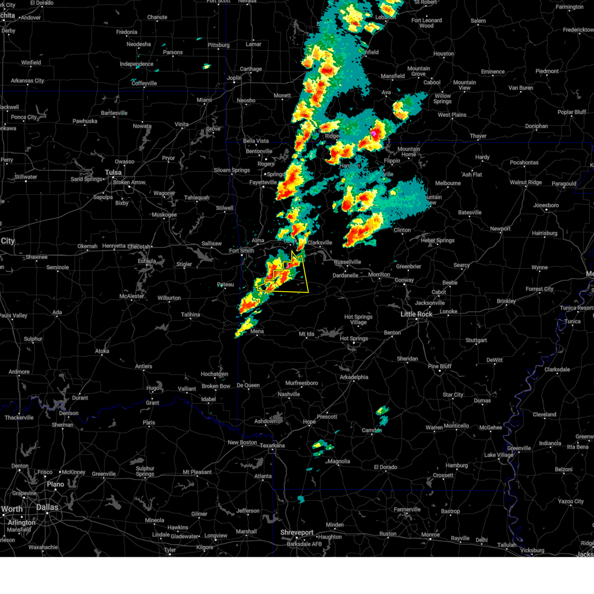 At 400 pm cdt, a severe thunderstorm was located near booneville, moving east at 50 mph (radar indicated). Hazards include ping pong ball size hail and 60 mph wind gusts. People and animals outdoors will be injured. expect hail damage to roofs, siding, windows, and vehicles. expect wind damage to roofs, siding, and trees. locations impacted include, booneville, paris, mansfield, magazine, ratcliff, blue mountain, stonehouse recreation area, echo, mount magazine, caulksville, barber, roseville, lucas, chismville, carbon city, driggs, sugar grove, carolan, grayson, glendale in logan county, hail threat, radar indicated max hail size, 1. 50 in wind threat, radar indicated max wind gust, 60 mph. At 400 pm cdt, a severe thunderstorm was located near booneville, moving east at 50 mph (radar indicated). Hazards include ping pong ball size hail and 60 mph wind gusts. People and animals outdoors will be injured. expect hail damage to roofs, siding, windows, and vehicles. expect wind damage to roofs, siding, and trees. locations impacted include, booneville, paris, mansfield, magazine, ratcliff, blue mountain, stonehouse recreation area, echo, mount magazine, caulksville, barber, roseville, lucas, chismville, carbon city, driggs, sugar grove, carolan, grayson, glendale in logan county, hail threat, radar indicated max hail size, 1. 50 in wind threat, radar indicated max wind gust, 60 mph.
|
| 4/15/2023 3:42 PM CDT |
 At 341 pm cdt, a severe thunderstorm was located near burnville, moving east at 45 mph (radar indicated). Hazards include ping pong ball size hail and 60 mph wind gusts. People and animals outdoors will be injured. expect hail damage to roofs, siding, windows, and vehicles. expect wind damage to roofs, siding, and trees. locations in or near the path include, charleston, greenwood, huntington, branch, washburn, burnville, fort chaffee, milltown, etna, crossroads, witcherville, dayton, hail threat, radar indicated max hail size, 1. 50 in wind threat, radar indicated max wind gust, 60 mph. At 341 pm cdt, a severe thunderstorm was located near burnville, moving east at 45 mph (radar indicated). Hazards include ping pong ball size hail and 60 mph wind gusts. People and animals outdoors will be injured. expect hail damage to roofs, siding, windows, and vehicles. expect wind damage to roofs, siding, and trees. locations in or near the path include, charleston, greenwood, huntington, branch, washburn, burnville, fort chaffee, milltown, etna, crossroads, witcherville, dayton, hail threat, radar indicated max hail size, 1. 50 in wind threat, radar indicated max wind gust, 60 mph.
|
| 4/15/2023 3:42 PM CDT |
 At 342 pm cdt, a severe thunderstorm was located over burnville, or 13 miles southwest of charleston, moving east at 50 mph (radar indicated). Hazards include ping pong ball size hail and 60 mph wind gusts. People and animals outdoors will be injured. expect hail damage to roofs, siding, windows, and vehicles. expect wind damage to roofs, siding, and trees. locations impacted include, booneville, paris, mansfield, magazine, ratcliff, blue mountain, stonehouse recreation area, echo, mount magazine, caulksville, barber, roseville, lucas, chismville, carbon city, driggs, sugar grove, carolan, grayson, glendale in logan county, hail threat, radar indicated max hail size, 1. 50 in wind threat, radar indicated max wind gust, 60 mph. At 342 pm cdt, a severe thunderstorm was located over burnville, or 13 miles southwest of charleston, moving east at 50 mph (radar indicated). Hazards include ping pong ball size hail and 60 mph wind gusts. People and animals outdoors will be injured. expect hail damage to roofs, siding, windows, and vehicles. expect wind damage to roofs, siding, and trees. locations impacted include, booneville, paris, mansfield, magazine, ratcliff, blue mountain, stonehouse recreation area, echo, mount magazine, caulksville, barber, roseville, lucas, chismville, carbon city, driggs, sugar grove, carolan, grayson, glendale in logan county, hail threat, radar indicated max hail size, 1. 50 in wind threat, radar indicated max wind gust, 60 mph.
|
| 4/15/2023 3:30 PM CDT |
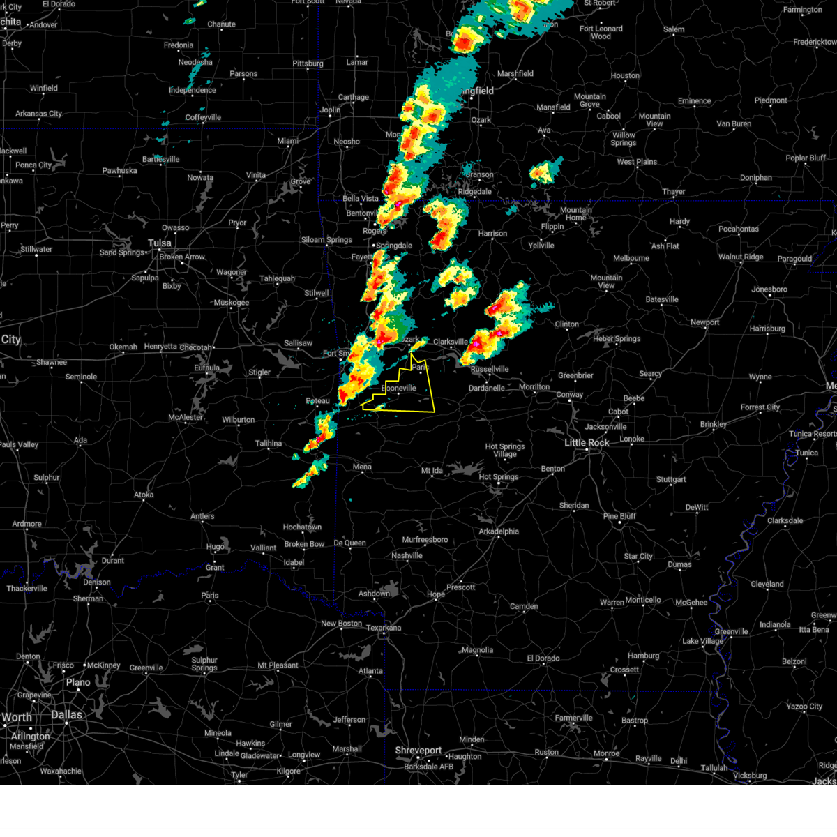 At 330 pm cdt, a severe thunderstorm was located over midland, or 16 miles east of poteau, moving east at 45 mph (radar indicated). Hazards include ping pong ball size hail and 60 mph wind gusts. People and animals outdoors will be injured. expect hail damage to roofs, siding, windows, and vehicles. Expect wind damage to roofs, siding, and trees. At 330 pm cdt, a severe thunderstorm was located over midland, or 16 miles east of poteau, moving east at 45 mph (radar indicated). Hazards include ping pong ball size hail and 60 mph wind gusts. People and animals outdoors will be injured. expect hail damage to roofs, siding, windows, and vehicles. Expect wind damage to roofs, siding, and trees.
|
| 4/15/2023 3:28 PM CDT |
 At 328 pm cdt, a severe thunderstorm was located over midland, moving east at 40 mph (radar indicated). Hazards include ping pong ball size hail and 60 mph wind gusts. People and animals outdoors will be injured. expect hail damage to roofs, siding, windows, and vehicles. expect wind damage to roofs, siding, and trees. locations in or near the path include, charleston, greenwood, hackett, hartford, huntington, branch, midland, bloomer, washburn, excelsior, burnville, fort chaffee, etna, arkola, crossroads, witcherville, dayton, milltown, jenson, hail threat, radar indicated max hail size, 1. 50 in wind threat, radar indicated max wind gust, 60 mph. At 328 pm cdt, a severe thunderstorm was located over midland, moving east at 40 mph (radar indicated). Hazards include ping pong ball size hail and 60 mph wind gusts. People and animals outdoors will be injured. expect hail damage to roofs, siding, windows, and vehicles. expect wind damage to roofs, siding, and trees. locations in or near the path include, charleston, greenwood, hackett, hartford, huntington, branch, midland, bloomer, washburn, excelsior, burnville, fort chaffee, etna, arkola, crossroads, witcherville, dayton, milltown, jenson, hail threat, radar indicated max hail size, 1. 50 in wind threat, radar indicated max wind gust, 60 mph.
|
| 4/5/2023 7:56 AM CDT |
 At 756 am cdt, a severe thunderstorm was located over charleston, moving east at 65 mph (radar indicated). Hazards include 60 mph wind gusts and quarter size hail. Hail damage to vehicles is expected. Expect wind damage to roofs, siding, and trees. At 756 am cdt, a severe thunderstorm was located over charleston, moving east at 65 mph (radar indicated). Hazards include 60 mph wind gusts and quarter size hail. Hail damage to vehicles is expected. Expect wind damage to roofs, siding, and trees.
|
| 3/24/2023 2:48 PM CDT |
 At 248 pm cdt, severe thunderstorms were located along a line extending from near ratcliff to near gravelly to near oden, moving northeast at 60 mph (radar indicated). Hazards include 60 mph wind gusts and quarter size hail. Hail damage to vehicles is expected. Expect wind damage to roofs, siding, and trees. At 248 pm cdt, severe thunderstorms were located along a line extending from near ratcliff to near gravelly to near oden, moving northeast at 60 mph (radar indicated). Hazards include 60 mph wind gusts and quarter size hail. Hail damage to vehicles is expected. Expect wind damage to roofs, siding, and trees.
|
| 2/27/2023 1:57 AM CST |
 The severe thunderstorm warning for madison, eastern franklin and central carroll counties will expire at 200 am cst, the storms which prompted the warning have weakened below severe limits, and no longer pose an immediate threat to life or property. therefore, the warning will be allowed to expire. however gusty winds are still possible with these thunderstorms. The severe thunderstorm warning for madison, eastern franklin and central carroll counties will expire at 200 am cst, the storms which prompted the warning have weakened below severe limits, and no longer pose an immediate threat to life or property. therefore, the warning will be allowed to expire. however gusty winds are still possible with these thunderstorms.
|
| 2/27/2023 1:45 AM CST |
 At 144 am cst, severe thunderstorms were located along a line extending from 5 miles northeast of cassville to 2 miles south of war eagle to 6 miles southeast of fern, moving northeast at 45 mph (radar indicated). Hazards include 60 mph wind gusts. Expect damage to roofs, siding, and trees. locations in or near the path include, berryville, ozark, huntsville, eureka springs, altus, denning, st. paul, hindsville, wiederkehr village, wesley, cass, saint paul, forum, aurora, clifty, boston, withrow springs state park, pettigrew, japton, witter, this includes interstate 40 in arkansas between mile markers 30 and 42. hail threat, radar indicated max hail size, <. 75 in wind threat, radar indicated max wind gust, 60 mph. At 144 am cst, severe thunderstorms were located along a line extending from 5 miles northeast of cassville to 2 miles south of war eagle to 6 miles southeast of fern, moving northeast at 45 mph (radar indicated). Hazards include 60 mph wind gusts. Expect damage to roofs, siding, and trees. locations in or near the path include, berryville, ozark, huntsville, eureka springs, altus, denning, st. paul, hindsville, wiederkehr village, wesley, cass, saint paul, forum, aurora, clifty, boston, withrow springs state park, pettigrew, japton, witter, this includes interstate 40 in arkansas between mile markers 30 and 42. hail threat, radar indicated max hail size, <. 75 in wind threat, radar indicated max wind gust, 60 mph.
|
| 2/27/2023 1:33 AM CST |
 At 132 am cst, severe thunderstorms were located along a line extending from 2 miles southeast of exeter to 4 miles east of springdale to mulberry, moving northeast at 55 mph (radar indicated). Hazards include 60 mph wind gusts. Expect damage to roofs, siding, and trees. locations in or near the path include, fayetteville, springdale, berryville, ozark, charleston, huntsville, eureka springs, elkins, mulberry, altus, branch, denning, st. paul, beaver, hindsville, wiederkehr village, wesley, saint paul, forum, aurora, this includes interstate 40 in arkansas between mile markers 22 and 42. hail threat, radar indicated max hail size, <. 75 in wind threat, radar indicated max wind gust, 60 mph. At 132 am cst, severe thunderstorms were located along a line extending from 2 miles southeast of exeter to 4 miles east of springdale to mulberry, moving northeast at 55 mph (radar indicated). Hazards include 60 mph wind gusts. Expect damage to roofs, siding, and trees. locations in or near the path include, fayetteville, springdale, berryville, ozark, charleston, huntsville, eureka springs, elkins, mulberry, altus, branch, denning, st. paul, beaver, hindsville, wiederkehr village, wesley, saint paul, forum, aurora, this includes interstate 40 in arkansas between mile markers 22 and 42. hail threat, radar indicated max hail size, <. 75 in wind threat, radar indicated max wind gust, 60 mph.
|
| 2/27/2023 1:10 AM CST |
 At 110 am cst, severe thunderstorms were located along a line extending from 4 miles northwest of pea ridge to 4 miles northwest of prairie grove to near barling, moving northeast at 45 mph (radar indicated). Hazards include 60 mph wind gusts. Expect damage to roofs, siding, and trees. locations in or near the path include, fayetteville, springdale, rogers, bentonville, berryville, ozark, charleston, huntsville, eureka springs, mountainburg, lowell, farmington, alma, pea ridge, prairie grove, elkins, tontitown, west fork, lavaca, cave springs, this includes the following highways, interstate 40 in arkansas between mile markers 11 and 42. interstate 49 between mile markers 22 and 89. hail threat, radar indicated max hail size, <. 75 in wind threat, radar indicated max wind gust, 60 mph. At 110 am cst, severe thunderstorms were located along a line extending from 4 miles northwest of pea ridge to 4 miles northwest of prairie grove to near barling, moving northeast at 45 mph (radar indicated). Hazards include 60 mph wind gusts. Expect damage to roofs, siding, and trees. locations in or near the path include, fayetteville, springdale, rogers, bentonville, berryville, ozark, charleston, huntsville, eureka springs, mountainburg, lowell, farmington, alma, pea ridge, prairie grove, elkins, tontitown, west fork, lavaca, cave springs, this includes the following highways, interstate 40 in arkansas between mile markers 11 and 42. interstate 49 between mile markers 22 and 89. hail threat, radar indicated max hail size, <. 75 in wind threat, radar indicated max wind gust, 60 mph.
|
| 2/16/2023 1:04 AM CST |
 At 103 am cst, a severe thunderstorm was located over bloomer, moving northeast at 50 mph (radar indicated). Hazards include 60 mph wind gusts and quarter size hail. Hail damage to vehicles is expected. expect wind damage to roofs, siding, and trees. locations in or near the path include, ozark, charleston, greenwood, lavaca, altus, branch, denning, wiederkehr village, bloomer, fort chaffee, etna, alix, meg, milltown, peter pender, vesta, cecil, ursula, this includes interstate 40 in arkansas between mile markers 36 and 42. hail threat, radar indicated max hail size, 1. 00 in wind threat, radar indicated max wind gust, 60 mph. At 103 am cst, a severe thunderstorm was located over bloomer, moving northeast at 50 mph (radar indicated). Hazards include 60 mph wind gusts and quarter size hail. Hail damage to vehicles is expected. expect wind damage to roofs, siding, and trees. locations in or near the path include, ozark, charleston, greenwood, lavaca, altus, branch, denning, wiederkehr village, bloomer, fort chaffee, etna, alix, meg, milltown, peter pender, vesta, cecil, ursula, this includes interstate 40 in arkansas between mile markers 36 and 42. hail threat, radar indicated max hail size, 1. 00 in wind threat, radar indicated max wind gust, 60 mph.
|
| 1/11/2023 8:56 PM CST |
 At 856 pm cst, a severe thunderstorm was located near echo, or 8 miles north of waldron, moving east at 55 mph (radar indicated). Hazards include two inch hail and 60 mph wind gusts. People and animals outdoors will be injured. expect hail damage to roofs, siding, windows, and vehicles. Expect wind damage to roofs, siding, and trees. At 856 pm cst, a severe thunderstorm was located near echo, or 8 miles north of waldron, moving east at 55 mph (radar indicated). Hazards include two inch hail and 60 mph wind gusts. People and animals outdoors will be injured. expect hail damage to roofs, siding, windows, and vehicles. Expect wind damage to roofs, siding, and trees.
|
| 1/2/2023 2:21 PM CST |
 At 221 pm cst, a severe thunderstorm capable of producing a tornado was located near paris, moving northeast at 45 mph (radar indicated rotation). Hazards include tornado and quarter size hail. Flying debris will be dangerous to those caught without shelter. mobile homes will be damaged or destroyed. damage to roofs, windows, and vehicles will occur. Tree damage is likely. At 221 pm cst, a severe thunderstorm capable of producing a tornado was located near paris, moving northeast at 45 mph (radar indicated rotation). Hazards include tornado and quarter size hail. Flying debris will be dangerous to those caught without shelter. mobile homes will be damaged or destroyed. damage to roofs, windows, and vehicles will occur. Tree damage is likely.
|
| 11/4/2022 7:44 PM CDT | Report of a tree downed across hwy 23... south of hwy 288 intersection. also took down a power line. *possible tornado in franklin county AR, 3.7 miles SSW of Ratcliff, AR |
| 11/4/2022 7:35 PM CDT |
 At 734 pm cdt, a severe thunderstorm capable of producing a tornado was located 3 miles southeast of charleston, moving northeast at 35 mph. this storm has a history of producing tornadoes (radar indicated rotation). Hazards include tornado. Flying debris will be dangerous to those caught without shelter. mobile homes will be damaged or destroyed. damage to roofs, windows, and vehicles will occur. tree damage is likely. Locations in or near the path include, ozark, charleston, altus, branch, denning, wiederkehr village, etna, alix, watalula, meg, peter pender, vesta, cecil, taft, this includes interstate 40 in arkansas between mile markers 31 and 42. At 734 pm cdt, a severe thunderstorm capable of producing a tornado was located 3 miles southeast of charleston, moving northeast at 35 mph. this storm has a history of producing tornadoes (radar indicated rotation). Hazards include tornado. Flying debris will be dangerous to those caught without shelter. mobile homes will be damaged or destroyed. damage to roofs, windows, and vehicles will occur. tree damage is likely. Locations in or near the path include, ozark, charleston, altus, branch, denning, wiederkehr village, etna, alix, watalula, meg, peter pender, vesta, cecil, taft, this includes interstate 40 in arkansas between mile markers 31 and 42.
|
| 11/4/2022 7:13 PM CDT |
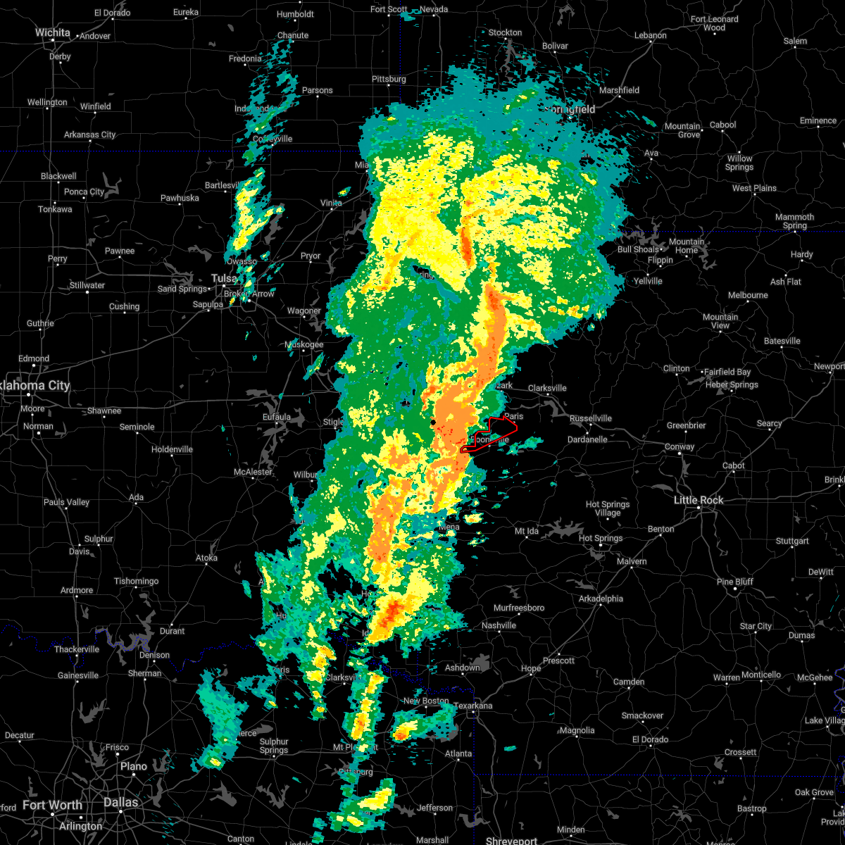 At 713 pm cdt, a severe thunderstorm capable of producing a tornado was located over burnville, or 13 miles southwest of charleston, moving northeast at 45 mph. this storm has a history of producing tornadoes (radar indicated rotation). Hazards include tornado and quarter size hail. Flying debris will be dangerous to those caught without shelter. mobile homes will be damaged or destroyed. damage to roofs, windows, and vehicles will occur. Tree damage is likely. At 713 pm cdt, a severe thunderstorm capable of producing a tornado was located over burnville, or 13 miles southwest of charleston, moving northeast at 45 mph. this storm has a history of producing tornadoes (radar indicated rotation). Hazards include tornado and quarter size hail. Flying debris will be dangerous to those caught without shelter. mobile homes will be damaged or destroyed. damage to roofs, windows, and vehicles will occur. Tree damage is likely.
|
| 10/15/2022 8:47 PM CDT |
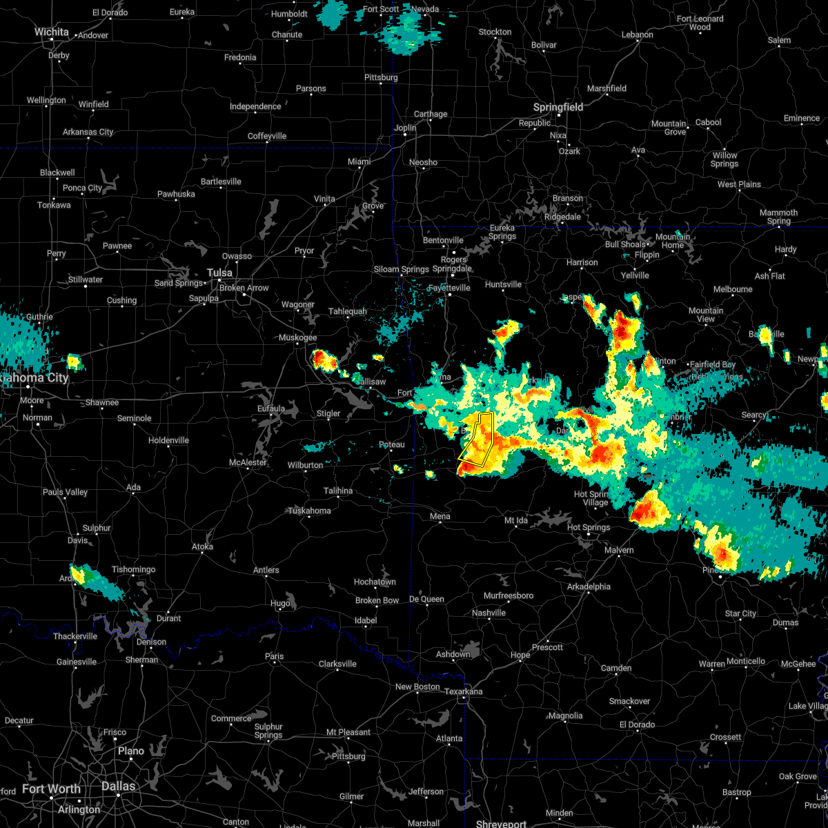 At 847 pm cdt, a severe thunderstorm was located near cardiff, or 9 miles northeast of waldron, moving southeast at 15 mph (radar indicated). Hazards include 60 mph wind gusts and half dollar size hail. Hail damage to vehicles is expected. expect wind damage to roofs, siding, and trees. locations impacted include, booneville, caulksville, chismville, carolan, grayson, hail threat, radar indicated max hail size, 1. 25 in wind threat, radar indicated max wind gust, 60 mph. At 847 pm cdt, a severe thunderstorm was located near cardiff, or 9 miles northeast of waldron, moving southeast at 15 mph (radar indicated). Hazards include 60 mph wind gusts and half dollar size hail. Hail damage to vehicles is expected. expect wind damage to roofs, siding, and trees. locations impacted include, booneville, caulksville, chismville, carolan, grayson, hail threat, radar indicated max hail size, 1. 25 in wind threat, radar indicated max wind gust, 60 mph.
|
| 10/15/2022 8:31 PM CDT |
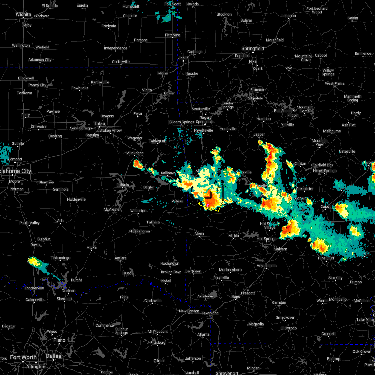 At 830 pm cdt, a severe thunderstorm was located near echo, or 9 miles north of waldron, moving southeast at 25 mph (radar indicated). Hazards include 60 mph wind gusts and half dollar size hail. Hail damage to vehicles is expected. expect wind damage to roofs, siding, and trees. locations impacted include, booneville, mansfield, echo, caulksville, barber, lucas, chismville, carolan, grayson, glendale in logan county, ione, elm park, hail threat, radar indicated max hail size, 1. 25 in wind threat, radar indicated max wind gust, 60 mph. At 830 pm cdt, a severe thunderstorm was located near echo, or 9 miles north of waldron, moving southeast at 25 mph (radar indicated). Hazards include 60 mph wind gusts and half dollar size hail. Hail damage to vehicles is expected. expect wind damage to roofs, siding, and trees. locations impacted include, booneville, mansfield, echo, caulksville, barber, lucas, chismville, carolan, grayson, glendale in logan county, ione, elm park, hail threat, radar indicated max hail size, 1. 25 in wind threat, radar indicated max wind gust, 60 mph.
|
| 10/15/2022 8:16 PM CDT |
 At 816 pm cdt, a severe thunderstorm was located over echo, or 12 miles west of booneville, moving east at 10 mph (radar indicated). Hazards include ping pong ball size hail and 60 mph wind gusts. People and animals outdoors will be injured. expect hail damage to roofs, siding, windows, and vehicles. Expect wind damage to roofs, siding, and trees. At 816 pm cdt, a severe thunderstorm was located over echo, or 12 miles west of booneville, moving east at 10 mph (radar indicated). Hazards include ping pong ball size hail and 60 mph wind gusts. People and animals outdoors will be injured. expect hail damage to roofs, siding, windows, and vehicles. Expect wind damage to roofs, siding, and trees.
|
| 7/17/2022 11:33 PM CDT |
 At 1133 pm cdt, a severe thunderstorm was located near denning, or 8 miles northwest of paris, moving southeast at 40 mph (radar indicated). Hazards include 60 mph wind gusts and penny size hail. expect damage to roofs, siding, and trees At 1133 pm cdt, a severe thunderstorm was located near denning, or 8 miles northwest of paris, moving southeast at 40 mph (radar indicated). Hazards include 60 mph wind gusts and penny size hail. expect damage to roofs, siding, and trees
|
| 6/1/2022 2:59 PM CDT |
 At 259 pm cdt, severe thunderstorms were located along a line extending from 6 miles southeast of echo to mount magazine, moving east at 10 mph (radar indicated). Hazards include 60 mph wind gusts and quarter size hail. Hail damage to vehicles is expected. expect wind damage to roofs, siding, and trees. locations impacted include, booneville, paris, magazine, subiaco, ratcliff, blue mountain, mount magazine, echo, coal hill, havana, caulksville, barber, chismville, wilkins, corley, grayson, glendale in logan county, ione, elm park, waveland, hail threat, radar indicated max hail size, 1. 00 in wind threat, radar indicated max wind gust, 60 mph. At 259 pm cdt, severe thunderstorms were located along a line extending from 6 miles southeast of echo to mount magazine, moving east at 10 mph (radar indicated). Hazards include 60 mph wind gusts and quarter size hail. Hail damage to vehicles is expected. expect wind damage to roofs, siding, and trees. locations impacted include, booneville, paris, magazine, subiaco, ratcliff, blue mountain, mount magazine, echo, coal hill, havana, caulksville, barber, chismville, wilkins, corley, grayson, glendale in logan county, ione, elm park, waveland, hail threat, radar indicated max hail size, 1. 00 in wind threat, radar indicated max wind gust, 60 mph.
|
| 6/1/2022 2:45 PM CDT |
 At 244 pm cdt, a severe thunderstorm was located near magazine, or near booneville, moving northeast at 30 mph (radar indicated). Hazards include 60 mph wind gusts and quarter size hail. Hail damage to vehicles is expected. Expect wind damage to roofs, siding, and trees. At 244 pm cdt, a severe thunderstorm was located near magazine, or near booneville, moving northeast at 30 mph (radar indicated). Hazards include 60 mph wind gusts and quarter size hail. Hail damage to vehicles is expected. Expect wind damage to roofs, siding, and trees.
|
| 5/24/2022 6:55 PM CDT |
 At 655 pm cdt, severe thunderstorms were located along a line extending from near ozark to near paris, moving northeast at 50 mph (radar indicated). Hazards include 60 mph wind gusts and penny size hail. expect damage to roofs, siding, and trees At 655 pm cdt, severe thunderstorms were located along a line extending from near ozark to near paris, moving northeast at 50 mph (radar indicated). Hazards include 60 mph wind gusts and penny size hail. expect damage to roofs, siding, and trees
|
| 5/24/2022 6:53 PM CDT |
 At 653 pm cdt, a severe thunderstorm was located 6 miles southwest of ozark, moving northeast at 25 mph (radar indicated). Hazards include 60 mph wind gusts. Expect damage to roofs, siding, and trees. Locations in or near the path include, ozark, altus, branch, denning, wiederkehr village, etna, alix, peter pender, cecil, meg, this includes interstate 40 in arkansas between mile markers 33 and 42. At 653 pm cdt, a severe thunderstorm was located 6 miles southwest of ozark, moving northeast at 25 mph (radar indicated). Hazards include 60 mph wind gusts. Expect damage to roofs, siding, and trees. Locations in or near the path include, ozark, altus, branch, denning, wiederkehr village, etna, alix, peter pender, cecil, meg, this includes interstate 40 in arkansas between mile markers 33 and 42.
|
| 5/15/2022 2:44 PM CDT |
 At 244 pm cdt, severe thunderstorms were located along a line extending from near taral to near danville to near ratcliff, moving east at 30 mph (radar indicated). Hazards include 60 mph wind gusts and half dollar size hail. Hail damage to vehicles is expected. Expect wind damage to roofs, siding, and trees. At 244 pm cdt, severe thunderstorms were located along a line extending from near taral to near danville to near ratcliff, moving east at 30 mph (radar indicated). Hazards include 60 mph wind gusts and half dollar size hail. Hail damage to vehicles is expected. Expect wind damage to roofs, siding, and trees.
|
| 5/14/2022 5:19 AM CDT |
 At 518 am cdt, a severe thunderstorm was located 3 miles southeast of mulberry, moving southeast at 15 mph (radar indicated). Hazards include quarter size hail. Damage to vehicles is expected. locations in or near the path include, ozark, mulberry, dyer, altus, branch, denning, etna, meg, piney, toney, peter pender, cecil, lonelm, this includes interstate 40 in arkansas between mile markers 16 and 30. hail threat, radar indicated max hail size, 1. 00 in wind threat, radar indicated max wind gust, <50 mph. At 518 am cdt, a severe thunderstorm was located 3 miles southeast of mulberry, moving southeast at 15 mph (radar indicated). Hazards include quarter size hail. Damage to vehicles is expected. locations in or near the path include, ozark, mulberry, dyer, altus, branch, denning, etna, meg, piney, toney, peter pender, cecil, lonelm, this includes interstate 40 in arkansas between mile markers 16 and 30. hail threat, radar indicated max hail size, 1. 00 in wind threat, radar indicated max wind gust, <50 mph.
|
| 5/5/2022 3:42 AM CDT |
 The severe thunderstorm warning for southern franklin, southeastern crawford and sebastian counties will expire at 345 am cdt, the storms which prompted the warning have weakened below severe limits, and no longer pose an immediate threat to life or property. therefore, the warning will be allowed to expire. however gusty winds are still possible with these thunderstorms. a tornado watch remains in effect until 400 am cdt for southeastern oklahoma. to report severe weather, contact your nearest law enforcement agency. they will relay your report to the national weather service tulsa. The severe thunderstorm warning for southern franklin, southeastern crawford and sebastian counties will expire at 345 am cdt, the storms which prompted the warning have weakened below severe limits, and no longer pose an immediate threat to life or property. therefore, the warning will be allowed to expire. however gusty winds are still possible with these thunderstorms. a tornado watch remains in effect until 400 am cdt for southeastern oklahoma. to report severe weather, contact your nearest law enforcement agency. they will relay your report to the national weather service tulsa.
|
| 5/5/2022 3:36 AM CDT |
 At 335 am cdt, severe thunderstorms were located along a line extending from 3 miles northeast of mulberry to fort chaffee to 4 miles northwest of morgan springs, moving east at 45 mph (radar indicated). Hazards include 60 mph wind gusts and nickel size hail. Expect damage to roofs, siding, and trees. locations in or near the path include, ozark, charleston, greenwood, lavaca, mulberry, dyer, altus, hartford, huntington, branch, midland, denning, wiederkehr village, bloomer, washburn, burnville, fort chaffee, patterson, arkola, crossroads, this includes interstate 40 in arkansas between mile markers 16 and 42. hail threat, radar indicated max hail size, 0. 88 in wind threat, radar indicated max wind gust, 60 mph. At 335 am cdt, severe thunderstorms were located along a line extending from 3 miles northeast of mulberry to fort chaffee to 4 miles northwest of morgan springs, moving east at 45 mph (radar indicated). Hazards include 60 mph wind gusts and nickel size hail. Expect damage to roofs, siding, and trees. locations in or near the path include, ozark, charleston, greenwood, lavaca, mulberry, dyer, altus, hartford, huntington, branch, midland, denning, wiederkehr village, bloomer, washburn, burnville, fort chaffee, patterson, arkola, crossroads, this includes interstate 40 in arkansas between mile markers 16 and 42. hail threat, radar indicated max hail size, 0. 88 in wind threat, radar indicated max wind gust, 60 mph.
|
| 5/5/2022 3:26 AM CDT |
 At 326 am cdt, severe thunderstorms were located along a line extending from 3 miles north of dyer to 3 miles northeast of greenwood to 5 miles northeast of heavener runestone state park, moving east at 55 mph (radar indicated). Hazards include 60 mph wind gusts and nickel size hail. Expect damage to roofs, siding, and trees. locations in or near the path include, fort smith, van buren, ozark, charleston, greenwood, alma, barling, lavaca, mulberry, dyer, hackett, altus, hartford, huntington, bonanza, branch, midland, denning, rudy, wiederkehr village, this includes the following highways, interstate 40 in arkansas between mile markers 4 and 42. interstate 540 between mile markers 1 and 14. interstate 49 between mile markers 22 and 27. hail threat, radar indicated max hail size, 0. 88 in wind threat, radar indicated max wind gust, 60 mph. At 326 am cdt, severe thunderstorms were located along a line extending from 3 miles north of dyer to 3 miles northeast of greenwood to 5 miles northeast of heavener runestone state park, moving east at 55 mph (radar indicated). Hazards include 60 mph wind gusts and nickel size hail. Expect damage to roofs, siding, and trees. locations in or near the path include, fort smith, van buren, ozark, charleston, greenwood, alma, barling, lavaca, mulberry, dyer, hackett, altus, hartford, huntington, bonanza, branch, midland, denning, rudy, wiederkehr village, this includes the following highways, interstate 40 in arkansas between mile markers 4 and 42. interstate 540 between mile markers 1 and 14. interstate 49 between mile markers 22 and 27. hail threat, radar indicated max hail size, 0. 88 in wind threat, radar indicated max wind gust, 60 mph.
|
| 5/5/2022 3:17 AM CDT |
 At 316 am cdt, severe thunderstorms were located along a line extending from 4 miles south of mountainburg to heavener runestone state park, moving east at 50 mph (radar indicated). Hazards include 60 mph wind gusts and nickel size hail. Expect damage to roofs, siding, and trees. locations in or near the path include, fort smith, van buren, poteau, ozark, charleston, cedarville, greenwood, alma, barling, pocola, heavener, roland, lavaca, spiro, arkoma, mulberry, wister, dyer, hackett, howe, this includes the following highways, interstate 40 in arkansas between mile markers 0 and 42. interstate 40 in oklahoma between mile markers 322 and 328. interstate 540 between mile markers 1 and 14. interstate 49 between mile markers 22 and 27. hail threat, radar indicated max hail size, 0. 88 in wind threat, radar indicated max wind gust, 60 mph. At 316 am cdt, severe thunderstorms were located along a line extending from 4 miles south of mountainburg to heavener runestone state park, moving east at 50 mph (radar indicated). Hazards include 60 mph wind gusts and nickel size hail. Expect damage to roofs, siding, and trees. locations in or near the path include, fort smith, van buren, poteau, ozark, charleston, cedarville, greenwood, alma, barling, pocola, heavener, roland, lavaca, spiro, arkoma, mulberry, wister, dyer, hackett, howe, this includes the following highways, interstate 40 in arkansas between mile markers 0 and 42. interstate 40 in oklahoma between mile markers 322 and 328. interstate 540 between mile markers 1 and 14. interstate 49 between mile markers 22 and 27. hail threat, radar indicated max hail size, 0. 88 in wind threat, radar indicated max wind gust, 60 mph.
|
| 5/5/2022 3:07 AM CDT |
 At 307 am cdt, severe thunderstorms were located along a line extending from 3 miles north of rudy to 8 miles south of lake wister state park, moving east at 55 mph (radar indicated). Hazards include 60 mph wind gusts and quarter size hail. Hail damage to vehicles is expected. expect wind damage to roofs, siding, and trees. locations in or near the path include, fort smith, van buren, poteau, ozark, charleston, cedarville, greenwood, alma, barling, pocola, muldrow, heavener, roland, lavaca, spiro, arkoma, mulberry, panama, wister, dyer, this includes the following highways, interstate 40 in arkansas between mile markers 0 and 42. interstate 40 in oklahoma between mile markers 311 and 328. interstate 540 between mile markers 1 and 14. interstate 49 between mile markers 22 and 27. hail threat, radar indicated max hail size, 1. 00 in wind threat, radar indicated max wind gust, 60 mph. At 307 am cdt, severe thunderstorms were located along a line extending from 3 miles north of rudy to 8 miles south of lake wister state park, moving east at 55 mph (radar indicated). Hazards include 60 mph wind gusts and quarter size hail. Hail damage to vehicles is expected. expect wind damage to roofs, siding, and trees. locations in or near the path include, fort smith, van buren, poteau, ozark, charleston, cedarville, greenwood, alma, barling, pocola, muldrow, heavener, roland, lavaca, spiro, arkoma, mulberry, panama, wister, dyer, this includes the following highways, interstate 40 in arkansas between mile markers 0 and 42. interstate 40 in oklahoma between mile markers 311 and 328. interstate 540 between mile markers 1 and 14. interstate 49 between mile markers 22 and 27. hail threat, radar indicated max hail size, 1. 00 in wind threat, radar indicated max wind gust, 60 mph.
|
| 5/5/2022 2:55 AM CDT |
 At 255 am cdt, severe thunderstorms were located along a line extending from 3 miles northeast of short to 2 miles east of talihina, moving east at 45 mph (radar indicated). Hazards include 60 mph wind gusts and quarter size hail. Hail damage to vehicles is expected. expect wind damage to roofs, siding, and trees. locations in or near the path include, fort smith, van buren, sallisaw, poteau, ozark, charleston, cedarville, greenwood, alma, barling, pocola, muldrow, heavener, roland, lavaca, spiro, arkoma, mulberry, panama, wister, this includes the following highways, interstate 40 in arkansas between mile markers 0 and 42. interstate 40 in oklahoma between mile markers 304 and 328. interstate 540 between mile markers 1 and 14. interstate 49 between mile markers 22 and 27. hail threat, radar indicated max hail size, 1. 00 in wind threat, radar indicated max wind gust, 60 mph. At 255 am cdt, severe thunderstorms were located along a line extending from 3 miles northeast of short to 2 miles east of talihina, moving east at 45 mph (radar indicated). Hazards include 60 mph wind gusts and quarter size hail. Hail damage to vehicles is expected. expect wind damage to roofs, siding, and trees. locations in or near the path include, fort smith, van buren, sallisaw, poteau, ozark, charleston, cedarville, greenwood, alma, barling, pocola, muldrow, heavener, roland, lavaca, spiro, arkoma, mulberry, panama, wister, this includes the following highways, interstate 40 in arkansas between mile markers 0 and 42. interstate 40 in oklahoma between mile markers 304 and 328. interstate 540 between mile markers 1 and 14. interstate 49 between mile markers 22 and 27. hail threat, radar indicated max hail size, 1. 00 in wind threat, radar indicated max wind gust, 60 mph.
|
| 5/2/2022 11:38 PM CDT |
 At 1138 pm cdt, severe thunderstorms were located along a line extending from 6 miles southwest of booneville to near cardiff to 11 miles northeast of mena, moving east at 45 mph (radar indicated). Hazards include 60 mph wind gusts. Expect damage to roofs, siding, and trees. locations impacted include, booneville, waldron, paris, mansfield, magazine, subiaco, oden, ratcliff, blue mountain, beauchamp, cardiff, muddy creek wma, stonehouse recreation area, gravelly, mount magazine, echo, oliver, queen wilhelmina state park, caulksville, acorn, hail threat, radar indicated max hail size, <. 75 in wind threat, radar indicated max wind gust, 60 mph. At 1138 pm cdt, severe thunderstorms were located along a line extending from 6 miles southwest of booneville to near cardiff to 11 miles northeast of mena, moving east at 45 mph (radar indicated). Hazards include 60 mph wind gusts. Expect damage to roofs, siding, and trees. locations impacted include, booneville, waldron, paris, mansfield, magazine, subiaco, oden, ratcliff, blue mountain, beauchamp, cardiff, muddy creek wma, stonehouse recreation area, gravelly, mount magazine, echo, oliver, queen wilhelmina state park, caulksville, acorn, hail threat, radar indicated max hail size, <. 75 in wind threat, radar indicated max wind gust, 60 mph.
|
| 5/2/2022 11:24 PM CDT |
 At 1124 pm cdt, severe thunderstorms were located along a line extending from 2 miles northeast of wiederkehr village to near huntington, moving east at 35 mph (radar indicated). Hazards include 60 mph wind gusts and penny size hail. Expect damage to roofs, siding, and trees. locations in or near the path include, ozark, charleston, altus, hartford, huntington, branch, denning, wiederkehr village, washburn, burnville, fort chaffee, etna, alix, arkola, crossroads, meg, dayton, milltown, peter pender, this includes interstate 40 in arkansas between mile markers 37 and 42. hail threat, radar indicated max hail size, 0. 75 in wind threat, radar indicated max wind gust, 60 mph. At 1124 pm cdt, severe thunderstorms were located along a line extending from 2 miles northeast of wiederkehr village to near huntington, moving east at 35 mph (radar indicated). Hazards include 60 mph wind gusts and penny size hail. Expect damage to roofs, siding, and trees. locations in or near the path include, ozark, charleston, altus, hartford, huntington, branch, denning, wiederkehr village, washburn, burnville, fort chaffee, etna, alix, arkola, crossroads, meg, dayton, milltown, peter pender, this includes interstate 40 in arkansas between mile markers 37 and 42. hail threat, radar indicated max hail size, 0. 75 in wind threat, radar indicated max wind gust, 60 mph.
|
| 5/2/2022 11:09 PM CDT |
 At 1109 pm cdt, severe thunderstorms were located along a line extending from 6 miles southeast of cass to near bonanza to 3 miles east of muse, moving east at 45 mph (radar indicated). Hazards include 60 mph wind gusts and quarter size hail. Hail damage to vehicles is expected. expect wind damage to roofs, siding, and trees. locations in or near the path include, fort smith, van buren, poteau, ozark, charleston, mountainburg, greenwood, alma, barling, pocola, muldrow, heavener, roland, lavaca, spiro, arkoma, mulberry, panama, wister, dyer, this includes the following highways, interstate 40 in arkansas between mile markers 0 and 42. interstate 40 in oklahoma between mile markers 319 and 328. interstate 540 between mile markers 1 and 14. interstate 49 between mile markers 22 and 29. hail threat, radar indicated max hail size, 1. 00 in wind threat, radar indicated max wind gust, 60 mph. At 1109 pm cdt, severe thunderstorms were located along a line extending from 6 miles southeast of cass to near bonanza to 3 miles east of muse, moving east at 45 mph (radar indicated). Hazards include 60 mph wind gusts and quarter size hail. Hail damage to vehicles is expected. expect wind damage to roofs, siding, and trees. locations in or near the path include, fort smith, van buren, poteau, ozark, charleston, mountainburg, greenwood, alma, barling, pocola, muldrow, heavener, roland, lavaca, spiro, arkoma, mulberry, panama, wister, dyer, this includes the following highways, interstate 40 in arkansas between mile markers 0 and 42. interstate 40 in oklahoma between mile markers 319 and 328. interstate 540 between mile markers 1 and 14. interstate 49 between mile markers 22 and 29. hail threat, radar indicated max hail size, 1. 00 in wind threat, radar indicated max wind gust, 60 mph.
|
| 5/2/2022 11:02 PM CDT |
 At 1102 pm cdt, severe thunderstorms were located along a line extending from near cameron to hartford to 6 miles northwest of mountain fork, moving east at 50 mph (radar indicated). Hazards include 60 mph wind gusts and quarter size hail. Hail damage to vehicles is expected. Expect wind damage to roofs, siding, and trees. At 1102 pm cdt, severe thunderstorms were located along a line extending from near cameron to hartford to 6 miles northwest of mountain fork, moving east at 50 mph (radar indicated). Hazards include 60 mph wind gusts and quarter size hail. Hail damage to vehicles is expected. Expect wind damage to roofs, siding, and trees.
|
| 5/2/2022 10:48 PM CDT |
 At 1047 pm cdt, severe thunderstorms were located along a line extending from 2 miles northeast of fern to 3 miles west of spiro to 5 miles northeast of muse, moving east at 50 mph (radar indicated). Hazards include 60 mph wind gusts and quarter size hail. Hail damage to vehicles is expected. expect wind damage to roofs, siding, and trees. locations in or near the path include, fort smith, van buren, sallisaw, poteau, ozark, charleston, cedarville, mountainburg, natural dam, greenwood, alma, barling, pocola, muldrow, heavener, roland, lavaca, spiro, arkoma, mulberry, this includes the following highways, interstate 40 in arkansas between mile markers 0 and 42. interstate 40 in oklahoma between mile markers 299 and 328. interstate 540 between mile markers 1 and 14. interstate 49 between mile markers 22 and 37. hail threat, radar indicated max hail size, 1. 00 in wind threat, radar indicated max wind gust, 60 mph. At 1047 pm cdt, severe thunderstorms were located along a line extending from 2 miles northeast of fern to 3 miles west of spiro to 5 miles northeast of muse, moving east at 50 mph (radar indicated). Hazards include 60 mph wind gusts and quarter size hail. Hail damage to vehicles is expected. expect wind damage to roofs, siding, and trees. locations in or near the path include, fort smith, van buren, sallisaw, poteau, ozark, charleston, cedarville, mountainburg, natural dam, greenwood, alma, barling, pocola, muldrow, heavener, roland, lavaca, spiro, arkoma, mulberry, this includes the following highways, interstate 40 in arkansas between mile markers 0 and 42. interstate 40 in oklahoma between mile markers 299 and 328. interstate 540 between mile markers 1 and 14. interstate 49 between mile markers 22 and 37. hail threat, radar indicated max hail size, 1. 00 in wind threat, radar indicated max wind gust, 60 mph.
|
| 5/2/2022 6:59 PM CDT |
 At 659 pm cdt, a severe thunderstorm was located near magazine, or near booneville, moving east at 25 mph (radar indicated). Hazards include 60 mph wind gusts and quarter size hail. Hail damage to vehicles is expected. expect wind damage to roofs, siding, and trees. locations impacted include, paris, ratcliff, caulksville, carbon city, driggs, hail threat, radar indicated max hail size, 1. 00 in wind threat, radar indicated max wind gust, 60 mph. At 659 pm cdt, a severe thunderstorm was located near magazine, or near booneville, moving east at 25 mph (radar indicated). Hazards include 60 mph wind gusts and quarter size hail. Hail damage to vehicles is expected. expect wind damage to roofs, siding, and trees. locations impacted include, paris, ratcliff, caulksville, carbon city, driggs, hail threat, radar indicated max hail size, 1. 00 in wind threat, radar indicated max wind gust, 60 mph.
|
| 5/2/2022 6:43 PM CDT |
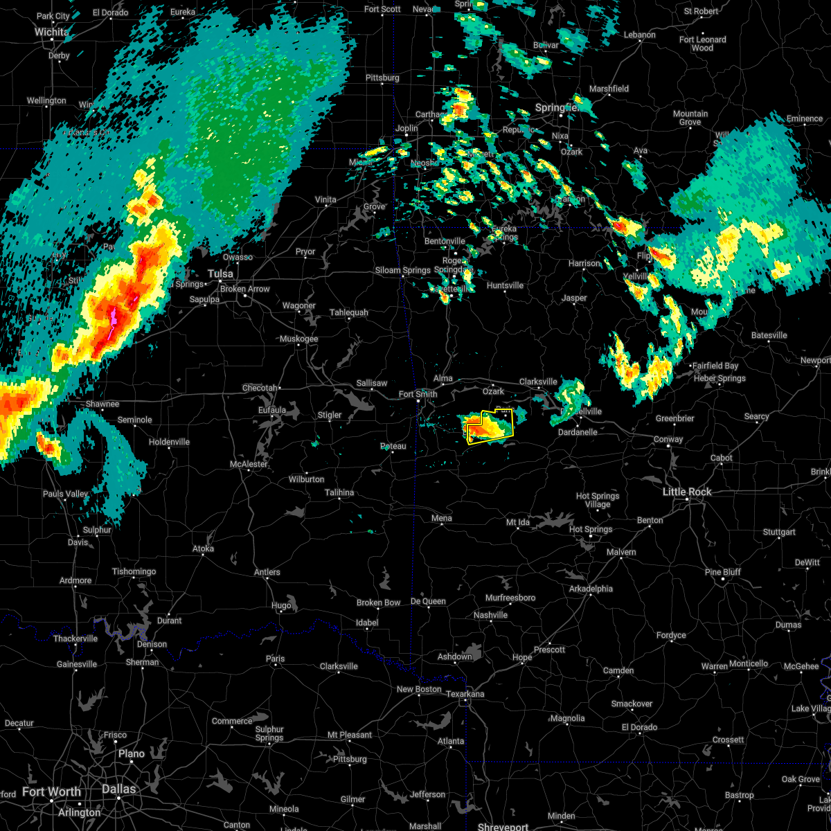 At 642 pm cdt, a severe thunderstorm was located near fort chaffee, or near booneville, moving east at 25 mph (radar indicated). Hazards include golf ball size hail and 60 mph wind gusts. People and animals outdoors will be injured. expect hail damage to roofs, siding, windows, and vehicles. Expect wind damage to roofs, siding, and trees. At 642 pm cdt, a severe thunderstorm was located near fort chaffee, or near booneville, moving east at 25 mph (radar indicated). Hazards include golf ball size hail and 60 mph wind gusts. People and animals outdoors will be injured. expect hail damage to roofs, siding, windows, and vehicles. Expect wind damage to roofs, siding, and trees.
|
| 4/16/2022 6:39 AM CDT |
 The severe thunderstorm warning for central logan county will expire at 645 am cdt, the storm which prompted the warning has weakened below severe limits, and no longer poses an immediate threat to life or property. therefore, the warning will be allowed to expire. however small hail, gusty winds and heavy rain are still possible with this thunderstorm. a severe thunderstorm watch remains in effect until 1000 am cdt for western arkansas. The severe thunderstorm warning for central logan county will expire at 645 am cdt, the storm which prompted the warning has weakened below severe limits, and no longer poses an immediate threat to life or property. therefore, the warning will be allowed to expire. however small hail, gusty winds and heavy rain are still possible with this thunderstorm. a severe thunderstorm watch remains in effect until 1000 am cdt for western arkansas.
|
| 4/16/2022 6:30 AM CDT |
 At 630 am cdt, a severe thunderstorm was located near paris, moving east at 40 mph (radar indicated). Hazards include 60 mph wind gusts and half dollar size hail. Hail damage to vehicles is expected. expect wind damage to roofs, siding, and trees. locations impacted include, booneville, paris, magazine, subiaco, ratcliff, caulksville, wilkins, roseville, carbon city, driggs, chismville, hail threat, radar indicated max hail size, 1. 25 in wind threat, radar indicated max wind gust, 60 mph. At 630 am cdt, a severe thunderstorm was located near paris, moving east at 40 mph (radar indicated). Hazards include 60 mph wind gusts and half dollar size hail. Hail damage to vehicles is expected. expect wind damage to roofs, siding, and trees. locations impacted include, booneville, paris, magazine, subiaco, ratcliff, caulksville, wilkins, roseville, carbon city, driggs, chismville, hail threat, radar indicated max hail size, 1. 25 in wind threat, radar indicated max wind gust, 60 mph.
|
| 4/16/2022 6:25 AM CDT | Quarter sized hail reported 1.2 miles NW of Ratcliff, AR |
| 4/16/2022 6:12 AM CDT |
 At 612 am cdt, a severe thunderstorm was located 3 miles northwest of branch, moving east at 40 mph (radar indicated). Hazards include half dollar size hail. Damage to vehicles is expected. locations in or near the path include, fort smith, van buren, charleston, alma, barling, lavaca, mulberry, dyer, branch, denning, rudy, fort smith regional airport, bloomer, fort chaffee, kibler, central city, concord, shibley, vesta, cecil, this includes the following highways, interstate 40 in arkansas between mile markers 2 and 21. interstate 540 between mile markers 1 and 11. interstate 49 between mile markers 22 and 26. hail threat, radar indicated max hail size, 1. 25 in wind threat, radar indicated max wind gust, <50 mph. At 612 am cdt, a severe thunderstorm was located 3 miles northwest of branch, moving east at 40 mph (radar indicated). Hazards include half dollar size hail. Damage to vehicles is expected. locations in or near the path include, fort smith, van buren, charleston, alma, barling, lavaca, mulberry, dyer, branch, denning, rudy, fort smith regional airport, bloomer, fort chaffee, kibler, central city, concord, shibley, vesta, cecil, this includes the following highways, interstate 40 in arkansas between mile markers 2 and 21. interstate 540 between mile markers 1 and 11. interstate 49 between mile markers 22 and 26. hail threat, radar indicated max hail size, 1. 25 in wind threat, radar indicated max wind gust, <50 mph.
|
| 4/16/2022 6:03 AM CDT |
 At 603 am cdt, a severe thunderstorm was located near lavaca, or near charleston, moving east at 40 mph (radar indicated). Hazards include 60 mph wind gusts and half dollar size hail. Hail damage to vehicles is expected. Expect wind damage to roofs, siding, and trees. At 603 am cdt, a severe thunderstorm was located near lavaca, or near charleston, moving east at 40 mph (radar indicated). Hazards include 60 mph wind gusts and half dollar size hail. Hail damage to vehicles is expected. Expect wind damage to roofs, siding, and trees.
|
| 4/16/2022 5:45 AM CDT |
 At 545 am cdt, a severe thunderstorm was located near van buren, moving east at 40 mph (radar indicated). Hazards include half dollar size hail. Damage to vehicles is expected. locations in or near the path include, fort smith, van buren, charleston, alma, barling, lavaca, mulberry, dyer, branch, denning, rudy, fort smith regional airport, bloomer, fort chaffee, kibler, central city, concord, shibley, vesta, cecil, this includes the following highways, interstate 40 in arkansas between mile markers 2 and 21. interstate 540 between mile markers 1 and 11. interstate 49 between mile markers 22 and 26. hail threat, radar indicated max hail size, 1. 25 in wind threat, radar indicated max wind gust, <50 mph. At 545 am cdt, a severe thunderstorm was located near van buren, moving east at 40 mph (radar indicated). Hazards include half dollar size hail. Damage to vehicles is expected. locations in or near the path include, fort smith, van buren, charleston, alma, barling, lavaca, mulberry, dyer, branch, denning, rudy, fort smith regional airport, bloomer, fort chaffee, kibler, central city, concord, shibley, vesta, cecil, this includes the following highways, interstate 40 in arkansas between mile markers 2 and 21. interstate 540 between mile markers 1 and 11. interstate 49 between mile markers 22 and 26. hail threat, radar indicated max hail size, 1. 25 in wind threat, radar indicated max wind gust, <50 mph.
|
| 4/11/2022 6:25 PM CDT |
 At 625 pm cdt, a severe thunderstorm capable of producing a tornado was located near ratcliff, or near paris, moving east at 30 mph (radar indicated rotation). Hazards include tornado and ping pong ball size hail. Flying debris will be dangerous to those caught without shelter. mobile homes will be damaged or destroyed. damage to roofs, windows, and vehicles will occur. tree damage is likely. Locations impacted include, paris, subiaco, ratcliff, mount magazine, caulksville, wilkins, carbon city, driggs, corley,. At 625 pm cdt, a severe thunderstorm capable of producing a tornado was located near ratcliff, or near paris, moving east at 30 mph (radar indicated rotation). Hazards include tornado and ping pong ball size hail. Flying debris will be dangerous to those caught without shelter. mobile homes will be damaged or destroyed. damage to roofs, windows, and vehicles will occur. tree damage is likely. Locations impacted include, paris, subiaco, ratcliff, mount magazine, caulksville, wilkins, carbon city, driggs, corley,.
|
| 4/11/2022 6:24 PM CDT | Half Dollar sized hail reported 1.2 miles NW of Ratcliff, AR, quarter to half dollar sized hail was reported at caulksville. report relayed by franklin county emergency management. |
| 4/11/2022 6:15 PM CDT |
 At 615 pm cdt, a severe thunderstorm capable of producing a tornado was located near ratcliff, moving east at 30 mph (radar indicated rotation). Hazards include tornado and half dollar size hail. Flying debris will be dangerous to those caught without shelter. mobile homes will be damaged or destroyed. damage to roofs, windows, and vehicles will occur. tree damage is likely. Locations in or near the path include, altus, branch, denning, wiederkehr village, etna, peter pender, alix, meg,. At 615 pm cdt, a severe thunderstorm capable of producing a tornado was located near ratcliff, moving east at 30 mph (radar indicated rotation). Hazards include tornado and half dollar size hail. Flying debris will be dangerous to those caught without shelter. mobile homes will be damaged or destroyed. damage to roofs, windows, and vehicles will occur. tree damage is likely. Locations in or near the path include, altus, branch, denning, wiederkehr village, etna, peter pender, alix, meg,.
|
| 4/11/2022 6:08 PM CDT |
 At 608 pm cdt, a severe thunderstorm capable of producing a tornado was located over branch, or near charleston, moving east at 25 mph (radar indicated rotation). Hazards include tornado and ping pong ball size hail. Flying debris will be dangerous to those caught without shelter. mobile homes will be damaged or destroyed. damage to roofs, windows, and vehicles will occur. Tree damage is likely. At 608 pm cdt, a severe thunderstorm capable of producing a tornado was located over branch, or near charleston, moving east at 25 mph (radar indicated rotation). Hazards include tornado and ping pong ball size hail. Flying debris will be dangerous to those caught without shelter. mobile homes will be damaged or destroyed. damage to roofs, windows, and vehicles will occur. Tree damage is likely.
|
| 4/11/2022 5:59 PM CDT |
 At 559 pm cdt, a severe thunderstorm capable of producing a tornado was located near charleston, moving east at 30 mph (radar indicated rotation). Hazards include tornado and half dollar size hail. Flying debris will be dangerous to those caught without shelter. mobile homes will be damaged or destroyed. damage to roofs, windows, and vehicles will occur. tree damage is likely. Locations in or near the path include, charleston, altus, branch, denning, wiederkehr village, etna, peter pender, alix, vesta, cecil, ursula, meg,. At 559 pm cdt, a severe thunderstorm capable of producing a tornado was located near charleston, moving east at 30 mph (radar indicated rotation). Hazards include tornado and half dollar size hail. Flying debris will be dangerous to those caught without shelter. mobile homes will be damaged or destroyed. damage to roofs, windows, and vehicles will occur. tree damage is likely. Locations in or near the path include, charleston, altus, branch, denning, wiederkehr village, etna, peter pender, alix, vesta, cecil, ursula, meg,.
|
| 4/11/2022 5:48 PM CDT |
 At 548 pm cdt, a severe thunderstorm capable of producing a tornado was located near ratcliff, or near paris, moving east at 30 mph (radar indicated rotation). Hazards include tornado and ping pong ball size hail. Flying debris will be dangerous to those caught without shelter. mobile homes will be damaged or destroyed. damage to roofs, windows, and vehicles will occur. tree damage is likely. Locations impacted include, paris, subiaco, ratcliff, hinkle, caulksville, wilkins, roseville, carbon city,. At 548 pm cdt, a severe thunderstorm capable of producing a tornado was located near ratcliff, or near paris, moving east at 30 mph (radar indicated rotation). Hazards include tornado and ping pong ball size hail. Flying debris will be dangerous to those caught without shelter. mobile homes will be damaged or destroyed. damage to roofs, windows, and vehicles will occur. tree damage is likely. Locations impacted include, paris, subiaco, ratcliff, hinkle, caulksville, wilkins, roseville, carbon city,.
|
| 4/11/2022 5:44 PM CDT | Quarter sized hail reported 1.2 miles NW of Ratcliff, AR, quarter sized hail was reported north of caulksville. |
| 4/11/2022 5:44 PM CDT | Quarter sized hail reported 3.7 miles SSW of Ratcliff, AR, photo relayed via twitter. 4 miles north of caulksville. |
| 4/11/2022 5:34 PM CDT |
 At 533 pm cdt, a confirmed tornado was located near charleston, moving east at 25 mph (radar confirmed tornado). Hazards include damaging tornado and tennis ball size hail. Flying debris will be dangerous to those caught without shelter. mobile homes will be damaged or destroyed. damage to roofs, windows, and vehicles will occur. tree damage is likely. Locations in or near the path include, charleston, branch, denning, bloomer, etna, peter pender, vesta, ursula, meg,. At 533 pm cdt, a confirmed tornado was located near charleston, moving east at 25 mph (radar confirmed tornado). Hazards include damaging tornado and tennis ball size hail. Flying debris will be dangerous to those caught without shelter. mobile homes will be damaged or destroyed. damage to roofs, windows, and vehicles will occur. tree damage is likely. Locations in or near the path include, charleston, branch, denning, bloomer, etna, peter pender, vesta, ursula, meg,.
|
| 4/11/2022 5:32 PM CDT |
 At 531 pm cdt, a confirmed tornado was located over branch, or near charleston, and is moving east at 30 mph (weather spotters confirmed tornado). Hazards include damaging tornado and two inch hail. Flying debris will be dangerous to those caught without shelter. mobile homes will be damaged or destroyed. damage to roofs, windows, and vehicles will occur. tree damage is likely. Locations impacted include, paris, subiaco, ratcliff, hinkle, caulksville, wilkins, roseville, carbon city, driggs, chismville, corley,. At 531 pm cdt, a confirmed tornado was located over branch, or near charleston, and is moving east at 30 mph (weather spotters confirmed tornado). Hazards include damaging tornado and two inch hail. Flying debris will be dangerous to those caught without shelter. mobile homes will be damaged or destroyed. damage to roofs, windows, and vehicles will occur. tree damage is likely. Locations impacted include, paris, subiaco, ratcliff, hinkle, caulksville, wilkins, roseville, carbon city, driggs, chismville, corley,.
|
| 4/11/2022 5:28 PM CDT | Golf Ball sized hail reported 1.3 miles E of Ratcliff, AR, golfball sized hail was reported on the logan/franklin county line west of ratcliff. |
| 4/11/2022 5:25 PM CDT |
 At 525 pm cdt, a severe thunderstorm with strong low level rotation that could produce a tornado at any time was located over charleston, moving east at 30 mph (radar indicated rotation). Hazards include tornado and tennis ball size hail. Flying debris will be dangerous to those caught without shelter. mobile homes will be damaged or destroyed. damage to roofs, windows, and vehicles will occur. tree damage is likely. Locations in or near the path include, charleston, branch, denning, bloomer, etna, peter pender, vesta, ursula, meg,. At 525 pm cdt, a severe thunderstorm with strong low level rotation that could produce a tornado at any time was located over charleston, moving east at 30 mph (radar indicated rotation). Hazards include tornado and tennis ball size hail. Flying debris will be dangerous to those caught without shelter. mobile homes will be damaged or destroyed. damage to roofs, windows, and vehicles will occur. tree damage is likely. Locations in or near the path include, charleston, branch, denning, bloomer, etna, peter pender, vesta, ursula, meg,.
|
| 4/11/2022 5:19 PM CDT |
 At 519 pm cdt, a confirmed tornado was located 3 miles southwest of charleston, moving east at 30 mph (radar confirmed tornado). Hazards include damaging tornado and two inch hail. Flying debris will be dangerous to those caught without shelter. mobile homes will be damaged or destroyed. damage to roofs, windows, and vehicles will occur. tree damage is likely. Locations in or near the path include, charleston, branch, denning, bloomer, etna, peter pender, vesta, ursula, meg,. At 519 pm cdt, a confirmed tornado was located 3 miles southwest of charleston, moving east at 30 mph (radar confirmed tornado). Hazards include damaging tornado and two inch hail. Flying debris will be dangerous to those caught without shelter. mobile homes will be damaged or destroyed. damage to roofs, windows, and vehicles will occur. tree damage is likely. Locations in or near the path include, charleston, branch, denning, bloomer, etna, peter pender, vesta, ursula, meg,.
|
| 4/11/2022 5:19 PM CDT |
 At 519 pm cdt, a severe thunderstorm capable of producing a tornado was located over charleston, moving east at 30 mph (radar indicated rotation). Hazards include tornado and tennis ball size hail. Flying debris will be dangerous to those caught without shelter. mobile homes will be damaged or destroyed. damage to roofs, windows, and vehicles will occur. Tree damage is likely. At 519 pm cdt, a severe thunderstorm capable of producing a tornado was located over charleston, moving east at 30 mph (radar indicated rotation). Hazards include tornado and tennis ball size hail. Flying debris will be dangerous to those caught without shelter. mobile homes will be damaged or destroyed. damage to roofs, windows, and vehicles will occur. Tree damage is likely.
|
| 4/11/2022 5:18 PM CDT |
 At 518 pm cdt, a severe thunderstorm with strong low level rotation that could produce a tornado at any time was located 3 miles southeast of bloomer, moving east at 30 mph (radar indicated rotation). Hazards include tornado and two inch hail. Flying debris will be dangerous to those caught without shelter. mobile homes will be damaged or destroyed. damage to roofs, windows, and vehicles will occur. tree damage is likely. Locations in or near the path include, charleston, branch, denning, bloomer, etna, peter pender, vesta, ursula, meg,. At 518 pm cdt, a severe thunderstorm with strong low level rotation that could produce a tornado at any time was located 3 miles southeast of bloomer, moving east at 30 mph (radar indicated rotation). Hazards include tornado and two inch hail. Flying debris will be dangerous to those caught without shelter. mobile homes will be damaged or destroyed. damage to roofs, windows, and vehicles will occur. tree damage is likely. Locations in or near the path include, charleston, branch, denning, bloomer, etna, peter pender, vesta, ursula, meg,.
|
| 4/11/2022 5:12 PM CDT |
 At 512 pm cdt, a severe thunderstorm capable of producing a tornado was located over bloomer, moving east at 35 mph (radar indicated rotation). Hazards include tornado and hail up to two inches in diameter. Flying debris will be dangerous to those caught without shelter. mobile homes will be damaged or destroyed. damage to roofs, windows, and vehicles will occur. tree damage is likely. Locations in or near the path include, charleston, greenwood, lavaca, branch, denning, bloomer, fort chaffee, etna, peter pender, vesta, ursula, meg,. At 512 pm cdt, a severe thunderstorm capable of producing a tornado was located over bloomer, moving east at 35 mph (radar indicated rotation). Hazards include tornado and hail up to two inches in diameter. Flying debris will be dangerous to those caught without shelter. mobile homes will be damaged or destroyed. damage to roofs, windows, and vehicles will occur. tree damage is likely. Locations in or near the path include, charleston, greenwood, lavaca, branch, denning, bloomer, fort chaffee, etna, peter pender, vesta, ursula, meg,.
|
| 3/30/2022 7:44 AM CDT |
 At 743 am cdt, severe thunderstorms were located along a line extending from near fort chaffee to booneville to 7 miles north of cardiff to near waldron, moving northeast at 45 mph (radar indicated). Hazards include 60 mph wind gusts and quarter size hail. Hail damage to vehicles is expected. Expect wind damage to roofs, siding, and trees. At 743 am cdt, severe thunderstorms were located along a line extending from near fort chaffee to booneville to 7 miles north of cardiff to near waldron, moving northeast at 45 mph (radar indicated). Hazards include 60 mph wind gusts and quarter size hail. Hail damage to vehicles is expected. Expect wind damage to roofs, siding, and trees.
|
| 3/30/2022 7:22 AM CDT |
 At 722 am cdt, severe thunderstorms were located along a line extending from 5 miles north of ozark to 3 miles east of ratcliff, moving northeast at 55 mph (radar indicated). Hazards include 70 mph wind gusts and nickel size hail. Expect considerable tree damage. damage is likely to mobile homes, roofs, and outbuildings. locations in or near the path include, ozark, charleston, altus, branch, denning, wiederkehr village, etna, alix, watalula, meg, toney, peter pender, cecil, lonelm, taft, cravens, this includes interstate 40 in arkansas between mile markers 25 and 42. thunderstorm damage threat, considerable hail threat, radar indicated max hail size, 0. 88 in wind threat, radar indicated max wind gust, 70 mph. At 722 am cdt, severe thunderstorms were located along a line extending from 5 miles north of ozark to 3 miles east of ratcliff, moving northeast at 55 mph (radar indicated). Hazards include 70 mph wind gusts and nickel size hail. Expect considerable tree damage. damage is likely to mobile homes, roofs, and outbuildings. locations in or near the path include, ozark, charleston, altus, branch, denning, wiederkehr village, etna, alix, watalula, meg, toney, peter pender, cecil, lonelm, taft, cravens, this includes interstate 40 in arkansas between mile markers 25 and 42. thunderstorm damage threat, considerable hail threat, radar indicated max hail size, 0. 88 in wind threat, radar indicated max wind gust, 70 mph.
|
| 3/30/2022 7:05 AM CDT |
 At 704 am cdt, severe thunderstorms were located along a line extending from 6 miles north of charleston to 3 miles southeast of washburn, moving northeast at 55 mph (radar indicated). Hazards include 60 mph wind gusts. Expect damage to roofs, siding, and trees. locations in or near the path include, ozark, charleston, mulberry, altus, branch, denning, wiederkehr village, fort chaffee, etna, alix, watalula, meg, toney, peter pender, vesta, cecil, lonelm, taft, cravens, this includes interstate 40 in arkansas between mile markers 25 and 42. hail threat, radar indicated max hail size, <. 75 in wind threat, radar indicated max wind gust, 60 mph. At 704 am cdt, severe thunderstorms were located along a line extending from 6 miles north of charleston to 3 miles southeast of washburn, moving northeast at 55 mph (radar indicated). Hazards include 60 mph wind gusts. Expect damage to roofs, siding, and trees. locations in or near the path include, ozark, charleston, mulberry, altus, branch, denning, wiederkehr village, fort chaffee, etna, alix, watalula, meg, toney, peter pender, vesta, cecil, lonelm, taft, cravens, this includes interstate 40 in arkansas between mile markers 25 and 42. hail threat, radar indicated max hail size, <. 75 in wind threat, radar indicated max wind gust, 60 mph.
|
| 3/30/2022 6:53 AM CDT |
 At 653 am cdt, severe thunderstorms were located along a line extending from echo to 8 miles south of washburn to near mansfield, moving northeast at 55 mph (radar indicated). Hazards include 70 mph wind gusts and quarter size hail. Hail damage to vehicles is expected. expect considerable tree damage. Wind damage is also likely to mobile homes, roofs, and outbuildings. At 653 am cdt, severe thunderstorms were located along a line extending from echo to 8 miles south of washburn to near mansfield, moving northeast at 55 mph (radar indicated). Hazards include 70 mph wind gusts and quarter size hail. Hail damage to vehicles is expected. expect considerable tree damage. Wind damage is also likely to mobile homes, roofs, and outbuildings.
|
| 2/17/2022 5:37 AM CST |
 At 537 am cst, a severe thunderstorm was located near paris, moving northeast at 60 mph (radar indicated). Hazards include 60 mph wind gusts and nickel size hail. expect damage to roofs, siding, and trees At 537 am cst, a severe thunderstorm was located near paris, moving northeast at 60 mph (radar indicated). Hazards include 60 mph wind gusts and nickel size hail. expect damage to roofs, siding, and trees
|
| 12/10/2021 9:14 PM CST |
 At 913 pm cst, severe thunderstorms were located along a line extending from near woodland to near paris to near booneville, moving east at 55 mph (radar indicated). Hazards include 70 mph wind gusts and quarter size hail. Hail damage to vehicles is expected. expect considerable tree damage. wind damage is also likely to mobile homes, roofs, and outbuildings. locations impacted include, clarksville, booneville, paris, lamar, magazine, knoxville, subiaco, hartman, scranton, ratcliff, blue mountain, woodland, hinkle, hoyt, mount magazine, midway in logan county, spadra, tokalon, holman, lake dardanelle, this includes interstate 40 between mile markers 44 and 67. thunderstorm damage threat, considerable hail threat, radar indicated max hail size, 1. 00 in wind threat, radar indicated max wind gust, 70 mph. At 913 pm cst, severe thunderstorms were located along a line extending from near woodland to near paris to near booneville, moving east at 55 mph (radar indicated). Hazards include 70 mph wind gusts and quarter size hail. Hail damage to vehicles is expected. expect considerable tree damage. wind damage is also likely to mobile homes, roofs, and outbuildings. locations impacted include, clarksville, booneville, paris, lamar, magazine, knoxville, subiaco, hartman, scranton, ratcliff, blue mountain, woodland, hinkle, hoyt, mount magazine, midway in logan county, spadra, tokalon, holman, lake dardanelle, this includes interstate 40 between mile markers 44 and 67. thunderstorm damage threat, considerable hail threat, radar indicated max hail size, 1. 00 in wind threat, radar indicated max wind gust, 70 mph.
|
| 12/10/2021 9:05 PM CST | Storm damage reported in logan county AR, 1.2 miles NW of Ratcliff, AR |
| 12/10/2021 9:05 PM CST |
 The severe thunderstorm warning for southern franklin and southern sebastian counties will expire at 915 pm cst, the storms which prompted the warning have moved out of the area. therefore, the warning will be allowed to expire. however gusty winds are still possible with these thunderstorms. a tornado watch remains in effect until 1100 pm cst for west central arkansas, and southeastern oklahoma. to report severe weather, contact your nearest law enforcement agency. they will relay your report to the national weather service tulsa. The severe thunderstorm warning for southern franklin and southern sebastian counties will expire at 915 pm cst, the storms which prompted the warning have moved out of the area. therefore, the warning will be allowed to expire. however gusty winds are still possible with these thunderstorms. a tornado watch remains in effect until 1100 pm cst for west central arkansas, and southeastern oklahoma. to report severe weather, contact your nearest law enforcement agency. they will relay your report to the national weather service tulsa.
|
| 12/10/2021 9:04 PM CST |
 At 904 pm cst, severe thunderstorms were located along a line extending from 8 miles west of woodland to near ratcliff to echo, moving east at 50 mph (radar indicated). Hazards include 60 mph wind gusts and quarter size hail. Hail damage to vehicles is expected. expect wind damage to roofs, siding, and trees. locations impacted include, clarksville, booneville, paris, lamar, mansfield, magazine, knoxville, subiaco, hartman, scranton, ratcliff, blue mountain, hoyt, midway in logan county, holman, woodland, hinkle, mount magazine, echo, spadra, this includes interstate 40 between mile markers 44 and 67. hail threat, radar indicated max hail size, 1. 00 in wind threat, radar indicated max wind gust, 60 mph. At 904 pm cst, severe thunderstorms were located along a line extending from 8 miles west of woodland to near ratcliff to echo, moving east at 50 mph (radar indicated). Hazards include 60 mph wind gusts and quarter size hail. Hail damage to vehicles is expected. expect wind damage to roofs, siding, and trees. locations impacted include, clarksville, booneville, paris, lamar, mansfield, magazine, knoxville, subiaco, hartman, scranton, ratcliff, blue mountain, hoyt, midway in logan county, holman, woodland, hinkle, mount magazine, echo, spadra, this includes interstate 40 between mile markers 44 and 67. hail threat, radar indicated max hail size, 1. 00 in wind threat, radar indicated max wind gust, 60 mph.
|
| 12/10/2021 8:54 PM CST |
 At 853 pm cst, severe thunderstorms were located along a line extending from 6 miles southwest of ozark to 2 miles southwest of charleston to 3 miles northeast of huntington to 4 miles southwest of hartford, moving east at 25 mph (radar indicated). Hazards include 60 mph wind gusts and quarter size hail. Hail damage to vehicles is expected. expect wind damage to roofs, siding, and trees. locations in or near the path include, ozark, charleston, greenwood, altus, hartford, huntington, branch, midland, denning, wiederkehr village, washburn, burnville, fort chaffee, patterson, etna, alix, arkola, crossroads, witcherville, dayton, this includes interstate 40 in arkansas between mile markers 36 and 42. hail threat, radar indicated max hail size, 1. 00 in wind threat, radar indicated max wind gust, 60 mph. At 853 pm cst, severe thunderstorms were located along a line extending from 6 miles southwest of ozark to 2 miles southwest of charleston to 3 miles northeast of huntington to 4 miles southwest of hartford, moving east at 25 mph (radar indicated). Hazards include 60 mph wind gusts and quarter size hail. Hail damage to vehicles is expected. expect wind damage to roofs, siding, and trees. locations in or near the path include, ozark, charleston, greenwood, altus, hartford, huntington, branch, midland, denning, wiederkehr village, washburn, burnville, fort chaffee, patterson, etna, alix, arkola, crossroads, witcherville, dayton, this includes interstate 40 in arkansas between mile markers 36 and 42. hail threat, radar indicated max hail size, 1. 00 in wind threat, radar indicated max wind gust, 60 mph.
|
| 12/10/2021 8:53 PM CST |
 At 853 pm cst, severe thunderstorms were located along a line extending from near ozark to near branch to huntington, moving east at 50 mph (radar indicated). Hazards include 60 mph wind gusts and quarter size hail. Hail damage to vehicles is expected. Expect wind damage to roofs, siding, and trees. At 853 pm cst, severe thunderstorms were located along a line extending from near ozark to near branch to huntington, moving east at 50 mph (radar indicated). Hazards include 60 mph wind gusts and quarter size hail. Hail damage to vehicles is expected. Expect wind damage to roofs, siding, and trees.
|
| 10/13/2021 6:37 PM CDT |
 The tornado warning for southern franklin county will expire at 645 pm cdt, the storm which prompted the warning has weakened below severe limits, and no longer appears capable of producing a tornado. therefore, the warning will be allowed to expire. however gusty winds to 50 mph are still possible with this thunderstorm. The tornado warning for southern franklin county will expire at 645 pm cdt, the storm which prompted the warning has weakened below severe limits, and no longer appears capable of producing a tornado. therefore, the warning will be allowed to expire. however gusty winds to 50 mph are still possible with this thunderstorm.
|
| 10/13/2021 6:30 PM CDT |
 At 629 pm cdt, severe thunderstorms were located along a line extending from 6 miles northeast of branch to near ratcliff, moving northeast at 45 mph (radar indicated). Hazards include 60 mph wind gusts. Expect damage to roofs, siding, and trees. Locations impacted include, clarksville, paris, subiaco, hartman, scranton, ratcliff, woodland, hinkle, hoyt, mount magazine, midway in logan county, spadra, tokalon, lake dardanelle, coal hill, caulksville, morrison bluff, roseville, dublin, ludwig, this includes interstate 40 between mile markers 44 and 59. At 629 pm cdt, severe thunderstorms were located along a line extending from 6 miles northeast of branch to near ratcliff, moving northeast at 45 mph (radar indicated). Hazards include 60 mph wind gusts. Expect damage to roofs, siding, and trees. Locations impacted include, clarksville, paris, subiaco, hartman, scranton, ratcliff, woodland, hinkle, hoyt, mount magazine, midway in logan county, spadra, tokalon, lake dardanelle, coal hill, caulksville, morrison bluff, roseville, dublin, ludwig, this includes interstate 40 between mile markers 44 and 59.
|
| 10/13/2021 6:26 PM CDT |
 At 626 pm cdt, a severe thunderstorm capable of producing a tornado was located near ratcliff, moving east at 35 mph (radar indicated rotation). Hazards include tornado. Flying debris will be dangerous to those caught without shelter. mobile homes will be damaged or destroyed. damage to roofs, windows, and vehicles will occur. tree damage is likely. Locations in or near the path include, ozark, altus, branch, denning, wiederkehr village, etna, peter pender, alix, meg, cecil, this includes interstate 40 in arkansas between mile markers 38 and 41. At 626 pm cdt, a severe thunderstorm capable of producing a tornado was located near ratcliff, moving east at 35 mph (radar indicated rotation). Hazards include tornado. Flying debris will be dangerous to those caught without shelter. mobile homes will be damaged or destroyed. damage to roofs, windows, and vehicles will occur. tree damage is likely. Locations in or near the path include, ozark, altus, branch, denning, wiederkehr village, etna, peter pender, alix, meg, cecil, this includes interstate 40 in arkansas between mile markers 38 and 41.
|
| 10/13/2021 6:14 PM CDT |
 At 614 pm cdt, a severe thunderstorm capable of producing a tornado was located near charleston, moving east at 30 mph (radar indicated rotation). Hazards include tornado. Flying debris will be dangerous to those caught without shelter. mobile homes will be damaged or destroyed. damage to roofs, windows, and vehicles will occur. tree damage is likely. Locations in or near the path include, ozark, charleston, altus, branch, denning, wiederkehr village, fort chaffee, etna, alix, meg, peter pender, vesta, cecil, this includes interstate 40 in arkansas between mile markers 33 and 41. At 614 pm cdt, a severe thunderstorm capable of producing a tornado was located near charleston, moving east at 30 mph (radar indicated rotation). Hazards include tornado. Flying debris will be dangerous to those caught without shelter. mobile homes will be damaged or destroyed. damage to roofs, windows, and vehicles will occur. tree damage is likely. Locations in or near the path include, ozark, charleston, altus, branch, denning, wiederkehr village, fort chaffee, etna, alix, meg, peter pender, vesta, cecil, this includes interstate 40 in arkansas between mile markers 33 and 41.
|
| 10/13/2021 6:10 PM CDT |
 At 610 pm cdt, severe thunderstorms were located along a line extending from charleston to near branch to near fort chaffee to washburn, moving east at 35 mph (radar indicated). Hazards include 60 mph wind gusts. expect damage to roofs, siding, and trees At 610 pm cdt, severe thunderstorms were located along a line extending from charleston to near branch to near fort chaffee to washburn, moving east at 35 mph (radar indicated). Hazards include 60 mph wind gusts. expect damage to roofs, siding, and trees
|
| 10/13/2021 6:01 PM CDT |
 At 600 pm cdt, a severe thunderstorm capable of producing a tornado was located over bloomer, moving northeast at 35 mph (radar indicated rotation). Hazards include tornado. Flying debris will be dangerous to those caught without shelter. mobile homes will be damaged or destroyed. damage to roofs, windows, and vehicles will occur. tree damage is likely. Locations in or near the path include, ozark, charleston, greenwood, lavaca, altus, branch, denning, wiederkehr village, bloomer, washburn, burnville, fort chaffee, central city, etna, alix, meg, milltown, peter pender, vesta, cecil, this includes interstate 40 in arkansas between mile markers 33 and 41. At 600 pm cdt, a severe thunderstorm capable of producing a tornado was located over bloomer, moving northeast at 35 mph (radar indicated rotation). Hazards include tornado. Flying debris will be dangerous to those caught without shelter. mobile homes will be damaged or destroyed. damage to roofs, windows, and vehicles will occur. tree damage is likely. Locations in or near the path include, ozark, charleston, greenwood, lavaca, altus, branch, denning, wiederkehr village, bloomer, washburn, burnville, fort chaffee, central city, etna, alix, meg, milltown, peter pender, vesta, cecil, this includes interstate 40 in arkansas between mile markers 33 and 41.
|
| 6/21/2021 10:31 AM CDT |
 At 1030 am cdt, severe thunderstorms were located along a line extending from near ratcliff to hartford, moving east at 30 mph (radar indicated). Hazards include 60 mph wind gusts and nickel size hail. expect damage to roofs, siding, and trees At 1030 am cdt, severe thunderstorms were located along a line extending from near ratcliff to hartford, moving east at 30 mph (radar indicated). Hazards include 60 mph wind gusts and nickel size hail. expect damage to roofs, siding, and trees
|
| 6/21/2021 10:25 AM CDT |
 At 1025 am cdt, severe thunderstorms were located along a line extending from 6 miles north of wiederkehr village to 2 miles northwest of huntington, moving east at 35 mph (radar indicated). Hazards include 60 mph wind gusts and nickel size hail. Expect damage to roofs, siding, and trees. Locations in or near the path include, ozark, charleston, greenwood, altus, huntington, branch, denning, wiederkehr village, bloomer, washburn, burnville, fort chaffee, etna, alix, watalula, crossroads, witcherville, dayton, meg, milltown, this includes interstate 40 in arkansas between mile markers 31 and 42. At 1025 am cdt, severe thunderstorms were located along a line extending from 6 miles north of wiederkehr village to 2 miles northwest of huntington, moving east at 35 mph (radar indicated). Hazards include 60 mph wind gusts and nickel size hail. Expect damage to roofs, siding, and trees. Locations in or near the path include, ozark, charleston, greenwood, altus, huntington, branch, denning, wiederkehr village, bloomer, washburn, burnville, fort chaffee, etna, alix, watalula, crossroads, witcherville, dayton, meg, milltown, this includes interstate 40 in arkansas between mile markers 31 and 42.
|
| 6/21/2021 9:54 AM CDT |
 At 954 am cdt, severe thunderstorms were located along a line extending from 4 miles north of mulberry to 2 miles north of pocola, moving east at 35 mph (radar indicated). Hazards include 60 mph wind gusts and nickel size hail. Expect damage to roofs, siding, and trees. locations in or near the path include, fort smith, van buren, ozark, charleston, greenwood, alma, barling, pocola, lavaca, arkoma, mulberry, dyer, hackett, altus, huntington, bonanza, branch, denning, wiederkehr village, bloomer, this includes the following highways, interstate 40 in arkansas between mile markers 8 and 42. Interstate 540 between mile markers 2 and 3, and between mile markers 6 and 14. At 954 am cdt, severe thunderstorms were located along a line extending from 4 miles north of mulberry to 2 miles north of pocola, moving east at 35 mph (radar indicated). Hazards include 60 mph wind gusts and nickel size hail. Expect damage to roofs, siding, and trees. locations in or near the path include, fort smith, van buren, ozark, charleston, greenwood, alma, barling, pocola, lavaca, arkoma, mulberry, dyer, hackett, altus, huntington, bonanza, branch, denning, wiederkehr village, bloomer, this includes the following highways, interstate 40 in arkansas between mile markers 8 and 42. Interstate 540 between mile markers 2 and 3, and between mile markers 6 and 14.
|
| 5/7/2021 6:08 PM CDT |
 At 608 pm cdt, a severe thunderstorm was located near van buren, moving southeast at 45 mph (radar indicated). Hazards include 60 mph wind gusts and quarter size hail. Hail damage to vehicles is expected. expect wind damage to roofs, siding, and trees. locations in or near the path include, fort smith, van buren, charleston, alma, barling, lavaca, branch, rudy, bloomer, fort chaffee, kibler, central city, concord, shibley, peter pender, vesta, furry, ursula, this includes the following highways, interstate 40 in arkansas between mile markers 4 and 14. Interstate 540 between mile markers 1 and 6. At 608 pm cdt, a severe thunderstorm was located near van buren, moving southeast at 45 mph (radar indicated). Hazards include 60 mph wind gusts and quarter size hail. Hail damage to vehicles is expected. expect wind damage to roofs, siding, and trees. locations in or near the path include, fort smith, van buren, charleston, alma, barling, lavaca, branch, rudy, bloomer, fort chaffee, kibler, central city, concord, shibley, peter pender, vesta, furry, ursula, this includes the following highways, interstate 40 in arkansas between mile markers 4 and 14. Interstate 540 between mile markers 1 and 6.
|
| 5/3/2021 10:32 PM CDT |
 At 1031 pm cdt, severe thunderstorms were located along a line extending from 4 miles north of cass to 11 miles south of saint paul to 4 miles northeast of wiederkehr village to 3 miles southwest of denning, moving northeast at 45 mph (radar indicated). Hazards include 70 mph wind gusts and penny size hail. Expect considerable tree damage. damage is likely to mobile homes, roofs, and outbuildings. locations in or near the path include, ozark, charleston, altus, branch, denning, wiederkehr village, cass, boston, pettigrew, fern, fort chaffee, jethro, red star, turners bend, cecil, lonelm, dutton, etna, barnes, alix, this line of storms has had a history of producing wind damage across west central arkansas. This includes interstate 40 in arkansas between mile markers 25 and 42. At 1031 pm cdt, severe thunderstorms were located along a line extending from 4 miles north of cass to 11 miles south of saint paul to 4 miles northeast of wiederkehr village to 3 miles southwest of denning, moving northeast at 45 mph (radar indicated). Hazards include 70 mph wind gusts and penny size hail. Expect considerable tree damage. damage is likely to mobile homes, roofs, and outbuildings. locations in or near the path include, ozark, charleston, altus, branch, denning, wiederkehr village, cass, boston, pettigrew, fern, fort chaffee, jethro, red star, turners bend, cecil, lonelm, dutton, etna, barnes, alix, this line of storms has had a history of producing wind damage across west central arkansas. This includes interstate 40 in arkansas between mile markers 25 and 42.
|
| 5/3/2021 10:29 PM CDT |
 At 1029 pm cdt, severe thunderstorms were located along a line extending from near hartman to paris to near magazine, moving east at 45 mph (radar indicated). Hazards include 60 mph wind gusts and nickel size hail. expect damage to roofs, siding, and trees At 1029 pm cdt, severe thunderstorms were located along a line extending from near hartman to paris to near magazine, moving east at 45 mph (radar indicated). Hazards include 60 mph wind gusts and nickel size hail. expect damage to roofs, siding, and trees
|
| 5/3/2021 10:12 PM CDT |
 At 1011 pm cdt, severe thunderstorms were located along a line extending from fern to 6 miles southwest of ozark to 2 miles southeast of charleston, moving northeast at 60 mph (radar indicated). Hazards include 70 mph wind gusts and penny size hail. Expect considerable tree damage. damage is likely to mobile homes, roofs, and outbuildings. locations in or near the path include, ozark, charleston, altus, branch, denning, wiederkehr village, cass, boston, pettigrew, fern, fort chaffee, jethro, red star, turners bend, cecil, lonelm, dutton, etna, barnes, alix, this line of storms has had a history of producing wind damage in the fort smith and van buren areas. This includes interstate 40 in arkansas between mile markers 25 and 42. At 1011 pm cdt, severe thunderstorms were located along a line extending from fern to 6 miles southwest of ozark to 2 miles southeast of charleston, moving northeast at 60 mph (radar indicated). Hazards include 70 mph wind gusts and penny size hail. Expect considerable tree damage. damage is likely to mobile homes, roofs, and outbuildings. locations in or near the path include, ozark, charleston, altus, branch, denning, wiederkehr village, cass, boston, pettigrew, fern, fort chaffee, jethro, red star, turners bend, cecil, lonelm, dutton, etna, barnes, alix, this line of storms has had a history of producing wind damage in the fort smith and van buren areas. This includes interstate 40 in arkansas between mile markers 25 and 42.
|
| 4/28/2021 9:59 PM CDT |
 At 959 pm cdt, a severe thunderstorm was located 4 miles south of branch, moving east at 45 mph (radar indicated). Hazards include 70 mph wind gusts and quarter size hail. Hail damage to vehicles is expected. expect considerable tree damage. wind damage is also likely to mobile homes, roofs, and outbuildings. Locations in or near the path include, charleston, branch, fort chaffee, etna, peter pender, vesta, ursula, meg, a tornado watch remains in effect until 200 am cdt for west central arkansas. At 959 pm cdt, a severe thunderstorm was located 4 miles south of branch, moving east at 45 mph (radar indicated). Hazards include 70 mph wind gusts and quarter size hail. Hail damage to vehicles is expected. expect considerable tree damage. wind damage is also likely to mobile homes, roofs, and outbuildings. Locations in or near the path include, charleston, branch, fort chaffee, etna, peter pender, vesta, ursula, meg, a tornado watch remains in effect until 200 am cdt for west central arkansas.
|
| 4/28/2021 9:55 PM CDT |
 At 955 pm cdt, a severe thunderstorm was located 5 miles northwest of booneville, moving northeast at 40 mph (radar indicated). Hazards include golf ball size hail and 70 mph wind gusts. People and animals outdoors will be injured. expect hail damage to roofs, siding, windows, and vehicles. expect considerable tree damage. Wind damage is also likely to mobile homes, roofs, and outbuildings. At 955 pm cdt, a severe thunderstorm was located 5 miles northwest of booneville, moving northeast at 40 mph (radar indicated). Hazards include golf ball size hail and 70 mph wind gusts. People and animals outdoors will be injured. expect hail damage to roofs, siding, windows, and vehicles. expect considerable tree damage. Wind damage is also likely to mobile homes, roofs, and outbuildings.
|
| 4/28/2021 9:48 PM CDT |
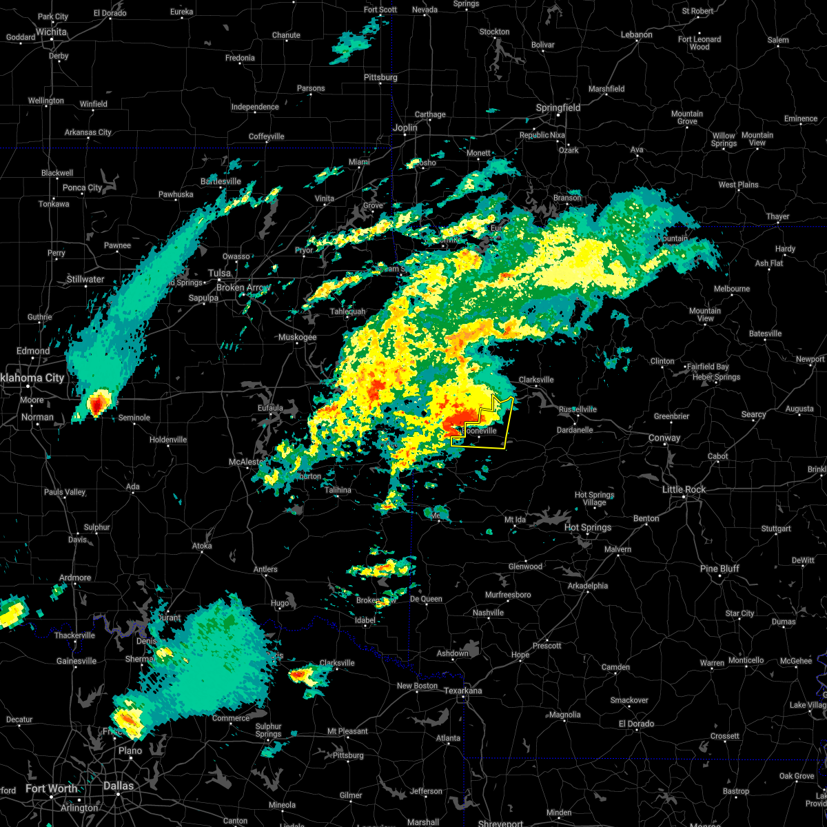 At 947 pm cdt, a severe thunderstorm was located near fort chaffee, or near booneville, moving east at 40 mph (radar indicated). Hazards include golf ball size hail and 70 mph wind gusts. People and animals outdoors will be injured. expect hail damage to roofs, siding, windows, and vehicles. expect considerable tree damage. wind damage is also likely to mobile homes, roofs, and outbuildings. Locations impacted include, booneville, paris, magazine, ratcliff, blue mountain, echo, caulksville, barber, roseville, chismville, carbon city, sugar grove, driggs, carolan, glendale in logan county,. At 947 pm cdt, a severe thunderstorm was located near fort chaffee, or near booneville, moving east at 40 mph (radar indicated). Hazards include golf ball size hail and 70 mph wind gusts. People and animals outdoors will be injured. expect hail damage to roofs, siding, windows, and vehicles. expect considerable tree damage. wind damage is also likely to mobile homes, roofs, and outbuildings. Locations impacted include, booneville, paris, magazine, ratcliff, blue mountain, echo, caulksville, barber, roseville, chismville, carbon city, sugar grove, driggs, carolan, glendale in logan county,.
|
| 4/28/2021 9:27 PM CDT |
 The national weather service in tulsa has issued a * severe thunderstorm warning for. southwestern franklin county in west central arkansas. sebastian county in west central arkansas. until 1015 pm cdt. At 927 pm cdt, a severe thunderstorm was located over excelsior,. The national weather service in tulsa has issued a * severe thunderstorm warning for. southwestern franklin county in west central arkansas. sebastian county in west central arkansas. until 1015 pm cdt. At 927 pm cdt, a severe thunderstorm was located over excelsior,.
|
| 4/28/2021 9:17 PM CDT |
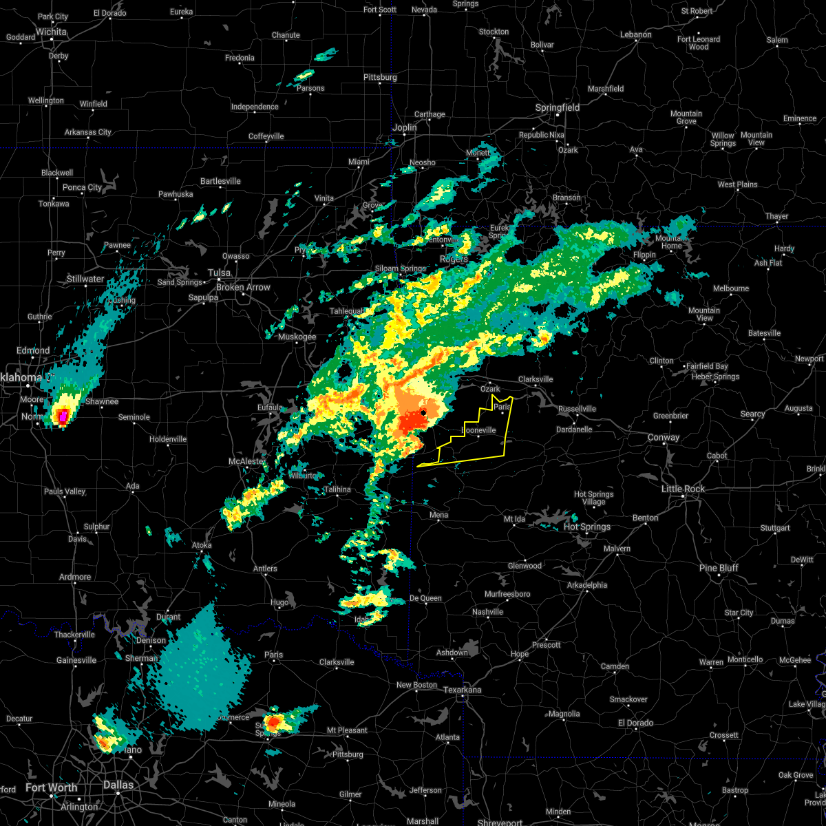 At 917 pm cdt, a severe thunderstorm was located over midland, or 17 miles east of poteau, moving east at 50 mph (radar indicated). Hazards include golf ball size hail and 70 mph wind gusts. People and animals outdoors will be injured. expect hail damage to roofs, siding, windows, and vehicles. expect considerable tree damage. Wind damage is also likely to mobile homes, roofs, and outbuildings. At 917 pm cdt, a severe thunderstorm was located over midland, or 17 miles east of poteau, moving east at 50 mph (radar indicated). Hazards include golf ball size hail and 70 mph wind gusts. People and animals outdoors will be injured. expect hail damage to roofs, siding, windows, and vehicles. expect considerable tree damage. Wind damage is also likely to mobile homes, roofs, and outbuildings.
|
| 4/28/2021 7:51 PM CDT |
 The severe thunderstorm warning for southeastern franklin county will expire at 800 pm cdt, the storm which prompted the warning has moved out of the area. therefore the warning will be allowed to expire. golf ball sized hail was reported in denning with this storm. to report severe weather, contact your nearest law enforcement agency. they will relay your report to the national weather service tulsa. The severe thunderstorm warning for southeastern franklin county will expire at 800 pm cdt, the storm which prompted the warning has moved out of the area. therefore the warning will be allowed to expire. golf ball sized hail was reported in denning with this storm. to report severe weather, contact your nearest law enforcement agency. they will relay your report to the national weather service tulsa.
|
| 4/28/2021 7:34 PM CDT |
 At 734 pm cdt, a severe thunderstorm was located 4 miles northeast of ratcliff, moving east at 60 mph (radar indicated). Hazards include 60 mph wind gusts and quarter size hail. Hail damage to vehicles is expected. expect wind damage to roofs, siding, and trees. Locations in or near the path include, altus, denning, wiederkehr village, etna, peter pender, alix, meg,. At 734 pm cdt, a severe thunderstorm was located 4 miles northeast of ratcliff, moving east at 60 mph (radar indicated). Hazards include 60 mph wind gusts and quarter size hail. Hail damage to vehicles is expected. expect wind damage to roofs, siding, and trees. Locations in or near the path include, altus, denning, wiederkehr village, etna, peter pender, alix, meg,.
|
| 4/9/2021 10:49 PM CDT |
 At 1048 pm cdt, severe thunderstorms were located along a line extending from 3 miles northeast of greenwood to 2 miles northwest of poteau to 6 miles east of heavener runestone state park, moving east at 40 mph (radar indicated). Hazards include 60 mph wind gusts and quarter size hail. Hail damage to vehicles is expected. expect wind damage to roofs, siding, and trees. Locations in or near the path include, fort smith, van buren, poteau, charleston, greenwood, barling, pocola, lavaca, arkoma, hackett, howe, hartford, huntington, bonanza, branch, midland, cameron, excelsior, fort smith regional airport, bloomer, this includes interstate 540 between mile markers 6 and 14. At 1048 pm cdt, severe thunderstorms were located along a line extending from 3 miles northeast of greenwood to 2 miles northwest of poteau to 6 miles east of heavener runestone state park, moving east at 40 mph (radar indicated). Hazards include 60 mph wind gusts and quarter size hail. Hail damage to vehicles is expected. expect wind damage to roofs, siding, and trees. Locations in or near the path include, fort smith, van buren, poteau, charleston, greenwood, barling, pocola, lavaca, arkoma, hackett, howe, hartford, huntington, bonanza, branch, midland, cameron, excelsior, fort smith regional airport, bloomer, this includes interstate 540 between mile markers 6 and 14.
|
| 4/9/2021 10:40 PM CDT |
 At 1040 pm cdt, severe thunderstorms were located along a line extending from near dyer to greenwood to 6 miles northwest of morgan springs, moving east at 50 mph (radar indicated). Hazards include 60 mph wind gusts. expect damage to roofs, siding, and trees At 1040 pm cdt, severe thunderstorms were located along a line extending from near dyer to greenwood to 6 miles northwest of morgan springs, moving east at 50 mph (radar indicated). Hazards include 60 mph wind gusts. expect damage to roofs, siding, and trees
|
| 4/9/2021 10:33 PM CDT |
 At 1033 pm cdt, severe thunderstorms were located along a line extending from 3 miles northeast of spiro to 7 miles south of bokoshe to 7 miles southeast of heavener, moving east at 40 mph (radar indicated). Hazards include 60 mph wind gusts and quarter size hail. Hail damage to vehicles is expected. expect wind damage to roofs, siding, and trees. locations in or near the path include, fort smith, poteau, charleston, greenwood, barling, pocola, muldrow, heavener, roland, lavaca, spiro, arkoma, panama, wister, hackett, howe, hartford, huntington, bonanza, bokoshe, this includes the following highways, interstate 40 in oklahoma between mile markers 319 and 324. Interstate 540 between mile markers 6 and 14. At 1033 pm cdt, severe thunderstorms were located along a line extending from 3 miles northeast of spiro to 7 miles south of bokoshe to 7 miles southeast of heavener, moving east at 40 mph (radar indicated). Hazards include 60 mph wind gusts and quarter size hail. Hail damage to vehicles is expected. expect wind damage to roofs, siding, and trees. locations in or near the path include, fort smith, poteau, charleston, greenwood, barling, pocola, muldrow, heavener, roland, lavaca, spiro, arkoma, panama, wister, hackett, howe, hartford, huntington, bonanza, bokoshe, this includes the following highways, interstate 40 in oklahoma between mile markers 319 and 324. Interstate 540 between mile markers 6 and 14.
|
| 3/17/2021 3:38 AM CDT |
 At 337 am cdt, a severe thunderstorm was located near branch, moving northeast at 30 mph (radar indicated). Hazards include 60 mph wind gusts and half dollar size hail. Hail damage to vehicles is expected. expect wind damage to roofs, siding, and trees. Locations in or near the path include, charleston, altus, branch, denning, wiederkehr village, etna, peter pender, alix, meg,. At 337 am cdt, a severe thunderstorm was located near branch, moving northeast at 30 mph (radar indicated). Hazards include 60 mph wind gusts and half dollar size hail. Hail damage to vehicles is expected. expect wind damage to roofs, siding, and trees. Locations in or near the path include, charleston, altus, branch, denning, wiederkehr village, etna, peter pender, alix, meg,.
|
| 3/17/2021 3:32 AM CDT |
 At 332 am cdt, a severe thunderstorm was located over ratcliff, or 7 miles east of charleston, moving northeast at 35 mph (radar indicated). Hazards include 60 mph wind gusts and quarter size hail. Hail damage to vehicles is expected. expect wind damage to roofs, siding, and trees. Locations impacted include, ratcliff, caulksville, roseville, carbon city,. At 332 am cdt, a severe thunderstorm was located over ratcliff, or 7 miles east of charleston, moving northeast at 35 mph (radar indicated). Hazards include 60 mph wind gusts and quarter size hail. Hail damage to vehicles is expected. expect wind damage to roofs, siding, and trees. Locations impacted include, ratcliff, caulksville, roseville, carbon city,.
|
| 3/17/2021 3:15 AM CDT |
 At 315 am cdt, a severe thunderstorm was located over fort chaffee, or 7 miles south of charleston, moving northeast at 25 mph (radar indicated). Hazards include 60 mph wind gusts and quarter size hail. Hail damage to vehicles is expected. Expect wind damage to roofs, siding, and trees. At 315 am cdt, a severe thunderstorm was located over fort chaffee, or 7 miles south of charleston, moving northeast at 25 mph (radar indicated). Hazards include 60 mph wind gusts and quarter size hail. Hail damage to vehicles is expected. Expect wind damage to roofs, siding, and trees.
|
| 3/17/2021 3:14 AM CDT |
 At 314 am cdt, a severe thunderstorm was located over fort chaffee, moving northeast at 25 mph (radar indicated). Hazards include 60 mph wind gusts and half dollar size hail. Hail damage to vehicles is expected. expect wind damage to roofs, siding, and trees. Locations in or near the path include, charleston, greenwood, altus, branch, denning, wiederkehr village, washburn, fort chaffee, etna, peter pender, alix, meg,. At 314 am cdt, a severe thunderstorm was located over fort chaffee, moving northeast at 25 mph (radar indicated). Hazards include 60 mph wind gusts and half dollar size hail. Hail damage to vehicles is expected. expect wind damage to roofs, siding, and trees. Locations in or near the path include, charleston, greenwood, altus, branch, denning, wiederkehr village, washburn, fort chaffee, etna, peter pender, alix, meg,.
|
| 3/17/2021 3:07 AM CDT |
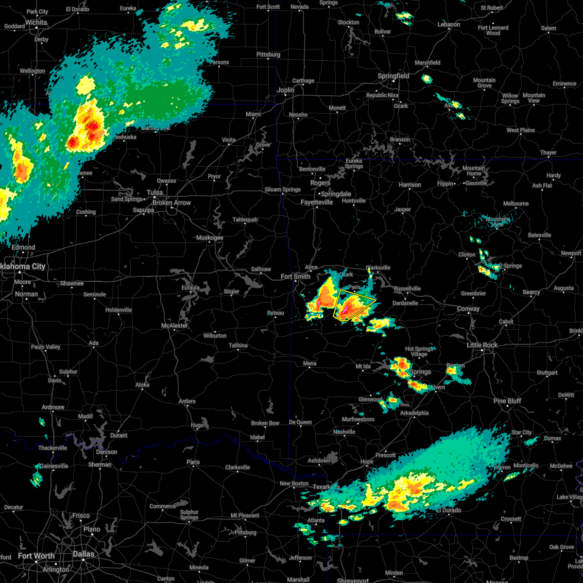 At 307 am cdt, a severe thunderstorm was located near booneville, moving northeast at 25 mph (radar indicated). Hazards include 60 mph wind gusts and quarter size hail. Hail damage to vehicles is expected. expect wind damage to roofs, siding, and trees. Locations impacted include, booneville, magazine, ratcliff, blue mountain, mount magazine, caulksville, sugar grove, driggs, corley, grayson,. At 307 am cdt, a severe thunderstorm was located near booneville, moving northeast at 25 mph (radar indicated). Hazards include 60 mph wind gusts and quarter size hail. Hail damage to vehicles is expected. expect wind damage to roofs, siding, and trees. Locations impacted include, booneville, magazine, ratcliff, blue mountain, mount magazine, caulksville, sugar grove, driggs, corley, grayson,.
|
| 3/17/2021 2:52 AM CDT |
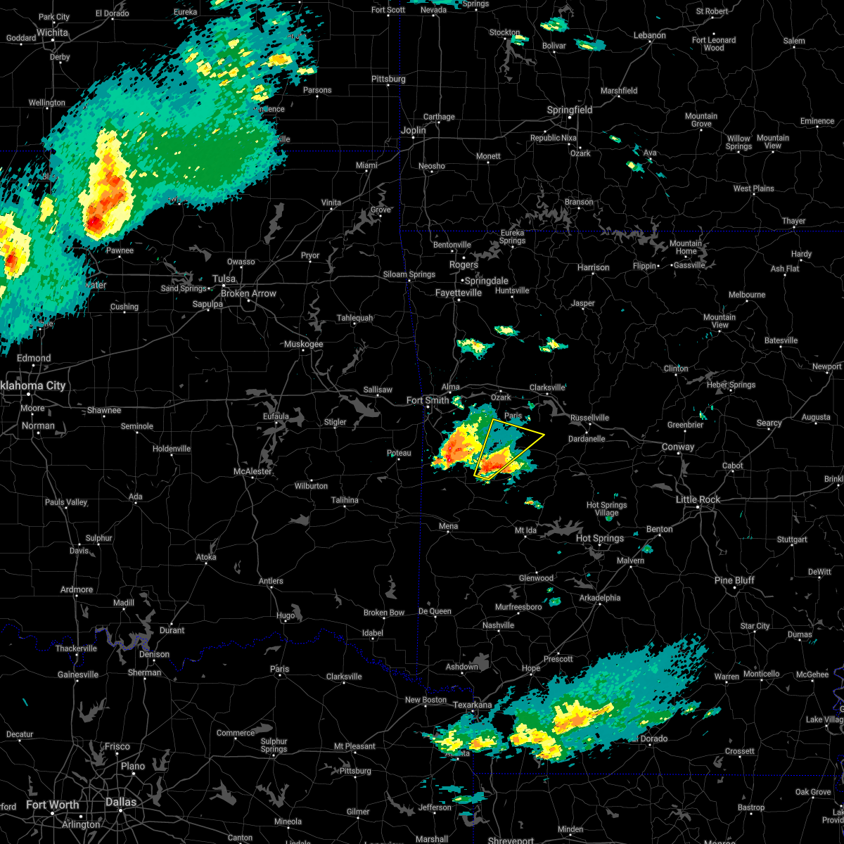 At 252 am cdt, a severe thunderstorm was located near cardiff, or 10 miles northeast of waldron, moving northeast at 25 mph (radar indicated). Hazards include 60 mph wind gusts and quarter size hail. Hail damage to vehicles is expected. Expect wind damage to roofs, siding, and trees. At 252 am cdt, a severe thunderstorm was located near cardiff, or 10 miles northeast of waldron, moving northeast at 25 mph (radar indicated). Hazards include 60 mph wind gusts and quarter size hail. Hail damage to vehicles is expected. Expect wind damage to roofs, siding, and trees.
|
| 11/24/2020 10:43 PM CST |
 At 1043 pm cst, severe thunderstorms were located along a line extending from 3 miles northeast of mulberry to 3 miles southeast of branch to 6 miles south of echo, moving east at 45 mph (radar indicated). Hazards include 60 mph wind gusts and quarter size hail. Hail damage to vehicles is expected. expect wind damage to roofs, siding, and trees. Locations in or near the path include, ozark, charleston, altus, branch, denning, wiederkehr village, etna, alix, watalula, meg, toney, peter pender, vesta, cecil, cravens, lonelm, this includes interstate 40 in arkansas between mile markers 25 and 42. At 1043 pm cst, severe thunderstorms were located along a line extending from 3 miles northeast of mulberry to 3 miles southeast of branch to 6 miles south of echo, moving east at 45 mph (radar indicated). Hazards include 60 mph wind gusts and quarter size hail. Hail damage to vehicles is expected. expect wind damage to roofs, siding, and trees. Locations in or near the path include, ozark, charleston, altus, branch, denning, wiederkehr village, etna, alix, watalula, meg, toney, peter pender, vesta, cecil, cravens, lonelm, this includes interstate 40 in arkansas between mile markers 25 and 42.
|
| 11/24/2020 10:32 PM CST |
 At 1031 pm cst, severe thunderstorms were located along a line extending from near mulberry to fort chaffee to near mansfield, moving east at 45 mph (radar indicated). Hazards include 60 mph wind gusts and penny size hail. expect damage to roofs, siding, and trees At 1031 pm cst, severe thunderstorms were located along a line extending from near mulberry to fort chaffee to near mansfield, moving east at 45 mph (radar indicated). Hazards include 60 mph wind gusts and penny size hail. expect damage to roofs, siding, and trees
|
| 11/24/2020 10:23 PM CST |
 At 1022 pm cst, severe thunderstorms were located along a line extending from 5 miles south of alma to 2 miles north of burnville to 4 miles southeast of hartford, moving east at 45 mph (radar indicated). Hazards include 60 mph wind gusts and quarter size hail. Hail damage to vehicles is expected. expect wind damage to roofs, siding, and trees. locations in or near the path include, van buren, ozark, charleston, greenwood, alma, barling, lavaca, mulberry, dyer, altus, huntington, branch, denning, wiederkehr village, bloomer, washburn, burnville, fort chaffee, kibler, central city, this includes the following highways, interstate 40 in arkansas between mile markers 6 and 11, between mile markers 13 and 19, and between mile markers 22 and 42. Interstate 540 between mile markers 1 and 2. At 1022 pm cst, severe thunderstorms were located along a line extending from 5 miles south of alma to 2 miles north of burnville to 4 miles southeast of hartford, moving east at 45 mph (radar indicated). Hazards include 60 mph wind gusts and quarter size hail. Hail damage to vehicles is expected. expect wind damage to roofs, siding, and trees. locations in or near the path include, van buren, ozark, charleston, greenwood, alma, barling, lavaca, mulberry, dyer, altus, huntington, branch, denning, wiederkehr village, bloomer, washburn, burnville, fort chaffee, kibler, central city, this includes the following highways, interstate 40 in arkansas between mile markers 6 and 11, between mile markers 13 and 19, and between mile markers 22 and 42. Interstate 540 between mile markers 1 and 2.
|
| 11/14/2020 11:24 PM CST |
 The severe thunderstorm warning for southern franklin and southern sebastian counties will expire at 1130 pm cst, the the strongest thunderstorm winds are exiting the warned area. therefore the warning will be allowed to expire on time. a tornado watch remains in effect until midnight cst for west central arkansas. The severe thunderstorm warning for southern franklin and southern sebastian counties will expire at 1130 pm cst, the the strongest thunderstorm winds are exiting the warned area. therefore the warning will be allowed to expire on time. a tornado watch remains in effect until midnight cst for west central arkansas.
|
| 11/14/2020 11:18 PM CST |
 At 1118 pm cst, severe thunderstorms were located along a line extending from 5 miles northwest of hartman to branch to 2 miles northwest of huntington, moving southeast at 25 mph. trees were reported down 8 miles northwest of ozark in franklin county (radar indicated). Hazards include 60 mph wind gusts. Expect damage to roofs, siding, and trees. locations in or near the path include, ozark, charleston, greenwood, altus, hartford, huntington, branch, midland, denning, wiederkehr village, washburn, burnville, fort chaffee, patterson, etna, alix, arkola, crossroads, witcherville, liberty, this includes interstate 40 in arkansas between mile markers 36 and 42. A tornado watch remains in effect until midnight cst for west central arkansas. At 1118 pm cst, severe thunderstorms were located along a line extending from 5 miles northwest of hartman to branch to 2 miles northwest of huntington, moving southeast at 25 mph. trees were reported down 8 miles northwest of ozark in franklin county (radar indicated). Hazards include 60 mph wind gusts. Expect damage to roofs, siding, and trees. locations in or near the path include, ozark, charleston, greenwood, altus, hartford, huntington, branch, midland, denning, wiederkehr village, washburn, burnville, fort chaffee, patterson, etna, alix, arkola, crossroads, witcherville, liberty, this includes interstate 40 in arkansas between mile markers 36 and 42. A tornado watch remains in effect until midnight cst for west central arkansas.
|
| 11/14/2020 11:13 PM CST |
 At 1113 pm cst, severe thunderstorms were located along a line extending from 9 miles north of dillen to near rosetta to woodland to denning, moving east at 45 mph (radar indicated). Hazards include 60 mph wind gusts and quarter size hail. Hail damage to vehicles is expected. expect wind damage to roofs, siding, and trees. Locations impacted include, clarksville, paris, jasper, lamar, knoxville, subiaco, hartman, western grove, scranton, ratcliff, carver, moore, point peter, devils knob, hoyt, midway in logan county, pruitt, holman, rosetta, dillen, this includes interstate 40 between mile markers 44 and 67. At 1113 pm cst, severe thunderstorms were located along a line extending from 9 miles north of dillen to near rosetta to woodland to denning, moving east at 45 mph (radar indicated). Hazards include 60 mph wind gusts and quarter size hail. Hail damage to vehicles is expected. expect wind damage to roofs, siding, and trees. Locations impacted include, clarksville, paris, jasper, lamar, knoxville, subiaco, hartman, western grove, scranton, ratcliff, carver, moore, point peter, devils knob, hoyt, midway in logan county, pruitt, holman, rosetta, dillen, this includes interstate 40 between mile markers 44 and 67.
|
| 11/14/2020 11:10 PM CST |
 At 1109 pm cst, severe thunderstorms were located along a line extending from 4 miles northeast of wiederkehr village to 2 miles northwest of branch to 2 miles northeast of midland. thie line is moving southeast at 25 mph, while individual storms move to the east-northeast at 45 mph (radar indicated). Hazards include 60 mph wind gusts. Expect damage to roofs, siding, and trees. locations in or near the path include, ozark, charleston, greenwood, lavaca, altus, hartford, huntington, branch, midland, denning, wiederkehr village, excelsior, bloomer, washburn, burnville, fort chaffee, patterson, arkola, crossroads, witcherville, this includes interstate 40 in arkansas between mile markers 30 and 42. A tornado watch remains in effect until midnight cst for northwestern and west central arkansas. At 1109 pm cst, severe thunderstorms were located along a line extending from 4 miles northeast of wiederkehr village to 2 miles northwest of branch to 2 miles northeast of midland. thie line is moving southeast at 25 mph, while individual storms move to the east-northeast at 45 mph (radar indicated). Hazards include 60 mph wind gusts. Expect damage to roofs, siding, and trees. locations in or near the path include, ozark, charleston, greenwood, lavaca, altus, hartford, huntington, branch, midland, denning, wiederkehr village, excelsior, bloomer, washburn, burnville, fort chaffee, patterson, arkola, crossroads, witcherville, this includes interstate 40 in arkansas between mile markers 30 and 42. A tornado watch remains in effect until midnight cst for northwestern and west central arkansas.
|
| 11/14/2020 10:58 PM CST |
 At 1057 pm cst, severe thunderstorms were located along a line extending from 7 miles southeast of lost valley state park to 6 miles southwest of devils knob to near wiederkehr village to 6 miles north of branch, moving east at 45 mph (radar indicated). Hazards include 60 mph wind gusts and penny size hail. expect damage to roofs, siding, and trees At 1057 pm cst, severe thunderstorms were located along a line extending from 7 miles southeast of lost valley state park to 6 miles southwest of devils knob to near wiederkehr village to 6 miles north of branch, moving east at 45 mph (radar indicated). Hazards include 60 mph wind gusts and penny size hail. expect damage to roofs, siding, and trees
|
| 11/14/2020 10:57 PM CST |
 At 1057 pm cst, severe thunderstorms were located along a line extending from 9 miles southeast of cass to 4 miles north of charleston to 2 miles southeast of hackett, moving southeast at 25 mph. winds gusted to 61 mph in fort smith (radar indicated). Hazards include 60 mph wind gusts. Expect damage to roofs, siding, and trees. locations in or near the path include, fort smith, ozark, charleston, greenwood, barling, lavaca, mulberry, dyer, hackett, altus, hartford, huntington, bonanza, branch, midland, denning, wiederkehr village, bloomer, burnville, jenny lind, this includes the following highways, interstate 40 in arkansas between mile markers 23 and 42. interstate 540 between mile markers 9 and 14. A tornado watch remains in effect until midnight cst for northwestern and west central arkansas. At 1057 pm cst, severe thunderstorms were located along a line extending from 9 miles southeast of cass to 4 miles north of charleston to 2 miles southeast of hackett, moving southeast at 25 mph. winds gusted to 61 mph in fort smith (radar indicated). Hazards include 60 mph wind gusts. Expect damage to roofs, siding, and trees. locations in or near the path include, fort smith, ozark, charleston, greenwood, barling, lavaca, mulberry, dyer, hackett, altus, hartford, huntington, bonanza, branch, midland, denning, wiederkehr village, bloomer, burnville, jenny lind, this includes the following highways, interstate 40 in arkansas between mile markers 23 and 42. interstate 540 between mile markers 9 and 14. A tornado watch remains in effect until midnight cst for northwestern and west central arkansas.
|
| 8/31/2020 7:24 AM CDT |
 At 724 am cdt, severe thunderstorms were located along a line extending from near charleston to near echo to near hartford, moving southeast at 45 mph (radar indicated). Hazards include 60 mph wind gusts and nickel size hail. Expect damage to roofs, siding, and trees. Locations impacted include, booneville, waldron, mansfield, magazine, ratcliff, echo, oliver, caulksville, barber, winfield, hon, lucas, chismville, carbon city, sugar grove, driggs, carolan, grayson, glendale in logan county, ione,. At 724 am cdt, severe thunderstorms were located along a line extending from near charleston to near echo to near hartford, moving southeast at 45 mph (radar indicated). Hazards include 60 mph wind gusts and nickel size hail. Expect damage to roofs, siding, and trees. Locations impacted include, booneville, waldron, mansfield, magazine, ratcliff, echo, oliver, caulksville, barber, winfield, hon, lucas, chismville, carbon city, sugar grove, driggs, carolan, grayson, glendale in logan county, ione,.
|
| 8/31/2020 7:22 AM CDT |
 At 722 am cdt, severe thunderstorms were located along a line extending from 3 miles northeast of bloomer to washburn to near hartford, moving southeast at 45 mph (radar indicated). Hazards include 60 mph wind gusts and penny size hail. Expect damage to roofs, siding, and trees. Locations in or near the path include, charleston, greenwood, lavaca, hartford, huntington, branch, midland, bloomer, washburn, burnville, fort chaffee, patterson, etna, arkola, crossroads, witcherville, dayton, milltown, peter pender, vesta,. At 722 am cdt, severe thunderstorms were located along a line extending from 3 miles northeast of bloomer to washburn to near hartford, moving southeast at 45 mph (radar indicated). Hazards include 60 mph wind gusts and penny size hail. Expect damage to roofs, siding, and trees. Locations in or near the path include, charleston, greenwood, lavaca, hartford, huntington, branch, midland, bloomer, washburn, burnville, fort chaffee, patterson, etna, arkola, crossroads, witcherville, dayton, milltown, peter pender, vesta,.
|
| 8/31/2020 7:07 AM CDT |
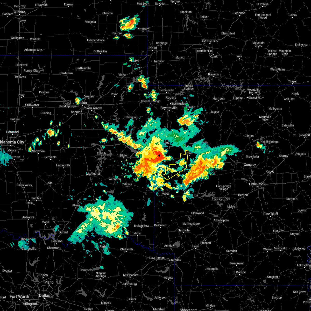 At 707 am cdt, severe thunderstorms were located along a line extending from near van buren to greenwood to near cameron, moving east at 40 mph (radar indicated). Hazards include 60 mph wind gusts and quarter size hail. Hail damage to vehicles is expected. Expect wind damage to roofs, siding, and trees. At 707 am cdt, severe thunderstorms were located along a line extending from near van buren to greenwood to near cameron, moving east at 40 mph (radar indicated). Hazards include 60 mph wind gusts and quarter size hail. Hail damage to vehicles is expected. Expect wind damage to roofs, siding, and trees.
|
| 8/31/2020 7:01 AM CDT |
 At 701 am cdt, severe thunderstorms were located along a line extending from 4 miles southeast of van buren to jenny lind to 2 miles northeast of cameron, moving east at 40 mph (radar indicated). Hazards include 60 mph wind gusts and penny size hail. Expect damage to roofs, siding, and trees. Locations in or near the path include, fort smith, charleston, greenwood, barling, lavaca, hackett, hartford, huntington, bonanza, branch, midland, excelsior, bloomer, washburn, burnville, fort chaffee, jenny lind, kibler, central city, patterson,. At 701 am cdt, severe thunderstorms were located along a line extending from 4 miles southeast of van buren to jenny lind to 2 miles northeast of cameron, moving east at 40 mph (radar indicated). Hazards include 60 mph wind gusts and penny size hail. Expect damage to roofs, siding, and trees. Locations in or near the path include, fort smith, charleston, greenwood, barling, lavaca, hackett, hartford, huntington, bonanza, branch, midland, excelsior, bloomer, washburn, burnville, fort chaffee, jenny lind, kibler, central city, patterson,.
|
| 8/29/2020 7:49 PM CDT |
 The national weather service in tulsa has issued a * severe thunderstorm warning for. southwestern franklin county in west central arkansas. northeastern sebastian county in west central arkansas. until 830 pm cdt. At 749 pm cdt, a severe thunderstorm was located 6 miles south of. The national weather service in tulsa has issued a * severe thunderstorm warning for. southwestern franklin county in west central arkansas. northeastern sebastian county in west central arkansas. until 830 pm cdt. At 749 pm cdt, a severe thunderstorm was located 6 miles south of.
|
| 8/14/2020 4:31 AM CDT |
 At 431 am cdt, severe thunderstorms were located along a line extending from near ratcliff to 6 miles southwest of paris to magazine to near booneville, moving southeast at 40 mph (radar indicated). Hazards include 60 mph wind gusts. expect damage to roofs, siding, and trees At 431 am cdt, severe thunderstorms were located along a line extending from near ratcliff to 6 miles southwest of paris to magazine to near booneville, moving southeast at 40 mph (radar indicated). Hazards include 60 mph wind gusts. expect damage to roofs, siding, and trees
|
| 7/9/2020 11:51 AM CDT |
 At 1150 am cdt, severe thunderstorms were located along a line extending from near wister to ozark, moving east at 25 mph (radar indicated). Hazards include 60 mph wind gusts and quarter size hail. Hail damage to vehicles may occur. Expect wind damage to roofs, siding, and trees. At 1150 am cdt, severe thunderstorms were located along a line extending from near wister to ozark, moving east at 25 mph (radar indicated). Hazards include 60 mph wind gusts and quarter size hail. Hail damage to vehicles may occur. Expect wind damage to roofs, siding, and trees.
|
| 7/9/2020 11:48 AM CDT |
 At 1148 am cdt, severe thunderstorms were located along a line extending from 6 miles south of mulberry to near greenwood to 6 miles west of poteau, moving southeast at 25 mph (radar indicated). Hazards include 60 mph wind gusts. Expect damage to roofs, siding, and trees. locations in or near the path include, fort smith, van buren, poteau, ozark, charleston, greenwood, alma, barling, pocola, lavaca, spiro, arkoma, mulberry, panama, wister, dyer, hackett, howe, altus, hartford, this includes the following highways, interstate 40 in arkansas between mile markers 7 and 35. Interstate 540 between mile markers 1 and 14. At 1148 am cdt, severe thunderstorms were located along a line extending from 6 miles south of mulberry to near greenwood to 6 miles west of poteau, moving southeast at 25 mph (radar indicated). Hazards include 60 mph wind gusts. Expect damage to roofs, siding, and trees. locations in or near the path include, fort smith, van buren, poteau, ozark, charleston, greenwood, alma, barling, pocola, lavaca, spiro, arkoma, mulberry, panama, wister, dyer, hackett, howe, altus, hartford, this includes the following highways, interstate 40 in arkansas between mile markers 7 and 35. Interstate 540 between mile markers 1 and 14.
|
| 7/9/2020 11:14 AM CDT |
 At 1113 am cdt, severe thunderstorms were located along a line extending from 4 miles south of mountainburg to fort smith to 4 miles northwest of bokoshe, moving southeast at 25 mph (radar indicated). Hazards include 60 mph wind gusts and penny size hail. Expect damage to roofs, siding, and trees. locations in or near the path include, fort smith, van buren, poteau, ozark, charleston, cedarville, mountainburg, greenwood, alma, barling, pocola, muldrow, roland, lavaca, spiro, arkoma, mulberry, panama, wister, dyer, this includes the following highways, interstate 40 in arkansas between mile markers 0 and 35. interstate 40 in oklahoma between mile markers 312 and 328. interstate 540 between mile markers 1 and 14. Interstate 49 between mile markers 22 and 35. At 1113 am cdt, severe thunderstorms were located along a line extending from 4 miles south of mountainburg to fort smith to 4 miles northwest of bokoshe, moving southeast at 25 mph (radar indicated). Hazards include 60 mph wind gusts and penny size hail. Expect damage to roofs, siding, and trees. locations in or near the path include, fort smith, van buren, poteau, ozark, charleston, cedarville, mountainburg, greenwood, alma, barling, pocola, muldrow, roland, lavaca, spiro, arkoma, mulberry, panama, wister, dyer, this includes the following highways, interstate 40 in arkansas between mile markers 0 and 35. interstate 40 in oklahoma between mile markers 312 and 328. interstate 540 between mile markers 1 and 14. Interstate 49 between mile markers 22 and 35.
|
| 5/22/2020 10:48 PM CDT |
 At 1048 pm cdt, severe thunderstorms were located along a line extending from 2 miles east of huntington to 3 miles north of burnville, moving east at 20 mph (radar indicated). Hazards include 60 mph wind gusts and quarter size hail. Hail damage to vehicles is expected. expect wind damage to roofs, siding, and trees. Locations in or near the path include, charleston, greenwood, branch, washburn, burnville, fort chaffee, milltown, crossroads, witcherville, dayton,. At 1048 pm cdt, severe thunderstorms were located along a line extending from 2 miles east of huntington to 3 miles north of burnville, moving east at 20 mph (radar indicated). Hazards include 60 mph wind gusts and quarter size hail. Hail damage to vehicles is expected. expect wind damage to roofs, siding, and trees. Locations in or near the path include, charleston, greenwood, branch, washburn, burnville, fort chaffee, milltown, crossroads, witcherville, dayton,.
|
| 5/22/2020 10:15 PM CDT |
 At 1014 pm cdt, a severe thunderstorm was located near excelsior, moving east at 30 mph (radar indicated). Hazards include 60 mph wind gusts and half dollar size hail. Hail damage to vehicles is expected. expect wind damage to roofs, siding, and trees. Locations in or near the path include, charleston, greenwood, branch, excelsior, washburn, burnville, fort chaffee, jenny lind, milltown, crossroads, witcherville, dayton,. At 1014 pm cdt, a severe thunderstorm was located near excelsior, moving east at 30 mph (radar indicated). Hazards include 60 mph wind gusts and half dollar size hail. Hail damage to vehicles is expected. expect wind damage to roofs, siding, and trees. Locations in or near the path include, charleston, greenwood, branch, excelsior, washburn, burnville, fort chaffee, jenny lind, milltown, crossroads, witcherville, dayton,.
|
| 5/22/2020 10:07 PM CDT |
 At 1006 pm cdt, a severe thunderstorm was located near echo, or 10 miles southwest of booneville, moving east at 25 mph (radar indicated). Hazards include 60 mph wind gusts and quarter size hail. Hail damage to vehicles is expected. expect wind damage to roofs, siding, and trees. Locations impacted include, booneville, waldron, mansfield, magazine, ratcliff, echo, caulksville, barber, hon, lucas, chismville, liberty, carolan, grayson, glendale in logan county, ione, elm park,. At 1006 pm cdt, a severe thunderstorm was located near echo, or 10 miles southwest of booneville, moving east at 25 mph (radar indicated). Hazards include 60 mph wind gusts and quarter size hail. Hail damage to vehicles is expected. expect wind damage to roofs, siding, and trees. Locations impacted include, booneville, waldron, mansfield, magazine, ratcliff, echo, caulksville, barber, hon, lucas, chismville, liberty, carolan, grayson, glendale in logan county, ione, elm park,.
|
| 5/22/2020 9:56 PM CDT |
 At 955 pm cdt, a few severe thunderstorms were located near echo, or 9 miles north of waldron, and the other storm was 3 miles east of burnsville, both moving east at 20 mph (radar indicated). Hazards include ping pong ball size hail and 60 mph wind gusts. People and animals outdoors will be injured. expect hail damage to roofs, siding, windows, and vehicles. expect wind damage to roofs, siding, and trees. Locations impacted include, booneville, waldron, mansfield, magazine, ratcliff, echo, caulksville, barber, hon, lucas, chismville, liberty, carolan, grayson, glendale in logan county, ione, elm park,. At 955 pm cdt, a few severe thunderstorms were located near echo, or 9 miles north of waldron, and the other storm was 3 miles east of burnsville, both moving east at 20 mph (radar indicated). Hazards include ping pong ball size hail and 60 mph wind gusts. People and animals outdoors will be injured. expect hail damage to roofs, siding, windows, and vehicles. expect wind damage to roofs, siding, and trees. Locations impacted include, booneville, waldron, mansfield, magazine, ratcliff, echo, caulksville, barber, hon, lucas, chismville, liberty, carolan, grayson, glendale in logan county, ione, elm park,.
|
| 5/22/2020 9:39 PM CDT |
 At 938 pm cdt, two severe thunderstorms were located over mansfield, or 12 miles northwest of waldron, moving northeast at 20 mph, and 2 miles east of witcherville, also moving northeast at 20 mph (radar indicated). Hazards include ping pong ball size hail and 60 mph wind gusts. People and animals outdoors will be injured. expect hail damage to roofs, siding, windows, and vehicles. expect wind damage to roofs, siding, and trees. Locations impacted include, booneville, waldron, mansfield, magazine, ratcliff, cardiff, echo, oliver, caulksville, barber, cauthron, hon, lucas, chismville, liberty, carolan, grayson, glendale in logan county, ione, elm park,. At 938 pm cdt, two severe thunderstorms were located over mansfield, or 12 miles northwest of waldron, moving northeast at 20 mph, and 2 miles east of witcherville, also moving northeast at 20 mph (radar indicated). Hazards include ping pong ball size hail and 60 mph wind gusts. People and animals outdoors will be injured. expect hail damage to roofs, siding, windows, and vehicles. expect wind damage to roofs, siding, and trees. Locations impacted include, booneville, waldron, mansfield, magazine, ratcliff, cardiff, echo, oliver, caulksville, barber, cauthron, hon, lucas, chismville, liberty, carolan, grayson, glendale in logan county, ione, elm park,.
|
| 5/22/2020 9:25 PM CDT |
 At 924 pm cdt, two severe thunderstorms were located near mansfield, or 13 miles northwest of waldron, moving east at 25 mph, and 1 mile east of witcherville moving east at 25 mph (radar indicated). Hazards include ping pong ball size hail and 60 mph wind gusts. People and animals outdoors will be injured. expect hail damage to roofs, siding, windows, and vehicles. Expect wind damage to roofs, siding, and trees. At 924 pm cdt, two severe thunderstorms were located near mansfield, or 13 miles northwest of waldron, moving east at 25 mph, and 1 mile east of witcherville moving east at 25 mph (radar indicated). Hazards include ping pong ball size hail and 60 mph wind gusts. People and animals outdoors will be injured. expect hail damage to roofs, siding, windows, and vehicles. Expect wind damage to roofs, siding, and trees.
|
| 5/22/2020 7:55 PM CDT |
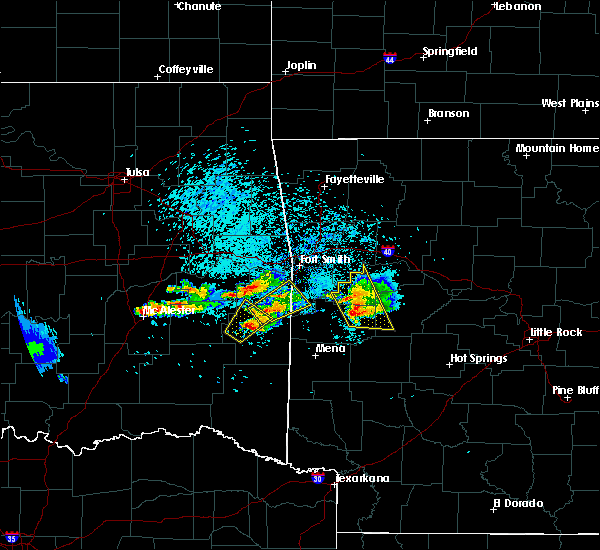 At 754 pm cdt, severe thunderstorms were located along a line extending from near booneville to cardiff, moving east at 20 mph (radar indicated). Hazards include golf ball size hail and 60 mph wind gusts. People and animals outdoors will be injured. expect hail damage to roofs, siding, windows, and vehicles. expect wind damage to roofs, siding, and trees. Locations impacted include, booneville, magazine, ratcliff, blue mountain, stonehouse recreation area, cardiff, gravelly, caulksville, barber, union hill, olio, chismville, bluffton, nola, harvey, carbon city, sugar grove, driggs, carolan, grayson,. At 754 pm cdt, severe thunderstorms were located along a line extending from near booneville to cardiff, moving east at 20 mph (radar indicated). Hazards include golf ball size hail and 60 mph wind gusts. People and animals outdoors will be injured. expect hail damage to roofs, siding, windows, and vehicles. expect wind damage to roofs, siding, and trees. Locations impacted include, booneville, magazine, ratcliff, blue mountain, stonehouse recreation area, cardiff, gravelly, caulksville, barber, union hill, olio, chismville, bluffton, nola, harvey, carbon city, sugar grove, driggs, carolan, grayson,.
|
| 5/22/2020 7:36 PM CDT |
 At 736 pm cdt, severe thunderstorms were located along a line extending from near echo to near waldron, moving east at 20 mph (radar indicated). Hazards include two inch hail and 60 mph wind gusts. People and animals outdoors will be injured. expect hail damage to roofs, siding, windows, and vehicles. Expect wind damage to roofs, siding, and trees. At 736 pm cdt, severe thunderstorms were located along a line extending from near echo to near waldron, moving east at 20 mph (radar indicated). Hazards include two inch hail and 60 mph wind gusts. People and animals outdoors will be injured. expect hail damage to roofs, siding, windows, and vehicles. Expect wind damage to roofs, siding, and trees.
|
| 5/5/2020 12:05 AM CDT |
 The severe thunderstorm warning for southern franklin county will expire at 1215 am cdt, the storm which prompted the warning has moved out of the area. therefore the warning will be allowed to expire. The severe thunderstorm warning for southern franklin county will expire at 1215 am cdt, the storm which prompted the warning has moved out of the area. therefore the warning will be allowed to expire.
|
| 5/4/2020 11:52 PM CDT |
 At 1152 pm cdt, a severe thunderstorm was located over ratcliff, moving east at 45 mph (radar indicated). Hazards include 60 mph wind gusts and quarter size hail. Hail damage to vehicles is expected. expect wind damage to roofs, siding, and trees. Locations in or near the path include, charleston, altus, branch, denning, wiederkehr village, etna, peter pender, alix, vesta, meg, a tornado watch remains in effect until midnight cdt for west central arkansas. At 1152 pm cdt, a severe thunderstorm was located over ratcliff, moving east at 45 mph (radar indicated). Hazards include 60 mph wind gusts and quarter size hail. Hail damage to vehicles is expected. expect wind damage to roofs, siding, and trees. Locations in or near the path include, charleston, altus, branch, denning, wiederkehr village, etna, peter pender, alix, vesta, meg, a tornado watch remains in effect until midnight cdt for west central arkansas.
|
| 5/4/2020 11:51 PM CDT |
 At 1151 pm cdt, a severe thunderstorm was located over ratcliff, or near charleston, moving southeast at 40 mph (radar indicated). Hazards include 60 mph wind gusts and quarter size hail. Hail damage to vehicles is expected. Expect wind damage to roofs, siding, and trees. At 1151 pm cdt, a severe thunderstorm was located over ratcliff, or near charleston, moving southeast at 40 mph (radar indicated). Hazards include 60 mph wind gusts and quarter size hail. Hail damage to vehicles is expected. Expect wind damage to roofs, siding, and trees.
|
| 5/4/2020 11:46 PM CDT |
 At 1146 pm cdt, a severe thunderstorm was located 3 miles northwest of branch, moving east at 45 mph (radar indicated). Hazards include 60 mph wind gusts and quarter size hail. Hail damage to vehicles is expected. expect wind damage to roofs, siding, and trees. Locations in or near the path include, charleston, altus, branch, denning, wiederkehr village, etna, peter pender, alix, vesta, meg, a tornado watch remains in effect until midnight cdt for west central arkansas. At 1146 pm cdt, a severe thunderstorm was located 3 miles northwest of branch, moving east at 45 mph (radar indicated). Hazards include 60 mph wind gusts and quarter size hail. Hail damage to vehicles is expected. expect wind damage to roofs, siding, and trees. Locations in or near the path include, charleston, altus, branch, denning, wiederkehr village, etna, peter pender, alix, vesta, meg, a tornado watch remains in effect until midnight cdt for west central arkansas.
|
| 4/28/2020 8:51 PM CDT |
 At 851 pm cdt, severe thunderstorms were located along a line extending from 8 miles southeast of cass to near wiederkehr village to near denning to branch, moving southeast at 40 mph (radar indicated). Hazards include 60 mph wind gusts and quarter size hail. Hail damage to vehicles is expected. Expect wind damage to roofs, siding, and trees. At 851 pm cdt, severe thunderstorms were located along a line extending from 8 miles southeast of cass to near wiederkehr village to near denning to branch, moving southeast at 40 mph (radar indicated). Hazards include 60 mph wind gusts and quarter size hail. Hail damage to vehicles is expected. Expect wind damage to roofs, siding, and trees.
|
| 4/28/2020 8:18 PM CDT |
 At 818 pm cdt, severe thunderstorms were located along a line extending from 8 miles east of winslow to near cedarville to 4 miles northeast of brushy to 4 miles west of tamaha, moving southeast at 50 mph (radar indicated). Hazards include 60 mph wind gusts and quarter size hail. Hail damage to vehicles is expected. expect wind damage to roofs, siding, and trees. locations in or near the path include, fort smith, van buren, sallisaw, poteau, ozark, charleston, cedarville, mountainburg, natural dam, greenwood, alma, barling, pocola, muldrow, roland, lavaca, spiro, arkoma, mulberry, panama, this includes the following highways, interstate 40 in arkansas between mile markers 0 and 42. interstate 40 in oklahoma between mile markers 297 and 328. interstate 540 between mile markers 1 and 14. interstate 49 between mile markers 22 and 38. A tornado watch remains in effect until 1100 pm cdt for northwestern and west central arkansas, and southeastern, northeastern and east central oklahoma. At 818 pm cdt, severe thunderstorms were located along a line extending from 8 miles east of winslow to near cedarville to 4 miles northeast of brushy to 4 miles west of tamaha, moving southeast at 50 mph (radar indicated). Hazards include 60 mph wind gusts and quarter size hail. Hail damage to vehicles is expected. expect wind damage to roofs, siding, and trees. locations in or near the path include, fort smith, van buren, sallisaw, poteau, ozark, charleston, cedarville, mountainburg, natural dam, greenwood, alma, barling, pocola, muldrow, roland, lavaca, spiro, arkoma, mulberry, panama, this includes the following highways, interstate 40 in arkansas between mile markers 0 and 42. interstate 40 in oklahoma between mile markers 297 and 328. interstate 540 between mile markers 1 and 14. interstate 49 between mile markers 22 and 38. A tornado watch remains in effect until 1100 pm cdt for northwestern and west central arkansas, and southeastern, northeastern and east central oklahoma.
|
| 4/24/2020 8:57 PM CDT |
 At 856 pm cdt, severe thunderstorms were located along a line extending from 8 miles southeast of winslow to 6 miles southeast of fern to 6 miles north of branch to near charleston, moving east at 35 mph (radar indicated). Hazards include 60 mph wind gusts and quarter size hail. Hail damage to vehicles is expected. Expect wind damage to roofs, siding, and trees. At 856 pm cdt, severe thunderstorms were located along a line extending from 8 miles southeast of winslow to 6 miles southeast of fern to 6 miles north of branch to near charleston, moving east at 35 mph (radar indicated). Hazards include 60 mph wind gusts and quarter size hail. Hail damage to vehicles is expected. Expect wind damage to roofs, siding, and trees.
|
| 4/24/2020 8:46 PM CDT |
 At 846 pm cdt, severe thunderstorms were located along a line extending from near lake fort smith to 5 miles south of mulberry to 3 miles north of burnville, moving east at 35 mph (radar indicated). Hazards include 60 mph wind gusts and quarter size hail. Hail damage to vehicles is expected. expect wind damage to roofs, siding, and trees. locations in or near the path include, ozark, charleston, mulberry, dyer, altus, branch, denning, st. Paul, wiederkehr village, cass, saint paul, boston, bloomer, pettigrew, washburn, fern, fort chaffee, jethro, bidville, red star, this includes interstate 40 in arkansas between mile markers 19 and 42. At 846 pm cdt, severe thunderstorms were located along a line extending from near lake fort smith to 5 miles south of mulberry to 3 miles north of burnville, moving east at 35 mph (radar indicated). Hazards include 60 mph wind gusts and quarter size hail. Hail damage to vehicles is expected. expect wind damage to roofs, siding, and trees. locations in or near the path include, ozark, charleston, mulberry, dyer, altus, branch, denning, st. Paul, wiederkehr village, cass, saint paul, boston, bloomer, pettigrew, washburn, fern, fort chaffee, jethro, bidville, red star, this includes interstate 40 in arkansas between mile markers 19 and 42.
|
| 4/22/2020 2:14 PM CDT |
 At 214 pm cdt, a severe thunderstorm was located near paris, moving east at 65 mph (radar indicated). Hazards include 60 mph wind gusts and quarter size hail. Hail damage to vehicles is expected. expect wind damage to roofs, siding, and trees. Locations impacted include, paris, subiaco, hartman, ratcliff, midway in logan county, coal hill, caulksville, wilkins, roseville, carbon city, driggs, corley,. At 214 pm cdt, a severe thunderstorm was located near paris, moving east at 65 mph (radar indicated). Hazards include 60 mph wind gusts and quarter size hail. Hail damage to vehicles is expected. expect wind damage to roofs, siding, and trees. Locations impacted include, paris, subiaco, hartman, ratcliff, midway in logan county, coal hill, caulksville, wilkins, roseville, carbon city, driggs, corley,.
|
| 4/22/2020 1:58 PM CDT |
 At 157 pm cdt, a severe thunderstorm was located near charleston, moving east at 65 mph. golfball size hail was reported with this storm earlier, so expect damaging hail if you are in the path of this storm! (radar indicated). Hazards include ping pong ball size hail and 60 mph wind gusts. People and animals outdoors will be injured. expect hail damage to roofs, siding, windows, and vehicles. Expect wind damage to roofs, siding, and trees. At 157 pm cdt, a severe thunderstorm was located near charleston, moving east at 65 mph. golfball size hail was reported with this storm earlier, so expect damaging hail if you are in the path of this storm! (radar indicated). Hazards include ping pong ball size hail and 60 mph wind gusts. People and animals outdoors will be injured. expect hail damage to roofs, siding, windows, and vehicles. Expect wind damage to roofs, siding, and trees.
|
| 4/22/2020 1:56 PM CDT |
 At 155 pm cdt, a severe thunderstorm was located near fort chaffee, moving east at 45 mph (radar indicated). Hazards include 60 mph wind gusts and half dollar size hail. Hail damage to vehicles is expected. expect wind damage to roofs, siding, and trees. Locations in or near the path include, charleston, greenwood, altus, branch, denning, wiederkehr village, bloomer, washburn, fort chaffee, etna, alix, meg, milltown, peter pender, ursula,. At 155 pm cdt, a severe thunderstorm was located near fort chaffee, moving east at 45 mph (radar indicated). Hazards include 60 mph wind gusts and half dollar size hail. Hail damage to vehicles is expected. expect wind damage to roofs, siding, and trees. Locations in or near the path include, charleston, greenwood, altus, branch, denning, wiederkehr village, bloomer, washburn, fort chaffee, etna, alix, meg, milltown, peter pender, ursula,.
|
| 4/12/2020 6:10 PM CDT |
 At 609 pm cdt, severe thunderstorms were located along a line extending from 4 miles northeast of fern to 3 miles northwest of ozark to 5 miles south of denning, moving northeast at 40 mph (radar indicated). Hazards include 60 mph wind gusts and nickel size hail. Expect damage to roofs, siding, and trees. Locations in or near the path include, ozark, altus, denning, wiederkehr village, cass, fern, jethro, etna, barnes, bidville, alix, redding, watalula, meg, toney, peter pender, turners bend, cecil, lonelm, taft, this includes interstate 40 in arkansas between mile markers 26 and 42. At 609 pm cdt, severe thunderstorms were located along a line extending from 4 miles northeast of fern to 3 miles northwest of ozark to 5 miles south of denning, moving northeast at 40 mph (radar indicated). Hazards include 60 mph wind gusts and nickel size hail. Expect damage to roofs, siding, and trees. Locations in or near the path include, ozark, altus, denning, wiederkehr village, cass, fern, jethro, etna, barnes, bidville, alix, redding, watalula, meg, toney, peter pender, turners bend, cecil, lonelm, taft, this includes interstate 40 in arkansas between mile markers 26 and 42.
|
| 4/12/2020 5:44 PM CDT |
 At 544 pm cdt, severe thunderstorms were located along a line extending from chester to 6 miles south of dyer to near washburn, moving east at 30 mph (radar indicated). Hazards include 60 mph wind gusts and quarter size hail. Hail damage to vehicles is expected. expect wind damage to roofs, siding, and trees. locations in or near the path include, ozark, charleston, mountainburg, lavaca, mulberry, dyer, altus, branch, denning, chester, wiederkehr village, cass, bloomer, lake fort smith, washburn, fern, fort chaffee, jethro, bidville, milltown, this includes the following highways, interstate 40 in arkansas between mile markers 14 and 42. Interstate 49 between mile markers 26 and 39. At 544 pm cdt, severe thunderstorms were located along a line extending from chester to 6 miles south of dyer to near washburn, moving east at 30 mph (radar indicated). Hazards include 60 mph wind gusts and quarter size hail. Hail damage to vehicles is expected. expect wind damage to roofs, siding, and trees. locations in or near the path include, ozark, charleston, mountainburg, lavaca, mulberry, dyer, altus, branch, denning, chester, wiederkehr village, cass, bloomer, lake fort smith, washburn, fern, fort chaffee, jethro, bidville, milltown, this includes the following highways, interstate 40 in arkansas between mile markers 14 and 42. Interstate 49 between mile markers 26 and 39.
|
| 1/10/2020 7:40 PM CST |
 At 739 pm cst, a severe thunderstorm was located near booneville, moving east at 60 mph (radar indicated). Hazards include 70 mph wind gusts and quarter size hail. Hail damage to vehicles is expected. expect considerable tree damage. Wind damage is also likely to mobile homes, roofs, and outbuildings. At 739 pm cst, a severe thunderstorm was located near booneville, moving east at 60 mph (radar indicated). Hazards include 70 mph wind gusts and quarter size hail. Hail damage to vehicles is expected. expect considerable tree damage. Wind damage is also likely to mobile homes, roofs, and outbuildings.
|
| 1/10/2020 7:36 PM CST |
 At 736 pm cst, severe thunderstorms were located along a line extending from 6 miles southeast of mulberry to near branch to 4 miles east of fort chaffee, moving northeast at 60 mph (radar indicated). Hazards include 70 mph wind gusts and penny size hail. Expect considerable tree damage. damage is likely to mobile homes, roofs, and outbuildings. locations in or near the path include, ozark, charleston, altus, branch, denning, wiederkehr village, etna, peter pender, alix, vesta, cecil, meg, this includes interstate 40 in arkansas between mile markers 37 and 42. A tornado watch remains in effect until 900 pm cst for west central arkansas. At 736 pm cst, severe thunderstorms were located along a line extending from 6 miles southeast of mulberry to near branch to 4 miles east of fort chaffee, moving northeast at 60 mph (radar indicated). Hazards include 70 mph wind gusts and penny size hail. Expect considerable tree damage. damage is likely to mobile homes, roofs, and outbuildings. locations in or near the path include, ozark, charleston, altus, branch, denning, wiederkehr village, etna, peter pender, alix, vesta, cecil, meg, this includes interstate 40 in arkansas between mile markers 37 and 42. A tornado watch remains in effect until 900 pm cst for west central arkansas.
|
| 1/10/2020 7:12 PM CST |
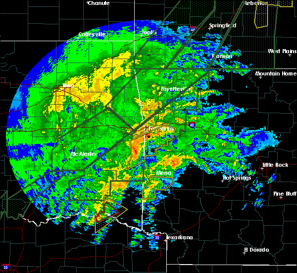 At 712 pm cst, a severe thunderstorm was located near hartford, or 10 miles east of poteau, moving northeast at 45 mph (radar indicated). Hazards include 70 mph wind gusts. Expect considerable tree damage. Damage is likely to mobile homes, roofs, and outbuildings. At 712 pm cst, a severe thunderstorm was located near hartford, or 10 miles east of poteau, moving northeast at 45 mph (radar indicated). Hazards include 70 mph wind gusts. Expect considerable tree damage. Damage is likely to mobile homes, roofs, and outbuildings.
|
| 10/21/2019 1:25 AM CDT |
 At 125 am cdt, severe thunderstorms were located along a line extending from 7 miles north of carrollton to 6 miles north of branch, moving east at 50 mph (radar indicated). Hazards include 60 mph wind gusts and nickel size hail. Expect damage to roofs, siding, and trees. locations in or near the path include, berryville, ozark, charleston, huntsville, barling, green forest, lavaca, mulberry, dyer, altus, branch, denning, st. paul, wiederkehr village, carrollton, rudd, saint paul, forum, aurora, boston, this includes interstate 40 in arkansas between mile markers 15 and 42. A tornado watch remains in effect until 300 am cdt for northwestern and west central arkansas. At 125 am cdt, severe thunderstorms were located along a line extending from 7 miles north of carrollton to 6 miles north of branch, moving east at 50 mph (radar indicated). Hazards include 60 mph wind gusts and nickel size hail. Expect damage to roofs, siding, and trees. locations in or near the path include, berryville, ozark, charleston, huntsville, barling, green forest, lavaca, mulberry, dyer, altus, branch, denning, st. paul, wiederkehr village, carrollton, rudd, saint paul, forum, aurora, boston, this includes interstate 40 in arkansas between mile markers 15 and 42. A tornado watch remains in effect until 300 am cdt for northwestern and west central arkansas.
|
| 8/27/2019 2:11 AM CDT |
 The severe thunderstorm warning for southwestern franklin, sebastian, southeastern haskell, northeastern latimer and central le flore counties will expire at 215 am cdt, the storms which prompted the warning have weakened below severe limits, and no longer pose an immediate threat to life or property. therefore the warning will be allowed to expire. however gusty winds and heavy rain are still possible with these thunderstorms. a severe thunderstorm watch remains in effect until 600 am cdt for west central arkansas, and southeastern oklahoma. The severe thunderstorm warning for southwestern franklin, sebastian, southeastern haskell, northeastern latimer and central le flore counties will expire at 215 am cdt, the storms which prompted the warning have weakened below severe limits, and no longer pose an immediate threat to life or property. therefore the warning will be allowed to expire. however gusty winds and heavy rain are still possible with these thunderstorms. a severe thunderstorm watch remains in effect until 600 am cdt for west central arkansas, and southeastern oklahoma.
|
| 8/27/2019 1:50 AM CDT |
 At 150 am cdt, severe thunderstorms were located along a line extending from near midway in logan county to near booneville to near oliver, moving southeast at 50 mph (radar indicated). Hazards include 60 mph wind gusts and penny size hail. Expect damage to roofs, siding, and trees. Locations impacted include, clarksville, booneville, waldron, paris, danville, dardanelle, ola, mansfield, magazine, knoxville, subiaco, hartman, scranton, ratcliff, blue mountain, beauchamp, cardiff, lake dardanelle state park, hoyt, petit jean river wma, this includes interstate 40 between mile markers 44 and 56. At 150 am cdt, severe thunderstorms were located along a line extending from near midway in logan county to near booneville to near oliver, moving southeast at 50 mph (radar indicated). Hazards include 60 mph wind gusts and penny size hail. Expect damage to roofs, siding, and trees. Locations impacted include, clarksville, booneville, waldron, paris, danville, dardanelle, ola, mansfield, magazine, knoxville, subiaco, hartman, scranton, ratcliff, blue mountain, beauchamp, cardiff, lake dardanelle state park, hoyt, petit jean river wma, this includes interstate 40 between mile markers 44 and 56.
|
| 8/27/2019 1:45 AM CDT |
 At 144 am cdt, severe thunderstorms were located along a line extending from 5 miles southwest of denning to near hartford to 3 miles southeast of kinta, moving southeast at 30 mph (radar indicated). Hazards include 60 mph wind gusts. Expect damage to roofs, siding, and trees. Locations in or near the path include, poteau, wilburton, stigler, charleston, greenwood, pocola, heavener, lavaca, spiro, panama, wister, hackett, howe, hartford, huntington, bonanza, keota, red oak, mccurtain, bokoshe,. At 144 am cdt, severe thunderstorms were located along a line extending from 5 miles southwest of denning to near hartford to 3 miles southeast of kinta, moving southeast at 30 mph (radar indicated). Hazards include 60 mph wind gusts. Expect damage to roofs, siding, and trees. Locations in or near the path include, poteau, wilburton, stigler, charleston, greenwood, pocola, heavener, lavaca, spiro, panama, wister, hackett, howe, hartford, huntington, bonanza, keota, red oak, mccurtain, bokoshe,.
|
| 8/27/2019 1:30 AM CDT |
 At 130 am cdt, severe thunderstorms were located along a line extending from denning to near charleston to hackett, moving southeast at 45 mph (radar indicated). Hazards include 60 mph wind gusts. expect damage to roofs, siding, and trees At 130 am cdt, severe thunderstorms were located along a line extending from denning to near charleston to hackett, moving southeast at 45 mph (radar indicated). Hazards include 60 mph wind gusts. expect damage to roofs, siding, and trees
|
| 8/27/2019 1:23 AM CDT |
 At 123 am cdt, severe thunderstorms were located along a line extending from 5 miles east of mulberry to 2 miles northwest of jenny lind to briartown, moving southeast at 40 mph (radar indicated). Hazards include 60 mph wind gusts. Expect damage to roofs, siding, and trees. locations in or near the path include, fort smith, van buren, poteau, wilburton, stigler, charleston, greenwood, alma, barling, pocola, heavener, lavaca, spiro, arkoma, mulberry, panama, wister, dyer, hackett, howe, this includes the following highways, interstate 40 in arkansas between mile markers 13 and 28. Interstate 540 between mile markers 2 and 14. At 123 am cdt, severe thunderstorms were located along a line extending from 5 miles east of mulberry to 2 miles northwest of jenny lind to briartown, moving southeast at 40 mph (radar indicated). Hazards include 60 mph wind gusts. Expect damage to roofs, siding, and trees. locations in or near the path include, fort smith, van buren, poteau, wilburton, stigler, charleston, greenwood, alma, barling, pocola, heavener, lavaca, spiro, arkoma, mulberry, panama, wister, dyer, hackett, howe, this includes the following highways, interstate 40 in arkansas between mile markers 13 and 28. Interstate 540 between mile markers 2 and 14.
|
| 8/7/2019 4:38 PM CDT |
 At 438 pm cdt, a severe thunderstorm was located over paris, moving southeast at 20 mph (radar indicated). Hazards include 60 mph wind gusts and quarter size hail. Hail damage to vehicles is expected. expect wind damage to roofs, siding, and trees. Locations impacted include, paris, magazine, subiaco, blue mountain, mount magazine, midway in logan county, caulksville, wilkins, carbon city, driggs, corley,. At 438 pm cdt, a severe thunderstorm was located over paris, moving southeast at 20 mph (radar indicated). Hazards include 60 mph wind gusts and quarter size hail. Hail damage to vehicles is expected. expect wind damage to roofs, siding, and trees. Locations impacted include, paris, magazine, subiaco, blue mountain, mount magazine, midway in logan county, caulksville, wilkins, carbon city, driggs, corley,.
|
| 8/7/2019 4:27 PM CDT |
 At 427 pm cdt, a severe thunderstorm was located 2 miles northwest of paris, moving southeast at 20 mph (radar indicated). Hazards include 60 mph wind gusts and penny size hail. expect damage to roofs, siding, and trees At 427 pm cdt, a severe thunderstorm was located 2 miles northwest of paris, moving southeast at 20 mph (radar indicated). Hazards include 60 mph wind gusts and penny size hail. expect damage to roofs, siding, and trees
|
| 5/29/2019 3:05 AM CDT |
 At 304 am cdt, severe thunderstorms were located along a line extending from near fern to near fort chaffee, moving east at 60 mph (radar indicated). Hazards include 60 mph wind gusts and quarter size hail. Hail damage to vehicles is expected. Expect wind damage to roofs, siding, and trees. At 304 am cdt, severe thunderstorms were located along a line extending from near fern to near fort chaffee, moving east at 60 mph (radar indicated). Hazards include 60 mph wind gusts and quarter size hail. Hail damage to vehicles is expected. Expect wind damage to roofs, siding, and trees.
|
| 5/21/2019 12:47 PM CDT |
 At 1247 pm cdt, severe thunderstorms were located along a line extending from 6 miles southeast of mulberry to 4 miles southwest of ratcliff, moving northeast at 65 mph (radar indicated). Hazards include 60 mph wind gusts and nickel size hail. Expect damage to roofs, siding, and trees. locations in or near the path include, ozark, altus, branch, denning, wiederkehr village, cass, caulksville, jethro, etna, barnes, alix, redding, watalula, meg, toney, peter pender, turners bend, vesta, cecil, lonelm, this includes interstate 40 in arkansas between mile markers 26 and 42. A tornado watch remains in effect until 200 pm cdt for northwestern and west central arkansas. At 1247 pm cdt, severe thunderstorms were located along a line extending from 6 miles southeast of mulberry to 4 miles southwest of ratcliff, moving northeast at 65 mph (radar indicated). Hazards include 60 mph wind gusts and nickel size hail. Expect damage to roofs, siding, and trees. locations in or near the path include, ozark, altus, branch, denning, wiederkehr village, cass, caulksville, jethro, etna, barnes, alix, redding, watalula, meg, toney, peter pender, turners bend, vesta, cecil, lonelm, this includes interstate 40 in arkansas between mile markers 26 and 42. A tornado watch remains in effect until 200 pm cdt for northwestern and west central arkansas.
|
| 5/18/2019 2:43 PM CDT |
 At 242 pm cdt, severe thunderstorms were located along a line extending from 3 miles west of japton to 3 miles south of denning, moving northeast at 40 mph (radar indicated). Hazards include 60 mph wind gusts. Expect damage to roofs, siding, and trees. locations in or near the path include, ozark, altus, branch, denning, st. paul, wiederkehr village, cass, saint paul, aurora, boston, pettigrew, brentwood, japton, witter, fern, caulksville, jethro, bidville, red star, crosses, this includes interstate 40 in arkansas between mile markers 26 and 42. A tornado watch remains in effect until 500 pm cdt for northwestern and west central arkansas. At 242 pm cdt, severe thunderstorms were located along a line extending from 3 miles west of japton to 3 miles south of denning, moving northeast at 40 mph (radar indicated). Hazards include 60 mph wind gusts. Expect damage to roofs, siding, and trees. locations in or near the path include, ozark, altus, branch, denning, st. paul, wiederkehr village, cass, saint paul, aurora, boston, pettigrew, brentwood, japton, witter, fern, caulksville, jethro, bidville, red star, crosses, this includes interstate 40 in arkansas between mile markers 26 and 42. A tornado watch remains in effect until 500 pm cdt for northwestern and west central arkansas.
|
| 5/18/2019 2:29 PM CDT |
 At 229 pm cdt, severe thunderstorms were located along a line extending from 2 miles south of wesley to 2 miles northwest of magazine, moving east at 60 mph (radar indicated). Hazards include 60 mph wind gusts. Expect damage to roofs, siding, and trees. locations in or near the path include, ozark, charleston, mountainburg, greenwood, alma, west fork, lavaca, mulberry, mansfield, dyer, altus, winslow, branch, denning, chester, st. paul, wiederkehr village, saint paul, aurora, boston, this includes the following highways, interstate 40 in arkansas between mile markers 13 and 42. interstate 49 between mile markers 24 and 54. A tornado watch remains in effect until 500 pm cdt for northwestern and west central arkansas. At 229 pm cdt, severe thunderstorms were located along a line extending from 2 miles south of wesley to 2 miles northwest of magazine, moving east at 60 mph (radar indicated). Hazards include 60 mph wind gusts. Expect damage to roofs, siding, and trees. locations in or near the path include, ozark, charleston, mountainburg, greenwood, alma, west fork, lavaca, mulberry, mansfield, dyer, altus, winslow, branch, denning, chester, st. paul, wiederkehr village, saint paul, aurora, boston, this includes the following highways, interstate 40 in arkansas between mile markers 13 and 42. interstate 49 between mile markers 24 and 54. A tornado watch remains in effect until 500 pm cdt for northwestern and west central arkansas.
|
| 5/18/2019 2:28 PM CDT |
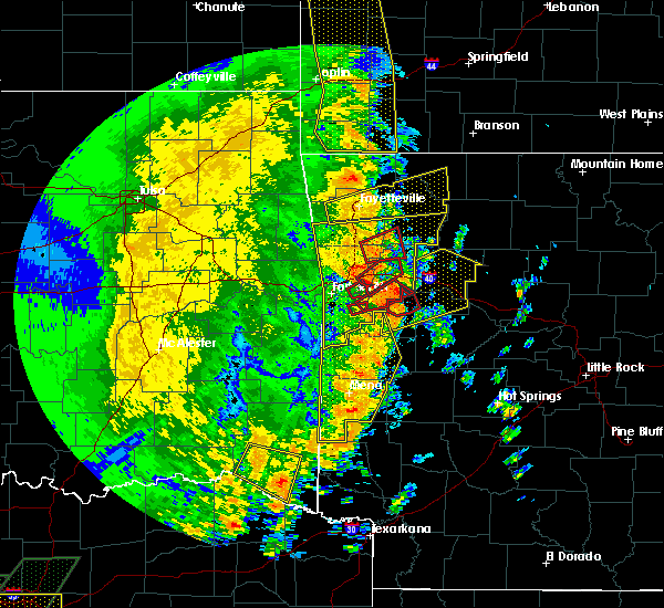 At 227 pm cdt, a severe thunderstorm capable of producing a tornado was located near ratcliff, or near paris, moving northeast at 60 mph (radar indicated rotation). Hazards include tornado. Flying debris will be dangerous to those caught without shelter. mobile homes will be damaged or destroyed. damage to roofs, windows, and vehicles will occur. tree damage is likely. Locations impacted include, paris, ratcliff, caulksville, carbon city, driggs,. At 227 pm cdt, a severe thunderstorm capable of producing a tornado was located near ratcliff, or near paris, moving northeast at 60 mph (radar indicated rotation). Hazards include tornado. Flying debris will be dangerous to those caught without shelter. mobile homes will be damaged or destroyed. damage to roofs, windows, and vehicles will occur. tree damage is likely. Locations impacted include, paris, ratcliff, caulksville, carbon city, driggs,.
|
| 5/18/2019 2:25 PM CDT |
 At 224 pm cdt, severe thunderstorms were located along a line extending from near mulberry to ratcliff to 7 miles south of booneville, moving northeast at 55 mph (radar indicated). Hazards include 70 mph wind gusts and nickel size hail. Expect considerable tree damage. Damage is likely to mobile homes, roofs, and outbuildings. At 224 pm cdt, severe thunderstorms were located along a line extending from near mulberry to ratcliff to 7 miles south of booneville, moving northeast at 55 mph (radar indicated). Hazards include 70 mph wind gusts and nickel size hail. Expect considerable tree damage. Damage is likely to mobile homes, roofs, and outbuildings.
|
| 5/18/2019 2:13 PM CDT |
 The national weather service in tulsa has issued a * tornado warning for. southern franklin county in west central arkansas. east central sebastian county in west central arkansas. until 245 pm cdt. At 213 pm cdt, a severe thunderstorm capable of producing a tornado. The national weather service in tulsa has issued a * tornado warning for. southern franklin county in west central arkansas. east central sebastian county in west central arkansas. until 245 pm cdt. At 213 pm cdt, a severe thunderstorm capable of producing a tornado.
|
| 5/18/2019 2:11 PM CDT |
 At 211 pm cdt, severe thunderstorms were located along a line extending from near west fork to echo, moving east at 55 mph (radar indicated). Hazards include 60 mph wind gusts. Expect damage to roofs, siding, and trees. locations in or near the path include, fort smith, van buren, ozark, charleston, cedarville, mountainburg, natural dam, greenwood, alma, barling, west fork, lavaca, lincoln, mulberry, mansfield, dyer, hackett, altus, hartford, huntington, this includes the following highways, interstate 40 in arkansas between mile markers 0 and 42. interstate 540 between mile markers 1 and 14. interstate 49 between mile markers 22 and 54. A tornado watch remains in effect until 500 pm cdt for northwestern and west central arkansas. At 211 pm cdt, severe thunderstorms were located along a line extending from near west fork to echo, moving east at 55 mph (radar indicated). Hazards include 60 mph wind gusts. Expect damage to roofs, siding, and trees. locations in or near the path include, fort smith, van buren, ozark, charleston, cedarville, mountainburg, natural dam, greenwood, alma, barling, west fork, lavaca, lincoln, mulberry, mansfield, dyer, hackett, altus, hartford, huntington, this includes the following highways, interstate 40 in arkansas between mile markers 0 and 42. interstate 540 between mile markers 1 and 14. interstate 49 between mile markers 22 and 54. A tornado watch remains in effect until 500 pm cdt for northwestern and west central arkansas.
|
| 5/18/2019 2:09 PM CDT |
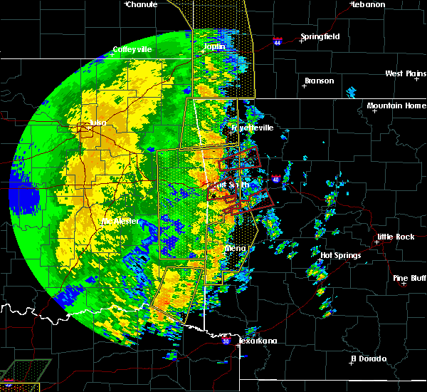 The national weather service in little rock has issued a * tornado warning for. western logan county in western arkansas. until 245 pm cdt. At 209 pm cdt, a severe thunderstorm capable of producing a tornado was located over washburn, or 10 miles west of booneville, moving. The national weather service in little rock has issued a * tornado warning for. western logan county in western arkansas. until 245 pm cdt. At 209 pm cdt, a severe thunderstorm capable of producing a tornado was located over washburn, or 10 miles west of booneville, moving.
|
| 4/17/2019 10:27 PM CDT |
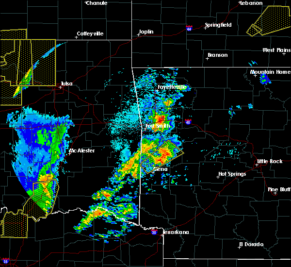 At 1027 pm cdt, a severe thunderstorm was located near waldron, moving northeast at 45 mph (radar indicated). Hazards include quarter size hail. damage to vehicles is expected At 1027 pm cdt, a severe thunderstorm was located near waldron, moving northeast at 45 mph (radar indicated). Hazards include quarter size hail. damage to vehicles is expected
|
| 3/9/2019 7:36 AM CST |
 The severe thunderstorm warning for southwestern franklin county will expire at 745 am cst, the storms which prompted the warning have moved out of the area. therefore the warning will be allowed to expire. a severe thunderstorm watch remains in effect until 1000 am cst for west central arkansas. The severe thunderstorm warning for southwestern franklin county will expire at 745 am cst, the storms which prompted the warning have moved out of the area. therefore the warning will be allowed to expire. a severe thunderstorm watch remains in effect until 1000 am cst for west central arkansas.
|
| 3/9/2019 7:23 AM CST |
 At 723 am cst, severe thunderstorms were located along a line extending from 5 miles southwest of denning to 4 miles south of booneville, moving east at 55 mph (radar indicated). Hazards include 60 mph wind gusts and penny size hail. Expect damage to roofs, siding, and trees. Locations in or near the path include, charleston, branch, caulksville,. At 723 am cst, severe thunderstorms were located along a line extending from 5 miles southwest of denning to 4 miles south of booneville, moving east at 55 mph (radar indicated). Hazards include 60 mph wind gusts and penny size hail. Expect damage to roofs, siding, and trees. Locations in or near the path include, charleston, branch, caulksville,.
|
| 3/9/2019 7:16 AM CST |
 At 715 am cst, severe thunderstorms were located along a line extending from branch to 9 miles southeast of beauchamp, moving east at 60 mph (radar indicated). Hazards include 60 mph wind gusts. expect damage to roofs, siding, and trees At 715 am cst, severe thunderstorms were located along a line extending from branch to 9 miles southeast of beauchamp, moving east at 60 mph (radar indicated). Hazards include 60 mph wind gusts. expect damage to roofs, siding, and trees
|
| 3/9/2019 7:13 AM CST |
 At 712 am cst, severe thunderstorms were located along a line extending from 2 miles northeast of charleston to 6 miles southeast of echo, moving east at 60 mph (radar indicated). Hazards include 60 mph wind gusts and penny size hail. Expect damage to roofs, siding, and trees. Locations in or near the path include, charleston, greenwood, huntington, branch, bloomer, washburn, burnville, fort chaffee, caulksville, crossroads, dayton, milltown, ursula,. At 712 am cst, severe thunderstorms were located along a line extending from 2 miles northeast of charleston to 6 miles southeast of echo, moving east at 60 mph (radar indicated). Hazards include 60 mph wind gusts and penny size hail. Expect damage to roofs, siding, and trees. Locations in or near the path include, charleston, greenwood, huntington, branch, bloomer, washburn, burnville, fort chaffee, caulksville, crossroads, dayton, milltown, ursula,.
|
| 3/9/2019 6:58 AM CST |
 At 658 am cst, severe thunderstorms were located along a line extending from near jenny lind to 4 miles southeast of hartford, moving northeast at 60 mph (radar indicated). Hazards include 60 mph wind gusts and penny size hail. Expect damage to roofs, siding, and trees. Locations in or near the path include, charleston, greenwood, mansfield, hackett, hartford, huntington, branch, midland, bloomer, washburn, excelsior, burnville, fort chaffee, jenny lind, patterson, caulksville, arkola, crossroads, witcherville, dayton,. At 658 am cst, severe thunderstorms were located along a line extending from near jenny lind to 4 miles southeast of hartford, moving northeast at 60 mph (radar indicated). Hazards include 60 mph wind gusts and penny size hail. Expect damage to roofs, siding, and trees. Locations in or near the path include, charleston, greenwood, mansfield, hackett, hartford, huntington, branch, midland, bloomer, washburn, excelsior, burnville, fort chaffee, jenny lind, patterson, caulksville, arkola, crossroads, witcherville, dayton,.
|
| 3/9/2019 6:46 AM CST |
 At 646 am cst, severe thunderstorms were located along a line extending from 3 miles east of cameron to near heavener runestone state park, moving northeast at 50 mph (radar indicated). Hazards include 60 mph wind gusts and penny size hail. Expect damage to roofs, siding, and trees. Locations in or near the path include, poteau, charleston, greenwood, mansfield, hackett, howe, hartford, huntington, bonanza, branch, midland, cameron, excelsior, bloomer, washburn, burnville, fort chaffee, jenny lind, rock island, patterson,. At 646 am cst, severe thunderstorms were located along a line extending from 3 miles east of cameron to near heavener runestone state park, moving northeast at 50 mph (radar indicated). Hazards include 60 mph wind gusts and penny size hail. Expect damage to roofs, siding, and trees. Locations in or near the path include, poteau, charleston, greenwood, mansfield, hackett, howe, hartford, huntington, bonanza, branch, midland, cameron, excelsior, bloomer, washburn, burnville, fort chaffee, jenny lind, rock island, patterson,.
|
| 11/30/2018 11:48 PM CST |
 At 1147 pm cst, severe thunderstorms were located along a line extending from near japton to 8 miles northwest of woodland to near magazine to 12 miles southeast of beauchamp, moving east at 65 mph (radar indicated). Hazards include 70 mph wind gusts and quarter size hail. Hail damage to vehicles is expected. expect considerable tree damage. wind damage is also likely to mobile homes, roofs, and outbuildings. locations impacted include, clarksville, booneville, waldron, paris, jasper, lamar, mansfield, magazine, knoxville, subiaco, hartman, scranton, ratcliff, blue mountain, beauchamp, erbie, upper buffalo wilderness area, devils knob, lost valley state park, pruitt, this includes interstate 40 between mile markers 44 and 67. A tornado watch remains in effect until 200 am cst for western, central and north central arkansas. At 1147 pm cst, severe thunderstorms were located along a line extending from near japton to 8 miles northwest of woodland to near magazine to 12 miles southeast of beauchamp, moving east at 65 mph (radar indicated). Hazards include 70 mph wind gusts and quarter size hail. Hail damage to vehicles is expected. expect considerable tree damage. wind damage is also likely to mobile homes, roofs, and outbuildings. locations impacted include, clarksville, booneville, waldron, paris, jasper, lamar, mansfield, magazine, knoxville, subiaco, hartman, scranton, ratcliff, blue mountain, beauchamp, erbie, upper buffalo wilderness area, devils knob, lost valley state park, pruitt, this includes interstate 40 between mile markers 44 and 67. A tornado watch remains in effect until 200 am cst for western, central and north central arkansas.
|
| 11/30/2018 11:39 PM CST |
 At 1139 pm cst, severe thunderstorms were located along a line extending from cass to 3 miles southeast of washburn, moving northeast at 70 mph (radar indicated). Hazards include 60 mph wind gusts and penny size hail. Expect damage to roofs, siding, and trees. locations in or near the path include, ozark, charleston, mulberry, altus, branch, denning, wiederkehr village, cass, washburn, fern, fort chaffee, caulksville, jethro, bidville, locke, turners bend, mount gayler, vesta, cecil, lonelm, this includes interstate 40 in arkansas between mile markers 21 and 42. A tornado watch remains in effect until 200 am cst for northwestern and west central arkansas. At 1139 pm cst, severe thunderstorms were located along a line extending from cass to 3 miles southeast of washburn, moving northeast at 70 mph (radar indicated). Hazards include 60 mph wind gusts and penny size hail. Expect damage to roofs, siding, and trees. locations in or near the path include, ozark, charleston, mulberry, altus, branch, denning, wiederkehr village, cass, washburn, fern, fort chaffee, caulksville, jethro, bidville, locke, turners bend, mount gayler, vesta, cecil, lonelm, this includes interstate 40 in arkansas between mile markers 21 and 42. A tornado watch remains in effect until 200 am cst for northwestern and west central arkansas.
|
| 11/30/2018 11:16 PM CST |
 At 1116 pm cst, severe thunderstorms were located along a line extending from near mountainburg to 6 miles west of morgan springs, moving east at 55 mph (radar indicated). Hazards include 70 mph wind gusts and penny size hail. Expect considerable tree damage. damage is likely to mobile homes, roofs, and outbuildings. locations in or near the path include, ozark, charleston, mountainburg, greenwood, alma, barling, lavaca, mulberry, mansfield, dyer, altus, hartford, huntington, branch, midland, denning, chester, wiederkehr village, bloomer, lake fort smith, this includes the following highways, interstate 40 in arkansas between mile markers 9 and 42. interstate 49 between mile markers 22 and 37. A tornado watch remains in effect until 200 am cst for northwestern and west central arkansas. At 1116 pm cst, severe thunderstorms were located along a line extending from near mountainburg to 6 miles west of morgan springs, moving east at 55 mph (radar indicated). Hazards include 70 mph wind gusts and penny size hail. Expect considerable tree damage. damage is likely to mobile homes, roofs, and outbuildings. locations in or near the path include, ozark, charleston, mountainburg, greenwood, alma, barling, lavaca, mulberry, mansfield, dyer, altus, hartford, huntington, branch, midland, denning, chester, wiederkehr village, bloomer, lake fort smith, this includes the following highways, interstate 40 in arkansas between mile markers 9 and 42. interstate 49 between mile markers 22 and 37. A tornado watch remains in effect until 200 am cst for northwestern and west central arkansas.
|
| 11/30/2018 11:09 PM CST |
 At 1109 pm cst, severe thunderstorms were located along a line extending from near short to fort smith to 9 miles northeast of big cedar, moving northeast at 70 mph (radar indicated). Hazards include 70 mph wind gusts and quarter size hail. Hail damage to vehicles is expected. expect considerable tree damage. Wind damage is also likely to mobile homes, roofs, and outbuildings. At 1109 pm cst, severe thunderstorms were located along a line extending from near short to fort smith to 9 miles northeast of big cedar, moving northeast at 70 mph (radar indicated). Hazards include 70 mph wind gusts and quarter size hail. Hail damage to vehicles is expected. expect considerable tree damage. Wind damage is also likely to mobile homes, roofs, and outbuildings.
|
| 11/30/2018 6:35 PM CST |
 At 635 pm cst, a severe thunderstorm capable of producing a tornado was located 3 miles north of branch, moving northeast at 35 mph (radar indicated rotation). Hazards include tornado. Flying debris will be dangerous to those caught without shelter. mobile homes will be damaged or destroyed. damage to roofs, windows, and vehicles will occur. tree damage is likely. Locations in or near the path include, ozark, altus, branch, denning, ratcliff, wiederkehr village, caulksville, etna, peter pender, alix, meg, this includes interstate 40 in arkansas between mile markers 38 and 42. At 635 pm cst, a severe thunderstorm capable of producing a tornado was located 3 miles north of branch, moving northeast at 35 mph (radar indicated rotation). Hazards include tornado. Flying debris will be dangerous to those caught without shelter. mobile homes will be damaged or destroyed. damage to roofs, windows, and vehicles will occur. tree damage is likely. Locations in or near the path include, ozark, altus, branch, denning, ratcliff, wiederkehr village, caulksville, etna, peter pender, alix, meg, this includes interstate 40 in arkansas between mile markers 38 and 42.
|
| 11/30/2018 6:27 PM CST |
 At 627 pm cst, a severe thunderstorm with strong low level rotation that could produce a tornado at any time was located over charleston, moving northeast at 30 mph (radar indicated rotation). Hazards include tornado. Flying debris will be dangerous to those caught without shelter. mobile homes will be damaged or destroyed. damage to roofs, windows, and vehicles will occur. tree damage is likely. Locations in or near the path include, ozark, charleston, altus, branch, denning, ratcliff, wiederkehr village, caulksville, etna, alix, meg, peter pender, vesta, this includes interstate 40 in arkansas between mile markers 38 and 42. At 627 pm cst, a severe thunderstorm with strong low level rotation that could produce a tornado at any time was located over charleston, moving northeast at 30 mph (radar indicated rotation). Hazards include tornado. Flying debris will be dangerous to those caught without shelter. mobile homes will be damaged or destroyed. damage to roofs, windows, and vehicles will occur. tree damage is likely. Locations in or near the path include, ozark, charleston, altus, branch, denning, ratcliff, wiederkehr village, caulksville, etna, alix, meg, peter pender, vesta, this includes interstate 40 in arkansas between mile markers 38 and 42.
|
| 11/30/2018 6:23 PM CST |
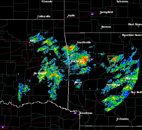 At 623 pm cst, a severe thunderstorm capable of producing a tornado was located over charleston, moving northeast at 20 mph (radar indicated rotation). Hazards include tornado and golf ball size hail. Flying debris will be dangerous to those caught without shelter. mobile homes will be damaged or destroyed. damage to roofs, windows, and vehicles will occur. Tree damage is likely. At 623 pm cst, a severe thunderstorm capable of producing a tornado was located over charleston, moving northeast at 20 mph (radar indicated rotation). Hazards include tornado and golf ball size hail. Flying debris will be dangerous to those caught without shelter. mobile homes will be damaged or destroyed. damage to roofs, windows, and vehicles will occur. Tree damage is likely.
|
| 11/30/2018 6:22 PM CST |
 At 621 pm cst, a severe thunderstorm capable of producing a tornado was located near charleston, moving northeast at 55 mph (radar indicated rotation). Hazards include tornado. Flying debris will be dangerous to those caught without shelter. mobile homes will be damaged or destroyed. damage to roofs, windows, and vehicles will occur. tree damage is likely. Locations in or near the path include, ozark, charleston, altus, branch, denning, wiederkehr village, caulksville, etna, peter pender, alix, vesta, meg, this includes interstate 40 in arkansas between mile markers 38 and 42. At 621 pm cst, a severe thunderstorm capable of producing a tornado was located near charleston, moving northeast at 55 mph (radar indicated rotation). Hazards include tornado. Flying debris will be dangerous to those caught without shelter. mobile homes will be damaged or destroyed. damage to roofs, windows, and vehicles will occur. tree damage is likely. Locations in or near the path include, ozark, charleston, altus, branch, denning, wiederkehr village, caulksville, etna, peter pender, alix, vesta, meg, this includes interstate 40 in arkansas between mile markers 38 and 42.
|
| 7/30/2018 6:57 PM CDT |
 At 657 pm cdt, severe thunderstorms were located along a line extending from 4 miles southwest of ozark to echo, moving southeast at 35 mph (radar indicated). Hazards include 60 mph wind gusts and penny size hail. Expect damage to roofs, siding, and trees. Locations in or near the path include, ozark, charleston, altus, branch, denning, wiederkehr village, washburn, fort chaffee, caulksville, etna, alix, crossroads, meg, milltown, peter pender, cecil, dayton,. At 657 pm cdt, severe thunderstorms were located along a line extending from 4 miles southwest of ozark to echo, moving southeast at 35 mph (radar indicated). Hazards include 60 mph wind gusts and penny size hail. Expect damage to roofs, siding, and trees. Locations in or near the path include, ozark, charleston, altus, branch, denning, wiederkehr village, washburn, fort chaffee, caulksville, etna, alix, crossroads, meg, milltown, peter pender, cecil, dayton,.
|
| 7/30/2018 6:47 PM CDT |
 At 646 pm cdt, severe thunderstorms were located along a line extending from 4 miles east of mulberry to 3 miles northeast of huntington, moving east at 40 mph (radar indicated). Hazards include 60 mph wind gusts and penny size hail. Expect damage to roofs, siding, and trees. Locations in or near the path include, ozark, charleston, greenwood, lavaca, mulberry, mansfield, altus, branch, denning, wiederkehr village, bloomer, washburn, burnville, fort chaffee, caulksville, crossroads, witcherville, dayton, milltown, vesta,. At 646 pm cdt, severe thunderstorms were located along a line extending from 4 miles east of mulberry to 3 miles northeast of huntington, moving east at 40 mph (radar indicated). Hazards include 60 mph wind gusts and penny size hail. Expect damage to roofs, siding, and trees. Locations in or near the path include, ozark, charleston, greenwood, lavaca, mulberry, mansfield, altus, branch, denning, wiederkehr village, bloomer, washburn, burnville, fort chaffee, caulksville, crossroads, witcherville, dayton, milltown, vesta,.
|
| 7/30/2018 6:25 PM CDT |
 At 625 pm cdt, severe thunderstorms were located along a line extending from near alma to bonanza, moving southeast at 35 mph (radar indicated). Hazards include 60 mph wind gusts and penny size hail. Expect damage to roofs, siding, and trees. locations in or near the path include, fort smith, ozark, charleston, greenwood, alma, barling, lavaca, mulberry, mansfield, dyer, hackett, altus, bonanza, branch, denning, wiederkehr village, excelsior, bloomer, washburn, burnville, this includes the following highways, interstate 40 in arkansas between mile markers 9 and 21. Interstate 49 between mile markers 22 and 25. At 625 pm cdt, severe thunderstorms were located along a line extending from near alma to bonanza, moving southeast at 35 mph (radar indicated). Hazards include 60 mph wind gusts and penny size hail. Expect damage to roofs, siding, and trees. locations in or near the path include, fort smith, ozark, charleston, greenwood, alma, barling, lavaca, mulberry, mansfield, dyer, hackett, altus, bonanza, branch, denning, wiederkehr village, excelsior, bloomer, washburn, burnville, this includes the following highways, interstate 40 in arkansas between mile markers 9 and 21. Interstate 49 between mile markers 22 and 25.
|
| 6/24/2018 6:02 PM CDT |
 At 602 pm cdt, severe thunderstorms were located along a line extending from 3 miles west of ozark to 3 miles southwest of denning to 3 miles north of magazine, moving northeast at 50 mph (radar indicated). Hazards include 70 mph wind gusts. Expect considerable tree damage. damage is likely to mobile homes, roofs, and outbuildings. Locations in or near the path include, ozark, altus, branch, denning, wiederkehr village, caulksville, etna, peter pender, alix, cecil, meg, this includes interstate 40 in arkansas between mile markers 36 and 42. At 602 pm cdt, severe thunderstorms were located along a line extending from 3 miles west of ozark to 3 miles southwest of denning to 3 miles north of magazine, moving northeast at 50 mph (radar indicated). Hazards include 70 mph wind gusts. Expect considerable tree damage. damage is likely to mobile homes, roofs, and outbuildings. Locations in or near the path include, ozark, altus, branch, denning, wiederkehr village, caulksville, etna, peter pender, alix, cecil, meg, this includes interstate 40 in arkansas between mile markers 36 and 42.
|
| 6/24/2018 5:57 PM CDT | Storm damage reported in logan county AR, 1.2 miles NW of Ratcliff, AR |
| 6/24/2018 5:50 PM CDT |
 At 550 pm cdt, a severe thunderstorm was located over ratcliff, or 7 miles east of charleston, moving northeast at 45 mph (radar indicated). Hazards include 60 mph wind gusts and quarter size hail. Hail damage to vehicles is expected. Expect wind damage to roofs, siding, and trees. At 550 pm cdt, a severe thunderstorm was located over ratcliff, or 7 miles east of charleston, moving northeast at 45 mph (radar indicated). Hazards include 60 mph wind gusts and quarter size hail. Hail damage to vehicles is expected. Expect wind damage to roofs, siding, and trees.
|
| 6/24/2018 5:43 PM CDT |
 At 543 pm cdt, severe thunderstorms were located along a line extending from 5 miles south of dyer to 4 miles southeast of charleston to 5 miles west of booneville, moving east at 40 mph (radar indicated). Hazards include 60 mph wind gusts. Expect damage to roofs, siding, and trees. Locations in or near the path include, ozark, charleston, altus, branch, denning, wiederkehr village, caulksville, etna, alix, meg, peter pender, vesta, cecil, this includes interstate 40 in arkansas between mile markers 36 and 42. At 543 pm cdt, severe thunderstorms were located along a line extending from 5 miles south of dyer to 4 miles southeast of charleston to 5 miles west of booneville, moving east at 40 mph (radar indicated). Hazards include 60 mph wind gusts. Expect damage to roofs, siding, and trees. Locations in or near the path include, ozark, charleston, altus, branch, denning, wiederkehr village, caulksville, etna, alix, meg, peter pender, vesta, cecil, this includes interstate 40 in arkansas between mile markers 36 and 42.
|
| 6/24/2018 7:27 AM CDT |
 At 726 am cdt, severe thunderstorms were located along a line extending from 2 miles southwest of fern to 5 miles southeast of mulberry to near branch to 2 miles east of washburn to 2 miles west of echo, moving east at 40 mph (radar indicated). Hazards include 60 mph wind gusts. Expect damage to roofs, siding, and trees. Locations in or near the path include, ozark, charleston, greenwood, mansfield, huntington, branch, midland, bloomer, washburn, burnville, fort chaffee, caulksville, arkola, crossroads, witcherville, liberty, dayton, milltown, vesta, cecil, this includes interstate 40 in arkansas between mile markers 29 and 36. At 726 am cdt, severe thunderstorms were located along a line extending from 2 miles southwest of fern to 5 miles southeast of mulberry to near branch to 2 miles east of washburn to 2 miles west of echo, moving east at 40 mph (radar indicated). Hazards include 60 mph wind gusts. Expect damage to roofs, siding, and trees. Locations in or near the path include, ozark, charleston, greenwood, mansfield, huntington, branch, midland, bloomer, washburn, burnville, fort chaffee, caulksville, arkola, crossroads, witcherville, liberty, dayton, milltown, vesta, cecil, this includes interstate 40 in arkansas between mile markers 29 and 36.
|
| 6/24/2018 7:26 AM CDT | Quarter sized hail reported 1.2 miles NW of Ratcliff, AR, quarter sized hail was reported in caulksville. |
| 6/24/2018 7:26 AM CDT | Numerous large tree limbs were blown down. power outages were also reporte in logan county AR, 1.2 miles NW of Ratcliff, AR |
| 6/24/2018 7:24 AM CDT |
 At 724 am cdt, severe thunderstorms were located along a line extending from near mulberry to branch to near fort chaffee, moving east at 55 mph (radar indicated). Hazards include 60 mph wind gusts. expect damage to roofs, siding, and trees At 724 am cdt, severe thunderstorms were located along a line extending from near mulberry to branch to near fort chaffee, moving east at 55 mph (radar indicated). Hazards include 60 mph wind gusts. expect damage to roofs, siding, and trees
|
| 6/24/2018 7:21 AM CDT |
 At 721 am cdt, severe thunderstorms were located along a line extending from 3 miles northeast of mulberry to 7 miles southwest of ozark to branch, moving east at 50 mph (radar indicated). Hazards include 60 mph wind gusts. Expect damage to roofs, siding, and trees. Locations in or near the path include, ozark, charleston, altus, branch, denning, wiederkehr village, caulksville, jethro, etna, alix, watalula, meg, toney, peter pender, cecil, lonelm, cravens, this includes interstate 40 in arkansas between mile markers 24 and 42. At 721 am cdt, severe thunderstorms were located along a line extending from 3 miles northeast of mulberry to 7 miles southwest of ozark to branch, moving east at 50 mph (radar indicated). Hazards include 60 mph wind gusts. Expect damage to roofs, siding, and trees. Locations in or near the path include, ozark, charleston, altus, branch, denning, wiederkehr village, caulksville, jethro, etna, alix, watalula, meg, toney, peter pender, cecil, lonelm, cravens, this includes interstate 40 in arkansas between mile markers 24 and 42.
|
| 6/24/2018 7:12 AM CDT |
 At 712 am cdt, severe thunderstorms were located along a line extending from 3 miles southwest of mountainburg to 3 miles south of dyer to 2 miles south of bloomer to 2 miles southwest of burnville to near midland, moving east at 55 mph (radar indicated). Hazards include 60 mph wind gusts and quarter size hail. Hail damage to vehicles is expected. expect wind damage to roofs, siding, and trees. locations in or near the path include, fort smith, van buren, ozark, charleston, cedarville, mountainburg, greenwood, alma, barling, lavaca, mulberry, mansfield, dyer, hackett, huntington, bonanza, branch, midland, rudy, bloomer, this includes the following highways, interstate 40 in arkansas between mile markers 0 and 36. interstate 540 between mile markers 1 and 14. Interstate 49 between mile markers 22 and 30. At 712 am cdt, severe thunderstorms were located along a line extending from 3 miles southwest of mountainburg to 3 miles south of dyer to 2 miles south of bloomer to 2 miles southwest of burnville to near midland, moving east at 55 mph (radar indicated). Hazards include 60 mph wind gusts and quarter size hail. Hail damage to vehicles is expected. expect wind damage to roofs, siding, and trees. locations in or near the path include, fort smith, van buren, ozark, charleston, cedarville, mountainburg, greenwood, alma, barling, lavaca, mulberry, mansfield, dyer, hackett, huntington, bonanza, branch, midland, rudy, bloomer, this includes the following highways, interstate 40 in arkansas between mile markers 0 and 36. interstate 540 between mile markers 1 and 14. Interstate 49 between mile markers 22 and 30.
|
| 6/24/2018 6:49 AM CDT |
 At 648 am cdt, severe thunderstorms were located along a line extending from 3 miles northwest of short to 3 miles north of roland to 2 miles northwest of pocola to 2 miles west of cameron, moving east at 40 mph (radar indicated). Hazards include 60 mph wind gusts and quarter size hail. Hail damage to vehicles is expected. expect wind damage to roofs, siding, and trees. locations in or near the path include, fort smith, van buren, poteau, ozark, charleston, cedarville, mountainburg, greenwood, alma, barling, pocola, muldrow, roland, lavaca, spiro, arkoma, mulberry, mansfield, dyer, hackett, this includes the following highways, interstate 40 in arkansas between mile markers 0 and 36. interstate 40 in oklahoma between mile markers 319 and 328. interstate 540 between mile markers 1 and 14. Interstate 49 between mile markers 22 and 30. At 648 am cdt, severe thunderstorms were located along a line extending from 3 miles northwest of short to 3 miles north of roland to 2 miles northwest of pocola to 2 miles west of cameron, moving east at 40 mph (radar indicated). Hazards include 60 mph wind gusts and quarter size hail. Hail damage to vehicles is expected. expect wind damage to roofs, siding, and trees. locations in or near the path include, fort smith, van buren, poteau, ozark, charleston, cedarville, mountainburg, greenwood, alma, barling, pocola, muldrow, roland, lavaca, spiro, arkoma, mulberry, mansfield, dyer, hackett, this includes the following highways, interstate 40 in arkansas between mile markers 0 and 36. interstate 40 in oklahoma between mile markers 319 and 328. interstate 540 between mile markers 1 and 14. Interstate 49 between mile markers 22 and 30.
|
| 6/24/2018 6:30 AM CDT |
 At 629 am cdt, severe thunderstorms were located along a line extending from 2 miles east of mulberry to 6 miles northeast of branch to 2 miles southeast of ratcliff, moving east at 45 mph (radar indicated). Hazards include 60 mph wind gusts. Expect damage to roofs, siding, and trees. Locations in or near the path include, ozark, mulberry, altus, branch, denning, wiederkehr village, cass, caulksville, jethro, etna, barnes, alix, redding, watalula, meg, toney, peter pender, turners bend, cecil, lonelm, this includes interstate 40 in arkansas between mile markers 24 and 42. At 629 am cdt, severe thunderstorms were located along a line extending from 2 miles east of mulberry to 6 miles northeast of branch to 2 miles southeast of ratcliff, moving east at 45 mph (radar indicated). Hazards include 60 mph wind gusts. Expect damage to roofs, siding, and trees. Locations in or near the path include, ozark, mulberry, altus, branch, denning, wiederkehr village, cass, caulksville, jethro, etna, barnes, alix, redding, watalula, meg, toney, peter pender, turners bend, cecil, lonelm, this includes interstate 40 in arkansas between mile markers 24 and 42.
|
| 6/24/2018 6:29 AM CDT |
 At 628 am cdt, a severe thunderstorm was located near booneville, moving northeast at 45 mph (radar indicated). Hazards include 60 mph wind gusts and quarter size hail. Hail damage to vehicles is expected. Expect wind damage to roofs, siding, and trees. At 628 am cdt, a severe thunderstorm was located near booneville, moving northeast at 45 mph (radar indicated). Hazards include 60 mph wind gusts and quarter size hail. Hail damage to vehicles is expected. Expect wind damage to roofs, siding, and trees.
|
| 6/24/2018 6:22 AM CDT |
 At 621 am cdt, severe thunderstorms were located along a line extending from 2 miles east of dyer to 4 miles north of branch to 4 miles east of fort chaffee, moving east at 45 mph (radar indicated). Hazards include 60 mph wind gusts. Expect damage to roofs, siding, and trees. Locations in or near the path include, ozark, charleston, alma, mulberry, dyer, altus, branch, denning, wiederkehr village, cass, fort chaffee, kibler, concord, caulksville, jethro, turners bend, vesta, cecil, lonelm, ursula, this includes interstate 40 in arkansas between mile markers 10 and 42. At 621 am cdt, severe thunderstorms were located along a line extending from 2 miles east of dyer to 4 miles north of branch to 4 miles east of fort chaffee, moving east at 45 mph (radar indicated). Hazards include 60 mph wind gusts. Expect damage to roofs, siding, and trees. Locations in or near the path include, ozark, charleston, alma, mulberry, dyer, altus, branch, denning, wiederkehr village, cass, fort chaffee, kibler, concord, caulksville, jethro, turners bend, vesta, cecil, lonelm, ursula, this includes interstate 40 in arkansas between mile markers 10 and 42.
|
| 6/24/2018 6:10 AM CDT |
 At 610 am cdt, severe thunderstorms were located along a line extending from 2 miles southwest of alma to 2 miles north of bloomer to 2 miles west of washburn, moving northeast at 40 mph (radar indicated). Hazards include 60 mph wind gusts. Expect damage to roofs, siding, and trees. Locations in or near the path include, ozark, charleston, greenwood, alma, lavaca, mulberry, dyer, altus, branch, denning, wiederkehr village, cass, bloomer, washburn, fort chaffee, kibler, concord, caulksville, jethro, milltown, this includes interstate 40 in arkansas between mile markers 10 and 42. At 610 am cdt, severe thunderstorms were located along a line extending from 2 miles southwest of alma to 2 miles north of bloomer to 2 miles west of washburn, moving northeast at 40 mph (radar indicated). Hazards include 60 mph wind gusts. Expect damage to roofs, siding, and trees. Locations in or near the path include, ozark, charleston, greenwood, alma, lavaca, mulberry, dyer, altus, branch, denning, wiederkehr village, cass, bloomer, washburn, fort chaffee, kibler, concord, caulksville, jethro, milltown, this includes interstate 40 in arkansas between mile markers 10 and 42.
|
| 5/16/2018 2:56 PM CDT |
 At 255 pm cdt, a severe thunderstorm was located 6 miles southeast of mulberry, moving east at 15 mph (radar indicated). Hazards include 60 mph wind gusts and quarter size hail. Hail damage to vehicles is expected. expect wind damage to roofs, siding, and trees. Locations in or near the path include, ozark, mulberry, altus, branch, denning, wiederkehr village, caulksville, etna, alix, meg, peter pender, vesta, cecil, this includes interstate 40 in arkansas between mile markers 35 and 42. At 255 pm cdt, a severe thunderstorm was located 6 miles southeast of mulberry, moving east at 15 mph (radar indicated). Hazards include 60 mph wind gusts and quarter size hail. Hail damage to vehicles is expected. expect wind damage to roofs, siding, and trees. Locations in or near the path include, ozark, mulberry, altus, branch, denning, wiederkehr village, caulksville, etna, alix, meg, peter pender, vesta, cecil, this includes interstate 40 in arkansas between mile markers 35 and 42.
|
| 5/3/2018 1:38 PM CDT |
 The severe thunderstorm warning for franklin, southeastern crawford and northeastern sebastian counties will expire at 145 pm cdt, the storms which prompted the warning have moved out of the area. therefore the warning will be allowed to expire. to report severe weather, contact your nearest law enforcement agency. they will relay your report to the national weather service tulsa. The severe thunderstorm warning for franklin, southeastern crawford and northeastern sebastian counties will expire at 145 pm cdt, the storms which prompted the warning have moved out of the area. therefore the warning will be allowed to expire. to report severe weather, contact your nearest law enforcement agency. they will relay your report to the national weather service tulsa.
|
| 5/3/2018 1:18 PM CDT |
 At 117 pm cdt, severe thunderstorms were located along a line extending from near paris to near magazine to 7 miles west of stonehouse recreation area, moving east at 50 mph (radar indicated). Hazards include 60 mph wind gusts. Expect damage to roofs, siding, and trees. Locations impacted include, clarksville, booneville, paris, magazine, subiaco, scranton, ratcliff, blue mountain, stonehouse recreation area, mount magazine, midway in logan county, spadra, tokalon, lake dardanelle, belleville, havana, caulksville, morrison bluff, dublin, ludwig,. At 117 pm cdt, severe thunderstorms were located along a line extending from near paris to near magazine to 7 miles west of stonehouse recreation area, moving east at 50 mph (radar indicated). Hazards include 60 mph wind gusts. Expect damage to roofs, siding, and trees. Locations impacted include, clarksville, booneville, paris, magazine, subiaco, scranton, ratcliff, blue mountain, stonehouse recreation area, mount magazine, midway in logan county, spadra, tokalon, lake dardanelle, belleville, havana, caulksville, morrison bluff, dublin, ludwig,.
|
| 5/3/2018 1:15 PM CDT |
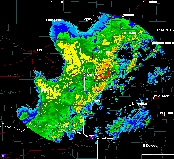 At 115 pm cdt, a severe thunderstorm capable of producing a tornado was located near branch, or 7 miles northeast of charleston, moving northeast at 40 mph (radar indicated rotation). Hazards include tornado. Flying debris will be dangerous to those caught without shelter. mobile homes will be damaged or destroyed. damage to roofs, windows, and vehicles will occur. Tree damage is likely. At 115 pm cdt, a severe thunderstorm capable of producing a tornado was located near branch, or 7 miles northeast of charleston, moving northeast at 40 mph (radar indicated rotation). Hazards include tornado. Flying debris will be dangerous to those caught without shelter. mobile homes will be damaged or destroyed. damage to roofs, windows, and vehicles will occur. Tree damage is likely.
|
| 5/3/2018 1:15 PM CDT |
 At 115 pm cdt, a severe thunderstorm with strong low level rotation that could produce a tornado at any time was located 4 miles north of ratcliff, moving northeast at 40 mph (radar indicated rotation). Hazards include tornado. Flying debris will be dangerous to those caught without shelter. mobile homes will be damaged or destroyed. damage to roofs, windows, and vehicles will occur. tree damage is likely. Locations in or near the path include, ozark, charleston, altus, branch, denning, wiederkehr village, caulksville, etna, alix, meg, peter pender, vesta, cecil, this includes interstate 40 in arkansas between mile markers 38 and 42. At 115 pm cdt, a severe thunderstorm with strong low level rotation that could produce a tornado at any time was located 4 miles north of ratcliff, moving northeast at 40 mph (radar indicated rotation). Hazards include tornado. Flying debris will be dangerous to those caught without shelter. mobile homes will be damaged or destroyed. damage to roofs, windows, and vehicles will occur. tree damage is likely. Locations in or near the path include, ozark, charleston, altus, branch, denning, wiederkehr village, caulksville, etna, alix, meg, peter pender, vesta, cecil, this includes interstate 40 in arkansas between mile markers 38 and 42.
|
| 5/3/2018 1:14 PM CDT | Logan county emergency management reported that trees were blown down by thunderstorms winds within the community of caulksvill in logan county AR, 1.2 miles NW of Ratcliff, AR |
| 5/3/2018 1:12 PM CDT |
 At 112 pm cdt, a severe thunderstorm was located over ratcliff, or 8 miles west of paris, moving northeast at 50 mph (radar indicated). Hazards include 60 mph wind gusts. expect damage to roofs, siding, and trees At 112 pm cdt, a severe thunderstorm was located over ratcliff, or 8 miles west of paris, moving northeast at 50 mph (radar indicated). Hazards include 60 mph wind gusts. expect damage to roofs, siding, and trees
|
| 5/3/2018 1:11 PM CDT |
 At 111 pm cdt, a severe thunderstorm capable of producing a tornado was located near branch, moving northeast at 40 mph (radar indicated rotation). Hazards include tornado. Flying debris will be dangerous to those caught without shelter. mobile homes will be damaged or destroyed. damage to roofs, windows, and vehicles will occur. tree damage is likely. Locations in or near the path include, ozark, charleston, altus, branch, denning, wiederkehr village, caulksville, etna, alix, meg, peter pender, vesta, cecil, this includes interstate 40 in arkansas between mile markers 38 and 42. At 111 pm cdt, a severe thunderstorm capable of producing a tornado was located near branch, moving northeast at 40 mph (radar indicated rotation). Hazards include tornado. Flying debris will be dangerous to those caught without shelter. mobile homes will be damaged or destroyed. damage to roofs, windows, and vehicles will occur. tree damage is likely. Locations in or near the path include, ozark, charleston, altus, branch, denning, wiederkehr village, caulksville, etna, alix, meg, peter pender, vesta, cecil, this includes interstate 40 in arkansas between mile markers 38 and 42.
|
| 5/3/2018 1:09 PM CDT |
 At 108 pm cdt, severe thunderstorms were located along a line extending from 5 miles south of mulberry to 3 miles south of ratcliff, moving east at 55 mph (radar indicated). Hazards include 60 mph wind gusts. Expect damage to roofs, siding, and trees. Locations in or near the path include, ozark, charleston, mulberry, dyer, altus, branch, denning, wiederkehr village, washburn, fort chaffee, caulksville, etna, alix, watalula, meg, toney, peter pender, vesta, cecil, lonelm, this includes interstate 40 in arkansas between mile markers 17 and 42. At 108 pm cdt, severe thunderstorms were located along a line extending from 5 miles south of mulberry to 3 miles south of ratcliff, moving east at 55 mph (radar indicated). Hazards include 60 mph wind gusts. Expect damage to roofs, siding, and trees. Locations in or near the path include, ozark, charleston, mulberry, dyer, altus, branch, denning, wiederkehr village, washburn, fort chaffee, caulksville, etna, alix, watalula, meg, toney, peter pender, vesta, cecil, lonelm, this includes interstate 40 in arkansas between mile markers 17 and 42.
|
| 5/3/2018 1:03 PM CDT |
 At 103 pm cdt, severe thunderstorms were located along a line extending from near fort chaffee to near booneville to 7 miles northwest of cardiff, moving northeast at 55 mph (radar indicated). Hazards include 60 mph wind gusts. expect damage to roofs, siding, and trees At 103 pm cdt, severe thunderstorms were located along a line extending from near fort chaffee to near booneville to 7 miles northwest of cardiff, moving northeast at 55 mph (radar indicated). Hazards include 60 mph wind gusts. expect damage to roofs, siding, and trees
|
| 4/13/2018 7:54 PM CDT |
 At 753 pm cdt, severe thunderstorms were located along a line extending from near magazine to 6 miles southeast of booneville to 6 miles northeast of cardiff to 12 miles west of gravelly, moving northeast at 55 mph (radar indicated). Hazards include 60 mph wind gusts and penny size hail. Expect damage to roofs, siding, and trees. Locations impacted include, clarksville, booneville, paris, magazine, subiaco, hartman, scranton, ratcliff, blue mountain, cardiff, hoyt, midway in logan county, muddy creek wma, stonehouse recreation area, hinkle, gravelly, fourche valley, mount magazine, spadra, tokalon, a tornado watch remains in effect until 1000 pm cdt for western and central arkansas. At 753 pm cdt, severe thunderstorms were located along a line extending from near magazine to 6 miles southeast of booneville to 6 miles northeast of cardiff to 12 miles west of gravelly, moving northeast at 55 mph (radar indicated). Hazards include 60 mph wind gusts and penny size hail. Expect damage to roofs, siding, and trees. Locations impacted include, clarksville, booneville, paris, magazine, subiaco, hartman, scranton, ratcliff, blue mountain, cardiff, hoyt, midway in logan county, muddy creek wma, stonehouse recreation area, hinkle, gravelly, fourche valley, mount magazine, spadra, tokalon, a tornado watch remains in effect until 1000 pm cdt for western and central arkansas.
|
| 4/13/2018 7:39 PM CDT |
 At 739 pm cdt, severe thunderstorms were located along a line extending from near booneville to near waldron to 6 miles southwest of cardiff to 11 miles southeast of beauchamp, moving northeast at 55 mph (radar indicated). Hazards include 60 mph wind gusts and penny size hail. expect damage to roofs, siding, and trees At 739 pm cdt, severe thunderstorms were located along a line extending from near booneville to near waldron to 6 miles southwest of cardiff to 11 miles southeast of beauchamp, moving northeast at 55 mph (radar indicated). Hazards include 60 mph wind gusts and penny size hail. expect damage to roofs, siding, and trees
|
| 4/13/2018 7:08 PM CDT |
 At 708 pm cdt, severe thunderstorms were located along a line extending from near mount magazine to near stonehouse recreation area to near cardiff, moving northeast at 45 mph (radar indicated). Hazards include 60 mph wind gusts and nickel size hail. Expect damage to roofs, siding, and trees. Locations impacted include, booneville, waldron, paris, danville, magazine, subiaco, scranton, ratcliff, blue mountain, cardiff, midway in logan county, stonehouse recreation area, gravelly, fourche valley, mount magazine, tokalon, lake dardanelle, belleville, havana, caulksville, a tornado watch remains in effect until 1000 pm cdt for western and central arkansas. At 708 pm cdt, severe thunderstorms were located along a line extending from near mount magazine to near stonehouse recreation area to near cardiff, moving northeast at 45 mph (radar indicated). Hazards include 60 mph wind gusts and nickel size hail. Expect damage to roofs, siding, and trees. Locations impacted include, booneville, waldron, paris, danville, magazine, subiaco, scranton, ratcliff, blue mountain, cardiff, midway in logan county, stonehouse recreation area, gravelly, fourche valley, mount magazine, tokalon, lake dardanelle, belleville, havana, caulksville, a tornado watch remains in effect until 1000 pm cdt for western and central arkansas.
|
| 4/13/2018 6:56 PM CDT |
 At 655 pm cdt, severe thunderstorms were located along a line extending from near magazine to near cardiff to 7 miles southeast of waldron, moving northeast at 40 mph (radar indicated). Hazards include 60 mph wind gusts and nickel size hail. expect damage to roofs, siding, and trees At 655 pm cdt, severe thunderstorms were located along a line extending from near magazine to near cardiff to 7 miles southeast of waldron, moving northeast at 40 mph (radar indicated). Hazards include 60 mph wind gusts and nickel size hail. expect damage to roofs, siding, and trees
|
| 4/13/2018 6:48 PM CDT |
 At 648 pm cdt, severe thunderstorms were located along a line extending from 6 miles south of booneville to near cardiff, moving northeast at 65 mph (radar indicated). Hazards include 60 mph wind gusts and quarter size hail. Hail damage to vehicles is expected. expect wind damage to roofs, siding, and trees. Locations impacted include, booneville, waldron, paris, magazine, knoxville, subiaco, scranton, ratcliff, blue mountain, cardiff, mount magazine, midway in logan county, lake dardanelle, caulksville, ludwig, wilkins, corley, grayson, elm park, ione, a tornado watch remains in effect until 1000 pm cdt for western and central arkansas. At 648 pm cdt, severe thunderstorms were located along a line extending from 6 miles south of booneville to near cardiff, moving northeast at 65 mph (radar indicated). Hazards include 60 mph wind gusts and quarter size hail. Hail damage to vehicles is expected. expect wind damage to roofs, siding, and trees. Locations impacted include, booneville, waldron, paris, magazine, knoxville, subiaco, scranton, ratcliff, blue mountain, cardiff, mount magazine, midway in logan county, lake dardanelle, caulksville, ludwig, wilkins, corley, grayson, elm park, ione, a tornado watch remains in effect until 1000 pm cdt for western and central arkansas.
|
| 4/13/2018 6:30 PM CDT |
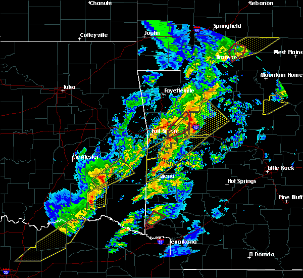 At 630 pm cdt, severe thunderstorms were located along a line extending from 11 miles northeast of wiederkehr village to near woodland to near hartman, moving northeast at 50 mph (radar indicated). Hazards include 70 mph wind gusts and quarter size hail. Hail damage to vehicles is expected. expect considerable tree damage. wind damage is also likely to mobile homes, roofs, and outbuildings. Locations impacted include, clarksville, lamar, knoxville, hartman, scranton, ratcliff, upper buffalo wilderness area, devils knob, hoyt, holman, rosetta, dillen, woodland, hinkle, walnut, spadra, bertha, tokalon, lake dardanelle, coal hill, a tornado watch remains in effect until 1000 pm cdt for western, central and north central arkansas. At 630 pm cdt, severe thunderstorms were located along a line extending from 11 miles northeast of wiederkehr village to near woodland to near hartman, moving northeast at 50 mph (radar indicated). Hazards include 70 mph wind gusts and quarter size hail. Hail damage to vehicles is expected. expect considerable tree damage. wind damage is also likely to mobile homes, roofs, and outbuildings. Locations impacted include, clarksville, lamar, knoxville, hartman, scranton, ratcliff, upper buffalo wilderness area, devils knob, hoyt, holman, rosetta, dillen, woodland, hinkle, walnut, spadra, bertha, tokalon, lake dardanelle, coal hill, a tornado watch remains in effect until 1000 pm cdt for western, central and north central arkansas.
|
| 4/13/2018 6:27 PM CDT |
 At 627 pm cdt, a severe thunderstorm was located near charleston, moving northeast at 50 mph (radar indicated). Hazards include 60 mph wind gusts and quarter size hail. Hail damage to vehicles is expected. expect wind damage to roofs, siding, and trees. locations in or near the path include, ozark, charleston, altus, branch, denning, wiederkehr village, washburn, fort chaffee, bloomer, caulksville, etna, alix, watalula, meg, peter pender, vesta, cecil, taft, ursula, milltown, this includes interstate 40 in arkansas between mile markers 31 and 42. A tornado watch remains in effect until 1000 pm cdt for west central arkansas. At 627 pm cdt, a severe thunderstorm was located near charleston, moving northeast at 50 mph (radar indicated). Hazards include 60 mph wind gusts and quarter size hail. Hail damage to vehicles is expected. expect wind damage to roofs, siding, and trees. locations in or near the path include, ozark, charleston, altus, branch, denning, wiederkehr village, washburn, fort chaffee, bloomer, caulksville, etna, alix, watalula, meg, peter pender, vesta, cecil, taft, ursula, milltown, this includes interstate 40 in arkansas between mile markers 31 and 42. A tornado watch remains in effect until 1000 pm cdt for west central arkansas.
|
| 4/13/2018 6:21 PM CDT |
 At 621 pm cdt, severe thunderstorms were located along a line extending from near charleston to near washburn to near mansfield, moving east at 40 mph (radar indicated). Hazards include 60 mph wind gusts and quarter size hail. Hail damage to vehicles is expected. Expect wind damage to roofs, siding, and trees. At 621 pm cdt, severe thunderstorms were located along a line extending from near charleston to near washburn to near mansfield, moving east at 40 mph (radar indicated). Hazards include 60 mph wind gusts and quarter size hail. Hail damage to vehicles is expected. Expect wind damage to roofs, siding, and trees.
|
| 4/13/2018 6:17 PM CDT |
 At 616 pm cdt, severe thunderstorms were located along a line extending from 6 miles southeast of cass to near wiederkehr village to denning, moving northeast at 60 mph (radar indicated). Hazards include 60 mph wind gusts and quarter size hail. Hail damage to vehicles is expected. expect wind damage to roofs, siding, and trees. Locations impacted include, clarksville, lamar, knoxville, hartman, scranton, ratcliff, upper buffalo wilderness area, devils knob, hoyt, holman, rosetta, dillen, woodland, hinkle, walnut, spadra, bertha, tokalon, lake dardanelle, coal hill, a tornado watch remains in effect until 1000 pm cdt for western, central and north central arkansas. At 616 pm cdt, severe thunderstorms were located along a line extending from 6 miles southeast of cass to near wiederkehr village to denning, moving northeast at 60 mph (radar indicated). Hazards include 60 mph wind gusts and quarter size hail. Hail damage to vehicles is expected. expect wind damage to roofs, siding, and trees. Locations impacted include, clarksville, lamar, knoxville, hartman, scranton, ratcliff, upper buffalo wilderness area, devils knob, hoyt, holman, rosetta, dillen, woodland, hinkle, walnut, spadra, bertha, tokalon, lake dardanelle, coal hill, a tornado watch remains in effect until 1000 pm cdt for western, central and north central arkansas.
|
| 4/13/2018 6:02 PM CDT |
 At 602 pm cdt, severe thunderstorms were located along a line extending from 3 miles north of ratcliff to near hartford, moving northeast at 50 mph (radar indicated). Hazards include 60 mph wind gusts. Expect damage to roofs, siding, and trees. Locations in or near the path include, charleston, greenwood, mansfield, altus, hartford, huntington, branch, midland, denning, wiederkehr village, washburn, burnville, fort chaffee, patterson, caulksville, etna, alix, arkola, crossroads, witcherville, a tornado watch remains in effect until 1000 pm cdt for west central arkansas, and southeastern oklahoma. At 602 pm cdt, severe thunderstorms were located along a line extending from 3 miles north of ratcliff to near hartford, moving northeast at 50 mph (radar indicated). Hazards include 60 mph wind gusts. Expect damage to roofs, siding, and trees. Locations in or near the path include, charleston, greenwood, mansfield, altus, hartford, huntington, branch, midland, denning, wiederkehr village, washburn, burnville, fort chaffee, patterson, caulksville, etna, alix, arkola, crossroads, witcherville, a tornado watch remains in effect until 1000 pm cdt for west central arkansas, and southeastern oklahoma.
|
| 4/13/2018 5:58 PM CDT |
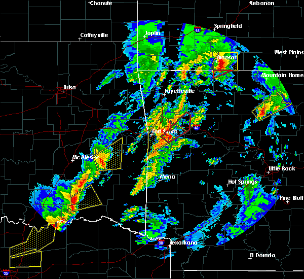 At 558 pm cdt, severe thunderstorms were located along a line extending from near mulberry to 8 miles southwest of ozark to near branch, moving northeast at 55 mph (radar indicated). Hazards include 60 mph wind gusts and quarter size hail. Hail damage to vehicles is expected. Expect wind damage to roofs, siding, and trees. At 558 pm cdt, severe thunderstorms were located along a line extending from near mulberry to 8 miles southwest of ozark to near branch, moving northeast at 55 mph (radar indicated). Hazards include 60 mph wind gusts and quarter size hail. Hail damage to vehicles is expected. Expect wind damage to roofs, siding, and trees.
|
| 4/3/2018 2:21 PM CDT |
 At 221 pm cdt, a severe thunderstorm was located near ratcliff, moving east at 45 mph (radar indicated). Hazards include 60 mph wind gusts and quarter size hail. Hail damage to vehicles is expected. expect wind damage to roofs, siding, and trees. Locations in or near the path include, charleston, branch, fort chaffee, caulksville, etna, peter pender,. At 221 pm cdt, a severe thunderstorm was located near ratcliff, moving east at 45 mph (radar indicated). Hazards include 60 mph wind gusts and quarter size hail. Hail damage to vehicles is expected. expect wind damage to roofs, siding, and trees. Locations in or near the path include, charleston, branch, fort chaffee, caulksville, etna, peter pender,.
|
| 4/3/2018 2:11 PM CDT |
 At 211 pm cdt, a severe thunderstorm was located near fort chaffee, or near charleston, moving east at 50 mph (radar indicated). Hazards include half dollar size hail. damage to vehicles is expected At 211 pm cdt, a severe thunderstorm was located near fort chaffee, or near charleston, moving east at 50 mph (radar indicated). Hazards include half dollar size hail. damage to vehicles is expected
|
| 4/3/2018 2:07 PM CDT |
 At 207 pm cdt, a severe thunderstorm was located near fort chaffee, moving northeast at 45 mph (radar indicated). Hazards include 60 mph wind gusts and quarter size hail. Hail damage to vehicles is expected. expect wind damage to roofs, siding, and trees. Locations in or near the path include, charleston, greenwood, branch, bloomer, washburn, burnville, fort chaffee, caulksville, milltown, etna, peter pender, ursula,. At 207 pm cdt, a severe thunderstorm was located near fort chaffee, moving northeast at 45 mph (radar indicated). Hazards include 60 mph wind gusts and quarter size hail. Hail damage to vehicles is expected. expect wind damage to roofs, siding, and trees. Locations in or near the path include, charleston, greenwood, branch, bloomer, washburn, burnville, fort chaffee, caulksville, milltown, etna, peter pender, ursula,.
|
| 3/27/2018 10:26 AM CDT |
 At 1025 am cdt, a severe thunderstorm was located 6 miles northwest of branch, moving east at 35 mph (radar indicated). Hazards include 60 mph wind gusts. Expect damage to roofs, siding, and trees. Locations in or near the path include, ozark, charleston, altus, branch, denning, ratcliff, wiederkehr village, caulksville, etna, alix, meg, peter pender, vesta, cecil, this includes interstate 40 in arkansas between mile markers 36 and 42. At 1025 am cdt, a severe thunderstorm was located 6 miles northwest of branch, moving east at 35 mph (radar indicated). Hazards include 60 mph wind gusts. Expect damage to roofs, siding, and trees. Locations in or near the path include, ozark, charleston, altus, branch, denning, ratcliff, wiederkehr village, caulksville, etna, alix, meg, peter pender, vesta, cecil, this includes interstate 40 in arkansas between mile markers 36 and 42.
|
| 3/10/2018 5:39 PM CST |
 The severe thunderstorm warning for southern franklin county will expire at 545 pm cst, the storm which prompted the warning has moved out of the area. therefore the warning will be allowed to expire. a severe thunderstorm watch remains in effect until 1000 pm cst for west central arkansas. to report severe weather, contact your nearest law enforcement agency. they will relay your report to the national weather service tulsa. The severe thunderstorm warning for southern franklin county will expire at 545 pm cst, the storm which prompted the warning has moved out of the area. therefore the warning will be allowed to expire. a severe thunderstorm watch remains in effect until 1000 pm cst for west central arkansas. to report severe weather, contact your nearest law enforcement agency. they will relay your report to the national weather service tulsa.
|
| 3/10/2018 5:36 PM CST |
 At 536 pm cst, a severe thunderstorm was located near ratcliff, or 7 miles northeast of booneville, moving southeast at 25 mph (radar indicated). Hazards include 60 mph wind gusts and quarter size hail. Hail damage to vehicles is expected. expect wind damage to roofs, siding, and trees. Locations impacted include, paris, magazine, subiaco, ratcliff, blue mountain, mount magazine, midway in logan county, caulksville, roseville, chismville, wilkins, carbon city, driggs, corley,. At 536 pm cst, a severe thunderstorm was located near ratcliff, or 7 miles northeast of booneville, moving southeast at 25 mph (radar indicated). Hazards include 60 mph wind gusts and quarter size hail. Hail damage to vehicles is expected. expect wind damage to roofs, siding, and trees. Locations impacted include, paris, magazine, subiaco, ratcliff, blue mountain, mount magazine, midway in logan county, caulksville, roseville, chismville, wilkins, carbon city, driggs, corley,.
|
| 3/10/2018 5:27 PM CST |
 At 527 pm cst, a severe thunderstorm was located near ratcliff, or near booneville, moving southeast at 40 mph (radar indicated). Hazards include ping pong ball size hail and 60 mph wind gusts. People and animals outdoors will be injured. expect hail damage to roofs, siding, windows, and vehicles. expect wind damage to roofs, siding, and trees. Locations impacted include, paris, magazine, subiaco, ratcliff, blue mountain, mount magazine, midway in logan county, caulksville, roseville, chismville, wilkins, carbon city, driggs, corley,. At 527 pm cst, a severe thunderstorm was located near ratcliff, or near booneville, moving southeast at 40 mph (radar indicated). Hazards include ping pong ball size hail and 60 mph wind gusts. People and animals outdoors will be injured. expect hail damage to roofs, siding, windows, and vehicles. expect wind damage to roofs, siding, and trees. Locations impacted include, paris, magazine, subiaco, ratcliff, blue mountain, mount magazine, midway in logan county, caulksville, roseville, chismville, wilkins, carbon city, driggs, corley,.
|
| 3/10/2018 5:22 PM CST |
 At 522 pm cst, a severe thunderstorm was located over ratcliff, moving southeast at 30 mph (radar indicated). Hazards include golf ball size hail and 60 mph wind gusts. People and animals outdoors will be injured. expect hail damage to roofs, siding, windows, and vehicles. expect wind damage to roofs, siding, and trees. Locations in or near the path include, charleston, branch, caulksville, etna, peter pender, meg,. At 522 pm cst, a severe thunderstorm was located over ratcliff, moving southeast at 30 mph (radar indicated). Hazards include golf ball size hail and 60 mph wind gusts. People and animals outdoors will be injured. expect hail damage to roofs, siding, windows, and vehicles. expect wind damage to roofs, siding, and trees. Locations in or near the path include, charleston, branch, caulksville, etna, peter pender, meg,.
|
| 3/10/2018 5:17 PM CST |
 At 517 pm cst, a severe thunderstorm was located over branch, or near charleston, moving southeast at 30 mph (radar indicated). Hazards include 60 mph wind gusts and half dollar size hail. Hail damage to vehicles is expected. expect wind damage to roofs, siding, and trees. Locations impacted include, paris, magazine, subiaco, ratcliff, blue mountain, mount magazine, midway in logan county, caulksville, roseville, chismville, wilkins, carbon city, driggs, corley,. At 517 pm cst, a severe thunderstorm was located over branch, or near charleston, moving southeast at 30 mph (radar indicated). Hazards include 60 mph wind gusts and half dollar size hail. Hail damage to vehicles is expected. expect wind damage to roofs, siding, and trees. Locations impacted include, paris, magazine, subiaco, ratcliff, blue mountain, mount magazine, midway in logan county, caulksville, roseville, chismville, wilkins, carbon city, driggs, corley,.
|
| 3/10/2018 5:15 PM CST |
 At 514 pm cst, a severe thunderstorm was located over branch, moving southeast at 30 mph (radar indicated). Hazards include golf ball size hail and 60 mph wind gusts. People and animals outdoors will be injured. expect hail damage to roofs, siding, windows, and vehicles. expect wind damage to roofs, siding, and trees. Locations in or near the path include, charleston, branch, caulksville, etna, peter pender, vesta, meg,. At 514 pm cst, a severe thunderstorm was located over branch, moving southeast at 30 mph (radar indicated). Hazards include golf ball size hail and 60 mph wind gusts. People and animals outdoors will be injured. expect hail damage to roofs, siding, windows, and vehicles. expect wind damage to roofs, siding, and trees. Locations in or near the path include, charleston, branch, caulksville, etna, peter pender, vesta, meg,.
|
| 3/10/2018 5:04 PM CST |
 At 503 pm cst, a severe thunderstorm was located near charleston, moving southeast at 30 mph (radar indicated). Hazards include 60 mph wind gusts and half dollar size hail. Hail damage to vehicles is expected. Expect wind damage to roofs, siding, and trees. At 503 pm cst, a severe thunderstorm was located near charleston, moving southeast at 30 mph (radar indicated). Hazards include 60 mph wind gusts and half dollar size hail. Hail damage to vehicles is expected. Expect wind damage to roofs, siding, and trees.
|
| 3/10/2018 5:03 PM CST |
 At 503 pm cst, a severe thunderstorm was located 6 miles north of charleston, moving southeast at 30 mph (radar indicated). Hazards include golf ball size hail and 60 mph wind gusts. People and animals outdoors will be injured. expect hail damage to roofs, siding, windows, and vehicles. expect wind damage to roofs, siding, and trees. Locations in or near the path include, charleston, branch, caulksville, etna, peter pender, vesta, meg,. At 503 pm cst, a severe thunderstorm was located 6 miles north of charleston, moving southeast at 30 mph (radar indicated). Hazards include golf ball size hail and 60 mph wind gusts. People and animals outdoors will be injured. expect hail damage to roofs, siding, windows, and vehicles. expect wind damage to roofs, siding, and trees. Locations in or near the path include, charleston, branch, caulksville, etna, peter pender, vesta, meg,.
|
| 1/21/2018 7:33 PM CST |
 At 733 pm cst, a severe thunderstorm with strong low level rotation that could produce a tornado at any time was located near branch, moving northeast at 40 mph (radar indicated rotation). Hazards include tornado. Flying debris will be dangerous to those caught without shelter. mobile homes will be damaged or destroyed. damage to roofs, windows, and vehicles will occur. tree damage is likely. Locations in or near the path include, ozark, altus, branch, denning, ratcliff, wiederkehr village, caulksville, jethro, etna, alix, watalula, meg, toney, peter pender, cecil, cravens, this includes interstate 40 in arkansas between mile markers 28 and 42. At 733 pm cst, a severe thunderstorm with strong low level rotation that could produce a tornado at any time was located near branch, moving northeast at 40 mph (radar indicated rotation). Hazards include tornado. Flying debris will be dangerous to those caught without shelter. mobile homes will be damaged or destroyed. damage to roofs, windows, and vehicles will occur. tree damage is likely. Locations in or near the path include, ozark, altus, branch, denning, ratcliff, wiederkehr village, caulksville, jethro, etna, alix, watalula, meg, toney, peter pender, cecil, cravens, this includes interstate 40 in arkansas between mile markers 28 and 42.
|
| 1/21/2018 7:26 PM CST |
 At 726 pm cst, a severe thunderstorm capable of producing a tornado was located over charleston, moving northeast at 45 mph (radar indicated rotation). Hazards include tornado. Flying debris will be dangerous to those caught without shelter. mobile homes will be damaged or destroyed. damage to roofs, windows, and vehicles will occur. tree damage is likely. Locations in or near the path include, ozark, charleston, altus, branch, denning, ratcliff, wiederkehr village, caulksville, jethro, etna, alix, watalula, meg, toney, peter pender, vesta, lonelm, cecil, cravens, this includes interstate 40 in arkansas between mile markers 28 and 42. At 726 pm cst, a severe thunderstorm capable of producing a tornado was located over charleston, moving northeast at 45 mph (radar indicated rotation). Hazards include tornado. Flying debris will be dangerous to those caught without shelter. mobile homes will be damaged or destroyed. damage to roofs, windows, and vehicles will occur. tree damage is likely. Locations in or near the path include, ozark, charleston, altus, branch, denning, ratcliff, wiederkehr village, caulksville, jethro, etna, alix, watalula, meg, toney, peter pender, vesta, lonelm, cecil, cravens, this includes interstate 40 in arkansas between mile markers 28 and 42.
|
| 12/4/2017 7:11 PM CST |
 At 710 pm cst, a severe thunderstorm capable of producing a tornado was located near booneville, moving east at 40 mph (radar indicated rotation). Hazards include tornado and quarter size hail. Flying debris will be dangerous to those caught without shelter. mobile homes will be damaged or destroyed. damage to roofs, windows, and vehicles will occur. Tree damage is likely. At 710 pm cst, a severe thunderstorm capable of producing a tornado was located near booneville, moving east at 40 mph (radar indicated rotation). Hazards include tornado and quarter size hail. Flying debris will be dangerous to those caught without shelter. mobile homes will be damaged or destroyed. damage to roofs, windows, and vehicles will occur. Tree damage is likely.
|
| 10/22/2017 2:07 AM CDT |
 The severe thunderstorm warning for southern madison, franklin, eastern crawford, northeastern sebastian and southeastern washington counties will expire at 215 am cdt, the storms which prompted the warning have moved out of the area. therefore the warning will be allowed to expire. however gusty winds and heavy rain are still possible with these thunderstorms. a severe thunderstorm watch remains in effect until 700 am cdt for northwestern and west central arkansas. The severe thunderstorm warning for southern madison, franklin, eastern crawford, northeastern sebastian and southeastern washington counties will expire at 215 am cdt, the storms which prompted the warning have moved out of the area. therefore the warning will be allowed to expire. however gusty winds and heavy rain are still possible with these thunderstorms. a severe thunderstorm watch remains in effect until 700 am cdt for northwestern and west central arkansas.
|
| 10/22/2017 1:42 AM CDT |
 At 141 am cdt, severe thunderstorms were located along a line extending from 3 miles northwest of aurora to 2 miles west of echo, moving east at 40 mph (radar indicated). Hazards include 60 mph wind gusts and quarter size hail. Hail damage to vehicles is expected. expect wind damage to roofs, siding, and trees. locations in or near the path include, ozark, charleston, greenwood, lavaca, mulberry, dyer, altus, huntington, branch, denning, st. Paul, wiederkehr village, wesley, saint paul, aurora, boston, bloomer, burnville, cass, pettigrew, this includes interstate 40 in arkansas between mile markers 16 and 42. At 141 am cdt, severe thunderstorms were located along a line extending from 3 miles northwest of aurora to 2 miles west of echo, moving east at 40 mph (radar indicated). Hazards include 60 mph wind gusts and quarter size hail. Hail damage to vehicles is expected. expect wind damage to roofs, siding, and trees. locations in or near the path include, ozark, charleston, greenwood, lavaca, mulberry, dyer, altus, huntington, branch, denning, st. Paul, wiederkehr village, wesley, saint paul, aurora, boston, bloomer, burnville, cass, pettigrew, this includes interstate 40 in arkansas between mile markers 16 and 42.
|
| 10/22/2017 1:27 AM CDT |
 At 121 am cdt, severe thunderstorms were located along a line extending from near wesley to 2 miles northeast of midland, moving east at 35 mph (trained weather spotters). Hazards include 70 mph wind gusts. Expect considerable tree damage. damage is likely to mobile homes, roofs, and outbuildings. locations in or near the path include, fort smith, fayetteville, van buren, poteau, ozark, charleston, cedarville, mountainburg, natural dam, greenwood, farmington, alma, barling, prairie grove, pocola, heavener, roland, elkins, west fork, lavaca, this includes the following highways, interstate 40 in arkansas between mile markers 0 and 42. interstate 40 in oklahoma between mile markers 323 and 328. interstate 540 between mile markers 1 and 14. interstate 49 between mile markers 22 and 63. a tornado watch remains in effect until 200 am cdt for southeastern and east central oklahoma. A severe thunderstorm watch remains in effect until 700 am cdt for west central arkansas. At 121 am cdt, severe thunderstorms were located along a line extending from near wesley to 2 miles northeast of midland, moving east at 35 mph (trained weather spotters). Hazards include 70 mph wind gusts. Expect considerable tree damage. damage is likely to mobile homes, roofs, and outbuildings. locations in or near the path include, fort smith, fayetteville, van buren, poteau, ozark, charleston, cedarville, mountainburg, natural dam, greenwood, farmington, alma, barling, prairie grove, pocola, heavener, roland, elkins, west fork, lavaca, this includes the following highways, interstate 40 in arkansas between mile markers 0 and 42. interstate 40 in oklahoma between mile markers 323 and 328. interstate 540 between mile markers 1 and 14. interstate 49 between mile markers 22 and 63. a tornado watch remains in effect until 200 am cdt for southeastern and east central oklahoma. A severe thunderstorm watch remains in effect until 700 am cdt for west central arkansas.
|
| 10/22/2017 1:08 AM CDT |
 At 106 am cdt, severe thunderstorms were located along a line extending from 6 miles southeast of elkins to 6 miles east of heavener runestone state park, moving east at 45 mph (spotter reports and radar indicated). Hazards include 70 mph wind gusts. Expect considerable tree damage. damage is likely to mobile homes, roofs, and outbuildings. locations in or near the path include, fort smith, fayetteville, van buren, poteau, ozark, charleston, cedarville, mountainburg, natural dam, greenwood, farmington, alma, barling, prairie grove, pocola, heavener, roland, elkins, west fork, lavaca, this includes the following highways, interstate 40 in arkansas between mile markers 0 and 42. interstate 40 in oklahoma between mile markers 323 and 328. interstate 540 between mile markers 1 and 14. interstate 49 between mile markers 22 and 63. A tornado watch remains in effect until 200 am cdt for southeastern and east central oklahoma. At 106 am cdt, severe thunderstorms were located along a line extending from 6 miles southeast of elkins to 6 miles east of heavener runestone state park, moving east at 45 mph (spotter reports and radar indicated). Hazards include 70 mph wind gusts. Expect considerable tree damage. damage is likely to mobile homes, roofs, and outbuildings. locations in or near the path include, fort smith, fayetteville, van buren, poteau, ozark, charleston, cedarville, mountainburg, natural dam, greenwood, farmington, alma, barling, prairie grove, pocola, heavener, roland, elkins, west fork, lavaca, this includes the following highways, interstate 40 in arkansas between mile markers 0 and 42. interstate 40 in oklahoma between mile markers 323 and 328. interstate 540 between mile markers 1 and 14. interstate 49 between mile markers 22 and 63. A tornado watch remains in effect until 200 am cdt for southeastern and east central oklahoma.
|
| 10/22/2017 1:01 AM CDT |
 At 100 am cdt, severe thunderstorms were located along a line extending from near van buren to hartford to near muse, moving east at 35 mph (radar indicated). Hazards include 60 mph wind gusts. expect damage to roofs, siding, and trees At 100 am cdt, severe thunderstorms were located along a line extending from near van buren to hartford to near muse, moving east at 35 mph (radar indicated). Hazards include 60 mph wind gusts. expect damage to roofs, siding, and trees
|
| 6/18/2017 10:02 AM CDT |
 At 1001 am cdt, severe thunderstorms were located along a line extending from devils knob to clarksville to near subiaco, moving southeast at 50 mph (radar indicated). Hazards include 60 mph wind gusts and nickel size hail. Expect damage to roofs, siding, and trees. Locations impacted include, clarksville, paris, lamar, dover, london, knoxville, subiaco, hartman, scranton, ratcliff, devils knob, hoyt, midway in logan county, holman, rosetta, dillen, woodland, hinkle, spadra, bertha, this includes interstate 40 between mile markers 50 and 74. At 1001 am cdt, severe thunderstorms were located along a line extending from devils knob to clarksville to near subiaco, moving southeast at 50 mph (radar indicated). Hazards include 60 mph wind gusts and nickel size hail. Expect damage to roofs, siding, and trees. Locations impacted include, clarksville, paris, lamar, dover, london, knoxville, subiaco, hartman, scranton, ratcliff, devils knob, hoyt, midway in logan county, holman, rosetta, dillen, woodland, hinkle, spadra, bertha, this includes interstate 40 between mile markers 50 and 74.
|
| 6/18/2017 9:47 AM CDT |
 At 946 am cdt, severe thunderstorms were located along a line extending from near devils knob to near woodland to near ratcliff, moving southeast at 45 mph (radar indicated). Hazards include 60 mph wind gusts and nickel size hail. Expect damage to roofs, siding, and trees. Locations impacted include, clarksville, paris, lamar, dover, london, knoxville, subiaco, hartman, scranton, ratcliff, devils knob, hoyt, midway in logan county, holman, rosetta, dillen, woodland, hinkle, walnut, spadra, this includes interstate 40 between mile markers 45 and 74. At 946 am cdt, severe thunderstorms were located along a line extending from near devils knob to near woodland to near ratcliff, moving southeast at 45 mph (radar indicated). Hazards include 60 mph wind gusts and nickel size hail. Expect damage to roofs, siding, and trees. Locations impacted include, clarksville, paris, lamar, dover, london, knoxville, subiaco, hartman, scranton, ratcliff, devils knob, hoyt, midway in logan county, holman, rosetta, dillen, woodland, hinkle, walnut, spadra, this includes interstate 40 between mile markers 45 and 74.
|
| 6/18/2017 9:44 AM CDT |
 At 944 am cdt, severe thunderstorms were located along a line extending from 10 miles west of devils knob to 3 miles southwest of hartman to 3 miles south of washburn, moving east at 30 mph (radar indicated). Hazards include 60 mph wind gusts. Expect damage to roofs, siding, and trees. Locations in or near the path include, ozark, charleston, greenwood, altus, branch, denning, wiederkehr village, cass, bloomer, washburn, burnville, fort chaffee, caulksville, crossroads, witcherville, milltown, turners bend, ursula, etna, alix, this includes interstate 40 in arkansas between mile markers 33 and 42. At 944 am cdt, severe thunderstorms were located along a line extending from 10 miles west of devils knob to 3 miles southwest of hartman to 3 miles south of washburn, moving east at 30 mph (radar indicated). Hazards include 60 mph wind gusts. Expect damage to roofs, siding, and trees. Locations in or near the path include, ozark, charleston, greenwood, altus, branch, denning, wiederkehr village, cass, bloomer, washburn, burnville, fort chaffee, caulksville, crossroads, witcherville, milltown, turners bend, ursula, etna, alix, this includes interstate 40 in arkansas between mile markers 33 and 42.
|
| 6/18/2017 9:28 AM CDT |
 At 927 am cdt, severe thunderstorms were located along a line extending from 7 miles west of devils knob to altus to near washburn, moving east at 45 mph (radar indicated). Hazards include 60 mph wind gusts. Expect damage to roofs, siding, and trees. Locations in or near the path include, fort smith, ozark, charleston, greenwood, barling, lavaca, mulberry, dyer, hackett, altus, bonanza, branch, denning, wiederkehr village, bloomer, burnville, jenny lind, cass, excelsior, washburn, this includes interstate 40 in arkansas between mile markers 16 and 42. At 927 am cdt, severe thunderstorms were located along a line extending from 7 miles west of devils knob to altus to near washburn, moving east at 45 mph (radar indicated). Hazards include 60 mph wind gusts. Expect damage to roofs, siding, and trees. Locations in or near the path include, fort smith, ozark, charleston, greenwood, barling, lavaca, mulberry, dyer, hackett, altus, bonanza, branch, denning, wiederkehr village, bloomer, burnville, jenny lind, cass, excelsior, washburn, this includes interstate 40 in arkansas between mile markers 16 and 42.
|
| 6/18/2017 9:14 AM CDT |
 At 914 am cdt, severe thunderstorms were located along a line extending from 6 miles southwest of pettigrew to 4 miles west of ozark to 2 miles southeast of excelsior, moving east at 45 mph (radar indicated). Hazards include 60 mph wind gusts. Expect damage to roofs, siding, and trees. locations in or near the path include, fort smith, van buren, ozark, charleston, mountainburg, greenwood, alma, barling, pocola, lavaca, arkoma, mulberry, dyer, hackett, altus, bonanza, branch, denning, rudy, wiederkehr village, this includes the following highways, interstate 40 in arkansas between mile markers 4 and 42. interstate 540 between mile markers 1 and 14. Interstate 49 between mile markers 22 and 28. At 914 am cdt, severe thunderstorms were located along a line extending from 6 miles southwest of pettigrew to 4 miles west of ozark to 2 miles southeast of excelsior, moving east at 45 mph (radar indicated). Hazards include 60 mph wind gusts. Expect damage to roofs, siding, and trees. locations in or near the path include, fort smith, van buren, ozark, charleston, mountainburg, greenwood, alma, barling, pocola, lavaca, arkoma, mulberry, dyer, hackett, altus, bonanza, branch, denning, rudy, wiederkehr village, this includes the following highways, interstate 40 in arkansas between mile markers 4 and 42. interstate 540 between mile markers 1 and 14. Interstate 49 between mile markers 22 and 28.
|
| 6/18/2017 9:13 AM CDT |
 At 912 am cdt, severe thunderstorms were located along a line extending from near pettigrew to near cass to near mulberry, moving southeast at 50 mph (radar indicated). Hazards include 60 mph wind gusts and nickel size hail. expect damage to roofs, siding, and trees At 912 am cdt, severe thunderstorms were located along a line extending from near pettigrew to near cass to near mulberry, moving southeast at 50 mph (radar indicated). Hazards include 60 mph wind gusts and nickel size hail. expect damage to roofs, siding, and trees
|
| 6/18/2017 9:04 AM CDT |
 At 904 am cdt, severe thunderstorms were located along a line extending from 2 miles east of fern to 6 miles southeast of dyer to near jenny lind, moving southeast at 60 mph (radar indicated). Hazards include 60 mph wind gusts. Expect damage to roofs, siding, and trees. locations in or near the path include, fort smith, van buren, ozark, charleston, mountainburg, greenwood, alma, barling, pocola, lavaca, arkoma, mulberry, dyer, hackett, altus, bonanza, branch, denning, chester, rudy, this includes the following highways, interstate 40 in arkansas between mile markers 4 and 42. interstate 540 between mile markers 1 and 14. Interstate 49 between mile markers 22 and 36. At 904 am cdt, severe thunderstorms were located along a line extending from 2 miles east of fern to 6 miles southeast of dyer to near jenny lind, moving southeast at 60 mph (radar indicated). Hazards include 60 mph wind gusts. Expect damage to roofs, siding, and trees. locations in or near the path include, fort smith, van buren, ozark, charleston, mountainburg, greenwood, alma, barling, pocola, lavaca, arkoma, mulberry, dyer, hackett, altus, bonanza, branch, denning, chester, rudy, this includes the following highways, interstate 40 in arkansas between mile markers 4 and 42. interstate 540 between mile markers 1 and 14. Interstate 49 between mile markers 22 and 36.
|
| 6/18/2017 8:55 AM CDT |
 At 855 am cdt, severe thunderstorms were located along a line extending from 3 miles northeast of lake fort smith to near alma to 2 miles southeast of arkoma, moving southeast at 50 mph (radar indicated). Hazards include 60 mph wind gusts. Expect damage to roofs, siding, and trees. locations in or near the path include, fort smith, van buren, ozark, charleston, cedarville, mountainburg, natural dam, greenwood, alma, barling, pocola, muldrow, roland, lavaca, arkoma, mulberry, dyer, hackett, altus, bonanza, this includes the following highways, interstate 40 in arkansas between mile markers 0 and 42. interstate 40 in oklahoma between mile markers 315 and 328. interstate 540 between mile markers 1 and 14. Interstate 49 between mile markers 22 and 40. At 855 am cdt, severe thunderstorms were located along a line extending from 3 miles northeast of lake fort smith to near alma to 2 miles southeast of arkoma, moving southeast at 50 mph (radar indicated). Hazards include 60 mph wind gusts. Expect damage to roofs, siding, and trees. locations in or near the path include, fort smith, van buren, ozark, charleston, cedarville, mountainburg, natural dam, greenwood, alma, barling, pocola, muldrow, roland, lavaca, arkoma, mulberry, dyer, hackett, altus, bonanza, this includes the following highways, interstate 40 in arkansas between mile markers 0 and 42. interstate 40 in oklahoma between mile markers 315 and 328. interstate 540 between mile markers 1 and 14. Interstate 49 between mile markers 22 and 40.
|
| 6/18/2017 8:38 AM CDT |
 At 838 am cdt, severe thunderstorms were located along a line extending from 2 miles southwest of devils den state park to 2 miles southwest of figure five to 3 miles south of muldrow, moving southeast at 55 mph (radar indicated). Hazards include 60 mph wind gusts. Expect damage to roofs, siding, and trees. locations in or near the path include, fort smith, van buren, ozark, charleston, cedarville, mountainburg, natural dam, greenwood, alma, barling, pocola, muldrow, roland, lavaca, arkoma, mulberry, dyer, hackett, altus, bonanza, this includes the following highways, interstate 40 in arkansas between mile markers 0 and 42. interstate 40 in oklahoma between mile markers 315 and 328. interstate 540 between mile markers 1 and 14. Interstate 49 between mile markers 22 and 40. At 838 am cdt, severe thunderstorms were located along a line extending from 2 miles southwest of devils den state park to 2 miles southwest of figure five to 3 miles south of muldrow, moving southeast at 55 mph (radar indicated). Hazards include 60 mph wind gusts. Expect damage to roofs, siding, and trees. locations in or near the path include, fort smith, van buren, ozark, charleston, cedarville, mountainburg, natural dam, greenwood, alma, barling, pocola, muldrow, roland, lavaca, arkoma, mulberry, dyer, hackett, altus, bonanza, this includes the following highways, interstate 40 in arkansas between mile markers 0 and 42. interstate 40 in oklahoma between mile markers 315 and 328. interstate 540 between mile markers 1 and 14. Interstate 49 between mile markers 22 and 40.
|
| 6/16/2017 12:54 AM CDT |
 The severe thunderstorm warning for south central madison, franklin, crawford and sebastian counties will expire at 100 am cdt, the storms which prompted the warning have weakened below severe limits, and no longer pose an immediate threat to life or property. therefore the warning will be allowed to expire. however gusty winds to 45 mph and heavy rain are still possible with these thunderstorms. a severe thunderstorm watch remains in effect until 200 am cdt for northwestern and west central arkansas. The severe thunderstorm warning for south central madison, franklin, crawford and sebastian counties will expire at 100 am cdt, the storms which prompted the warning have weakened below severe limits, and no longer pose an immediate threat to life or property. therefore the warning will be allowed to expire. however gusty winds to 45 mph and heavy rain are still possible with these thunderstorms. a severe thunderstorm watch remains in effect until 200 am cdt for northwestern and west central arkansas.
|
| 6/16/2017 12:48 AM CDT |
 At 1248 am cdt, severe thunderstorms were located along a line extending from near st. paul to 7 miles northeast of mulberry to 2 miles north of jenny lind, moving southeast at 50 mph (radar indicated). Hazards include 60 mph wind gusts. Expect damage to roofs, siding, and trees. locations in or near the path include, fort smith, van buren, ozark, charleston, mountainburg, greenwood, alma, barling, lavaca, mulberry, mansfield, dyer, hackett, altus, hartford, huntington, bonanza, branch, midland, denning, this includes the following highways, interstate 40 in arkansas between mile markers 0 and 42. interstate 540 between mile markers 1 and 14. Interstate 49 between mile markers 22 and 34. At 1248 am cdt, severe thunderstorms were located along a line extending from near st. paul to 7 miles northeast of mulberry to 2 miles north of jenny lind, moving southeast at 50 mph (radar indicated). Hazards include 60 mph wind gusts. Expect damage to roofs, siding, and trees. locations in or near the path include, fort smith, van buren, ozark, charleston, mountainburg, greenwood, alma, barling, lavaca, mulberry, mansfield, dyer, hackett, altus, hartford, huntington, bonanza, branch, midland, denning, this includes the following highways, interstate 40 in arkansas between mile markers 0 and 42. interstate 540 between mile markers 1 and 14. Interstate 49 between mile markers 22 and 34.
|
| 6/16/2017 12:07 AM CDT |
 At 1206 am cdt, severe thunderstorms were located along a line extending from 6 miles northeast of fayetteville to 2 miles west of devils den state park to 5 miles north of muldrow, moving southeast at 15 mph (radar indicated). Hazards include 60 mph wind gusts. Expect damage to roofs, siding, and trees. locations in or near the path include, fort smith, fayetteville, van buren, ozark, charleston, huntsville, cedarville, mountainburg, natural dam, greenwood, alma, barling, elkins, west fork, lavaca, mulberry, mansfield, dyer, hackett, altus, this includes the following highways, interstate 40 in arkansas between mile markers 0 and 42. interstate 540 between mile markers 1 and 14. Interstate 49 between mile markers 22 and 51. At 1206 am cdt, severe thunderstorms were located along a line extending from 6 miles northeast of fayetteville to 2 miles west of devils den state park to 5 miles north of muldrow, moving southeast at 15 mph (radar indicated). Hazards include 60 mph wind gusts. Expect damage to roofs, siding, and trees. locations in or near the path include, fort smith, fayetteville, van buren, ozark, charleston, huntsville, cedarville, mountainburg, natural dam, greenwood, alma, barling, elkins, west fork, lavaca, mulberry, mansfield, dyer, hackett, altus, this includes the following highways, interstate 40 in arkansas between mile markers 0 and 42. interstate 540 between mile markers 1 and 14. Interstate 49 between mile markers 22 and 51.
|
| 5/28/2017 12:38 AM CDT |
 At 1238 am cdt, severe thunderstorms were located along a line extending from near midway in logan county to near booneville, moving southeast at 75 mph (radar indicated). Hazards include 60 mph wind gusts. expect damage to roofs, siding, and trees At 1238 am cdt, severe thunderstorms were located along a line extending from near midway in logan county to near booneville, moving southeast at 75 mph (radar indicated). Hazards include 60 mph wind gusts. expect damage to roofs, siding, and trees
|
| 5/19/2017 1:04 AM CDT |
 At 103 am cdt, severe thunderstorms were located along a line extending from near devils knob to near paris to near oliver, moving east at 45 mph (radar indicated). Hazards include 60 mph wind gusts and nickel size hail. Expect damage to roofs, siding, and trees. locations impacted include, clarksville, booneville, waldron, paris, lamar, magazine, subiaco, hartman, scranton, ratcliff, blue mountain, beauchamp, cardiff, devils knob, hoyt, midway in logan county, rosetta, woodland, hinkle, echo, this includes interstate 40 between mile markers 45 and 60. A tornado watch remains in effect until 300 am cdt for western and north central arkansas. At 103 am cdt, severe thunderstorms were located along a line extending from near devils knob to near paris to near oliver, moving east at 45 mph (radar indicated). Hazards include 60 mph wind gusts and nickel size hail. Expect damage to roofs, siding, and trees. locations impacted include, clarksville, booneville, waldron, paris, lamar, magazine, subiaco, hartman, scranton, ratcliff, blue mountain, beauchamp, cardiff, devils knob, hoyt, midway in logan county, rosetta, woodland, hinkle, echo, this includes interstate 40 between mile markers 45 and 60. A tornado watch remains in effect until 300 am cdt for western and north central arkansas.
|
| 5/19/2017 1:00 AM CDT |
 At 100 am cdt, severe thunderstorms were located along a line extending from 4 miles north of emerald beach to 3 miles east of berryville to 2 miles west of lost valley state park to 2 miles north of hartman, moving east at 50 mph (radar indicated). Hazards include 60 mph wind gusts and quarter size hail. Hail damage to vehicles is expected. expect wind damage to roofs, siding, and trees. locations in or near the path include, berryville, ozark, charleston, huntsville, eureka springs, green forest, mulberry, altus, gateway, branch, denning, st. paul, beaver, hindsville, wiederkehr village, carrollton, rudd, saint paul, forum, aurora, this includes interstate 40 in arkansas between mile markers 23 and 42. A tornado watch remains in effect until 600 am cdt for northwestern and west central arkansas. At 100 am cdt, severe thunderstorms were located along a line extending from 4 miles north of emerald beach to 3 miles east of berryville to 2 miles west of lost valley state park to 2 miles north of hartman, moving east at 50 mph (radar indicated). Hazards include 60 mph wind gusts and quarter size hail. Hail damage to vehicles is expected. expect wind damage to roofs, siding, and trees. locations in or near the path include, berryville, ozark, charleston, huntsville, eureka springs, green forest, mulberry, altus, gateway, branch, denning, st. paul, beaver, hindsville, wiederkehr village, carrollton, rudd, saint paul, forum, aurora, this includes interstate 40 in arkansas between mile markers 23 and 42. A tornado watch remains in effect until 600 am cdt for northwestern and west central arkansas.
|
| 5/19/2017 12:34 AM CDT |
 At 1232 am cdt, severe thunderstorms were located along a line extending from 7 miles west of saint paul to near charleston to 5 miles southwest of heavener, moving east at 40 mph (radar indicated). Hazards include 60 mph wind gusts and nickel size hail. expect damage to roofs, siding, and trees At 1232 am cdt, severe thunderstorms were located along a line extending from 7 miles west of saint paul to near charleston to 5 miles southwest of heavener, moving east at 40 mph (radar indicated). Hazards include 60 mph wind gusts and nickel size hail. expect damage to roofs, siding, and trees
|
| 5/19/2017 12:08 AM CDT |
 At 1207 am cdt, severe thunderstorms were located along a line extending from 3 miles east of gravette to 2 miles east of tontitown to near winslow to jenny lind, moving east at 50 mph (radar indicated). Hazards include 70 mph wind gusts and quarter size hail. Hail damage to vehicles is expected. expect considerable tree damage. wind damage is also likely to mobile homes, roofs, and outbuildings. locations in or near the path include, fayetteville, springdale, rogers, bentonville, berryville, ozark, charleston, huntsville, eureka springs, bella vista, greenwood, lowell, pea ridge, green forest, elkins, bethel heights, lavaca, mulberry, dyer, altus, this includes the following highways, interstate 40 in arkansas between mile markers 18 and 42. interstate 49 between mile markers 79 and 81, near mile marker 84, and between mile markers 86 and 93. A tornado watch remains in effect until 300 am cdt for northwestern and west central arkansas. At 1207 am cdt, severe thunderstorms were located along a line extending from 3 miles east of gravette to 2 miles east of tontitown to near winslow to jenny lind, moving east at 50 mph (radar indicated). Hazards include 70 mph wind gusts and quarter size hail. Hail damage to vehicles is expected. expect considerable tree damage. wind damage is also likely to mobile homes, roofs, and outbuildings. locations in or near the path include, fayetteville, springdale, rogers, bentonville, berryville, ozark, charleston, huntsville, eureka springs, bella vista, greenwood, lowell, pea ridge, green forest, elkins, bethel heights, lavaca, mulberry, dyer, altus, this includes the following highways, interstate 40 in arkansas between mile markers 18 and 42. interstate 49 between mile markers 79 and 81, near mile marker 84, and between mile markers 86 and 93. A tornado watch remains in effect until 300 am cdt for northwestern and west central arkansas.
|
| 5/11/2017 3:25 PM CDT |
 At 324 pm cdt, a severe thunderstorm was located 3 miles northwest of paris, moving northeast at 30 mph (radar indicated). Hazards include golf ball size hail and 60 mph wind gusts. People and animals outdoors will be injured. expect hail damage to roofs, siding, windows, and vehicles. expect wind damage to roofs, siding, and trees. Locations impacted include, clarksville, paris, hartman, ratcliff, hoyt, woodland, hinkle, coal hill, caulksville, oak grove in johnson county, new spadra, harmony, roseville, yale, union city, hunt, carbon city, this includes interstate 40 between mile markers 44 and 58. At 324 pm cdt, a severe thunderstorm was located 3 miles northwest of paris, moving northeast at 30 mph (radar indicated). Hazards include golf ball size hail and 60 mph wind gusts. People and animals outdoors will be injured. expect hail damage to roofs, siding, windows, and vehicles. expect wind damage to roofs, siding, and trees. Locations impacted include, clarksville, paris, hartman, ratcliff, hoyt, woodland, hinkle, coal hill, caulksville, oak grove in johnson county, new spadra, harmony, roseville, yale, union city, hunt, carbon city, this includes interstate 40 between mile markers 44 and 58.
|
| 5/11/2017 3:15 PM CDT |
 At 315 pm cdt, a severe thunderstorm was located 5 miles north of branch, moving northeast at 25 mph (radar indicated). Hazards include 60 mph wind gusts and quarter size hail. Hail damage to vehicles is expected. expect wind damage to roofs, siding, and trees. Locations in or near the path include, ozark, charleston, mulberry, altus, branch, denning, wiederkehr village, caulksville, jethro, etna, alix, watalula, meg, toney, peter pender, vesta, lonelm, cecil, cravens, this includes interstate 40 in arkansas between mile markers 25 and 42. At 315 pm cdt, a severe thunderstorm was located 5 miles north of branch, moving northeast at 25 mph (radar indicated). Hazards include 60 mph wind gusts and quarter size hail. Hail damage to vehicles is expected. expect wind damage to roofs, siding, and trees. Locations in or near the path include, ozark, charleston, mulberry, altus, branch, denning, wiederkehr village, caulksville, jethro, etna, alix, watalula, meg, toney, peter pender, vesta, lonelm, cecil, cravens, this includes interstate 40 in arkansas between mile markers 25 and 42.
|
| 5/11/2017 3:04 PM CDT |
 At 303 pm cdt, a severe thunderstorm was located over branch, or 5 miles west of caulksville, moving northeast at 35 mph (radar indicated). Hazards include 60 mph wind gusts and half dollar size hail. Hail damage to vehicles is expected. Expect wind damage to roofs, siding, and trees. At 303 pm cdt, a severe thunderstorm was located over branch, or 5 miles west of caulksville, moving northeast at 35 mph (radar indicated). Hazards include 60 mph wind gusts and half dollar size hail. Hail damage to vehicles is expected. Expect wind damage to roofs, siding, and trees.
|
| 5/11/2017 3:00 PM CDT |
 At 300 pm cdt, a severe thunderstorm was located 3 miles northwest of branch, moving northeast at 35 mph (radar indicated). Hazards include 60 mph wind gusts and quarter size hail. Hail damage to vehicles is expected. expect wind damage to roofs, siding, and trees. Locations in or near the path include, ozark, charleston, mulberry, altus, branch, denning, wiederkehr village, fort chaffee, caulksville, jethro, etna, alix, watalula, meg, toney, peter pender, vesta, lonelm, cecil, ursula, this includes interstate 40 in arkansas between mile markers 25 and 42. At 300 pm cdt, a severe thunderstorm was located 3 miles northwest of branch, moving northeast at 35 mph (radar indicated). Hazards include 60 mph wind gusts and quarter size hail. Hail damage to vehicles is expected. expect wind damage to roofs, siding, and trees. Locations in or near the path include, ozark, charleston, mulberry, altus, branch, denning, wiederkehr village, fort chaffee, caulksville, jethro, etna, alix, watalula, meg, toney, peter pender, vesta, lonelm, cecil, ursula, this includes interstate 40 in arkansas between mile markers 25 and 42.
|
| 5/3/2017 9:28 AM CDT |
 At 927 am cdt, severe thunderstorms were located along a line extending from 3 miles west of cass to 4 miles west of paris to 5 miles southeast of booneville, moving east at 70 mph (radar indicated). Hazards include 60 mph wind gusts and quarter size hail. Hail damage to vehicles is expected. expect wind damage to roofs, siding, and trees. Locations in or near the path include, ozark, charleston, altus, branch, denning, wiederkehr village, cass, fern, caulksville, jethro, etna, alix, barnes, redding, watalula, meg, toney, peter pender, turners bend, lonelm, this includes interstate 40 in arkansas between mile markers 24 and 42. At 927 am cdt, severe thunderstorms were located along a line extending from 3 miles west of cass to 4 miles west of paris to 5 miles southeast of booneville, moving east at 70 mph (radar indicated). Hazards include 60 mph wind gusts and quarter size hail. Hail damage to vehicles is expected. expect wind damage to roofs, siding, and trees. Locations in or near the path include, ozark, charleston, altus, branch, denning, wiederkehr village, cass, fern, caulksville, jethro, etna, alix, barnes, redding, watalula, meg, toney, peter pender, turners bend, lonelm, this includes interstate 40 in arkansas between mile markers 24 and 42.
|
| 5/3/2017 9:11 AM CDT |
 At 911 am cdt, severe thunderstorms were located along a line extending from 4 miles southwest of fern to near bloomer to 5 miles south of hartford, moving northeast at 25 mph (radar indicated). Hazards include 60 mph wind gusts and quarter size hail. Hail damage to vehicles is expected. expect wind damage to roofs, siding, and trees. Locations in or near the path include, ozark, charleston, greenwood, lavaca, mulberry, mansfield, dyer, altus, hartford, huntington, branch, midland, denning, wiederkehr village, bloomer, burnville, cass, excelsior, washburn, fern, this includes interstate 40 in arkansas between mile markers 14 and 42. At 911 am cdt, severe thunderstorms were located along a line extending from 4 miles southwest of fern to near bloomer to 5 miles south of hartford, moving northeast at 25 mph (radar indicated). Hazards include 60 mph wind gusts and quarter size hail. Hail damage to vehicles is expected. expect wind damage to roofs, siding, and trees. Locations in or near the path include, ozark, charleston, greenwood, lavaca, mulberry, mansfield, dyer, altus, hartford, huntington, branch, midland, denning, wiederkehr village, bloomer, burnville, cass, excelsior, washburn, fern, this includes interstate 40 in arkansas between mile markers 14 and 42.
|
| 4/26/2017 9:15 AM CDT | Quarter sized hail reported 1.2 miles NW of Ratcliff, AR, relayed by franklin county oem. time based off radar. |
| 4/26/2017 9:12 AM CDT |
 The severe thunderstorm warning for franklin, northeastern sebastian and southeastern crawford counties will expire at 915 am cdt, the storm which prompted the warning has weakened below severe limits, and has exited the warned area. therefore the warning will be allowed to expire. however small hail and gusty winds are still possible with this thunderstorm. a severe thunderstorm watch remains in effect until 100 pm cdt for northwestern and west central arkansas. The severe thunderstorm warning for franklin, northeastern sebastian and southeastern crawford counties will expire at 915 am cdt, the storm which prompted the warning has weakened below severe limits, and has exited the warned area. therefore the warning will be allowed to expire. however small hail and gusty winds are still possible with this thunderstorm. a severe thunderstorm watch remains in effect until 100 pm cdt for northwestern and west central arkansas.
|
| 4/26/2017 9:11 AM CDT |
 At 910 am cdt, a severe thunderstorm was located over magazine, or near booneville, moving northeast at 35 mph. this is a very dangerous storm. baseball sized hail is approaching the communities of driggs and paris. if you are in the path of this dangerous storm, you need to seek a safe shelter from large hail immediately! (radar indicated). Hazards include baseball size hail and 60 mph wind gusts. People and animals outdoors will be severely injured. Expect shattered windows, extensive damage to roofs, siding, and vehicles. At 910 am cdt, a severe thunderstorm was located over magazine, or near booneville, moving northeast at 35 mph. this is a very dangerous storm. baseball sized hail is approaching the communities of driggs and paris. if you are in the path of this dangerous storm, you need to seek a safe shelter from large hail immediately! (radar indicated). Hazards include baseball size hail and 60 mph wind gusts. People and animals outdoors will be severely injured. Expect shattered windows, extensive damage to roofs, siding, and vehicles.
|
| 4/26/2017 9:03 AM CDT |
 At 901 am cdt, a severe thunderstorm was located near fort chaffee, or near booneville, moving northeast at 35 mph (radar indicated). Hazards include golf ball size hail and 60 mph wind gusts. a large hail core appears to be headed directly at chismville, if you are in this area, seek safe shelter from large hail immediately!. People and animals outdoors will be injured. expect hail damage to roofs, siding, windows, and vehicles. expect wind damage to roofs, siding, and trees. Locations impacted include, booneville, paris, magazine, ratcliff, blue mountain, mount magazine, caulksville, chismville, driggs, sugar grove, carbon city, carolan, grayson, glendale in logan county,. At 901 am cdt, a severe thunderstorm was located near fort chaffee, or near booneville, moving northeast at 35 mph (radar indicated). Hazards include golf ball size hail and 60 mph wind gusts. a large hail core appears to be headed directly at chismville, if you are in this area, seek safe shelter from large hail immediately!. People and animals outdoors will be injured. expect hail damage to roofs, siding, windows, and vehicles. expect wind damage to roofs, siding, and trees. Locations impacted include, booneville, paris, magazine, ratcliff, blue mountain, mount magazine, caulksville, chismville, driggs, sugar grove, carbon city, carolan, grayson, glendale in logan county,.
|
| 4/26/2017 8:38 AM CDT |
 At 838 am cdt, a severe thunderstorm was located 4 miles northeast of lavaca, moving northeast at 60 mph (radar indicated). Hazards include 60 mph wind gusts and quarter size hail. Hail damage to vehicles is expected. expect wind damage to roofs, siding, and trees. Locations in or near the path include, ozark, charleston, greenwood, lavaca, mulberry, dyer, altus, branch, denning, wiederkehr village, cass, bloomer, washburn, fort chaffee, central city, caulksville, jethro, turners bend, vesta, lonelm, this includes interstate 40 in arkansas between mile markers 22 and 42. At 838 am cdt, a severe thunderstorm was located 4 miles northeast of lavaca, moving northeast at 60 mph (radar indicated). Hazards include 60 mph wind gusts and quarter size hail. Hail damage to vehicles is expected. expect wind damage to roofs, siding, and trees. Locations in or near the path include, ozark, charleston, greenwood, lavaca, mulberry, dyer, altus, branch, denning, wiederkehr village, cass, bloomer, washburn, fort chaffee, central city, caulksville, jethro, turners bend, vesta, lonelm, this includes interstate 40 in arkansas between mile markers 22 and 42.
|
| 4/26/2017 8:30 AM CDT |
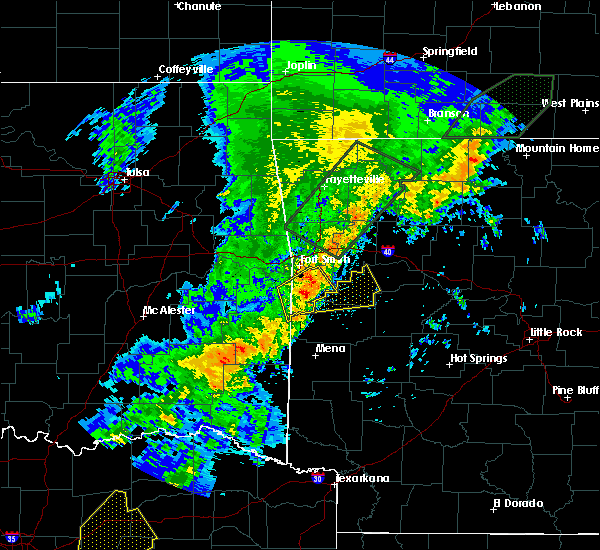 At 829 am cdt, a severe thunderstorm was located over mansfield, or 14 miles northwest of waldron, moving northeast at 40 mph (radar indicated). Hazards include 60 mph wind gusts and half dollar size hail. Hail damage to vehicles is expected. Expect wind damage to roofs, siding, and trees. At 829 am cdt, a severe thunderstorm was located over mansfield, or 14 miles northwest of waldron, moving northeast at 40 mph (radar indicated). Hazards include 60 mph wind gusts and half dollar size hail. Hail damage to vehicles is expected. Expect wind damage to roofs, siding, and trees.
|
| 4/21/2017 1:24 PM CDT |
 At 124 pm cdt, severe thunderstorms were located along a line extending from near mulberry to near echo to near morgan springs, moving east at 40 mph (radar indicated). Hazards include 60 mph wind gusts and quarter size hail. Hail damage to vehicles is expected. Expect wind damage to roofs, siding, and trees. At 124 pm cdt, severe thunderstorms were located along a line extending from near mulberry to near echo to near morgan springs, moving east at 40 mph (radar indicated). Hazards include 60 mph wind gusts and quarter size hail. Hail damage to vehicles is expected. Expect wind damage to roofs, siding, and trees.
|
| 4/21/2017 1:14 PM CDT |
 At 114 pm cdt, severe thunderstorms were located along a line extending from 3 miles northeast of lavaca to bloomer to huntington to 4 miles southwest of mansfield, moving east at 50 mph (radar indicated). Hazards include 60 mph wind gusts. Expect damage to roofs, siding, and trees. Locations in or near the path include, charleston, greenwood, lavaca, mansfield, hartford, huntington, branch, bloomer, washburn, burnville, fort chaffee, patterson, caulksville, arkola, crossroads, witcherville, dayton, milltown, ursula,. At 114 pm cdt, severe thunderstorms were located along a line extending from 3 miles northeast of lavaca to bloomer to huntington to 4 miles southwest of mansfield, moving east at 50 mph (radar indicated). Hazards include 60 mph wind gusts. Expect damage to roofs, siding, and trees. Locations in or near the path include, charleston, greenwood, lavaca, mansfield, hartford, huntington, branch, bloomer, washburn, burnville, fort chaffee, patterson, caulksville, arkola, crossroads, witcherville, dayton, milltown, ursula,.
|
| 4/21/2017 1:05 PM CDT |
 At 104 pm cdt, severe thunderstorms were located along a line extending from 2 miles northeast of barling to 2 miles northeast of jenny lind to 2 miles north of hartford to 8 miles southwest of midland, moving east at 50 mph (radar indicated). Hazards include 60 mph wind gusts. Expect damage to roofs, siding, and trees. Locations in or near the path include, fort smith, charleston, greenwood, barling, lavaca, mansfield, hackett, hartford, huntington, bonanza, branch, midland, excelsior, bloomer, washburn, burnville, fort chaffee, jenny lind, central city, patterson, this includes interstate 540 between mile markers 9 and 14. At 104 pm cdt, severe thunderstorms were located along a line extending from 2 miles northeast of barling to 2 miles northeast of jenny lind to 2 miles north of hartford to 8 miles southwest of midland, moving east at 50 mph (radar indicated). Hazards include 60 mph wind gusts. Expect damage to roofs, siding, and trees. Locations in or near the path include, fort smith, charleston, greenwood, barling, lavaca, mansfield, hackett, hartford, huntington, bonanza, branch, midland, excelsior, bloomer, washburn, burnville, fort chaffee, jenny lind, central city, patterson, this includes interstate 540 between mile markers 9 and 14.
|
| 4/21/2017 12:38 PM CDT |
 At 1238 pm cdt, severe thunderstorms were located along a line extending from 4 miles northwest of spiro to 2 miles east of panama to near fanshawe to 3 miles southwest of talimena state park, moving east at 55 mph (radar indicated). Hazards include 60 mph wind gusts. Expect damage to roofs, siding, and trees. Locations in or near the path include, fort smith, poteau, charleston, greenwood, barling, pocola, heavener, lavaca, spiro, arkoma, panama, mansfield, talihina, wister, hackett, howe, hartford, huntington, bonanza, red oak, this includes interstate 540 between mile markers 9 and 14. At 1238 pm cdt, severe thunderstorms were located along a line extending from 4 miles northwest of spiro to 2 miles east of panama to near fanshawe to 3 miles southwest of talimena state park, moving east at 55 mph (radar indicated). Hazards include 60 mph wind gusts. Expect damage to roofs, siding, and trees. Locations in or near the path include, fort smith, poteau, charleston, greenwood, barling, pocola, heavener, lavaca, spiro, arkoma, panama, mansfield, talihina, wister, hackett, howe, hartford, huntington, bonanza, red oak, this includes interstate 540 between mile markers 9 and 14.
|
| 4/21/2017 7:56 AM CDT |
 The severe thunderstorm warning for eastern franklin county will expire at 800 am cdt, the storms which prompted the warning have moved out of the area. therefore the warning will be allowed to expire. to report severe weather, contact your nearest law enforcement agency. they will relay your report to the national weather service tulsa. The severe thunderstorm warning for eastern franklin county will expire at 800 am cdt, the storms which prompted the warning have moved out of the area. therefore the warning will be allowed to expire. to report severe weather, contact your nearest law enforcement agency. they will relay your report to the national weather service tulsa.
|
| 4/21/2017 7:36 AM CDT |
 At 736 am cdt, severe thunderstorms were located along a line extending from 4 miles south of cass to wiederkehr village to 3 miles southwest of denning, moving east at 35 mph (radar indicated). Hazards include 70 mph wind gusts and nickel size hail. Expect considerable tree damage. damage is likely to mobile homes, roofs, and outbuildings. Locations in or near the path include, ozark, altus, denning, wiederkehr village, cass, caulksville, jethro, etna, alix, barnes, redding, watalula, meg, turners bend, taft, paradise, this includes interstate 40 in arkansas between mile markers 31 and 42. At 736 am cdt, severe thunderstorms were located along a line extending from 4 miles south of cass to wiederkehr village to 3 miles southwest of denning, moving east at 35 mph (radar indicated). Hazards include 70 mph wind gusts and nickel size hail. Expect considerable tree damage. damage is likely to mobile homes, roofs, and outbuildings. Locations in or near the path include, ozark, altus, denning, wiederkehr village, cass, caulksville, jethro, etna, alix, barnes, redding, watalula, meg, turners bend, taft, paradise, this includes interstate 40 in arkansas between mile markers 31 and 42.
|
| 4/21/2017 7:25 AM CDT |
 At 725 am cdt, severe thunderstorms were located along a line extending from 4 miles west of cass to 5 miles north of ratcliff, moving east at 35 mph (radar indicated). Hazards include 70 mph wind gusts and nickel size hail. Expect considerable tree damage. damage is likely to mobile homes, roofs, and outbuildings. Locations in or near the path include, ozark, mulberry, altus, branch, denning, wiederkehr village, cass, fern, caulksville, jethro, turners bend, vesta, lonelm, cecil, etna, alix, barnes, redding, watalula, meg, this includes interstate 40 in arkansas between mile markers 24 and 42. At 725 am cdt, severe thunderstorms were located along a line extending from 4 miles west of cass to 5 miles north of ratcliff, moving east at 35 mph (radar indicated). Hazards include 70 mph wind gusts and nickel size hail. Expect considerable tree damage. damage is likely to mobile homes, roofs, and outbuildings. Locations in or near the path include, ozark, mulberry, altus, branch, denning, wiederkehr village, cass, fern, caulksville, jethro, turners bend, vesta, lonelm, cecil, etna, alix, barnes, redding, watalula, meg, this includes interstate 40 in arkansas between mile markers 24 and 42.
|
| 4/4/2017 9:10 PM CDT |
 The severe thunderstorm warning for southwestern madison, franklin, sebastian, central crawford and east central le flore counties will expire at 915 pm cdt, the storms which prompted the warning have moved out of the area. therefore the warning will be allowed to expire. a severe thunderstorm watch remains in effect until 1100 pm cdt for northwestern and west central arkansas, and southeastern oklahoma. The severe thunderstorm warning for southwestern madison, franklin, sebastian, central crawford and east central le flore counties will expire at 915 pm cdt, the storms which prompted the warning have moved out of the area. therefore the warning will be allowed to expire. a severe thunderstorm watch remains in effect until 1100 pm cdt for northwestern and west central arkansas, and southeastern oklahoma.
|
| 4/4/2017 8:46 PM CDT |
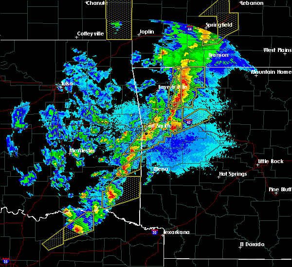 At 845 pm cdt, a severe thunderstorm was located near ratcliff, or 8 miles northwest of paris, moving northeast at 45 mph (radar indicated). Hazards include 60 mph wind gusts and quarter size hail. Hail damage to vehicles is expected. Expect wind damage to roofs, siding, and trees. At 845 pm cdt, a severe thunderstorm was located near ratcliff, or 8 miles northwest of paris, moving northeast at 45 mph (radar indicated). Hazards include 60 mph wind gusts and quarter size hail. Hail damage to vehicles is expected. Expect wind damage to roofs, siding, and trees.
|
| 4/4/2017 8:44 PM CDT |
 At 844 pm cdt, severe thunderstorms were located along a line extending from near cass to 3 miles northeast of ratcliff to 3 miles southwest of excelsior, moving east at 75 mph (radar indicated). Hazards include 60 mph wind gusts and quarter size hail. Hail damage to vehicles is expected. expect wind damage to roofs, siding, and trees. locations in or near the path include, fort smith, van buren, poteau, ozark, charleston, mountainburg, greenwood, alma, barling, pocola, lavaca, mulberry, mansfield, wister, dyer, hackett, howe, altus, hartford, huntington, this includes the following highways, interstate 40 in arkansas between mile markers 7 and 42. interstate 540 between mile markers 1 and 14. Interstate 49 between mile markers 22 and 29. At 844 pm cdt, severe thunderstorms were located along a line extending from near cass to 3 miles northeast of ratcliff to 3 miles southwest of excelsior, moving east at 75 mph (radar indicated). Hazards include 60 mph wind gusts and quarter size hail. Hail damage to vehicles is expected. expect wind damage to roofs, siding, and trees. locations in or near the path include, fort smith, van buren, poteau, ozark, charleston, mountainburg, greenwood, alma, barling, pocola, lavaca, mulberry, mansfield, wister, dyer, hackett, howe, altus, hartford, huntington, this includes the following highways, interstate 40 in arkansas between mile markers 7 and 42. interstate 540 between mile markers 1 and 14. Interstate 49 between mile markers 22 and 29.
|
| 4/4/2017 8:15 PM CDT |
 At 815 pm cdt, severe thunderstorms were located along a line extending from 2 miles southeast of devils den state park to 2 miles southeast of wister, moving northeast at 60 mph (radar indicated). Hazards include 60 mph wind gusts and quarter size hail. Hail damage to vehicles is expected. expect wind damage to roofs, siding, and trees. locations in or near the path include, fort smith, van buren, poteau, ozark, charleston, cedarville, mountainburg, greenwood, alma, barling, pocola, lavaca, arkoma, mulberry, mansfield, wister, dyer, hackett, howe, altus, this includes the following highways, interstate 40 in arkansas between mile markers 0 and 42. interstate 40 in oklahoma near mile marker 328. interstate 540 between mile markers 1 and 14. Interstate 49 between mile markers 22 and 39. At 815 pm cdt, severe thunderstorms were located along a line extending from 2 miles southeast of devils den state park to 2 miles southeast of wister, moving northeast at 60 mph (radar indicated). Hazards include 60 mph wind gusts and quarter size hail. Hail damage to vehicles is expected. expect wind damage to roofs, siding, and trees. locations in or near the path include, fort smith, van buren, poteau, ozark, charleston, cedarville, mountainburg, greenwood, alma, barling, pocola, lavaca, arkoma, mulberry, mansfield, wister, dyer, hackett, howe, altus, this includes the following highways, interstate 40 in arkansas between mile markers 0 and 42. interstate 40 in oklahoma near mile marker 328. interstate 540 between mile markers 1 and 14. Interstate 49 between mile markers 22 and 39.
|
| 3/26/2017 11:15 PM CDT |
 At 1115 pm cdt, severe thunderstorms were located along a line extending from 3 miles southeast of cass to 2 miles north of wiederkehr village to 4 miles northwest of paris, moving northeast at 45 mph (radar indicated). Hazards include 60 mph wind gusts and penny size hail. Expect damage to roofs, siding, and trees. Locations in or near the path include, ozark, altus, denning, wiederkehr village, caulksville, etna, alix, watalula, taft, meg, this includes interstate 40 in arkansas between mile markers 32 and 42. At 1115 pm cdt, severe thunderstorms were located along a line extending from 3 miles southeast of cass to 2 miles north of wiederkehr village to 4 miles northwest of paris, moving northeast at 45 mph (radar indicated). Hazards include 60 mph wind gusts and penny size hail. Expect damage to roofs, siding, and trees. Locations in or near the path include, ozark, altus, denning, wiederkehr village, caulksville, etna, alix, watalula, taft, meg, this includes interstate 40 in arkansas between mile markers 32 and 42.
|
| 3/26/2017 11:04 PM CDT |
 At 1104 pm cdt, severe thunderstorms were located along a line extending from 7 miles southeast of fern to 4 miles southwest of ozark to 3 miles southeast of charleston, moving northeast at 45 mph (radar indicated). Hazards include 60 mph wind gusts and penny size hail. Expect damage to roofs, siding, and trees. Locations in or near the path include, ozark, charleston, mulberry, altus, branch, denning, wiederkehr village, fort chaffee, caulksville, etna, alix, watalula, meg, toney, peter pender, vesta, lonelm, cecil, taft, cravens, this includes interstate 40 in arkansas between mile markers 25 and 42. At 1104 pm cdt, severe thunderstorms were located along a line extending from 7 miles southeast of fern to 4 miles southwest of ozark to 3 miles southeast of charleston, moving northeast at 45 mph (radar indicated). Hazards include 60 mph wind gusts and penny size hail. Expect damage to roofs, siding, and trees. Locations in or near the path include, ozark, charleston, mulberry, altus, branch, denning, wiederkehr village, fort chaffee, caulksville, etna, alix, watalula, meg, toney, peter pender, vesta, lonelm, cecil, taft, cravens, this includes interstate 40 in arkansas between mile markers 25 and 42.
|
| 3/26/2017 10:44 PM CDT |
 At 1043 pm cdt, severe thunderstorms were located along a line extending from 6 miles south of dyer to 3 miles east of lavaca to near burnville, moving northeast at 50 mph (radar indicated). Hazards include 60 mph wind gusts and penny size hail. Expect damage to roofs, siding, and trees. Locations in or near the path include, ozark, charleston, greenwood, lavaca, mulberry, altus, branch, denning, wiederkehr village, bloomer, washburn, burnville, fort chaffee, caulksville, dayton, milltown, vesta, lonelm, cecil, ursula, this includes interstate 40 in arkansas between mile markers 25 and 42. At 1043 pm cdt, severe thunderstorms were located along a line extending from 6 miles south of dyer to 3 miles east of lavaca to near burnville, moving northeast at 50 mph (radar indicated). Hazards include 60 mph wind gusts and penny size hail. Expect damage to roofs, siding, and trees. Locations in or near the path include, ozark, charleston, greenwood, lavaca, mulberry, altus, branch, denning, wiederkehr village, bloomer, washburn, burnville, fort chaffee, caulksville, dayton, milltown, vesta, lonelm, cecil, ursula, this includes interstate 40 in arkansas between mile markers 25 and 42.
|
| 3/24/2017 7:28 PM CDT |
 At 727 pm cdt, severe thunderstorms were located along a line extending from 4 miles north of cass to 3 miles south of branch, moving northeast at 40 mph. wind gusts in excess of 50 mph were reported near ozark (radar indicated). Hazards include 60 mph wind gusts. Expect damage to roofs, siding, and trees. Locations in or near the path include, ozark, charleston, greenwood, lavaca, mulberry, dyer, altus, huntington, branch, denning, wiederkehr village, cass, bloomer, washburn, fern, burnville, fort chaffee, caulksville, jethro, bidville, this includes interstate 40 in arkansas between mile markers 17 and 42. At 727 pm cdt, severe thunderstorms were located along a line extending from 4 miles north of cass to 3 miles south of branch, moving northeast at 40 mph. wind gusts in excess of 50 mph were reported near ozark (radar indicated). Hazards include 60 mph wind gusts. Expect damage to roofs, siding, and trees. Locations in or near the path include, ozark, charleston, greenwood, lavaca, mulberry, dyer, altus, huntington, branch, denning, wiederkehr village, cass, bloomer, washburn, fern, burnville, fort chaffee, caulksville, jethro, bidville, this includes interstate 40 in arkansas between mile markers 17 and 42.
|
| 3/24/2017 7:03 PM CDT |
 At 703 pm cdt, severe thunderstorms were located along a line extending from 6 miles north of fern to 5 miles northeast of oliver, moving northeast at 45 mph (radar indicated). Hazards include 60 mph wind gusts. Expect damage to roofs, siding, and trees. locations in or near the path include, ozark, charleston, mountainburg, greenwood, alma, barling, lavaca, mulberry, mansfield, dyer, altus, huntington, branch, denning, chester, wiederkehr village, bloomer, lake fort smith, burnville, cass, this includes the following highways, interstate 40 in arkansas between mile markers 10 and 42. Interstate 49 between mile markers 22 and 39. At 703 pm cdt, severe thunderstorms were located along a line extending from 6 miles north of fern to 5 miles northeast of oliver, moving northeast at 45 mph (radar indicated). Hazards include 60 mph wind gusts. Expect damage to roofs, siding, and trees. locations in or near the path include, ozark, charleston, mountainburg, greenwood, alma, barling, lavaca, mulberry, mansfield, dyer, altus, huntington, branch, denning, chester, wiederkehr village, bloomer, lake fort smith, burnville, cass, this includes the following highways, interstate 40 in arkansas between mile markers 10 and 42. Interstate 49 between mile markers 22 and 39.
|
| 3/1/2017 1:39 AM CST |
 The severe thunderstorm warning for southeastern madison, franklin, central sebastian and eastern crawford counties will expire at 145 am cst, the storms which prompted the warning have weakened below severe limits, and have exited the warned area. therefore the warning will be allowed to expire. however gusty winds are still possible with these thunderstorms. a tornado watch remains in effect until 400 am cst for northwestern arkansas. a tornado watch also remains in effect until 600 am cst for northwestern and west central arkansas. The severe thunderstorm warning for southeastern madison, franklin, central sebastian and eastern crawford counties will expire at 145 am cst, the storms which prompted the warning have weakened below severe limits, and have exited the warned area. therefore the warning will be allowed to expire. however gusty winds are still possible with these thunderstorms. a tornado watch remains in effect until 400 am cst for northwestern arkansas. a tornado watch also remains in effect until 600 am cst for northwestern and west central arkansas.
|
| 3/1/2017 1:24 AM CST |
 At 124 am cst, severe thunderstorms were located along a line extending from 9 miles south of pettigrew to 7 miles west of woodland to near denning, moving east at 75 mph (radar indicated). Hazards include 70 mph wind gusts and quarter size hail. Hail damage to vehicles is expected. expect considerable tree damage. wind damage is also likely to mobile homes, roofs, and outbuildings. locations impacted include, russellville, clarksville, paris, dardanelle, lamar, dover, london, knoxville, subiaco, hartman, hector, scranton, ratcliff, lake dardanelle state park, witts spring, moore, devils knob, hoyt, midway in logan county, taral, this includes interstate 40 between mile markers 45 and 84. A tornado watch remains in effect until 600 am cst for western, central and north central arkansas. At 124 am cst, severe thunderstorms were located along a line extending from 9 miles south of pettigrew to 7 miles west of woodland to near denning, moving east at 75 mph (radar indicated). Hazards include 70 mph wind gusts and quarter size hail. Hail damage to vehicles is expected. expect considerable tree damage. wind damage is also likely to mobile homes, roofs, and outbuildings. locations impacted include, russellville, clarksville, paris, dardanelle, lamar, dover, london, knoxville, subiaco, hartman, hector, scranton, ratcliff, lake dardanelle state park, witts spring, moore, devils knob, hoyt, midway in logan county, taral, this includes interstate 40 between mile markers 45 and 84. A tornado watch remains in effect until 600 am cst for western, central and north central arkansas.
|
| 3/1/2017 1:09 AM CST |
 At 109 am cst, severe thunderstorms were located along a line extending from 4 miles southwest of saint paul to 3 miles north of charleston to 2 miles southwest of hackett, moving east at 40 mph (radar indicated). Hazards include 70 mph wind gusts and quarter size hail. Hail damage to vehicles is expected. expect considerable tree damage. wind damage is also likely to mobile homes, roofs, and outbuildings. locations in or near the path include, ozark, charleston, greenwood, lavaca, mulberry, hackett, altus, branch, denning, st. paul, wiederkehr village, cass, saint paul, excelsior, boston, bloomer, pettigrew, washburn, burnville, fort chaffee, this includes interstate 40 in arkansas between mile markers 21 and 42. a tornado watch remains in effect until 400 am cst for northwestern arkansas. A tornado watch also remains in effect until 600 am cst for northwestern and west central arkansas. At 109 am cst, severe thunderstorms were located along a line extending from 4 miles southwest of saint paul to 3 miles north of charleston to 2 miles southwest of hackett, moving east at 40 mph (radar indicated). Hazards include 70 mph wind gusts and quarter size hail. Hail damage to vehicles is expected. expect considerable tree damage. wind damage is also likely to mobile homes, roofs, and outbuildings. locations in or near the path include, ozark, charleston, greenwood, lavaca, mulberry, hackett, altus, branch, denning, st. paul, wiederkehr village, cass, saint paul, excelsior, boston, bloomer, pettigrew, washburn, burnville, fort chaffee, this includes interstate 40 in arkansas between mile markers 21 and 42. a tornado watch remains in effect until 400 am cst for northwestern arkansas. A tornado watch also remains in effect until 600 am cst for northwestern and west central arkansas.
|
| 3/1/2017 1:07 AM CST |
 At 107 am cst, severe thunderstorms were located along a line extending from near fern to 6 miles south of mulberry to bloomer, moving east at 70 mph (radar indicated). Hazards include 60 mph wind gusts and quarter size hail. Hail damage to vehicles is expected. Expect wind damage to roofs, siding, and trees. At 107 am cst, severe thunderstorms were located along a line extending from near fern to 6 miles south of mulberry to bloomer, moving east at 70 mph (radar indicated). Hazards include 60 mph wind gusts and quarter size hail. Hail damage to vehicles is expected. Expect wind damage to roofs, siding, and trees.
|
| 7/14/2016 4:06 PM CDT |
 At 405 pm cdt, severe thunderstorms were located along a line extending from 10 miles north of woodland to near paris to near hatfield, moving east at 55 mph (trained weather spotters reported 65 mph winds and damage to trees and shingles blown off of roofs in paris). Hazards include 70 mph wind gusts and quarter size hail. Hail damage to vehicles is expected. expect considerable tree damage. wind damage is also likely to mobile homes, roofs, and outbuildings. Locations impacted include, clarksville, mena, booneville, waldron, paris, danville, mount ida, lamar, mansfield, london, magazine, knoxville, subiaco, hartman, hatfield, norman, oden, scranton, ratcliff, blue mountain,. At 405 pm cdt, severe thunderstorms were located along a line extending from 10 miles north of woodland to near paris to near hatfield, moving east at 55 mph (trained weather spotters reported 65 mph winds and damage to trees and shingles blown off of roofs in paris). Hazards include 70 mph wind gusts and quarter size hail. Hail damage to vehicles is expected. expect considerable tree damage. wind damage is also likely to mobile homes, roofs, and outbuildings. Locations impacted include, clarksville, mena, booneville, waldron, paris, danville, mount ida, lamar, mansfield, london, magazine, knoxville, subiaco, hartman, hatfield, norman, oden, scranton, ratcliff, blue mountain,.
|
| 7/14/2016 3:54 PM CDT |
 At 354 pm cdt, severe thunderstorms were located along a line extending from 2 miles southwest of saint paul to 5 miles north of ratcliff to 2 miles southwest of huntington, moving southeast at 40 mph (radar indicated). Hazards include 60 mph wind gusts and quarter size hail. Hail damage to vehicles is expected. expect wind damage to roofs, siding, and trees. Locations in or near the path include, ozark, charleston, greenwood, barling, lavaca, mulberry, mansfield, altus, hartford, huntington, branch, midland, denning, wiederkehr village, washburn, burnville, cass, fort chaffee, fern, jenny lind, this includes interstate 40 in arkansas between mile markers 24 and 42. At 354 pm cdt, severe thunderstorms were located along a line extending from 2 miles southwest of saint paul to 5 miles north of ratcliff to 2 miles southwest of huntington, moving southeast at 40 mph (radar indicated). Hazards include 60 mph wind gusts and quarter size hail. Hail damage to vehicles is expected. expect wind damage to roofs, siding, and trees. Locations in or near the path include, ozark, charleston, greenwood, barling, lavaca, mulberry, mansfield, altus, hartford, huntington, branch, midland, denning, wiederkehr village, washburn, burnville, cass, fort chaffee, fern, jenny lind, this includes interstate 40 in arkansas between mile markers 24 and 42.
|
| 7/14/2016 3:32 PM CDT |
 At 331 pm cdt, severe thunderstorms were located along a line extending from 7 miles east of brentwood to fern to 2 miles south of excelsior, moving east at 35 mph (radar indicated). Hazards include 60 mph wind gusts and quarter size hail. Hail damage to vehicles is expected. expect wind damage to roofs, siding, and trees. locations in or near the path include, ozark, charleston, greenwood, barling, lavaca, mulberry, mansfield, dyer, altus, hartford, huntington, branch, midland, denning, st. Paul, wiederkehr village, pettigrew, washburn, cass, witter, this includes interstate 40 in arkansas between mile markers 16 and 42. At 331 pm cdt, severe thunderstorms were located along a line extending from 7 miles east of brentwood to fern to 2 miles south of excelsior, moving east at 35 mph (radar indicated). Hazards include 60 mph wind gusts and quarter size hail. Hail damage to vehicles is expected. expect wind damage to roofs, siding, and trees. locations in or near the path include, ozark, charleston, greenwood, barling, lavaca, mulberry, mansfield, dyer, altus, hartford, huntington, branch, midland, denning, st. Paul, wiederkehr village, pettigrew, washburn, cass, witter, this includes interstate 40 in arkansas between mile markers 16 and 42.
|
| 7/14/2016 3:28 PM CDT |
 At 328 pm cdt, severe thunderstorms were located along a line extending from near brentwood to near burnville to near muse, moving east at 45 mph (radar indicated). Hazards include 60 mph wind gusts and quarter size hail. Hail damage to vehicles is expected. Expect wind damage to roofs, siding, and trees. At 328 pm cdt, severe thunderstorms were located along a line extending from near brentwood to near burnville to near muse, moving east at 45 mph (radar indicated). Hazards include 60 mph wind gusts and quarter size hail. Hail damage to vehicles is expected. Expect wind damage to roofs, siding, and trees.
|
| 5/9/2016 8:24 PM CDT |
 At 824 pm cdt, a severe thunderstorm was located near bloomer, moving northeast at 40 mph (radar indicated). Hazards include 60 mph wind gusts. Expect damage to roofs. siding. and trees. locations in or near the path include, fort smith, ozark, charleston, greenwood, barling, lavaca, mulberry, hackett, altus, bonanza, branch, midland, denning, wiederkehr village, washburn, burnville, fort chaffee, jenny lind, excelsior, bloomer, this includes the following highways, interstate 40 in arkansas between mile markers 28 and 38. interstate 540 between mile markers 8 and 14. A tornado watch remains in effect until 900 pm cdt for northwestern arkansas. At 824 pm cdt, a severe thunderstorm was located near bloomer, moving northeast at 40 mph (radar indicated). Hazards include 60 mph wind gusts. Expect damage to roofs. siding. and trees. locations in or near the path include, fort smith, ozark, charleston, greenwood, barling, lavaca, mulberry, hackett, altus, bonanza, branch, midland, denning, wiederkehr village, washburn, burnville, fort chaffee, jenny lind, excelsior, bloomer, this includes the following highways, interstate 40 in arkansas between mile markers 28 and 38. interstate 540 between mile markers 8 and 14. A tornado watch remains in effect until 900 pm cdt for northwestern arkansas.
|
| 5/9/2016 8:14 PM CDT |
 At 813 pm cdt, a severe thunderstorm was located over jenny lind, moving northeast at 40 mph (radar indicated). Hazards include 60 mph wind gusts and quarter size hail. Hail damage to vehicles is expected. expect wind damage to roofs, siding, and trees. locations in or near the path include, fort smith, ozark, charleston, greenwood, barling, lavaca, mulberry, hackett, altus, bonanza, branch, midland, denning, wiederkehr village, washburn, burnville, fort chaffee, jenny lind, excelsior, bloomer, this includes the following highways, interstate 40 in arkansas between mile markers 28 and 38. interstate 540 between mile markers 8 and 14. A tornado watch remains in effect until 900 pm cdt for northwestern arkansas. At 813 pm cdt, a severe thunderstorm was located over jenny lind, moving northeast at 40 mph (radar indicated). Hazards include 60 mph wind gusts and quarter size hail. Hail damage to vehicles is expected. expect wind damage to roofs, siding, and trees. locations in or near the path include, fort smith, ozark, charleston, greenwood, barling, lavaca, mulberry, hackett, altus, bonanza, branch, midland, denning, wiederkehr village, washburn, burnville, fort chaffee, jenny lind, excelsior, bloomer, this includes the following highways, interstate 40 in arkansas between mile markers 28 and 38. interstate 540 between mile markers 8 and 14. A tornado watch remains in effect until 900 pm cdt for northwestern arkansas.
|
| 5/9/2016 8:05 PM CDT |
 At 805 pm cdt, a severe thunderstorm was located 3 miles southwest of jenny lind, moving northeast at 40 mph (radar indicated). Hazards include 60 mph wind gusts and quarter size hail. Hail damage to vehicles is expected. expect wind damage to roofs, siding, and trees. locations in or near the path include, fort smith, ozark, charleston, greenwood, barling, pocola, lavaca, arkoma, mulberry, hackett, altus, bonanza, branch, denning, wiederkehr village, washburn, burnville, fort chaffee, jenny lind, excelsior, this includes the following highways, interstate 40 in arkansas between mile markers 28 and 38. interstate 540 between mile markers 8 and 14. A tornado watch remains in effect until 900 pm cdt for northwestern arkansas, and southeastern oklahoma. At 805 pm cdt, a severe thunderstorm was located 3 miles southwest of jenny lind, moving northeast at 40 mph (radar indicated). Hazards include 60 mph wind gusts and quarter size hail. Hail damage to vehicles is expected. expect wind damage to roofs, siding, and trees. locations in or near the path include, fort smith, ozark, charleston, greenwood, barling, pocola, lavaca, arkoma, mulberry, hackett, altus, bonanza, branch, denning, wiederkehr village, washburn, burnville, fort chaffee, jenny lind, excelsior, this includes the following highways, interstate 40 in arkansas between mile markers 28 and 38. interstate 540 between mile markers 8 and 14. A tornado watch remains in effect until 900 pm cdt for northwestern arkansas, and southeastern oklahoma.
|
| 4/27/2016 1:58 AM CDT |
 At 157 am cdt, severe thunderstorms were located along a line extending from grandview to near pettigrew to near booneville, moving east at 50 mph (radar indicated). Hazards include 60 mph wind gusts and penny size hail. Expect damage to roofs. siding. and trees. Locations impacted include, harrison, clarksville, paris, jasper, lamar, knoxville, subiaco, hartman, bergman, scranton, ratcliff, omaha, tokalon, capps, upper buffalo wilder, self, devils knob, walnut, hinkle, holman,. At 157 am cdt, severe thunderstorms were located along a line extending from grandview to near pettigrew to near booneville, moving east at 50 mph (radar indicated). Hazards include 60 mph wind gusts and penny size hail. Expect damage to roofs. siding. and trees. Locations impacted include, harrison, clarksville, paris, jasper, lamar, knoxville, subiaco, hartman, bergman, scranton, ratcliff, omaha, tokalon, capps, upper buffalo wilder, self, devils knob, walnut, hinkle, holman,.
|
| 4/27/2016 1:34 AM CDT |
 At 134 am cdt, severe thunderstorms were located along a line extending from near saint paul to 4 miles east of wiederkehr village to 6 miles south of echo, moving east at 55 mph (radar indicated). Hazards include 60 mph wind gusts and penny size hail. Expect damage to roofs. siding. and trees. Locations in or near the path include, ozark, charleston, altus, branch, denning, wiederkehr village, cass, caulksville, toney, alix, watalula, etna, cravens, redding, lonelm, jethro, barnes, paradise, taft, peter pender, this includes interstate 40 in arkansas between mile markers 26 and 42. At 134 am cdt, severe thunderstorms were located along a line extending from near saint paul to 4 miles east of wiederkehr village to 6 miles south of echo, moving east at 55 mph (radar indicated). Hazards include 60 mph wind gusts and penny size hail. Expect damage to roofs. siding. and trees. Locations in or near the path include, ozark, charleston, altus, branch, denning, wiederkehr village, cass, caulksville, toney, alix, watalula, etna, cravens, redding, lonelm, jethro, barnes, paradise, taft, peter pender, this includes interstate 40 in arkansas between mile markers 26 and 42.
|
| 4/27/2016 1:25 AM CDT |
 At 125 am cdt, severe thunderstorms were located along a line extending from garfield to 6 miles east of brentwood to near washburn, moving east at 50 mph (radar indicated). Hazards include 60 mph wind gusts and penny size hail. Expect damage to roofs. siding. And trees. At 125 am cdt, severe thunderstorms were located along a line extending from garfield to 6 miles east of brentwood to near washburn, moving east at 50 mph (radar indicated). Hazards include 60 mph wind gusts and penny size hail. Expect damage to roofs. siding. And trees.
|
| 4/27/2016 1:16 AM CDT |
 At 116 am cdt, severe thunderstorms were located along a line extending from 6 miles east of winslow to 6 miles southeast of mulberry to 3 miles south of hartford, moving east at 55 mph (radar indicated). Hazards include 60 mph wind gusts and penny size hail. Expect damage to roofs. siding. and trees. locations in or near the path include, ozark, charleston, mountainburg, greenwood, alma, lavaca, mulberry, mansfield, dyer, altus, hartford, huntington, branch, midland, denning, chester, rudy, wiederkehr village, washburn, cass, this includes the following highways, interstate 40 in arkansas between mile markers 10 and 42. Interstate 49 between mile markers 22 and 41. At 116 am cdt, severe thunderstorms were located along a line extending from 6 miles east of winslow to 6 miles southeast of mulberry to 3 miles south of hartford, moving east at 55 mph (radar indicated). Hazards include 60 mph wind gusts and penny size hail. Expect damage to roofs. siding. and trees. locations in or near the path include, ozark, charleston, mountainburg, greenwood, alma, lavaca, mulberry, mansfield, dyer, altus, hartford, huntington, branch, midland, denning, chester, rudy, wiederkehr village, washburn, cass, this includes the following highways, interstate 40 in arkansas between mile markers 10 and 42. Interstate 49 between mile markers 22 and 41.
|
| 4/27/2016 1:12 AM CDT |
 At 112 am cdt, severe thunderstorms were located along a line extending from morgan springs to near mena intermountain airport to near grannis, moving east at 45 mph (radar indicated). Hazards include 60 mph wind gusts. Expect damage to roofs. siding. and trees. Locations impacted include, mena, booneville, waldron, paris, mansfield, magazine, wickes, grannis, hatfield, oden, ratcliff, blue mountain, daisy, vandervoort, beauchamp, mccauley, hartley, cossatot river state, mimosa, little missouri fall,. At 112 am cdt, severe thunderstorms were located along a line extending from morgan springs to near mena intermountain airport to near grannis, moving east at 45 mph (radar indicated). Hazards include 60 mph wind gusts. Expect damage to roofs. siding. and trees. Locations impacted include, mena, booneville, waldron, paris, mansfield, magazine, wickes, grannis, hatfield, oden, ratcliff, blue mountain, daisy, vandervoort, beauchamp, mccauley, hartley, cossatot river state, mimosa, little missouri fall,.
|
| 4/27/2016 1:08 AM CDT |
 At 107 am cdt, severe thunderstorms capable of producing a tornado were located along a line extending from 3 miles south of mulberry to 2 miles northwest of charleston, moving east at 55 mph (radar indicated rotation). Hazards include tornado. Flying debris will be dangerous to those caught without shelter. mobile homes will be damaged or destroyed. damage to roofs, windows, and vehicles will occur. tree damage is likely. Locations in or near the path include, ozark, charleston, mulberry, dyer, altus, branch, denning, wiederkehr village, caulksville, toney, vesta, alix, watalula, etna, cravens, lonelm, ursula, peter pender, cecil, meg, this includes interstate 40 in arkansas between mile markers 25 and 42. At 107 am cdt, severe thunderstorms capable of producing a tornado were located along a line extending from 3 miles south of mulberry to 2 miles northwest of charleston, moving east at 55 mph (radar indicated rotation). Hazards include tornado. Flying debris will be dangerous to those caught without shelter. mobile homes will be damaged or destroyed. damage to roofs, windows, and vehicles will occur. tree damage is likely. Locations in or near the path include, ozark, charleston, mulberry, dyer, altus, branch, denning, wiederkehr village, caulksville, toney, vesta, alix, watalula, etna, cravens, lonelm, ursula, peter pender, cecil, meg, this includes interstate 40 in arkansas between mile markers 25 and 42.
|
| 4/27/2016 1:03 AM CDT |
 At 102 am cdt, severe thunderstorms were located along a line extending from near heavener to near hatfield to 8 miles west of gillham, moving northeast at 50 mph (radar indicated). Hazards include 60 mph wind gusts. Expect damage to roofs. siding. and trees. Locations impacted include, mena, booneville, waldron, paris, mansfield, magazine, wickes, grannis, hatfield, oden, ratcliff, blue mountain, daisy, vandervoort, beauchamp, mccauley, hartley, cossatot river state, mimosa, little missouri fall,. At 102 am cdt, severe thunderstorms were located along a line extending from near heavener to near hatfield to 8 miles west of gillham, moving northeast at 50 mph (radar indicated). Hazards include 60 mph wind gusts. Expect damage to roofs. siding. and trees. Locations impacted include, mena, booneville, waldron, paris, mansfield, magazine, wickes, grannis, hatfield, oden, ratcliff, blue mountain, daisy, vandervoort, beauchamp, mccauley, hartley, cossatot river state, mimosa, little missouri fall,.
|
| 4/27/2016 12:54 AM CDT |
 At 1254 am cdt, severe thunderstorms were located along a line extending from 3 miles northeast of strickler to 4 miles southwest of lavaca to 4 miles north of mountain fork, moving east at 45 mph (radar indicated). Hazards include 60 mph wind gusts and penny size hail. Expect damage to roofs. siding. and trees. locations in or near the path include, fort smith, van buren, poteau, ozark, charleston, cedarville, mountainburg, natural dam, greenwood, alma, barling, pocola, heavener, roland, lavaca, arkoma, mulberry, mansfield, dyer, hackett, this includes the following highways, interstate 40 in arkansas between mile markers 0 and 42. interstate 40 in oklahoma between mile markers 324 and 328. interstate 540 between mile markers 1 and 14. Interstate 49 between mile markers 22 and 42. At 1254 am cdt, severe thunderstorms were located along a line extending from 3 miles northeast of strickler to 4 miles southwest of lavaca to 4 miles north of mountain fork, moving east at 45 mph (radar indicated). Hazards include 60 mph wind gusts and penny size hail. Expect damage to roofs. siding. and trees. locations in or near the path include, fort smith, van buren, poteau, ozark, charleston, cedarville, mountainburg, natural dam, greenwood, alma, barling, pocola, heavener, roland, lavaca, arkoma, mulberry, mansfield, dyer, hackett, this includes the following highways, interstate 40 in arkansas between mile markers 0 and 42. interstate 40 in oklahoma between mile markers 324 and 328. interstate 540 between mile markers 1 and 14. Interstate 49 between mile markers 22 and 42.
|
| 4/27/2016 12:34 AM CDT |
 At 1233 am cdt, severe thunderstorms were located along a line extending from 5 miles east of stilwell to 2 miles northwest of pocola to 3 miles southeast of muse, moving east at 45 mph (radar indicated). Hazards include 70 mph wind gusts and penny size hail. Expect considerable tree damage. damage is likely to mobile homes, roofs, and outbuildings. locations in or near the path include, fort smith, van buren, sallisaw, poteau, ozark, charleston, cedarville, mountainburg, natural dam, greenwood, alma, barling, pocola, muldrow, heavener, roland, lavaca, spiro, arkoma, mulberry, this includes the following highways, interstate 40 in arkansas between mile markers 0 and 42. interstate 40 in oklahoma between mile markers 307 and 328. interstate 540 between mile markers 1 and 14. Interstate 49 between mile markers 22 and 41. At 1233 am cdt, severe thunderstorms were located along a line extending from 5 miles east of stilwell to 2 miles northwest of pocola to 3 miles southeast of muse, moving east at 45 mph (radar indicated). Hazards include 70 mph wind gusts and penny size hail. Expect considerable tree damage. damage is likely to mobile homes, roofs, and outbuildings. locations in or near the path include, fort smith, van buren, sallisaw, poteau, ozark, charleston, cedarville, mountainburg, natural dam, greenwood, alma, barling, pocola, muldrow, heavener, roland, lavaca, spiro, arkoma, mulberry, this includes the following highways, interstate 40 in arkansas between mile markers 0 and 42. interstate 40 in oklahoma between mile markers 307 and 328. interstate 540 between mile markers 1 and 14. Interstate 49 between mile markers 22 and 41.
|
| 4/27/2016 12:31 AM CDT |
 At 1230 am cdt, severe thunderstorms were located along a line extending from near whitesboro to 12 miles south of octavia to 9 miles southwest of idabel, moving northeast at 55 mph (radar indicated). Hazards include 60 mph wind gusts. Expect damage to roofs. siding. And trees. At 1230 am cdt, severe thunderstorms were located along a line extending from near whitesboro to 12 miles south of octavia to 9 miles southwest of idabel, moving northeast at 55 mph (radar indicated). Hazards include 60 mph wind gusts. Expect damage to roofs. siding. And trees.
|
| 4/27/2016 12:16 AM CDT |
 At 1215 am cdt, severe thunderstorms were located along a line extending from 5 miles north of bunch to 3 miles northeast of bokoshe to 6 miles southwest of whitesboro, moving east at 45 mph (radar indicated). Hazards include 70 mph wind gusts and penny size hail. Expect considerable tree damage. damage is likely to mobile homes, roofs, and outbuildings. locations in or near the path include, fort smith, van buren, sallisaw, poteau, ozark, charleston, cedarville, mountainburg, natural dam, greenwood, alma, barling, pocola, muldrow, heavener, roland, lavaca, spiro, arkoma, mulberry, this includes the following highways, interstate 40 in arkansas between mile markers 0 and 42. interstate 40 in oklahoma between mile markers 293 and 328. interstate 540 between mile markers 1 and 14. Interstate 49 between mile markers 22 and 41. At 1215 am cdt, severe thunderstorms were located along a line extending from 5 miles north of bunch to 3 miles northeast of bokoshe to 6 miles southwest of whitesboro, moving east at 45 mph (radar indicated). Hazards include 70 mph wind gusts and penny size hail. Expect considerable tree damage. damage is likely to mobile homes, roofs, and outbuildings. locations in or near the path include, fort smith, van buren, sallisaw, poteau, ozark, charleston, cedarville, mountainburg, natural dam, greenwood, alma, barling, pocola, muldrow, heavener, roland, lavaca, spiro, arkoma, mulberry, this includes the following highways, interstate 40 in arkansas between mile markers 0 and 42. interstate 40 in oklahoma between mile markers 293 and 328. interstate 540 between mile markers 1 and 14. Interstate 49 between mile markers 22 and 41.
|
| 4/11/2016 4:23 AM CDT |
 At 423 am cdt, severe thunderstorms were located along a line extending from altus to paris to near magazine, moving east at 60 mph (radar indicated). Hazards include 70 mph wind gusts. Expect considerable tree damage. damage is likely to mobile homes, roofs, and outbuildings. Locations impacted include, clarksville, booneville, paris, lamar, london, magazine, knoxville, subiaco, hartman, scranton, ratcliff, blue mountain, tokalon, mount magazine, hinkle, holman, midway in logan coun, spadra, woodland, hoyt,. At 423 am cdt, severe thunderstorms were located along a line extending from altus to paris to near magazine, moving east at 60 mph (radar indicated). Hazards include 70 mph wind gusts. Expect considerable tree damage. damage is likely to mobile homes, roofs, and outbuildings. Locations impacted include, clarksville, booneville, paris, lamar, london, magazine, knoxville, subiaco, hartman, scranton, ratcliff, blue mountain, tokalon, mount magazine, hinkle, holman, midway in logan coun, spadra, woodland, hoyt,.
|
| 4/11/2016 4:07 AM CDT |
 At 407 am cdt, severe thunderstorms were located along a line extending from near charleston to near fort chaffee to echo, moving east at 55 mph (radar indicated). Hazards include 60 mph wind gusts. Expect damage to roofs. siding. And trees. At 407 am cdt, severe thunderstorms were located along a line extending from near charleston to near fort chaffee to echo, moving east at 55 mph (radar indicated). Hazards include 60 mph wind gusts. Expect damage to roofs. siding. And trees.
|
| 3/23/2016 11:24 PM CDT |
 At 1124 pm cdt, severe thunderstorms were located along a line extending from 5 miles southwest of ozark to 3 miles north of booneville, moving northeast at 45 mph (radar indicated). Hazards include 60 mph wind gusts and quarter size hail. Hail damage to vehicles is expected. expect wind damage to roofs, siding, and trees. Locations in or near the path include, ozark, charleston, altus, branch, denning, wiederkehr village, fort chaffee, caulksville, vesta, alix, etna, peter pender, cecil, meg, this includes interstate 40 in arkansas between mile markers 37 and 42. At 1124 pm cdt, severe thunderstorms were located along a line extending from 5 miles southwest of ozark to 3 miles north of booneville, moving northeast at 45 mph (radar indicated). Hazards include 60 mph wind gusts and quarter size hail. Hail damage to vehicles is expected. expect wind damage to roofs, siding, and trees. Locations in or near the path include, ozark, charleston, altus, branch, denning, wiederkehr village, fort chaffee, caulksville, vesta, alix, etna, peter pender, cecil, meg, this includes interstate 40 in arkansas between mile markers 37 and 42.
|
| 3/23/2016 11:14 PM CDT |
 At 1114 pm cdt, severe thunderstorms were located along a line extending from 6 miles northwest of branch to 4 miles southeast of washburn, moving northeast at 40 mph (radar indicated). Hazards include 60 mph wind gusts and quarter size hail. Hail damage to vehicles is expected. expect wind damage to roofs, siding, and trees. Locations in or near the path include, ozark, charleston, greenwood, lavaca, altus, huntington, branch, denning, wiederkehr village, fort chaffee, washburn, burnville, bloomer, caulksville, crossroads, vesta, alix, etna, dayton, milltown, this includes interstate 40 in arkansas between mile markers 37 and 42. At 1114 pm cdt, severe thunderstorms were located along a line extending from 6 miles northwest of branch to 4 miles southeast of washburn, moving northeast at 40 mph (radar indicated). Hazards include 60 mph wind gusts and quarter size hail. Hail damage to vehicles is expected. expect wind damage to roofs, siding, and trees. Locations in or near the path include, ozark, charleston, greenwood, lavaca, altus, huntington, branch, denning, wiederkehr village, fort chaffee, washburn, burnville, bloomer, caulksville, crossroads, vesta, alix, etna, dayton, milltown, this includes interstate 40 in arkansas between mile markers 37 and 42.
|
| 3/23/2016 10:42 PM CDT |
 At 1042 pm cdt, severe thunderstorms were located along a line extending from near greenwood to 3 miles northwest of oliver, moving northeast at 45 mph (radar indicated). Hazards include 60 mph wind gusts and nickel size hail. Expect damage to roofs. siding. and trees. Locations in or near the path include, ozark, charleston, greenwood, lavaca, mansfield, altus, huntington, branch, denning, wiederkehr village, washburn, burnville, fort chaffee, jenny lind, excelsior, bloomer, caulksville, crossroads, cecil, vesta, this includes interstate 40 in arkansas between mile markers 37 and 42. At 1042 pm cdt, severe thunderstorms were located along a line extending from near greenwood to 3 miles northwest of oliver, moving northeast at 45 mph (radar indicated). Hazards include 60 mph wind gusts and nickel size hail. Expect damage to roofs. siding. and trees. Locations in or near the path include, ozark, charleston, greenwood, lavaca, mansfield, altus, huntington, branch, denning, wiederkehr village, washburn, burnville, fort chaffee, jenny lind, excelsior, bloomer, caulksville, crossroads, cecil, vesta, this includes interstate 40 in arkansas between mile markers 37 and 42.
|
| 3/13/2016 4:41 PM CDT |
 At 441 pm cdt, a severe thunderstorm was located near booneville, moving east at 25 mph (radar indicated). Hazards include golf ball size hail and 60 mph wind gusts. People and animals outdoors will be injured. expect hail damage to roofs, siding, windows, and vehicles. Expect wind damage to roofs, siding, and trees. At 441 pm cdt, a severe thunderstorm was located near booneville, moving east at 25 mph (radar indicated). Hazards include golf ball size hail and 60 mph wind gusts. People and animals outdoors will be injured. expect hail damage to roofs, siding, windows, and vehicles. Expect wind damage to roofs, siding, and trees.
|
| 12/23/2015 4:08 AM CST |
 At 407 am cst, severe thunderstorms were located along a line extending from 5 miles south of saint paul to 2 miles north of ozark to 4 miles southwest of branch, moving northeast at 45 mph (radar indicated). Hazards include 60 mph wind gusts and penny size hail. Expect damage to roofs. siding. and trees. Locations in or near the path include, ozark, charleston, altus, branch, denning, wiederkehr village, cass, caulksville, toney, alix, watalula, etna, cravens, redding, lonelm, jethro, barnes, paradise, taft, peter pender, this includes interstate 40 in arkansas between mile markers 27 and 42. At 407 am cst, severe thunderstorms were located along a line extending from 5 miles south of saint paul to 2 miles north of ozark to 4 miles southwest of branch, moving northeast at 45 mph (radar indicated). Hazards include 60 mph wind gusts and penny size hail. Expect damage to roofs. siding. and trees. Locations in or near the path include, ozark, charleston, altus, branch, denning, wiederkehr village, cass, caulksville, toney, alix, watalula, etna, cravens, redding, lonelm, jethro, barnes, paradise, taft, peter pender, this includes interstate 40 in arkansas between mile markers 27 and 42.
|
| 11/5/2015 6:13 PM CST |
 At 613 pm cst, a severe thunderstorm was located near lavaca, moving east at 45 mph (radar indicated). Hazards include 60 mph wind gusts and penny size hail. Expect damage to roofs. siding and trees. locations in or near the path include, fort smith, van buren, ozark, charleston, mountainburg, greenwood, alma, barling, lavaca, mulberry, dyer, altus, branch, denning, chester, rudy, wiederkehr village, washburn, cass, bloomer, this includes interstate 40 in arkansas between mile markers 6 and 42. A tornado watch remains in effect until 900 pm cst for northwestern arkansas. At 613 pm cst, a severe thunderstorm was located near lavaca, moving east at 45 mph (radar indicated). Hazards include 60 mph wind gusts and penny size hail. Expect damage to roofs. siding and trees. locations in or near the path include, fort smith, van buren, ozark, charleston, mountainburg, greenwood, alma, barling, lavaca, mulberry, dyer, altus, branch, denning, chester, rudy, wiederkehr village, washburn, cass, bloomer, this includes interstate 40 in arkansas between mile markers 6 and 42. A tornado watch remains in effect until 900 pm cst for northwestern arkansas.
|
| 11/5/2015 6:05 PM CST |
 At 604 pm cst, a severe thunderstorm was centered near barling, moving east at 45 mph (radar indicated). Hazards include 60 mph wind gusts and penny size hail. Expect damage to roofs. siding and trees. locations in or near the path include, fort smith, van buren, ozark, charleston, mountainburg, greenwood, alma, barling, lavaca, mulberry, dyer, altus, branch, denning, chester, rudy, wiederkehr village, washburn, cass, bloomer, this includes interstate 40 in arkansas between mile markers 6 and 42. A tornado watch remains in effect until 900 pm cst for northwestern arkansas. At 604 pm cst, a severe thunderstorm was centered near barling, moving east at 45 mph (radar indicated). Hazards include 60 mph wind gusts and penny size hail. Expect damage to roofs. siding and trees. locations in or near the path include, fort smith, van buren, ozark, charleston, mountainburg, greenwood, alma, barling, lavaca, mulberry, dyer, altus, branch, denning, chester, rudy, wiederkehr village, washburn, cass, bloomer, this includes interstate 40 in arkansas between mile markers 6 and 42. A tornado watch remains in effect until 900 pm cst for northwestern arkansas.
|
| 6/26/2015 4:52 PM CDT | At 452 pm cdt, severe thunderstorms were located along a line extending from 2 miles south of japton to 5 miles south of cass to 4 miles north of ratcliff, moving east at 45 mph (radar indicated). Hazards include 60 mph wind gusts. Expect damage to roofs. siding and trees. locations impacted include, ozark, charleston, west fork, mulberry, altus, winslow, branch, denning, st. Paul, wiederkehr village, aurora, cass, saint paul, fern, brentwood, japton, caulksville, woolsey, crosses and delaney. |
| 6/26/2015 4:36 PM CDT | At 436 pm cdt, severe thunderstorms were located along a line extending from 2 miles west of winslow to 2 miles southwest of dyer to near greenwood, moving east at 30 mph (radar indicated). Hazards include 60 mph wind gusts. Expect damage to roofs. siding and trees. Locations impacted include, fort smith, van buren, ozark, charleston, cedarville, mountainburg, natural dam, greenwood, alma, barling, west fork, lavaca, mulberry, dyer, hackett, altus, bonanza, winslow, branch and denning. |
| 6/26/2015 4:15 PM CDT | At 415 pm cdt, severe thunderstorms were located along a line extending from 5 miles north of lee creek to van buren to hackett, moving east at 25 mph (radar indicated). Hazards include 70 mph wind gusts and quarter size hail. Hail damage to vehicles is expected. expect considerable tree damage. Wind damage is also likely to mobile homes, roofs and outbuildings. |
| 6/26/2015 4:15 PM CDT | At 415 pm cdt, severe thunderstorms were located along a line extending from 5 miles north of lee creek to van buren to hackett, moving east at 25 mph (radar indicated). Hazards include 70 mph wind gusts and quarter size hail. Hail damage to vehicles is expected. expect considerable tree damage. Wind damage is also likely to mobile homes, roofs and outbuildings. |
| 5/25/2015 6:57 PM CDT | At 655 pm cdt, severe thunderstorms were located along a line extending from 8 miles northeast of brushy to cedarville to dyer to branch, and moving northeast at 35 mph (radar indicated). Hazards include 60 mph wind gusts and quarter size hail. Hail damage to vehicles is expected. expect wind damage to roofs, siding and trees. locations in or near the path include, peter pender, natural dam, mulberry, pleasant hill, lee creek, cecil, mountainburg, meg, etna, toney, piney, lake fort smith, chester, lonelm, cravens, fern, locke, ozark, alix, altus, denning, wiederkehr village, jethro, mount gayler, watalula, bidville, paradise, barnes and turners bend this includes interstate 40 in oklahoma between mile markers 306 and 328. This includes interstate 40 in arkansas between mile markers 0 and 41. |
| 5/25/2015 6:57 PM CDT | At 655 pm cdt, severe thunderstorms were located along a line extending from 8 miles northeast of brushy to cedarville to dyer to branch, and moving northeast at 35 mph (radar indicated). Hazards include 60 mph wind gusts and quarter size hail. Hail damage to vehicles is expected. expect wind damage to roofs, siding and trees. locations in or near the path include, peter pender, natural dam, mulberry, pleasant hill, lee creek, cecil, mountainburg, meg, etna, toney, piney, lake fort smith, chester, lonelm, cravens, fern, locke, ozark, alix, altus, denning, wiederkehr village, jethro, mount gayler, watalula, bidville, paradise, barnes and turners bend this includes interstate 40 in oklahoma between mile markers 306 and 328. This includes interstate 40 in arkansas between mile markers 0 and 41. |
| 5/25/2015 6:55 PM CDT | At 654 pm cdt, severe thunderstorms were located along a line extending from magazine to 7 miles south of muddy creek wma to glenwood to crater of diamonds state park, and moving east at 50 mph (radar indicated). Hazards include 70 mph wind gusts and nickel size hail. Expect considerable tree damage. Damage is likely to mobile homes, roofs and outbuildings. |
| 5/25/2015 6:29 PM CDT | At 627 pm cdt, severe thunderstorms were located along a line extending from mansfield to 8 miles northeast of opal to 7 miles northwest of highland, and moving east at 50 mph (radar indicated). Hazards include 70 mph wind gusts and quarter size hail. Hail damage to vehicles is expected. expect considerable tree damage. Wind damage is also likely to mobile homes, roofs and outbuildings. |
| 5/25/2015 6:17 PM CDT | At 614 pm cdt, severe thunderstorms were located along a line extending from hackett to 5 miles north of lake mena to lockesburg, and moving east at 50 mph (radar indicated). Hazards include 70 mph wind gusts and quarter size hail. Hail damage to vehicles is expected. expect considerable tree damage. Wind damage is also likely to mobile homes, roofs and outbuildings. |
| 5/25/2015 6:12 PM CDT | At 611 pm cdt, severe thunderstorms were located along a line extending from brushy lake state park to hackett to 10 miles southwest of waldron, and moving northeast at 45 mph. these are very dangerous storms (trained weather spotters). Hazards include 80 mph wind gusts and quarter size hail. Flying debris will be dangerous to those caught without shelter. mobile homes will be heavily damaged. expect considerable damage to roofs, windows and vehicles. extensive tree damage and power outages are likely. locations in or near the path include, cottonwood, muldrow, arkola, brushy, huntington, excelsior, witcherville, mansfield, rye hill, mill creek, arkoma, jenny lind, roland, dayton, moffett, greenwood, fort smith regional airport, fort smith, crossroads, barling, burnville, dora, milltown, central city, short, van buren, washburn, bloomer, lavaca, uniontown, shibley, furry, figure five, kibler, cedarville, fort chaffee, concord, ursula, natural dam, alma, rudy, charleston, lee creek, lake fort smith, dyer, chester, mountainburg, toney, cecil, meg, peter pender, branch, mulberry, piney, pleasant hill and vesta this includes interstate 40 in oklahoma between mile markers 295 and 328. This includes interstate 40 in arkansas between mile markers 0 and 27. |
| 5/25/2015 6:12 PM CDT | At 611 pm cdt, severe thunderstorms were located along a line extending from brushy lake state park to hackett to 10 miles southwest of waldron, and moving northeast at 45 mph. these are very dangerous storms (trained weather spotters). Hazards include 80 mph wind gusts and quarter size hail. Flying debris will be dangerous to those caught without shelter. mobile homes will be heavily damaged. expect considerable damage to roofs, windows and vehicles. extensive tree damage and power outages are likely. locations in or near the path include, cottonwood, muldrow, arkola, brushy, huntington, excelsior, witcherville, mansfield, rye hill, mill creek, arkoma, jenny lind, roland, dayton, moffett, greenwood, fort smith regional airport, fort smith, crossroads, barling, burnville, dora, milltown, central city, short, van buren, washburn, bloomer, lavaca, uniontown, shibley, furry, figure five, kibler, cedarville, fort chaffee, concord, ursula, natural dam, alma, rudy, charleston, lee creek, lake fort smith, dyer, chester, mountainburg, toney, cecil, meg, peter pender, branch, mulberry, piney, pleasant hill and vesta this includes interstate 40 in oklahoma between mile markers 295 and 328. This includes interstate 40 in arkansas between mile markers 0 and 27. |
| 5/25/2015 5:50 PM CDT | At 547 pm cdt, severe thunderstorms were located along a line extending from 6 miles east of porum to poteau to 10 miles east of big cedar, and moving northeast at 45 mph (radar indicated). Hazards include 60 mph wind gusts and quarter size hail. Hail damage to vehicles is expected. expect wind damage to roofs, siding and trees. locations in or near the path include, shady point, panama, tamaha, cameron, cowlington, spiro, vian, patterson, rock island, hartford, scullyville, mc key, midland, pocola, hackett, jenson, gans, sallisaw, braden, bonanza, arkola, excelsior, muldrow, liberty, huntington, cottonwood, witcherville, brushy lake state park, mansfield, rye hill, jenny lind, dayton, mill creek, greenwood, arkoma, roland, brushy, crossroads, moffett, fort smith regional airport, burnville, barling, fort smith, central city, milltown, dora, washburn, bloomer, van buren, lavaca, short, fort chaffee, ursula, shibley, furry, kibler, figure five, concord, uniontown, charleston, cedarville, rudy, alma, vesta, lake fort smith, lee creek, dyer, chester, natural dam, mountainburg, toney, cecil, meg, peter pender, branch, mulberry, piney and pleasant hill. this includes interstate 40 in oklahoma between mile markers 296 and 328. This includes interstate 40 in arkansas between mile markers 0 and 27. |
| 5/25/2015 5:50 PM CDT | At 547 pm cdt, severe thunderstorms were located along a line extending from 6 miles east of porum to poteau to 10 miles east of big cedar, and moving northeast at 45 mph (radar indicated). Hazards include 60 mph wind gusts and quarter size hail. Hail damage to vehicles is expected. expect wind damage to roofs, siding and trees. locations in or near the path include, shady point, panama, tamaha, cameron, cowlington, spiro, vian, patterson, rock island, hartford, scullyville, mc key, midland, pocola, hackett, jenson, gans, sallisaw, braden, bonanza, arkola, excelsior, muldrow, liberty, huntington, cottonwood, witcherville, brushy lake state park, mansfield, rye hill, jenny lind, dayton, mill creek, greenwood, arkoma, roland, brushy, crossroads, moffett, fort smith regional airport, burnville, barling, fort smith, central city, milltown, dora, washburn, bloomer, van buren, lavaca, short, fort chaffee, ursula, shibley, furry, kibler, figure five, concord, uniontown, charleston, cedarville, rudy, alma, vesta, lake fort smith, lee creek, dyer, chester, natural dam, mountainburg, toney, cecil, meg, peter pender, branch, mulberry, piney and pleasant hill. this includes interstate 40 in oklahoma between mile markers 296 and 328. This includes interstate 40 in arkansas between mile markers 0 and 27. |
| 5/24/2015 3:20 PM CDT | At 318 pm cdt, severe thunderstorms were located along a line extending from 7 miles southwest of morgan springs to waldron to gravelly, and moving north at 70 mph (radar indicated). Hazards include 60 mph wind gusts. Expect damage to roofs. Siding and trees. |
| 5/24/2015 2:56 PM CDT | At 253 pm cdt, severe thunderstorms were located along a line extending from queen wilhelmina state park to oden, and moving north at 70 mph (radar indicated). Hazards include 60 mph wind gusts. Expect damage to roofs. Siding and trees. |
| 5/10/2015 3:26 AM CDT | At 323 am cdt, a severe thunderstorm was located 6 miles west of booneville, and moving northeast at 25 mph (radar indicated). Hazards include 60 mph wind gusts and quarter size hail. Hail damage to vehicles is expected. expect wind damage to roofs, siding and trees. heavy rain is also possible and flash flooding will be possible. A flash flood warning is in effect for part of the area. |
| 5/10/2015 3:18 AM CDT | At 314 am cdt, a severe thunderstorm was located near echo, and moving northeast at 25 mph (radar indicated). Hazards include 60 mph wind gusts and quarter size hail. Hail damage to vehicles is expected. expect wind damage to roofs, siding and trees. heavy rain is also possible and flash flooding will be possible. A flash flood warning is in effect for part of the area. |
| 5/10/2015 3:05 AM CDT | At 300 am cdt, a severe thunderstorm was located near echo, and moving northeast at 25 mph (radar indicated). Hazards include 60 mph wind gusts and quarter size hail. Hail damage to vehicles is expected. expect wind damage to roofs, siding and trees. heavy rain is also possible and flash flooding will be possible. A flash flood warning is in effect for part the area. |
| 5/10/2015 2:48 AM CDT | At 243 am cdt, a severe thunderstorm was located near ozark, and moving east at 50 mph (radar indicated). Hazards include 60 mph wind gusts and quarter size hail. Hail damage to vehicles is expected. expect wind damage to roofs, siding and trees. heavy rain is also possible and flash flooding will be possible. A flash flood warning is in effect. |
| 5/10/2015 2:16 AM CDT | At 213 am cdt, a severe thunderstorm was located near horsehead lake, and moving east at 50 mph (radar indicated). Hazards include 60 mph wind gusts and quarter size hail. Hail damage to vehicles is expected. Expect wind damage to roofs, siding and trees. |
| 5/10/2015 2:14 AM CDT | At 211 am cdt, severe thunderstorms were located along a line extending from rudy to alma to lavaca to hackett, and moving east at 35 mph (radar indicated). Hazards include 60 mph wind gusts and penny size hail and flooding rain. Expect damage to roofs. siding and trees. locations in or near the path include, excelsior, arkola, greenwood, dyer, witcherville, huntington, vesta, bloomer, ursula, mansfield, dayton, liberty, crossroads, piney, burnville, pleasant hill, mulberry, etna, fort chaffee, washburn, mountain top, jethro, watalula, cravens, lonelm, toney, cecil, meg, peter pender, branch, charleston, ozark and milltown this includes interstate 40 between mile markers 0 and 39. 0. 75in. |
| 5/10/2015 1:42 AM CDT | At 137 am cdt, severe thunderstorms were located along a line extending from short to gans to pocola to wister, and moving east at 35 mph (radar indicated). Hazards include 60 mph wind gusts and penny size hail and flooding rain. Expect damage to roofs. siding and trees. locations in or near the path include, uniontown, cameron, cottonwood, roland, pocola, rock island, braden, jenson, cedarville, dora, hackett, figure five, bonanza, moffett, arkoma, fort smith, van buren, rye hill, rudy, furry, mill creek, excelsior, midland, shibley, fort smith regional airport, jenny lind, hartford, concord, arkola, alma, witcherville, greenwood, barling, huntington, kibler, dayton, burnville, central city, mansfield, dyer, crossroads, liberty, milltown, piney, pleasant hill, lavaca, mulberry, washburn, bloomer, fort chaffee, lonelm, ursula, toney, etna, mountain top, jethro, watalula, cravens, cecil, meg, vesta, peter pender, branch, charleston and ozark. this includes interstate 40 in oklahoma between mile markers 315 and 328. this includes interstate 40 in arkansas between mile markers 0 and 39. 0. 75in. |
| 5/10/2015 1:42 AM CDT | At 137 am cdt, severe thunderstorms were located along a line extending from short to gans to pocola to wister, and moving east at 35 mph (radar indicated). Hazards include 60 mph wind gusts and penny size hail and flooding rain. Expect damage to roofs. siding and trees. locations in or near the path include, uniontown, cameron, cottonwood, roland, pocola, rock island, braden, jenson, cedarville, dora, hackett, figure five, bonanza, moffett, arkoma, fort smith, van buren, rye hill, rudy, furry, mill creek, excelsior, midland, shibley, fort smith regional airport, jenny lind, hartford, concord, arkola, alma, witcherville, greenwood, barling, huntington, kibler, dayton, burnville, central city, mansfield, dyer, crossroads, liberty, milltown, piney, pleasant hill, lavaca, mulberry, washburn, bloomer, fort chaffee, lonelm, ursula, toney, etna, mountain top, jethro, watalula, cravens, cecil, meg, vesta, peter pender, branch, charleston and ozark. this includes interstate 40 in oklahoma between mile markers 315 and 328. this includes interstate 40 in arkansas between mile markers 0 and 39. 0. 75in. |
| 4/19/2015 4:15 PM CDT | At 411 pm cdt, a severe thunderstorm was located near blue mtn lake, and moving east at 30 mph (radar indicated). Hazards include golf ball to tennisball size hail and 60 mph wind gusts. People and animals outdoors will be injured. expect hail damage to roofs, siding, windows and vehicles. Expect wind damage to roofs, siding and trees. |
| 4/19/2015 3:57 PM CDT | At 353 pm cdt, a severe thunderstorm was located near huntington, and moving east at 35 mph. another severe storm was located 4 miles south of booneville, and moving northeast at 30 mph (radar indicated). Hazards include quarter to golf ball size hail and 60 mph wind gusts. People and animals outdoors will be injured. expect hail damage to roofs, siding, windows and vehicles. Expect wind damage to roofs, siding and trees. |
| 4/19/2015 3:50 PM CDT | At 348 pm cdt, a severe thunderstorm was located near huntington, and moving east at 40 mph. other storms continued developing in the warning area, and may become severe (radar indicated). Hazards include golf ball size hail and 60 mph wind gusts. People and animals outdoors will be injured. expect hail damage to roofs, siding, windows and vehicles. Expect wind damage to roofs, siding and trees. |
| 4/19/2015 3:39 PM CDT | At 335 pm cdt, a severe thunderstorm was located near midland, and moving east at 40 mph. other storms were popping up in the warning area and may become severe (radar indicated). Hazards include golf ball size hail and 60 mph wind gusts. People and animals outdoors will be injured. expect hail damage to roofs, siding, windows and vehicles. Expect wind damage to roofs, siding and trees. |
| 4/19/2015 3:25 PM CDT | this alert has expired |
| 3/25/2015 10:41 PM CDT | The national weather service in little rock has issued a * severe thunderstorm warning for. johnson county in western arkansas. logan county in western arkansas. northwestern yell county in central arkansas. Until 1145 pm cdt. |
| 12/19/2012 10:19 PM CST | Quarter sized hail reported 2.2 miles WSW of Ratcliff, AR, south of oak bend/etna area along franklin and logan county line. |
| 9/7/2012 6:55 PM CDT | Trees down along highway 23 near etna. estimated 60 mph gust in franklin county AR, 1.3 miles S of Ratcliff, AR |
Hail Maps for Ratcliff, AR

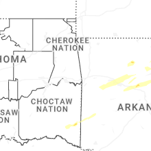
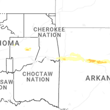
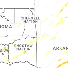


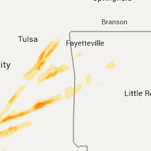


Connect with Interactive Hail Maps