

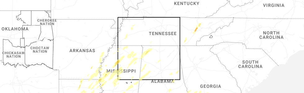
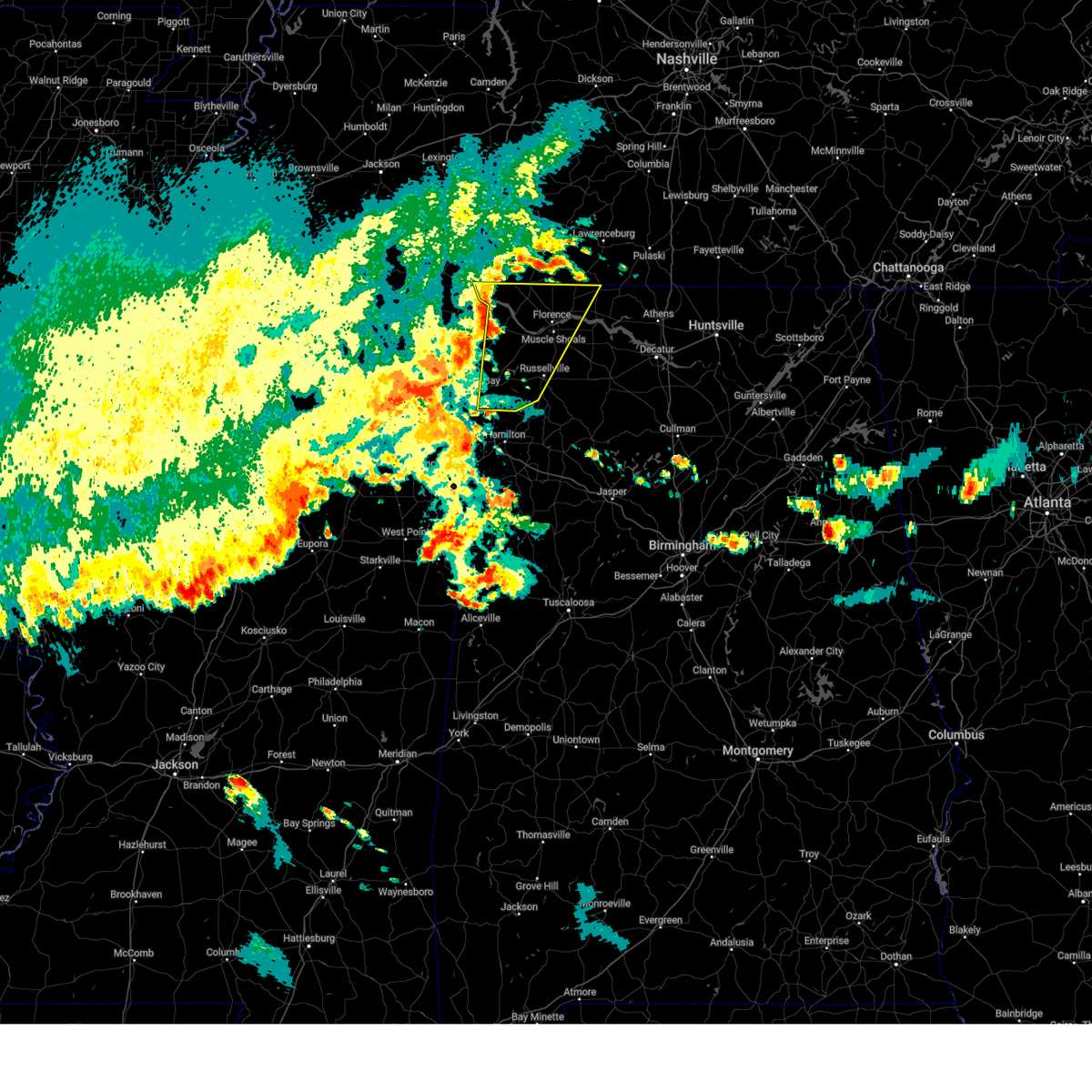
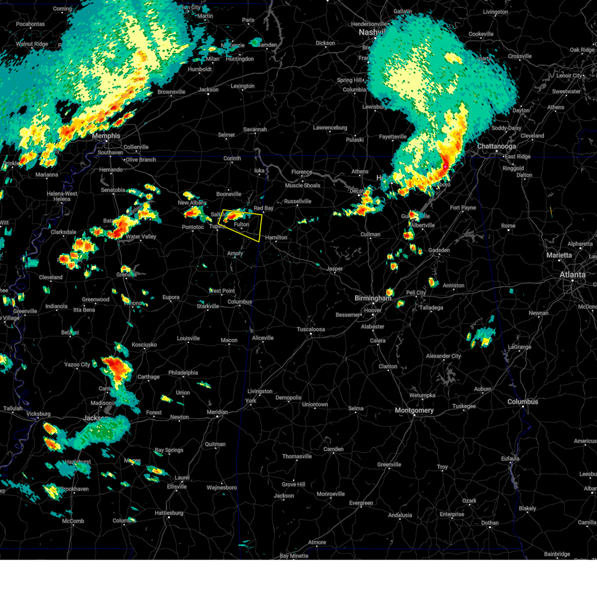
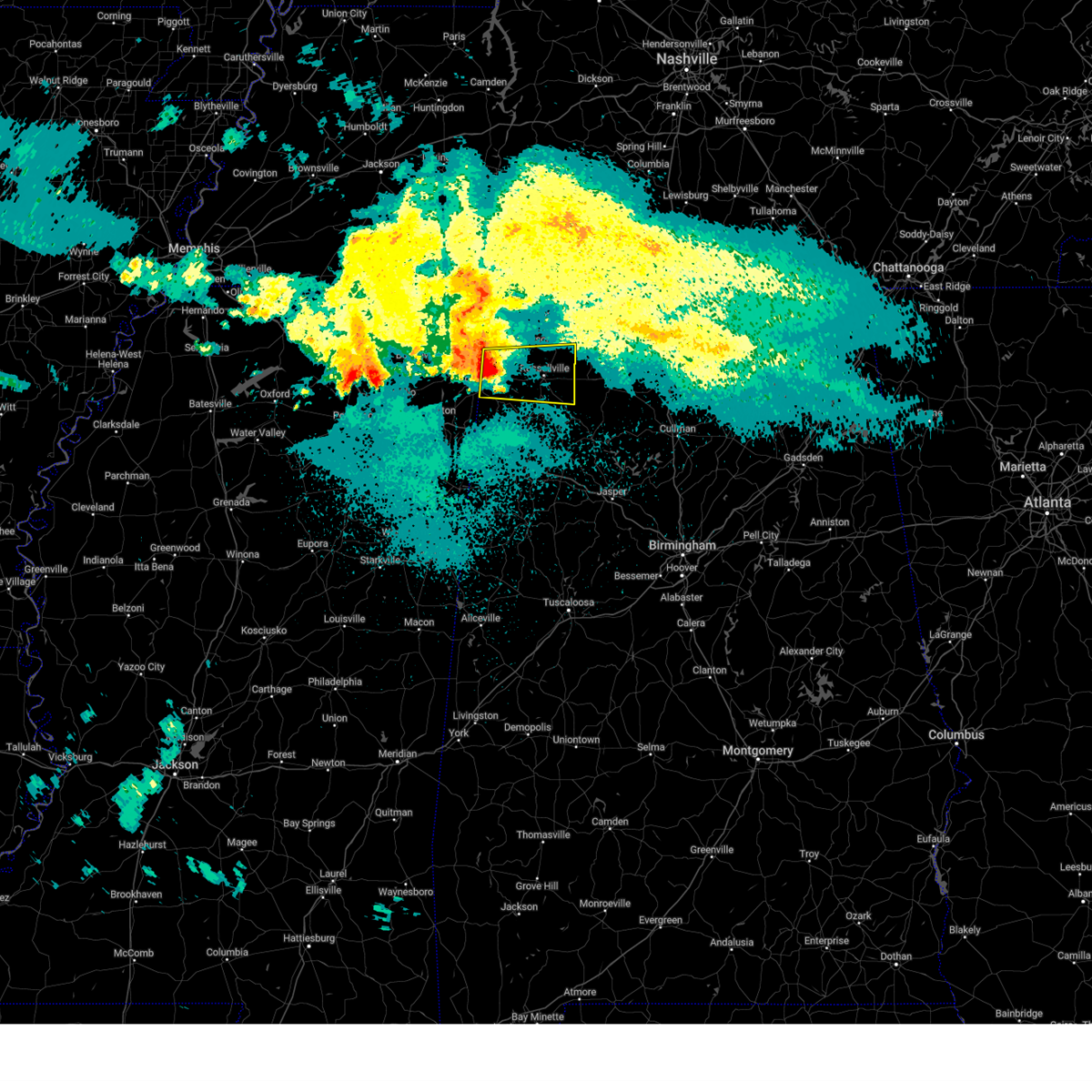
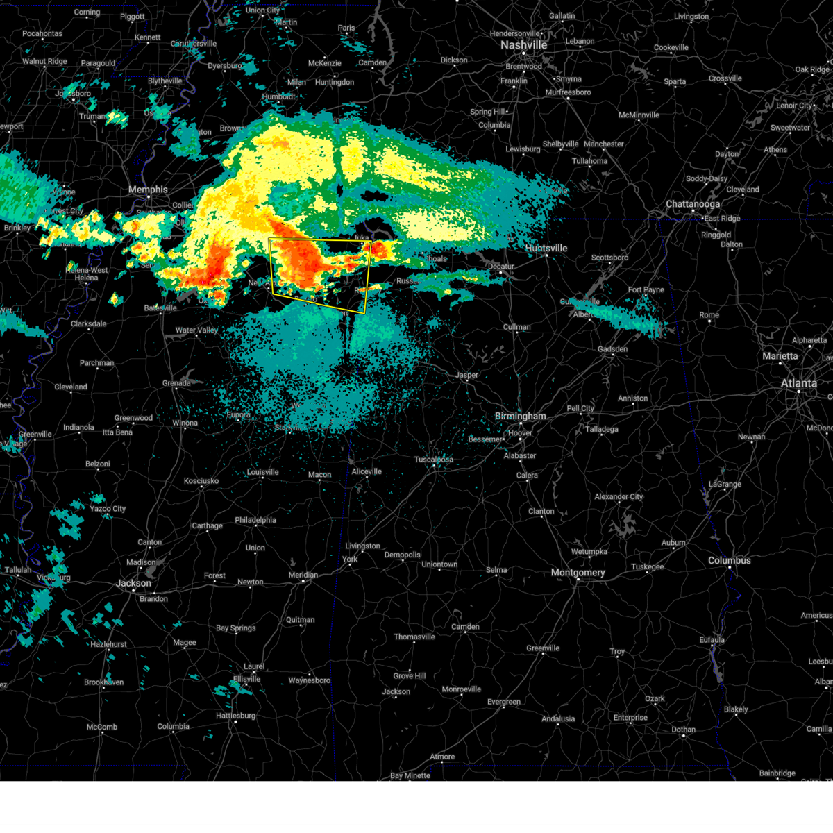
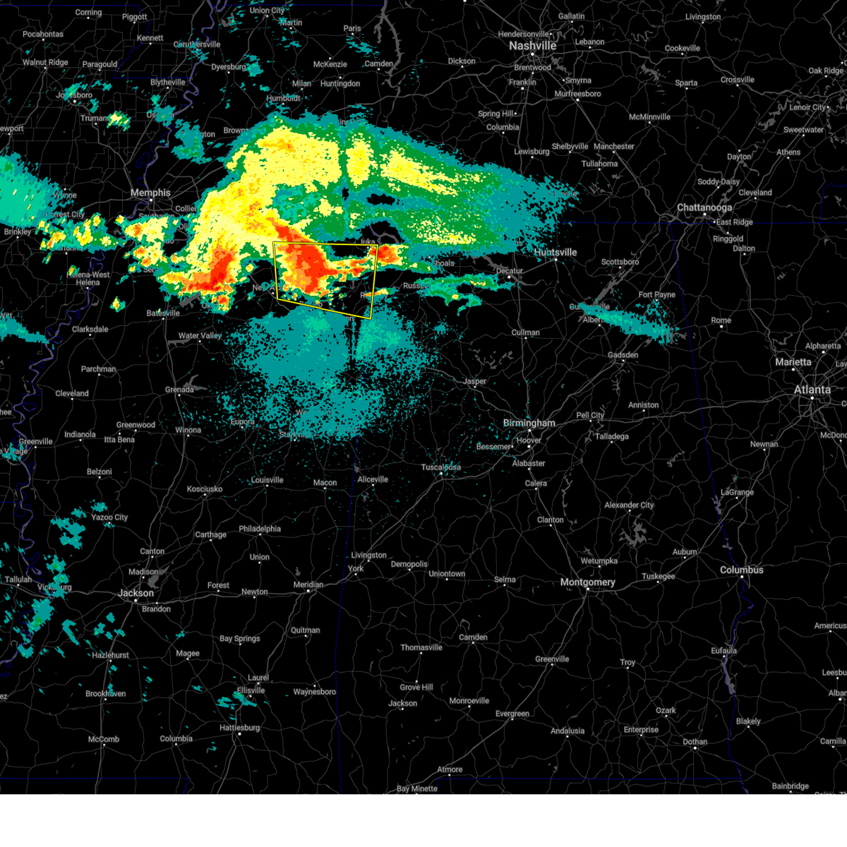
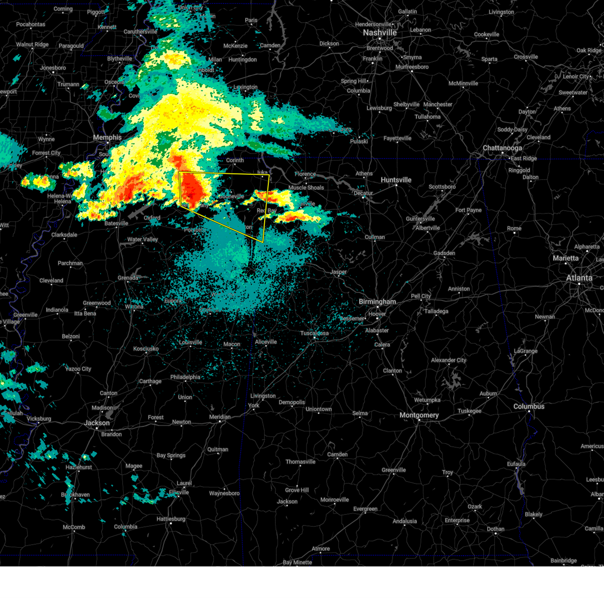
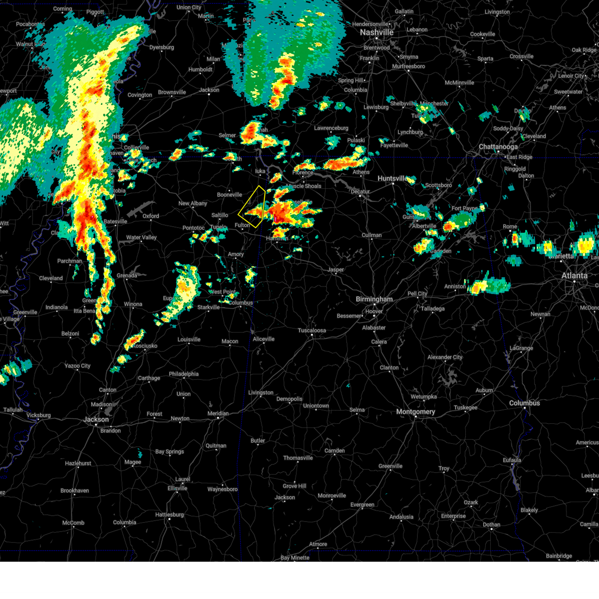
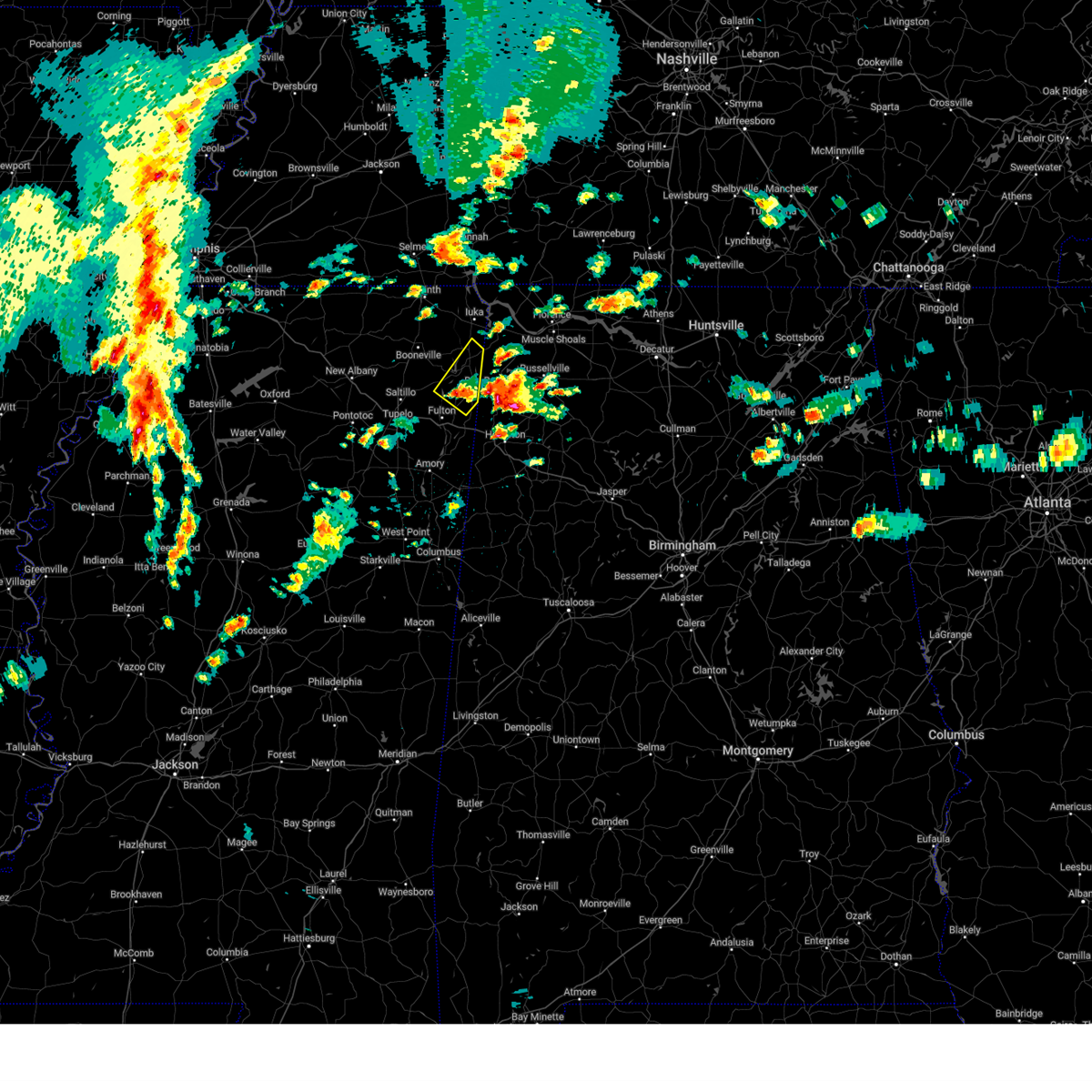
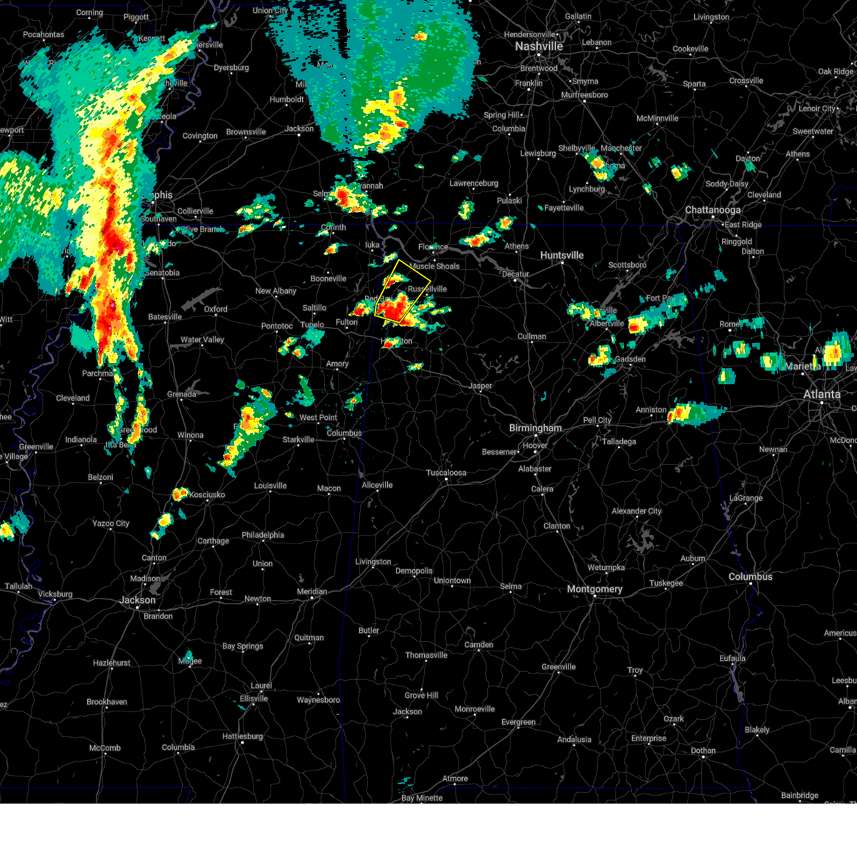
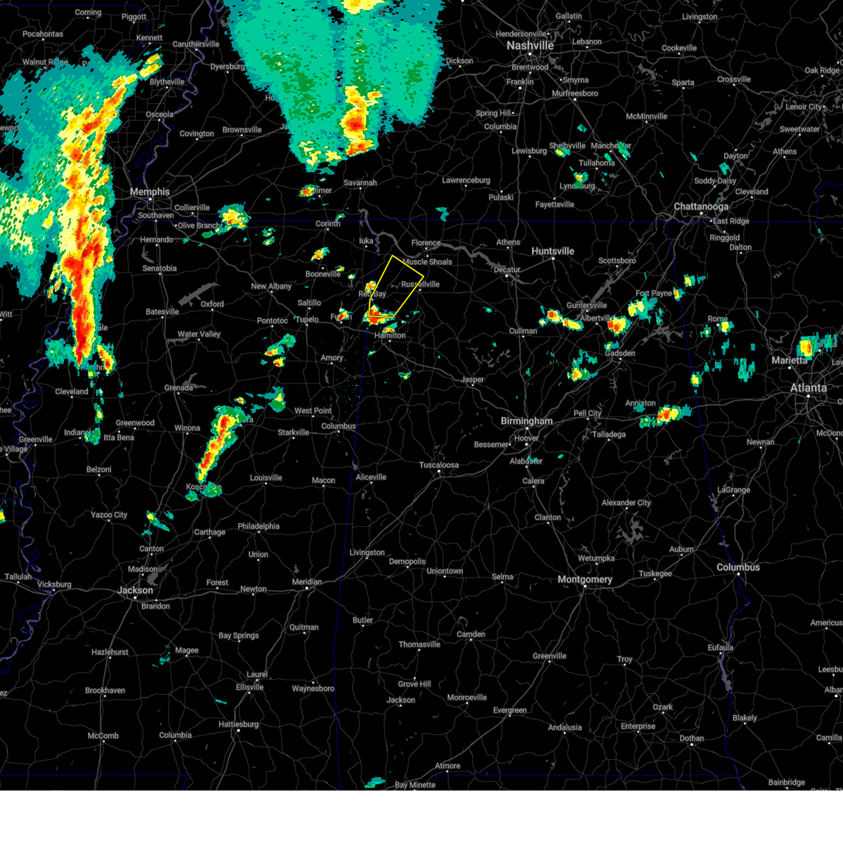
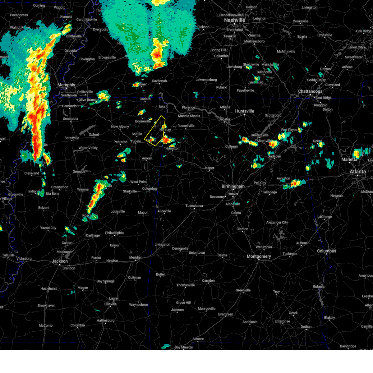
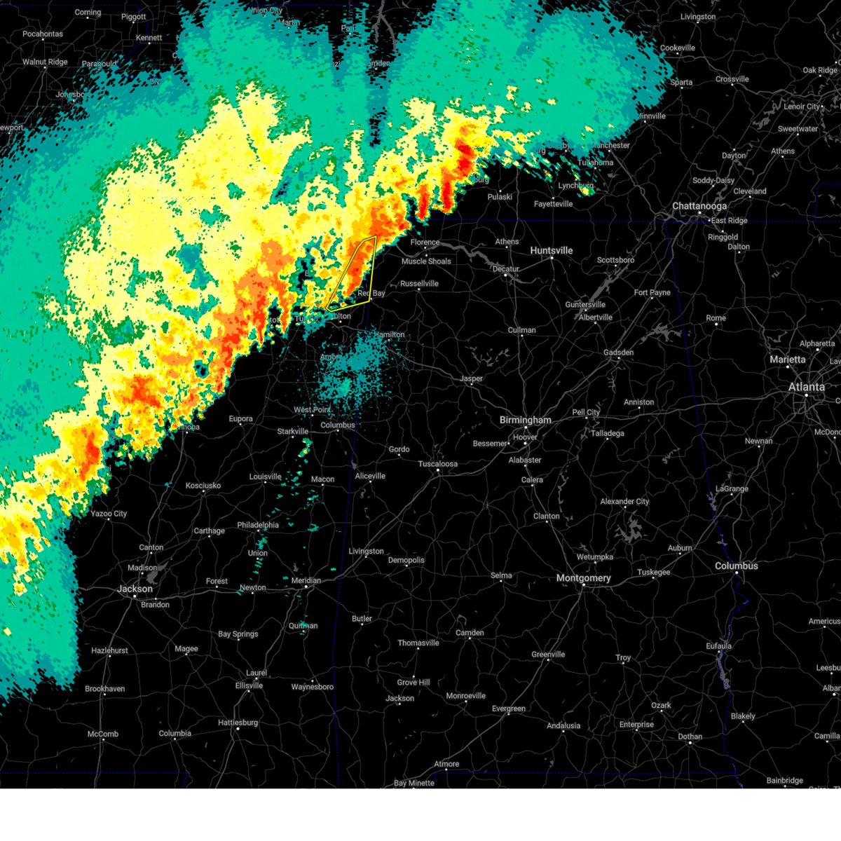
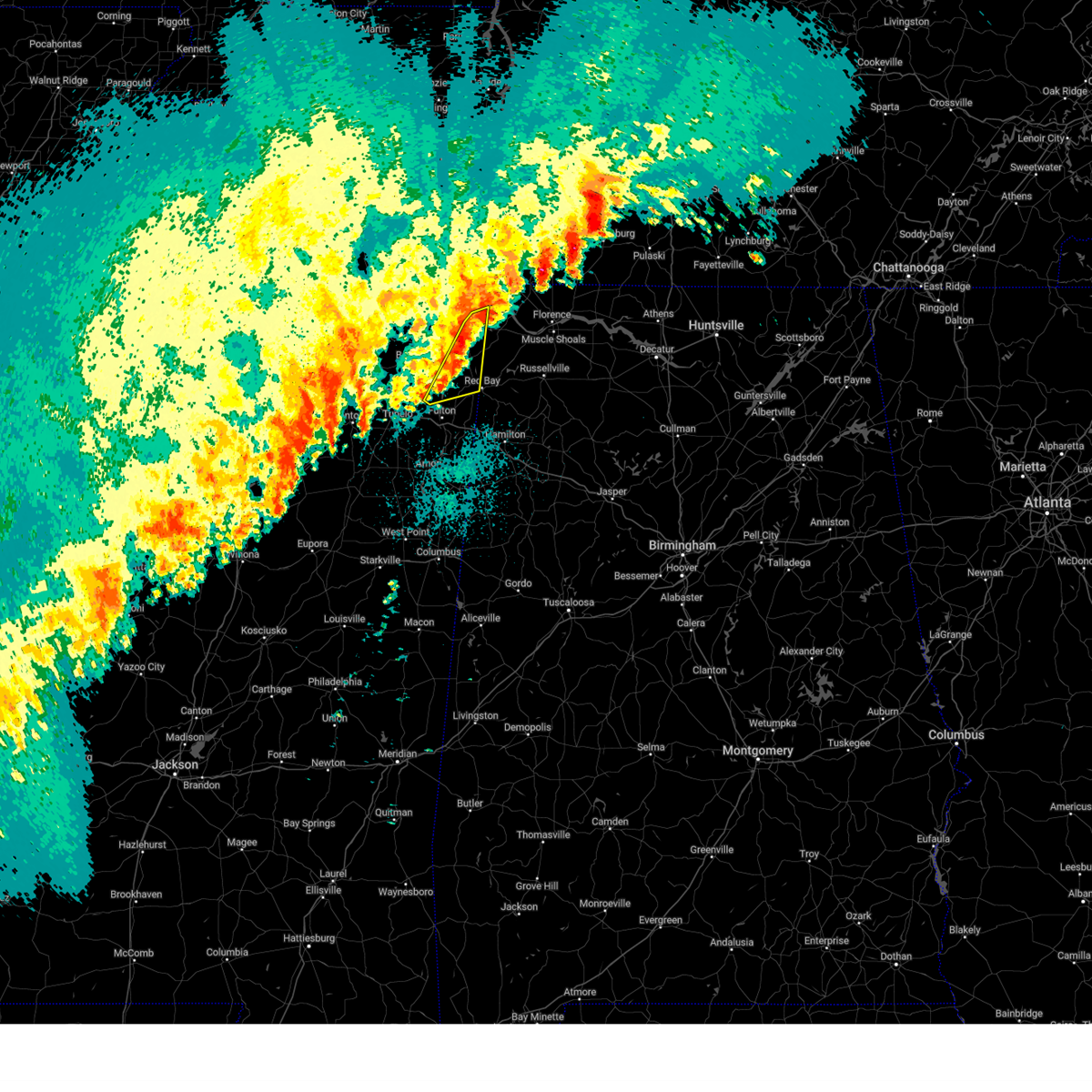
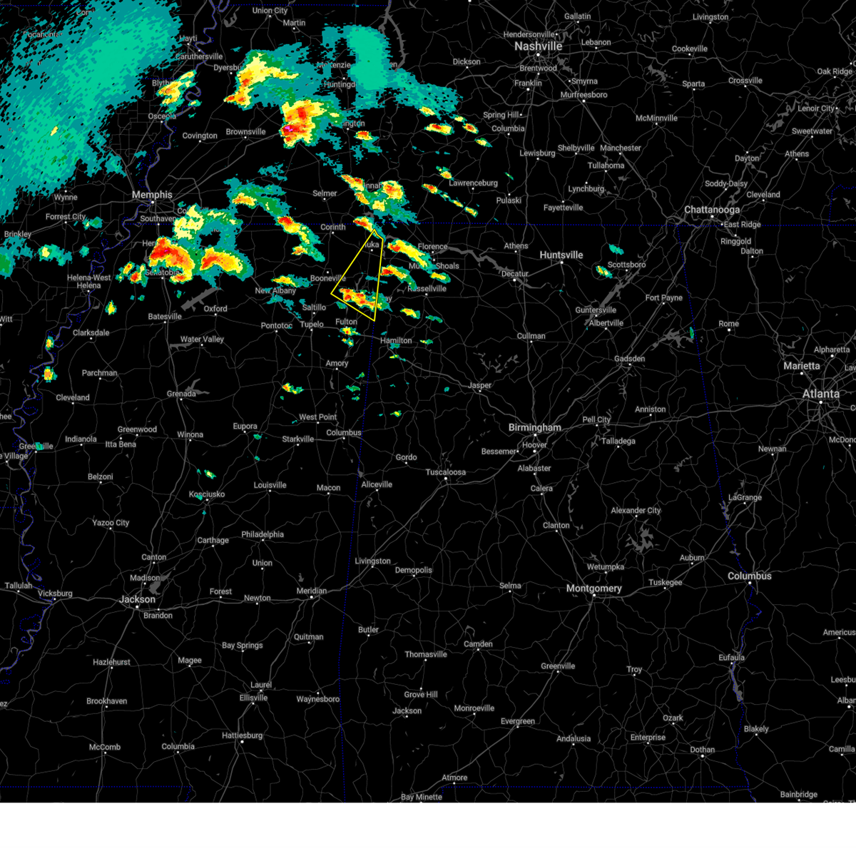
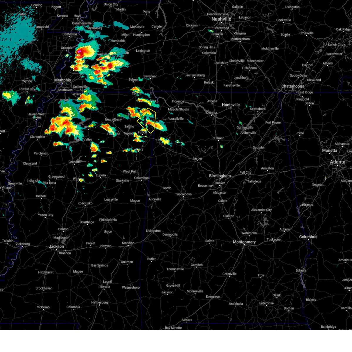
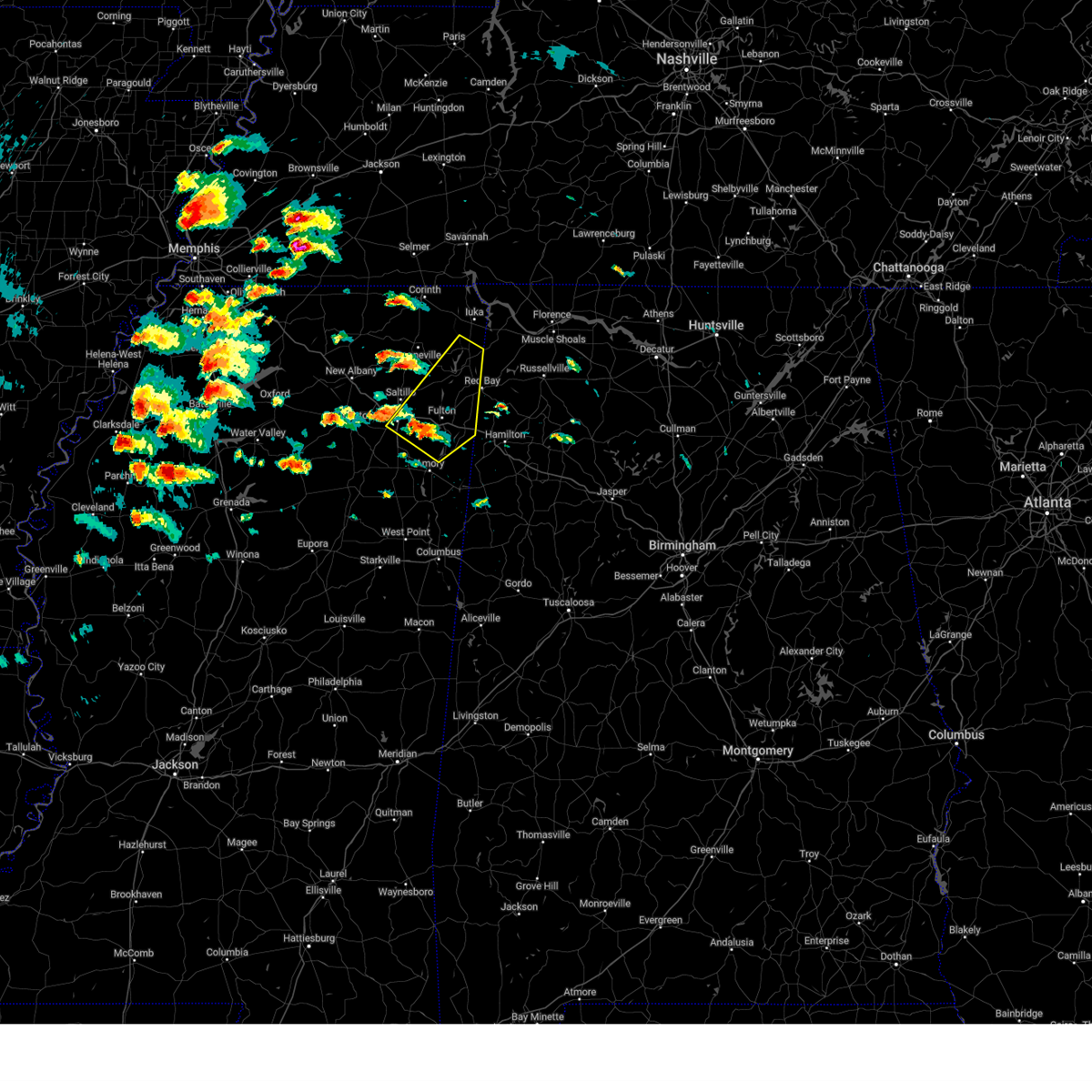
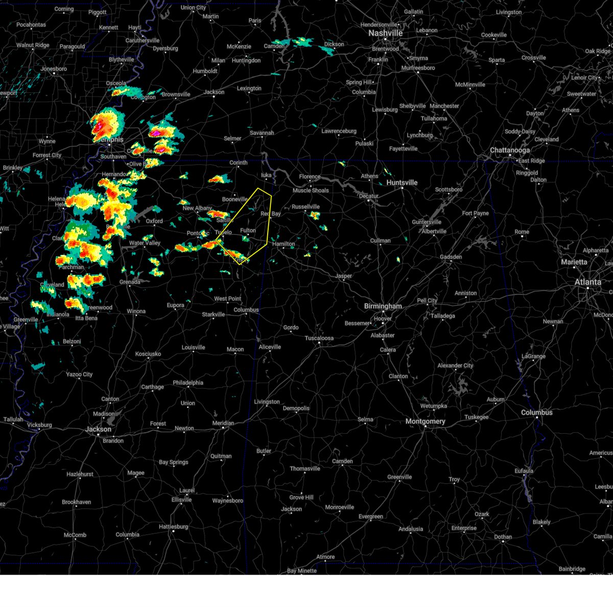
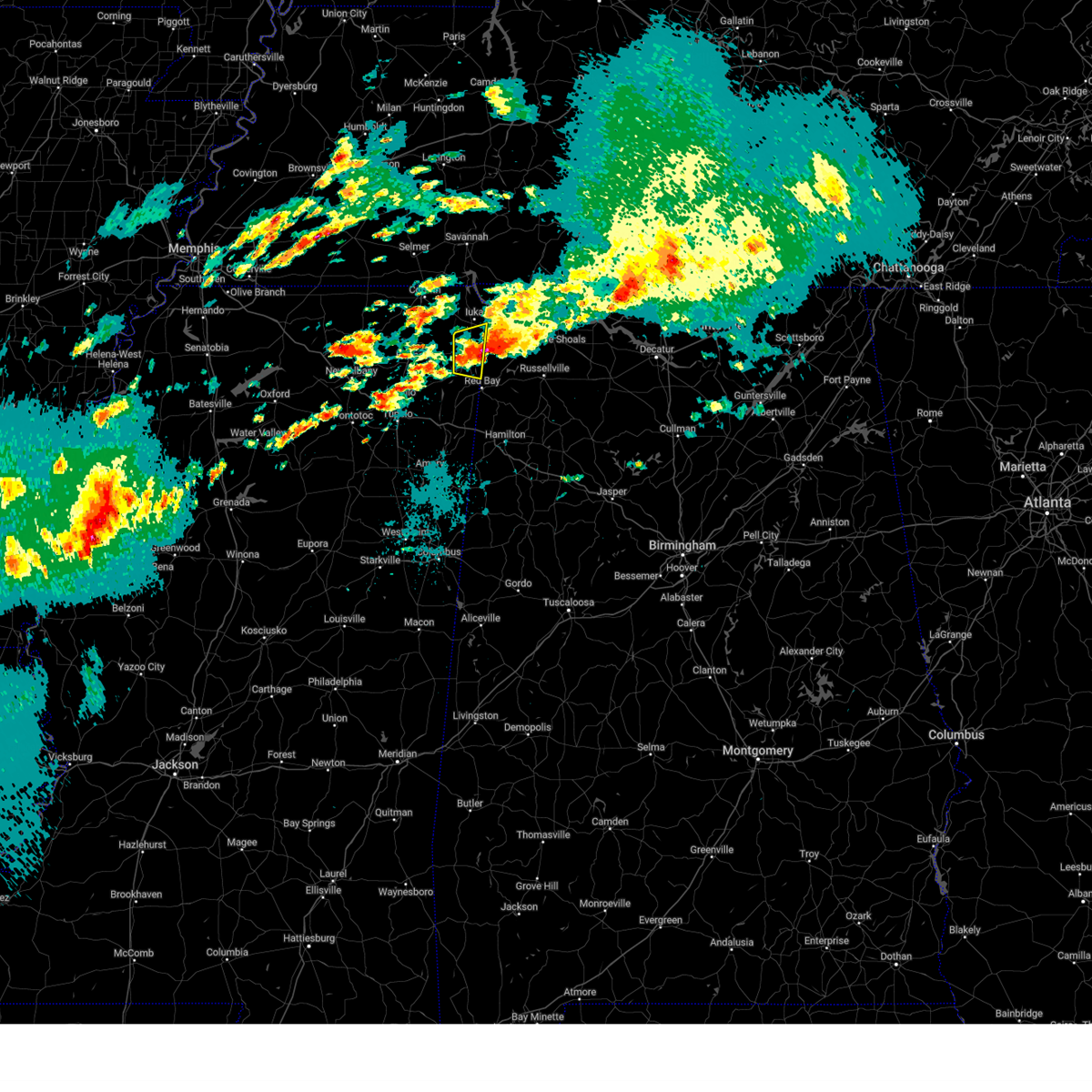
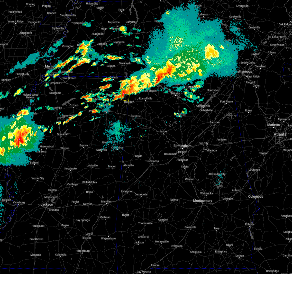
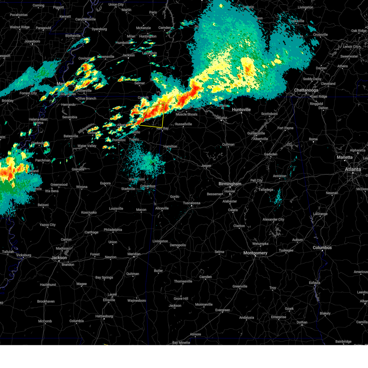
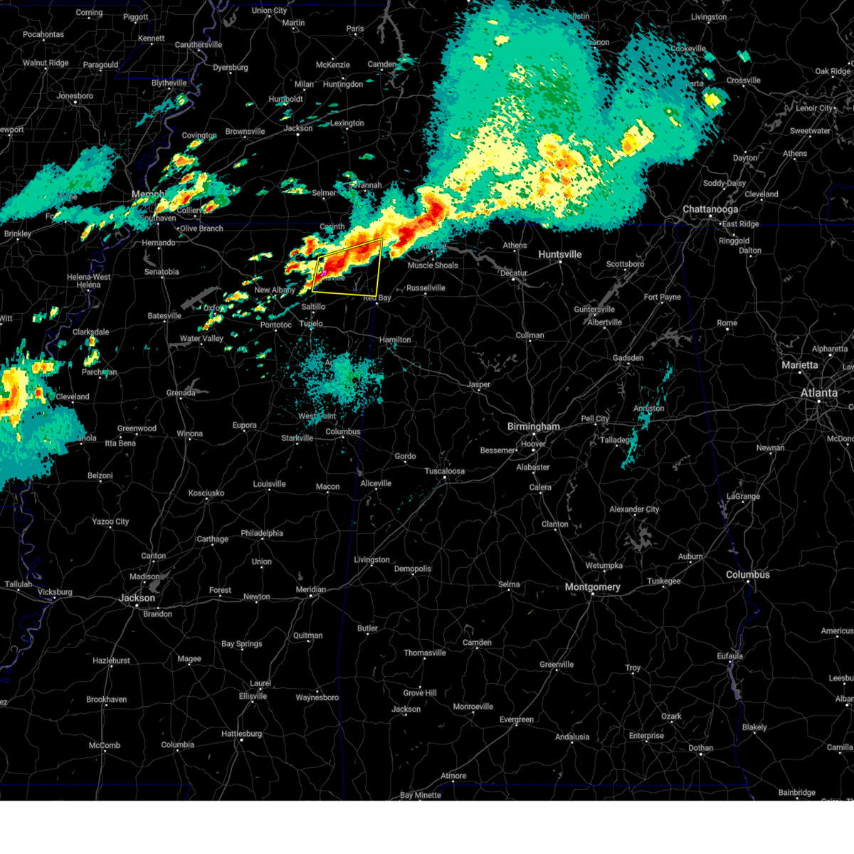
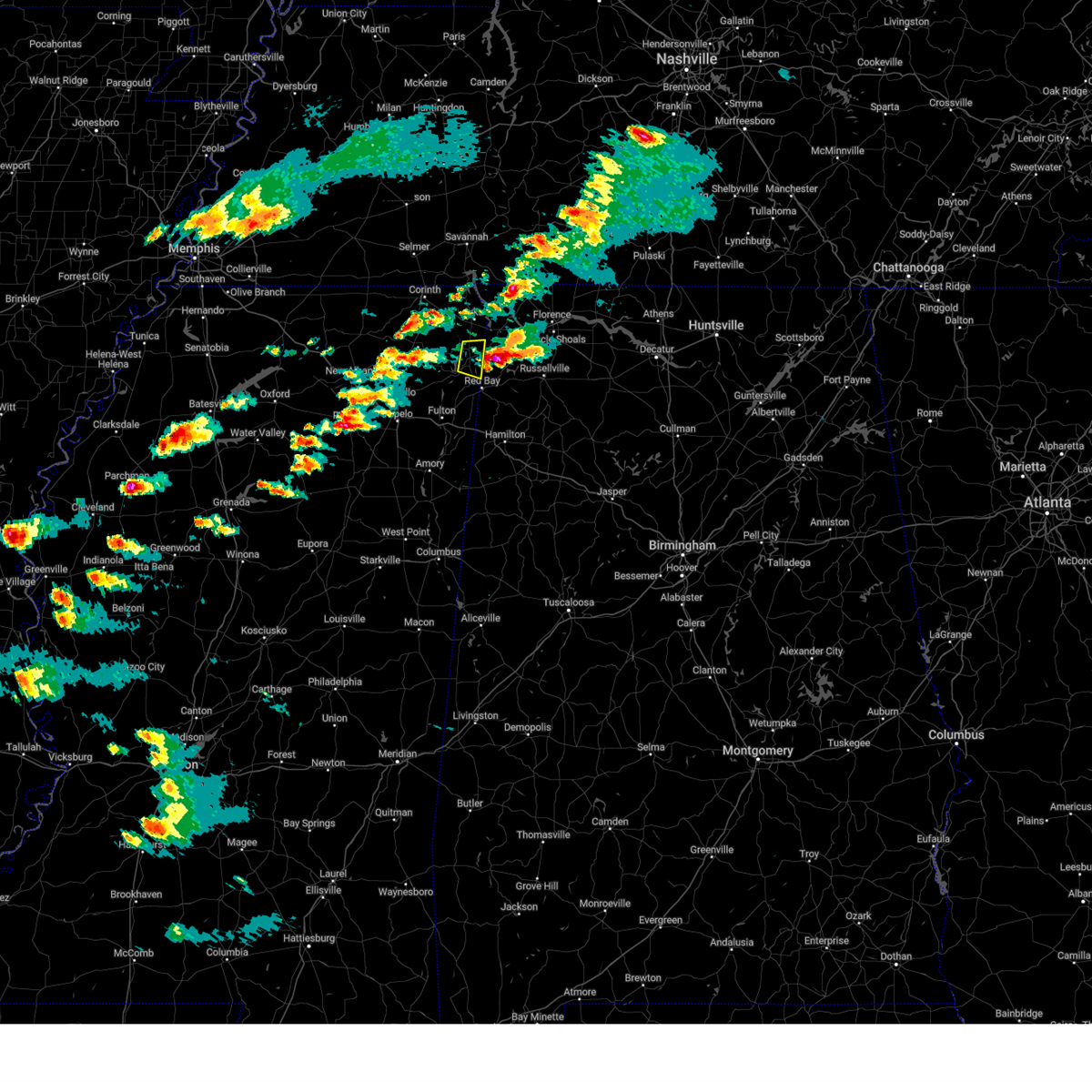
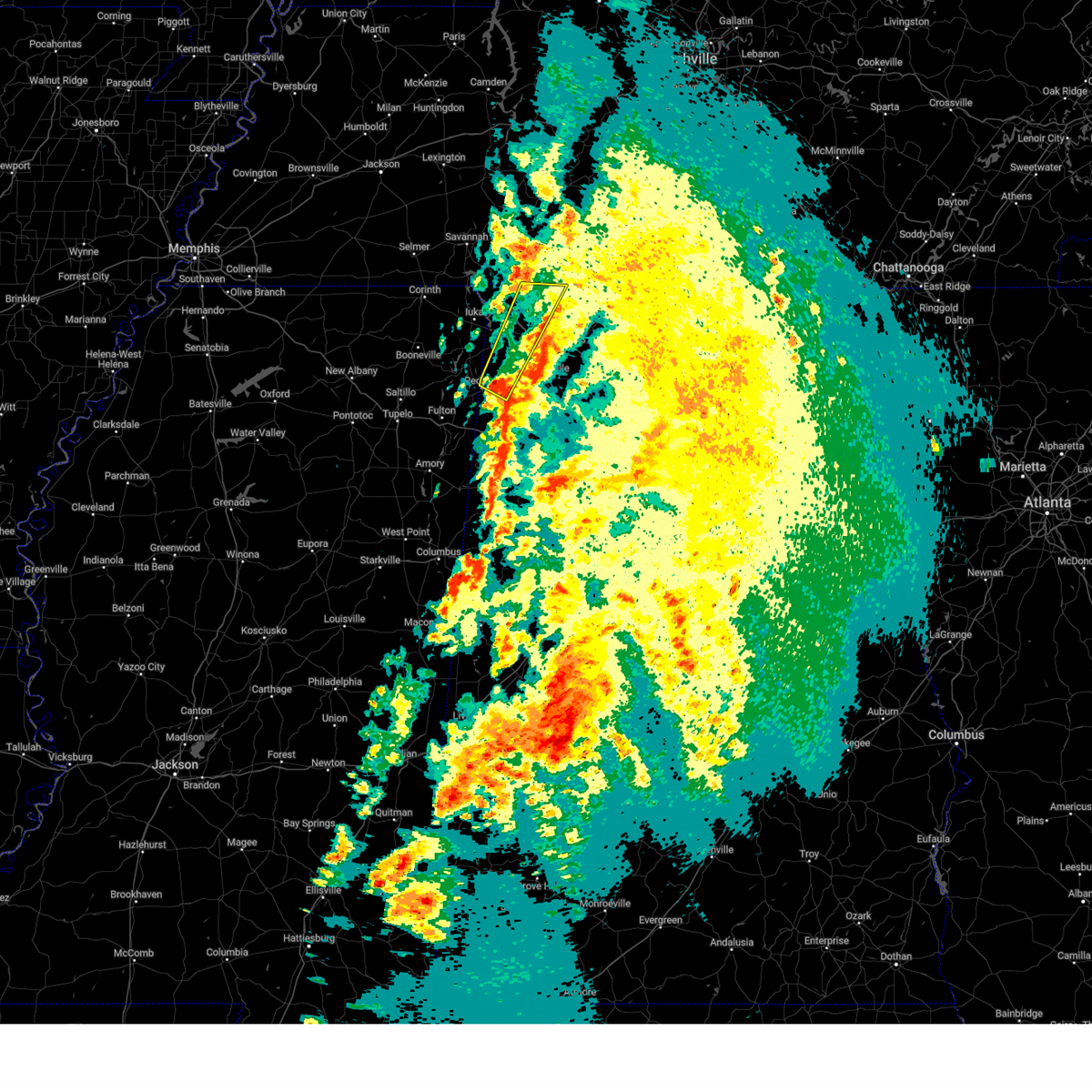
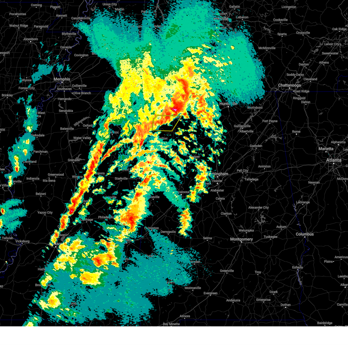
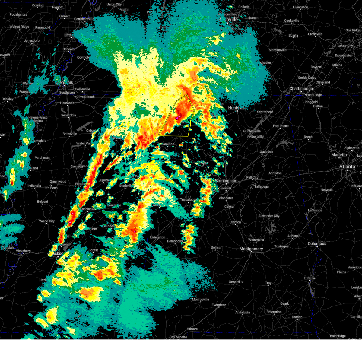
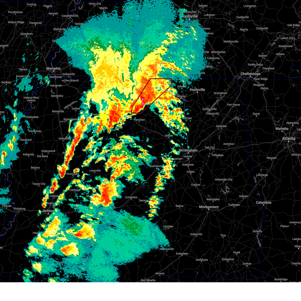
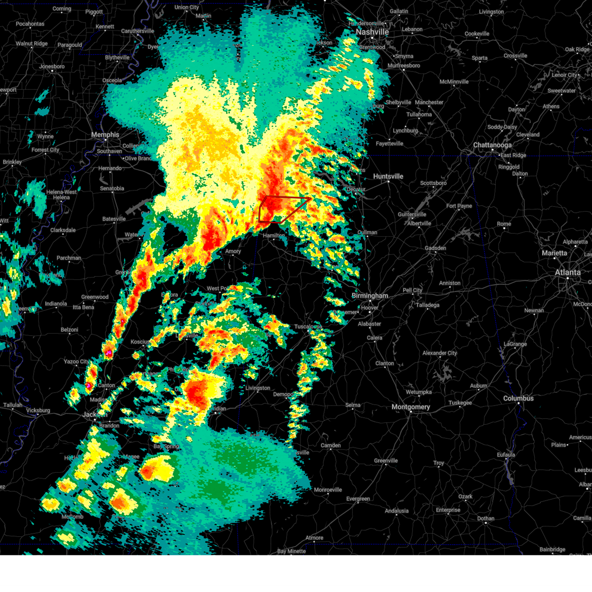
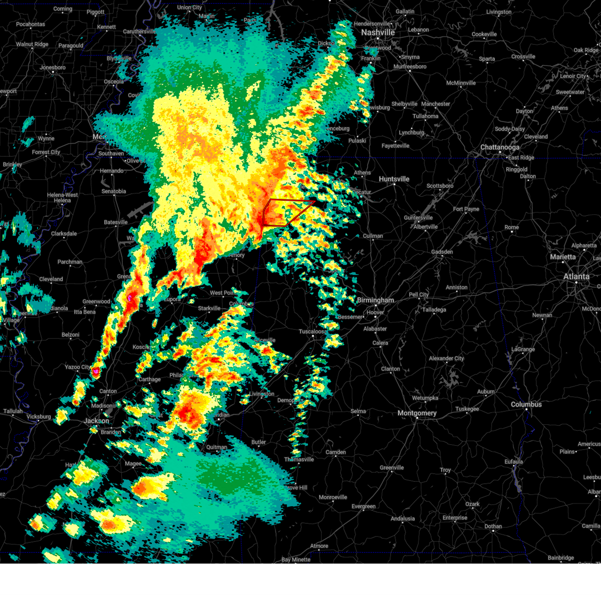
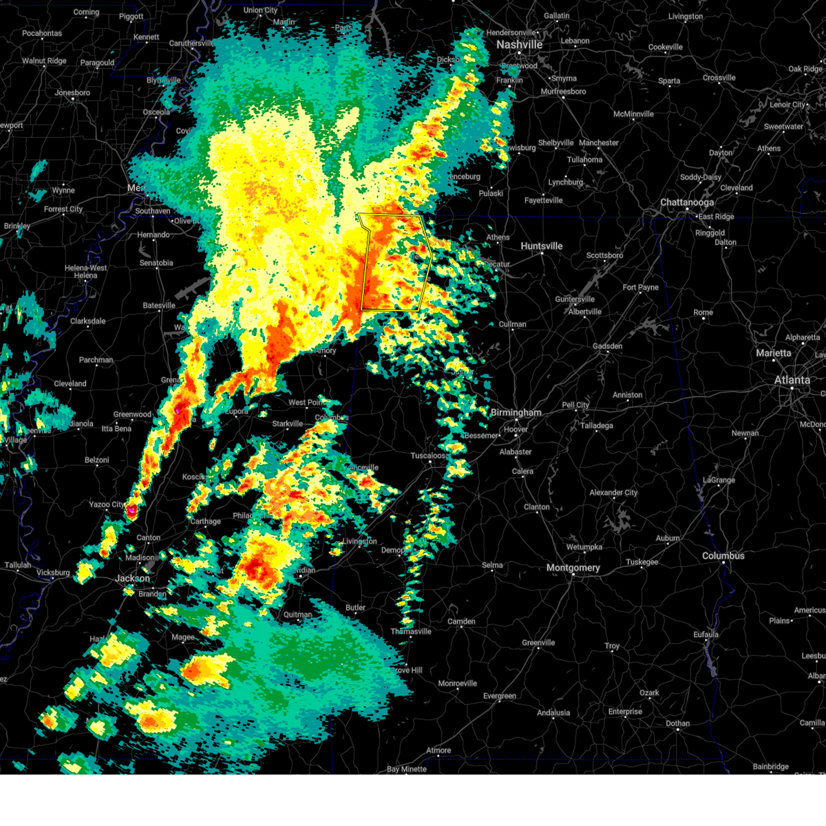
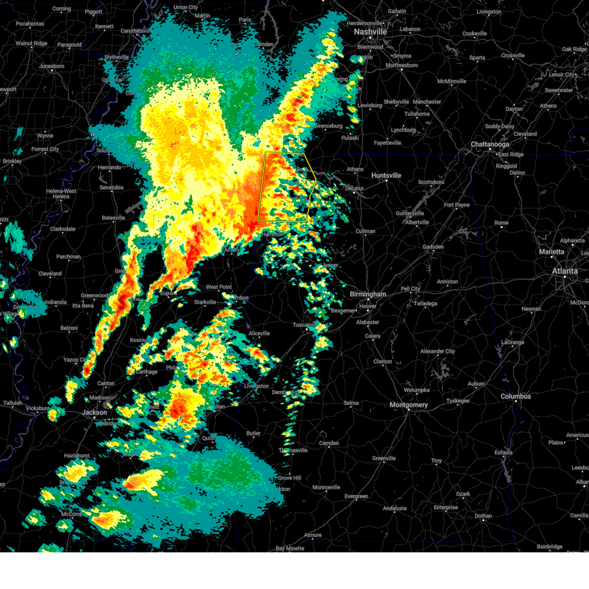
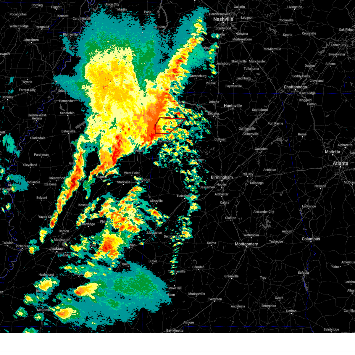
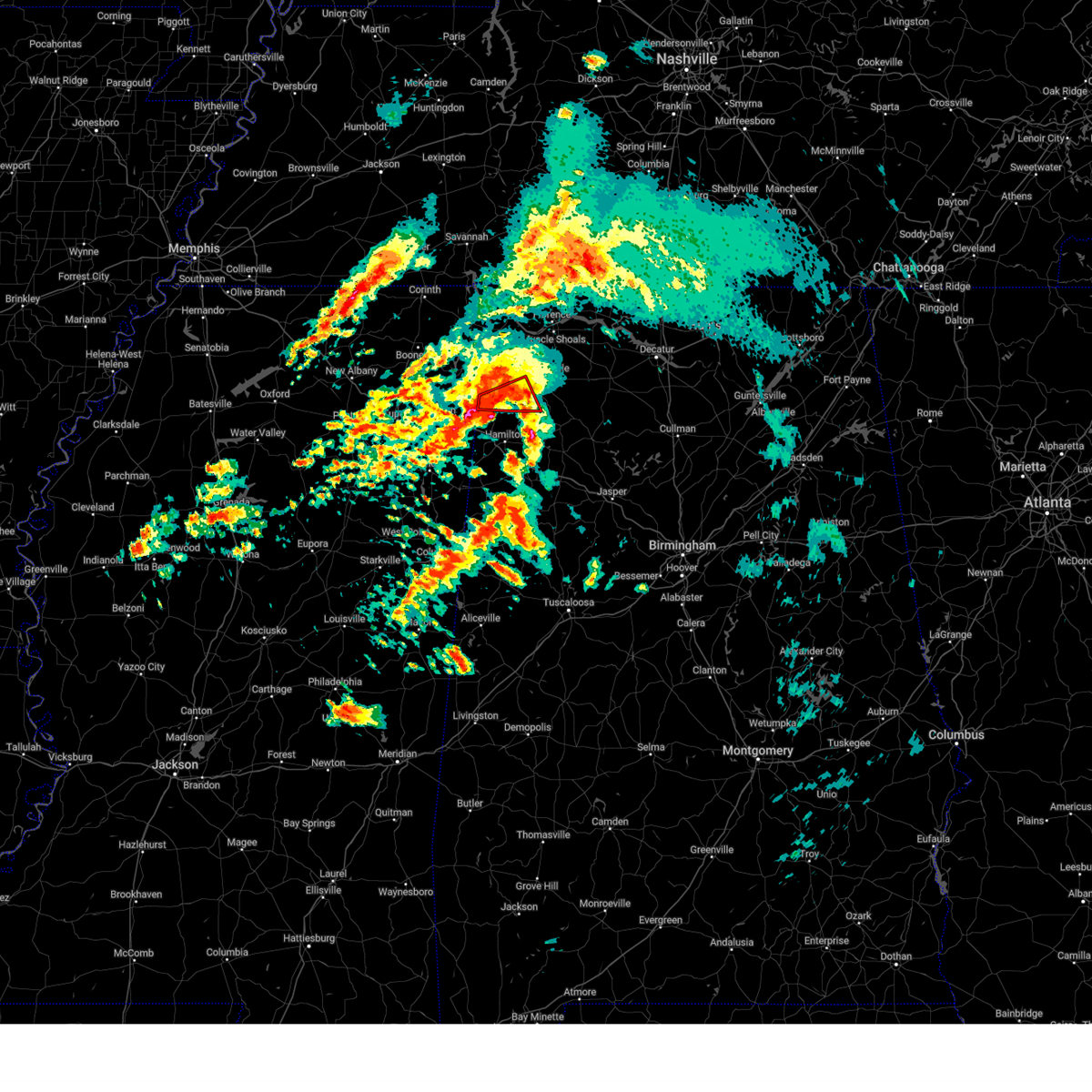
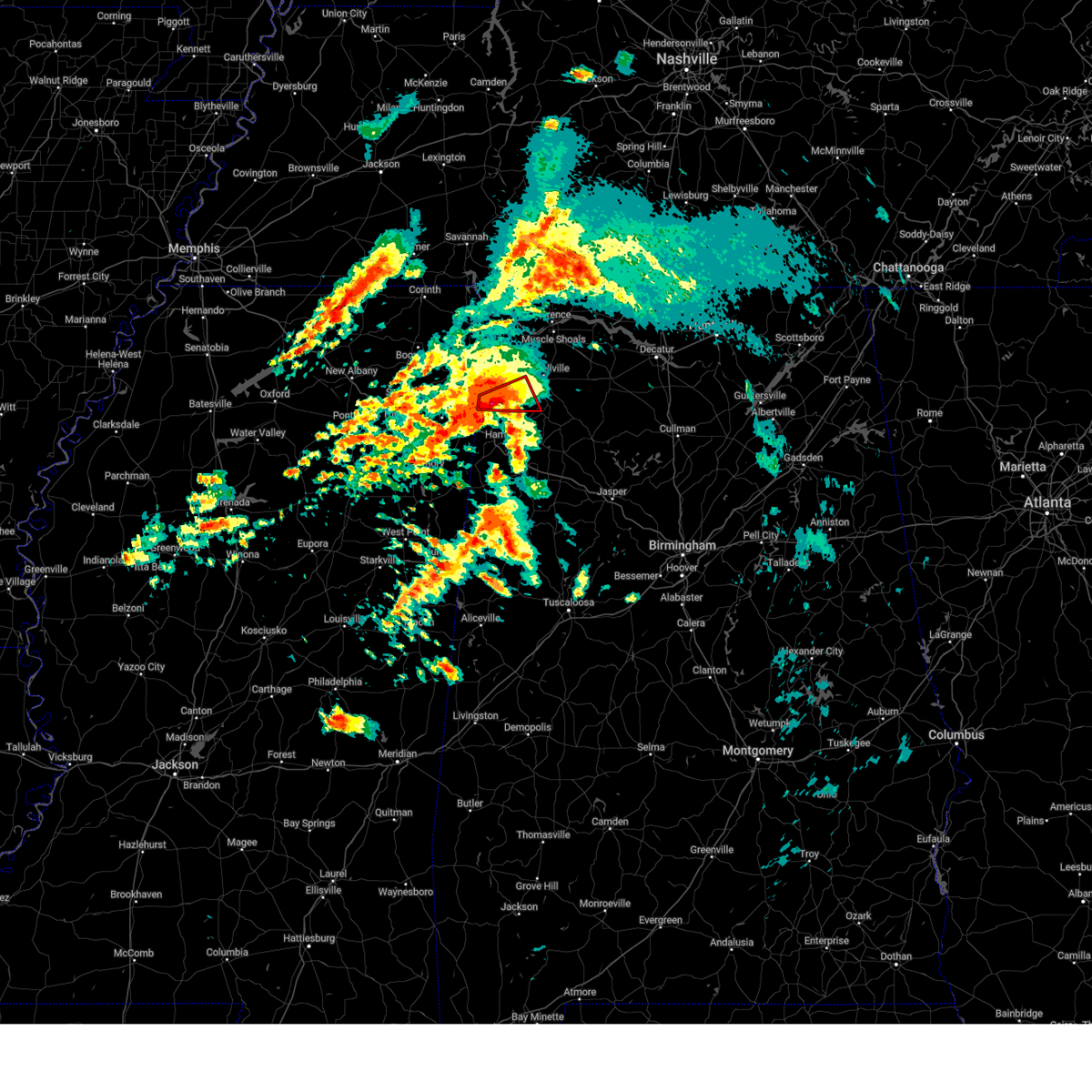
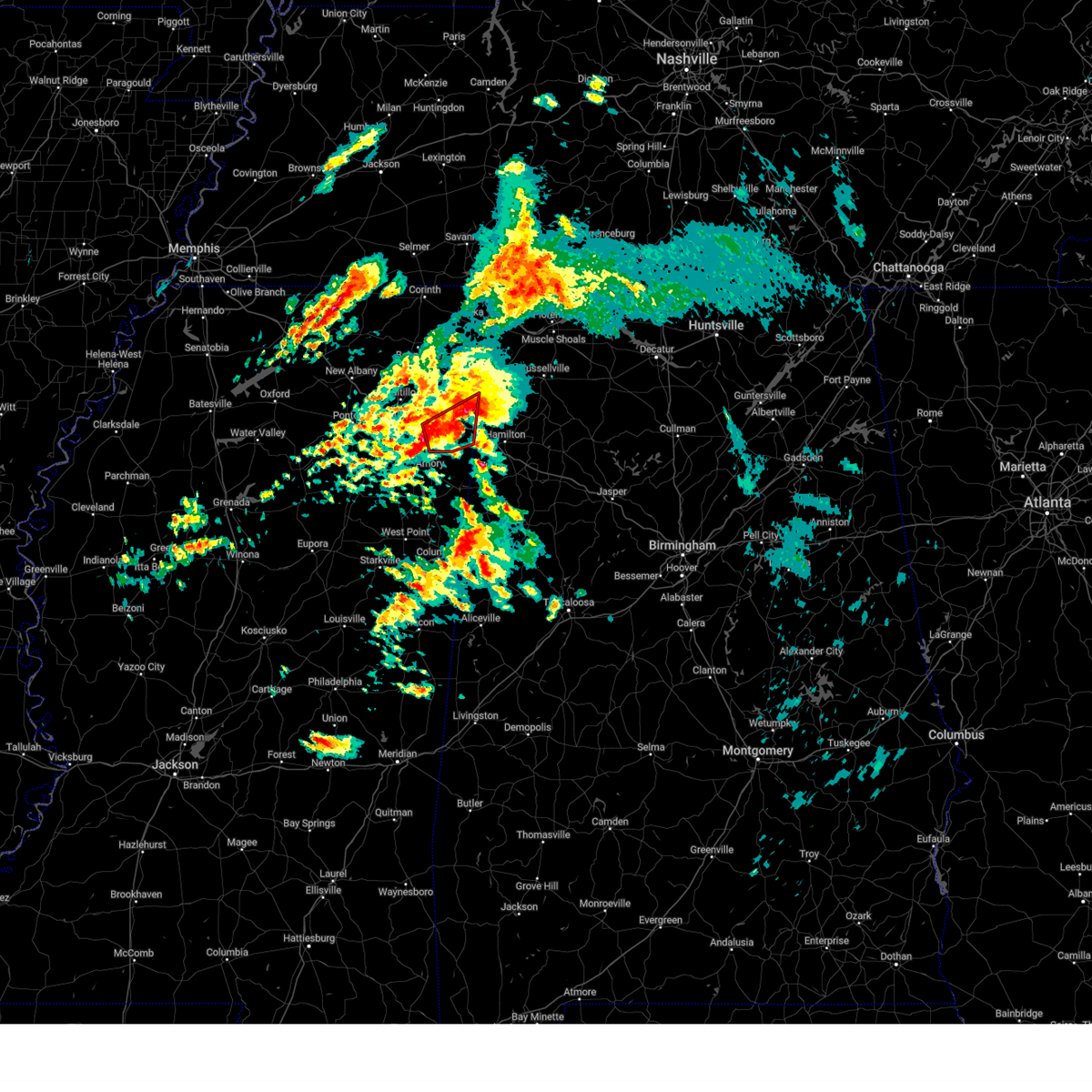
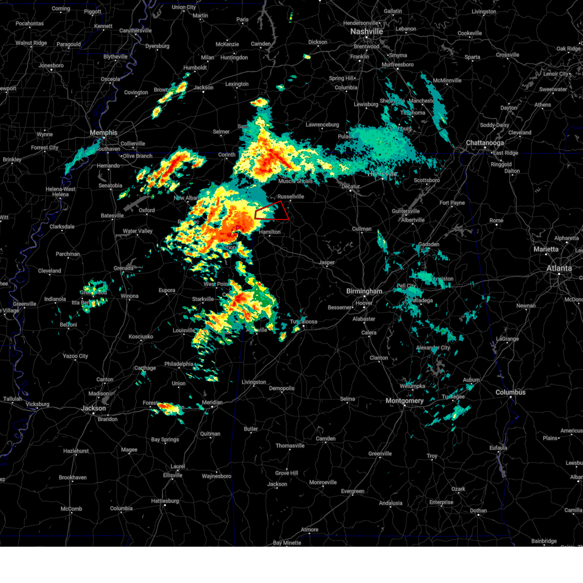
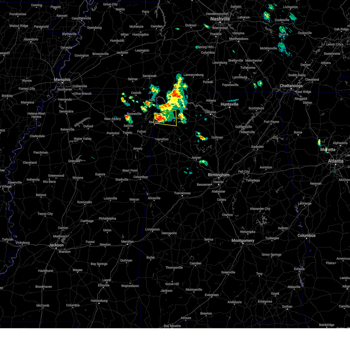
Hail Map for Red Bay, AL
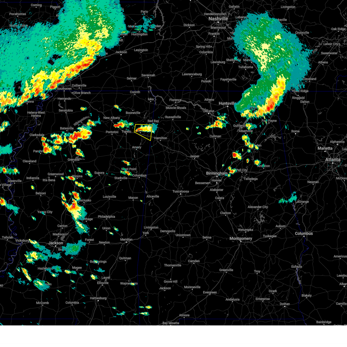
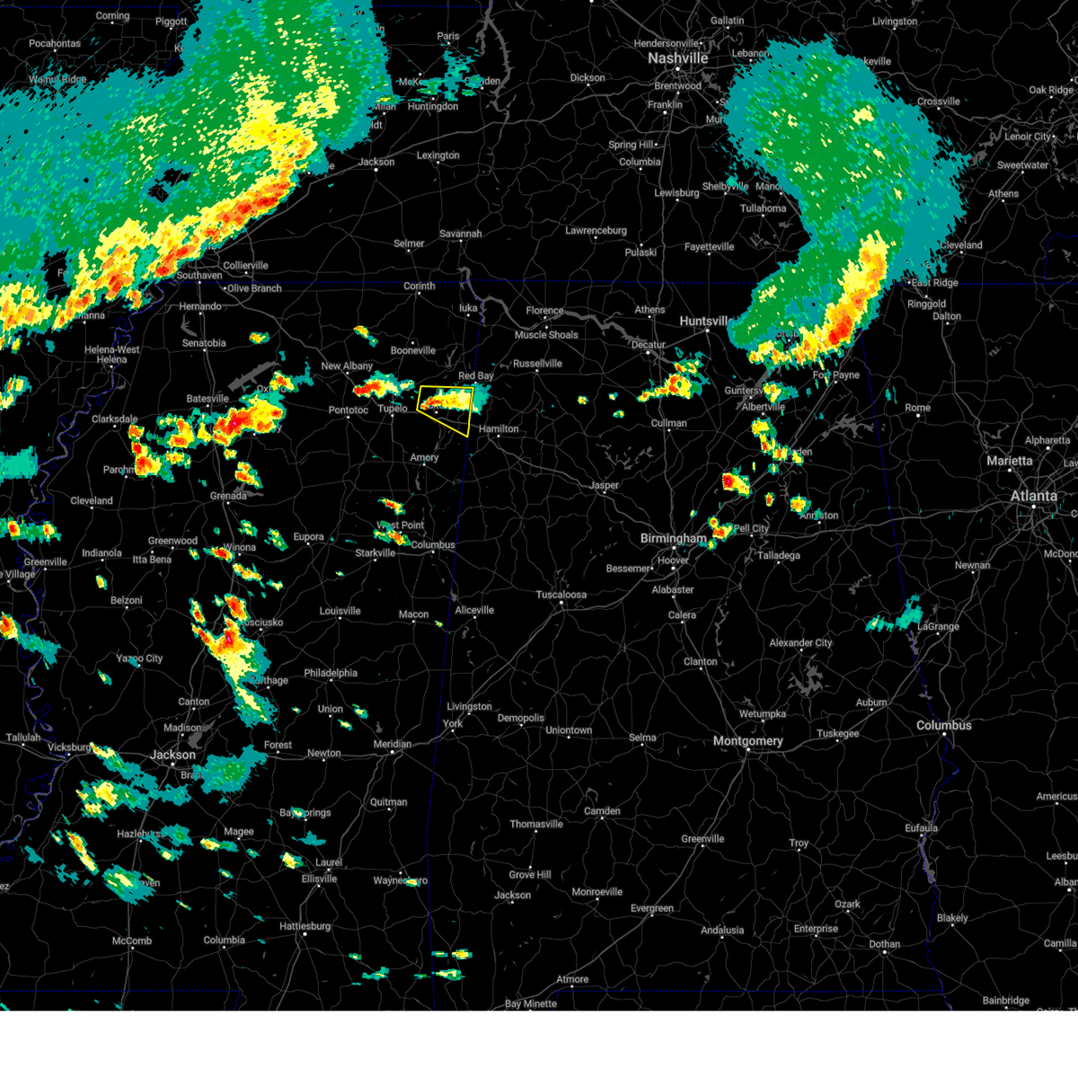
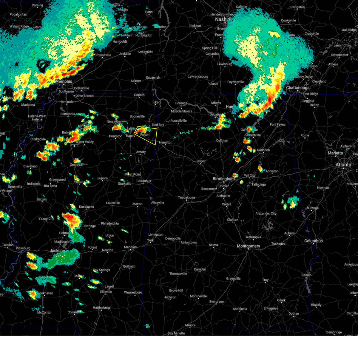
The Red Bay, AL area has had 9 reports of on-the-ground hail by trained spotters, and has been under severe weather warnings 85 times during the past 12 months. Doppler radar has detected hail at or near Red Bay, AL on 71 occasions, including 6 occasions during the past year.
| Name: | Red Bay, AL |
| Where Located: | 35.9 miles SW of Florence, AL |
| Map: | Google Map for Red Bay, AL |
| Population: | 3158 |
| Housing Units: | 1508 |
| More Info: | Search Google for Red Bay, AL |
2
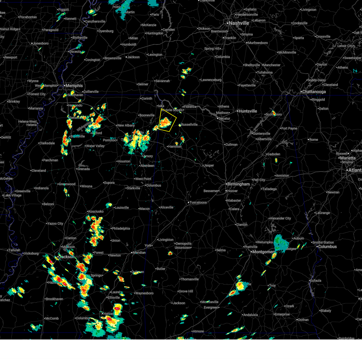
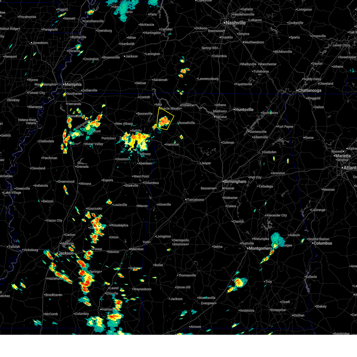
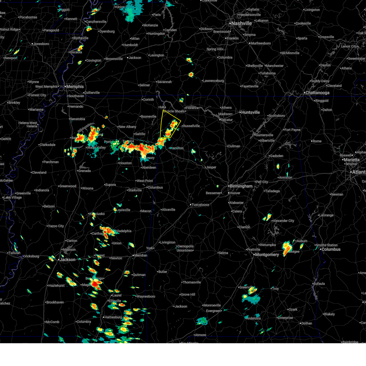
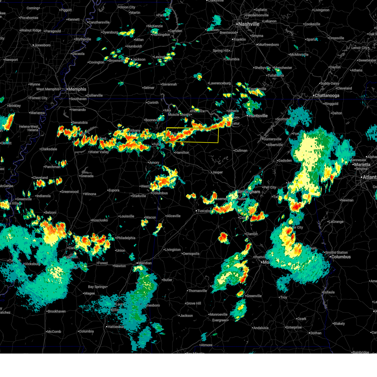
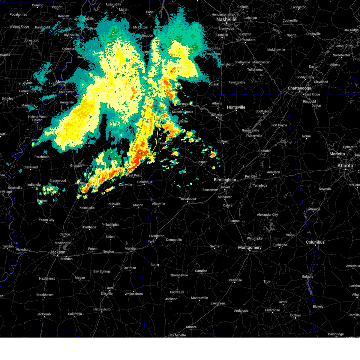
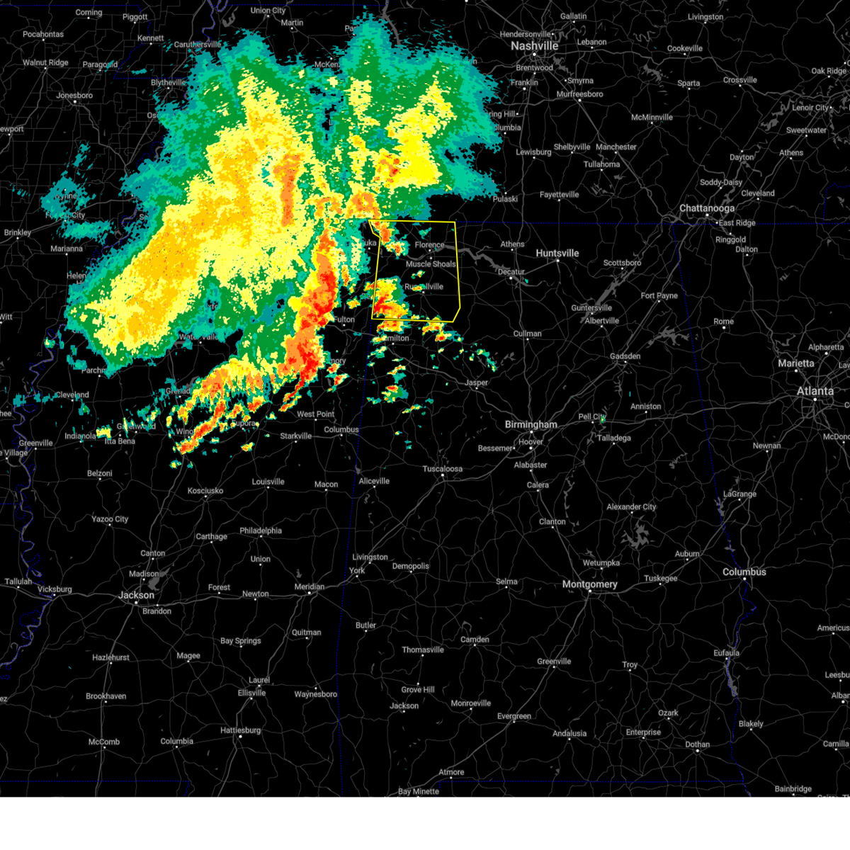
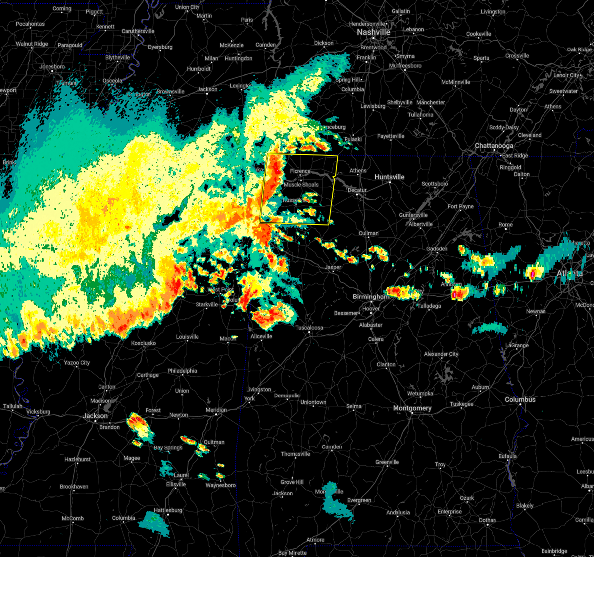
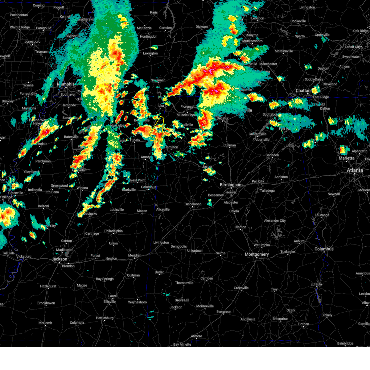
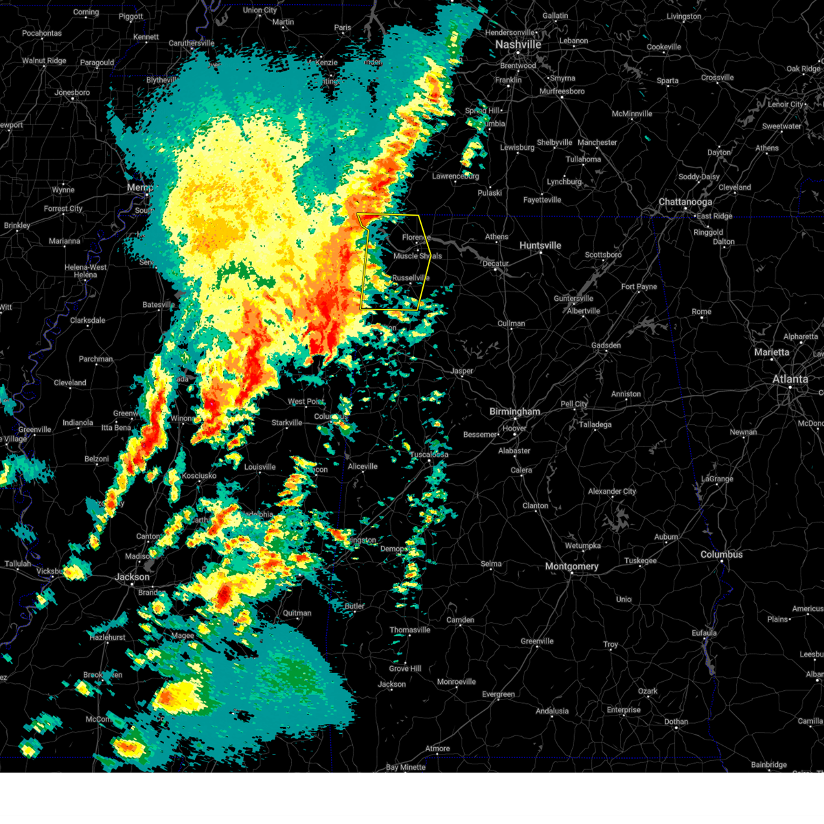
The Top Recent Hail Date for Red Bay, AL is Saturday, March 15, 2025 (13th out of 71)
Hail and Wind Damage Spotted near Red Bay, AL
| Date / Time | Report Details |
|---|---|
| 6/23/2025 5:39 PM CDT |
 the severe thunderstorm warning has been cancelled and is no longer in effect the severe thunderstorm warning has been cancelled and is no longer in effect
|
| 6/23/2025 5:28 PM CDT |
 At 528 pm cdt, a severe thunderstorm was located 9 miles northwest of belgreen, or 10 miles northeast of red bay, moving west at 10 mph (radar indicated). Hazards include 60 mph wind gusts and penny size hail. Expect damage to roofs, siding, and trees. Locations impacted include, red bay, malone, pleasant site, pogo, mynot, cedar creek reservoir, srygley church, dempsey, allsboro, and maud. At 528 pm cdt, a severe thunderstorm was located 9 miles northwest of belgreen, or 10 miles northeast of red bay, moving west at 10 mph (radar indicated). Hazards include 60 mph wind gusts and penny size hail. Expect damage to roofs, siding, and trees. Locations impacted include, red bay, malone, pleasant site, pogo, mynot, cedar creek reservoir, srygley church, dempsey, allsboro, and maud.
|
| 6/23/2025 4:53 PM CDT |
 Svrhun the national weather service in huntsville alabama has issued a * severe thunderstorm warning for, southwestern colbert county in northwestern alabama, western franklin county in northwestern alabama, * until 600 pm cdt. * at 453 pm cdt, a severe thunderstorm was located near belgreen, or 10 miles west of russellville, moving northwest at 10 mph (radar indicated). Hazards include 60 mph wind gusts and penny size hail. expect damage to roofs, siding, and trees Svrhun the national weather service in huntsville alabama has issued a * severe thunderstorm warning for, southwestern colbert county in northwestern alabama, western franklin county in northwestern alabama, * until 600 pm cdt. * at 453 pm cdt, a severe thunderstorm was located near belgreen, or 10 miles west of russellville, moving northwest at 10 mph (radar indicated). Hazards include 60 mph wind gusts and penny size hail. expect damage to roofs, siding, and trees
|
| 6/14/2025 5:44 PM CDT |
 Svrhun the national weather service in huntsville alabama has issued a * severe thunderstorm warning for, franklin county in northwestern alabama, southern lawrence county in northwestern alabama, * until 630 pm cdt. * at 543 pm cdt, a severe thunderstorm was located 8 miles northwest of hackleburg, or 13 miles southeast of red bay, moving east at 45 mph (radar indicated). Hazards include 60 mph wind gusts. expect damage to roofs, siding, and trees Svrhun the national weather service in huntsville alabama has issued a * severe thunderstorm warning for, franklin county in northwestern alabama, southern lawrence county in northwestern alabama, * until 630 pm cdt. * at 543 pm cdt, a severe thunderstorm was located 8 miles northwest of hackleburg, or 13 miles southeast of red bay, moving east at 45 mph (radar indicated). Hazards include 60 mph wind gusts. expect damage to roofs, siding, and trees
|
| 6/7/2025 12:34 PM CDT |
 At 1234 pm cdt, severe thunderstorms were located along a line extending from near burton to near sandy springs to near evergreen, moving east at 20 mph (radar indicated). Hazards include 70 mph wind gusts and nickel size hail. Expect considerable tree damage. damage is likely to mobile homes, roofs, and outbuildings. Locations impacted include, fulton, red bay, iuka, tishomingo state park, belmont, shannon, mantachie, smithville, tremont, tishomingo, fairview, burton, new salem, midway, sandy springs, evergreen, clay, nettleton, marietta, and golden. At 1234 pm cdt, severe thunderstorms were located along a line extending from near burton to near sandy springs to near evergreen, moving east at 20 mph (radar indicated). Hazards include 70 mph wind gusts and nickel size hail. Expect considerable tree damage. damage is likely to mobile homes, roofs, and outbuildings. Locations impacted include, fulton, red bay, iuka, tishomingo state park, belmont, shannon, mantachie, smithville, tremont, tishomingo, fairview, burton, new salem, midway, sandy springs, evergreen, clay, nettleton, marietta, and golden.
|
| 6/7/2025 12:34 PM CDT |
 the severe thunderstorm warning has been cancelled and is no longer in effect the severe thunderstorm warning has been cancelled and is no longer in effect
|
| 6/7/2025 12:21 PM CDT |
 Svrhun the national weather service in huntsville alabama has issued a * severe thunderstorm warning for, lauderdale county in northwestern alabama, colbert county in northwestern alabama, franklin county in northwestern alabama, western lawrence county in northwestern alabama, * until 115 pm cdt. * at 1221 pm cdt, severe thunderstorms were located along a line extending from near corinth to near sandy springs to shannon, moving east at 50 mph (radar indicated). Hazards include 60 mph wind gusts. expect damage to roofs, siding, and trees Svrhun the national weather service in huntsville alabama has issued a * severe thunderstorm warning for, lauderdale county in northwestern alabama, colbert county in northwestern alabama, franklin county in northwestern alabama, western lawrence county in northwestern alabama, * until 115 pm cdt. * at 1221 pm cdt, severe thunderstorms were located along a line extending from near corinth to near sandy springs to shannon, moving east at 50 mph (radar indicated). Hazards include 60 mph wind gusts. expect damage to roofs, siding, and trees
|
| 5/25/2025 8:18 PM CDT | At 818 pm cdt, severe thunderstorms were located along a line extending from 11 miles north of cherokee to 10 miles northwest of belgreen to near tremont, moving southeast at 35 mph (radar indicated). Hazards include 60 mph wind gusts and quarter size hail. Hail damage to vehicles is expected. expect wind damage to roofs, siding, and trees. Locations impacted include, posey loop, mt hope, atwood, florence, ne smith, oakland, north courtland, lexington, tuscumbia, and hatton. |
| 5/25/2025 8:12 PM CDT |
 Svrhun the national weather service in huntsville alabama has issued a * severe thunderstorm warning for, lauderdale county in northwestern alabama, colbert county in northwestern alabama, franklin county in northwestern alabama, western lawrence county in northwestern alabama, * until 915 pm cdt. * at 812 pm cdt, severe thunderstorms were located along a line extending from 9 miles southeast of walnut grove to 8 miles east of tishomingo state park to near fulton, moving southeast at 35 mph (radar indicated). Hazards include 60 mph wind gusts and quarter size hail. Hail damage to vehicles is expected. Expect wind damage to roofs, siding, and trees. Svrhun the national weather service in huntsville alabama has issued a * severe thunderstorm warning for, lauderdale county in northwestern alabama, colbert county in northwestern alabama, franklin county in northwestern alabama, western lawrence county in northwestern alabama, * until 915 pm cdt. * at 812 pm cdt, severe thunderstorms were located along a line extending from 9 miles southeast of walnut grove to 8 miles east of tishomingo state park to near fulton, moving southeast at 35 mph (radar indicated). Hazards include 60 mph wind gusts and quarter size hail. Hail damage to vehicles is expected. Expect wind damage to roofs, siding, and trees.
|
| 5/25/2025 7:53 PM CDT |
 At 753 pm cdt, severe thunderstorms were located along a line extending from near walnut grove to near ecru, moving east at 35 mph (radar indicated). Hazards include two inch hail and 60 mph wind gusts. People and animals outdoors will be injured. expect hail damage to roofs, siding, windows, and vehicles. expect wind damage to roofs, siding, and trees. Locations impacted include, posey loop, atwood, florence, oakland, waterloo, lexington, tuscumbia, underwood-petersville, colbert heights, and cherokee. At 753 pm cdt, severe thunderstorms were located along a line extending from near walnut grove to near ecru, moving east at 35 mph (radar indicated). Hazards include two inch hail and 60 mph wind gusts. People and animals outdoors will be injured. expect hail damage to roofs, siding, windows, and vehicles. expect wind damage to roofs, siding, and trees. Locations impacted include, posey loop, atwood, florence, oakland, waterloo, lexington, tuscumbia, underwood-petersville, colbert heights, and cherokee.
|
| 5/25/2025 7:34 PM CDT | At 734 pm cdt, severe thunderstorms were located along a line extending from near pickwick landing state park to near pinedale, moving east at 35 mph (radar indicated). Hazards include ping pong ball size hail and 60 mph wind gusts. People and animals outdoors will be injured. expect hail damage to roofs, siding, windows, and vehicles. expect wind damage to roofs, siding, and trees. Locations impacted include, posey loop, atwood, florence, oakland, waterloo, lexington, tuscumbia, underwood-petersville, colbert heights, and cherokee. |
| 5/25/2025 7:18 PM CDT | Svrhun the national weather service in huntsville alabama has issued a * severe thunderstorm warning for, lauderdale county in northwestern alabama, colbert county in northwestern alabama, franklin county in northwestern alabama, * until 815 pm cdt. * at 718 pm cdt, severe thunderstorms were located along a line extending from near shiloh to near cambridge, moving east at 35 mph (radar indicated). Hazards include quarter size hail. damage to vehicles is expected |
| 5/25/2025 5:05 PM CDT |
 the severe thunderstorm warning has been cancelled and is no longer in effect the severe thunderstorm warning has been cancelled and is no longer in effect
|
| 5/25/2025 5:05 PM CDT |
 At 504 pm cdt, a severe thunderstorm was located over mantachie, or near fulton, moving southeast at 20 mph (radar indicated). Hazards include 60 mph wind gusts and half dollar size hail. Hail damage to vehicles is expected. expect wind damage to roofs, siding, and trees. Locations impacted include, fairview, fulton, clay, eastman, mantachie, bounds crossroads, tremont, and cadamy. At 504 pm cdt, a severe thunderstorm was located over mantachie, or near fulton, moving southeast at 20 mph (radar indicated). Hazards include 60 mph wind gusts and half dollar size hail. Hail damage to vehicles is expected. expect wind damage to roofs, siding, and trees. Locations impacted include, fairview, fulton, clay, eastman, mantachie, bounds crossroads, tremont, and cadamy.
|
| 5/25/2025 4:47 PM CDT |
 At 447 pm cdt, a severe thunderstorm was located near mantachie, or 7 miles northeast of tombigbee state park, moving east at 15 mph (radar indicated). Hazards include golf ball size hail and 60 mph wind gusts. People and animals outdoors will be injured. expect hail damage to roofs, siding, windows, and vehicles. expect wind damage to roofs, siding, and trees. Locations impacted include, fairview, fulton, clay, eastman, mantachie, unity, bounds crossroads, tremont, eggville, cadamy, and sandy springs. At 447 pm cdt, a severe thunderstorm was located near mantachie, or 7 miles northeast of tombigbee state park, moving east at 15 mph (radar indicated). Hazards include golf ball size hail and 60 mph wind gusts. People and animals outdoors will be injured. expect hail damage to roofs, siding, windows, and vehicles. expect wind damage to roofs, siding, and trees. Locations impacted include, fairview, fulton, clay, eastman, mantachie, unity, bounds crossroads, tremont, eggville, cadamy, and sandy springs.
|
| 5/25/2025 4:37 PM CDT |
 Svrmeg the national weather service in memphis has issued a * severe thunderstorm warning for, itawamba county in northeastern mississippi, northeastern lee county in northeastern mississippi, * until 530 pm cdt. * at 437 pm cdt, a severe thunderstorm was located near saltillo, or 8 miles north of tombigbee state park, moving east at 15 mph (radar indicated). Hazards include 60 mph wind gusts and quarter size hail. Hail damage to vehicles is expected. Expect wind damage to roofs, siding, and trees. Svrmeg the national weather service in memphis has issued a * severe thunderstorm warning for, itawamba county in northeastern mississippi, northeastern lee county in northeastern mississippi, * until 530 pm cdt. * at 437 pm cdt, a severe thunderstorm was located near saltillo, or 8 miles north of tombigbee state park, moving east at 15 mph (radar indicated). Hazards include 60 mph wind gusts and quarter size hail. Hail damage to vehicles is expected. Expect wind damage to roofs, siding, and trees.
|
| 5/19/2025 1:15 AM CDT |
 Svrhun the national weather service in huntsville alabama has issued a * severe thunderstorm warning for, southern colbert county in northwestern alabama, franklin county in northwestern alabama, * until 215 am cdt. * at 115 am cdt, a severe thunderstorm was located near belmont, or near red bay, moving east at 35 mph (radar indicated). Hazards include 60 mph wind gusts and penny size hail. expect damage to roofs, siding, and trees Svrhun the national weather service in huntsville alabama has issued a * severe thunderstorm warning for, southern colbert county in northwestern alabama, franklin county in northwestern alabama, * until 215 am cdt. * at 115 am cdt, a severe thunderstorm was located near belmont, or near red bay, moving east at 35 mph (radar indicated). Hazards include 60 mph wind gusts and penny size hail. expect damage to roofs, siding, and trees
|
| 5/19/2025 12:28 AM CDT |
 At 1227 am cdt, a severe thunderstorm was located near wheeler, or 7 miles southeast of booneville, moving east at 45 mph (radar indicated). Hazards include 60 mph wind gusts and quarter size hail. Hail damage to vehicles is expected. expect wind damage to roofs, siding, and trees. Locations impacted include, iuka, murry, graham, eastman, thrasher, belmont, blythe crossing, rienzi, thrashers, carter branch, fairview, hazard switch, keownville, midway, hobo station, petertown, pratts friendship, neil, tishomingo, and union hill. At 1227 am cdt, a severe thunderstorm was located near wheeler, or 7 miles southeast of booneville, moving east at 45 mph (radar indicated). Hazards include 60 mph wind gusts and quarter size hail. Hail damage to vehicles is expected. expect wind damage to roofs, siding, and trees. Locations impacted include, iuka, murry, graham, eastman, thrasher, belmont, blythe crossing, rienzi, thrashers, carter branch, fairview, hazard switch, keownville, midway, hobo station, petertown, pratts friendship, neil, tishomingo, and union hill.
|
| 5/19/2025 12:28 AM CDT |
 the severe thunderstorm warning has been cancelled and is no longer in effect the severe thunderstorm warning has been cancelled and is no longer in effect
|
| 5/18/2025 11:58 PM CDT |
 Svrmeg the national weather service in memphis has issued a * severe thunderstorm warning for, northeastern union county in northeastern mississippi, itawamba county in northeastern mississippi, northern lee county in northeastern mississippi, tippah county in northeastern mississippi, tishomingo county in northeastern mississippi, southeastern benton county in northeastern mississippi, prentiss county in northeastern mississippi, southern alcorn county in northeastern mississippi, * until 115 am cdt. * at 1158 pm cdt, a severe thunderstorm was located near keownville, or 9 miles south of ripley, moving east at 40 mph (radar indicated). Hazards include 70 mph wind gusts and quarter size hail. Hail damage to vehicles is expected. expect considerable tree damage. Wind damage is also likely to mobile homes, roofs, and outbuildings. Svrmeg the national weather service in memphis has issued a * severe thunderstorm warning for, northeastern union county in northeastern mississippi, itawamba county in northeastern mississippi, northern lee county in northeastern mississippi, tippah county in northeastern mississippi, tishomingo county in northeastern mississippi, southeastern benton county in northeastern mississippi, prentiss county in northeastern mississippi, southern alcorn county in northeastern mississippi, * until 115 am cdt. * at 1158 pm cdt, a severe thunderstorm was located near keownville, or 9 miles south of ripley, moving east at 40 mph (radar indicated). Hazards include 70 mph wind gusts and quarter size hail. Hail damage to vehicles is expected. expect considerable tree damage. Wind damage is also likely to mobile homes, roofs, and outbuildings.
|
| 5/17/2025 2:30 AM CDT |
 Svrhun the national weather service in huntsville alabama has issued a * severe thunderstorm warning for, southern colbert county in northwestern alabama, franklin county in northwestern alabama, southern lawrence county in northwestern alabama, * until 330 am cdt. * at 230 am cdt, severe thunderstorms were located along a line extending from belmont to near detroit to 7 miles southeast of amory, moving east at 55 mph (radar indicated). Hazards include 60 mph wind gusts and quarter size hail. Hail damage to vehicles is expected. Expect wind damage to roofs, siding, and trees. Svrhun the national weather service in huntsville alabama has issued a * severe thunderstorm warning for, southern colbert county in northwestern alabama, franklin county in northwestern alabama, southern lawrence county in northwestern alabama, * until 330 am cdt. * at 230 am cdt, severe thunderstorms were located along a line extending from belmont to near detroit to 7 miles southeast of amory, moving east at 55 mph (radar indicated). Hazards include 60 mph wind gusts and quarter size hail. Hail damage to vehicles is expected. Expect wind damage to roofs, siding, and trees.
|
| 5/2/2025 2:29 PM CDT | Svrhun the national weather service in huntsville alabama has issued a * severe thunderstorm warning for, south central lauderdale county in northwestern alabama, southwestern colbert county in northwestern alabama, franklin county in northwestern alabama, * until 330 pm cdt. * at 228 pm cdt, a severe thunderstorm was located near red bay, moving northeast at 25 mph (radar indicated). Hazards include 60 mph wind gusts and quarter size hail. Hail damage to vehicles is expected. Expect wind damage to roofs, siding, and trees. |
| 5/2/2025 1:50 PM CDT |
 the severe thunderstorm warning has been cancelled and is no longer in effect the severe thunderstorm warning has been cancelled and is no longer in effect
|
| 5/2/2025 1:13 PM CDT |
 Svrmeg the national weather service in memphis has issued a * severe thunderstorm warning for, northeastern itawamba county in northeastern mississippi, southeastern tishomingo county in northeastern mississippi, * until 200 pm cdt. * at 113 pm cdt, a severe thunderstorm was located over fairview, or 8 miles southwest of red bay, moving northeast at 15 mph (radar indicated). Hazards include 60 mph wind gusts. expect damage to roofs, siding, and trees Svrmeg the national weather service in memphis has issued a * severe thunderstorm warning for, northeastern itawamba county in northeastern mississippi, southeastern tishomingo county in northeastern mississippi, * until 200 pm cdt. * at 113 pm cdt, a severe thunderstorm was located over fairview, or 8 miles southwest of red bay, moving northeast at 15 mph (radar indicated). Hazards include 60 mph wind gusts. expect damage to roofs, siding, and trees
|
| 5/2/2025 11:45 AM CDT |
 the severe thunderstorm warning has been cancelled and is no longer in effect the severe thunderstorm warning has been cancelled and is no longer in effect
|
| 5/2/2025 11:38 AM CDT |
 At 1138 am cdt, a severe thunderstorm was located near fairview, or 9 miles west of red bay, moving northeast at 20 mph (radar indicated). Hazards include 60 mph wind gusts and quarter size hail. Hail damage to vehicles is expected. expect wind damage to roofs, siding, and trees. Locations impacted include, tishomingo, sandy springs, eastman, dennis, moores mill, belmont, bloody springs, carter branch, fairview, mingo, bounds crossroads, tishomingo state park, neil, golden, and paden. At 1138 am cdt, a severe thunderstorm was located near fairview, or 9 miles west of red bay, moving northeast at 20 mph (radar indicated). Hazards include 60 mph wind gusts and quarter size hail. Hail damage to vehicles is expected. expect wind damage to roofs, siding, and trees. Locations impacted include, tishomingo, sandy springs, eastman, dennis, moores mill, belmont, bloody springs, carter branch, fairview, mingo, bounds crossroads, tishomingo state park, neil, golden, and paden.
|
| 5/2/2025 11:34 AM CDT |
 At 1134 am cdt, a severe thunderstorm was located 7 miles east of red bay, moving northeast at 30 mph (radar indicated). Hazards include ping pong ball size hail and 60 mph wind gusts. People and animals outdoors will be injured. expect hail damage to roofs, siding, windows, and vehicles. expect wind damage to roofs, siding, and trees. Locations impacted include, posey loop, red bay, cedar creek reservoir, atwood, srygley church, new bethel, vina, halltown, pleasant site, and belgreen. At 1134 am cdt, a severe thunderstorm was located 7 miles east of red bay, moving northeast at 30 mph (radar indicated). Hazards include ping pong ball size hail and 60 mph wind gusts. People and animals outdoors will be injured. expect hail damage to roofs, siding, windows, and vehicles. expect wind damage to roofs, siding, and trees. Locations impacted include, posey loop, red bay, cedar creek reservoir, atwood, srygley church, new bethel, vina, halltown, pleasant site, and belgreen.
|
| 5/2/2025 11:15 AM CDT |
 At 1115 am cdt, a severe thunderstorm was located near fulton, moving northeast at 20 mph (radar indicated). Hazards include 60 mph wind gusts and quarter size hail. Hail damage to vehicles is expected. expect wind damage to roofs, siding, and trees. Locations impacted include, tishomingo, fulton, clay, sandy springs, eastman, mantachie, dennis, moores mill, belmont, bloody springs, carter branch, fairview, mingo, bounds crossroads, tishomingo state park, neil, golden, and paden. At 1115 am cdt, a severe thunderstorm was located near fulton, moving northeast at 20 mph (radar indicated). Hazards include 60 mph wind gusts and quarter size hail. Hail damage to vehicles is expected. expect wind damage to roofs, siding, and trees. Locations impacted include, tishomingo, fulton, clay, sandy springs, eastman, mantachie, dennis, moores mill, belmont, bloody springs, carter branch, fairview, mingo, bounds crossroads, tishomingo state park, neil, golden, and paden.
|
| 5/2/2025 11:15 AM CDT |
 Svrhun the national weather service in huntsville alabama has issued a * severe thunderstorm warning for, southwestern colbert county in northwestern alabama, western franklin county in northwestern alabama, * until 1215 pm cdt. * at 1115 am cdt, a severe thunderstorm was located 7 miles south of red bay, moving northeast at 30 mph (radar indicated). Hazards include 60 mph wind gusts and quarter size hail. Hail damage to vehicles is expected. Expect wind damage to roofs, siding, and trees. Svrhun the national weather service in huntsville alabama has issued a * severe thunderstorm warning for, southwestern colbert county in northwestern alabama, western franklin county in northwestern alabama, * until 1215 pm cdt. * at 1115 am cdt, a severe thunderstorm was located 7 miles south of red bay, moving northeast at 30 mph (radar indicated). Hazards include 60 mph wind gusts and quarter size hail. Hail damage to vehicles is expected. Expect wind damage to roofs, siding, and trees.
|
| 5/2/2025 11:14 AM CDT |
 Svrmeg the national weather service in memphis has issued a * severe thunderstorm warning for, northern itawamba county in northeastern mississippi, southern tishomingo county in northeastern mississippi, southeastern prentiss county in northeastern mississippi, * until noon cdt. * at 1113 am cdt, a severe thunderstorm was located near fulton, moving northeast at 20 mph (radar indicated). Hazards include 60 mph wind gusts. expect damage to roofs, siding, and trees Svrmeg the national weather service in memphis has issued a * severe thunderstorm warning for, northern itawamba county in northeastern mississippi, southern tishomingo county in northeastern mississippi, southeastern prentiss county in northeastern mississippi, * until noon cdt. * at 1113 am cdt, a severe thunderstorm was located near fulton, moving northeast at 20 mph (radar indicated). Hazards include 60 mph wind gusts. expect damage to roofs, siding, and trees
|
| 4/5/2025 10:40 PM CDT | The storm which prompted the warning has moved out of the area. therefore, the warning will be allowed to expire. however, heavy rain is still possible with this thunderstorm. a tornado watch remains in effect until 300 am cdt for north central and northwestern alabama. remember, a tornado warning still remains in effect for northeastern colbert county, eastern lauderdale county, far northwest lawrence county, and southwestern limestone county. |
| 4/5/2025 9:41 PM CDT |
 At 940 pm cdt, severe thunderstorms were located along a line extending from 6 miles east of iuka to near mantachie, moving east at 60 mph (radar indicated). Hazards include 60 mph wind gusts and nickel size hail. Expect damage to roofs, siding, and trees. Locations impacted include, tishomingo, iuka, oldham, sandy springs, thrasher, dennis, moores mill, belmont, paden, blythe crossing, bloody springs, carter branch, burton, mingo, midway, petertown, tishomingo state park, neil, golden, and holcut. At 940 pm cdt, severe thunderstorms were located along a line extending from 6 miles east of iuka to near mantachie, moving east at 60 mph (radar indicated). Hazards include 60 mph wind gusts and nickel size hail. Expect damage to roofs, siding, and trees. Locations impacted include, tishomingo, iuka, oldham, sandy springs, thrasher, dennis, moores mill, belmont, paden, blythe crossing, bloody springs, carter branch, burton, mingo, midway, petertown, tishomingo state park, neil, golden, and holcut.
|
| 4/5/2025 9:40 PM CDT |
 Svrhun the national weather service in huntsville alabama has issued a * severe thunderstorm warning for, central lauderdale county in northwestern alabama, colbert county in northwestern alabama, northern franklin county in northwestern alabama, * until 1045 pm cdt. * at 940 pm cdt, a cluster of severe thunderstorms was located over tishomingo state park, moving northeast at 40 mph (radar indicated). Hazards include 60 mph wind gusts. expect damage to roofs, siding, and trees Svrhun the national weather service in huntsville alabama has issued a * severe thunderstorm warning for, central lauderdale county in northwestern alabama, colbert county in northwestern alabama, northern franklin county in northwestern alabama, * until 1045 pm cdt. * at 940 pm cdt, a cluster of severe thunderstorms was located over tishomingo state park, moving northeast at 40 mph (radar indicated). Hazards include 60 mph wind gusts. expect damage to roofs, siding, and trees
|
| 4/5/2025 9:39 PM CDT |
 Svrmeg the national weather service in memphis has issued a * severe thunderstorm warning for, northern itawamba county in northeastern mississippi, tishomingo county in northeastern mississippi, southeastern prentiss county in northeastern mississippi, * until 1030 pm cdt. * at 938 pm cdt, severe thunderstorms were located along a line extending from 6 miles east of iuka to near mantachie, moving east at 55 mph (radar indicated). Hazards include 60 mph wind gusts and nickel size hail. expect damage to roofs, siding, and trees Svrmeg the national weather service in memphis has issued a * severe thunderstorm warning for, northern itawamba county in northeastern mississippi, tishomingo county in northeastern mississippi, southeastern prentiss county in northeastern mississippi, * until 1030 pm cdt. * at 938 pm cdt, severe thunderstorms were located along a line extending from 6 miles east of iuka to near mantachie, moving east at 55 mph (radar indicated). Hazards include 60 mph wind gusts and nickel size hail. expect damage to roofs, siding, and trees
|
| 4/2/2025 4:58 PM CDT | Svrhun the national weather service in huntsville alabama has issued a * severe thunderstorm warning for, western lauderdale county in northwestern alabama, western colbert county in northwestern alabama, northwestern franklin county in northwestern alabama, * until 600 pm cdt. * at 458 pm cdt, a severe thunderstorm was located near tishomingo state park, moving northeast at 50 mph (radar indicated). Hazards include 60 mph wind gusts and quarter size hail. Hail damage to vehicles is expected. Expect wind damage to roofs, siding, and trees. |
| 4/2/2025 4:49 PM CDT |
 Svrmeg the national weather service in memphis has issued a * severe thunderstorm warning for, northeastern itawamba county in northeastern mississippi, tishomingo county in northeastern mississippi, southeastern prentiss county in northeastern mississippi, * until 530 pm cdt. * at 448 pm cdt, a severe thunderstorm was located over sandy springs, or 13 miles west of red bay, moving northeast at 45 mph (radar indicated). Hazards include 60 mph wind gusts and quarter size hail. Hail damage to vehicles is expected. Expect wind damage to roofs, siding, and trees. Svrmeg the national weather service in memphis has issued a * severe thunderstorm warning for, northeastern itawamba county in northeastern mississippi, tishomingo county in northeastern mississippi, southeastern prentiss county in northeastern mississippi, * until 530 pm cdt. * at 448 pm cdt, a severe thunderstorm was located over sandy springs, or 13 miles west of red bay, moving northeast at 45 mph (radar indicated). Hazards include 60 mph wind gusts and quarter size hail. Hail damage to vehicles is expected. Expect wind damage to roofs, siding, and trees.
|
| 4/2/2025 4:17 PM CDT | At 417 pm cdt, a severe thunderstorm was located near belmont, or near tishomingo state park, moving northeast at 40 mph (radar indicated). Hazards include ping pong ball size hail and 60 mph wind gusts. People and animals outdoors will be injured. expect hail damage to roofs, siding, windows, and vehicles. expect wind damage to roofs, siding, and trees. Locations impacted include, tishomingo, mingo, dennis, belmont, paden, bloody springs, tishomingo state park, neil, carter branch, golden, and red bay. |
| 4/2/2025 4:17 PM CDT | the severe thunderstorm warning has been cancelled and is no longer in effect |
| 4/2/2025 4:07 PM CDT |
 At 407 pm cdt, a severe thunderstorm was located near belmont, or 8 miles west of red bay, moving northeast at 50 mph (radar indicated). Hazards include two inch hail and 60 mph wind gusts. People and animals outdoors will be injured. expect hail damage to roofs, siding, windows, and vehicles. expect wind damage to roofs, siding, and trees. Locations impacted include, tishomingo, sandy springs, eastman, thrasher, dennis, moores mill, belmont, paden, bloody springs, carter branch, fairview, marietta, burton, mingo, bounds crossroads, tishomingo state park, neil, golden, and red bay. At 407 pm cdt, a severe thunderstorm was located near belmont, or 8 miles west of red bay, moving northeast at 50 mph (radar indicated). Hazards include two inch hail and 60 mph wind gusts. People and animals outdoors will be injured. expect hail damage to roofs, siding, windows, and vehicles. expect wind damage to roofs, siding, and trees. Locations impacted include, tishomingo, sandy springs, eastman, thrasher, dennis, moores mill, belmont, paden, bloody springs, carter branch, fairview, marietta, burton, mingo, bounds crossroads, tishomingo state park, neil, golden, and red bay.
|
| 4/2/2025 4:02 PM CDT | Svrhun the national weather service in huntsville alabama has issued a * severe thunderstorm warning for, western lauderdale county in northwestern alabama, western colbert county in northwestern alabama, northwestern franklin county in northwestern alabama, * until 500 pm cdt. * at 402 pm cdt, a severe thunderstorm was located near sandy springs, or 9 miles west of red bay, moving northeast at 45 mph (radar indicated). Hazards include ping pong ball size hail and 60 mph wind gusts. People and animals outdoors will be injured. expect hail damage to roofs, siding, windows, and vehicles. Expect wind damage to roofs, siding, and trees. |
| 4/2/2025 4:02 PM CDT | At 401 pm cdt, a severe thunderstorm was located near fairview, or 10 miles west of red bay, moving northeast at 40 mph (radar indicated). Hazards include ping pong ball size hail and 60 mph wind gusts. People and animals outdoors will be injured. expect hail damage to roofs, siding, windows, and vehicles. expect wind damage to roofs, siding, and trees. Locations impacted include, tishomingo, sandy springs, eastman, thrasher, dennis, moores mill, belmont, paden, bloody springs, kirkville, carter branch, fairview, marietta, burton, mingo, bounds crossroads, tishomingo state park, neil, golden, and red bay. |
| 4/2/2025 4:02 PM CDT | the severe thunderstorm warning has been cancelled and is no longer in effect |
| 4/2/2025 3:49 PM CDT | the severe thunderstorm warning has been cancelled and is no longer in effect |
| 4/2/2025 3:49 PM CDT | At 349 pm cdt, a severe thunderstorm was located near fairview, or 8 miles north of fulton, moving northeast at 50 mph (radar indicated). Hazards include ping pong ball size hail and 60 mph wind gusts. People and animals outdoors will be injured. expect hail damage to roofs, siding, windows, and vehicles. expect wind damage to roofs, siding, and trees. Locations impacted include, fulton, abney, eastman, thrasher, dennis, mooreville, belmont, paden, eggville, ballardsville, kirkville, carter branch, fairview, burton, new salem, neil, golden, tishomingo, clay, and sandy springs. |
| 4/2/2025 3:34 PM CDT |
 At 334 pm cdt, a severe thunderstorm was located near evergreen, or near fulton, moving northeast at 50 mph (radar indicated). Hazards include 60 mph wind gusts and half dollar size hail. Hail damage to vehicles is expected. expect wind damage to roofs, siding, and trees. Locations impacted include, fulton, abney, eastman, thrasher, smithville, turon, dennis, mooreville, belmont, paden, eggville, ballardsville, kirkville, carter branch, plantersville, fairview, burton, new salem, neil, and golden. At 334 pm cdt, a severe thunderstorm was located near evergreen, or near fulton, moving northeast at 50 mph (radar indicated). Hazards include 60 mph wind gusts and half dollar size hail. Hail damage to vehicles is expected. expect wind damage to roofs, siding, and trees. Locations impacted include, fulton, abney, eastman, thrasher, smithville, turon, dennis, mooreville, belmont, paden, eggville, ballardsville, kirkville, carter branch, plantersville, fairview, burton, new salem, neil, and golden.
|
| 4/2/2025 3:25 PM CDT |
 Svrmeg the national weather service in memphis has issued a * severe thunderstorm warning for, itawamba county in northeastern mississippi, southern lee county in northeastern mississippi, north central monroe county in northeastern mississippi, southern tishomingo county in northeastern mississippi, southeastern prentiss county in northeastern mississippi, * until 430 pm cdt. * at 325 pm cdt, a severe thunderstorm was located near evergreen, or 8 miles southeast of tombigbee state park, moving northeast at 50 mph (radar indicated). Hazards include 60 mph wind gusts and half dollar size hail. Hail damage to vehicles is expected. Expect wind damage to roofs, siding, and trees. Svrmeg the national weather service in memphis has issued a * severe thunderstorm warning for, itawamba county in northeastern mississippi, southern lee county in northeastern mississippi, north central monroe county in northeastern mississippi, southern tishomingo county in northeastern mississippi, southeastern prentiss county in northeastern mississippi, * until 430 pm cdt. * at 325 pm cdt, a severe thunderstorm was located near evergreen, or 8 miles southeast of tombigbee state park, moving northeast at 50 mph (radar indicated). Hazards include 60 mph wind gusts and half dollar size hail. Hail damage to vehicles is expected. Expect wind damage to roofs, siding, and trees.
|
| 3/31/2025 2:57 AM CDT |
 The storm which prompted the warning has moved out of the area. therefore, the warning will be allowed to expire. a tornado watch remains in effect until 500 am cdt for northeastern mississippi. The storm which prompted the warning has moved out of the area. therefore, the warning will be allowed to expire. a tornado watch remains in effect until 500 am cdt for northeastern mississippi.
|
| 3/31/2025 2:38 AM CDT |
 At 238 am cdt, a severe thunderstorm was located over burton, or 8 miles west of tishomingo state park, moving east at 25 mph (radar indicated). Hazards include 60 mph wind gusts and quarter size hail. Hail damage to vehicles is expected. expect wind damage to roofs, siding, and trees. Locations impacted include, tishomingo, oldham, dennis, belmont, paden, bloody springs, carter branch, mingo, holcut, midway, petertown, tishomingo state park, and neil. At 238 am cdt, a severe thunderstorm was located over burton, or 8 miles west of tishomingo state park, moving east at 25 mph (radar indicated). Hazards include 60 mph wind gusts and quarter size hail. Hail damage to vehicles is expected. expect wind damage to roofs, siding, and trees. Locations impacted include, tishomingo, oldham, dennis, belmont, paden, bloody springs, carter branch, mingo, holcut, midway, petertown, tishomingo state park, and neil.
|
| 3/31/2025 2:38 AM CDT |
 the severe thunderstorm warning has been cancelled and is no longer in effect the severe thunderstorm warning has been cancelled and is no longer in effect
|
| 3/31/2025 2:27 AM CDT | the severe thunderstorm warning has been cancelled and is no longer in effect |
| 3/31/2025 2:27 AM CDT | At 227 am cdt, a severe thunderstorm was located near burton, or 9 miles east of booneville, moving east at 25 mph (radar indicated). Hazards include 60 mph wind gusts and quarter size hail. Hail damage to vehicles is expected. expect wind damage to roofs, siding, and trees. Locations impacted include, tishomingo, iuka, oldham, thrasher, dennis, belmont, paden, blythe crossing, bloody springs, carter branch, burton, mingo, holcut, midway, hobo station, petertown, tishomingo state park, and neil. |
| 3/31/2025 2:13 AM CDT |
 At 213 am cdt, a severe thunderstorm was located near booneville, moving east at 25 mph (radar indicated). Hazards include 60 mph wind gusts and quarter size hail. Hail damage to vehicles is expected. expect wind damage to roofs, siding, and trees. Locations impacted include, iuka, oldham, thrasher, dennis, belmont, paden, blythe crossing, thrashers, carter branch, burton, hazard switch, walker siding, holcut, midway, hobo station, holts spur, petertown, neil, leedy, and tishomingo. At 213 am cdt, a severe thunderstorm was located near booneville, moving east at 25 mph (radar indicated). Hazards include 60 mph wind gusts and quarter size hail. Hail damage to vehicles is expected. expect wind damage to roofs, siding, and trees. Locations impacted include, iuka, oldham, thrasher, dennis, belmont, paden, blythe crossing, thrashers, carter branch, burton, hazard switch, walker siding, holcut, midway, hobo station, holts spur, petertown, neil, leedy, and tishomingo.
|
| 3/31/2025 1:58 AM CDT |
 Svrmeg the national weather service in memphis has issued a * severe thunderstorm warning for, tishomingo county in northeastern mississippi, prentiss county in northeastern mississippi, southeastern alcorn county in northeastern mississippi, * until 300 am cdt. * at 158 am cdt, a severe thunderstorm was located over wheeler, or near booneville, moving east at 25 mph (radar indicated). Hazards include 60 mph wind gusts and quarter size hail. Hail damage to vehicles is expected. Expect wind damage to roofs, siding, and trees. Svrmeg the national weather service in memphis has issued a * severe thunderstorm warning for, tishomingo county in northeastern mississippi, prentiss county in northeastern mississippi, southeastern alcorn county in northeastern mississippi, * until 300 am cdt. * at 158 am cdt, a severe thunderstorm was located over wheeler, or near booneville, moving east at 25 mph (radar indicated). Hazards include 60 mph wind gusts and quarter size hail. Hail damage to vehicles is expected. Expect wind damage to roofs, siding, and trees.
|
| 3/23/2025 5:59 PM CDT | Golf Ball sized hail reported 9.1 miles S of Red Bay, AL, public report received of golf ball size hail which caused minor damage to vehicles. |
| 3/23/2025 5:55 PM CDT |
 The storm which prompted the warning has moved out of the area. therefore, the warning will be allowed to expire. a tornado watch remains in effect until 1100 pm cdt for northeastern mississippi. The storm which prompted the warning has moved out of the area. therefore, the warning will be allowed to expire. a tornado watch remains in effect until 1100 pm cdt for northeastern mississippi.
|
| 3/23/2025 5:48 PM CDT | At 548 pm cdt, a severe thunderstorm was located over tishomingo state park, moving east at 30 mph (radar indicated). Hazards include two inch hail and 60 mph wind gusts. People and animals outdoors will be injured. expect hail damage to roofs, siding, windows, and vehicles. expect wind damage to roofs, siding, and trees. Locations impacted include, tishomingo, mingo, dennis, paden, bloody springs, petertown, tishomingo state park, neil, carter branch, and belmont. |
| 3/15/2025 6:47 PM CDT |
 Svrhun the national weather service in huntsville alabama has issued a * severe thunderstorm warning for, central lauderdale county in northwestern alabama, western colbert county in northwestern alabama, northwestern franklin county in northwestern alabama, * until 730 pm cdt. * at 647 pm cdt, a severe thunderstorm was located 9 miles northwest of belgreen, or 9 miles northeast of red bay, moving northeast at 80 mph (radar indicated). Hazards include 60 mph wind gusts and penny size hail. expect damage to roofs, siding, and trees Svrhun the national weather service in huntsville alabama has issued a * severe thunderstorm warning for, central lauderdale county in northwestern alabama, western colbert county in northwestern alabama, northwestern franklin county in northwestern alabama, * until 730 pm cdt. * at 647 pm cdt, a severe thunderstorm was located 9 miles northwest of belgreen, or 9 miles northeast of red bay, moving northeast at 80 mph (radar indicated). Hazards include 60 mph wind gusts and penny size hail. expect damage to roofs, siding, and trees
|
| 3/15/2025 4:26 PM CDT | Svrhun the national weather service in huntsville alabama has issued a * severe thunderstorm warning for, lauderdale county in northwestern alabama, colbert county in northwestern alabama, franklin county in northwestern alabama, western lawrence county in northwestern alabama, * until 530 pm cdt. * at 425 pm cdt, severe thunderstorms were located along a line extending from 7 miles southeast of walnut grove to near red bay, moving east at 30 mph (radar indicated). Hazards include 60 mph wind gusts and quarter size hail. Hail damage to vehicles is expected. Expect wind damage to roofs, siding, and trees. |
| 3/15/2025 3:29 PM CDT | the severe thunderstorm warning has been cancelled and is no longer in effect |
| 3/15/2025 3:11 PM CDT |
 The storm which prompted the warning remains. therefore, the warning will be allowed to expire with an additional severe thunderstorm warning issued in replacement. a tornado watch remains in effect until 800 pm cdt for north central and northwestern alabama. remember, a severe thunderstorm warning still remains in effect for until 4:15pm for portions of franklin and colbert county. The storm which prompted the warning remains. therefore, the warning will be allowed to expire with an additional severe thunderstorm warning issued in replacement. a tornado watch remains in effect until 800 pm cdt for north central and northwestern alabama. remember, a severe thunderstorm warning still remains in effect for until 4:15pm for portions of franklin and colbert county.
|
| 3/15/2025 3:09 PM CDT |
 Svrhun the national weather service in huntsville alabama has issued a * severe thunderstorm warning for, south central colbert county in northwestern alabama, franklin county in northwestern alabama, * until 415 pm cdt. * at 309 pm cdt, a severe thunderstorm was located over russellville, moving northeast at 55 mph (radar indicated). Hazards include 60 mph wind gusts and quarter size hail. Hail damage to vehicles is expected. Expect wind damage to roofs, siding, and trees. Svrhun the national weather service in huntsville alabama has issued a * severe thunderstorm warning for, south central colbert county in northwestern alabama, franklin county in northwestern alabama, * until 415 pm cdt. * at 309 pm cdt, a severe thunderstorm was located over russellville, moving northeast at 55 mph (radar indicated). Hazards include 60 mph wind gusts and quarter size hail. Hail damage to vehicles is expected. Expect wind damage to roofs, siding, and trees.
|
| 3/15/2025 2:44 PM CDT |
 At 244 pm cdt, a severe thunderstorm was located near red bay, moving northeast at 20 mph (radar indicated). Hazards include 60 mph wind gusts and penny size hail. Expect damage to roofs, siding, and trees. Locations impacted include, red bay, cedar creek reservoir, atwood, tharptown, duketon, russellville, rockwood, vina, halltown, and pleasant site. At 244 pm cdt, a severe thunderstorm was located near red bay, moving northeast at 20 mph (radar indicated). Hazards include 60 mph wind gusts and penny size hail. Expect damage to roofs, siding, and trees. Locations impacted include, red bay, cedar creek reservoir, atwood, tharptown, duketon, russellville, rockwood, vina, halltown, and pleasant site.
|
| 3/15/2025 2:27 PM CDT |
 Svrhun the national weather service in huntsville alabama has issued a * severe thunderstorm warning for, franklin county in northwestern alabama, * until 315 pm cdt. * at 227 pm cdt, a severe thunderstorm was located 7 miles southwest of belgreen, or 11 miles east of red bay, moving northeast at 20 mph (radar indicated). Hazards include 60 mph wind gusts and penny size hail. expect damage to roofs, siding, and trees Svrhun the national weather service in huntsville alabama has issued a * severe thunderstorm warning for, franklin county in northwestern alabama, * until 315 pm cdt. * at 227 pm cdt, a severe thunderstorm was located 7 miles southwest of belgreen, or 11 miles east of red bay, moving northeast at 20 mph (radar indicated). Hazards include 60 mph wind gusts and penny size hail. expect damage to roofs, siding, and trees
|
| 3/15/2025 2:22 PM CDT |
 At 221 pm cdt, severe thunderstorms were located along a line extending from near killen to littleville to 8 miles northwest of hackleburg, moving east at 45 mph (radar indicated). Hazards include ping pong ball size hail and 60 mph wind gusts. People and animals outdoors will be injured. expect hail damage to roofs, siding, windows, and vehicles. expect wind damage to roofs, siding, and trees. Locations impacted include, posey loop, northwest alabama regional airport, atwood, littleville, la grange, florence, tharptown, duketon, russellville, and oakland. At 221 pm cdt, severe thunderstorms were located along a line extending from near killen to littleville to 8 miles northwest of hackleburg, moving east at 45 mph (radar indicated). Hazards include ping pong ball size hail and 60 mph wind gusts. People and animals outdoors will be injured. expect hail damage to roofs, siding, windows, and vehicles. expect wind damage to roofs, siding, and trees. Locations impacted include, posey loop, northwest alabama regional airport, atwood, littleville, la grange, florence, tharptown, duketon, russellville, and oakland.
|
| 3/15/2025 2:08 PM CDT |
 Torhun the national weather service in huntsville alabama has issued a * tornado warning for, lauderdale county in northwestern alabama, colbert county in northwestern alabama, northwestern franklin county in northwestern alabama, northwestern lawrence county in northwestern alabama, * until 315 pm cdt. * at 207 pm cdt, a severe thunderstorm capable of producing a tornado was located over belgreen, or near russellville, moving northeast at 50 mph (radar indicated rotation). Hazards include tornado and ping pong ball size hail. Flying debris will be dangerous to those caught without shelter. mobile homes will be damaged or destroyed. damage to roofs, windows, and vehicles will occur. tree damage is likely. this dangerous storm will be near, russellville and littleville around 215 pm cdt. muscle shoals and leighton around 230 pm cdt. lexington around 255 pm cdt. Other locations impacted by this tornadic thunderstorm include posey loop, northwest alabama regional airport, atwood, oakland, rockwood, red rock, pride landing, zip city, dempsey, and ford city. Torhun the national weather service in huntsville alabama has issued a * tornado warning for, lauderdale county in northwestern alabama, colbert county in northwestern alabama, northwestern franklin county in northwestern alabama, northwestern lawrence county in northwestern alabama, * until 315 pm cdt. * at 207 pm cdt, a severe thunderstorm capable of producing a tornado was located over belgreen, or near russellville, moving northeast at 50 mph (radar indicated rotation). Hazards include tornado and ping pong ball size hail. Flying debris will be dangerous to those caught without shelter. mobile homes will be damaged or destroyed. damage to roofs, windows, and vehicles will occur. tree damage is likely. this dangerous storm will be near, russellville and littleville around 215 pm cdt. muscle shoals and leighton around 230 pm cdt. lexington around 255 pm cdt. Other locations impacted by this tornadic thunderstorm include posey loop, northwest alabama regional airport, atwood, oakland, rockwood, red rock, pride landing, zip city, dempsey, and ford city.
|
| 3/15/2025 2:00 PM CDT |
 At 159 pm cdt, a severe thunderstorm capable of producing a tornado was located near belgreen, or 11 miles east of red bay, moving northeast at 55 mph (radar indicated rotation). Hazards include tornado and ping pong ball size hail. Flying debris will be dangerous to those caught without shelter. mobile homes will be damaged or destroyed. damage to roofs, windows, and vehicles will occur. tree damage is likely. this dangerous storm will be near, belgreen around 205 pm cdt. russellville around 210 pm cdt. Other locations impacted by this tornadic thunderstorm include pleasant site, hodges, cedar creek reservoir, atwood, dempsey, tharptown, isbell, duketon, rockwood, and vina. At 159 pm cdt, a severe thunderstorm capable of producing a tornado was located near belgreen, or 11 miles east of red bay, moving northeast at 55 mph (radar indicated rotation). Hazards include tornado and ping pong ball size hail. Flying debris will be dangerous to those caught without shelter. mobile homes will be damaged or destroyed. damage to roofs, windows, and vehicles will occur. tree damage is likely. this dangerous storm will be near, belgreen around 205 pm cdt. russellville around 210 pm cdt. Other locations impacted by this tornadic thunderstorm include pleasant site, hodges, cedar creek reservoir, atwood, dempsey, tharptown, isbell, duketon, rockwood, and vina.
|
| 3/15/2025 1:43 PM CDT |
 At 143 pm cdt, a severe thunderstorm capable of producing a tornado was located 7 miles east of tremont, or 11 miles northwest of hamilton, moving northeast at 50 mph (radar indicated rotation). Hazards include tornado and quarter size hail. Flying debris will be dangerous to those caught without shelter. mobile homes will be damaged or destroyed. damage to roofs, windows, and vehicles will occur. tree damage is likely. this dangerous storm will be near, belgreen around 205 pm cdt. russellville around 210 pm cdt. Other locations impacted by this tornadic thunderstorm include pleasant site, hodges, cedar creek reservoir, atwood, dempsey, tharptown, isbell, duketon, rockwood, and vina. At 143 pm cdt, a severe thunderstorm capable of producing a tornado was located 7 miles east of tremont, or 11 miles northwest of hamilton, moving northeast at 50 mph (radar indicated rotation). Hazards include tornado and quarter size hail. Flying debris will be dangerous to those caught without shelter. mobile homes will be damaged or destroyed. damage to roofs, windows, and vehicles will occur. tree damage is likely. this dangerous storm will be near, belgreen around 205 pm cdt. russellville around 210 pm cdt. Other locations impacted by this tornadic thunderstorm include pleasant site, hodges, cedar creek reservoir, atwood, dempsey, tharptown, isbell, duketon, rockwood, and vina.
|
| 3/15/2025 1:40 PM CDT |
 The storm which prompted the warning has moved out of the area. therefore, the warning will be allowed to expire. a tornado watch remains in effect until 600 pm cdt for northeastern mississippi. to report severe weather, contact your nearest law enforcement agency. they will relay your report to the national weather service memphis. remember, a tornado warning still remains in effect for itawamba county until 2 pm cdt. The storm which prompted the warning has moved out of the area. therefore, the warning will be allowed to expire. a tornado watch remains in effect until 600 pm cdt for northeastern mississippi. to report severe weather, contact your nearest law enforcement agency. they will relay your report to the national weather service memphis. remember, a tornado warning still remains in effect for itawamba county until 2 pm cdt.
|
| 3/15/2025 1:39 PM CDT |
 The storms which prompted the warning is still in the area. therefore, the warning will be allowed to expire with an additional severe thunderstorm warning issued in replacement. a tornado watch remains in effect until 800 pm cdt for north central and northwestern alabama. remember, a severe thunderstorm warning still remains in effect for portions of lauderdale, colbert, and franklin counties until 2:30 pm. remember, a tornado warning still remains in effect for franklin county until 2:15 pm. The storms which prompted the warning is still in the area. therefore, the warning will be allowed to expire with an additional severe thunderstorm warning issued in replacement. a tornado watch remains in effect until 800 pm cdt for north central and northwestern alabama. remember, a severe thunderstorm warning still remains in effect for portions of lauderdale, colbert, and franklin counties until 2:30 pm. remember, a tornado warning still remains in effect for franklin county until 2:15 pm.
|
| 3/15/2025 1:37 PM CDT |
 Svrhun the national weather service in huntsville alabama has issued a * severe thunderstorm warning for, central lauderdale county in northwestern alabama, colbert county in northwestern alabama, franklin county in northwestern alabama, * until 230 pm cdt. * at 136 pm cdt, severe thunderstorms were located along a line extending from 10 miles north of cherokee to 6 miles southeast of tishomingo state park to near tremont, moving northeast at 60 mph (radar indicated). Hazards include 60 mph wind gusts and quarter size hail. Hail damage to vehicles is expected. Expect wind damage to roofs, siding, and trees. Svrhun the national weather service in huntsville alabama has issued a * severe thunderstorm warning for, central lauderdale county in northwestern alabama, colbert county in northwestern alabama, franklin county in northwestern alabama, * until 230 pm cdt. * at 136 pm cdt, severe thunderstorms were located along a line extending from 10 miles north of cherokee to 6 miles southeast of tishomingo state park to near tremont, moving northeast at 60 mph (radar indicated). Hazards include 60 mph wind gusts and quarter size hail. Hail damage to vehicles is expected. Expect wind damage to roofs, siding, and trees.
|
| 3/15/2025 1:35 PM CDT |
 Torhun the national weather service in huntsville alabama has issued a * tornado warning for, franklin county in northwestern alabama, * until 215 pm cdt. * at 135 pm cdt, a severe thunderstorm capable of producing a tornado was located near tremont, or 11 miles southeast of fulton, moving northeast at 45 mph (radar indicated rotation). Hazards include tornado and quarter size hail. Flying debris will be dangerous to those caught without shelter. mobile homes will be damaged or destroyed. damage to roofs, windows, and vehicles will occur. tree damage is likely. this dangerous storm will be near, belgreen around 205 pm cdt. Other locations impacted by this tornadic thunderstorm include pleasant site, hodges, cedar creek reservoir, atwood, dempsey, tharptown, isbell, duketon, rockwood, and vina. Torhun the national weather service in huntsville alabama has issued a * tornado warning for, franklin county in northwestern alabama, * until 215 pm cdt. * at 135 pm cdt, a severe thunderstorm capable of producing a tornado was located near tremont, or 11 miles southeast of fulton, moving northeast at 45 mph (radar indicated rotation). Hazards include tornado and quarter size hail. Flying debris will be dangerous to those caught without shelter. mobile homes will be damaged or destroyed. damage to roofs, windows, and vehicles will occur. tree damage is likely. this dangerous storm will be near, belgreen around 205 pm cdt. Other locations impacted by this tornadic thunderstorm include pleasant site, hodges, cedar creek reservoir, atwood, dempsey, tharptown, isbell, duketon, rockwood, and vina.
|
| 3/15/2025 1:15 PM CDT |
 At 115 pm cdt, severe thunderstorms were located along a line extending from iuka to near burton to near fairview, moving east at 40 mph (radar indicated). Hazards include 60 mph wind gusts and quarter size hail. Hail damage to vehicles is expected. expect wind damage to roofs, siding, and trees. Locations impacted include, malone, posey loop, northwest alabama regional airport, atwood, littleville, florence, allsboro, riverton, wright, and tharptown. At 115 pm cdt, severe thunderstorms were located along a line extending from iuka to near burton to near fairview, moving east at 40 mph (radar indicated). Hazards include 60 mph wind gusts and quarter size hail. Hail damage to vehicles is expected. expect wind damage to roofs, siding, and trees. Locations impacted include, malone, posey loop, northwest alabama regional airport, atwood, littleville, florence, allsboro, riverton, wright, and tharptown.
|
| 3/15/2025 1:06 PM CDT |
 Svrmeg the national weather service in memphis has issued a * severe thunderstorm warning for, eastern chickasaw county in northeastern mississippi, itawamba county in northeastern mississippi, eastern lee county in northeastern mississippi, monroe county in northeastern mississippi, southern tishomingo county in northeastern mississippi, southeastern prentiss county in northeastern mississippi, * until 145 pm cdt. * at 106 pm cdt, a severe thunderstorm was located near smithville, or near amory, moving northeast at 40 mph (radar indicated). Hazards include 60 mph wind gusts and quarter size hail. Hail damage to vehicles is expected. Expect wind damage to roofs, siding, and trees. Svrmeg the national weather service in memphis has issued a * severe thunderstorm warning for, eastern chickasaw county in northeastern mississippi, itawamba county in northeastern mississippi, eastern lee county in northeastern mississippi, monroe county in northeastern mississippi, southern tishomingo county in northeastern mississippi, southeastern prentiss county in northeastern mississippi, * until 145 pm cdt. * at 106 pm cdt, a severe thunderstorm was located near smithville, or near amory, moving northeast at 40 mph (radar indicated). Hazards include 60 mph wind gusts and quarter size hail. Hail damage to vehicles is expected. Expect wind damage to roofs, siding, and trees.
|
| 3/15/2025 12:52 PM CDT |
 Svrhun the national weather service in huntsville alabama has issued a * severe thunderstorm warning for, western lauderdale county in northwestern alabama, colbert county in northwestern alabama, franklin county in northwestern alabama, * until 145 pm cdt. * at 1252 pm cdt, severe thunderstorms were located along a line extending from hinkle to near wheeler to near saltillo, moving east at 40 mph (radar indicated). Hazards include 60 mph wind gusts and quarter size hail. Hail damage to vehicles is expected. Expect wind damage to roofs, siding, and trees. Svrhun the national weather service in huntsville alabama has issued a * severe thunderstorm warning for, western lauderdale county in northwestern alabama, colbert county in northwestern alabama, franklin county in northwestern alabama, * until 145 pm cdt. * at 1252 pm cdt, severe thunderstorms were located along a line extending from hinkle to near wheeler to near saltillo, moving east at 40 mph (radar indicated). Hazards include 60 mph wind gusts and quarter size hail. Hail damage to vehicles is expected. Expect wind damage to roofs, siding, and trees.
|
| 3/15/2025 3:29 AM CDT |
 At 328 am cdt, a severe thunderstorm was located 10 miles southwest of belgreen, or 10 miles southeast of red bay, moving northeast at 35 mph. quarter size hail has been reported in hodges alabama. an additional storm is just south of phil campbell and moving northeast capable of producing large hail, as well (emergency management). Hazards include 60 mph wind gusts and half dollar size hail. Hail damage to vehicles is expected. expect wind damage to roofs, siding, and trees. Locations impacted include, red bay, cedar creek reservoir, atwood, tharptown, duketon, russellville, rockwood, vina, halltown, and hodges. At 328 am cdt, a severe thunderstorm was located 10 miles southwest of belgreen, or 10 miles southeast of red bay, moving northeast at 35 mph. quarter size hail has been reported in hodges alabama. an additional storm is just south of phil campbell and moving northeast capable of producing large hail, as well (emergency management). Hazards include 60 mph wind gusts and half dollar size hail. Hail damage to vehicles is expected. expect wind damage to roofs, siding, and trees. Locations impacted include, red bay, cedar creek reservoir, atwood, tharptown, duketon, russellville, rockwood, vina, halltown, and hodges.
|
| 3/15/2025 3:20 AM CDT |
 the tornado warning has been cancelled and is no longer in effect the tornado warning has been cancelled and is no longer in effect
|
| 3/15/2025 3:19 AM CDT |
 Svrhun the national weather service in huntsville alabama has issued a * severe thunderstorm warning for, franklin county in northwestern alabama, * until 415 am cdt. * at 319 am cdt, a severe thunderstorm was located 9 miles southeast of red bay, moving northeast at 35 mph. at 315 am, quarter size hail was reported in hodges alabama (radar indicated). Hazards include 60 mph wind gusts and half dollar size hail. Hail damage to vehicles is expected. Expect wind damage to roofs, siding, and trees. Svrhun the national weather service in huntsville alabama has issued a * severe thunderstorm warning for, franklin county in northwestern alabama, * until 415 am cdt. * at 319 am cdt, a severe thunderstorm was located 9 miles southeast of red bay, moving northeast at 35 mph. at 315 am, quarter size hail was reported in hodges alabama (radar indicated). Hazards include 60 mph wind gusts and half dollar size hail. Hail damage to vehicles is expected. Expect wind damage to roofs, siding, and trees.
|
| 3/15/2025 3:12 AM CDT |
 The storm which prompted the warning has moved out of the area. therefore, the warning will be allowed to expire. however, small hail and gusty winds are still possible with this thunderstorm. a tornado watch remains in effect until 400 am cdt for northeastern mississippi. The storm which prompted the warning has moved out of the area. therefore, the warning will be allowed to expire. however, small hail and gusty winds are still possible with this thunderstorm. a tornado watch remains in effect until 400 am cdt for northeastern mississippi.
|
| 3/15/2025 3:10 AM CDT |
 At 309 am cdt, a severe thunderstorm capable of producing a tornado was located near shottsville, or 12 miles south of red bay, moving northeast at 35 mph (radar indicated rotation). Hazards include tornado and ping pong ball size hail. Flying debris will be dangerous to those caught without shelter. mobile homes will be damaged or destroyed. damage to roofs, windows, and vehicles will occur. tree damage is likely. Locations impacted include, hodges, duketon, atwood, belgreen, vina, and little bear creek reservoir. At 309 am cdt, a severe thunderstorm capable of producing a tornado was located near shottsville, or 12 miles south of red bay, moving northeast at 35 mph (radar indicated rotation). Hazards include tornado and ping pong ball size hail. Flying debris will be dangerous to those caught without shelter. mobile homes will be damaged or destroyed. damage to roofs, windows, and vehicles will occur. tree damage is likely. Locations impacted include, hodges, duketon, atwood, belgreen, vina, and little bear creek reservoir.
|
| 3/15/2025 2:59 AM CDT |
 Tormeg the national weather service in memphis has issued a * tornado warning for, southern itawamba county in northeastern mississippi, * until 315 am cdt. * at 258 am cdt, a severe thunderstorm capable of producing a tornado was located over tremont, or near fulton, moving northeast at 40 mph (radar indicated rotation). Hazards include tornado and hail up to two inches in diameter. Flying debris will be dangerous to those caught without shelter. mobile homes will be damaged or destroyed. damage to roofs, windows, and vehicles will occur. Tree damage is likely. Tormeg the national weather service in memphis has issued a * tornado warning for, southern itawamba county in northeastern mississippi, * until 315 am cdt. * at 258 am cdt, a severe thunderstorm capable of producing a tornado was located over tremont, or near fulton, moving northeast at 40 mph (radar indicated rotation). Hazards include tornado and hail up to two inches in diameter. Flying debris will be dangerous to those caught without shelter. mobile homes will be damaged or destroyed. damage to roofs, windows, and vehicles will occur. Tree damage is likely.
|
| 3/15/2025 2:48 AM CDT |
 Torhun the national weather service in huntsville alabama has issued a * tornado warning for, southwestern franklin county in northwestern alabama, * until 345 am cdt. * at 247 am cdt, a severe thunderstorm capable of producing a tornado was located near evergreen, or 7 miles south of fulton, moving east at 30 mph. this cell has a history of producing tornadoes across portions of central mississippi (radar indicated rotation). Hazards include tornado and ping pong ball size hail. Flying debris will be dangerous to those caught without shelter. mobile homes will be damaged or destroyed. damage to roofs, windows, and vehicles will occur. tree damage is likely. This tornadic thunderstorm will remain over mainly rural areas of southwestern franklin county, including the following locations, hodges, duketon, atwood, vina, and little bear creek reservoir. Torhun the national weather service in huntsville alabama has issued a * tornado warning for, southwestern franklin county in northwestern alabama, * until 345 am cdt. * at 247 am cdt, a severe thunderstorm capable of producing a tornado was located near evergreen, or 7 miles south of fulton, moving east at 30 mph. this cell has a history of producing tornadoes across portions of central mississippi (radar indicated rotation). Hazards include tornado and ping pong ball size hail. Flying debris will be dangerous to those caught without shelter. mobile homes will be damaged or destroyed. damage to roofs, windows, and vehicles will occur. tree damage is likely. This tornadic thunderstorm will remain over mainly rural areas of southwestern franklin county, including the following locations, hodges, duketon, atwood, vina, and little bear creek reservoir.
|
| 3/13/2025 5:17 PM CDT | Half Dollar sized hail reported 8.4 miles S of Red Bay, AL |
| 3/13/2025 3:31 PM CDT |
 Svrhun the national weather service in huntsville alabama has issued a * severe thunderstorm warning for, southwestern colbert county in northwestern alabama, northwestern franklin county in northwestern alabama, * until 430 pm cdt. * at 330 pm cdt, a severe thunderstorm was located 9 miles northeast of red bay, moving east at 15 mph (broadcast media). Hazards include quarter size hail. damage to vehicles is expected Svrhun the national weather service in huntsville alabama has issued a * severe thunderstorm warning for, southwestern colbert county in northwestern alabama, northwestern franklin county in northwestern alabama, * until 430 pm cdt. * at 330 pm cdt, a severe thunderstorm was located 9 miles northeast of red bay, moving east at 15 mph (broadcast media). Hazards include quarter size hail. damage to vehicles is expected
|
| 3/13/2025 3:25 PM CDT | Quarter sized hail reported 7.9 miles SSW of Red Bay, AL, a photo of hail up to one inch was received from pogo. |
| 2/15/2025 10:56 PM CST |
 Torhun the national weather service in huntsville alabama has issued a * tornado warning for, southeastern colbert county in northwestern alabama, franklin county in northwestern alabama, southwestern lawrence county in northwestern alabama, * until 1130 pm cst. * at 1055 pm cst, a line of severe thunderstorms capable of producing a tornado was located near red bay, moving east at 55 mph (radar indicated rotation). Hazards include tornado and quarter size hail. Flying debris will be dangerous to those caught without shelter. mobile homes will be damaged or destroyed. damage to roofs, windows, and vehicles will occur. tree damage is likely. this dangerous storm will be near, belgreen around 1105 pm cst. russellville around 1110 pm cst. Other locations impacted by this tornadic thunderstorm include mt hope, cedar creek reservoir, atwood, la grange, tharptown, ne smith, duketon, rockwood, vina, and landersville. Torhun the national weather service in huntsville alabama has issued a * tornado warning for, southeastern colbert county in northwestern alabama, franklin county in northwestern alabama, southwestern lawrence county in northwestern alabama, * until 1130 pm cst. * at 1055 pm cst, a line of severe thunderstorms capable of producing a tornado was located near red bay, moving east at 55 mph (radar indicated rotation). Hazards include tornado and quarter size hail. Flying debris will be dangerous to those caught without shelter. mobile homes will be damaged or destroyed. damage to roofs, windows, and vehicles will occur. tree damage is likely. this dangerous storm will be near, belgreen around 1105 pm cst. russellville around 1110 pm cst. Other locations impacted by this tornadic thunderstorm include mt hope, cedar creek reservoir, atwood, la grange, tharptown, ne smith, duketon, rockwood, vina, and landersville.
|
| 2/15/2025 10:45 PM CST |
 Svrhun the national weather service in huntsville alabama has issued a * severe thunderstorm warning for, central lauderdale county in northwestern alabama, colbert county in northwestern alabama, franklin county in northwestern alabama, southwestern lawrence county in northwestern alabama, * until 1130 pm cst. * at 1045 pm cst, severe thunderstorms were located along a line extending from near iuka to near sandy springs to near fulton to near smithville, moving northeast at 60 mph. multiple areas of rotation are present within this line (radar indicated). Hazards include 60 mph wind gusts and quarter size hail. Hail damage to vehicles is expected. Expect wind damage to roofs, siding, and trees. Svrhun the national weather service in huntsville alabama has issued a * severe thunderstorm warning for, central lauderdale county in northwestern alabama, colbert county in northwestern alabama, franklin county in northwestern alabama, southwestern lawrence county in northwestern alabama, * until 1130 pm cst. * at 1045 pm cst, severe thunderstorms were located along a line extending from near iuka to near sandy springs to near fulton to near smithville, moving northeast at 60 mph. multiple areas of rotation are present within this line (radar indicated). Hazards include 60 mph wind gusts and quarter size hail. Hail damage to vehicles is expected. Expect wind damage to roofs, siding, and trees.
|
| 1/5/2025 7:50 PM CST | Tree fell on house near county road 23 and ebenezer roa in franklin county AL, 7.4 miles N of Red Bay, AL |
| 1/5/2025 7:42 PM CST | Corrects previous tstm wnd dmg report from 6 wsw vina. tree fell on house near county road 23 and ebenezer roa in franklin county AL, 7.4 miles N of Red Bay, AL |
| 12/28/2024 10:10 PM CST |
 At 1008 pm cst, severe thunderstorms were located along a line extending from near cherokee to 6 miles west of hackleburg to lake buttahatchee, moving northeast at 50 mph. this line has a history of producing wind damage across marion county alabama (public). Hazards include 60 mph wind gusts. Expect damage to roofs, siding, and trees. Locations impacted include, muscle shoals, russellville, sheffield, tuscumbia, red bay, phil campbell, town creek, cherokee, littleville, and leighton. At 1008 pm cst, severe thunderstorms were located along a line extending from near cherokee to 6 miles west of hackleburg to lake buttahatchee, moving northeast at 50 mph. this line has a history of producing wind damage across marion county alabama (public). Hazards include 60 mph wind gusts. Expect damage to roofs, siding, and trees. Locations impacted include, muscle shoals, russellville, sheffield, tuscumbia, red bay, phil campbell, town creek, cherokee, littleville, and leighton.
|
| 12/28/2024 9:52 PM CST |
 Svrhun the national weather service in huntsville alabama has issued a * severe thunderstorm warning for, colbert county in northwestern alabama, franklin county in northwestern alabama, western lawrence county in northwestern alabama, * until 1045 pm cst. * at 951 pm cst, a line of severe thunderstorms from near belmont to 7 miles west of weston to guin was moving northeast at 50 mph. a tornado watch remains in effect and tornadoes can rapidly form in a line of storms. seek immediate shelter if a tornado warning is issued for your area (radar indicated). Hazards include 60 mph wind gusts. expect damage to roofs, siding, and trees Svrhun the national weather service in huntsville alabama has issued a * severe thunderstorm warning for, colbert county in northwestern alabama, franklin county in northwestern alabama, western lawrence county in northwestern alabama, * until 1045 pm cst. * at 951 pm cst, a line of severe thunderstorms from near belmont to 7 miles west of weston to guin was moving northeast at 50 mph. a tornado watch remains in effect and tornadoes can rapidly form in a line of storms. seek immediate shelter if a tornado warning is issued for your area (radar indicated). Hazards include 60 mph wind gusts. expect damage to roofs, siding, and trees
|
| 6/5/2024 7:36 PM CDT |
 The storm which prompted the warning has moved out of the area. therefore, the warning will be allowed to expire. however, gusty winds are still possible with this thunderstorm. remember, a severe thunderstorm warning still remains in effect for franklin county until 8pm cdt. The storm which prompted the warning has moved out of the area. therefore, the warning will be allowed to expire. however, gusty winds are still possible with this thunderstorm. remember, a severe thunderstorm warning still remains in effect for franklin county until 8pm cdt.
|
| 6/5/2024 6:53 PM CDT |
 Svrhun the national weather service in huntsville alabama has issued a * severe thunderstorm warning for, franklin county in northwestern alabama, * until 745 pm cdt. * at 653 pm cdt, a severe thunderstorm was located near tremont, or 11 miles northwest of hamilton, moving northeast at 40 mph (radar indicated). Hazards include 60 mph wind gusts. expect damage to roofs, siding, and trees Svrhun the national weather service in huntsville alabama has issued a * severe thunderstorm warning for, franklin county in northwestern alabama, * until 745 pm cdt. * at 653 pm cdt, a severe thunderstorm was located near tremont, or 11 miles northwest of hamilton, moving northeast at 40 mph (radar indicated). Hazards include 60 mph wind gusts. expect damage to roofs, siding, and trees
|
| 5/27/2024 2:40 AM CDT |
 The storms which prompted the warning have weakened below severe limits, and no longer pose an immediate threat to life or property. therefore, the warning will be allowed to expire. a tornado watch remains in effect until 800 am cdt for north central and northwestern alabama. The storms which prompted the warning have weakened below severe limits, and no longer pose an immediate threat to life or property. therefore, the warning will be allowed to expire. a tornado watch remains in effect until 800 am cdt for north central and northwestern alabama.
|
| 5/27/2024 1:49 AM CDT |
 Svrhun the national weather service in huntsville alabama has issued a * severe thunderstorm warning for, lauderdale county in northwestern alabama, colbert county in northwestern alabama, franklin county in northwestern alabama, * until 245 am cdt. * at 148 am cdt, severe thunderstorms were located along a line extending from near savannah to 6 miles north of hinkle to near snow lake shores, moving southeast at 40 mph (radar indicated). Hazards include 60 mph wind gusts and quarter size hail. Hail damage to vehicles is expected. Expect wind damage to roofs, siding, and trees. Svrhun the national weather service in huntsville alabama has issued a * severe thunderstorm warning for, lauderdale county in northwestern alabama, colbert county in northwestern alabama, franklin county in northwestern alabama, * until 245 am cdt. * at 148 am cdt, severe thunderstorms were located along a line extending from near savannah to 6 miles north of hinkle to near snow lake shores, moving southeast at 40 mph (radar indicated). Hazards include 60 mph wind gusts and quarter size hail. Hail damage to vehicles is expected. Expect wind damage to roofs, siding, and trees.
|
| 4/19/2024 6:43 AM CDT |
 The storms which prompted the warning have weakened below severe limits, and no longer pose an immediate threat to life or property. therefore, the warning will be allowed to expire. The storms which prompted the warning have weakened below severe limits, and no longer pose an immediate threat to life or property. therefore, the warning will be allowed to expire.
|
| 4/19/2024 6:34 AM CDT |
 At 632 am cdt, severe thunderstorms were located along a line extending from moulton to vina, moving southeast at 30 mph (radar indicated). Hazards include 60 mph wind gusts and quarter size hail. Hail damage to vehicles is expected. expect wind damage to roofs, siding, and trees. Locations impacted include, russellville, moulton, red bay, phil campbell, littleville, belgreen, vina, hodges, mt hope, and atwood. At 632 am cdt, severe thunderstorms were located along a line extending from moulton to vina, moving southeast at 30 mph (radar indicated). Hazards include 60 mph wind gusts and quarter size hail. Hail damage to vehicles is expected. expect wind damage to roofs, siding, and trees. Locations impacted include, russellville, moulton, red bay, phil campbell, littleville, belgreen, vina, hodges, mt hope, and atwood.
|
| 4/19/2024 6:22 AM CDT |
 At 621 am cdt, a severe thunderstorm was located near russellville, moving southeast at 30 mph (radar indicated). Hazards include 60 mph wind gusts and quarter size hail. Hail damage to vehicles is expected. expect wind damage to roofs, siding, and trees. Locations impacted include, russellville, moulton, red bay, phil campbell, littleville, courtland, belgreen, vina, hodges, and mt hope. At 621 am cdt, a severe thunderstorm was located near russellville, moving southeast at 30 mph (radar indicated). Hazards include 60 mph wind gusts and quarter size hail. Hail damage to vehicles is expected. expect wind damage to roofs, siding, and trees. Locations impacted include, russellville, moulton, red bay, phil campbell, littleville, courtland, belgreen, vina, hodges, and mt hope.
|
| 4/19/2024 6:11 AM CDT |
 At 611 am cdt, a severe thunderstorm was located over russellville, moving southeast at 30 mph (radar indicated). Hazards include 60 mph wind gusts and quarter size hail. Hail damage to vehicles is expected. expect wind damage to roofs, siding, and trees. Locations impacted include, russellville, moulton, red bay, phil campbell, town creek, littleville, leighton, courtland, belgreen, and north courtland. At 611 am cdt, a severe thunderstorm was located over russellville, moving southeast at 30 mph (radar indicated). Hazards include 60 mph wind gusts and quarter size hail. Hail damage to vehicles is expected. expect wind damage to roofs, siding, and trees. Locations impacted include, russellville, moulton, red bay, phil campbell, town creek, littleville, leighton, courtland, belgreen, and north courtland.
|
| 4/19/2024 5:58 AM CDT |
 Svrhun the national weather service in huntsville alabama has issued a * severe thunderstorm warning for, southern colbert county in northwestern alabama, franklin county in northwestern alabama, western lawrence county in northwestern alabama, * until 645 am cdt. * at 558 am cdt, a severe thunderstorm was located near russellville, moving southeast at 35 mph (radar indicated). Hazards include 60 mph wind gusts and quarter size hail. Hail damage to vehicles is expected. Expect wind damage to roofs, siding, and trees. Svrhun the national weather service in huntsville alabama has issued a * severe thunderstorm warning for, southern colbert county in northwestern alabama, franklin county in northwestern alabama, western lawrence county in northwestern alabama, * until 645 am cdt. * at 558 am cdt, a severe thunderstorm was located near russellville, moving southeast at 35 mph (radar indicated). Hazards include 60 mph wind gusts and quarter size hail. Hail damage to vehicles is expected. Expect wind damage to roofs, siding, and trees.
|
| 3/14/2024 7:28 PM CDT |
 Svrhun the national weather service in huntsville alabama has issued a * severe thunderstorm warning for, southwestern colbert county in northwestern alabama, northwestern franklin county in northwestern alabama, * until 800 pm cdt. * at 728 pm cdt, a severe thunderstorm was located 7 miles northeast of red bay, moving northeast at 55 mph (radar indicated). Hazards include 60-65 mph wind gusts and nickel size hail. expect damage to roofs, siding, and trees Svrhun the national weather service in huntsville alabama has issued a * severe thunderstorm warning for, southwestern colbert county in northwestern alabama, northwestern franklin county in northwestern alabama, * until 800 pm cdt. * at 728 pm cdt, a severe thunderstorm was located 7 miles northeast of red bay, moving northeast at 55 mph (radar indicated). Hazards include 60-65 mph wind gusts and nickel size hail. expect damage to roofs, siding, and trees
|
| 3/14/2024 7:22 PM CDT |
 At 721 pm cdt, a severe thunderstorm was located near red bay, moving northeast at 50 mph (radar indicated). Hazards include 60-65 mph wind gusts and nickel size hail. Expect damage to roofs, siding, and trees. Locations impacted include, red bay, belgreen, vina, pleasant site, pogo, cedar creek reservoir, atwood, dempsey, little bear creek reservoir, and halltown. At 721 pm cdt, a severe thunderstorm was located near red bay, moving northeast at 50 mph (radar indicated). Hazards include 60-65 mph wind gusts and nickel size hail. Expect damage to roofs, siding, and trees. Locations impacted include, red bay, belgreen, vina, pleasant site, pogo, cedar creek reservoir, atwood, dempsey, little bear creek reservoir, and halltown.
|
| 3/14/2024 7:15 PM CDT | Tree down on power lines. time estimated from rada in franklin county AL, 3.4 miles NNW of Red Bay, AL |
| 3/14/2024 7:07 PM CDT |
 Svrhun the national weather service in huntsville alabama has issued a * severe thunderstorm warning for, western franklin county in northwestern alabama, * until 730 pm cdt. * at 707 pm cdt, a severe thunderstorm was located 7 miles northeast of tremont, or 8 miles south of red bay, moving northeast at 55 mph (radar indicated). Hazards include 60-65 mph wind gusts and nickel size hail. expect damage to roofs, siding, and trees Svrhun the national weather service in huntsville alabama has issued a * severe thunderstorm warning for, western franklin county in northwestern alabama, * until 730 pm cdt. * at 707 pm cdt, a severe thunderstorm was located 7 miles northeast of tremont, or 8 miles south of red bay, moving northeast at 55 mph (radar indicated). Hazards include 60-65 mph wind gusts and nickel size hail. expect damage to roofs, siding, and trees
|
| 2/28/2024 8:51 AM CST |
 Svrhun the national weather service in huntsville alabama has issued a * severe thunderstorm warning for, southeastern colbert county in northwestern alabama, franklin county in northwestern alabama, southern lawrence county in northwestern alabama, * until 930 am cst. * at 851 am cst, severe thunderstorms were located along a line extending from 6 miles west of littleville to 8 miles east of red bay, moving east at 40 mph (radar indicated). Hazards include 60 mph wind gusts and quarter size hail. Hail damage to vehicles is expected. Expect wind damage to roofs, siding, and trees. Svrhun the national weather service in huntsville alabama has issued a * severe thunderstorm warning for, southeastern colbert county in northwestern alabama, franklin county in northwestern alabama, southern lawrence county in northwestern alabama, * until 930 am cst. * at 851 am cst, severe thunderstorms were located along a line extending from 6 miles west of littleville to 8 miles east of red bay, moving east at 40 mph (radar indicated). Hazards include 60 mph wind gusts and quarter size hail. Hail damage to vehicles is expected. Expect wind damage to roofs, siding, and trees.
|
| 12/9/2023 6:40 PM CST |
 The severe thunderstorm warning for northeastern itawamba and southern tishomingo counties will expire at 645 pm cst, the storm which prompted the warning has moved out of the area. therefore, the warning will be allowed to expire. a tornado watch remains in effect until midnight cst for northeastern mississippi. The severe thunderstorm warning for northeastern itawamba and southern tishomingo counties will expire at 645 pm cst, the storm which prompted the warning has moved out of the area. therefore, the warning will be allowed to expire. a tornado watch remains in effect until midnight cst for northeastern mississippi.
|
| 12/9/2023 6:38 PM CST |
 At 637 pm cst, a severe thunderstorm was located near belmont, or near red bay, moving east at 50 mph (radar indicated). Hazards include 60 mph wind gusts and quarter size hail. Hail damage to vehicles is expected. Expect wind damage to roofs, siding, and trees. At 637 pm cst, a severe thunderstorm was located near belmont, or near red bay, moving east at 50 mph (radar indicated). Hazards include 60 mph wind gusts and quarter size hail. Hail damage to vehicles is expected. Expect wind damage to roofs, siding, and trees.
|
| 12/9/2023 6:30 PM CST |
 At 630 pm cst, a severe thunderstorm was located over tishomingo state park, moving northeast at 50 mph (radar indicated). Hazards include 60 mph wind gusts and quarter size hail. Hail damage to vehicles is expected. expect wind damage to roofs, siding, and trees. locations impacted include, red bay, tishomingo state park, belmont, tishomingo, fairview, golden, paden, dennis, moores mill, bloody springs, carter branch, mingo, petertown, and neil. hail threat, radar indicated max hail size, 1. 00 in wind threat, radar indicated max wind gust, 60 mph. At 630 pm cst, a severe thunderstorm was located over tishomingo state park, moving northeast at 50 mph (radar indicated). Hazards include 60 mph wind gusts and quarter size hail. Hail damage to vehicles is expected. expect wind damage to roofs, siding, and trees. locations impacted include, red bay, tishomingo state park, belmont, tishomingo, fairview, golden, paden, dennis, moores mill, bloody springs, carter branch, mingo, petertown, and neil. hail threat, radar indicated max hail size, 1. 00 in wind threat, radar indicated max wind gust, 60 mph.
|
| 12/9/2023 6:10 PM CST |
 At 609 pm cst, a severe thunderstorm was located near pratts friendship, or 9 miles east of baldwyn, moving northeast at 50 mph (radar indicated). Hazards include 60 mph wind gusts and quarter size hail. Hail damage to vehicles is expected. expect wind damage to roofs, siding, and trees. locations impacted include, red bay, tishomingo state park, belmont, mantachie, tishomingo, sandy springs, fairview, burton, marietta, golden, paden, thrasher, dennis, moores mill, bloody springs, kirkville, carter branch, mingo, hobo station, and petertown. hail threat, radar indicated max hail size, 1. 00 in wind threat, radar indicated max wind gust, 60 mph. At 609 pm cst, a severe thunderstorm was located near pratts friendship, or 9 miles east of baldwyn, moving northeast at 50 mph (radar indicated). Hazards include 60 mph wind gusts and quarter size hail. Hail damage to vehicles is expected. expect wind damage to roofs, siding, and trees. locations impacted include, red bay, tishomingo state park, belmont, mantachie, tishomingo, sandy springs, fairview, burton, marietta, golden, paden, thrasher, dennis, moores mill, bloody springs, kirkville, carter branch, mingo, hobo station, and petertown. hail threat, radar indicated max hail size, 1. 00 in wind threat, radar indicated max wind gust, 60 mph.
|
| 12/9/2023 5:54 PM CST |
 At 554 pm cst, a severe thunderstorm was located over saltillo, or 8 miles south of baldwyn, moving northeast at 50 mph (radar indicated). Hazards include 60 mph wind gusts and quarter size hail. Hail damage to vehicles is expected. Expect wind damage to roofs, siding, and trees. At 554 pm cst, a severe thunderstorm was located over saltillo, or 8 miles south of baldwyn, moving northeast at 50 mph (radar indicated). Hazards include 60 mph wind gusts and quarter size hail. Hail damage to vehicles is expected. Expect wind damage to roofs, siding, and trees.
|
| 9/6/2023 6:14 PM CDT |
 At 613 pm cdt, a severe thunderstorm was located near midway, or 7 miles southwest of iuka, moving southeast at 30 mph (radar indicated). Hazards include 60 mph wind gusts and quarter size hail. Hail damage to vehicles is expected. expect wind damage to roofs, siding, and trees. locations impacted include, iuka, tishomingo state park, belmont, burnsville, tishomingo, burton, midway, paden, oldham, dennis, blythe crossing, bloody springs, carter branch, hazard switch, walker siding, mingo, holcut, holts spur, petertown and neil. hail threat, radar indicated max hail size, 1. 00 in wind threat, radar indicated max wind gust, 60 mph. At 613 pm cdt, a severe thunderstorm was located near midway, or 7 miles southwest of iuka, moving southeast at 30 mph (radar indicated). Hazards include 60 mph wind gusts and quarter size hail. Hail damage to vehicles is expected. expect wind damage to roofs, siding, and trees. locations impacted include, iuka, tishomingo state park, belmont, burnsville, tishomingo, burton, midway, paden, oldham, dennis, blythe crossing, bloody springs, carter branch, hazard switch, walker siding, mingo, holcut, holts spur, petertown and neil. hail threat, radar indicated max hail size, 1. 00 in wind threat, radar indicated max wind gust, 60 mph.
|
| 9/6/2023 5:47 PM CDT |
 At 547 pm cdt, a severe thunderstorm was located near glen, or 7 miles south of corinth, moving southeast at 30 mph (radar indicated). Hazards include 60 mph wind gusts and half dollar size hail. Hail damage to vehicles is expected. Expect wind damage to roofs, siding, and trees. At 547 pm cdt, a severe thunderstorm was located near glen, or 7 miles south of corinth, moving southeast at 30 mph (radar indicated). Hazards include 60 mph wind gusts and half dollar size hail. Hail damage to vehicles is expected. Expect wind damage to roofs, siding, and trees.
|
| 8/13/2023 4:56 PM CDT |
 The severe thunderstorm warning for northwestern limestone, eastern lauderdale, southeastern colbert, franklin and central lawrence counties will expire at 500 pm cdt, the storms which prompted the warning have weakened. therefore, the warning will be allowed to expire. a severe thunderstorm watch remains in effect until 800 pm cdt for north central and northwestern alabama, and middle tennessee. The severe thunderstorm warning for northwestern limestone, eastern lauderdale, southeastern colbert, franklin and central lawrence counties will expire at 500 pm cdt, the storms which prompted the warning have weakened. therefore, the warning will be allowed to expire. a severe thunderstorm watch remains in effect until 800 pm cdt for north central and northwestern alabama, and middle tennessee.
|
| 8/13/2023 4:38 PM CDT |
 At 437 pm cdt, severe thunderstorms were located along a line extending from lester to trinity to russellville, moving east at 50 mph (radar indicated). Hazards include 60 mph wind gusts. Expect damage to roofs, siding, and trees. locations impacted include, athens, russellville, red bay, rogersville, phil campbell, town creek, littleville, courtland, belgreen and north courtland. hail threat, radar indicated max hail size, <. 75 in wind threat, radar indicated max wind gust, 60 mph. At 437 pm cdt, severe thunderstorms were located along a line extending from lester to trinity to russellville, moving east at 50 mph (radar indicated). Hazards include 60 mph wind gusts. Expect damage to roofs, siding, and trees. locations impacted include, athens, russellville, red bay, rogersville, phil campbell, town creek, littleville, courtland, belgreen and north courtland. hail threat, radar indicated max hail size, <. 75 in wind threat, radar indicated max wind gust, 60 mph.
|
| 8/13/2023 4:21 PM CDT |
 At 421 pm cdt, severe thunderstorms were located along a line extending from lexington to town creek to near red bay, moving east at 35 mph (radar indicated). Hazards include 60 mph wind gusts. Expect damage to roofs, siding, and trees. locations impacted include, athens, russellville, red bay, rogersville, phil campbell, killen, town creek, littleville, lexington and leighton. hail threat, radar indicated max hail size, <. 75 in wind threat, radar indicated max wind gust, 60 mph. At 421 pm cdt, severe thunderstorms were located along a line extending from lexington to town creek to near red bay, moving east at 35 mph (radar indicated). Hazards include 60 mph wind gusts. Expect damage to roofs, siding, and trees. locations impacted include, athens, russellville, red bay, rogersville, phil campbell, killen, town creek, littleville, lexington and leighton. hail threat, radar indicated max hail size, <. 75 in wind threat, radar indicated max wind gust, 60 mph.
|
| 8/13/2023 4:11 PM CDT |
 At 410 pm cdt, severe thunderstorms were located along a line extending from near lexington to near leighton to 7 miles northwest of belgreen, moving east at 40 mph (radar indicated). Hazards include 60 mph wind gusts. expect damage to roofs, siding, and trees At 410 pm cdt, severe thunderstorms were located along a line extending from near lexington to near leighton to 7 miles northwest of belgreen, moving east at 40 mph (radar indicated). Hazards include 60 mph wind gusts. expect damage to roofs, siding, and trees
|
| 8/7/2023 1:27 PM CDT |
 At 127 pm cdt, severe thunderstorms were located along a line extending from tuscumbia to 6 miles south of red bay, moving east at 45 mph (radar indicated). Hazards include 60 mph wind gusts and penny size hail. Expect damage to roofs, siding, and trees. locations impacted include, muscle shoals, russellville, sheffield, tuscumbia, red bay, littleville, leighton, belgreen, vina and hodges. hail threat, radar indicated max hail size, 0. 75 in wind threat, radar indicated max wind gust, 60 mph. At 127 pm cdt, severe thunderstorms were located along a line extending from tuscumbia to 6 miles south of red bay, moving east at 45 mph (radar indicated). Hazards include 60 mph wind gusts and penny size hail. Expect damage to roofs, siding, and trees. locations impacted include, muscle shoals, russellville, sheffield, tuscumbia, red bay, littleville, leighton, belgreen, vina and hodges. hail threat, radar indicated max hail size, 0. 75 in wind threat, radar indicated max wind gust, 60 mph.
|
| 8/7/2023 1:09 PM CDT |
 At 109 pm cdt, severe thunderstorms were located along a line extending from near cherokee to near fairview, moving east at 45 mph (radar indicated). Hazards include 60 mph wind gusts and penny size hail. expect damage to roofs, siding, and trees At 109 pm cdt, severe thunderstorms were located along a line extending from near cherokee to near fairview, moving east at 45 mph (radar indicated). Hazards include 60 mph wind gusts and penny size hail. expect damage to roofs, siding, and trees
|
| 8/7/2023 12:59 PM CDT |
 At 1259 pm cdt, severe thunderstorms were located along a line extending from near tishomingo state park to mantachie to 6 miles east of houlka, moving east at 55 mph (radar indicated). Hazards include 60 mph wind gusts and penny size hail. expect damage to roofs, siding, and trees At 1259 pm cdt, severe thunderstorms were located along a line extending from near tishomingo state park to mantachie to 6 miles east of houlka, moving east at 55 mph (radar indicated). Hazards include 60 mph wind gusts and penny size hail. expect damage to roofs, siding, and trees
|
| 8/7/2023 12:44 PM CDT |
 At 1244 pm cdt, severe thunderstorms were located along a line extending from iuka to near pratts friendship to pontotoc, moving east at 60 mph (radar indicated). Hazards include 60 mph wind gusts. Expect damage to roofs, siding, and trees. locations impacted include, tupelo, booneville, pontotoc, baldwyn, red bay, iuka, verona, trace state park, tombigbee state park, tishomingo state park, saltillo, guntown, belmont, plantersville, mantachie, burnsville, ecru, glen, tishomingo and thrashers. hail threat, radar indicated max hail size, <. 75 in wind threat, radar indicated max wind gust, 60 mph. At 1244 pm cdt, severe thunderstorms were located along a line extending from iuka to near pratts friendship to pontotoc, moving east at 60 mph (radar indicated). Hazards include 60 mph wind gusts. Expect damage to roofs, siding, and trees. locations impacted include, tupelo, booneville, pontotoc, baldwyn, red bay, iuka, verona, trace state park, tombigbee state park, tishomingo state park, saltillo, guntown, belmont, plantersville, mantachie, burnsville, ecru, glen, tishomingo and thrashers. hail threat, radar indicated max hail size, <. 75 in wind threat, radar indicated max wind gust, 60 mph.
|
| 8/7/2023 12:28 PM CDT |
 At 1228 pm cdt, severe thunderstorms were located along a line extending from near glen to near blair to near randolph, moving east at 60 mph (radar indicated). Hazards include 60 mph wind gusts and penny size hail. expect damage to roofs, siding, and trees At 1228 pm cdt, severe thunderstorms were located along a line extending from near glen to near blair to near randolph, moving east at 60 mph (radar indicated). Hazards include 60 mph wind gusts and penny size hail. expect damage to roofs, siding, and trees
|
| 8/6/2023 2:01 PM CDT |
 At 200 pm cdt, severe thunderstorms were located along a line extending from near j p coleman state park to belgreen to near lake buttahatchee, moving northeast at 50 mph (radar indicated). Hazards include 60 mph wind gusts and quarter size hail. Hail damage to vehicles is expected. expect wind damage to roofs, siding, and trees. locations impacted include, florence, muscle shoals, russellville, sheffield, tuscumbia, red bay, phil campbell, cherokee, littleville and st. florian. hail threat, radar indicated max hail size, 1. 00 in wind threat, radar indicated max wind gust, 60 mph. At 200 pm cdt, severe thunderstorms were located along a line extending from near j p coleman state park to belgreen to near lake buttahatchee, moving northeast at 50 mph (radar indicated). Hazards include 60 mph wind gusts and quarter size hail. Hail damage to vehicles is expected. expect wind damage to roofs, siding, and trees. locations impacted include, florence, muscle shoals, russellville, sheffield, tuscumbia, red bay, phil campbell, cherokee, littleville and st. florian. hail threat, radar indicated max hail size, 1. 00 in wind threat, radar indicated max wind gust, 60 mph.
|
| 8/6/2023 1:39 PM CDT |
 At 138 pm cdt, severe thunderstorms were located along a line extending from near thrashers to 6 miles south of red bay to near vernon, moving northeast at 40 mph (radar indicated). Hazards include 60 mph wind gusts and quarter size hail. Hail damage to vehicles is expected. Expect wind damage to roofs, siding, and trees. At 138 pm cdt, severe thunderstorms were located along a line extending from near thrashers to 6 miles south of red bay to near vernon, moving northeast at 40 mph (radar indicated). Hazards include 60 mph wind gusts and quarter size hail. Hail damage to vehicles is expected. Expect wind damage to roofs, siding, and trees.
|
| 8/6/2023 1:33 PM CDT |
 At 133 pm cdt, severe thunderstorms were located along a line extending from near sandy springs to near tremont to near bedford, moving east at 35 mph (broadcast media). Hazards include 60 mph wind gusts. Expect damage to roofs, siding, and trees. locations impacted include, fulton, red bay, tishomingo state park, belmont, mantachie, smithville, tremont, tishomingo, fairview, burton, new salem, sandy springs, clay, hatley, marietta, golden, paden, gattman, abney and eastman. hail threat, radar indicated max hail size, <. 75 in wind threat, observed max wind gust, 60 mph. At 133 pm cdt, severe thunderstorms were located along a line extending from near sandy springs to near tremont to near bedford, moving east at 35 mph (broadcast media). Hazards include 60 mph wind gusts. Expect damage to roofs, siding, and trees. locations impacted include, fulton, red bay, tishomingo state park, belmont, mantachie, smithville, tremont, tishomingo, fairview, burton, new salem, sandy springs, clay, hatley, marietta, golden, paden, gattman, abney and eastman. hail threat, radar indicated max hail size, <. 75 in wind threat, observed max wind gust, 60 mph.
|
| 8/6/2023 1:11 PM CDT |
 At 111 pm cdt, severe thunderstorms were located along a line extending from pratts friendship to near smithville to near caledonia, moving east at 35 mph (broadcast media). Hazards include 60 mph wind gusts. expect damage to roofs, siding, and trees At 111 pm cdt, severe thunderstorms were located along a line extending from pratts friendship to near smithville to near caledonia, moving east at 35 mph (broadcast media). Hazards include 60 mph wind gusts. expect damage to roofs, siding, and trees
|
| 8/5/2023 7:12 PM CDT |
 At 712 pm cdt, severe thunderstorms were located along a line extending from walnut grove to red bay, moving east at 50 mph (radar indicated). Hazards include 60 mph wind gusts and nickel size hail. expect damage to roofs, siding, and trees At 712 pm cdt, severe thunderstorms were located along a line extending from walnut grove to red bay, moving east at 50 mph (radar indicated). Hazards include 60 mph wind gusts and nickel size hail. expect damage to roofs, siding, and trees
|
| 7/21/2023 3:50 PM CDT |
 At 349 pm cdt, severe thunderstorms were located along a line extending from near tishomingo state park to near evergreen, moving east at 60 mph (radar indicated). Hazards include 60 mph wind gusts and penny size hail. expect damage to roofs, siding, and trees At 349 pm cdt, severe thunderstorms were located along a line extending from near tishomingo state park to near evergreen, moving east at 60 mph (radar indicated). Hazards include 60 mph wind gusts and penny size hail. expect damage to roofs, siding, and trees
|
| 7/21/2023 3:46 PM CDT |
 At 346 pm cdt, a severe thunderstorm was located over sandy springs, or 12 miles north of fulton, moving east at 30 mph (radar indicated). Hazards include 60 mph wind gusts and penny size hail. expect damage to roofs, siding, and trees At 346 pm cdt, a severe thunderstorm was located over sandy springs, or 12 miles north of fulton, moving east at 30 mph (radar indicated). Hazards include 60 mph wind gusts and penny size hail. expect damage to roofs, siding, and trees
|
| 7/18/2023 8:25 PM CDT |
 At 824 pm cdt, severe thunderstorms were located along a line extending from 9 miles southwest of moulton to phil campbell to 7 miles south of red bay, moving southeast at 30 mph (radar indicated). Hazards include 60 mph wind gusts and quarter size hail. Hail damage to vehicles is expected. Expect wind damage to roofs, siding, and trees. At 824 pm cdt, severe thunderstorms were located along a line extending from 9 miles southwest of moulton to phil campbell to 7 miles south of red bay, moving southeast at 30 mph (radar indicated). Hazards include 60 mph wind gusts and quarter size hail. Hail damage to vehicles is expected. Expect wind damage to roofs, siding, and trees.
|
| 7/18/2023 8:04 PM CDT |
 At 804 pm cdt, severe thunderstorms were located along a line extending from near town creek to 8 miles northeast of phil campbell to 6 miles southeast of red bay, moving southeast at 25 mph (radar indicated). Hazards include 60 mph wind gusts and penny size hail. expect damage to roofs, siding, and trees At 804 pm cdt, severe thunderstorms were located along a line extending from near town creek to 8 miles northeast of phil campbell to 6 miles southeast of red bay, moving southeast at 25 mph (radar indicated). Hazards include 60 mph wind gusts and penny size hail. expect damage to roofs, siding, and trees
|
| 7/18/2023 7:37 PM CDT |
 At 737 pm cdt, severe thunderstorms were located along a line extending from near leedy to near new harmony, moving southeast at 55 mph (radar indicated). Hazards include 60 mph wind gusts and penny size hail. expect damage to roofs, siding, and trees At 737 pm cdt, severe thunderstorms were located along a line extending from near leedy to near new harmony, moving southeast at 55 mph (radar indicated). Hazards include 60 mph wind gusts and penny size hail. expect damage to roofs, siding, and trees
|
| 7/18/2023 7:37 PM CDT |
 The severe thunderstorm warning for northeastern pontotoc, union, itawamba, lee, tippah, northeastern monroe, southeastern benton, southern tishomingo, prentiss and alcorn counties will expire at 745 pm cdt, the storms which prompted the warning have moved out of the area. therefore, the warning will be allowed to expire. a severe thunderstorm watch remains in effect until midnight cdt for northeastern and northwestern mississippi, and west tennessee. The severe thunderstorm warning for northeastern pontotoc, union, itawamba, lee, tippah, northeastern monroe, southeastern benton, southern tishomingo, prentiss and alcorn counties will expire at 745 pm cdt, the storms which prompted the warning have moved out of the area. therefore, the warning will be allowed to expire. a severe thunderstorm watch remains in effect until midnight cdt for northeastern and northwestern mississippi, and west tennessee.
|
| 7/18/2023 7:06 PM CDT |
 At 706 pm cdt, severe thunderstorms were located along a line extending from near big hill pond state park to pinedale, moving southeast at 90 mph (radar indicated). Hazards include 60 mph wind gusts and penny size hail. expect damage to roofs, siding, and trees At 706 pm cdt, severe thunderstorms were located along a line extending from near big hill pond state park to pinedale, moving southeast at 90 mph (radar indicated). Hazards include 60 mph wind gusts and penny size hail. expect damage to roofs, siding, and trees
|
| 7/14/2023 2:06 PM CDT |
 The severe thunderstorm warning for eastern chickasaw, itawamba, lee, monroe, tishomingo, prentiss and southeastern alcorn counties will expire at 215 pm cdt, the storms which prompted the warning have weakened below severe limits, and no longer pose an immediate threat to life or property. therefore, the warning will be allowed to expire. The severe thunderstorm warning for eastern chickasaw, itawamba, lee, monroe, tishomingo, prentiss and southeastern alcorn counties will expire at 215 pm cdt, the storms which prompted the warning have weakened below severe limits, and no longer pose an immediate threat to life or property. therefore, the warning will be allowed to expire.
|
| 7/14/2023 1:31 PM CDT |
 At 131 pm cdt, severe thunderstorms were located along a line extending from near thrashers to near pratts friendship to near houston, moving east at 35 mph (radar indicated). Hazards include 60 mph wind gusts. expect damage to roofs, siding, and trees At 131 pm cdt, severe thunderstorms were located along a line extending from near thrashers to near pratts friendship to near houston, moving east at 35 mph (radar indicated). Hazards include 60 mph wind gusts. expect damage to roofs, siding, and trees
|
| 7/3/2023 3:32 PM CDT |
 At 331 pm cdt, a severe thunderstorm was located over midway, or near iuka, moving southeast at 20 mph (radar indicated). Hazards include 60 mph wind gusts and quarter size hail. Hail damage to vehicles is expected. Expect wind damage to roofs, siding, and trees. At 331 pm cdt, a severe thunderstorm was located over midway, or near iuka, moving southeast at 20 mph (radar indicated). Hazards include 60 mph wind gusts and quarter size hail. Hail damage to vehicles is expected. Expect wind damage to roofs, siding, and trees.
|
| 7/3/2023 1:27 PM CDT |
 At 126 pm cdt, a severe thunderstorm was located over russellville, moving east at 15 mph (radar indicated). Hazards include 60 mph wind gusts and quarter size hail. Hail damage to vehicles is expected. expect wind damage to roofs, siding, and trees. locations impacted include, russellville, red bay, littleville, belgreen, pogo, cedar creek reservoir, tharptown, rockwood, halltown and pleasant site. hail threat, radar indicated max hail size, 1. 00 in wind threat, radar indicated max wind gust, 60 mph. At 126 pm cdt, a severe thunderstorm was located over russellville, moving east at 15 mph (radar indicated). Hazards include 60 mph wind gusts and quarter size hail. Hail damage to vehicles is expected. expect wind damage to roofs, siding, and trees. locations impacted include, russellville, red bay, littleville, belgreen, pogo, cedar creek reservoir, tharptown, rockwood, halltown and pleasant site. hail threat, radar indicated max hail size, 1. 00 in wind threat, radar indicated max wind gust, 60 mph.
|
| 7/3/2023 1:15 PM CDT |
 At 115 pm cdt, a severe thunderstorm was located over russellville, moving east at 25 mph (radar indicated). Hazards include 60 mph wind gusts and quarter size hail. Hail damage to vehicles is expected. expect wind damage to roofs, siding, and trees. locations impacted include, russellville, red bay, littleville, belgreen, pogo, cedar creek reservoir, tharptown, rockwood, halltown and pleasant site. hail threat, radar indicated max hail size, 1. 00 in wind threat, radar indicated max wind gust, 60 mph. At 115 pm cdt, a severe thunderstorm was located over russellville, moving east at 25 mph (radar indicated). Hazards include 60 mph wind gusts and quarter size hail. Hail damage to vehicles is expected. expect wind damage to roofs, siding, and trees. locations impacted include, russellville, red bay, littleville, belgreen, pogo, cedar creek reservoir, tharptown, rockwood, halltown and pleasant site. hail threat, radar indicated max hail size, 1. 00 in wind threat, radar indicated max wind gust, 60 mph.
|
| 7/3/2023 1:01 PM CDT |
 At 101 pm cdt, a severe thunderstorm was located over belgreen, or 9 miles west of russellville, moving east at 15 mph (radar indicated). Hazards include 60 mph wind gusts and quarter size hail. Hail damage to vehicles is expected. Expect wind damage to roofs, siding, and trees. At 101 pm cdt, a severe thunderstorm was located over belgreen, or 9 miles west of russellville, moving east at 15 mph (radar indicated). Hazards include 60 mph wind gusts and quarter size hail. Hail damage to vehicles is expected. Expect wind damage to roofs, siding, and trees.
|
| 7/2/2023 4:05 PM CDT |
 At 405 pm cdt, a severe thunderstorm was located near tishomingo state park, moving northeast at 45 mph (radar indicated). Hazards include 60 mph wind gusts and quarter size hail. Hail damage to vehicles is expected. Expect wind damage to roofs, siding, and trees. At 405 pm cdt, a severe thunderstorm was located near tishomingo state park, moving northeast at 45 mph (radar indicated). Hazards include 60 mph wind gusts and quarter size hail. Hail damage to vehicles is expected. Expect wind damage to roofs, siding, and trees.
|
| 7/1/2023 4:45 PM CDT | Trees down in pleasant site near pog in franklin county AL, 7.6 miles SSW of Red Bay, AL |
| 7/1/2023 4:30 PM CDT |
 At 430 pm cdt, a severe thunderstorm was located 9 miles southeast of red bay, moving east at 15 mph (radar indicated). Hazards include 60 mph wind gusts and nickel size hail. expect damage to roofs, siding, and trees At 430 pm cdt, a severe thunderstorm was located 9 miles southeast of red bay, moving east at 15 mph (radar indicated). Hazards include 60 mph wind gusts and nickel size hail. expect damage to roofs, siding, and trees
|
| 7/1/2023 4:17 PM CDT |
 At 416 pm cdt, severe thunderstorms were located along a line extending from 6 miles northwest of russellville to 7 miles south of red bay, moving east at 15 mph. the strongest storm was located about 2 miles southeast of russelville (radar indicated). Hazards include 70 mph wind gusts and ping pong ball size hail. People and animals outdoors will be injured. expect hail damage to roofs, siding, windows, and vehicles. expect considerable tree damage. wind damage is also likely to mobile homes, roofs, and outbuildings. locations impacted include, russellville, moulton, trinity, phil campbell, littleville, belgreen, vina, hodges, mt hope and atwood. thunderstorm damage threat, considerable hail threat, radar indicated max hail size, 1. 50 in wind threat, radar indicated max wind gust, 70 mph. At 416 pm cdt, severe thunderstorms were located along a line extending from 6 miles northwest of russellville to 7 miles south of red bay, moving east at 15 mph. the strongest storm was located about 2 miles southeast of russelville (radar indicated). Hazards include 70 mph wind gusts and ping pong ball size hail. People and animals outdoors will be injured. expect hail damage to roofs, siding, windows, and vehicles. expect considerable tree damage. wind damage is also likely to mobile homes, roofs, and outbuildings. locations impacted include, russellville, moulton, trinity, phil campbell, littleville, belgreen, vina, hodges, mt hope and atwood. thunderstorm damage threat, considerable hail threat, radar indicated max hail size, 1. 50 in wind threat, radar indicated max wind gust, 70 mph.
|
| 7/1/2023 4:04 PM CDT |
 At 404 pm cdt, severe thunderstorms were located along a line extending from 7 miles north of belgreen to 7 miles south of red bay, moving east at 15 mph (radar indicated). Hazards include 70 mph wind gusts and ping pong ball size hail. People and animals outdoors will be injured. expect hail damage to roofs, siding, windows, and vehicles. expect considerable tree damage. wind damage is also likely to mobile homes, roofs, and outbuildings. locations impacted include, russellville, moulton, trinity, phil campbell, littleville, belgreen, vina, hodges, mt hope and atwood. thunderstorm damage threat, considerable hail threat, radar indicated max hail size, 1. 50 in wind threat, radar indicated max wind gust, 70 mph. At 404 pm cdt, severe thunderstorms were located along a line extending from 7 miles north of belgreen to 7 miles south of red bay, moving east at 15 mph (radar indicated). Hazards include 70 mph wind gusts and ping pong ball size hail. People and animals outdoors will be injured. expect hail damage to roofs, siding, windows, and vehicles. expect considerable tree damage. wind damage is also likely to mobile homes, roofs, and outbuildings. locations impacted include, russellville, moulton, trinity, phil campbell, littleville, belgreen, vina, hodges, mt hope and atwood. thunderstorm damage threat, considerable hail threat, radar indicated max hail size, 1. 50 in wind threat, radar indicated max wind gust, 70 mph.
|
| 7/1/2023 3:57 PM CDT |
 At 357 pm cdt, severe thunderstorms were located along a line extending from 7 miles north of belgreen to 7 miles east of fairview, moving east at 15 mph (radar indicated). Hazards include 70 mph wind gusts and quarter size hail. Hail damage to vehicles is expected. expect considerable tree damage. Wind damage is also likely to mobile homes, roofs, and outbuildings. At 357 pm cdt, severe thunderstorms were located along a line extending from 7 miles north of belgreen to 7 miles east of fairview, moving east at 15 mph (radar indicated). Hazards include 70 mph wind gusts and quarter size hail. Hail damage to vehicles is expected. expect considerable tree damage. Wind damage is also likely to mobile homes, roofs, and outbuildings.
|
| 7/1/2023 3:32 PM CDT |
 At 331 pm cdt, a severe thunderstorm was located near belgreen, or 13 miles southwest of russellville, moving east at 20 mph (radar indicated). Hazards include 70 mph wind gusts and quarter size hail. Hail damage to vehicles is expected. expect considerable tree damage. wind damage is also likely to mobile homes, roofs, and outbuildings. Locations impacted include, russellville, red bay, phil campbell, littleville, leighton, belgreen, vina, hodges, posey loop and atwood. At 331 pm cdt, a severe thunderstorm was located near belgreen, or 13 miles southwest of russellville, moving east at 20 mph (radar indicated). Hazards include 70 mph wind gusts and quarter size hail. Hail damage to vehicles is expected. expect considerable tree damage. wind damage is also likely to mobile homes, roofs, and outbuildings. Locations impacted include, russellville, red bay, phil campbell, littleville, leighton, belgreen, vina, hodges, posey loop and atwood.
|
| 7/1/2023 3:21 PM CDT |
 At 320 pm cdt, a severe thunderstorm was located 8 miles southwest of belgreen, or 10 miles southeast of red bay, moving east at 20 mph (radar indicated). Hazards include 60 mph wind gusts and quarter size hail. Hail damage to vehicles is expected. expect wind damage to roofs, siding, and trees. Locations impacted include, russellville, red bay, phil campbell, littleville, leighton, belgreen, vina, hodges, posey loop and atwood. At 320 pm cdt, a severe thunderstorm was located 8 miles southwest of belgreen, or 10 miles southeast of red bay, moving east at 20 mph (radar indicated). Hazards include 60 mph wind gusts and quarter size hail. Hail damage to vehicles is expected. expect wind damage to roofs, siding, and trees. Locations impacted include, russellville, red bay, phil campbell, littleville, leighton, belgreen, vina, hodges, posey loop and atwood.
|
| 7/1/2023 3:10 PM CDT |
 At 310 pm cdt, a severe thunderstorm was located 7 miles southeast of red bay, moving east at 20 mph (radar indicated). Hazards include 60 mph wind gusts and nickel size hail. expect damage to roofs, siding, and trees At 310 pm cdt, a severe thunderstorm was located 7 miles southeast of red bay, moving east at 20 mph (radar indicated). Hazards include 60 mph wind gusts and nickel size hail. expect damage to roofs, siding, and trees
|
| 6/25/2023 9:22 PM CDT |
 The severe thunderstorm warning for itawamba, lee, northeastern monroe, southwestern tishomingo and southeastern prentiss counties will expire at 930 pm cdt, the storm which prompted the warning has weakened below severe limits, and has exited the warned area. therefore, the warning will be allowed to expire. a severe thunderstorm watch remains in effect until 200 am cdt for northeastern mississippi. The severe thunderstorm warning for itawamba, lee, northeastern monroe, southwestern tishomingo and southeastern prentiss counties will expire at 930 pm cdt, the storm which prompted the warning has weakened below severe limits, and has exited the warned area. therefore, the warning will be allowed to expire. a severe thunderstorm watch remains in effect until 200 am cdt for northeastern mississippi.
|
| 6/25/2023 8:52 PM CDT |
 The severe thunderstorm warning for south central lauderdale, colbert and franklin counties will expire at 900 pm cdt, the storms which prompted the warning have weakened below severe limits, and no longer pose an immediate threat to life or property. therefore, the warning will be allowed to expire. however gusty winds and small hail are still possible with these thunderstorms. a severe thunderstorm watch remains in effect until 300 am cdt for north central and northwestern alabama. The severe thunderstorm warning for south central lauderdale, colbert and franklin counties will expire at 900 pm cdt, the storms which prompted the warning have weakened below severe limits, and no longer pose an immediate threat to life or property. therefore, the warning will be allowed to expire. however gusty winds and small hail are still possible with these thunderstorms. a severe thunderstorm watch remains in effect until 300 am cdt for north central and northwestern alabama.
|
| 6/25/2023 8:41 PM CDT |
 At 840 pm cdt, a severe thunderstorm was located near mantachie, or 9 miles north of tombigbee state park, moving southeast at 55 mph (radar indicated). Hazards include 70 mph wind gusts. Expect considerable tree damage. Damage is likely to mobile homes, roofs, and outbuildings. At 840 pm cdt, a severe thunderstorm was located near mantachie, or 9 miles north of tombigbee state park, moving southeast at 55 mph (radar indicated). Hazards include 70 mph wind gusts. Expect considerable tree damage. Damage is likely to mobile homes, roofs, and outbuildings.
|
| 6/25/2023 8:36 PM CDT |
 At 836 pm cdt, severe thunderstorms were located along a line extending from near burton to near pratts friendship, moving east at 65 mph (radar indicated). Hazards include 60 mph wind gusts and quarter size hail. Hail damage to vehicles is expected. Expect wind damage to roofs, siding, and trees. At 836 pm cdt, severe thunderstorms were located along a line extending from near burton to near pratts friendship, moving east at 65 mph (radar indicated). Hazards include 60 mph wind gusts and quarter size hail. Hail damage to vehicles is expected. Expect wind damage to roofs, siding, and trees.
|
| 6/25/2023 7:53 PM CDT |
 At 753 pm cdt, a severe thunderstorm was located near ripley, moving southeast at 65 mph (radar indicated). Hazards include 70 mph wind gusts. Expect considerable tree damage. Damage is likely to mobile homes, roofs, and outbuildings. At 753 pm cdt, a severe thunderstorm was located near ripley, moving southeast at 65 mph (radar indicated). Hazards include 70 mph wind gusts. Expect considerable tree damage. Damage is likely to mobile homes, roofs, and outbuildings.
|
| 6/18/2023 6:53 AM CDT |
 At 653 am cdt, a severe thunderstorm was located over guntown, or near baldwyn, moving east at 45 mph (radar indicated). Hazards include 60 mph wind gusts and penny size hail. expect damage to roofs, siding, and trees At 653 am cdt, a severe thunderstorm was located over guntown, or near baldwyn, moving east at 45 mph (radar indicated). Hazards include 60 mph wind gusts and penny size hail. expect damage to roofs, siding, and trees
|
| 6/15/2023 3:05 PM CDT |
 At 305 pm cdt, a severe thunderstorm was located 7 miles northwest of belgreen, or 12 miles northeast of red bay, moving southeast at 30 mph (radar indicated). Hazards include 60 mph wind gusts and quarter size hail. Hail damage to vehicles is expected. expect wind damage to roofs, siding, and trees. locations impacted include, russellville, red bay, belgreen, vina, pogo, cedar creek reservoir, atwood, srygley church, maud and rockwood. hail threat, radar indicated max hail size, 1. 00 in wind threat, radar indicated max wind gust, 60 mph. At 305 pm cdt, a severe thunderstorm was located 7 miles northwest of belgreen, or 12 miles northeast of red bay, moving southeast at 30 mph (radar indicated). Hazards include 60 mph wind gusts and quarter size hail. Hail damage to vehicles is expected. expect wind damage to roofs, siding, and trees. locations impacted include, russellville, red bay, belgreen, vina, pogo, cedar creek reservoir, atwood, srygley church, maud and rockwood. hail threat, radar indicated max hail size, 1. 00 in wind threat, radar indicated max wind gust, 60 mph.
|
| 6/15/2023 2:42 PM CDT |
 At 242 pm cdt, a severe thunderstorm was located near tishomingo state park, moving southeast at 30 mph (radar indicated). Hazards include 60 mph wind gusts and quarter size hail. Hail damage to vehicles is expected. Expect wind damage to roofs, siding, and trees. At 242 pm cdt, a severe thunderstorm was located near tishomingo state park, moving southeast at 30 mph (radar indicated). Hazards include 60 mph wind gusts and quarter size hail. Hail damage to vehicles is expected. Expect wind damage to roofs, siding, and trees.
|
| 6/14/2023 12:15 PM CDT |
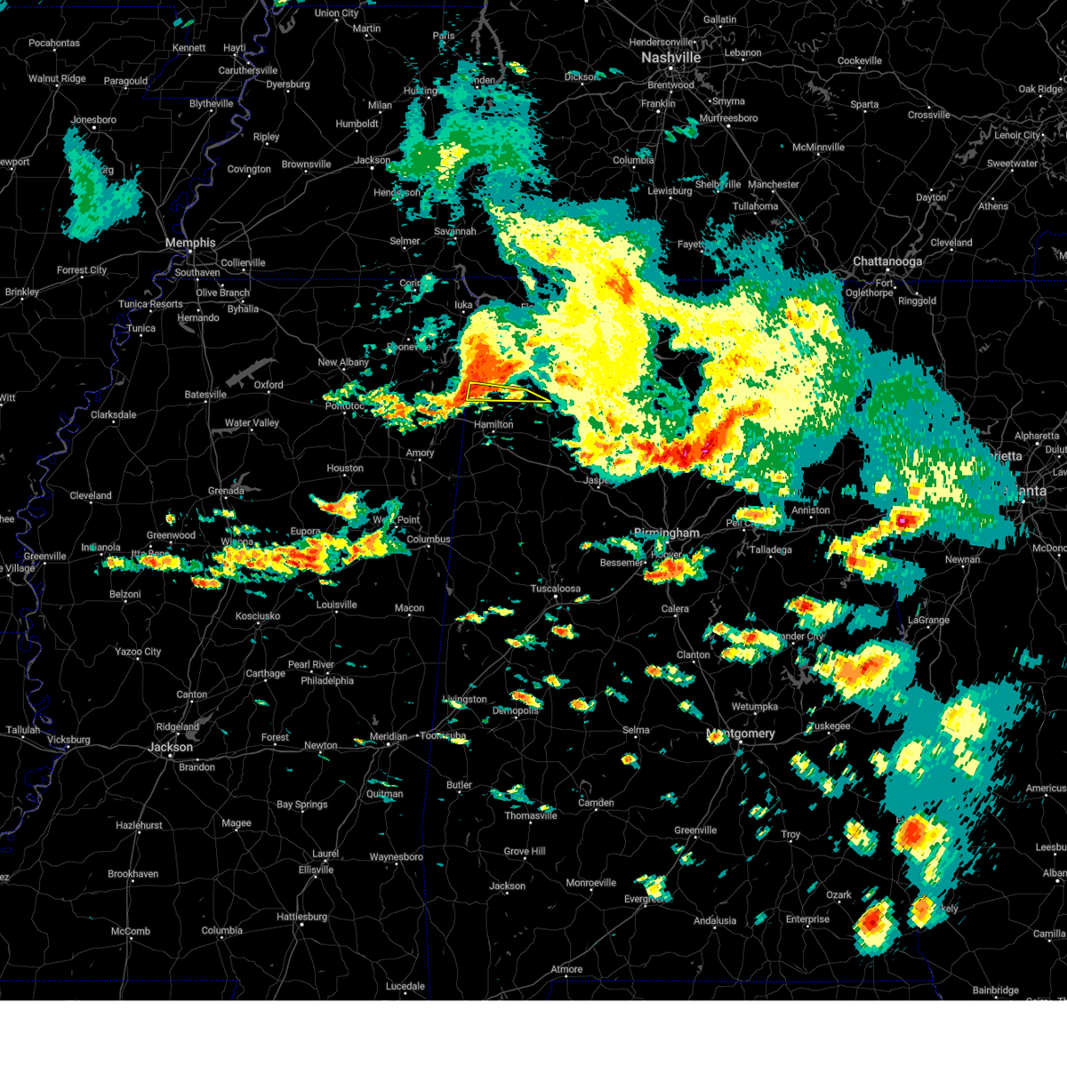 At 1214 pm cdt, a severe thunderstorm was located 10 miles southeast of red bay, moving southeast at 45 mph (radar indicated). Hazards include 60 mph wind gusts and quarter size hail. Hail damage to vehicles is expected. expect wind damage to roofs, siding, and trees. locations impacted include, phil campbell, vina, hodges, duketon and atwood. hail threat, radar indicated max hail size, 1. 00 in wind threat, radar indicated max wind gust, 60 mph. At 1214 pm cdt, a severe thunderstorm was located 10 miles southeast of red bay, moving southeast at 45 mph (radar indicated). Hazards include 60 mph wind gusts and quarter size hail. Hail damage to vehicles is expected. expect wind damage to roofs, siding, and trees. locations impacted include, phil campbell, vina, hodges, duketon and atwood. hail threat, radar indicated max hail size, 1. 00 in wind threat, radar indicated max wind gust, 60 mph.
|
| 6/14/2023 11:57 AM CDT |
 At 1157 am cdt, a severe thunderstorm was located near fairview, or 7 miles west of red bay, moving southeast at 45 mph (radar indicated). Hazards include 60 mph wind gusts and quarter size hail. Hail damage to vehicles is expected. Expect wind damage to roofs, siding, and trees. At 1157 am cdt, a severe thunderstorm was located near fairview, or 7 miles west of red bay, moving southeast at 45 mph (radar indicated). Hazards include 60 mph wind gusts and quarter size hail. Hail damage to vehicles is expected. Expect wind damage to roofs, siding, and trees.
|
| 6/14/2023 9:51 AM CDT | Trees and power lines were blown down along hwy. 19 outside of red ba in franklin county AL, 3.4 miles NNW of Red Bay, AL |
| 6/14/2023 9:51 AM CDT |
 At 951 am cdt, a severe thunderstorm was located over red bay, moving east at 35 mph (radar indicated). Hazards include two inch hail and 60 mph wind gusts. People and animals outdoors will be injured. expect hail damage to roofs, siding, windows, and vehicles. expect wind damage to roofs, siding, and trees. locations impacted include, russellville, red bay, belgreen, vina, hodges, atwood, duketon, rockwood, halltown and dempsey. thunderstorm damage threat, considerable hail threat, radar indicated max hail size, 2. 00 in wind threat, radar indicated max wind gust, 60 mph. At 951 am cdt, a severe thunderstorm was located over red bay, moving east at 35 mph (radar indicated). Hazards include two inch hail and 60 mph wind gusts. People and animals outdoors will be injured. expect hail damage to roofs, siding, windows, and vehicles. expect wind damage to roofs, siding, and trees. locations impacted include, russellville, red bay, belgreen, vina, hodges, atwood, duketon, rockwood, halltown and dempsey. thunderstorm damage threat, considerable hail threat, radar indicated max hail size, 2. 00 in wind threat, radar indicated max wind gust, 60 mph.
|
| 6/14/2023 9:42 AM CDT |
 At 942 am cdt, a severe thunderstorm was located near red bay, moving east at 40 mph (radar indicated). Hazards include ping pong ball size hail and 60 mph wind gusts. People and animals outdoors will be injured. expect hail damage to roofs, siding, windows, and vehicles. expect wind damage to roofs, siding, and trees. locations impacted include, belmont, fairview, golden and moores mill. hail threat, radar indicated max hail size, 1. 50 in wind threat, radar indicated max wind gust, 60 mph. At 942 am cdt, a severe thunderstorm was located near red bay, moving east at 40 mph (radar indicated). Hazards include ping pong ball size hail and 60 mph wind gusts. People and animals outdoors will be injured. expect hail damage to roofs, siding, windows, and vehicles. expect wind damage to roofs, siding, and trees. locations impacted include, belmont, fairview, golden and moores mill. hail threat, radar indicated max hail size, 1. 50 in wind threat, radar indicated max wind gust, 60 mph.
|
| 6/14/2023 9:41 AM CDT |
 At 940 am cdt, a severe thunderstorm was located over belmont, or near red bay, moving east at 35 mph (radar indicated). Hazards include 60 mph wind gusts and quarter size hail. Hail damage to vehicles is expected. Expect wind damage to roofs, siding, and trees. At 940 am cdt, a severe thunderstorm was located over belmont, or near red bay, moving east at 35 mph (radar indicated). Hazards include 60 mph wind gusts and quarter size hail. Hail damage to vehicles is expected. Expect wind damage to roofs, siding, and trees.
|
| 6/14/2023 9:37 AM CDT |
 At 936 am cdt, a severe thunderstorm was located near fairview, or 9 miles west of red bay, moving east at 45 mph (radar indicated). Hazards include 60 mph wind gusts and quarter size hail. Hail damage to vehicles is expected. Expect wind damage to roofs, siding, and trees. At 936 am cdt, a severe thunderstorm was located near fairview, or 9 miles west of red bay, moving east at 45 mph (radar indicated). Hazards include 60 mph wind gusts and quarter size hail. Hail damage to vehicles is expected. Expect wind damage to roofs, siding, and trees.
|
| 3/24/2023 10:32 PM CDT |
 At 1030 pm cdt, severe thunderstorms were located along a line extending from near cloverdale to near cherokee to near red bay, moving east at 45 mph (radar indicated). Hazards include 60 mph wind gusts and half dollar size hail. Hail damage to vehicles is expected. expect wind damage to roofs, siding, and trees. Locations impacted include, florence, muscle shoals, russellville, sheffield, tuscumbia, red bay, killen, cherokee, littleville and leighton. At 1030 pm cdt, severe thunderstorms were located along a line extending from near cloverdale to near cherokee to near red bay, moving east at 45 mph (radar indicated). Hazards include 60 mph wind gusts and half dollar size hail. Hail damage to vehicles is expected. expect wind damage to roofs, siding, and trees. Locations impacted include, florence, muscle shoals, russellville, sheffield, tuscumbia, red bay, killen, cherokee, littleville and leighton.
|
| 3/24/2023 10:21 PM CDT |
 At 1020 pm cdt, a severe thunderstorm capable of producing a tornado was located near tishomingo, or near tishomingo state park, moving northeast at 60 mph (radar indicated rotation). Hazards include tornado and golf ball size hail. Flying debris will be dangerous to those caught without shelter. mobile homes will be damaged or destroyed. damage to roofs, windows, and vehicles will occur. tree damage is likely. Locations impacted include, tishomingo state park, belmont, tishomingo, burton, midway, golden, paden, dennis, moores mill, bloody springs, carter branch, mingo, petertown and neil. At 1020 pm cdt, a severe thunderstorm capable of producing a tornado was located near tishomingo, or near tishomingo state park, moving northeast at 60 mph (radar indicated rotation). Hazards include tornado and golf ball size hail. Flying debris will be dangerous to those caught without shelter. mobile homes will be damaged or destroyed. damage to roofs, windows, and vehicles will occur. tree damage is likely. Locations impacted include, tishomingo state park, belmont, tishomingo, burton, midway, golden, paden, dennis, moores mill, bloody springs, carter branch, mingo, petertown and neil.
|
| 3/24/2023 10:14 PM CDT |
 At 1013 pm cdt, a severe thunderstorm capable of producing a tornado was located over burton, or 7 miles west of tishomingo state park, moving east at 55 mph (radar indicated rotation). Hazards include tornado and golf ball size hail. Flying debris will be dangerous to those caught without shelter. mobile homes will be damaged or destroyed. damage to roofs, windows, and vehicles will occur. tree damage is likely. Locations impacted include, tishomingo state park, belmont, tishomingo, sandy springs, burton, midway, marietta, golden, paden, thrasher, dennis, moores mill, bloody springs, kirkville, carter branch, mingo, hobo station, petertown, neil and altitude. At 1013 pm cdt, a severe thunderstorm capable of producing a tornado was located over burton, or 7 miles west of tishomingo state park, moving east at 55 mph (radar indicated rotation). Hazards include tornado and golf ball size hail. Flying debris will be dangerous to those caught without shelter. mobile homes will be damaged or destroyed. damage to roofs, windows, and vehicles will occur. tree damage is likely. Locations impacted include, tishomingo state park, belmont, tishomingo, sandy springs, burton, midway, marietta, golden, paden, thrasher, dennis, moores mill, bloody springs, kirkville, carter branch, mingo, hobo station, petertown, neil and altitude.
|
| 3/24/2023 10:14 PM CDT |
 At 1013 pm cdt, severe thunderstorms were located along a line extending from near waterloo to near iuka to near tishomingo to near belmont, moving east at 60 mph (radar indicated). Hazards include 60 mph wind gusts and quarter size hail. Hail damage to vehicles is expected. expect wind damage to roofs, siding, and trees. Locations impacted include, florence, muscle shoals, russellville, sheffield, tuscumbia, red bay, killen, cherokee, littleville and leighton. At 1013 pm cdt, severe thunderstorms were located along a line extending from near waterloo to near iuka to near tishomingo to near belmont, moving east at 60 mph (radar indicated). Hazards include 60 mph wind gusts and quarter size hail. Hail damage to vehicles is expected. expect wind damage to roofs, siding, and trees. Locations impacted include, florence, muscle shoals, russellville, sheffield, tuscumbia, red bay, killen, cherokee, littleville and leighton.
|
| 3/24/2023 10:05 PM CDT |
 At 1004 pm cdt, severe thunderstorms were located along a line extending from near waterloo to midway to burton, moving east at 50 mph (radar indicated). Hazards include 60 mph wind gusts and quarter size hail. Hail damage to vehicles is expected. Expect wind damage to roofs, siding, and trees. At 1004 pm cdt, severe thunderstorms were located along a line extending from near waterloo to midway to burton, moving east at 50 mph (radar indicated). Hazards include 60 mph wind gusts and quarter size hail. Hail damage to vehicles is expected. Expect wind damage to roofs, siding, and trees.
|
| 3/24/2023 9:54 PM CDT |
 At 954 pm cdt, a severe thunderstorm capable of producing a tornado was located over baldwyn, moving east at 55 mph (radar indicated rotation). Hazards include tornado and golf ball size hail. Flying debris will be dangerous to those caught without shelter. mobile homes will be damaged or destroyed. damage to roofs, windows, and vehicles will occur. Tree damage is likely. At 954 pm cdt, a severe thunderstorm capable of producing a tornado was located over baldwyn, moving east at 55 mph (radar indicated rotation). Hazards include tornado and golf ball size hail. Flying debris will be dangerous to those caught without shelter. mobile homes will be damaged or destroyed. damage to roofs, windows, and vehicles will occur. Tree damage is likely.
|
| 3/3/2023 9:50 AM CST | Numerous reports of trees and power lines down near red ba in franklin county AL, 0.7 miles NW of Red Bay, AL |
| 3/3/2023 9:36 AM CST |
 At 935 am cst, a severe thunderstorm capable of producing a tornado was located over sandy springs, or 11 miles west of red bay, moving northeast at 60 mph (radar indicated rotation). Hazards include tornado. Flying debris will be dangerous to those caught without shelter. mobile homes will be damaged or destroyed. damage to roofs, windows, and vehicles will occur. tree damage is likely. this dangerous storm will be near, red bay and belmont around 945 am cst. tishomingo state park around 950 am cst. Other locations impacted by this tornadic thunderstorm include mingo, dennis, moores mill, bloody springs, petertown, neil and golden. At 935 am cst, a severe thunderstorm capable of producing a tornado was located over sandy springs, or 11 miles west of red bay, moving northeast at 60 mph (radar indicated rotation). Hazards include tornado. Flying debris will be dangerous to those caught without shelter. mobile homes will be damaged or destroyed. damage to roofs, windows, and vehicles will occur. tree damage is likely. this dangerous storm will be near, red bay and belmont around 945 am cst. tishomingo state park around 950 am cst. Other locations impacted by this tornadic thunderstorm include mingo, dennis, moores mill, bloody springs, petertown, neil and golden.
|
| 3/3/2023 9:27 AM CST |
 At 926 am cst, severe thunderstorms were located along a line extending from glen to near amory, moving northeast at 60 mph (radar indicated). Hazards include 60 mph wind gusts. expect damage to roofs, siding, and trees At 926 am cst, severe thunderstorms were located along a line extending from glen to near amory, moving northeast at 60 mph (radar indicated). Hazards include 60 mph wind gusts. expect damage to roofs, siding, and trees
|
| 3/3/2023 9:27 AM CST |
 At 927 am cst, a severe thunderstorm capable of producing a tornado was located over mantachie, or near fulton, moving northeast at 50 mph (radar indicated rotation). Hazards include tornado. Flying debris will be dangerous to those caught without shelter. mobile homes will be damaged or destroyed. damage to roofs, windows, and vehicles will occur. tree damage is likely. this dangerous storm will be near, sandy springs and fairview around 935 am cst. belmont around 950 am cst. tishomingo state park around 955 am cst. Other locations impacted by this tornadic thunderstorm include eastman, mingo, dennis, moores mill, bloody springs, petertown, neil and golden. At 927 am cst, a severe thunderstorm capable of producing a tornado was located over mantachie, or near fulton, moving northeast at 50 mph (radar indicated rotation). Hazards include tornado. Flying debris will be dangerous to those caught without shelter. mobile homes will be damaged or destroyed. damage to roofs, windows, and vehicles will occur. tree damage is likely. this dangerous storm will be near, sandy springs and fairview around 935 am cst. belmont around 950 am cst. tishomingo state park around 955 am cst. Other locations impacted by this tornadic thunderstorm include eastman, mingo, dennis, moores mill, bloody springs, petertown, neil and golden.
|
| 3/1/2023 9:42 PM CST |
 At 942 pm cst, severe thunderstorms were located along a line extending from near tishomingo state park to near fairview to near evergreen, moving east at 70 mph (radar indicated). Hazards include 60 mph wind gusts. expect damage to roofs, siding, and trees At 942 pm cst, severe thunderstorms were located along a line extending from near tishomingo state park to near fairview to near evergreen, moving east at 70 mph (radar indicated). Hazards include 60 mph wind gusts. expect damage to roofs, siding, and trees
|
| 3/1/2023 8:09 PM CST |
 The tornado warning for northeastern itawamba, southern tishomingo and southeastern prentiss counties will expire at 815 pm cst, the storm which prompted the warning has moved out of the area. therefore, the warning will be allowed to expire. however heavy rain is still possible with this thunderstorm. a tornado watch remains in effect until 1000 pm cst for northeastern mississippi. The tornado warning for northeastern itawamba, southern tishomingo and southeastern prentiss counties will expire at 815 pm cst, the storm which prompted the warning has moved out of the area. therefore, the warning will be allowed to expire. however heavy rain is still possible with this thunderstorm. a tornado watch remains in effect until 1000 pm cst for northeastern mississippi.
|
| 3/1/2023 7:58 PM CST |
 At 758 pm cst, a severe thunderstorm capable of producing a tornado was located over belmont, or 7 miles northwest of red bay, moving east at 45 mph (radar indicated rotation). Hazards include tornado. Flying debris will be dangerous to those caught without shelter. mobile homes will be damaged or destroyed. damage to roofs, windows, and vehicles will occur. tree damage is likely. this dangerous storm will be near, red bay around 805 pm cst. belgreen around 830 pm cst. Other locations impacted by this tornadic thunderstorm include pleasant site, pogo, cedar creek reservoir, srygley church, dempsey, new bethel, crooked oak, little bear creek reservoir and halltown. At 758 pm cst, a severe thunderstorm capable of producing a tornado was located over belmont, or 7 miles northwest of red bay, moving east at 45 mph (radar indicated rotation). Hazards include tornado. Flying debris will be dangerous to those caught without shelter. mobile homes will be damaged or destroyed. damage to roofs, windows, and vehicles will occur. tree damage is likely. this dangerous storm will be near, red bay around 805 pm cst. belgreen around 830 pm cst. Other locations impacted by this tornadic thunderstorm include pleasant site, pogo, cedar creek reservoir, srygley church, dempsey, new bethel, crooked oak, little bear creek reservoir and halltown.
|
| 3/1/2023 7:57 PM CST |
 At 757 pm cst, a severe thunderstorm capable of producing a tornado was located near belmont, or 7 miles northwest of red bay, moving east at 45 mph (radar indicated rotation). Hazards include tornado. Flying debris will be dangerous to those caught without shelter. mobile homes will be damaged or destroyed. damage to roofs, windows, and vehicles will occur. tree damage is likely. this dangerous storm will be near, red bay, tishomingo state park and belmont around 805 pm cst. Other locations impacted by this tornadic thunderstorm include neil, dennis, moores mill and golden. At 757 pm cst, a severe thunderstorm capable of producing a tornado was located near belmont, or 7 miles northwest of red bay, moving east at 45 mph (radar indicated rotation). Hazards include tornado. Flying debris will be dangerous to those caught without shelter. mobile homes will be damaged or destroyed. damage to roofs, windows, and vehicles will occur. tree damage is likely. this dangerous storm will be near, red bay, tishomingo state park and belmont around 805 pm cst. Other locations impacted by this tornadic thunderstorm include neil, dennis, moores mill and golden.
|
| 1/3/2023 10:45 AM CST | Trees and powerlines down on hwy 24 in franklin county AL, 10.1 miles SW of Red Bay, AL |
| 1/3/2023 10:41 AM CST |
 At 1040 am cst, severe thunderstorms were located along a line extending from near cherokee to 7 miles east of tishomingo state park to near red bay, moving east at 45 mph (radar indicated). Hazards include 60 mph wind gusts. Expect damage to roofs, siding, and trees. Locations impacted include, florence, muscle shoals, russellville, sheffield, tuscumbia, red bay, phil campbell, cherokee, littleville and belgreen. At 1040 am cst, severe thunderstorms were located along a line extending from near cherokee to 7 miles east of tishomingo state park to near red bay, moving east at 45 mph (radar indicated). Hazards include 60 mph wind gusts. Expect damage to roofs, siding, and trees. Locations impacted include, florence, muscle shoals, russellville, sheffield, tuscumbia, red bay, phil campbell, cherokee, littleville and belgreen.
|
| 1/3/2023 10:14 AM CST |
 At 1013 am cst, severe thunderstorms were located along a line extending from near midway to 6 miles south of burton to near fairview, moving east at 45 mph (radar indicated). Hazards include 60 mph wind gusts. expect damage to roofs, siding, and trees At 1013 am cst, severe thunderstorms were located along a line extending from near midway to 6 miles south of burton to near fairview, moving east at 45 mph (radar indicated). Hazards include 60 mph wind gusts. expect damage to roofs, siding, and trees
|
| 11/29/2022 11:13 PM CST |
 At 1113 pm cst, a severe thunderstorm was located 10 miles south of cherokee, moving east at 45 mph (radar indicated). Hazards include 60 mph wind gusts. expect damage to roofs, siding, and trees At 1113 pm cst, a severe thunderstorm was located 10 miles south of cherokee, moving east at 45 mph (radar indicated). Hazards include 60 mph wind gusts. expect damage to roofs, siding, and trees
|
| 11/29/2022 2:05 PM CST |
 The severe thunderstorm warning for southwestern colbert and northwestern franklin counties will expire at 215 pm cst, the storm which prompted the warning has moved out of the area. therefore, the warning will be allowed to expire. to report severe weather, contact your nearest law enforcement agency. they will relay your report to the national weather service huntsville alabama. The severe thunderstorm warning for southwestern colbert and northwestern franklin counties will expire at 215 pm cst, the storm which prompted the warning has moved out of the area. therefore, the warning will be allowed to expire. to report severe weather, contact your nearest law enforcement agency. they will relay your report to the national weather service huntsville alabama.
|
| 11/29/2022 1:38 PM CST |
 At 138 pm cst, a severe thunderstorm was located near tishomingo state park, moving east at 50 mph (radar indicated). Hazards include 60 mph wind gusts and half dollar size hail. Hail damage to vehicles is expected. Expect wind damage to roofs, siding, and trees. At 138 pm cst, a severe thunderstorm was located near tishomingo state park, moving east at 50 mph (radar indicated). Hazards include 60 mph wind gusts and half dollar size hail. Hail damage to vehicles is expected. Expect wind damage to roofs, siding, and trees.
|
| 6/17/2022 2:23 PM CDT |
 At 222 pm cdt, emergency management officials reported trees down along highway 11 from a severe thunderstorm that was located 7 miles south of red bay, moving south at 20 mph (emergency management). Hazards include 60 mph wind gusts and half dollar size hail. Hail damage to vehicles is expected. expect wind damage to roofs, siding, and trees. locations impacted include, vina. hail threat, radar indicated max hail size, 1. 25 in wind threat, radar indicated max wind gust, 60 mph. At 222 pm cdt, emergency management officials reported trees down along highway 11 from a severe thunderstorm that was located 7 miles south of red bay, moving south at 20 mph (emergency management). Hazards include 60 mph wind gusts and half dollar size hail. Hail damage to vehicles is expected. expect wind damage to roofs, siding, and trees. locations impacted include, vina. hail threat, radar indicated max hail size, 1. 25 in wind threat, radar indicated max wind gust, 60 mph.
|
| 6/17/2022 2:20 PM CDT | A few trees down along hwy 11 in red ba in franklin county AL, 0.7 miles NW of Red Bay, AL |
| 6/17/2022 2:19 PM CDT |
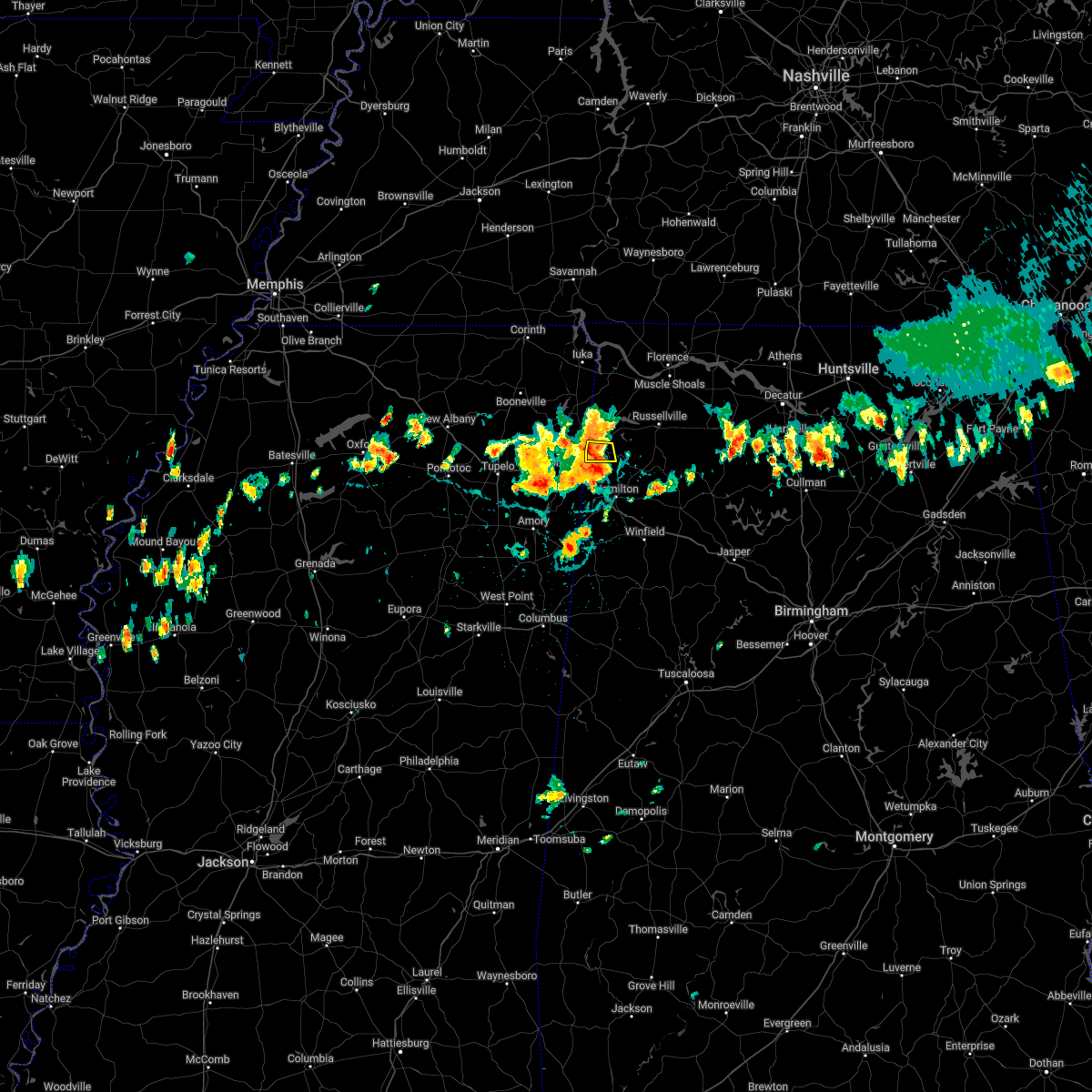 At 219 pm cdt, a severe thunderstorm was located near red bay, moving south at 20 mph (radar indicated). Hazards include 60 mph wind gusts and half dollar size hail. Hail damage to vehicles is expected. expect wind damage to roofs, siding, and trees. locations impacted include, vina. hail threat, radar indicated max hail size, 1. 25 in wind threat, radar indicated max wind gust, 60 mph. At 219 pm cdt, a severe thunderstorm was located near red bay, moving south at 20 mph (radar indicated). Hazards include 60 mph wind gusts and half dollar size hail. Hail damage to vehicles is expected. expect wind damage to roofs, siding, and trees. locations impacted include, vina. hail threat, radar indicated max hail size, 1. 25 in wind threat, radar indicated max wind gust, 60 mph.
|
| 6/17/2022 2:04 PM CDT |
 At 204 pm cdt, a severe thunderstorm was located over red bay, moving south at 20 mph (radar indicated). Hazards include 60 mph wind gusts and half dollar size hail. Hail damage to vehicles is expected. Expect wind damage to roofs, siding, and trees. At 204 pm cdt, a severe thunderstorm was located over red bay, moving south at 20 mph (radar indicated). Hazards include 60 mph wind gusts and half dollar size hail. Hail damage to vehicles is expected. Expect wind damage to roofs, siding, and trees.
|
| 6/8/2022 5:54 PM CDT |
 At 553 pm cdt, severe thunderstorms were located along a line extending from near town creek to near russellville to 8 miles southwest of belgreen, moving southeast at 15 mph (radar indicated). Hazards include 60 mph wind gusts and quarter size hail. Hail damage to vehicles is expected. expect wind damage to roofs, siding, and trees. locations impacted include, russellville, moulton, red bay, phil campbell, belgreen, vina, hodges, mt hope, cedar creek reservoir and atwood. hail threat, radar indicated max hail size, 1. 00 in wind threat, radar indicated max wind gust, 60 mph. At 553 pm cdt, severe thunderstorms were located along a line extending from near town creek to near russellville to 8 miles southwest of belgreen, moving southeast at 15 mph (radar indicated). Hazards include 60 mph wind gusts and quarter size hail. Hail damage to vehicles is expected. expect wind damage to roofs, siding, and trees. locations impacted include, russellville, moulton, red bay, phil campbell, belgreen, vina, hodges, mt hope, cedar creek reservoir and atwood. hail threat, radar indicated max hail size, 1. 00 in wind threat, radar indicated max wind gust, 60 mph.
|
| 6/8/2022 5:37 PM CDT |
 At 537 pm cdt, severe thunderstorms were located along a line extending from town creek to near russellville to 7 miles east of red bay, moving southeast at 15 mph (radar indicated). Hazards include 60 mph wind gusts and half dollar size hail. Hail damage to vehicles is expected. Expect wind damage to roofs, siding, and trees. At 537 pm cdt, severe thunderstorms were located along a line extending from town creek to near russellville to 7 miles east of red bay, moving southeast at 15 mph (radar indicated). Hazards include 60 mph wind gusts and half dollar size hail. Hail damage to vehicles is expected. Expect wind damage to roofs, siding, and trees.
|
| 5/25/2022 3:35 PM CDT |
 At 335 pm cdt, a severe thunderstorm was located near tishomingo state park, moving northeast at 60 mph (radar indicated). Hazards include 60 mph wind gusts. expect damage to roofs, siding, and trees At 335 pm cdt, a severe thunderstorm was located near tishomingo state park, moving northeast at 60 mph (radar indicated). Hazards include 60 mph wind gusts. expect damage to roofs, siding, and trees
|
| 5/25/2022 3:22 PM CDT |
 At 321 pm cdt, severe thunderstorms were located along a line extending from near sandy springs to near fairview to near tremont, moving northeast at 70 mph (radar indicated). Hazards include 70 mph wind gusts. Expect considerable tree damage. damage is likely to mobile homes, roofs, and outbuildings. locations impacted include, red bay, tishomingo state park, belmont, tremont, tishomingo, sandy springs, fairview, burton, clay, marietta, golden, paden, eastman, thrasher, turon, dennis, moores mill, bloody springs, kirkville and mingo. thunderstorm damage threat, considerable hail threat, radar indicated max hail size, <. 75 in wind threat, radar indicated max wind gust, 70 mph. At 321 pm cdt, severe thunderstorms were located along a line extending from near sandy springs to near fairview to near tremont, moving northeast at 70 mph (radar indicated). Hazards include 70 mph wind gusts. Expect considerable tree damage. damage is likely to mobile homes, roofs, and outbuildings. locations impacted include, red bay, tishomingo state park, belmont, tremont, tishomingo, sandy springs, fairview, burton, clay, marietta, golden, paden, eastman, thrasher, turon, dennis, moores mill, bloody springs, kirkville and mingo. thunderstorm damage threat, considerable hail threat, radar indicated max hail size, <. 75 in wind threat, radar indicated max wind gust, 70 mph.
|
| 5/25/2022 3:13 PM CDT |
 At 313 pm cdt, severe thunderstorms were located along a line extending from near mantachie to near fulton to near new salem, moving northeast at 70 mph (radar indicated). Hazards include 60 mph wind gusts. Expect damage to roofs, siding, and trees. locations impacted include, tupelo, fulton, red bay, tishomingo state park, belmont, mantachie, smithville, tremont, tishomingo, fairview, burton, new salem, sandy springs, clay, marietta, golden, paden, abney, eastman and thrasher. hail threat, radar indicated max hail size, <. 75 in wind threat, radar indicated max wind gust, 60 mph. At 313 pm cdt, severe thunderstorms were located along a line extending from near mantachie to near fulton to near new salem, moving northeast at 70 mph (radar indicated). Hazards include 60 mph wind gusts. Expect damage to roofs, siding, and trees. locations impacted include, tupelo, fulton, red bay, tishomingo state park, belmont, mantachie, smithville, tremont, tishomingo, fairview, burton, new salem, sandy springs, clay, marietta, golden, paden, abney, eastman and thrasher. hail threat, radar indicated max hail size, <. 75 in wind threat, radar indicated max wind gust, 60 mph.
|
| 5/25/2022 3:03 PM CDT |
 At 303 pm cdt, severe thunderstorms were located along a line extending from near tombigbee state park to near evergreen to near smithville, moving northeast at 60 mph (radar indicated). Hazards include 60 mph wind gusts. expect damage to roofs, siding, and trees At 303 pm cdt, severe thunderstorms were located along a line extending from near tombigbee state park to near evergreen to near smithville, moving northeast at 60 mph (radar indicated). Hazards include 60 mph wind gusts. expect damage to roofs, siding, and trees
|
| 4/13/2022 7:32 PM CDT |
 At 731 pm cdt, severe thunderstorms were located along a line extending from near jumpertown to near saltillo, moving east at 55 mph (radar indicated). Hazards include 70 mph wind gusts. Expect considerable tree damage. damage is likely to mobile homes, roofs, and outbuildings. locations impacted include, tupelo, booneville, pontotoc, fulton, baldwyn, red bay, trace state park, tombigbee state park, tishomingo state park, saltillo, guntown, belmont, mantachie, tremont, tishomingo, fairview, new harmony, pratts friendship, burton and wheeler. thunderstorm damage threat, considerable hail threat, radar indicated max hail size, <. 75 in wind threat, radar indicated max wind gust, 70 mph. At 731 pm cdt, severe thunderstorms were located along a line extending from near jumpertown to near saltillo, moving east at 55 mph (radar indicated). Hazards include 70 mph wind gusts. Expect considerable tree damage. damage is likely to mobile homes, roofs, and outbuildings. locations impacted include, tupelo, booneville, pontotoc, fulton, baldwyn, red bay, trace state park, tombigbee state park, tishomingo state park, saltillo, guntown, belmont, mantachie, tremont, tishomingo, fairview, new harmony, pratts friendship, burton and wheeler. thunderstorm damage threat, considerable hail threat, radar indicated max hail size, <. 75 in wind threat, radar indicated max wind gust, 70 mph.
|
| 4/13/2022 7:26 PM CDT |
 At 725 pm cdt, severe thunderstorms were located along a line extending from near jumpertown to near tupelo, moving east at 65 mph (radar indicated). Hazards include 70 mph wind gusts. Expect considerable tree damage. damage is likely to mobile homes, roofs, and outbuildings. locations impacted include, tupelo, booneville, pontotoc, fulton, baldwyn, red bay, trace state park, tombigbee state park, tishomingo state park, saltillo, guntown, belmont, mantachie, ecru, jumpertown, tremont, tishomingo, thrashers, fairview and new harmony. thunderstorm damage threat, considerable hail threat, radar indicated max hail size, <. 75 in wind threat, radar indicated max wind gust, 70 mph. At 725 pm cdt, severe thunderstorms were located along a line extending from near jumpertown to near tupelo, moving east at 65 mph (radar indicated). Hazards include 70 mph wind gusts. Expect considerable tree damage. damage is likely to mobile homes, roofs, and outbuildings. locations impacted include, tupelo, booneville, pontotoc, fulton, baldwyn, red bay, trace state park, tombigbee state park, tishomingo state park, saltillo, guntown, belmont, mantachie, ecru, jumpertown, tremont, tishomingo, thrashers, fairview and new harmony. thunderstorm damage threat, considerable hail threat, radar indicated max hail size, <. 75 in wind threat, radar indicated max wind gust, 70 mph.
|
| 4/13/2022 7:13 PM CDT |
 At 713 pm cdt, severe thunderstorms were located along a line extending from near blue mountain to near ecru, moving east at 55 mph (radar indicated). Hazards include 70 mph wind gusts. Expect considerable tree damage. Damage is likely to mobile homes, roofs, and outbuildings. At 713 pm cdt, severe thunderstorms were located along a line extending from near blue mountain to near ecru, moving east at 55 mph (radar indicated). Hazards include 70 mph wind gusts. Expect considerable tree damage. Damage is likely to mobile homes, roofs, and outbuildings.
|
| 3/30/2022 8:10 PM CDT |
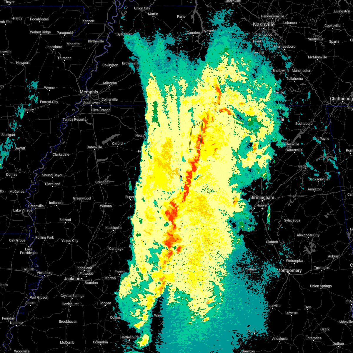 The severe thunderstorm warning for southwestern colbert and western franklin counties will expire at 815 pm cdt, the storm which prompted the warning has moved out of the area. therefore, the warning will be allowed to expire. a tornado watch remains in effect until 100 am cdt for northwestern alabama. The severe thunderstorm warning for southwestern colbert and western franklin counties will expire at 815 pm cdt, the storm which prompted the warning has moved out of the area. therefore, the warning will be allowed to expire. a tornado watch remains in effect until 100 am cdt for northwestern alabama.
|
| 3/30/2022 7:51 PM CDT |
 At 751 pm cdt, a severe thunderstorm was located near red bay, moving northeast at 60 mph (radar indicated). Hazards include 60 mph wind gusts. expect damage to roofs, siding, and trees At 751 pm cdt, a severe thunderstorm was located near red bay, moving northeast at 60 mph (radar indicated). Hazards include 60 mph wind gusts. expect damage to roofs, siding, and trees
|
| 3/30/2022 7:42 PM CDT |
 The severe thunderstorm warning for western lauderdale, colbert and franklin counties will expire at 745 pm cdt, the storms which prompted the warning have moved out of the area. therefore, the warning will be allowed to expire. a tornado watch remains in effect until 100 am cdt for northwestern alabama. remember, a severe thunderstorm warning still remains in effect for portions of lauderdale, colbert, and franklin counties until 845 pm cdt. The severe thunderstorm warning for western lauderdale, colbert and franklin counties will expire at 745 pm cdt, the storms which prompted the warning have moved out of the area. therefore, the warning will be allowed to expire. a tornado watch remains in effect until 100 am cdt for northwestern alabama. remember, a severe thunderstorm warning still remains in effect for portions of lauderdale, colbert, and franklin counties until 845 pm cdt.
|
| 3/30/2022 7:14 PM CDT |
 At 714 pm cdt, severe thunderstorms were located along a line extending from 11 miles north of olive hill to 7 miles south of red bay, moving northeast at 60 mph (radar indicated). Hazards include 60 mph wind gusts. Expect damage to roofs, siding, and trees. Locations impacted include, florence, muscle shoals, russellville, sheffield, tuscumbia, red bay, phil campbell, cherokee, underwood-petersville and belgreen. At 714 pm cdt, severe thunderstorms were located along a line extending from 11 miles north of olive hill to 7 miles south of red bay, moving northeast at 60 mph (radar indicated). Hazards include 60 mph wind gusts. Expect damage to roofs, siding, and trees. Locations impacted include, florence, muscle shoals, russellville, sheffield, tuscumbia, red bay, phil campbell, cherokee, underwood-petersville and belgreen.
|
| 3/30/2022 6:47 PM CDT |
 At 646 pm cdt, severe thunderstorms were located along a line extending from near adamsville to near evergreen, moving northeast at 55 mph (radar indicated). Hazards include 60 mph wind gusts. expect damage to roofs, siding, and trees At 646 pm cdt, severe thunderstorms were located along a line extending from near adamsville to near evergreen, moving northeast at 55 mph (radar indicated). Hazards include 60 mph wind gusts. expect damage to roofs, siding, and trees
|
| 3/22/2022 4:11 PM CDT |
 At 410 pm cdt, severe thunderstorms were located along a line extending from near burnsville to 7 miles north of weston, moving north at 60 mph. a weather station in corinth has reported 60 mph winds associated with this storm (radar indicated). Hazards include 60 mph wind gusts. Expect damage to roofs, siding, and trees. Locations impacted include, russellville, red bay, cherokee, belgreen, vina, hodges, waterloo, malone, posey loop and atwood. At 410 pm cdt, severe thunderstorms were located along a line extending from near burnsville to 7 miles north of weston, moving north at 60 mph. a weather station in corinth has reported 60 mph winds associated with this storm (radar indicated). Hazards include 60 mph wind gusts. Expect damage to roofs, siding, and trees. Locations impacted include, russellville, red bay, cherokee, belgreen, vina, hodges, waterloo, malone, posey loop and atwood.
|
| 3/22/2022 3:51 PM CDT |
 At 350 pm cdt, severe thunderstorms were located along a line extending from 8 miles east of wheeler to near sulligent, moving north at 60 mph. this storm has a history of producing tree damage (radar indicated). Hazards include 60 mph wind gusts. expect damage to roofs, siding, and trees At 350 pm cdt, severe thunderstorms were located along a line extending from 8 miles east of wheeler to near sulligent, moving north at 60 mph. this storm has a history of producing tree damage (radar indicated). Hazards include 60 mph wind gusts. expect damage to roofs, siding, and trees
|
| 2/22/2022 9:25 PM CST |
 At 925 pm cst, a severe thunderstorm was located 8 miles southeast of red bay, moving east at 55 mph (radar indicated). Hazards include 60 mph wind gusts and quarter size hail. Hail damage to vehicles is expected. Expect wind damage to roofs, siding, and trees. At 925 pm cst, a severe thunderstorm was located 8 miles southeast of red bay, moving east at 55 mph (radar indicated). Hazards include 60 mph wind gusts and quarter size hail. Hail damage to vehicles is expected. Expect wind damage to roofs, siding, and trees.
|
| 12/11/2021 5:38 AM CST |
 At 537 am cst, severe thunderstorms were located along a line extending from 6 miles north of st. florian to near red bay, moving southeast at 20 mph (radar indicated). Hazards include 60 mph wind gusts. Expect damage to roofs, siding, and trees. locations impacted include, florence, muscle shoals, russellville, sheffield, tuscumbia, red bay, killen, littleville, lexington and leighton. hail threat, radar indicated max hail size, <. 75 in wind threat, radar indicated max wind gust, 60 mph. At 537 am cst, severe thunderstorms were located along a line extending from 6 miles north of st. florian to near red bay, moving southeast at 20 mph (radar indicated). Hazards include 60 mph wind gusts. Expect damage to roofs, siding, and trees. locations impacted include, florence, muscle shoals, russellville, sheffield, tuscumbia, red bay, killen, littleville, lexington and leighton. hail threat, radar indicated max hail size, <. 75 in wind threat, radar indicated max wind gust, 60 mph.
|
| 12/11/2021 5:27 AM CST |
 At 527 am cst, severe thunderstorms were located along a line extending from 7 miles north of st. florian to near red bay, moving southeast at 20 mph (radar indicated). Hazards include 70 mph wind gusts. Expect considerable tree damage. Damage is likely to mobile homes, roofs, and outbuildings. At 527 am cst, severe thunderstorms were located along a line extending from 7 miles north of st. florian to near red bay, moving southeast at 20 mph (radar indicated). Hazards include 70 mph wind gusts. Expect considerable tree damage. Damage is likely to mobile homes, roofs, and outbuildings.
|
| 12/11/2021 5:11 AM CST |
 At 511 am cst, severe thunderstorms were located along a line extending from 12 miles west of underwood-petersville to near cherokee to 7 miles northeast of tishomingo state park, moving northeast at 55 mph (radar indicated). Hazards include 70 mph wind gusts. Expect considerable tree damage. damage is likely to mobile homes, roofs, and outbuildings. locations impacted include, florence, muscle shoals, russellville, sheffield, tuscumbia, red bay, cherokee, littleville, st. florian and underwood-petersville. thunderstorm damage threat, considerable hail threat, radar indicated max hail size, <. 75 in wind threat, radar indicated max wind gust, 70 mph. At 511 am cst, severe thunderstorms were located along a line extending from 12 miles west of underwood-petersville to near cherokee to 7 miles northeast of tishomingo state park, moving northeast at 55 mph (radar indicated). Hazards include 70 mph wind gusts. Expect considerable tree damage. damage is likely to mobile homes, roofs, and outbuildings. locations impacted include, florence, muscle shoals, russellville, sheffield, tuscumbia, red bay, cherokee, littleville, st. florian and underwood-petersville. thunderstorm damage threat, considerable hail threat, radar indicated max hail size, <. 75 in wind threat, radar indicated max wind gust, 70 mph.
|
| 12/11/2021 4:59 AM CST |
 At 458 am cst, severe thunderstorms were located along a line extending from 6 miles west of cherokee to near tishomingo state park, moving northeast at 55 mph (radar indicated). Hazards include 70 mph wind gusts. Expect considerable tree damage. Damage is likely to mobile homes, roofs, and outbuildings. At 458 am cst, severe thunderstorms were located along a line extending from 6 miles west of cherokee to near tishomingo state park, moving northeast at 55 mph (radar indicated). Hazards include 70 mph wind gusts. Expect considerable tree damage. Damage is likely to mobile homes, roofs, and outbuildings.
|
| 12/11/2021 4:29 AM CST |
 At 429 am cst, severe thunderstorms were located along a line extending from near midway to 6 miles east of wheeler to near guntown, moving northeast at 60 mph (radar indicated). Hazards include 70 mph wind gusts. Expect considerable tree damage. Damage is likely to mobile homes, roofs, and outbuildings. At 429 am cst, severe thunderstorms were located along a line extending from near midway to 6 miles east of wheeler to near guntown, moving northeast at 60 mph (radar indicated). Hazards include 70 mph wind gusts. Expect considerable tree damage. Damage is likely to mobile homes, roofs, and outbuildings.
|
| 12/6/2021 6:25 AM CST |
 The severe thunderstorm warning for southwestern colbert and franklin counties will expire at 630 am cst, the storms which prompted the warning have weakened below severe limits, and no longer pose an immediate threat to life or property. therefore, the warning will be allowed to expire. however gusty winds are still possible with these thunderstorms. The severe thunderstorm warning for southwestern colbert and franklin counties will expire at 630 am cst, the storms which prompted the warning have weakened below severe limits, and no longer pose an immediate threat to life or property. therefore, the warning will be allowed to expire. however gusty winds are still possible with these thunderstorms.
|
| 12/6/2021 6:21 AM CST |
 At 621 am cst, severe thunderstorms were located along a line extending from 6 miles south of cherokee to 6 miles northeast of red bay to near fulton, moving east at 55 mph (radar indicated). Hazards include 60 mph wind gusts. Expect damage to roofs, siding, and trees. locations impacted include, russellville, red bay, belgreen, vina, hodges, pogo, cedar creek reservoir, atwood, srygley church and duketon. hail threat, radar indicated max hail size, <. 75 in wind threat, radar indicated max wind gust, 60 mph. At 621 am cst, severe thunderstorms were located along a line extending from 6 miles south of cherokee to 6 miles northeast of red bay to near fulton, moving east at 55 mph (radar indicated). Hazards include 60 mph wind gusts. Expect damage to roofs, siding, and trees. locations impacted include, russellville, red bay, belgreen, vina, hodges, pogo, cedar creek reservoir, atwood, srygley church and duketon. hail threat, radar indicated max hail size, <. 75 in wind threat, radar indicated max wind gust, 60 mph.
|
| 12/6/2021 6:01 AM CST |
 At 601 am cst, severe thunderstorms were located along a line extending from near midway to near sandy springs to near tupelo, moving east at 55 mph (radar indicated). Hazards include 60 mph wind gusts. expect damage to roofs, siding, and trees At 601 am cst, severe thunderstorms were located along a line extending from near midway to near sandy springs to near tupelo, moving east at 55 mph (radar indicated). Hazards include 60 mph wind gusts. expect damage to roofs, siding, and trees
|
| 12/6/2021 5:57 AM CST |
 At 556 am cst, severe thunderstorms were located along a line extending from near burton to 6 miles northwest of sandy springs to near saltillo, moving east at 65 mph (radar indicated). Hazards include 60 mph wind gusts. Expect damage to roofs, siding, and trees. locations impacted include, booneville, baldwyn, red bay, tishomingo state park, saltillo, guntown, belmont, mantachie, ecru, tishomingo, fairview, midway, new harmony, pratts friendship, burton, wheeler, sandy springs, blair, sherman and marietta. hail threat, radar indicated max hail size, <. 75 in wind threat, radar indicated max wind gust, 60 mph. At 556 am cst, severe thunderstorms were located along a line extending from near burton to 6 miles northwest of sandy springs to near saltillo, moving east at 65 mph (radar indicated). Hazards include 60 mph wind gusts. Expect damage to roofs, siding, and trees. locations impacted include, booneville, baldwyn, red bay, tishomingo state park, saltillo, guntown, belmont, mantachie, ecru, tishomingo, fairview, midway, new harmony, pratts friendship, burton, wheeler, sandy springs, blair, sherman and marietta. hail threat, radar indicated max hail size, <. 75 in wind threat, radar indicated max wind gust, 60 mph.
|
| 12/6/2021 5:35 AM CST |
 At 535 am cst, severe thunderstorms were located along a line extending from near jumpertown to near blair to near ecru, moving east at 70 mph (radar indicated). Hazards include 60 mph wind gusts. expect damage to roofs, siding, and trees At 535 am cst, severe thunderstorms were located along a line extending from near jumpertown to near blair to near ecru, moving east at 70 mph (radar indicated). Hazards include 60 mph wind gusts. expect damage to roofs, siding, and trees
|
| 6/13/2021 12:46 PM CDT |
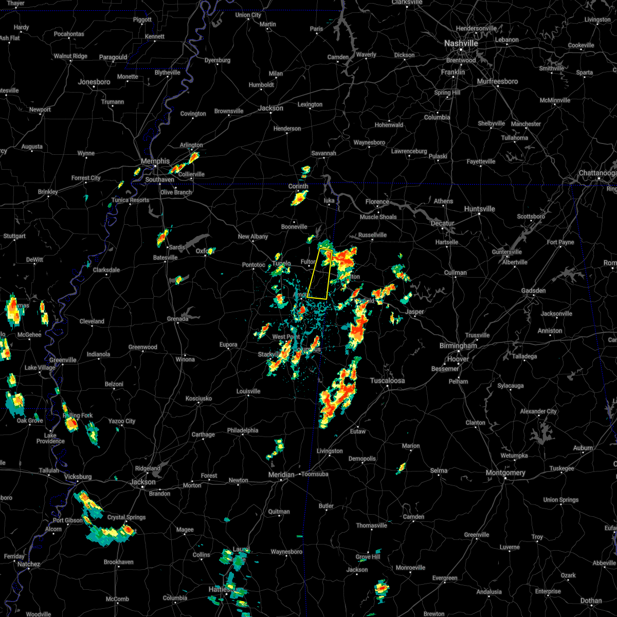 At 1246 pm cdt, a severe thunderstorm was located near fairview, or 8 miles southwest of red bay, moving south at 45 mph (radar indicated). Hazards include quarter size hail. damage to vehicles is expected At 1246 pm cdt, a severe thunderstorm was located near fairview, or 8 miles southwest of red bay, moving south at 45 mph (radar indicated). Hazards include quarter size hail. damage to vehicles is expected
|
| 6/8/2021 3:34 PM CDT |
 At 333 pm cdt, a severe thunderstorm was located near fairview, or 7 miles southwest of red bay, moving northeast at 25 mph (radar indicated). Hazards include 60 mph wind gusts. Expect damage to roofs, siding, and trees. Locations impacted include, red bay, belmont, golden, eastman, dennis, bounds crossroads and bloody springs. At 333 pm cdt, a severe thunderstorm was located near fairview, or 7 miles southwest of red bay, moving northeast at 25 mph (radar indicated). Hazards include 60 mph wind gusts. Expect damage to roofs, siding, and trees. Locations impacted include, red bay, belmont, golden, eastman, dennis, bounds crossroads and bloody springs.
|
| 6/8/2021 3:12 PM CDT |
 At 311 pm cdt, a severe thunderstorm was located near mantachie, or near fulton, moving northeast at 25 mph (radar indicated). Hazards include 60 mph wind gusts. expect damage to roofs, siding, and trees At 311 pm cdt, a severe thunderstorm was located near mantachie, or near fulton, moving northeast at 25 mph (radar indicated). Hazards include 60 mph wind gusts. expect damage to roofs, siding, and trees
|
| 6/2/2021 3:39 PM CDT |
 The severe thunderstorm warning for western colbert and western franklin counties will expire at 345 pm cdt, the storm which prompted the warning has weakened below severe limits, and no longer poses an immediate threat to life or property. therefore, the warning will be allowed to expire. however, small hail and gusty winds are still possible with these thunderstorms. to report severe weather, contact your nearest law enforcement agency. they will relay your report to the national weather service in huntsville. The severe thunderstorm warning for western colbert and western franklin counties will expire at 345 pm cdt, the storm which prompted the warning has weakened below severe limits, and no longer poses an immediate threat to life or property. therefore, the warning will be allowed to expire. however, small hail and gusty winds are still possible with these thunderstorms. to report severe weather, contact your nearest law enforcement agency. they will relay your report to the national weather service in huntsville.
|
| 6/2/2021 3:32 PM CDT |
 At 332 pm cdt, a severe thunderstorm was located near the cedar creek reservoir, or 11 miles west of russellville, moving northeast at 30 mph (radar indicated). Hazards include 60 mph wind gusts and quarter size hail. Hail damage to vehicles is expected. expect wind damage to roofs, siding, and trees. Locations impacted include, red bay, cherokee, vina, posey loop, cedar creek reservoir, atwood, srygley church, barton, halltown and red rock. At 332 pm cdt, a severe thunderstorm was located near the cedar creek reservoir, or 11 miles west of russellville, moving northeast at 30 mph (radar indicated). Hazards include 60 mph wind gusts and quarter size hail. Hail damage to vehicles is expected. expect wind damage to roofs, siding, and trees. Locations impacted include, red bay, cherokee, vina, posey loop, cedar creek reservoir, atwood, srygley church, barton, halltown and red rock.
|
| 6/2/2021 3:14 PM CDT |
 At 314 pm cdt, a severe thunderstorm was located near red bay, moving north at 30 mph (radar indicated). Hazards include 60 mph wind gusts and quarter size hail. Hail damage to vehicles is expected. Expect wind damage to roofs, siding, and trees. At 314 pm cdt, a severe thunderstorm was located near red bay, moving north at 30 mph (radar indicated). Hazards include 60 mph wind gusts and quarter size hail. Hail damage to vehicles is expected. Expect wind damage to roofs, siding, and trees.
|
| 5/6/2021 6:07 PM CDT |
 At 606 pm cdt, severe thunderstorms were located along a line extending from 8 miles northwest of athens to near courtland to near phil campbell to 8 miles north of weston, moving southeast at 45 mph (emergency management and doppler radar). Hazards include 60 mph wind gusts. Expect damage to roofs, siding, and trees. Locations impacted include, northwestern huntsville, decatur, madison, athens, hartselle, russellville, moulton, meridianville, moores mill and hazel green. At 606 pm cdt, severe thunderstorms were located along a line extending from 8 miles northwest of athens to near courtland to near phil campbell to 8 miles north of weston, moving southeast at 45 mph (emergency management and doppler radar). Hazards include 60 mph wind gusts. Expect damage to roofs, siding, and trees. Locations impacted include, northwestern huntsville, decatur, madison, athens, hartselle, russellville, moulton, meridianville, moores mill and hazel green.
|
| 5/6/2021 5:31 PM CDT |
 At 529 pm cdt, severe thunderstorms were located along a line extending from near loretto to near underwood-petersville to 7 miles east of tishomingo state park to near sandy springs, moving southeast at 45 mph (radar indicated). Hazards include 60 mph wind gusts and nickel size hail. expect damage to roofs, siding, and trees At 529 pm cdt, severe thunderstorms were located along a line extending from near loretto to near underwood-petersville to 7 miles east of tishomingo state park to near sandy springs, moving southeast at 45 mph (radar indicated). Hazards include 60 mph wind gusts and nickel size hail. expect damage to roofs, siding, and trees
|
| 5/4/2021 3:37 PM CDT |
 The severe thunderstorm warning for itawamba and southeastern lee counties will expire at 345 pm cdt, the storm which prompted the warning has weakened below severe limits, and no longer poses an immediate threat to life or property. therefore, the warning will be allowed to expire. however gusty winds are still possible with this thunderstorm. a severe thunderstorm watch remains in effect until 700 pm cdt for northeastern mississippi. The severe thunderstorm warning for itawamba and southeastern lee counties will expire at 345 pm cdt, the storm which prompted the warning has weakened below severe limits, and no longer poses an immediate threat to life or property. therefore, the warning will be allowed to expire. however gusty winds are still possible with this thunderstorm. a severe thunderstorm watch remains in effect until 700 pm cdt for northeastern mississippi.
|
| 5/4/2021 3:17 PM CDT |
 At 317 pm cdt, a severe thunderstorm was located near mantachie, or near fulton, moving east at 45 mph (radar indicated). Hazards include 60 mph wind gusts. expect damage to roofs, siding, and trees At 317 pm cdt, a severe thunderstorm was located near mantachie, or near fulton, moving east at 45 mph (radar indicated). Hazards include 60 mph wind gusts. expect damage to roofs, siding, and trees
|
| 5/2/2021 11:00 PM CDT |
 At 1100 pm cdt, doppler radar indicated a severe thunderstorm producing a tornado was located over belmont, or near red bay, moving northeast at 30 mph (radar indicated rotation). Hazards include tornado. Flying debris will be dangerous to those caught without shelter. mobile homes will be damaged or destroyed. damage to roofs, windows, and vehicles will occur. tree damage is likely. Locations impacted include, tishomingo state park, belmont, tishomingo, golden, mingo, dennis, moores mill, bloody springs, petertown, neil and carter branch. At 1100 pm cdt, doppler radar indicated a severe thunderstorm producing a tornado was located over belmont, or near red bay, moving northeast at 30 mph (radar indicated rotation). Hazards include tornado. Flying debris will be dangerous to those caught without shelter. mobile homes will be damaged or destroyed. damage to roofs, windows, and vehicles will occur. tree damage is likely. Locations impacted include, tishomingo state park, belmont, tishomingo, golden, mingo, dennis, moores mill, bloody springs, petertown, neil and carter branch.
|
| 5/2/2021 10:37 PM CDT |
 At 1036 pm cdt, a confirmed large and extremely dangerous tornado was located over sandy springs, or 12 miles north of fulton, moving northeast at 30 mph. this is a particularly dangerous situation. take cover now! (radar confirmed tornado). Hazards include damaging tornado. You are in a life-threatening situation. flying debris may be deadly to those caught without shelter. mobile homes will be destroyed. Considerable damage to homes, businesses, and vehicles is likely and complete destruction is possible. At 1036 pm cdt, a confirmed large and extremely dangerous tornado was located over sandy springs, or 12 miles north of fulton, moving northeast at 30 mph. this is a particularly dangerous situation. take cover now! (radar confirmed tornado). Hazards include damaging tornado. You are in a life-threatening situation. flying debris may be deadly to those caught without shelter. mobile homes will be destroyed. Considerable damage to homes, businesses, and vehicles is likely and complete destruction is possible.
|
| 4/8/2021 4:35 AM CDT |
 At 434 am cdt, a severe thunderstorm was located near red bay, moving northeast at 35 mph (radar indicated). Hazards include 60 mph wind gusts. expect damage to roofs, siding, and trees At 434 am cdt, a severe thunderstorm was located near red bay, moving northeast at 35 mph (radar indicated). Hazards include 60 mph wind gusts. expect damage to roofs, siding, and trees
|
| 3/28/2021 2:54 AM CDT |
 The severe thunderstorm warning for northern itawamba, northeastern lee, southern tishomingo and southeastern prentiss counties will expire at 300 am cdt, the storm which prompted the warning has moved out of the area. therefore, the warning will be allowed to expire. a tornado watch remains in effect until 400 am cdt for northeastern mississippi. The severe thunderstorm warning for northern itawamba, northeastern lee, southern tishomingo and southeastern prentiss counties will expire at 300 am cdt, the storm which prompted the warning has moved out of the area. therefore, the warning will be allowed to expire. a tornado watch remains in effect until 400 am cdt for northeastern mississippi.
|
| 3/28/2021 2:32 AM CDT |
 At 232 am cdt, a severe thunderstorm was located near sandy springs, or 8 miles north of fulton, moving east at 35 mph (radar indicated). Hazards include 60 mph wind gusts. Expect damage to roofs, siding, and trees. Locations impacted include, tupelo, fulton, belmont, mantachie, sandy springs, fairview, pratts friendship, marietta, golden, skyline, eastman, chapelville, thrasher, dennis, moores mill, mooreville, eggville, kirkville, unity and bounds crossroads. At 232 am cdt, a severe thunderstorm was located near sandy springs, or 8 miles north of fulton, moving east at 35 mph (radar indicated). Hazards include 60 mph wind gusts. Expect damage to roofs, siding, and trees. Locations impacted include, tupelo, fulton, belmont, mantachie, sandy springs, fairview, pratts friendship, marietta, golden, skyline, eastman, chapelville, thrasher, dennis, moores mill, mooreville, eggville, kirkville, unity and bounds crossroads.
|
| 3/28/2021 2:14 AM CDT |
 At 214 am cdt, a severe thunderstorm was located near pratts friendship, or 9 miles south of baldwyn, moving east at 35 mph (radar indicated). Hazards include 60 mph wind gusts. expect damage to roofs, siding, and trees At 214 am cdt, a severe thunderstorm was located near pratts friendship, or 9 miles south of baldwyn, moving east at 35 mph (radar indicated). Hazards include 60 mph wind gusts. expect damage to roofs, siding, and trees
|
| 3/28/2021 1:36 AM CDT |
 At 135 am cdt, a severe thunderstorm was located near ecru, or near pontotoc, moving east at 60 mph (radar indicated). Hazards include 60 mph wind gusts. expect damage to roofs, siding, and trees At 135 am cdt, a severe thunderstorm was located near ecru, or near pontotoc, moving east at 60 mph (radar indicated). Hazards include 60 mph wind gusts. expect damage to roofs, siding, and trees
|
| 3/25/2021 3:23 PM CDT |
 At 322 pm cdt, doppler radar indicated a severe thunderstorm producing a tornado was located near fairview, or near red bay, moving northeast at 45 mph (radar indicated rotation). Hazards include tornado and quarter size hail. Flying debris will be dangerous to those caught without shelter. mobile homes will be damaged or destroyed. damage to roofs, windows, and vehicles will occur. Tree damage is likely. At 322 pm cdt, doppler radar indicated a severe thunderstorm producing a tornado was located near fairview, or near red bay, moving northeast at 45 mph (radar indicated rotation). Hazards include tornado and quarter size hail. Flying debris will be dangerous to those caught without shelter. mobile homes will be damaged or destroyed. damage to roofs, windows, and vehicles will occur. Tree damage is likely.
|
| 3/25/2021 3:14 PM CDT |
 At 314 pm cdt, doppler radar indicated a severe thunderstorm producing a tornado was located over fairview, or 7 miles northeast of fulton, moving northeast at 45 mph (radar indicated rotation). Hazards include tornado and quarter size hail. Flying debris will be dangerous to those caught without shelter. mobile homes will be damaged or destroyed. damage to roofs, windows, and vehicles will occur. Tree damage is likely. At 314 pm cdt, doppler radar indicated a severe thunderstorm producing a tornado was located over fairview, or 7 miles northeast of fulton, moving northeast at 45 mph (radar indicated rotation). Hazards include tornado and quarter size hail. Flying debris will be dangerous to those caught without shelter. mobile homes will be damaged or destroyed. damage to roofs, windows, and vehicles will occur. Tree damage is likely.
|
| 3/17/2021 8:11 PM CDT |
 A severe thunderstorm warning remains in effect until 830 pm cdt for northern itawamba. southern tishomingo and southeastern prentiss counties. at 811 pm cdt, a severe thunderstorm was located 8 miles east of wheeler, or 10 miles east of baldwyn, moving northeast at 60 mph. hazard. 60 mph wind gusts. A severe thunderstorm warning remains in effect until 830 pm cdt for northern itawamba. southern tishomingo and southeastern prentiss counties. at 811 pm cdt, a severe thunderstorm was located 8 miles east of wheeler, or 10 miles east of baldwyn, moving northeast at 60 mph. hazard. 60 mph wind gusts.
|
| 3/17/2021 8:04 PM CDT |
 At 804 pm cdt, a severe thunderstorm was located near pratts friendship, or 8 miles southeast of baldwyn, moving northeast at 60 mph (radar indicated). Hazards include 60 mph wind gusts. Expect damage to roofs, siding, and trees. Locations impacted include, tupelo, fulton, baldwyn, red bay, tombigbee state park, guntown, belmont, plantersville, mantachie, tremont, fairview, wheeler, pratts friendship, sandy springs, clay, marietta, golden, eastman, thrasher and dennis. At 804 pm cdt, a severe thunderstorm was located near pratts friendship, or 8 miles southeast of baldwyn, moving northeast at 60 mph (radar indicated). Hazards include 60 mph wind gusts. Expect damage to roofs, siding, and trees. Locations impacted include, tupelo, fulton, baldwyn, red bay, tombigbee state park, guntown, belmont, plantersville, mantachie, tremont, fairview, wheeler, pratts friendship, sandy springs, clay, marietta, golden, eastman, thrasher and dennis.
|
| 3/17/2021 7:44 PM CDT |
 At 744 pm cdt, a severe thunderstorm was located over plantersville, or near verona, moving northeast at 55 mph (radar indicated). Hazards include 60 mph wind gusts. expect damage to roofs, siding, and trees At 744 pm cdt, a severe thunderstorm was located over plantersville, or near verona, moving northeast at 55 mph (radar indicated). Hazards include 60 mph wind gusts. expect damage to roofs, siding, and trees
|
| 3/17/2021 4:11 PM CDT |
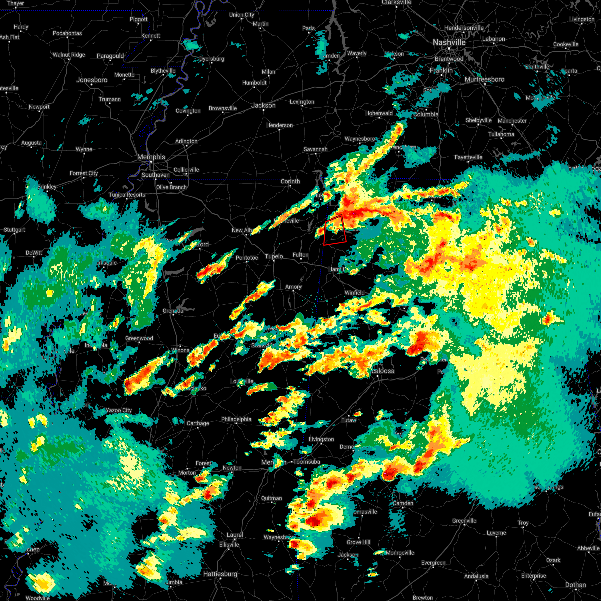 The tornado warning for southwestern colbert and northwestern franklin counties will expire at 415 pm cdt, the storm which prompted the warning has moved out of the area. therefore, the warning will be allowed to expire. a tornado watch remains in effect until 700 pm cdt for northwestern alabama. The tornado warning for southwestern colbert and northwestern franklin counties will expire at 415 pm cdt, the storm which prompted the warning has moved out of the area. therefore, the warning will be allowed to expire. a tornado watch remains in effect until 700 pm cdt for northwestern alabama.
|
| 3/17/2021 3:40 PM CDT |
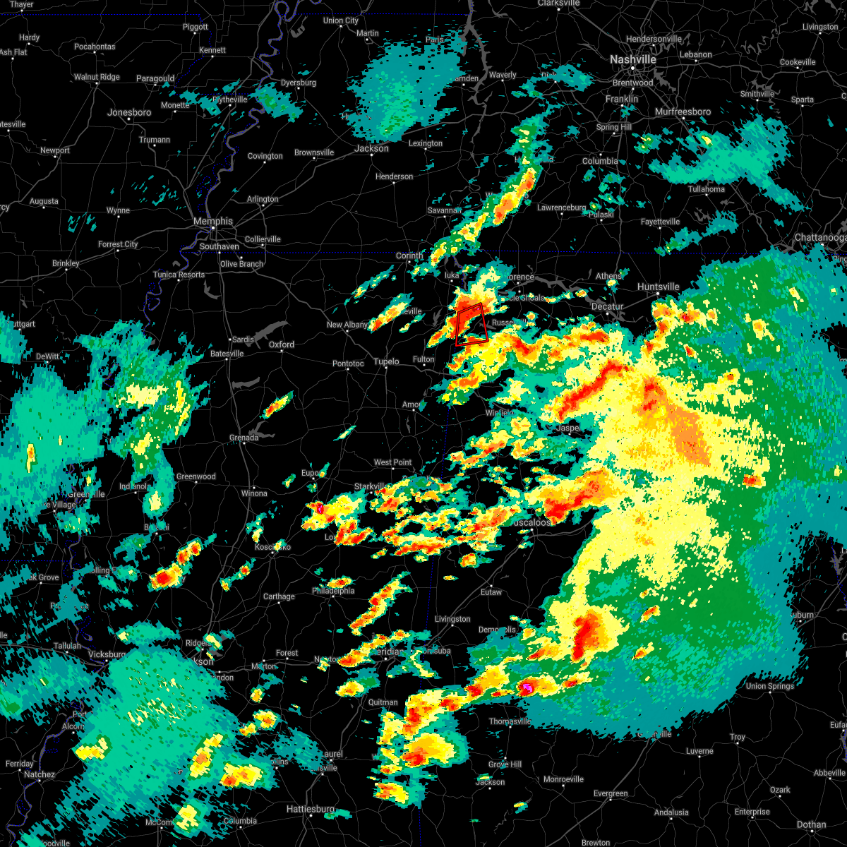 At 339 pm cdt, a severe thunderstorm capable of producing a tornado was located near red bay, moving east at 25 mph (radar indicated rotation). Hazards include tornado and quarter size hail. Flying debris will be dangerous to those caught without shelter. mobile homes will be damaged or destroyed. damage to roofs, windows, and vehicles will occur. Tree damage is likely. At 339 pm cdt, a severe thunderstorm capable of producing a tornado was located near red bay, moving east at 25 mph (radar indicated rotation). Hazards include tornado and quarter size hail. Flying debris will be dangerous to those caught without shelter. mobile homes will be damaged or destroyed. damage to roofs, windows, and vehicles will occur. Tree damage is likely.
|
| 3/17/2021 3:18 PM CDT |
 At 317 pm cdt, doppler radar indicated a severe thunderstorm producing a tornado was located near sandy springs, or 10 miles west of red bay, moving east at 20 mph (radar indicated rotation). Hazards include tornado and quarter size hail. Flying debris will be dangerous to those caught without shelter. mobile homes will be damaged or destroyed. damage to roofs, windows, and vehicles will occur. Tree damage is likely. At 317 pm cdt, doppler radar indicated a severe thunderstorm producing a tornado was located near sandy springs, or 10 miles west of red bay, moving east at 20 mph (radar indicated rotation). Hazards include tornado and quarter size hail. Flying debris will be dangerous to those caught without shelter. mobile homes will be damaged or destroyed. damage to roofs, windows, and vehicles will occur. Tree damage is likely.
|
| 8/28/2020 8:56 PM CDT | Red bay pd reports trees and power lines down on newell road. several power outages in the area of red ba in franklin county AL, 1.2 miles WNW of Red Bay, AL |
| 7/21/2020 5:09 PM CDT |
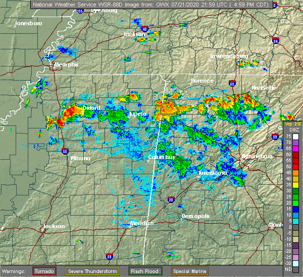 The severe thunderstorm warning for western franklin county will expire at 515 pm cdt, the storm which prompted the warning has weakened below severe limits, and no longer poses an immediate threat to life or property. therefore, the warning will be allowed to expire. however gusty winds and heavy rain are still possible with this thunderstorm. The severe thunderstorm warning for western franklin county will expire at 515 pm cdt, the storm which prompted the warning has weakened below severe limits, and no longer poses an immediate threat to life or property. therefore, the warning will be allowed to expire. however gusty winds and heavy rain are still possible with this thunderstorm.
|
| 7/21/2020 4:48 PM CDT | A tree was knocked down on highway 11 north just outside of red bay. time estimate in franklin county AL, 1.5 miles S of Red Bay, AL |
| 7/21/2020 4:48 PM CDT |
 At 448 pm cdt, a severe thunderstorm was located 7 miles southeast of red bay, moving northwest at 10 mph (radar indicated). Hazards include 60 mph wind gusts and quarter size hail. Hail damage to vehicles is expected. Expect wind damage to roofs, siding, and trees. At 448 pm cdt, a severe thunderstorm was located 7 miles southeast of red bay, moving northwest at 10 mph (radar indicated). Hazards include 60 mph wind gusts and quarter size hail. Hail damage to vehicles is expected. Expect wind damage to roofs, siding, and trees.
|
| 7/12/2020 11:12 AM CDT |
 At 1112 am cdt, severe thunderstorms were located along a line extending from near russellville to near belgreen to near red bay, moving southeast at 35 mph (radar indicated). Hazards include 60 mph wind gusts and penny size hail. expect damage to roofs, siding, and trees At 1112 am cdt, severe thunderstorms were located along a line extending from near russellville to near belgreen to near red bay, moving southeast at 35 mph (radar indicated). Hazards include 60 mph wind gusts and penny size hail. expect damage to roofs, siding, and trees
|
| 4/12/2020 3:35 PM CDT |
 At 334 pm cdt, a severe thunderstorm was located over tremont, or 8 miles southeast of fulton, moving east at 50 mph (radar indicated). Hazards include 60 mph wind gusts. expect damage to roofs, siding, and trees At 334 pm cdt, a severe thunderstorm was located over tremont, or 8 miles southeast of fulton, moving east at 50 mph (radar indicated). Hazards include 60 mph wind gusts. expect damage to roofs, siding, and trees
|
| 4/9/2020 12:01 AM CDT |
 At 1200 am cdt, a severe thunderstorm was located over midway, or near iuka, moving southeast at 50 mph (radar indicated). Hazards include 60 mph wind gusts and penny size hail. expect damage to roofs, siding, and trees At 1200 am cdt, a severe thunderstorm was located over midway, or near iuka, moving southeast at 50 mph (radar indicated). Hazards include 60 mph wind gusts and penny size hail. expect damage to roofs, siding, and trees
|
| 3/29/2020 1:11 AM CDT |
 At 111 am cdt, a severe thunderstorm was located near saltillo, or 7 miles north of tombigbee state park, moving northeast at 60 mph (radar indicated). Hazards include 60 mph wind gusts and quarter size hail. Hail damage to vehicles is expected. Expect wind damage to roofs, siding, and trees. At 111 am cdt, a severe thunderstorm was located near saltillo, or 7 miles north of tombigbee state park, moving northeast at 60 mph (radar indicated). Hazards include 60 mph wind gusts and quarter size hail. Hail damage to vehicles is expected. Expect wind damage to roofs, siding, and trees.
|
| 3/29/2020 1:02 AM CDT |
 At 102 am cdt, a severe thunderstorm was located near red bay, moving northeast at 50 mph (radar indicated). Hazards include 60 mph wind gusts and quarter size hail. Hail damage to vehicles is expected. Expect wind damage to roofs, siding, and trees. At 102 am cdt, a severe thunderstorm was located near red bay, moving northeast at 50 mph (radar indicated). Hazards include 60 mph wind gusts and quarter size hail. Hail damage to vehicles is expected. Expect wind damage to roofs, siding, and trees.
|
| 3/24/2020 6:29 PM CDT |
 At 629 pm cdt, a severe thunderstorm capable of producing a tornado was located near red bay, moving east at 40 mph (radar indicated rotation). Hazards include tornado and quarter size hail. Flying debris will be dangerous to those caught without shelter. mobile homes will be damaged or destroyed. damage to roofs, windows, and vehicles will occur. Tree damage is likely. At 629 pm cdt, a severe thunderstorm capable of producing a tornado was located near red bay, moving east at 40 mph (radar indicated rotation). Hazards include tornado and quarter size hail. Flying debris will be dangerous to those caught without shelter. mobile homes will be damaged or destroyed. damage to roofs, windows, and vehicles will occur. Tree damage is likely.
|
| 3/24/2020 6:24 PM CDT |
 At 623 pm cdt, a severe thunderstorm was located near fairview, or 8 miles southwest of red bay, moving east at 50 mph (radar indicated). Hazards include 60 mph wind gusts and quarter size hail. Hail damage to vehicles is expected. Expect wind damage to roofs, siding, and trees. At 623 pm cdt, a severe thunderstorm was located near fairview, or 8 miles southwest of red bay, moving east at 50 mph (radar indicated). Hazards include 60 mph wind gusts and quarter size hail. Hail damage to vehicles is expected. Expect wind damage to roofs, siding, and trees.
|
| 2/10/2020 3:20 AM CST |
 At 320 am cst, a severe thunderstorm was located near plantersville, or near tombigbee state park, moving northeast at 50 mph (radar indicated). Hazards include quarter size hail. Damage to vehicles is expected. Locations impacted include, tupelo, fulton, red bay, verona, tombigbee state park, belmont, shannon, plantersville, mantachie, tremont, fairview, new salem, sandy springs, evergreen, clay, nettleton, golden, abney, eastman and mooreville. At 320 am cst, a severe thunderstorm was located near plantersville, or near tombigbee state park, moving northeast at 50 mph (radar indicated). Hazards include quarter size hail. Damage to vehicles is expected. Locations impacted include, tupelo, fulton, red bay, verona, tombigbee state park, belmont, shannon, plantersville, mantachie, tremont, fairview, new salem, sandy springs, evergreen, clay, nettleton, golden, abney, eastman and mooreville.
|
| 2/10/2020 3:11 AM CST |
 At 311 am cst, a severe thunderstorm was located near shannon, or near verona, moving northeast at 50 mph (radar indicated). Hazards include quarter size hail. damage to vehicles is expected At 311 am cst, a severe thunderstorm was located near shannon, or near verona, moving northeast at 50 mph (radar indicated). Hazards include quarter size hail. damage to vehicles is expected
|
| 1/11/2020 8:13 AM CST |
 At 813 am cst, severe thunderstorms were located along a line extending from 7 miles northwest of belgreen to 9 miles south of red bay, moving east at 25 mph (radar indicated). Hazards include 60 mph wind gusts. expect damage to roofs, siding, and trees At 813 am cst, severe thunderstorms were located along a line extending from 7 miles northwest of belgreen to 9 miles south of red bay, moving east at 25 mph (radar indicated). Hazards include 60 mph wind gusts. expect damage to roofs, siding, and trees
|
| 1/11/2020 7:56 AM CST |
 At 756 am cst, severe thunderstorms were located along a line extending from 6 miles south of cherokee to 6 miles northeast of tremont, moving east at 40 mph (radar indicated). Hazards include 60 mph wind gusts. Expect damage to roofs, siding, and trees. Locations impacted include, russellville, red bay, phil campbell, littleville, belgreen, vina, hodges, pogo, cedar creek reservoir and atwood. At 756 am cst, severe thunderstorms were located along a line extending from 6 miles south of cherokee to 6 miles northeast of tremont, moving east at 40 mph (radar indicated). Hazards include 60 mph wind gusts. Expect damage to roofs, siding, and trees. Locations impacted include, russellville, red bay, phil campbell, littleville, belgreen, vina, hodges, pogo, cedar creek reservoir and atwood.
|
| 1/11/2020 7:37 AM CST |
 At 737 am cst, severe thunderstorms were located along a line extending from near tishomingo to near prairie, moving east at 50 mph (radar indicated). Hazards include 60 mph wind gusts. Expect damage to roofs, siding, and trees. Locations impacted include, amory, aberdeen, fulton, red bay, okolona, tishomingo state park, belmont, shannon, mantachie, smithville, tremont, tishomingo, prairie, fairview, new salem, new wren, trebloc, evergreen, clay and nettleton. At 737 am cst, severe thunderstorms were located along a line extending from near tishomingo to near prairie, moving east at 50 mph (radar indicated). Hazards include 60 mph wind gusts. Expect damage to roofs, siding, and trees. Locations impacted include, amory, aberdeen, fulton, red bay, okolona, tishomingo state park, belmont, shannon, mantachie, smithville, tremont, tishomingo, prairie, fairview, new salem, new wren, trebloc, evergreen, clay and nettleton.
|
| 1/11/2020 7:31 AM CST |
 At 730 am cst, severe thunderstorms were located along a line extending from near tishomingo to near new salem, moving east at 40 mph (radar indicated). Hazards include 60 mph wind gusts. expect damage to roofs, siding, and trees At 730 am cst, severe thunderstorms were located along a line extending from near tishomingo to near new salem, moving east at 40 mph (radar indicated). Hazards include 60 mph wind gusts. expect damage to roofs, siding, and trees
|
| 1/11/2020 7:31 AM CST |
 At 731 am cst, severe thunderstorms were located along a line extending from near burton to near trebloc, moving east at 30 mph (radar indicated). Hazards include 60 mph wind gusts. Expect damage to roofs, siding, and trees. Locations impacted include, tupelo, amory, aberdeen, fulton, red bay, verona, okolona, tombigbee state park, tishomingo state park, belmont, shannon, plantersville, mantachie, smithville, tremont, prairie, fairview, new salem, sandy springs and new wren. At 731 am cst, severe thunderstorms were located along a line extending from near burton to near trebloc, moving east at 30 mph (radar indicated). Hazards include 60 mph wind gusts. Expect damage to roofs, siding, and trees. Locations impacted include, tupelo, amory, aberdeen, fulton, red bay, verona, okolona, tombigbee state park, tishomingo state park, belmont, shannon, plantersville, mantachie, smithville, tremont, prairie, fairview, new salem, sandy springs and new wren.
|
| 1/11/2020 7:21 AM CST |
 At 721 am cst, severe thunderstorms were located along a line extending from near belmont to prairie, moving east at 50 mph (radar indicated). Hazards include 60 mph wind gusts. Expect damage to roofs, siding, and trees. Locations impacted include, tupelo, amory, aberdeen, fulton, red bay, verona, okolona, tombigbee state park, tishomingo state park, belmont, shannon, plantersville, mantachie, smithville, tremont, prairie, fairview, new salem, sandy springs and new wren. At 721 am cst, severe thunderstorms were located along a line extending from near belmont to prairie, moving east at 50 mph (radar indicated). Hazards include 60 mph wind gusts. Expect damage to roofs, siding, and trees. Locations impacted include, tupelo, amory, aberdeen, fulton, red bay, verona, okolona, tombigbee state park, tishomingo state park, belmont, shannon, plantersville, mantachie, smithville, tremont, prairie, fairview, new salem, sandy springs and new wren.
|
| 1/11/2020 7:08 AM CST |
 At 707 am cst, severe thunderstorms were located along a line extending from 8 miles east of wheeler to near trebloc, moving east at 50 mph (radar indicated). Hazards include 60 mph wind gusts. expect damage to roofs, siding, and trees At 707 am cst, severe thunderstorms were located along a line extending from 8 miles east of wheeler to near trebloc, moving east at 50 mph (radar indicated). Hazards include 60 mph wind gusts. expect damage to roofs, siding, and trees
|
| 1/11/2020 6:56 AM CST |
 At 655 am cst, doppler radar indicated a severe thunderstorm producing a tornado was located over wheeler, or near baldwyn, moving northeast at 50 mph (radar indicated rotation). Hazards include tornado. Flying debris will be dangerous to those caught without shelter. mobile homes will be damaged or destroyed. damage to roofs, windows, and vehicles will occur. Tree damage is likely. At 655 am cst, doppler radar indicated a severe thunderstorm producing a tornado was located over wheeler, or near baldwyn, moving northeast at 50 mph (radar indicated rotation). Hazards include tornado. Flying debris will be dangerous to those caught without shelter. mobile homes will be damaged or destroyed. damage to roofs, windows, and vehicles will occur. Tree damage is likely.
|
| 12/29/2019 5:30 PM CST |
 At 530 pm cst, a severe thunderstorm was located 7 miles northeast of tremont, or 8 miles south of red bay, moving northeast at 65 mph (radar indicated). Hazards include 60 mph wind gusts. expect damage to roofs, siding, and trees At 530 pm cst, a severe thunderstorm was located 7 miles northeast of tremont, or 8 miles south of red bay, moving northeast at 65 mph (radar indicated). Hazards include 60 mph wind gusts. expect damage to roofs, siding, and trees
|
| 12/16/2019 4:52 PM CST |
 At 451 pm cst, a line of severe thunderstorms extending from 8 miles south of collinwood to russellville to 10 miles southeast of red bay is moving east at 55 mph. this line of storms has a history of producing damaging winds and confirmed tornadoes (radar indicated). Hazards include 60 mph wind gusts. expect damage to roofs, siding, and trees At 451 pm cst, a line of severe thunderstorms extending from 8 miles south of collinwood to russellville to 10 miles southeast of red bay is moving east at 55 mph. this line of storms has a history of producing damaging winds and confirmed tornadoes (radar indicated). Hazards include 60 mph wind gusts. expect damage to roofs, siding, and trees
|
| 12/16/2019 4:26 PM CST |
 At 424 pm cst, a severe thunderstorm capable of producing a tornado was located over belmont, or near red bay, moving northeast at 55 mph. this line of storms has a history of producing confirmed tornadoes (radar indicated rotation). Hazards include tornado. Flying debris will be dangerous to those caught without shelter. mobile homes will be damaged or destroyed. damage to roofs, windows, and vehicles will occur. Tree damage is likely. At 424 pm cst, a severe thunderstorm capable of producing a tornado was located over belmont, or near red bay, moving northeast at 55 mph. this line of storms has a history of producing confirmed tornadoes (radar indicated rotation). Hazards include tornado. Flying debris will be dangerous to those caught without shelter. mobile homes will be damaged or destroyed. damage to roofs, windows, and vehicles will occur. Tree damage is likely.
|
| 12/16/2019 4:25 PM CST |
 At 424 pm cst, a severe thunderstorm was located over okolona, moving east at 55 mph (radar indicated). Hazards include 60 mph wind gusts. expect damage to roofs, siding, and trees At 424 pm cst, a severe thunderstorm was located over okolona, moving east at 55 mph (radar indicated). Hazards include 60 mph wind gusts. expect damage to roofs, siding, and trees
|
| 12/16/2019 3:59 PM CST |
 At 358 pm cst, severe thunderstorms were located along a line extending from jumpertown to 7 miles southwest of burton to near houston, moving east at 55 mph. this line of storms has a history of producing damaging wind gusts and tornadoes (radar indicated). Hazards include 60 mph wind gusts. expect damage to roofs, siding, and trees At 358 pm cst, severe thunderstorms were located along a line extending from jumpertown to 7 miles southwest of burton to near houston, moving east at 55 mph. this line of storms has a history of producing damaging wind gusts and tornadoes (radar indicated). Hazards include 60 mph wind gusts. expect damage to roofs, siding, and trees
|
| 6/27/2019 12:47 PM CDT | Emergency manager reports multiple trees down in red bay on hwy 247. time approximated by rada in franklin county AL, 3.9 miles W of Red Bay, AL |
| 6/27/2019 12:44 PM CDT |
 At 1244 pm cdt, a severe thunderstorm was located near red bay, moving southeast at 10 mph (radar indicated). Hazards include 60 mph wind gusts and quarter size hail. Hail damage to vehicles is expected. Expect wind damage to roofs, siding, and trees. At 1244 pm cdt, a severe thunderstorm was located near red bay, moving southeast at 10 mph (radar indicated). Hazards include 60 mph wind gusts and quarter size hail. Hail damage to vehicles is expected. Expect wind damage to roofs, siding, and trees.
|
| 6/20/2019 1:40 AM CDT |
 The national weather service in huntsville alabama has issued a * severe thunderstorm warning for. southern colbert county in northwestern alabama. franklin county in northwestern alabama. southwestern lawrence county in northwestern alabama. Until 215 am cdt. The national weather service in huntsville alabama has issued a * severe thunderstorm warning for. southern colbert county in northwestern alabama. franklin county in northwestern alabama. southwestern lawrence county in northwestern alabama. Until 215 am cdt.
|
| 4/14/2019 12:32 AM CDT |
 At 1231 am cdt, severe thunderstorms were located along a line extending from cherokee to near detroit, moving northeast at 50 mph (radar indicated). Hazards include 60 mph wind gusts and quarter size hail. Hail damage to vehicles is expected. Expect wind damage to roofs, siding, and trees. At 1231 am cdt, severe thunderstorms were located along a line extending from cherokee to near detroit, moving northeast at 50 mph (radar indicated). Hazards include 60 mph wind gusts and quarter size hail. Hail damage to vehicles is expected. Expect wind damage to roofs, siding, and trees.
|
| 4/14/2019 12:25 AM CDT | Possible tornado damage in the pike branch area. radar estimated from tds signature on rada in franklin county AL, 6 miles SSW of Red Bay, AL |
| 4/14/2019 12:14 AM CDT |
 At 1213 am cdt, a severe thunderstorm was located 7 miles west of belgreen, or 8 miles east of red bay, moving northeast at 50 mph (radar indicated). Hazards include 60 mph wind gusts and quarter size hail. Hail damage to vehicles is expected. expect wind damage to roofs, siding, and trees. locations impacted include, red bay, vina, pleasant site, pogo, mynot, cedar creek reservoir, atwood, srygley church, dempsey and maud. A tornado watch remains in effect until 300 am cdt for northwestern alabama. At 1213 am cdt, a severe thunderstorm was located 7 miles west of belgreen, or 8 miles east of red bay, moving northeast at 50 mph (radar indicated). Hazards include 60 mph wind gusts and quarter size hail. Hail damage to vehicles is expected. expect wind damage to roofs, siding, and trees. locations impacted include, red bay, vina, pleasant site, pogo, mynot, cedar creek reservoir, atwood, srygley church, dempsey and maud. A tornado watch remains in effect until 300 am cdt for northwestern alabama.
|
| 4/13/2019 11:54 PM CDT |
 At 1154 pm cdt, a severe thunderstorm capable of producing a tornado was located near tremont, or 11 miles northwest of hamilton, moving north at 40 mph (radar indicated rotation). Hazards include tornado and quarter size hail. Flying debris will be dangerous to those caught without shelter. mobile homes will be damaged or destroyed. damage to roofs, windows, and vehicles will occur. Tree damage is likely. At 1154 pm cdt, a severe thunderstorm capable of producing a tornado was located near tremont, or 11 miles northwest of hamilton, moving north at 40 mph (radar indicated rotation). Hazards include tornado and quarter size hail. Flying debris will be dangerous to those caught without shelter. mobile homes will be damaged or destroyed. damage to roofs, windows, and vehicles will occur. Tree damage is likely.
|
| 4/13/2019 11:49 PM CDT |
 At 1149 pm cdt, a severe thunderstorm was located near tremont, or 9 miles west of hamilton, moving northeast at 50 mph (radar indicated). Hazards include 60 mph wind gusts and quarter size hail. Hail damage to vehicles is expected. Expect wind damage to roofs, siding, and trees. At 1149 pm cdt, a severe thunderstorm was located near tremont, or 9 miles west of hamilton, moving northeast at 50 mph (radar indicated). Hazards include 60 mph wind gusts and quarter size hail. Hail damage to vehicles is expected. Expect wind damage to roofs, siding, and trees.
|
| 3/14/2019 1:18 PM CDT |
 At 117 pm cdt, a severe thunderstorm was located near tremont, or 8 miles southwest of red bay, moving northeast at 45 mph (radar indicated). Hazards include 60 mph wind gusts. expect damage to roofs, siding, and trees At 117 pm cdt, a severe thunderstorm was located near tremont, or 8 miles southwest of red bay, moving northeast at 45 mph (radar indicated). Hazards include 60 mph wind gusts. expect damage to roofs, siding, and trees
|
| 2/23/2019 4:56 PM CST |
 At 455 pm cst, a severe thunderstorm was located 8 miles northeast of tremont, or 9 miles south of red bay, moving northeast at 65 mph (radar indicated). Hazards include 60 mph wind gusts. expect damage to roofs, siding, and trees At 455 pm cst, a severe thunderstorm was located 8 miles northeast of tremont, or 9 miles south of red bay, moving northeast at 65 mph (radar indicated). Hazards include 60 mph wind gusts. expect damage to roofs, siding, and trees
|
| 11/6/2018 12:07 AM CST |
 The tornado warning for southwestern colbert and northwestern franklin counties will expire at 1215 am cst, the storm which prompted the warning has weakened below severe limits, and no longer appears capable of producing a tornado. therefore, the warning will be allowed to expire. however gusty winds are still possible with this thunderstorm. a tornado watch remains in effect until 600 am cst for northwestern alabama. The tornado warning for southwestern colbert and northwestern franklin counties will expire at 1215 am cst, the storm which prompted the warning has weakened below severe limits, and no longer appears capable of producing a tornado. therefore, the warning will be allowed to expire. however gusty winds are still possible with this thunderstorm. a tornado watch remains in effect until 600 am cst for northwestern alabama.
|
| 11/5/2018 11:58 PM CST |
 At 1157 pm cst, a confirmed tornado was located near red bay, moving east at 40 mph (radar confirmed tornado). Hazards include damaging tornado. Flying debris will be dangerous to those caught without shelter. mobile homes will be damaged or destroyed. damage to roofs, windows, and vehicles will occur. tree damage is likely. Locations impacted include, russellville, red bay, pleasant site, pogo, cedar creek reservoir, srygley church, dempsey, crooked oak, halltown and little bear creek reservoir. At 1157 pm cst, a confirmed tornado was located near red bay, moving east at 40 mph (radar confirmed tornado). Hazards include damaging tornado. Flying debris will be dangerous to those caught without shelter. mobile homes will be damaged or destroyed. damage to roofs, windows, and vehicles will occur. tree damage is likely. Locations impacted include, russellville, red bay, pleasant site, pogo, cedar creek reservoir, srygley church, dempsey, crooked oak, halltown and little bear creek reservoir.
|
| 11/5/2018 11:46 PM CST |
 At 1145 pm cst, a severe thunderstorm capable of producing a tornado was located over belmont, or near red bay, moving northeast at 40 mph (radar indicated rotation). Hazards include tornado. Flying debris will be dangerous to those caught without shelter. mobile homes will be damaged or destroyed. damage to roofs, windows, and vehicles will occur. Tree damage is likely. At 1145 pm cst, a severe thunderstorm capable of producing a tornado was located over belmont, or near red bay, moving northeast at 40 mph (radar indicated rotation). Hazards include tornado. Flying debris will be dangerous to those caught without shelter. mobile homes will be damaged or destroyed. damage to roofs, windows, and vehicles will occur. Tree damage is likely.
|
| 11/5/2018 11:30 PM CST |
 At 1130 pm cst, severe thunderstorms were located along a line extending from near midway to sandy springs, moving east at 60 mph (radar indicated). Hazards include 70 mph wind gusts. Expect considerable tree damage. Damage is likely to mobile homes, roofs, and outbuildings. At 1130 pm cst, severe thunderstorms were located along a line extending from near midway to sandy springs, moving east at 60 mph (radar indicated). Hazards include 70 mph wind gusts. Expect considerable tree damage. Damage is likely to mobile homes, roofs, and outbuildings.
|
| 11/1/2018 6:08 AM CDT |
 At 608 am cdt, severe thunderstorms were located along a line extending from walnut grove to 8 miles southeast of red bay, moving east at 50 mph (radar indicated). Hazards include 60 mph wind gusts. expect damage to roofs, siding, and trees At 608 am cdt, severe thunderstorms were located along a line extending from walnut grove to 8 miles southeast of red bay, moving east at 50 mph (radar indicated). Hazards include 60 mph wind gusts. expect damage to roofs, siding, and trees
|
| 11/1/2018 6:04 AM CDT |
 At 604 am cdt, a confirmed tornado was located over red bay, moving east at 50 mph (radar confirmed tornado). Hazards include damaging tornado. Flying debris will be dangerous to those caught without shelter. mobile homes will be damaged or destroyed. damage to roofs, windows, and vehicles will occur. tree damage is likely. Locations impacted include, red bay, belgreen, pleasant site, pogo, cedar creek reservoir, dempsey, halltown and little bear creek reservoir. At 604 am cdt, a confirmed tornado was located over red bay, moving east at 50 mph (radar confirmed tornado). Hazards include damaging tornado. Flying debris will be dangerous to those caught without shelter. mobile homes will be damaged or destroyed. damage to roofs, windows, and vehicles will occur. tree damage is likely. Locations impacted include, red bay, belgreen, pleasant site, pogo, cedar creek reservoir, dempsey, halltown and little bear creek reservoir.
|
| 11/1/2018 5:57 AM CDT |
 At 557 am cdt, a tornado producing storm was located near red bay, moving east at 50 mph (radar confirmed tornado). Hazards include damaging tornado. Flying debris will be dangerous to those caught without shelter. mobile homes will be damaged or destroyed. damage to roofs, windows, and vehicles will occur. Tree damage is likely. At 557 am cdt, a tornado producing storm was located near red bay, moving east at 50 mph (radar confirmed tornado). Hazards include damaging tornado. Flying debris will be dangerous to those caught without shelter. mobile homes will be damaged or destroyed. damage to roofs, windows, and vehicles will occur. Tree damage is likely.
|
| 11/1/2018 5:50 AM CDT |
 At 550 am cdt, a severe thunderstorm was located near fairview, or 8 miles west of red bay, moving northeast at 55 mph (radar indicated). Hazards include 60 mph wind gusts. expect damage to roofs, siding, and trees At 550 am cdt, a severe thunderstorm was located near fairview, or 8 miles west of red bay, moving northeast at 55 mph (radar indicated). Hazards include 60 mph wind gusts. expect damage to roofs, siding, and trees
|
| 11/1/2018 5:44 AM CDT |
 At 544 am cdt, severe thunderstorms were located along a line extending from pineflat to near tremont, moving east at 50 mph (radar indicated). Hazards include 60 mph wind gusts. expect damage to roofs, siding, and trees At 544 am cdt, severe thunderstorms were located along a line extending from pineflat to near tremont, moving east at 50 mph (radar indicated). Hazards include 60 mph wind gusts. expect damage to roofs, siding, and trees
|
| 5/30/2018 4:29 PM CDT |
 At 429 pm cdt, severe thunderstorms were located along a line extending from near cherokee to 8 miles northeast of red bay to 6 miles east of tremont, moving east at 40 mph (radar indicated). Hazards include 60 mph wind gusts. Expect damage to roofs, siding, and trees. Locations impacted include, russellville, tuscumbia, cherokee, belgreen, vina, hodges, posey loop, mt hester, cedar creek reservoir and atwood. At 429 pm cdt, severe thunderstorms were located along a line extending from near cherokee to 8 miles northeast of red bay to 6 miles east of tremont, moving east at 40 mph (radar indicated). Hazards include 60 mph wind gusts. Expect damage to roofs, siding, and trees. Locations impacted include, russellville, tuscumbia, cherokee, belgreen, vina, hodges, posey loop, mt hester, cedar creek reservoir and atwood.
|
| 5/30/2018 4:07 PM CDT |
 At 407 pm cdt, severe thunderstorms were located along a line extending from tishomingo to near belmont to near new salem, moving east at 40 mph (radar indicated). Hazards include 60 mph wind gusts and penny size hail. expect damage to roofs, siding, and trees At 407 pm cdt, severe thunderstorms were located along a line extending from tishomingo to near belmont to near new salem, moving east at 40 mph (radar indicated). Hazards include 60 mph wind gusts and penny size hail. expect damage to roofs, siding, and trees
|
| 5/20/2018 8:12 PM CDT |
 The severe thunderstorm warning for northwestern franklin county will expire at 815 pm cdt, the storm which prompted the warning has weakened below severe limits, and no longer poses an immediate threat to life or property. therefore, the warning will be allowed to expire. however hail up to the size of nickels and gusty winds around 50 mph are still possible with this thunderstorm. The severe thunderstorm warning for northwestern franklin county will expire at 815 pm cdt, the storm which prompted the warning has weakened below severe limits, and no longer poses an immediate threat to life or property. therefore, the warning will be allowed to expire. however hail up to the size of nickels and gusty winds around 50 mph are still possible with this thunderstorm.
|
| 5/20/2018 8:03 PM CDT | Tree reported down on 6th stree in franklin county AL, 0.7 miles ESE of Red Bay, AL |
| 5/20/2018 8:01 PM CDT | Tree down on 1st stree in franklin county AL, 0.5 miles N of Red Bay, AL |
| 5/20/2018 8:00 PM CDT | Ema reports a tree down in red bay which took out a power pole/line in franklin county AL, 0.5 miles N of Red Bay, AL |
| 5/20/2018 7:47 PM CDT |
 At 746 pm cdt, a severe thunderstorm was located near red bay, moving northwest at 15 mph (radar indicated). Hazards include quarter size hail. damage to vehicles is expected At 746 pm cdt, a severe thunderstorm was located near red bay, moving northwest at 15 mph (radar indicated). Hazards include quarter size hail. damage to vehicles is expected
|
| 4/14/2018 7:08 AM CDT |
 At 708 am cdt, severe thunderstorms were located along a line extending from cloverdale to red bay, moving east at 30 mph (radar indicated). Hazards include 60 mph wind gusts and quarter size hail. Hail damage to vehicles is expected. expect wind damage to roofs, siding, and trees. Locations impacted include, red bay, cherokee, vina, malone, pogo, mt hester, cedar creek reservoir, atwood, srygley church and maud. At 708 am cdt, severe thunderstorms were located along a line extending from cloverdale to red bay, moving east at 30 mph (radar indicated). Hazards include 60 mph wind gusts and quarter size hail. Hail damage to vehicles is expected. expect wind damage to roofs, siding, and trees. Locations impacted include, red bay, cherokee, vina, malone, pogo, mt hester, cedar creek reservoir, atwood, srygley church and maud.
|
| 4/14/2018 6:39 AM CDT |
 At 639 am cdt, a severe thunderstorm was located over fulton, moving east at 30 mph (radar indicated). Hazards include 60 mph wind gusts. expect damage to roofs, siding, and trees At 639 am cdt, a severe thunderstorm was located over fulton, moving east at 30 mph (radar indicated). Hazards include 60 mph wind gusts. expect damage to roofs, siding, and trees
|
| 4/14/2018 6:30 AM CDT |
 At 629 am cdt, severe thunderstorms were located along a line extending from near pineflat to near mantachie, moving north northeast at 25 mph (radar indicated). Hazards include 60 mph wind gusts and quarter size hail. Hail damage to vehicles is expected. Expect wind damage to roofs, siding, and trees. At 629 am cdt, severe thunderstorms were located along a line extending from near pineflat to near mantachie, moving north northeast at 25 mph (radar indicated). Hazards include 60 mph wind gusts and quarter size hail. Hail damage to vehicles is expected. Expect wind damage to roofs, siding, and trees.
|
| 4/14/2018 5:47 AM CDT |
 At 546 am cdt, a severe thunderstorm was located near new harmony, or 11 miles north of trace state park, moving east at 50 mph (radar indicated). Hazards include 60 mph wind gusts. expect damage to roofs, siding, and trees At 546 am cdt, a severe thunderstorm was located near new harmony, or 11 miles north of trace state park, moving east at 50 mph (radar indicated). Hazards include 60 mph wind gusts. expect damage to roofs, siding, and trees
|
| 4/3/2018 9:14 PM CDT |
 At 914 pm cdt, severe thunderstorms were located along a line extending from near walnut grove to near tremont, moving east at 50 mph (radar indicated). Hazards include 60 mph wind gusts and penny size hail. Expect damage to roofs, siding, and trees. Locations impacted include, red bay, j p coleman state park, cherokee, belgreen, underwood-petersville, vina, hodges, waterloo, malone and posey loop. At 914 pm cdt, severe thunderstorms were located along a line extending from near walnut grove to near tremont, moving east at 50 mph (radar indicated). Hazards include 60 mph wind gusts and penny size hail. Expect damage to roofs, siding, and trees. Locations impacted include, red bay, j p coleman state park, cherokee, belgreen, underwood-petersville, vina, hodges, waterloo, malone and posey loop.
|
| 4/3/2018 8:54 PM CDT |
 At 851 pm cdt, severe thunderstorms were located along a line extending from near pickwick dam to near mantachie mississippi, moving east at 50 mph (radar indicated. at 820 pm cdt, there were reports of structural damage with this line of storms in new albany mississippi). Hazards include 60 mph wind gusts. expect damage to roofs, siding, and trees At 851 pm cdt, severe thunderstorms were located along a line extending from near pickwick dam to near mantachie mississippi, moving east at 50 mph (radar indicated. at 820 pm cdt, there were reports of structural damage with this line of storms in new albany mississippi). Hazards include 60 mph wind gusts. expect damage to roofs, siding, and trees
|
| 3/19/2018 5:44 PM CDT |
 At 544 pm cdt, a severe thunderstorm was located 7 miles east of fairview, or 8 miles southwest of red bay, moving east at 45 mph (radar indicated). Hazards include 60 mph wind gusts and quarter size hail. Hail damage to vehicles is expected. expect wind damage to roofs, siding, and trees. locations impacted include, fulton, mantachie, tremont, fairview, evergreen, clay, abney, eastman, tilden, bounds crossroads, dorsey and ballardsville. A tornado watch remains in effect until 1100 pm cdt for northeastern mississippi. At 544 pm cdt, a severe thunderstorm was located 7 miles east of fairview, or 8 miles southwest of red bay, moving east at 45 mph (radar indicated). Hazards include 60 mph wind gusts and quarter size hail. Hail damage to vehicles is expected. expect wind damage to roofs, siding, and trees. locations impacted include, fulton, mantachie, tremont, fairview, evergreen, clay, abney, eastman, tilden, bounds crossroads, dorsey and ballardsville. A tornado watch remains in effect until 1100 pm cdt for northeastern mississippi.
|
| 3/19/2018 5:39 PM CDT |
 At 539 pm cdt, a severe thunderstorm capable of producing a tornado was located near belgreen, or 7 miles southwest of russellville, moving east at 45 mph (radar indicated rotation). Hazards include tornado and tennis ball size hail. Flying debris will be dangerous to those caught without shelter. mobile homes will be damaged or destroyed. damage to roofs, windows, and vehicles will occur. tree damage is likely. Locations impacted include, russellville, red bay, phil campbell, belgreen, vina, hodges, mt hope, cedar creek reservoir, atwood and tharptown. At 539 pm cdt, a severe thunderstorm capable of producing a tornado was located near belgreen, or 7 miles southwest of russellville, moving east at 45 mph (radar indicated rotation). Hazards include tornado and tennis ball size hail. Flying debris will be dangerous to those caught without shelter. mobile homes will be damaged or destroyed. damage to roofs, windows, and vehicles will occur. tree damage is likely. Locations impacted include, russellville, red bay, phil campbell, belgreen, vina, hodges, mt hope, cedar creek reservoir, atwood and tharptown.
|
| 3/19/2018 5:38 PM CDT |
 At 538 pm cdt, a severe thunderstorm was located near fairview, or 7 miles northeast of fulton, moving east at 45 mph (radar indicated). Hazards include ping pong ball size hail and 60 mph wind gusts. People and animals outdoors will be injured. expect hail damage to roofs, siding, windows, and vehicles. expect wind damage to roofs, siding, and trees. locations impacted include, fulton, mantachie, tremont, fairview, evergreen, clay, abney, eastman, tilden, bounds crossroads, dorsey and ballardsville. A tornado watch remains in effect until 1100 pm cdt for northeastern mississippi. At 538 pm cdt, a severe thunderstorm was located near fairview, or 7 miles northeast of fulton, moving east at 45 mph (radar indicated). Hazards include ping pong ball size hail and 60 mph wind gusts. People and animals outdoors will be injured. expect hail damage to roofs, siding, windows, and vehicles. expect wind damage to roofs, siding, and trees. locations impacted include, fulton, mantachie, tremont, fairview, evergreen, clay, abney, eastman, tilden, bounds crossroads, dorsey and ballardsville. A tornado watch remains in effect until 1100 pm cdt for northeastern mississippi.
|
| 3/19/2018 5:27 PM CDT |
 At 527 pm cdt, a severe thunderstorm was located over fulton, moving east at 45 mph (radar indicated). Hazards include ping pong ball size hail and 60 mph wind gusts. People and animals outdoors will be injured. expect hail damage to roofs, siding, windows, and vehicles. Expect wind damage to roofs, siding, and trees. At 527 pm cdt, a severe thunderstorm was located over fulton, moving east at 45 mph (radar indicated). Hazards include ping pong ball size hail and 60 mph wind gusts. People and animals outdoors will be injured. expect hail damage to roofs, siding, windows, and vehicles. Expect wind damage to roofs, siding, and trees.
|
| 3/19/2018 5:20 PM CDT |
 At 519 pm cdt, a confirmed tornado was located near red bay, moving east at 55 mph (emergency management confirmed tornado). Hazards include damaging tornado and tennis ball size hail. Flying debris will be dangerous to those caught without shelter. mobile homes will be damaged or destroyed. damage to roofs, windows, and vehicles will occur. Tree damage is likely. At 519 pm cdt, a confirmed tornado was located near red bay, moving east at 55 mph (emergency management confirmed tornado). Hazards include damaging tornado and tennis ball size hail. Flying debris will be dangerous to those caught without shelter. mobile homes will be damaged or destroyed. damage to roofs, windows, and vehicles will occur. Tree damage is likely.
|
| 3/19/2018 5:15 PM CDT | Golf Ball sized hail reported 1 miles SSW of Red Bay, AL, reports of golfball sized hail near red bay. |
| 3/19/2018 5:08 PM CDT |
 At 508 pm cdt, a severe thunderstorm capable of producing a tornado was located near red bay, moving east at 40 mph (radar indicated rotation). Hazards include tornado and tennis ball size hail. Flying debris will be dangerous to those caught without shelter. mobile homes will be damaged or destroyed. damage to roofs, windows, and vehicles will occur. tree damage is likely. Locations impacted include, russellville, red bay, littleville, leighton, belgreen, pogo, cedar creek reservoir, srygley church, new bethel and la grange. At 508 pm cdt, a severe thunderstorm capable of producing a tornado was located near red bay, moving east at 40 mph (radar indicated rotation). Hazards include tornado and tennis ball size hail. Flying debris will be dangerous to those caught without shelter. mobile homes will be damaged or destroyed. damage to roofs, windows, and vehicles will occur. tree damage is likely. Locations impacted include, russellville, red bay, littleville, leighton, belgreen, pogo, cedar creek reservoir, srygley church, new bethel and la grange.
|
| 3/19/2018 5:07 PM CDT |
 The tornado warning for southeastern tishomingo county will expire at 515 pm cdt, the tornadic thunderstorm which prompted the warning has moved out of the warned area. therefore, the warning will be allowed to expire. a tornado watch remains in effect until 1100 pm cdt for northeastern mississippi. The tornado warning for southeastern tishomingo county will expire at 515 pm cdt, the tornadic thunderstorm which prompted the warning has moved out of the warned area. therefore, the warning will be allowed to expire. a tornado watch remains in effect until 1100 pm cdt for northeastern mississippi.
|
| 3/19/2018 5:05 PM CDT | Quarter sized hail reported 8.4 miles S of Red Bay, AL, franklin ema reports quarter size hail in nw franklin co. |
| 3/19/2018 4:58 PM CDT |
 At 458 pm cdt, a severe thunderstorm capable of producing a tornado was located near belmont, or near red bay, moving east at 65 mph (radar indicated rotation). Hazards include tornado and golf ball size hail. Flying debris will be dangerous to those caught without shelter. mobile homes will be damaged or destroyed. damage to roofs, windows, and vehicles will occur. Tree damage is likely. At 458 pm cdt, a severe thunderstorm capable of producing a tornado was located near belmont, or near red bay, moving east at 65 mph (radar indicated rotation). Hazards include tornado and golf ball size hail. Flying debris will be dangerous to those caught without shelter. mobile homes will be damaged or destroyed. damage to roofs, windows, and vehicles will occur. Tree damage is likely.
|
| 3/19/2018 4:56 PM CDT |
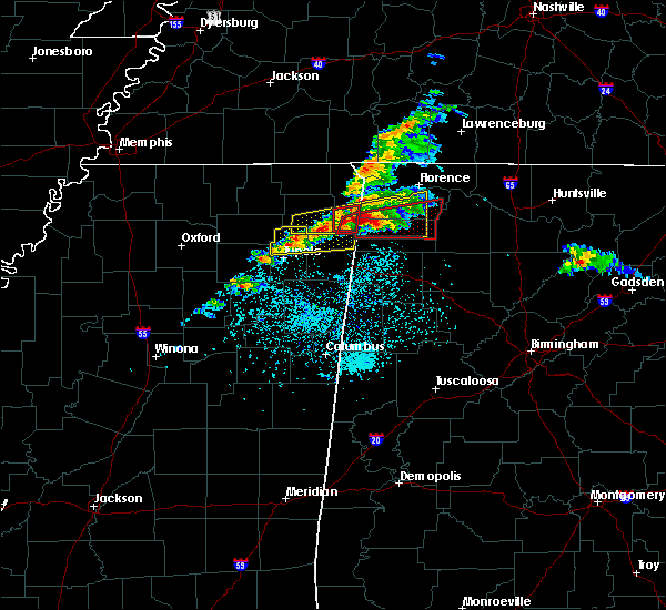 At 456 pm cdt, a severe thunderstorm producing a tornado was located over belmont, or near tishomingo state park, moving northeast at 50 mph (weather spotters reported funnel cloud). Hazards include tornado and tennis ball size hail. Flying debris will be dangerous to those caught without shelter. mobile homes will be damaged or destroyed. damage to roofs, windows, and vehicles will occur. Tree damage is likely. At 456 pm cdt, a severe thunderstorm producing a tornado was located over belmont, or near tishomingo state park, moving northeast at 50 mph (weather spotters reported funnel cloud). Hazards include tornado and tennis ball size hail. Flying debris will be dangerous to those caught without shelter. mobile homes will be damaged or destroyed. damage to roofs, windows, and vehicles will occur. Tree damage is likely.
|
| 3/19/2018 4:49 PM CDT |
 At 448 pm cdt, a severe thunderstorm producing a tornado was located over tishomingo state park, moving east at 50 mph (doppler indicates a possible tornado west of belmont). Hazards include tornado and two inch hail. Flying debris will be dangerous to those caught without shelter. mobile homes will be damaged or destroyed. damage to roofs, windows, and vehicles will occur. tree damage is likely. Locations impacted include, tishomingo state park, belmont, tishomingo, golden, paden, mingo, dennis, moores mill, petertown, neil, carter branch and bloody springs. At 448 pm cdt, a severe thunderstorm producing a tornado was located over tishomingo state park, moving east at 50 mph (doppler indicates a possible tornado west of belmont). Hazards include tornado and two inch hail. Flying debris will be dangerous to those caught without shelter. mobile homes will be damaged or destroyed. damage to roofs, windows, and vehicles will occur. tree damage is likely. Locations impacted include, tishomingo state park, belmont, tishomingo, golden, paden, mingo, dennis, moores mill, petertown, neil, carter branch and bloody springs.
|
| 3/19/2018 4:48 PM CDT |
 At 447 pm cdt, a severe thunderstorm was located near tishomingo state park, moving east at 55 mph (radar indicated). Hazards include golf ball size hail and 60 mph wind gusts. People and animals outdoors will be injured. expect hail damage to roofs, siding, windows, and vehicles. Expect wind damage to roofs, siding, and trees. At 447 pm cdt, a severe thunderstorm was located near tishomingo state park, moving east at 55 mph (radar indicated). Hazards include golf ball size hail and 60 mph wind gusts. People and animals outdoors will be injured. expect hail damage to roofs, siding, windows, and vehicles. Expect wind damage to roofs, siding, and trees.
|
| 3/19/2018 4:27 PM CDT |
 At 426 pm cdt, a severe thunderstorm producing a tornado was located near pratts friendship, or near baldwyn, moving east at 50 mph (weather spotters reported funnel cloud east of baldwyn). Hazards include tornado and hail up to two inches in diameter. Flying debris will be dangerous to those caught without shelter. mobile homes will be damaged or destroyed. damage to roofs, windows, and vehicles will occur. Tree damage is likely. At 426 pm cdt, a severe thunderstorm producing a tornado was located near pratts friendship, or near baldwyn, moving east at 50 mph (weather spotters reported funnel cloud east of baldwyn). Hazards include tornado and hail up to two inches in diameter. Flying debris will be dangerous to those caught without shelter. mobile homes will be damaged or destroyed. damage to roofs, windows, and vehicles will occur. Tree damage is likely.
|
| 3/10/2018 10:15 PM CDT |
 At 914 pm cst, a severe thunderstorm was located over red bay, moving east at 25 mph (radar indicated). Hazards include quarter size hail. damage to vehicles is expected At 914 pm cst, a severe thunderstorm was located over red bay, moving east at 25 mph (radar indicated). Hazards include quarter size hail. damage to vehicles is expected
|
| 3/10/2018 9:59 PM CDT | Quarter sized hail reported 3.7 miles NNW of Red Bay, AL, one inch diameter hail reported between red bay and vina. |
| 3/10/2018 9:50 PM CDT |
 At 850 pm cst, a severe thunderstorm was located over red bay, moving east at 30 mph (radar indicated). Hazards include quarter size hail. damage to vehicles is expected At 850 pm cst, a severe thunderstorm was located over red bay, moving east at 30 mph (radar indicated). Hazards include quarter size hail. damage to vehicles is expected
|
| 2/25/2018 12:01 AM CST |
 At 1200 am cst, severe thunderstorms were located along a line extending from near lexington to tremont, moving east at 60 mph (radar indicated). Hazards include 60 mph wind gusts. Expect damage to roofs, siding, and trees. Locations impacted include, florence, muscle shoals, russellville, sheffield, tuscumbia, red bay, rogersville, killen, town creek and littleville. At 1200 am cst, severe thunderstorms were located along a line extending from near lexington to tremont, moving east at 60 mph (radar indicated). Hazards include 60 mph wind gusts. Expect damage to roofs, siding, and trees. Locations impacted include, florence, muscle shoals, russellville, sheffield, tuscumbia, red bay, rogersville, killen, town creek and littleville.
|
| 2/24/2018 11:36 PM CST |
 At 1135 pm cst, severe thunderstorms were located along a line extending from 6 miles northwest of underwood-petersville to near evergreen, moving northeast at 55 mph (radar indicated). Hazards include 60 mph wind gusts. expect damage to roofs, siding, and trees At 1135 pm cst, severe thunderstorms were located along a line extending from 6 miles northwest of underwood-petersville to near evergreen, moving northeast at 55 mph (radar indicated). Hazards include 60 mph wind gusts. expect damage to roofs, siding, and trees
|
| 12/23/2017 5:56 AM CST |
 The severe thunderstorm warning for central lauderdale, southeastern colbert and central franklin counties will expire at 600 am cst, the storms which prompted the warning have weakened below severe limits, and no longer pose an immediate threat to life or property. therefore the warning will be allowed to expire. however gusty winds are still possible with these thunderstorms. The severe thunderstorm warning for central lauderdale, southeastern colbert and central franklin counties will expire at 600 am cst, the storms which prompted the warning have weakened below severe limits, and no longer pose an immediate threat to life or property. therefore the warning will be allowed to expire. however gusty winds are still possible with these thunderstorms.
|
| 12/23/2017 5:31 AM CST |
 At 530 am cst, severe thunderstorms were located along a line extending from near underwood-petersville to 7 miles northeast of tremont, moving south at 20 mph (radar indicated). Hazards include 60 mph wind gusts. expect damage to roofs, siding, and trees At 530 am cst, severe thunderstorms were located along a line extending from near underwood-petersville to 7 miles northeast of tremont, moving south at 20 mph (radar indicated). Hazards include 60 mph wind gusts. expect damage to roofs, siding, and trees
|
| 12/23/2017 5:01 AM CST |
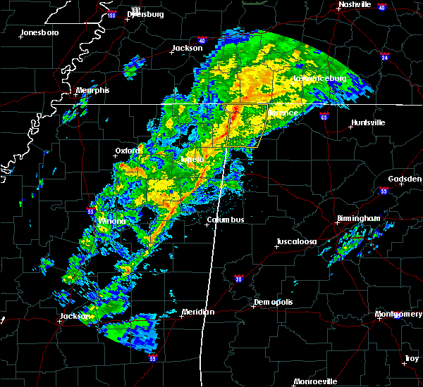 At 500 am cst, severe thunderstorms were located along a line extending from near walnut grove to near iuka to near tishomingo state park, moving east at 30 mph (radar indicated). Hazards include 60 to 70 mph wind gusts. expect damage to roofs, siding, and trees At 500 am cst, severe thunderstorms were located along a line extending from near walnut grove to near iuka to near tishomingo state park, moving east at 30 mph (radar indicated). Hazards include 60 to 70 mph wind gusts. expect damage to roofs, siding, and trees
|
| 11/18/2017 4:56 PM CST |
 The severe thunderstorm warning for southwestern colbert and western franklin counties will expire at 500 pm cst, the storm which prompted the warning has moved out of the area. therefore the warning will be allowed to expire. remember, a severe thunderstorm warning still remains in effect for colbert and franklin counties until 545 pm cst. The severe thunderstorm warning for southwestern colbert and western franklin counties will expire at 500 pm cst, the storm which prompted the warning has moved out of the area. therefore the warning will be allowed to expire. remember, a severe thunderstorm warning still remains in effect for colbert and franklin counties until 545 pm cst.
|
| 11/18/2017 4:55 PM CST |
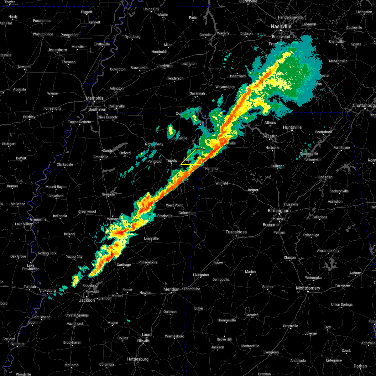 The severe thunderstorm warning for northern itawamba county will expire at 500 pm cst, the storm which prompted the warning has moved out of the area. therefore the warning will be allowed to expire. The severe thunderstorm warning for northern itawamba county will expire at 500 pm cst, the storm which prompted the warning has moved out of the area. therefore the warning will be allowed to expire.
|
| 11/18/2017 4:44 PM CST |
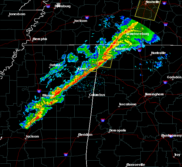 At 444 pm cst, a severe thunderstorm was located near belgreen, or 7 miles northwest of russellville, moving east at 85 mph (radar indicated). Hazards include 60 mph wind gusts. Expect damage to roofs, siding, and trees. Locations impacted include, fulton, red bay, tremont, fairview, clay, eastman, bounds crossroads, dorsey and ballardsville. At 444 pm cst, a severe thunderstorm was located near belgreen, or 7 miles northwest of russellville, moving east at 85 mph (radar indicated). Hazards include 60 mph wind gusts. Expect damage to roofs, siding, and trees. Locations impacted include, fulton, red bay, tremont, fairview, clay, eastman, bounds crossroads, dorsey and ballardsville.
|
| 11/18/2017 4:31 PM CST |
 At 431 pm cst, a severe thunderstorm was located over belmont, or near tishomingo state park, moving east at 60 mph (radar indicated). Hazards include 60 mph wind gusts. expect damage to roofs, siding, and trees At 431 pm cst, a severe thunderstorm was located over belmont, or near tishomingo state park, moving east at 60 mph (radar indicated). Hazards include 60 mph wind gusts. expect damage to roofs, siding, and trees
|
| 11/18/2017 4:29 PM CST |
 At 429 pm cst, a severe thunderstorm was located near tishomingo state park, moving east at 45 mph (radar indicated). Hazards include 60 mph wind gusts and quarter size hail. Hail damage to vehicles is expected. Expect wind damage to roofs, siding, and trees. At 429 pm cst, a severe thunderstorm was located near tishomingo state park, moving east at 45 mph (radar indicated). Hazards include 60 mph wind gusts and quarter size hail. Hail damage to vehicles is expected. Expect wind damage to roofs, siding, and trees.
|
| 6/23/2017 11:54 AM CDT |
 At 1154 am cdt, a severe thunderstorm was located 7 miles northeast of red bay, moving northeast at 50 mph (radar indicated). Hazards include 60 mph wind gusts. expect damage to roofs, siding, and trees At 1154 am cdt, a severe thunderstorm was located 7 miles northeast of red bay, moving northeast at 50 mph (radar indicated). Hazards include 60 mph wind gusts. expect damage to roofs, siding, and trees
|
| 5/28/2017 1:02 AM CDT |
 At 102 am cdt, severe thunderstorms were located along a line extending from near lexington to near red bay, moving southeast at 60 mph (radar indicated). Hazards include 70 to 80 mph wind gusts and penny size hail. Expect considerable tree damage. Damage is likely to mobile homes, roofs, and outbuildings. At 102 am cdt, severe thunderstorms were located along a line extending from near lexington to near red bay, moving southeast at 60 mph (radar indicated). Hazards include 70 to 80 mph wind gusts and penny size hail. Expect considerable tree damage. Damage is likely to mobile homes, roofs, and outbuildings.
|
| 5/28/2017 12:51 AM CDT |
 At 1250 am cdt, severe thunderstorms were located along a line extending from 8 miles northeast of cherokee to near sandy springs, moving southeast at 45 mph (radar indicated). Hazards include 70 mph wind gusts and quarter size hail. Hail damage to vehicles is expected. expect considerable tree damage. wind damage is also likely to mobile homes, roofs, and outbuildings. locations impacted include, florence, red bay, j p coleman state park, cherokee, st. Florian, underwood-petersville, waterloo, posey loop, oakland and barton. At 1250 am cdt, severe thunderstorms were located along a line extending from 8 miles northeast of cherokee to near sandy springs, moving southeast at 45 mph (radar indicated). Hazards include 70 mph wind gusts and quarter size hail. Hail damage to vehicles is expected. expect considerable tree damage. wind damage is also likely to mobile homes, roofs, and outbuildings. locations impacted include, florence, red bay, j p coleman state park, cherokee, st. Florian, underwood-petersville, waterloo, posey loop, oakland and barton.
|
| 5/28/2017 12:33 AM CDT |
 At 1232 am cdt, severe thunderstorms were located along a line extending from near walnut grove to near baldwyn, moving southeast at 45 mph (radar indicated). Hazards include 60 to 70 mph wind gusts and quarter size hail. Hail damage to vehicles is expected. expect considerable tree damage. Wind damage is also likely to mobile homes, roofs, and outbuildings. At 1232 am cdt, severe thunderstorms were located along a line extending from near walnut grove to near baldwyn, moving southeast at 45 mph (radar indicated). Hazards include 60 to 70 mph wind gusts and quarter size hail. Hail damage to vehicles is expected. expect considerable tree damage. Wind damage is also likely to mobile homes, roofs, and outbuildings.
|
| 5/28/2017 12:10 AM CDT |
 At 1210 am cdt, a severe thunderstorm was located 7 miles northeast of ripley, moving southeast at 40 mph (radar indicated). Hazards include 70 mph wind gusts and quarter size hail. Hail damage to vehicles is expected. expect considerable tree damage. wind damage is also likely to mobile homes, roofs, and outbuildings. locations impacted include, corinth, booneville, new albany, ripley, baldwyn, red bay, iuka, tishomingo state park, j p coleman state park, saltillo, guntown, belmont, mantachie, burnsville, blue mountain, jumpertown, glen, tishomingo, theo and new harmony. A tornado watch remains in effect until 500 am cdt for northeastern and northwestern mississippi. At 1210 am cdt, a severe thunderstorm was located 7 miles northeast of ripley, moving southeast at 40 mph (radar indicated). Hazards include 70 mph wind gusts and quarter size hail. Hail damage to vehicles is expected. expect considerable tree damage. wind damage is also likely to mobile homes, roofs, and outbuildings. locations impacted include, corinth, booneville, new albany, ripley, baldwyn, red bay, iuka, tishomingo state park, j p coleman state park, saltillo, guntown, belmont, mantachie, burnsville, blue mountain, jumpertown, glen, tishomingo, theo and new harmony. A tornado watch remains in effect until 500 am cdt for northeastern and northwestern mississippi.
|
| 5/27/2017 11:43 PM CDT |
 At 1143 pm cdt, a severe thunderstorm was located 8 miles northeast of canaan, or 15 miles west of big hill pond state park, moving southeast at 65 mph (radar indicated). Hazards include 70 mph wind gusts and quarter size hail. Hail damage to vehicles is expected. expect considerable tree damage. Wind damage is also likely to mobile homes, roofs, and outbuildings. At 1143 pm cdt, a severe thunderstorm was located 8 miles northeast of canaan, or 15 miles west of big hill pond state park, moving southeast at 65 mph (radar indicated). Hazards include 70 mph wind gusts and quarter size hail. Hail damage to vehicles is expected. expect considerable tree damage. Wind damage is also likely to mobile homes, roofs, and outbuildings.
|
| 4/22/2017 3:53 PM CDT |
 The tornado warning for northwestern franklin county will expire at 400 pm cdt, the tornado threat has diminished and the tornado warning will expire at 4 pm. however, large hail and damaging winds remain likely and a severe thunderstorm warning remains in effect for the area. a severe thunderstorm watch remains in effect until 900 pm cdt for northwestern alabama. remember, a severe thunderstorm warning still remains in effect for franklin county 4 pm. The tornado warning for northwestern franklin county will expire at 400 pm cdt, the tornado threat has diminished and the tornado warning will expire at 4 pm. however, large hail and damaging winds remain likely and a severe thunderstorm warning remains in effect for the area. a severe thunderstorm watch remains in effect until 900 pm cdt for northwestern alabama. remember, a severe thunderstorm warning still remains in effect for franklin county 4 pm.
|
| 4/22/2017 3:36 PM CDT |
 At 336 pm cdt, a confirmed tornado was located near red bay, moving east at 25 mph (radar confirmed tornado). Hazards include damaging tornado. Flying debris will be dangerous to those caught without shelter. mobile homes will be damaged or destroyed. damage to roofs, windows, and vehicles will occur. tree damage is likely. Locations impacted include, pleasant site, pogo, dempsey, halltown, cedar creek reservoir and little bear creek reservoir. At 336 pm cdt, a confirmed tornado was located near red bay, moving east at 25 mph (radar confirmed tornado). Hazards include damaging tornado. Flying debris will be dangerous to those caught without shelter. mobile homes will be damaged or destroyed. damage to roofs, windows, and vehicles will occur. tree damage is likely. Locations impacted include, pleasant site, pogo, dempsey, halltown, cedar creek reservoir and little bear creek reservoir.
|
| 4/22/2017 3:27 PM CDT |
 At 327 pm cdt, a severe thunderstorm capable of producing a tornado was located near belmont, or near tishomingo state park, moving east at 25 mph (radar indicated rotation). Hazards include tornado. Flying debris will be dangerous to those caught without shelter. mobile homes will be damaged or destroyed. damage to roofs, windows, and vehicles will occur. tree damage is likely. This tornadic thunderstorm will remain over mainly rural areas of northwestern franklin county, including the following locations: pleasant site, pogo, dempsey, halltown and cedar creek reservoir. At 327 pm cdt, a severe thunderstorm capable of producing a tornado was located near belmont, or near tishomingo state park, moving east at 25 mph (radar indicated rotation). Hazards include tornado. Flying debris will be dangerous to those caught without shelter. mobile homes will be damaged or destroyed. damage to roofs, windows, and vehicles will occur. tree damage is likely. This tornadic thunderstorm will remain over mainly rural areas of northwestern franklin county, including the following locations: pleasant site, pogo, dempsey, halltown and cedar creek reservoir.
|
| 4/22/2017 3:14 PM CDT |
 At 313 pm cdt, a severe thunderstorm was located over tishomingo state park, moving east at 35 mph (radar indicated). Hazards include 60 mph wind gusts and quarter size hail. Hail damage to vehicles is expected. Expect wind damage to roofs, siding, and trees. At 313 pm cdt, a severe thunderstorm was located over tishomingo state park, moving east at 35 mph (radar indicated). Hazards include 60 mph wind gusts and quarter size hail. Hail damage to vehicles is expected. Expect wind damage to roofs, siding, and trees.
|
| 3/27/2017 9:38 PM CDT |
 At 937 pm cdt, a severe thunderstorm was located 9 miles southeast of cherokee, or 10 miles southwest of tuscumbia, moving southeast at 15 mph (radar indicated. nickel sized hail has been reported with this storm. and trees were reported down earlier near cherokee). Hazards include 60 mph wind gusts and quarter size hail. Hail damage to vehicles is expected. expect wind damage to roofs, siding, and trees. Locations impacted include, muscle shoals, russellville, sheffield, tuscumbia, red bay, phil campbell, littleville, belgreen, vina and hodges. At 937 pm cdt, a severe thunderstorm was located 9 miles southeast of cherokee, or 10 miles southwest of tuscumbia, moving southeast at 15 mph (radar indicated. nickel sized hail has been reported with this storm. and trees were reported down earlier near cherokee). Hazards include 60 mph wind gusts and quarter size hail. Hail damage to vehicles is expected. expect wind damage to roofs, siding, and trees. Locations impacted include, muscle shoals, russellville, sheffield, tuscumbia, red bay, phil campbell, littleville, belgreen, vina and hodges.
|
| 3/27/2017 9:21 PM CDT |
 At 920 pm cdt, severe thunderstorms were located along a line extending from near midway to near muscle shoals, moving southeast at 45 mph (radar indicated). Hazards include 60 mph wind gusts and quarter size hail. Hail damage to vehicles is expected. Expect wind damage to roofs, siding, and trees. At 920 pm cdt, severe thunderstorms were located along a line extending from near midway to near muscle shoals, moving southeast at 45 mph (radar indicated). Hazards include 60 mph wind gusts and quarter size hail. Hail damage to vehicles is expected. Expect wind damage to roofs, siding, and trees.
|
| 3/27/2017 5:25 PM CDT | Quarter sized hail reported 0.5 miles N of Red Bay, AL |
| 3/27/2017 4:25 PM CDT |
 At 424 pm cdt, a severe thunderstorm was located 7 miles southeast of red bay, moving east at 45 mph. additional strong to severe thunderstorms were located from near belgreen to mt. hope (radar indicated). Hazards include 60 mph wind gusts and quarter size hail. Hail damage to vehicles is expected. Expect wind damage to roofs, siding, and trees. At 424 pm cdt, a severe thunderstorm was located 7 miles southeast of red bay, moving east at 45 mph. additional strong to severe thunderstorms were located from near belgreen to mt. hope (radar indicated). Hazards include 60 mph wind gusts and quarter size hail. Hail damage to vehicles is expected. Expect wind damage to roofs, siding, and trees.
|
| 3/27/2017 3:52 PM CDT |
 At 352 pm cdt, a severe thunderstorm was located near red bay, moving northeast at 40 mph. another severe thunderstorm was located near russellville (radar indicated). Hazards include 60 mph wind gusts and half dollar size hail. Hail damage to vehicles is expected. Expect wind damage to roofs, siding, and trees. At 352 pm cdt, a severe thunderstorm was located near red bay, moving northeast at 40 mph. another severe thunderstorm was located near russellville (radar indicated). Hazards include 60 mph wind gusts and half dollar size hail. Hail damage to vehicles is expected. Expect wind damage to roofs, siding, and trees.
|
| 3/27/2017 3:41 PM CDT |
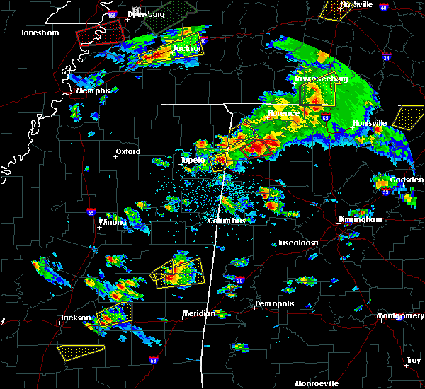 At 341 pm cdt, a severe thunderstorm was located near tremont, or 8 miles east of fulton, moving east at 30 mph (radar indicated). Hazards include golf ball size hail and 60 mph wind gusts. People and animals outdoors will be injured. expect hail damage to roofs, siding, windows, and vehicles. Expect wind damage to roofs, siding, and trees. At 341 pm cdt, a severe thunderstorm was located near tremont, or 8 miles east of fulton, moving east at 30 mph (radar indicated). Hazards include golf ball size hail and 60 mph wind gusts. People and animals outdoors will be injured. expect hail damage to roofs, siding, windows, and vehicles. Expect wind damage to roofs, siding, and trees.
|
| 3/27/2017 3:19 PM CDT |
 At 318 pm cdt, a severe thunderstorm was located near red bay, moving northeast at 35 mph (radar indicated). Hazards include 60 mph wind gusts and half dollar size hail. Hail damage to vehicles is expected. expect wind damage to roofs, siding, and trees. Locations impacted include, red bay, belgreen, vina, cedar creek reservoir, atwood, rockwood, halltown, pleasant site, dempsey and isbell. At 318 pm cdt, a severe thunderstorm was located near red bay, moving northeast at 35 mph (radar indicated). Hazards include 60 mph wind gusts and half dollar size hail. Hail damage to vehicles is expected. expect wind damage to roofs, siding, and trees. Locations impacted include, red bay, belgreen, vina, cedar creek reservoir, atwood, rockwood, halltown, pleasant site, dempsey and isbell.
|
| 3/27/2017 3:04 PM CDT |
 At 304 pm cdt, a severe thunderstorm was located near red bay, moving northeast at 30 mph (radar indicated). Hazards include 60 mph wind gusts and quarter size hail. Hail damage to vehicles is expected. Expect wind damage to roofs, siding, and trees. At 304 pm cdt, a severe thunderstorm was located near red bay, moving northeast at 30 mph (radar indicated). Hazards include 60 mph wind gusts and quarter size hail. Hail damage to vehicles is expected. Expect wind damage to roofs, siding, and trees.
|
| 3/27/2017 2:16 PM CDT |
 At 216 pm cdt, a severe thunderstorm was located near tishomingo state park, moving northeast at 30 mph. another severe thunderstorm was located near posey loop moving northeast at 30 mph (radar indicated). Hazards include 60 mph wind gusts and quarter size hail. Hail damage to vehicles is expected. expect wind damage to roofs, siding, and trees. Locations impacted include, florence, sheffield, tuscumbia, cherokee, malone, posey loop, allsboro, wright, red rock and pride landing. At 216 pm cdt, a severe thunderstorm was located near tishomingo state park, moving northeast at 30 mph. another severe thunderstorm was located near posey loop moving northeast at 30 mph (radar indicated). Hazards include 60 mph wind gusts and quarter size hail. Hail damage to vehicles is expected. expect wind damage to roofs, siding, and trees. Locations impacted include, florence, sheffield, tuscumbia, cherokee, malone, posey loop, allsboro, wright, red rock and pride landing.
|
| 3/27/2017 2:05 PM CDT |
 At 204 pm cdt, a severe thunderstorm was located near belmont, or near tishomingo state park, moving northeast at 35 mph (trained weather spotters). Hazards include quarter size hail. Damage to vehicles is expected. locations impacted include, tishomingo state park, belmont, tishomingo, golden, mingo, dennis, bloody springs, petertown, neil and carter branch. Quarter size hail was reported in belmont at 203 pm cdt. At 204 pm cdt, a severe thunderstorm was located near belmont, or near tishomingo state park, moving northeast at 35 mph (trained weather spotters). Hazards include quarter size hail. Damage to vehicles is expected. locations impacted include, tishomingo state park, belmont, tishomingo, golden, mingo, dennis, bloody springs, petertown, neil and carter branch. Quarter size hail was reported in belmont at 203 pm cdt.
|
| 3/27/2017 2:03 PM CDT |
 At 202 pm cdt, a severe thunderstorm was located near tishomingo state park, moving northeast at 35 mph (radar indicated). Hazards include 60 mph wind gusts and quarter size hail. Hail damage to vehicles is expected. Expect wind damage to roofs, siding, and trees. At 202 pm cdt, a severe thunderstorm was located near tishomingo state park, moving northeast at 35 mph (radar indicated). Hazards include 60 mph wind gusts and quarter size hail. Hail damage to vehicles is expected. Expect wind damage to roofs, siding, and trees.
|
| 3/27/2017 1:58 PM CDT |
 At 158 pm cdt, a severe thunderstorm was located over belmont, or near tishomingo state park, moving northeast at 35 mph (radar indicated). Hazards include quarter size hail. damage to vehicles is expected At 158 pm cdt, a severe thunderstorm was located over belmont, or near tishomingo state park, moving northeast at 35 mph (radar indicated). Hazards include quarter size hail. damage to vehicles is expected
|
| 12/18/2016 12:42 AM CST |
 At 1241 am cst, a severe thunderstorm was located over tremont, or 8 miles east of fulton, moving east at 60 mph (radar indicated). Hazards include 60 mph wind gusts. expect damage to roofs, siding, and trees At 1241 am cst, a severe thunderstorm was located over tremont, or 8 miles east of fulton, moving east at 60 mph (radar indicated). Hazards include 60 mph wind gusts. expect damage to roofs, siding, and trees
|
| 12/18/2016 12:41 AM CST |
 At 1240 am cst, a severe thunderstorm was located over tremont, or 7 miles east of fulton, moving east at 60 mph (radar indicated). Hazards include 60 mph wind gusts. expect damage to roofs, siding, and trees At 1240 am cst, a severe thunderstorm was located over tremont, or 7 miles east of fulton, moving east at 60 mph (radar indicated). Hazards include 60 mph wind gusts. expect damage to roofs, siding, and trees
|
| 12/18/2016 12:40 AM CST |
 At 1240 am cst, a severe thunderstorm was located 7 miles south of red bay, moving east at 55 mph (radar indicated). Hazards include 70 mph wind gusts. Expect considerable tree damage. Damage is likely to mobile homes, roofs, and outbuildings. At 1240 am cst, a severe thunderstorm was located 7 miles south of red bay, moving east at 55 mph (radar indicated). Hazards include 70 mph wind gusts. Expect considerable tree damage. Damage is likely to mobile homes, roofs, and outbuildings.
|
| 12/18/2016 12:20 AM CST |
 At 1220 am cst, a severe thunderstorm was located near belmont, or near tishomingo state park, moving northeast at 70 mph (radar indicated). Hazards include 70 mph wind gusts. Expect considerable tree damage. Damage is likely to mobile homes, roofs, and outbuildings. At 1220 am cst, a severe thunderstorm was located near belmont, or near tishomingo state park, moving northeast at 70 mph (radar indicated). Hazards include 70 mph wind gusts. Expect considerable tree damage. Damage is likely to mobile homes, roofs, and outbuildings.
|
| 11/29/2016 6:51 PM CST |
 At 651 pm cst, a severe thunderstorm was located 7 miles east of red bay, moving northeast at 35 mph (radar indicated). Hazards include 70 to 80 mph wind gusts and half dollar size hail. Hail damage to vehicles is expected. expect considerable tree damage. wind damage is also likely to mobile homes, roofs, and outbuildings. locations impacted include, red bay, belgreen, vina, hodges, halltown, cedar creek reservoir, pleasant site, atwood, dempsey and little bear creek reservoir. a tornado watch remains in effect until 1100 pm cst for northwestern alabama. A tornado watch also remains in effect until midnight cst for northwestern alabama. At 651 pm cst, a severe thunderstorm was located 7 miles east of red bay, moving northeast at 35 mph (radar indicated). Hazards include 70 to 80 mph wind gusts and half dollar size hail. Hail damage to vehicles is expected. expect considerable tree damage. wind damage is also likely to mobile homes, roofs, and outbuildings. locations impacted include, red bay, belgreen, vina, hodges, halltown, cedar creek reservoir, pleasant site, atwood, dempsey and little bear creek reservoir. a tornado watch remains in effect until 1100 pm cst for northwestern alabama. A tornado watch also remains in effect until midnight cst for northwestern alabama.
|
| 11/29/2016 6:28 PM CST |
 At 626 pm cst, a severe thunderstorm was located over fairview, or 9 miles southwest of red bay, moving northeast at 55 mph (radar indicated). Hazards include 70 mph wind gusts and half dollar size hail. Hail damage to vehicles is expected. expect considerable tree damage. Wind damage is also likely to mobile homes, roofs, and outbuildings. At 626 pm cst, a severe thunderstorm was located over fairview, or 9 miles southwest of red bay, moving northeast at 55 mph (radar indicated). Hazards include 70 mph wind gusts and half dollar size hail. Hail damage to vehicles is expected. expect considerable tree damage. Wind damage is also likely to mobile homes, roofs, and outbuildings.
|
| 11/28/2016 4:43 PM CST |
 At 443 pm cst, a severe thunderstorm was located near evergreen, or 8 miles south of fulton, moving northeast at 55 mph (radar indicated). Hazards include 60 mph wind gusts. Expect damage to roofs. siding. And trees. At 443 pm cst, a severe thunderstorm was located near evergreen, or 8 miles south of fulton, moving northeast at 55 mph (radar indicated). Hazards include 60 mph wind gusts. Expect damage to roofs. siding. And trees.
|
| 6/17/2016 1:12 PM CDT |
 At 110 pm cdt, severe thunderstorms were located along a line extending from red bay to 6 miles northeast of brushy lake, moving southeast at 40 mph (radar indicated). Hazards include 60 to 70 mph wind gusts and quarter size hail. Hail damage to vehicles is expected. expect considerable tree damage. wind damage is also likely to mobile homes, roofs, and outbuildings. Locations impacted include, russellville, moulton, red bay, phil campbell, belgreen, vina, hodges, mt hope, little bear creek reservoir and spruce pine. At 110 pm cdt, severe thunderstorms were located along a line extending from red bay to 6 miles northeast of brushy lake, moving southeast at 40 mph (radar indicated). Hazards include 60 to 70 mph wind gusts and quarter size hail. Hail damage to vehicles is expected. expect considerable tree damage. wind damage is also likely to mobile homes, roofs, and outbuildings. Locations impacted include, russellville, moulton, red bay, phil campbell, belgreen, vina, hodges, mt hope, little bear creek reservoir and spruce pine.
|
| 6/17/2016 12:41 PM CDT |
 At 1240 pm cdt, severe thunderstorms were located along a line extending from near burton to 7 miles south of leighton, moving east-southeast at 35 mph (radar indicated). Hazards include 60 mph wind gusts and quarter size hail. Hail damage to vehicles is expected. Expect wind damage to roofs, siding, and trees. At 1240 pm cdt, severe thunderstorms were located along a line extending from near burton to 7 miles south of leighton, moving east-southeast at 35 mph (radar indicated). Hazards include 60 mph wind gusts and quarter size hail. Hail damage to vehicles is expected. Expect wind damage to roofs, siding, and trees.
|
| 7/14/2015 6:30 PM CDT | Storm damage reported in itawamba county MS, 4.3 miles ENE of Red Bay, AL |
| 4/3/2015 6:54 PM CDT | The national weather service in huntsville has issued a * severe thunderstorm warning for. franklin county in northwestern alabama. until 745 pm cdt * at 654 pm cdt. a severe thunderstorm was located over fairview. or 7 miles northeast of fulton mississippi. Moving east-southeast. |
| 10/3/2014 1:11 AM CDT | Damage within the city of red bay includes 2 roofs torn off of homes along highway 11 south. a tree blown onto a trailer home. trees down on stadium street...bostic str in franklin county AL, 0.5 miles N of Red Bay, AL |
| 4/28/2014 3:30 PM CDT | Multiple reports of trees down...some on buildings...and power poles down. one woman was trapped in her house...no injuries reporte in franklin county AL, 0.5 miles N of Red Bay, AL |
| 2/20/2014 8:13 PM CST | Spotter measured 58 mph wind gust in itawamba county MS, 8.8 miles NE of Red Bay, AL |
| 3/23/2013 3:07 AM CDT | Quarter sized hail reported 0.5 miles N of Red Bay, AL |
| 3/18/2013 1:47 PM CDT | Structural damage reported by emergency management along highway 190. time estimated from rada in franklin county AL, 8.1 miles SSW of Red Bay, AL |
| 3/18/2013 1:45 PM CDT | Trees and powerlines down around red bay. along highway 19 and 11 north and south of town. time estimated from rada in franklin county AL, 0.5 miles N of Red Bay, AL |
| 1/30/2013 3:45 AM CST | Hwy 247/21 tree downed. time estimated by rada in franklin county AL, 9.3 miles SW of Red Bay, AL |
| 1/30/2013 3:39 AM CST | Tree downed. time estimated by rada in franklin county AL, 7.5 miles SSW of Red Bay, AL |
| 12/20/2012 6:44 AM CST | Tree down along highway 11 northeast of red ba in franklin county AL, 4 miles SSW of Red Bay, AL |
| 7/31/2012 12:33 AM CDT | Two small tree limbs were knocked down in red ba in franklin county AL, 0.5 miles N of Red Bay, AL |
| 6/11/2012 6:00 PM CDT | A couple of trees were blown down and power was reported out near the intersection of highway 247 and highway 2 in franklin county AL, 3.3 miles W of Red Bay, AL |
| 3/31/2012 9:30 PM CDT | Quarter sized hail reported 0.5 miles N of Red Bay, AL, quarter sized hail was reported. |
| 1/1/0001 12:00 AM | Large tree limbs blocking several street in franklin county AL, 0.5 miles N of Red Bay, AL |
| 1/1/0001 12:00 AM | Roof tor in itawamba county MS, 8.8 miles NE of Red Bay, AL |
Hail Maps for Red Bay, AL


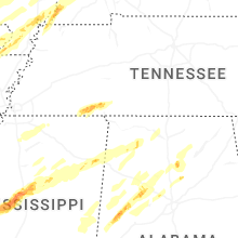
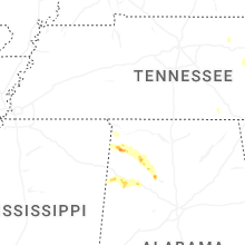


Connect with Interactive Hail Maps