

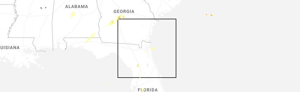
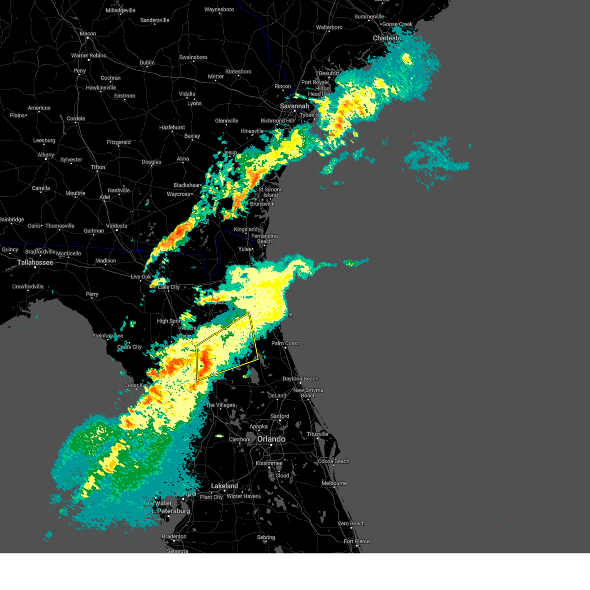
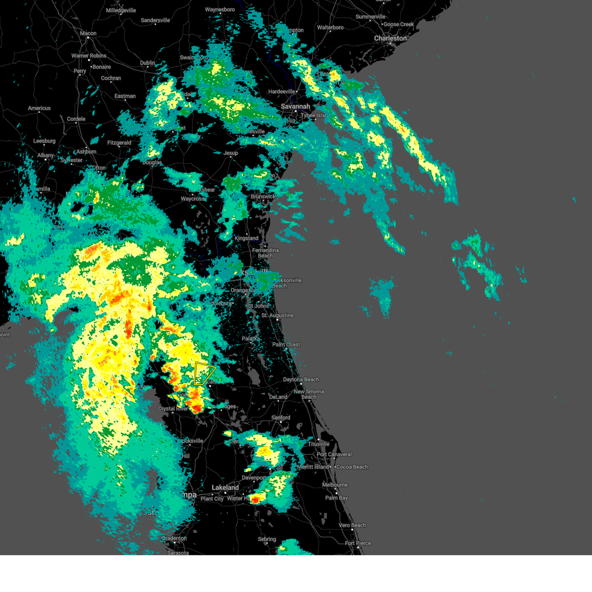
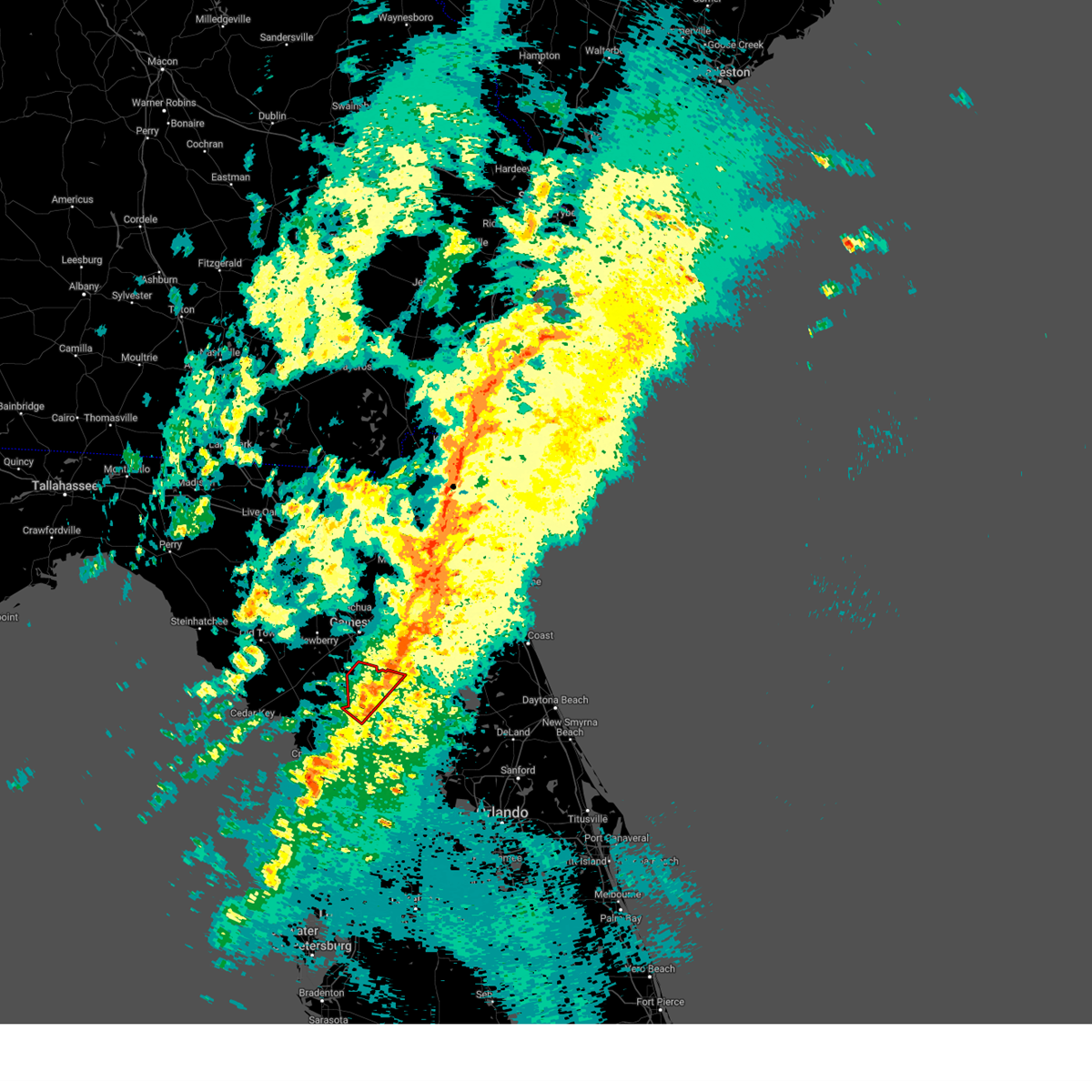
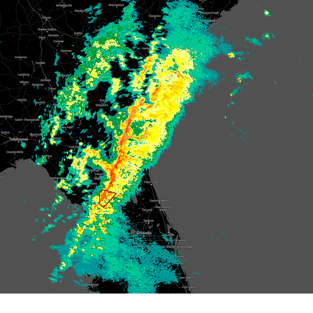
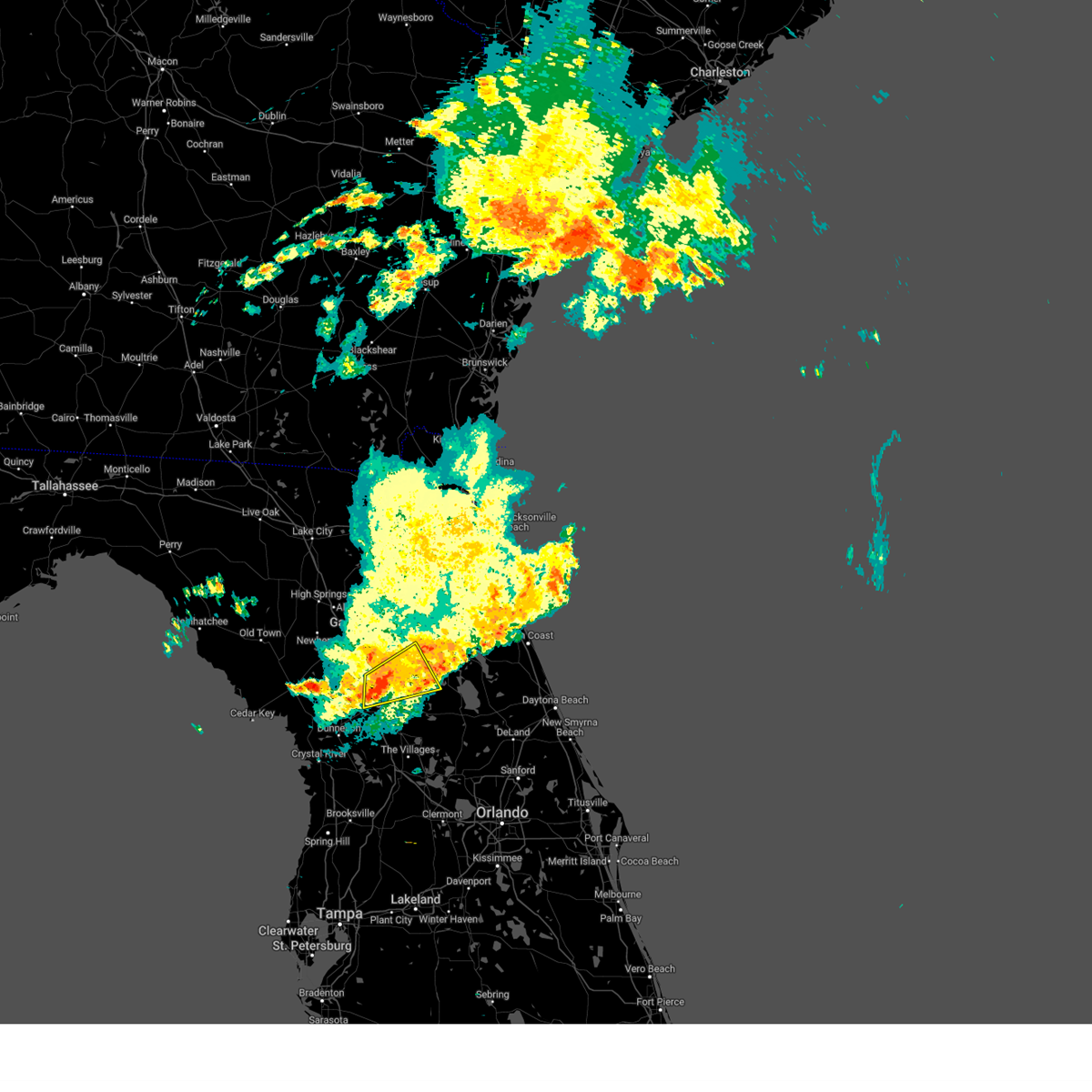
Hail Map for Reddick, FL
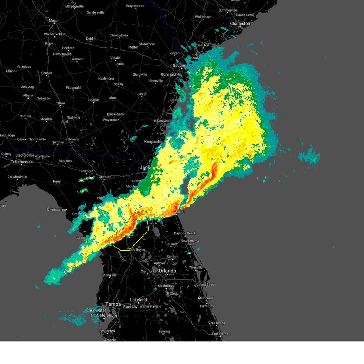
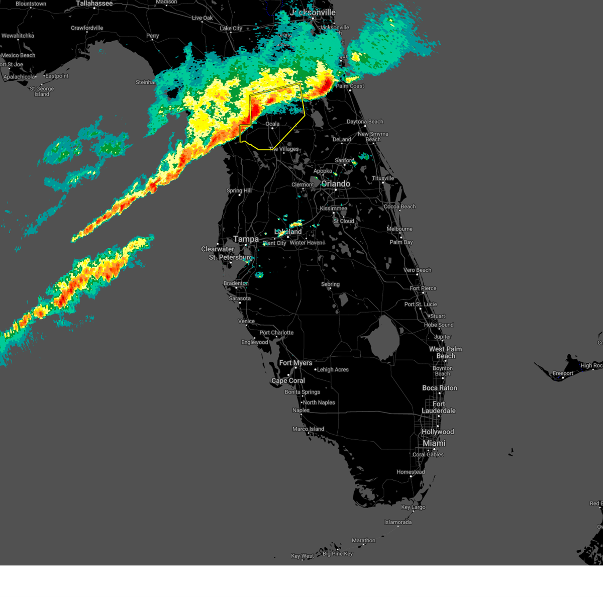
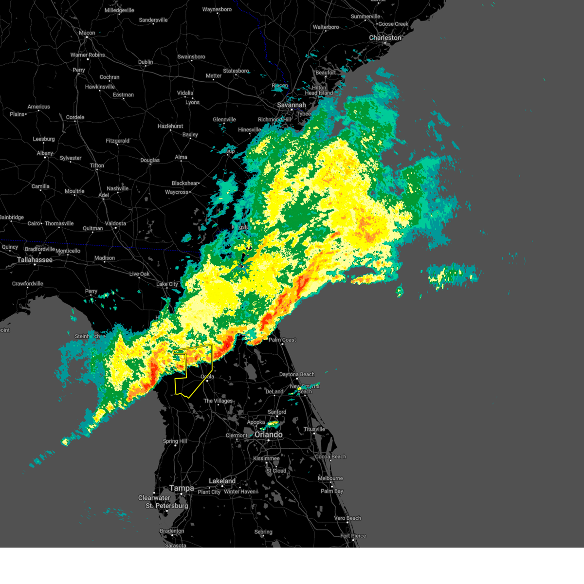
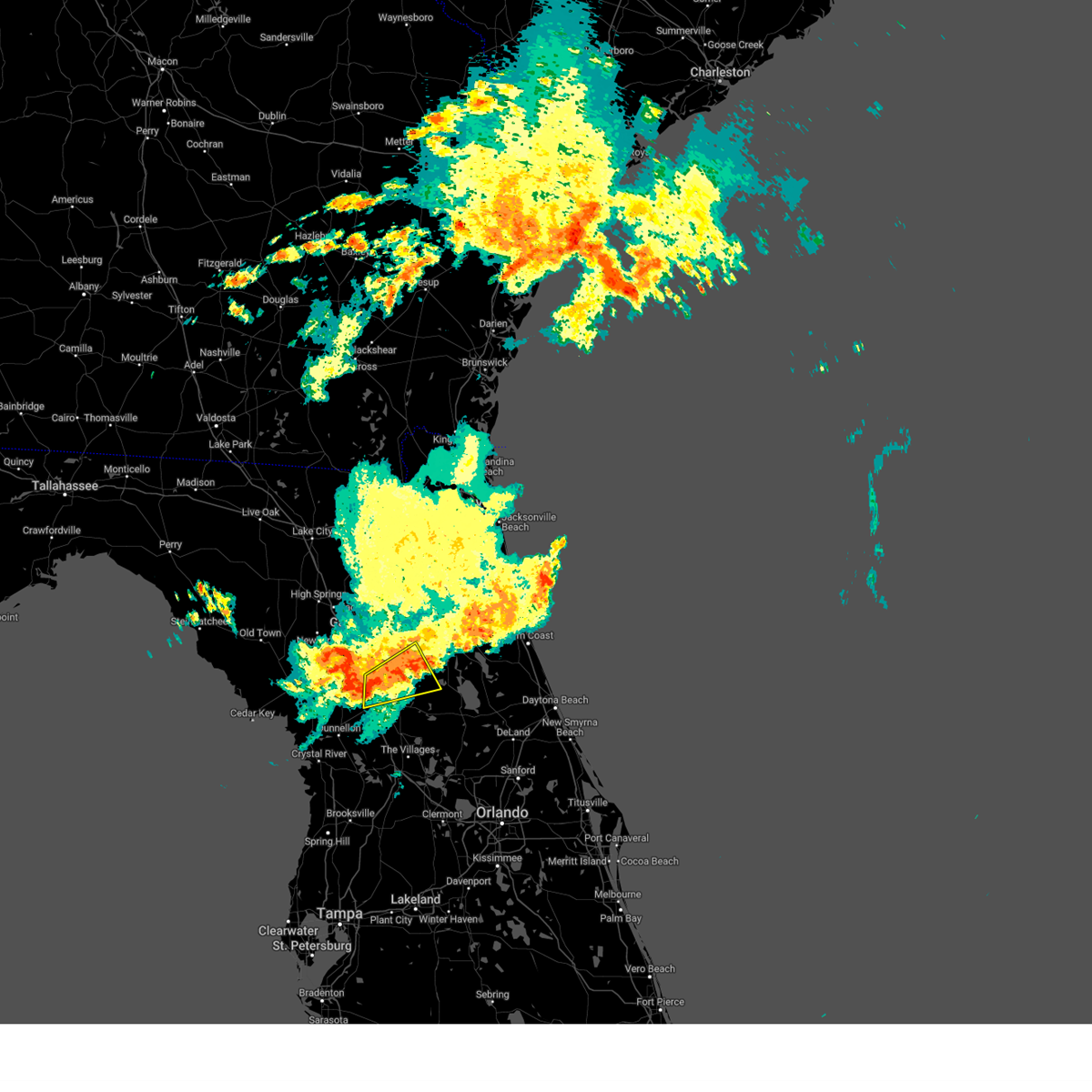
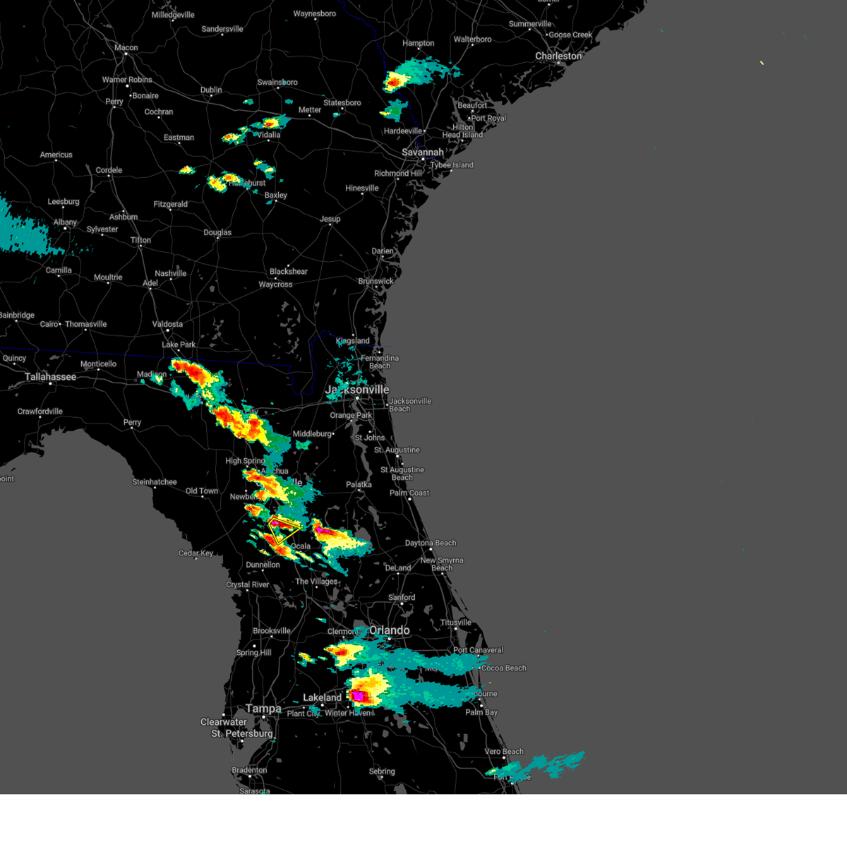
The Reddick, FL area has had 0 reports of on-the-ground hail by trained spotters, and has been under severe weather warnings 7 times during the past 12 months. Doppler radar has detected hail at or near Reddick, FL on 41 occasions, including 4 occasions during the past year.
| Name: | Reddick, FL |
| Where Located: | 73.7 miles SSW of Jacksonville, FL |
| Map: | Google Map for Reddick, FL |
| Population: | 506 |
| Housing Units: | 249 |
| More Info: | Search Google for Reddick, FL |
0
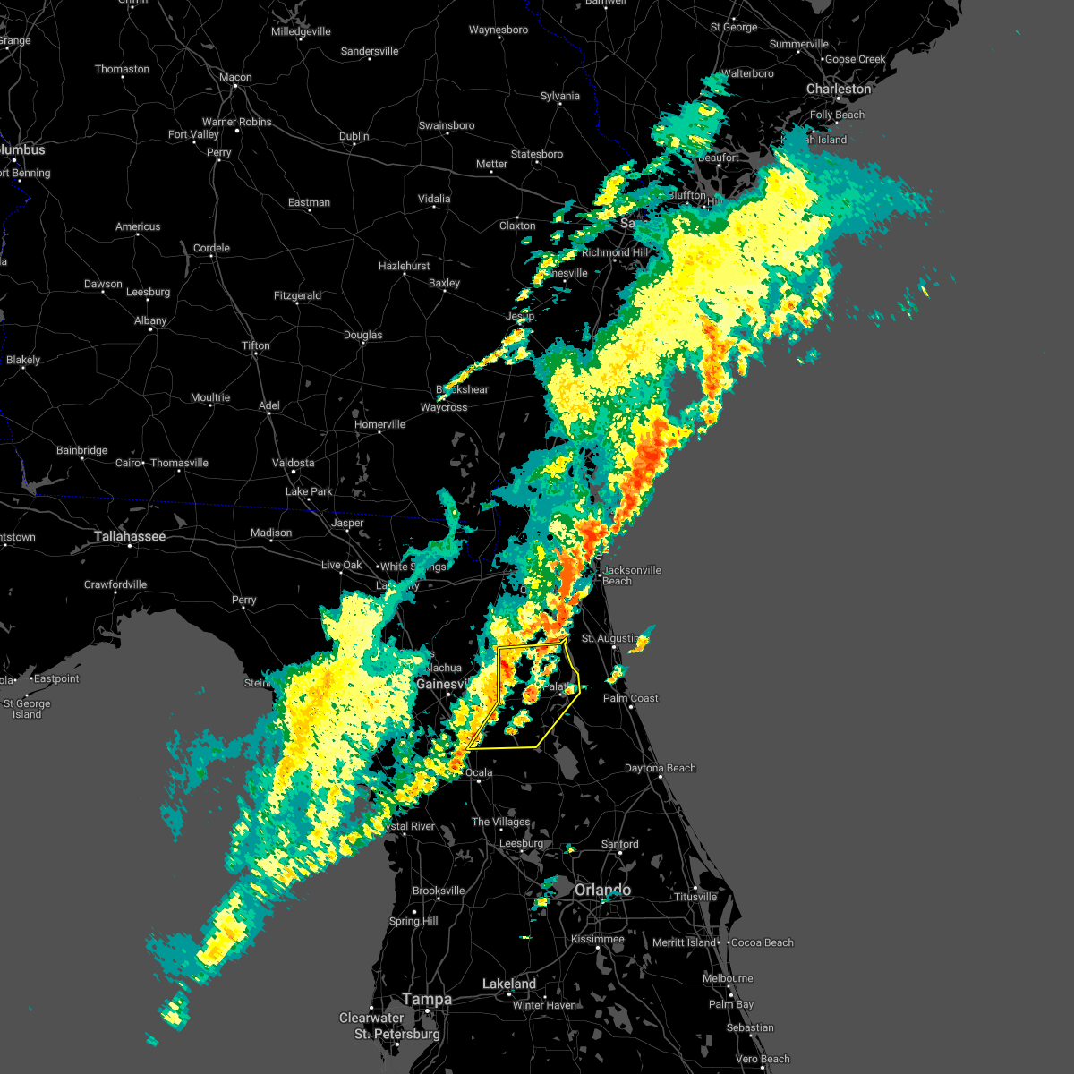
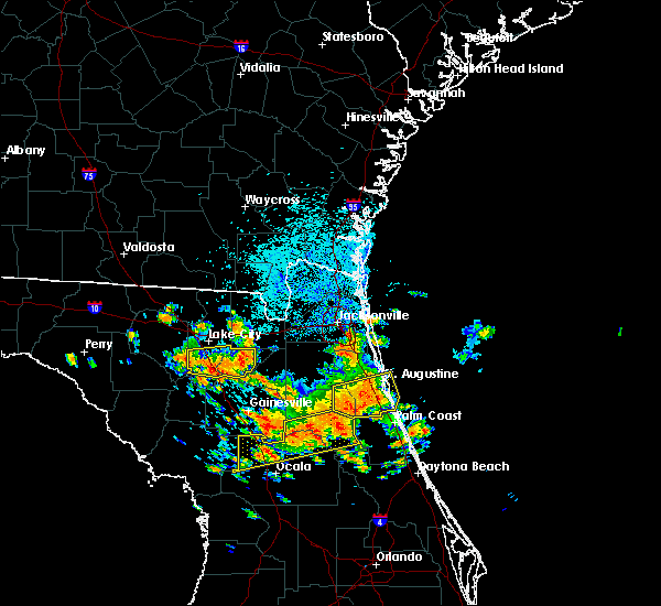
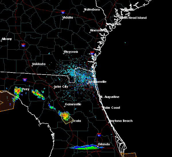
The Top Recent Hail Date for Reddick, FL is Saturday, May 10, 2025 (15th out of 41)
Hail and Wind Damage Spotted near Reddick, FL
| Date / Time | Report Details |
|---|---|
| 5/10/2025 5:27 PM EDT |
 The storm which prompted the warning has weakened below severe limits, and no longer poses an immediate threat to life or property. therefore, the warning will be allowed to expire. however, gusty winds are still possible with this thunderstorm. The storm which prompted the warning has weakened below severe limits, and no longer poses an immediate threat to life or property. therefore, the warning will be allowed to expire. however, gusty winds are still possible with this thunderstorm.
|
| 5/10/2025 5:10 PM EDT |
 At 509 pm edt, a severe thunderstorm was located 9 miles west of sparr, or 11 miles east of williston, moving north at 25 mph (radar indicated). Hazards include 60 mph wind gusts and quarter size hail. Hail damage to vehicles is expected. expect wind damage to roofs, siding, and trees. Locations impacted include, citra, sparr, cross creek, anthony, micanopy, reddick, mcintosh, flemington, lowell, and lochloosa. At 509 pm edt, a severe thunderstorm was located 9 miles west of sparr, or 11 miles east of williston, moving north at 25 mph (radar indicated). Hazards include 60 mph wind gusts and quarter size hail. Hail damage to vehicles is expected. expect wind damage to roofs, siding, and trees. Locations impacted include, citra, sparr, cross creek, anthony, micanopy, reddick, mcintosh, flemington, lowell, and lochloosa.
|
| 5/10/2025 4:53 PM EDT |
 Svrjax the national weather service in jacksonville has issued a * severe thunderstorm warning for, southeastern alachua county in northern florida, western marion county in northern florida, west central putnam county in northeastern florida, * until 530 pm edt. * at 453 pm edt, a severe thunderstorm was located near ocala airport, or 10 miles northeast of rainbow lakes estates, moving north at 25 mph (radar indicated). Hazards include 60 mph wind gusts and quarter size hail. Hail damage to vehicles is expected. Expect wind damage to roofs, siding, and trees. Svrjax the national weather service in jacksonville has issued a * severe thunderstorm warning for, southeastern alachua county in northern florida, western marion county in northern florida, west central putnam county in northeastern florida, * until 530 pm edt. * at 453 pm edt, a severe thunderstorm was located near ocala airport, or 10 miles northeast of rainbow lakes estates, moving north at 25 mph (radar indicated). Hazards include 60 mph wind gusts and quarter size hail. Hail damage to vehicles is expected. Expect wind damage to roofs, siding, and trees.
|
| 3/16/2025 2:21 PM EDT |
 Svrjax the national weather service in jacksonville has issued a * severe thunderstorm warning for, southeastern alachua county in northern florida, northeastern marion county in northern florida, putnam county in northeastern florida, southern clay county in northeastern florida, * until 300 pm edt. * at 221 pm edt, a severe thunderstorm was located over citra, moving northeast at 45 mph (radar indicated). Hazards include 60 mph wind gusts and nickel size hail. expect damage to roofs, siding, and trees Svrjax the national weather service in jacksonville has issued a * severe thunderstorm warning for, southeastern alachua county in northern florida, northeastern marion county in northern florida, putnam county in northeastern florida, southern clay county in northeastern florida, * until 300 pm edt. * at 221 pm edt, a severe thunderstorm was located over citra, moving northeast at 45 mph (radar indicated). Hazards include 60 mph wind gusts and nickel size hail. expect damage to roofs, siding, and trees
|
| 1/19/2025 7:26 AM EST |
 At 726 am est, severe thunderstorms were located along a line extending from near hawthorne to near fort mccoy to near ocala to near rainbow lakes estates, moving east at 65 mph (radar indicated). Hazards include 70 mph wind gusts and quarter size hail. Hail damage to vehicles is expected. expect considerable tree damage. wind damage is also likely to mobile homes, roofs, and outbuildings. Locations impacted include, ocala, rainbow lakes estates, interlachen, fort mccoy, citra, lynne, lake delancy, sparr, anthony, and silver springs shores. At 726 am est, severe thunderstorms were located along a line extending from near hawthorne to near fort mccoy to near ocala to near rainbow lakes estates, moving east at 65 mph (radar indicated). Hazards include 70 mph wind gusts and quarter size hail. Hail damage to vehicles is expected. expect considerable tree damage. wind damage is also likely to mobile homes, roofs, and outbuildings. Locations impacted include, ocala, rainbow lakes estates, interlachen, fort mccoy, citra, lynne, lake delancy, sparr, anthony, and silver springs shores.
|
| 1/19/2025 7:15 AM EST | A few reports of trees down near northwest 152nd lane and around 11000 block of northwest 60th avenue. time estimated from rada in marion county FL, 1.3 miles E of Reddick, FL |
| 1/19/2025 7:15 AM EST |
 Svrjax the national weather service in jacksonville has issued a * severe thunderstorm warning for, southeastern alachua county in northern florida, marion county in northern florida, southwestern putnam county in northeastern florida, * until 745 am est. * at 715 am est, severe thunderstorms were located along a line extending from near rochelle to near citra to near rainbow lakes estates, moving east at 65 mph (radar indicated). Hazards include 70 mph wind gusts and quarter size hail. Hail damage to vehicles is expected. expect considerable tree damage. Wind damage is also likely to mobile homes, roofs, and outbuildings. Svrjax the national weather service in jacksonville has issued a * severe thunderstorm warning for, southeastern alachua county in northern florida, marion county in northern florida, southwestern putnam county in northeastern florida, * until 745 am est. * at 715 am est, severe thunderstorms were located along a line extending from near rochelle to near citra to near rainbow lakes estates, moving east at 65 mph (radar indicated). Hazards include 70 mph wind gusts and quarter size hail. Hail damage to vehicles is expected. expect considerable tree damage. Wind damage is also likely to mobile homes, roofs, and outbuildings.
|
| 1/19/2025 6:55 AM EST |
 Svrjax the national weather service in jacksonville has issued a * severe thunderstorm warning for, southern alachua county in northern florida, western marion county in northern florida, * until 730 am est. * at 655 am est, severe thunderstorms were located along a line extending from near bronson to near williston highlands to 18 miles northwest of crystal river airport, moving east at 65 mph (radar indicated). Hazards include 60 mph wind gusts. expect damage to roofs, siding, and trees Svrjax the national weather service in jacksonville has issued a * severe thunderstorm warning for, southern alachua county in northern florida, western marion county in northern florida, * until 730 am est. * at 655 am est, severe thunderstorms were located along a line extending from near bronson to near williston highlands to 18 miles northwest of crystal river airport, moving east at 65 mph (radar indicated). Hazards include 60 mph wind gusts. expect damage to roofs, siding, and trees
|
| 6/5/2024 6:10 PM EDT |
 The storm which prompted the warning has weakened below severe limits, and no longer poses an immediate threat to life or property. therefore, the warning will be allowed to expire. however, gusty winds are still possible with this thunderstorm. The storm which prompted the warning has weakened below severe limits, and no longer poses an immediate threat to life or property. therefore, the warning will be allowed to expire. however, gusty winds are still possible with this thunderstorm.
|
| 6/5/2024 5:43 PM EDT |
 Svrjax the national weather service in jacksonville has issued a * severe thunderstorm warning for, south central alachua county in northern florida, northwestern marion county in northern florida, * until 615 pm edt. * at 543 pm edt, a severe thunderstorm was located 7 miles southwest of cross creek, or 10 miles west of citra, moving southeast at 15 mph (radar indicated). Hazards include 60 mph wind gusts and quarter size hail. Hail damage to vehicles is expected. Expect wind damage to roofs, siding, and trees. Svrjax the national weather service in jacksonville has issued a * severe thunderstorm warning for, south central alachua county in northern florida, northwestern marion county in northern florida, * until 615 pm edt. * at 543 pm edt, a severe thunderstorm was located 7 miles southwest of cross creek, or 10 miles west of citra, moving southeast at 15 mph (radar indicated). Hazards include 60 mph wind gusts and quarter size hail. Hail damage to vehicles is expected. Expect wind damage to roofs, siding, and trees.
|
| 5/10/2024 9:59 AM EDT |
 The storms which prompted the warning have moved out of the area. therefore, the warning will be allowed to expire. however, heavy rain is still possible with these thunderstorms. a severe thunderstorm watch remains in effect until noon edt for northern and northeastern florida, and southeastern georgia. The storms which prompted the warning have moved out of the area. therefore, the warning will be allowed to expire. however, heavy rain is still possible with these thunderstorms. a severe thunderstorm watch remains in effect until noon edt for northern and northeastern florida, and southeastern georgia.
|
| 5/10/2024 9:25 AM EDT |
 Svrjax the national weather service in jacksonville has issued a * severe thunderstorm warning for, nassau county in northeastern florida, southeastern alachua county in northern florida, st. johns county in northeastern florida, central marion county in northern florida, putnam county in northeastern florida, clay county in northeastern florida, duval county in northeastern florida, camden county in southeastern georgia, northeastern charlton county in southeastern georgia, * until 1000 am edt. * at 925 am edt, severe thunderstorms were located along a line extending from near kings ferry to near florahome to near williston municipal airport, moving east at 60 mph (radar indicated). Hazards include 60 mph wind gusts and penny size hail. expect damage to roofs, siding, and trees Svrjax the national weather service in jacksonville has issued a * severe thunderstorm warning for, nassau county in northeastern florida, southeastern alachua county in northern florida, st. johns county in northeastern florida, central marion county in northern florida, putnam county in northeastern florida, clay county in northeastern florida, duval county in northeastern florida, camden county in southeastern georgia, northeastern charlton county in southeastern georgia, * until 1000 am edt. * at 925 am edt, severe thunderstorms were located along a line extending from near kings ferry to near florahome to near williston municipal airport, moving east at 60 mph (radar indicated). Hazards include 60 mph wind gusts and penny size hail. expect damage to roofs, siding, and trees
|
| 5/10/2024 9:20 AM EDT |
 At 920 am edt, severe thunderstorms were located along a line extending from 10 miles east of woodbine to baymeadows to near bardin to 8 miles southwest of cross creek, moving east at 90 mph (radar indicated). Hazards include 60 mph wind gusts and penny size hail. Expect damage to roofs, siding, and trees. locations impacted include, jacksonville, st. Marys, kingsland, fernandina beach, palatka, orange park, green cove springs, rainbow lakes estates, woodbine, and interlachen. At 920 am edt, severe thunderstorms were located along a line extending from 10 miles east of woodbine to baymeadows to near bardin to 8 miles southwest of cross creek, moving east at 90 mph (radar indicated). Hazards include 60 mph wind gusts and penny size hail. Expect damage to roofs, siding, and trees. locations impacted include, jacksonville, st. Marys, kingsland, fernandina beach, palatka, orange park, green cove springs, rainbow lakes estates, woodbine, and interlachen.
|
| 5/10/2024 9:00 AM EDT |
 Svrjax the national weather service in jacksonville has issued a * severe thunderstorm warning for, nassau county in northeastern florida, southeastern bradford county in northern florida, southeastern alachua county in northern florida, northwestern st. johns county in northeastern florida, northwestern marion county in northern florida, northwestern putnam county in northeastern florida, clay county in northeastern florida, duval county in northeastern florida, camden county in southeastern georgia, * until 930 am edt. * at 900 am edt, severe thunderstorms were located along a line extending from near hickox to near bryceville to near keystone heights to near archer, moving east at 70 mph (radar indicated). Hazards include 70 mph wind gusts and quarter size hail. Hail damage to vehicles is expected. expect considerable tree damage. Wind damage is also likely to mobile homes, roofs, and outbuildings. Svrjax the national weather service in jacksonville has issued a * severe thunderstorm warning for, nassau county in northeastern florida, southeastern bradford county in northern florida, southeastern alachua county in northern florida, northwestern st. johns county in northeastern florida, northwestern marion county in northern florida, northwestern putnam county in northeastern florida, clay county in northeastern florida, duval county in northeastern florida, camden county in southeastern georgia, * until 930 am edt. * at 900 am edt, severe thunderstorms were located along a line extending from near hickox to near bryceville to near keystone heights to near archer, moving east at 70 mph (radar indicated). Hazards include 70 mph wind gusts and quarter size hail. Hail damage to vehicles is expected. expect considerable tree damage. Wind damage is also likely to mobile homes, roofs, and outbuildings.
|
| 4/11/2024 11:34 AM EDT |
 Svrjax the national weather service in jacksonville has issued a * severe thunderstorm warning for, southern marion county in northern florida, * until noon edt. * at 1134 am edt, a severe thunderstorm was located 11 miles south of ocala airport, or 12 miles northeast of inverness, moving northeast at 60 mph (radar indicated). Hazards include 70 mph wind gusts. Expect considerable tree damage. Damage is likely to mobile homes, roofs, and outbuildings. Svrjax the national weather service in jacksonville has issued a * severe thunderstorm warning for, southern marion county in northern florida, * until noon edt. * at 1134 am edt, a severe thunderstorm was located 11 miles south of ocala airport, or 12 miles northeast of inverness, moving northeast at 60 mph (radar indicated). Hazards include 70 mph wind gusts. Expect considerable tree damage. Damage is likely to mobile homes, roofs, and outbuildings.
|
| 3/5/2024 10:05 PM EST |
 At 1005 pm est, a severe thunderstorm was located near ocala airport, or 8 miles northwest of ocala, moving north at 30 mph (radar indicated). Hazards include 60 mph wind gusts. Expect damage to roofs, siding, and trees. Locations impacted include, sparr, reddick, flemington, and lowell. At 1005 pm est, a severe thunderstorm was located near ocala airport, or 8 miles northwest of ocala, moving north at 30 mph (radar indicated). Hazards include 60 mph wind gusts. Expect damage to roofs, siding, and trees. Locations impacted include, sparr, reddick, flemington, and lowell.
|
| 3/5/2024 9:54 PM EST |
 Svrjax the national weather service in jacksonville has issued a * severe thunderstorm warning for, north central marion county in northern florida, * until 1030 pm est. * at 954 pm est, a severe thunderstorm was located over ocala airport, or 7 miles west of ocala, moving north at 20 mph (radar indicated). Hazards include 60 mph wind gusts. expect damage to roofs, siding, and trees Svrjax the national weather service in jacksonville has issued a * severe thunderstorm warning for, north central marion county in northern florida, * until 1030 pm est. * at 954 pm est, a severe thunderstorm was located over ocala airport, or 7 miles west of ocala, moving north at 20 mph (radar indicated). Hazards include 60 mph wind gusts. expect damage to roofs, siding, and trees
|
| 2/12/2024 6:48 PM EST |
 At 647 pm est, a severe thunderstorm was located near anthony, or 8 miles northwest of ocala, moving northeast at 55 mph. weak rotation has been detected with this storm (radar indicated). Hazards include 60 mph wind gusts. expect damage to roofs, siding, and trees At 647 pm est, a severe thunderstorm was located near anthony, or 8 miles northwest of ocala, moving northeast at 55 mph. weak rotation has been detected with this storm (radar indicated). Hazards include 60 mph wind gusts. expect damage to roofs, siding, and trees
|
| 1/9/2024 3:38 PM EST |
 A severe thunderstorm warning remains in effect until 400 pm est for southeastern alachua. marion. northwestern putnam and southwestern clay counties. At 337 pm est, severe thunderstorms were located along a line extending from melrose to 7 miles north of inverness highlands north, moving east at 35 mph. A severe thunderstorm warning remains in effect until 400 pm est for southeastern alachua. marion. northwestern putnam and southwestern clay counties. At 337 pm est, severe thunderstorms were located along a line extending from melrose to 7 miles north of inverness highlands north, moving east at 35 mph.
|
| 1/9/2024 3:36 PM EST |
 The tornado warning for northwestern marion county will expire at 345 pm est, the tornado threat has diminished and the tornado warning has been cancelled. however, damaging winds remain likely and a severe thunderstorm warning remains in effect for the area. a tornado watch remains in effect until 600 pm est for northern florida. The tornado warning for northwestern marion county will expire at 345 pm est, the tornado threat has diminished and the tornado warning has been cancelled. however, damaging winds remain likely and a severe thunderstorm warning remains in effect for the area. a tornado watch remains in effect until 600 pm est for northern florida.
|
| 1/9/2024 3:16 PM EST |
 At 315 pm est, a severe thunderstorm capable of producing a tornado was located 7 miles northwest of ocala airport, or 8 miles northeast of rainbow lakes estates, moving northeast at 50 mph (radar indicated rotation). Hazards include tornado. Flying debris will be dangerous to those caught without shelter. mobile homes will be damaged or destroyed. damage to roofs, windows, and vehicles will occur. tree damage is likely. this dangerous storm will be near, citra around 335 pm est. Other locations impacted by this tornadic thunderstorm include flemington, mcintosh, lowell, and reddick. At 315 pm est, a severe thunderstorm capable of producing a tornado was located 7 miles northwest of ocala airport, or 8 miles northeast of rainbow lakes estates, moving northeast at 50 mph (radar indicated rotation). Hazards include tornado. Flying debris will be dangerous to those caught without shelter. mobile homes will be damaged or destroyed. damage to roofs, windows, and vehicles will occur. tree damage is likely. this dangerous storm will be near, citra around 335 pm est. Other locations impacted by this tornadic thunderstorm include flemington, mcintosh, lowell, and reddick.
|
| 1/9/2024 2:57 PM EST |
 At 257 pm est, severe thunderstorms were located along a line extending from near alachua to 15 miles west of rainbow lakes estates, moving east at 35 mph (radar indicated). Hazards include 60 mph wind gusts. expect damage to roofs, siding, and trees At 257 pm est, severe thunderstorms were located along a line extending from near alachua to 15 miles west of rainbow lakes estates, moving east at 35 mph (radar indicated). Hazards include 60 mph wind gusts. expect damage to roofs, siding, and trees
|
| 1/9/2024 2:09 PM EST |
 At 209 pm est, severe thunderstorms were located along a line extending from near high springs to 20 miles northwest of crystal river airport, moving east at 45 mph (radar indicated). Hazards include 60 mph wind gusts. expect damage to roofs, siding, and trees At 209 pm est, severe thunderstorms were located along a line extending from near high springs to 20 miles northwest of crystal river airport, moving east at 45 mph (radar indicated). Hazards include 60 mph wind gusts. expect damage to roofs, siding, and trees
|
| 9/11/2023 4:23 PM EDT |
 The severe thunderstorm warning for northwestern marion county will expire at 430 pm edt, the severe thunderstorm which prompted the warning has weakened. therefore, the warning will be allowed to expire. however, gusty winds and heavy rain are still possible with this thunderstorm. The severe thunderstorm warning for northwestern marion county will expire at 430 pm edt, the severe thunderstorm which prompted the warning has weakened. therefore, the warning will be allowed to expire. however, gusty winds and heavy rain are still possible with this thunderstorm.
|
| 9/11/2023 3:52 PM EDT |
 At 352 pm edt, a severe thunderstorm was located 9 miles northeast of rainbow lakes estates, moving north at 10 mph (radar indicated). Hazards include 60 mph wind gusts and penny size hail. expect damage to roofs, siding, and trees At 352 pm edt, a severe thunderstorm was located 9 miles northeast of rainbow lakes estates, moving north at 10 mph (radar indicated). Hazards include 60 mph wind gusts and penny size hail. expect damage to roofs, siding, and trees
|
| 6/20/2023 7:54 AM EDT |
 The severe thunderstorm warning for southeastern alachua, northeastern marion and west central putnam counties will expire at 800 am edt, the storm which prompted the warning has weakened below severe limits, and no longer poses an immediate threat to life or property. therefore, the warning will be allowed to expire. however gusty winds are still possible with this thunderstorm. The severe thunderstorm warning for southeastern alachua, northeastern marion and west central putnam counties will expire at 800 am edt, the storm which prompted the warning has weakened below severe limits, and no longer poses an immediate threat to life or property. therefore, the warning will be allowed to expire. however gusty winds are still possible with this thunderstorm.
|
| 6/20/2023 7:35 AM EDT |
 At 735 am edt, a severe thunderstorm was located near sparr, or 7 miles southwest of citra, moving northeast at 30 mph (radar indicated). Hazards include 60 mph wind gusts. expect damage to roofs, siding, and trees At 735 am edt, a severe thunderstorm was located near sparr, or 7 miles southwest of citra, moving northeast at 30 mph (radar indicated). Hazards include 60 mph wind gusts. expect damage to roofs, siding, and trees
|
| 6/15/2023 12:02 AM EDT |
 At 1201 am edt, severe thunderstorms were located along a line extending from orange springs to near anthony to 7 miles southeast of rainbow lakes estates, moving southeast at 55 mph (radar indicated). Hazards include 60 mph wind gusts. Expect damage to roofs, siding, and trees. locations impacted include, rainbow lakes estates, citra, sparr, anthony, reddick, lowell and romeo. hail threat, radar indicated max hail size, <. 75 in wind threat, radar indicated max wind gust, 60 mph. At 1201 am edt, severe thunderstorms were located along a line extending from orange springs to near anthony to 7 miles southeast of rainbow lakes estates, moving southeast at 55 mph (radar indicated). Hazards include 60 mph wind gusts. Expect damage to roofs, siding, and trees. locations impacted include, rainbow lakes estates, citra, sparr, anthony, reddick, lowell and romeo. hail threat, radar indicated max hail size, <. 75 in wind threat, radar indicated max wind gust, 60 mph.
|
| 6/14/2023 11:46 PM EDT |
 At 1146 pm edt, severe thunderstorms were located along a line extending from near hawthorne to 7 miles west of citra to 7 miles northwest of rainbow lakes estates, moving east at 40 mph (radar indicated). Hazards include 60 mph wind gusts. Expect damage to roofs, siding, and trees. locations impacted include, rainbow lakes estates, citra, hawthorne, sparr, anthony, rochelle, cross creek, micanopy, reddick and mcintosh. hail threat, radar indicated max hail size, <. 75 in wind threat, radar indicated max wind gust, 60 mph. At 1146 pm edt, severe thunderstorms were located along a line extending from near hawthorne to 7 miles west of citra to 7 miles northwest of rainbow lakes estates, moving east at 40 mph (radar indicated). Hazards include 60 mph wind gusts. Expect damage to roofs, siding, and trees. locations impacted include, rainbow lakes estates, citra, hawthorne, sparr, anthony, rochelle, cross creek, micanopy, reddick and mcintosh. hail threat, radar indicated max hail size, <. 75 in wind threat, radar indicated max wind gust, 60 mph.
|
| 6/14/2023 11:27 PM EDT |
 At 1127 pm edt, severe thunderstorms were located along a line extending from 8 miles east of alachua to near archer to 12 miles southeast of fowlers bluff, moving east at 45 mph (trained weather spotters). Hazards include 70 mph wind gusts. Expect considerable tree damage. Damage is likely to mobile homes, roofs, and outbuildings. At 1127 pm edt, severe thunderstorms were located along a line extending from 8 miles east of alachua to near archer to 12 miles southeast of fowlers bluff, moving east at 45 mph (trained weather spotters). Hazards include 70 mph wind gusts. Expect considerable tree damage. Damage is likely to mobile homes, roofs, and outbuildings.
|
| 4/27/2023 9:13 PM EDT |
 At 913 pm edt, severe thunderstorms were located along a line extending from near orange heights to near ocala, moving east at 45 mph (radar indicated). Hazards include 60 mph wind gusts. Expect damage to roofs, siding, and trees. locations impacted include, gainesville, interlachen, keystone heights, melrose, fort mccoy, citra, hawthorne, sparr, florahome and melrose landing. hail threat, radar indicated max hail size, <. 75 in wind threat, radar indicated max wind gust, 60 mph. At 913 pm edt, severe thunderstorms were located along a line extending from near orange heights to near ocala, moving east at 45 mph (radar indicated). Hazards include 60 mph wind gusts. Expect damage to roofs, siding, and trees. locations impacted include, gainesville, interlachen, keystone heights, melrose, fort mccoy, citra, hawthorne, sparr, florahome and melrose landing. hail threat, radar indicated max hail size, <. 75 in wind threat, radar indicated max wind gust, 60 mph.
|
| 4/27/2023 8:57 PM EDT |
 At 857 pm edt, severe thunderstorms were located along a line extending from gainesville to 8 miles southeast of williston, moving northeast at 40 mph (radar indicated). Hazards include 60 mph wind gusts. expect damage to roofs, siding, and trees At 857 pm edt, severe thunderstorms were located along a line extending from gainesville to 8 miles southeast of williston, moving northeast at 40 mph (radar indicated). Hazards include 60 mph wind gusts. expect damage to roofs, siding, and trees
|
| 4/26/2023 8:52 PM EDT |
 The severe thunderstorm warning for west central marion county will expire at 900 pm edt, the storm which prompted the warning has weakened below severe limits, and has exited the warned area. therefore, the warning will be allowed to expire. a severe thunderstorm watch remains in effect until 1000 pm edt for northern florida. to report severe weather, contact your nearest law enforcement agency. they will relay your report to the national weather service jacksonville. The severe thunderstorm warning for west central marion county will expire at 900 pm edt, the storm which prompted the warning has weakened below severe limits, and has exited the warned area. therefore, the warning will be allowed to expire. a severe thunderstorm watch remains in effect until 1000 pm edt for northern florida. to report severe weather, contact your nearest law enforcement agency. they will relay your report to the national weather service jacksonville.
|
| 4/26/2023 8:35 PM EDT |
 At 835 pm edt, a severe thunderstorm was located 10 miles east of williston, moving southeast at 15 mph (radar indicated). Hazards include 60 mph wind gusts and half dollar size hail. Hail damage to vehicles is expected. expect wind damage to roofs, siding, and trees. Locations impacted include, reddick. At 835 pm edt, a severe thunderstorm was located 10 miles east of williston, moving southeast at 15 mph (radar indicated). Hazards include 60 mph wind gusts and half dollar size hail. Hail damage to vehicles is expected. expect wind damage to roofs, siding, and trees. Locations impacted include, reddick.
|
| 4/26/2023 8:23 PM EDT |
 At 823 pm edt, a severe thunderstorm was located 8 miles east of williston, moving southeast at 15 mph (radar indicated). Hazards include ping pong ball size hail and 60 mph wind gusts. People and animals outdoors will be injured. expect hail damage to roofs, siding, windows, and vehicles. Expect wind damage to roofs, siding, and trees. At 823 pm edt, a severe thunderstorm was located 8 miles east of williston, moving southeast at 15 mph (radar indicated). Hazards include ping pong ball size hail and 60 mph wind gusts. People and animals outdoors will be injured. expect hail damage to roofs, siding, windows, and vehicles. Expect wind damage to roofs, siding, and trees.
|
| 1/4/2023 4:17 PM EST |
 At 416 pm est, severe thunderstorms were located along a line extending from near green cove springs to hollister to near fort mccoy, moving east at 40 mph (radar indicated). Hazards include 60 mph wind gusts and penny size hail. Expect damage to roofs, siding, and trees. locations impacted include, palatka, interlachen, east palatka, citra, lake delancy, george`s lake, lake geneva, florahome, bostwick and melrose landing. hail threat, radar indicated max hail size, 0. 75 in wind threat, radar indicated max wind gust, 60 mph. At 416 pm est, severe thunderstorms were located along a line extending from near green cove springs to hollister to near fort mccoy, moving east at 40 mph (radar indicated). Hazards include 60 mph wind gusts and penny size hail. Expect damage to roofs, siding, and trees. locations impacted include, palatka, interlachen, east palatka, citra, lake delancy, george`s lake, lake geneva, florahome, bostwick and melrose landing. hail threat, radar indicated max hail size, 0. 75 in wind threat, radar indicated max wind gust, 60 mph.
|
| 1/4/2023 3:57 PM EST |
 At 357 pm est, severe thunderstorms were located along a line extending from near starke to near hawthorne to 9 miles southwest of cross creek, moving east at 55 mph (radar indicated). Hazards include 70 mph wind gusts. Expect considerable tree damage. Damage is likely to mobile homes, roofs, and outbuildings. At 357 pm est, severe thunderstorms were located along a line extending from near starke to near hawthorne to 9 miles southwest of cross creek, moving east at 55 mph (radar indicated). Hazards include 70 mph wind gusts. Expect considerable tree damage. Damage is likely to mobile homes, roofs, and outbuildings.
|
| 1/4/2023 3:47 PM EST |
 At 346 pm est, severe thunderstorms were located along a line extending from near sampson to rochelle to near williston, moving east at 35 mph (radar indicated). Hazards include 70 mph wind gusts and quarter size hail. Hail damage to vehicles is expected. expect considerable tree damage. wind damage is also likely to mobile homes, roofs, and outbuildings. locations impacted include, gainesville, keystone heights, melrose, citra, hawthorne, university of florida, sparr, rochelle, cross creek and orange heights. thunderstorm damage threat, considerable hail threat, radar indicated max hail size, 1. 00 in wind threat, radar indicated max wind gust, 70 mph. At 346 pm est, severe thunderstorms were located along a line extending from near sampson to rochelle to near williston, moving east at 35 mph (radar indicated). Hazards include 70 mph wind gusts and quarter size hail. Hail damage to vehicles is expected. expect considerable tree damage. wind damage is also likely to mobile homes, roofs, and outbuildings. locations impacted include, gainesville, keystone heights, melrose, citra, hawthorne, university of florida, sparr, rochelle, cross creek and orange heights. thunderstorm damage threat, considerable hail threat, radar indicated max hail size, 1. 00 in wind threat, radar indicated max wind gust, 70 mph.
|
| 1/4/2023 3:23 PM EST |
 At 322 pm est, a severe thunderstorm was located near gainesville, moving northeast at 40 mph (radar indicated). Hazards include 70 mph wind gusts and quarter size hail. possible tornado. Hail damage to vehicles is expected. expect considerable tree damage. wind damage is also likely to mobile homes, roofs, and outbuildings. Locations impacted include, gainesville, keystone heights, melrose, citra, alachua, hawthorne, archer, university of florida, sparr and rochelle. At 322 pm est, a severe thunderstorm was located near gainesville, moving northeast at 40 mph (radar indicated). Hazards include 70 mph wind gusts and quarter size hail. possible tornado. Hail damage to vehicles is expected. expect considerable tree damage. wind damage is also likely to mobile homes, roofs, and outbuildings. Locations impacted include, gainesville, keystone heights, melrose, citra, alachua, hawthorne, archer, university of florida, sparr and rochelle.
|
| 1/4/2023 3:14 PM EST |
 At 313 pm est, a severe thunderstorm was located 7 miles south of alachua, or 10 miles west of gainesville, moving northeast at 40 mph (radar indicated). Hazards include 70 mph wind gusts and quarter size hail. possible tornado. Hail damage to vehicles is expected. expect considerable tree damage. Wind damage is also likely to mobile homes, roofs, and outbuildings. At 313 pm est, a severe thunderstorm was located 7 miles south of alachua, or 10 miles west of gainesville, moving northeast at 40 mph (radar indicated). Hazards include 70 mph wind gusts and quarter size hail. possible tornado. Hail damage to vehicles is expected. expect considerable tree damage. Wind damage is also likely to mobile homes, roofs, and outbuildings.
|
| 9/10/2022 3:06 PM EDT |
 The severe thunderstorm warning for central marion county will expire at 315 pm edt, the storms which prompted the warning have weakened below severe limits, and no longer pose an immediate threat to life or property. therefore, the warning will be allowed to expire. however gusty winds and heavy rain are still possible with these thunderstorms. The severe thunderstorm warning for central marion county will expire at 315 pm edt, the storms which prompted the warning have weakened below severe limits, and no longer pose an immediate threat to life or property. therefore, the warning will be allowed to expire. however gusty winds and heavy rain are still possible with these thunderstorms.
|
| 9/10/2022 2:49 PM EDT |
 At 249 pm edt, severe thunderstorms were located along a line extending from ocala to near silver springs shores, moving north at 35 mph (radar indicated). Hazards include 60 mph wind gusts and penny size hail. Expect damage to roofs, siding, and trees. locations impacted include, ocala, fort mccoy, citra, lynne, sparr, santos, anthony, silver springs shores, ocala airport and reddick. hail threat, radar indicated max hail size, 0. 75 in wind threat, radar indicated max wind gust, 60 mph. At 249 pm edt, severe thunderstorms were located along a line extending from ocala to near silver springs shores, moving north at 35 mph (radar indicated). Hazards include 60 mph wind gusts and penny size hail. Expect damage to roofs, siding, and trees. locations impacted include, ocala, fort mccoy, citra, lynne, sparr, santos, anthony, silver springs shores, ocala airport and reddick. hail threat, radar indicated max hail size, 0. 75 in wind threat, radar indicated max wind gust, 60 mph.
|
| 9/10/2022 2:27 PM EDT |
 At 227 pm edt, severe thunderstorms were located along a line extending from 11 miles southwest of santos to near the villages, moving north at 35 mph (radar indicated). Hazards include 60 mph wind gusts and penny size hail. expect damage to roofs, siding, and trees At 227 pm edt, severe thunderstorms were located along a line extending from 11 miles southwest of santos to near the villages, moving north at 35 mph (radar indicated). Hazards include 60 mph wind gusts and penny size hail. expect damage to roofs, siding, and trees
|
| 9/1/2022 3:07 PM EDT |
 At 306 pm edt, a severe thunderstorm was located near ocala, moving northeast at 15 mph (radar indicated). Hazards include 60 mph wind gusts and penny size hail. expect damage to roofs, siding, and trees At 306 pm edt, a severe thunderstorm was located near ocala, moving northeast at 15 mph (radar indicated). Hazards include 60 mph wind gusts and penny size hail. expect damage to roofs, siding, and trees
|
| 8/18/2022 1:38 PM EDT | Duke energy reported damage to utility equipment from downed trees and limbs along nw 165th stree in marion county FL, 1.8 miles SE of Reddick, FL |
| 8/18/2022 1:26 PM EDT |
 At 126 pm edt, a severe thunderstorm was located 8 miles east of williston, moving northeast at 25 mph (radar indicated). Hazards include 60 mph wind gusts and penny size hail. expect damage to roofs, siding, and trees At 126 pm edt, a severe thunderstorm was located 8 miles east of williston, moving northeast at 25 mph (radar indicated). Hazards include 60 mph wind gusts and penny size hail. expect damage to roofs, siding, and trees
|
| 8/5/2022 3:45 PM EDT | Duke energy utility company reported power outages north of reddick near nw 160th street and nw 43 court due to trees and limbs blown down onto utility equipment. the t in marion county FL, 0.6 miles S of Reddick, FL |
| 6/24/2022 3:13 PM EDT |
 At 313 pm edt, severe thunderstorms were located along a line extending from 6 miles northwest of lynne to near ocala airport, moving southeast at 30 mph (radar indicated). Hazards include 60 mph wind gusts and quarter size hail. Hail damage to vehicles is expected. expect wind damage to roofs, siding, and trees. locations impacted include, ocala, rainbow lakes estates, fort mccoy, juniper springs, citra, lynne, sparr, anthony, silver springs shores and santos. hail threat, radar indicated max hail size, 1. 00 in wind threat, radar indicated max wind gust, 60 mph. At 313 pm edt, severe thunderstorms were located along a line extending from 6 miles northwest of lynne to near ocala airport, moving southeast at 30 mph (radar indicated). Hazards include 60 mph wind gusts and quarter size hail. Hail damage to vehicles is expected. expect wind damage to roofs, siding, and trees. locations impacted include, ocala, rainbow lakes estates, fort mccoy, juniper springs, citra, lynne, sparr, anthony, silver springs shores and santos. hail threat, radar indicated max hail size, 1. 00 in wind threat, radar indicated max wind gust, 60 mph.
|
| 6/24/2022 3:07 PM EDT |
 At 307 pm edt, severe thunderstorms were located along a line extending from citra to 6 miles southeast of williston, moving southeast at 5 mph (radar indicated). Hazards include 60 mph wind gusts and quarter size hail. Hail damage to vehicles is expected. expect wind damage to roofs, siding, and trees. locations impacted include, ocala, rainbow lakes estates, fort mccoy, salt springs, juniper springs, citra, lynne, lake delancy, sparr and anthony. hail threat, radar indicated max hail size, 1. 00 in wind threat, radar indicated max wind gust, 60 mph. At 307 pm edt, severe thunderstorms were located along a line extending from citra to 6 miles southeast of williston, moving southeast at 5 mph (radar indicated). Hazards include 60 mph wind gusts and quarter size hail. Hail damage to vehicles is expected. expect wind damage to roofs, siding, and trees. locations impacted include, ocala, rainbow lakes estates, fort mccoy, salt springs, juniper springs, citra, lynne, lake delancy, sparr and anthony. hail threat, radar indicated max hail size, 1. 00 in wind threat, radar indicated max wind gust, 60 mph.
|
| 6/24/2022 3:00 PM EDT |
 At 259 pm edt, severe thunderstorms were located along a line extending from citra to 6 miles southeast of williston, moving southeast at 5 mph (radar indicated). Hazards include 60 mph wind gusts and quarter size hail. Hail damage to vehicles is expected. Expect wind damage to roofs, siding, and trees. At 259 pm edt, severe thunderstorms were located along a line extending from citra to 6 miles southeast of williston, moving southeast at 5 mph (radar indicated). Hazards include 60 mph wind gusts and quarter size hail. Hail damage to vehicles is expected. Expect wind damage to roofs, siding, and trees.
|
| 6/19/2022 3:57 PM EDT |
 The severe thunderstorm warning for southeastern alachua and northwestern marion counties will expire at 400 pm edt, the storm which prompted the warning has weakened below severe limits, and no longer poses an immediate threat to life or property. therefore, the warning will be allowed to expire. however gusty winds are still possible with this thunderstorm. to report severe weather, contact your nearest law enforcement agency. they will relay your report to the national weather service jacksonville. The severe thunderstorm warning for southeastern alachua and northwestern marion counties will expire at 400 pm edt, the storm which prompted the warning has weakened below severe limits, and no longer poses an immediate threat to life or property. therefore, the warning will be allowed to expire. however gusty winds are still possible with this thunderstorm. to report severe weather, contact your nearest law enforcement agency. they will relay your report to the national weather service jacksonville.
|
| 6/19/2022 3:35 PM EDT |
 At 334 pm edt, a severe thunderstorm was located near cross creek, or 10 miles northwest of citra, moving southwest at 10 mph (radar indicated). Hazards include 60 mph wind gusts and penny size hail. Expect damage to roofs, siding, and trees. locations impacted include, cross creek, micanopy, reddick, mcintosh and flemington. hail threat, radar indicated max hail size, 0. 75 in wind threat, radar indicated max wind gust, 60 mph. At 334 pm edt, a severe thunderstorm was located near cross creek, or 10 miles northwest of citra, moving southwest at 10 mph (radar indicated). Hazards include 60 mph wind gusts and penny size hail. Expect damage to roofs, siding, and trees. locations impacted include, cross creek, micanopy, reddick, mcintosh and flemington. hail threat, radar indicated max hail size, 0. 75 in wind threat, radar indicated max wind gust, 60 mph.
|
| 6/19/2022 3:23 PM EDT |
 At 322 pm edt, a severe thunderstorm was located near cross creek, or 9 miles northwest of citra, moving southwest at 10 mph (radar indicated). Hazards include 60 mph wind gusts and penny size hail. expect damage to roofs, siding, and trees At 322 pm edt, a severe thunderstorm was located near cross creek, or 9 miles northwest of citra, moving southwest at 10 mph (radar indicated). Hazards include 60 mph wind gusts and penny size hail. expect damage to roofs, siding, and trees
|
| 6/6/2022 5:06 PM EDT |
 The severe thunderstorm warning for southeastern alachua and northwestern marion counties will expire at 515 pm edt, the storm which prompted the warning has weakened below severe limits, and no longer poses an immediate threat to life or property. therefore, the warning will be allowed to expire. however small hail, gusty winds and heavy rain are still possible with this thunderstorm. The severe thunderstorm warning for southeastern alachua and northwestern marion counties will expire at 515 pm edt, the storm which prompted the warning has weakened below severe limits, and no longer poses an immediate threat to life or property. therefore, the warning will be allowed to expire. however small hail, gusty winds and heavy rain are still possible with this thunderstorm.
|
| 6/6/2022 5:01 PM EDT |
 At 501 pm edt, a severe thunderstorm was located near cross creek, or 9 miles west of citra, moving southwest at 10 mph (radar indicated). Hazards include 60 mph wind gusts and nickel size hail. Expect damage to roofs, siding, and trees. Locations impacted include, cross creek, rochelle, micanopy, reddick, mcintosh, flemington, lowell and lochloosa. At 501 pm edt, a severe thunderstorm was located near cross creek, or 9 miles west of citra, moving southwest at 10 mph (radar indicated). Hazards include 60 mph wind gusts and nickel size hail. Expect damage to roofs, siding, and trees. Locations impacted include, cross creek, rochelle, micanopy, reddick, mcintosh, flemington, lowell and lochloosa.
|
| 6/6/2022 4:42 PM EDT |
 At 441 pm edt, a severe thunderstorm was located near cross creek, or 8 miles northwest of citra, moving southwest at 10 mph (radar indicated). Hazards include 60 mph wind gusts and nickel size hail. expect damage to roofs, siding, and trees At 441 pm edt, a severe thunderstorm was located near cross creek, or 8 miles northwest of citra, moving southwest at 10 mph (radar indicated). Hazards include 60 mph wind gusts and nickel size hail. expect damage to roofs, siding, and trees
|
| 4/19/2022 11:19 AM EDT | Delayed report. several trees toppled in the area due to a microburst. pictures taken by emergency manager consistent with straight line wind damag in marion county FL, 7.5 miles WNW of Reddick, FL |
| 8/24/2021 5:05 PM EDT |
 The severe thunderstorm warning for southeastern alachua and north central marion counties will expire at 515 pm edt, the storm which prompted the warning has weakened below severe limits, and no longer poses an immediate threat to life or property. therefore, the warning will be allowed to expire. however gusty winds and heavy rain are still possible with this thunderstorm. to report severe weather, contact your nearest law enforcement agency. they will relay your report to the national weather service jacksonville. The severe thunderstorm warning for southeastern alachua and north central marion counties will expire at 515 pm edt, the storm which prompted the warning has weakened below severe limits, and no longer poses an immediate threat to life or property. therefore, the warning will be allowed to expire. however gusty winds and heavy rain are still possible with this thunderstorm. to report severe weather, contact your nearest law enforcement agency. they will relay your report to the national weather service jacksonville.
|
| 8/24/2021 4:43 PM EDT |
 At 443 pm edt, a severe thunderstorm was located over citra, moving north at 5 mph (radar indicated). Hazards include 60 mph wind gusts and nickel size hail. expect damage to roofs, siding, and trees At 443 pm edt, a severe thunderstorm was located over citra, moving north at 5 mph (radar indicated). Hazards include 60 mph wind gusts and nickel size hail. expect damage to roofs, siding, and trees
|
| 8/19/2021 6:23 PM EDT |
 The severe thunderstorm warning for south central alachua and northwestern marion counties will expire at 630 pm edt, the storm which prompted the warning has weakened below severe limits, and no longer poses an immediate threat to life or property. therefore, the warning will be allowed to expire. however gusty winds and heavy rain are still possible with this thunderstorm. The severe thunderstorm warning for south central alachua and northwestern marion counties will expire at 630 pm edt, the storm which prompted the warning has weakened below severe limits, and no longer poses an immediate threat to life or property. therefore, the warning will be allowed to expire. however gusty winds and heavy rain are still possible with this thunderstorm.
|
| 8/19/2021 6:03 PM EDT |
 At 603 pm edt, a severe thunderstorm was located near williston, moving southwest at 10 mph (radar indicated). Hazards include 60 mph wind gusts and penny size hail. expect damage to roofs, siding, and trees At 603 pm edt, a severe thunderstorm was located near williston, moving southwest at 10 mph (radar indicated). Hazards include 60 mph wind gusts and penny size hail. expect damage to roofs, siding, and trees
|
| 7/18/2021 6:01 PM EDT |
 At 600 pm edt, a severe thunderstorm was located over ocala airport, or near ocala, moving north at 10 mph (radar indicated). Hazards include 60 mph wind gusts and nickel size hail. expect damage to roofs, siding, and trees At 600 pm edt, a severe thunderstorm was located over ocala airport, or near ocala, moving north at 10 mph (radar indicated). Hazards include 60 mph wind gusts and nickel size hail. expect damage to roofs, siding, and trees
|
| 7/7/2021 4:10 AM EDT |
 At 409 am edt, a severe thunderstorm capable of producing a tornado was located near sparr, or near citra, moving northwest at 35 mph (radar indicated rotation). Hazards include tornado. Flying debris will be dangerous to those caught without shelter. mobile homes will be damaged or destroyed. damage to roofs, windows, and vehicles will occur. tree damage is likely. this dangerous storm will be near, cross creek around 420 am edt. Other locations impacted by this tornadic thunderstorm include flemington, mcintosh, lowell, reddick and micanopy. At 409 am edt, a severe thunderstorm capable of producing a tornado was located near sparr, or near citra, moving northwest at 35 mph (radar indicated rotation). Hazards include tornado. Flying debris will be dangerous to those caught without shelter. mobile homes will be damaged or destroyed. damage to roofs, windows, and vehicles will occur. tree damage is likely. this dangerous storm will be near, cross creek around 420 am edt. Other locations impacted by this tornadic thunderstorm include flemington, mcintosh, lowell, reddick and micanopy.
|
| 7/7/2021 4:02 AM EDT |
 At 402 am edt, a severe thunderstorm capable of producing a tornado was located near sparr, or 7 miles southwest of citra, moving northwest at 40 mph (radar indicated rotation). Hazards include tornado. Flying debris will be dangerous to those caught without shelter. mobile homes will be damaged or destroyed. damage to roofs, windows, and vehicles will occur. tree damage is likely. this dangerous storm will be near, cross creek around 420 am edt. Other locations impacted by this tornadic thunderstorm include flemington, mcintosh, lowell, reddick and micanopy. At 402 am edt, a severe thunderstorm capable of producing a tornado was located near sparr, or 7 miles southwest of citra, moving northwest at 40 mph (radar indicated rotation). Hazards include tornado. Flying debris will be dangerous to those caught without shelter. mobile homes will be damaged or destroyed. damage to roofs, windows, and vehicles will occur. tree damage is likely. this dangerous storm will be near, cross creek around 420 am edt. Other locations impacted by this tornadic thunderstorm include flemington, mcintosh, lowell, reddick and micanopy.
|
| 6/15/2021 8:58 PM EDT |
 At 858 pm edt, a severe thunderstorm was located 9 miles southeast of williston, moving southeast at 30 mph (radar indicated). Hazards include 60 mph wind gusts and penny size hail. expect damage to roofs, siding, and trees At 858 pm edt, a severe thunderstorm was located 9 miles southeast of williston, moving southeast at 30 mph (radar indicated). Hazards include 60 mph wind gusts and penny size hail. expect damage to roofs, siding, and trees
|
| 6/15/2021 6:42 PM EDT |
 The severe thunderstorm warning for southern alachua, northwestern marion and west central putnam counties will expire at 645 pm edt, the storm which prompted the warning has weakened below severe limits, and no longer poses an immediate threat to life or property. therefore, the warning will be allowed to expire. however gusty winds and heavy rain are still possible with this thunderstorm. The severe thunderstorm warning for southern alachua, northwestern marion and west central putnam counties will expire at 645 pm edt, the storm which prompted the warning has weakened below severe limits, and no longer poses an immediate threat to life or property. therefore, the warning will be allowed to expire. however gusty winds and heavy rain are still possible with this thunderstorm.
|
| 6/15/2021 5:57 PM EDT |
 At 557 pm edt, a severe thunderstorm was located 7 miles south of university of florida, or 9 miles south of gainesville, moving east at 25 mph (radar indicated). Hazards include 60 mph wind gusts and quarter size hail. Hail damage to vehicles is expected. Expect wind damage to roofs, siding, and trees. At 557 pm edt, a severe thunderstorm was located 7 miles south of university of florida, or 9 miles south of gainesville, moving east at 25 mph (radar indicated). Hazards include 60 mph wind gusts and quarter size hail. Hail damage to vehicles is expected. Expect wind damage to roofs, siding, and trees.
|
| 3/30/2021 6:05 PM EDT | Tree down near nw hwy 225 and nw 125th st. radar estimated tim in marion county FL, 6.2 miles ENE of Reddick, FL |
| 3/30/2021 6:00 PM EDT |
 At 559 pm edt, a severe thunderstorm was located near ocala airport, or 8 miles northwest of ocala, moving northeast at 10 mph (radar indicated). Hazards include 60 mph wind gusts and penny size hail. expect damage to roofs, siding, and trees At 559 pm edt, a severe thunderstorm was located near ocala airport, or 8 miles northwest of ocala, moving northeast at 10 mph (radar indicated). Hazards include 60 mph wind gusts and penny size hail. expect damage to roofs, siding, and trees
|
| 2/7/2021 1:09 AM EST |
 At 108 am est, a severe thunderstorm was located near rainbow lakes estates, moving northeast at 50 mph (radar indicated). Hazards include 60 mph wind gusts. expect damage to roofs, siding, and trees At 108 am est, a severe thunderstorm was located near rainbow lakes estates, moving northeast at 50 mph (radar indicated). Hazards include 60 mph wind gusts. expect damage to roofs, siding, and trees
|
| 2/6/2021 7:02 PM EST |
 At 701 pm est, a severe thunderstorm was located near rainbow lakes estates, moving east at 45 mph (radar indicated). Hazards include 60 mph wind gusts and quarter size hail. Hail damage to vehicles is expected. expect wind damage to roofs, siding, and trees. Locations impacted include, ocala, rainbow lakes estates, citra, sparr, anthony, reddick, lowell, burbank and romeo. At 701 pm est, a severe thunderstorm was located near rainbow lakes estates, moving east at 45 mph (radar indicated). Hazards include 60 mph wind gusts and quarter size hail. Hail damage to vehicles is expected. expect wind damage to roofs, siding, and trees. Locations impacted include, ocala, rainbow lakes estates, citra, sparr, anthony, reddick, lowell, burbank and romeo.
|
| 2/6/2021 6:53 PM EST |
 At 653 pm est, a severe thunderstorm was located near williston highlands, or 7 miles northwest of rainbow lakes estates, moving east at 45 mph (radar indicated). Hazards include 60 mph wind gusts and quarter size hail. Hail damage to vehicles is expected. Expect wind damage to roofs, siding, and trees. At 653 pm est, a severe thunderstorm was located near williston highlands, or 7 miles northwest of rainbow lakes estates, moving east at 45 mph (radar indicated). Hazards include 60 mph wind gusts and quarter size hail. Hail damage to vehicles is expected. Expect wind damage to roofs, siding, and trees.
|
| 6/9/2020 4:47 PM EDT |
 At 447 pm edt, a severe thunderstorm was located near ocala airport, or 8 miles west of ocala, moving northeast at 15 mph (radar indicated). Hazards include 60 mph wind gusts. Expect damage to roofs, siding, and trees. Locations impacted include, ocala, ocala airport, anthony and lowell. At 447 pm edt, a severe thunderstorm was located near ocala airport, or 8 miles west of ocala, moving northeast at 15 mph (radar indicated). Hazards include 60 mph wind gusts. Expect damage to roofs, siding, and trees. Locations impacted include, ocala, ocala airport, anthony and lowell.
|
| 6/9/2020 4:30 PM EDT |
 At 430 pm edt, a severe thunderstorm was located near rainbow lakes estates, moving northeast at 15 mph (radar indicated). Hazards include 60 mph wind gusts. expect damage to roofs, siding, and trees At 430 pm edt, a severe thunderstorm was located near rainbow lakes estates, moving northeast at 15 mph (radar indicated). Hazards include 60 mph wind gusts. expect damage to roofs, siding, and trees
|
| 4/30/2020 1:57 AM EDT |
 At 145 am edt, severe thunderstorms were located along a line extending from near williston municipal airport to 10 miles northeast of rainbow lakes estates to near ocala airport, moving northeast at 45 mph (radar indicated). Hazards include 60 mph wind gusts. Expect damage to roofs, siding, and trees. Locations impacted include, ocala, ocala airport, reddick, flemington and lowell. At 145 am edt, severe thunderstorms were located along a line extending from near williston municipal airport to 10 miles northeast of rainbow lakes estates to near ocala airport, moving northeast at 45 mph (radar indicated). Hazards include 60 mph wind gusts. Expect damage to roofs, siding, and trees. Locations impacted include, ocala, ocala airport, reddick, flemington and lowell.
|
| 4/30/2020 1:45 AM EDT |
 At 145 am edt, severe thunderstorms were located along a line extending from near williston municipal airport to 10 miles northeast of rainbow lakes estates to near ocala airport, moving northeast at 45 mph (radar indicated). Hazards include 60 mph wind gusts. Expect damage to roofs, siding, and trees. Locations impacted include, ocala, ocala airport, reddick, flemington and lowell. At 145 am edt, severe thunderstorms were located along a line extending from near williston municipal airport to 10 miles northeast of rainbow lakes estates to near ocala airport, moving northeast at 45 mph (radar indicated). Hazards include 60 mph wind gusts. Expect damage to roofs, siding, and trees. Locations impacted include, ocala, ocala airport, reddick, flemington and lowell.
|
| 4/30/2020 1:22 AM EDT |
 At 122 am edt, severe thunderstorms were located along a line extending from 13 miles south of williston highlands to 6 miles southwest of rainbow lakes estates to near black diamond, moving northeast at 45 mph (radar indicated). Hazards include 60 mph wind gusts. expect damage to roofs, siding, and trees At 122 am edt, severe thunderstorms were located along a line extending from 13 miles south of williston highlands to 6 miles southwest of rainbow lakes estates to near black diamond, moving northeast at 45 mph (radar indicated). Hazards include 60 mph wind gusts. expect damage to roofs, siding, and trees
|
| 4/20/2020 9:27 AM EDT |
 At 927 am edt, a severe thunderstorm was located near rainbow lakes estates, moving east at 45 mph (radar indicated). Hazards include 60 mph wind gusts and penny size hail. Expect damage to roofs, siding, and trees. Locations impacted include, ocala, rainbow lakes estates, fort mccoy, salt springs, juniper springs, citra, lynne, weirsdale, lake delancy and sparr. At 927 am edt, a severe thunderstorm was located near rainbow lakes estates, moving east at 45 mph (radar indicated). Hazards include 60 mph wind gusts and penny size hail. Expect damage to roofs, siding, and trees. Locations impacted include, ocala, rainbow lakes estates, fort mccoy, salt springs, juniper springs, citra, lynne, weirsdale, lake delancy and sparr.
|
| 4/20/2020 9:22 AM EDT |
 At 922 am edt, severe thunderstorms were located along a line extending from 6 miles west of sparr to near ocala airport to near beverly hills, moving east at 60 mph (radar indicated). Hazards include 60 mph wind gusts. expect damage to roofs, siding, and trees At 922 am edt, severe thunderstorms were located along a line extending from 6 miles west of sparr to near ocala airport to near beverly hills, moving east at 60 mph (radar indicated). Hazards include 60 mph wind gusts. expect damage to roofs, siding, and trees
|
| 2/6/2020 10:11 PM EST |
 At 1011 pm est, severe thunderstorms were located along a line extending from near cross creek to 9 miles west of anthony to near beverly hills, moving east at 50 mph (radar indicated). Hazards include 60 mph wind gusts. expect damage to roofs, siding, and trees At 1011 pm est, severe thunderstorms were located along a line extending from near cross creek to 9 miles west of anthony to near beverly hills, moving east at 50 mph (radar indicated). Hazards include 60 mph wind gusts. expect damage to roofs, siding, and trees
|
| 2/6/2020 10:03 PM EST |
 At 1003 pm est, severe thunderstorms were located along a line extending from near cross creek to 9 miles east of williston to 8 miles north of black diamond, moving east at 40 mph (radar indicated). Hazards include 70 mph wind gusts. Expect considerable tree damage. damage is likely to mobile homes, roofs, and outbuildings. Locations impacted include, ocala, rainbow lakes estates, fort mccoy, citra, sparr, anthony, cross creek, santos, ocala airport and dunnellon. At 1003 pm est, severe thunderstorms were located along a line extending from near cross creek to 9 miles east of williston to 8 miles north of black diamond, moving east at 40 mph (radar indicated). Hazards include 70 mph wind gusts. Expect considerable tree damage. damage is likely to mobile homes, roofs, and outbuildings. Locations impacted include, ocala, rainbow lakes estates, fort mccoy, citra, sparr, anthony, cross creek, santos, ocala airport and dunnellon.
|
| 2/6/2020 9:34 PM EST |
 At 933 pm est, severe thunderstorms were located along a line extending from near archer to near williston highlands to 19 miles northwest of crystal river airport, moving east at 50 mph (radar indicated). Hazards include 60 to 70 mph wind gusts. Expect considerable tree damage. Damage is likely to mobile homes, roofs, and outbuildings. At 933 pm est, severe thunderstorms were located along a line extending from near archer to near williston highlands to 19 miles northwest of crystal river airport, moving east at 50 mph (radar indicated). Hazards include 60 to 70 mph wind gusts. Expect considerable tree damage. Damage is likely to mobile homes, roofs, and outbuildings.
|
| 12/14/2019 3:43 AM EST |
 At 342 am est, a severe thunderstorm capable of producing a tornado was located 8 miles south of university of florida, or 10 miles south of gainesville, moving east at 45 mph (radar indicated rotation). Hazards include tornado. Flying debris will be dangerous to those caught without shelter. mobile homes will be damaged or destroyed. damage to roofs, windows, and vehicles will occur. tree damage is likely. this dangerous storm will be near, rochelle around 355 am est. cross creek around 400 am est. hawthorne around 405 am est. orange springs around 415 am est. Other locations impacted by this tornadic thunderstorm include flemington, mcintosh, johnson, putnam hall, micanopy, lochloosa, grove park and reddick. At 342 am est, a severe thunderstorm capable of producing a tornado was located 8 miles south of university of florida, or 10 miles south of gainesville, moving east at 45 mph (radar indicated rotation). Hazards include tornado. Flying debris will be dangerous to those caught without shelter. mobile homes will be damaged or destroyed. damage to roofs, windows, and vehicles will occur. tree damage is likely. this dangerous storm will be near, rochelle around 355 am est. cross creek around 400 am est. hawthorne around 405 am est. orange springs around 415 am est. Other locations impacted by this tornadic thunderstorm include flemington, mcintosh, johnson, putnam hall, micanopy, lochloosa, grove park and reddick.
|
| 5/5/2019 11:31 AM EDT |
 At 1131 am edt, a severe thunderstorm was located near citra, moving northeast at 45 mph (radar indicated). Hazards include 60 mph wind gusts. expect damage to roofs, siding, and trees At 1131 am edt, a severe thunderstorm was located near citra, moving northeast at 45 mph (radar indicated). Hazards include 60 mph wind gusts. expect damage to roofs, siding, and trees
|
| 4/19/2019 11:54 AM EDT |
 At 1154 am edt, severe thunderstorms were located along a line extending from near keystone heights to near beverly hills, moving northeast at 50 mph (radar indicated). Hazards include 60 mph wind gusts. expect damage to roofs, siding, and trees At 1154 am edt, severe thunderstorms were located along a line extending from near keystone heights to near beverly hills, moving northeast at 50 mph (radar indicated). Hazards include 60 mph wind gusts. expect damage to roofs, siding, and trees
|
| 8/25/2018 5:05 PM EDT | Marion county 911/dispatch reports a tree downed across west highway 316 near the intersection of u.s. highway 441 in the vicinity of citra. time of damage based on rad in marion county FL, 1.9 miles WNW of Reddick, FL |
| 7/22/2018 12:34 PM EDT |
 At 1233 pm edt, severe thunderstorms were located along a line extending from palatka to 6 miles southeast of williston, moving south at 20 mph (radar indicated). Hazards include 70 mph wind gusts and quarter size hail. Hail damage to vehicles is expected. expect considerable tree damage. Wind damage is also likely to mobile homes, roofs, and outbuildings. At 1233 pm edt, severe thunderstorms were located along a line extending from palatka to 6 miles southeast of williston, moving south at 20 mph (radar indicated). Hazards include 70 mph wind gusts and quarter size hail. Hail damage to vehicles is expected. expect considerable tree damage. Wind damage is also likely to mobile homes, roofs, and outbuildings.
|
| 6/3/2018 6:57 PM EDT |
 The severe thunderstorm warning for southwestern alachua and northwestern marion counties will expire at 700 pm edt, the storm which prompted the warning has weakened below severe limits, and no longer poses an immediate threat to life or property. therefore, the warning will be allowed to expire. however gusty winds are still possible with this thunderstorm. The severe thunderstorm warning for southwestern alachua and northwestern marion counties will expire at 700 pm edt, the storm which prompted the warning has weakened below severe limits, and no longer poses an immediate threat to life or property. therefore, the warning will be allowed to expire. however gusty winds are still possible with this thunderstorm.
|
| 6/3/2018 6:32 PM EDT |
 At 631 pm edt, severe thunderstorms were located along a line extending from near alachua to 9 miles southwest of cross creek, moving southeast at 15 mph (radar indicated). Hazards include 60 mph wind gusts and quarter size hail. Hail damage to vehicles is expected. Expect wind damage to roofs, siding, and trees. At 631 pm edt, severe thunderstorms were located along a line extending from near alachua to 9 miles southwest of cross creek, moving southeast at 15 mph (radar indicated). Hazards include 60 mph wind gusts and quarter size hail. Hail damage to vehicles is expected. Expect wind damage to roofs, siding, and trees.
|
| 6/3/2018 6:25 PM EDT |
 At 625 pm edt, a severe thunderstorm was located 8 miles northeast of williston, moving southeast at 15 mph (radar indicated). Hazards include 60 mph wind gusts and quarter size hail. Hail damage to vehicles is expected. expect wind damage to roofs, siding, and trees. Locations impacted include, archer, micanopy, reddick and flemington. At 625 pm edt, a severe thunderstorm was located 8 miles northeast of williston, moving southeast at 15 mph (radar indicated). Hazards include 60 mph wind gusts and quarter size hail. Hail damage to vehicles is expected. expect wind damage to roofs, siding, and trees. Locations impacted include, archer, micanopy, reddick and flemington.
|
| 6/3/2018 6:07 PM EDT |
 At 607 pm edt, a severe thunderstorm was located 7 miles northeast of williston, moving south at 5 mph (radar indicated). Hazards include 60 mph wind gusts and quarter size hail. Hail damage to vehicles is expected. Expect wind damage to roofs, siding, and trees. At 607 pm edt, a severe thunderstorm was located 7 miles northeast of williston, moving south at 5 mph (radar indicated). Hazards include 60 mph wind gusts and quarter size hail. Hail damage to vehicles is expected. Expect wind damage to roofs, siding, and trees.
|
| 6/3/2018 4:50 PM EDT |
 At 450 pm edt, a severe thunderstorm was located 8 miles east of williston, moving south at 10 mph (radar indicated). Hazards include 60 mph wind gusts. Expect damage to roofs, siding, and trees. Locations impacted include, reddick, lowell and flemington. At 450 pm edt, a severe thunderstorm was located 8 miles east of williston, moving south at 10 mph (radar indicated). Hazards include 60 mph wind gusts. Expect damage to roofs, siding, and trees. Locations impacted include, reddick, lowell and flemington.
|
| 6/3/2018 4:28 PM EDT |
 At 426 pm edt, a severe thunderstorm was located near williston, moving southeast at 15 mph (radar indicated). Hazards include 60 mph wind gusts and nickel size hail. Expect damage to roofs, siding, and trees. Locations impacted include, anthony, reddick, flemington and lowell. At 426 pm edt, a severe thunderstorm was located near williston, moving southeast at 15 mph (radar indicated). Hazards include 60 mph wind gusts and nickel size hail. Expect damage to roofs, siding, and trees. Locations impacted include, anthony, reddick, flemington and lowell.
|
| 6/3/2018 4:11 PM EDT |
 At 410 pm edt, a severe thunderstorm was located just northeast of williston, moving southeast at 20 mph (radar indicated). Hazards include 60 mph wind gusts and quarter size hail. Hail damage to vehicles is expected. Expect wind damage to roofs, siding, and trees. At 410 pm edt, a severe thunderstorm was located just northeast of williston, moving southeast at 20 mph (radar indicated). Hazards include 60 mph wind gusts and quarter size hail. Hail damage to vehicles is expected. Expect wind damage to roofs, siding, and trees.
|
| 5/15/2018 2:17 PM EDT |
 At 216 pm edt, a severe thunderstorm was located near cross creek, or near citra, moving north at 35 mph (radar indicated). Hazards include 60 mph wind gusts. expect damage to roofs, siding, and trees At 216 pm edt, a severe thunderstorm was located near cross creek, or near citra, moving north at 35 mph (radar indicated). Hazards include 60 mph wind gusts. expect damage to roofs, siding, and trees
|
| 4/15/2018 2:07 PM EDT |
 At 207 pm edt, a severe thunderstorm was located near citra, moving northeast at 45 mph (radar indicated). Hazards include 60 mph wind gusts. expect damage to roofs, siding, and trees At 207 pm edt, a severe thunderstorm was located near citra, moving northeast at 45 mph (radar indicated). Hazards include 60 mph wind gusts. expect damage to roofs, siding, and trees
|
| 7/20/2017 7:20 PM EDT | 911 call center reported wires down on northwest 155th street. time estimated from radar dat in marion county FL, 2.3 miles W of Reddick, FL |
| 7/20/2017 7:19 PM EDT |
 At 719 pm edt, a severe thunderstorm was located near cross creek, or 7 miles west of citra, moving west at 10 mph (radar indicated). Hazards include 60 mph wind gusts and quarter size hail. Hail damage to vehicles is expected. Expect wind damage to roofs, siding, and trees. At 719 pm edt, a severe thunderstorm was located near cross creek, or 7 miles west of citra, moving west at 10 mph (radar indicated). Hazards include 60 mph wind gusts and quarter size hail. Hail damage to vehicles is expected. Expect wind damage to roofs, siding, and trees.
|
| 7/20/2017 7:05 PM EDT | 911 call center reported wires down on northeast 170th street. time estimated from radar dat in marion county FL, 5.7 miles WSW of Reddick, FL |
| 7/20/2017 6:57 PM EDT |
 At 657 pm edt, a severe thunderstorm was located near sparr, or near citra, and is nearly stationary (radar indicated). Hazards include 60 mph wind gusts and quarter size hail. Hail damage to vehicles is expected. Expect wind damage to roofs, siding, and trees. At 657 pm edt, a severe thunderstorm was located near sparr, or near citra, and is nearly stationary (radar indicated). Hazards include 60 mph wind gusts and quarter size hail. Hail damage to vehicles is expected. Expect wind damage to roofs, siding, and trees.
|
| 6/14/2017 5:32 PM EDT |
 At 531 pm edt, a severe thunderstorm was located 8 miles west of sparr, or 9 miles southwest of citra, moving north at 10 mph (radar indicated). Hazards include 60 mph wind gusts and nickel size hail. Expect damage to roofs, siding, and trees. Locations impacted include, university of florida, cross creek, newnans lake, rochelle, micanopy, reddick, mcintosh, flemington and lowell. At 531 pm edt, a severe thunderstorm was located 8 miles west of sparr, or 9 miles southwest of citra, moving north at 10 mph (radar indicated). Hazards include 60 mph wind gusts and nickel size hail. Expect damage to roofs, siding, and trees. Locations impacted include, university of florida, cross creek, newnans lake, rochelle, micanopy, reddick, mcintosh, flemington and lowell.
|
| 6/14/2017 5:19 PM EDT |
 At 519 pm edt, a severe thunderstorm was located 9 miles southwest of cross creek, or 9 miles west of citra, moving north at 30 mph (radar indicated). Hazards include 60 mph wind gusts and nickel size hail. expect damage to roofs, siding, and trees At 519 pm edt, a severe thunderstorm was located 9 miles southwest of cross creek, or 9 miles west of citra, moving north at 30 mph (radar indicated). Hazards include 60 mph wind gusts and nickel size hail. expect damage to roofs, siding, and trees
|
| 4/4/2017 4:27 PM EDT |
 The national weather service in jacksonville has issued a * severe thunderstorm warning for. central marion county in northern florida. Until 500 pm edt * at 427 pm edt, a severe thunderstorm was located near ocala airport, or near ocala, moving northeast at 40 mph. The national weather service in jacksonville has issued a * severe thunderstorm warning for. central marion county in northern florida. Until 500 pm edt * at 427 pm edt, a severe thunderstorm was located near ocala airport, or near ocala, moving northeast at 40 mph.
|
| 4/4/2017 11:51 AM EDT |
 At 1151 am edt, a severe thunderstorm was located over anthony, or 7 miles northeast of ocala, moving east at 25 mph (radar indicated). Hazards include 60 mph wind gusts and quarter size hail. doppler radar continues to indicate rotation within this storm, and a tornado could form at any time. Hail damage to vehicles is expected. expect wind damage to roofs, siding, and trees. Locations impacted include, ocala, fort mccoy, citra, lynne, sparr, anthony, ocala airport, reddick, lowell and burbank. At 1151 am edt, a severe thunderstorm was located over anthony, or 7 miles northeast of ocala, moving east at 25 mph (radar indicated). Hazards include 60 mph wind gusts and quarter size hail. doppler radar continues to indicate rotation within this storm, and a tornado could form at any time. Hail damage to vehicles is expected. expect wind damage to roofs, siding, and trees. Locations impacted include, ocala, fort mccoy, citra, lynne, sparr, anthony, ocala airport, reddick, lowell and burbank.
|
| 4/4/2017 11:30 AM EDT |
 At 1130 am edt, a severe thunderstorm was located 7 miles west of anthony, or 9 miles northwest of ocala, moving east at 25 mph (radar indicated). Hazards include 60 mph wind gusts and penny size hail. Expect damage to roofs, siding, and trees. This storm is showing signs of rotation, and a tornado may form at any time. At 1130 am edt, a severe thunderstorm was located 7 miles west of anthony, or 9 miles northwest of ocala, moving east at 25 mph (radar indicated). Hazards include 60 mph wind gusts and penny size hail. Expect damage to roofs, siding, and trees. This storm is showing signs of rotation, and a tornado may form at any time.
|
| 4/4/2017 9:43 AM EDT |
 At 942 am edt, a severe thunderstorm was located over citra, moving east at 25 mph (radar indicated). Hazards include 60 mph wind gusts and quarter size hail. Hail damage to vehicles is expected. expect wind damage to roofs, siding, and trees. This storm continues to display signs of rotation, and a tornado could form at any time. At 942 am edt, a severe thunderstorm was located over citra, moving east at 25 mph (radar indicated). Hazards include 60 mph wind gusts and quarter size hail. Hail damage to vehicles is expected. expect wind damage to roofs, siding, and trees. This storm continues to display signs of rotation, and a tornado could form at any time.
|
| 4/4/2017 9:21 AM EDT |
 At 920 am edt, a severe thunderstorm capable of producing a tornado was located near cross creek, or 9 miles west of citra, moving east at 25 mph (radar indicated rotation). Hazards include tornado and quarter size hail. Flying debris will be dangerous to those caught without shelter. mobile homes will be damaged or destroyed. damage to roofs, windows, and vehicles will occur. tree damage is likely. this dangerous storm will be near, cross creek around 930 am edt. citra, sparr and anthony around 945 am edt. Other locations impacted by this tornadic thunderstorm include mcintosh, flemington, burbank, lowell, reddick and micanopy. At 920 am edt, a severe thunderstorm capable of producing a tornado was located near cross creek, or 9 miles west of citra, moving east at 25 mph (radar indicated rotation). Hazards include tornado and quarter size hail. Flying debris will be dangerous to those caught without shelter. mobile homes will be damaged or destroyed. damage to roofs, windows, and vehicles will occur. tree damage is likely. this dangerous storm will be near, cross creek around 930 am edt. citra, sparr and anthony around 945 am edt. Other locations impacted by this tornadic thunderstorm include mcintosh, flemington, burbank, lowell, reddick and micanopy.
|
| 4/4/2017 9:10 AM EDT |
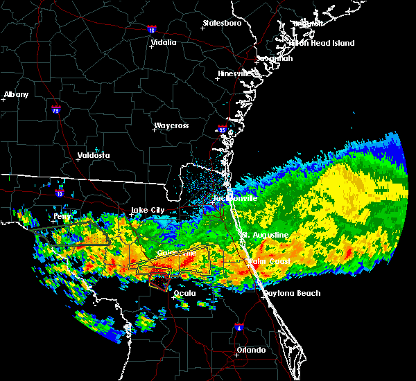 At 909 am edt, a severe thunderstorm capable of producing a tornado was located 7 miles northeast of williston, moving southeast at 20 mph (radar indicated rotation). Hazards include tornado and quarter size hail. Flying debris will be dangerous to those caught without shelter. mobile homes will be damaged or destroyed. damage to roofs, windows, and vehicles will occur. tree damage is likely. This tornadic thunderstorm will remain over mainly rural areas of northwestern marion county, including the following locations: mcintosh, reddick and flemington. At 909 am edt, a severe thunderstorm capable of producing a tornado was located 7 miles northeast of williston, moving southeast at 20 mph (radar indicated rotation). Hazards include tornado and quarter size hail. Flying debris will be dangerous to those caught without shelter. mobile homes will be damaged or destroyed. damage to roofs, windows, and vehicles will occur. tree damage is likely. This tornadic thunderstorm will remain over mainly rural areas of northwestern marion county, including the following locations: mcintosh, reddick and flemington.
|
| 4/4/2017 9:00 AM EDT |
 At 858 am edt, a severe thunderstorm was located near archer, or 7 miles north of williston, moving east at 20 mph (radar indicated). Hazards include 60 mph wind gusts. expect damage to roofs, siding, and trees At 858 am edt, a severe thunderstorm was located near archer, or 7 miles north of williston, moving east at 20 mph (radar indicated). Hazards include 60 mph wind gusts. expect damage to roofs, siding, and trees
|
| 2/15/2017 2:54 PM EST |
 At 254 pm est, a severe thunderstorm was located near anthony, or 7 miles northwest of ocala, moving east at 60 mph (radar indicated). Hazards include 60 mph wind gusts and quarter size hail. Hail damage to vehicles is expected. expect wind damage to roofs, siding, and trees. Locations impacted include, ocala, citra, sparr, anthony, santos, ocala airport, silver springs shores, reddick, lowell and burbank. At 254 pm est, a severe thunderstorm was located near anthony, or 7 miles northwest of ocala, moving east at 60 mph (radar indicated). Hazards include 60 mph wind gusts and quarter size hail. Hail damage to vehicles is expected. expect wind damage to roofs, siding, and trees. Locations impacted include, ocala, citra, sparr, anthony, santos, ocala airport, silver springs shores, reddick, lowell and burbank.
|
| 2/15/2017 2:27 PM EST |
 At 227 pm est, a severe thunderstorm was located 10 miles west of rainbow lakes estates, moving northeast at 60 mph (radar indicated). Hazards include 60 mph wind gusts and quarter size hail. Hail damage to vehicles is expected. Expect wind damage to roofs, siding, and trees. At 227 pm est, a severe thunderstorm was located 10 miles west of rainbow lakes estates, moving northeast at 60 mph (radar indicated). Hazards include 60 mph wind gusts and quarter size hail. Hail damage to vehicles is expected. Expect wind damage to roofs, siding, and trees.
|
| 1/22/2017 6:46 PM EST |
 At 646 pm est, severe thunderstorms were located along a line extending from near yulee to interlachen, moving northeast at 70 mph (radar indicated). Hazards include 60 mph wind gusts and quarter size hail. Hail damage to vehicles is expected. expect wind damage to roofs, siding, and trees. locations impacted include, jacksonville, saint augustine, fernandina beach, palatka, orange park, green cove springs, starke, interlachen, keystone heights and callahan. A tornado watch remains in effect until 800 pm est for northeastern and northern florida, and southeastern georgia. At 646 pm est, severe thunderstorms were located along a line extending from near yulee to interlachen, moving northeast at 70 mph (radar indicated). Hazards include 60 mph wind gusts and quarter size hail. Hail damage to vehicles is expected. expect wind damage to roofs, siding, and trees. locations impacted include, jacksonville, saint augustine, fernandina beach, palatka, orange park, green cove springs, starke, interlachen, keystone heights and callahan. A tornado watch remains in effect until 800 pm est for northeastern and northern florida, and southeastern georgia.
|
| 1/22/2017 6:40 PM EST |
 At 640 pm est, severe thunderstorms were located along a line extending from near anthony to 6 miles southwest of inverness highlands south, moving northeast at 75 mph (radar indicated). Hazards include 60 mph wind gusts and quarter size hail. Hail damage to vehicles is expected. Expect wind damage to roofs, siding, and trees. At 640 pm est, severe thunderstorms were located along a line extending from near anthony to 6 miles southwest of inverness highlands south, moving northeast at 75 mph (radar indicated). Hazards include 60 mph wind gusts and quarter size hail. Hail damage to vehicles is expected. Expect wind damage to roofs, siding, and trees.
|
| 1/22/2017 6:32 PM EST |
 At 631 pm est, severe thunderstorms were located along a line extending from 6 miles west of ratliff to cross creek, moving northeast at 70 mph (radar indicated). Hazards include 60 mph wind gusts and quarter size hail. Hail damage to vehicles is expected. expect wind damage to roofs, siding, and trees. locations impacted include, jacksonville, gainesville, saint augustine, fernandina beach, palatka, orange park, green cove springs, starke, lake butler and interlachen. A tornado watch remains in effect until 800 pm est for northeastern and northern florida, and southeastern georgia. At 631 pm est, severe thunderstorms were located along a line extending from 6 miles west of ratliff to cross creek, moving northeast at 70 mph (radar indicated). Hazards include 60 mph wind gusts and quarter size hail. Hail damage to vehicles is expected. expect wind damage to roofs, siding, and trees. locations impacted include, jacksonville, gainesville, saint augustine, fernandina beach, palatka, orange park, green cove springs, starke, lake butler and interlachen. A tornado watch remains in effect until 800 pm est for northeastern and northern florida, and southeastern georgia.
|
| 1/22/2017 6:17 PM EST |
 At 617 pm est, severe thunderstorms were located along a line extending from 8 miles north of macclenny to near williston, moving northeast at 70 mph (radar indicated). Hazards include 60 mph wind gusts and quarter size hail. Hail damage to vehicles is expected. expect wind damage to roofs, siding, and trees. locations impacted include, jacksonville, gainesville, saint augustine, fernandina beach, palatka, orange park, green cove springs, starke, lake butler and interlachen. A tornado watch remains in effect until 800 pm est for northeastern and northern florida, and southeastern georgia. At 617 pm est, severe thunderstorms were located along a line extending from 8 miles north of macclenny to near williston, moving northeast at 70 mph (radar indicated). Hazards include 60 mph wind gusts and quarter size hail. Hail damage to vehicles is expected. expect wind damage to roofs, siding, and trees. locations impacted include, jacksonville, gainesville, saint augustine, fernandina beach, palatka, orange park, green cove springs, starke, lake butler and interlachen. A tornado watch remains in effect until 800 pm est for northeastern and northern florida, and southeastern georgia.
|
| 1/22/2017 6:06 PM EST |
 At 605 pm est, severe thunderstorms were located along a line extending from near sanderson to near williston highlands, moving northeast at 70 mph (radar indicated). Hazards include 60 mph wind gusts and quarter size hail. Hail damage to vehicles is expected. Expect wind damage to roofs, siding, and trees. At 605 pm est, severe thunderstorms were located along a line extending from near sanderson to near williston highlands, moving northeast at 70 mph (radar indicated). Hazards include 60 mph wind gusts and quarter size hail. Hail damage to vehicles is expected. Expect wind damage to roofs, siding, and trees.
|
| 5/20/2016 12:00 PM EDT | 911 call center reports 2 trees down in citra. time and location estimated by rada in marion county FL, 6 miles WSW of Reddick, FL |
| 5/17/2016 4:08 PM EDT |
 At 408 pm edt, severe thunderstorms were located along a line extending from near rochelle to near fort mccoy, moving northeast at 30 mph (radar indicated). Hazards include 60 mph wind gusts and quarter size hail. Hail damage to vehicles is expected. expect wind damage to roofs, siding, and trees. Locations impacted include, gainesville, fort mccoy, citra, hawthorne, orange springs, cross creek, orange heights, sparr, newnans lake, rochelle, waldo, micanopy, reddick, mcintosh, lowell, flemington, grove park, hog valley, lochloosa and burbank. At 408 pm edt, severe thunderstorms were located along a line extending from near rochelle to near fort mccoy, moving northeast at 30 mph (radar indicated). Hazards include 60 mph wind gusts and quarter size hail. Hail damage to vehicles is expected. expect wind damage to roofs, siding, and trees. Locations impacted include, gainesville, fort mccoy, citra, hawthorne, orange springs, cross creek, orange heights, sparr, newnans lake, rochelle, waldo, micanopy, reddick, mcintosh, lowell, flemington, grove park, hog valley, lochloosa and burbank.
|
| 5/17/2016 3:43 PM EDT |
 At 343 pm edt, severe thunderstorms were located along a line extending from 9 miles southwest of cross creek to near ocala, moving northeast at 30 mph (radar indicated). Hazards include 60 mph wind gusts and half dollar size hail. Hail damage to vehicles is expected. Expect wind damage to roofs, siding, and trees. At 343 pm edt, severe thunderstorms were located along a line extending from 9 miles southwest of cross creek to near ocala, moving northeast at 30 mph (radar indicated). Hazards include 60 mph wind gusts and half dollar size hail. Hail damage to vehicles is expected. Expect wind damage to roofs, siding, and trees.
|
| 2/24/2016 8:41 AM EST |
 At 841 am est, a severe thunderstorm was located 7 miles southwest of ocala airport, or 11 miles southeast of rainbow lakes estates, moving northeast at 50 mph (radar indicated). Hazards include 60 mph wind gusts. Expect damage to roofs. Siding and trees. At 841 am est, a severe thunderstorm was located 7 miles southwest of ocala airport, or 11 miles southeast of rainbow lakes estates, moving northeast at 50 mph (radar indicated). Hazards include 60 mph wind gusts. Expect damage to roofs. Siding and trees.
|
| 5/20/2013 4:50 PM EDT | Numerous large trees and powerlines down across the area. time estimated based on rada in marion county FL, 6 miles WSW of Reddick, FL |
| 1/1/0001 12:00 AM | Marion county dispatch reported widespread tree damage along highway 301 and county road 318 in the city limits of citra. an hour later numerous road crews were out sti in marion county FL, 6.3 miles WSW of Reddick, FL |
| 1/1/0001 12:00 AM | Law enforcement reported a tree down at the intersection of nw 87th avenue road and nw 145th stree in marion county FL, 3.8 miles ENE of Reddick, FL |
| 1/1/0001 12:00 AM | A nws employee surveyed damage between citra and reddick and found it to be straight line winds. there was a mobile home with a roof peeled back and minor damage to sev in marion county FL, 1.8 miles WSW of Reddick, FL |
Hail Maps for Reddick, FL


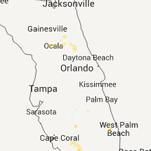


Connect with Interactive Hail Maps