

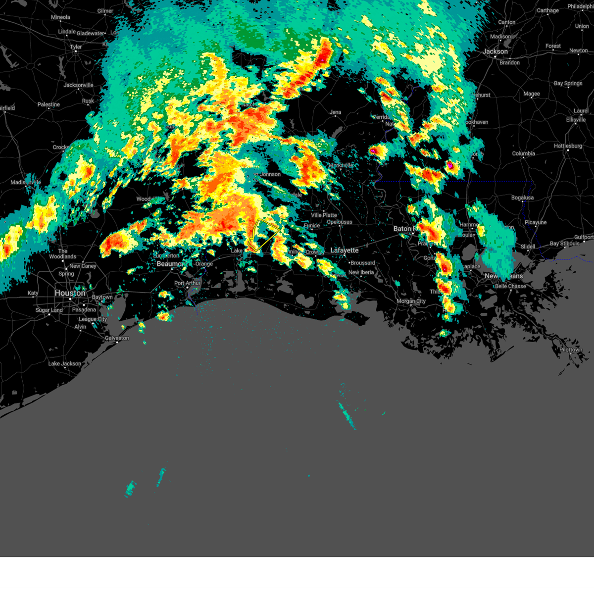
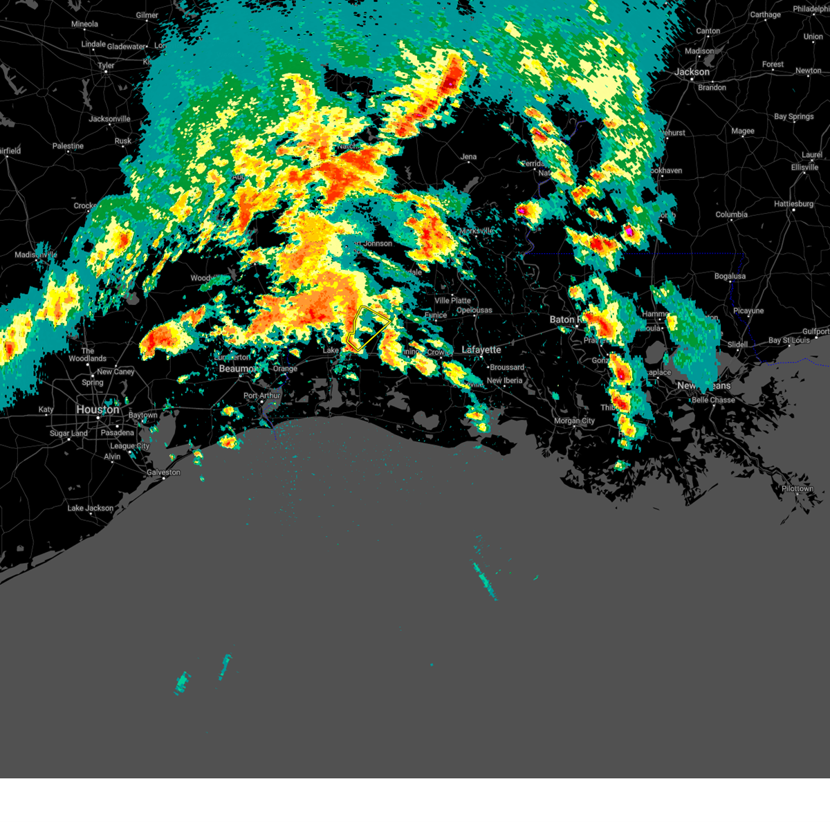
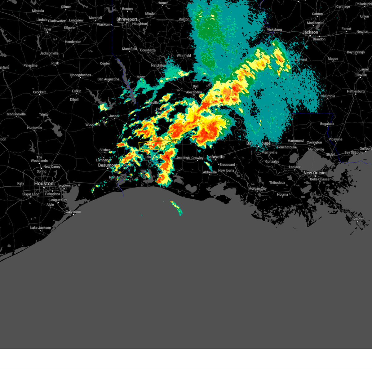
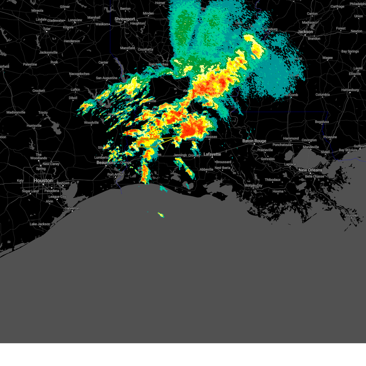
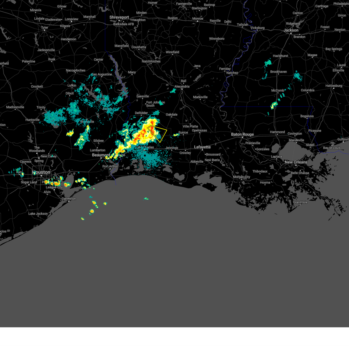
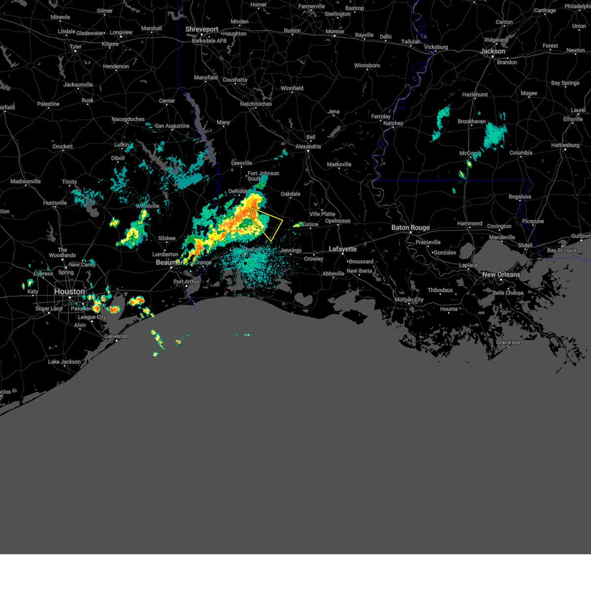
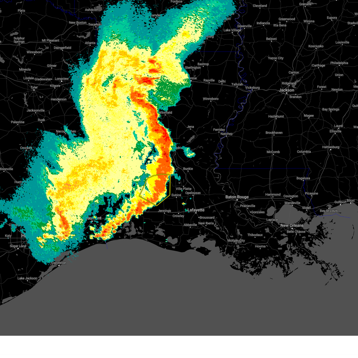
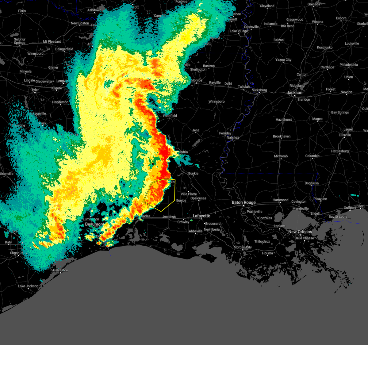
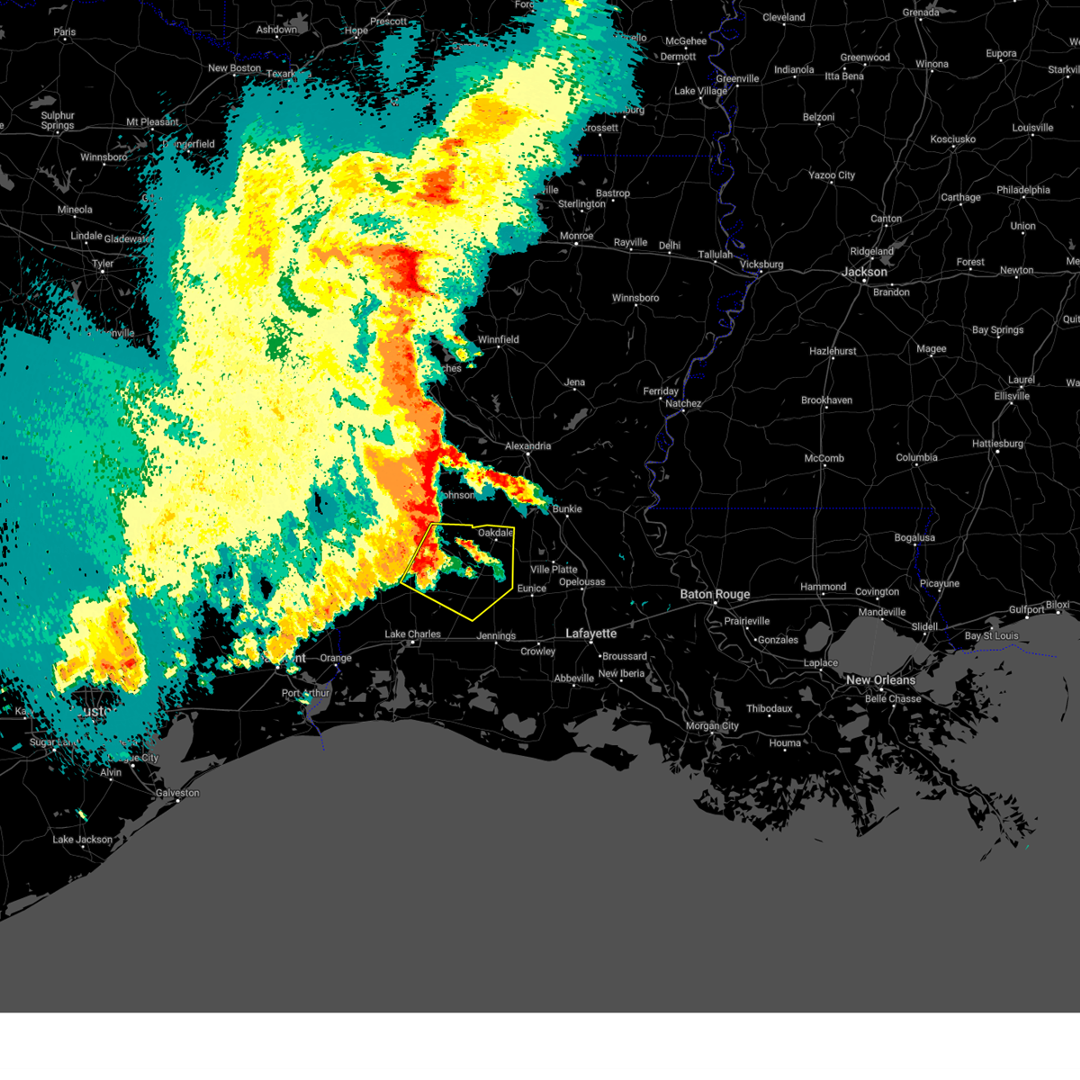
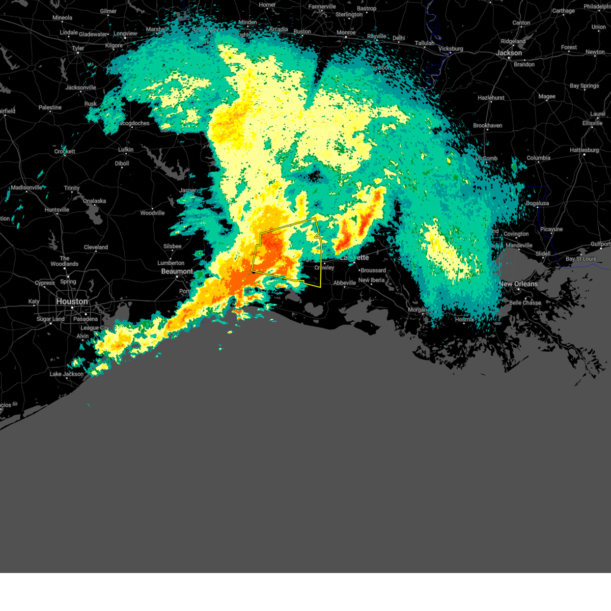
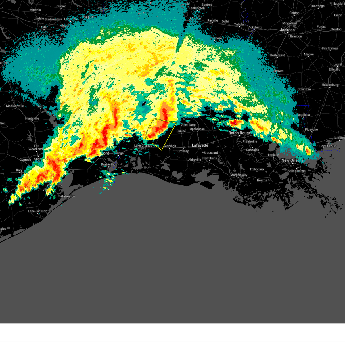
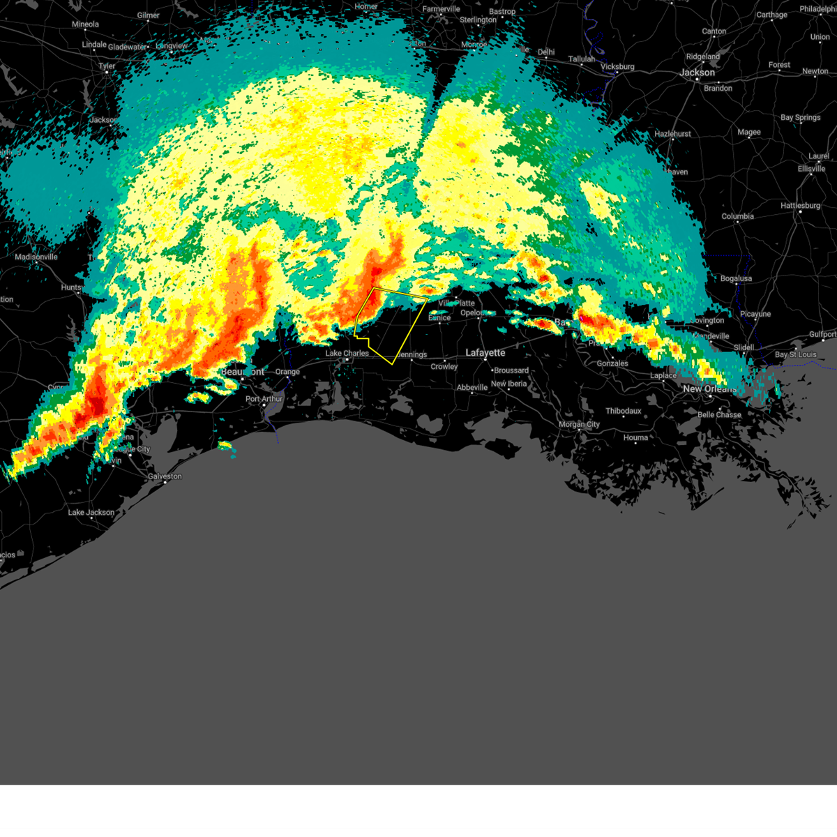
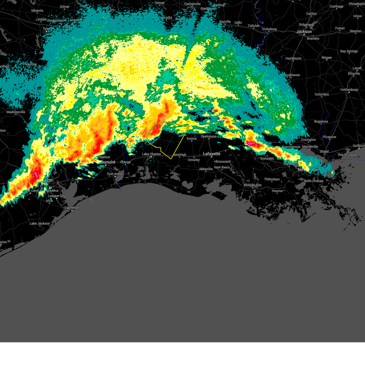
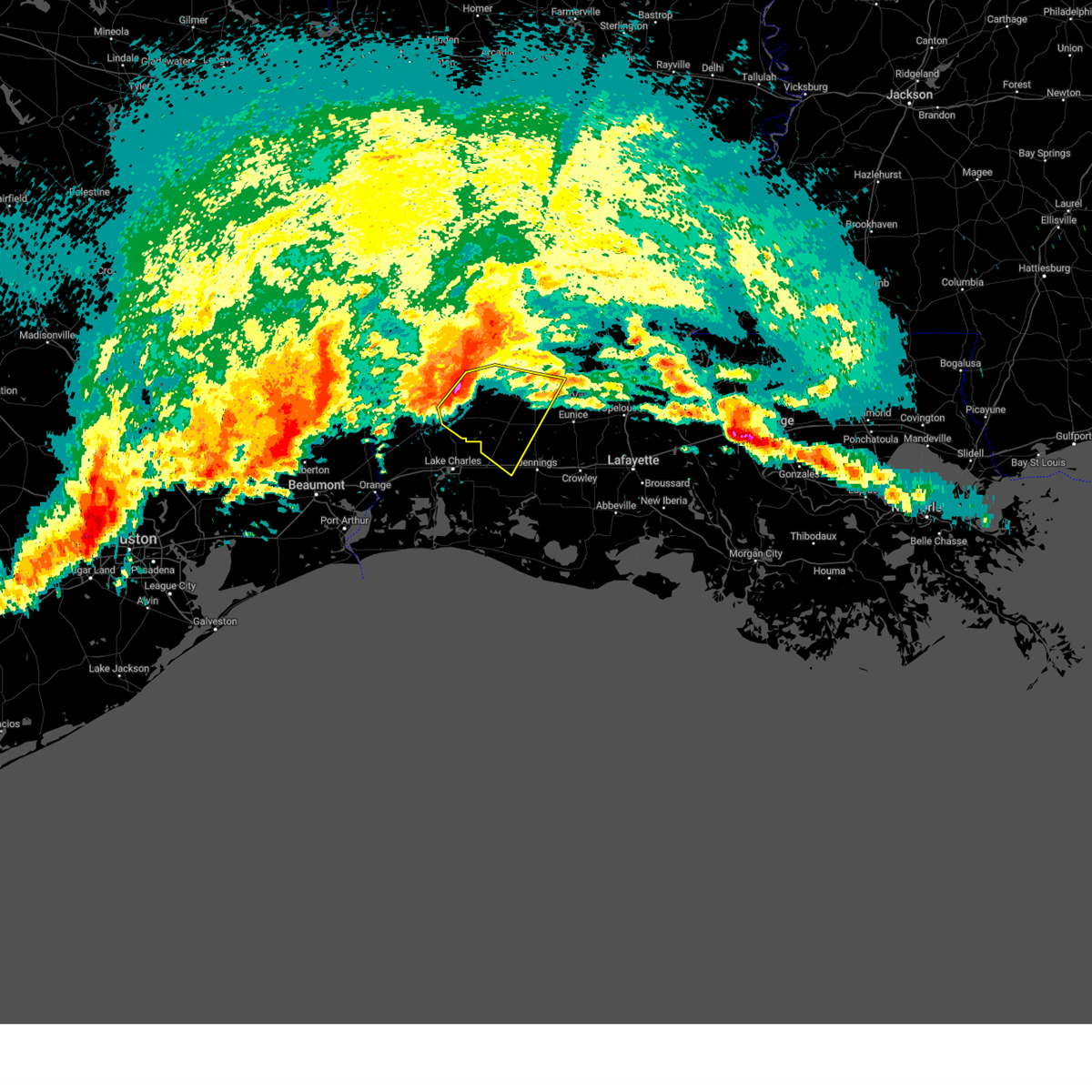
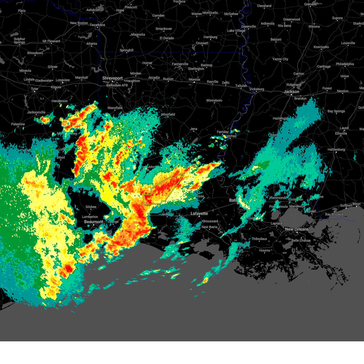
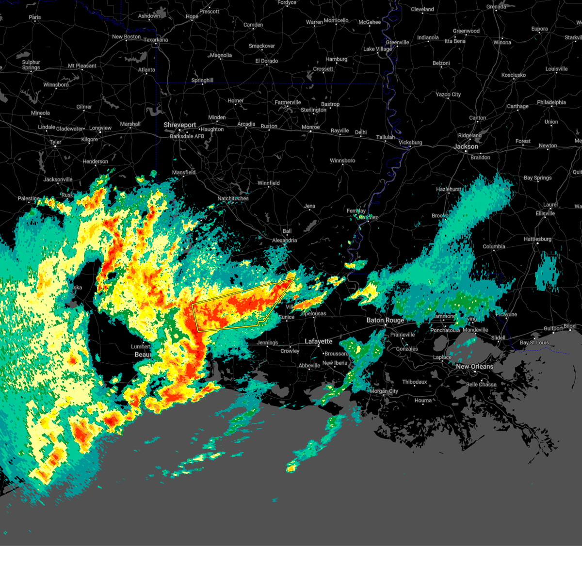
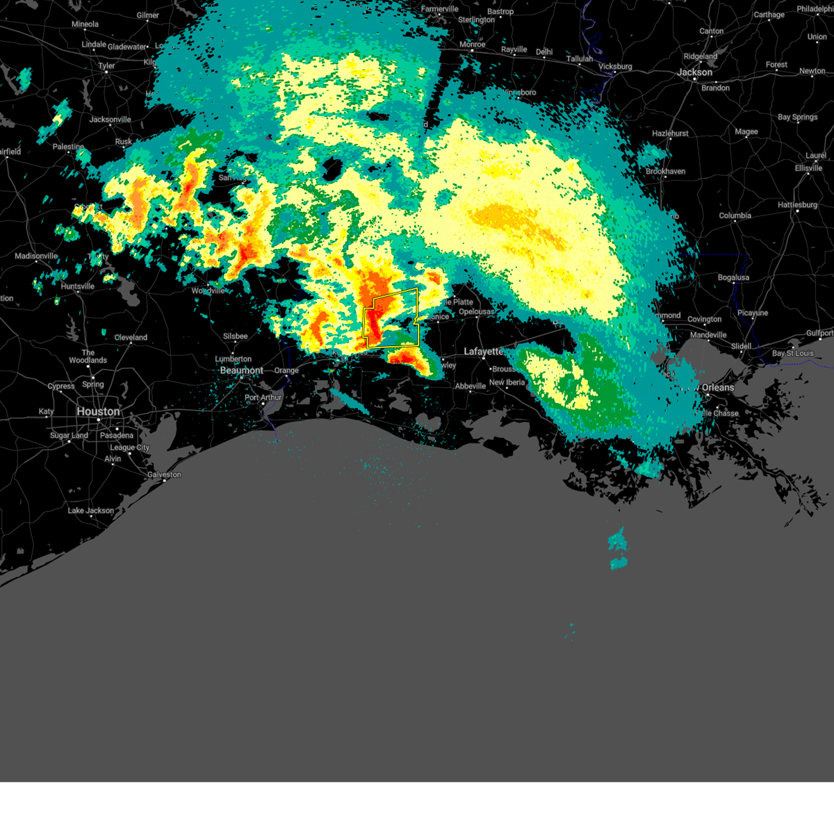
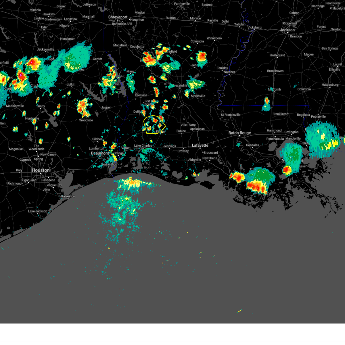
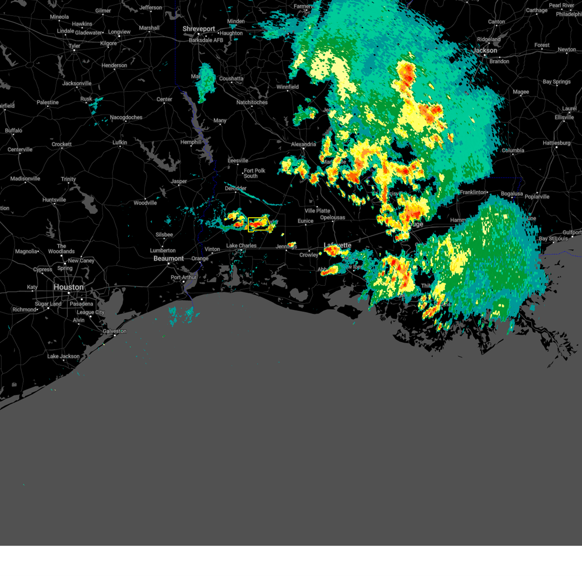
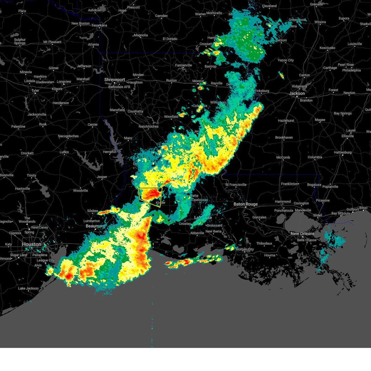
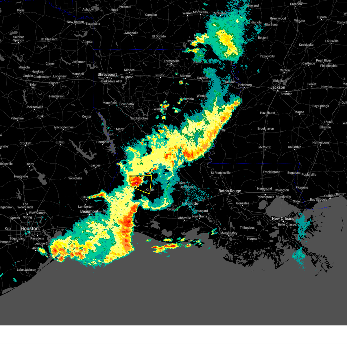
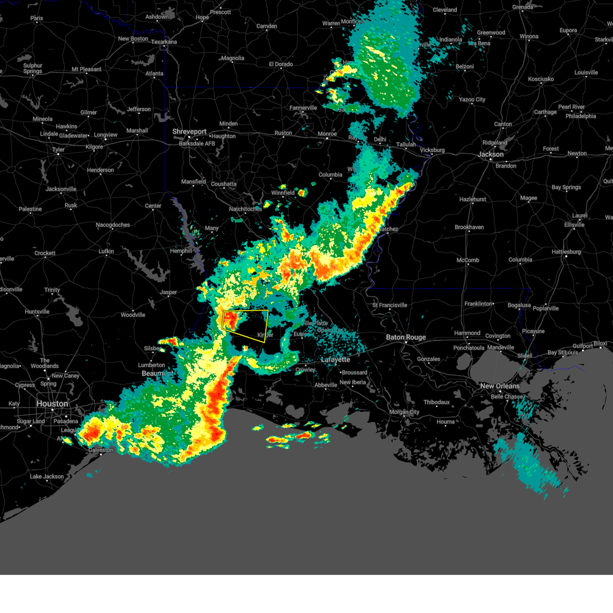
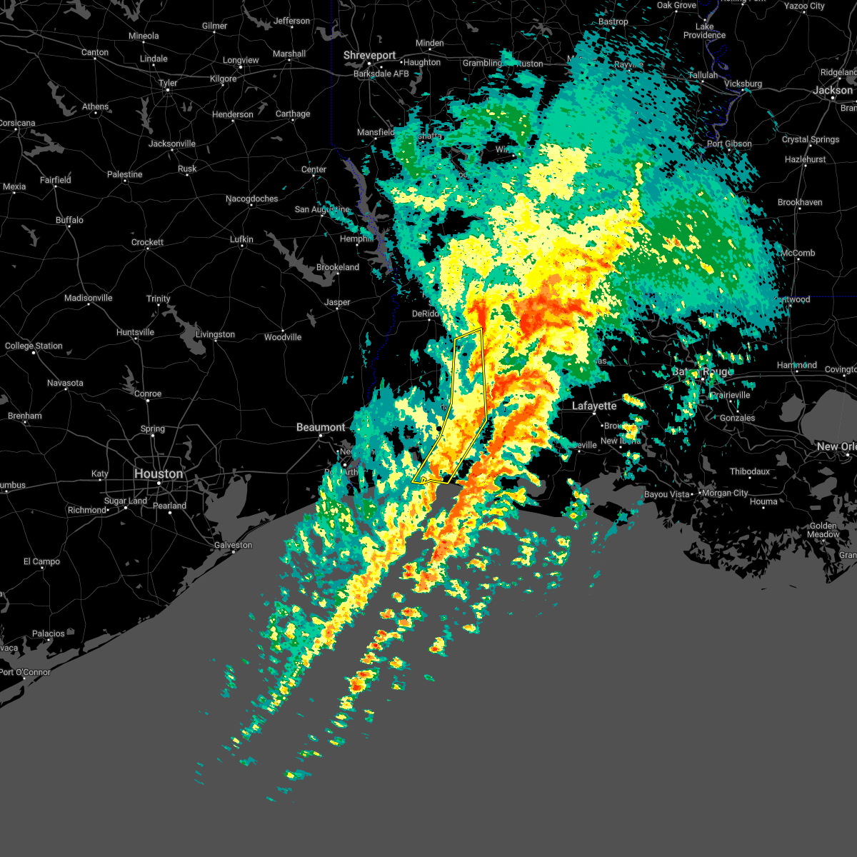
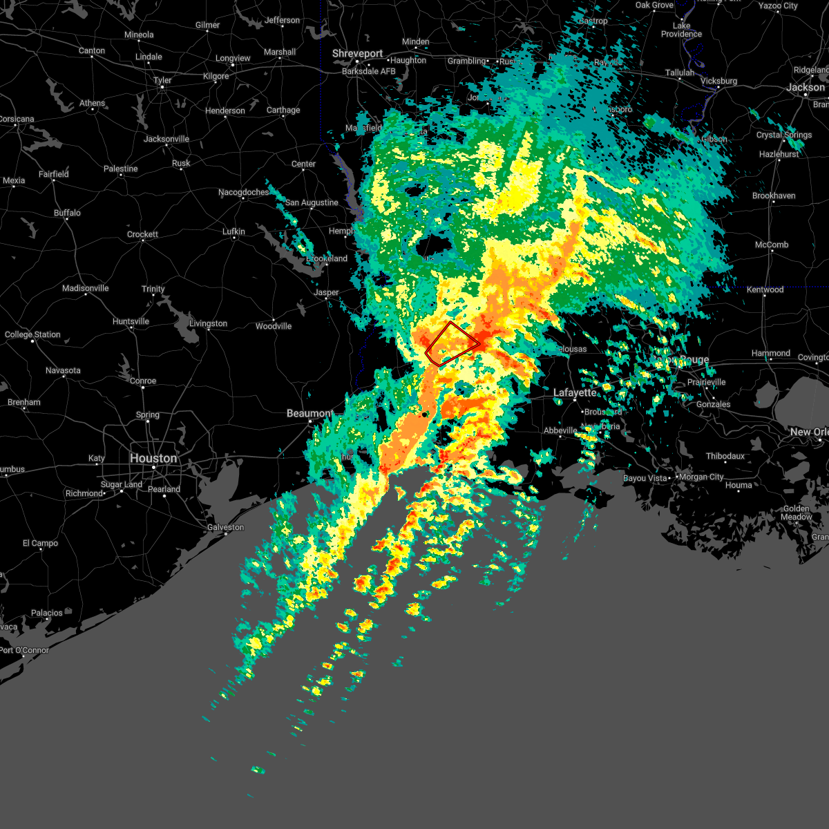
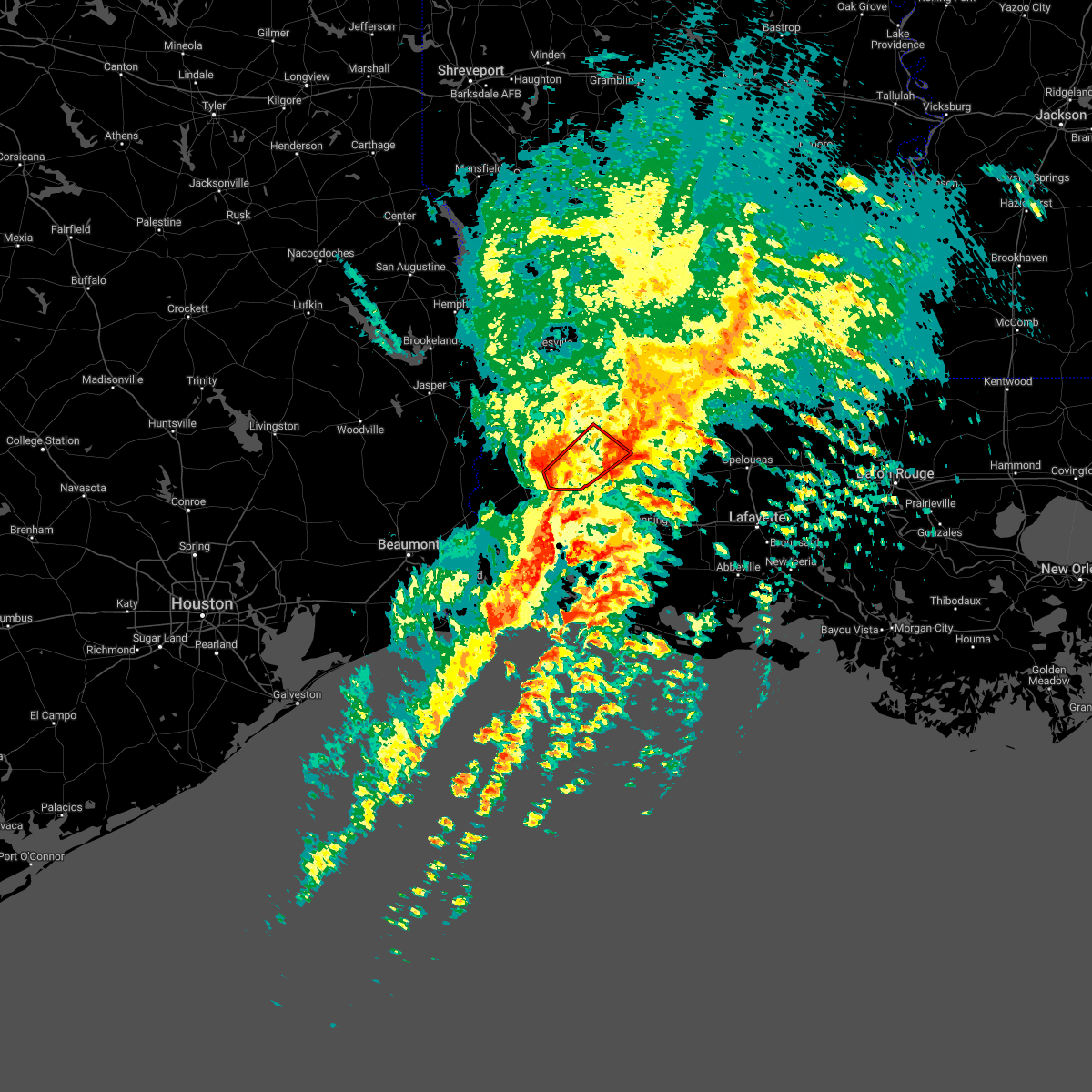
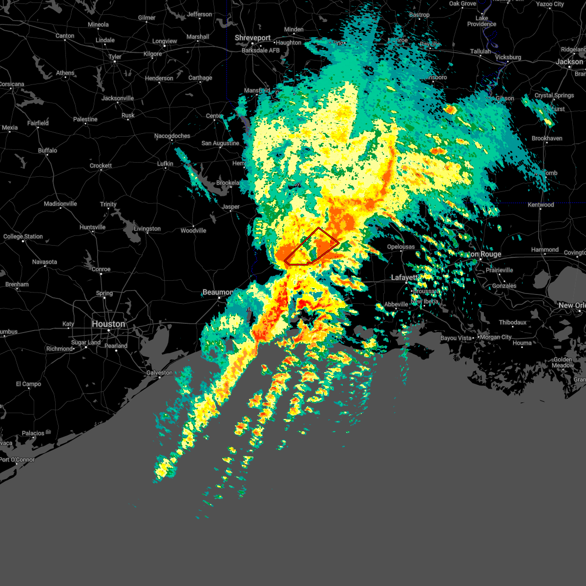
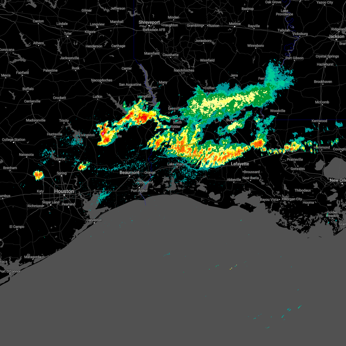
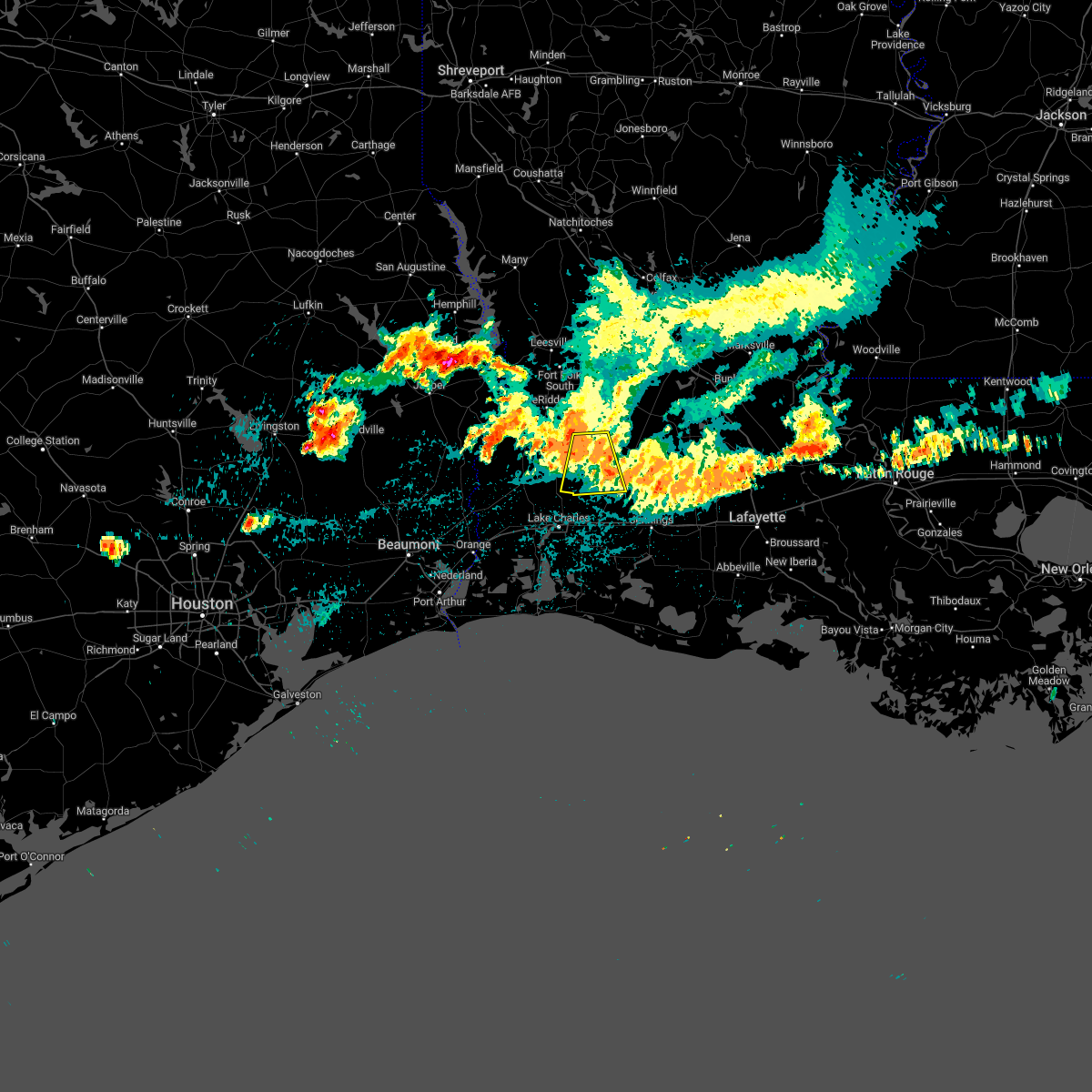
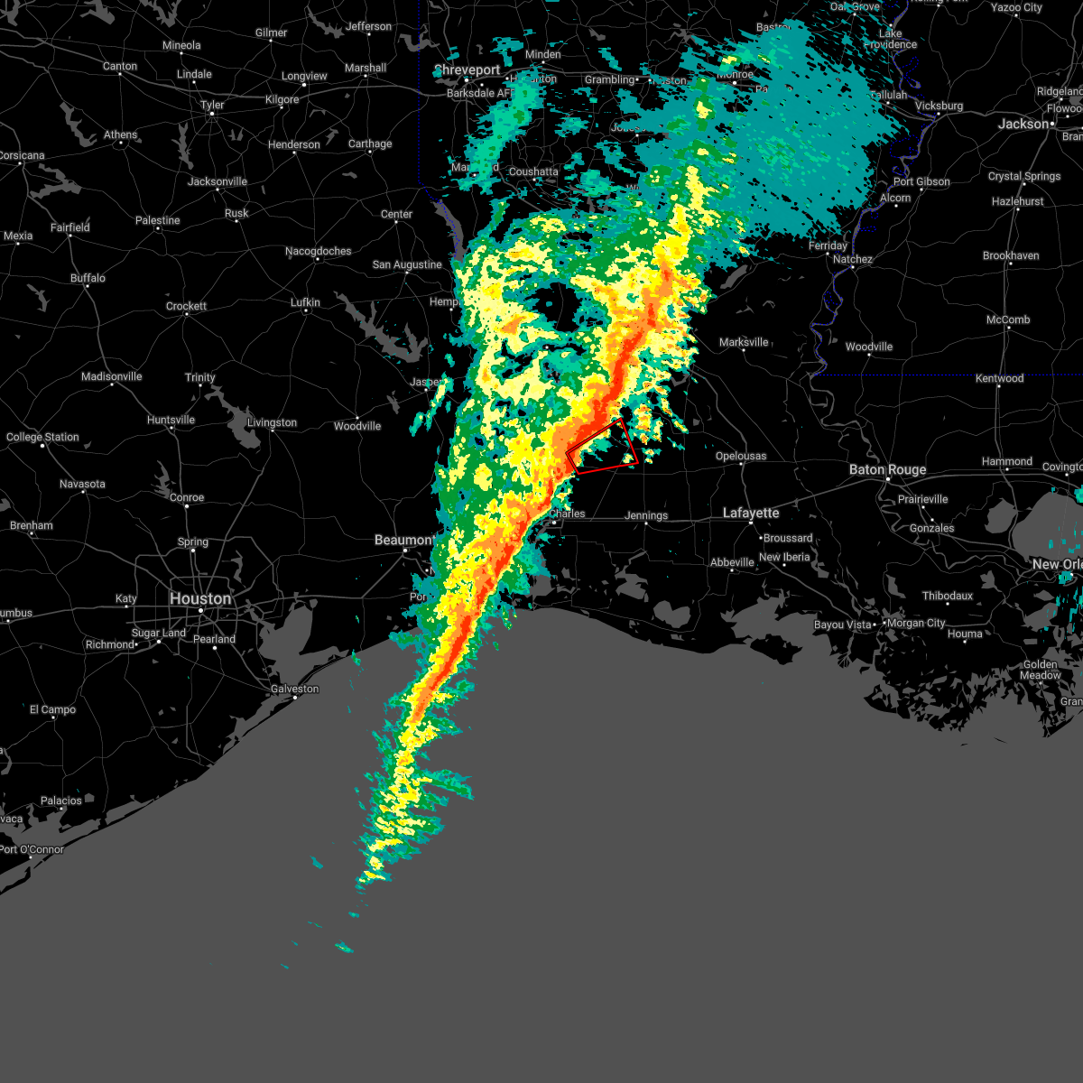
Hail Map for Reeves, LA
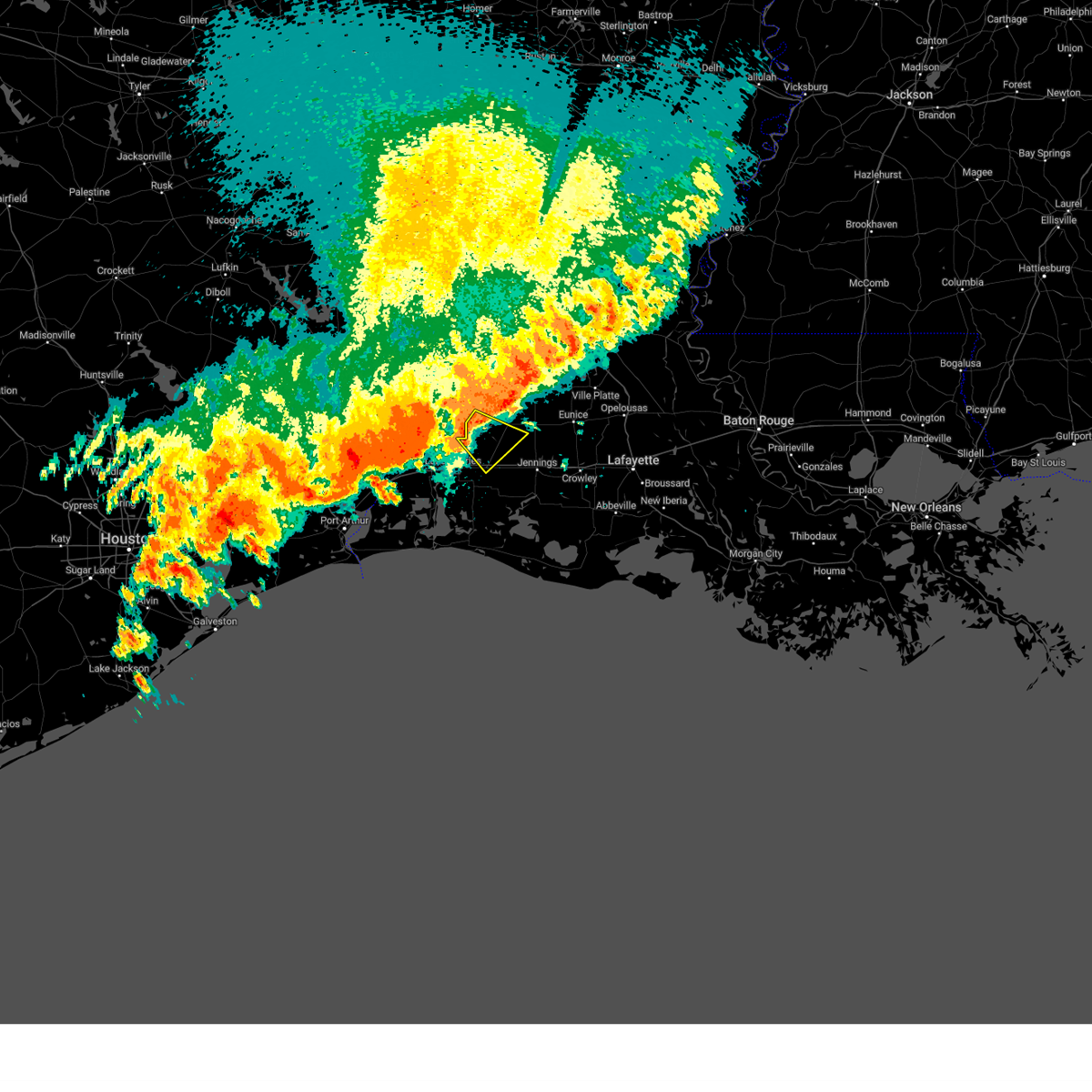
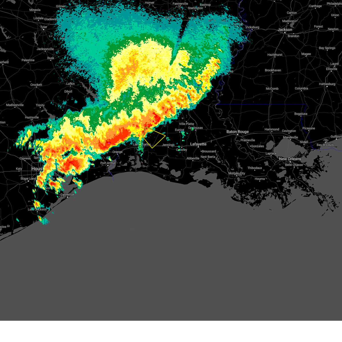
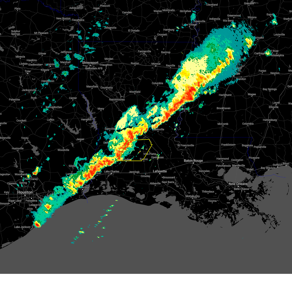
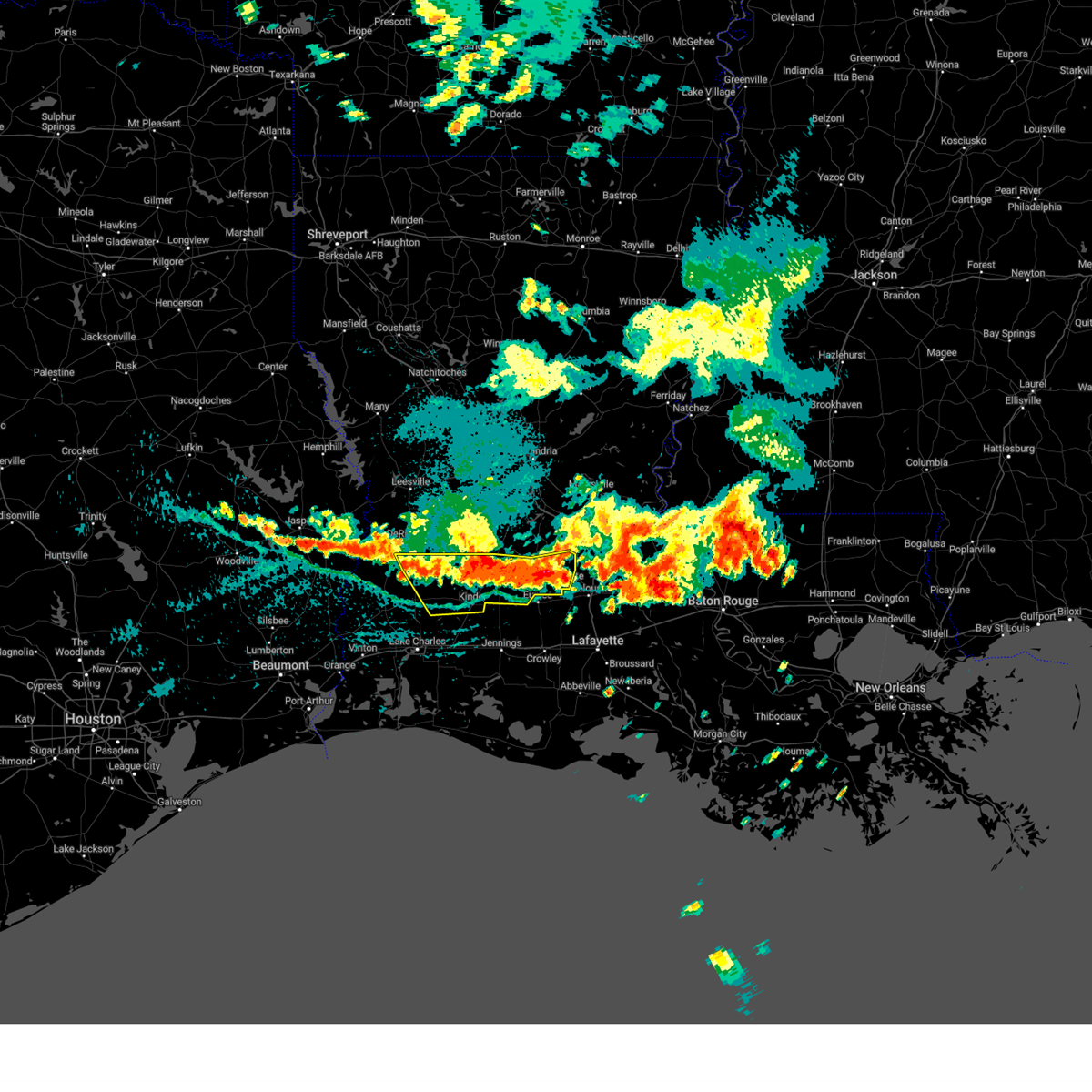
The Reeves, LA area has had 3 reports of on-the-ground hail by trained spotters, and has been under severe weather warnings 20 times during the past 12 months. Doppler radar has detected hail at or near Reeves, LA on 54 occasions, including 2 occasions during the past year.
| Name: | Reeves, LA |
| Where Located: | 50.3 miles NE of Beaumont, TX |
| Map: | Google Map for Reeves, LA |
| Population: | 232 |
| Housing Units: | 96 |
| More Info: | Search Google for Reeves, LA |
0
The Top Recent Hail Date for Reeves, LA is Tuesday, June 10, 2025 (50th out of 54)
Hail and Wind Damage Spotted near Reeves, LA
| Date / Time | Report Details |
|---|---|
| 5/27/2025 3:45 AM CDT |
 Svrlch the national weather service in lake charles has issued a * severe thunderstorm warning for, eastern cameron parish in southwestern louisiana, northwestern lafayette parish in south central louisiana, jefferson davis parish in southwestern louisiana, southern evangeline parish in central louisiana, acadia parish in southwestern louisiana, southeastern calcasieu parish in southwestern louisiana, vermilion parish in southwestern louisiana, western st. landry parish in central louisiana, southern allen parish in southwestern louisiana, * until 445 am cdt. * at 344 am cdt, severe thunderstorms were located along a line extending from near pine island to 10 miles north of rockefeller wildlife range, moving east at 50 mph (radar indicated). Hazards include 70 mph wind gusts and penny size hail. Expect considerable tree damage. Damage is likely to mobile homes, roofs, and outbuildings. Svrlch the national weather service in lake charles has issued a * severe thunderstorm warning for, eastern cameron parish in southwestern louisiana, northwestern lafayette parish in south central louisiana, jefferson davis parish in southwestern louisiana, southern evangeline parish in central louisiana, acadia parish in southwestern louisiana, southeastern calcasieu parish in southwestern louisiana, vermilion parish in southwestern louisiana, western st. landry parish in central louisiana, southern allen parish in southwestern louisiana, * until 445 am cdt. * at 344 am cdt, severe thunderstorms were located along a line extending from near pine island to 10 miles north of rockefeller wildlife range, moving east at 50 mph (radar indicated). Hazards include 70 mph wind gusts and penny size hail. Expect considerable tree damage. Damage is likely to mobile homes, roofs, and outbuildings.
|
| 5/27/2025 3:32 AM CDT |
 At 332 am cdt, severe thunderstorms were located along a line extending from near fenton to near lacassine national wildlife refuge, moving east at 55 mph (radar indicated). Hazards include 70 mph wind gusts and penny size hail. Expect considerable tree damage. damage is likely to mobile homes, roofs, and outbuildings. Locations impacted include, lake charles, welsh, iowa, kinder, fenton, reeves, lacassine national wildlife refuge, lake charles regional airport, hayes, moss bluff, buller, hacketts corner, harmony, topsy, lebleu settlement, gillis, thornwell, lowry, leblanc, and sweet lake. At 332 am cdt, severe thunderstorms were located along a line extending from near fenton to near lacassine national wildlife refuge, moving east at 55 mph (radar indicated). Hazards include 70 mph wind gusts and penny size hail. Expect considerable tree damage. damage is likely to mobile homes, roofs, and outbuildings. Locations impacted include, lake charles, welsh, iowa, kinder, fenton, reeves, lacassine national wildlife refuge, lake charles regional airport, hayes, moss bluff, buller, hacketts corner, harmony, topsy, lebleu settlement, gillis, thornwell, lowry, leblanc, and sweet lake.
|
| 5/27/2025 3:08 AM CDT |
 Svrlch the national weather service in lake charles has issued a * severe thunderstorm warning for, northeastern cameron parish in southwestern louisiana, jefferson davis parish in southwestern louisiana, southeastern beauregard parish in southwestern louisiana, eastern calcasieu parish in southwestern louisiana, southwestern allen parish in southwestern louisiana, * until 345 am cdt. * at 308 am cdt, severe thunderstorms were located along a line extending from near ragley to near heberts marina, moving northeast at 50 mph (radar indicated). Hazards include 60 mph wind gusts and penny size hail. expect damage to roofs, siding, and trees Svrlch the national weather service in lake charles has issued a * severe thunderstorm warning for, northeastern cameron parish in southwestern louisiana, jefferson davis parish in southwestern louisiana, southeastern beauregard parish in southwestern louisiana, eastern calcasieu parish in southwestern louisiana, southwestern allen parish in southwestern louisiana, * until 345 am cdt. * at 308 am cdt, severe thunderstorms were located along a line extending from near ragley to near heberts marina, moving northeast at 50 mph (radar indicated). Hazards include 60 mph wind gusts and penny size hail. expect damage to roofs, siding, and trees
|
| 5/6/2025 5:44 PM CDT | the severe thunderstorm warning has been cancelled and is no longer in effect |
| 5/6/2025 5:32 PM CDT | the severe thunderstorm warning has been cancelled and is no longer in effect |
| 5/6/2025 5:32 PM CDT | At 532 pm cdt, a severe thunderstorm was located near buller, or near fenton, moving northeast at 35 mph (radar indicated). Hazards include 60 mph wind gusts and quarter size hail. Hail damage to vehicles is expected. expect wind damage to roofs, siding, and trees. Locations impacted include, leblanc, buller, reeves, and kinder. |
| 5/6/2025 5:31 PM CDT | Report of trees down on walker r in allen county LA, 4.7 miles SW of Reeves, LA |
| 5/6/2025 5:30 PM CDT | Report of power lines down on martin tram r in allen county LA, 5 miles N of Reeves, LA |
| 5/6/2025 5:20 PM CDT |
 At 519 pm cdt, a severe thunderstorm was located near moss bluff, moving northeast at 30 mph (radar indicated). Hazards include 60 mph wind gusts and quarter size hail. Hail damage to vehicles is expected. expect wind damage to roofs, siding, and trees. Locations impacted include, topsy, leblanc, buller, reeves, kinder, and moss bluff. At 519 pm cdt, a severe thunderstorm was located near moss bluff, moving northeast at 30 mph (radar indicated). Hazards include 60 mph wind gusts and quarter size hail. Hail damage to vehicles is expected. expect wind damage to roofs, siding, and trees. Locations impacted include, topsy, leblanc, buller, reeves, kinder, and moss bluff.
|
| 5/6/2025 5:20 PM CDT |
 the severe thunderstorm warning has been cancelled and is no longer in effect the severe thunderstorm warning has been cancelled and is no longer in effect
|
| 5/6/2025 5:15 PM CDT |
 Svrlch the national weather service in lake charles has issued a * severe thunderstorm warning for, northwestern jefferson davis parish in southwestern louisiana, southeastern beauregard parish in southwestern louisiana, northeastern calcasieu parish in southwestern louisiana, southwestern allen parish in southwestern louisiana, * until 600 pm cdt. * at 515 pm cdt, a severe thunderstorm was located over moss bluff, moving northeast at 30 mph (radar indicated). Hazards include 60 mph wind gusts and quarter size hail. Hail damage to vehicles is expected. Expect wind damage to roofs, siding, and trees. Svrlch the national weather service in lake charles has issued a * severe thunderstorm warning for, northwestern jefferson davis parish in southwestern louisiana, southeastern beauregard parish in southwestern louisiana, northeastern calcasieu parish in southwestern louisiana, southwestern allen parish in southwestern louisiana, * until 600 pm cdt. * at 515 pm cdt, a severe thunderstorm was located over moss bluff, moving northeast at 30 mph (radar indicated). Hazards include 60 mph wind gusts and quarter size hail. Hail damage to vehicles is expected. Expect wind damage to roofs, siding, and trees.
|
| 5/2/2025 6:30 PM CDT | 911 center reports tree down on the topsy bel rd bridge south of camp pearl rd. time estimated by rada in allen county LA, 4.1 miles NNE of Reeves, LA |
| 5/2/2025 6:09 PM CDT | The storm which prompted the warning has weakened below severe limits, and no longer poses an immediate threat to life or property. therefore, the warning will be allowed to expire. a severe thunderstorm watch remains in effect until 700 pm cdt for southwestern louisiana. |
| 5/2/2025 5:45 PM CDT | Svrlch the national weather service in lake charles has issued a * severe thunderstorm warning for, southeastern beauregard parish in southwestern louisiana, northwestern calcasieu parish in southwestern louisiana, southwestern allen parish in southwestern louisiana, * until 615 pm cdt. * at 544 pm cdt, a severe thunderstorm was located near de quincy, moving east at 20 mph (radar indicated). Hazards include 60 mph wind gusts and penny size hail. expect damage to roofs, siding, and trees |
| 3/31/2025 4:35 AM CDT |
 the severe thunderstorm warning has been cancelled and is no longer in effect the severe thunderstorm warning has been cancelled and is no longer in effect
|
| 3/31/2025 4:09 AM CDT |
 Svrlch the national weather service in lake charles has issued a * severe thunderstorm warning for, southeastern beauregard parish in southwestern louisiana, north central calcasieu parish in southwestern louisiana, southwestern allen parish in southwestern louisiana, * until 500 am cdt. * at 408 am cdt, a severe thunderstorm was located over de quincy, moving east at 30 mph (radar indicated). Hazards include 60 mph wind gusts and quarter size hail. Hail damage to vehicles is expected. Expect wind damage to roofs, siding, and trees. Svrlch the national weather service in lake charles has issued a * severe thunderstorm warning for, southeastern beauregard parish in southwestern louisiana, north central calcasieu parish in southwestern louisiana, southwestern allen parish in southwestern louisiana, * until 500 am cdt. * at 408 am cdt, a severe thunderstorm was located over de quincy, moving east at 30 mph (radar indicated). Hazards include 60 mph wind gusts and quarter size hail. Hail damage to vehicles is expected. Expect wind damage to roofs, siding, and trees.
|
| 3/4/2025 12:47 PM CST |
 Svrlch the national weather service in lake charles has issued a * severe thunderstorm warning for, northeastern cameron parish in southwestern louisiana, jefferson davis parish in southwestern louisiana, southwestern evangeline parish in central louisiana, southeastern beauregard parish in southwestern louisiana, northwestern acadia parish in southwestern louisiana, eastern calcasieu parish in southwestern louisiana, west central st. landry parish in central louisiana, southern allen parish in southwestern louisiana, * until 130 pm cst. * at 1247 pm cst, severe thunderstorms were located along a line extending from near oberlin to near holly beach, moving southeast at 35 mph (radar indicated). Hazards include 60 mph wind gusts. expect damage to roofs, siding, and trees Svrlch the national weather service in lake charles has issued a * severe thunderstorm warning for, northeastern cameron parish in southwestern louisiana, jefferson davis parish in southwestern louisiana, southwestern evangeline parish in central louisiana, southeastern beauregard parish in southwestern louisiana, northwestern acadia parish in southwestern louisiana, eastern calcasieu parish in southwestern louisiana, west central st. landry parish in central louisiana, southern allen parish in southwestern louisiana, * until 130 pm cst. * at 1247 pm cst, severe thunderstorms were located along a line extending from near oberlin to near holly beach, moving southeast at 35 mph (radar indicated). Hazards include 60 mph wind gusts. expect damage to roofs, siding, and trees
|
| 3/4/2025 12:09 PM CST |
 At 1208 pm cst, severe thunderstorms were located along a line extending from 6 miles northeast of pitkin to near de quincy, moving east at 25 mph (radar indicated). Hazards include 60 mph wind gusts. Expect damage to roofs, siding, and trees. Locations impacted include, dry creek, singer, cheneyville, turkey creek, basile, bayou chicot, topsy, oakdale, duralde, glenmora, allen parish airport, forest hill, elton, sugartown, kinder, de quincy, leblanc, beaver, oretta, and ragley. At 1208 pm cst, severe thunderstorms were located along a line extending from 6 miles northeast of pitkin to near de quincy, moving east at 25 mph (radar indicated). Hazards include 60 mph wind gusts. Expect damage to roofs, siding, and trees. Locations impacted include, dry creek, singer, cheneyville, turkey creek, basile, bayou chicot, topsy, oakdale, duralde, glenmora, allen parish airport, forest hill, elton, sugartown, kinder, de quincy, leblanc, beaver, oretta, and ragley.
|
| 3/4/2025 11:41 AM CST |
 Svrlch the national weather service in lake charles has issued a * severe thunderstorm warning for, southeastern rapides parish in central louisiana, northern jefferson davis parish in southwestern louisiana, evangeline parish in central louisiana, beauregard parish in southwestern louisiana, northwestern acadia parish in southwestern louisiana, northwestern calcasieu parish in southwestern louisiana, southeastern vernon parish in west central louisiana, allen parish in southwestern louisiana, * until 1245 pm cst. * at 1141 am cst, severe thunderstorms were located along a line extending from near cravens to near lunita, moving northeast at 85 mph (radar indicated). Hazards include 60 mph wind gusts. expect damage to roofs, siding, and trees Svrlch the national weather service in lake charles has issued a * severe thunderstorm warning for, southeastern rapides parish in central louisiana, northern jefferson davis parish in southwestern louisiana, evangeline parish in central louisiana, beauregard parish in southwestern louisiana, northwestern acadia parish in southwestern louisiana, northwestern calcasieu parish in southwestern louisiana, southeastern vernon parish in west central louisiana, allen parish in southwestern louisiana, * until 1245 pm cst. * at 1141 am cst, severe thunderstorms were located along a line extending from near cravens to near lunita, moving northeast at 85 mph (radar indicated). Hazards include 60 mph wind gusts. expect damage to roofs, siding, and trees
|
| 12/28/2024 4:37 PM CST |
 Svrlch the national weather service in lake charles has issued a * severe thunderstorm warning for, jefferson davis parish in southwestern louisiana, southwestern evangeline parish in central louisiana, southeastern beauregard parish in southwestern louisiana, northwestern acadia parish in southwestern louisiana, northeastern calcasieu parish in southwestern louisiana, west central st. landry parish in central louisiana, southern allen parish in southwestern louisiana, * until 530 pm cst. * at 437 pm cst, severe thunderstorms were located along a line extending from near reeves to 6 miles north of buhler, moving southeast at 35 mph (radar indicated). Hazards include 70 mph wind gusts. Expect considerable tree damage. Damage is likely to mobile homes, roofs, and outbuildings. Svrlch the national weather service in lake charles has issued a * severe thunderstorm warning for, jefferson davis parish in southwestern louisiana, southwestern evangeline parish in central louisiana, southeastern beauregard parish in southwestern louisiana, northwestern acadia parish in southwestern louisiana, northeastern calcasieu parish in southwestern louisiana, west central st. landry parish in central louisiana, southern allen parish in southwestern louisiana, * until 530 pm cst. * at 437 pm cst, severe thunderstorms were located along a line extending from near reeves to 6 miles north of buhler, moving southeast at 35 mph (radar indicated). Hazards include 70 mph wind gusts. Expect considerable tree damage. Damage is likely to mobile homes, roofs, and outbuildings.
|
| 9/25/2024 11:31 AM CDT |
 the severe thunderstorm warning has been cancelled and is no longer in effect the severe thunderstorm warning has been cancelled and is no longer in effect
|
| 9/25/2024 11:28 AM CDT |
 At 1128 am cdt, a severe thunderstorm was located over reeves, moving southeast at 30 mph (radar indicated). Hazards include 60 mph wind gusts and penny size hail. Expect damage to roofs, siding, and trees. Locations impacted include, kinder, oberlin, reeves, leblanc, and harmony. At 1128 am cdt, a severe thunderstorm was located over reeves, moving southeast at 30 mph (radar indicated). Hazards include 60 mph wind gusts and penny size hail. Expect damage to roofs, siding, and trees. Locations impacted include, kinder, oberlin, reeves, leblanc, and harmony.
|
| 9/25/2024 11:18 AM CDT |
 Svrlch the national weather service in lake charles has issued a * severe thunderstorm warning for, north central jefferson davis parish in southwestern louisiana, east central beauregard parish in southwestern louisiana, southwestern allen parish in southwestern louisiana, * until noon cdt. * at 1118 am cdt, a severe thunderstorm was located over jennings, moving southeast at 35 mph (radar indicated). Hazards include 60 mph wind gusts and penny size hail. expect damage to roofs, siding, and trees Svrlch the national weather service in lake charles has issued a * severe thunderstorm warning for, north central jefferson davis parish in southwestern louisiana, east central beauregard parish in southwestern louisiana, southwestern allen parish in southwestern louisiana, * until noon cdt. * at 1118 am cdt, a severe thunderstorm was located over jennings, moving southeast at 35 mph (radar indicated). Hazards include 60 mph wind gusts and penny size hail. expect damage to roofs, siding, and trees
|
| 5/30/2024 9:42 PM CDT |
 The storms which prompted the warning have continue and need to be replaced by a new severe warning. therefore, warning 198 will be allowed to expire. a severe thunderstorm watch remains in effect until 1100 pm cdt for central, southwestern and west central louisiana. remember, a severe thunderstorm warning still remains in effect for allen parish. The storms which prompted the warning have continue and need to be replaced by a new severe warning. therefore, warning 198 will be allowed to expire. a severe thunderstorm watch remains in effect until 1100 pm cdt for central, southwestern and west central louisiana. remember, a severe thunderstorm warning still remains in effect for allen parish.
|
| 5/30/2024 9:31 PM CDT |
 At 931 pm cdt, severe thunderstorms were located along a line extending from 6 miles southwest of allen parish airport to near oberlin to near leblanc, moving southeast at 35 mph (radar indicated). Hazards include 60 mph wind gusts and nickel size hail. Expect damage to roofs, siding, and trees. Locations impacted include, oakdale, kinder, oberlin, elton, elizabeth, reeves, dry creek, mittie, grant, harmony, allen parish airport, leblanc, beaver, and bond. At 931 pm cdt, severe thunderstorms were located along a line extending from 6 miles southwest of allen parish airport to near oberlin to near leblanc, moving southeast at 35 mph (radar indicated). Hazards include 60 mph wind gusts and nickel size hail. Expect damage to roofs, siding, and trees. Locations impacted include, oakdale, kinder, oberlin, elton, elizabeth, reeves, dry creek, mittie, grant, harmony, allen parish airport, leblanc, beaver, and bond.
|
| 5/30/2024 9:31 PM CDT |
 the severe thunderstorm warning has been cancelled and is no longer in effect the severe thunderstorm warning has been cancelled and is no longer in effect
|
| 5/30/2024 9:04 PM CDT |
 Svrlch the national weather service in lake charles has issued a * severe thunderstorm warning for, north central jefferson davis parish in southwestern louisiana, southwestern evangeline parish in central louisiana, eastern beauregard parish in southwestern louisiana, southeastern vernon parish in west central louisiana, allen parish in southwestern louisiana, * until 945 pm cdt. * at 904 pm cdt, severe thunderstorms were located along a line extending from sugartown to dry creek to near longville, moving east at 30 mph (radar indicated). Hazards include 60 mph wind gusts and nickel size hail. expect damage to roofs, siding, and trees Svrlch the national weather service in lake charles has issued a * severe thunderstorm warning for, north central jefferson davis parish in southwestern louisiana, southwestern evangeline parish in central louisiana, eastern beauregard parish in southwestern louisiana, southeastern vernon parish in west central louisiana, allen parish in southwestern louisiana, * until 945 pm cdt. * at 904 pm cdt, severe thunderstorms were located along a line extending from sugartown to dry creek to near longville, moving east at 30 mph (radar indicated). Hazards include 60 mph wind gusts and nickel size hail. expect damage to roofs, siding, and trees
|
| 5/28/2024 3:42 PM CDT |
 The storms which prompted the warning have weakened below severe limits, and no longer pose an immediate threat to life or property. therefore, the warning will be allowed to expire. however gusty winds are still possible with these thunderstorms. a severe thunderstorm watch remains in effect until 600 pm cdt for central, southwestern and west central louisiana. The storms which prompted the warning have weakened below severe limits, and no longer pose an immediate threat to life or property. therefore, the warning will be allowed to expire. however gusty winds are still possible with these thunderstorms. a severe thunderstorm watch remains in effect until 600 pm cdt for central, southwestern and west central louisiana.
|
| 5/28/2024 3:13 PM CDT |
 Svrlch the national weather service in lake charles has issued a * severe thunderstorm warning for, northeastern jefferson davis parish in southwestern louisiana, southwestern evangeline parish in central louisiana, northwestern acadia parish in southwestern louisiana, west central st. landry parish in central louisiana, allen parish in southwestern louisiana, * until 345 pm cdt. * at 313 pm cdt, severe thunderstorms were located along a line extending from near leblanc to near jennings, moving northeast at 25 mph (radar indicated). Hazards include 60 mph wind gusts. expect damage to roofs, siding, and trees Svrlch the national weather service in lake charles has issued a * severe thunderstorm warning for, northeastern jefferson davis parish in southwestern louisiana, southwestern evangeline parish in central louisiana, northwestern acadia parish in southwestern louisiana, west central st. landry parish in central louisiana, allen parish in southwestern louisiana, * until 345 pm cdt. * at 313 pm cdt, severe thunderstorms were located along a line extending from near leblanc to near jennings, moving northeast at 25 mph (radar indicated). Hazards include 60 mph wind gusts. expect damage to roofs, siding, and trees
|
| 5/28/2024 2:41 PM CDT |
 Svrlch the national weather service in lake charles has issued a * severe thunderstorm warning for, jefferson davis parish in southwestern louisiana, southeastern beauregard parish in southwestern louisiana, northeastern calcasieu parish in southwestern louisiana, southwestern allen parish in southwestern louisiana, * until 315 pm cdt. * at 241 pm cdt, severe thunderstorms were located along a line extending from near topsy to welsh, moving northeast at 15 mph (radar indicated). Hazards include 60 mph wind gusts and quarter size hail. Hail damage to vehicles is expected. Expect wind damage to roofs, siding, and trees. Svrlch the national weather service in lake charles has issued a * severe thunderstorm warning for, jefferson davis parish in southwestern louisiana, southeastern beauregard parish in southwestern louisiana, northeastern calcasieu parish in southwestern louisiana, southwestern allen parish in southwestern louisiana, * until 315 pm cdt. * at 241 pm cdt, severe thunderstorms were located along a line extending from near topsy to welsh, moving northeast at 15 mph (radar indicated). Hazards include 60 mph wind gusts and quarter size hail. Hail damage to vehicles is expected. Expect wind damage to roofs, siding, and trees.
|
| 5/16/2024 8:49 PM CDT |
 At 849 pm cdt, a severe thunderstorm was located near iota, moving east at 40 mph (radar indicated). Hazards include 60 mph wind gusts and penny size hail. Expect damage to roofs, siding, and trees. Locations impacted include, lake charles, eunice, jennings, welsh, iowa, lake arthur, kinder, basile, oberlin, iota, gueydan, elton, mermentau, fenton, reeves, hayes, moss bluff, evangeline, morse, and wright. At 849 pm cdt, a severe thunderstorm was located near iota, moving east at 40 mph (radar indicated). Hazards include 60 mph wind gusts and penny size hail. Expect damage to roofs, siding, and trees. Locations impacted include, lake charles, eunice, jennings, welsh, iowa, lake arthur, kinder, basile, oberlin, iota, gueydan, elton, mermentau, fenton, reeves, hayes, moss bluff, evangeline, morse, and wright.
|
| 5/16/2024 8:27 PM CDT |
 The severe thunderstorm which prompted the warning continues. therefore, the warning will be allowed to expire. however gusty winds are still possible with this thunderstorm. a tornado watch remains in effect until 1000 pm cdt for southwestern louisiana. remember, a severe thunderstorm warning still remains in effect for portions of calcasieu parish. The severe thunderstorm which prompted the warning continues. therefore, the warning will be allowed to expire. however gusty winds are still possible with this thunderstorm. a tornado watch remains in effect until 1000 pm cdt for southwestern louisiana. remember, a severe thunderstorm warning still remains in effect for portions of calcasieu parish.
|
| 5/16/2024 8:26 PM CDT |
 Svrlch the national weather service in lake charles has issued a * severe thunderstorm warning for, jefferson davis parish in southwestern louisiana, southwestern evangeline parish in central louisiana, western acadia parish in southwestern louisiana, eastern calcasieu parish in southwestern louisiana, northwestern vermilion parish in southwestern louisiana, southern allen parish in southwestern louisiana, * until 915 pm cdt. * at 826 pm cdt, a severe thunderstorm was located near fenton, moving east at 40 mph (radar indicated). Hazards include 70 mph wind gusts and nickel size hail. Expect considerable tree damage. Damage is likely to mobile homes, roofs, and outbuildings. Svrlch the national weather service in lake charles has issued a * severe thunderstorm warning for, jefferson davis parish in southwestern louisiana, southwestern evangeline parish in central louisiana, western acadia parish in southwestern louisiana, eastern calcasieu parish in southwestern louisiana, northwestern vermilion parish in southwestern louisiana, southern allen parish in southwestern louisiana, * until 915 pm cdt. * at 826 pm cdt, a severe thunderstorm was located near fenton, moving east at 40 mph (radar indicated). Hazards include 70 mph wind gusts and nickel size hail. Expect considerable tree damage. Damage is likely to mobile homes, roofs, and outbuildings.
|
| 5/16/2024 8:16 PM CDT |
 At 816 pm cdt, a severe thunderstorm was located near fenton, moving east at 45 mph (radar indicated). Hazards include 70 mph wind gusts. Expect considerable tree damage. damage is likely to mobile homes, roofs, and outbuildings. Locations impacted include, lake charles, sulphur, westlake, iowa, kinder, fenton, reeves, hayes, moss bluff, lake charles regional airport, carlyss, buller, topsy, lebleu settlement, gillis, leblanc, holmwood, buhler, bell city, and lacassine. At 816 pm cdt, a severe thunderstorm was located near fenton, moving east at 45 mph (radar indicated). Hazards include 70 mph wind gusts. Expect considerable tree damage. damage is likely to mobile homes, roofs, and outbuildings. Locations impacted include, lake charles, sulphur, westlake, iowa, kinder, fenton, reeves, hayes, moss bluff, lake charles regional airport, carlyss, buller, topsy, lebleu settlement, gillis, leblanc, holmwood, buhler, bell city, and lacassine.
|
| 5/16/2024 7:57 PM CDT |
 At 757 pm cdt, a severe thunderstorm was located near gillis, or near moss bluff, moving east at 40 mph (radar indicated). Hazards include 70 mph wind gusts and quarter size hail. Hail damage to vehicles is expected. expect considerable tree damage. wind damage is also likely to mobile homes, roofs, and outbuildings. Locations impacted include, lake charles, sulphur, westlake, iowa, kinder, fenton, reeves, lake charles regional airport, hayes, moss bluff, carlyss, buller, buhler, topsy, lebleu settlement, gillis, edgerly, leblanc, holmwood, and bell city. At 757 pm cdt, a severe thunderstorm was located near gillis, or near moss bluff, moving east at 40 mph (radar indicated). Hazards include 70 mph wind gusts and quarter size hail. Hail damage to vehicles is expected. expect considerable tree damage. wind damage is also likely to mobile homes, roofs, and outbuildings. Locations impacted include, lake charles, sulphur, westlake, iowa, kinder, fenton, reeves, lake charles regional airport, hayes, moss bluff, carlyss, buller, buhler, topsy, lebleu settlement, gillis, edgerly, leblanc, holmwood, and bell city.
|
| 5/16/2024 7:48 PM CDT |
 At 748 pm cdt, a severe thunderstorm was located near moss bluff, moving east at 40 mph (radar indicated). Hazards include 70 mph wind gusts and quarter size hail. Hail damage to vehicles is expected. expect considerable tree damage. wind damage is also likely to mobile homes, roofs, and outbuildings. Locations impacted include, lake charles, sulphur, westlake, vinton, iowa, kinder, fenton, reeves, lake charles regional airport, hayes, moss bluff, carlyss, buller, buhler, topsy, lebleu settlement, gillis, edgerly, leblanc, and holmwood. At 748 pm cdt, a severe thunderstorm was located near moss bluff, moving east at 40 mph (radar indicated). Hazards include 70 mph wind gusts and quarter size hail. Hail damage to vehicles is expected. expect considerable tree damage. wind damage is also likely to mobile homes, roofs, and outbuildings. Locations impacted include, lake charles, sulphur, westlake, vinton, iowa, kinder, fenton, reeves, lake charles regional airport, hayes, moss bluff, carlyss, buller, buhler, topsy, lebleu settlement, gillis, edgerly, leblanc, and holmwood.
|
| 5/16/2024 7:39 PM CDT |
 Svrlch the national weather service in lake charles has issued a * severe thunderstorm warning for, western jefferson davis parish in southwestern louisiana, south central beauregard parish in southwestern louisiana, calcasieu parish in southwestern louisiana, southwestern allen parish in southwestern louisiana, * until 830 pm cdt. * at 738 pm cdt, a severe thunderstorm was located over buhler, or 7 miles north of sulphur, moving east at 40 mph (radar indicated). Hazards include 60 mph wind gusts and quarter size hail. Hail damage to vehicles is expected. Expect wind damage to roofs, siding, and trees. Svrlch the national weather service in lake charles has issued a * severe thunderstorm warning for, western jefferson davis parish in southwestern louisiana, south central beauregard parish in southwestern louisiana, calcasieu parish in southwestern louisiana, southwestern allen parish in southwestern louisiana, * until 830 pm cdt. * at 738 pm cdt, a severe thunderstorm was located over buhler, or 7 miles north of sulphur, moving east at 40 mph (radar indicated). Hazards include 60 mph wind gusts and quarter size hail. Hail damage to vehicles is expected. Expect wind damage to roofs, siding, and trees.
|
| 5/16/2024 6:54 PM CDT |
 The severe thunderstorm which prompted the warning continues. therefore, the warning will be allowed to expire. a tornado watch remains in effect until 1000 pm cdt for central and southwestern louisiana. remember, a severe thunderstorm warning still remains in effect for portions of allen and jefferson davis parishes. The severe thunderstorm which prompted the warning continues. therefore, the warning will be allowed to expire. a tornado watch remains in effect until 1000 pm cdt for central and southwestern louisiana. remember, a severe thunderstorm warning still remains in effect for portions of allen and jefferson davis parishes.
|
| 5/16/2024 6:38 PM CDT |
 At 638 pm cdt, a severe thunderstorm was located near harmony, or near kinder, moving east at 35 mph (radar indicated). Hazards include 60 mph wind gusts and nickel size hail. Expect damage to roofs, siding, and trees. Locations impacted include, welsh, kinder, oberlin, elton, fenton, reeves, dry creek, mittie, buller, harmony, topsy, pine island, leblanc, and bond. At 638 pm cdt, a severe thunderstorm was located near harmony, or near kinder, moving east at 35 mph (radar indicated). Hazards include 60 mph wind gusts and nickel size hail. Expect damage to roofs, siding, and trees. Locations impacted include, welsh, kinder, oberlin, elton, fenton, reeves, dry creek, mittie, buller, harmony, topsy, pine island, leblanc, and bond.
|
| 5/16/2024 6:26 PM CDT |
 At 626 pm cdt, a severe thunderstorm was located near harmony, or near reeves, moving east at 35 mph (radar indicated). Hazards include 70 mph wind gusts and ping pong ball size hail. People and animals outdoors will be injured. expect hail damage to roofs, siding, windows, and vehicles. expect considerable tree damage. wind damage is also likely to mobile homes, roofs, and outbuildings. Locations impacted include, welsh, kinder, oberlin, elton, fenton, reeves, dry creek, mittie, ragley, grant, longville, buller, harmony, topsy, allen parish airport, pine island, leblanc, bond, and bundick lake. At 626 pm cdt, a severe thunderstorm was located near harmony, or near reeves, moving east at 35 mph (radar indicated). Hazards include 70 mph wind gusts and ping pong ball size hail. People and animals outdoors will be injured. expect hail damage to roofs, siding, windows, and vehicles. expect considerable tree damage. wind damage is also likely to mobile homes, roofs, and outbuildings. Locations impacted include, welsh, kinder, oberlin, elton, fenton, reeves, dry creek, mittie, ragley, grant, longville, buller, harmony, topsy, allen parish airport, pine island, leblanc, bond, and bundick lake.
|
| 5/16/2024 6:25 PM CDT |
 The severe thunderstorm which prompted the warning has moved out of the warned area. therefore, the warning will be allowed to expire. a tornado watch remains in effect until 1000 pm cdt for central, southwestern and west central louisiana. remember, a severe thunderstorm warning still remains in effect for southeast beauregard and west allen until 7 pm. The severe thunderstorm which prompted the warning has moved out of the warned area. therefore, the warning will be allowed to expire. a tornado watch remains in effect until 1000 pm cdt for central, southwestern and west central louisiana. remember, a severe thunderstorm warning still remains in effect for southeast beauregard and west allen until 7 pm.
|
| 5/16/2024 6:18 PM CDT |
 Svrlch the national weather service in lake charles has issued a * severe thunderstorm warning for, northern jefferson davis parish in southwestern louisiana, west central evangeline parish in central louisiana, southeastern beauregard parish in southwestern louisiana, allen parish in southwestern louisiana, * until 700 pm cdt. * at 618 pm cdt, a severe thunderstorm was located near dry creek, moving east at 35 mph (radar indicated). Hazards include 70 mph wind gusts and ping pong ball size hail. People and animals outdoors will be injured. expect hail damage to roofs, siding, windows, and vehicles. expect considerable tree damage. Wind damage is also likely to mobile homes, roofs, and outbuildings. Svrlch the national weather service in lake charles has issued a * severe thunderstorm warning for, northern jefferson davis parish in southwestern louisiana, west central evangeline parish in central louisiana, southeastern beauregard parish in southwestern louisiana, allen parish in southwestern louisiana, * until 700 pm cdt. * at 618 pm cdt, a severe thunderstorm was located near dry creek, moving east at 35 mph (radar indicated). Hazards include 70 mph wind gusts and ping pong ball size hail. People and animals outdoors will be injured. expect hail damage to roofs, siding, windows, and vehicles. expect considerable tree damage. Wind damage is also likely to mobile homes, roofs, and outbuildings.
|
| 5/16/2024 6:09 PM CDT |
 the severe thunderstorm warning has been cancelled and is no longer in effect the severe thunderstorm warning has been cancelled and is no longer in effect
|
| 5/16/2024 6:09 PM CDT |
 At 609 pm cdt, a severe thunderstorm was located near longville, or 9 miles north of ragley, moving east at 20 mph (radar indicated). Hazards include 70 mph wind gusts and ping pong ball size hail. People and animals outdoors will be injured. expect hail damage to roofs, siding, windows, and vehicles. expect considerable tree damage. wind damage is also likely to mobile homes, roofs, and outbuildings. Locations impacted include, de ridder, rosepine, merryville, elizabeth, reeves, dry creek, singer, sugartown, mittie, ragley, grant, longville, tulla, oretta, and bundick lake. At 609 pm cdt, a severe thunderstorm was located near longville, or 9 miles north of ragley, moving east at 20 mph (radar indicated). Hazards include 70 mph wind gusts and ping pong ball size hail. People and animals outdoors will be injured. expect hail damage to roofs, siding, windows, and vehicles. expect considerable tree damage. wind damage is also likely to mobile homes, roofs, and outbuildings. Locations impacted include, de ridder, rosepine, merryville, elizabeth, reeves, dry creek, singer, sugartown, mittie, ragley, grant, longville, tulla, oretta, and bundick lake.
|
| 5/16/2024 5:55 PM CDT |
 Svrlch the national weather service in lake charles has issued a * severe thunderstorm warning for, beauregard parish in southwestern louisiana, north central calcasieu parish in southwestern louisiana, southeastern vernon parish in west central louisiana, northwestern allen parish in southwestern louisiana, * until 630 pm cdt. * at 555 pm cdt, a severe thunderstorm was located near singer, moving east at 20 mph (radar indicated). Hazards include 60 mph wind gusts and quarter size hail. Hail damage to vehicles is expected. Expect wind damage to roofs, siding, and trees. Svrlch the national weather service in lake charles has issued a * severe thunderstorm warning for, beauregard parish in southwestern louisiana, north central calcasieu parish in southwestern louisiana, southeastern vernon parish in west central louisiana, northwestern allen parish in southwestern louisiana, * until 630 pm cdt. * at 555 pm cdt, a severe thunderstorm was located near singer, moving east at 20 mph (radar indicated). Hazards include 60 mph wind gusts and quarter size hail. Hail damage to vehicles is expected. Expect wind damage to roofs, siding, and trees.
|
| 5/13/2024 4:58 PM CDT |
 At 457 pm cdt, severe thunderstorms were located along a line extending from near pine prairie to near de quincy, moving northeast at 10 mph (radar indicated). Hazards include 60 mph wind gusts and quarter size hail. Hail damage to vehicles is expected. expect wind damage to roofs, siding, and trees. Locations impacted include, oakdale, kinder, oberlin, turkey creek, reeves, mittie, allen parish airport, harmony, leblanc, beaver, and bond. At 457 pm cdt, severe thunderstorms were located along a line extending from near pine prairie to near de quincy, moving northeast at 10 mph (radar indicated). Hazards include 60 mph wind gusts and quarter size hail. Hail damage to vehicles is expected. expect wind damage to roofs, siding, and trees. Locations impacted include, oakdale, kinder, oberlin, turkey creek, reeves, mittie, allen parish airport, harmony, leblanc, beaver, and bond.
|
| 5/13/2024 4:58 PM CDT |
 the severe thunderstorm warning has been cancelled and is no longer in effect the severe thunderstorm warning has been cancelled and is no longer in effect
|
| 5/13/2024 4:34 PM CDT |
 Svrlch the national weather service in lake charles has issued a * severe thunderstorm warning for, northwestern evangeline parish in central louisiana, central beauregard parish in southwestern louisiana, north central calcasieu parish in southwestern louisiana, allen parish in southwestern louisiana, * until 530 pm cdt. * at 433 pm cdt, severe thunderstorms were located along a line extending from near bond to near lunita, moving northeast at 10 mph (radar indicated). Hazards include 60 mph wind gusts and quarter size hail. Hail damage to vehicles is expected. Expect wind damage to roofs, siding, and trees. Svrlch the national weather service in lake charles has issued a * severe thunderstorm warning for, northwestern evangeline parish in central louisiana, central beauregard parish in southwestern louisiana, north central calcasieu parish in southwestern louisiana, allen parish in southwestern louisiana, * until 530 pm cdt. * at 433 pm cdt, severe thunderstorms were located along a line extending from near bond to near lunita, moving northeast at 10 mph (radar indicated). Hazards include 60 mph wind gusts and quarter size hail. Hail damage to vehicles is expected. Expect wind damage to roofs, siding, and trees.
|
| 5/12/2024 3:26 PM CDT |
 Svrlch the national weather service in lake charles has issued a * severe thunderstorm warning for, northern jefferson davis parish in southwestern louisiana, northwestern acadia parish in southwestern louisiana, southern allen parish in southwestern louisiana, * until 400 pm cdt. * at 326 pm cdt, a severe thunderstorm was located over kinder, moving east at 45 mph (radar indicated). Hazards include ping pong ball size hail and 60 mph wind gusts. People and animals outdoors will be injured. expect hail damage to roofs, siding, windows, and vehicles. Expect wind damage to roofs, siding, and trees. Svrlch the national weather service in lake charles has issued a * severe thunderstorm warning for, northern jefferson davis parish in southwestern louisiana, northwestern acadia parish in southwestern louisiana, southern allen parish in southwestern louisiana, * until 400 pm cdt. * at 326 pm cdt, a severe thunderstorm was located over kinder, moving east at 45 mph (radar indicated). Hazards include ping pong ball size hail and 60 mph wind gusts. People and animals outdoors will be injured. expect hail damage to roofs, siding, windows, and vehicles. Expect wind damage to roofs, siding, and trees.
|
| 5/12/2024 3:13 PM CDT |
 The storm which prompted the warning has weakened below severe limits, and no longer poses an immediate threat to life or property. therefore, the warning will be allowed to expire. a tornado watch remains in effect until 700 pm cdt for southwestern louisiana. The storm which prompted the warning has weakened below severe limits, and no longer poses an immediate threat to life or property. therefore, the warning will be allowed to expire. a tornado watch remains in effect until 700 pm cdt for southwestern louisiana.
|
| 5/12/2024 2:59 PM CDT |
 Svrlch the national weather service in lake charles has issued a * severe thunderstorm warning for, northwestern jefferson davis parish in southwestern louisiana, southeastern beauregard parish in southwestern louisiana, central calcasieu parish in southwestern louisiana, southwestern allen parish in southwestern louisiana, * until 330 pm cdt. * at 258 pm cdt, a severe thunderstorm was located over ragley, moving east at 40 mph (radar indicated). Hazards include 70 mph wind gusts and ping pong ball size hail. People and animals outdoors will be injured. expect hail damage to roofs, siding, windows, and vehicles. expect considerable tree damage. Wind damage is also likely to mobile homes, roofs, and outbuildings. Svrlch the national weather service in lake charles has issued a * severe thunderstorm warning for, northwestern jefferson davis parish in southwestern louisiana, southeastern beauregard parish in southwestern louisiana, central calcasieu parish in southwestern louisiana, southwestern allen parish in southwestern louisiana, * until 330 pm cdt. * at 258 pm cdt, a severe thunderstorm was located over ragley, moving east at 40 mph (radar indicated). Hazards include 70 mph wind gusts and ping pong ball size hail. People and animals outdoors will be injured. expect hail damage to roofs, siding, windows, and vehicles. expect considerable tree damage. Wind damage is also likely to mobile homes, roofs, and outbuildings.
|
| 5/12/2024 2:44 PM CDT |
 Svrlch the national weather service in lake charles has issued a * severe thunderstorm warning for, northeastern beauregard parish in southwestern louisiana, western allen parish in southwestern louisiana, * until 315 pm cdt. * at 244 pm cdt, a severe thunderstorm was located over longville, or near ragley, moving east at 50 mph (radar indicated). Hazards include 70 mph wind gusts and penny size hail. Expect considerable tree damage. Damage is likely to mobile homes, roofs, and outbuildings. Svrlch the national weather service in lake charles has issued a * severe thunderstorm warning for, northeastern beauregard parish in southwestern louisiana, western allen parish in southwestern louisiana, * until 315 pm cdt. * at 244 pm cdt, a severe thunderstorm was located over longville, or near ragley, moving east at 50 mph (radar indicated). Hazards include 70 mph wind gusts and penny size hail. Expect considerable tree damage. Damage is likely to mobile homes, roofs, and outbuildings.
|
| 4/29/2024 4:11 AM CDT |
 At 411 am cdt, a severe thunderstorm was located near topsy, or 8 miles south of reeves, moving southeast at 15 mph (radar indicated). Hazards include 60 mph wind gusts and quarter size hail. Hail damage to vehicles is expected. expect wind damage to roofs, siding, and trees. Locations impacted include, iowa, kinder, fenton, reeves, buller, topsy, and leblanc. At 411 am cdt, a severe thunderstorm was located near topsy, or 8 miles south of reeves, moving southeast at 15 mph (radar indicated). Hazards include 60 mph wind gusts and quarter size hail. Hail damage to vehicles is expected. expect wind damage to roofs, siding, and trees. Locations impacted include, iowa, kinder, fenton, reeves, buller, topsy, and leblanc.
|
| 4/29/2024 4:11 AM CDT |
 The severe thunderstorm which prompted the warning has moved out of the warned area. therefore, the warning has been cancelled. a severe thunderstorm watch remains in effect until 900 am cdt for southwestern louisiana. The severe thunderstorm which prompted the warning has moved out of the warned area. therefore, the warning has been cancelled. a severe thunderstorm watch remains in effect until 900 am cdt for southwestern louisiana.
|
| 4/29/2024 4:08 AM CDT |
 At 408 am cdt, a severe thunderstorm was located over topsy, or 7 miles south of reeves, moving southeast at 15 mph (radar indicated). Hazards include 60 mph wind gusts and nickel size hail. Expect damage to roofs, siding, and trees. Locations impacted include, iowa, kinder, fenton, reeves, buller, topsy, and leblanc. At 408 am cdt, a severe thunderstorm was located over topsy, or 7 miles south of reeves, moving southeast at 15 mph (radar indicated). Hazards include 60 mph wind gusts and nickel size hail. Expect damage to roofs, siding, and trees. Locations impacted include, iowa, kinder, fenton, reeves, buller, topsy, and leblanc.
|
| 4/29/2024 4:08 AM CDT |
 the severe thunderstorm warning has been cancelled and is no longer in effect the severe thunderstorm warning has been cancelled and is no longer in effect
|
| 4/29/2024 3:56 AM CDT |
 Svrlch the national weather service in lake charles has issued a * severe thunderstorm warning for, northwestern jefferson davis parish in southwestern louisiana, southeastern beauregard parish in southwestern louisiana, northeastern calcasieu parish in southwestern louisiana, southwestern allen parish in southwestern louisiana, * until 445 am cdt. * at 356 am cdt, a severe thunderstorm was located over topsy, or near reeves, moving southeast at 20 mph (radar indicated). Hazards include 60 mph wind gusts and nickel size hail. expect damage to roofs, siding, and trees Svrlch the national weather service in lake charles has issued a * severe thunderstorm warning for, northwestern jefferson davis parish in southwestern louisiana, southeastern beauregard parish in southwestern louisiana, northeastern calcasieu parish in southwestern louisiana, southwestern allen parish in southwestern louisiana, * until 445 am cdt. * at 356 am cdt, a severe thunderstorm was located over topsy, or near reeves, moving southeast at 20 mph (radar indicated). Hazards include 60 mph wind gusts and nickel size hail. expect damage to roofs, siding, and trees
|
| 4/10/2024 7:25 AM CDT |
 the severe thunderstorm warning has been cancelled and is no longer in effect the severe thunderstorm warning has been cancelled and is no longer in effect
|
| 4/10/2024 6:47 AM CDT |
 Svrlch the national weather service in lake charles has issued a * severe thunderstorm warning for, southwestern rapides parish in central louisiana, northern jefferson davis parish in southwestern louisiana, southwestern evangeline parish in central louisiana, eastern beauregard parish in southwestern louisiana, northwestern acadia parish in southwestern louisiana, southeastern vernon parish in west central louisiana, allen parish in southwestern louisiana, * until 745 am cdt. * at 647 am cdt, severe thunderstorms were located along a line extending from near de ridder to near dry creek to buller, moving northeast at 40 mph (radar indicated). Hazards include 60 mph wind gusts and nickel size hail. expect damage to roofs, siding, and trees Svrlch the national weather service in lake charles has issued a * severe thunderstorm warning for, southwestern rapides parish in central louisiana, northern jefferson davis parish in southwestern louisiana, southwestern evangeline parish in central louisiana, eastern beauregard parish in southwestern louisiana, northwestern acadia parish in southwestern louisiana, southeastern vernon parish in west central louisiana, allen parish in southwestern louisiana, * until 745 am cdt. * at 647 am cdt, severe thunderstorms were located along a line extending from near de ridder to near dry creek to buller, moving northeast at 40 mph (radar indicated). Hazards include 60 mph wind gusts and nickel size hail. expect damage to roofs, siding, and trees
|
| 4/10/2024 6:17 AM CDT |
 Torlch the national weather service in lake charles has issued a * tornado warning for, northern jefferson davis parish in southwestern louisiana, southeastern beauregard parish in southwestern louisiana, northeastern calcasieu parish in southwestern louisiana, southwestern allen parish in southwestern louisiana, * until 700 am cdt. * at 617 am cdt, severe thunderstorms capable of producing a tornado were located along a line extending from near fields to near buhler, moving east at 55 mph (radar indicated rotation). Hazards include tornado. Flying debris will be dangerous to those caught without shelter. mobile homes will be damaged or destroyed. damage to roofs, windows, and vehicles will occur. tree damage is likely. these dangerous storms will be near, de quincy, oretta, and buhler around 620 am cdt. moss bluff around 625 am cdt. ragley and gillis around 630 am cdt. longville and topsy around 635 am cdt. reeves and buller around 640 am cdt. leblanc around 645 am cdt. Kinder, fenton, and harmony around 650 am cdt. Torlch the national weather service in lake charles has issued a * tornado warning for, northern jefferson davis parish in southwestern louisiana, southeastern beauregard parish in southwestern louisiana, northeastern calcasieu parish in southwestern louisiana, southwestern allen parish in southwestern louisiana, * until 700 am cdt. * at 617 am cdt, severe thunderstorms capable of producing a tornado were located along a line extending from near fields to near buhler, moving east at 55 mph (radar indicated rotation). Hazards include tornado. Flying debris will be dangerous to those caught without shelter. mobile homes will be damaged or destroyed. damage to roofs, windows, and vehicles will occur. tree damage is likely. these dangerous storms will be near, de quincy, oretta, and buhler around 620 am cdt. moss bluff around 625 am cdt. ragley and gillis around 630 am cdt. longville and topsy around 635 am cdt. reeves and buller around 640 am cdt. leblanc around 645 am cdt. Kinder, fenton, and harmony around 650 am cdt.
|
| 1/8/2024 12:40 PM CST |
 The severe thunderstorm warning for northwestern jefferson davis, southeastern beauregard, northeastern calcasieu and southwestern allen parishes will expire at 1245 pm cst, the storm which prompted the warning has weakened below severe limits, and has exited the warned area. therefore, the warning will be allowed to expire. &&. The severe thunderstorm warning for northwestern jefferson davis, southeastern beauregard, northeastern calcasieu and southwestern allen parishes will expire at 1245 pm cst, the storm which prompted the warning has weakened below severe limits, and has exited the warned area. therefore, the warning will be allowed to expire. &&.
|
| 1/8/2024 12:32 PM CST |
 At 1232 pm cst, a severe thunderstorm was located over buller, or near fenton, moving northeast at 50 mph (trained weather spotters). Hazards include quarter size hail. Damage to vehicles is expected. locations impacted include, topsy, gillis, and buller. hail threat, observed max hail size, 1. 00 in wind threat, radar indicated max wind gust, <50 mph. At 1232 pm cst, a severe thunderstorm was located over buller, or near fenton, moving northeast at 50 mph (trained weather spotters). Hazards include quarter size hail. Damage to vehicles is expected. locations impacted include, topsy, gillis, and buller. hail threat, observed max hail size, 1. 00 in wind threat, radar indicated max wind gust, <50 mph.
|
| 1/8/2024 12:15 PM CST |
 At 1215 pm cst, a severe thunderstorm was located over lake charles, moving northeast at 35 mph (trained weather spotters). Hazards include quarter size hail. Damage to vehicles is expected. locations impacted include, lake charles, sulphur, westlake, fenton, moss bluff, buller, topsy, lebleu settlement, and gillis. hail threat, observed max hail size, 1. 00 in wind threat, radar indicated max wind gust, <50 mph. At 1215 pm cst, a severe thunderstorm was located over lake charles, moving northeast at 35 mph (trained weather spotters). Hazards include quarter size hail. Damage to vehicles is expected. locations impacted include, lake charles, sulphur, westlake, fenton, moss bluff, buller, topsy, lebleu settlement, and gillis. hail threat, observed max hail size, 1. 00 in wind threat, radar indicated max wind gust, <50 mph.
|
| 1/8/2024 12:04 PM CST |
 At 1203 pm cst, a severe thunderstorm was located over lake charles, moving northeast at 30 mph (trained weather spotters). Hazards include 60 mph wind gusts and quarter size hail. Hail damage to vehicles is expected. Expect wind damage to roofs, siding, and trees. At 1203 pm cst, a severe thunderstorm was located over lake charles, moving northeast at 30 mph (trained weather spotters). Hazards include 60 mph wind gusts and quarter size hail. Hail damage to vehicles is expected. Expect wind damage to roofs, siding, and trees.
|
| 12/9/2023 7:54 PM CST |
 At 754 pm cst, severe thunderstorms were located along a line extending from 6 miles north of oakdale to near harmony, moving east at 40 mph (radar indicated). Hazards include 60 mph wind gusts. expect damage to roofs, siding, and trees At 754 pm cst, severe thunderstorms were located along a line extending from 6 miles north of oakdale to near harmony, moving east at 40 mph (radar indicated). Hazards include 60 mph wind gusts. expect damage to roofs, siding, and trees
|
| 9/8/2023 1:23 PM CDT |
 At 122 pm cdt, severe thunderstorms were located along a line extending from near longville to near prairie ronde, moving south at 30 mph (radar indicated). Hazards include 60 mph wind gusts and penny size hail. Expect damage to roofs, siding, and trees. locations impacted include, ville platte, mamou, kinder, basile, oberlin, elton, reeves, dry creek, mittie, chataignier, longville, harmony, duralde, allen parish airport, tulla, leblanc, reddell, bond, and bundick lake. hail threat, radar indicated max hail size, 0. 75 in wind threat, radar indicated max wind gust, 60 mph. At 122 pm cdt, severe thunderstorms were located along a line extending from near longville to near prairie ronde, moving south at 30 mph (radar indicated). Hazards include 60 mph wind gusts and penny size hail. Expect damage to roofs, siding, and trees. locations impacted include, ville platte, mamou, kinder, basile, oberlin, elton, reeves, dry creek, mittie, chataignier, longville, harmony, duralde, allen parish airport, tulla, leblanc, reddell, bond, and bundick lake. hail threat, radar indicated max hail size, 0. 75 in wind threat, radar indicated max wind gust, 60 mph.
|
| 9/8/2023 12:44 PM CDT |
 At 1243 pm cdt, severe thunderstorms were located along a line extending from near oakdale to near indian lake, moving south at 40 mph. other storms over southern vernon and southern rapids parishes will move south at 40 mph impacting portions of beauregard and allen parishs (radar indicated). Hazards include 60 mph wind gusts and quarter size hail. Hail damage to vehicles is expected. Expect wind damage to roofs, siding, and trees. At 1243 pm cdt, severe thunderstorms were located along a line extending from near oakdale to near indian lake, moving south at 40 mph. other storms over southern vernon and southern rapids parishes will move south at 40 mph impacting portions of beauregard and allen parishs (radar indicated). Hazards include 60 mph wind gusts and quarter size hail. Hail damage to vehicles is expected. Expect wind damage to roofs, siding, and trees.
|
| 8/27/2023 6:07 PM CDT |
 At 607 pm cdt, a severe thunderstorm was located near dry creek, moving southeast at 10 mph (radar indicated). Hazards include 60 mph wind gusts. Expect damage to roofs, siding, and trees. locations impacted include, oberlin, reeves, dry creek, mittie, grant, harmony, leblanc, and bundick lake. hail threat, radar indicated max hail size, <. 75 in wind threat, radar indicated max wind gust, 60 mph. At 607 pm cdt, a severe thunderstorm was located near dry creek, moving southeast at 10 mph (radar indicated). Hazards include 60 mph wind gusts. Expect damage to roofs, siding, and trees. locations impacted include, oberlin, reeves, dry creek, mittie, grant, harmony, leblanc, and bundick lake. hail threat, radar indicated max hail size, <. 75 in wind threat, radar indicated max wind gust, 60 mph.
|
| 8/27/2023 5:56 PM CDT |
 At 556 pm cdt, a severe thunderstorm was located near dry creek, moving southeast at 10 mph (radar indicated). Hazards include 60 mph wind gusts and quarter size hail. Hail damage to vehicles is expected. Expect wind damage to roofs, siding, and trees. At 556 pm cdt, a severe thunderstorm was located near dry creek, moving southeast at 10 mph (radar indicated). Hazards include 60 mph wind gusts and quarter size hail. Hail damage to vehicles is expected. Expect wind damage to roofs, siding, and trees.
|
| 7/31/2023 5:12 PM CDT |
 At 512 pm cdt, a severe thunderstorm was located over reeves, moving south at 10 mph (radar indicated). Hazards include 60 mph wind gusts and half dollar size hail. Hail damage to vehicles is expected. Expect wind damage to roofs, siding, and trees. At 512 pm cdt, a severe thunderstorm was located over reeves, moving south at 10 mph (radar indicated). Hazards include 60 mph wind gusts and half dollar size hail. Hail damage to vehicles is expected. Expect wind damage to roofs, siding, and trees.
|
| 7/16/2023 6:19 PM CDT |
 At 619 pm cdt, a severe thunderstorm was located near reeves, moving south at 10 mph (radar indicated). Hazards include 60 mph wind gusts and quarter size hail. Hail damage to vehicles is expected. Expect wind damage to roofs, siding, and trees. At 619 pm cdt, a severe thunderstorm was located near reeves, moving south at 10 mph (radar indicated). Hazards include 60 mph wind gusts and quarter size hail. Hail damage to vehicles is expected. Expect wind damage to roofs, siding, and trees.
|
| 4/15/2023 11:11 PM CDT |
 The severe thunderstorm warning for east central beauregard and southwestern allen parishes will expire at 1115 pm cdt, the storm which prompted the warning has moved out of the area. therefore, the warning will be allowed to expire. however small hail, gusty winds and heavy rain are still possible with this thunderstorm. a severe thunderstorm watch remains in effect until midnight cdt for southwestern louisiana. The severe thunderstorm warning for east central beauregard and southwestern allen parishes will expire at 1115 pm cdt, the storm which prompted the warning has moved out of the area. therefore, the warning will be allowed to expire. however small hail, gusty winds and heavy rain are still possible with this thunderstorm. a severe thunderstorm watch remains in effect until midnight cdt for southwestern louisiana.
|
| 4/15/2023 10:57 PM CDT |
 At 1057 pm cdt, a severe thunderstorm was located near dry creek, moving east at 35 mph (radar indicated). Hazards include 60 mph wind gusts and quarter size hail. Hail damage to vehicles is expected. expect wind damage to roofs, siding, and trees. locations impacted include, kinder, reeves, dry creek, mittie, longville, tulla, harmony, leblanc and bundick lake. hail threat, radar indicated max hail size, 1. 00 in wind threat, radar indicated max wind gust, 60 mph. At 1057 pm cdt, a severe thunderstorm was located near dry creek, moving east at 35 mph (radar indicated). Hazards include 60 mph wind gusts and quarter size hail. Hail damage to vehicles is expected. expect wind damage to roofs, siding, and trees. locations impacted include, kinder, reeves, dry creek, mittie, longville, tulla, harmony, leblanc and bundick lake. hail threat, radar indicated max hail size, 1. 00 in wind threat, radar indicated max wind gust, 60 mph.
|
| 4/15/2023 10:43 PM CDT |
 At 1042 pm cdt, a severe thunderstorm was located over longville, or 8 miles north of ragley, moving east at 35 mph (radar indicated). Hazards include 60 mph wind gusts and quarter size hail. Hail damage to vehicles is expected. Expect wind damage to roofs, siding, and trees. At 1042 pm cdt, a severe thunderstorm was located over longville, or 8 miles north of ragley, moving east at 35 mph (radar indicated). Hazards include 60 mph wind gusts and quarter size hail. Hail damage to vehicles is expected. Expect wind damage to roofs, siding, and trees.
|
| 1/24/2023 5:43 PM CST |
 The severe thunderstorm warning for north central cameron, western jefferson davis, east central beauregard, southeastern calcasieu and southwestern allen parishes will expire at 545 pm cst, the storms which prompted the warning have moved out of the area. therefore, the warning will be allowed to expire. however heavy rain is still possible with these thunderstorms. a tornado watch remains in effect until 600 pm cst for southwestern louisiana. The severe thunderstorm warning for north central cameron, western jefferson davis, east central beauregard, southeastern calcasieu and southwestern allen parishes will expire at 545 pm cst, the storms which prompted the warning have moved out of the area. therefore, the warning will be allowed to expire. however heavy rain is still possible with these thunderstorms. a tornado watch remains in effect until 600 pm cst for southwestern louisiana.
|
| 1/24/2023 5:32 PM CST |
 At 532 pm cst, severe thunderstorms were located along a line extending from near dry creek to holmwood to 6 miles southeast of holly beach, moving east at 40 mph (radar indicated). Hazards include 60 mph wind gusts and nickel size hail. Expect damage to roofs, siding, and trees. Locations impacted include, lake charles, cameron, iowa, kinder, fenton, reeves, dry creek, hayes, mittie, buller, hacketts corner, harmony, lebleu settlement, leblanc, sweet lake, gibbstown, holmwood, bell city and lacassine. At 532 pm cst, severe thunderstorms were located along a line extending from near dry creek to holmwood to 6 miles southeast of holly beach, moving east at 40 mph (radar indicated). Hazards include 60 mph wind gusts and nickel size hail. Expect damage to roofs, siding, and trees. Locations impacted include, lake charles, cameron, iowa, kinder, fenton, reeves, dry creek, hayes, mittie, buller, hacketts corner, harmony, lebleu settlement, leblanc, sweet lake, gibbstown, holmwood, bell city and lacassine.
|
| 1/24/2023 5:23 PM CST |
 At 522 pm cst, a severe thunderstorm capable of producing a tornado was located near reeves, moving northeast at 60 mph (radar indicated rotation). Hazards include tornado and quarter size hail. Flying debris will be dangerous to those caught without shelter. mobile homes will be damaged or destroyed. damage to roofs, windows, and vehicles will occur. tree damage is likely. this dangerous storm will be near, dry creek around 530 pm cst. Harmony around 535 pm cst. At 522 pm cst, a severe thunderstorm capable of producing a tornado was located near reeves, moving northeast at 60 mph (radar indicated rotation). Hazards include tornado and quarter size hail. Flying debris will be dangerous to those caught without shelter. mobile homes will be damaged or destroyed. damage to roofs, windows, and vehicles will occur. tree damage is likely. this dangerous storm will be near, dry creek around 530 pm cst. Harmony around 535 pm cst.
|
| 1/24/2023 5:16 PM CST |
 At 516 pm cst, a confirmed large and extremely dangerous tornado was located over ragley, moving northeast at 60 mph. this is a particularly dangerous situation. take cover now! (radar confirmed tornado). Hazards include damaging tornado. You are in a life-threatening situation. flying debris may be deadly to those caught without shelter. mobile homes will be destroyed. considerable damage to homes, businesses, and vehicles is likely and complete destruction is possible. the tornado will be near, reeves around 525 pm cst. dry creek and leblanc around 530 pm cst. Harmony around 535 pm cst. At 516 pm cst, a confirmed large and extremely dangerous tornado was located over ragley, moving northeast at 60 mph. this is a particularly dangerous situation. take cover now! (radar confirmed tornado). Hazards include damaging tornado. You are in a life-threatening situation. flying debris may be deadly to those caught without shelter. mobile homes will be destroyed. considerable damage to homes, businesses, and vehicles is likely and complete destruction is possible. the tornado will be near, reeves around 525 pm cst. dry creek and leblanc around 530 pm cst. Harmony around 535 pm cst.
|
| 1/24/2023 5:11 PM CST |
 At 510 pm cst, a confirmed large and extremely dangerous tornado was located near gillis, or near ragley, moving northeast at 60 mph. this is a particularly dangerous situation. take cover now! (radar confirmed tornado). Hazards include damaging tornado. You are in a life-threatening situation. flying debris may be deadly to those caught without shelter. mobile homes will be destroyed. considerable damage to homes, businesses, and vehicles is likely and complete destruction is possible. the tornado will be near, ragley around 515 pm cst. reeves around 525 pm cst. dry creek and leblanc around 530 pm cst. Harmony around 535 pm cst. At 510 pm cst, a confirmed large and extremely dangerous tornado was located near gillis, or near ragley, moving northeast at 60 mph. this is a particularly dangerous situation. take cover now! (radar confirmed tornado). Hazards include damaging tornado. You are in a life-threatening situation. flying debris may be deadly to those caught without shelter. mobile homes will be destroyed. considerable damage to homes, businesses, and vehicles is likely and complete destruction is possible. the tornado will be near, ragley around 515 pm cst. reeves around 525 pm cst. dry creek and leblanc around 530 pm cst. Harmony around 535 pm cst.
|
| 1/24/2023 4:38 PM CST |
 At 438 pm cst, severe thunderstorms were located along a line extending from near bancroft to near toomey to 8 miles southwest of sabine pass, moving east at 40 mph (radar indicated). Hazards include 60 mph wind gusts and nickel size hail. expect damage to roofs, siding, and trees At 438 pm cst, severe thunderstorms were located along a line extending from near bancroft to near toomey to 8 miles southwest of sabine pass, moving east at 40 mph (radar indicated). Hazards include 60 mph wind gusts and nickel size hail. expect damage to roofs, siding, and trees
|
| 11/11/2022 6:26 PM CST |
 At 626 pm cst, severe thunderstorms were located along a line extending from near tulla to near singer to oretta to near de quincy to 6 miles south of fields to near lunita, moving east at 45 mph (radar indicated). Hazards include 60 mph wind gusts and penny size hail. expect damage to roofs, siding, and trees At 626 pm cst, severe thunderstorms were located along a line extending from near tulla to near singer to oretta to near de quincy to 6 miles south of fields to near lunita, moving east at 45 mph (radar indicated). Hazards include 60 mph wind gusts and penny size hail. expect damage to roofs, siding, and trees
|
| 10/13/2022 4:07 AM CDT |
 At 407 am cdt, severe thunderstorms were located along a line extending from near gillis to near fenton, moving south at 35 mph (radar indicated). Hazards include 60 mph wind gusts. Expect damage to roofs, siding, and trees. locations impacted include, kinder, reeves, topsy, leblanc and harmony. hail threat, radar indicated max hail size, <. 75 in wind threat, radar indicated max wind gust, 60 mph. At 407 am cdt, severe thunderstorms were located along a line extending from near gillis to near fenton, moving south at 35 mph (radar indicated). Hazards include 60 mph wind gusts. Expect damage to roofs, siding, and trees. locations impacted include, kinder, reeves, topsy, leblanc and harmony. hail threat, radar indicated max hail size, <. 75 in wind threat, radar indicated max wind gust, 60 mph.
|
| 10/13/2022 3:59 AM CDT |
 At 358 am cdt, severe thunderstorms were located along a line extending from near ragley to kinder, moving south at 35 mph (radar indicated). Hazards include 60 mph wind gusts. expect damage to roofs, siding, and trees At 358 am cdt, severe thunderstorms were located along a line extending from near ragley to kinder, moving south at 35 mph (radar indicated). Hazards include 60 mph wind gusts. expect damage to roofs, siding, and trees
|
| 6/10/2022 4:08 PM CDT |
 The severe thunderstorm warning for southwestern rapides, northwestern evangeline, northeastern beauregard, southeastern vernon and allen parishes will expire at 415 pm cdt, the storms which prompted the warning have moved out of the area. therefore, the warning will be allowed to expire. a severe thunderstorm watch remains in effect until 900 pm cdt for central and southwestern louisiana. The severe thunderstorm warning for southwestern rapides, northwestern evangeline, northeastern beauregard, southeastern vernon and allen parishes will expire at 415 pm cdt, the storms which prompted the warning have moved out of the area. therefore, the warning will be allowed to expire. a severe thunderstorm watch remains in effect until 900 pm cdt for central and southwestern louisiana.
|
| 6/10/2022 3:10 PM CDT |
 At 310 pm cdt, severe thunderstorms were located along a line extending from near elizabeth to near sugartown, moving southeast at 40 mph (radar indicated). Hazards include 70 mph wind gusts and ping pong ball size hail. People and animals outdoors will be injured. expect hail damage to roofs, siding, windows, and vehicles. expect considerable tree damage. Wind damage is also likely to mobile homes, roofs, and outbuildings. At 310 pm cdt, severe thunderstorms were located along a line extending from near elizabeth to near sugartown, moving southeast at 40 mph (radar indicated). Hazards include 70 mph wind gusts and ping pong ball size hail. People and animals outdoors will be injured. expect hail damage to roofs, siding, windows, and vehicles. expect considerable tree damage. Wind damage is also likely to mobile homes, roofs, and outbuildings.
|
| 5/24/2022 6:32 PM CDT |
 At 631 pm cdt, severe thunderstorms were located along a line extending from oberlin to near ragley to near lunita, moving north at 55 mph (radar indicated). Hazards include 70 mph wind gusts. Expect considerable tree damage. damage is likely to mobile homes, roofs, and outbuildings. locations impacted include, oberlin, reeves, dry creek, starks, fields, de quincy, mittie, ragley, longville, lunita, harmony, leblanc and oretta. thunderstorm damage threat, considerable hail threat, radar indicated max hail size, <. 75 in wind threat, radar indicated max wind gust, 70 mph. At 631 pm cdt, severe thunderstorms were located along a line extending from oberlin to near ragley to near lunita, moving north at 55 mph (radar indicated). Hazards include 70 mph wind gusts. Expect considerable tree damage. damage is likely to mobile homes, roofs, and outbuildings. locations impacted include, oberlin, reeves, dry creek, starks, fields, de quincy, mittie, ragley, longville, lunita, harmony, leblanc and oretta. thunderstorm damage threat, considerable hail threat, radar indicated max hail size, <. 75 in wind threat, radar indicated max wind gust, 70 mph.
|
| 5/24/2022 5:55 PM CDT |
 At 553 pm cdt, severe thunderstorms were located along a line extending from near hayes to heberts marina to near sabine national wildlife, moving north at 55 mph. a wind gust to 66 mph was recently reported at calcasieu pass as this line passed (radar indicated). Hazards include 70 mph wind gusts and quarter size hail. Hail damage to vehicles is expected. expect considerable tree damage. Wind damage is also likely to mobile homes, roofs, and outbuildings. At 553 pm cdt, severe thunderstorms were located along a line extending from near hayes to heberts marina to near sabine national wildlife, moving north at 55 mph. a wind gust to 66 mph was recently reported at calcasieu pass as this line passed (radar indicated). Hazards include 70 mph wind gusts and quarter size hail. Hail damage to vehicles is expected. expect considerable tree damage. Wind damage is also likely to mobile homes, roofs, and outbuildings.
|
| 3/30/2022 1:24 PM CDT |
 At 123 pm cdt, severe thunderstorms were located along a line extending from near alexandria international airport to 6 miles northeast of elizabeth to harmony, moving northeast at 55 mph (radar indicated). Hazards include 60 mph wind gusts. Expect damage to roofs, siding, and trees. Locations impacted include, oakdale, kinder, basile, oberlin, glenmora, elton, cheneyville, elizabeth, turkey creek, reeves, dry creek, mittie, grant, pine prairie, lecompte, bayou chicot, elmer, duralde, allen parish airport and leblanc. At 123 pm cdt, severe thunderstorms were located along a line extending from near alexandria international airport to 6 miles northeast of elizabeth to harmony, moving northeast at 55 mph (radar indicated). Hazards include 60 mph wind gusts. Expect damage to roofs, siding, and trees. Locations impacted include, oakdale, kinder, basile, oberlin, glenmora, elton, cheneyville, elizabeth, turkey creek, reeves, dry creek, mittie, grant, pine prairie, lecompte, bayou chicot, elmer, duralde, allen parish airport and leblanc.
|
| 3/30/2022 1:18 PM CDT |
 At 118 pm cdt, a severe thunderstorm capable of producing a tornado was located over reeves, moving east at 40 mph (radar indicated rotation). Hazards include tornado. Flying debris will be dangerous to those caught without shelter. mobile homes will be damaged or destroyed. damage to roofs, windows, and vehicles will occur. tree damage is likely. this dangerous storm will be near, leblanc around 125 pm cdt. harmony around 130 pm cdt. mittie around 135 pm cdt. Oberlin around 150 pm cdt. At 118 pm cdt, a severe thunderstorm capable of producing a tornado was located over reeves, moving east at 40 mph (radar indicated rotation). Hazards include tornado. Flying debris will be dangerous to those caught without shelter. mobile homes will be damaged or destroyed. damage to roofs, windows, and vehicles will occur. tree damage is likely. this dangerous storm will be near, leblanc around 125 pm cdt. harmony around 130 pm cdt. mittie around 135 pm cdt. Oberlin around 150 pm cdt.
|
| 3/30/2022 1:09 PM CDT |
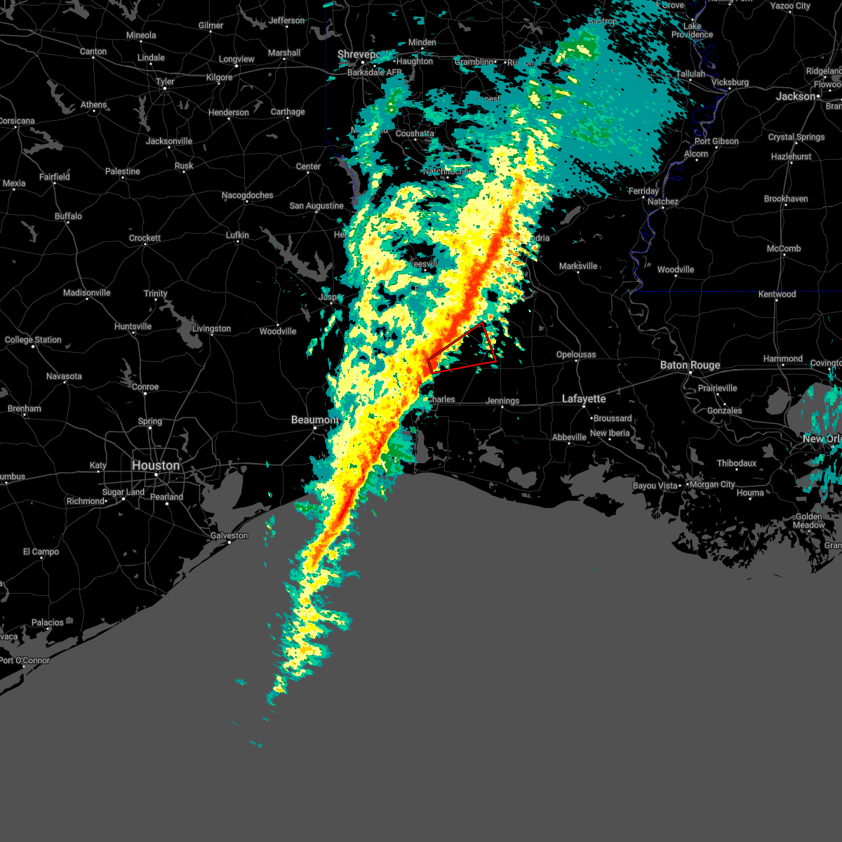 At 109 pm cdt, a severe thunderstorm capable of producing a tornado was located near ragley, moving east at 35 mph (radar indicated rotation). Hazards include tornado. Flying debris will be dangerous to those caught without shelter. mobile homes will be damaged or destroyed. damage to roofs, windows, and vehicles will occur. tree damage is likely. this dangerous storm will be near, reeves around 120 pm cdt. leblanc around 125 pm cdt. harmony around 135 pm cdt. mittie around 140 pm cdt. Oberlin around 145 pm cdt. At 109 pm cdt, a severe thunderstorm capable of producing a tornado was located near ragley, moving east at 35 mph (radar indicated rotation). Hazards include tornado. Flying debris will be dangerous to those caught without shelter. mobile homes will be damaged or destroyed. damage to roofs, windows, and vehicles will occur. tree damage is likely. this dangerous storm will be near, reeves around 120 pm cdt. leblanc around 125 pm cdt. harmony around 135 pm cdt. mittie around 140 pm cdt. Oberlin around 145 pm cdt.
|
| 3/30/2022 1:01 PM CDT |
 At 100 pm cdt, severe thunderstorms were located along a line extending from near leander to near sugartown to near ragley, moving northeast at 55 mph (radar indicated). Hazards include 60 mph wind gusts. expect damage to roofs, siding, and trees At 100 pm cdt, severe thunderstorms were located along a line extending from near leander to near sugartown to near ragley, moving northeast at 55 mph (radar indicated). Hazards include 60 mph wind gusts. expect damage to roofs, siding, and trees
|
| 3/22/2022 10:12 AM CDT |
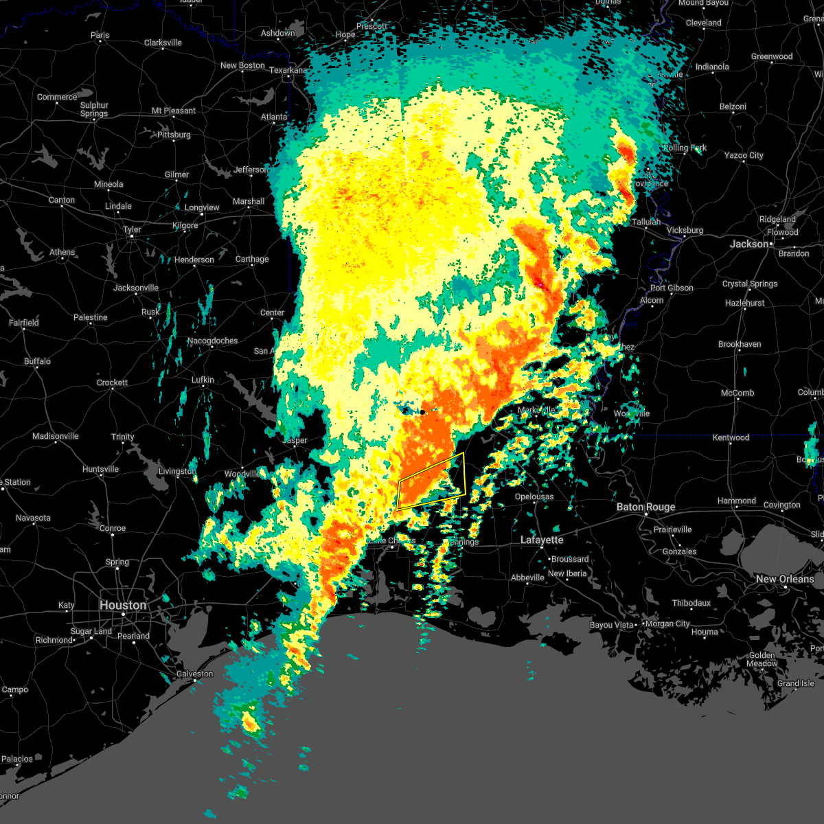 The severe thunderstorm warning for southeastern beauregard and central allen parishes will expire at 1015 am cdt, the storm which prompted the warning has weakened below severe limits, and no longer poses an immediate threat to life or property. therefore, the warning will be allowed to expire. however gusty winds and heavy rain are still possible with this thunderstorm. a tornado watch remains in effect until 200 pm cdt for southwestern louisiana. The severe thunderstorm warning for southeastern beauregard and central allen parishes will expire at 1015 am cdt, the storm which prompted the warning has weakened below severe limits, and no longer poses an immediate threat to life or property. therefore, the warning will be allowed to expire. however gusty winds and heavy rain are still possible with this thunderstorm. a tornado watch remains in effect until 200 pm cdt for southwestern louisiana.
|
| 3/22/2022 9:58 AM CDT |
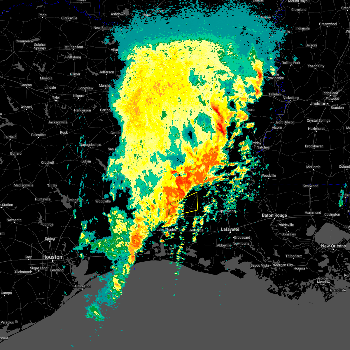 At 957 am cdt, a severe thunderstorm was located near harmony, or near mittie, moving east at 60 mph (radar indicated). Hazards include 60 mph wind gusts and quarter size hail. Hail damage to vehicles is expected. expect wind damage to roofs, siding, and trees. Locations impacted include, oakdale, oberlin, reeves, dry creek, mittie, allen parish airport and harmony. At 957 am cdt, a severe thunderstorm was located near harmony, or near mittie, moving east at 60 mph (radar indicated). Hazards include 60 mph wind gusts and quarter size hail. Hail damage to vehicles is expected. expect wind damage to roofs, siding, and trees. Locations impacted include, oakdale, oberlin, reeves, dry creek, mittie, allen parish airport and harmony.
|
| 3/22/2022 9:40 AM CDT |
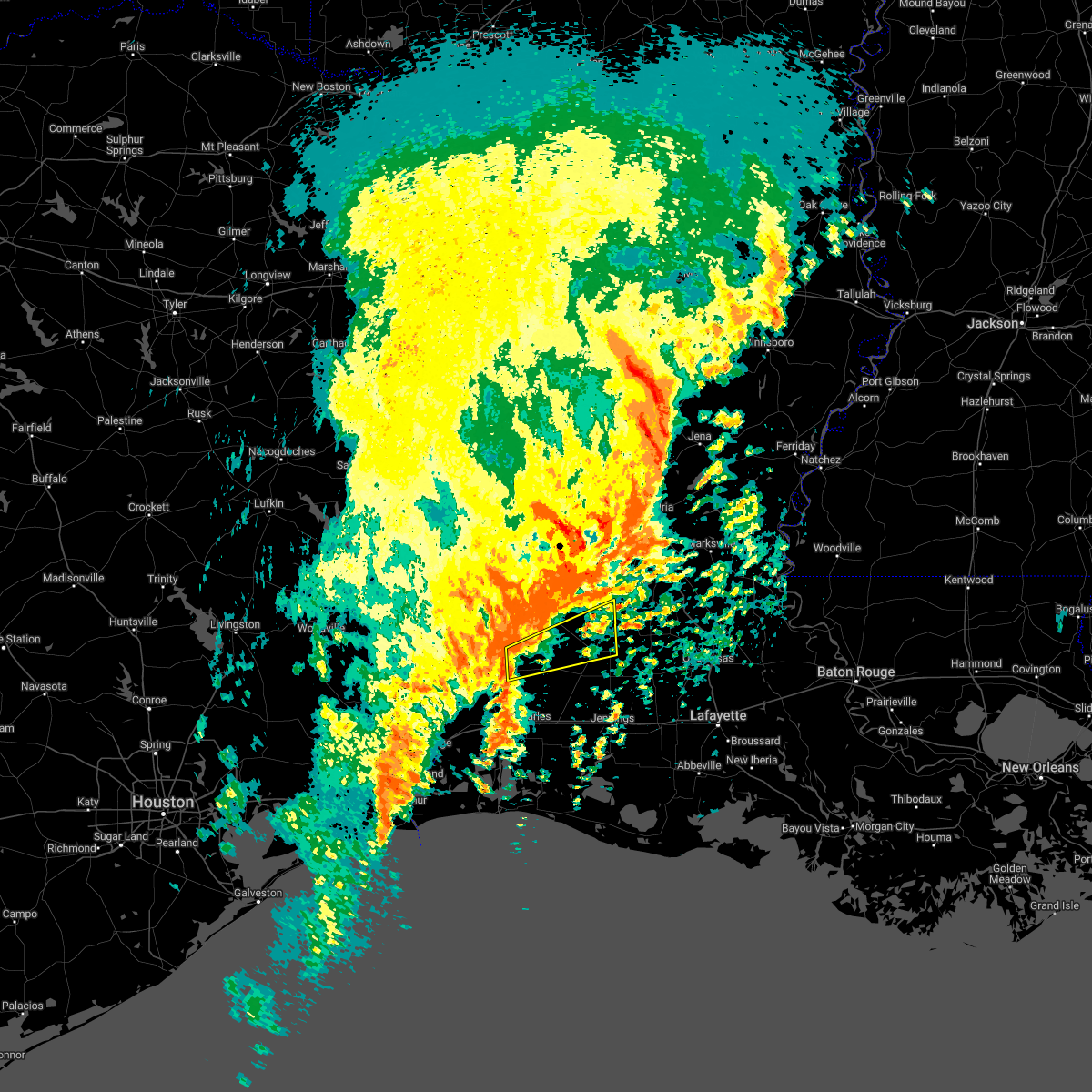 At 940 am cdt, a severe thunderstorm was located over ragley, moving east at 60 mph (radar indicated). Hazards include 60 mph wind gusts and quarter size hail. Hail damage to vehicles is expected. Expect wind damage to roofs, siding, and trees. At 940 am cdt, a severe thunderstorm was located over ragley, moving east at 60 mph (radar indicated). Hazards include 60 mph wind gusts and quarter size hail. Hail damage to vehicles is expected. Expect wind damage to roofs, siding, and trees.
|
| 12/18/2021 2:00 PM CST |
 At 200 pm cst, severe thunderstorms were located along a line extending from sugartown to sulphur, moving east at 20 mph (radar indicated). Hazards include 60 mph wind gusts and penny size hail. Expect damage to roofs, siding, and trees. Locations impacted include, lake charles, sulphur, westlake, elizabeth, reeves, dry creek, lake charles regional airport, moss bluff, sugartown, mittie, ragley, grant, carlyss, longville, buller, buhler, harmony, topsy, lebleu settlement and gillis. At 200 pm cst, severe thunderstorms were located along a line extending from sugartown to sulphur, moving east at 20 mph (radar indicated). Hazards include 60 mph wind gusts and penny size hail. Expect damage to roofs, siding, and trees. Locations impacted include, lake charles, sulphur, westlake, elizabeth, reeves, dry creek, lake charles regional airport, moss bluff, sugartown, mittie, ragley, grant, carlyss, longville, buller, buhler, harmony, topsy, lebleu settlement and gillis.
|
| 12/18/2021 1:30 PM CST |
 At 130 pm cst, severe thunderstorms were located along a line extending from 6 miles east of de ridder to near edgerly, moving east at 20 mph (radar indicated). Hazards include 60 mph wind gusts and penny size hail. expect damage to roofs, siding, and trees At 130 pm cst, severe thunderstorms were located along a line extending from 6 miles east of de ridder to near edgerly, moving east at 20 mph (radar indicated). Hazards include 60 mph wind gusts and penny size hail. expect damage to roofs, siding, and trees
|
| 10/27/2021 12:45 PM CDT |
 At 1244 pm cdt, severe thunderstorms were located along a line extending from near pitkin to near grand chenier, moving east at 45 mph (radar indicated). Hazards include 70 mph wind gusts. Expect considerable tree damage. damage is likely to mobile homes, roofs, and outbuildings. Locations impacted include, lafayette, opelousas, crowley, abbeville, eunice, jennings, scott, rayne, carencro, ville platte, kaplan, church point, mamou, welsh, iowa, lake arthur, kinder, basile, oberlin and iota. At 1244 pm cdt, severe thunderstorms were located along a line extending from near pitkin to near grand chenier, moving east at 45 mph (radar indicated). Hazards include 70 mph wind gusts. Expect considerable tree damage. damage is likely to mobile homes, roofs, and outbuildings. Locations impacted include, lafayette, opelousas, crowley, abbeville, eunice, jennings, scott, rayne, carencro, ville platte, kaplan, church point, mamou, welsh, iowa, lake arthur, kinder, basile, oberlin and iota.
|
| 10/27/2021 12:27 PM CDT |
 At 1227 pm cdt, severe thunderstorms were located along a line extending from near cravens to near creole, moving east at 60 mph (radar indicated). Hazards include 70 mph wind gusts. Expect considerable tree damage. Damage is likely to mobile homes, roofs, and outbuildings. At 1227 pm cdt, severe thunderstorms were located along a line extending from near cravens to near creole, moving east at 60 mph (radar indicated). Hazards include 70 mph wind gusts. Expect considerable tree damage. Damage is likely to mobile homes, roofs, and outbuildings.
|
| 10/27/2021 12:12 PM CDT |
 At 1212 pm cdt, severe thunderstorms were located along a line extending from 6 miles southeast of rosepine to near cameron, moving east at 45 mph (radar indicated). Hazards include 60 mph wind gusts. Expect damage to roofs, siding, and trees. Locations impacted include, lake charles, sulphur, crowley, eunice, jennings, ville platte, cameron, westlake, mamou, welsh, iowa, lake arthur, kinder, basile, oberlin, iota, gueydan, elton, mermentau and fenton. At 1212 pm cdt, severe thunderstorms were located along a line extending from 6 miles southeast of rosepine to near cameron, moving east at 45 mph (radar indicated). Hazards include 60 mph wind gusts. Expect damage to roofs, siding, and trees. Locations impacted include, lake charles, sulphur, crowley, eunice, jennings, ville platte, cameron, westlake, mamou, welsh, iowa, lake arthur, kinder, basile, oberlin, iota, gueydan, elton, mermentau and fenton.
|
| 10/27/2021 12:00 PM CDT |
 At 1200 pm cdt, severe thunderstorms were located along a line extending from near de ridder to 6 miles southeast of holly beach, moving east at 65 mph (radar indicated). Hazards include 60 mph wind gusts. Expect damage to roofs, siding, and trees. Locations impacted include, lake charles, sulphur, crowley, eunice, jennings, ville platte, cameron, westlake, mamou, welsh, iowa, lake arthur, kinder, basile, oberlin, iota, gueydan, elton, mermentau and fenton. At 1200 pm cdt, severe thunderstorms were located along a line extending from near de ridder to 6 miles southeast of holly beach, moving east at 65 mph (radar indicated). Hazards include 60 mph wind gusts. Expect damage to roofs, siding, and trees. Locations impacted include, lake charles, sulphur, crowley, eunice, jennings, ville platte, cameron, westlake, mamou, welsh, iowa, lake arthur, kinder, basile, oberlin, iota, gueydan, elton, mermentau and fenton.
|
| 10/27/2021 11:51 AM CDT |
 At 1150 am cdt, severe thunderstorms were located along a line extending from 7 miles southeast of junction to 9 miles southeast of johnsons bayou, moving northeast at 45 mph (radar indicated). Hazards include 60 mph wind gusts. Expect damage to roofs, siding, and trees. locations impacted include, lake charles, sulphur, crowley, eunice, jennings, ville platte, cameron, westlake, mamou, welsh, vinton, iowa, lake arthur, kinder, basile, oberlin, iota, gueydan, elton and mermentau. hail threat, radar indicated max hail size, <. 75 in wind threat, radar indicated max wind gust, 60 mph. At 1150 am cdt, severe thunderstorms were located along a line extending from 7 miles southeast of junction to 9 miles southeast of johnsons bayou, moving northeast at 45 mph (radar indicated). Hazards include 60 mph wind gusts. Expect damage to roofs, siding, and trees. locations impacted include, lake charles, sulphur, crowley, eunice, jennings, ville platte, cameron, westlake, mamou, welsh, vinton, iowa, lake arthur, kinder, basile, oberlin, iota, gueydan, elton and mermentau. hail threat, radar indicated max hail size, <. 75 in wind threat, radar indicated max wind gust, 60 mph.
|
| 10/27/2021 11:39 AM CDT |
 At 1138 am cdt, severe thunderstorms were located along a line extending from merryville to 11 miles south of johnsons bayou, moving northeast at 50 mph (radar indicated). Hazards include 70 mph wind gusts. Expect considerable tree damage. damage is likely to mobile homes, roofs, and outbuildings. locations impacted include, lake charles, sulphur, orange, crowley, eunice, jennings, ville platte, cameron, westlake, west orange, mamou, welsh, vinton, iowa, lake arthur, kinder, basile, oberlin, iota and gueydan. thunderstorm damage threat, considerable hail threat, radar indicated max hail size, <. 75 in wind threat, radar indicated max wind gust, 70 mph. At 1138 am cdt, severe thunderstorms were located along a line extending from merryville to 11 miles south of johnsons bayou, moving northeast at 50 mph (radar indicated). Hazards include 70 mph wind gusts. Expect considerable tree damage. damage is likely to mobile homes, roofs, and outbuildings. locations impacted include, lake charles, sulphur, orange, crowley, eunice, jennings, ville platte, cameron, westlake, west orange, mamou, welsh, vinton, iowa, lake arthur, kinder, basile, oberlin, iota and gueydan. thunderstorm damage threat, considerable hail threat, radar indicated max hail size, <. 75 in wind threat, radar indicated max wind gust, 70 mph.
|
| 10/27/2021 11:30 AM CDT |
 At 1129 am cdt, severe thunderstorms were located along a line extending from near bivens to 15 miles south of johnsons bayou, moving east at 75 mph (radar indicated). Hazards include 70 mph wind gusts. Expect considerable tree damage. Damage is likely to mobile homes, roofs, and outbuildings. At 1129 am cdt, severe thunderstorms were located along a line extending from near bivens to 15 miles south of johnsons bayou, moving east at 75 mph (radar indicated). Hazards include 70 mph wind gusts. Expect considerable tree damage. Damage is likely to mobile homes, roofs, and outbuildings.
|
| 5/17/2021 9:40 AM CDT |
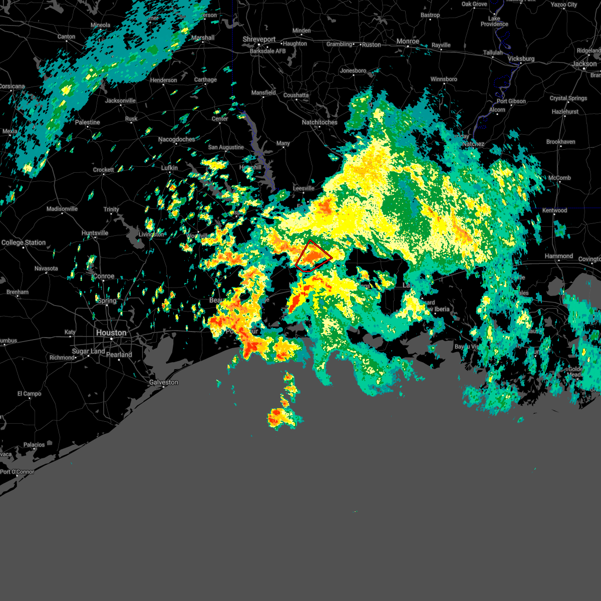 The tornado warning for southeastern beauregard and southwestern allen parishes will expire at 945 am cdt, the storm which prompted the warning has weakened below severe limits, and no longer appears capable of producing a tornado. therefore, the warning will be allowed to expire. The tornado warning for southeastern beauregard and southwestern allen parishes will expire at 945 am cdt, the storm which prompted the warning has weakened below severe limits, and no longer appears capable of producing a tornado. therefore, the warning will be allowed to expire.
|
| 5/17/2021 9:20 AM CDT |
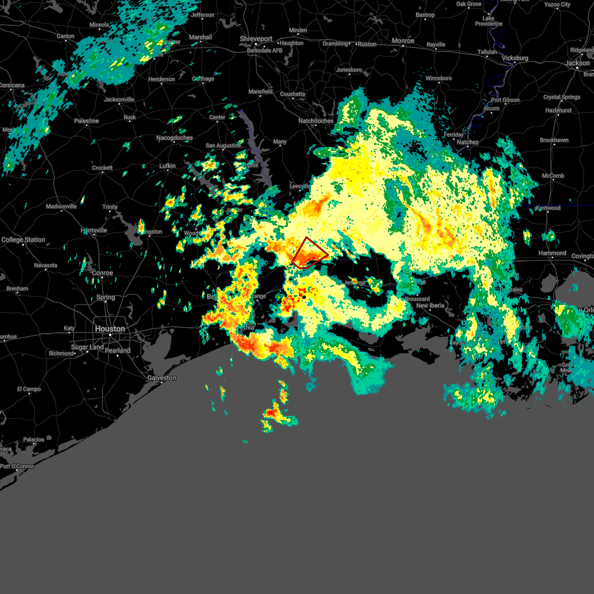 At 920 am cdt, a severe thunderstorm capable of producing a tornado was located near gillis, or near ragley, moving northeast at 15 mph (radar indicated rotation). Hazards include tornado. Flying debris will be dangerous to those caught without shelter. mobile homes will be damaged or destroyed. damage to roofs, windows, and vehicles will occur. tree damage is likely. this dangerous storm will be near, ragley around 935 am cdt. Reeves around 945 am cdt. At 920 am cdt, a severe thunderstorm capable of producing a tornado was located near gillis, or near ragley, moving northeast at 15 mph (radar indicated rotation). Hazards include tornado. Flying debris will be dangerous to those caught without shelter. mobile homes will be damaged or destroyed. damage to roofs, windows, and vehicles will occur. tree damage is likely. this dangerous storm will be near, ragley around 935 am cdt. Reeves around 945 am cdt.
|
| 4/16/2021 4:08 AM CDT |
 At 408 am cdt, severe thunderstorms were located along a line extending from leblanc to iowa, moving east at 55 mph (radar indicated). Hazards include 60 mph wind gusts and nickel size hail. Expect damage to roofs, siding, and trees. locations impacted include, iowa, kinder, fenton, reeves, buller, leblanc, lebleu settlement and lacassine. This includes interstate 10 in louisiana between mile markers 39 and 50. At 408 am cdt, severe thunderstorms were located along a line extending from leblanc to iowa, moving east at 55 mph (radar indicated). Hazards include 60 mph wind gusts and nickel size hail. Expect damage to roofs, siding, and trees. locations impacted include, iowa, kinder, fenton, reeves, buller, leblanc, lebleu settlement and lacassine. This includes interstate 10 in louisiana between mile markers 39 and 50.
|
| 4/16/2021 4:02 AM CDT |
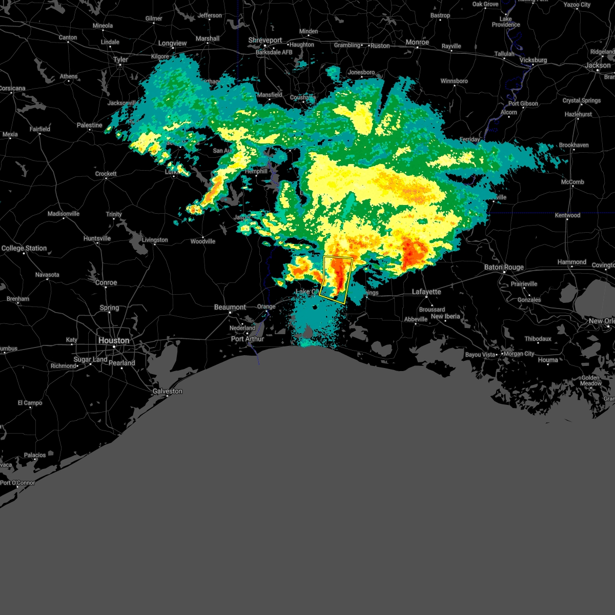 At 402 am cdt, severe thunderstorms were located along a line extending from leblanc to iowa, moving east at 55 mph (radar indicated). Hazards include 60 mph wind gusts and nickel size hail. Expect damage to roofs, siding, and trees. locations impacted include, iowa, kinder, fenton, reeves, buller, leblanc, lebleu settlement and lacassine. this includes the following highways, interstate 10 in louisiana between mile markers 34 and 50. Interstate 210 near mile marker 12. At 402 am cdt, severe thunderstorms were located along a line extending from leblanc to iowa, moving east at 55 mph (radar indicated). Hazards include 60 mph wind gusts and nickel size hail. Expect damage to roofs, siding, and trees. locations impacted include, iowa, kinder, fenton, reeves, buller, leblanc, lebleu settlement and lacassine. this includes the following highways, interstate 10 in louisiana between mile markers 34 and 50. Interstate 210 near mile marker 12.
|
| 4/16/2021 3:53 AM CDT |
 At 353 am cdt, severe thunderstorms were located along a line extending from near reeves to near moss bluff, moving east at 55 mph (radar indicated). Hazards include 60 mph wind gusts and quarter size hail. Hail damage to vehicles is expected. expect wind damage to roofs, siding, and trees. locations impacted include, lake charles, westlake, iowa, kinder, fenton, reeves, dry creek, hayes, moss bluff, ragley, longville, buller, harmony, topsy, lebleu settlement, gillis, leblanc, bell city and lacassine. this includes the following highways, interstate 10 in louisiana between mile markers 26 and 51. Interstate 210 between mile markers 1 and 12. At 353 am cdt, severe thunderstorms were located along a line extending from near reeves to near moss bluff, moving east at 55 mph (radar indicated). Hazards include 60 mph wind gusts and quarter size hail. Hail damage to vehicles is expected. expect wind damage to roofs, siding, and trees. locations impacted include, lake charles, westlake, iowa, kinder, fenton, reeves, dry creek, hayes, moss bluff, ragley, longville, buller, harmony, topsy, lebleu settlement, gillis, leblanc, bell city and lacassine. this includes the following highways, interstate 10 in louisiana between mile markers 26 and 51. Interstate 210 between mile markers 1 and 12.
|
| 4/16/2021 3:44 AM CDT |
 At 344 am cdt, severe thunderstorms were located along a line extending from near longville to near moss bluff, moving east at 55 mph (radar indicated). Hazards include 60 mph wind gusts and quarter size hail. Hail damage to vehicles is expected. Expect wind damage to roofs, siding, and trees. At 344 am cdt, severe thunderstorms were located along a line extending from near longville to near moss bluff, moving east at 55 mph (radar indicated). Hazards include 60 mph wind gusts and quarter size hail. Hail damage to vehicles is expected. Expect wind damage to roofs, siding, and trees.
|
| 4/14/2021 8:20 AM CDT |
 At 820 am cdt, a severe thunderstorm was located over westlake, moving east at 40 mph (radar indicated). Hazards include 60 mph wind gusts and half dollar size hail. Hail damage to vehicles is expected. expect wind damage to roofs, siding, and trees. locations impacted include, lake charles, sulphur, westlake, iowa, reeves, grand lake, lake charles regional airport, hayes, moss bluff, carlyss, buller, buhler, topsy, lebleu settlement, gillis, edgerly, holmwood, hackberry, bell city and lacassine. this includes the following highways, interstate 10 in louisiana between mile markers 11 and 48. Interstate 210 between mile markers 1 and 12. At 820 am cdt, a severe thunderstorm was located over westlake, moving east at 40 mph (radar indicated). Hazards include 60 mph wind gusts and half dollar size hail. Hail damage to vehicles is expected. expect wind damage to roofs, siding, and trees. locations impacted include, lake charles, sulphur, westlake, iowa, reeves, grand lake, lake charles regional airport, hayes, moss bluff, carlyss, buller, buhler, topsy, lebleu settlement, gillis, edgerly, holmwood, hackberry, bell city and lacassine. this includes the following highways, interstate 10 in louisiana between mile markers 11 and 48. Interstate 210 between mile markers 1 and 12.
|
| 4/14/2021 7:57 AM CDT |
 At 756 am cdt, a severe thunderstorm was located over edgerly, or near vinton, moving east at 40 mph (radar indicated). Hazards include 60 mph wind gusts and half dollar size hail. Hail damage to vehicles is expected. Expect wind damage to roofs, siding, and trees. At 756 am cdt, a severe thunderstorm was located over edgerly, or near vinton, moving east at 40 mph (radar indicated). Hazards include 60 mph wind gusts and half dollar size hail. Hail damage to vehicles is expected. Expect wind damage to roofs, siding, and trees.
|
| 11/27/2020 11:39 AM CST |
 At 1139 am cst, a severe thunderstorm was located near gillis, or near moss bluff, moving east at 30 mph (radar indicated). Hazards include 60 mph wind gusts and penny size hail. expect damage to roofs, siding, and trees At 1139 am cst, a severe thunderstorm was located near gillis, or near moss bluff, moving east at 30 mph (radar indicated). Hazards include 60 mph wind gusts and penny size hail. expect damage to roofs, siding, and trees
|
| 8/27/2020 12:44 AM CDT |
 At 1243 am cdt, a several thunderstorms, each capable of producing tornados were centered over duson, or near rayne, moving northwest at 55 mph (radar indicated rotation). Hazards include tornado. Flying debris will be dangerous to those caught without shelter. mobile homes will be damaged or destroyed. damage to roofs, windows, and vehicles will occur. Tree damage is likely. At 1243 am cdt, a several thunderstorms, each capable of producing tornados were centered over duson, or near rayne, moving northwest at 55 mph (radar indicated rotation). Hazards include tornado. Flying debris will be dangerous to those caught without shelter. mobile homes will be damaged or destroyed. damage to roofs, windows, and vehicles will occur. Tree damage is likely.
|
| 8/27/2020 12:28 AM CDT |
 At 1227 am cdt, a cluster of severe thunderstorms capable of producing tornados was located near basile, moving northwest at 30 mph (radar indicated rotation). Hazards include tornado. Flying debris will be dangerous to those caught without shelter. mobile homes will be damaged or destroyed. damage to roofs, windows, and vehicles will occur. tree damage is likely. this dangerous storm will be near, basile around 1230 am cdt. duralde around 1235 am cdt. bond around 1245 am cdt. other locations impacted by this tornadic thunderstorm include hathaway, midland, roanoke and estherwood. This includes interstate 10 in louisiana between mile markers 53 and 94. At 1227 am cdt, a cluster of severe thunderstorms capable of producing tornados was located near basile, moving northwest at 30 mph (radar indicated rotation). Hazards include tornado. Flying debris will be dangerous to those caught without shelter. mobile homes will be damaged or destroyed. damage to roofs, windows, and vehicles will occur. tree damage is likely. this dangerous storm will be near, basile around 1230 am cdt. duralde around 1235 am cdt. bond around 1245 am cdt. other locations impacted by this tornadic thunderstorm include hathaway, midland, roanoke and estherwood. This includes interstate 10 in louisiana between mile markers 53 and 94.
|
| 8/27/2020 12:26 AM CDT |
 At 1222 am cdt, a cluster of thunderstorms capable of producing tornados, moving northwest at 30 mph (radar indicated rotation). Hazards include tornado. Flying debris will be dangerous to those caught without shelter. mobile homes will be damaged or destroyed. damage to roofs, windows, and vehicles will occur. tree damage is likely. this dangerous storm will be near, duralde around 1230 am cdt. oberlin and bond around 1250 am cdt. other locations impacted by this tornadic thunderstorm include hathaway, midland, roanoke and estherwood. This includes interstate 10 in louisiana between mile markers 53 and 94. At 1222 am cdt, a cluster of thunderstorms capable of producing tornados, moving northwest at 30 mph (radar indicated rotation). Hazards include tornado. Flying debris will be dangerous to those caught without shelter. mobile homes will be damaged or destroyed. damage to roofs, windows, and vehicles will occur. tree damage is likely. this dangerous storm will be near, duralde around 1230 am cdt. oberlin and bond around 1250 am cdt. other locations impacted by this tornadic thunderstorm include hathaway, midland, roanoke and estherwood. This includes interstate 10 in louisiana between mile markers 53 and 94.
|
| 8/27/2020 12:02 AM CDT |
 At 1200 am cdt, a clusters of thunderstorms capable of producing tornados were located over iota, moving northwest at 30 mph (radar indicated rotation). Hazards include tornado. Flying debris will be dangerous to those caught without shelter. mobile homes will be damaged or destroyed. damage to roofs, windows, and vehicles will occur. tree damage is likely. this dangerous storm will be near, mowata around 1210 am cdt. basile and duralde around 1230 am cdt. oberlin and bond around 1245 am cdt. other locations impacted by this tornadic thunderstorm include hathaway, midland, roanoke and estherwood. This includes interstate 10 in louisiana between mile markers 53 and 94. At 1200 am cdt, a clusters of thunderstorms capable of producing tornados were located over iota, moving northwest at 30 mph (radar indicated rotation). Hazards include tornado. Flying debris will be dangerous to those caught without shelter. mobile homes will be damaged or destroyed. damage to roofs, windows, and vehicles will occur. tree damage is likely. this dangerous storm will be near, mowata around 1210 am cdt. basile and duralde around 1230 am cdt. oberlin and bond around 1245 am cdt. other locations impacted by this tornadic thunderstorm include hathaway, midland, roanoke and estherwood. This includes interstate 10 in louisiana between mile markers 53 and 94.
|
| 5/26/2020 8:00 PM CDT |
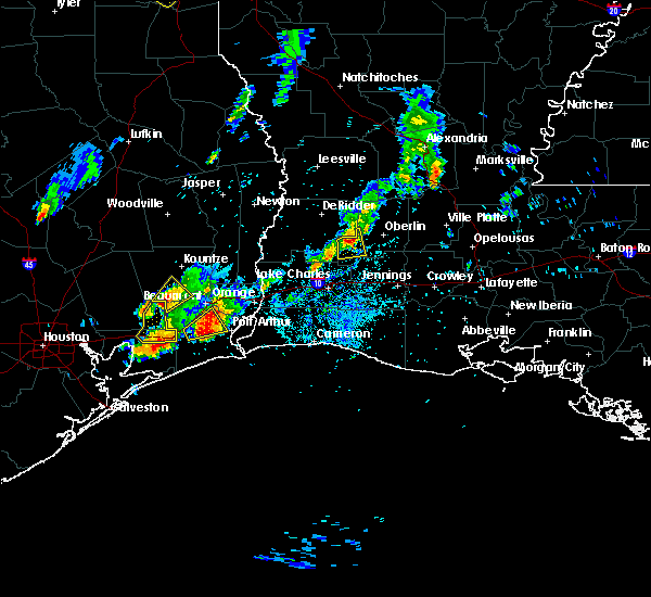 At 800 pm cdt, a severe thunderstorm was located over reeves, moving east at 20 mph (radar indicated). Hazards include quarter size hail. Damage to vehicles is expected. Locations impacted include, reeves and leblanc. At 800 pm cdt, a severe thunderstorm was located over reeves, moving east at 20 mph (radar indicated). Hazards include quarter size hail. Damage to vehicles is expected. Locations impacted include, reeves and leblanc.
|
| 5/26/2020 7:46 PM CDT |
 At 746 pm cdt, a severe thunderstorm was located near reeves, moving east at 15 mph (radar indicated. at 7:40 pm cdt quarter size hail was reported just east of ragley). Hazards include quarter size hail. damage to vehicles is expected At 746 pm cdt, a severe thunderstorm was located near reeves, moving east at 15 mph (radar indicated. at 7:40 pm cdt quarter size hail was reported just east of ragley). Hazards include quarter size hail. damage to vehicles is expected
|
| 5/26/2020 7:40 PM CDT |
 At 739 pm cdt, a severe thunderstorm was located near reeves, moving east at 20 mph (radar indicated). Hazards include 60 mph wind gusts and quarter size hail. Hail damage to vehicles is expected. expect wind damage to roofs, siding, and trees. Locations impacted include, reeves and leblanc. At 739 pm cdt, a severe thunderstorm was located near reeves, moving east at 20 mph (radar indicated). Hazards include 60 mph wind gusts and quarter size hail. Hail damage to vehicles is expected. expect wind damage to roofs, siding, and trees. Locations impacted include, reeves and leblanc.
|
| 5/26/2020 7:14 PM CDT |
 At 713 pm cdt, a severe thunderstorm was located over ragley, moving east at 25 mph (radar indicated. at 6:55 pm cdt quarter size hail was reported near dequincy with this severe thunderstorm). Hazards include 60 mph wind gusts and half dollar size hail. Hail damage to vehicles is expected. expect wind damage to roofs, siding, and trees. Locations impacted include, reeves, ragley and leblanc. At 713 pm cdt, a severe thunderstorm was located over ragley, moving east at 25 mph (radar indicated. at 6:55 pm cdt quarter size hail was reported near dequincy with this severe thunderstorm). Hazards include 60 mph wind gusts and half dollar size hail. Hail damage to vehicles is expected. expect wind damage to roofs, siding, and trees. Locations impacted include, reeves, ragley and leblanc.
|
| 5/26/2020 7:01 PM CDT |
 At 701 pm cdt, a severe thunderstorm was located near ragley, moving east at 30 mph (radar indicated). Hazards include 60 mph wind gusts and quarter size hail. Hail damage to vehicles is expected. Expect wind damage to roofs, siding, and trees. At 701 pm cdt, a severe thunderstorm was located near ragley, moving east at 30 mph (radar indicated). Hazards include 60 mph wind gusts and quarter size hail. Hail damage to vehicles is expected. Expect wind damage to roofs, siding, and trees.
|
| 5/5/2020 9:55 PM CDT |
 At 955 pm cdt, a severe thunderstorm was located near topsy, or near ragley, moving southeast at 45 mph. quarter size hail was reported with this storm in ragley (radar indicated). Hazards include ping pong ball size hail and 60 mph wind gusts. People and animals outdoors will be injured. expect hail damage to roofs, siding, windows, and vehicles. Expect wind damage to roofs, siding, and trees. At 955 pm cdt, a severe thunderstorm was located near topsy, or near ragley, moving southeast at 45 mph. quarter size hail was reported with this storm in ragley (radar indicated). Hazards include ping pong ball size hail and 60 mph wind gusts. People and animals outdoors will be injured. expect hail damage to roofs, siding, windows, and vehicles. Expect wind damage to roofs, siding, and trees.
|
| 4/23/2020 12:53 AM CDT |
 At 1252 am cdt, a severe thunderstorm was located near topsy, or near moss bluff, moving northeast at 40 mph (radar indicated). Hazards include 60 mph wind gusts and quarter size hail. Hail damage to vehicles is expected. expect wind damage to roofs, siding, and trees. locations impacted include, lake charles, sulphur, westlake, kinder, oberlin, elton, fenton, reeves, moss bluff, buller, harmony, topsy, lebleu settlement, gillis, leblanc and carlyss. this includes the following highways, interstate 10 in louisiana between mile markers 21 and 34. Interstate 210 between mile markers 1 and 2. At 1252 am cdt, a severe thunderstorm was located near topsy, or near moss bluff, moving northeast at 40 mph (radar indicated). Hazards include 60 mph wind gusts and quarter size hail. Hail damage to vehicles is expected. expect wind damage to roofs, siding, and trees. locations impacted include, lake charles, sulphur, westlake, kinder, oberlin, elton, fenton, reeves, moss bluff, buller, harmony, topsy, lebleu settlement, gillis, leblanc and carlyss. this includes the following highways, interstate 10 in louisiana between mile markers 21 and 34. Interstate 210 between mile markers 1 and 2.
|
| 4/23/2020 12:33 AM CDT |
 At 1233 am cdt, a severe thunderstorm was located near sulphur, moving northeast at 40 mph (radar indicated). Hazards include quarter size hail. damage to vehicles is expected At 1233 am cdt, a severe thunderstorm was located near sulphur, moving northeast at 40 mph (radar indicated). Hazards include quarter size hail. damage to vehicles is expected
|
| 4/9/2020 8:15 PM CDT |
 At 815 pm cdt, severe thunderstorms were located along a line extending from 6 miles southwest of ragley to buhler to edgerly, moving southeast at 45 mph (radar indicated). Hazards include 60 mph wind gusts and penny size hail. Expect damage to roofs, siding, and trees. locations impacted include, lake charles, sulphur, westlake, reeves, moss bluff, de quincy, ragley, carlyss, buhler, topsy, gillis, edgerly and leblanc. this includes the following highways, interstate 10 in louisiana between mile markers 14 and 29. Interstate 210 between mile markers 1 and 2. At 815 pm cdt, severe thunderstorms were located along a line extending from 6 miles southwest of ragley to buhler to edgerly, moving southeast at 45 mph (radar indicated). Hazards include 60 mph wind gusts and penny size hail. Expect damage to roofs, siding, and trees. locations impacted include, lake charles, sulphur, westlake, reeves, moss bluff, de quincy, ragley, carlyss, buhler, topsy, gillis, edgerly and leblanc. this includes the following highways, interstate 10 in louisiana between mile markers 14 and 29. Interstate 210 between mile markers 1 and 2.
|
| 4/9/2020 8:04 PM CDT |
 At 804 pm cdt, severe thunderstorms were located along a line extending from near singer to near lunita to near starks, moving east at 40 mph (radar indicated). Hazards include 60 mph wind gusts and penny size hail. Expect damage to roofs, siding, and trees. locations impacted include, lake charles, sulphur, westlake, reeves, starks, moss bluff, fields, de quincy, ragley, carlyss, bivens, lunita, buhler, topsy, gillis, edgerly, leblanc and oretta. this includes the following highways, interstate 10 in louisiana between mile markers 14 and 29. Interstate 210 between mile markers 1 and 2. At 804 pm cdt, severe thunderstorms were located along a line extending from near singer to near lunita to near starks, moving east at 40 mph (radar indicated). Hazards include 60 mph wind gusts and penny size hail. Expect damage to roofs, siding, and trees. locations impacted include, lake charles, sulphur, westlake, reeves, starks, moss bluff, fields, de quincy, ragley, carlyss, bivens, lunita, buhler, topsy, gillis, edgerly, leblanc and oretta. this includes the following highways, interstate 10 in louisiana between mile markers 14 and 29. Interstate 210 between mile markers 1 and 2.
|
| 4/9/2020 7:58 PM CDT |
 At 758 pm cdt, severe thunderstorms were located along a line extending from near singer to near lunita to near starks, moving east at 45 mph (radar indicated). Hazards include 60 mph wind gusts and penny size hail. Expect damage to roofs, siding, and trees. locations impacted include, lake charles, sulphur, westlake, reeves, deweyville, starks, moss bluff, fields, de quincy, ragley, carlyss, longville, bivens, lunita, buhler, topsy, gillis, edgerly, leblanc and oretta. this includes the following highways, interstate 10 in louisiana between mile markers 14 and 29. Interstate 210 between mile markers 1 and 2. At 758 pm cdt, severe thunderstorms were located along a line extending from near singer to near lunita to near starks, moving east at 45 mph (radar indicated). Hazards include 60 mph wind gusts and penny size hail. Expect damage to roofs, siding, and trees. locations impacted include, lake charles, sulphur, westlake, reeves, deweyville, starks, moss bluff, fields, de quincy, ragley, carlyss, longville, bivens, lunita, buhler, topsy, gillis, edgerly, leblanc and oretta. this includes the following highways, interstate 10 in louisiana between mile markers 14 and 29. Interstate 210 between mile markers 1 and 2.
|
| 4/9/2020 7:50 PM CDT |
 At 749 pm cdt, severe thunderstorms were located along a line extending from near bivens to near lunita to near deweyville, moving southeast at 65 mph (radar indicated). Hazards include 60 mph wind gusts and nickel size hail. Expect damage to roofs, siding, and trees. locations impacted include, lake charles, sulphur, westlake, reeves, deweyville, moss bluff, de quincy, ragley, starks, fields, trout creek, bivens, lunita, topsy, gillis, edgerly, devils pocket, wrights settlement, leblanc and oretta. this includes the following highways, interstate 10 in louisiana between mile markers 14 and 29. Interstate 210 between mile markers 1 and 2. At 749 pm cdt, severe thunderstorms were located along a line extending from near bivens to near lunita to near deweyville, moving southeast at 65 mph (radar indicated). Hazards include 60 mph wind gusts and nickel size hail. Expect damage to roofs, siding, and trees. locations impacted include, lake charles, sulphur, westlake, reeves, deweyville, moss bluff, de quincy, ragley, starks, fields, trout creek, bivens, lunita, topsy, gillis, edgerly, devils pocket, wrights settlement, leblanc and oretta. this includes the following highways, interstate 10 in louisiana between mile markers 14 and 29. Interstate 210 between mile markers 1 and 2.
|
| 4/9/2020 7:35 PM CDT |
 At 734 pm cdt, severe thunderstorms were located along a line extending from near trout creek to near caney head, moving east at 40 mph (radar indicated). Hazards include 60 mph wind gusts and nickel size hail. expect damage to roofs, siding, and trees At 734 pm cdt, severe thunderstorms were located along a line extending from near trout creek to near caney head, moving east at 40 mph (radar indicated). Hazards include 60 mph wind gusts and nickel size hail. expect damage to roofs, siding, and trees
|
| 1/11/2020 3:14 AM CST |
 At 313 am cst, severe thunderstorms were located along a line extending from near kurthwood to near johnsons bayou, moving east at 30 mph (radar indicated). Hazards include 60 mph wind gusts. expect damage to roofs, siding, and trees At 313 am cst, severe thunderstorms were located along a line extending from near kurthwood to near johnsons bayou, moving east at 30 mph (radar indicated). Hazards include 60 mph wind gusts. expect damage to roofs, siding, and trees
|
| 11/22/2019 12:07 PM CST |
 At 1207 pm cst, a severe thunderstorm was located over oretta, or near de quincy, moving east at 25 mph (radar indicated). Hazards include 60 mph wind gusts. expect damage to roofs, siding, and trees At 1207 pm cst, a severe thunderstorm was located over oretta, or near de quincy, moving east at 25 mph (radar indicated). Hazards include 60 mph wind gusts. expect damage to roofs, siding, and trees
|
| 10/7/2019 1:22 PM CDT | Trees reported down east of reeves along hwy-190 per allen parish sheriffs offic in allen county LA, 3.3 miles W of Reeves, LA |
| 10/7/2019 1:21 PM CDT |
 At 121 pm cdt, a severe thunderstorm was located over reeves, moving southeast at 15 mph (radar indicated). Hazards include 60 mph wind gusts and quarter size hail. Hail damage to vehicles is expected. Expect wind damage to roofs, siding, and trees. At 121 pm cdt, a severe thunderstorm was located over reeves, moving southeast at 15 mph (radar indicated). Hazards include 60 mph wind gusts and quarter size hail. Hail damage to vehicles is expected. Expect wind damage to roofs, siding, and trees.
|
| 7/30/2019 11:32 AM CDT |
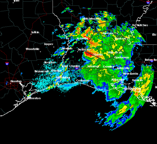 At 1132 am cdt, a severe thunderstorm was located over harmony, or near mittie, moving southwest at 20 mph (radar indicated). Hazards include 60 mph wind gusts and nickel size hail. expect damage to roofs, siding, and trees At 1132 am cdt, a severe thunderstorm was located over harmony, or near mittie, moving southwest at 20 mph (radar indicated). Hazards include 60 mph wind gusts and nickel size hail. expect damage to roofs, siding, and trees
|
| 6/6/2019 12:59 AM CDT |
 At 1259 am cdt, severe thunderstorms were located along a line extending from near topsy to near gillis to 6 miles northwest of moss bluff, moving northeast at 25 mph (radar indicated). Hazards include 60 mph wind gusts. expect damage to roofs, siding, and trees At 1259 am cdt, severe thunderstorms were located along a line extending from near topsy to near gillis to 6 miles northwest of moss bluff, moving northeast at 25 mph (radar indicated). Hazards include 60 mph wind gusts. expect damage to roofs, siding, and trees
|
| 5/19/2019 5:07 AM CDT |
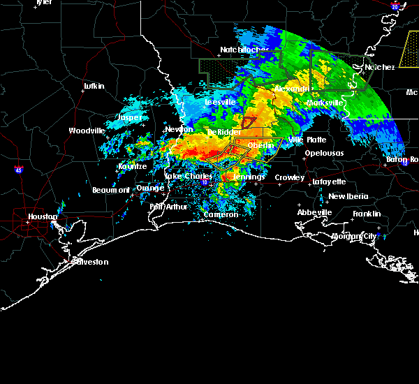 At 435 am cdt, severe thunderstorms were located along a line extending from near dry creek to near longville to 6 miles northwest of ragley, moving east at 35 mph (radar indicated). Hazards include 60 mph wind gusts. Expect damage to roofs, siding, and trees. Locations impacted include, oberlin, reeves, dry creek, ragley, longville, harmony and leblanc. At 435 am cdt, severe thunderstorms were located along a line extending from near dry creek to near longville to 6 miles northwest of ragley, moving east at 35 mph (radar indicated). Hazards include 60 mph wind gusts. Expect damage to roofs, siding, and trees. Locations impacted include, oberlin, reeves, dry creek, ragley, longville, harmony and leblanc.
|
| 5/19/2019 4:49 AM CDT |
 At 448 am cdt, a severe thunderstorm capable of producing a tornado was located near reeves, moving east at 30 mph (radar indicated rotation). Hazards include tornado. Flying debris will be dangerous to those caught without shelter. mobile homes will be damaged or destroyed. damage to roofs, windows, and vehicles will occur. Tree damage is likely. At 448 am cdt, a severe thunderstorm capable of producing a tornado was located near reeves, moving east at 30 mph (radar indicated rotation). Hazards include tornado. Flying debris will be dangerous to those caught without shelter. mobile homes will be damaged or destroyed. damage to roofs, windows, and vehicles will occur. Tree damage is likely.
|
| 5/19/2019 4:35 AM CDT |
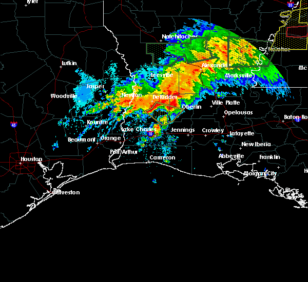 At 435 am cdt, severe thunderstorms were located along a line extending from near dry creek to near longville to 6 miles northwest of ragley, moving east at 35 mph (radar indicated). Hazards include 60 mph wind gusts. Expect damage to roofs, siding, and trees. Locations impacted include, oberlin, reeves, dry creek, ragley, longville, harmony and leblanc. At 435 am cdt, severe thunderstorms were located along a line extending from near dry creek to near longville to 6 miles northwest of ragley, moving east at 35 mph (radar indicated). Hazards include 60 mph wind gusts. Expect damage to roofs, siding, and trees. Locations impacted include, oberlin, reeves, dry creek, ragley, longville, harmony and leblanc.
|
| 5/19/2019 4:23 AM CDT |
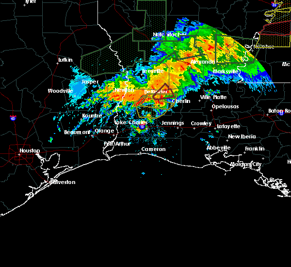 At 423 am cdt, severe thunderstorms were located along a line extending from near tulla to near longville to near oretta, moving southeast at 25 mph (radar indicated). Hazards include 60 mph wind gusts. expect damage to roofs, siding, and trees At 423 am cdt, severe thunderstorms were located along a line extending from near tulla to near longville to near oretta, moving southeast at 25 mph (radar indicated). Hazards include 60 mph wind gusts. expect damage to roofs, siding, and trees
|
| 5/10/2019 1:21 AM CDT |
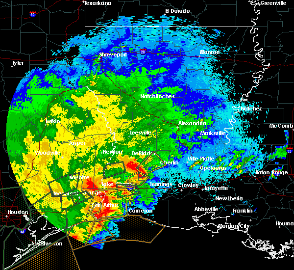 At 121 am cdt, a severe thunderstorm was located near reeves, moving northeast at 30 mph (radar indicated). Hazards include 60 mph wind gusts and quarter size hail. Hail damage to vehicles is expected. Expect wind damage to roofs, siding, and trees. At 121 am cdt, a severe thunderstorm was located near reeves, moving northeast at 30 mph (radar indicated). Hazards include 60 mph wind gusts and quarter size hail. Hail damage to vehicles is expected. Expect wind damage to roofs, siding, and trees.
|
| 4/13/2019 5:20 PM CDT |
 At 520 pm cdt, severe thunderstorms were located along a line extending from boyce to near reeves, moving east at 35 mph (radar indicated). Hazards include 60 mph wind gusts. expect damage to roofs, siding, and trees At 520 pm cdt, severe thunderstorms were located along a line extending from boyce to near reeves, moving east at 35 mph (radar indicated). Hazards include 60 mph wind gusts. expect damage to roofs, siding, and trees
|
| 4/7/2019 3:44 PM CDT |
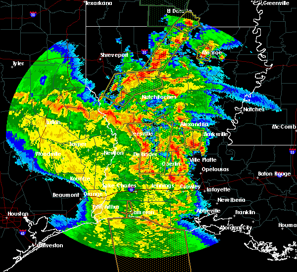 At 344 pm cdt, severe thunderstorms were located along a line extending from near kurthwood to near fullerton to dry creek, moving northeast at 35 mph (radar indicated). Hazards include 60 mph wind gusts. expect damage to roofs, siding, and trees At 344 pm cdt, severe thunderstorms were located along a line extending from near kurthwood to near fullerton to dry creek, moving northeast at 35 mph (radar indicated). Hazards include 60 mph wind gusts. expect damage to roofs, siding, and trees
|
| 2/26/2019 9:09 PM CST |
 At 908 pm cst, a severe thunderstorm was located over reeves, moving east at 35 mph (radar indicated). Hazards include quarter size hail. Damage to vehicles is expected. Locations impacted include, fenton, reeves, topsy and leblanc. At 908 pm cst, a severe thunderstorm was located over reeves, moving east at 35 mph (radar indicated). Hazards include quarter size hail. Damage to vehicles is expected. Locations impacted include, fenton, reeves, topsy and leblanc.
|
| 2/26/2019 8:55 PM CST |
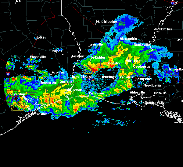 At 854 pm cst, a severe thunderstorm was located near ragley, moving east at 35 mph (radar indicated). Hazards include quarter size hail. damage to vehicles is expected At 854 pm cst, a severe thunderstorm was located near ragley, moving east at 35 mph (radar indicated). Hazards include quarter size hail. damage to vehicles is expected
|
| 6/3/2018 5:01 PM CDT |
 At 501 pm cdt, a severe thunderstorm was located near ragley, moving southwest at 20 mph (radar indicated). Hazards include 60 mph wind gusts and quarter size hail. Hail damage to vehicles is expected. Expect wind damage to roofs, siding, and trees. At 501 pm cdt, a severe thunderstorm was located near ragley, moving southwest at 20 mph (radar indicated). Hazards include 60 mph wind gusts and quarter size hail. Hail damage to vehicles is expected. Expect wind damage to roofs, siding, and trees.
|
| 6/3/2018 4:54 PM CDT |
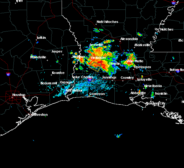 At 454 pm cdt, a severe thunderstorm was located near dry creek, moving southwest at 15 mph (radar indicated). Hazards include 60 mph wind gusts and quarter size hail. Hail damage to vehicles is expected. expect wind damage to roofs, siding, and trees. Locations impacted include, reeves, dry creek and longville. At 454 pm cdt, a severe thunderstorm was located near dry creek, moving southwest at 15 mph (radar indicated). Hazards include 60 mph wind gusts and quarter size hail. Hail damage to vehicles is expected. expect wind damage to roofs, siding, and trees. Locations impacted include, reeves, dry creek and longville.
|
| 6/3/2018 4:38 PM CDT |
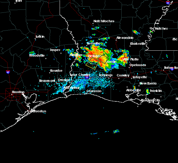 At 438 pm cdt, a severe thunderstorm was located over dry creek, moving southwest at 15 mph (radar indicated). Hazards include 60 mph wind gusts and quarter size hail. Hail damage to vehicles is expected. Expect wind damage to roofs, siding, and trees. At 438 pm cdt, a severe thunderstorm was located over dry creek, moving southwest at 15 mph (radar indicated). Hazards include 60 mph wind gusts and quarter size hail. Hail damage to vehicles is expected. Expect wind damage to roofs, siding, and trees.
|
| 4/14/2018 5:34 AM CDT |
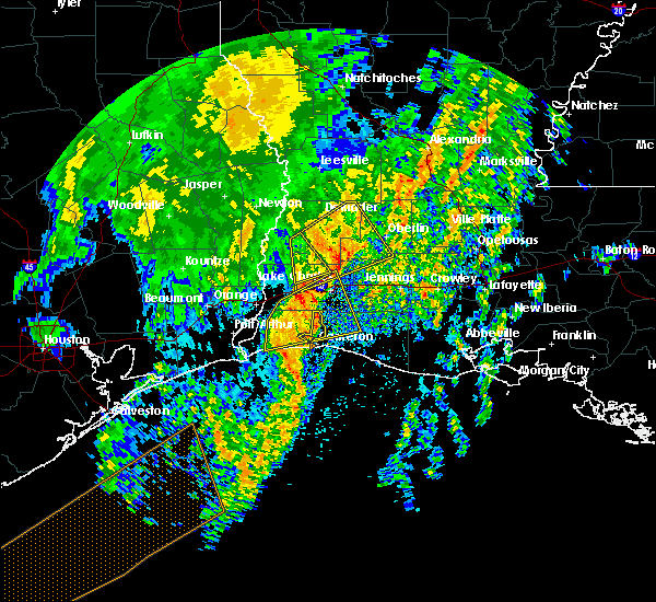 At 534 am cdt, a severe thunderstorm was located over mittie, moving northeast at 50 mph (radar indicated). Hazards include 60 mph wind gusts. Expect damage to roofs, siding, and trees. locations impacted include, kinder, reeves, dry creek, mittie, grant, buller, harmony, topsy and leblanc. A tornado watch remains in effect until 600 am cdt for southwestern louisiana. At 534 am cdt, a severe thunderstorm was located over mittie, moving northeast at 50 mph (radar indicated). Hazards include 60 mph wind gusts. Expect damage to roofs, siding, and trees. locations impacted include, kinder, reeves, dry creek, mittie, grant, buller, harmony, topsy and leblanc. A tornado watch remains in effect until 600 am cdt for southwestern louisiana.
|
| 4/14/2018 4:59 AM CDT |
 At 458 am cdt, a severe thunderstorm was located 7 miles southwest of ragley, moving northeast at 50 mph (radar indicated). Hazards include 60 mph wind gusts and quarter size hail. Hail damage to vehicles is expected. Expect wind damage to roofs, siding, and trees. At 458 am cdt, a severe thunderstorm was located 7 miles southwest of ragley, moving northeast at 50 mph (radar indicated). Hazards include 60 mph wind gusts and quarter size hail. Hail damage to vehicles is expected. Expect wind damage to roofs, siding, and trees.
|
| 4/7/2018 2:12 AM CDT |
 At 212 am cdt, severe thunderstorms were located along a line extending from near elizabeth to harmony to topsy to near de quincy, moving east at 40 mph (radar indicated). Hazards include 60 mph wind gusts and nickel size hail. Expect damage to roofs, siding, and trees. Locations impacted include, lake charles, oakdale, westlake, kinder, oberlin, elizabeth, fenton, reeves, dry creek, moss bluff, sugartown, de quincy, ragley, mittie, grant, dequincy, topsy, lebleu settlement, gillis and allen parish airport. At 212 am cdt, severe thunderstorms were located along a line extending from near elizabeth to harmony to topsy to near de quincy, moving east at 40 mph (radar indicated). Hazards include 60 mph wind gusts and nickel size hail. Expect damage to roofs, siding, and trees. Locations impacted include, lake charles, oakdale, westlake, kinder, oberlin, elizabeth, fenton, reeves, dry creek, moss bluff, sugartown, de quincy, ragley, mittie, grant, dequincy, topsy, lebleu settlement, gillis and allen parish airport.
|
| 4/7/2018 1:41 AM CDT |
 At 140 am cdt, severe thunderstorms were located along a line extending from near cravens to near tulla to oretta to near bancroft, moving southeast at 40 mph (radar indicated). Hazards include 60 mph wind gusts and quarter size hail. Hail damage to vehicles is expected. Expect wind damage to roofs, siding, and trees. At 140 am cdt, severe thunderstorms were located along a line extending from near cravens to near tulla to oretta to near bancroft, moving southeast at 40 mph (radar indicated). Hazards include 60 mph wind gusts and quarter size hail. Hail damage to vehicles is expected. Expect wind damage to roofs, siding, and trees.
|
| 4/7/2018 1:41 AM CDT |
 The national weather service in lake charles has issued a * severe thunderstorm warning for. northwestern jefferson davis parish in southwestern louisiana. beauregard parish in southwestern louisiana. northeastern calcasieu parish in southwestern louisiana. Southeastern vernon parish in west central louisiana. The national weather service in lake charles has issued a * severe thunderstorm warning for. northwestern jefferson davis parish in southwestern louisiana. beauregard parish in southwestern louisiana. northeastern calcasieu parish in southwestern louisiana. Southeastern vernon parish in west central louisiana.
|
| 4/3/2018 9:56 PM CDT |
 At 955 pm cdt, severe thunderstorms were located along a line extending from near hineston to gist, moving southeast at 15 mph (radar indicated). Hazards include 60 mph wind gusts and quarter size hail. Hail damage to vehicles is expected. Expect wind damage to roofs, siding, and trees. At 955 pm cdt, severe thunderstorms were located along a line extending from near hineston to gist, moving southeast at 15 mph (radar indicated). Hazards include 60 mph wind gusts and quarter size hail. Hail damage to vehicles is expected. Expect wind damage to roofs, siding, and trees.
|
| 12/20/2017 2:47 AM CST |
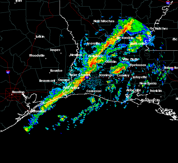 At 246 am cst, a confirmed tornado was located near reeves, moving east at 50 mph (law enforcement confirmed tornado). Hazards include damaging tornado. Flying debris will be dangerous to those caught without shelter. mobile homes will be damaged or destroyed. damage to roofs, windows, and vehicles will occur. tree damage is likely. The tornado will be near, harmony around 305 am cst. At 246 am cst, a confirmed tornado was located near reeves, moving east at 50 mph (law enforcement confirmed tornado). Hazards include damaging tornado. Flying debris will be dangerous to those caught without shelter. mobile homes will be damaged or destroyed. damage to roofs, windows, and vehicles will occur. tree damage is likely. The tornado will be near, harmony around 305 am cst.
|
| 4/29/2017 7:53 PM CDT | Quarter sized hail reported 0.9 miles W of Reeves, LA, public reported nickel to quarter sized hail in reeves. |
| 4/29/2017 7:35 PM CDT |
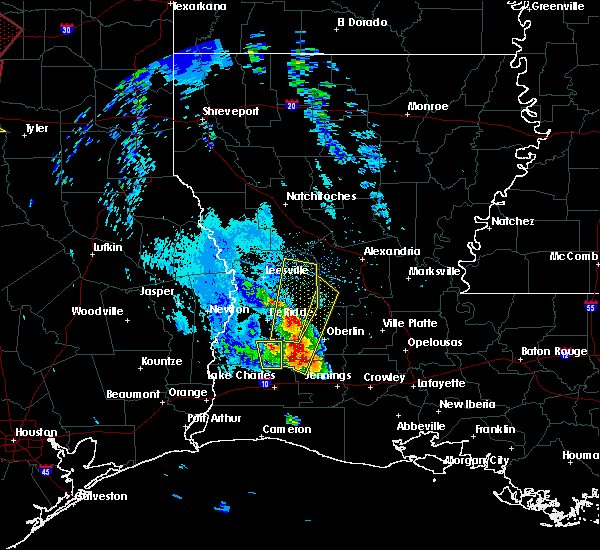 At 735 pm cdt, a severe thunderstorm was located near reeves, moving north at 40 mph (radar indicated). Hazards include 60 mph wind gusts and half dollar size hail. Hail damage to vehicles is expected. Expect wind damage to roofs, siding, and trees. At 735 pm cdt, a severe thunderstorm was located near reeves, moving north at 40 mph (radar indicated). Hazards include 60 mph wind gusts and half dollar size hail. Hail damage to vehicles is expected. Expect wind damage to roofs, siding, and trees.
|
| 1/22/2017 12:45 AM CST |
 At 1244 am cst, a severe thunderstorm was located near ragley, moving east at 70 mph (radar indicated). Hazards include quarter size hail. Damage to vehicles is expected. Locations impacted include, reeves, de quincy, ragley, dequincy, harmony, leblanc and oretta. At 1244 am cst, a severe thunderstorm was located near ragley, moving east at 70 mph (radar indicated). Hazards include quarter size hail. Damage to vehicles is expected. Locations impacted include, reeves, de quincy, ragley, dequincy, harmony, leblanc and oretta.
|
| 1/22/2017 12:17 AM CST |
 At 1217 am cst, a severe thunderstorm was located near deweyville, moving east at 75 mph (radar indicated). Hazards include quarter size hail. damage to vehicles is expected At 1217 am cst, a severe thunderstorm was located near deweyville, moving east at 75 mph (radar indicated). Hazards include quarter size hail. damage to vehicles is expected
|
| 1/20/2017 10:05 PM CST |
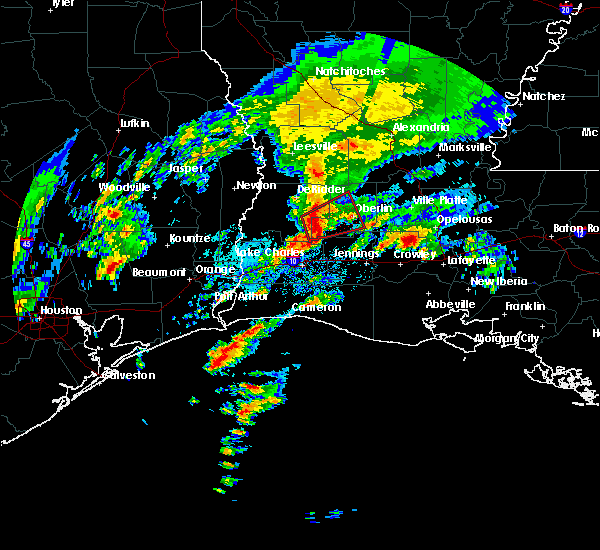 At 1005 pm cst, a severe thunderstorm capable of producing a tornado was located over reeves, moving northeast at 35 mph (radar indicated rotation). Hazards include tornado and quarter size hail. Flying debris will be dangerous to those caught without shelter. mobile homes will be damaged or destroyed. damage to roofs, windows, and vehicles will occur. tree damage is likely. this dangerous storm will be near, dry creek and leblanc around 1015 pm cst. harmony around 1025 pm cst. Oberlin and mittie around 1030 pm cst. At 1005 pm cst, a severe thunderstorm capable of producing a tornado was located over reeves, moving northeast at 35 mph (radar indicated rotation). Hazards include tornado and quarter size hail. Flying debris will be dangerous to those caught without shelter. mobile homes will be damaged or destroyed. damage to roofs, windows, and vehicles will occur. tree damage is likely. this dangerous storm will be near, dry creek and leblanc around 1015 pm cst. harmony around 1025 pm cst. Oberlin and mittie around 1030 pm cst.
|
| 1/2/2017 11:13 AM CST |
 At 1113 am cst, severe thunderstorms were located along a line extending from near timber trails to kinder, moving east at 45 mph (radar indicated). Hazards include 70 mph wind gusts. Expect considerable tree damage. damage is likely to mobile homes, roofs, and outbuildings. locations impacted include, alexandria, pineville, eunice, oakdale, mamou, kinder, basile, oberlin, glenmora, boyce, cheneyville, elizabeth, turkey creek, reeves, lena, alexandria international airport, mittie, hineston, grant and ball. A tornado watch remains in effect until 200 pm cst for west central, central and southwestern louisiana. At 1113 am cst, severe thunderstorms were located along a line extending from near timber trails to kinder, moving east at 45 mph (radar indicated). Hazards include 70 mph wind gusts. Expect considerable tree damage. damage is likely to mobile homes, roofs, and outbuildings. locations impacted include, alexandria, pineville, eunice, oakdale, mamou, kinder, basile, oberlin, glenmora, boyce, cheneyville, elizabeth, turkey creek, reeves, lena, alexandria international airport, mittie, hineston, grant and ball. A tornado watch remains in effect until 200 pm cst for west central, central and southwestern louisiana.
|
| 1/2/2017 10:58 AM CST |
 At 1058 am cst, severe thunderstorms were located along a line extending from near boyce to near reeves, moving east at 45 mph (radar indicated). Hazards include 70 mph wind gusts. Expect considerable tree damage. damage is likely to mobile homes, roofs, and outbuildings. locations impacted include, alexandria, pineville, eunice, oakdale, mamou, kinder, basile, oberlin, glenmora, boyce, cheneyville, elizabeth, turkey creek, reeves, lena, dry creek, ragley, sugartown, alexandria international airport and mittie. A tornado watch remains in effect until 200 pm cst for west central, central and southwestern louisiana. At 1058 am cst, severe thunderstorms were located along a line extending from near boyce to near reeves, moving east at 45 mph (radar indicated). Hazards include 70 mph wind gusts. Expect considerable tree damage. damage is likely to mobile homes, roofs, and outbuildings. locations impacted include, alexandria, pineville, eunice, oakdale, mamou, kinder, basile, oberlin, glenmora, boyce, cheneyville, elizabeth, turkey creek, reeves, lena, dry creek, ragley, sugartown, alexandria international airport and mittie. A tornado watch remains in effect until 200 pm cst for west central, central and southwestern louisiana.
|
| 1/2/2017 10:44 AM CST | Numerous trees down and building damage across tow in allen county LA, 0.9 miles W of Reeves, LA |
| 1/2/2017 10:32 AM CST |
 At 1032 am cst, severe thunderstorms were located along a line extending from near flatwoods to near buhler, moving east at 45 mph (radar indicated). Hazards include 70 mph wind gusts. Expect considerable tree damage. Damage is likely to mobile homes, roofs, and outbuildings. At 1032 am cst, severe thunderstorms were located along a line extending from near flatwoods to near buhler, moving east at 45 mph (radar indicated). Hazards include 70 mph wind gusts. Expect considerable tree damage. Damage is likely to mobile homes, roofs, and outbuildings.
|
| 8/12/2016 6:24 PM CDT |
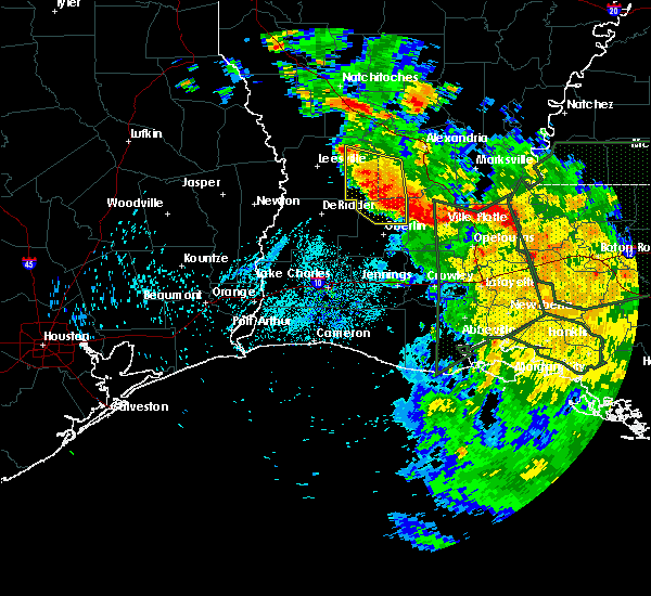 At 624 pm cdt, severe thunderstorms were located along a line extending from near pitkin to near allen parish airport to near ville platte, moving south at 30 mph (radar indicated). Hazards include 60 mph wind gusts. Expect damage to roofs. siding. And trees. At 624 pm cdt, severe thunderstorms were located along a line extending from near pitkin to near allen parish airport to near ville platte, moving south at 30 mph (radar indicated). Hazards include 60 mph wind gusts. Expect damage to roofs. siding. And trees.
|
| 5/27/2016 5:49 PM CDT |
 At 548 pm cdt, severe thunderstorms were located along a line extending from clifton to elizabeth to lake charles, moving east at 35 mph (radar indicated). Hazards include 60 mph wind gusts. Expect damage to roofs. siding. and trees. Locations impacted include, lake charles, alexandria, sulphur, oakdale, westlake, welsh, iowa, kinder, oberlin, glenmora, elton, boyce, elizabeth, fenton, reeves, lena, dry creek, ragley, sugartown and alexandria international airport. At 548 pm cdt, severe thunderstorms were located along a line extending from clifton to elizabeth to lake charles, moving east at 35 mph (radar indicated). Hazards include 60 mph wind gusts. Expect damage to roofs. siding. and trees. Locations impacted include, lake charles, alexandria, sulphur, oakdale, westlake, welsh, iowa, kinder, oberlin, glenmora, elton, boyce, elizabeth, fenton, reeves, lena, dry creek, ragley, sugartown and alexandria international airport.
|
| 5/27/2016 5:14 PM CDT |
 At 512 pm cdt, severe thunderstorms were located along a line extending from near slagle to 6 miles southwest of sugartown to 6 miles southeast of vinton, moving east at 35 mph (radar indicated). Hazards include 60 mph wind gusts. Expect damage to roofs. siding. And trees. At 512 pm cdt, severe thunderstorms were located along a line extending from near slagle to 6 miles southwest of sugartown to 6 miles southeast of vinton, moving east at 35 mph (radar indicated). Hazards include 60 mph wind gusts. Expect damage to roofs. siding. And trees.
|
| 5/27/2016 4:20 PM CDT |
 At 419 pm cdt, severe thunderstorms were located along a line extending from 6 miles east of mayflower to near deweyville, moving east at 35 mph (radar indicated). Hazards include 60 mph wind gusts. Expect damage to roofs. siding. And trees. At 419 pm cdt, severe thunderstorms were located along a line extending from 6 miles east of mayflower to near deweyville, moving east at 35 mph (radar indicated). Hazards include 60 mph wind gusts. Expect damage to roofs. siding. And trees.
|
| 4/30/2016 8:54 AM CDT |
 The tornado warning for southwestern allen parish will expire at 900 am cdt, the storm which prompted the warning has weakened below severe limits, and no longer appears capable of producing a tornado. therefore the warning will be allowed to expire. however gusty winds are still possible with this thunderstorm. a severe thunderstorm watch remains in effect until 1100 am cdt for southwestern louisiana. The tornado warning for southwestern allen parish will expire at 900 am cdt, the storm which prompted the warning has weakened below severe limits, and no longer appears capable of producing a tornado. therefore the warning will be allowed to expire. however gusty winds are still possible with this thunderstorm. a severe thunderstorm watch remains in effect until 1100 am cdt for southwestern louisiana.
|
| 4/30/2016 8:38 AM CDT |
 At 837 am cdt, a severe thunderstorm capable of producing a tornado was located near reeves, moving north at 15 mph (radar indicated rotation). Hazards include tornado. Flying debris will be dangerous to those caught without shelter. mobile homes will be damaged or destroyed. damage to roofs, windows, and vehicles will occur. tree damage is likely. This dangerous storm will be near, reeves around 845 am cdt. At 837 am cdt, a severe thunderstorm capable of producing a tornado was located near reeves, moving north at 15 mph (radar indicated rotation). Hazards include tornado. Flying debris will be dangerous to those caught without shelter. mobile homes will be damaged or destroyed. damage to roofs, windows, and vehicles will occur. tree damage is likely. This dangerous storm will be near, reeves around 845 am cdt.
|
| 4/30/2016 8:26 AM CDT |
 At 826 am cdt, a severe thunderstorm capable of producing a tornado was located near topsy, or near ragley, moving northeast at 15 mph (radar indicated rotation). Hazards include tornado. Flying debris will be dangerous to those caught without shelter. mobile homes will be damaged or destroyed. damage to roofs, windows, and vehicles will occur. tree damage is likely. This dangerous storm will be near, reeves around 855 am cdt. At 826 am cdt, a severe thunderstorm capable of producing a tornado was located near topsy, or near ragley, moving northeast at 15 mph (radar indicated rotation). Hazards include tornado. Flying debris will be dangerous to those caught without shelter. mobile homes will be damaged or destroyed. damage to roofs, windows, and vehicles will occur. tree damage is likely. This dangerous storm will be near, reeves around 855 am cdt.
|
| 4/27/2016 8:21 AM CDT |
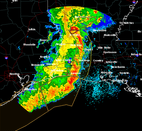 At 819 am cdt, severe thunderstorms were located along a line extending from near hutton to near elizabeth to near oberlin to near welsh to 6 miles north of grand chenier to 27 miles south of cameron, moving east at 45 mph (radar indicated). Hazards include 60 mph wind gusts and penny size hail. Expect damage to roofs. siding. and trees. trees have been reported down in vernon and calcasieu parishes. a wind gust of 70 mph was recorded at cameron. Locations impacted include, lake charles, jennings, oakdale, cameron, welsh, iowa, lake arthur, kinder, basile, oberlin, glenmora, elton, mermentau, elizabeth, fenton, reeves, lena, rockefeller wildlife range, sugartown and klondike. At 819 am cdt, severe thunderstorms were located along a line extending from near hutton to near elizabeth to near oberlin to near welsh to 6 miles north of grand chenier to 27 miles south of cameron, moving east at 45 mph (radar indicated). Hazards include 60 mph wind gusts and penny size hail. Expect damage to roofs. siding. and trees. trees have been reported down in vernon and calcasieu parishes. a wind gust of 70 mph was recorded at cameron. Locations impacted include, lake charles, jennings, oakdale, cameron, welsh, iowa, lake arthur, kinder, basile, oberlin, glenmora, elton, mermentau, elizabeth, fenton, reeves, lena, rockefeller wildlife range, sugartown and klondike.
|
| 4/27/2016 7:46 AM CDT |
 At 746 am cdt, severe thunderstorms were located along a line extending from near hornbeck to near rosepine to near longville to near moss bluff to 6 miles northeast of holly beach to 25 miles south of johnsons bayou, moving east at 45 mph (radar indicated). Hazards include 60 mph wind gusts and penny size hail. Expect damage to roofs. siding. And trees. At 746 am cdt, severe thunderstorms were located along a line extending from near hornbeck to near rosepine to near longville to near moss bluff to 6 miles northeast of holly beach to 25 miles south of johnsons bayou, moving east at 45 mph (radar indicated). Hazards include 60 mph wind gusts and penny size hail. Expect damage to roofs. siding. And trees.
|
| 4/27/2016 7:27 AM CDT |
 At 726 am cdt, severe thunderstorms were located along a line extending from near anacoco to near de ridder to longville to sulphur to 16 miles south of johnsons bayou, moving east at 45 mph (radar indicated). Hazards include 60 mph wind gusts and penny size hail. Expect damage to roofs. siding. and trees. Locations impacted include, lake charles, sulphur, cameron, leesville, westlake, iowa, rosepine, anacoco, reeves, moss bluff, lake charles regional airport, mittie, dry creek, pitkin, ragley, fort polk, sabine national wildlife, sugartown, slagle and grand lake. At 726 am cdt, severe thunderstorms were located along a line extending from near anacoco to near de ridder to longville to sulphur to 16 miles south of johnsons bayou, moving east at 45 mph (radar indicated). Hazards include 60 mph wind gusts and penny size hail. Expect damage to roofs. siding. and trees. Locations impacted include, lake charles, sulphur, cameron, leesville, westlake, iowa, rosepine, anacoco, reeves, moss bluff, lake charles regional airport, mittie, dry creek, pitkin, ragley, fort polk, sabine national wildlife, sugartown, slagle and grand lake.
|
| 4/27/2016 6:47 AM CDT |
 At 646 am cdt, severe thunderstorms were located along a line extending from 8 miles southeast of pineland to newton to near bancroft to mauriceville to 12 miles east of high island, moving east at 45 mph (radar indicated). Hazards include 60 mph wind gusts and quarter size hail. Hail damage to vehicles is expected. Expect wind damage to roofs, siding, and trees. At 646 am cdt, severe thunderstorms were located along a line extending from 8 miles southeast of pineland to newton to near bancroft to mauriceville to 12 miles east of high island, moving east at 45 mph (radar indicated). Hazards include 60 mph wind gusts and quarter size hail. Hail damage to vehicles is expected. Expect wind damage to roofs, siding, and trees.
|
| 3/24/2016 8:10 AM CDT |
 The severe thunderstorm warning for north central cameron, southwestern allen, southeastern beauregard, northwestern jefferson davis and calcasieu parishes will expire at 815 am cdt, the storms which prompted the warning have weakened below severe limits, and exited the warned area. therefore the warning will be allowed to expire. The severe thunderstorm warning for north central cameron, southwestern allen, southeastern beauregard, northwestern jefferson davis and calcasieu parishes will expire at 815 am cdt, the storms which prompted the warning have weakened below severe limits, and exited the warned area. therefore the warning will be allowed to expire.
|
| 3/24/2016 7:20 AM CDT |
 At 719 am cdt, severe thunderstorms were located along a line extending from near singer to near west orange, moving northeast at 55 mph (radar indicated). Hazards include 60 mph wind gusts and quarter size hail. Hail damage to vehicles is expected. Expect wind damage to roofs, siding and trees. At 719 am cdt, severe thunderstorms were located along a line extending from near singer to near west orange, moving northeast at 55 mph (radar indicated). Hazards include 60 mph wind gusts and quarter size hail. Hail damage to vehicles is expected. Expect wind damage to roofs, siding and trees.
|
| 11/17/2015 11:43 AM CST |
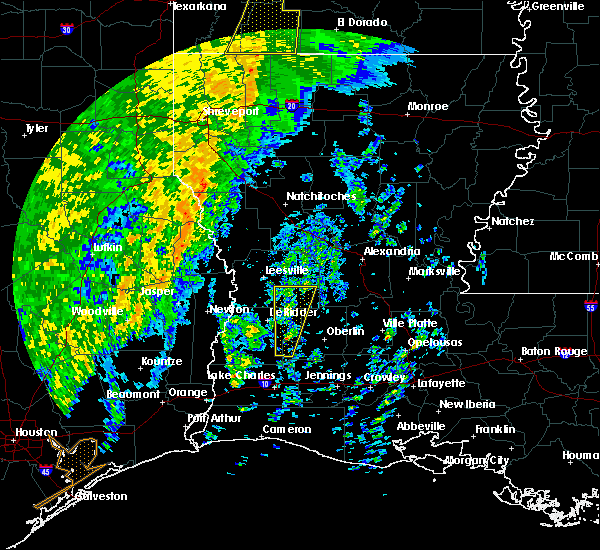 At 1142 am cst, a severe thunderstorm was located near sugartown, moving north at 50 mph (radar indicated). Hazards include 60 mph wind gusts. Expect damage to roofs. siding and trees. locations impacted include, reeves, pitkin, sugartown, dry creek, fort polk, grant, fullerton, cravens and bundick lake. A tornado watch remains in effect until 400 pm cst for southwestern louisiana. At 1142 am cst, a severe thunderstorm was located near sugartown, moving north at 50 mph (radar indicated). Hazards include 60 mph wind gusts. Expect damage to roofs. siding and trees. locations impacted include, reeves, pitkin, sugartown, dry creek, fort polk, grant, fullerton, cravens and bundick lake. A tornado watch remains in effect until 400 pm cst for southwestern louisiana.
|
| 11/17/2015 11:13 AM CST |
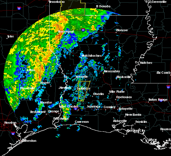 At 1113 am cst, a severe thunderstorm was located near reeves, moving north at 55 mph (radar indicated). Hazards include 60 mph wind gusts. Expect damage to roofs. Siding and trees. At 1113 am cst, a severe thunderstorm was located near reeves, moving north at 55 mph (radar indicated). Hazards include 60 mph wind gusts. Expect damage to roofs. Siding and trees.
|
| 10/31/2015 10:48 AM CDT |
 At 1048 am cdt, severe thunderstorms were located along a line extending from near gardner to near oakdale to near leblanc to near holmwood to near west orange, moving southeast at 30 mph (radar indicated). Hazards include 60 mph wind gusts. Expect damage to roofs. siding and trees. locations impacted include, lake charles, port arthur, alexandria, sulphur, orange, jennings, oakdale, westlake, west orange, welsh, vinton, iowa, kinder, oberlin, glenmora, elton, elizabeth, fenton, reeves and alexandria international airport. a tornado watch remains in effect until noon cdt for southeastern texas. A tornado watch also remains in effect until 200 pm cdt for southwestern louisiana. At 1048 am cdt, severe thunderstorms were located along a line extending from near gardner to near oakdale to near leblanc to near holmwood to near west orange, moving southeast at 30 mph (radar indicated). Hazards include 60 mph wind gusts. Expect damage to roofs. siding and trees. locations impacted include, lake charles, port arthur, alexandria, sulphur, orange, jennings, oakdale, westlake, west orange, welsh, vinton, iowa, kinder, oberlin, glenmora, elton, elizabeth, fenton, reeves and alexandria international airport. a tornado watch remains in effect until noon cdt for southeastern texas. A tornado watch also remains in effect until 200 pm cdt for southwestern louisiana.
|
| 10/31/2015 10:23 AM CDT |
 At 1022 am cdt, severe thunderstorms were located along a line extending from near clifton to near pitkin to near reeves to westlake to near vidor, and are nearly stationary (radar indicated). Hazards include 60 mph wind gusts. Expect damage to roofs. Siding and trees. At 1022 am cdt, severe thunderstorms were located along a line extending from near clifton to near pitkin to near reeves to westlake to near vidor, and are nearly stationary (radar indicated). Hazards include 60 mph wind gusts. Expect damage to roofs. Siding and trees.
|
| 8/24/2015 7:23 PM CDT |
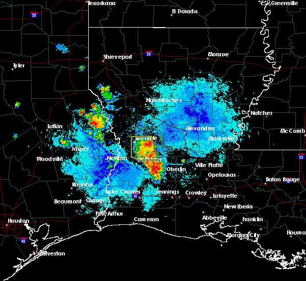 At 722 pm cdt, doppler radar indicated a line of severe thunderstorms capable of producing quarter size hail and damaging winds in excess of 60 mph. these storms were located along a line extending from grant to near kinder, and moving southeast at 15 mph. At 722 pm cdt, doppler radar indicated a line of severe thunderstorms capable of producing quarter size hail and damaging winds in excess of 60 mph. these storms were located along a line extending from grant to near kinder, and moving southeast at 15 mph.
|
| 6/30/2015 1:14 PM CDT |
 At 113 pm cdt, doppler radar indicated a severe thunderstorm capable of producing damaging winds in excess of 60 mph. this storm was located near gillis, or near moss bluff, and moving northeast at 20 mph. At 113 pm cdt, doppler radar indicated a severe thunderstorm capable of producing damaging winds in excess of 60 mph. this storm was located near gillis, or near moss bluff, and moving northeast at 20 mph.
|
| 5/27/2015 7:06 AM CDT | At 705 am cdt, doppler radar indicated a line of severe thunderstorms capable of producing quarter size hail and damaging winds in excess of 60 mph. these storms were located along a line extending from pineville to near leblanc, moving east at 30 mph. locations impacted include, alexandria, pineville, oakdale, marksville, bunkie, kinder, basile, oberlin, glenmora, cheneyville, elizabeth, turkey creek, reeves, mittie, effie, dry creek, pitkin, ragley, alexandria international airport and grant. |
| 5/27/2015 6:23 AM CDT | At 623 am cdt, doppler radar indicated a line of severe thunderstorms capable of producing quarter size hail and damaging winds in excess of 60 mph. these storms were located along a line extending from near boyce to ragley, and moving east at 30 mph. |
| 5/27/2015 5:35 AM CDT | At 535 am cdt, doppler radar indicated a line of severe thunderstorms capable of producing damaging winds in excess of 60 mph. these storms were located along a line extending from near hornbeck to near merryville to near old salem, and moving east at 30 mph. nickel size hail may also accompany the damaging winds. |
| 5/25/2015 11:17 PM CDT | At 1117 pm cdt, doppler radar indicated a line of severe thunderstorms capable of producing quarter size hail and damaging winds in excess of 60 mph. these storms were located along a line extending from libuse to near cheneyville to near lake charles to near port acres, moving southeast at 50 mph. locations impacted include, beaumont, lake charles, port arthur, alexandria, sulphur, orange, nederland, groves, pineville, port neches, vidor, jennings, bridge city, oakdale, ville platte, westlake, west orange, mamou, welsh and vinton. a tornado watch remains in effect until 200 am cdt for southwestern louisiana and southeastern texas. a tornado watch also remains in effect until 500 am cdt for central louisiana. |
| 5/25/2015 11:17 PM CDT | At 1117 pm cdt, doppler radar indicated a line of severe thunderstorms capable of producing quarter size hail and damaging winds in excess of 60 mph. these storms were located along a line extending from libuse to near cheneyville to near lake charles to near port acres, moving southeast at 50 mph. locations impacted include, beaumont, lake charles, port arthur, alexandria, sulphur, orange, nederland, groves, pineville, port neches, vidor, jennings, bridge city, oakdale, ville platte, westlake, west orange, mamou, welsh and vinton. a tornado watch remains in effect until 200 am cdt for southwestern louisiana and southeastern texas. a tornado watch also remains in effect until 500 am cdt for central louisiana. |
| 5/25/2015 10:59 PM CDT | At 1058 pm cdt, doppler radar indicated a line of severe thunderstorms capable of producing quarter size hail and damaging winds in excess of 60 mph. these storms were located along a line extending from near boyce to near glenmora to near vinton to hamshire, and moving southeast at 45 mph. |
| 5/25/2015 10:59 PM CDT | At 1058 pm cdt, doppler radar indicated a line of severe thunderstorms capable of producing quarter size hail and damaging winds in excess of 60 mph. these storms were located along a line extending from near boyce to near glenmora to near vinton to hamshire, and moving southeast at 45 mph. |
| 4/27/2015 2:57 PM CDT | At 256 pm cdt, doppler radar indicated a severe thunderstorm capable of producing quarter size hail and damaging winds in excess of 60 mph. this storm was located over dequincy, or over de quincy, and moving east at 50 mph. |
| 4/27/2015 7:20 AM CDT | At 719 am cdt, doppler radar indicated a line of severe thunderstorms capable of producing quarter size hail and damaging winds in excess of 60 mph. these storms were located along a line extending from near hutton to near elizabeth to near lake charles regional airport, and moving east at 55 mph. |
| 4/27/2015 6:58 AM CDT | At 658 am cdt, doppler radar indicated a line of severe thunderstorms capable of producing quarter size hail and damaging winds in excess of 60 mph. these storms were located along a line extending from near anacoco to near cravens to near sulphur, and moving east at 55 mph. |
| 4/24/2015 1:20 PM CDT | Media shared photo of downed tree in reeves. time estimated from rada in allen county LA, 0.9 miles W of Reeves, LA |
| 4/24/2015 1:15 PM CDT | At 114 pm cdt, doppler radar indicated a severe thunderstorm capable of producing half dollar size hail and damaging winds in excess of 60 mph. this storm was located near reeves, and moving east at 45 mph. |
| 4/24/2015 1:15 PM CDT | At 114 pm cdt, doppler radar indicated a severe thunderstorm capable of producing half dollar size hail and damaging winds in excess of 60 mph. this storm was located near reeves, and moving east at 45 mph. |
| 4/24/2015 1:15 PM CDT | At 114 pm cdt, doppler radar indicated a severe thunderstorm capable of producing half dollar size hail and damaging winds in excess of 60 mph. this storm was located near reeves, and moving east at 45 mph. |
| 4/24/2015 12:57 PM CDT | At 1257 pm cdt, doppler radar indicated a severe thunderstorm capable of producing a tornado. this dangerous storm was located near oretta, or near de quincy, moving east at 45 mph. locations impacted include, lake charles, reeves, ragley, moss bluff, de quincy, dequincy, gillis, buller, lebleu settlement, longville, leblanc, oretta and topsy. |
| 4/24/2015 12:45 PM CDT | At 1244 pm cdt, doppler radar indicated a severe thunderstorm capable of producing a tornado. this dangerous storm was located near oretta, or near fields, and moving east at 45 mph. |
| 6/13/2014 5:20 PM CDT | Quarter sized hail reported 8.3 miles SW of Reeves, LA, kplc relayed a facebook report of nickel to quarter size hail 6 miles north of leblanc. |
| 6/13/2012 7:31 PM CDT | Quarter sized hail reported 0.9 miles W of Reeves, LA, allen parish sheriff reports quarter size hail in reeves and multiple power outages. |
| 1/1/0001 12:00 AM | Facebook post of tree down in dry creek. time based on rada in beauregard county LA, 10.2 miles S of Reeves, LA |
| 1/1/0001 12:00 AM | Porch and part of roof torn off home. possible tornad in allen county LA, 0.9 miles W of Reeves, LA |
Hail Maps for Reeves, LA


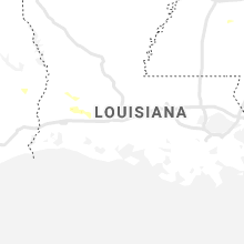


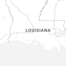


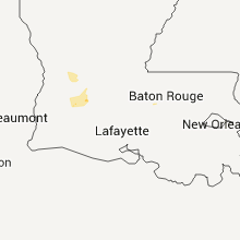


Connect with Interactive Hail Maps