

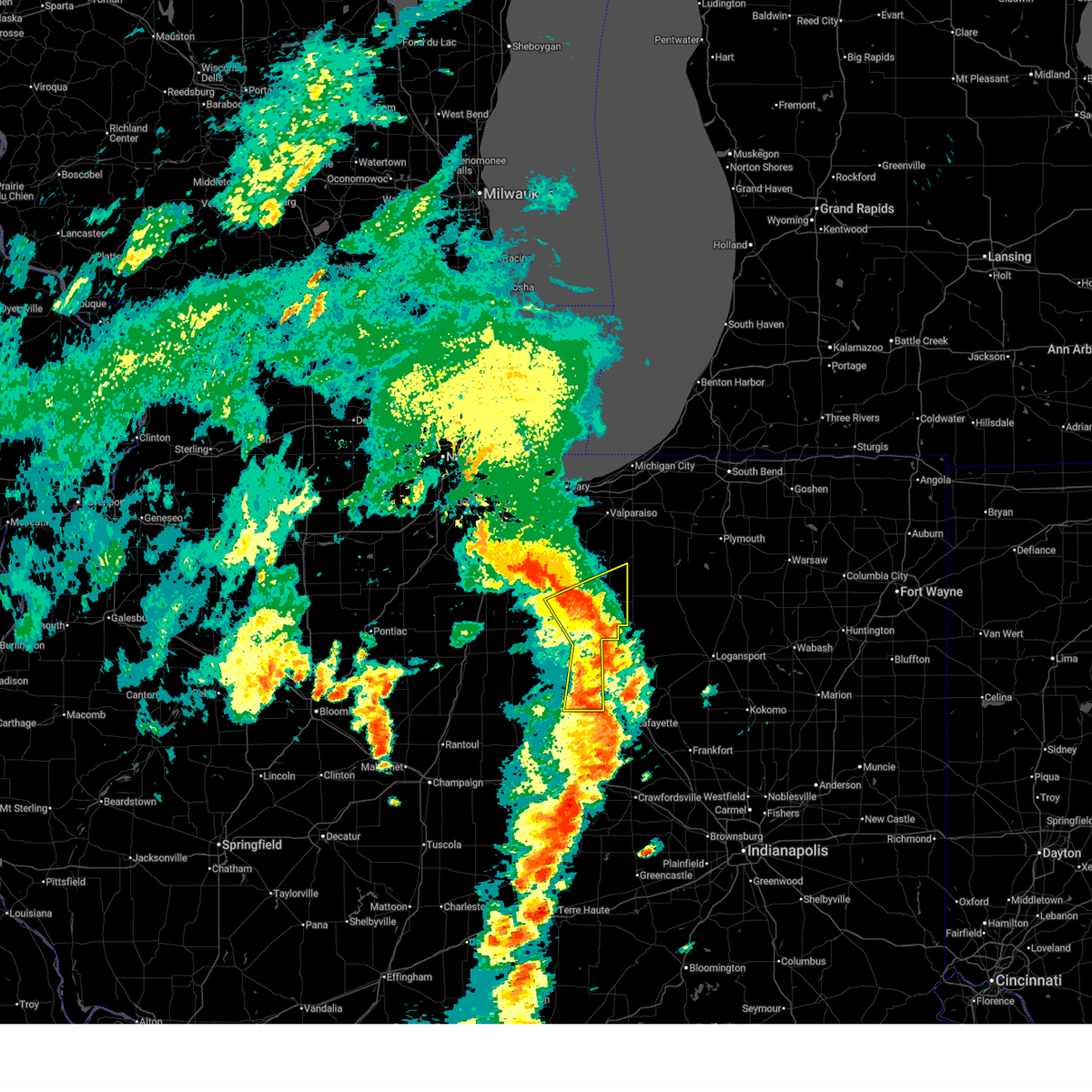
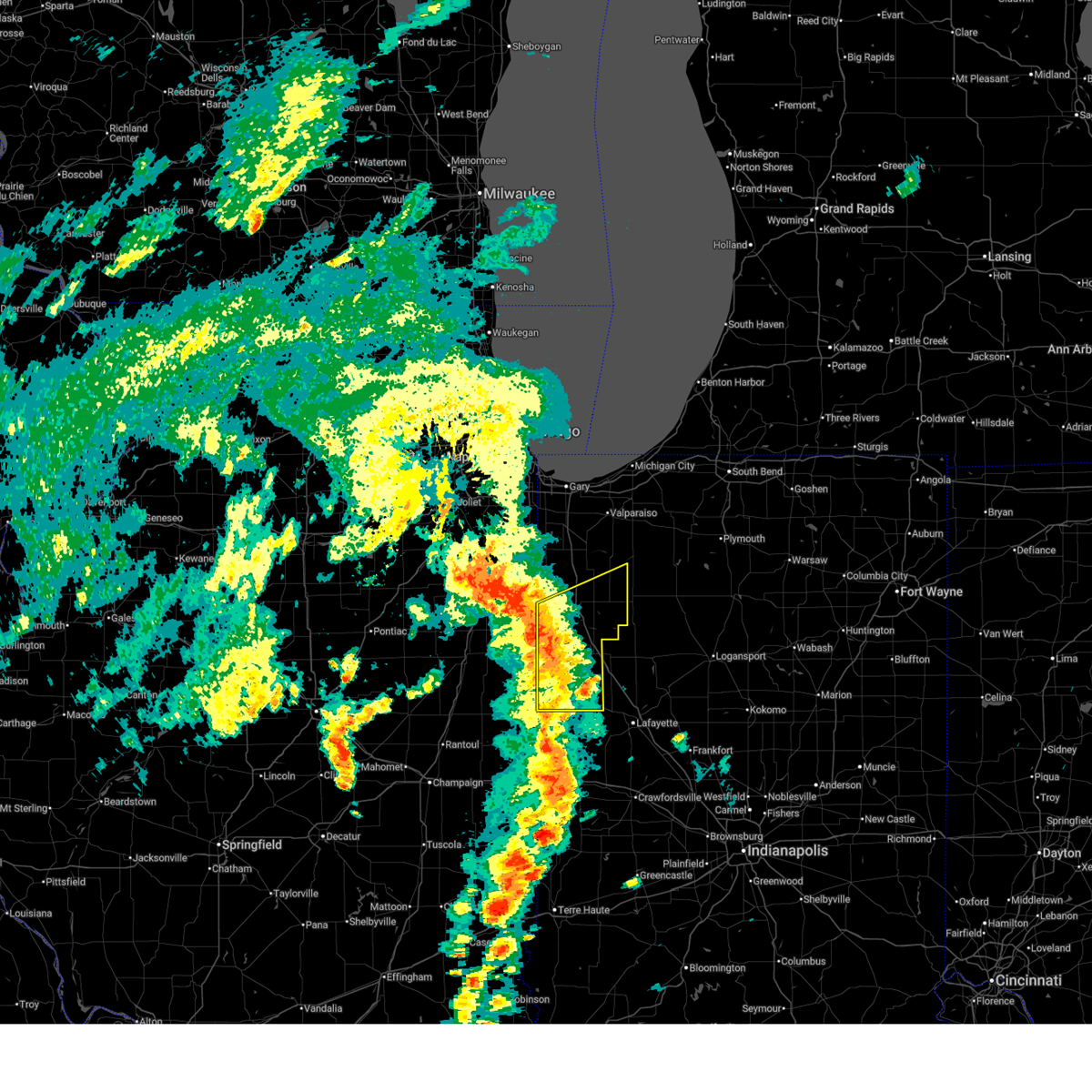
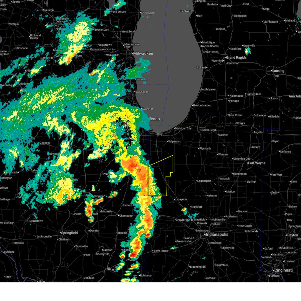
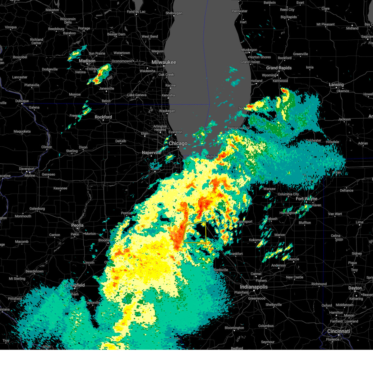
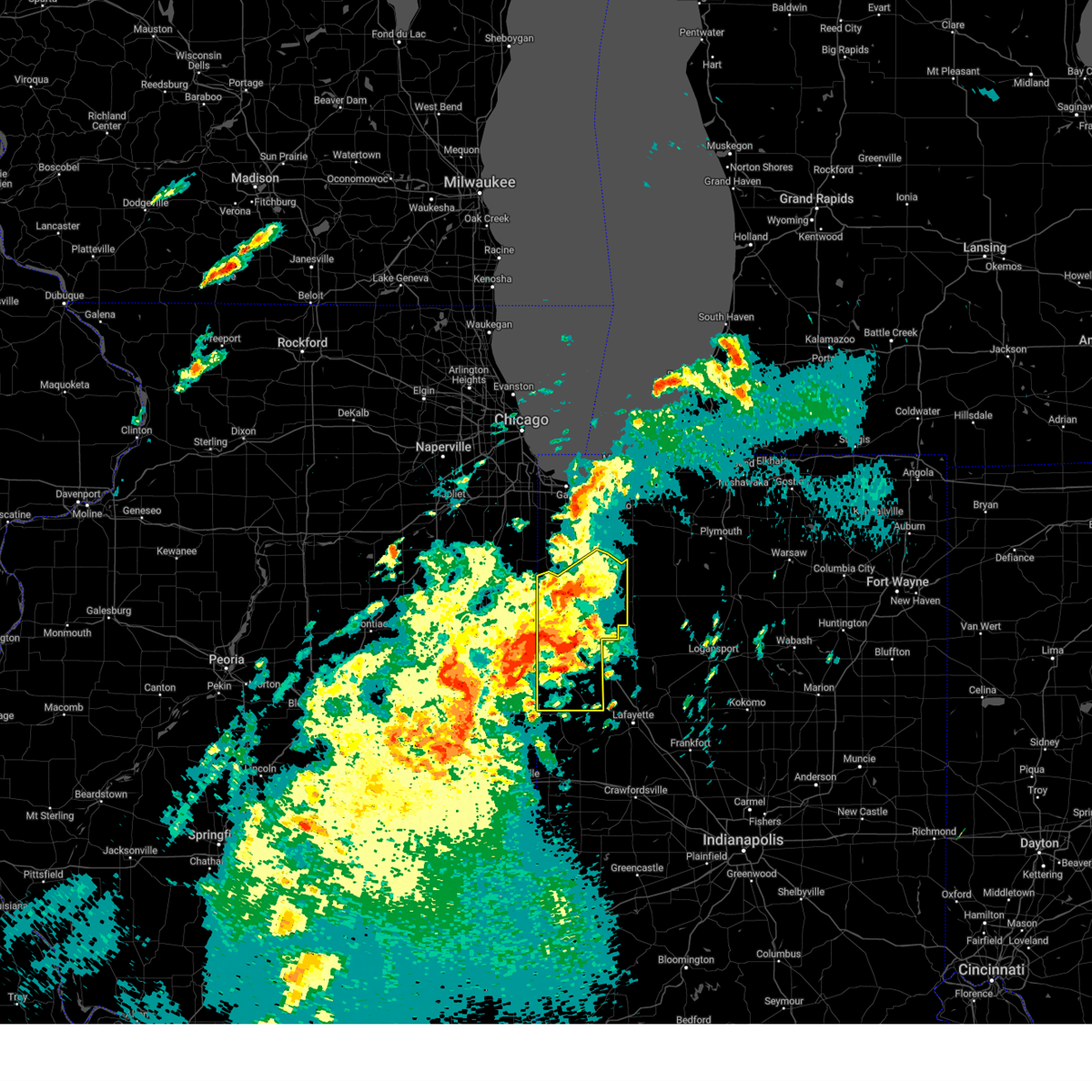
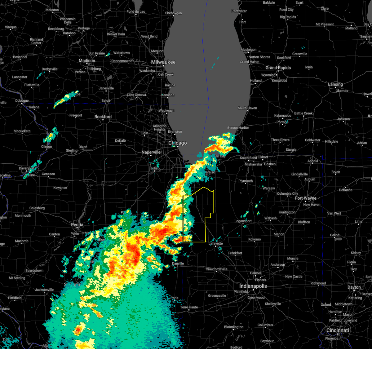
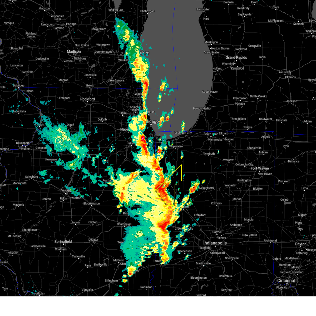
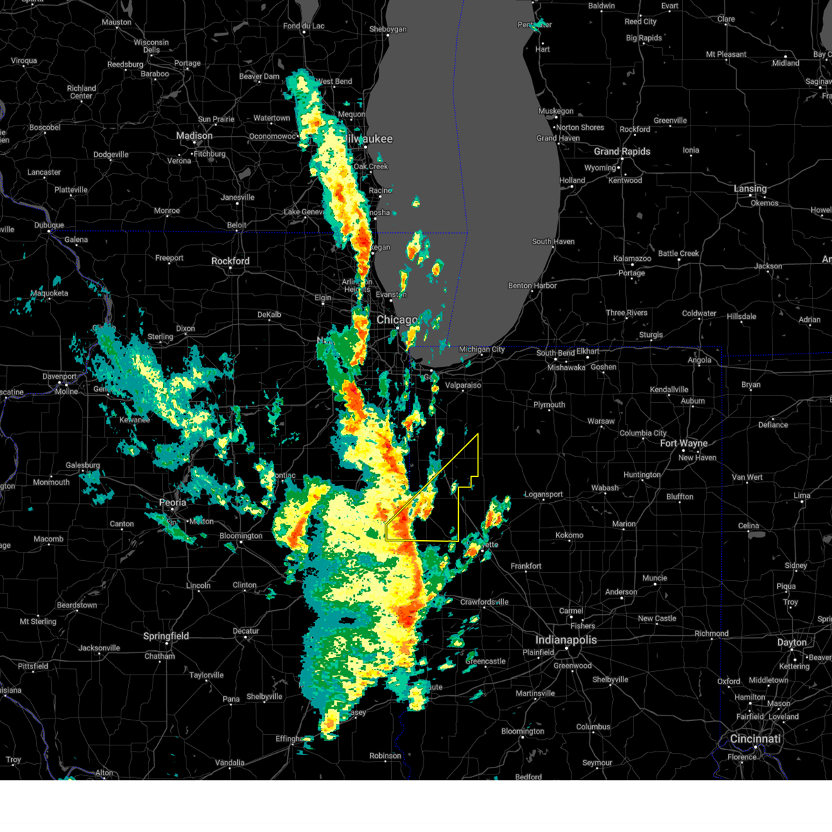
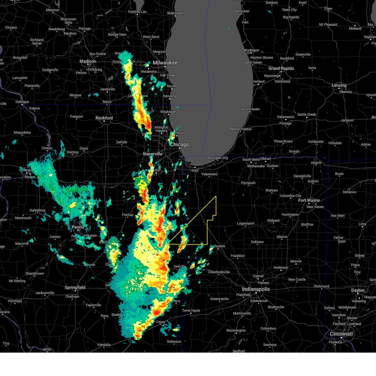
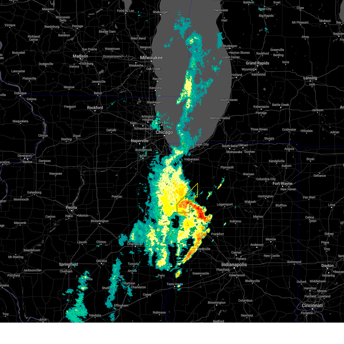
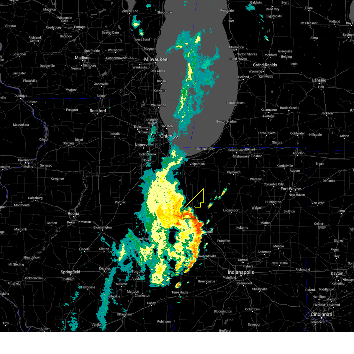
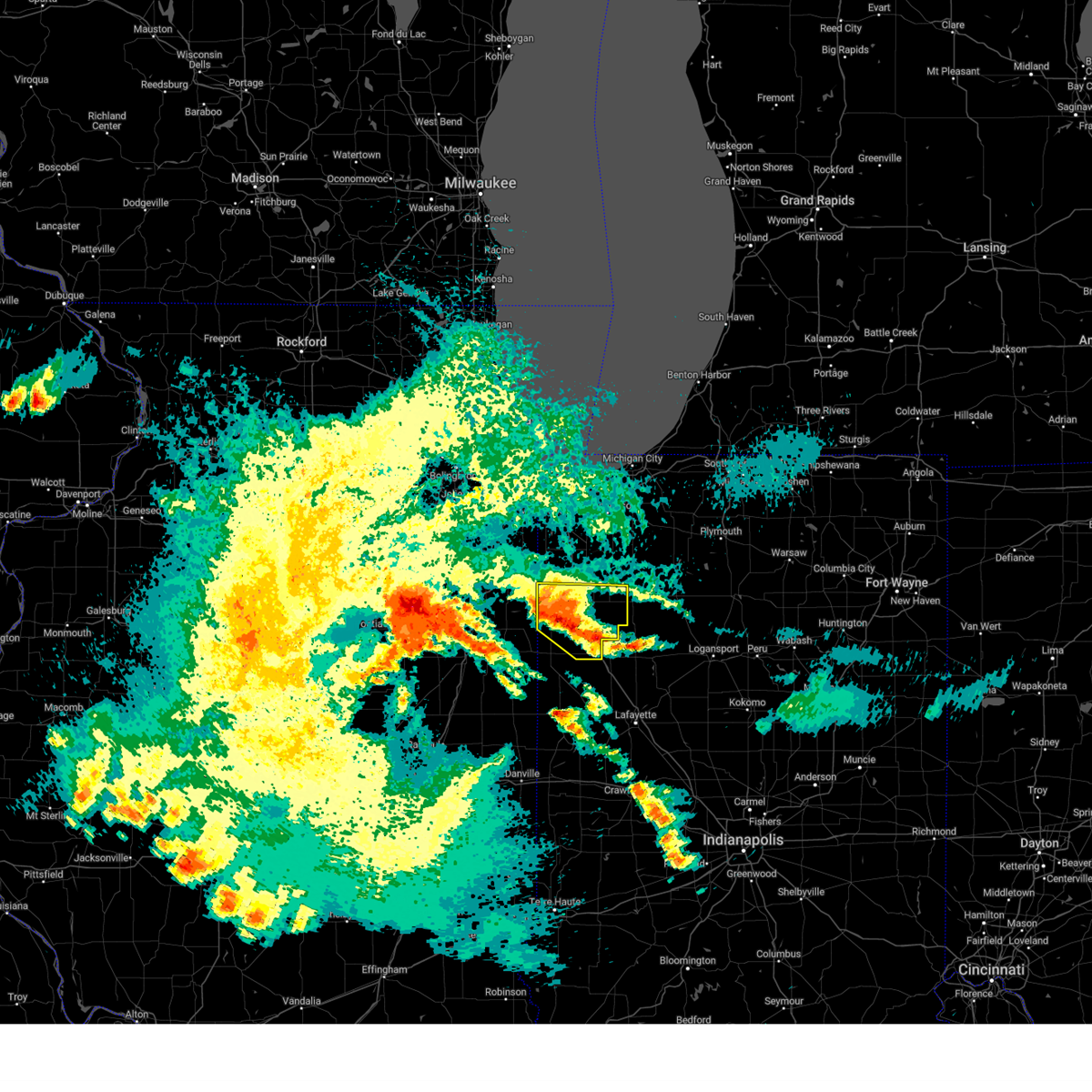
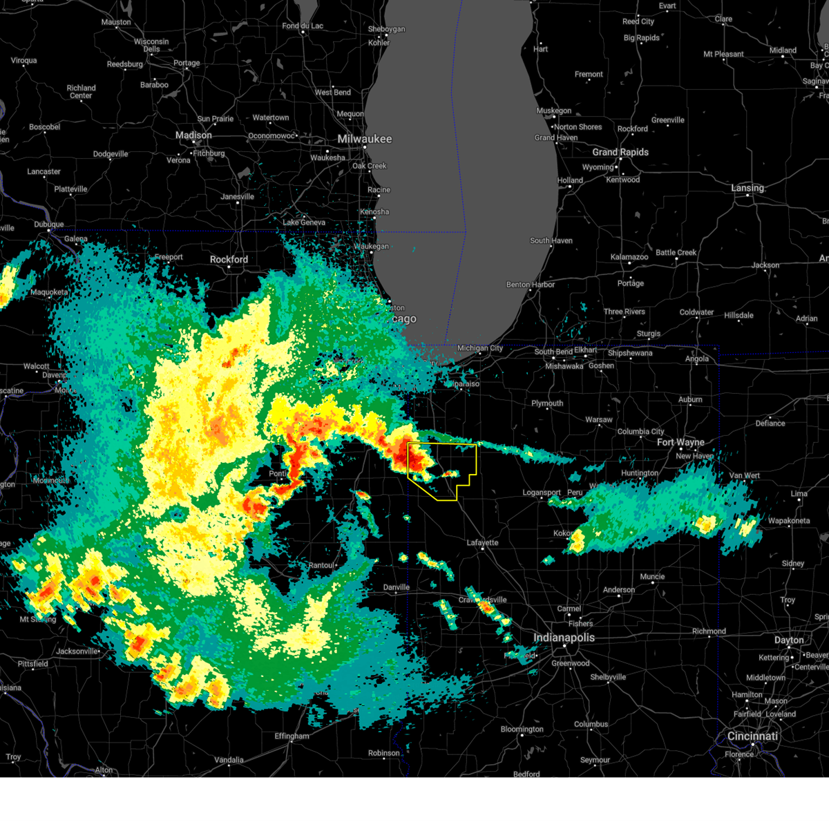
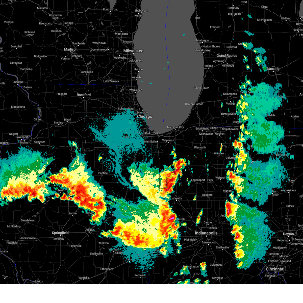
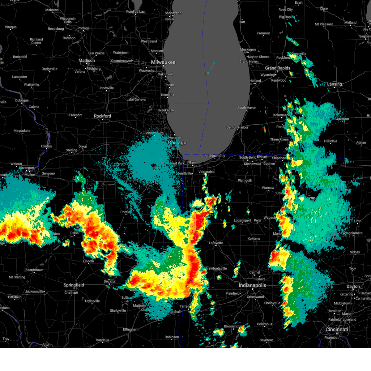
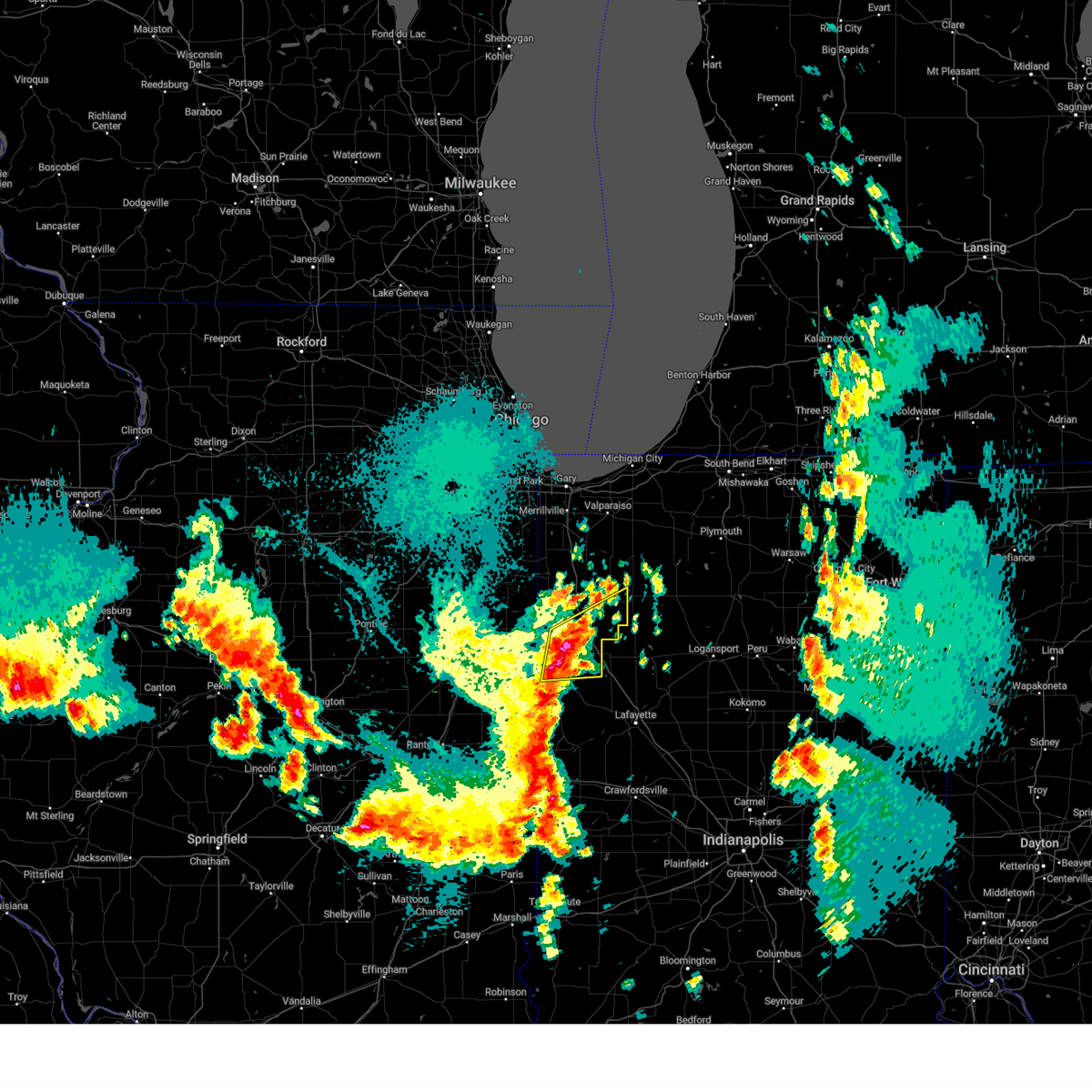
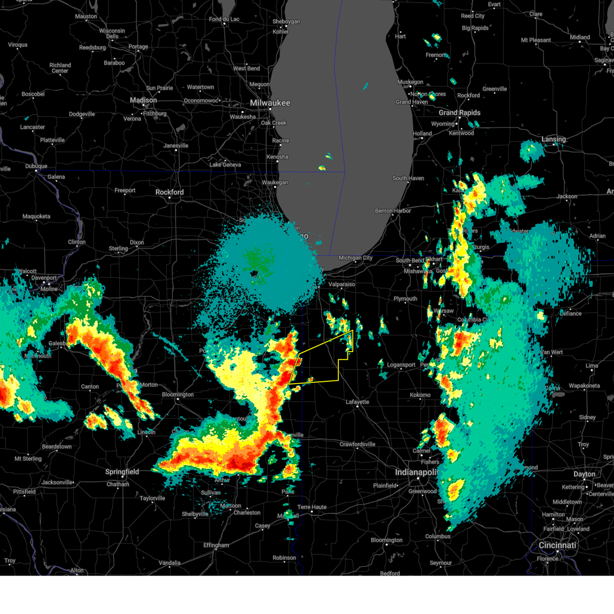
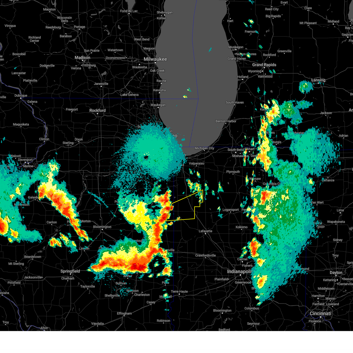
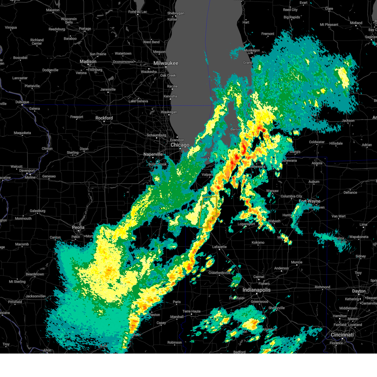
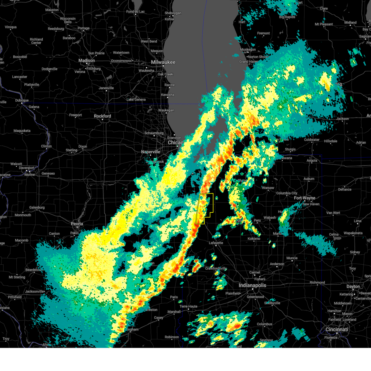
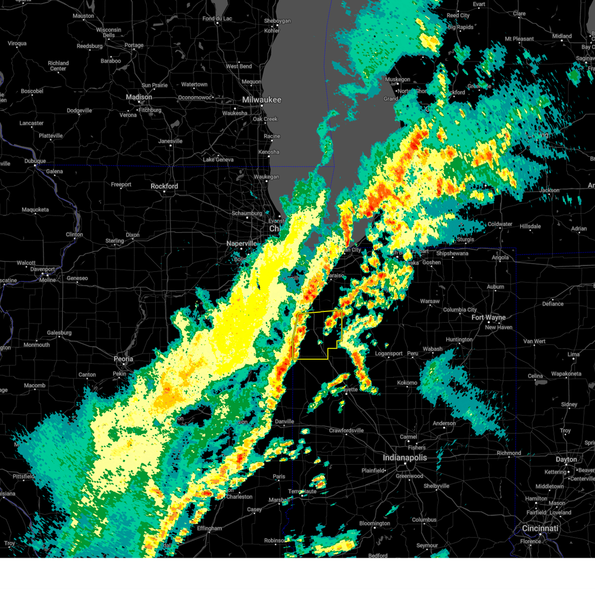
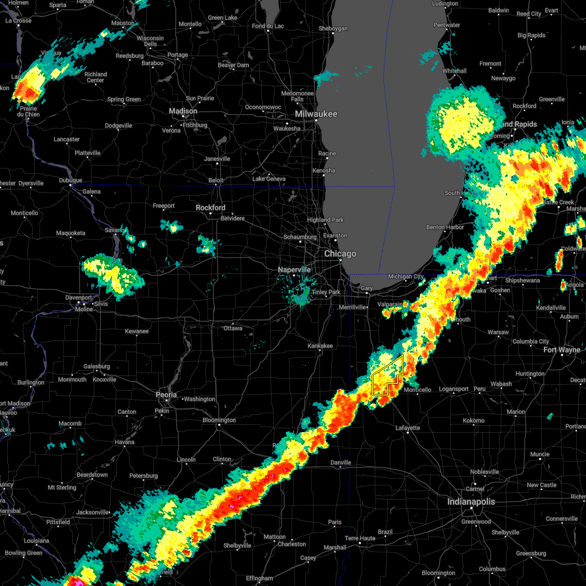
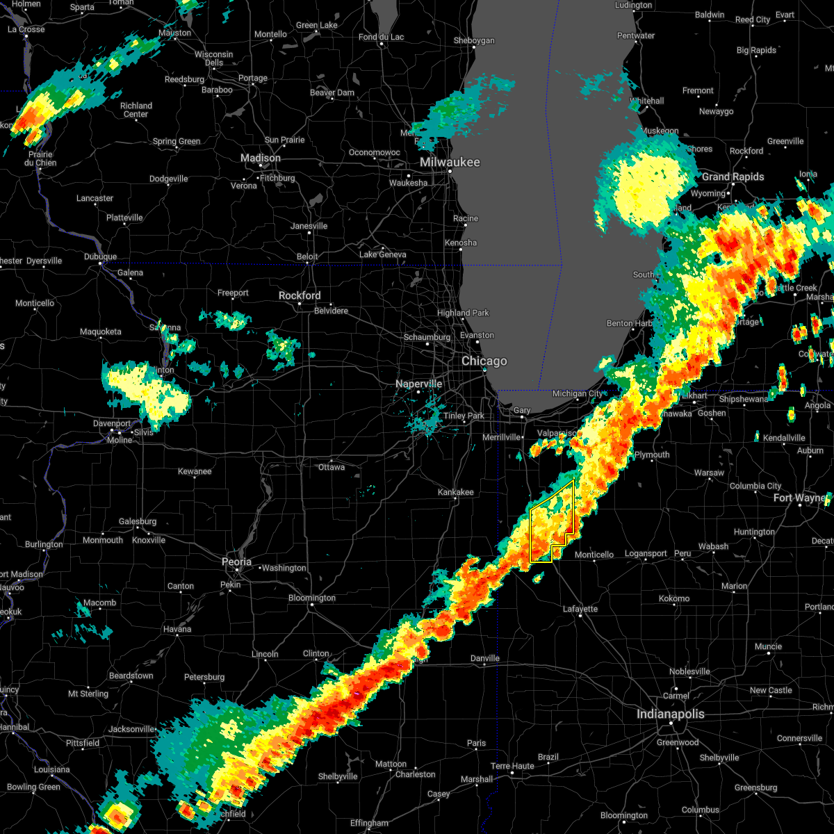
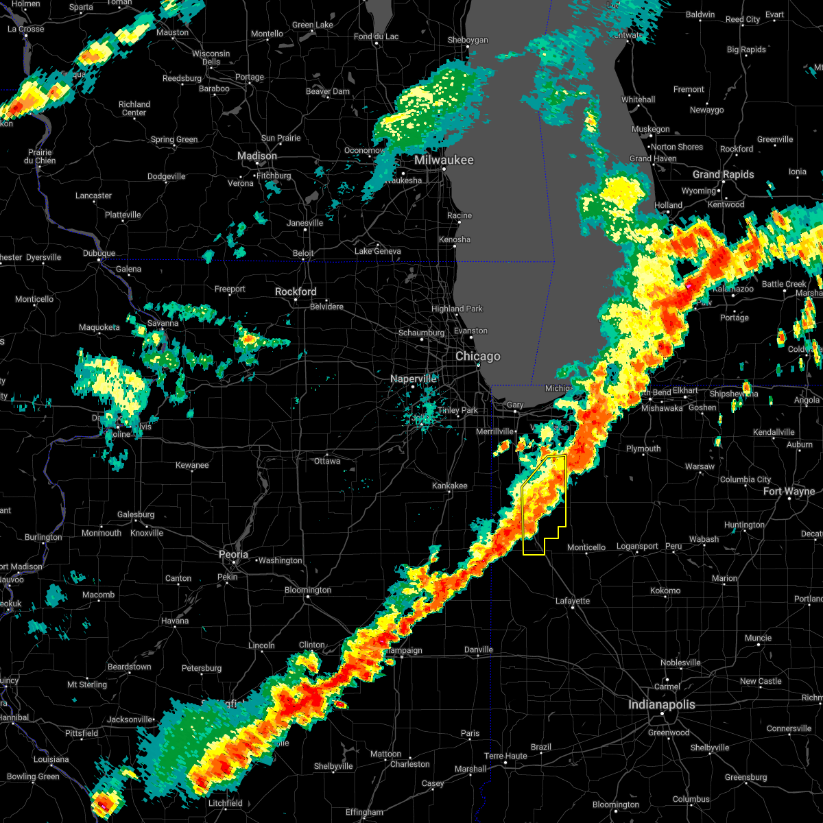
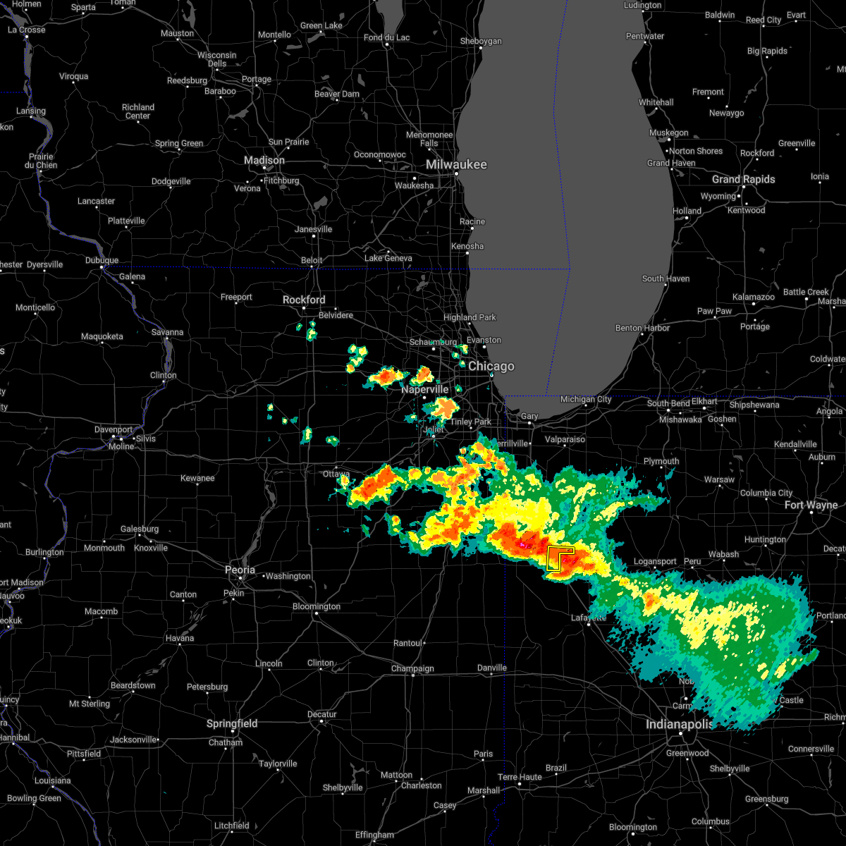
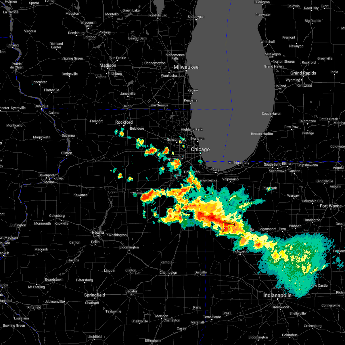
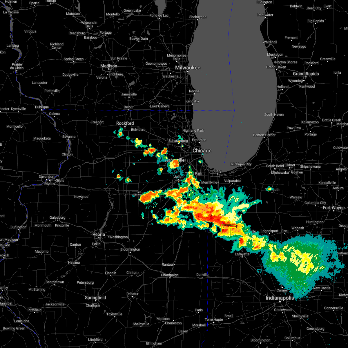
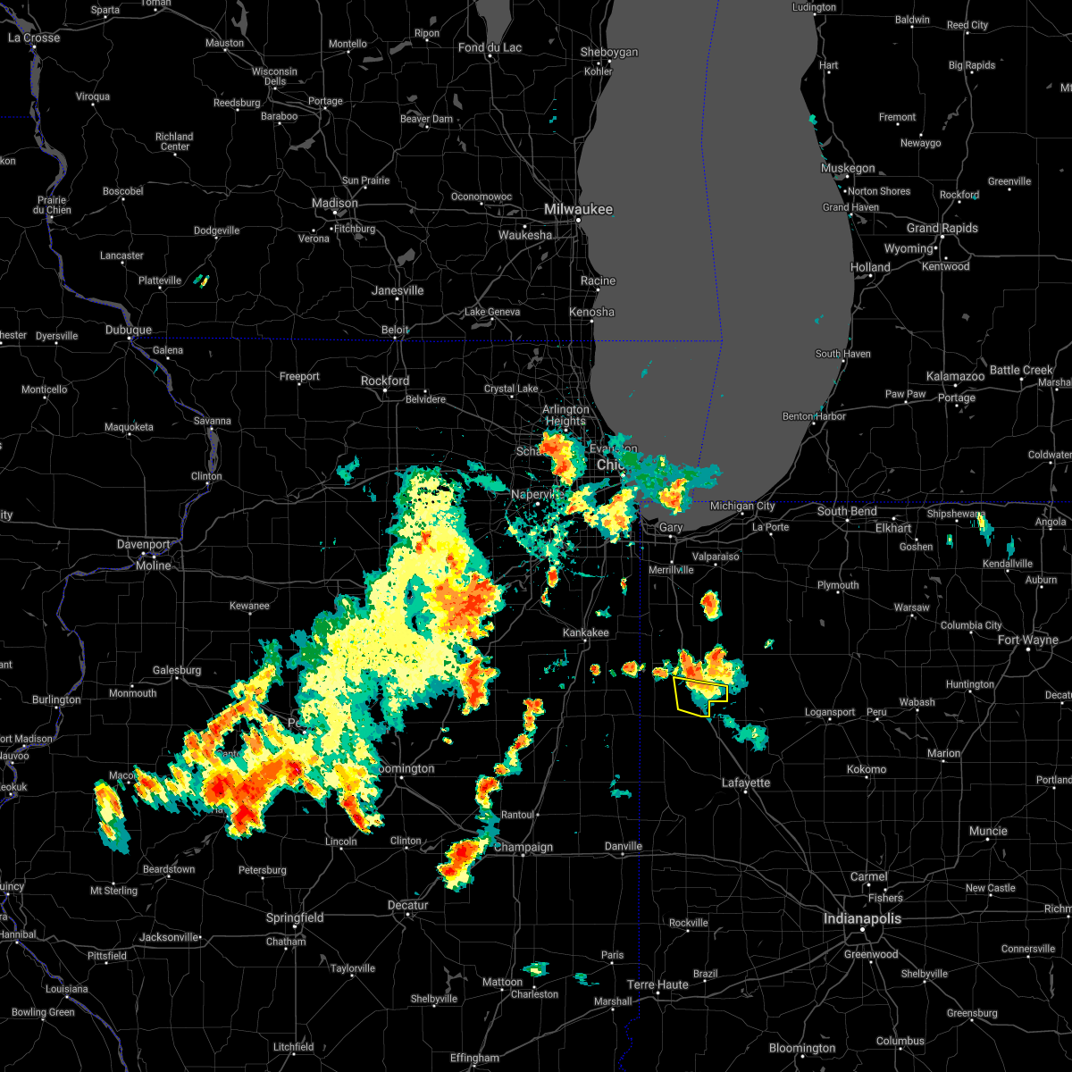
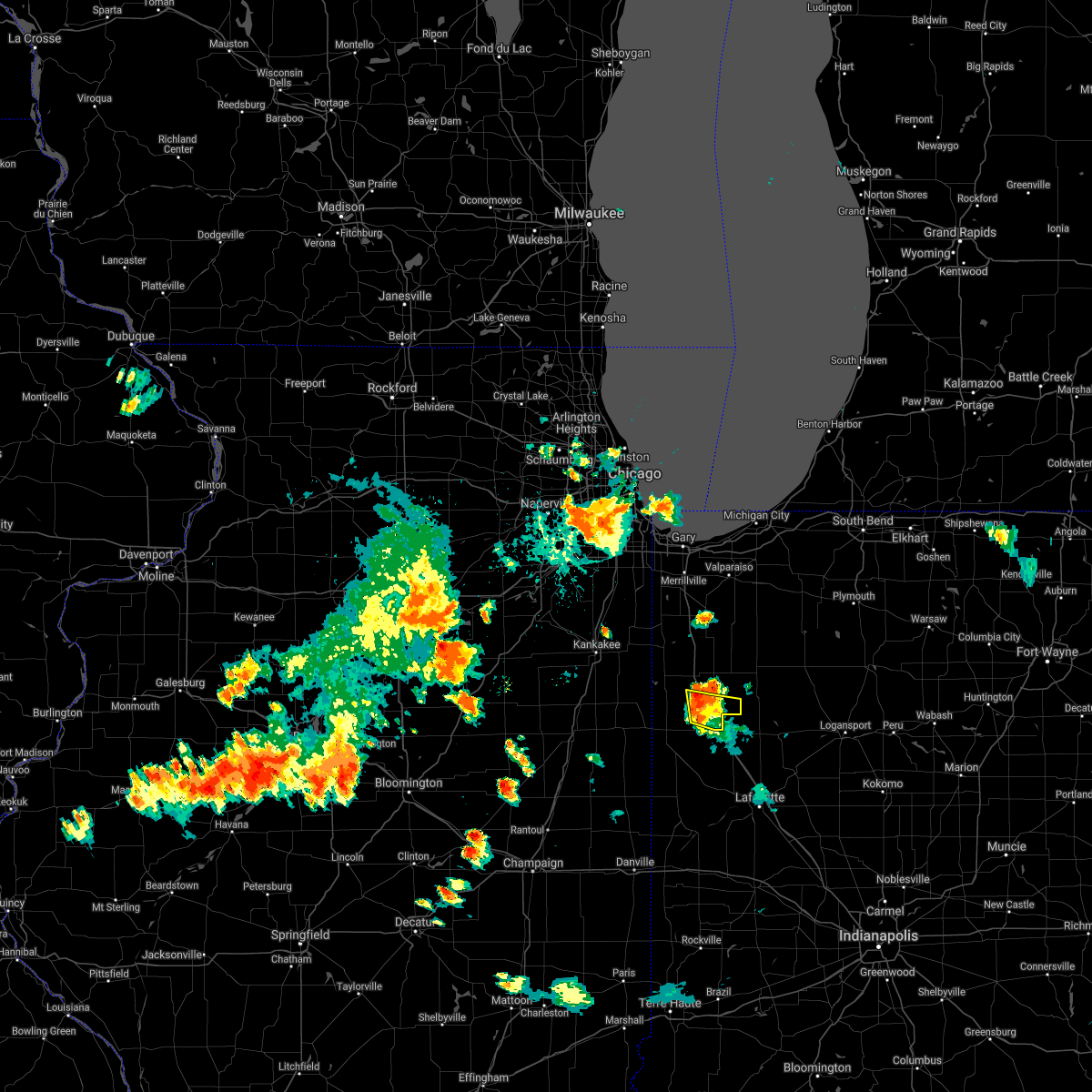
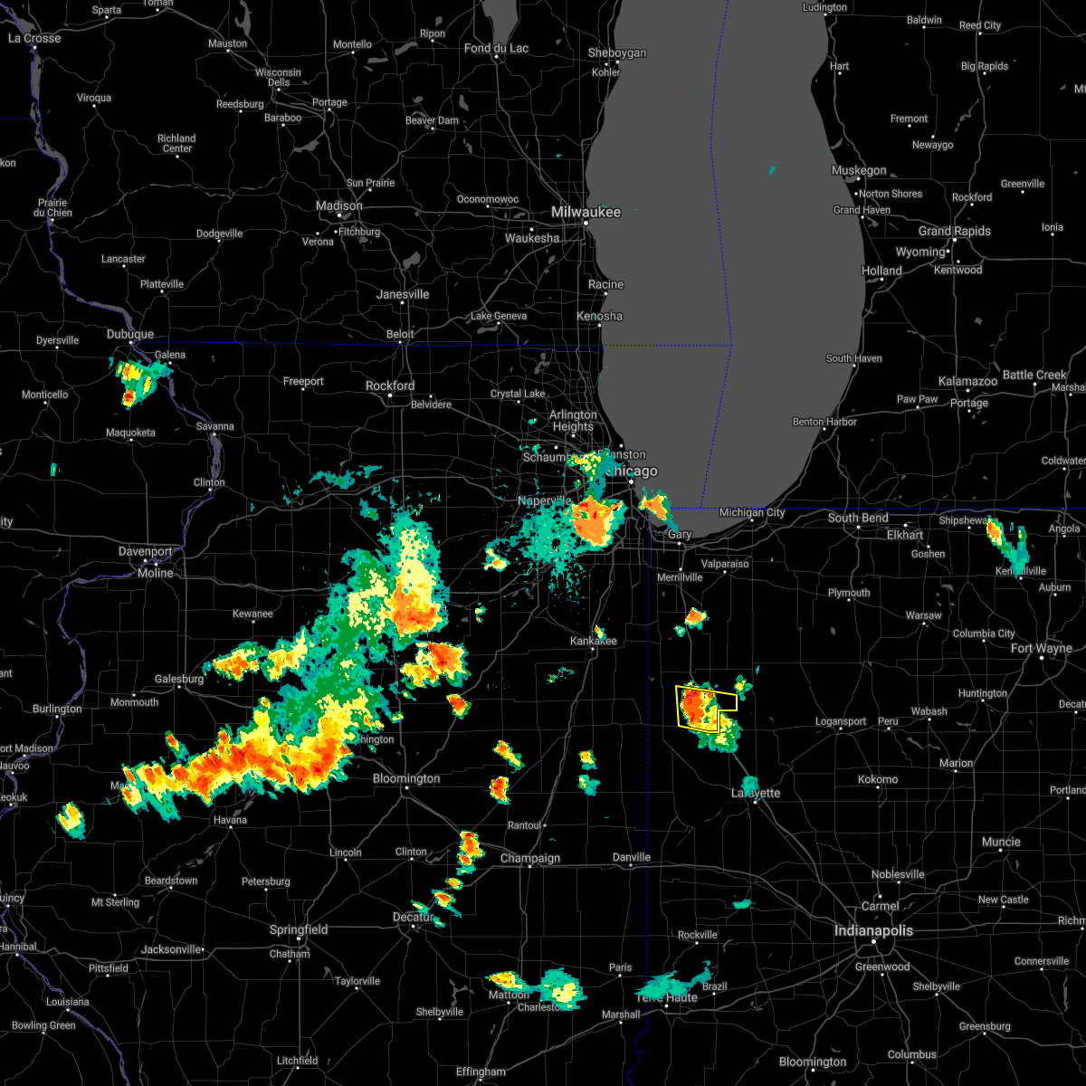
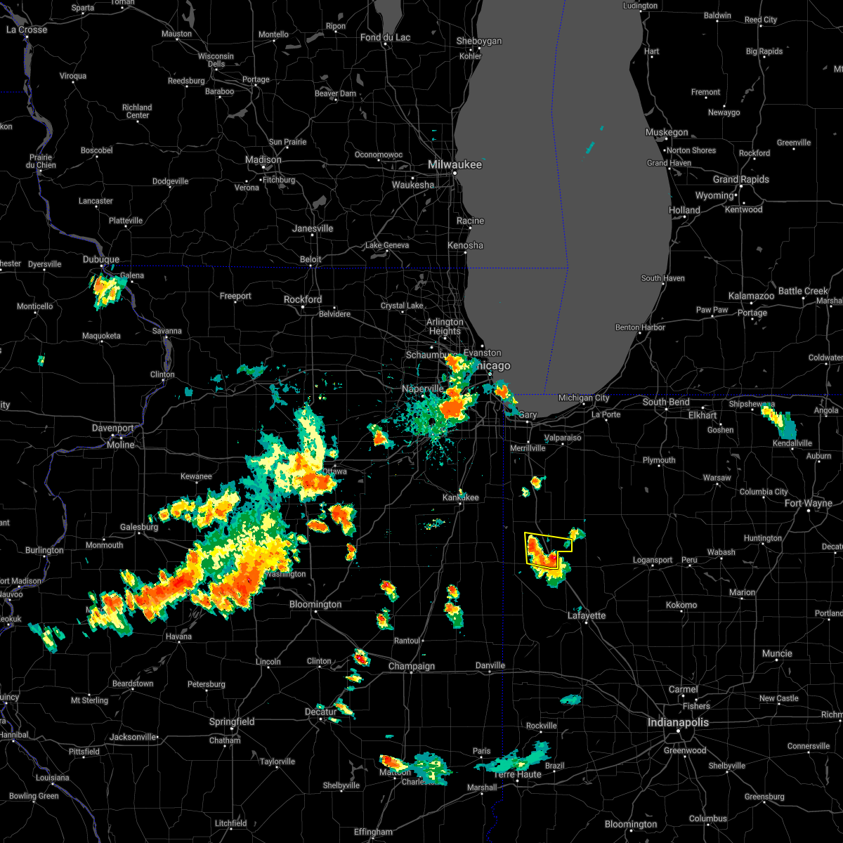
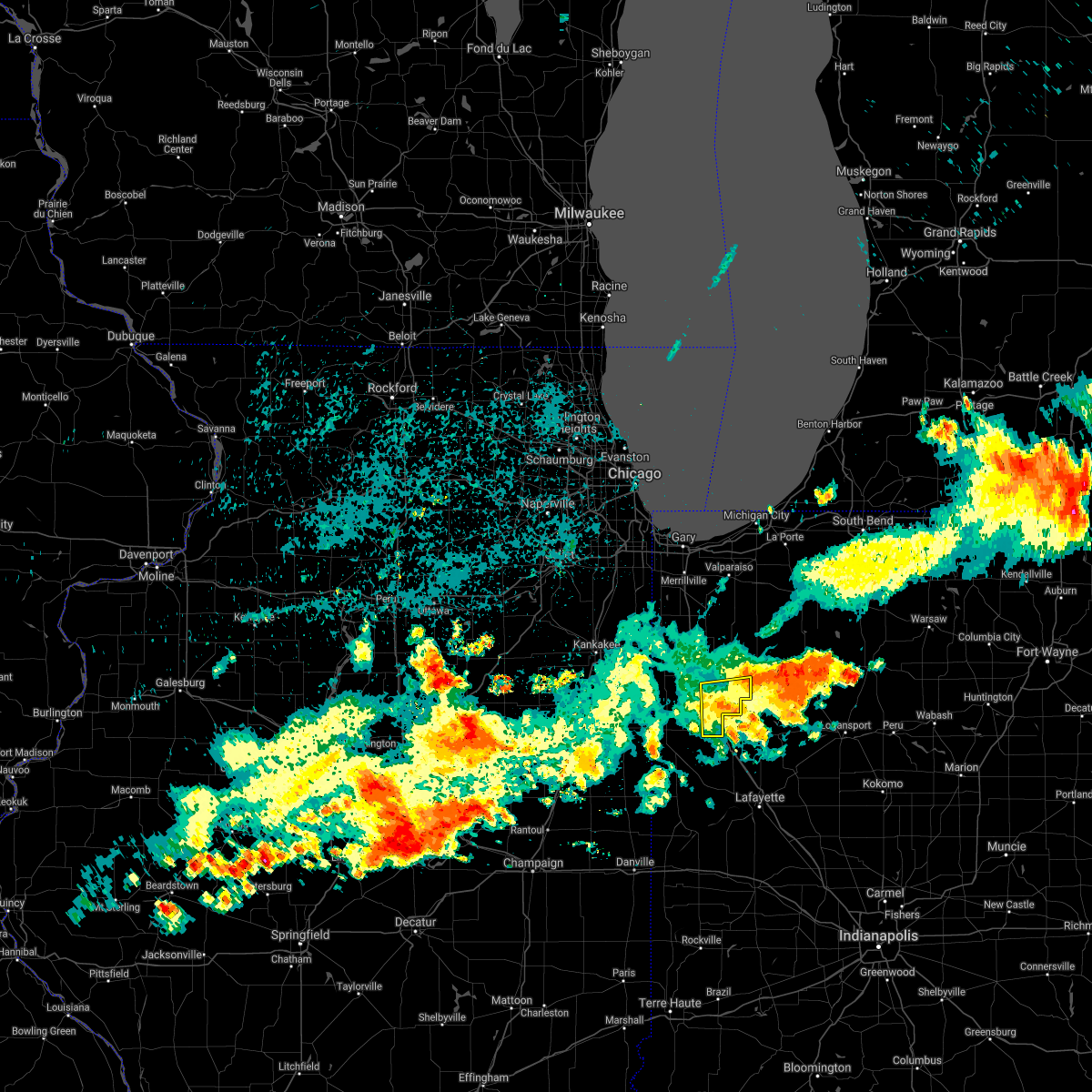
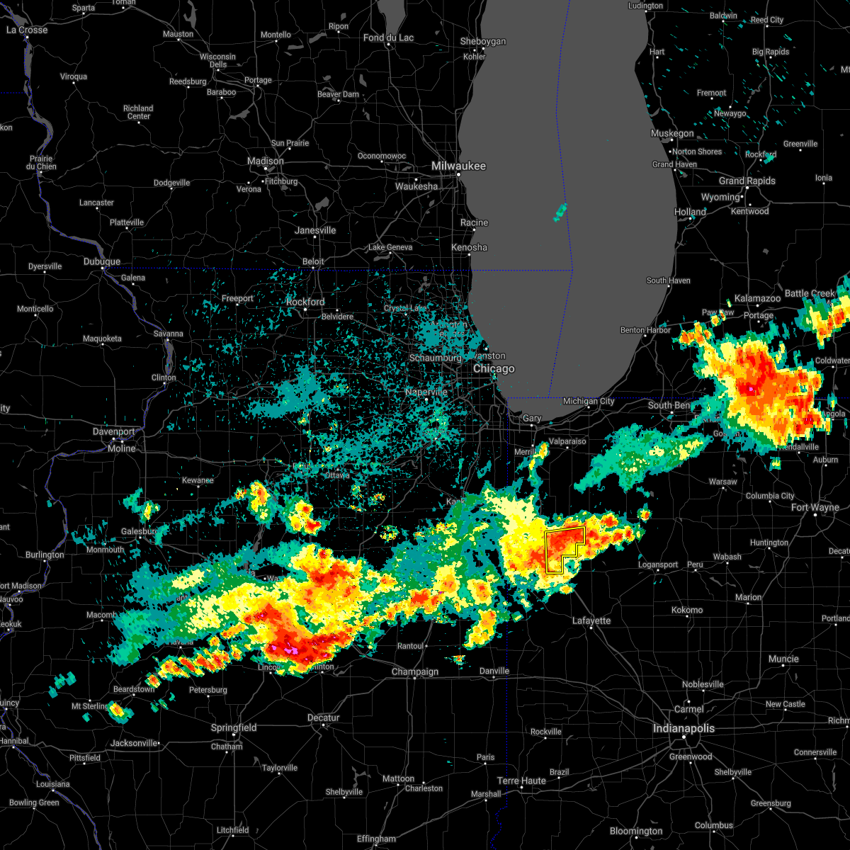
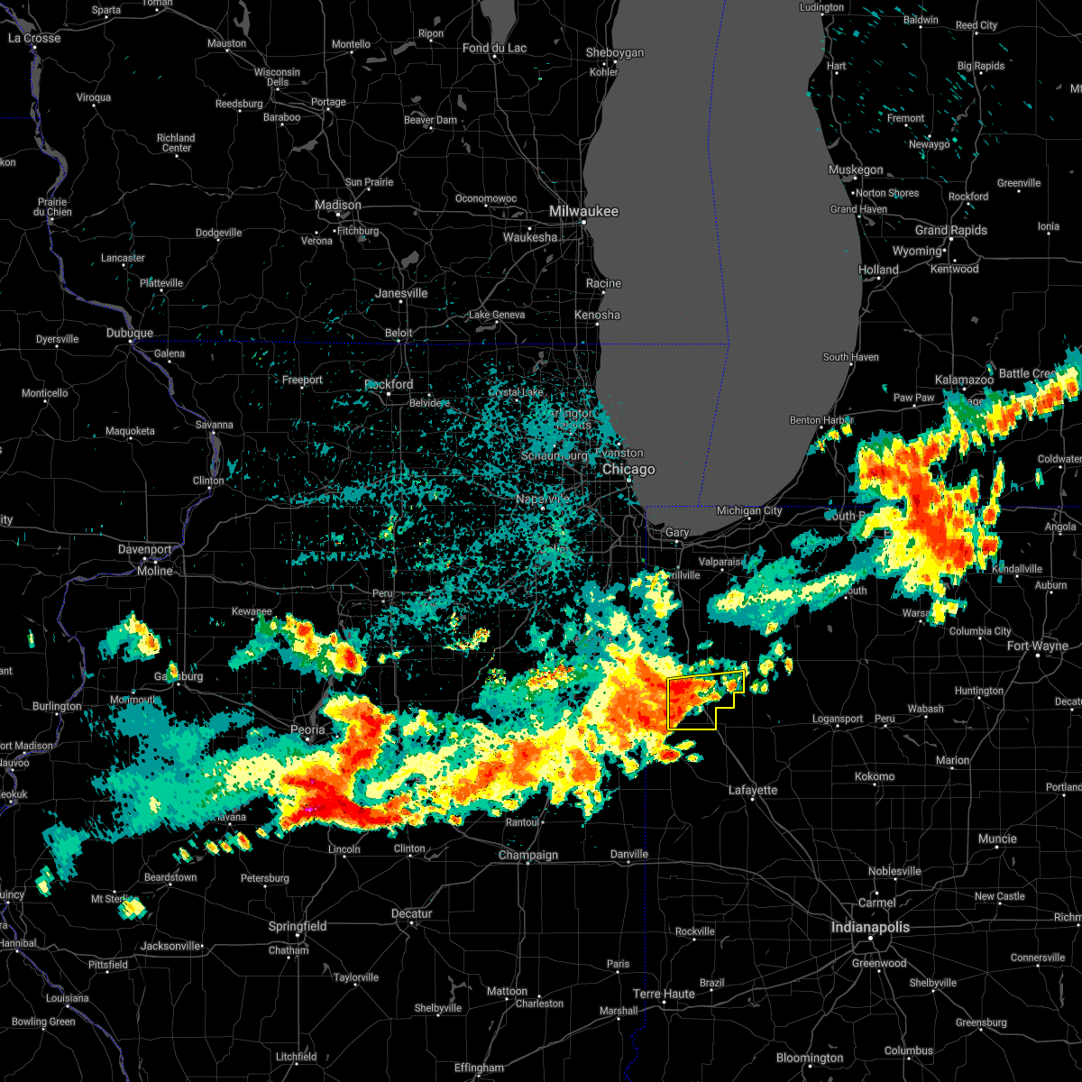
Hail Map for Remington, IN
The Remington, IN area has had 3 reports of on-the-ground hail by trained spotters, and has been under severe weather warnings 28 times during the past 12 months. Doppler radar has detected hail at or near Remington, IN on 59 occasions, including 1 occasion during the past year.
| Name: | Remington, IN |
| Where Located: | 81 miles SSE of Chicago, IL |
| Map: | Google Map for Remington, IN |
| Population: | 1185 |
| Housing Units: | 569 |
| More Info: | Search Google for Remington, IN |
0
The Top Recent Hail Date for Remington, IN is Friday, August 30, 2024 (58th out of 59)

Hail and Wind Damage Spotted near Remington, IN
| Date / Time | Report Details |
|---|---|
| 6/18/2025 2:06 PM CDT |
 At 206 pm cdt, severe thunderstorms were located along a line extending from near roselawn to near rensselaer to near otterbein, moving northeast at 50 mph (radar indicated). Hazards include 70 mph wind gusts. Expect considerable tree damage. damage is likely to mobile homes, roofs, and outbuildings. these severe storms will be near, rensselaer around 210 pm cdt. otterbein around 310 pm edt. Hanging grove around 215 pm cdt. At 206 pm cdt, severe thunderstorms were located along a line extending from near roselawn to near rensselaer to near otterbein, moving northeast at 50 mph (radar indicated). Hazards include 70 mph wind gusts. Expect considerable tree damage. damage is likely to mobile homes, roofs, and outbuildings. these severe storms will be near, rensselaer around 210 pm cdt. otterbein around 310 pm edt. Hanging grove around 215 pm cdt.
|
| 6/18/2025 1:48 PM CDT |
 At 147 pm cdt/247 pm edt/, severe thunderstorms were located along a line extending from hopkins park to near kentland to near williamsport, moving northeast at 60 mph (radar indicated). Hazards include 70 mph wind gusts. Expect considerable tree damage. damage is likely to mobile homes, roofs, and outbuildings. these severe storms will be near, remington, brook, and goodland around 155 pm cdt. otterbein and oxford around 255 pm edt. rensselaer around 200 pm cdt. hanging grove around 210 pm cdt. Other locations impacted by these severe thunderstorms include foresman, fair oaks, dunnington, templeton, parr, wadena, swanington, ambia, raub, and baileys corner. At 147 pm cdt/247 pm edt/, severe thunderstorms were located along a line extending from hopkins park to near kentland to near williamsport, moving northeast at 60 mph (radar indicated). Hazards include 70 mph wind gusts. Expect considerable tree damage. damage is likely to mobile homes, roofs, and outbuildings. these severe storms will be near, remington, brook, and goodland around 155 pm cdt. otterbein and oxford around 255 pm edt. rensselaer around 200 pm cdt. hanging grove around 210 pm cdt. Other locations impacted by these severe thunderstorms include foresman, fair oaks, dunnington, templeton, parr, wadena, swanington, ambia, raub, and baileys corner.
|
| 6/18/2025 1:36 PM CDT |
 Svrlot the national weather service in chicago has issued a * severe thunderstorm warning for, benton county in northwestern indiana, newton county in northwestern indiana, jasper county in northwestern indiana, * until 230 pm cdt/330 pm edt/. * at 136 pm cdt/236 pm edt/, severe thunderstorms were located along a line extending from near st. anne to near sheldon to 8 miles west of williamsport, moving northeast at 60 mph (radar indicated). Hazards include 70 mph wind gusts. Expect considerable tree damage. damage is likely to mobile homes, roofs, and outbuildings. severe thunderstorms will be near, kentland around 140 pm cdt. boswell and earl park around 240 pm edt. brook, morocco, and goodland around 145 pm cdt. oxford and fowler around 245 pm edt. remington around 155 pm cdt. otterbein around 255 pm edt. rensselaer around 200 pm cdt. hanging grove around 205 pm cdt. Other locations impacted by these severe thunderstorms include foresman, fair oaks, dunnington, templeton, parr, wadena, swanington, ambia, raub, and baileys corner. Svrlot the national weather service in chicago has issued a * severe thunderstorm warning for, benton county in northwestern indiana, newton county in northwestern indiana, jasper county in northwestern indiana, * until 230 pm cdt/330 pm edt/. * at 136 pm cdt/236 pm edt/, severe thunderstorms were located along a line extending from near st. anne to near sheldon to 8 miles west of williamsport, moving northeast at 60 mph (radar indicated). Hazards include 70 mph wind gusts. Expect considerable tree damage. damage is likely to mobile homes, roofs, and outbuildings. severe thunderstorms will be near, kentland around 140 pm cdt. boswell and earl park around 240 pm edt. brook, morocco, and goodland around 145 pm cdt. oxford and fowler around 245 pm edt. remington around 155 pm cdt. otterbein around 255 pm edt. rensselaer around 200 pm cdt. hanging grove around 205 pm cdt. Other locations impacted by these severe thunderstorms include foresman, fair oaks, dunnington, templeton, parr, wadena, swanington, ambia, raub, and baileys corner.
|
| 4/2/2025 7:38 PM EDT | The storms which prompted the warning have moved out of the area. therefore, the warning will be allowed to expire. however, gusty winds are still possible with these thunderstorms. a tornado watch remains in effect until 1000 pm cdt/1100 pm edt/ for northwestern indiana. |
| 4/2/2025 6:26 PM CDT | The storms which prompted the warning have moved out of the area. therefore, the warning will be allowed to expire. however, gusty winds and heavy rain are still possible with these thunderstorms. a tornado watch remains in effect until 1000 pm cdt for northwestern indiana. |
| 4/2/2025 7:26 PM EDT | At 626 pm cdt/726 pm edt/, severe thunderstorms were located along a line extending from near remington to near oxford, moving east at 40 mph (radar indicated). Hazards include 60 mph wind gusts. Expect damage to roofs, siding, and trees. these severe storms will be near, remington around 630 pm cdt. oxford around 730 pm edt. other locations impacted by these severe thunderstorms include templeton, swanington, and wadena. Including the following interstate, indiana i-65 between mile markers 200 and 201. |
| 4/2/2025 7:26 PM EDT | the severe thunderstorm warning has been cancelled and is no longer in effect |
| 4/2/2025 6:23 PM CDT | the severe thunderstorm warning has been cancelled and is no longer in effect |
| 4/2/2025 6:23 PM CDT | At 623 pm cdt, severe thunderstorms were located along a line extending from near wheatfield to near remington, moving east at 50 mph (radar indicated). Hazards include 60 mph wind gusts. Expect damage to roofs, siding, and trees. Locations impacted include, demotte, parr, wheatfield, baileys corner, hanging grove, stoutsburg, rensselaer, collegeville, and remington. |
| 4/2/2025 7:10 PM EDT |
 Svrlot the national weather service in chicago has issued a * severe thunderstorm warning for, benton county in northwestern indiana, southeastern newton county in northwestern indiana, southwestern jasper county in northwestern indiana, * until 645 pm cdt/745 pm edt/. * at 610 pm cdt/710 pm edt/, severe thunderstorms were located along a line extending from near morocco to near boswell, moving northeast at 55 mph (radar indicated). Hazards include 60 mph wind gusts and quarter size hail. Hail damage to vehicles is expected. Expect wind damage to roofs, siding, and trees. Svrlot the national weather service in chicago has issued a * severe thunderstorm warning for, benton county in northwestern indiana, southeastern newton county in northwestern indiana, southwestern jasper county in northwestern indiana, * until 645 pm cdt/745 pm edt/. * at 610 pm cdt/710 pm edt/, severe thunderstorms were located along a line extending from near morocco to near boswell, moving northeast at 55 mph (radar indicated). Hazards include 60 mph wind gusts and quarter size hail. Hail damage to vehicles is expected. Expect wind damage to roofs, siding, and trees.
|
| 4/2/2025 6:09 PM CDT |
 At 609 pm cdt, severe thunderstorms were located along a line extending from near wheatfield to near remington, moving northeast at 60 mph (radar indicated). Hazards include 70 mph wind gusts and quarter size hail. Hail damage to vehicles is expected. expect considerable tree damage. wind damage is also likely to mobile homes, roofs, and outbuildings. Locations impacted include, wheatfield, roselawn, baileys corner, mount ayr, hanging grove, brook, stoutsburg, goodland, foresman, demotte, fair oaks, parr, rensselaer, collegeville, kentland, and remington. At 609 pm cdt, severe thunderstorms were located along a line extending from near wheatfield to near remington, moving northeast at 60 mph (radar indicated). Hazards include 70 mph wind gusts and quarter size hail. Hail damage to vehicles is expected. expect considerable tree damage. wind damage is also likely to mobile homes, roofs, and outbuildings. Locations impacted include, wheatfield, roselawn, baileys corner, mount ayr, hanging grove, brook, stoutsburg, goodland, foresman, demotte, fair oaks, parr, rensselaer, collegeville, kentland, and remington.
|
| 4/2/2025 5:57 PM CDT | Svrlot the national weather service in chicago has issued a * severe thunderstorm warning for, eastern newton county in northwestern indiana, jasper county in northwestern indiana, * until 630 pm cdt. * at 556 pm cdt, severe thunderstorms were located along a line extending from near roselawn to near goodland, moving northeast at 60 mph (radar indicated). Hazards include 60 mph wind gusts and quarter size hail. Hail damage to vehicles is expected. Expect wind damage to roofs, siding, and trees. |
| 4/2/2025 5:51 PM CDT | At 550 pm cdt/650 pm edt/, a cluster of severe thunderstorms were located from near wheatfield to near morocco to kentland to near rensselaer, moving northeast at 60 mph (radar indicated). Hazards include 60 mph wind gusts. Expect damage to roofs, siding, and trees. Locations impacted include, dunnington, wheatfield, roselawn, earl park, hanging grove, brook, stoutsburg, foresman, demotte, fair oaks, morocco, templeton, oxford, remington, otterbein, boswell, wadena, swanington, ambia, baileys corner, mount ayr, goodland, fowler, parr, and raub. |
| 4/2/2025 5:34 PM CDT |
 At 534 pm cdt/634 pm edt/, severe thunderstorms were located along a line extending from near roselawn to near fowler, moving northeast at 55 mph (radar indicated). Hazards include 60 mph wind gusts. Expect damage to roofs, siding, and trees. Locations impacted include, dunnington, wheatfield, thayer, roselawn, earl park, hanging grove, brook, stoutsburg, foresman, demotte, fair oaks, morocco, templeton, oxford, remington, otterbein, boswell, wadena, sumava resorts, swanington, ambia, baileys corner, mount ayr, goodland, and fowler. At 534 pm cdt/634 pm edt/, severe thunderstorms were located along a line extending from near roselawn to near fowler, moving northeast at 55 mph (radar indicated). Hazards include 60 mph wind gusts. Expect damage to roofs, siding, and trees. Locations impacted include, dunnington, wheatfield, thayer, roselawn, earl park, hanging grove, brook, stoutsburg, foresman, demotte, fair oaks, morocco, templeton, oxford, remington, otterbein, boswell, wadena, sumava resorts, swanington, ambia, baileys corner, mount ayr, goodland, and fowler.
|
| 4/2/2025 5:17 PM CDT |
 Svrlot the national weather service in chicago has issued a * severe thunderstorm warning for, benton county in northwestern indiana, newton county in northwestern indiana, jasper county in northwestern indiana, * until 600 pm cdt/700 pm edt/. * at 516 pm cdt/616 pm edt/, severe thunderstorms were located along a line extending from near morocco to near boswell, moving northeast at 50 mph (radar indicated). Hazards include 60 mph wind gusts and half dollar size hail. Hail damage to vehicles is expected. Expect wind damage to roofs, siding, and trees. Svrlot the national weather service in chicago has issued a * severe thunderstorm warning for, benton county in northwestern indiana, newton county in northwestern indiana, jasper county in northwestern indiana, * until 600 pm cdt/700 pm edt/. * at 516 pm cdt/616 pm edt/, severe thunderstorms were located along a line extending from near morocco to near boswell, moving northeast at 50 mph (radar indicated). Hazards include 60 mph wind gusts and half dollar size hail. Hail damage to vehicles is expected. Expect wind damage to roofs, siding, and trees.
|
| 3/30/2025 2:39 PM CDT | Private weather station reported 62 mph gust in remington. multiple other private weather stations reported gusts 55-60 mph in vicinit in jasper county IN, 0.6 miles NE of Remington, IN |
| 3/30/2025 2:38 PM CDT | Private weather station reported 63 mph gust north of remingto in jasper county IN, 1.8 miles SSE of Remington, IN |
| 3/30/2025 2:36 PM CDT |
 the severe thunderstorm warning has been cancelled and is no longer in effect the severe thunderstorm warning has been cancelled and is no longer in effect
|
| 3/30/2025 2:36 PM CDT |
 At 236 pm cdt/336 pm edt/, severe thunderstorms were located along a line extending from near brook to near otterbein to 9 miles east of williamsport, moving northeast at 85 mph. these storms have a history of produce widespread severe wind gusts (emergency management). Hazards include 70 mph wind gusts. Expect considerable tree damage. damage is likely to mobile homes, roofs, and outbuildings. Locations impacted include, wadena, swanington, baileys corner, earl park, hanging grove, goodland, fowler, foresman, templeton, raub, kentland, oxford, remington, rensselaer, collegeville, brook, and otterbein. At 236 pm cdt/336 pm edt/, severe thunderstorms were located along a line extending from near brook to near otterbein to 9 miles east of williamsport, moving northeast at 85 mph. these storms have a history of produce widespread severe wind gusts (emergency management). Hazards include 70 mph wind gusts. Expect considerable tree damage. damage is likely to mobile homes, roofs, and outbuildings. Locations impacted include, wadena, swanington, baileys corner, earl park, hanging grove, goodland, fowler, foresman, templeton, raub, kentland, oxford, remington, rensselaer, collegeville, brook, and otterbein.
|
| 3/30/2025 2:20 PM CDT |
 At 219 pm cdt/319 pm edt/, severe thunderstorms were located along a line extending from near stockland to 9 miles west of williamsport to near covington, moving northeast at 75 mph. a 70 mph wind gust was reported by the iroquois ema near the iroquois/vermillion county line with these storms (emergency management). Hazards include 70 mph wind gusts. Expect considerable tree damage. damage is likely to mobile homes, roofs, and outbuildings. Locations impacted include, dunnington, boswell, wadena, swanington, ambia, baileys corner, earl park, hanging grove, goodland, fowler, foresman, stockland, templeton, raub, kentland, oxford, remington, wellington, rensselaer, collegeville, brook, and otterbein. At 219 pm cdt/319 pm edt/, severe thunderstorms were located along a line extending from near stockland to 9 miles west of williamsport to near covington, moving northeast at 75 mph. a 70 mph wind gust was reported by the iroquois ema near the iroquois/vermillion county line with these storms (emergency management). Hazards include 70 mph wind gusts. Expect considerable tree damage. damage is likely to mobile homes, roofs, and outbuildings. Locations impacted include, dunnington, boswell, wadena, swanington, ambia, baileys corner, earl park, hanging grove, goodland, fowler, foresman, stockland, templeton, raub, kentland, oxford, remington, wellington, rensselaer, collegeville, brook, and otterbein.
|
| 3/30/2025 2:19 PM CDT |
 At 218 pm cdt/318 pm edt/, severe thunderstorms were located along a line extending from near stockland to 8 miles west of williamsport to near covington, moving northeast at 75 mph. a 70 mph wind gust was reported by the iroquois ema near the iroquois/vermillion county line with these storms (emergency management). Hazards include 70 mph wind gusts. Expect considerable tree damage. damage is likely to mobile homes, roofs, and outbuildings. Locations impacted include, dunnington, boswell, wadena, swanington, ambia, baileys corner, earl park, hanging grove, goodland, fowler, foresman, stockland, templeton, raub, kentland, oxford, remington, wellington, rensselaer, collegeville, brook, and otterbein. At 218 pm cdt/318 pm edt/, severe thunderstorms were located along a line extending from near stockland to 8 miles west of williamsport to near covington, moving northeast at 75 mph. a 70 mph wind gust was reported by the iroquois ema near the iroquois/vermillion county line with these storms (emergency management). Hazards include 70 mph wind gusts. Expect considerable tree damage. damage is likely to mobile homes, roofs, and outbuildings. Locations impacted include, dunnington, boswell, wadena, swanington, ambia, baileys corner, earl park, hanging grove, goodland, fowler, foresman, stockland, templeton, raub, kentland, oxford, remington, wellington, rensselaer, collegeville, brook, and otterbein.
|
| 3/30/2025 2:02 PM CDT |
 Svrlot the national weather service in chicago has issued a * severe thunderstorm warning for, southeastern iroquois county in east central illinois, benton county in northwestern indiana, southern newton county in northwestern indiana, southern jasper county in northwestern indiana, * until 315 pm cdt/415 pm edt/. * at 202 pm cdt/302 pm edt/, severe thunderstorms were located along a line extending from near hoopeston to near oakwood to near georgetown, moving northeast at 75 mph (radar indicated). Hazards include 70 mph wind gusts. Expect considerable tree damage. Damage is likely to mobile homes, roofs, and outbuildings. Svrlot the national weather service in chicago has issued a * severe thunderstorm warning for, southeastern iroquois county in east central illinois, benton county in northwestern indiana, southern newton county in northwestern indiana, southern jasper county in northwestern indiana, * until 315 pm cdt/415 pm edt/. * at 202 pm cdt/302 pm edt/, severe thunderstorms were located along a line extending from near hoopeston to near oakwood to near georgetown, moving northeast at 75 mph (radar indicated). Hazards include 70 mph wind gusts. Expect considerable tree damage. Damage is likely to mobile homes, roofs, and outbuildings.
|
| 8/30/2024 5:55 PM CDT |
 the severe thunderstorm warning has been cancelled and is no longer in effect the severe thunderstorm warning has been cancelled and is no longer in effect
|
| 8/30/2024 5:33 PM CDT |
 the severe thunderstorm warning has been cancelled and is no longer in effect the severe thunderstorm warning has been cancelled and is no longer in effect
|
| 8/30/2024 5:33 PM CDT |
 At 532 pm cdt/632 pm edt/, a cluster of severe thunderstorms were located along a line extending from near remington to near goodland to near fowler, moving east at 20 mph (radar indicated). Hazards include 60 mph wind gusts and quarter size hail. Hail damage to vehicles is expected. expect wind damage to roofs, siding, and trees. Locations impacted include, rensselaer, fowler, remington, earl park, hanging grove, collegeville, and wadena. At 532 pm cdt/632 pm edt/, a cluster of severe thunderstorms were located along a line extending from near remington to near goodland to near fowler, moving east at 20 mph (radar indicated). Hazards include 60 mph wind gusts and quarter size hail. Hail damage to vehicles is expected. expect wind damage to roofs, siding, and trees. Locations impacted include, rensselaer, fowler, remington, earl park, hanging grove, collegeville, and wadena.
|
| 8/30/2024 5:15 PM CDT |
 Svrlot the national weather service in chicago has issued a * severe thunderstorm warning for, southeastern newton county in northwestern indiana, benton county in northwestern indiana, southern jasper county in northwestern indiana, * until 615 pm cdt/715 pm edt/. * at 515 pm cdt/615 pm edt/, severe thunderstorms were located along a line extending from near brook to near earl park to near stockland, moving east at 15 mph (radar indicated). Hazards include 60 mph wind gusts and quarter size hail. Hail damage to vehicles is expected. Expect wind damage to roofs, siding, and trees. Svrlot the national weather service in chicago has issued a * severe thunderstorm warning for, southeastern newton county in northwestern indiana, benton county in northwestern indiana, southern jasper county in northwestern indiana, * until 615 pm cdt/715 pm edt/. * at 515 pm cdt/615 pm edt/, severe thunderstorms were located along a line extending from near brook to near earl park to near stockland, moving east at 15 mph (radar indicated). Hazards include 60 mph wind gusts and quarter size hail. Hail damage to vehicles is expected. Expect wind damage to roofs, siding, and trees.
|
| 7/15/2024 10:45 PM CDT |
 The storms which prompted the warning have moved out of the area. therefore, the warning has been allowed to expire. a tornado watch remains in effect until 100 am cdt/200 am edt/ for northwestern indiana. The storms which prompted the warning have moved out of the area. therefore, the warning has been allowed to expire. a tornado watch remains in effect until 100 am cdt/200 am edt/ for northwestern indiana.
|
| 7/15/2024 10:37 PM CDT |
 At 1036 pm cdt/1136 pm edt/, severe thunderstorms were located along a line extending from la porte to near north judson to near hanging grove to near oxford, moving east at 50 mph (radar indicated). Hazards include 70 mph wind gusts. Expect considerable tree damage. damage is likely to mobile homes, roofs, and outbuildings. Locations impacted include, portage, merrillville, valparaiso, chesterton, rensselaer, demotte, hebron, fowler, otterbein, remington, wheatfield, lakes of the four seasons, south haven, porter, winfield, roselawn, kouts, oxford, burns harbor, goodland, brook, boswell, town of pines, beverly shores, and shelby. At 1036 pm cdt/1136 pm edt/, severe thunderstorms were located along a line extending from la porte to near north judson to near hanging grove to near oxford, moving east at 50 mph (radar indicated). Hazards include 70 mph wind gusts. Expect considerable tree damage. damage is likely to mobile homes, roofs, and outbuildings. Locations impacted include, portage, merrillville, valparaiso, chesterton, rensselaer, demotte, hebron, fowler, otterbein, remington, wheatfield, lakes of the four seasons, south haven, porter, winfield, roselawn, kouts, oxford, burns harbor, goodland, brook, boswell, town of pines, beverly shores, and shelby.
|
| 7/15/2024 10:15 PM CDT | At 1015 pm cdt/1115 pm edt/, severe thunderstorms were located along a line extending from burns harbor to near demotte to near brook to stockland, moving southeast at 55 mph (radar indicated). Hazards include 70 mph wind gusts. Expect considerable tree damage. damage is likely to mobile homes, roofs, and outbuildings. Locations impacted include, hammond, gary, portage, merrillville, valparaiso, east chicago, schererville, hobart, crown point, highland, munster, chesterton, cedar lake, lowell, rensselaer, demotte, hebron, fowler, kentland, otterbein, remington, morocco, wheatfield, lake village, and griffith. |
| 7/15/2024 9:35 PM CDT |
 Svrlot the national weather service in chicago has issued a * severe thunderstorm warning for, newton county in northwestern indiana, benton county in northwestern indiana, porter county in northwestern indiana, lake county in northwestern indiana, jasper county in northwestern indiana, * until 1045 pm cdt/1145 pm edt/. * at 935 pm cdt/1035 pm edt/, severe thunderstorms were located along a line extending from la grange park to near frankfort to near herscher to near chatsworth, moving east at 60 mph (radar indicated). Hazards include 70 mph wind gusts. Expect considerable tree damage. Damage is likely to mobile homes, roofs, and outbuildings. Svrlot the national weather service in chicago has issued a * severe thunderstorm warning for, newton county in northwestern indiana, benton county in northwestern indiana, porter county in northwestern indiana, lake county in northwestern indiana, jasper county in northwestern indiana, * until 1045 pm cdt/1145 pm edt/. * at 935 pm cdt/1035 pm edt/, severe thunderstorms were located along a line extending from la grange park to near frankfort to near herscher to near chatsworth, moving east at 60 mph (radar indicated). Hazards include 70 mph wind gusts. Expect considerable tree damage. Damage is likely to mobile homes, roofs, and outbuildings.
|
| 6/5/2024 9:46 AM CDT |
 the severe thunderstorm warning has been cancelled and is no longer in effect the severe thunderstorm warning has been cancelled and is no longer in effect
|
| 6/5/2024 9:32 AM CDT |
 At 932 am cdt/1032 am edt/, a severe thunderstorm was located near wolcott, or near remington, moving northeast at 40 mph (radar indicated). Hazards include 60 mph wind gusts and nickel size hail. Expect damage to roofs, siding, and trees. Locations impacted include, rensselaer, remington, goodland, hanging grove, collegeville, wadena, and baileys corner. At 932 am cdt/1032 am edt/, a severe thunderstorm was located near wolcott, or near remington, moving northeast at 40 mph (radar indicated). Hazards include 60 mph wind gusts and nickel size hail. Expect damage to roofs, siding, and trees. Locations impacted include, rensselaer, remington, goodland, hanging grove, collegeville, wadena, and baileys corner.
|
| 6/5/2024 10:11 AM EDT |
 Svrlot the national weather service in chicago has issued a * severe thunderstorm warning for, southeastern newton county in northwestern indiana, benton county in northwestern indiana, southern jasper county in northwestern indiana, * until 1000 am cdt/1100 am edt/. * at 911 am cdt/1011 am edt/, a severe thunderstorm was located over fowler, moving northeast at 40 mph (radar indicated). Hazards include 60 mph wind gusts and nickel size hail. expect damage to roofs, siding, and trees Svrlot the national weather service in chicago has issued a * severe thunderstorm warning for, southeastern newton county in northwestern indiana, benton county in northwestern indiana, southern jasper county in northwestern indiana, * until 1000 am cdt/1100 am edt/. * at 911 am cdt/1011 am edt/, a severe thunderstorm was located over fowler, moving northeast at 40 mph (radar indicated). Hazards include 60 mph wind gusts and nickel size hail. expect damage to roofs, siding, and trees
|
| 3/5/2024 2:42 AM CST |
 At 242 am cst/342 am est/, severe thunderstorms were located along a line extending from brook to near fowler, moving northeast at 35 mph (radar indicated). Hazards include half dollar size hail. Damage to vehicles is expected. Locations impacted include, rensselaer, fowler, kentland, otterbein, remington, oxford, goodland, boswell, earl park, hanging grove, collegeville, ambia, dunnington, wadena, swanington, templeton, and foresman. At 242 am cst/342 am est/, severe thunderstorms were located along a line extending from brook to near fowler, moving northeast at 35 mph (radar indicated). Hazards include half dollar size hail. Damage to vehicles is expected. Locations impacted include, rensselaer, fowler, kentland, otterbein, remington, oxford, goodland, boswell, earl park, hanging grove, collegeville, ambia, dunnington, wadena, swanington, templeton, and foresman.
|
| 3/5/2024 2:27 AM CST |
 Svrlot the national weather service in chicago has issued a * severe thunderstorm warning for, southern newton county in northwestern indiana, benton county in northwestern indiana, southern jasper county in northwestern indiana, * until 315 am cst/415 am est/. * at 226 am cst/326 am est/, severe thunderstorms were located along a line extending from near earl park to 6 miles west of boswell, moving northeast at 35 mph (radar indicated). Hazards include half dollar size hail. damage to vehicles is expected Svrlot the national weather service in chicago has issued a * severe thunderstorm warning for, southern newton county in northwestern indiana, benton county in northwestern indiana, southern jasper county in northwestern indiana, * until 315 am cst/415 am est/. * at 226 am cst/326 am est/, severe thunderstorms were located along a line extending from near earl park to 6 miles west of boswell, moving northeast at 35 mph (radar indicated). Hazards include half dollar size hail. damage to vehicles is expected
|
| 5/7/2023 9:58 PM CDT |
 At 957 pm cdt, a severe thunderstorm was located near brook, or near morocco, moving southeast at 20 mph (radar indicated). Hazards include 60 mph wind gusts and quarter size hail. Hail damage to vehicles is expected. expect wind damage to roofs, siding, and trees. locations impacted include, rensselaer, remington, morocco, lake village, goodland, brook, hanging grove, collegeville, mount ayr, baileys corner, foresman, fair oaks and parr. including the following interstate, indiana i-65 between mile markers 200 and 227. hail threat, radar indicated max hail size, 1. 00 in wind threat, radar indicated max wind gust, 60 mph. At 957 pm cdt, a severe thunderstorm was located near brook, or near morocco, moving southeast at 20 mph (radar indicated). Hazards include 60 mph wind gusts and quarter size hail. Hail damage to vehicles is expected. expect wind damage to roofs, siding, and trees. locations impacted include, rensselaer, remington, morocco, lake village, goodland, brook, hanging grove, collegeville, mount ayr, baileys corner, foresman, fair oaks and parr. including the following interstate, indiana i-65 between mile markers 200 and 227. hail threat, radar indicated max hail size, 1. 00 in wind threat, radar indicated max wind gust, 60 mph.
|
| 5/7/2023 9:35 PM CDT |
 At 934 pm cdt, a severe thunderstorm was located near morocco, moving east at 30 mph (radar indicated). Hazards include 60 mph wind gusts and quarter size hail. Hail damage to vehicles is expected. Expect wind damage to roofs, siding, and trees. At 934 pm cdt, a severe thunderstorm was located near morocco, moving east at 30 mph (radar indicated). Hazards include 60 mph wind gusts and quarter size hail. Hail damage to vehicles is expected. Expect wind damage to roofs, siding, and trees.
|
| 5/7/2023 2:54 AM CDT |
 The severe thunderstorm warning for northeastern benton and southern jasper counties will expire at 300 am cdt/400 am edt/, the storms which prompted the warning have weakened below severe limits, and have exited the warned area. therefore, the warning will be allowed to expire. The severe thunderstorm warning for northeastern benton and southern jasper counties will expire at 300 am cdt/400 am edt/, the storms which prompted the warning have weakened below severe limits, and have exited the warned area. therefore, the warning will be allowed to expire.
|
| 5/7/2023 2:38 AM CDT |
 At 236 am cdt/336 am edt/, severe thunderstorms were located along a line extending from near rensselaer to remington to 6 miles northeast of fowler, moving east at 50 mph (radar indicated). Hazards include 60 mph wind gusts and quarter size hail. Hail damage to vehicles is expected. expect wind damage to roofs, siding, and trees. locations impacted include, rensselaer, remington, hanging grove and collegeville. including the following interstate, indiana i-65 between mile markers 200 and 213. hail threat, radar indicated max hail size, 1. 00 in wind threat, radar indicated max wind gust, 60 mph. At 236 am cdt/336 am edt/, severe thunderstorms were located along a line extending from near rensselaer to remington to 6 miles northeast of fowler, moving east at 50 mph (radar indicated). Hazards include 60 mph wind gusts and quarter size hail. Hail damage to vehicles is expected. expect wind damage to roofs, siding, and trees. locations impacted include, rensselaer, remington, hanging grove and collegeville. including the following interstate, indiana i-65 between mile markers 200 and 213. hail threat, radar indicated max hail size, 1. 00 in wind threat, radar indicated max wind gust, 60 mph.
|
| 5/7/2023 2:22 AM CDT |
 At 222 am cdt/322 am edt/, severe thunderstorms were located along a line extending from near brook to goodland to near earl park, moving east at 45 mph (radar indicated). Hazards include 60 mph wind gusts and quarter size hail. Hail damage to vehicles is expected. expect wind damage to roofs, siding, and trees. locations impacted include, rensselaer, kentland, remington, goodland, brook, earl park, hanging grove, collegeville, foresman, wadena and baileys corner. including the following interstate, indiana i-65 between mile markers 200 and 216. hail threat, radar indicated max hail size, 1. 00 in wind threat, radar indicated max wind gust, 60 mph. At 222 am cdt/322 am edt/, severe thunderstorms were located along a line extending from near brook to goodland to near earl park, moving east at 45 mph (radar indicated). Hazards include 60 mph wind gusts and quarter size hail. Hail damage to vehicles is expected. expect wind damage to roofs, siding, and trees. locations impacted include, rensselaer, kentland, remington, goodland, brook, earl park, hanging grove, collegeville, foresman, wadena and baileys corner. including the following interstate, indiana i-65 between mile markers 200 and 216. hail threat, radar indicated max hail size, 1. 00 in wind threat, radar indicated max wind gust, 60 mph.
|
| 5/7/2023 2:00 AM CDT |
 At 159 am cdt/259 am edt/, severe thunderstorms were located along a line extending from near sheldon to near stockland, moving east at 50 mph (radar indicated). Hazards include 60 mph wind gusts and quarter size hail. Hail damage to vehicles is expected. Expect wind damage to roofs, siding, and trees. At 159 am cdt/259 am edt/, severe thunderstorms were located along a line extending from near sheldon to near stockland, moving east at 50 mph (radar indicated). Hazards include 60 mph wind gusts and quarter size hail. Hail damage to vehicles is expected. Expect wind damage to roofs, siding, and trees.
|
| 4/5/2023 9:35 AM CDT |
 The severe thunderstorm warning for jasper county will expire at 945 am cdt, the storms which prompted the warning have moved out of the area. therefore, the warning will be allowed to expire. a severe thunderstorm watch remains in effect until 1100 am cdt for northwestern indiana. The severe thunderstorm warning for jasper county will expire at 945 am cdt, the storms which prompted the warning have moved out of the area. therefore, the warning will be allowed to expire. a severe thunderstorm watch remains in effect until 1100 am cdt for northwestern indiana.
|
| 4/5/2023 9:22 AM CDT | Corrects previous tstm wnd gst report for time from 2 ene remington. measured at in048. time based on rada in jasper county IN, 1.7 miles W of Remington, IN |
| 4/5/2023 9:21 AM CDT |
 At 920 am cdt, severe thunderstorms were located along a line extending from near wheatfield to near rensselaer to remington, moving east at 40 mph (radar indicated). Hazards include 60 mph wind gusts and penny size hail. Expect damage to roofs, siding, and trees. locations impacted include, rensselaer, remington, wheatfield, hanging grove, collegeville, parr and baileys corner. Including the following interstate, indiana i-65 between mile markers 200 and 216. At 920 am cdt, severe thunderstorms were located along a line extending from near wheatfield to near rensselaer to remington, moving east at 40 mph (radar indicated). Hazards include 60 mph wind gusts and penny size hail. Expect damage to roofs, siding, and trees. locations impacted include, rensselaer, remington, wheatfield, hanging grove, collegeville, parr and baileys corner. Including the following interstate, indiana i-65 between mile markers 200 and 216.
|
| 4/5/2023 9:09 AM CDT |
 At 909 am cdt, severe thunderstorms were located along a line extending from near demotte to near rensselaer to goodland, moving east at 45 mph (radar indicated). Hazards include 60 mph wind gusts and nickel size hail. Expect damage to roofs, siding, and trees. locations impacted include, rensselaer, remington, roselawn, goodland, brook, hanging grove, collegeville, mount ayr, foresman, fair oaks, parr and baileys corner. Including the following interstate, indiana i-65 between mile markers 200 and 231. At 909 am cdt, severe thunderstorms were located along a line extending from near demotte to near rensselaer to goodland, moving east at 45 mph (radar indicated). Hazards include 60 mph wind gusts and nickel size hail. Expect damage to roofs, siding, and trees. locations impacted include, rensselaer, remington, roselawn, goodland, brook, hanging grove, collegeville, mount ayr, foresman, fair oaks, parr and baileys corner. Including the following interstate, indiana i-65 between mile markers 200 and 231.
|
| 4/5/2023 8:54 AM CDT |
 At 854 am cdt, severe thunderstorms were located along a line extending from lake village to near kentland to near hoopeston, moving east at 40 mph (radar indicated). Hazards include 60 mph wind gusts and nickel size hail. expect damage to roofs, siding, and trees At 854 am cdt, severe thunderstorms were located along a line extending from lake village to near kentland to near hoopeston, moving east at 40 mph (radar indicated). Hazards include 60 mph wind gusts and nickel size hail. expect damage to roofs, siding, and trees
|
| 4/5/2023 8:22 AM CDT | Measured at in048. time based on rada in jasper county IN, 1.7 miles W of Remington, IN |
| 3/31/2023 8:50 PM CDT | Structural damage reported at fbi buildings inc. time estimated based on rada in jasper county IN, 2.1 miles WNW of Remington, IN |
| 3/31/2023 8:49 PM CDT | Reports of 6 semis flipped at southbound exit 201 on i-65. time estimated based on rada in jasper county IN, 1.7 miles W of Remington, IN |
| 8/29/2022 2:25 PM CDT | The severe thunderstorm warning for northeastern iroquois, newton and southwestern jasper counties will expire at 230 pm cdt, the storms which prompted the warning have weakened below severe limits, and are exiting the warned area. therefore, the warning will be allowed to expire. however gusty winds of 40 to 50 mph are still likely with these thunderstorms. rensselaer airport gusted to 44 mph with these storms. a severe thunderstorm watch remains in effect until 400 pm cdt for northeastern and east central illinois, and northwestern indiana. |
| 8/29/2022 2:25 PM CDT | The severe thunderstorm warning for northeastern iroquois, newton and southwestern jasper counties will expire at 230 pm cdt, the storms which prompted the warning have weakened below severe limits, and are exiting the warned area. therefore, the warning will be allowed to expire. however gusty winds of 40 to 50 mph are still likely with these thunderstorms. rensselaer airport gusted to 44 mph with these storms. a severe thunderstorm watch remains in effect until 400 pm cdt for northeastern and east central illinois, and northwestern indiana. |
| 8/29/2022 2:01 PM CDT | At 200 pm cdt, severe thunderstorms were located along a line extending from 8 miles southeast of roselawn to near brook to near watseka, moving east at 55 mph (radar indicated). Hazards include 70 mph wind gusts and quarter size hail. Hail damage to vehicles is expected. expect considerable tree damage. wind damage is also likely to mobile homes, roofs, and outbuildings. locations impacted include, rensselaer, kentland, remington, morocco, sheldon, goodland, brook, martinton, beaverville, collegeville, donovan, iroquois, mount ayr, foresman, fair oaks and parr. this includes, us 41 dragway. Including the following interstate, indiana i-65 between mile markers 200 and 226. |
| 8/29/2022 2:01 PM CDT | At 200 pm cdt, severe thunderstorms were located along a line extending from 8 miles southeast of roselawn to near brook to near watseka, moving east at 55 mph (radar indicated). Hazards include 70 mph wind gusts and quarter size hail. Hail damage to vehicles is expected. expect considerable tree damage. wind damage is also likely to mobile homes, roofs, and outbuildings. locations impacted include, rensselaer, kentland, remington, morocco, sheldon, goodland, brook, martinton, beaverville, collegeville, donovan, iroquois, mount ayr, foresman, fair oaks and parr. this includes, us 41 dragway. Including the following interstate, indiana i-65 between mile markers 200 and 226. |
| 8/29/2022 1:25 PM CDT | At 124 pm cdt, severe thunderstorms were located along a line extending from near bradley to near limestone to 7 miles northeast of piper city, moving east at 55 mph (radar indicated). Hazards include 70 mph wind gusts. Expect considerable tree damage. Damage is likely to mobile homes, roofs, and outbuildings. |
| 8/29/2022 1:25 PM CDT | At 124 pm cdt, severe thunderstorms were located along a line extending from near bradley to near limestone to 7 miles northeast of piper city, moving east at 55 mph (radar indicated). Hazards include 70 mph wind gusts. Expect considerable tree damage. Damage is likely to mobile homes, roofs, and outbuildings. |
| 8/3/2022 4:06 PM CDT |
 At 405 pm cdt, severe thunderstorms were located along a line extending from near knox to 6 miles north of wolcott, moving east at 25 mph (radar indicated). Hazards include 60 mph wind gusts. Expect damage to roofs, siding, and trees. locations impacted include, rensselaer, remington, hanging grove and collegeville. including the following interstate, indiana i-65 between mile markers 200 and 213. hail threat, radar indicated max hail size, <. 75 in wind threat, radar indicated max wind gust, 60 mph. At 405 pm cdt, severe thunderstorms were located along a line extending from near knox to 6 miles north of wolcott, moving east at 25 mph (radar indicated). Hazards include 60 mph wind gusts. Expect damage to roofs, siding, and trees. locations impacted include, rensselaer, remington, hanging grove and collegeville. including the following interstate, indiana i-65 between mile markers 200 and 213. hail threat, radar indicated max hail size, <. 75 in wind threat, radar indicated max wind gust, 60 mph.
|
| 8/3/2022 3:55 PM CDT |
 At 355 pm cdt, severe thunderstorms were located along a line extending from knox to near rensselaer, moving east at 25 mph (radar indicated). Hazards include 60 mph wind gusts. Expect damage to roofs, siding, and trees. locations impacted include, rensselaer, remington, hanging grove, collegeville, baileys corner and parr. including the following interstate, indiana i-65 between mile markers 200 and 219, and between mile markers 221 and 222. hail threat, radar indicated max hail size, <. 75 in wind threat, radar indicated max wind gust, 60 mph. At 355 pm cdt, severe thunderstorms were located along a line extending from knox to near rensselaer, moving east at 25 mph (radar indicated). Hazards include 60 mph wind gusts. Expect damage to roofs, siding, and trees. locations impacted include, rensselaer, remington, hanging grove, collegeville, baileys corner and parr. including the following interstate, indiana i-65 between mile markers 200 and 219, and between mile markers 221 and 222. hail threat, radar indicated max hail size, <. 75 in wind threat, radar indicated max wind gust, 60 mph.
|
| 8/3/2022 3:37 PM CDT |
 At 337 pm cdt, severe thunderstorms were located along a line extending from 6 miles east of la crosse to near brook, moving east at 25 mph (radar indicated). Hazards include 60 mph wind gusts. Expect damage to roofs, siding, and trees. locations impacted include, rensselaer, demotte, remington, wheatfield, roselawn, kouts, hanging grove, collegeville, baileys corner, stoutsburg, fair oaks, parr and dunns bridge. including the following interstate, indiana i-65 between mile markers 200 and 230. hail threat, radar indicated max hail size, <. 75 in wind threat, radar indicated max wind gust, 60 mph. At 337 pm cdt, severe thunderstorms were located along a line extending from 6 miles east of la crosse to near brook, moving east at 25 mph (radar indicated). Hazards include 60 mph wind gusts. Expect damage to roofs, siding, and trees. locations impacted include, rensselaer, demotte, remington, wheatfield, roselawn, kouts, hanging grove, collegeville, baileys corner, stoutsburg, fair oaks, parr and dunns bridge. including the following interstate, indiana i-65 between mile markers 200 and 230. hail threat, radar indicated max hail size, <. 75 in wind threat, radar indicated max wind gust, 60 mph.
|
| 8/3/2022 3:12 PM CDT |
 At 312 pm cdt, severe thunderstorms were located along a line extending from near kouts to near brook, moving east at 25 mph (radar indicated). Hazards include 60 mph wind gusts. Expect damage to roofs, siding, and trees. locations impacted include, rensselaer, demotte, hebron, remington, wheatfield, roselawn, kouts, hanging grove, collegeville, baileys corner, stoutsburg, fair oaks, parr and dunns bridge. including the following interstate, indiana i-65 between mile markers 200 and 234. hail threat, radar indicated max hail size, <. 75 in wind threat, radar indicated max wind gust, 60 mph. At 312 pm cdt, severe thunderstorms were located along a line extending from near kouts to near brook, moving east at 25 mph (radar indicated). Hazards include 60 mph wind gusts. Expect damage to roofs, siding, and trees. locations impacted include, rensselaer, demotte, hebron, remington, wheatfield, roselawn, kouts, hanging grove, collegeville, baileys corner, stoutsburg, fair oaks, parr and dunns bridge. including the following interstate, indiana i-65 between mile markers 200 and 234. hail threat, radar indicated max hail size, <. 75 in wind threat, radar indicated max wind gust, 60 mph.
|
| 8/3/2022 2:56 PM CDT |
 At 256 pm cdt, severe thunderstorms were located along a line extending from near kouts to 6 miles north of sheldon, moving northeast at 20 mph (radar indicated). Hazards include 60 mph wind gusts. expect damage to roofs, siding, and trees At 256 pm cdt, severe thunderstorms were located along a line extending from near kouts to 6 miles north of sheldon, moving northeast at 20 mph (radar indicated). Hazards include 60 mph wind gusts. expect damage to roofs, siding, and trees
|
| 7/23/2022 12:56 PM EDT |
 The severe thunderstorm warning for southeastern jasper county will expire at noon cdt, the storm which prompted the warning has moved out of the area. therefore, the warning will be allowed to expire. however, additional strong storms will continue over the area. all may produce small hail, gusty winds, and heavy rain. to report severe weather, contact your nearest law enforcement agency. they will relay your report to the national weather service chicago. The severe thunderstorm warning for southeastern jasper county will expire at noon cdt, the storm which prompted the warning has moved out of the area. therefore, the warning will be allowed to expire. however, additional strong storms will continue over the area. all may produce small hail, gusty winds, and heavy rain. to report severe weather, contact your nearest law enforcement agency. they will relay your report to the national weather service chicago.
|
| 7/23/2022 12:46 PM EDT |
 At 1146 am cdt, a severe thunderstorm was located near remington, moving east at 40 mph (radar indicated). Hazards include 60 mph wind gusts and quarter size hail. Hail damage to vehicles is expected. expect wind damage to roofs, siding, and trees. locations impacted include, remington. including the following interstate, indiana i-65 between mile markers 200 and 208. hail threat, radar indicated max hail size, 1. 00 in wind threat, radar indicated max wind gust, 60 mph. At 1146 am cdt, a severe thunderstorm was located near remington, moving east at 40 mph (radar indicated). Hazards include 60 mph wind gusts and quarter size hail. Hail damage to vehicles is expected. expect wind damage to roofs, siding, and trees. locations impacted include, remington. including the following interstate, indiana i-65 between mile markers 200 and 208. hail threat, radar indicated max hail size, 1. 00 in wind threat, radar indicated max wind gust, 60 mph.
|
| 7/23/2022 11:37 AM CDT |
 At 1137 am cdt, a severe thunderstorm was located near remington, moving east at 40 mph (radar indicated). Hazards include 60 mph wind gusts and quarter size hail. Hail damage to vehicles is expected. Expect wind damage to roofs, siding, and trees. At 1137 am cdt, a severe thunderstorm was located near remington, moving east at 40 mph (radar indicated). Hazards include 60 mph wind gusts and quarter size hail. Hail damage to vehicles is expected. Expect wind damage to roofs, siding, and trees.
|
| 7/23/2022 7:23 AM CDT |
 At 723 am cdt/823 am edt/, severe thunderstorms were located along a line extending from near francesville to near wolcott to near fowler, moving southeast at 45 mph. these storms have a history of producing severe wind gusts (trained weather spotters). Hazards include 60 mph wind gusts. Expect damage to roofs, siding, and trees. locations impacted include, rensselaer, fowler, kentland, otterbein, remington, morocco, oxford, goodland, brook, boswell, earl park, hanging grove, collegeville, mount ayr, wadena, swanington, baileys corner, foresman, parr and templeton. including the following interstate, indiana i-65 between mile markers 200 and 220. hail threat, radar indicated max hail size, <. 75 in wind threat, observed max wind gust, 60 mph. At 723 am cdt/823 am edt/, severe thunderstorms were located along a line extending from near francesville to near wolcott to near fowler, moving southeast at 45 mph. these storms have a history of producing severe wind gusts (trained weather spotters). Hazards include 60 mph wind gusts. Expect damage to roofs, siding, and trees. locations impacted include, rensselaer, fowler, kentland, otterbein, remington, morocco, oxford, goodland, brook, boswell, earl park, hanging grove, collegeville, mount ayr, wadena, swanington, baileys corner, foresman, parr and templeton. including the following interstate, indiana i-65 between mile markers 200 and 220. hail threat, radar indicated max hail size, <. 75 in wind threat, observed max wind gust, 60 mph.
|
| 7/23/2022 7:09 AM CDT |
 At 709 am cdt/809 am edt/, severe thunderstorms were located along a line extending from near medaryville to near rensselaer to near goodland, moving southeast at 50 mph (trained weather spotters). Hazards include 60 mph wind gusts. Expect damage to roofs, siding, and trees. locations impacted include, rensselaer, demotte, fowler, kentland, otterbein, remington, morocco, wheatfield, roselawn, oxford, goodland, brook, boswell, earl park, hanging grove, collegeville, mount ayr, stoutsburg, foresman and fair oaks. this includes, us 41 dragway. including the following interstate, indiana i-65 between mile markers 200 and 232. hail threat, radar indicated max hail size, <. 75 in wind threat, observed max wind gust, 60 mph. At 709 am cdt/809 am edt/, severe thunderstorms were located along a line extending from near medaryville to near rensselaer to near goodland, moving southeast at 50 mph (trained weather spotters). Hazards include 60 mph wind gusts. Expect damage to roofs, siding, and trees. locations impacted include, rensselaer, demotte, fowler, kentland, otterbein, remington, morocco, wheatfield, roselawn, oxford, goodland, brook, boswell, earl park, hanging grove, collegeville, mount ayr, stoutsburg, foresman and fair oaks. this includes, us 41 dragway. including the following interstate, indiana i-65 between mile markers 200 and 232. hail threat, radar indicated max hail size, <. 75 in wind threat, observed max wind gust, 60 mph.
|
| 7/23/2022 6:46 AM CDT |
 At 646 am cdt/746 am edt/, severe thunderstorms were located along a line extending from near kouts to near roselawn to 6 miles south of hopkins park, moving southeast at 55 mph (radar indicated). Hazards include 60 mph wind gusts. expect damage to roofs, siding, and trees At 646 am cdt/746 am edt/, severe thunderstorms were located along a line extending from near kouts to near roselawn to 6 miles south of hopkins park, moving southeast at 55 mph (radar indicated). Hazards include 60 mph wind gusts. expect damage to roofs, siding, and trees
|
| 3/6/2022 1:26 AM EST |
 At 1226 am cst, severe thunderstorms were located along a line extending from near earl park to near boswell to 8 miles east of hoopeston, moving northeast at 70 mph (radar indicated). Hazards include 60 mph wind gusts. Expect damage to roofs, siding, and trees. severe thunderstorms will be near, fowler around 130 am est. remington around 1240 am cst. oxford around 140 am est. otterbein around 145 am est. other locations impacted by these severe thunderstorms include templeton, swanington and wadena. including the following interstate, indiana i-65 between mile markers 200 and 203. hail threat, radar indicated max hail size, <. 75 in wind threat, radar indicated max wind gust, 60 mph. At 1226 am cst, severe thunderstorms were located along a line extending from near earl park to near boswell to 8 miles east of hoopeston, moving northeast at 70 mph (radar indicated). Hazards include 60 mph wind gusts. Expect damage to roofs, siding, and trees. severe thunderstorms will be near, fowler around 130 am est. remington around 1240 am cst. oxford around 140 am est. otterbein around 145 am est. other locations impacted by these severe thunderstorms include templeton, swanington and wadena. including the following interstate, indiana i-65 between mile markers 200 and 203. hail threat, radar indicated max hail size, <. 75 in wind threat, radar indicated max wind gust, 60 mph.
|
| 12/10/2021 10:56 PM CST | Mesonet station in048 1.7 e remington (indot in jasper county IN, 1.7 miles W of Remington, IN |
| 10/11/2021 4:46 PM CDT | Mesonet station in048 1.7 e remington (indot in jasper county IN, 1.7 miles W of Remington, IN |
| 8/25/2021 7:27 PM CDT |
 The severe thunderstorm warning for east central newton and southern jasper counties will expire at 730 pm cdt, the storm which prompted the warning has weakened below severe limits, and no longer poses an immediate threat to life or property. therefore, the warning will be allowed to expire. however gusty winds and heavy rain are still possible with this thunderstorm. The severe thunderstorm warning for east central newton and southern jasper counties will expire at 730 pm cdt, the storm which prompted the warning has weakened below severe limits, and no longer poses an immediate threat to life or property. therefore, the warning will be allowed to expire. however gusty winds and heavy rain are still possible with this thunderstorm.
|
| 8/25/2021 7:00 PM CDT |
 At 700 pm cdt, a severe thunderstorm was located near rensselaer, moving east at 15 mph (radar indicated). Hazards include 60 mph wind gusts and quarter size hail. Hail damage to vehicles is expected. expect wind damage to roofs, siding, and trees. locations impacted include, rensselaer, remington, collegeville and foresman. hail threat, radar indicated max hail size, 1. 00 in wind threat, radar indicated max wind gust, 60 mph. At 700 pm cdt, a severe thunderstorm was located near rensselaer, moving east at 15 mph (radar indicated). Hazards include 60 mph wind gusts and quarter size hail. Hail damage to vehicles is expected. expect wind damage to roofs, siding, and trees. locations impacted include, rensselaer, remington, collegeville and foresman. hail threat, radar indicated max hail size, 1. 00 in wind threat, radar indicated max wind gust, 60 mph.
|
| 8/25/2021 6:46 PM CDT |
 At 646 pm cdt, a severe thunderstorm was located near rensselaer, moving east at 20 mph (radar indicated). Hazards include 60 mph wind gusts and quarter size hail. Hail damage to vehicles is expected. expect wind damage to roofs, siding, and trees. locations impacted include, rensselaer, remington, goodland, collegeville and foresman. hail threat, radar indicated max hail size, 1. 00 in wind threat, radar indicated max wind gust, 60 mph. At 646 pm cdt, a severe thunderstorm was located near rensselaer, moving east at 20 mph (radar indicated). Hazards include 60 mph wind gusts and quarter size hail. Hail damage to vehicles is expected. expect wind damage to roofs, siding, and trees. locations impacted include, rensselaer, remington, goodland, collegeville and foresman. hail threat, radar indicated max hail size, 1. 00 in wind threat, radar indicated max wind gust, 60 mph.
|
| 8/25/2021 6:32 PM CDT |
 At 632 pm cdt, a severe thunderstorm was located near brook, or 9 miles northeast of kentland, moving east at 15 mph (radar indicated). Hazards include 60 mph wind gusts and quarter size hail. Hail damage to vehicles is expected. Expect wind damage to roofs, siding, and trees. At 632 pm cdt, a severe thunderstorm was located near brook, or 9 miles northeast of kentland, moving east at 15 mph (radar indicated). Hazards include 60 mph wind gusts and quarter size hail. Hail damage to vehicles is expected. Expect wind damage to roofs, siding, and trees.
|
| 8/12/2021 5:05 AM CDT |
 The severe thunderstorm warning for southern jasper county will expire at 515 am cdt, the storm which prompted the warning has moved out of the area. therefore, the warning will be allowed to expire. The severe thunderstorm warning for southern jasper county will expire at 515 am cdt, the storm which prompted the warning has moved out of the area. therefore, the warning will be allowed to expire.
|
| 8/12/2021 4:49 AM CDT |
 At 449 am cdt, a severe thunderstorm was located near hanging grove, or near rensselaer, moving east at 50 mph (automated observation. gust to near 60 mph observed at the rensselaer airport). Hazards include 60 mph wind gusts. Expect damage to roofs, siding, and trees. locations impacted include, rensselaer, remington, hanging grove and collegeville. hail threat, radar indicated max hail size, <. 75 in wind threat, observed max wind gust, 60 mph. At 449 am cdt, a severe thunderstorm was located near hanging grove, or near rensselaer, moving east at 50 mph (automated observation. gust to near 60 mph observed at the rensselaer airport). Hazards include 60 mph wind gusts. Expect damage to roofs, siding, and trees. locations impacted include, rensselaer, remington, hanging grove and collegeville. hail threat, radar indicated max hail size, <. 75 in wind threat, observed max wind gust, 60 mph.
|
| 8/12/2021 4:30 AM CDT |
 At 430 am cdt, a severe thunderstorm was located over brook, or 8 miles southeast of morocco, moving east at 50 mph (radar indicated). Hazards include 60 mph wind gusts. expect damage to roofs, siding, and trees At 430 am cdt, a severe thunderstorm was located over brook, or 8 miles southeast of morocco, moving east at 50 mph (radar indicated). Hazards include 60 mph wind gusts. expect damage to roofs, siding, and trees
|
| 7/24/2021 7:47 PM CDT |
 At 747 pm cdt/847 pm edt/, a severe thunderstorm was located near kentland, moving southeast at 35 mph (radar indicated). Hazards include 60 mph wind gusts. Expect damage to roofs, siding, and trees. Locations impacted include, fowler, kentland, otterbein, remington, morocco, oxford, sheldon, goodland, brook, boswell, earl park, donovan, ambia, iroquois, mount ayr, dunnington, wadena, swanington, foresman and templeton. At 747 pm cdt/847 pm edt/, a severe thunderstorm was located near kentland, moving southeast at 35 mph (radar indicated). Hazards include 60 mph wind gusts. Expect damage to roofs, siding, and trees. Locations impacted include, fowler, kentland, otterbein, remington, morocco, oxford, sheldon, goodland, brook, boswell, earl park, donovan, ambia, iroquois, mount ayr, dunnington, wadena, swanington, foresman and templeton.
|
| 7/24/2021 7:22 PM CDT |
 At 721 pm cdt/821 pm edt/, a severe thunderstorm was located near morocco, moving southeast at 45 mph (radar indicated). Hazards include 60 mph wind gusts. expect damage to roofs, siding, and trees At 721 pm cdt/821 pm edt/, a severe thunderstorm was located near morocco, moving southeast at 45 mph (radar indicated). Hazards include 60 mph wind gusts. expect damage to roofs, siding, and trees
|
| 6/26/2021 6:55 PM CDT |
 At 654 pm cdt/754 pm edt/, severe thunderstorms were located along a line extending from near hanging grove to 7 miles south of remington to near fowler, moving northeast at 55 mph (radar indicated). Hazards include 60 mph wind gusts. Expect damage to roofs, siding, and trees. Locations impacted include, rensselaer, fowler, otterbein, remington, oxford, boswell, hanging grove, collegeville, ambia, dunnington, wadena, swanington and templeton. At 654 pm cdt/754 pm edt/, severe thunderstorms were located along a line extending from near hanging grove to 7 miles south of remington to near fowler, moving northeast at 55 mph (radar indicated). Hazards include 60 mph wind gusts. Expect damage to roofs, siding, and trees. Locations impacted include, rensselaer, fowler, otterbein, remington, oxford, boswell, hanging grove, collegeville, ambia, dunnington, wadena, swanington and templeton.
|
| 6/26/2021 6:36 PM CDT |
 At 636 pm cdt/736 pm edt/, severe thunderstorms were located along a line extending from hanging grove to near goodland to 7 miles southwest of remington to 6 miles northeast of fowler, moving northeast at 55 mph (radar indicated). Hazards include 60 mph wind gusts. Expect damage to roofs, siding, and trees. Locations impacted include, rensselaer, fowler, kentland, otterbein, remington, oxford, goodland, boswell, earl park, hanging grove, collegeville, ambia, dunnington, wadena, swanington, foresman, templeton and raub. At 636 pm cdt/736 pm edt/, severe thunderstorms were located along a line extending from hanging grove to near goodland to 7 miles southwest of remington to 6 miles northeast of fowler, moving northeast at 55 mph (radar indicated). Hazards include 60 mph wind gusts. Expect damage to roofs, siding, and trees. Locations impacted include, rensselaer, fowler, kentland, otterbein, remington, oxford, goodland, boswell, earl park, hanging grove, collegeville, ambia, dunnington, wadena, swanington, foresman, templeton and raub.
|
| 6/26/2021 6:14 PM CDT |
 At 614 pm cdt/714 pm edt/, severe thunderstorms were located along a line extending from near stockland to 6 miles east of hoopeston, moving northeast at 45 mph (radar indicated). Hazards include 60 mph wind gusts. expect damage to roofs, siding, and trees At 614 pm cdt/714 pm edt/, severe thunderstorms were located along a line extending from near stockland to 6 miles east of hoopeston, moving northeast at 45 mph (radar indicated). Hazards include 60 mph wind gusts. expect damage to roofs, siding, and trees
|
| 6/26/2021 5:38 PM CDT |
 At 538 pm cdt, severe thunderstorms were located along a line extending from hobart to lowell to near roselawn to stockland, moving northeast at 70 mph (radar indicated). Hazards include 70 mph wind gusts. Expect considerable tree damage. damage is likely to mobile homes, roofs, and outbuildings. locations impacted include, gary, portage, merrillville, valparaiso, schererville, hobart, crown point, chesterton, cedar lake, lowell, rensselaer, demotte, hebron, kentland, remington, morocco, wheatfield, lake village, griffith and st. John. At 538 pm cdt, severe thunderstorms were located along a line extending from hobart to lowell to near roselawn to stockland, moving northeast at 70 mph (radar indicated). Hazards include 70 mph wind gusts. Expect considerable tree damage. damage is likely to mobile homes, roofs, and outbuildings. locations impacted include, gary, portage, merrillville, valparaiso, schererville, hobart, crown point, chesterton, cedar lake, lowell, rensselaer, demotte, hebron, kentland, remington, morocco, wheatfield, lake village, griffith and st. John.
|
| 6/26/2021 5:21 PM CDT |
 At 521 pm cdt, severe thunderstorms were located along a line extending from near st. anne to near hopkins park to near sheldon, moving northeast at 55 mph (radar indicated). Hazards include 70 mph wind gusts. Expect considerable tree damage. Damage is likely to mobile homes, roofs, and outbuildings. At 521 pm cdt, severe thunderstorms were located along a line extending from near st. anne to near hopkins park to near sheldon, moving northeast at 55 mph (radar indicated). Hazards include 70 mph wind gusts. Expect considerable tree damage. Damage is likely to mobile homes, roofs, and outbuildings.
|
| 8/29/2020 1:48 AM EDT |
 At 1247 am cdt/147 am edt/, severe thunderstorms were located along a line extending from morocco to sheldon to near gilman, moving southeast at 40 mph (radar indicated). Hazards include 60 mph wind gusts. Expect damage to roofs, siding, and trees. Locations impacted include, watseka, fowler, gilman, kentland, clifton, milford, otterbein, remington, morocco, onarga, oxford, sheldon, goodland, brook, cissna park, boswell, ashkum, martinton, earl park and stockland. At 1247 am cdt/147 am edt/, severe thunderstorms were located along a line extending from morocco to sheldon to near gilman, moving southeast at 40 mph (radar indicated). Hazards include 60 mph wind gusts. Expect damage to roofs, siding, and trees. Locations impacted include, watseka, fowler, gilman, kentland, clifton, milford, otterbein, remington, morocco, onarga, oxford, sheldon, goodland, brook, cissna park, boswell, ashkum, martinton, earl park and stockland.
|
| 8/29/2020 1:35 AM EDT |
 At 1235 am cdt/135 am edt/, severe thunderstorms were located along a line extending from near hopkins park to near martinton to near cullom, moving southeast at 40 mph (radar indicated). Hazards include 60 mph wind gusts and penny size hail. expect damage to roofs, siding, and trees At 1235 am cdt/135 am edt/, severe thunderstorms were located along a line extending from near hopkins park to near martinton to near cullom, moving southeast at 40 mph (radar indicated). Hazards include 60 mph wind gusts and penny size hail. expect damage to roofs, siding, and trees
|
| 8/10/2020 4:48 PM CDT |
 At 448 pm cdt/548 pm edt/, a severe thunderstorm was located near north judson, or 10 miles southwest of knox, moving east at 55 mph. this is a very dangerous storm (radar indicated). Hazards include 80 mph wind gusts. Flying debris will be dangerous to those caught without shelter. mobile homes will be heavily damaged. expect considerable damage to roofs, windows, and vehicles. extensive tree damage and power outages are likely. Locations impacted include, hammond, gary, portage, merrillville, valparaiso, schererville, hobart, crown point, highland, chesterton, cedar lake, lowell, rensselaer, demotte, hebron, fowler, kentland, otterbein, remington and morocco. At 448 pm cdt/548 pm edt/, a severe thunderstorm was located near north judson, or 10 miles southwest of knox, moving east at 55 mph. this is a very dangerous storm (radar indicated). Hazards include 80 mph wind gusts. Flying debris will be dangerous to those caught without shelter. mobile homes will be heavily damaged. expect considerable damage to roofs, windows, and vehicles. extensive tree damage and power outages are likely. Locations impacted include, hammond, gary, portage, merrillville, valparaiso, schererville, hobart, crown point, highland, chesterton, cedar lake, lowell, rensselaer, demotte, hebron, fowler, kentland, otterbein, remington and morocco.
|
| 8/10/2020 4:32 PM CDT |
 At 432 pm cdt/532 pm edt/, a severe thunderstorm was located over wheatfield, moving east at 55 mph. this is a very dangerous storm (radar indicated). Hazards include 80 mph wind gusts and quarter size hail. Flying debris will be dangerous to those caught without shelter. mobile homes will be heavily damaged. expect considerable damage to roofs, windows, and vehicles. extensive tree damage and power outages are likely. Locations impacted include, hammond, gary, portage, merrillville, valparaiso, east chicago, schererville, hobart, crown point, highland, munster, chesterton, cedar lake, lowell, rensselaer, demotte, hebron, fowler, kentland and otterbein. At 432 pm cdt/532 pm edt/, a severe thunderstorm was located over wheatfield, moving east at 55 mph. this is a very dangerous storm (radar indicated). Hazards include 80 mph wind gusts and quarter size hail. Flying debris will be dangerous to those caught without shelter. mobile homes will be heavily damaged. expect considerable damage to roofs, windows, and vehicles. extensive tree damage and power outages are likely. Locations impacted include, hammond, gary, portage, merrillville, valparaiso, east chicago, schererville, hobart, crown point, highland, munster, chesterton, cedar lake, lowell, rensselaer, demotte, hebron, fowler, kentland and otterbein.
|
| 8/10/2020 4:13 PM CDT |
 At 412 pm cdt/512 pm edt/, a severe thunderstorm was located over lake village, moving east at 55 mph. this is a very dangerous storm (radar indicated. the strongest winds are heading toward crown point, lake of the four seasnos, and lowell). Hazards include 80 mph wind gusts and quarter size hail. Flying debris will be dangerous to those caught without shelter. mobile homes will be heavily damaged. expect considerable damage to roofs, windows, and vehicles. extensive tree damage and power outages are likely. Locations impacted include, hammond, gary, portage, merrillville, valparaiso, east chicago, schererville, hobart, lansing, crown point, highland, munster, chesterton, cedar lake, lowell, rensselaer, demotte, hebron, fowler and kentland. At 412 pm cdt/512 pm edt/, a severe thunderstorm was located over lake village, moving east at 55 mph. this is a very dangerous storm (radar indicated. the strongest winds are heading toward crown point, lake of the four seasnos, and lowell). Hazards include 80 mph wind gusts and quarter size hail. Flying debris will be dangerous to those caught without shelter. mobile homes will be heavily damaged. expect considerable damage to roofs, windows, and vehicles. extensive tree damage and power outages are likely. Locations impacted include, hammond, gary, portage, merrillville, valparaiso, east chicago, schererville, hobart, lansing, crown point, highland, munster, chesterton, cedar lake, lowell, rensselaer, demotte, hebron, fowler and kentland.
|
| 8/10/2020 3:53 PM CDT |
 At 353 pm cdt/453 pm edt/, a severe thunderstorm was located near aroma park, or near bradley, moving east at 55 mph. this is a very dangerous storm (radar indicated). Hazards include 80 mph wind gusts. Flying debris will be dangerous to those caught without shelter. mobile homes will be heavily damaged. expect considerable damage to roofs, windows, and vehicles. extensive tree damage and power outages are likely. Locations impacted include, hammond, gary, portage, merrillville, valparaiso, east chicago, schererville, hobart, lansing, crown point, highland, munster, chesterton, cedar lake, lowell, rensselaer, demotte, hebron, fowler and kentland. At 353 pm cdt/453 pm edt/, a severe thunderstorm was located near aroma park, or near bradley, moving east at 55 mph. this is a very dangerous storm (radar indicated). Hazards include 80 mph wind gusts. Flying debris will be dangerous to those caught without shelter. mobile homes will be heavily damaged. expect considerable damage to roofs, windows, and vehicles. extensive tree damage and power outages are likely. Locations impacted include, hammond, gary, portage, merrillville, valparaiso, east chicago, schererville, hobart, lansing, crown point, highland, munster, chesterton, cedar lake, lowell, rensselaer, demotte, hebron, fowler and kentland.
|
| 8/10/2020 3:31 PM CDT |
 At 330 pm cdt/430 pm edt/, a severe thunderstorm was located near herscher, moving east at 55 mph (radar indicated). Hazards include 70 mph wind gusts. Expect considerable tree damage. Damage is likely to mobile homes, roofs, and outbuildings. At 330 pm cdt/430 pm edt/, a severe thunderstorm was located near herscher, moving east at 55 mph (radar indicated). Hazards include 70 mph wind gusts. Expect considerable tree damage. Damage is likely to mobile homes, roofs, and outbuildings.
|
| 7/19/2020 12:26 PM CDT |
 The severe thunderstorm warning for jasper county will expire at 1230 pm cdt, the storms which prompted the warning have moved out of the area. therefore, the warning will be allowed to expire. however gusty winds to 45 mph are still possible behind the main line of thunderstorms for a bit longer. a severe thunderstorm watch remains in effect until 600 pm cdt for northwestern indiana. The severe thunderstorm warning for jasper county will expire at 1230 pm cdt, the storms which prompted the warning have moved out of the area. therefore, the warning will be allowed to expire. however gusty winds to 45 mph are still possible behind the main line of thunderstorms for a bit longer. a severe thunderstorm watch remains in effect until 600 pm cdt for northwestern indiana.
|
| 7/19/2020 12:18 PM CDT |
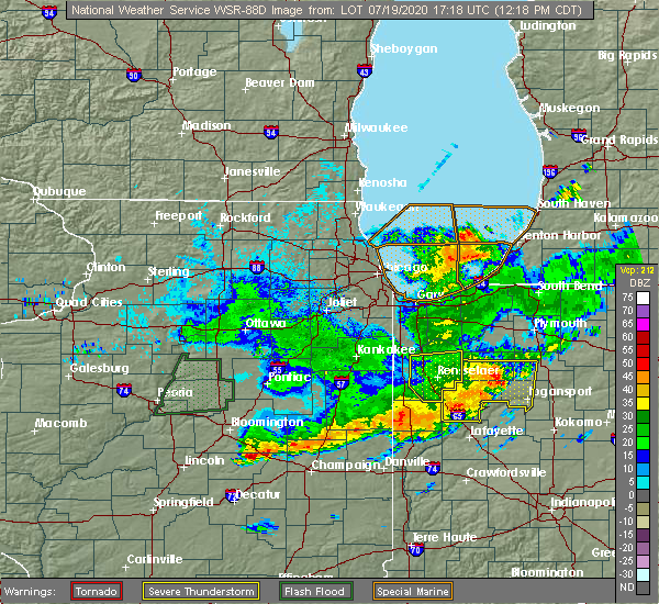 At 1217 pm cdt, severe thunderstorms were located along a line extending from 8 miles southwest of wheatfield to 6 miles southwest of monon, moving east at 45 mph (trained weather spotters). Hazards include 60 mph wind gusts. Expect damage to roofs, siding, and trees. Locations impacted include, rensselaer, remington, hanging grove, collegeville, fair oaks, parr and baileys corner. At 1217 pm cdt, severe thunderstorms were located along a line extending from 8 miles southwest of wheatfield to 6 miles southwest of monon, moving east at 45 mph (trained weather spotters). Hazards include 60 mph wind gusts. Expect damage to roofs, siding, and trees. Locations impacted include, rensselaer, remington, hanging grove, collegeville, fair oaks, parr and baileys corner.
|
| 7/19/2020 12:03 PM CDT |
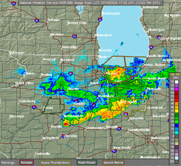 At 1201 pm cdt, severe thunderstorms were located along a line extending from near demotte to remington, moving east at 50 mph. a spotter reported a measured wind gust of 85 mph near lewiston, close to rensselear. this is a very dangerous storm with the potential for significant damage with winds of this magnitude (trained weather spotters). Hazards include 70 to 80 mph wind gusts. Expect considerable tree damage. damage is likely to mobile homes, roofs, and outbuildings. Locations impacted include, rensselaer, remington, roselawn, goodland, brook, hanging grove, collegeville, mount ayr, foresman, fair oaks, parr and baileys corner. At 1201 pm cdt, severe thunderstorms were located along a line extending from near demotte to remington, moving east at 50 mph. a spotter reported a measured wind gust of 85 mph near lewiston, close to rensselear. this is a very dangerous storm with the potential for significant damage with winds of this magnitude (trained weather spotters). Hazards include 70 to 80 mph wind gusts. Expect considerable tree damage. damage is likely to mobile homes, roofs, and outbuildings. Locations impacted include, rensselaer, remington, roselawn, goodland, brook, hanging grove, collegeville, mount ayr, foresman, fair oaks, parr and baileys corner.
|
| 7/19/2020 11:46 AM CDT |
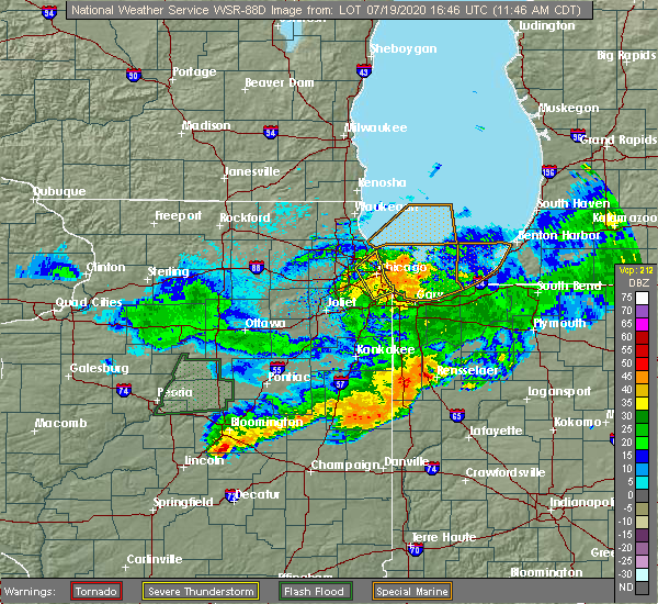 At 1146 am cdt, severe thunderstorms were located along a line extending from near roselawn to near kentland, moving east at 50 mph (radar indicated). Hazards include 60 mph wind gusts. expect damage to roofs, siding, and trees At 1146 am cdt, severe thunderstorms were located along a line extending from near roselawn to near kentland, moving east at 50 mph (radar indicated). Hazards include 60 mph wind gusts. expect damage to roofs, siding, and trees
|
| 7/11/2020 11:09 PM CDT |
 The severe thunderstorm warning for southeastern will, eastern kankakee, eastern iroquois, benton, newton, southern porter, southern lake and jasper counties will expire at 1115 pm cdt/1215 am edt/, the storms which prompted the warning have weakened below severe limits, and no longer pose an immediate threat to life or property. therefore, the warning will be allowed to expire. however gusty winds to 40 to 50 mph are still possible with the outflow ahead of these thunderstorms, and to a lesser degree with the storms themselves. The severe thunderstorm warning for southeastern will, eastern kankakee, eastern iroquois, benton, newton, southern porter, southern lake and jasper counties will expire at 1115 pm cdt/1215 am edt/, the storms which prompted the warning have weakened below severe limits, and no longer pose an immediate threat to life or property. therefore, the warning will be allowed to expire. however gusty winds to 40 to 50 mph are still possible with the outflow ahead of these thunderstorms, and to a lesser degree with the storms themselves.
|
| 7/11/2020 11:03 PM CDT |
 At 1102 pm cdt/1202 am edt/, severe thunderstorms were located along a line extending from near st. john to near boswell, with a gust front extending from crown point south to remington moving east at 30 mph (radar indicated). Hazards include 60 mph wind gusts. Expect damage to roofs, siding, and trees. Locations impacted include, lowell, rensselaer, demotte, hebron, fowler, kentland, otterbein, remington, morocco, wheatfield, lake village, beecher, roselawn, kouts, lake dalecarlia, grant park, oxford, sheldon, goodland and brook. At 1102 pm cdt/1202 am edt/, severe thunderstorms were located along a line extending from near st. john to near boswell, with a gust front extending from crown point south to remington moving east at 30 mph (radar indicated). Hazards include 60 mph wind gusts. Expect damage to roofs, siding, and trees. Locations impacted include, lowell, rensselaer, demotte, hebron, fowler, kentland, otterbein, remington, morocco, wheatfield, lake village, beecher, roselawn, kouts, lake dalecarlia, grant park, oxford, sheldon, goodland and brook.
|
| 7/11/2020 10:39 PM CDT |
 At 1037 pm cdt/1137 pm edt/, severe thunderstorms were located along a line extending from university park to hoopeston, moving east at 40 mph. a personal weather station reported 68 mph winds near cissna park in south central iroquois county, though no reports of damage have been received yet (radar indicated). Hazards include 60 mph wind gusts. Expect damage to roofs, siding, and trees. Locations impacted include, merrillville, valparaiso, schererville, hobart, kankakee, crown point, park forest, mokena, bourbonnais, frankfort, bradley, cedar lake, steger, lowell, manteno, rensselaer, watseka, peotone, demotte and hebron. At 1037 pm cdt/1137 pm edt/, severe thunderstorms were located along a line extending from university park to hoopeston, moving east at 40 mph. a personal weather station reported 68 mph winds near cissna park in south central iroquois county, though no reports of damage have been received yet (radar indicated). Hazards include 60 mph wind gusts. Expect damage to roofs, siding, and trees. Locations impacted include, merrillville, valparaiso, schererville, hobart, kankakee, crown point, park forest, mokena, bourbonnais, frankfort, bradley, cedar lake, steger, lowell, manteno, rensselaer, watseka, peotone, demotte and hebron.
|
| 7/11/2020 10:08 PM CDT |
 At 1006 pm cdt/1106 pm edt/, severe thunderstorms were located along a line extending from near frankfort to near cissna park, moving east at 45 mph. winds to 60 mph were reported in braidwood and to 68 mph in saunemim with this line of storms (radar indicated). Hazards include 60 mph wind gusts. expect damage to roofs, siding, and trees At 1006 pm cdt/1106 pm edt/, severe thunderstorms were located along a line extending from near frankfort to near cissna park, moving east at 45 mph. winds to 60 mph were reported in braidwood and to 68 mph in saunemim with this line of storms (radar indicated). Hazards include 60 mph wind gusts. expect damage to roofs, siding, and trees
|
| 7/11/2020 3:08 PM EDT |
 At 208 pm cdt/308 pm edt/, severe thunderstorms were located along a line extending from near wolcott to near goodland to near milford, moving southeast at 45 mph (radar indicated). Hazards include 60 mph wind gusts and quarter size hail. Hail damage to vehicles is expected. expect wind damage to roofs, siding, and trees. Locations impacted include, fowler, kentland, otterbein, remington, oxford, goodland, boswell, earl park, stockland, ambia, dunnington, wadena, swanington, templeton and raub. At 208 pm cdt/308 pm edt/, severe thunderstorms were located along a line extending from near wolcott to near goodland to near milford, moving southeast at 45 mph (radar indicated). Hazards include 60 mph wind gusts and quarter size hail. Hail damage to vehicles is expected. expect wind damage to roofs, siding, and trees. Locations impacted include, fowler, kentland, otterbein, remington, oxford, goodland, boswell, earl park, stockland, ambia, dunnington, wadena, swanington, templeton and raub.
|
| 7/11/2020 2:44 PM EDT |
 At 144 pm cdt/244 pm edt/, severe thunderstorms were located along a line extending from near remington to near kentland to near sheldon, moving southeast at 45 mph (radar indicated). Hazards include 60 mph wind gusts and quarter size hail. Hail damage to vehicles is expected. Expect wind damage to roofs, siding, and trees. At 144 pm cdt/244 pm edt/, severe thunderstorms were located along a line extending from near remington to near kentland to near sheldon, moving southeast at 45 mph (radar indicated). Hazards include 60 mph wind gusts and quarter size hail. Hail damage to vehicles is expected. Expect wind damage to roofs, siding, and trees.
|
| 6/27/2020 12:39 AM CDT |
 At 1224 am cdt/124 am edt/, a severe thunderstorm was located over remington, or 7 miles northeast of wadena, moving east at 40 mph (radar indicated). Hazards include 60 mph wind gusts and quarter size hail. Hail damage to vehicles is expected. expect wind damage to roofs, siding, and trees. This severe thunderstorm will remain over mainly rural areas of northeastern benton and southern jasper counties. At 1224 am cdt/124 am edt/, a severe thunderstorm was located over remington, or 7 miles northeast of wadena, moving east at 40 mph (radar indicated). Hazards include 60 mph wind gusts and quarter size hail. Hail damage to vehicles is expected. expect wind damage to roofs, siding, and trees. This severe thunderstorm will remain over mainly rural areas of northeastern benton and southern jasper counties.
|
| 6/27/2020 12:24 AM CDT |
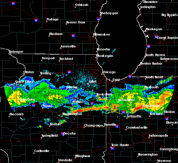 At 1224 am cdt/124 am edt/, a severe thunderstorm was located over remington, or 7 miles northeast of wadena, moving east at 40 mph (radar indicated). Hazards include 60 mph wind gusts and quarter size hail. Hail damage to vehicles is expected. expect wind damage to roofs, siding, and trees. This severe thunderstorm will remain over mainly rural areas of northeastern benton and southern jasper counties. At 1224 am cdt/124 am edt/, a severe thunderstorm was located over remington, or 7 miles northeast of wadena, moving east at 40 mph (radar indicated). Hazards include 60 mph wind gusts and quarter size hail. Hail damage to vehicles is expected. expect wind damage to roofs, siding, and trees. This severe thunderstorm will remain over mainly rural areas of northeastern benton and southern jasper counties.
|
| 6/27/2020 12:17 AM CDT |
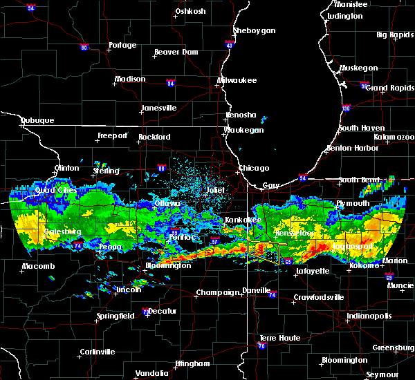 At 1216 am cdt/116 am edt/, a severe thunderstorm was located over goodland, or near percy junction, moving east at 45 mph (radar indicated). Hazards include 60 mph wind gusts and quarter size hail. Hail damage to vehicles is expected. expect wind damage to roofs, siding, and trees. this severe storm will be near, remington around 1225 am cdt. Other locations impacted by this severe thunderstorm include earl park. At 1216 am cdt/116 am edt/, a severe thunderstorm was located over goodland, or near percy junction, moving east at 45 mph (radar indicated). Hazards include 60 mph wind gusts and quarter size hail. Hail damage to vehicles is expected. expect wind damage to roofs, siding, and trees. this severe storm will be near, remington around 1225 am cdt. Other locations impacted by this severe thunderstorm include earl park.
|
| 6/27/2020 12:04 AM CDT |
 At 1204 am cdt/104 am edt/, a severe thunderstorm was located over kentland, moving east at 45 mph (radar indicated). Hazards include 60 mph wind gusts and quarter size hail. Hail damage to vehicles is expected. expect wind damage to roofs, siding, and trees. this severe thunderstorm will be near, percy junction, wadena and goodland around 1215 am cdt. lochiel around 1220 am cdt. remington around 1225 am cdt. other locations impacted by this severe thunderstorm include earl park. Including the following interstate, indiana i-65 between mile markers 200 and 209. At 1204 am cdt/104 am edt/, a severe thunderstorm was located over kentland, moving east at 45 mph (radar indicated). Hazards include 60 mph wind gusts and quarter size hail. Hail damage to vehicles is expected. expect wind damage to roofs, siding, and trees. this severe thunderstorm will be near, percy junction, wadena and goodland around 1215 am cdt. lochiel around 1220 am cdt. remington around 1225 am cdt. other locations impacted by this severe thunderstorm include earl park. Including the following interstate, indiana i-65 between mile markers 200 and 209.
|
| 7/21/2019 2:20 PM CDT |
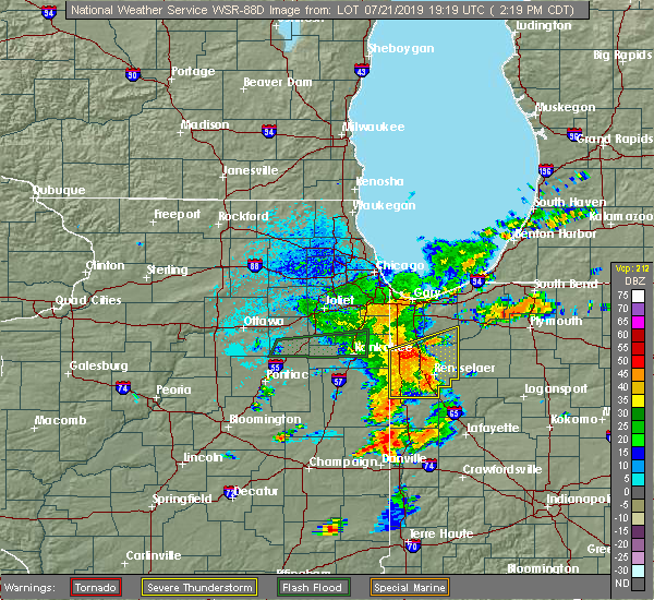 At 220 pm cdt, severe thunderstorms were located along a line extending from near thayer to surrey to foresman, moving east at 40 mph (radar indicated). Hazards include 60 mph wind gusts. Expect damage to roofs, siding, and trees. Locations impacted include, rensselaer, de motte, kentland, morocco, hanging grove, percy junction, thayer, roselawn, gifford, enos, pembroke, fair oaks, pleasant ridge, dunns bridge, conrad, perkins, sumava resorts, mccoysburg, beaver city and moody. At 220 pm cdt, severe thunderstorms were located along a line extending from near thayer to surrey to foresman, moving east at 40 mph (radar indicated). Hazards include 60 mph wind gusts. Expect damage to roofs, siding, and trees. Locations impacted include, rensselaer, de motte, kentland, morocco, hanging grove, percy junction, thayer, roselawn, gifford, enos, pembroke, fair oaks, pleasant ridge, dunns bridge, conrad, perkins, sumava resorts, mccoysburg, beaver city and moody.
|
| 7/21/2019 2:12 PM CDT |
 At 212 pm cdt, severe thunderstorms were located along a line extending from near lake village to near enos to brook, moving east at 35 mph (radar indicated). Hazards include 60 mph wind gusts. expect damage to roofs, siding, and trees At 212 pm cdt, severe thunderstorms were located along a line extending from near lake village to near enos to brook, moving east at 35 mph (radar indicated). Hazards include 60 mph wind gusts. expect damage to roofs, siding, and trees
|
| 7/14/2019 2:27 AM CDT |
 At 226 am cdt, a severe thunderstorm was located over moody, moving east at 10 mph. another radar indicated severe thunderstorm was 2 miles southeast of rensselaer (radar indicated). Hazards include 60 mph wind gusts and quarter size hail. Hail damage to vehicles is expected. expect wind damage to roofs, siding, and trees. Locations impacted include, rensselaer, hanging grove, moody, pleasant ridge, mccoysburg, gifford, surrey, remington and collegeville. At 226 am cdt, a severe thunderstorm was located over moody, moving east at 10 mph. another radar indicated severe thunderstorm was 2 miles southeast of rensselaer (radar indicated). Hazards include 60 mph wind gusts and quarter size hail. Hail damage to vehicles is expected. expect wind damage to roofs, siding, and trees. Locations impacted include, rensselaer, hanging grove, moody, pleasant ridge, mccoysburg, gifford, surrey, remington and collegeville.
|
| 7/14/2019 2:11 AM CDT |
 At 210 am cdt, a severe thunderstorm was located near pleasant ridge, moving east at 10 mph. another storm was developing 3 miles southwest of rensselaer (radar indicated). Hazards include quarter size hail. damage to vehicles is expected At 210 am cdt, a severe thunderstorm was located near pleasant ridge, moving east at 10 mph. another storm was developing 3 miles southwest of rensselaer (radar indicated). Hazards include quarter size hail. damage to vehicles is expected
|
| 6/30/2019 4:12 PM CDT |
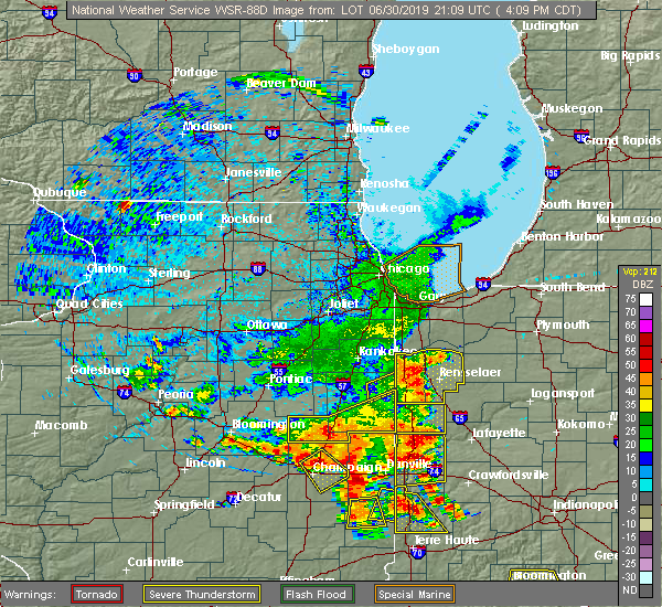 At 412 pm cdt, a severe thunderstorm was located near foresman, moving southeast at 35 mph (radar indicated). Hazards include 60 mph wind gusts. expect damage to roofs, siding, and trees At 412 pm cdt, a severe thunderstorm was located near foresman, moving southeast at 35 mph (radar indicated). Hazards include 60 mph wind gusts. expect damage to roofs, siding, and trees
|
| 6/30/2019 3:58 PM CDT |
 At 355 pm cdt, severe thunderstorms were located along a line extending from near kentland to morocco to perkins to lake village, moving southeast at 30 to 35 mph (radar indicated). Hazards include 60 mph wind gusts. Expect damage to roofs, siding, and trees. Locations impacted include, rensselaer, de motte, kentland, morocco, hanging grove, percy junction, thayer, roselawn, gifford, enos, pembroke, fair oaks, pleasant ridge, conrad, perkins, sumava resorts, mccoysburg, beaver city, moody and forest city. At 355 pm cdt, severe thunderstorms were located along a line extending from near kentland to morocco to perkins to lake village, moving southeast at 30 to 35 mph (radar indicated). Hazards include 60 mph wind gusts. Expect damage to roofs, siding, and trees. Locations impacted include, rensselaer, de motte, kentland, morocco, hanging grove, percy junction, thayer, roselawn, gifford, enos, pembroke, fair oaks, pleasant ridge, conrad, perkins, sumava resorts, mccoysburg, beaver city, moody and forest city.
|
| 6/30/2019 3:32 PM CDT |
 At 303 pm cdt, severe thunderstorms were located along a line extending from near beecher to near grant park to near hopkins park to clifton, moving southeast at 40 mph. these are very dangerous storms (trained weather spotters. winds to 75 mph were reported in manteno illinois with these storms). Hazards include 80 mph wind gusts. Flying debris will be dangerous to those caught without shelter. mobile homes will be heavily damaged. expect considerable damage to roofs, windows, and vehicles. Extensive tree damage and power outages are likely. At 303 pm cdt, severe thunderstorms were located along a line extending from near beecher to near grant park to near hopkins park to clifton, moving southeast at 40 mph. these are very dangerous storms (trained weather spotters. winds to 75 mph were reported in manteno illinois with these storms). Hazards include 80 mph wind gusts. Flying debris will be dangerous to those caught without shelter. mobile homes will be heavily damaged. expect considerable damage to roofs, windows, and vehicles. Extensive tree damage and power outages are likely.
|
| 6/30/2019 3:04 PM CDT |
 At 303 pm cdt, severe thunderstorms were located along a line extending from near beecher to near grant park to near hopkins park to clifton, moving southeast at 40 mph. these are very dangerous storms (trained weather spotters. winds to 75 mph were reported in manteno illinois with these storms). Hazards include 80 mph wind gusts. Flying debris will be dangerous to those caught without shelter. mobile homes will be heavily damaged. expect considerable damage to roofs, windows, and vehicles. Extensive tree damage and power outages are likely. At 303 pm cdt, severe thunderstorms were located along a line extending from near beecher to near grant park to near hopkins park to clifton, moving southeast at 40 mph. these are very dangerous storms (trained weather spotters. winds to 75 mph were reported in manteno illinois with these storms). Hazards include 80 mph wind gusts. Flying debris will be dangerous to those caught without shelter. mobile homes will be heavily damaged. expect considerable damage to roofs, windows, and vehicles. Extensive tree damage and power outages are likely.
|
| 6/26/2019 6:50 PM EDT |
 At 549 pm cdt, a severe thunderstorm was located over remington, or 8 miles east of percy junction, moving northeast at 10 mph (radar indicated). Hazards include 60 mph wind gusts and quarter size hail. Hail damage to vehicles is expected. expect wind damage to roofs, siding, and trees. Locations impacted include, remington. At 549 pm cdt, a severe thunderstorm was located over remington, or 8 miles east of percy junction, moving northeast at 10 mph (radar indicated). Hazards include 60 mph wind gusts and quarter size hail. Hail damage to vehicles is expected. expect wind damage to roofs, siding, and trees. Locations impacted include, remington.
|
| 6/26/2019 5:37 PM CDT |
 At 536 pm cdt, a severe thunderstorm was located over remington, or near percy junction, moving northeast at 10 mph (radar indicated). Hazards include 60 mph wind gusts and quarter size hail. Hail damage to vehicles is expected. Expect wind damage to roofs, siding, and trees. At 536 pm cdt, a severe thunderstorm was located over remington, or near percy junction, moving northeast at 10 mph (radar indicated). Hazards include 60 mph wind gusts and quarter size hail. Hail damage to vehicles is expected. Expect wind damage to roofs, siding, and trees.
|
| 5/23/2019 2:38 AM CDT |
 At 236 am cdt/336 am edt/, severe thunderstorms were located along a line extending from near lowell to near de motte to near moody to near atkinson, moving northeast at 70 mph. a 61 mph wind gust was recorded at rensselaer and a 63 mph wind gust was recorded at kentland airport. numerous 70 to 80 mph wind gusts have been recorded with these storms across illinois. these are very dangerous storms (radar indicated). Hazards include 80 mph wind gusts and nickel size hail. Flying debris will be dangerous to those caught without shelter. mobile homes will be heavily damaged. expect considerable damage to roofs, windows, and vehicles. extensive tree damage and power outages are likely. locations impacted include, merrillville, schererville, crown point, st. John, cedar lake, lowell, rensselaer, de motte, hebron, fowler, kentland, hanging grove, roselawn, talbot, gifford, pembroke, pleasant ridge, dunns bridge, wadena and boone grove. At 236 am cdt/336 am edt/, severe thunderstorms were located along a line extending from near lowell to near de motte to near moody to near atkinson, moving northeast at 70 mph. a 61 mph wind gust was recorded at rensselaer and a 63 mph wind gust was recorded at kentland airport. numerous 70 to 80 mph wind gusts have been recorded with these storms across illinois. these are very dangerous storms (radar indicated). Hazards include 80 mph wind gusts and nickel size hail. Flying debris will be dangerous to those caught without shelter. mobile homes will be heavily damaged. expect considerable damage to roofs, windows, and vehicles. extensive tree damage and power outages are likely. locations impacted include, merrillville, schererville, crown point, st. John, cedar lake, lowell, rensselaer, de motte, hebron, fowler, kentland, hanging grove, roselawn, talbot, gifford, pembroke, pleasant ridge, dunns bridge, wadena and boone grove.
|
| 5/23/2019 2:27 AM CDT |
 At 226 am cdt/326 am edt/, severe thunderstorms were located along a line extending from grant park to thayer to near collegeville to boswell, moving northeast at 70 mph. numerous measured wind gusts in excess of 70 mph have been reported with these dangerous thunderstorms. these are very dangerous storms (radar indicated). Hazards include 80 mph wind gusts and nickel size hail. Flying debris will be dangerous to those caught without shelter. mobile homes will be heavily damaged. expect considerable damage to roofs, windows, and vehicles. extensive tree damage and power outages are likely. locations impacted include, merrillville, schererville, kankakee, crown point, bourbonnais, bradley, st. John, cedar lake, lowell, manteno, rensselaer, peotone, de motte, hebron, momence, fowler, kentland, morocco, hanging grove and roselawn. At 226 am cdt/326 am edt/, severe thunderstorms were located along a line extending from grant park to thayer to near collegeville to boswell, moving northeast at 70 mph. numerous measured wind gusts in excess of 70 mph have been reported with these dangerous thunderstorms. these are very dangerous storms (radar indicated). Hazards include 80 mph wind gusts and nickel size hail. Flying debris will be dangerous to those caught without shelter. mobile homes will be heavily damaged. expect considerable damage to roofs, windows, and vehicles. extensive tree damage and power outages are likely. locations impacted include, merrillville, schererville, kankakee, crown point, bourbonnais, bradley, st. John, cedar lake, lowell, manteno, rensselaer, peotone, de motte, hebron, momence, fowler, kentland, morocco, hanging grove and roselawn.
|
| 5/23/2019 2:14 AM CDT |
 At 212 am cdt/312 am edt/, severe thunderstorms were located along a line extending from near kankakee to hopkins park to near morocco to near dunnington, moving northeast at 70 mph. at 2:04 am an 83 mph wind gust was measured in watseka. these are very dangerous storms (radar indicated). Hazards include 80 mph wind gusts and nickel size hail. Flying debris will be dangerous to those caught without shelter. mobile homes will be heavily damaged. expect considerable damage to roofs, windows, and vehicles. extensive tree damage and power outages are likely. locations impacted include, merrillville, schererville, kankakee, crown point, bourbonnais, bradley, st. John, cedar lake, lowell, manteno, rensselaer, watseka, peotone, de motte, hebron, momence, fowler, kentland, morocco and stockland. At 212 am cdt/312 am edt/, severe thunderstorms were located along a line extending from near kankakee to hopkins park to near morocco to near dunnington, moving northeast at 70 mph. at 2:04 am an 83 mph wind gust was measured in watseka. these are very dangerous storms (radar indicated). Hazards include 80 mph wind gusts and nickel size hail. Flying debris will be dangerous to those caught without shelter. mobile homes will be heavily damaged. expect considerable damage to roofs, windows, and vehicles. extensive tree damage and power outages are likely. locations impacted include, merrillville, schererville, kankakee, crown point, bourbonnais, bradley, st. John, cedar lake, lowell, manteno, rensselaer, watseka, peotone, de motte, hebron, momence, fowler, kentland, morocco and stockland.
|
| 5/23/2019 1:54 AM CDT |
 At 154 am cdt/254 am edt/, severe thunderstorms were located along a line extending from 8 miles north of cullom to clifton to 6 miles west of watseka to near rankin, moving northeast at 70 mph (radar indicated). Hazards include 70 mph wind gusts and nickel size hail. localized wind gusts to 80 mph will be possible with these storms. Expect considerable tree damage. Damage is likely to mobile homes, roofs, and outbuildings. At 154 am cdt/254 am edt/, severe thunderstorms were located along a line extending from 8 miles north of cullom to clifton to 6 miles west of watseka to near rankin, moving northeast at 70 mph (radar indicated). Hazards include 70 mph wind gusts and nickel size hail. localized wind gusts to 80 mph will be possible with these storms. Expect considerable tree damage. Damage is likely to mobile homes, roofs, and outbuildings.
|
| 8/2/2018 8:21 PM EDT |
 At 721 pm cdt, severe thunderstorms were located along a line extending from near goodland to boswell, moving east at 20 mph (radar indicated). Hazards include 60 mph wind gusts and quarter size hail. Hail damage to vehicles is expected. expect wind damage to roofs, siding, and trees. severe thunderstorms will be near, wadena and goodland around 825 pm edt. remington around 835 pm edt. barce and oxford around 840 pm edt. atkinson around 845 pm edt. foresman around 855 pm edt. otterbein around 905 pm edt. Including the following interstate, indiana i-65 between mile markers 200 and 206. At 721 pm cdt, severe thunderstorms were located along a line extending from near goodland to boswell, moving east at 20 mph (radar indicated). Hazards include 60 mph wind gusts and quarter size hail. Hail damage to vehicles is expected. expect wind damage to roofs, siding, and trees. severe thunderstorms will be near, wadena and goodland around 825 pm edt. remington around 835 pm edt. barce and oxford around 840 pm edt. atkinson around 845 pm edt. foresman around 855 pm edt. otterbein around 905 pm edt. Including the following interstate, indiana i-65 between mile markers 200 and 206.
|
| 7/5/2018 3:22 PM CDT |
 At 322 pm cdt, severe thunderstorms were located along a line extending from near forest city to thayer to near lake village, moving southeast at 45 mph (radar indicated). Hazards include 60 mph wind gusts. expect damage to roofs, siding, and trees At 322 pm cdt, severe thunderstorms were located along a line extending from near forest city to thayer to near lake village, moving southeast at 45 mph (radar indicated). Hazards include 60 mph wind gusts. expect damage to roofs, siding, and trees
|
| 5/13/2018 6:17 PM CDT |
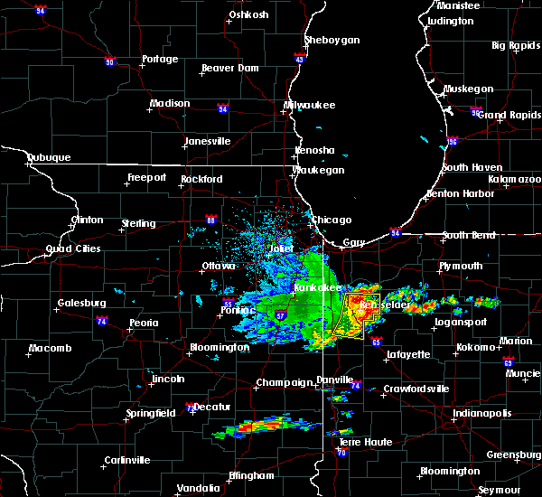 At 617 pm cdt, severe thunderstorms were located along a line extending from near gifford to near collegeville to near perkins, moving east at 60 mph (radar indicated). Hazards include 60 mph wind gusts. Expect damage to roofs, siding, and trees. these severe storms will be near, gifford and pleasant ridge around 720 pm edt. hanging grove, mccoysburg, moody and remington around 725 pm edt. Other locations impacted by these severe thunderstorms include mount ayr and earl park. At 617 pm cdt, severe thunderstorms were located along a line extending from near gifford to near collegeville to near perkins, moving east at 60 mph (radar indicated). Hazards include 60 mph wind gusts. Expect damage to roofs, siding, and trees. these severe storms will be near, gifford and pleasant ridge around 720 pm edt. hanging grove, mccoysburg, moody and remington around 725 pm edt. Other locations impacted by these severe thunderstorms include mount ayr and earl park.
|
| 5/13/2018 6:04 PM CDT |
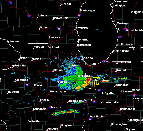 At 603 pm cdt, severe thunderstorms were located along a line extending from pembroke to beaver city to raub, moving east at 60 mph (radar indicated). Hazards include 70 mph wind gusts. Expect considerable tree damage. damage is likely to mobile homes, roofs, and outbuildings. these severe storms will be near, fair oaks and surrey around 710 pm edt. rensselaer, gifford, wadena and collegeville around 715 pm edt. pleasant ridge and moody around 720 pm edt. hanging grove, mccoysburg and remington around 725 pm edt. Other locations impacted by these severe thunderstorms include iroquois, mount ayr and earl park. At 603 pm cdt, severe thunderstorms were located along a line extending from pembroke to beaver city to raub, moving east at 60 mph (radar indicated). Hazards include 70 mph wind gusts. Expect considerable tree damage. damage is likely to mobile homes, roofs, and outbuildings. these severe storms will be near, fair oaks and surrey around 710 pm edt. rensselaer, gifford, wadena and collegeville around 715 pm edt. pleasant ridge and moody around 720 pm edt. hanging grove, mccoysburg and remington around 725 pm edt. Other locations impacted by these severe thunderstorms include iroquois, mount ayr and earl park.
|
| 5/13/2018 5:51 PM CDT |
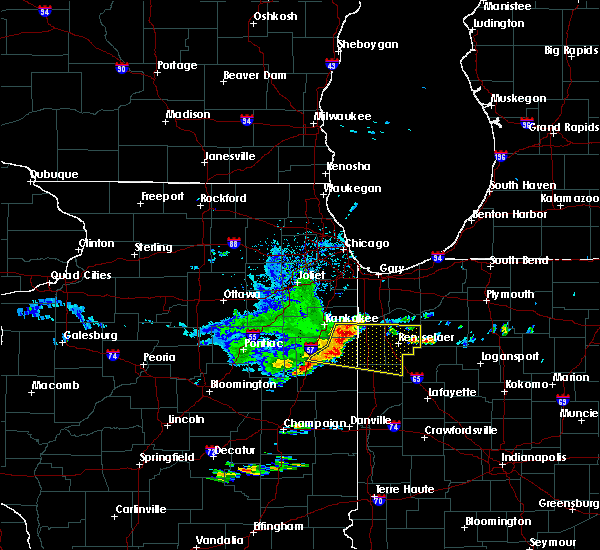 At 551 pm cdt, severe thunderstorms were located along a line extending from near conrad to 8 miles southeast of st. anne to near watseka, moving east at 60 mph (radar indicated). Hazards include 70 mph wind gusts. Expect considerable tree damage. damage is likely to mobile homes, roofs, and outbuildings. these severe storms will be near, conrad, lake village and enos around 555 pm cdt. morocco around 700 pm edt. fair oaks, beaver city, pembroke, raub, sheldon and brook around 705 pm edt. kentland and surrey around 710 pm edt. rensselaer, perkins, gifford, percy junction and goodland around 715 pm edt. wadena, pleasant ridge, moody and collegeville around 720 pm edt. hanging grove, mccoysburg and remington around 725 pm edt. Other locations impacted by these severe thunderstorms include papineau, martinton, donovan, crescent city, iroquois, mount ayr, beaverville, sun river terrace, danforth and earl park. At 551 pm cdt, severe thunderstorms were located along a line extending from near conrad to 8 miles southeast of st. anne to near watseka, moving east at 60 mph (radar indicated). Hazards include 70 mph wind gusts. Expect considerable tree damage. damage is likely to mobile homes, roofs, and outbuildings. these severe storms will be near, conrad, lake village and enos around 555 pm cdt. morocco around 700 pm edt. fair oaks, beaver city, pembroke, raub, sheldon and brook around 705 pm edt. kentland and surrey around 710 pm edt. rensselaer, perkins, gifford, percy junction and goodland around 715 pm edt. wadena, pleasant ridge, moody and collegeville around 720 pm edt. hanging grove, mccoysburg and remington around 725 pm edt. Other locations impacted by these severe thunderstorms include papineau, martinton, donovan, crescent city, iroquois, mount ayr, beaverville, sun river terrace, danforth and earl park.
|
| 5/13/2018 5:35 PM CDT |
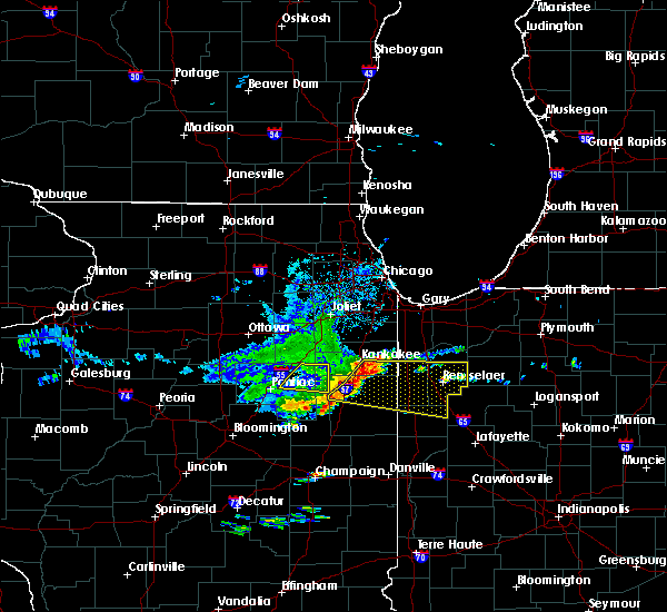 At 534 pm cdt, severe thunderstorms were located along a line extending from aroma park to clifton to 7 miles northwest of gilman, moving east at 55 mph (radar indicated). Hazards include 70 mph wind gusts. Expect considerable tree damage. damage is likely to mobile homes, roofs, and outbuildings. severe thunderstorms will be near, st. anne and aroma park around 540 pm cdt. hopkins park around 545 pm cdt. watseka, conrad, enos and lake village around 555 pm cdt. morocco and beaver city around 700 pm edt. fair oaks, pembroke, sheldon and brook around 705 pm edt. kentland, surrey and raub around 710 pm edt. rensselaer, perkins, gifford and collegeville around 715 pm edt. moody, percy junction, wadena, pleasant ridge and goodland around 720 pm edt. Other locations impacted by these severe thunderstorms include papineau, martinton, donovan, crescent city, iroquois, mount ayr, beaverville, sun river terrace, danforth and earl park. At 534 pm cdt, severe thunderstorms were located along a line extending from aroma park to clifton to 7 miles northwest of gilman, moving east at 55 mph (radar indicated). Hazards include 70 mph wind gusts. Expect considerable tree damage. damage is likely to mobile homes, roofs, and outbuildings. severe thunderstorms will be near, st. anne and aroma park around 540 pm cdt. hopkins park around 545 pm cdt. watseka, conrad, enos and lake village around 555 pm cdt. morocco and beaver city around 700 pm edt. fair oaks, pembroke, sheldon and brook around 705 pm edt. kentland, surrey and raub around 710 pm edt. rensselaer, perkins, gifford and collegeville around 715 pm edt. moody, percy junction, wadena, pleasant ridge and goodland around 720 pm edt. Other locations impacted by these severe thunderstorms include papineau, martinton, donovan, crescent city, iroquois, mount ayr, beaverville, sun river terrace, danforth and earl park.
|
| 8/21/2017 12:17 AM CDT | One large tree downe in jasper county IN, 1.2 miles N of Remington, IN |
| 7/22/2017 1:59 AM EDT |
 At 1259 am cdt/159 am edt/, severe thunderstorms were located along a line extending from near wolcott to near oxford, moving east at 50 mph (radar indicated). Hazards include 70 mph wind gusts. Expect considerable tree damage. Damage is likely to mobile homes, roofs, and outbuildings. At 1259 am cdt/159 am edt/, severe thunderstorms were located along a line extending from near wolcott to near oxford, moving east at 50 mph (radar indicated). Hazards include 70 mph wind gusts. Expect considerable tree damage. Damage is likely to mobile homes, roofs, and outbuildings.
|
| 7/22/2017 12:51 AM CDT |
 At 1250 am cdt/150 am edt/, severe thunderstorms were located along a line extending from near collegeville to near wadena to talbot, moving east at 50 mph (radar indicated. at 1236 am cdt, a power pole was reported downed near kentland indiana). Hazards include 70 mph wind gusts. Expect considerable tree damage. damage is likely to mobile homes, roofs, and outbuildings. Locations impacted include, rensselaer, fowler, kentland, otterbein, hanging grove, dunnington, percy junction, atkinson, talbot, foresman, templeton, pleasant ridge, barce, freeland park, perkins, wadena, mccoysburg, lochiel, raub and remington. At 1250 am cdt/150 am edt/, severe thunderstorms were located along a line extending from near collegeville to near wadena to talbot, moving east at 50 mph (radar indicated. at 1236 am cdt, a power pole was reported downed near kentland indiana). Hazards include 70 mph wind gusts. Expect considerable tree damage. damage is likely to mobile homes, roofs, and outbuildings. Locations impacted include, rensselaer, fowler, kentland, otterbein, hanging grove, dunnington, percy junction, atkinson, talbot, foresman, templeton, pleasant ridge, barce, freeland park, perkins, wadena, mccoysburg, lochiel, raub and remington.
|
| 7/22/2017 12:36 AM CDT |
 At 1235 am cdt/135 am edt/, severe thunderstorms were located along a line extending from near beaver city to near raub to near milford, moving east at 50 mph (radar indicated). Hazards include 70 mph wind gusts. Expect considerable tree damage. Damage is likely to mobile homes, roofs, and outbuildings. At 1235 am cdt/135 am edt/, severe thunderstorms were located along a line extending from near beaver city to near raub to near milford, moving east at 50 mph (radar indicated). Hazards include 70 mph wind gusts. Expect considerable tree damage. Damage is likely to mobile homes, roofs, and outbuildings.
|
| 6/17/2017 11:08 PM CDT |
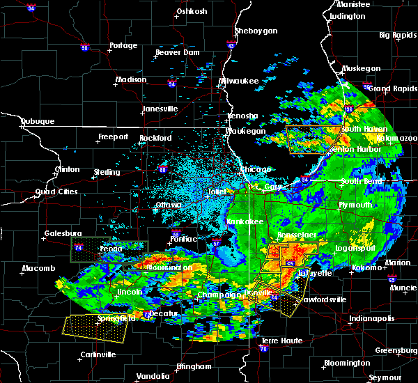 At 1107 pm cdt/1207 am edt/, a severe thunderstorm was located over remington, or near wadena, moving east at 35 mph (radar indicated). Hazards include 60 mph wind gusts. Expect damage to roofs, siding, and trees. Locations impacted include, wadena and remington. At 1107 pm cdt/1207 am edt/, a severe thunderstorm was located over remington, or near wadena, moving east at 35 mph (radar indicated). Hazards include 60 mph wind gusts. Expect damage to roofs, siding, and trees. Locations impacted include, wadena and remington.
|
| 6/17/2017 10:48 PM CDT |
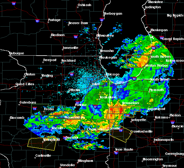 At 1048 pm cdt/1148 pm edt/, a severe thunderstorm was located over kentland, moving east at 35 mph (radar indicated). Hazards include 60 mph wind gusts. Expect damage to roofs, siding, and trees. Locations impacted include, kentland, percy junction, perkins, wadena, raub, remington, sheldon, goodland, brook and earl park. At 1048 pm cdt/1148 pm edt/, a severe thunderstorm was located over kentland, moving east at 35 mph (radar indicated). Hazards include 60 mph wind gusts. Expect damage to roofs, siding, and trees. Locations impacted include, kentland, percy junction, perkins, wadena, raub, remington, sheldon, goodland, brook and earl park.
|
| 6/17/2017 10:34 PM CDT |
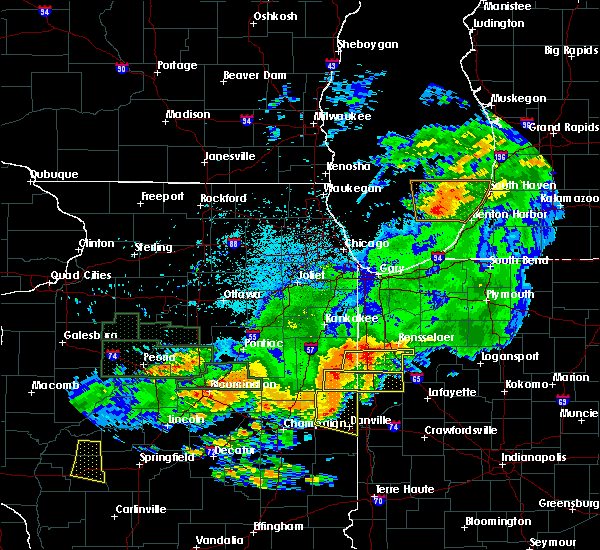 At 1034 pm cdt/1134 pm edt/, a severe thunderstorm was located over sheldon, or near raub, moving east at 35 mph (radar indicated). Hazards include 60 mph wind gusts. expect damage to roofs, siding, and trees At 1034 pm cdt/1134 pm edt/, a severe thunderstorm was located over sheldon, or near raub, moving east at 35 mph (radar indicated). Hazards include 60 mph wind gusts. expect damage to roofs, siding, and trees
|
| 6/14/2017 5:42 PM EDT |
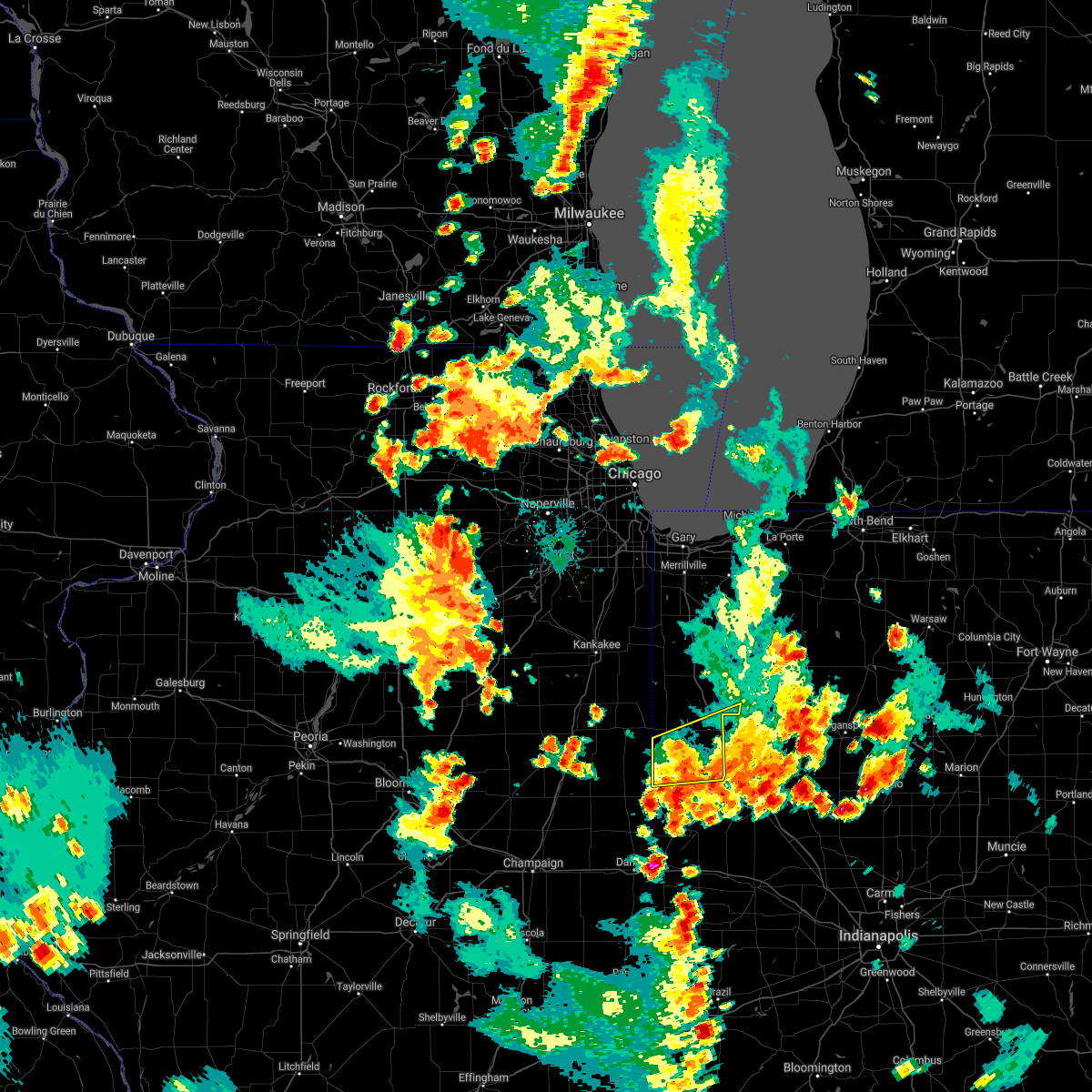 The severe thunderstorm warning for southeastern newton, benton and southern jasper counties will expire at 445 pm cdt/545 pm edt/, the storm which prompted the warning has weakened below severe limits, and has exited the warned area. therefore, the warning will be allowed to expire. however gusty winds and heavy rain are still possible with this thunderstorm. a severe thunderstorm watch remains in effect until 800 pm cdt/900 pm edt/ for northwestern indiana. The severe thunderstorm warning for southeastern newton, benton and southern jasper counties will expire at 445 pm cdt/545 pm edt/, the storm which prompted the warning has weakened below severe limits, and has exited the warned area. therefore, the warning will be allowed to expire. however gusty winds and heavy rain are still possible with this thunderstorm. a severe thunderstorm watch remains in effect until 800 pm cdt/900 pm edt/ for northwestern indiana.
|
| 6/14/2017 5:06 PM EDT |
 At 406 pm cdt/506 pm edt/, a severe thunderstorm was located near goodland, or near percy junction, moving northeast at 25 mph (radar indicated). Hazards include 60 mph wind gusts and quarter size hail. Hail damage to vehicles is expected. expect wind damage to roofs, siding, and trees. Locations impacted include, fowler, kentland, dunnington, atkinson, perkins, wadena, lochiel, barce, raub, freeland park, remington, oxford, goodland, boswell and earl park. At 406 pm cdt/506 pm edt/, a severe thunderstorm was located near goodland, or near percy junction, moving northeast at 25 mph (radar indicated). Hazards include 60 mph wind gusts and quarter size hail. Hail damage to vehicles is expected. expect wind damage to roofs, siding, and trees. Locations impacted include, fowler, kentland, dunnington, atkinson, perkins, wadena, lochiel, barce, raub, freeland park, remington, oxford, goodland, boswell and earl park.
|
| 6/14/2017 4:41 PM EDT |
 At 341 pm cdt/441 pm edt/, a severe thunderstorm was located near raub, moving northeast at 25 mph (radar indicated). Hazards include 60 mph wind gusts and quarter size hail. Hail damage to vehicles is expected. Expect wind damage to roofs, siding, and trees. At 341 pm cdt/441 pm edt/, a severe thunderstorm was located near raub, moving northeast at 25 mph (radar indicated). Hazards include 60 mph wind gusts and quarter size hail. Hail damage to vehicles is expected. Expect wind damage to roofs, siding, and trees.
|
| 5/20/2017 7:25 PM EDT |
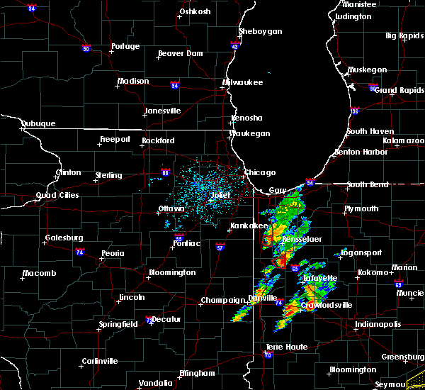 At 625 pm cdt/725 pm edt/, a severe thunderstorm capable of producing a tornado was located near lochiel, moving northeast at 20 mph (radar indicated rotation). Hazards include tornado. Flying debris will be dangerous to those caught without shelter. mobile homes will be damaged or destroyed. damage to roofs, windows, and vehicles will occur. tree damage is likely. This dangerous storm will be near, remington around 735 pm edt. At 625 pm cdt/725 pm edt/, a severe thunderstorm capable of producing a tornado was located near lochiel, moving northeast at 20 mph (radar indicated rotation). Hazards include tornado. Flying debris will be dangerous to those caught without shelter. mobile homes will be damaged or destroyed. damage to roofs, windows, and vehicles will occur. tree damage is likely. This dangerous storm will be near, remington around 735 pm edt.
|
| 5/20/2017 7:13 PM EDT |
 At 613 pm cdt/713 pm edt/, a severe thunderstorm capable of producing a tornado was located over barce, moving northeast at 20 mph (radar indicated rotation). Hazards include tornado. Flying debris will be dangerous to those caught without shelter. mobile homes will be damaged or destroyed. damage to roofs, windows, and vehicles will occur. tree damage is likely. this dangerous storm will be near, remington around 735 pm edt. Including the following interstate, indiana i-65 between mile markers 200 and 201. At 613 pm cdt/713 pm edt/, a severe thunderstorm capable of producing a tornado was located over barce, moving northeast at 20 mph (radar indicated rotation). Hazards include tornado. Flying debris will be dangerous to those caught without shelter. mobile homes will be damaged or destroyed. damage to roofs, windows, and vehicles will occur. tree damage is likely. this dangerous storm will be near, remington around 735 pm edt. Including the following interstate, indiana i-65 between mile markers 200 and 201.
|
| 3/7/2017 2:25 AM CST |
 At 225 am cst, severe thunderstorms were located along a line extending from gifford to remington to near oxford, moving east at 55 mph (radar indicated). Hazards include 60 mph wind gusts. expect damage to roofs, siding, and trees At 225 am cst, severe thunderstorms were located along a line extending from gifford to remington to near oxford, moving east at 55 mph (radar indicated). Hazards include 60 mph wind gusts. expect damage to roofs, siding, and trees
|
| 3/7/2017 2:13 AM CST |
 At 213 am cst, severe thunderstorms were located along a line extending from near surrey to near goodland to near talbot, moving east at 55 mph (radar indicated). Hazards include 60 mph wind gusts. Expect damage to roofs, siding, and trees. severe thunderstorms will be near, surrey and fair oaks around 220 am cst. gifford, moody and remington around 225 am cst. templeton and foresman around 330 am est. other locations impacted by these severe thunderstorms include ambia, mount ayr and earl park. Including the following interstate, indiana i-65 between mile markers 200 and 224. At 213 am cst, severe thunderstorms were located along a line extending from near surrey to near goodland to near talbot, moving east at 55 mph (radar indicated). Hazards include 60 mph wind gusts. Expect damage to roofs, siding, and trees. severe thunderstorms will be near, surrey and fair oaks around 220 am cst. gifford, moody and remington around 225 am cst. templeton and foresman around 330 am est. other locations impacted by these severe thunderstorms include ambia, mount ayr and earl park. Including the following interstate, indiana i-65 between mile markers 200 and 224.
|
| 3/1/2017 12:04 AM CST |
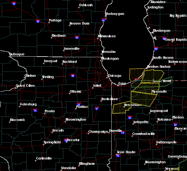 At 1204 am cst, severe thunderstorms were located along a line extending from 6 miles east of enos to near perkins, moving east at 75 mph (radar indicated). Hazards include 60 mph wind gusts and quarter size hail. Hail damage to vehicles is expected. expect wind damage to roofs, siding, and trees. severe thunderstorms will be near, rensselaer, surrey and collegeville around 1210 am cst. pleasant ridge and remington around 1215 am cst. hanging grove, gifford and moody around 1220 am cst. other locations impacted by these severe thunderstorms include mount ayr. including the following interstate, indiana i-65 between mile markers 200 and 222. A tornado watch remains in effect until 400 am cst for northwestern indiana. At 1204 am cst, severe thunderstorms were located along a line extending from 6 miles east of enos to near perkins, moving east at 75 mph (radar indicated). Hazards include 60 mph wind gusts and quarter size hail. Hail damage to vehicles is expected. expect wind damage to roofs, siding, and trees. severe thunderstorms will be near, rensselaer, surrey and collegeville around 1210 am cst. pleasant ridge and remington around 1215 am cst. hanging grove, gifford and moody around 1220 am cst. other locations impacted by these severe thunderstorms include mount ayr. including the following interstate, indiana i-65 between mile markers 200 and 222. A tornado watch remains in effect until 400 am cst for northwestern indiana.
|
| 7/21/2016 4:28 PM CDT |
 The severe thunderstorm warning for southern jasper and northeastern benton counties will expire at 430 pm cdt, the storm which prompted the warning has weakened below severe limits, and no longer poses an immediate threat to life or property. therefore the warning will be allowed to expire. however gusty winds and very heavy rainfall are still possible with this thunderstorm. The severe thunderstorm warning for southern jasper and northeastern benton counties will expire at 430 pm cdt, the storm which prompted the warning has weakened below severe limits, and no longer poses an immediate threat to life or property. therefore the warning will be allowed to expire. however gusty winds and very heavy rainfall are still possible with this thunderstorm.
|
| 7/21/2016 4:01 PM CDT |
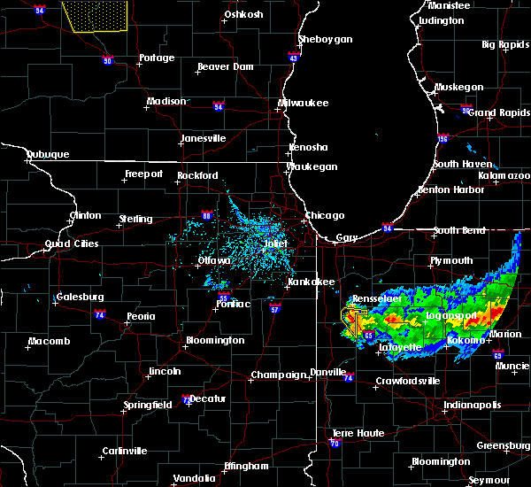 At 401 pm cdt/501 pm edt/, a severe thunderstorm was located over remington, or 9 miles east of percy junction, moving southeast at 15 mph (radar indicated). Hazards include 70 mph wind gusts and quarter size hail. Hail damage to vehicles is expected. expect considerable tree damage. wind damage is also likely to mobile homes, roofs, and outbuildings. locations impacted include, remington. Including the following interstate, indiana i-65 between mile markers 200 and 209. At 401 pm cdt/501 pm edt/, a severe thunderstorm was located over remington, or 9 miles east of percy junction, moving southeast at 15 mph (radar indicated). Hazards include 70 mph wind gusts and quarter size hail. Hail damage to vehicles is expected. expect considerable tree damage. wind damage is also likely to mobile homes, roofs, and outbuildings. locations impacted include, remington. Including the following interstate, indiana i-65 between mile markers 200 and 209.
|
| 7/21/2016 3:43 PM CDT |
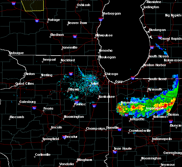 At 342 pm cdt/442 pm edt/, a severe thunderstorm was located near remington, or near percy junction, moving southeast at 15 mph (radar indicated). Hazards include 70 mph wind gusts and quarter size hail. Hail damage to vehicles is expected. expect considerable tree damage. Wind damage is also likely to mobile homes, roofs, and outbuildings. At 342 pm cdt/442 pm edt/, a severe thunderstorm was located near remington, or near percy junction, moving southeast at 15 mph (radar indicated). Hazards include 70 mph wind gusts and quarter size hail. Hail damage to vehicles is expected. expect considerable tree damage. Wind damage is also likely to mobile homes, roofs, and outbuildings.
|
| 7/13/2016 7:10 PM CDT |
 At 709 pm cdt, severe thunderstorms were located along a line extending from sumava resorts to remington, moving east at 40 mph. the warning may need to be extended for a portion of the area (radar indicated). Hazards include 60 mph wind gusts and penny size hail. Expect damage to roofs. siding. and trees. locations impacted include, rensselaer, de motte, hanging grove, sumava resorts, percy junction, gifford, fair oaks, moody, pembroke, lake village, mccoysburg, forest city, pleasant ridge, thayer, conrad, surrey, roselawn, enos, remington and goodland. this includes, us 41 dragway. Including the following interstate, indiana i-65 between mile markers 200 and 235. At 709 pm cdt, severe thunderstorms were located along a line extending from sumava resorts to remington, moving east at 40 mph. the warning may need to be extended for a portion of the area (radar indicated). Hazards include 60 mph wind gusts and penny size hail. Expect damage to roofs. siding. and trees. locations impacted include, rensselaer, de motte, hanging grove, sumava resorts, percy junction, gifford, fair oaks, moody, pembroke, lake village, mccoysburg, forest city, pleasant ridge, thayer, conrad, surrey, roselawn, enos, remington and goodland. this includes, us 41 dragway. Including the following interstate, indiana i-65 between mile markers 200 and 235.
|
| 7/13/2016 6:51 PM CDT |
 At 651 pm cdt, severe thunderstorms were located along a line extending from near hopkins park to near remington, moving east at 45 mph. gusty winds persist for a while after the leading edge of these storms (radar indicated). Hazards include 60 mph wind gusts and quarter size hail. Hail damage to vehicles is expected. expect wind damage to roofs, siding, and trees. locations impacted include, rensselaer, de motte, kentland, morocco, hanging grove, beaver city, sumava resorts, percy junction, perkins, gifford, moody, pembroke, conrad, roselawn, fair oaks, lake village, mccoysburg, forest city, pleasant ridge and thayer. this includes, us 41 dragway. Including the following interstate, indiana i-65 between mile markers 200 and 235. At 651 pm cdt, severe thunderstorms were located along a line extending from near hopkins park to near remington, moving east at 45 mph. gusty winds persist for a while after the leading edge of these storms (radar indicated). Hazards include 60 mph wind gusts and quarter size hail. Hail damage to vehicles is expected. expect wind damage to roofs, siding, and trees. locations impacted include, rensselaer, de motte, kentland, morocco, hanging grove, beaver city, sumava resorts, percy junction, perkins, gifford, moody, pembroke, conrad, roselawn, fair oaks, lake village, mccoysburg, forest city, pleasant ridge and thayer. this includes, us 41 dragway. Including the following interstate, indiana i-65 between mile markers 200 and 235.
|
| 7/13/2016 6:28 PM CDT |
 At 628 pm cdt, severe thunderstorms were located along a line extending from herscher to near remington, moving east at 60 mph (radar indicated). Hazards include 60 mph wind gusts and quarter size hail. Hail damage to vehicles is expected. Expect wind damage to roofs, siding, and trees. At 628 pm cdt, severe thunderstorms were located along a line extending from herscher to near remington, moving east at 60 mph (radar indicated). Hazards include 60 mph wind gusts and quarter size hail. Hail damage to vehicles is expected. Expect wind damage to roofs, siding, and trees.
|
| 6/22/2016 10:51 PM CDT |
 At 1049 pm cdt/1149 pm edt/, severe thunderstorms were located along a line extending from woodland to remington, moving southeast at 40 mph (radar indicated). Hazards include 70 mph wind gusts and nickel size hail. Expect considerable tree damage. damage is likely to mobile homes, roofs, and outbuildings. these severe storms will be near, raub around 1200 am edt. other locations impacted by these severe thunderstorms include iroquois, woodland and mount ayr. including the following interstate, indiana i-65 between mile markers 200 and 217. A tornado watch remains in effect until 100 am cdt/200 am edt/ for east central illinois, and northwestern indiana. At 1049 pm cdt/1149 pm edt/, severe thunderstorms were located along a line extending from woodland to remington, moving southeast at 40 mph (radar indicated). Hazards include 70 mph wind gusts and nickel size hail. Expect considerable tree damage. damage is likely to mobile homes, roofs, and outbuildings. these severe storms will be near, raub around 1200 am edt. other locations impacted by these severe thunderstorms include iroquois, woodland and mount ayr. including the following interstate, indiana i-65 between mile markers 200 and 217. A tornado watch remains in effect until 100 am cdt/200 am edt/ for east central illinois, and northwestern indiana.
|
| 6/22/2016 10:37 PM CDT |
 At 1035 pm cdt/1135 pm edt/, severe thunderstorms were located along a line extending from rensselaer to near watseka, moving southeast at 40 mph. these are very dangerous storms (radar indicated). Hazards include 80 mph wind gusts and nickel size hail. Flying debris will be dangerous to those caught without shelter. mobile homes will be heavily damaged. expect considerable damage to roofs, windows, and vehicles. extensive tree damage and power outages are likely. these severe storms will be near, mccoysburg and pleasant ridge around 1040 pm cdt. other locations impacted by these severe thunderstorms include danforth, iroquois, crescent city, donovan, martinton, mount ayr and woodland. this includes, us 41 dragway. including the following interstates, i-57 near mile marker 288. indiana i-65 between mile markers 200 and 221. A tornado watch remains in effect until 100 am cdt/200 am edt/ for east central illinois, and northwestern indiana. At 1035 pm cdt/1135 pm edt/, severe thunderstorms were located along a line extending from rensselaer to near watseka, moving southeast at 40 mph. these are very dangerous storms (radar indicated). Hazards include 80 mph wind gusts and nickel size hail. Flying debris will be dangerous to those caught without shelter. mobile homes will be heavily damaged. expect considerable damage to roofs, windows, and vehicles. extensive tree damage and power outages are likely. these severe storms will be near, mccoysburg and pleasant ridge around 1040 pm cdt. other locations impacted by these severe thunderstorms include danforth, iroquois, crescent city, donovan, martinton, mount ayr and woodland. this includes, us 41 dragway. including the following interstates, i-57 near mile marker 288. indiana i-65 between mile markers 200 and 221. A tornado watch remains in effect until 100 am cdt/200 am edt/ for east central illinois, and northwestern indiana.
|
| 6/22/2016 10:37 PM CDT |
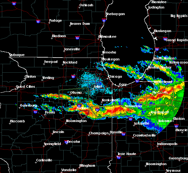 At 1035 pm cdt/1135 pm edt/, severe thunderstorms were located along a line extending from rensselaer to near watseka, moving southeast at 40 mph. these are very dangerous storms (radar indicated). Hazards include 80 mph wind gusts and nickel size hail. Flying debris will be dangerous to those caught without shelter. mobile homes will be heavily damaged. expect considerable damage to roofs, windows, and vehicles. extensive tree damage and power outages are likely. these severe storms will be near, mccoysburg and pleasant ridge around 1040 pm cdt. other locations impacted by these severe thunderstorms include danforth, iroquois, crescent city, donovan, martinton, mount ayr and woodland. this includes, us 41 dragway. including the following interstates, i-57 near mile marker 288. indiana i-65 between mile markers 200 and 221. A tornado watch remains in effect until 100 am cdt/200 am edt/ for east central illinois, and northwestern indiana. At 1035 pm cdt/1135 pm edt/, severe thunderstorms were located along a line extending from rensselaer to near watseka, moving southeast at 40 mph. these are very dangerous storms (radar indicated). Hazards include 80 mph wind gusts and nickel size hail. Flying debris will be dangerous to those caught without shelter. mobile homes will be heavily damaged. expect considerable damage to roofs, windows, and vehicles. extensive tree damage and power outages are likely. these severe storms will be near, mccoysburg and pleasant ridge around 1040 pm cdt. other locations impacted by these severe thunderstorms include danforth, iroquois, crescent city, donovan, martinton, mount ayr and woodland. this includes, us 41 dragway. including the following interstates, i-57 near mile marker 288. indiana i-65 between mile markers 200 and 221. A tornado watch remains in effect until 100 am cdt/200 am edt/ for east central illinois, and northwestern indiana.
|
| 6/22/2016 10:23 PM CDT |
 At 1021 pm cdt/1121 pm edt/, severe thunderstorms were located along a line extending from near rensselaer to ashkum, moving southeast at 45 mph. radar indicated rotation is indicated just east of ashkum and clifton. these are very dangerous storms (radar indicated). Hazards include 80 mph wind gusts and nickel size hail. Flying debris will be dangerous to those caught without shelter. mobile homes will be heavily damaged. expect considerable damage to roofs, windows, and vehicles. extensive tree damage and power outages are likely. these severe storms will be near, rensselaer, pleasant ridge, surrey and collegeville around 1025 pm cdt. mccoysburg around 1030 pm cdt. watseka around 1040 pm cdt. sheldon around 1050 pm cdt. raub around 1055 pm cdt. kentland and perkins around 1200 am edt. other locations impacted by these severe thunderstorms include papineau, danforth, iroquois, beaverville, crescent city, donovan, martinton, mount ayr and woodland. this includes, us 41 dragway. including the following interstates, i-57 between mile markers 281 and 301. indiana i-65 between mile markers 200 and 222. A tornado watch remains in effect until 100 am cdt/200 am edt/ for northeastern illinois, and northwestern indiana. At 1021 pm cdt/1121 pm edt/, severe thunderstorms were located along a line extending from near rensselaer to ashkum, moving southeast at 45 mph. radar indicated rotation is indicated just east of ashkum and clifton. these are very dangerous storms (radar indicated). Hazards include 80 mph wind gusts and nickel size hail. Flying debris will be dangerous to those caught without shelter. mobile homes will be heavily damaged. expect considerable damage to roofs, windows, and vehicles. extensive tree damage and power outages are likely. these severe storms will be near, rensselaer, pleasant ridge, surrey and collegeville around 1025 pm cdt. mccoysburg around 1030 pm cdt. watseka around 1040 pm cdt. sheldon around 1050 pm cdt. raub around 1055 pm cdt. kentland and perkins around 1200 am edt. other locations impacted by these severe thunderstorms include papineau, danforth, iroquois, beaverville, crescent city, donovan, martinton, mount ayr and woodland. this includes, us 41 dragway. including the following interstates, i-57 between mile markers 281 and 301. indiana i-65 between mile markers 200 and 222. A tornado watch remains in effect until 100 am cdt/200 am edt/ for northeastern illinois, and northwestern indiana.
|
| 6/22/2016 10:23 PM CDT |
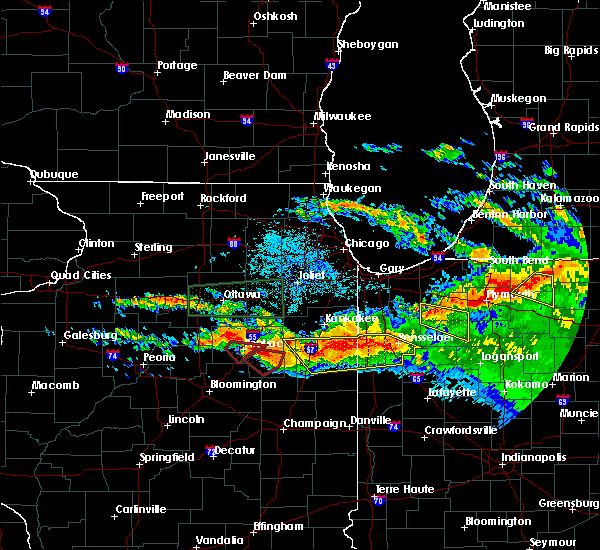 At 1021 pm cdt/1121 pm edt/, severe thunderstorms were located along a line extending from near rensselaer to ashkum, moving southeast at 45 mph. radar indicated rotation is indicated just east of ashkum and clifton. these are very dangerous storms (radar indicated). Hazards include 80 mph wind gusts and nickel size hail. Flying debris will be dangerous to those caught without shelter. mobile homes will be heavily damaged. expect considerable damage to roofs, windows, and vehicles. extensive tree damage and power outages are likely. these severe storms will be near, rensselaer, pleasant ridge, surrey and collegeville around 1025 pm cdt. mccoysburg around 1030 pm cdt. watseka around 1040 pm cdt. sheldon around 1050 pm cdt. raub around 1055 pm cdt. kentland and perkins around 1200 am edt. other locations impacted by these severe thunderstorms include papineau, danforth, iroquois, beaverville, crescent city, donovan, martinton, mount ayr and woodland. this includes, us 41 dragway. including the following interstates, i-57 between mile markers 281 and 301. indiana i-65 between mile markers 200 and 222. A tornado watch remains in effect until 100 am cdt/200 am edt/ for northeastern illinois, and northwestern indiana. At 1021 pm cdt/1121 pm edt/, severe thunderstorms were located along a line extending from near rensselaer to ashkum, moving southeast at 45 mph. radar indicated rotation is indicated just east of ashkum and clifton. these are very dangerous storms (radar indicated). Hazards include 80 mph wind gusts and nickel size hail. Flying debris will be dangerous to those caught without shelter. mobile homes will be heavily damaged. expect considerable damage to roofs, windows, and vehicles. extensive tree damage and power outages are likely. these severe storms will be near, rensselaer, pleasant ridge, surrey and collegeville around 1025 pm cdt. mccoysburg around 1030 pm cdt. watseka around 1040 pm cdt. sheldon around 1050 pm cdt. raub around 1055 pm cdt. kentland and perkins around 1200 am edt. other locations impacted by these severe thunderstorms include papineau, danforth, iroquois, beaverville, crescent city, donovan, martinton, mount ayr and woodland. this includes, us 41 dragway. including the following interstates, i-57 between mile markers 281 and 301. indiana i-65 between mile markers 200 and 222. A tornado watch remains in effect until 100 am cdt/200 am edt/ for northeastern illinois, and northwestern indiana.
|
| 6/22/2016 10:15 PM CDT |
 At 1014 pm cdt/1114 pm edt/, severe thunderstorms were located along a line extending from surrey to 8 miles west of ashkum, moving southeast at 40 mph (radar indicated). Hazards include 70 mph wind gusts and nickel size hail. Expect considerable tree damage. damage is likely to mobile homes, roofs, and outbuildings. these severe storms will be near, rensselaer, surrey and collegeville around 1020 pm cdt. pleasant ridge around 1025 pm cdt. mccoysburg and onarga around 1030 pm cdt. watseka around 1045 pm cdt. other locations impacted by these severe thunderstorms include papineau, danforth, iroquois, beaverville, crescent city, donovan, martinton, mount ayr and woodland. this includes, us 41 dragway. including the following interstates, i-57 between mile markers 281 and 301. indiana i-65 between mile markers 200 and 222. A tornado watch remains in effect until 100 am cdt/200 am edt/ for northeastern illinois, and northwestern indiana. At 1014 pm cdt/1114 pm edt/, severe thunderstorms were located along a line extending from surrey to 8 miles west of ashkum, moving southeast at 40 mph (radar indicated). Hazards include 70 mph wind gusts and nickel size hail. Expect considerable tree damage. damage is likely to mobile homes, roofs, and outbuildings. these severe storms will be near, rensselaer, surrey and collegeville around 1020 pm cdt. pleasant ridge around 1025 pm cdt. mccoysburg and onarga around 1030 pm cdt. watseka around 1045 pm cdt. other locations impacted by these severe thunderstorms include papineau, danforth, iroquois, beaverville, crescent city, donovan, martinton, mount ayr and woodland. this includes, us 41 dragway. including the following interstates, i-57 between mile markers 281 and 301. indiana i-65 between mile markers 200 and 222. A tornado watch remains in effect until 100 am cdt/200 am edt/ for northeastern illinois, and northwestern indiana.
|
| 6/22/2016 10:15 PM CDT |
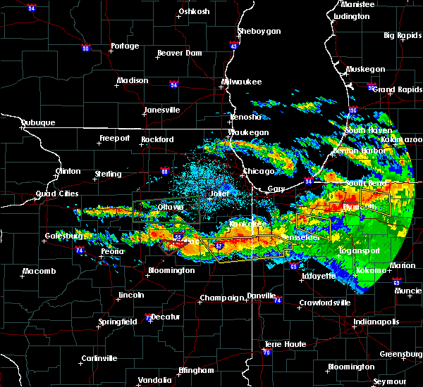 At 1014 pm cdt/1114 pm edt/, severe thunderstorms were located along a line extending from surrey to 8 miles west of ashkum, moving southeast at 40 mph (radar indicated). Hazards include 70 mph wind gusts and nickel size hail. Expect considerable tree damage. damage is likely to mobile homes, roofs, and outbuildings. these severe storms will be near, rensselaer, surrey and collegeville around 1020 pm cdt. pleasant ridge around 1025 pm cdt. mccoysburg and onarga around 1030 pm cdt. watseka around 1045 pm cdt. other locations impacted by these severe thunderstorms include papineau, danforth, iroquois, beaverville, crescent city, donovan, martinton, mount ayr and woodland. this includes, us 41 dragway. including the following interstates, i-57 between mile markers 281 and 301. indiana i-65 between mile markers 200 and 222. A tornado watch remains in effect until 100 am cdt/200 am edt/ for northeastern illinois, and northwestern indiana. At 1014 pm cdt/1114 pm edt/, severe thunderstorms were located along a line extending from surrey to 8 miles west of ashkum, moving southeast at 40 mph (radar indicated). Hazards include 70 mph wind gusts and nickel size hail. Expect considerable tree damage. damage is likely to mobile homes, roofs, and outbuildings. these severe storms will be near, rensselaer, surrey and collegeville around 1020 pm cdt. pleasant ridge around 1025 pm cdt. mccoysburg and onarga around 1030 pm cdt. watseka around 1045 pm cdt. other locations impacted by these severe thunderstorms include papineau, danforth, iroquois, beaverville, crescent city, donovan, martinton, mount ayr and woodland. this includes, us 41 dragway. including the following interstates, i-57 between mile markers 281 and 301. indiana i-65 between mile markers 200 and 222. A tornado watch remains in effect until 100 am cdt/200 am edt/ for northeastern illinois, and northwestern indiana.
|
| 6/22/2016 10:04 PM CDT |
 At 1003 pm cdt/1103 pm edt/, severe thunderstorms were located along a line extending from near fair oaks to near cullom, moving southeast at 40 mph (radar indicated). Hazards include 60 mph wind gusts and nickel size hail. Expect damage to roofs. siding. and trees. severe thunderstorms will be near, surrey around 1010 pm cdt. rensselaer around 1015 pm cdt. collegeville around 1020 pm cdt. pleasant ridge and ashkum around 1025 pm cdt. mccoysburg, gilman and onarga around 1030 pm cdt. watseka around 1045 pm cdt. other locations impacted by these severe thunderstorms include papineau, danforth, iroquois, beaverville, crescent city, donovan, martinton, mount ayr and woodland. A tornado watch remains in effect until 100 am cdt/200 am edt/ for northeastern illinois, and northwestern indiana. At 1003 pm cdt/1103 pm edt/, severe thunderstorms were located along a line extending from near fair oaks to near cullom, moving southeast at 40 mph (radar indicated). Hazards include 60 mph wind gusts and nickel size hail. Expect damage to roofs. siding. and trees. severe thunderstorms will be near, surrey around 1010 pm cdt. rensselaer around 1015 pm cdt. collegeville around 1020 pm cdt. pleasant ridge and ashkum around 1025 pm cdt. mccoysburg, gilman and onarga around 1030 pm cdt. watseka around 1045 pm cdt. other locations impacted by these severe thunderstorms include papineau, danforth, iroquois, beaverville, crescent city, donovan, martinton, mount ayr and woodland. A tornado watch remains in effect until 100 am cdt/200 am edt/ for northeastern illinois, and northwestern indiana.
|
| 6/22/2016 10:04 PM CDT |
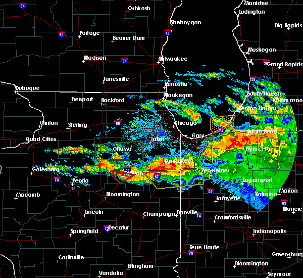 At 1003 pm cdt/1103 pm edt/, severe thunderstorms were located along a line extending from near fair oaks to near cullom, moving southeast at 40 mph (radar indicated). Hazards include 60 mph wind gusts and nickel size hail. Expect damage to roofs. siding. and trees. severe thunderstorms will be near, surrey around 1010 pm cdt. rensselaer around 1015 pm cdt. collegeville around 1020 pm cdt. pleasant ridge and ashkum around 1025 pm cdt. mccoysburg, gilman and onarga around 1030 pm cdt. watseka around 1045 pm cdt. other locations impacted by these severe thunderstorms include papineau, danforth, iroquois, beaverville, crescent city, donovan, martinton, mount ayr and woodland. A tornado watch remains in effect until 100 am cdt/200 am edt/ for northeastern illinois, and northwestern indiana. At 1003 pm cdt/1103 pm edt/, severe thunderstorms were located along a line extending from near fair oaks to near cullom, moving southeast at 40 mph (radar indicated). Hazards include 60 mph wind gusts and nickel size hail. Expect damage to roofs. siding. and trees. severe thunderstorms will be near, surrey around 1010 pm cdt. rensselaer around 1015 pm cdt. collegeville around 1020 pm cdt. pleasant ridge and ashkum around 1025 pm cdt. mccoysburg, gilman and onarga around 1030 pm cdt. watseka around 1045 pm cdt. other locations impacted by these severe thunderstorms include papineau, danforth, iroquois, beaverville, crescent city, donovan, martinton, mount ayr and woodland. A tornado watch remains in effect until 100 am cdt/200 am edt/ for northeastern illinois, and northwestern indiana.
|
| 9/18/2015 10:02 PM EDT |
 At 901 pm cdt /1001 pm edt/, a severe thunderstorm was located over fowler, moving east at 45 mph (radar indicated). Hazards include 60 mph wind gusts and half dollar size hail. Hail damage to vehicles is expected. expect wind damage to roofs, siding and trees. locations impacted include, fowler, lochiel, freeland park, barce, talbot, atkinson, wadena, templeton, dunnington, foresman, remington, oxford, boswell, earl park and ambia. Including the following interstate, indiana i-65 between mile markers 200 and 203. At 901 pm cdt /1001 pm edt/, a severe thunderstorm was located over fowler, moving east at 45 mph (radar indicated). Hazards include 60 mph wind gusts and half dollar size hail. Hail damage to vehicles is expected. expect wind damage to roofs, siding and trees. locations impacted include, fowler, lochiel, freeland park, barce, talbot, atkinson, wadena, templeton, dunnington, foresman, remington, oxford, boswell, earl park and ambia. Including the following interstate, indiana i-65 between mile markers 200 and 203.
|
| 9/18/2015 9:52 PM EDT |
 At 851 pm cdt, 951 pm edt, a severe thunderstorm was located near dunnington, moving east at 35 mph (radar indicated). Hazards include 60 mph wind gusts and half dollar size hail. Hail damage to vehicles is expected. expect wind damage to roofs, siding and trees. locations impacted include, fowler, kentland, stockland, lochiel, freeland park, raub, barce, talbot, atkinson, wadena, templeton, dunnington, perkins, foresman, milford, remington, oxford, goodland, boswell and earl park. Including the following interstate, indiana i-65 between mile markers 200 and 204. At 851 pm cdt, 951 pm edt, a severe thunderstorm was located near dunnington, moving east at 35 mph (radar indicated). Hazards include 60 mph wind gusts and half dollar size hail. Hail damage to vehicles is expected. expect wind damage to roofs, siding and trees. locations impacted include, fowler, kentland, stockland, lochiel, freeland park, raub, barce, talbot, atkinson, wadena, templeton, dunnington, perkins, foresman, milford, remington, oxford, goodland, boswell and earl park. Including the following interstate, indiana i-65 between mile markers 200 and 204.
|
| 9/18/2015 9:44 PM EDT |
 At 844 pm cdt, 944 pm edt, a severe thunderstorm was located over freeland park, moving east at 30 mph (radar indicated). Hazards include 60 mph wind gusts and penny size hail. Expect damage to roofs. siding and trees. locations impacted include, fowler, kentland, stockland, lochiel, freeland park, raub, barce, talbot, atkinson, wadena, templeton, claytonville, dunnington, perkins, foresman, milford, remington, oxford, goodland and cissna park. Including the following interstate, indiana i-65 between mile markers 200 and 204. At 844 pm cdt, 944 pm edt, a severe thunderstorm was located over freeland park, moving east at 30 mph (radar indicated). Hazards include 60 mph wind gusts and penny size hail. Expect damage to roofs. siding and trees. locations impacted include, fowler, kentland, stockland, lochiel, freeland park, raub, barce, talbot, atkinson, wadena, templeton, claytonville, dunnington, perkins, foresman, milford, remington, oxford, goodland and cissna park. Including the following interstate, indiana i-65 between mile markers 200 and 204.
|
| 9/18/2015 8:21 PM CDT |
 At 821 pm cdt, 921 pm edt, a severe thunderstorm was located near milford, or near stockland, moving east at 40 mph (radar indicated). Hazards include 60 mph wind gusts. Expect damage to roofs. siding and trees. locations impacted include, watseka, paxton, fowler, kentland, stockland, lochiel, raub, atkinson, wadena, templeton, claytonville, dunnington, perkins, freeland park, barce, talbot, foresman, onarga, milford and remington. including the following interstates, i-57 between mile markers 259 and 282. Indiana i-65 between mile markers 200 and 204. At 821 pm cdt, 921 pm edt, a severe thunderstorm was located near milford, or near stockland, moving east at 40 mph (radar indicated). Hazards include 60 mph wind gusts. Expect damage to roofs. siding and trees. locations impacted include, watseka, paxton, fowler, kentland, stockland, lochiel, raub, atkinson, wadena, templeton, claytonville, dunnington, perkins, freeland park, barce, talbot, foresman, onarga, milford and remington. including the following interstates, i-57 between mile markers 259 and 282. Indiana i-65 between mile markers 200 and 204.
|
| 9/18/2015 8:00 PM CDT |
 At 800 pm cdt, 900 pm edt, a severe thunderstorm was located near cissna park, or 7 miles west of claytonville, moving east at 40 mph (radar indicated). Hazards include 60 mph wind gusts. Expect damage to roofs. Siding and trees. At 800 pm cdt, 900 pm edt, a severe thunderstorm was located near cissna park, or 7 miles west of claytonville, moving east at 40 mph (radar indicated). Hazards include 60 mph wind gusts. Expect damage to roofs. Siding and trees.
|
| 8/15/2015 5:24 PM EDT |
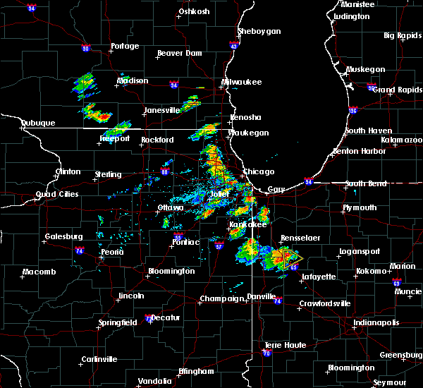 At 423 pm cdt /523 pm edt/, a severe thunderstorm was located over remington, or 8 miles east of wadena, moving south at 20 mph (radar indicated). Hazards include 60 mph wind gusts and quarter size hail. Hail damage to vehicles is expected. Expect wind damage to roofs, siding and trees. At 423 pm cdt /523 pm edt/, a severe thunderstorm was located over remington, or 8 miles east of wadena, moving south at 20 mph (radar indicated). Hazards include 60 mph wind gusts and quarter size hail. Hail damage to vehicles is expected. Expect wind damage to roofs, siding and trees.
|
| 6/22/2015 11:09 PM CDT |
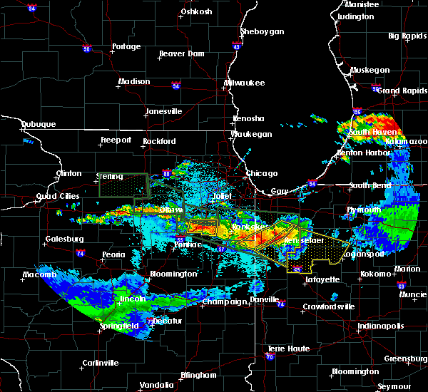 At 1108 pm cdt, severe thunderstorms were located along a line extending from near medaryville to near collegeville to near beaver city, moving southeast at 45 mph (radar indicated). Hazards include 60 mph wind gusts and quarter size hail. Hail damage to vehicles is expected. expect wind damage to roofs, siding and trees. these severe storms will be near, pleasant ridge and moody around 1120 pm cdt. hanging grove and mccoysburg around 1225 am edt. remington around 1230 am edt. other locations impacted by these severe thunderstorms include mount ayr and wheatfield. including the following interstate, indiana i-65 between mile markers 200 and 221. A tornado watch remains in effect until 200 am cdt/300 am edt/ for northwestern indiana. At 1108 pm cdt, severe thunderstorms were located along a line extending from near medaryville to near collegeville to near beaver city, moving southeast at 45 mph (radar indicated). Hazards include 60 mph wind gusts and quarter size hail. Hail damage to vehicles is expected. expect wind damage to roofs, siding and trees. these severe storms will be near, pleasant ridge and moody around 1120 pm cdt. hanging grove and mccoysburg around 1225 am edt. remington around 1230 am edt. other locations impacted by these severe thunderstorms include mount ayr and wheatfield. including the following interstate, indiana i-65 between mile markers 200 and 221. A tornado watch remains in effect until 200 am cdt/300 am edt/ for northwestern indiana.
|
| 6/22/2015 10:51 PM CDT |
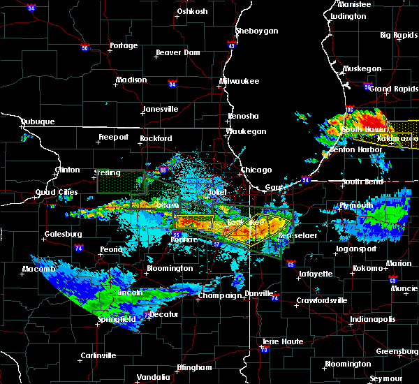 At 1051 pm cdt, severe thunderstorms were located along a line extending from near gifford to enos to 7 miles southeast of st. anne, moving southeast at 45 mph (radar indicated). Hazards include 60 mph wind gusts. Expect damage to roofs. siding and trees. severe thunderstorms will be near, gifford around 1055 pm cdt. moody around 1100 pm cdt. surrey around 1105 pm cdt. rensselaer, brook and collegeville around 1110 pm cdt. percy junction and pleasant ridge around 1115 pm cdt. hanging grove, mccoysburg and goodland around 1220 am edt. remington around 1225 am edt. other locations impacted by these severe thunderstorms include mount ayr and wheatfield. A tornado watch remains in effect until 200 am cdt/300 am edt/ for northwestern indiana. At 1051 pm cdt, severe thunderstorms were located along a line extending from near gifford to enos to 7 miles southeast of st. anne, moving southeast at 45 mph (radar indicated). Hazards include 60 mph wind gusts. Expect damage to roofs. siding and trees. severe thunderstorms will be near, gifford around 1055 pm cdt. moody around 1100 pm cdt. surrey around 1105 pm cdt. rensselaer, brook and collegeville around 1110 pm cdt. percy junction and pleasant ridge around 1115 pm cdt. hanging grove, mccoysburg and goodland around 1220 am edt. remington around 1225 am edt. other locations impacted by these severe thunderstorms include mount ayr and wheatfield. A tornado watch remains in effect until 200 am cdt/300 am edt/ for northwestern indiana.
|
| 6/21/2015 12:55 AM EDT |
 At 1155 pm cdt, 1255 am edt, severe thunderstorms were located along a line extending from wadena to near boswell, moving east at 50 mph (radar indicated). Hazards include 60 mph wind gusts. Expect damage to roofs. siding and trees. locations impacted include, fowler, kentland, otterbein, perkins, dunnington, barce, lochiel, wadena, freeland park, talbot, templeton, atkinson, raub, foresman, remington, oxford, goodland, boswell, earl park and ambia. Including the following interstate, indiana i-65 between mile markers 200 and 203. At 1155 pm cdt, 1255 am edt, severe thunderstorms were located along a line extending from wadena to near boswell, moving east at 50 mph (radar indicated). Hazards include 60 mph wind gusts. Expect damage to roofs. siding and trees. locations impacted include, fowler, kentland, otterbein, perkins, dunnington, barce, lochiel, wadena, freeland park, talbot, templeton, atkinson, raub, foresman, remington, oxford, goodland, boswell, earl park and ambia. Including the following interstate, indiana i-65 between mile markers 200 and 203.
|
| 6/21/2015 12:24 AM EDT |
 At 1124 pm cdt, 1224 am edt, severe thunderstorms were located along a line extending from near milford to hoopeston, moving east at 55 mph (radar indicated). Hazards include 70 mph wind gusts. Expect considerable tree damage. Damage is likely to mobile homes, roofs and outbuildings. At 1124 pm cdt, 1224 am edt, severe thunderstorms were located along a line extending from near milford to hoopeston, moving east at 55 mph (radar indicated). Hazards include 70 mph wind gusts. Expect considerable tree damage. Damage is likely to mobile homes, roofs and outbuildings.
|
| 6/12/2015 3:33 PM CDT |
 At 332 pm cdt, 432 pm edt, severe thunderstorms were located along a line extending from near wolcott to near lochiel, moving east at 30 mph (radar indicated). Hazards include 70 mph wind gusts and penny size hail. Expect considerable tree damage. damage is likely to mobile homes, roofs and outbuildings. locations impacted include, lochiel, wadena and remington. Including the following interstate, indiana i-65 between mile markers 200 and 206. At 332 pm cdt, 432 pm edt, severe thunderstorms were located along a line extending from near wolcott to near lochiel, moving east at 30 mph (radar indicated). Hazards include 70 mph wind gusts and penny size hail. Expect considerable tree damage. damage is likely to mobile homes, roofs and outbuildings. locations impacted include, lochiel, wadena and remington. Including the following interstate, indiana i-65 between mile markers 200 and 206.
|
| 6/12/2015 3:18 PM CDT |
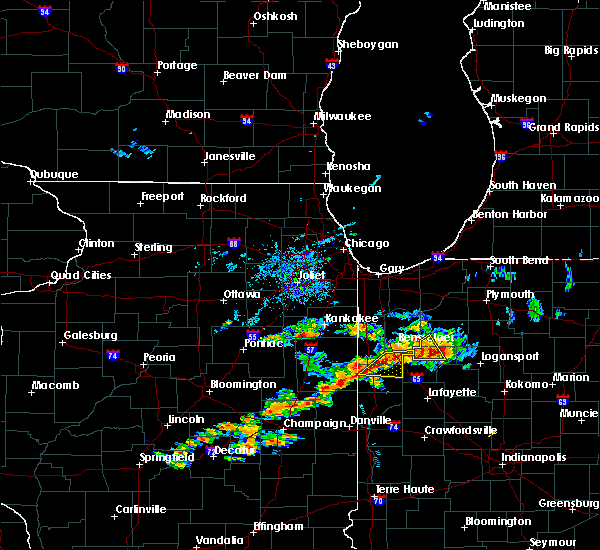 At 317 pm cdt, 417 pm edt, severe thunderstorms were located along a line extending from near remington to wadena, moving east at 30 mph (radar indicated). Hazards include 70 mph wind gusts and penny size hail. Expect considerable tree damage. damage is likely to mobile homes, roofs and outbuildings. locations impacted include, lochiel, wadena, remington, goodland and earl park. Including the following interstate, indiana i-65 between mile markers 200 and 206. At 317 pm cdt, 417 pm edt, severe thunderstorms were located along a line extending from near remington to wadena, moving east at 30 mph (radar indicated). Hazards include 70 mph wind gusts and penny size hail. Expect considerable tree damage. damage is likely to mobile homes, roofs and outbuildings. locations impacted include, lochiel, wadena, remington, goodland and earl park. Including the following interstate, indiana i-65 between mile markers 200 and 206.
|
| 6/12/2015 3:05 PM CDT |
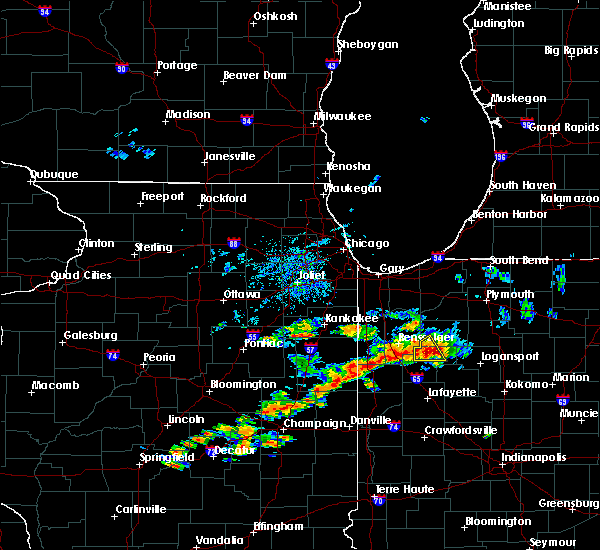 The national weather service in chicago has issued a * severe thunderstorm warning for. southeastern newton county in northwestern indiana. northern benton county in northwestern indiana. southern jasper county in northwestern indiana. Until 345 pm cdt/445 pm edt/. The national weather service in chicago has issued a * severe thunderstorm warning for. southeastern newton county in northwestern indiana. northern benton county in northwestern indiana. southern jasper county in northwestern indiana. Until 345 pm cdt/445 pm edt/.
|
| 6/8/2015 7:08 PM CDT | Branches dow in jasper county IN, 0.5 miles NNW of Remington, IN |
| 6/8/2015 7:04 PM CDT | At 704 pm cdt /804 pm edt/, a severe thunderstorm was located over goodland, or near percy junction, moving east at 30 mph (radar indicated). Hazards include 60 mph wind gusts and quarter size hail. Hail damage to vehicles is expected. Expect wind damage to roofs, siding and trees. |
| 6/7/2015 7:25 PM EDT | At 624 pm cdt /724 pm edt/, severe thunderstorms were located along a line extending from near wolcott to oxford to near potomac, moving east at 40 mph (radar indicated). Hazards include 60 mph wind gusts and quarter size hail. Hail damage to vehicles is expected. expect wind damage to roofs, siding and trees. Locations impacted include, fowler, stockland, percy junction, dunnington, barce, lochiel, wadena, freeland park, talbot, templeton, atkinson, foresman, remington, oxford, goodland, boswell, earl park, wellington and ambia. |
| 6/7/2015 7:25 PM EDT | At 624 pm cdt /724 pm edt/, severe thunderstorms were located along a line extending from near wolcott to oxford to near potomac, moving east at 40 mph (radar indicated). Hazards include 60 mph wind gusts and quarter size hail. Hail damage to vehicles is expected. expect wind damage to roofs, siding and trees. Locations impacted include, fowler, stockland, percy junction, dunnington, barce, lochiel, wadena, freeland park, talbot, templeton, atkinson, foresman, remington, oxford, goodland, boswell, earl park, wellington and ambia. |
| 6/7/2015 6:01 PM CDT | At 601 pm cdt /701 pm edt/, severe thunderstorms were located along a line extending from foresman to dunnington to rantoul, moving east at 40 mph (radar indicated). Hazards include 60 mph wind gusts and quarter size hail. Hail damage to vehicles is expected. Expect wind damage to roofs, siding and trees. |
| 6/7/2015 6:01 PM CDT | At 601 pm cdt /701 pm edt/, severe thunderstorms were located along a line extending from foresman to dunnington to rantoul, moving east at 40 mph (radar indicated). Hazards include 60 mph wind gusts and quarter size hail. Hail damage to vehicles is expected. Expect wind damage to roofs, siding and trees. |
| 6/7/2015 5:55 PM CDT | At 555 pm cdt /655 pm edt/, severe thunderstorms were located along a line extending from near beaver city to near milford to 7 miles northwest of rantoul, moving east at 55 mph (radar indicated). Hazards include 60 mph wind gusts and quarter size hail. Hail damage to vehicles is expected. expect wind damage to roofs, siding and trees. locations impacted include, watseka, paxton, gibson city, kentland, stockland, percy junction, perkins, claytonville, wadena, freeland park, raub, milford, remington, sheldon, goodland, cissna park, buckley, gibson, melvin and loda. Including the following interstate, i-57 between mile markers 258 and 277. |
| 6/7/2015 5:55 PM CDT | At 555 pm cdt /655 pm edt/, severe thunderstorms were located along a line extending from near beaver city to near milford to 7 miles northwest of rantoul, moving east at 55 mph (radar indicated). Hazards include 60 mph wind gusts and quarter size hail. Hail damage to vehicles is expected. expect wind damage to roofs, siding and trees. locations impacted include, watseka, paxton, gibson city, kentland, stockland, percy junction, perkins, claytonville, wadena, freeland park, raub, milford, remington, sheldon, goodland, cissna park, buckley, gibson, melvin and loda. Including the following interstate, i-57 between mile markers 258 and 277. |
| 6/7/2015 5:53 PM CDT | At 553 pm cdt, severe thunderstorms were located along a line extending from near surrey to near kentland, moving east at 30 mph (radar indicated). Hazards include 70 mph wind gusts. Expect considerable tree damage. damage is likely to mobile homes, roofs and outbuildings. these severe storms will be near, surrey around 600 pm cdt. rensselaer around 605 pm cdt. collegeville around 610 pm cdt. hanging grove, pleasant ridge and mccoysburg around 615 pm cdt. other locations impacted by these severe thunderstorms include mount ayr. Including the following interstate, indiana i-65 between mile markers 200 and 221. |
| 6/7/2015 5:36 PM CDT | At 535 pm cdt /635 pm edt/, severe thunderstorms were located along a line extending from 6 miles northeast of watseka to buckley to downs, moving east at 55 mph (radar indicated). Hazards include 60 mph wind gusts and quarter size hail. Hail damage to vehicles is expected. expect wind damage to roofs, siding and trees. locations impacted include, watseka, paxton, gibson city, kentland, piper city, stockland, percy junction, perkins, claytonville, wadena, raub, freeland park, gilman, onarga, milford, forrest, chatsworth, remington, sheldon and goodland. Including the following interstate, i-57 between mile markers 258 and 287. |
| 6/7/2015 5:36 PM CDT | At 535 pm cdt /635 pm edt/, severe thunderstorms were located along a line extending from 6 miles northeast of watseka to buckley to downs, moving east at 55 mph (radar indicated). Hazards include 60 mph wind gusts and quarter size hail. Hail damage to vehicles is expected. expect wind damage to roofs, siding and trees. locations impacted include, watseka, paxton, gibson city, kentland, piper city, stockland, percy junction, perkins, claytonville, wadena, raub, freeland park, gilman, onarga, milford, forrest, chatsworth, remington, sheldon and goodland. Including the following interstate, i-57 between mile markers 258 and 287. |
| 6/7/2015 5:31 PM CDT | At 530 pm cdt, severe thunderstorms were located along a line extending from near surrey to beaver city, moving east at 45 mph (radar indicated). Hazards include 70 mph wind gusts. Expect considerable tree damage. damage is likely to mobile homes, roofs and outbuildings. these severe storms will be near, pleasant ridge, surrey and collegeville around 535 pm cdt. mccoysburg around 540 pm cdt. rensselaer and hanging grove around 545 pm cdt. remington around 655 pm edt. other locations impacted by these severe thunderstorms include mount ayr. Including the following interstate, indiana i-65 between mile markers 200 and 221. |
| 6/7/2015 5:19 PM CDT | At 519 pm cdt /619 pm edt/, severe thunderstorms were located along a line extending from near gilman to 9 miles south of forrest to near stanford, moving east at 50 mph (radar indicated). Hazards include 70 mph wind gusts and quarter size hail. Hail damage to vehicles is expected. expect considerable tree damage. Wind damage is also likely to mobile homes, roofs and outbuildings. |
| 6/7/2015 5:19 PM CDT | At 519 pm cdt /619 pm edt/, severe thunderstorms were located along a line extending from near gilman to 9 miles south of forrest to near stanford, moving east at 50 mph (radar indicated). Hazards include 70 mph wind gusts and quarter size hail. Hail damage to vehicles is expected. expect considerable tree damage. Wind damage is also likely to mobile homes, roofs and outbuildings. |
| 6/7/2015 5:10 PM CDT | At 509 pm cdt, severe thunderstorms were located along a line extending from near conrad to near st. anne, moving east at 35 mph (radar indicated). Hazards include 70 mph wind gusts. Expect considerable tree damage. damage is likely to mobile homes, roofs and outbuildings. severe thunderstorms will be near, enos around 515 pm cdt. morocco and surrey around 530 pm cdt. beaver city around 535 pm cdt. brook around 540 pm cdt. rensselaer and hanging grove around 550 pm cdt. remington and collegeville around 555 pm cdt. pleasant ridge around 600 pm cdt. mccoysburg around 605 pm cdt. Including the following interstate, indiana i-65 between mile markers 200 and 221. |
| 6/7/2015 5:10 PM CDT | At 509 pm cdt, severe thunderstorms were located along a line extending from near conrad to near st. anne, moving east at 35 mph (radar indicated). Hazards include 70 mph wind gusts. Expect considerable tree damage. damage is likely to mobile homes, roofs and outbuildings. severe thunderstorms will be near, enos around 515 pm cdt. morocco and surrey around 530 pm cdt. beaver city around 535 pm cdt. brook around 540 pm cdt. rensselaer and hanging grove around 550 pm cdt. remington and collegeville around 555 pm cdt. pleasant ridge around 600 pm cdt. mccoysburg around 605 pm cdt. Including the following interstate, indiana i-65 between mile markers 200 and 221. |
| 8/9/2012 7:30 PM CDT | Golf Ball sized hail reported 0.5 miles NNW of Remington, IN |
| 8/9/2012 7:27 PM CDT | Also dime sized hai in jasper county IN, 1.8 miles SSE of Remington, IN |
| 8/9/2012 7:27 PM CDT | Golf Ball sized hail reported 3 miles S of Remington, IN, near mile marker 205 on interstate 65. relayed by sheriff. |
| 8/9/2012 7:25 PM CDT | Golf Ball sized hail reported 3.4 miles ESE of Remington, IN, relayed by sheriff |
| 1/1/0001 12:00 AM | County rd 800e and 400n. tree down fell on other trees and caused damage to lawn decorations in benton county IN, 5.5 miles NNE of Remington, IN |
| 1/1/0001 12:00 AM | Storm damage reported in jasper county IN, 0.5 miles NNW of Remington, IN |
| 1/1/0001 12:00 AM | Large tree fell across vehicle. 3 large trees down across roadway. town without powe in jasper county IN, 0.5 miles NNW of Remington, IN |
Hail Maps for Remington, IN


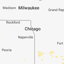
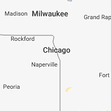


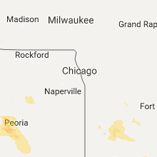
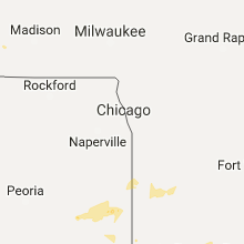


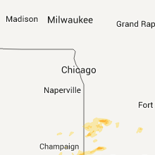


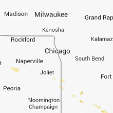


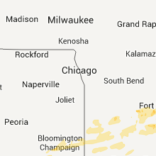


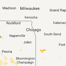

Connect with Interactive Hail Maps