

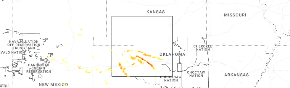
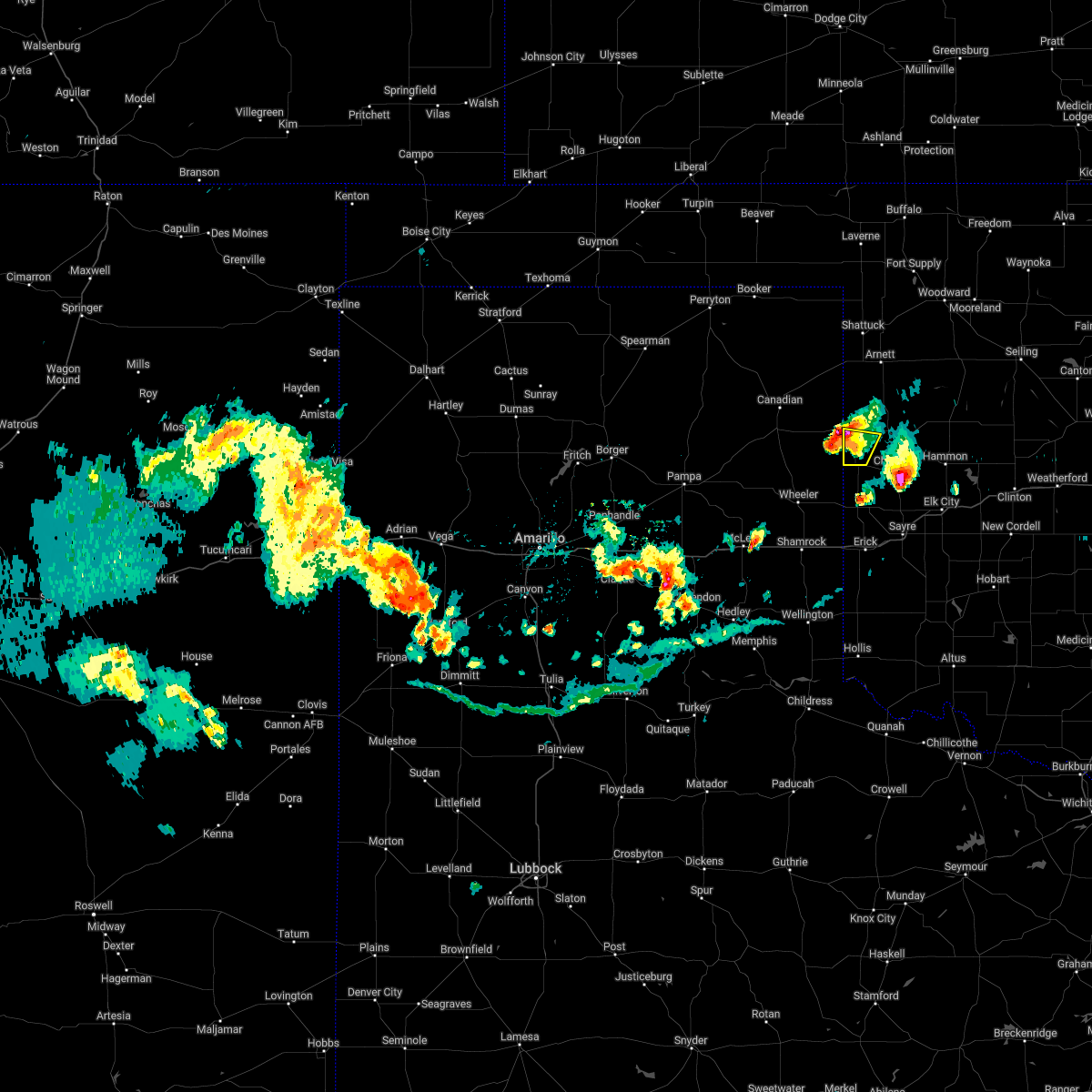
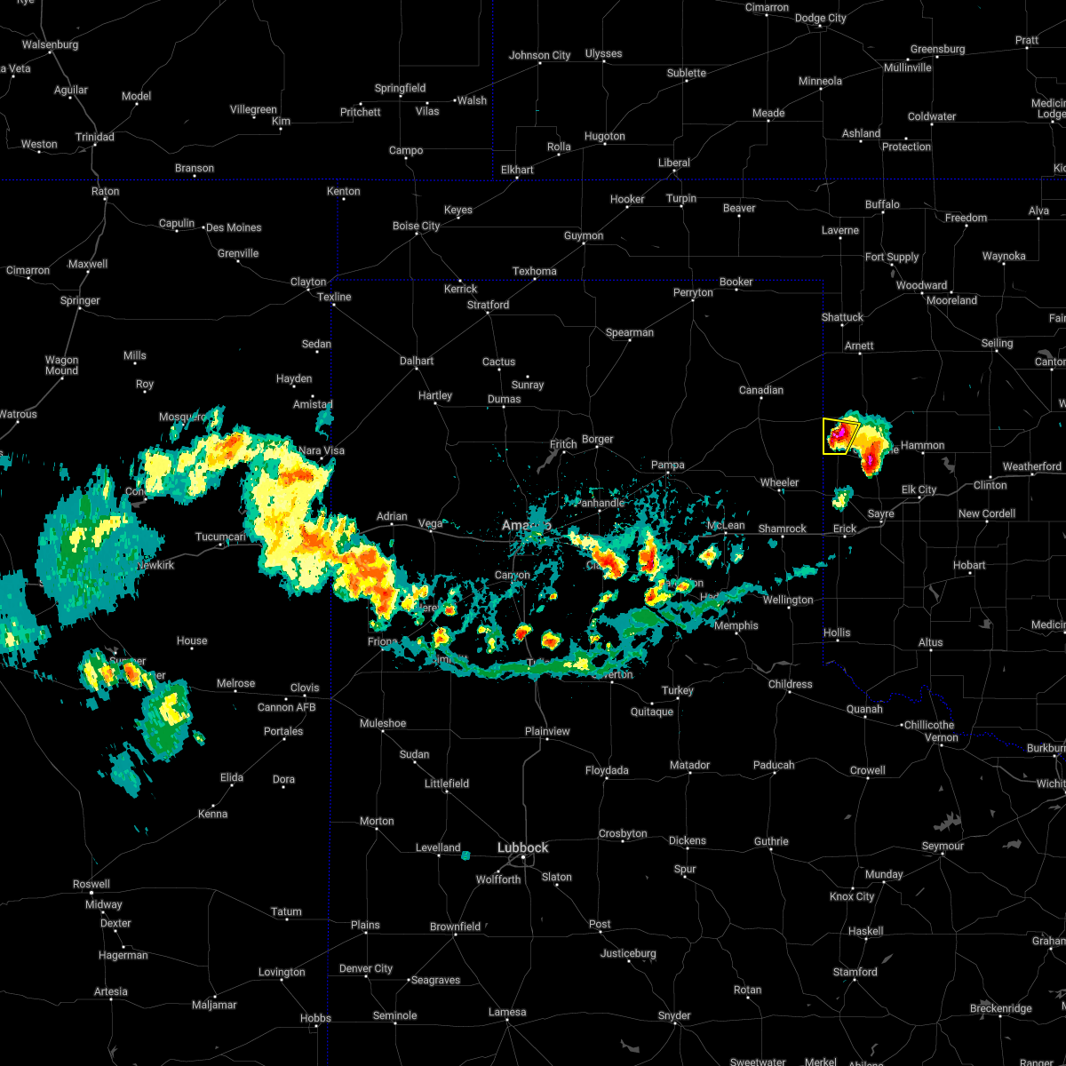
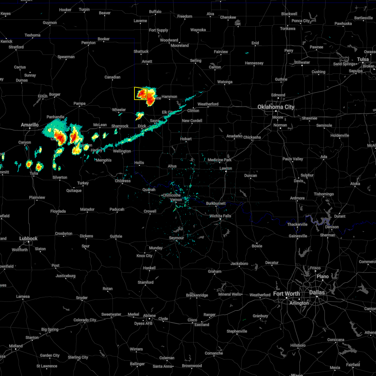
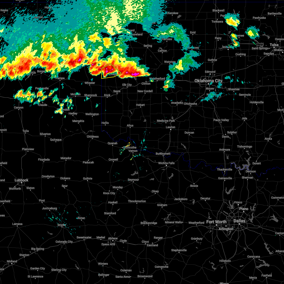
Hail Map for Reydon, OK
The Reydon, OK area has had 29 reports of on-the-ground hail by trained spotters, and has been under severe weather warnings 16 times during the past 12 months. Doppler radar has detected hail at or near Reydon, OK on 81 occasions, including 6 occasions during the past year.
| Name: | Reydon, OK |
| Where Located: | 61.4 miles SSW of Woodward, OK |
| Map: | Google Map for Reydon, OK |
| Population: | 210 |
| Housing Units: | 98 |
| More Info: | Search Google for Reydon, OK |
2
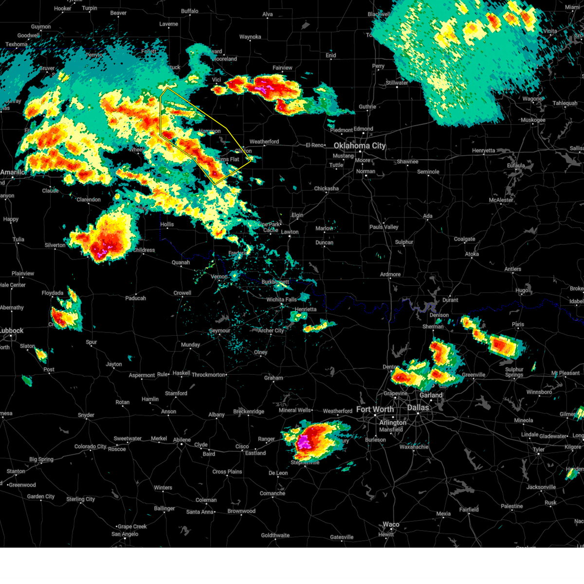
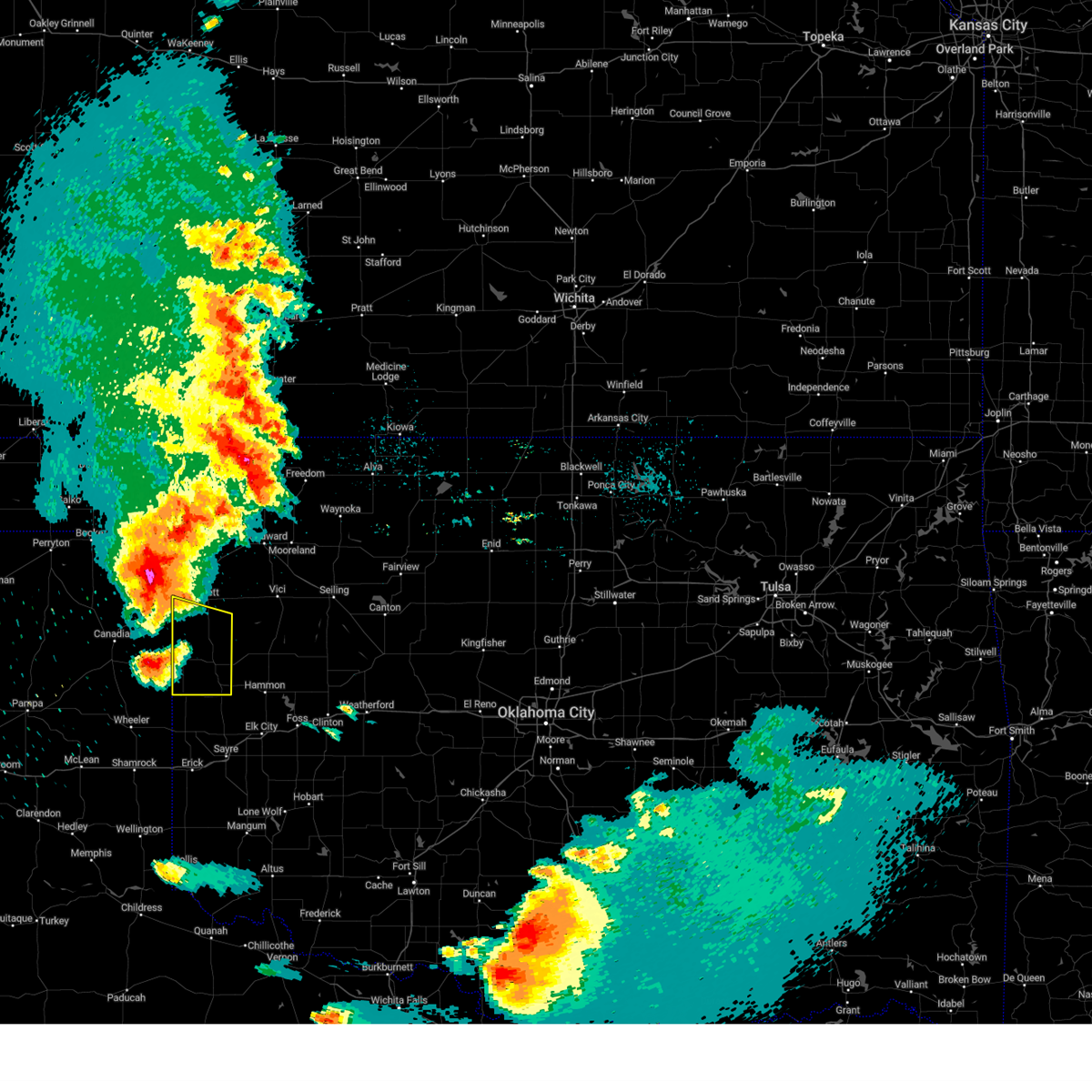
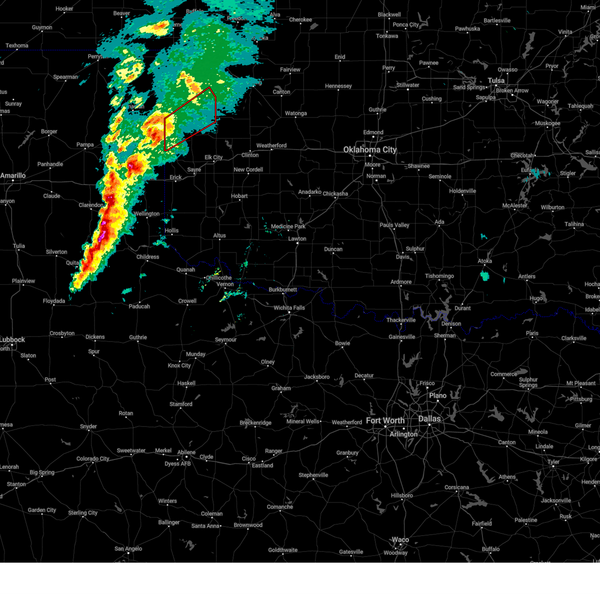
The Top Recent Hail Date for Reydon, OK is Monday, May 26, 2025 (6th out of 81)
Hail and Wind Damage Spotted near Reydon, OK
| Date / Time | Report Details |
|---|---|
| 7/8/2025 10:28 PM CDT |
 Svroun the national weather service in norman has issued a * severe thunderstorm warning for, southeastern ellis county in northwestern oklahoma, roger mills county in western oklahoma, western custer county in western oklahoma, western dewey county in northwestern oklahoma, northern beckham county in western oklahoma, southwestern woodward county in northwestern oklahoma, * until 1115 pm cdt. * at 1028 pm cdt, severe thunderstorms were located along a line extending from 5 miles southwest of sharon to 5 miles southwest of durham, moving southeast at 35 mph (radar indicated). Hazards include 70 mph wind gusts. Expect considerable tree damage. Damage is likely to mobile homes, roofs, and outbuildings. Svroun the national weather service in norman has issued a * severe thunderstorm warning for, southeastern ellis county in northwestern oklahoma, roger mills county in western oklahoma, western custer county in western oklahoma, western dewey county in northwestern oklahoma, northern beckham county in western oklahoma, southwestern woodward county in northwestern oklahoma, * until 1115 pm cdt. * at 1028 pm cdt, severe thunderstorms were located along a line extending from 5 miles southwest of sharon to 5 miles southwest of durham, moving southeast at 35 mph (radar indicated). Hazards include 70 mph wind gusts. Expect considerable tree damage. Damage is likely to mobile homes, roofs, and outbuildings.
|
| 6/15/2025 6:18 AM CDT |
 the severe thunderstorm warning has been cancelled and is no longer in effect the severe thunderstorm warning has been cancelled and is no longer in effect
|
| 6/15/2025 6:18 AM CDT |
 At 618 am cdt, severe thunderstorms were located along a line extending from 4 miles southwest of angora to 4 miles west of sayre to 4 miles southwest of texola, moving southeast at 40 mph (radar indicated). Hazards include 60 mph wind gusts. Expect damage to roofs, siding, and trees. Locations impacted include, elk city, sayre, cheyenne, erick, hammon, canute, carter, reydon, foss, willow, sweetwater, strong city, texola, retrop, delhi, foss reservoir, vinson, madge, brinkman, and berlin. At 618 am cdt, severe thunderstorms were located along a line extending from 4 miles southwest of angora to 4 miles west of sayre to 4 miles southwest of texola, moving southeast at 40 mph (radar indicated). Hazards include 60 mph wind gusts. Expect damage to roofs, siding, and trees. Locations impacted include, elk city, sayre, cheyenne, erick, hammon, canute, carter, reydon, foss, willow, sweetwater, strong city, texola, retrop, delhi, foss reservoir, vinson, madge, brinkman, and berlin.
|
| 6/15/2025 5:47 AM CDT |
 Svroun the national weather service in norman has issued a * severe thunderstorm warning for, northwestern washita county in western oklahoma, southwestern ellis county in northwestern oklahoma, roger mills county in western oklahoma, western custer county in western oklahoma, northern harmon county in southwestern oklahoma, northwestern greer county in southwestern oklahoma, beckham county in western oklahoma, * until 630 am cdt. * at 546 am cdt, severe thunderstorms were located along a line extending from 9 miles south of arnett to 5 miles northwest of sweetwater to near wheeler, moving southeast at 50 mph (radar indicated). Hazards include 60 mph wind gusts and nickel size hail. expect damage to roofs, siding, and trees Svroun the national weather service in norman has issued a * severe thunderstorm warning for, northwestern washita county in western oklahoma, southwestern ellis county in northwestern oklahoma, roger mills county in western oklahoma, western custer county in western oklahoma, northern harmon county in southwestern oklahoma, northwestern greer county in southwestern oklahoma, beckham county in western oklahoma, * until 630 am cdt. * at 546 am cdt, severe thunderstorms were located along a line extending from 9 miles south of arnett to 5 miles northwest of sweetwater to near wheeler, moving southeast at 50 mph (radar indicated). Hazards include 60 mph wind gusts and nickel size hail. expect damage to roofs, siding, and trees
|
| 6/8/2025 5:47 PM CDT | At 546 pm cdt, severe thunderstorms were located along a line extending from 8 miles southeast of lake marvin to 7 miles northwest of elk city to 7 miles west of dill city, moving northeast at 25 mph (radar indicated). Hazards include ping pong ball size hail and 60 mph wind gusts. People and animals outdoors will be injured. expect hail damage to roofs, siding, windows, and vehicles. expect wind damage to roofs, siding, and trees. Locations impacted include, elk city, clinton, cordell, cheyenne, burns flat, hammon, dill city, canute, butler, reydon, bessie, foss, strong city, foss reservoir, angora, moorewood, crawford, roll, durham, and retrop. |
| 6/8/2025 5:39 PM CDT |
 Svroun the national weather service in norman has issued a * severe thunderstorm warning for, northwestern washita county in western oklahoma, southwestern ellis county in northwestern oklahoma, roger mills county in western oklahoma, southwestern custer county in western oklahoma, northeastern beckham county in western oklahoma, * until 630 pm cdt. * at 539 pm cdt, severe thunderstorms were located along a line extending from 8 miles south of lake marvin to 7 miles west of elk city to 5 miles north of retrop, moving northeast at 20 mph (radar indicated). Hazards include 60 mph wind gusts and half dollar size hail. Hail damage to vehicles is expected. Expect wind damage to roofs, siding, and trees. Svroun the national weather service in norman has issued a * severe thunderstorm warning for, northwestern washita county in western oklahoma, southwestern ellis county in northwestern oklahoma, roger mills county in western oklahoma, southwestern custer county in western oklahoma, northeastern beckham county in western oklahoma, * until 630 pm cdt. * at 539 pm cdt, severe thunderstorms were located along a line extending from 8 miles south of lake marvin to 7 miles west of elk city to 5 miles north of retrop, moving northeast at 20 mph (radar indicated). Hazards include 60 mph wind gusts and half dollar size hail. Hail damage to vehicles is expected. Expect wind damage to roofs, siding, and trees.
|
| 6/7/2025 2:11 AM CDT |
 At 211 am cdt, severe thunderstorms were located along a line extending from 3 miles southwest of camargo to 8 miles west of sweetwater, moving east at 60 mph (radar indicated). Hazards include 60 mph wind gusts and penny size hail. Expect damage to roofs, siding, and trees. Locations impacted include, elk city, sayre, cheyenne, erick, hammon, leedey, butler, reydon, camargo, sweetwater, strong city, texola, putnam, delhi, angora, moorewood, crawford, roll, foss reservoir, and berlin. At 211 am cdt, severe thunderstorms were located along a line extending from 3 miles southwest of camargo to 8 miles west of sweetwater, moving east at 60 mph (radar indicated). Hazards include 60 mph wind gusts and penny size hail. Expect damage to roofs, siding, and trees. Locations impacted include, elk city, sayre, cheyenne, erick, hammon, leedey, butler, reydon, camargo, sweetwater, strong city, texola, putnam, delhi, angora, moorewood, crawford, roll, foss reservoir, and berlin.
|
| 6/7/2025 2:00 AM CDT |
 At 159 am cdt, severe thunderstorms were located along a line extending from 8 miles southeast of harmon to 3 miles east of wheeler, moving southeast at 50 mph (radar indicated). Hazards include 60 mph wind gusts and penny size hail. Expect damage to roofs, siding, and trees. Locations impacted include, elk city, sayre, cheyenne, erick, hammon, leedey, butler, reydon, camargo, sweetwater, strong city, texola, putnam, delhi, angora, moorewood, crawford, harmon, roll, and durham. At 159 am cdt, severe thunderstorms were located along a line extending from 8 miles southeast of harmon to 3 miles east of wheeler, moving southeast at 50 mph (radar indicated). Hazards include 60 mph wind gusts and penny size hail. Expect damage to roofs, siding, and trees. Locations impacted include, elk city, sayre, cheyenne, erick, hammon, leedey, butler, reydon, camargo, sweetwater, strong city, texola, putnam, delhi, angora, moorewood, crawford, harmon, roll, and durham.
|
| 6/7/2025 1:50 AM CDT |
 Svroun the national weather service in norman has issued a * severe thunderstorm warning for, southern ellis county in northwestern oklahoma, roger mills county in western oklahoma, western custer county in western oklahoma, southwestern dewey county in northwestern oklahoma, beckham county in western oklahoma, * until 230 am cdt. * at 150 am cdt, severe thunderstorms were located along a line extending from 6 miles southwest of harmon to near allison, moving east at 50 mph (radar indicated). Hazards include 60 mph wind gusts and quarter size hail. Hail damage to vehicles is expected. Expect wind damage to roofs, siding, and trees. Svroun the national weather service in norman has issued a * severe thunderstorm warning for, southern ellis county in northwestern oklahoma, roger mills county in western oklahoma, western custer county in western oklahoma, southwestern dewey county in northwestern oklahoma, beckham county in western oklahoma, * until 230 am cdt. * at 150 am cdt, severe thunderstorms were located along a line extending from 6 miles southwest of harmon to near allison, moving east at 50 mph (radar indicated). Hazards include 60 mph wind gusts and quarter size hail. Hail damage to vehicles is expected. Expect wind damage to roofs, siding, and trees.
|
| 6/6/2025 11:31 PM CDT |
 At 1131 pm cdt, a confirmed tornado was located 5 miles northwest of sweetwater, moving southeast at 35 mph (weather spotters confirmed tornado). Hazards include damaging tornado and tennis ball size hail. Flying debris will be dangerous to those caught without shelter. mobile homes will be damaged or destroyed. damage to roofs, windows, and vehicles will occur. tree damage is likely. locations impacted include, cheyenne, reydon, sweetwater, berlin, and dempsey. This includes interstate 40 between mile markers 9 and 18. At 1131 pm cdt, a confirmed tornado was located 5 miles northwest of sweetwater, moving southeast at 35 mph (weather spotters confirmed tornado). Hazards include damaging tornado and tennis ball size hail. Flying debris will be dangerous to those caught without shelter. mobile homes will be damaged or destroyed. damage to roofs, windows, and vehicles will occur. tree damage is likely. locations impacted include, cheyenne, reydon, sweetwater, berlin, and dempsey. This includes interstate 40 between mile markers 9 and 18.
|
| 6/6/2025 11:24 PM CDT | Toroun the national weather service in norman has issued a * tornado warning for, southern roger mills county in western oklahoma, northwestern beckham county in western oklahoma, * until 1215 am cdt. * at 1124 pm cdt, a severe thunderstorm capable of producing a tornado was located 7 miles southeast of allison, moving southeast at 35 mph (radar indicated rotation). Hazards include tornado and tennis ball size hail. Flying debris will be dangerous to those caught without shelter. mobile homes will be damaged or destroyed. damage to roofs, windows, and vehicles will occur. Tree damage is likely. |
| 6/5/2025 1:10 PM CDT |
 Svroun the national weather service in norman has issued a * severe thunderstorm warning for, southern roger mills county in western oklahoma, northeastern beckham county in western oklahoma, * until 215 pm cdt. * at 109 pm cdt, a severe thunderstorm was located near reydon, or 9 miles northwest of cheyenne, moving east at 30 mph (radar indicated). Hazards include 60 mph wind gusts and quarter size hail. Hail damage to vehicles is expected. expect wind damage to roofs, siding, and trees. this severe thunderstorm will be near, cheyenne around 120 pm cdt. strong city around 125 pm cdt. Hammon around 155 pm cdt. Svroun the national weather service in norman has issued a * severe thunderstorm warning for, southern roger mills county in western oklahoma, northeastern beckham county in western oklahoma, * until 215 pm cdt. * at 109 pm cdt, a severe thunderstorm was located near reydon, or 9 miles northwest of cheyenne, moving east at 30 mph (radar indicated). Hazards include 60 mph wind gusts and quarter size hail. Hail damage to vehicles is expected. expect wind damage to roofs, siding, and trees. this severe thunderstorm will be near, cheyenne around 120 pm cdt. strong city around 125 pm cdt. Hammon around 155 pm cdt.
|
| 6/5/2025 12:46 PM CDT |
 At 1245 pm cdt, a severe thunderstorm was located 7 miles north of allison, moving east at 35 mph (radar indicated). Hazards include ping pong ball size hail and 60 mph wind gusts. People and animals outdoors will be injured. expect hail damage to roofs, siding, windows, and vehicles. expect wind damage to roofs, siding, and trees. Locations in or near the path include, crawford, reydon,. At 1245 pm cdt, a severe thunderstorm was located 7 miles north of allison, moving east at 35 mph (radar indicated). Hazards include ping pong ball size hail and 60 mph wind gusts. People and animals outdoors will be injured. expect hail damage to roofs, siding, windows, and vehicles. expect wind damage to roofs, siding, and trees. Locations in or near the path include, crawford, reydon,.
|
| 6/5/2025 12:36 PM CDT |
 At 1236 pm cdt, a severe thunderstorm was located 7 miles north of allison, moving east at 35 mph (radar indicated). Hazards include 60 mph wind gusts and half dollar size hail. Hail damage to vehicles is expected. expect wind damage to roofs, siding, and trees. Locations in or near the path include, crawford, durham, reydon,. At 1236 pm cdt, a severe thunderstorm was located 7 miles north of allison, moving east at 35 mph (radar indicated). Hazards include 60 mph wind gusts and half dollar size hail. Hail damage to vehicles is expected. expect wind damage to roofs, siding, and trees. Locations in or near the path include, crawford, durham, reydon,.
|
| 6/5/2025 12:22 PM CDT |
 Svroun the national weather service in norman has issued a * severe thunderstorm warning for, northwestern roger mills county in western oklahoma, * until 115 pm cdt. * at 1222 pm cdt, a severe thunderstorm was located 8 miles north of briscoe, moving east at 35 mph (radar indicated). Hazards include 60 mph wind gusts and half dollar size hail. Hail damage to vehicles is expected. expect wind damage to roofs, siding, and trees. Locations in or near the path include, crawford, durham, reydon,. Svroun the national weather service in norman has issued a * severe thunderstorm warning for, northwestern roger mills county in western oklahoma, * until 115 pm cdt. * at 1222 pm cdt, a severe thunderstorm was located 8 miles north of briscoe, moving east at 35 mph (radar indicated). Hazards include 60 mph wind gusts and half dollar size hail. Hail damage to vehicles is expected. expect wind damage to roofs, siding, and trees. Locations in or near the path include, crawford, durham, reydon,.
|
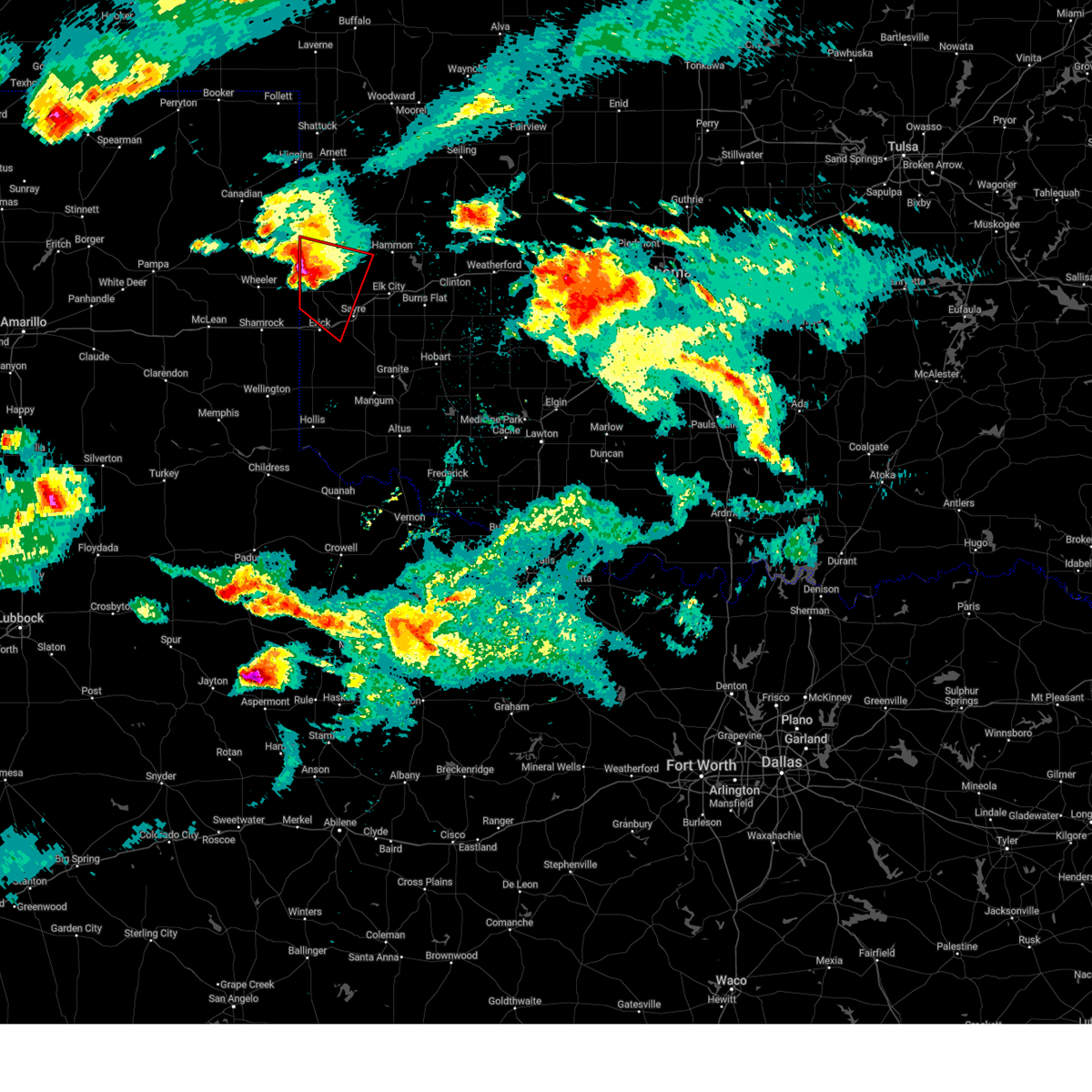
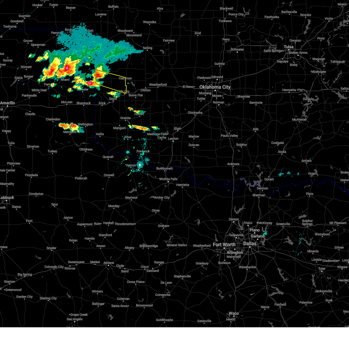
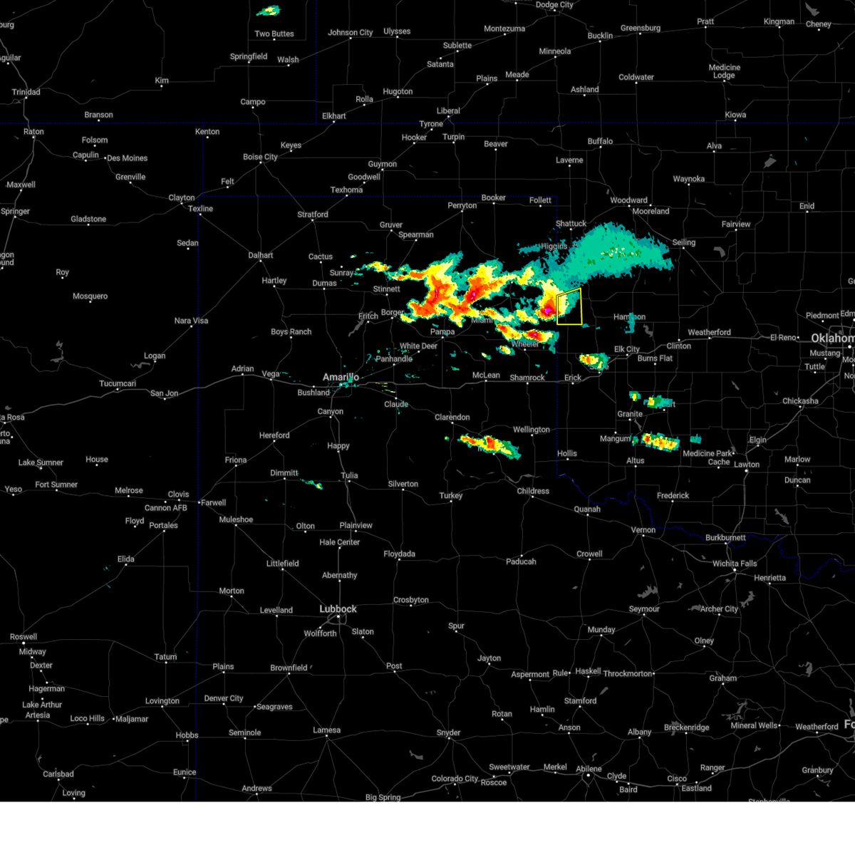
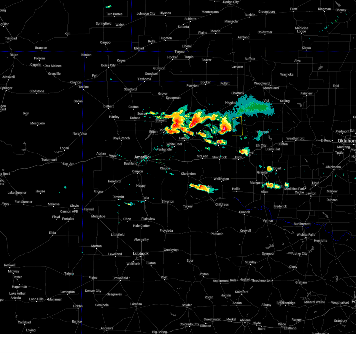
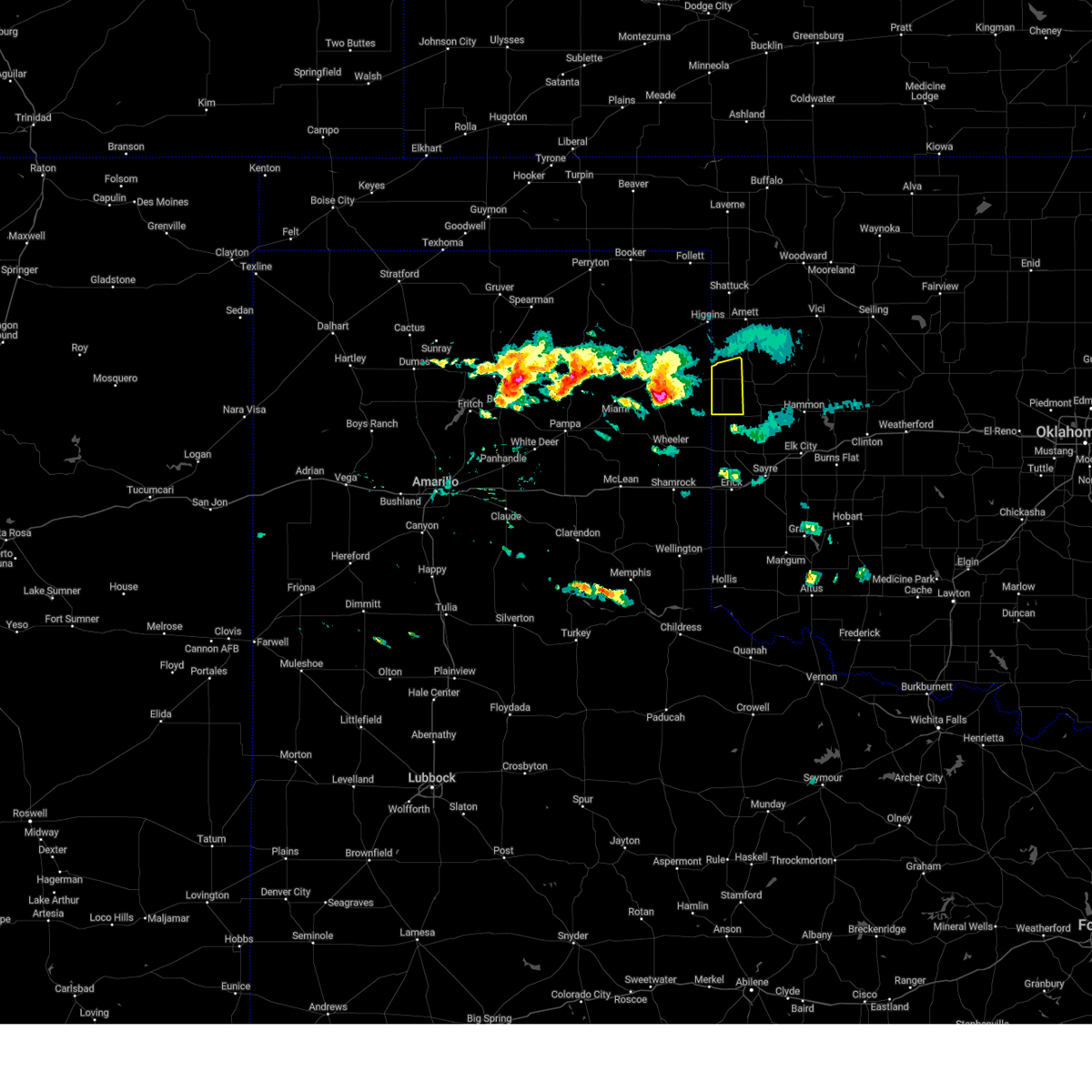
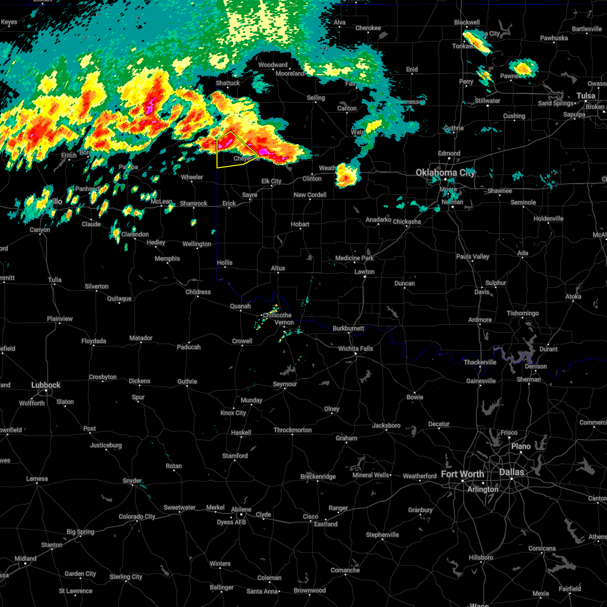
| 5/26/2025 9:35 PM CDT | Svroun the national weather service in norman has issued a * severe thunderstorm warning for, south central ellis county in northwestern oklahoma, roger mills county in western oklahoma, * until 1015 pm cdt. * at 935 pm cdt, severe thunderstorms were located along a line extending from 3 miles northeast of crawford to near reydon to near allison, moving southeast at 30 mph (radar indicated). Hazards include 60 mph wind gusts and quarter size hail. Hail damage to vehicles is expected. Expect wind damage to roofs, siding, and trees. |
| 5/26/2025 8:25 PM CDT | Baseball sized hail reported 14.1 miles SSW of Reydon, OK |
| 5/30/2024 9:12 PM CDT |
 Svroun the national weather service in norman has issued a * severe thunderstorm warning for, northwestern washita county in western oklahoma, roger mills county in western oklahoma, western custer county in western oklahoma, northern beckham county in western oklahoma, * until 1000 pm cdt. * at 911 pm cdt, severe thunderstorms were located along a line extending from near durham to 9 miles southeast of cheyenne to near erick, moving east at 40 mph (radar indicated). Hazards include 60 mph wind gusts and nickel size hail. expect damage to roofs, siding, and trees Svroun the national weather service in norman has issued a * severe thunderstorm warning for, northwestern washita county in western oklahoma, roger mills county in western oklahoma, western custer county in western oklahoma, northern beckham county in western oklahoma, * until 1000 pm cdt. * at 911 pm cdt, severe thunderstorms were located along a line extending from near durham to 9 miles southeast of cheyenne to near erick, moving east at 40 mph (radar indicated). Hazards include 60 mph wind gusts and nickel size hail. expect damage to roofs, siding, and trees
|
| 5/30/2024 8:54 PM CDT |
 At 853 pm cdt, severe thunderstorms were located along a line extending from 4 miles northwest of durham to 9 miles northeast of sweetwater to 7 miles northwest of texola, moving east at 35 mph (radar indicated). Hazards include 60 mph wind gusts and nickel size hail. Expect damage to roofs, siding, and trees. Locations impacted include, sayre, cheyenne, reydon, sweetwater, strong city, crawford, roll, durham, berlin, and dempsey. At 853 pm cdt, severe thunderstorms were located along a line extending from 4 miles northwest of durham to 9 miles northeast of sweetwater to 7 miles northwest of texola, moving east at 35 mph (radar indicated). Hazards include 60 mph wind gusts and nickel size hail. Expect damage to roofs, siding, and trees. Locations impacted include, sayre, cheyenne, reydon, sweetwater, strong city, crawford, roll, durham, berlin, and dempsey.
|
| 5/30/2024 8:34 PM CDT |
 Svroun the national weather service in norman has issued a * severe thunderstorm warning for, roger mills county in western oklahoma, northwestern beckham county in western oklahoma, * until 915 pm cdt. * at 833 pm cdt, severe thunderstorms were located along a line extending from near lake marvin to near reydon to 4 miles northeast of shamrock, moving east at 40 mph (radar indicated). Hazards include 60 mph wind gusts and penny size hail. expect damage to roofs, siding, and trees Svroun the national weather service in norman has issued a * severe thunderstorm warning for, roger mills county in western oklahoma, northwestern beckham county in western oklahoma, * until 915 pm cdt. * at 833 pm cdt, severe thunderstorms were located along a line extending from near lake marvin to near reydon to 4 miles northeast of shamrock, moving east at 40 mph (radar indicated). Hazards include 60 mph wind gusts and penny size hail. expect damage to roofs, siding, and trees
|
| 5/19/2024 5:45 PM CDT | Ping Pong Ball sized hail reported 11.5 miles SSW of Reydon, OK, delayed report. report from mping: ping pong ball (1.50 in.). |
| 4/27/2024 9:50 AM CDT |
 Svroun the national weather service in norman has issued a * severe thunderstorm warning for, southeastern ellis county in northwestern oklahoma, roger mills county in western oklahoma, * until 1030 am cdt. * at 950 am cdt, a severe thunderstorm was located 5 miles southwest of cheyenne, moving northeast at 35 mph (radar indicated). Hazards include 60 mph wind gusts and quarter size hail. Hail damage to vehicles is expected. Expect wind damage to roofs, siding, and trees. Svroun the national weather service in norman has issued a * severe thunderstorm warning for, southeastern ellis county in northwestern oklahoma, roger mills county in western oklahoma, * until 1030 am cdt. * at 950 am cdt, a severe thunderstorm was located 5 miles southwest of cheyenne, moving northeast at 35 mph (radar indicated). Hazards include 60 mph wind gusts and quarter size hail. Hail damage to vehicles is expected. Expect wind damage to roofs, siding, and trees.
|
| 3/24/2024 4:03 PM CDT |
 the severe thunderstorm warning has been cancelled and is no longer in effect the severe thunderstorm warning has been cancelled and is no longer in effect
|
| 3/24/2024 3:45 PM CDT |
 Svroun the national weather service in norman has issued a * severe thunderstorm warning for, southern roger mills county in western oklahoma, northwestern beckham county in western oklahoma, * until 430 pm cdt. * at 344 pm cdt, a severe thunderstorm was located 4 miles northwest of sweetwater, moving northeast at 50 mph (radar indicated). Hazards include 60 mph wind gusts and quarter size hail. Hail damage to vehicles is expected. Expect wind damage to roofs, siding, and trees. Svroun the national weather service in norman has issued a * severe thunderstorm warning for, southern roger mills county in western oklahoma, northwestern beckham county in western oklahoma, * until 430 pm cdt. * at 344 pm cdt, a severe thunderstorm was located 4 miles northwest of sweetwater, moving northeast at 50 mph (radar indicated). Hazards include 60 mph wind gusts and quarter size hail. Hail damage to vehicles is expected. Expect wind damage to roofs, siding, and trees.
|
| 8/13/2023 5:46 PM CDT |
 At 546 pm cdt, severe thunderstorms were located along a line extending from 4 miles south of durham to 6 miles north of sweetwater, moving east at 25 mph (radar indicated). Hazards include 60 mph wind gusts and nickel size hail. Expect damage to roofs, siding, and trees. locations impacted include, reydon, sweetwater, crawford, durham, and dempsey. hail threat, radar indicated max hail size, 0. 88 in wind threat, radar indicated max wind gust, 60 mph. At 546 pm cdt, severe thunderstorms were located along a line extending from 4 miles south of durham to 6 miles north of sweetwater, moving east at 25 mph (radar indicated). Hazards include 60 mph wind gusts and nickel size hail. Expect damage to roofs, siding, and trees. locations impacted include, reydon, sweetwater, crawford, durham, and dempsey. hail threat, radar indicated max hail size, 0. 88 in wind threat, radar indicated max wind gust, 60 mph.
|
| 8/13/2023 5:23 PM CDT |
 At 523 pm cdt, severe thunderstorms were located along a line extending from 6 miles north of allison to 7 miles west of sweetwater, moving northeast at 25 mph (radar indicated). Hazards include 60 mph wind gusts and nickel size hail. expect damage to roofs, siding, and trees At 523 pm cdt, severe thunderstorms were located along a line extending from 6 miles north of allison to 7 miles west of sweetwater, moving northeast at 25 mph (radar indicated). Hazards include 60 mph wind gusts and nickel size hail. expect damage to roofs, siding, and trees
|
| 7/9/2023 1:32 AM CDT |
 At 131 am cdt, severe thunderstorms were located along a line extending from 3 miles southwest of shattuck to 5 miles east of lake marvin to 7 miles east of lora, moving southeast at 45 mph (radar indicated). Hazards include 60 mph wind gusts and penny size hail. expect damage to roofs, siding, and trees At 131 am cdt, severe thunderstorms were located along a line extending from 3 miles southwest of shattuck to 5 miles east of lake marvin to 7 miles east of lora, moving southeast at 45 mph (radar indicated). Hazards include 60 mph wind gusts and penny size hail. expect damage to roofs, siding, and trees
|
| 7/7/2023 7:33 PM CDT |
 At 731 pm cdt, severe thunderstorms were located along a line extending from 3 miles northwest of follett to 3 miles northeast of briscoe to 9 miles southeast of mclean, moving east at 40 mph (west texas mesonet. at 722 pm a 66 mph wind gust was reported east of miami). Hazards include 70 mph wind gusts and penny size hail. Expect considerable tree damage. Damage is likely to mobile homes, roofs, and outbuildings. At 731 pm cdt, severe thunderstorms were located along a line extending from 3 miles northwest of follett to 3 miles northeast of briscoe to 9 miles southeast of mclean, moving east at 40 mph (west texas mesonet. at 722 pm a 66 mph wind gust was reported east of miami). Hazards include 70 mph wind gusts and penny size hail. Expect considerable tree damage. Damage is likely to mobile homes, roofs, and outbuildings.
|
| 7/6/2023 4:43 AM CDT |
 At 442 am cdt, severe thunderstorms were located along a line extending from 10 miles southeast of arnett to 6 miles south of crawford to 5 miles northwest of allison, moving southeast at 35 mph (oklahoma mesonet. at 425 am, a 59 mph wind gust was reported near arnett). Hazards include 60 mph wind gusts. expect damage to roofs, siding, and trees At 442 am cdt, severe thunderstorms were located along a line extending from 10 miles southeast of arnett to 6 miles south of crawford to 5 miles northwest of allison, moving southeast at 35 mph (oklahoma mesonet. at 425 am, a 59 mph wind gust was reported near arnett). Hazards include 60 mph wind gusts. expect damage to roofs, siding, and trees
|
| 7/6/2023 4:37 AM CDT |
 At 436 am cdt, severe thunderstorms were located along a line extending from near arnett to near crawford to 8 miles north of briscoe, moving east at 30 mph (oklahoma mesonet. at 425 am, a 59 mph wind gust was reported near arnett). Hazards include 60 mph wind gusts and penny size hail. Expect damage to roofs, siding, and trees. locations impacted include, shattuck, arnett, reydon, crawford, harmon, roll, durham, and angora. hail threat, radar indicated max hail size, 0. 75 in wind threat, observed max wind gust, 60 mph. At 436 am cdt, severe thunderstorms were located along a line extending from near arnett to near crawford to 8 miles north of briscoe, moving east at 30 mph (oklahoma mesonet. at 425 am, a 59 mph wind gust was reported near arnett). Hazards include 60 mph wind gusts and penny size hail. Expect damage to roofs, siding, and trees. locations impacted include, shattuck, arnett, reydon, crawford, harmon, roll, durham, and angora. hail threat, radar indicated max hail size, 0. 75 in wind threat, observed max wind gust, 60 mph.
|
| 7/6/2023 4:17 AM CDT |
 At 417 am cdt, severe thunderstorms were located along a line extending from near shattuck to 5 miles northwest of durham to 7 miles south of canadian, moving east at 30 mph (radar indicated). Hazards include 60 mph wind gusts and penny size hail. expect damage to roofs, siding, and trees At 417 am cdt, severe thunderstorms were located along a line extending from near shattuck to 5 miles northwest of durham to 7 miles south of canadian, moving east at 30 mph (radar indicated). Hazards include 60 mph wind gusts and penny size hail. expect damage to roofs, siding, and trees
|
| 6/27/2023 4:50 AM CDT |
 The severe thunderstorm warning for southwestern roger mills, northern harmon, northwestern greer and beckham counties will expire at 500 am cdt, the storms which prompted the warning have weakened below severe limits, therefore the warning will be allowed to expire. however, gusty winds and heavy rain are still possible with these thunderstorms. The severe thunderstorm warning for southwestern roger mills, northern harmon, northwestern greer and beckham counties will expire at 500 am cdt, the storms which prompted the warning have weakened below severe limits, therefore the warning will be allowed to expire. however, gusty winds and heavy rain are still possible with these thunderstorms.
|
| 6/27/2023 4:28 AM CDT |
 At 428 am cdt, severe thunderstorms were located along a line extending from 4 miles southeast of allison to near erick to 7 miles southeast of lutie, moving east at 35 mph (radar indicated). Hazards include 70 mph wind gusts and penny size hail. Expect considerable tree damage. damage is likely to mobile homes, roofs, and outbuildings. locations impacted include, sayre, erick, reydon, sweetwater, texola, delhi, vinson, madge, dempsey, and mcknight. thunderstorm damage threat, considerable hail threat, radar indicated max hail size, 0. 75 in wind threat, radar indicated max wind gust, 70 mph. At 428 am cdt, severe thunderstorms were located along a line extending from 4 miles southeast of allison to near erick to 7 miles southeast of lutie, moving east at 35 mph (radar indicated). Hazards include 70 mph wind gusts and penny size hail. Expect considerable tree damage. damage is likely to mobile homes, roofs, and outbuildings. locations impacted include, sayre, erick, reydon, sweetwater, texola, delhi, vinson, madge, dempsey, and mcknight. thunderstorm damage threat, considerable hail threat, radar indicated max hail size, 0. 75 in wind threat, radar indicated max wind gust, 70 mph.
|
| 6/27/2023 4:04 AM CDT |
 At 403 am cdt, severe thunderstorms were located along a line extending from 4 miles northwest of wheeler to 7 miles southeast of shamrock to 5 miles east of quail, moving east at 40 mph (radar indicated). Hazards include 70 mph wind gusts. Expect considerable tree damage. Damage is likely to mobile homes, roofs, and outbuildings. At 403 am cdt, severe thunderstorms were located along a line extending from 4 miles northwest of wheeler to 7 miles southeast of shamrock to 5 miles east of quail, moving east at 40 mph (radar indicated). Hazards include 70 mph wind gusts. Expect considerable tree damage. Damage is likely to mobile homes, roofs, and outbuildings.
|
| 6/22/2023 4:25 PM CDT |
 At 424 pm cdt, a severe thunderstorm was located 4 miles southeast of reydon, moving east at 35 mph (radar indicated). Hazards include two inch hail and 60 mph wind gusts. People and animals outdoors will be injured. expect hail damage to roofs, siding, windows, and vehicles. Expect wind damage to roofs, siding, and trees. At 424 pm cdt, a severe thunderstorm was located 4 miles southeast of reydon, moving east at 35 mph (radar indicated). Hazards include two inch hail and 60 mph wind gusts. People and animals outdoors will be injured. expect hail damage to roofs, siding, windows, and vehicles. Expect wind damage to roofs, siding, and trees.
|
| 6/22/2023 4:09 PM CDT |
 At 408 pm cdt, severe thunderstorms were located along a line extending from 6 miles southwest of arnett to 6 miles southwest of crawford to 5 miles southeast of allison, moving east at 35 mph (radar indicated). Hazards include two inch hail and 60 mph wind gusts. People and animals outdoors will be injured. expect hail damage to roofs, siding, windows, and vehicles. expect wind damage to roofs, siding, and trees. Locations impacted include, cheyenne, reydon, sweetwater, strong city, crawford, roll, durham, and dempsey. At 408 pm cdt, severe thunderstorms were located along a line extending from 6 miles southwest of arnett to 6 miles southwest of crawford to 5 miles southeast of allison, moving east at 35 mph (radar indicated). Hazards include two inch hail and 60 mph wind gusts. People and animals outdoors will be injured. expect hail damage to roofs, siding, windows, and vehicles. expect wind damage to roofs, siding, and trees. Locations impacted include, cheyenne, reydon, sweetwater, strong city, crawford, roll, durham, and dempsey.
|
| 6/22/2023 3:56 PM CDT |
 At 355 pm cdt, severe thunderstorms were located along a line extending from near higgins to 5 miles southwest of durham to 4 miles southwest of allison, moving east at 35 mph (radar indicated). Hazards include two inch hail and 60 mph wind gusts. People and animals outdoors will be injured. expect hail damage to roofs, siding, windows, and vehicles. expect wind damage to roofs, siding, and trees. Locations impacted include, cheyenne, reydon, sweetwater, strong city, crawford, roll, durham, and dempsey. At 355 pm cdt, severe thunderstorms were located along a line extending from near higgins to 5 miles southwest of durham to 4 miles southwest of allison, moving east at 35 mph (radar indicated). Hazards include two inch hail and 60 mph wind gusts. People and animals outdoors will be injured. expect hail damage to roofs, siding, windows, and vehicles. expect wind damage to roofs, siding, and trees. Locations impacted include, cheyenne, reydon, sweetwater, strong city, crawford, roll, durham, and dempsey.
|
| 6/22/2023 3:53 PM CDT |
 At 352 pm cdt, severe thunderstorms were located along a line extending from near higgins to 6 miles southwest of durham to 5 miles east of briscoe, moving east at 35 mph (radar indicated). Hazards include 60 mph wind gusts and half dollar size hail. Hail damage to vehicles is expected. expect wind damage to roofs, siding, and trees. Locations impacted include, cheyenne, reydon, sweetwater, strong city, crawford, roll, durham, and dempsey. At 352 pm cdt, severe thunderstorms were located along a line extending from near higgins to 6 miles southwest of durham to 5 miles east of briscoe, moving east at 35 mph (radar indicated). Hazards include 60 mph wind gusts and half dollar size hail. Hail damage to vehicles is expected. expect wind damage to roofs, siding, and trees. Locations impacted include, cheyenne, reydon, sweetwater, strong city, crawford, roll, durham, and dempsey.
|
| 6/22/2023 3:51 PM CDT | County barn damaged... roof damage to homes sustained... unspecified window damage. possible tornado to be determine in hemphill county TX, 12.9 miles E of Reydon, OK |
| 6/22/2023 3:48 PM CDT |
 At 347 pm cdt, severe thunderstorms were located along a line extending from near higgins to 7 miles southeast of lake marvin to near briscoe, moving east at 35 mph (radar indicated). Hazards include 60 mph wind gusts and half dollar size hail. Hail damage to vehicles is expected. Expect wind damage to roofs, siding, and trees. At 347 pm cdt, severe thunderstorms were located along a line extending from near higgins to 7 miles southeast of lake marvin to near briscoe, moving east at 35 mph (radar indicated). Hazards include 60 mph wind gusts and half dollar size hail. Hail damage to vehicles is expected. Expect wind damage to roofs, siding, and trees.
|
| 6/22/2023 3:45 PM CDT | Large branches broken off of mature... healthy trees. peach tree broken off at base and blown 50 yards away. possible tornado to be determine in hemphill county TX, 16.3 miles E of Reydon, OK |
| 6/17/2023 10:26 PM CDT |
 At 1026 pm cdt, a severe thunderstorm was located 9 miles southeast of reydon, moving east at 50 mph (radar indicated). Hazards include 70 mph wind gusts and quarter size hail. Hail damage to vehicles is expected. expect considerable tree damage. Wind damage is also likely to mobile homes, roofs, and outbuildings. At 1026 pm cdt, a severe thunderstorm was located 9 miles southeast of reydon, moving east at 50 mph (radar indicated). Hazards include 70 mph wind gusts and quarter size hail. Hail damage to vehicles is expected. expect considerable tree damage. Wind damage is also likely to mobile homes, roofs, and outbuildings.
|
| 6/17/2023 10:22 PM CDT | Hen Egg sized hail reported 7.7 miles N of Reydon, OK, corrects previous hail report from 6 wnw dempsey. facebook report. |
| 6/17/2023 9:56 PM CDT |
 At 956 pm cdt, severe thunderstorms were located along a line extending from 8 miles north of durham to 4 miles northwest of wheeler, moving east at 40 mph (radar indicated). Hazards include 60 mph wind gusts and quarter size hail. Hail damage to vehicles is expected. Expect wind damage to roofs, siding, and trees. At 956 pm cdt, severe thunderstorms were located along a line extending from 8 miles north of durham to 4 miles northwest of wheeler, moving east at 40 mph (radar indicated). Hazards include 60 mph wind gusts and quarter size hail. Hail damage to vehicles is expected. Expect wind damage to roofs, siding, and trees.
|
| 6/17/2023 9:11 PM CDT |
 At 911 pm cdt, severe thunderstorms were located along a line extending from 3 miles northeast of vici to 6 miles west of durham, moving east at 70 mph (radar indicated). Hazards include 70 mph wind gusts and quarter size hail. Hail damage to vehicles is expected. expect considerable tree damage. Wind damage is also likely to mobile homes, roofs, and outbuildings. At 911 pm cdt, severe thunderstorms were located along a line extending from 3 miles northeast of vici to 6 miles west of durham, moving east at 70 mph (radar indicated). Hazards include 70 mph wind gusts and quarter size hail. Hail damage to vehicles is expected. expect considerable tree damage. Wind damage is also likely to mobile homes, roofs, and outbuildings.
|
| 6/17/2023 10:22 AM CDT | Hen Egg sized hail reported 7.7 miles N of Reydon, OK, facebook report. |
| 6/15/2023 7:17 PM CDT | Hen Egg sized hail reported 4 miles S of Reydon, OK |
| 6/15/2023 7:06 PM CDT |
 At 706 pm cdt, severe thunderstorms were located along a line extending from 7 miles northwest of angora to 6 miles southeast of allison, moving southeast at 45 mph (radar indicated). Hazards include golf ball size hail and 70 mph wind gusts. People and animals outdoors will be injured. expect hail damage to roofs, siding, windows, and vehicles. expect considerable tree damage. Wind damage is also likely to mobile homes, roofs, and outbuildings. At 706 pm cdt, severe thunderstorms were located along a line extending from 7 miles northwest of angora to 6 miles southeast of allison, moving southeast at 45 mph (radar indicated). Hazards include golf ball size hail and 70 mph wind gusts. People and animals outdoors will be injured. expect hail damage to roofs, siding, windows, and vehicles. expect considerable tree damage. Wind damage is also likely to mobile homes, roofs, and outbuildings.
|
| 6/15/2023 7:02 PM CDT |
 At 701 pm cdt, severe thunderstorms were located along a line extending from near mooreland to 7 miles north of angora to 6 miles south of reydon, moving southeast at 50 mph (radar indicated). Hazards include tennis ball size hail and 70 mph wind gusts. People and animals outdoors will be injured. expect hail damage to roofs, siding, windows, and vehicles. expect considerable tree damage. wind damage is also likely to mobile homes, roofs, and outbuildings. Locations impacted include, woodward, cheyenne, arnett, taloga, mooreland, seiling, vici, hammon, gage, leedey, fargo, reydon, camargo, sharon, mutual, strong city, angora, moorewood, harmon, and cestos. At 701 pm cdt, severe thunderstorms were located along a line extending from near mooreland to 7 miles north of angora to 6 miles south of reydon, moving southeast at 50 mph (radar indicated). Hazards include tennis ball size hail and 70 mph wind gusts. People and animals outdoors will be injured. expect hail damage to roofs, siding, windows, and vehicles. expect considerable tree damage. wind damage is also likely to mobile homes, roofs, and outbuildings. Locations impacted include, woodward, cheyenne, arnett, taloga, mooreland, seiling, vici, hammon, gage, leedey, fargo, reydon, camargo, sharon, mutual, strong city, angora, moorewood, harmon, and cestos.
|
| 6/15/2023 6:49 PM CDT |
 At 649 pm cdt, a confirmed tornado was located near durham, moving east at 20 mph (weather spotters confirmed tornado. at 647 pm cdt, a tornado was reported near durham). Hazards include damaging tornado and tennis ball size hail. Flying debris will be dangerous to those caught without shelter. mobile homes will be damaged or destroyed. damage to roofs, windows, and vehicles will occur. tree damage is likely. Locations impacted include, reydon, crawford, roll, and durham. At 649 pm cdt, a confirmed tornado was located near durham, moving east at 20 mph (weather spotters confirmed tornado. at 647 pm cdt, a tornado was reported near durham). Hazards include damaging tornado and tennis ball size hail. Flying debris will be dangerous to those caught without shelter. mobile homes will be damaged or destroyed. damage to roofs, windows, and vehicles will occur. tree damage is likely. Locations impacted include, reydon, crawford, roll, and durham.
|
| 6/15/2023 6:42 PM CDT |
 At 642 pm cdt, a severe thunderstorm capable of producing a tornado was located 5 miles southwest of durham, moving east at 20 mph (radar indicated rotation). Hazards include tornado and tennis ball size hail. Flying debris will be dangerous to those caught without shelter. mobile homes will be damaged or destroyed. damage to roofs, windows, and vehicles will occur. Tree damage is likely. At 642 pm cdt, a severe thunderstorm capable of producing a tornado was located 5 miles southwest of durham, moving east at 20 mph (radar indicated rotation). Hazards include tornado and tennis ball size hail. Flying debris will be dangerous to those caught without shelter. mobile homes will be damaged or destroyed. damage to roofs, windows, and vehicles will occur. Tree damage is likely.
|
| 6/15/2023 6:40 PM CDT |
 At 640 pm cdt, severe thunderstorms were located along a line extending from 4 miles south of fort supply to 6 miles southeast of arnett to 7 miles northwest of reydon, moving east at 50 mph (radar indicated). Hazards include two inch hail and 70 mph wind gusts. People and animals outdoors will be injured. expect hail damage to roofs, siding, windows, and vehicles. expect considerable tree damage. Wind damage is also likely to mobile homes, roofs, and outbuildings. At 640 pm cdt, severe thunderstorms were located along a line extending from 4 miles south of fort supply to 6 miles southeast of arnett to 7 miles northwest of reydon, moving east at 50 mph (radar indicated). Hazards include two inch hail and 70 mph wind gusts. People and animals outdoors will be injured. expect hail damage to roofs, siding, windows, and vehicles. expect considerable tree damage. Wind damage is also likely to mobile homes, roofs, and outbuildings.
|
| 6/15/2023 6:20 PM CDT |
 At 619 pm cdt, a severe thunderstorm was located 4 miles southwest of higgins, moving southeast at 40 mph. an additional severe storm was located 10 miles northwest of reydon (radar indicated). Hazards include golf ball size hail and 70 mph wind gusts. People and animals outdoors will be injured. expect hail damage to roofs, siding, windows, and vehicles. expect considerable tree damage. Wind damage is also likely to mobile homes, roofs, and outbuildings. At 619 pm cdt, a severe thunderstorm was located 4 miles southwest of higgins, moving southeast at 40 mph. an additional severe storm was located 10 miles northwest of reydon (radar indicated). Hazards include golf ball size hail and 70 mph wind gusts. People and animals outdoors will be injured. expect hail damage to roofs, siding, windows, and vehicles. expect considerable tree damage. Wind damage is also likely to mobile homes, roofs, and outbuildings.
|
| 2/26/2023 7:03 PM CST |
 At 703 pm cst, a severe thunderstorm capable of producing a tornado was located 6 miles southeast of reydon, moving northeast at 85 mph (radar indicated rotation). Hazards include tornado and ping pong ball size hail. Flying debris will be dangerous to those caught without shelter. mobile homes will be damaged or destroyed. damage to roofs, windows, and vehicles will occur. Tree damage is likely. At 703 pm cst, a severe thunderstorm capable of producing a tornado was located 6 miles southeast of reydon, moving northeast at 85 mph (radar indicated rotation). Hazards include tornado and ping pong ball size hail. Flying debris will be dangerous to those caught without shelter. mobile homes will be damaged or destroyed. damage to roofs, windows, and vehicles will occur. Tree damage is likely.
|
| 2/26/2023 6:56 PM CST |
 At 655 pm cst, a severe thunderstorm capable of producing a tornado was located 6 miles north of sweetwater, moving northeast at 60 mph (radar indicated rotation). Hazards include tornado and quarter size hail. Flying debris will be dangerous to those caught without shelter. mobile homes will be damaged or destroyed. damage to roofs, windows, and vehicles will occur. tree damage is likely. Locations impacted include, cheyenne, hammon, reydon, sweetwater, strong city, roll, angora and dempsey. At 655 pm cst, a severe thunderstorm capable of producing a tornado was located 6 miles north of sweetwater, moving northeast at 60 mph (radar indicated rotation). Hazards include tornado and quarter size hail. Flying debris will be dangerous to those caught without shelter. mobile homes will be damaged or destroyed. damage to roofs, windows, and vehicles will occur. tree damage is likely. Locations impacted include, cheyenne, hammon, reydon, sweetwater, strong city, roll, angora and dempsey.
|
| 2/26/2023 6:37 PM CST |
 At 637 pm cst, a severe thunderstorm capable of producing a tornado was located 4 miles northeast of twitty, moving northeast at 70 mph (radar indicated rotation). Hazards include tornado and ping pong ball size hail. Flying debris will be dangerous to those caught without shelter. mobile homes will be damaged or destroyed. damage to roofs, windows, and vehicles will occur. Tree damage is likely. At 637 pm cst, a severe thunderstorm capable of producing a tornado was located 4 miles northeast of twitty, moving northeast at 70 mph (radar indicated rotation). Hazards include tornado and ping pong ball size hail. Flying debris will be dangerous to those caught without shelter. mobile homes will be damaged or destroyed. damage to roofs, windows, and vehicles will occur. Tree damage is likely.
|
| 2/26/2023 6:31 PM CST |
 At 631 pm cst, a severe thunderstorm capable of producing a tornado was located 5 miles northeast of allison, moving northeast at 55 mph (radar indicated rotation). Hazards include tornado and ping pong ball size hail. Flying debris will be dangerous to those caught without shelter. mobile homes will be damaged or destroyed. damage to roofs, windows, and vehicles will occur. Tree damage is likely. At 631 pm cst, a severe thunderstorm capable of producing a tornado was located 5 miles northeast of allison, moving northeast at 55 mph (radar indicated rotation). Hazards include tornado and ping pong ball size hail. Flying debris will be dangerous to those caught without shelter. mobile homes will be damaged or destroyed. damage to roofs, windows, and vehicles will occur. Tree damage is likely.
|
| 2/26/2023 6:14 PM CST |
 At 614 pm cst, a severe thunderstorm was located near briscoe, moving northeast at 70 mph (radar indicated). Hazards include 70 mph wind gusts and penny size hail. Expect considerable tree damage. Damage is likely to mobile homes, roofs, and outbuildings. At 614 pm cst, a severe thunderstorm was located near briscoe, moving northeast at 70 mph (radar indicated). Hazards include 70 mph wind gusts and penny size hail. Expect considerable tree damage. Damage is likely to mobile homes, roofs, and outbuildings.
|
| 10/15/2022 8:50 PM CDT |
 At 850 pm cdt, a severe thunderstorm was located near reydon, moving east at 15 mph (radar indicated). Hazards include quarter size hail. damage to vehicles is expected At 850 pm cdt, a severe thunderstorm was located near reydon, moving east at 15 mph (radar indicated). Hazards include quarter size hail. damage to vehicles is expected
|
| 7/8/2022 7:59 PM CDT |
 At 759 pm cdt, a severe thunderstorm was located 4 miles north of roll, moving south at 10 mph (radar indicated). Hazards include 70 mph wind gusts and half dollar size hail. Hail damage to vehicles is expected. expect considerable tree damage. wind damage is also likely to mobile homes, roofs, and outbuildings. locations impacted include, cheyenne, hammon, reydon, strong city, crawford, roll and durham. thunderstorm damage threat, considerable hail threat, radar indicated max hail size, 1. 25 in wind threat, radar indicated max wind gust, 70 mph. At 759 pm cdt, a severe thunderstorm was located 4 miles north of roll, moving south at 10 mph (radar indicated). Hazards include 70 mph wind gusts and half dollar size hail. Hail damage to vehicles is expected. expect considerable tree damage. wind damage is also likely to mobile homes, roofs, and outbuildings. locations impacted include, cheyenne, hammon, reydon, strong city, crawford, roll and durham. thunderstorm damage threat, considerable hail threat, radar indicated max hail size, 1. 25 in wind threat, radar indicated max wind gust, 70 mph.
|
| 7/8/2022 7:42 PM CDT |
 At 742 pm cdt, a severe thunderstorm was located 6 miles north of roll, moving south at 5 mph (radar indicated). Hazards include 70 mph wind gusts and half dollar size hail. Hail damage to vehicles is expected. expect considerable tree damage. Wind damage is also likely to mobile homes, roofs, and outbuildings. At 742 pm cdt, a severe thunderstorm was located 6 miles north of roll, moving south at 5 mph (radar indicated). Hazards include 70 mph wind gusts and half dollar size hail. Hail damage to vehicles is expected. expect considerable tree damage. Wind damage is also likely to mobile homes, roofs, and outbuildings.
|
| 6/25/2022 5:53 PM CDT |
 The severe thunderstorm warning for west central roger mills county will expire at 600 pm cdt, the storm which prompted the warning has weakened below severe limits, and has exited the warned area. therefore, the warning will be allowed to expire. however small hail, gusty winds and heavy rain are still possible with this thunderstorm. The severe thunderstorm warning for west central roger mills county will expire at 600 pm cdt, the storm which prompted the warning has weakened below severe limits, and has exited the warned area. therefore, the warning will be allowed to expire. however small hail, gusty winds and heavy rain are still possible with this thunderstorm.
|
| 6/25/2022 5:25 PM CDT |
 At 525 pm cdt, a severe thunderstorm was located 5 miles north of reydon, moving west at 10 mph (radar indicated). Hazards include 60 mph wind gusts and half dollar size hail. Hail damage to vehicles is expected. expect wind damage to roofs, siding, and trees. locations impacted include, reydon. hail threat, radar indicated max hail size, 1. 25 in wind threat, radar indicated max wind gust, 60 mph. At 525 pm cdt, a severe thunderstorm was located 5 miles north of reydon, moving west at 10 mph (radar indicated). Hazards include 60 mph wind gusts and half dollar size hail. Hail damage to vehicles is expected. expect wind damage to roofs, siding, and trees. locations impacted include, reydon. hail threat, radar indicated max hail size, 1. 25 in wind threat, radar indicated max wind gust, 60 mph.
|
| 6/25/2022 5:15 PM CDT |
 At 515 pm cdt, a severe thunderstorm was located 4 miles northeast of reydon, moving west at 5 mph (radar indicated). Hazards include 60 mph wind gusts and quarter size hail. Hail damage to vehicles is expected. Expect wind damage to roofs, siding, and trees. At 515 pm cdt, a severe thunderstorm was located 4 miles northeast of reydon, moving west at 5 mph (radar indicated). Hazards include 60 mph wind gusts and quarter size hail. Hail damage to vehicles is expected. Expect wind damage to roofs, siding, and trees.
|
| 6/9/2022 10:14 PM CDT |
 At 1014 pm cdt, severe thunderstorms were located along a line extending from 4 miles east of allison to 3 miles northwest of twitty, moving east at 40 mph (radar indicated). Hazards include 60 mph wind gusts and penny size hail. expect damage to roofs, siding, and trees At 1014 pm cdt, severe thunderstorms were located along a line extending from 4 miles east of allison to 3 miles northwest of twitty, moving east at 40 mph (radar indicated). Hazards include 60 mph wind gusts and penny size hail. expect damage to roofs, siding, and trees
|
| 6/8/2022 6:38 AM CDT |
 At 637 am cdt, severe thunderstorms were located along a line extending from 3 miles west of arapaho to 7 miles northwest of canute to 6 miles southeast of strong city to 8 miles southwest of cheyenne to 6 miles north of sweetwater, moving southeast at 25 mph (emergency management reported golf ball size hail west of cheyenne). Hazards include golf ball size hail and 70 mph wind gusts. People and animals outdoors will be injured. expect hail damage to roofs, siding, windows, and vehicles. expect considerable tree damage. wind damage is also likely to mobile homes, roofs, and outbuildings. locations impacted include, elk city, clinton, cheyenne, arapaho, hammon, canute, butler, reydon, foss, strong city, foss reservoir, berlin, stafford and dempsey. thunderstorm damage threat, considerable hail threat, observed max hail size, 1. 75 in wind threat, radar indicated max wind gust, 70 mph. At 637 am cdt, severe thunderstorms were located along a line extending from 3 miles west of arapaho to 7 miles northwest of canute to 6 miles southeast of strong city to 8 miles southwest of cheyenne to 6 miles north of sweetwater, moving southeast at 25 mph (emergency management reported golf ball size hail west of cheyenne). Hazards include golf ball size hail and 70 mph wind gusts. People and animals outdoors will be injured. expect hail damage to roofs, siding, windows, and vehicles. expect considerable tree damage. wind damage is also likely to mobile homes, roofs, and outbuildings. locations impacted include, elk city, clinton, cheyenne, arapaho, hammon, canute, butler, reydon, foss, strong city, foss reservoir, berlin, stafford and dempsey. thunderstorm damage threat, considerable hail threat, observed max hail size, 1. 75 in wind threat, radar indicated max wind gust, 70 mph.
|
| 6/8/2022 6:29 AM CDT | Golf Ball sized hail reported 1.3 miles W of Reydon, OK |
| 6/8/2022 6:22 AM CDT |
 At 622 am cdt, severe thunderstorms were located along a line extending from 4 miles southeast of butler to 5 miles southwest of hammon to near strong city to 6 miles southeast of reydon, moving southeast at 25 mph (radar indicated). Hazards include golf ball size hail and 70 mph wind gusts. People and animals outdoors will be injured. expect hail damage to roofs, siding, windows, and vehicles. expect considerable tree damage. Wind damage is also likely to mobile homes, roofs, and outbuildings. At 622 am cdt, severe thunderstorms were located along a line extending from 4 miles southeast of butler to 5 miles southwest of hammon to near strong city to 6 miles southeast of reydon, moving southeast at 25 mph (radar indicated). Hazards include golf ball size hail and 70 mph wind gusts. People and animals outdoors will be injured. expect hail damage to roofs, siding, windows, and vehicles. expect considerable tree damage. Wind damage is also likely to mobile homes, roofs, and outbuildings.
|
| 6/8/2022 6:13 AM CDT |
 At 612 am cdt, a severe thunderstorm was located 7 miles northeast of reydon, moving southeast at 20 mph (radar indicated). Hazards include golf ball size hail and 70 mph wind gusts. People and animals outdoors will be injured. expect hail damage to roofs, siding, windows, and vehicles. expect considerable tree damage. wind damage is also likely to mobile homes, roofs, and outbuildings. locations impacted include, cheyenne, reydon, strong city, crawford and roll. thunderstorm damage threat, considerable hail threat, radar indicated max hail size, 1. 75 in wind threat, radar indicated max wind gust, 70 mph. At 612 am cdt, a severe thunderstorm was located 7 miles northeast of reydon, moving southeast at 20 mph (radar indicated). Hazards include golf ball size hail and 70 mph wind gusts. People and animals outdoors will be injured. expect hail damage to roofs, siding, windows, and vehicles. expect considerable tree damage. wind damage is also likely to mobile homes, roofs, and outbuildings. locations impacted include, cheyenne, reydon, strong city, crawford and roll. thunderstorm damage threat, considerable hail threat, radar indicated max hail size, 1. 75 in wind threat, radar indicated max wind gust, 70 mph.
|
| 6/8/2022 5:59 AM CDT |
 At 558 am cdt, a severe thunderstorm was located 5 miles southeast of durham, moving southeast at 20 mph (radar indicated). Hazards include 70 mph wind gusts and half dollar size hail. Hail damage to vehicles is expected. expect considerable tree damage. Wind damage is also likely to mobile homes, roofs, and outbuildings. At 558 am cdt, a severe thunderstorm was located 5 miles southeast of durham, moving southeast at 20 mph (radar indicated). Hazards include 70 mph wind gusts and half dollar size hail. Hail damage to vehicles is expected. expect considerable tree damage. Wind damage is also likely to mobile homes, roofs, and outbuildings.
|
| 6/8/2022 5:44 AM CDT | Quarter sized hail reported 14.7 miles SSW of Reydon, OK |
| 6/8/2022 5:40 AM CDT | Quarter sized hail reported 14.7 miles SSW of Reydon, OK, corrects previous hail report from 1 e crawford. |
| 5/31/2022 6:20 PM CDT | Golf Ball sized hail reported 3.3 miles S of Reydon, OK |
| 5/31/2022 6:14 PM CDT |
 At 614 pm cdt, a severe thunderstorm was located 4 miles southeast of allison, moving north at 35 mph (radar indicated). Hazards include 60 mph wind gusts and half dollar size hail. Hail damage to vehicles is expected. Expect wind damage to roofs, siding, and trees. At 614 pm cdt, a severe thunderstorm was located 4 miles southeast of allison, moving north at 35 mph (radar indicated). Hazards include 60 mph wind gusts and half dollar size hail. Hail damage to vehicles is expected. Expect wind damage to roofs, siding, and trees.
|
| 5/19/2022 12:48 AM CDT |
 At 1247 am cdt, severe thunderstorms were located along a line extending from 3 miles southeast of harmon to 5 miles southwest of roll to 5 miles south of reydon, moving east at 50 mph (trained weather spotters reported damage to a power pole 1 mile east of arnett). Hazards include 70 mph wind gusts and quarter size hail. Hail damage to vehicles is expected. expect considerable tree damage. wind damage is also likely to mobile homes, roofs, and outbuildings. locations impacted include, cheyenne, arnett, vici, leedey, reydon, camargo, strong city, crawford, harmon, roll, durham and angora. thunderstorm damage threat, considerable hail threat, radar indicated max hail size, 1. 00 in wind threat, observed max wind gust, 70 mph. At 1247 am cdt, severe thunderstorms were located along a line extending from 3 miles southeast of harmon to 5 miles southwest of roll to 5 miles south of reydon, moving east at 50 mph (trained weather spotters reported damage to a power pole 1 mile east of arnett). Hazards include 70 mph wind gusts and quarter size hail. Hail damage to vehicles is expected. expect considerable tree damage. wind damage is also likely to mobile homes, roofs, and outbuildings. locations impacted include, cheyenne, arnett, vici, leedey, reydon, camargo, strong city, crawford, harmon, roll, durham and angora. thunderstorm damage threat, considerable hail threat, radar indicated max hail size, 1. 00 in wind threat, observed max wind gust, 70 mph.
|
| 5/19/2022 12:29 AM CDT |
 At 1229 am cdt, severe thunderstorms were located along a line extending from 6 miles southwest of arnett to 6 miles east of lake marvin to 8 miles northeast of briscoe, moving east at 50 mph (radar indicated). Hazards include 70 mph wind gusts and quarter size hail. Hail damage to vehicles is expected. expect considerable tree damage. Wind damage is also likely to mobile homes, roofs, and outbuildings. At 1229 am cdt, severe thunderstorms were located along a line extending from 6 miles southwest of arnett to 6 miles east of lake marvin to 8 miles northeast of briscoe, moving east at 50 mph (radar indicated). Hazards include 70 mph wind gusts and quarter size hail. Hail damage to vehicles is expected. expect considerable tree damage. Wind damage is also likely to mobile homes, roofs, and outbuildings.
|
| 5/10/2022 10:38 PM CDT |
 The severe thunderstorm warning for western washita, southern ellis, roger mills, western custer, western dewey, northern harmon, northwestern greer and beckham counties will expire at 1045 pm cdt, the storms which prompted the warning have weakened below severe limits, therefore the warning will be allowed to expire. however gusty winds are still possible with these thunderstorms. The severe thunderstorm warning for western washita, southern ellis, roger mills, western custer, western dewey, northern harmon, northwestern greer and beckham counties will expire at 1045 pm cdt, the storms which prompted the warning have weakened below severe limits, therefore the warning will be allowed to expire. however gusty winds are still possible with these thunderstorms.
|
| 5/10/2022 10:13 PM CDT |
 At 1013 pm cdt, severe thunderstorms were located along a line extending from 9 miles north of roll to 9 miles southeast of cheyenne to near delhi to 10 miles west of vinson, moving east at 35 mph (radar indicated). Hazards include 60 mph wind gusts. Expect damage to roofs, siding, and trees. locations impacted include, elk city, sayre, cheyenne, arnett, burns flat, erick, vici, hammon, canute, leedey, butler, carter, reydon, camargo, foss, willow, sweetwater, strong city, texola and retrop. hail threat, radar indicated max hail size, <. 75 in wind threat, radar indicated max wind gust, 60 mph. At 1013 pm cdt, severe thunderstorms were located along a line extending from 9 miles north of roll to 9 miles southeast of cheyenne to near delhi to 10 miles west of vinson, moving east at 35 mph (radar indicated). Hazards include 60 mph wind gusts. Expect damage to roofs, siding, and trees. locations impacted include, elk city, sayre, cheyenne, arnett, burns flat, erick, vici, hammon, canute, leedey, butler, carter, reydon, camargo, foss, willow, sweetwater, strong city, texola and retrop. hail threat, radar indicated max hail size, <. 75 in wind threat, radar indicated max wind gust, 60 mph.
|
| 5/10/2022 9:53 PM CDT |
 At 953 pm cdt, severe thunderstorms were located along a line extending from 6 miles northwest of crawford to 7 miles southwest of cheyenne to 5 miles south of erick to 5 miles north of wellington, moving east at 35 mph (radar indicated). Hazards include 70 mph wind gusts and penny size hail. Expect considerable tree damage. Damage is likely to mobile homes, roofs, and outbuildings. At 953 pm cdt, severe thunderstorms were located along a line extending from 6 miles northwest of crawford to 7 miles southwest of cheyenne to 5 miles south of erick to 5 miles north of wellington, moving east at 35 mph (radar indicated). Hazards include 70 mph wind gusts and penny size hail. Expect considerable tree damage. Damage is likely to mobile homes, roofs, and outbuildings.
|
| 5/10/2022 9:33 PM CDT |
 At 933 pm cdt, severe thunderstorms were located along a line extending from 4 miles north of durham to 5 miles north of sweetwater to near texola to 4 miles southeast of quail, moving east at 40 mph (radar indicated). Hazards include 70 mph wind gusts and penny size hail. Expect considerable tree damage. damage is likely to mobile homes, roofs, and outbuildings. locations impacted include, cheyenne, erick, reydon, sweetwater, strong city, texola, crawford, roll, durham, madge, berlin and dempsey. thunderstorm damage threat, considerable hail threat, radar indicated max hail size, 0. 75 in wind threat, radar indicated max wind gust, 70 mph. At 933 pm cdt, severe thunderstorms were located along a line extending from 4 miles north of durham to 5 miles north of sweetwater to near texola to 4 miles southeast of quail, moving east at 40 mph (radar indicated). Hazards include 70 mph wind gusts and penny size hail. Expect considerable tree damage. damage is likely to mobile homes, roofs, and outbuildings. locations impacted include, cheyenne, erick, reydon, sweetwater, strong city, texola, crawford, roll, durham, madge, berlin and dempsey. thunderstorm damage threat, considerable hail threat, radar indicated max hail size, 0. 75 in wind threat, radar indicated max wind gust, 70 mph.
|
| 5/10/2022 9:05 PM CDT |
 At 904 pm cdt, severe thunderstorms were located along a line extending from 6 miles southeast of lake marvin to near twitty to 6 miles northwest of quail to 5 miles southwest of memphis, moving east at 35 mph (radar indicated). Hazards include 70 mph wind gusts and penny size hail. Expect considerable tree damage. Damage is likely to mobile homes, roofs, and outbuildings. At 904 pm cdt, severe thunderstorms were located along a line extending from 6 miles southeast of lake marvin to near twitty to 6 miles northwest of quail to 5 miles southwest of memphis, moving east at 35 mph (radar indicated). Hazards include 70 mph wind gusts and penny size hail. Expect considerable tree damage. Damage is likely to mobile homes, roofs, and outbuildings.
|
| 10/26/2021 8:04 PM CDT |
 At 804 pm cdt, a severe thunderstorm capable of producing a tornado was located 5 miles southeast of reydon, moving northeast at 55 mph (radar indicated rotation). Hazards include tornado and ping pong ball size hail. Flying debris will be dangerous to those caught without shelter. mobile homes will be damaged or destroyed. damage to roofs, windows, and vehicles will occur. tree damage is likely. Locations impacted include, cheyenne, reydon, crawford, roll and dempsey. At 804 pm cdt, a severe thunderstorm capable of producing a tornado was located 5 miles southeast of reydon, moving northeast at 55 mph (radar indicated rotation). Hazards include tornado and ping pong ball size hail. Flying debris will be dangerous to those caught without shelter. mobile homes will be damaged or destroyed. damage to roofs, windows, and vehicles will occur. tree damage is likely. Locations impacted include, cheyenne, reydon, crawford, roll and dempsey.
|
| 10/26/2021 7:55 PM CDT |
 At 754 pm cdt, a severe thunderstorm capable of producing a tornado was located near sweetwater, moving northeast at 55 mph (radar indicated rotation). Hazards include tornado and ping pong ball size hail. Flying debris will be dangerous to those caught without shelter. mobile homes will be damaged or destroyed. damage to roofs, windows, and vehicles will occur. Tree damage is likely. At 754 pm cdt, a severe thunderstorm capable of producing a tornado was located near sweetwater, moving northeast at 55 mph (radar indicated rotation). Hazards include tornado and ping pong ball size hail. Flying debris will be dangerous to those caught without shelter. mobile homes will be damaged or destroyed. damage to roofs, windows, and vehicles will occur. Tree damage is likely.
|
| 10/26/2021 7:42 PM CDT |
 At 742 pm cdt, a severe thunderstorm was located 7 miles southwest of sweetwater, moving northeast at 40 mph (radar indicated). Hazards include ping pong ball size hail and 60 mph wind gusts. People and animals outdoors will be injured. expect hail damage to roofs, siding, windows, and vehicles. Expect wind damage to roofs, siding, and trees. At 742 pm cdt, a severe thunderstorm was located 7 miles southwest of sweetwater, moving northeast at 40 mph (radar indicated). Hazards include ping pong ball size hail and 60 mph wind gusts. People and animals outdoors will be injured. expect hail damage to roofs, siding, windows, and vehicles. Expect wind damage to roofs, siding, and trees.
|
| 10/26/2021 7:34 PM CDT |
 At 733 pm cdt, a severe thunderstorm was located over reydon, moving northeast at 40 mph (radar indicated). Hazards include ping pong ball size hail and 60 mph wind gusts. People and animals outdoors will be injured. expect hail damage to roofs, siding, windows, and vehicles. expect wind damage to roofs, siding, and trees. locations impacted include, reydon, sweetwater, crawford, roll, durham and dempsey. hail threat, radar indicated max hail size, 1. 50 in wind threat, radar indicated max wind gust, 60 mph. At 733 pm cdt, a severe thunderstorm was located over reydon, moving northeast at 40 mph (radar indicated). Hazards include ping pong ball size hail and 60 mph wind gusts. People and animals outdoors will be injured. expect hail damage to roofs, siding, windows, and vehicles. expect wind damage to roofs, siding, and trees. locations impacted include, reydon, sweetwater, crawford, roll, durham and dempsey. hail threat, radar indicated max hail size, 1. 50 in wind threat, radar indicated max wind gust, 60 mph.
|
| 10/26/2021 7:06 PM CDT |
 At 706 pm cdt, a severe thunderstorm was located 9 miles west of sweetwater, moving northeast at 40 mph (radar indicated). Hazards include 60 mph wind gusts and quarter size hail. Hail damage to vehicles is expected. Expect wind damage to roofs, siding, and trees. At 706 pm cdt, a severe thunderstorm was located 9 miles west of sweetwater, moving northeast at 40 mph (radar indicated). Hazards include 60 mph wind gusts and quarter size hail. Hail damage to vehicles is expected. Expect wind damage to roofs, siding, and trees.
|
| 10/13/2021 1:31 AM CDT |
 At 131 am cdt, severe thunderstorms were located along a line extending from near crawford to near reydon to near sweetwater, moving northeast at 50 mph (radar indicated). Hazards include 60 mph wind gusts and quarter size hail. Hail damage to vehicles is expected. expect wind damage to roofs, siding, and trees. locations impacted include, cheyenne, hammon, reydon, strong city, crawford, roll and angora. hail threat, radar indicated max hail size, 1. 00 in wind threat, radar indicated max wind gust, 60 mph. At 131 am cdt, severe thunderstorms were located along a line extending from near crawford to near reydon to near sweetwater, moving northeast at 50 mph (radar indicated). Hazards include 60 mph wind gusts and quarter size hail. Hail damage to vehicles is expected. expect wind damage to roofs, siding, and trees. locations impacted include, cheyenne, hammon, reydon, strong city, crawford, roll and angora. hail threat, radar indicated max hail size, 1. 00 in wind threat, radar indicated max wind gust, 60 mph.
|
| 10/13/2021 1:16 AM CDT |
 At 116 am cdt, a severe thunderstorm was located near crawford, moving east at 50 mph (radar indicated). Hazards include 60 mph wind gusts and quarter size hail. Hail damage to vehicles is expected. expect wind damage to roofs, siding, and trees. locations impacted include, cheyenne, hammon, reydon, strong city, crawford, harmon, roll, durham and angora. hail threat, radar indicated max hail size, 1. 00 in wind threat, radar indicated max wind gust, 60 mph. At 116 am cdt, a severe thunderstorm was located near crawford, moving east at 50 mph (radar indicated). Hazards include 60 mph wind gusts and quarter size hail. Hail damage to vehicles is expected. expect wind damage to roofs, siding, and trees. locations impacted include, cheyenne, hammon, reydon, strong city, crawford, harmon, roll, durham and angora. hail threat, radar indicated max hail size, 1. 00 in wind threat, radar indicated max wind gust, 60 mph.
|
| 10/13/2021 12:38 AM CDT |
 At 1238 am cdt, severe thunderstorms were located along a line extending from near shattuck to 3 miles northeast of lake marvin to near briscoe, moving northeast at 60 mph (radar indicated). Hazards include 70 mph wind gusts and quarter size hail. Hail damage to vehicles is expected. expect considerable tree damage. Wind damage is also likely to mobile homes, roofs, and outbuildings. At 1238 am cdt, severe thunderstorms were located along a line extending from near shattuck to 3 miles northeast of lake marvin to near briscoe, moving northeast at 60 mph (radar indicated). Hazards include 70 mph wind gusts and quarter size hail. Hail damage to vehicles is expected. expect considerable tree damage. Wind damage is also likely to mobile homes, roofs, and outbuildings.
|
| 6/25/2021 8:19 PM CDT |
 At 819 pm cdt, severe thunderstorms were located along a line extending from 3 miles northwest of cheyenne to 9 miles southeast of reydon to 7 miles east of sweetwater to 4 miles north of erick, moving east at 40 mph (radar indicated). Hazards include 70 mph wind gusts and quarter size hail. Hail damage to vehicles is expected. expect considerable tree damage. wind damage is also likely to mobile homes, roofs, and outbuildings. Locations impacted include, sayre, cheyenne, reydon, sweetwater, texola, dempsey and berlin. At 819 pm cdt, severe thunderstorms were located along a line extending from 3 miles northwest of cheyenne to 9 miles southeast of reydon to 7 miles east of sweetwater to 4 miles north of erick, moving east at 40 mph (radar indicated). Hazards include 70 mph wind gusts and quarter size hail. Hail damage to vehicles is expected. expect considerable tree damage. wind damage is also likely to mobile homes, roofs, and outbuildings. Locations impacted include, sayre, cheyenne, reydon, sweetwater, texola, dempsey and berlin.
|
| 6/25/2021 7:59 PM CDT |
 The national weather service in norman has issued a * severe thunderstorm warning for. southwestern roger mills county in western oklahoma. western beckham county in western oklahoma. until 845 pm cdt. At 758 pm cdt, severe thunderstorms were located along a line. The national weather service in norman has issued a * severe thunderstorm warning for. southwestern roger mills county in western oklahoma. western beckham county in western oklahoma. until 845 pm cdt. At 758 pm cdt, severe thunderstorms were located along a line.
|
| 6/25/2021 5:27 PM CDT | Relay via mpin in roger mills county OK, 10.9 miles S of Reydon, OK |
| 6/21/2020 11:10 PM CDT |
 The severe thunderstorm warning for southern roger mills county will expire at 1115 pm cdt, the storm which prompted the warning has weakened below severe limits, therefore the warning will be allowed to expire. however small hail, gusty winds and heavy rain are still possible with this thunderstorm. The severe thunderstorm warning for southern roger mills county will expire at 1115 pm cdt, the storm which prompted the warning has weakened below severe limits, therefore the warning will be allowed to expire. however small hail, gusty winds and heavy rain are still possible with this thunderstorm.
|
| 6/21/2020 10:55 PM CDT |
 At 1055 pm cdt, a severe thunderstorm was located 5 miles east of reydon, moving southeast at 20 mph (radar indicated). Hazards include 60 mph wind gusts and quarter size hail. Hail damage to vehicles is expected. expect wind damage to roofs, siding, and trees. Locations impacted include, cheyenne, reydon, strong city, roll and dempsey. At 1055 pm cdt, a severe thunderstorm was located 5 miles east of reydon, moving southeast at 20 mph (radar indicated). Hazards include 60 mph wind gusts and quarter size hail. Hail damage to vehicles is expected. expect wind damage to roofs, siding, and trees. Locations impacted include, cheyenne, reydon, strong city, roll and dempsey.
|
| 6/21/2020 10:28 PM CDT |
 At 1028 pm cdt, a severe thunderstorm was located 6 miles northeast of reydon, moving southeast at 35 mph (radar indicated). Hazards include 60 mph wind gusts and quarter size hail. Hail damage to vehicles is expected. expect wind damage to roofs, siding, and trees. Locations impacted include, cheyenne, hammon, reydon, strong city, crawford, roll, durham and dempsey. At 1028 pm cdt, a severe thunderstorm was located 6 miles northeast of reydon, moving southeast at 35 mph (radar indicated). Hazards include 60 mph wind gusts and quarter size hail. Hail damage to vehicles is expected. expect wind damage to roofs, siding, and trees. Locations impacted include, cheyenne, hammon, reydon, strong city, crawford, roll, durham and dempsey.
|
| 6/21/2020 10:09 PM CDT |
 At 1008 pm cdt, a severe thunderstorm was located near durham, moving southeast at 30 mph. another severe thunderstorm was located 2 miles north of roll, also moving southeast at 30 mph (radar indicated). Hazards include 60 mph wind gusts and quarter size hail. Hail damage to vehicles is expected. Expect wind damage to roofs, siding, and trees. At 1008 pm cdt, a severe thunderstorm was located near durham, moving southeast at 30 mph. another severe thunderstorm was located 2 miles north of roll, also moving southeast at 30 mph (radar indicated). Hazards include 60 mph wind gusts and quarter size hail. Hail damage to vehicles is expected. Expect wind damage to roofs, siding, and trees.
|
| 6/4/2020 6:20 PM CDT |
 At 618 pm cdt, severe thunderstorms were located along a line extending from near cestos to near leedey to near hammon to near cheyenne, moving southeast at 40 mph. these are very dangerous storms (emergency management reported damage in cheyenne and across other portions of roger mills county. broadcast meteorologists measured an 80 mph wind in cheyenne). Hazards include 80 mph wind gusts. Flying debris will be dangerous to those caught without shelter. mobile homes will be heavily damaged. expect considerable damage to roofs, windows, and vehicles. extensive tree damage and power outages are likely. Locations impacted include, elk city, weatherford, clinton, sayre, cordell, cheyenne, taloga, burns flat, thomas, erick, sentinel, seiling, arapaho, hammon, dill city, canute, corn, leedey, custer city and butler. At 618 pm cdt, severe thunderstorms were located along a line extending from near cestos to near leedey to near hammon to near cheyenne, moving southeast at 40 mph. these are very dangerous storms (emergency management reported damage in cheyenne and across other portions of roger mills county. broadcast meteorologists measured an 80 mph wind in cheyenne). Hazards include 80 mph wind gusts. Flying debris will be dangerous to those caught without shelter. mobile homes will be heavily damaged. expect considerable damage to roofs, windows, and vehicles. extensive tree damage and power outages are likely. Locations impacted include, elk city, weatherford, clinton, sayre, cordell, cheyenne, taloga, burns flat, thomas, erick, sentinel, seiling, arapaho, hammon, dill city, canute, corn, leedey, custer city and butler.
|
| 6/4/2020 6:09 PM CDT |
 At 607 pm cdt, severe thunderstorms were located along a line extending from 5 miles southwest of camargo to near strong city to near reydon, moving southeast at 40 mph. these are very dangerous storms (trained weather spotters measured 80 mph winds in cheyenne. wind damage has been reported in roger mills county). Hazards include 80 mph wind gusts. Flying debris will be dangerous to those caught without shelter. mobile homes will be heavily damaged. expect considerable damage to roofs, windows, and vehicles. extensive tree damage and power outages are likely. Locations impacted include, elk city, weatherford, clinton, sayre, cordell, cheyenne, taloga, burns flat, thomas, erick, sentinel, seiling, arapaho, vici, hammon, dill city, canute, corn, leedey and custer city. At 607 pm cdt, severe thunderstorms were located along a line extending from 5 miles southwest of camargo to near strong city to near reydon, moving southeast at 40 mph. these are very dangerous storms (trained weather spotters measured 80 mph winds in cheyenne. wind damage has been reported in roger mills county). Hazards include 80 mph wind gusts. Flying debris will be dangerous to those caught without shelter. mobile homes will be heavily damaged. expect considerable damage to roofs, windows, and vehicles. extensive tree damage and power outages are likely. Locations impacted include, elk city, weatherford, clinton, sayre, cordell, cheyenne, taloga, burns flat, thomas, erick, sentinel, seiling, arapaho, vici, hammon, dill city, canute, corn, leedey and custer city.
|
| 6/4/2020 6:06 PM CDT |
 At 605 pm cdt, severe thunderstorms were located along a line extending from 5 miles southwest of camargo to near strong city to 3 miles southeast of reydon, moving southeast at 40 mph (emergency management reported 65 mph winds and trees down in roger mills county). Hazards include 70 mph wind gusts and nickel size hail. Expect considerable tree damage. Damage is likely to mobile homes, roofs, and outbuildings. At 605 pm cdt, severe thunderstorms were located along a line extending from 5 miles southwest of camargo to near strong city to 3 miles southeast of reydon, moving southeast at 40 mph (emergency management reported 65 mph winds and trees down in roger mills county). Hazards include 70 mph wind gusts and nickel size hail. Expect considerable tree damage. Damage is likely to mobile homes, roofs, and outbuildings.
|
| 6/4/2020 5:49 PM CDT |
 At 548 pm cdt, a severe thunderstorm was located near roll, moving east at 35 mph (emergency management reported measured 65 mph wind in roll. trees were blown down in crawford). Hazards include 70 mph wind gusts and ping pong ball size hail. People and animals outdoors will be injured. expect hail damage to roofs, siding, windows, and vehicles. expect considerable tree damage. wind damage is also likely to mobile homes, roofs, and outbuildings. Locations impacted include, cheyenne, hammon, leedey, reydon, strong city, moorewood, crawford, roll, durham, angora and dempsey. At 548 pm cdt, a severe thunderstorm was located near roll, moving east at 35 mph (emergency management reported measured 65 mph wind in roll. trees were blown down in crawford). Hazards include 70 mph wind gusts and ping pong ball size hail. People and animals outdoors will be injured. expect hail damage to roofs, siding, windows, and vehicles. expect considerable tree damage. wind damage is also likely to mobile homes, roofs, and outbuildings. Locations impacted include, cheyenne, hammon, leedey, reydon, strong city, moorewood, crawford, roll, durham, angora and dempsey.
|
| 6/4/2020 5:40 PM CDT | Reports of trees blown dow in roger mills county OK, 14.1 miles SSW of Reydon, OK |
| 6/4/2020 5:38 PM CDT |
 At 538 pm cdt, a severe thunderstorm was located near durham, moving east at 35 mph (radar indicated). Hazards include up to golf ball size hail and 60 mph wind gusts. People and animals outdoors will be injured. expect hail damage to roofs, siding, windows, and vehicles. expect wind damage to roofs, siding, and trees. Locations impacted include, cheyenne, hammon, leedey, reydon, strong city, moorewood, crawford, roll, durham, angora and dempsey. At 538 pm cdt, a severe thunderstorm was located near durham, moving east at 35 mph (radar indicated). Hazards include up to golf ball size hail and 60 mph wind gusts. People and animals outdoors will be injured. expect hail damage to roofs, siding, windows, and vehicles. expect wind damage to roofs, siding, and trees. Locations impacted include, cheyenne, hammon, leedey, reydon, strong city, moorewood, crawford, roll, durham, angora and dempsey.
|
| 6/4/2020 5:27 PM CDT |
 At 527 pm cdt, severe thunderstorms were located along a line extending from near harmon to 9 miles south of arnett to 6 miles north of allison, moving east at 25 mph (radar indicated). Hazards include 60 mph wind gusts and quarter size hail. Hail damage to vehicles is expected. Expect wind damage to roofs, siding, and trees. At 527 pm cdt, severe thunderstorms were located along a line extending from near harmon to 9 miles south of arnett to 6 miles north of allison, moving east at 25 mph (radar indicated). Hazards include 60 mph wind gusts and quarter size hail. Hail damage to vehicles is expected. Expect wind damage to roofs, siding, and trees.
|
| 5/13/2020 7:06 PM CDT |
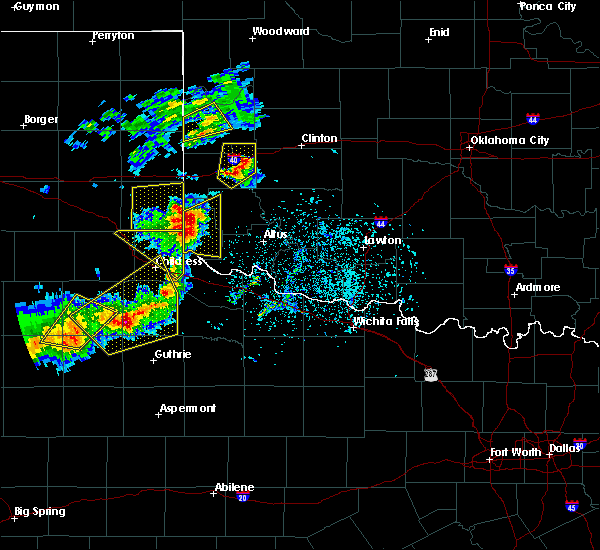 The severe thunderstorm warning for west central roger mills county will expire at 715 pm cdt, the storm which prompted the warning has weakened below severe limits, therefore the warning will be allowed to expire. however gusty winds and heavy rain are still possible with this thunderstorm. The severe thunderstorm warning for west central roger mills county will expire at 715 pm cdt, the storm which prompted the warning has weakened below severe limits, therefore the warning will be allowed to expire. however gusty winds and heavy rain are still possible with this thunderstorm.
|
| 5/13/2020 6:46 PM CDT |
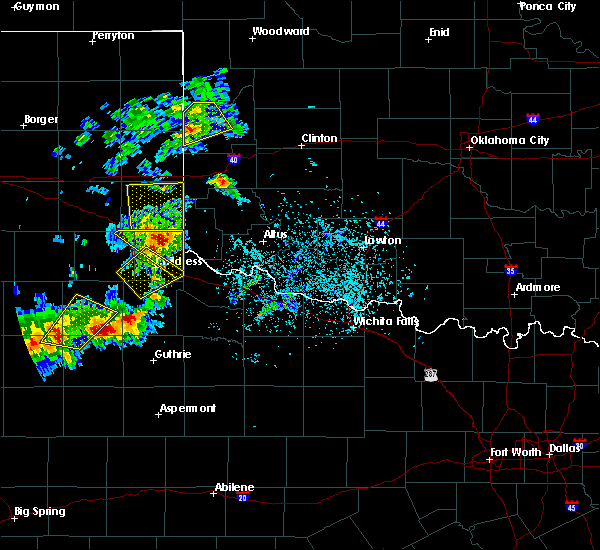 At 644 pm cdt, a severe thunderstorm was located near reydon, moving northeast at 30 mph (trained weather spotters have reported quarter size hail 2 miles southwest of reydon). Hazards include 60 mph wind gusts and quarter size hail. Hail damage to vehicles is expected. expect wind damage to roofs, siding, and trees. Locations impacted include, cheyenne, reydon, strong city, crawford and roll. At 644 pm cdt, a severe thunderstorm was located near reydon, moving northeast at 30 mph (trained weather spotters have reported quarter size hail 2 miles southwest of reydon). Hazards include 60 mph wind gusts and quarter size hail. Hail damage to vehicles is expected. expect wind damage to roofs, siding, and trees. Locations impacted include, cheyenne, reydon, strong city, crawford and roll.
|
| 5/13/2020 6:43 PM CDT | Quarter sized hail reported 3 miles NE of Reydon, OK |
| 5/13/2020 6:32 PM CDT |
 At 632 pm cdt, a severe thunderstorm was located 4 miles east of allison, moving northeast at 35 mph (radar indicated). Hazards include ping pong ball size hail and 60 mph wind gusts. People and animals outdoors will be injured. expect hail damage to roofs, siding, windows, and vehicles. Expect wind damage to roofs, siding, and trees. At 632 pm cdt, a severe thunderstorm was located 4 miles east of allison, moving northeast at 35 mph (radar indicated). Hazards include ping pong ball size hail and 60 mph wind gusts. People and animals outdoors will be injured. expect hail damage to roofs, siding, windows, and vehicles. Expect wind damage to roofs, siding, and trees.
|
| 5/7/2020 11:51 PM CDT |
 At 1151 pm cdt, severe thunderstorms were located along a line extending from 3 miles west of moorewood to 8 miles west of elk city with another strong thunderstorm near dempsey. these storms are moving southeast at 45 mph (radar indicated). Hazards include 60 mph wind gusts and quarter size hail. Hail damage to vehicles is expected. expect wind damage to roofs, siding, and trees. Locations impacted include, elk city, sayre, cheyenne, arapaho, hammon, canute, butler, reydon, foss, sweetwater, strong city, delhi, foss reservoir, angora, moorewood, crawford, roll, stafford, berlin and dempsey. At 1151 pm cdt, severe thunderstorms were located along a line extending from 3 miles west of moorewood to 8 miles west of elk city with another strong thunderstorm near dempsey. these storms are moving southeast at 45 mph (radar indicated). Hazards include 60 mph wind gusts and quarter size hail. Hail damage to vehicles is expected. expect wind damage to roofs, siding, and trees. Locations impacted include, elk city, sayre, cheyenne, arapaho, hammon, canute, butler, reydon, foss, sweetwater, strong city, delhi, foss reservoir, angora, moorewood, crawford, roll, stafford, berlin and dempsey.
|
| 5/7/2020 11:25 PM CDT |
 At 1125 pm cdt, severe thunderstorms were located along a line extending from 5 miles northeast of roll to near allison texas, moving southeast at 45 mph (radar indicated). Hazards include 60 mph wind gusts and quarter size hail. Hail damage to vehicles is expected. Expect wind damage to roofs, siding, and trees. At 1125 pm cdt, severe thunderstorms were located along a line extending from 5 miles northeast of roll to near allison texas, moving southeast at 45 mph (radar indicated). Hazards include 60 mph wind gusts and quarter size hail. Hail damage to vehicles is expected. Expect wind damage to roofs, siding, and trees.
|
| 5/7/2020 11:00 PM CDT |
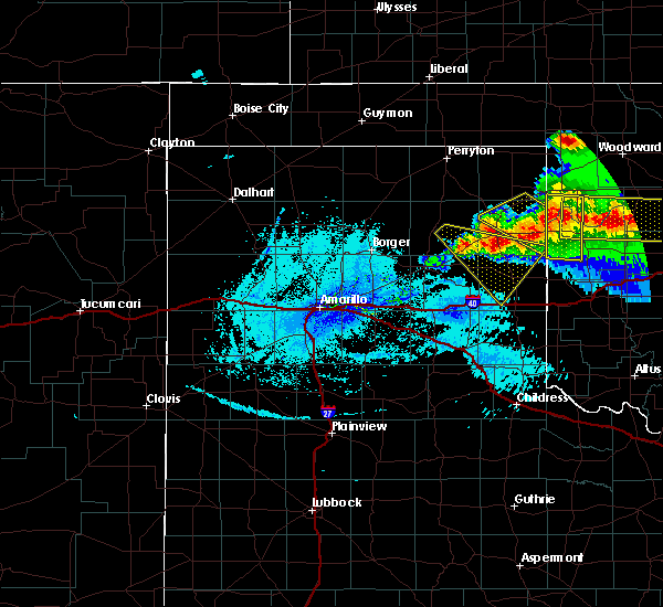 At 1100 pm cdt, severe thunderstorms were located along a line extending from 7 miles southeast of higgins texas to 7 miles northwest of reydon oklahoma, moving east at 25 mph (radar indicated). Hazards include ping pong ball size hail and 60 mph wind gusts. People and animals outdoors will be injured. expect hail damage to roofs, siding, windows, and vehicles. Expect wind damage to roofs, siding, and trees. At 1100 pm cdt, severe thunderstorms were located along a line extending from 7 miles southeast of higgins texas to 7 miles northwest of reydon oklahoma, moving east at 25 mph (radar indicated). Hazards include ping pong ball size hail and 60 mph wind gusts. People and animals outdoors will be injured. expect hail damage to roofs, siding, windows, and vehicles. Expect wind damage to roofs, siding, and trees.
|
| 4/21/2020 8:45 PM CDT |
 At 845 pm cdt, a severe thunderstorm was located near allison, moving southeast at 25 mph (radar indicated). Hazards include golf ball size hail and 70 mph wind gusts. People and animals outdoors will be injured. expect hail damage to roofs, siding, windows, and vehicles. expect considerable tree damage. Wind damage is also likely to mobile homes, roofs, and outbuildings. At 845 pm cdt, a severe thunderstorm was located near allison, moving southeast at 25 mph (radar indicated). Hazards include golf ball size hail and 70 mph wind gusts. People and animals outdoors will be injured. expect hail damage to roofs, siding, windows, and vehicles. expect considerable tree damage. Wind damage is also likely to mobile homes, roofs, and outbuildings.
|
| 4/21/2020 8:30 PM CDT | Tennis Ball sized hail reported 0.4 miles ENE of Reydon, OK, twitter pic. |
| 4/21/2020 8:13 PM CDT |
 At 813 pm cdt, a severe thunderstorm was located 5 miles east of reydon, moving east at 25 mph (radar indicated). Hazards include two inch hail and 70 mph wind gusts. People and animals outdoors will be injured. expect hail damage to roofs, siding, windows, and vehicles. expect considerable tree damage. Wind damage is also likely to mobile homes, roofs, and outbuildings. At 813 pm cdt, a severe thunderstorm was located 5 miles east of reydon, moving east at 25 mph (radar indicated). Hazards include two inch hail and 70 mph wind gusts. People and animals outdoors will be injured. expect hail damage to roofs, siding, windows, and vehicles. expect considerable tree damage. Wind damage is also likely to mobile homes, roofs, and outbuildings.
|
| 4/21/2020 7:55 PM CDT |
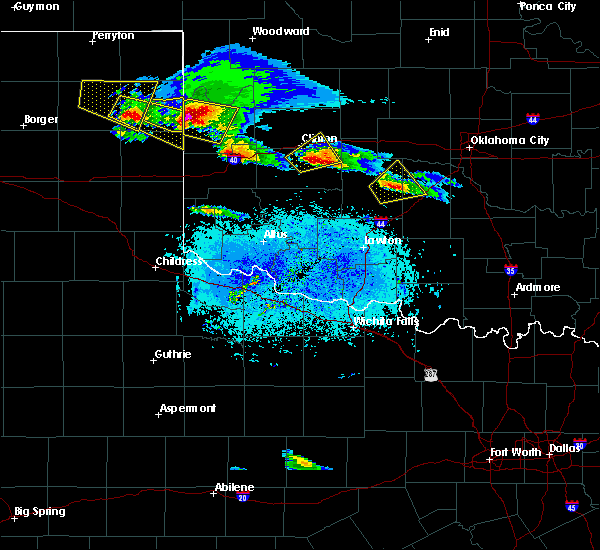 At 755 pm cdt, a severe thunderstorm was located 6 miles north of reydon, moving east at 20 mph. this is a very dangerous storm (radar indicated). Hazards include baseball size hail and 70 mph wind gusts. People and animals outdoors will be severely injured. expect shattered windows, extensive damage to roofs, siding, and vehicles. Locations impacted include, cheyenne, reydon, strong city, crawford, roll and durham. At 755 pm cdt, a severe thunderstorm was located 6 miles north of reydon, moving east at 20 mph. this is a very dangerous storm (radar indicated). Hazards include baseball size hail and 70 mph wind gusts. People and animals outdoors will be severely injured. expect shattered windows, extensive damage to roofs, siding, and vehicles. Locations impacted include, cheyenne, reydon, strong city, crawford, roll and durham.
|
| 4/21/2020 7:34 PM CDT |
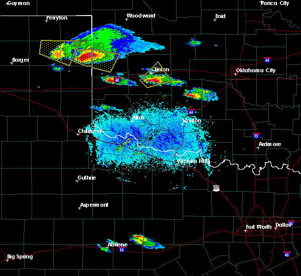 At 733 pm cdt, a severe thunderstorm was located 8 miles southwest of durham, moving east at 25 mph (radar indicated). Hazards include two inch hail and 60 mph wind gusts. People and animals outdoors will be injured. expect hail damage to roofs, siding, windows, and vehicles. expect wind damage to roofs, siding, and trees. Locations impacted include, cheyenne, reydon, strong city, crawford, roll and durham. At 733 pm cdt, a severe thunderstorm was located 8 miles southwest of durham, moving east at 25 mph (radar indicated). Hazards include two inch hail and 60 mph wind gusts. People and animals outdoors will be injured. expect hail damage to roofs, siding, windows, and vehicles. expect wind damage to roofs, siding, and trees. Locations impacted include, cheyenne, reydon, strong city, crawford, roll and durham.
|
| 4/21/2020 7:15 PM CDT |
 At 715 pm cdt, a severe thunderstorm was located 5 miles south of lake marvin, moving east at 25 mph (radar indicated). Hazards include two inch hail and 60 mph wind gusts. People and animals outdoors will be injured. expect hail damage to roofs, siding, windows, and vehicles. Expect wind damage to roofs, siding, and trees. At 715 pm cdt, a severe thunderstorm was located 5 miles south of lake marvin, moving east at 25 mph (radar indicated). Hazards include two inch hail and 60 mph wind gusts. People and animals outdoors will be injured. expect hail damage to roofs, siding, windows, and vehicles. Expect wind damage to roofs, siding, and trees.
|
| 6/23/2019 9:38 PM CDT |
 At 938 pm cdt, severe thunderstorms were located along a line extending from 5 miles north of roll to 8 miles south of crawford to 4 miles west of reydon, moving southeast at 40 mph (radar indicated). Hazards include 60 mph wind gusts and nickel size hail. expect damage to roofs, siding, and trees At 938 pm cdt, severe thunderstorms were located along a line extending from 5 miles north of roll to 8 miles south of crawford to 4 miles west of reydon, moving southeast at 40 mph (radar indicated). Hazards include 60 mph wind gusts and nickel size hail. expect damage to roofs, siding, and trees
|
| 6/23/2019 9:36 PM CDT |
 At 935 pm cdt, severe thunderstorms were located along a line extending from 8 miles northeast of crawford to near roll to near reydon, moving east at 40 mph (radar indicated). Hazards include 60 mph wind gusts and quarter size hail. Hail damage to vehicles is expected. expect wind damage to roofs, siding, and trees. Locations impacted include, reydon, crawford, roll and durham. At 935 pm cdt, severe thunderstorms were located along a line extending from 8 miles northeast of crawford to near roll to near reydon, moving east at 40 mph (radar indicated). Hazards include 60 mph wind gusts and quarter size hail. Hail damage to vehicles is expected. expect wind damage to roofs, siding, and trees. Locations impacted include, reydon, crawford, roll and durham.
|
| 6/23/2019 9:08 PM CDT |
 At 908 pm cdt, severe thunderstorms were located along a line extending from 6 miles south of higgins to 4 miles east of lake marvin to 8 miles southeast of canadian, moving southeast at 35 mph (radar indicated). Hazards include 60 mph wind gusts and quarter size hail. Hail damage to vehicles is expected. Expect wind damage to roofs, siding, and trees. At 908 pm cdt, severe thunderstorms were located along a line extending from 6 miles south of higgins to 4 miles east of lake marvin to 8 miles southeast of canadian, moving southeast at 35 mph (radar indicated). Hazards include 60 mph wind gusts and quarter size hail. Hail damage to vehicles is expected. Expect wind damage to roofs, siding, and trees.
|
| 6/23/2019 1:28 AM CDT |
 At 128 am cdt, a severe thunderstorm was located 7 miles west of sweetwater, moving northeast at 30 mph (radar indicated). Hazards include two inch hail and 70 mph wind gusts. People and animals outdoors will be injured. expect hail damage to roofs, siding, windows, and vehicles. expect considerable tree damage. Wind damage is also likely to mobile homes, roofs, and outbuildings. At 128 am cdt, a severe thunderstorm was located 7 miles west of sweetwater, moving northeast at 30 mph (radar indicated). Hazards include two inch hail and 70 mph wind gusts. People and animals outdoors will be injured. expect hail damage to roofs, siding, windows, and vehicles. expect considerable tree damage. Wind damage is also likely to mobile homes, roofs, and outbuildings.
|
| 6/15/2019 9:11 PM CDT |
 At 911 pm cdt, severe thunderstorms were located along a line extending from 3 miles southwest of roll to 5 miles southwest of hammon to 4 miles southeast of elk city, moving northeast at 50 mph (radar indicated). Hazards include 70 mph wind gusts and quarter size hail. Hail damage to vehicles is expected. expect considerable tree damage. Wind damage is also likely to mobile homes, roofs, and outbuildings. At 911 pm cdt, severe thunderstorms were located along a line extending from 3 miles southwest of roll to 5 miles southwest of hammon to 4 miles southeast of elk city, moving northeast at 50 mph (radar indicated). Hazards include 70 mph wind gusts and quarter size hail. Hail damage to vehicles is expected. expect considerable tree damage. Wind damage is also likely to mobile homes, roofs, and outbuildings.
|
| 5/25/2019 6:00 PM CDT |
 At 600 pm cdt, severe thunderstorms were located along a line extending from near reydon to 4 miles southeast of cheyenne to near sayre, moving east at 55 mph (radar indicated). Hazards include 70 mph wind gusts and quarter size hail. Hail damage to vehicles is expected. expect considerable tree damage. wind damage is also likely to mobile homes, roofs, and outbuildings. Locations impacted include, elk city, sayre, cheyenne, erick, hammon, reydon, sweetwater, strong city, texola, delhi, angora, crawford, roll, durham, berlin and dempsey. At 600 pm cdt, severe thunderstorms were located along a line extending from near reydon to 4 miles southeast of cheyenne to near sayre, moving east at 55 mph (radar indicated). Hazards include 70 mph wind gusts and quarter size hail. Hail damage to vehicles is expected. expect considerable tree damage. wind damage is also likely to mobile homes, roofs, and outbuildings. Locations impacted include, elk city, sayre, cheyenne, erick, hammon, reydon, sweetwater, strong city, texola, delhi, angora, crawford, roll, durham, berlin and dempsey.
|
| 5/25/2019 5:34 PM CDT |
 The national weather service in norman has issued a * severe thunderstorm warning for. southern ellis county in northwestern oklahoma. roger mills county in western oklahoma. beckham county in western oklahoma. Until 630 pm cdt. The national weather service in norman has issued a * severe thunderstorm warning for. southern ellis county in northwestern oklahoma. roger mills county in western oklahoma. beckham county in western oklahoma. Until 630 pm cdt.
|
| 5/24/2019 3:11 PM CDT |
 At 311 pm cdt, a severe thunderstorm was located near reydon, moving northeast at 45 mph (radar indicated). Hazards include quarter size hail. Damage to vehicles is possible. Locations impacted include, reydon, crawford and roll. At 311 pm cdt, a severe thunderstorm was located near reydon, moving northeast at 45 mph (radar indicated). Hazards include quarter size hail. Damage to vehicles is possible. Locations impacted include, reydon, crawford and roll.
|
| 5/24/2019 3:10 PM CDT | Golf Ball sized hail reported 2 miles NW of Reydon, OK |
| 5/24/2019 3:04 PM CDT |
 At 304 pm cdt, a severe thunderstorm was located 4 miles southeast of reydon, moving north at 45 mph (radar indicated). Hazards include ping pong ball size hail. People and animals outdoors will be injured. expect damage to roofs, siding, windows, and vehicles. Locations impacted include, reydon, crawford, roll and dempsey. At 304 pm cdt, a severe thunderstorm was located 4 miles southeast of reydon, moving north at 45 mph (radar indicated). Hazards include ping pong ball size hail. People and animals outdoors will be injured. expect damage to roofs, siding, windows, and vehicles. Locations impacted include, reydon, crawford, roll and dempsey.
|
| 5/24/2019 2:59 PM CDT |
 At 259 pm cdt, a severe thunderstorm was located 7 miles north of sweetwater, moving northeast at 40 mph (radar indicated). Hazards include quarter size hail. damage to vehicles is expected At 259 pm cdt, a severe thunderstorm was located 7 miles north of sweetwater, moving northeast at 40 mph (radar indicated). Hazards include quarter size hail. damage to vehicles is expected
|
| 5/20/2019 3:21 PM CDT |
 At 321 pm cdt, a severe thunderstorm was located 6 miles west of cheyenne, moving northeast at 50 mph (radar indicated). Hazards include ping pong ball size hail and 60 mph wind gusts. People and animals outdoors will be injured. expect hail damage to roofs, siding, windows, and vehicles. Expect wind damage to roofs, siding, and trees. At 321 pm cdt, a severe thunderstorm was located 6 miles west of cheyenne, moving northeast at 50 mph (radar indicated). Hazards include ping pong ball size hail and 60 mph wind gusts. People and animals outdoors will be injured. expect hail damage to roofs, siding, windows, and vehicles. Expect wind damage to roofs, siding, and trees.
|
| 5/20/2019 2:04 PM CDT |
 At 204 pm cdt, a severe thunderstorm was located 7 miles southeast of allison, moving northeast at 40 mph (radar indicated). Hazards include golf ball size hail and 60 mph wind gusts. People and animals outdoors will be injured. expect hail damage to roofs, siding, windows, and vehicles. Expect wind damage to roofs, siding, and trees. At 204 pm cdt, a severe thunderstorm was located 7 miles southeast of allison, moving northeast at 40 mph (radar indicated). Hazards include golf ball size hail and 60 mph wind gusts. People and animals outdoors will be injured. expect hail damage to roofs, siding, windows, and vehicles. Expect wind damage to roofs, siding, and trees.
|
| 5/7/2019 8:18 PM CDT | Quarter sized hail reported 0.2 miles NW of Reydon, OK, em reported in nwschat. |
| 5/7/2019 8:06 PM CDT |
 At 806 pm cdt, a severe thunderstorm was located near sweetwater, moving north at 20 mph (radar indicated). Hazards include 60 mph wind gusts and quarter size hail. Hail damage to vehicles is expected. Expect wind damage to roofs, siding, and trees. At 806 pm cdt, a severe thunderstorm was located near sweetwater, moving north at 20 mph (radar indicated). Hazards include 60 mph wind gusts and quarter size hail. Hail damage to vehicles is expected. Expect wind damage to roofs, siding, and trees.
|
| 5/7/2019 6:50 PM CDT |
 At 650 pm cdt, a severe thunderstorm was located near allison, moving northeast at 20 mph (radar indicated). Hazards include 60 mph wind gusts and quarter size hail. Hail damage to vehicles is expected. Expect wind damage to roofs, siding, and trees. At 650 pm cdt, a severe thunderstorm was located near allison, moving northeast at 20 mph (radar indicated). Hazards include 60 mph wind gusts and quarter size hail. Hail damage to vehicles is expected. Expect wind damage to roofs, siding, and trees.
|
| 4/17/2019 4:59 PM CDT |
 At 458 pm cdt, a severe thunderstorm was located between dempsey and cheyenne, moving northeast at 35 mph (radar indicated). Hazards include ping pong ball size hail and 60 mph wind gusts. People and animals outdoors will be injured. expect hail damage to roofs, siding, windows, and vehicles. expect wind damage to roofs, siding, and trees. Locations impacted include, cheyenne, reydon, strong city, roll and dempsey. At 458 pm cdt, a severe thunderstorm was located between dempsey and cheyenne, moving northeast at 35 mph (radar indicated). Hazards include ping pong ball size hail and 60 mph wind gusts. People and animals outdoors will be injured. expect hail damage to roofs, siding, windows, and vehicles. expect wind damage to roofs, siding, and trees. Locations impacted include, cheyenne, reydon, strong city, roll and dempsey.
|
| 4/17/2019 4:39 PM CDT |
 At 439 pm cdt, a severe thunderstorm was located 8 miles northeast of sweetwater, moving northeast at 25 mph (radar indicated). Hazards include ping pong ball size hail and 60 mph wind gusts. People and animals outdoors will be injured. expect hail damage to roofs, siding, windows, and vehicles. Expect wind damage to roofs, siding, and trees. At 439 pm cdt, a severe thunderstorm was located 8 miles northeast of sweetwater, moving northeast at 25 mph (radar indicated). Hazards include ping pong ball size hail and 60 mph wind gusts. People and animals outdoors will be injured. expect hail damage to roofs, siding, windows, and vehicles. Expect wind damage to roofs, siding, and trees.
|
| 4/17/2019 4:21 PM CDT |
 At 420 pm cdt, a severe thunderstorm was located 4 miles northeast of sweetwater, moving northeast at 20 to 25 mph. a 60 mph wind gusts was reported with this storm north of sweetwater (radar indicated). Hazards include golf ball size hail and 60 mph wind gusts. People and animals outdoors will be injured. expect hail damage to roofs, siding, windows, and vehicles. expect wind damage to roofs, siding, and trees. Locations impacted include, cheyenne, reydon, sweetwater, strong city and dempsey. At 420 pm cdt, a severe thunderstorm was located 4 miles northeast of sweetwater, moving northeast at 20 to 25 mph. a 60 mph wind gusts was reported with this storm north of sweetwater (radar indicated). Hazards include golf ball size hail and 60 mph wind gusts. People and animals outdoors will be injured. expect hail damage to roofs, siding, windows, and vehicles. expect wind damage to roofs, siding, and trees. Locations impacted include, cheyenne, reydon, sweetwater, strong city and dempsey.
|
| 4/17/2019 4:06 PM CDT |
 At 405 pm cdt, a severe thunderstorm was located near sweetwater, moving northeast at 35 mph (radar indicated). Hazards include golf ball size hail and 60 mph wind gusts. People and animals outdoors will be injured. expect hail damage to roofs, siding, windows, and vehicles. Expect wind damage to roofs, siding, and trees. At 405 pm cdt, a severe thunderstorm was located near sweetwater, moving northeast at 35 mph (radar indicated). Hazards include golf ball size hail and 60 mph wind gusts. People and animals outdoors will be injured. expect hail damage to roofs, siding, windows, and vehicles. Expect wind damage to roofs, siding, and trees.
|
| 4/17/2019 3:58 PM CDT |
 At 357 pm cdt, a severe thunderstorm was located near sweetwater, moving northeast at 35 to 40 mph. another warning will likely be required to roger mills county (radar indicated). Hazards include two inch hail and 60 mph wind gusts. People and animals outdoors will be injured. expect hail damage to roofs, siding, windows, and vehicles. expect wind damage to roofs, siding, and trees. Locations impacted include, reydon, sweetwater and dempsey. At 357 pm cdt, a severe thunderstorm was located near sweetwater, moving northeast at 35 to 40 mph. another warning will likely be required to roger mills county (radar indicated). Hazards include two inch hail and 60 mph wind gusts. People and animals outdoors will be injured. expect hail damage to roofs, siding, windows, and vehicles. expect wind damage to roofs, siding, and trees. Locations impacted include, reydon, sweetwater and dempsey.
|
| 4/17/2019 3:41 PM CDT |
 At 339 pm cdt, a severe thunderstorm was located 8 miles west of sweetwater, moving northeast at 35 to 40 mph. at least golf ball size hail has been reported with this storm in hemphill county texas (radar indicated). Hazards include two inch hail and 60 mph wind gusts. People and animals outdoors will be injured. expect hail damage to roofs, siding, windows, and vehicles. expect wind damage to roofs, siding, and trees. Locations impacted include, reydon, sweetwater and dempsey. At 339 pm cdt, a severe thunderstorm was located 8 miles west of sweetwater, moving northeast at 35 to 40 mph. at least golf ball size hail has been reported with this storm in hemphill county texas (radar indicated). Hazards include two inch hail and 60 mph wind gusts. People and animals outdoors will be injured. expect hail damage to roofs, siding, windows, and vehicles. expect wind damage to roofs, siding, and trees. Locations impacted include, reydon, sweetwater and dempsey.
|
| 4/17/2019 3:25 PM CDT |
 At 325 pm cdt, a severe thunderstorm was located 7 miles northeast of twitty, moving northeast at 30 to 35 mph (radar indicated). Hazards include two inch hail and 60 mph wind gusts. People and animals outdoors will be injured. expect hail damage to roofs, siding, windows, and vehicles. Expect wind damage to roofs, siding, and trees. At 325 pm cdt, a severe thunderstorm was located 7 miles northeast of twitty, moving northeast at 30 to 35 mph (radar indicated). Hazards include two inch hail and 60 mph wind gusts. People and animals outdoors will be injured. expect hail damage to roofs, siding, windows, and vehicles. Expect wind damage to roofs, siding, and trees.
|
| 6/25/2018 12:45 AM CDT |
 At 1244 am cdt, a severe thunderstorm was located near reydon, moving east at 45 mph (radar indicated). Hazards include 70 mph wind gusts and ping pong ball size hail. People and animals outdoors will be injured. expect hail damage to roofs, siding, windows, and vehicles. expect considerable tree damage. Wind damage is also likely to mobile homes, roofs, and outbuildings. At 1244 am cdt, a severe thunderstorm was located near reydon, moving east at 45 mph (radar indicated). Hazards include 70 mph wind gusts and ping pong ball size hail. People and animals outdoors will be injured. expect hail damage to roofs, siding, windows, and vehicles. expect considerable tree damage. Wind damage is also likely to mobile homes, roofs, and outbuildings.
|
| 6/22/2018 10:44 PM CDT |
 At 1044 pm cdt, a severe thunderstorm was located 6 miles west of sweetwater, moving east at 35 mph. this is a very dangerous storm (radar indicated). Hazards include 80 mph wind gusts and ping pong ball size hail. Flying debris will be dangerous to those caught without shelter. mobile homes will be heavily damaged. expect considerable damage to roofs, windows, and vehicles. Extensive tree damage and power outages are likely. At 1044 pm cdt, a severe thunderstorm was located 6 miles west of sweetwater, moving east at 35 mph. this is a very dangerous storm (radar indicated). Hazards include 80 mph wind gusts and ping pong ball size hail. Flying debris will be dangerous to those caught without shelter. mobile homes will be heavily damaged. expect considerable damage to roofs, windows, and vehicles. Extensive tree damage and power outages are likely.
|
| 6/22/2018 9:44 PM CDT |
 At 942 pm cdt, severe thunderstorms were located along a line extending from 7 miles east of canton to 4 miles north of custer city to near sayre, moving east at 55 mph (radar indicated). Hazards include 70 mph wind gusts and penny size hail. Expect considerable tree damage. damage is likely to mobile homes, roofs, and outbuildings. locations impacted include, elk city, clinton, sayre, cheyenne, taloga, burns flat, thomas, sentinel, seiling, arapaho, canton, hammon, dill city, canute, leedey, custer city, butler, carter, reydon and bessie. This includes interstate 40 between mile markers 15 and 74. At 942 pm cdt, severe thunderstorms were located along a line extending from 7 miles east of canton to 4 miles north of custer city to near sayre, moving east at 55 mph (radar indicated). Hazards include 70 mph wind gusts and penny size hail. Expect considerable tree damage. damage is likely to mobile homes, roofs, and outbuildings. locations impacted include, elk city, clinton, sayre, cheyenne, taloga, burns flat, thomas, sentinel, seiling, arapaho, canton, hammon, dill city, canute, leedey, custer city, butler, carter, reydon and bessie. This includes interstate 40 between mile markers 15 and 74.
|
| 6/22/2018 9:11 PM CDT |
 At 911 pm cdt, severe thunderstorms were located along a line extending from near seiling to 5 miles southwest of sweetwater, moving east at 60 mph (radar indicated). Hazards include 70 mph wind gusts and penny size hail. Expect considerable tree damage. Damage is likely to mobile homes, roofs, and outbuildings. At 911 pm cdt, severe thunderstorms were located along a line extending from near seiling to 5 miles southwest of sweetwater, moving east at 60 mph (radar indicated). Hazards include 70 mph wind gusts and penny size hail. Expect considerable tree damage. Damage is likely to mobile homes, roofs, and outbuildings.
|
| 5/13/2018 9:05 PM CDT |
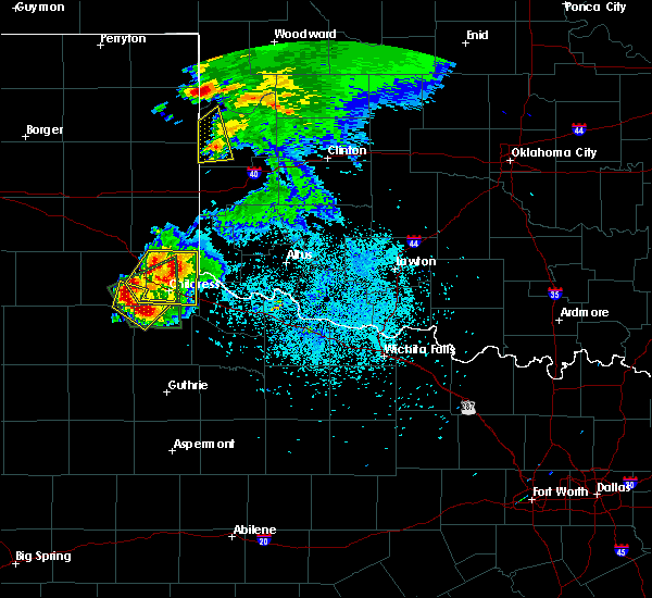 The severe thunderstorm warning for western roger mills county will expire at 915 pm cdt, the storm which prompted the warning has weakened below severe limits, and no longer poses an immediate threat to life or property. therefore, the warning will be allowed to expire. The severe thunderstorm warning for western roger mills county will expire at 915 pm cdt, the storm which prompted the warning has weakened below severe limits, and no longer poses an immediate threat to life or property. therefore, the warning will be allowed to expire.
|
| 5/13/2018 8:53 PM CDT |
 At 853 pm cdt, a severe thunderstorm was located near reydon, moving northeast at 15 mph (radar indicated). Hazards include 60 mph wind gusts and quarter size hail. Hail damage to vehicles is expected. expect wind damage to roofs, siding, and trees. Locations impacted include, reydon, durham and dempsey. At 853 pm cdt, a severe thunderstorm was located near reydon, moving northeast at 15 mph (radar indicated). Hazards include 60 mph wind gusts and quarter size hail. Hail damage to vehicles is expected. expect wind damage to roofs, siding, and trees. Locations impacted include, reydon, durham and dempsey.
|
| 5/13/2018 8:17 PM CDT |
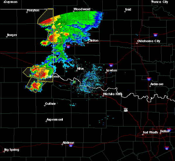 At 817 pm cdt, a severe thunderstorm was located near allison, moving northeast at 15 mph (trained weather spotters). Hazards include golf ball size hail and 70 mph wind gusts. People and animals outdoors will be injured. expect hail damage to roofs, siding, windows, and vehicles. expect considerable tree damage. Wind damage is also likely to mobile homes, roofs, and outbuildings. At 817 pm cdt, a severe thunderstorm was located near allison, moving northeast at 15 mph (trained weather spotters). Hazards include golf ball size hail and 70 mph wind gusts. People and animals outdoors will be injured. expect hail damage to roofs, siding, windows, and vehicles. expect considerable tree damage. Wind damage is also likely to mobile homes, roofs, and outbuildings.
|
| 5/13/2018 8:13 PM CDT | Golf Ball sized hail reported 10.3 miles ENE of Reydon, OK |
| 5/13/2018 8:10 PM CDT | Ping Pong Ball sized hail reported 10.3 miles ENE of Reydon, OK |
| 5/11/2018 7:57 PM CDT |
 At 756 pm cdt, severe thunderstorms were located along a line extending from 8 miles northwest of sweetwater to 4 miles south of sweetwater, moving northeast at 25 mph (radar indicated). Hazards include 60 mph wind gusts and quarter size hail. Hail damage to vehicles is expected. expect wind damage to roofs, siding, and trees. Locations impacted include, cheyenne, reydon, sweetwater, roll and dempsey. At 756 pm cdt, severe thunderstorms were located along a line extending from 8 miles northwest of sweetwater to 4 miles south of sweetwater, moving northeast at 25 mph (radar indicated). Hazards include 60 mph wind gusts and quarter size hail. Hail damage to vehicles is expected. expect wind damage to roofs, siding, and trees. Locations impacted include, cheyenne, reydon, sweetwater, roll and dempsey.
|
| 5/11/2018 7:36 PM CDT |
 At 735 pm cdt, severe thunderstorms were located along a line extending from 5 miles southeast of allison texas to 8 miles east of twitty texas, moving northeast at 25 mph (radar indicated). Hazards include golf ball size hail and 60 mph wind gusts. People and animals outdoors will be injured. expect hail damage to roofs, siding, windows, and vehicles. Expect wind damage to roofs, siding, and trees. At 735 pm cdt, severe thunderstorms were located along a line extending from 5 miles southeast of allison texas to 8 miles east of twitty texas, moving northeast at 25 mph (radar indicated). Hazards include golf ball size hail and 60 mph wind gusts. People and animals outdoors will be injured. expect hail damage to roofs, siding, windows, and vehicles. Expect wind damage to roofs, siding, and trees.
|
| 10/6/2017 11:07 PM CDT |
 At 1106 pm cdt, severe thunderstorms were located along a line extending from near mutual to 4 miles northwest of angora to 5 miles west of sweetwater to 6 miles north of quail, moving east at 40 mph (radar indicated). Hazards include 60 mph wind gusts and penny size hail. expect damage to roofs, siding, and trees At 1106 pm cdt, severe thunderstorms were located along a line extending from near mutual to 4 miles northwest of angora to 5 miles west of sweetwater to 6 miles north of quail, moving east at 40 mph (radar indicated). Hazards include 60 mph wind gusts and penny size hail. expect damage to roofs, siding, and trees
|
| 10/6/2017 10:30 PM CDT |
 At 1030 pm cdt, severe thunderstorms were located along a line extending from 3 miles northwest of burlington to 8 miles southeast of alabaster caverns state park to near fargo to 4 miles southwest of durham, moving northeast at 60 mph (radar indicated). Hazards include 60 mph wind gusts and quarter size hail. Hail damage to vehicles is expected. Expect wind damage to roofs, siding, and trees. At 1030 pm cdt, severe thunderstorms were located along a line extending from 3 miles northwest of burlington to 8 miles southeast of alabaster caverns state park to near fargo to 4 miles southwest of durham, moving northeast at 60 mph (radar indicated). Hazards include 60 mph wind gusts and quarter size hail. Hail damage to vehicles is expected. Expect wind damage to roofs, siding, and trees.
|
| 8/18/2017 1:31 AM CDT |
 At 131 am cdt, a severe thunderstorm was located 4 miles east of roll, moving east at 25 mph (radar indicated). Hazards include 60 mph wind gusts and quarter size hail. Hail damage to vehicles is expected. Expect wind damage to roofs, siding, and trees. At 131 am cdt, a severe thunderstorm was located 4 miles east of roll, moving east at 25 mph (radar indicated). Hazards include 60 mph wind gusts and quarter size hail. Hail damage to vehicles is expected. Expect wind damage to roofs, siding, and trees.
|
| 8/18/2017 12:50 AM CDT |
 At 1250 am cdt, a severe thunderstorm was located near durham, moving southeast at 30 mph (radar indicated). Hazards include 60 mph wind gusts and quarter size hail. Hail damage to vehicles is expected. Expect wind damage to roofs, siding, and trees. At 1250 am cdt, a severe thunderstorm was located near durham, moving southeast at 30 mph (radar indicated). Hazards include 60 mph wind gusts and quarter size hail. Hail damage to vehicles is expected. Expect wind damage to roofs, siding, and trees.
|
| 7/3/2017 7:37 PM CDT |
 At 737 pm cdt, a severe thunderstorm was located near durham, moving southeast at 20 mph (radar indicated). Hazards include 70 mph wind gusts and quarter size hail. Hail damage to vehicles is expected. expect considerable tree damage. wind damage is also likely to mobile homes, roofs, and outbuildings. Locations impacted include, cheyenne, reydon, strong city, crawford, roll and durham. At 737 pm cdt, a severe thunderstorm was located near durham, moving southeast at 20 mph (radar indicated). Hazards include 70 mph wind gusts and quarter size hail. Hail damage to vehicles is expected. expect considerable tree damage. wind damage is also likely to mobile homes, roofs, and outbuildings. Locations impacted include, cheyenne, reydon, strong city, crawford, roll and durham.
|
| 7/3/2017 7:28 PM CDT |
 At 728 pm cdt, a severe thunderstorm was located near durham, moving southeast at 20 mph (radar indicated). Hazards include 60 mph wind gusts and quarter size hail. Hail damage to vehicles is expected. Expect wind damage to roofs, siding, and trees. At 728 pm cdt, a severe thunderstorm was located near durham, moving southeast at 20 mph (radar indicated). Hazards include 60 mph wind gusts and quarter size hail. Hail damage to vehicles is expected. Expect wind damage to roofs, siding, and trees.
|
| 5/18/2017 5:19 PM CDT |
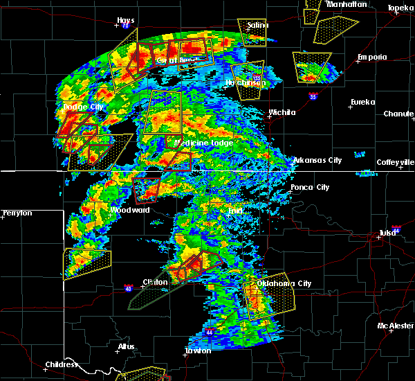 At 519 pm cdt, a severe thunderstorm was located near roll, moving northeast at 35 mph (radar indicated). Hazards include two inch hail and 70 mph wind gusts. People and animals outdoors will be injured. expect hail damage to roofs, siding, windows, and vehicles. expect considerable tree damage. wind damage is also likely to mobile homes, roofs, and outbuildings. Locations impacted include, reydon, crawford, roll and angora. At 519 pm cdt, a severe thunderstorm was located near roll, moving northeast at 35 mph (radar indicated). Hazards include two inch hail and 70 mph wind gusts. People and animals outdoors will be injured. expect hail damage to roofs, siding, windows, and vehicles. expect considerable tree damage. wind damage is also likely to mobile homes, roofs, and outbuildings. Locations impacted include, reydon, crawford, roll and angora.
|
| 5/18/2017 4:38 PM CDT |
 At 438 pm cdt, a severe thunderstorm was located 5 miles northwest of reydon, moving northeast at 45 mph (radar indicated). Hazards include two inch hail and 70 mph wind gusts. People and animals outdoors will be injured. expect hail damage to roofs, siding, windows, and vehicles. expect considerable tree damage. Wind damage is also likely to mobile homes, roofs, and outbuildings. At 438 pm cdt, a severe thunderstorm was located 5 miles northwest of reydon, moving northeast at 45 mph (radar indicated). Hazards include two inch hail and 70 mph wind gusts. People and animals outdoors will be injured. expect hail damage to roofs, siding, windows, and vehicles. expect considerable tree damage. Wind damage is also likely to mobile homes, roofs, and outbuildings.
|
| 5/16/2017 9:51 PM CDT |
 At 950 pm cdt, severe thunderstorms were located along a line extending from 4 miles north of angora to 3 miles southwest of sweetwater, moving northeast at 35 mph (radar indicated). Hazards include 70 mph wind gusts and quarter size hail. Hail damage to vehicles is expected. expect considerable tree damage. Wind damage is also likely to mobile homes, roofs, and outbuildings. At 950 pm cdt, severe thunderstorms were located along a line extending from 4 miles north of angora to 3 miles southwest of sweetwater, moving northeast at 35 mph (radar indicated). Hazards include 70 mph wind gusts and quarter size hail. Hail damage to vehicles is expected. expect considerable tree damage. Wind damage is also likely to mobile homes, roofs, and outbuildings.
|
| 5/16/2017 7:06 PM CDT | Power poles downed in roger mills county OK, 6.2 miles WNW of Reydon, OK |
| 5/16/2017 6:32 PM CDT |
 At 622 pm cdt, a confirmed tornado was located near reydon, moving northeast at 25 mph (weather spotters confirmed tornado). Hazards include damaging tornado and tennis ball size hail. Flying debris will be dangerous to those caught without shelter. mobile homes will be damaged or destroyed. damage to roofs, windows, and vehicles will occur. tree damage is likely. Locations impacted include, cheyenne, reydon and roll. At 622 pm cdt, a confirmed tornado was located near reydon, moving northeast at 25 mph (weather spotters confirmed tornado). Hazards include damaging tornado and tennis ball size hail. Flying debris will be dangerous to those caught without shelter. mobile homes will be damaged or destroyed. damage to roofs, windows, and vehicles will occur. tree damage is likely. Locations impacted include, cheyenne, reydon and roll.
|
| 5/16/2017 6:22 PM CDT |
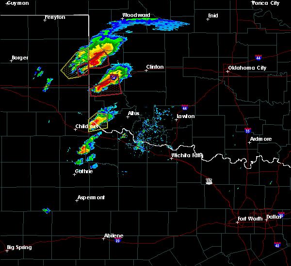 At 622 pm cdt, a confirmed tornado was located near reydon, moving northeast at 25 mph (weather spotters confirmed tornado). Hazards include damaging tornado and tennis ball size hail. Flying debris will be dangerous to those caught without shelter. mobile homes will be damaged or destroyed. damage to roofs, windows, and vehicles will occur. tree damage is likely. Locations impacted include, cheyenne, reydon and roll. At 622 pm cdt, a confirmed tornado was located near reydon, moving northeast at 25 mph (weather spotters confirmed tornado). Hazards include damaging tornado and tennis ball size hail. Flying debris will be dangerous to those caught without shelter. mobile homes will be damaged or destroyed. damage to roofs, windows, and vehicles will occur. tree damage is likely. Locations impacted include, cheyenne, reydon and roll.
|
| 5/16/2017 6:14 PM CDT |
 At 614 pm cdt, a severe thunderstorm capable of producing a tornado was located near reydon, moving northeast at 35 mph (radar indicated rotation). Hazards include tornado and tennis ball size hail. Flying debris will be dangerous to those caught without shelter. mobile homes will be damaged or destroyed. damage to roofs, windows, and vehicles will occur. tree damage is likely. Locations impacted include, cheyenne, reydon and roll. At 614 pm cdt, a severe thunderstorm capable of producing a tornado was located near reydon, moving northeast at 35 mph (radar indicated rotation). Hazards include tornado and tennis ball size hail. Flying debris will be dangerous to those caught without shelter. mobile homes will be damaged or destroyed. damage to roofs, windows, and vehicles will occur. tree damage is likely. Locations impacted include, cheyenne, reydon and roll.
|
| 5/16/2017 6:09 PM CDT | Tennis Ball sized hail reported 8.7 miles NE of Reydon, OK |
| 5/16/2017 5:55 PM CDT |
 At 555 pm cdt, a confirmed tornado was located 5 miles south of allison, moving northeast at 35 mph (nws employee confirmed tornado). Hazards include damaging tornado and golf ball size hail. Flying debris will be dangerous to those caught without shelter. mobile homes will be damaged or destroyed. damage to roofs, windows, and vehicles will occur. Tree damage is likely. At 555 pm cdt, a confirmed tornado was located 5 miles south of allison, moving northeast at 35 mph (nws employee confirmed tornado). Hazards include damaging tornado and golf ball size hail. Flying debris will be dangerous to those caught without shelter. mobile homes will be damaged or destroyed. damage to roofs, windows, and vehicles will occur. Tree damage is likely.
|
| 4/3/2017 11:14 PM CDT |
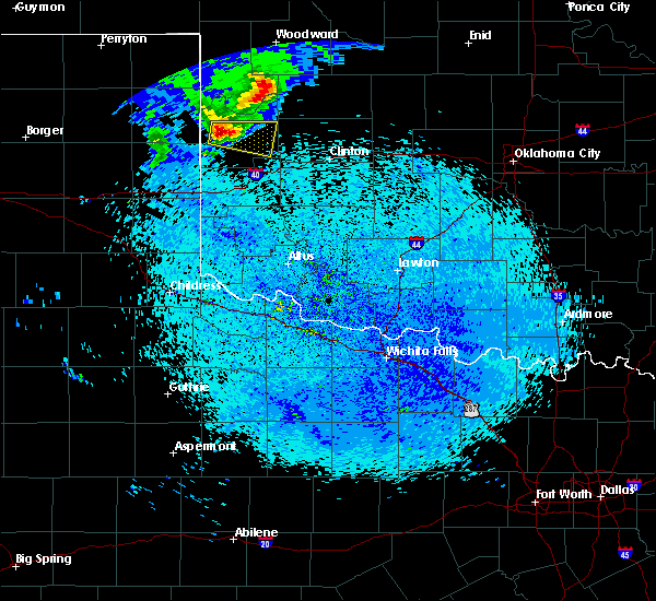 At 1114 pm cdt, a severe thunderstorm was located 6 miles east of reydon, moving east at 35 mph (radar indicated). Hazards include 60 mph wind gusts and quarter size hail. Hail damage to vehicles is expected. Expect wind damage to roofs, siding, and trees. At 1114 pm cdt, a severe thunderstorm was located 6 miles east of reydon, moving east at 35 mph (radar indicated). Hazards include 60 mph wind gusts and quarter size hail. Hail damage to vehicles is expected. Expect wind damage to roofs, siding, and trees.
|
| 9/17/2016 11:57 PM CDT |
 At 1157 pm cdt, severe thunderstorms were located along a line extending from 9 miles south of harmon to near roll to 3 miles east of reydon, moving east at 45 mph (radar indicated). Hazards include 60 mph wind gusts and nickel size hail. Expect damage to roofs. siding. and trees. Locations impacted include, cheyenne, reydon, strong city, roll, angora and crawford. At 1157 pm cdt, severe thunderstorms were located along a line extending from 9 miles south of harmon to near roll to 3 miles east of reydon, moving east at 45 mph (radar indicated). Hazards include 60 mph wind gusts and nickel size hail. Expect damage to roofs. siding. and trees. Locations impacted include, cheyenne, reydon, strong city, roll, angora and crawford.
|
| 9/17/2016 11:48 PM CDT |
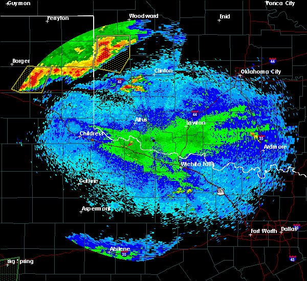 At 1148 pm cdt, severe thunderstorms were located along a line extending from 6 miles south of arnett to near crawford to 3 miles southwest of reydon, moving east at 50 mph (radar indicated). Hazards include 60 mph wind gusts and quarter size hail. Hail damage to vehicles is expected. expect wind damage to roofs, siding, and trees. Locations impacted include, cheyenne, arnett, reydon, strong city, harmon, roll, angora, durham and crawford. At 1148 pm cdt, severe thunderstorms were located along a line extending from 6 miles south of arnett to near crawford to 3 miles southwest of reydon, moving east at 50 mph (radar indicated). Hazards include 60 mph wind gusts and quarter size hail. Hail damage to vehicles is expected. expect wind damage to roofs, siding, and trees. Locations impacted include, cheyenne, arnett, reydon, strong city, harmon, roll, angora, durham and crawford.
|
| 9/17/2016 11:34 PM CDT |
 At 1134 pm cdt, severe thunderstorms were located along a line extending from 5 miles east of higgins to 4 miles northwest of allison, moving east at 30 mph (radar indicated). Hazards include 60 mph wind gusts and nickel size hail. Expect damage to roofs. siding. And trees. At 1134 pm cdt, severe thunderstorms were located along a line extending from 5 miles east of higgins to 4 miles northwest of allison, moving east at 30 mph (radar indicated). Hazards include 60 mph wind gusts and nickel size hail. Expect damage to roofs. siding. And trees.
|
| 8/23/2016 6:23 PM CDT |
 At 622 pm cdt, severe thunderstorms were located along a line extending from 7 miles northwest of cheyenne to 7 miles southeast of allison, moving northeast at 25 mph (radar indicated). Hazards include 60 mph wind gusts and nickel size hail. Expect damage to roofs. siding. and trees. Locations impacted include, reydon, roll, crawford and dempsey. At 622 pm cdt, severe thunderstorms were located along a line extending from 7 miles northwest of cheyenne to 7 miles southeast of allison, moving northeast at 25 mph (radar indicated). Hazards include 60 mph wind gusts and nickel size hail. Expect damage to roofs. siding. and trees. Locations impacted include, reydon, roll, crawford and dempsey.
|
| 8/23/2016 6:10 PM CDT |
 At 610 pm cdt, severe thunderstorms were located along a line extending from near reydon to 9 miles south of allison, moving northeast at 20 mph (radar indicated). Hazards include 60 mph wind gusts and nickel size hail. Expect damage to roofs. siding. And trees. At 610 pm cdt, severe thunderstorms were located along a line extending from near reydon to 9 miles south of allison, moving northeast at 20 mph (radar indicated). Hazards include 60 mph wind gusts and nickel size hail. Expect damage to roofs. siding. And trees.
|
| 8/23/2016 4:47 PM CDT |
 At 447 pm cdt, a severe thunderstorm was located 4 miles southeast of reydon, moving east at 30 mph (trained weather spotters). Hazards include 60 mph wind gusts and quarter size hail. Hail damage to vehicles is expected. expect wind damage to roofs, siding, and trees. Locations impacted include, reydon and dempsey. At 447 pm cdt, a severe thunderstorm was located 4 miles southeast of reydon, moving east at 30 mph (trained weather spotters). Hazards include 60 mph wind gusts and quarter size hail. Hail damage to vehicles is expected. expect wind damage to roofs, siding, and trees. Locations impacted include, reydon and dempsey.
|
| 8/23/2016 4:46 PM CDT | Quarter sized hail reported 1.5 miles N of Reydon, OK |
| 8/23/2016 4:36 PM CDT |
 At 436 pm cdt, a severe thunderstorm was located 5 miles southwest of reydon, moving east at 20 mph (radar indicated). Hazards include 60 mph wind gusts and quarter size hail. Hail damage to vehicles is expected. Expect wind damage to roofs, siding, and trees. At 436 pm cdt, a severe thunderstorm was located 5 miles southwest of reydon, moving east at 20 mph (radar indicated). Hazards include 60 mph wind gusts and quarter size hail. Hail damage to vehicles is expected. Expect wind damage to roofs, siding, and trees.
|
| 7/15/2016 9:30 PM CDT | Storm damage reported in roger mills county OK, 1.1 miles NW of Reydon, OK |
| 7/15/2016 9:19 PM CDT |
 At 918 pm cdt, severe thunderstorms were located along a line extending from 6 miles west of vici to 10 miles west-southwest of reydon, moving southeast at 25 mph (radar indicated). Hazards include 70 mph wind gusts and quarter size hail. Hail damage to vehicles is expected. expect considerable tree damage. Wind damage is also likely to mobile homes, roofs, and outbuildings. At 918 pm cdt, severe thunderstorms were located along a line extending from 6 miles west of vici to 10 miles west-southwest of reydon, moving southeast at 25 mph (radar indicated). Hazards include 70 mph wind gusts and quarter size hail. Hail damage to vehicles is expected. expect considerable tree damage. Wind damage is also likely to mobile homes, roofs, and outbuildings.
|
| 7/15/2016 9:12 PM CDT |
 At 911 pm cdt, the leading edge of severe thunderstorms was located along a line extending from 6 miles northeast of harmon to near durham, moving southeast at 40 mph. other severe thunderstorms were located 9 miles west of alabaster caverns state park and 7 miles north of woodward (radar indicated). Hazards include 70 mph wind gusts and quarter size hail. Hail damage to vehicles is expected. expect considerable tree damage. wind damage is also likely to mobile homes, roofs, and outbuildings. Locations impacted include, woodward, alva, shattuck, buffalo, arnett, mooreland, gage, fargo, fort supply, freedom, reydon, sharon, may, alabaster caverns state park, durham, crawford, quinlan, selman, harmon and capron. At 911 pm cdt, the leading edge of severe thunderstorms was located along a line extending from 6 miles northeast of harmon to near durham, moving southeast at 40 mph. other severe thunderstorms were located 9 miles west of alabaster caverns state park and 7 miles north of woodward (radar indicated). Hazards include 70 mph wind gusts and quarter size hail. Hail damage to vehicles is expected. expect considerable tree damage. wind damage is also likely to mobile homes, roofs, and outbuildings. Locations impacted include, woodward, alva, shattuck, buffalo, arnett, mooreland, gage, fargo, fort supply, freedom, reydon, sharon, may, alabaster caverns state park, durham, crawford, quinlan, selman, harmon and capron.
|
| 7/15/2016 8:40 PM CDT |
 At 839 pm cdt, severe thunderstorms were located along a line extending from 12 miles north of freedom to 6 miles southwest of shattuck and into the texas panhandle, moving east-southeast at 30 mph (radar indicated). Hazards include 70 mph wind gusts and penny size hail. Expect considerable tree damage. Damage is likely to mobile homes, roofs, and outbuildings. At 839 pm cdt, severe thunderstorms were located along a line extending from 12 miles north of freedom to 6 miles southwest of shattuck and into the texas panhandle, moving east-southeast at 30 mph (radar indicated). Hazards include 70 mph wind gusts and penny size hail. Expect considerable tree damage. Damage is likely to mobile homes, roofs, and outbuildings.
|
| 6/26/2016 2:24 PM CDT |
 At 223 pm cdt, a severe thunderstorm was located 4 miles east of reydon, moving northeast at 20 mph (radar indicated). Hazards include 60 mph wind gusts and quarter size hail. Hail damage to vehicles is expected. Expect wind damage to roofs, siding, and trees. At 223 pm cdt, a severe thunderstorm was located 4 miles east of reydon, moving northeast at 20 mph (radar indicated). Hazards include 60 mph wind gusts and quarter size hail. Hail damage to vehicles is expected. Expect wind damage to roofs, siding, and trees.
|
| 5/26/2016 8:58 PM CDT |
 At 858 pm cdt, severe thunderstorms were located along a line extending from 3 miles northeast of angora to near reydon, moving northeast at 25 mph (radar indicated). Hazards include 60 mph wind gusts and half dollar size hail. Hail damage to vehicles is expected. Expect wind damage to roofs, siding, and trees. At 858 pm cdt, severe thunderstorms were located along a line extending from 3 miles northeast of angora to near reydon, moving northeast at 25 mph (radar indicated). Hazards include 60 mph wind gusts and half dollar size hail. Hail damage to vehicles is expected. Expect wind damage to roofs, siding, and trees.
|
| 5/26/2016 8:57 PM CDT | Storm damage reported in roger mills county OK, 3.7 miles E of Reydon, OK |
| 5/26/2016 8:15 PM CDT |
 At 815 pm cdt, severe thunderstorms were located along a line extending from 7 miles southeast of harmon to 3 miles east of strong city, moving northeast at 40 mph (radar indicated). Hazards include 60 mph wind gusts and half dollar size hail. Hail damage to vehicles is expected. Expect wind damage to roofs, siding, and trees. At 815 pm cdt, severe thunderstorms were located along a line extending from 7 miles southeast of harmon to 3 miles east of strong city, moving northeast at 40 mph (radar indicated). Hazards include 60 mph wind gusts and half dollar size hail. Hail damage to vehicles is expected. Expect wind damage to roofs, siding, and trees.
|
| 5/26/2016 7:32 PM CDT |
 At 731 pm cdt, severe thunderstorms were located along a line extending from 5 miles northwest of cheyenne to 6 miles southeast of sweetwater, moving northeast at 35 mph (radar indicated). Hazards include 60 mph wind gusts and half dollar size hail. Hail damage to vehicles is expected. Expect wind damage to roofs, siding, and trees. At 731 pm cdt, severe thunderstorms were located along a line extending from 5 miles northwest of cheyenne to 6 miles southeast of sweetwater, moving northeast at 35 mph (radar indicated). Hazards include 60 mph wind gusts and half dollar size hail. Hail damage to vehicles is expected. Expect wind damage to roofs, siding, and trees.
|
| 5/26/2016 2:43 PM CDT | Ping Pong Ball sized hail reported 16.1 miles SSW of Reydon, OK |
| 5/16/2016 9:53 PM CDT | Half Dollar sized hail reported 8.5 miles SSW of Reydon, OK |
| 5/16/2016 9:42 PM CDT | Quarter sized hail reported 12.3 miles S of Reydon, OK |
| 5/16/2016 9:14 PM CDT |
 At 912 pm cdt, a severe thunderstorm was located near lake marvin texas, or about 13 miles west-northwest of durham oklahoma. the storm is moving southeast at 40 mph. this storm has a history of producing wind damage in the texas panhandle (radar indicated). Hazards include tennis ball size hail and 70 mph wind gusts. People and animals outdoors will be injured. expect hail damage to roofs, siding, windows, and vehicles. expect considerable tree damage. Wind damage is also likely to mobile homes, roofs, and outbuildings. At 912 pm cdt, a severe thunderstorm was located near lake marvin texas, or about 13 miles west-northwest of durham oklahoma. the storm is moving southeast at 40 mph. this storm has a history of producing wind damage in the texas panhandle (radar indicated). Hazards include tennis ball size hail and 70 mph wind gusts. People and animals outdoors will be injured. expect hail damage to roofs, siding, windows, and vehicles. expect considerable tree damage. Wind damage is also likely to mobile homes, roofs, and outbuildings.
|
| 4/26/2016 5:13 PM CDT |
 At 512 pm cdt, a severe thunderstorm was located 10 miles north of durham, moving northeast at 55 mph. another severe storm was located near reydon and was also moving northeast at 55 mph (radar indicated). Hazards include 60 mph wind gusts and quarter size hail. Hail damage to vehicles is expected. Expect wind damage to roofs, siding, and trees. At 512 pm cdt, a severe thunderstorm was located 10 miles north of durham, moving northeast at 55 mph. another severe storm was located near reydon and was also moving northeast at 55 mph (radar indicated). Hazards include 60 mph wind gusts and quarter size hail. Hail damage to vehicles is expected. Expect wind damage to roofs, siding, and trees.
|
| 8/19/2015 1:24 AM CDT |
 The severe thunderstorm warning for southwestern roger mills county will expire at 130 am cdt, the storm which prompted the warning has weakened below severe limits and exited the warned area. therefore, the warning will be allowed to expire. however, gusty winds and heavy rain are still possible with this thunderstorm. The severe thunderstorm warning for southwestern roger mills county will expire at 130 am cdt, the storm which prompted the warning has weakened below severe limits and exited the warned area. therefore, the warning will be allowed to expire. however, gusty winds and heavy rain are still possible with this thunderstorm.
|
| 8/19/2015 12:54 AM CDT |
 At 1253 am cdt, a severe thunderstorm was located 4 miles west of cheyenne, moving southeast at 30 mph (radar indicated). Hazards include 60 mph wind gusts and quarter size hail. Hail damage to vehicles is expected. Expect wind damage to roofs, siding and trees. At 1253 am cdt, a severe thunderstorm was located 4 miles west of cheyenne, moving southeast at 30 mph (radar indicated). Hazards include 60 mph wind gusts and quarter size hail. Hail damage to vehicles is expected. Expect wind damage to roofs, siding and trees.
|
| 8/19/2015 12:38 AM CDT |
 At 1237 am cdt, a severe thunderstorm was located near reydon, moving southeast at 40 mph (radar indicated). Hazards include 60 mph wind gusts and quarter size hail. Hail damage to vehicles is expected. expect wind damage to roofs, siding and trees. Locations impacted include, cheyenne, reydon, sweetwater, strong city, roll, durham, crawford, berlin and dempsey. At 1237 am cdt, a severe thunderstorm was located near reydon, moving southeast at 40 mph (radar indicated). Hazards include 60 mph wind gusts and quarter size hail. Hail damage to vehicles is expected. expect wind damage to roofs, siding and trees. Locations impacted include, cheyenne, reydon, sweetwater, strong city, roll, durham, crawford, berlin and dempsey.
|
| 8/19/2015 12:16 AM CDT |
 At 1215 am cdt, a severe thunderstorm was located 9 miles north of allison, or 9 miles southwest of durham, moving southeast at 45 mph (radar indicated). Hazards include 60 mph wind gusts and quarter size hail. Hail damage to vehicles is expected. Expect wind damage to roofs, siding and trees. At 1215 am cdt, a severe thunderstorm was located 9 miles north of allison, or 9 miles southwest of durham, moving southeast at 45 mph (radar indicated). Hazards include 60 mph wind gusts and quarter size hail. Hail damage to vehicles is expected. Expect wind damage to roofs, siding and trees.
|
| 6/7/2015 8:40 PM CDT | The severe thunderstorm warning for roger mills, western dewey, woodward and ellis counties will expire at 845 pm cdt, the storms which prompted the warning have weakened below severe limits, and no longer pose an immediate threat to life or property. therefore the warning will be allowed to expire. however wind gusts to near 50 mph and heavy rain are still possible with these thunderstorms. |
| 6/7/2015 7:48 PM CDT | At 747 pm cdt, severe thunderstorms were located along a line extending from 4 miles east of fort supply to 9 miles west of shattuck to 9 miles northwest of lora, moving east at 45 mph (radar indicated). Hazards include 70 mph wind gusts. Expect considerable tree damage. Damage is likely to mobile homes, roofs and outbuildings. |
| 5/27/2015 10:07 PM CDT | At 1006 pm cdt, severe thunderstorms were located along a line extending from near vici to near angora to 4 miles southeast of reydon, moving northeast at 25 mph (radar indicated). Hazards include two inch hail and 60 mph wind gusts. People and animals outdoors will be injured. expect hail damage to roofs, siding, windows and vehicles. expect wind damage to roofs, siding and trees. Locations impacted include, cheyenne, hammon, leedey, butler, reydon, camargo, strong city, angora, foss reservoir, durham, crawford, roll, moorewood and dempsey. |
| 5/27/2015 9:30 PM CDT | At 930 pm cdt, severe thunderstorms were located along a line extending from 5 miles south of harmon to near roll to 4 miles north of allison, moving east at 25 mph (radar indicated). Hazards include tennis ball size hail and 70 mph wind gusts. People and animals outdoors will be injured. expect hail damage to roofs, siding, windows and vehicles. expect considerable tree damage. Wind damage is also likely to mobile homes, roofs and outbuildings. |
| 5/16/2015 4:42 PM CDT | At 441 pm cdt, a severe thunderstorm was located 4 miles east of strong city, moving northeast at 55 mph. other strong to severe storms were located just south of harmon and near texola (radar indicated). Hazards include tennis ball size hail and 70 mph wind gusts. People and animals outdoors will be injured. expect hail damage to roofs, siding, windows and vehicles. expect considerable tree damage. wind damage is also likely to mobile homes, roofs and outbuildings. locations impacted include, sayre, cheyenne, erick, vici, hammon, leedey, reydon, camargo, sweetwater, strong city, texola, angora, harmon, roll, moorewood, berlin and dempsey. 2. 50in. |
| 5/16/2015 4:15 PM CDT | At 415 pm cdt, severe thunderstorms were located along a line extending from near crawford to near cheyenne to near texola, moving northeast at 50 mph (radar indicated). Hazards include 70 mph wind gusts and ping pong ball size hail. People and animals outdoors will be injured. expect hail damage to roofs, siding, windows and vehicles. expect considerable tree damage. Wind damage is also likely to mobile homes, roofs and outbuildings. |
| 5/16/2015 3:51 PM CDT | At 350 pm cdt, severe thunderstorms were located along a line extending from 9 miles southeast of allison texas to 6 miles southwest of sweetwater to near lutie texas, moving northeast at 45 mph. very strong winds will move into the sweetwater area (radar indicated). Hazards include golf ball size hail and 70 mph wind gusts. People and animals outdoors will be injured. expect hail damage to roofs, siding, windows and vehicles. expect considerable tree damage. wind damage is also likely to mobile homes, roofs and outbuildings. locations impacted include, cheyenne, erick, reydon, sweetwater, strong city, texola, roll, angora, dempsey and berlin. 1. 75in. |
| 5/16/2015 3:36 PM CDT | At 336 pm cdt, severe thunderstorms were located along a line extending from 8 miles west of sweetwater to near quail texas, moving northeast at 50 mph (radar indicated). Hazards include tennis ball size hail and 70 mph wind gusts. People and animals outdoors will be injured. expect hail damage to roofs, siding, windows and vehicles. expect considerable tree damage. Wind damage is also likely to mobile homes, roofs and outbuildings. |
| 4/22/2015 4:13 AM CDT | At 412 am cdt, a severe thunderstorm was located 4 miles south of roll, moving east at 40 mph (radar indicated). Hazards include 60 mph wind gusts and quarter size hail. Hail damage to vehicles is expected. expect wind damage to roofs, siding and trees. locations impacted include, cheyenne, hammon, reydon, strong city, roll, angora, moorewood and crawford. 1. 00in. |
| 4/22/2015 3:56 AM CDT | At 355 am cdt, a severe thunderstorm was located near durham, moving east at 35 mph (radar indicated). Hazards include 60 mph wind gusts and quarter size hail. Hail damage to vehicles is expected. Expect wind damage to roofs, siding and trees. |
| 4/17/2015 1:50 AM CDT | At 149 am cdt, severe thunderstorms were located along a line extending from 6 miles south of arnett to near crawford to 7 miles northeast of reydon, moving northeast at 45 mph (radar indicated). Hazards include 70 mph wind gusts and quarter size hail. Hail damage to vehicles is expected. expect considerable tree damage. wind damage is also likely to mobile homes, roofs and outbuildings. locations impacted include, arnett, reydon, strong city, harmon, roll, durham and crawford. 1. 00in. |
| 4/17/2015 1:39 AM CDT | At 139 am cdt, severe thunderstorms were located along a line extending from 10 miles southeast of higgins to 4 miles southeast of durham to near reydon, moving northeast at 45 mph (trained weather spotters reported a 70 mph wind gust northwest of reydon). Hazards include 70 mph wind gusts and quarter size hail. Hail damage to vehicles is expected. expect considerable tree damage. wind damage is also likely to mobile homes, roofs and outbuildings. locations impacted include, arnett, reydon, strong city, harmon, roll, durham and crawford. 1. 00in. |
| 4/17/2015 1:30 AM CDT | Storm damage reported in roger mills county OK, 5 miles SE of Reydon, OK |
| 4/17/2015 1:25 AM CDT | At 124 am cdt, severe thunderstorms were located along a line extending from 3 miles east of lake marvin to 7 miles north of allison to 6 miles northeast of wheeler, moving northeast at 45 mph (radar indicated). Hazards include 60 mph wind gusts and quarter size hail. Hail damage to vehicles is expected. Expect wind damage to roofs, siding and trees. |
| 4/16/2015 9:57 PM CDT | At 956 pm cdt, severe thunderstorms were located along a line extending from near angora to 5 miles southeast of roll to near cheyenne to 10 miles northeast of sweetwater, moving northeast at 20 mph (radar indicated). Hazards include ping pong ball size hail and 60 mph wind gusts. People and animals outdoors will be injured. expect hail damage to roofs, siding, windows and vehicles. Expect wind damage to roofs, siding and trees. |
| 4/16/2015 8:25 PM CDT | At 825 pm cdt, severe thunderstorms were located along a line extending from near roll to near reydon to 7 miles southeast of allison, moving northeast at 20 mph (radar indicated). Hazards include 70 mph wind gusts and half dollar size hail. Hail damage to vehicles is expected. expect considerable tree damage. wind damage is also likely to mobile homes, roofs and outbuildings. locations impacted include, elk city, cheyenne, hammon, reydon, sweetwater, strong city, roll, angora, durham, crawford, berlin and dempsey. a tornado watch remains in effect until midnight cdt for northwestern oklahoma. Possible. |
| 4/16/2015 8:00 PM CDT | At 759 pm cdt, severe thunderstorms were located along a line extending from near fargo to 7 miles southwest of harmon to 11 miles northeast of crawford to near reydon to 8 miles east of wheeler, moving northeast at 45 mph (trained weather spotters). Hazards include tennis ball size hail and 70 mph wind gusts. People and animals outdoors will be injured. expect hail damage to roofs, siding, windows and vehicles. expect considerable tree damage. wind damage is also likely to mobile homes, roofs and outbuildings. locations impacted include, elk city, shattuck, cheyenne, arnett, hammon, gage, fargo, reydon, sweetwater, strong city, angora, durham, crawford, harmon, roll, berlin, dempsey and tangier. a tornado watch remains in effect until midnight cdt for northwestern oklahoma. Possible. |
| 4/16/2015 7:42 PM CDT | At 741 pm cdt, severe thunderstorms were located along a line extending from 4 miles southeast of gage to 9 miles northeast of durham to near crawford to 8 miles west of elk city, moving north at 20 mph (trained weather spotters). Hazards include tennis ball size hail and 70 mph wind gusts. People and animals outdoors will be injured. expect hail damage to roofs, siding, windows and vehicles. expect considerable tree damage. Wind damage is also likely to mobile homes, roofs and outbuildings. |
| 4/16/2015 7:36 PM CDT | Tennis Ball sized hail reported 13.1 miles SSW of Reydon, OK |
| 4/16/2015 7:29 PM CDT | At 729 pm cdt, severe thunderstorms were located along a line extending from 4 miles northeast of durham to near crawford to 7 miles northeast of reydon, moving northeast at 45 mph (trained weather spotters). Hazards include two inch hail and 70 mph wind gusts. People and animals outdoors will be injured. expect hail damage to roofs, siding, windows and vehicles. expect considerable tree damage. wind damage is also likely to mobile homes, roofs and outbuildings. locations impacted include, cheyenne, reydon, strong city, roll, crawford and durham. a tornado watch remains in effect until midnight cdt for northwestern oklahoma. Possible. |
| 4/16/2015 7:28 PM CDT | The tornado warning for west central roger mills county will expire at 730 pm cdt. the tornado threat has diminished. therefore the tornado warning will be allowed to expire. however. Large hail and damaging winds remain likely and a severe thunderstorm warning remains in effect for the area. |
| 4/16/2015 7:07 PM CDT | A tornado warning remains in effect until 730 pm cdt for west central roger mills county. at 706 pm cdt. a severe thunderstorm capable of producing a tornado was located near reydon. moving northeast at 25 mph. hazard. tornado and golf ball size hail. source. Radar indicated rotation. |
| 4/16/2015 7:06 PM CDT | Quarter sized hail reported 13.4 miles ESE of Reydon, OK |
| 4/16/2015 7:03 PM CDT | Tea Cup sized hail reported 8.4 miles E of Reydon, OK |
| 4/16/2015 6:55 PM CDT | At 655 pm cdt, severe thunderstorms were located along a line extending from 6 miles west of durham to 10 miles northeast of allison to 6 miles west of reydon, moving northeast at 25 mph (trained weather spotters). Hazards include two inch hail and 60 mph wind gusts. People and animals outdoors will be injured. expect hail damage to roofs, siding, windows and vehicles. expect wind damage to roofs, siding and trees. locations impacted include, cheyenne, reydon, strong city, roll, crawford and durham. a tornado watch remains in effect until midnight cdt for northwestern oklahoma. Possible. |
| 4/16/2015 6:52 PM CDT | Hen Egg sized hail reported 2.1 miles E of Reydon, OK |
| 4/16/2015 6:48 PM CDT | The national weather service in norman has issued a * tornado warning for. west central roger mills county in western oklahoma. until 730 pm cdt * at 647 pm cdt. a severe thunderstorm capable of producing a tornado was located 4 miles east of allison. Moving northeast at. |
| 4/16/2015 6:42 PM CDT | At 641 pm cdt, severe thunderstorms were located along a line extending from 4 miles southeast of lake marvin texas to 11 miles northwest of reydon to 3 miles northeast of allison texas, moving east at 25 mph (radar indicated). Hazards include golf ball size hail and 60 mph wind gusts. People and animals outdoors will be injured. expect hail damage to roofs, siding, windows and vehicles. Expect wind damage to roofs, siding and trees. |
| 4/16/2015 6:36 PM CDT | Golf Ball sized hail reported 13.3 miles E of Reydon, OK |
| 4/12/2015 9:12 PM CDT | A severe thunderstorm warning remains in effect until 930 pm cdt for southern roger mills county. at 912 pm cdt. severe thunderstorms were located along a line extending from 5 miles west of hammon to 8 miles southwest of cheyenne. moving east at 40 mph. hazard. 60 mph wind gusts and quarter size hail. |
| 4/12/2015 8:45 PM CDT | The national weather service in norman has issued a * severe thunderstorm warning for. roger mills county in western oklahoma. until 930 pm cdt * at 845 pm cdt. Severe thunderstorms were located along a line extending from 5 miles northeast of strong city to 4 miles. |
| 4/12/2015 8:18 PM CDT | A severe thunderstorm warning remains in effect until 845 pm cdt for roger mills county. at 818 pm cdt. a severe thunderstorm was located near strong city. moving east at 20 mph. hazard. 60 mph wind gusts and half dollar size hail. source. Radar indicated. |
| 4/12/2015 7:57 PM CDT | The national weather service in norman has issued a * severe thunderstorm warning for. roger mills county in western oklahoma. until 845 pm cdt * at 757 pm cdt. a severe thunderstorm was located 4 miles northwest of cheyenne. Moving east at 20 mph. |
| 4/12/2015 7:50 PM CDT | A severe thunderstorm warning remains in effect until 800 pm cdt for central roger mills county. at 749 pm cdt. a severe thunderstorm was located 5 miles northwest of cheyenne. moving east at 25 mph. hazard. 70 mph wind gusts and ping pong ball size hail. source. Radar indicated. |
| 4/12/2015 7:34 PM CDT | A severe thunderstorm warning remains in effect until 800 pm cdt for central roger mills county. at 733 pm cdt. a severe thunderstorm was located 6 miles east of reydon. moving east at 25 mph. hazard. 60 mph wind gusts and half dollar size hail. source. Radar indicated. |
| 4/12/2015 7:13 PM CDT | The national weather service in norman has issued a * severe thunderstorm warning for. central roger mills county in western oklahoma. until 800 pm cdt * at 713 pm cdt. a severe thunderstorm was located near reydon. Moving east at 30 mph. |
| 4/12/2015 6:54 PM CDT | A severe thunderstorm warning remains in effect until 715 pm cdt for northwestern roger mills and ellis counties. at 654 pm cdt. a severe thunderstorm was located 4 miles south of shattuck. moving northeast at 35 mph. another severe storm was located near reydon. hazard. 60 mph wind gusts and quarter size hail. |
| 4/12/2015 6:28 PM CDT | The national weather service in norman has issued a * severe thunderstorm warning for. northwestern roger mills county in western oklahoma. ellis county in northwestern oklahoma. until 715 pm cdt * at 628 pm cdt. A severe thunderstorm was located near reydon. |
| 4/12/2015 6:15 PM CDT | Quarter sized hail reported 3.7 miles E of Reydon, OK |
| 4/8/2015 8:44 PM CDT | The national weather service in norman has issued a * severe thunderstorm warning for. northwestern beckham county in western oklahoma. southwestern roger mills county in western oklahoma. until 915 pm cdt * at 844 pm cdt. A severe thunderstorm was located 8 miles east of. |
| 6/6/2014 10:05 PM CDT | Storm damage reported in hemphill county TX, 6.6 miles E of Reydon, OK |
| 8/16/2013 1:00 AM CDT | Large trees down in roger mills county OK, 0.2 miles NW of Reydon, OK |
| 6/8/2013 9:40 PM CDT | Storm damage reported in wheeler county TX, 11.6 miles ENE of Reydon, OK |
| 11/10/2012 7:10 PM CST | Quarter sized hail reported 10.3 miles ENE of Reydon, OK |
| 5/25/2012 8:25 PM CDT | 18 by 16 foot steel framed barn blown apart with debris scattered up to 400 feet awa in roger mills county OK, 1.1 miles NW of Reydon, OK |
| 5/25/2012 8:25 PM CDT | 18 by 16 foot steel framed barn blown apart with debris scattered up to 400 feet away. heat burst generated win in roger mills county OK, 1.1 miles NW of Reydon, OK |
| 4/29/2012 3:15 AM CDT | Ping Pong Ball sized hail reported 10.3 miles ENE of Reydon, OK |
| 4/14/2012 5:10 PM CDT | Baseball sized hail reported 3.7 miles SE of Reydon, OK |
Hail Maps for Reydon, OK
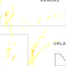
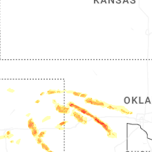
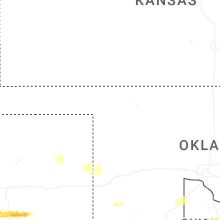


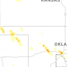

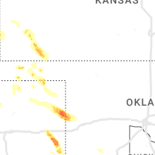


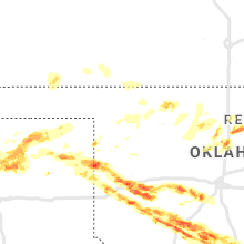


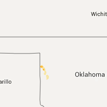


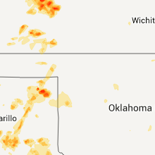


Connect with Interactive Hail Maps