

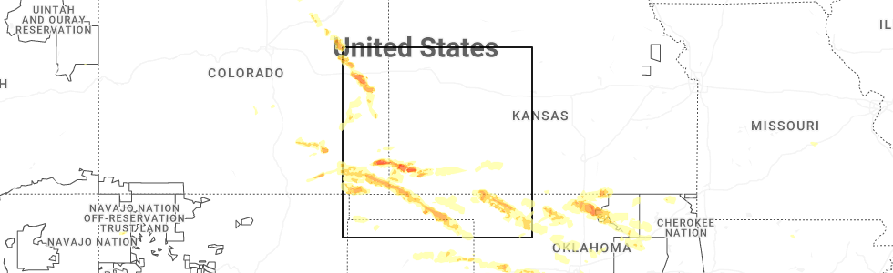
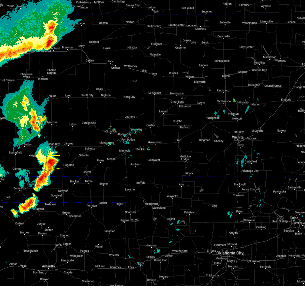
Hail Map for Richfield, KS
The Richfield, KS area has had 16 reports of on-the-ground hail by trained spotters, and has been under severe weather warnings 22 times during the past 12 months. Doppler radar has detected hail at or near Richfield, KS on 70 occasions, including 7 occasions during the past year.
| Name: | Richfield, KS |
| Where Located: | 69.5 miles SW of Garden City, KS |
| Map: | Google Map for Richfield, KS |
| Population: | 43 |
| Housing Units: | 25 |
| More Info: | Search Google for Richfield, KS |
1
The Top Recent Hail Date for Richfield, KS is Thursday, June 5, 2025 (15th out of 70)
Hail and Wind Damage Spotted near Richfield, KS
| Date / Time | Report Details |
|---|---|
| 6/29/2025 7:57 PM CDT |
 the severe thunderstorm warning has been cancelled and is no longer in effect the severe thunderstorm warning has been cancelled and is no longer in effect
|
| 6/29/2025 7:42 PM CDT |
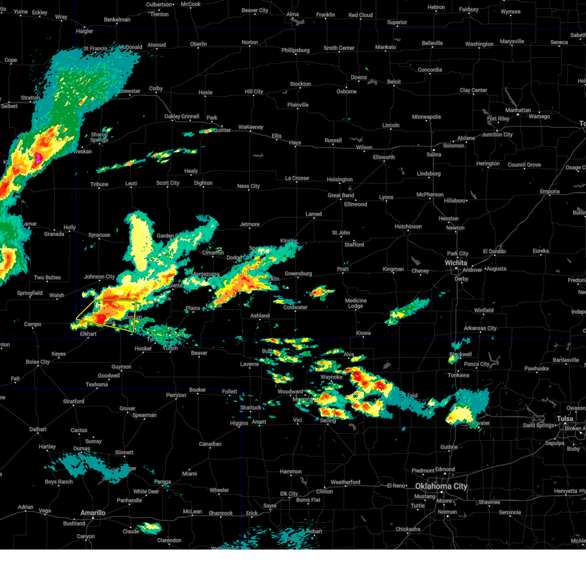
 Svrddc the national weather service in dodge city has issued a * severe thunderstorm warning for, west central morton county in southwestern kansas, * until 830 pm cdt. * at 741 pm cdt, a severe thunderstorm was located 8 miles southwest of richfield, and is nearly stationary (radar indicated). Hazards include 60 mph wind gusts and quarter size hail. Hail damage to vehicles is expected. expect wind damage to roofs, siding, and trees. This severe thunderstorm will remain over mainly rural areas of west central morton county. Svrddc the national weather service in dodge city has issued a * severe thunderstorm warning for, west central morton county in southwestern kansas, * until 830 pm cdt. * at 741 pm cdt, a severe thunderstorm was located 8 miles southwest of richfield, and is nearly stationary (radar indicated). Hazards include 60 mph wind gusts and quarter size hail. Hail damage to vehicles is expected. expect wind damage to roofs, siding, and trees. This severe thunderstorm will remain over mainly rural areas of west central morton county.
|
| 6/5/2025 10:00 PM CDT |
 Svrddc the national weather service in dodge city has issued a * severe thunderstorm warning for, morton county in southwestern kansas, * until 1045 pm cdt. * at 956 pm cdt, a severe thunderstorm was located 9 miles southeast of stonington, or 16 miles northwest of elkhart, moving southeast at 45 mph (radar indicated). Hazards include two inch hail and 70 mph wind gusts. People and animals outdoors will be injured. expect hail damage to roofs, siding, windows, and vehicles. expect considerable tree damage. Wind damage is also likely to mobile homes, roofs, and outbuildings. Svrddc the national weather service in dodge city has issued a * severe thunderstorm warning for, morton county in southwestern kansas, * until 1045 pm cdt. * at 956 pm cdt, a severe thunderstorm was located 9 miles southeast of stonington, or 16 miles northwest of elkhart, moving southeast at 45 mph (radar indicated). Hazards include two inch hail and 70 mph wind gusts. People and animals outdoors will be injured. expect hail damage to roofs, siding, windows, and vehicles. expect considerable tree damage. Wind damage is also likely to mobile homes, roofs, and outbuildings.
|
| 6/5/2025 8:36 PM CDT |
 The storm which prompted the warning has weakened below severe limits, and no longer poses an immediate threat to life or property. therefore, the warning will be allowed to expire. however, gusty winds and heavy rain are still possible with this thunderstorm. a tornado watch remains in effect until 900 pm cdt for southwestern kansas. The storm which prompted the warning has weakened below severe limits, and no longer poses an immediate threat to life or property. therefore, the warning will be allowed to expire. however, gusty winds and heavy rain are still possible with this thunderstorm. a tornado watch remains in effect until 900 pm cdt for southwestern kansas.
|
| 6/5/2025 8:22 PM CDT |
 At 822 pm cdt, a severe thunderstorm was located near richfield, moving east at 30 mph (radar indicated). Hazards include 60 mph wind gusts and quarter size hail. Hail damage to vehicles is expected. expect wind damage to roofs, siding, and trees. Locations impacted include, hugoton, rolla, richfield, and feterita. At 822 pm cdt, a severe thunderstorm was located near richfield, moving east at 30 mph (radar indicated). Hazards include 60 mph wind gusts and quarter size hail. Hail damage to vehicles is expected. expect wind damage to roofs, siding, and trees. Locations impacted include, hugoton, rolla, richfield, and feterita.
|
| 6/5/2025 8:07 PM CDT |
 the severe thunderstorm warning has been cancelled and is no longer in effect the severe thunderstorm warning has been cancelled and is no longer in effect
|
| 6/5/2025 8:07 PM CDT |
 At 806 pm cdt, a severe thunderstorm was located very near richfield, moving east at 25 mph (radar indicated). Hazards include 60 mph wind gusts and half dollar size hail. Hail damage to vehicles is expected. expect wind damage to roofs, siding, and trees. Locations impacted include, hugoton, rolla, richfield, and feterita. At 806 pm cdt, a severe thunderstorm was located very near richfield, moving east at 25 mph (radar indicated). Hazards include 60 mph wind gusts and half dollar size hail. Hail damage to vehicles is expected. expect wind damage to roofs, siding, and trees. Locations impacted include, hugoton, rolla, richfield, and feterita.
|
| 6/5/2025 7:55 PM CDT |
 At 755 pm cdt, a severe thunderstorm was located near richfield, moving east at 30 mph (radar indicated). Hazards include golf ball size hail and 60 mph wind gusts. People and animals outdoors will be injured. expect hail damage to roofs, siding, windows, and vehicles. expect wind damage to roofs, siding, and trees. Locations impacted include, ulysses, hugoton, johnson city, rolla, manter, richfield, big bow, and feterita. At 755 pm cdt, a severe thunderstorm was located near richfield, moving east at 30 mph (radar indicated). Hazards include golf ball size hail and 60 mph wind gusts. People and animals outdoors will be injured. expect hail damage to roofs, siding, windows, and vehicles. expect wind damage to roofs, siding, and trees. Locations impacted include, ulysses, hugoton, johnson city, rolla, manter, richfield, big bow, and feterita.
|
| 6/5/2025 7:41 PM CDT | Svrddc the national weather service in dodge city has issued a * severe thunderstorm warning for, northern morton county in southwestern kansas, southwestern grant county in southwestern kansas, western stevens county in southwestern kansas, southern stanton county in southwestern kansas, * until 845 pm cdt. * at 740 pm cdt, a severe thunderstorm was located 9 miles southeast of the saunders elevator, moving east at 30 mph (radar indicated). Hazards include ping pong ball size hail and 60 mph wind gusts. People and animals outdoors will be injured. expect hail damage to roofs, siding, windows, and vehicles. expect wind damage to roofs, siding, and trees. This severe thunderstorm will remain over mainly rural areas of northern morton, southwestern grant, western stevens and southern stanton counties. |
| 6/2/2025 5:11 PM CDT |
 Svrddc the national weather service in dodge city has issued a * severe thunderstorm warning for, northern morton county in southwestern kansas, stanton county in southwestern kansas, * until 600 pm cdt. * at 510 pm cdt, a severe thunderstorm was located 7 miles south of manter, moving northeast at 40 mph (radar indicated). Hazards include 60 mph wind gusts and penny size hail. Expect damage to roofs, siding, and trees. this severe thunderstorm will be near, manter around 520 pm cdt. Johnson city around 525 pm cdt. Svrddc the national weather service in dodge city has issued a * severe thunderstorm warning for, northern morton county in southwestern kansas, stanton county in southwestern kansas, * until 600 pm cdt. * at 510 pm cdt, a severe thunderstorm was located 7 miles south of manter, moving northeast at 40 mph (radar indicated). Hazards include 60 mph wind gusts and penny size hail. Expect damage to roofs, siding, and trees. this severe thunderstorm will be near, manter around 520 pm cdt. Johnson city around 525 pm cdt.
|
| 6/2/2025 4:47 PM CDT | At 447 pm cdt, a severe thunderstorm was located 10 miles east of richfield, moving northeast at 30 mph (public. at 628 pm cdt, the public reported quarter size hail near rolla). Hazards include 70 mph wind gusts and quarter size hail. Hail damage to vehicles is expected. expect considerable tree damage. wind damage is also likely to mobile homes, roofs, and outbuildings. This severe thunderstorm will remain over mainly rural areas of northeastern morton, southern grant, western stevens and southeastern stanton counties. |
| 6/2/2025 4:42 PM CDT | At 440 pm cdt, a severe thunderstorm was located 9 miles east of richfield, moving northeast at 30 mph (radar indicated. at 428 pm cdt, the public reported quarter size hail near rolla). Hazards include 70 mph wind gusts and quarter size hail. Hail damage to vehicles is expected. expect considerable tree damage. wind damage is also likely to mobile homes, roofs, and outbuildings. This severe thunderstorm will remain over mainly rural areas of eastern morton, southern grant, western stevens and southeastern stanton counties. |
| 6/2/2025 4:16 PM CDT |
 Svrddc the national weather service in dodge city has issued a * severe thunderstorm warning for, morton county in southwestern kansas, southern grant county in southwestern kansas, western stevens county in southwestern kansas, southeastern stanton county in southwestern kansas, * until 515 pm cdt. * at 416 pm cdt, a severe thunderstorm was located near wilburton, moving northeast at 30 mph (radar indicated). Hazards include 70 mph wind gusts and quarter size hail. Hail damage to vehicles is expected. expect considerable tree damage. wind damage is also likely to mobile homes, roofs, and outbuildings. This severe thunderstorm will be near, rolla around 420 pm cdt. Svrddc the national weather service in dodge city has issued a * severe thunderstorm warning for, morton county in southwestern kansas, southern grant county in southwestern kansas, western stevens county in southwestern kansas, southeastern stanton county in southwestern kansas, * until 515 pm cdt. * at 416 pm cdt, a severe thunderstorm was located near wilburton, moving northeast at 30 mph (radar indicated). Hazards include 70 mph wind gusts and quarter size hail. Hail damage to vehicles is expected. expect considerable tree damage. wind damage is also likely to mobile homes, roofs, and outbuildings. This severe thunderstorm will be near, rolla around 420 pm cdt.
|
| 9/17/2024 7:43 PM CDT |
 Svrddc the national weather service in dodge city has issued a * severe thunderstorm warning for, hamilton county in southwestern kansas, northern morton county in southwestern kansas, kearny county in southwestern kansas, grant county in southwestern kansas, stanton county in southwestern kansas, * until 845 pm cdt/745 pm mdt/. * at 742 pm cdt/642 pm mdt/, severe thunderstorms were located along a line extending from 14 miles southwest of horace to 9 miles northeast of richfield, moving northeast at 45 mph (radar indicated). Hazards include 60 mph wind gusts and penny size hail. Expect damage to roofs, siding, and trees. blowing dust could lower visibilities. severe thunderstorms will be near, syracuse around 645 pm mdt. big bow around 750 pm cdt. kendall around 755 pm cdt. ulysses around 800 pm cdt. Other locations in the path of these severe thunderstorms include lakin. Svrddc the national weather service in dodge city has issued a * severe thunderstorm warning for, hamilton county in southwestern kansas, northern morton county in southwestern kansas, kearny county in southwestern kansas, grant county in southwestern kansas, stanton county in southwestern kansas, * until 845 pm cdt/745 pm mdt/. * at 742 pm cdt/642 pm mdt/, severe thunderstorms were located along a line extending from 14 miles southwest of horace to 9 miles northeast of richfield, moving northeast at 45 mph (radar indicated). Hazards include 60 mph wind gusts and penny size hail. Expect damage to roofs, siding, and trees. blowing dust could lower visibilities. severe thunderstorms will be near, syracuse around 645 pm mdt. big bow around 750 pm cdt. kendall around 755 pm cdt. ulysses around 800 pm cdt. Other locations in the path of these severe thunderstorms include lakin.
|
| 9/17/2024 7:34 PM CDT |
 At 733 pm cdt/633 pm mdt/, severe thunderstorms were located along a line extending from near leoti to near hugoton, moving east at 45 mph (radar indicated). Hazards include 60 mph wind gusts and penny size hail. Expect damage to roofs, siding, and trees. These severe thunderstorms will remain over mainly rural areas of hamilton, northern morton and stanton counties. At 733 pm cdt/633 pm mdt/, severe thunderstorms were located along a line extending from near leoti to near hugoton, moving east at 45 mph (radar indicated). Hazards include 60 mph wind gusts and penny size hail. Expect damage to roofs, siding, and trees. These severe thunderstorms will remain over mainly rural areas of hamilton, northern morton and stanton counties.
|
| 9/17/2024 6:51 PM CDT |
 Svrddc the national weather service in dodge city has issued a * severe thunderstorm warning for, hamilton county in southwestern kansas, morton county in southwestern kansas, stanton county in southwestern kansas, * until 745 pm cdt/645 pm mdt/. * at 649 pm cdt/549 pm mdt/, severe thunderstorms were located along a line extending from 12 miles northeast of hartman to 9 miles west of elkhart, moving northeast at 50 mph (radar indicated). Hazards include 70 mph wind gusts and penny size hail. Expect considerable tree damage. damage is likely to mobile homes, roofs, and outbuildings. severe thunderstorms will be near, elkhart, manter, and the saunders elevator around 655 pm cdt. coolidge around 555 pm mdt. johnson city, richfield, and wilburton around 705 pm cdt. syracuse around 605 pm mdt. Other locations in the path of these severe thunderstorms include rolla, kendall and big bow. Svrddc the national weather service in dodge city has issued a * severe thunderstorm warning for, hamilton county in southwestern kansas, morton county in southwestern kansas, stanton county in southwestern kansas, * until 745 pm cdt/645 pm mdt/. * at 649 pm cdt/549 pm mdt/, severe thunderstorms were located along a line extending from 12 miles northeast of hartman to 9 miles west of elkhart, moving northeast at 50 mph (radar indicated). Hazards include 70 mph wind gusts and penny size hail. Expect considerable tree damage. damage is likely to mobile homes, roofs, and outbuildings. severe thunderstorms will be near, elkhart, manter, and the saunders elevator around 655 pm cdt. coolidge around 555 pm mdt. johnson city, richfield, and wilburton around 705 pm cdt. syracuse around 605 pm mdt. Other locations in the path of these severe thunderstorms include rolla, kendall and big bow.
|
| 8/1/2024 10:06 PM CDT |
 The severe thunderstorm which prompted the warning is weakening below severe limits. therefore, the warning will be allowed to expire at 1015 pm. The severe thunderstorm which prompted the warning is weakening below severe limits. therefore, the warning will be allowed to expire at 1015 pm.
|
| 8/1/2024 9:45 PM CDT |
 At 945 pm cdt, a severe thunderstorm was located 7 miles east of richfield, moving northeast at 20 mph (radar indicated). Hazards include 60 mph wind gusts and quarter size hail. Hail damage to vehicles is expected. expect wind damage to roofs, siding, and trees. This severe thunderstorm will remain over mainly rural areas of morton, western stevens and southwestern stanton counties. At 945 pm cdt, a severe thunderstorm was located 7 miles east of richfield, moving northeast at 20 mph (radar indicated). Hazards include 60 mph wind gusts and quarter size hail. Hail damage to vehicles is expected. expect wind damage to roofs, siding, and trees. This severe thunderstorm will remain over mainly rural areas of morton, western stevens and southwestern stanton counties.
|
| 8/1/2024 9:29 PM CDT |
 Svrddc the national weather service in dodge city has issued a * severe thunderstorm warning for, morton county in southwestern kansas, western stevens county in southwestern kansas, southwestern stanton county in southwestern kansas, * until 1015 pm cdt. * at 929 pm cdt, a severe thunderstorm was located near richfield, moving northeast at 15 mph (radar indicated). Hazards include 60 mph wind gusts and quarter size hail. Hail damage to vehicles is expected. expect wind damage to roofs, siding, and trees. This severe thunderstorm will be near, richfield around 935 pm cdt. Svrddc the national weather service in dodge city has issued a * severe thunderstorm warning for, morton county in southwestern kansas, western stevens county in southwestern kansas, southwestern stanton county in southwestern kansas, * until 1015 pm cdt. * at 929 pm cdt, a severe thunderstorm was located near richfield, moving northeast at 15 mph (radar indicated). Hazards include 60 mph wind gusts and quarter size hail. Hail damage to vehicles is expected. expect wind damage to roofs, siding, and trees. This severe thunderstorm will be near, richfield around 935 pm cdt.
|
| 7/16/2024 8:10 PM CDT |
 Svrddc the national weather service in dodge city has issued a * severe thunderstorm warning for, northeastern morton county in southwestern kansas, grant county in southwestern kansas, northern stevens county in southwestern kansas, eastern stanton county in southwestern kansas, * until 900 pm cdt. * at 809 pm cdt, severe thunderstorms were located along a line extending from 6 miles north of johnson city to near big bow to 7 miles north of rolla, moving east at 25 mph (radar indicated). Hazards include 60 mph wind gusts. Expect damage to roofs, siding, and trees. severe thunderstorms will be near, big bow around 815 pm cdt. this new warning replaces the previous warning which was in effect for stanton and morton county. Other locations in the path of these severe thunderstorms include ulysses and hickok. Svrddc the national weather service in dodge city has issued a * severe thunderstorm warning for, northeastern morton county in southwestern kansas, grant county in southwestern kansas, northern stevens county in southwestern kansas, eastern stanton county in southwestern kansas, * until 900 pm cdt. * at 809 pm cdt, severe thunderstorms were located along a line extending from 6 miles north of johnson city to near big bow to 7 miles north of rolla, moving east at 25 mph (radar indicated). Hazards include 60 mph wind gusts. Expect damage to roofs, siding, and trees. severe thunderstorms will be near, big bow around 815 pm cdt. this new warning replaces the previous warning which was in effect for stanton and morton county. Other locations in the path of these severe thunderstorms include ulysses and hickok.
|
| 7/16/2024 8:00 PM CDT |
 At 759 pm cdt, a severe thunderstorm was located very near richfield, moving east at 30 mph (radar indicated). Hazards include two inch hail and 60 mph wind gusts. People and animals outdoors will be injured. expect hail damage to roofs, siding, windows, and vehicles. expect wind damage to roofs, siding, and trees. Locations impacted include, richfield. At 759 pm cdt, a severe thunderstorm was located very near richfield, moving east at 30 mph (radar indicated). Hazards include two inch hail and 60 mph wind gusts. People and animals outdoors will be injured. expect hail damage to roofs, siding, windows, and vehicles. expect wind damage to roofs, siding, and trees. Locations impacted include, richfield.
|
| 7/16/2024 7:58 PM CDT | Storm damage reported in morton county KS, 0.3 miles SSW of Richfield, KS |
| 7/16/2024 7:25 PM CDT |
 Svrddc the national weather service in dodge city has issued a * severe thunderstorm warning for, morton county in southwestern kansas, south central stanton county in southwestern kansas, * until 815 pm cdt. * at 724 pm cdt, a severe thunderstorm was located 8 miles southeast of stonington, or 16 miles west of richfield, moving east at 30 mph (radar indicated). Hazards include two inch hail and 60 mph wind gusts. People and animals outdoors will be injured. expect hail damage to roofs, siding, windows, and vehicles. Expect wind damage to roofs, siding, and trees. Svrddc the national weather service in dodge city has issued a * severe thunderstorm warning for, morton county in southwestern kansas, south central stanton county in southwestern kansas, * until 815 pm cdt. * at 724 pm cdt, a severe thunderstorm was located 8 miles southeast of stonington, or 16 miles west of richfield, moving east at 30 mph (radar indicated). Hazards include two inch hail and 60 mph wind gusts. People and animals outdoors will be injured. expect hail damage to roofs, siding, windows, and vehicles. Expect wind damage to roofs, siding, and trees.
|
| 7/3/2024 7:23 PM CDT |
 the severe thunderstorm warning has been cancelled and is no longer in effect the severe thunderstorm warning has been cancelled and is no longer in effect
|
| 7/3/2024 7:23 PM CDT |
 At 721 pm cdt, a severe thunderstorm was located 8 miles northeast of richfield, moving east at 30 mph (radar indicated). Hazards include 60 mph wind gusts and quarter size hail. Hail damage to vehicles is expected. expect wind damage to roofs, siding, and trees. Locations impacted include, richfield. At 721 pm cdt, a severe thunderstorm was located 8 miles northeast of richfield, moving east at 30 mph (radar indicated). Hazards include 60 mph wind gusts and quarter size hail. Hail damage to vehicles is expected. expect wind damage to roofs, siding, and trees. Locations impacted include, richfield.
|
| 7/3/2024 6:52 PM CDT |
 Svrddc the national weather service in dodge city has issued a * severe thunderstorm warning for, morton county in southwestern kansas, southern stanton county in southwestern kansas, * until 730 pm cdt. * at 651 pm cdt, a severe thunderstorm was located 10 miles east of stonington, or 11 miles south of the saunders elevator, moving east at 30 mph (radar indicated). Hazards include 70 mph wind gusts and quarter size hail. Hail damage to vehicles is expected. expect considerable tree damage. wind damage is also likely to mobile homes, roofs, and outbuildings. This severe thunderstorm will remain over mainly rural areas of morton and southern stanton counties. Svrddc the national weather service in dodge city has issued a * severe thunderstorm warning for, morton county in southwestern kansas, southern stanton county in southwestern kansas, * until 730 pm cdt. * at 651 pm cdt, a severe thunderstorm was located 10 miles east of stonington, or 11 miles south of the saunders elevator, moving east at 30 mph (radar indicated). Hazards include 70 mph wind gusts and quarter size hail. Hail damage to vehicles is expected. expect considerable tree damage. wind damage is also likely to mobile homes, roofs, and outbuildings. This severe thunderstorm will remain over mainly rural areas of morton and southern stanton counties.
|
| 6/16/2024 5:27 PM CDT |
 the severe thunderstorm warning has been cancelled and is no longer in effect the severe thunderstorm warning has been cancelled and is no longer in effect
|
| 6/16/2024 5:14 PM CDT |
 Svrddc the national weather service in dodge city has issued a * severe thunderstorm warning for, central morton county in southwestern kansas, * until 600 pm cdt. * at 513 pm cdt, a severe thunderstorm was located near richfield, moving northeast at 10 mph (radar indicated). Hazards include 60 mph wind gusts and quarter size hail. Hail damage to vehicles is expected. expect wind damage to roofs, siding, and trees. this severe thunderstorm will be near, richfield around 520 pm cdt. This new warning extends the previous warning which was in effect for central morton county. Svrddc the national weather service in dodge city has issued a * severe thunderstorm warning for, central morton county in southwestern kansas, * until 600 pm cdt. * at 513 pm cdt, a severe thunderstorm was located near richfield, moving northeast at 10 mph (radar indicated). Hazards include 60 mph wind gusts and quarter size hail. Hail damage to vehicles is expected. expect wind damage to roofs, siding, and trees. this severe thunderstorm will be near, richfield around 520 pm cdt. This new warning extends the previous warning which was in effect for central morton county.
|
| 6/16/2024 4:54 PM CDT |
 At 454 pm cdt, a severe thunderstorm was located 9 miles northwest of wilburton, moving northeast at 10 mph (radar indicated). Hazards include 60 mph wind gusts and quarter size hail. Hail damage to vehicles is expected. expect wind damage to roofs, siding, and trees. Locations impacted include, rolla and richfield. At 454 pm cdt, a severe thunderstorm was located 9 miles northwest of wilburton, moving northeast at 10 mph (radar indicated). Hazards include 60 mph wind gusts and quarter size hail. Hail damage to vehicles is expected. expect wind damage to roofs, siding, and trees. Locations impacted include, rolla and richfield.
|
| 6/16/2024 4:31 PM CDT |
 Svrddc the national weather service in dodge city has issued a * severe thunderstorm warning for, central morton county in southwestern kansas, * until 515 pm cdt. * at 431 pm cdt, a severe thunderstorm was located 10 miles northwest of elkhart, moving northeast at 20 mph (radar indicated). Hazards include 60 mph wind gusts and quarter size hail. Hail damage to vehicles is expected. Expect wind damage to roofs, siding, and trees. Svrddc the national weather service in dodge city has issued a * severe thunderstorm warning for, central morton county in southwestern kansas, * until 515 pm cdt. * at 431 pm cdt, a severe thunderstorm was located 10 miles northwest of elkhart, moving northeast at 20 mph (radar indicated). Hazards include 60 mph wind gusts and quarter size hail. Hail damage to vehicles is expected. Expect wind damage to roofs, siding, and trees.
|
| 6/16/2024 3:57 PM CDT |
 the severe thunderstorm warning has been cancelled and is no longer in effect the severe thunderstorm warning has been cancelled and is no longer in effect
|
| 6/16/2024 3:51 PM CDT |
 At 351 pm cdt, a severe thunderstorm was located near richfield, moving north at 5 mph (radar indicated). Hazards include 60 mph wind gusts and quarter size hail. Hail damage to vehicles is expected. expect wind damage to roofs, siding, and trees. Locations impacted include, richfield. At 351 pm cdt, a severe thunderstorm was located near richfield, moving north at 5 mph (radar indicated). Hazards include 60 mph wind gusts and quarter size hail. Hail damage to vehicles is expected. expect wind damage to roofs, siding, and trees. Locations impacted include, richfield.
|
| 6/16/2024 3:35 PM CDT |
 At 335 pm cdt, a severe thunderstorm was located very near richfield, moving east at 10 mph (radar indicated). Hazards include 60 mph wind gusts and quarter size hail. Hail damage to vehicles is expected. expect wind damage to roofs, siding, and trees. Locations impacted include, manter and richfield. At 335 pm cdt, a severe thunderstorm was located very near richfield, moving east at 10 mph (radar indicated). Hazards include 60 mph wind gusts and quarter size hail. Hail damage to vehicles is expected. expect wind damage to roofs, siding, and trees. Locations impacted include, manter and richfield.
|
| 6/16/2024 3:22 PM CDT |
 Svrddc the national weather service in dodge city has issued a * severe thunderstorm warning for, northern morton county in southwestern kansas, west central stevens county in southwestern kansas, southwestern stanton county in southwestern kansas, * until 430 pm cdt. * at 322 pm cdt, a severe thunderstorm was located near richfield, moving northeast at 15 mph (radar indicated). Hazards include 60 mph wind gusts and quarter size hail. Hail damage to vehicles is expected. Expect wind damage to roofs, siding, and trees. Svrddc the national weather service in dodge city has issued a * severe thunderstorm warning for, northern morton county in southwestern kansas, west central stevens county in southwestern kansas, southwestern stanton county in southwestern kansas, * until 430 pm cdt. * at 322 pm cdt, a severe thunderstorm was located near richfield, moving northeast at 15 mph (radar indicated). Hazards include 60 mph wind gusts and quarter size hail. Hail damage to vehicles is expected. Expect wind damage to roofs, siding, and trees.
|
| 6/14/2024 7:34 PM CDT |
 Svrddc the national weather service in dodge city has issued a * severe thunderstorm warning for, western seward county in southwestern kansas, eastern morton county in southwestern kansas, grant county in southwestern kansas, stevens county in southwestern kansas, southeastern stanton county in southwestern kansas, southwestern haskell county in southwestern kansas, * until 830 pm cdt. * at 733 pm cdt, severe thunderstorms were located along a line extending from 6 miles southeast of manter to near hough, moving east at 45 mph (radar indicated). Hazards include 70 mph wind gusts and penny size hail. areas of blowing dust will reduce visibility. Expect considerable tree damage. damage is likely to mobile homes, roofs, and outbuildings. severe thunderstorms will be near, rolla and feterita around 740 pm cdt. hugoton around 750 pm cdt. Other locations in the path of these severe thunderstorms include moscow, cave, woods and ryus. Svrddc the national weather service in dodge city has issued a * severe thunderstorm warning for, western seward county in southwestern kansas, eastern morton county in southwestern kansas, grant county in southwestern kansas, stevens county in southwestern kansas, southeastern stanton county in southwestern kansas, southwestern haskell county in southwestern kansas, * until 830 pm cdt. * at 733 pm cdt, severe thunderstorms were located along a line extending from 6 miles southeast of manter to near hough, moving east at 45 mph (radar indicated). Hazards include 70 mph wind gusts and penny size hail. areas of blowing dust will reduce visibility. Expect considerable tree damage. damage is likely to mobile homes, roofs, and outbuildings. severe thunderstorms will be near, rolla and feterita around 740 pm cdt. hugoton around 750 pm cdt. Other locations in the path of these severe thunderstorms include moscow, cave, woods and ryus.
|
| 6/14/2024 6:47 PM CDT |
 Svrddc the national weather service in dodge city has issued a * severe thunderstorm warning for, southern hamilton county in southwestern kansas, morton county in southwestern kansas, southwestern kearny county in southwestern kansas, western grant county in southwestern kansas, western stevens county in southwestern kansas, stanton county in southwestern kansas, * until 745 pm cdt/645 pm mdt/. * at 646 pm cdt/546 pm mdt/, severe thunderstorms were located along a line extending from 10 miles south of coolidge to near elkhart, moving east at 30 mph (radar indicated). Hazards include 70 mph wind gusts and quarter size hail. areas of blowing dust and reduced visibility are expected. Hail damage to vehicles is expected. expect considerable tree damage. wind damage is also likely to mobile homes, roofs, and outbuildings. severe thunderstorms will be near, elkhart and manter around 650 pm cdt. richfield around 700 pm cdt. johnson city and wilburton around 705 pm cdt. Other locations in the path of these severe thunderstorms include rolla, big bow, kendall and feterita. Svrddc the national weather service in dodge city has issued a * severe thunderstorm warning for, southern hamilton county in southwestern kansas, morton county in southwestern kansas, southwestern kearny county in southwestern kansas, western grant county in southwestern kansas, western stevens county in southwestern kansas, stanton county in southwestern kansas, * until 745 pm cdt/645 pm mdt/. * at 646 pm cdt/546 pm mdt/, severe thunderstorms were located along a line extending from 10 miles south of coolidge to near elkhart, moving east at 30 mph (radar indicated). Hazards include 70 mph wind gusts and quarter size hail. areas of blowing dust and reduced visibility are expected. Hail damage to vehicles is expected. expect considerable tree damage. wind damage is also likely to mobile homes, roofs, and outbuildings. severe thunderstorms will be near, elkhart and manter around 650 pm cdt. richfield around 700 pm cdt. johnson city and wilburton around 705 pm cdt. Other locations in the path of these severe thunderstorms include rolla, big bow, kendall and feterita.
|
| 6/2/2024 6:30 PM CDT |
 Svrddc the national weather service in dodge city has issued a * severe thunderstorm warning for, northern morton county in southwestern kansas, southern stanton county in southwestern kansas, * until 715 pm cdt. * at 629 pm cdt, severe thunderstorms were located along a line extending from near the saunders elevator to 7 miles northwest of richfield to 8 miles northwest of wilburton, moving northeast at 20 mph (radar indicated). Hazards include 60 mph wind gusts and nickel size hail. Expect damage to roofs, siding, and trees. severe thunderstorms will be near, richfield around 635 pm cdt. This new warning replaces the previous warning which was in effect for northern morton and southern stanton county. Svrddc the national weather service in dodge city has issued a * severe thunderstorm warning for, northern morton county in southwestern kansas, southern stanton county in southwestern kansas, * until 715 pm cdt. * at 629 pm cdt, severe thunderstorms were located along a line extending from near the saunders elevator to 7 miles northwest of richfield to 8 miles northwest of wilburton, moving northeast at 20 mph (radar indicated). Hazards include 60 mph wind gusts and nickel size hail. Expect damage to roofs, siding, and trees. severe thunderstorms will be near, richfield around 635 pm cdt. This new warning replaces the previous warning which was in effect for northern morton and southern stanton county.
|
| 6/2/2024 5:51 PM CDT |
 Svrddc the national weather service in dodge city has issued a * severe thunderstorm warning for, northern morton county in southwestern kansas, southwestern stanton county in southwestern kansas, * until 630 pm cdt. * at 551 pm cdt, a severe thunderstorm was located near stonington, or 8 miles south of the saunders elevator, moving east at 20 mph (radar indicated). Hazards include golf ball size hail and 60 mph wind gusts. People and animals outdoors will be injured. expect hail damage to roofs, siding, windows, and vehicles. expect wind damage to roofs, siding, and trees. This severe thunderstorm will remain over mainly rural areas of northern morton and southwestern stanton counties. Svrddc the national weather service in dodge city has issued a * severe thunderstorm warning for, northern morton county in southwestern kansas, southwestern stanton county in southwestern kansas, * until 630 pm cdt. * at 551 pm cdt, a severe thunderstorm was located near stonington, or 8 miles south of the saunders elevator, moving east at 20 mph (radar indicated). Hazards include golf ball size hail and 60 mph wind gusts. People and animals outdoors will be injured. expect hail damage to roofs, siding, windows, and vehicles. expect wind damage to roofs, siding, and trees. This severe thunderstorm will remain over mainly rural areas of northern morton and southwestern stanton counties.
|
| 6/1/2024 7:32 PM CDT |
 Svrddc the national weather service in dodge city has issued a * severe thunderstorm warning for, eastern morton county in southwestern kansas, stevens county in southwestern kansas, * until 815 pm cdt. * at 732 pm cdt, severe thunderstorms were located along a line extending from near richfield to near elkhart, moving east-southeast at 30 mph (radar indicated). Hazards include 60 mph wind gusts and quarter size hail. Hail damage to vehicles is expected. expect wind damage to roofs, siding, and trees. severe thunderstorms will be near, wilburton around 735 pm cdt. rolla around 740 pm cdt. Other locations in the path of these severe thunderstorms include feterita. Svrddc the national weather service in dodge city has issued a * severe thunderstorm warning for, eastern morton county in southwestern kansas, stevens county in southwestern kansas, * until 815 pm cdt. * at 732 pm cdt, severe thunderstorms were located along a line extending from near richfield to near elkhart, moving east-southeast at 30 mph (radar indicated). Hazards include 60 mph wind gusts and quarter size hail. Hail damage to vehicles is expected. expect wind damage to roofs, siding, and trees. severe thunderstorms will be near, wilburton around 735 pm cdt. rolla around 740 pm cdt. Other locations in the path of these severe thunderstorms include feterita.
|
| 6/1/2024 7:24 PM CDT |
 At 724 pm cdt, a severe thunderstorm was located very near richfield, moving southeast at 30 mph (radar indicated). Hazards include golf ball size hail and 60 mph wind gusts. People and animals outdoors will be injured. expect hail damage to roofs, siding, windows, and vehicles. expect wind damage to roofs, siding, and trees. This severe thunderstorm will remain over mainly rural areas of eastern morton county. At 724 pm cdt, a severe thunderstorm was located very near richfield, moving southeast at 30 mph (radar indicated). Hazards include golf ball size hail and 60 mph wind gusts. People and animals outdoors will be injured. expect hail damage to roofs, siding, windows, and vehicles. expect wind damage to roofs, siding, and trees. This severe thunderstorm will remain over mainly rural areas of eastern morton county.
|
| 6/1/2024 7:24 PM CDT |
 the severe thunderstorm warning has been cancelled and is no longer in effect the severe thunderstorm warning has been cancelled and is no longer in effect
|
| 6/1/2024 6:57 PM CDT |
 Svrddc the national weather service in dodge city has issued a * severe thunderstorm warning for, northeastern morton county in southwestern kansas, southern stanton county in southwestern kansas, * until 730 pm cdt. * at 656 pm cdt, a severe thunderstorm was located near richfield, moving east at 20 mph (radar indicated). Hazards include golf ball size hail and 60 mph wind gusts. People and animals outdoors will be injured. expect hail damage to roofs, siding, windows, and vehicles. expect wind damage to roofs, siding, and trees. this severe thunderstorm will be near, richfield around 700 pm cdt. This warning replaces the previous warning which was in effect for southern stanton and northern morton county. Svrddc the national weather service in dodge city has issued a * severe thunderstorm warning for, northeastern morton county in southwestern kansas, southern stanton county in southwestern kansas, * until 730 pm cdt. * at 656 pm cdt, a severe thunderstorm was located near richfield, moving east at 20 mph (radar indicated). Hazards include golf ball size hail and 60 mph wind gusts. People and animals outdoors will be injured. expect hail damage to roofs, siding, windows, and vehicles. expect wind damage to roofs, siding, and trees. this severe thunderstorm will be near, richfield around 700 pm cdt. This warning replaces the previous warning which was in effect for southern stanton and northern morton county.
|
| 6/1/2024 6:45 PM CDT |
 At 645 pm cdt, a severe thunderstorm was located near richfield, moving east at 25 mph (radar indicated). Hazards include ping pong ball size hail and 60 mph wind gusts. People and animals outdoors will be injured. expect hail damage to roofs, siding, windows, and vehicles. expect wind damage to roofs, siding, and trees. Locations impacted include, manter, richfield, and the saunders elevator. At 645 pm cdt, a severe thunderstorm was located near richfield, moving east at 25 mph (radar indicated). Hazards include ping pong ball size hail and 60 mph wind gusts. People and animals outdoors will be injured. expect hail damage to roofs, siding, windows, and vehicles. expect wind damage to roofs, siding, and trees. Locations impacted include, manter, richfield, and the saunders elevator.
|
| 6/1/2024 6:13 PM CDT |
 Svrddc the national weather service in dodge city has issued a * severe thunderstorm warning for, northern morton county in southwestern kansas, southern stanton county in southwestern kansas, * until 700 pm cdt. * at 612 pm cdt, a severe thunderstorm was located near the saunders elevator, moving east at 25 mph (radar indicated). Hazards include 60 mph wind gusts and half dollar size hail. Hail damage to vehicles is expected. expect wind damage to roofs, siding, and trees. This severe thunderstorm will remain over mainly rural areas of northern morton and southern stanton counties. Svrddc the national weather service in dodge city has issued a * severe thunderstorm warning for, northern morton county in southwestern kansas, southern stanton county in southwestern kansas, * until 700 pm cdt. * at 612 pm cdt, a severe thunderstorm was located near the saunders elevator, moving east at 25 mph (radar indicated). Hazards include 60 mph wind gusts and half dollar size hail. Hail damage to vehicles is expected. expect wind damage to roofs, siding, and trees. This severe thunderstorm will remain over mainly rural areas of northern morton and southern stanton counties.
|
| 5/28/2024 7:34 PM CDT |
 At 733 pm cdt/633 pm mdt/, severe thunderstorms were located along a line extending from 13 miles north of big bow to near ulysses to 10 miles south of hugoton, moving northeast at 20 mph (radar indicated). Hazards include 60 mph wind gusts and quarter size hail. Hail damage to vehicles is expected. expect wind damage to roofs, siding, and trees. These severe storms will be near, ulysses and moscow around 740 pm cdt. At 733 pm cdt/633 pm mdt/, severe thunderstorms were located along a line extending from 13 miles north of big bow to near ulysses to 10 miles south of hugoton, moving northeast at 20 mph (radar indicated). Hazards include 60 mph wind gusts and quarter size hail. Hail damage to vehicles is expected. expect wind damage to roofs, siding, and trees. These severe storms will be near, ulysses and moscow around 740 pm cdt.
|
| 5/28/2024 7:27 PM CDT |
 At 726 pm cdt/626 pm mdt/, severe thunderstorms were located along a line extending from near coolidge to near ulysses to 11 miles south of hugoton, moving northeast at 20 mph (radar indicated). Hazards include 60 mph wind gusts and quarter size hail. Hail damage to vehicles is expected. expect wind damage to roofs, siding, and trees. these severe storms will be near, ulysses and hugoton around 730 pm cdt. coolidge around 630 pm mdt. Moscow around 740 pm cdt. At 726 pm cdt/626 pm mdt/, severe thunderstorms were located along a line extending from near coolidge to near ulysses to 11 miles south of hugoton, moving northeast at 20 mph (radar indicated). Hazards include 60 mph wind gusts and quarter size hail. Hail damage to vehicles is expected. expect wind damage to roofs, siding, and trees. these severe storms will be near, ulysses and hugoton around 730 pm cdt. coolidge around 630 pm mdt. Moscow around 740 pm cdt.
|
| 5/28/2024 7:23 PM CDT |
 At 723 pm cdt/623 pm mdt/, severe thunderstorms were located along a line extending from near coolidge to near ulysses to 11 miles south of hugoton, moving northeast at 20 mph (radar indicated). Hazards include quarter size hail. Damage to vehicles is expected. these severe storms will be near, ulysses around 730 pm cdt. Other locations in the path of these severe thunderstorms include moscow. At 723 pm cdt/623 pm mdt/, severe thunderstorms were located along a line extending from near coolidge to near ulysses to 11 miles south of hugoton, moving northeast at 20 mph (radar indicated). Hazards include quarter size hail. Damage to vehicles is expected. these severe storms will be near, ulysses around 730 pm cdt. Other locations in the path of these severe thunderstorms include moscow.
|
| 5/28/2024 7:14 PM CDT |
 Svrddc the national weather service in dodge city has issued a * severe thunderstorm warning for, southern hamilton county in southwestern kansas, morton county in southwestern kansas, southwestern kearny county in southwestern kansas, western grant county in southwestern kansas, stevens county in southwestern kansas, stanton county in southwestern kansas, * until 800 pm cdt/700 pm mdt/. * at 714 pm cdt/614 pm mdt/, severe thunderstorms were located along a line extending from near coolidge to near ulysses to 11 miles northwest of hooker, moving northeast at 20 mph (radar indicated). Hazards include quarter size hail. Damage to vehicles is expected. severe thunderstorms will be near, ulysses and hugoton around 720 pm cdt. coolidge around 620 pm mdt. Other locations in the path of these severe thunderstorms include moscow. Svrddc the national weather service in dodge city has issued a * severe thunderstorm warning for, southern hamilton county in southwestern kansas, morton county in southwestern kansas, southwestern kearny county in southwestern kansas, western grant county in southwestern kansas, stevens county in southwestern kansas, stanton county in southwestern kansas, * until 800 pm cdt/700 pm mdt/. * at 714 pm cdt/614 pm mdt/, severe thunderstorms were located along a line extending from near coolidge to near ulysses to 11 miles northwest of hooker, moving northeast at 20 mph (radar indicated). Hazards include quarter size hail. Damage to vehicles is expected. severe thunderstorms will be near, ulysses and hugoton around 720 pm cdt. coolidge around 620 pm mdt. Other locations in the path of these severe thunderstorms include moscow.
|
| 5/28/2024 6:48 PM CDT |
 At 648 pm cdt, a severe thunderstorm was located 7 miles west of richfield, moving east at 10 mph (radar indicated). Hazards include quarter size hail. Damage to vehicles is expected. Locations impacted include, richfield. At 648 pm cdt, a severe thunderstorm was located 7 miles west of richfield, moving east at 10 mph (radar indicated). Hazards include quarter size hail. Damage to vehicles is expected. Locations impacted include, richfield.
|
| 5/28/2024 6:41 PM CDT |
 Svrddc the national weather service in dodge city has issued a * severe thunderstorm warning for, northern morton county in southwestern kansas, southwestern stanton county in southwestern kansas, * until 730 pm cdt. * at 641 pm cdt, a severe thunderstorm was located 8 miles west of richfield, moving east at 10 mph (radar indicated). Hazards include quarter size hail. damage to vehicles is expected Svrddc the national weather service in dodge city has issued a * severe thunderstorm warning for, northern morton county in southwestern kansas, southwestern stanton county in southwestern kansas, * until 730 pm cdt. * at 641 pm cdt, a severe thunderstorm was located 8 miles west of richfield, moving east at 10 mph (radar indicated). Hazards include quarter size hail. damage to vehicles is expected
|
| 5/19/2024 3:43 PM CDT |
 Svrddc the national weather service in dodge city has issued a * severe thunderstorm warning for, seward county in southwestern kansas, eastern morton county in southwestern kansas, grant county in southwestern kansas, stevens county in southwestern kansas, eastern stanton county in southwestern kansas, haskell county in southwestern kansas, * until 445 pm cdt. * at 343 pm cdt, severe thunderstorms were located along a line extending from 6 miles south of kendall to near feterita, moving east at 35 mph (radar indicated). Hazards include 70 mph wind gusts and penny size hail. Expect considerable tree damage. damage is likely to mobile homes, roofs, and outbuildings. severe thunderstorms will be near, ulysses and hugoton around 350 pm cdt. moscow and hickok around 400 pm cdt. Other locations in the path of these severe thunderstorms include cave, woods, ryus, satanta and sublette. Svrddc the national weather service in dodge city has issued a * severe thunderstorm warning for, seward county in southwestern kansas, eastern morton county in southwestern kansas, grant county in southwestern kansas, stevens county in southwestern kansas, eastern stanton county in southwestern kansas, haskell county in southwestern kansas, * until 445 pm cdt. * at 343 pm cdt, severe thunderstorms were located along a line extending from 6 miles south of kendall to near feterita, moving east at 35 mph (radar indicated). Hazards include 70 mph wind gusts and penny size hail. Expect considerable tree damage. damage is likely to mobile homes, roofs, and outbuildings. severe thunderstorms will be near, ulysses and hugoton around 350 pm cdt. moscow and hickok around 400 pm cdt. Other locations in the path of these severe thunderstorms include cave, woods, ryus, satanta and sublette.
|
| 5/19/2024 3:25 PM CDT |
 At 325 pm cdt/225 pm mdt/, severe thunderstorms were located along a line extending from 12 miles north of johnson city to near wilburton, moving east at 50 mph (radar indicated). Hazards include 70 mph wind gusts and penny size hail. Expect considerable tree damage. damage is likely to mobile homes, roofs, and outbuildings. Locations impacted include, rolla, big bow, feterita, ulysses and hugoton. At 325 pm cdt/225 pm mdt/, severe thunderstorms were located along a line extending from 12 miles north of johnson city to near wilburton, moving east at 50 mph (radar indicated). Hazards include 70 mph wind gusts and penny size hail. Expect considerable tree damage. damage is likely to mobile homes, roofs, and outbuildings. Locations impacted include, rolla, big bow, feterita, ulysses and hugoton.
|
| 5/19/2024 2:52 PM CDT |
 Svrddc the national weather service in dodge city has issued a * severe thunderstorm warning for, southern hamilton county in southwestern kansas, morton county in southwestern kansas, southwestern kearny county in southwestern kansas, grant county in southwestern kansas, stevens county in southwestern kansas, stanton county in southwestern kansas, * until 345 pm cdt/245 pm mdt/. * at 252 pm cdt/152 pm mdt/, severe thunderstorms were located along a line extending from 13 miles northwest of the saunders elevator to 15 miles north of keyes, moving east at 50 mph (radar indicated). Hazards include 70 mph wind gusts and penny size hail. Expect considerable tree damage. damage is likely to mobile homes, roofs, and outbuildings. severe thunderstorms will be near, the saunders elevator around 255 pm cdt. manter around 305 pm cdt. Other locations in the path of these severe thunderstorms include johnson city, richfield, wilburton, rolla and big bow. Svrddc the national weather service in dodge city has issued a * severe thunderstorm warning for, southern hamilton county in southwestern kansas, morton county in southwestern kansas, southwestern kearny county in southwestern kansas, grant county in southwestern kansas, stevens county in southwestern kansas, stanton county in southwestern kansas, * until 345 pm cdt/245 pm mdt/. * at 252 pm cdt/152 pm mdt/, severe thunderstorms were located along a line extending from 13 miles northwest of the saunders elevator to 15 miles north of keyes, moving east at 50 mph (radar indicated). Hazards include 70 mph wind gusts and penny size hail. Expect considerable tree damage. damage is likely to mobile homes, roofs, and outbuildings. severe thunderstorms will be near, the saunders elevator around 255 pm cdt. manter around 305 pm cdt. Other locations in the path of these severe thunderstorms include johnson city, richfield, wilburton, rolla and big bow.
|
| 4/25/2024 5:24 PM CDT |
 Svrddc the national weather service in dodge city has issued a * severe thunderstorm warning for, southern hamilton county in southwestern kansas, northwestern morton county in southwestern kansas, stanton county in southwestern kansas, * until 600 pm cdt/500 pm mdt/. * at 521 pm cdt/421 pm mdt/, a severe thunderstorm was located near the saunders elevator. another severe thunderstorm was located 15 miles west of johnson, and a third severe storm was located 7 miles northwest of richfield. these storms were moving north northeast at 45 mph (radar indicated and public report of golf ball size hail 6 miles west southwest of richfield at 515 pm cdt). Hazards include golf ball size hail and 60 mph wind gusts. People and animals outdoors will be injured. expect hail damage to roofs, siding, windows, and vehicles. Expect wind damage to roofs, siding, and trees. Svrddc the national weather service in dodge city has issued a * severe thunderstorm warning for, southern hamilton county in southwestern kansas, northwestern morton county in southwestern kansas, stanton county in southwestern kansas, * until 600 pm cdt/500 pm mdt/. * at 521 pm cdt/421 pm mdt/, a severe thunderstorm was located near the saunders elevator. another severe thunderstorm was located 15 miles west of johnson, and a third severe storm was located 7 miles northwest of richfield. these storms were moving north northeast at 45 mph (radar indicated and public report of golf ball size hail 6 miles west southwest of richfield at 515 pm cdt). Hazards include golf ball size hail and 60 mph wind gusts. People and animals outdoors will be injured. expect hail damage to roofs, siding, windows, and vehicles. Expect wind damage to roofs, siding, and trees.
|
| 4/25/2024 5:15 PM CDT | Golf Ball sized hail reported 6.6 miles E of Richfield, KS, report from mping: golf ball (1.75 in.). |
| 7/10/2023 7:02 PM CDT |
 At 701 pm cdt/601 pm mdt/, severe thunderstorms were located along a line extending from near syracuse to near johnson city to 7 miles west of richfield, moving east at 35 mph (radar indicated). Hazards include 60 mph wind gusts and penny size hail. Expect damage to roofs, siding, and trees. locations impacted include, syracuse, johnson city, rolla, manter, coolidge, richfield, wilburton and the saunders elevator. hail threat, radar indicated max hail size, 0. 75 in wind threat, radar indicated max wind gust, 60 mph. At 701 pm cdt/601 pm mdt/, severe thunderstorms were located along a line extending from near syracuse to near johnson city to 7 miles west of richfield, moving east at 35 mph (radar indicated). Hazards include 60 mph wind gusts and penny size hail. Expect damage to roofs, siding, and trees. locations impacted include, syracuse, johnson city, rolla, manter, coolidge, richfield, wilburton and the saunders elevator. hail threat, radar indicated max hail size, 0. 75 in wind threat, radar indicated max wind gust, 60 mph.
|
| 7/10/2023 6:40 PM CDT |
 At 640 pm cdt/540 pm mdt/, severe thunderstorms were located along a line extending from near coolidge to near the saunders elevator to near stonington, moving east at 30 mph (radar indicated). Hazards include 60 mph wind gusts and penny size hail. Expect damage to roofs, siding, and trees. locations impacted include, manter, syracuse, johnson city, richfield and rolla. hail threat, radar indicated max hail size, 0. 75 in wind threat, radar indicated max wind gust, 60 mph. At 640 pm cdt/540 pm mdt/, severe thunderstorms were located along a line extending from near coolidge to near the saunders elevator to near stonington, moving east at 30 mph (radar indicated). Hazards include 60 mph wind gusts and penny size hail. Expect damage to roofs, siding, and trees. locations impacted include, manter, syracuse, johnson city, richfield and rolla. hail threat, radar indicated max hail size, 0. 75 in wind threat, radar indicated max wind gust, 60 mph.
|
| 7/10/2023 6:27 PM CDT |
 At 626 pm cdt/526 pm mdt/, severe thunderstorms were located along a line extending from near coolidge to 10 miles northwest of the saunders elevator to near vilas, moving east at 25 mph (radar indicated). Hazards include 60 mph wind gusts and quarter size hail. Hail damage to vehicles is expected. expect wind damage to roofs, siding, and trees. severe thunderstorms will be near, coolidge around 530 pm mdt. other locations in the path of these severe thunderstorms include the saunders elevator, syracuse, manter and johnson city. hail threat, radar indicated max hail size, 1. 00 in wind threat, radar indicated max wind gust, 60 mph. At 626 pm cdt/526 pm mdt/, severe thunderstorms were located along a line extending from near coolidge to 10 miles northwest of the saunders elevator to near vilas, moving east at 25 mph (radar indicated). Hazards include 60 mph wind gusts and quarter size hail. Hail damage to vehicles is expected. expect wind damage to roofs, siding, and trees. severe thunderstorms will be near, coolidge around 530 pm mdt. other locations in the path of these severe thunderstorms include the saunders elevator, syracuse, manter and johnson city. hail threat, radar indicated max hail size, 1. 00 in wind threat, radar indicated max wind gust, 60 mph.
|
| 7/8/2023 10:59 PM CDT |
 At 1059 pm cdt, a severe thunderstorm was located 9 miles north of elkhart, moving southeast at 40 mph (radar indicated). Hazards include 60 mph wind gusts and half dollar size hail. Hail damage to vehicles is expected. expect wind damage to roofs, siding, and trees. locations impacted include, elkhart, rolla, richfield and wilburton. hail threat, radar indicated max hail size, 1. 25 in wind threat, radar indicated max wind gust, 60 mph. At 1059 pm cdt, a severe thunderstorm was located 9 miles north of elkhart, moving southeast at 40 mph (radar indicated). Hazards include 60 mph wind gusts and half dollar size hail. Hail damage to vehicles is expected. expect wind damage to roofs, siding, and trees. locations impacted include, elkhart, rolla, richfield and wilburton. hail threat, radar indicated max hail size, 1. 25 in wind threat, radar indicated max wind gust, 60 mph.
|
| 7/8/2023 10:48 PM CDT |
 At 1048 pm cdt, a severe thunderstorm was located 9 miles east of stonington, or 13 miles west of richfield, moving southeast at 35 mph (radar indicated). Hazards include 60 mph wind gusts and quarter size hail. Hail damage to vehicles is expected. Expect wind damage to roofs, siding, and trees. At 1048 pm cdt, a severe thunderstorm was located 9 miles east of stonington, or 13 miles west of richfield, moving southeast at 35 mph (radar indicated). Hazards include 60 mph wind gusts and quarter size hail. Hail damage to vehicles is expected. Expect wind damage to roofs, siding, and trees.
|
| 7/8/2023 10:28 PM CDT |
 At 1028 pm cdt, a severe thunderstorm was located near johnson city, moving southeast at 20 mph (radar indicated). Hazards include 60 mph wind gusts and nickel size hail. Expect damage to roofs, siding, and trees. this severe thunderstorm will remain over mainly rural areas of northeastern morton, southwestern grant, northwestern stevens and stanton counties. hail threat, radar indicated max hail size, 0. 88 in wind threat, radar indicated max wind gust, 60 mph. At 1028 pm cdt, a severe thunderstorm was located near johnson city, moving southeast at 20 mph (radar indicated). Hazards include 60 mph wind gusts and nickel size hail. Expect damage to roofs, siding, and trees. this severe thunderstorm will remain over mainly rural areas of northeastern morton, southwestern grant, northwestern stevens and stanton counties. hail threat, radar indicated max hail size, 0. 88 in wind threat, radar indicated max wind gust, 60 mph.
|
| 7/8/2023 10:13 PM CDT |
 At 1012 pm cdt, a severe thunderstorm was located near johnson city, moving southeast at 20 mph (radar indicated). Hazards include 60 mph wind gusts and penny size hail. Expect damage to roofs, siding, and trees. this severe thunderstorm will be near, johnson city around 1030 pm cdt. other locations in the path of this severe thunderstorm include big bow. hail threat, radar indicated max hail size, 0. 75 in wind threat, radar indicated max wind gust, 60 mph. At 1012 pm cdt, a severe thunderstorm was located near johnson city, moving southeast at 20 mph (radar indicated). Hazards include 60 mph wind gusts and penny size hail. Expect damage to roofs, siding, and trees. this severe thunderstorm will be near, johnson city around 1030 pm cdt. other locations in the path of this severe thunderstorm include big bow. hail threat, radar indicated max hail size, 0. 75 in wind threat, radar indicated max wind gust, 60 mph.
|
| 7/7/2023 3:43 AM CDT |
 The severe thunderstorm warning for southeastern morton and southwestern stevens counties will expire at 345 am cdt, the severe thunderstorm which prompted the warning is weakening below severe limits. therefore, the warning will be allowed to expire. a severe thunderstorm watch remains in effect until 600 am cdt for southwestern kansas. The severe thunderstorm warning for southeastern morton and southwestern stevens counties will expire at 345 am cdt, the severe thunderstorm which prompted the warning is weakening below severe limits. therefore, the warning will be allowed to expire. a severe thunderstorm watch remains in effect until 600 am cdt for southwestern kansas.
|
| 7/7/2023 3:29 AM CDT |
 At 329 am cdt, a severe thunderstorm was located near rolla, moving southeast at 30 mph (radar indicated). Hazards include 60 mph wind gusts and quarter size hail. Hail damage to vehicles is expected. expect wind damage to roofs, siding, and trees. locations impacted include, rolla, richfield and wilburton. hail threat, radar indicated max hail size, 1. 00 in wind threat, radar indicated max wind gust, 60 mph. At 329 am cdt, a severe thunderstorm was located near rolla, moving southeast at 30 mph (radar indicated). Hazards include 60 mph wind gusts and quarter size hail. Hail damage to vehicles is expected. expect wind damage to roofs, siding, and trees. locations impacted include, rolla, richfield and wilburton. hail threat, radar indicated max hail size, 1. 00 in wind threat, radar indicated max wind gust, 60 mph.
|
| 7/7/2023 3:18 AM CDT | At 317 am cdt, a severe thunderstorm was located near wilburton, moving southeast at 25 mph (radar indicated). Hazards include two inch hail and 60 mph wind gusts. People and animals outdoors will be injured. expect hail damage to roofs, siding, windows, and vehicles. expect wind damage to roofs, siding, and trees. locations impacted include, elkhart, rolla, richfield and wilburton. thunderstorm damage threat, considerable hail threat, radar indicated max hail size, 2. 00 in wind threat, radar indicated max wind gust, 60 mph. |
| 7/7/2023 3:12 AM CDT |
 At 311 am cdt, a severe thunderstorm was located near wilburton, moving southeast at 25 mph (radar indicated). Hazards include 70 mph wind gusts and ping pong ball size hail. People and animals outdoors will be injured. expect hail damage to roofs, siding, windows, and vehicles. expect considerable tree damage. wind damage is also likely to mobile homes, roofs, and outbuildings. locations impacted include, wilburton and rolla. thunderstorm damage threat, considerable hail threat, radar indicated max hail size, 1. 50 in wind threat, radar indicated max wind gust, 70 mph. At 311 am cdt, a severe thunderstorm was located near wilburton, moving southeast at 25 mph (radar indicated). Hazards include 70 mph wind gusts and ping pong ball size hail. People and animals outdoors will be injured. expect hail damage to roofs, siding, windows, and vehicles. expect considerable tree damage. wind damage is also likely to mobile homes, roofs, and outbuildings. locations impacted include, wilburton and rolla. thunderstorm damage threat, considerable hail threat, radar indicated max hail size, 1. 50 in wind threat, radar indicated max wind gust, 70 mph.
|
| 7/7/2023 2:55 AM CDT | Quarter sized hail reported 6.8 miles ENE of Richfield, KS |
| 7/7/2023 2:55 AM CDT |
 At 254 am cdt, a severe thunderstorm was located 7 miles west of richfield, moving southeast at 25 mph (radar indicated). Hazards include tennis ball size hail and 70 mph wind gusts. People and animals outdoors will be injured. expect hail damage to roofs, siding, windows, and vehicles. expect considerable tree damage. wind damage is also likely to mobile homes, roofs, and outbuildings. this severe thunderstorm will be near, richfield around 300 am cdt. other locations in the path of this severe thunderstorm include rolla and wilburton. thunderstorm damage threat, considerable hail threat, radar indicated max hail size, 2. 50 in wind threat, radar indicated max wind gust, 70 mph. At 254 am cdt, a severe thunderstorm was located 7 miles west of richfield, moving southeast at 25 mph (radar indicated). Hazards include tennis ball size hail and 70 mph wind gusts. People and animals outdoors will be injured. expect hail damage to roofs, siding, windows, and vehicles. expect considerable tree damage. wind damage is also likely to mobile homes, roofs, and outbuildings. this severe thunderstorm will be near, richfield around 300 am cdt. other locations in the path of this severe thunderstorm include rolla and wilburton. thunderstorm damage threat, considerable hail threat, radar indicated max hail size, 2. 50 in wind threat, radar indicated max wind gust, 70 mph.
|
| 7/7/2023 2:39 AM CDT |
 At 239 am cdt, a severe thunderstorm was located 9 miles east of stonington, or 10 miles south of the saunders elevator, moving southeast at 25 mph (radar indicated). Hazards include two inch hail and 60 mph wind gusts. People and animals outdoors will be injured. expect hail damage to roofs, siding, windows, and vehicles. expect wind damage to roofs, siding, and trees. locations impacted include, richfield and the saunders elevator. thunderstorm damage threat, considerable hail threat, radar indicated max hail size, 2. 00 in wind threat, radar indicated max wind gust, 60 mph. At 239 am cdt, a severe thunderstorm was located 9 miles east of stonington, or 10 miles south of the saunders elevator, moving southeast at 25 mph (radar indicated). Hazards include two inch hail and 60 mph wind gusts. People and animals outdoors will be injured. expect hail damage to roofs, siding, windows, and vehicles. expect wind damage to roofs, siding, and trees. locations impacted include, richfield and the saunders elevator. thunderstorm damage threat, considerable hail threat, radar indicated max hail size, 2. 00 in wind threat, radar indicated max wind gust, 60 mph.
|
| 7/7/2023 2:22 AM CDT |
 At 222 am cdt, a severe thunderstorm was located near the saunders elevator, moving southeast at 25 mph (radar indicated). Hazards include tennis ball size hail and 70 mph wind gusts. People and animals outdoors will be injured. expect hail damage to roofs, siding, windows, and vehicles. expect considerable tree damage. Wind damage is also likely to mobile homes, roofs, and outbuildings. At 222 am cdt, a severe thunderstorm was located near the saunders elevator, moving southeast at 25 mph (radar indicated). Hazards include tennis ball size hail and 70 mph wind gusts. People and animals outdoors will be injured. expect hail damage to roofs, siding, windows, and vehicles. expect considerable tree damage. Wind damage is also likely to mobile homes, roofs, and outbuildings.
|
| 7/6/2023 12:22 AM CDT |
 At 1222 am cdt, a severe thunderstorm was located 9 miles south of johnson city, moving southeast at 25 mph (radar indicated). Hazards include 60 mph wind gusts and half dollar size hail. Hail damage to vehicles is expected. expect wind damage to roofs, siding, and trees. this severe thunderstorm will remain over mainly rural areas of northeastern morton, southwestern grant, northwestern stevens and southeastern stanton counties. hail threat, radar indicated max hail size, 1. 25 in wind threat, radar indicated max wind gust, 60 mph. At 1222 am cdt, a severe thunderstorm was located 9 miles south of johnson city, moving southeast at 25 mph (radar indicated). Hazards include 60 mph wind gusts and half dollar size hail. Hail damage to vehicles is expected. expect wind damage to roofs, siding, and trees. this severe thunderstorm will remain over mainly rural areas of northeastern morton, southwestern grant, northwestern stevens and southeastern stanton counties. hail threat, radar indicated max hail size, 1. 25 in wind threat, radar indicated max wind gust, 60 mph.
|
| 6/30/2023 7:18 PM CDT |
 At 717 pm cdt/617 pm mdt/, severe thunderstorms were located along a line extending from 14 miles south of syracuse to 12 miles north of keyes, moving east at 40 mph. blowing dust and low visibility will also be a concern (radar indicated). Hazards include 60 mph wind gusts and nickel size hail. Expect damage to roofs, siding, and trees. locations impacted include, ulysses, hugoton, elkhart, johnson city, rolla, moscow, manter, richfield, the saunders elevator, big bow, feterita, wilburton and hickok. hail threat, radar indicated max hail size, 0. 88 in wind threat, radar indicated max wind gust, 60 mph. At 717 pm cdt/617 pm mdt/, severe thunderstorms were located along a line extending from 14 miles south of syracuse to 12 miles north of keyes, moving east at 40 mph. blowing dust and low visibility will also be a concern (radar indicated). Hazards include 60 mph wind gusts and nickel size hail. Expect damage to roofs, siding, and trees. locations impacted include, ulysses, hugoton, elkhart, johnson city, rolla, moscow, manter, richfield, the saunders elevator, big bow, feterita, wilburton and hickok. hail threat, radar indicated max hail size, 0. 88 in wind threat, radar indicated max wind gust, 60 mph.
|
| 6/30/2023 7:15 PM CDT |
 At 714 pm cdt/614 pm mdt/, severe thunderstorms were located along a line extending from 14 miles north of johnson city to 12 miles north of keyes, moving east at 40 mph (radar indicated). Hazards include 60 mph wind gusts and nickel size hail. expect damage to roofs, siding, and trees At 714 pm cdt/614 pm mdt/, severe thunderstorms were located along a line extending from 14 miles north of johnson city to 12 miles north of keyes, moving east at 40 mph (radar indicated). Hazards include 60 mph wind gusts and nickel size hail. expect damage to roofs, siding, and trees
|
| 6/27/2023 7:05 PM CDT |
 At 705 pm cdt, severe thunderstorms were located along a line extending from 7 miles southwest of richfield to 7 miles east of hough, moving east at 55 mph (radar indicated). Hazards include 70 mph wind gusts and quarter size hail. Hail damage to vehicles is expected. expect considerable tree damage. wind damage is also likely to mobile homes, roofs, and outbuildings. locations impacted include, rolla, richfield, wilburton and feterita. thunderstorm damage threat, considerable hail threat, radar indicated max hail size, 1. 00 in wind threat, radar indicated max wind gust, 70 mph. At 705 pm cdt, severe thunderstorms were located along a line extending from 7 miles southwest of richfield to 7 miles east of hough, moving east at 55 mph (radar indicated). Hazards include 70 mph wind gusts and quarter size hail. Hail damage to vehicles is expected. expect considerable tree damage. wind damage is also likely to mobile homes, roofs, and outbuildings. locations impacted include, rolla, richfield, wilburton and feterita. thunderstorm damage threat, considerable hail threat, radar indicated max hail size, 1. 00 in wind threat, radar indicated max wind gust, 70 mph.
|
| 6/27/2023 6:41 PM CDT |
 At 640 pm cdt, severe thunderstorms were located along a line extending from 13 miles west of elkhart to 9 miles northwest of goodwell, moving northeast at 50 mph. these are destructive storms for elkhart (radar indicated). Hazards include 80 mph wind gusts and quarter size hail. Flying debris will be dangerous to those caught without shelter. mobile homes will be heavily damaged. expect considerable damage to roofs, windows, and vehicles. extensive tree damage and power outages are likely. locations impacted include, elkhart, rolla, richfield, wilburton and feterita. thunderstorm damage threat, destructive hail threat, radar indicated max hail size, 1. 00 in wind threat, radar indicated max wind gust, 80 mph. At 640 pm cdt, severe thunderstorms were located along a line extending from 13 miles west of elkhart to 9 miles northwest of goodwell, moving northeast at 50 mph. these are destructive storms for elkhart (radar indicated). Hazards include 80 mph wind gusts and quarter size hail. Flying debris will be dangerous to those caught without shelter. mobile homes will be heavily damaged. expect considerable damage to roofs, windows, and vehicles. extensive tree damage and power outages are likely. locations impacted include, elkhart, rolla, richfield, wilburton and feterita. thunderstorm damage threat, destructive hail threat, radar indicated max hail size, 1. 00 in wind threat, radar indicated max wind gust, 80 mph.
|
| 6/27/2023 6:31 PM CDT |
 At 630 pm cdt, severe thunderstorms were located along a line extending from 7 miles north of keyes to 8 miles north of texhoma, moving northeast at 50 mph (radar indicated). Hazards include 60 mph wind gusts and quarter size hail. Hail damage to vehicles is expected. Expect wind damage to roofs, siding, and trees. At 630 pm cdt, severe thunderstorms were located along a line extending from 7 miles north of keyes to 8 miles north of texhoma, moving northeast at 50 mph (radar indicated). Hazards include 60 mph wind gusts and quarter size hail. Hail damage to vehicles is expected. Expect wind damage to roofs, siding, and trees.
|
| 6/27/2023 4:27 PM CDT |
 The severe thunderstorm warning for western morton and southwestern stanton counties will expire at 430 pm cdt, the storm which prompted the warning has weakened below severe limits, and no longer poses an immediate threat to life or property. therefore, the warning will be allowed to expire. however small hail and gusty winds are still possible with this thunderstorm. a severe thunderstorm watch remains in effect until 900 pm cdt for southwestern kansas. The severe thunderstorm warning for western morton and southwestern stanton counties will expire at 430 pm cdt, the storm which prompted the warning has weakened below severe limits, and no longer poses an immediate threat to life or property. therefore, the warning will be allowed to expire. however small hail and gusty winds are still possible with this thunderstorm. a severe thunderstorm watch remains in effect until 900 pm cdt for southwestern kansas.
|
| 6/27/2023 4:17 PM CDT |
 At 417 pm cdt, a severe thunderstorm was located 9 miles southeast of the saunders elevator, moving east at 25 mph (radar indicated). Hazards include quarter size hail. Damage to vehicles is expected. this severe thunderstorm will remain over mainly rural areas of western morton and southwestern stanton counties. hail threat, radar indicated max hail size, 1. 00 in wind threat, radar indicated max wind gust, <50 mph. At 417 pm cdt, a severe thunderstorm was located 9 miles southeast of the saunders elevator, moving east at 25 mph (radar indicated). Hazards include quarter size hail. Damage to vehicles is expected. this severe thunderstorm will remain over mainly rural areas of western morton and southwestern stanton counties. hail threat, radar indicated max hail size, 1. 00 in wind threat, radar indicated max wind gust, <50 mph.
|
| 6/27/2023 3:52 PM CDT |
 At 352 pm cdt, a severe thunderstorm was located near stonington, or 8 miles southwest of the saunders elevator, moving east at 25 mph (radar indicated). Hazards include 60 mph wind gusts and half dollar size hail. Hail damage to vehicles is expected. expect wind damage to roofs, siding, and trees. this severe thunderstorm will be near, the saunders elevator around 405 pm cdt. hail threat, radar indicated max hail size, 1. 25 in wind threat, radar indicated max wind gust, 60 mph. At 352 pm cdt, a severe thunderstorm was located near stonington, or 8 miles southwest of the saunders elevator, moving east at 25 mph (radar indicated). Hazards include 60 mph wind gusts and half dollar size hail. Hail damage to vehicles is expected. expect wind damage to roofs, siding, and trees. this severe thunderstorm will be near, the saunders elevator around 405 pm cdt. hail threat, radar indicated max hail size, 1. 25 in wind threat, radar indicated max wind gust, 60 mph.
|
| 6/21/2023 6:52 PM CDT |
 The severe thunderstorm warning for southeastern morton county will expire at 700 pm cdt, the storms which prompted the warning have weakened below severe limits, and no longer poses an immediate threat to life or property. therefore, the warning will be allowed to expire. however gusty winds and heavy rain are still possible with these thunderstorms. a tornado watch remains in effect until 1000 pm cdt for southwestern kansas. The severe thunderstorm warning for southeastern morton county will expire at 700 pm cdt, the storms which prompted the warning have weakened below severe limits, and no longer poses an immediate threat to life or property. therefore, the warning will be allowed to expire. however gusty winds and heavy rain are still possible with these thunderstorms. a tornado watch remains in effect until 1000 pm cdt for southwestern kansas.
|
| 6/21/2023 6:42 PM CDT |
 At 640 pm cdt, a severe thunderstorm was located 4 miles south of richfield, and is nearly stationary. another severe thunderstorm was developing 3 miles northeast of elkhart, also nearly stationary (radar indicated). Hazards include ping pong ball size hail and 60 mph wind gusts. People and animals outdoors will be injured. expect hail damage to roofs, siding, windows, and vehicles. expect wind damage to roofs, siding, and trees. locations impacted include, elkhart, richfield and wilburton. hail threat, radar indicated max hail size, 1. 50 in wind threat, radar indicated max wind gust, 60 mph. At 640 pm cdt, a severe thunderstorm was located 4 miles south of richfield, and is nearly stationary. another severe thunderstorm was developing 3 miles northeast of elkhart, also nearly stationary (radar indicated). Hazards include ping pong ball size hail and 60 mph wind gusts. People and animals outdoors will be injured. expect hail damage to roofs, siding, windows, and vehicles. expect wind damage to roofs, siding, and trees. locations impacted include, elkhart, richfield and wilburton. hail threat, radar indicated max hail size, 1. 50 in wind threat, radar indicated max wind gust, 60 mph.
|
| 6/21/2023 6:22 PM CDT |
 At 621 pm cdt, a severe thunderstorm was located very near richfield, and is nearly stationary. another severe thunderstorm was located 5 miles northeast of elkhart, moving slowly north at around 10 mph. these two storms may merge into one larger storm (radar indicated). Hazards include golf ball size hail and 60 mph wind gusts. People and animals outdoors will be injured. expect hail damage to roofs, siding, windows, and vehicles. expect wind damage to roofs, siding, and trees. this severe thunderstorm will remain over mainly rural areas of southeastern morton county. thunderstorm damage threat, considerable hail threat, radar indicated max hail size, 1. 75 in wind threat, radar indicated max wind gust, 60 mph. At 621 pm cdt, a severe thunderstorm was located very near richfield, and is nearly stationary. another severe thunderstorm was located 5 miles northeast of elkhart, moving slowly north at around 10 mph. these two storms may merge into one larger storm (radar indicated). Hazards include golf ball size hail and 60 mph wind gusts. People and animals outdoors will be injured. expect hail damage to roofs, siding, windows, and vehicles. expect wind damage to roofs, siding, and trees. this severe thunderstorm will remain over mainly rural areas of southeastern morton county. thunderstorm damage threat, considerable hail threat, radar indicated max hail size, 1. 75 in wind threat, radar indicated max wind gust, 60 mph.
|
| 6/17/2023 6:50 PM CDT |
 The severe thunderstorm warning for hamilton, morton and stanton counties will expire at 700 pm cdt/600 pm mdt/, the storms which prompted the warning have moved out of the area. therefore, the warning will be allowed to expire. a tornado watch remains in effect until 1100 pm cdt/1000 pm mdt/ for southwestern kansas. a severe thunderstorm watch remains in effect until 1100 pm cdt/1000 pm mdt/ for southwestern kansas. The severe thunderstorm warning for hamilton, morton and stanton counties will expire at 700 pm cdt/600 pm mdt/, the storms which prompted the warning have moved out of the area. therefore, the warning will be allowed to expire. a tornado watch remains in effect until 1100 pm cdt/1000 pm mdt/ for southwestern kansas. a severe thunderstorm watch remains in effect until 1100 pm cdt/1000 pm mdt/ for southwestern kansas.
|
| 6/17/2023 6:23 PM CDT |
 At 622 pm cdt/522 pm mdt/, severe thunderstorms were located along a line extending from 16 miles north of syracuse to near wilburton, moving east at 35 mph (60 mph wind gust at 612 pm 3 miles northwest of elkhart). Hazards include 70 mph wind gusts and quarter size hail. Hail damage to vehicles is expected. expect considerable tree damage. wind damage is also likely to mobile homes, roofs, and outbuildings. Locations impacted include, elkhart, syracuse, johnson city, rolla, manter, coolidge, richfield, wilburton, the saunders elevator and big bow. At 622 pm cdt/522 pm mdt/, severe thunderstorms were located along a line extending from 16 miles north of syracuse to near wilburton, moving east at 35 mph (60 mph wind gust at 612 pm 3 miles northwest of elkhart). Hazards include 70 mph wind gusts and quarter size hail. Hail damage to vehicles is expected. expect considerable tree damage. wind damage is also likely to mobile homes, roofs, and outbuildings. Locations impacted include, elkhart, syracuse, johnson city, rolla, manter, coolidge, richfield, wilburton, the saunders elevator and big bow.
|
| 6/17/2023 6:13 PM CDT |
 At 613 pm cdt/513 pm mdt/, severe thunderstorms were located along a line extending from 15 miles northeast of coolidge to near elkhart, moving east at 35 mph (radar indicated). Hazards include 70 mph wind gusts and quarter size hail. Hail damage to vehicles is expected. expect considerable tree damage. wind damage is also likely to mobile homes, roofs, and outbuildings. Locations impacted include, wilburton. At 613 pm cdt/513 pm mdt/, severe thunderstorms were located along a line extending from 15 miles northeast of coolidge to near elkhart, moving east at 35 mph (radar indicated). Hazards include 70 mph wind gusts and quarter size hail. Hail damage to vehicles is expected. expect considerable tree damage. wind damage is also likely to mobile homes, roofs, and outbuildings. Locations impacted include, wilburton.
|
| 6/17/2023 5:54 PM CDT |
 At 554 pm cdt/454 pm mdt/, severe thunderstorms were located along a line extending from 12 miles northeast of hartman to 7 miles west of elkhart, moving east at 35 mph (radar indicated). Hazards include 60 mph wind gusts and quarter size hail. Hail damage to vehicles is expected. expect wind damage to roofs, siding, and trees. severe thunderstorms will be near, elkhart around 610 pm cdt. other locations in the path of these severe thunderstorms include wilburton. hail threat, radar indicated max hail size, 1. 00 in wind threat, radar indicated max wind gust, 60 mph. At 554 pm cdt/454 pm mdt/, severe thunderstorms were located along a line extending from 12 miles northeast of hartman to 7 miles west of elkhart, moving east at 35 mph (radar indicated). Hazards include 60 mph wind gusts and quarter size hail. Hail damage to vehicles is expected. expect wind damage to roofs, siding, and trees. severe thunderstorms will be near, elkhart around 610 pm cdt. other locations in the path of these severe thunderstorms include wilburton. hail threat, radar indicated max hail size, 1. 00 in wind threat, radar indicated max wind gust, 60 mph.
|
| 5/30/2023 9:36 PM CDT |
 The severe thunderstorm warning for southeastern hamilton, morton, southern kearny, grant, western stevens and stanton counties will expire at 945 pm cdt/845 pm mdt/, the storms which prompted the warning have weakened below severe limits, and no longer pose an immediate threat to life or property. therefore, the warning will be allowed to expire. however gusty winds and heavy rain are still possible with these thunderstorms. a severe thunderstorm watch remains in effect until 1100 pm cdt/1000 pm mdt/ for southwestern kansas. The severe thunderstorm warning for southeastern hamilton, morton, southern kearny, grant, western stevens and stanton counties will expire at 945 pm cdt/845 pm mdt/, the storms which prompted the warning have weakened below severe limits, and no longer pose an immediate threat to life or property. therefore, the warning will be allowed to expire. however gusty winds and heavy rain are still possible with these thunderstorms. a severe thunderstorm watch remains in effect until 1100 pm cdt/1000 pm mdt/ for southwestern kansas.
|
| 5/30/2023 9:28 PM CDT |
 At 928 pm cdt/828 pm mdt/, severe thunderstorms were located along a line extending from near lakin to 9 miles southwest of hickok to 7 miles south of rolla, moving east at 40 mph (radar indicated). Hazards include 60 mph wind gusts and penny size hail. Expect damage to roofs, siding, and trees. locations impacted include, ulysses, hugoton, lakin, elkhart, syracuse, johnson city, deerfield, rolla, moscow, kendall, richfield, big bow, feterita, wilburton and hickok. hail threat, radar indicated max hail size, 0. 75 in wind threat, radar indicated max wind gust, 60 mph. At 928 pm cdt/828 pm mdt/, severe thunderstorms were located along a line extending from near lakin to 9 miles southwest of hickok to 7 miles south of rolla, moving east at 40 mph (radar indicated). Hazards include 60 mph wind gusts and penny size hail. Expect damage to roofs, siding, and trees. locations impacted include, ulysses, hugoton, lakin, elkhart, syracuse, johnson city, deerfield, rolla, moscow, kendall, richfield, big bow, feterita, wilburton and hickok. hail threat, radar indicated max hail size, 0. 75 in wind threat, radar indicated max wind gust, 60 mph.
|
| 5/30/2023 9:11 PM CDT |
 At 911 pm cdt/811 pm mdt/, severe thunderstorms were located along a line extending from near kendall to 8 miles south of big bow to near elkhart, moving east at 40 mph (radar indicated). Hazards include 60 mph wind gusts and penny size hail. Expect damage to roofs, siding, and trees. locations impacted include, lakin, rolla, hickok and deerfield. hail threat, radar indicated max hail size, 0. 75 in wind threat, radar indicated max wind gust, 60 mph. At 911 pm cdt/811 pm mdt/, severe thunderstorms were located along a line extending from near kendall to 8 miles south of big bow to near elkhart, moving east at 40 mph (radar indicated). Hazards include 60 mph wind gusts and penny size hail. Expect damage to roofs, siding, and trees. locations impacted include, lakin, rolla, hickok and deerfield. hail threat, radar indicated max hail size, 0. 75 in wind threat, radar indicated max wind gust, 60 mph.
|
| 5/30/2023 9:00 PM CDT |
 At 859 pm cdt/759 pm mdt/, severe thunderstorms were located along a line extending from near kendall to 9 miles southwest of big bow to near elkhart, moving east at 40 mph (radar indicated). Hazards include 60 mph wind gusts and quarter size hail. Hail damage to vehicles is expected. expect wind damage to roofs, siding, and trees. severe thunderstorms will be near, kendall around 905 pm cdt. wilburton around 915 pm cdt. other locations in the path of these severe thunderstorms include rolla, lakin, deerfield and moscow. hail threat, radar indicated max hail size, 1. 00 in wind threat, radar indicated max wind gust, 60 mph. At 859 pm cdt/759 pm mdt/, severe thunderstorms were located along a line extending from near kendall to 9 miles southwest of big bow to near elkhart, moving east at 40 mph (radar indicated). Hazards include 60 mph wind gusts and quarter size hail. Hail damage to vehicles is expected. expect wind damage to roofs, siding, and trees. severe thunderstorms will be near, kendall around 905 pm cdt. wilburton around 915 pm cdt. other locations in the path of these severe thunderstorms include rolla, lakin, deerfield and moscow. hail threat, radar indicated max hail size, 1. 00 in wind threat, radar indicated max wind gust, 60 mph.
|
| 5/30/2023 8:27 PM CDT |
 At 826 pm cdt/726 pm mdt/, severe thunderstorms were located along a line extending from 12 miles southwest of syracuse to 8 miles south of johnson city to near elkhart, moving east at 45 mph (radar indicated). Hazards include 60 mph wind gusts and nickel size hail. Expect damage to roofs, siding, and trees. locations impacted include, big bow, syracuse, rolla and kendall. hail threat, radar indicated max hail size, 0. 88 in wind threat, radar indicated max wind gust, 60 mph. At 826 pm cdt/726 pm mdt/, severe thunderstorms were located along a line extending from 12 miles southwest of syracuse to 8 miles south of johnson city to near elkhart, moving east at 45 mph (radar indicated). Hazards include 60 mph wind gusts and nickel size hail. Expect damage to roofs, siding, and trees. locations impacted include, big bow, syracuse, rolla and kendall. hail threat, radar indicated max hail size, 0. 88 in wind threat, radar indicated max wind gust, 60 mph.
|
| 5/30/2023 8:10 PM CDT |
 At 810 pm cdt/710 pm mdt/, severe thunderstorms were located along a line extending from 17 miles south of coolidge to 7 miles southeast of the saunders elevator to 13 miles west of elkhart, moving east at 40 mph (radar indicated). Hazards include 60 mph wind gusts and quarter size hail. Hail damage to vehicles is expected. expect wind damage to roofs, siding, and trees. severe thunderstorms will be near, manter around 815 pm cdt. other locations in the path of these severe thunderstorms include wilburton, big bow, syracuse, rolla and kendall. hail threat, radar indicated max hail size, 1. 00 in wind threat, radar indicated max wind gust, 60 mph. At 810 pm cdt/710 pm mdt/, severe thunderstorms were located along a line extending from 17 miles south of coolidge to 7 miles southeast of the saunders elevator to 13 miles west of elkhart, moving east at 40 mph (radar indicated). Hazards include 60 mph wind gusts and quarter size hail. Hail damage to vehicles is expected. expect wind damage to roofs, siding, and trees. severe thunderstorms will be near, manter around 815 pm cdt. other locations in the path of these severe thunderstorms include wilburton, big bow, syracuse, rolla and kendall. hail threat, radar indicated max hail size, 1. 00 in wind threat, radar indicated max wind gust, 60 mph.
|
| 5/28/2023 5:37 PM CDT |
 At 536 pm cdt, severe thunderstorms were located along a line extending from 11 miles southeast of the saunders elevator to 7 miles southwest of richfield to 10 miles northwest of elkhart, moving southeast at 20 mph (radar indicated). Hazards include 60 mph wind gusts and quarter size hail. Hail damage to vehicles is expected. Expect wind damage to roofs, siding, and trees. At 536 pm cdt, severe thunderstorms were located along a line extending from 11 miles southeast of the saunders elevator to 7 miles southwest of richfield to 10 miles northwest of elkhart, moving southeast at 20 mph (radar indicated). Hazards include 60 mph wind gusts and quarter size hail. Hail damage to vehicles is expected. Expect wind damage to roofs, siding, and trees.
|
| 2/26/2023 4:10 PM CST |
 At 409 pm cst, a severe thunderstorm was located near feterita, moving northeast at 60 mph (radar indicated). Hazards include 70 mph wind gusts and nickel size hail. Expect considerable tree damage. damage is likely to mobile homes, roofs, and outbuildings. this severe thunderstorm will be near, hugoton around 420 pm cst. other locations in the path of this severe thunderstorm include moscow, cave and ryus. thunderstorm damage threat, considerable hail threat, radar indicated max hail size, 0. 88 in wind threat, radar indicated max wind gust, 70 mph. At 409 pm cst, a severe thunderstorm was located near feterita, moving northeast at 60 mph (radar indicated). Hazards include 70 mph wind gusts and nickel size hail. Expect considerable tree damage. damage is likely to mobile homes, roofs, and outbuildings. this severe thunderstorm will be near, hugoton around 420 pm cst. other locations in the path of this severe thunderstorm include moscow, cave and ryus. thunderstorm damage threat, considerable hail threat, radar indicated max hail size, 0. 88 in wind threat, radar indicated max wind gust, 70 mph.
|
| 6/7/2022 11:59 PM CDT |
 At 1159 pm cdt, a severe thunderstorm was located near rolla, moving southeast at 25 mph (radar indicated). Hazards include quarter size hail. Damage to vehicles is expected. locations impacted include, richfield. hail threat, radar indicated max hail size, 1. 00 in wind threat, radar indicated max wind gust, <50 mph. At 1159 pm cdt, a severe thunderstorm was located near rolla, moving southeast at 25 mph (radar indicated). Hazards include quarter size hail. Damage to vehicles is expected. locations impacted include, richfield. hail threat, radar indicated max hail size, 1. 00 in wind threat, radar indicated max wind gust, <50 mph.
|
| 6/7/2022 11:58 PM CDT |
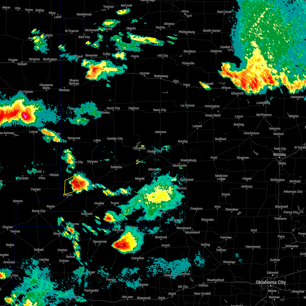 At 1158 pm cdt, a severe thunderstorm was located very near rolla, moving southeast at 25 mph (radar indicated). Hazards include quarter size hail. Damage to vehicles is expected. locations impacted include, richfield. hail threat, radar indicated max hail size, 1. 00 in wind threat, radar indicated max wind gust, <50 mph. At 1158 pm cdt, a severe thunderstorm was located very near rolla, moving southeast at 25 mph (radar indicated). Hazards include quarter size hail. Damage to vehicles is expected. locations impacted include, richfield. hail threat, radar indicated max hail size, 1. 00 in wind threat, radar indicated max wind gust, <50 mph.
|
| 6/7/2022 11:44 PM CDT |
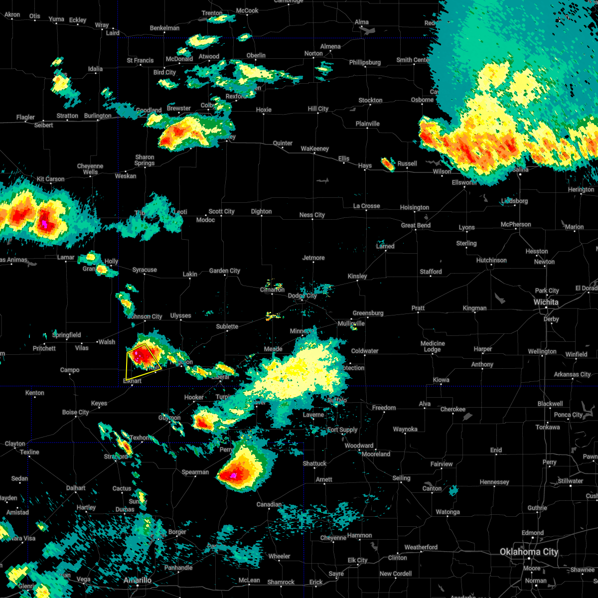 At 1142 pm cdt, a severe thunderstorm was located near rolla, moving southeast at 30 mph (radar indicated). Hazards include 60 mph wind gusts and half dollar size hail. Hail damage to vehicles is expected. expect wind damage to roofs, siding, and trees. this severe thunderstorm will remain over mainly rural areas of central morton county. hail threat, radar indicated max hail size, 1. 25 in wind threat, radar indicated max wind gust, 60 mph. At 1142 pm cdt, a severe thunderstorm was located near rolla, moving southeast at 30 mph (radar indicated). Hazards include 60 mph wind gusts and half dollar size hail. Hail damage to vehicles is expected. expect wind damage to roofs, siding, and trees. this severe thunderstorm will remain over mainly rural areas of central morton county. hail threat, radar indicated max hail size, 1. 25 in wind threat, radar indicated max wind gust, 60 mph.
|
| 6/7/2022 11:23 PM CDT |
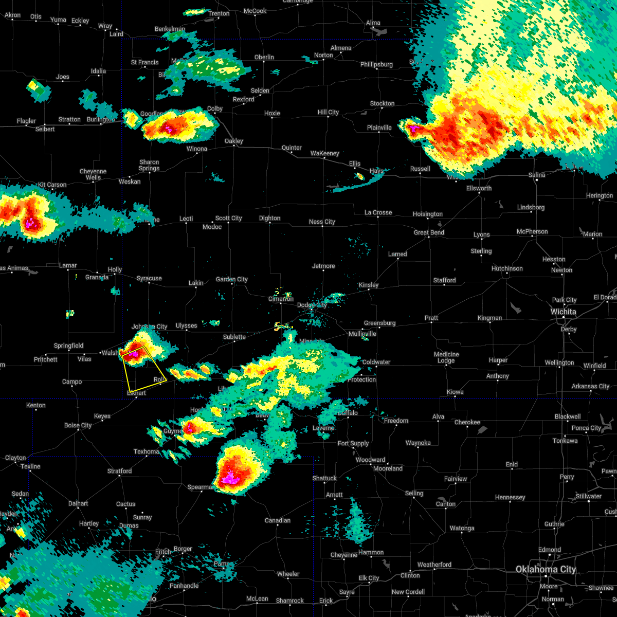 At 1123 pm cdt, a severe thunderstorm was located near richfield, moving southeast at 25 mph (radar indicated). Hazards include two inch hail and 70 mph wind gusts. People and animals outdoors will be injured. expect hail damage to roofs, siding, windows, and vehicles. expect considerable tree damage. wind damage is also likely to mobile homes, roofs, and outbuildings. this severe thunderstorm will be near, richfield around 1135 pm cdt. thunderstorm damage threat, considerable hail threat, radar indicated max hail size, 2. 00 in wind threat, radar indicated max wind gust, 70 mph. At 1123 pm cdt, a severe thunderstorm was located near richfield, moving southeast at 25 mph (radar indicated). Hazards include two inch hail and 70 mph wind gusts. People and animals outdoors will be injured. expect hail damage to roofs, siding, windows, and vehicles. expect considerable tree damage. wind damage is also likely to mobile homes, roofs, and outbuildings. this severe thunderstorm will be near, richfield around 1135 pm cdt. thunderstorm damage threat, considerable hail threat, radar indicated max hail size, 2. 00 in wind threat, radar indicated max wind gust, 70 mph.
|
| 6/7/2022 10:38 PM CDT |
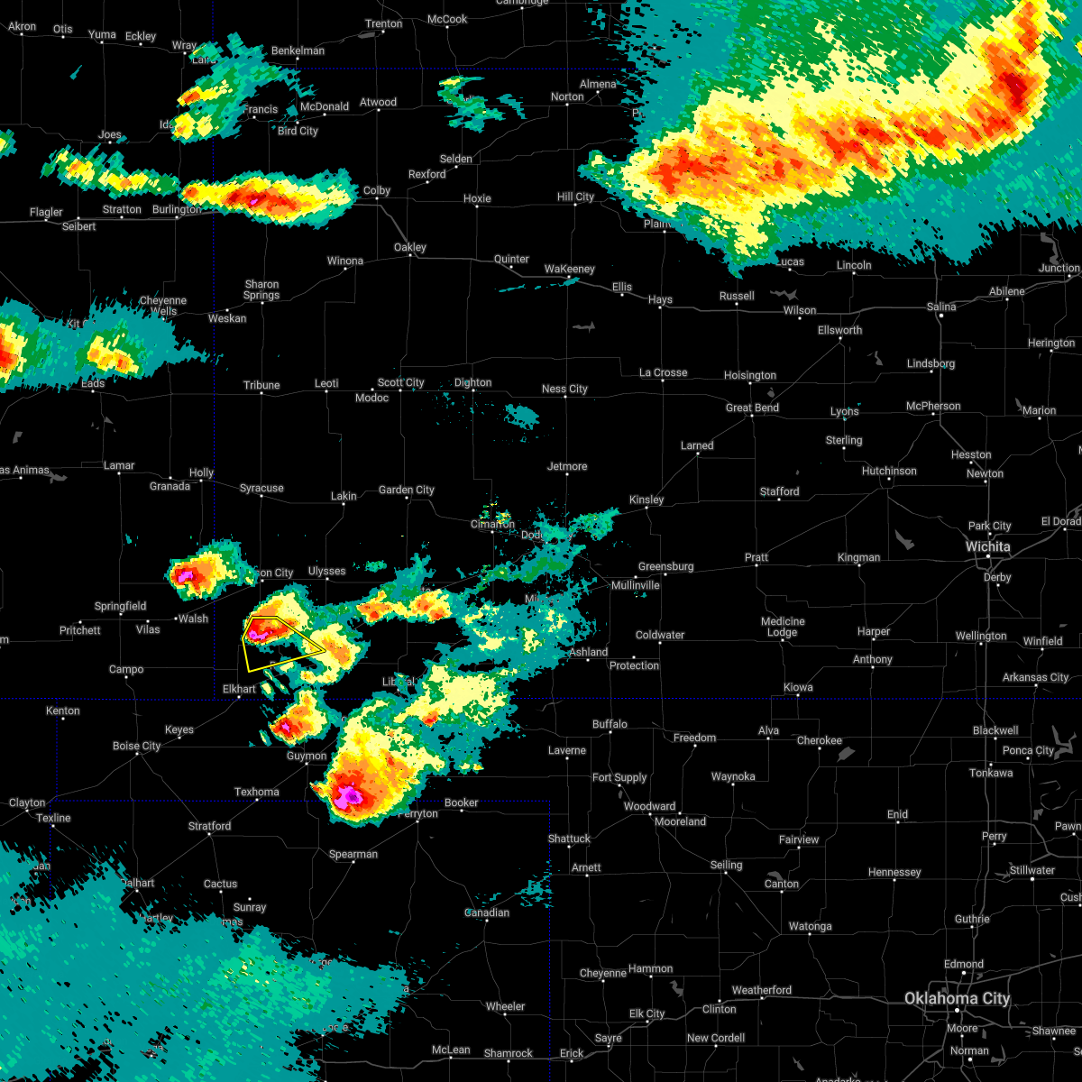 At 1037 pm cdt, a severe thunderstorm was located very near richfield, moving southeast at 15 mph. this is a destructive storm for richfield (radar indicated). Hazards include three inch hail and 70 mph wind gusts. People and animals outdoors will be severely injured. expect shattered windows, extensive damage to roofs, siding, and vehicles. This severe thunderstorm will remain over mainly rural areas of northeastern morton and west central stevens counties. At 1037 pm cdt, a severe thunderstorm was located very near richfield, moving southeast at 15 mph. this is a destructive storm for richfield (radar indicated). Hazards include three inch hail and 70 mph wind gusts. People and animals outdoors will be severely injured. expect shattered windows, extensive damage to roofs, siding, and vehicles. This severe thunderstorm will remain over mainly rural areas of northeastern morton and west central stevens counties.
|
| 6/7/2022 10:16 PM CDT |
 At 1016 pm cdt, a severe thunderstorm was located near richfield, moving southeast at 30 mph. this is a destructive storm for richfield (radar indicated). Hazards include three inch hail and 70 mph wind gusts. People and animals outdoors will be severely injured. expect shattered windows, extensive damage to roofs, siding, and vehicles. This severe thunderstorm will be near, richfield around 1030 pm cdt. At 1016 pm cdt, a severe thunderstorm was located near richfield, moving southeast at 30 mph. this is a destructive storm for richfield (radar indicated). Hazards include three inch hail and 70 mph wind gusts. People and animals outdoors will be severely injured. expect shattered windows, extensive damage to roofs, siding, and vehicles. This severe thunderstorm will be near, richfield around 1030 pm cdt.
|
| 6/7/2022 8:50 PM CDT |
 At 850 pm cdt, a severe thunderstorm was located near wilburton, moving east at 35 mph (radar indicated). Hazards include two inch hail and 60 mph wind gusts. People and animals outdoors will be injured. expect hail damage to roofs, siding, windows, and vehicles. expect wind damage to roofs, siding, and trees. locations impacted include, rolla and feterita. thunderstorm damage threat, considerable hail threat, radar indicated max hail size, 2. 00 in wind threat, radar indicated max wind gust, 60 mph. At 850 pm cdt, a severe thunderstorm was located near wilburton, moving east at 35 mph (radar indicated). Hazards include two inch hail and 60 mph wind gusts. People and animals outdoors will be injured. expect hail damage to roofs, siding, windows, and vehicles. expect wind damage to roofs, siding, and trees. locations impacted include, rolla and feterita. thunderstorm damage threat, considerable hail threat, radar indicated max hail size, 2. 00 in wind threat, radar indicated max wind gust, 60 mph.
|
| 6/7/2022 8:28 PM CDT |
 At 827 pm cdt, a severe thunderstorm was located 7 miles northwest of wilburton, moving east at 35 mph (radar indicated). Hazards include two inch hail and 60 mph wind gusts. People and animals outdoors will be injured. expect hail damage to roofs, siding, windows, and vehicles. expect wind damage to roofs, siding, and trees. this severe thunderstorm will be near, wilburton around 840 pm cdt. other locations in the path of this severe thunderstorm include rolla and feterita. thunderstorm damage threat, considerable hail threat, radar indicated max hail size, 2. 00 in wind threat, radar indicated max wind gust, 60 mph. At 827 pm cdt, a severe thunderstorm was located 7 miles northwest of wilburton, moving east at 35 mph (radar indicated). Hazards include two inch hail and 60 mph wind gusts. People and animals outdoors will be injured. expect hail damage to roofs, siding, windows, and vehicles. expect wind damage to roofs, siding, and trees. this severe thunderstorm will be near, wilburton around 840 pm cdt. other locations in the path of this severe thunderstorm include rolla and feterita. thunderstorm damage threat, considerable hail threat, radar indicated max hail size, 2. 00 in wind threat, radar indicated max wind gust, 60 mph.
|
| 6/6/2022 11:40 PM CDT | Mesonet station rfuk1 richfield - 10 m wind gus in morton county KS, 0.6 miles NE of Richfield, KS |
| 6/6/2022 11:37 PM CDT |
 At 1137 pm cdt, severe thunderstorms were located along a line extending from 8 miles north of ulysses to 10 miles southwest of richfield, moving southeast at 40 mph (radar indicated). Hazards include 60 mph wind gusts and half dollar size hail. Hail damage to vehicles is expected. expect wind damage to roofs, siding, and trees. locations impacted include, hickok, wilburton, rolla, feterita and sublette. hail threat, radar indicated max hail size, 1. 25 in wind threat, radar indicated max wind gust, 60 mph. At 1137 pm cdt, severe thunderstorms were located along a line extending from 8 miles north of ulysses to 10 miles southwest of richfield, moving southeast at 40 mph (radar indicated). Hazards include 60 mph wind gusts and half dollar size hail. Hail damage to vehicles is expected. expect wind damage to roofs, siding, and trees. locations impacted include, hickok, wilburton, rolla, feterita and sublette. hail threat, radar indicated max hail size, 1. 25 in wind threat, radar indicated max wind gust, 60 mph.
|
| 6/6/2022 11:29 PM CDT |
 At 1128 pm cdt, severe thunderstorms were located along a line extending from 10 miles north of ulysses to 10 miles southeast of stonington, moving east at 40 mph (radar indicated). Hazards include 60 mph wind gusts and penny size hail. Expect damage to roofs, siding, and trees. severe thunderstorms will be near, richfield around 1145 pm cdt. other locations in the path of these severe thunderstorms include hickok, wilburton, rolla, sublette and feterita. hail threat, radar indicated max hail size, 0. 75 in wind threat, radar indicated max wind gust, 60 mph. At 1128 pm cdt, severe thunderstorms were located along a line extending from 10 miles north of ulysses to 10 miles southeast of stonington, moving east at 40 mph (radar indicated). Hazards include 60 mph wind gusts and penny size hail. Expect damage to roofs, siding, and trees. severe thunderstorms will be near, richfield around 1145 pm cdt. other locations in the path of these severe thunderstorms include hickok, wilburton, rolla, sublette and feterita. hail threat, radar indicated max hail size, 0. 75 in wind threat, radar indicated max wind gust, 60 mph.
|
| 6/3/2022 8:58 PM CDT |
 At 858 pm cdt, severe thunderstorms were located along a line extending from near the saunders elevator to near richfield to near elkhart, moving east at 25 mph (radar indicated). Hazards include 60 mph wind gusts and penny size hail. Expect damage to roofs, siding, and trees. locations impacted include, elkhart, richfield, wilburton and the saunders elevator. hail threat, radar indicated max hail size, 0. 75 in wind threat, radar indicated max wind gust, 60 mph. At 858 pm cdt, severe thunderstorms were located along a line extending from near the saunders elevator to near richfield to near elkhart, moving east at 25 mph (radar indicated). Hazards include 60 mph wind gusts and penny size hail. Expect damage to roofs, siding, and trees. locations impacted include, elkhart, richfield, wilburton and the saunders elevator. hail threat, radar indicated max hail size, 0. 75 in wind threat, radar indicated max wind gust, 60 mph.
|
| 6/3/2022 8:21 PM CDT |
 At 820 pm cdt, severe thunderstorms were located along a line extending from near walsh to 6 miles southeast of stonington to 9 miles west of elkhart, moving east at 25 mph (radar indicated). Hazards include 60 mph wind gusts and penny size hail. expect damage to roofs, siding, and trees At 820 pm cdt, severe thunderstorms were located along a line extending from near walsh to 6 miles southeast of stonington to 9 miles west of elkhart, moving east at 25 mph (radar indicated). Hazards include 60 mph wind gusts and penny size hail. expect damage to roofs, siding, and trees
|
| 5/18/2022 8:50 PM CDT | Mesonet station rfuk1 richfiel in morton county KS, 0.6 miles NE of Richfield, KS |
| 5/16/2022 11:41 PM CDT |
 The severe thunderstorm warning for morton, grant, southeastern stanton and stevens counties will expire at 1145 pm cdt, the storm which prompted the warning has weakened below severe limits, and no longer poses an immediate threat to life or property. therefore, the warning will be allowed to expire. however gusty winds are still possible with this thunderstorm. The severe thunderstorm warning for morton, grant, southeastern stanton and stevens counties will expire at 1145 pm cdt, the storm which prompted the warning has weakened below severe limits, and no longer poses an immediate threat to life or property. therefore, the warning will be allowed to expire. however gusty winds are still possible with this thunderstorm.
|
| 5/16/2022 11:22 PM CDT |
 At 1121 pm cdt, a severe thunderstorm was located 11 miles north of feterita, moving east at 30 mph (radar indicated). Hazards include 70 mph wind gusts. Expect considerable tree damage. damage is likely to mobile homes, roofs, and outbuildings. locations impacted include, ulysses, hugoton, rolla, moscow, richfield, wilburton, ryus, cave, hickok, woods, big bow and feterita. thunderstorm damage threat, considerable hail threat, radar indicated max hail size, <. 75 in wind threat, radar indicated max wind gust, 70 mph. At 1121 pm cdt, a severe thunderstorm was located 11 miles north of feterita, moving east at 30 mph (radar indicated). Hazards include 70 mph wind gusts. Expect considerable tree damage. damage is likely to mobile homes, roofs, and outbuildings. locations impacted include, ulysses, hugoton, rolla, moscow, richfield, wilburton, ryus, cave, hickok, woods, big bow and feterita. thunderstorm damage threat, considerable hail threat, radar indicated max hail size, <. 75 in wind threat, radar indicated max wind gust, 70 mph.
|
| 5/16/2022 11:07 PM CDT |
 At 1105 pm cdt, a severe thunderstorm was located 11 miles east of richfield, moving east at 35 mph. this replaces the previous warning for stanton and morton counties (radar indicated). Hazards include 70 mph wind gusts. Expect considerable tree damage. Damage is likely to mobile homes, roofs, and outbuildings. At 1105 pm cdt, a severe thunderstorm was located 11 miles east of richfield, moving east at 35 mph. this replaces the previous warning for stanton and morton counties (radar indicated). Hazards include 70 mph wind gusts. Expect considerable tree damage. Damage is likely to mobile homes, roofs, and outbuildings.
|
| 5/16/2022 10:45 PM CDT |
 At 1044 pm cdt, a severe thunderstorm was located near richfield, moving east at 35 mph (radar indicated). Hazards include 60 mph wind gusts. Expect damage to roofs, siding, and trees. this severe thunderstorm will remain over mainly rural areas of morton, stanton and northwestern stevens counties. hail threat, radar indicated max hail size, <. 75 in wind threat, radar indicated max wind gust, 60 mph. At 1044 pm cdt, a severe thunderstorm was located near richfield, moving east at 35 mph (radar indicated). Hazards include 60 mph wind gusts. Expect damage to roofs, siding, and trees. this severe thunderstorm will remain over mainly rural areas of morton, stanton and northwestern stevens counties. hail threat, radar indicated max hail size, <. 75 in wind threat, radar indicated max wind gust, 60 mph.
|
| 5/16/2022 10:32 PM CDT |
 At 1032 pm cdt, a severe thunderstorm was located 10 miles southeast of the saunders elevator, moving east at 35 mph (radar indicated). Hazards include 60 mph wind gusts. Expect damage to roofs, siding, and trees. this severe thunderstorm will be near, richfield around 1045 pm cdt. hail threat, radar indicated max hail size, <. 75 in wind threat, radar indicated max wind gust, 60 mph. At 1032 pm cdt, a severe thunderstorm was located 10 miles southeast of the saunders elevator, moving east at 35 mph (radar indicated). Hazards include 60 mph wind gusts. Expect damage to roofs, siding, and trees. this severe thunderstorm will be near, richfield around 1045 pm cdt. hail threat, radar indicated max hail size, <. 75 in wind threat, radar indicated max wind gust, 60 mph.
|
| 5/11/2022 7:01 PM CDT |
 At 701 pm cdt, a severe thunderstorm was located near elkhart, moving northeast at 35 mph (radar indicated). Hazards include 60 mph wind gusts and quarter size hail. Hail damage to vehicles is expected. expect wind damage to roofs, siding, and trees. locations impacted include, elkhart, richfield and wilburton. hail threat, radar indicated max hail size, 1. 00 in wind threat, radar indicated max wind gust, 60 mph. At 701 pm cdt, a severe thunderstorm was located near elkhart, moving northeast at 35 mph (radar indicated). Hazards include 60 mph wind gusts and quarter size hail. Hail damage to vehicles is expected. expect wind damage to roofs, siding, and trees. locations impacted include, elkhart, richfield and wilburton. hail threat, radar indicated max hail size, 1. 00 in wind threat, radar indicated max wind gust, 60 mph.
|
| 5/11/2022 6:51 PM CDT |
 At 651 pm cdt, a severe thunderstorm was located near elkhart, moving northeast at 60 mph (radar indicated). Hazards include golf ball size hail and 70 mph wind gusts. People and animals outdoors will be injured. expect hail damage to roofs, siding, windows, and vehicles. expect considerable tree damage. wind damage is also likely to mobile homes, roofs, and outbuildings. locations impacted include, wilburton and richfield. thunderstorm damage threat, considerable hail threat, radar indicated max hail size, 1. 75 in wind threat, radar indicated max wind gust, 70 mph. At 651 pm cdt, a severe thunderstorm was located near elkhart, moving northeast at 60 mph (radar indicated). Hazards include golf ball size hail and 70 mph wind gusts. People and animals outdoors will be injured. expect hail damage to roofs, siding, windows, and vehicles. expect considerable tree damage. wind damage is also likely to mobile homes, roofs, and outbuildings. locations impacted include, wilburton and richfield. thunderstorm damage threat, considerable hail threat, radar indicated max hail size, 1. 75 in wind threat, radar indicated max wind gust, 70 mph.
|
| 5/11/2022 6:36 PM CDT |
 At 636 pm cdt, a severe thunderstorm was located 7 miles east of keyes, or 16 miles southwest of elkhart, moving northeast at 45 mph (radar indicated). Hazards include tennis ball size hail and 70 mph wind gusts. People and animals outdoors will be injured. expect hail damage to roofs, siding, windows, and vehicles. expect considerable tree damage. wind damage is also likely to mobile homes, roofs, and outbuildings. this severe thunderstorm will be near, elkhart around 655 pm cdt. other locations in the path of this severe thunderstorm include richfield. thunderstorm damage threat, considerable hail threat, radar indicated max hail size, 2. 50 in wind threat, radar indicated max wind gust, 70 mph. At 636 pm cdt, a severe thunderstorm was located 7 miles east of keyes, or 16 miles southwest of elkhart, moving northeast at 45 mph (radar indicated). Hazards include tennis ball size hail and 70 mph wind gusts. People and animals outdoors will be injured. expect hail damage to roofs, siding, windows, and vehicles. expect considerable tree damage. wind damage is also likely to mobile homes, roofs, and outbuildings. this severe thunderstorm will be near, elkhart around 655 pm cdt. other locations in the path of this severe thunderstorm include richfield. thunderstorm damage threat, considerable hail threat, radar indicated max hail size, 2. 50 in wind threat, radar indicated max wind gust, 70 mph.
|
| 4/23/2022 1:15 AM CDT |
 At 115 am cdt, severe thunderstorms were located along a line extending from near johnson city to near elkhart, moving east at 30 mph (radar indicated). Hazards include 60 mph wind gusts. Expect damage to roofs, siding, and trees. locations impacted include, elkhart, johnson city, rolla, manter, richfield, wilburton and big bow. hail threat, radar indicated max hail size, <. 75 in wind threat, radar indicated max wind gust, 60 mph. At 115 am cdt, severe thunderstorms were located along a line extending from near johnson city to near elkhart, moving east at 30 mph (radar indicated). Hazards include 60 mph wind gusts. Expect damage to roofs, siding, and trees. locations impacted include, elkhart, johnson city, rolla, manter, richfield, wilburton and big bow. hail threat, radar indicated max hail size, <. 75 in wind threat, radar indicated max wind gust, 60 mph.
|
| 4/23/2022 1:03 AM CDT |
 At 102 am cdt, severe thunderstorms were located along a line extending from 7 miles north of kendall to near elkhart, moving east at 35 mph (radar indicated). Hazards include 60 mph wind gusts and quarter size hail. Hail damage to vehicles is expected. Expect wind damage to roofs, siding, and trees. At 102 am cdt, severe thunderstorms were located along a line extending from 7 miles north of kendall to near elkhart, moving east at 35 mph (radar indicated). Hazards include 60 mph wind gusts and quarter size hail. Hail damage to vehicles is expected. Expect wind damage to roofs, siding, and trees.
|
| 4/23/2022 12:39 AM CDT |
 At 1238 am cdt, severe thunderstorms were located along a line extending from 16 miles northwest of manter to 15 miles north of keyes, moving east at 30 mph (radar indicated). Hazards include 60 mph wind gusts. expect damage to roofs, siding, and trees At 1238 am cdt, severe thunderstorms were located along a line extending from 16 miles northwest of manter to 15 miles north of keyes, moving east at 30 mph (radar indicated). Hazards include 60 mph wind gusts. expect damage to roofs, siding, and trees
|
| 4/22/2022 5:46 PM CDT |
 At 546 pm cdt, a severe thunderstorm was located near richfield, moving northeast at 50 mph (radar indicated). Hazards include golf ball size hail and 60 mph wind gusts. People and animals outdoors will be injured. expect hail damage to roofs, siding, windows, and vehicles. expect wind damage to roofs, siding, and trees. this severe thunderstorm will remain over mainly rural areas of morton and southwestern stevens counties. thunderstorm damage threat, considerable hail threat, radar indicated max hail size, 1. 75 in wind threat, radar indicated max wind gust, 60 mph. At 546 pm cdt, a severe thunderstorm was located near richfield, moving northeast at 50 mph (radar indicated). Hazards include golf ball size hail and 60 mph wind gusts. People and animals outdoors will be injured. expect hail damage to roofs, siding, windows, and vehicles. expect wind damage to roofs, siding, and trees. this severe thunderstorm will remain over mainly rural areas of morton and southwestern stevens counties. thunderstorm damage threat, considerable hail threat, radar indicated max hail size, 1. 75 in wind threat, radar indicated max wind gust, 60 mph.
|
| 4/22/2022 5:28 PM CDT |
 At 528 pm cdt, a severe thunderstorm was located near elkhart, moving northeast at 50 mph (radar indicated). Hazards include ping pong ball size hail and 60 mph wind gusts. People and animals outdoors will be injured. expect hail damage to roofs, siding, windows, and vehicles. expect wind damage to roofs, siding, and trees. this severe thunderstorm will be near, wilburton around 540 pm cdt. rolla around 545 pm cdt. other locations in the path of this severe thunderstorm include feterita and hugoton. hail threat, radar indicated max hail size, 1. 50 in wind threat, radar indicated max wind gust, 60 mph. At 528 pm cdt, a severe thunderstorm was located near elkhart, moving northeast at 50 mph (radar indicated). Hazards include ping pong ball size hail and 60 mph wind gusts. People and animals outdoors will be injured. expect hail damage to roofs, siding, windows, and vehicles. expect wind damage to roofs, siding, and trees. this severe thunderstorm will be near, wilburton around 540 pm cdt. rolla around 545 pm cdt. other locations in the path of this severe thunderstorm include feterita and hugoton. hail threat, radar indicated max hail size, 1. 50 in wind threat, radar indicated max wind gust, 60 mph.
|
| 9/3/2021 5:17 PM CDT |
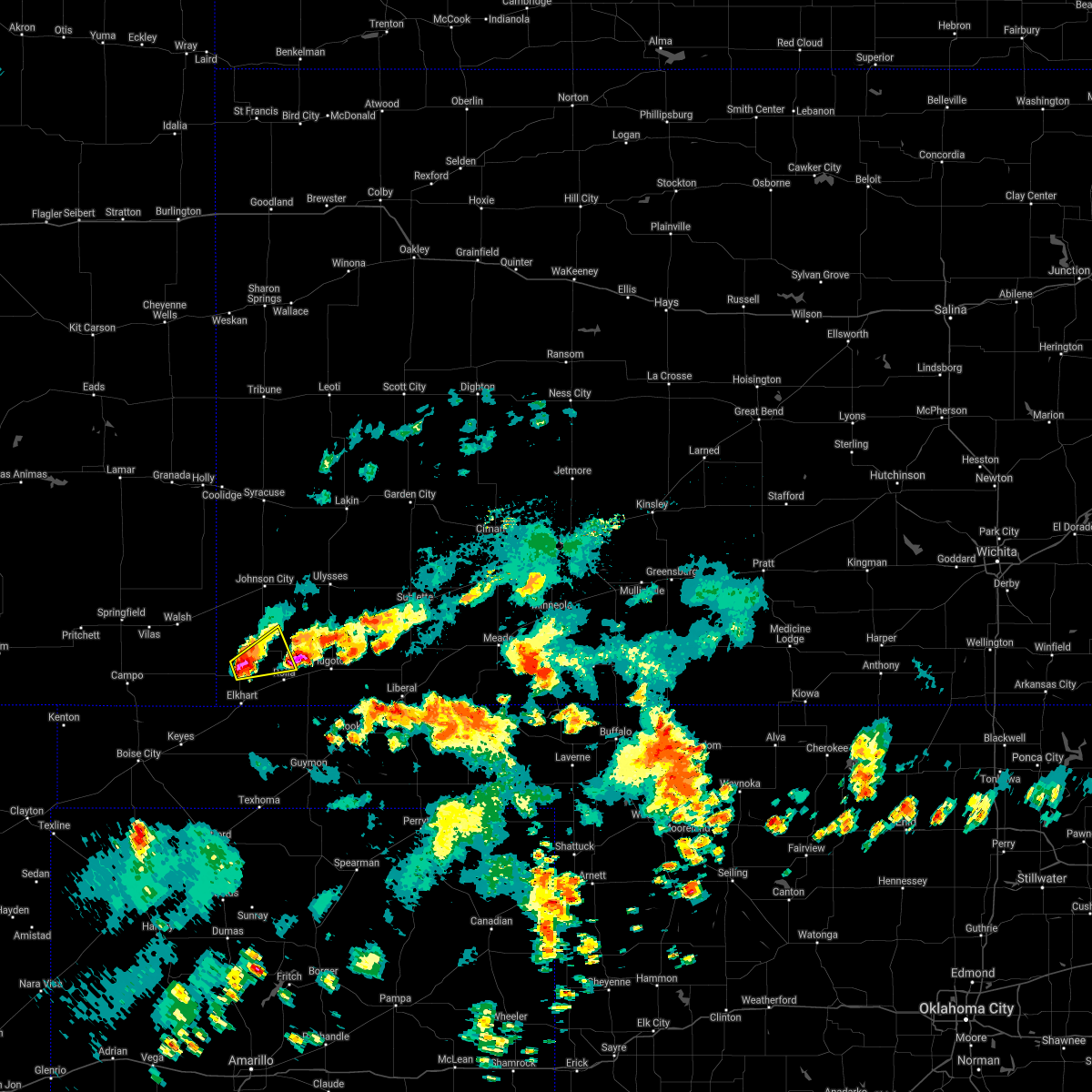 At 516 pm cdt, a severe thunderstorm was located 7 miles southwest of richfield, moving northeast at 15 mph (radar indicated). Hazards include 60 mph wind gusts and quarter size hail. Hail damage to vehicles is expected. expect wind damage to roofs, siding, and trees. Locations impacted include, richfield. At 516 pm cdt, a severe thunderstorm was located 7 miles southwest of richfield, moving northeast at 15 mph (radar indicated). Hazards include 60 mph wind gusts and quarter size hail. Hail damage to vehicles is expected. expect wind damage to roofs, siding, and trees. Locations impacted include, richfield.
|
| 9/3/2021 5:09 PM CDT |
 At 508 pm cdt, a severe thunderstorm was located 9 miles southwest of richfield, moving northeast at 15 mph (radar indicated). Hazards include 60 mph wind gusts and quarter size hail. Hail damage to vehicles is expected. Expect wind damage to roofs, siding, and trees. At 508 pm cdt, a severe thunderstorm was located 9 miles southwest of richfield, moving northeast at 15 mph (radar indicated). Hazards include 60 mph wind gusts and quarter size hail. Hail damage to vehicles is expected. Expect wind damage to roofs, siding, and trees.
|
| 7/4/2021 6:05 PM CDT | Storm damage reported in morton county KS, 9.2 miles SE of Richfield, KS |
| 6/25/2021 4:51 PM CDT |
 At 450 pm cdt, a severe thunderstorm was located near richfield, moving northeast at 25 mph (radar indicated). Hazards include golf ball size hail and 60 mph wind gusts. People and animals outdoors will be injured. expect hail damage to roofs, siding, windows, and vehicles. expect wind damage to roofs, siding, and trees. Locations impacted include, richfield. At 450 pm cdt, a severe thunderstorm was located near richfield, moving northeast at 25 mph (radar indicated). Hazards include golf ball size hail and 60 mph wind gusts. People and animals outdoors will be injured. expect hail damage to roofs, siding, windows, and vehicles. expect wind damage to roofs, siding, and trees. Locations impacted include, richfield.
|
| 6/25/2021 4:13 PM CDT |
 At 412 pm cdt, a severe thunderstorm was located 10 miles northwest of elkhart, moving east at 30 mph (radar indicated). Hazards include two inch hail and 70 mph wind gusts. People and animals outdoors will be injured. expect hail damage to roofs, siding, windows, and vehicles. expect considerable tree damage. wind damage is also likely to mobile homes, roofs, and outbuildings. this severe thunderstorm will be near, elkhart around 430 pm cdt. Other locations in the path of this severe thunderstorm include wilburton. At 412 pm cdt, a severe thunderstorm was located 10 miles northwest of elkhart, moving east at 30 mph (radar indicated). Hazards include two inch hail and 70 mph wind gusts. People and animals outdoors will be injured. expect hail damage to roofs, siding, windows, and vehicles. expect considerable tree damage. wind damage is also likely to mobile homes, roofs, and outbuildings. this severe thunderstorm will be near, elkhart around 430 pm cdt. Other locations in the path of this severe thunderstorm include wilburton.
|
| 8/14/2020 7:28 PM CDT |
 At 727 pm cdt, a severe thunderstorm was located near elkhart, moving south at 25 mph (public). Hazards include golf ball size hail and 60 mph wind gusts. People and animals outdoors will be injured. expect hail damage to roofs, siding, windows, and vehicles. expect wind damage to roofs, siding, and trees. Locations impacted include, elkhart, richfield and wilburton. At 727 pm cdt, a severe thunderstorm was located near elkhart, moving south at 25 mph (public). Hazards include golf ball size hail and 60 mph wind gusts. People and animals outdoors will be injured. expect hail damage to roofs, siding, windows, and vehicles. expect wind damage to roofs, siding, and trees. Locations impacted include, elkhart, richfield and wilburton.
|
| 8/14/2020 7:25 PM CDT | Ping Pong Ball sized hail reported 14.9 miles ENE of Richfield, KS |
| 8/14/2020 7:11 PM CDT |
 At 710 pm cdt, a severe thunderstorm was located 7 miles southwest of richfield, moving south at 25 mph (public. the public has reported quarter size hail with this storm). Hazards include ping pong ball size hail and 60 mph wind gusts. People and animals outdoors will be injured. expect hail damage to roofs, siding, windows, and vehicles. expect wind damage to roofs, siding, and trees. Locations impacted include, elkhart, richfield and wilburton. At 710 pm cdt, a severe thunderstorm was located 7 miles southwest of richfield, moving south at 25 mph (public. the public has reported quarter size hail with this storm). Hazards include ping pong ball size hail and 60 mph wind gusts. People and animals outdoors will be injured. expect hail damage to roofs, siding, windows, and vehicles. expect wind damage to roofs, siding, and trees. Locations impacted include, elkhart, richfield and wilburton.
|
| 8/14/2020 6:54 PM CDT |
 At 654 pm cdt, a severe thunderstorm was located near richfield, moving south at 25 mph (radar indicated). Hazards include two inch hail and 70 mph wind gusts. People and animals outdoors will be injured. expect hail damage to roofs, siding, windows, and vehicles. expect considerable tree damage. Wind damage is also likely to mobile homes, roofs, and outbuildings. At 654 pm cdt, a severe thunderstorm was located near richfield, moving south at 25 mph (radar indicated). Hazards include two inch hail and 70 mph wind gusts. People and animals outdoors will be injured. expect hail damage to roofs, siding, windows, and vehicles. expect considerable tree damage. Wind damage is also likely to mobile homes, roofs, and outbuildings.
|
| 8/14/2020 6:48 PM CDT |
 At 648 pm cdt, a severe thunderstorm was located near richfield, moving south at 30 mph (public). Hazards include two inch hail and 70 mph wind gusts. People and animals outdoors will be injured. expect hail damage to roofs, siding, windows, and vehicles. expect considerable tree damage. wind damage is also likely to mobile homes, roofs, and outbuildings. Locations impacted include, richfield. At 648 pm cdt, a severe thunderstorm was located near richfield, moving south at 30 mph (public). Hazards include two inch hail and 70 mph wind gusts. People and animals outdoors will be injured. expect hail damage to roofs, siding, windows, and vehicles. expect considerable tree damage. wind damage is also likely to mobile homes, roofs, and outbuildings. Locations impacted include, richfield.
|
| 8/14/2020 6:40 PM CDT |
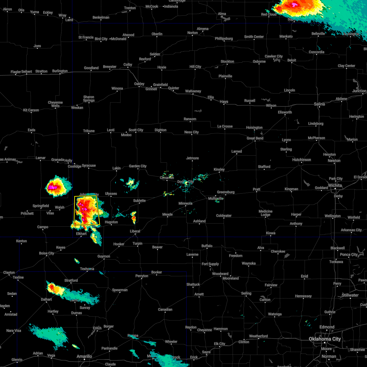 At 639 pm cdt, a severe thunderstorm was located 8 miles northwest of richfield, moving south at 20 mph (public. the public has reported large damaging hail in manter). Hazards include tennis ball size hail and 70 mph wind gusts. People and animals outdoors will be injured. expect hail damage to roofs, siding, windows, and vehicles. expect considerable tree damage. wind damage is also likely to mobile homes, roofs, and outbuildings. Locations impacted include, johnson city, manter and richfield. At 639 pm cdt, a severe thunderstorm was located 8 miles northwest of richfield, moving south at 20 mph (public. the public has reported large damaging hail in manter). Hazards include tennis ball size hail and 70 mph wind gusts. People and animals outdoors will be injured. expect hail damage to roofs, siding, windows, and vehicles. expect considerable tree damage. wind damage is also likely to mobile homes, roofs, and outbuildings. Locations impacted include, johnson city, manter and richfield.
|
| 8/14/2020 6:33 PM CDT |
 At 632 pm cdt, a severe thunderstorm was located 8 miles south of manter, moving south at 20 mph (public. this storm has a history of producing quarter size hail). Hazards include 70 mph wind gusts and ping pong ball size hail. People and animals outdoors will be injured. expect hail damage to roofs, siding, windows, and vehicles. expect considerable tree damage. wind damage is also likely to mobile homes, roofs, and outbuildings. Locations impacted include, johnson city, manter and richfield. At 632 pm cdt, a severe thunderstorm was located 8 miles south of manter, moving south at 20 mph (public. this storm has a history of producing quarter size hail). Hazards include 70 mph wind gusts and ping pong ball size hail. People and animals outdoors will be injured. expect hail damage to roofs, siding, windows, and vehicles. expect considerable tree damage. wind damage is also likely to mobile homes, roofs, and outbuildings. Locations impacted include, johnson city, manter and richfield.
|
| 8/14/2020 6:23 PM CDT |
 At 622 pm cdt, a severe thunderstorm was located near manter, moving south at 20 mph (radar indicated). Hazards include ping pong ball size hail and 60 mph wind gusts. People and animals outdoors will be injured. expect hail damage to roofs, siding, windows, and vehicles. Expect wind damage to roofs, siding, and trees. At 622 pm cdt, a severe thunderstorm was located near manter, moving south at 20 mph (radar indicated). Hazards include ping pong ball size hail and 60 mph wind gusts. People and animals outdoors will be injured. expect hail damage to roofs, siding, windows, and vehicles. Expect wind damage to roofs, siding, and trees.
|
| 7/20/2020 10:07 PM CDT |
 The severe thunderstorm warning for morton, hamilton, southwestern kearny, western grant, stanton and northwestern stevens counties will expire at 1015 pm cdt/915 pm mdt/, the storms which prompted the warning have weakened below severe limits, and no longer pose an immediate threat to life or property. therefore, the warning will be allowed to expire. however gusty winds and heavy rain are still possible with these thunderstorms. The severe thunderstorm warning for morton, hamilton, southwestern kearny, western grant, stanton and northwestern stevens counties will expire at 1015 pm cdt/915 pm mdt/, the storms which prompted the warning have weakened below severe limits, and no longer pose an immediate threat to life or property. therefore, the warning will be allowed to expire. however gusty winds and heavy rain are still possible with these thunderstorms.
|
| 7/20/2020 9:44 PM CDT |
 At 943 pm cdt/843 pm mdt/, severe thunderstorms were located along a line extending from 6 miles east of coolidge to near manter to near walsh, moving southeast at 40 mph (radar indicated). Hazards include 60 mph wind gusts and penny size hail. Expect damage to roofs, siding, and trees. Locations impacted include, ulysses, hugoton, lakin, syracuse, johnson city, rolla, manter, kendall, richfield, the saunders elevator, big bow, feterita and wilburton. At 943 pm cdt/843 pm mdt/, severe thunderstorms were located along a line extending from 6 miles east of coolidge to near manter to near walsh, moving southeast at 40 mph (radar indicated). Hazards include 60 mph wind gusts and penny size hail. Expect damage to roofs, siding, and trees. Locations impacted include, ulysses, hugoton, lakin, syracuse, johnson city, rolla, manter, kendall, richfield, the saunders elevator, big bow, feterita and wilburton.
|
| 7/20/2020 9:32 PM CDT |
 At 931 pm cdt/831 pm mdt/, severe thunderstorms were located along a line extending from near coolidge to near manter to near vilas, moving southeast at 40 mph (radar indicated). Hazards include 60 mph wind gusts and penny size hail. expect damage to roofs, siding, and trees At 931 pm cdt/831 pm mdt/, severe thunderstorms were located along a line extending from near coolidge to near manter to near vilas, moving southeast at 40 mph (radar indicated). Hazards include 60 mph wind gusts and penny size hail. expect damage to roofs, siding, and trees
|
| 7/14/2020 10:27 PM CDT |
 The severe thunderstorm warning for morton, hamilton, southwestern kearny, northwestern grant and stanton counties will expire at 1030 pm cdt/930 pm mdt/, the storms which prompted the warning have weakened below severe limits, and no longer pose an immediate threat to life or property. therefore, the warning will be allowed to expire. a severe thunderstorm watch remains in effect until 300 am cdt/200 am mdt/ for southwestern kansas. The severe thunderstorm warning for morton, hamilton, southwestern kearny, northwestern grant and stanton counties will expire at 1030 pm cdt/930 pm mdt/, the storms which prompted the warning have weakened below severe limits, and no longer pose an immediate threat to life or property. therefore, the warning will be allowed to expire. a severe thunderstorm watch remains in effect until 300 am cdt/200 am mdt/ for southwestern kansas.
|
| 7/14/2020 9:48 PM CDT |
 At 948 pm cdt/848 pm mdt/, severe thunderstorms were located along a line extending from near hartman to 11 miles northwest of manter to 13 miles east of campo, moving east at 45 mph (radar indicated). Hazards include 70 mph wind gusts and quarter size hail. Hail damage to vehicles is expected. expect considerable tree damage. wind damage is also likely to mobile homes, roofs, and outbuildings. Locations impacted include, ulysses, elkhart, syracuse, johnson city, manter, coolidge, kendall, richfield, the saunders elevator and big bow. At 948 pm cdt/848 pm mdt/, severe thunderstorms were located along a line extending from near hartman to 11 miles northwest of manter to 13 miles east of campo, moving east at 45 mph (radar indicated). Hazards include 70 mph wind gusts and quarter size hail. Hail damage to vehicles is expected. expect considerable tree damage. wind damage is also likely to mobile homes, roofs, and outbuildings. Locations impacted include, ulysses, elkhart, syracuse, johnson city, manter, coolidge, kendall, richfield, the saunders elevator and big bow.
|
| 7/14/2020 9:24 PM CDT |
 At 924 pm cdt/824 pm mdt/, severe thunderstorms were located along a line extending from near lamar to 10 miles northeast of two buttes to 12 miles south of pritchett, moving east at 45 mph (radar indicated). Hazards include 70 mph wind gusts and quarter size hail. Hail damage to vehicles is expected. expect considerable tree damage. Wind damage is also likely to mobile homes, roofs, and outbuildings. At 924 pm cdt/824 pm mdt/, severe thunderstorms were located along a line extending from near lamar to 10 miles northeast of two buttes to 12 miles south of pritchett, moving east at 45 mph (radar indicated). Hazards include 70 mph wind gusts and quarter size hail. Hail damage to vehicles is expected. expect considerable tree damage. Wind damage is also likely to mobile homes, roofs, and outbuildings.
|
| 7/13/2020 7:39 PM CDT |
 The severe thunderstorm warning for northwestern morton, southwestern hamilton and stanton counties will expire at 745 pm cdt/645 pm mdt/, the severe thunderstorm which prompted the warning has weakened below severe limits. therefore, the warning will be allowed to expire. a severe thunderstorm watch remains in effect until midnight cdt/1100 pm mdt/ for southwestern kansas. The severe thunderstorm warning for northwestern morton, southwestern hamilton and stanton counties will expire at 745 pm cdt/645 pm mdt/, the severe thunderstorm which prompted the warning has weakened below severe limits. therefore, the warning will be allowed to expire. a severe thunderstorm watch remains in effect until midnight cdt/1100 pm mdt/ for southwestern kansas.
|
| 7/13/2020 7:15 PM CDT |
 At 715 pm cdt/615 pm mdt/, a severe thunderstorm was located very near the saunders elevator, moving northeast at 20 mph (radar indicated). Hazards include 70 mph wind gusts and penny size hail. Expect considerable tree damage. damage is likely to mobile homes, roofs, and outbuildings. Locations impacted include, johnson city, manter, richfield and the saunders elevator. At 715 pm cdt/615 pm mdt/, a severe thunderstorm was located very near the saunders elevator, moving northeast at 20 mph (radar indicated). Hazards include 70 mph wind gusts and penny size hail. Expect considerable tree damage. damage is likely to mobile homes, roofs, and outbuildings. Locations impacted include, johnson city, manter, richfield and the saunders elevator.
|
| 7/13/2020 6:45 PM CDT |
 At 642 pm cdt/542 pm mdt/, a severe thunderstorm was located near walsh, or 10 miles southwest of the saunders elevator, moving northeast at 30 mph (radar indicated). Hazards include 70 mph wind gusts and quarter size hail. Hail damage to vehicles is expected. expect considerable tree damage. Wind damage is also likely to mobile homes, roofs, and outbuildings. At 642 pm cdt/542 pm mdt/, a severe thunderstorm was located near walsh, or 10 miles southwest of the saunders elevator, moving northeast at 30 mph (radar indicated). Hazards include 70 mph wind gusts and quarter size hail. Hail damage to vehicles is expected. expect considerable tree damage. Wind damage is also likely to mobile homes, roofs, and outbuildings.
|
| 5/24/2020 8:45 PM CDT | Storm damage reported in morton county KS, 5.3 miles N of Richfield, KS |
| 5/24/2020 8:40 PM CDT |
 At 840 pm cdt, a severe thunderstorm was located near wilburton, moving east at 40 mph (radar indicated). Hazards include 70 mph wind gusts and ping pong ball size hail. People and animals outdoors will be injured. expect hail damage to roofs, siding, windows, and vehicles. expect considerable tree damage. Wind damage is also likely to mobile homes, roofs, and outbuildings. At 840 pm cdt, a severe thunderstorm was located near wilburton, moving east at 40 mph (radar indicated). Hazards include 70 mph wind gusts and ping pong ball size hail. People and animals outdoors will be injured. expect hail damage to roofs, siding, windows, and vehicles. expect considerable tree damage. Wind damage is also likely to mobile homes, roofs, and outbuildings.
|
| 5/24/2020 8:28 PM CDT | Quarter sized hail reported 10.6 miles NE of Richfield, KS |
| 5/24/2020 8:28 PM CDT | Storm damage reported in morton county KS, 10.6 miles NE of Richfield, KS |
| 5/24/2020 8:27 PM CDT | Half Dollar sized hail reported 10.6 miles NE of Richfield, KS |
| 5/24/2020 8:20 PM CDT |
 At 820 pm cdt, a severe thunderstorm was located 10 miles west of richfield, moving east at 25 mph. this is a very dangerous storm (radar indicated). Hazards include 80 mph wind gusts and tennis ball size hail. Flying debris will be dangerous to those caught without shelter. mobile homes will be heavily damaged. expect considerable damage to roofs, windows, and vehicles. extensive tree damage and power outages are likely. Locations impacted include, elkhart, rolla, richfield and wilburton. At 820 pm cdt, a severe thunderstorm was located 10 miles west of richfield, moving east at 25 mph. this is a very dangerous storm (radar indicated). Hazards include 80 mph wind gusts and tennis ball size hail. Flying debris will be dangerous to those caught without shelter. mobile homes will be heavily damaged. expect considerable damage to roofs, windows, and vehicles. extensive tree damage and power outages are likely. Locations impacted include, elkhart, rolla, richfield and wilburton.
|
| 5/24/2020 8:04 PM CDT |
 At 804 pm cdt, a severe thunderstorm was located 8 miles southeast of stonington, or 15 miles west of richfield, moving east at 35 mph (radar indicated). Hazards include tennis ball size hail and 70 mph wind gusts. People and animals outdoors will be injured. expect hail damage to roofs, siding, windows, and vehicles. expect considerable tree damage. wind damage is also likely to mobile homes, roofs, and outbuildings. Locations impacted include, elkhart, rolla, richfield and wilburton. At 804 pm cdt, a severe thunderstorm was located 8 miles southeast of stonington, or 15 miles west of richfield, moving east at 35 mph (radar indicated). Hazards include tennis ball size hail and 70 mph wind gusts. People and animals outdoors will be injured. expect hail damage to roofs, siding, windows, and vehicles. expect considerable tree damage. wind damage is also likely to mobile homes, roofs, and outbuildings. Locations impacted include, elkhart, rolla, richfield and wilburton.
|
| 5/24/2020 7:57 PM CDT |
 At 757 pm cdt, a severe thunderstorm was located near stonington, or 18 miles south of the saunders elevator, moving east at 35 mph (radar indicated). Hazards include golf ball size hail and 70 mph wind gusts. People and animals outdoors will be injured. expect hail damage to roofs, siding, windows, and vehicles. expect considerable tree damage. Wind damage is also likely to mobile homes, roofs, and outbuildings. At 757 pm cdt, a severe thunderstorm was located near stonington, or 18 miles south of the saunders elevator, moving east at 35 mph (radar indicated). Hazards include golf ball size hail and 70 mph wind gusts. People and animals outdoors will be injured. expect hail damage to roofs, siding, windows, and vehicles. expect considerable tree damage. Wind damage is also likely to mobile homes, roofs, and outbuildings.
|
| 5/21/2020 7:27 PM CDT | Hen Egg sized hail reported 5.7 miles ESE of Richfield, KS |
| 8/24/2019 5:30 PM CDT |
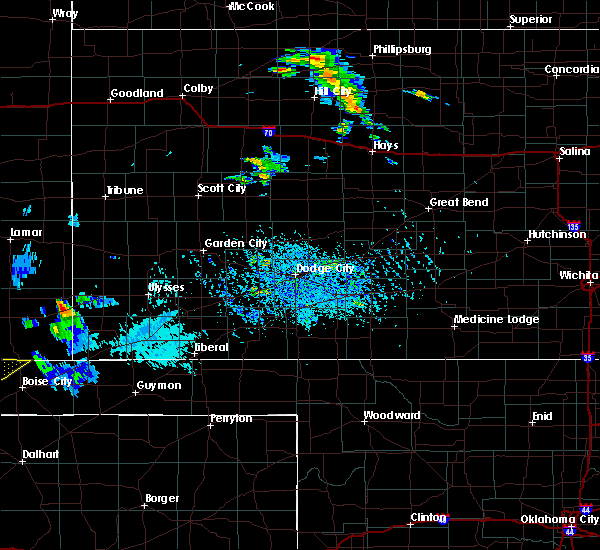 At 530 pm cdt, a severe thunderstorm was located near the saunders elevator, moving east at 30 mph (radar indicated). Hazards include 60 mph wind gusts and quarter size hail. Hail damage to vehicles is expected. Expect wind damage to roofs, siding, and trees. At 530 pm cdt, a severe thunderstorm was located near the saunders elevator, moving east at 30 mph (radar indicated). Hazards include 60 mph wind gusts and quarter size hail. Hail damage to vehicles is expected. Expect wind damage to roofs, siding, and trees.
|
| 8/19/2019 5:05 PM CDT |
 The severe thunderstorm warning for central morton county will expire at 515 pm cdt, the storm which prompted the warning has weakened below severe limits, and no longer poses an immediate threat to life or property. therefore, the warning will be allowed to expire. however gusty winds are still possible with this thunderstorm. The severe thunderstorm warning for central morton county will expire at 515 pm cdt, the storm which prompted the warning has weakened below severe limits, and no longer poses an immediate threat to life or property. therefore, the warning will be allowed to expire. however gusty winds are still possible with this thunderstorm.
|
| 8/19/2019 4:58 PM CDT |
 At 458 pm cdt, a severe thunderstorm was located 8 miles southwest of richfield, moving east at 20 mph (radar indicated). Hazards include 60 mph wind gusts. Expect damage to roofs, siding, and trees. Locations impacted include, elkhart, richfield and wilburton. At 458 pm cdt, a severe thunderstorm was located 8 miles southwest of richfield, moving east at 20 mph (radar indicated). Hazards include 60 mph wind gusts. Expect damage to roofs, siding, and trees. Locations impacted include, elkhart, richfield and wilburton.
|
| 8/19/2019 4:48 PM CDT |
 At 448 pm cdt, severe thunderstorms were located along a line extending from near manter to near richfield to near elkhart, moving east at 15 mph (radar indicated). Hazards include 60 mph wind gusts. Expect damage to roofs, siding, and trees. Locations impacted include, elkhart, richfield and wilburton. At 448 pm cdt, severe thunderstorms were located along a line extending from near manter to near richfield to near elkhart, moving east at 15 mph (radar indicated). Hazards include 60 mph wind gusts. Expect damage to roofs, siding, and trees. Locations impacted include, elkhart, richfield and wilburton.
|
| 8/19/2019 4:27 PM CDT | Storm damage reported in morton county KS, 10.6 miles NE of Richfield, KS |
| 8/19/2019 4:26 PM CDT |
 At 426 pm cdt, severe thunderstorms were located along a line extending from near manter to near richfield to 7 miles northwest of elkhart, moving east at 20 mph (radar indicated). Hazards include 60 mph wind gusts. Expect damage to roofs, siding, and trees. Locations impacted include, elkhart, manter, richfield, wilburton and the saunders elevator. At 426 pm cdt, severe thunderstorms were located along a line extending from near manter to near richfield to 7 miles northwest of elkhart, moving east at 20 mph (radar indicated). Hazards include 60 mph wind gusts. Expect damage to roofs, siding, and trees. Locations impacted include, elkhart, manter, richfield, wilburton and the saunders elevator.
|
| 8/19/2019 4:09 PM CDT |
 The national weather service in dodge city has issued a * severe thunderstorm warning for. morton county in southwestern kansas. southwestern stanton county in southwestern kansas. until 515 pm cdt. At 409 pm cdt, severe thunderstorms were located along a line. The national weather service in dodge city has issued a * severe thunderstorm warning for. morton county in southwestern kansas. southwestern stanton county in southwestern kansas. until 515 pm cdt. At 409 pm cdt, severe thunderstorms were located along a line.
|
| 7/1/2019 9:24 PM CDT |
 The severe thunderstorm warning for central morton, southwestern hamilton and stanton counties will expire at 930 pm cdt/830 pm mdt/, the storms which prompted the warning have weakened below severe limits, and no longer pose an immediate threat to life or property. therefore, the warning will be allowed to expire. however gusty winds are still possible with these thunderstorms. The severe thunderstorm warning for central morton, southwestern hamilton and stanton counties will expire at 930 pm cdt/830 pm mdt/, the storms which prompted the warning have weakened below severe limits, and no longer pose an immediate threat to life or property. therefore, the warning will be allowed to expire. however gusty winds are still possible with these thunderstorms.
|
| 7/1/2019 8:45 PM CDT |
 At 844 pm cdt/744 pm mdt/, severe thunderstorms were located along a line extending from 10 miles southwest of syracuse to 8 miles northwest of wilburton, moving east at 15 mph (radar indicated). Hazards include 60 mph wind gusts and penny size hail. expect damage to roofs, siding, and trees At 844 pm cdt/744 pm mdt/, severe thunderstorms were located along a line extending from 10 miles southwest of syracuse to 8 miles northwest of wilburton, moving east at 15 mph (radar indicated). Hazards include 60 mph wind gusts and penny size hail. expect damage to roofs, siding, and trees
|
| 6/23/2019 12:24 AM CDT |
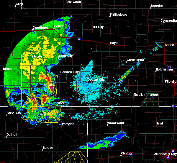 The severe thunderstorm warning for central morton county will expire at 1230 am cdt, the severe thunderstorm which prompted the warning has moved out of the warned area. therefore, the warning will be allowed to expire. a severe thunderstorm watch remains in effect until 500 am cdt for southwestern kansas. The severe thunderstorm warning for central morton county will expire at 1230 am cdt, the severe thunderstorm which prompted the warning has moved out of the warned area. therefore, the warning will be allowed to expire. a severe thunderstorm watch remains in effect until 500 am cdt for southwestern kansas.
|
| 6/23/2019 12:12 AM CDT |
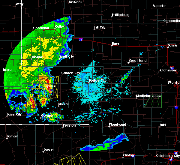 At 1211 am cdt, a severe thunderstorm was located near rolla, moving east at 45 mph (radar indicated). Hazards include 60 mph wind gusts and half dollar size hail. Hail damage to vehicles is expected. expect wind damage to roofs, siding, and trees. Locations impacted include, richfield and wilburton. At 1211 am cdt, a severe thunderstorm was located near rolla, moving east at 45 mph (radar indicated). Hazards include 60 mph wind gusts and half dollar size hail. Hail damage to vehicles is expected. expect wind damage to roofs, siding, and trees. Locations impacted include, richfield and wilburton.
|
| 6/22/2019 11:58 PM CDT |
 At 1158 pm cdt, a severe thunderstorm was located 7 miles northwest of wilburton, moving east at 30 mph (radar indicated). Hazards include two inch hail and 70 mph wind gusts. People and animals outdoors will be injured. expect hail damage to roofs, siding, windows, and vehicles. expect considerable tree damage. wind damage is also likely to mobile homes, roofs, and outbuildings. Locations impacted include, elkhart, richfield and wilburton. At 1158 pm cdt, a severe thunderstorm was located 7 miles northwest of wilburton, moving east at 30 mph (radar indicated). Hazards include two inch hail and 70 mph wind gusts. People and animals outdoors will be injured. expect hail damage to roofs, siding, windows, and vehicles. expect considerable tree damage. wind damage is also likely to mobile homes, roofs, and outbuildings. Locations impacted include, elkhart, richfield and wilburton.
|
| 6/22/2019 11:50 PM CDT |
 At 1150 pm cdt, a severe thunderstorm was located 9 miles northwest of elkhart, moving east at 35 mph (radar indicated). Hazards include 70 mph wind gusts and ping pong ball size hail. People and animals outdoors will be injured. expect hail damage to roofs, siding, windows, and vehicles. expect considerable tree damage. wind damage is also likely to mobile homes, roofs, and outbuildings. Locations impacted include, elkhart, richfield and wilburton. At 1150 pm cdt, a severe thunderstorm was located 9 miles northwest of elkhart, moving east at 35 mph (radar indicated). Hazards include 70 mph wind gusts and ping pong ball size hail. People and animals outdoors will be injured. expect hail damage to roofs, siding, windows, and vehicles. expect considerable tree damage. wind damage is also likely to mobile homes, roofs, and outbuildings. Locations impacted include, elkhart, richfield and wilburton.
|
| 6/22/2019 11:38 PM CDT |
 At 1137 pm cdt, a severe thunderstorm was located 13 miles south of stonington, or 13 miles northwest of elkhart, moving east at 20 mph (radar indicated). Hazards include two inch hail and 60 mph wind gusts. People and animals outdoors will be injured. expect hail damage to roofs, siding, windows, and vehicles. Expect wind damage to roofs, siding, and trees. At 1137 pm cdt, a severe thunderstorm was located 13 miles south of stonington, or 13 miles northwest of elkhart, moving east at 20 mph (radar indicated). Hazards include two inch hail and 60 mph wind gusts. People and animals outdoors will be injured. expect hail damage to roofs, siding, windows, and vehicles. Expect wind damage to roofs, siding, and trees.
|
| 6/14/2019 8:39 PM CDT | Quarter sized hail reported 14 miles SW of Richfield, KS |
| 6/14/2019 8:37 PM CDT |
 At 837 pm cdt, a severe thunderstorm was located 11 miles northeast of richfield, moving east at 40 mph (radar indicated). Hazards include 60 mph wind gusts and quarter size hail. Hail damage to vehicles is expected. expect wind damage to roofs, siding, and trees. Locations impacted include, ulysses, hugoton, johnson city, manter, richfield, big bow and feterita. At 837 pm cdt, a severe thunderstorm was located 11 miles northeast of richfield, moving east at 40 mph (radar indicated). Hazards include 60 mph wind gusts and quarter size hail. Hail damage to vehicles is expected. expect wind damage to roofs, siding, and trees. Locations impacted include, ulysses, hugoton, johnson city, manter, richfield, big bow and feterita.
|
| 6/14/2019 8:15 PM CDT |
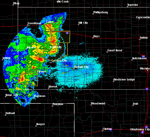 At 814 pm cdt, a severe thunderstorm was located 7 miles northwest of richfield, moving east at 40 mph (radar indicated). Hazards include 60 mph wind gusts and quarter size hail. Hail damage to vehicles is expected. Expect wind damage to roofs, siding, and trees. At 814 pm cdt, a severe thunderstorm was located 7 miles northwest of richfield, moving east at 40 mph (radar indicated). Hazards include 60 mph wind gusts and quarter size hail. Hail damage to vehicles is expected. Expect wind damage to roofs, siding, and trees.
|
| 5/31/2019 9:01 PM CDT |
 At 900 pm cdt, a severe thunderstorm was located 8 miles north of elkhart, moving northeast at 30 mph (radar indicated). Hazards include 60 mph wind gusts and half dollar size hail. Hail damage to vehicles is expected. Expect wind damage to roofs, siding, and trees. At 900 pm cdt, a severe thunderstorm was located 8 miles north of elkhart, moving northeast at 30 mph (radar indicated). Hazards include 60 mph wind gusts and half dollar size hail. Hail damage to vehicles is expected. Expect wind damage to roofs, siding, and trees.
|
| 5/31/2019 8:55 PM CDT | Golf Ball sized hail reported 17.4 miles NE of Richfield, KS |
| 5/6/2019 9:45 PM CDT |
 At 945 pm cdt, a severe thunderstorm was located near elkhart, moving northeast at 25 mph (radar indicated). Hazards include golf ball size hail and 60 mph wind gusts. People and animals outdoors will be injured. expect hail damage to roofs, siding, windows, and vehicles. Expect wind damage to roofs, siding, and trees. At 945 pm cdt, a severe thunderstorm was located near elkhart, moving northeast at 25 mph (radar indicated). Hazards include golf ball size hail and 60 mph wind gusts. People and animals outdoors will be injured. expect hail damage to roofs, siding, windows, and vehicles. Expect wind damage to roofs, siding, and trees.
|
| 5/6/2019 8:37 PM CDT |
 At 836 pm cdt/736 pm mdt/, severe thunderstorms were located along a line extending from 6 miles southeast of lakin to 6 miles northwest of cave to near rolla, moving east at 30 mph (radar indicated). Hazards include 60 mph wind gusts and quarter size hail. Hail damage to vehicles is expected. expect wind damage to roofs, siding, and trees. Locations impacted include, ulysses, hugoton, lakin, johnson city, deerfield, rolla, moscow, kendall, richfield, big bow, feterita, wilburton and hickok. At 836 pm cdt/736 pm mdt/, severe thunderstorms were located along a line extending from 6 miles southeast of lakin to 6 miles northwest of cave to near rolla, moving east at 30 mph (radar indicated). Hazards include 60 mph wind gusts and quarter size hail. Hail damage to vehicles is expected. expect wind damage to roofs, siding, and trees. Locations impacted include, ulysses, hugoton, lakin, johnson city, deerfield, rolla, moscow, kendall, richfield, big bow, feterita, wilburton and hickok.
|
| 5/6/2019 8:09 PM CDT |
 The national weather service in dodge city has issued a * severe thunderstorm warning for. morton county in southwestern kansas. southeastern hamilton county in southwestern kansas. southern kearny county in southwestern kansas. Grant county in southwestern kansas. The national weather service in dodge city has issued a * severe thunderstorm warning for. morton county in southwestern kansas. southeastern hamilton county in southwestern kansas. southern kearny county in southwestern kansas. Grant county in southwestern kansas.
|
| 5/6/2019 7:35 PM CDT |
 At 735 pm cdt/635 pm mdt/, severe thunderstorms were located along a line extending from 10 miles southwest of syracuse to 8 miles southwest of richfield, moving east at 30 mph (radar indicated). Hazards include golf ball size hail and 70 mph wind gusts. People and animals outdoors will be injured. expect hail damage to roofs, siding, windows, and vehicles. expect considerable tree damage. wind damage is also likely to mobile homes, roofs, and outbuildings. Locations impacted include, syracuse, johnson city, rolla, manter, coolidge, richfield, wilburton and the saunders elevator. At 735 pm cdt/635 pm mdt/, severe thunderstorms were located along a line extending from 10 miles southwest of syracuse to 8 miles southwest of richfield, moving east at 30 mph (radar indicated). Hazards include golf ball size hail and 70 mph wind gusts. People and animals outdoors will be injured. expect hail damage to roofs, siding, windows, and vehicles. expect considerable tree damage. wind damage is also likely to mobile homes, roofs, and outbuildings. Locations impacted include, syracuse, johnson city, rolla, manter, coolidge, richfield, wilburton and the saunders elevator.
|
| 5/6/2019 7:14 PM CDT |
 At 713 pm cdt/613 pm mdt/, severe thunderstorms were located along a line extending from 8 miles south of holly to 7 miles southeast of stonington, moving east at 30 mph (radar indicated). Hazards include golf ball size hail and 70 mph wind gusts. People and animals outdoors will be injured. expect hail damage to roofs, siding, windows, and vehicles. expect considerable tree damage. Wind damage is also likely to mobile homes, roofs, and outbuildings. At 713 pm cdt/613 pm mdt/, severe thunderstorms were located along a line extending from 8 miles south of holly to 7 miles southeast of stonington, moving east at 30 mph (radar indicated). Hazards include golf ball size hail and 70 mph wind gusts. People and animals outdoors will be injured. expect hail damage to roofs, siding, windows, and vehicles. expect considerable tree damage. Wind damage is also likely to mobile homes, roofs, and outbuildings.
|
| 7/29/2018 11:05 PM CDT |
 At 1105 pm cdt, a severe thunderstorm was located 6 miles north of elkhart, moving southeast at 30 mph (radar indicated). Hazards include 60 mph wind gusts and quarter size hail. Hail damage to vehicles is expected. expect wind damage to roofs, siding, and trees. Locations impacted include, elkhart, richfield and wilburton. At 1105 pm cdt, a severe thunderstorm was located 6 miles north of elkhart, moving southeast at 30 mph (radar indicated). Hazards include 60 mph wind gusts and quarter size hail. Hail damage to vehicles is expected. expect wind damage to roofs, siding, and trees. Locations impacted include, elkhart, richfield and wilburton.
|
| 7/29/2018 10:48 PM CDT |
 At 1047 pm cdt, a severe thunderstorm was located 10 miles southwest of richfield, moving southeast at 50 mph (radar indicated). Hazards include 60 mph wind gusts and quarter size hail. Hail damage to vehicles is expected. Expect wind damage to roofs, siding, and trees. At 1047 pm cdt, a severe thunderstorm was located 10 miles southwest of richfield, moving southeast at 50 mph (radar indicated). Hazards include 60 mph wind gusts and quarter size hail. Hail damage to vehicles is expected. Expect wind damage to roofs, siding, and trees.
|
| 7/29/2018 10:38 PM CDT |
 At 1038 pm cdt, a severe thunderstorm was located very near rolla, moving south at 60 mph. this replaces the previous warning for morton and stevens counties. this is a very dangerous storm (radar indicated). Hazards include 80 mph wind gusts and tennis ball size hail. Flying debris will be dangerous to those caught without shelter. mobile homes will be heavily damaged. expect considerable damage to roofs, windows, and vehicles. Extensive tree damage and power outages are likely. At 1038 pm cdt, a severe thunderstorm was located very near rolla, moving south at 60 mph. this replaces the previous warning for morton and stevens counties. this is a very dangerous storm (radar indicated). Hazards include 80 mph wind gusts and tennis ball size hail. Flying debris will be dangerous to those caught without shelter. mobile homes will be heavily damaged. expect considerable damage to roofs, windows, and vehicles. Extensive tree damage and power outages are likely.
|
| 7/29/2018 10:12 PM CDT |
 At 1011 pm cdt, a severe thunderstorm was located 6 miles east of richfield, moving southeast at 55 mph. this is a very dangerous storm (radar indicated). Hazards include 80 mph wind gusts and tennis ball size hail. Flying debris will be dangerous to those caught without shelter. mobile homes will be heavily damaged. expect considerable damage to roofs, windows, and vehicles. extensive tree damage and power outages are likely. Locations impacted include, hugoton, elkhart, johnson city, rolla, manter, richfield, wilburton, big bow, feterita and the saunders elevator. At 1011 pm cdt, a severe thunderstorm was located 6 miles east of richfield, moving southeast at 55 mph. this is a very dangerous storm (radar indicated). Hazards include 80 mph wind gusts and tennis ball size hail. Flying debris will be dangerous to those caught without shelter. mobile homes will be heavily damaged. expect considerable damage to roofs, windows, and vehicles. extensive tree damage and power outages are likely. Locations impacted include, hugoton, elkhart, johnson city, rolla, manter, richfield, wilburton, big bow, feterita and the saunders elevator.
|
| 7/29/2018 9:54 PM CDT |
 At 953 pm cdt/853 pm mdt/, a severe thunderstorm was located 3 miles east of manter, moving southeast at 50 mph. this replaces the previous warning for hamilton and stanton counties. this is a very dangerous storm (radar indicated). Hazards include 80 mph wind gusts and tennis ball size hail. Flying debris will be dangerous to those caught without shelter. mobile homes will be heavily damaged. expect considerable damage to roofs, windows, and vehicles. Extensive tree damage and power outages are likely. At 953 pm cdt/853 pm mdt/, a severe thunderstorm was located 3 miles east of manter, moving southeast at 50 mph. this replaces the previous warning for hamilton and stanton counties. this is a very dangerous storm (radar indicated). Hazards include 80 mph wind gusts and tennis ball size hail. Flying debris will be dangerous to those caught without shelter. mobile homes will be heavily damaged. expect considerable damage to roofs, windows, and vehicles. Extensive tree damage and power outages are likely.
|
| 7/29/2018 9:25 PM CDT | Storm damage reported in morton county KS, 0.3 miles SSW of Richfield, KS |
| 7/23/2018 12:27 AM CDT |
 At 1227 am cdt, a severe thunderstorm was located 5 miles northwest of rolla, moving east at 25 mph (radar indicated). Hazards include 60 mph wind gusts. expect damage to roofs, siding, and trees At 1227 am cdt, a severe thunderstorm was located 5 miles northwest of rolla, moving east at 25 mph (radar indicated). Hazards include 60 mph wind gusts. expect damage to roofs, siding, and trees
|
| 7/23/2018 12:05 AM CDT |
 At 1144 pm cdt, a severe thunderstorm was located 7 miles northwest of elkhart, moving east at 45 mph (radar indicated). Hazards include 60 mph wind gusts. expect damage to roofs, siding, and trees At 1144 pm cdt, a severe thunderstorm was located 7 miles northwest of elkhart, moving east at 45 mph (radar indicated). Hazards include 60 mph wind gusts. expect damage to roofs, siding, and trees
|
| 7/22/2018 11:45 PM CDT |
 At 1144 pm cdt, a severe thunderstorm was located 7 miles northwest of elkhart, moving east at 45 mph (radar indicated). Hazards include 60 mph wind gusts. expect damage to roofs, siding, and trees At 1144 pm cdt, a severe thunderstorm was located 7 miles northwest of elkhart, moving east at 45 mph (radar indicated). Hazards include 60 mph wind gusts. expect damage to roofs, siding, and trees
|
| 7/22/2018 11:09 PM CDT |
 At 1108 pm cdt, a severe thunderstorm was located 11 miles northwest of elkhart, moving east at 20 mph (radar indicated). Hazards include 60 mph wind gusts. Expect damage to roofs, siding, and trees. Locations impacted include, elkhart, rolla, richfield and wilburton. At 1108 pm cdt, a severe thunderstorm was located 11 miles northwest of elkhart, moving east at 20 mph (radar indicated). Hazards include 60 mph wind gusts. Expect damage to roofs, siding, and trees. Locations impacted include, elkhart, rolla, richfield and wilburton.
|
| 7/22/2018 10:42 PM CDT |
 At 1042 pm cdt, a severe thunderstorm was located 13 miles south of stonington, or 19 miles west of elkhart, moving east at 35 mph (radar indicated). Hazards include 60 mph wind gusts. expect damage to roofs, siding, and trees At 1042 pm cdt, a severe thunderstorm was located 13 miles south of stonington, or 19 miles west of elkhart, moving east at 35 mph (radar indicated). Hazards include 60 mph wind gusts. expect damage to roofs, siding, and trees
|
| 7/2/2018 8:23 PM CDT |
 The severe thunderstorm warning for morton and stanton counties will expire at 830 pm cdt, the storms which prompted the warning have weakened below severe limits, and no longer pose an immediate threat to life or property. therefore, the warning will be allowed to expire. The severe thunderstorm warning for morton and stanton counties will expire at 830 pm cdt, the storms which prompted the warning have weakened below severe limits, and no longer pose an immediate threat to life or property. therefore, the warning will be allowed to expire.
|
| 7/2/2018 8:06 PM CDT |
 At 806 pm cdt, severe thunderstorms were located along a line extending from 9 miles north of johnson city to 11 miles northeast of richfield to 6 miles northwest of wilburton, moving east at 35 mph (radar indicated). Hazards include 60 mph wind gusts and penny size hail. Expect damage to roofs, siding, and trees. Locations impacted include, johnson city, rolla, manter, richfield, big bow and the saunders elevator. At 806 pm cdt, severe thunderstorms were located along a line extending from 9 miles north of johnson city to 11 miles northeast of richfield to 6 miles northwest of wilburton, moving east at 35 mph (radar indicated). Hazards include 60 mph wind gusts and penny size hail. Expect damage to roofs, siding, and trees. Locations impacted include, johnson city, rolla, manter, richfield, big bow and the saunders elevator.
|
| 7/2/2018 7:56 PM CDT |
 At 755 pm cdt/655 pm mdt/, severe thunderstorms were located along a line extending from 13 miles north of johnson city to 9 miles southeast of manter to 8 miles west of elkhart, moving east at 35 mph (radar indicated). Hazards include 60 mph wind gusts and penny size hail. Expect damage to roofs, siding, and trees. Locations impacted include, elkhart, johnson city, rolla, manter, richfield, wilburton, the saunders elevator and big bow. At 755 pm cdt/655 pm mdt/, severe thunderstorms were located along a line extending from 13 miles north of johnson city to 9 miles southeast of manter to 8 miles west of elkhart, moving east at 35 mph (radar indicated). Hazards include 60 mph wind gusts and penny size hail. Expect damage to roofs, siding, and trees. Locations impacted include, elkhart, johnson city, rolla, manter, richfield, wilburton, the saunders elevator and big bow.
|
| 7/2/2018 7:25 PM CDT |
 At 725 pm cdt/625 pm mdt/, severe thunderstorms were located along a line extending from 14 miles north of manter to 10 miles southeast of stonington to 9 miles north of keyes, moving east at 20 mph (radar indicated). Hazards include 60 mph wind gusts and penny size hail. expect damage to roofs, siding, and trees At 725 pm cdt/625 pm mdt/, severe thunderstorms were located along a line extending from 14 miles north of manter to 10 miles southeast of stonington to 9 miles north of keyes, moving east at 20 mph (radar indicated). Hazards include 60 mph wind gusts and penny size hail. expect damage to roofs, siding, and trees
|
| 6/24/2018 8:23 PM CDT |
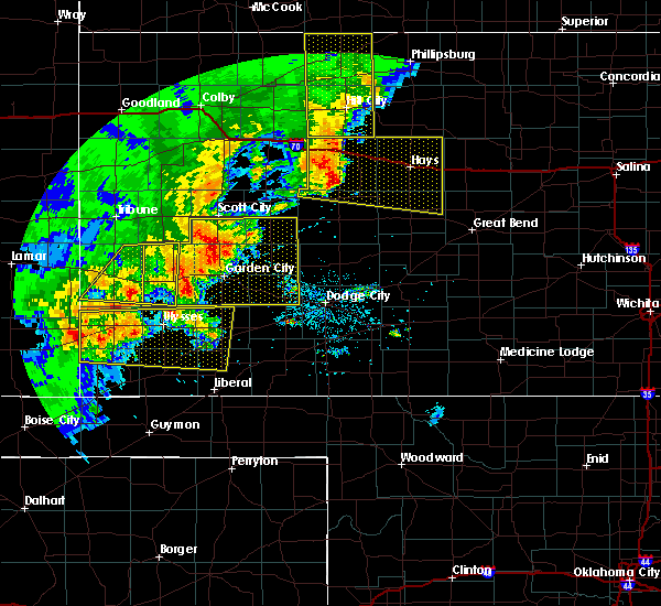 At 822 pm cdt, a severe thunderstorm was located 4 miles east of johnson city, moving east at 55 mph (automated weather station). Hazards include 60 mph wind gusts and nickel size hail. expect damage to roofs, siding, and trees At 822 pm cdt, a severe thunderstorm was located 4 miles east of johnson city, moving east at 55 mph (automated weather station). Hazards include 60 mph wind gusts and nickel size hail. expect damage to roofs, siding, and trees
|
| 6/19/2018 11:00 PM CDT |
 At 1100 pm cdt, severe thunderstorms were located along a line extending from 5 miles south of johnson city to 8 miles north of missler, moving southeast at 50 mph (radar indicated). Hazards include two inch hail and 70 mph wind gusts. People and animals outdoors will be injured. expect hail damage to roofs, siding, windows, and vehicles. expect considerable tree damage. Wind damage is also likely to mobile homes, roofs, and outbuildings. At 1100 pm cdt, severe thunderstorms were located along a line extending from 5 miles south of johnson city to 8 miles north of missler, moving southeast at 50 mph (radar indicated). Hazards include two inch hail and 70 mph wind gusts. People and animals outdoors will be injured. expect hail damage to roofs, siding, windows, and vehicles. expect considerable tree damage. Wind damage is also likely to mobile homes, roofs, and outbuildings.
|
| 6/19/2018 10:27 PM CDT |
 At 1026 pm cdt, severe thunderstorms were located along a line extending from 12 miles southwest of plymell to 2 miles southwest of the saunders elevator, moving southeast at 60 mph (radar indicated). Hazards include two inch hail and 70 mph wind gusts. People and animals outdoors will be injured. expect hail damage to roofs, siding, windows, and vehicles. expect considerable tree damage. Wind damage is also likely to mobile homes, roofs, and outbuildings. At 1026 pm cdt, severe thunderstorms were located along a line extending from 12 miles southwest of plymell to 2 miles southwest of the saunders elevator, moving southeast at 60 mph (radar indicated). Hazards include two inch hail and 70 mph wind gusts. People and animals outdoors will be injured. expect hail damage to roofs, siding, windows, and vehicles. expect considerable tree damage. Wind damage is also likely to mobile homes, roofs, and outbuildings.
|
| 6/19/2018 10:18 PM CDT |
 At 1018 pm cdt, severe thunderstorms were located along a line extending from 2 miles south of ryus to 10 miles south of big bow to 4 miles west of the saunders elevator, moving southeast at 40 mph (radar indicated). Hazards include 70 mph wind gusts and quarter size hail. Hail damage to vehicles is expected. expect considerable tree damage. wind damage is also likely to mobile homes, roofs, and outbuildings. Locations impacted include, ulysses, hugoton, elkhart, johnson city, rolla, moscow, manter, richfield, the saunders elevator, big bow, feterita, wilburton and hickok. At 1018 pm cdt, severe thunderstorms were located along a line extending from 2 miles south of ryus to 10 miles south of big bow to 4 miles west of the saunders elevator, moving southeast at 40 mph (radar indicated). Hazards include 70 mph wind gusts and quarter size hail. Hail damage to vehicles is expected. expect considerable tree damage. wind damage is also likely to mobile homes, roofs, and outbuildings. Locations impacted include, ulysses, hugoton, elkhart, johnson city, rolla, moscow, manter, richfield, the saunders elevator, big bow, feterita, wilburton and hickok.
|
| 6/19/2018 9:56 PM CDT |
 At 955 pm cdt/855 pm mdt/, the leading edge of severe thunderstorms were located along a line extending from 7 miles south of lakin to 3 miles east of johnson city to 5 miles east of two buttes, moving southeast at 50 mph (radar indicated). Hazards include 70 mph wind gusts and quarter size hail. Hail damage to vehicles is expected. expect considerable tree damage. wind damage is also likely to mobile homes, roofs, and outbuildings. Locations impacted include, ulysses, hugoton, elkhart, johnson city, rolla, moscow, manter, richfield, the saunders elevator, big bow, feterita, wilburton and hickok. At 955 pm cdt/855 pm mdt/, the leading edge of severe thunderstorms were located along a line extending from 7 miles south of lakin to 3 miles east of johnson city to 5 miles east of two buttes, moving southeast at 50 mph (radar indicated). Hazards include 70 mph wind gusts and quarter size hail. Hail damage to vehicles is expected. expect considerable tree damage. wind damage is also likely to mobile homes, roofs, and outbuildings. Locations impacted include, ulysses, hugoton, elkhart, johnson city, rolla, moscow, manter, richfield, the saunders elevator, big bow, feterita, wilburton and hickok.
|
| 6/19/2018 9:28 PM CDT |
 At 928 pm cdt/828 pm mdt/, severe thunderstorms were located along a line extending from 3 miles southwest of kendall to 13 miles northwest of manter to 2 miles northwest of two buttes, moving southeast at 40 mph (radar indicated). Hazards include 70 mph wind gusts and penny size hail. Expect considerable tree damage. Damage is likely to mobile homes, roofs, and outbuildings. At 928 pm cdt/828 pm mdt/, severe thunderstorms were located along a line extending from 3 miles southwest of kendall to 13 miles northwest of manter to 2 miles northwest of two buttes, moving southeast at 40 mph (radar indicated). Hazards include 70 mph wind gusts and penny size hail. Expect considerable tree damage. Damage is likely to mobile homes, roofs, and outbuildings.
|
| 6/19/2018 7:55 PM CDT |
 At 754 pm cdt, a severe thunderstorm was located 6 miles north of wilburton, moving east at 15 mph (radar indicated). Hazards include golf ball size hail and 60 mph wind gusts. People and animals outdoors will be injured. expect hail damage to roofs, siding, windows, and vehicles. expect wind damage to roofs, siding, and trees. Locations impacted include, rolla and richfield. At 754 pm cdt, a severe thunderstorm was located 6 miles north of wilburton, moving east at 15 mph (radar indicated). Hazards include golf ball size hail and 60 mph wind gusts. People and animals outdoors will be injured. expect hail damage to roofs, siding, windows, and vehicles. expect wind damage to roofs, siding, and trees. Locations impacted include, rolla and richfield.
|
| 6/19/2018 7:42 PM CDT |
 At 742 pm cdt, a severe thunderstorm was located 6 miles north of wilburton, moving northeast at 25 mph (radar indicated). Hazards include golf ball size hail and 60 mph wind gusts. People and animals outdoors will be injured. expect hail damage to roofs, siding, windows, and vehicles. expect wind damage to roofs, siding, and trees. Locations impacted include, rolla and richfield. At 742 pm cdt, a severe thunderstorm was located 6 miles north of wilburton, moving northeast at 25 mph (radar indicated). Hazards include golf ball size hail and 60 mph wind gusts. People and animals outdoors will be injured. expect hail damage to roofs, siding, windows, and vehicles. expect wind damage to roofs, siding, and trees. Locations impacted include, rolla and richfield.
|
| 6/19/2018 7:19 PM CDT |
 At 719 pm cdt, a severe thunderstorm was located 6 miles northwest of wilburton, moving northeast at 20 mph (radar indicated). Hazards include 60 mph wind gusts and half dollar size hail. Hail damage to vehicles is expected. Expect wind damage to roofs, siding, and trees. At 719 pm cdt, a severe thunderstorm was located 6 miles northwest of wilburton, moving northeast at 20 mph (radar indicated). Hazards include 60 mph wind gusts and half dollar size hail. Hail damage to vehicles is expected. Expect wind damage to roofs, siding, and trees.
|
| 6/19/2018 6:04 PM CDT |
 At 559 pm cdt, a severe thunderstorm was located 3 miles southwest of rolla, moving northeast at 20 mph (radar indicated). Hazards include tennis ball size hail and 60 mph wind gusts. People and animals outdoors will be injured. expect hail damage to roofs, siding, windows, and vehicles. expect wind damage to roofs, siding, and trees. Locations impacted include, rolla, richfield, wilburton and feterita. At 559 pm cdt, a severe thunderstorm was located 3 miles southwest of rolla, moving northeast at 20 mph (radar indicated). Hazards include tennis ball size hail and 60 mph wind gusts. People and animals outdoors will be injured. expect hail damage to roofs, siding, windows, and vehicles. expect wind damage to roofs, siding, and trees. Locations impacted include, rolla, richfield, wilburton and feterita.
|
| 6/19/2018 6:00 PM CDT |
 At 547 pm cdt, a severe thunderstorm was located 4 miles west of rolla, moving northeast at 35 mph (radar indicated). Hazards include golf ball size hail and 60 mph wind gusts. People and animalsoutdoors will be injured. expect hail damage to roofs, siding, windows, and vehicles. expect wind damage to roofs, siding, and trees. Locations impacted include, rolla, richfield, wilburton and feterita. At 547 pm cdt, a severe thunderstorm was located 4 miles west of rolla, moving northeast at 35 mph (radar indicated). Hazards include golf ball size hail and 60 mph wind gusts. People and animalsoutdoors will be injured. expect hail damage to roofs, siding, windows, and vehicles. expect wind damage to roofs, siding, and trees. Locations impacted include, rolla, richfield, wilburton and feterita.
|
| 6/19/2018 5:47 PM CDT |
 At 547 pm cdt, a severe thunderstorm was located 4 miles west of rolla, moving northeast at 35 mph (radar indicated). Hazards include golf ball size hail and 60 mph wind gusts. People and animalsoutdoors will be injured. expect hail damage to roofs, siding, windows, and vehicles. expect wind damage to roofs, siding, and trees. Locations impacted include, rolla, richfield, wilburton and feterita. At 547 pm cdt, a severe thunderstorm was located 4 miles west of rolla, moving northeast at 35 mph (radar indicated). Hazards include golf ball size hail and 60 mph wind gusts. People and animalsoutdoors will be injured. expect hail damage to roofs, siding, windows, and vehicles. expect wind damage to roofs, siding, and trees. Locations impacted include, rolla, richfield, wilburton and feterita.
|
| 6/19/2018 5:42 PM CDT |
 The national weather service in dodge city has issued a * severe thunderstorm warning for. eastern morton county in southwestern kansas. western stevens county in southwestern kansas. until 645 pm cdt. At 541 pm cdt, a severe thunderstorm was located near wilburton,. The national weather service in dodge city has issued a * severe thunderstorm warning for. eastern morton county in southwestern kansas. western stevens county in southwestern kansas. until 645 pm cdt. At 541 pm cdt, a severe thunderstorm was located near wilburton,.
|
| 6/19/2018 4:50 PM CDT |
 At 420 pm cdt, a severe thunderstorm was located 9 miles west of richfield, moving northeast at 25 mph (public). Hazards include 60 mph wind gusts and half dollar size hail. Hail damage to vehicles is expected. expect wind damage to roofs, siding, and trees. Locations impacted include, richfield. At 420 pm cdt, a severe thunderstorm was located 9 miles west of richfield, moving northeast at 25 mph (public). Hazards include 60 mph wind gusts and half dollar size hail. Hail damage to vehicles is expected. expect wind damage to roofs, siding, and trees. Locations impacted include, richfield.
|
| 6/19/2018 4:20 PM CDT |
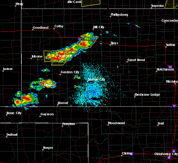 At 420 pm cdt, a severe thunderstorm was located 9 miles west of richfield, moving northeast at 25 mph (public). Hazards include 60 mph wind gusts and half dollar size hail. Hail damage to vehicles is expected. expect wind damage to roofs, siding, and trees. Locations impacted include, richfield. At 420 pm cdt, a severe thunderstorm was located 9 miles west of richfield, moving northeast at 25 mph (public). Hazards include 60 mph wind gusts and half dollar size hail. Hail damage to vehicles is expected. expect wind damage to roofs, siding, and trees. Locations impacted include, richfield.
|
| 6/19/2018 4:04 PM CDT |
 At 403 pm cdt, a severe thunderstorm was located 9 miles southwest of richfield, moving east at 15 mph. at 4:00 pm quarter sized hail was reported by the public 16 miles north of elkhart (public). Hazards include 60 mph wind gusts and half dollar size hail. Hail damage to vehicles is expected. expect wind damage to roofs, siding, and trees. Locations impacted include, richfield. At 403 pm cdt, a severe thunderstorm was located 9 miles southwest of richfield, moving east at 15 mph. at 4:00 pm quarter sized hail was reported by the public 16 miles north of elkhart (public). Hazards include 60 mph wind gusts and half dollar size hail. Hail damage to vehicles is expected. expect wind damage to roofs, siding, and trees. Locations impacted include, richfield.
|
| 6/19/2018 4:00 PM CDT | Quarter sized hail reported 9.6 miles ENE of Richfield, KS |
| 6/19/2018 3:54 PM CDT |
 At 354 pm cdt, a severe thunderstorm was located 11 miles southwest of richfield, moving east at 15 mph (radar indicated). Hazards include 60 mph wind gusts and half dollar size hail. Hail damage to vehicles is expected. Expect wind damage to roofs, siding, and trees. At 354 pm cdt, a severe thunderstorm was located 11 miles southwest of richfield, moving east at 15 mph (radar indicated). Hazards include 60 mph wind gusts and half dollar size hail. Hail damage to vehicles is expected. Expect wind damage to roofs, siding, and trees.
|
| 6/19/2018 3:34 PM CDT |
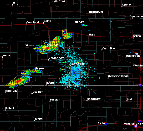 At 334 pm cdt, a severe thunderstorm was located 10 miles southwest of richfield, moving east at 15 mph (radar indicated). Hazards include 60 mph wind gusts and quarter size hail. Hail damage to vehicles is expected. expect wind damage to roofs, siding, and trees. Locations impacted include, richfield. At 334 pm cdt, a severe thunderstorm was located 10 miles southwest of richfield, moving east at 15 mph (radar indicated). Hazards include 60 mph wind gusts and quarter size hail. Hail damage to vehicles is expected. expect wind damage to roofs, siding, and trees. Locations impacted include, richfield.
|
| 6/19/2018 3:13 PM CDT |
 At 312 pm cdt, a severe thunderstorm was located 12 miles north of elkhart, moving east at 15 mph (radar indicated). Hazards include 60 mph wind gusts and quarter size hail. Hail damage to vehicles is expected. Expect wind damage to roofs, siding, and trees. At 312 pm cdt, a severe thunderstorm was located 12 miles north of elkhart, moving east at 15 mph (radar indicated). Hazards include 60 mph wind gusts and quarter size hail. Hail damage to vehicles is expected. Expect wind damage to roofs, siding, and trees.
|
| 6/12/2018 9:44 PM CDT |
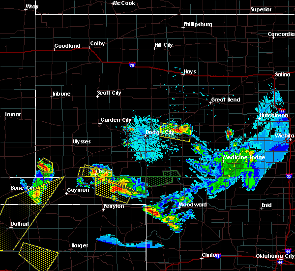 At 943 pm cdt, a severe thunderstorm was located 7 miles southwest of richfield, moving northeast at 20 mph (radar indicated). Hazards include 60 mph wind gusts and half dollar size hail. Hail damage to vehicles is expected. expect wind damage to roofs, siding, and trees. Locations impacted include, richfield. At 943 pm cdt, a severe thunderstorm was located 7 miles southwest of richfield, moving northeast at 20 mph (radar indicated). Hazards include 60 mph wind gusts and half dollar size hail. Hail damage to vehicles is expected. expect wind damage to roofs, siding, and trees. Locations impacted include, richfield.
|
| 6/12/2018 9:29 PM CDT |
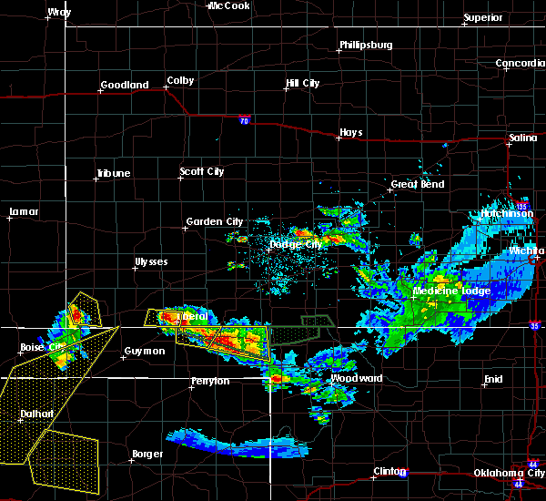 At 928 pm cdt, a severe thunderstorm was located 8 miles northwest of wilburton, moving northeast at 20 mph (radar indicated). Hazards include ping pong ball size hail and 60 mph wind gusts. People and animals outdoors will be injured. expect hail damage to roofs, siding, windows, and vehicles. expect wind damage to roofs, siding, and trees. Locations impacted include, richfield and wilburton. At 928 pm cdt, a severe thunderstorm was located 8 miles northwest of wilburton, moving northeast at 20 mph (radar indicated). Hazards include ping pong ball size hail and 60 mph wind gusts. People and animals outdoors will be injured. expect hail damage to roofs, siding, windows, and vehicles. expect wind damage to roofs, siding, and trees. Locations impacted include, richfield and wilburton.
|
| 6/12/2018 9:10 PM CDT |
 The national weather service in dodge city has issued a * severe thunderstorm warning for. western morton county in southwestern kansas. until 1015 pm cdt. At 909 pm cdt, a severe thunderstorm was located 11 miles northwest of elkhart, moving northeast at 15 mph. The national weather service in dodge city has issued a * severe thunderstorm warning for. western morton county in southwestern kansas. until 1015 pm cdt. At 909 pm cdt, a severe thunderstorm was located 11 miles northwest of elkhart, moving northeast at 15 mph.
|
| 6/6/2018 11:22 PM CDT |
 The severe thunderstorm warning for east central morton and northwestern stevens counties will expire at 1130 pm cdt, the storm which prompted the warning has weakened below severe limits, and no longer poses an immediate threat to life or property. therefore the warning will be allowed to expire. The severe thunderstorm warning for east central morton and northwestern stevens counties will expire at 1130 pm cdt, the storm which prompted the warning has weakened below severe limits, and no longer poses an immediate threat to life or property. therefore the warning will be allowed to expire.
|
| 6/6/2018 10:52 PM CDT |
 At 1052 pm cdt, a severe thunderstorm was located 6 miles north of feterita, moving east at 20 mph (radar indicated). Hazards include up to golf ball size hail and 60 mph wind gusts. People and animals outdoors will be injured. expect hail damage to roofs, siding, windows, and vehicles. expect wind damage to roofs, siding, and trees. Locations impacted include, hugoton, rolla, richfield and feterita. At 1052 pm cdt, a severe thunderstorm was located 6 miles north of feterita, moving east at 20 mph (radar indicated). Hazards include up to golf ball size hail and 60 mph wind gusts. People and animals outdoors will be injured. expect hail damage to roofs, siding, windows, and vehicles. expect wind damage to roofs, siding, and trees. Locations impacted include, hugoton, rolla, richfield and feterita.
|
| 6/6/2018 10:34 PM CDT |
 At 1034 pm cdt, a severe thunderstorm was located 7 miles north of rolla, moving east at 20 mph (radar indicated). Hazards include up to golf ball size hail and 60 mph wind gusts. People and animals outdoors will be injured. expect hail damage to roofs, siding, windows, and vehicles. Expect wind damage to roofs, siding, and trees. At 1034 pm cdt, a severe thunderstorm was located 7 miles north of rolla, moving east at 20 mph (radar indicated). Hazards include up to golf ball size hail and 60 mph wind gusts. People and animals outdoors will be injured. expect hail damage to roofs, siding, windows, and vehicles. Expect wind damage to roofs, siding, and trees.
|
| 6/6/2018 8:56 PM CDT |
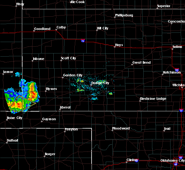 At 856 pm cdt, a severe thunderstorm was located 10 miles south of stonington, or 16 miles northwest of elkhart, moving northeast at 15 mph (radar indicated). Hazards include 60 mph wind gusts and quarter size hail. Hail damage to vehicles is expected. expect wind damage to roofs, siding, and trees. Locations impacted include, richfield. At 856 pm cdt, a severe thunderstorm was located 10 miles south of stonington, or 16 miles northwest of elkhart, moving northeast at 15 mph (radar indicated). Hazards include 60 mph wind gusts and quarter size hail. Hail damage to vehicles is expected. expect wind damage to roofs, siding, and trees. Locations impacted include, richfield.
|
| 6/6/2018 8:26 PM CDT |
 At 826 pm cdt, a severe thunderstorm was located 11 miles south of stonington, or 15 miles northwest of elkhart, moving northeast at 20 mph (radar indicated). Hazards include 60 mph wind gusts and quarter size hail. Hail damage to vehicles is expected. Expect wind damage to roofs, siding, and trees. At 826 pm cdt, a severe thunderstorm was located 11 miles south of stonington, or 15 miles northwest of elkhart, moving northeast at 20 mph (radar indicated). Hazards include 60 mph wind gusts and quarter size hail. Hail damage to vehicles is expected. Expect wind damage to roofs, siding, and trees.
|
| 5/30/2018 7:21 PM CDT |
 At 720 pm cdt, a severe thunderstorm was located 5 miles northwest of elkhart, moving northeast at 30 mph (radar indicated). Hazards include 60 mph wind gusts with blowing dust and quarter size hail. Hail damage to vehicles is expected. expect wind damage to roofs, siding, and trees. Locations impacted include, elkhart, rolla, richfield and wilburton. At 720 pm cdt, a severe thunderstorm was located 5 miles northwest of elkhart, moving northeast at 30 mph (radar indicated). Hazards include 60 mph wind gusts with blowing dust and quarter size hail. Hail damage to vehicles is expected. expect wind damage to roofs, siding, and trees. Locations impacted include, elkhart, rolla, richfield and wilburton.
|
| 5/30/2018 6:55 PM CDT |
 At 654 pm cdt, a severe thunderstorm was located 11 miles north of keyes, or 16 miles west of elkhart, moving northeast at 30 mph (radar indicated). Hazards include 60 mph wind gusts and quarter size hail. Hail damage to vehicles is expected. Expect wind damage to roofs, siding, and trees. At 654 pm cdt, a severe thunderstorm was located 11 miles north of keyes, or 16 miles west of elkhart, moving northeast at 30 mph (radar indicated). Hazards include 60 mph wind gusts and quarter size hail. Hail damage to vehicles is expected. Expect wind damage to roofs, siding, and trees.
|
| 5/28/2018 6:49 PM CDT |
 At 649 pm cdt, a severe thunderstorm was located near rolla, moving northeast at 45 mph (radar indicated). Hazards include 60 mph wind gusts and half dollar size hail. Hail damage to vehicles is expected. expect wind damage to roofs, siding, and trees. Locations impacted include, elkhart, rolla, richfield and wilburton. At 649 pm cdt, a severe thunderstorm was located near rolla, moving northeast at 45 mph (radar indicated). Hazards include 60 mph wind gusts and half dollar size hail. Hail damage to vehicles is expected. expect wind damage to roofs, siding, and trees. Locations impacted include, elkhart, rolla, richfield and wilburton.
|
| 5/28/2018 6:12 PM CDT |
 At 612 pm cdt, a severe thunderstorm was located near elkhart, moving north at 30 mph (radar indicated). Hazards include ping pong ball size hail and 60 mph wind gusts. People and animals outdoors will be injured. expect hail damage to roofs, siding, windows, and vehicles. Expect wind damage to roofs, siding, and trees. At 612 pm cdt, a severe thunderstorm was located near elkhart, moving north at 30 mph (radar indicated). Hazards include ping pong ball size hail and 60 mph wind gusts. People and animals outdoors will be injured. expect hail damage to roofs, siding, windows, and vehicles. Expect wind damage to roofs, siding, and trees.
|
| 5/28/2018 5:53 PM CDT |
 At 553 pm cdt, a severe thunderstorm was located very near richfield, moving northeast at 40 mph (radar indicated). Hazards include ping pong ball size hail and 60 mph wind gusts. People and animals outdoors will be injured. expect hail damage to roofs, siding, windows, and vehicles. expect wind damage to roofs, siding, and trees. Locations impacted include, johnson city and richfield. At 553 pm cdt, a severe thunderstorm was located very near richfield, moving northeast at 40 mph (radar indicated). Hazards include ping pong ball size hail and 60 mph wind gusts. People and animals outdoors will be injured. expect hail damage to roofs, siding, windows, and vehicles. expect wind damage to roofs, siding, and trees. Locations impacted include, johnson city and richfield.
|
| 5/28/2018 5:38 PM CDT |
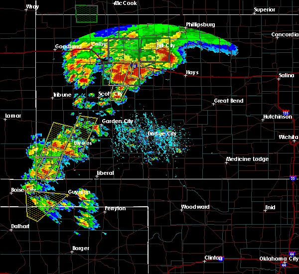 At 538 pm cdt, a severe thunderstorm was located 8 miles north of elkhart, moving northeast at 45 mph (radar indicated). Hazards include ping pong ball size hail and 60 mph wind gusts. People and animals outdoors will be injured. expect hail damage to roofs, siding, windows, and vehicles. Expect wind damage to roofs, siding, and trees. At 538 pm cdt, a severe thunderstorm was located 8 miles north of elkhart, moving northeast at 45 mph (radar indicated). Hazards include ping pong ball size hail and 60 mph wind gusts. People and animals outdoors will be injured. expect hail damage to roofs, siding, windows, and vehicles. Expect wind damage to roofs, siding, and trees.
|
| 5/28/2018 5:29 PM CDT |
 At 529 pm cdt, a severe thunderstorm was located 8 miles southwest of richfield, moving northeast at 35 mph (radar indicated). Hazards include 60 mph wind gusts and half dollar size hail. Hail damage to vehicles is expected. expect wind damage to roofs, siding, and trees. Locations impacted include, elkhart and richfield. At 529 pm cdt, a severe thunderstorm was located 8 miles southwest of richfield, moving northeast at 35 mph (radar indicated). Hazards include 60 mph wind gusts and half dollar size hail. Hail damage to vehicles is expected. expect wind damage to roofs, siding, and trees. Locations impacted include, elkhart and richfield.
|
| 5/28/2018 5:02 PM CDT |
 At 502 pm cdt, a severe thunderstorm was located 10 miles west of elkhart, moving northeast at 40 mph (radar indicated). Hazards include ping pong ball size hail and 60 mph wind gusts. People and animals outdoors will be injured. expect hail damage to roofs, siding, windows, and vehicles. Expect wind damage to roofs, siding, and trees. At 502 pm cdt, a severe thunderstorm was located 10 miles west of elkhart, moving northeast at 40 mph (radar indicated). Hazards include ping pong ball size hail and 60 mph wind gusts. People and animals outdoors will be injured. expect hail damage to roofs, siding, windows, and vehicles. Expect wind damage to roofs, siding, and trees.
|
| 9/22/2017 7:05 PM CDT |
 At 705 pm cdt, a severe thunderstorm was located very near elkhart, moving northeast at 30 mph (radar indicated). Hazards include 60 mph wind gusts and quarter size hail. Hail damage to vehicles is expected. Expect wind damage to roofs, siding, and trees. At 705 pm cdt, a severe thunderstorm was located very near elkhart, moving northeast at 30 mph (radar indicated). Hazards include 60 mph wind gusts and quarter size hail. Hail damage to vehicles is expected. Expect wind damage to roofs, siding, and trees.
|
| 8/27/2017 7:20 PM CDT |
 At 719 pm cdt, a severe thunderstorm was located 4 miles east of richfield, or 19 miles west of hugoton, moving south at 20 mph. this replaces the previous warning for morton county (radar indicated). Hazards include ping pong ball size hail and 60 mph wind gusts. People and animals outdoors will be injured. expect hail damage to roofs, siding, windows, and vehicles. Expect wind damage to roofs, siding, and trees. At 719 pm cdt, a severe thunderstorm was located 4 miles east of richfield, or 19 miles west of hugoton, moving south at 20 mph. this replaces the previous warning for morton county (radar indicated). Hazards include ping pong ball size hail and 60 mph wind gusts. People and animals outdoors will be injured. expect hail damage to roofs, siding, windows, and vehicles. Expect wind damage to roofs, siding, and trees.
|
| 8/10/2017 9:59 PM CDT |
 At 959 pm cdt, a severe thunderstorm was located near rolla, or 14 miles west of hugoton, moving southeast at 35 mph (radar indicated). Hazards include two inch hail and 70 mph wind gusts. People and animals outdoors will be injured. expect hail damage to roofs, siding, windows, and vehicles. expect considerable tree damage. wind damage is also likely to mobile homes, roofs, and outbuildings. Locations impacted include, hugoton, elkhart, rolla, moscow, richfield, feterita, wilburton, cave, woods, point of rocks at cimarron grassland and cimarron grassland recreation area. At 959 pm cdt, a severe thunderstorm was located near rolla, or 14 miles west of hugoton, moving southeast at 35 mph (radar indicated). Hazards include two inch hail and 70 mph wind gusts. People and animals outdoors will be injured. expect hail damage to roofs, siding, windows, and vehicles. expect considerable tree damage. wind damage is also likely to mobile homes, roofs, and outbuildings. Locations impacted include, hugoton, elkhart, rolla, moscow, richfield, feterita, wilburton, cave, woods, point of rocks at cimarron grassland and cimarron grassland recreation area.
|
| 8/10/2017 9:27 PM CDT |
 At 927 pm cdt, a severe thunderstorm was located 7 miles northeast of richfield, or 14 miles south of johnson city, moving southeast at 40 mph. other strong storms were developing around the main severe storm, which could also become severe across the warned area (radar indicated). Hazards include golf ball size hail and 70 mph wind gusts. People and animals outdoors will be injured. expect hail damage to roofs, siding, windows, and vehicles. expect considerable tree damage. Wind damage is also likely to mobile homes, roofs, and outbuildings. At 927 pm cdt, a severe thunderstorm was located 7 miles northeast of richfield, or 14 miles south of johnson city, moving southeast at 40 mph. other strong storms were developing around the main severe storm, which could also become severe across the warned area (radar indicated). Hazards include golf ball size hail and 70 mph wind gusts. People and animals outdoors will be injured. expect hail damage to roofs, siding, windows, and vehicles. expect considerable tree damage. Wind damage is also likely to mobile homes, roofs, and outbuildings.
|
| 8/10/2017 9:15 PM CDT |
 At 914 pm cdt, a severe thunderstorm was located 9 miles north of richfield, or 11 miles south of johnson city, moving southeast at 25 mph (radar indicated). Hazards include two inch hail and 70 mph wind gusts. People and animals outdoors will be injured. expect hail damage to roofs, siding, windows, and vehicles. expect considerable tree damage. wind damage is also likely to mobile homes, roofs, and outbuildings. Locations impacted include, rolla, richfield, feterita, wilburton and cimarron grassland recreation area. At 914 pm cdt, a severe thunderstorm was located 9 miles north of richfield, or 11 miles south of johnson city, moving southeast at 25 mph (radar indicated). Hazards include two inch hail and 70 mph wind gusts. People and animals outdoors will be injured. expect hail damage to roofs, siding, windows, and vehicles. expect considerable tree damage. wind damage is also likely to mobile homes, roofs, and outbuildings. Locations impacted include, rolla, richfield, feterita, wilburton and cimarron grassland recreation area.
|
| 8/10/2017 8:45 PM CDT |
 At 844 pm cdt, a severe thunderstorm was located 6 miles southeast of manter, or 9 miles southwest of johnson city, moving southeast at 40 mph. this is a very dangerous storm (radar indicated). Hazards include 80 mph wind gusts and tennis ball size hail. Flying debris will be dangerous to those caught without shelter. mobile homes will be heavily damaged. expect considerable damage to roofs, windows, and vehicles. Extensive tree damage and power outages are likely. At 844 pm cdt, a severe thunderstorm was located 6 miles southeast of manter, or 9 miles southwest of johnson city, moving southeast at 40 mph. this is a very dangerous storm (radar indicated). Hazards include 80 mph wind gusts and tennis ball size hail. Flying debris will be dangerous to those caught without shelter. mobile homes will be heavily damaged. expect considerable damage to roofs, windows, and vehicles. Extensive tree damage and power outages are likely.
|
| 6/29/2017 5:50 PM CDT |
 At 1050 pm cdt, a severe thunderstorm was located 7 miles southwest of richfield, or 14 miles north of elkhart, moving east at 30 mph (radar indicated). Hazards include 60 mph wind gusts and half dollar size hail. Hail damage to vehicles is expected. expect wind damage to roofs, siding, and trees. Locations impacted include, elkhart, richfield, wilburton, point of rocks at cimarron grassland and cimarron grassland recreation area. At 1050 pm cdt, a severe thunderstorm was located 7 miles southwest of richfield, or 14 miles north of elkhart, moving east at 30 mph (radar indicated). Hazards include 60 mph wind gusts and half dollar size hail. Hail damage to vehicles is expected. expect wind damage to roofs, siding, and trees. Locations impacted include, elkhart, richfield, wilburton, point of rocks at cimarron grassland and cimarron grassland recreation area.
|
| 6/29/2017 5:22 PM CDT |
 At 1022 pm cdt, a severe thunderstorm was located 11 miles southeast of stonington, or 16 miles north of elkhart, moving southeast at 30 mph (radar indicated). Hazards include golf ball size hail and 60 mph wind gusts. People and animals outdoors will be injured. expect hail damage to roofs, siding, windows, and vehicles. expect wind damage to roofs, siding, and trees. Locations impacted include, elkhart, richfield, wilburton, point of rocks at cimarron grassland and cimarron grassland recreation area. At 1022 pm cdt, a severe thunderstorm was located 11 miles southeast of stonington, or 16 miles north of elkhart, moving southeast at 30 mph (radar indicated). Hazards include golf ball size hail and 60 mph wind gusts. People and animals outdoors will be injured. expect hail damage to roofs, siding, windows, and vehicles. expect wind damage to roofs, siding, and trees. Locations impacted include, elkhart, richfield, wilburton, point of rocks at cimarron grassland and cimarron grassland recreation area.
|
| 6/29/2017 4:55 PM CDT |
 At 954 pm cdt, a severe thunderstorm was located 4 miles north of stonington, or 25 miles east of springfield, moving southeast at 30 mph (radar indicated). Hazards include golf ball size hail and 60 mph wind gusts. People and animals outdoors will be injured. expect hail damage to roofs, siding, windows, and vehicles. Expect wind damage to roofs, siding, and trees. At 954 pm cdt, a severe thunderstorm was located 4 miles north of stonington, or 25 miles east of springfield, moving southeast at 30 mph (radar indicated). Hazards include golf ball size hail and 60 mph wind gusts. People and animals outdoors will be injured. expect hail damage to roofs, siding, windows, and vehicles. Expect wind damage to roofs, siding, and trees.
|
| 6/22/2017 7:35 PM CDT |
 At 735 pm cdt, a severe thunderstorm was located 6 miles northwest of elkhart, moving south at 15 mph (radar indicated). Hazards include 60 mph wind gusts and quarter size hail. Hail damage to vehicles is expected. expect wind damage to roofs, siding, and trees. Locations impacted include, elkhart, rolla, richfield, wilburton, point of rocks at cimarron grassland and cimarron grassland recreation area. At 735 pm cdt, a severe thunderstorm was located 6 miles northwest of elkhart, moving south at 15 mph (radar indicated). Hazards include 60 mph wind gusts and quarter size hail. Hail damage to vehicles is expected. expect wind damage to roofs, siding, and trees. Locations impacted include, elkhart, rolla, richfield, wilburton, point of rocks at cimarron grassland and cimarron grassland recreation area.
|
| 6/22/2017 7:14 PM CDT |
 At 712 pm cdt, a severe thunderstorm was located 9 miles southwest of richfield, or 12 miles north of elkhart, moving south at 15 mph (radar indicated). Hazards include 60 mph wind gusts and quarter size hail. Hail damage to vehicles is expected. Expect wind damage to roofs, siding, and trees. At 712 pm cdt, a severe thunderstorm was located 9 miles southwest of richfield, or 12 miles north of elkhart, moving south at 15 mph (radar indicated). Hazards include 60 mph wind gusts and quarter size hail. Hail damage to vehicles is expected. Expect wind damage to roofs, siding, and trees.
|
| 6/22/2017 6:49 PM CDT |
 At 648 pm cdt, a severe thunderstorm was located 3 miles east of richfield, or 20 miles northeast of elkhart, moving south at 20 mph (radar indicated). Hazards include 60 mph wind gusts and half dollar size hail. Hail damage to vehicles is expected. expect wind damage to roofs, siding, and trees. Locations impacted include, hugoton, elkhart, rolla, richfield, feterita, wilburton, point of rocks at cimarron grassland and cimarron grassland recreation area. At 648 pm cdt, a severe thunderstorm was located 3 miles east of richfield, or 20 miles northeast of elkhart, moving south at 20 mph (radar indicated). Hazards include 60 mph wind gusts and half dollar size hail. Hail damage to vehicles is expected. expect wind damage to roofs, siding, and trees. Locations impacted include, hugoton, elkhart, rolla, richfield, feterita, wilburton, point of rocks at cimarron grassland and cimarron grassland recreation area.
|
| 6/22/2017 6:28 PM CDT |
 At 626 pm cdt, a severe thunderstorm was located 7 miles north of richfield, or 13 miles south of johnson city. another severe thunderstorm was located 10 miles southeast of big bow. both storms were moving south at 20 mph (radar indicated). Hazards include ping pong ball size hail and 60 mph wind gusts. People and animals outdoors will be injured. expect hail damage to roofs, siding, windows, and vehicles. expect wind damage to roofs, siding, and trees. Locations impacted include, ulysses, hugoton, elkhart, rolla, richfield, big bow, feterita, wilburton, point of rocks at cimarron grassland, cimarron grassland recreation area and the milepost elevator. At 626 pm cdt, a severe thunderstorm was located 7 miles north of richfield, or 13 miles south of johnson city. another severe thunderstorm was located 10 miles southeast of big bow. both storms were moving south at 20 mph (radar indicated). Hazards include ping pong ball size hail and 60 mph wind gusts. People and animals outdoors will be injured. expect hail damage to roofs, siding, windows, and vehicles. expect wind damage to roofs, siding, and trees. Locations impacted include, ulysses, hugoton, elkhart, rolla, richfield, big bow, feterita, wilburton, point of rocks at cimarron grassland, cimarron grassland recreation area and the milepost elevator.
|
| 6/22/2017 6:08 PM CDT |
 At 608 pm cdt, a severe thunderstorm was located 4 miles southeast of big bow, or 9 miles southwest of ulysses, moving south at 20 mph (radar indicated). Hazards include 60 mph wind gusts and quarter size hail. Hail damage to vehicles is expected. Expect wind damage to roofs, siding, and trees. At 608 pm cdt, a severe thunderstorm was located 4 miles southeast of big bow, or 9 miles southwest of ulysses, moving south at 20 mph (radar indicated). Hazards include 60 mph wind gusts and quarter size hail. Hail damage to vehicles is expected. Expect wind damage to roofs, siding, and trees.
|
| 6/21/2017 6:49 PM CDT |
 At 648 pm cdt, severe thunderstorms were located along a line extending from 10 miles northwest of moscow to 4 miles north of richfield, moving southeast at 25 mph (radar indicated). Hazards include 60 mph wind gusts and nickel size hail. Expect damage to roofs, siding, and trees. Locations impacted include, hugoton, rolla, richfield, feterita, wilburton and cimarron grassland recreation area. At 648 pm cdt, severe thunderstorms were located along a line extending from 10 miles northwest of moscow to 4 miles north of richfield, moving southeast at 25 mph (radar indicated). Hazards include 60 mph wind gusts and nickel size hail. Expect damage to roofs, siding, and trees. Locations impacted include, hugoton, rolla, richfield, feterita, wilburton and cimarron grassland recreation area.
|
| 6/21/2017 6:38 PM CDT |
 At 637 pm cdt, a severe thunderstorm was located 7 miles northeast of richfield, or 14 miles south of johnson city, moving southeast at 10 mph (radar indicated). Hazards include 60 mph wind gusts and quarter size hail. Hail damage to vehicles is expected. expect wind damage to roofs, siding, and trees. Locations impacted include, hugoton, elkhart, rolla, richfield, feterita, wilburton and cimarron grassland recreation area. At 637 pm cdt, a severe thunderstorm was located 7 miles northeast of richfield, or 14 miles south of johnson city, moving southeast at 10 mph (radar indicated). Hazards include 60 mph wind gusts and quarter size hail. Hail damage to vehicles is expected. expect wind damage to roofs, siding, and trees. Locations impacted include, hugoton, elkhart, rolla, richfield, feterita, wilburton and cimarron grassland recreation area.
|
| 6/21/2017 6:08 PM CDT |
 At 607 pm cdt, a severe thunderstorm was located 9 miles north of richfield, or 12 miles south of johnson city, moving southeast at 20 mph. other strong to severe storms were crossing the colorado line from neare saunders to 8 miles northwest of elkhart (radar indicated). Hazards include 60 mph wind gusts and quarter size hail. Hail damage to vehicles is expected. Expect wind damage to roofs, siding, and trees. At 607 pm cdt, a severe thunderstorm was located 9 miles north of richfield, or 12 miles south of johnson city, moving southeast at 20 mph. other strong to severe storms were crossing the colorado line from neare saunders to 8 miles northwest of elkhart (radar indicated). Hazards include 60 mph wind gusts and quarter size hail. Hail damage to vehicles is expected. Expect wind damage to roofs, siding, and trees.
|
| 5/30/2017 8:37 PM CDT |
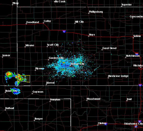 At 837 pm cdt, a severe thunderstorm was located 10 miles west of richfield, or 20 miles north of elkhart, moving east at 25 mph (radar indicated). Hazards include 60 mph wind gusts and quarter size hail. Hail damage to vehicles is expected. Expect wind damage to roofs, siding, and trees. At 837 pm cdt, a severe thunderstorm was located 10 miles west of richfield, or 20 miles north of elkhart, moving east at 25 mph (radar indicated). Hazards include 60 mph wind gusts and quarter size hail. Hail damage to vehicles is expected. Expect wind damage to roofs, siding, and trees.
|
| 5/15/2017 6:31 PM CDT |
 At 631 pm cdt/531 pm mdt/, a severe thunderstorm was located 7 miles east of richfield, or 17 miles west of hugoton, moving north at 45 mph (radar indicated). Hazards include up to ping pong ball size hail and 60 mph wind gusts. People and animals outdoors will be injured. expect hail damage to roofs, siding, windows, and vehicles. Expect wind damage to roofs, siding, and trees. At 631 pm cdt/531 pm mdt/, a severe thunderstorm was located 7 miles east of richfield, or 17 miles west of hugoton, moving north at 45 mph (radar indicated). Hazards include up to ping pong ball size hail and 60 mph wind gusts. People and animals outdoors will be injured. expect hail damage to roofs, siding, windows, and vehicles. Expect wind damage to roofs, siding, and trees.
|
| 3/23/2017 6:42 PM CDT |
 At 642 pm cdt, a severe thunderstorm was located 14 miles north of feterita, or 15 miles northwest of hugoton, moving northeast at 55 mph (radar indicated). Hazards include 60 mph wind gusts and quarter size hail. Hail damage to vehicles is expected. expect wind damage to roofs, siding, and trees. Locations impacted include, elkhart, rolla, richfield, feterita, wilburton and cimarron grassland recreation area. At 642 pm cdt, a severe thunderstorm was located 14 miles north of feterita, or 15 miles northwest of hugoton, moving northeast at 55 mph (radar indicated). Hazards include 60 mph wind gusts and quarter size hail. Hail damage to vehicles is expected. expect wind damage to roofs, siding, and trees. Locations impacted include, elkhart, rolla, richfield, feterita, wilburton and cimarron grassland recreation area.
|
| 3/23/2017 6:23 PM CDT |
 At 622 pm cdt, a severe thunderstorm was located 4 miles east of wilburton, or 11 miles east of elkhart, moving northeast at 55 mph (radar indicated). Hazards include 60 mph wind gusts and quarter size hail. Hail damage to vehicles is expected. Expect wind damage to roofs, siding, and trees. At 622 pm cdt, a severe thunderstorm was located 4 miles east of wilburton, or 11 miles east of elkhart, moving northeast at 55 mph (radar indicated). Hazards include 60 mph wind gusts and quarter size hail. Hail damage to vehicles is expected. Expect wind damage to roofs, siding, and trees.
|
| 3/23/2017 6:00 PM CDT |
 At 559 pm cdt, a severe thunderstorm was located 9 miles north of elkhart, moving northeast at 50 mph (radar indicated). Hazards include 60 mph wind gusts and half dollar size hail. Hail damage to vehicles is expected. expect wind damage to roofs, siding, and trees. Locations impacted include, elkhart, rolla, manter, richfield, feterita, wilburton, the saunders elevator, point of rocks at cimarron grassland and cimarron grassland recreation area. At 559 pm cdt, a severe thunderstorm was located 9 miles north of elkhart, moving northeast at 50 mph (radar indicated). Hazards include 60 mph wind gusts and half dollar size hail. Hail damage to vehicles is expected. expect wind damage to roofs, siding, and trees. Locations impacted include, elkhart, rolla, manter, richfield, feterita, wilburton, the saunders elevator, point of rocks at cimarron grassland and cimarron grassland recreation area.
|
| 3/23/2017 5:44 PM CDT |
 At 544 pm cdt, a severe thunderstorm was located 9 miles west of elkhart, moving northeast at 50 mph (radar indicated). Hazards include up to golf ball size hail and 60 mph wind gusts. People and animals outdoors will be injured. expect hail damage to roofs, siding, windows, and vehicles. Expect wind damage to roofs, siding, and trees. At 544 pm cdt, a severe thunderstorm was located 9 miles west of elkhart, moving northeast at 50 mph (radar indicated). Hazards include up to golf ball size hail and 60 mph wind gusts. People and animals outdoors will be injured. expect hail damage to roofs, siding, windows, and vehicles. Expect wind damage to roofs, siding, and trees.
|
| 7/1/2016 10:50 PM CDT |
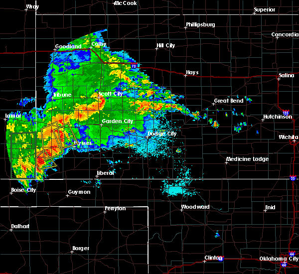 At 1049 pm cdt, a severe thunderstorm was located 7 miles northwest of richfield, moving northeast at 30 mph (radar indicated). Hazards include 60 mph wind gusts and up to quarter size hail. Hail damage to vehicles is expected. expect wind damage to roofs, siding and trees. Locations impacted include, richfield. At 1049 pm cdt, a severe thunderstorm was located 7 miles northwest of richfield, moving northeast at 30 mph (radar indicated). Hazards include 60 mph wind gusts and up to quarter size hail. Hail damage to vehicles is expected. expect wind damage to roofs, siding and trees. Locations impacted include, richfield.
|
| 7/1/2016 10:38 PM CDT |
 At 1038 pm cdt, a severe thunderstorm was located 10 miles west of richfield, moving northeast at 30 mph (radar indicated). Hazards include 60 mph wind gusts and up to quarter size hail. Hail damage to vehicles is expected. Expect wind damage to roofs, siding and trees. At 1038 pm cdt, a severe thunderstorm was located 10 miles west of richfield, moving northeast at 30 mph (radar indicated). Hazards include 60 mph wind gusts and up to quarter size hail. Hail damage to vehicles is expected. Expect wind damage to roofs, siding and trees.
|
| 7/1/2016 10:28 PM CDT |
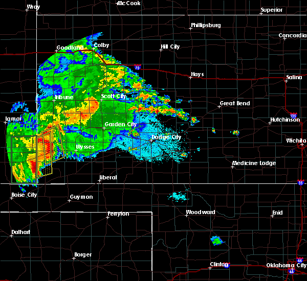 At 1027 pm cdt/927 pm mdt/, severe thunderstorms were located along a line extending from 14 miles northof manter to 12 miles northwest of elkhart, moving northeast at 20 mph (radar indicated). Hazards include 70 mph wind gusts and up to half dollar size hail. Hail damage to vehicles is expected. expect considerable tree damage. wind damage is also likely to mobile homes, roofs and outbuildings. Locations impacted include, manter, richfield and the saunders elevator. At 1027 pm cdt/927 pm mdt/, severe thunderstorms were located along a line extending from 14 miles northof manter to 12 miles northwest of elkhart, moving northeast at 20 mph (radar indicated). Hazards include 70 mph wind gusts and up to half dollar size hail. Hail damage to vehicles is expected. expect considerable tree damage. wind damage is also likely to mobile homes, roofs and outbuildings. Locations impacted include, manter, richfield and the saunders elevator.
|
| 7/1/2016 10:08 PM CDT |
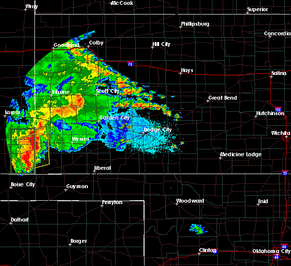 At 1007 pm cdt/907 pm mdt/, severe thunderstorms were located along a line extending from 13 miles north of the saunders elevator to 14 miles south of stonington, moving northeast at 20 mph (radar indicated). Hazards include 70 mph wind gusts and quarter size hail. Hail damage to vehicles is expected. expect considerable tree damage. wind damage is also likely to mobile homes, roofs and outbuildings. locations impacted include, manter, richfield and the saunders elevator. This storm is producing torrential, potentially flooding, rainfall. At 1007 pm cdt/907 pm mdt/, severe thunderstorms were located along a line extending from 13 miles north of the saunders elevator to 14 miles south of stonington, moving northeast at 20 mph (radar indicated). Hazards include 70 mph wind gusts and quarter size hail. Hail damage to vehicles is expected. expect considerable tree damage. wind damage is also likely to mobile homes, roofs and outbuildings. locations impacted include, manter, richfield and the saunders elevator. This storm is producing torrential, potentially flooding, rainfall.
|
| 7/1/2016 9:57 PM CDT |
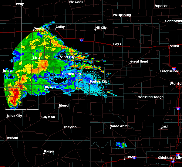 At 956 pm cdt/856 pm mdt/, severe thunderstorms were located along a line extending from 13 miles northwest of the saunders elevator to 15 miles south of stonington, moving northeast at 15 mph (radar indicated). Hazards include 60 mph wind gusts and up to quarter size hail. Hail damage to vehicles is expected. Expect wind damage to roofs, siding and trees. At 956 pm cdt/856 pm mdt/, severe thunderstorms were located along a line extending from 13 miles northwest of the saunders elevator to 15 miles south of stonington, moving northeast at 15 mph (radar indicated). Hazards include 60 mph wind gusts and up to quarter size hail. Hail damage to vehicles is expected. Expect wind damage to roofs, siding and trees.
|
| 6/13/2016 6:25 PM CDT |
 At 625 pm cdt/525 pm mdt/, severe thunderstorms were located along a line extending from 4 miles southwest of holly to 4 miles west of manter to 9 miles west of elkhart, moving east at 40 mph (radar indicated). Hazards include 70 mph wind gusts and penny size hail. Expect considerable tree damage. damage is likely to mobile homes, roofs and outbuildings. locations impacted include, elkhart, syracuse, johnson city, rolla, manter, coolidge, richfield, the saunders elevator and wilburton. A tornado watch remains in effect until 1000 pm cdt/900 pm mdt/ for southwestern kansas. At 625 pm cdt/525 pm mdt/, severe thunderstorms were located along a line extending from 4 miles southwest of holly to 4 miles west of manter to 9 miles west of elkhart, moving east at 40 mph (radar indicated). Hazards include 70 mph wind gusts and penny size hail. Expect considerable tree damage. damage is likely to mobile homes, roofs and outbuildings. locations impacted include, elkhart, syracuse, johnson city, rolla, manter, coolidge, richfield, the saunders elevator and wilburton. A tornado watch remains in effect until 1000 pm cdt/900 pm mdt/ for southwestern kansas.
|
| 6/13/2016 6:05 PM CDT |
 At 604 pm cdt/504 pm mdt/, severe thunderstorms were located along a line extending from 7 miles southwest of granada to 8 miles west of the saunders elevator to 17 miles east of campo, moving east at 40 mph (radar indicated). Hazards include 70 mph wind gusts and penny size hail. Expect considerable tree damage. Damage is likely to mobile homes, roofs and outbuildings. At 604 pm cdt/504 pm mdt/, severe thunderstorms were located along a line extending from 7 miles southwest of granada to 8 miles west of the saunders elevator to 17 miles east of campo, moving east at 40 mph (radar indicated). Hazards include 70 mph wind gusts and penny size hail. Expect considerable tree damage. Damage is likely to mobile homes, roofs and outbuildings.
|
| 4/15/2016 9:56 PM CDT |
 The tornado warning for eastern morton and western stevens counties will expire at 1000 pm cdt, the storm which prompted the warning has moved out of the area. therefore the warning will be allowed to expire. however gusty winds are still possible with this thunderstorm. to report severe weather, contact your nearest law enforcement agency. they will relay your report to the national weather service dodge city. The tornado warning for eastern morton and western stevens counties will expire at 1000 pm cdt, the storm which prompted the warning has moved out of the area. therefore the warning will be allowed to expire. however gusty winds are still possible with this thunderstorm. to report severe weather, contact your nearest law enforcement agency. they will relay your report to the national weather service dodge city.
|
| 4/15/2016 9:29 PM CDT |
 At 929 pm cdt, a severe thunderstorm capable of producing a tornado was located 6 miles south of richfield, moving northeast at 30 mph (radar indicated rotation). Hazards include tornado and ping pong ball size hail. Flying debris will be dangerous to those caught without shelter. mobile homes will be damaged or destroyed. damage to roofs, windows and vehicles will occur. tree damage is likely. This tornadic thunderstorm will remain over mainly rural areas of eastern morton and western stevens counties. At 929 pm cdt, a severe thunderstorm capable of producing a tornado was located 6 miles south of richfield, moving northeast at 30 mph (radar indicated rotation). Hazards include tornado and ping pong ball size hail. Flying debris will be dangerous to those caught without shelter. mobile homes will be damaged or destroyed. damage to roofs, windows and vehicles will occur. tree damage is likely. This tornadic thunderstorm will remain over mainly rural areas of eastern morton and western stevens counties.
|
| 4/15/2016 9:03 PM CDT |
 At 902 pm cdt, a severe thunderstorm was located 8 miles north of elkhart, moving northeast at 30 mph (radar indicated). Hazards include 70 mph wind gusts and ping pong ball size hail. other storms capable of producing large hail and 70 mph winds were moving into western morton county from southeast colorado. People and animals outdoors will be injured. expect hail damage to roofs, siding, windows and vehicles. expect considerable tree damage. wind damage is also likely to mobile homes, roofs and outbuildings. locations impacted include, elkhart, richfield and wilburton. A tornado watch remains in effect until 1000 pm cdt for southwestern kansas. At 902 pm cdt, a severe thunderstorm was located 8 miles north of elkhart, moving northeast at 30 mph (radar indicated). Hazards include 70 mph wind gusts and ping pong ball size hail. other storms capable of producing large hail and 70 mph winds were moving into western morton county from southeast colorado. People and animals outdoors will be injured. expect hail damage to roofs, siding, windows and vehicles. expect considerable tree damage. wind damage is also likely to mobile homes, roofs and outbuildings. locations impacted include, elkhart, richfield and wilburton. A tornado watch remains in effect until 1000 pm cdt for southwestern kansas.
|
| 4/15/2016 8:44 PM CDT |
 At 844 pm cdt, a severe thunderstorm was located 8 miles west of elkhart, moving northeast at 25 mph (radar indicated). Hazards include two inch hail and 60 mph wind gusts. People and animals outdoors will be injured. expect hail damage to roofs, siding, windows and vehicles. Expect wind damage to roofs, siding and trees. At 844 pm cdt, a severe thunderstorm was located 8 miles west of elkhart, moving northeast at 25 mph (radar indicated). Hazards include two inch hail and 60 mph wind gusts. People and animals outdoors will be injured. expect hail damage to roofs, siding, windows and vehicles. Expect wind damage to roofs, siding and trees.
|
| 4/15/2016 8:14 PM CDT |
 At 812 pm cdt, a severe thunderstorm was located 3 miles northwest of wilburton, moving north at 40 mph (radar indicated). Hazards include two inch hail and 60 mph wind gusts. People and animals outdoors will be injured. expect hail damage to roofs, siding, windows and vehicles. expect wind damage to roofs, siding and trees. locations impacted include, elkhart, rolla, richfield, wilburton and feterita. the strongest part of this storm is still over the oklahoma panhandle south of elkhart. this part of the storm will be capable of producing a tornado. A tornado watch remains in effect until 1000 pm cdt for southwestern kansas. At 812 pm cdt, a severe thunderstorm was located 3 miles northwest of wilburton, moving north at 40 mph (radar indicated). Hazards include two inch hail and 60 mph wind gusts. People and animals outdoors will be injured. expect hail damage to roofs, siding, windows and vehicles. expect wind damage to roofs, siding and trees. locations impacted include, elkhart, rolla, richfield, wilburton and feterita. the strongest part of this storm is still over the oklahoma panhandle south of elkhart. this part of the storm will be capable of producing a tornado. A tornado watch remains in effect until 1000 pm cdt for southwestern kansas.
|
| 4/15/2016 7:49 PM CDT |
 At 749 pm cdt, a severe thunderstorm was located 6 miles south of elkhart, moving north at 40 mph (radar indicated). Hazards include two inch hail and 60 mph wind gusts. People and animals outdoors will be injured. expect hail damage to roofs, siding, windows and vehicles. Expect wind damage to roofs, siding and trees. At 749 pm cdt, a severe thunderstorm was located 6 miles south of elkhart, moving north at 40 mph (radar indicated). Hazards include two inch hail and 60 mph wind gusts. People and animals outdoors will be injured. expect hail damage to roofs, siding, windows and vehicles. Expect wind damage to roofs, siding and trees.
|
| 11/16/2015 3:17 PM CST |
 At 316 pm cst, a severe thunderstorm was located 5 miles north of wilburton, moving northeast at 55 mph (radar indicated). Hazards include 60 mph wind gusts and half dollar size hail. Hail damage to vehicles is expected. expect wind damage to roofs, siding and trees. locations impacted include, rolla, moscow, richfield and feterita. A tornado watch remains in effect until 900 pm cst for southwestern kansas. At 316 pm cst, a severe thunderstorm was located 5 miles north of wilburton, moving northeast at 55 mph (radar indicated). Hazards include 60 mph wind gusts and half dollar size hail. Hail damage to vehicles is expected. expect wind damage to roofs, siding and trees. locations impacted include, rolla, moscow, richfield and feterita. A tornado watch remains in effect until 900 pm cst for southwestern kansas.
|
| 11/16/2015 3:04 PM CST |
 At 304 pm cst, a severe thunderstorm was located 3 miles east of elkhart, moving northeast at 55 mph (radar indicated). Hazards include ping pong ball size hail and 60 mph wind gusts. People and animals outdoors will be injured. expect hail damage to roofs, siding, windows and vehicles. expect wind damage to roofs, siding and trees. locations impacted include, hugoton, elkhart, johnson city, rolla, moscow, richfield, feterita and wilburton. A tornado watch remains in effect until 900 pm cst for southwestern kansas. At 304 pm cst, a severe thunderstorm was located 3 miles east of elkhart, moving northeast at 55 mph (radar indicated). Hazards include ping pong ball size hail and 60 mph wind gusts. People and animals outdoors will be injured. expect hail damage to roofs, siding, windows and vehicles. expect wind damage to roofs, siding and trees. locations impacted include, hugoton, elkhart, johnson city, rolla, moscow, richfield, feterita and wilburton. A tornado watch remains in effect until 900 pm cst for southwestern kansas.
|
| 11/16/2015 2:53 PM CST |
 At 252 pm cst, a severe thunderstorm was located 9 miles southwest of elkhart, moving northeast at 55 mph (radar indicated). Hazards include 60 mph wind gusts and half dollar size hail. Hail damage to vehicles is expected. Expect wind damage to roofs, siding and trees. At 252 pm cst, a severe thunderstorm was located 9 miles southwest of elkhart, moving northeast at 55 mph (radar indicated). Hazards include 60 mph wind gusts and half dollar size hail. Hail damage to vehicles is expected. Expect wind damage to roofs, siding and trees.
|
| 9/10/2015 8:21 PM CDT |
 At 820 pm cdt, a severe thunderstorm was located 3 miles northeast of wilburton, moving south at 25 mph (radar indicated). Hazards include golf ball size hail and 70 mph wind gusts. People and animals outdoors will be injured. expect hail damage to roofs, siding, windows and vehicles. expect considerable tree damage. Wind damage is also likely to mobile homes, roofs and outbuildings. At 820 pm cdt, a severe thunderstorm was located 3 miles northeast of wilburton, moving south at 25 mph (radar indicated). Hazards include golf ball size hail and 70 mph wind gusts. People and animals outdoors will be injured. expect hail damage to roofs, siding, windows and vehicles. expect considerable tree damage. Wind damage is also likely to mobile homes, roofs and outbuildings.
|
| 9/10/2015 7:51 PM CDT |
 At 751 pm cdt, a severe thunderstorm was located 4 miles northeast of richfield, moving south at 15 mph (radar indicated). Hazards include 70 mph wind gusts and quarter size hail. Hail damage to vehicles is expected. expect considerable tree damage. wind damage is also likely to mobile homes, roofs and outbuildings. Locations impacted include, richfield and the saunders elevator. At 751 pm cdt, a severe thunderstorm was located 4 miles northeast of richfield, moving south at 15 mph (radar indicated). Hazards include 70 mph wind gusts and quarter size hail. Hail damage to vehicles is expected. expect considerable tree damage. wind damage is also likely to mobile homes, roofs and outbuildings. Locations impacted include, richfield and the saunders elevator.
|
| 9/10/2015 7:40 PM CDT | Quarter sized hail reported 9.3 miles S of Richfield, KS |
| 9/10/2015 7:21 PM CDT |
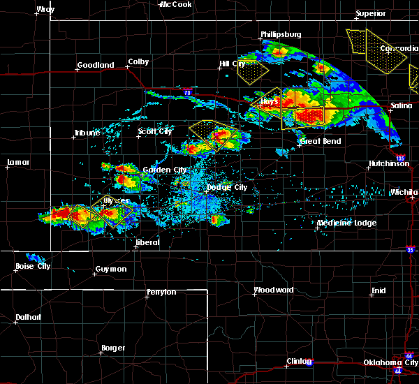 At 718 pm cdt, a severe thunderstorm was located 9 miles south of johnson city, moving south at 10 mph. another severe thunderstorm was located near manter and was also moving south at 10 mph (radar indicated). Hazards include golf ball size hail and 60 mph wind gusts. People and animals outdoors will be injured. expect hail damage to roofs, siding, windows and vehicles. Expect wind damage to roofs, siding and trees. At 718 pm cdt, a severe thunderstorm was located 9 miles south of johnson city, moving south at 10 mph. another severe thunderstorm was located near manter and was also moving south at 10 mph (radar indicated). Hazards include golf ball size hail and 60 mph wind gusts. People and animals outdoors will be injured. expect hail damage to roofs, siding, windows and vehicles. Expect wind damage to roofs, siding and trees.
|
| 7/19/2015 8:55 PM CDT | Storm damage reported in morton county KS, 3.8 miles WSW of Richfield, KS |
| 7/19/2015 8:46 PM CDT |
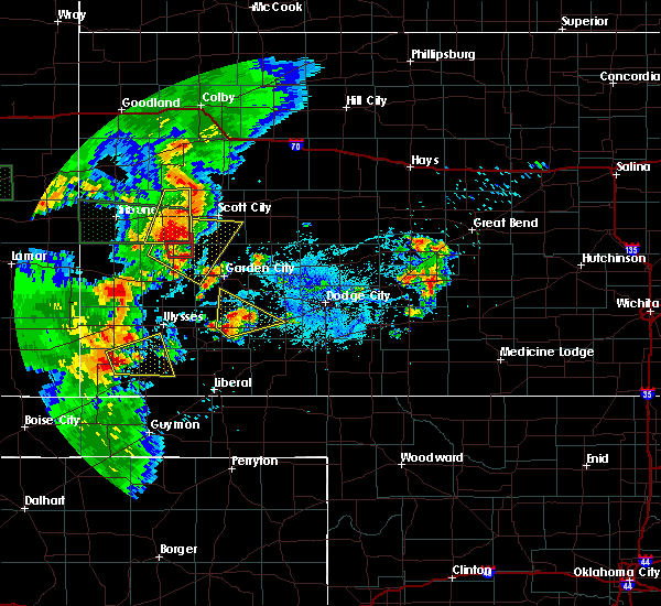 At 846 pm cdt, a severe thunderstorm was located 3 miles east of richfield, moving east at 20 mph (radar indicated). Hazards include 60 mph wind gusts and quarter size hail. Hail damage to vehicles is expected. Expect wind damage to roofs, siding and trees. At 846 pm cdt, a severe thunderstorm was located 3 miles east of richfield, moving east at 20 mph (radar indicated). Hazards include 60 mph wind gusts and quarter size hail. Hail damage to vehicles is expected. Expect wind damage to roofs, siding and trees.
|
| 7/15/2015 6:30 PM CDT |
 At 629 pm cdt, a severe thunderstorm was located 4 miles east of stonington, or 11 miles south of the saunders elevator, moving east at 25 mph (radar indicated). Hazards include 60 mph wind gusts and quarter size hail. Hail damage to vehicles is expected. Expect wind damage to roofs, siding and trees. At 629 pm cdt, a severe thunderstorm was located 4 miles east of stonington, or 11 miles south of the saunders elevator, moving east at 25 mph (radar indicated). Hazards include 60 mph wind gusts and quarter size hail. Hail damage to vehicles is expected. Expect wind damage to roofs, siding and trees.
|
| 7/14/2015 11:19 PM CDT |
 At 1118 pm cdt, a severe thunderstorm was located 7 miles northwest of richfield, moving northeast at 40 mph (radar indicated). Hazards include 60 mph wind gusts and quarter size hail. Hail damage to vehicles is expected. Expect wind damage to roofs, siding and trees. At 1118 pm cdt, a severe thunderstorm was located 7 miles northwest of richfield, moving northeast at 40 mph (radar indicated). Hazards include 60 mph wind gusts and quarter size hail. Hail damage to vehicles is expected. Expect wind damage to roofs, siding and trees.
|
| 7/9/2015 9:03 PM CDT |
 At 903 pm cdt, a severe thunderstorm was located 6 miles northwest of elkhart, moving northeast at 15 mph (radar indicated). Hazards include 60 mph wind gusts and quarter size hail. Hail damage to vehicles is expected. Expect wind damage to roofs, siding and trees. At 903 pm cdt, a severe thunderstorm was located 6 miles northwest of elkhart, moving northeast at 15 mph (radar indicated). Hazards include 60 mph wind gusts and quarter size hail. Hail damage to vehicles is expected. Expect wind damage to roofs, siding and trees.
|
| 7/4/2015 6:16 PM CDT |
 At 616 pm cdt, a severe thunderstorm was located 6 miles south of manter, moving west at 10 mph (radar indicated). Hazards include 70 mph wind gusts and ping pong ball size hail. People and animals outdoors will be injured. expect hail damage to roofs, siding, windows and vehicles. expect considerable tree damage. wind damage is also likely to mobile homes, roofs and outbuildings. Locations impacted include, manter, richfield and the saunders elevator. At 616 pm cdt, a severe thunderstorm was located 6 miles south of manter, moving west at 10 mph (radar indicated). Hazards include 70 mph wind gusts and ping pong ball size hail. People and animals outdoors will be injured. expect hail damage to roofs, siding, windows and vehicles. expect considerable tree damage. wind damage is also likely to mobile homes, roofs and outbuildings. Locations impacted include, manter, richfield and the saunders elevator.
|
| 7/4/2015 5:57 PM CDT |
 At 556 pm cdt, a severe thunderstorm was located 4 miles southeast of manter and was nearly stationary (radar indicated). Hazards include ping pong ball size hail and 60 mph wind gusts. People and animals outdoors will be injured. expect hail damage to roofs, siding, windows and vehicles. Expect wind damage to roofs, siding and trees. At 556 pm cdt, a severe thunderstorm was located 4 miles southeast of manter and was nearly stationary (radar indicated). Hazards include ping pong ball size hail and 60 mph wind gusts. People and animals outdoors will be injured. expect hail damage to roofs, siding, windows and vehicles. Expect wind damage to roofs, siding and trees.
|
| 6/11/2015 11:06 PM CDT |
 At 1105 pm cdt, a severe thunderstorm was located 6 miles north of wilburton, moving east at 35 mph (radar indicated). Hazards include 60 mph wind gusts and quarter size hail. Hail damage to vehicles is expected. expect wind damage to roofs, siding and trees. Locations impacted include, rolla, richfield and wilburton. At 1105 pm cdt, a severe thunderstorm was located 6 miles north of wilburton, moving east at 35 mph (radar indicated). Hazards include 60 mph wind gusts and quarter size hail. Hail damage to vehicles is expected. expect wind damage to roofs, siding and trees. Locations impacted include, rolla, richfield and wilburton.
|
| 6/11/2015 10:47 PM CDT |
 At 1047 pm cdt, a severe thunderstorm was located 10 miles east of stonington, or 11 miles west of richfield, moving east at 35 mph (radar indicated). Hazards include 60 mph wind gusts and quarter size hail. Hail damage to vehicles is expected. Expect wind damage to roofs, siding and trees. At 1047 pm cdt, a severe thunderstorm was located 10 miles east of stonington, or 11 miles west of richfield, moving east at 35 mph (radar indicated). Hazards include 60 mph wind gusts and quarter size hail. Hail damage to vehicles is expected. Expect wind damage to roofs, siding and trees.
|
| 6/11/2015 8:36 PM CDT |
 At 835 pm cdt, a severe thunderstorm was located 3 miles south of richfield, moving northeast at 15 mph (radar indicated). Hazards include 60 mph wind gusts and quarter size hail. Hail damage to vehicles is expected. expect wind damage to roofs, siding and trees. Locations impacted include, richfield. At 835 pm cdt, a severe thunderstorm was located 3 miles south of richfield, moving northeast at 15 mph (radar indicated). Hazards include 60 mph wind gusts and quarter size hail. Hail damage to vehicles is expected. expect wind damage to roofs, siding and trees. Locations impacted include, richfield.
|
| 6/11/2015 8:02 PM CDT |
 At 802 pm cdt, a severe thunderstorm was located 8 miles northwest of elkhart, moving northeast at 15 mph (radar indicated). Hazards include golf ball size hail and 60 mph wind gusts. People and animals outdoors will be injured. expect hail damage to roofs, siding, windows and vehicles. Expect wind damage to roofs, siding and trees. At 802 pm cdt, a severe thunderstorm was located 8 miles northwest of elkhart, moving northeast at 15 mph (radar indicated). Hazards include golf ball size hail and 60 mph wind gusts. People and animals outdoors will be injured. expect hail damage to roofs, siding, windows and vehicles. Expect wind damage to roofs, siding and trees.
|
| 5/31/2015 11:10 PM CDT | At 1109 pm cdt, severe thunderstorms were located along a line extending from 12 miles south of big bow to 4 miles west of richfield, moving southeast at 25 mph (radar indicated). Hazards include 60 mph wind gusts and nickel size hail. Expect damage to roofs. siding and trees. Locations impacted include, hugoton, elkhart, rolla, richfield, wilburton and feterita. |
| 5/31/2015 10:41 PM CDT | At 1041 pm cdt, severe thunderstorms were located along a line extending from 4 miles south of johnson city to 6 miles south of the saunders elevator, moving southeast at 25 mph (radar indicated). Hazards include 60 mph wind gusts and quarter size hail. Hail damage to vehicles is expected. Expect wind damage to roofs, siding and trees. |
| 5/28/2015 5:44 PM CDT | At 544 pm cdt, a severe thunderstorm was located 9 miles northwest of elkhart, moving east at 30 mph (radar indicated). Hazards include 60 mph wind gusts and nickel size hail. Expect damage to roofs. Siding and trees. |
| 4/11/2015 7:20 PM CDT | The national weather service in dodge city has issued a * tornado warning for. southeastern stanton county in southwestern kansas. northeastern morton county in southwestern kansas. until 800 pm cdt * at 719 pm cdt. A severe thunderstorm capable of producing a. |
| 4/11/2015 7:12 PM CDT | Quarter sized hail reported 8.3 miles SE of Richfield, KS |
| 4/11/2015 7:07 PM CDT | A severe thunderstorm warning remains in effect until 745 pm cdt for southern stanton and northeastern morton counties. at 706 pm cdt. a severe thunderstorm was located 9 miles south of manter. moving east at 25 mph. hazard. 70 mph wind gusts and quarter size hail. source. Radar indicated. |
| 4/11/2015 6:51 PM CDT | The national weather service in dodge city has issued a * severe thunderstorm warning for. southern stanton county in southwestern kansas. northern morton county in southwestern kansas. until 745 pm cdt * at 650 pm cdt. A severe thunderstorm was located 6 miles southeast. |
| 7/14/2014 2:45 PM CDT | Storm damage reported in morton county KS, 0.6 miles NE of Richfield, KS |
| 7/14/2014 2:35 PM CDT | Tree limbs four to five inches in diameter were blown down by thunderstorm outflo in morton county KS, 3.8 miles E of Richfield, KS |
| 8/14/2013 3:30 PM CDT | Ping Pong Ball sized hail reported 10 miles NE of Richfield, KS, there were also 3 evergreen trees upr |
| 8/7/2013 7:30 PM CDT | Quarter sized hail reported 0.3 miles SSW of Richfield, KS, the hail fell for approximately 10 minutes. |
| 8/24/2012 4:05 PM CDT | Large dead tree was uproote in morton county KS, 4.8 miles WNW of Richfield, KS |
| 8/3/2012 6:28 PM CDT | Quarter sized hail reported 10.9 miles WSW of Richfield, KS |
| 4/26/2012 7:20 PM CDT | Golf Ball sized hail reported 0.3 miles SSW of Richfield, KS |
| 1/1/0001 12:00 AM | Storm damage reported in morton county KS, 0.6 miles NE of Richfield, KS |
| 1/1/0001 12:00 AM | Half Dollar sized hail reported 3.1 miles SSW of Richfield, KS |
Hail Maps for Richfield, KS
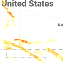
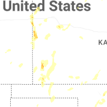

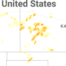


Connect with Interactive Hail Maps