

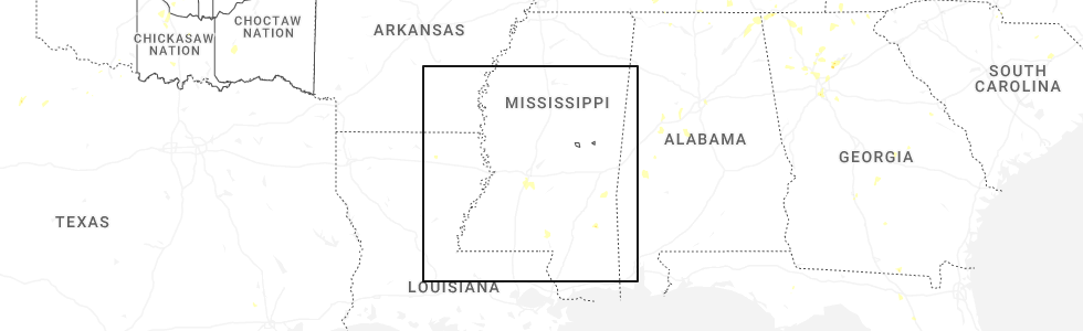
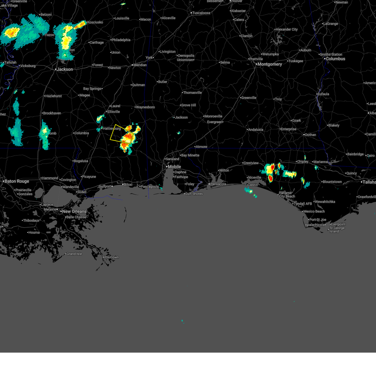
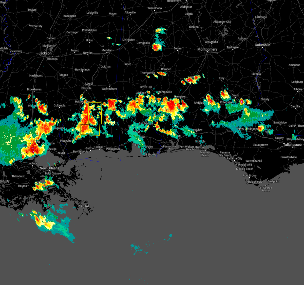
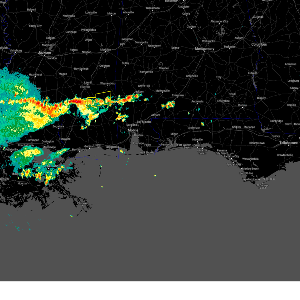
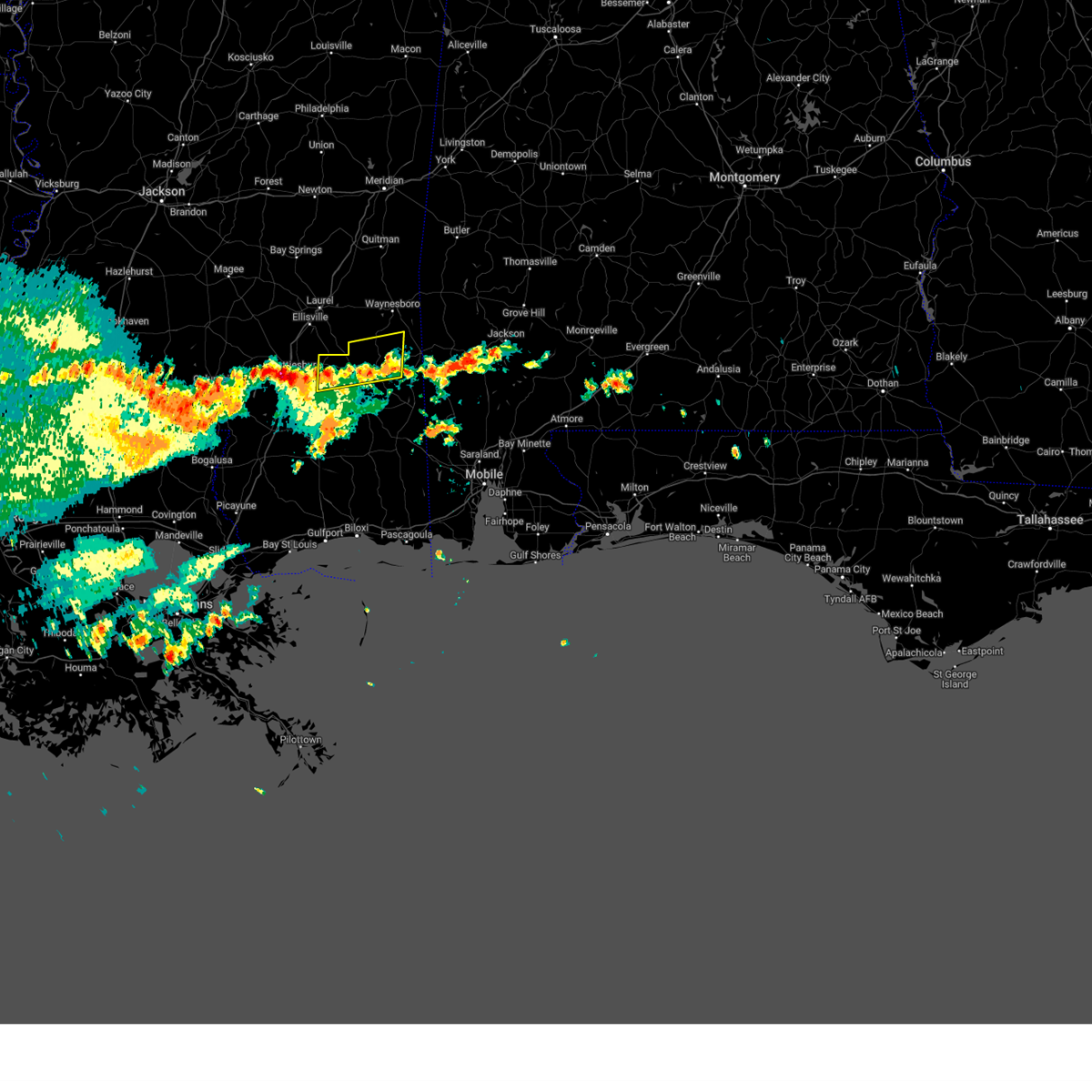
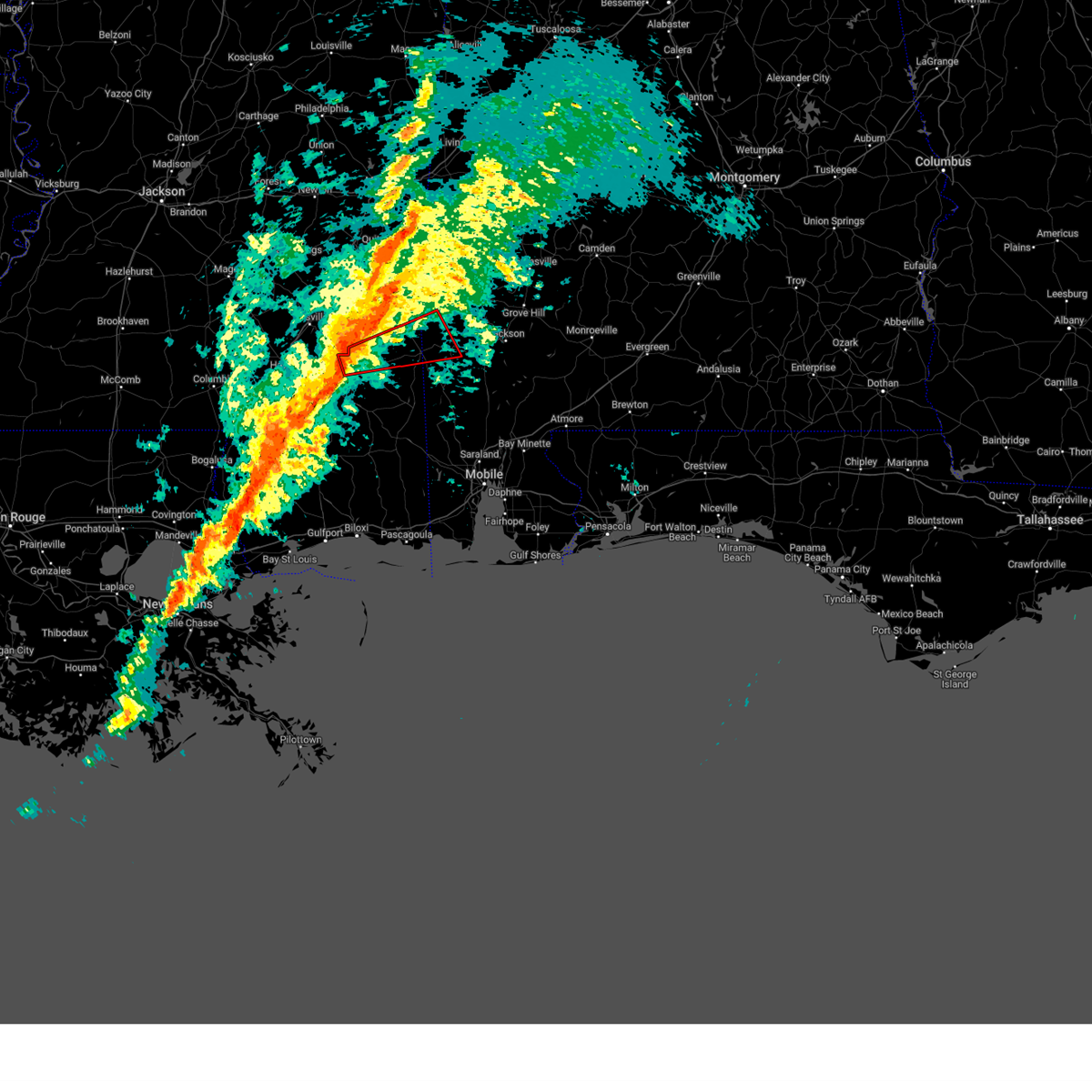
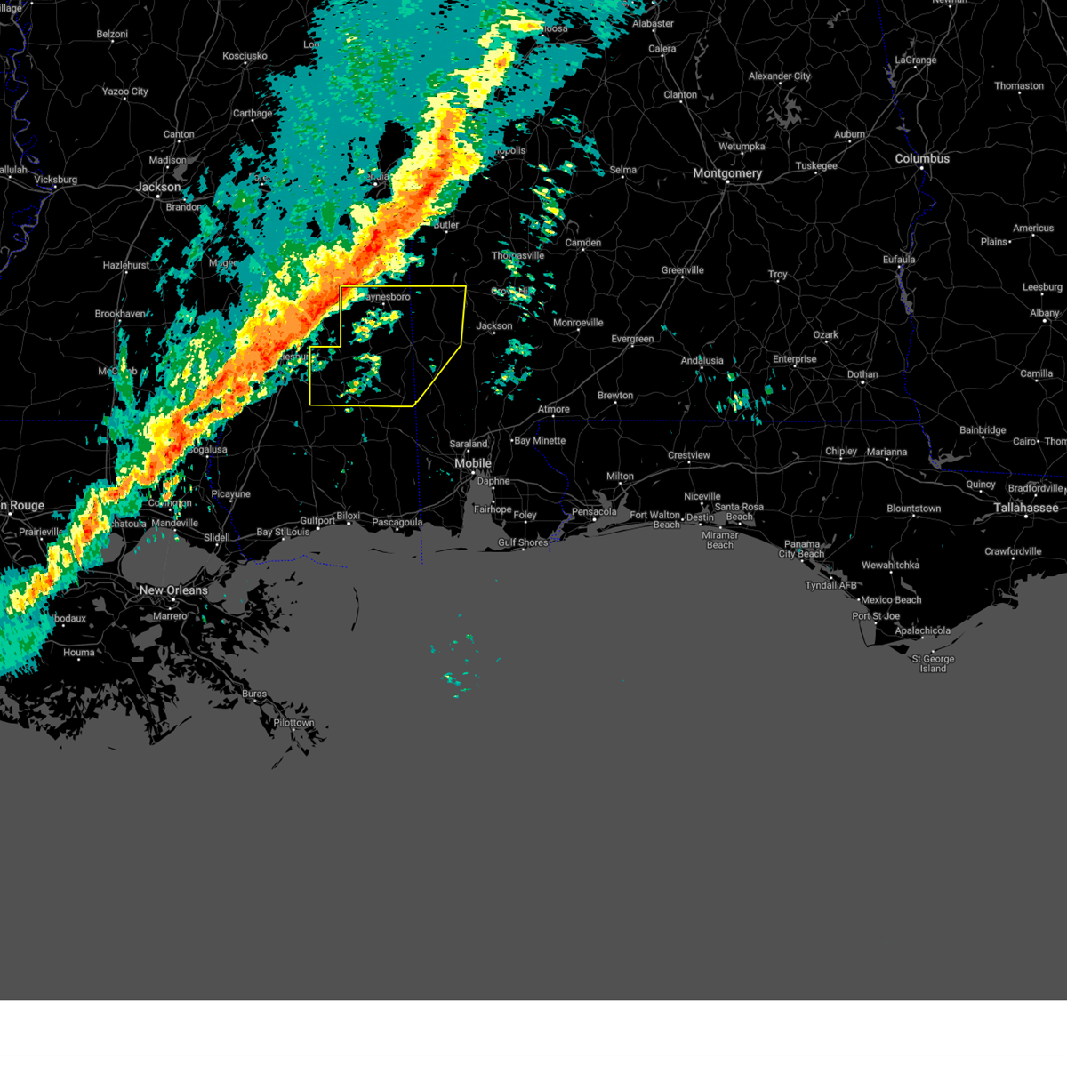
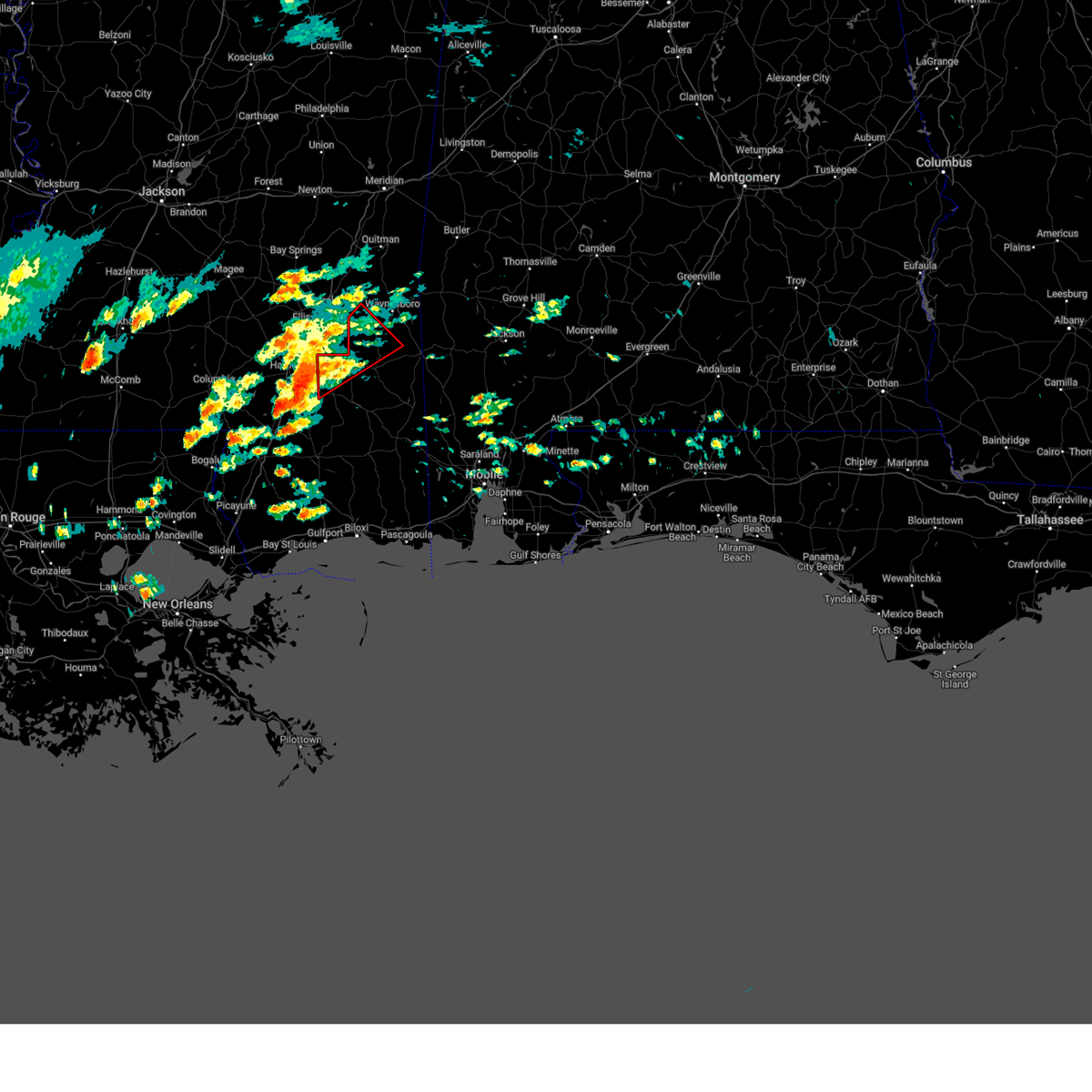
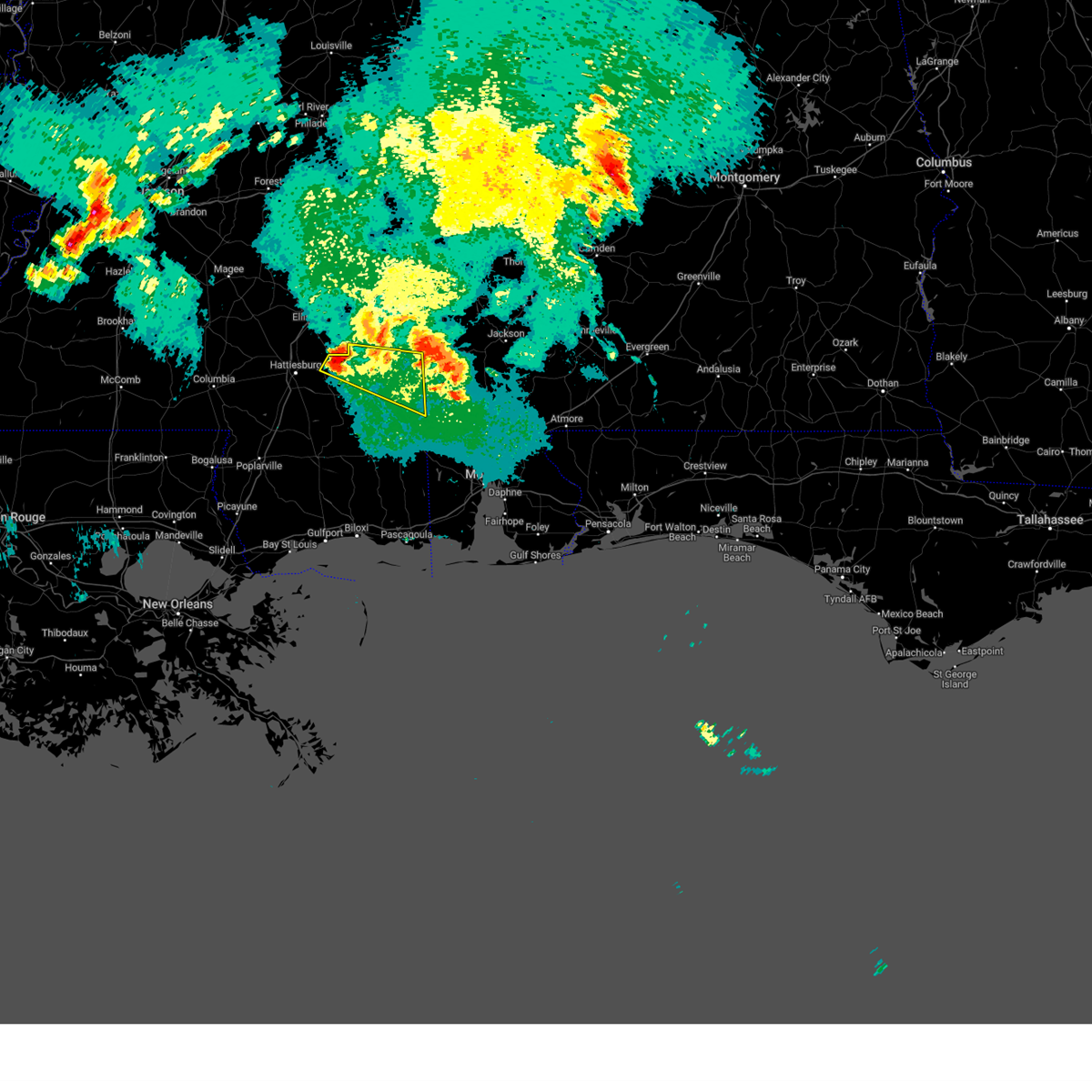
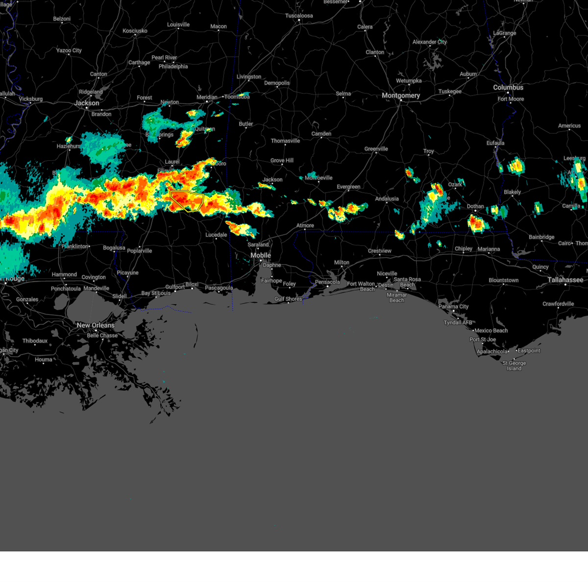
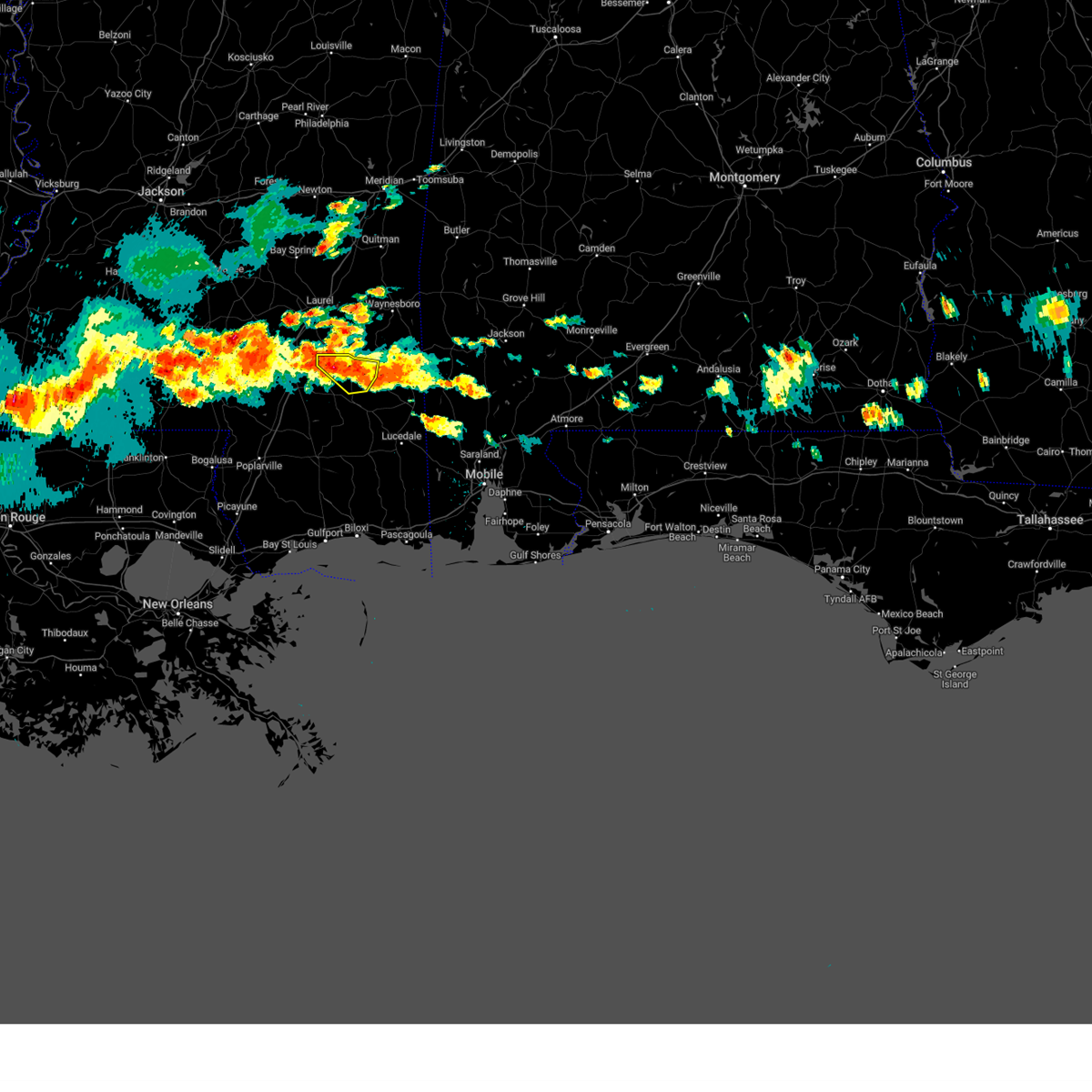
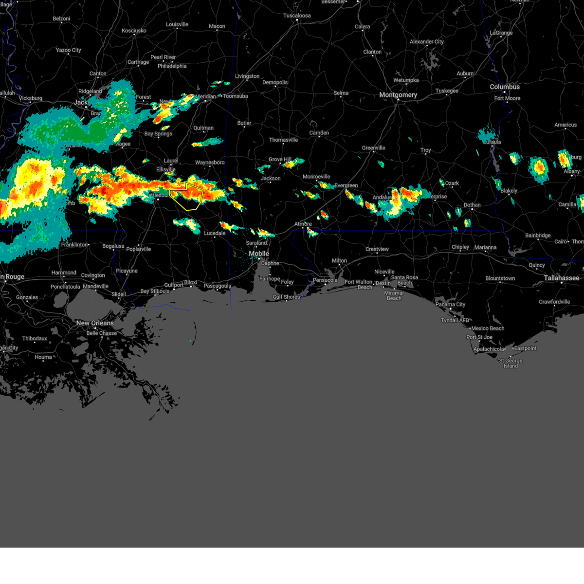
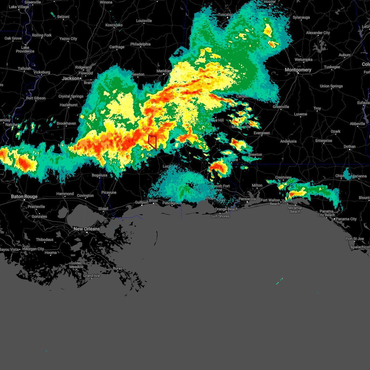
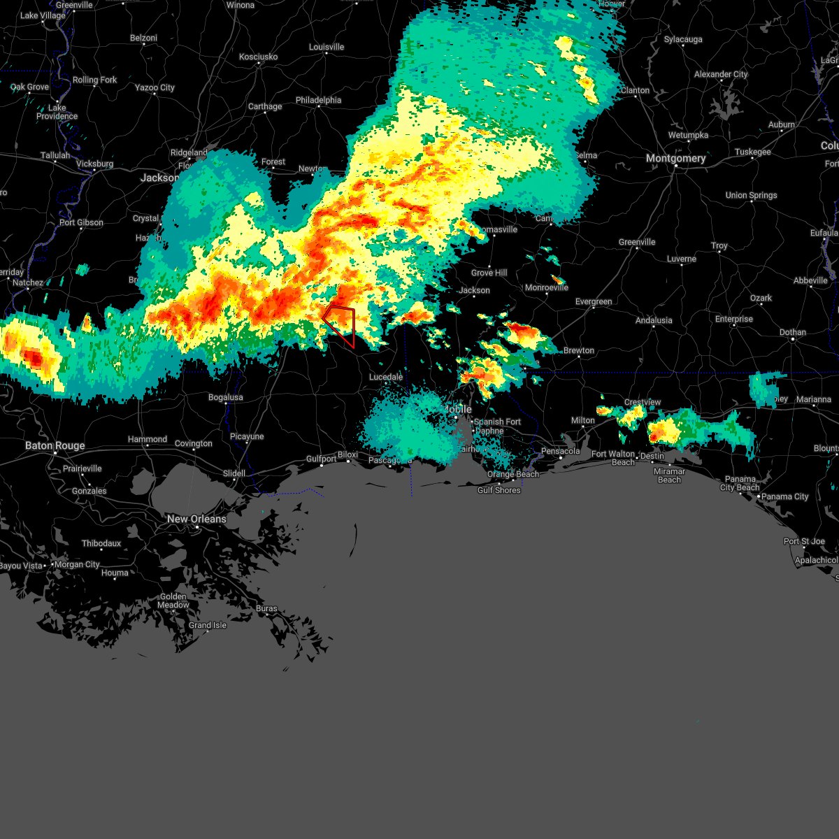
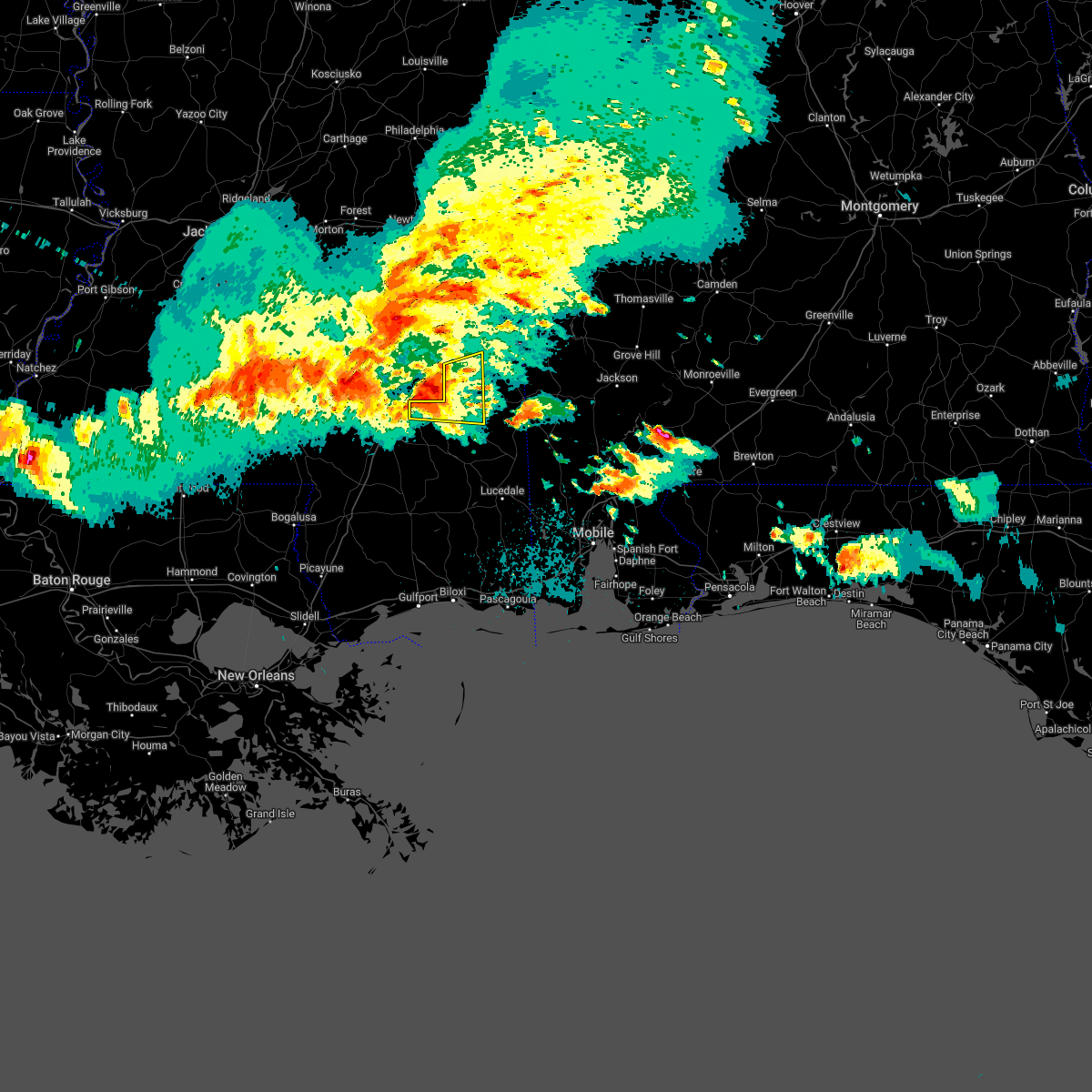
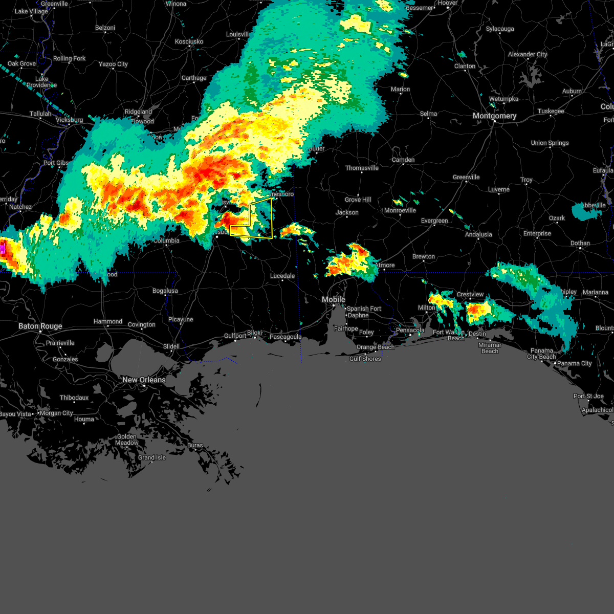
Hail Map for Richton, MS
The Richton, MS area has had 12 reports of on-the-ground hail by trained spotters, and has been under severe weather warnings 24 times during the past 12 months. Doppler radar has detected hail at or near Richton, MS on 44 occasions, including 4 occasions during the past year.
| Name: | Richton, MS |
| Where Located: | 69.5 miles NW of Mobile, AL |
| Map: | Google Map for Richton, MS |
| Population: | 1068 |
| Housing Units: | 463 |
| More Info: | Search Google for Richton, MS |
0
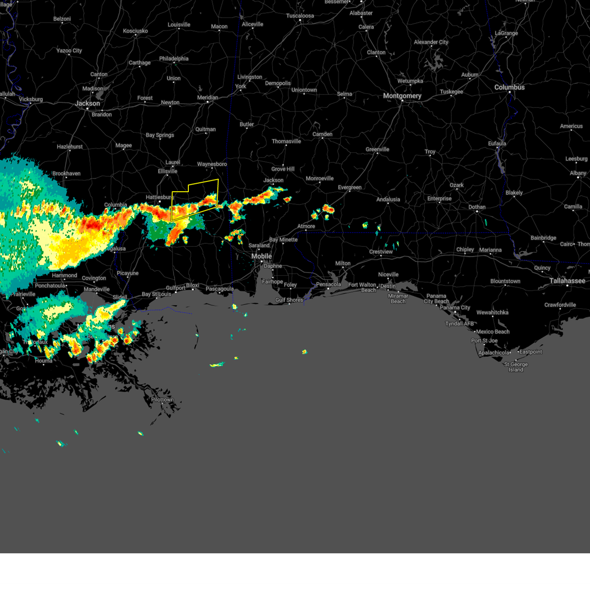
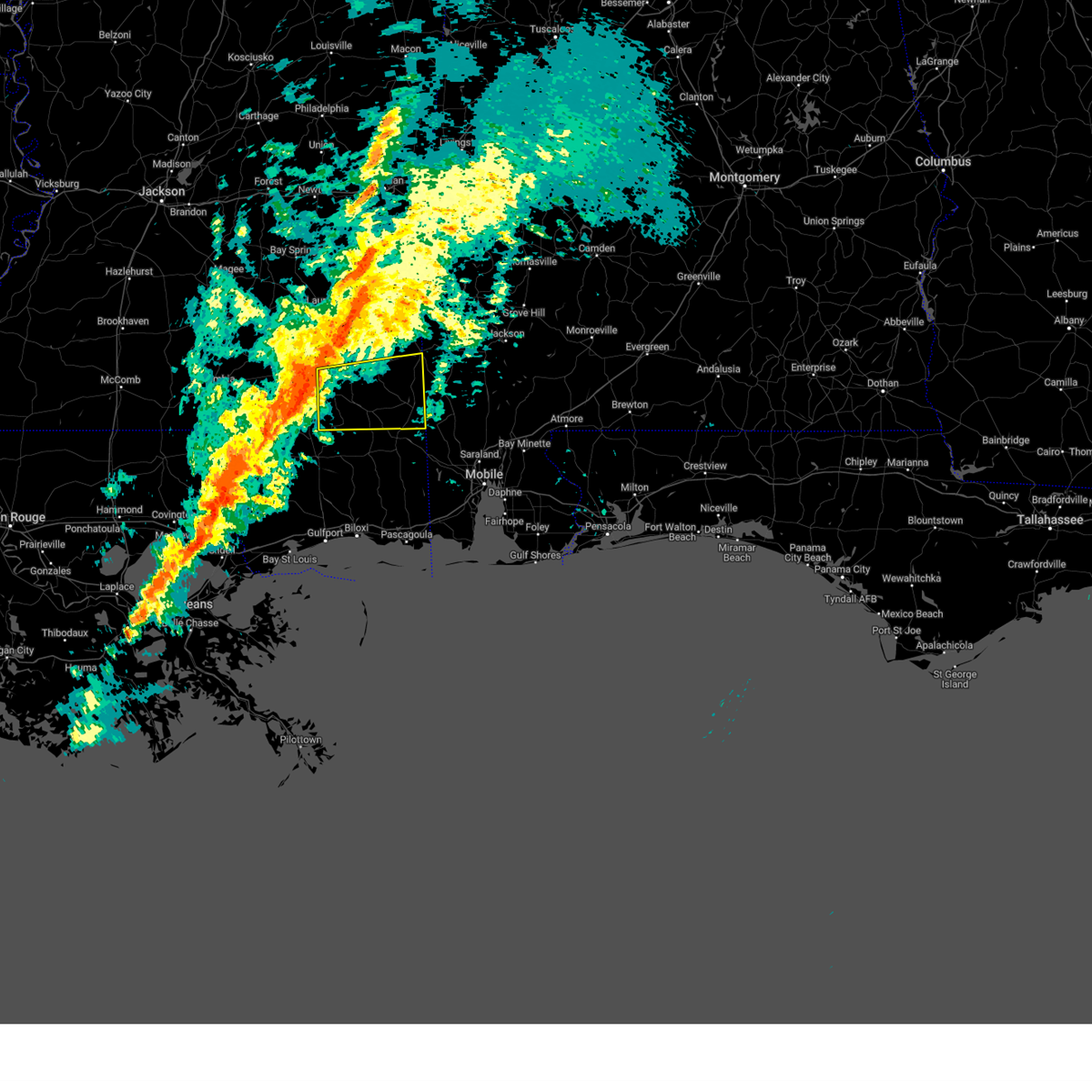
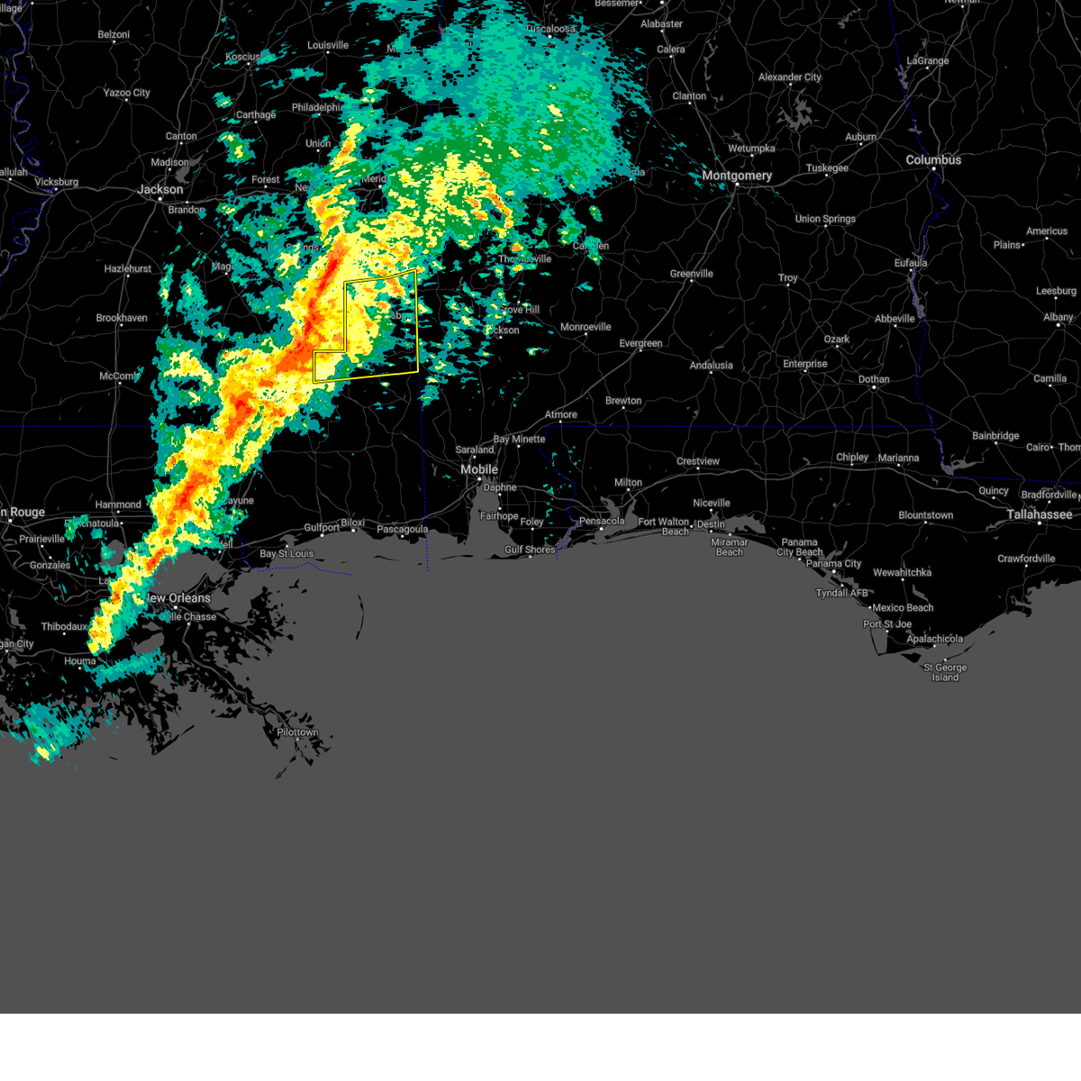
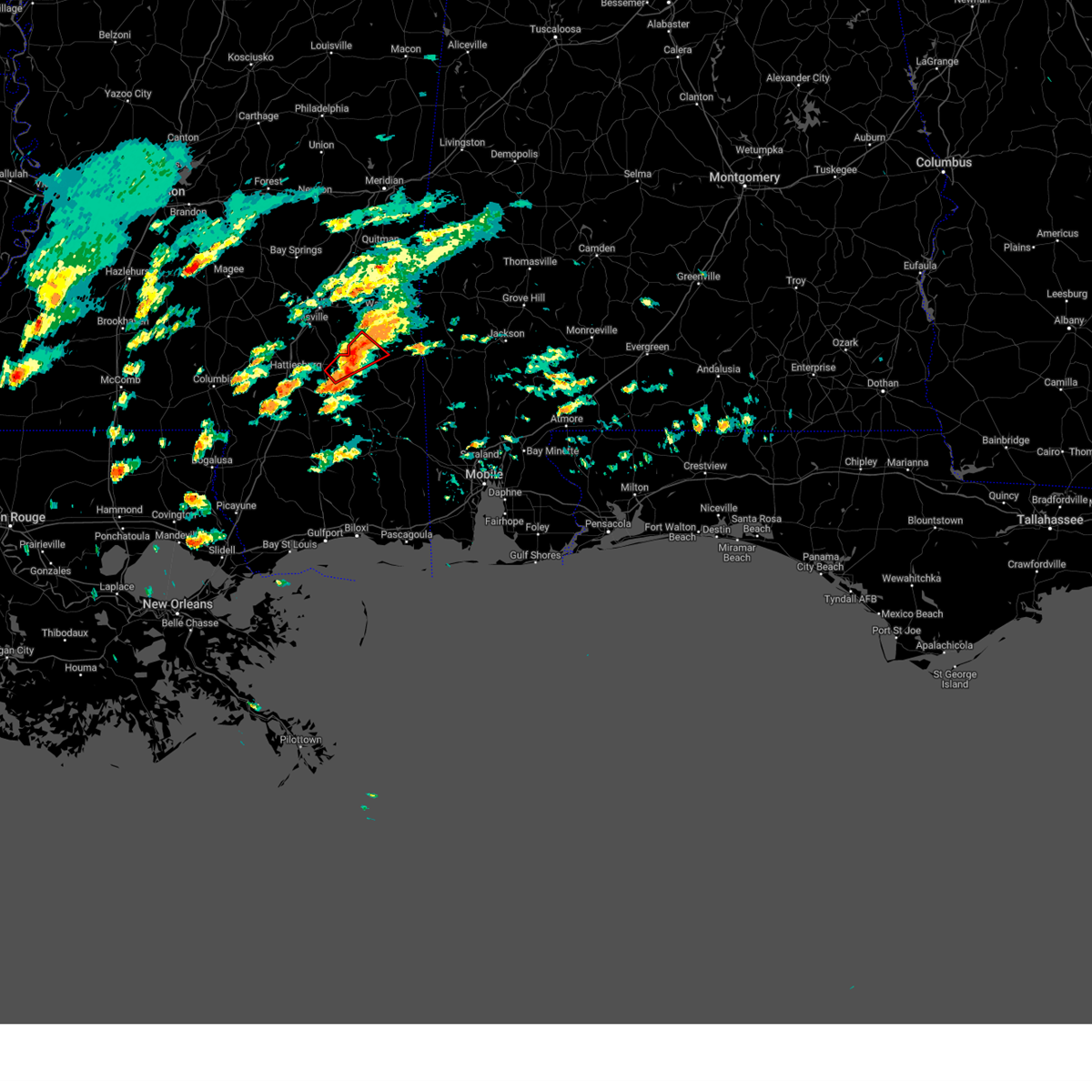
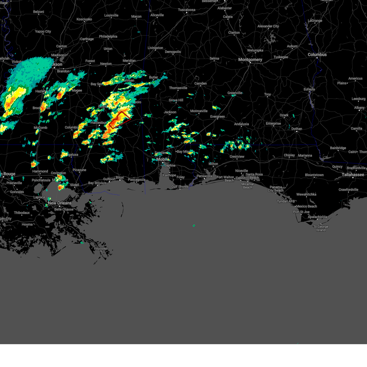
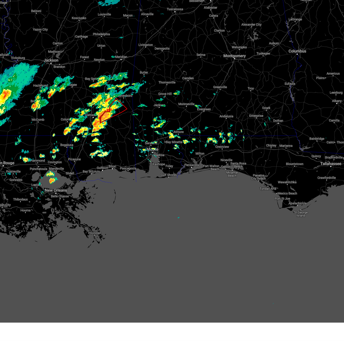
The Top Recent Hail Date for Richton, MS is Friday, June 27, 2025 (44th out of 44)
Hail and Wind Damage Spotted near Richton, MS
| Date / Time | Report Details |
|---|---|
| 6/27/2025 2:37 PM CDT |
 the severe thunderstorm warning has been cancelled and is no longer in effect the severe thunderstorm warning has been cancelled and is no longer in effect
|
| 6/27/2025 2:14 PM CDT |
 Svrmob the national weather service in mobile has issued a * severe thunderstorm warning for, northeastern perry county in southeastern mississippi, southwestern wayne county in southeastern mississippi, northwestern greene county in southeastern mississippi, * until 300 pm cdt. * at 214 pm cdt, a severe thunderstorm was located 5 miles northeast of richton, moving northwest at 15 mph (radar indicated). Hazards include 60 mph wind gusts and half dollar size hail. Hail damage to vehicles is expected. Expect wind damage to roofs, siding, and trees. Svrmob the national weather service in mobile has issued a * severe thunderstorm warning for, northeastern perry county in southeastern mississippi, southwestern wayne county in southeastern mississippi, northwestern greene county in southeastern mississippi, * until 300 pm cdt. * at 214 pm cdt, a severe thunderstorm was located 5 miles northeast of richton, moving northwest at 15 mph (radar indicated). Hazards include 60 mph wind gusts and half dollar size hail. Hail damage to vehicles is expected. Expect wind damage to roofs, siding, and trees.
|
| 6/24/2025 7:58 PM CDT |
 the severe thunderstorm warning has been cancelled and is no longer in effect the severe thunderstorm warning has been cancelled and is no longer in effect
|
| 6/24/2025 7:39 PM CDT |
 Svrmob the national weather service in mobile has issued a * severe thunderstorm warning for, central perry county in southeastern mississippi, southwestern greene county in southeastern mississippi, * until 815 pm cdt. * at 739 pm cdt, a severe thunderstorm was located 5 miles north of mclain, or 14 miles southeast of richton, moving west at 15 mph (radar indicated). Hazards include 60 mph wind gusts and nickel size hail. expect damage to roofs, siding, and trees Svrmob the national weather service in mobile has issued a * severe thunderstorm warning for, central perry county in southeastern mississippi, southwestern greene county in southeastern mississippi, * until 815 pm cdt. * at 739 pm cdt, a severe thunderstorm was located 5 miles north of mclain, or 14 miles southeast of richton, moving west at 15 mph (radar indicated). Hazards include 60 mph wind gusts and nickel size hail. expect damage to roofs, siding, and trees
|
| 6/10/2025 4:00 PM CDT | At 400 pm cdt, severe thunderstorms were located along a line extending from 6 miles east of sunrise to 6 miles east of maxie to 3 miles northwest of mchenry, moving east at 25 mph (radar indicated). Hazards include 60 mph wind gusts and quarter size hail. Hail damage to vehicles is expected. expect wind damage to roofs, siding, and trees. Locations impacted include, wiggins, richton, perkinston, mchenry, beaumont, and new augusta. |
| 6/10/2025 3:49 PM CDT |
 At 349 pm cdt, severe thunderstorms were located along a line extending from near sunrise to near maxie to 7 miles west of mchenry, moving east at 30 mph (radar indicated). Hazards include 70 mph wind gusts and quarter size hail. Hail damage to vehicles is expected. expect considerable tree damage. wind damage is also likely to mobile homes, roofs, and outbuildings. Locations impacted include, wiggins, richton, perkinston, mchenry, beaumont, and new augusta. At 349 pm cdt, severe thunderstorms were located along a line extending from near sunrise to near maxie to 7 miles west of mchenry, moving east at 30 mph (radar indicated). Hazards include 70 mph wind gusts and quarter size hail. Hail damage to vehicles is expected. expect considerable tree damage. wind damage is also likely to mobile homes, roofs, and outbuildings. Locations impacted include, wiggins, richton, perkinston, mchenry, beaumont, and new augusta.
|
| 6/10/2025 3:41 PM CDT | Svrmob the national weather service in mobile has issued a * severe thunderstorm warning for, perry county in southeastern mississippi, stone county in southeastern mississippi, * until 430 pm cdt. * at 341 pm cdt, severe thunderstorms were located along a line extending from sunrise to 9 miles west of mchenry, moving east at 25 mph (radar indicated). Hazards include 60 mph wind gusts and quarter size hail. Hail damage to vehicles is expected. Expect wind damage to roofs, siding, and trees. |
| 5/28/2025 5:31 PM CDT |
 the severe thunderstorm warning has been cancelled and is no longer in effect the severe thunderstorm warning has been cancelled and is no longer in effect
|
| 5/28/2025 5:25 PM CDT |
 At 525 pm cdt, a severe thunderstorm was located 11 miles east of richton, moving east at 15 mph (radar indicated). Hazards include 60 mph wind gusts. Expect damage to roofs, siding, and trees. Locations impacted include, richton. At 525 pm cdt, a severe thunderstorm was located 11 miles east of richton, moving east at 15 mph (radar indicated). Hazards include 60 mph wind gusts. Expect damage to roofs, siding, and trees. Locations impacted include, richton.
|
| 5/28/2025 5:09 PM CDT |
 Svrmob the national weather service in mobile has issued a * severe thunderstorm warning for, northern perry county in southeastern mississippi, southwestern wayne county in southeastern mississippi, northwestern greene county in southeastern mississippi, * until 600 pm cdt. * at 509 pm cdt, a severe thunderstorm was located 11 miles east of richton, moving north at 15 mph (radar indicated). Hazards include 60 mph wind gusts and quarter size hail. Hail damage to vehicles is expected. Expect wind damage to roofs, siding, and trees. Svrmob the national weather service in mobile has issued a * severe thunderstorm warning for, northern perry county in southeastern mississippi, southwestern wayne county in southeastern mississippi, northwestern greene county in southeastern mississippi, * until 600 pm cdt. * at 509 pm cdt, a severe thunderstorm was located 11 miles east of richton, moving north at 15 mph (radar indicated). Hazards include 60 mph wind gusts and quarter size hail. Hail damage to vehicles is expected. Expect wind damage to roofs, siding, and trees.
|
| 4/6/2025 8:00 AM CDT |
 The storms which prompted the warning have weakened. therefore, the warning will be allowed to expire. a tornado watch remains in effect until 1000 am cdt for southwestern alabama, and southeastern mississippi. The storms which prompted the warning have weakened. therefore, the warning will be allowed to expire. a tornado watch remains in effect until 1000 am cdt for southwestern alabama, and southeastern mississippi.
|
| 4/6/2025 7:38 AM CDT |
 At 738 am cdt, severe thunderstorms were located along a line extending from 5 miles northwest of putnam to 5 miles southwest of beaumont, moving east at 15 mph (radar indicated). Hazards include 60 mph wind gusts. Expect damage to roofs, siding, and trees. Locations impacted include, gilbertown, toxey, state line, clara, silas, coffeeville, millry, waynesboro, butler, and buckatunna. At 738 am cdt, severe thunderstorms were located along a line extending from 5 miles northwest of putnam to 5 miles southwest of beaumont, moving east at 15 mph (radar indicated). Hazards include 60 mph wind gusts. Expect damage to roofs, siding, and trees. Locations impacted include, gilbertown, toxey, state line, clara, silas, coffeeville, millry, waynesboro, butler, and buckatunna.
|
| 4/6/2025 6:07 AM CDT |
 Svrmob the national weather service in mobile has issued a * severe thunderstorm warning for, northern perry county in southeastern mississippi, wayne county in southeastern mississippi, northwestern greene county in southeastern mississippi, * until 700 am cdt. * at 606 am cdt, severe thunderstorms were located along a line extending from 4 miles east of goodwater to 7 miles southeast of sandy hook, moving east at 35 mph (radar indicated). Hazards include 60 mph wind gusts. expect damage to roofs, siding, and trees Svrmob the national weather service in mobile has issued a * severe thunderstorm warning for, northern perry county in southeastern mississippi, wayne county in southeastern mississippi, northwestern greene county in southeastern mississippi, * until 700 am cdt. * at 606 am cdt, severe thunderstorms were located along a line extending from 4 miles east of goodwater to 7 miles southeast of sandy hook, moving east at 35 mph (radar indicated). Hazards include 60 mph wind gusts. expect damage to roofs, siding, and trees
|
| 3/4/2025 6:34 PM CST |
 Tormob the national weather service in mobile has issued a * tornado warning for, northwestern washington county in southwestern alabama, northeastern perry county in southeastern mississippi, southern wayne county in southeastern mississippi, northern greene county in southeastern mississippi, * until 715 pm cst. * at 634 pm cst, a severe thunderstorm capable of producing a tornado was located near richton, moving east at 60 mph (radar indicated rotation). Hazards include tornado. Flying debris will be dangerous to those caught without shelter. mobile homes will be damaged or destroyed. damage to roofs, windows, and vehicles will occur. tree damage is likely. This dangerous storm will be near, buckatunna around 655 pm cst. Tormob the national weather service in mobile has issued a * tornado warning for, northwestern washington county in southwestern alabama, northeastern perry county in southeastern mississippi, southern wayne county in southeastern mississippi, northern greene county in southeastern mississippi, * until 715 pm cst. * at 634 pm cst, a severe thunderstorm capable of producing a tornado was located near richton, moving east at 60 mph (radar indicated rotation). Hazards include tornado. Flying debris will be dangerous to those caught without shelter. mobile homes will be damaged or destroyed. damage to roofs, windows, and vehicles will occur. tree damage is likely. This dangerous storm will be near, buckatunna around 655 pm cst.
|
| 3/4/2025 6:17 PM CST |
 Svrmob the national weather service in mobile has issued a * severe thunderstorm warning for, perry county in southeastern mississippi, greene county in southeastern mississippi, * until 715 pm cst. * at 617 pm cst, severe thunderstorms were located along a line extending from 3 miles south of macedonia to mclaurin to near lumberton, moving east at 60 mph (radar indicated). Hazards include 60 mph wind gusts. expect damage to roofs, siding, and trees Svrmob the national weather service in mobile has issued a * severe thunderstorm warning for, perry county in southeastern mississippi, greene county in southeastern mississippi, * until 715 pm cst. * at 617 pm cst, severe thunderstorms were located along a line extending from 3 miles south of macedonia to mclaurin to near lumberton, moving east at 60 mph (radar indicated). Hazards include 60 mph wind gusts. expect damage to roofs, siding, and trees
|
| 3/4/2025 5:54 PM CST |
 Svrmob the national weather service in mobile has issued a * severe thunderstorm warning for, northern perry county in southeastern mississippi, wayne county in southeastern mississippi, northern greene county in southeastern mississippi, * until 700 pm cst. * at 553 pm cst, severe thunderstorms were located along a line extending from heidelberg to 6 miles northwest of ovett to hattiesburg, moving east at 40 mph (radar indicated). Hazards include 60 mph wind gusts. expect damage to roofs, siding, and trees Svrmob the national weather service in mobile has issued a * severe thunderstorm warning for, northern perry county in southeastern mississippi, wayne county in southeastern mississippi, northern greene county in southeastern mississippi, * until 700 pm cst. * at 553 pm cst, severe thunderstorms were located along a line extending from heidelberg to 6 miles northwest of ovett to hattiesburg, moving east at 40 mph (radar indicated). Hazards include 60 mph wind gusts. expect damage to roofs, siding, and trees
|
| 2/16/2025 1:16 AM CST | The storms which prompted the warning have moved out of the area. therefore, the warning has been allowed to expire. a tornado watch remains in effect until 400 am cst for southwestern alabama, and southeastern mississippi. remember, a severe thunderstorm warning still remains in effect for southeastern wayne and greene counties until 2 am. |
| 2/16/2025 12:44 AM CST |
 At 1243 am cst, severe thunderstorms were located along a line extending from 6 miles north of waynesboro to 4 miles west of richton to 3 miles northwest of mclaurin, moving east at 55 mph (radar indicated). Hazards include 60 mph wind gusts. Expect damage to roofs, siding, and trees. Locations impacted include, clara, new augusta, silas, chatom, leakesville, mclain, waynesboro, beaumont, state line, richton, fruitdale, millry, tibbie, and buckatunna. At 1243 am cst, severe thunderstorms were located along a line extending from 6 miles north of waynesboro to 4 miles west of richton to 3 miles northwest of mclaurin, moving east at 55 mph (radar indicated). Hazards include 60 mph wind gusts. Expect damage to roofs, siding, and trees. Locations impacted include, clara, new augusta, silas, chatom, leakesville, mclain, waynesboro, beaumont, state line, richton, fruitdale, millry, tibbie, and buckatunna.
|
| 2/16/2025 12:22 AM CST |
 Svrmob the national weather service in mobile has issued a * severe thunderstorm warning for, southwestern choctaw county in southwestern alabama, western washington county in southwestern alabama, northwestern clarke county in southwestern alabama, perry county in southeastern mississippi, wayne county in southeastern mississippi, greene county in southeastern mississippi, * until 115 am cst. * at 1222 am cst, severe thunderstorms were located along a line extending from 4 miles northeast of mill creek to eastabuchie to 6 miles northwest of pine ridge, moving east at 50 mph (radar indicated). Hazards include 60 mph wind gusts. expect damage to roofs, siding, and trees Svrmob the national weather service in mobile has issued a * severe thunderstorm warning for, southwestern choctaw county in southwestern alabama, western washington county in southwestern alabama, northwestern clarke county in southwestern alabama, perry county in southeastern mississippi, wayne county in southeastern mississippi, greene county in southeastern mississippi, * until 115 am cst. * at 1222 am cst, severe thunderstorms were located along a line extending from 4 miles northeast of mill creek to eastabuchie to 6 miles northwest of pine ridge, moving east at 50 mph (radar indicated). Hazards include 60 mph wind gusts. expect damage to roofs, siding, and trees
|
| 2/12/2025 3:00 PM CST |
 The storm which prompted the warning has weakened below severe limits, and no longer appears capable of producing a tornado. therefore, the warning has been allowed to expire. a tornado watch remains in effect until 1000 pm cst for southeastern mississippi. The storm which prompted the warning has weakened below severe limits, and no longer appears capable of producing a tornado. therefore, the warning has been allowed to expire. a tornado watch remains in effect until 1000 pm cst for southeastern mississippi.
|
| 2/12/2025 2:45 PM CST |
 At 244 pm cst, a severe thunderstorm capable of producing a tornado was located near richton, moving east at 35 mph (radar indicated rotation). Hazards include tornado. Flying debris will be dangerous to those caught without shelter. mobile homes will be damaged or destroyed. damage to roofs, windows, and vehicles will occur. tree damage is likely. Locations impacted include, richton. At 244 pm cst, a severe thunderstorm capable of producing a tornado was located near richton, moving east at 35 mph (radar indicated rotation). Hazards include tornado. Flying debris will be dangerous to those caught without shelter. mobile homes will be damaged or destroyed. damage to roofs, windows, and vehicles will occur. tree damage is likely. Locations impacted include, richton.
|
| 2/12/2025 2:32 PM CST |
 At 232 pm cst, a severe thunderstorm capable of producing a tornado was located 7 miles southeast of macedonia, or 9 miles west of richton, moving northeast at 40 mph (radar indicated rotation). Hazards include tornado. Flying debris will be dangerous to those caught without shelter. mobile homes will be damaged or destroyed. damage to roofs, windows, and vehicles will occur. tree damage is likely. Locations impacted include, richton and clara. At 232 pm cst, a severe thunderstorm capable of producing a tornado was located 7 miles southeast of macedonia, or 9 miles west of richton, moving northeast at 40 mph (radar indicated rotation). Hazards include tornado. Flying debris will be dangerous to those caught without shelter. mobile homes will be damaged or destroyed. damage to roofs, windows, and vehicles will occur. tree damage is likely. Locations impacted include, richton and clara.
|
| 2/12/2025 2:22 PM CST |
 Tormob the national weather service in mobile has issued a * tornado warning for, northern perry county in southeastern mississippi, southwestern wayne county in southeastern mississippi, northwestern greene county in southeastern mississippi, * until 300 pm cst. * at 222 pm cst, a severe thunderstorm capable of producing a tornado was located 4 miles south of sunrise, or 7 miles southeast of petal, moving northeast at 45 mph (radar indicated rotation). Hazards include tornado. Flying debris will be dangerous to those caught without shelter. mobile homes will be damaged or destroyed. damage to roofs, windows, and vehicles will occur. tree damage is likely. This tornadic thunderstorm will remain over mainly rural areas of northern perry, southwestern wayne and northwestern greene counties. Tormob the national weather service in mobile has issued a * tornado warning for, northern perry county in southeastern mississippi, southwestern wayne county in southeastern mississippi, northwestern greene county in southeastern mississippi, * until 300 pm cst. * at 222 pm cst, a severe thunderstorm capable of producing a tornado was located 4 miles south of sunrise, or 7 miles southeast of petal, moving northeast at 45 mph (radar indicated rotation). Hazards include tornado. Flying debris will be dangerous to those caught without shelter. mobile homes will be damaged or destroyed. damage to roofs, windows, and vehicles will occur. tree damage is likely. This tornadic thunderstorm will remain over mainly rural areas of northern perry, southwestern wayne and northwestern greene counties.
|
| 12/28/2024 8:36 PM CST |
 Svrmob the national weather service in mobile has issued a * severe thunderstorm warning for, northern perry county in southeastern mississippi, wayne county in southeastern mississippi, northwestern greene county in southeastern mississippi, * until 930 pm cst. * at 835 pm cst, severe thunderstorms were located along a line extending from near soso to 5 miles west of laurel to ellisville to 3 miles northwest of petal, moving east at 40 mph (radar indicated). Hazards include 60 mph wind gusts. expect damage to roofs, siding, and trees Svrmob the national weather service in mobile has issued a * severe thunderstorm warning for, northern perry county in southeastern mississippi, wayne county in southeastern mississippi, northwestern greene county in southeastern mississippi, * until 930 pm cst. * at 835 pm cst, severe thunderstorms were located along a line extending from near soso to 5 miles west of laurel to ellisville to 3 miles northwest of petal, moving east at 40 mph (radar indicated). Hazards include 60 mph wind gusts. expect damage to roofs, siding, and trees
|
| 5/13/2024 5:08 AM CDT |
 At 508 am cdt, a severe thunderstorm was located 6 miles east of richton, moving east at 50 mph (radar indicated). Hazards include 60 mph wind gusts and half dollar size hail. Hail damage to vehicles is expected. expect wind damage to roofs, siding, and trees. Locations impacted include, richton. At 508 am cdt, a severe thunderstorm was located 6 miles east of richton, moving east at 50 mph (radar indicated). Hazards include 60 mph wind gusts and half dollar size hail. Hail damage to vehicles is expected. expect wind damage to roofs, siding, and trees. Locations impacted include, richton.
|
| 5/13/2024 4:38 AM CDT |
 Svrmob the national weather service in mobile has issued a * severe thunderstorm warning for, northern perry county in southeastern mississippi, southwestern wayne county in southeastern mississippi, northwestern greene county in southeastern mississippi, * until 530 am cdt. * at 438 am cdt, a severe thunderstorm was located near petal, moving east at 50 mph (radar indicated). Hazards include 60 mph wind gusts and half dollar size hail. Hail damage to vehicles is expected. Expect wind damage to roofs, siding, and trees. Svrmob the national weather service in mobile has issued a * severe thunderstorm warning for, northern perry county in southeastern mississippi, southwestern wayne county in southeastern mississippi, northwestern greene county in southeastern mississippi, * until 530 am cdt. * at 438 am cdt, a severe thunderstorm was located near petal, moving east at 50 mph (radar indicated). Hazards include 60 mph wind gusts and half dollar size hail. Hail damage to vehicles is expected. Expect wind damage to roofs, siding, and trees.
|
| 5/10/2024 1:17 AM CDT |
 the severe thunderstorm warning has been cancelled and is no longer in effect the severe thunderstorm warning has been cancelled and is no longer in effect
|
| 5/10/2024 12:45 AM CDT |
 Svrmob the national weather service in mobile has issued a * severe thunderstorm warning for, northern perry county in southeastern mississippi, southern wayne county in southeastern mississippi, northern greene county in southeastern mississippi, * until 130 am cdt. * at 1243 am cdt, severe thunderstorms were located along a line extending from waynesboro to near eastabuchie, moving east at 50 mph (radar indicated). Hazards include 60 mph wind gusts and quarter size hail. Hail damage to vehicles is expected. Expect wind damage to roofs, siding, and trees. Svrmob the national weather service in mobile has issued a * severe thunderstorm warning for, northern perry county in southeastern mississippi, southern wayne county in southeastern mississippi, northern greene county in southeastern mississippi, * until 130 am cdt. * at 1243 am cdt, severe thunderstorms were located along a line extending from waynesboro to near eastabuchie, moving east at 50 mph (radar indicated). Hazards include 60 mph wind gusts and quarter size hail. Hail damage to vehicles is expected. Expect wind damage to roofs, siding, and trees.
|
| 4/10/2024 11:03 AM CDT |
 At 1102 am cdt, severe thunderstorms were located along a line extending from 3 miles northeast of laurel to 12 miles southwest of mclain to 7 miles north of biloxi, moving east at 60 mph (radar indicated). Hazards include 60 mph wind gusts. Expect damage to roofs, siding, and trees. Locations impacted include, waynesboro, wiggins, lucedale, richton, leakesville, clara, perkinston, mchenry, beaumont, new augusta, mclain, state line, and buckatunna. At 1102 am cdt, severe thunderstorms were located along a line extending from 3 miles northeast of laurel to 12 miles southwest of mclain to 7 miles north of biloxi, moving east at 60 mph (radar indicated). Hazards include 60 mph wind gusts. Expect damage to roofs, siding, and trees. Locations impacted include, waynesboro, wiggins, lucedale, richton, leakesville, clara, perkinston, mchenry, beaumont, new augusta, mclain, state line, and buckatunna.
|
| 4/10/2024 10:33 AM CDT |
 Svrmob the national weather service in mobile has issued a * severe thunderstorm warning for, george county in southeastern mississippi, perry county in southeastern mississippi, wayne county in southeastern mississippi, greene county in southeastern mississippi, stone county in southeastern mississippi, * until 1130 am cdt. * at 1033 am cdt, severe thunderstorms were located along a line extending from 3 miles southwest of hebron to 6 miles west of maxie to 9 miles northeast of diamondhead, moving east at 55 mph (radar indicated). Hazards include 70 mph wind gusts. Expect considerable tree damage. Damage is likely to mobile homes, roofs, and outbuildings. Svrmob the national weather service in mobile has issued a * severe thunderstorm warning for, george county in southeastern mississippi, perry county in southeastern mississippi, wayne county in southeastern mississippi, greene county in southeastern mississippi, stone county in southeastern mississippi, * until 1130 am cdt. * at 1033 am cdt, severe thunderstorms were located along a line extending from 3 miles southwest of hebron to 6 miles west of maxie to 9 miles northeast of diamondhead, moving east at 55 mph (radar indicated). Hazards include 70 mph wind gusts. Expect considerable tree damage. Damage is likely to mobile homes, roofs, and outbuildings.
|
| 1/25/2024 11:43 AM CST |
 The severe thunderstorm warning for george, eastern perry, southern wayne, greene and eastern stone counties will expire at 1145 am cst, the storms which prompted the warning have weakened below severe limits, and no longer pose an immediate threat to life or property. therefore, the warning will be allowed to expire. however, strong, gusty winds are still possible with these thunderstorms. a severe thunderstorm watch remains in effect until 400 pm cst for southwestern alabama, and southeastern mississippi. The severe thunderstorm warning for george, eastern perry, southern wayne, greene and eastern stone counties will expire at 1145 am cst, the storms which prompted the warning have weakened below severe limits, and no longer pose an immediate threat to life or property. therefore, the warning will be allowed to expire. however, strong, gusty winds are still possible with these thunderstorms. a severe thunderstorm watch remains in effect until 400 pm cst for southwestern alabama, and southeastern mississippi.
|
| 1/25/2024 11:27 AM CST |
 At 1127 am cst, severe thunderstorms were located along a line extending from 5 miles northeast of richton to 4 miles north of mclain to 13 miles east of mchenry, moving east at 45 mph (radar indicated). Hazards include 60 mph wind gusts. Expect damage to roofs, siding, and trees. locations impacted include, lucedale, richton, leakesville, beaumont, mclain, state line, and buckatunna. hail threat, radar indicated max hail size, <. 75 in wind threat, radar indicated max wind gust, 60 mph. At 1127 am cst, severe thunderstorms were located along a line extending from 5 miles northeast of richton to 4 miles north of mclain to 13 miles east of mchenry, moving east at 45 mph (radar indicated). Hazards include 60 mph wind gusts. Expect damage to roofs, siding, and trees. locations impacted include, lucedale, richton, leakesville, beaumont, mclain, state line, and buckatunna. hail threat, radar indicated max hail size, <. 75 in wind threat, radar indicated max wind gust, 60 mph.
|
| 1/25/2024 11:13 AM CST |
 At 1112 am cst, severe thunderstorms were located along a line extending from 5 miles west of richton to 4 miles southwest of beaumont to 5 miles east of mchenry, moving east at 50 mph (radar indicated). Hazards include 60 mph wind gusts. Expect damage to roofs, siding, and trees. locations impacted include, lucedale, richton, leakesville, beaumont, new augusta, mclain, state line, and buckatunna. hail threat, radar indicated max hail size, <. 75 in wind threat, radar indicated max wind gust, 60 mph. At 1112 am cst, severe thunderstorms were located along a line extending from 5 miles west of richton to 4 miles southwest of beaumont to 5 miles east of mchenry, moving east at 50 mph (radar indicated). Hazards include 60 mph wind gusts. Expect damage to roofs, siding, and trees. locations impacted include, lucedale, richton, leakesville, beaumont, new augusta, mclain, state line, and buckatunna. hail threat, radar indicated max hail size, <. 75 in wind threat, radar indicated max wind gust, 60 mph.
|
| 1/25/2024 10:45 AM CST |
 At 1044 am cst, severe thunderstorms were located along a line extending from oak grove to 4 miles southwest of rock hill to 14 miles west of saucier, moving east at 45 mph (radar indicated). Hazards include 60 mph wind gusts. expect damage to roofs, siding, and trees At 1044 am cst, severe thunderstorms were located along a line extending from oak grove to 4 miles southwest of rock hill to 14 miles west of saucier, moving east at 45 mph (radar indicated). Hazards include 60 mph wind gusts. expect damage to roofs, siding, and trees
|
| 1/9/2024 1:52 AM CST |
 At 152 am cst, severe thunderstorms were located along a line extending from 5 miles southeast of sunrise to 10 miles southwest of maxie to 5 miles southeast of mcneil, moving east at 30 mph (radar indicated). Hazards include 70 mph wind gusts. Expect considerable tree damage. Damage is likely to mobile homes, roofs, and outbuildings. At 152 am cst, severe thunderstorms were located along a line extending from 5 miles southeast of sunrise to 10 miles southwest of maxie to 5 miles southeast of mcneil, moving east at 30 mph (radar indicated). Hazards include 70 mph wind gusts. Expect considerable tree damage. Damage is likely to mobile homes, roofs, and outbuildings.
|
| 1/8/2024 3:52 PM CST |
 At 351 pm cst, a severe thunderstorm was located 4 miles west of richton, moving northeast at 60 mph (radar indicated). Hazards include quarter size hail. Damage to vehicles is expected. locations impacted include, richton. hail threat, radar indicated max hail size, 1. 00 in wind threat, radar indicated max wind gust, <50 mph. At 351 pm cst, a severe thunderstorm was located 4 miles west of richton, moving northeast at 60 mph (radar indicated). Hazards include quarter size hail. Damage to vehicles is expected. locations impacted include, richton. hail threat, radar indicated max hail size, 1. 00 in wind threat, radar indicated max wind gust, <50 mph.
|
| 1/8/2024 3:41 PM CST |
 At 340 pm cst, a severe thunderstorm was located 4 miles southwest of new augusta, or 14 miles southeast of petal, moving northeast at 60 mph (radar indicated). Hazards include golf ball size hail and 60 mph wind gusts. People and animals outdoors will be injured. expect hail damage to roofs, siding, windows, and vehicles. expect wind damage to roofs, siding, and trees. locations impacted include, richton and new augusta. thunderstorm damage threat, considerable hail threat, radar indicated max hail size, 1. 75 in wind threat, radar indicated max wind gust, 60 mph. At 340 pm cst, a severe thunderstorm was located 4 miles southwest of new augusta, or 14 miles southeast of petal, moving northeast at 60 mph (radar indicated). Hazards include golf ball size hail and 60 mph wind gusts. People and animals outdoors will be injured. expect hail damage to roofs, siding, windows, and vehicles. expect wind damage to roofs, siding, and trees. locations impacted include, richton and new augusta. thunderstorm damage threat, considerable hail threat, radar indicated max hail size, 1. 75 in wind threat, radar indicated max wind gust, 60 mph.
|
| 1/8/2024 3:24 PM CST |
 At 324 pm cst, a severe thunderstorm was located near maxie, or 8 miles northwest of wiggins, moving northeast at 60 mph (radar indicated). Hazards include quarter size hail. damage to vehicles is expected At 324 pm cst, a severe thunderstorm was located near maxie, or 8 miles northwest of wiggins, moving northeast at 60 mph (radar indicated). Hazards include quarter size hail. damage to vehicles is expected
|
| 6/26/2023 12:31 AM CDT |
 At 1230 am cdt, severe thunderstorms were located along a line extending from 8 miles east of mill creek to near tuckers crossing to 4 miles west of moselle to 3 miles north of progress, moving southeast at 45 mph (radar indicated). Hazards include 60 mph wind gusts. expect damage to roofs, siding, and trees At 1230 am cdt, severe thunderstorms were located along a line extending from 8 miles east of mill creek to near tuckers crossing to 4 miles west of moselle to 3 miles north of progress, moving southeast at 45 mph (radar indicated). Hazards include 60 mph wind gusts. expect damage to roofs, siding, and trees
|
| 6/18/2023 9:08 AM CDT |
 At 908 am cdt, a severe thunderstorm was located 7 miles east of richton, moving east at 45 mph (radar indicated). Hazards include 60 mph wind gusts and half dollar size hail. Hail damage to vehicles is expected. expect wind damage to roofs, siding, and trees. locations impacted include, leakesville. hail threat, radar indicated max hail size, 1. 25 in wind threat, radar indicated max wind gust, 60 mph. At 908 am cdt, a severe thunderstorm was located 7 miles east of richton, moving east at 45 mph (radar indicated). Hazards include 60 mph wind gusts and half dollar size hail. Hail damage to vehicles is expected. expect wind damage to roofs, siding, and trees. locations impacted include, leakesville. hail threat, radar indicated max hail size, 1. 25 in wind threat, radar indicated max wind gust, 60 mph.
|
| 6/18/2023 8:55 AM CDT |
 At 855 am cdt, a severe thunderstorm was located near richton, moving east at 45 mph (radar indicated). Hazards include 60 mph wind gusts and quarter size hail. Hail damage to vehicles is expected. Expect wind damage to roofs, siding, and trees. At 855 am cdt, a severe thunderstorm was located near richton, moving east at 45 mph (radar indicated). Hazards include 60 mph wind gusts and quarter size hail. Hail damage to vehicles is expected. Expect wind damage to roofs, siding, and trees.
|
| 6/18/2023 8:46 AM CDT | Quarter sized hail reported 10.7 miles SSE of Richton, MS, penny to quarter sized hail in the ovett area. |
| 6/17/2023 2:18 PM CDT | Quarter sized hail reported 11.5 miles WSW of Richton, MS, report from mping: quarter (1.00 in.). |
| 6/17/2023 2:16 PM CDT |
 At 216 pm cdt, a severe thunderstorm was located 8 miles northeast of richton, moving southeast at 25 mph (radar indicated). Hazards include two inch hail and 60 mph wind gusts. People and animals outdoors will be injured. expect hail damage to roofs, siding, windows, and vehicles. expect wind damage to roofs, siding, and trees. this severe thunderstorm will remain over mainly rural areas of northeastern perry, southwestern wayne and northwestern greene counties. thunderstorm damage threat, considerable hail threat, radar indicated max hail size, 2. 00 in wind threat, radar indicated max wind gust, 60 mph. At 216 pm cdt, a severe thunderstorm was located 8 miles northeast of richton, moving southeast at 25 mph (radar indicated). Hazards include two inch hail and 60 mph wind gusts. People and animals outdoors will be injured. expect hail damage to roofs, siding, windows, and vehicles. expect wind damage to roofs, siding, and trees. this severe thunderstorm will remain over mainly rural areas of northeastern perry, southwestern wayne and northwestern greene counties. thunderstorm damage threat, considerable hail threat, radar indicated max hail size, 2. 00 in wind threat, radar indicated max wind gust, 60 mph.
|
| 6/17/2023 2:06 PM CDT |
 At 206 pm cdt, a severe thunderstorm was located 8 miles northeast of richton, moving southeast at 25 mph (radar indicated). Hazards include ping pong ball size hail and 60 mph wind gusts. People and animals outdoors will be injured. expect hail damage to roofs, siding, windows, and vehicles. expect wind damage to roofs, siding, and trees. this severe thunderstorm will remain over mainly rural areas of northeastern perry, southwestern wayne and northwestern greene counties. hail threat, radar indicated max hail size, 1. 50 in wind threat, radar indicated max wind gust, 60 mph. At 206 pm cdt, a severe thunderstorm was located 8 miles northeast of richton, moving southeast at 25 mph (radar indicated). Hazards include ping pong ball size hail and 60 mph wind gusts. People and animals outdoors will be injured. expect hail damage to roofs, siding, windows, and vehicles. expect wind damage to roofs, siding, and trees. this severe thunderstorm will remain over mainly rural areas of northeastern perry, southwestern wayne and northwestern greene counties. hail threat, radar indicated max hail size, 1. 50 in wind threat, radar indicated max wind gust, 60 mph.
|
| 6/17/2023 1:49 PM CDT |
 At 148 pm cdt, a severe thunderstorm was located 6 miles northeast of ovett, or 14 miles southeast of laurel, moving southeast at 25 mph (radar indicated). Hazards include ping pong ball size hail and 60 mph wind gusts. People and animals outdoors will be injured. expect hail damage to roofs, siding, windows, and vehicles. Expect wind damage to roofs, siding, and trees. At 148 pm cdt, a severe thunderstorm was located 6 miles northeast of ovett, or 14 miles southeast of laurel, moving southeast at 25 mph (radar indicated). Hazards include ping pong ball size hail and 60 mph wind gusts. People and animals outdoors will be injured. expect hail damage to roofs, siding, windows, and vehicles. Expect wind damage to roofs, siding, and trees.
|
| 6/16/2023 4:49 PM CDT | Tennis Ball sized hail reported 6 miles N of Richton, MS, social media picture of tennis ball hail in hiltonville... ms. time using radar. |
| 6/16/2023 4:46 PM CDT |
 At 446 pm cdt, a severe thunderstorm was located 4 miles south of richton, moving southeast at 20 mph. this is a destructive storm for neely (radar indicated). Hazards include baseball size hail and 60 mph wind gusts. People and animals outdoors will be severely injured. expect shattered windows, extensive damage to roofs, siding, and vehicles. Locations impacted include, richton, leakesville, beaumont and mclain. At 446 pm cdt, a severe thunderstorm was located 4 miles south of richton, moving southeast at 20 mph. this is a destructive storm for neely (radar indicated). Hazards include baseball size hail and 60 mph wind gusts. People and animals outdoors will be severely injured. expect shattered windows, extensive damage to roofs, siding, and vehicles. Locations impacted include, richton, leakesville, beaumont and mclain.
|
| 6/16/2023 4:43 PM CDT |
 At 443 pm cdt, a severe thunderstorm was located 4 miles south of richton, moving southeast at 20 mph (radar indicated). Hazards include two inch hail and 60 mph wind gusts. People and animals outdoors will be injured. expect hail damage to roofs, siding, windows, and vehicles. Expect wind damage to roofs, siding, and trees. At 443 pm cdt, a severe thunderstorm was located 4 miles south of richton, moving southeast at 20 mph (radar indicated). Hazards include two inch hail and 60 mph wind gusts. People and animals outdoors will be injured. expect hail damage to roofs, siding, windows, and vehicles. Expect wind damage to roofs, siding, and trees.
|
| 6/16/2023 4:42 PM CDT | Tennis Ball sized hail reported 1.8 miles NNW of Richton, MS, social media picture of tennis ball hail just outside richton... ms city limits. time using radar. |
| 6/16/2023 4:32 PM CDT |
 At 432 pm cdt, a severe thunderstorm was located over richton, moving southeast at 20 mph (radar indicated). Hazards include golf ball size hail and 60 mph wind gusts. People and animals outdoors will be injured. expect hail damage to roofs, siding, windows, and vehicles. expect wind damage to roofs, siding, and trees. Locations impacted include, richton and beaumont. At 432 pm cdt, a severe thunderstorm was located over richton, moving southeast at 20 mph (radar indicated). Hazards include golf ball size hail and 60 mph wind gusts. People and animals outdoors will be injured. expect hail damage to roofs, siding, windows, and vehicles. expect wind damage to roofs, siding, and trees. Locations impacted include, richton and beaumont.
|
| 6/16/2023 4:14 PM CDT |
 At 414 pm cdt, a severe thunderstorm was located 4 miles east of macedonia, or 8 miles west of richton, moving southeast at 15 mph (radar indicated). Hazards include golf ball size hail and 60 mph wind gusts. People and animals outdoors will be injured. expect hail damage to roofs, siding, windows, and vehicles. expect wind damage to roofs, siding, and trees. Locations impacted include, richton and beaumont. At 414 pm cdt, a severe thunderstorm was located 4 miles east of macedonia, or 8 miles west of richton, moving southeast at 15 mph (radar indicated). Hazards include golf ball size hail and 60 mph wind gusts. People and animals outdoors will be injured. expect hail damage to roofs, siding, windows, and vehicles. expect wind damage to roofs, siding, and trees. Locations impacted include, richton and beaumont.
|
| 6/16/2023 4:10 PM CDT |
 At 410 pm cdt, a severe thunderstorm was located 4 miles east of macedonia, or 9 miles northeast of petal, moving southeast at 15 mph (radar indicated). Hazards include 60 mph wind gusts and quarter size hail. Hail damage to vehicles is expected. Expect wind damage to roofs, siding, and trees. At 410 pm cdt, a severe thunderstorm was located 4 miles east of macedonia, or 9 miles northeast of petal, moving southeast at 15 mph (radar indicated). Hazards include 60 mph wind gusts and quarter size hail. Hail damage to vehicles is expected. Expect wind damage to roofs, siding, and trees.
|
| 6/16/2023 6:58 AM CDT |
 At 656 am cdt, severe thunderstorms were located along a line extending from 11 miles northeast of richton to 5 miles north of beaumont to 7 miles southwest of mclain to 8 miles northeast of perkinston, moving southeast at 50 mph (radar indicated). Hazards include 60 mph wind gusts and quarter size hail. Hail damage to vehicles is expected. expect wind damage to roofs, siding, and trees. locations impacted include, wiggins, lucedale, richton, leakesville, perkinston, beaumont, new augusta and mclain. hail threat, radar indicated max hail size, 1. 00 in wind threat, radar indicated max wind gust, 60 mph. At 656 am cdt, severe thunderstorms were located along a line extending from 11 miles northeast of richton to 5 miles north of beaumont to 7 miles southwest of mclain to 8 miles northeast of perkinston, moving southeast at 50 mph (radar indicated). Hazards include 60 mph wind gusts and quarter size hail. Hail damage to vehicles is expected. expect wind damage to roofs, siding, and trees. locations impacted include, wiggins, lucedale, richton, leakesville, perkinston, beaumont, new augusta and mclain. hail threat, radar indicated max hail size, 1. 00 in wind threat, radar indicated max wind gust, 60 mph.
|
| 6/16/2023 6:29 AM CDT |
 At 627 am cdt, severe thunderstorms were located along a line extending from 4 miles northeast of eastabuchie to 4 miles southeast of hattiesburg to 10 miles southeast of lumberton, moving east at 60 mph (radar indicated). Hazards include 70 mph wind gusts and quarter size hail. Hail damage to vehicles is expected. expect considerable tree damage. Wind damage is also likely to mobile homes, roofs, and outbuildings. At 627 am cdt, severe thunderstorms were located along a line extending from 4 miles northeast of eastabuchie to 4 miles southeast of hattiesburg to 10 miles southeast of lumberton, moving east at 60 mph (radar indicated). Hazards include 70 mph wind gusts and quarter size hail. Hail damage to vehicles is expected. expect considerable tree damage. Wind damage is also likely to mobile homes, roofs, and outbuildings.
|
| 6/14/2023 7:43 PM CDT |
 At 741 pm cdt, severe thunderstorms were located along a line extending from 5 miles south of clara to 11 miles east of richton to 8 miles east of brooklyn, moving east at 50 mph. numerous trees have been reported down with this storm and a widespread swath of possible hurricane force wind gusts will be moving towards neely and leakesville mississippi. these are destructive storms for western greene county mississippi including neely and leakesville (radar indicated). Hazards include 80 mph wind gusts and penny size hail. Flying debris will be dangerous to those caught without shelter. mobile homes will be heavily damaged. expect considerable damage to roofs, windows, and vehicles. extensive tree damage and power outages are likely. locations impacted include, richton, leakesville, beaumont, new augusta, mclain and state line. thunderstorm damage threat, destructive hail threat, radar indicated max hail size, 0. 75 in wind threat, radar indicated max wind gust, 80 mph. At 741 pm cdt, severe thunderstorms were located along a line extending from 5 miles south of clara to 11 miles east of richton to 8 miles east of brooklyn, moving east at 50 mph. numerous trees have been reported down with this storm and a widespread swath of possible hurricane force wind gusts will be moving towards neely and leakesville mississippi. these are destructive storms for western greene county mississippi including neely and leakesville (radar indicated). Hazards include 80 mph wind gusts and penny size hail. Flying debris will be dangerous to those caught without shelter. mobile homes will be heavily damaged. expect considerable damage to roofs, windows, and vehicles. extensive tree damage and power outages are likely. locations impacted include, richton, leakesville, beaumont, new augusta, mclain and state line. thunderstorm damage threat, destructive hail threat, radar indicated max hail size, 0. 75 in wind threat, radar indicated max wind gust, 80 mph.
|
| 6/14/2023 7:35 PM CDT |
 At 732 pm cdt, severe thunderstorms were located along a line extending from 9 miles southwest of clara to 4 miles southeast of richton to brooklyn, moving east at 50 mph. recent observations recorded at least 63 mph wind gust at hattiesburg mississippi (radar indicated). Hazards include 70 mph wind gusts and penny size hail. Expect considerable tree damage. damage is likely to mobile homes, roofs, and outbuildings. locations impacted include, richton, leakesville, beaumont, new augusta, mclain and state line. thunderstorm damage threat, considerable hail threat, radar indicated max hail size, 0. 75 in wind threat, radar indicated max wind gust, 70 mph. At 732 pm cdt, severe thunderstorms were located along a line extending from 9 miles southwest of clara to 4 miles southeast of richton to brooklyn, moving east at 50 mph. recent observations recorded at least 63 mph wind gust at hattiesburg mississippi (radar indicated). Hazards include 70 mph wind gusts and penny size hail. Expect considerable tree damage. damage is likely to mobile homes, roofs, and outbuildings. locations impacted include, richton, leakesville, beaumont, new augusta, mclain and state line. thunderstorm damage threat, considerable hail threat, radar indicated max hail size, 0. 75 in wind threat, radar indicated max wind gust, 70 mph.
|
| 6/14/2023 7:31 PM CDT | Numerous trees reported down along wingate road. (nbound @ 15 & sbound @ riverlot). time using rada in perry county MS, 1.8 miles N of Richton, MS |
| 6/14/2023 7:26 PM CDT | Tree blocking hwy 42 close to buck creek rd. time using rada in perry county MS, 6 miles E of Richton, MS |
| 6/14/2023 7:17 PM CDT |
 At 715 pm cdt, severe thunderstorms were located along a line extending from 5 miles northwest of ovett to 4 miles southeast of macedonia to 3 miles south of purvis, moving east at 50 mph (radar indicated). Hazards include 60 mph wind gusts and penny size hail. expect damage to roofs, siding, and trees At 715 pm cdt, severe thunderstorms were located along a line extending from 5 miles northwest of ovett to 4 miles southeast of macedonia to 3 miles south of purvis, moving east at 50 mph (radar indicated). Hazards include 60 mph wind gusts and penny size hail. expect damage to roofs, siding, and trees
|
| 6/12/2023 4:56 PM CDT |
 The severe thunderstorm warning for northern perry and northwestern greene counties will expire at 500 pm cdt, the storm which prompted the warning has weakened below severe limits. therefore, the warning will be allowed to expire. however small hail and gusty winds are still possible with this thunderstorm. a severe thunderstorm watch remains in effect until 800 pm cdt for southeastern mississippi. The severe thunderstorm warning for northern perry and northwestern greene counties will expire at 500 pm cdt, the storm which prompted the warning has weakened below severe limits. therefore, the warning will be allowed to expire. however small hail and gusty winds are still possible with this thunderstorm. a severe thunderstorm watch remains in effect until 800 pm cdt for southeastern mississippi.
|
| 6/12/2023 4:43 PM CDT |
 At 443 pm cdt, a severe thunderstorm was located over richton, moving southeast at 20 mph (radar indicated). Hazards include 60 mph wind gusts and quarter size hail. Hail damage to vehicles is expected. expect wind damage to roofs, siding, and trees. locations impacted include, richton. hail threat, radar indicated max hail size, 1. 00 in wind threat, radar indicated max wind gust, 60 mph. At 443 pm cdt, a severe thunderstorm was located over richton, moving southeast at 20 mph (radar indicated). Hazards include 60 mph wind gusts and quarter size hail. Hail damage to vehicles is expected. expect wind damage to roofs, siding, and trees. locations impacted include, richton. hail threat, radar indicated max hail size, 1. 00 in wind threat, radar indicated max wind gust, 60 mph.
|
| 6/12/2023 4:33 PM CDT | Public report with video of multiple trees down in richton. time estimated based on rada in perry county MS, 0.3 miles S of Richton, MS |
| 6/12/2023 4:21 PM CDT |
 At 420 pm cdt, a severe thunderstorm was located 4 miles south of ovett, or 6 miles northwest of richton, moving southeast at 20 mph (radar indicated). Hazards include 60 mph wind gusts and quarter size hail. Hail damage to vehicles is expected. Expect wind damage to roofs, siding, and trees. At 420 pm cdt, a severe thunderstorm was located 4 miles south of ovett, or 6 miles northwest of richton, moving southeast at 20 mph (radar indicated). Hazards include 60 mph wind gusts and quarter size hail. Hail damage to vehicles is expected. Expect wind damage to roofs, siding, and trees.
|
| 5/5/2023 3:38 PM CDT |
 At 337 pm cdt, severe thunderstorms were located along a line extending from near macedonia to 4 miles south of sunrise to purvis to 5 miles north of lumberton, moving southeast at 40 mph. this line has had a history of producing damaging winds with numerous trees being reported down across lamar county mississippi (radar indicated). Hazards include 60 mph wind gusts and nickel size hail. expect damage to roofs, siding, and trees At 337 pm cdt, severe thunderstorms were located along a line extending from near macedonia to 4 miles south of sunrise to purvis to 5 miles north of lumberton, moving southeast at 40 mph. this line has had a history of producing damaging winds with numerous trees being reported down across lamar county mississippi (radar indicated). Hazards include 60 mph wind gusts and nickel size hail. expect damage to roofs, siding, and trees
|
| 4/15/2023 1:13 PM CDT |
 At 112 pm cdt, severe thunderstorms were located along a line extending from sunrise to 4 miles south of mclaurin to 6 miles northeast of mcneil, moving east at 50 mph (radar indicated). Hazards include 60 mph wind gusts and nickel size hail. expect damage to roofs, siding, and trees At 112 pm cdt, severe thunderstorms were located along a line extending from sunrise to 4 miles south of mclaurin to 6 miles northeast of mcneil, moving east at 50 mph (radar indicated). Hazards include 60 mph wind gusts and nickel size hail. expect damage to roofs, siding, and trees
|
| 1/3/2023 11:27 PM CST |
 At 1126 pm cst, a severe thunderstorm was located 4 miles east of richton, moving northeast at 35 mph (radar indicated). Hazards include 60 mph wind gusts. expect damage to roofs, siding, and trees At 1126 pm cst, a severe thunderstorm was located 4 miles east of richton, moving northeast at 35 mph (radar indicated). Hazards include 60 mph wind gusts. expect damage to roofs, siding, and trees
|
| 11/30/2022 3:04 AM CST |
 At 304 am cst, severe thunderstorms were located along a line extending from 6 miles west of chatom to 8 miles east of richton to 3 miles north of beaumont to 5 miles northeast of brooklyn, moving east at 30 mph (radar indicated). Hazards include 60 mph wind gusts. expect damage to roofs, siding, and trees At 304 am cst, severe thunderstorms were located along a line extending from 6 miles west of chatom to 8 miles east of richton to 3 miles north of beaumont to 5 miles northeast of brooklyn, moving east at 30 mph (radar indicated). Hazards include 60 mph wind gusts. expect damage to roofs, siding, and trees
|
| 11/30/2022 2:02 AM CST |
 At 202 am cst, a severe thunderstorm was located 4 miles east of macedonia, or 8 miles west of richton, moving east at 35 mph (radar indicated). Hazards include 60 mph wind gusts and quarter size hail. Hail damage to vehicles is expected. Expect wind damage to roofs, siding, and trees. At 202 am cst, a severe thunderstorm was located 4 miles east of macedonia, or 8 miles west of richton, moving east at 35 mph (radar indicated). Hazards include 60 mph wind gusts and quarter size hail. Hail damage to vehicles is expected. Expect wind damage to roofs, siding, and trees.
|
| 11/30/2022 1:48 AM CST |
 At 148 am cst, a severe thunderstorm was located over richton, moving east at 50 mph (radar indicated). Hazards include 60 mph wind gusts. expect damage to roofs, siding, and trees At 148 am cst, a severe thunderstorm was located over richton, moving east at 50 mph (radar indicated). Hazards include 60 mph wind gusts. expect damage to roofs, siding, and trees
|
| 11/30/2022 1:36 AM CST |
 At 135 am cst, a severe thunderstorm was located near macedonia, or 6 miles east of petal, moving east at 40 mph (radar indicated). Hazards include 60 mph wind gusts. Expect damage to roofs, siding, and trees. Locations impacted include, corinth, tallahala, richton. At 135 am cst, a severe thunderstorm was located near macedonia, or 6 miles east of petal, moving east at 40 mph (radar indicated). Hazards include 60 mph wind gusts. Expect damage to roofs, siding, and trees. Locations impacted include, corinth, tallahala, richton.
|
| 11/30/2022 1:20 AM CST |
 At 119 am cst, a severe thunderstorm was located over hattiesburg, moving east at 40 mph (radar indicated). Hazards include 60 mph wind gusts and quarter size hail. Hail damage to vehicles is expected. Expect wind damage to roofs, siding, and trees. At 119 am cst, a severe thunderstorm was located over hattiesburg, moving east at 40 mph (radar indicated). Hazards include 60 mph wind gusts and quarter size hail. Hail damage to vehicles is expected. Expect wind damage to roofs, siding, and trees.
|
| 10/29/2022 6:34 PM CDT |
 At 633 pm cdt, a severe thunderstorm was located 5 miles southeast of richton, moving northeast at 65 mph (radar indicated). Hazards include 60 mph wind gusts. expect damage to roofs, siding, and trees At 633 pm cdt, a severe thunderstorm was located 5 miles southeast of richton, moving northeast at 65 mph (radar indicated). Hazards include 60 mph wind gusts. expect damage to roofs, siding, and trees
|
| 6/10/2022 2:48 PM CDT |
 At 248 pm cdt, severe thunderstorms were located along a line extending from 8 miles northwest of silas to 6 miles northwest of chatom to 4 miles southeast of richton, moving east at 45 mph (emergency management). Hazards include 60 mph wind gusts and quarter size hail. Hail damage to vehicles is expected. expect wind damage to roofs, siding, and trees. locations impacted include, waynesboro, richton, leakesville, clara, beaumont, new augusta, state line and buckatunna. hail threat, radar indicated max hail size, 1. 00 in wind threat, observed max wind gust, 60 mph. At 248 pm cdt, severe thunderstorms were located along a line extending from 8 miles northwest of silas to 6 miles northwest of chatom to 4 miles southeast of richton, moving east at 45 mph (emergency management). Hazards include 60 mph wind gusts and quarter size hail. Hail damage to vehicles is expected. expect wind damage to roofs, siding, and trees. locations impacted include, waynesboro, richton, leakesville, clara, beaumont, new augusta, state line and buckatunna. hail threat, radar indicated max hail size, 1. 00 in wind threat, observed max wind gust, 60 mph.
|
| 6/10/2022 2:32 PM CDT |
 At 231 pm cdt, severe thunderstorms were located along a line extending from 10 miles north of waynesboro to near buckatunna to 6 miles east of sunrise, moving east at 40 mph (emergency management reported wind damage to a building in runnelstown). Hazards include 60 mph wind gusts and quarter size hail. Hail damage to vehicles is expected. expect wind damage to roofs, siding, and trees. locations impacted include, waynesboro, richton, leakesville, clara, beaumont, new augusta, state line and buckatunna. hail threat, radar indicated max hail size, 1. 00 in wind threat, observed max wind gust, 60 mph. At 231 pm cdt, severe thunderstorms were located along a line extending from 10 miles north of waynesboro to near buckatunna to 6 miles east of sunrise, moving east at 40 mph (emergency management reported wind damage to a building in runnelstown). Hazards include 60 mph wind gusts and quarter size hail. Hail damage to vehicles is expected. expect wind damage to roofs, siding, and trees. locations impacted include, waynesboro, richton, leakesville, clara, beaumont, new augusta, state line and buckatunna. hail threat, radar indicated max hail size, 1. 00 in wind threat, observed max wind gust, 60 mph.
|
| 6/10/2022 2:25 PM CDT | Em reports multiple trees down on both highway 29 and memorial church roa in perry county MS, 9.8 miles ENE of Richton, MS |
| 6/10/2022 1:53 PM CDT |
 At 152 pm cdt, severe thunderstorms were located along a line extending from near heidelberg to 6 miles east of improve, moving east at 45 mph (radar indicated). Hazards include 60 mph wind gusts and quarter size hail. Hail damage to vehicles is expected. Expect wind damage to roofs, siding, and trees. At 152 pm cdt, severe thunderstorms were located along a line extending from near heidelberg to 6 miles east of improve, moving east at 45 mph (radar indicated). Hazards include 60 mph wind gusts and quarter size hail. Hail damage to vehicles is expected. Expect wind damage to roofs, siding, and trees.
|
| 4/17/2022 8:52 PM CDT |
 At 851 pm cdt, severe thunderstorms were located along a line extending from 7 miles northeast of richton to near brooklyn, moving east at 35 mph (radar indicated). Hazards include 70 mph wind gusts and quarter size hail. Hail damage to vehicles is expected. expect considerable tree damage. wind damage is also likely to mobile homes, roofs, and outbuildings. Locations impacted include, richton, beaumont, new augusta, mclain and state line. At 851 pm cdt, severe thunderstorms were located along a line extending from 7 miles northeast of richton to near brooklyn, moving east at 35 mph (radar indicated). Hazards include 70 mph wind gusts and quarter size hail. Hail damage to vehicles is expected. expect considerable tree damage. wind damage is also likely to mobile homes, roofs, and outbuildings. Locations impacted include, richton, beaumont, new augusta, mclain and state line.
|
| 4/17/2022 8:30 PM CDT | Quarter sized hail reported 0.3 miles S of Richton, MS |
| 4/17/2022 8:29 PM CDT |
 At 828 pm cdt, a severe thunderstorm capable of producing a tornado was located over richton, moving east at 20 mph (radar indicated rotation). Hazards include tornado and quarter size hail. Flying debris will be dangerous to those caught without shelter. mobile homes will be damaged or destroyed. damage to roofs, windows, and vehicles will occur. tree damage is likely. This tornadic thunderstorm will remain over mainly rural areas of northeastern perry county. At 828 pm cdt, a severe thunderstorm capable of producing a tornado was located over richton, moving east at 20 mph (radar indicated rotation). Hazards include tornado and quarter size hail. Flying debris will be dangerous to those caught without shelter. mobile homes will be damaged or destroyed. damage to roofs, windows, and vehicles will occur. tree damage is likely. This tornadic thunderstorm will remain over mainly rural areas of northeastern perry county.
|
| 4/17/2022 8:25 PM CDT |
 At 825 pm cdt, severe thunderstorms were located along a line extending from 5 miles southeast of tuckers crossing to 6 miles south of west hattiesburg, moving south at 35 mph (radar indicated). Hazards include 70 mph wind gusts and quarter size hail. Hail damage to vehicles is expected. expect considerable tree damage. Wind damage is also likely to mobile homes, roofs, and outbuildings. At 825 pm cdt, severe thunderstorms were located along a line extending from 5 miles southeast of tuckers crossing to 6 miles south of west hattiesburg, moving south at 35 mph (radar indicated). Hazards include 70 mph wind gusts and quarter size hail. Hail damage to vehicles is expected. expect considerable tree damage. Wind damage is also likely to mobile homes, roofs, and outbuildings.
|
| 4/17/2022 8:13 PM CDT |
 At 813 pm cdt, a severe thunderstorm capable of producing a tornado was located near richton, moving southeast at 20 mph (radar indicated rotation). Hazards include tornado and quarter size hail. Flying debris will be dangerous to those caught without shelter. mobile homes will be damaged or destroyed. damage to roofs, windows, and vehicles will occur. tree damage is likely. This dangerous storm will be near, richton around 825 pm cdt. At 813 pm cdt, a severe thunderstorm capable of producing a tornado was located near richton, moving southeast at 20 mph (radar indicated rotation). Hazards include tornado and quarter size hail. Flying debris will be dangerous to those caught without shelter. mobile homes will be damaged or destroyed. damage to roofs, windows, and vehicles will occur. tree damage is likely. This dangerous storm will be near, richton around 825 pm cdt.
|
| 4/17/2022 8:01 PM CDT |
 At 800 pm cdt, a severe thunderstorm was located 4 miles southeast of ovett, or 7 miles north of richton, moving east at 25 mph (radar indicated). Hazards include 60 mph wind gusts and quarter size hail. Hail damage to vehicles is expected. expect wind damage to roofs, siding, and trees. Locations impacted include, richton. At 800 pm cdt, a severe thunderstorm was located 4 miles southeast of ovett, or 7 miles north of richton, moving east at 25 mph (radar indicated). Hazards include 60 mph wind gusts and quarter size hail. Hail damage to vehicles is expected. expect wind damage to roofs, siding, and trees. Locations impacted include, richton.
|
| 4/17/2022 7:38 PM CDT |
 At 737 pm cdt, a severe thunderstorm was located 5 miles north of macedonia, or 8 miles northeast of petal, moving east at 20 mph (radar indicated). Hazards include 60 mph wind gusts and quarter size hail. Hail damage to vehicles is expected. Expect wind damage to roofs, siding, and trees. At 737 pm cdt, a severe thunderstorm was located 5 miles north of macedonia, or 8 miles northeast of petal, moving east at 20 mph (radar indicated). Hazards include 60 mph wind gusts and quarter size hail. Hail damage to vehicles is expected. Expect wind damage to roofs, siding, and trees.
|
| 4/16/2022 3:55 PM CDT | Golf Ball sized hail reported 11.6 miles WSW of Richton, MS, photo of large hail received on office social media accounts. |
| 4/16/2022 3:45 PM CDT | Golf Ball sized hail reported 11.6 miles WSW of Richton, MS, photo of large hail received on office social media accounts. |
| 4/16/2022 3:44 PM CDT | Golf Ball sized hail reported 11 miles SSW of Richton, MS |
| 4/13/2022 10:13 PM CDT |
 The severe thunderstorm warning for southwestern washington, northern george, perry and greene counties will expire at 1015 pm cdt, the storms which prompted the warning have weakened below severe limits. therefore, the warning will be allowed to expire. however gusty winds are still possible with these thunderstorms. a tornado watch remains in effect until midnight cdt for southwestern alabama, and southeastern mississippi. a severe thunderstorm watch remains in effect until 200 am cdt for southwestern alabama. The severe thunderstorm warning for southwestern washington, northern george, perry and greene counties will expire at 1015 pm cdt, the storms which prompted the warning have weakened below severe limits. therefore, the warning will be allowed to expire. however gusty winds are still possible with these thunderstorms. a tornado watch remains in effect until midnight cdt for southwestern alabama, and southeastern mississippi. a severe thunderstorm watch remains in effect until 200 am cdt for southwestern alabama.
|
| 4/13/2022 9:49 PM CDT |
 At 949 pm cdt, severe thunderstorms were located along a line extending from 10 miles south of clara to 11 miles east of richton to 3 miles east of new augusta, moving east at 45 mph (radar indicated). Hazards include 60 mph wind gusts and nickel size hail. Expect damage to roofs, siding, and trees. locations impacted include, lucedale, leakesville, deer park, beaumont, new augusta and mclain. hail threat, radar indicated max hail size, 0. 88 in wind threat, radar indicated max wind gust, 60 mph. At 949 pm cdt, severe thunderstorms were located along a line extending from 10 miles south of clara to 11 miles east of richton to 3 miles east of new augusta, moving east at 45 mph (radar indicated). Hazards include 60 mph wind gusts and nickel size hail. Expect damage to roofs, siding, and trees. locations impacted include, lucedale, leakesville, deer park, beaumont, new augusta and mclain. hail threat, radar indicated max hail size, 0. 88 in wind threat, radar indicated max wind gust, 60 mph.
|
| 4/13/2022 9:32 PM CDT |
 At 931 pm cdt, severe thunderstorms were located along a line extending from 4 miles east of kinterbish to 8 miles southwest of gilbertown to 6 miles southeast of ovett, moving east at 65 mph (radar indicated). Hazards include 70 mph wind gusts and penny size hail. Expect considerable tree damage. damage is likely to mobile homes, roofs, and outbuildings. Locations impacted include, waynesboro, butler, chatom, richton, clara, lisman, millry, state line, buckatunna, silas, fruitdale, pennington, gilbertown and toxey. At 931 pm cdt, severe thunderstorms were located along a line extending from 4 miles east of kinterbish to 8 miles southwest of gilbertown to 6 miles southeast of ovett, moving east at 65 mph (radar indicated). Hazards include 70 mph wind gusts and penny size hail. Expect considerable tree damage. damage is likely to mobile homes, roofs, and outbuildings. Locations impacted include, waynesboro, butler, chatom, richton, clara, lisman, millry, state line, buckatunna, silas, fruitdale, pennington, gilbertown and toxey.
|
| 4/13/2022 9:19 PM CDT |
 At 919 pm cdt, severe thunderstorms were located along a line extending from 3 miles north of ovett to 3 miles east of macedonia to near west hattiesburg, moving east at 45 mph (radar indicated). Hazards include 60 mph wind gusts and nickel size hail. expect damage to roofs, siding, and trees At 919 pm cdt, severe thunderstorms were located along a line extending from 3 miles north of ovett to 3 miles east of macedonia to near west hattiesburg, moving east at 45 mph (radar indicated). Hazards include 60 mph wind gusts and nickel size hail. expect damage to roofs, siding, and trees
|
| 4/13/2022 8:52 PM CDT |
 At 850 pm cdt, severe thunderstorms were located along a line extending from 7 miles west of meehan to near moss to 3 miles north of improve, moving east at 60 mph (radar indicated). Hazards include 70 mph wind gusts and penny size hail. Expect considerable tree damage. Damage is likely to mobile homes, roofs, and outbuildings. At 850 pm cdt, severe thunderstorms were located along a line extending from 7 miles west of meehan to near moss to 3 miles north of improve, moving east at 60 mph (radar indicated). Hazards include 70 mph wind gusts and penny size hail. Expect considerable tree damage. Damage is likely to mobile homes, roofs, and outbuildings.
|
| 4/5/2022 9:32 AM CDT |
 At 931 am cdt, severe thunderstorms were located along a line extending from 3 miles northwest of chatom to 10 miles east of richton to 4 miles west of new augusta, moving east at 40 mph (radar indicated). Hazards include 60 mph wind gusts. expect damage to roofs, siding, and trees At 931 am cdt, severe thunderstorms were located along a line extending from 3 miles northwest of chatom to 10 miles east of richton to 4 miles west of new augusta, moving east at 40 mph (radar indicated). Hazards include 60 mph wind gusts. expect damage to roofs, siding, and trees
|
| 4/5/2022 6:35 AM CDT |
 At 635 am cdt, a severe thunderstorm was located 4 miles west of richton, moving northeast at 40 mph (radar indicated). Hazards include 60 mph wind gusts and quarter size hail. Hail damage to vehicles is expected. Expect wind damage to roofs, siding, and trees. At 635 am cdt, a severe thunderstorm was located 4 miles west of richton, moving northeast at 40 mph (radar indicated). Hazards include 60 mph wind gusts and quarter size hail. Hail damage to vehicles is expected. Expect wind damage to roofs, siding, and trees.
|
| 3/30/2022 8:46 PM CDT |
 At 845 pm cdt, severe thunderstorms were located along a line extending from clara to 6 miles southwest of buckatunna to 12 miles northeast of beaumont to 4 miles south of mclain to 13 miles east of wiggins, moving northeast at 50 mph. these are destructive storms for mclain, avent, jonathan, (radar indicated). Hazards include 80 mph wind gusts. Flying debris will be dangerous to those caught without shelter. mobile homes will be heavily damaged. expect considerable damage to roofs, windows, and vehicles. extensive tree damage and power outages are likely. Locations impacted include, wiggins, citronelle, lucedale, chatom, richton, leakesville, saint stephens, wagarville, clara, perkinston, mchenry, gulfcrest, deer park, tibbie, beaumont, calvert, mount vernon, new augusta, millry and mclain. At 845 pm cdt, severe thunderstorms were located along a line extending from clara to 6 miles southwest of buckatunna to 12 miles northeast of beaumont to 4 miles south of mclain to 13 miles east of wiggins, moving northeast at 50 mph. these are destructive storms for mclain, avent, jonathan, (radar indicated). Hazards include 80 mph wind gusts. Flying debris will be dangerous to those caught without shelter. mobile homes will be heavily damaged. expect considerable damage to roofs, windows, and vehicles. extensive tree damage and power outages are likely. Locations impacted include, wiggins, citronelle, lucedale, chatom, richton, leakesville, saint stephens, wagarville, clara, perkinston, mchenry, gulfcrest, deer park, tibbie, beaumont, calvert, mount vernon, new augusta, millry and mclain.
|
| 3/30/2022 8:39 PM CDT |
 At 838 pm cdt, severe thunderstorms were located along a line extending from near clara to 7 miles southwest of mclain to 9 miles north of kiln, moving northeast at 60 mph (radar indicated). Hazards include 70 mph wind gusts. Expect considerable tree damage. Damage is likely to mobile homes, roofs, and outbuildings. At 838 pm cdt, severe thunderstorms were located along a line extending from near clara to 7 miles southwest of mclain to 9 miles north of kiln, moving northeast at 60 mph (radar indicated). Hazards include 70 mph wind gusts. Expect considerable tree damage. Damage is likely to mobile homes, roofs, and outbuildings.
|
| 3/30/2022 8:08 PM CDT |
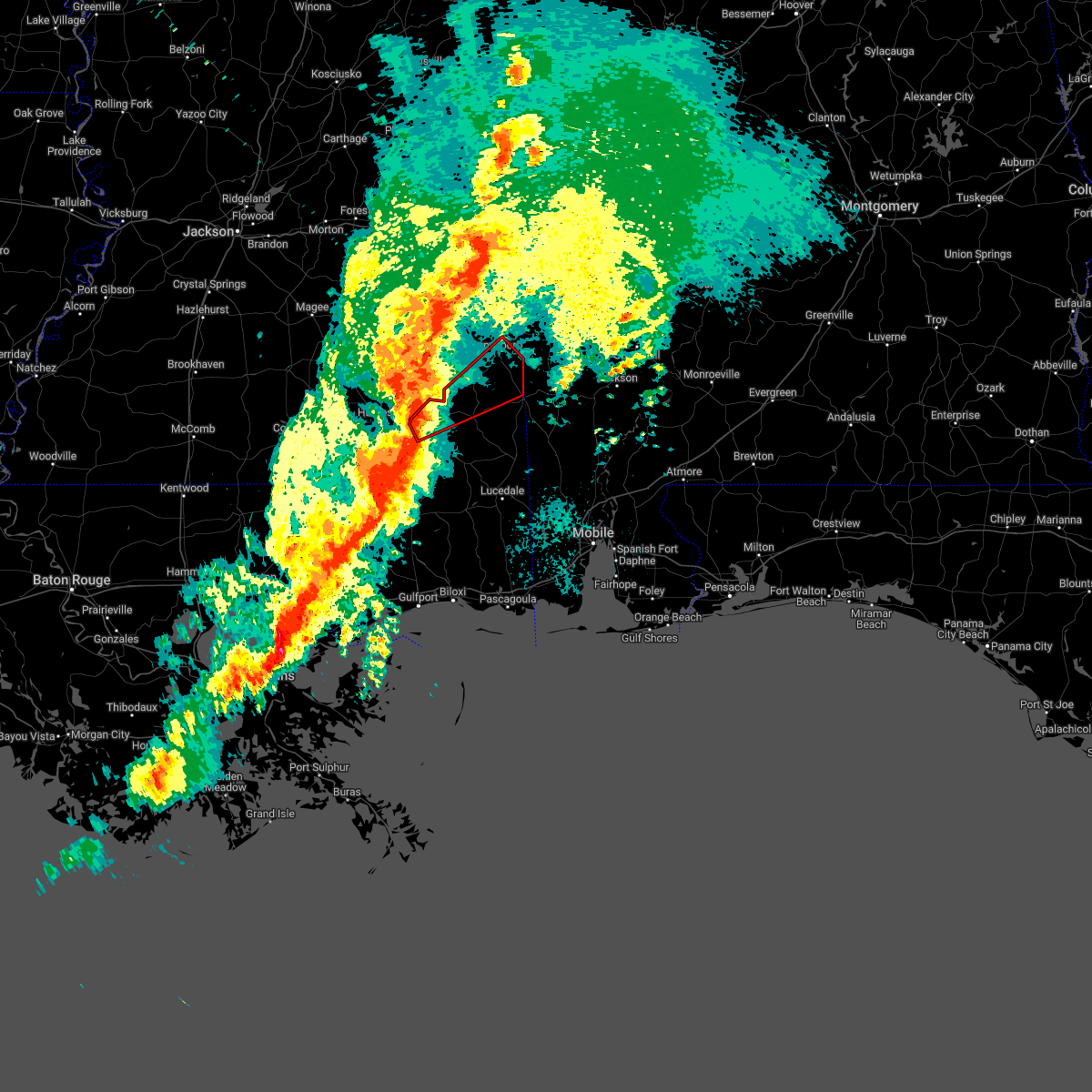 At 808 pm cdt, a severe thunderstorm capable of producing a tornado was located 7 miles north of new augusta, or 8 miles southwest of richton, moving northeast at 55 mph (radar indicated rotation). Hazards include tornado. Flying debris will be dangerous to those caught without shelter. mobile homes will be damaged or destroyed. damage to roofs, windows, and vehicles will occur. tree damage is likely. this dangerous storm will be near, richton around 815 pm cdt. clara around 840 pm cdt. Buckatunna around 845 pm cdt. At 808 pm cdt, a severe thunderstorm capable of producing a tornado was located 7 miles north of new augusta, or 8 miles southwest of richton, moving northeast at 55 mph (radar indicated rotation). Hazards include tornado. Flying debris will be dangerous to those caught without shelter. mobile homes will be damaged or destroyed. damage to roofs, windows, and vehicles will occur. tree damage is likely. this dangerous storm will be near, richton around 815 pm cdt. clara around 840 pm cdt. Buckatunna around 845 pm cdt.
|
| 3/30/2022 8:04 PM CDT |
 At 803 pm cdt, severe thunderstorms were located along a line extending from moselle to 5 miles northeast of mclaurin to 8 miles southeast of lumberton to 4 miles south of mcneil, moving northeast at 60 mph (radar indicated). Hazards include 70 mph wind gusts. Expect considerable tree damage. damage is likely to mobile homes, roofs, and outbuildings. Locations impacted include, wiggins, richton, perkinston, mchenry, beaumont, new augusta and mclain. At 803 pm cdt, severe thunderstorms were located along a line extending from moselle to 5 miles northeast of mclaurin to 8 miles southeast of lumberton to 4 miles south of mcneil, moving northeast at 60 mph (radar indicated). Hazards include 70 mph wind gusts. Expect considerable tree damage. damage is likely to mobile homes, roofs, and outbuildings. Locations impacted include, wiggins, richton, perkinston, mchenry, beaumont, new augusta and mclain.
|
| 3/30/2022 7:50 PM CDT |
 At 749 pm cdt, severe thunderstorms were located along a line extending from west hattiesburg to 5 miles southeast of lumberton to 6 miles south of poplarville to 3 miles northwest of picayune to 6 miles northwest of lacombe, moving northeast at 55 mph (radar indicated). Hazards include 60 mph wind gusts. expect damage to roofs, siding, and trees At 749 pm cdt, severe thunderstorms were located along a line extending from west hattiesburg to 5 miles southeast of lumberton to 6 miles south of poplarville to 3 miles northwest of picayune to 6 miles northwest of lacombe, moving northeast at 55 mph (radar indicated). Hazards include 60 mph wind gusts. expect damage to roofs, siding, and trees
|
| 3/22/2022 4:41 PM CDT |
 At 440 pm cdt, a severe thunderstorm capable of producing a tornado was located 4 miles north of richton, moving northeast at 40 mph (radar indicated rotation). Hazards include tornado. Flying debris will be dangerous to those caught without shelter. mobile homes will be damaged or destroyed. damage to roofs, windows, and vehicles will occur. tree damage is likely. This tornadic thunderstorm will remain over mainly rural areas of northern perry and southwestern wayne counties. At 440 pm cdt, a severe thunderstorm capable of producing a tornado was located 4 miles north of richton, moving northeast at 40 mph (radar indicated rotation). Hazards include tornado. Flying debris will be dangerous to those caught without shelter. mobile homes will be damaged or destroyed. damage to roofs, windows, and vehicles will occur. tree damage is likely. This tornadic thunderstorm will remain over mainly rural areas of northern perry and southwestern wayne counties.
|
| 3/22/2022 4:29 PM CDT |
 At 429 pm cdt, a severe thunderstorm capable of producing a tornado was located 5 miles southwest of richton, moving northeast at 45 mph (radar indicated rotation). Hazards include tornado. Flying debris will be dangerous to those caught without shelter. mobile homes will be damaged or destroyed. damage to roofs, windows, and vehicles will occur. tree damage is likely. This dangerous storm will be near, richton around 435 pm cdt. At 429 pm cdt, a severe thunderstorm capable of producing a tornado was located 5 miles southwest of richton, moving northeast at 45 mph (radar indicated rotation). Hazards include tornado. Flying debris will be dangerous to those caught without shelter. mobile homes will be damaged or destroyed. damage to roofs, windows, and vehicles will occur. tree damage is likely. This dangerous storm will be near, richton around 435 pm cdt.
|
| 3/22/2022 4:23 PM CDT |
 At 423 pm cdt, a severe thunderstorm capable of producing a tornado was located over new augusta, or 9 miles southwest of richton, moving northeast at 40 mph (radar indicated rotation). Hazards include tornado. Flying debris will be dangerous to those caught without shelter. mobile homes will be damaged or destroyed. damage to roofs, windows, and vehicles will occur. tree damage is likely. This dangerous storm will be near, richton around 435 pm cdt. At 423 pm cdt, a severe thunderstorm capable of producing a tornado was located over new augusta, or 9 miles southwest of richton, moving northeast at 40 mph (radar indicated rotation). Hazards include tornado. Flying debris will be dangerous to those caught without shelter. mobile homes will be damaged or destroyed. damage to roofs, windows, and vehicles will occur. tree damage is likely. This dangerous storm will be near, richton around 435 pm cdt.
|
| 3/22/2022 4:11 PM CDT |
 At 410 pm cdt, a severe thunderstorm capable of producing a tornado was located 4 miles northeast of brooklyn, or 17 miles southeast of hattiesburg, moving north at 40 mph (radar indicated rotation). Hazards include tornado. Flying debris will be dangerous to those caught without shelter. mobile homes will be damaged or destroyed. damage to roofs, windows, and vehicles will occur. tree damage is likely. this dangerous storm will be near, new augusta around 420 pm cdt. Richton around 435 pm cdt. At 410 pm cdt, a severe thunderstorm capable of producing a tornado was located 4 miles northeast of brooklyn, or 17 miles southeast of hattiesburg, moving north at 40 mph (radar indicated rotation). Hazards include tornado. Flying debris will be dangerous to those caught without shelter. mobile homes will be damaged or destroyed. damage to roofs, windows, and vehicles will occur. tree damage is likely. this dangerous storm will be near, new augusta around 420 pm cdt. Richton around 435 pm cdt.
|
| 3/18/2022 7:49 AM CDT |
 At 748 am cdt, a severe thunderstorm capable of producing a tornado was located over new augusta, or 10 miles southwest of richton, moving northeast at 45 mph (radar indicated rotation). Hazards include tornado. Flying debris will be dangerous to those caught without shelter. mobile homes will be damaged or destroyed. damage to roofs, windows, and vehicles will occur. tree damage is likely. this dangerous storm will be near, richton around 800 am cdt. Clara and buckatunna around 830 am cdt. At 748 am cdt, a severe thunderstorm capable of producing a tornado was located over new augusta, or 10 miles southwest of richton, moving northeast at 45 mph (radar indicated rotation). Hazards include tornado. Flying debris will be dangerous to those caught without shelter. mobile homes will be damaged or destroyed. damage to roofs, windows, and vehicles will occur. tree damage is likely. this dangerous storm will be near, richton around 800 am cdt. Clara and buckatunna around 830 am cdt.
|
| 2/3/2022 12:30 PM CST | Report of tree and minor structural damage in richto in perry county MS, 0.3 miles S of Richton, MS |
| 2/3/2022 12:17 PM CST |
 At 1216 pm cst, severe thunderstorms were located along a line extending from near macedonia to 4 miles northwest of new augusta to near brooklyn, moving northeast at 50 mph (radar indicated). Hazards include 60 mph wind gusts. Expect damage to roofs, siding, and trees. Locations impacted include, richton, beaumont and new augusta. At 1216 pm cst, severe thunderstorms were located along a line extending from near macedonia to 4 miles northwest of new augusta to near brooklyn, moving northeast at 50 mph (radar indicated). Hazards include 60 mph wind gusts. Expect damage to roofs, siding, and trees. Locations impacted include, richton, beaumont and new augusta.
|
| 2/3/2022 12:01 PM CST |
 At 1200 pm cst, a severe thunderstorm was located near rock hill, or 12 miles south of hattiesburg, moving northeast at 40 mph (radar indicated). Hazards include 60 mph wind gusts. expect damage to roofs, siding, and trees At 1200 pm cst, a severe thunderstorm was located near rock hill, or 12 miles south of hattiesburg, moving northeast at 40 mph (radar indicated). Hazards include 60 mph wind gusts. expect damage to roofs, siding, and trees
|
| 10/27/2021 7:43 PM CDT |
 The severe thunderstorm warning for perry and stone counties will expire at 745 pm cdt, the storms which prompted the warning have moved out of the area. therefore, the warning will be allowed to expire. a tornado watch remains in effect until 1000 pm cdt for southeastern mississippi. remember, a severe thunderstorm warning still remains in effect for southeastern stone county until 830 pm cdt. The severe thunderstorm warning for perry and stone counties will expire at 745 pm cdt, the storms which prompted the warning have moved out of the area. therefore, the warning will be allowed to expire. a tornado watch remains in effect until 1000 pm cdt for southeastern mississippi. remember, a severe thunderstorm warning still remains in effect for southeastern stone county until 830 pm cdt.
|
| 10/27/2021 6:59 PM CDT |
 At 659 pm cdt, severe thunderstorms were located along a line extending from 4 miles west of mclaurin to 7 miles west of wiggins to 10 miles southeast of poplarville, moving northeast at 35 mph (radar indicated). Hazards include 60 mph wind gusts. expect damage to roofs, siding, and trees At 659 pm cdt, severe thunderstorms were located along a line extending from 4 miles west of mclaurin to 7 miles west of wiggins to 10 miles southeast of poplarville, moving northeast at 35 mph (radar indicated). Hazards include 60 mph wind gusts. expect damage to roofs, siding, and trees
|
| 8/30/2021 3:39 AM CDT |
 At 338 am cdt, a severe thunderstorm capable of producing a tornado was located 6 miles west of lucedale, moving north at 45 mph. another tornadic circulation was nearing the jackson and george county line and also moving north at 45 mph (radar indicated rotation). Hazards include tornado. Flying debris will be dangerous to those caught without shelter. mobile homes will be damaged or destroyed. damage to roofs, windows, and vehicles will occur. tree damage is likely. this dangerous storm will be near, merrilll around 345 am cdt. mclain around 355 am cdt. Richton around 420 am cdt. At 338 am cdt, a severe thunderstorm capable of producing a tornado was located 6 miles west of lucedale, moving north at 45 mph. another tornadic circulation was nearing the jackson and george county line and also moving north at 45 mph (radar indicated rotation). Hazards include tornado. Flying debris will be dangerous to those caught without shelter. mobile homes will be damaged or destroyed. damage to roofs, windows, and vehicles will occur. tree damage is likely. this dangerous storm will be near, merrilll around 345 am cdt. mclain around 355 am cdt. Richton around 420 am cdt.
|
| 6/13/2021 5:39 PM CDT |
 At 539 pm cdt, severe thunderstorms were located along a line extending from 6 miles northeast of mclaurin to 10 miles northeast of mclain to 6 miles southwest of fruitdale, moving south at 35 mph (radar indicated). Hazards include 60 mph wind gusts and penny size hail. Expect damage to roofs, siding, and trees. Locations impacted include, richton, leakesville, beaumont and new augusta. At 539 pm cdt, severe thunderstorms were located along a line extending from 6 miles northeast of mclaurin to 10 miles northeast of mclain to 6 miles southwest of fruitdale, moving south at 35 mph (radar indicated). Hazards include 60 mph wind gusts and penny size hail. Expect damage to roofs, siding, and trees. Locations impacted include, richton, leakesville, beaumont and new augusta.
|
| 6/13/2021 5:11 PM CDT |
 At 510 pm cdt, severe thunderstorms were located along a line extending from 6 miles northeast of ovett to clara to 6 miles west of fruitdale, moving south at 30 mph (radar indicated). Hazards include 60 mph wind gusts and penny size hail. expect damage to roofs, siding, and trees At 510 pm cdt, severe thunderstorms were located along a line extending from 6 miles northeast of ovett to clara to 6 miles west of fruitdale, moving south at 30 mph (radar indicated). Hazards include 60 mph wind gusts and penny size hail. expect damage to roofs, siding, and trees
|
| 5/4/2021 5:13 PM CDT |
 At 513 pm cdt, severe thunderstorms were located along a line extending from 4 miles west of silas to 3 miles east of clara to 8 miles northeast of richton to sunrise, moving east at 45 mph (radar indicated). Hazards include 60 mph wind gusts. Expect damage to roofs, siding, and trees. Locations impacted include, citronelle, chatom, richton, leakesville, wagarville, gulfcrest, deer park, tibbie, beaumont, calvert, mount vernon, new augusta, mclain, state line, fruitdale, mcintosh and movico. At 513 pm cdt, severe thunderstorms were located along a line extending from 4 miles west of silas to 3 miles east of clara to 8 miles northeast of richton to sunrise, moving east at 45 mph (radar indicated). Hazards include 60 mph wind gusts. Expect damage to roofs, siding, and trees. Locations impacted include, citronelle, chatom, richton, leakesville, wagarville, gulfcrest, deer park, tibbie, beaumont, calvert, mount vernon, new augusta, mclain, state line, fruitdale, mcintosh and movico.
|
| 5/4/2021 4:50 PM CDT |
 At 449 pm cdt, severe thunderstorms were located along a line extending from 7 miles northwest of waynesboro to 6 miles southeast of mill creek to 3 miles west of ovett to rawls springs, moving east at 45 mph (radar indicated). Hazards include 60 mph wind gusts. Expect damage to roofs, siding, and trees. Locations impacted include, citronelle, lucedale, frisco city, chatom, richton, leakesville, chunchula, wagarville, gulfcrest, deer park, uriah, tibbie, beaumont, calvert, mount vernon, new augusta, mclain, excel, state line and fruitdale. At 449 pm cdt, severe thunderstorms were located along a line extending from 7 miles northwest of waynesboro to 6 miles southeast of mill creek to 3 miles west of ovett to rawls springs, moving east at 45 mph (radar indicated). Hazards include 60 mph wind gusts. Expect damage to roofs, siding, and trees. Locations impacted include, citronelle, lucedale, frisco city, chatom, richton, leakesville, chunchula, wagarville, gulfcrest, deer park, uriah, tibbie, beaumont, calvert, mount vernon, new augusta, mclain, excel, state line and fruitdale.
|
| 5/4/2021 4:44 PM CDT |
 At 444 pm cdt, severe thunderstorms were located along a line extending from 7 miles north of waynesboro to 9 miles southeast of mill creek to 3 miles west of ovett to west hattiesburg, moving east at 75 mph (radar indicated). Hazards include 60 mph wind gusts. expect damage to roofs, siding, and trees At 444 pm cdt, severe thunderstorms were located along a line extending from 7 miles north of waynesboro to 9 miles southeast of mill creek to 3 miles west of ovett to west hattiesburg, moving east at 75 mph (radar indicated). Hazards include 60 mph wind gusts. expect damage to roofs, siding, and trees
|
| 4/15/2021 5:00 AM CDT | Golf Ball sized hail reported 12.4 miles WSW of Richton, MS, several reports of ping pong to golf ball size hail in the piave community. pictures via social media. |
| 4/15/2021 4:50 AM CDT | Quarter sized hail reported 0.3 miles S of Richton, MS, reports of quarter size hail in the richton area. |
| 4/10/2021 1:58 AM CDT |
 At 157 am cdt, severe thunderstorms were located along a line extending from 8 miles northwest of pennington to beaumont, moving east at 65 mph (radar indicated). Hazards include 70 mph wind gusts and quarter size hail. Hail damage to vehicles is expected. expect considerable tree damage. Wind damage is also likely to mobile homes, roofs, and outbuildings. At 157 am cdt, severe thunderstorms were located along a line extending from 8 miles northwest of pennington to beaumont, moving east at 65 mph (radar indicated). Hazards include 70 mph wind gusts and quarter size hail. Hail damage to vehicles is expected. expect considerable tree damage. Wind damage is also likely to mobile homes, roofs, and outbuildings.
|
| 4/10/2021 1:46 AM CDT |
 At 146 am cdt, severe thunderstorms were located along a line extending from 4 miles north of waynesboro to near brooklyn, moving east at 50 mph (radar indicated). Hazards include 70 mph wind gusts and quarter size hail. Hail damage to vehicles is expected. expect considerable tree damage. wind damage is also likely to mobile homes, roofs, and outbuildings. Locations impacted include, waynesboro, richton, clara, beaumont, new augusta, millry, mclain, state line and buckatunna. At 146 am cdt, severe thunderstorms were located along a line extending from 4 miles north of waynesboro to near brooklyn, moving east at 50 mph (radar indicated). Hazards include 70 mph wind gusts and quarter size hail. Hail damage to vehicles is expected. expect considerable tree damage. wind damage is also likely to mobile homes, roofs, and outbuildings. Locations impacted include, waynesboro, richton, clara, beaumont, new augusta, millry, mclain, state line and buckatunna.
|
| 4/10/2021 1:15 AM CDT |
 At 114 am cdt, severe thunderstorms were located along a line extending from 6 miles northeast of mill creek to near pinebur, moving east at 60 mph (radar indicated). Hazards include 60 mph wind gusts. expect damage to roofs, siding, and trees At 114 am cdt, severe thunderstorms were located along a line extending from 6 miles northeast of mill creek to near pinebur, moving east at 60 mph (radar indicated). Hazards include 60 mph wind gusts. expect damage to roofs, siding, and trees
|
| 3/17/2021 7:27 PM CDT |
 At 725 pm cdt, severe thunderstorms were located along a line extending from 8 miles southeast of goodwater to waynesboro to 10 miles east of richton to 5 miles south of beaumont, moving northeast at 55 mph (radar indicated). Hazards include 60 mph wind gusts. Expect damage to roofs, siding, and trees. Locations impacted include, waynesboro, butler, chatom, richton, leakesville, clara, tibbie, beaumont, new augusta, lisman, millry, mclain, state line, buckatunna, silas, fruitdale, gilbertown and toxey. At 725 pm cdt, severe thunderstorms were located along a line extending from 8 miles southeast of goodwater to waynesboro to 10 miles east of richton to 5 miles south of beaumont, moving northeast at 55 mph (radar indicated). Hazards include 60 mph wind gusts. Expect damage to roofs, siding, and trees. Locations impacted include, waynesboro, butler, chatom, richton, leakesville, clara, tibbie, beaumont, new augusta, lisman, millry, mclain, state line, buckatunna, silas, fruitdale, gilbertown and toxey.
|
| 3/17/2021 7:10 PM CDT |
 At 710 pm cdt, severe thunderstorms were located along a line extending from sandersville to 8 miles west of clara to 4 miles south of richton to 3 miles east of maxie, moving northeast at 55 mph (radar indicated). Hazards include 60 mph wind gusts. expect damage to roofs, siding, and trees At 710 pm cdt, severe thunderstorms were located along a line extending from sandersville to 8 miles west of clara to 4 miles south of richton to 3 miles east of maxie, moving northeast at 55 mph (radar indicated). Hazards include 60 mph wind gusts. expect damage to roofs, siding, and trees
|
| 3/17/2021 7:00 PM CDT |
 At 658 pm cdt, severe thunderstorms were located along a line extending from 4 miles northwest of sandersville to 4 miles southeast of ovett to 5 miles southwest of new augusta to 7 miles southwest of maxie, moving northeast at 55 mph (radar indicated). Hazards include 60 mph wind gusts. Expect damage to roofs, siding, and trees. Locations impacted include, richton, clara, beaumont, new augusta and mclain. At 658 pm cdt, severe thunderstorms were located along a line extending from 4 miles northwest of sandersville to 4 miles southeast of ovett to 5 miles southwest of new augusta to 7 miles southwest of maxie, moving northeast at 55 mph (radar indicated). Hazards include 60 mph wind gusts. Expect damage to roofs, siding, and trees. Locations impacted include, richton, clara, beaumont, new augusta and mclain.
|
| 3/17/2021 6:19 PM CDT |
 At 619 pm cdt, severe thunderstorms were located along a line extending from 3 miles south of magee to 3 miles south of sumrall to 7 miles northwest of poplarville, moving northeast at 60 mph (radar indicated). Hazards include 60 mph wind gusts. expect damage to roofs, siding, and trees At 619 pm cdt, severe thunderstorms were located along a line extending from 3 miles south of magee to 3 miles south of sumrall to 7 miles northwest of poplarville, moving northeast at 60 mph (radar indicated). Hazards include 60 mph wind gusts. expect damage to roofs, siding, and trees
|
| 4/19/2020 8:45 PM CDT |
 At 845 pm cdt, a severe thunderstorm was located 10 miles west of new augusta, moving east at 45 mph (radar indicated). Hazards include 60 mph wind gusts. expect damage to roofs, siding, and trees At 845 pm cdt, a severe thunderstorm was located 10 miles west of new augusta, moving east at 45 mph (radar indicated). Hazards include 60 mph wind gusts. expect damage to roofs, siding, and trees
|
| 4/19/2020 8:38 PM CDT | Trees and powerlines down on ms 6 in greene county MS, 12.2 miles WNW of Richton, MS |
| 4/19/2020 8:38 PM CDT | More reports of trees down across ms 63 south of highway 4 in greene county MS, 11.2 miles W of Richton, MS |
| 4/19/2020 8:34 PM CDT |
 At 834 pm cdt, a severe thunderstorm capable of producing a tornado was located 6 miles southeast of richton, moving east at 50 mph (radar indicated rotation). Hazards include tornado. Flying debris will be dangerous to those caught without shelter. mobile homes will be damaged or destroyed. damage to roofs, windows, and vehicles will occur. tree damage is likely. This tornadic thunderstorm will remain over mainly rural areas of northeastern perry county. At 834 pm cdt, a severe thunderstorm capable of producing a tornado was located 6 miles southeast of richton, moving east at 50 mph (radar indicated rotation). Hazards include tornado. Flying debris will be dangerous to those caught without shelter. mobile homes will be damaged or destroyed. damage to roofs, windows, and vehicles will occur. tree damage is likely. This tornadic thunderstorm will remain over mainly rural areas of northeastern perry county.
|
| 4/19/2020 8:25 PM CDT | Report of a garage/carport that collapsed on a vehicle. pictures via social medi in perry county MS, 0.3 miles S of Richton, MS |
| 4/19/2020 8:25 PM CDT | Multiple trees down across the count in perry county MS, 3 miles NE of Richton, MS |
| 4/19/2020 8:05 PM CDT |
 At 804 pm cdt, a severe thunderstorm capable of producing a tornado was located 5 miles northwest of mclaurin, or 5 miles south of hattiesburg, moving east at 45 mph (radar indicated rotation). Hazards include tornado. Flying debris will be dangerous to those caught without shelter. mobile homes will be damaged or destroyed. damage to roofs, windows, and vehicles will occur. tree damage is likely. this dangerous storm will be near, new augusta around 820 pm cdt. Richton around 835 pm cdt. At 804 pm cdt, a severe thunderstorm capable of producing a tornado was located 5 miles northwest of mclaurin, or 5 miles south of hattiesburg, moving east at 45 mph (radar indicated rotation). Hazards include tornado. Flying debris will be dangerous to those caught without shelter. mobile homes will be damaged or destroyed. damage to roofs, windows, and vehicles will occur. tree damage is likely. this dangerous storm will be near, new augusta around 820 pm cdt. Richton around 835 pm cdt.
|
| 4/19/2020 7:58 PM CDT |
 At 758 pm cdt, a severe thunderstorm was located 5 miles northwest of mclaurin, or 6 miles south of hattiesburg, moving east at 45 mph (radar indicated). Hazards include 60 mph wind gusts and half dollar size hail. Hail damage to vehicles is expected. Expect wind damage to roofs, siding, and trees. At 758 pm cdt, a severe thunderstorm was located 5 miles northwest of mclaurin, or 6 miles south of hattiesburg, moving east at 45 mph (radar indicated). Hazards include 60 mph wind gusts and half dollar size hail. Hail damage to vehicles is expected. Expect wind damage to roofs, siding, and trees.
|
| 4/12/2020 9:05 PM CDT |
 At 903 pm cdt, a severe thunderstorm was located over new augusta, or 11 miles southwest of richton, moving northeast at 70 mph (radar indicated). Hazards include 60 mph wind gusts and quarter size hail. Hail damage to vehicles is expected. Expect wind damage to roofs, siding, and trees. At 903 pm cdt, a severe thunderstorm was located over new augusta, or 11 miles southwest of richton, moving northeast at 70 mph (radar indicated). Hazards include 60 mph wind gusts and quarter size hail. Hail damage to vehicles is expected. Expect wind damage to roofs, siding, and trees.
|
| 4/12/2020 8:43 PM CDT | Several trees reported down in richto in perry county MS, 0.3 miles S of Richton, MS |
| 3/31/2020 8:29 AM CDT |
 At 828 am cdt, severe thunderstorms were located along a line extending from 12 miles south of clara to 6 miles northeast of buckatunna to 4 miles northeast of coffeeville, moving east at 50 mph. residents near piave should seek safe shelter immediately (radar indicated). Hazards include 70 mph wind gusts. Expect considerable tree damage. damage is likely to mobile homes, roofs, and outbuildings. Locations impacted include, chatom, millry, state line, buckatunna and silas. At 828 am cdt, severe thunderstorms were located along a line extending from 12 miles south of clara to 6 miles northeast of buckatunna to 4 miles northeast of coffeeville, moving east at 50 mph. residents near piave should seek safe shelter immediately (radar indicated). Hazards include 70 mph wind gusts. Expect considerable tree damage. damage is likely to mobile homes, roofs, and outbuildings. Locations impacted include, chatom, millry, state line, buckatunna and silas.
|
| 3/31/2020 8:15 AM CDT | Wayne county ema reports damage to a barn... a church with roof damage... a mobile home with roof damage... and a tree that fell on a home along boyd brewer drive. time in wayne county MS, 12.3 miles SW of Richton, MS |
| 3/31/2020 7:59 AM CDT |
 The national weather service in mobile has issued a * severe thunderstorm warning for. southwestern choctaw county in southwestern alabama. northwestern washington county in southwestern alabama. northern perry county in southeastern mississippi. Wayne county in southeastern mississippi. The national weather service in mobile has issued a * severe thunderstorm warning for. southwestern choctaw county in southwestern alabama. northwestern washington county in southwestern alabama. northern perry county in southeastern mississippi. Wayne county in southeastern mississippi.
|
| 2/10/2020 6:10 PM CST | Damage to trees and a couple of houses on piave church road between union road and highway 63. possible tornad in greene county MS, 11.8 miles WSW of Richton, MS |
| 2/6/2020 4:40 AM CST |
 The severe thunderstorm warning for northern perry, southern wayne and northwestern greene counties will expire at 445 am cst, the storms which prompted the warning have weakened below severe limits, and no longer pose an immediate threat to life or property. therefore, the warning will be allowed to expire. a tornado watch remains in effect until 500 am cst for southeastern mississippi. The severe thunderstorm warning for northern perry, southern wayne and northwestern greene counties will expire at 445 am cst, the storms which prompted the warning have weakened below severe limits, and no longer pose an immediate threat to life or property. therefore, the warning will be allowed to expire. a tornado watch remains in effect until 500 am cst for southeastern mississippi.
|
| 2/6/2020 4:02 AM CST |
 At 402 am cst, severe thunderstorms were located along a line extending from near tuckers crossing to 5 miles southwest of ovett to near sunrise, moving northeast at 55 mph (radar indicated). Hazards include 60 mph wind gusts and penny size hail. expect damage to roofs, siding, and trees At 402 am cst, severe thunderstorms were located along a line extending from near tuckers crossing to 5 miles southwest of ovett to near sunrise, moving northeast at 55 mph (radar indicated). Hazards include 60 mph wind gusts and penny size hail. expect damage to roofs, siding, and trees
|
| 1/11/2020 10:55 AM CST |
 At 1054 am cst, severe thunderstorms were located along a line extending from toomsuba to 4 miles east of maxie, moving east at 30 mph (radar indicated). Hazards include 60 mph wind gusts. expect damage to roofs, siding, and trees At 1054 am cst, severe thunderstorms were located along a line extending from toomsuba to 4 miles east of maxie, moving east at 30 mph (radar indicated). Hazards include 60 mph wind gusts. expect damage to roofs, siding, and trees
|
| 1/11/2020 10:30 AM CST |
 At 1030 am cst, severe thunderstorms were located along a line extending from barnett to 3 miles southeast of sunrise, moving northeast at 60 mph (radar indicated). Hazards include 60 mph wind gusts. Expect damage to roofs, siding, and trees. Locations impacted include, waynesboro, richton and clara. At 1030 am cst, severe thunderstorms were located along a line extending from barnett to 3 miles southeast of sunrise, moving northeast at 60 mph (radar indicated). Hazards include 60 mph wind gusts. Expect damage to roofs, siding, and trees. Locations impacted include, waynesboro, richton and clara.
|
| 1/11/2020 10:13 AM CST |
 At 1012 am cst, severe thunderstorms were located along a line extending from moss to purvis, moving northeast at 60 mph (radar indicated). Hazards include 60 mph wind gusts. expect damage to roofs, siding, and trees At 1012 am cst, severe thunderstorms were located along a line extending from moss to purvis, moving northeast at 60 mph (radar indicated). Hazards include 60 mph wind gusts. expect damage to roofs, siding, and trees
|
| 10/25/2019 2:55 PM CDT |
 At 255 pm cdt, a severe thunderstorm capable of producing a tornado was located 6 miles northeast of beaumont, or 8 miles southeast of richton, moving north at 40 mph (radar indicated rotation). Hazards include tornado. Flying debris will be dangerous to those caught without shelter. mobile homes will be damaged or destroyed. damage to roofs, windows, and vehicles will occur. tree damage is likely. This dangerous storm will be near, clara around 335 pm cdt. At 255 pm cdt, a severe thunderstorm capable of producing a tornado was located 6 miles northeast of beaumont, or 8 miles southeast of richton, moving north at 40 mph (radar indicated rotation). Hazards include tornado. Flying debris will be dangerous to those caught without shelter. mobile homes will be damaged or destroyed. damage to roofs, windows, and vehicles will occur. tree damage is likely. This dangerous storm will be near, clara around 335 pm cdt.
|
| 10/25/2019 2:42 PM CDT |
 At 241 pm cdt, a severe thunderstorm capable of producing a tornado was located near beaumont, or 16 miles south of richton, moving north at 35 mph (radar indicated rotation). Hazards include tornado. Flying debris will be dangerous to those caught without shelter. mobile homes will be damaged or destroyed. damage to roofs, windows, and vehicles will occur. tree damage is likely. this dangerous storm will be near, beaumont around 250 pm cdt. Richton around 300 pm cdt. At 241 pm cdt, a severe thunderstorm capable of producing a tornado was located near beaumont, or 16 miles south of richton, moving north at 35 mph (radar indicated rotation). Hazards include tornado. Flying debris will be dangerous to those caught without shelter. mobile homes will be damaged or destroyed. damage to roofs, windows, and vehicles will occur. tree damage is likely. this dangerous storm will be near, beaumont around 250 pm cdt. Richton around 300 pm cdt.
|
| 10/25/2019 2:21 PM CDT |
 At 221 pm cdt, a severe thunderstorm capable of producing a tornado was located 6 miles southwest of mclain, or 18 miles northeast of wiggins, moving north at 25 mph (radar indicated rotation). Hazards include tornado. Flying debris will be dangerous to those caught without shelter. mobile homes will be damaged or destroyed. damage to roofs, windows, and vehicles will occur. tree damage is likely. this dangerous storm will be near, beaumont around 240 pm cdt. new augusta around 245 pm cdt. Richton around 300 pm cdt. At 221 pm cdt, a severe thunderstorm capable of producing a tornado was located 6 miles southwest of mclain, or 18 miles northeast of wiggins, moving north at 25 mph (radar indicated rotation). Hazards include tornado. Flying debris will be dangerous to those caught without shelter. mobile homes will be damaged or destroyed. damage to roofs, windows, and vehicles will occur. tree damage is likely. this dangerous storm will be near, beaumont around 240 pm cdt. new augusta around 245 pm cdt. Richton around 300 pm cdt.
|
| 7/14/2019 11:12 AM CDT |
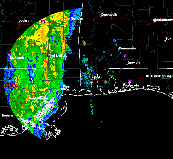 At 1112 am cdt, a severe thunderstorm capable of producing a tornado was located over richton, moving north at 25 mph (radar indicated rotation). Hazards include tornado. Flying debris will be dangerous to those caught without shelter. mobile homes will be damaged or destroyed. damage to roofs, windows, and vehicles will occur. tree damage is likely. This tornadic thunderstorm will remain over mainly rural areas of northeastern perry and western wayne counties. At 1112 am cdt, a severe thunderstorm capable of producing a tornado was located over richton, moving north at 25 mph (radar indicated rotation). Hazards include tornado. Flying debris will be dangerous to those caught without shelter. mobile homes will be damaged or destroyed. damage to roofs, windows, and vehicles will occur. tree damage is likely. This tornadic thunderstorm will remain over mainly rural areas of northeastern perry and western wayne counties.
|
| 7/14/2019 11:03 AM CDT |
 The national weather service in mobile has issued a * severe thunderstorm warning for. northeastern perry county in southeastern mississippi. western wayne county in southeastern mississippi. until 1130 am cdt. At 1103 am cdt, a severe thunderstorm was located over richton,. The national weather service in mobile has issued a * severe thunderstorm warning for. northeastern perry county in southeastern mississippi. western wayne county in southeastern mississippi. until 1130 am cdt. At 1103 am cdt, a severe thunderstorm was located over richton,.
|
| 6/25/2019 6:40 PM CDT |
 At 639 pm cdt, a severe thunderstorm was located near sunrise, or 6 miles south of petal, moving east at 30 mph (radar indicated). Hazards include 60 mph wind gusts and penny size hail. expect damage to roofs, siding, and trees At 639 pm cdt, a severe thunderstorm was located near sunrise, or 6 miles south of petal, moving east at 30 mph (radar indicated). Hazards include 60 mph wind gusts and penny size hail. expect damage to roofs, siding, and trees
|
| 6/7/2019 3:43 PM CDT |
 At 342 pm cdt, a severe thunderstorm was located 11 miles northwest of leakesville, moving east at 45 mph (radar indicated). Hazards include 60 mph wind gusts and quarter size hail. Hail damage to vehicles is expected. expect wind damage to roofs, siding, and trees. Locations impacted include, richton and beaumont. At 342 pm cdt, a severe thunderstorm was located 11 miles northwest of leakesville, moving east at 45 mph (radar indicated). Hazards include 60 mph wind gusts and quarter size hail. Hail damage to vehicles is expected. expect wind damage to roofs, siding, and trees. Locations impacted include, richton and beaumont.
|
| 6/7/2019 3:29 PM CDT |
 At 328 pm cdt, a severe thunderstorm was located 5 miles north of beaumont, or 7 miles south of richton, moving east at 45 mph (radar indicated). Hazards include 60 mph wind gusts and nickel size hail. expect damage to roofs, siding, and trees At 328 pm cdt, a severe thunderstorm was located 5 miles north of beaumont, or 7 miles south of richton, moving east at 45 mph (radar indicated). Hazards include 60 mph wind gusts and nickel size hail. expect damage to roofs, siding, and trees
|
| 5/4/2019 11:56 AM CDT |
 At 1155 am cdt, a severe thunderstorm was located 6 miles southwest of new augusta, or 17 miles north of wiggins, moving northeast at 35 mph (radar indicated). Hazards include 60 mph wind gusts and quarter size hail. Hail damage to vehicles is expected. Expect wind damage to roofs, siding, and trees. At 1155 am cdt, a severe thunderstorm was located 6 miles southwest of new augusta, or 17 miles north of wiggins, moving northeast at 35 mph (radar indicated). Hazards include 60 mph wind gusts and quarter size hail. Hail damage to vehicles is expected. Expect wind damage to roofs, siding, and trees.
|
| 4/18/2019 5:32 PM CDT | Large tree down blocking highway 42 in sand hill. time estimated by rada in greene county MS, 10.6 miles W of Richton, MS |
| 4/18/2019 5:32 PM CDT |
 At 532 pm cdt, severe thunderstorms were located along a line extending from 10 miles northeast of richton to 8 miles east of maxie, moving east at 40 mph (radar indicated). Hazards include 60 mph wind gusts. Expect damage to roofs, siding, and trees. Locations impacted include, richton, leakesville, beaumont, new augusta, mclain and state line. At 532 pm cdt, severe thunderstorms were located along a line extending from 10 miles northeast of richton to 8 miles east of maxie, moving east at 40 mph (radar indicated). Hazards include 60 mph wind gusts. Expect damage to roofs, siding, and trees. Locations impacted include, richton, leakesville, beaumont, new augusta, mclain and state line.
|
| 4/18/2019 5:15 PM CDT | Trees down and roof damaged in the town of richton. report via social media and time estimated by rada in perry county MS, 0.3 miles S of Richton, MS |
| 4/18/2019 4:52 PM CDT |
 At 451 pm cdt, severe thunderstorms were located along a line extending from 5 miles east of moselle to 6 miles west of lumberton, moving east at 45 mph (radar indicated). Hazards include 60 mph wind gusts. expect damage to roofs, siding, and trees At 451 pm cdt, severe thunderstorms were located along a line extending from 5 miles east of moselle to 6 miles west of lumberton, moving east at 45 mph (radar indicated). Hazards include 60 mph wind gusts. expect damage to roofs, siding, and trees
|
| 3/3/2019 12:53 PM CST |
 At 1253 pm cst, severe thunderstorms were located along a line extending from grove hill to 6 miles west of wagarville to 7 miles northwest of leakesville, moving east at 55 mph (radar indicated). Hazards include 60 mph wind gusts and quarter size hail. Hail damage to vehicles is expected. expect wind damage to roofs, siding, and trees. locations impacted include, jackson, grove hill, chatom, richton, leakesville, saint stephens, wagarville, leroy, deer park, whatley, tibbie, new augusta, state line, fruitdale, coffeeville and fulton. A tornado watch remains in effect until 600 pm cst for south central and southwestern alabama, and southeastern mississippi. At 1253 pm cst, severe thunderstorms were located along a line extending from grove hill to 6 miles west of wagarville to 7 miles northwest of leakesville, moving east at 55 mph (radar indicated). Hazards include 60 mph wind gusts and quarter size hail. Hail damage to vehicles is expected. expect wind damage to roofs, siding, and trees. locations impacted include, jackson, grove hill, chatom, richton, leakesville, saint stephens, wagarville, leroy, deer park, whatley, tibbie, new augusta, state line, fruitdale, coffeeville and fulton. A tornado watch remains in effect until 600 pm cst for south central and southwestern alabama, and southeastern mississippi.
|
| 3/3/2019 12:40 PM CST |
 At 1240 pm cst, severe thunderstorms were located along a line extending from 8 miles southeast of coffeeville to 6 miles southwest of chatom to 6 miles northeast of beaumont, moving east at 55 mph (radar indicated). Hazards include 60 mph wind gusts and penny size hail. Expect damage to roofs, siding, and trees. locations impacted include, jackson, grove hill, chatom, richton, leakesville, saint stephens, wagarville, leroy, deer park, whatley, tibbie, new augusta, state line, fruitdale, coffeeville and fulton. A tornado watch remains in effect until 600 pm cst for south central and southwestern alabama, and southeastern mississippi. At 1240 pm cst, severe thunderstorms were located along a line extending from 8 miles southeast of coffeeville to 6 miles southwest of chatom to 6 miles northeast of beaumont, moving east at 55 mph (radar indicated). Hazards include 60 mph wind gusts and penny size hail. Expect damage to roofs, siding, and trees. locations impacted include, jackson, grove hill, chatom, richton, leakesville, saint stephens, wagarville, leroy, deer park, whatley, tibbie, new augusta, state line, fruitdale, coffeeville and fulton. A tornado watch remains in effect until 600 pm cst for south central and southwestern alabama, and southeastern mississippi.
|
| 3/3/2019 12:23 PM CST |
 At 1223 pm cst, severe thunderstorms were located along a line extending from 6 miles northeast of millry to 7 miles west of state line to 4 miles northwest of new augusta, moving east at 55 mph (radar indicated). Hazards include 60 mph wind gusts and penny size hail. expect damage to roofs, siding, and trees At 1223 pm cst, severe thunderstorms were located along a line extending from 6 miles northeast of millry to 7 miles west of state line to 4 miles northwest of new augusta, moving east at 55 mph (radar indicated). Hazards include 60 mph wind gusts and penny size hail. expect damage to roofs, siding, and trees
|
| 3/3/2019 12:11 PM CST |
 At 1210 pm cst, severe thunderstorms were located along a line extending from 7 miles west of millry to 4 miles southwest of richton, moving east at 55 mph (radar indicated). Hazards include 60 mph wind gusts and penny size hail. Expect damage to roofs, siding, and trees. locations impacted include, chatom, richton, clara, new augusta, millry, state line, buckatunna and fruitdale. A tornado watch remains in effect until 600 pm cst for southwestern alabama, and southeastern mississippi. At 1210 pm cst, severe thunderstorms were located along a line extending from 7 miles west of millry to 4 miles southwest of richton, moving east at 55 mph (radar indicated). Hazards include 60 mph wind gusts and penny size hail. Expect damage to roofs, siding, and trees. locations impacted include, chatom, richton, clara, new augusta, millry, state line, buckatunna and fruitdale. A tornado watch remains in effect until 600 pm cst for southwestern alabama, and southeastern mississippi.
|
| 3/3/2019 11:58 AM CST |
 At 1158 am cst, severe thunderstorms were located along a line extending from 3 miles southeast of waynesboro to sunrise, moving east at 55 mph (radar indicated). Hazards include 60 mph wind gusts and penny size hail. Expect damage to roofs, siding, and trees. locations impacted include, waynesboro, chatom, richton, clara, new augusta, millry, state line, buckatunna and fruitdale. A tornado watch remains in effect until 600 pm cst for southwestern alabama, and southeastern mississippi. At 1158 am cst, severe thunderstorms were located along a line extending from 3 miles southeast of waynesboro to sunrise, moving east at 55 mph (radar indicated). Hazards include 60 mph wind gusts and penny size hail. Expect damage to roofs, siding, and trees. locations impacted include, waynesboro, chatom, richton, clara, new augusta, millry, state line, buckatunna and fruitdale. A tornado watch remains in effect until 600 pm cst for southwestern alabama, and southeastern mississippi.
|
| 3/3/2019 11:52 AM CST |
 At 1152 am cst, severe thunderstorms were located along a line extending from 3 miles north of clara to hattiesburg, moving east at 55 mph (radar indicated). Hazards include 60 mph wind gusts and penny size hail. expect damage to roofs, siding, and trees At 1152 am cst, severe thunderstorms were located along a line extending from 3 miles north of clara to hattiesburg, moving east at 55 mph (radar indicated). Hazards include 60 mph wind gusts and penny size hail. expect damage to roofs, siding, and trees
|
| 1/19/2019 11:24 AM CST |
 At 1124 am cst, severe thunderstorms were located along a line extending from 8 miles north of waynesboro to clara to 3 miles east of new augusta, moving northeast at 55 mph (radar indicated). Hazards include 60 mph wind gusts. Expect damage to roofs, siding, and trees. locations impacted include, waynesboro, richton, clara, beaumont, new augusta, mclain, state line and buckatunna. A tornado watch remains in effect until 500 pm cst for southwestern alabama, and southeastern mississippi. At 1124 am cst, severe thunderstorms were located along a line extending from 8 miles north of waynesboro to clara to 3 miles east of new augusta, moving northeast at 55 mph (radar indicated). Hazards include 60 mph wind gusts. Expect damage to roofs, siding, and trees. locations impacted include, waynesboro, richton, clara, beaumont, new augusta, mclain, state line and buckatunna. A tornado watch remains in effect until 500 pm cst for southwestern alabama, and southeastern mississippi.
|
| 1/19/2019 10:53 AM CST |
 At 1053 am cst, severe thunderstorms were located along a line extending from 3 miles south of mill creek to 5 miles southeast of lumberton, moving northeast at 65 mph (radar indicated). Hazards include 60 mph wind gusts. expect damage to roofs, siding, and trees At 1053 am cst, severe thunderstorms were located along a line extending from 3 miles south of mill creek to 5 miles southeast of lumberton, moving northeast at 65 mph (radar indicated). Hazards include 60 mph wind gusts. expect damage to roofs, siding, and trees
|
| 11/1/2018 6:04 AM CDT |
 At 603 am cdt, a severe thunderstorm was located 8 miles northeast of richton, moving northeast at 40 mph (radar indicated). Hazards include 70 mph wind gusts. Expect considerable tree damage. damage is likely to mobile homes, roofs, and outbuildings. locations impacted include, waynesboro, richton, clara, beaumont, new augusta, state line and buckatunna. a tornado watch remains in effect until 900 am cdt for southeastern mississippi. A tornado watch also remains in effect until 100 pm cdt for southwestern alabama. At 603 am cdt, a severe thunderstorm was located 8 miles northeast of richton, moving northeast at 40 mph (radar indicated). Hazards include 70 mph wind gusts. Expect considerable tree damage. damage is likely to mobile homes, roofs, and outbuildings. locations impacted include, waynesboro, richton, clara, beaumont, new augusta, state line and buckatunna. a tornado watch remains in effect until 900 am cdt for southeastern mississippi. A tornado watch also remains in effect until 100 pm cdt for southwestern alabama.
|
| 11/1/2018 5:53 AM CDT |
 At 552 am cdt, severe thunderstorms were located along a line extending from 5 miles east of sandersville to 4 miles southeast of tuckers crossing to near ovett to 4 miles west of new augusta, moving northeast at 40 mph (radar indicated). Hazards include 60 mph wind gusts. expect damage to roofs, siding, and trees At 552 am cdt, severe thunderstorms were located along a line extending from 5 miles east of sandersville to 4 miles southeast of tuckers crossing to near ovett to 4 miles west of new augusta, moving northeast at 40 mph (radar indicated). Hazards include 60 mph wind gusts. expect damage to roofs, siding, and trees
|
| 11/1/2018 5:45 AM CDT |
 At 545 am cdt, severe thunderstorms were located along a line extending from sandersville to 6 miles northwest of new augusta to 4 miles north of brooklyn, moving northeast at 50 mph (radar indicated). Hazards include 60 mph wind gusts. Expect damage to roofs, siding, and trees. locations impacted include, richton, beaumont and new augusta. A tornado watch remains in effect until 900 am cdt for southeastern mississippi. At 545 am cdt, severe thunderstorms were located along a line extending from sandersville to 6 miles northwest of new augusta to 4 miles north of brooklyn, moving northeast at 50 mph (radar indicated). Hazards include 60 mph wind gusts. Expect damage to roofs, siding, and trees. locations impacted include, richton, beaumont and new augusta. A tornado watch remains in effect until 900 am cdt for southeastern mississippi.
|
| 11/1/2018 5:22 AM CDT |
 At 521 am cdt, severe thunderstorms were located along a line extending from 5 miles north of macedonia to mclaurin to near rock hill to 8 miles southeast of lumberton, moving northeast at 55 mph (radar indicated). Hazards include 60 mph wind gusts. expect damage to roofs, siding, and trees At 521 am cdt, severe thunderstorms were located along a line extending from 5 miles north of macedonia to mclaurin to near rock hill to 8 miles southeast of lumberton, moving northeast at 55 mph (radar indicated). Hazards include 60 mph wind gusts. expect damage to roofs, siding, and trees
|
| 7/31/2018 2:15 PM CDT | Trees downed along ms highway 15 in jones count in jones county MS, 9.1 miles SSE of Richton, MS |
| 7/31/2018 1:57 PM CDT | Trees down on will best road off of camp eight roa in perry county MS, 5.2 miles SW of Richton, MS |
| 7/31/2018 1:55 PM CDT | Trees down on old augusta road near clay hill roa in perry county MS, 1.3 miles ENE of Richton, MS |
| 7/31/2018 1:40 PM CDT | Trees down on wingate road west of highway 1 in perry county MS, 5.3 miles NNE of Richton, MS |
| 7/31/2018 1:36 PM CDT |
 At 136 pm cdt, a severe thunderstorm was located 5 miles southeast of sunrise, or 8 miles southeast of petal, moving northeast at 15 mph (radar indicated). Hazards include 60 mph wind gusts and quarter size hail. Hail damage to vehicles is expected. Expect wind damage to roofs, siding, and trees. At 136 pm cdt, a severe thunderstorm was located 5 miles southeast of sunrise, or 8 miles southeast of petal, moving northeast at 15 mph (radar indicated). Hazards include 60 mph wind gusts and quarter size hail. Hail damage to vehicles is expected. Expect wind damage to roofs, siding, and trees.
|
| 7/31/2018 1:30 PM CDT |
 At 129 pm cdt, a severe thunderstorm was located over beaumont, or 10 miles south of richton, moving northeast at 25 mph (radar indicated). Hazards include 60 mph wind gusts. expect damage to roofs, siding, and trees At 129 pm cdt, a severe thunderstorm was located over beaumont, or 10 miles south of richton, moving northeast at 25 mph (radar indicated). Hazards include 60 mph wind gusts. expect damage to roofs, siding, and trees
|
| 5/20/2018 8:29 PM CDT | Tree blown down and a window to a business in downtown richton sustained damage due to a sign being blown into i in perry county MS, 0.3 miles S of Richton, MS |
| 4/14/2018 11:27 AM CDT |
 At 1124 am cdt, severe thunderstorms were located along a line extending from 7 miles southeast of goodwater to near new augusta, moving northeast at 50 mph (radar indicated). Hazards include 60 mph wind gusts. Expect damage to roofs, siding, and trees. locations impacted include, waynesboro, richton, clara and new augusta. A tornado watch remains in effect until 700 pm cdt for southeastern mississippi. At 1124 am cdt, severe thunderstorms were located along a line extending from 7 miles southeast of goodwater to near new augusta, moving northeast at 50 mph (radar indicated). Hazards include 60 mph wind gusts. Expect damage to roofs, siding, and trees. locations impacted include, waynesboro, richton, clara and new augusta. A tornado watch remains in effect until 700 pm cdt for southeastern mississippi.
|
| 4/14/2018 10:58 AM CDT |
 At 1057 am cdt, severe thunderstorms were located along a line extending from near sandersville to near mclaurin, moving northeast at 45 mph (radar indicated). Hazards include 60 mph wind gusts. expect damage to roofs, siding, and trees At 1057 am cdt, severe thunderstorms were located along a line extending from near sandersville to near mclaurin, moving northeast at 45 mph (radar indicated). Hazards include 60 mph wind gusts. expect damage to roofs, siding, and trees
|
| 8/30/2017 1:50 PM CDT |
 At 148 pm cdt, severe thunderstorms were located along a line extending from belleville, to near new augusta, to 9 miles southwest of mclain, to 6 miles east of mchenry, moving north at 45 mph (radar indicated). Hazards include 60 mph wind gusts. Expect damage to roofs, siding, and trees. locations impacted include, wiggins, richton, perkinston, beaumont and new augusta. A tornado watch remains in effect until 600 pm cdt for southeastern mississippi. At 148 pm cdt, severe thunderstorms were located along a line extending from belleville, to near new augusta, to 9 miles southwest of mclain, to 6 miles east of mchenry, moving north at 45 mph (radar indicated). Hazards include 60 mph wind gusts. Expect damage to roofs, siding, and trees. locations impacted include, wiggins, richton, perkinston, beaumont and new augusta. A tornado watch remains in effect until 600 pm cdt for southeastern mississippi.
|
| 8/30/2017 1:20 PM CDT |
 At 119 pm cdt, severe thunderstorms were located along a line extending from near maxie to near wiggins to near perkinston to saucier, moving north at 40 mph (radar indicated). Hazards include 60 mph wind gusts. expect damage to roofs, siding, and trees At 119 pm cdt, severe thunderstorms were located along a line extending from near maxie to near wiggins to near perkinston to saucier, moving north at 40 mph (radar indicated). Hazards include 60 mph wind gusts. expect damage to roofs, siding, and trees
|
| 8/30/2017 11:49 AM CDT |
 At 1149 am cdt, a severe thunderstorm capable of producing a tornado was located near brooklyn, or 16 miles southeast of hattiesburg, moving north at 25 mph (radar indicated rotation). Hazards include tornado. Flying debris will be dangerous to those caught without shelter. mobile homes will be damaged or destroyed. damage to roofs, windows, and vehicles will occur. tree damage is likely. this dangerous storm will be near, new augusta around 1210 pm cdt. Richton around 1230 pm cdt. At 1149 am cdt, a severe thunderstorm capable of producing a tornado was located near brooklyn, or 16 miles southeast of hattiesburg, moving north at 25 mph (radar indicated rotation). Hazards include tornado. Flying debris will be dangerous to those caught without shelter. mobile homes will be damaged or destroyed. damage to roofs, windows, and vehicles will occur. tree damage is likely. this dangerous storm will be near, new augusta around 1210 pm cdt. Richton around 1230 pm cdt.
|
| 5/12/2017 10:45 AM CDT |
 At 1044 am cdt, severe thunderstorms were located along a line extending from near purvis to 7 miles east of picayune, moving east at 45 mph (radar indicated). Hazards include 60 mph wind gusts. expect damage to roofs, siding, and trees At 1044 am cdt, severe thunderstorms were located along a line extending from near purvis to 7 miles east of picayune, moving east at 45 mph (radar indicated). Hazards include 60 mph wind gusts. expect damage to roofs, siding, and trees
|
| 4/30/2017 1:02 PM CDT |
 At 102 pm cdt, severe thunderstorms were located along a line extending from 10 miles northeast of richton to near mclain to 11 miles south of beaumont to 6 miles east of mchenry, moving east at 45 mph (radar indicated). Hazards include 70 mph wind gusts. Expect considerable tree damage. Damage is likely to mobile homes, roofs, and outbuildings. At 102 pm cdt, severe thunderstorms were located along a line extending from 10 miles northeast of richton to near mclain to 11 miles south of beaumont to 6 miles east of mchenry, moving east at 45 mph (radar indicated). Hazards include 70 mph wind gusts. Expect considerable tree damage. Damage is likely to mobile homes, roofs, and outbuildings.
|
| 4/30/2017 12:41 PM CDT |
 At 1240 pm cdt, severe thunderstorms were located along a line extending from near buckatunna to near maxie to 8 miles west of saucier, moving east at 20 mph (radar indicated). Hazards include 70 mph wind gusts and penny size hail. Expect considerable tree damage. damage is likely to mobile homes, roofs, and outbuildings. locations impacted include, wiggins, richton, leakesville, perkinston, mchenry, beaumont, new augusta, mclain and state line. a tornado watch remains in effect until 300 pm cdt for southeastern mississippi. A tornado watch also remains in effect until 700 pm cdt for southwestern alabama. At 1240 pm cdt, severe thunderstorms were located along a line extending from near buckatunna to near maxie to 8 miles west of saucier, moving east at 20 mph (radar indicated). Hazards include 70 mph wind gusts and penny size hail. Expect considerable tree damage. damage is likely to mobile homes, roofs, and outbuildings. locations impacted include, wiggins, richton, leakesville, perkinston, mchenry, beaumont, new augusta, mclain and state line. a tornado watch remains in effect until 300 pm cdt for southeastern mississippi. A tornado watch also remains in effect until 700 pm cdt for southwestern alabama.
|
| 4/30/2017 12:16 PM CDT |
 At 1215 pm cdt, severe thunderstorms were located along a line extending from 8 miles south of clara to near maxie to 12 miles north of kiln, moving east at 20 mph (radar indicated). Hazards include 60 mph wind gusts and penny size hail. expect damage to roofs, siding, and trees At 1215 pm cdt, severe thunderstorms were located along a line extending from 8 miles south of clara to near maxie to 12 miles north of kiln, moving east at 20 mph (radar indicated). Hazards include 60 mph wind gusts and penny size hail. expect damage to roofs, siding, and trees
|
| 4/30/2017 11:52 AM CDT |
 At 1151 am cdt, severe thunderstorms were located along a line extending from 6 miles southeast of goodwater to near richton to near maxie, moving east at 25 mph (radar indicated). Hazards include 60 mph wind gusts and penny size hail. Expect damage to roofs, siding, and trees. locations impacted include, waynesboro, richton, clara, beaumont, new augusta and mclain. a tornado watch remains in effect until 300 pm cdt for southeastern mississippi. A tornado watch also remains in effect until 700 pm cdt for southwestern alabama. At 1151 am cdt, severe thunderstorms were located along a line extending from 6 miles southeast of goodwater to near richton to near maxie, moving east at 25 mph (radar indicated). Hazards include 60 mph wind gusts and penny size hail. Expect damage to roofs, siding, and trees. locations impacted include, waynesboro, richton, clara, beaumont, new augusta and mclain. a tornado watch remains in effect until 300 pm cdt for southeastern mississippi. A tornado watch also remains in effect until 700 pm cdt for southwestern alabama.
|
| 4/30/2017 11:34 AM CDT |
 At 1134 am cdt, severe thunderstorms were located along a line extending from near stafford springs to 9 miles southeast of lumberton, moving east at 25 mph. wind damage has been reported with this line of thunderstorms as it moved through previous counties in mississippi (radar indicated). Hazards include 60 mph wind gusts and penny size hail. expect damage to roofs, siding, and trees At 1134 am cdt, severe thunderstorms were located along a line extending from near stafford springs to 9 miles southeast of lumberton, moving east at 25 mph. wind damage has been reported with this line of thunderstorms as it moved through previous counties in mississippi (radar indicated). Hazards include 60 mph wind gusts and penny size hail. expect damage to roofs, siding, and trees
|
| 4/22/2017 9:08 PM CDT |
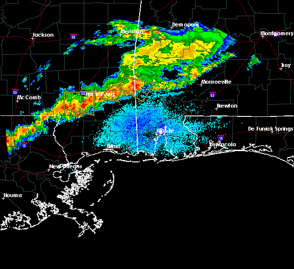 At 831 pm cdt, a severe thunderstorm was located near ovett, or 9 miles southeast of ellisville, moving east at 40 mph (radar indicated). Hazards include 60 mph wind gusts and nickel size hail. expect damage to roofs, siding, and trees At 831 pm cdt, a severe thunderstorm was located near ovett, or 9 miles southeast of ellisville, moving east at 40 mph (radar indicated). Hazards include 60 mph wind gusts and nickel size hail. expect damage to roofs, siding, and trees
|
| 4/22/2017 8:32 PM CDT |
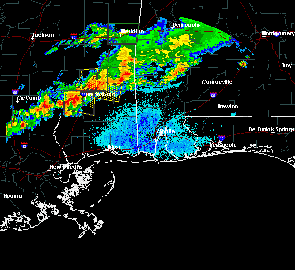 At 831 pm cdt, a severe thunderstorm was located near ovett, or 9 miles southeast of ellisville, moving east at 40 mph (radar indicated). Hazards include 60 mph wind gusts and nickel size hail. expect damage to roofs, siding, and trees At 831 pm cdt, a severe thunderstorm was located near ovett, or 9 miles southeast of ellisville, moving east at 40 mph (radar indicated). Hazards include 60 mph wind gusts and nickel size hail. expect damage to roofs, siding, and trees
|
| 1/21/2017 10:08 PM CST |
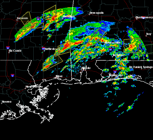 At 1008 pm cst, a severe thunderstorm was located near state line, or 16 miles west of chatom, moving northeast at 50 mph (radar indicated). Hazards include 60 mph wind gusts and quarter size hail. Hail damage to vehicles is expected. expect wind damage to roofs, siding, and trees. locations impacted include, beaumont. A tornado watch remains in effect until 300 am cst for southeastern mississippi. At 1008 pm cst, a severe thunderstorm was located near state line, or 16 miles west of chatom, moving northeast at 50 mph (radar indicated). Hazards include 60 mph wind gusts and quarter size hail. Hail damage to vehicles is expected. expect wind damage to roofs, siding, and trees. locations impacted include, beaumont. A tornado watch remains in effect until 300 am cst for southeastern mississippi.
|
| 1/21/2017 9:25 PM CST |
 At 925 pm cst, a severe thunderstorm was located near new augusta, or 11 miles southeast of petal, moving northeast at 50 mph (radar indicated). Hazards include 60 mph wind gusts and quarter size hail. Hail damage to vehicles is expected. Expect wind damage to roofs, siding, and trees. At 925 pm cst, a severe thunderstorm was located near new augusta, or 11 miles southeast of petal, moving northeast at 50 mph (radar indicated). Hazards include 60 mph wind gusts and quarter size hail. Hail damage to vehicles is expected. Expect wind damage to roofs, siding, and trees.
|
| 1/21/2017 9:09 PM CST |
 At 908 pm cst, a severe thunderstorm was located near sunrise, or near hattiesburg, moving northeast at 75 mph (radar indicated). Hazards include 60 mph wind gusts and half dollar size hail. Hail damage to vehicles is expected. expect wind damage to roofs, siding, and trees. locations impacted include, richton. A tornado watch remains in effect until 300 am cst for southeastern mississippi. At 908 pm cst, a severe thunderstorm was located near sunrise, or near hattiesburg, moving northeast at 75 mph (radar indicated). Hazards include 60 mph wind gusts and half dollar size hail. Hail damage to vehicles is expected. expect wind damage to roofs, siding, and trees. locations impacted include, richton. A tornado watch remains in effect until 300 am cst for southeastern mississippi.
|
| 1/21/2017 8:52 PM CST |
 At 852 pm cst, a severe thunderstorm was located near purvis, or 13 miles southwest of west hattiesburg, moving northeast at 50 mph (radar indicated). Hazards include 60 mph wind gusts and half dollar size hail. Hail damage to vehicles is expected. Expect wind damage to roofs, siding, and trees. At 852 pm cst, a severe thunderstorm was located near purvis, or 13 miles southwest of west hattiesburg, moving northeast at 50 mph (radar indicated). Hazards include 60 mph wind gusts and half dollar size hail. Hail damage to vehicles is expected. Expect wind damage to roofs, siding, and trees.
|
| 1/21/2017 8:28 PM CST |
 At 827 pm cst, a severe thunderstorm was located near beaumont, or 7 miles south of richton, moving northeast at 50 mph (radar indicated). Hazards include 60 mph wind gusts and half dollar size hail. Hail damage to vehicles is expected. Expect wind damage to roofs, siding, and trees. At 827 pm cst, a severe thunderstorm was located near beaumont, or 7 miles south of richton, moving northeast at 50 mph (radar indicated). Hazards include 60 mph wind gusts and half dollar size hail. Hail damage to vehicles is expected. Expect wind damage to roofs, siding, and trees.
|
| 1/21/2017 7:56 PM CST |
 At 755 pm cst, a severe thunderstorm was located near maxie, or 12 miles northwest of wiggins, moving northeast at 65 mph (radar indicated). Hazards include ping pong ball size hail and 60 mph wind gusts. People and animals outdoors will be injured. expect hail damage to roofs, siding, windows, and vehicles. Expect wind damage to roofs, siding, and trees. At 755 pm cst, a severe thunderstorm was located near maxie, or 12 miles northwest of wiggins, moving northeast at 65 mph (radar indicated). Hazards include ping pong ball size hail and 60 mph wind gusts. People and animals outdoors will be injured. expect hail damage to roofs, siding, windows, and vehicles. Expect wind damage to roofs, siding, and trees.
|
| 1/21/2017 4:25 AM CST | Trees down on hollis creek rd. possible tornad in wayne county MS, 11.3 miles SSW of Richton, MS |
| 1/2/2017 3:40 PM CST |
 At 340 pm cst, severe thunderstorms were located along a line extending from near kewanee to 9 miles west of silas to 7 miles west of leakesville to 8 miles east of wiggins, moving northeast at 65 mph (radar indicated). Hazards include 70 mph wind gusts and quarter size hail. Hail damage to vehicles is expected. expect considerable tree damage. wind damage is also likely to mobile homes, roofs, and outbuildings. locations impacted include, waynesboro, wiggins, lucedale, butler, chatom, richton, leakesville, clara, mchenry, perkinston, beaumont, new augusta, lisman, millry, mclain, buckatunna, state line, silas, fruitdale and pennington. A tornado watch remains in effect until 800 pm cst for southwestern alabama, and southeastern mississippi. At 340 pm cst, severe thunderstorms were located along a line extending from near kewanee to 9 miles west of silas to 7 miles west of leakesville to 8 miles east of wiggins, moving northeast at 65 mph (radar indicated). Hazards include 70 mph wind gusts and quarter size hail. Hail damage to vehicles is expected. expect considerable tree damage. wind damage is also likely to mobile homes, roofs, and outbuildings. locations impacted include, waynesboro, wiggins, lucedale, butler, chatom, richton, leakesville, clara, mchenry, perkinston, beaumont, new augusta, lisman, millry, mclain, buckatunna, state line, silas, fruitdale and pennington. A tornado watch remains in effect until 800 pm cst for southwestern alabama, and southeastern mississippi.
|
| 1/2/2017 3:10 PM CST | Trees down on line rd in jones county MS, 11.3 miles SSE of Richton, MS |
| 1/2/2017 3:07 PM CST |
 At 307 pm cst, severe thunderstorms were located along a line extending from near rose hill to near ovett to maxie to 8 miles east of mcneil, moving northeast at 60 mph (radar indicated). Hazards include 60 mph wind gusts and quarter size hail. Hail damage to vehicles is expected. Expect wind damage to roofs, siding, and trees. At 307 pm cst, severe thunderstorms were located along a line extending from near rose hill to near ovett to maxie to 8 miles east of mcneil, moving northeast at 60 mph (radar indicated). Hazards include 60 mph wind gusts and quarter size hail. Hail damage to vehicles is expected. Expect wind damage to roofs, siding, and trees.
|
| 1/2/2017 3:07 PM CST |
 The national weather service in mobile has issued a * severe thunderstorm warning for. choctaw county in southwestern alabama. western washington county in southwestern alabama. northwestern clarke county in southwestern alabama. George county in southeastern mississippi. The national weather service in mobile has issued a * severe thunderstorm warning for. choctaw county in southwestern alabama. western washington county in southwestern alabama. northwestern clarke county in southwestern alabama. George county in southeastern mississippi.
|
| 1/2/2017 3:07 PM CST |
 At 307 pm cst, severe thunderstorms were located along a line extending from near rose hill to near ovett to maxie to 8 miles east of mcneil, moving northeast at 60 mph (radar indicated). Hazards include 60 mph wind gusts and quarter size hail. Hail damage to vehicles is expected. Expect wind damage to roofs, siding, and trees. At 307 pm cst, severe thunderstorms were located along a line extending from near rose hill to near ovett to maxie to 8 miles east of mcneil, moving northeast at 60 mph (radar indicated). Hazards include 60 mph wind gusts and quarter size hail. Hail damage to vehicles is expected. Expect wind damage to roofs, siding, and trees.
|
| 7/9/2016 6:42 PM CDT | Sereral sheds blown down with one shed blown into a house on salum rd. tree down in the pleasant grove communit in wayne county MS, 14 miles SSW of Richton, MS |
| 6/17/2016 6:46 PM CDT |
 At 645 pm cdt, severe thunderstorms were located along a line extending from near macedonia to near citronelle to 16 miles north of baker to 9 miles north of new brockton, moving southeast at 45 mph (radar indicated). Hazards include 60 mph wind gusts and nickel size hail. Expect damage to roofs. siding. and trees. Locations impacted include, andalusia, atmore, opp, brewton, citronelle, florala, richton, leakesville, mccullough, deer park, east brewton, uriah, beaumont, brantley, mount vernon, calvert, new augusta, river falls, mclain and castleberry. At 645 pm cdt, severe thunderstorms were located along a line extending from near macedonia to near citronelle to 16 miles north of baker to 9 miles north of new brockton, moving southeast at 45 mph (radar indicated). Hazards include 60 mph wind gusts and nickel size hail. Expect damage to roofs. siding. and trees. Locations impacted include, andalusia, atmore, opp, brewton, citronelle, florala, richton, leakesville, mccullough, deer park, east brewton, uriah, beaumont, brantley, mount vernon, calvert, new augusta, river falls, mclain and castleberry.
|
| 6/17/2016 6:11 PM CDT |
 At 610 pm cdt, severe thunderstorms were located along a line extending from near moss to 6 miles southwest of state line to near castleberry to near goshen, moving southeast at 50 mph (radar indicated). Hazards include 60 mph wind gusts and quarter size hail. Hail damage to vehicles is expected. expect wind damage to roofs, siding, and trees. Locations impacted include, andalusia, atmore, greenville, monroeville, opp, brewton, jackson, waynesboro, citronelle, evergreen, luverne, florala, frisco city, chatom, richton, leakesville, mccullough, peterman, saint stephens and wagarville. At 610 pm cdt, severe thunderstorms were located along a line extending from near moss to 6 miles southwest of state line to near castleberry to near goshen, moving southeast at 50 mph (radar indicated). Hazards include 60 mph wind gusts and quarter size hail. Hail damage to vehicles is expected. expect wind damage to roofs, siding, and trees. Locations impacted include, andalusia, atmore, greenville, monroeville, opp, brewton, jackson, waynesboro, citronelle, evergreen, luverne, florala, frisco city, chatom, richton, leakesville, mccullough, peterman, saint stephens and wagarville.
|
| 6/17/2016 6:00 PM CDT |
 At 559 pm cdt, severe thunderstorms were located along a line extending from bay springs to near buckatunna to near i65 and us 84 to near lapine, moving southeast at 50 mph (radar indicated). Hazards include 60 mph wind gusts and nickel size hail. Expect damage to roofs. siding. And trees. At 559 pm cdt, severe thunderstorms were located along a line extending from bay springs to near buckatunna to near i65 and us 84 to near lapine, moving southeast at 50 mph (radar indicated). Hazards include 60 mph wind gusts and nickel size hail. Expect damage to roofs. siding. And trees.
|
| 3/31/2016 8:13 AM CDT |
 At 813 am cdt, severe thunderstorms were located along a line extending from near sunrise to mclaurin to near rock hill, moving east at 35 mph (radar indicated). Hazards include 70 mph wind gusts and quarter size hail. Hail damage to vehicles is expected. expect considerable tree damage. Wind damage is also likely to mobile homes, roofs, and outbuildings. At 813 am cdt, severe thunderstorms were located along a line extending from near sunrise to mclaurin to near rock hill, moving east at 35 mph (radar indicated). Hazards include 70 mph wind gusts and quarter size hail. Hail damage to vehicles is expected. expect considerable tree damage. Wind damage is also likely to mobile homes, roofs, and outbuildings.
|
| 2/23/2016 5:14 PM CST |
 At 513 pm cst, severe thunderstorms were located along a line extending from near clara to near beaumont to 7 miles southwest of mclain to near maxie, moving northeast at 40 mph (radar indicated). Hazards include 70 mph wind gusts and quarter size hail. Hail damage to vehicles is expected. expect considerable tree damage. wind damage is also likely to mobile homes, roofs, and outbuildings. locations impacted include, wiggins, lucedale, leakesville, beaumont, state line, mclain, buckatunna and clara. A tornado watch remains in effect until 1000 pm cst for southeastern mississippi. At 513 pm cst, severe thunderstorms were located along a line extending from near clara to near beaumont to 7 miles southwest of mclain to near maxie, moving northeast at 40 mph (radar indicated). Hazards include 70 mph wind gusts and quarter size hail. Hail damage to vehicles is expected. expect considerable tree damage. wind damage is also likely to mobile homes, roofs, and outbuildings. locations impacted include, wiggins, lucedale, leakesville, beaumont, state line, mclain, buckatunna and clara. A tornado watch remains in effect until 1000 pm cst for southeastern mississippi.
|
| 2/23/2016 5:09 PM CST |
 At 509 pm cst, a severe thunderstorm capable of producing a tornado was located near richton, moving northeast at 40 mph (radar indicated rotation). Hazards include tornado. Flying debris will be dangerous to those caught without shelter. mobile homes will be damaged or destroyed. damage to roofs, windows, and vehicles will occur. tree damage is likely. This tornadic thunderstorm will remain over mainly rural areas of south central wayne, northwestern greene and northeastern perry counties. At 509 pm cst, a severe thunderstorm capable of producing a tornado was located near richton, moving northeast at 40 mph (radar indicated rotation). Hazards include tornado. Flying debris will be dangerous to those caught without shelter. mobile homes will be damaged or destroyed. damage to roofs, windows, and vehicles will occur. tree damage is likely. This tornadic thunderstorm will remain over mainly rural areas of south central wayne, northwestern greene and northeastern perry counties.
|
| 2/23/2016 5:00 PM CST |
 At 459 pm cst, severe thunderstorms were located along a line extending from 9 miles northeast of richton to near beaumont to 8 miles east of maxie to 10 miles west of wiggins, moving northeast at 40 mph (radar indicated). Hazards include 70 mph wind gusts and quarter size hail. Hail damage to vehicles is expected. expect considerable tree damage. Wind damage is also likely to mobile homes, roofs, and outbuildings. At 459 pm cst, severe thunderstorms were located along a line extending from 9 miles northeast of richton to near beaumont to 8 miles east of maxie to 10 miles west of wiggins, moving northeast at 40 mph (radar indicated). Hazards include 70 mph wind gusts and quarter size hail. Hail damage to vehicles is expected. expect considerable tree damage. Wind damage is also likely to mobile homes, roofs, and outbuildings.
|
| 2/23/2016 4:56 PM CST |
 At 455 pm cst, a severe thunderstorm capable of producing a tornado was located near new augusta, or 8 miles south of richton, moving northeast at 45 mph (radar indicated rotation). Hazards include tornado and quarter size hail. Flying debris will be dangerous to those caught without shelter. mobile homes will be damaged or destroyed. damage to roofs, windows, and vehicles will occur. tree damage is likely. this dangerous storm will be near, richton around 505 pm cst. Clara around 530 pm cst. At 455 pm cst, a severe thunderstorm capable of producing a tornado was located near new augusta, or 8 miles south of richton, moving northeast at 45 mph (radar indicated rotation). Hazards include tornado and quarter size hail. Flying debris will be dangerous to those caught without shelter. mobile homes will be damaged or destroyed. damage to roofs, windows, and vehicles will occur. tree damage is likely. this dangerous storm will be near, richton around 505 pm cst. Clara around 530 pm cst.
|
| 2/23/2016 4:47 PM CST |
 At 447 pm cst, severe thunderstorms were located along a line extending from 7 miles north of richton to 6 miles east of brooklyn to near wiggins to 9 miles east of poplarville, moving northeast at 60 mph (radar indicated). Hazards include 70 mph wind gusts and quarter size hail. Hail damage to vehicles is expected. expect considerable tree damage. wind damage is also likely to mobile homes, roofs, and outbuildings. locations impacted include, wiggins, richton, beaumont, new augusta, mchenry and perkinston. A tornado watch remains in effect until 1000 pm cst for southeastern mississippi. At 447 pm cst, severe thunderstorms were located along a line extending from 7 miles north of richton to 6 miles east of brooklyn to near wiggins to 9 miles east of poplarville, moving northeast at 60 mph (radar indicated). Hazards include 70 mph wind gusts and quarter size hail. Hail damage to vehicles is expected. expect considerable tree damage. wind damage is also likely to mobile homes, roofs, and outbuildings. locations impacted include, wiggins, richton, beaumont, new augusta, mchenry and perkinston. A tornado watch remains in effect until 1000 pm cst for southeastern mississippi.
|
| 2/23/2016 4:44 PM CST |
 At 444 pm cst, a severe thunderstorm capable of producing a tornado was located near new augusta, or 16 miles southwest of richton, moving northeast at 45 mph (radar indicated rotation). Hazards include tornado. Flying debris will be dangerous to those caught without shelter. mobile homes will be damaged or destroyed. damage to roofs, windows, and vehicles will occur. tree damage is likely. this dangerous storm will be near, new augusta around 450 pm cst. beaumont around 455 pm cst. Richton around 505 pm cst. At 444 pm cst, a severe thunderstorm capable of producing a tornado was located near new augusta, or 16 miles southwest of richton, moving northeast at 45 mph (radar indicated rotation). Hazards include tornado. Flying debris will be dangerous to those caught without shelter. mobile homes will be damaged or destroyed. damage to roofs, windows, and vehicles will occur. tree damage is likely. this dangerous storm will be near, new augusta around 450 pm cst. beaumont around 455 pm cst. Richton around 505 pm cst.
|
| 2/23/2016 4:25 PM CST |
 At 424 pm cst, severe thunderstorms were located along a line extending from near sunrise to 9 miles southeast of lumberton to 10 miles southeast of poplarville to near mcneil, moving east at 35 mph (radar indicated). Hazards include 70 mph wind gusts. Expect considerable tree damage. damage is likely to mobile homes, roofs, and outbuildings. locations impacted include, wiggins, richton, beaumont, new augusta, mchenry and perkinston. A tornado watch remains in effect until 1000 pm cst for southeastern mississippi. At 424 pm cst, severe thunderstorms were located along a line extending from near sunrise to 9 miles southeast of lumberton to 10 miles southeast of poplarville to near mcneil, moving east at 35 mph (radar indicated). Hazards include 70 mph wind gusts. Expect considerable tree damage. damage is likely to mobile homes, roofs, and outbuildings. locations impacted include, wiggins, richton, beaumont, new augusta, mchenry and perkinston. A tornado watch remains in effect until 1000 pm cst for southeastern mississippi.
|
| 2/23/2016 4:08 PM CST |
 At 408 pm cst, severe thunderstorms were located along a line extending from 10 miles southeast of improve to 7 miles south of lumberton to 6 miles southwest of mcneil, moving northeast at 55 mph (radar indicated). Hazards include 70 mph wind gusts. Expect considerable tree damage. Damage is likely to mobile homes, roofs, and outbuildings. At 408 pm cst, severe thunderstorms were located along a line extending from 10 miles southeast of improve to 7 miles south of lumberton to 6 miles southwest of mcneil, moving northeast at 55 mph (radar indicated). Hazards include 70 mph wind gusts. Expect considerable tree damage. Damage is likely to mobile homes, roofs, and outbuildings.
|
| 2/15/2016 2:58 PM CST |
 At 257 pm cst, severe thunderstorms were located along a line extending from near clara to near beaumont to 6 miles southeast of brooklyn, moving northeast at 60 mph (radar indicated). Hazards include 70 mph wind gusts and quarter size hail. Hail damage to vehicles is expected. expect considerable tree damage. wind damage is also likely to mobile homes, roofs, and outbuildings. locations impacted include, waynesboro, richton, beaumont, new augusta, state line, mclain, buckatunna and clara. a tornado watch remains in effect until 600 pm cst for southeastern mississippi. A tornado watch also remains in effect until 900 pm cst for southwestern alabama. At 257 pm cst, severe thunderstorms were located along a line extending from near clara to near beaumont to 6 miles southeast of brooklyn, moving northeast at 60 mph (radar indicated). Hazards include 70 mph wind gusts and quarter size hail. Hail damage to vehicles is expected. expect considerable tree damage. wind damage is also likely to mobile homes, roofs, and outbuildings. locations impacted include, waynesboro, richton, beaumont, new augusta, state line, mclain, buckatunna and clara. a tornado watch remains in effect until 600 pm cst for southeastern mississippi. A tornado watch also remains in effect until 900 pm cst for southwestern alabama.
|
| 2/15/2016 2:38 PM CST |
 At 238 pm cst, severe thunderstorms were located along a line extending from near ovett to near brooklyn to 7 miles southeast of lumberton, moving northeast at 60 mph (radar indicated). Hazards include 70 mph wind gusts and quarter size hail. Hail damage to vehicles is expected. expect considerable tree damage. Wind damage is also likely to mobile homes, roofs, and outbuildings. At 238 pm cst, severe thunderstorms were located along a line extending from near ovett to near brooklyn to 7 miles southeast of lumberton, moving northeast at 60 mph (radar indicated). Hazards include 70 mph wind gusts and quarter size hail. Hail damage to vehicles is expected. expect considerable tree damage. Wind damage is also likely to mobile homes, roofs, and outbuildings.
|
| 2/15/2016 2:36 PM CST | Tree down across highway 15 south near perry county lin in jones county MS, 9.3 miles SSE of Richton, MS |
| 10/31/2015 5:07 PM CDT |
 At 507 pm cdt, severe thunderstorms were located along a line extending from 8 miles northeast of ovett to near beaumont, moving northeast at 40 mph (radar indicated). Hazards include 60 mph wind gusts. Expect damage to roofs. siding and trees. locations impacted include, richton, beaumont, new augusta and clara. A tornado watch remains in effect until 700 pm cdt for southeastern mississippi. At 507 pm cdt, severe thunderstorms were located along a line extending from 8 miles northeast of ovett to near beaumont, moving northeast at 40 mph (radar indicated). Hazards include 60 mph wind gusts. Expect damage to roofs. siding and trees. locations impacted include, richton, beaumont, new augusta and clara. A tornado watch remains in effect until 700 pm cdt for southeastern mississippi.
|
| 10/31/2015 4:41 PM CDT |
 At 440 pm cdt, severe thunderstorms were located along a line extending from near macedonia to near mclaurin, moving northeast at 40 mph (radar indicated). Hazards include 60 mph wind gusts. Expect damage to roofs. Siding and trees. At 440 pm cdt, severe thunderstorms were located along a line extending from near macedonia to near mclaurin, moving northeast at 40 mph (radar indicated). Hazards include 60 mph wind gusts. Expect damage to roofs. Siding and trees.
|
| 7/30/2015 6:11 PM CDT |
 At 611 pm cdt, a severe thunderstorm capable of producing damaging winds over 60 mph was located near mill creek, or 15 miles east of laurel, and moving southwest at 30 mph. At 611 pm cdt, a severe thunderstorm capable of producing damaging winds over 60 mph was located near mill creek, or 15 miles east of laurel, and moving southwest at 30 mph.
|
| 7/30/2015 3:30 PM CDT | Tree down on a home located along hwy 29 s. no injurie in jones county MS, 11.1 miles SE of Richton, MS |
| 7/4/2015 3:07 PM CDT |
 At 306 pm cdt, a line of severe thunderstorms capable of producing damaging winds over 60 mph was located along a line extending from 6 miles west of waynesboro to near richton to near new augusta, and moving east at 30 mph. At 306 pm cdt, a line of severe thunderstorms capable of producing damaging winds over 60 mph was located along a line extending from 6 miles west of waynesboro to near richton to near new augusta, and moving east at 30 mph.
|
| 6/21/2015 4:28 PM CDT | Tree and powerline down at the intersection of highway 42 and highway 6 in greene county MS, 10.6 miles W of Richton, MS |
| 4/29/2014 12:23 AM CDT | Tree down on a house in greene county MS, 10.6 miles W of Richton, MS |
| 6/8/2013 3:07 PM CDT | Golf Ball sized hail reported 6 miles N of Richton, MS, perry co. so reported golf ball size hail in hinton |
| 6/5/2013 8:15 PM CDT | Perry county ema reports a large tree down in the community of richto in perry county MS, 0.3 miles S of Richton, MS |
| 1/30/2013 7:20 AM CST | Reports of trees down scattered through the southern portions of the count in jones county MS, 9.8 miles SSE of Richton, MS |
| 1/1/0001 12:00 AM | Oak tree reported blown down on bay street that took out a powerline. dime to penny size hail also observe in perry county MS, 0.3 miles S of Richton, MS |
| 1/1/0001 12:00 AM | Tree limbs down throughout cit in perry county MS, 0.3 miles S of Richton, MS |
| 1/1/0001 12:00 AM | Quarter sized hail reported 10.6 miles WNW of Richton, MS, public reported quarter size hail 4 miles southwest of avera near the intersection of tung oil and neely-avera roads. |
Hail Maps for Richton, MS
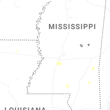
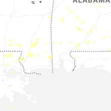


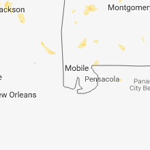


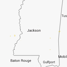


Connect with Interactive Hail Maps