

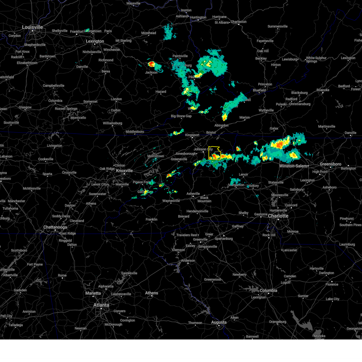
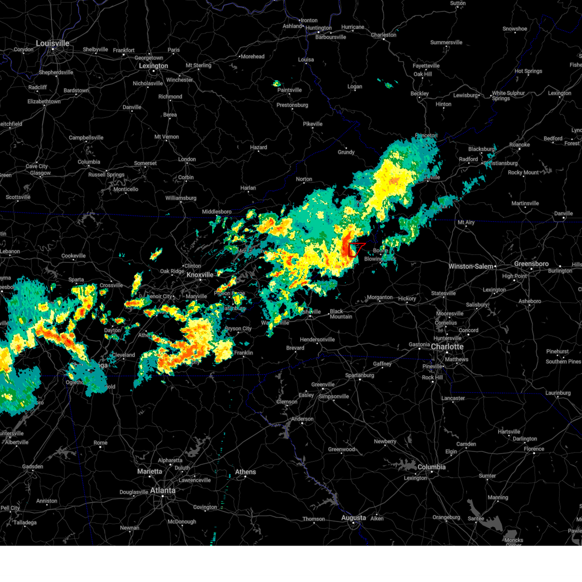
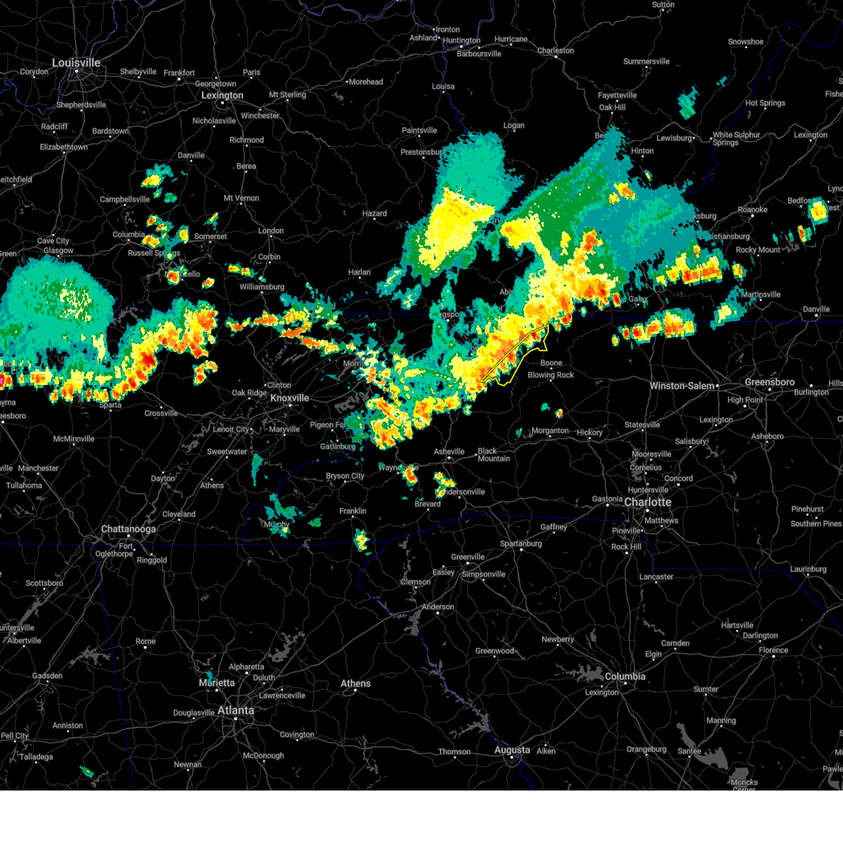
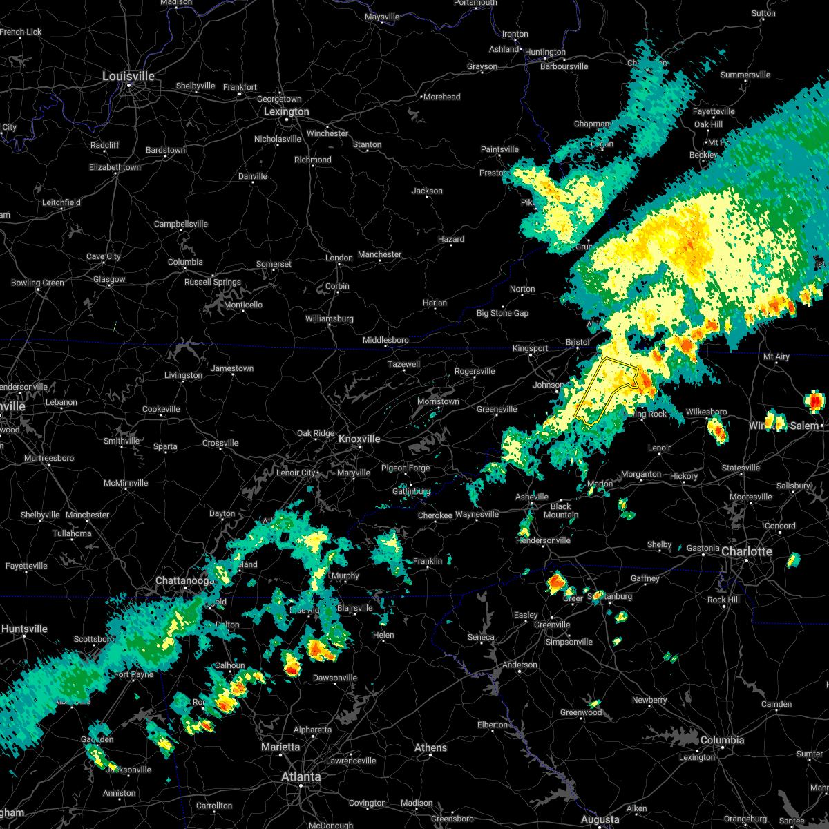
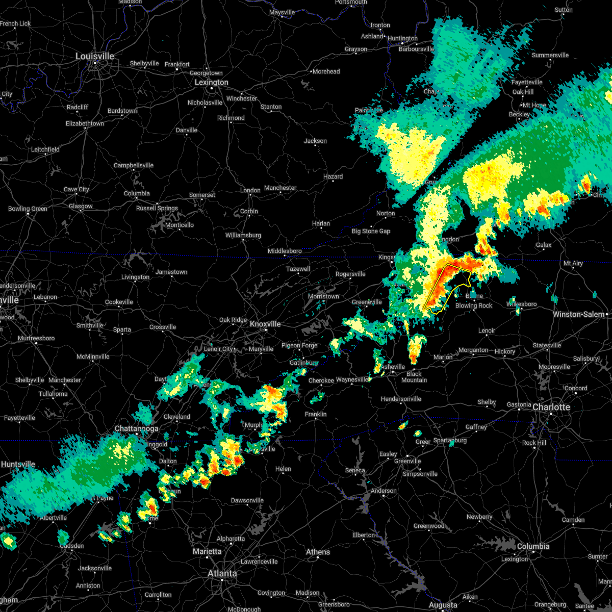
Hail Map for Roan Mountain, TN
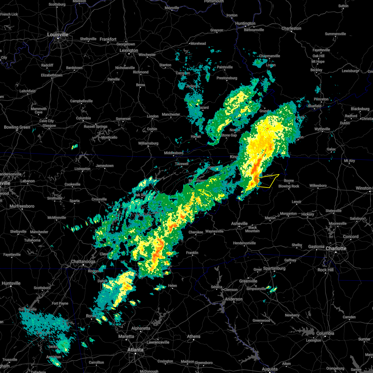
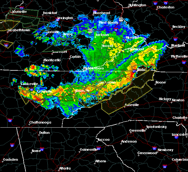
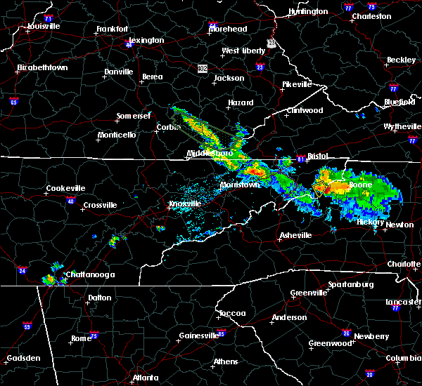
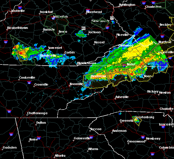
The Roan Mountain, TN area has had 1 report of on-the-ground hail by trained spotters, and has been under severe weather warnings 5 times during the past 12 months. Doppler radar has detected hail at or near Roan Mountain, TN on 20 occasions.
| Name: | Roan Mountain, TN |
| Where Located: | 29.7 miles SSE of Bristol, TN |
| Map: | Google Map for Roan Mountain, TN |
| Population: | 1360 |
| Housing Units: | 609 |
| More Info: | Search Google for Roan Mountain, TN |
0
The Top Recent Hail Date for Roan Mountain, TN is Sunday, May 26, 2024 (20th out of 20)

Hail and Wind Damage Spotted near Roan Mountain, TN
| Date / Time | Report Details |
|---|---|
| 4/30/2025 5:59 PM EDT |
 At 559 pm edt, a severe thunderstorm was located over hampton, or near elizabethton, moving north at 15 mph (radar indicated). Hazards include 60 mph wind gusts and quarter size hail. Hail damage to vehicles is expected. expect wind damage to roofs, siding, and trees. Locations impacted include, hunter, hampton, elizabethton, and roan mountain. At 559 pm edt, a severe thunderstorm was located over hampton, or near elizabethton, moving north at 15 mph (radar indicated). Hazards include 60 mph wind gusts and quarter size hail. Hail damage to vehicles is expected. expect wind damage to roofs, siding, and trees. Locations impacted include, hunter, hampton, elizabethton, and roan mountain.
|
| 4/30/2025 5:46 PM EDT | Svrmrx the national weather service in morristown has issued a * severe thunderstorm warning for, central carter county in east tennessee, * until 630 pm edt. * at 546 pm edt, a severe thunderstorm was located over hampton, or 7 miles southeast of elizabethton, moving north at 15 mph (radar indicated). Hazards include 60 mph wind gusts and quarter size hail. Hail damage to vehicles is expected. Expect wind damage to roofs, siding, and trees. |
| 8/16/2024 6:34 PM EDT | Svrmrx the national weather service in morristown has issued a * severe thunderstorm warning for, northeastern sullivan county in east tennessee, johnson county in east tennessee, northeastern carter county in east tennessee, * until 730 pm edt. * at 633 pm edt, a severe thunderstorm was located near bristol tn, moving east at 35 mph (radar indicated. there have been observations of wind gusts near 60 mph with wind damage). Hazards include 60 mph wind gusts and penny size hail. expect damage to roofs, siding, and trees |
| 7/30/2024 6:12 PM EDT |
 the severe thunderstorm warning has been cancelled and is no longer in effect the severe thunderstorm warning has been cancelled and is no longer in effect
|
| 7/30/2024 5:49 PM EDT |
 Svrmrx the national weather service in morristown has issued a * severe thunderstorm warning for, south central hawkins county in east tennessee, southern washington county in east tennessee, southeastern jefferson county in east tennessee, cocke county in east tennessee, greene county in east tennessee, unicoi county in east tennessee, east central sevier county in east tennessee, southern carter county in east tennessee, southeastern hamblen county in east tennessee, * until 630 pm edt. * at 548 pm edt, severe thunderstorms winds were located along a line extending from 8 miles south of rogersville to gatlinburg, moving east at 70 mph (radar indicated). Hazards include 60 mph wind gusts. expect damage to roofs, siding, and trees Svrmrx the national weather service in morristown has issued a * severe thunderstorm warning for, south central hawkins county in east tennessee, southern washington county in east tennessee, southeastern jefferson county in east tennessee, cocke county in east tennessee, greene county in east tennessee, unicoi county in east tennessee, east central sevier county in east tennessee, southern carter county in east tennessee, southeastern hamblen county in east tennessee, * until 630 pm edt. * at 548 pm edt, severe thunderstorms winds were located along a line extending from 8 miles south of rogersville to gatlinburg, moving east at 70 mph (radar indicated). Hazards include 60 mph wind gusts. expect damage to roofs, siding, and trees
|
| 5/6/2024 10:04 PM EDT |
 the severe thunderstorm warning has been cancelled and is no longer in effect the severe thunderstorm warning has been cancelled and is no longer in effect
|
| 5/6/2024 9:52 PM EDT |
 the severe thunderstorm warning has been cancelled and is no longer in effect the severe thunderstorm warning has been cancelled and is no longer in effect
|
| 5/6/2024 9:52 PM EDT |
 At 952 pm edt, severe thunderstorms were located along a line extending from midway to near pine crest to near erwin to near banner hill, moving east at 45 mph (radar indicated). Hazards include 60 mph wind gusts. Expect damage to roofs, siding, and trees. locations impacted include, johnson city, elizabethton, erwin, jonesborough, banner hill, central, hampton, midway, pine crest, and unicoi. This includes interstate 26 in tennessee between mile markers 23 and 48. At 952 pm edt, severe thunderstorms were located along a line extending from midway to near pine crest to near erwin to near banner hill, moving east at 45 mph (radar indicated). Hazards include 60 mph wind gusts. Expect damage to roofs, siding, and trees. locations impacted include, johnson city, elizabethton, erwin, jonesborough, banner hill, central, hampton, midway, pine crest, and unicoi. This includes interstate 26 in tennessee between mile markers 23 and 48.
|
| 5/6/2024 9:32 PM EDT |
 Svrmrx the national weather service in morristown has issued a * severe thunderstorm warning for, washington county in east tennessee, northeastern greene county in east tennessee, unicoi county in east tennessee, carter county in east tennessee, * until 1015 pm edt. * at 932 pm edt, severe thunderstorms were located along a line extending from 11 miles west of jonesborough to 11 miles east of greeneville to 6 miles southeast of tusculum, moving east at 45 mph (radar indicated). Hazards include 60 mph wind gusts. expect damage to roofs, siding, and trees Svrmrx the national weather service in morristown has issued a * severe thunderstorm warning for, washington county in east tennessee, northeastern greene county in east tennessee, unicoi county in east tennessee, carter county in east tennessee, * until 1015 pm edt. * at 932 pm edt, severe thunderstorms were located along a line extending from 11 miles west of jonesborough to 11 miles east of greeneville to 6 miles southeast of tusculum, moving east at 45 mph (radar indicated). Hazards include 60 mph wind gusts. expect damage to roofs, siding, and trees
|
| 9/12/2023 5:44 PM EDT |
 At 543 pm edt, a severe thunderstorm was located near hampton, or 7 miles southeast of elizabethton, moving east at 30 mph (radar indicated). Hazards include 60 mph wind gusts and nickel size hail. Expect damage to roofs, siding, and trees. locations impacted include, elizabethton, hampton, unicoi, trade, roane mountain state park, hampton creek cove state park, limestone cove, elk mills, roan mountain, and hunter. hail threat, radar indicated max hail size, 0. 88 in wind threat, observed max wind gust, 60 mph. At 543 pm edt, a severe thunderstorm was located near hampton, or 7 miles southeast of elizabethton, moving east at 30 mph (radar indicated). Hazards include 60 mph wind gusts and nickel size hail. Expect damage to roofs, siding, and trees. locations impacted include, elizabethton, hampton, unicoi, trade, roane mountain state park, hampton creek cove state park, limestone cove, elk mills, roan mountain, and hunter. hail threat, radar indicated max hail size, 0. 88 in wind threat, observed max wind gust, 60 mph.
|
| 9/12/2023 5:29 PM EDT |
 At 528 pm edt, a severe thunderstorm was located near pine crest, or near elizabethton, moving east at 30 mph (radar indicated). Hazards include 60 mph wind gusts and quarter size hail. Hail damage to vehicles is expected. Expect wind damage to roofs, siding, and trees. At 528 pm edt, a severe thunderstorm was located near pine crest, or near elizabethton, moving east at 30 mph (radar indicated). Hazards include 60 mph wind gusts and quarter size hail. Hail damage to vehicles is expected. Expect wind damage to roofs, siding, and trees.
|
| 9/12/2023 5:19 PM EDT |
 At 519 pm edt, a severe thunderstorm was located near pine crest, or near johnson city, moving east at 30 mph (radar indicated). Hazards include 60 mph wind gusts and quarter size hail. Hail damage to vehicles is expected. expect wind damage to roofs, siding, and trees. locations impacted include, johnson city, elizabethton, jonesborough, central, hampton, midway, pine crest, unicoi, watauga, and roane mountain state park. This includes interstate 26 in tennessee between mile markers 19 and 34. At 519 pm edt, a severe thunderstorm was located near pine crest, or near johnson city, moving east at 30 mph (radar indicated). Hazards include 60 mph wind gusts and quarter size hail. Hail damage to vehicles is expected. expect wind damage to roofs, siding, and trees. locations impacted include, johnson city, elizabethton, jonesborough, central, hampton, midway, pine crest, unicoi, watauga, and roane mountain state park. This includes interstate 26 in tennessee between mile markers 19 and 34.
|
| 9/12/2023 5:02 PM EDT |
 At 502 pm edt, a severe thunderstorm was located near jonesborough, or 7 miles northwest of erwin, moving east at 40 mph (radar indicated). Hazards include 60 mph wind gusts and half dollar size hail. Hail damage to vehicles is expected. expect wind damage to roofs, siding, and trees. locations impacted include, johnson city, elizabethton, erwin, jonesborough, banner hill, central, hampton, midway, pine crest, and unicoi. This includes interstate 26 in tennessee between mile markers 18 and 39. At 502 pm edt, a severe thunderstorm was located near jonesborough, or 7 miles northwest of erwin, moving east at 40 mph (radar indicated). Hazards include 60 mph wind gusts and half dollar size hail. Hail damage to vehicles is expected. expect wind damage to roofs, siding, and trees. locations impacted include, johnson city, elizabethton, erwin, jonesborough, banner hill, central, hampton, midway, pine crest, and unicoi. This includes interstate 26 in tennessee between mile markers 18 and 39.
|
| 9/12/2023 4:44 PM EDT |
 At 444 pm edt, a severe thunderstorm was located near tusculum, or 8 miles northeast of greeneville, moving east at 35 mph (radar indicated). Hazards include ping pong ball size hail and 60 mph wind gusts. People and animals outdoors will be injured. expect hail damage to roofs, siding, windows, and vehicles. expect wind damage to roofs, siding, and trees. locations impacted include, johnson city, greeneville, elizabethton, erwin, jonesborough, tusculum, banner hill, central, midway, and pine crest. this includes the following highways, interstate 26 in tennessee between mile markers 18 and 42. Interstate 81 in tennessee between mile markers 36 and 41. At 444 pm edt, a severe thunderstorm was located near tusculum, or 8 miles northeast of greeneville, moving east at 35 mph (radar indicated). Hazards include ping pong ball size hail and 60 mph wind gusts. People and animals outdoors will be injured. expect hail damage to roofs, siding, windows, and vehicles. expect wind damage to roofs, siding, and trees. locations impacted include, johnson city, greeneville, elizabethton, erwin, jonesborough, tusculum, banner hill, central, midway, and pine crest. this includes the following highways, interstate 26 in tennessee between mile markers 18 and 42. Interstate 81 in tennessee between mile markers 36 and 41.
|
| 9/12/2023 4:36 PM EDT |
 At 435 pm edt, a severe thunderstorm was located near tusculum, or near greeneville, moving east at 40 mph (radar indicated). Hazards include 60 mph wind gusts and quarter size hail. Hail damage to vehicles is expected. Expect wind damage to roofs, siding, and trees. At 435 pm edt, a severe thunderstorm was located near tusculum, or near greeneville, moving east at 40 mph (radar indicated). Hazards include 60 mph wind gusts and quarter size hail. Hail damage to vehicles is expected. Expect wind damage to roofs, siding, and trees.
|
| 9/7/2023 4:15 PM EDT |
 At 415 pm edt, a severe thunderstorm was located near hampton, or 9 miles east of elizabethton, moving northeast at 15 mph (radar indicated). Hazards include 60 mph wind gusts and quarter size hail. Hail damage to vehicles is expected. Expect wind damage to roofs, siding, and trees. At 415 pm edt, a severe thunderstorm was located near hampton, or 9 miles east of elizabethton, moving northeast at 15 mph (radar indicated). Hazards include 60 mph wind gusts and quarter size hail. Hail damage to vehicles is expected. Expect wind damage to roofs, siding, and trees.
|
| 8/15/2023 12:52 AM EDT |
 At 1251 am edt, a severe thunderstorm capable of producing a tornado was located 7 miles northwest of beech mountain, moving east at 40 mph (radar indicated rotation). Hazards include tornado. Flying debris will be dangerous to those caught without shelter. mobile homes will be damaged or destroyed. damage to roofs, windows, and vehicles will occur. tree damage is likely. This tornadic thunderstorm will remain over mainly rural areas of southwestern johnson and east central carter counties, including the following locations, elk mills. At 1251 am edt, a severe thunderstorm capable of producing a tornado was located 7 miles northwest of beech mountain, moving east at 40 mph (radar indicated rotation). Hazards include tornado. Flying debris will be dangerous to those caught without shelter. mobile homes will be damaged or destroyed. damage to roofs, windows, and vehicles will occur. tree damage is likely. This tornadic thunderstorm will remain over mainly rural areas of southwestern johnson and east central carter counties, including the following locations, elk mills.
|
| 8/15/2023 12:29 AM EDT | At 1228 am edt, a severe thunderstorm was located near banner hill, or near erwin, moving east at 50 mph (radar indicated). Hazards include 60 mph wind gusts and penny size hail. Expect damage to roofs, siding, and trees. locations impacted include, johnson city, elizabethton, erwin, jonesborough, tusculum, banner hill, central, midway, pine crest, and hampton. this includes interstate 26 in tennessee between mile markers 19 and 54. hail threat, radar indicated max hail size, 0. 75 in wind threat, radar indicated max wind gust, 60 mph. |
| 8/14/2023 11:56 PM EDT |
 At 1155 pm edt, a severe thunderstorm was located 8 miles west of greeneville, moving east at 50 mph (radar indicated). Hazards include 60 mph wind gusts and penny size hail. expect damage to roofs, siding, and trees At 1155 pm edt, a severe thunderstorm was located 8 miles west of greeneville, moving east at 50 mph (radar indicated). Hazards include 60 mph wind gusts and penny size hail. expect damage to roofs, siding, and trees
|
| 8/7/2023 2:56 PM EDT |
 At 255 pm edt, a severe thunderstorm was located near hampton, or 11 miles southeast of elizabethton, moving east at 45 mph (radar indicated). Hazards include 60 mph wind gusts and quarter size hail. Hail damage to vehicles is expected. expect wind damage to roofs, siding, and trees. locations impacted include, johnson city, elizabethton, erwin, banner hill, hampton, pine crest, midway, unicoi, roane mountain state park and limestone cove. This includes interstate 26 in tennessee between mile markers 26 and 54. At 255 pm edt, a severe thunderstorm was located near hampton, or 11 miles southeast of elizabethton, moving east at 45 mph (radar indicated). Hazards include 60 mph wind gusts and quarter size hail. Hail damage to vehicles is expected. expect wind damage to roofs, siding, and trees. locations impacted include, johnson city, elizabethton, erwin, banner hill, hampton, pine crest, midway, unicoi, roane mountain state park and limestone cove. This includes interstate 26 in tennessee between mile markers 26 and 54.
|
| 8/7/2023 2:43 PM EDT |
 At 243 pm edt, a severe thunderstorm was located near erwin, moving east at 45 mph (radar indicated). Hazards include 60 mph wind gusts and quarter size hail. Hail damage to vehicles is expected. expect wind damage to roofs, siding, and trees. locations impacted include, johnson city, elizabethton, erwin, jonesborough, tusculum, banner hill, central, hampton, midway and pine crest. This includes interstate 26 in tennessee between mile markers 23 and 54. At 243 pm edt, a severe thunderstorm was located near erwin, moving east at 45 mph (radar indicated). Hazards include 60 mph wind gusts and quarter size hail. Hail damage to vehicles is expected. expect wind damage to roofs, siding, and trees. locations impacted include, johnson city, elizabethton, erwin, jonesborough, tusculum, banner hill, central, hampton, midway and pine crest. This includes interstate 26 in tennessee between mile markers 23 and 54.
|
| 8/7/2023 2:09 PM EDT |
 At 208 pm edt, a severe thunderstorm was located 7 miles southwest of greeneville, moving east at 45 mph (radar indicated). Hazards include 60 mph wind gusts and quarter size hail. Hail damage to vehicles is expected. Expect wind damage to roofs, siding, and trees. At 208 pm edt, a severe thunderstorm was located 7 miles southwest of greeneville, moving east at 45 mph (radar indicated). Hazards include 60 mph wind gusts and quarter size hail. Hail damage to vehicles is expected. Expect wind damage to roofs, siding, and trees.
|
| 7/29/2023 6:02 PM EDT |
 At 602 pm edt, a severe thunderstorm was located near bakersville, or 11 miles west of newland, moving southeast at 35 mph (radar indicated). Hazards include 60 mph wind gusts and quarter size hail. Hail damage to vehicles is expected. expect wind damage to roofs, siding, and trees. locations impacted include, mountain city, trade, roane mountain state park, neva, hampton creek cove state park, elk mills and roan mountain. hail threat, radar indicated max hail size, 1. 00 in wind threat, radar indicated max wind gust, 60 mph. At 602 pm edt, a severe thunderstorm was located near bakersville, or 11 miles west of newland, moving southeast at 35 mph (radar indicated). Hazards include 60 mph wind gusts and quarter size hail. Hail damage to vehicles is expected. expect wind damage to roofs, siding, and trees. locations impacted include, mountain city, trade, roane mountain state park, neva, hampton creek cove state park, elk mills and roan mountain. hail threat, radar indicated max hail size, 1. 00 in wind threat, radar indicated max wind gust, 60 mph.
|
| 7/29/2023 5:33 PM EDT |
 At 533 pm edt, a severe thunderstorm was located over pine crest, or near elizabethton, moving southeast at 35 mph (radar indicated). Hazards include 60 mph wind gusts and quarter size hail. Hail damage to vehicles is expected. Expect wind damage to roofs, siding, and trees. At 533 pm edt, a severe thunderstorm was located over pine crest, or near elizabethton, moving southeast at 35 mph (radar indicated). Hazards include 60 mph wind gusts and quarter size hail. Hail damage to vehicles is expected. Expect wind damage to roofs, siding, and trees.
|
| 5/16/2023 7:27 PM EDT |
 At 727 pm edt, a severe thunderstorm was located near tusculum, or 9 miles east of greeneville, moving east at 45 mph (radar indicated). Hazards include 60 mph wind gusts and penny size hail. expect damage to roofs, siding, and trees At 727 pm edt, a severe thunderstorm was located near tusculum, or 9 miles east of greeneville, moving east at 45 mph (radar indicated). Hazards include 60 mph wind gusts and penny size hail. expect damage to roofs, siding, and trees
|
| 3/25/2023 5:15 AM EDT |
 At 515 am edt, severe thunderstorms were located along a line extending from bristol va to 7 miles south of banner hill, moving east at 65 mph (radar indicated). Hazards include 60 mph wind gusts. expect damage to roofs, siding, and trees At 515 am edt, severe thunderstorms were located along a line extending from bristol va to 7 miles south of banner hill, moving east at 65 mph (radar indicated). Hazards include 60 mph wind gusts. expect damage to roofs, siding, and trees
|
| 1/12/2023 2:24 PM EST |
 At 224 pm est, severe thunderstorms were located along a line extending from walnut hill to near hampton to 8 miles northwest of bakersville, moving east at 55 mph (radar indicated). Hazards include 70 mph wind gusts. Expect considerable tree damage. damage is likely to mobile homes, roofs, and outbuildings. locations impacted include, johnson city, bristol tn, bristol va, elizabethton, abingdon, mountain city, central, pine crest, walnut hill and hampton. this includes the following highways, interstate 26 in tennessee between mile markers 25 and 28. interstate 81 in tennessee between mile markers 68 and 75. Interstate 81 in virginia between mile markers 1 and 33. At 224 pm est, severe thunderstorms were located along a line extending from walnut hill to near hampton to 8 miles northwest of bakersville, moving east at 55 mph (radar indicated). Hazards include 70 mph wind gusts. Expect considerable tree damage. damage is likely to mobile homes, roofs, and outbuildings. locations impacted include, johnson city, bristol tn, bristol va, elizabethton, abingdon, mountain city, central, pine crest, walnut hill and hampton. this includes the following highways, interstate 26 in tennessee between mile markers 25 and 28. interstate 81 in tennessee between mile markers 68 and 75. Interstate 81 in virginia between mile markers 1 and 33.
|
| 1/12/2023 2:07 PM EST |
 At 207 pm est, severe thunderstorms were located along a line extending from colonial heights to near erwin to 6 miles southwest of banner hill, moving east at 55 mph (radar indicated). Hazards include 70 mph wind gusts. Expect considerable tree damage. Damage is likely to mobile homes, roofs, and outbuildings. At 207 pm est, severe thunderstorms were located along a line extending from colonial heights to near erwin to 6 miles southwest of banner hill, moving east at 55 mph (radar indicated). Hazards include 70 mph wind gusts. Expect considerable tree damage. Damage is likely to mobile homes, roofs, and outbuildings.
|
| 9/25/2022 6:54 PM EDT |
 At 654 pm edt, severe thunderstorms were located along a line extending from 9 miles southeast of bristol va to elizabethton to near erwin, moving southeast at 45 mph (radar indicated). Hazards include 60 mph wind gusts. expect damage to roofs, siding, and trees At 654 pm edt, severe thunderstorms were located along a line extending from 9 miles southeast of bristol va to elizabethton to near erwin, moving southeast at 45 mph (radar indicated). Hazards include 60 mph wind gusts. expect damage to roofs, siding, and trees
|
| 6/17/2022 4:20 PM EDT |
 The severe thunderstorm warning for johnson and eastern carter counties will expire at 430 pm edt, the storm which prompted the warning has weakened below severe limits, and has exited the warned area. therefore, the warning will be allowed to expire. however gusty winds are still possible with this thunderstorm. a severe thunderstorm watch remains in effect until 500 pm edt for east tennessee. The severe thunderstorm warning for johnson and eastern carter counties will expire at 430 pm edt, the storm which prompted the warning has weakened below severe limits, and has exited the warned area. therefore, the warning will be allowed to expire. however gusty winds are still possible with this thunderstorm. a severe thunderstorm watch remains in effect until 500 pm edt for east tennessee.
|
| 6/17/2022 3:57 PM EDT |
 At 357 pm edt, a severe thunderstorm was located 9 miles northeast of elizabethton, moving east at 35 mph (radar indicated). Hazards include 60 mph wind gusts and quarter size hail. Hail damage to vehicles is expected. Expect wind damage to roofs, siding, and trees. At 357 pm edt, a severe thunderstorm was located 9 miles northeast of elizabethton, moving east at 35 mph (radar indicated). Hazards include 60 mph wind gusts and quarter size hail. Hail damage to vehicles is expected. Expect wind damage to roofs, siding, and trees.
|
| 5/6/2022 6:30 PM EDT |
 At 630 pm edt, severe thunderstorms were located along a line extending from near walnut hill to near elizabethton to near hampton to near elk park, moving northeast at 50 mph (radar indicated). Hazards include 60 mph wind gusts and quarter size hail. Hail damage to vehicles is expected. expect wind damage to roofs, siding, and trees. locations impacted include, johnson city, bristol tn, elizabethton, hampton, central, oak grove, bluff city, watauga, hunter and morril`s cave. hail threat, radar indicated max hail size, 1. 00 in wind threat, radar indicated max wind gust, 60 mph. At 630 pm edt, severe thunderstorms were located along a line extending from near walnut hill to near elizabethton to near hampton to near elk park, moving northeast at 50 mph (radar indicated). Hazards include 60 mph wind gusts and quarter size hail. Hail damage to vehicles is expected. expect wind damage to roofs, siding, and trees. locations impacted include, johnson city, bristol tn, elizabethton, hampton, central, oak grove, bluff city, watauga, hunter and morril`s cave. hail threat, radar indicated max hail size, 1. 00 in wind threat, radar indicated max wind gust, 60 mph.
|
| 5/6/2022 6:29 PM EDT |
 At 628 pm edt, severe thunderstorms were located along a line extending from near walnut hill to near elizabethton to near bakersville, moving northeast at 50 mph. this storm has a history of producing damaging winds (radar indicated). Hazards include 60 mph wind gusts and penny size hail. expect damage to roofs, siding, and trees At 628 pm edt, severe thunderstorms were located along a line extending from near walnut hill to near elizabethton to near bakersville, moving northeast at 50 mph. this storm has a history of producing damaging winds (radar indicated). Hazards include 60 mph wind gusts and penny size hail. expect damage to roofs, siding, and trees
|
| 5/6/2022 6:18 PM EDT |
 At 618 pm edt, severe thunderstorms were located along a line extending from near colonial heights to central to near pine crest to near bakersville, moving northeast at 50 mph (radar indicated). Hazards include 60 mph wind gusts and quarter size hail. Hail damage to vehicles is expected. expect wind damage to roofs, siding, and trees. locations impacted include, johnson city, bristol tn, elizabethton, jonesborough, central, spurgeon, pine crest, gray, oak grove and hampton. this includes interstate 26 in tennessee between mile markers 11 and 31. hail threat, radar indicated max hail size, 1. 00 in wind threat, radar indicated max wind gust, 60 mph. At 618 pm edt, severe thunderstorms were located along a line extending from near colonial heights to central to near pine crest to near bakersville, moving northeast at 50 mph (radar indicated). Hazards include 60 mph wind gusts and quarter size hail. Hail damage to vehicles is expected. expect wind damage to roofs, siding, and trees. locations impacted include, johnson city, bristol tn, elizabethton, jonesborough, central, spurgeon, pine crest, gray, oak grove and hampton. this includes interstate 26 in tennessee between mile markers 11 and 31. hail threat, radar indicated max hail size, 1. 00 in wind threat, radar indicated max wind gust, 60 mph.
|
| 5/6/2022 5:56 PM EDT |
 At 556 pm edt, severe thunderstorms were located along a line extending from 9 miles southeast of surgoinsville to 7 miles southwest of jonesborough to 6 miles west of erwin to 10 miles north of mars hill, moving northeast at 50 mph (radar indicated). Hazards include 60 mph wind gusts and quarter size hail. Hail damage to vehicles is expected. Expect wind damage to roofs, siding, and trees. At 556 pm edt, severe thunderstorms were located along a line extending from 9 miles southeast of surgoinsville to 7 miles southwest of jonesborough to 6 miles west of erwin to 10 miles north of mars hill, moving northeast at 50 mph (radar indicated). Hazards include 60 mph wind gusts and quarter size hail. Hail damage to vehicles is expected. Expect wind damage to roofs, siding, and trees.
|
| 5/28/2021 7:00 PM EDT |
 At 700 pm edt, a severe thunderstorm was located 7 miles north of elk park, or 8 miles northwest of beech mountain, moving east at 40 mph (radar indicated). Hazards include 60 mph wind gusts. Expect damage to roofs, siding, and trees. Locations impacted include, elk mills, roan mountain and roane mountain state park. At 700 pm edt, a severe thunderstorm was located 7 miles north of elk park, or 8 miles northwest of beech mountain, moving east at 40 mph (radar indicated). Hazards include 60 mph wind gusts. Expect damage to roofs, siding, and trees. Locations impacted include, elk mills, roan mountain and roane mountain state park.
|
| 5/28/2021 6:46 PM EDT |
 At 646 pm edt, a severe thunderstorm was located over hampton, or near elizabethton, moving east at 40 mph (radar indicated). Hazards include 70 mph wind gusts. Expect considerable tree damage. Damage is likely to mobile homes, roofs, and outbuildings. At 646 pm edt, a severe thunderstorm was located over hampton, or near elizabethton, moving east at 40 mph (radar indicated). Hazards include 70 mph wind gusts. Expect considerable tree damage. Damage is likely to mobile homes, roofs, and outbuildings.
|
| 3/27/2021 9:56 PM EDT |
 At 956 pm edt, a severe thunderstorm was located near jonesborough, or 11 miles southwest of johnson city, moving east at 55 mph (radar indicated). Hazards include 60 mph wind gusts and quarter size hail. Hail damage to vehicles is expected. expect wind damage to roofs, siding, and trees. locations impacted include, johnson city, elizabethton, erwin, jonesborough, banner hill, hampton, midway, pine crest, central and unicoi. This includes interstate 26 in tennessee between mile markers 22 and 40. At 956 pm edt, a severe thunderstorm was located near jonesborough, or 11 miles southwest of johnson city, moving east at 55 mph (radar indicated). Hazards include 60 mph wind gusts and quarter size hail. Hail damage to vehicles is expected. expect wind damage to roofs, siding, and trees. locations impacted include, johnson city, elizabethton, erwin, jonesborough, banner hill, hampton, midway, pine crest, central and unicoi. This includes interstate 26 in tennessee between mile markers 22 and 40.
|
| 3/27/2021 9:48 PM EDT |
 At 948 pm edt, a severe thunderstorm was located 8 miles northeast of tusculum, or 11 miles northeast of greeneville, moving east at 55 mph (radar indicated). Hazards include 60 mph wind gusts and quarter size hail. Hail damage to vehicles is expected. Expect wind damage to roofs, siding, and trees. At 948 pm edt, a severe thunderstorm was located 8 miles northeast of tusculum, or 11 miles northeast of greeneville, moving east at 55 mph (radar indicated). Hazards include 60 mph wind gusts and quarter size hail. Hail damage to vehicles is expected. Expect wind damage to roofs, siding, and trees.
|
| 3/27/2021 1:43 PM EDT |
 The severe thunderstorm warning for eastern sullivan, johnson, carter, eastern russell and washington counties and the eastern city of bristol will expire at 145 pm edt, the storms which prompted the warning have moved out of the area. therefore, the warning will be allowed to expire. The severe thunderstorm warning for eastern sullivan, johnson, carter, eastern russell and washington counties and the eastern city of bristol will expire at 145 pm edt, the storms which prompted the warning have moved out of the area. therefore, the warning will be allowed to expire.
|
| 3/27/2021 1:25 PM EDT |
 At 125 pm edt, severe thunderstorms were located along a line extending from near davenport to near elk park, moving east at 35 mph (radar indicated). Hazards include 60 mph wind gusts and penny size hail. Expect damage to roofs, siding, and trees. locations impacted include, bristol tn, bristol va, elizabethton, abingdon, lebanon, mountain city, hampton, glade spring, honaker and damascus. This includes interstate 81 in virginia between mile markers 6 and 34. At 125 pm edt, severe thunderstorms were located along a line extending from near davenport to near elk park, moving east at 35 mph (radar indicated). Hazards include 60 mph wind gusts and penny size hail. Expect damage to roofs, siding, and trees. locations impacted include, bristol tn, bristol va, elizabethton, abingdon, lebanon, mountain city, hampton, glade spring, honaker and damascus. This includes interstate 81 in virginia between mile markers 6 and 34.
|
| 3/27/2021 1:01 PM EDT |
 At 101 pm edt, severe thunderstorms were located along a line extending from near trammel to 6 miles east of erwin, moving east at 35 mph (radar indicated). Hazards include 60 mph wind gusts and penny size hail. expect damage to roofs, siding, and trees At 101 pm edt, severe thunderstorms were located along a line extending from near trammel to 6 miles east of erwin, moving east at 35 mph (radar indicated). Hazards include 60 mph wind gusts and penny size hail. expect damage to roofs, siding, and trees
|
| 3/27/2021 1:01 PM EDT |
 The national weather service in morristown has issued a * severe thunderstorm warning for. sullivan county in east tennessee. northeastern washington county in east tennessee. northeastern unicoi county in east tennessee. Johnson county in east tennessee. The national weather service in morristown has issued a * severe thunderstorm warning for. sullivan county in east tennessee. northeastern washington county in east tennessee. northeastern unicoi county in east tennessee. Johnson county in east tennessee.
|
| 7/31/2020 8:18 PM EDT |
 At 816 pm edt, severe thunderstorms were located along a line extending from 6 miles northeast of hampton to near elk park to 6 miles west of newland, moving east at 45 mph (radar indicated). Hazards include 60 mph wind gusts. Expect damage to roofs, siding, and trees. Locations impacted include, elizabethton, hampton, trade, roane mountain state park, hampton creek cove state park, elk mills and roan mountain. At 816 pm edt, severe thunderstorms were located along a line extending from 6 miles northeast of hampton to near elk park to 6 miles west of newland, moving east at 45 mph (radar indicated). Hazards include 60 mph wind gusts. Expect damage to roofs, siding, and trees. Locations impacted include, elizabethton, hampton, trade, roane mountain state park, hampton creek cove state park, elk mills and roan mountain.
|
| 7/31/2020 7:52 PM EDT |
 At 752 pm edt, severe thunderstorms were located along a line extending from johnson city to 6 miles south of pine crest to near banner hill, moving east at 45 mph (radar indicated). Hazards include 60 mph wind gusts. expect damage to roofs, siding, and trees At 752 pm edt, severe thunderstorms were located along a line extending from johnson city to 6 miles south of pine crest to near banner hill, moving east at 45 mph (radar indicated). Hazards include 60 mph wind gusts. expect damage to roofs, siding, and trees
|
| 7/23/2020 6:04 PM EDT |
 At 604 pm edt, a severe thunderstorm was located near hampton, or 8 miles south of elizabethton, moving east at 20 mph (radar indicated). Hazards include 60 mph wind gusts. Expect damage to roofs, siding, and trees. locations impacted include, johnson city, elizabethton, central, hampton, pine crest, unicoi, watauga, hunter, roane mountain state park and hampton creek cove state park. This includes interstate 26 in tennessee between mile markers 22 and 32. At 604 pm edt, a severe thunderstorm was located near hampton, or 8 miles south of elizabethton, moving east at 20 mph (radar indicated). Hazards include 60 mph wind gusts. Expect damage to roofs, siding, and trees. locations impacted include, johnson city, elizabethton, central, hampton, pine crest, unicoi, watauga, hunter, roane mountain state park and hampton creek cove state park. This includes interstate 26 in tennessee between mile markers 22 and 32.
|
| 7/23/2020 5:46 PM EDT |
 At 545 pm edt, a severe thunderstorm was located near erwin, moving east at 20 mph (radar indicated). Hazards include 60 mph wind gusts. expect damage to roofs, siding, and trees At 545 pm edt, a severe thunderstorm was located near erwin, moving east at 20 mph (radar indicated). Hazards include 60 mph wind gusts. expect damage to roofs, siding, and trees
|
| 3/29/2020 7:35 AM EDT |
 The severe thunderstorm warning for eastern sullivan, johnson, carter and washington counties and the city of bristol will expire at 745 am edt, the storms which prompted the warning have weakened below severe limits, and no longer pose an immediate threat to life or property. therefore, the warning will be allowed to expire. however gusty winds are still possible with these thunderstorms. The severe thunderstorm warning for eastern sullivan, johnson, carter and washington counties and the city of bristol will expire at 745 am edt, the storms which prompted the warning have weakened below severe limits, and no longer pose an immediate threat to life or property. therefore, the warning will be allowed to expire. however gusty winds are still possible with these thunderstorms.
|
| 3/29/2020 7:26 AM EDT |
 At 726 am edt, severe thunderstorms were located along a line extending from 6 miles west of abingdon to 10 miles east of bristol tn to near hampton, moving east at 70 mph (radar indicated). Hazards include 60 mph wind gusts. Expect damage to roofs, siding, and trees. locations impacted include, bristol tn, bristol va, elizabethton, abingdon, mountain city, walnut hill, hampton, bluff city, glade spring and damascus. this includes the following highways, interstate 81 in tennessee between mile markers 73 and 75. Interstate 81 in virginia between mile markers 1 and 34. At 726 am edt, severe thunderstorms were located along a line extending from 6 miles west of abingdon to 10 miles east of bristol tn to near hampton, moving east at 70 mph (radar indicated). Hazards include 60 mph wind gusts. Expect damage to roofs, siding, and trees. locations impacted include, bristol tn, bristol va, elizabethton, abingdon, mountain city, walnut hill, hampton, bluff city, glade spring and damascus. this includes the following highways, interstate 81 in tennessee between mile markers 73 and 75. Interstate 81 in virginia between mile markers 1 and 34.
|
| 3/29/2020 7:06 AM EDT |
 At 705 am edt, severe thunderstorms were located along a line extending from near weber city to oak grove to near erwin, moving east at 75 mph (radar indicated). Hazards include 60 mph wind gusts. expect damage to roofs, siding, and trees At 705 am edt, severe thunderstorms were located along a line extending from near weber city to oak grove to near erwin, moving east at 75 mph (radar indicated). Hazards include 60 mph wind gusts. expect damage to roofs, siding, and trees
|
| 1/11/2020 7:51 PM EST |
 The severe thunderstorm warning for northeastern sullivan, johnson, eastern carter, eastern russell and washington counties and the east central city of bristol will expire at 800 pm est, the storms which prompted the warning have moved out of the warned area. therefore, the warning will be allowed to expire. The severe thunderstorm warning for northeastern sullivan, johnson, eastern carter, eastern russell and washington counties and the east central city of bristol will expire at 800 pm est, the storms which prompted the warning have moved out of the warned area. therefore, the warning will be allowed to expire.
|
| 1/11/2020 7:16 PM EST |
 At 715 pm est, severe thunderstorms were located along a line extending from near cleveland va to near elk park, moving east at 65 mph (radar indicated). Hazards include 70 mph wind gusts. Expect considerable tree damage. Damage is likely to mobile homes, roofs, and outbuildings. At 715 pm est, severe thunderstorms were located along a line extending from near cleveland va to near elk park, moving east at 65 mph (radar indicated). Hazards include 70 mph wind gusts. Expect considerable tree damage. Damage is likely to mobile homes, roofs, and outbuildings.
|
| 1/11/2020 7:03 PM EST |
 At 703 pm est, severe thunderstorms were located along a line extending from 6 miles west of walnut hill to near erwin, moving east at 55 mph (radar indicated). Hazards include 70 mph wind gusts. Expect considerable tree damage. damage is likely to mobile homes, roofs, and outbuildings. Locations impacted include, johnson city, kingsport, bristol tn, bristol va, elizabethton, erwin, jonesborough, central, spurgeon and midway. At 703 pm est, severe thunderstorms were located along a line extending from 6 miles west of walnut hill to near erwin, moving east at 55 mph (radar indicated). Hazards include 70 mph wind gusts. Expect considerable tree damage. damage is likely to mobile homes, roofs, and outbuildings. Locations impacted include, johnson city, kingsport, bristol tn, bristol va, elizabethton, erwin, jonesborough, central, spurgeon and midway.
|
| 1/11/2020 6:39 PM EST |
 At 638 pm est, severe thunderstorms were located along a line extending from near surgoinsville to 7 miles south of tusculum, moving east at 55 mph (radar indicated). Hazards include 70 mph wind gusts. Expect considerable tree damage. Damage is likely to mobile homes, roofs, and outbuildings. At 638 pm est, severe thunderstorms were located along a line extending from near surgoinsville to 7 miles south of tusculum, moving east at 55 mph (radar indicated). Hazards include 70 mph wind gusts. Expect considerable tree damage. Damage is likely to mobile homes, roofs, and outbuildings.
|
| 11/6/2018 6:43 AM EST |
 At 642 am est, severe thunderstorms were located along a line extending from 9 miles southeast of bristol tn to 9 miles north of bakersville, moving east at 40 mph (radar indicated). Hazards include 60 mph wind gusts. expect damage to roofs, siding, and trees At 642 am est, severe thunderstorms were located along a line extending from 9 miles southeast of bristol tn to 9 miles north of bakersville, moving east at 40 mph (radar indicated). Hazards include 60 mph wind gusts. expect damage to roofs, siding, and trees
|
| 7/20/2018 11:30 PM EDT |
 At 1129 pm edt, severe thunderstorms were located along a line extending from near mountain city to reese to banner elk to near bakersville, moving southeast at 40 mph (radar indicated). Hazards include 60 mph wind gusts and penny size hail. Expect damage to roofs, siding, and trees. Locations impacted include, mountain city, damascus, roane mountain state park, doeville, laurel bloomery, neva, hampton creek cove state park, elk mills, konnarock, roan mountain and emory-meadow view. At 1129 pm edt, severe thunderstorms were located along a line extending from near mountain city to reese to banner elk to near bakersville, moving southeast at 40 mph (radar indicated). Hazards include 60 mph wind gusts and penny size hail. Expect damage to roofs, siding, and trees. Locations impacted include, mountain city, damascus, roane mountain state park, doeville, laurel bloomery, neva, hampton creek cove state park, elk mills, konnarock, roan mountain and emory-meadow view.
|
| 7/20/2018 10:48 PM EDT |
 At 1047 pm edt, severe thunderstorms were located along a line extending from 7 miles northwest of bristol va to near walnut hill to central to 6 miles west of erwin, moving southeast at 40 mph (radar indicated). Hazards include 60 mph wind gusts and penny size hail. expect damage to roofs, siding, and trees At 1047 pm edt, severe thunderstorms were located along a line extending from 7 miles northwest of bristol va to near walnut hill to central to 6 miles west of erwin, moving southeast at 40 mph (radar indicated). Hazards include 60 mph wind gusts and penny size hail. expect damage to roofs, siding, and trees
|
| 3/17/2018 10:12 PM EDT |
 At 1011 pm edt, a severe thunderstorm was located over hampton, or near elizabethton, moving east at 45 mph (radar indicated). Hazards include 60 mph wind gusts and quarter size hail. Hail damage to vehicles is expected. expect wind damage to roofs, siding, and trees. Locations impacted include, johnson city, elizabethton, mountain city, jonesborough, central, midway, pine crest, hampton, unicoi, bluff city, watauga, leesburg, roane mountain state park, hampton creek cove state park, limestone cove, trade, doeville, milligan college, avondale and hunter. At 1011 pm edt, a severe thunderstorm was located over hampton, or near elizabethton, moving east at 45 mph (radar indicated). Hazards include 60 mph wind gusts and quarter size hail. Hail damage to vehicles is expected. expect wind damage to roofs, siding, and trees. Locations impacted include, johnson city, elizabethton, mountain city, jonesborough, central, midway, pine crest, hampton, unicoi, bluff city, watauga, leesburg, roane mountain state park, hampton creek cove state park, limestone cove, trade, doeville, milligan college, avondale and hunter.
|
| 3/17/2018 9:51 PM EDT |
 At 950 pm edt, a severe thunderstorm was located near oak grove, or near johnson city, moving east at 50 mph (radar indicated). Hazards include 60 mph wind gusts and quarter size hail. Hail damage to vehicles is expected. Expect wind damage to roofs, siding, and trees. At 950 pm edt, a severe thunderstorm was located near oak grove, or near johnson city, moving east at 50 mph (radar indicated). Hazards include 60 mph wind gusts and quarter size hail. Hail damage to vehicles is expected. Expect wind damage to roofs, siding, and trees.
|
| 3/17/2018 9:05 PM EDT |
 At 905 pm edt, a severe thunderstorm was located near hampton, or 9 miles southeast of elizabethton, moving east at 40 mph (radar indicated). Hazards include 60 mph wind gusts and quarter size hail. Hail damage to vehicles is expected. expect wind damage to roofs, siding, and trees. Locations impacted include, johnson city, elizabethton, erwin, jonesborough, banner hill, central, hampton, midway, pine crest, oak grove, unicoi, watauga, roane mountain state park, hampton creek cove state park, limestone cove, elk mills, milligan college, avondale, embreeville and roan mountain. At 905 pm edt, a severe thunderstorm was located near hampton, or 9 miles southeast of elizabethton, moving east at 40 mph (radar indicated). Hazards include 60 mph wind gusts and quarter size hail. Hail damage to vehicles is expected. expect wind damage to roofs, siding, and trees. Locations impacted include, johnson city, elizabethton, erwin, jonesborough, banner hill, central, hampton, midway, pine crest, oak grove, unicoi, watauga, roane mountain state park, hampton creek cove state park, limestone cove, elk mills, milligan college, avondale, embreeville and roan mountain.
|
| 3/17/2018 8:41 PM EDT |
 At 841 pm edt, a severe thunderstorm was located over johnson city, moving east at 40 mph (radar indicated). Hazards include 60 mph wind gusts and quarter size hail. Hail damage to vehicles is expected. Expect wind damage to roofs, siding, and trees. At 841 pm edt, a severe thunderstorm was located over johnson city, moving east at 40 mph (radar indicated). Hazards include 60 mph wind gusts and quarter size hail. Hail damage to vehicles is expected. Expect wind damage to roofs, siding, and trees.
|
| 5/28/2017 12:49 AM EDT |
 At 1249 am edt, severe thunderstorms were located along a line extending from 8 miles west of beech mountain to 15 miles southwest of marion, moving east at 30 mph (radar indicated). Hazards include 60 mph wind gusts and penny size hail. Expect damage to trees and power lines. Locations impacted include, marion, spruce pine, newland, glen alpine, banner elk, elk park, bakersville, beech mountain in avery county, crossnore and sugar mountain. At 1249 am edt, severe thunderstorms were located along a line extending from 8 miles west of beech mountain to 15 miles southwest of marion, moving east at 30 mph (radar indicated). Hazards include 60 mph wind gusts and penny size hail. Expect damage to trees and power lines. Locations impacted include, marion, spruce pine, newland, glen alpine, banner elk, elk park, bakersville, beech mountain in avery county, crossnore and sugar mountain.
|
| 5/28/2017 12:14 AM EDT |
 At 1214 am edt, severe thunderstorms were located along a line extending from 7 miles southwest of jonesborough to 6 miles north of mars hill, moving east at 40 mph (radar indicated). Hazards include 60 mph wind gusts. Expect damage to roofs, siding, and trees. locations impacted include, johnson city, elizabethton, erwin, jonesborough, banner hill, central, hampton, midway, pine crest, unicoi, watauga, hunter, leesburg, limestone, roane mountain s. p. limestone cove, rocky fork, telford, milligan college and hampton creek cove s. P At 1214 am edt, severe thunderstorms were located along a line extending from 7 miles southwest of jonesborough to 6 miles north of mars hill, moving east at 40 mph (radar indicated). Hazards include 60 mph wind gusts. Expect damage to roofs, siding, and trees. locations impacted include, johnson city, elizabethton, erwin, jonesborough, banner hill, central, hampton, midway, pine crest, unicoi, watauga, hunter, leesburg, limestone, roane mountain s. p. limestone cove, rocky fork, telford, milligan college and hampton creek cove s. P
|
| 5/27/2017 11:54 PM EDT |
 At 1153 pm edt, severe thunderstorms were located along a line extending from 8 miles north of greeneville to 6 miles northeast of hot springs, moving east at 40 mph (radar indicated). Hazards include 60 mph wind gusts. expect damage to roofs, siding, and trees At 1153 pm edt, severe thunderstorms were located along a line extending from 8 miles north of greeneville to 6 miles northeast of hot springs, moving east at 40 mph (radar indicated). Hazards include 60 mph wind gusts. expect damage to roofs, siding, and trees
|
| 11/30/2016 6:47 AM EST |
 At 646 am est, severe thunderstorms were located along a line extending from 11 miles southeast of norton to near kingsport to near tusculum, moving east at 50 mph (radar indicated). Hazards include 60 mph wind gusts. Expect damage to roofs. siding. And trees. At 646 am est, severe thunderstorms were located along a line extending from 11 miles southeast of norton to near kingsport to near tusculum, moving east at 50 mph (radar indicated). Hazards include 60 mph wind gusts. Expect damage to roofs. siding. And trees.
|
| 8/14/2016 3:48 PM EDT |
 At 348 pm edt, a severe thunderstorm was located over hampton, or 7 miles southeast of elizabethton, moving northeast at 15 mph (radar indicated). Hazards include 60 mph wind gusts and quarter size hail. Hail damage to vehicles is expected. expect wind damage to roofs, siding, and trees. locations impacted include, elizabethton, pine crest, hampton, hunter, roan mountain, milligan college, roane mountain s. p. and hampton creek cove s. P At 348 pm edt, a severe thunderstorm was located over hampton, or 7 miles southeast of elizabethton, moving northeast at 15 mph (radar indicated). Hazards include 60 mph wind gusts and quarter size hail. Hail damage to vehicles is expected. expect wind damage to roofs, siding, and trees. locations impacted include, elizabethton, pine crest, hampton, hunter, roan mountain, milligan college, roane mountain s. p. and hampton creek cove s. P
|
| 8/14/2016 3:29 PM EDT |
 At 329 pm edt, a severe thunderstorm was located near pine crest, or 8 miles south of elizabethton, moving northeast at 15 mph (radar indicated). Hazards include 60 mph wind gusts and quarter size hail. Hail damage to vehicles is expected. expect wind damage to roofs, siding, and trees. locations impacted include, johnson city, elizabethton, erwin, hampton, banner hill, pine crest, unicoi, hunter, roan mountain, milligan college, hampton creek cove s. p,. limestone cove, roane mountain s. p. And embreeville. At 329 pm edt, a severe thunderstorm was located near pine crest, or 8 miles south of elizabethton, moving northeast at 15 mph (radar indicated). Hazards include 60 mph wind gusts and quarter size hail. Hail damage to vehicles is expected. expect wind damage to roofs, siding, and trees. locations impacted include, johnson city, elizabethton, erwin, hampton, banner hill, pine crest, unicoi, hunter, roan mountain, milligan college, hampton creek cove s. p,. limestone cove, roane mountain s. p. And embreeville.
|
| 8/14/2016 3:17 PM EDT |
 At 317 pm edt, a severe thunderstorm was located 7 miles south of pine crest, or 7 miles east of erwin, moving northeast at 15 mph (radar indicated). Hazards include 60 mph wind gusts and quarter size hail. Hail damage to vehicles is expected. Expect wind damage to roofs, siding, and trees. At 317 pm edt, a severe thunderstorm was located 7 miles south of pine crest, or 7 miles east of erwin, moving northeast at 15 mph (radar indicated). Hazards include 60 mph wind gusts and quarter size hail. Hail damage to vehicles is expected. Expect wind damage to roofs, siding, and trees.
|
| 7/8/2016 6:56 PM EDT |
 At 655 pm edt, severe thunderstorms were located along a line extending from ashland to near beech mountain in avery county to 7 miles southeast of banner hill to 11 miles southwest of erwin, moving southeast at 30 mph (radar indicated). Hazards include 70 mph wind gusts. Expect considerable tree damage. damage is likely to mobile homes, roofs, and outbuildings. locations impacted include, erwin, banner hill, unicoi, limestone cove, elk mills, roan mountain, roane mountain s. p,. rocky fork and hampton creek cove s. P At 655 pm edt, severe thunderstorms were located along a line extending from ashland to near beech mountain in avery county to 7 miles southeast of banner hill to 11 miles southwest of erwin, moving southeast at 30 mph (radar indicated). Hazards include 70 mph wind gusts. Expect considerable tree damage. damage is likely to mobile homes, roofs, and outbuildings. locations impacted include, erwin, banner hill, unicoi, limestone cove, elk mills, roan mountain, roane mountain s. p,. rocky fork and hampton creek cove s. P
|
| 7/8/2016 6:34 PM EDT |
 At 634 pm edt, severe thunderstorms were located along a line extending from 11 miles west of mountain city to near hampton to banner hill to 9 miles southeast of tusculum, moving east at 60 mph (radar indicated). Hazards include 70 mph wind gusts. Expect considerable tree damage. damage is likely to mobile homes, roofs, and outbuildings. locations impacted include, johnson city, elizabethton, erwin, mountain city, central, hampton, banner hill, pine crest, unicoi, watauga, hunter, sadie, laurel bloomery, doeville, roan mountain, milligan college, hampton creek cove s. p,. limestone cove, elk mills and roane mountain s. P At 634 pm edt, severe thunderstorms were located along a line extending from 11 miles west of mountain city to near hampton to banner hill to 9 miles southeast of tusculum, moving east at 60 mph (radar indicated). Hazards include 70 mph wind gusts. Expect considerable tree damage. damage is likely to mobile homes, roofs, and outbuildings. locations impacted include, johnson city, elizabethton, erwin, mountain city, central, hampton, banner hill, pine crest, unicoi, watauga, hunter, sadie, laurel bloomery, doeville, roan mountain, milligan college, hampton creek cove s. p,. limestone cove, elk mills and roane mountain s. P
|
| 7/8/2016 6:14 PM EDT |
 At 614 pm edt, severe thunderstorms were located along a line extending from near walnut hill to near oak grove to near tusculum to near greeneville, moving east at 55 mph (radar indicated). Hazards include 60 mph wind gusts. Expect damage to roofs. siding. And trees. At 614 pm edt, severe thunderstorms were located along a line extending from near walnut hill to near oak grove to near tusculum to near greeneville, moving east at 55 mph (radar indicated). Hazards include 60 mph wind gusts. Expect damage to roofs. siding. And trees.
|
| 7/6/2016 8:31 PM EDT |
 At 830 pm edt, severe thunderstorms were located along a line extending from near bristol va to near hampton to near burnsville, moving east at 55 mph (radar indicated). Hazards include 60 mph wind gusts and penny size hail. Expect damage to roofs. siding. And trees. At 830 pm edt, severe thunderstorms were located along a line extending from near bristol va to near hampton to near burnsville, moving east at 55 mph (radar indicated). Hazards include 60 mph wind gusts and penny size hail. Expect damage to roofs. siding. And trees.
|
| 6/23/2016 10:00 PM EDT |
 At 1000 pm edt, a severe thunderstorm was located near mountain city, moving southeast at 25 mph (radar indicated). Hazards include 60 mph wind gusts and quarter size hail. Hail damage to vehicles is expected. expect wind damage to roofs, siding, and trees. Locations impacted include, bristol tn, bristol va, abingdon, mountain city, walnut hill, glade spring, damascus, trade, sadie, south holston dam, elk mills, shady valley, hunter, benhams, harr, hilander park, laurel bloomery, doeville, holston and konnarock. At 1000 pm edt, a severe thunderstorm was located near mountain city, moving southeast at 25 mph (radar indicated). Hazards include 60 mph wind gusts and quarter size hail. Hail damage to vehicles is expected. expect wind damage to roofs, siding, and trees. Locations impacted include, bristol tn, bristol va, abingdon, mountain city, walnut hill, glade spring, damascus, trade, sadie, south holston dam, elk mills, shady valley, hunter, benhams, harr, hilander park, laurel bloomery, doeville, holston and konnarock.
|
| 6/23/2016 9:22 PM EDT |
 At 921 pm edt, a severe thunderstorm was located near bristol va, moving southeast at 30 mph (radar indicated). Hazards include 60 mph wind gusts and quarter size hail. Hail damage to vehicles is expected. Expect wind damage to roofs, siding, and trees. At 921 pm edt, a severe thunderstorm was located near bristol va, moving southeast at 30 mph (radar indicated). Hazards include 60 mph wind gusts and quarter size hail. Hail damage to vehicles is expected. Expect wind damage to roofs, siding, and trees.
|
| 6/21/2016 10:16 PM EDT |
 At 1016 pm edt, a severe thunderstorm was located over newland, moving southeast at 30 mph (radar indicated). Hazards include 60 mph wind gusts and quarter size hail. Hail damage to vehicles is expected. expect wind damage to roofs, siding, and trees. locations impacted include, elk mills, hampton creek cove s. p. And roan mountain. At 1016 pm edt, a severe thunderstorm was located over newland, moving southeast at 30 mph (radar indicated). Hazards include 60 mph wind gusts and quarter size hail. Hail damage to vehicles is expected. expect wind damage to roofs, siding, and trees. locations impacted include, elk mills, hampton creek cove s. p. And roan mountain.
|
| 6/21/2016 10:05 PM EDT |
 At 1004 pm edt, a severe thunderstorm was located over elk park, or near newland, moving southeast at 30 mph (radar indicated). Hazards include 60 mph wind gusts and quarter size hail. Hail damage to vehicles is expected. Expect wind damage to roofs, siding, and trees. At 1004 pm edt, a severe thunderstorm was located over elk park, or near newland, moving southeast at 30 mph (radar indicated). Hazards include 60 mph wind gusts and quarter size hail. Hail damage to vehicles is expected. Expect wind damage to roofs, siding, and trees.
|
| 7/13/2015 7:14 PM EDT |
 At 714 pm edt, severe thunderstorms were located along a line extending from 7 miles east of hampton to 6 miles east of tusculum, moving southeast at 30 mph (radar indicated). Hazards include 60 mph wind gusts and quarter size hail. Hail damage to vehicles is expected. expect wind damage to roofs, siding and trees. Locations impacted include, johnson city, elizabethton, erwin, tusculum, hampton, banner hill, pine crest, midway, unicoi, liberty, embreeville, limestone cove, milligan college, roan mountain and rocky fork. At 714 pm edt, severe thunderstorms were located along a line extending from 7 miles east of hampton to 6 miles east of tusculum, moving southeast at 30 mph (radar indicated). Hazards include 60 mph wind gusts and quarter size hail. Hail damage to vehicles is expected. expect wind damage to roofs, siding and trees. Locations impacted include, johnson city, elizabethton, erwin, tusculum, hampton, banner hill, pine crest, midway, unicoi, liberty, embreeville, limestone cove, milligan college, roan mountain and rocky fork.
|
| 7/13/2015 7:06 PM EDT |
 At 706 pm edt, severe thunderstorms were located along a line extending from 67 miles east of abingdon to 7 miles south of mountain city, moving east at 65 mph (radar indicated). Hazards include 60 mph wind gusts and quarter size hail. Hail damage to vehicles is expected. expect wind damage to roofs, siding and trees. Locations impacted include, mountain city, elk mills, neva, hunter, trade, doeville, laurel bloomery and roan mountain. At 706 pm edt, severe thunderstorms were located along a line extending from 67 miles east of abingdon to 7 miles south of mountain city, moving east at 65 mph (radar indicated). Hazards include 60 mph wind gusts and quarter size hail. Hail damage to vehicles is expected. expect wind damage to roofs, siding and trees. Locations impacted include, mountain city, elk mills, neva, hunter, trade, doeville, laurel bloomery and roan mountain.
|
| 7/13/2015 6:56 PM EDT |
 At 655 pm edt, severe thunderstorms were located along a line extending from 6 miles northeast of elizabethton to 6 miles north of tusculum, moving southeast at 30 mph (radar indicated). Hazards include 60 mph wind gusts and quarter size hail. Hail damage to vehicles is expected. Expect wind damage to roofs, siding and trees. At 655 pm edt, severe thunderstorms were located along a line extending from 6 miles northeast of elizabethton to 6 miles north of tusculum, moving southeast at 30 mph (radar indicated). Hazards include 60 mph wind gusts and quarter size hail. Hail damage to vehicles is expected. Expect wind damage to roofs, siding and trees.
|
| 7/13/2015 6:55 PM EDT |
 At 654 pm edt, severe thunderstorms were located along a line extending from 57 miles east of abingdon to 9 miles southwest of mountain city, moving southeast at 40 mph (radar indicated). Hazards include 60 mph wind gusts and quarter size hail. Hail damage to vehicles is expected. expect wind damage to roofs, siding and trees. Locations impacted include, mountain city, shady valley, elk mills, neva, hunter, trade, south holston dam, sadie, doeville, laurel bloomery and roan mountain. At 654 pm edt, severe thunderstorms were located along a line extending from 57 miles east of abingdon to 9 miles southwest of mountain city, moving southeast at 40 mph (radar indicated). Hazards include 60 mph wind gusts and quarter size hail. Hail damage to vehicles is expected. expect wind damage to roofs, siding and trees. Locations impacted include, mountain city, shady valley, elk mills, neva, hunter, trade, south holston dam, sadie, doeville, laurel bloomery and roan mountain.
|
| 7/13/2015 6:52 PM EDT |
 At 651 pm edt, severe thunderstorms were located along a line extending from near hampton to 6 miles east of tusculum, moving southeast at 45 mph (radar indicated). Hazards include 60 mph wind gusts and quarter size hail. Hail damage to vehicles is expected. expect wind damage to roofs, siding and trees. Locations impacted include, johnson city, kingsport, greeneville, elizabethton, erwin, bristol, jonesborough, tusculum, midway, spurgeon, oak grove, colonial heights, central, hampton, banner hill, pine crest, gray, unicoi, bluff city and watauga. At 651 pm edt, severe thunderstorms were located along a line extending from near hampton to 6 miles east of tusculum, moving southeast at 45 mph (radar indicated). Hazards include 60 mph wind gusts and quarter size hail. Hail damage to vehicles is expected. expect wind damage to roofs, siding and trees. Locations impacted include, johnson city, kingsport, greeneville, elizabethton, erwin, bristol, jonesborough, tusculum, midway, spurgeon, oak grove, colonial heights, central, hampton, banner hill, pine crest, gray, unicoi, bluff city and watauga.
|
| 7/13/2015 6:41 PM EDT |
 At 641 pm edt, severe thunderstorms were located along a line extending from 46 miles northeast of mountain city to 7 miles southeast of bristol, moving east at 65 mph (radar indicated). Hazards include 60 mph wind gusts and quarter size hail. Hail damage to vehicles is expected. expect wind damage to roofs, siding and trees. Locations impacted include, mountain city, bristol tn, bristol, neva, trade, sadie, laurel bloomery, shady valley, elk mills, south holston dam, harr, doeville, hunter and roan mountain. At 641 pm edt, severe thunderstorms were located along a line extending from 46 miles northeast of mountain city to 7 miles southeast of bristol, moving east at 65 mph (radar indicated). Hazards include 60 mph wind gusts and quarter size hail. Hail damage to vehicles is expected. expect wind damage to roofs, siding and trees. Locations impacted include, mountain city, bristol tn, bristol, neva, trade, sadie, laurel bloomery, shady valley, elk mills, south holston dam, harr, doeville, hunter and roan mountain.
|
| 7/13/2015 6:40 PM EDT |
 At 640 pm edt, severe thunderstorms were located along a line extending from 7 miles northeast of elizabethton to 8 miles northeast of tusculum, moving southeast at 45 mph (radar indicated). Hazards include 60 mph wind gusts and quarter size hail. Hail damage to vehicles is expected. expect wind damage to roofs, siding and trees. Locations impacted include, johnson city, kingsport, greeneville, elizabethton, erwin, bristol tn, bristol, jonesborough, tusculum, surgoinsville, midway, spurgeon, oak grove, colonial heights, walnut hill, central, hampton, banner hill, pine crest and gray. At 640 pm edt, severe thunderstorms were located along a line extending from 7 miles northeast of elizabethton to 8 miles northeast of tusculum, moving southeast at 45 mph (radar indicated). Hazards include 60 mph wind gusts and quarter size hail. Hail damage to vehicles is expected. expect wind damage to roofs, siding and trees. Locations impacted include, johnson city, kingsport, greeneville, elizabethton, erwin, bristol tn, bristol, jonesborough, tusculum, surgoinsville, midway, spurgeon, oak grove, colonial heights, walnut hill, central, hampton, banner hill, pine crest and gray.
|
| 7/13/2015 6:24 PM EDT |
 The national weather service in morristown has issued a * severe thunderstorm warning for. eastern carter county in east tennessee. eastern sullivan county in east tennessee. johnson county in east tennessee. Until 715 pm edt. The national weather service in morristown has issued a * severe thunderstorm warning for. eastern carter county in east tennessee. eastern sullivan county in east tennessee. johnson county in east tennessee. Until 715 pm edt.
|
| 7/13/2015 6:19 PM EDT |
 At 618 pm edt, severe thunderstorms were located along a line extending from near walnut hill to near surgoinsville, moving southeast at 45 mph (radar indicated). Hazards include 60 mph wind gusts and quarter size hail. Hail damage to vehicles is expected. Expect wind damage to roofs, siding and trees. At 618 pm edt, severe thunderstorms were located along a line extending from near walnut hill to near surgoinsville, moving southeast at 45 mph (radar indicated). Hazards include 60 mph wind gusts and quarter size hail. Hail damage to vehicles is expected. Expect wind damage to roofs, siding and trees.
|
| 5/11/2015 5:40 PM EDT | At 539 pm edt, a severe thunderstorm was located near banner hill, or near erwin, moving northeast at 20 mph. dime sized hail was reported in erwin as this storm moved through (radar indicated). Hazards include 60 mph wind gusts and nickel size hail. Expect damage to roofs. siding and trees. locations impacted include, elizabethton, erwin, hampton, banner hill, unicoi, embreeville, limestone cove, milligan college and roan mountain. 0. 88in. |
| 5/11/2015 5:21 PM EDT | At 520 pm edt, a severe thunderstorm was located over banner hill, or near erwin, moving northeast at 25 mph (radar indicated). Hazards include 60 mph wind gusts and quarter size hail. Hail damage to vehicles is expected. Expect wind damage to roofs, siding and trees. |
| 4/9/2015 7:25 PM EDT | A severe thunderstorm warning remains in effect until 745 pm edt for southern johnson and southeastern carter counties. at 725 pm edt. a severe thunderstorm was located 7 miles southeast of hampton. or 12 miles southeast of elizabethton. moving northeast at 30 mph. hazard. Quarter size hail and 60 mph wind gusts. |
| 4/9/2015 6:57 PM EDT | The national weather service in morristown has issued a * severe thunderstorm warning for. southern johnson county in eastern tennessee. southeastern carter county in eastern tennessee. until 745 pm edt * at 656 pm edt. A severe thunderstorm was located 8 miles east of. |
| 7/3/2012 2:40 PM EDT | At least a few trees and large limbs dow in mitchell county NC, 7.7 miles ENE of Roan Mountain, TN |
| 4/30/2012 5:15 PM EDT | Quarter sized hail reported 3.5 miles N of Roan Mountain, TN |
Hail Maps for Roan Mountain, TN


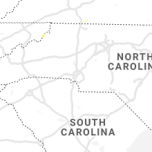


Connect with Interactive Hail Maps