

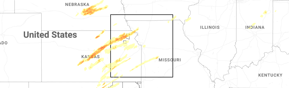
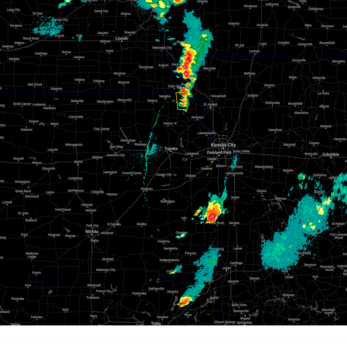
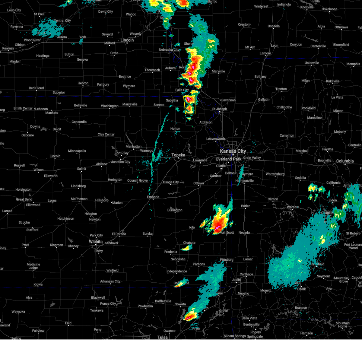
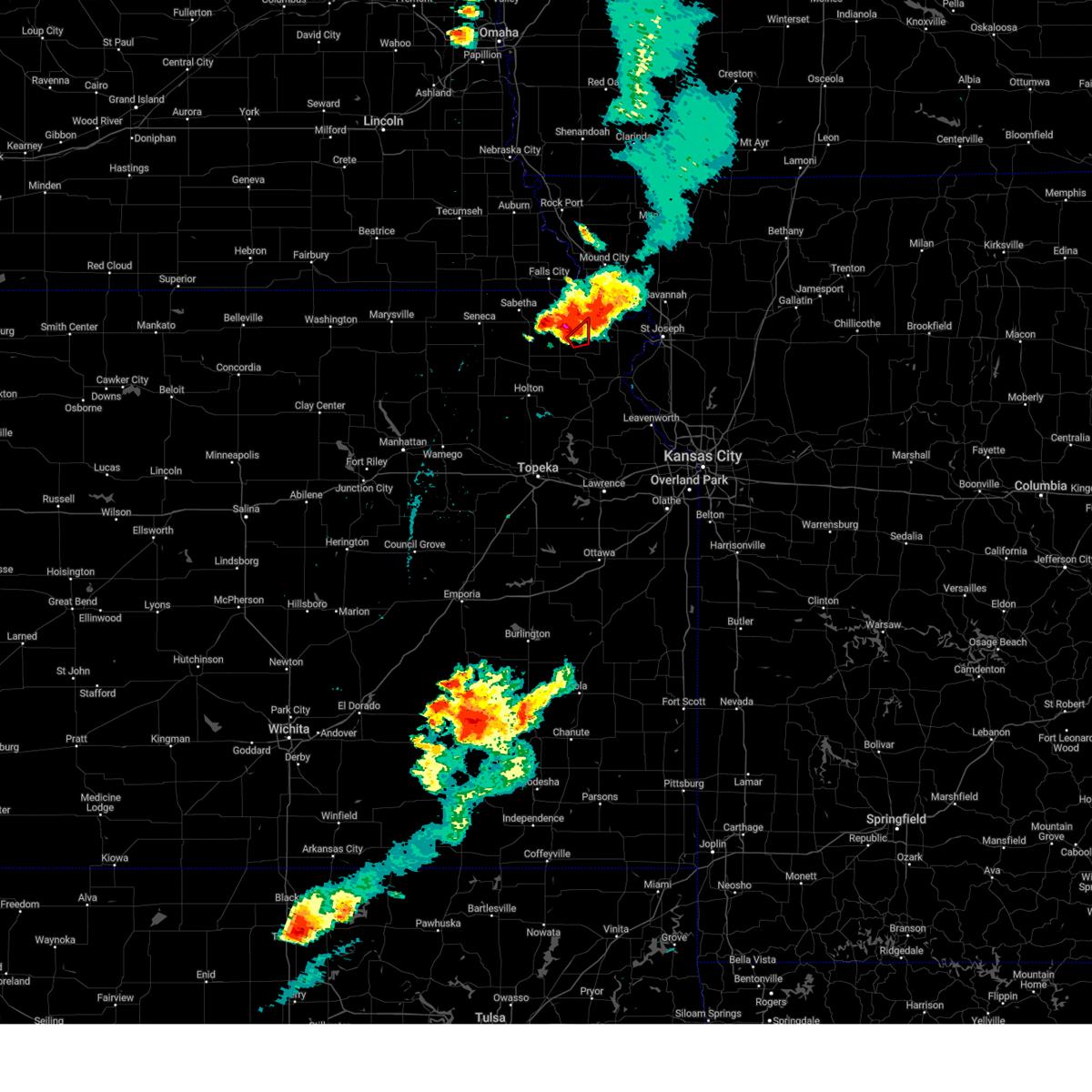
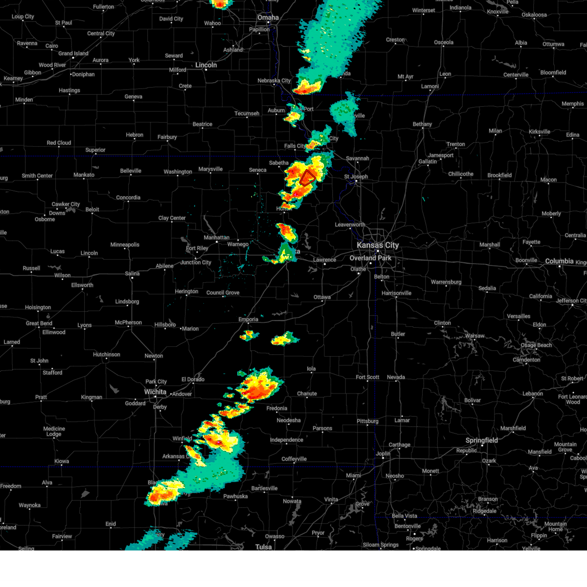
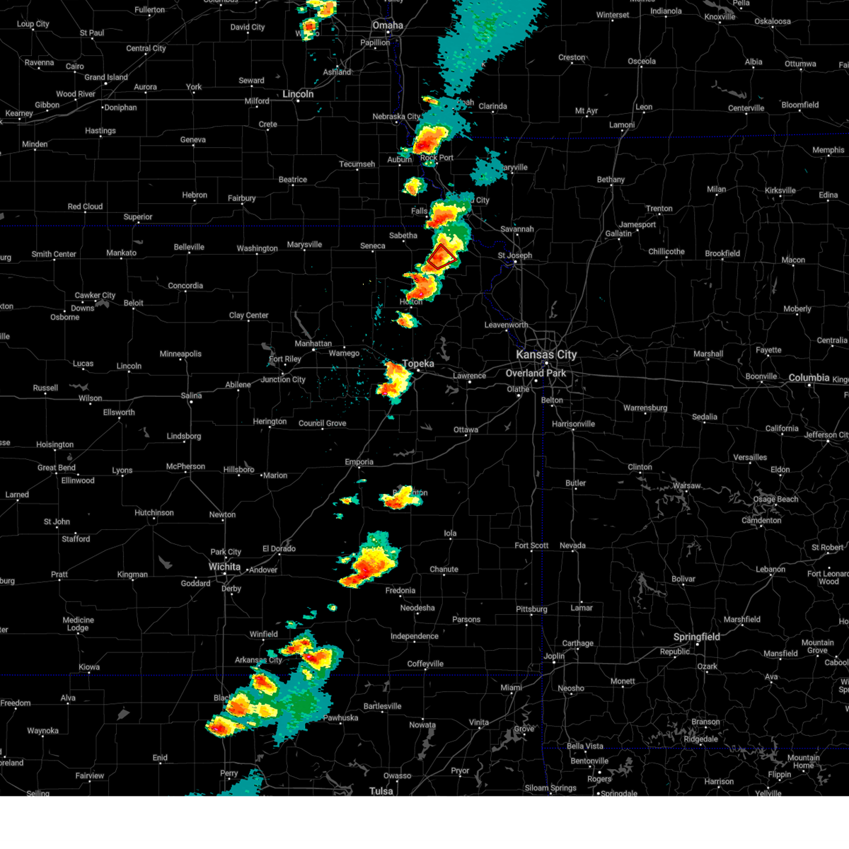
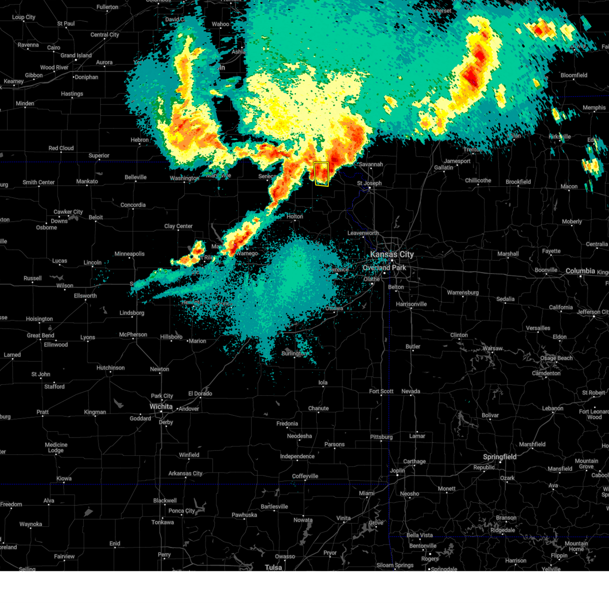
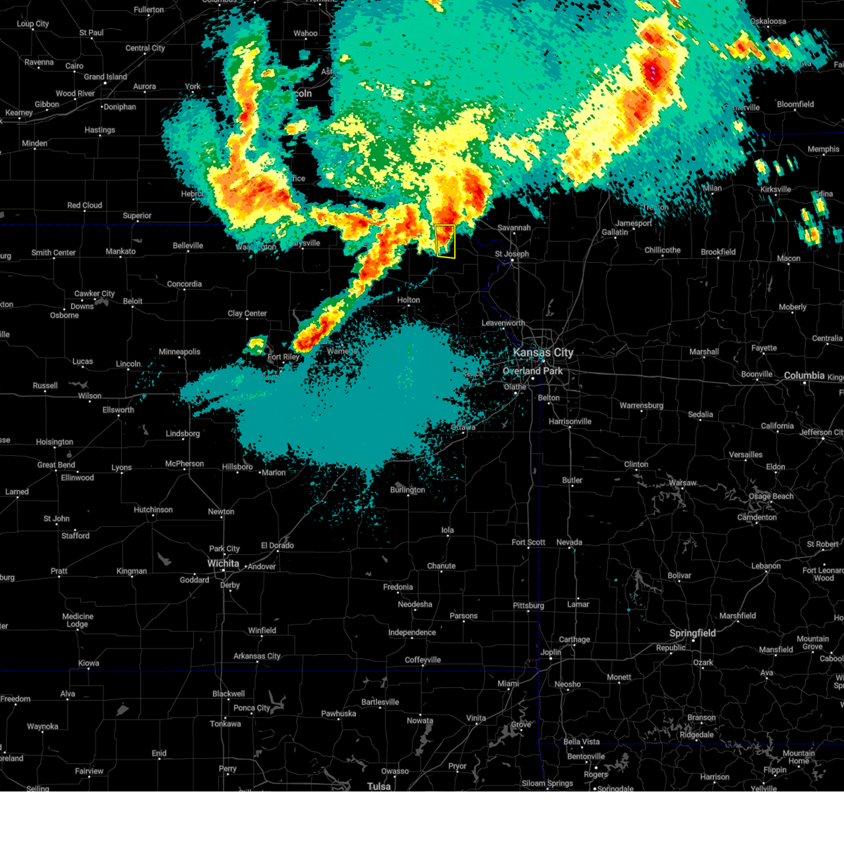
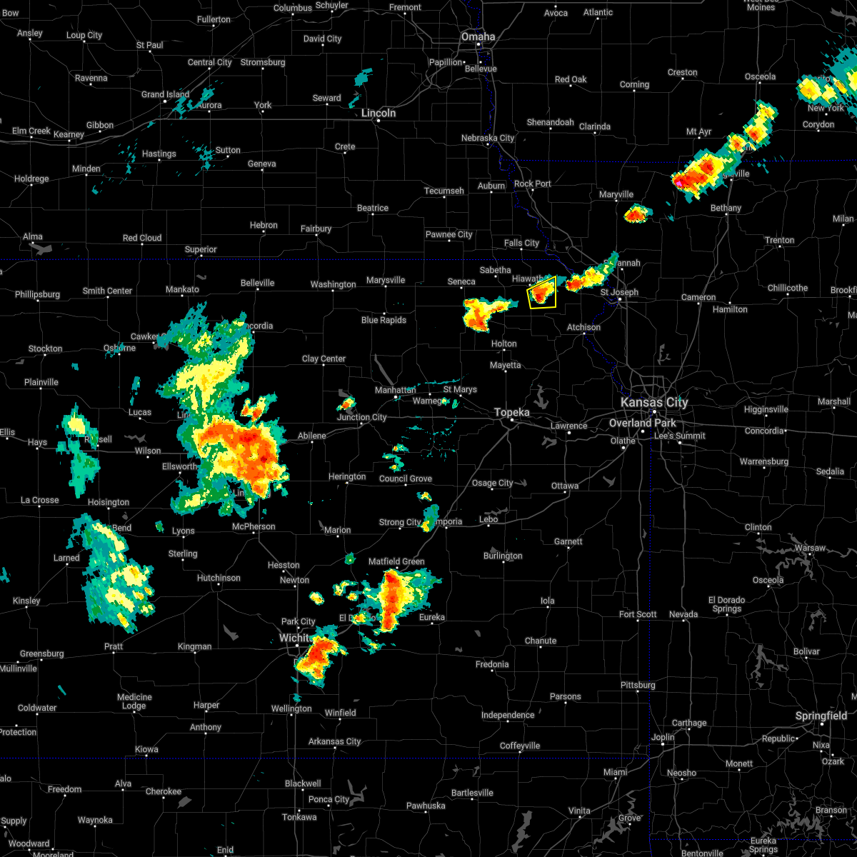
Hail Map for Robinson, KS
The Robinson, KS area has had 6 reports of on-the-ground hail by trained spotters, and has been under severe weather warnings 8 times during the past 12 months. Doppler radar has detected hail at or near Robinson, KS on 81 occasions, including 3 occasions during the past year.
| Name: | Robinson, KS |
| Where Located: | 66.2 miles NW of Kansas City, MO |
| Map: | Google Map for Robinson, KS |
| Population: | 234 |
| Housing Units: | 109 |
| More Info: | Search Google for Robinson, KS |
1
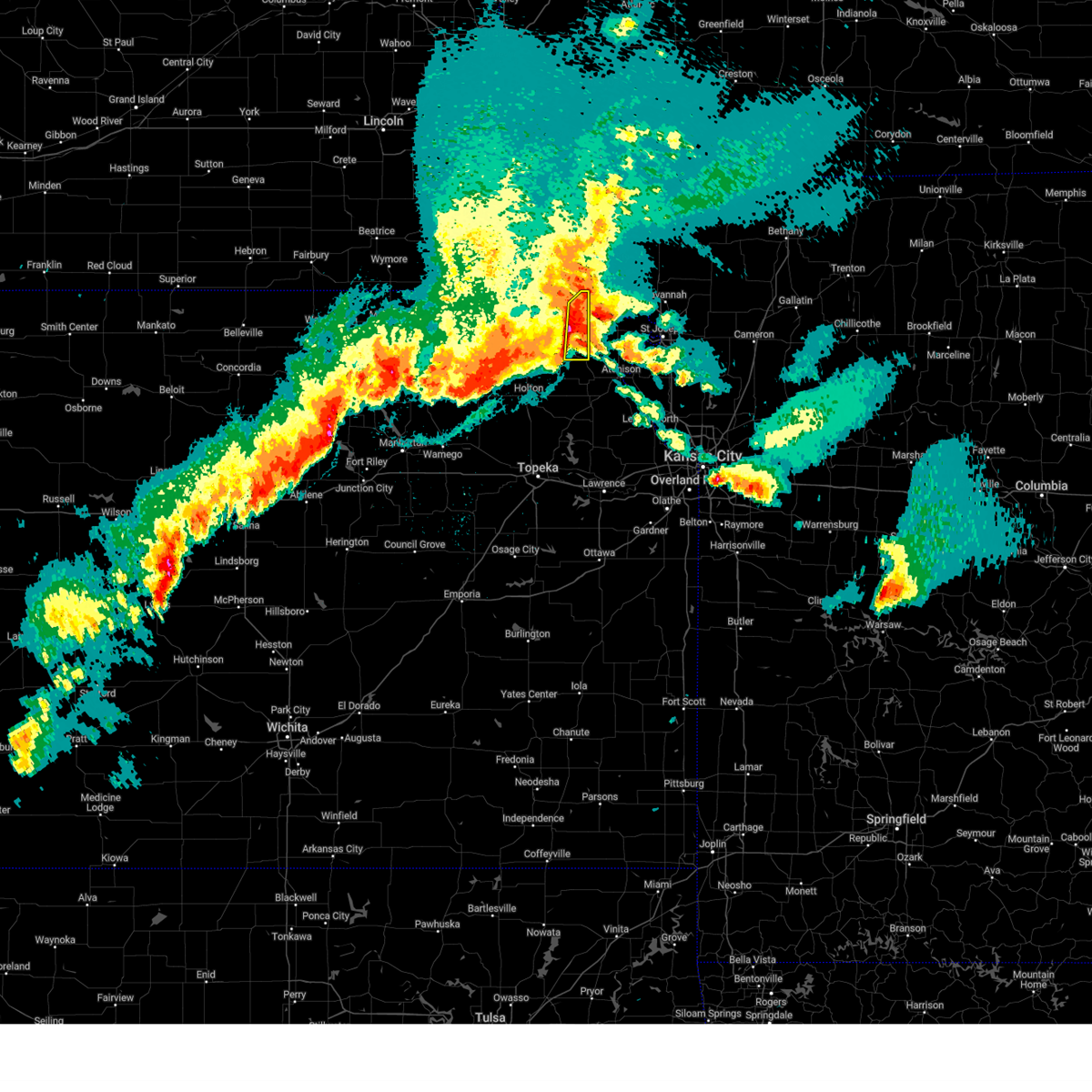
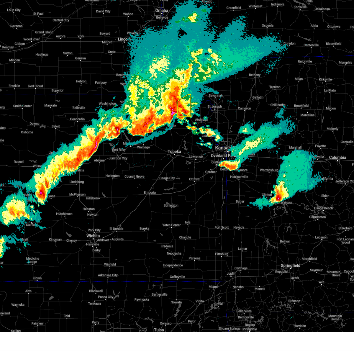
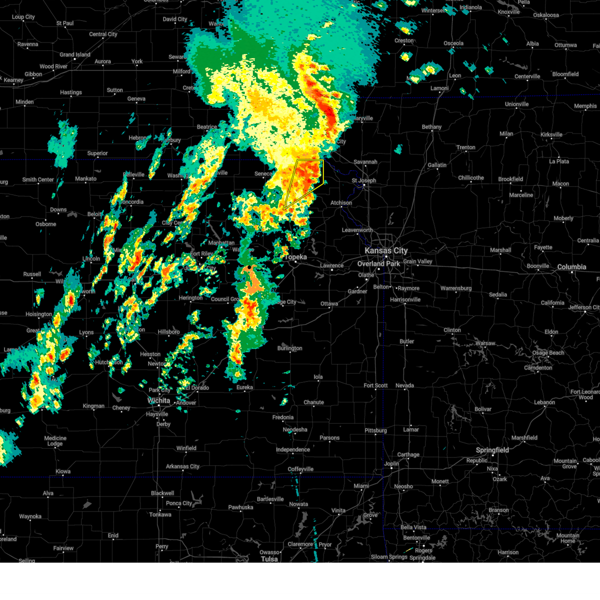
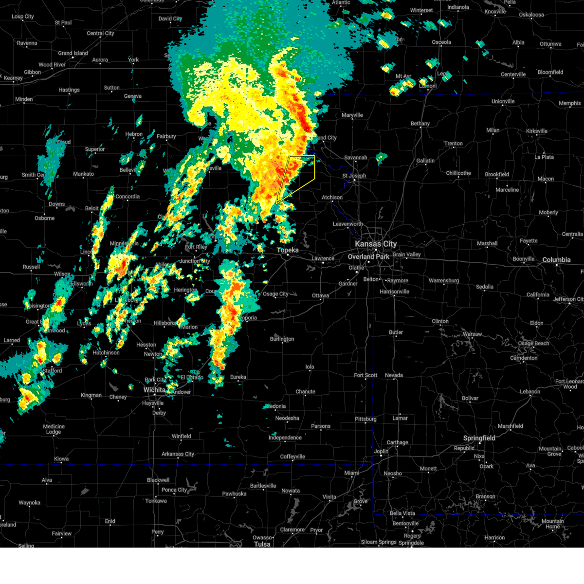
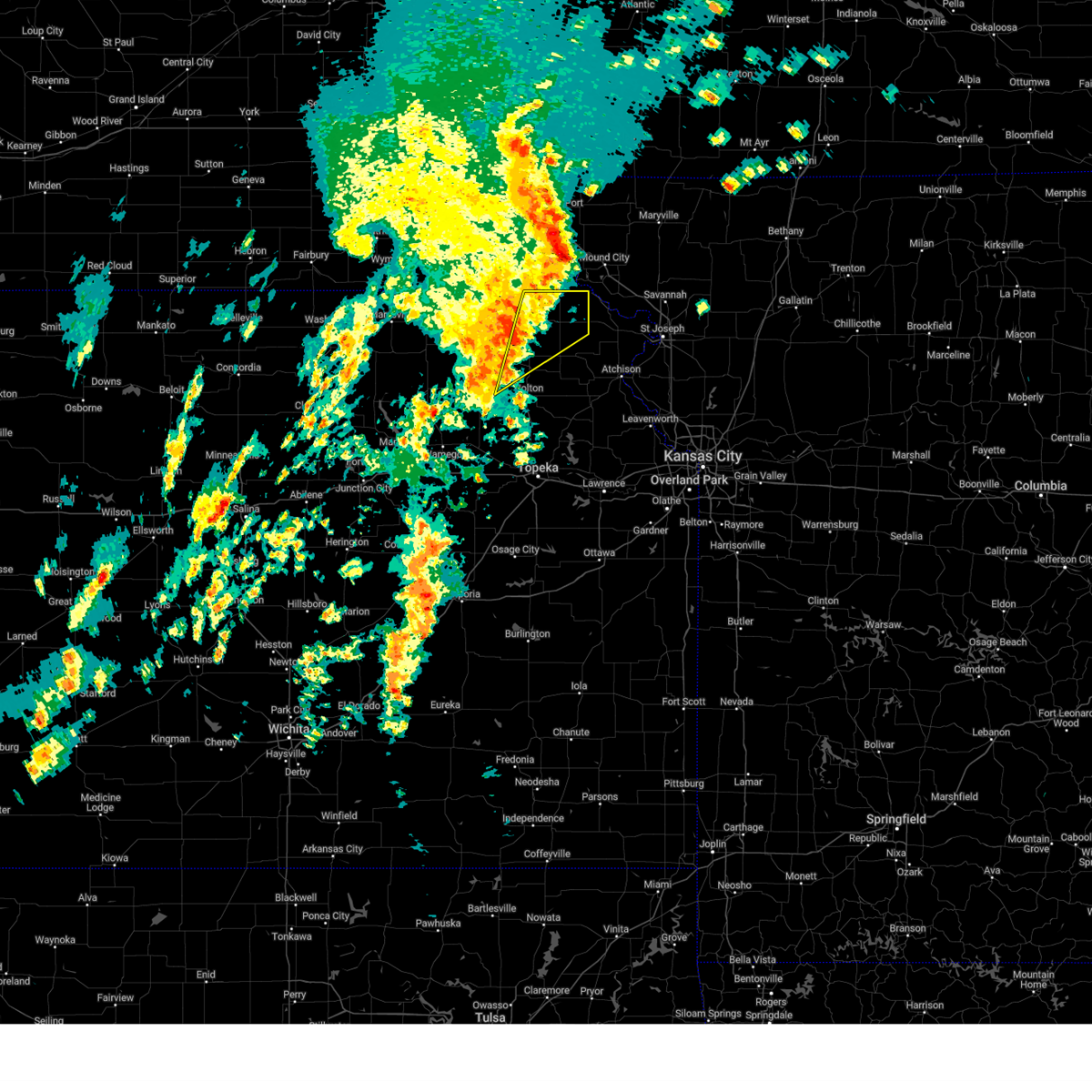
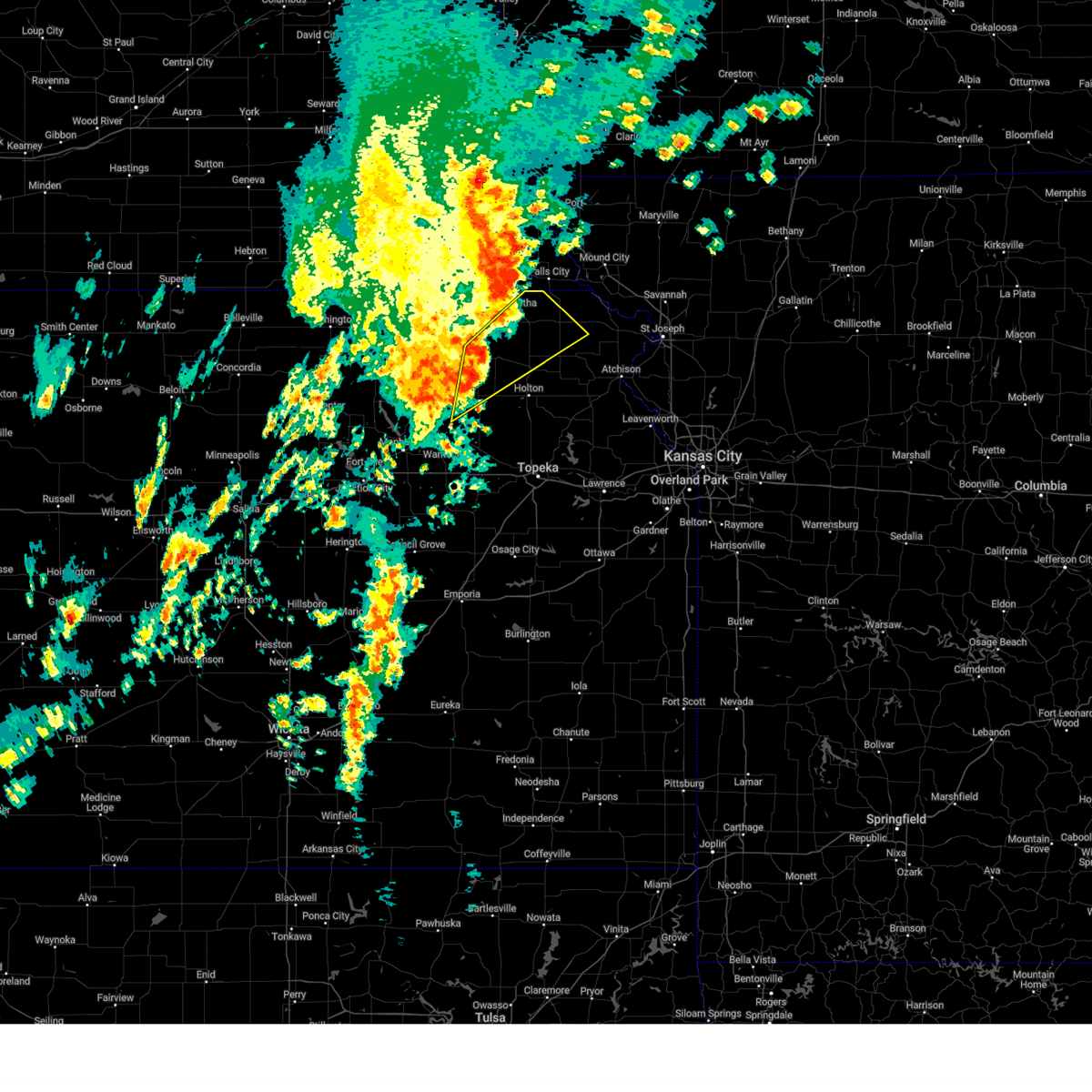
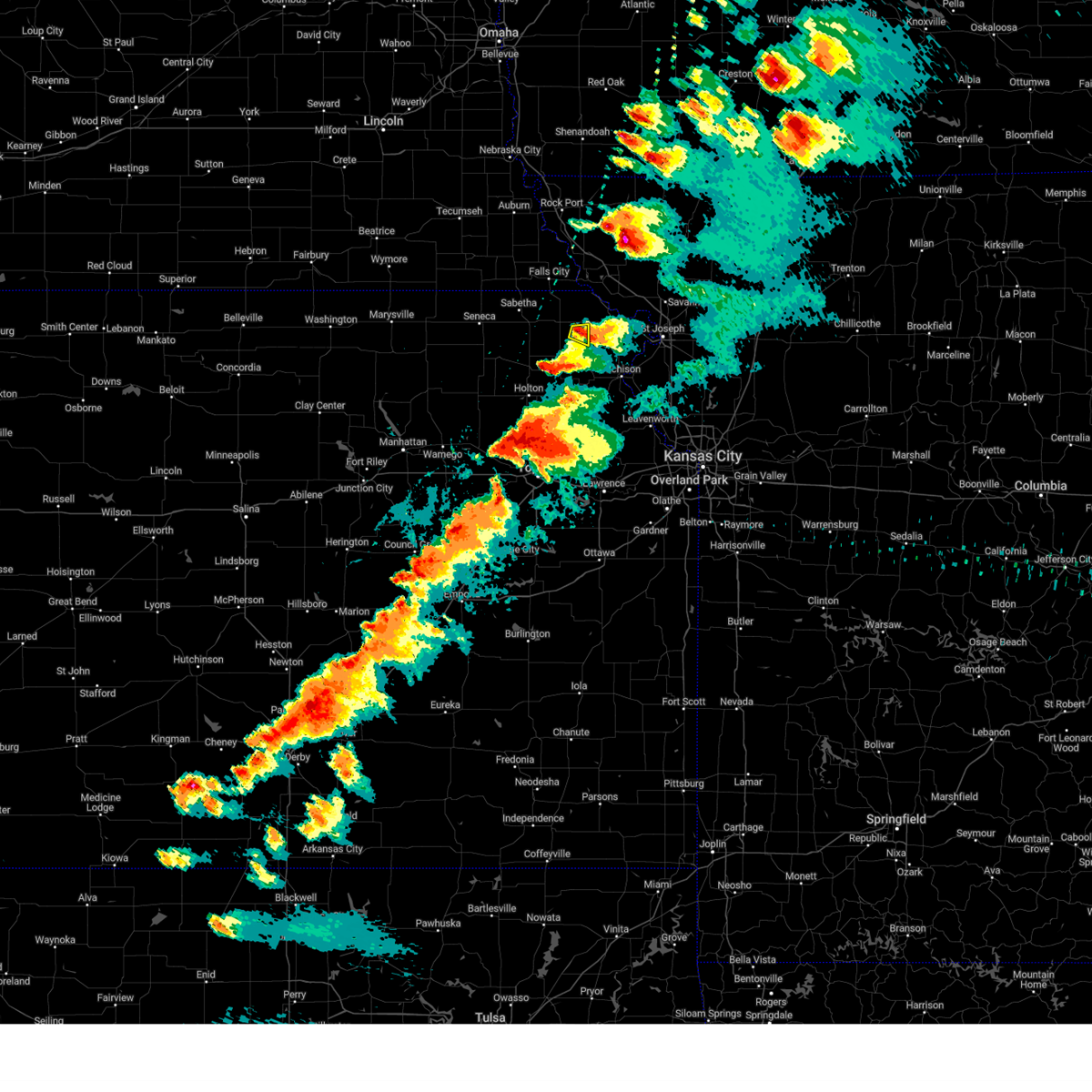
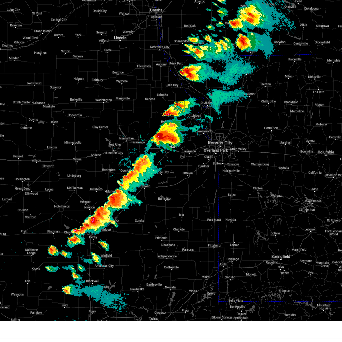
The Top Recent Hail Date for Robinson, KS is Tuesday, April 1, 2025 (7th out of 81)
Hail and Wind Damage Spotted near Robinson, KS
| Date / Time | Report Details |
|---|---|
| 4/2/2025 12:04 AM CDT |
 At 1203 am cdt, severe thunderstorms were located along a line extending from 6 miles southwest of white cloud to near everest, moving northeast at 50 mph (radar indicated). Hazards include 70 mph wind gusts and quarter size hail. Hail damage to vehicles is expected. expect considerable tree damage. wind damage is also likely to mobile homes, roofs, and outbuildings. Locations impacted include, everest and robinson. At 1203 am cdt, severe thunderstorms were located along a line extending from 6 miles southwest of white cloud to near everest, moving northeast at 50 mph (radar indicated). Hazards include 70 mph wind gusts and quarter size hail. Hail damage to vehicles is expected. expect considerable tree damage. wind damage is also likely to mobile homes, roofs, and outbuildings. Locations impacted include, everest and robinson.
|
| 4/1/2025 11:40 PM CDT |
 Svrtop the national weather service in topeka has issued a * severe thunderstorm warning for, eastern brown county in northeastern kansas, * until 1230 am cdt. * at 1139 pm cdt, severe thunderstorms were located along a line extending from 3 miles south of fairview to near netawaka, moving northeast at 50 mph (radar indicated). Hazards include 70 mph wind gusts and half dollar size hail. Hail damage to vehicles is expected. expect considerable tree damage. Wind damage is also likely to mobile homes, roofs, and outbuildings. Svrtop the national weather service in topeka has issued a * severe thunderstorm warning for, eastern brown county in northeastern kansas, * until 1230 am cdt. * at 1139 pm cdt, severe thunderstorms were located along a line extending from 3 miles south of fairview to near netawaka, moving northeast at 50 mph (radar indicated). Hazards include 70 mph wind gusts and half dollar size hail. Hail damage to vehicles is expected. expect considerable tree damage. Wind damage is also likely to mobile homes, roofs, and outbuildings.
|
| 10/30/2024 1:35 PM CDT |
 The storms which prompted the warning have weakened below severe limits, and have exited the warned area. therefore, the warning will be allowed to expire. however, gusty winds are still possible with these thunderstorms. The storms which prompted the warning have weakened below severe limits, and have exited the warned area. therefore, the warning will be allowed to expire. however, gusty winds are still possible with these thunderstorms.
|
| 10/30/2024 1:24 PM CDT |
 the severe thunderstorm warning has been cancelled and is no longer in effect the severe thunderstorm warning has been cancelled and is no longer in effect
|
| 10/30/2024 1:24 PM CDT |
 At 124 pm cdt, severe thunderstorms were located along a line extending from near rulo to 3 miles southeast of circleville, moving northeast at 60 mph (radar indicated). Hazards include 70 mph wind gusts. Expect considerable tree damage. damage is likely to mobile homes, roofs, and outbuildings. Locations impacted include, hiawatha, robinson, netawaka, reserve, powhattan, hamlin, willis, and kickapoo reservation. At 124 pm cdt, severe thunderstorms were located along a line extending from near rulo to 3 miles southeast of circleville, moving northeast at 60 mph (radar indicated). Hazards include 70 mph wind gusts. Expect considerable tree damage. damage is likely to mobile homes, roofs, and outbuildings. Locations impacted include, hiawatha, robinson, netawaka, reserve, powhattan, hamlin, willis, and kickapoo reservation.
|
| 10/30/2024 1:13 PM CDT |
 Svrtop the national weather service in topeka has issued a * severe thunderstorm warning for, southeastern nemaha county in northeastern kansas, northwestern jackson county in northeastern kansas, brown county in northeastern kansas, * until 145 pm cdt. * at 112 pm cdt, severe thunderstorms were located along a line extending from near reserve to 7 miles northeast of emmett, moving northeast at 60 mph (radar indicated. there have multiple recent reports of 60- 70 mph wind gusts in eastern nemaha county). Hazards include 70 mph wind gusts. Expect considerable tree damage. Damage is likely to mobile homes, roofs, and outbuildings. Svrtop the national weather service in topeka has issued a * severe thunderstorm warning for, southeastern nemaha county in northeastern kansas, northwestern jackson county in northeastern kansas, brown county in northeastern kansas, * until 145 pm cdt. * at 112 pm cdt, severe thunderstorms were located along a line extending from near reserve to 7 miles northeast of emmett, moving northeast at 60 mph (radar indicated. there have multiple recent reports of 60- 70 mph wind gusts in eastern nemaha county). Hazards include 70 mph wind gusts. Expect considerable tree damage. Damage is likely to mobile homes, roofs, and outbuildings.
|
| 10/30/2024 12:49 PM CDT |
 Svrtop the national weather service in topeka has issued a * severe thunderstorm warning for, northeastern pottawatomie county in northeastern kansas, southeastern nemaha county in northeastern kansas, northwestern jackson county in northeastern kansas, brown county in northeastern kansas, * until 115 pm cdt. * at 1248 pm cdt, a severe thunderstorm was located over goff, moving northeast at 70 mph (radar indicated). Hazards include 60 mph wind gusts and penny size hail. expect damage to roofs, siding, and trees Svrtop the national weather service in topeka has issued a * severe thunderstorm warning for, northeastern pottawatomie county in northeastern kansas, southeastern nemaha county in northeastern kansas, northwestern jackson county in northeastern kansas, brown county in northeastern kansas, * until 115 pm cdt. * at 1248 pm cdt, a severe thunderstorm was located over goff, moving northeast at 70 mph (radar indicated). Hazards include 60 mph wind gusts and penny size hail. expect damage to roofs, siding, and trees
|
| 8/14/2024 9:24 PM CDT |
 Svrtop the national weather service in topeka has issued a * severe thunderstorm warning for, northwestern jefferson county in northeastern kansas, northwestern shawnee county in east central kansas, northern wabaunsee county in east central kansas, southeastern pottawatomie county in northeastern kansas, southeastern nemaha county in northeastern kansas, jackson county in northeastern kansas, brown county in northeastern kansas, * until 1000 pm cdt. * at 923 pm cdt, severe thunderstorms were located along a line extending from 4 miles northwest of forest city to near kickapoo reservation to 5 miles northwest of paxico, moving east at 50 mph (radar indicated). Hazards include 60 mph wind gusts. expect damage to roofs, siding, and trees Svrtop the national weather service in topeka has issued a * severe thunderstorm warning for, northwestern jefferson county in northeastern kansas, northwestern shawnee county in east central kansas, northern wabaunsee county in east central kansas, southeastern pottawatomie county in northeastern kansas, southeastern nemaha county in northeastern kansas, jackson county in northeastern kansas, brown county in northeastern kansas, * until 1000 pm cdt. * at 923 pm cdt, severe thunderstorms were located along a line extending from 4 miles northwest of forest city to near kickapoo reservation to 5 miles northwest of paxico, moving east at 50 mph (radar indicated). Hazards include 60 mph wind gusts. expect damage to roofs, siding, and trees
|
| 6/15/2024 7:57 PM CDT |
 the severe thunderstorm warning has been cancelled and is no longer in effect the severe thunderstorm warning has been cancelled and is no longer in effect
|
| 6/15/2024 7:57 PM CDT |
 At 757 pm cdt, severe thunderstorms were located along a line extending from near falls city to near hiawatha to near kickapoo reservation, moving east at 25 mph (radar indicated). Hazards include 60 mph wind gusts and nickel size hail. Expect damage to roofs, siding, and trees. Locations impacted include, hiawatha, sabetha, horton, everest, fairview, robinson, morrill, reserve, powhattan, hamlin, willis, and kickapoo reservation. At 757 pm cdt, severe thunderstorms were located along a line extending from near falls city to near hiawatha to near kickapoo reservation, moving east at 25 mph (radar indicated). Hazards include 60 mph wind gusts and nickel size hail. Expect damage to roofs, siding, and trees. Locations impacted include, hiawatha, sabetha, horton, everest, fairview, robinson, morrill, reserve, powhattan, hamlin, willis, and kickapoo reservation.
|
| 6/15/2024 7:43 PM CDT |
 Svrtop the national weather service in topeka has issued a * severe thunderstorm warning for, eastern nemaha county in northeastern kansas, northeastern jackson county in northeastern kansas, brown county in northeastern kansas, * until 830 pm cdt. * at 743 pm cdt, severe thunderstorms were located along a line extending from 5 miles southeast of salem to near fairview to 4 miles south of netawaka, moving east at 25 mph (radar indicated). Hazards include 60 mph wind gusts and nickel size hail. expect damage to roofs, siding, and trees Svrtop the national weather service in topeka has issued a * severe thunderstorm warning for, eastern nemaha county in northeastern kansas, northeastern jackson county in northeastern kansas, brown county in northeastern kansas, * until 830 pm cdt. * at 743 pm cdt, severe thunderstorms were located along a line extending from 5 miles southeast of salem to near fairview to 4 miles south of netawaka, moving east at 25 mph (radar indicated). Hazards include 60 mph wind gusts and nickel size hail. expect damage to roofs, siding, and trees
|
| 6/15/2024 7:21 PM CDT |
 the severe thunderstorm warning has been cancelled and is no longer in effect the severe thunderstorm warning has been cancelled and is no longer in effect
|
| 6/15/2024 7:21 PM CDT |
 At 718 pm cdt, severe thunderstorms were located along a line extending from 6 miles northeast of bern to near sabetha to 4 miles north of circleville, moving northeast at 40 mph (trained weather spotters. at 712 pm trained spotters reported 60 mph winds in corning. also a home weather station recorded a 64 mph wind gust 1 mile north northwest of bern at 708 pm). Hazards include 60 mph wind gusts and nickel size hail. Expect damage to roofs, siding, and trees. Locations impacted include, hiawatha, sabetha, seneca, horton, centralia, wetmore, everest, fairview, robinson, morrill, whiting, bern, corning, netawaka, soldier, goff, reserve, powhattan, oneida, and hamlin. At 718 pm cdt, severe thunderstorms were located along a line extending from 6 miles northeast of bern to near sabetha to 4 miles north of circleville, moving northeast at 40 mph (trained weather spotters. at 712 pm trained spotters reported 60 mph winds in corning. also a home weather station recorded a 64 mph wind gust 1 mile north northwest of bern at 708 pm). Hazards include 60 mph wind gusts and nickel size hail. Expect damage to roofs, siding, and trees. Locations impacted include, hiawatha, sabetha, seneca, horton, centralia, wetmore, everest, fairview, robinson, morrill, whiting, bern, corning, netawaka, soldier, goff, reserve, powhattan, oneida, and hamlin.
|
| 6/15/2024 7:04 PM CDT |
 Svrtop the national weather service in topeka has issued a * severe thunderstorm warning for, northeastern pottawatomie county in northeastern kansas, nemaha county in northeastern kansas, northern jackson county in northeastern kansas, brown county in northeastern kansas, * until 745 pm cdt. * at 704 pm cdt, severe thunderstorms were located along a line extending from near du bois to oneida to near soldier, moving northeast at 40 mph (radar indicated). Hazards include 60 mph wind gusts and nickel size hail. expect damage to roofs, siding, and trees Svrtop the national weather service in topeka has issued a * severe thunderstorm warning for, northeastern pottawatomie county in northeastern kansas, nemaha county in northeastern kansas, northern jackson county in northeastern kansas, brown county in northeastern kansas, * until 745 pm cdt. * at 704 pm cdt, severe thunderstorms were located along a line extending from near du bois to oneida to near soldier, moving northeast at 40 mph (radar indicated). Hazards include 60 mph wind gusts and nickel size hail. expect damage to roofs, siding, and trees
|
| 5/25/2024 11:36 PM CDT |
 At 1136 pm cdt, severe thunderstorms were located along a line extending from 5 miles south of rulo to 3 miles southeast of robinson to 3 miles north of effingham, moving east at 40 mph (radar indicated). Hazards include 60 mph wind gusts and quarter size hail. Hail damage to vehicles is expected. expect wind damage to roofs, siding, and trees. Locations impacted include, everest, robinson, and willis. At 1136 pm cdt, severe thunderstorms were located along a line extending from 5 miles south of rulo to 3 miles southeast of robinson to 3 miles north of effingham, moving east at 40 mph (radar indicated). Hazards include 60 mph wind gusts and quarter size hail. Hail damage to vehicles is expected. expect wind damage to roofs, siding, and trees. Locations impacted include, everest, robinson, and willis.
|
| 5/25/2024 11:29 PM CDT |
 the severe thunderstorm warning has been cancelled and is no longer in effect the severe thunderstorm warning has been cancelled and is no longer in effect
|
| 5/25/2024 11:29 PM CDT |
 At 1129 pm cdt, severe thunderstorms were located along a line extending from 3 miles east of reserve to 3 miles southwest of robinson to 3 miles northeast of muscotah, moving east at 40 mph (radar indicated). Hazards include 60 mph wind gusts and quarter size hail. Hail damage to vehicles is expected. expect wind damage to roofs, siding, and trees. Locations impacted include, hiawatha, horton, everest, robinson, reserve, and willis. At 1129 pm cdt, severe thunderstorms were located along a line extending from 3 miles east of reserve to 3 miles southwest of robinson to 3 miles northeast of muscotah, moving east at 40 mph (radar indicated). Hazards include 60 mph wind gusts and quarter size hail. Hail damage to vehicles is expected. expect wind damage to roofs, siding, and trees. Locations impacted include, hiawatha, horton, everest, robinson, reserve, and willis.
|
| 5/25/2024 11:22 PM CDT |
 At 1121 pm cdt, severe thunderstorms were located along a line extending from near reserve to 4 miles north of willis to near muscotah, moving east at 40 mph (radar indicated). Hazards include 60 mph wind gusts and quarter size hail. Hail damage to vehicles is expected. expect wind damage to roofs, siding, and trees. Locations impacted include, hiawatha, horton, everest, robinson, whiting, netawaka, reserve, powhattan, hamlin, willis, and kickapoo reservation. At 1121 pm cdt, severe thunderstorms were located along a line extending from near reserve to 4 miles north of willis to near muscotah, moving east at 40 mph (radar indicated). Hazards include 60 mph wind gusts and quarter size hail. Hail damage to vehicles is expected. expect wind damage to roofs, siding, and trees. Locations impacted include, hiawatha, horton, everest, robinson, whiting, netawaka, reserve, powhattan, hamlin, willis, and kickapoo reservation.
|
| 5/25/2024 11:14 PM CDT |
 At 1113 pm cdt, severe thunderstorms were located along a line extending from 4 miles northeast of morrill to near powhattan to whiting, moving east at 40 mph (radar indicated). Hazards include 60 mph wind gusts and quarter size hail. Hail damage to vehicles is expected. expect wind damage to roofs, siding, and trees. Locations impacted include, hiawatha, sabetha, horton, everest, fairview, robinson, morrill, whiting, netawaka, reserve, powhattan, hamlin, willis, and kickapoo reservation. At 1113 pm cdt, severe thunderstorms were located along a line extending from 4 miles northeast of morrill to near powhattan to whiting, moving east at 40 mph (radar indicated). Hazards include 60 mph wind gusts and quarter size hail. Hail damage to vehicles is expected. expect wind damage to roofs, siding, and trees. Locations impacted include, hiawatha, sabetha, horton, everest, fairview, robinson, morrill, whiting, netawaka, reserve, powhattan, hamlin, willis, and kickapoo reservation.
|
| 5/25/2024 11:14 PM CDT |
 the severe thunderstorm warning has been cancelled and is no longer in effect the severe thunderstorm warning has been cancelled and is no longer in effect
|
| 5/25/2024 11:07 PM CDT |
 At 1107 pm cdt, severe thunderstorms were located along a line extending from 3 miles northwest of morrill to near powhattan to near netawaka, moving east at 35 mph (radar indicated). Hazards include 60 mph wind gusts and quarter size hail. Hail damage to vehicles is expected. expect wind damage to roofs, siding, and trees. Locations impacted include, hiawatha, sabetha, horton, wetmore, everest, fairview, robinson, morrill, whiting, netawaka, reserve, powhattan, hamlin, willis, and kickapoo reservation. At 1107 pm cdt, severe thunderstorms were located along a line extending from 3 miles northwest of morrill to near powhattan to near netawaka, moving east at 35 mph (radar indicated). Hazards include 60 mph wind gusts and quarter size hail. Hail damage to vehicles is expected. expect wind damage to roofs, siding, and trees. Locations impacted include, hiawatha, sabetha, horton, wetmore, everest, fairview, robinson, morrill, whiting, netawaka, reserve, powhattan, hamlin, willis, and kickapoo reservation.
|
| 5/25/2024 10:53 PM CDT |
 Svrtop the national weather service in topeka has issued a * severe thunderstorm warning for, eastern nemaha county in northeastern kansas, northeastern jackson county in northeastern kansas, brown county in northeastern kansas, * until 1145 pm cdt. * at 1052 pm cdt, severe thunderstorms were located along a line extending from 4 miles east of bern to near woodlawn to 4 miles northeast of soldier, moving east at 40 mph (radar indicated). Hazards include 60 mph wind gusts and quarter size hail. Hail damage to vehicles is expected. Expect wind damage to roofs, siding, and trees. Svrtop the national weather service in topeka has issued a * severe thunderstorm warning for, eastern nemaha county in northeastern kansas, northeastern jackson county in northeastern kansas, brown county in northeastern kansas, * until 1145 pm cdt. * at 1052 pm cdt, severe thunderstorms were located along a line extending from 4 miles east of bern to near woodlawn to 4 miles northeast of soldier, moving east at 40 mph (radar indicated). Hazards include 60 mph wind gusts and quarter size hail. Hail damage to vehicles is expected. Expect wind damage to roofs, siding, and trees.
|
| 4/30/2024 6:09 PM CDT |
 At 609 pm cdt, a severe thunderstorm was located 4 miles southeast of robinson, moving east at 25 mph (radar indicated). Hazards include 70 mph wind gusts and half dollar size hail. Hail damage to vehicles is expected. expect considerable tree damage. wind damage is also likely to mobile homes, roofs, and outbuildings. Locations impacted include, robinson. At 609 pm cdt, a severe thunderstorm was located 4 miles southeast of robinson, moving east at 25 mph (radar indicated). Hazards include 70 mph wind gusts and half dollar size hail. Hail damage to vehicles is expected. expect considerable tree damage. wind damage is also likely to mobile homes, roofs, and outbuildings. Locations impacted include, robinson.
|
| 4/30/2024 5:59 PM CDT |
 At 559 pm cdt, a severe thunderstorm was located near robinson, moving east at 25 mph (radar indicated). Hazards include 70 mph wind gusts and half dollar size hail. Hail damage to vehicles is expected. expect considerable tree damage. wind damage is also likely to mobile homes, roofs, and outbuildings. Locations impacted include, robinson. At 559 pm cdt, a severe thunderstorm was located near robinson, moving east at 25 mph (radar indicated). Hazards include 70 mph wind gusts and half dollar size hail. Hail damage to vehicles is expected. expect considerable tree damage. wind damage is also likely to mobile homes, roofs, and outbuildings. Locations impacted include, robinson.
|
| 4/30/2024 5:49 PM CDT |
 Svrtop the national weather service in topeka has issued a * severe thunderstorm warning for, southeastern brown county in northeastern kansas, * until 615 pm cdt. * at 549 pm cdt, a severe thunderstorm was located 4 miles north of willis, moving east at 25 mph (radar indicated). Hazards include 70 mph wind gusts and half dollar size hail. Hail damage to vehicles is expected. expect considerable tree damage. Wind damage is also likely to mobile homes, roofs, and outbuildings. Svrtop the national weather service in topeka has issued a * severe thunderstorm warning for, southeastern brown county in northeastern kansas, * until 615 pm cdt. * at 549 pm cdt, a severe thunderstorm was located 4 miles north of willis, moving east at 25 mph (radar indicated). Hazards include 70 mph wind gusts and half dollar size hail. Hail damage to vehicles is expected. expect considerable tree damage. Wind damage is also likely to mobile homes, roofs, and outbuildings.
|
| 4/27/2024 3:44 PM CDT |
 the tornado warning has been cancelled and is no longer in effect the tornado warning has been cancelled and is no longer in effect
|
| 4/27/2024 3:29 PM CDT |
 At 329 pm cdt, a severe thunderstorm capable of producing a tornado was located over hiawatha, moving northeast at 35 mph (radar indicated rotation). Hazards include tornado. Flying debris will be dangerous to those caught without shelter. mobile homes will be damaged or destroyed. damage to roofs, windows, and vehicles will occur. tree damage is likely. this dangerous storm will be near, robinson and reserve around 335 pm cdt. Other locations impacted by this tornadic thunderstorm include iowa reservation of kansas and nebraska and sac and fox nation reservation. At 329 pm cdt, a severe thunderstorm capable of producing a tornado was located over hiawatha, moving northeast at 35 mph (radar indicated rotation). Hazards include tornado. Flying debris will be dangerous to those caught without shelter. mobile homes will be damaged or destroyed. damage to roofs, windows, and vehicles will occur. tree damage is likely. this dangerous storm will be near, robinson and reserve around 335 pm cdt. Other locations impacted by this tornadic thunderstorm include iowa reservation of kansas and nebraska and sac and fox nation reservation.
|
| 4/27/2024 3:23 PM CDT |
 At 323 pm cdt, a severe thunderstorm capable of producing a tornado was located 4 miles west of hiawatha, moving northeast at 35 mph (radar indicated rotation). Hazards include tornado and quarter size hail. Flying debris will be dangerous to those caught without shelter. mobile homes will be damaged or destroyed. damage to roofs, windows, and vehicles will occur. tree damage is likely. this dangerous storm will be near, hiawatha, robinson, reserve, and hamlin around 330 pm cdt. Other locations impacted by this tornadic thunderstorm include iowa reservation of kansas and nebraska and sac and fox nation reservation. At 323 pm cdt, a severe thunderstorm capable of producing a tornado was located 4 miles west of hiawatha, moving northeast at 35 mph (radar indicated rotation). Hazards include tornado and quarter size hail. Flying debris will be dangerous to those caught without shelter. mobile homes will be damaged or destroyed. damage to roofs, windows, and vehicles will occur. tree damage is likely. this dangerous storm will be near, hiawatha, robinson, reserve, and hamlin around 330 pm cdt. Other locations impacted by this tornadic thunderstorm include iowa reservation of kansas and nebraska and sac and fox nation reservation.
|
| 4/27/2024 3:15 PM CDT |
 At 315 pm cdt, a severe thunderstorm capable of producing a tornado was located just south of fairview, moving northeast at 30 mph (radar indicated rotation). Hazards include tornado and quarter size hail. Flying debris will be dangerous to those caught without shelter. mobile homes will be damaged or destroyed. damage to roofs, windows, and vehicles will occur. tree damage is likely. this dangerous storm will be near, hiawatha, morrill, and hamlin around 320 pm cdt. robinson around 330 pm cdt. reserve around 335 pm cdt. Other locations impacted by this tornadic thunderstorm include iowa reservation of kansas and nebraska and sac and fox nation reservation. At 315 pm cdt, a severe thunderstorm capable of producing a tornado was located just south of fairview, moving northeast at 30 mph (radar indicated rotation). Hazards include tornado and quarter size hail. Flying debris will be dangerous to those caught without shelter. mobile homes will be damaged or destroyed. damage to roofs, windows, and vehicles will occur. tree damage is likely. this dangerous storm will be near, hiawatha, morrill, and hamlin around 320 pm cdt. robinson around 330 pm cdt. reserve around 335 pm cdt. Other locations impacted by this tornadic thunderstorm include iowa reservation of kansas and nebraska and sac and fox nation reservation.
|
| 4/27/2024 3:06 PM CDT |
 the tornado warning has been cancelled and is no longer in effect the tornado warning has been cancelled and is no longer in effect
|
| 4/27/2024 3:06 PM CDT |
 At 304 pm cdt, a severe thunderstorm capable of producing a tornado was located near fairview, moving northeast at 35 mph (radar indicated rotation). Hazards include tornado and ping pong ball size hail. Flying debris will be dangerous to those caught without shelter. mobile homes will be damaged or destroyed. damage to roofs, windows, and vehicles will occur. tree damage is likely. this dangerous storm will be near, hiawatha, sabetha, fairview, morrill, and hamlin around 310 pm cdt. reserve around 320 pm cdt. other locations impacted by this tornadic thunderstorm include iowa reservation of kansas and nebraska and sac and fox nation reservation. This storm has a history of producing tornadoes. At 304 pm cdt, a severe thunderstorm capable of producing a tornado was located near fairview, moving northeast at 35 mph (radar indicated rotation). Hazards include tornado and ping pong ball size hail. Flying debris will be dangerous to those caught without shelter. mobile homes will be damaged or destroyed. damage to roofs, windows, and vehicles will occur. tree damage is likely. this dangerous storm will be near, hiawatha, sabetha, fairview, morrill, and hamlin around 310 pm cdt. reserve around 320 pm cdt. other locations impacted by this tornadic thunderstorm include iowa reservation of kansas and nebraska and sac and fox nation reservation. This storm has a history of producing tornadoes.
|
| 4/27/2024 3:01 PM CDT |
 At 300 pm cdt, a severe thunderstorm capable of producing a tornado was located near woodlawn, moving northeast at 35 mph (radar indicated rotation). Hazards include tornado and golf ball size hail. Flying debris will be dangerous to those caught without shelter. mobile homes will be damaged or destroyed. damage to roofs, windows, and vehicles will occur. tree damage is likely. this dangerous storm will be near, sabetha, fairview, morrill, and powhattan around 305 pm cdt. hiawatha and hamlin around 310 pm cdt. reserve around 320 pm cdt. other locations impacted by this tornadic thunderstorm include iowa reservation of kansas and nebraska and sac and fox nation reservation. at 3 pm cdt, emergency management reports the tornado has lifted. The thunderstorms remains capable of producing a tornado at any time. At 300 pm cdt, a severe thunderstorm capable of producing a tornado was located near woodlawn, moving northeast at 35 mph (radar indicated rotation). Hazards include tornado and golf ball size hail. Flying debris will be dangerous to those caught without shelter. mobile homes will be damaged or destroyed. damage to roofs, windows, and vehicles will occur. tree damage is likely. this dangerous storm will be near, sabetha, fairview, morrill, and powhattan around 305 pm cdt. hiawatha and hamlin around 310 pm cdt. reserve around 320 pm cdt. other locations impacted by this tornadic thunderstorm include iowa reservation of kansas and nebraska and sac and fox nation reservation. at 3 pm cdt, emergency management reports the tornado has lifted. The thunderstorms remains capable of producing a tornado at any time.
|
| 4/27/2024 2:55 PM CDT |
 Tortop the national weather service in topeka has issued a * tornado warning for, east central nemaha county in northeastern kansas, brown county in northeastern kansas, * until 400 pm cdt. * at 254 pm cdt, a confirmed tornado was located over woodlawn, moving northeast at 35 mph (emergency management confirmed tornado). Hazards include damaging tornado and golf ball size hail. Flying debris will be dangerous to those caught without shelter. mobile homes will be damaged or destroyed. damage to roofs, windows, and vehicles will occur. tree damage is likely. the tornado will be near, sabetha, fairview, and powhattan around 300 pm cdt. hiawatha, morrill, and hamlin around 310 pm cdt. reserve around 320 pm cdt. Other locations impacted by this tornadic thunderstorm include iowa reservation of kansas and nebraska and sac and fox nation reservation. Tortop the national weather service in topeka has issued a * tornado warning for, east central nemaha county in northeastern kansas, brown county in northeastern kansas, * until 400 pm cdt. * at 254 pm cdt, a confirmed tornado was located over woodlawn, moving northeast at 35 mph (emergency management confirmed tornado). Hazards include damaging tornado and golf ball size hail. Flying debris will be dangerous to those caught without shelter. mobile homes will be damaged or destroyed. damage to roofs, windows, and vehicles will occur. tree damage is likely. the tornado will be near, sabetha, fairview, and powhattan around 300 pm cdt. hiawatha, morrill, and hamlin around 310 pm cdt. reserve around 320 pm cdt. Other locations impacted by this tornadic thunderstorm include iowa reservation of kansas and nebraska and sac and fox nation reservation.
|
| 4/27/2024 1:46 PM CDT |
 Tortop the national weather service in topeka has issued a * tornado warning for, northeastern brown county in northeastern kansas, * until 215 pm cdt. * at 146 pm cdt, a severe thunderstorm capable of producing a tornado was located near hiawatha, moving northeast at 35 mph (radar indicated rotation). Hazards include tornado and quarter size hail. Flying debris will be dangerous to those caught without shelter. mobile homes will be damaged or destroyed. damage to roofs, windows, and vehicles will occur. Tree damage is likely. Tortop the national weather service in topeka has issued a * tornado warning for, northeastern brown county in northeastern kansas, * until 215 pm cdt. * at 146 pm cdt, a severe thunderstorm capable of producing a tornado was located near hiawatha, moving northeast at 35 mph (radar indicated rotation). Hazards include tornado and quarter size hail. Flying debris will be dangerous to those caught without shelter. mobile homes will be damaged or destroyed. damage to roofs, windows, and vehicles will occur. Tree damage is likely.
|
| 4/26/2024 5:42 PM CDT |
 The storms which prompted the warning have moved out of the area. therefore, the warning will be allowed to expire. a tornado watch remains in effect until 900 pm cdt for northeastern kansas. The storms which prompted the warning have moved out of the area. therefore, the warning will be allowed to expire. a tornado watch remains in effect until 900 pm cdt for northeastern kansas.
|
| 4/26/2024 5:36 PM CDT |
 At 536 pm cdt, severe thunderstorms were located along a line extending from 5 miles east of reserve to near robinson, moving northeast at 55 mph (radar indicated). Hazards include golf ball size hail and 60 mph wind gusts. People and animals outdoors will be injured. expect hail damage to roofs, siding, windows, and vehicles. expect wind damage to roofs, siding, and trees. Locations impacted include, hiawatha, robinson, and reserve. At 536 pm cdt, severe thunderstorms were located along a line extending from 5 miles east of reserve to near robinson, moving northeast at 55 mph (radar indicated). Hazards include golf ball size hail and 60 mph wind gusts. People and animals outdoors will be injured. expect hail damage to roofs, siding, windows, and vehicles. expect wind damage to roofs, siding, and trees. Locations impacted include, hiawatha, robinson, and reserve.
|
| 4/26/2024 5:30 PM CDT |
 At 530 pm cdt, severe thunderstorms were located along a line extending from 5 miles northeast of hiawatha to 3 miles northwest of willis, moving northeast at 65 mph (radar indicated). Hazards include golf ball size hail and 60 mph wind gusts. People and animals outdoors will be injured. expect hail damage to roofs, siding, windows, and vehicles. expect wind damage to roofs, siding, and trees. Locations impacted include, hiawatha, horton, everest, robinson, reserve, powhattan, hamlin, willis, and kickapoo reservation. At 530 pm cdt, severe thunderstorms were located along a line extending from 5 miles northeast of hiawatha to 3 miles northwest of willis, moving northeast at 65 mph (radar indicated). Hazards include golf ball size hail and 60 mph wind gusts. People and animals outdoors will be injured. expect hail damage to roofs, siding, windows, and vehicles. expect wind damage to roofs, siding, and trees. Locations impacted include, hiawatha, horton, everest, robinson, reserve, powhattan, hamlin, willis, and kickapoo reservation.
|
| 4/26/2024 5:15 PM CDT |
 At 515 pm cdt, severe thunderstorms were located along a line extending from 4 miles north of hiawatha to near powhattan, moving northeast at 55 mph (radar indicated). Hazards include 60 mph wind gusts and half dollar size hail. Hail damage to vehicles is expected. expect wind damage to roofs, siding, and trees. Locations impacted include, hiawatha, sabetha, horton, everest, fairview, robinson, morrill, reserve, powhattan, hamlin, willis, and kickapoo reservation. At 515 pm cdt, severe thunderstorms were located along a line extending from 4 miles north of hiawatha to near powhattan, moving northeast at 55 mph (radar indicated). Hazards include 60 mph wind gusts and half dollar size hail. Hail damage to vehicles is expected. expect wind damage to roofs, siding, and trees. Locations impacted include, hiawatha, sabetha, horton, everest, fairview, robinson, morrill, reserve, powhattan, hamlin, willis, and kickapoo reservation.
|
| 4/26/2024 5:01 PM CDT |
 Svrtop the national weather service in topeka has issued a * severe thunderstorm warning for, brown county in northeastern kansas, * until 545 pm cdt. * at 501 pm cdt, severe thunderstorms were located along a line extending from near fairview to near wetmore, moving northeast at 55 mph (radar indicated). Hazards include 60 mph wind gusts and half dollar size hail. Hail damage to vehicles is expected. Expect wind damage to roofs, siding, and trees. Svrtop the national weather service in topeka has issued a * severe thunderstorm warning for, brown county in northeastern kansas, * until 545 pm cdt. * at 501 pm cdt, severe thunderstorms were located along a line extending from near fairview to near wetmore, moving northeast at 55 mph (radar indicated). Hazards include 60 mph wind gusts and half dollar size hail. Hail damage to vehicles is expected. Expect wind damage to roofs, siding, and trees.
|
| 4/16/2024 8:10 AM CDT |
 At 810 am cdt, a severe thunderstorm was located near white cloud, moving northeast at 45 mph (radar indicated). Hazards include 60 mph wind gusts and nickel size hail. Expect damage to roofs, siding, and trees. Locations impacted include, horton, everest, robinson, and willis. At 810 am cdt, a severe thunderstorm was located near white cloud, moving northeast at 45 mph (radar indicated). Hazards include 60 mph wind gusts and nickel size hail. Expect damage to roofs, siding, and trees. Locations impacted include, horton, everest, robinson, and willis.
|
| 4/16/2024 7:41 AM CDT |
 Svrtop the national weather service in topeka has issued a * severe thunderstorm warning for, brown county in northeastern kansas, * until 830 am cdt. * at 741 am cdt, a severe thunderstorm was located over horton, moving northeast at 45 mph (radar indicated). Hazards include 60 mph wind gusts and nickel size hail. expect damage to roofs, siding, and trees Svrtop the national weather service in topeka has issued a * severe thunderstorm warning for, brown county in northeastern kansas, * until 830 am cdt. * at 741 am cdt, a severe thunderstorm was located over horton, moving northeast at 45 mph (radar indicated). Hazards include 60 mph wind gusts and nickel size hail. expect damage to roofs, siding, and trees
|
| 8/6/2023 1:12 AM CDT |
 The severe thunderstorm warning for southeastern brown county will expire at 115 am cdt, the storm which prompted the warning has moved out of the area. therefore, the warning will be allowed to expire. a severe thunderstorm watch remains in effect until 300 am cdt for northeastern kansas. The severe thunderstorm warning for southeastern brown county will expire at 115 am cdt, the storm which prompted the warning has moved out of the area. therefore, the warning will be allowed to expire. a severe thunderstorm watch remains in effect until 300 am cdt for northeastern kansas.
|
| 8/6/2023 12:52 AM CDT |
 At 1251 am cdt, a severe thunderstorm was located near willis, moving east at 45 mph (radar indicated). Hazards include 60 mph wind gusts and penny size hail. expect damage to roofs, siding, and trees At 1251 am cdt, a severe thunderstorm was located near willis, moving east at 45 mph (radar indicated). Hazards include 60 mph wind gusts and penny size hail. expect damage to roofs, siding, and trees
|
| 7/29/2023 10:06 AM CDT |
 The severe thunderstorm warning for brown county will expire at 1015 am cdt, the storms which prompted the warning have moved out of the area. therefore, the warning will be allowed to expire. however small hail, gusty winds and heavy rain are still possible with these thunderstorms. a severe thunderstorm watch remains in effect until 200 pm cdt for northeastern kansas. The severe thunderstorm warning for brown county will expire at 1015 am cdt, the storms which prompted the warning have moved out of the area. therefore, the warning will be allowed to expire. however small hail, gusty winds and heavy rain are still possible with these thunderstorms. a severe thunderstorm watch remains in effect until 200 pm cdt for northeastern kansas.
|
| 7/29/2023 9:57 AM CDT |
 At 956 am cdt, severe thunderstorms were located along a line extending from white cloud to near robinson to 3 miles southeast of hiawatha, moving southeast at 40 mph (radar indicated). Hazards include 60 mph wind gusts and penny size hail. Expect damage to roofs, siding, and trees. locations impacted include, hiawatha, robinson, morrill, reserve and hamlin. hail threat, radar indicated max hail size, 0. 75 in wind threat, radar indicated max wind gust, 60 mph. At 956 am cdt, severe thunderstorms were located along a line extending from white cloud to near robinson to 3 miles southeast of hiawatha, moving southeast at 40 mph (radar indicated). Hazards include 60 mph wind gusts and penny size hail. Expect damage to roofs, siding, and trees. locations impacted include, hiawatha, robinson, morrill, reserve and hamlin. hail threat, radar indicated max hail size, 0. 75 in wind threat, radar indicated max wind gust, 60 mph.
|
| 7/29/2023 9:49 AM CDT |
 At 949 am cdt, severe thunderstorms were located along a line extending from 5 miles west of white cloud to near hiawatha to powhattan, moving southeast at 45 mph (radar indicated). Hazards include 60 mph wind gusts and quarter size hail. Hail damage to vehicles is expected. expect wind damage to roofs, siding, and trees. locations impacted include, hiawatha, sabetha, robinson, morrill, reserve and hamlin. hail threat, radar indicated max hail size, 1. 00 in wind threat, radar indicated max wind gust, 60 mph. At 949 am cdt, severe thunderstorms were located along a line extending from 5 miles west of white cloud to near hiawatha to powhattan, moving southeast at 45 mph (radar indicated). Hazards include 60 mph wind gusts and quarter size hail. Hail damage to vehicles is expected. expect wind damage to roofs, siding, and trees. locations impacted include, hiawatha, sabetha, robinson, morrill, reserve and hamlin. hail threat, radar indicated max hail size, 1. 00 in wind threat, radar indicated max wind gust, 60 mph.
|
| 7/29/2023 9:37 AM CDT |
 At 936 am cdt, severe thunderstorms were located along a line extending from 4 miles east of falls city to near hamlin to near fairview, moving southeast at 45 mph (radar indicated). Hazards include 60 mph wind gusts and quarter size hail. Hail damage to vehicles is expected. Expect wind damage to roofs, siding, and trees. At 936 am cdt, severe thunderstorms were located along a line extending from 4 miles east of falls city to near hamlin to near fairview, moving southeast at 45 mph (radar indicated). Hazards include 60 mph wind gusts and quarter size hail. Hail damage to vehicles is expected. Expect wind damage to roofs, siding, and trees.
|
| 7/4/2023 11:07 PM CDT |
 At 1107 pm cdt, severe thunderstorms were located along a line extending from 6 miles east of savannah to 5 miles southwest of lewis and clark village to near dover, moving east at 55 mph (radar indicated). Hazards include 70 mph wind gusts and penny size hail. Expect considerable tree damage. damage is likely to mobile homes, roofs, and outbuildings. locations impacted include, topeka, northwestern lawrence, wamego, holton, hiawatha, horton, valley falls, rossville, oskaloosa, alma, tecumseh, st. marys, richland, dover, silver lake, auburn, perry, mclouth, meriden and hoyt. this includes the following highways, interstate 70 between mile markers 314 and 355. kansas turnpike between mile markers 165 and 202. thunderstorm damage threat, considerable hail threat, radar indicated max hail size, 0. 75 in wind threat, radar indicated max wind gust, 70 mph. At 1107 pm cdt, severe thunderstorms were located along a line extending from 6 miles east of savannah to 5 miles southwest of lewis and clark village to near dover, moving east at 55 mph (radar indicated). Hazards include 70 mph wind gusts and penny size hail. Expect considerable tree damage. damage is likely to mobile homes, roofs, and outbuildings. locations impacted include, topeka, northwestern lawrence, wamego, holton, hiawatha, horton, valley falls, rossville, oskaloosa, alma, tecumseh, st. marys, richland, dover, silver lake, auburn, perry, mclouth, meriden and hoyt. this includes the following highways, interstate 70 between mile markers 314 and 355. kansas turnpike between mile markers 165 and 202. thunderstorm damage threat, considerable hail threat, radar indicated max hail size, 0. 75 in wind threat, radar indicated max wind gust, 70 mph.
|
| 7/4/2023 11:04 PM CDT |
 At 1104 pm cdt, severe thunderstorms were located along a line extending from 4 miles southeast of savannah to 6 miles southwest of atchison to near dover, moving east at 55 mph (radar indicated). Hazards include 70 mph wind gusts and penny size hail. Expect considerable tree damage. damage is likely to mobile homes, roofs, and outbuildings. locations impacted include, topeka, northwestern lawrence, wamego, holton, hiawatha, sabetha, horton, valley falls, rossville, oskaloosa, alma, tecumseh, st. marys, richland, dover, silver lake, auburn, perry, mclouth and meriden. this includes the following highways, interstate 70 between mile markers 309 and 355. kansas turnpike between mile markers 165 and 202. thunderstorm damage threat, considerable hail threat, radar indicated max hail size, 0. 75 in wind threat, radar indicated max wind gust, 70 mph. At 1104 pm cdt, severe thunderstorms were located along a line extending from 4 miles southeast of savannah to 6 miles southwest of atchison to near dover, moving east at 55 mph (radar indicated). Hazards include 70 mph wind gusts and penny size hail. Expect considerable tree damage. damage is likely to mobile homes, roofs, and outbuildings. locations impacted include, topeka, northwestern lawrence, wamego, holton, hiawatha, sabetha, horton, valley falls, rossville, oskaloosa, alma, tecumseh, st. marys, richland, dover, silver lake, auburn, perry, mclouth and meriden. this includes the following highways, interstate 70 between mile markers 309 and 355. kansas turnpike between mile markers 165 and 202. thunderstorm damage threat, considerable hail threat, radar indicated max hail size, 0. 75 in wind threat, radar indicated max wind gust, 70 mph.
|
| 7/4/2023 10:42 PM CDT |
 At 1042 pm cdt, severe thunderstorms were located along a line extending from 3 miles southeast of oregon to near muscotah to near alma, moving east at 55 mph (radar indicated). Hazards include 70 mph wind gusts and penny size hail. Expect considerable tree damage. Damage is likely to mobile homes, roofs, and outbuildings. At 1042 pm cdt, severe thunderstorms were located along a line extending from 3 miles southeast of oregon to near muscotah to near alma, moving east at 55 mph (radar indicated). Hazards include 70 mph wind gusts and penny size hail. Expect considerable tree damage. Damage is likely to mobile homes, roofs, and outbuildings.
|
| 7/4/2023 10:31 PM CDT |
 At 1031 pm cdt, severe thunderstorms were located along a line extending from near white cloud to 4 miles southwest of whiting to 4 miles northwest of belvue, moving east at 55 mph (radar indicated). Hazards include 70 mph wind gusts and penny size hail. Expect considerable tree damage. damage is likely to mobile homes, roofs, and outbuildings. locations impacted include, holton, hiawatha, sabetha, seneca, horton, valley falls, westmoreland, blaine, meriden, onaga, hoyt, centralia, axtell, wetmore, mayetta, everest, fairview, robinson, morrill and emmett. thunderstorm damage threat, considerable hail threat, radar indicated max hail size, 0. 75 in wind threat, radar indicated max wind gust, 70 mph. At 1031 pm cdt, severe thunderstorms were located along a line extending from near white cloud to 4 miles southwest of whiting to 4 miles northwest of belvue, moving east at 55 mph (radar indicated). Hazards include 70 mph wind gusts and penny size hail. Expect considerable tree damage. damage is likely to mobile homes, roofs, and outbuildings. locations impacted include, holton, hiawatha, sabetha, seneca, horton, valley falls, westmoreland, blaine, meriden, onaga, hoyt, centralia, axtell, wetmore, mayetta, everest, fairview, robinson, morrill and emmett. thunderstorm damage threat, considerable hail threat, radar indicated max hail size, 0. 75 in wind threat, radar indicated max wind gust, 70 mph.
|
| 7/4/2023 10:22 PM CDT |
 At 1022 pm cdt, severe thunderstorms were located along a line extending from 4 miles east of reserve to 4 miles northeast of circleville to near louisville, moving east at 55 mph (radar indicated). Hazards include 70 mph wind gusts and penny size hail. Expect considerable tree damage. Damage is likely to mobile homes, roofs, and outbuildings. At 1022 pm cdt, severe thunderstorms were located along a line extending from 4 miles east of reserve to 4 miles northeast of circleville to near louisville, moving east at 55 mph (radar indicated). Hazards include 70 mph wind gusts and penny size hail. Expect considerable tree damage. Damage is likely to mobile homes, roofs, and outbuildings.
|
| 7/4/2023 10:16 PM CDT |
 At 1015 pm cdt, severe thunderstorms were located along a line extending from 4 miles east of reserve to near kickapoo reservation to near havensville, moving east at 40 mph (trained weather spotter in corning at 1010 pm cdt). Hazards include 70 mph wind gusts. Expect considerable tree damage. damage is likely to mobile homes, roofs, and outbuildings. locations impacted include, holton, hiawatha, sabetha, horton, onaga, centralia, wetmore, everest, fairview, robinson, morrill, whiting, circleville, corning, netawaka, soldier, havensville, goff, reserve and powhattan. thunderstorm damage threat, considerable hail threat, radar indicated max hail size, <. 75 in wind threat, radar indicated max wind gust, 70 mph. At 1015 pm cdt, severe thunderstorms were located along a line extending from 4 miles east of reserve to near kickapoo reservation to near havensville, moving east at 40 mph (trained weather spotter in corning at 1010 pm cdt). Hazards include 70 mph wind gusts. Expect considerable tree damage. damage is likely to mobile homes, roofs, and outbuildings. locations impacted include, holton, hiawatha, sabetha, horton, onaga, centralia, wetmore, everest, fairview, robinson, morrill, whiting, circleville, corning, netawaka, soldier, havensville, goff, reserve and powhattan. thunderstorm damage threat, considerable hail threat, radar indicated max hail size, <. 75 in wind threat, radar indicated max wind gust, 70 mph.
|
| 7/4/2023 10:12 PM CDT |
 At 1011 pm cdt, severe thunderstorms were located along a line extending from 3 miles east of reserve to 3 miles northwest of kickapoo reservation to near havensville, moving east at 40 mph (radar indicated). Hazards include 70 mph wind gusts. Expect considerable tree damage. damage is likely to mobile homes, roofs, and outbuildings. locations impacted include, holton, hiawatha, sabetha, horton, onaga, centralia, wetmore, everest, fairview, robinson, morrill, whiting, circleville, corning, netawaka, soldier, havensville, goff, reserve and powhattan. thunderstorm damage threat, considerable hail threat, radar indicated max hail size, <. 75 in wind threat, radar indicated max wind gust, 70 mph. At 1011 pm cdt, severe thunderstorms were located along a line extending from 3 miles east of reserve to 3 miles northwest of kickapoo reservation to near havensville, moving east at 40 mph (radar indicated). Hazards include 70 mph wind gusts. Expect considerable tree damage. damage is likely to mobile homes, roofs, and outbuildings. locations impacted include, holton, hiawatha, sabetha, horton, onaga, centralia, wetmore, everest, fairview, robinson, morrill, whiting, circleville, corning, netawaka, soldier, havensville, goff, reserve and powhattan. thunderstorm damage threat, considerable hail threat, radar indicated max hail size, <. 75 in wind threat, radar indicated max wind gust, 70 mph.
|
| 7/4/2023 10:02 PM CDT |
 At 1001 pm cdt, severe thunderstorms were located along a line extending from near reserve to near woodlawn to 3 miles northwest of onaga, moving east at 40 mph (radar indicated). Hazards include 60 mph wind gusts. expect damage to roofs, siding, and trees At 1001 pm cdt, severe thunderstorms were located along a line extending from near reserve to near woodlawn to 3 miles northwest of onaga, moving east at 40 mph (radar indicated). Hazards include 60 mph wind gusts. expect damage to roofs, siding, and trees
|
| 6/29/2023 8:24 AM CDT |
 The severe thunderstorm warning for brown county will expire at 830 am cdt, the storm which prompted the warning has moved out of the area. therefore, the warning will be allowed to expire. The severe thunderstorm warning for brown county will expire at 830 am cdt, the storm which prompted the warning has moved out of the area. therefore, the warning will be allowed to expire.
|
| 6/29/2023 8:18 AM CDT |
 At 816 am cdt, a severe thunderstorm was located near robinson, moving east at 40 mph (public. personal weather stations have reported winds of 68 mph near powhattan. also 60 mph winds were reported in hiawatha). Hazards include 70 mph wind gusts and quarter size hail. Hail damage to vehicles is expected. expect considerable tree damage. wind damage is also likely to mobile homes, roofs, and outbuildings. locations impacted include, hiawatha, horton, everest, robinson, reserve, powhattan, hamlin and willis. thunderstorm damage threat, considerable hail threat, radar indicated max hail size, 1. 00 in wind threat, radar indicated max wind gust, 70 mph. At 816 am cdt, a severe thunderstorm was located near robinson, moving east at 40 mph (public. personal weather stations have reported winds of 68 mph near powhattan. also 60 mph winds were reported in hiawatha). Hazards include 70 mph wind gusts and quarter size hail. Hail damage to vehicles is expected. expect considerable tree damage. wind damage is also likely to mobile homes, roofs, and outbuildings. locations impacted include, hiawatha, horton, everest, robinson, reserve, powhattan, hamlin and willis. thunderstorm damage threat, considerable hail threat, radar indicated max hail size, 1. 00 in wind threat, radar indicated max wind gust, 70 mph.
|
| 6/29/2023 7:53 AM CDT |
 At 751 am cdt, a severe thunderstorm was located over horton, moving east at 55 mph (radar indicated). Hazards include 70 mph wind gusts and quarter size hail. Hail damage to vehicles is expected. expect considerable tree damage. Wind damage is also likely to mobile homes, roofs, and outbuildings. At 751 am cdt, a severe thunderstorm was located over horton, moving east at 55 mph (radar indicated). Hazards include 70 mph wind gusts and quarter size hail. Hail damage to vehicles is expected. expect considerable tree damage. Wind damage is also likely to mobile homes, roofs, and outbuildings.
|
| 5/12/2023 8:44 PM CDT |
 At 844 pm cdt, a severe thunderstorm was located 4 miles northeast of robinson, moving northeast at 30 mph (radar indicated). Hazards include ping pong ball size hail and 60 mph wind gusts. People and animals outdoors will be injured. expect hail damage to roofs, siding, windows, and vehicles. Expect wind damage to roofs, siding, and trees. At 844 pm cdt, a severe thunderstorm was located 4 miles northeast of robinson, moving northeast at 30 mph (radar indicated). Hazards include ping pong ball size hail and 60 mph wind gusts. People and animals outdoors will be injured. expect hail damage to roofs, siding, windows, and vehicles. Expect wind damage to roofs, siding, and trees.
|
| 5/12/2023 8:35 PM CDT |
 At 835 pm cdt, a severe thunderstorm capable of producing a tornado was located 4 miles south of robinson, moving northeast at 30 mph (radar indicated rotation). Hazards include tornado and quarter size hail. Flying debris will be dangerous to those caught without shelter. mobile homes will be damaged or destroyed. damage to roofs, windows, and vehicles will occur. tree damage is likely. This tornadic thunderstorm will remain over mainly rural areas of southeastern brown county. At 835 pm cdt, a severe thunderstorm capable of producing a tornado was located 4 miles south of robinson, moving northeast at 30 mph (radar indicated rotation). Hazards include tornado and quarter size hail. Flying debris will be dangerous to those caught without shelter. mobile homes will be damaged or destroyed. damage to roofs, windows, and vehicles will occur. tree damage is likely. This tornadic thunderstorm will remain over mainly rural areas of southeastern brown county.
|
| 5/12/2023 8:27 PM CDT |
 At 827 pm cdt, a severe thunderstorm was located 4 miles east of hiawatha, moving northeast at 30 mph (radar indicated). Hazards include 60 mph wind gusts and quarter size hail. Hail damage to vehicles is expected. expect wind damage to roofs, siding, and trees. locations impacted include, hiawatha, robinson, reserve, powhattan, hamlin and willis. hail threat, radar indicated max hail size, 1. 00 in wind threat, radar indicated max wind gust, 60 mph. At 827 pm cdt, a severe thunderstorm was located 4 miles east of hiawatha, moving northeast at 30 mph (radar indicated). Hazards include 60 mph wind gusts and quarter size hail. Hail damage to vehicles is expected. expect wind damage to roofs, siding, and trees. locations impacted include, hiawatha, robinson, reserve, powhattan, hamlin and willis. hail threat, radar indicated max hail size, 1. 00 in wind threat, radar indicated max wind gust, 60 mph.
|
| 5/12/2023 8:13 PM CDT |
 At 813 pm cdt, severe thunderstorms were located along a line extending from 4 miles northeast of robinson to 4 miles north of willis to near horton, moving northeast at 40 mph (radar indicated). Hazards include 60 mph wind gusts and quarter size hail. Hail damage to vehicles is expected. expect wind damage to roofs, siding, and trees. locations impacted include, hiawatha, horton, everest, robinson, reserve, powhattan, hamlin, willis and kickapoo reservation. hail threat, radar indicated max hail size, 1. 00 in wind threat, radar indicated max wind gust, 60 mph. At 813 pm cdt, severe thunderstorms were located along a line extending from 4 miles northeast of robinson to 4 miles north of willis to near horton, moving northeast at 40 mph (radar indicated). Hazards include 60 mph wind gusts and quarter size hail. Hail damage to vehicles is expected. expect wind damage to roofs, siding, and trees. locations impacted include, hiawatha, horton, everest, robinson, reserve, powhattan, hamlin, willis and kickapoo reservation. hail threat, radar indicated max hail size, 1. 00 in wind threat, radar indicated max wind gust, 60 mph.
|
| 5/12/2023 8:07 PM CDT |
 At 806 pm cdt, severe thunderstorms were located along a line extending from near hiawatha to 3 miles southeast of powhattan to whiting, moving north at 40 mph (radar indicated). Hazards include 60 mph wind gusts and quarter size hail. Hail damage to vehicles is expected. expect wind damage to roofs, siding, and trees. locations impacted include, hiawatha, horton, everest, fairview, robinson, morrill, whiting, reserve, powhattan, hamlin, willis and kickapoo reservation. hail threat, radar indicated max hail size, 1. 00 in wind threat, radar indicated max wind gust, 60 mph. At 806 pm cdt, severe thunderstorms were located along a line extending from near hiawatha to 3 miles southeast of powhattan to whiting, moving north at 40 mph (radar indicated). Hazards include 60 mph wind gusts and quarter size hail. Hail damage to vehicles is expected. expect wind damage to roofs, siding, and trees. locations impacted include, hiawatha, horton, everest, fairview, robinson, morrill, whiting, reserve, powhattan, hamlin, willis and kickapoo reservation. hail threat, radar indicated max hail size, 1. 00 in wind threat, radar indicated max wind gust, 60 mph.
|
| 5/12/2023 7:53 PM CDT |
 At 753 pm cdt, severe thunderstorms were located along a line extending from near powhattan to 3 miles northwest of whiting to 5 miles east of holton, moving north at 65 mph (radar indicated). Hazards include golf ball size hail and 60 mph wind gusts. People and animals outdoors will be injured. expect hail damage to roofs, siding, windows, and vehicles. Expect wind damage to roofs, siding, and trees. At 753 pm cdt, severe thunderstorms were located along a line extending from near powhattan to 3 miles northwest of whiting to 5 miles east of holton, moving north at 65 mph (radar indicated). Hazards include golf ball size hail and 60 mph wind gusts. People and animals outdoors will be injured. expect hail damage to roofs, siding, windows, and vehicles. Expect wind damage to roofs, siding, and trees.
|
| 5/12/2023 7:42 PM CDT |
 At 742 pm cdt, a severe thunderstorm capable of producing a tornado was located 2 miles north of willis, moving northeast at 20 mph (radar indicated rotation). Hazards include tornado and quarter size hail. Flying debris will be dangerous to those caught without shelter. mobile homes will be damaged or destroyed. damage to roofs, windows, and vehicles will occur. tree damage is likely. Locations impacted include, robinson. At 742 pm cdt, a severe thunderstorm capable of producing a tornado was located 2 miles north of willis, moving northeast at 20 mph (radar indicated rotation). Hazards include tornado and quarter size hail. Flying debris will be dangerous to those caught without shelter. mobile homes will be damaged or destroyed. damage to roofs, windows, and vehicles will occur. tree damage is likely. Locations impacted include, robinson.
|
| 5/12/2023 7:32 PM CDT |
 At 732 pm cdt, a severe thunderstorm capable of producing a tornado was located near willis, moving northeast at 20 mph (radar indicated rotation). Hazards include tornado and ping pong ball size hail. Flying debris will be dangerous to those caught without shelter. mobile homes will be damaged or destroyed. damage to roofs, windows, and vehicles will occur. Tree damage is likely. At 732 pm cdt, a severe thunderstorm capable of producing a tornado was located near willis, moving northeast at 20 mph (radar indicated rotation). Hazards include tornado and ping pong ball size hail. Flying debris will be dangerous to those caught without shelter. mobile homes will be damaged or destroyed. damage to roofs, windows, and vehicles will occur. Tree damage is likely.
|
| 5/12/2023 7:13 PM CDT |
 At 713 pm cdt, a severe thunderstorm capable of producing a tornado was located 4 miles north of willis, moving northeast at 20 mph (radar indicated rotation). Hazards include tornado and half dollar size hail. Flying debris will be dangerous to those caught without shelter. mobile homes will be damaged or destroyed. damage to roofs, windows, and vehicles will occur. tree damage is likely. Locations impacted include, robinson and willis. At 713 pm cdt, a severe thunderstorm capable of producing a tornado was located 4 miles north of willis, moving northeast at 20 mph (radar indicated rotation). Hazards include tornado and half dollar size hail. Flying debris will be dangerous to those caught without shelter. mobile homes will be damaged or destroyed. damage to roofs, windows, and vehicles will occur. tree damage is likely. Locations impacted include, robinson and willis.
|
| 5/12/2023 7:01 PM CDT |
 At 701 pm cdt, a severe thunderstorm capable of producing a tornado was located near powhattan, moving northeast at 15 mph (radar indicated rotation). Hazards include tornado and half dollar size hail. Flying debris will be dangerous to those caught without shelter. mobile homes will be damaged or destroyed. damage to roofs, windows, and vehicles will occur. Tree damage is likely. At 701 pm cdt, a severe thunderstorm capable of producing a tornado was located near powhattan, moving northeast at 15 mph (radar indicated rotation). Hazards include tornado and half dollar size hail. Flying debris will be dangerous to those caught without shelter. mobile homes will be damaged or destroyed. damage to roofs, windows, and vehicles will occur. Tree damage is likely.
|
| 5/12/2023 6:41 PM CDT |
 At 641 pm cdt, a severe thunderstorm was located over powhattan, moving northeast at 30 mph. another severe thunderstorm was located near morrill, and was also moving northeast at 30 mph (radar indicated). Hazards include 60 mph wind gusts and half dollar size hail. Hail damage to vehicles is expected. Expect wind damage to roofs, siding, and trees. At 641 pm cdt, a severe thunderstorm was located over powhattan, moving northeast at 30 mph. another severe thunderstorm was located near morrill, and was also moving northeast at 30 mph (radar indicated). Hazards include 60 mph wind gusts and half dollar size hail. Hail damage to vehicles is expected. Expect wind damage to roofs, siding, and trees.
|
| 5/7/2023 10:57 PM CDT |
 The severe thunderstorm warning for northeastern brown county will expire at 1100 pm cdt, the storm which prompted the warning has moved out of the area. therefore, the warning will be allowed to expire. however small hail and gusty winds are still possible with this thunderstorm. a severe thunderstorm watch remains in effect until 100 am cdt for northeastern kansas. The severe thunderstorm warning for northeastern brown county will expire at 1100 pm cdt, the storm which prompted the warning has moved out of the area. therefore, the warning will be allowed to expire. however small hail and gusty winds are still possible with this thunderstorm. a severe thunderstorm watch remains in effect until 100 am cdt for northeastern kansas.
|
| 5/7/2023 10:46 PM CDT |
 At 1046 pm cdt, a severe thunderstorm was located 4 miles southwest of white cloud, moving east at 50 mph (radar indicated). Hazards include 60 mph wind gusts and quarter size hail. Hail damage to vehicles is expected. expect wind damage to roofs, siding, and trees. locations impacted include, robinson. hail threat, radar indicated max hail size, 1. 00 in wind threat, radar indicated max wind gust, 60 mph. At 1046 pm cdt, a severe thunderstorm was located 4 miles southwest of white cloud, moving east at 50 mph (radar indicated). Hazards include 60 mph wind gusts and quarter size hail. Hail damage to vehicles is expected. expect wind damage to roofs, siding, and trees. locations impacted include, robinson. hail threat, radar indicated max hail size, 1. 00 in wind threat, radar indicated max wind gust, 60 mph.
|
| 5/7/2023 10:28 PM CDT |
 At 1028 pm cdt, a severe thunderstorm was located 4 miles north of hiawatha, moving east at 60 mph (radar indicated). Hazards include 60 mph wind gusts and quarter size hail. Hail damage to vehicles is expected. Expect wind damage to roofs, siding, and trees. At 1028 pm cdt, a severe thunderstorm was located 4 miles north of hiawatha, moving east at 60 mph (radar indicated). Hazards include 60 mph wind gusts and quarter size hail. Hail damage to vehicles is expected. Expect wind damage to roofs, siding, and trees.
|
| 4/20/2023 4:06 AM CDT |
 At 405 am cdt, severe thunderstorms were located along a line extending from 3 miles north of reserve to near whiting, moving northeast at 45 mph (radar indicated). Hazards include 60 mph wind gusts and nickel size hail. Expect damage to roofs, siding, and trees. locations impacted include, hiawatha, horton, everest, robinson, reserve, powhattan, hamlin, willis and kickapoo reservation. hail threat, radar indicated max hail size, 0. 88 in wind threat, radar indicated max wind gust, 60 mph. At 405 am cdt, severe thunderstorms were located along a line extending from 3 miles north of reserve to near whiting, moving northeast at 45 mph (radar indicated). Hazards include 60 mph wind gusts and nickel size hail. Expect damage to roofs, siding, and trees. locations impacted include, hiawatha, horton, everest, robinson, reserve, powhattan, hamlin, willis and kickapoo reservation. hail threat, radar indicated max hail size, 0. 88 in wind threat, radar indicated max wind gust, 60 mph.
|
| 4/20/2023 3:59 AM CDT |
 At 359 am cdt, severe thunderstorms were located along a line extending from 3 miles northwest of reserve to near whiting, moving east at 40 mph (radar indicated). Hazards include 60 mph wind gusts and nickel size hail. Expect damage to roofs, siding, and trees. locations impacted include, hiawatha, sabetha, horton, wetmore, everest, fairview, robinson, morrill, whiting, netawaka, reserve, powhattan, hamlin, willis and kickapoo reservation. hail threat, radar indicated max hail size, 0. 88 in wind threat, radar indicated max wind gust, 60 mph. At 359 am cdt, severe thunderstorms were located along a line extending from 3 miles northwest of reserve to near whiting, moving east at 40 mph (radar indicated). Hazards include 60 mph wind gusts and nickel size hail. Expect damage to roofs, siding, and trees. locations impacted include, hiawatha, sabetha, horton, wetmore, everest, fairview, robinson, morrill, whiting, netawaka, reserve, powhattan, hamlin, willis and kickapoo reservation. hail threat, radar indicated max hail size, 0. 88 in wind threat, radar indicated max wind gust, 60 mph.
|
| 4/20/2023 3:40 AM CDT |
 At 340 am cdt, severe thunderstorms were located along a line extending from 5 miles northeast of bern to 4 miles southwest of wetmore, moving east at 50 mph (trained weather spotters reported 70 mph winds in corning). Hazards include 70 mph wind gusts and quarter size hail. Hail damage to vehicles is expected. expect considerable tree damage. wind damage is also likely to mobile homes, roofs, and outbuildings. locations impacted include, hiawatha, sabetha, horton, wetmore, everest, fairview, robinson, morrill, whiting, bern, netawaka, goff, reserve, powhattan, oneida, hamlin, willis, kickapoo reservation and woodlawn. thunderstorm damage threat, considerable hail threat, radar indicated max hail size, 1. 00 in wind threat, radar indicated max wind gust, 70 mph. At 340 am cdt, severe thunderstorms were located along a line extending from 5 miles northeast of bern to 4 miles southwest of wetmore, moving east at 50 mph (trained weather spotters reported 70 mph winds in corning). Hazards include 70 mph wind gusts and quarter size hail. Hail damage to vehicles is expected. expect considerable tree damage. wind damage is also likely to mobile homes, roofs, and outbuildings. locations impacted include, hiawatha, sabetha, horton, wetmore, everest, fairview, robinson, morrill, whiting, bern, netawaka, goff, reserve, powhattan, oneida, hamlin, willis, kickapoo reservation and woodlawn. thunderstorm damage threat, considerable hail threat, radar indicated max hail size, 1. 00 in wind threat, radar indicated max wind gust, 70 mph.
|
| 4/20/2023 3:33 AM CDT |
 At 332 am cdt, severe thunderstorms were located along a line extending from 6 miles west of bern to 4 miles northeast of havensville, moving northeast at 45 mph (radar indicated). Hazards include 60 mph wind gusts and quarter size hail. Hail damage to vehicles is expected. Expect wind damage to roofs, siding, and trees. At 332 am cdt, severe thunderstorms were located along a line extending from 6 miles west of bern to 4 miles northeast of havensville, moving northeast at 45 mph (radar indicated). Hazards include 60 mph wind gusts and quarter size hail. Hail damage to vehicles is expected. Expect wind damage to roofs, siding, and trees.
|
| 4/4/2023 8:00 PM CDT |
 At 759 pm cdt, severe thunderstorms were located along a line extending from 5 miles north of forest city to horton, moving northeast at 50 mph (radar indicated). Hazards include 60 mph wind gusts and quarter size hail. Hail damage to vehicles is expected. Expect wind damage to roofs, siding, and trees. At 759 pm cdt, severe thunderstorms were located along a line extending from 5 miles north of forest city to horton, moving northeast at 50 mph (radar indicated). Hazards include 60 mph wind gusts and quarter size hail. Hail damage to vehicles is expected. Expect wind damage to roofs, siding, and trees.
|
| 2/27/2023 12:49 AM CST |
 At 1249 am cst, severe thunderstorms were located along a line extending from 3 miles south of robinson to 5 miles southeast of lancaster to 3 miles southwest of mclouth, moving northeast at 60 mph (radar indicated). Hazards include 60 mph wind gusts. Expect damage to roofs, siding, and trees. locations impacted include, horton, oskaloosa, perry, mclouth, nortonville, winchester, everest, robinson and willis. hail threat, radar indicated max hail size, <. 75 in wind threat, radar indicated max wind gust, 60 mph. At 1249 am cst, severe thunderstorms were located along a line extending from 3 miles south of robinson to 5 miles southeast of lancaster to 3 miles southwest of mclouth, moving northeast at 60 mph (radar indicated). Hazards include 60 mph wind gusts. Expect damage to roofs, siding, and trees. locations impacted include, horton, oskaloosa, perry, mclouth, nortonville, winchester, everest, robinson and willis. hail threat, radar indicated max hail size, <. 75 in wind threat, radar indicated max wind gust, 60 mph.
|
| 2/27/2023 12:40 AM CST |
 At 1240 am cst, severe thunderstorms were located along a line extending from near everest to near nortonville to williamstown, moving northeast at 60 mph (radar indicated). Hazards include 60 mph wind gusts. Expect damage to roofs, siding, and trees. locations impacted include, horton, valley falls, oskaloosa, perry, mclouth, ozawkie, nortonville, lecompton, winchester, everest, robinson, whiting, willis, williamstown and perry lake. this includes kansas turnpike between mile markers 189 and 194. hail threat, radar indicated max hail size, <. 75 in wind threat, radar indicated max wind gust, 60 mph. At 1240 am cst, severe thunderstorms were located along a line extending from near everest to near nortonville to williamstown, moving northeast at 60 mph (radar indicated). Hazards include 60 mph wind gusts. Expect damage to roofs, siding, and trees. locations impacted include, horton, valley falls, oskaloosa, perry, mclouth, ozawkie, nortonville, lecompton, winchester, everest, robinson, whiting, willis, williamstown and perry lake. this includes kansas turnpike between mile markers 189 and 194. hail threat, radar indicated max hail size, <. 75 in wind threat, radar indicated max wind gust, 60 mph.
|
| 2/27/2023 12:29 AM CST |
 At 1228 am cst, severe thunderstorms were located along a line extending from near horton to 3 miles southwest of valley falls to richland, moving northeast at 60 mph (radar indicated). Hazards include 60 mph wind gusts. Expect damage to roofs, siding, and trees. locations impacted include, northeastern topeka, holton, horton, valley falls, oskaloosa, tecumseh, richland, perry, mclouth, meriden, ozawkie, nortonville, lecompton, winchester, everest, robinson, whiting, denison, willis and williamstown. this includes kansas turnpike between mile markers 182 and 195. hail threat, radar indicated max hail size, <. 75 in wind threat, radar indicated max wind gust, 60 mph. At 1228 am cst, severe thunderstorms were located along a line extending from near horton to 3 miles southwest of valley falls to richland, moving northeast at 60 mph (radar indicated). Hazards include 60 mph wind gusts. Expect damage to roofs, siding, and trees. locations impacted include, northeastern topeka, holton, horton, valley falls, oskaloosa, tecumseh, richland, perry, mclouth, meriden, ozawkie, nortonville, lecompton, winchester, everest, robinson, whiting, denison, willis and williamstown. this includes kansas turnpike between mile markers 182 and 195. hail threat, radar indicated max hail size, <. 75 in wind threat, radar indicated max wind gust, 60 mph.
|
| 2/27/2023 12:13 AM CST |
 At 1212 am cst, severe thunderstorms were located along a line extending from near holton to 6 miles north of topeka to 6 miles south of scranton, moving northeast at 60 mph (radar indicated). Hazards include 60 mph wind gusts. expect damage to roofs, siding, and trees At 1212 am cst, severe thunderstorms were located along a line extending from near holton to 6 miles north of topeka to 6 miles south of scranton, moving northeast at 60 mph (radar indicated). Hazards include 60 mph wind gusts. expect damage to roofs, siding, and trees
|
| 6/21/2022 7:22 PM CDT |
 At 721 pm cdt, a severe thunderstorm was located near robinson, moving east at 25 mph (radar indicated). Hazards include 60 mph wind gusts and quarter size hail. Hail damage to vehicles is expected. Expect wind damage to roofs, siding, and trees. At 721 pm cdt, a severe thunderstorm was located near robinson, moving east at 25 mph (radar indicated). Hazards include 60 mph wind gusts and quarter size hail. Hail damage to vehicles is expected. Expect wind damage to roofs, siding, and trees.
|
| 6/12/2022 9:52 AM CDT |
 The severe thunderstorm warning for northeastern jackson and southern brown counties will expire at 1000 am cdt, the storm which prompted the warning has weakened below severe limits, and has exited the warned area. therefore, the warning will be allowed to expire. however gusty winds and heavy rain are still possible with this thunderstorm. The severe thunderstorm warning for northeastern jackson and southern brown counties will expire at 1000 am cdt, the storm which prompted the warning has weakened below severe limits, and has exited the warned area. therefore, the warning will be allowed to expire. however gusty winds and heavy rain are still possible with this thunderstorm.
|
| 6/12/2022 9:42 AM CDT |
 At 942 am cdt, a severe thunderstorm was located near horton, moving east at 50 mph (radar indicated). Hazards include 60 mph wind gusts and quarter size hail. Hail damage to vehicles is expected. expect wind damage to roofs, siding, and trees. locations impacted include, hiawatha, horton, everest, robinson, whiting, netawaka, powhattan, willis and kickapoo reservation. hail threat, radar indicated max hail size, 1. 00 in wind threat, radar indicated max wind gust, 60 mph. At 942 am cdt, a severe thunderstorm was located near horton, moving east at 50 mph (radar indicated). Hazards include 60 mph wind gusts and quarter size hail. Hail damage to vehicles is expected. expect wind damage to roofs, siding, and trees. locations impacted include, hiawatha, horton, everest, robinson, whiting, netawaka, powhattan, willis and kickapoo reservation. hail threat, radar indicated max hail size, 1. 00 in wind threat, radar indicated max wind gust, 60 mph.
|
| 6/12/2022 9:30 AM CDT |
 At 930 am cdt, a severe thunderstorm was located 5 miles northwest of kickapoo reservation, moving southeast at 50 mph (radar indicated). Hazards include 60 mph wind gusts and quarter size hail. Hail damage to vehicles is expected. Expect wind damage to roofs, siding, and trees. At 930 am cdt, a severe thunderstorm was located 5 miles northwest of kickapoo reservation, moving southeast at 50 mph (radar indicated). Hazards include 60 mph wind gusts and quarter size hail. Hail damage to vehicles is expected. Expect wind damage to roofs, siding, and trees.
|
| 6/8/2022 12:21 AM CDT |
 At 1221 am cdt, severe thunderstorms were located along a line extending from horton to 4 miles northwest of nortonville to near perry lake, moving east at 60 mph (radar indicated). Hazards include 60 mph wind gusts. Expect damage to roofs, siding, and trees. locations impacted include, horton, valley falls, oskaloosa, mclouth, meriden, ozawkie, nortonville, winchester, everest, robinson, whiting, denison, willis, kickapoo reservation and perry lake. hail threat, radar indicated max hail size, <. 75 in wind threat, radar indicated max wind gust, 60 mph. At 1221 am cdt, severe thunderstorms were located along a line extending from horton to 4 miles northwest of nortonville to near perry lake, moving east at 60 mph (radar indicated). Hazards include 60 mph wind gusts. Expect damage to roofs, siding, and trees. locations impacted include, horton, valley falls, oskaloosa, mclouth, meriden, ozawkie, nortonville, winchester, everest, robinson, whiting, denison, willis, kickapoo reservation and perry lake. hail threat, radar indicated max hail size, <. 75 in wind threat, radar indicated max wind gust, 60 mph.
|
| 6/8/2022 12:08 AM CDT |
 At 1208 am cdt, severe thunderstorms were located along a line extending from 3 miles southwest of kickapoo reservation to 3 miles northeast of denison to 4 miles south of hoyt, moving east at 60 mph (radar indicated). Hazards include 60 mph wind gusts. Expect damage to roofs, siding, and trees. locations impacted include, holton, horton, valley falls, oskaloosa, mclouth, meriden, hoyt, ozawkie, nortonville, winchester, wetmore, mayetta, everest, robinson, whiting, denison, netawaka, powhattan, willis and kickapoo reservation. hail threat, radar indicated max hail size, <. 75 in wind threat, radar indicated max wind gust, 60 mph. At 1208 am cdt, severe thunderstorms were located along a line extending from 3 miles southwest of kickapoo reservation to 3 miles northeast of denison to 4 miles south of hoyt, moving east at 60 mph (radar indicated). Hazards include 60 mph wind gusts. Expect damage to roofs, siding, and trees. locations impacted include, holton, horton, valley falls, oskaloosa, mclouth, meriden, hoyt, ozawkie, nortonville, winchester, wetmore, mayetta, everest, robinson, whiting, denison, netawaka, powhattan, willis and kickapoo reservation. hail threat, radar indicated max hail size, <. 75 in wind threat, radar indicated max wind gust, 60 mph.
|
| 6/8/2022 12:04 AM CDT |
 At 1204 am cdt, severe thunderstorms were located along a line extending from 3 miles south of fairview to 3 miles north of denison to 5 miles southwest of hoyt, moving east at 60 mph (radar indicated). Hazards include 60 mph wind gusts. Expect damage to roofs, siding, and trees. locations impacted include, holton, hiawatha, horton, valley falls, oskaloosa, mclouth, meriden, hoyt, ozawkie, nortonville, winchester, wetmore, mayetta, everest, robinson, whiting, denison, circleville, netawaka and goff. hail threat, radar indicated max hail size, <. 75 in wind threat, radar indicated max wind gust, 60 mph. At 1204 am cdt, severe thunderstorms were located along a line extending from 3 miles south of fairview to 3 miles north of denison to 5 miles southwest of hoyt, moving east at 60 mph (radar indicated). Hazards include 60 mph wind gusts. Expect damage to roofs, siding, and trees. locations impacted include, holton, hiawatha, horton, valley falls, oskaloosa, mclouth, meriden, hoyt, ozawkie, nortonville, winchester, wetmore, mayetta, everest, robinson, whiting, denison, circleville, netawaka and goff. hail threat, radar indicated max hail size, <. 75 in wind threat, radar indicated max wind gust, 60 mph.
|
| 6/7/2022 11:55 PM CDT |
 At 1155 pm cdt, severe thunderstorms were located along a line extending from 3 miles northeast of woodlawn to near holton to 4 miles southeast of delia, moving east at 60 mph (radar indicated). Hazards include 60 mph wind gusts. expect damage to roofs, siding, and trees At 1155 pm cdt, severe thunderstorms were located along a line extending from 3 miles northeast of woodlawn to near holton to 4 miles southeast of delia, moving east at 60 mph (radar indicated). Hazards include 60 mph wind gusts. expect damage to roofs, siding, and trees
|
| 5/30/2022 6:19 PM CDT |
 At 619 pm cdt, a severe thunderstorm was located over horton, moving northeast at 45 mph (radar indicated). Hazards include 60 mph wind gusts and quarter size hail. Hail damage to vehicles is expected. Expect wind damage to roofs, siding, and trees. At 619 pm cdt, a severe thunderstorm was located over horton, moving northeast at 45 mph (radar indicated). Hazards include 60 mph wind gusts and quarter size hail. Hail damage to vehicles is expected. Expect wind damage to roofs, siding, and trees.
|
| 4/29/2022 9:11 PM CDT |
 The severe thunderstorm warning for northeastern jackson and brown counties will expire at 915 pm cdt, the storms which prompted the warning have weakened below severe limits, and no longer pose an immediate threat to life or property. therefore, the warning will be allowed to expire. however gusty winds are still possible with these thunderstorms. a tornado watch remains in effect until 1100 pm cdt for northeastern kansas. The severe thunderstorm warning for northeastern jackson and brown counties will expire at 915 pm cdt, the storms which prompted the warning have weakened below severe limits, and no longer pose an immediate threat to life or property. therefore, the warning will be allowed to expire. however gusty winds are still possible with these thunderstorms. a tornado watch remains in effect until 1100 pm cdt for northeastern kansas.
|
| 4/29/2022 8:35 PM CDT |
 At 835 pm cdt, severe thunderstorms were located along a line extending from 3 miles west of reserve to near horton to 5 miles south of whiting, moving northeast at 25 mph (radar indicated). Hazards include 60 mph wind gusts and nickel size hail. expect damage to roofs, siding, and trees At 835 pm cdt, severe thunderstorms were located along a line extending from 3 miles west of reserve to near horton to 5 miles south of whiting, moving northeast at 25 mph (radar indicated). Hazards include 60 mph wind gusts and nickel size hail. expect damage to roofs, siding, and trees
|
| 11/10/2021 1:49 PM CST |
 At 148 pm cst, severe thunderstorms were located along a line extending from near morrill to near hiawatha to 4 miles west of denton, moving northeast at 45 mph (radar indicated). Hazards include 60 mph wind gusts and nickel size hail. Expect damage to roofs, siding, and trees. locations impacted include, hiawatha, horton, everest, fairview, robinson, morrill, reserve, powhattan, hamlin, willis and kickapoo reservation. hail threat, radar indicated max hail size, 0. 88 in wind threat, radar indicated max wind gust, 60 mph. At 148 pm cst, severe thunderstorms were located along a line extending from near morrill to near hiawatha to 4 miles west of denton, moving northeast at 45 mph (radar indicated). Hazards include 60 mph wind gusts and nickel size hail. Expect damage to roofs, siding, and trees. locations impacted include, hiawatha, horton, everest, fairview, robinson, morrill, reserve, powhattan, hamlin, willis and kickapoo reservation. hail threat, radar indicated max hail size, 0. 88 in wind threat, radar indicated max wind gust, 60 mph.
|
| 11/10/2021 1:30 PM CST |
 At 130 pm cst, severe thunderstorms were located along a line extending from 3 miles west of woodlawn to near kickapoo reservation to 3 miles northwest of muscotah, moving northeast at 45 mph (radar indicated). Hazards include 60 mph wind gusts and nickel size hail. expect damage to roofs, siding, and trees At 130 pm cst, severe thunderstorms were located along a line extending from 3 miles west of woodlawn to near kickapoo reservation to 3 miles northwest of muscotah, moving northeast at 45 mph (radar indicated). Hazards include 60 mph wind gusts and nickel size hail. expect damage to roofs, siding, and trees
|
| 8/31/2021 8:28 AM CDT |
 At 827 am cdt, a severe thunderstorm was located near horton, moving southeast at 40 mph (radar indicated). Hazards include 60 mph wind gusts. Expect damage to roofs, siding, and trees. locations impacted include, holton, horton, wetmore, everest, robinson, whiting, netawaka, goff, powhattan, willis and kickapoo reservation. hail threat, radar indicated max hail size, <. 75 in wind threat, radar indicated max wind gust, 60 mph. At 827 am cdt, a severe thunderstorm was located near horton, moving southeast at 40 mph (radar indicated). Hazards include 60 mph wind gusts. Expect damage to roofs, siding, and trees. locations impacted include, holton, horton, wetmore, everest, robinson, whiting, netawaka, goff, powhattan, willis and kickapoo reservation. hail threat, radar indicated max hail size, <. 75 in wind threat, radar indicated max wind gust, 60 mph.
|
| 8/31/2021 8:10 AM CDT |
 At 809 am cdt, a severe thunderstorm was located over powhattan, moving southeast at 40 mph (radar indicated). Hazards include 60 mph wind gusts. expect damage to roofs, siding, and trees At 809 am cdt, a severe thunderstorm was located over powhattan, moving southeast at 40 mph (radar indicated). Hazards include 60 mph wind gusts. expect damage to roofs, siding, and trees
|
| 8/20/2021 8:24 PM CDT |
 The severe thunderstorm warning for northern nemaha and brown counties will expire at 830 pm cdt, the storm which prompted the warning has weakened below severe limits, and no longer poses an immediate threat to life or property. therefore, the warning will be allowed to expire. a severe thunderstorm watch remains in effect until 1100 pm cdt for northeastern kansas. The severe thunderstorm warning for northern nemaha and brown counties will expire at 830 pm cdt, the storm which prompted the warning has weakened below severe limits, and no longer poses an immediate threat to life or property. therefore, the warning will be allowed to expire. a severe thunderstorm watch remains in effect until 1100 pm cdt for northeastern kansas.
|
| 8/20/2021 7:51 PM CDT |
 At 751 pm cdt, a severe thunderstorm was located near sabetha, moving east at 40 mph (radar indicated). Hazards include 60 mph wind gusts. expect damage to roofs, siding, and trees At 751 pm cdt, a severe thunderstorm was located near sabetha, moving east at 40 mph (radar indicated). Hazards include 60 mph wind gusts. expect damage to roofs, siding, and trees
|
| 8/13/2021 12:22 AM CDT |
 At 1221 am cdt, a severe thunderstorm was located 4 miles south of fairview, moving southeast at 35 mph (radar indicated). Hazards include 60 mph wind gusts and quarter size hail. Hail damage to vehicles is expected. Expect wind damage to roofs, siding, and trees. At 1221 am cdt, a severe thunderstorm was located 4 miles south of fairview, moving southeast at 35 mph (radar indicated). Hazards include 60 mph wind gusts and quarter size hail. Hail damage to vehicles is expected. Expect wind damage to roofs, siding, and trees.
|
| 7/10/2021 1:45 AM CDT |
 At 144 am cdt, severe thunderstorms were located along a line extending from 3 miles northwest of forest city to near muscotah, moving east at 60 mph (77 mph wind gust was reported at falls city, nebraska at 138 am). Hazards include 70 mph wind gusts. Expect considerable tree damage. Damage is likely to mobile homes, roofs, and outbuildings. At 144 am cdt, severe thunderstorms were located along a line extending from 3 miles northwest of forest city to near muscotah, moving east at 60 mph (77 mph wind gust was reported at falls city, nebraska at 138 am). Hazards include 70 mph wind gusts. Expect considerable tree damage. Damage is likely to mobile homes, roofs, and outbuildings.
|
| 6/24/2021 8:57 PM CDT |
 At 839 pm cdt, severe thunderstorms were located along a line extending from highland to 4 miles southwest of woodlawn, moving southeast at 35 mph (radar indicated). Hazards include 60 mph wind gusts and nickel size hail. Expect damage to roofs, siding, and trees. Locations impacted include, hiawatha, sabetha, fairview, robinson, morrill, reserve, powhattan, oneida, hamlin, willis, kickapoo reservation and woodlawn. At 839 pm cdt, severe thunderstorms were located along a line extending from highland to 4 miles southwest of woodlawn, moving southeast at 35 mph (radar indicated). Hazards include 60 mph wind gusts and nickel size hail. Expect damage to roofs, siding, and trees. Locations impacted include, hiawatha, sabetha, fairview, robinson, morrill, reserve, powhattan, oneida, hamlin, willis, kickapoo reservation and woodlawn.
|
| 6/24/2021 8:39 PM CDT | At 839 pm cdt, severe thunderstorms were located along a line extending from highland to 4 miles southwest of woodlawn, moving southeast at 35 mph (radar indicated). Hazards include 60 mph wind gusts and nickel size hail. Expect damage to roofs, siding, and trees. Locations impacted include, hiawatha, sabetha, fairview, robinson, morrill, reserve, powhattan, oneida, hamlin, willis, kickapoo reservation and woodlawn. |
| 6/24/2021 8:11 PM CDT |
 At 811 pm cdt, severe thunderstorms were located along a line extending from near reserve to near baileyville, moving southeast at 35 mph (radar indicated). Hazards include 60 mph wind gusts and nickel size hail. expect damage to roofs, siding, and trees At 811 pm cdt, severe thunderstorms were located along a line extending from near reserve to near baileyville, moving southeast at 35 mph (radar indicated). Hazards include 60 mph wind gusts and nickel size hail. expect damage to roofs, siding, and trees
|
| 6/24/2021 7:45 PM CDT |
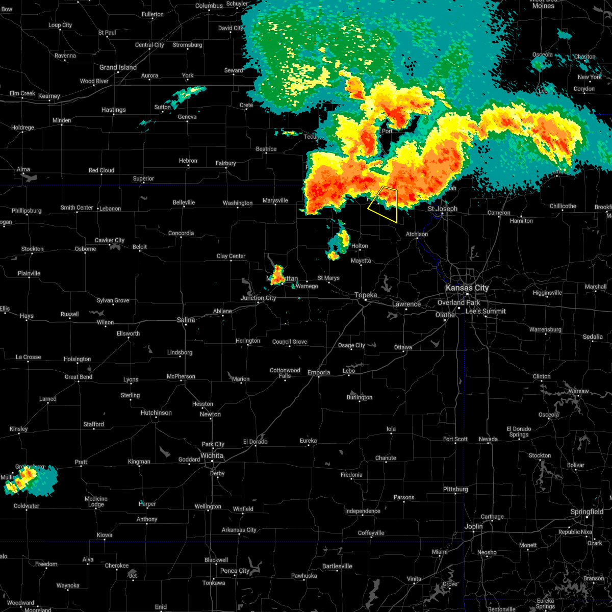 At 744 pm cdt, a severe thunderstorm was located near robinson, moving east at 40 mph (radar indicated). Hazards include 60 mph wind gusts and nickel size hail. Expect damage to roofs, siding, and trees. Locations impacted include, hiawatha and robinson. At 744 pm cdt, a severe thunderstorm was located near robinson, moving east at 40 mph (radar indicated). Hazards include 60 mph wind gusts and nickel size hail. Expect damage to roofs, siding, and trees. Locations impacted include, hiawatha and robinson.
|
| 6/24/2021 7:25 PM CDT |
 At 725 pm cdt, a severe thunderstorm was located near hiawatha, moving southeast at 40 mph (radar indicated). Hazards include 70 mph wind gusts and quarter size hail. Hail damage to vehicles is expected. expect considerable tree damage. Wind damage is also likely to mobile homes, roofs, and outbuildings. At 725 pm cdt, a severe thunderstorm was located near hiawatha, moving southeast at 40 mph (radar indicated). Hazards include 70 mph wind gusts and quarter size hail. Hail damage to vehicles is expected. expect considerable tree damage. Wind damage is also likely to mobile homes, roofs, and outbuildings.
|
| 6/11/2021 1:33 PM CDT |
 At 132 pm cdt, severe thunderstorms were located along a line extending from white cloud to 3 miles south of robinson to near whiting, moving east at 30 mph (radar indicated). Hazards include 60 mph wind gusts. Expect damage to roofs, siding, and trees. These severe thunderstorms will remain over mainly rural areas of northeastern jackson and eastern brown counties. At 132 pm cdt, severe thunderstorms were located along a line extending from white cloud to 3 miles south of robinson to near whiting, moving east at 30 mph (radar indicated). Hazards include 60 mph wind gusts. Expect damage to roofs, siding, and trees. These severe thunderstorms will remain over mainly rural areas of northeastern jackson and eastern brown counties.
|
| 6/11/2021 12:56 PM CDT |
 At 1256 pm cdt, severe thunderstorms were located along a line extending from 4 miles west of reserve to 4 miles west of powhattan to 4 miles southeast of goff, moving east at 30 mph (radar indicated). Hazards include 60 mph wind gusts. Expect damage to roofs, siding, and trees. severe thunderstorms will be near, morrill, hamlin and kickapoo reservation around 100 pm cdt. reserve and powhattan around 105 pm cdt. hiawatha, netawaka and willis around 115 pm cdt. Other locations in the path of these severe thunderstorms include everest, robinson, whiting, horton and horton. At 1256 pm cdt, severe thunderstorms were located along a line extending from 4 miles west of reserve to 4 miles west of powhattan to 4 miles southeast of goff, moving east at 30 mph (radar indicated). Hazards include 60 mph wind gusts. Expect damage to roofs, siding, and trees. severe thunderstorms will be near, morrill, hamlin and kickapoo reservation around 100 pm cdt. reserve and powhattan around 105 pm cdt. hiawatha, netawaka and willis around 115 pm cdt. Other locations in the path of these severe thunderstorms include everest, robinson, whiting, horton and horton.
|
| 6/11/2021 12:40 PM CDT |
 At 1240 pm cdt, severe thunderstorms were located along a line extending from 5 miles northwest of morrill to 3 miles east of oneida to 5 miles east of centralia, moving east at 30 mph (radar indicated). Hazards include 60 mph wind gusts. Expect damage to roofs, siding, and trees. Locations impacted include, morrill, sabetha, fairview, reserve, hamlin, hiawatha, robinson, powhattan and kickapoo reservation. At 1240 pm cdt, severe thunderstorms were located along a line extending from 5 miles northwest of morrill to 3 miles east of oneida to 5 miles east of centralia, moving east at 30 mph (radar indicated). Hazards include 60 mph wind gusts. Expect damage to roofs, siding, and trees. Locations impacted include, morrill, sabetha, fairview, reserve, hamlin, hiawatha, robinson, powhattan and kickapoo reservation.
|
| 6/11/2021 12:19 PM CDT |
 At 1219 pm cdt, severe thunderstorms were located along a line extending from near bern to near seneca to 3 miles northeast of vermillion, moving east at 40 mph (radar indicated). Hazards include 60 mph wind gusts. Expect damage to roofs, siding, and trees. severe thunderstorms will be near, bern around 1225 pm cdt. sabetha and oneida around 1230 pm cdt. corning around 1235 pm cdt. Other locations in the path of these severe thunderstorms include morrill, goff, fairview, reserve, hamlin, woodlawn, hiawatha, robinson, powhattan, willis and kickapoo reservation. At 1219 pm cdt, severe thunderstorms were located along a line extending from near bern to near seneca to 3 miles northeast of vermillion, moving east at 40 mph (radar indicated). Hazards include 60 mph wind gusts. Expect damage to roofs, siding, and trees. severe thunderstorms will be near, bern around 1225 pm cdt. sabetha and oneida around 1230 pm cdt. corning around 1235 pm cdt. Other locations in the path of these severe thunderstorms include morrill, goff, fairview, reserve, hamlin, woodlawn, hiawatha, robinson, powhattan, willis and kickapoo reservation.
|
| 7/9/2020 3:07 AM CDT |
 The severe thunderstorm warning for jefferson, southeastern geary, southeastern riley, shawnee, wabaunsee, southeastern pottawatomie, jackson, southeastern nemaha and brown counties will expire at 315 am cdt, the storms which prompted the warning have weakened below severe limits, and no longer pose an immediate threat to life or property. therefore, the warning will be allowed to expire. however gusty winds and heavy rain are still possible with these thunderstorms. a severe thunderstorm watch remains in effect until 500 am cdt for northeastern and east central kansas. The severe thunderstorm warning for jefferson, southeastern geary, southeastern riley, shawnee, wabaunsee, southeastern pottawatomie, jackson, southeastern nemaha and brown counties will expire at 315 am cdt, the storms which prompted the warning have weakened below severe limits, and no longer pose an immediate threat to life or property. therefore, the warning will be allowed to expire. however gusty winds and heavy rain are still possible with these thunderstorms. a severe thunderstorm watch remains in effect until 500 am cdt for northeastern and east central kansas.
|
| 7/9/2020 2:41 AM CDT |
 At 241 am cdt, severe thunderstorms were located along a line extending from 4 miles northeast of morrill to 6 miles southwest of hoyt to 8 miles west of eskridge, moving east at 45 mph (radar indicated). Hazards include 60 mph wind gusts. Expect damage to roofs, siding, and trees. locations impacted include, topeka, holton, hiawatha, sabetha, horton, valley falls, rossville, oskaloosa, alma, tecumseh, st. marys, dover, silver lake, auburn, meriden, hoyt, ozawkie, nortonville, maple hill and wetmore. this includes the following highways, interstate 70 between mile markers 313 and 355. Kansas turnpike between mile markers 166 and 185. At 241 am cdt, severe thunderstorms were located along a line extending from 4 miles northeast of morrill to 6 miles southwest of hoyt to 8 miles west of eskridge, moving east at 45 mph (radar indicated). Hazards include 60 mph wind gusts. Expect damage to roofs, siding, and trees. locations impacted include, topeka, holton, hiawatha, sabetha, horton, valley falls, rossville, oskaloosa, alma, tecumseh, st. marys, dover, silver lake, auburn, meriden, hoyt, ozawkie, nortonville, maple hill and wetmore. this includes the following highways, interstate 70 between mile markers 313 and 355. Kansas turnpike between mile markers 166 and 185.
|
| 7/9/2020 2:09 AM CDT |
 At 209 am cdt, severe thunderstorms were located along a line extending from 4 miles northeast of bern to near belvue to 8 miles southeast of ogden, moving east at 65 mph (radar indicated). Hazards include 60 mph wind gusts. expect damage to roofs, siding, and trees At 209 am cdt, severe thunderstorms were located along a line extending from 4 miles northeast of bern to near belvue to 8 miles southeast of ogden, moving east at 65 mph (radar indicated). Hazards include 60 mph wind gusts. expect damage to roofs, siding, and trees
|
| 6/28/2020 5:10 AM CDT |
 The severe thunderstorm warning for eastern brown county will expire at 515 am cdt, the strong winds with the storm which prompted the warning has moved out of the area. therefore, the warning will be allowed to expire. however gusty winds are still possible with this thunderstorm. The severe thunderstorm warning for eastern brown county will expire at 515 am cdt, the strong winds with the storm which prompted the warning has moved out of the area. therefore, the warning will be allowed to expire. however gusty winds are still possible with this thunderstorm.
|
| 6/28/2020 4:50 AM CDT |
 At 450 am cdt, a severe thunderstorm was located near powhattan, moving southeast at 50 mph (radar indicated). Hazards include 60 mph wind gusts and penny size hail. expect damage to roofs, siding, and trees At 450 am cdt, a severe thunderstorm was located near powhattan, moving southeast at 50 mph (radar indicated). Hazards include 60 mph wind gusts and penny size hail. expect damage to roofs, siding, and trees
|
| 6/5/2020 2:10 AM CDT |
 At 210 am cdt, a severe thunderstorm was located over hiawatha, moving southeast at 40 mph (radar indicated). Hazards include 60 mph wind gusts and penny size hail. Expect damage to roofs, siding, and trees. Locations impacted include, hiawatha, sabetha, fairview, robinson, morrill, reserve and hamlin. At 210 am cdt, a severe thunderstorm was located over hiawatha, moving southeast at 40 mph (radar indicated). Hazards include 60 mph wind gusts and penny size hail. Expect damage to roofs, siding, and trees. Locations impacted include, hiawatha, sabetha, fairview, robinson, morrill, reserve and hamlin.
|
| 6/5/2020 2:05 AM CDT |
 At 205 am cdt, a severe thunderstorm was located over hamlin, moving east at 40 mph (radar indicated). Hazards include 60 mph wind gusts and penny size hail. Expect damage to roofs, siding, and trees. Locations impacted include, hiawatha, sabetha, everest, fairview, robinson, morrill, reserve, powhattan, hamlin and willis. At 205 am cdt, a severe thunderstorm was located over hamlin, moving east at 40 mph (radar indicated). Hazards include 60 mph wind gusts and penny size hail. Expect damage to roofs, siding, and trees. Locations impacted include, hiawatha, sabetha, everest, fairview, robinson, morrill, reserve, powhattan, hamlin and willis.
|
| 6/5/2020 1:47 AM CDT |
 At 146 am cdt, a severe thunderstorm was located 4 miles east of bern, moving southeast at 40 mph (radar indicated). Hazards include 60 mph wind gusts and quarter size hail. Hail damage to vehicles is expected. expect wind damage to roofs, siding, and trees. Locations impacted include, hiawatha, sabetha, seneca, horton, everest, fairview, robinson, morrill, bern, reserve, powhattan, oneida, hamlin, willis, kickapoo reservation and woodlawn. At 146 am cdt, a severe thunderstorm was located 4 miles east of bern, moving southeast at 40 mph (radar indicated). Hazards include 60 mph wind gusts and quarter size hail. Hail damage to vehicles is expected. expect wind damage to roofs, siding, and trees. Locations impacted include, hiawatha, sabetha, seneca, horton, everest, fairview, robinson, morrill, bern, reserve, powhattan, oneida, hamlin, willis, kickapoo reservation and woodlawn.
|
| 6/5/2020 1:45 AM CDT |
 At 145 am cdt, a severe thunderstorm was located near bern, moving southeast at 40 mph (radar indicated). Hazards include 60 mph wind gusts. expect damage to roofs, siding, and trees At 145 am cdt, a severe thunderstorm was located near bern, moving southeast at 40 mph (radar indicated). Hazards include 60 mph wind gusts. expect damage to roofs, siding, and trees
|
| 6/4/2020 1:23 AM CDT |
 The severe thunderstorm warning for northern dickinson, geary, southern riley, western shawnee, wabaunsee, southern pottawatomie, jackson and southeastern brown counties will expire at 130 am cdt, the storms which prompted the warning have weakened below severe limits, and no longer pose an immediate threat to life or property. therefore, the warning will be allowed to expire. however gusty winds and heavy rain are still possible with these thunderstorms. a severe thunderstorm watch remains in effect until 300 am cdt for central, northeastern and east central kansas. The severe thunderstorm warning for northern dickinson, geary, southern riley, western shawnee, wabaunsee, southern pottawatomie, jackson and southeastern brown counties will expire at 130 am cdt, the storms which prompted the warning have weakened below severe limits, and no longer pose an immediate threat to life or property. therefore, the warning will be allowed to expire. however gusty winds and heavy rain are still possible with these thunderstorms. a severe thunderstorm watch remains in effect until 300 am cdt for central, northeastern and east central kansas.
|
| 6/4/2020 1:09 AM CDT |
 At 108 am cdt, severe thunderstorms were located along a line extending from near st. joseph to topeka to 3 miles east of woodbine, moving southeast at 60 mph (radar indicated). Hazards include 60 mph wind gusts and nickel size hail. Expect damage to roofs, siding, and trees. locations impacted include, northwestern topeka, manhattan, junction city, abilene, wamego, holton, horton, rossville, alma, st. marys, ogden, grandview plaza, dover, silver lake, chapman, enterprise, hoyt, st. george, maple hill and milford. This includes interstate 70 between mile markers 268 and 355. At 108 am cdt, severe thunderstorms were located along a line extending from near st. joseph to topeka to 3 miles east of woodbine, moving southeast at 60 mph (radar indicated). Hazards include 60 mph wind gusts and nickel size hail. Expect damage to roofs, siding, and trees. locations impacted include, northwestern topeka, manhattan, junction city, abilene, wamego, holton, horton, rossville, alma, st. marys, ogden, grandview plaza, dover, silver lake, chapman, enterprise, hoyt, st. george, maple hill and milford. This includes interstate 70 between mile markers 268 and 355.
|
| 6/4/2020 12:56 AM CDT |
 At 1255 am cdt, severe thunderstorms were located along a line extending from 5 miles north of troy to 5 miles northeast of rossville to 5 miles southeast of enterprise, moving southeast at 55 mph (radar indicated). Hazards include 60 mph wind gusts and nickel size hail. Expect damage to roofs, siding, and trees. locations impacted include, northwestern topeka, manhattan, junction city, abilene, wamego, holton, hiawatha, sabetha, horton, rossville, alma, westmoreland, blaine, st. marys, ogden, grandview plaza, dover, silver lake, chapman and solomon. This includes interstate 70 between mile markers 267 and 355. At 1255 am cdt, severe thunderstorms were located along a line extending from 5 miles north of troy to 5 miles northeast of rossville to 5 miles southeast of enterprise, moving southeast at 55 mph (radar indicated). Hazards include 60 mph wind gusts and nickel size hail. Expect damage to roofs, siding, and trees. locations impacted include, northwestern topeka, manhattan, junction city, abilene, wamego, holton, hiawatha, sabetha, horton, rossville, alma, westmoreland, blaine, st. marys, ogden, grandview plaza, dover, silver lake, chapman and solomon. This includes interstate 70 between mile markers 267 and 355.
|
| 6/4/2020 12:31 AM CDT |
 At 1230 am cdt, severe thunderstorms were located along a line extending from 5 miles northeast of reserve to near havensville to near moonlight, moving east at 55 mph (radar indicated). Hazards include 60 mph wind gusts and nickel size hail. Expect damage to roofs, siding, and trees. locations impacted include, northwestern topeka, manhattan, junction city, abilene, wamego, holton, hiawatha, sabetha, seneca, horton, rossville, alma, westmoreland, blaine, st. marys, ogden, grandview plaza, dover, silver lake and chapman. This includes interstate 70 between mile markers 267 and 355. At 1230 am cdt, severe thunderstorms were located along a line extending from 5 miles northeast of reserve to near havensville to near moonlight, moving east at 55 mph (radar indicated). Hazards include 60 mph wind gusts and nickel size hail. Expect damage to roofs, siding, and trees. locations impacted include, northwestern topeka, manhattan, junction city, abilene, wamego, holton, hiawatha, sabetha, seneca, horton, rossville, alma, westmoreland, blaine, st. marys, ogden, grandview plaza, dover, silver lake and chapman. This includes interstate 70 between mile markers 267 and 355.
|
| 6/4/2020 12:25 AM CDT |
 At 1224 am cdt, severe thunderstorms were located along a line extending from 3 miles north of reserve to onaga to 4 miles northeast of talmage, moving east at 55 mph (radar indicated). Hazards include 60 mph wind gusts and nickel size hail. expect damage to roofs, siding, and trees At 1224 am cdt, severe thunderstorms were located along a line extending from 3 miles north of reserve to onaga to 4 miles northeast of talmage, moving east at 55 mph (radar indicated). Hazards include 60 mph wind gusts and nickel size hail. expect damage to roofs, siding, and trees
|
| 3/19/2020 6:23 PM CDT |
 At 622 pm cdt, a severe thunderstorm was located 6 miles east of reserve, moving northeast at 45 mph (radar indicated). Hazards include 60 mph wind gusts and half dollar size hail. Hail damage to vehicles is expected. expect wind damage to roofs, siding, and trees. Locations impacted include, hiawatha and robinson. At 622 pm cdt, a severe thunderstorm was located 6 miles east of reserve, moving northeast at 45 mph (radar indicated). Hazards include 60 mph wind gusts and half dollar size hail. Hail damage to vehicles is expected. expect wind damage to roofs, siding, and trees. Locations impacted include, hiawatha and robinson.
|
| 3/19/2020 6:20 PM CDT |
 At 618 pm cdt, a severe thunderstorm was located 5 miles southeast of reserve, moving northeast at 45 mph (trained weather spotters. at 614 pm, 6 miles north- northeast of hiawatha). Hazards include half dollar size hail. Damage to vehicles is expected. Locations impacted include, hiawatha, robinson, powhattan, hamlin, willis and kickapoo reservation. At 618 pm cdt, a severe thunderstorm was located 5 miles southeast of reserve, moving northeast at 45 mph (trained weather spotters. at 614 pm, 6 miles north- northeast of hiawatha). Hazards include half dollar size hail. Damage to vehicles is expected. Locations impacted include, hiawatha, robinson, powhattan, hamlin, willis and kickapoo reservation.
|
| 3/19/2020 6:10 PM CDT |
 At 610 pm cdt, a severe thunderstorm was located near hiawatha, moving northeast at 40 mph (radar indicated). Hazards include golf ball size hail and 60 mph wind gusts. People and animals outdoors will be injured. expect hail damage to roofs, siding, windows, and vehicles. expect wind damage to roofs, siding, and trees. Locations impacted include, hiawatha, robinson, powhattan, hamlin, willis and kickapoo reservation. At 610 pm cdt, a severe thunderstorm was located near hiawatha, moving northeast at 40 mph (radar indicated). Hazards include golf ball size hail and 60 mph wind gusts. People and animals outdoors will be injured. expect hail damage to roofs, siding, windows, and vehicles. expect wind damage to roofs, siding, and trees. Locations impacted include, hiawatha, robinson, powhattan, hamlin, willis and kickapoo reservation.
|
| 3/19/2020 6:06 PM CDT |
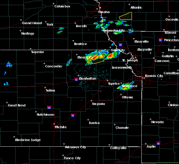 At 605 pm cdt, a severe thunderstorm was located near powhattan, moving northeast at 40 mph (radar indicated). Hazards include ping pong ball size hail and 60 mph wind gusts. People and animals outdoors will be injured. expect hail damage to roofs, siding, windows, and vehicles. Expect wind damage to roofs, siding, and trees. At 605 pm cdt, a severe thunderstorm was located near powhattan, moving northeast at 40 mph (radar indicated). Hazards include ping pong ball size hail and 60 mph wind gusts. People and animals outdoors will be injured. expect hail damage to roofs, siding, windows, and vehicles. Expect wind damage to roofs, siding, and trees.
|
| 8/29/2019 10:15 PM CDT |
 At 1014 pm cdt, severe thunderstorms were located along a line extending from 4 miles southwest of white cloud to 3 miles north of fairview, moving south at 10 mph (radar indicated). Hazards include 60 mph wind gusts and quarter size hail. Hail damage to vehicles is expected. Expect wind damage to roofs, siding, and trees. At 1014 pm cdt, severe thunderstorms were located along a line extending from 4 miles southwest of white cloud to 3 miles north of fairview, moving south at 10 mph (radar indicated). Hazards include 60 mph wind gusts and quarter size hail. Hail damage to vehicles is expected. Expect wind damage to roofs, siding, and trees.
|
| 8/29/2019 9:28 PM CDT |
 At 927 pm cdt, severe thunderstorms were located along a line extending from white cloud to near morrill, moving east to southeast at 35 mph (radar indicated). Hazards include 60 mph wind gusts and quarter size hail. Hail damage to vehicles is expected. Expect wind damage to roofs, siding, and trees. At 927 pm cdt, severe thunderstorms were located along a line extending from white cloud to near morrill, moving east to southeast at 35 mph (radar indicated). Hazards include 60 mph wind gusts and quarter size hail. Hail damage to vehicles is expected. Expect wind damage to roofs, siding, and trees.
|
| 8/15/2019 7:47 PM CDT |
 A severe thunderstorm warning remains in effect until 815 pm cdt for brown county. at 747 pm cdt, a severe thunderstorm was located near hiawatha, moving southeast at 25 mph. hazard. golf ball size hail and 60 mph wind gusts. source. Trained weather spotters. A severe thunderstorm warning remains in effect until 815 pm cdt for brown county. at 747 pm cdt, a severe thunderstorm was located near hiawatha, moving southeast at 25 mph. hazard. golf ball size hail and 60 mph wind gusts. source. Trained weather spotters.
|
| 8/15/2019 7:23 PM CDT |
 At 723 pm cdt, a severe thunderstorm was located 4 miles northeast of morrill, moving southeast at 25 mph (radar indicated). Hazards include ping pong ball size hail and 60 mph wind gusts. People and animals outdoors will be injured. expect hail damage to roofs, siding, windows, and vehicles. Expect wind damage to roofs, siding, and trees. At 723 pm cdt, a severe thunderstorm was located 4 miles northeast of morrill, moving southeast at 25 mph (radar indicated). Hazards include ping pong ball size hail and 60 mph wind gusts. People and animals outdoors will be injured. expect hail damage to roofs, siding, windows, and vehicles. Expect wind damage to roofs, siding, and trees.
|
| 8/15/2019 5:04 PM CDT |
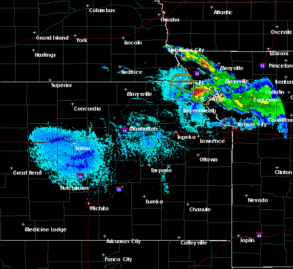 At 502 pm cdt, a severe thunderstorm was located near highland, moving southeast at 30 mph (trained weather spotters). Hazards include 60 mph wind gusts and half dollar size hail. Hail damage to vehicles is expected. expect wind damage to roofs, siding, and trees. locations impacted include, robinson. At 458 pm cdt, a trained spotter reported one inch hail 3 miles north of robinson. At 502 pm cdt, a severe thunderstorm was located near highland, moving southeast at 30 mph (trained weather spotters). Hazards include 60 mph wind gusts and half dollar size hail. Hail damage to vehicles is expected. expect wind damage to roofs, siding, and trees. locations impacted include, robinson. At 458 pm cdt, a trained spotter reported one inch hail 3 miles north of robinson.
|
| 8/15/2019 4:58 PM CDT | Quarter sized hail reported 3.1 miles SSW of Robinson, KS |
| 8/15/2019 4:57 PM CDT |
 At 456 pm cdt, a severe thunderstorm was located near highland, moving southeast at 30 mph (trained weather spotters). Hazards include golf ball size hail and 60 mph wind gusts. People and animals outdoors will be injured. expect hail damage to roofs, siding, windows, and vehicles. expect wind damage to roofs, siding, and trees. Locations impacted include, robinson. At 456 pm cdt, a severe thunderstorm was located near highland, moving southeast at 30 mph (trained weather spotters). Hazards include golf ball size hail and 60 mph wind gusts. People and animals outdoors will be injured. expect hail damage to roofs, siding, windows, and vehicles. expect wind damage to roofs, siding, and trees. Locations impacted include, robinson.
|
| 8/15/2019 4:50 PM CDT |
 At 449 pm cdt, a severe thunderstorm was located 4 miles north of robinson, moving southeast at 30 mph (trained weather spotters). Hazards include two inch hail and 60 mph wind gusts. People and animals outdoors will be injured. expect hail damage to roofs, siding, windows, and vehicles. expect wind damage to roofs, siding, and trees. locations impacted include, hiawatha and robinson. at 445 pm cdt, a trained spotter reported 1. 25 inch hail 5 miles southeast of reserve. At 449 pm cdt, a severe thunderstorm was located 4 miles north of robinson, moving southeast at 30 mph (trained weather spotters). Hazards include two inch hail and 60 mph wind gusts. People and animals outdoors will be injured. expect hail damage to roofs, siding, windows, and vehicles. expect wind damage to roofs, siding, and trees. locations impacted include, hiawatha and robinson. at 445 pm cdt, a trained spotter reported 1. 25 inch hail 5 miles southeast of reserve.
|
| 8/15/2019 4:40 PM CDT |
 At 418 pm cdt, a severe thunderstorm was located 6 miles north of morrill, moving east at 25 mph (radar indicated). Hazards include tennis ball size hail and 60 mph wind gusts. People and animals outdoors will be injured. expect hail damage to roofs, siding, windows, and vehicles. Expect wind damage to roofs, siding, and trees. At 418 pm cdt, a severe thunderstorm was located 6 miles north of morrill, moving east at 25 mph (radar indicated). Hazards include tennis ball size hail and 60 mph wind gusts. People and animals outdoors will be injured. expect hail damage to roofs, siding, windows, and vehicles. Expect wind damage to roofs, siding, and trees.
|
| 8/15/2019 4:30 PM CDT |
 At 429 pm cdt, a severe thunderstorm was located over reserve, moving east at 30 mph. this is a very dangerous storm (radar indicated). Hazards include baseball size hail and 60 mph wind gusts. People and animals outdoors will be severely injured. expect shattered windows, extensive damage to roofs, siding, and vehicles. Locations impacted include, hiawatha, robinson, morrill, reserve and hamlin. At 429 pm cdt, a severe thunderstorm was located over reserve, moving east at 30 mph. this is a very dangerous storm (radar indicated). Hazards include baseball size hail and 60 mph wind gusts. People and animals outdoors will be severely injured. expect shattered windows, extensive damage to roofs, siding, and vehicles. Locations impacted include, hiawatha, robinson, morrill, reserve and hamlin.
|
| 8/15/2019 4:21 PM CDT |
 At 420 pm cdt, a severe thunderstorm was located over robinson, moving east at 35 mph. this is a very dangerous storm (trained weather spotters). Hazards include baseball size hail and 60 mph wind gusts. People and animals outdoors will be severely injured. expect shattered windows, extensive damage to roofs, siding, and vehicles. Locations impacted include, robinson. At 420 pm cdt, a severe thunderstorm was located over robinson, moving east at 35 mph. this is a very dangerous storm (trained weather spotters). Hazards include baseball size hail and 60 mph wind gusts. People and animals outdoors will be severely injured. expect shattered windows, extensive damage to roofs, siding, and vehicles. Locations impacted include, robinson.
|
| 8/15/2019 4:18 PM CDT |
 At 418 pm cdt, a severe thunderstorm was located 6 miles north of morrill, moving east at 25 mph (radar indicated). Hazards include tennis ball size hail and 60 mph wind gusts. People and animals outdoors will be injured. expect hail damage to roofs, siding, windows, and vehicles. Expect wind damage to roofs, siding, and trees. At 418 pm cdt, a severe thunderstorm was located 6 miles north of morrill, moving east at 25 mph (radar indicated). Hazards include tennis ball size hail and 60 mph wind gusts. People and animals outdoors will be injured. expect hail damage to roofs, siding, windows, and vehicles. Expect wind damage to roofs, siding, and trees.
|
| 8/15/2019 4:13 PM CDT |
 At 413 pm cdt, a severe thunderstorm was located near hiawatha, moving east at 35 mph. this is a very dangerous storm (trained weather spotters. this storm has a history of producing baseball sized hail). Hazards include baseball size hail and 60 mph wind gusts. People and animals outdoors will be severely injured. expect shattered windows, extensive damage to roofs, siding, and vehicles. Locations impacted include, hiawatha and robinson. At 413 pm cdt, a severe thunderstorm was located near hiawatha, moving east at 35 mph. this is a very dangerous storm (trained weather spotters. this storm has a history of producing baseball sized hail). Hazards include baseball size hail and 60 mph wind gusts. People and animals outdoors will be severely injured. expect shattered windows, extensive damage to roofs, siding, and vehicles. Locations impacted include, hiawatha and robinson.
|
| 8/15/2019 4:06 PM CDT |
 At 405 pm cdt, a severe thunderstorm was located over hiawatha, moving east at 35 mph. this is a very dangerous storm (trained weather spotters. spotters along highway 36 west of hiawatha reported baseball sized hail at 405 pm). Hazards include baseball size hail and 60 mph wind gusts. People and animals outdoors will be severely injured. expect shattered windows, extensive damage to roofs, siding, and vehicles. Locations impacted include, hiawatha, robinson, reserve and hamlin. At 405 pm cdt, a severe thunderstorm was located over hiawatha, moving east at 35 mph. this is a very dangerous storm (trained weather spotters. spotters along highway 36 west of hiawatha reported baseball sized hail at 405 pm). Hazards include baseball size hail and 60 mph wind gusts. People and animals outdoors will be severely injured. expect shattered windows, extensive damage to roofs, siding, and vehicles. Locations impacted include, hiawatha, robinson, reserve and hamlin.
|
| 8/15/2019 3:56 PM CDT |
 At 354 pm cdt, a severe thunderstorm was located near morrill, moving east at 35 mph (trained weather spotters. this storm has a history of producing ping pong sized hail). Hazards include ping pong ball size hail and 60 mph wind gusts. People and animals outdoors will be injured. expect hail damage to roofs, siding, windows, and vehicles. expect wind damage to roofs, siding, and trees. Locations impacted include, hiawatha, sabetha, fairview, robinson, morrill, reserve and hamlin. At 354 pm cdt, a severe thunderstorm was located near morrill, moving east at 35 mph (trained weather spotters. this storm has a history of producing ping pong sized hail). Hazards include ping pong ball size hail and 60 mph wind gusts. People and animals outdoors will be injured. expect hail damage to roofs, siding, windows, and vehicles. expect wind damage to roofs, siding, and trees. Locations impacted include, hiawatha, sabetha, fairview, robinson, morrill, reserve and hamlin.
|
| 8/15/2019 3:47 PM CDT |
 At 347 pm cdt, a severe thunderstorm was located near sabetha, moving east at 35 mph (trained weather spotters. at 340 pm a spotter 5 miles northwest of sabetha reported ping pong sized hail and broken windows). Hazards include ping pong ball size hail and 60 mph wind gusts. People and animals outdoors will be injured. expect hail damage to roofs, siding, windows, and vehicles. expect wind damage to roofs, siding, and trees. Locations impacted include, hiawatha, sabetha, fairview, robinson, morrill, reserve and hamlin. At 347 pm cdt, a severe thunderstorm was located near sabetha, moving east at 35 mph (trained weather spotters. at 340 pm a spotter 5 miles northwest of sabetha reported ping pong sized hail and broken windows). Hazards include ping pong ball size hail and 60 mph wind gusts. People and animals outdoors will be injured. expect hail damage to roofs, siding, windows, and vehicles. expect wind damage to roofs, siding, and trees. Locations impacted include, hiawatha, sabetha, fairview, robinson, morrill, reserve and hamlin.
|
| 8/15/2019 3:43 PM CDT |
 At 343 pm cdt, a severe thunderstorm was located over sabetha, moving east at 35 mph (radar indicated). Hazards include 60 mph wind gusts and quarter size hail. Hail damage to vehicles is expected. Expect wind damage to roofs, siding, and trees. At 343 pm cdt, a severe thunderstorm was located over sabetha, moving east at 35 mph (radar indicated). Hazards include 60 mph wind gusts and quarter size hail. Hail damage to vehicles is expected. Expect wind damage to roofs, siding, and trees.
|
| 6/21/2019 8:46 AM CDT |
 At 845 am cdt, severe thunderstorms were located along a line extending from 4 miles northeast of oregon to near delia to 6 miles southeast of alma, moving east at 55 mph (radar indicated). Hazards include 60 mph wind gusts and penny size hail. Expect damage to roofs, siding, and trees. locations impacted include, holton, hiawatha, horton, rossville, alma, st. marys, maple hill, wetmore, mayetta, everest, fairview, mcfarland, robinson, morrill, paxico, belvue, emmett, whiting, circleville and delia. This includes interstate 70 between mile markers 323 and 343. At 845 am cdt, severe thunderstorms were located along a line extending from 4 miles northeast of oregon to near delia to 6 miles southeast of alma, moving east at 55 mph (radar indicated). Hazards include 60 mph wind gusts and penny size hail. Expect damage to roofs, siding, and trees. locations impacted include, holton, hiawatha, horton, rossville, alma, st. marys, maple hill, wetmore, mayetta, everest, fairview, mcfarland, robinson, morrill, paxico, belvue, emmett, whiting, circleville and delia. This includes interstate 70 between mile markers 323 and 343.
|
| 6/21/2019 8:22 AM CDT |
 At 822 am cdt, severe thunderstorms were located along a line extending from 6 miles northeast of reserve to near wamego to 7 miles northwest of alta vista, moving east at 55 mph (radar indicated). Hazards include 60 mph wind gusts and penny size hail. expect damage to roofs, siding, and trees At 822 am cdt, severe thunderstorms were located along a line extending from 6 miles northeast of reserve to near wamego to 7 miles northwest of alta vista, moving east at 55 mph (radar indicated). Hazards include 60 mph wind gusts and penny size hail. expect damage to roofs, siding, and trees
|
| 5/28/2019 10:20 PM CDT |
 At 1019 pm cdt, severe thunderstorms were located along a line extending from near mound city to near highland to near horton, moving northeast at 40 mph (radar indicated). Hazards include 60 mph wind gusts and penny size hail. Expect damage to roofs, siding, and trees. Locations impacted include, hiawatha, horton, everest, robinson, powhattan and willis. At 1019 pm cdt, severe thunderstorms were located along a line extending from near mound city to near highland to near horton, moving northeast at 40 mph (radar indicated). Hazards include 60 mph wind gusts and penny size hail. Expect damage to roofs, siding, and trees. Locations impacted include, hiawatha, horton, everest, robinson, powhattan and willis.
|
| 5/28/2019 10:09 PM CDT |
 At 1009 pm cdt, severe thunderstorms were located along a line extending from 4 miles northwest of craig to 4 miles northwest of white cloud to near kickapoo reservation, moving east at 55 mph (radar indicated). Hazards include 60 mph wind gusts and quarter size hail. Hail damage to vehicles is expected. Expect wind damage to roofs, siding, and trees. At 1009 pm cdt, severe thunderstorms were located along a line extending from 4 miles northwest of craig to 4 miles northwest of white cloud to near kickapoo reservation, moving east at 55 mph (radar indicated). Hazards include 60 mph wind gusts and quarter size hail. Hail damage to vehicles is expected. Expect wind damage to roofs, siding, and trees.
|
| 5/28/2019 10:02 PM CDT |
 At 1001 pm cdt, severe thunderstorms were located along a line extending from 6 miles southwest of craig to 6 miles east of reserve to 3 miles southeast of kickapoo reservation, moving northeast at 50 mph (radar indicated). Hazards include 60 mph wind gusts and quarter size hail. Hail damage to vehicles is expected. expect wind damage to roofs, siding, and trees. Locations impacted include, hiawatha, sabetha, horton, everest, fairview, robinson, morrill, reserve, powhattan, hamlin, willis and kickapoo reservation. At 1001 pm cdt, severe thunderstorms were located along a line extending from 6 miles southwest of craig to 6 miles east of reserve to 3 miles southeast of kickapoo reservation, moving northeast at 50 mph (radar indicated). Hazards include 60 mph wind gusts and quarter size hail. Hail damage to vehicles is expected. expect wind damage to roofs, siding, and trees. Locations impacted include, hiawatha, sabetha, horton, everest, fairview, robinson, morrill, reserve, powhattan, hamlin, willis and kickapoo reservation.
|
| 5/28/2019 9:54 PM CDT |
 At 954 pm cdt, severe thunderstorms were located along a line extending from 3 miles north of falls city to 3 miles east of hamlin to near wetmore, moving northeast at 50 mph (radar indicated). Hazards include 70 mph wind gusts and half dollar size hail. Hail damage to vehicles is expected. expect considerable tree damage. wind damage is also likely to mobile homes, roofs, and outbuildings. Locations impacted include, hiawatha, sabetha, horton, wetmore, everest, fairview, robinson, morrill, netawaka, goff, reserve, powhattan, hamlin, willis, kickapoo reservation and woodlawn. At 954 pm cdt, severe thunderstorms were located along a line extending from 3 miles north of falls city to 3 miles east of hamlin to near wetmore, moving northeast at 50 mph (radar indicated). Hazards include 70 mph wind gusts and half dollar size hail. Hail damage to vehicles is expected. expect considerable tree damage. wind damage is also likely to mobile homes, roofs, and outbuildings. Locations impacted include, hiawatha, sabetha, horton, wetmore, everest, fairview, robinson, morrill, netawaka, goff, reserve, powhattan, hamlin, willis, kickapoo reservation and woodlawn.
|
| 5/28/2019 9:46 PM CDT |
 At 945 pm cdt, severe thunderstorms were located along a line extending from near verdon to near hamlin to 3 miles south of goff, moving east at 50 mph (trained weather spotter). Hazards include 60 mph wind gusts in corning. Expect damage to roofs, siding, and trees. Locations impacted include, hiawatha, sabetha, horton, wetmore, everest, fairview, robinson, morrill, bern, corning, netawaka, goff, reserve, powhattan, oneida, hamlin, willis, kickapoo reservation and woodlawn. At 945 pm cdt, severe thunderstorms were located along a line extending from near verdon to near hamlin to 3 miles south of goff, moving east at 50 mph (trained weather spotter). Hazards include 60 mph wind gusts in corning. Expect damage to roofs, siding, and trees. Locations impacted include, hiawatha, sabetha, horton, wetmore, everest, fairview, robinson, morrill, bern, corning, netawaka, goff, reserve, powhattan, oneida, hamlin, willis, kickapoo reservation and woodlawn.
|
| 5/28/2019 9:35 PM CDT |
 At 934 pm cdt, severe thunderstorms were located along a line extending from near humboldt to near sabetha to 4 miles south of corning, moving northeast at 55 mph (radar indicated). Hazards include 70 mph wind gusts and half dollar size hail. Hail damage to vehicles is expected. expect considerable tree damage. Wind damage is also likely to mobile homes, roofs, and outbuildings. At 934 pm cdt, severe thunderstorms were located along a line extending from near humboldt to near sabetha to 4 miles south of corning, moving northeast at 55 mph (radar indicated). Hazards include 70 mph wind gusts and half dollar size hail. Hail damage to vehicles is expected. expect considerable tree damage. Wind damage is also likely to mobile homes, roofs, and outbuildings.
|
| 5/28/2019 3:13 PM CDT |
 At 313 pm cdt, a severe thunderstorm was located near morrill, moving northeast at 50 mph (radar indicated). Hazards include 60 mph wind gusts and quarter size hail. Hail damage to vehicles is expected. expect wind damage to roofs, siding, and trees. Locations impacted include, hiawatha, sabetha, fairview, robinson, morrill, reserve, powhattan, hamlin and woodlawn. At 313 pm cdt, a severe thunderstorm was located near morrill, moving northeast at 50 mph (radar indicated). Hazards include 60 mph wind gusts and quarter size hail. Hail damage to vehicles is expected. expect wind damage to roofs, siding, and trees. Locations impacted include, hiawatha, sabetha, fairview, robinson, morrill, reserve, powhattan, hamlin and woodlawn.
|
| 5/28/2019 3:07 PM CDT |
 At 306 pm cdt, a severe thunderstorm was located near fairview, moving northeast at 55 mph (radar indicated). Hazards include 60 mph wind gusts and half dollar size hail. Hail damage to vehicles is expected. expect wind damage to roofs, siding, and trees. Locations impacted include, hiawatha, sabetha, fairview, robinson, morrill, reserve, powhattan, hamlin and woodlawn. At 306 pm cdt, a severe thunderstorm was located near fairview, moving northeast at 55 mph (radar indicated). Hazards include 60 mph wind gusts and half dollar size hail. Hail damage to vehicles is expected. expect wind damage to roofs, siding, and trees. Locations impacted include, hiawatha, sabetha, fairview, robinson, morrill, reserve, powhattan, hamlin and woodlawn.
|
| 5/28/2019 2:47 PM CDT |
 At 247 pm cdt, a severe thunderstorm was located near fairview, moving northeast at 50 mph (radar indicated). Hazards include 60 mph wind gusts and half dollar size hail. Hail damage to vehicles is expected. Expect wind damage to roofs, siding, and trees. At 247 pm cdt, a severe thunderstorm was located near fairview, moving northeast at 50 mph (radar indicated). Hazards include 60 mph wind gusts and half dollar size hail. Hail damage to vehicles is expected. Expect wind damage to roofs, siding, and trees.
|
| 5/28/2019 2:13 PM CDT |
 At 212 pm cdt, a severe thunderstorm was located near willis, moving northeast at 50 mph (trained weather spotters). Hazards include 60 mph wind gusts and half dollar size hail. Hail damage to vehicles is expected. Expect wind damage to roofs, siding, and trees. At 212 pm cdt, a severe thunderstorm was located near willis, moving northeast at 50 mph (trained weather spotters). Hazards include 60 mph wind gusts and half dollar size hail. Hail damage to vehicles is expected. Expect wind damage to roofs, siding, and trees.
|
| 5/28/2019 2:07 PM CDT |
 At 207 pm cdt, a severe thunderstorm was located near willis, moving northeast at 50 mph (radar indicated). Hazards include 60 mph wind gusts and half dollar size hail. Hail damage to vehicles is expected. expect wind damage to roofs, siding, and trees. Locations impacted include, horton, everest, robinson and willis. At 207 pm cdt, a severe thunderstorm was located near willis, moving northeast at 50 mph (radar indicated). Hazards include 60 mph wind gusts and half dollar size hail. Hail damage to vehicles is expected. expect wind damage to roofs, siding, and trees. Locations impacted include, horton, everest, robinson and willis.
|
| 5/28/2019 1:56 PM CDT |
 At 155 pm cdt, a severe thunderstorm was located near netawaka, moving northeast at 50 mph (radar indicated). Hazards include 60 mph wind gusts and half dollar size hail. Hail damage to vehicles is expected. expect wind damage to roofs, siding, and trees. Locations impacted include, horton, everest, robinson, whiting, netawaka, powhattan, willis and kickapoo reservation. At 155 pm cdt, a severe thunderstorm was located near netawaka, moving northeast at 50 mph (radar indicated). Hazards include 60 mph wind gusts and half dollar size hail. Hail damage to vehicles is expected. expect wind damage to roofs, siding, and trees. Locations impacted include, horton, everest, robinson, whiting, netawaka, powhattan, willis and kickapoo reservation.
|
| 5/28/2019 1:48 PM CDT |
 At 137 pm cdt, a severe thunderstorm was located 4 miles southwest of circleville, moving northeast at 50 mph (radar indicated). Hazards include 60 mph wind gusts and quarter size hail. Hail damage to vehicles is expected. Expect wind damage to roofs, siding, and trees. At 137 pm cdt, a severe thunderstorm was located 4 miles southwest of circleville, moving northeast at 50 mph (radar indicated). Hazards include 60 mph wind gusts and quarter size hail. Hail damage to vehicles is expected. Expect wind damage to roofs, siding, and trees.
|
| 5/28/2019 1:37 PM CDT |
 At 137 pm cdt, a severe thunderstorm was located 4 miles southwest of circleville, moving northeast at 50 mph (radar indicated). Hazards include 60 mph wind gusts and quarter size hail. Hail damage to vehicles is expected. Expect wind damage to roofs, siding, and trees. At 137 pm cdt, a severe thunderstorm was located 4 miles southwest of circleville, moving northeast at 50 mph (radar indicated). Hazards include 60 mph wind gusts and quarter size hail. Hail damage to vehicles is expected. Expect wind damage to roofs, siding, and trees.
|
| 5/24/2019 4:58 AM CDT |
 At 457 am cdt, a severe thunderstorm was located 5 miles southeast of reserve, moving east at 55 mph (radar indicated). Hazards include 60 mph wind gusts and nickel size hail. expect damage to roofs, siding, and trees At 457 am cdt, a severe thunderstorm was located 5 miles southeast of reserve, moving east at 55 mph (radar indicated). Hazards include 60 mph wind gusts and nickel size hail. expect damage to roofs, siding, and trees
|
| 5/24/2019 4:37 AM CDT |
 At 436 am cdt, a severe thunderstorm was located near goff, moving east at 45 mph (radar indicated). Hazards include 60 mph wind gusts and nickel size hail. expect damage to roofs, siding, and trees At 436 am cdt, a severe thunderstorm was located near goff, moving east at 45 mph (radar indicated). Hazards include 60 mph wind gusts and nickel size hail. expect damage to roofs, siding, and trees
|
| 5/21/2019 2:18 PM CDT |
 At 718 pm cdt, tornado producing storms were located along a line extending from 3 miles west of willis to 4 miles southeast of everest, moving northeast at 45 mph (weather spotters confirmed tornado near huron). Hazards include damaging tornado and quarter size hail. Flying debris will be dangerous to those caught without shelter. mobile homes will be damaged or destroyed. damage to roofs, windows, and vehicles will occur. tree damage is likely. these tornadic storms will be near, hiawatha and robinson around 730 pm cdt. Other locations impacted by these tornadic storms include huron. At 718 pm cdt, tornado producing storms were located along a line extending from 3 miles west of willis to 4 miles southeast of everest, moving northeast at 45 mph (weather spotters confirmed tornado near huron). Hazards include damaging tornado and quarter size hail. Flying debris will be dangerous to those caught without shelter. mobile homes will be damaged or destroyed. damage to roofs, windows, and vehicles will occur. tree damage is likely. these tornadic storms will be near, hiawatha and robinson around 730 pm cdt. Other locations impacted by these tornadic storms include huron.
|
| 5/21/2019 2:07 PM CDT |
 At 706 pm cdt, a severe thunderstorm capable of producing a tornado was located near whiting, moving north at 45 mph (weather spotters reported funnel cloud). Hazards include tornado and quarter size hail. Flying debris will be dangerous to those caught without shelter. mobile homes will be damaged or destroyed. damage to roofs, windows, and vehicles will occur. tree damage is likely. this dangerous storm will be near, horton and horton around 710 pm cdt. everest around 715 pm cdt. powhattan and willis around 720 pm cdt. hiawatha around 725 pm cdt. robinson around 730 pm cdt. Other locations impacted by this tornadic thunderstorm include huron. At 706 pm cdt, a severe thunderstorm capable of producing a tornado was located near whiting, moving north at 45 mph (weather spotters reported funnel cloud). Hazards include tornado and quarter size hail. Flying debris will be dangerous to those caught without shelter. mobile homes will be damaged or destroyed. damage to roofs, windows, and vehicles will occur. tree damage is likely. this dangerous storm will be near, horton and horton around 710 pm cdt. everest around 715 pm cdt. powhattan and willis around 720 pm cdt. hiawatha around 725 pm cdt. robinson around 730 pm cdt. Other locations impacted by this tornadic thunderstorm include huron.
|
| 10/8/2018 5:22 PM CDT |
 The severe thunderstorm warning for southeastern brown county will expire at 530 pm cdt, the storm which prompted the warning has moved out of the area. therefore, the warning will be allowed to expire. however gusty winds and heavy rain are still possible with this thunderstorm. The severe thunderstorm warning for southeastern brown county will expire at 530 pm cdt, the storm which prompted the warning has moved out of the area. therefore, the warning will be allowed to expire. however gusty winds and heavy rain are still possible with this thunderstorm.
|
| 10/8/2018 5:01 PM CDT |
 At 501 pm cdt, a severe thunderstorm was located over everest, moving northeast at 50 mph (radar indicated). Hazards include 60 mph wind gusts and penny size hail. expect damage to roofs, siding, and trees At 501 pm cdt, a severe thunderstorm was located over everest, moving northeast at 50 mph (radar indicated). Hazards include 60 mph wind gusts and penny size hail. expect damage to roofs, siding, and trees
|
| 8/31/2018 1:26 AM CDT |
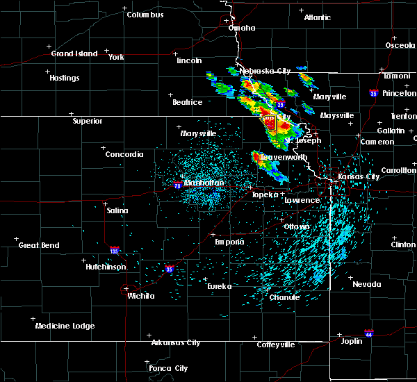 At 126 am cdt, a severe thunderstorm was located 5 miles north of robinson, moving northeast at 25 mph (radar indicated). Hazards include ping pong ball size hail and 60 mph wind gusts. People and animals outdoors will be injured. expect hail damage to roofs, siding, windows, and vehicles. Expect wind damage to roofs, siding, and trees. At 126 am cdt, a severe thunderstorm was located 5 miles north of robinson, moving northeast at 25 mph (radar indicated). Hazards include ping pong ball size hail and 60 mph wind gusts. People and animals outdoors will be injured. expect hail damage to roofs, siding, windows, and vehicles. Expect wind damage to roofs, siding, and trees.
|
| 8/31/2018 12:38 AM CDT |
 At 1238 am cdt, a severe thunderstorm was located near hiawatha, moving northeast at 20 mph (radar indicated). Hazards include 60 mph wind gusts and quarter size hail. Hail damage to vehicles is expected. expect wind damage to roofs, siding, and trees. Locations impacted include, hiawatha, robinson, reserve and hamlin. At 1238 am cdt, a severe thunderstorm was located near hiawatha, moving northeast at 20 mph (radar indicated). Hazards include 60 mph wind gusts and quarter size hail. Hail damage to vehicles is expected. expect wind damage to roofs, siding, and trees. Locations impacted include, hiawatha, robinson, reserve and hamlin.
|
| 8/31/2018 12:26 AM CDT |
 At 1226 am cdt, a severe thunderstorm was located near powhattan, moving northeast at 20 mph (radar indicated). Hazards include 60 mph wind gusts and quarter size hail. Hail damage to vehicles is expected. Expect wind damage to roofs, siding, and trees. At 1226 am cdt, a severe thunderstorm was located near powhattan, moving northeast at 20 mph (radar indicated). Hazards include 60 mph wind gusts and quarter size hail. Hail damage to vehicles is expected. Expect wind damage to roofs, siding, and trees.
|
| 8/28/2018 9:25 AM CDT | Three large trees uprooted. damage to a machine shed. time estimated based on radar dat in brown county KS, 5.8 miles S of Robinson, KS |
| 8/28/2018 9:15 AM CDT | Damage to roof of house. siding torn off of another house. barn roof partially torn off. time estimated based on radar dat in brown county KS, 3.2 miles NE of Robinson, KS |
| 8/6/2018 6:55 PM CDT |
 At 654 pm cdt, a severe thunderstorm was located near hamlin, moving east at 35 mph (trained weather spotters reported ping pong sized hail 1 mile west of fairview at 639 pm). Hazards include 60 mph wind gusts and quarter size hail. Hail damage to vehicles is expected. expect wind damage to roofs, siding, and trees. Locations impacted include, hiawatha, sabetha, fairview, robinson, morrill, reserve, powhattan, hamlin and willis. At 654 pm cdt, a severe thunderstorm was located near hamlin, moving east at 35 mph (trained weather spotters reported ping pong sized hail 1 mile west of fairview at 639 pm). Hazards include 60 mph wind gusts and quarter size hail. Hail damage to vehicles is expected. expect wind damage to roofs, siding, and trees. Locations impacted include, hiawatha, sabetha, fairview, robinson, morrill, reserve, powhattan, hamlin and willis.
|
| 8/6/2018 6:44 PM CDT |
 At 642 pm cdt, a severe thunderstorm was located near morrill, moving east at 35 mph (trained weather spotters reported ping pong sized hail 1 mile west of fairview at 639 pm). Hazards include ping pong ball size hail and 60 mph wind gusts. People and animals outdoors will be injured. expect hail damage to roofs, siding, windows, and vehicles. expect wind damage to roofs, siding, and trees. Locations impacted include, hiawatha, sabetha, fairview, robinson, morrill, reserve, powhattan, hamlin, willis and woodlawn. At 642 pm cdt, a severe thunderstorm was located near morrill, moving east at 35 mph (trained weather spotters reported ping pong sized hail 1 mile west of fairview at 639 pm). Hazards include ping pong ball size hail and 60 mph wind gusts. People and animals outdoors will be injured. expect hail damage to roofs, siding, windows, and vehicles. expect wind damage to roofs, siding, and trees. Locations impacted include, hiawatha, sabetha, fairview, robinson, morrill, reserve, powhattan, hamlin, willis and woodlawn.
|
| 8/6/2018 6:24 PM CDT |
 At 624 pm cdt, a severe thunderstorm was located near oneida, moving east at 35 mph (radar indicated). Hazards include 60 mph wind gusts and quarter size hail. Hail damage to vehicles is expected. Expect wind damage to roofs, siding, and trees. At 624 pm cdt, a severe thunderstorm was located near oneida, moving east at 35 mph (radar indicated). Hazards include 60 mph wind gusts and quarter size hail. Hail damage to vehicles is expected. Expect wind damage to roofs, siding, and trees.
|
| 6/30/2018 7:22 PM CDT |
 The severe thunderstorm warning for eastern brown county will expire at 730 pm cdt, the storms which prompted the warning have moved out of the area. therefore, the warning will be allowed to expire. a severe thunderstorm watch remains in effect until 1100 pm cdt for northeastern kansas. The severe thunderstorm warning for eastern brown county will expire at 730 pm cdt, the storms which prompted the warning have moved out of the area. therefore, the warning will be allowed to expire. a severe thunderstorm watch remains in effect until 1100 pm cdt for northeastern kansas.
|
| 6/30/2018 6:55 PM CDT |
 At 655 pm cdt, severe thunderstorms were located along a line extending from 3 miles south of hiawatha to 4 miles west of denton, moving northeast at 30 mph (trained weather spotters). Hazards include 60 mph wind gusts. expect damage to roofs, siding, and trees At 655 pm cdt, severe thunderstorms were located along a line extending from 3 miles south of hiawatha to 4 miles west of denton, moving northeast at 30 mph (trained weather spotters). Hazards include 60 mph wind gusts. expect damage to roofs, siding, and trees
|
| 6/30/2018 6:53 PM CDT |
 At 652 pm cdt, severe thunderstorms were located along a line extending from 3 miles northwest of powhattan to near everest, moving northeast at 30 mph. 60 mph wind gusts were reported in everest at 643 pm (trained weather spotters). Hazards include 60 mph wind gusts. Expect damage to roofs, siding, and trees. Locations impacted include, hiawatha, horton, everest, fairview, robinson, morrill, reserve, powhattan, hamlin and willis. At 652 pm cdt, severe thunderstorms were located along a line extending from 3 miles northwest of powhattan to near everest, moving northeast at 30 mph. 60 mph wind gusts were reported in everest at 643 pm (trained weather spotters). Hazards include 60 mph wind gusts. Expect damage to roofs, siding, and trees. Locations impacted include, hiawatha, horton, everest, fairview, robinson, morrill, reserve, powhattan, hamlin and willis.
|
| 6/30/2018 6:36 PM CDT |
 At 635 pm cdt, severe thunderstorms were located along a line extending from 3 miles southeast of woodlawn to near horton, moving northeast at 45 mph (doppler radar indicated). Hazards include 60 mph wind gusts. Expect damage to roofs, siding, and trees. Locations impacted include, holton, hiawatha, sabetha, horton, wetmore, everest, fairview, robinson, morrill, whiting, corning, netawaka, goff, reserve, powhattan, hamlin, willis, kickapoo reservation and woodlawn. At 635 pm cdt, severe thunderstorms were located along a line extending from 3 miles southeast of woodlawn to near horton, moving northeast at 45 mph (doppler radar indicated). Hazards include 60 mph wind gusts. Expect damage to roofs, siding, and trees. Locations impacted include, holton, hiawatha, sabetha, horton, wetmore, everest, fairview, robinson, morrill, whiting, corning, netawaka, goff, reserve, powhattan, hamlin, willis, kickapoo reservation and woodlawn.
|
| 6/30/2018 6:13 PM CDT |
 At 612 pm cdt, severe thunderstorms were located along a line extending from near woodlawn to near horton, moving northeast at 30 mph. 60 mph wind gusts were reported 6 miles northeast of wetmore at 610 pm (public). Hazards include 60 mph wind gusts. Expect damage to roofs, siding, and trees. Locations impacted include, holton, hiawatha, sabetha, horton, wetmore, everest, fairview, robinson, morrill, whiting, circleville, corning, netawaka, soldier, goff, reserve, powhattan, hamlin, willis and kickapoo reservation. At 612 pm cdt, severe thunderstorms were located along a line extending from near woodlawn to near horton, moving northeast at 30 mph. 60 mph wind gusts were reported 6 miles northeast of wetmore at 610 pm (public). Hazards include 60 mph wind gusts. Expect damage to roofs, siding, and trees. Locations impacted include, holton, hiawatha, sabetha, horton, wetmore, everest, fairview, robinson, morrill, whiting, circleville, corning, netawaka, soldier, goff, reserve, powhattan, hamlin, willis and kickapoo reservation.
|
| 6/30/2018 6:02 PM CDT |
 At 602 pm cdt, severe thunderstorms were located along a line extending from 4 miles north of goff to near whiting, moving northeast at 30 mph (radar indicated). Hazards include 60 mph wind gusts. expect damage to roofs, siding, and trees At 602 pm cdt, severe thunderstorms were located along a line extending from 4 miles north of goff to near whiting, moving northeast at 30 mph (radar indicated). Hazards include 60 mph wind gusts. expect damage to roofs, siding, and trees
|
| 6/11/2018 10:58 PM CDT |
 At 1058 pm cdt, severe thunderstorms were located along a line extending from near oskaloosa to near meriden to 4 miles southeast of potawatomi reservation to near emmett, moving south at 35 mph (radar indicated). Hazards include 70 mph wind gusts and half dollar size hail. Hail damage to vehicles is expected. expect considerable tree damage. wind damage is also likely to mobile homes, roofs, and outbuildings. Locations impacted include, holton, hiawatha, horton, valley falls, oskaloosa, hoyt, ozawkie, nortonville, winchester, wetmore, mayetta, everest, fairview, robinson, whiting, denison, circleville, delia, netawaka and soldier. At 1058 pm cdt, severe thunderstorms were located along a line extending from near oskaloosa to near meriden to 4 miles southeast of potawatomi reservation to near emmett, moving south at 35 mph (radar indicated). Hazards include 70 mph wind gusts and half dollar size hail. Hail damage to vehicles is expected. expect considerable tree damage. wind damage is also likely to mobile homes, roofs, and outbuildings. Locations impacted include, holton, hiawatha, horton, valley falls, oskaloosa, hoyt, ozawkie, nortonville, winchester, wetmore, mayetta, everest, fairview, robinson, whiting, denison, circleville, delia, netawaka and soldier.
|
| 6/11/2018 10:09 PM CDT |
 At 1009 pm cdt, severe thunderstorms were located along a line extending from 4 miles southeast of lancaster to 4 miles southwest of muscotah to 3 miles southwest of netawaka to 3 miles northwest of soldier, moving south at 40 mph (radar indicated). Hazards include 60 mph wind gusts and quarter size hail. Hail damage to vehicles is expected. Expect wind damage to roofs, siding, and trees. At 1009 pm cdt, severe thunderstorms were located along a line extending from 4 miles southeast of lancaster to 4 miles southwest of muscotah to 3 miles southwest of netawaka to 3 miles northwest of soldier, moving south at 40 mph (radar indicated). Hazards include 60 mph wind gusts and quarter size hail. Hail damage to vehicles is expected. Expect wind damage to roofs, siding, and trees.
|
| 6/11/2018 9:38 PM CDT |
 At 938 pm cdt, severe thunderstorms were located along a line extending from 4 miles east of robinson to 4 miles southeast of woodlawn, moving south at 25 mph (radar indicated). Hazards include 60 mph wind gusts and quarter size hail. Hail damage to vehicles is expected. expect wind damage to roofs, siding, and trees. Locations impacted include, hiawatha, sabetha, horton, everest, fairview, robinson, morrill, bern, reserve, powhattan, hamlin, willis, kickapoo reservation and woodlawn. At 938 pm cdt, severe thunderstorms were located along a line extending from 4 miles east of robinson to 4 miles southeast of woodlawn, moving south at 25 mph (radar indicated). Hazards include 60 mph wind gusts and quarter size hail. Hail damage to vehicles is expected. expect wind damage to roofs, siding, and trees. Locations impacted include, hiawatha, sabetha, horton, everest, fairview, robinson, morrill, bern, reserve, powhattan, hamlin, willis, kickapoo reservation and woodlawn.
|
| 6/11/2018 9:26 PM CDT |
 At 925 pm cdt, severe thunderstorms were located along a line extending from near oregon to 4 miles east of woodlawn, moving southeast at 30 mph (radar indicated). Hazards include 60 mph wind gusts and quarter size hail. Hail damage to vehicles is expected. Expect wind damage to roofs, siding, and trees. At 925 pm cdt, severe thunderstorms were located along a line extending from near oregon to 4 miles east of woodlawn, moving southeast at 30 mph (radar indicated). Hazards include 60 mph wind gusts and quarter size hail. Hail damage to vehicles is expected. Expect wind damage to roofs, siding, and trees.
|
| 6/11/2018 9:26 PM CDT |
 At 926 pm cdt, severe thunderstorms were located along a line extending from 3 miles south of oregon to near woodlawn, moving southeast at 30 mph (trained weather spotters reported 60 mph winds, and winds of 70 mph will also be possible). Hazards include 70 mph wind gusts and half dollar size hail. Hail damage to vehicles is expected. expect considerable tree damage. wind damage is also likely to mobile homes, roofs, and outbuildings. Locations impacted include, hiawatha, horton, everest, fairview, robinson, powhattan, willis, kickapoo reservation and woodlawn. At 926 pm cdt, severe thunderstorms were located along a line extending from 3 miles south of oregon to near woodlawn, moving southeast at 30 mph (trained weather spotters reported 60 mph winds, and winds of 70 mph will also be possible). Hazards include 70 mph wind gusts and half dollar size hail. Hail damage to vehicles is expected. expect considerable tree damage. wind damage is also likely to mobile homes, roofs, and outbuildings. Locations impacted include, hiawatha, horton, everest, fairview, robinson, powhattan, willis, kickapoo reservation and woodlawn.
|
| 6/11/2018 9:11 PM CDT |
 At 911 pm cdt, severe thunderstorms were located along a line extending from 3 miles northeast of white cloud to 3 miles north of woodlawn, moving southeast at 30 mph (radar indicated). Hazards include 70 mph wind gusts and half dollar size hail. Hail damage to vehicles is expected. expect considerable tree damage. Wind damage is also likely to mobile homes, roofs, and outbuildings. At 911 pm cdt, severe thunderstorms were located along a line extending from 3 miles northeast of white cloud to 3 miles north of woodlawn, moving southeast at 30 mph (radar indicated). Hazards include 70 mph wind gusts and half dollar size hail. Hail damage to vehicles is expected. expect considerable tree damage. Wind damage is also likely to mobile homes, roofs, and outbuildings.
|
| 6/11/2018 8:35 PM CDT |
 At 835 pm cdt, severe thunderstorms were located along a line extending from near verdon to near bern, moving southeast at 40 mph (radar indicated. these storms have a history of producing large hail and damaging winds). Hazards include 70 mph wind gusts and half dollar size hail. Hail damage to vehicles is expected. expect considerable tree damage. wind damage is also likely to mobile homes, roofs, and outbuildings. Locations impacted include, hiawatha, sabetha, fairview, robinson, morrill, reserve, powhattan, oneida, hamlin and woodlawn. At 835 pm cdt, severe thunderstorms were located along a line extending from near verdon to near bern, moving southeast at 40 mph (radar indicated. these storms have a history of producing large hail and damaging winds). Hazards include 70 mph wind gusts and half dollar size hail. Hail damage to vehicles is expected. expect considerable tree damage. wind damage is also likely to mobile homes, roofs, and outbuildings. Locations impacted include, hiawatha, sabetha, fairview, robinson, morrill, reserve, powhattan, oneida, hamlin and woodlawn.
|
| 6/11/2018 8:28 PM CDT |
 At 827 pm cdt, severe thunderstorms were located along a line extending from 3 miles northwest of verdon to 6 miles northwest of bern, moving southeast at 35 mph (radar indicated. these storms have a history of producing large hail and damaging winds). Hazards include 70 mph wind gusts and half dollar size hail. Hail damage to vehicles is expected. expect considerable tree damage. wind damage is also likely to mobile homes, roofs, and outbuildings. Locations impacted include, hiawatha, sabetha, fairview, robinson, morrill, reserve, powhattan, oneida, hamlin and woodlawn. At 827 pm cdt, severe thunderstorms were located along a line extending from 3 miles northwest of verdon to 6 miles northwest of bern, moving southeast at 35 mph (radar indicated. these storms have a history of producing large hail and damaging winds). Hazards include 70 mph wind gusts and half dollar size hail. Hail damage to vehicles is expected. expect considerable tree damage. wind damage is also likely to mobile homes, roofs, and outbuildings. Locations impacted include, hiawatha, sabetha, fairview, robinson, morrill, reserve, powhattan, oneida, hamlin and woodlawn.
|
| 6/11/2018 8:15 PM CDT |
 The national weather service in topeka has issued a * severe thunderstorm warning for. northeastern nemaha county in northeastern kansas. brown county in northeastern kansas. Until 915 pm cdt * at 814 pm cdt, severe thunderstorms were located along a line. The national weather service in topeka has issued a * severe thunderstorm warning for. northeastern nemaha county in northeastern kansas. brown county in northeastern kansas. Until 915 pm cdt * at 814 pm cdt, severe thunderstorms were located along a line.
|
| 6/9/2018 8:05 PM CDT |
 The national weather service in topeka has issued a * severe thunderstorm warning for. northeastern brown county in northeastern kansas. Until 845 pm cdt * at 805 pm cdt, a severe thunderstorm was located over hamlin, moving southeast at 20 mph. The national weather service in topeka has issued a * severe thunderstorm warning for. northeastern brown county in northeastern kansas. Until 845 pm cdt * at 805 pm cdt, a severe thunderstorm was located over hamlin, moving southeast at 20 mph.
|
| 6/9/2018 7:44 PM CDT |
 At 743 pm cdt, a severe thunderstorm was located near morrill, moving southeast at 20 mph (radar indicated). Hazards include 60 mph wind gusts and quarter size hail. Hail damage to vehicles is expected. Expect wind damage to roofs, siding, and trees. At 743 pm cdt, a severe thunderstorm was located near morrill, moving southeast at 20 mph (radar indicated). Hazards include 60 mph wind gusts and quarter size hail. Hail damage to vehicles is expected. Expect wind damage to roofs, siding, and trees.
|
| 6/9/2018 7:09 PM CDT |
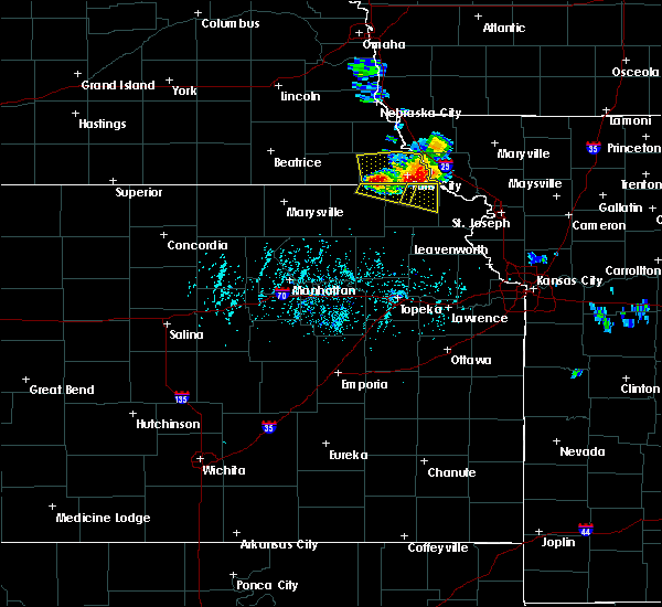 At 708 pm cdt, a severe thunderstorm was located near reserve, moving southeast at 20 mph (trained weather spotters reported 60 mph wind gusts in falls city at 705 pm cdt). Hazards include 60 mph wind gusts and quarter size hail. Hail damage to vehicles is expected. Expect wind damage to roofs, siding, and trees. At 708 pm cdt, a severe thunderstorm was located near reserve, moving southeast at 20 mph (trained weather spotters reported 60 mph wind gusts in falls city at 705 pm cdt). Hazards include 60 mph wind gusts and quarter size hail. Hail damage to vehicles is expected. Expect wind damage to roofs, siding, and trees.
|
| 5/2/2018 7:21 PM CDT |
 At 721 pm cdt, severe thunderstorms were located along a line extending from 3 miles northwest of white cloud to near lancaster to near ozawkie, moving east at 40 mph (radar indicated). Hazards include 60 mph wind gusts and quarter size hail. Hail damage to vehicles is expected. expect wind damage to roofs, siding, and trees. locations impacted include, hiawatha, horton, valley falls, hoyt, ozawkie, nortonville, winchester, mayetta, everest, robinson, whiting, denison and willis. A tornado watch remains in effect until 1000 pm cdt for northeastern kansas. At 721 pm cdt, severe thunderstorms were located along a line extending from 3 miles northwest of white cloud to near lancaster to near ozawkie, moving east at 40 mph (radar indicated). Hazards include 60 mph wind gusts and quarter size hail. Hail damage to vehicles is expected. expect wind damage to roofs, siding, and trees. locations impacted include, hiawatha, horton, valley falls, hoyt, ozawkie, nortonville, winchester, mayetta, everest, robinson, whiting, denison and willis. A tornado watch remains in effect until 1000 pm cdt for northeastern kansas.
|
| 5/2/2018 7:13 PM CDT |
 At 713 pm cdt, severe thunderstorms were located along a line extending from 7 miles northwest of white cloud to near effingham to 3 miles west of ozawkie, moving east at 35 mph (radar indicated). Hazards include 60 mph wind gusts and quarter size hail. Hail damage to vehicles is expected. expect wind damage to roofs, siding, and trees. locations impacted include, holton, hiawatha, horton, valley falls, hoyt, ozawkie, nortonville, winchester, mayetta, everest, robinson, whiting, denison, reserve, powhattan, hamlin and willis. A tornado watch remains in effect until 1000 pm cdt for northeastern kansas. At 713 pm cdt, severe thunderstorms were located along a line extending from 7 miles northwest of white cloud to near effingham to 3 miles west of ozawkie, moving east at 35 mph (radar indicated). Hazards include 60 mph wind gusts and quarter size hail. Hail damage to vehicles is expected. expect wind damage to roofs, siding, and trees. locations impacted include, holton, hiawatha, horton, valley falls, hoyt, ozawkie, nortonville, winchester, mayetta, everest, robinson, whiting, denison, reserve, powhattan, hamlin and willis. A tornado watch remains in effect until 1000 pm cdt for northeastern kansas.
|
| 5/2/2018 7:06 PM CDT |
 At 706 pm cdt, severe thunderstorms were located along a line extending from 4 miles northeast of reserve to 3 miles west of effingham to 4 miles northwest of meriden, moving east at 35 mph (radar indicated). Hazards include 60 mph wind gusts and quarter size hail. Hail damage to vehicles is expected. expect wind damage to roofs, siding, and trees. locations impacted include, holton, hiawatha, horton, valley falls, hoyt, ozawkie, nortonville, winchester, mayetta, everest, fairview, robinson, morrill, whiting, denison, netawaka, reserve, powhattan, hamlin and willis. A tornado watch remains in effect until 1000 pm cdt for northeastern kansas. At 706 pm cdt, severe thunderstorms were located along a line extending from 4 miles northeast of reserve to 3 miles west of effingham to 4 miles northwest of meriden, moving east at 35 mph (radar indicated). Hazards include 60 mph wind gusts and quarter size hail. Hail damage to vehicles is expected. expect wind damage to roofs, siding, and trees. locations impacted include, holton, hiawatha, horton, valley falls, hoyt, ozawkie, nortonville, winchester, mayetta, everest, fairview, robinson, morrill, whiting, denison, netawaka, reserve, powhattan, hamlin and willis. A tornado watch remains in effect until 1000 pm cdt for northeastern kansas.
|
| 5/2/2018 6:41 PM CDT |
 At 641 pm cdt, severe thunderstorms were located along a line extending from 6 miles north of sabetha to near holton to 4 miles southeast of delia, moving east at 35 mph (radar indicated). Hazards include 60 mph wind gusts and quarter size hail. Hail damage to vehicles is expected. Expect wind damage to roofs, siding, and trees. At 641 pm cdt, severe thunderstorms were located along a line extending from 6 miles north of sabetha to near holton to 4 miles southeast of delia, moving east at 35 mph (radar indicated). Hazards include 60 mph wind gusts and quarter size hail. Hail damage to vehicles is expected. Expect wind damage to roofs, siding, and trees.
|
| 7/12/2017 5:38 PM CDT |
 At 537 pm cdt, a severe thunderstorm was located 4 miles southeast of robinson, moving east at 15 mph (radar indicated). Hazards include 60 mph wind gusts and quarter size hail. Hail damage to vehicles is expected. Expect wind damage to roofs, siding, and trees. At 537 pm cdt, a severe thunderstorm was located 4 miles southeast of robinson, moving east at 15 mph (radar indicated). Hazards include 60 mph wind gusts and quarter size hail. Hail damage to vehicles is expected. Expect wind damage to roofs, siding, and trees.
|
| 6/16/2017 10:29 PM CDT |
 At 1028 pm cdt, severe thunderstorms were located along a line extending from 6 miles southeast of maitland to near oregon to 6 miles southeast of reserve, moving southeast at 50 mph (radar indicated). Hazards include 70 mph wind gusts and quarter size hail. Hail damage to vehicles is expected. expect considerable tree damage. wind damage is also likely to mobile homes, roofs, and outbuildings. These severe thunderstorms will remain over mainly rural areas of eastern brown county. At 1028 pm cdt, severe thunderstorms were located along a line extending from 6 miles southeast of maitland to near oregon to 6 miles southeast of reserve, moving southeast at 50 mph (radar indicated). Hazards include 70 mph wind gusts and quarter size hail. Hail damage to vehicles is expected. expect considerable tree damage. wind damage is also likely to mobile homes, roofs, and outbuildings. These severe thunderstorms will remain over mainly rural areas of eastern brown county.
|
| 6/16/2017 10:07 PM CDT |
 At 1007 pm cdt, severe thunderstorms were located along a line extending from near craig to near reserve to 5 miles south of humboldt, moving southeast at 65 mph. these are very dangerous storms (radar indicated). Hazards include 80 mph wind gusts and ping pong ball size hail. Flying debris will be dangerous to those caught without shelter. mobile homes will be heavily damaged. expect considerable damage to roofs, windows, and vehicles. extensive tree damage and power outages are likely. these severe storms will be near, reserve around 1010 pm cdt. sabetha, robinson and morrill around 1020 pm cdt. fairview and hamlin around 1025 pm cdt. Hiawatha and powhattan around 1030 pm cdt. At 1007 pm cdt, severe thunderstorms were located along a line extending from near craig to near reserve to 5 miles south of humboldt, moving southeast at 65 mph. these are very dangerous storms (radar indicated). Hazards include 80 mph wind gusts and ping pong ball size hail. Flying debris will be dangerous to those caught without shelter. mobile homes will be heavily damaged. expect considerable damage to roofs, windows, and vehicles. extensive tree damage and power outages are likely. these severe storms will be near, reserve around 1010 pm cdt. sabetha, robinson and morrill around 1020 pm cdt. fairview and hamlin around 1025 pm cdt. Hiawatha and powhattan around 1030 pm cdt.
|
| 6/16/2017 9:49 PM CDT |
 At 948 pm cdt, severe thunderstorms were located along a line extending from 6 miles southwest of fairfax to 3 miles northwest of verdon to near table rock, moving southeast at 70 mph. these are very dangerous storms (radar indicated). Hazards include 80 mph wind gusts and ping pong ball size hail. Flying debris will be dangerous to those caught without shelter. mobile homes will be heavily damaged. expect considerable damage to roofs, windows, and vehicles. Extensive tree damage and power outages are likely. At 948 pm cdt, severe thunderstorms were located along a line extending from 6 miles southwest of fairfax to 3 miles northwest of verdon to near table rock, moving southeast at 70 mph. these are very dangerous storms (radar indicated). Hazards include 80 mph wind gusts and ping pong ball size hail. Flying debris will be dangerous to those caught without shelter. mobile homes will be heavily damaged. expect considerable damage to roofs, windows, and vehicles. Extensive tree damage and power outages are likely.
|
| 3/6/2017 6:01 PM CST |
 At 601 pm cst, severe thunderstorms were located along a line extending from near reserve to 5 miles south of soldier, moving east at 40 mph (radar indicated). Hazards include 70 mph wind gusts and nickel size hail. Expect considerable tree damage. damage is likely to mobile homes, roofs, and outbuildings. locations impacted include, hiawatha, sabetha, horton, wetmore, everest, fairview, robinson, morrill, whiting, circleville, corning, netawaka, soldier, havensville, goff, reserve, powhattan, oneida, hamlin and willis. A tornado watch remains in effect until 1000 pm cst for northeastern kansas. At 601 pm cst, severe thunderstorms were located along a line extending from near reserve to 5 miles south of soldier, moving east at 40 mph (radar indicated). Hazards include 70 mph wind gusts and nickel size hail. Expect considerable tree damage. damage is likely to mobile homes, roofs, and outbuildings. locations impacted include, hiawatha, sabetha, horton, wetmore, everest, fairview, robinson, morrill, whiting, circleville, corning, netawaka, soldier, havensville, goff, reserve, powhattan, oneida, hamlin and willis. A tornado watch remains in effect until 1000 pm cst for northeastern kansas.
|
| 3/6/2017 5:40 PM CST |
 At 539 pm cst, severe thunderstorms were located along a line extending from 5 miles northwest of sabetha to 3 miles southwest of onaga, moving east at 40 mph (radar indicated). Hazards include 60 mph wind gusts and nickel size hail. expect damage to roofs, siding, and trees At 539 pm cst, severe thunderstorms were located along a line extending from 5 miles northwest of sabetha to 3 miles southwest of onaga, moving east at 40 mph (radar indicated). Hazards include 60 mph wind gusts and nickel size hail. expect damage to roofs, siding, and trees
|
| 10/6/2016 7:08 PM CDT |
 The severe thunderstorm warning for brown county will expire at 715 pm cdt, the storm which prompted the warning has weakened below severe limits, and no longer pose an immediate threat to life or property. therefore the warning will be allowed to expire. however small. The severe thunderstorm warning for brown county will expire at 715 pm cdt, the storm which prompted the warning has weakened below severe limits, and no longer pose an immediate threat to life or property. therefore the warning will be allowed to expire. however small.
|
| 10/6/2016 6:57 PM CDT |
 At 656 pm cdt, a severe thunderstorm was located near hiawatha, moving northeast at 45 mph (radar indicated). Hazards include 60 mph wind gusts and penny size hail. Expect damage to roofs. siding. and trees. locations impacted include, hiawatha, fairview, robinson, morrill, reserve, powhattan and hamlin. A tornado watch remains in effect until 900 pm cdt for northeastern kansas. At 656 pm cdt, a severe thunderstorm was located near hiawatha, moving northeast at 45 mph (radar indicated). Hazards include 60 mph wind gusts and penny size hail. Expect damage to roofs. siding. and trees. locations impacted include, hiawatha, fairview, robinson, morrill, reserve, powhattan and hamlin. A tornado watch remains in effect until 900 pm cdt for northeastern kansas.
|
| 10/6/2016 6:41 PM CDT |
 At 640 pm cdt, a severe thunderstorm was located 4 miles east of woodlawn, moving northeast at 40 mph (radar indicated). Hazards include 60 mph wind gusts and nickel size hail. Expect damage to roofs. siding. And trees. At 640 pm cdt, a severe thunderstorm was located 4 miles east of woodlawn, moving northeast at 40 mph (radar indicated). Hazards include 60 mph wind gusts and nickel size hail. Expect damage to roofs. siding. And trees.
|
| 8/24/2016 6:42 PM CDT |
 At 642 pm cdt, a severe thunderstorm was located near fairview, moving east at 25 mph (radar indicated). Hazards include ping pong ball size hail and 60 mph wind gusts. People and animals outdoors will be injured. expect hail damage to roofs, siding, windows, and vehicles. Expect wind damage to roofs, siding, and trees. At 642 pm cdt, a severe thunderstorm was located near fairview, moving east at 25 mph (radar indicated). Hazards include ping pong ball size hail and 60 mph wind gusts. People and animals outdoors will be injured. expect hail damage to roofs, siding, windows, and vehicles. Expect wind damage to roofs, siding, and trees.
|
| 7/13/2016 9:45 AM CDT |
 At 945 am cdt, severe thunderstorms were located along a line extending from 5 miles southwest of falls city to muscotah, moving east at 45 mph (trained weather spotters). Hazards include 60 mph wind gusts and nickel size hail. Expect damage to roofs. siding. and trees. Locations impacted include, hiawatha, sabetha, horton, everest, fairview, robinson, morrill, whiting, netawaka, reserve, powhattan, hamlin, willis and kickapoo reservation. At 945 am cdt, severe thunderstorms were located along a line extending from 5 miles southwest of falls city to muscotah, moving east at 45 mph (trained weather spotters). Hazards include 60 mph wind gusts and nickel size hail. Expect damage to roofs. siding. and trees. Locations impacted include, hiawatha, sabetha, horton, everest, fairview, robinson, morrill, whiting, netawaka, reserve, powhattan, hamlin, willis and kickapoo reservation.
|
| 7/13/2016 9:33 AM CDT |
 At 932 am cdt, severe thunderstorms were located along a line extending from 7 miles northwest of morrill to holton, moving east at 50 mph (trained weather spotters reported 60 mph winds with tree limbs down in circleville at 928 am cdt). Hazards include 60 mph wind gusts and nickel size hail. Expect damage to roofs. siding. and trees. Locations impacted include, holton, hiawatha, sabetha, horton, wetmore, everest, fairview, robinson, morrill, whiting, circleville, netawaka, goff, reserve, powhattan, oneida, hamlin, willis, kickapoo reservation and woodlawn. At 932 am cdt, severe thunderstorms were located along a line extending from 7 miles northwest of morrill to holton, moving east at 50 mph (trained weather spotters reported 60 mph winds with tree limbs down in circleville at 928 am cdt). Hazards include 60 mph wind gusts and nickel size hail. Expect damage to roofs. siding. and trees. Locations impacted include, holton, hiawatha, sabetha, horton, wetmore, everest, fairview, robinson, morrill, whiting, circleville, netawaka, goff, reserve, powhattan, oneida, hamlin, willis, kickapoo reservation and woodlawn.
|
| 7/13/2016 9:26 AM CDT |
 At 925 am cdt, severe thunderstorms were located along a line extending from 7 miles northeast of bern to 5 miles north of potawatomi reservation, moving east at 45 mph (radar indicated). Hazards include 60 mph wind gusts and nickel size hail. Expect damage to roofs. siding. And trees. At 925 am cdt, severe thunderstorms were located along a line extending from 7 miles northeast of bern to 5 miles north of potawatomi reservation, moving east at 45 mph (radar indicated). Hazards include 60 mph wind gusts and nickel size hail. Expect damage to roofs. siding. And trees.
|
| 7/7/2016 3:21 AM CDT |
 At 321 am cdt, severe thunderstorms were located along a line extending from 5 miles southwest of craig to near sabetha, moving southeast at 55 mph (emergency management). Hazards include 60 mph wind gusts. Expect damage to roofs. siding. And trees. At 321 am cdt, severe thunderstorms were located along a line extending from 5 miles southwest of craig to near sabetha, moving southeast at 55 mph (emergency management). Hazards include 60 mph wind gusts. Expect damage to roofs. siding. And trees.
|
| 5/26/2016 2:34 PM CDT |
 At 234 pm cdt, a severe thunderstorm was located over hiawatha, moving northeast at 35 mph (radar indicated). Hazards include ping pong ball size hail. People and animals outdoors will be injured. Expect damage to roofs, siding, windows, and vehicles. At 234 pm cdt, a severe thunderstorm was located over hiawatha, moving northeast at 35 mph (radar indicated). Hazards include ping pong ball size hail. People and animals outdoors will be injured. Expect damage to roofs, siding, windows, and vehicles.
|
| 5/25/2016 10:59 PM CDT |
 At 1059 pm cdt, a severe thunderstorm was located over hiawatha, moving northeast at 25 mph (radar indicated). Hazards include tennis ball size hail and 60 mph wind gusts. People and animals outdoors will be injured. expect hail damage to roofs, siding, windows, and vehicles. expect wind damage to roofs, siding, and trees. Locations impacted include, hiawatha, robinson, reserve and hamlin. At 1059 pm cdt, a severe thunderstorm was located over hiawatha, moving northeast at 25 mph (radar indicated). Hazards include tennis ball size hail and 60 mph wind gusts. People and animals outdoors will be injured. expect hail damage to roofs, siding, windows, and vehicles. expect wind damage to roofs, siding, and trees. Locations impacted include, hiawatha, robinson, reserve and hamlin.
|
| 5/25/2016 10:47 PM CDT |
 At 1047 pm cdt, a severe thunderstorm was located over hiawatha, moving northeast at 30 mph (radar indicated). Hazards include ping pong ball size hail and 60 mph wind gusts. People and animals outdoors will be injured. expect hail damage to roofs, siding, windows, and vehicles. Expect wind damage to roofs, siding, and trees. At 1047 pm cdt, a severe thunderstorm was located over hiawatha, moving northeast at 30 mph (radar indicated). Hazards include ping pong ball size hail and 60 mph wind gusts. People and animals outdoors will be injured. expect hail damage to roofs, siding, windows, and vehicles. Expect wind damage to roofs, siding, and trees.
|
| 4/26/2016 5:52 PM CDT |
 At 550 pm cdt, a severe thunderstorm was located over fairview, moving north at 35 mph (trained weather spotters reported golf ball size hail 3 miles east sabatha). Hazards include golf ball size hail. People and animals outdoors will be injured. Expect damage to roofs, siding, windows, and vehicles. At 550 pm cdt, a severe thunderstorm was located over fairview, moving north at 35 mph (trained weather spotters reported golf ball size hail 3 miles east sabatha). Hazards include golf ball size hail. People and animals outdoors will be injured. Expect damage to roofs, siding, windows, and vehicles.
|
| 4/26/2016 7:23 AM CDT |
 The severe thunderstorm warning for brown and northeastern jackson counties will expire at 730 am cdt, the storm which prompted the warning has weakened below severe limits, and no longer pose an immediate threat to life or property. therefore the warning will be allowed to expire. however gusty winds and heavy rain are still possible with this thunderstorm. a severe thunderstorm watch remains in effect until 1000 am cdt for northeastern kansas. The severe thunderstorm warning for brown and northeastern jackson counties will expire at 730 am cdt, the storm which prompted the warning has weakened below severe limits, and no longer pose an immediate threat to life or property. therefore the warning will be allowed to expire. however gusty winds and heavy rain are still possible with this thunderstorm. a severe thunderstorm watch remains in effect until 1000 am cdt for northeastern kansas.
|
| 4/26/2016 6:36 AM CDT |
 At 635 am cdt, a severe thunderstorm was located near goff, moving east at 35 mph (radar indicated). Hazards include 60 mph wind gusts and half dollar size hail. Hail damage to vehicles is expected. Expect wind damage to roofs, siding, and trees. At 635 am cdt, a severe thunderstorm was located near goff, moving east at 35 mph (radar indicated). Hazards include 60 mph wind gusts and half dollar size hail. Hail damage to vehicles is expected. Expect wind damage to roofs, siding, and trees.
|
| 8/3/2015 11:26 AM CDT |
 At 1125 am cdt, severe thunderstorms were located along a line extending from 6 miles north of sabetha to white cloud, moving southeast at 10 mph (radar indicated). Hazards include 60 mph wind gusts and quarter size hail. Hail damage to vehicles is expected. Expect wind damage to roofs, siding and trees. At 1125 am cdt, severe thunderstorms were located along a line extending from 6 miles north of sabetha to white cloud, moving southeast at 10 mph (radar indicated). Hazards include 60 mph wind gusts and quarter size hail. Hail damage to vehicles is expected. Expect wind damage to roofs, siding and trees.
|
| 6/11/2015 7:21 PM CDT |
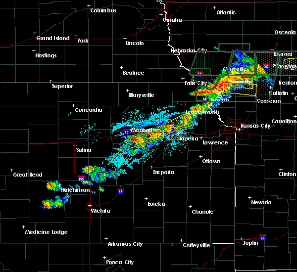 The national weather service in topeka has issued a * tornado warning for. east central brown county in northeast kansas. until 745 pm cdt * at 717 pm cdt. a severe thunderstorm capable of producing a tornado was located near robinson. And moving east at 20 mph. The national weather service in topeka has issued a * tornado warning for. east central brown county in northeast kansas. until 745 pm cdt * at 717 pm cdt. a severe thunderstorm capable of producing a tornado was located near robinson. And moving east at 20 mph.
|
| 5/25/2015 5:43 PM CDT | At 539 pm cdt, a severe thunderstorm was located near robinson, and moving northeast at 25 mph (radar indicated. this storm has a history of very large hail). Hazards include hen egg size hail and 60 mph wind gusts. People and animals outdoors will be injured. expect hail damage to roofs, siding, windows and vehicles. expect wind damage to roofs, siding and trees. The severe thunderstorm will affect mainly rural areas of east central brown county. |
| 5/25/2015 5:27 PM CDT | At 523 pm cdt, a severe thunderstorm was located near willis, and moving northeast at 20 mph. this is a very dangerous storm (radar indicated. this storm does have a history of producing hail larger than softballs). Hazards include softball size hail and 60 mph wind gusts. People and animals outdoors will be severely injured. expect shattered windows, extensive damage to roofs, siding and vehicles. the severe thunderstorm will be near, robinson around 540 pm cdt. Hiawatha can also expect hail up to golf ball size. |
| 5/25/2015 5:10 PM CDT | At 507 pm cdt, a severe thunderstorm was located near willis, and moving northeast at 15 mph. this is a very dangerous storm (trained weather spotters reported 4.75 inch hail with this storm at 453 pm, and radar indicates that it is still capable of producing very large hail up to baseball size). Hazards include baseball size hail and 60 mph wind gusts. People and animals outdoors will be severely injured. Expect shattered windows, extensive damage to roofs, siding and vehicles. |
| 5/25/2015 4:58 PM CDT | At 457 pm cdt, a severe thunderstorm was located near powhattan, and moving east at 25 mph. this is a very dangerous storm (trained weather spotters reported 4.75 inch hail 7 miles north of netawaka at 453 pm). Hazards include softball size hail and 60 mph wind gusts. People and animals outdoors will be severely injured. expect shattered windows, extensive damage to roofs, siding and vehicles. the severe thunderstorm will be near, willis around 510 pm cdt. Robinson around 515 pm cdt. |
| 5/25/2015 4:45 PM CDT | At 444 pm cdt, a severe thunderstorm was located near kickapoo reservation, and moving northeast at 25 mph. this is a very dangerous storm (trained weather spotters reported baseball size hail 4 miles northeast of wetmore at 440 pm). Hazards include baseball size hail and 60 mph wind gusts. People and animals outdoors will be severely injured. expect shattered windows, extensive damage to roofs, siding and vehicles. the severe thunderstorm will be near, powhattan around 455 pm cdt. willis around 505 pm cdt. Hiawatha and robinson around 515 pm cdt. |
| 5/25/2015 4:31 PM CDT | At 428 pm cdt, a severe thunderstorm was located near wetmore, and moving northeast at 25 mph (trained weather spotters reported golf ball size hail). Hazards include golf ball size hail and 60 mph wind gusts. People and animals outdoors will be injured. expect hail damage to roofs, siding, windows and vehicles. Expect wind damage to roofs, siding and trees. |
| 5/15/2015 7:27 PM CDT | At 723 pm cdt, a severe thunderstorm capable of producing a tornado was located near robinson, and moving northeast at 15 mph (radar indicated rotation). Hazards include tornado. Expect damage to mobile homes. roofs and vehicles. this dangerous storm will be near, robinson around 735 pm cdt. Radar indicated. |
| 5/15/2015 7:14 PM CDT | At 711 pm cdt, a severe thunderstorm capable of producing a tornado was located near willis, and moving northeast at 15 mph (weather spotters reported funnel cloud 2 miles north of willis at 711 pm). Hazards include tornado. Expect damage to mobile homes. roofs and vehicles. this dangerous storm will be near, robinson around 735 pm cdt. Radar indicated. |
| 5/4/2015 4:13 PM CDT | At 410 pm cdt, severe thunderstorms were located along a line extending from fairview to willis to whiting, and moving east at 30 mph. another strong storm was developing between wetmore and circleville, also moving east at 30 mph (radar indicated). Hazards include 60 mph wind gusts. Expect damage to roofs. Siding and trees. |
| 5/4/2015 3:57 PM CDT | At 354 pm cdt, severe thunderstorms were located along a line extending from sabetha to kickapoo reservation to circleville, and moving east at 30 mph (radar indicated). Hazards include 60 mph wind gusts. Expect damage to roofs. Siding and trees. |
| 6/3/2014 11:23 PM CDT | Attached deck was blown off the house. a large tree was also blown ove in brown county KS, 3.2 miles NE of Robinson, KS |
| 7/10/2013 1:00 AM CDT | Quarter sized hail reported 2.7 miles NE of Robinson, KS, winds 35 to 40 mph. hail fell for 15 minutes ranging from peas to quarter size. |
| 5/28/2013 6:54 PM CDT | Hen Egg sized hail reported 3.1 miles SSW of Robinson, KS |
| 5/28/2013 6:45 PM CDT | Quarter sized hail reported 3.2 miles NE of Robinson, KS |
| 1/1/0001 12:00 AM | Law enforcement estimates winds of 50 to 60 mp in brown county KS, 0.3 miles SSW of Robinson, KS |
| 1/1/0001 12:00 AM | Quarter sized hail reported 7.9 miles SSW of Robinson, KS |
| 1/1/0001 12:00 AM | Golf Ball sized hail reported 5.8 miles S of Robinson, KS |
Hail Maps for Robinson, KS
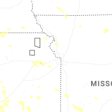
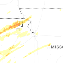


Connect with Interactive Hail Maps