

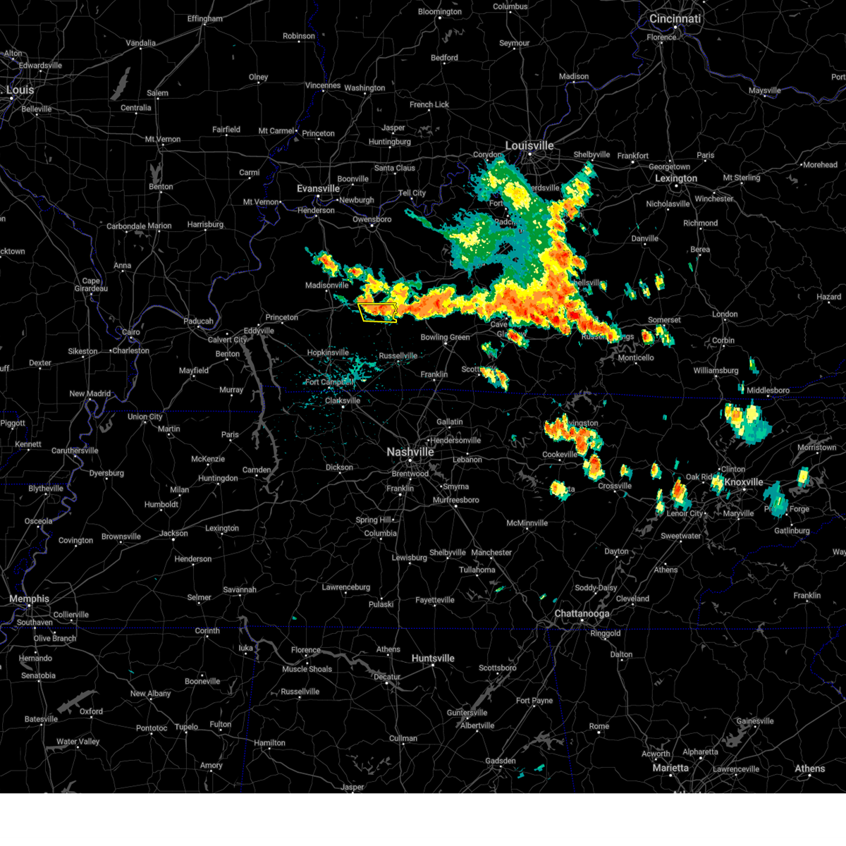
Hail Map for Rochester, KY
The Rochester, KY area has had 0 reports of on-the-ground hail by trained spotters, and has been under severe weather warnings 65 times during the past 12 months. Doppler radar has detected hail at or near Rochester, KY on 51 occasions, including 3 occasions during the past year.
| Name: | Rochester, KY |
| Where Located: | 64.4 miles SE of Evansville, IN |
| Map: | Google Map for Rochester, KY |
| Population: | 152 |
| Housing Units: | 93 |
| More Info: | Search Google for Rochester, KY |
0
The Top Recent Hail Date for Rochester, KY is Friday, May 16, 2025 (45th out of 51)
Hail and Wind Damage Spotted near Rochester, KY
| Date / Time | Report Details |
|---|---|
| 6/18/2025 8:37 PM CDT |
 the tornado warning has been cancelled and is no longer in effect the tornado warning has been cancelled and is no longer in effect
|
| 6/18/2025 8:32 PM CDT | At 832 pm cdt, a severe thunderstorm capable of producing a tornado was located near powderly, or near central city, moving east at 25 mph (radar indicated rotation). Hazards include tornado. Flying debris will be dangerous to those caught without shelter. mobile homes will be damaged or destroyed. damage to roofs, windows, and vehicles will occur. tree damage is likely. Locations impacted include, drakesboro. |
| 6/18/2025 8:26 PM CDT |
 Torpah the national weather service in paducah has issued a * tornado warning for, east central muhlenberg county in south central kentucky, * until 915 pm cdt. * at 826 pm cdt, a severe thunderstorm capable of producing a tornado was located near powderly, or near central city, moving east at 25 mph (radar indicated rotation). Hazards include tornado. Flying debris will be dangerous to those caught without shelter. mobile homes will be damaged or destroyed. damage to roofs, windows, and vehicles will occur. tree damage is likely. This tornadic thunderstorm will remain over mainly rural areas of east central muhlenberg county, including the following locations, drakesboro. Torpah the national weather service in paducah has issued a * tornado warning for, east central muhlenberg county in south central kentucky, * until 915 pm cdt. * at 826 pm cdt, a severe thunderstorm capable of producing a tornado was located near powderly, or near central city, moving east at 25 mph (radar indicated rotation). Hazards include tornado. Flying debris will be dangerous to those caught without shelter. mobile homes will be damaged or destroyed. damage to roofs, windows, and vehicles will occur. tree damage is likely. This tornadic thunderstorm will remain over mainly rural areas of east central muhlenberg county, including the following locations, drakesboro.
|
| 5/20/2025 5:34 PM CDT |
 At 534 pm cdt, a severe thunderstorm was located near hartford, or 17 miles east of central city, moving east at 45 mph (radar indicated). Hazards include 60 mph wind gusts. Expect damage to roofs, siding, and trees. Locations impacted include, hartford, morgantown, casey, lee, beaver dam, centertown, mchenry, rochester, mining city, aberdeen, shreve, eden, flint springs, neafus, gilstrap, dogwalk, heflin, provo, simmons, and welchs creek. At 534 pm cdt, a severe thunderstorm was located near hartford, or 17 miles east of central city, moving east at 45 mph (radar indicated). Hazards include 60 mph wind gusts. Expect damage to roofs, siding, and trees. Locations impacted include, hartford, morgantown, casey, lee, beaver dam, centertown, mchenry, rochester, mining city, aberdeen, shreve, eden, flint springs, neafus, gilstrap, dogwalk, heflin, provo, simmons, and welchs creek.
|
| 5/20/2025 5:30 PM CDT | the severe thunderstorm warning has been cancelled and is no longer in effect |
| 5/20/2025 5:20 PM CDT |
 Svrlmk the national weather service in louisville has issued a * severe thunderstorm warning for, northern butler county in south central kentucky, ohio county in central kentucky, * until 600 pm cdt. * at 520 pm cdt, a severe thunderstorm was located 8 miles southwest of hartford, or 9 miles east of central city, moving east at 55 mph (radar indicated). Hazards include 60 mph wind gusts. expect damage to roofs, siding, and trees Svrlmk the national weather service in louisville has issued a * severe thunderstorm warning for, northern butler county in south central kentucky, ohio county in central kentucky, * until 600 pm cdt. * at 520 pm cdt, a severe thunderstorm was located 8 miles southwest of hartford, or 9 miles east of central city, moving east at 55 mph (radar indicated). Hazards include 60 mph wind gusts. expect damage to roofs, siding, and trees
|
| 5/20/2025 5:17 PM CDT |
 At 517 pm cdt, a severe thunderstorm was located near central city, moving northeast at 45 mph (radar indicated). Hazards include 60 mph wind gusts and quarter size hail. Hail damage to vehicles is expected. expect wind damage to roofs, siding, and trees. locations impacted include, central city, powderly, greenville, drakesboro, rockport, bremen, and south carrollton. This includes western kentucky parkway between mile markers 50 and 65. At 517 pm cdt, a severe thunderstorm was located near central city, moving northeast at 45 mph (radar indicated). Hazards include 60 mph wind gusts and quarter size hail. Hail damage to vehicles is expected. expect wind damage to roofs, siding, and trees. locations impacted include, central city, powderly, greenville, drakesboro, rockport, bremen, and south carrollton. This includes western kentucky parkway between mile markers 50 and 65.
|
| 5/20/2025 5:17 PM CDT |
 the severe thunderstorm warning has been cancelled and is no longer in effect the severe thunderstorm warning has been cancelled and is no longer in effect
|
| 5/20/2025 4:51 PM CDT | Svrpah the national weather service in paducah has issued a * severe thunderstorm warning for, muhlenberg county in south central kentucky, northeastern christian county in south central kentucky, southeastern hopkins county in northwestern kentucky, northern todd county in south central kentucky, * until 545 pm cdt. * at 451 pm cdt, a severe thunderstorm was located near weir, or 18 miles southwest of central city, moving northeast at 45 mph (radar indicated). Hazards include 60 mph wind gusts and quarter size hail. Hail damage to vehicles is expected. Expect wind damage to roofs, siding, and trees. |
| 5/16/2025 9:13 PM CDT |
 At 913 pm cdt, severe thunderstorms were located along a line extending from 7 miles east of central city to near weir to near crofton, moving east at 50 mph (radar indicated). Hazards include 60 mph wind gusts and nickel size hail. Expect damage to roofs, siding, and trees. Locations impacted include, weir, dunmor, drakesboro, and clifty. At 913 pm cdt, severe thunderstorms were located along a line extending from 7 miles east of central city to near weir to near crofton, moving east at 50 mph (radar indicated). Hazards include 60 mph wind gusts and nickel size hail. Expect damage to roofs, siding, and trees. Locations impacted include, weir, dunmor, drakesboro, and clifty.
|
| 5/16/2025 9:13 PM CDT |
 the severe thunderstorm warning has been cancelled and is no longer in effect the severe thunderstorm warning has been cancelled and is no longer in effect
|
| 5/16/2025 8:52 PM CDT |
 Svrpah the national weather service in paducah has issued a * severe thunderstorm warning for, muhlenberg county in south central kentucky, northern christian county in south central kentucky, southeastern hopkins county in northwestern kentucky, northern todd county in south central kentucky, * until 930 pm cdt. * at 852 pm cdt, severe thunderstorms were located along a line extending from 7 miles east of central city to near weir to 7 miles east of cobb, moving east at 55 mph (radar indicated). Hazards include 70 mph wind gusts and quarter size hail. Hail damage to vehicles is expected. expect considerable tree damage. Wind damage is also likely to mobile homes, roofs, and outbuildings. Svrpah the national weather service in paducah has issued a * severe thunderstorm warning for, muhlenberg county in south central kentucky, northern christian county in south central kentucky, southeastern hopkins county in northwestern kentucky, northern todd county in south central kentucky, * until 930 pm cdt. * at 852 pm cdt, severe thunderstorms were located along a line extending from 7 miles east of central city to near weir to 7 miles east of cobb, moving east at 55 mph (radar indicated). Hazards include 70 mph wind gusts and quarter size hail. Hail damage to vehicles is expected. expect considerable tree damage. Wind damage is also likely to mobile homes, roofs, and outbuildings.
|
| 5/16/2025 8:41 PM CDT |
 Svrlmk the national weather service in louisville has issued a * severe thunderstorm warning for, northern logan county in south central kentucky, butler county in south central kentucky, grayson county in central kentucky, northwestern warren county in south central kentucky, southern hardin county in central kentucky, southern ohio county in central kentucky, northwestern edmonson county in south central kentucky, * until 1030 pm edt/930 pm cdt/. * at 940 pm edt/840 pm cdt/, a severe thunderstorm was located over powderly, moving east at 60 mph (radar indicated). Hazards include 70 mph wind gusts and quarter size hail. Hail damage to vehicles is expected. expect considerable tree damage. Wind damage is also likely to mobile homes, roofs, and outbuildings. Svrlmk the national weather service in louisville has issued a * severe thunderstorm warning for, northern logan county in south central kentucky, butler county in south central kentucky, grayson county in central kentucky, northwestern warren county in south central kentucky, southern hardin county in central kentucky, southern ohio county in central kentucky, northwestern edmonson county in south central kentucky, * until 1030 pm edt/930 pm cdt/. * at 940 pm edt/840 pm cdt/, a severe thunderstorm was located over powderly, moving east at 60 mph (radar indicated). Hazards include 70 mph wind gusts and quarter size hail. Hail damage to vehicles is expected. expect considerable tree damage. Wind damage is also likely to mobile homes, roofs, and outbuildings.
|
| 5/16/2025 7:31 PM CDT |
 The storm which prompted the warning has moved out of the area. therefore, the warning has been allowed to expire. a tornado watch remains in effect until 1000 pm cdt for south central and central kentucky. to report severe weather, contact your nearest law enforcement agency. they will relay your report to the national weather service louisville. The storm which prompted the warning has moved out of the area. therefore, the warning has been allowed to expire. a tornado watch remains in effect until 1000 pm cdt for south central and central kentucky. to report severe weather, contact your nearest law enforcement agency. they will relay your report to the national weather service louisville.
|
| 5/16/2025 6:51 PM CDT | Svrlmk the national weather service in louisville has issued a * severe thunderstorm warning for, northern logan county in south central kentucky, southwestern butler county in south central kentucky, northwestern warren county in south central kentucky, * until 730 pm cdt. * at 651 pm cdt, a severe thunderstorm was located near crofton, moving east at 45 mph (radar indicated). Hazards include two inch hail and 70 mph wind gusts. People and animals outdoors will be injured. expect hail damage to roofs, siding, windows, and vehicles. expect considerable tree damage. Wind damage is also likely to mobile homes, roofs, and outbuildings. |
| 5/16/2025 6:39 PM CDT |
 Svrpah the national weather service in paducah has issued a * severe thunderstorm warning for, southeastern muhlenberg county in south central kentucky, northeastern todd county in south central kentucky, * until 715 pm cdt. * at 639 pm cdt, a severe thunderstorm was located near weir, or 17 miles south of central city, moving east at 50 mph (radar indicated). Hazards include 60 mph wind gusts and half dollar size hail. Hail damage to vehicles is expected. Expect wind damage to roofs, siding, and trees. Svrpah the national weather service in paducah has issued a * severe thunderstorm warning for, southeastern muhlenberg county in south central kentucky, northeastern todd county in south central kentucky, * until 715 pm cdt. * at 639 pm cdt, a severe thunderstorm was located near weir, or 17 miles south of central city, moving east at 50 mph (radar indicated). Hazards include 60 mph wind gusts and half dollar size hail. Hail damage to vehicles is expected. Expect wind damage to roofs, siding, and trees.
|
| 5/16/2025 8:29 AM CDT |
 The storm which prompted the warning has weakened below severe limits, and no longer poses an immediate threat to life or property. therefore, the warning will be allowed to expire. however, small hail and gusty winds are still possible with this thunderstorm. a severe thunderstorm watch remains in effect until 900 am cdt for south central and central kentucky. The storm which prompted the warning has weakened below severe limits, and no longer poses an immediate threat to life or property. therefore, the warning will be allowed to expire. however, small hail and gusty winds are still possible with this thunderstorm. a severe thunderstorm watch remains in effect until 900 am cdt for south central and central kentucky.
|
| 5/16/2025 8:14 AM CDT |
 The storm which prompted the warning has moved out of the area. therefore, the warning will be allowed to expire. a severe thunderstorm watch remains in effect until 900 am cdt for south central kentucky. The storm which prompted the warning has moved out of the area. therefore, the warning will be allowed to expire. a severe thunderstorm watch remains in effect until 900 am cdt for south central kentucky.
|
| 5/16/2025 8:11 AM CDT |
 At 810 am cdt, a severe thunderstorm was located near morgantown, moving east at 65 mph (radar indicated). Hazards include ping pong ball size hail and 60 mph wind gusts. People and animals outdoors will be injured. expect hail damage to roofs, siding, windows, and vehicles. expect wind damage to roofs, siding, and trees. Locations impacted include, morgantown, brownsville, casey, lee, oakland, rochester, woodbury, roundhill, mining city, and dimple. At 810 am cdt, a severe thunderstorm was located near morgantown, moving east at 65 mph (radar indicated). Hazards include ping pong ball size hail and 60 mph wind gusts. People and animals outdoors will be injured. expect hail damage to roofs, siding, windows, and vehicles. expect wind damage to roofs, siding, and trees. Locations impacted include, morgantown, brownsville, casey, lee, oakland, rochester, woodbury, roundhill, mining city, and dimple.
|
| 5/16/2025 8:06 AM CDT |
 Svrlmk the national weather service in louisville has issued a * severe thunderstorm warning for, north central logan county in south central kentucky, butler county in south central kentucky, northern warren county in south central kentucky, south central ohio county in central kentucky, western edmonson county in south central kentucky, * until 830 am cdt. * at 805 am cdt, a severe thunderstorm was located 8 miles northeast of dunmor, moving east at 65 mph (radar indicated). Hazards include 60 mph wind gusts and half dollar size hail. Hail damage to vehicles is expected. Expect wind damage to roofs, siding, and trees. Svrlmk the national weather service in louisville has issued a * severe thunderstorm warning for, north central logan county in south central kentucky, butler county in south central kentucky, northern warren county in south central kentucky, south central ohio county in central kentucky, western edmonson county in south central kentucky, * until 830 am cdt. * at 805 am cdt, a severe thunderstorm was located 8 miles northeast of dunmor, moving east at 65 mph (radar indicated). Hazards include 60 mph wind gusts and half dollar size hail. Hail damage to vehicles is expected. Expect wind damage to roofs, siding, and trees.
|
| 5/16/2025 7:39 AM CDT |
 Svrpah the national weather service in paducah has issued a * severe thunderstorm warning for, central muhlenberg county in south central kentucky, * until 815 am cdt. * at 739 am cdt, a severe thunderstorm was located over greenville, or 8 miles southwest of central city, moving east at 60 mph (radar indicated). Hazards include quarter size hail. damage to vehicles is expected Svrpah the national weather service in paducah has issued a * severe thunderstorm warning for, central muhlenberg county in south central kentucky, * until 815 am cdt. * at 739 am cdt, a severe thunderstorm was located over greenville, or 8 miles southwest of central city, moving east at 60 mph (radar indicated). Hazards include quarter size hail. damage to vehicles is expected
|
| 5/8/2025 4:22 PM CDT | The storm which prompted the warning has weakened below severe limits, and no longer poses an immediate threat to life or property. therefore, the warning will be allowed to expire. however, small hail and heavy rain are still possible with this thunderstorm. a severe thunderstorm watch remains in effect until 800 pm cdt for south central and central kentucky. |
| 5/8/2025 3:56 PM CDT |
 Svrlmk the national weather service in louisville has issued a * severe thunderstorm warning for, northwestern butler county in south central kentucky, south central ohio county in central kentucky, * until 430 pm cdt. * at 356 pm cdt, a severe thunderstorm was located near morgantown, moving east-southeast at 15 mph (radar indicated). Hazards include 60 mph wind gusts and half dollar size hail. Hail damage to vehicles is expected. Expect wind damage to roofs, siding, and trees. Svrlmk the national weather service in louisville has issued a * severe thunderstorm warning for, northwestern butler county in south central kentucky, south central ohio county in central kentucky, * until 430 pm cdt. * at 356 pm cdt, a severe thunderstorm was located near morgantown, moving east-southeast at 15 mph (radar indicated). Hazards include 60 mph wind gusts and half dollar size hail. Hail damage to vehicles is expected. Expect wind damage to roofs, siding, and trees.
|
| 5/8/2025 3:11 PM CDT |
 Svrlmk the national weather service in louisville has issued a * severe thunderstorm warning for, northwestern butler county in south central kentucky, south central ohio county in central kentucky, * until 345 pm cdt. * at 311 pm cdt, a severe thunderstorm was located 9 miles east of central city, moving east at 15 mph (radar indicated). Hazards include 60 mph wind gusts and quarter size hail. Hail damage to vehicles is expected. Expect wind damage to roofs, siding, and trees. Svrlmk the national weather service in louisville has issued a * severe thunderstorm warning for, northwestern butler county in south central kentucky, south central ohio county in central kentucky, * until 345 pm cdt. * at 311 pm cdt, a severe thunderstorm was located 9 miles east of central city, moving east at 15 mph (radar indicated). Hazards include 60 mph wind gusts and quarter size hail. Hail damage to vehicles is expected. Expect wind damage to roofs, siding, and trees.
|
| 5/2/2025 1:00 PM CDT |
 The storms which prompted the warning have weakened below severe limits, and have exited the warned area. therefore, the warning has been allowed to expire. a severe thunderstorm watch remains in effect until 500 pm cdt for south central kentucky. a severe thunderstorm watch also remains in effect until 800 pm cdt for central kentucky. to report severe weather, contact your nearest law enforcement agency. they will relay your report to the national weather service louisville. The storms which prompted the warning have weakened below severe limits, and have exited the warned area. therefore, the warning has been allowed to expire. a severe thunderstorm watch remains in effect until 500 pm cdt for south central kentucky. a severe thunderstorm watch also remains in effect until 800 pm cdt for central kentucky. to report severe weather, contact your nearest law enforcement agency. they will relay your report to the national weather service louisville.
|
| 5/2/2025 12:56 PM CDT |
 The storms which prompted the warning have moved out of the area. therefore, the warning will be allowed to expire. however, gusty winds are still possible with these thunderstorms. a severe thunderstorm watch remains in effect until 500 pm cdt for south central kentucky. The storms which prompted the warning have moved out of the area. therefore, the warning will be allowed to expire. however, gusty winds are still possible with these thunderstorms. a severe thunderstorm watch remains in effect until 500 pm cdt for south central kentucky.
|
| 5/2/2025 12:48 PM CDT | At 1248 pm cdt, severe thunderstorms were located along a line extending from graham to 8 miles northeast of elkton to 7 miles southwest of russellville, moving northeast at 35 mph (radar indicated). Hazards include 60 mph wind gusts. Expect damage to roofs, siding, and trees. locations impacted include, central city, powderly, dunmor, greenville, drakesboro, and rockport. This includes western kentucky parkway between mile markers 48 and 65. |
| 5/2/2025 12:48 PM CDT | the severe thunderstorm warning has been cancelled and is no longer in effect |
| 5/2/2025 12:40 PM CDT | At 1240 pm cdt, severe thunderstorms were located along a line extending from near weir to 6 miles southwest of russellville to 8 miles northwest of coopertown, moving northeast at 35 mph (radar indicated). Hazards include 60 mph wind gusts and quarter size hail. Hail damage to vehicles is expected. expect wind damage to roofs, siding, and trees. Locations impacted include, russellville, anderson, auburn, adairville, lewisburg, rochester, insco, spa, epleys, and crossroad. |
| 5/2/2025 12:37 PM CDT |
 At 1236 pm cdt, severe thunderstorms were located along a line extending from near nortonville to near elkton to 6 miles northeast of guthrie, moving northeast at 35 mph (radar indicated). Hazards include 60 mph wind gusts and nickel size hail. Expect damage to roofs, siding, and trees. locations impacted include, central city, elkton, powderly, greenville, weir, dunmor, graham, white plains, drakesboro, rockport, justice, everett, allensville, allegre, and clifty. This includes western kentucky parkway between mile markers 46 and 65. At 1236 pm cdt, severe thunderstorms were located along a line extending from near nortonville to near elkton to 6 miles northeast of guthrie, moving northeast at 35 mph (radar indicated). Hazards include 60 mph wind gusts and nickel size hail. Expect damage to roofs, siding, and trees. locations impacted include, central city, elkton, powderly, greenville, weir, dunmor, graham, white plains, drakesboro, rockport, justice, everett, allensville, allegre, and clifty. This includes western kentucky parkway between mile markers 46 and 65.
|
| 5/2/2025 12:26 PM CDT | At 1226 pm cdt, severe thunderstorms were located along a line extending from near nortonville to near elkton to near guthrie, moving northeast at 35 mph (radar indicated). Hazards include 60 mph wind gusts and nickel size hail. Expect damage to roofs, siding, and trees. locations impacted include, central city, elkton, guthrie, nortonville, powderly, greenville, weir, dunmor, white plains, drakesboro, trenton, rockport, justice, everett, allensville, allegre, and clifty. this includes the following highways, western kentucky parkway between mile markers 46 and 65. Pennyrile parkway between mile markers 25 and 32. |
| 5/2/2025 12:22 PM CDT | Svrlmk the national weather service in louisville has issued a * severe thunderstorm warning for, logan county in south central kentucky, western simpson county in south central kentucky, southwestern butler county in south central kentucky, * until 100 pm cdt. * at 1221 pm cdt, severe thunderstorms were located along a line extending from 8 miles east of crofton to near guthrie to 10 miles southeast of clarksville, moving northeast at 40 mph (radar indicated). Hazards include 60 mph wind gusts and quarter size hail. Hail damage to vehicles is expected. Expect wind damage to roofs, siding, and trees. |
| 5/2/2025 12:13 PM CDT | Svrpah the national weather service in paducah has issued a * severe thunderstorm warning for, muhlenberg county in south central kentucky, eastern christian county in south central kentucky, southeastern hopkins county in northwestern kentucky, todd county in south central kentucky, * until 100 pm cdt. * at 1213 pm cdt, severe thunderstorms were located along a line extending from near crofton to near pembroke to near guthrie, moving northeast at 35 mph (radar indicated). Hazards include 60 mph wind gusts and nickel size hail. expect damage to roofs, siding, and trees |
| 4/3/2025 11:22 PM CDT |
 the severe thunderstorm warning has been cancelled and is no longer in effect the severe thunderstorm warning has been cancelled and is no longer in effect
|
| 4/3/2025 11:22 PM CDT |
 At 1122 pm cdt, severe thunderstorms were located along a line extending from weir to 9 miles southwest of dunmor to near elkton, moving east at 65 mph (radar indicated). Hazards include 60 mph wind gusts and nickel size hail. Expect damage to roofs, siding, and trees. locations impacted include, justice, drakesboro, greenville, allegre, everett, white plains, clifty, elkton, dunmor, weir, pembroke, and hopkinsville. this includes the following highways, interstate 24 in kentucky between mile markers 81 and 82. Pennyrile parkway between mile markers 1 and 13. At 1122 pm cdt, severe thunderstorms were located along a line extending from weir to 9 miles southwest of dunmor to near elkton, moving east at 65 mph (radar indicated). Hazards include 60 mph wind gusts and nickel size hail. Expect damage to roofs, siding, and trees. locations impacted include, justice, drakesboro, greenville, allegre, everett, white plains, clifty, elkton, dunmor, weir, pembroke, and hopkinsville. this includes the following highways, interstate 24 in kentucky between mile markers 81 and 82. Pennyrile parkway between mile markers 1 and 13.
|
| 4/3/2025 10:57 PM CDT |
 Svrpah the national weather service in paducah has issued a * severe thunderstorm warning for, southern muhlenberg county in south central kentucky, christian county in south central kentucky, southeastern caldwell county in western kentucky, eastern trigg county in western kentucky, southeastern hopkins county in northwestern kentucky, todd county in south central kentucky, * until 1145 pm cdt. * at 1057 pm cdt, severe thunderstorms were located along a line extending from 6 miles north of cobb to 10 miles northwest of hopkinsville to 8 miles southeast of cadiz, moving east at 60 mph (radar indicated). Hazards include 60 mph wind gusts and nickel size hail. expect damage to roofs, siding, and trees Svrpah the national weather service in paducah has issued a * severe thunderstorm warning for, southern muhlenberg county in south central kentucky, christian county in south central kentucky, southeastern caldwell county in western kentucky, eastern trigg county in western kentucky, southeastern hopkins county in northwestern kentucky, todd county in south central kentucky, * until 1145 pm cdt. * at 1057 pm cdt, severe thunderstorms were located along a line extending from 6 miles north of cobb to 10 miles northwest of hopkinsville to 8 miles southeast of cadiz, moving east at 60 mph (radar indicated). Hazards include 60 mph wind gusts and nickel size hail. expect damage to roofs, siding, and trees
|
| 4/2/2025 11:10 PM CDT | The storm which prompted the warning has moved out of the area. therefore, the warning will be allowed to expire. a tornado watch remains in effect until midnight cdt for south central kentucky. |
| 4/2/2025 11:02 PM CDT |
 At 1102 pm cdt, a severe squall line capable of producing both tornadoes and extensive straight line wind damage was located near dunmor, or 12 miles southeast of central city, moving northeast at 75 mph (radar indicated rotation). Hazards include tornado. Flying debris will be dangerous to those caught without shelter. mobile homes will be damaged or destroyed. damage to roofs, windows, and vehicles will occur. tree damage is likely. locations impacted include, central city, drakesboro, dunmor, powderly, and greenville. This includes western kentucky parkway between mile markers 56 and 65. At 1102 pm cdt, a severe squall line capable of producing both tornadoes and extensive straight line wind damage was located near dunmor, or 12 miles southeast of central city, moving northeast at 75 mph (radar indicated rotation). Hazards include tornado. Flying debris will be dangerous to those caught without shelter. mobile homes will be damaged or destroyed. damage to roofs, windows, and vehicles will occur. tree damage is likely. locations impacted include, central city, drakesboro, dunmor, powderly, and greenville. This includes western kentucky parkway between mile markers 56 and 65.
|
| 4/2/2025 11:02 PM CDT |
 the tornado warning has been cancelled and is no longer in effect the tornado warning has been cancelled and is no longer in effect
|
| 4/2/2025 10:49 PM CDT | the tornado warning has been cancelled and is no longer in effect |
| 4/2/2025 10:49 PM CDT | At 1049 pm cdt, a severe squall line capable of producing both tornadoes and extensive straight line wind damage was located near greenville, or 8 miles south of central city, moving east at 50 mph (radar indicated rotation). Hazards include tornado. Flying debris will be dangerous to those caught without shelter. mobile homes will be damaged or destroyed. damage to roofs, windows, and vehicles will occur. tree damage is likely. this tornadic thunderstorm will remain over mainly rural areas of central muhlenberg and northeastern christian counties, including the following locations, drakesboro. This includes western kentucky parkway between mile markers 52 and 65. |
| 4/2/2025 10:41 PM CDT | Torpah the national weather service in paducah has issued a * tornado warning for, muhlenberg county in south central kentucky, northeastern christian county in south central kentucky, southeastern hopkins county in northwestern kentucky, * until 1115 pm cdt. * at 1040 pm cdt, a severe thunderstorm capable of producing a tornado was located over weir, or 11 miles south of central city, moving east at 60 mph (radar indicated rotation). Hazards include tornado. Flying debris will be dangerous to those caught without shelter. mobile homes will be damaged or destroyed. damage to roofs, windows, and vehicles will occur. tree damage is likely. this dangerous storm will be near, dunmor, powderly, central city, and greenville around 1045 pm cdt. other locations impacted by this tornadic thunderstorm include drakesboro and white plains. This includes western kentucky parkway between mile markers 43 and 65. |
| 4/2/2025 10:01 PM CDT |
 the severe thunderstorm warning has been cancelled and is no longer in effect the severe thunderstorm warning has been cancelled and is no longer in effect
|
| 4/2/2025 10:01 PM CDT |
 At 1001 pm cdt, severe thunderstorms were located along a line extending from near st. joseph to near central city to near crofton, moving east at 50 mph (radar indicated). Hazards include 60 mph wind gusts. Expect damage to roofs, siding, and trees. locations impacted include, madisonville, graham, sacramento, calhoun, hawkins, livermore, greenville, white plains, earlington, central city, island, nortonville, drakesboro, bremen, powderly, st. charles, mortons gap, south carrollton, hanson, and crofton. this includes the following highways, interstate 165 between mile markers 60 and 61. interstate 69 in kentucky between mile markers 97 and 122. western kentucky parkway between mile markers 39 and 65. Pennyrile parkway between mile markers 22 and 34. At 1001 pm cdt, severe thunderstorms were located along a line extending from near st. joseph to near central city to near crofton, moving east at 50 mph (radar indicated). Hazards include 60 mph wind gusts. Expect damage to roofs, siding, and trees. locations impacted include, madisonville, graham, sacramento, calhoun, hawkins, livermore, greenville, white plains, earlington, central city, island, nortonville, drakesboro, bremen, powderly, st. charles, mortons gap, south carrollton, hanson, and crofton. this includes the following highways, interstate 165 between mile markers 60 and 61. interstate 69 in kentucky between mile markers 97 and 122. western kentucky parkway between mile markers 39 and 65. Pennyrile parkway between mile markers 22 and 34.
|
| 4/2/2025 9:53 PM CDT |
 Svrlmk the national weather service in louisville has issued a * severe thunderstorm warning for, northern logan county in south central kentucky, butler county in south central kentucky, western grayson county in central kentucky, northwestern warren county in south central kentucky, ohio county in central kentucky, northwestern edmonson county in south central kentucky, * until 1100 pm cdt. * at 952 pm cdt, severe thunderstorms were located along a line extending from near calhoun to near crofton, moving east at 45 mph (radar indicated). Hazards include 60 mph wind gusts. expect damage to roofs, siding, and trees Svrlmk the national weather service in louisville has issued a * severe thunderstorm warning for, northern logan county in south central kentucky, butler county in south central kentucky, western grayson county in central kentucky, northwestern warren county in south central kentucky, ohio county in central kentucky, northwestern edmonson county in south central kentucky, * until 1100 pm cdt. * at 952 pm cdt, severe thunderstorms were located along a line extending from near calhoun to near crofton, moving east at 45 mph (radar indicated). Hazards include 60 mph wind gusts. expect damage to roofs, siding, and trees
|
| 4/2/2025 9:38 PM CDT | Svrpah the national weather service in paducah has issued a * severe thunderstorm warning for, south central daviess county in northwestern kentucky, muhlenberg county in south central kentucky, northern christian county in south central kentucky, southeastern caldwell county in western kentucky, mclean county in northwestern kentucky, hopkins county in northwestern kentucky, eastern webster county in northwestern kentucky, * until 1030 pm cdt. * at 938 pm cdt, severe thunderstorms were located along a line extending from near sebree to earlington to near cobb, moving east at 50 mph (radar indicated). Hazards include 60 mph wind gusts. expect damage to roofs, siding, and trees |
| 3/30/2025 9:36 PM CDT |
 At 936 pm cdt, severe thunderstorms were located along a line extending from 8 miles northwest of central city to near powderly to near weir, moving east at 50 mph (radar indicated). Hazards include 60 mph wind gusts and nickel size hail. Expect damage to roofs, siding, and trees. locations impacted include, drakesboro, clifty, central city, dunmor, south carrollton, powderly, rockport, and greenville. This includes western kentucky parkway between mile markers 56 and 65. At 936 pm cdt, severe thunderstorms were located along a line extending from 8 miles northwest of central city to near powderly to near weir, moving east at 50 mph (radar indicated). Hazards include 60 mph wind gusts and nickel size hail. Expect damage to roofs, siding, and trees. locations impacted include, drakesboro, clifty, central city, dunmor, south carrollton, powderly, rockport, and greenville. This includes western kentucky parkway between mile markers 56 and 65.
|
| 3/30/2025 9:36 PM CDT |
 the severe thunderstorm warning has been cancelled and is no longer in effect the severe thunderstorm warning has been cancelled and is no longer in effect
|
| 3/30/2025 9:18 PM CDT |
 At 918 pm cdt, severe thunderstorms were located along a line extending from madisonville to near graham to 6 miles southeast of crofton, moving east at 50 mph (radar indicated). Hazards include 60 mph wind gusts and nickel size hail. Expect damage to roofs, siding, and trees. locations impacted include, graham, greenville, white plains, central city, drakesboro, powderly, south carrollton, crofton, clifty, dunmor, weir, nortonville, rockport, and mortons gap. this includes the following highways, interstate 69 in kentucky between mile markers 106 and 108. western kentucky parkway between mile markers 39 and 65. Pennyrile parkway between mile markers 15 and 26, and between mile markers 32 and 34. At 918 pm cdt, severe thunderstorms were located along a line extending from madisonville to near graham to 6 miles southeast of crofton, moving east at 50 mph (radar indicated). Hazards include 60 mph wind gusts and nickel size hail. Expect damage to roofs, siding, and trees. locations impacted include, graham, greenville, white plains, central city, drakesboro, powderly, south carrollton, crofton, clifty, dunmor, weir, nortonville, rockport, and mortons gap. this includes the following highways, interstate 69 in kentucky between mile markers 106 and 108. western kentucky parkway between mile markers 39 and 65. Pennyrile parkway between mile markers 15 and 26, and between mile markers 32 and 34.
|
| 3/30/2025 9:18 PM CDT |
 the severe thunderstorm warning has been cancelled and is no longer in effect the severe thunderstorm warning has been cancelled and is no longer in effect
|
| 3/30/2025 8:58 PM CDT |
 Svrpah the national weather service in paducah has issued a * severe thunderstorm warning for, muhlenberg county in south central kentucky, northern christian county in south central kentucky, southeastern mclean county in northwestern kentucky, southern hopkins county in northwestern kentucky, northern todd county in south central kentucky, * until 945 pm cdt. * at 858 pm cdt, severe thunderstorms were located along a line extending from near olney to near dawson springs to 7 miles southeast of cobb, moving east at 50 mph (radar indicated). Hazards include 60 mph wind gusts and nickel size hail. expect damage to roofs, siding, and trees Svrpah the national weather service in paducah has issued a * severe thunderstorm warning for, muhlenberg county in south central kentucky, northern christian county in south central kentucky, southeastern mclean county in northwestern kentucky, southern hopkins county in northwestern kentucky, northern todd county in south central kentucky, * until 945 pm cdt. * at 858 pm cdt, severe thunderstorms were located along a line extending from near olney to near dawson springs to 7 miles southeast of cobb, moving east at 50 mph (radar indicated). Hazards include 60 mph wind gusts and nickel size hail. expect damage to roofs, siding, and trees
|
| 3/19/2025 8:46 PM CDT |
 the severe thunderstorm warning has been cancelled and is no longer in effect the severe thunderstorm warning has been cancelled and is no longer in effect
|
| 3/19/2025 8:35 PM CDT |
 At 835 pm cdt, a severe thunderstorm was located near greenville, or 8 miles south of central city, moving northeast at 55 mph (radar indicated). Hazards include 60 mph wind gusts. Expect damage to roofs, siding, and trees. locations impacted include, drakesboro, powderly, dunmor, weir, greenville, and central city. This includes western kentucky parkway between mile markers 58 and 65. At 835 pm cdt, a severe thunderstorm was located near greenville, or 8 miles south of central city, moving northeast at 55 mph (radar indicated). Hazards include 60 mph wind gusts. Expect damage to roofs, siding, and trees. locations impacted include, drakesboro, powderly, dunmor, weir, greenville, and central city. This includes western kentucky parkway between mile markers 58 and 65.
|
| 3/19/2025 8:35 PM CDT |
 the severe thunderstorm warning has been cancelled and is no longer in effect the severe thunderstorm warning has been cancelled and is no longer in effect
|
| 3/19/2025 8:21 PM CDT |
 Svrpah the national weather service in paducah has issued a * severe thunderstorm warning for, muhlenberg county in south central kentucky, northeastern christian county in south central kentucky, north central todd county in south central kentucky, * until 900 pm cdt. * at 821 pm cdt, a severe thunderstorm was located near weir, or 17 miles southwest of central city, moving northeast at 55 mph (radar indicated). Hazards include 60 mph wind gusts and quarter size hail. Hail damage to vehicles is expected. Expect wind damage to roofs, siding, and trees. Svrpah the national weather service in paducah has issued a * severe thunderstorm warning for, muhlenberg county in south central kentucky, northeastern christian county in south central kentucky, north central todd county in south central kentucky, * until 900 pm cdt. * at 821 pm cdt, a severe thunderstorm was located near weir, or 17 miles southwest of central city, moving northeast at 55 mph (radar indicated). Hazards include 60 mph wind gusts and quarter size hail. Hail damage to vehicles is expected. Expect wind damage to roofs, siding, and trees.
|
| 2/6/2025 4:59 AM CST |
 Svrlmk the national weather service in louisville has issued a * severe thunderstorm warning for, western hart county in central kentucky, butler county in south central kentucky, southeastern grayson county in central kentucky, northwestern warren county in south central kentucky, edmonson county in south central kentucky, * until 530 am cst. * at 458 am cst, severe thunderstorms were located along a line extending from 8 miles southeast of leitchfield to morgantown, moving east at 40 mph (radar indicated). Hazards include 60 mph wind gusts and quarter size hail. Hail damage to vehicles is expected. Expect wind damage to roofs, siding, and trees. Svrlmk the national weather service in louisville has issued a * severe thunderstorm warning for, western hart county in central kentucky, butler county in south central kentucky, southeastern grayson county in central kentucky, northwestern warren county in south central kentucky, edmonson county in south central kentucky, * until 530 am cst. * at 458 am cst, severe thunderstorms were located along a line extending from 8 miles southeast of leitchfield to morgantown, moving east at 40 mph (radar indicated). Hazards include 60 mph wind gusts and quarter size hail. Hail damage to vehicles is expected. Expect wind damage to roofs, siding, and trees.
|
| 8/1/2024 3:43 PM CDT |
 At 342 pm cdt, severe thunderstorms were located along a line extending from near central city to graham to near nortonville, moving southeast at 30 mph (radar indicated). Hazards include 60 mph wind gusts. Expect damage to roofs, siding, and trees. locations impacted include, madisonville, central city, earlington, nortonville, mortons gap, powderly, graham, greenville, weir, dunmor, white plains, drakesboro, sacramento, island, st. charles, bremen, and south carrollton. this includes the following highways, interstate 69 in kentucky between mile markers 99 and 113. western kentucky parkway between mile markers 39 and 65. Pennyrile parkway between mile markers 24 and 34. At 342 pm cdt, severe thunderstorms were located along a line extending from near central city to graham to near nortonville, moving southeast at 30 mph (radar indicated). Hazards include 60 mph wind gusts. Expect damage to roofs, siding, and trees. locations impacted include, madisonville, central city, earlington, nortonville, mortons gap, powderly, graham, greenville, weir, dunmor, white plains, drakesboro, sacramento, island, st. charles, bremen, and south carrollton. this includes the following highways, interstate 69 in kentucky between mile markers 99 and 113. western kentucky parkway between mile markers 39 and 65. Pennyrile parkway between mile markers 24 and 34.
|
| 8/1/2024 3:43 PM CDT |
 the severe thunderstorm warning has been cancelled and is no longer in effect the severe thunderstorm warning has been cancelled and is no longer in effect
|
| 8/1/2024 3:16 PM CDT |
 Svrpah the national weather service in paducah has issued a * severe thunderstorm warning for, muhlenberg county in south central kentucky, northeastern christian county in south central kentucky, southeastern mclean county in northwestern kentucky, hopkins county in northwestern kentucky, east central webster county in northwestern kentucky, * until 400 pm cdt. * at 316 pm cdt, severe thunderstorms were located along a line extending from 7 miles south of beech grove to near madisonville to near earlington, moving southeast at 25 mph (radar indicated). Hazards include 60 mph wind gusts. expect damage to roofs, siding, and trees Svrpah the national weather service in paducah has issued a * severe thunderstorm warning for, muhlenberg county in south central kentucky, northeastern christian county in south central kentucky, southeastern mclean county in northwestern kentucky, hopkins county in northwestern kentucky, east central webster county in northwestern kentucky, * until 400 pm cdt. * at 316 pm cdt, severe thunderstorms were located along a line extending from 7 miles south of beech grove to near madisonville to near earlington, moving southeast at 25 mph (radar indicated). Hazards include 60 mph wind gusts. expect damage to roofs, siding, and trees
|
| 7/30/2024 1:42 PM CDT |
 At 142 pm cdt, severe thunderstorms were located along a line extending from 8 miles northeast of dunmor to greenville, moving southeast at 15 mph (radar indicated). Hazards include 60 mph wind gusts and nickel size hail. Expect damage to roofs, siding, and trees. Locations impacted include, powderly, greenville, and drakesboro. At 142 pm cdt, severe thunderstorms were located along a line extending from 8 miles northeast of dunmor to greenville, moving southeast at 15 mph (radar indicated). Hazards include 60 mph wind gusts and nickel size hail. Expect damage to roofs, siding, and trees. Locations impacted include, powderly, greenville, and drakesboro.
|
| 7/30/2024 1:29 PM CDT |
 Svrpah the national weather service in paducah has issued a * severe thunderstorm warning for, central muhlenberg county in south central kentucky, * until 215 pm cdt. * at 129 pm cdt, severe thunderstorms were located along a line extending from 9 miles east of central city to near graham, moving south at 10 mph (radar indicated). Hazards include 60 mph wind gusts and quarter size hail. Hail damage to vehicles is expected. Expect wind damage to roofs, siding, and trees. Svrpah the national weather service in paducah has issued a * severe thunderstorm warning for, central muhlenberg county in south central kentucky, * until 215 pm cdt. * at 129 pm cdt, severe thunderstorms were located along a line extending from 9 miles east of central city to near graham, moving south at 10 mph (radar indicated). Hazards include 60 mph wind gusts and quarter size hail. Hail damage to vehicles is expected. Expect wind damage to roofs, siding, and trees.
|
| 7/30/2024 1:06 PM CDT |
 Svrlmk the national weather service in louisville has issued a * severe thunderstorm warning for, butler county in south central kentucky, southeastern ohio county in central kentucky, * until 145 pm cdt. * at 106 pm cdt, a severe thunderstorm was located near beaver dam, moving southeast at 30 mph (radar indicated). Hazards include 70 mph wind gusts and half dollar size hail. Hail damage to vehicles is expected. expect considerable tree damage. Wind damage is also likely to mobile homes, roofs, and outbuildings. Svrlmk the national weather service in louisville has issued a * severe thunderstorm warning for, butler county in south central kentucky, southeastern ohio county in central kentucky, * until 145 pm cdt. * at 106 pm cdt, a severe thunderstorm was located near beaver dam, moving southeast at 30 mph (radar indicated). Hazards include 70 mph wind gusts and half dollar size hail. Hail damage to vehicles is expected. expect considerable tree damage. Wind damage is also likely to mobile homes, roofs, and outbuildings.
|
| 7/9/2024 2:43 PM CDT |
 Torlmk the national weather service in louisville has issued a * tornado warning for, northwestern butler county in south central kentucky, southeastern ohio county in central kentucky, * until 330 pm cdt. * at 243 pm cdt, a severe thunderstorm capable of producing a tornado was located 11 miles west of morgantown, moving northeast at 35 mph (radar indicated rotation). Hazards include tornado. Flying debris will be dangerous to those caught without shelter. mobile homes will be damaged or destroyed. damage to roofs, windows, and vehicles will occur. tree damage is likely. This tornadic thunderstorm will remain over mainly rural areas of northwestern butler and southeastern ohio counties, including the following locations, horse branch, prentiss, shultztown, rochester, horton, mount pleasant, windy hill, flint springs, sandefur crossing, and cromwell. Torlmk the national weather service in louisville has issued a * tornado warning for, northwestern butler county in south central kentucky, southeastern ohio county in central kentucky, * until 330 pm cdt. * at 243 pm cdt, a severe thunderstorm capable of producing a tornado was located 11 miles west of morgantown, moving northeast at 35 mph (radar indicated rotation). Hazards include tornado. Flying debris will be dangerous to those caught without shelter. mobile homes will be damaged or destroyed. damage to roofs, windows, and vehicles will occur. tree damage is likely. This tornadic thunderstorm will remain over mainly rural areas of northwestern butler and southeastern ohio counties, including the following locations, horse branch, prentiss, shultztown, rochester, horton, mount pleasant, windy hill, flint springs, sandefur crossing, and cromwell.
|
| 7/9/2024 2:42 PM CDT |
 the tornado warning has been cancelled and is no longer in effect the tornado warning has been cancelled and is no longer in effect
|
| 7/9/2024 2:31 PM CDT |
 Torpah the national weather service in paducah has issued a * tornado warning for, southeastern muhlenberg county in south central kentucky, * until 315 pm cdt. * at 231 pm cdt, a severe thunderstorm capable of producing a tornado was located near dunmor, or 14 miles southeast of central city, moving northeast at 30 mph (radar indicated rotation). Hazards include tornado. Flying debris will be dangerous to those caught without shelter. mobile homes will be damaged or destroyed. damage to roofs, windows, and vehicles will occur. tree damage is likely. This tornadic thunderstorm will remain over mainly rural areas of southeastern muhlenberg county. Torpah the national weather service in paducah has issued a * tornado warning for, southeastern muhlenberg county in south central kentucky, * until 315 pm cdt. * at 231 pm cdt, a severe thunderstorm capable of producing a tornado was located near dunmor, or 14 miles southeast of central city, moving northeast at 30 mph (radar indicated rotation). Hazards include tornado. Flying debris will be dangerous to those caught without shelter. mobile homes will be damaged or destroyed. damage to roofs, windows, and vehicles will occur. tree damage is likely. This tornadic thunderstorm will remain over mainly rural areas of southeastern muhlenberg county.
|
| 5/26/2024 10:05 PM CDT |
 The storm which prompted the warning has moved out of the area. therefore, the warning will be allowed to expire. a tornado watch remains in effect until 100 am cdt for south central kentucky. The storm which prompted the warning has moved out of the area. therefore, the warning will be allowed to expire. a tornado watch remains in effect until 100 am cdt for south central kentucky.
|
| 5/26/2024 10:02 PM CDT |
 At 1002 pm cdt, a severe thunderstorm capable of producing a tornado was located 9 miles east of dunmor, moving east at 55 mph (radar indicated rotation). Hazards include tornado and quarter size hail. Flying debris will be dangerous to those caught without shelter. mobile homes will be damaged or destroyed. damage to roofs, windows, and vehicles will occur. tree damage is likely. Locations impacted include, morgantown, rochester, woodbury, south hill, huntsville, dimple, leetown, davis crossroads, harper crossroads, and silver city. At 1002 pm cdt, a severe thunderstorm capable of producing a tornado was located 9 miles east of dunmor, moving east at 55 mph (radar indicated rotation). Hazards include tornado and quarter size hail. Flying debris will be dangerous to those caught without shelter. mobile homes will be damaged or destroyed. damage to roofs, windows, and vehicles will occur. tree damage is likely. Locations impacted include, morgantown, rochester, woodbury, south hill, huntsville, dimple, leetown, davis crossroads, harper crossroads, and silver city.
|
| 5/26/2024 9:56 PM CDT |
 At 955 pm cdt, a confirmed tornado was located near dunmor, or 12 miles southeast of central city, moving east at 50 mph (radar confirmed tornado). Hazards include damaging tornado. Flying debris will be dangerous to those caught without shelter. mobile homes will be damaged or destroyed. damage to roofs, windows, and vehicles will occur. tree damage is likely. Locations impacted include, drakesboro. At 955 pm cdt, a confirmed tornado was located near dunmor, or 12 miles southeast of central city, moving east at 50 mph (radar confirmed tornado). Hazards include damaging tornado. Flying debris will be dangerous to those caught without shelter. mobile homes will be damaged or destroyed. damage to roofs, windows, and vehicles will occur. tree damage is likely. Locations impacted include, drakesboro.
|
| 5/26/2024 9:55 PM CDT |
 Torlmk the national weather service in louisville has issued a * tornado warning for, southwestern butler county in south central kentucky, * until 1015 pm cdt. * at 955 pm cdt, a severe thunderstorm capable of producing a tornado was located near dunmor, moving east at 55 mph (radar indicated rotation). Hazards include tornado and quarter size hail. Flying debris will be dangerous to those caught without shelter. mobile homes will be damaged or destroyed. damage to roofs, windows, and vehicles will occur. tree damage is likely. This tornadic thunderstorm will remain over mainly rural areas of southwestern butler county, including the following locations, south hill, huntsville, dimple, rochester, leetown, davis crossroads, harper crossroads, silver city, pleasant hill, and woodbury. Torlmk the national weather service in louisville has issued a * tornado warning for, southwestern butler county in south central kentucky, * until 1015 pm cdt. * at 955 pm cdt, a severe thunderstorm capable of producing a tornado was located near dunmor, moving east at 55 mph (radar indicated rotation). Hazards include tornado and quarter size hail. Flying debris will be dangerous to those caught without shelter. mobile homes will be damaged or destroyed. damage to roofs, windows, and vehicles will occur. tree damage is likely. This tornadic thunderstorm will remain over mainly rural areas of southwestern butler county, including the following locations, south hill, huntsville, dimple, rochester, leetown, davis crossroads, harper crossroads, silver city, pleasant hill, and woodbury.
|
| 5/26/2024 9:50 PM CDT |
 Torpah the national weather service in paducah has issued a * tornado warning for, southeastern muhlenberg county in south central kentucky, * until 1015 pm cdt. * at 950 pm cdt, a severe thunderstorm capable of producing a tornado was located near powderly, or 8 miles southeast of central city, moving east at 50 mph (radar indicated rotation). Hazards include tornado. Flying debris will be dangerous to those caught without shelter. mobile homes will be damaged or destroyed. damage to roofs, windows, and vehicles will occur. tree damage is likely. This tornadic thunderstorm will remain over mainly rural areas of southeastern muhlenberg county, including the following locations, drakesboro. Torpah the national weather service in paducah has issued a * tornado warning for, southeastern muhlenberg county in south central kentucky, * until 1015 pm cdt. * at 950 pm cdt, a severe thunderstorm capable of producing a tornado was located near powderly, or 8 miles southeast of central city, moving east at 50 mph (radar indicated rotation). Hazards include tornado. Flying debris will be dangerous to those caught without shelter. mobile homes will be damaged or destroyed. damage to roofs, windows, and vehicles will occur. tree damage is likely. This tornadic thunderstorm will remain over mainly rural areas of southeastern muhlenberg county, including the following locations, drakesboro.
|
| 5/26/2024 9:46 PM CDT |
 Svrlmk the national weather service in louisville has issued a * severe thunderstorm warning for, logan county in south central kentucky, northwestern simpson county in south central kentucky, butler county in south central kentucky, northwestern warren county in south central kentucky, southern ohio county in central kentucky, * until 1015 pm cdt. * at 946 pm cdt, severe thunderstorms were located along a line extending from near hartford to near hopkinsville, moving southeast at 60 mph (radar indicated). Hazards include 60 mph wind gusts and quarter size hail. Hail damage to vehicles is expected. Expect wind damage to roofs, siding, and trees. Svrlmk the national weather service in louisville has issued a * severe thunderstorm warning for, logan county in south central kentucky, northwestern simpson county in south central kentucky, butler county in south central kentucky, northwestern warren county in south central kentucky, southern ohio county in central kentucky, * until 1015 pm cdt. * at 946 pm cdt, severe thunderstorms were located along a line extending from near hartford to near hopkinsville, moving southeast at 60 mph (radar indicated). Hazards include 60 mph wind gusts and quarter size hail. Hail damage to vehicles is expected. Expect wind damage to roofs, siding, and trees.
|
| 5/26/2024 9:33 PM CDT |
 Torpah the national weather service in paducah has issued a * tornado warning for, southern muhlenberg county in south central kentucky, * until 1000 pm cdt. * at 933 pm cdt, a severe thunderstorm capable of producing a tornado was located near weir, or 12 miles southwest of central city, moving east at 45 mph (radar indicated rotation). Hazards include tornado. Flying debris will be dangerous to those caught without shelter. mobile homes will be damaged or destroyed. damage to roofs, windows, and vehicles will occur. tree damage is likely. this dangerous storm will be near, powderly, weir, and greenville around 940 pm cdt. other locations impacted by this tornadic thunderstorm include drakesboro. This includes western kentucky parkway between mile markers 45 and 52. Torpah the national weather service in paducah has issued a * tornado warning for, southern muhlenberg county in south central kentucky, * until 1000 pm cdt. * at 933 pm cdt, a severe thunderstorm capable of producing a tornado was located near weir, or 12 miles southwest of central city, moving east at 45 mph (radar indicated rotation). Hazards include tornado. Flying debris will be dangerous to those caught without shelter. mobile homes will be damaged or destroyed. damage to roofs, windows, and vehicles will occur. tree damage is likely. this dangerous storm will be near, powderly, weir, and greenville around 940 pm cdt. other locations impacted by this tornadic thunderstorm include drakesboro. This includes western kentucky parkway between mile markers 45 and 52.
|
| 5/26/2024 9:51 AM CDT |
 At 950 am cdt, a severe thunderstorm was located 9 miles southeast of hartford, moving east at 45 mph (radar indicated). Hazards include 60 mph wind gusts. Expect damage to roofs, siding, and trees. Locations impacted include, bowling green, hartford, morgantown, plum springs, casey, lee, beaver dam, caneyville, mchenry, and rochester. At 950 am cdt, a severe thunderstorm was located 9 miles southeast of hartford, moving east at 45 mph (radar indicated). Hazards include 60 mph wind gusts. Expect damage to roofs, siding, and trees. Locations impacted include, bowling green, hartford, morgantown, plum springs, casey, lee, beaver dam, caneyville, mchenry, and rochester.
|
| 5/26/2024 9:40 AM CDT | Lots of trees down in the 8000 block of rochester r in butler county KY, 1.6 miles NNW of Rochester, KY |
| 5/26/2024 9:32 AM CDT |
 At 931 am cdt, a severe thunderstorm was located near central city, moving east at 45 mph (radar indicated). Hazards include 70 mph wind gusts. Expect considerable tree damage. damage is likely to mobile homes, roofs, and outbuildings. Locations impacted include, bowling green, hartford, morgantown, plum springs, casey, lee, beaver dam, caneyville, centertown, and mchenry. At 931 am cdt, a severe thunderstorm was located near central city, moving east at 45 mph (radar indicated). Hazards include 70 mph wind gusts. Expect considerable tree damage. damage is likely to mobile homes, roofs, and outbuildings. Locations impacted include, bowling green, hartford, morgantown, plum springs, casey, lee, beaver dam, caneyville, centertown, and mchenry.
|
| 5/26/2024 9:18 AM CDT |
 Svrlmk the national weather service in louisville has issued a * severe thunderstorm warning for, northeastern logan county in south central kentucky, butler county in south central kentucky, western grayson county in central kentucky, northwestern warren county in south central kentucky, south central breckinridge county in central kentucky, ohio county in central kentucky, northwestern edmonson county in south central kentucky, * until 1015 am cdt. * at 917 am cdt, a severe thunderstorm was located near weir, moving east at 45 mph (radar indicated). Hazards include 70 mph wind gusts. Expect considerable tree damage. Damage is likely to mobile homes, roofs, and outbuildings. Svrlmk the national weather service in louisville has issued a * severe thunderstorm warning for, northeastern logan county in south central kentucky, butler county in south central kentucky, western grayson county in central kentucky, northwestern warren county in south central kentucky, south central breckinridge county in central kentucky, ohio county in central kentucky, northwestern edmonson county in south central kentucky, * until 1015 am cdt. * at 917 am cdt, a severe thunderstorm was located near weir, moving east at 45 mph (radar indicated). Hazards include 70 mph wind gusts. Expect considerable tree damage. Damage is likely to mobile homes, roofs, and outbuildings.
|
| 5/8/2024 2:50 PM CDT |
 At 249 pm cdt, a severe thunderstorm was located 10 miles west of morgantown, or 13 miles east of central city, moving northeast at 50 mph (radar indicated). Hazards include ping pong ball size hail and 60 mph wind gusts. People and animals outdoors will be injured. expect hail damage to roofs, siding, windows, and vehicles. expect wind damage to roofs, siding, and trees. Locations impacted include, drakesboro. At 249 pm cdt, a severe thunderstorm was located 10 miles west of morgantown, or 13 miles east of central city, moving northeast at 50 mph (radar indicated). Hazards include ping pong ball size hail and 60 mph wind gusts. People and animals outdoors will be injured. expect hail damage to roofs, siding, windows, and vehicles. expect wind damage to roofs, siding, and trees. Locations impacted include, drakesboro.
|
| 5/8/2024 2:46 PM CDT |
 Svrlmk the national weather service in louisville has issued a * severe thunderstorm warning for, northern butler county in south central kentucky, southeastern ohio county in central kentucky, * until 330 pm cdt. * at 245 pm cdt, a severe thunderstorm was located 9 miles north of dunmor, moving northeast at 40 mph (radar indicated). Hazards include half dollar size hail. damage to vehicles is expected Svrlmk the national weather service in louisville has issued a * severe thunderstorm warning for, northern butler county in south central kentucky, southeastern ohio county in central kentucky, * until 330 pm cdt. * at 245 pm cdt, a severe thunderstorm was located 9 miles north of dunmor, moving northeast at 40 mph (radar indicated). Hazards include half dollar size hail. damage to vehicles is expected
|
| 5/8/2024 2:32 PM CDT |
 the severe thunderstorm warning has been cancelled and is no longer in effect the severe thunderstorm warning has been cancelled and is no longer in effect
|
| 5/8/2024 2:32 PM CDT |
 At 232 pm cdt, a severe thunderstorm was located near greenville, or 8 miles south of central city, moving northeast at 50 mph (radar indicated). Hazards include ping pong ball size hail and 60 mph wind gusts. People and animals outdoors will be injured. expect hail damage to roofs, siding, windows, and vehicles. expect wind damage to roofs, siding, and trees. Locations impacted include, dunmor, greenville, and drakesboro. At 232 pm cdt, a severe thunderstorm was located near greenville, or 8 miles south of central city, moving northeast at 50 mph (radar indicated). Hazards include ping pong ball size hail and 60 mph wind gusts. People and animals outdoors will be injured. expect hail damage to roofs, siding, windows, and vehicles. expect wind damage to roofs, siding, and trees. Locations impacted include, dunmor, greenville, and drakesboro.
|
| 5/8/2024 2:23 PM CDT |
 Svrpah the national weather service in paducah has issued a * severe thunderstorm warning for, southern muhlenberg county in south central kentucky, northeastern christian county in south central kentucky, * until 300 pm cdt. * at 223 pm cdt, a severe thunderstorm was located over weir, or 12 miles southwest of central city, moving northeast at 50 mph (radar indicated). Hazards include 60 mph wind gusts and half dollar size hail. Hail damage to vehicles is expected. Expect wind damage to roofs, siding, and trees. Svrpah the national weather service in paducah has issued a * severe thunderstorm warning for, southern muhlenberg county in south central kentucky, northeastern christian county in south central kentucky, * until 300 pm cdt. * at 223 pm cdt, a severe thunderstorm was located over weir, or 12 miles southwest of central city, moving northeast at 50 mph (radar indicated). Hazards include 60 mph wind gusts and half dollar size hail. Hail damage to vehicles is expected. Expect wind damage to roofs, siding, and trees.
|
| 5/8/2024 12:44 PM CDT |
 Svrlmk the national weather service in louisville has issued a * severe thunderstorm warning for, northern logan county in south central kentucky, southwestern butler county in south central kentucky, * until 115 pm cdt. * at 1243 pm cdt, a severe thunderstorm was located 9 miles north of elkton, moving east at 45 mph (radar indicated). Hazards include 60 mph wind gusts and quarter size hail. Hail damage to vehicles is expected. Expect wind damage to roofs, siding, and trees. Svrlmk the national weather service in louisville has issued a * severe thunderstorm warning for, northern logan county in south central kentucky, southwestern butler county in south central kentucky, * until 115 pm cdt. * at 1243 pm cdt, a severe thunderstorm was located 9 miles north of elkton, moving east at 45 mph (radar indicated). Hazards include 60 mph wind gusts and quarter size hail. Hail damage to vehicles is expected. Expect wind damage to roofs, siding, and trees.
|
| 5/8/2024 12:43 PM CDT |
 the severe thunderstorm warning has been cancelled and is no longer in effect the severe thunderstorm warning has been cancelled and is no longer in effect
|
| 5/8/2024 12:43 PM CDT |
 At 1243 pm cdt, a severe thunderstorm was located 9 miles south of weir, or 12 miles north of elkton, moving northeast at 35 mph (radar indicated). Hazards include ping pong ball size hail and 60 mph wind gusts. People and animals outdoors will be injured. expect hail damage to roofs, siding, windows, and vehicles. expect wind damage to roofs, siding, and trees. Locations impacted include, dunmor, clifty, and allegre. At 1243 pm cdt, a severe thunderstorm was located 9 miles south of weir, or 12 miles north of elkton, moving northeast at 35 mph (radar indicated). Hazards include ping pong ball size hail and 60 mph wind gusts. People and animals outdoors will be injured. expect hail damage to roofs, siding, windows, and vehicles. expect wind damage to roofs, siding, and trees. Locations impacted include, dunmor, clifty, and allegre.
|
| 5/8/2024 12:34 PM CDT |
 At 1234 pm cdt, a severe thunderstorm was located 11 miles northwest of elkton, moving northeast at 35 mph (radar indicated). Hazards include ping pong ball size hail and 60 mph wind gusts. People and animals outdoors will be injured. expect hail damage to roofs, siding, windows, and vehicles. expect wind damage to roofs, siding, and trees. Locations impacted include, dunmor, clifty, and allegre. At 1234 pm cdt, a severe thunderstorm was located 11 miles northwest of elkton, moving northeast at 35 mph (radar indicated). Hazards include ping pong ball size hail and 60 mph wind gusts. People and animals outdoors will be injured. expect hail damage to roofs, siding, windows, and vehicles. expect wind damage to roofs, siding, and trees. Locations impacted include, dunmor, clifty, and allegre.
|
| 5/8/2024 12:28 PM CDT |
 Svrpah the national weather service in paducah has issued a * severe thunderstorm warning for, southeastern muhlenberg county in south central kentucky, east central christian county in south central kentucky, northern todd county in south central kentucky, * until 115 pm cdt. * at 1228 pm cdt, a severe thunderstorm was located 10 miles north of pembroke, or 10 miles east of hopkinsville, moving northeast at 35 mph (radar indicated). Hazards include 60 mph wind gusts and quarter size hail. Hail damage to vehicles is expected. Expect wind damage to roofs, siding, and trees. Svrpah the national weather service in paducah has issued a * severe thunderstorm warning for, southeastern muhlenberg county in south central kentucky, east central christian county in south central kentucky, northern todd county in south central kentucky, * until 115 pm cdt. * at 1228 pm cdt, a severe thunderstorm was located 10 miles north of pembroke, or 10 miles east of hopkinsville, moving northeast at 35 mph (radar indicated). Hazards include 60 mph wind gusts and quarter size hail. Hail damage to vehicles is expected. Expect wind damage to roofs, siding, and trees.
|
| 4/2/2024 4:20 PM CDT |
 The storm which prompted the warning has weakened below severe limits, and no longer poses an immediate threat to life or property. therefore, the warning will be allowed to expire. a tornado watch remains in effect until 600 pm cdt for south central kentucky. The storm which prompted the warning has weakened below severe limits, and no longer poses an immediate threat to life or property. therefore, the warning will be allowed to expire. a tornado watch remains in effect until 600 pm cdt for south central kentucky.
|
| 4/2/2024 4:14 PM CDT |
 At 414 pm cdt, a severe thunderstorm was located over powderly, or near central city, moving northeast at 55 mph (radar indicated). Hazards include 60 mph wind gusts and quarter size hail. Hail damage to vehicles is expected. expect wind damage to roofs, siding, and trees. locations impacted include, central city, powderly, greenville, drakesboro, rockport, and south carrollton. This includes western kentucky parkway between mile markers 50 and 65. At 414 pm cdt, a severe thunderstorm was located over powderly, or near central city, moving northeast at 55 mph (radar indicated). Hazards include 60 mph wind gusts and quarter size hail. Hail damage to vehicles is expected. expect wind damage to roofs, siding, and trees. locations impacted include, central city, powderly, greenville, drakesboro, rockport, and south carrollton. This includes western kentucky parkway between mile markers 50 and 65.
|
| 4/2/2024 4:14 PM CDT |
 the severe thunderstorm warning has been cancelled and is no longer in effect the severe thunderstorm warning has been cancelled and is no longer in effect
|
| 4/2/2024 4:04 PM CDT |
 Svrpah the national weather service in paducah has issued a * severe thunderstorm warning for, central muhlenberg county in south central kentucky, eastern hopkins county in northwestern kentucky, * until 430 pm cdt. * at 404 pm cdt, a severe thunderstorm was located near graham, or 11 miles southwest of central city, moving northeast at 55 mph (radar indicated). Hazards include 60 mph wind gusts and quarter size hail. Hail damage to vehicles is expected. Expect wind damage to roofs, siding, and trees. Svrpah the national weather service in paducah has issued a * severe thunderstorm warning for, central muhlenberg county in south central kentucky, eastern hopkins county in northwestern kentucky, * until 430 pm cdt. * at 404 pm cdt, a severe thunderstorm was located near graham, or 11 miles southwest of central city, moving northeast at 55 mph (radar indicated). Hazards include 60 mph wind gusts and quarter size hail. Hail damage to vehicles is expected. Expect wind damage to roofs, siding, and trees.
|
| 3/6/2024 10:06 AM EST |
 Torlmk the national weather service in louisville has issued a * this is a test message. tornado warning for, meade county in central kentucky, larue county in central kentucky, jessamine county in central kentucky, nicholas county in central kentucky, adair county in south central kentucky, bourbon county in central kentucky, warren county in south central kentucky, cumberland county in south central kentucky, henry county in central kentucky, russell county in south central kentucky, taylor county in central kentucky, jefferson county in central kentucky, hardin county in central kentucky, spencer county in central kentucky, scott county in central kentucky, hancock county in central kentucky, trimble county in central kentucky, monroe county in south central kentucky, metcalfe county in south central kentucky, shelby county in central kentucky, logan county in south central kentucky, nelson county in central kentucky, anderson county in central kentucky, clark county in central kentucky, marion county in central kentucky, simpson county in south central kentucky, grayson county in central kentucky, casey county in central kentucky, franklin county in central kentucky, edmonson county in south central kentucky, lincoln county in central kentucky, woodford county in central kentucky, butler county in south central kentucky, madison county in central kentucky, barren county in south central kentucky, ohio county in central kentucky, oldham county in central kentucky, garrard county in central kentucky, hart county in central kentucky, bullitt county in central kentucky, harrison county in central kentucky, mercer county in central kentucky, clinton county in south central kentucky, green county in central kentucky, allen county in south central kentucky, washington county in central kentucky, boyle county in central kentucky, breckinridge county in central kentucky, fayette county in central kentucky, * this is a test message. until 1030 am est/930 am cst/. * this is a test message. Torlmk the national weather service in louisville has issued a * this is a test message. tornado warning for, meade county in central kentucky, larue county in central kentucky, jessamine county in central kentucky, nicholas county in central kentucky, adair county in south central kentucky, bourbon county in central kentucky, warren county in south central kentucky, cumberland county in south central kentucky, henry county in central kentucky, russell county in south central kentucky, taylor county in central kentucky, jefferson county in central kentucky, hardin county in central kentucky, spencer county in central kentucky, scott county in central kentucky, hancock county in central kentucky, trimble county in central kentucky, monroe county in south central kentucky, metcalfe county in south central kentucky, shelby county in central kentucky, logan county in south central kentucky, nelson county in central kentucky, anderson county in central kentucky, clark county in central kentucky, marion county in central kentucky, simpson county in south central kentucky, grayson county in central kentucky, casey county in central kentucky, franklin county in central kentucky, edmonson county in south central kentucky, lincoln county in central kentucky, woodford county in central kentucky, butler county in south central kentucky, madison county in central kentucky, barren county in south central kentucky, ohio county in central kentucky, oldham county in central kentucky, garrard county in central kentucky, hart county in central kentucky, bullitt county in central kentucky, harrison county in central kentucky, mercer county in central kentucky, clinton county in south central kentucky, green county in central kentucky, allen county in south central kentucky, washington county in central kentucky, boyle county in central kentucky, breckinridge county in central kentucky, fayette county in central kentucky, * this is a test message. until 1030 am est/930 am cst/. * this is a test message.
|
| 12/9/2023 12:53 PM CST |
 At 1252 pm cst, a severe thunderstorm was located 10 miles south of hartford, moving northeast at 40 mph (radar indicated). Hazards include 60 mph wind gusts. expect damage to roofs, siding, and trees At 1252 pm cst, a severe thunderstorm was located 10 miles south of hartford, moving northeast at 40 mph (radar indicated). Hazards include 60 mph wind gusts. expect damage to roofs, siding, and trees
|
| 7/24/2023 5:24 PM CDT |
 At 524 pm cdt, a severe thunderstorm was located 7 miles west of morgantown, moving east at 20 mph (radar indicated). Hazards include 60 mph wind gusts and penny size hail. expect damage to roofs, siding, and trees At 524 pm cdt, a severe thunderstorm was located 7 miles west of morgantown, moving east at 20 mph (radar indicated). Hazards include 60 mph wind gusts and penny size hail. expect damage to roofs, siding, and trees
|
| 7/18/2023 3:07 PM CDT |
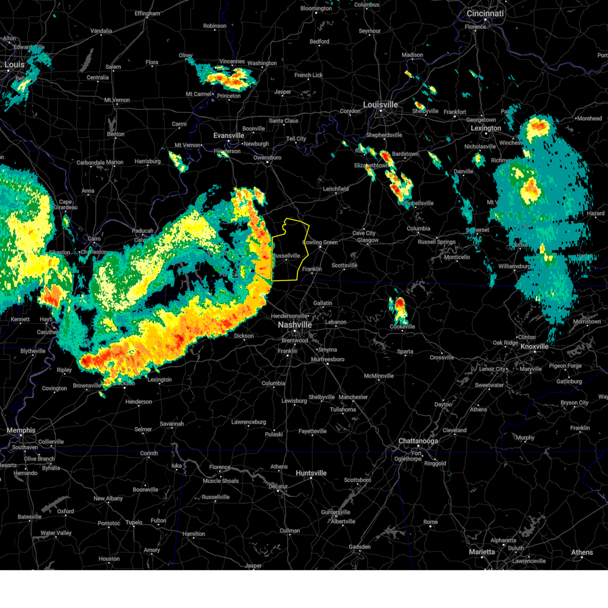 At 307 pm cdt, severe thunderstorms were located along a line extending from powderly to 7 miles east of guthrie to 15 miles south of clarksville, moving east at 50 mph (radar indicated). Hazards include 60 mph wind gusts. Expect damage to roofs, siding, and trees. Locations impacted include, russellville, morgantown, anderson, auburn, adairville, lewisburg, rochester, insco, dimple and spa. At 307 pm cdt, severe thunderstorms were located along a line extending from powderly to 7 miles east of guthrie to 15 miles south of clarksville, moving east at 50 mph (radar indicated). Hazards include 60 mph wind gusts. Expect damage to roofs, siding, and trees. Locations impacted include, russellville, morgantown, anderson, auburn, adairville, lewisburg, rochester, insco, dimple and spa.
|
| 7/18/2023 2:35 PM CDT |
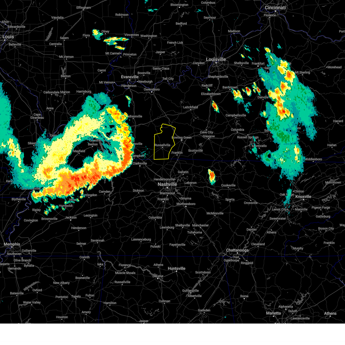 At 235 pm cdt, severe thunderstorms were located along a line extending from near earlington to 6 miles northwest of oak grove to near dover, moving east at 50 mph (radar indicated). Hazards include 60 mph wind gusts. expect damage to roofs, siding, and trees At 235 pm cdt, severe thunderstorms were located along a line extending from near earlington to 6 miles northwest of oak grove to near dover, moving east at 50 mph (radar indicated). Hazards include 60 mph wind gusts. expect damage to roofs, siding, and trees
|
| 7/1/2023 8:05 PM CDT |
 At 805 pm cdt, severe thunderstorms were located along a line extending from 6 miles southwest of calhoun to near graham to weir, moving northeast at 50 mph (radar indicated). Hazards include 60 mph wind gusts and penny size hail. Expect damage to roofs, siding, and trees. locations impacted include, central city, livermore, powderly, graham, greenville, weir, dunmor, hanson, drakesboro, sacramento, island, bremen and south carrollton. this includes the following highways, interstate 69 in kentucky between mile markers 121 and 124. western kentucky parkway between mile markers 44 and 65. hail threat, radar indicated max hail size, 0. 75 in wind threat, radar indicated max wind gust, 60 mph. At 805 pm cdt, severe thunderstorms were located along a line extending from 6 miles southwest of calhoun to near graham to weir, moving northeast at 50 mph (radar indicated). Hazards include 60 mph wind gusts and penny size hail. Expect damage to roofs, siding, and trees. locations impacted include, central city, livermore, powderly, graham, greenville, weir, dunmor, hanson, drakesboro, sacramento, island, bremen and south carrollton. this includes the following highways, interstate 69 in kentucky between mile markers 121 and 124. western kentucky parkway between mile markers 44 and 65. hail threat, radar indicated max hail size, 0. 75 in wind threat, radar indicated max wind gust, 60 mph.
|
| 7/1/2023 7:53 PM CDT |
 At 753 pm cdt, severe thunderstorms were located along a line extending from near madisonville to near nortonville to 6 miles east of crofton, moving northeast at 50 mph (radar indicated). Hazards include 60 mph wind gusts and penny size hail. expect damage to roofs, siding, and trees At 753 pm cdt, severe thunderstorms were located along a line extending from near madisonville to near nortonville to 6 miles east of crofton, moving northeast at 50 mph (radar indicated). Hazards include 60 mph wind gusts and penny size hail. expect damage to roofs, siding, and trees
|
| 6/29/2023 11:03 AM CDT |
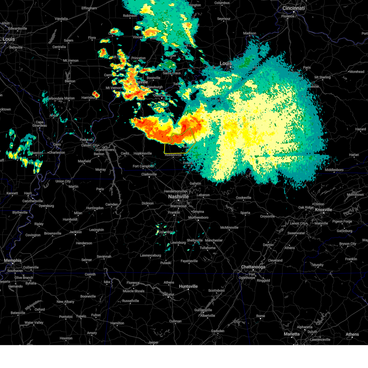 At 1102 am cdt, a severe thunderstorm was located 8 miles northeast of dunmor, moving northwest at 30 mph (radar indicated). Hazards include 70 mph wind gusts and nickel size hail. Expect considerable tree damage. damage is likely to mobile homes, roofs, and outbuildings. locations impacted include, morgantown, anderson, lewisburg, rochester, woodbury, insco, dimple, spa, epleys and leetown. time, mot, loc 1602z 138deg 260kt 3718 8690 thunderstorm damage threat, considerable hail threat, radar indicated max hail size, 0. 88 in wind threat, radar indicated max wind gust, 70 mph. At 1102 am cdt, a severe thunderstorm was located 8 miles northeast of dunmor, moving northwest at 30 mph (radar indicated). Hazards include 70 mph wind gusts and nickel size hail. Expect considerable tree damage. damage is likely to mobile homes, roofs, and outbuildings. locations impacted include, morgantown, anderson, lewisburg, rochester, woodbury, insco, dimple, spa, epleys and leetown. time, mot, loc 1602z 138deg 260kt 3718 8690 thunderstorm damage threat, considerable hail threat, radar indicated max hail size, 0. 88 in wind threat, radar indicated max wind gust, 70 mph.
|
| 6/29/2023 10:46 AM CDT |
 At 1046 am cdt, severe thunderstorms were located along a line extending from 6 miles northeast of dunmor to near graham to 6 miles west of earlington, moving south at 35 mph (radar indicated). Hazards include 60 mph wind gusts and penny size hail. Expect damage to roofs, siding, and trees. locations impacted include, madisonville, central city, earlington, nortonville, mortons gap, powderly, graham, greenville, weir, dunmor, white plains, hanson, drakesboro, sacramento, island, st. charles, nebo, bremen and south carrollton. this includes the following highways, interstate 69 in kentucky between mile markers 95 and 126. western kentucky parkway between mile markers 39 and 65. pennyrile parkway between mile markers 28 and 34. hail threat, radar indicated max hail size, 0. 75 in wind threat, radar indicated max wind gust, 60 mph. At 1046 am cdt, severe thunderstorms were located along a line extending from 6 miles northeast of dunmor to near graham to 6 miles west of earlington, moving south at 35 mph (radar indicated). Hazards include 60 mph wind gusts and penny size hail. Expect damage to roofs, siding, and trees. locations impacted include, madisonville, central city, earlington, nortonville, mortons gap, powderly, graham, greenville, weir, dunmor, white plains, hanson, drakesboro, sacramento, island, st. charles, nebo, bremen and south carrollton. this includes the following highways, interstate 69 in kentucky between mile markers 95 and 126. western kentucky parkway between mile markers 39 and 65. pennyrile parkway between mile markers 28 and 34. hail threat, radar indicated max hail size, 0. 75 in wind threat, radar indicated max wind gust, 60 mph.
|
| 6/29/2023 10:45 AM CDT |
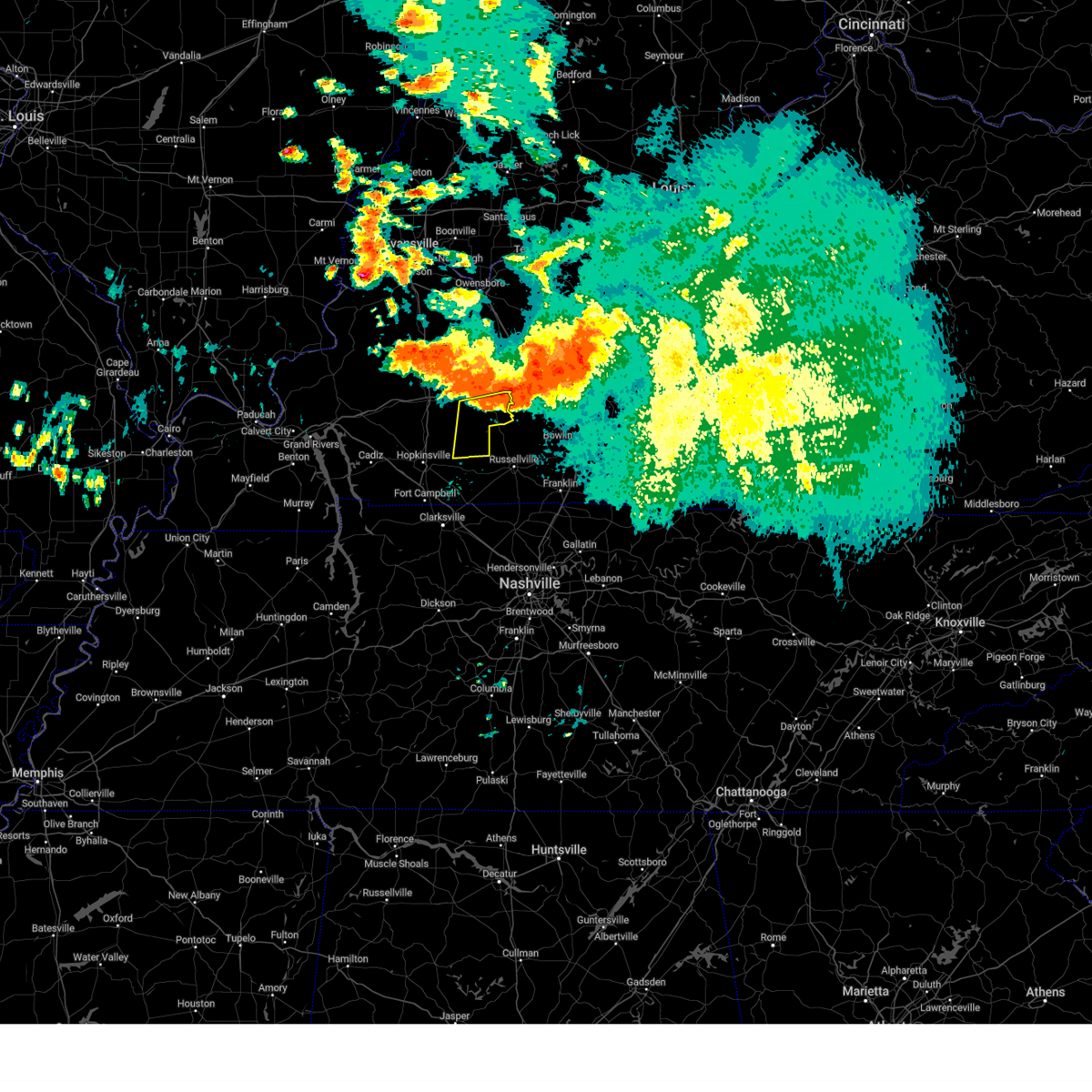 At 1045 am cdt, severe thunderstorms were located along a line extending from weir to 8 miles northeast of dunmor, moving southeast at 35 mph (radar indicated). Hazards include 60 mph wind gusts and penny size hail. expect damage to roofs, siding, and trees At 1045 am cdt, severe thunderstorms were located along a line extending from weir to 8 miles northeast of dunmor, moving southeast at 35 mph (radar indicated). Hazards include 60 mph wind gusts and penny size hail. expect damage to roofs, siding, and trees
|
| 6/29/2023 10:35 AM CDT |
 At 1034 am cdt, a severe thunderstorm was located 11 miles northeast of dunmor, moving southeast at 35 mph (radar indicated). Hazards include 60 mph wind gusts and quarter size hail. Hail damage to vehicles is expected. Expect wind damage to roofs, siding, and trees. At 1034 am cdt, a severe thunderstorm was located 11 miles northeast of dunmor, moving southeast at 35 mph (radar indicated). Hazards include 60 mph wind gusts and quarter size hail. Hail damage to vehicles is expected. Expect wind damage to roofs, siding, and trees.
|
| 6/29/2023 10:25 AM CDT |
 At 1025 am cdt, severe thunderstorms were located along a line extending from 6 miles east of central city to 7 miles north of graham to near providence, moving south at 35 mph (radar indicated). Hazards include 70 mph wind gusts and nickel size hail. Expect considerable tree damage. damage is likely to mobile homes, roofs, and outbuildings. locations impacted include, madisonville, central city, calhoun, sebree, earlington, livermore, nortonville, mortons gap, dixon, powderly, graham, beech grove, greenville, weir, dunmor, white plains, hanson, drakesboro, sacramento and island. this includes the following highways, interstate 69 in kentucky between mile markers 95 and 136. western kentucky parkway between mile markers 39 and 65. pennyrile parkway between mile markers 28 and 34. thunderstorm damage threat, considerable hail threat, radar indicated max hail size, 0. 88 in wind threat, radar indicated max wind gust, 70 mph. At 1025 am cdt, severe thunderstorms were located along a line extending from 6 miles east of central city to 7 miles north of graham to near providence, moving south at 35 mph (radar indicated). Hazards include 70 mph wind gusts and nickel size hail. Expect considerable tree damage. damage is likely to mobile homes, roofs, and outbuildings. locations impacted include, madisonville, central city, calhoun, sebree, earlington, livermore, nortonville, mortons gap, dixon, powderly, graham, beech grove, greenville, weir, dunmor, white plains, hanson, drakesboro, sacramento and island. this includes the following highways, interstate 69 in kentucky between mile markers 95 and 136. western kentucky parkway between mile markers 39 and 65. pennyrile parkway between mile markers 28 and 34. thunderstorm damage threat, considerable hail threat, radar indicated max hail size, 0. 88 in wind threat, radar indicated max wind gust, 70 mph.
|
| 6/29/2023 10:13 AM CDT |
 At 1011 am cdt, a severe thunderstorm was located near hartford, moving south at 35 mph (radar indicated). Hazards include 60 mph wind gusts and quarter size hail. Hail damage to vehicles is expected. Expect wind damage to roofs, siding, and trees. At 1011 am cdt, a severe thunderstorm was located near hartford, moving south at 35 mph (radar indicated). Hazards include 60 mph wind gusts and quarter size hail. Hail damage to vehicles is expected. Expect wind damage to roofs, siding, and trees.
|
| 6/29/2023 9:59 AM CDT |
 At 958 am cdt, severe thunderstorms were located along a line extending from near whitesville to near calhoun to dixon, moving south at 35 mph (radar indicated). Hazards include 60 mph wind gusts and nickel size hail. expect damage to roofs, siding, and trees At 958 am cdt, severe thunderstorms were located along a line extending from near whitesville to near calhoun to dixon, moving south at 35 mph (radar indicated). Hazards include 60 mph wind gusts and nickel size hail. expect damage to roofs, siding, and trees
|
| 6/29/2023 9:53 AM CDT |
 At 952 am cdt, a severe thunderstorm was located near whitesville, moving southeast at 25 mph (radar indicated). Hazards include 60 mph wind gusts and half dollar size hail. Hail damage to vehicles is expected. expect wind damage to roofs, siding, and trees. locations impacted include, hartford, beaver dam, fordsville, centertown, mchenry, rockport, rochester, ralph, shreve and flint springs. hail threat, radar indicated max hail size, 1. 25 in wind threat, radar indicated max wind gust, 60 mph. At 952 am cdt, a severe thunderstorm was located near whitesville, moving southeast at 25 mph (radar indicated). Hazards include 60 mph wind gusts and half dollar size hail. Hail damage to vehicles is expected. expect wind damage to roofs, siding, and trees. locations impacted include, hartford, beaver dam, fordsville, centertown, mchenry, rockport, rochester, ralph, shreve and flint springs. hail threat, radar indicated max hail size, 1. 25 in wind threat, radar indicated max wind gust, 60 mph.
|
| 6/29/2023 9:29 AM CDT |
 At 928 am cdt, a severe thunderstorm was located near whitesville, moving south southeast at 30 mph (radar indicated). Hazards include 60 mph wind gusts and quarter size hail. Hail damage to vehicles is expected. Expect wind damage to roofs, siding, and trees. At 928 am cdt, a severe thunderstorm was located near whitesville, moving south southeast at 30 mph (radar indicated). Hazards include 60 mph wind gusts and quarter size hail. Hail damage to vehicles is expected. Expect wind damage to roofs, siding, and trees.
|
| 6/25/2023 11:40 PM CDT |
 The severe thunderstorm warning for butler, northern warren, south central ohio and edmonson counties will expire at 1145 pm cdt, the storms which prompted the warning have moved out of the area. therefore, the warning will be allowed to expire. however gusty winds are still possible with these thunderstorms. a severe thunderstorm watch remains in effect until 300 am cdt for south central and central kentucky. to report severe weather, contact your nearest law enforcement agency. they will relay your report to the national weather service louisville. remember, a severe thunderstorm warning still remains in effect for warren county. The severe thunderstorm warning for butler, northern warren, south central ohio and edmonson counties will expire at 1145 pm cdt, the storms which prompted the warning have moved out of the area. therefore, the warning will be allowed to expire. however gusty winds are still possible with these thunderstorms. a severe thunderstorm watch remains in effect until 300 am cdt for south central and central kentucky. to report severe weather, contact your nearest law enforcement agency. they will relay your report to the national weather service louisville. remember, a severe thunderstorm warning still remains in effect for warren county.
|
| 6/25/2023 10:58 PM CDT |
 At 1057 pm cdt, severe thunderstorms were located along a line extending from near central city to near morgantown to brownsville, moving southeast at 45 mph (radar indicated). Hazards include 60 mph wind gusts and quarter size hail. Hail damage to vehicles is expected. Expect wind damage to roofs, siding, and trees. At 1057 pm cdt, severe thunderstorms were located along a line extending from near central city to near morgantown to brownsville, moving southeast at 45 mph (radar indicated). Hazards include 60 mph wind gusts and quarter size hail. Hail damage to vehicles is expected. Expect wind damage to roofs, siding, and trees.
|
| 6/25/2023 10:48 PM CDT |
 At 1048 pm cdt, severe thunderstorms were located along a line extending from 9 miles east of central city to 6 miles north of morgantown to near brownsville, moving southeast at 25 mph (radar indicated). Hazards include ping pong ball size hail and 60 mph wind gusts. People and animals outdoors will be injured. expect hail damage to roofs, siding, windows, and vehicles. expect wind damage to roofs, siding, and trees. locations impacted include, morgantown, brownsville, casey, lee, mchenry, rockport, rochester, roundhill, chalybeate and mining city. hail threat, radar indicated max hail size, 1. 50 in wind threat, radar indicated max wind gust, 60 mph. At 1048 pm cdt, severe thunderstorms were located along a line extending from 9 miles east of central city to 6 miles north of morgantown to near brownsville, moving southeast at 25 mph (radar indicated). Hazards include ping pong ball size hail and 60 mph wind gusts. People and animals outdoors will be injured. expect hail damage to roofs, siding, windows, and vehicles. expect wind damage to roofs, siding, and trees. locations impacted include, morgantown, brownsville, casey, lee, mchenry, rockport, rochester, roundhill, chalybeate and mining city. hail threat, radar indicated max hail size, 1. 50 in wind threat, radar indicated max wind gust, 60 mph.
|
| 6/25/2023 10:30 PM CDT |
 At 1029 pm cdt, severe thunderstorms were located along a line extending from 8 miles southwest of hartford to 11 miles north of morgantown to 8 miles northwest of brownsville, moving southeast at 25 mph (radar indicated). Hazards include two inch hail and 70 mph wind gusts. People and animals outdoors will be injured. expect hail damage to roofs, siding, windows, and vehicles. expect considerable tree damage. Wind damage is also likely to mobile homes, roofs, and outbuildings. At 1029 pm cdt, severe thunderstorms were located along a line extending from 8 miles southwest of hartford to 11 miles north of morgantown to 8 miles northwest of brownsville, moving southeast at 25 mph (radar indicated). Hazards include two inch hail and 70 mph wind gusts. People and animals outdoors will be injured. expect hail damage to roofs, siding, windows, and vehicles. expect considerable tree damage. Wind damage is also likely to mobile homes, roofs, and outbuildings.
|
| 6/25/2023 5:09 PM CDT |
 At 508 pm cdt, a severe thunderstorm was located near madisonville, moving southeast at 35 mph (radar indicated). Hazards include ping pong ball size hail and 60 mph wind gusts. People and animals outdoors will be injured. expect hail damage to roofs, siding, windows, and vehicles. Expect wind damage to roofs, siding, and trees. At 508 pm cdt, a severe thunderstorm was located near madisonville, moving southeast at 35 mph (radar indicated). Hazards include ping pong ball size hail and 60 mph wind gusts. People and animals outdoors will be injured. expect hail damage to roofs, siding, windows, and vehicles. Expect wind damage to roofs, siding, and trees.
|
| 4/5/2023 3:22 PM CDT |
 At 322 pm cdt, severe thunderstorms were located along a line extending from 16 miles west of leitchfield to 6 miles east of guthrie, moving east at 60 mph (radar indicated). Hazards include 60 mph wind gusts. Expect damage to roofs, siding, and trees. these severe thunderstorms will remain over mainly rural areas of logan, butler, western grayson, northwestern warren and ohio counties, including the following locations, steff, mining city, ralph, leetown, do stop, neafus, gilstrap, cave springs, ellmitch and keysburg. hail threat, radar indicated max hail size, <. 75 in wind threat, radar indicated max wind gust, 60 mph. At 322 pm cdt, severe thunderstorms were located along a line extending from 16 miles west of leitchfield to 6 miles east of guthrie, moving east at 60 mph (radar indicated). Hazards include 60 mph wind gusts. Expect damage to roofs, siding, and trees. these severe thunderstorms will remain over mainly rural areas of logan, butler, western grayson, northwestern warren and ohio counties, including the following locations, steff, mining city, ralph, leetown, do stop, neafus, gilstrap, cave springs, ellmitch and keysburg. hail threat, radar indicated max hail size, <. 75 in wind threat, radar indicated max wind gust, 60 mph.
|
| 4/5/2023 2:56 PM CDT |
 At 256 pm cdt, severe thunderstorms were located along a line extending from near livermore to near fort campbell north, moving east at 60 mph (radar indicated). Hazards include 60 mph wind gusts. Expect damage to roofs, siding, and trees. severe thunderstorms will be near, hartford around 305 pm cdt. hail threat, radar indicated max hail size, <. 75 in wind threat, radar indicated max wind gust, 60 mph. At 256 pm cdt, severe thunderstorms were located along a line extending from near livermore to near fort campbell north, moving east at 60 mph (radar indicated). Hazards include 60 mph wind gusts. Expect damage to roofs, siding, and trees. severe thunderstorms will be near, hartford around 305 pm cdt. hail threat, radar indicated max hail size, <. 75 in wind threat, radar indicated max wind gust, 60 mph.
|
| 3/3/2023 12:58 PM CST |
 The severe thunderstorm warning for northern logan, western butler and ohio counties will expire at 100 pm cst, the storms which prompted the warning have moved out of the area. therefore, the warning will be allowed to expire. a tornado watch remains in effect until 400 pm cst for south central and central kentucky. The severe thunderstorm warning for northern logan, western butler and ohio counties will expire at 100 pm cst, the storms which prompted the warning have moved out of the area. therefore, the warning will be allowed to expire. a tornado watch remains in effect until 400 pm cst for south central and central kentucky.
|
| 3/3/2023 12:32 PM CST |
 At 1232 pm cst, severe thunderstorms were located along a line extending from near calhoun to 6 miles northeast of elkton, moving northeast at 65 mph. these are destructive storms for logan, butler, and ohio counties (weather observing stations). Hazards include 80 mph wind gusts. Flying debris will be dangerous to those caught without shelter. mobile homes will be heavily damaged. expect considerable damage to roofs, windows, and vehicles. extensive tree damage and power outages are likely. Locations impacted include, russellville, hartford, morgantown, anderson, beaver dam, lewisburg, centertown, mchenry, rockport and rochester. At 1232 pm cst, severe thunderstorms were located along a line extending from near calhoun to 6 miles northeast of elkton, moving northeast at 65 mph. these are destructive storms for logan, butler, and ohio counties (weather observing stations). Hazards include 80 mph wind gusts. Flying debris will be dangerous to those caught without shelter. mobile homes will be heavily damaged. expect considerable damage to roofs, windows, and vehicles. extensive tree damage and power outages are likely. Locations impacted include, russellville, hartford, morgantown, anderson, beaver dam, lewisburg, centertown, mchenry, rockport and rochester.
|
| 3/3/2023 12:11 PM CST |
 At 1210 pm cst, severe thunderstorms were located along a line extending from near providence to near oak grove, moving northeast at 65 mph. these are destructive storms for logan, butler, and ohio counties (radar indicated). Hazards include 80 mph wind gusts. Flying debris will be dangerous to those caught without shelter. mobile homes will be heavily damaged. expect considerable damage to roofs, windows, and vehicles. Extensive tree damage and power outages are likely. At 1210 pm cst, severe thunderstorms were located along a line extending from near providence to near oak grove, moving northeast at 65 mph. these are destructive storms for logan, butler, and ohio counties (radar indicated). Hazards include 80 mph wind gusts. Flying debris will be dangerous to those caught without shelter. mobile homes will be heavily damaged. expect considerable damage to roofs, windows, and vehicles. Extensive tree damage and power outages are likely.
|
| 3/3/2023 11:25 AM CST |
 At 1125 am cst, severe thunderstorms capable of producing both tornadoes and extensive straight line wind damage were located 10 miles east of central city, moving northeast at 85 mph (radar indicated rotation). Hazards include tornado. Flying debris will be dangerous to those caught without shelter. mobile homes will be damaged or destroyed. damage to roofs, windows, and vehicles will occur. tree damage is likely. These dangerous storms will be near, hartford around 1135 am cst. At 1125 am cst, severe thunderstorms capable of producing both tornadoes and extensive straight line wind damage were located 10 miles east of central city, moving northeast at 85 mph (radar indicated rotation). Hazards include tornado. Flying debris will be dangerous to those caught without shelter. mobile homes will be damaged or destroyed. damage to roofs, windows, and vehicles will occur. tree damage is likely. These dangerous storms will be near, hartford around 1135 am cst.
|
| 3/3/2023 11:23 AM CST |
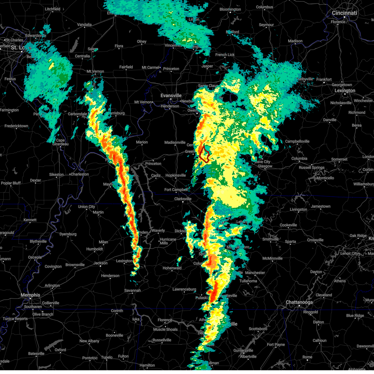 At 1123 am cst, a severe thunderstorm capable of producing a tornado was located 7 miles north of dunmor, or 10 miles southeast of central city, moving northeast at 35 mph (radar indicated rotation). Hazards include tornado. Flying debris will be dangerous to those caught without shelter. mobile homes will be damaged or destroyed. damage to roofs, windows, and vehicles will occur. tree damage is likely. This tornadic thunderstorm will remain over mainly rural areas of east central muhlenberg county, including the following locations, drakesboro. At 1123 am cst, a severe thunderstorm capable of producing a tornado was located 7 miles north of dunmor, or 10 miles southeast of central city, moving northeast at 35 mph (radar indicated rotation). Hazards include tornado. Flying debris will be dangerous to those caught without shelter. mobile homes will be damaged or destroyed. damage to roofs, windows, and vehicles will occur. tree damage is likely. This tornadic thunderstorm will remain over mainly rural areas of east central muhlenberg county, including the following locations, drakesboro.
|
| 3/3/2023 11:19 AM CST |
 At 1119 am cst, severe thunderstorms were located along a line extending from near hartford to near central city to 7 miles south of dunmor, moving northeast at 90 mph (radar indicated). Hazards include 70 mph wind gusts. Expect considerable tree damage. damage is likely to mobile homes, roofs, and outbuildings. Locations impacted include, hartford, beaver dam, fordsville, centertown, mchenry, rockport, rochester, mining city, ralph and heflin. At 1119 am cst, severe thunderstorms were located along a line extending from near hartford to near central city to 7 miles south of dunmor, moving northeast at 90 mph (radar indicated). Hazards include 70 mph wind gusts. Expect considerable tree damage. damage is likely to mobile homes, roofs, and outbuildings. Locations impacted include, hartford, beaver dam, fordsville, centertown, mchenry, rockport, rochester, mining city, ralph and heflin.
|
| 3/3/2023 11:00 AM CST |
 At 1059 am cst, severe thunderstorms were located along a line extending from weir to 8 miles northwest of elkton to near clarksville, moving northeast at 90 mph (radar indicated). Hazards include 70 mph wind gusts. Expect considerable tree damage. Damage is likely to mobile homes, roofs, and outbuildings. At 1059 am cst, severe thunderstorms were located along a line extending from weir to 8 miles northwest of elkton to near clarksville, moving northeast at 90 mph (radar indicated). Hazards include 70 mph wind gusts. Expect considerable tree damage. Damage is likely to mobile homes, roofs, and outbuildings.
|
| 1/12/2023 6:05 AM CST |
 At 605 am cst, a severe thunderstorm was located 8 miles northwest of morgantown, moving east at 70 mph (radar indicated). Hazards include 60 mph wind gusts and quarter size hail. Hail damage to vehicles is expected. expect wind damage to roofs, siding, and trees. this severe thunderstorm will be near, morgantown around 610 am cst. other locations in the path of this severe thunderstorm include leitchfield. hail threat, radar indicated max hail size, 1. 00 in wind threat, radar indicated max wind gust, 60 mph. At 605 am cst, a severe thunderstorm was located 8 miles northwest of morgantown, moving east at 70 mph (radar indicated). Hazards include 60 mph wind gusts and quarter size hail. Hail damage to vehicles is expected. expect wind damage to roofs, siding, and trees. this severe thunderstorm will be near, morgantown around 610 am cst. other locations in the path of this severe thunderstorm include leitchfield. hail threat, radar indicated max hail size, 1. 00 in wind threat, radar indicated max wind gust, 60 mph.
|
| 1/3/2023 4:02 AM CST |
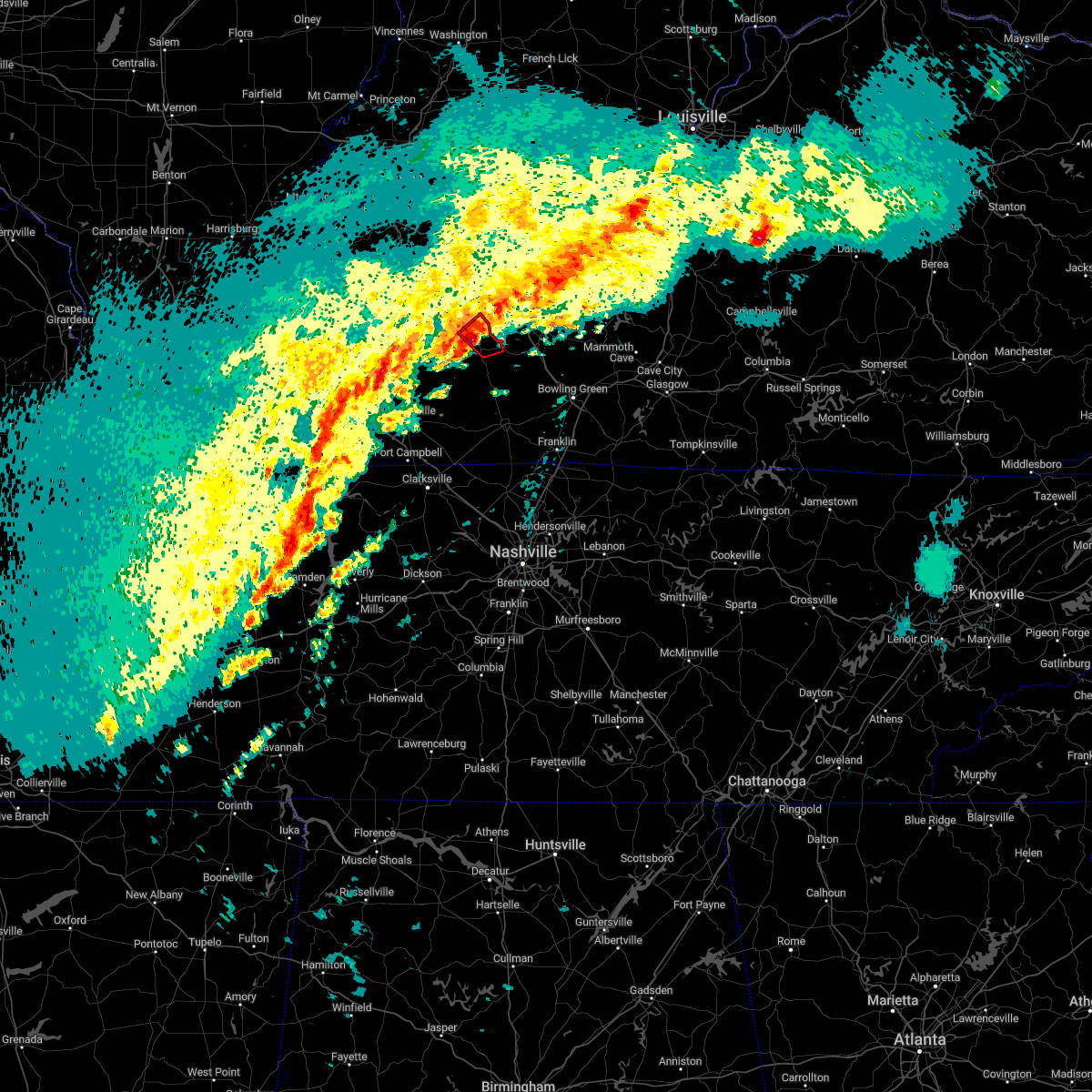 At 402 am cst, a severe thunderstorm capable of producing a tornado between central city and drakesboro, moving northeast at 40 mph (radar indicated rotation). Hazards include tornado. Flying debris will be dangerous to those caught without shelter. mobile homes will be damaged or destroyed. damage to roofs, windows, and vehicles will occur. tree damage is likely. locations impacted include, central city and drakesboro. This includes western kentucky parkway between mile markers 56 and 65. At 402 am cst, a severe thunderstorm capable of producing a tornado between central city and drakesboro, moving northeast at 40 mph (radar indicated rotation). Hazards include tornado. Flying debris will be dangerous to those caught without shelter. mobile homes will be damaged or destroyed. damage to roofs, windows, and vehicles will occur. tree damage is likely. locations impacted include, central city and drakesboro. This includes western kentucky parkway between mile markers 56 and 65.
|
| 1/3/2023 3:53 AM CST |
 At 353 am cst, a severe thunderstorm capable of producing a tornado was located over greenville, or near central city, moving northeast at 35 mph (radar indicated rotation). Hazards include tornado. Flying debris will be dangerous to those caught without shelter. mobile homes will be damaged or destroyed. damage to roofs, windows, and vehicles will occur. tree damage is likely. this tornadic thunderstorm will remain over mainly rural areas of central muhlenberg county, including the following locations, drakesboro. This includes western kentucky parkway between mile markers 51 and 65. At 353 am cst, a severe thunderstorm capable of producing a tornado was located over greenville, or near central city, moving northeast at 35 mph (radar indicated rotation). Hazards include tornado. Flying debris will be dangerous to those caught without shelter. mobile homes will be damaged or destroyed. damage to roofs, windows, and vehicles will occur. tree damage is likely. this tornadic thunderstorm will remain over mainly rural areas of central muhlenberg county, including the following locations, drakesboro. This includes western kentucky parkway between mile markers 51 and 65.
|
| 1/3/2023 3:51 AM CST |
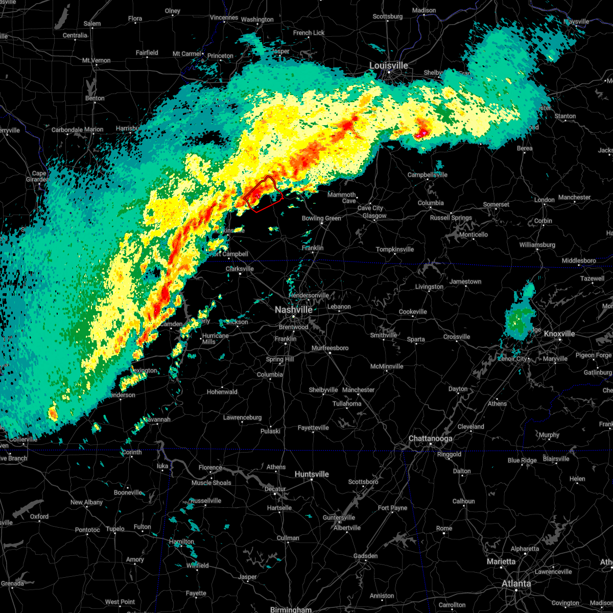 At 351 am cst, a severe thunderstorm capable of producing a tornado was located over greenville, or 7 miles south of central city, moving northeast at 50 mph (radar indicated rotation). Hazards include tornado. Flying debris will be dangerous to those caught without shelter. mobile homes will be damaged or destroyed. damage to roofs, windows, and vehicles will occur. tree damage is likely. this dangerous storm will be near, central city around 355 am cst. This includes western kentucky parkway between mile markers 51 and 65. At 351 am cst, a severe thunderstorm capable of producing a tornado was located over greenville, or 7 miles south of central city, moving northeast at 50 mph (radar indicated rotation). Hazards include tornado. Flying debris will be dangerous to those caught without shelter. mobile homes will be damaged or destroyed. damage to roofs, windows, and vehicles will occur. tree damage is likely. this dangerous storm will be near, central city around 355 am cst. This includes western kentucky parkway between mile markers 51 and 65.
|
| 1/3/2023 3:44 AM CST |
 At 344 am cst, a severe thunderstorm capable of producing a tornado was located over weir, or 12 miles southwest of central city, moving northeast at 60 mph (radar indicated rotation). Hazards include tornado. Flying debris will be dangerous to those caught without shelter. mobile homes will be damaged or destroyed. damage to roofs, windows, and vehicles will occur. tree damage is likely. this dangerous storm will be near, greenville around 350 am cst. other locations in the path of this tornadic thunderstorm include central city and powderly. This includes western kentucky parkway between mile markers 51 and 65. At 344 am cst, a severe thunderstorm capable of producing a tornado was located over weir, or 12 miles southwest of central city, moving northeast at 60 mph (radar indicated rotation). Hazards include tornado. Flying debris will be dangerous to those caught without shelter. mobile homes will be damaged or destroyed. damage to roofs, windows, and vehicles will occur. tree damage is likely. this dangerous storm will be near, greenville around 350 am cst. other locations in the path of this tornadic thunderstorm include central city and powderly. This includes western kentucky parkway between mile markers 51 and 65.
|
| 1/3/2023 3:33 AM CST |
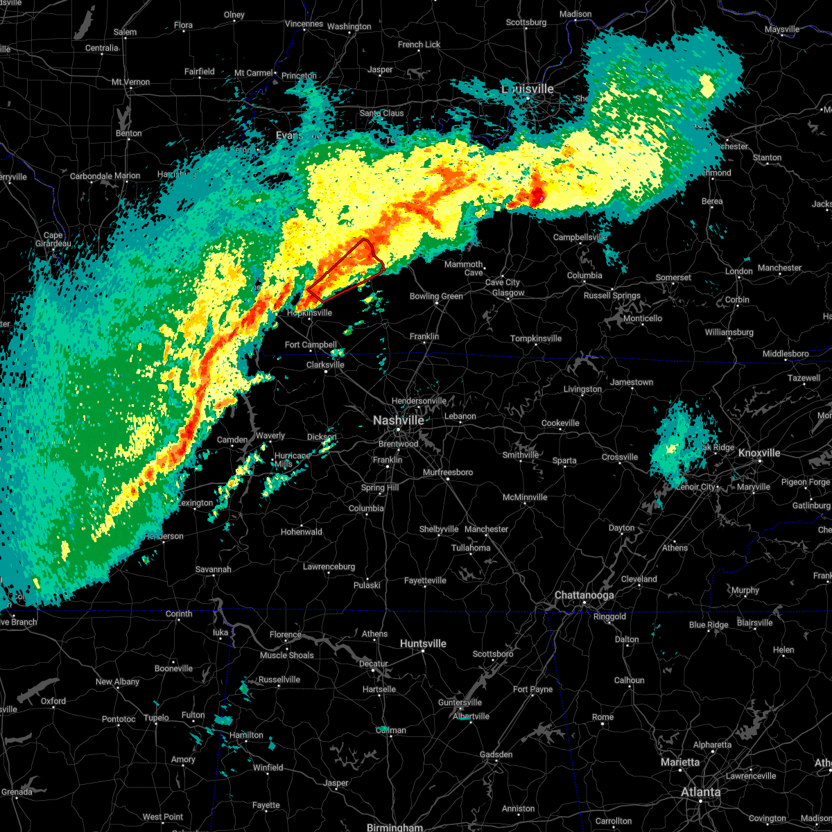 At 333 am cst, a severe thunderstorm capable of producing a tornado was located near crofton, or 13 miles northeast of hopkinsville, moving northeast at 65 mph (radar indicated rotation). Hazards include tornado. Flying debris will be dangerous to those caught without shelter. mobile homes will be damaged or destroyed. damage to roofs, windows, and vehicles will occur. tree damage is likely. this dangerous storm will be near, weir around 345 am cst. powderly and greenville around 350 am cst. other locations in the path of this tornadic thunderstorm include central city. this includes the following highways, western kentucky parkway between mile markers 52 and 65. Pennyrile parkway between mile markers 21 and 24. At 333 am cst, a severe thunderstorm capable of producing a tornado was located near crofton, or 13 miles northeast of hopkinsville, moving northeast at 65 mph (radar indicated rotation). Hazards include tornado. Flying debris will be dangerous to those caught without shelter. mobile homes will be damaged or destroyed. damage to roofs, windows, and vehicles will occur. tree damage is likely. this dangerous storm will be near, weir around 345 am cst. powderly and greenville around 350 am cst. other locations in the path of this tornadic thunderstorm include central city. this includes the following highways, western kentucky parkway between mile markers 52 and 65. Pennyrile parkway between mile markers 21 and 24.
|
| 1/3/2023 1:24 AM CST |
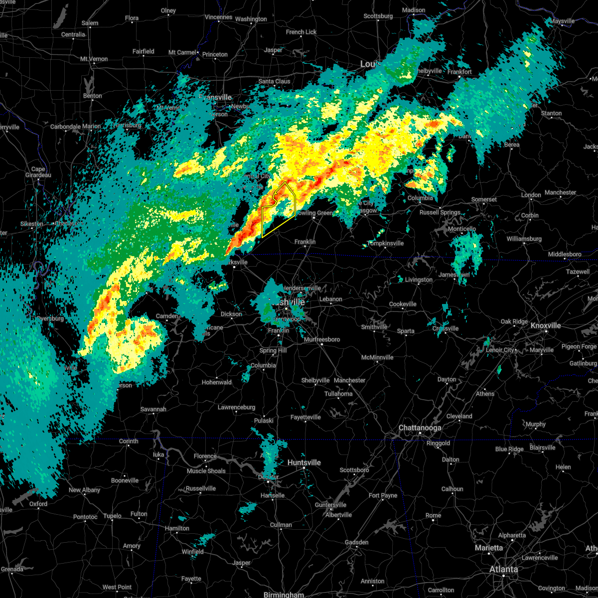 At 124 am cst, a severe thunderstorm was located near elkton, moving northeast at 60 mph (radar indicated). Hazards include 60 mph wind gusts and quarter size hail. Hail damage to vehicles is expected. expect wind damage to roofs, siding, and trees. This severe thunderstorm will remain over mainly rural areas of northern logan and southwestern butler counties, including the following locations, insco, huntsville, gordonsville, mining city, dimple, spa, epleys, leetown, wolf lick and crossroad. At 124 am cst, a severe thunderstorm was located near elkton, moving northeast at 60 mph (radar indicated). Hazards include 60 mph wind gusts and quarter size hail. Hail damage to vehicles is expected. expect wind damage to roofs, siding, and trees. This severe thunderstorm will remain over mainly rural areas of northern logan and southwestern butler counties, including the following locations, insco, huntsville, gordonsville, mining city, dimple, spa, epleys, leetown, wolf lick and crossroad.
|
| 7/8/2022 2:58 PM CDT |
 At 258 pm cdt, a severe thunderstorm was located 10 miles west of morgantown, moving east at 20 mph (radar indicated). Hazards include 60 mph wind gusts and penny size hail. expect damage to roofs, siding, and trees At 258 pm cdt, a severe thunderstorm was located 10 miles west of morgantown, moving east at 20 mph (radar indicated). Hazards include 60 mph wind gusts and penny size hail. expect damage to roofs, siding, and trees
|
| 7/8/2022 2:48 PM CDT |
 At 248 pm cdt, a severe thunderstorm was located 9 miles south of hartford, moving east at 20 mph (radar indicated). Hazards include 60 mph wind gusts and penny size hail. Expect damage to roofs, siding, and trees. locations impacted include, beaver dam, mchenry, rockport, rochester, prentiss, shultztown, nineteen, scottown, cromwell and logansport. hail threat, radar indicated max hail size, 0. 75 in wind threat, radar indicated max wind gust, 60 mph. At 248 pm cdt, a severe thunderstorm was located 9 miles south of hartford, moving east at 20 mph (radar indicated). Hazards include 60 mph wind gusts and penny size hail. Expect damage to roofs, siding, and trees. locations impacted include, beaver dam, mchenry, rockport, rochester, prentiss, shultztown, nineteen, scottown, cromwell and logansport. hail threat, radar indicated max hail size, 0. 75 in wind threat, radar indicated max wind gust, 60 mph.
|
| 7/8/2022 2:34 PM CDT |
 At 234 pm cdt, a severe thunderstorm was located 8 miles south of hartford, moving east at 20 mph (radar indicated). Hazards include 60 mph wind gusts and penny size hail. Expect damage to roofs, siding, and trees. this severe thunderstorm will remain over mainly rural areas of northwestern butler and southern ohio counties, including the following locations, prentiss, shultztown, rochester, centertown, nineteen, scottown, cromwell, logansport, cool springs and pleasant hill. hail threat, radar indicated max hail size, 0. 75 in wind threat, radar indicated max wind gust, 60 mph. At 234 pm cdt, a severe thunderstorm was located 8 miles south of hartford, moving east at 20 mph (radar indicated). Hazards include 60 mph wind gusts and penny size hail. Expect damage to roofs, siding, and trees. this severe thunderstorm will remain over mainly rural areas of northwestern butler and southern ohio counties, including the following locations, prentiss, shultztown, rochester, centertown, nineteen, scottown, cromwell, logansport, cool springs and pleasant hill. hail threat, radar indicated max hail size, 0. 75 in wind threat, radar indicated max wind gust, 60 mph.
|
| 7/2/2022 4:30 PM CDT |
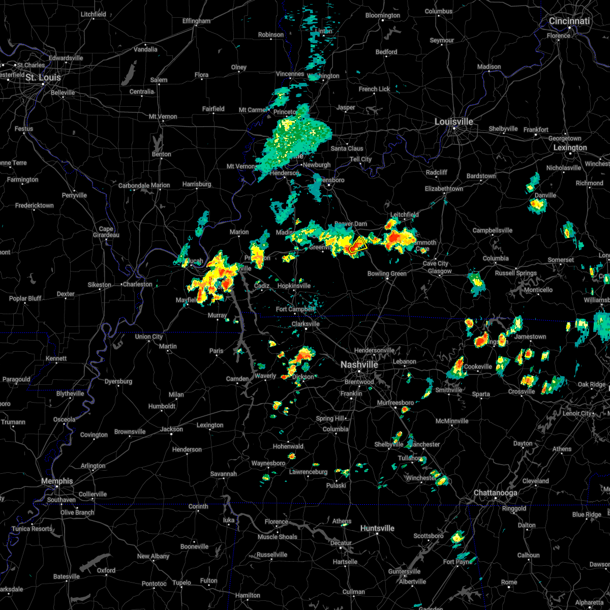 At 429 pm cdt, a severe thunderstorm was located 8 miles west of morgantown, moving northeast at 10 mph (radar indicated). Hazards include 60 mph wind gusts and quarter size hail. Hail damage to vehicles is expected. expect wind damage to roofs, siding, and trees. this severe thunderstorm will remain over mainly rural areas of northwestern butler county, including the following locations, mining city, logansport and provo. hail threat, radar indicated max hail size, 1. 00 in wind threat, radar indicated max wind gust, 60 mph. At 429 pm cdt, a severe thunderstorm was located 8 miles west of morgantown, moving northeast at 10 mph (radar indicated). Hazards include 60 mph wind gusts and quarter size hail. Hail damage to vehicles is expected. expect wind damage to roofs, siding, and trees. this severe thunderstorm will remain over mainly rural areas of northwestern butler county, including the following locations, mining city, logansport and provo. hail threat, radar indicated max hail size, 1. 00 in wind threat, radar indicated max wind gust, 60 mph.
|
| 6/17/2022 8:54 AM CDT |
 At 853 am cdt, severe thunderstorms were located along a line extending from 9 miles north of dunmor to near hopkinsville to near land between the lakes area, moving southeast at 30 mph (radar indicated. this is an extension to the previous warning). Hazards include 60 mph wind gusts. Expect damage to roofs, siding, and trees. severe thunderstorms will be near, hopkinsville and dunmor around 910 am cdt. this includes the following highways, interstate 24 in kentucky between mile markers 66 and 75. western kentucky parkway between mile markers 54 and 65. pennyrile parkway between mile markers 7 and 20. hail threat, radar indicated max hail size, <. 75 in wind threat, radar indicated max wind gust, 60 mph. At 853 am cdt, severe thunderstorms were located along a line extending from 9 miles north of dunmor to near hopkinsville to near land between the lakes area, moving southeast at 30 mph (radar indicated. this is an extension to the previous warning). Hazards include 60 mph wind gusts. Expect damage to roofs, siding, and trees. severe thunderstorms will be near, hopkinsville and dunmor around 910 am cdt. this includes the following highways, interstate 24 in kentucky between mile markers 66 and 75. western kentucky parkway between mile markers 54 and 65. pennyrile parkway between mile markers 7 and 20. hail threat, radar indicated max hail size, <. 75 in wind threat, radar indicated max wind gust, 60 mph.
|
| 5/21/2022 4:29 PM CDT |
 At 429 pm cdt, a severe thunderstorm was located over graham, or 8 miles west of central city, moving east at 25 mph (radar indicated). Hazards include 60 mph wind gusts and quarter size hail. Hail damage to vehicles is expected. expect wind damage to roofs, siding, and trees. locations impacted include, greenville, central city and powderly. this includes western kentucky parkway between mile markers 46 and 65. hail threat, radar indicated max hail size, 1. 00 in wind threat, radar indicated max wind gust, 60 mph. At 429 pm cdt, a severe thunderstorm was located over graham, or 8 miles west of central city, moving east at 25 mph (radar indicated). Hazards include 60 mph wind gusts and quarter size hail. Hail damage to vehicles is expected. expect wind damage to roofs, siding, and trees. locations impacted include, greenville, central city and powderly. this includes western kentucky parkway between mile markers 46 and 65. hail threat, radar indicated max hail size, 1. 00 in wind threat, radar indicated max wind gust, 60 mph.
|
| 5/21/2022 4:05 PM CDT |
 At 405 pm cdt, a severe thunderstorm was located near mortons gap, or near madisonville, moving east at 25 mph (radar indicated). Hazards include ping pong ball size hail and 60 mph wind gusts. People and animals outdoors will be injured. expect hail damage to roofs, siding, windows, and vehicles. expect wind damage to roofs, siding, and trees. this severe thunderstorm will be near, graham around 425 pm cdt. other locations in the path of this severe thunderstorm include greenville, powderly and central city. this includes the following highways, interstate 69 in kentucky between mile markers 105 and 114. western kentucky parkway between mile markers 39 and 65. pennyrile parkway between mile markers 30 and 34. hail threat, radar indicated max hail size, 1. 50 in wind threat, radar indicated max wind gust, 60 mph. At 405 pm cdt, a severe thunderstorm was located near mortons gap, or near madisonville, moving east at 25 mph (radar indicated). Hazards include ping pong ball size hail and 60 mph wind gusts. People and animals outdoors will be injured. expect hail damage to roofs, siding, windows, and vehicles. expect wind damage to roofs, siding, and trees. this severe thunderstorm will be near, graham around 425 pm cdt. other locations in the path of this severe thunderstorm include greenville, powderly and central city. this includes the following highways, interstate 69 in kentucky between mile markers 105 and 114. western kentucky parkway between mile markers 39 and 65. pennyrile parkway between mile markers 30 and 34. hail threat, radar indicated max hail size, 1. 50 in wind threat, radar indicated max wind gust, 60 mph.
|
| 4/13/2022 6:11 PM CDT |
 The tornado warning for muhlenberg county will expire at 615 pm cdt, the storm which prompted the warning has moved out of the area. therefore, the warning will be allowed to expire. a tornado watch remains in effect until 900 pm cdt for south central kentucky. The tornado warning for muhlenberg county will expire at 615 pm cdt, the storm which prompted the warning has moved out of the area. therefore, the warning will be allowed to expire. a tornado watch remains in effect until 900 pm cdt for south central kentucky.
|
| 4/13/2022 5:49 PM CDT |
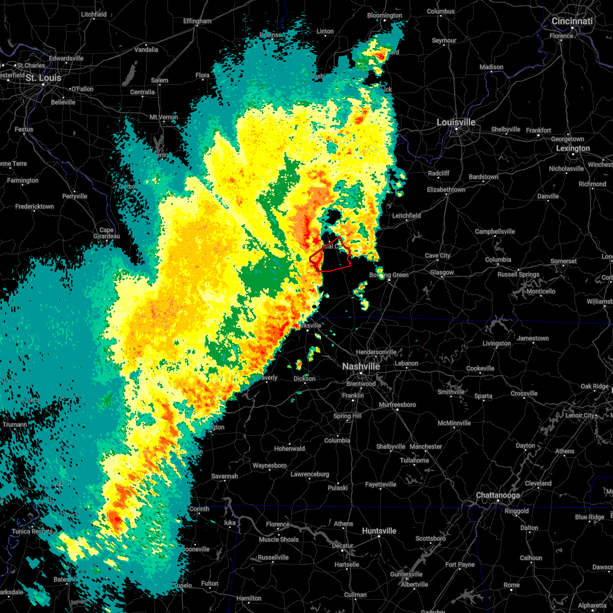 At 548 pm cdt, a severe squall line capable of producing both tornadoes and extensive straight line wind damage was located over weir, or 13 miles south of central city, moving northeast at 50 mph (radar indicated rotation). Hazards include tornado. Flying debris will be dangerous to those caught without shelter. mobile homes will be damaged or destroyed. damage to roofs, windows, and vehicles will occur. tree damage is likely. locations impacted include, powderly, greenville and dunmor. This includes western kentucky parkway between mile markers 58 and 64. At 548 pm cdt, a severe squall line capable of producing both tornadoes and extensive straight line wind damage was located over weir, or 13 miles south of central city, moving northeast at 50 mph (radar indicated rotation). Hazards include tornado. Flying debris will be dangerous to those caught without shelter. mobile homes will be damaged or destroyed. damage to roofs, windows, and vehicles will occur. tree damage is likely. locations impacted include, powderly, greenville and dunmor. This includes western kentucky parkway between mile markers 58 and 64.
|
| 4/13/2022 5:49 PM CDT |
 At 548 pm cdt, severe thunderstorms were located along a line extending from 6 miles northwest of central city to near weir, moving northeast at 60 mph (radar indicated). Hazards include 70 mph wind gusts and penny size hail. Expect considerable tree damage. damage is likely to mobile homes, roofs, and outbuildings. Severe thunderstorms will be near, hartford around 605 pm cdt. At 548 pm cdt, severe thunderstorms were located along a line extending from 6 miles northwest of central city to near weir, moving northeast at 60 mph (radar indicated). Hazards include 70 mph wind gusts and penny size hail. Expect considerable tree damage. damage is likely to mobile homes, roofs, and outbuildings. Severe thunderstorms will be near, hartford around 605 pm cdt.
|
| 4/13/2022 5:33 PM CDT |
 At 533 pm cdt, severe thunderstorms capable of producing both tornadoes and extensive straight line wind damage were located over crofton, or 12 miles north of hopkinsville, moving northeast at 50 mph (radar indicated rotation). Hazards include tornado. Flying debris will be dangerous to those caught without shelter. mobile homes will be damaged or destroyed. damage to roofs, windows, and vehicles will occur. tree damage is likely. these dangerous storms will be near, weir around 550 pm cdt. other locations in the path of this tornadic thunderstorm include greenville, powderly and dunmor. this includes the following highways, western kentucky parkway between mile markers 58 and 65. Pennyrile parkway between mile markers 17 and 24. At 533 pm cdt, severe thunderstorms capable of producing both tornadoes and extensive straight line wind damage were located over crofton, or 12 miles north of hopkinsville, moving northeast at 50 mph (radar indicated rotation). Hazards include tornado. Flying debris will be dangerous to those caught without shelter. mobile homes will be damaged or destroyed. damage to roofs, windows, and vehicles will occur. tree damage is likely. these dangerous storms will be near, weir around 550 pm cdt. other locations in the path of this tornadic thunderstorm include greenville, powderly and dunmor. this includes the following highways, western kentucky parkway between mile markers 58 and 65. Pennyrile parkway between mile markers 17 and 24.
|
| 12/5/2021 8:58 PM CST |
 At 858 pm cst, a severe thunderstorm was located near weir, or 9 miles southwest of central city, moving east at 45 mph (radar indicated). Hazards include 60 mph wind gusts and penny size hail. Expect damage to roofs, siding, and trees. locations impacted include, powderly, greenville and central city. this includes the following highways, interstate 69 in kentucky between mile markers 105 and 106. western kentucky parkway between mile markers 39 and 65. pennyrile parkway between mile markers 21 and 34. hail threat, radar indicated max hail size, 0. 75 in wind threat, radar indicated max wind gust, 60 mph. At 858 pm cst, a severe thunderstorm was located near weir, or 9 miles southwest of central city, moving east at 45 mph (radar indicated). Hazards include 60 mph wind gusts and penny size hail. Expect damage to roofs, siding, and trees. locations impacted include, powderly, greenville and central city. this includes the following highways, interstate 69 in kentucky between mile markers 105 and 106. western kentucky parkway between mile markers 39 and 65. pennyrile parkway between mile markers 21 and 34. hail threat, radar indicated max hail size, 0. 75 in wind threat, radar indicated max wind gust, 60 mph.
|
| 12/5/2021 8:40 PM CST |
 At 840 pm cst, a severe thunderstorm was located near crofton, or 11 miles east of dawson springs, moving east at 45 mph (radar indicated). Hazards include 60 mph wind gusts and penny size hail. Expect damage to roofs, siding, and trees. this severe thunderstorm will be near, weir and graham around 900 pm cst. other locations in the path of this severe thunderstorm include greenville, central city and powderly. this includes the following highways, interstate 69 in kentucky between mile markers 105 and 106. western kentucky parkway between mile markers 39 and 65. Pennyrile parkway between mile markers 21 and 34. At 840 pm cst, a severe thunderstorm was located near crofton, or 11 miles east of dawson springs, moving east at 45 mph (radar indicated). Hazards include 60 mph wind gusts and penny size hail. Expect damage to roofs, siding, and trees. this severe thunderstorm will be near, weir and graham around 900 pm cst. other locations in the path of this severe thunderstorm include greenville, central city and powderly. this includes the following highways, interstate 69 in kentucky between mile markers 105 and 106. western kentucky parkway between mile markers 39 and 65. Pennyrile parkway between mile markers 21 and 34.
|
| 3/25/2021 8:21 PM CDT |
 At 820 pm cdt, a severe thunderstorm capable of producing a tornado was located 10 miles south of hartford, moving northeast at 50 mph (radar indicated rotation). Hazards include tornado. Flying debris will be dangerous to those caught without shelter. mobile homes will be damaged or destroyed. damage to roofs, windows, and vehicles will occur. tree damage is likely. Locations impacted include, hartford, casey, beaver dam, caneyville, mchenry, rockport, rochester, horse branch, steff and shreve. At 820 pm cdt, a severe thunderstorm capable of producing a tornado was located 10 miles south of hartford, moving northeast at 50 mph (radar indicated rotation). Hazards include tornado. Flying debris will be dangerous to those caught without shelter. mobile homes will be damaged or destroyed. damage to roofs, windows, and vehicles will occur. tree damage is likely. Locations impacted include, hartford, casey, beaver dam, caneyville, mchenry, rockport, rochester, horse branch, steff and shreve.
|
| 3/25/2021 8:08 PM CDT |
 At 808 pm cdt, a severe thunderstorm capable of producing a tornado was located 7 miles east of central city, moving northeast at 65 mph (radar indicated rotation). Hazards include tornado. Flying debris will be dangerous to those caught without shelter. mobile homes will be damaged or destroyed. damage to roofs, windows, and vehicles will occur. Tree damage is likely. At 808 pm cdt, a severe thunderstorm capable of producing a tornado was located 7 miles east of central city, moving northeast at 65 mph (radar indicated rotation). Hazards include tornado. Flying debris will be dangerous to those caught without shelter. mobile homes will be damaged or destroyed. damage to roofs, windows, and vehicles will occur. Tree damage is likely.
|
| 3/12/2020 6:03 PM CDT |
 At 602 pm cdt, a severe thunderstorm was located 9 miles west of morgantown, moving east at 60 mph (radar indicated). Hazards include 60 mph wind gusts and penny size hail. expect damage to roofs, siding, and trees At 602 pm cdt, a severe thunderstorm was located 9 miles west of morgantown, moving east at 60 mph (radar indicated). Hazards include 60 mph wind gusts and penny size hail. expect damage to roofs, siding, and trees
|
| 3/12/2020 5:51 PM CDT |
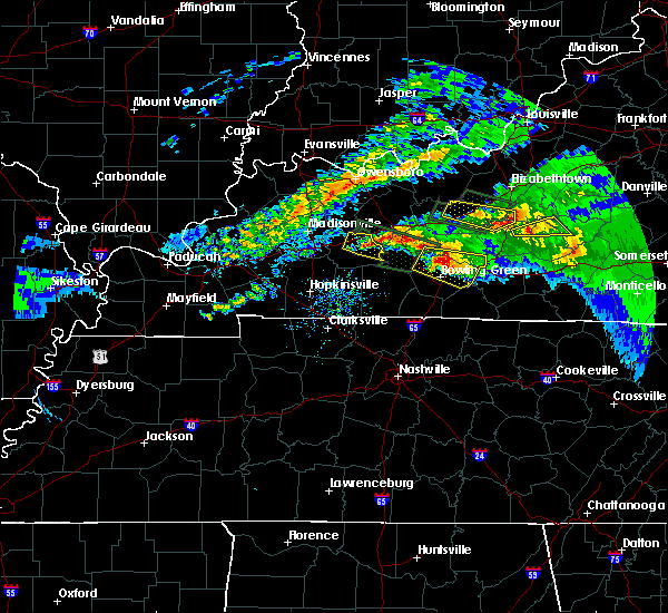 The severe thunderstorm warning for northeastern muhlenberg county will expire at 600 pm cdt, the storm which prompted the warning has weakened below severe limits, and has exited the warned area. therefore, the warning will be allowed to expire. a tornado watch remains in effect until 600 pm cdt for south central kentucky. The severe thunderstorm warning for northeastern muhlenberg county will expire at 600 pm cdt, the storm which prompted the warning has weakened below severe limits, and has exited the warned area. therefore, the warning will be allowed to expire. a tornado watch remains in effect until 600 pm cdt for south central kentucky.
|
| 3/12/2020 5:41 PM CDT |
 The severe thunderstorm warning for southwestern butler county will expire at 545 pm cdt, the storm which prompted the warning has moved out of the area. therefore, the warning will be allowed to expire. a tornado watch remains in effect until 600 pm cdt for south central and central kentucky. a tornado watch also remains in effect until midnight cdt for south central and central kentucky. The severe thunderstorm warning for southwestern butler county will expire at 545 pm cdt, the storm which prompted the warning has moved out of the area. therefore, the warning will be allowed to expire. a tornado watch remains in effect until 600 pm cdt for south central and central kentucky. a tornado watch also remains in effect until midnight cdt for south central and central kentucky.
|
| 3/12/2020 5:40 PM CDT |
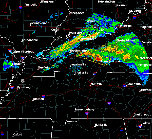 At 531 pm cdt, a severe thunderstorm was located over central city, moving east at 50 mph (radar indicated). Hazards include 60 mph wind gusts and quarter size hail. Hail damage to vehicles is expected. Expect wind damage to roofs, siding, and trees. At 531 pm cdt, a severe thunderstorm was located over central city, moving east at 50 mph (radar indicated). Hazards include 60 mph wind gusts and quarter size hail. Hail damage to vehicles is expected. Expect wind damage to roofs, siding, and trees.
|
| 3/12/2020 5:31 PM CDT |
 At 531 pm cdt, a severe thunderstorm was located over central city, moving east at 50 mph (radar indicated). Hazards include 60 mph wind gusts and quarter size hail. Hail damage to vehicles is expected. Expect wind damage to roofs, siding, and trees. At 531 pm cdt, a severe thunderstorm was located over central city, moving east at 50 mph (radar indicated). Hazards include 60 mph wind gusts and quarter size hail. Hail damage to vehicles is expected. Expect wind damage to roofs, siding, and trees.
|
| 3/12/2020 5:21 PM CDT |
 At 520 pm cdt, a severe thunderstorm was located 10 miles southwest of morgantown, moving east at 40 mph (radar indicated). Hazards include golf ball size hail and 70 mph wind gusts. People and animals outdoors will be injured. expect hail damage to roofs, siding, windows, and vehicles. expect considerable tree damage. wind damage is also likely to mobile homes, roofs, and outbuildings. Locations impacted include, morgantown, rochester, woodbury, south hill, huntsville, mining city, dimple, leetown, davis crossroads and harper crossroads. At 520 pm cdt, a severe thunderstorm was located 10 miles southwest of morgantown, moving east at 40 mph (radar indicated). Hazards include golf ball size hail and 70 mph wind gusts. People and animals outdoors will be injured. expect hail damage to roofs, siding, windows, and vehicles. expect considerable tree damage. wind damage is also likely to mobile homes, roofs, and outbuildings. Locations impacted include, morgantown, rochester, woodbury, south hill, huntsville, mining city, dimple, leetown, davis crossroads and harper crossroads.
|
| 3/12/2020 5:21 PM CDT |
 The severe thunderstorm warning for southeastern muhlenberg county will expire at 530 pm cdt, the storm which prompted the warning has moved out of the area. therefore, the warning will be allowed to expire. a tornado watch remains in effect until 600 pm cdt for south central kentucky. The severe thunderstorm warning for southeastern muhlenberg county will expire at 530 pm cdt, the storm which prompted the warning has moved out of the area. therefore, the warning will be allowed to expire. a tornado watch remains in effect until 600 pm cdt for south central kentucky.
|
| 3/12/2020 5:14 PM CDT |
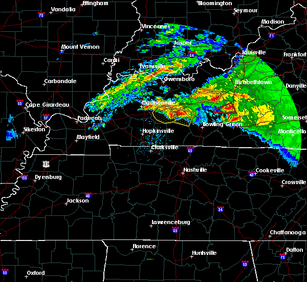 At 514 pm cdt, a severe thunderstorm was located near dunmor, or 12 miles southeast of central city, moving east at 40 mph (trained weather spotters). Hazards include golf ball size hail and 60 mph wind gusts. People and animals outdoors will be injured. expect hail damage to roofs, siding, windows, and vehicles. Expect wind damage to roofs, siding, and trees. At 514 pm cdt, a severe thunderstorm was located near dunmor, or 12 miles southeast of central city, moving east at 40 mph (trained weather spotters). Hazards include golf ball size hail and 60 mph wind gusts. People and animals outdoors will be injured. expect hail damage to roofs, siding, windows, and vehicles. Expect wind damage to roofs, siding, and trees.
|
| 3/12/2020 4:59 PM CDT |
 At 459 pm cdt, a severe thunderstorm was located near powderly, moving east at 40 mph. this is a very dangerous storm (radar indicated). Hazards include baseball size hail and 70 mph wind gusts. People and animals outdoors will be severely injured. Expect shattered windows, extensive damage to roofs, siding, and vehicles. At 459 pm cdt, a severe thunderstorm was located near powderly, moving east at 40 mph. this is a very dangerous storm (radar indicated). Hazards include baseball size hail and 70 mph wind gusts. People and animals outdoors will be severely injured. Expect shattered windows, extensive damage to roofs, siding, and vehicles.
|
| 1/11/2020 8:17 AM CST |
 At 816 am cst, severe thunderstorms were located along a line extending from near rockport to hartford to 9 miles northeast of elkton, moving northeast at 55 mph (radar indicated). Hazards include 60 mph wind gusts. Expect damage to roofs, siding, and trees. Locations impacted include, hartford, beaver dam, lewisburg, centertown, mchenry, rockport, rochester, ralph, spa, and epleys. At 816 am cst, severe thunderstorms were located along a line extending from near rockport to hartford to 9 miles northeast of elkton, moving northeast at 55 mph (radar indicated). Hazards include 60 mph wind gusts. Expect damage to roofs, siding, and trees. Locations impacted include, hartford, beaver dam, lewisburg, centertown, mchenry, rockport, rochester, ralph, spa, and epleys.
|
| 1/11/2020 7:57 AM CST |
 At 756 am cst, severe thunderstorms were located along a line extending from near st. joseph to central city to near pembroke, moving northeast at 55 mph (radar indicated). Hazards include 60 mph wind gusts. expect damage to roofs, siding, and trees At 756 am cst, severe thunderstorms were located along a line extending from near st. joseph to central city to near pembroke, moving northeast at 55 mph (radar indicated). Hazards include 60 mph wind gusts. expect damage to roofs, siding, and trees
|
| 10/26/2019 3:48 PM CDT |
 At 348 pm cdt, a severe thunderstorm was located near greenville, or near central city, moving north at 65 mph (radar indicated). Hazards include 60 mph wind gusts. Expect damage to roofs, siding, and trees. Locations impacted include, central city, greenville and drakesboro. At 348 pm cdt, a severe thunderstorm was located near greenville, or near central city, moving north at 65 mph (radar indicated). Hazards include 60 mph wind gusts. Expect damage to roofs, siding, and trees. Locations impacted include, central city, greenville and drakesboro.
|
| 10/26/2019 3:36 PM CDT |
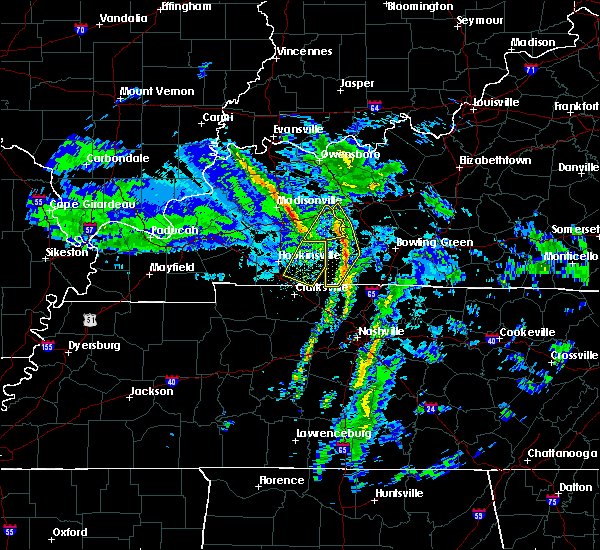 At 336 pm cdt, severe thunderstorms were located along a line extending from 7 miles southeast of central city to near dunmor to 10 miles north of russellville, moving northeast at 70 mph (kentucky mesonet). Hazards include 60 mph wind gusts. Expect damage to roofs, siding, and trees. Locations impacted include, russellville, anderson, lewisburg, rockport, rochester, insco, huntsville, epleys, wolf lick and cave springs. At 336 pm cdt, severe thunderstorms were located along a line extending from 7 miles southeast of central city to near dunmor to 10 miles north of russellville, moving northeast at 70 mph (kentucky mesonet). Hazards include 60 mph wind gusts. Expect damage to roofs, siding, and trees. Locations impacted include, russellville, anderson, lewisburg, rockport, rochester, insco, huntsville, epleys, wolf lick and cave springs.
|
| 10/26/2019 3:29 PM CDT |
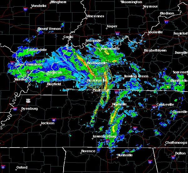 At 328 pm cdt, a severe thunderstorm was located 9 miles north of elkton, moving northeast at 65 mph (trained weather spotters). Hazards include 60 mph wind gusts. expect damage to roofs, siding, and trees At 328 pm cdt, a severe thunderstorm was located 9 miles north of elkton, moving northeast at 65 mph (trained weather spotters). Hazards include 60 mph wind gusts. expect damage to roofs, siding, and trees
|
| 10/26/2019 3:18 PM CDT |
 At 318 pm cdt, severe thunderstorms were located along a line extending from 10 miles south of weir to near elkton to 9 miles northeast of guthrie, moving northeast at 70 mph (kentucky mesonet). Hazards include 60 mph wind gusts. expect damage to roofs, siding, and trees At 318 pm cdt, severe thunderstorms were located along a line extending from 10 miles south of weir to near elkton to 9 miles northeast of guthrie, moving northeast at 70 mph (kentucky mesonet). Hazards include 60 mph wind gusts. expect damage to roofs, siding, and trees
|
| 8/20/2019 4:15 PM CDT |
 At 415 pm cdt, a severe thunderstorm was located 8 miles southeast of dunmor, moving southeast at 35 mph (radar indicated). Hazards include 60 mph wind gusts. expect damage to roofs, siding, and trees At 415 pm cdt, a severe thunderstorm was located 8 miles southeast of dunmor, moving southeast at 35 mph (radar indicated). Hazards include 60 mph wind gusts. expect damage to roofs, siding, and trees
|
| 8/20/2019 4:04 PM CDT |
 At 403 pm cdt, a severe thunderstorm was located over hartford, and is nearly stationary (radar indicated). Hazards include 60 mph wind gusts. Expect damage to roofs, siding, and trees. Locations impacted include, morgantown, casey, lee, rochester, woodbury, mining city, dimple, aberdeen, leetown and eden. At 403 pm cdt, a severe thunderstorm was located over hartford, and is nearly stationary (radar indicated). Hazards include 60 mph wind gusts. Expect damage to roofs, siding, and trees. Locations impacted include, morgantown, casey, lee, rochester, woodbury, mining city, dimple, aberdeen, leetown and eden.
|
| 8/20/2019 3:44 PM CDT |
 The national weather service in louisville has issued a * severe thunderstorm warning for. butler county in south central kentucky. southwestern grayson county in central kentucky. ohio county in central kentucky. Until 415 pm cdt. The national weather service in louisville has issued a * severe thunderstorm warning for. butler county in south central kentucky. southwestern grayson county in central kentucky. ohio county in central kentucky. Until 415 pm cdt.
|
| 6/26/2019 7:53 PM CDT |
 At 752 pm cdt, a severe thunderstorm was located 8 miles east of central city--greenville, or 8 miles southeast of central city, moving east at 15 mph (radar indicated). Hazards include 60 mph wind gusts and quarter size hail. Hail damage to vehicles is expected. expect wind damage to roofs, siding, and trees. This severe thunderstorm will remain over mainly rural areas of east central muhlenberg county. At 752 pm cdt, a severe thunderstorm was located 8 miles east of central city--greenville, or 8 miles southeast of central city, moving east at 15 mph (radar indicated). Hazards include 60 mph wind gusts and quarter size hail. Hail damage to vehicles is expected. expect wind damage to roofs, siding, and trees. This severe thunderstorm will remain over mainly rural areas of east central muhlenberg county.
|
| 6/26/2019 7:32 PM CDT |
 At 731 pm cdt, a severe thunderstorm was located near greenville, moving east at 15 mph (radar indicated). Hazards include 60 mph wind gusts and quarter size hail. Hail damage to vehicles is expected. Expect wind damage to roofs, siding, and trees. At 731 pm cdt, a severe thunderstorm was located near greenville, moving east at 15 mph (radar indicated). Hazards include 60 mph wind gusts and quarter size hail. Hail damage to vehicles is expected. Expect wind damage to roofs, siding, and trees.
|
| 6/23/2019 2:28 PM CDT |
 At 228 pm cdt, a severe thunderstorm was located near morgantown, moving northeast at 25 mph (radar indicated). Hazards include 70 mph wind gusts and half dollar size hail. Hail damage to vehicles is expected. expect considerable tree damage. wind damage is also likely to mobile homes, roofs, and outbuildings. Locations impacted include, morgantown, rochester, silver city, south hill, huntsville, pleasant hill, mining city, youngtown, provo and dunbar. At 228 pm cdt, a severe thunderstorm was located near morgantown, moving northeast at 25 mph (radar indicated). Hazards include 70 mph wind gusts and half dollar size hail. Hail damage to vehicles is expected. expect considerable tree damage. wind damage is also likely to mobile homes, roofs, and outbuildings. Locations impacted include, morgantown, rochester, silver city, south hill, huntsville, pleasant hill, mining city, youngtown, provo and dunbar.
|
| 6/23/2019 2:13 PM CDT |
 At 212 pm cdt, a severe thunderstorm was located over dunmor, or 12 miles southeast of greenville, moving northeast at 10 mph (radar indicated). Hazards include 60 mph wind gusts and quarter size hail. Hail damage to vehicles is expected. Expect wind damage to roofs, siding, and trees. At 212 pm cdt, a severe thunderstorm was located over dunmor, or 12 miles southeast of greenville, moving northeast at 10 mph (radar indicated). Hazards include 60 mph wind gusts and quarter size hail. Hail damage to vehicles is expected. Expect wind damage to roofs, siding, and trees.
|
| 6/23/2019 2:09 PM CDT |
 At 208 pm cdt, a severe thunderstorm was located near dunmor, moving northeast at 25 mph (radar indicated). Hazards include 60 mph wind gusts and quarter size hail. Hail damage to vehicles is expected. Expect wind damage to roofs, siding, and trees. At 208 pm cdt, a severe thunderstorm was located near dunmor, moving northeast at 25 mph (radar indicated). Hazards include 60 mph wind gusts and quarter size hail. Hail damage to vehicles is expected. Expect wind damage to roofs, siding, and trees.
|
| 6/21/2019 6:32 PM CDT |
 At 632 pm cdt, a severe thunderstorm was located 8 miles northwest of morgantown, moving east at 40 mph (radar indicated). Hazards include 60 mph wind gusts and penny size hail. expect damage to roofs, siding, and trees At 632 pm cdt, a severe thunderstorm was located 8 miles northwest of morgantown, moving east at 40 mph (radar indicated). Hazards include 60 mph wind gusts and penny size hail. expect damage to roofs, siding, and trees
|
| 6/21/2019 6:08 PM CDT |
 At 608 pm cdt, severe thunderstorms were located along a line extending from 7 miles south of hartford to 6 miles west of weir, moving southeast at 35 mph (radar indicated). Hazards include 70 mph wind gusts and quarter size hail. Hail damage to vehicles is expected. expect considerable tree damage. Wind damage is also likely to mobile homes, roofs, and outbuildings. At 608 pm cdt, severe thunderstorms were located along a line extending from 7 miles south of hartford to 6 miles west of weir, moving southeast at 35 mph (radar indicated). Hazards include 70 mph wind gusts and quarter size hail. Hail damage to vehicles is expected. expect considerable tree damage. Wind damage is also likely to mobile homes, roofs, and outbuildings.
|
| 12/31/2018 2:11 PM CST |
 The severe thunderstorm warning for logan, butler and southeastern ohio counties will expire at 215 pm cst, the storms which prompted the warning have moved out of the area. therefore, the warning will be allowed to expire. a severe thunderstorm watch remains in effect until 600 pm cst for south central and central kentucky. report severe weather to local law enforcement, post your report to the national weather service louisville facebook page, or tweet your report using hashtag l, m, k, spotter. The severe thunderstorm warning for logan, butler and southeastern ohio counties will expire at 215 pm cst, the storms which prompted the warning have moved out of the area. therefore, the warning will be allowed to expire. a severe thunderstorm watch remains in effect until 600 pm cst for south central and central kentucky. report severe weather to local law enforcement, post your report to the national weather service louisville facebook page, or tweet your report using hashtag l, m, k, spotter.
|
| 12/31/2018 1:33 PM CST |
 At 132 pm cst, severe thunderstorms were located along a line extending from 6 miles southeast of central city to guthrie, moving northeast at 65 mph (radar indicated). Hazards include 60 mph wind gusts. expect damage to roofs, siding, and trees At 132 pm cst, severe thunderstorms were located along a line extending from 6 miles southeast of central city to guthrie, moving northeast at 65 mph (radar indicated). Hazards include 60 mph wind gusts. expect damage to roofs, siding, and trees
|
| 6/26/2018 7:41 PM CDT |
 At 740 pm cdt, severe thunderstorms were located along a line extending from 6 miles east of central city to near dunmor to 6 miles east of crofton, moving southeast at 30 mph (radar indicated). Hazards include 60 mph wind gusts. expect damage to roofs, siding, and trees At 740 pm cdt, severe thunderstorms were located along a line extending from 6 miles east of central city to near dunmor to 6 miles east of crofton, moving southeast at 30 mph (radar indicated). Hazards include 60 mph wind gusts. expect damage to roofs, siding, and trees
|
| 6/26/2018 7:34 PM CDT |
 At 733 pm cdt, severe thunderstorms were located along a line extending from 8 miles south of hartford to near weir to near cadiz, moving east at 40 mph (radar indicated). Hazards include 60 mph wind gusts and nickel size hail. expect damage to roofs, siding, and trees At 733 pm cdt, severe thunderstorms were located along a line extending from 8 miles south of hartford to near weir to near cadiz, moving east at 40 mph (radar indicated). Hazards include 60 mph wind gusts and nickel size hail. expect damage to roofs, siding, and trees
|
| 5/31/2018 5:05 PM CDT |
 At 505 pm cdt, a severe thunderstorm was located 7 miles southeast of central city, moving east at 35 mph (radar indicated). Hazards include 60 mph wind gusts and half dollar size hail. Hail damage to vehicles is expected. Expect wind damage to roofs, siding, and trees. At 505 pm cdt, a severe thunderstorm was located 7 miles southeast of central city, moving east at 35 mph (radar indicated). Hazards include 60 mph wind gusts and half dollar size hail. Hail damage to vehicles is expected. Expect wind damage to roofs, siding, and trees.
|
| 4/3/2018 6:30 PM CDT |
 At 630 pm cdt, a severe thunderstorm was located 9 miles west of morgantown, moving east at 65 mph (radar indicated). Hazards include 70 mph wind gusts and quarter size hail. Hail damage to vehicles is expected. expect considerable tree damage. Wind damage is also likely to mobile homes, roofs, and outbuildings. At 630 pm cdt, a severe thunderstorm was located 9 miles west of morgantown, moving east at 65 mph (radar indicated). Hazards include 70 mph wind gusts and quarter size hail. Hail damage to vehicles is expected. expect considerable tree damage. Wind damage is also likely to mobile homes, roofs, and outbuildings.
|
| 4/3/2018 6:29 PM CDT |
 At 629 pm cdt, a severe thunderstorm was located 7 miles northeast of dunmor, or 14 miles east of greenville in muhlenberg county, moving northeast at 55 mph (radar indicated). Hazards include 60 mph wind gusts and quarter size hail. Hail damage to vehicles is expected. expect wind damage to roofs, siding, and trees. this severe thunderstorm will remain over mainly rural areas of east central muhlenberg county. A tornado watch remains in effect until midnight cdt for south central kentucky. At 629 pm cdt, a severe thunderstorm was located 7 miles northeast of dunmor, or 14 miles east of greenville in muhlenberg county, moving northeast at 55 mph (radar indicated). Hazards include 60 mph wind gusts and quarter size hail. Hail damage to vehicles is expected. expect wind damage to roofs, siding, and trees. this severe thunderstorm will remain over mainly rural areas of east central muhlenberg county. A tornado watch remains in effect until midnight cdt for south central kentucky.
|
| 5/27/2017 5:17 PM CDT |
 At 517 pm cdt, a severe thunderstorm was located over greenville, moving east at 20 mph (radar indicated). Hazards include 60 mph wind gusts and quarter size hail. Hail damage to vehicles is expected. Expect wind damage to roofs, siding, and trees. At 517 pm cdt, a severe thunderstorm was located over greenville, moving east at 20 mph (radar indicated). Hazards include 60 mph wind gusts and quarter size hail. Hail damage to vehicles is expected. Expect wind damage to roofs, siding, and trees.
|
| 3/1/2017 6:43 AM CST |
 At 743 am est/643 am cst/, severe thunderstorms were located along a line extending from 11 miles northeast of morgantown to near campbellsville, moving southeast at 50 mph (radar indicated). Hazards include 60 mph wind gusts. Expect damage to roofs, siding, and trees. locations impacted include, campbellsville, hodgenville, morgantown, greensburg, munfordville, brownsville, casey, monroe, lee and horse cave. a tornado watch remains in effect until 900 am est/800 am cst/ for south central and central kentucky. A tornado watch also remains in effect until 1100 am est/1000 am cst/ for south central and central kentucky. At 743 am est/643 am cst/, severe thunderstorms were located along a line extending from 11 miles northeast of morgantown to near campbellsville, moving southeast at 50 mph (radar indicated). Hazards include 60 mph wind gusts. Expect damage to roofs, siding, and trees. locations impacted include, campbellsville, hodgenville, morgantown, greensburg, munfordville, brownsville, casey, monroe, lee and horse cave. a tornado watch remains in effect until 900 am est/800 am cst/ for south central and central kentucky. A tornado watch also remains in effect until 1100 am est/1000 am cst/ for south central and central kentucky.
|
| 3/1/2017 6:41 AM CST |
 At 740 am est/640 am cst/, severe thunderstorms were located along a line extending from 11 miles northeast of morgantown to near campbellsville, moving southeast at 100 mph (radar indicated). Hazards include 60 mph wind gusts. expect damage to roofs, siding, and trees At 740 am est/640 am cst/, severe thunderstorms were located along a line extending from 11 miles northeast of morgantown to near campbellsville, moving southeast at 100 mph (radar indicated). Hazards include 60 mph wind gusts. expect damage to roofs, siding, and trees
|
| 3/1/2017 6:25 AM CST |
 At 725 am est/625 am cst/, severe thunderstorms were located along a line extending from near hodgenville to near morgantown, moving southeast at 55 mph (radar indicated). Hazards include 60 mph wind gusts and penny size hail. Expect damage to roofs, siding, and trees. locations impacted include, leitchfield, hodgenville, morgantown, munfordville, brownsville, casey, monroe, lee, beaver dam and horse cave. a tornado watch remains in effect until 900 am est/800 am cst/ for south central and central kentucky. A tornado watch also remains in effect until 1100 am est/1000 am cst/ for south central and central kentucky. At 725 am est/625 am cst/, severe thunderstorms were located along a line extending from near hodgenville to near morgantown, moving southeast at 55 mph (radar indicated). Hazards include 60 mph wind gusts and penny size hail. Expect damage to roofs, siding, and trees. locations impacted include, leitchfield, hodgenville, morgantown, munfordville, brownsville, casey, monroe, lee, beaver dam and horse cave. a tornado watch remains in effect until 900 am est/800 am cst/ for south central and central kentucky. A tornado watch also remains in effect until 1100 am est/1000 am cst/ for south central and central kentucky.
|
| 3/1/2017 6:08 AM CST |
 At 708 am est/608 am cst/, severe thunderstorms were located along a line extending from near elizabethtown to 10 miles south of hartford, moving southeast at 80 mph (radar indicated). Hazards include 65 mph wind gusts and nickel size hail. expect damage to roofs, siding, and trees At 708 am est/608 am cst/, severe thunderstorms were located along a line extending from near elizabethtown to 10 miles south of hartford, moving southeast at 80 mph (radar indicated). Hazards include 65 mph wind gusts and nickel size hail. expect damage to roofs, siding, and trees
|
| 3/1/2017 12:44 AM CST |
 At 1244 am cst, a severe thunderstorm capable of producing a tornado was located 10 miles east of dunmor, moving northeast at 40 mph (radar indicated rotation). Hazards include tornado and quarter size hail. Flying debris will be dangerous to those caught without shelter. mobile homes will be damaged or destroyed. damage to roofs, windows, and vehicles will occur. tree damage is likely. Locations impacted include, morgantown, casey, rochester, woodbury, monford, huntsville, mining city, aberdeen, leetown and eden. At 1244 am cst, a severe thunderstorm capable of producing a tornado was located 10 miles east of dunmor, moving northeast at 40 mph (radar indicated rotation). Hazards include tornado and quarter size hail. Flying debris will be dangerous to those caught without shelter. mobile homes will be damaged or destroyed. damage to roofs, windows, and vehicles will occur. tree damage is likely. Locations impacted include, morgantown, casey, rochester, woodbury, monford, huntsville, mining city, aberdeen, leetown and eden.
|
| 3/1/2017 12:32 AM CST |
 At 1232 am cst, a severe thunderstorm capable of producing a tornado was located 8 miles northeast of dunmor, moving east at 50 mph (radar indicated rotation). Hazards include tornado and quarter size hail. Flying debris will be dangerous to those caught without shelter. mobile homes will be damaged or destroyed. damage to roofs, windows, and vehicles will occur. Tree damage is likely. At 1232 am cst, a severe thunderstorm capable of producing a tornado was located 8 miles northeast of dunmor, moving east at 50 mph (radar indicated rotation). Hazards include tornado and quarter size hail. Flying debris will be dangerous to those caught without shelter. mobile homes will be damaged or destroyed. damage to roofs, windows, and vehicles will occur. Tree damage is likely.
|
| 3/1/2017 12:22 AM CST |
 At 1221 am cst, a severe thunderstorm was located near dunmor, moving east at 50 mph (radar indicated). Hazards include 60 mph wind gusts. expect damage to roofs, siding, and trees At 1221 am cst, a severe thunderstorm was located near dunmor, moving east at 50 mph (radar indicated). Hazards include 60 mph wind gusts. expect damage to roofs, siding, and trees
|
| 8/5/2016 2:56 PM CDT |
 At 255 pm cdt, a severe thunderstorm was located near dunmor, or 8 miles southeast of greenville, moving southeast at 35 mph (radar indicated. law enforcement reported a tree down in town). Hazards include 60 mph wind gusts. Expect damage to roofs. siding. And trees. At 255 pm cdt, a severe thunderstorm was located near dunmor, or 8 miles southeast of greenville, moving southeast at 35 mph (radar indicated. law enforcement reported a tree down in town). Hazards include 60 mph wind gusts. Expect damage to roofs. siding. And trees.
|
| 7/8/2016 8:48 PM CDT |
 At 848 pm cdt, a severe thunderstorm was located near morgantown, moving east at 50 mph (radar indicated). Hazards include 60 mph wind gusts. Expect damage to roofs. siding. and trees. Locations impacted include, bowling green, morgantown, brownsville, plum springs, delafield, mount victor, casey, lee, beaver dam and smiths grove. At 848 pm cdt, a severe thunderstorm was located near morgantown, moving east at 50 mph (radar indicated). Hazards include 60 mph wind gusts. Expect damage to roofs. siding. and trees. Locations impacted include, bowling green, morgantown, brownsville, plum springs, delafield, mount victor, casey, lee, beaver dam and smiths grove.
|
| 7/8/2016 8:35 PM CDT |
 At 835 pm cdt, a severe thunderstorm was located 9 miles west of morgantown, moving east at 50 mph (radar indicated). Hazards include 60 mph wind gusts. Expect damage to roofs. siding. And trees. At 835 pm cdt, a severe thunderstorm was located 9 miles west of morgantown, moving east at 50 mph (radar indicated). Hazards include 60 mph wind gusts. Expect damage to roofs. siding. And trees.
|
| 7/7/2016 2:25 PM CDT |
 At 225 pm cdt, severe thunderstorms were located along a line extending from near hartford to near weir, moving east at 60 mph (radar indicated). Hazards include 70 mph wind gusts. Expect considerable tree damage. Damage is likely to mobile homes, roofs, and outbuildings. At 225 pm cdt, severe thunderstorms were located along a line extending from near hartford to near weir, moving east at 60 mph (radar indicated). Hazards include 70 mph wind gusts. Expect considerable tree damage. Damage is likely to mobile homes, roofs, and outbuildings.
|
| 7/6/2016 3:12 PM CDT |
 At 311 pm cdt, severe thunderstorms were located along a line extending from near central city to near dunmor to near elkton, moving east at 55 mph (radar indicated). Hazards include 60 mph wind gusts. Expect damage to roofs. siding. and trees. Locations impacted include, russellville, morgantown, anderson, auburn, adairville, lewisburg, rochester, woodbury, lickskillet and cooperstown. At 311 pm cdt, severe thunderstorms were located along a line extending from near central city to near dunmor to near elkton, moving east at 55 mph (radar indicated). Hazards include 60 mph wind gusts. Expect damage to roofs. siding. and trees. Locations impacted include, russellville, morgantown, anderson, auburn, adairville, lewisburg, rochester, woodbury, lickskillet and cooperstown.
|
| 7/6/2016 2:50 PM CDT |
 At 249 pm cdt, severe thunderstorms were located along a line extending from near earlington to 6 miles south of crofton to 8 miles northeast of big rock, moving east at 60 mph (radar indicated). Hazards include 60-70 mph wind gusts. Expect damage to roofs. siding. And trees. At 249 pm cdt, severe thunderstorms were located along a line extending from near earlington to 6 miles south of crofton to 8 miles northeast of big rock, moving east at 60 mph (radar indicated). Hazards include 60-70 mph wind gusts. Expect damage to roofs. siding. And trees.
|
| 6/16/2016 5:41 PM CDT |
 At 541 pm cdt, a severe thunderstorm was located 13 miles northeast of russellville, moving southeast at 45 mph (radar indicated). Hazards include 60 mph wind gusts and quarter size hail. Hail damage to vehicles is expected. Expect wind damage to roofs, siding, and trees. At 541 pm cdt, a severe thunderstorm was located 13 miles northeast of russellville, moving southeast at 45 mph (radar indicated). Hazards include 60 mph wind gusts and quarter size hail. Hail damage to vehicles is expected. Expect wind damage to roofs, siding, and trees.
|
| 6/16/2016 5:36 PM CDT |
 At 536 pm cdt, a severe thunderstorm was located 13 miles east of dunmor, moving southeast at 45 mph (radar indicated). Hazards include 60 mph wind gusts and penny size hail. Expect damage to roofs. siding. and trees. Locations impacted include, bowling green, russellville, anderson, auburn, lewisburg, rochester, blue level, epleys, cooperstown and buffalo fork. At 536 pm cdt, a severe thunderstorm was located 13 miles east of dunmor, moving southeast at 45 mph (radar indicated). Hazards include 60 mph wind gusts and penny size hail. Expect damage to roofs. siding. and trees. Locations impacted include, bowling green, russellville, anderson, auburn, lewisburg, rochester, blue level, epleys, cooperstown and buffalo fork.
|
| 6/16/2016 5:32 PM CDT |
 At 532 pm cdt, a severe thunderstorm was located 7 miles north of dunmor, or 11 miles southeast of central city, moving south at 50 mph (radar indicated). Hazards include 60 mph wind gusts and quarter size hail. Hail damage to vehicles is expected. Expect wind damage to roofs, siding, and trees. At 532 pm cdt, a severe thunderstorm was located 7 miles north of dunmor, or 11 miles southeast of central city, moving south at 50 mph (radar indicated). Hazards include 60 mph wind gusts and quarter size hail. Hail damage to vehicles is expected. Expect wind damage to roofs, siding, and trees.
|
| 6/16/2016 5:16 PM CDT |
 At 516 pm cdt, a severe thunderstorm was located 9 miles northeast of dunmor, moving southeast at 75 mph (radar indicated). Hazards include 60 mph wind gusts. Expect damage to roofs. siding. And trees. At 516 pm cdt, a severe thunderstorm was located 9 miles northeast of dunmor, moving southeast at 75 mph (radar indicated). Hazards include 60 mph wind gusts. Expect damage to roofs. siding. And trees.
|
| 6/15/2016 2:54 PM CDT |
 At 253 pm cdt, a severe thunderstorm was located 11 miles west of morgantown, moving southeast at 30 mph (radar indicated). Hazards include 60 mph wind gusts. Expect damage to roofs. siding. and trees. Locations impacted include, anderson, lewisburg, rochester, spa, quality, huntsville, wysox, jerico, pleasant hill and agnes. At 253 pm cdt, a severe thunderstorm was located 11 miles west of morgantown, moving southeast at 30 mph (radar indicated). Hazards include 60 mph wind gusts. Expect damage to roofs. siding. and trees. Locations impacted include, anderson, lewisburg, rochester, spa, quality, huntsville, wysox, jerico, pleasant hill and agnes.
|
| 6/15/2016 2:18 PM CDT |
 At 216 pm cdt, a severe thunderstorm was located near livermore, moving southeast at 55 mph (radar indicated). Hazards include 60 mph wind gusts. Expect damage to roofs. siding. And trees. At 216 pm cdt, a severe thunderstorm was located near livermore, moving southeast at 55 mph (radar indicated). Hazards include 60 mph wind gusts. Expect damage to roofs. siding. And trees.
|
| 5/10/2016 6:00 PM CDT |
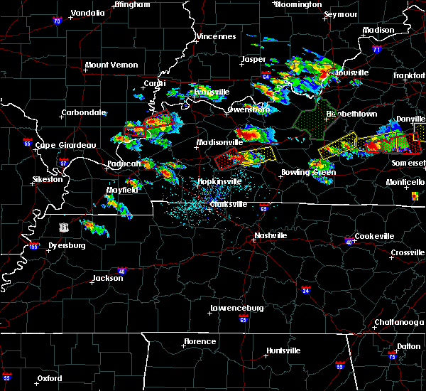 At 600 pm cdt, a severe thunderstorm capable of producing a tornado was located near dunmor, or 10 miles east of greenville, moving east at 30 mph (radar indicated rotation but this storm has a history of producing a tornado). Hazards include tornado and quarter size hail. Flying debris will be dangerous to those caught without shelter. mobile homes will be damaged or destroyed. damage to roofs, windows, and vehicles will occur. tree damage is likely. This tornadic thunderstorm will remain over mainly rural areas of southeastern muhlenberg county, including the following locations: drakesboro. At 600 pm cdt, a severe thunderstorm capable of producing a tornado was located near dunmor, or 10 miles east of greenville, moving east at 30 mph (radar indicated rotation but this storm has a history of producing a tornado). Hazards include tornado and quarter size hail. Flying debris will be dangerous to those caught without shelter. mobile homes will be damaged or destroyed. damage to roofs, windows, and vehicles will occur. tree damage is likely. This tornadic thunderstorm will remain over mainly rural areas of southeastern muhlenberg county, including the following locations: drakesboro.
|
| 5/10/2016 5:58 PM CDT |
 At 558 pm cdt, a severe thunderstorm was located 7 miles north of dunmor, moving east at 35 mph (radar indicated). Hazards include 60 mph wind gusts and half dollar size hail. Hail damage to vehicles is expected. Expect wind damage to roofs, siding, and trees. At 558 pm cdt, a severe thunderstorm was located 7 miles north of dunmor, moving east at 35 mph (radar indicated). Hazards include 60 mph wind gusts and half dollar size hail. Hail damage to vehicles is expected. Expect wind damage to roofs, siding, and trees.
|
| 5/10/2016 5:44 PM CDT |
 At 543 pm cdt, a confirmed large and extremely dangerous tornado was located near greenville, moving northeast at 60 mph. this is a particularly dangerous situation. take cover now! (emergency management confirmed tornado). Hazards include damaging tornado. You are in a life-threatening situation. flying debris may be deadly to those caught without shelter. mobile homes will be destroyed. considerable damage to homes, businesses, and vehicles is likely and complete destruction is possible. This tornadic thunderstorm will remain over mainly rural areas of central muhlenberg county, including the following locations: weir heading toward highway 181 and drakesboro. At 543 pm cdt, a confirmed large and extremely dangerous tornado was located near greenville, moving northeast at 60 mph. this is a particularly dangerous situation. take cover now! (emergency management confirmed tornado). Hazards include damaging tornado. You are in a life-threatening situation. flying debris may be deadly to those caught without shelter. mobile homes will be destroyed. considerable damage to homes, businesses, and vehicles is likely and complete destruction is possible. This tornadic thunderstorm will remain over mainly rural areas of central muhlenberg county, including the following locations: weir heading toward highway 181 and drakesboro.
|
| 5/10/2016 5:39 PM CDT |
 At 539 pm cdt, a confirmed tornado was located 9 miles south of hartford, or 12 miles east of central city, moving northeast at 55 mph (emergency management confirmed tornado). Hazards include damaging tornado and quarter size hail. Flying debris will be dangerous to those caught without shelter. mobile homes will be damaged or destroyed. damage to roofs, windows, and vehicles will occur. tree damage is likely. Locations impacted include, central city, greenville, powderly, weir and drakesboro. At 539 pm cdt, a confirmed tornado was located 9 miles south of hartford, or 12 miles east of central city, moving northeast at 55 mph (emergency management confirmed tornado). Hazards include damaging tornado and quarter size hail. Flying debris will be dangerous to those caught without shelter. mobile homes will be damaged or destroyed. damage to roofs, windows, and vehicles will occur. tree damage is likely. Locations impacted include, central city, greenville, powderly, weir and drakesboro.
|
| 5/10/2016 5:36 PM CDT |
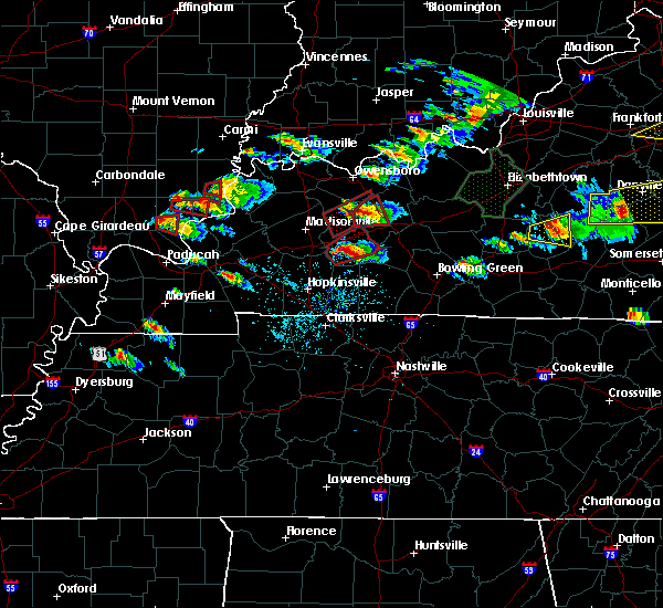 At 535 pm cdt, a severe thunderstorm capable of producing a tornado was located 9 miles east of central city, moving northeast at 55 mph (weather spotters reported a funnel cloud and a brief tornado touchdown near apex). Hazards include tornado and quarter size hail. Flying debris will be dangerous to those caught without shelter. mobile homes will be damaged or destroyed. damage to roofs, windows, and vehicles will occur. tree damage is likely. This tornadic thunderstorm will remain over mainly rural areas of central muhlenberg county, including the following locations: drakesboro. At 535 pm cdt, a severe thunderstorm capable of producing a tornado was located 9 miles east of central city, moving northeast at 55 mph (weather spotters reported a funnel cloud and a brief tornado touchdown near apex). Hazards include tornado and quarter size hail. Flying debris will be dangerous to those caught without shelter. mobile homes will be damaged or destroyed. damage to roofs, windows, and vehicles will occur. tree damage is likely. This tornadic thunderstorm will remain over mainly rural areas of central muhlenberg county, including the following locations: drakesboro.
|
| 5/10/2016 4:59 PM CDT |
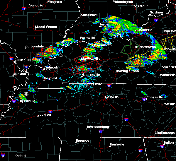 At 458 pm cdt, a severe thunderstorm capable of producing a tornado was located over crofton, or 12 miles southeast of dawson springs, moving northeast at 55 mph (weather spotters reported funnel cloud). Hazards include tornado and quarter size hail. Flying debris will be dangerous to those caught without shelter. mobile homes will be damaged or destroyed. damage to roofs, windows, and vehicles will occur. tree damage is likely. this dangerous storm will be near, weir and graham around 515 pm cdt. greenville and powderly around 525 pm cdt. central city around 530 pm cdt. Other locations impacted by this tornadic thunderstorm include drakesboro and white plains. At 458 pm cdt, a severe thunderstorm capable of producing a tornado was located over crofton, or 12 miles southeast of dawson springs, moving northeast at 55 mph (weather spotters reported funnel cloud). Hazards include tornado and quarter size hail. Flying debris will be dangerous to those caught without shelter. mobile homes will be damaged or destroyed. damage to roofs, windows, and vehicles will occur. tree damage is likely. this dangerous storm will be near, weir and graham around 515 pm cdt. greenville and powderly around 525 pm cdt. central city around 530 pm cdt. Other locations impacted by this tornadic thunderstorm include drakesboro and white plains.
|
| 3/31/2016 2:18 PM CDT |
 At 218 pm cdt, a severe thunderstorm was located 10 miles east of central city, moving northeast at 55 mph (radar indicated). Hazards include 60 mph wind gusts. Expect damage to roofs. siding. And trees. At 218 pm cdt, a severe thunderstorm was located 10 miles east of central city, moving northeast at 55 mph (radar indicated). Hazards include 60 mph wind gusts. Expect damage to roofs. siding. And trees.
|
| 3/27/2016 8:15 PM CDT |
 At 815 pm cdt, a severe thunderstorm was located near morgantown, moving northeast at 55 mph (radar indicated). Hazards include 60 mph wind gusts. Expect damage to roofs. siding. and trees. Locations impacted include, morgantown, casey, lee, beaver dam, rochester, woodbury, sandefur crossing, rosine, huntsville and pleasant hill. At 815 pm cdt, a severe thunderstorm was located near morgantown, moving northeast at 55 mph (radar indicated). Hazards include 60 mph wind gusts. Expect damage to roofs. siding. and trees. Locations impacted include, morgantown, casey, lee, beaver dam, rochester, woodbury, sandefur crossing, rosine, huntsville and pleasant hill.
|
| 3/27/2016 8:02 PM CDT |
 At 802 pm cdt, a severe thunderstorm was located 7 miles north of dunmor, moving northeast at 55 mph (radar indicated). Hazards include 60 mph wind gusts. Expect damage to roofs. siding. And trees. At 802 pm cdt, a severe thunderstorm was located 7 miles north of dunmor, moving northeast at 55 mph (radar indicated). Hazards include 60 mph wind gusts. Expect damage to roofs. siding. And trees.
|
| 3/27/2016 7:59 PM CDT |
 At 758 pm cdt, a severe thunderstorm capable of producing a tornado was located near dunmor, or 9 miles east of greenville, moving northeast at 45 mph. this storm has a history of producing damage (radar indicated rotation). Hazards include tornado. Flying debris will be dangerous to those caught without shelter. mobile homes will be damaged or destroyed. damage to roofs, windows, and vehicles will occur. tree damage is likely. This tornadic thunderstorm will remain over mainly rural areas of east central muhlenberg county. At 758 pm cdt, a severe thunderstorm capable of producing a tornado was located near dunmor, or 9 miles east of greenville, moving northeast at 45 mph. this storm has a history of producing damage (radar indicated rotation). Hazards include tornado. Flying debris will be dangerous to those caught without shelter. mobile homes will be damaged or destroyed. damage to roofs, windows, and vehicles will occur. tree damage is likely. This tornadic thunderstorm will remain over mainly rural areas of east central muhlenberg county.
|
| 12/23/2015 6:37 PM CST | At 636 pm cst, severe thunderstorms were located along a line extending from near leitchfield to 13 miles northeast of russellville, moving east at 40 mph (radar indicated). Hazards include 60 mph wind gusts. Expect damage to roofs. siding and trees. locations impacted include, russellville, morgantown, brownsville, anderson, casey, lee, lewisburg, rochester, woodbury, sadler, cooperstown, quality, huntsville, jerico, pleasant hill, riverside, prosperity, huldeville, homer and agnes. A tornado watch remains in effect until 800 pm cst for south central kentucky. |
| 12/23/2015 6:12 PM CST | At 612 pm cst, severe thunderstorms were located along a line extending from 10 miles west of leitchfield to 6 miles south of dunmor, moving northeast at 50 mph (radar indicated). Hazards include 60 mph wind gusts. Expect damage to roofs. Siding and trees. |
| 12/23/2015 5:52 PM CST | At 552 pm cst, severe thunderstorms were located along a line extending from 7 miles southeast of hardinsburg to near morgantown, moving northeast at 70 mph (radar indicated). Hazards include 60 mph wind gusts and penny size hail. Expect damage to roofs. siding and trees. locations impacted include, hartford, morgantown, casey, beaver dam, caneyville, mchenry, rochester, concord, sandefur crossing, rosine, huntsville, pleasant hill, se ree, windy hill, tilford, hickory corner, harper crossroads, cool springs, cromwell and mcdaniels. A tornado watch remains in effect until 800 pm cst for south central kentucky. |
| 12/23/2015 5:27 PM CST | At 527 pm cst, severe thunderstorms were located along a line extending from 7 miles southeast of whitesville to 6 miles southeast of weir, moving northeast at 70 mph (radar indicated). Hazards include 60 mph wind gusts and penny size hail. Expect damage to roofs. Siding and trees. |
| 7/20/2015 11:11 PM CDT |
 At 1108 pm cdt, severe thunderstorms were located along a line extending from hartford to 6 miles north of morgantown to 14 miles southwest of morgantown, and moving east at 45 mph (radar indicated). Hazards include 60 mph wind gusts. Expect damage to roofs. siding and trees. Locations impacted include, monford, casey, jingo, windy hill, dimple, rosine, huldeville, arnold, welchs creek, brooklyn, woodbury, grancer and dogwalk. At 1108 pm cdt, severe thunderstorms were located along a line extending from hartford to 6 miles north of morgantown to 14 miles southwest of morgantown, and moving east at 45 mph (radar indicated). Hazards include 60 mph wind gusts. Expect damage to roofs. siding and trees. Locations impacted include, monford, casey, jingo, windy hill, dimple, rosine, huldeville, arnold, welchs creek, brooklyn, woodbury, grancer and dogwalk.
|
| 7/20/2015 10:48 PM CDT |
 At 1046 pm cdt, severe thunderstorms were located along a line extending from 5 miles southwest of livermore to 8 miles east of central city to 11 miles south of greenville, and moving east at 45 mph (radar indicated). Hazards include 60 mph wind gusts. Expect damage to roofs. Siding and trees. At 1046 pm cdt, severe thunderstorms were located along a line extending from 5 miles southwest of livermore to 8 miles east of central city to 11 miles south of greenville, and moving east at 45 mph (radar indicated). Hazards include 60 mph wind gusts. Expect damage to roofs. Siding and trees.
|
| 7/20/2015 10:44 PM CDT |
 At 1044 pm cdt, a severe thunderstorm was located over powderly, or over greenville, moving east at 35 mph (radar indicated). Hazards include 60 mph wind gusts. Expect damage to roofs. Siding and trees. At 1044 pm cdt, a severe thunderstorm was located over powderly, or over greenville, moving east at 35 mph (radar indicated). Hazards include 60 mph wind gusts. Expect damage to roofs. Siding and trees.
|
| 5/30/2015 6:02 PM CDT | At 600 pm cdt, a severe thunderstorm was located 14 miles north of russellville, and moving northeast at 45 mph (radar indicated). Hazards include 60 mph wind gusts. Expect damage to roofs. siding and trees. Locations impacted include, morgantown, quality, turnertown, davis crossroads, boston, huntsville, silver city, pleasant hill, rochester, dimple, south hill, leetown, dunbar, youngtown, mining city, provo, woodbury and logansport. |
| 5/30/2015 5:55 PM CDT | At 552 pm cdt, a severe thunderstorm was located 10 miles north of russellville, and moving northeast at 45 mph (radar indicated). Hazards include 70 mph wind gusts. Expect damage to roofs. siding and trees. Locations impacted include, morgantown, hollow bill, insco, beechland, harreldsville, anderson, harper crossroads, quality, turnertown, davis crossroads, boston, huntsville, silver city, pleasant hill, rochester, dimple, south hill, leetown, dunbar and youngtown. |
| 5/30/2015 5:44 PM CDT | At 541 pm cdt, a severe thunderstorm was located 9 miles northeast of elkton, and moving northeast at 45 mph (radar indicated). Hazards include 60 mph wind gusts. Expect damage to roofs. Siding and trees. |
| 4/2/2015 3:58 PM CDT | The national weather service in louisville has issued a * severe thunderstorm warning for. butler county in south central kentucky. northwestern edmonson county in south central kentucky. south central grayson county in south central kentucky. Northeastern logan county in south central kentucky. |
| 11/17/2013 4:28 PM CST | Roofs off homes. old post office damaged and trees down in the town of huntsville in butler county KY, 2.7 miles N of Rochester, KY |
| 11/17/2013 4:07 PM CST | Roof reported blown off a hom in butler county KY, 0.3 miles W of Rochester, KY |
| 11/17/2013 4:07 PM CST | Trees and powerlines reported dow in butler county KY, 0.3 miles W of Rochester, KY |
| 1/30/2013 2:18 AM CST | Several trees down in ohio county KY, 2.8 miles S of Rochester, KY |
| 7/2/2012 4:55 PM CDT | Trees down on highway 70 near rocheste in butler county KY, 0.3 miles W of Rochester, KY |
| 1/1/0001 12:00 AM | Tree down in rochester in butler county KY, 0.3 miles W of Rochester, KY |
Hail Maps for Rochester, KY
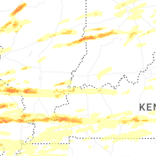


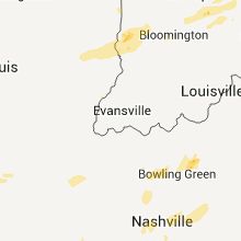
Connect with Interactive Hail Maps