

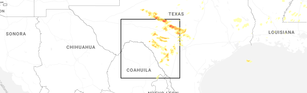
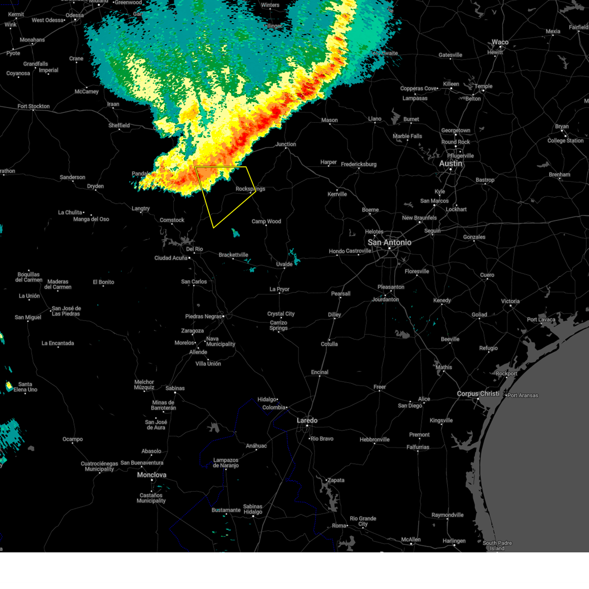
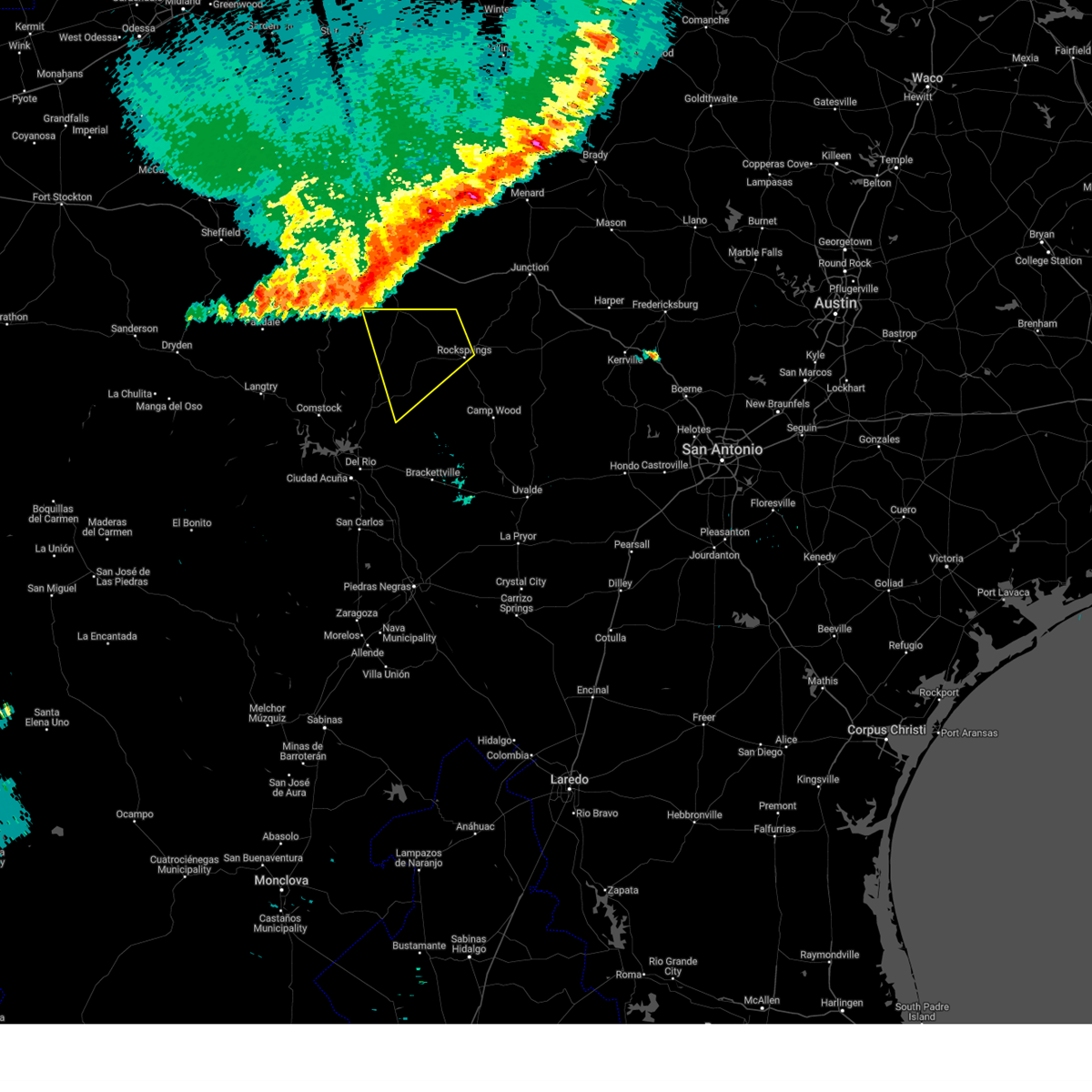
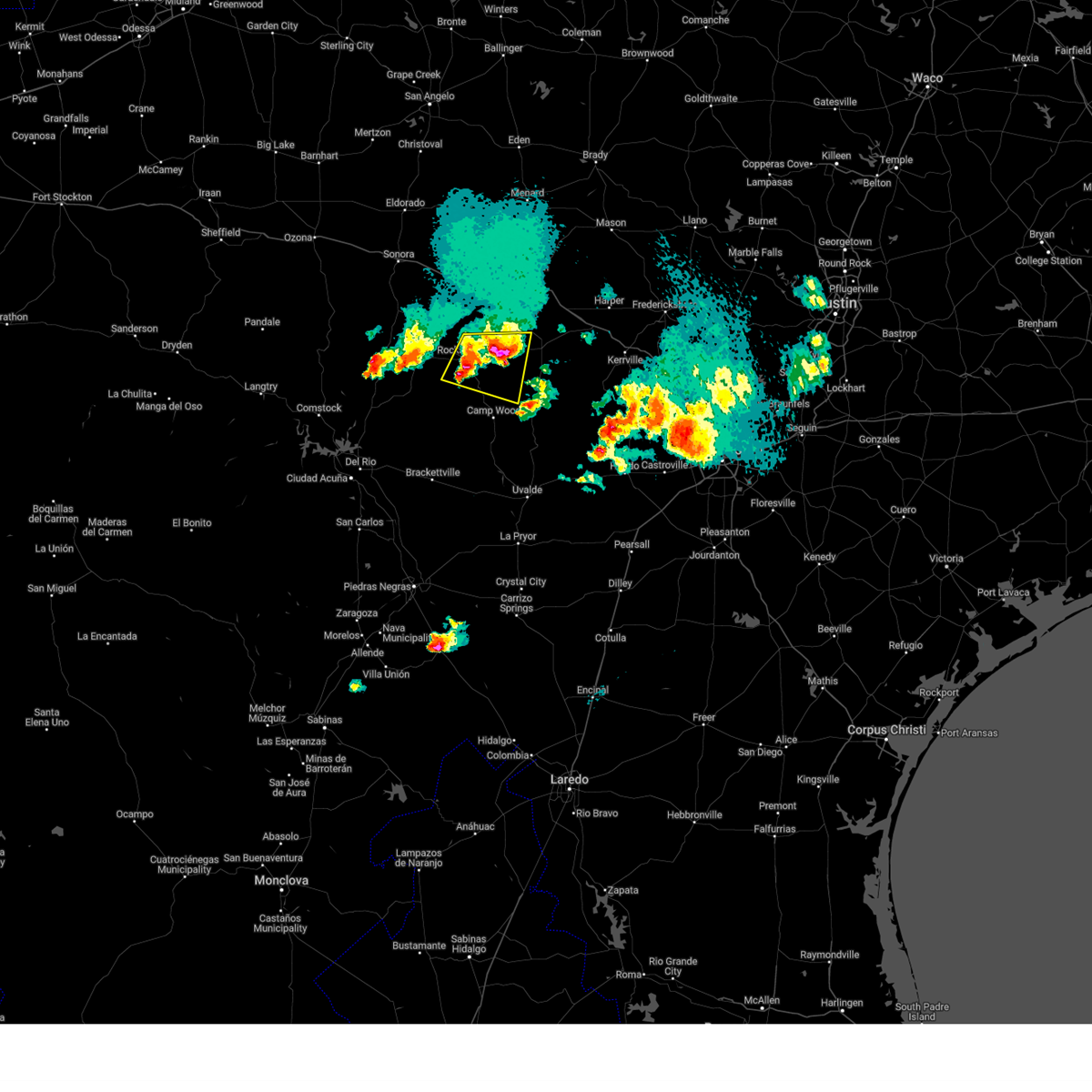
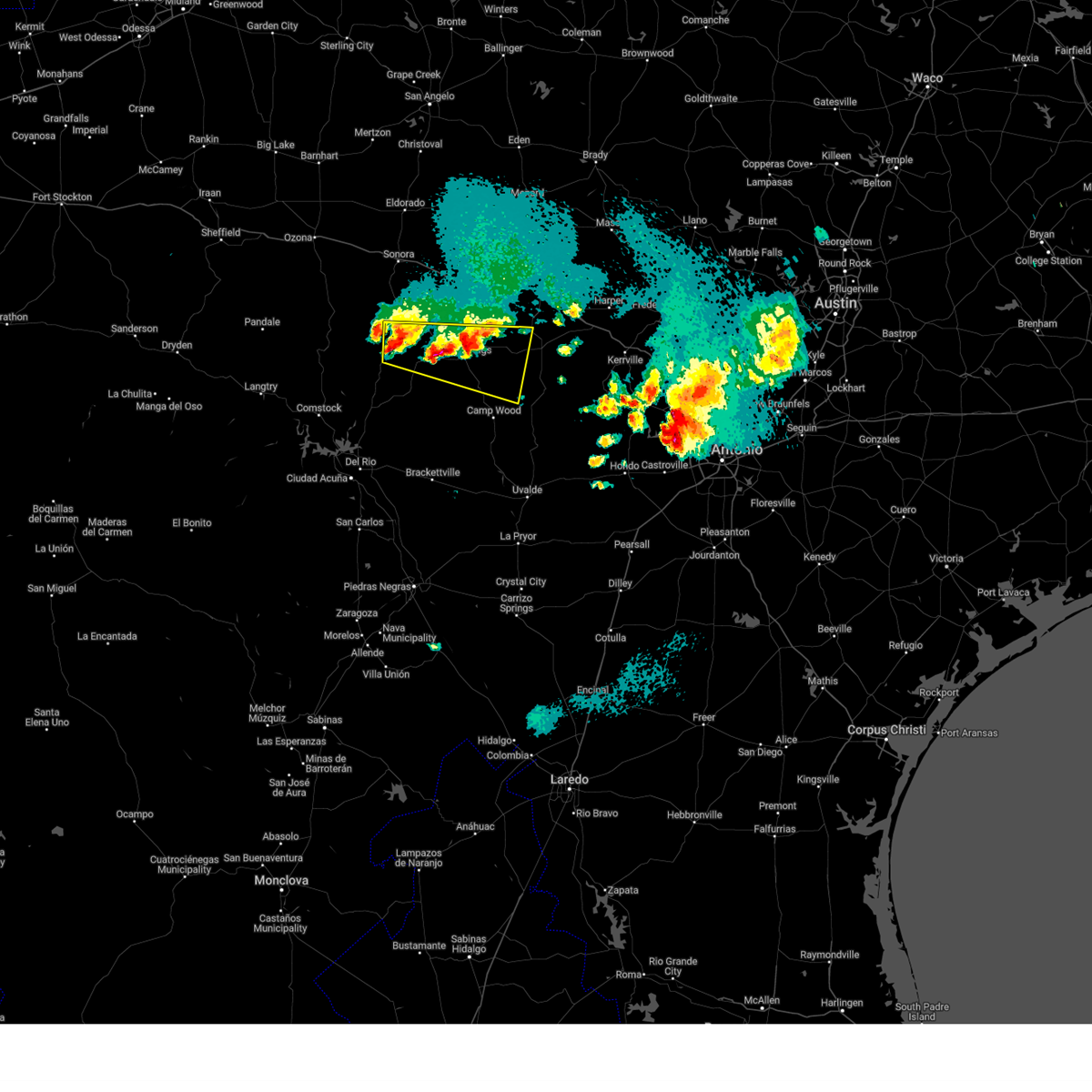
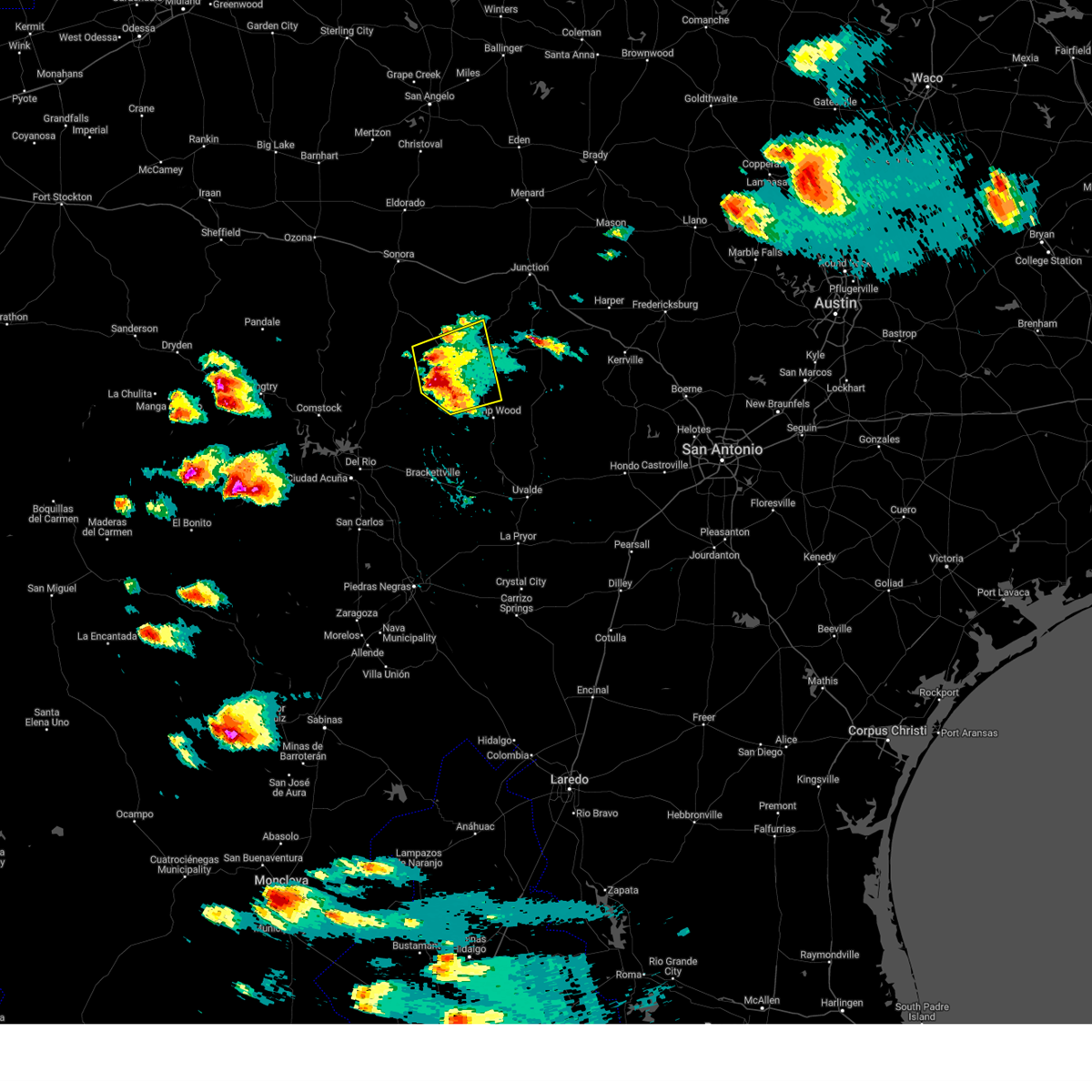
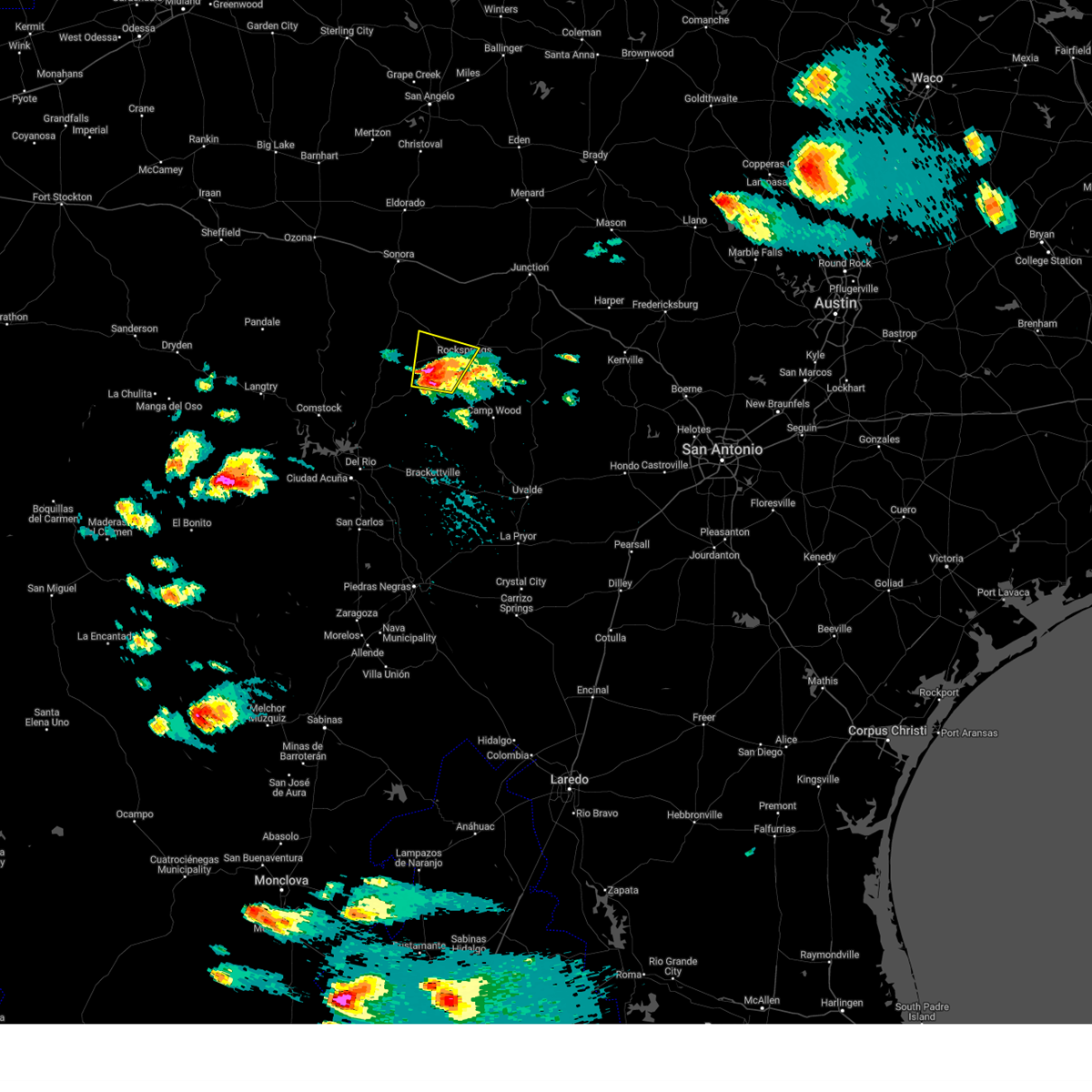
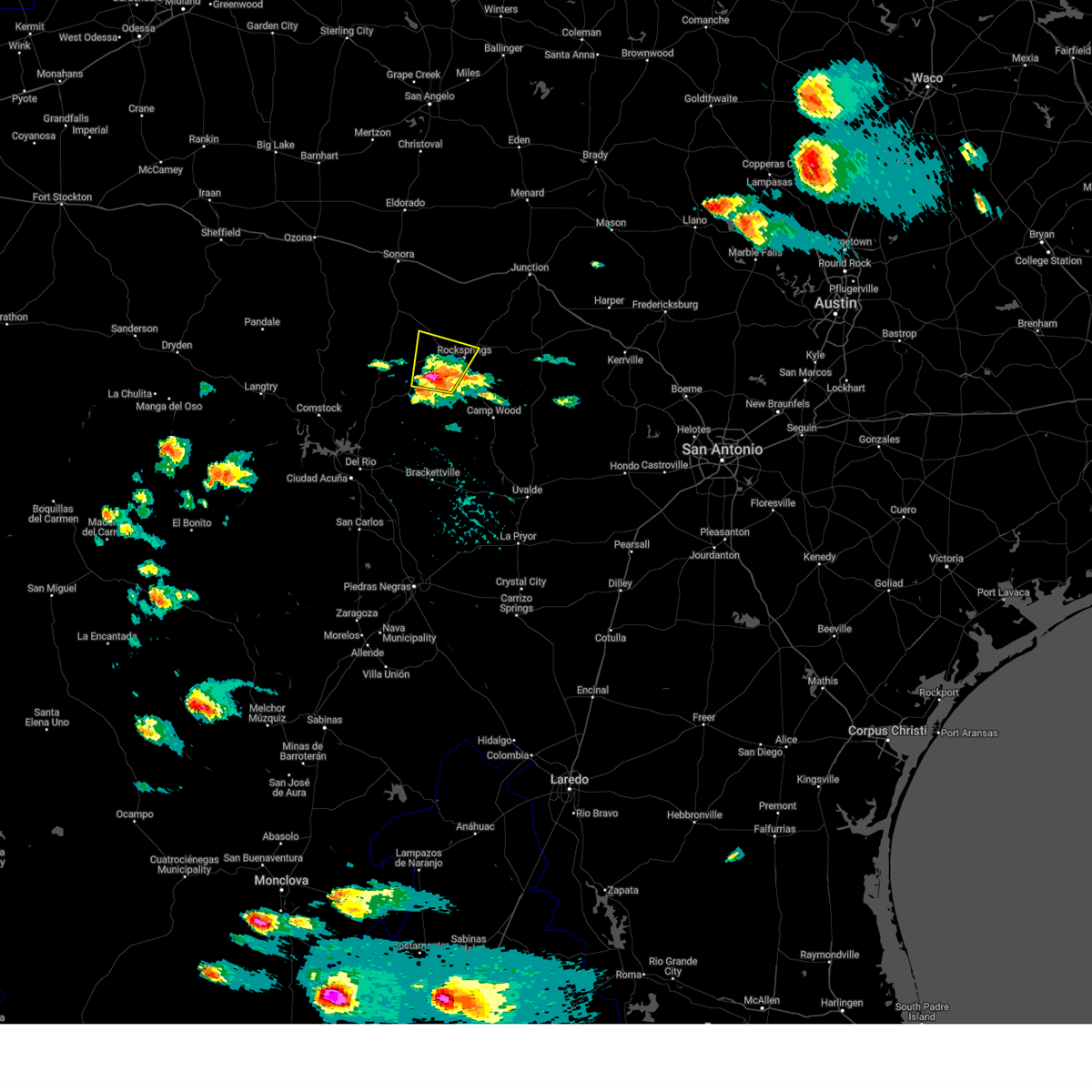
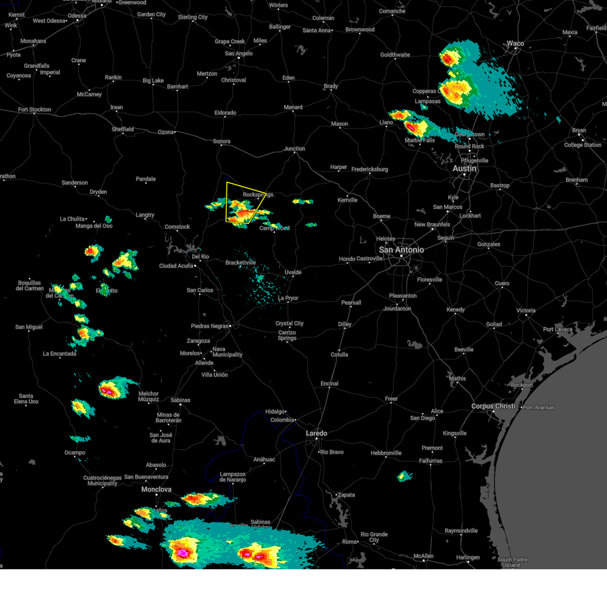
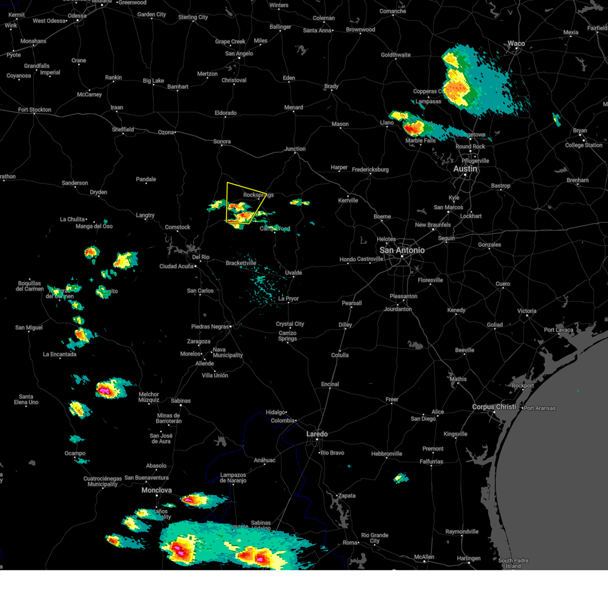
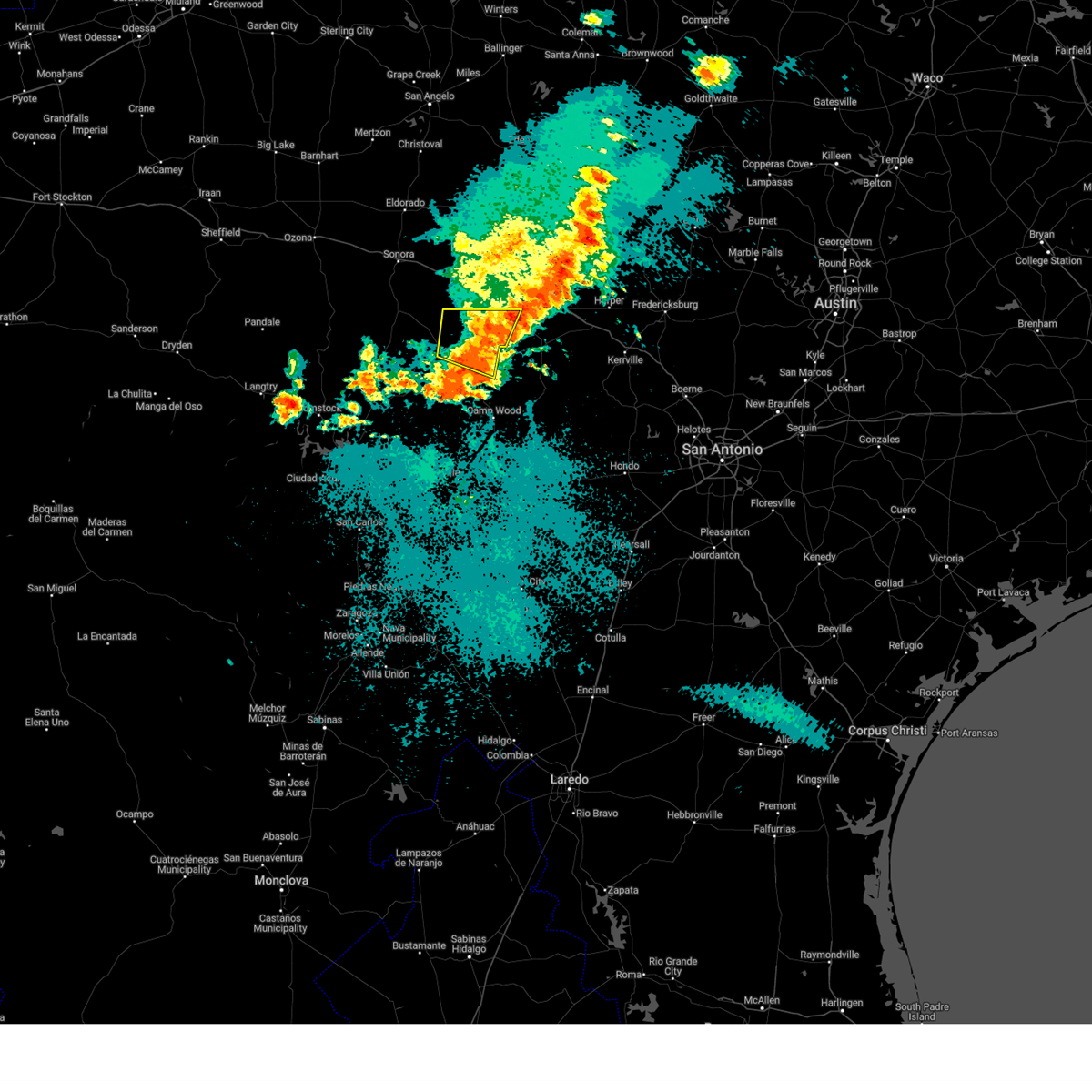
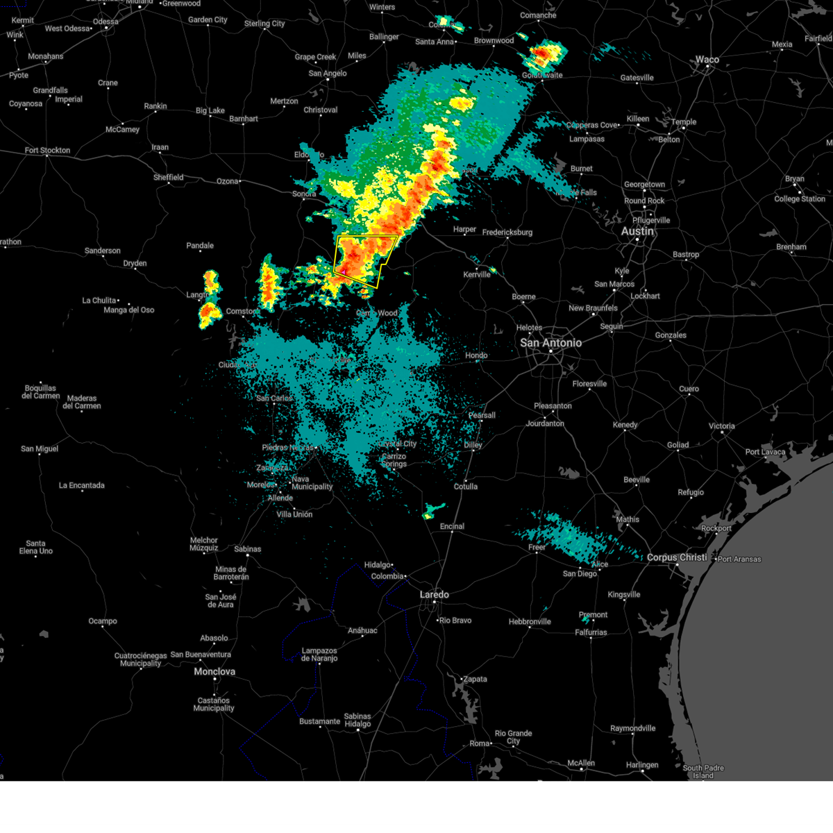
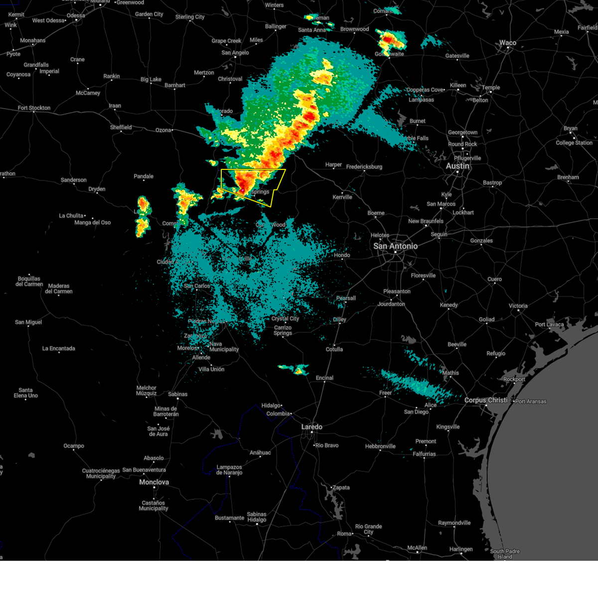
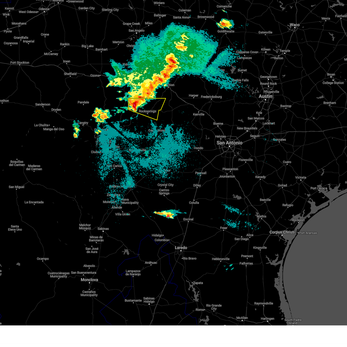
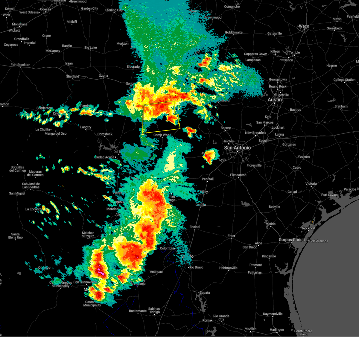
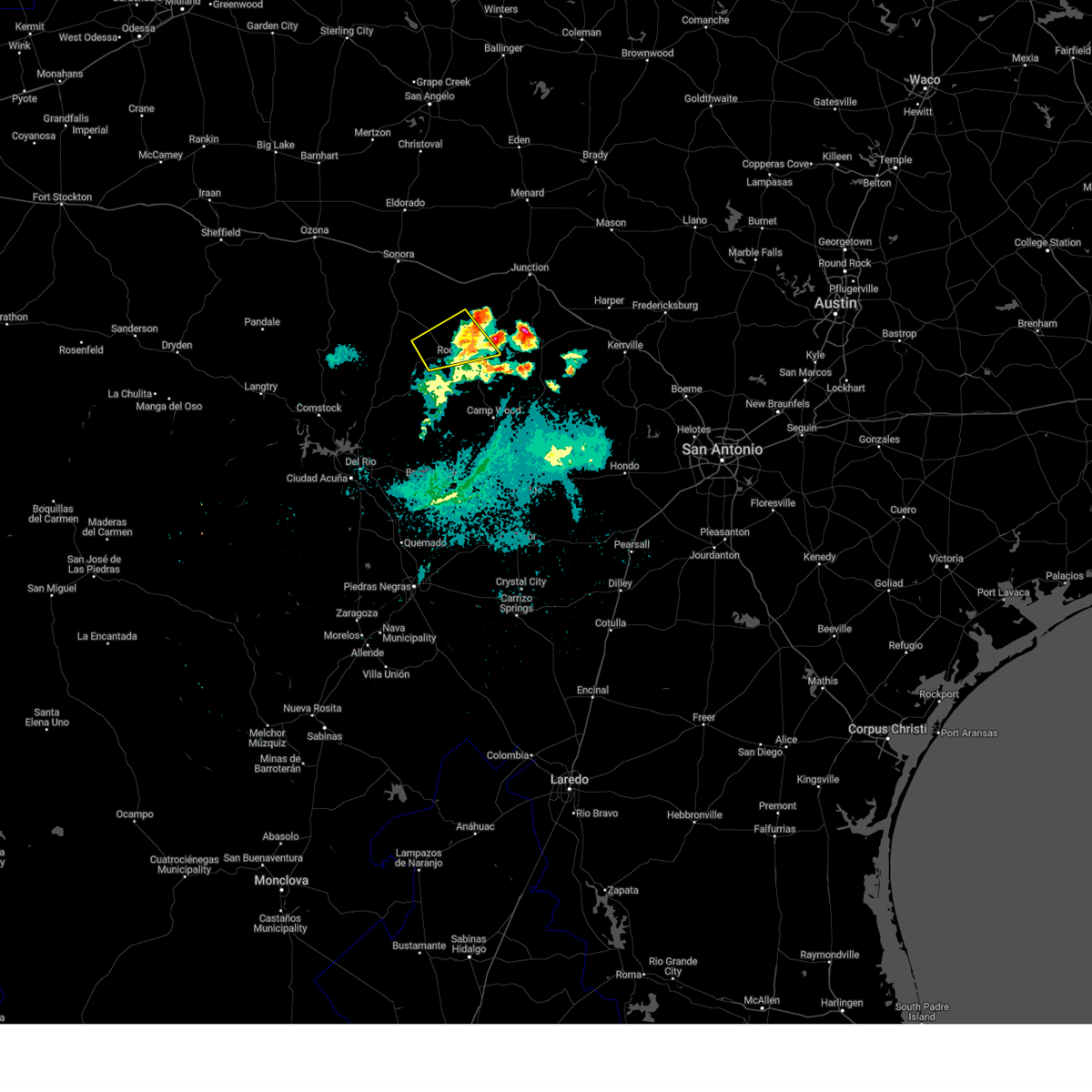
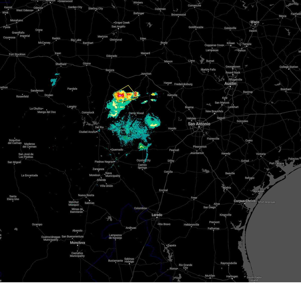
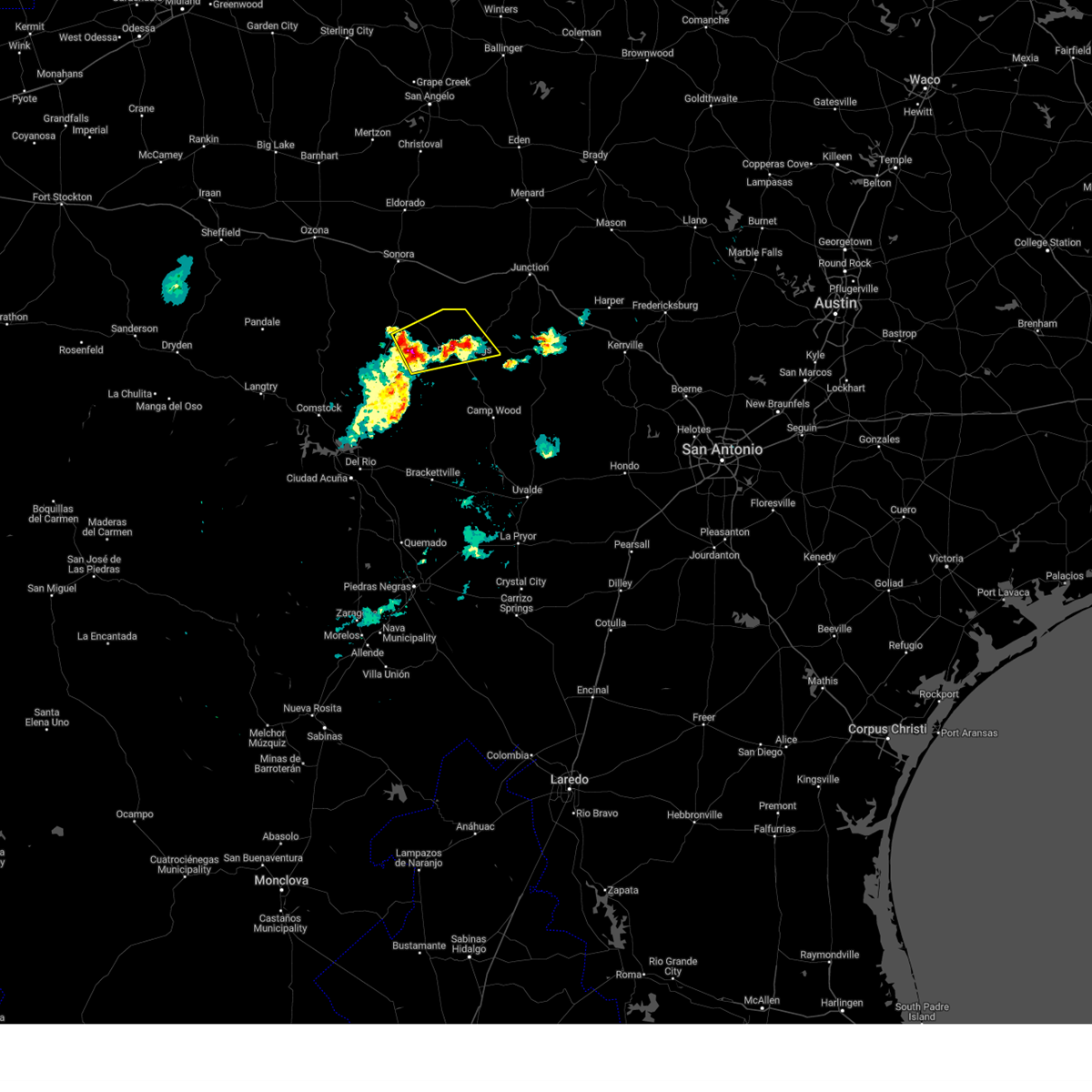
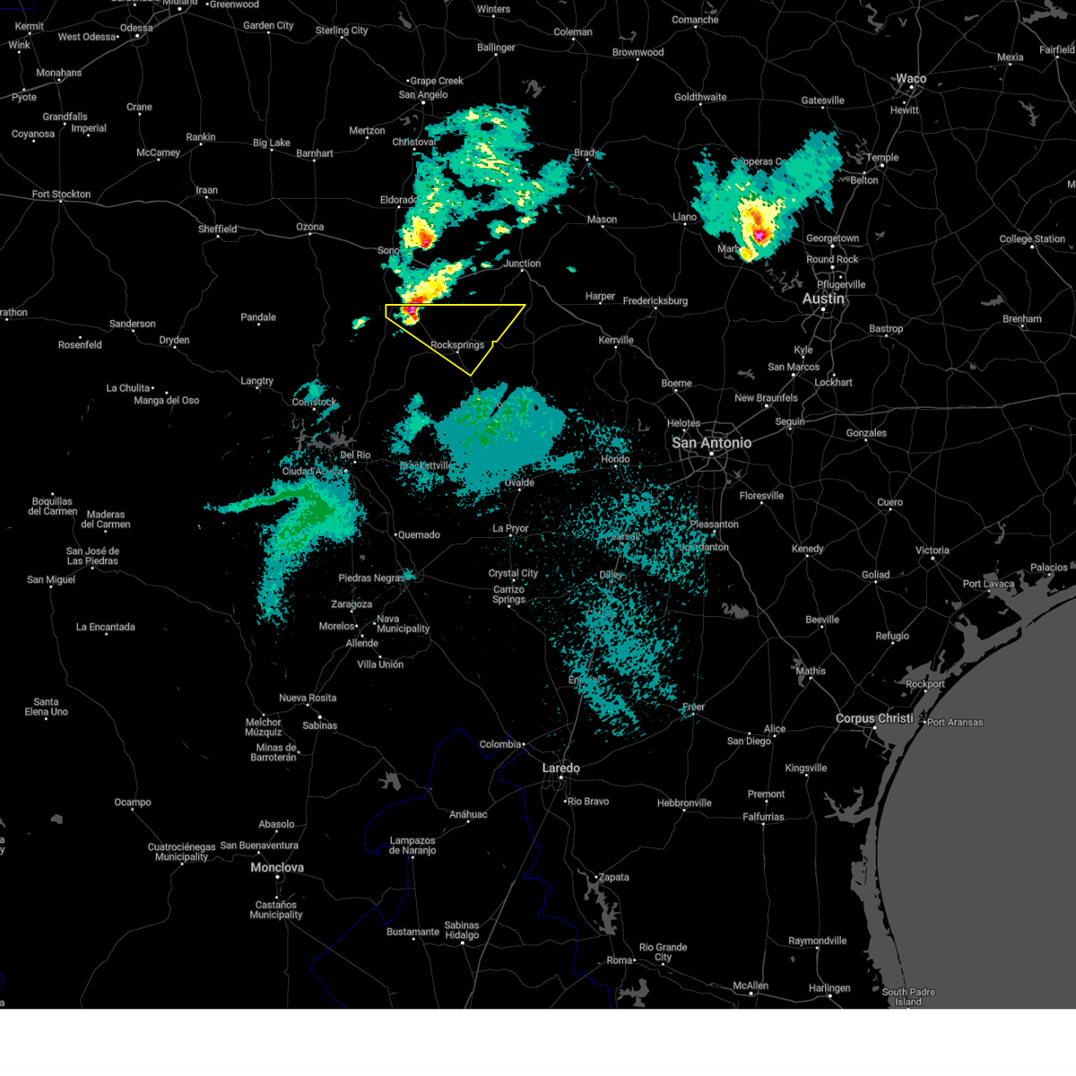
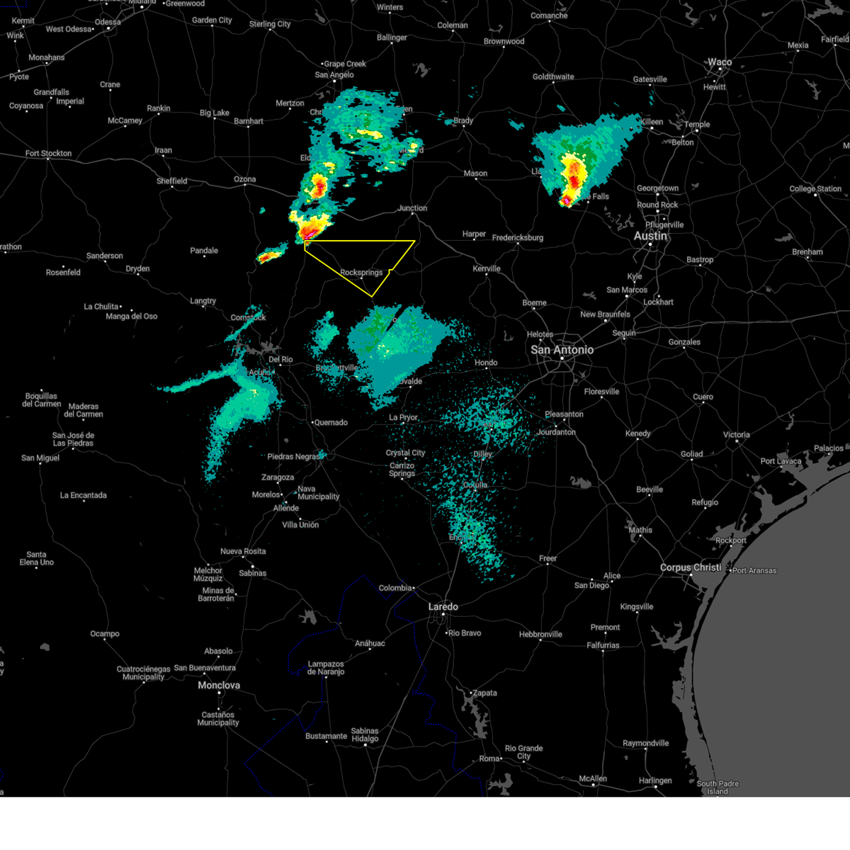
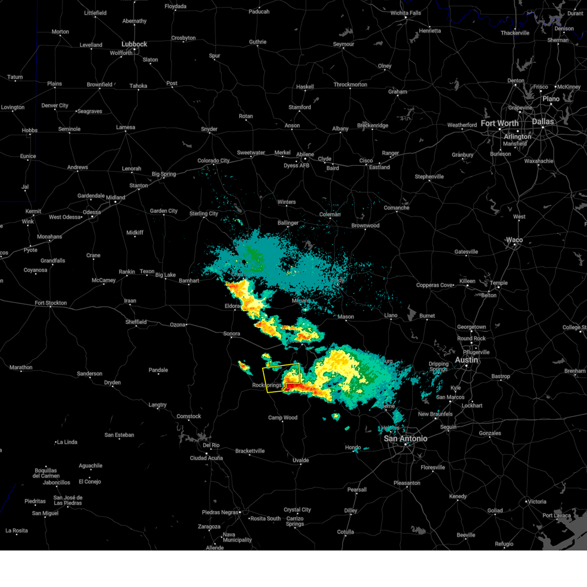
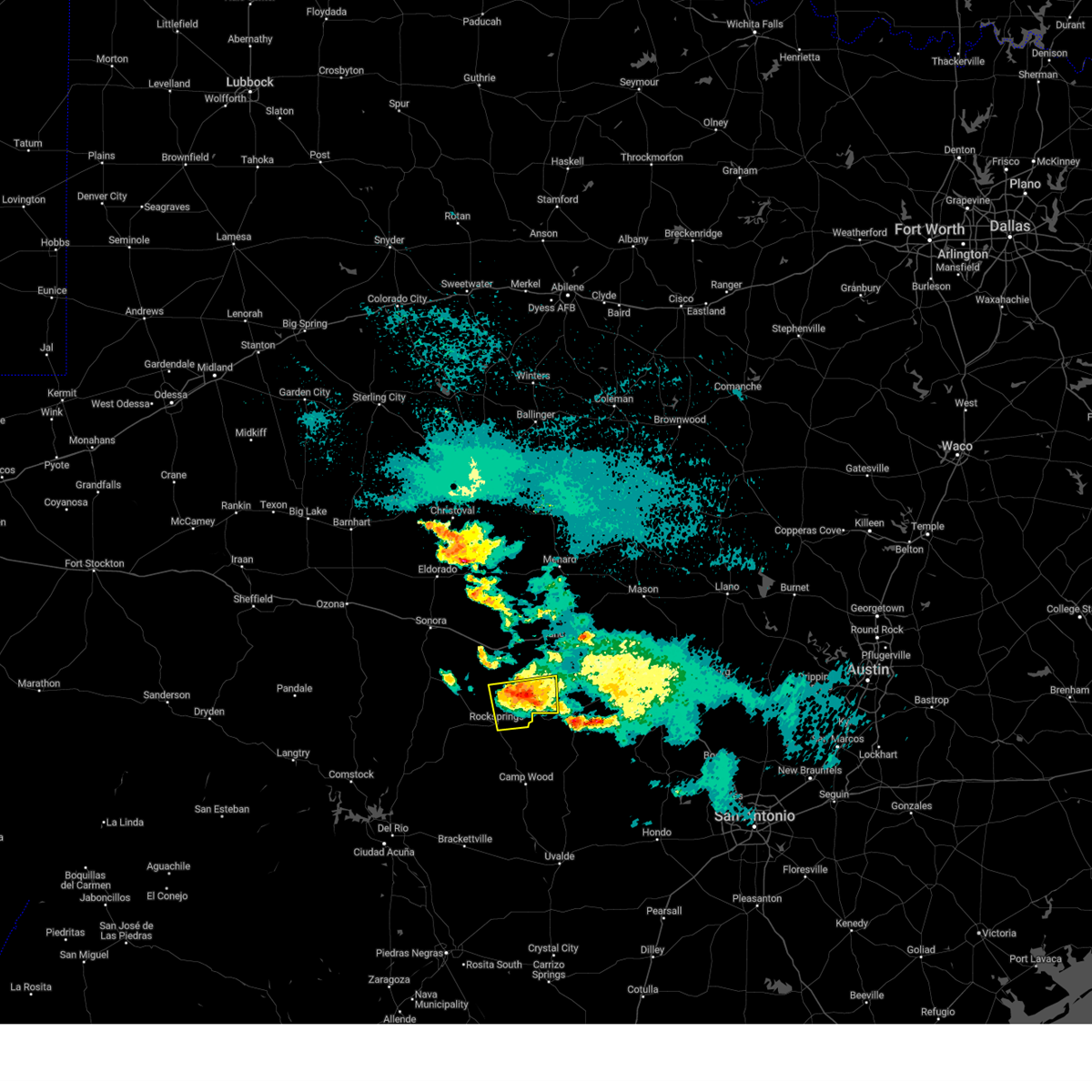
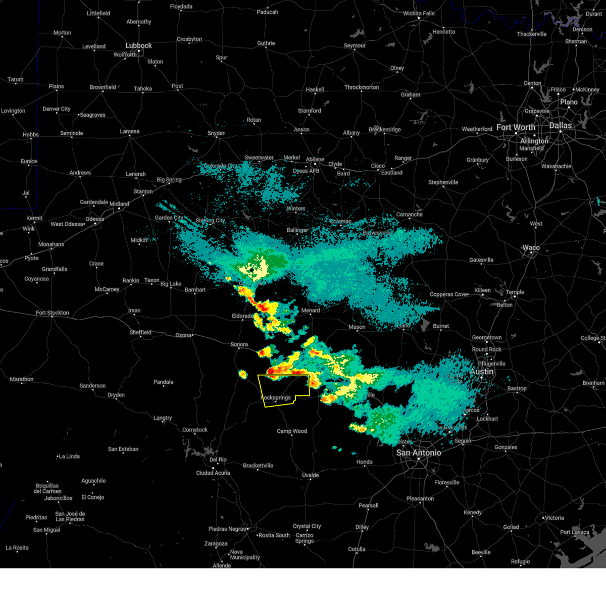
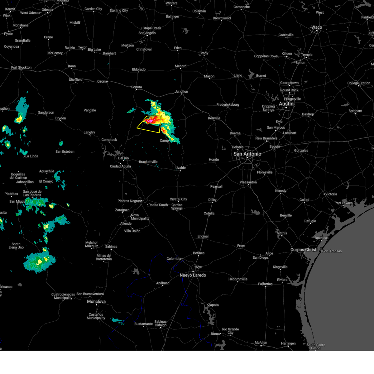
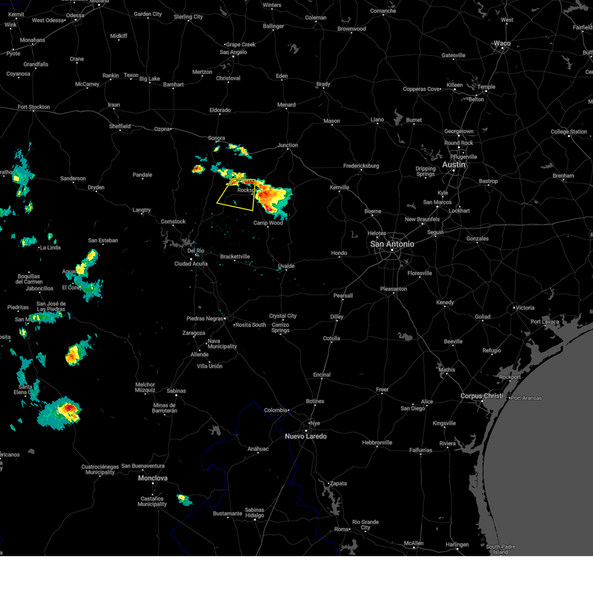
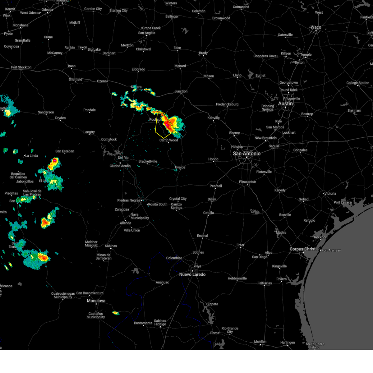
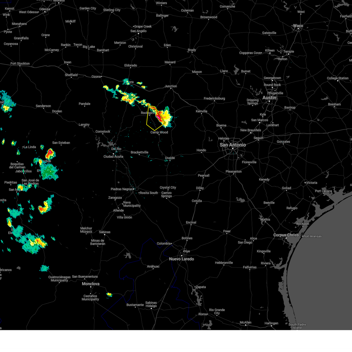
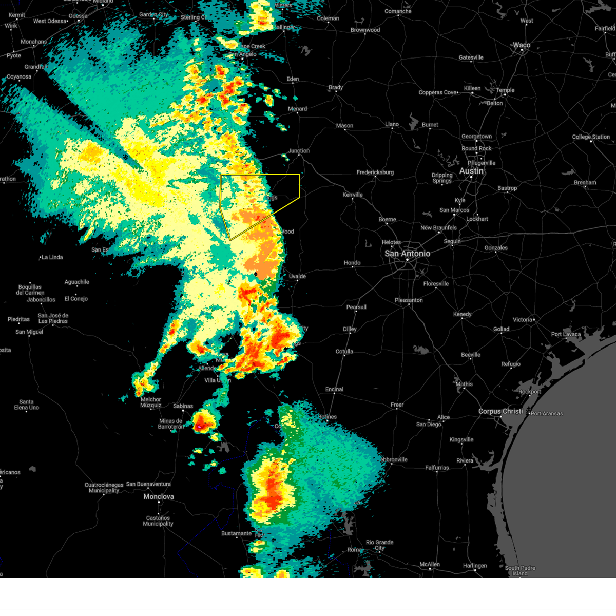
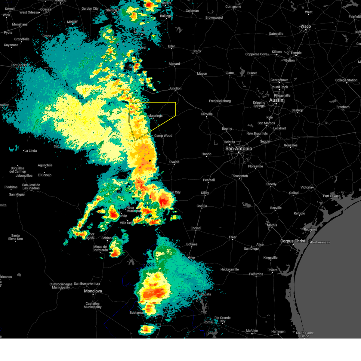
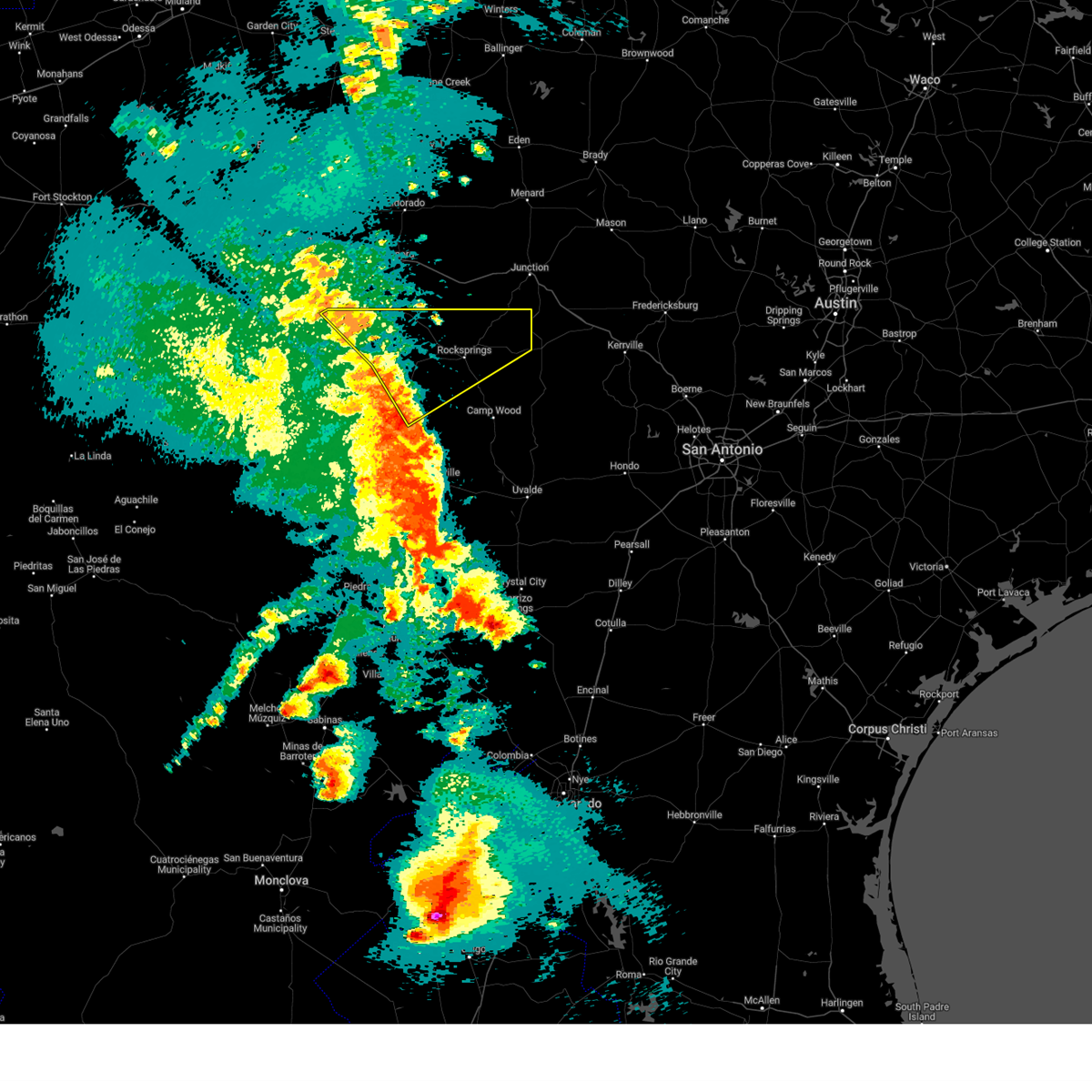
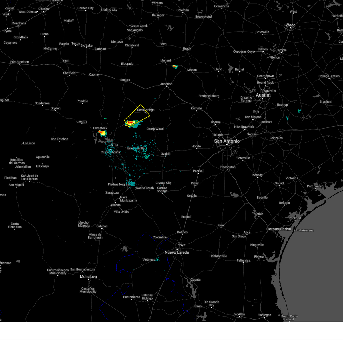
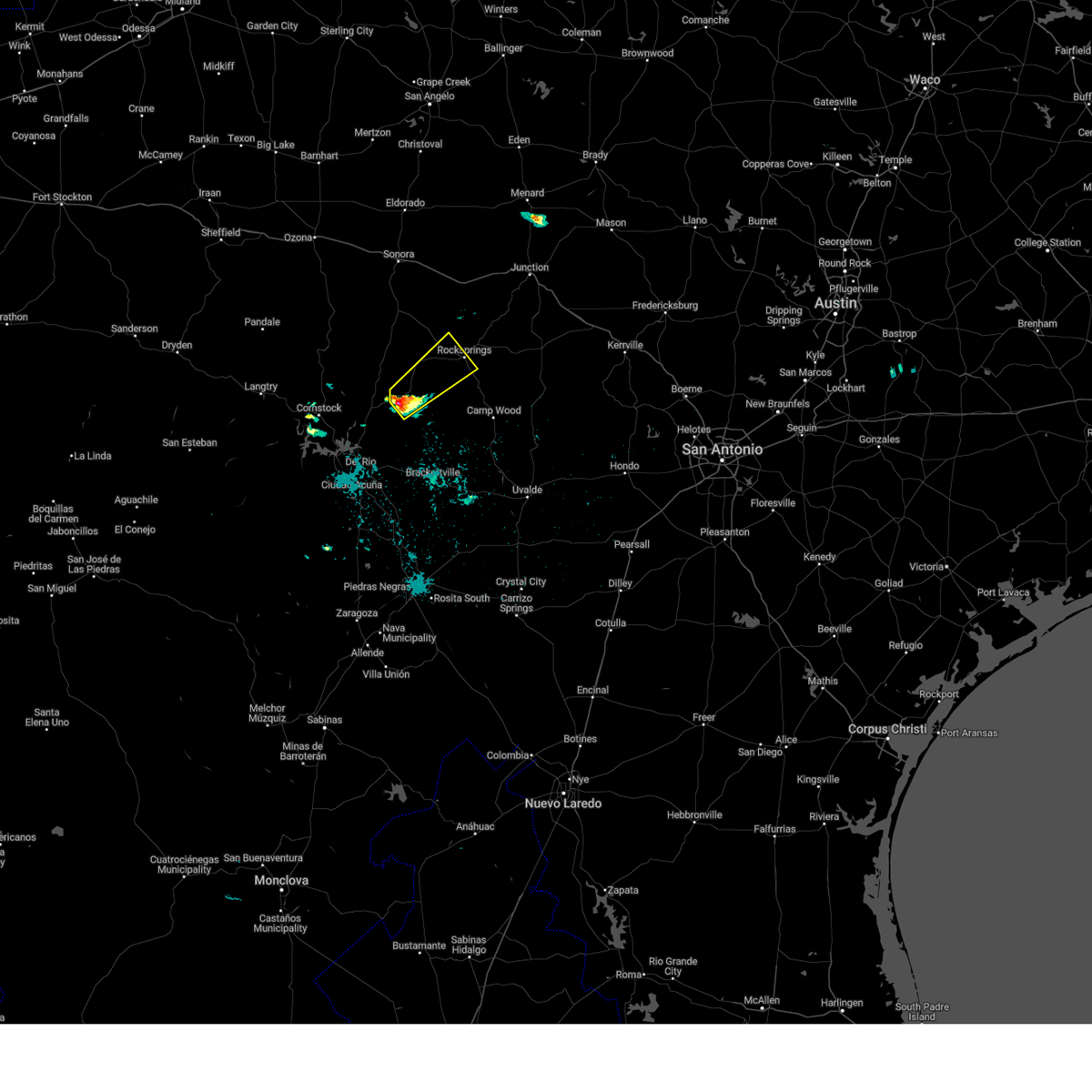
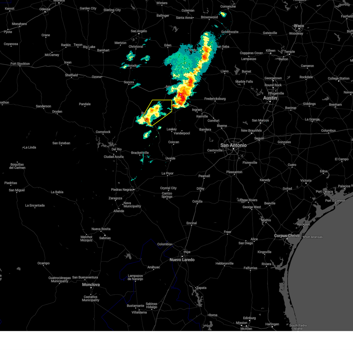
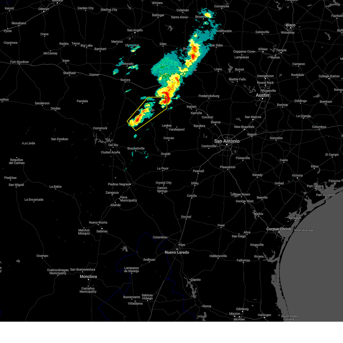
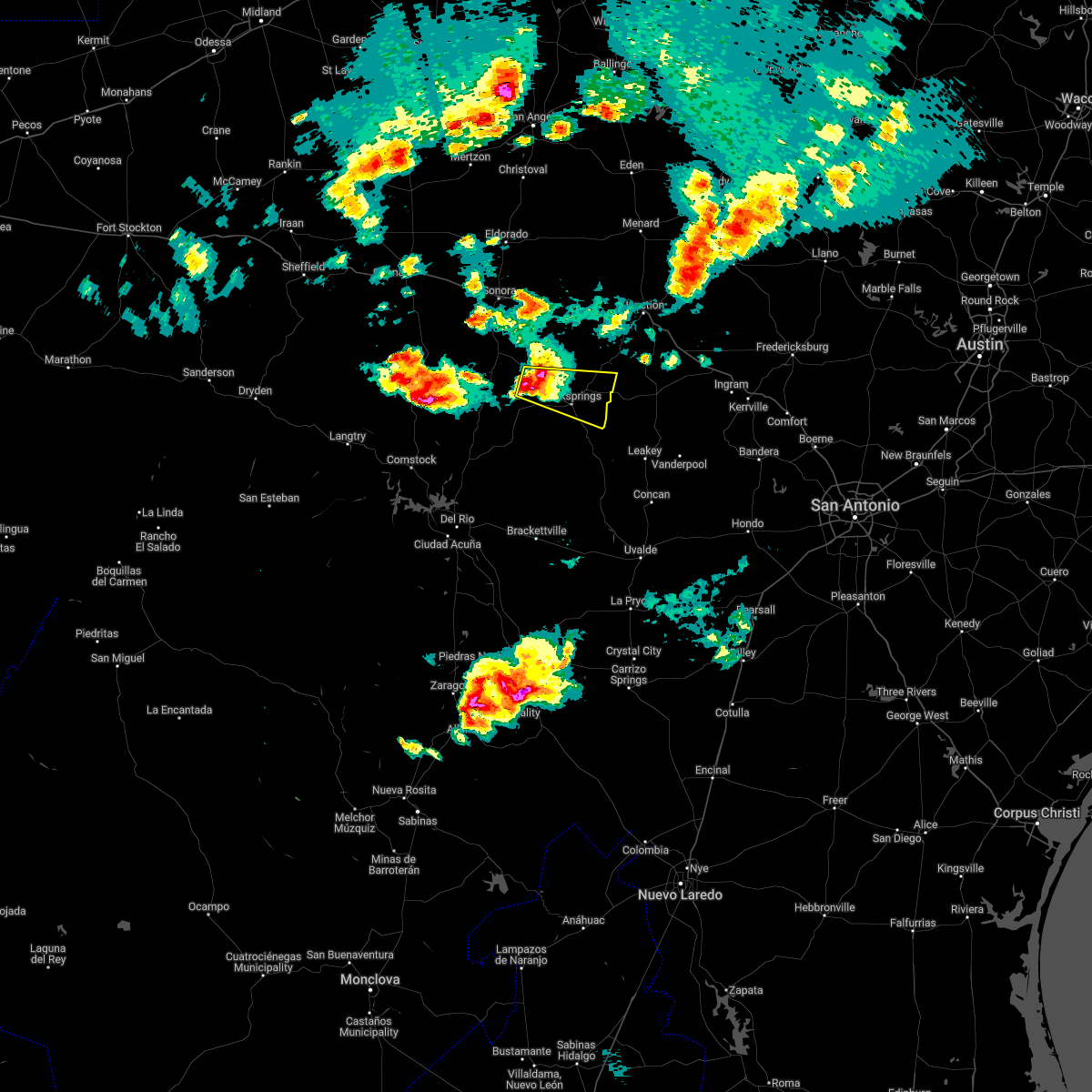
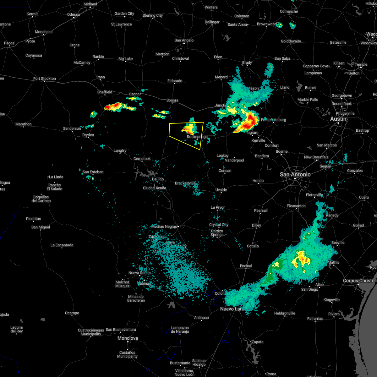
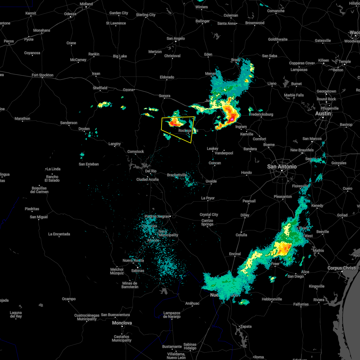
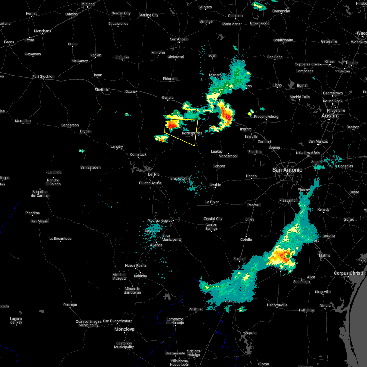
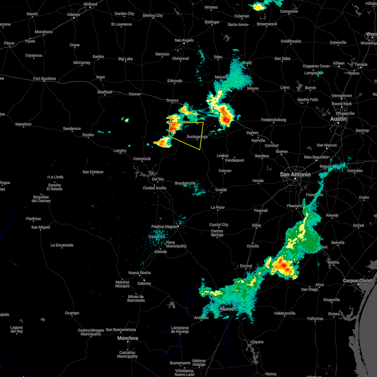
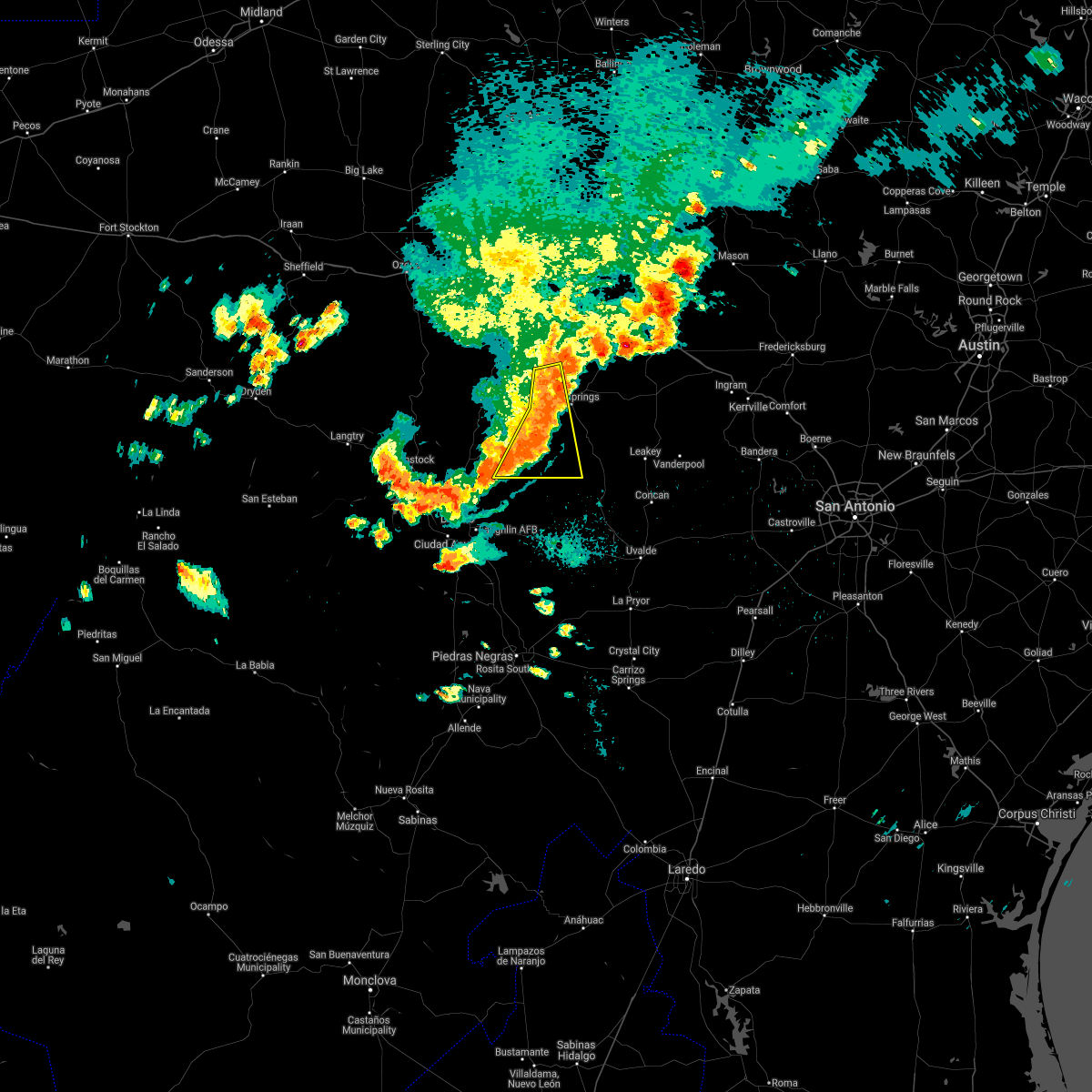
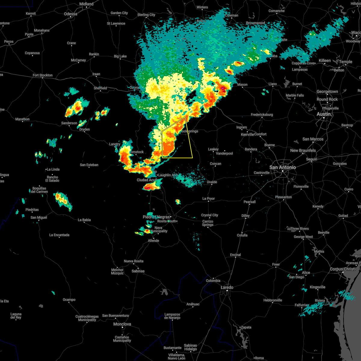
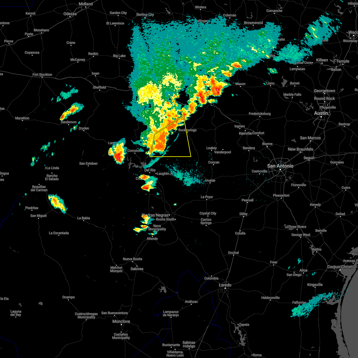
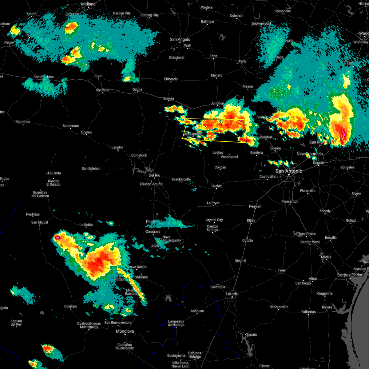
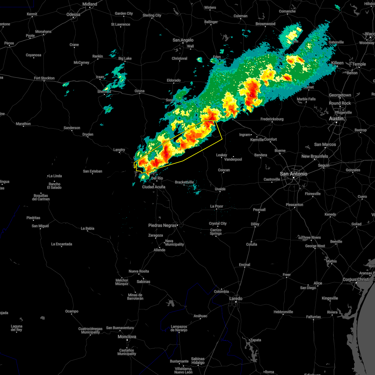
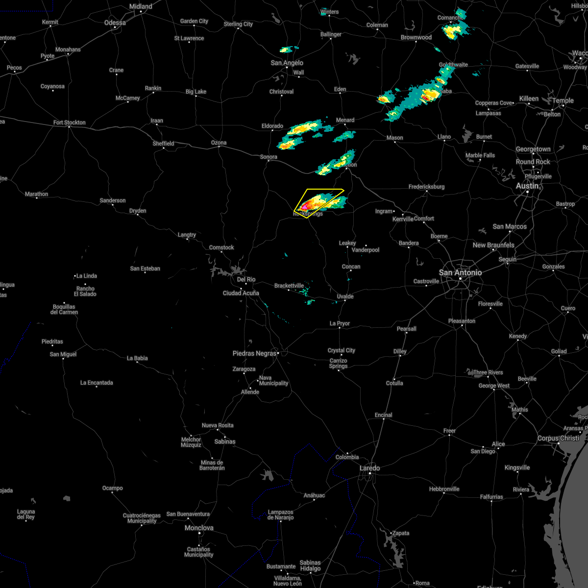
Hail Map for Rocksprings, TX
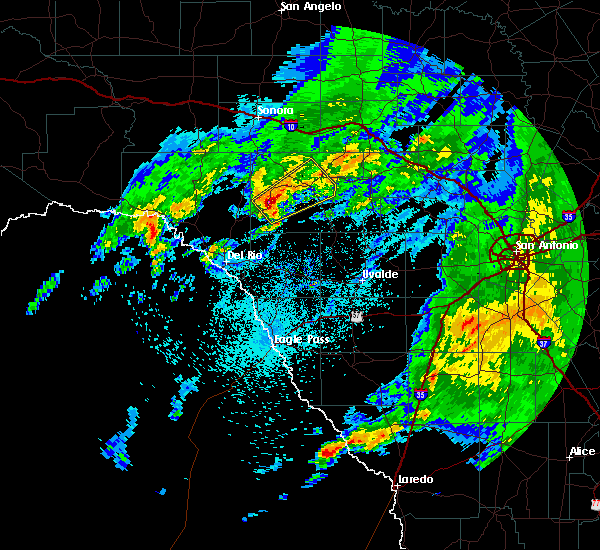
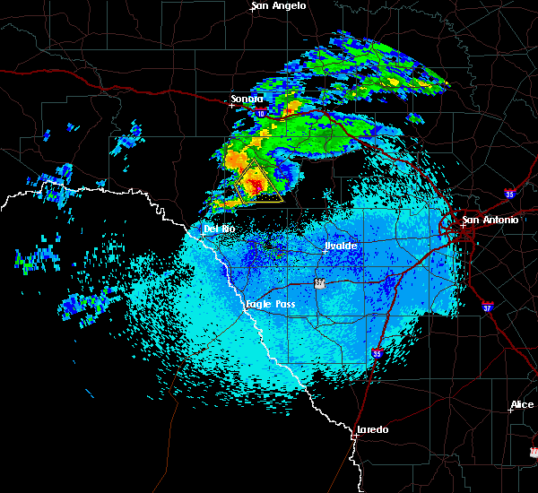
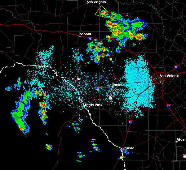
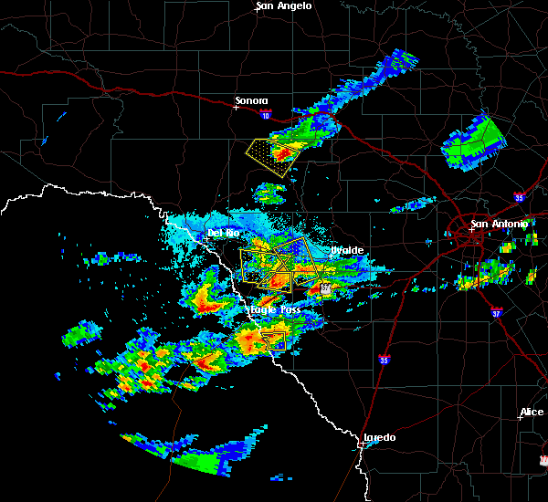
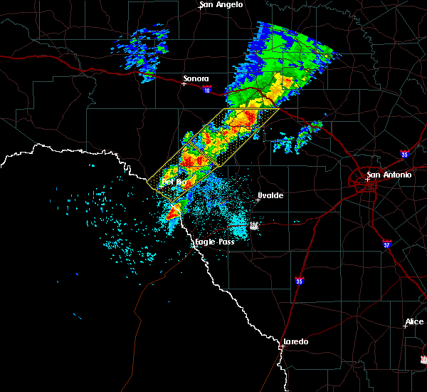
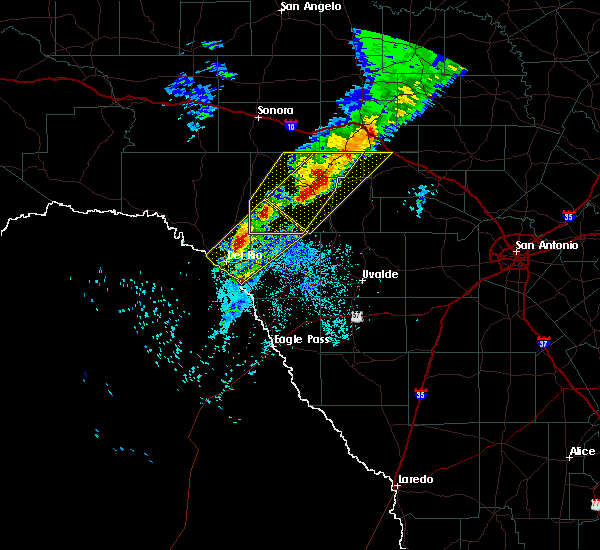
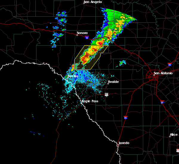
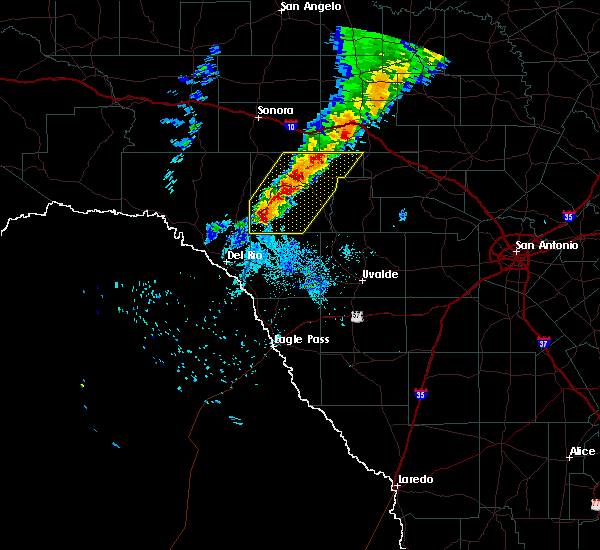
The Rocksprings, TX area has had 25 reports of on-the-ground hail by trained spotters, and has been under severe weather warnings 20 times during the past 12 months. Doppler radar has detected hail at or near Rocksprings, TX on 49 occasions, including 3 occasions during the past year.
| Name: | Rocksprings, TX |
| Where Located: | 61.1 miles NE of Del Rio, TX |
| Map: | Google Map for Rocksprings, TX |
| Population: | 1182 |
| Housing Units: | 558 |
| More Info: | Search Google for Rocksprings, TX |
5
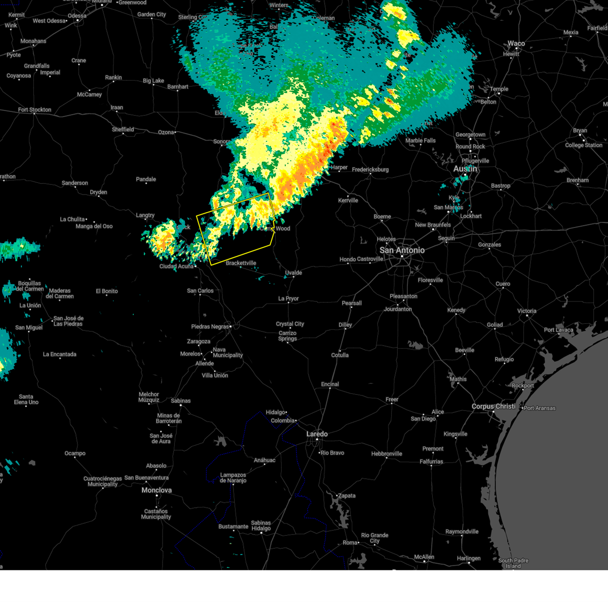
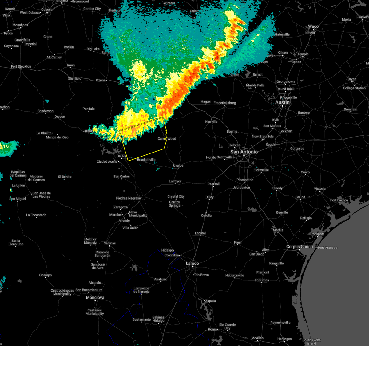
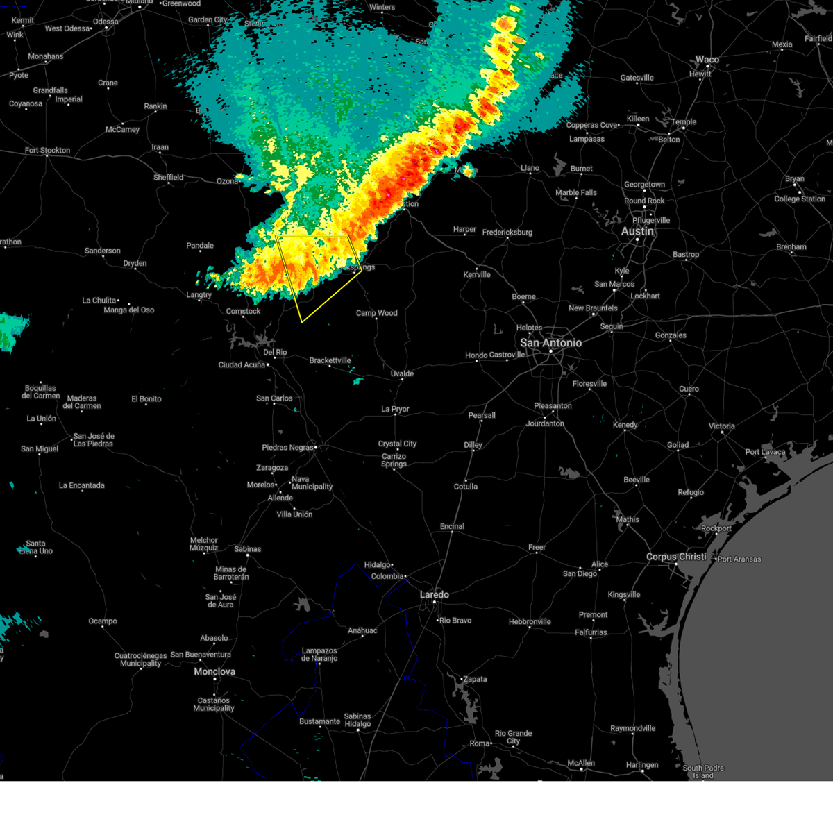
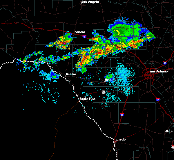
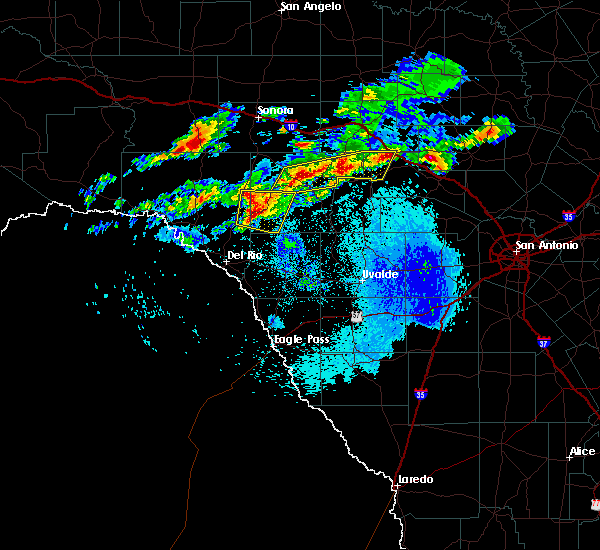
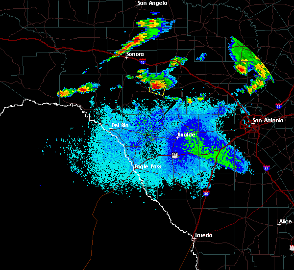
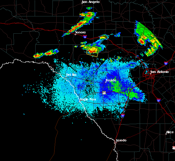
The Top Recent Hail Date for Rocksprings, TX is Monday, May 26, 2025 (2nd out of 49)
Hail and Wind Damage Spotted near Rocksprings, TX
| Date / Time | Report Details |
|---|---|
| 6/10/2025 10:15 PM CDT | Mesonet station tw101 camp eagl in real county TX, 15.2 miles W of Rocksprings, TX |
| 6/10/2025 7:55 AM CDT |
 The storms which prompted the warning have weakened below severe limits, and no longer pose an immediate threat to life or property. therefore, the warning will be allowed to expire. however gusty winds are still possible with these thunderstorms. The storms which prompted the warning have weakened below severe limits, and no longer pose an immediate threat to life or property. therefore, the warning will be allowed to expire. however gusty winds are still possible with these thunderstorms.
|
| 6/10/2025 7:27 AM CDT |
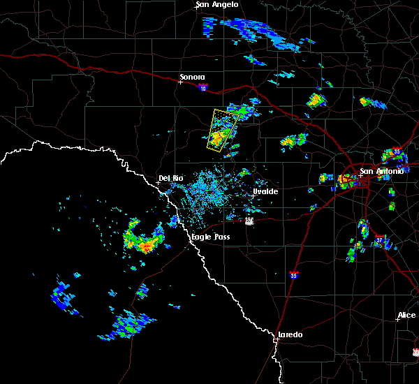
 At 727 am cdt, severe thunderstorms were located along a line extending from 15 miles south of rocksprings to 11 miles southwest of carta valley, moving southeast at 35 mph (radar indicated). Hazards include 60 mph wind gusts. Expect damage to roofs, siding, and trees. Locations impacted include, rocksprings, barksdale, carta valley, amanda, laughlin afb, devil's sinkhole state natural area, escondido estates, kickapoo cavern state park, and devils river state nat area big satan. At 727 am cdt, severe thunderstorms were located along a line extending from 15 miles south of rocksprings to 11 miles southwest of carta valley, moving southeast at 35 mph (radar indicated). Hazards include 60 mph wind gusts. Expect damage to roofs, siding, and trees. Locations impacted include, rocksprings, barksdale, carta valley, amanda, laughlin afb, devil's sinkhole state natural area, escondido estates, kickapoo cavern state park, and devils river state nat area big satan.
|
| 6/10/2025 7:06 AM CDT |
 The storms which prompted the warning have moved out of the area. therefore, the warning will be allowed to expire. remember, a severe thunderstorm warning still remains in effect for portions of edwards and val verde counties until 800 am. The storms which prompted the warning have moved out of the area. therefore, the warning will be allowed to expire. remember, a severe thunderstorm warning still remains in effect for portions of edwards and val verde counties until 800 am.
|
| 6/10/2025 7:04 AM CDT |
 Svrewx the national weather service in austin san antonio has issued a * severe thunderstorm warning for, northern kinney county in south central texas, northwestern uvalde county in south central texas, southwestern edwards county in south central texas, east central val verde county in south central texas, * until 800 am cdt. * at 704 am cdt, severe thunderstorms were located along a line extending from 10 miles west of rocksprings to 7 miles southwest of loma alta, moving south at 35 mph (radar indicated). Hazards include 60 mph wind gusts. expect damage to roofs, siding, and trees Svrewx the national weather service in austin san antonio has issued a * severe thunderstorm warning for, northern kinney county in south central texas, northwestern uvalde county in south central texas, southwestern edwards county in south central texas, east central val verde county in south central texas, * until 800 am cdt. * at 704 am cdt, severe thunderstorms were located along a line extending from 10 miles west of rocksprings to 7 miles southwest of loma alta, moving south at 35 mph (radar indicated). Hazards include 60 mph wind gusts. expect damage to roofs, siding, and trees
|
| 6/10/2025 6:41 AM CDT |
 At 640 am cdt, severe thunderstorms were located along a line extending from 20 miles southwest of roosevelt to 11 miles north of loma alta, moving south at 45 mph (radar indicated). Hazards include 60 mph wind gusts. Expect damage to roofs, siding, and trees. Locations impacted include, rocksprings, carta valley, vinegarone, and us-277 near the sutton- edwards county line. At 640 am cdt, severe thunderstorms were located along a line extending from 20 miles southwest of roosevelt to 11 miles north of loma alta, moving south at 45 mph (radar indicated). Hazards include 60 mph wind gusts. Expect damage to roofs, siding, and trees. Locations impacted include, rocksprings, carta valley, vinegarone, and us-277 near the sutton- edwards county line.
|
| 6/10/2025 6:15 AM CDT |
 Svrewx the national weather service in austin san antonio has issued a * severe thunderstorm warning for, western edwards county in south central texas, northeastern val verde county in south central texas, * until 715 am cdt. * at 614 am cdt, severe thunderstorms were located along a line extending from 10 miles east of sonora to 21 miles northeast of juno, moving south at 45 mph (radar indicated). Hazards include 60 mph wind gusts. expect damage to roofs, siding, and trees Svrewx the national weather service in austin san antonio has issued a * severe thunderstorm warning for, western edwards county in south central texas, northeastern val verde county in south central texas, * until 715 am cdt. * at 614 am cdt, severe thunderstorms were located along a line extending from 10 miles east of sonora to 21 miles northeast of juno, moving south at 45 mph (radar indicated). Hazards include 60 mph wind gusts. expect damage to roofs, siding, and trees
|
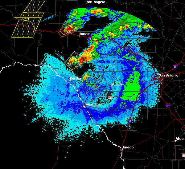
| 5/26/2025 9:10 PM CDT |
 the severe thunderstorm warning has been cancelled and is no longer in effect the severe thunderstorm warning has been cancelled and is no longer in effect
|
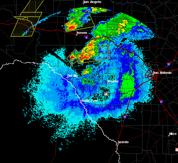
| 5/26/2025 9:10 PM CDT |
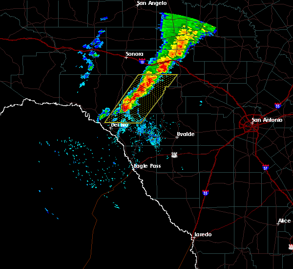
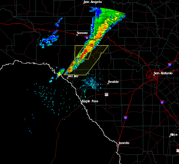
 At 909 pm cdt, a severe thunderstorm was located 14 miles north of vance, or 16 miles east of rocksprings, moving east at 35 mph (radar indicated). Hazards include 60 mph wind gusts and quarter size hail. Hail damage to vehicles is expected. expect wind damage to roofs, siding, and trees. Locations impacted include, rocksprings, vance, and devil's sinkhole state natural area. At 909 pm cdt, a severe thunderstorm was located 14 miles north of vance, or 16 miles east of rocksprings, moving east at 35 mph (radar indicated). Hazards include 60 mph wind gusts and quarter size hail. Hail damage to vehicles is expected. expect wind damage to roofs, siding, and trees. Locations impacted include, rocksprings, vance, and devil's sinkhole state natural area.
|
| 5/26/2025 9:05 PM CDT | Mesonet station tw101 camp eagl in real county TX, 15.2 miles W of Rocksprings, TX |
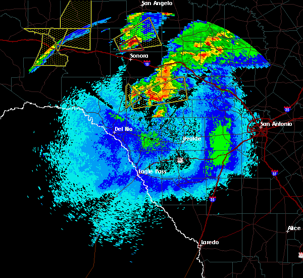
| 5/26/2025 8:40 PM CDT |
 Svrewx the national weather service in austin san antonio has issued a * severe thunderstorm warning for, central edwards county in south central texas, eastern val verde county in south central texas, northwestern real county in south central texas, * until 945 pm cdt. * at 840 pm cdt, a severe thunderstorm was located 9 miles west of rocksprings, moving east at 30 mph (radar indicated). Hazards include 60 mph wind gusts and quarter size hail. Hail damage to vehicles is expected. Expect wind damage to roofs, siding, and trees. Svrewx the national weather service in austin san antonio has issued a * severe thunderstorm warning for, central edwards county in south central texas, eastern val verde county in south central texas, northwestern real county in south central texas, * until 945 pm cdt. * at 840 pm cdt, a severe thunderstorm was located 9 miles west of rocksprings, moving east at 30 mph (radar indicated). Hazards include 60 mph wind gusts and quarter size hail. Hail damage to vehicles is expected. Expect wind damage to roofs, siding, and trees.
|
| 5/2/2025 6:26 PM CDT | Svrewx the national weather service in austin san antonio has issued a * severe thunderstorm warning for, north central kinney county in south central texas, southwestern edwards county in south central texas, northern val verde county in south central texas, * until 730 pm cdt. * at 626 pm cdt, severe thunderstorms were located along a line extending from 9 miles northeast of shumla to 11 miles southeast of carta valley, moving northeast at 35 mph (radar indicated). Hazards include 60 mph wind gusts and half dollar size hail. Hail damage to vehicles is expected. Expect wind damage to roofs, siding, and trees. |
| 5/1/2025 4:42 PM CDT |
 Svrewx the national weather service in austin san antonio has issued a * severe thunderstorm warning for, central edwards county in south central texas, west central real county in south central texas, * until 545 pm cdt. * at 441 pm cdt, a severe thunderstorm was located 14 miles southwest of rocksprings, moving east at 15 mph (radar indicated). Hazards include golf ball size hail and 60 mph wind gusts. People and animals outdoors will be injured. expect hail damage to roofs, siding, windows, and vehicles. Expect wind damage to roofs, siding, and trees. Svrewx the national weather service in austin san antonio has issued a * severe thunderstorm warning for, central edwards county in south central texas, west central real county in south central texas, * until 545 pm cdt. * at 441 pm cdt, a severe thunderstorm was located 14 miles southwest of rocksprings, moving east at 15 mph (radar indicated). Hazards include golf ball size hail and 60 mph wind gusts. People and animals outdoors will be injured. expect hail damage to roofs, siding, windows, and vehicles. Expect wind damage to roofs, siding, and trees.
|
| 5/1/2025 4:11 PM CDT |
 At 410 pm cdt, a severe thunderstorm was located 10 miles west of rocksprings, moving north at 15 mph (radar indicated). Hazards include golf ball size hail and 60 mph wind gusts. People and animals outdoors will be injured. expect hail damage to roofs, siding, windows, and vehicles. expect wind damage to roofs, siding, and trees. Locations impacted include, rocksprings and devil's sinkhole state natural area. At 410 pm cdt, a severe thunderstorm was located 10 miles west of rocksprings, moving north at 15 mph (radar indicated). Hazards include golf ball size hail and 60 mph wind gusts. People and animals outdoors will be injured. expect hail damage to roofs, siding, windows, and vehicles. expect wind damage to roofs, siding, and trees. Locations impacted include, rocksprings and devil's sinkhole state natural area.
|
| 5/1/2025 3:53 PM CDT |
 At 352 pm cdt, a severe thunderstorm was located 13 miles southwest of rocksprings, moving north at 15 mph. this is a destructive storm for rocksprings (radar indicated). Hazards include baseball size hail and 60 mph wind gusts. People and animals outdoors will be severely injured. expect shattered windows, extensive damage to roofs, siding, and vehicles. Locations impacted include, rocksprings and devil's sinkhole state natural area. At 352 pm cdt, a severe thunderstorm was located 13 miles southwest of rocksprings, moving north at 15 mph. this is a destructive storm for rocksprings (radar indicated). Hazards include baseball size hail and 60 mph wind gusts. People and animals outdoors will be severely injured. expect shattered windows, extensive damage to roofs, siding, and vehicles. Locations impacted include, rocksprings and devil's sinkhole state natural area.
|
| 5/1/2025 3:45 PM CDT |
 At 345 pm cdt, a severe thunderstorm was located 15 miles southwest of rocksprings, moving north at 15 mph (radar indicated). Hazards include golf ball size hail and 60 mph wind gusts. People and animals outdoors will be injured. expect hail damage to roofs, siding, windows, and vehicles. expect wind damage to roofs, siding, and trees. Locations impacted include, rocksprings and devil's sinkhole state natural area. At 345 pm cdt, a severe thunderstorm was located 15 miles southwest of rocksprings, moving north at 15 mph (radar indicated). Hazards include golf ball size hail and 60 mph wind gusts. People and animals outdoors will be injured. expect hail damage to roofs, siding, windows, and vehicles. expect wind damage to roofs, siding, and trees. Locations impacted include, rocksprings and devil's sinkhole state natural area.
|
| 5/1/2025 3:42 PM CDT |
 Svrewx the national weather service in austin san antonio has issued a * severe thunderstorm warning for, western edwards county in south central texas, * until 445 pm cdt. * at 341 pm cdt, a severe thunderstorm was located 15 miles southwest of rocksprings, moving north at 15 mph (radar indicated). Hazards include 60 mph wind gusts and half dollar size hail. Hail damage to vehicles is expected. Expect wind damage to roofs, siding, and trees. Svrewx the national weather service in austin san antonio has issued a * severe thunderstorm warning for, western edwards county in south central texas, * until 445 pm cdt. * at 341 pm cdt, a severe thunderstorm was located 15 miles southwest of rocksprings, moving north at 15 mph (radar indicated). Hazards include 60 mph wind gusts and half dollar size hail. Hail damage to vehicles is expected. Expect wind damage to roofs, siding, and trees.
|
| 4/23/2025 12:13 AM CDT |
 The storm which prompted the warning has weakened below severe limits, and has exited the warned area. therefore, the warning will be allowed to expire. however small hail and gusty winds are still possible with this thunderstorm. a severe thunderstorm watch remains in effect until 700 am cdt for south central texas. The storm which prompted the warning has weakened below severe limits, and has exited the warned area. therefore, the warning will be allowed to expire. however small hail and gusty winds are still possible with this thunderstorm. a severe thunderstorm watch remains in effect until 700 am cdt for south central texas.
|
| 4/22/2025 11:59 PM CDT |
 At 1159 pm cdt, a severe thunderstorm was located near rocksprings, moving southeast at 30 mph (radar indicated). Hazards include 60 mph wind gusts and quarter size hail. Hail damage to vehicles is expected. expect wind damage to roofs, siding, and trees. Locations impacted include, us-377 near the kimble-edwards county line, rocksprings, and devil's sinkhole state natural area. At 1159 pm cdt, a severe thunderstorm was located near rocksprings, moving southeast at 30 mph (radar indicated). Hazards include 60 mph wind gusts and quarter size hail. Hail damage to vehicles is expected. expect wind damage to roofs, siding, and trees. Locations impacted include, us-377 near the kimble-edwards county line, rocksprings, and devil's sinkhole state natural area.
|
| 4/22/2025 11:44 PM CDT |
 At 1144 pm cdt, a severe thunderstorm was located near rocksprings, moving southeast at 40 mph (radar indicated). Hazards include ping pong ball size hail and 60 mph wind gusts. People and animals outdoors will be injured. expect hail damage to roofs, siding, windows, and vehicles. expect wind damage to roofs, siding, and trees. Locations impacted include, us-377 near the kimble-edwards county line, rocksprings, and devil's sinkhole state natural area. At 1144 pm cdt, a severe thunderstorm was located near rocksprings, moving southeast at 40 mph (radar indicated). Hazards include ping pong ball size hail and 60 mph wind gusts. People and animals outdoors will be injured. expect hail damage to roofs, siding, windows, and vehicles. expect wind damage to roofs, siding, and trees. Locations impacted include, us-377 near the kimble-edwards county line, rocksprings, and devil's sinkhole state natural area.
|
| 4/22/2025 11:27 PM CDT |
 At 1126 pm cdt, a severe thunderstorm was located 15 miles northwest of rocksprings, moving east at 35 mph (radar indicated). Hazards include tennis ball size hail and 60 mph wind gusts. People and animals outdoors will be injured. expect hail damage to roofs, siding, windows, and vehicles. expect wind damage to roofs, siding, and trees. Locations impacted include, us-377 near the kimble-edwards county line, rocksprings, and devil's sinkhole state natural area. At 1126 pm cdt, a severe thunderstorm was located 15 miles northwest of rocksprings, moving east at 35 mph (radar indicated). Hazards include tennis ball size hail and 60 mph wind gusts. People and animals outdoors will be injured. expect hail damage to roofs, siding, windows, and vehicles. expect wind damage to roofs, siding, and trees. Locations impacted include, us-377 near the kimble-edwards county line, rocksprings, and devil's sinkhole state natural area.
|
| 4/22/2025 11:21 PM CDT |
 Svrewx the national weather service in austin san antonio has issued a * severe thunderstorm warning for, northern edwards county in south central texas, * until 1215 am cdt. * at 1120 pm cdt, a severe thunderstorm was located 18 miles northwest of rocksprings, moving east at 35 mph (radar indicated). Hazards include 60 mph wind gusts and half dollar size hail. Hail damage to vehicles is expected. Expect wind damage to roofs, siding, and trees. Svrewx the national weather service in austin san antonio has issued a * severe thunderstorm warning for, northern edwards county in south central texas, * until 1215 am cdt. * at 1120 pm cdt, a severe thunderstorm was located 18 miles northwest of rocksprings, moving east at 35 mph (radar indicated). Hazards include 60 mph wind gusts and half dollar size hail. Hail damage to vehicles is expected. Expect wind damage to roofs, siding, and trees.
|
| 5/28/2024 8:15 PM CDT |
 Svrewx the national weather service in austin san antonio has issued a * severe thunderstorm warning for, central edwards county in south central texas, northern real county in south central texas, * until 900 pm cdt. * at 815 pm cdt, a severe thunderstorm was located near rocksprings, moving south at 30 mph (radar indicated). Hazards include 60 mph wind gusts and quarter size hail. Hail damage to vehicles is expected. Expect wind damage to roofs, siding, and trees. Svrewx the national weather service in austin san antonio has issued a * severe thunderstorm warning for, central edwards county in south central texas, northern real county in south central texas, * until 900 pm cdt. * at 815 pm cdt, a severe thunderstorm was located near rocksprings, moving south at 30 mph (radar indicated). Hazards include 60 mph wind gusts and quarter size hail. Hail damage to vehicles is expected. Expect wind damage to roofs, siding, and trees.
|
| 5/17/2024 9:48 PM CDT |
 the severe thunderstorm warning has been cancelled and is no longer in effect the severe thunderstorm warning has been cancelled and is no longer in effect
|
| 5/17/2024 9:17 PM CDT |
 At 917 pm cdt, a severe thunderstorm was located 7 miles northwest of rocksprings, moving east at 30 mph (radar indicated). Hazards include 60 mph wind gusts and nickel size hail. Expect damage to roofs, siding, and trees. Locations impacted include, rocksprings and devil's sinkhole state natural area. At 917 pm cdt, a severe thunderstorm was located 7 miles northwest of rocksprings, moving east at 30 mph (radar indicated). Hazards include 60 mph wind gusts and nickel size hail. Expect damage to roofs, siding, and trees. Locations impacted include, rocksprings and devil's sinkhole state natural area.
|
| 5/17/2024 9:07 PM CDT | Quarter sized hail reported 10.9 miles SW of Rocksprings, TX |
| 5/17/2024 8:54 PM CDT |
 Svrewx the national weather service in austin san antonio has issued a * severe thunderstorm warning for, northwestern edwards county in south central texas, * until 1000 pm cdt. * at 853 pm cdt, a severe thunderstorm was located 18 miles northeast of loma alta, moving northeast at 20 mph (radar indicated). Hazards include 60 mph wind gusts and quarter size hail. Hail damage to vehicles is expected. Expect wind damage to roofs, siding, and trees. Svrewx the national weather service in austin san antonio has issued a * severe thunderstorm warning for, northwestern edwards county in south central texas, * until 1000 pm cdt. * at 853 pm cdt, a severe thunderstorm was located 18 miles northeast of loma alta, moving northeast at 20 mph (radar indicated). Hazards include 60 mph wind gusts and quarter size hail. Hail damage to vehicles is expected. Expect wind damage to roofs, siding, and trees.
|
| 5/16/2024 10:02 PM CDT |
 At 1001 pm cdt, a severe thunderstorm was located 20 miles northwest of rocksprings, moving east at 45 mph (radar indicated). Hazards include ping pong ball size hail and 60 mph wind gusts. People and animals outdoors will be injured. expect hail damage to roofs, siding, windows, and vehicles. expect wind damage to roofs, siding, and trees. Locations impacted include, rocksprings, devil's sinkhole state natural area, us- 377 near the kimble-edwards county line, and us-277 near the sutton- edwards county line. At 1001 pm cdt, a severe thunderstorm was located 20 miles northwest of rocksprings, moving east at 45 mph (radar indicated). Hazards include ping pong ball size hail and 60 mph wind gusts. People and animals outdoors will be injured. expect hail damage to roofs, siding, windows, and vehicles. expect wind damage to roofs, siding, and trees. Locations impacted include, rocksprings, devil's sinkhole state natural area, us- 377 near the kimble-edwards county line, and us-277 near the sutton- edwards county line.
|
| 5/16/2024 9:48 PM CDT |
 Svrewx the national weather service in austin san antonio has issued a * severe thunderstorm warning for, northern edwards county in south central texas, * until 1045 pm cdt. * at 948 pm cdt, a severe thunderstorm was located 18 miles south of sonora, moving east at 45 mph (radar indicated). Hazards include 60 mph wind gusts and quarter size hail. Hail damage to vehicles is expected. Expect wind damage to roofs, siding, and trees. Svrewx the national weather service in austin san antonio has issued a * severe thunderstorm warning for, northern edwards county in south central texas, * until 1045 pm cdt. * at 948 pm cdt, a severe thunderstorm was located 18 miles south of sonora, moving east at 45 mph (radar indicated). Hazards include 60 mph wind gusts and quarter size hail. Hail damage to vehicles is expected. Expect wind damage to roofs, siding, and trees.
|
| 9/25/2023 7:08 AM CDT |
 The severe thunderstorm warning for northeastern edwards county will expire at 715 am cdt, the storm which prompted the warning has moved out of the area. therefore, the warning will be allowed to expire. The severe thunderstorm warning for northeastern edwards county will expire at 715 am cdt, the storm which prompted the warning has moved out of the area. therefore, the warning will be allowed to expire.
|
| 9/25/2023 6:42 AM CDT |
 At 642 am cdt, a severe thunderstorm was located 14 miles south of telegraph, or 17 miles northeast of rocksprings, moving southeast at 45 mph (radar indicated). Hazards include 60 mph wind gusts and quarter size hail. Hail damage to vehicles is expected. expect wind damage to roofs, siding, and trees. locations impacted include, rocksprings and devil`s sinkhole state natural area. hail threat, radar indicated max hail size, 1. 00 in wind threat, radar indicated max wind gust, 60 mph. At 642 am cdt, a severe thunderstorm was located 14 miles south of telegraph, or 17 miles northeast of rocksprings, moving southeast at 45 mph (radar indicated). Hazards include 60 mph wind gusts and quarter size hail. Hail damage to vehicles is expected. expect wind damage to roofs, siding, and trees. locations impacted include, rocksprings and devil`s sinkhole state natural area. hail threat, radar indicated max hail size, 1. 00 in wind threat, radar indicated max wind gust, 60 mph.
|
| 9/25/2023 6:09 AM CDT |
 At 608 am cdt, a severe thunderstorm was located 17 miles north of rocksprings, moving southeast at 20 mph (radar indicated). Hazards include golf ball size hail and 60 mph wind gusts. People and animals outdoors will be injured. expect hail damage to roofs, siding, windows, and vehicles. Expect wind damage to roofs, siding, and trees. At 608 am cdt, a severe thunderstorm was located 17 miles north of rocksprings, moving southeast at 20 mph (radar indicated). Hazards include golf ball size hail and 60 mph wind gusts. People and animals outdoors will be injured. expect hail damage to roofs, siding, windows, and vehicles. Expect wind damage to roofs, siding, and trees.
|
| 6/20/2023 7:16 PM CDT |
 At 716 pm cdt, a severe thunderstorm was located 10 miles west of rocksprings, moving southwest at 15 mph (radar indicated). Hazards include golf ball size hail and 60 mph wind gusts. People and animals outdoors will be injured. expect hail damage to roofs, siding, windows, and vehicles. expect wind damage to roofs, siding, and trees. locations impacted include, rocksprings. thunderstorm damage threat, considerable hail threat, radar indicated max hail size, 1. 75 in wind threat, radar indicated max wind gust, 60 mph. At 716 pm cdt, a severe thunderstorm was located 10 miles west of rocksprings, moving southwest at 15 mph (radar indicated). Hazards include golf ball size hail and 60 mph wind gusts. People and animals outdoors will be injured. expect hail damage to roofs, siding, windows, and vehicles. expect wind damage to roofs, siding, and trees. locations impacted include, rocksprings. thunderstorm damage threat, considerable hail threat, radar indicated max hail size, 1. 75 in wind threat, radar indicated max wind gust, 60 mph.
|
| 6/20/2023 7:04 PM CDT |
 At 703 pm cdt, a severe thunderstorm was located near rocksprings, moving south at 15 mph (radar indicated). Hazards include golf ball size hail and 60 mph wind gusts. People and animals outdoors will be injured. expect hail damage to roofs, siding, windows, and vehicles. expect wind damage to roofs, siding, and trees. locations impacted include, rocksprings. thunderstorm damage threat, considerable hail threat, radar indicated max hail size, 1. 75 in wind threat, radar indicated max wind gust, 60 mph. At 703 pm cdt, a severe thunderstorm was located near rocksprings, moving south at 15 mph (radar indicated). Hazards include golf ball size hail and 60 mph wind gusts. People and animals outdoors will be injured. expect hail damage to roofs, siding, windows, and vehicles. expect wind damage to roofs, siding, and trees. locations impacted include, rocksprings. thunderstorm damage threat, considerable hail threat, radar indicated max hail size, 1. 75 in wind threat, radar indicated max wind gust, 60 mph.
|
| 6/20/2023 6:59 PM CDT |
 At 659 pm cdt, a severe thunderstorm was located 7 miles southeast of rocksprings, moving southwest at 20 mph (radar indicated). Hazards include ping pong ball size hail and 60 mph wind gusts. People and animals outdoors will be injured. expect hail damage to roofs, siding, windows, and vehicles. expect wind damage to roofs, siding, and trees. locations impacted include, rocksprings, vance and devil`s sinkhole state natural area. hail threat, radar indicated max hail size, 1. 50 in wind threat, radar indicated max wind gust, 60 mph. At 659 pm cdt, a severe thunderstorm was located 7 miles southeast of rocksprings, moving southwest at 20 mph (radar indicated). Hazards include ping pong ball size hail and 60 mph wind gusts. People and animals outdoors will be injured. expect hail damage to roofs, siding, windows, and vehicles. expect wind damage to roofs, siding, and trees. locations impacted include, rocksprings, vance and devil`s sinkhole state natural area. hail threat, radar indicated max hail size, 1. 50 in wind threat, radar indicated max wind gust, 60 mph.
|
| 6/20/2023 6:45 PM CDT |
 At 645 pm cdt, a severe thunderstorm was located 7 miles northwest of rocksprings, moving south at 15 mph (radar indicated). Hazards include ping pong ball size hail and 60 mph wind gusts. People and animals outdoors will be injured. expect hail damage to roofs, siding, windows, and vehicles. Expect wind damage to roofs, siding, and trees. At 645 pm cdt, a severe thunderstorm was located 7 miles northwest of rocksprings, moving south at 15 mph (radar indicated). Hazards include ping pong ball size hail and 60 mph wind gusts. People and animals outdoors will be injured. expect hail damage to roofs, siding, windows, and vehicles. Expect wind damage to roofs, siding, and trees.
|
| 6/20/2023 6:31 PM CDT |
 At 631 pm cdt, a severe thunderstorm was located 8 miles north of vance, or 11 miles southeast of rocksprings, moving southwest at 15 mph (radar indicated). Hazards include ping pong ball size hail and 60 mph wind gusts. People and animals outdoors will be injured. expect hail damage to roofs, siding, windows, and vehicles. expect wind damage to roofs, siding, and trees. locations impacted include, rocksprings, vance and devil`s sinkhole state natural area. hail threat, radar indicated max hail size, 1. 50 in wind threat, radar indicated max wind gust, 60 mph. At 631 pm cdt, a severe thunderstorm was located 8 miles north of vance, or 11 miles southeast of rocksprings, moving southwest at 15 mph (radar indicated). Hazards include ping pong ball size hail and 60 mph wind gusts. People and animals outdoors will be injured. expect hail damage to roofs, siding, windows, and vehicles. expect wind damage to roofs, siding, and trees. locations impacted include, rocksprings, vance and devil`s sinkhole state natural area. hail threat, radar indicated max hail size, 1. 50 in wind threat, radar indicated max wind gust, 60 mph.
|
| 6/20/2023 6:17 PM CDT |
 At 617 pm cdt, a severe thunderstorm was located 10 miles north of vance, or 11 miles east of rocksprings, moving southwest at 15 mph (radar indicated). Hazards include golf ball size hail and 60 mph wind gusts. People and animals outdoors will be injured. expect hail damage to roofs, siding, windows, and vehicles. Expect wind damage to roofs, siding, and trees. At 617 pm cdt, a severe thunderstorm was located 10 miles north of vance, or 11 miles east of rocksprings, moving southwest at 15 mph (radar indicated). Hazards include golf ball size hail and 60 mph wind gusts. People and animals outdoors will be injured. expect hail damage to roofs, siding, windows, and vehicles. Expect wind damage to roofs, siding, and trees.
|
| 5/12/2023 8:24 PM CDT |
 The severe thunderstorm warning for edwards and northwestern real counties will expire at 830 pm cdt, the storms which prompted the warning have moved out of the warned area. therefore, the warning will be allowed to expire. however gusty winds and heavy rain are still possible with these thunderstorms. a severe thunderstorm watch remains in effect until 1000 pm cdt for south central texas. a severe thunderstorm watch also remains in effect until 200 am cdt for south central texas. The severe thunderstorm warning for edwards and northwestern real counties will expire at 830 pm cdt, the storms which prompted the warning have moved out of the warned area. therefore, the warning will be allowed to expire. however gusty winds and heavy rain are still possible with these thunderstorms. a severe thunderstorm watch remains in effect until 1000 pm cdt for south central texas. a severe thunderstorm watch also remains in effect until 200 am cdt for south central texas.
|
| 5/12/2023 8:02 PM CDT |
 At 802 pm cdt, severe thunderstorms were located along a line extending from 8 miles south of sonora to 12 miles north of rocksprings to near barksdale, moving east at 45 mph (radar indicated). Hazards include 60 mph wind gusts. Expect damage to roofs, siding, and trees. locations impacted include, rocksprings, devil`s sinkhole state natural area, us- 377 near the kimble-edwards county line and us-277 near the sutton- edwards county line. hail threat, radar indicated max hail size, <. 75 in wind threat, radar indicated max wind gust, 60 mph. At 802 pm cdt, severe thunderstorms were located along a line extending from 8 miles south of sonora to 12 miles north of rocksprings to near barksdale, moving east at 45 mph (radar indicated). Hazards include 60 mph wind gusts. Expect damage to roofs, siding, and trees. locations impacted include, rocksprings, devil`s sinkhole state natural area, us- 377 near the kimble-edwards county line and us-277 near the sutton- edwards county line. hail threat, radar indicated max hail size, <. 75 in wind threat, radar indicated max wind gust, 60 mph.
|
| 5/12/2023 7:34 PM CDT |
 At 734 pm cdt, severe thunderstorms were located along a line extending from 20 miles northeast of juno to 19 miles northeast of loma alta to 16 miles north of alamo village, moving east at 45 mph (radar indicated). Hazards include 60 mph wind gusts and penny size hail. expect damage to roofs, siding, and trees At 734 pm cdt, severe thunderstorms were located along a line extending from 20 miles northeast of juno to 19 miles northeast of loma alta to 16 miles north of alamo village, moving east at 45 mph (radar indicated). Hazards include 60 mph wind gusts and penny size hail. expect damage to roofs, siding, and trees
|
| 3/28/2023 12:09 AM CDT |
 At 1208 am cdt, a severe thunderstorm was located 10 miles east of carta valley, or 15 miles east of loma alta, moving northeast at 25 mph (radar indicated). Hazards include quarter size hail. Damage to vehicles is expected. this severe storm will be near, rocksprings around 105 am cdt. hail threat, radar indicated max hail size, 1. 00 in wind threat, radar indicated max wind gust, <50 mph. At 1208 am cdt, a severe thunderstorm was located 10 miles east of carta valley, or 15 miles east of loma alta, moving northeast at 25 mph (radar indicated). Hazards include quarter size hail. Damage to vehicles is expected. this severe storm will be near, rocksprings around 105 am cdt. hail threat, radar indicated max hail size, 1. 00 in wind threat, radar indicated max wind gust, <50 mph.
|
| 3/27/2023 11:53 PM CDT |
 At 1152 pm cdt, a severe thunderstorm was located near carta valley, or 13 miles southeast of loma alta, moving northeast at 25 mph (radar indicated). Hazards include half dollar size hail. Damage to vehicles is expected. this severe thunderstorm will be near, rocksprings around 100 am cdt. hail threat, radar indicated max hail size, 1. 25 in wind threat, radar indicated max wind gust, <50 mph. At 1152 pm cdt, a severe thunderstorm was located near carta valley, or 13 miles southeast of loma alta, moving northeast at 25 mph (radar indicated). Hazards include half dollar size hail. Damage to vehicles is expected. this severe thunderstorm will be near, rocksprings around 100 am cdt. hail threat, radar indicated max hail size, 1. 25 in wind threat, radar indicated max wind gust, <50 mph.
|
| 3/2/2023 5:25 PM CST |
 At 525 pm cst, a severe thunderstorm was located near rocksprings, moving northeast at 50 mph (radar indicated). Hazards include 60 mph wind gusts and penny size hail. Expect damage to roofs, siding, and trees. locations impacted include, rocksprings, us-377 near the kimble- edwards county line and devil`s sinkhole state natural area. hail threat, radar indicated max hail size, 0. 75 in wind threat, radar indicated max wind gust, 60 mph. At 525 pm cst, a severe thunderstorm was located near rocksprings, moving northeast at 50 mph (radar indicated). Hazards include 60 mph wind gusts and penny size hail. Expect damage to roofs, siding, and trees. locations impacted include, rocksprings, us-377 near the kimble- edwards county line and devil`s sinkhole state natural area. hail threat, radar indicated max hail size, 0. 75 in wind threat, radar indicated max wind gust, 60 mph.
|
| 3/2/2023 5:11 PM CST |
 At 511 pm cst, a severe thunderstorm was located 12 miles southwest of rocksprings, moving northeast at 60 mph (radar indicated). Hazards include 60 mph wind gusts and penny size hail. expect damage to roofs, siding, and trees At 511 pm cst, a severe thunderstorm was located 12 miles southwest of rocksprings, moving northeast at 60 mph (radar indicated). Hazards include 60 mph wind gusts and penny size hail. expect damage to roofs, siding, and trees
|
| 5/24/2022 7:44 PM CDT |
 At 744 pm cdt, a severe thunderstorm was located 11 miles northwest of rocksprings, moving east at 25 mph (radar indicated). Hazards include 60 mph wind gusts and half dollar size hail. Hail damage to vehicles is expected. Expect wind damage to roofs, siding, and trees. At 744 pm cdt, a severe thunderstorm was located 11 miles northwest of rocksprings, moving east at 25 mph (radar indicated). Hazards include 60 mph wind gusts and half dollar size hail. Hail damage to vehicles is expected. Expect wind damage to roofs, siding, and trees.
|
| 4/25/2022 2:39 AM CDT |
 The severe thunderstorm warning for northwestern edwards county will expire at 245 am cdt, the storm which prompted the warning has weakened below severe limits, and no longer poses an immediate threat to life or property. therefore, the warning will be allowed to expire. however small hail, gusty winds, and heavy rain are still possible with this thunderstorm. a severe thunderstorm watch remains in effect until 300 am cdt for south central texas. The severe thunderstorm warning for northwestern edwards county will expire at 245 am cdt, the storm which prompted the warning has weakened below severe limits, and no longer poses an immediate threat to life or property. therefore, the warning will be allowed to expire. however small hail, gusty winds, and heavy rain are still possible with this thunderstorm. a severe thunderstorm watch remains in effect until 300 am cdt for south central texas.
|
| 4/25/2022 2:18 AM CDT |
 At 218 am cdt, a severe thunderstorm was located 15 miles northwest of rocksprings, moving east at 15 mph (radar indicated). Hazards include ping pong ball size hail and 60 mph wind gusts. People and animals outdoors will be injured. expect hail damage to roofs, siding, windows, and vehicles. expect wind damage to roofs, siding, and trees. locations impacted include, rocksprings. hail threat, radar indicated max hail size, 1. 50 in wind threat, radar indicated max wind gust, 60 mph. At 218 am cdt, a severe thunderstorm was located 15 miles northwest of rocksprings, moving east at 15 mph (radar indicated). Hazards include ping pong ball size hail and 60 mph wind gusts. People and animals outdoors will be injured. expect hail damage to roofs, siding, windows, and vehicles. expect wind damage to roofs, siding, and trees. locations impacted include, rocksprings. hail threat, radar indicated max hail size, 1. 50 in wind threat, radar indicated max wind gust, 60 mph.
|
| 4/25/2022 1:55 AM CDT |
 At 155 am cdt, a severe thunderstorm was located 20 miles northeast of loma alta, moving east at 15 mph (radar indicated). Hazards include 60 mph wind gusts and half dollar size hail. Hail damage to vehicles is expected. expect wind damage to roofs, siding, and trees. locations impacted include, rocksprings. hail threat, radar indicated max hail size, 1. 25 in wind threat, radar indicated max wind gust, 60 mph. At 155 am cdt, a severe thunderstorm was located 20 miles northeast of loma alta, moving east at 15 mph (radar indicated). Hazards include 60 mph wind gusts and half dollar size hail. Hail damage to vehicles is expected. expect wind damage to roofs, siding, and trees. locations impacted include, rocksprings. hail threat, radar indicated max hail size, 1. 25 in wind threat, radar indicated max wind gust, 60 mph.
|
| 4/25/2022 1:39 AM CDT |
 At 138 am cdt, a severe thunderstorm was located 18 miles northeast of loma alta, moving east at 10 mph (radar indicated). Hazards include 60 mph wind gusts and half dollar size hail. Hail damage to vehicles is expected. Expect wind damage to roofs, siding, and trees. At 138 am cdt, a severe thunderstorm was located 18 miles northeast of loma alta, moving east at 10 mph (radar indicated). Hazards include 60 mph wind gusts and half dollar size hail. Hail damage to vehicles is expected. Expect wind damage to roofs, siding, and trees.
|
| 9/30/2021 10:32 PM CDT |
 At 1032 pm cdt, a severe thunderstorm was located near rocksprings, moving northeast at 30 mph (radar indicated). Hazards include 60 mph wind gusts and quarter size hail. Hail damage to vehicles is expected. expect wind damage to roofs, siding, and trees. locations impacted include, kickapoo cavern state park. hail threat, radar indicated max hail size, 1. 00 in wind threat, radar indicated max wind gust, 60 mph. At 1032 pm cdt, a severe thunderstorm was located near rocksprings, moving northeast at 30 mph (radar indicated). Hazards include 60 mph wind gusts and quarter size hail. Hail damage to vehicles is expected. expect wind damage to roofs, siding, and trees. locations impacted include, kickapoo cavern state park. hail threat, radar indicated max hail size, 1. 00 in wind threat, radar indicated max wind gust, 60 mph.
|
| 9/30/2021 10:13 PM CDT |
 At 1013 pm cdt, a severe thunderstorm was located 15 miles southwest of rocksprings, moving northeast at 30 mph (radar indicated). Hazards include 60 mph wind gusts and quarter size hail. Hail damage to vehicles is expected. expect wind damage to roofs, siding, and trees. locations impacted include, carta valley and kickapoo cavern state park. hail threat, radar indicated max hail size, 1. 00 in wind threat, radar indicated max wind gust, 60 mph. At 1013 pm cdt, a severe thunderstorm was located 15 miles southwest of rocksprings, moving northeast at 30 mph (radar indicated). Hazards include 60 mph wind gusts and quarter size hail. Hail damage to vehicles is expected. expect wind damage to roofs, siding, and trees. locations impacted include, carta valley and kickapoo cavern state park. hail threat, radar indicated max hail size, 1. 00 in wind threat, radar indicated max wind gust, 60 mph.
|
| 9/30/2021 9:55 PM CDT |
 At 955 pm cdt, a severe thunderstorm was located near carta valley, or 11 miles southeast of loma alta, moving east at 30 mph (radar indicated). Hazards include 60 mph wind gusts and quarter size hail. Hail damage to vehicles is expected. Expect wind damage to roofs, siding, and trees. At 955 pm cdt, a severe thunderstorm was located near carta valley, or 11 miles southeast of loma alta, moving east at 30 mph (radar indicated). Hazards include 60 mph wind gusts and quarter size hail. Hail damage to vehicles is expected. Expect wind damage to roofs, siding, and trees.
|
| 5/29/2021 4:03 AM CDT |
 At 403 am cdt, severe thunderstorms were located along a line extending from 8 miles northeast of rocksprings to 17 miles west of barksdale to 9 miles east of carta valley, moving southeast at 40 mph (radar indicated). Hazards include 60 mph wind gusts and quarter size hail. Hail damage to vehicles is expected. expect wind damage to roofs, siding, and trees. Locations impacted include, rocksprings, camp wood, vance, barksdale, devil`s sinkhole state natural area and kickapoo cavern state park. At 403 am cdt, severe thunderstorms were located along a line extending from 8 miles northeast of rocksprings to 17 miles west of barksdale to 9 miles east of carta valley, moving southeast at 40 mph (radar indicated). Hazards include 60 mph wind gusts and quarter size hail. Hail damage to vehicles is expected. expect wind damage to roofs, siding, and trees. Locations impacted include, rocksprings, camp wood, vance, barksdale, devil`s sinkhole state natural area and kickapoo cavern state park.
|
| 5/29/2021 3:46 AM CDT |
 At 346 am cdt, severe thunderstorms were located along a line extending from 14 miles north of rocksprings to 20 miles east of loma alta to 6 miles northeast of carta valley, moving southeast at 45 mph (radar indicated). Hazards include 70 mph wind gusts and quarter size hail. Hail damage to vehicles is expected. expect considerable tree damage. wind damage is also likely to mobile homes, roofs, and outbuildings. Locations impacted include, rocksprings, camp wood, vance, barksdale, devil`s sinkhole state natural area and kickapoo cavern state park. At 346 am cdt, severe thunderstorms were located along a line extending from 14 miles north of rocksprings to 20 miles east of loma alta to 6 miles northeast of carta valley, moving southeast at 45 mph (radar indicated). Hazards include 70 mph wind gusts and quarter size hail. Hail damage to vehicles is expected. expect considerable tree damage. wind damage is also likely to mobile homes, roofs, and outbuildings. Locations impacted include, rocksprings, camp wood, vance, barksdale, devil`s sinkhole state natural area and kickapoo cavern state park.
|
| 5/29/2021 3:28 AM CDT |
 At 328 am cdt, severe thunderstorms were located along a line extending from 21 miles northwest of rocksprings to 10 miles north of loma alta, moving southeast at 45 mph (radar indicated). Hazards include 70 mph wind gusts and quarter size hail. Hail damage to vehicles is expected. expect considerable tree damage. wind damage is also likely to mobile homes, roofs, and outbuildings. Locations impacted include, rocksprings, camp wood, barksdale, vance, devil`s sinkhole state natural area, us-277 near the sutton- edwards county line and kickapoo cavern state park. At 328 am cdt, severe thunderstorms were located along a line extending from 21 miles northwest of rocksprings to 10 miles north of loma alta, moving southeast at 45 mph (radar indicated). Hazards include 70 mph wind gusts and quarter size hail. Hail damage to vehicles is expected. expect considerable tree damage. wind damage is also likely to mobile homes, roofs, and outbuildings. Locations impacted include, rocksprings, camp wood, barksdale, vance, devil`s sinkhole state natural area, us-277 near the sutton- edwards county line and kickapoo cavern state park.
|
| 5/29/2021 3:20 AM CDT |
 At 319 am cdt, severe thunderstorms were located along a line extending from 18 miles southeast of sonora to 16 miles north of loma alta, moving southeast at 40 mph (radar indicated). Hazards include 60 mph wind gusts and quarter size hail. Hail damage to vehicles is expected. Expect wind damage to roofs, siding, and trees. At 319 am cdt, severe thunderstorms were located along a line extending from 18 miles southeast of sonora to 16 miles north of loma alta, moving southeast at 40 mph (radar indicated). Hazards include 60 mph wind gusts and quarter size hail. Hail damage to vehicles is expected. Expect wind damage to roofs, siding, and trees.
|
| 5/28/2021 7:26 PM CDT |
 At 725 pm cdt, severe thunderstorms were located along a line extending from 11 miles northwest of mountain home to 7 miles northwest of kerr wildlife management area to 10 miles southwest of telegraph to 15 miles northwest of rocksprings, moving southeast at 30 mph. another severe thunderstorm was 10 mile south of hunt, moving east at 15 mph (radar indicated). Hazards include golf ball size hail and 70 mph wind gusts. People and animals outdoors will be injured. expect hail damage to roofs, siding, windows, and vehicles. expect considerable tree damage. wind damage is also likely to mobile homes, roofs, and outbuildings. Locations impacted include, rocksprings, hunt, mountain home, kerr wildlife management area, waltonia and devil`s sinkhole state natural area. At 725 pm cdt, severe thunderstorms were located along a line extending from 11 miles northwest of mountain home to 7 miles northwest of kerr wildlife management area to 10 miles southwest of telegraph to 15 miles northwest of rocksprings, moving southeast at 30 mph. another severe thunderstorm was 10 mile south of hunt, moving east at 15 mph (radar indicated). Hazards include golf ball size hail and 70 mph wind gusts. People and animals outdoors will be injured. expect hail damage to roofs, siding, windows, and vehicles. expect considerable tree damage. wind damage is also likely to mobile homes, roofs, and outbuildings. Locations impacted include, rocksprings, hunt, mountain home, kerr wildlife management area, waltonia and devil`s sinkhole state natural area.
|
| 5/28/2021 7:03 PM CDT |
 At 703 pm cdt, severe thunderstorms were located along a line extending from near segovia to 11 miles east of telegraph to 13 miles south of roosevelt, moving southeast at 30 mph (radar indicated). Hazards include golf ball size hail and 60 mph wind gusts. People and animals outdoors will be injured. expect hail damage to roofs, siding, windows, and vehicles. Expect wind damage to roofs, siding, and trees. At 703 pm cdt, severe thunderstorms were located along a line extending from near segovia to 11 miles east of telegraph to 13 miles south of roosevelt, moving southeast at 30 mph (radar indicated). Hazards include golf ball size hail and 60 mph wind gusts. People and animals outdoors will be injured. expect hail damage to roofs, siding, windows, and vehicles. Expect wind damage to roofs, siding, and trees.
|
| 3/24/2021 11:59 PM CDT |
 The national weather service in austin san antonio has issued a * severe thunderstorm warning for. northwestern kerr county in south central texas. central edwards county in south central texas. real county in south central texas. Until 1245 am cdt. The national weather service in austin san antonio has issued a * severe thunderstorm warning for. northwestern kerr county in south central texas. central edwards county in south central texas. real county in south central texas. Until 1245 am cdt.
|
| 3/24/2021 11:33 PM CDT |
 At 1133 pm cdt, severe thunderstorms were located along a line extending from near carta valley to near rocksprings, moving east at 35 mph (radar indicated). Hazards include 60 mph wind gusts and quarter size hail. Hail damage to vehicles is expected. expect wind damage to roofs, siding, and trees. Locations impacted include, rocksprings, comstock, loma alta, amistad acres, box canyon, carta valley, devils shores, pafford crossing, us-377 near the kimble- edwards county line, rough canyon recreation area, spur 406 campground, devil`s sinkhole state natural area, vinegarone and devils river state nat area big satan. At 1133 pm cdt, severe thunderstorms were located along a line extending from near carta valley to near rocksprings, moving east at 35 mph (radar indicated). Hazards include 60 mph wind gusts and quarter size hail. Hail damage to vehicles is expected. expect wind damage to roofs, siding, and trees. Locations impacted include, rocksprings, comstock, loma alta, amistad acres, box canyon, carta valley, devils shores, pafford crossing, us-377 near the kimble- edwards county line, rough canyon recreation area, spur 406 campground, devil`s sinkhole state natural area, vinegarone and devils river state nat area big satan.
|
| 3/24/2021 11:06 PM CDT |
 At 1105 pm cdt, a severe thunderstorm was located 15 miles northeast of loma alta, moving east at 40 mph (radar indicated). Hazards include 60 mph wind gusts and quarter size hail. Hail damage to vehicles is expected. Expect wind damage to roofs, siding, and trees. At 1105 pm cdt, a severe thunderstorm was located 15 miles northeast of loma alta, moving east at 40 mph (radar indicated). Hazards include 60 mph wind gusts and quarter size hail. Hail damage to vehicles is expected. Expect wind damage to roofs, siding, and trees.
|
| 3/24/2021 8:24 PM CDT |
 At 824 pm cdt, a severe thunderstorm was located near rocksprings, moving northeast at 30 mph (radar indicated). Hazards include 60 mph wind gusts and half dollar size hail. Hail damage to vehicles is expected. Expect wind damage to roofs, siding, and trees. At 824 pm cdt, a severe thunderstorm was located near rocksprings, moving northeast at 30 mph (radar indicated). Hazards include 60 mph wind gusts and half dollar size hail. Hail damage to vehicles is expected. Expect wind damage to roofs, siding, and trees.
|
| 5/26/2020 8:05 AM CDT | Golf Ball sized hail reported 11 miles WSW of Rocksprings, TX, caller reported golf ball size hail. |
| 5/15/2020 7:56 PM CDT | Quarter sized hail reported 11.7 miles WSW of Rocksprings, TX |
| 5/15/2020 7:55 PM CDT | Ecu awos measured 60 mph wind gus in edwards county TX, 5.3 miles NNW of Rocksprings, TX |
| 4/12/2020 2:31 AM CDT |
 At 230 am cdt, a severe thunderstorm was located 11 miles east of rocksprings, moving east at 65 mph (radar indicated). Hazards include ping pong ball size hail and 60 mph wind gusts. People and animals outdoors will be injured. expect hail damage to roofs, siding, windows, and vehicles. expect wind damage to roofs, siding, and trees. Locations impacted include, rocksprings, devil`s sinkhole state natural area, and prade ranch. At 230 am cdt, a severe thunderstorm was located 11 miles east of rocksprings, moving east at 65 mph (radar indicated). Hazards include ping pong ball size hail and 60 mph wind gusts. People and animals outdoors will be injured. expect hail damage to roofs, siding, windows, and vehicles. expect wind damage to roofs, siding, and trees. Locations impacted include, rocksprings, devil`s sinkhole state natural area, and prade ranch.
|
| 4/12/2020 2:15 AM CDT | Quarter sized hail reported 13.2 miles NE of Rocksprings, TX |
| 4/12/2020 2:05 AM CDT |
 At 205 am cdt, a severe thunderstorm was located 15 miles southwest of rocksprings, moving east at 40 mph (radar indicated). Hazards include golf ball size hail and 60 mph wind gusts. People and animals outdoors will be injured. expect hail damage to roofs, siding, windows, and vehicles. expect wind damage to roofs, siding, and trees. Locations impacted include, rocksprings, devil`s sinkhole state natural area, and prade ranch. At 205 am cdt, a severe thunderstorm was located 15 miles southwest of rocksprings, moving east at 40 mph (radar indicated). Hazards include golf ball size hail and 60 mph wind gusts. People and animals outdoors will be injured. expect hail damage to roofs, siding, windows, and vehicles. expect wind damage to roofs, siding, and trees. Locations impacted include, rocksprings, devil`s sinkhole state natural area, and prade ranch.
|
| 4/12/2020 1:53 AM CDT |
 At 153 am cdt, a severe thunderstorm was located 14 miles northeast of carta valley, or 17 miles east of loma alta, moving east at 65 mph (radar indicated). Hazards include golf ball size hail and 60 mph wind gusts. People and animals outdoors will be injured. expect hail damage to roofs, siding, windows, and vehicles. Expect wind damage to roofs, siding, and trees. At 153 am cdt, a severe thunderstorm was located 14 miles northeast of carta valley, or 17 miles east of loma alta, moving east at 65 mph (radar indicated). Hazards include golf ball size hail and 60 mph wind gusts. People and animals outdoors will be injured. expect hail damage to roofs, siding, windows, and vehicles. Expect wind damage to roofs, siding, and trees.
|
| 3/20/2020 1:39 AM CDT |
 At 139 am cdt, a severe thunderstorm was located 8 miles northeast of carta valley, or 13 miles east of loma alta, moving northeast at 40 mph (radar indicated). Hazards include 60 mph wind gusts and half dollar size hail. Hail damage to vehicles is expected. Expect wind damage to roofs, siding, and trees. At 139 am cdt, a severe thunderstorm was located 8 miles northeast of carta valley, or 13 miles east of loma alta, moving northeast at 40 mph (radar indicated). Hazards include 60 mph wind gusts and half dollar size hail. Hail damage to vehicles is expected. Expect wind damage to roofs, siding, and trees.
|
| 3/19/2020 3:13 AM CDT |
 At 313 am cdt, a severe thunderstorm was located 14 miles southwest of rocksprings, moving northeast at 50 mph (radar indicated). Hazards include tennis ball size hail and 60 mph wind gusts. People and animals outdoors will be injured. expect hail damage to roofs, siding, windows, and vehicles. Expect wind damage to roofs, siding, and trees. At 313 am cdt, a severe thunderstorm was located 14 miles southwest of rocksprings, moving northeast at 50 mph (radar indicated). Hazards include tennis ball size hail and 60 mph wind gusts. People and animals outdoors will be injured. expect hail damage to roofs, siding, windows, and vehicles. Expect wind damage to roofs, siding, and trees.
|
| 3/4/2020 2:58 AM CST |
 At 257 am cst, severe thunderstorms were located along a line extending from near rocksprings to near vance to 8 miles west of camp wood, moving east at 40 mph (radar indicated). Hazards include 60 mph wind gusts. Expect damage to roofs, siding, and trees. Locations impacted include, rocksprings, camp wood, vance, barksdale and devil`s sinkhole state natural area. At 257 am cst, severe thunderstorms were located along a line extending from near rocksprings to near vance to 8 miles west of camp wood, moving east at 40 mph (radar indicated). Hazards include 60 mph wind gusts. Expect damage to roofs, siding, and trees. Locations impacted include, rocksprings, camp wood, vance, barksdale and devil`s sinkhole state natural area.
|
| 3/4/2020 2:32 AM CST |
 At 232 am cst, severe thunderstorms were located along a line extending from 12 miles west of rocksprings to 20 miles west of vance to 14 miles north of alamo village, moving east at 35 mph (radar indicated). Hazards include 60 mph wind gusts and quarter size hail. Hail damage to vehicles is expected. Expect wind damage to roofs, siding, and trees. At 232 am cst, severe thunderstorms were located along a line extending from 12 miles west of rocksprings to 20 miles west of vance to 14 miles north of alamo village, moving east at 35 mph (radar indicated). Hazards include 60 mph wind gusts and quarter size hail. Hail damage to vehicles is expected. Expect wind damage to roofs, siding, and trees.
|
| 7/10/2019 5:50 PM CDT |
 The national weather service in austin san antonio has issued a * severe thunderstorm warning for. northeastern edwards county in south central texas. northwestern real county in south central texas. until 645 pm cdt. At 550 pm cdt, a severe thunderstorm was located 14 miles north of. The national weather service in austin san antonio has issued a * severe thunderstorm warning for. northeastern edwards county in south central texas. northwestern real county in south central texas. until 645 pm cdt. At 550 pm cdt, a severe thunderstorm was located 14 miles north of.
|
| 5/30/2019 8:23 PM CDT |
 At 823 pm cdt, a severe thunderstorm was located 7 miles north of rocksprings, moving east at 25 mph (radar indicated). Hazards include two inch hail and 60 mph wind gusts. People and animals outdoors will be injured. expect hail damage to roofs, siding, windows, and vehicles. expect wind damage to roofs, siding, and trees. Locations impacted include, rocksprings and devil`s sinkhole state natural area. At 823 pm cdt, a severe thunderstorm was located 7 miles north of rocksprings, moving east at 25 mph (radar indicated). Hazards include two inch hail and 60 mph wind gusts. People and animals outdoors will be injured. expect hail damage to roofs, siding, windows, and vehicles. expect wind damage to roofs, siding, and trees. Locations impacted include, rocksprings and devil`s sinkhole state natural area.
|
| 5/30/2019 7:56 PM CDT |
 At 756 pm cdt, a severe thunderstorm was located 17 miles northwest of rocksprings, moving east at 20 mph (radar indicated). Hazards include ping pong ball size hail. People and animals outdoors will be injured. Expect damage to roofs, siding, windows, and vehicles. At 756 pm cdt, a severe thunderstorm was located 17 miles northwest of rocksprings, moving east at 20 mph (radar indicated). Hazards include ping pong ball size hail. People and animals outdoors will be injured. Expect damage to roofs, siding, windows, and vehicles.
|
| 5/30/2019 4:53 PM CDT | Trees downed by thunderstorm wind gusts. time estimated by rada in edwards county TX, 18.1 miles WSW of Rocksprings, TX |
| 5/9/2019 3:36 PM CDT |
 At 335 pm cdt, severe thunderstorms were located along a line extending from near rocksprings to 14 miles west of barksdale, moving east at 15 mph (radar indicated). Hazards include tennis ball size hail and 60 mph wind gusts. People and animals outdoors will be injured. expect hail damage to roofs, siding, windows, and vehicles. expect wind damage to roofs, siding, and trees. Locations impacted include, rocksprings, vance, barksdale and devil`s sinkhole state natural area. At 335 pm cdt, severe thunderstorms were located along a line extending from near rocksprings to 14 miles west of barksdale, moving east at 15 mph (radar indicated). Hazards include tennis ball size hail and 60 mph wind gusts. People and animals outdoors will be injured. expect hail damage to roofs, siding, windows, and vehicles. expect wind damage to roofs, siding, and trees. Locations impacted include, rocksprings, vance, barksdale and devil`s sinkhole state natural area.
|
| 5/9/2019 3:24 PM CDT |
 At 324 pm cdt, severe thunderstorms were located along a line extending from 7 miles southwest of rocksprings to 16 miles west of barksdale, moving east at 15 mph (radar indicated). Hazards include 60 mph wind gusts and quarter size hail. Hail damage to vehicles is expected. expect wind damage to roofs, siding, and trees. Locations impacted include, rocksprings, vance, barksdale and devil`s sinkhole state natural area. At 324 pm cdt, severe thunderstorms were located along a line extending from 7 miles southwest of rocksprings to 16 miles west of barksdale, moving east at 15 mph (radar indicated). Hazards include 60 mph wind gusts and quarter size hail. Hail damage to vehicles is expected. expect wind damage to roofs, siding, and trees. Locations impacted include, rocksprings, vance, barksdale and devil`s sinkhole state natural area.
|
| 5/9/2019 2:53 PM CDT |
 The national weather service in austin san antonio has issued a * severe thunderstorm warning for. central edwards county in south central texas. northwestern real county in south central texas. until 400 pm cdt. At 253 pm cdt, severe thunderstorms were located along a line. The national weather service in austin san antonio has issued a * severe thunderstorm warning for. central edwards county in south central texas. northwestern real county in south central texas. until 400 pm cdt. At 253 pm cdt, severe thunderstorms were located along a line.
|
| 12/26/2018 7:34 PM CST |
 At 734 pm cst, severe thunderstorms were located along a line extending from near segovia to 13 miles north of alamo village, moving northeast at 55 mph (radar indicated). Hazards include 60 mph wind gusts and quarter size hail. Hail damage to vehicles is expected. expect wind damage to roofs, siding, and trees. locations impacted include, rocksprings, vance, us-83 near the kerr- kimble county line, the intersection of i-10 and us 290, us- 377 near the kimble- edwards county line, devil`s sinkhole state natural area and i- 10 near the kimble-kerr county line. A tornado watch remains in effect until 200 am cst for south central texas. At 734 pm cst, severe thunderstorms were located along a line extending from near segovia to 13 miles north of alamo village, moving northeast at 55 mph (radar indicated). Hazards include 60 mph wind gusts and quarter size hail. Hail damage to vehicles is expected. expect wind damage to roofs, siding, and trees. locations impacted include, rocksprings, vance, us-83 near the kerr- kimble county line, the intersection of i-10 and us 290, us- 377 near the kimble- edwards county line, devil`s sinkhole state natural area and i- 10 near the kimble-kerr county line. A tornado watch remains in effect until 200 am cst for south central texas.
|
| 12/26/2018 7:10 PM CST |
 At 710 pm cst, severe thunderstorms were located along a line extending from near telegraph to 16 miles southwest of rocksprings, moving northeast at 35 mph (radar indicated). Hazards include 60 mph wind gusts and quarter size hail. Hail damage to vehicles is expected. Expect wind damage to roofs, siding, and trees. At 710 pm cst, severe thunderstorms were located along a line extending from near telegraph to 16 miles southwest of rocksprings, moving northeast at 35 mph (radar indicated). Hazards include 60 mph wind gusts and quarter size hail. Hail damage to vehicles is expected. Expect wind damage to roofs, siding, and trees.
|
| 12/26/2018 6:54 PM CST |
 At 654 pm cst, severe thunderstorms were located along a line extending from near telegraph to 13 miles east of carta valley, moving northeast at 40 mph (radar indicated). Hazards include 60 mph wind gusts and quarter size hail. Hail damage to vehicles is expected. expect wind damage to roofs, siding, and trees. locations impacted include, rocksprings, carta valley, devil`s sinkhole state natural area, us- 377 near the kimble- edwards county line and kickapoo cavern state park. A tornado watch remains in effect until 200 am cst for south central texas. At 654 pm cst, severe thunderstorms were located along a line extending from near telegraph to 13 miles east of carta valley, moving northeast at 40 mph (radar indicated). Hazards include 60 mph wind gusts and quarter size hail. Hail damage to vehicles is expected. expect wind damage to roofs, siding, and trees. locations impacted include, rocksprings, carta valley, devil`s sinkhole state natural area, us- 377 near the kimble- edwards county line and kickapoo cavern state park. A tornado watch remains in effect until 200 am cst for south central texas.
|
| 12/26/2018 6:36 PM CST |
 At 636 pm cst, severe thunderstorms were located along a line extending from 8 miles west of telegraph to 8 miles south of carta valley, moving east at 35 mph (radar indicated). Hazards include two inch hail and 60 mph wind gusts. People and animals outdoors will be injured. expect hail damage to roofs, siding, windows, and vehicles. expect wind damage to roofs, siding, and trees. locations impacted include, rocksprings, carta valley, devil`s sinkhole state natural area, us- 377 near the kimble- edwards county line and kickapoo cavern state park. A tornado watch remains in effect until 200 am cst for south central texas. At 636 pm cst, severe thunderstorms were located along a line extending from 8 miles west of telegraph to 8 miles south of carta valley, moving east at 35 mph (radar indicated). Hazards include two inch hail and 60 mph wind gusts. People and animals outdoors will be injured. expect hail damage to roofs, siding, windows, and vehicles. expect wind damage to roofs, siding, and trees. locations impacted include, rocksprings, carta valley, devil`s sinkhole state natural area, us- 377 near the kimble- edwards county line and kickapoo cavern state park. A tornado watch remains in effect until 200 am cst for south central texas.
|
| 12/26/2018 6:32 PM CST |
 At 632 pm cst, severe thunderstorms were located along a line extending from 10 miles west of telegraph to 8 miles south of carta valley, moving northeast at 30 mph (radar indicated). Hazards include two inch hail and 60 mph wind gusts. People and animals outdoors will be injured. expect hail damage to roofs, siding, windows, and vehicles. expect wind damage to roofs, siding, and trees. locations impacted include, rocksprings, carta valley, devil`s sinkhole state natural area, us- 377 near the kimble- edwards county line and kickapoo cavern state park. A tornado watch remains in effect until 200 am cst for south central texas. At 632 pm cst, severe thunderstorms were located along a line extending from 10 miles west of telegraph to 8 miles south of carta valley, moving northeast at 30 mph (radar indicated). Hazards include two inch hail and 60 mph wind gusts. People and animals outdoors will be injured. expect hail damage to roofs, siding, windows, and vehicles. expect wind damage to roofs, siding, and trees. locations impacted include, rocksprings, carta valley, devil`s sinkhole state natural area, us- 377 near the kimble- edwards county line and kickapoo cavern state park. A tornado watch remains in effect until 200 am cst for south central texas.
|
| 12/26/2018 6:09 PM CST |
 At 609 pm cst, severe thunderstorms were located along a line extending from 17 miles north of rocksprings to near amistad recreation area - long point, moving east at 35 mph (radar indicated). Hazards include two inch hail and 60 mph wind gusts. People and animals outdoors will be injured. expect hail damage to roofs, siding, windows, and vehicles. Expect wind damage to roofs, siding, and trees. At 609 pm cst, severe thunderstorms were located along a line extending from 17 miles north of rocksprings to near amistad recreation area - long point, moving east at 35 mph (radar indicated). Hazards include two inch hail and 60 mph wind gusts. People and animals outdoors will be injured. expect hail damage to roofs, siding, windows, and vehicles. Expect wind damage to roofs, siding, and trees.
|
| 10/7/2018 4:42 PM CDT |
 The severe thunderstorm warning for central edwards county will expire at 445 pm cdt, the storm which prompted the warning has weakened below severe limits, and no longer poses an immediate threat to life or property. therefore, the warning will be allowed to expire. The severe thunderstorm warning for central edwards county will expire at 445 pm cdt, the storm which prompted the warning has weakened below severe limits, and no longer poses an immediate threat to life or property. therefore, the warning will be allowed to expire.
|
| 10/7/2018 4:22 PM CDT |
 At 421 pm cdt, a severe thunderstorm was located 11 miles south of rocksprings, moving north at 25 mph (radar indicated). Hazards include 60 mph wind gusts. Expect damage to roofs, siding, and trees. Locations impacted include, rocksprings and devil`s sinkhole state natural area. At 421 pm cdt, a severe thunderstorm was located 11 miles south of rocksprings, moving north at 25 mph (radar indicated). Hazards include 60 mph wind gusts. Expect damage to roofs, siding, and trees. Locations impacted include, rocksprings and devil`s sinkhole state natural area.
|
| 10/7/2018 4:07 PM CDT |
 At 407 pm cdt, a severe thunderstorm was located 11 miles west of barksdale, or 16 miles south of rocksprings, moving north at 25 mph (radar indicated). Hazards include 60 mph wind gusts and penny size hail. expect damage to roofs, siding, and trees At 407 pm cdt, a severe thunderstorm was located 11 miles west of barksdale, or 16 miles south of rocksprings, moving north at 25 mph (radar indicated). Hazards include 60 mph wind gusts and penny size hail. expect damage to roofs, siding, and trees
|
| 5/4/2018 6:25 AM CDT |
 At 625 am cdt, severe thunderstorms were located along a line extending from near rocksprings to 13 miles northwest of vance to 17 miles west of barksdale, moving east at 40 mph (radar indicated). Hazards include 70 mph wind gusts and penny size hail. Expect considerable tree damage. damage is likely to mobile homes, roofs, and outbuildings. Locations impacted include, rocksprings, vance and devil`s sinkhole state natural area. At 625 am cdt, severe thunderstorms were located along a line extending from near rocksprings to 13 miles northwest of vance to 17 miles west of barksdale, moving east at 40 mph (radar indicated). Hazards include 70 mph wind gusts and penny size hail. Expect considerable tree damage. damage is likely to mobile homes, roofs, and outbuildings. Locations impacted include, rocksprings, vance and devil`s sinkhole state natural area.
|
| 5/4/2018 6:00 AM CDT |
 At 559 am cdt, severe thunderstorms were located along a line extending from 18 miles northeast of loma alta to 15 miles west of rocksprings to near carta valley, moving east at 45 mph (radar indicated). Hazards include 60 mph wind gusts and penny size hail. expect damage to roofs, siding, and trees At 559 am cdt, severe thunderstorms were located along a line extending from 18 miles northeast of loma alta to 15 miles west of rocksprings to near carta valley, moving east at 45 mph (radar indicated). Hazards include 60 mph wind gusts and penny size hail. expect damage to roofs, siding, and trees
|
| 5/28/2017 5:02 PM CDT |
 At 501 pm cdt, a severe thunderstorm was located 14 miles south of carta valley, or 19 miles northeast of del rio, moving northwest at 5 mph (radar indicated). Hazards include golf ball size hail and 60 mph wind gusts. People and animals outdoors will be injured. expect hail damage to roofs, siding, windows, and vehicles. expect wind damage to roofs, siding, and trees. Locations impacted include, rocksprings, loma alta, flour mills, alamo village, carta valley, vinegarone and kickapoo cavern state park. At 501 pm cdt, a severe thunderstorm was located 14 miles south of carta valley, or 19 miles northeast of del rio, moving northwest at 5 mph (radar indicated). Hazards include golf ball size hail and 60 mph wind gusts. People and animals outdoors will be injured. expect hail damage to roofs, siding, windows, and vehicles. expect wind damage to roofs, siding, and trees. Locations impacted include, rocksprings, loma alta, flour mills, alamo village, carta valley, vinegarone and kickapoo cavern state park.
|
| 5/28/2017 4:32 PM CDT | Ping Pong Ball sized hail reported 1.9 miles N of Rocksprings, TX, time estimated with radar. |
| 5/28/2017 4:31 PM CDT |
 At 431 pm cdt, a severe thunderstorm was located 13 miles north of amanda, or 19 miles northwest of brackettville, moving northeast at 15 mph (radar indicated). Hazards include two inch hail and 60 mph wind gusts. People and animals outdoors will be injured. expect hail damage to roofs, siding, windows, and vehicles. Expect wind damage to roofs, siding, and trees. At 431 pm cdt, a severe thunderstorm was located 13 miles north of amanda, or 19 miles northwest of brackettville, moving northeast at 15 mph (radar indicated). Hazards include two inch hail and 60 mph wind gusts. People and animals outdoors will be injured. expect hail damage to roofs, siding, windows, and vehicles. Expect wind damage to roofs, siding, and trees.
|
| 5/28/2017 3:55 PM CDT | Tea Cup sized hail reported 11.9 miles WSW of Rocksprings, TX, hail ranging from nickel to tea cup size. |
| 5/28/2017 3:44 PM CDT | Baseball sized hail reported 32.3 miles ENE of Rocksprings, TX, time estimated with radar. |
| 5/20/2017 6:40 AM CDT |
 At 639 am cdt, a severe thunderstorm was located 13 miles east of rocksprings, moving east at 30 mph (radar indicated). Hazards include quarter size hail. Damage to vehicles is expected. Locations impacted include, rocksprings and devils sinkhole state natural area. At 639 am cdt, a severe thunderstorm was located 13 miles east of rocksprings, moving east at 30 mph (radar indicated). Hazards include quarter size hail. Damage to vehicles is expected. Locations impacted include, rocksprings and devils sinkhole state natural area.
|
| 5/20/2017 6:03 AM CDT |
 At 602 am cdt, severe thunderstorms were located 9 miles northwest of rocksprings, moving east at 30 mph (radar indicated). Hazards include quarter size hail. damage to vehicles is expected At 602 am cdt, severe thunderstorms were located 9 miles northwest of rocksprings, moving east at 30 mph (radar indicated). Hazards include quarter size hail. damage to vehicles is expected
|
| 5/20/2017 3:16 AM CDT |
 At 316 am cdt, a severe thunderstorm was located 2 miles northeast of rocksprings, moving east at 25 mph (radar indicated). Hazards include ping pong ball size hail and 60 mph wind gusts. People and animals outdoors will be injured. expect hail damage to roofs, siding, windows, and vehicles. expect wind damage to roofs, siding, and trees. Locations impacted include, rocksprings and devils sinkhole state natural area. At 316 am cdt, a severe thunderstorm was located 2 miles northeast of rocksprings, moving east at 25 mph (radar indicated). Hazards include ping pong ball size hail and 60 mph wind gusts. People and animals outdoors will be injured. expect hail damage to roofs, siding, windows, and vehicles. expect wind damage to roofs, siding, and trees. Locations impacted include, rocksprings and devils sinkhole state natural area.
|
| 5/20/2017 3:05 AM CDT |
 At 304 am cdt, a severe thunderstorm was located near rocksprings, moving east at 25 mph (radar indicated). Hazards include tennis ball size hail and 60 mph wind gusts. People and animals outdoors will be injured. expect hail damage to roofs, siding, windows, and vehicles. expect wind damage to roofs, siding, and trees. Locations impacted include, rocksprings and devils sinkhole state natural area. At 304 am cdt, a severe thunderstorm was located near rocksprings, moving east at 25 mph (radar indicated). Hazards include tennis ball size hail and 60 mph wind gusts. People and animals outdoors will be injured. expect hail damage to roofs, siding, windows, and vehicles. expect wind damage to roofs, siding, and trees. Locations impacted include, rocksprings and devils sinkhole state natural area.
|
| 5/20/2017 2:49 AM CDT |
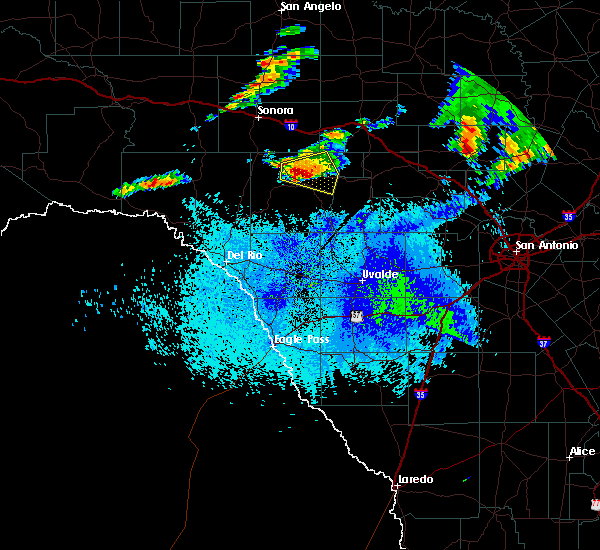 At 248 am cdt, a severe thunderstorm was located 7 miles northwest of rocksprings, moving east at 25 mph (radar indicated). Hazards include tennis ball size hail and 60 mph wind gusts. People and animals outdoors will be injured. expect hail damage to roofs, siding, windows, and vehicles. expect wind damage to roofs, siding, and trees. Locations impacted include, rocksprings and devils sinkhole state natural area. At 248 am cdt, a severe thunderstorm was located 7 miles northwest of rocksprings, moving east at 25 mph (radar indicated). Hazards include tennis ball size hail and 60 mph wind gusts. People and animals outdoors will be injured. expect hail damage to roofs, siding, windows, and vehicles. expect wind damage to roofs, siding, and trees. Locations impacted include, rocksprings and devils sinkhole state natural area.
|
| 5/20/2017 2:41 AM CDT |
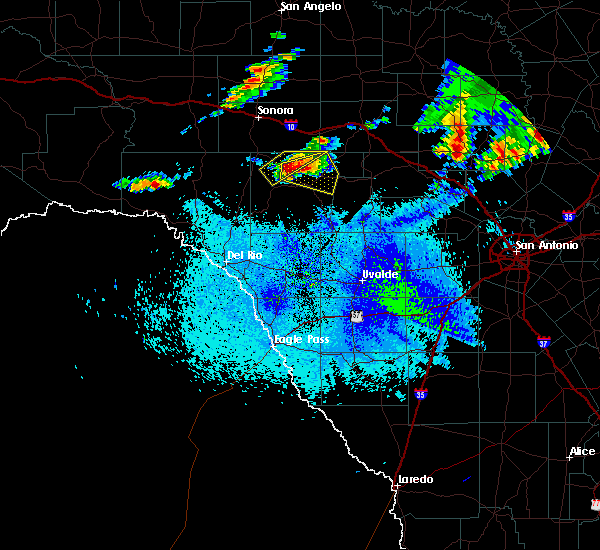 At 240 am cdt, a severe thunderstorm was located 10 miles northwest of rocksprings, moving east southeast at 25 mph (radar indicated). Hazards include golf ball size hail and 60 mph wind gusts. People and animals outdoors will be injured. expect hail damage to roofs, siding, windows, and vehicles. Expect wind damage to roofs, siding, and trees. At 240 am cdt, a severe thunderstorm was located 10 miles northwest of rocksprings, moving east southeast at 25 mph (radar indicated). Hazards include golf ball size hail and 60 mph wind gusts. People and animals outdoors will be injured. expect hail damage to roofs, siding, windows, and vehicles. Expect wind damage to roofs, siding, and trees.
|
| 4/2/2017 4:28 AM CDT |
 At 428 am cdt, a severe thunderstorm was located over rocksprings, moving northeast at 20 mph (radar indicated). Hazards include 60 mph wind gusts and quarter size hail. Hail damage to vehicles is expected. expect wind damage to roofs, siding, and trees. locations impacted include, rocksprings, leakey, camp wood, tuff, barksdale, vance, prade ranch and devils sinkhole state natural area. A tornado watch remains in effect until 600 am cdt for south central texas. At 428 am cdt, a severe thunderstorm was located over rocksprings, moving northeast at 20 mph (radar indicated). Hazards include 60 mph wind gusts and quarter size hail. Hail damage to vehicles is expected. expect wind damage to roofs, siding, and trees. locations impacted include, rocksprings, leakey, camp wood, tuff, barksdale, vance, prade ranch and devils sinkhole state natural area. A tornado watch remains in effect until 600 am cdt for south central texas.
|
| 4/2/2017 4:04 AM CDT |
 At 403 am cdt, a severe thunderstorm was located 8 miles south of rocksprings, moving northeast at 20 mph (radar indicated). Hazards include 60 mph wind gusts and quarter size hail. Hail damage to vehicles is expected. Expect wind damage to roofs, siding, and trees. At 403 am cdt, a severe thunderstorm was located 8 miles south of rocksprings, moving northeast at 20 mph (radar indicated). Hazards include 60 mph wind gusts and quarter size hail. Hail damage to vehicles is expected. Expect wind damage to roofs, siding, and trees.
|
| 4/2/2017 3:47 AM CDT |
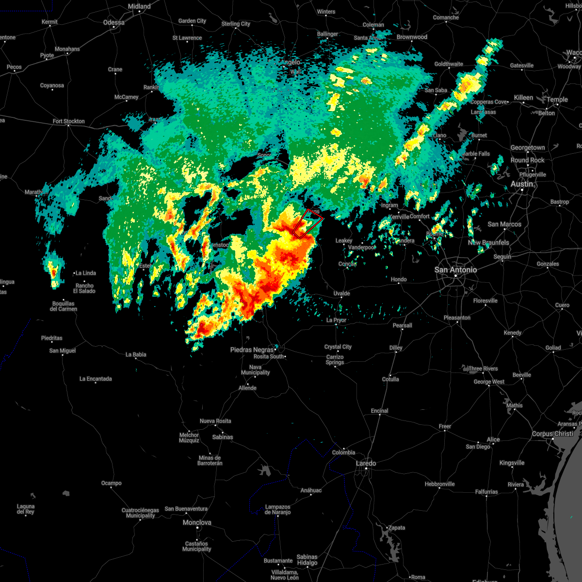 At 346 am cdt, a severe thunderstorm capable of producing a tornado was located 11 miles south of rocksprings, moving northeast at 20 mph (radar indicated rotation). Hazards include tornado and quarter size hail. Flying debris will be dangerous to those caught without shelter. mobile homes will be damaged or destroyed. damage to roofs, windows, and vehicles will occur. Tree damage is likely. At 346 am cdt, a severe thunderstorm capable of producing a tornado was located 11 miles south of rocksprings, moving northeast at 20 mph (radar indicated rotation). Hazards include tornado and quarter size hail. Flying debris will be dangerous to those caught without shelter. mobile homes will be damaged or destroyed. damage to roofs, windows, and vehicles will occur. Tree damage is likely.
|
| 3/28/2017 9:11 PM CDT |
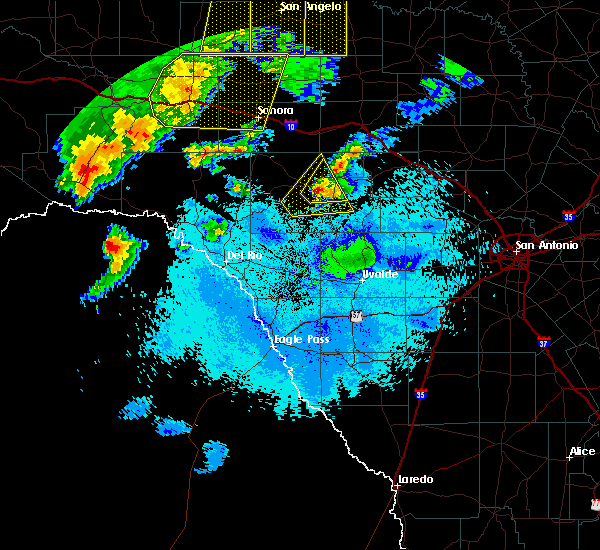 At 911 pm cdt, a severe thunderstorm was located near rocksprings, moving northeast at 35 mph (radar indicated). Hazards include quarter size hail. Damage to vehicles is expected. Locations impacted include, rocksprings and devils sinkhole state natural area. At 911 pm cdt, a severe thunderstorm was located near rocksprings, moving northeast at 35 mph (radar indicated). Hazards include quarter size hail. Damage to vehicles is expected. Locations impacted include, rocksprings and devils sinkhole state natural area.
|
| 3/28/2017 8:54 PM CDT |
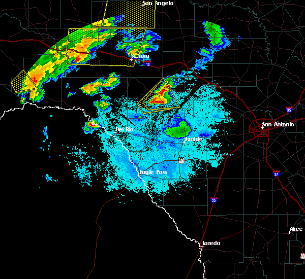 At 853 pm cdt, severe thunderstorm were located near rocksprings and 11 miles southwest of rocksprings, moving northeast at 20 mph (radar indicated). Hazards include quarter size hail. damage to vehicles is expected At 853 pm cdt, severe thunderstorm were located near rocksprings and 11 miles southwest of rocksprings, moving northeast at 20 mph (radar indicated). Hazards include quarter size hail. damage to vehicles is expected
|
| 3/28/2017 8:26 PM CDT |
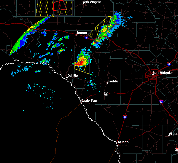 At 825 pm cdt, a severe thunderstorm was located 17 miles east of carta valley, or 17 miles southwest of rocksprings, moving northeast at 30 mph (radar indicated). Hazards include quarter size hail. damage to vehicles is expected At 825 pm cdt, a severe thunderstorm was located 17 miles east of carta valley, or 17 miles southwest of rocksprings, moving northeast at 30 mph (radar indicated). Hazards include quarter size hail. damage to vehicles is expected
|
| 1/15/2017 5:56 PM CST | Tennis Ball sized hail reported 23.2 miles NNE of Rocksprings, TX |
| 1/15/2017 5:45 PM CST | Tennis Ball sized hail reported 17.2 miles NE of Rocksprings, TX, tennis ball size hail 17 miles sw of rocksprings |
| 1/15/2017 5:30 PM CST | Ping Pong Ball sized hail reported 29.2 miles ENE of Rocksprings, TX, quarter to ping pong size hail covering the road on highway 377 near fm2523 |
| 1/15/2017 5:27 PM CST | Half Dollar sized hail reported 32 miles ENE of Rocksprings, TX, quarter to slightly larger size hailstones observed |
| 1/15/2017 5:17 PM CST |
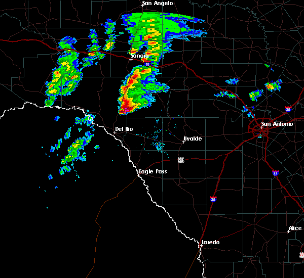 At 517 pm cst, a severe thunderstorm was located over carta valley, or 9 miles south of loma alta, moving east at 35 mph (radar indicated). Hazards include tennis ball size hail and 60 mph wind gusts. People and animals outdoors will be injured. expect hail damage to roofs, siding, windows, and vehicles. Expect wind damage to roofs, siding, and trees. At 517 pm cst, a severe thunderstorm was located over carta valley, or 9 miles south of loma alta, moving east at 35 mph (radar indicated). Hazards include tennis ball size hail and 60 mph wind gusts. People and animals outdoors will be injured. expect hail damage to roofs, siding, windows, and vehicles. Expect wind damage to roofs, siding, and trees.
|
| 5/26/2016 8:16 PM CDT |
 At 815 pm cdt, a severe thunderstorm was located 12 miles southwest of rocksprings, moving east at 50 mph (radar indicated). Hazards include tennis ball size hail and 60 mph wind gusts. People and animals outdoors will be injured. expect hail damage to roofs, siding, windows, and vehicles. expect wind damage to roofs, siding, and trees. Locations impacted include, rocksprings, camp wood, vance, carta valley, barksdale, devils sinkhole state natural area and kickapoo cavern state park. At 815 pm cdt, a severe thunderstorm was located 12 miles southwest of rocksprings, moving east at 50 mph (radar indicated). Hazards include tennis ball size hail and 60 mph wind gusts. People and animals outdoors will be injured. expect hail damage to roofs, siding, windows, and vehicles. expect wind damage to roofs, siding, and trees. Locations impacted include, rocksprings, camp wood, vance, carta valley, barksdale, devils sinkhole state natural area and kickapoo cavern state park.
|
| 5/26/2016 8:03 PM CDT |
 At 801 pm cdt, a severe thunderstorm was located 11 miles east of carta valley, or 18 miles southeast of loma alta, moving east at 50 mph. a new storm is developing just to the south of the main storm. this storm could produce the largest hail and will move through the northwest corner of kinney county over the next 15 to 30 minutes (radar indicated). Hazards include tennis ball size hail and 70 mph wind gusts. People and animals outdoors will be injured. expect hail damage to roofs, siding, windows, and vehicles. expect considerable tree damage. wind damage is also likely to mobile homes, roofs, and outbuildings. Locations impacted include, rocksprings, loma alta, camp wood, vance, carta valley, barksdale, devils sinkhole state natural area and kickapoo cavern state park. At 801 pm cdt, a severe thunderstorm was located 11 miles east of carta valley, or 18 miles southeast of loma alta, moving east at 50 mph. a new storm is developing just to the south of the main storm. this storm could produce the largest hail and will move through the northwest corner of kinney county over the next 15 to 30 minutes (radar indicated). Hazards include tennis ball size hail and 70 mph wind gusts. People and animals outdoors will be injured. expect hail damage to roofs, siding, windows, and vehicles. expect considerable tree damage. wind damage is also likely to mobile homes, roofs, and outbuildings. Locations impacted include, rocksprings, loma alta, camp wood, vance, carta valley, barksdale, devils sinkhole state natural area and kickapoo cavern state park.
|
| 5/26/2016 7:44 PM CDT |
 At 743 pm cdt, a severe thunderstorm was located near carta valley, or 14 miles south of loma alta, moving east at 50 mph (radar indicated). Hazards include 70 mph wind gusts and ping pong ball size hail. People and animals outdoors will be injured. expect hail damage to roofs, siding, windows, and vehicles. expect considerable tree damage. Wind damage is also likely to mobile homes, roofs, and outbuildings. At 743 pm cdt, a severe thunderstorm was located near carta valley, or 14 miles south of loma alta, moving east at 50 mph (radar indicated). Hazards include 70 mph wind gusts and ping pong ball size hail. People and animals outdoors will be injured. expect hail damage to roofs, siding, windows, and vehicles. expect considerable tree damage. Wind damage is also likely to mobile homes, roofs, and outbuildings.
|
| 5/17/2016 8:45 PM CDT |
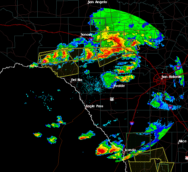 At 845 pm cdt, a severe thunderstorm was located 10 miles east of flour mills, or 16 miles west of rocksprings, moving southeast at 20 mph (radar indicated). Hazards include golf ball size hail and 70 mph wind gusts. People and animals outdoors will be injured. expect hail damage to roofs, siding, windows, and vehicles. expect considerable tree damage. Wind damage is also likely to mobile homes, roofs, and outbuildings. At 845 pm cdt, a severe thunderstorm was located 10 miles east of flour mills, or 16 miles west of rocksprings, moving southeast at 20 mph (radar indicated). Hazards include golf ball size hail and 70 mph wind gusts. People and animals outdoors will be injured. expect hail damage to roofs, siding, windows, and vehicles. expect considerable tree damage. Wind damage is also likely to mobile homes, roofs, and outbuildings.
|
| 5/17/2016 8:33 PM CDT |
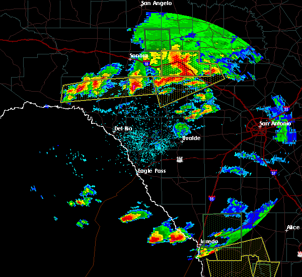 At 833 pm cdt, severe thunderstorms were located along a line extending from 8 miles northeast of flour mills to near pumpville, moving southeast at 15 mph (radar indicated). Hazards include 60 mph wind gusts and half dollar size hail. Hail damage to vehicles is expected. expect wind damage to roofs, siding, and trees. Locations impacted include, rocksprings, juno, osman, flour mills, pumpville and bakers crossing. At 833 pm cdt, severe thunderstorms were located along a line extending from 8 miles northeast of flour mills to near pumpville, moving southeast at 15 mph (radar indicated). Hazards include 60 mph wind gusts and half dollar size hail. Hail damage to vehicles is expected. expect wind damage to roofs, siding, and trees. Locations impacted include, rocksprings, juno, osman, flour mills, pumpville and bakers crossing.
|
| 5/17/2016 7:26 PM CDT |
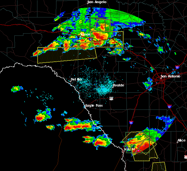 At 723 pm cdt, severe thunderstorms were located along a line extending from 13 miles north of flour mills to 12 miles north of pumpville. the line is moving south at 15 mph. individual severe storms within the line are moving east at 15 mph (radar indicated). Hazards include 60 mph wind gusts and quarter size hail. Hail damage to vehicles is expected. Expect wind damage to roofs, siding, and trees. At 723 pm cdt, severe thunderstorms were located along a line extending from 13 miles north of flour mills to 12 miles north of pumpville. the line is moving south at 15 mph. individual severe storms within the line are moving east at 15 mph (radar indicated). Hazards include 60 mph wind gusts and quarter size hail. Hail damage to vehicles is expected. Expect wind damage to roofs, siding, and trees.
|
| 5/13/2016 6:06 PM CDT | Quarter sized hail reported 19.6 miles SW of Rocksprings, TX, near the junction of hwy 377 and cr408 hail along with wind gusts to 50mph...large tree limbs broken...flooded low water crossings and nearly 1.5 inches of rain fell in |
| 5/12/2016 7:09 PM CDT | Golf Ball sized hail reported 5.5 miles SE of Rocksprings, TX |
| 5/12/2016 6:50 PM CDT | Quarter sized hail reported 8.5 miles ENE of Rocksprings, TX, quarter size hail observed about halfway between hwy 377 and cr674 |
| 4/27/2016 1:12 AM CDT |
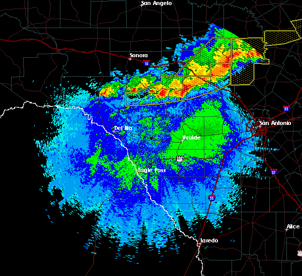 At 111 am cdt, severe thunderstorms were located along a line extending from hilltop to near mountain home to 9 miles west of kerr wildlife management area, moving east at 35 mph (radar indicated). Hazards include 60 mph wind gusts and quarter size hail. Hail damage to vehicles is expected. expect wind damage to roofs, siding, and trees. Locations impacted include, kerrville, rocksprings, hunt, ingram, waltonia, kerr wildlife management area, mountain home, tivydale, doss, harper, cherry spring, carta valley, prade ranch, us-377 near the kimble- edwards county line, us-83 near the kerr-kimble county line, i- 10 near the kimble- kerr county line, devils sinkhole state natural area and the intersection of i-10 and us 290. At 111 am cdt, severe thunderstorms were located along a line extending from hilltop to near mountain home to 9 miles west of kerr wildlife management area, moving east at 35 mph (radar indicated). Hazards include 60 mph wind gusts and quarter size hail. Hail damage to vehicles is expected. expect wind damage to roofs, siding, and trees. Locations impacted include, kerrville, rocksprings, hunt, ingram, waltonia, kerr wildlife management area, mountain home, tivydale, doss, harper, cherry spring, carta valley, prade ranch, us-377 near the kimble- edwards county line, us-83 near the kerr-kimble county line, i- 10 near the kimble- kerr county line, devils sinkhole state natural area and the intersection of i-10 and us 290.
|
| 4/27/2016 12:21 AM CDT |
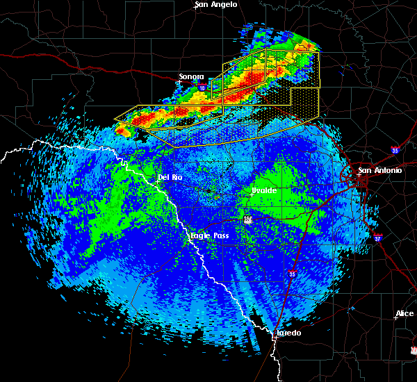 At 1221 am cdt, severe thunderstorms were located along a line extending from near yates crossing to near telegraph to 16 miles northwest of rocksprings, moving southeast at 30 mph (radar indicated). Hazards include 60 mph wind gusts and half dollar size hail. Hail damage to vehicles is expected. Expect wind damage to roofs, siding, and trees. At 1221 am cdt, severe thunderstorms were located along a line extending from near yates crossing to near telegraph to 16 miles northwest of rocksprings, moving southeast at 30 mph (radar indicated). Hazards include 60 mph wind gusts and half dollar size hail. Hail damage to vehicles is expected. Expect wind damage to roofs, siding, and trees.
|
| 4/12/2016 7:57 PM CDT |
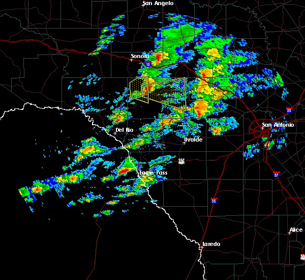 At 755 pm cdt, a severe thunderstorm was located 10 miles northwest of rocksprings, moving east at 40 mph. this storm will cross highway 55, northwest of rocksprings and then county roads 393 and 930 as well as rm 2995 and rm 2630 (radar indicated). Hazards include 60 mph wind gusts and quarter size hail. Hail damage to vehicles is expected. Expect wind damage to roofs, siding, and trees. At 755 pm cdt, a severe thunderstorm was located 10 miles northwest of rocksprings, moving east at 40 mph. this storm will cross highway 55, northwest of rocksprings and then county roads 393 and 930 as well as rm 2995 and rm 2630 (radar indicated). Hazards include 60 mph wind gusts and quarter size hail. Hail damage to vehicles is expected. Expect wind damage to roofs, siding, and trees.
|
| 3/8/2016 8:12 PM CST |
 At 811 pm cst, a severe thunderstorm was located 13 miles west of kerr wildlife management area, or 23 miles north of leakey, moving north at 20 to 25 mph. in addition, there are multiple storms developing in south real county as well as eastern edwards county that could also produce quarter to half dollar sized hail (radar indicated). Hazards include 60 mph wind gusts and half dollar size hail. Hail damage to vehicles is expected. Expect wind damage to roofs, siding, and trees. At 811 pm cst, a severe thunderstorm was located 13 miles west of kerr wildlife management area, or 23 miles north of leakey, moving north at 20 to 25 mph. in addition, there are multiple storms developing in south real county as well as eastern edwards county that could also produce quarter to half dollar sized hail (radar indicated). Hazards include 60 mph wind gusts and half dollar size hail. Hail damage to vehicles is expected. Expect wind damage to roofs, siding, and trees.
|
| 12/27/2015 12:48 AM CST |
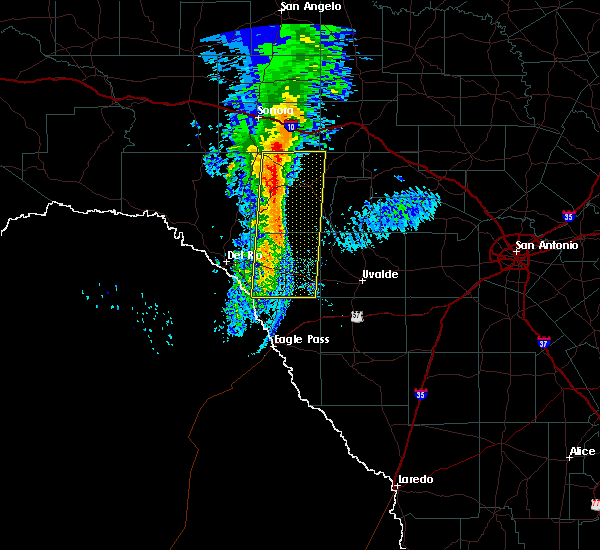 At 1246 am cst, severe thunderstorms were located along a line extending from 15 miles northwest of rocksprings to near spofford, moving east at 35 mph (radar indicated). Hazards include 60 mph wind gusts and penny size hail. Expect damage to roofs. siding and trees. Locations impacted include, brackettville, rocksprings, spofford, alamo village, standart, amanda, anacacho, devils sinkhole state natural area, kickapoo cavern state park and turkey mountain. At 1246 am cst, severe thunderstorms were located along a line extending from 15 miles northwest of rocksprings to near spofford, moving east at 35 mph (radar indicated). Hazards include 60 mph wind gusts and penny size hail. Expect damage to roofs. siding and trees. Locations impacted include, brackettville, rocksprings, spofford, alamo village, standart, amanda, anacacho, devils sinkhole state natural area, kickapoo cavern state park and turkey mountain.
|
| 12/27/2015 12:06 AM CST |
 At 1205 am cst, severe thunderstorms were located along a line extending from 14 miles north of flour mills to 10 miles south of laughlin afb, moving east at 35 mph (radar indicated). Hazards include 60 mph wind gusts and nickel size hail. Expect damage to roofs. Siding and trees. At 1205 am cst, severe thunderstorms were located along a line extending from 14 miles north of flour mills to 10 miles south of laughlin afb, moving east at 35 mph (radar indicated). Hazards include 60 mph wind gusts and nickel size hail. Expect damage to roofs. Siding and trees.
|
| 12/12/2015 10:59 PM CST |
 At 1059 pm cst, severe thunderstorms were located along a line extending from 16 miles north of rocksprings to 13 miles west of vance to near brackettville, moving east at 35 mph (radar indicated). Hazards include 60 mph wind gusts. Expect damage to roofs. Siding and trees. At 1059 pm cst, severe thunderstorms were located along a line extending from 16 miles north of rocksprings to 13 miles west of vance to near brackettville, moving east at 35 mph (radar indicated). Hazards include 60 mph wind gusts. Expect damage to roofs. Siding and trees.
|
| 10/30/2015 11:39 PM CDT |
 At 1138 pm cdt, severe thunderstorms were located along a line extending from 10 miles west of telegraph to 16 miles northeast of rocksprings to vance to near barksdale, moving east at 40 mph (radar indicated). Hazards include 60 mph wind gusts and penny size hail. Expect damage to roofs. siding and trees. Locations impacted include, rocksprings, leakey, vanderpool, hunt, camp wood, kerr wildlife management area, vance, lost maples state park, tuff, mountain home, barksdale, rio frio, prade ranch and devils sinkhole state natural area. At 1138 pm cdt, severe thunderstorms were located along a line extending from 10 miles west of telegraph to 16 miles northeast of rocksprings to vance to near barksdale, moving east at 40 mph (radar indicated). Hazards include 60 mph wind gusts and penny size hail. Expect damage to roofs. siding and trees. Locations impacted include, rocksprings, leakey, vanderpool, hunt, camp wood, kerr wildlife management area, vance, lost maples state park, tuff, mountain home, barksdale, rio frio, prade ranch and devils sinkhole state natural area.
|
| 10/30/2015 11:13 PM CDT |
 At 1112 pm cdt, severe thunderstorms were located along a line extending from 23 miles southwest of roosevelt to near rocksprings to 16 miles west of barksdale to 16 miles north of alamo village, moving east at 45 mph (radar indicated). Hazards include 70 mph wind gusts and penny size hail. Expect considerable tree damage. Damage is likely to mobile homes, roofs and outbuildings. At 1112 pm cdt, severe thunderstorms were located along a line extending from 23 miles southwest of roosevelt to near rocksprings to 16 miles west of barksdale to 16 miles north of alamo village, moving east at 45 mph (radar indicated). Hazards include 70 mph wind gusts and penny size hail. Expect considerable tree damage. Damage is likely to mobile homes, roofs and outbuildings.
|
| 10/30/2015 10:52 PM CDT |
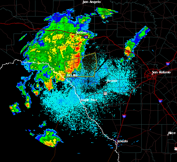 At 1051 pm cdt, severe thunderstorms were located along a line extending from 11 miles southeast of flour mills to 12 miles south of carta valley to 6 miles northeast of val verde park, moving east at 40 mph (radar indicated). Hazards include 70 mph wind gusts and nickel size hail. Expect considerable tree damage. damage is likely to mobile homes, roofs and outbuildings. Locations impacted include, rocksprings, alamo village, carta valley, devils sinkhole state natural area, kickapoo cavern state park and devils shores. At 1051 pm cdt, severe thunderstorms were located along a line extending from 11 miles southeast of flour mills to 12 miles south of carta valley to 6 miles northeast of val verde park, moving east at 40 mph (radar indicated). Hazards include 70 mph wind gusts and nickel size hail. Expect considerable tree damage. damage is likely to mobile homes, roofs and outbuildings. Locations impacted include, rocksprings, alamo village, carta valley, devils sinkhole state natural area, kickapoo cavern state park and devils shores.
|
| 10/30/2015 10:27 PM CDT |
 At 1026 pm cdt, severe thunderstorms were located along a line extending from 11 miles west of carta valley to near lake view, moving east at 45 mph (radar indicated). Hazards include 70 mph wind gusts and nickel size hail. Expect considerable tree damage. Damage is likely to mobile homes, roofs and outbuildings. At 1026 pm cdt, severe thunderstorms were located along a line extending from 11 miles west of carta valley to near lake view, moving east at 45 mph (radar indicated). Hazards include 70 mph wind gusts and nickel size hail. Expect considerable tree damage. Damage is likely to mobile homes, roofs and outbuildings.
|
| 5/28/2015 10:33 PM CDT | At 1033 pm cdt, severe thunderstorms were located along a line extending from 9 miles northwest of harper to 9 miles north of vance to 11 miles southwest of loma alta, moving southeast at 20 mph (radar indicated). Hazards include 60 mph wind gusts and penny size hail. Expect damage to roofs. siding and trees. locations impacted include, rocksprings, loma alta, kerr wildlife management area, mountain home, flour mills, us-277 near the sutton-edwards county line, vinegarone, us-377 near the kimble-edwards county line, devils sinkhole state natural area, the intersection of i-10 and u. S 290, us-83 near the kerr-kimble county line and i-10 near the kimble-kerr county line. |
| 5/28/2015 10:10 PM CDT | Estimated by experienced spotter in edwards county TX, 6 miles E of Rocksprings, TX |
| 5/28/2015 9:37 PM CDT | At 936 pm cdt, severe thunderstorms were located along a line extending from near junction to 9 miles north of flour mills, moving southeast at 45 mph (radar indicated). Hazards include 60 mph wind gusts and nickel size hail. Expect damage to roofs. Siding and trees. |
| 5/25/2015 9:00 AM CDT | At 900 am cdt, a severe thunderstorm was located near rocksprings, moving northeast at 25 mph (radar indicated). Hazards include 60 mph wind gusts and half dollar size hail. Hail damage to vehicles is expected. Expect wind damage to roofs, siding and trees. |
| 5/25/2015 8:42 AM CDT | At 842 am cdt, a severe thunderstorm was located 9 miles south of rocksprings, moving northeast at 25 mph (trained weather spotters). Hazards include ping pong ball size hail and 60 mph wind gusts. People and animals outdoors will be injured. expect hail damage to roofs, siding, windows and vehicles. expect wind damage to roofs, siding and trees. Locations impacted include, rocksprings. |
| 5/25/2015 8:18 AM CDT | At 818 am cdt, a severe thunderstorm was located 17 miles southwest of rocksprings, moving northeast at 20 mph (trained weather spotters). Hazards include ping pong ball size hail and 60 mph wind gusts. People and animals outdoors will be injured. expect hail damage to roofs, siding, windows and vehicles. expect wind damage to roofs, siding and trees. Locations impacted include, rocksprings. |
| 5/25/2015 8:15 AM CDT | Ping Pong Ball sized hail reported 19.1 miles NE of Rocksprings, TX, spotter report of ping pong ball sized hail. |
| 5/25/2015 8:12 AM CDT | At 811 am cdt, a severe thunderstorm was located 17 miles east of carta valley, or 19 miles southwest of rocksprings, moving northeast at 20 mph (radar indicated). Hazards include 60 mph wind gusts and quarter size hail. Hail damage to vehicles is expected. Expect wind damage to roofs, siding and trees. |
| 5/20/2015 8:52 PM CDT | At 851 pm cdt, a severe thunderstorm was located near rocksprings, moving north at 25 mph (radar indicated). Hazards include 60 mph wind gusts and quarter size hail. Hail damage to vehicles is expected. Expect wind damage to roofs, siding and trees. |
| 5/11/2015 4:30 AM CDT | At 430 am cdt, a severe thunderstorm was located 11 miles southwest of rocksprings, moving east at 25 mph (radar indicated). Hazards include 60 mph wind gusts and quarter size hail. Hail damage to vehicles is expected. expect wind damage to roofs, siding and trees. locations impacted include, rocksprings. 1. 00in. |
| 5/11/2015 4:00 AM CDT | At 400 am cdt, a severe thunderstorm was located 13 miles east of flour mills, or 14 miles west of rocksprings, moving east at 25 mph (radar indicated). Hazards include 60 mph wind gusts and half dollar size hail. Hail damage to vehicles is expected. Expect wind damage to roofs, siding and trees. |
| 4/26/2015 11:10 PM CDT | At 1109 pm cdt, severe thunderstorms were located along a line extending from 10 miles northwest of kerr wildlife management area to 12 miles south of rocksprings to 11 miles southeast of carta valley, moving east at 45 mph (radar indicated). Hazards include 70 mph wind gusts and quarter size hail. Hail damage to vehicles is expected. expect considerable tree damage. wind damage is also likely to mobile homes, roofs and outbuildings. locations impacted include, rocksprings, camp wood, vance, carta valley, barksdale, prade ranch and devils sinkhole state natural area. 1. 00in. |
| 4/26/2015 10:40 PM CDT | At 1039 pm cdt, severe thunderstorms were located along a line extending from 13 miles west of telegraph to 9 miles east of carta valley to 9 miles northeast of comstock, moving east at 50 mph (radar indicated). Hazards include 70 mph wind gusts and quarter size hail. Hail damage to vehicles is expected. expect considerable tree damage. Wind damage is also likely to mobile homes, roofs and outbuildings. |
| 4/26/2015 10:29 PM CDT | At 1029 pm cdt, severe thunderstorms were located along a line extending from 15 miles north of rocksprings to near flour mills to 6 miles southwest of carta valley to 7 miles northeast of comstock, moving east at 40 mph (radar indicated). Hazards include 70 mph wind gusts and penny size hail. Expect considerable tree damage. damage is likely to mobile homes, roofs and outbuildings. locations impacted include, rocksprings, loma alta, carta valley, flour mills, us-277 near the sutton-edwards county line, vinegarone, us-377 near the kimble-edwards county line, devils sinkhole state natural area, devils river state natural area and bakers crossing. 0. 75in. |
| 4/26/2015 10:02 PM CDT | At 1001 pm cdt, severe thunderstorms were located along a line extending from 19 miles north of flour mills to 11 miles northwest of loma alta to 8 miles northeast of comstock, moving east at 40 mph (radar indicated). Hazards include 60 mph wind gusts and penny size hail. Expect damage to roofs. siding and trees. locations impacted include, rocksprings, loma alta, carta valley, flour mills, us-277 near the sutton-edwards county line, vinegarone, us-377 near the kimble-edwards county line, devils sinkhole state natural area, devils river state natural area and bakers crossing. 0. 75in. |
| 4/26/2015 9:39 PM CDT | At 938 pm cdt, severe thunderstorms were located along a line extending from 17 miles north of flour mills to 9 miles south of juno to near seminole canyon state park, moving east at 45 mph (radar indicated). Hazards include 60 mph wind gusts and quarter size hail. Hail damage to vehicles is expected. Expect wind damage to roofs, siding and trees. |
| 4/17/2015 12:15 PM CDT | At 1215 pm cdt, a severe thunderstorm was located 10 miles southwest of rocksprings, moving east at 20 mph (radar indicated). Hazards include 60 mph wind gusts and quarter size hail. Hail damage to vehicles is expected. Expect wind damage to roofs, siding and trees. |
| 7/24/2014 6:55 PM CDT | Thunderstorm wind gust knocked down a small portable marquee sign and a few large metal feeders on tripods in edwards county TX, 0.1 miles SSE of Rocksprings, TX |
| 6/12/2014 7:05 PM CDT | Quarter sized hail reported 5.5 miles NNE of Rocksprings, TX, quarter size hail continues. |
| 6/12/2014 6:57 PM CDT | Hen Egg sized hail reported 5.4 miles N of Rocksprings, TX, hail falling at the time of the report. mostly quarter size hail with a few as big as eggs. |
| 4/3/2014 6:45 PM CDT | Golf Ball sized hail reported 12.1 miles WSW of Rocksprings, TX |
| 4/3/2014 6:25 PM CDT | Quarter sized hail reported 15.8 miles SSW of Rocksprings, TX |
| 5/9/2013 8:50 PM CDT | Several trees down...carport damaged in edwards county TX, 27.5 miles WSW of Rocksprings, TX |
| 4/27/2013 6:45 PM CDT | Quarter sized hail reported 17.2 miles NE of Rocksprings, TX, lots of hail falling 1.25 inches of rain past hour |
| 4/27/2013 5:47 PM CDT | Quarter sized hail reported 6.1 miles N of Rocksprings, TX |
| 4/27/2013 5:36 PM CDT | Quarter sized hail reported 10.4 miles NE of Rocksprings, TX, heavy rainfall |
| 3/31/2013 3:15 PM CDT | Quarter sized hail reported 5.8 miles WSW of Rocksprings, TX, hackberry creek ranch |
| 8/11/2012 6:45 PM CDT | Several outbuildings damaged or destroyed by wind gusts in edwards county TX, 8.7 miles SW of Rocksprings, TX |
| 8/9/2012 4:55 PM CDT | Wind gusts to 60 mph with pea size hail in edwards county TX, 0.1 miles SSE of Rocksprings, TX |
| 1/1/0001 12:00 AM | Quarter sized hail reported 32 miles ENE of Rocksprings, TX |
| 1/1/0001 12:00 AM | Rocksprings airport awos measured a wind gust to 40 mph. a home south of the airport had some damage to the front of her hom in edwards county TX, 7.2 miles NNW of Rocksprings, TX |
| 1/1/0001 12:00 AM | Half Dollar sized hail reported 6.1 miles N of Rocksprings, TX |
Hail Maps for Rocksprings, TX
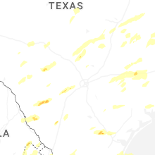
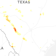


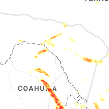


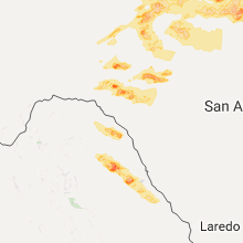


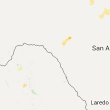

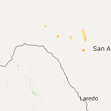


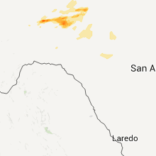


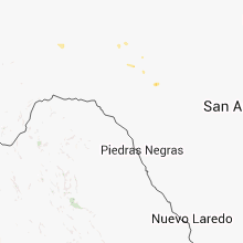


Connect with Interactive Hail Maps