

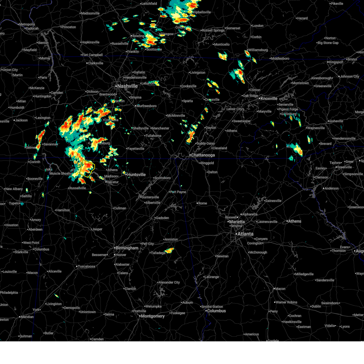
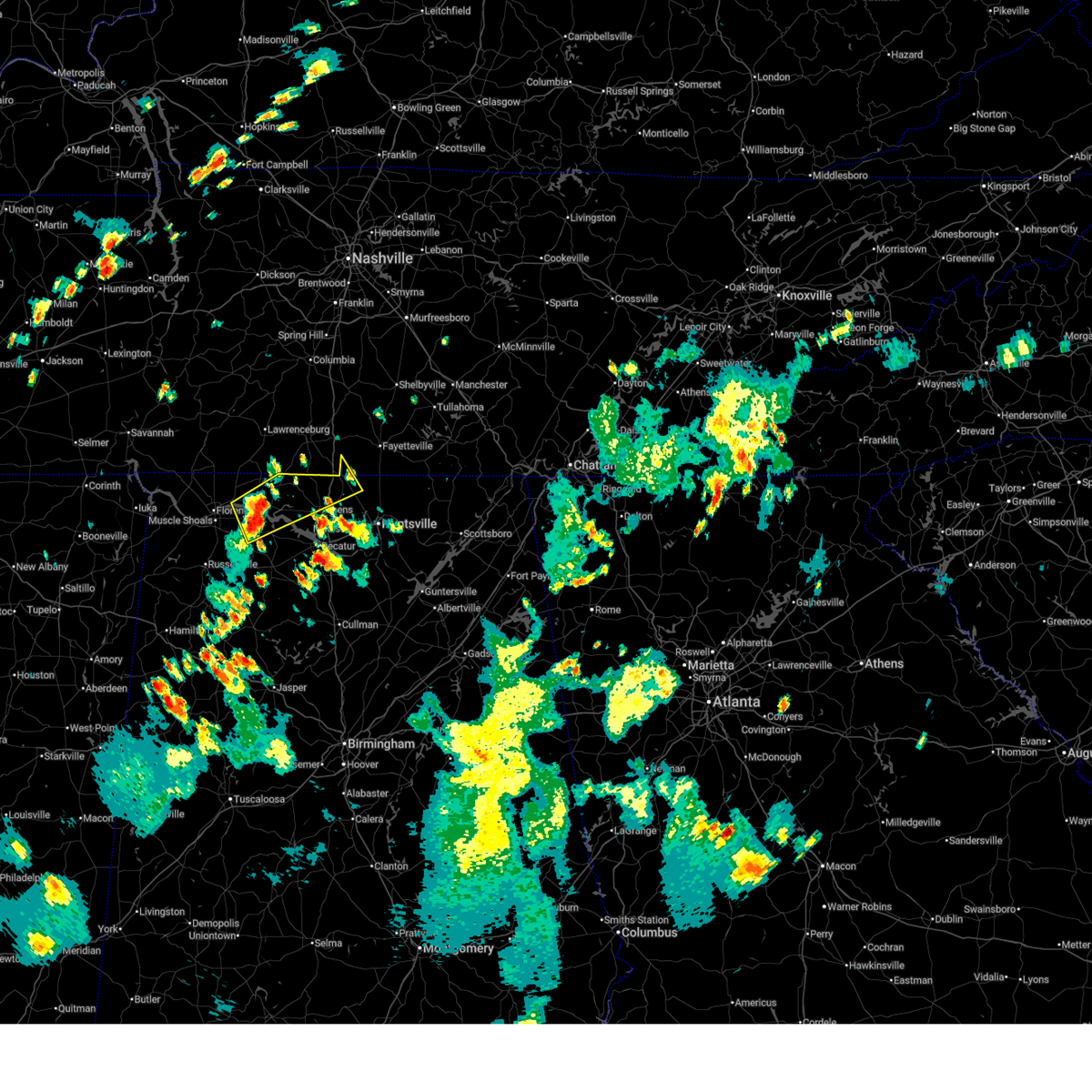
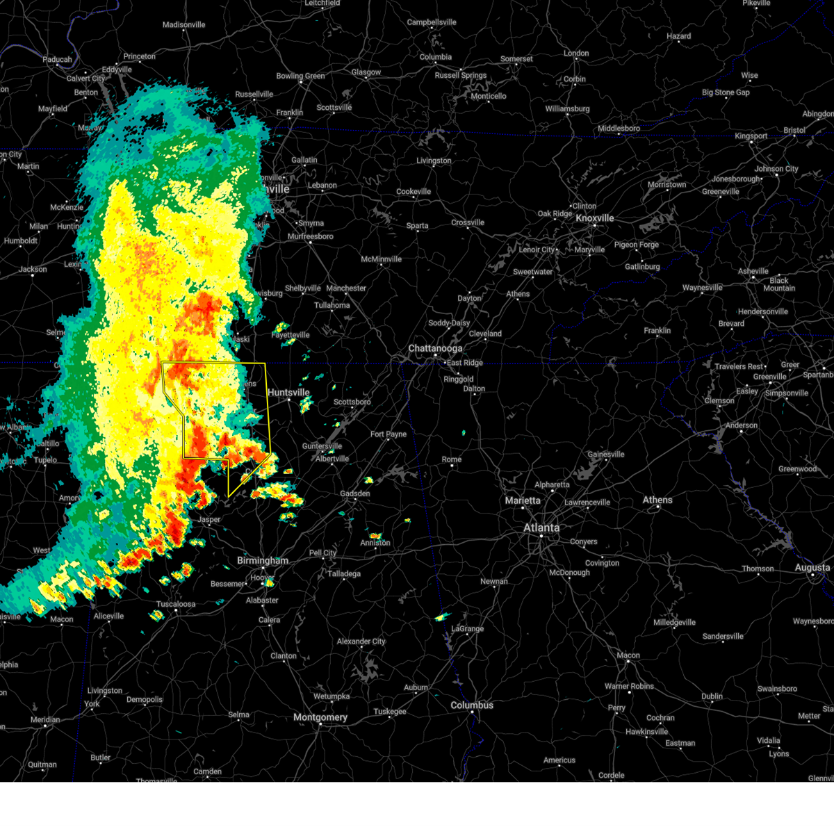
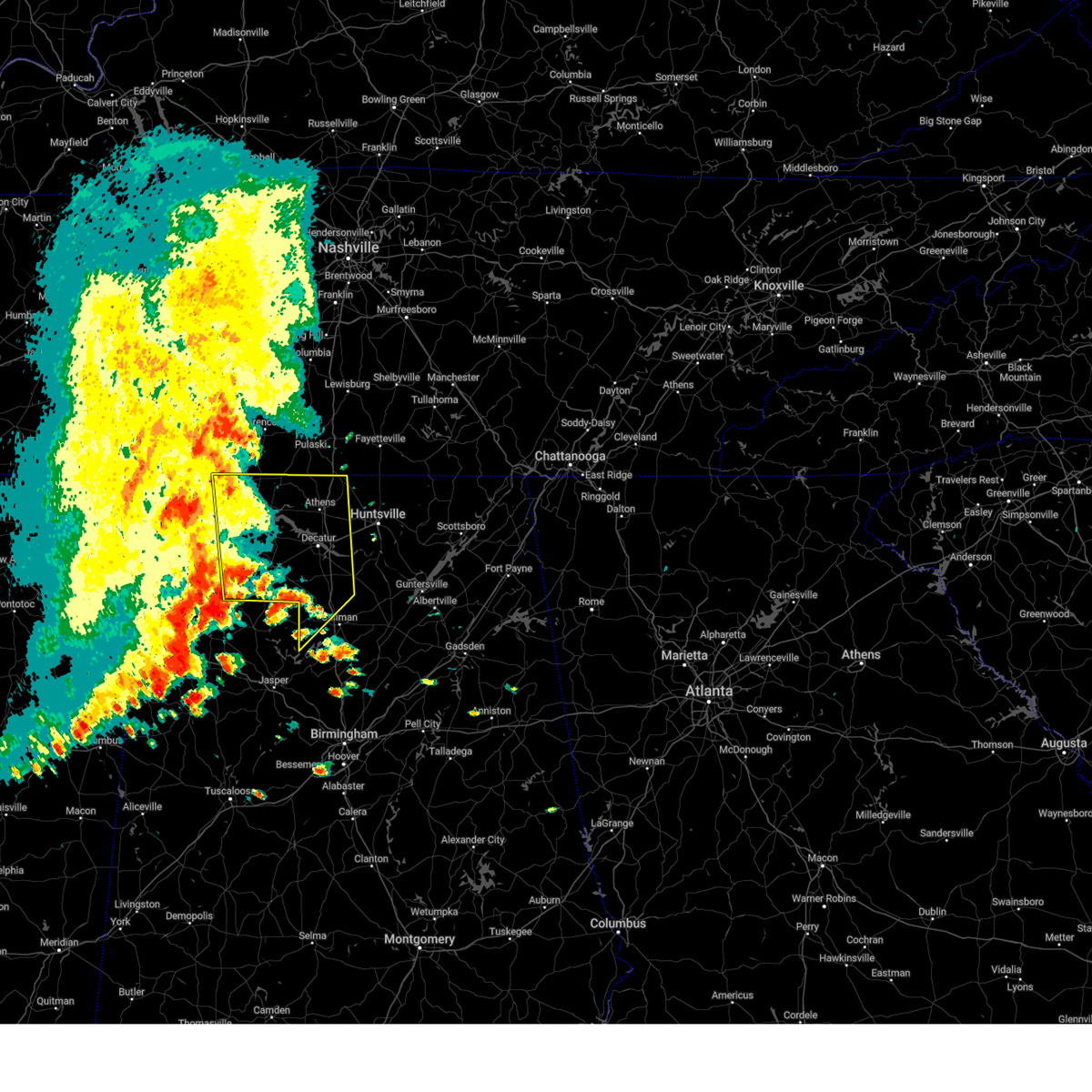
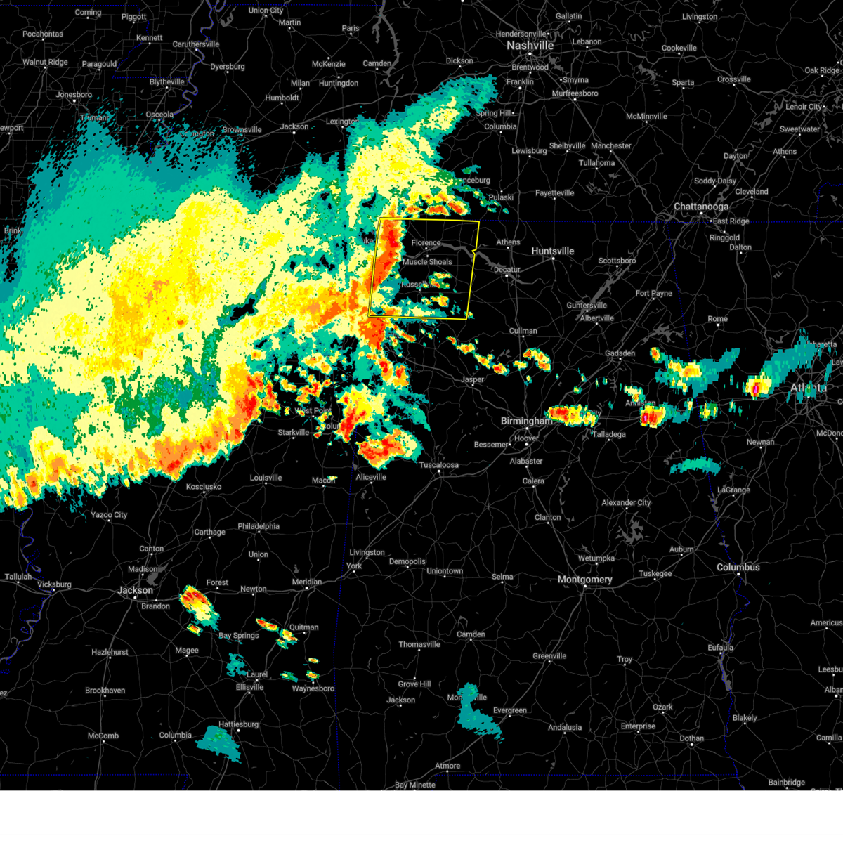
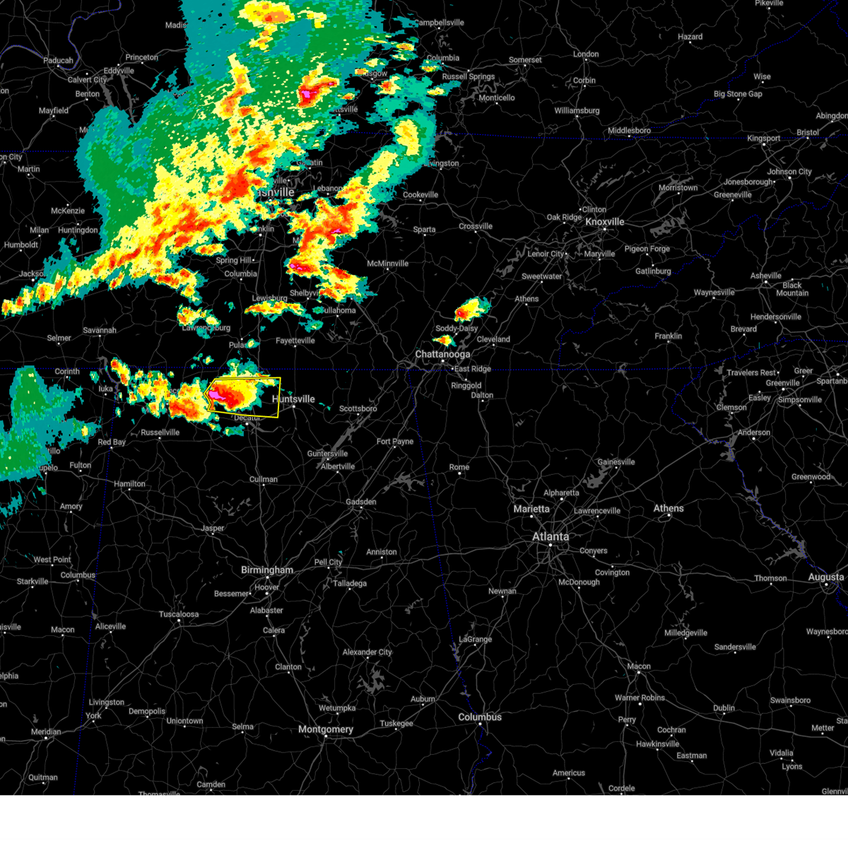
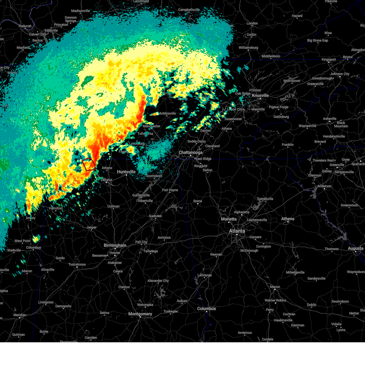
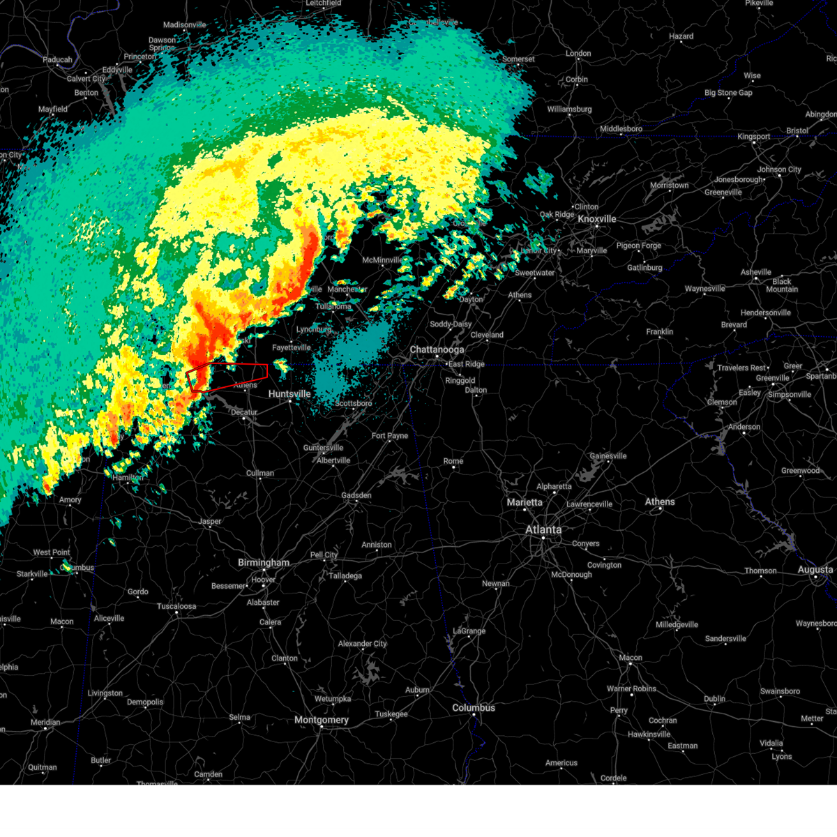
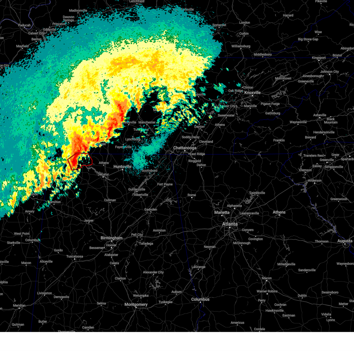
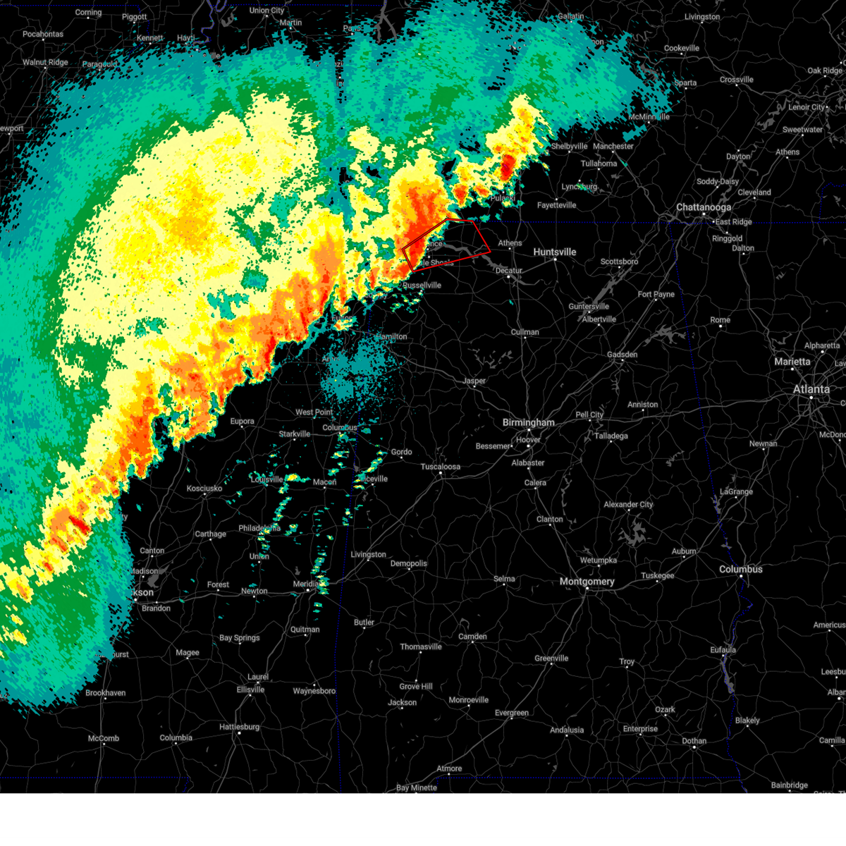
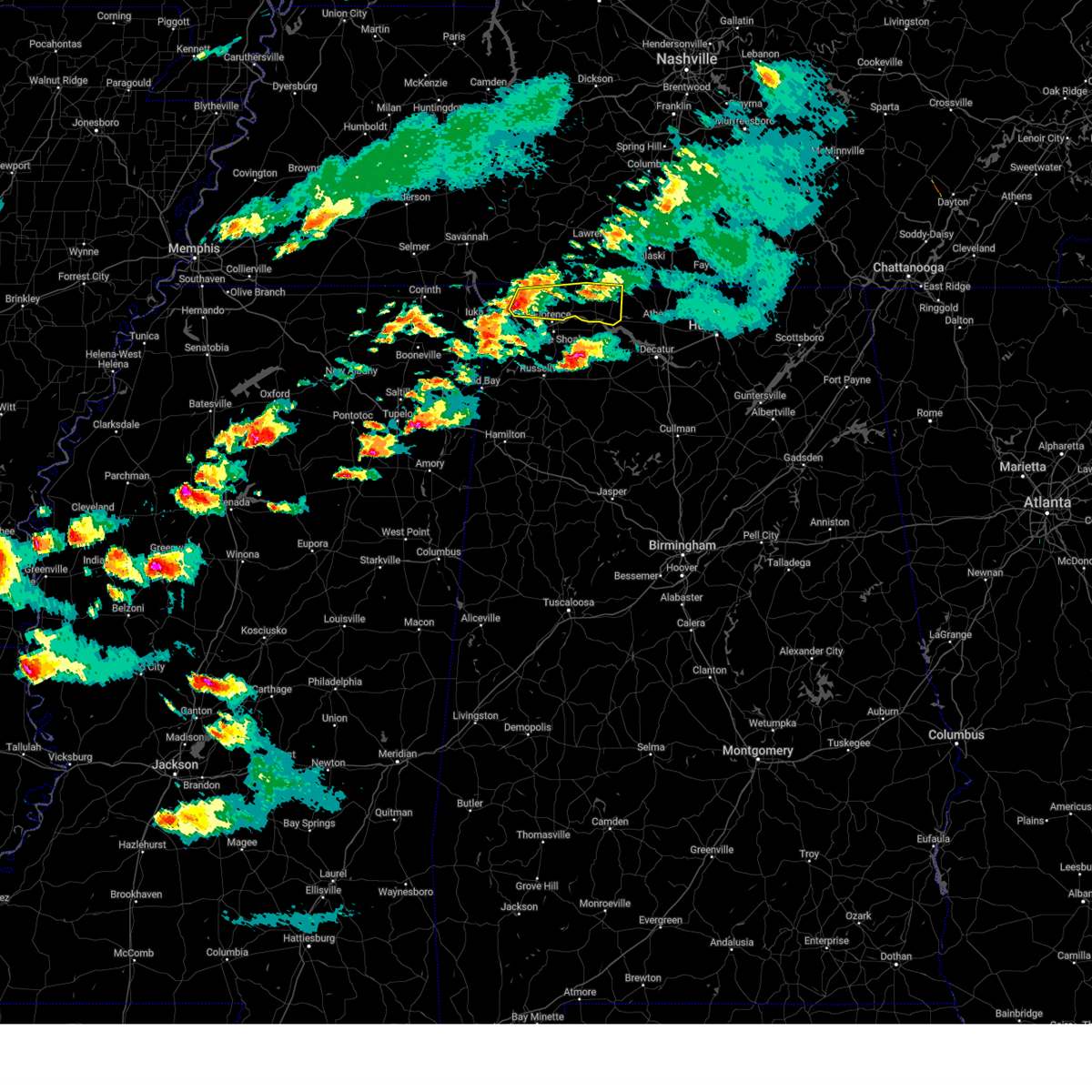
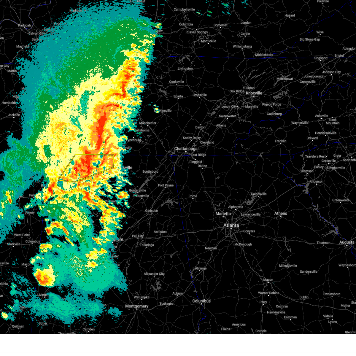
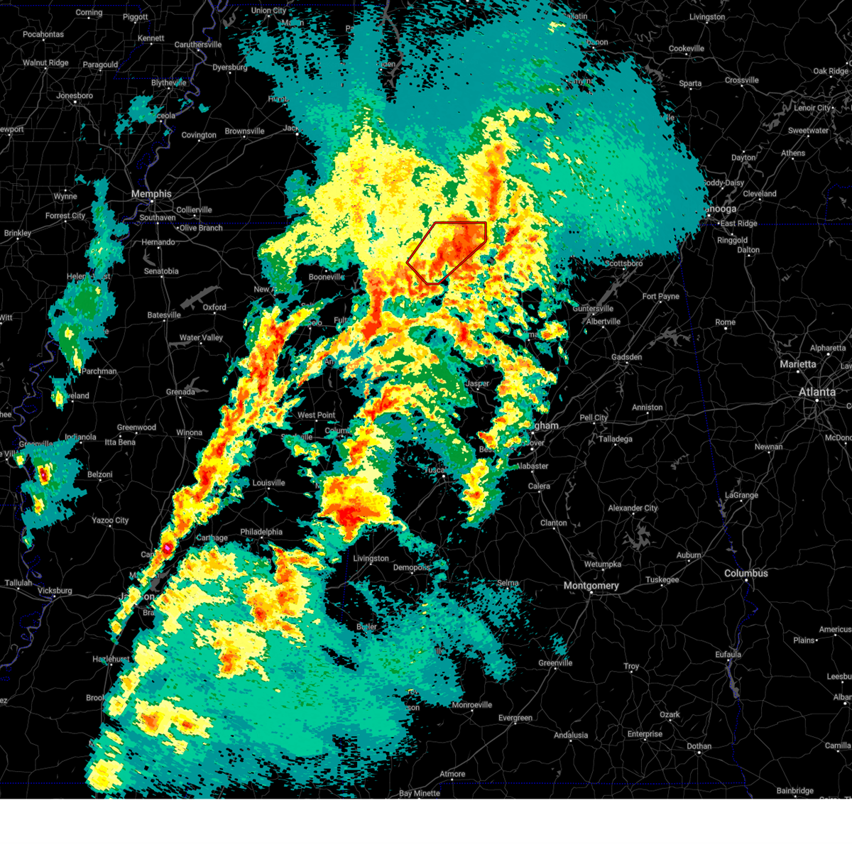
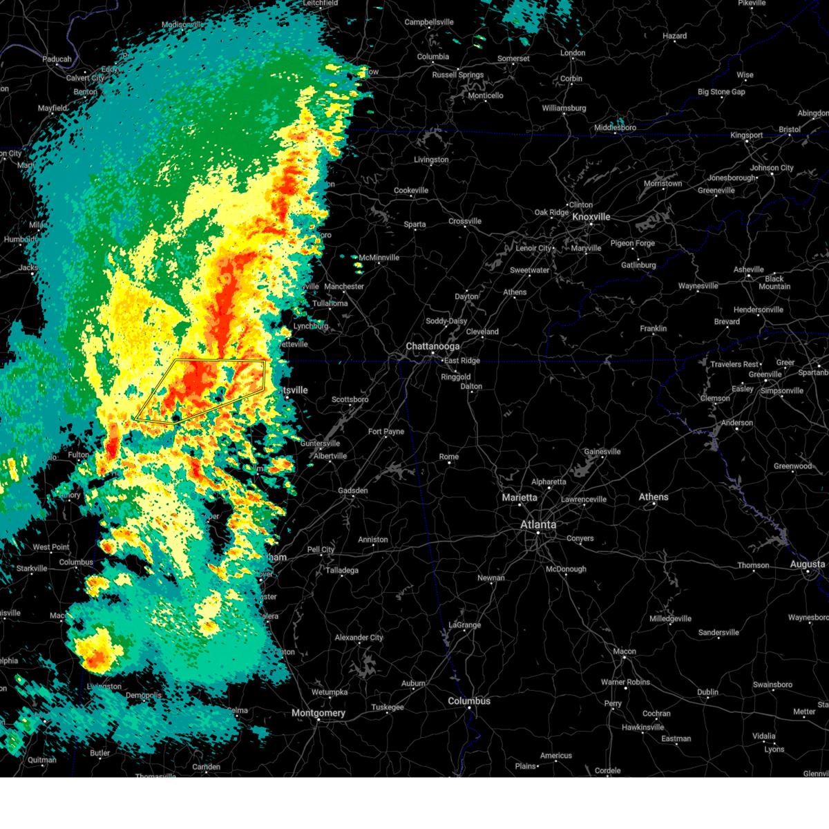
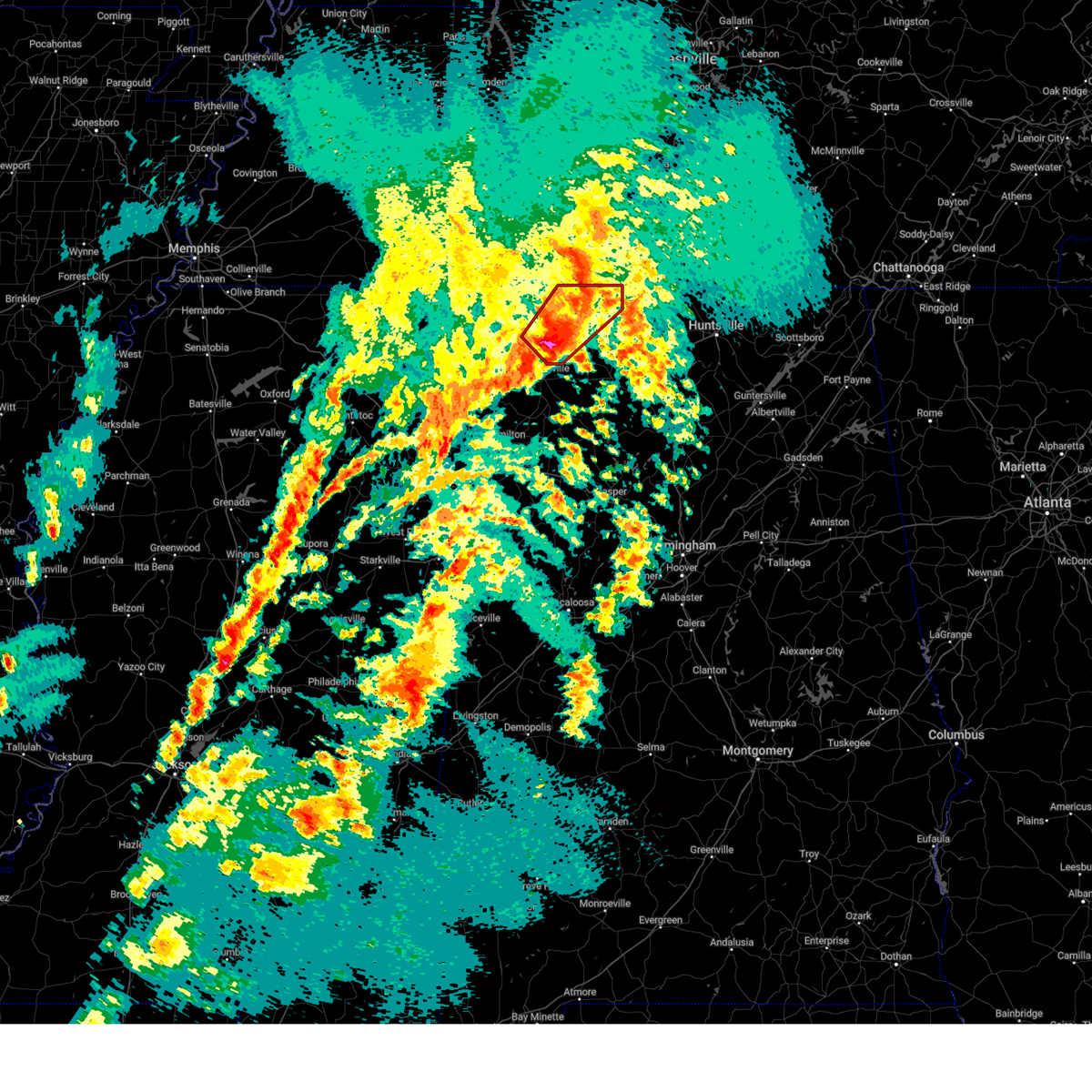
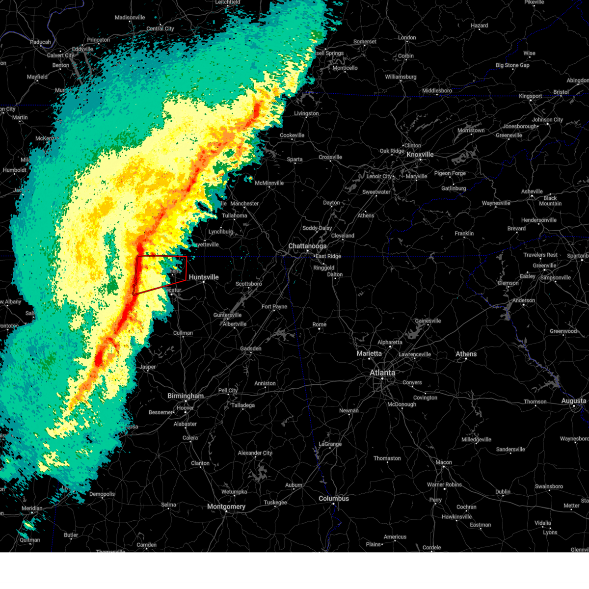
Hail Map for Rogersville, AL
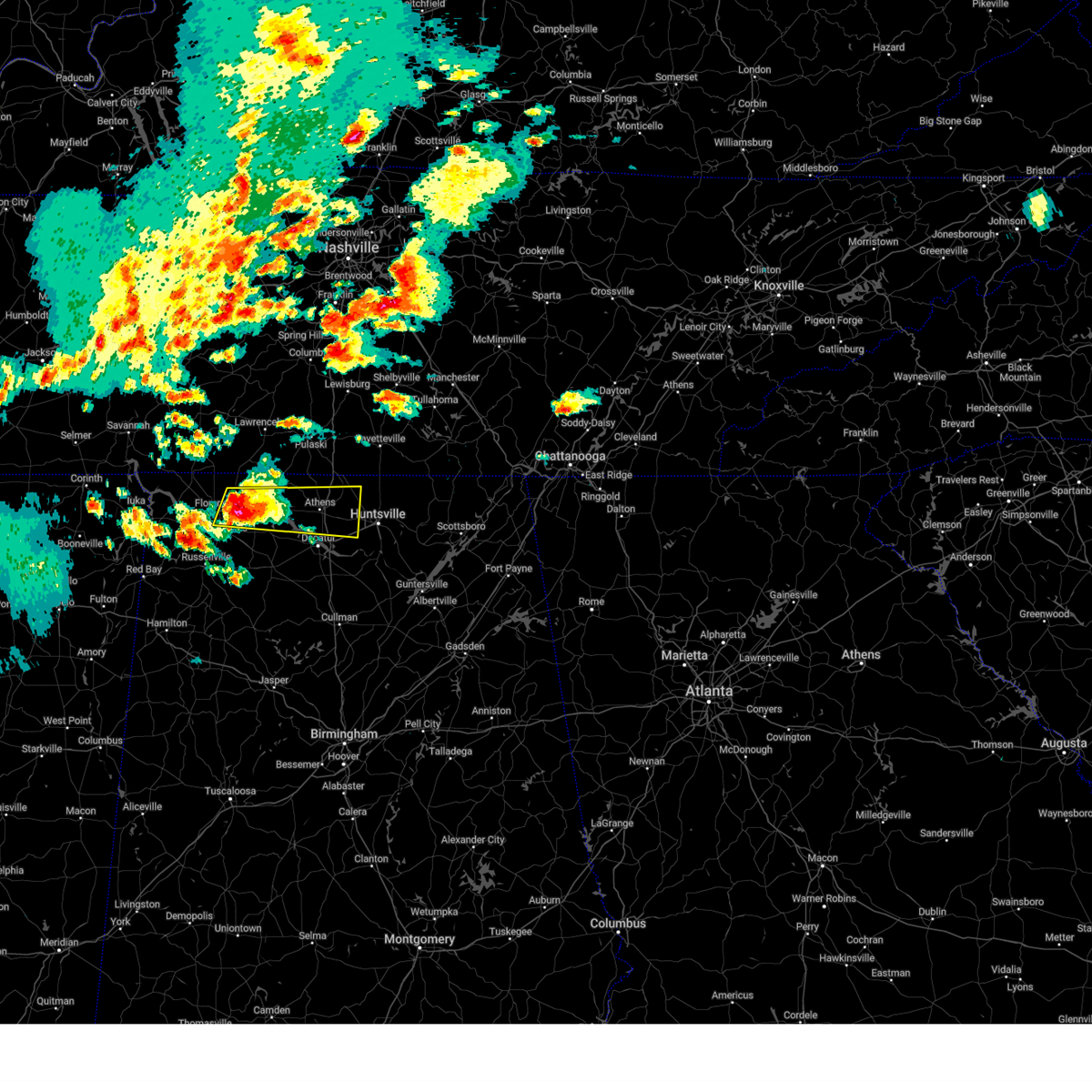
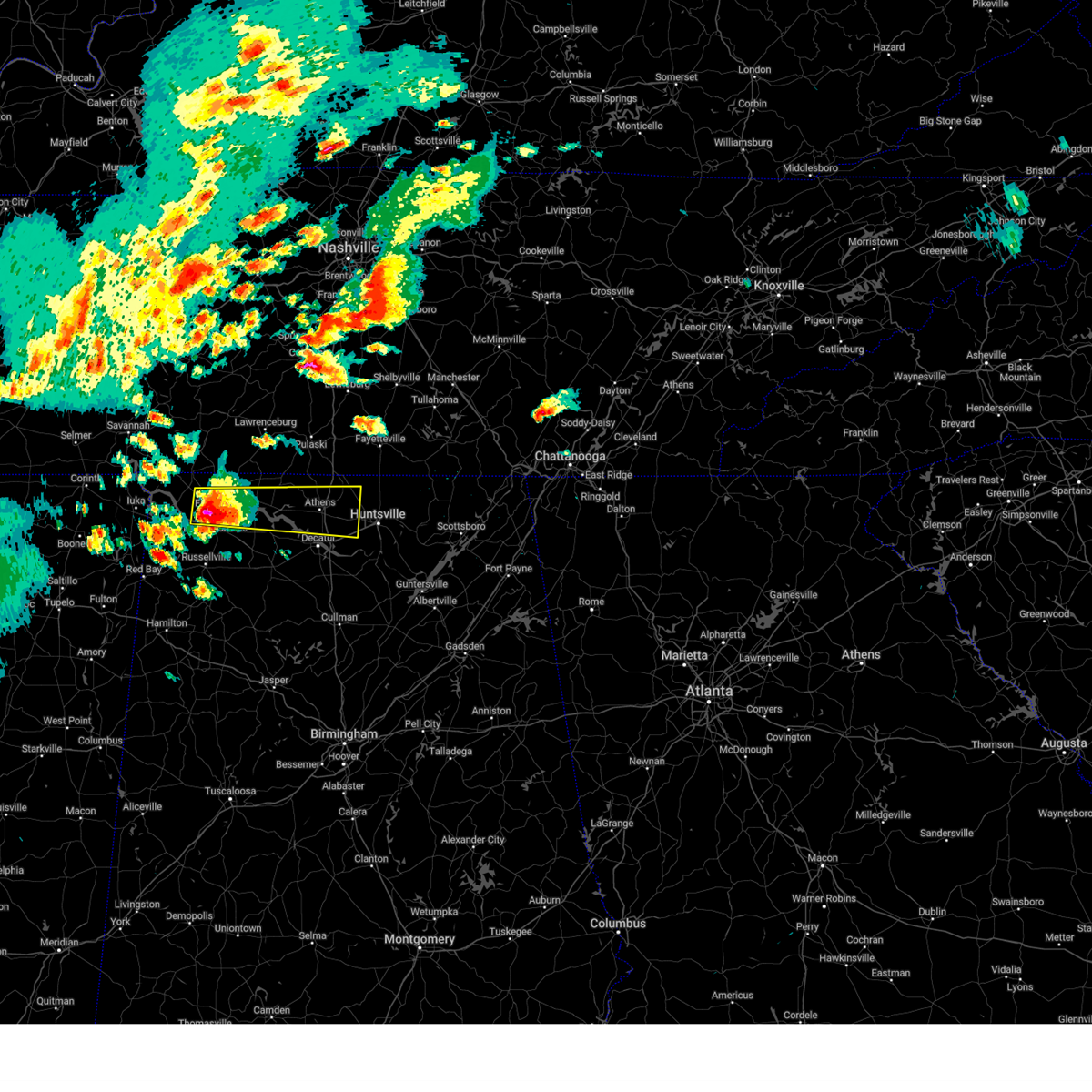
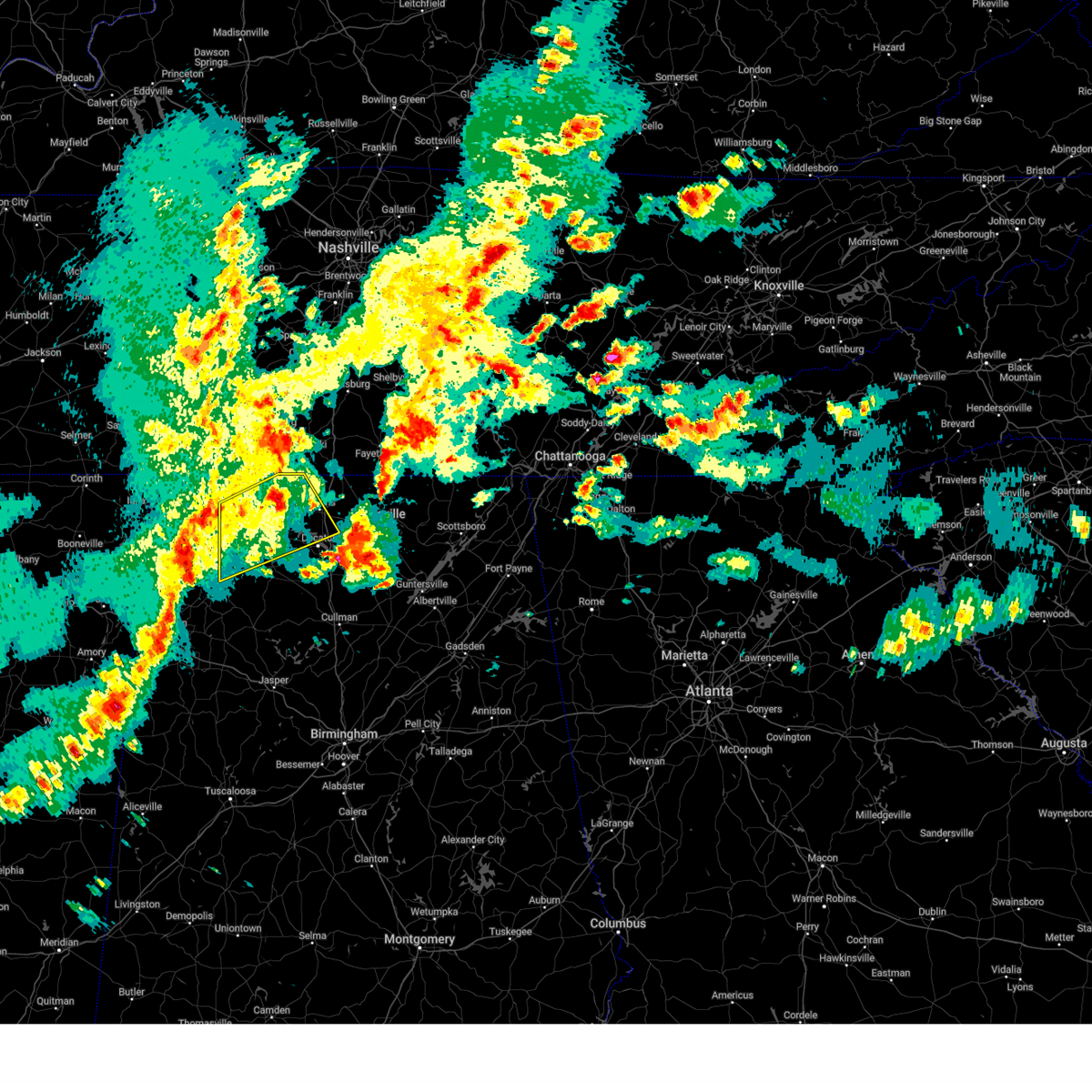
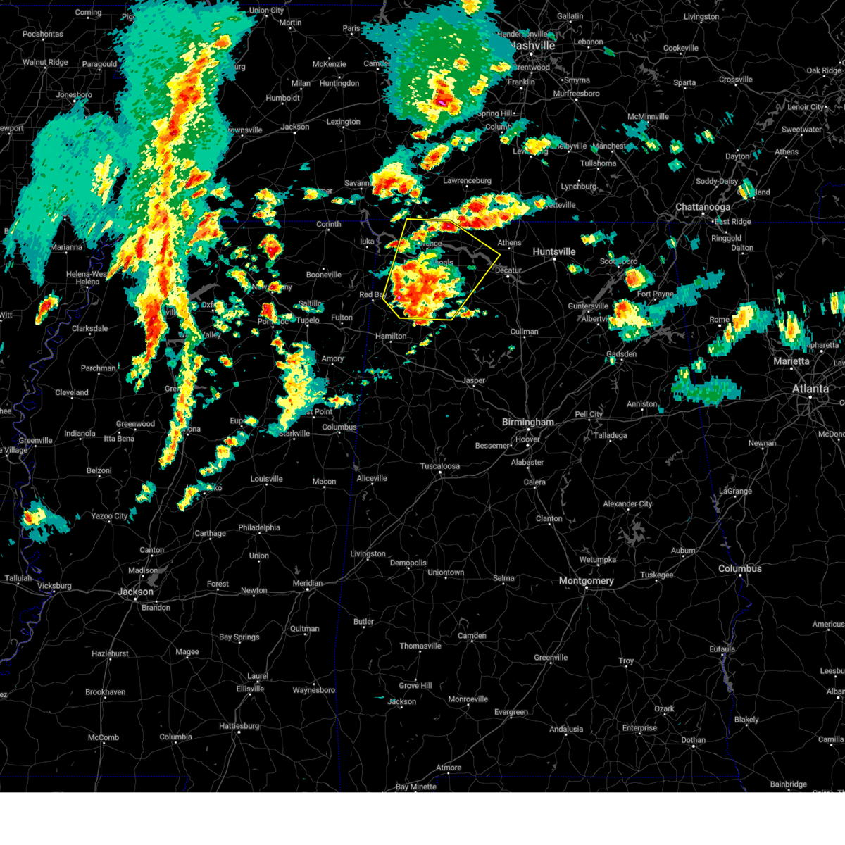
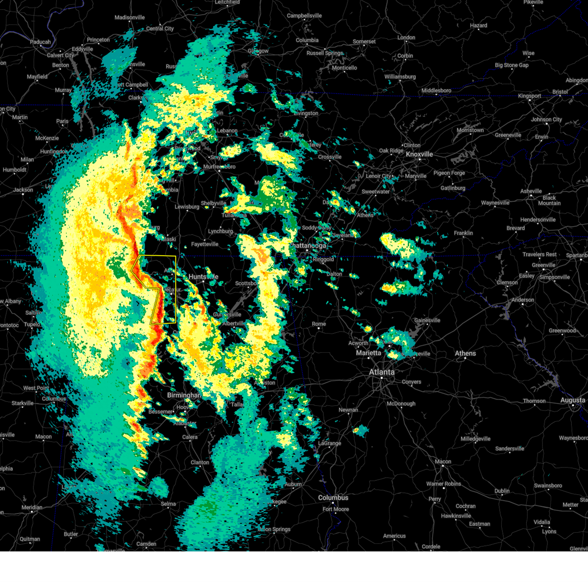
The Rogersville, AL area has had 10 reports of on-the-ground hail by trained spotters, and has been under severe weather warnings 78 times during the past 12 months. Doppler radar has detected hail at or near Rogersville, AL on 61 occasions, including 4 occasions during the past year.
| Name: | Rogersville, AL |
| Where Located: | 22.6 miles E of Florence, AL |
| Map: | Google Map for Rogersville, AL |
| Population: | 1257 |
| Housing Units: | 639 |
| More Info: | Search Google for Rogersville, AL |
4
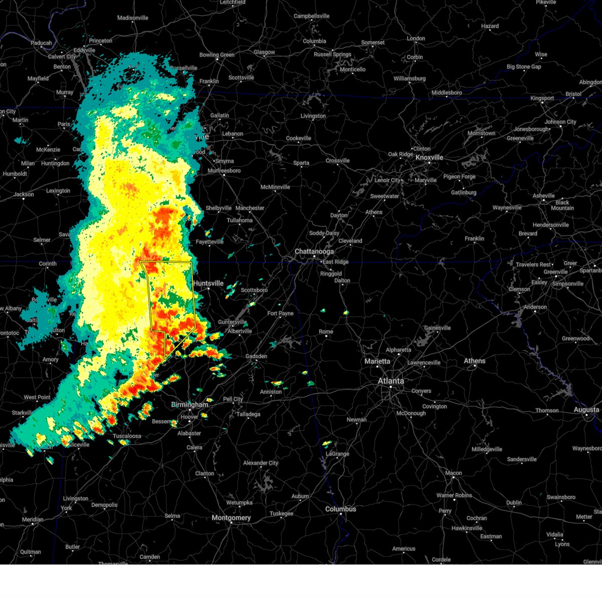
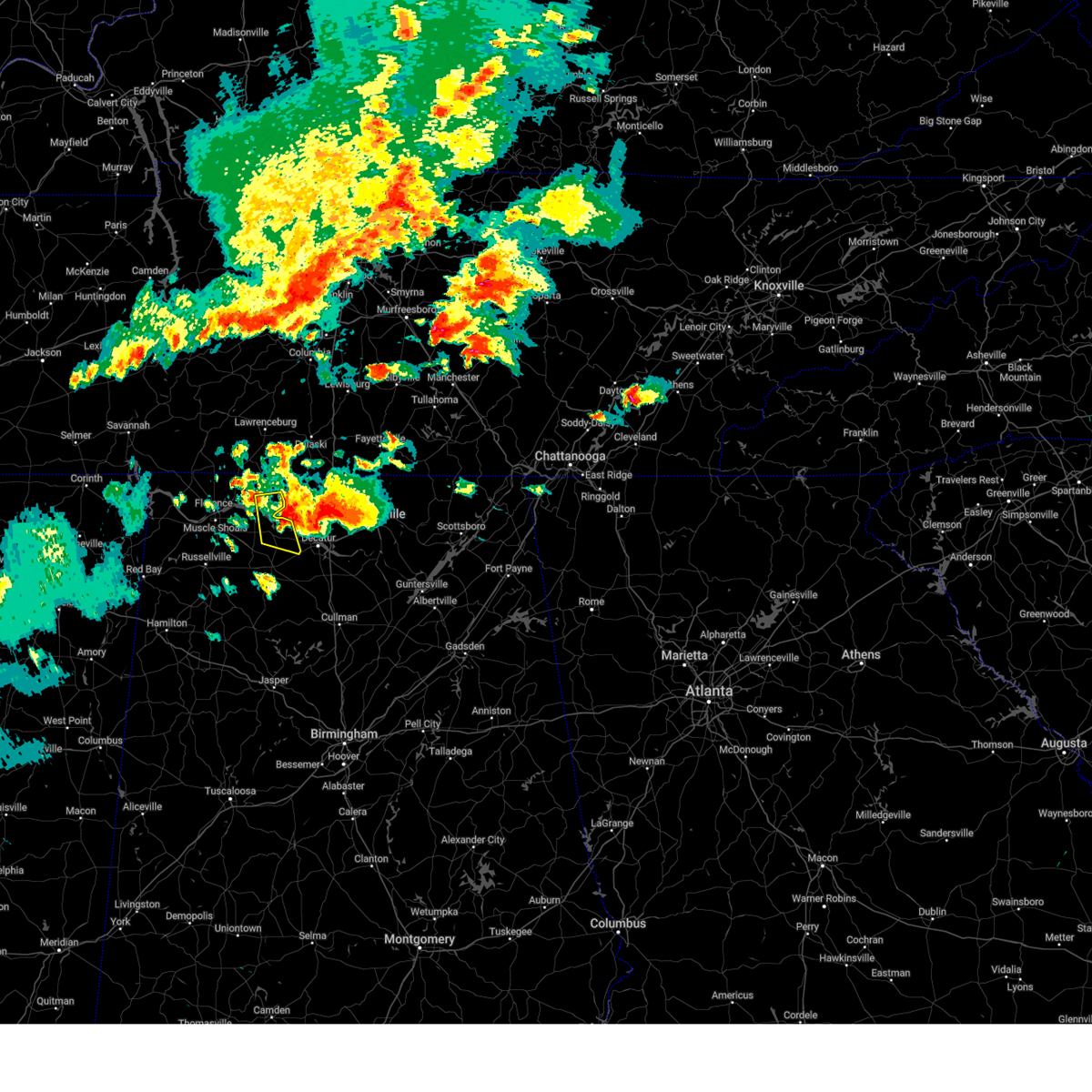
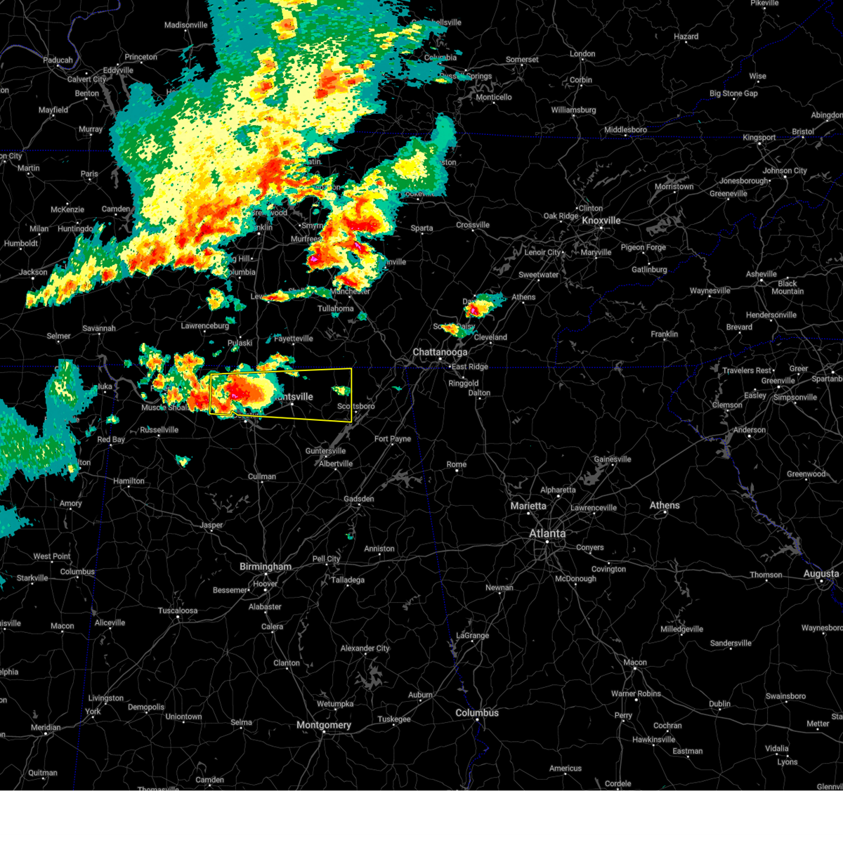
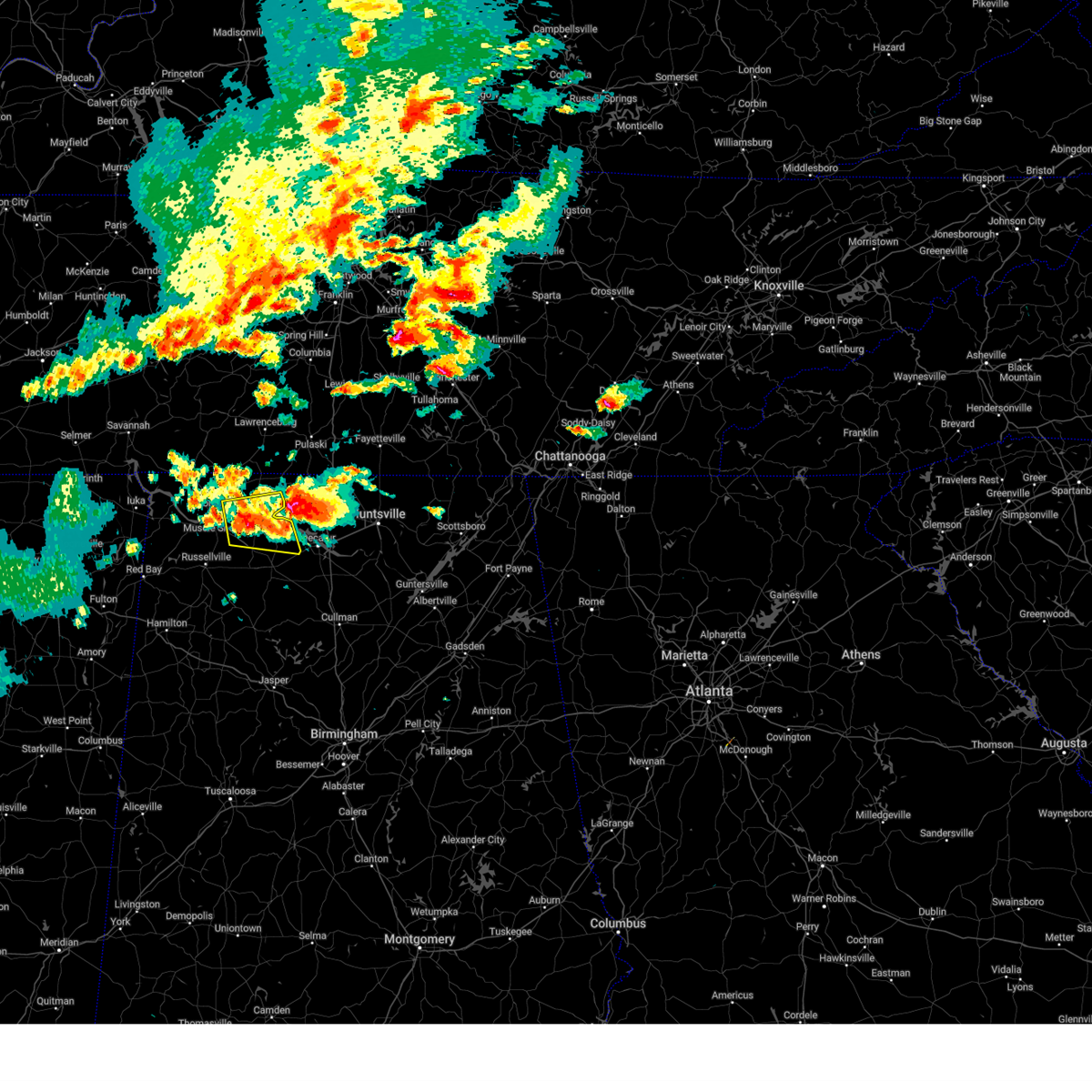
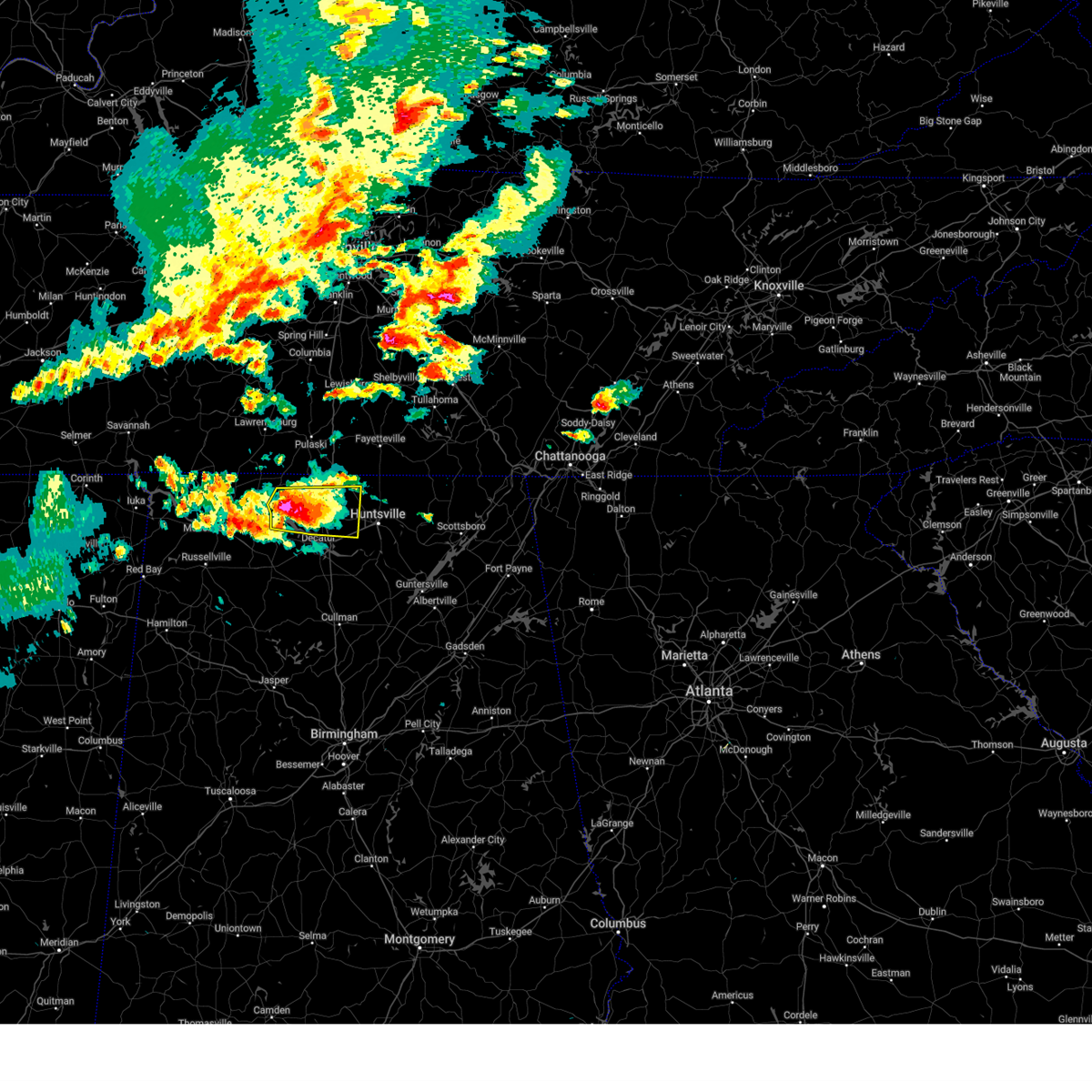
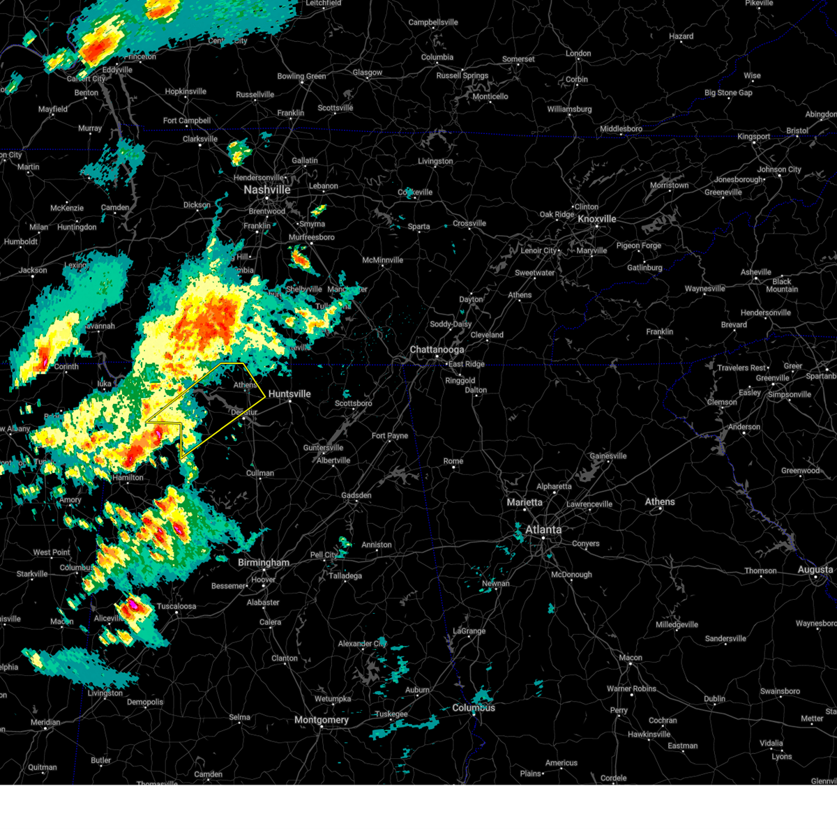
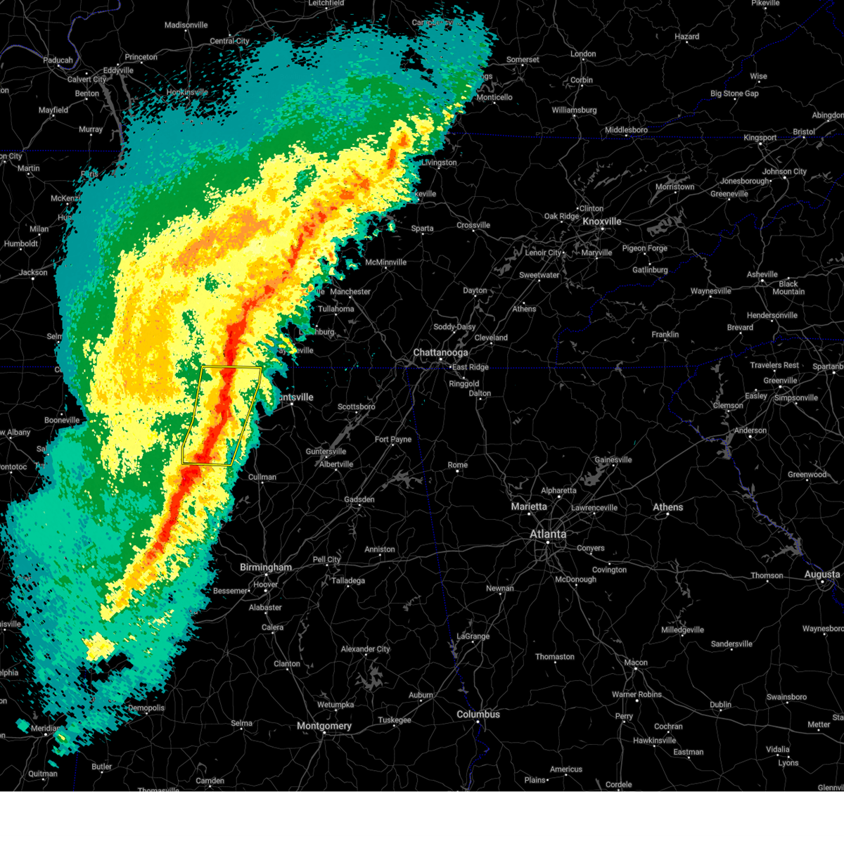
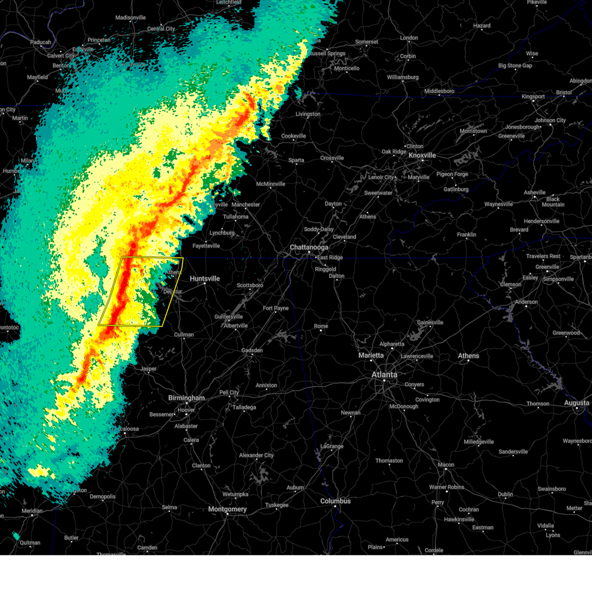
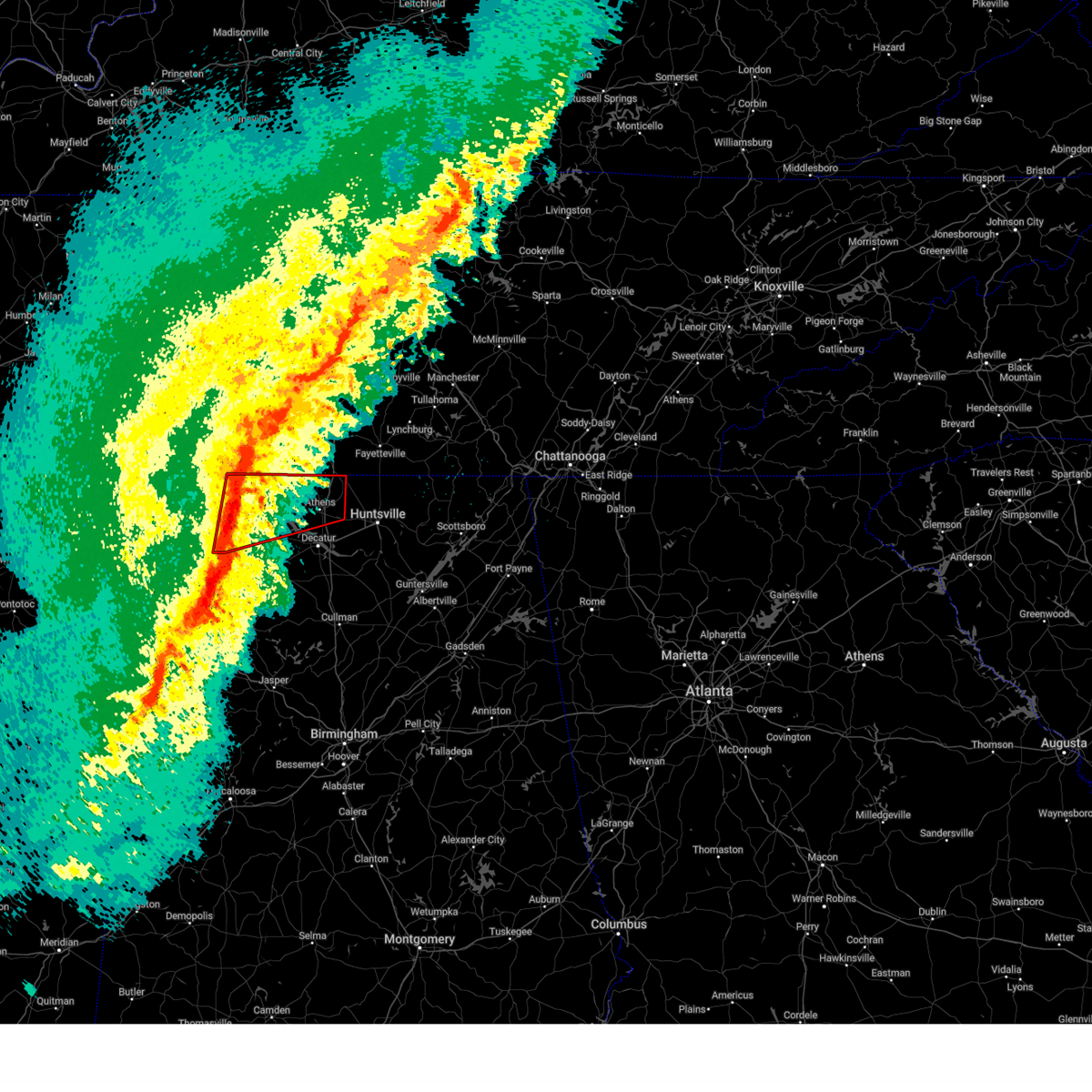
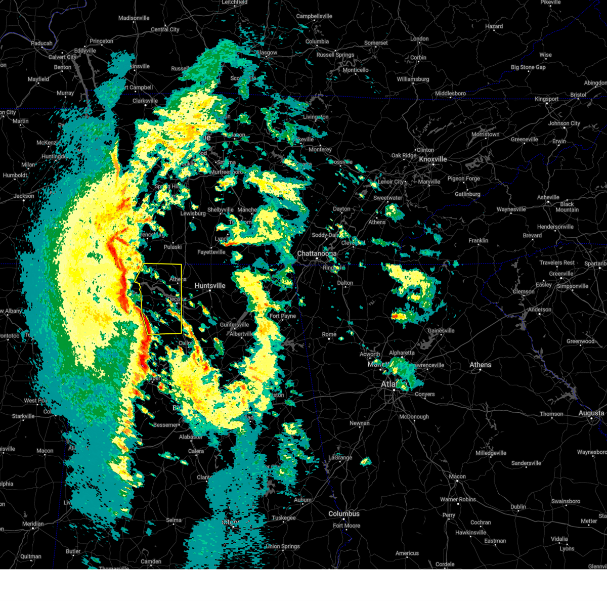
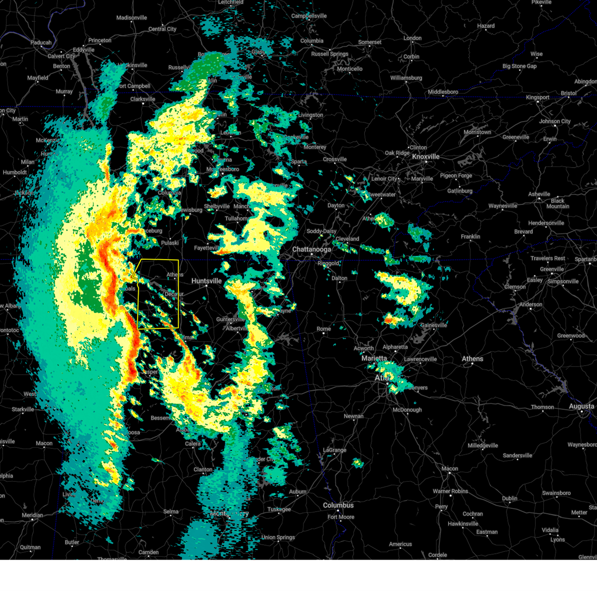
The Top Recent Hail Date for Rogersville, AL is Tuesday, May 20, 2025 (2nd out of 61)

Hail and Wind Damage Spotted near Rogersville, AL
| Date / Time | Report Details |
|---|---|
| 6/28/2025 6:20 PM CDT | A tree was knocked down blocking both lanes of the roadway at 2310 cr 92. time estimated by rada in lauderdale county AL, 7.1 miles ESE of Rogersville, AL |
| 6/27/2025 12:20 PM CDT |
 the severe thunderstorm warning has been cancelled and is no longer in effect the severe thunderstorm warning has been cancelled and is no longer in effect
|
| 6/27/2025 12:05 PM CDT |
 At 1205 pm cdt, a severe thunderstorm was located near rogersville, or 14 miles east of muscle shoals, moving northeast at 5 mph (radar indicated). Hazards include 60 mph wind gusts and penny size hail. Expect damage to roofs, siding, and trees. Locations impacted include, rogersville, lexington, courtland, anderson, center star, kingtown, oliver, whitehead, red bank, and elgin. At 1205 pm cdt, a severe thunderstorm was located near rogersville, or 14 miles east of muscle shoals, moving northeast at 5 mph (radar indicated). Hazards include 60 mph wind gusts and penny size hail. Expect damage to roofs, siding, and trees. Locations impacted include, rogersville, lexington, courtland, anderson, center star, kingtown, oliver, whitehead, red bank, and elgin.
|
| 6/27/2025 11:50 AM CDT |
 Svrhun the national weather service in huntsville alabama has issued a * severe thunderstorm warning for, eastern lauderdale county in northwestern alabama, east central colbert county in northwestern alabama, north central lawrence county in northwestern alabama, * until 1245 pm cdt. * at 1150 am cdt, a severe thunderstorm was located 7 miles southwest of rogersville, or 14 miles east of muscle shoals, moving northeast at 5 mph (radar indicated). Hazards include 60 mph wind gusts and nickel size hail. expect damage to roofs, siding, and trees Svrhun the national weather service in huntsville alabama has issued a * severe thunderstorm warning for, eastern lauderdale county in northwestern alabama, east central colbert county in northwestern alabama, north central lawrence county in northwestern alabama, * until 1245 pm cdt. * at 1150 am cdt, a severe thunderstorm was located 7 miles southwest of rogersville, or 14 miles east of muscle shoals, moving northeast at 5 mph (radar indicated). Hazards include 60 mph wind gusts and nickel size hail. expect damage to roofs, siding, and trees
|
| 6/18/2025 5:58 PM CDT | The storm which prompted the warning has moved out of the area. therefore, the warning will be allowed to expire. however, gusty winds are still possible with this thunderstorm. remember, a severe thunderstorm warning still remains in effect for portions of limestone, madison, and lincoln counties until 7 pm. |
| 6/18/2025 5:44 PM CDT |
 At 544 pm cdt, a severe thunderstorm was located 10 miles northwest of athens, moving northeast at 30 mph (radar indicated). Hazards include 60 mph wind gusts and quarter size hail. Hail damage to vehicles is expected. expect wind damage to roofs, siding, and trees. Locations impacted include, athens, rogersville, ardmore, harvest, elkmont, anderson, lester, good springs, cartwright, and coxey. At 544 pm cdt, a severe thunderstorm was located 10 miles northwest of athens, moving northeast at 30 mph (radar indicated). Hazards include 60 mph wind gusts and quarter size hail. Hail damage to vehicles is expected. expect wind damage to roofs, siding, and trees. Locations impacted include, athens, rogersville, ardmore, harvest, elkmont, anderson, lester, good springs, cartwright, and coxey.
|
| 6/18/2025 5:44 PM CDT |
 the severe thunderstorm warning has been cancelled and is no longer in effect the severe thunderstorm warning has been cancelled and is no longer in effect
|
| 6/18/2025 5:37 PM CDT | 911 call center reported a tree down at miller cemetery blocking the roadwa in lauderdale county AL, 2.4 miles WNW of Rogersville, AL |
| 6/18/2025 5:33 PM CDT | 911 call center reported a tree down blocking both lanes at 421 lakeview d in lauderdale county AL, 3 miles N of Rogersville, AL |
| 6/18/2025 5:28 PM CDT | Lauderdale 911 center reported a tree down blocking a lane at the intersection of cr 95 and cr 2 in lauderdale county AL, 2.8 miles SW of Rogersville, AL |
| 6/18/2025 5:23 PM CDT | 911 call center reported a tree down at the corner of cr 547 and cr 7 in lauderdale county AL, 4.7 miles SSE of Rogersville, AL |
| 6/18/2025 5:23 PM CDT | Tree down on roadway near cr 70 and cr 16 in lauderdale county AL, 2 miles NNW of Rogersville, AL |
| 6/18/2025 5:20 PM CDT |
 Svrhun the national weather service in huntsville alabama has issued a * severe thunderstorm warning for, northwestern madison county in north central alabama, northern limestone county in north central alabama, southeastern lauderdale county in northwestern alabama, east central colbert county in northwestern alabama, northern lawrence county in northwestern alabama, southwestern lincoln county in middle tennessee, * until 600 pm cdt. * at 519 pm cdt, a severe thunderstorm was located over rogersville, or 18 miles east of muscle shoals, moving northeast at 30 mph (radar indicated). Hazards include 60 mph wind gusts and quarter size hail. Hail damage to vehicles is expected. Expect wind damage to roofs, siding, and trees. Svrhun the national weather service in huntsville alabama has issued a * severe thunderstorm warning for, northwestern madison county in north central alabama, northern limestone county in north central alabama, southeastern lauderdale county in northwestern alabama, east central colbert county in northwestern alabama, northern lawrence county in northwestern alabama, southwestern lincoln county in middle tennessee, * until 600 pm cdt. * at 519 pm cdt, a severe thunderstorm was located over rogersville, or 18 miles east of muscle shoals, moving northeast at 30 mph (radar indicated). Hazards include 60 mph wind gusts and quarter size hail. Hail damage to vehicles is expected. Expect wind damage to roofs, siding, and trees.
|
| 6/18/2025 5:14 PM CDT | 911 call center reported a tree down across the road at 12311 hwy 7 in lauderdale county AL, 4.7 miles ESE of Rogersville, AL |
| 6/7/2025 1:49 PM CDT |
 At 148 pm cdt, severe thunderstorms were located along a line extending from near trinity to inmanfield to nauvoo, moving east at 45 mph (radar indicated). Hazards include 60 mph wind gusts. Expect damage to roofs, siding, and trees. Locations impacted include, decatur, madison, athens, hartselle, moulton, priceville, trinity, falkville, rogersville, and ardmore. At 148 pm cdt, severe thunderstorms were located along a line extending from near trinity to inmanfield to nauvoo, moving east at 45 mph (radar indicated). Hazards include 60 mph wind gusts. Expect damage to roofs, siding, and trees. Locations impacted include, decatur, madison, athens, hartselle, moulton, priceville, trinity, falkville, rogersville, and ardmore.
|
| 6/7/2025 1:49 PM CDT |
 the severe thunderstorm warning has been cancelled and is no longer in effect the severe thunderstorm warning has been cancelled and is no longer in effect
|
| 6/7/2025 1:36 PM CDT |
 the severe thunderstorm warning has been cancelled and is no longer in effect the severe thunderstorm warning has been cancelled and is no longer in effect
|
| 6/7/2025 1:36 PM CDT |
 At 135 pm cdt, severe thunderstorms were located along a line extending from near courtland to near moreland to eldridge, moving east at 45 mph (radar indicated). Hazards include 60 mph wind gusts. Expect damage to roofs, siding, and trees. Locations impacted include, decatur, madison, florence, athens, hartselle, muscle shoals, moulton, priceville, trinity, and falkville. At 135 pm cdt, severe thunderstorms were located along a line extending from near courtland to near moreland to eldridge, moving east at 45 mph (radar indicated). Hazards include 60 mph wind gusts. Expect damage to roofs, siding, and trees. Locations impacted include, decatur, madison, florence, athens, hartselle, muscle shoals, moulton, priceville, trinity, and falkville.
|
| 6/7/2025 1:08 PM CDT |
 Svrhun the national weather service in huntsville alabama has issued a * severe thunderstorm warning for, west central madison county in north central alabama, limestone county in north central alabama, eastern lauderdale county in northwestern alabama, southeastern colbert county in northwestern alabama, northwestern cullman county in north central alabama, eastern franklin county in northwestern alabama, morgan county in north central alabama, lawrence county in northwestern alabama, * until 215 pm cdt. * at 107 pm cdt, severe thunderstorms were located along a line extending from near littleville to near lake buttahatchee to near bluff, moving east at 45 mph (radar indicated). Hazards include 60 mph wind gusts. expect damage to roofs, siding, and trees Svrhun the national weather service in huntsville alabama has issued a * severe thunderstorm warning for, west central madison county in north central alabama, limestone county in north central alabama, eastern lauderdale county in northwestern alabama, southeastern colbert county in northwestern alabama, northwestern cullman county in north central alabama, eastern franklin county in northwestern alabama, morgan county in north central alabama, lawrence county in northwestern alabama, * until 215 pm cdt. * at 107 pm cdt, severe thunderstorms were located along a line extending from near littleville to near lake buttahatchee to near bluff, moving east at 45 mph (radar indicated). Hazards include 60 mph wind gusts. expect damage to roofs, siding, and trees
|
| 6/6/2025 3:15 PM CDT | the severe thunderstorm warning has been cancelled and is no longer in effect |
| 6/6/2025 2:52 PM CDT | At 251 pm cdt, a severe thunderstorm was located 8 miles east of rogersville, or 11 miles northwest of athens, moving east at 25 mph (public. at 245 pm wind damage and power outages were reported in the athens area). Hazards include 60 mph wind gusts and quarter size hail. Hail damage to vehicles is expected. expect wind damage to roofs, siding, and trees. Locations impacted include, athens, rogersville, elkmont, anderson, good springs, cartwright, coxey, oliver, mt rozell, and ripley. |
| 6/6/2025 2:52 PM CDT | the severe thunderstorm warning has been cancelled and is no longer in effect |
| 6/6/2025 2:26 PM CDT |
 Svrhun the national weather service in huntsville alabama has issued a * severe thunderstorm warning for, northern limestone county in north central alabama, southeastern lauderdale county in northwestern alabama, north central lawrence county in northwestern alabama, * until 330 pm cdt. * at 225 pm cdt, a severe thunderstorm was located over rogersville, or 19 miles east of muscle shoals, moving east at 25 mph (radar indicated). Hazards include 60 mph wind gusts and quarter size hail. Hail damage to vehicles is expected. Expect wind damage to roofs, siding, and trees. Svrhun the national weather service in huntsville alabama has issued a * severe thunderstorm warning for, northern limestone county in north central alabama, southeastern lauderdale county in northwestern alabama, north central lawrence county in northwestern alabama, * until 330 pm cdt. * at 225 pm cdt, a severe thunderstorm was located over rogersville, or 19 miles east of muscle shoals, moving east at 25 mph (radar indicated). Hazards include 60 mph wind gusts and quarter size hail. Hail damage to vehicles is expected. Expect wind damage to roofs, siding, and trees.
|
| 5/25/2025 8:36 PM CDT |
 At 836 pm cdt, severe thunderstorms were located along a line extending from near underwood-petersville to near belgreen to 6 miles west of weston, moving southeast at 35 mph (radar indicated). Hazards include 60 mph wind gusts and quarter size hail. Hail damage to vehicles is expected. expect wind damage to roofs, siding, and trees. Locations impacted include, posey loop, mt hope, atwood, florence, ne smith, oakland, north courtland, lexington, tuscumbia, and hatton. At 836 pm cdt, severe thunderstorms were located along a line extending from near underwood-petersville to near belgreen to 6 miles west of weston, moving southeast at 35 mph (radar indicated). Hazards include 60 mph wind gusts and quarter size hail. Hail damage to vehicles is expected. expect wind damage to roofs, siding, and trees. Locations impacted include, posey loop, mt hope, atwood, florence, ne smith, oakland, north courtland, lexington, tuscumbia, and hatton.
|
| 5/25/2025 8:18 PM CDT | At 818 pm cdt, severe thunderstorms were located along a line extending from 11 miles north of cherokee to 10 miles northwest of belgreen to near tremont, moving southeast at 35 mph (radar indicated). Hazards include 60 mph wind gusts and quarter size hail. Hail damage to vehicles is expected. expect wind damage to roofs, siding, and trees. Locations impacted include, posey loop, mt hope, atwood, florence, ne smith, oakland, north courtland, lexington, tuscumbia, and hatton. |
| 5/25/2025 8:12 PM CDT |
 Svrhun the national weather service in huntsville alabama has issued a * severe thunderstorm warning for, lauderdale county in northwestern alabama, colbert county in northwestern alabama, franklin county in northwestern alabama, western lawrence county in northwestern alabama, * until 915 pm cdt. * at 812 pm cdt, severe thunderstorms were located along a line extending from 9 miles southeast of walnut grove to 8 miles east of tishomingo state park to near fulton, moving southeast at 35 mph (radar indicated). Hazards include 60 mph wind gusts and quarter size hail. Hail damage to vehicles is expected. Expect wind damage to roofs, siding, and trees. Svrhun the national weather service in huntsville alabama has issued a * severe thunderstorm warning for, lauderdale county in northwestern alabama, colbert county in northwestern alabama, franklin county in northwestern alabama, western lawrence county in northwestern alabama, * until 915 pm cdt. * at 812 pm cdt, severe thunderstorms were located along a line extending from 9 miles southeast of walnut grove to 8 miles east of tishomingo state park to near fulton, moving southeast at 35 mph (radar indicated). Hazards include 60 mph wind gusts and quarter size hail. Hail damage to vehicles is expected. Expect wind damage to roofs, siding, and trees.
|
| 5/20/2025 6:10 PM CDT |
 The storm which prompted the warning has moved out of the area. therefore, the warning will be allowed to expire. a tornado watch remains in effect until 1000 pm cdt for north central and northwestern alabama. The storm which prompted the warning has moved out of the area. therefore, the warning will be allowed to expire. a tornado watch remains in effect until 1000 pm cdt for north central and northwestern alabama.
|
| 5/20/2025 6:03 PM CDT | the severe thunderstorm warning has been cancelled and is no longer in effect |
| 5/20/2025 6:03 PM CDT | At 603 pm cdt, a severe thunderstorm was located near courtland, or 16 miles north of moulton, moving east at 40 mph (radar indicated). Hazards include 60 mph wind gusts and quarter size hail. Hail damage to vehicles is expected. expect wind damage to roofs, siding, and trees. Locations impacted include, courtland, oliver, whitehead, hillsboro, red bank, rogersville, elgin, caddo, wheeler, and north courtland. |
| 5/20/2025 5:58 PM CDT |
 the tornado warning has been cancelled and is no longer in effect the tornado warning has been cancelled and is no longer in effect
|
| 5/20/2025 5:58 PM CDT |
 At 558 pm cdt, a severe thunderstorm capable of producing a tornado was located near courtland, or 17 miles east of muscle shoals, moving east at 45 mph (radar indicated rotation). Hazards include tornado and quarter size hail. Flying debris will be dangerous to those caught without shelter. mobile homes will be damaged or destroyed. damage to roofs, windows, and vehicles will occur. tree damage is likely. This tornadic thunderstorm will remain over mainly rural areas of southwestern limestone, southeastern lauderdale, northwestern morgan and northeastern lawrence counties, including the following locations, coxey, oliver, hillsboro, red bank, wheeler, north courtland, ripley, and cairo. At 558 pm cdt, a severe thunderstorm capable of producing a tornado was located near courtland, or 17 miles east of muscle shoals, moving east at 45 mph (radar indicated rotation). Hazards include tornado and quarter size hail. Flying debris will be dangerous to those caught without shelter. mobile homes will be damaged or destroyed. damage to roofs, windows, and vehicles will occur. tree damage is likely. This tornadic thunderstorm will remain over mainly rural areas of southwestern limestone, southeastern lauderdale, northwestern morgan and northeastern lawrence counties, including the following locations, coxey, oliver, hillsboro, red bank, wheeler, north courtland, ripley, and cairo.
|
| 5/20/2025 5:56 PM CDT |
 Svrhun the national weather service in huntsville alabama has issued a * severe thunderstorm warning for, northwestern jackson county in northeastern alabama, madison county in north central alabama, limestone county in north central alabama, southeastern lauderdale county in northwestern alabama, northeastern lawrence county in northwestern alabama, * until 700 pm cdt. * at 556 pm cdt, a severe thunderstorm was located near athens, moving east at 40 mph (radar indicated). Hazards include two inch hail and 60 mph wind gusts. People and animals outdoors will be injured. expect hail damage to roofs, siding, windows, and vehicles. Expect wind damage to roofs, siding, and trees. Svrhun the national weather service in huntsville alabama has issued a * severe thunderstorm warning for, northwestern jackson county in northeastern alabama, madison county in north central alabama, limestone county in north central alabama, southeastern lauderdale county in northwestern alabama, northeastern lawrence county in northwestern alabama, * until 700 pm cdt. * at 556 pm cdt, a severe thunderstorm was located near athens, moving east at 40 mph (radar indicated). Hazards include two inch hail and 60 mph wind gusts. People and animals outdoors will be injured. expect hail damage to roofs, siding, windows, and vehicles. Expect wind damage to roofs, siding, and trees.
|
| 5/20/2025 5:46 PM CDT |
 At 545 pm cdt, a severe thunderstorm was located over leighton, or 7 miles southeast of muscle shoals, moving east at 40 mph (radar indicated). Hazards include 60 mph wind gusts and quarter size hail. Hail damage to vehicles is expected. expect wind damage to roofs, siding, and trees. Locations impacted include, oliver, ne smith, caddo, north courtland, center star, town creek, killen, courtland, hillsboro, and ford city. At 545 pm cdt, a severe thunderstorm was located over leighton, or 7 miles southeast of muscle shoals, moving east at 40 mph (radar indicated). Hazards include 60 mph wind gusts and quarter size hail. Hail damage to vehicles is expected. expect wind damage to roofs, siding, and trees. Locations impacted include, oliver, ne smith, caddo, north courtland, center star, town creek, killen, courtland, hillsboro, and ford city.
|
| 5/20/2025 5:46 PM CDT |
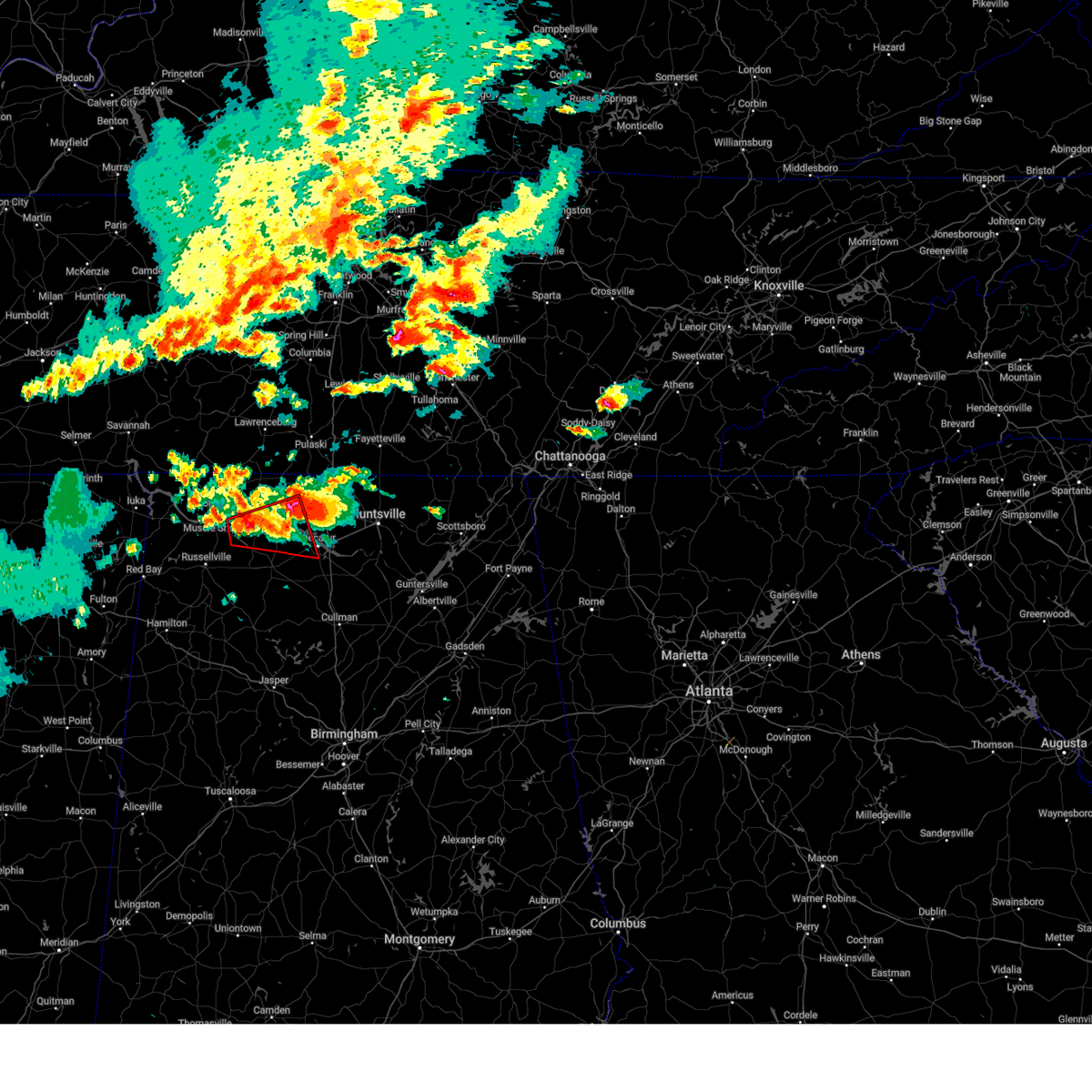 At 546 pm cdt, a severe thunderstorm capable of producing a tornado was located over leighton, or 9 miles east of muscle shoals, moving east at 45 mph (radar indicated rotation). Hazards include tornado and quarter size hail. Flying debris will be dangerous to those caught without shelter. mobile homes will be damaged or destroyed. damage to roofs, windows, and vehicles will occur. tree damage is likely. this dangerous storm will be near, town creek around 550 pm cdt. courtland around 555 pm cdt. Other locations impacted by this tornadic thunderstorm include coxey, oliver, hillsboro, cairo, red bank, ne smith, caddo, wheeler, whiteoak, and north courtland. At 546 pm cdt, a severe thunderstorm capable of producing a tornado was located over leighton, or 9 miles east of muscle shoals, moving east at 45 mph (radar indicated rotation). Hazards include tornado and quarter size hail. Flying debris will be dangerous to those caught without shelter. mobile homes will be damaged or destroyed. damage to roofs, windows, and vehicles will occur. tree damage is likely. this dangerous storm will be near, town creek around 550 pm cdt. courtland around 555 pm cdt. Other locations impacted by this tornadic thunderstorm include coxey, oliver, hillsboro, cairo, red bank, ne smith, caddo, wheeler, whiteoak, and north courtland.
|
| 5/20/2025 5:45 PM CDT |
 At 543 pm cdt, a severe thunderstorm was located near athens, moving east at 45 mph. this is a destructive storm for rogersville near and east of wheeler dam (radar indicated). Hazards include baseball size hail and 60 mph wind gusts. People and animals outdoors will be severely injured. expect shattered windows, extensive damage to roofs, siding, and vehicles. Locations impacted include, madison, cartwright, french mill, coxey, oliver, athens, harvest, ripley, toney, and cairo. At 543 pm cdt, a severe thunderstorm was located near athens, moving east at 45 mph. this is a destructive storm for rogersville near and east of wheeler dam (radar indicated). Hazards include baseball size hail and 60 mph wind gusts. People and animals outdoors will be severely injured. expect shattered windows, extensive damage to roofs, siding, and vehicles. Locations impacted include, madison, cartwright, french mill, coxey, oliver, athens, harvest, ripley, toney, and cairo.
|
| 5/20/2025 5:44 PM CDT | Quarter sized hail reported 4.9 miles SSE of Rogersville, AL, report from mping: quarter (1.00 in.). |
| 5/20/2025 5:40 PM CDT |
 At 539 pm cdt, a severe thunderstorm was located 9 miles west of athens, moving east at 45 mph (radar indicated). Hazards include tennis ball size hail and 60 mph wind gusts. this storm has a history of producing golfball size hail. People and animals outdoors will be injured. expect hail damage to roofs, siding, windows, and vehicles. expect wind damage to roofs, siding, and trees. Locations impacted include, madison, cartwright, french mill, coxey, oliver, athens, harvest, ripley, toney, and cairo. At 539 pm cdt, a severe thunderstorm was located 9 miles west of athens, moving east at 45 mph (radar indicated). Hazards include tennis ball size hail and 60 mph wind gusts. this storm has a history of producing golfball size hail. People and animals outdoors will be injured. expect hail damage to roofs, siding, windows, and vehicles. expect wind damage to roofs, siding, and trees. Locations impacted include, madison, cartwright, french mill, coxey, oliver, athens, harvest, ripley, toney, and cairo.
|
| 5/20/2025 5:36 PM CDT |
 Torhun the national weather service in huntsville alabama has issued a * tornado warning for, southwestern limestone county in north central alabama, southeastern lauderdale county in northwestern alabama, southeastern colbert county in northwestern alabama, northwestern morgan county in north central alabama, northern lawrence county in northwestern alabama, * until 615 pm cdt. * at 536 pm cdt, a severe thunderstorm capable of producing a tornado was located near muscle shoals, moving east at 45 mph (radar indicated rotation). Hazards include tornado and quarter size hail. Flying debris will be dangerous to those caught without shelter. mobile homes will be damaged or destroyed. damage to roofs, windows, and vehicles will occur. tree damage is likely. this dangerous storm will be near, muscle shoals and leighton around 540 pm cdt. town creek around 550 pm cdt. courtland around 555 pm cdt. Other locations impacted by this tornadic thunderstorm include northwest alabama regional airport, coxey, oliver, hillsboro, red bank, caddo, wheeler, whiteoak, north courtland, and ripley. Torhun the national weather service in huntsville alabama has issued a * tornado warning for, southwestern limestone county in north central alabama, southeastern lauderdale county in northwestern alabama, southeastern colbert county in northwestern alabama, northwestern morgan county in north central alabama, northern lawrence county in northwestern alabama, * until 615 pm cdt. * at 536 pm cdt, a severe thunderstorm capable of producing a tornado was located near muscle shoals, moving east at 45 mph (radar indicated rotation). Hazards include tornado and quarter size hail. Flying debris will be dangerous to those caught without shelter. mobile homes will be damaged or destroyed. damage to roofs, windows, and vehicles will occur. tree damage is likely. this dangerous storm will be near, muscle shoals and leighton around 540 pm cdt. town creek around 550 pm cdt. courtland around 555 pm cdt. Other locations impacted by this tornadic thunderstorm include northwest alabama regional airport, coxey, oliver, hillsboro, red bank, caddo, wheeler, whiteoak, north courtland, and ripley.
|
| 5/20/2025 5:35 PM CDT | Golf Ball sized hail reported 2.4 miles WNW of Rogersville, AL, ema reported golf ball sized hail on hwy 72 at the elk river. |
| 5/20/2025 5:35 PM CDT |
 At 535 pm cdt, a severe thunderstorm was located near rogersville, or 12 miles west of athens, moving east at 45 mph (radar indicated). Hazards include tennis ball size hail and 60 mph wind gusts. People and animals outdoors will be injured. expect hail damage to roofs, siding, windows, and vehicles. expect wind damage to roofs, siding, and trees. Locations impacted include, madison, cartwright, french mill, coxey, oliver, athens, anderson, harvest, ripley, and toney. At 535 pm cdt, a severe thunderstorm was located near rogersville, or 12 miles west of athens, moving east at 45 mph (radar indicated). Hazards include tennis ball size hail and 60 mph wind gusts. People and animals outdoors will be injured. expect hail damage to roofs, siding, windows, and vehicles. expect wind damage to roofs, siding, and trees. Locations impacted include, madison, cartwright, french mill, coxey, oliver, athens, anderson, harvest, ripley, and toney.
|
| 5/20/2025 5:32 PM CDT | Multiple power poles and trees down cr 605 in the rogersville area. time estimated by rada in lauderdale county AL, 3.3 miles NNE of Rogersville, AL |
| 5/20/2025 5:32 PM CDT |
 Svrhun the national weather service in huntsville alabama has issued a * severe thunderstorm warning for, southeastern lauderdale county in northwestern alabama, southeastern colbert county in northwestern alabama, northern lawrence county in northwestern alabama, * until 615 pm cdt. * at 532 pm cdt, a severe thunderstorm was located near tuscumbia, moving east at 40 mph (radar indicated). Hazards include 60 mph wind gusts and quarter size hail. Hail damage to vehicles is expected. Expect wind damage to roofs, siding, and trees. Svrhun the national weather service in huntsville alabama has issued a * severe thunderstorm warning for, southeastern lauderdale county in northwestern alabama, southeastern colbert county in northwestern alabama, northern lawrence county in northwestern alabama, * until 615 pm cdt. * at 532 pm cdt, a severe thunderstorm was located near tuscumbia, moving east at 40 mph (radar indicated). Hazards include 60 mph wind gusts and quarter size hail. Hail damage to vehicles is expected. Expect wind damage to roofs, siding, and trees.
|
| 5/20/2025 5:27 PM CDT |
 the severe thunderstorm warning has been cancelled and is no longer in effect the severe thunderstorm warning has been cancelled and is no longer in effect
|
| 5/20/2025 5:27 PM CDT |
 At 527 pm cdt, a severe thunderstorm was located over rogersville, or 18 miles west of athens, moving east at 45 mph (radar indicated). Hazards include tennis ball size hail and 60 mph wind gusts. People and animals outdoors will be injured. expect hail damage to roofs, siding, windows, and vehicles. expect wind damage to roofs, siding, and trees. Locations impacted include, madison, cartwright, french mill, coxey, oliver, athens, anderson, harvest, ripley, and toney. At 527 pm cdt, a severe thunderstorm was located over rogersville, or 18 miles west of athens, moving east at 45 mph (radar indicated). Hazards include tennis ball size hail and 60 mph wind gusts. People and animals outdoors will be injured. expect hail damage to roofs, siding, windows, and vehicles. expect wind damage to roofs, siding, and trees. Locations impacted include, madison, cartwright, french mill, coxey, oliver, athens, anderson, harvest, ripley, and toney.
|
| 5/20/2025 5:18 PM CDT | At 518 pm cdt, a severe thunderstorm was located 7 miles west of rogersville, or 13 miles east of muscle shoals, moving east at 45 mph (radar indicated). Hazards include two inch hail and 60 mph wind gusts. People and animals outdoors will be injured. expect hail damage to roofs, siding, windows, and vehicles. expect wind damage to roofs, siding, and trees. Locations impacted include, madison, cartwright, french mill, coxey, harvest, killen, ford city, red bank, capshaw, and elgin. |
| 5/20/2025 5:09 PM CDT |
 At 508 pm cdt, a severe thunderstorm was located near killen, or near muscle shoals, moving east at 45 mph (radar indicated). Hazards include golf ball size hail and 60 mph wind gusts. People and animals outdoors will be injured. expect hail damage to roofs, siding, windows, and vehicles. expect wind damage to roofs, siding, and trees. Locations impacted include, madison, cartwright, northwest alabama regional airport, french mill, coxey, harvest, killen, ford city, red bank, and capshaw. At 508 pm cdt, a severe thunderstorm was located near killen, or near muscle shoals, moving east at 45 mph (radar indicated). Hazards include golf ball size hail and 60 mph wind gusts. People and animals outdoors will be injured. expect hail damage to roofs, siding, windows, and vehicles. expect wind damage to roofs, siding, and trees. Locations impacted include, madison, cartwright, northwest alabama regional airport, french mill, coxey, harvest, killen, ford city, red bank, and capshaw.
|
| 5/20/2025 4:57 PM CDT |
 Svrhun the national weather service in huntsville alabama has issued a * severe thunderstorm warning for, northwestern madison county in north central alabama, limestone county in north central alabama, southeastern lauderdale county in northwestern alabama, east central colbert county in northwestern alabama, northeastern lawrence county in northwestern alabama, * until 600 pm cdt. * at 456 pm cdt, a severe thunderstorm was located over sheffield, moving east at 45 mph. this storm has previous history of producing golfball size hail (radar indicated). Hazards include golf ball size hail and 60 mph wind gusts. People and animals outdoors will be injured. expect hail damage to roofs, siding, windows, and vehicles. Expect wind damage to roofs, siding, and trees. Svrhun the national weather service in huntsville alabama has issued a * severe thunderstorm warning for, northwestern madison county in north central alabama, limestone county in north central alabama, southeastern lauderdale county in northwestern alabama, east central colbert county in northwestern alabama, northeastern lawrence county in northwestern alabama, * until 600 pm cdt. * at 456 pm cdt, a severe thunderstorm was located over sheffield, moving east at 45 mph. this storm has previous history of producing golfball size hail (radar indicated). Hazards include golf ball size hail and 60 mph wind gusts. People and animals outdoors will be injured. expect hail damage to roofs, siding, windows, and vehicles. Expect wind damage to roofs, siding, and trees.
|
| 5/20/2025 4:27 PM CDT | Golf ball size observed hail along elk river ese of rogersville. time estimated from rada in lauderdale county AL, 2.4 miles WNW of Rogersville, AL |
| 5/2/2025 3:55 PM CDT | The storm which prompted the warning has moved out of the area. therefore, the warning will be allowed to expire. a severe thunderstorm watch remains in effect until 500 pm cdt for north central and northwestern alabama, and middle tennessee. a severe thunderstorm watch also remains in effect until 800 pm cdt for north central and northeastern alabama. |
| 5/2/2025 3:35 PM CDT | At 335 pm cdt, a severe thunderstorm was located near courtland, or 18 miles north of moulton, moving northeast at 50 mph (radar indicated). Hazards include 60 mph wind gusts and quarter size hail. Hail damage to vehicles is expected. expect wind damage to roofs, siding, and trees. Locations impacted include, good springs, cartwright, coxey, trinity, ne smith, north courtland, hatton, lester, red bank, and leggtown. |
| 5/2/2025 3:35 PM CDT | the severe thunderstorm warning has been cancelled and is no longer in effect |
| 5/2/2025 3:04 PM CDT |
 Svrhun the national weather service in huntsville alabama has issued a * severe thunderstorm warning for, central limestone county in north central alabama, southeastern lauderdale county in northwestern alabama, southeastern colbert county in northwestern alabama, northeastern franklin county in northwestern alabama, northwestern morgan county in north central alabama, northern lawrence county in northwestern alabama, * until 400 pm cdt. * at 304 pm cdt, a severe thunderstorm was located over littleville, or near russellville, moving northeast at 50 mph (radar indicated). Hazards include 60 mph wind gusts and quarter size hail. Hail damage to vehicles is expected. Expect wind damage to roofs, siding, and trees. Svrhun the national weather service in huntsville alabama has issued a * severe thunderstorm warning for, central limestone county in north central alabama, southeastern lauderdale county in northwestern alabama, southeastern colbert county in northwestern alabama, northeastern franklin county in northwestern alabama, northwestern morgan county in north central alabama, northern lawrence county in northwestern alabama, * until 400 pm cdt. * at 304 pm cdt, a severe thunderstorm was located over littleville, or near russellville, moving northeast at 50 mph (radar indicated). Hazards include 60 mph wind gusts and quarter size hail. Hail damage to vehicles is expected. Expect wind damage to roofs, siding, and trees.
|
| 5/2/2025 12:14 PM CDT |
 Svrhun the national weather service in huntsville alabama has issued a * severe thunderstorm warning for, west central limestone county in north central alabama, lauderdale county in northwestern alabama, colbert county in northwestern alabama, franklin county in northwestern alabama, lawrence county in northwestern alabama, * until 115 pm cdt. * at 1214 pm cdt, severe thunderstorms were located along a line extending from near tuscumbia to 11 miles west of moulton, moving northeast at 30 mph (radar indicated). Hazards include 60 mph wind gusts and quarter size hail. Hail damage to vehicles is expected. Expect wind damage to roofs, siding, and trees. Svrhun the national weather service in huntsville alabama has issued a * severe thunderstorm warning for, west central limestone county in north central alabama, lauderdale county in northwestern alabama, colbert county in northwestern alabama, franklin county in northwestern alabama, lawrence county in northwestern alabama, * until 115 pm cdt. * at 1214 pm cdt, severe thunderstorms were located along a line extending from near tuscumbia to 11 miles west of moulton, moving northeast at 30 mph (radar indicated). Hazards include 60 mph wind gusts and quarter size hail. Hail damage to vehicles is expected. Expect wind damage to roofs, siding, and trees.
|
| 4/5/2025 11:14 PM CDT |
 The storm which prompted the warning has moved out of the area. therefore, the warning will be allowed to expire. however, gusty winds are still possible with this thunderstorm. a tornado watch remains in effect until 300 am cdt for north central and northwestern alabama. The storm which prompted the warning has moved out of the area. therefore, the warning will be allowed to expire. however, gusty winds are still possible with this thunderstorm. a tornado watch remains in effect until 300 am cdt for north central and northwestern alabama.
|
| 4/5/2025 11:02 PM CDT |
 At 1101 pm cdt, a confirmed tornado was located near lexington, or 19 miles east of florence, moving northeast at 45 mph (broadcast media confirmed tornado). Hazards include damaging tornado and quarter size hail. Flying debris will be dangerous to those caught without shelter. mobile homes will be damaged or destroyed. damage to roofs, windows, and vehicles will occur. tree damage is likely. This tornadic thunderstorm will remain over mainly rural areas of northeastern lauderdale county, including the following locations, elgin, kingtown, whitehead, and anderson. At 1101 pm cdt, a confirmed tornado was located near lexington, or 19 miles east of florence, moving northeast at 45 mph (broadcast media confirmed tornado). Hazards include damaging tornado and quarter size hail. Flying debris will be dangerous to those caught without shelter. mobile homes will be damaged or destroyed. damage to roofs, windows, and vehicles will occur. tree damage is likely. This tornadic thunderstorm will remain over mainly rural areas of northeastern lauderdale county, including the following locations, elgin, kingtown, whitehead, and anderson.
|
| 4/5/2025 11:02 PM CDT |
 the tornado warning has been cancelled and is no longer in effect the tornado warning has been cancelled and is no longer in effect
|
| 4/5/2025 10:59 PM CDT |
 Torhun the national weather service in huntsville alabama has issued a * tornado warning for, northern limestone county in north central alabama, northeastern lauderdale county in northwestern alabama, * until 1145 pm cdt. * at 1058 pm cdt, a severe thunderstorm capable of producing a tornado was located near rogersville, or 18 miles northeast of muscle shoals, moving east at 45 mph (radar indicated rotation). Hazards include tornado and quarter size hail. Flying debris will be dangerous to those caught without shelter. mobile homes will be damaged or destroyed. damage to roofs, windows, and vehicles will occur. tree damage is likely. this dangerous storm will be near, rogersville around 1105 pm cdt. ardmore around 1135 pm cdt. Other locations impacted by this tornadic thunderstorm include good springs, cartwright, oliver, mt rozell, anderson, lester, kingtown, whitehead, cairo, and holland gin. Torhun the national weather service in huntsville alabama has issued a * tornado warning for, northern limestone county in north central alabama, northeastern lauderdale county in northwestern alabama, * until 1145 pm cdt. * at 1058 pm cdt, a severe thunderstorm capable of producing a tornado was located near rogersville, or 18 miles northeast of muscle shoals, moving east at 45 mph (radar indicated rotation). Hazards include tornado and quarter size hail. Flying debris will be dangerous to those caught without shelter. mobile homes will be damaged or destroyed. damage to roofs, windows, and vehicles will occur. tree damage is likely. this dangerous storm will be near, rogersville around 1105 pm cdt. ardmore around 1135 pm cdt. Other locations impacted by this tornadic thunderstorm include good springs, cartwright, oliver, mt rozell, anderson, lester, kingtown, whitehead, cairo, and holland gin.
|
| 4/5/2025 10:45 PM CDT |
 At 1042 pm cdt, a confirmed tornado was located over killen, or near florence, moving northeast at 45 mph (broadcast media confirmed tornado). Hazards include damaging tornado. Flying debris will be dangerous to those caught without shelter. mobile homes will be damaged or destroyed. damage to roofs, windows, and vehicles will occur. tree damage is likely. this tornado will be near, killen around 1050 pm cdt. lexington around 1055 pm cdt. Other locations impacted by this tornadic thunderstorm include green hill, center star, northwest alabama regional airport, kingtown, oliver, whitehead, ford city, elgin, and anderson. At 1042 pm cdt, a confirmed tornado was located over killen, or near florence, moving northeast at 45 mph (broadcast media confirmed tornado). Hazards include damaging tornado. Flying debris will be dangerous to those caught without shelter. mobile homes will be damaged or destroyed. damage to roofs, windows, and vehicles will occur. tree damage is likely. this tornado will be near, killen around 1050 pm cdt. lexington around 1055 pm cdt. Other locations impacted by this tornadic thunderstorm include green hill, center star, northwest alabama regional airport, kingtown, oliver, whitehead, ford city, elgin, and anderson.
|
| 4/5/2025 10:45 PM CDT |
 the tornado warning has been cancelled and is no longer in effect the tornado warning has been cancelled and is no longer in effect
|
| 4/5/2025 10:26 PM CDT |
 Torhun the national weather service in huntsville alabama has issued a * tornado warning for, west central limestone county in north central alabama, eastern lauderdale county in northwestern alabama, southeastern colbert county in northwestern alabama, north central lawrence county in northwestern alabama, * until 1115 pm cdt. * at 1026 pm cdt, a confirmed tornado was located over sheffield, moving east at 40 mph (broadcast media confirmed tornado). Hazards include damaging tornado. Flying debris will be dangerous to those caught without shelter. mobile homes will be damaged or destroyed. damage to roofs, windows, and vehicles will occur. tree damage is likely. the tornado will be near, sheffield, tuscumbia, florence, and muscle shoals around 1030 pm cdt. st. florian around 1035 pm cdt. killen around 1040 pm cdt. lexington around 1055 pm cdt. Other locations impacted by this tornadic thunderstorm include green hill, northwest alabama regional airport, coxey, oliver, new bethel, oakland, anderson, center star, pride landing, and kingtown. Torhun the national weather service in huntsville alabama has issued a * tornado warning for, west central limestone county in north central alabama, eastern lauderdale county in northwestern alabama, southeastern colbert county in northwestern alabama, north central lawrence county in northwestern alabama, * until 1115 pm cdt. * at 1026 pm cdt, a confirmed tornado was located over sheffield, moving east at 40 mph (broadcast media confirmed tornado). Hazards include damaging tornado. Flying debris will be dangerous to those caught without shelter. mobile homes will be damaged or destroyed. damage to roofs, windows, and vehicles will occur. tree damage is likely. the tornado will be near, sheffield, tuscumbia, florence, and muscle shoals around 1030 pm cdt. st. florian around 1035 pm cdt. killen around 1040 pm cdt. lexington around 1055 pm cdt. Other locations impacted by this tornadic thunderstorm include green hill, northwest alabama regional airport, coxey, oliver, new bethel, oakland, anderson, center star, pride landing, and kingtown.
|
| 3/23/2025 7:22 PM CDT | The storm which prompted the warning has weakened below severe limits, and no longer poses an immediate threat to life or property. therefore, the warning will be allowed to expire. however, small hail and gusty winds are still possible with this thunderstorm. a severe thunderstorm watch remains in effect until midnight cdt for north central and northwestern alabama. |
| 3/23/2025 7:11 PM CDT | At 710 pm cdt, a severe thunderstorm was located near st. florian, or near florence, moving east at 40 mph (radar indicated). Hazards include 60 mph wind gusts and quarter size hail. Hail damage to vehicles is expected. expect wind damage to roofs, siding, and trees. Locations impacted include, green hill, oliver, florence, anderson, lexington, center star, killen, zip city, kingtown, and underwood-petersville. |
| 3/23/2025 6:48 PM CDT |
 Svrhun the national weather service in huntsville alabama has issued a * severe thunderstorm warning for, lauderdale county in northwestern alabama, * until 730 pm cdt. * at 648 pm cdt, a severe thunderstorm was located 8 miles west of underwood-petersville, or 11 miles west of florence, moving east at 40 mph (radar indicated). Hazards include 60 mph wind gusts and quarter size hail. Hail damage to vehicles is expected. Expect wind damage to roofs, siding, and trees. Svrhun the national weather service in huntsville alabama has issued a * severe thunderstorm warning for, lauderdale county in northwestern alabama, * until 730 pm cdt. * at 648 pm cdt, a severe thunderstorm was located 8 miles west of underwood-petersville, or 11 miles west of florence, moving east at 40 mph (radar indicated). Hazards include 60 mph wind gusts and quarter size hail. Hail damage to vehicles is expected. Expect wind damage to roofs, siding, and trees.
|
| 3/15/2025 3:38 PM CDT | The severe thunderstorm which prompted the warning has moved out of the warned area. therefore, the warning will be allowed to expire. however, gusty winds are still possible with this thunderstorm. a tornado watch remains in effect until 800 pm cdt for north central, northeastern and northwestern alabama. a tornado watch also remains in effect until 900 pm cdt for middle tennessee. |
| 3/15/2025 3:28 PM CDT | At 327 pm cdt, a severe thunderstorm was located over ardmore, or 15 miles north of athens, moving northeast at 40 mph (radar indicated). Hazards include 60 mph wind gusts and half dollar size hail. Hail damage to vehicles is expected. expect wind damage to roofs, siding, and trees. Locations impacted include, good springs, cartwright, french mill, coxey, oliver, mt rozell, athens, anderson, ripley, and lester. |
| 3/15/2025 3:28 PM CDT | the severe thunderstorm warning has been cancelled and is no longer in effect |
| 3/15/2025 2:55 PM CDT |
 At 255 pm cdt, a severe thunderstorm was located near rogersville, or 15 miles northwest of athens, moving northeast at 40 mph (radar indicated). Hazards include ping pong ball size hail and 60 mph wind gusts. People and animals outdoors will be injured. expect hail damage to roofs, siding, windows, and vehicles. expect wind damage to roofs, siding, and trees. Locations impacted include, good springs, cartwright, northwest alabama regional airport, french mill, coxey, littleville, la grange, florence, ne smith, and north courtland. At 255 pm cdt, a severe thunderstorm was located near rogersville, or 15 miles northwest of athens, moving northeast at 40 mph (radar indicated). Hazards include ping pong ball size hail and 60 mph wind gusts. People and animals outdoors will be injured. expect hail damage to roofs, siding, windows, and vehicles. expect wind damage to roofs, siding, and trees. Locations impacted include, good springs, cartwright, northwest alabama regional airport, french mill, coxey, littleville, la grange, florence, ne smith, and north courtland.
|
| 3/15/2025 2:46 PM CDT |
 the tornado warning has been cancelled and is no longer in effect the tornado warning has been cancelled and is no longer in effect
|
| 3/15/2025 2:45 PM CDT |
 Svrhun the national weather service in huntsville alabama has issued a * severe thunderstorm warning for, limestone county in north central alabama, eastern lauderdale county in northwestern alabama, southeastern colbert county in northwestern alabama, northeastern franklin county in northwestern alabama, northern lawrence county in northwestern alabama, * until 345 pm cdt. * at 244 pm cdt, a severe thunderstorm was located over rogersville, or 18 miles east of muscle shoals, moving northeast at 40 mph (radar indicated). Hazards include golf ball size hail and 60 mph wind gusts. People and animals outdoors will be injured. expect hail damage to roofs, siding, windows, and vehicles. Expect wind damage to roofs, siding, and trees. Svrhun the national weather service in huntsville alabama has issued a * severe thunderstorm warning for, limestone county in north central alabama, eastern lauderdale county in northwestern alabama, southeastern colbert county in northwestern alabama, northeastern franklin county in northwestern alabama, northern lawrence county in northwestern alabama, * until 345 pm cdt. * at 244 pm cdt, a severe thunderstorm was located over rogersville, or 18 miles east of muscle shoals, moving northeast at 40 mph (radar indicated). Hazards include golf ball size hail and 60 mph wind gusts. People and animals outdoors will be injured. expect hail damage to roofs, siding, windows, and vehicles. Expect wind damage to roofs, siding, and trees.
|
| 3/15/2025 2:28 PM CDT |
 the tornado warning has been cancelled and is no longer in effect the tornado warning has been cancelled and is no longer in effect
|
| 3/15/2025 2:28 PM CDT |
 At 226 pm cdt, a severe thunderstorm capable of producing a tornado was located near littleville, or near tuscumbia, moving northeast at 50 mph (radar indicated rotation. ema reported baseball sized hail). Hazards include tornado and baseball size hail. Flying debris will be dangerous to those caught without shelter. mobile homes will be damaged or destroyed. damage to roofs, windows, and vehicles will occur. tree damage is likely. this dangerous storm will be near, muscle shoals and leighton around 230 pm cdt. lexington around 255 pm cdt. Other locations impacted by this tornadic thunderstorm include green hill, northwest alabama regional airport, new bethel, anderson, center star, pride landing, zip city, kingtown, whitehead, and ford city. At 226 pm cdt, a severe thunderstorm capable of producing a tornado was located near littleville, or near tuscumbia, moving northeast at 50 mph (radar indicated rotation. ema reported baseball sized hail). Hazards include tornado and baseball size hail. Flying debris will be dangerous to those caught without shelter. mobile homes will be damaged or destroyed. damage to roofs, windows, and vehicles will occur. tree damage is likely. this dangerous storm will be near, muscle shoals and leighton around 230 pm cdt. lexington around 255 pm cdt. Other locations impacted by this tornadic thunderstorm include green hill, northwest alabama regional airport, new bethel, anderson, center star, pride landing, zip city, kingtown, whitehead, and ford city.
|
| 3/15/2025 2:19 PM CDT |
 At 219 pm cdt, a severe thunderstorm capable of producing a tornado was located over littleville, or near russellville, moving northeast at 55 mph (radar indicated rotation). Hazards include tornado and ping pong ball size hail. Flying debris will be dangerous to those caught without shelter. mobile homes will be damaged or destroyed. damage to roofs, windows, and vehicles will occur. tree damage is likely. this dangerous storm will be near, littleville around 225 pm cdt. leighton around 230 pm cdt. rogersville around 245 pm cdt. Other locations impacted by this tornadic thunderstorm include green hill, posey loop, northwest alabama regional airport, new bethel, anderson, red rock, center star, pride landing, zip city, and kingtown. At 219 pm cdt, a severe thunderstorm capable of producing a tornado was located over littleville, or near russellville, moving northeast at 55 mph (radar indicated rotation). Hazards include tornado and ping pong ball size hail. Flying debris will be dangerous to those caught without shelter. mobile homes will be damaged or destroyed. damage to roofs, windows, and vehicles will occur. tree damage is likely. this dangerous storm will be near, littleville around 225 pm cdt. leighton around 230 pm cdt. rogersville around 245 pm cdt. Other locations impacted by this tornadic thunderstorm include green hill, posey loop, northwest alabama regional airport, new bethel, anderson, red rock, center star, pride landing, zip city, and kingtown.
|
| 3/15/2025 2:08 PM CDT |
 Torhun the national weather service in huntsville alabama has issued a * tornado warning for, lauderdale county in northwestern alabama, colbert county in northwestern alabama, northwestern franklin county in northwestern alabama, northwestern lawrence county in northwestern alabama, * until 315 pm cdt. * at 207 pm cdt, a severe thunderstorm capable of producing a tornado was located over belgreen, or near russellville, moving northeast at 50 mph (radar indicated rotation). Hazards include tornado and ping pong ball size hail. Flying debris will be dangerous to those caught without shelter. mobile homes will be damaged or destroyed. damage to roofs, windows, and vehicles will occur. tree damage is likely. this dangerous storm will be near, russellville and littleville around 215 pm cdt. muscle shoals and leighton around 230 pm cdt. lexington around 255 pm cdt. Other locations impacted by this tornadic thunderstorm include posey loop, northwest alabama regional airport, atwood, oakland, rockwood, red rock, pride landing, zip city, dempsey, and ford city. Torhun the national weather service in huntsville alabama has issued a * tornado warning for, lauderdale county in northwestern alabama, colbert county in northwestern alabama, northwestern franklin county in northwestern alabama, northwestern lawrence county in northwestern alabama, * until 315 pm cdt. * at 207 pm cdt, a severe thunderstorm capable of producing a tornado was located over belgreen, or near russellville, moving northeast at 50 mph (radar indicated rotation). Hazards include tornado and ping pong ball size hail. Flying debris will be dangerous to those caught without shelter. mobile homes will be damaged or destroyed. damage to roofs, windows, and vehicles will occur. tree damage is likely. this dangerous storm will be near, russellville and littleville around 215 pm cdt. muscle shoals and leighton around 230 pm cdt. lexington around 255 pm cdt. Other locations impacted by this tornadic thunderstorm include posey loop, northwest alabama regional airport, atwood, oakland, rockwood, red rock, pride landing, zip city, dempsey, and ford city.
|
| 3/15/2025 4:05 AM CDT |
 At 405 am cdt, a severe thunderstorm was located near russellville, moving northeast at 55 mph (radar indicated). Hazards include 60 mph wind gusts and quarter size hail. Hail damage to vehicles is expected. expect wind damage to roofs, siding, and trees. Locations impacted include, good springs, mt hope, cartwright, french mill, coxey, trinity, littleville, la grange, ne smith, and north courtland. At 405 am cdt, a severe thunderstorm was located near russellville, moving northeast at 55 mph (radar indicated). Hazards include 60 mph wind gusts and quarter size hail. Hail damage to vehicles is expected. expect wind damage to roofs, siding, and trees. Locations impacted include, good springs, mt hope, cartwright, french mill, coxey, trinity, littleville, la grange, ne smith, and north courtland.
|
| 3/15/2025 3:49 AM CDT |
 Svrhun the national weather service in huntsville alabama has issued a * severe thunderstorm warning for, limestone county in north central alabama, southeastern lauderdale county in northwestern alabama, southeastern colbert county in northwestern alabama, northwestern morgan county in north central alabama, lawrence county in northwestern alabama, * until 445 am cdt. * at 349 am cdt, a severe thunderstorm was located near russellville, moving northeast at 60 mph (radar indicated). Hazards include 60 mph wind gusts and quarter size hail. Hail damage to vehicles is expected. Expect wind damage to roofs, siding, and trees. Svrhun the national weather service in huntsville alabama has issued a * severe thunderstorm warning for, limestone county in north central alabama, southeastern lauderdale county in northwestern alabama, southeastern colbert county in northwestern alabama, northwestern morgan county in north central alabama, lawrence county in northwestern alabama, * until 445 am cdt. * at 349 am cdt, a severe thunderstorm was located near russellville, moving northeast at 60 mph (radar indicated). Hazards include 60 mph wind gusts and quarter size hail. Hail damage to vehicles is expected. Expect wind damage to roofs, siding, and trees.
|
| 3/13/2025 4:35 PM CDT |
 the severe thunderstorm warning has been cancelled and is no longer in effect the severe thunderstorm warning has been cancelled and is no longer in effect
|
| 3/13/2025 4:09 PM CDT |
 Svrhun the national weather service in huntsville alabama has issued a * severe thunderstorm warning for, northwestern limestone county in north central alabama, southeastern lauderdale county in northwestern alabama, east central colbert county in northwestern alabama, northeastern lawrence county in northwestern alabama, * until 515 pm cdt. * at 409 pm cdt, a severe thunderstorm was located near killen, or near muscle shoals, moving east at 20 mph (radar indicated). Hazards include 60 mph wind gusts and quarter size hail. Hail damage to vehicles is expected. Expect wind damage to roofs, siding, and trees. Svrhun the national weather service in huntsville alabama has issued a * severe thunderstorm warning for, northwestern limestone county in north central alabama, southeastern lauderdale county in northwestern alabama, east central colbert county in northwestern alabama, northeastern lawrence county in northwestern alabama, * until 515 pm cdt. * at 409 pm cdt, a severe thunderstorm was located near killen, or near muscle shoals, moving east at 20 mph (radar indicated). Hazards include 60 mph wind gusts and quarter size hail. Hail damage to vehicles is expected. Expect wind damage to roofs, siding, and trees.
|
| 2/15/2025 11:54 PM CST |
 At 1153 pm cst, severe thunderstorms were located along a line extending from near pulaski to 8 miles northeast of rogersville to near courtland to 8 miles southwest of moulton, moving east at 60 mph. multiple areas of rotation are present within this line. this line of storms has a history of producing wind damage (radar indicated). Hazards include 60 mph wind gusts and quarter size hail. Hail damage to vehicles is expected. expect wind damage to roofs, siding, and trees. Locations impacted include, decatur, athens, moulton, trinity, rogersville, ardmore, town creek, lexington, courtland, and tanner. At 1153 pm cst, severe thunderstorms were located along a line extending from near pulaski to 8 miles northeast of rogersville to near courtland to 8 miles southwest of moulton, moving east at 60 mph. multiple areas of rotation are present within this line. this line of storms has a history of producing wind damage (radar indicated). Hazards include 60 mph wind gusts and quarter size hail. Hail damage to vehicles is expected. expect wind damage to roofs, siding, and trees. Locations impacted include, decatur, athens, moulton, trinity, rogersville, ardmore, town creek, lexington, courtland, and tanner.
|
| 2/15/2025 11:54 PM CST |
 the severe thunderstorm warning has been cancelled and is no longer in effect the severe thunderstorm warning has been cancelled and is no longer in effect
|
| 2/15/2025 11:42 PM CST | A metal roof was blown off a barn or other structure at 1625 lee street in rogersville. time estimated by rada in lauderdale county AL, 0.8 miles ESE of Rogersville, AL |
| 2/15/2025 11:38 PM CST |
 the tornado warning has been cancelled and is no longer in effect the tornado warning has been cancelled and is no longer in effect
|
| 2/15/2025 11:38 PM CST |
 At 1137 pm cst, severe thunderstorms capable of producing tornadoes were located along a line extending from near lexington to near town creek, moving east at 60 mph (radar indicated rotation). Hazards include tornado and quarter size hail. Flying debris will be dangerous to those caught without shelter. mobile homes will be damaged or destroyed. damage to roofs, windows, and vehicles will occur. tree damage is likely. these dangerous storms will be near, rogersville, town creek, and courtland around 1140 pm cst. athens around 1155 pm cst. ardmore and tanner around 1200 am cst. Other locations impacted by these tornadic storms include good springs, cartwright, french mill, coxey, oliver, mt rozell, anderson, north courtland, ripley, and lester. At 1137 pm cst, severe thunderstorms capable of producing tornadoes were located along a line extending from near lexington to near town creek, moving east at 60 mph (radar indicated rotation). Hazards include tornado and quarter size hail. Flying debris will be dangerous to those caught without shelter. mobile homes will be damaged or destroyed. damage to roofs, windows, and vehicles will occur. tree damage is likely. these dangerous storms will be near, rogersville, town creek, and courtland around 1140 pm cst. athens around 1155 pm cst. ardmore and tanner around 1200 am cst. Other locations impacted by these tornadic storms include good springs, cartwright, french mill, coxey, oliver, mt rozell, anderson, north courtland, ripley, and lester.
|
| 2/15/2025 11:24 PM CST |
 Svrhun the national weather service in huntsville alabama has issued a * severe thunderstorm warning for, limestone county in north central alabama, eastern lauderdale county in northwestern alabama, southeastern colbert county in northwestern alabama, eastern franklin county in northwestern alabama, northwestern morgan county in north central alabama, lawrence county in northwestern alabama, * until 1215 am cst. * at 1123 pm cst, severe thunderstorms were located along a line extending from near loretto to near muscle shoals to littleville to hackleburg, moving east at 60 mph. multiple areas of rotation are present within this line. this line of storms has a history of producing wind damage (radar indicated). Hazards include 60 mph wind gusts and quarter size hail. Hail damage to vehicles is expected. Expect wind damage to roofs, siding, and trees. Svrhun the national weather service in huntsville alabama has issued a * severe thunderstorm warning for, limestone county in north central alabama, eastern lauderdale county in northwestern alabama, southeastern colbert county in northwestern alabama, eastern franklin county in northwestern alabama, northwestern morgan county in north central alabama, lawrence county in northwestern alabama, * until 1215 am cst. * at 1123 pm cst, severe thunderstorms were located along a line extending from near loretto to near muscle shoals to littleville to hackleburg, moving east at 60 mph. multiple areas of rotation are present within this line. this line of storms has a history of producing wind damage (radar indicated). Hazards include 60 mph wind gusts and quarter size hail. Hail damage to vehicles is expected. Expect wind damage to roofs, siding, and trees.
|
| 2/15/2025 11:23 PM CST |
 Torhun the national weather service in huntsville alabama has issued a * tornado warning for, limestone county in north central alabama, eastern lauderdale county in northwestern alabama, southeastern colbert county in northwestern alabama, northern lawrence county in northwestern alabama, * until midnight cst. * at 1122 pm cst, a line of severe thunderstorms capable of producing a tornado were located along a line extending from 8 miles north of killen to littleville, moving east at 60 mph. the best areas of rotation along the line were in areas from muscle shoals to killen (radar indicated rotation). Hazards include tornado and quarter size hail. Flying debris will be dangerous to those caught without shelter. mobile homes will be damaged or destroyed. damage to roofs, windows, and vehicles will occur. tree damage is likely. these dangerous storms will be near, killen, lexington, and leighton around 1125 pm cst. town creek around 1130 pm cst. rogersville and courtland around 1135 pm cst. athens around 1155 pm cst. Other locations impacted by these tornadic storms include good springs, cartwright, northwest alabama regional airport, french mill, coxey, north courtland, lester, holland gin, ford city, and red bank. Torhun the national weather service in huntsville alabama has issued a * tornado warning for, limestone county in north central alabama, eastern lauderdale county in northwestern alabama, southeastern colbert county in northwestern alabama, northern lawrence county in northwestern alabama, * until midnight cst. * at 1122 pm cst, a line of severe thunderstorms capable of producing a tornado were located along a line extending from 8 miles north of killen to littleville, moving east at 60 mph. the best areas of rotation along the line were in areas from muscle shoals to killen (radar indicated rotation). Hazards include tornado and quarter size hail. Flying debris will be dangerous to those caught without shelter. mobile homes will be damaged or destroyed. damage to roofs, windows, and vehicles will occur. tree damage is likely. these dangerous storms will be near, killen, lexington, and leighton around 1125 pm cst. town creek around 1130 pm cst. rogersville and courtland around 1135 pm cst. athens around 1155 pm cst. Other locations impacted by these tornadic storms include good springs, cartwright, northwest alabama regional airport, french mill, coxey, north courtland, lester, holland gin, ford city, and red bank.
|
| 12/28/2024 11:03 PM CST |
 At 1102 pm cst, severe thunderstorms were located along a line extending from near rogersville to 7 miles west of tanner to near decatur, moving northeast at 60 mph. this has a history of causing power outages and wind damage across lawrence county (public). Hazards include 60 mph wind gusts. Expect damage to roofs, siding, and trees. Locations impacted include, decatur, athens, hartselle, trinity, rogersville, lexington, courtland, tanner, north courtland, and elkmont. At 1102 pm cst, severe thunderstorms were located along a line extending from near rogersville to 7 miles west of tanner to near decatur, moving northeast at 60 mph. this has a history of causing power outages and wind damage across lawrence county (public). Hazards include 60 mph wind gusts. Expect damage to roofs, siding, and trees. Locations impacted include, decatur, athens, hartselle, trinity, rogersville, lexington, courtland, tanner, north courtland, and elkmont.
|
| 12/28/2024 10:45 PM CST |
 At 1044 pm cst, severe thunderstorms were located along a line extending from near town creek to near moulton to near brushy lake, moving northeast at 60 mph. these storms have a history of producing wind damage across franklin county alabama (public). Hazards include 60 mph wind gusts. Expect damage to roofs, siding, and trees. Locations impacted include, decatur, athens, hartselle, moulton, trinity, rogersville, town creek, lexington, courtland, and tanner. At 1044 pm cst, severe thunderstorms were located along a line extending from near town creek to near moulton to near brushy lake, moving northeast at 60 mph. these storms have a history of producing wind damage across franklin county alabama (public). Hazards include 60 mph wind gusts. Expect damage to roofs, siding, and trees. Locations impacted include, decatur, athens, hartselle, moulton, trinity, rogersville, town creek, lexington, courtland, and tanner.
|
| 12/28/2024 10:32 PM CST |
 Svrhun the national weather service in huntsville alabama has issued a * severe thunderstorm warning for, central limestone county in north central alabama, eastern lauderdale county in northwestern alabama, western morgan county in north central alabama, lawrence county in northwestern alabama, * until 1130 pm cst. * at 1031 pm cst, a line of severe thunderstorms were located from near littleville to near winston free state barn, moving northeast at 70 mph. this line has a history of producing wind damage across marion county alabama (public). Hazards include 60 mph wind gusts. expect damage to roofs, siding, and trees Svrhun the national weather service in huntsville alabama has issued a * severe thunderstorm warning for, central limestone county in north central alabama, eastern lauderdale county in northwestern alabama, western morgan county in north central alabama, lawrence county in northwestern alabama, * until 1130 pm cst. * at 1031 pm cst, a line of severe thunderstorms were located from near littleville to near winston free state barn, moving northeast at 70 mph. this line has a history of producing wind damage across marion county alabama (public). Hazards include 60 mph wind gusts. expect damage to roofs, siding, and trees
|
| 7/29/2024 3:21 PM CDT |
 The storm which prompted the warning has weakened below severe limits, and no longer poses an immediate threat to life or property. therefore, the warning will be allowed to expire. The storm which prompted the warning has weakened below severe limits, and no longer poses an immediate threat to life or property. therefore, the warning will be allowed to expire.
|
| 7/29/2024 3:19 PM CDT |
 At 318 pm cdt, a severe thunderstorm was located near rogersville, or 16 miles west of athens, moving southeast at 20 mph (radar indicated). Hazards include 60 mph wind gusts and pea size hail. Expect damage to roofs, siding, and trees. Locations impacted include, athens, rogersville, elkmont, good springs, cartwright, coxey, oliver, cairo, mt rozell, and leggtown. At 318 pm cdt, a severe thunderstorm was located near rogersville, or 16 miles west of athens, moving southeast at 20 mph (radar indicated). Hazards include 60 mph wind gusts and pea size hail. Expect damage to roofs, siding, and trees. Locations impacted include, athens, rogersville, elkmont, good springs, cartwright, coxey, oliver, cairo, mt rozell, and leggtown.
|
| 7/29/2024 3:03 PM CDT |
 Svrhun the national weather service in huntsville alabama has issued a * severe thunderstorm warning for, northwestern limestone county in north central alabama, northeastern lauderdale county in northwestern alabama, * until 330 pm cdt. * at 303 pm cdt, a severe thunderstorm was located near rogersville, or 20 miles east of florence, moving southeast at 20 mph (radar indicated). Hazards include 60 mph wind gusts and quarter size hail. Hail damage to vehicles is expected. Expect wind damage to roofs, siding, and trees. Svrhun the national weather service in huntsville alabama has issued a * severe thunderstorm warning for, northwestern limestone county in north central alabama, northeastern lauderdale county in northwestern alabama, * until 330 pm cdt. * at 303 pm cdt, a severe thunderstorm was located near rogersville, or 20 miles east of florence, moving southeast at 20 mph (radar indicated). Hazards include 60 mph wind gusts and quarter size hail. Hail damage to vehicles is expected. Expect wind damage to roofs, siding, and trees.
|
| 6/5/2024 8:20 PM CDT | Trees across the road at cr 605 at cr 91. time estimated by rada in lauderdale county AL, 2.6 miles NNE of Rogersville, AL |
| 6/5/2024 8:07 PM CDT |
 The storm which prompted the warning has weakened below severe limits, and has exited the warned area. therefore, the warning will be allowed to expire. The storm which prompted the warning has weakened below severe limits, and has exited the warned area. therefore, the warning will be allowed to expire.
|
| 6/5/2024 7:27 PM CDT |
 Svrhun the national weather service in huntsville alabama has issued a * severe thunderstorm warning for, central lauderdale county in northwestern alabama, colbert county in northwestern alabama, northeastern franklin county in northwestern alabama, northwestern lawrence county in northwestern alabama, * until 815 pm cdt. * at 727 pm cdt, a severe thunderstorm was located near russellville, moving northeast at 45 mph (radar indicated). Hazards include 60 mph wind gusts. expect damage to roofs, siding, and trees Svrhun the national weather service in huntsville alabama has issued a * severe thunderstorm warning for, central lauderdale county in northwestern alabama, colbert county in northwestern alabama, northeastern franklin county in northwestern alabama, northwestern lawrence county in northwestern alabama, * until 815 pm cdt. * at 727 pm cdt, a severe thunderstorm was located near russellville, moving northeast at 45 mph (radar indicated). Hazards include 60 mph wind gusts. expect damage to roofs, siding, and trees
|
| 5/27/2024 1:09 AM CDT |
 the severe thunderstorm warning has been cancelled and is no longer in effect the severe thunderstorm warning has been cancelled and is no longer in effect
|
| 5/27/2024 1:09 AM CDT |
 At 109 am cdt, a severe thunderstorm was located 8 miles west of athens, moving east at 35 mph (radar indicated). Hazards include 60 mph wind gusts and quarter size hail. Hail damage to vehicles is expected. expect wind damage to roofs, siding, and trees. Locations impacted include, huntsville, madison, athens, meridianville, moores mill, redstone arsenal, hazel green, rogersville, ardmore, and harvest. At 109 am cdt, a severe thunderstorm was located 8 miles west of athens, moving east at 35 mph (radar indicated). Hazards include 60 mph wind gusts and quarter size hail. Hail damage to vehicles is expected. expect wind damage to roofs, siding, and trees. Locations impacted include, huntsville, madison, athens, meridianville, moores mill, redstone arsenal, hazel green, rogersville, ardmore, and harvest.
|
| 5/27/2024 12:46 AM CDT |
 Svrhun the national weather service in huntsville alabama has issued a * severe thunderstorm warning for, northwestern madison county in north central alabama, limestone county in north central alabama, southeastern lauderdale county in northwestern alabama, northeastern lawrence county in northwestern alabama, southwestern lincoln county in middle tennessee, * until 130 am cdt. * at 1245 am cdt, a severe thunderstorm was located near town creek, or 15 miles east of muscle shoals, moving east at 35 mph (radar indicated). Hazards include 60 mph wind gusts and quarter size hail. Hail damage to vehicles is expected. Expect wind damage to roofs, siding, and trees. Svrhun the national weather service in huntsville alabama has issued a * severe thunderstorm warning for, northwestern madison county in north central alabama, limestone county in north central alabama, southeastern lauderdale county in northwestern alabama, northeastern lawrence county in northwestern alabama, southwestern lincoln county in middle tennessee, * until 130 am cdt. * at 1245 am cdt, a severe thunderstorm was located near town creek, or 15 miles east of muscle shoals, moving east at 35 mph (radar indicated). Hazards include 60 mph wind gusts and quarter size hail. Hail damage to vehicles is expected. Expect wind damage to roofs, siding, and trees.
|
| 5/8/2024 8:48 PM CDT |
 Svrhun the national weather service in huntsville alabama has issued a * severe thunderstorm warning for, northern limestone county in north central alabama, east central lauderdale county in northwestern alabama, * until 945 pm cdt. * at 848 pm cdt, a severe thunderstorm was located near rogersville, or 18 miles northeast of muscle shoals, moving east at 30 mph (radar indicated). Hazards include 70 mph wind gusts and ping pong ball size hail. People and animals outdoors will be injured. expect hail damage to roofs, siding, windows, and vehicles. expect considerable tree damage. Wind damage is also likely to mobile homes, roofs, and outbuildings. Svrhun the national weather service in huntsville alabama has issued a * severe thunderstorm warning for, northern limestone county in north central alabama, east central lauderdale county in northwestern alabama, * until 945 pm cdt. * at 848 pm cdt, a severe thunderstorm was located near rogersville, or 18 miles northeast of muscle shoals, moving east at 30 mph (radar indicated). Hazards include 70 mph wind gusts and ping pong ball size hail. People and animals outdoors will be injured. expect hail damage to roofs, siding, windows, and vehicles. expect considerable tree damage. Wind damage is also likely to mobile homes, roofs, and outbuildings.
|
| 5/8/2024 8:04 PM CDT |
 Torhun the national weather service in huntsville alabama has issued a * tornado warning for, northwestern limestone county in north central alabama, southeastern lauderdale county in northwestern alabama, northeastern lawrence county in northwestern alabama, * until 845 pm cdt. * at 804 pm cdt, a severe thunderstorm capable of producing a tornado was located near courtland, or 17 miles north of moulton, moving northeast at 25 mph (radar indicated rotation). Hazards include tornado and ping pong ball size hail. Flying debris will be dangerous to those caught without shelter. mobile homes will be damaged or destroyed. damage to roofs, windows, and vehicles will occur. tree damage is likely. this dangerous storm will be near, rogersville around 810 pm cdt. Other locations impacted by this tornadic thunderstorm include good springs, cartwright, coxey, oliver, cairo, mt rozell, red bank, anderson, north courtland, and ripley. Torhun the national weather service in huntsville alabama has issued a * tornado warning for, northwestern limestone county in north central alabama, southeastern lauderdale county in northwestern alabama, northeastern lawrence county in northwestern alabama, * until 845 pm cdt. * at 804 pm cdt, a severe thunderstorm capable of producing a tornado was located near courtland, or 17 miles north of moulton, moving northeast at 25 mph (radar indicated rotation). Hazards include tornado and ping pong ball size hail. Flying debris will be dangerous to those caught without shelter. mobile homes will be damaged or destroyed. damage to roofs, windows, and vehicles will occur. tree damage is likely. this dangerous storm will be near, rogersville around 810 pm cdt. Other locations impacted by this tornadic thunderstorm include good springs, cartwright, coxey, oliver, cairo, mt rozell, red bank, anderson, north courtland, and ripley.
|
| 5/8/2024 7:59 PM CDT |
 At 758 pm cdt, a severe thunderstorm was located 7 miles northeast of rogersville, or 15 miles northwest of athens, moving northeast at 25 mph (radar indicated). Hazards include 60 mph wind gusts and quarter size hail. emergency management reports dime to quarter size hail. Hail damage to vehicles is expected. expect wind damage to roofs, siding, and trees. Locations impacted include, rogersville, ardmore, lexington, elkmont, anderson, lester, good springs, cartwright, oliver, and mt rozell. At 758 pm cdt, a severe thunderstorm was located 7 miles northeast of rogersville, or 15 miles northwest of athens, moving northeast at 25 mph (radar indicated). Hazards include 60 mph wind gusts and quarter size hail. emergency management reports dime to quarter size hail. Hail damage to vehicles is expected. expect wind damage to roofs, siding, and trees. Locations impacted include, rogersville, ardmore, lexington, elkmont, anderson, lester, good springs, cartwright, oliver, and mt rozell.
|
| 5/8/2024 7:54 PM CDT |
 At 753 pm cdt, a confirmed tornado was located near rogersville, or 20 miles east of florence, moving northeast at 20 mph (weather spotters confirmed tornado). Hazards include damaging tornado and half dollar size hail. Flying debris will be dangerous to those caught without shelter. mobile homes will be damaged or destroyed. damage to roofs, windows, and vehicles will occur. tree damage is likely. This tornadic thunderstorm will remain over mainly rural areas of northwestern limestone and northeastern lauderdale counties, including the following locations, good springs, lester, kingtown, oliver, whitehead, cairo, mt rozell, leggtown, and anderson. At 753 pm cdt, a confirmed tornado was located near rogersville, or 20 miles east of florence, moving northeast at 20 mph (weather spotters confirmed tornado). Hazards include damaging tornado and half dollar size hail. Flying debris will be dangerous to those caught without shelter. mobile homes will be damaged or destroyed. damage to roofs, windows, and vehicles will occur. tree damage is likely. This tornadic thunderstorm will remain over mainly rural areas of northwestern limestone and northeastern lauderdale counties, including the following locations, good springs, lester, kingtown, oliver, whitehead, cairo, mt rozell, leggtown, and anderson.
|
| 5/8/2024 7:50 PM CDT |
 At 750 pm cdt, a severe thunderstorm capable of producing a tornado was located near rogersville, or 19 miles east of florence, moving northeast at 20 mph (radar indicated rotation). Hazards include tornado and half dollar size hail. Flying debris will be dangerous to those caught without shelter. mobile homes will be damaged or destroyed. damage to roofs, windows, and vehicles will occur. tree damage is likely. This tornadic thunderstorm will remain over mainly rural areas of northwestern limestone and northeastern lauderdale counties, including the following locations, good springs, lester, kingtown, oliver, whitehead, cairo, mt rozell, leggtown, and anderson. At 750 pm cdt, a severe thunderstorm capable of producing a tornado was located near rogersville, or 19 miles east of florence, moving northeast at 20 mph (radar indicated rotation). Hazards include tornado and half dollar size hail. Flying debris will be dangerous to those caught without shelter. mobile homes will be damaged or destroyed. damage to roofs, windows, and vehicles will occur. tree damage is likely. This tornadic thunderstorm will remain over mainly rural areas of northwestern limestone and northeastern lauderdale counties, including the following locations, good springs, lester, kingtown, oliver, whitehead, cairo, mt rozell, leggtown, and anderson.
|
| 5/8/2024 7:44 PM CDT |
 Torhun the national weather service in huntsville alabama has issued a * tornado warning for, northwestern limestone county in north central alabama, northeastern lauderdale county in northwestern alabama, * until 815 pm cdt. * at 744 pm cdt, a severe thunderstorm capable of producing a tornado was located near rogersville, or 17 miles east of muscle shoals, moving northeast at 20 mph (radar indicated rotation). Hazards include tornado and half dollar size hail. Flying debris will be dangerous to those caught without shelter. mobile homes will be damaged or destroyed. damage to roofs, windows, and vehicles will occur. tree damage is likely. this dangerous storm will be near, rogersville around 750 pm cdt. Other locations impacted by this tornadic thunderstorm include good springs, center star, lester, kingtown, oliver, whitehead, cairo, mt rozell, leggtown, and elgin. Torhun the national weather service in huntsville alabama has issued a * tornado warning for, northwestern limestone county in north central alabama, northeastern lauderdale county in northwestern alabama, * until 815 pm cdt. * at 744 pm cdt, a severe thunderstorm capable of producing a tornado was located near rogersville, or 17 miles east of muscle shoals, moving northeast at 20 mph (radar indicated rotation). Hazards include tornado and half dollar size hail. Flying debris will be dangerous to those caught without shelter. mobile homes will be damaged or destroyed. damage to roofs, windows, and vehicles will occur. tree damage is likely. this dangerous storm will be near, rogersville around 750 pm cdt. Other locations impacted by this tornadic thunderstorm include good springs, center star, lester, kingtown, oliver, whitehead, cairo, mt rozell, leggtown, and elgin.
|
| 5/8/2024 7:41 PM CDT |
 At 740 pm cdt, a severe thunderstorm was located near rogersville, or 18 miles east of muscle shoals, moving northeast at 30 mph (radar indicated). Hazards include 60 mph wind gusts and quarter size hail. Hail damage to vehicles is expected. expect wind damage to roofs, siding, and trees. Locations impacted include, rogersville, ardmore, lexington, elkmont, anderson, lester, good springs, cartwright, oliver, and mt rozell. At 740 pm cdt, a severe thunderstorm was located near rogersville, or 18 miles east of muscle shoals, moving northeast at 30 mph (radar indicated). Hazards include 60 mph wind gusts and quarter size hail. Hail damage to vehicles is expected. expect wind damage to roofs, siding, and trees. Locations impacted include, rogersville, ardmore, lexington, elkmont, anderson, lester, good springs, cartwright, oliver, and mt rozell.
|
| 5/8/2024 7:36 PM CDT |
 Svrhun the national weather service in huntsville alabama has issued a * severe thunderstorm warning for, northwestern limestone county in north central alabama, eastern lauderdale county in northwestern alabama, north central lawrence county in northwestern alabama, * until 815 pm cdt. * at 736 pm cdt, a severe thunderstorm was located near rogersville, or 16 miles east of muscle shoals, moving northeast at 30 mph (radar indicated). Hazards include 60 mph wind gusts and quarter size hail. Hail damage to vehicles is expected. Expect wind damage to roofs, siding, and trees. Svrhun the national weather service in huntsville alabama has issued a * severe thunderstorm warning for, northwestern limestone county in north central alabama, eastern lauderdale county in northwestern alabama, north central lawrence county in northwestern alabama, * until 815 pm cdt. * at 736 pm cdt, a severe thunderstorm was located near rogersville, or 16 miles east of muscle shoals, moving northeast at 30 mph (radar indicated). Hazards include 60 mph wind gusts and quarter size hail. Hail damage to vehicles is expected. Expect wind damage to roofs, siding, and trees.
|
| 2/28/2024 8:53 AM CST |
 The storm which prompted the warning has weakened below severe limits, and no longer poses an immediate threat to life or property. therefore, the warning will be allowed to expire. however, gusty winds and heavy rain are still possible with this thunderstorm. The storm which prompted the warning has weakened below severe limits, and no longer poses an immediate threat to life or property. therefore, the warning will be allowed to expire. however, gusty winds and heavy rain are still possible with this thunderstorm.
|
| 2/28/2024 8:44 AM CST |
 At 844 am cst, a severe thunderstorm was located near rogersville, or 20 miles east of florence, moving east at 55 mph (emergency management). Hazards include 60 mph wind gusts and quarter size hail. Hail damage to vehicles is expected. expect wind damage to roofs, siding, and trees. Locations impacted include, rogersville, killen, lexington, anderson, center star, kingtown, oliver, whitehead, ford city, and elgin. At 844 am cst, a severe thunderstorm was located near rogersville, or 20 miles east of florence, moving east at 55 mph (emergency management). Hazards include 60 mph wind gusts and quarter size hail. Hail damage to vehicles is expected. expect wind damage to roofs, siding, and trees. Locations impacted include, rogersville, killen, lexington, anderson, center star, kingtown, oliver, whitehead, ford city, and elgin.
|
| 2/28/2024 8:26 AM CST |
 Svrhun the national weather service in huntsville alabama has issued a * severe thunderstorm warning for, western limestone county in north central alabama, eastern lauderdale county in northwestern alabama, east central colbert county in northwestern alabama, * until 900 am cst. * at 825 am cst, a severe thunderstorm was located over st. florian, or near florence, moving east at 55 mph (emergency management). Hazards include 60 mph wind gusts and quarter size hail. Hail damage to vehicles is expected. Expect wind damage to roofs, siding, and trees. Svrhun the national weather service in huntsville alabama has issued a * severe thunderstorm warning for, western limestone county in north central alabama, eastern lauderdale county in northwestern alabama, east central colbert county in northwestern alabama, * until 900 am cst. * at 825 am cst, a severe thunderstorm was located over st. florian, or near florence, moving east at 55 mph (emergency management). Hazards include 60 mph wind gusts and quarter size hail. Hail damage to vehicles is expected. Expect wind damage to roofs, siding, and trees.
|
| 12/9/2023 7:27 PM CST |
 The severe thunderstorm warning for northwestern limestone, southeastern lauderdale, east central colbert and northeastern lawrence counties will expire at 730 pm cst, the storm which prompted the warning has weakened below severe limits, and no longer poses an immediate threat to life or property. therefore, the warning will be allowed to expire. however, small hail and gusty winds are still possible with this thunderstorm. a tornado watch remains in effect until 1100 pm cst for north central and northwestern alabama, and middle tennessee. The severe thunderstorm warning for northwestern limestone, southeastern lauderdale, east central colbert and northeastern lawrence counties will expire at 730 pm cst, the storm which prompted the warning has weakened below severe limits, and no longer poses an immediate threat to life or property. therefore, the warning will be allowed to expire. however, small hail and gusty winds are still possible with this thunderstorm. a tornado watch remains in effect until 1100 pm cst for north central and northwestern alabama, and middle tennessee.
|
| 12/9/2023 7:18 PM CST | Quarter sized hail reported 7.1 miles ESE of Rogersville, AL, emergency manager reported quarter-size hail at county road 92 in elgin. |
| 12/9/2023 7:07 PM CST |
 At 707 pm cst, a severe thunderstorm was located near killen, or 12 miles east of muscle shoals, moving east at 45 mph (radar indicated). Hazards include 60 mph wind gusts and quarter size hail. Hail damage to vehicles is expected. Expect wind damage to roofs, siding, and trees. At 707 pm cst, a severe thunderstorm was located near killen, or 12 miles east of muscle shoals, moving east at 45 mph (radar indicated). Hazards include 60 mph wind gusts and quarter size hail. Hail damage to vehicles is expected. Expect wind damage to roofs, siding, and trees.
|
| 8/13/2023 4:56 PM CDT |
 The severe thunderstorm warning for northwestern limestone, eastern lauderdale, southeastern colbert, franklin and central lawrence counties will expire at 500 pm cdt, the storms which prompted the warning have weakened. therefore, the warning will be allowed to expire. a severe thunderstorm watch remains in effect until 800 pm cdt for north central and northwestern alabama, and middle tennessee. The severe thunderstorm warning for northwestern limestone, eastern lauderdale, southeastern colbert, franklin and central lawrence counties will expire at 500 pm cdt, the storms which prompted the warning have weakened. therefore, the warning will be allowed to expire. a severe thunderstorm watch remains in effect until 800 pm cdt for north central and northwestern alabama, and middle tennessee.
|
| 8/13/2023 4:38 PM CDT |
 At 437 pm cdt, severe thunderstorms were located along a line extending from lester to trinity to russellville, moving east at 50 mph (radar indicated). Hazards include 60 mph wind gusts. Expect damage to roofs, siding, and trees. locations impacted include, athens, russellville, red bay, rogersville, phil campbell, town creek, littleville, courtland, belgreen and north courtland. hail threat, radar indicated max hail size, <. 75 in wind threat, radar indicated max wind gust, 60 mph. At 437 pm cdt, severe thunderstorms were located along a line extending from lester to trinity to russellville, moving east at 50 mph (radar indicated). Hazards include 60 mph wind gusts. Expect damage to roofs, siding, and trees. locations impacted include, athens, russellville, red bay, rogersville, phil campbell, town creek, littleville, courtland, belgreen and north courtland. hail threat, radar indicated max hail size, <. 75 in wind threat, radar indicated max wind gust, 60 mph.
|
| 8/13/2023 4:21 PM CDT |
 At 421 pm cdt, severe thunderstorms were located along a line extending from lexington to town creek to near red bay, moving east at 35 mph (radar indicated). Hazards include 60 mph wind gusts. Expect damage to roofs, siding, and trees. locations impacted include, athens, russellville, red bay, rogersville, phil campbell, killen, town creek, littleville, lexington and leighton. hail threat, radar indicated max hail size, <. 75 in wind threat, radar indicated max wind gust, 60 mph. At 421 pm cdt, severe thunderstorms were located along a line extending from lexington to town creek to near red bay, moving east at 35 mph (radar indicated). Hazards include 60 mph wind gusts. Expect damage to roofs, siding, and trees. locations impacted include, athens, russellville, red bay, rogersville, phil campbell, killen, town creek, littleville, lexington and leighton. hail threat, radar indicated max hail size, <. 75 in wind threat, radar indicated max wind gust, 60 mph.
|
| 8/13/2023 4:11 PM CDT |
 At 410 pm cdt, severe thunderstorms were located along a line extending from near lexington to near leighton to 7 miles northwest of belgreen, moving east at 40 mph (radar indicated). Hazards include 60 mph wind gusts. expect damage to roofs, siding, and trees At 410 pm cdt, severe thunderstorms were located along a line extending from near lexington to near leighton to 7 miles northwest of belgreen, moving east at 40 mph (radar indicated). Hazards include 60 mph wind gusts. expect damage to roofs, siding, and trees
|
| 8/13/2023 3:51 PM CDT |
 At 351 pm cdt, a severe thunderstorm was located over st. florian, or near florence, moving east at 40 mph (radar indicated). Hazards include 60 mph wind gusts and penny size hail. Expect damage to roofs, siding, and trees. locations impacted include, florence, muscle shoals, sheffield, rogersville, killen, lexington, courtland, st. florian, underwood-petersville and north courtland. hail threat, radar indicated max hail size, 0. 75 in wind threat, radar indicated max wind gust, 60 mph. At 351 pm cdt, a severe thunderstorm was located over st. florian, or near florence, moving east at 40 mph (radar indicated). Hazards include 60 mph wind gusts and penny size hail. Expect damage to roofs, siding, and trees. locations impacted include, florence, muscle shoals, sheffield, rogersville, killen, lexington, courtland, st. florian, underwood-petersville and north courtland. hail threat, radar indicated max hail size, 0. 75 in wind threat, radar indicated max wind gust, 60 mph.
|
| 8/13/2023 3:45 PM CDT |
 At 344 pm cdt, a severe thunderstorm was located over underwood-petersville, or near florence, moving east at 40 mph (radar indicated). Hazards include 60 mph wind gusts and penny size hail. expect damage to roofs, siding, and trees At 344 pm cdt, a severe thunderstorm was located over underwood-petersville, or near florence, moving east at 40 mph (radar indicated). Hazards include 60 mph wind gusts and penny size hail. expect damage to roofs, siding, and trees
|
| 8/9/2023 4:07 PM CDT |
 The severe thunderstorm warning for southwestern limestone, southeastern lauderdale, northwestern morgan and northeastern lawrence counties will expire at 415 pm cdt, the storm which prompted the warning has weakened below severe limits, and has exited the warned area. therefore, the warning will be allowed to expire. however gusty winds are still possible with this thunderstorm. a severe thunderstorm watch remains in effect until 800 pm cdt for north central and northwestern alabama, and middle tennessee. The severe thunderstorm warning for southwestern limestone, southeastern lauderdale, northwestern morgan and northeastern lawrence counties will expire at 415 pm cdt, the storm which prompted the warning has weakened below severe limits, and has exited the warned area. therefore, the warning will be allowed to expire. however gusty winds are still possible with this thunderstorm. a severe thunderstorm watch remains in effect until 800 pm cdt for north central and northwestern alabama, and middle tennessee.
|
| 8/9/2023 3:59 PM CDT | Tree blown down across u.s. 72 west of the elk river bridg in lauderdale county AL, 2.4 miles WNW of Rogersville, AL |
| 8/9/2023 3:45 PM CDT |
 At 344 pm cdt, a severe thunderstorm was located near courtland, or 16 miles north of moulton, moving east at 45 mph (radar indicated). Hazards include 60 mph wind gusts. Expect damage to roofs, siding, and trees. locations impacted include, decatur, athens, trinity, rogersville, town creek, courtland, north courtland, hillsboro, coxey and oliver. hail threat, radar indicated max hail size, <. 75 in wind threat, radar indicated max wind gust, 60 mph. At 344 pm cdt, a severe thunderstorm was located near courtland, or 16 miles north of moulton, moving east at 45 mph (radar indicated). Hazards include 60 mph wind gusts. Expect damage to roofs, siding, and trees. locations impacted include, decatur, athens, trinity, rogersville, town creek, courtland, north courtland, hillsboro, coxey and oliver. hail threat, radar indicated max hail size, <. 75 in wind threat, radar indicated max wind gust, 60 mph.
|
| 8/9/2023 3:28 PM CDT |
 At 327 pm cdt, a severe thunderstorm was located over leighton, or 7 miles east of muscle shoals, moving east at 45 mph (radar indicated). Hazards include 60 mph wind gusts. expect damage to roofs, siding, and trees At 327 pm cdt, a severe thunderstorm was located over leighton, or 7 miles east of muscle shoals, moving east at 45 mph (radar indicated). Hazards include 60 mph wind gusts. expect damage to roofs, siding, and trees
|
| 8/9/2023 3:20 PM CDT |
 At 319 pm cdt, severe thunderstorms were located along a line extending from 8 miles southeast of lawrenceburg to rogersville to near littleville, moving east at 45 mph (radar indicated). Hazards include 60 mph wind gusts. Expect damage to roofs, siding, and trees. locations impacted include, florence, muscle shoals, sheffield, tuscumbia, rogersville, killen, town creek, littleville, lexington and leighton. hail threat, radar indicated max hail size, <. 75 in wind threat, radar indicated max wind gust, 60 mph. At 319 pm cdt, severe thunderstorms were located along a line extending from 8 miles southeast of lawrenceburg to rogersville to near littleville, moving east at 45 mph (radar indicated). Hazards include 60 mph wind gusts. Expect damage to roofs, siding, and trees. locations impacted include, florence, muscle shoals, sheffield, tuscumbia, rogersville, killen, town creek, littleville, lexington and leighton. hail threat, radar indicated max hail size, <. 75 in wind threat, radar indicated max wind gust, 60 mph.
|
| 8/9/2023 2:53 PM CDT |
 At 252 pm cdt, severe thunderstorms were located along a line extending from 10 miles northwest of loretto to st. florian to 8 miles east of tishomingo state park, moving east at 45 mph (radar indicated). Hazards include 60 mph wind gusts. expect damage to roofs, siding, and trees At 252 pm cdt, severe thunderstorms were located along a line extending from 10 miles northwest of loretto to st. florian to 8 miles east of tishomingo state park, moving east at 45 mph (radar indicated). Hazards include 60 mph wind gusts. expect damage to roofs, siding, and trees
|
| 8/6/2023 2:41 PM CDT |
 At 240 pm cdt, severe thunderstorms were located along a line extending from near rogersville to 7 miles west of trinity to near brushy lake, moving east at 65 mph (emergency management). Hazards include 70 mph wind gusts and quarter size hail. Hail damage to vehicles is expected. expect considerable tree damage. wind damage is also likely to mobile homes, roofs, and outbuildings. locations impacted include, huntsville, decatur, madison, athens, hartselle, moulton, redstone arsenal, priceville, trinity and falkville. thunderstorm damage threat, considerable hail threat, radar indicated max hail size, 1. 00 in wind threat, observed max wind gust, 70 mph. At 240 pm cdt, severe thunderstorms were located along a line extending from near rogersville to 7 miles west of trinity to near brushy lake, moving east at 65 mph (emergency management). Hazards include 70 mph wind gusts and quarter size hail. Hail damage to vehicles is expected. expect considerable tree damage. wind damage is also likely to mobile homes, roofs, and outbuildings. locations impacted include, huntsville, decatur, madison, athens, hartselle, moulton, redstone arsenal, priceville, trinity and falkville. thunderstorm damage threat, considerable hail threat, radar indicated max hail size, 1. 00 in wind threat, observed max wind gust, 70 mph.
|
| 8/6/2023 2:33 PM CDT |
 At 232 pm cdt, severe thunderstorms were located along a line extending from 6 miles northeast of leighton to 6 miles north of moulton to near moreland, moving east at 65 mph (emergency management. at 220 pm, widespread wind damage was reported in both franklin and colbert counties). Hazards include 60 mph wind gusts and quarter size hail. Hail damage to vehicles is expected. Expect wind damage to roofs, siding, and trees. At 232 pm cdt, severe thunderstorms were located along a line extending from 6 miles northeast of leighton to 6 miles north of moulton to near moreland, moving east at 65 mph (emergency management. at 220 pm, widespread wind damage was reported in both franklin and colbert counties). Hazards include 60 mph wind gusts and quarter size hail. Hail damage to vehicles is expected. Expect wind damage to roofs, siding, and trees.
|
| 8/5/2023 8:24 PM CDT |
 The severe thunderstorm warning for limestone, eastern lauderdale, southeastern colbert, eastern franklin, northwestern morgan and lawrence counties will expire at 830 pm cdt, the storms which prompted the warning have weakened below severe limits, and no longer pose an immediate threat to life or property. therefore, the warning will be allowed to expire. however gusty winds and heavy rain are still possible with these thunderstorms. The severe thunderstorm warning for limestone, eastern lauderdale, southeastern colbert, eastern franklin, northwestern morgan and lawrence counties will expire at 830 pm cdt, the storms which prompted the warning have weakened below severe limits, and no longer pose an immediate threat to life or property. therefore, the warning will be allowed to expire. however gusty winds and heavy rain are still possible with these thunderstorms.
|
| 8/5/2023 8:04 PM CDT |
 At 804 pm cdt, severe thunderstorms were located along a line extending from near lexington to near leighton to 9 miles southeast of russellville, moving east at 35 mph (radar indicated). Hazards include 60 mph wind gusts. expect damage to roofs, siding, and trees At 804 pm cdt, severe thunderstorms were located along a line extending from near lexington to near leighton to 9 miles southeast of russellville, moving east at 35 mph (radar indicated). Hazards include 60 mph wind gusts. expect damage to roofs, siding, and trees
|
| 7/18/2023 4:50 PM CDT |
 At 449 pm cdt, severe thunderstorms were located along a line extending from 10 miles southwest of pulaski to near lexington to near walnut grove, moving southeast at 45 mph (radar indicated). Hazards include 70 mph wind gusts and quarter size hail. Hail damage to vehicles is expected. expect considerable tree damage. wind damage is also likely to mobile homes, roofs, and outbuildings. locations impacted include, florence, athens, rogersville, killen, lexington, st. florian, underwood-petersville, elkmont, anderson and good springs. thunderstorm damage threat, considerable hail threat, radar indicated max hail size, 1. 00 in wind threat, radar indicated max wind gust, 70 mph. At 449 pm cdt, severe thunderstorms were located along a line extending from 10 miles southwest of pulaski to near lexington to near walnut grove, moving southeast at 45 mph (radar indicated). Hazards include 70 mph wind gusts and quarter size hail. Hail damage to vehicles is expected. expect considerable tree damage. wind damage is also likely to mobile homes, roofs, and outbuildings. locations impacted include, florence, athens, rogersville, killen, lexington, st. florian, underwood-petersville, elkmont, anderson and good springs. thunderstorm damage threat, considerable hail threat, radar indicated max hail size, 1. 00 in wind threat, radar indicated max wind gust, 70 mph.
|
| 7/18/2023 4:30 PM CDT |
 At 430 pm cdt, severe thunderstorms were located along a line extending from near lawrenceburg to 8 miles northwest of loretto to near savannah, moving southeast at 45 mph (radar indicated). Hazards include 60 mph wind gusts and nickel size hail. expect damage to roofs, siding, and trees At 430 pm cdt, severe thunderstorms were located along a line extending from near lawrenceburg to 8 miles northwest of loretto to near savannah, moving southeast at 45 mph (radar indicated). Hazards include 60 mph wind gusts and nickel size hail. expect damage to roofs, siding, and trees
|
| 7/2/2023 4:52 PM CDT |
 At 452 pm cdt, severe thunderstorms were located along a line extending from near st. florian to near killen to near town creek, moving northeast at 40 mph (radar indicated). Hazards include 60 mph wind gusts and half dollar size hail. Hail damage to vehicles is expected. expect wind damage to roofs, siding, and trees. locations impacted include, florence, muscle shoals, sheffield, rogersville, killen, town creek, lexington, leighton, st. florian and underwood-petersville. hail threat, radar indicated max hail size, 1. 25 in wind threat, radar indicated max wind gust, 60 mph. At 452 pm cdt, severe thunderstorms were located along a line extending from near st. florian to near killen to near town creek, moving northeast at 40 mph (radar indicated). Hazards include 60 mph wind gusts and half dollar size hail. Hail damage to vehicles is expected. expect wind damage to roofs, siding, and trees. locations impacted include, florence, muscle shoals, sheffield, rogersville, killen, town creek, lexington, leighton, st. florian and underwood-petersville. hail threat, radar indicated max hail size, 1. 25 in wind threat, radar indicated max wind gust, 60 mph.
|
| 7/2/2023 4:43 PM CDT |
 At 442 pm cdt, severe thunderstorms were located along a line extending from 6 miles northwest of sheffield to near tuscumbia to near littleville, moving northeast at 40 mph (radar indicated). Hazards include 60 mph wind gusts and half dollar size hail. Hail damage to vehicles is expected. expect wind damage to roofs, siding, and trees. locations impacted include, florence, muscle shoals, sheffield, tuscumbia, rogersville, killen, town creek, littleville, lexington and leighton. hail threat, radar indicated max hail size, 1. 25 in wind threat, radar indicated max wind gust, 60 mph. At 442 pm cdt, severe thunderstorms were located along a line extending from 6 miles northwest of sheffield to near tuscumbia to near littleville, moving northeast at 40 mph (radar indicated). Hazards include 60 mph wind gusts and half dollar size hail. Hail damage to vehicles is expected. expect wind damage to roofs, siding, and trees. locations impacted include, florence, muscle shoals, sheffield, tuscumbia, rogersville, killen, town creek, littleville, lexington and leighton. hail threat, radar indicated max hail size, 1. 25 in wind threat, radar indicated max wind gust, 60 mph.
|
| 7/2/2023 4:32 PM CDT |
 At 432 pm cdt, severe thunderstorms were located along a line extending from near cherokee to 6 miles southwest of tuscumbia to near russellville, moving northeast at 40 mph (radar indicated). Hazards include 60 mph wind gusts and quarter size hail. Hail damage to vehicles is expected. Expect wind damage to roofs, siding, and trees. At 432 pm cdt, severe thunderstorms were located along a line extending from near cherokee to 6 miles southwest of tuscumbia to near russellville, moving northeast at 40 mph (radar indicated). Hazards include 60 mph wind gusts and quarter size hail. Hail damage to vehicles is expected. Expect wind damage to roofs, siding, and trees.
|
| 7/1/2023 1:59 PM CDT |
 At 159 pm cdt, severe thunderstorms were located along a line extending from 12 miles north of rogersville to near lexington to tuscumbia, moving east at 35 mph (radar indicated). Hazards include 60 mph wind gusts and quarter size hail. Hail damage to vehicles is expected. Expect wind damage to roofs, siding, and trees. At 159 pm cdt, severe thunderstorms were located along a line extending from 12 miles north of rogersville to near lexington to tuscumbia, moving east at 35 mph (radar indicated). Hazards include 60 mph wind gusts and quarter size hail. Hail damage to vehicles is expected. Expect wind damage to roofs, siding, and trees.
|
| 6/29/2023 4:50 PM CDT |
 At 449 pm cdt, a severe thunderstorm was located over killen, or 10 miles east of florence, moving south at 10 mph (radar indicated). Hazards include 60 mph wind gusts and quarter size hail. Hail damage to vehicles is expected. expect wind damage to roofs, siding, and trees. locations impacted include, florence, muscle shoals, sheffield, rogersville, killen, st. florian, underwood-petersville, anderson, coxey and oliver. hail threat, radar indicated max hail size, 1. 00 in wind threat, radar indicated max wind gust, 60 mph. At 449 pm cdt, a severe thunderstorm was located over killen, or 10 miles east of florence, moving south at 10 mph (radar indicated). Hazards include 60 mph wind gusts and quarter size hail. Hail damage to vehicles is expected. expect wind damage to roofs, siding, and trees. locations impacted include, florence, muscle shoals, sheffield, rogersville, killen, st. florian, underwood-petersville, anderson, coxey and oliver. hail threat, radar indicated max hail size, 1. 00 in wind threat, radar indicated max wind gust, 60 mph.
|
| 6/29/2023 4:28 PM CDT |
 At 428 pm cdt, a severe thunderstorm was located near killen, or 10 miles northeast of florence, moving south at 10 mph (radar indicated). Hazards include 60 mph wind gusts and quarter size hail. Hail damage to vehicles is expected. Expect wind damage to roofs, siding, and trees. At 428 pm cdt, a severe thunderstorm was located near killen, or 10 miles northeast of florence, moving south at 10 mph (radar indicated). Hazards include 60 mph wind gusts and quarter size hail. Hail damage to vehicles is expected. Expect wind damage to roofs, siding, and trees.
|
| 6/29/2023 4:26 PM CDT | Large tree down in elgin. time estimated based on radar imager in lauderdale county AL, 6.6 miles ESE of Rogersville, AL |
| 6/29/2023 4:25 PM CDT | Multiple trees reported down at joe wheeler state park golf course. time estimated based on rada in lauderdale county AL, 2.5 miles ENE of Rogersville, AL |
| 6/29/2023 4:25 PM CDT |
 The severe thunderstorm warning for eastern lauderdale county will expire at 430 pm cdt, the warning will be allowed to expire but an additional warning will be issued covering the same area. a severe thunderstorm watch remains in effect until 700 pm cdt for north central and northwestern alabama. The severe thunderstorm warning for eastern lauderdale county will expire at 430 pm cdt, the warning will be allowed to expire but an additional warning will be issued covering the same area. a severe thunderstorm watch remains in effect until 700 pm cdt for north central and northwestern alabama.
|
| 6/29/2023 4:24 PM CDT | Quarter sized hail reported 1.8 miles E of Rogersville, AL, multiple videos and photos on social media of quarter size. |
| 6/29/2023 4:24 PM CDT | Ping Pong Ball sized hail reported 1.3 miles ESE of Rogersville, AL, large hail report relayed via broadcast media... time estimated based on radar imagery. |
| 6/29/2023 4:11 PM CDT |
 At 410 pm cdt, a severe thunderstorm was located near lexington, or 21 miles east of florence, moving south at 15 mph (radar indicated). Hazards include ping pong ball size hail and 60 mph wind gusts. People and animals outdoors will be injured. expect hail damage to roofs, siding, windows, and vehicles. expect wind damage to roofs, siding, and trees. locations impacted include, florence, rogersville, killen, lexington, st. florian, underwood-petersville, anderson, green hill, oliver and center star. hail threat, radar indicated max hail size, 1. 50 in wind threat, radar indicated max wind gust, 60 mph. At 410 pm cdt, a severe thunderstorm was located near lexington, or 21 miles east of florence, moving south at 15 mph (radar indicated). Hazards include ping pong ball size hail and 60 mph wind gusts. People and animals outdoors will be injured. expect hail damage to roofs, siding, windows, and vehicles. expect wind damage to roofs, siding, and trees. locations impacted include, florence, rogersville, killen, lexington, st. florian, underwood-petersville, anderson, green hill, oliver and center star. hail threat, radar indicated max hail size, 1. 50 in wind threat, radar indicated max wind gust, 60 mph.
|
| 6/29/2023 3:52 PM CDT |
 At 351 pm cdt, a severe thunderstorm was located over lexington, or 19 miles south of lawrenceburg, moving south at 10 mph (radar indicated). Hazards include 60 mph wind gusts and quarter size hail. Hail damage to vehicles is expected. Expect wind damage to roofs, siding, and trees. At 351 pm cdt, a severe thunderstorm was located over lexington, or 19 miles south of lawrenceburg, moving south at 10 mph (radar indicated). Hazards include 60 mph wind gusts and quarter size hail. Hail damage to vehicles is expected. Expect wind damage to roofs, siding, and trees.
|
| 3/24/2023 11:45 PM CDT | 67 mph gust reported northwest of rogersvill in lauderdale county AL, 4.3 miles SE of Rogersville, AL |
| 3/24/2023 11:33 PM CDT |
 At 1131 pm cdt, severe thunderstorms were located along a line extending from 9 miles northwest of ardmore to 9 miles north of athens to near rogersville, moving east at 60 mph (radar indicated). Hazards include 70 mph wind gusts and half dollar size hail. Hail damage to vehicles is expected. expect considerable tree damage. wind damage is also likely to mobile homes, roofs, and outbuildings. Locations impacted include, huntsville, madison, athens, fayetteville, moores mill, meridianville, redstone arsenal, hazel green, rogersville and ardmore. At 1131 pm cdt, severe thunderstorms were located along a line extending from 9 miles northwest of ardmore to 9 miles north of athens to near rogersville, moving east at 60 mph (radar indicated). Hazards include 70 mph wind gusts and half dollar size hail. Hail damage to vehicles is expected. expect considerable tree damage. wind damage is also likely to mobile homes, roofs, and outbuildings. Locations impacted include, huntsville, madison, athens, fayetteville, moores mill, meridianville, redstone arsenal, hazel green, rogersville and ardmore.
|
| 3/24/2023 11:14 PM CDT |
 At 1113 pm cdt, a severe thunderstorm capable of producing a tornado was located near rogersville, or 20 miles northeast of muscle shoals, moving east at 60 mph. a rotating funnel cloud was reported by trained spotters near rogersville! (radar indicated rotation). Hazards include tornado and quarter size hail. Flying debris will be dangerous to those caught without shelter. mobile homes will be damaged or destroyed. damage to roofs, windows, and vehicles will occur. tree damage is likely. Locations impacted include, athens, rogersville, lexington, elkmont, anderson, lester, good springs, cartwright, coxey and oliver. At 1113 pm cdt, a severe thunderstorm capable of producing a tornado was located near rogersville, or 20 miles northeast of muscle shoals, moving east at 60 mph. a rotating funnel cloud was reported by trained spotters near rogersville! (radar indicated rotation). Hazards include tornado and quarter size hail. Flying debris will be dangerous to those caught without shelter. mobile homes will be damaged or destroyed. damage to roofs, windows, and vehicles will occur. tree damage is likely. Locations impacted include, athens, rogersville, lexington, elkmont, anderson, lester, good springs, cartwright, coxey and oliver.
|
| 3/24/2023 11:12 PM CDT |
 At 1111 pm cdt, severe thunderstorms were located along a line extending from 6 miles east of lexington to rogersville to near leighton, moving east at 70 mph (radar indicated). Hazards include 70 mph wind gusts and half dollar size hail. Hail damage to vehicles is expected. expect considerable tree damage. Wind damage is also likely to mobile homes, roofs, and outbuildings. At 1111 pm cdt, severe thunderstorms were located along a line extending from 6 miles east of lexington to rogersville to near leighton, moving east at 70 mph (radar indicated). Hazards include 70 mph wind gusts and half dollar size hail. Hail damage to vehicles is expected. expect considerable tree damage. Wind damage is also likely to mobile homes, roofs, and outbuildings.
|
| 3/24/2023 11:08 PM CDT |
 At 1107 pm cdt, severe thunderstorms were located along a line extending from near lexington to near rogersville to near leighton, moving east at 55 mph (radar indicated). Hazards include 70 mph wind gusts and half dollar size hail. Hail damage to vehicles is expected. expect considerable tree damage. wind damage is also likely to mobile homes, roofs, and outbuildings. Locations impacted include, florence, muscle shoals, tuscumbia, rogersville, killen, town creek, littleville, lexington, leighton and courtland. At 1107 pm cdt, severe thunderstorms were located along a line extending from near lexington to near rogersville to near leighton, moving east at 55 mph (radar indicated). Hazards include 70 mph wind gusts and half dollar size hail. Hail damage to vehicles is expected. expect considerable tree damage. wind damage is also likely to mobile homes, roofs, and outbuildings. Locations impacted include, florence, muscle shoals, tuscumbia, rogersville, killen, town creek, littleville, lexington, leighton and courtland.
|
| 3/24/2023 11:02 PM CDT |
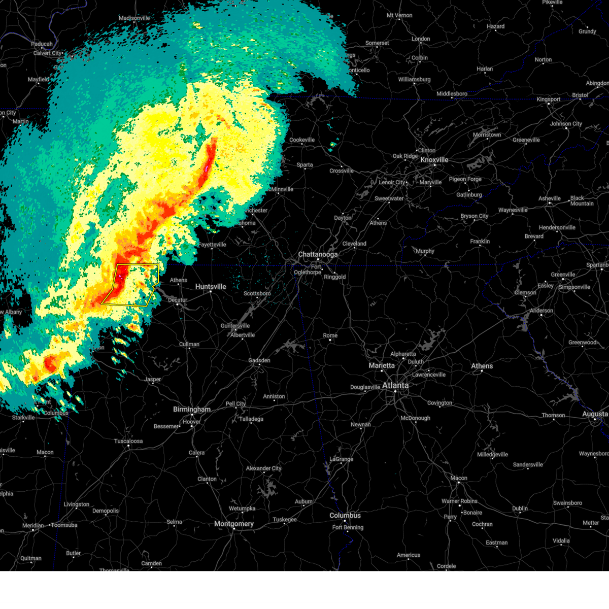 At 1101 pm cdt, severe thunderstorms were located along a line extending from near lexington to leighton to near littleville, moving east at 60 mph (radar indicated). Hazards include 60 mph wind gusts and half dollar size hail. Hail damage to vehicles is expected. expect wind damage to roofs, siding, and trees. Locations impacted include, florence, muscle shoals, sheffield, tuscumbia, rogersville, killen, town creek, littleville, lexington and leighton. At 1101 pm cdt, severe thunderstorms were located along a line extending from near lexington to leighton to near littleville, moving east at 60 mph (radar indicated). Hazards include 60 mph wind gusts and half dollar size hail. Hail damage to vehicles is expected. expect wind damage to roofs, siding, and trees. Locations impacted include, florence, muscle shoals, sheffield, tuscumbia, rogersville, killen, town creek, littleville, lexington and leighton.
|
| 3/24/2023 10:58 PM CDT |
 At 1058 pm cdt, a severe thunderstorm capable of producing a tornado was located near st. florian, or near florence, moving east at 60 mph (radar indicated rotation). Hazards include tornado and half dollar size hail. Flying debris will be dangerous to those caught without shelter. mobile homes will be damaged or destroyed. damage to roofs, windows, and vehicles will occur. Tree damage is likely. At 1058 pm cdt, a severe thunderstorm capable of producing a tornado was located near st. florian, or near florence, moving east at 60 mph (radar indicated rotation). Hazards include tornado and half dollar size hail. Flying debris will be dangerous to those caught without shelter. mobile homes will be damaged or destroyed. damage to roofs, windows, and vehicles will occur. Tree damage is likely.
|
| 3/24/2023 10:51 PM CDT |
 At 1050 pm cdt, severe thunderstorms were located along a line extending from near underwood-petersville to tuscumbia to crooked oak, moving east at 60 mph (radar indicated). Hazards include 60 mph wind gusts and half dollar size hail. Hail damage to vehicles is expected. expect wind damage to roofs, siding, and trees. Locations impacted include, florence, muscle shoals, russellville, sheffield, tuscumbia, rogersville, killen, town creek, littleville and lexington. At 1050 pm cdt, severe thunderstorms were located along a line extending from near underwood-petersville to tuscumbia to crooked oak, moving east at 60 mph (radar indicated). Hazards include 60 mph wind gusts and half dollar size hail. Hail damage to vehicles is expected. expect wind damage to roofs, siding, and trees. Locations impacted include, florence, muscle shoals, russellville, sheffield, tuscumbia, rogersville, killen, town creek, littleville and lexington.
|
| 3/24/2023 10:41 PM CDT |
 At 1040 pm cdt, severe thunderstorms were located along a line extending from underwood-petersville to barton to 6 miles northeast of red bay, moving east at 55 mph (radar indicated). Hazards include 60 mph wind gusts and half dollar size hail. Hail damage to vehicles is expected. Expect wind damage to roofs, siding, and trees. At 1040 pm cdt, severe thunderstorms were located along a line extending from underwood-petersville to barton to 6 miles northeast of red bay, moving east at 55 mph (radar indicated). Hazards include 60 mph wind gusts and half dollar size hail. Hail damage to vehicles is expected. Expect wind damage to roofs, siding, and trees.
|
| 3/3/2023 10:55 AM CST |
 At 1054 am cst, severe thunderstorms were located along a line extending from near pulaski to near moulton, moving northeast at 75 mph. this line of storms have a history of producing wind damage (radar indicated). Hazards include 70 mph wind gusts and quarter size hail. Hail damage to vehicles is expected. expect considerable tree damage. wind damage is also likely to mobile homes, roofs, and outbuildings. locations impacted include, decatur, athens, hartselle, moulton, priceville, good hope, trinity, falkville, rogersville and courtland. thunderstorm damage threat, considerable hail threat, radar indicated max hail size, 1. 00 in wind threat, radar indicated max wind gust, 70 mph. At 1054 am cst, severe thunderstorms were located along a line extending from near pulaski to near moulton, moving northeast at 75 mph. this line of storms have a history of producing wind damage (radar indicated). Hazards include 70 mph wind gusts and quarter size hail. Hail damage to vehicles is expected. expect considerable tree damage. wind damage is also likely to mobile homes, roofs, and outbuildings. locations impacted include, decatur, athens, hartselle, moulton, priceville, good hope, trinity, falkville, rogersville and courtland. thunderstorm damage threat, considerable hail threat, radar indicated max hail size, 1. 00 in wind threat, radar indicated max wind gust, 70 mph.
|
| 3/3/2023 10:29 AM CST |
 At 1028 am cst, severe thunderstorms were located along a line extending from near lexington to near lake buttahatchee, moving northeast at 70 mph. there is widespread tree damage and powerlines down with this line of storms (radar indicated). Hazards include 60 mph wind gusts. expect damage to roofs, siding, and trees At 1028 am cst, severe thunderstorms were located along a line extending from near lexington to near lake buttahatchee, moving northeast at 70 mph. there is widespread tree damage and powerlines down with this line of storms (radar indicated). Hazards include 60 mph wind gusts. expect damage to roofs, siding, and trees
|
| 3/1/2023 9:21 PM CST |
 The severe thunderstorm warning for limestone, southeastern lauderdale, northwestern morgan and northern lawrence counties will expire at 930 pm cst, the storms which prompted the warning have weakened below severe limits, and no longer pose an immediate threat to life or property. therefore, the warning will be allowed to expire. however small hail, gusty winds and heavy rain are still possible with these thunderstorms. a tornado watch remains in effect until 200 am cst for north central and northwestern alabama, and middle tennessee. The severe thunderstorm warning for limestone, southeastern lauderdale, northwestern morgan and northern lawrence counties will expire at 930 pm cst, the storms which prompted the warning have weakened below severe limits, and no longer pose an immediate threat to life or property. therefore, the warning will be allowed to expire. however small hail, gusty winds and heavy rain are still possible with these thunderstorms. a tornado watch remains in effect until 200 am cst for north central and northwestern alabama, and middle tennessee.
|
| 3/1/2023 9:10 PM CST |
 At 910 pm cst, severe thunderstorms were located along a line extending from 10 miles east of lexington to courtland to 7 miles south of town creek, moving east at 40 mph (radar indicated). Hazards include 60 mph wind gusts. Expect damage to roofs, siding, and trees. locations impacted include, decatur, athens, trinity, rogersville, ardmore, town creek, courtland, tanner, north courtland and hillsboro. hail threat, radar indicated max hail size, <. 75 in wind threat, radar indicated max wind gust, 60 mph. At 910 pm cst, severe thunderstorms were located along a line extending from 10 miles east of lexington to courtland to 7 miles south of town creek, moving east at 40 mph (radar indicated). Hazards include 60 mph wind gusts. Expect damage to roofs, siding, and trees. locations impacted include, decatur, athens, trinity, rogersville, ardmore, town creek, courtland, tanner, north courtland and hillsboro. hail threat, radar indicated max hail size, <. 75 in wind threat, radar indicated max wind gust, 60 mph.
|
| 3/1/2023 8:54 PM CST |
 At 854 pm cst, severe thunderstorms were located along a line extending from near lexington to leighton to near littleville, moving east at 40 mph (radar indicated). Hazards include 60 mph wind gusts. expect damage to roofs, siding, and trees At 854 pm cst, severe thunderstorms were located along a line extending from near lexington to leighton to near littleville, moving east at 40 mph (radar indicated). Hazards include 60 mph wind gusts. expect damage to roofs, siding, and trees
|
| 3/1/2023 8:42 PM CST |
 At 842 pm cst, severe thunderstorms were located along a line extending from near loretto to near killen to near leighton, moving east at 45 mph (radar indicated). Hazards include 60 mph wind gusts and quarter size hail. Hail damage to vehicles is expected. expect wind damage to roofs, siding, and trees. locations impacted include, florence, muscle shoals, tuscumbia, rogersville, killen, town creek, lexington, leighton, st. Florian and anderson. At 842 pm cst, severe thunderstorms were located along a line extending from near loretto to near killen to near leighton, moving east at 45 mph (radar indicated). Hazards include 60 mph wind gusts and quarter size hail. Hail damage to vehicles is expected. expect wind damage to roofs, siding, and trees. locations impacted include, florence, muscle shoals, tuscumbia, rogersville, killen, town creek, lexington, leighton, st. Florian and anderson.
|
| 3/1/2023 8:28 PM CST |
 At 827 pm cst, severe thunderstorms were located along a line extending from st. florian to florence to tuscumbia, moving east at 45 mph (radar indicated). Hazards include 60 mph wind gusts and quarter size hail. Hail damage to vehicles is expected. Expect wind damage to roofs, siding, and trees. At 827 pm cst, severe thunderstorms were located along a line extending from st. florian to florence to tuscumbia, moving east at 45 mph (radar indicated). Hazards include 60 mph wind gusts and quarter size hail. Hail damage to vehicles is expected. Expect wind damage to roofs, siding, and trees.
|
| 3/1/2023 8:21 PM CST |
 The national weather service in huntsville alabama has issued a * severe thunderstorm warning for. lauderdale county in northwestern alabama. southeastern colbert county in northwestern alabama. northwestern lawrence county in northwestern alabama. Until 845 pm cst. The national weather service in huntsville alabama has issued a * severe thunderstorm warning for. lauderdale county in northwestern alabama. southeastern colbert county in northwestern alabama. northwestern lawrence county in northwestern alabama. Until 845 pm cst.
|
| 1/3/2023 11:11 AM CST | Power pole knocked down and multiple trees and limbs dow in lauderdale county AL, 5.2 miles S of Rogersville, AL |
| 1/3/2023 11:04 AM CST | Multiple trees dow in lauderdale county AL, 4.3 miles SE of Rogersville, AL |
| 11/29/2022 2:53 PM CST |
 The severe thunderstorm warning for central limestone, southeastern lauderdale, southeastern colbert and northern lawrence counties will expire at 300 pm cst, the storm which prompted the warning has weakened below severe limits, and has exited the warned area. therefore, the warning will be allowed to expire. The severe thunderstorm warning for central limestone, southeastern lauderdale, southeastern colbert and northern lawrence counties will expire at 300 pm cst, the storm which prompted the warning has weakened below severe limits, and has exited the warned area. therefore, the warning will be allowed to expire.
|
| 11/29/2022 2:16 PM CST |
 At 215 pm cst, a severe thunderstorm was located near leighton, or 8 miles southeast of muscle shoals, moving east at 55 mph (radar indicated). Hazards include 60 mph wind gusts and half dollar size hail. Hail damage to vehicles is expected. Expect wind damage to roofs, siding, and trees. At 215 pm cst, a severe thunderstorm was located near leighton, or 8 miles southeast of muscle shoals, moving east at 55 mph (radar indicated). Hazards include 60 mph wind gusts and half dollar size hail. Hail damage to vehicles is expected. Expect wind damage to roofs, siding, and trees.
|
| 11/29/2022 2:07 PM CST |
 The severe thunderstorm warning for northwestern limestone, southeastern lauderdale and northeastern lawrence counties will expire at 215 pm cst, the storm which prompted the warning has weakened below severe limits, and no longer poses an immediate threat to life or property. therefore, the warning will be allowed to expire. however gusty winds are still possible with this thunderstorm. to report severe weather, contact your nearest law enforcement agency. they will relay your report to the national weather service huntsville alabama. The severe thunderstorm warning for northwestern limestone, southeastern lauderdale and northeastern lawrence counties will expire at 215 pm cst, the storm which prompted the warning has weakened below severe limits, and no longer poses an immediate threat to life or property. therefore, the warning will be allowed to expire. however gusty winds are still possible with this thunderstorm. to report severe weather, contact your nearest law enforcement agency. they will relay your report to the national weather service huntsville alabama.
|
| 11/29/2022 1:51 PM CST |
 At 151 pm cst, a severe thunderstorm was located near rogersville, or 16 miles east of muscle shoals, moving east at 45 mph (radar indicated). Hazards include 60 mph wind gusts and quarter size hail. Hail damage to vehicles is expected. Expect wind damage to roofs, siding, and trees. At 151 pm cst, a severe thunderstorm was located near rogersville, or 16 miles east of muscle shoals, moving east at 45 mph (radar indicated). Hazards include 60 mph wind gusts and quarter size hail. Hail damage to vehicles is expected. Expect wind damage to roofs, siding, and trees.
|
| 10/25/2022 3:59 PM CDT | Multiple 3inch diameter tree limbs down on gravel side roa in lauderdale county AL, 4.3 miles SE of Rogersville, AL |
| 5/25/2022 4:42 PM CDT |
 The severe thunderstorm warning for eastern lauderdale, southeastern colbert and northern lawrence counties will expire at 445 pm cdt, the storms which prompted the warning have weakened below severe limits, and no longer pose an immediate threat to life or property. therefore, the warning will be allowed to expire. however gusty winds are still possible with these thunderstorms. The severe thunderstorm warning for eastern lauderdale, southeastern colbert and northern lawrence counties will expire at 445 pm cdt, the storms which prompted the warning have weakened below severe limits, and no longer pose an immediate threat to life or property. therefore, the warning will be allowed to expire. however gusty winds are still possible with these thunderstorms.
|
| 5/25/2022 4:29 PM CDT |
 At 428 pm cdt, severe thunderstorms were located along a line extending from 7 miles north of underwood-petersville to 7 miles south of leighton, moving east at 45 mph (radar indicated). Hazards include 60 mph wind gusts and penny size hail. Expect damage to roofs, siding, and trees. locations impacted include, florence, muscle shoals, sheffield, rogersville, killen, town creek, lexington, leighton, courtland and st. florian. hail threat, radar indicated max hail size, 0. 75 in wind threat, radar indicated max wind gust, 60 mph. At 428 pm cdt, severe thunderstorms were located along a line extending from 7 miles north of underwood-petersville to 7 miles south of leighton, moving east at 45 mph (radar indicated). Hazards include 60 mph wind gusts and penny size hail. Expect damage to roofs, siding, and trees. locations impacted include, florence, muscle shoals, sheffield, rogersville, killen, town creek, lexington, leighton, courtland and st. florian. hail threat, radar indicated max hail size, 0. 75 in wind threat, radar indicated max wind gust, 60 mph.
|
| 5/25/2022 4:13 PM CDT |
 At 413 pm cdt, severe thunderstorms were located along a line extending from 10 miles southeast of walnut grove to 7 miles southeast of russellville, moving east at 50 mph (radar indicated). Hazards include 60 mph wind gusts and penny size hail. expect damage to roofs, siding, and trees At 413 pm cdt, severe thunderstorms were located along a line extending from 10 miles southeast of walnut grove to 7 miles southeast of russellville, moving east at 50 mph (radar indicated). Hazards include 60 mph wind gusts and penny size hail. expect damage to roofs, siding, and trees
|
| 5/21/2022 6:19 PM CDT |
 At 618 pm cdt, a severe thunderstorm was located over lexington, or 20 miles south of lawrenceburg, moving east at 20 mph (radar indicated). Hazards include 60 mph wind gusts and quarter size hail. Hail damage to vehicles is expected. Expect wind damage to roofs, siding, and trees. At 618 pm cdt, a severe thunderstorm was located over lexington, or 20 miles south of lawrenceburg, moving east at 20 mph (radar indicated). Hazards include 60 mph wind gusts and quarter size hail. Hail damage to vehicles is expected. Expect wind damage to roofs, siding, and trees.
|
| 5/2/2022 4:26 PM CDT |
 At 426 pm cdt, a severe thunderstorm was located over rogersville, or 19 miles east of muscle shoals, moving northeast at 15 mph (radar indicated). Hazards include 60 mph wind gusts and quarter size hail. Hail damage to vehicles is expected. expect wind damage to roofs, siding, and trees. locations impacted include, rogersville, town creek, lexington, courtland, north courtland, anderson, good springs, cartwright, coxey and oliver. hail threat, radar indicated max hail size, 1. 00 in wind threat, radar indicated max wind gust, 60 mph. At 426 pm cdt, a severe thunderstorm was located over rogersville, or 19 miles east of muscle shoals, moving northeast at 15 mph (radar indicated). Hazards include 60 mph wind gusts and quarter size hail. Hail damage to vehicles is expected. expect wind damage to roofs, siding, and trees. locations impacted include, rogersville, town creek, lexington, courtland, north courtland, anderson, good springs, cartwright, coxey and oliver. hail threat, radar indicated max hail size, 1. 00 in wind threat, radar indicated max wind gust, 60 mph.
|
| 5/2/2022 4:12 PM CDT |
 At 412 pm cdt, a severe thunderstorm was located near courtland, or 17 miles north of moulton, moving northeast at 15 mph (radar indicated). Hazards include 60 mph wind gusts and quarter size hail. Hail damage to vehicles is expected. Expect wind damage to roofs, siding, and trees. At 412 pm cdt, a severe thunderstorm was located near courtland, or 17 miles north of moulton, moving northeast at 15 mph (radar indicated). Hazards include 60 mph wind gusts and quarter size hail. Hail damage to vehicles is expected. Expect wind damage to roofs, siding, and trees.
|
| 4/13/2022 8:17 PM CDT |
 At 816 pm cdt, severe thunderstorms were located along a line extending from 11 miles east of pulaski to 8 miles southwest of ardmore to 9 miles north of trinity to 6 miles northwest of moulton, moving east at 50 mph (radar indicated). Hazards include 60 mph wind gusts and penny size hail. Expect damage to roofs, siding, and trees. locations impacted include, moulton, rogersville, courtland, north courtland, hillsboro, anderson, lester, good springs, coxey and oliver. hail threat, radar indicated max hail size, 0. 75 in wind threat, radar indicated max wind gust, 60 mph. At 816 pm cdt, severe thunderstorms were located along a line extending from 11 miles east of pulaski to 8 miles southwest of ardmore to 9 miles north of trinity to 6 miles northwest of moulton, moving east at 50 mph (radar indicated). Hazards include 60 mph wind gusts and penny size hail. Expect damage to roofs, siding, and trees. locations impacted include, moulton, rogersville, courtland, north courtland, hillsboro, anderson, lester, good springs, coxey and oliver. hail threat, radar indicated max hail size, 0. 75 in wind threat, radar indicated max wind gust, 60 mph.
|
| 4/13/2022 8:09 PM CDT |
 At 808 pm cdt, severe thunderstorms were located along a line extending from 6 miles southeast of pulaski to 9 miles northwest of athens to near courtland to 9 miles west of moulton, moving east at 45 mph (radar indicated). Hazards include 60 mph wind gusts and penny size hail. Expect damage to roofs, siding, and trees. locations impacted include, moulton, trinity, rogersville, town creek, lexington, leighton, courtland, north courtland, hillsboro and anderson. hail threat, radar indicated max hail size, 0. 75 in wind threat, radar indicated max wind gust, 60 mph. At 808 pm cdt, severe thunderstorms were located along a line extending from 6 miles southeast of pulaski to 9 miles northwest of athens to near courtland to 9 miles west of moulton, moving east at 45 mph (radar indicated). Hazards include 60 mph wind gusts and penny size hail. Expect damage to roofs, siding, and trees. locations impacted include, moulton, trinity, rogersville, town creek, lexington, leighton, courtland, north courtland, hillsboro and anderson. hail threat, radar indicated max hail size, 0. 75 in wind threat, radar indicated max wind gust, 60 mph.
|
| 4/13/2022 7:46 PM CDT |
 At 746 pm cdt, severe thunderstorms were located along a line extending from 7 miles southeast of lawrenceburg to near lexington to near leighton to near russellville, moving east at 45 mph (radar indicated). Hazards include 60 mph wind gusts and penny size hail. Expect damage to roofs, siding, and trees. locations impacted include, florence, muscle shoals, russellville, sheffield, tuscumbia, moulton, trinity, rogersville, killen and town creek. hail threat, radar indicated max hail size, 0. 75 in wind threat, radar indicated max wind gust, 60 mph. At 746 pm cdt, severe thunderstorms were located along a line extending from 7 miles southeast of lawrenceburg to near lexington to near leighton to near russellville, moving east at 45 mph (radar indicated). Hazards include 60 mph wind gusts and penny size hail. Expect damage to roofs, siding, and trees. locations impacted include, florence, muscle shoals, russellville, sheffield, tuscumbia, moulton, trinity, rogersville, killen and town creek. hail threat, radar indicated max hail size, 0. 75 in wind threat, radar indicated max wind gust, 60 mph.
|
| 4/13/2022 7:28 PM CDT |
 At 727 pm cdt, severe thunderstorms were located along a line extending from 7 miles northwest of loretto to near underwood-petersville to 6 miles west of tuscumbia to 10 miles northwest of belgreen, moving east at 45 mph (radar indicated). Hazards include 60 mph wind gusts and penny size hail. expect damage to roofs, siding, and trees At 727 pm cdt, severe thunderstorms were located along a line extending from 7 miles northwest of loretto to near underwood-petersville to 6 miles west of tuscumbia to 10 miles northwest of belgreen, moving east at 45 mph (radar indicated). Hazards include 60 mph wind gusts and penny size hail. expect damage to roofs, siding, and trees
|
| 4/13/2022 7:05 PM CDT |
 At 705 pm cdt, severe thunderstorms were located along a line extending from collinwood to 10 miles southeast of walnut grove to 6 miles east of iuka to near midway, moving east at 55 mph (radar indicated). Hazards include 60 mph wind gusts and quarter size hail. Hail damage to vehicles is expected. expect wind damage to roofs, siding, and trees. locations impacted include, florence, muscle shoals, sheffield, tuscumbia, rogersville, killen, town creek, cherokee, lexington and leighton. hail threat, radar indicated max hail size, 1. 00 in wind threat, radar indicated max wind gust, 60 mph. At 705 pm cdt, severe thunderstorms were located along a line extending from collinwood to 10 miles southeast of walnut grove to 6 miles east of iuka to near midway, moving east at 55 mph (radar indicated). Hazards include 60 mph wind gusts and quarter size hail. Hail damage to vehicles is expected. expect wind damage to roofs, siding, and trees. locations impacted include, florence, muscle shoals, sheffield, tuscumbia, rogersville, killen, town creek, cherokee, lexington and leighton. hail threat, radar indicated max hail size, 1. 00 in wind threat, radar indicated max wind gust, 60 mph.
|
| 4/13/2022 6:36 PM CDT |
 At 635 pm cdt, severe thunderstorms were located along a line extending from 6 miles southwest of adamsville to 6 miles northeast of corinth to glen to near hinkle, moving east at 70 mph (radar indicated). Hazards include 60 mph wind gusts and quarter size hail. Hail damage to vehicles is expected. Expect wind damage to roofs, siding, and trees. At 635 pm cdt, severe thunderstorms were located along a line extending from 6 miles southwest of adamsville to 6 miles northeast of corinth to glen to near hinkle, moving east at 70 mph (radar indicated). Hazards include 60 mph wind gusts and quarter size hail. Hail damage to vehicles is expected. Expect wind damage to roofs, siding, and trees.
|
| 3/30/2022 9:36 PM CDT |
 The severe thunderstorm warning for eastern lauderdale, northwestern limestone and lawrence counties will expire at 945 pm cdt, the storms which prompted the warning have moved out of the area. therefore, the warning will be allowed to expire. a tornado watch remains in effect until 100 am cdt for north central and northwestern alabama, and middle tennessee. The severe thunderstorm warning for eastern lauderdale, northwestern limestone and lawrence counties will expire at 945 pm cdt, the storms which prompted the warning have moved out of the area. therefore, the warning will be allowed to expire. a tornado watch remains in effect until 100 am cdt for north central and northwestern alabama, and middle tennessee.
|
| 3/30/2022 9:16 PM CDT |
 At 916 pm cdt, severe thunderstorms were located along a line extending from 10 miles southeast of mount pleasant to 6 miles northwest of moulton, moving northeast at 55 mph (radar indicated). Hazards include 60 mph wind gusts. Expect damage to roofs, siding, and trees. locations impacted include, moulton, rogersville, town creek, courtland, north courtland, hillsboro, anderson, lester, good springs and mt hope. hail threat, radar indicated max hail size, <. 75 in wind threat, radar indicated max wind gust, 60 mph. At 916 pm cdt, severe thunderstorms were located along a line extending from 10 miles southeast of mount pleasant to 6 miles northwest of moulton, moving northeast at 55 mph (radar indicated). Hazards include 60 mph wind gusts. Expect damage to roofs, siding, and trees. locations impacted include, moulton, rogersville, town creek, courtland, north courtland, hillsboro, anderson, lester, good springs and mt hope. hail threat, radar indicated max hail size, <. 75 in wind threat, radar indicated max wind gust, 60 mph.
|
| 3/30/2022 8:38 PM CDT |
 At 838 pm cdt, severe thunderstorms were located along a line extending from near loretto to near brinn, moving northeast at 55 mph (radar indicated). Hazards include 60 mph wind gusts. expect damage to roofs, siding, and trees At 838 pm cdt, severe thunderstorms were located along a line extending from near loretto to near brinn, moving northeast at 55 mph (radar indicated). Hazards include 60 mph wind gusts. expect damage to roofs, siding, and trees
|
| 3/22/2022 5:55 PM CDT |
 The severe thunderstorm warning for eastern lauderdale, limestone, western morgan and lawrence counties will expire at 600 pm cdt, the storms which prompted the warning have weakened below severe limits, and no longer pose an immediate threat to life or property. therefore, the warning will be allowed to expire. however gusty winds and heavy rain are still possible with these thunderstorms. a tornado watch remains in effect until 700 pm cdt for northwestern alabama. a tornado watch also remains in effect until 1100 pm cdt for north central alabama. The severe thunderstorm warning for eastern lauderdale, limestone, western morgan and lawrence counties will expire at 600 pm cdt, the storms which prompted the warning have weakened below severe limits, and no longer pose an immediate threat to life or property. therefore, the warning will be allowed to expire. however gusty winds and heavy rain are still possible with these thunderstorms. a tornado watch remains in effect until 700 pm cdt for northwestern alabama. a tornado watch also remains in effect until 1100 pm cdt for north central alabama.
|
| 3/22/2022 5:41 PM CDT |
 At 540 pm cdt, severe thunderstorms were located along a line extending from 7 miles northeast of lawrenceburg to 10 miles south of pulaski to near tanner, moving northeast at 60 mph (radar indicated). Hazards include 60 mph wind gusts and penny size hail. Expect damage to roofs, siding, and trees. Locations impacted include, decatur, athens, hartselle, moulton, priceville, trinity, falkville, rogersville, ardmore and lexington. At 540 pm cdt, severe thunderstorms were located along a line extending from 7 miles northeast of lawrenceburg to 10 miles south of pulaski to near tanner, moving northeast at 60 mph (radar indicated). Hazards include 60 mph wind gusts and penny size hail. Expect damage to roofs, siding, and trees. Locations impacted include, decatur, athens, hartselle, moulton, priceville, trinity, falkville, rogersville, ardmore and lexington.
|
| 3/22/2022 5:09 PM CDT |
 At 508 pm cdt, severe thunderstorms were located along a line extending from 10 miles north of underwood-petersville to near leighton to 9 miles southwest of moulton, moving northeast at 55 mph. this storm has a history of producing small hail, having several small, broad circulations, and numerous trees are down (radar indicated). Hazards include 60 mph wind gusts and penny size hail. expect damage to roofs, siding, and trees At 508 pm cdt, severe thunderstorms were located along a line extending from 10 miles north of underwood-petersville to near leighton to 9 miles southwest of moulton, moving northeast at 55 mph. this storm has a history of producing small hail, having several small, broad circulations, and numerous trees are down (radar indicated). Hazards include 60 mph wind gusts and penny size hail. expect damage to roofs, siding, and trees
|
| 2/22/2022 7:43 PM CST | Large tree limbs down along with shingles from some home in lauderdale county AL, 4.3 miles SE of Rogersville, AL |
| 2/22/2022 7:43 PM CST | Trees and power lines down blocking road on county road 2 in lauderdale county AL, 0.8 miles ESE of Rogersville, AL |
| 2/22/2022 7:14 PM CST |
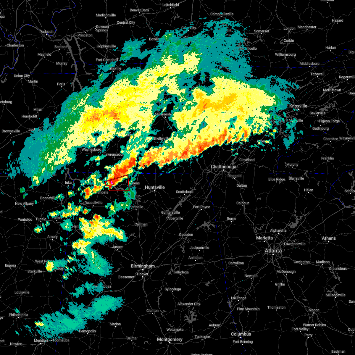 At 714 pm cst, a severe thunderstorm capable of producing a tornado was located over rogersville, or 19 miles west of athens, moving east at 50 mph (radar indicated rotation). Hazards include tornado. Flying debris will be dangerous to those caught without shelter. mobile homes will be damaged or destroyed. damage to roofs, windows, and vehicles will occur. tree damage is likely. This tornadic thunderstorm will remain over mainly rural areas of southeastern lauderdale, northwestern limestone and northeastern lawrence counties, including the following locations, center star, coxey, oliver, whitehead, cairo, mt rozell, red bank, elgin, ripley and anderson. At 714 pm cst, a severe thunderstorm capable of producing a tornado was located over rogersville, or 19 miles west of athens, moving east at 50 mph (radar indicated rotation). Hazards include tornado. Flying debris will be dangerous to those caught without shelter. mobile homes will be damaged or destroyed. damage to roofs, windows, and vehicles will occur. tree damage is likely. This tornadic thunderstorm will remain over mainly rural areas of southeastern lauderdale, northwestern limestone and northeastern lawrence counties, including the following locations, center star, coxey, oliver, whitehead, cairo, mt rozell, red bank, elgin, ripley and anderson.
|
| 2/22/2022 7:01 PM CST |
 At 701 pm cst, a severe thunderstorm capable of producing a tornado was located near leighton, or 9 miles east of muscle shoals, moving east at 50 mph (radar indicated rotation). Hazards include tornado. Flying debris will be dangerous to those caught without shelter. mobile homes will be damaged or destroyed. damage to roofs, windows, and vehicles will occur. tree damage is likely. this dangerous storm will be near, rogersville around 715 pm cst. Other locations impacted by this tornadic thunderstorm include center star, northwest alabama regional airport, coxey, oliver, whitehead, cairo, mt rozell, ford city, red bank and elgin. At 701 pm cst, a severe thunderstorm capable of producing a tornado was located near leighton, or 9 miles east of muscle shoals, moving east at 50 mph (radar indicated rotation). Hazards include tornado. Flying debris will be dangerous to those caught without shelter. mobile homes will be damaged or destroyed. damage to roofs, windows, and vehicles will occur. tree damage is likely. this dangerous storm will be near, rogersville around 715 pm cst. Other locations impacted by this tornadic thunderstorm include center star, northwest alabama regional airport, coxey, oliver, whitehead, cairo, mt rozell, ford city, red bank and elgin.
|
| 2/22/2022 6:50 PM CST |
 At 650 pm cst, a severe thunderstorm was located over sheffield, moving east at 50 mph (radar indicated). Hazards include 60 mph wind gusts and quarter size hail. Hail damage to vehicles is expected. Expect wind damage to roofs, siding, and trees. At 650 pm cst, a severe thunderstorm was located over sheffield, moving east at 50 mph (radar indicated). Hazards include 60 mph wind gusts and quarter size hail. Hail damage to vehicles is expected. Expect wind damage to roofs, siding, and trees.
|
| 1/1/2022 5:39 PM CST |
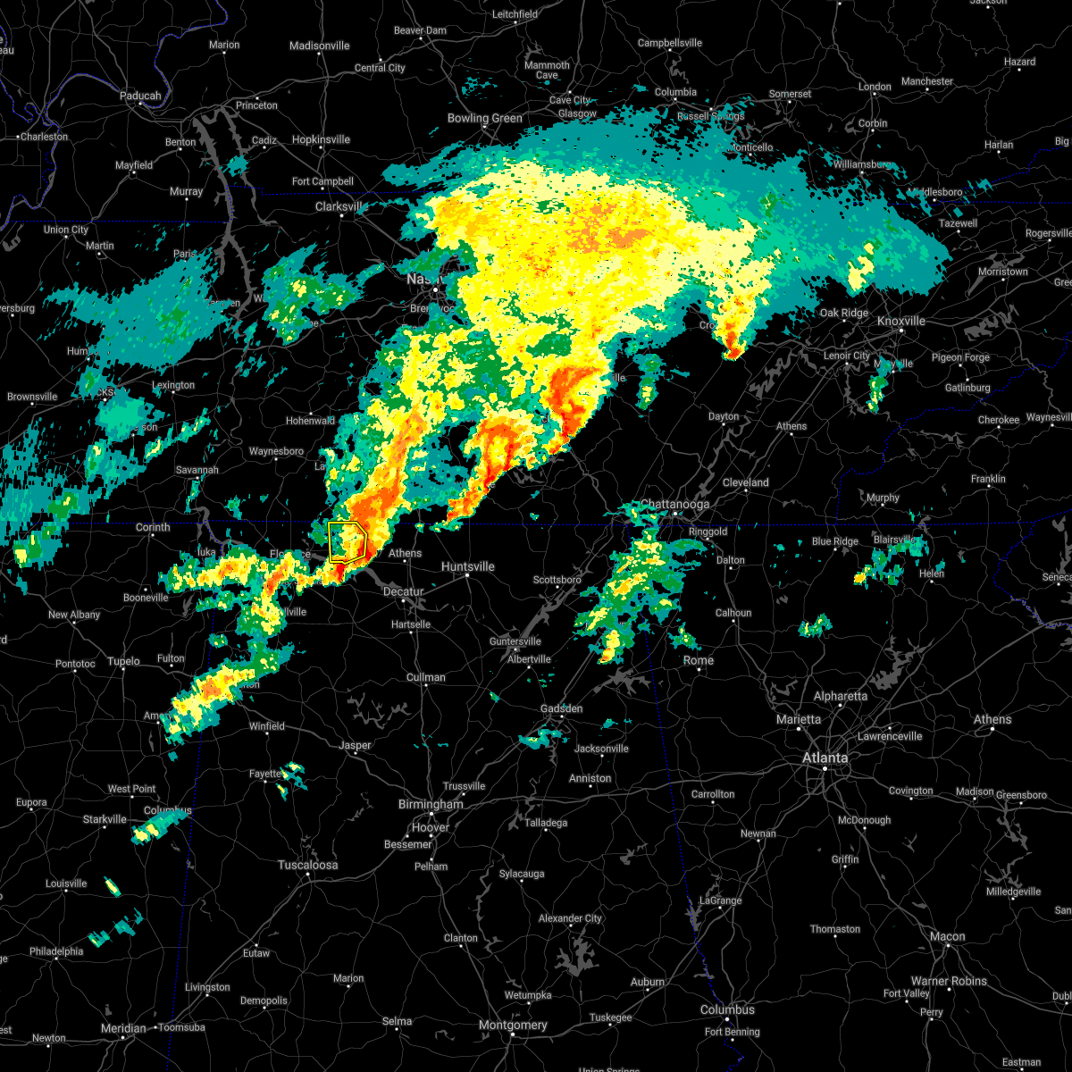 The severe thunderstorm warning for northeastern lauderdale county will expire at 545 pm cst, the storm which prompted the warning has moved out of the area. therefore, the warning will be allowed to expire. a tornado watch remains in effect until 700 pm cst for north central and northwestern alabama. The severe thunderstorm warning for northeastern lauderdale county will expire at 545 pm cst, the storm which prompted the warning has moved out of the area. therefore, the warning will be allowed to expire. a tornado watch remains in effect until 700 pm cst for north central and northwestern alabama.
|
| 1/1/2022 5:35 PM CST |
 At 534 pm cst, a severe thunderstorm was located near lexington, or 19 miles south of lawrenceburg, moving northeast at 50 mph (radar indicated). Hazards include 60 mph wind gusts. Expect damage to roofs, siding, and trees. locations impacted include, rogersville, lexington, anderson, elgin, kingtown and whitehead. hail threat, radar indicated max hail size, <. 75 in wind threat, radar indicated max wind gust, 60 mph. At 534 pm cst, a severe thunderstorm was located near lexington, or 19 miles south of lawrenceburg, moving northeast at 50 mph (radar indicated). Hazards include 60 mph wind gusts. Expect damage to roofs, siding, and trees. locations impacted include, rogersville, lexington, anderson, elgin, kingtown and whitehead. hail threat, radar indicated max hail size, <. 75 in wind threat, radar indicated max wind gust, 60 mph.
|
| 1/1/2022 5:30 PM CST |
 At 530 pm cst, a severe thunderstorm was located near town creek, or 13 miles east of muscle shoals, moving east at 55 mph (radar indicated). Hazards include 60 mph wind gusts. expect damage to roofs, siding, and trees At 530 pm cst, a severe thunderstorm was located near town creek, or 13 miles east of muscle shoals, moving east at 55 mph (radar indicated). Hazards include 60 mph wind gusts. expect damage to roofs, siding, and trees
|
| 1/1/2022 5:16 PM CST |
 At 516 pm cst, a severe thunderstorm was located over killen, or 10 miles northeast of florence, moving northeast at 50 mph (radar indicated). Hazards include 60 mph wind gusts. Expect damage to roofs, siding, and trees. locations impacted include, florence, muscle shoals, sheffield, tuscumbia, rogersville, killen, lexington, st. florian, underwood-petersville and anderson. hail threat, radar indicated max hail size, <. 75 in wind threat, radar indicated max wind gust, 60 mph. At 516 pm cst, a severe thunderstorm was located over killen, or 10 miles northeast of florence, moving northeast at 50 mph (radar indicated). Hazards include 60 mph wind gusts. Expect damage to roofs, siding, and trees. locations impacted include, florence, muscle shoals, sheffield, tuscumbia, rogersville, killen, lexington, st. florian, underwood-petersville and anderson. hail threat, radar indicated max hail size, <. 75 in wind threat, radar indicated max wind gust, 60 mph.
|
| 1/1/2022 4:53 PM CST |
 At 453 pm cst, a severe thunderstorm was located near tuscumbia, moving northeast at 50 mph (radar indicated). Hazards include 60 mph wind gusts. expect damage to roofs, siding, and trees At 453 pm cst, a severe thunderstorm was located near tuscumbia, moving northeast at 50 mph (radar indicated). Hazards include 60 mph wind gusts. expect damage to roofs, siding, and trees
|
| 1/1/2022 4:27 PM CST |
 At 426 pm cst, a severe thunderstorm was located near rogersville, or 17 miles east of florence, moving east at 50 mph (radar indicated). Hazards include 60 mph wind gusts. expect damage to roofs, siding, and trees At 426 pm cst, a severe thunderstorm was located near rogersville, or 17 miles east of florence, moving east at 50 mph (radar indicated). Hazards include 60 mph wind gusts. expect damage to roofs, siding, and trees
|
| 1/1/2022 3:56 PM CST |
 The severe thunderstorm warning for northeastern lauderdale county will expire at 400 pm cst, the storm which prompted the warning has weakened below severe limits, and has exited the warned area. therefore, the warning will be allowed to expire. a tornado watch remains in effect until 700 pm cst for north central and northwestern alabama. The severe thunderstorm warning for northeastern lauderdale county will expire at 400 pm cst, the storm which prompted the warning has weakened below severe limits, and has exited the warned area. therefore, the warning will be allowed to expire. a tornado watch remains in effect until 700 pm cst for north central and northwestern alabama.
|
| 1/1/2022 3:41 PM CST |
 At 340 pm cst, a severe thunderstorm was located over st. florian, or near florence, moving northeast at 45 mph (radar indicated). Hazards include 60 mph wind gusts and penny size hail. Expect damage to roofs, siding, and trees. locations impacted include, rogersville, killen, lexington, st. florian, anderson, green hill, center star, kingtown, whitehead and elgin. hail threat, radar indicated max hail size, 0. 75 in wind threat, radar indicated max wind gust, 60 mph. At 340 pm cst, a severe thunderstorm was located over st. florian, or near florence, moving northeast at 45 mph (radar indicated). Hazards include 60 mph wind gusts and penny size hail. Expect damage to roofs, siding, and trees. locations impacted include, rogersville, killen, lexington, st. florian, anderson, green hill, center star, kingtown, whitehead and elgin. hail threat, radar indicated max hail size, 0. 75 in wind threat, radar indicated max wind gust, 60 mph.
|
| 1/1/2022 3:21 PM CST |
 At 321 pm cst, a severe thunderstorm was located near tuscumbia, moving northeast at 45 mph (radar indicated). Hazards include 60 mph wind gusts and penny size hail. expect damage to roofs, siding, and trees At 321 pm cst, a severe thunderstorm was located near tuscumbia, moving northeast at 45 mph (radar indicated). Hazards include 60 mph wind gusts and penny size hail. expect damage to roofs, siding, and trees
|
| 12/11/2021 6:08 AM CST |
 At 605 am cst, severe thunderstorms were located along a line extending from near lexington to near littleville to 8 miles west of hackleburg, moving east at 30 mph (trained weather spotters reported roof damage and tree damage in the quad cities area with this storm). Hazards include 60 mph wind gusts. Expect damage to roofs, siding, and trees. locations impacted include, decatur, athens, russellville, moulton, trinity, rogersville, ardmore, phil campbell, town creek and littleville. hail threat, radar indicated max hail size, <. 75 in wind threat, radar indicated max wind gust, 60 mph. At 605 am cst, severe thunderstorms were located along a line extending from near lexington to near littleville to 8 miles west of hackleburg, moving east at 30 mph (trained weather spotters reported roof damage and tree damage in the quad cities area with this storm). Hazards include 60 mph wind gusts. Expect damage to roofs, siding, and trees. locations impacted include, decatur, athens, russellville, moulton, trinity, rogersville, ardmore, phil campbell, town creek and littleville. hail threat, radar indicated max hail size, <. 75 in wind threat, radar indicated max wind gust, 60 mph.
|
| 12/11/2021 6:02 AM CST |
 At 601 am cst, severe thunderstorms were located along a line extending from near lexington to near littleville to 8 miles west of hackleburg, moving east at 30 mph (radar indicated). Hazards include 60 mph wind gusts. Expect damage to roofs, siding, and trees. locations impacted include, decatur, athens, russellville, moulton, trinity, rogersville, ardmore, phil campbell, town creek and littleville. hail threat, radar indicated max hail size, <. 75 in wind threat, radar indicated max wind gust, 60 mph. At 601 am cst, severe thunderstorms were located along a line extending from near lexington to near littleville to 8 miles west of hackleburg, moving east at 30 mph (radar indicated). Hazards include 60 mph wind gusts. Expect damage to roofs, siding, and trees. locations impacted include, decatur, athens, russellville, moulton, trinity, rogersville, ardmore, phil campbell, town creek and littleville. hail threat, radar indicated max hail size, <. 75 in wind threat, radar indicated max wind gust, 60 mph.
|
| 12/11/2021 5:50 AM CST |
 At 550 am cst, severe thunderstorms were located along a line extending from lexington to near russellville to 8 miles southeast of red bay, moving east at 35 mph (radar indicated). Hazards include 60 mph wind gusts. expect damage to roofs, siding, and trees At 550 am cst, severe thunderstorms were located along a line extending from lexington to near russellville to 8 miles southeast of red bay, moving east at 35 mph (radar indicated). Hazards include 60 mph wind gusts. expect damage to roofs, siding, and trees
|
| 12/6/2021 7:17 AM CST |
 At 715 am cst, a severe thunderstorm was located near ardmore, or 12 miles southeast of pulaski, moving northeast at 70 mph (radar indicated). Hazards include 60 mph wind gusts. Expect damage to roofs, siding, and trees. locations impacted include, meridianville, hazel green, rogersville, ardmore, lexington, harvest, elkmont, anderson, lester and good springs. hail threat, radar indicated max hail size, <. 75 in wind threat, radar indicated max wind gust, 60 mph. At 715 am cst, a severe thunderstorm was located near ardmore, or 12 miles southeast of pulaski, moving northeast at 70 mph (radar indicated). Hazards include 60 mph wind gusts. Expect damage to roofs, siding, and trees. locations impacted include, meridianville, hazel green, rogersville, ardmore, lexington, harvest, elkmont, anderson, lester and good springs. hail threat, radar indicated max hail size, <. 75 in wind threat, radar indicated max wind gust, 60 mph.
|
| 12/6/2021 7:02 AM CST |
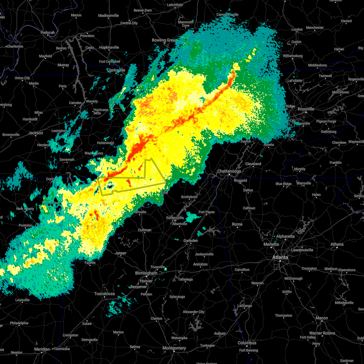 At 702 am cst, a severe thunderstorm was located 9 miles northeast of rogersville, or 15 miles northwest of athens, moving east at 65 mph (radar indicated). Hazards include 60 mph wind gusts. expect damage to roofs, siding, and trees At 702 am cst, a severe thunderstorm was located 9 miles northeast of rogersville, or 15 miles northwest of athens, moving east at 65 mph (radar indicated). Hazards include 60 mph wind gusts. expect damage to roofs, siding, and trees
|
| 7/30/2021 6:19 PM CDT |
 At 618 pm cdt, a severe thunderstorm was located near lexington, or 18 miles east of florence, moving southeast at 20 mph (radar indicated). Hazards include 60 mph wind gusts. Expect damage to roofs, siding, and trees. Locations impacted include, rogersville, courtland, north courtland, anderson, coxey, oliver, whitehead, red bank, elgin and ripley. At 618 pm cdt, a severe thunderstorm was located near lexington, or 18 miles east of florence, moving southeast at 20 mph (radar indicated). Hazards include 60 mph wind gusts. Expect damage to roofs, siding, and trees. Locations impacted include, rogersville, courtland, north courtland, anderson, coxey, oliver, whitehead, red bank, elgin and ripley.
|
| 7/30/2021 5:58 PM CDT |
 At 558 pm cdt, a severe thunderstorm was located near lexington, or 16 miles northeast of florence, moving southeast at 20 mph (radar indicated). Hazards include 60 mph wind gusts. expect damage to roofs, siding, and trees At 558 pm cdt, a severe thunderstorm was located near lexington, or 16 miles northeast of florence, moving southeast at 20 mph (radar indicated). Hazards include 60 mph wind gusts. expect damage to roofs, siding, and trees
|
| 6/12/2021 4:57 PM CDT |
 The severe thunderstorm warning for eastern lauderdale, east central colbert and north central lawrence counties will expire at 500 pm cdt, the storm which prompted the warning has weakened below severe limits, and no longer poses an immediate threat to life or property. therefore, the warning will be allowed to expire. however small hail, gusty winds and heavy rain are still possible with this thunderstorm. The severe thunderstorm warning for eastern lauderdale, east central colbert and north central lawrence counties will expire at 500 pm cdt, the storm which prompted the warning has weakened below severe limits, and no longer poses an immediate threat to life or property. therefore, the warning will be allowed to expire. however small hail, gusty winds and heavy rain are still possible with this thunderstorm.
|
| 6/12/2021 4:29 PM CDT |
 At 429 pm cdt, a severe thunderstorm was located near lexington, or 19 miles east of florence, moving southwest at 15 mph (radar indicated). Hazards include 60 mph wind gusts and nickel size hail. expect damage to roofs, siding, and trees At 429 pm cdt, a severe thunderstorm was located near lexington, or 19 miles east of florence, moving southwest at 15 mph (radar indicated). Hazards include 60 mph wind gusts and nickel size hail. expect damage to roofs, siding, and trees
|
| 6/3/2021 3:10 AM CDT |
 The severe thunderstorm warning for southeastern lauderdale, northwestern limestone and north central lawrence counties will expire at 315 am cdt, the storm which prompted the warning has weakened below severe limits, and no longer poses an immediate threat to life or property. therefore, the warning will be allowed to expire. however heavy rain is still possible with this thunderstorm. The severe thunderstorm warning for southeastern lauderdale, northwestern limestone and north central lawrence counties will expire at 315 am cdt, the storm which prompted the warning has weakened below severe limits, and no longer poses an immediate threat to life or property. therefore, the warning will be allowed to expire. however heavy rain is still possible with this thunderstorm.
|
| 6/3/2021 2:51 AM CDT |
 At 250 am cdt, a severe thunderstorm was located near rogersville, or 17 miles northwest of athens, moving northeast at 40 mph (radar indicated). Hazards include 60 mph wind gusts and quarter size hail. Hail damage to vehicles is expected. expect wind damage to roofs, siding, and trees. Locations impacted include, rogersville, anderson, lester, good springs, cartwright, coxey, oliver, mt rozell, ripley and kingtown. At 250 am cdt, a severe thunderstorm was located near rogersville, or 17 miles northwest of athens, moving northeast at 40 mph (radar indicated). Hazards include 60 mph wind gusts and quarter size hail. Hail damage to vehicles is expected. expect wind damage to roofs, siding, and trees. Locations impacted include, rogersville, anderson, lester, good springs, cartwright, coxey, oliver, mt rozell, ripley and kingtown.
|
| 6/3/2021 2:37 AM CDT |
 At 237 am cdt, a severe thunderstorm was located near rogersville, or 16 miles east of muscle shoals, moving east at 40 mph (radar indicated). Hazards include 60 mph wind gusts and quarter size hail. Hail damage to vehicles is expected. Expect wind damage to roofs, siding, and trees. At 237 am cdt, a severe thunderstorm was located near rogersville, or 16 miles east of muscle shoals, moving east at 40 mph (radar indicated). Hazards include 60 mph wind gusts and quarter size hail. Hail damage to vehicles is expected. Expect wind damage to roofs, siding, and trees.
|
| 6/2/2021 4:36 PM CDT |
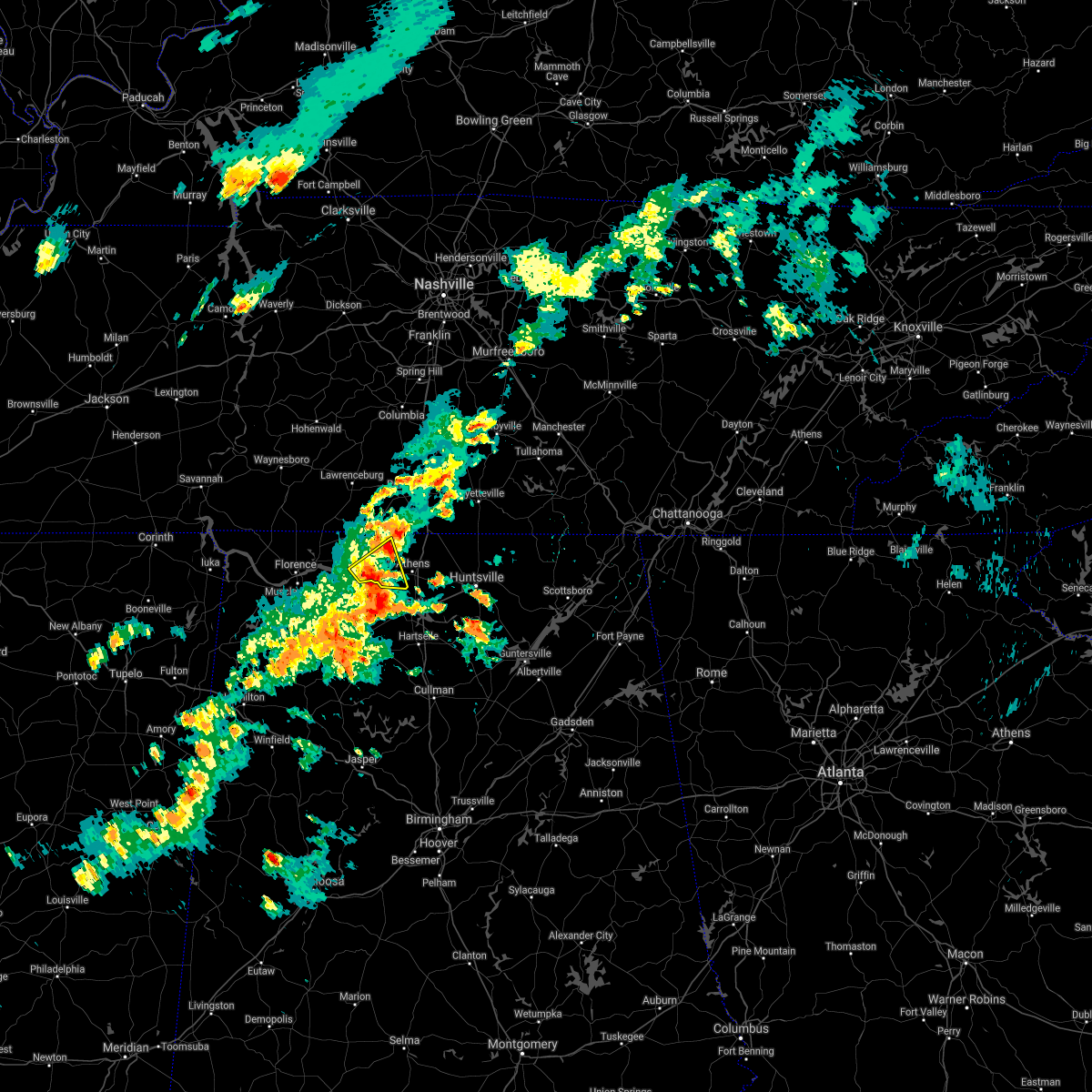 At 435 pm cdt, a severe thunderstorm was located near rogersville, or 15 miles west of athens, moving east at 25 mph (radar indicated). Hazards include 60 mph wind gusts and quarter size hail. Hail damage to vehicles is expected. expect wind damage to roofs, siding, and trees. Locations impacted include, rogersville, cartwright, coxey, oliver, cairo, mt rozell and ripley. At 435 pm cdt, a severe thunderstorm was located near rogersville, or 15 miles west of athens, moving east at 25 mph (radar indicated). Hazards include 60 mph wind gusts and quarter size hail. Hail damage to vehicles is expected. expect wind damage to roofs, siding, and trees. Locations impacted include, rogersville, cartwright, coxey, oliver, cairo, mt rozell and ripley.
|
| 6/2/2021 4:18 PM CDT |
 At 418 pm cdt, a severe thunderstorm was located near town creek, or 16 miles east of muscle shoals, moving east at 25 mph (radar indicated). Hazards include 60 mph wind gusts and quarter size hail. Hail damage to vehicles is expected. Expect wind damage to roofs, siding, and trees. At 418 pm cdt, a severe thunderstorm was located near town creek, or 16 miles east of muscle shoals, moving east at 25 mph (radar indicated). Hazards include 60 mph wind gusts and quarter size hail. Hail damage to vehicles is expected. Expect wind damage to roofs, siding, and trees.
|
| 5/6/2021 6:07 PM CDT |
 At 606 pm cdt, severe thunderstorms were located along a line extending from 8 miles northwest of athens to near courtland to near phil campbell to 8 miles north of weston, moving southeast at 45 mph (emergency management and doppler radar). Hazards include 60 mph wind gusts. Expect damage to roofs, siding, and trees. Locations impacted include, northwestern huntsville, decatur, madison, athens, hartselle, russellville, moulton, meridianville, moores mill and hazel green. At 606 pm cdt, severe thunderstorms were located along a line extending from 8 miles northwest of athens to near courtland to near phil campbell to 8 miles north of weston, moving southeast at 45 mph (emergency management and doppler radar). Hazards include 60 mph wind gusts. Expect damage to roofs, siding, and trees. Locations impacted include, northwestern huntsville, decatur, madison, athens, hartselle, russellville, moulton, meridianville, moores mill and hazel green.
|
| 5/6/2021 5:31 PM CDT |
 At 529 pm cdt, severe thunderstorms were located along a line extending from near loretto to near underwood-petersville to 7 miles east of tishomingo state park to near sandy springs, moving southeast at 45 mph (radar indicated). Hazards include 60 mph wind gusts and nickel size hail. expect damage to roofs, siding, and trees At 529 pm cdt, severe thunderstorms were located along a line extending from near loretto to near underwood-petersville to 7 miles east of tishomingo state park to near sandy springs, moving southeast at 45 mph (radar indicated). Hazards include 60 mph wind gusts and nickel size hail. expect damage to roofs, siding, and trees
|
| 8/28/2020 4:11 PM CDT | Trees reported down at 4552 cr 7 in lauderdale county AL, 2.2 miles W of Rogersville, AL |
| 8/28/2020 3:46 PM CDT |
 At 345 pm cdt, a severe thunderstorm was located near killen, or 8 miles east of florence, moving northeast at 45 mph (radar indicated). Hazards include 60 mph wind gusts. expect damage to roofs, siding, and trees At 345 pm cdt, a severe thunderstorm was located near killen, or 8 miles east of florence, moving northeast at 45 mph (radar indicated). Hazards include 60 mph wind gusts. expect damage to roofs, siding, and trees
|
| 8/12/2020 6:26 PM CDT |
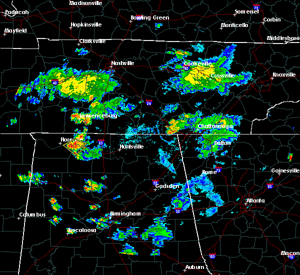 The severe thunderstorm warning for southeastern lauderdale, east central colbert and northwestern lawrence counties will expire at 630 pm cdt, the storm which prompted the warning has weakened below severe limits, and no longer poses an immediate threat to life or property. therefore, the warning will be allowed to expire. however small hail, gusty winds and heavy rain are still possible with this thunderstorm, and a significant weather advisory will remain in effect. to report severe weather, contact your nearest law enforcement agency. they will relay your report to the national weather service huntsville alabama. The severe thunderstorm warning for southeastern lauderdale, east central colbert and northwestern lawrence counties will expire at 630 pm cdt, the storm which prompted the warning has weakened below severe limits, and no longer poses an immediate threat to life or property. therefore, the warning will be allowed to expire. however small hail, gusty winds and heavy rain are still possible with this thunderstorm, and a significant weather advisory will remain in effect. to report severe weather, contact your nearest law enforcement agency. they will relay your report to the national weather service huntsville alabama.
|
| 8/12/2020 6:06 PM CDT |
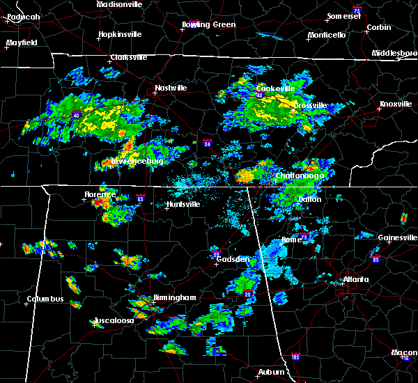 At 605 pm cdt, a severe thunderstorm was located near leighton, or 11 miles east of muscle shoals, moving southeast at 10 mph (radar indicated). Hazards include 60 mph wind gusts and quarter size hail. Hail damage to vehicles is expected. Expect wind damage to roofs, siding, and trees. At 605 pm cdt, a severe thunderstorm was located near leighton, or 11 miles east of muscle shoals, moving southeast at 10 mph (radar indicated). Hazards include 60 mph wind gusts and quarter size hail. Hail damage to vehicles is expected. Expect wind damage to roofs, siding, and trees.
|
| 5/4/2020 9:06 PM CDT |
 At 905 pm cdt, severe thunderstorms were located along a line extending from 10 miles west of ardmore to near lexington to near underwood-petersville, moving southeast at 55 mph (radar indicated). Hazards include 60 mph wind gusts and quarter size hail. Hail damage to vehicles is expected. expect wind damage to roofs, siding, and trees. Locations impacted include, florence, muscle shoals, sheffield, tuscumbia, rogersville, killen, town creek, cherokee, lexington and leighton. At 905 pm cdt, severe thunderstorms were located along a line extending from 10 miles west of ardmore to near lexington to near underwood-petersville, moving southeast at 55 mph (radar indicated). Hazards include 60 mph wind gusts and quarter size hail. Hail damage to vehicles is expected. expect wind damage to roofs, siding, and trees. Locations impacted include, florence, muscle shoals, sheffield, tuscumbia, rogersville, killen, town creek, cherokee, lexington and leighton.
|
| 5/4/2020 8:26 PM CDT |
 At 825 pm cdt, severe thunderstorms were located along a line extending from 10 miles northeast of collinwood to 8 miles northeast of walnut grove to near savannah, moving southeast at 55 mph (radar indicated). Hazards include 60 mph wind gusts and half dollar size hail. Hail damage to vehicles is expected. Expect wind damage to roofs, siding, and trees. At 825 pm cdt, severe thunderstorms were located along a line extending from 10 miles northeast of collinwood to 8 miles northeast of walnut grove to near savannah, moving southeast at 55 mph (radar indicated). Hazards include 60 mph wind gusts and half dollar size hail. Hail damage to vehicles is expected. Expect wind damage to roofs, siding, and trees.
|
| 5/3/2020 5:36 PM CDT |
 At 535 pm cdt, severe thunderstorms were located along a line extending from 7 miles north of sewanee to near new market to near madison, moving southeast at 65 mph. this storm continues to produce widespread wind damage (radar indicated). Hazards include 70 mph wind gusts. Expect considerable tree damage. damage is likely to mobile homes, roofs, and outbuildings. Locations impacted include, huntsville, decatur, madison, athens, scottsboro, winchester, fayetteville, bridgeport, moores mill and meridianville. At 535 pm cdt, severe thunderstorms were located along a line extending from 7 miles north of sewanee to near new market to near madison, moving southeast at 65 mph. this storm continues to produce widespread wind damage (radar indicated). Hazards include 70 mph wind gusts. Expect considerable tree damage. damage is likely to mobile homes, roofs, and outbuildings. Locations impacted include, huntsville, decatur, madison, athens, scottsboro, winchester, fayetteville, bridgeport, moores mill and meridianville.
|
| 5/3/2020 5:23 PM CDT |
 At 522 pm cdt, severe thunderstorms were located along a line extending from near tullahoma to hazel green to near athens, moving southeast at 65 mph. this storm has a history of producing wind damage, most recently in northern limestone and madison county (radar indicated). Hazards include 70 mph wind gusts. Expect considerable tree damage. damage is likely to mobile homes, roofs, and outbuildings. Locations impacted include, huntsville, decatur, madison, athens, scottsboro, winchester, fayetteville, bridgeport, moores mill and meridianville. At 522 pm cdt, severe thunderstorms were located along a line extending from near tullahoma to hazel green to near athens, moving southeast at 65 mph. this storm has a history of producing wind damage, most recently in northern limestone and madison county (radar indicated). Hazards include 70 mph wind gusts. Expect considerable tree damage. damage is likely to mobile homes, roofs, and outbuildings. Locations impacted include, huntsville, decatur, madison, athens, scottsboro, winchester, fayetteville, bridgeport, moores mill and meridianville.
|
| 5/3/2020 5:13 PM CDT |
 At 512 pm cdt, severe thunderstorms were located along a line extending from near tullahoma to near ardmore to 7 miles east of rogersville, moving southeast at 65 mph (radar indicated. this storm has a history of producing wind damage). Hazards include 60 mph wind gusts and penny size hail. expect damage to roofs, siding, and trees At 512 pm cdt, severe thunderstorms were located along a line extending from near tullahoma to near ardmore to 7 miles east of rogersville, moving southeast at 65 mph (radar indicated. this storm has a history of producing wind damage). Hazards include 60 mph wind gusts and penny size hail. expect damage to roofs, siding, and trees
|
| 5/3/2020 5:07 PM CDT |
 At 506 pm cdt, severe thunderstorms were located along a line extending from shelbyville to near ardmore to near leighton, moving southeast at 65 mph. this storm has a history producing wind damage in eastern lauderdale county (radar indicated). Hazards include 60 mph wind gusts and quarter size hail. Hail damage to vehicles is expected. expect wind damage to roofs, siding, and trees. Locations impacted include, northwestern huntsville, decatur, madison, florence, athens, winchester, fayetteville, moores mill, meridianville and lynchburg. At 506 pm cdt, severe thunderstorms were located along a line extending from shelbyville to near ardmore to near leighton, moving southeast at 65 mph. this storm has a history producing wind damage in eastern lauderdale county (radar indicated). Hazards include 60 mph wind gusts and quarter size hail. Hail damage to vehicles is expected. expect wind damage to roofs, siding, and trees. Locations impacted include, northwestern huntsville, decatur, madison, florence, athens, winchester, fayetteville, moores mill, meridianville and lynchburg.
|
| 5/3/2020 4:30 PM CDT |
 At 430 pm cdt, severe thunderstorms were located along a line extending from near spring hill to 6 miles west of lawrenceburg to near walnut grove, moving southeast at 65 mph (radar indicated). Hazards include 60 mph wind gusts and quarter size hail. Hail damage to vehicles is expected. Expect wind damage to roofs, siding, and trees. At 430 pm cdt, severe thunderstorms were located along a line extending from near spring hill to 6 miles west of lawrenceburg to near walnut grove, moving southeast at 65 mph (radar indicated). Hazards include 60 mph wind gusts and quarter size hail. Hail damage to vehicles is expected. Expect wind damage to roofs, siding, and trees.
|
| 4/8/2020 7:10 PM CDT |
 The severe thunderstorm warning for southeastern lauderdale, central limestone, northwestern morgan and northeastern lawrence counties will expire at 715 pm cdt, the storm which prompted the warning has weakened below severe limits, and no longer poses an immediate threat to life or property. therefore, the warning will be allowed to expire. The severe thunderstorm warning for southeastern lauderdale, central limestone, northwestern morgan and northeastern lawrence counties will expire at 715 pm cdt, the storm which prompted the warning has weakened below severe limits, and no longer poses an immediate threat to life or property. therefore, the warning will be allowed to expire.
|
| 4/8/2020 6:39 PM CDT |
 At 639 pm cdt, a severe thunderstorm was located over rogersville, or 18 miles west of athens, moving southeast at 35 mph (radar indicated). Hazards include 60 mph wind gusts and penny size hail. expect damage to roofs, siding, and trees At 639 pm cdt, a severe thunderstorm was located over rogersville, or 18 miles west of athens, moving southeast at 35 mph (radar indicated). Hazards include 60 mph wind gusts and penny size hail. expect damage to roofs, siding, and trees
|
| 4/8/2020 6:37 PM CDT | Wood fencing partly downed... few shingles removed from the roof of a house... and large tree across a driveway near turner lindsey road. time estimated from rada in lauderdale county AL, 1.8 miles ESE of Rogersville, AL |
| 3/29/2020 2:07 AM CDT |
 The severe thunderstorm warning for eastern lauderdale, northern limestone, southeastern colbert and northwestern lawrence counties will expire at 215 am cdt, the storm which prompted the warning has weakened below severe limits, and no longer poses an immediate threat to life or property. therefore, the warning will be allowed to expire. a tornado watch remains in effect until 400 am cdt for north central and northwestern alabama, and middle tennessee. The severe thunderstorm warning for eastern lauderdale, northern limestone, southeastern colbert and northwestern lawrence counties will expire at 215 am cdt, the storm which prompted the warning has weakened below severe limits, and no longer poses an immediate threat to life or property. therefore, the warning will be allowed to expire. a tornado watch remains in effect until 400 am cdt for north central and northwestern alabama, and middle tennessee.
|
| 3/29/2020 1:37 AM CDT |
 At 137 am cdt, a severe thunderstorm was located over leighton, or 7 miles east of muscle shoals, moving northeast at 65 mph (radar indicated). Hazards include 60 mph wind gusts and quarter size hail. Hail damage to vehicles is expected. Expect wind damage to roofs, siding, and trees. At 137 am cdt, a severe thunderstorm was located over leighton, or 7 miles east of muscle shoals, moving northeast at 65 mph (radar indicated). Hazards include 60 mph wind gusts and quarter size hail. Hail damage to vehicles is expected. Expect wind damage to roofs, siding, and trees.
|
| 1/11/2020 8:38 AM CST |
 At 838 am cst, severe thunderstorms were located along a line extending from near loretto to near littleville, moving east at 25 mph (radar indicated). Hazards include 60 mph wind gusts. Expect damage to roofs, siding, and trees. Locations impacted include, florence, muscle shoals, sheffield, tuscumbia, rogersville, killen, town creek, littleville, lexington and leighton. At 838 am cst, severe thunderstorms were located along a line extending from near loretto to near littleville, moving east at 25 mph (radar indicated). Hazards include 60 mph wind gusts. Expect damage to roofs, siding, and trees. Locations impacted include, florence, muscle shoals, sheffield, tuscumbia, rogersville, killen, town creek, littleville, lexington and leighton.
|
| 1/11/2020 8:07 AM CST |
 At 807 am cst, severe thunderstorms were located along a line extending from 10 miles north of underwood-petersville to 8 miles northwest of belgreen, moving east at 30 mph (radar indicated). Hazards include 60 mph wind gusts. expect damage to roofs, siding, and trees At 807 am cst, severe thunderstorms were located along a line extending from 10 miles north of underwood-petersville to 8 miles northwest of belgreen, moving east at 30 mph (radar indicated). Hazards include 60 mph wind gusts. expect damage to roofs, siding, and trees
|
| 12/16/2019 6:17 PM CST | Trees down on highway 101 at big nance bridg in lauderdale county AL, 7.8 miles SE of Rogersville, AL |
| 12/16/2019 6:08 PM CST | Five homes damaged (roofs and shingles)... fence in backyard downe in lauderdale county AL, 1.5 miles NE of Rogersville, AL |
| 12/16/2019 5:36 PM CST |
 The severe thunderstorm warning for eastern lauderdale, northwestern limestone and lawrence counties will expire at 545 pm cst, the storms which prompted the warning have moved out of the area. therefore, the warning will be allowed to expire. a tornado watch remains in effect until 1100 pm cst for north central and northwestern alabama, and middle tennessee. The severe thunderstorm warning for eastern lauderdale, northwestern limestone and lawrence counties will expire at 545 pm cst, the storms which prompted the warning have moved out of the area. therefore, the warning will be allowed to expire. a tornado watch remains in effect until 1100 pm cst for north central and northwestern alabama, and middle tennessee.
|
| 12/16/2019 5:25 PM CST |
 At 524 pm cst, severe thunderstorms were located along a line extending from near lawrenceburg to near courtland to 10 miles east of russellville, moving east at 55 mph (radar indicated). Hazards include 60 mph wind gusts. Expect damage to roofs, siding, and trees. Locations impacted include, moulton, rogersville, town creek, lexington, courtland, north courtland, hillsboro, anderson, lester and good springs. At 524 pm cst, severe thunderstorms were located along a line extending from near lawrenceburg to near courtland to 10 miles east of russellville, moving east at 55 mph (radar indicated). Hazards include 60 mph wind gusts. Expect damage to roofs, siding, and trees. Locations impacted include, moulton, rogersville, town creek, lexington, courtland, north courtland, hillsboro, anderson, lester and good springs.
|
| 12/16/2019 5:17 PM CST | Corrects previous tstm wnd dmg report from 5 s lexington. trees down on highway 101 at big nance bridg in lauderdale county AL, 7.8 miles SE of Rogersville, AL |
| 12/16/2019 5:17 PM CST | Lots of tree down in joe wheeler state par in lauderdale county AL, 2.5 miles ENE of Rogersville, AL |
| 12/16/2019 5:16 PM CST |
 At 515 pm cst, a confirmed dangerous tornado was located over courtland, or 15 miles north of moulton, moving east at 65 mph. this is a dangerous situation. take cover now! (radar confirmed tornado). Hazards include damaging tornado. You are in a life-threatening situation. flying debris may be deadly to those caught without shelter. mobile homes will be destroyed. considerable damage to homes, businesses, and vehicles is likely and complete destruction is possible. Locations impacted include, decatur, athens, trinity, rogersville, town creek, courtland, tanner, north courtland, hillsboro and elkmont. At 515 pm cst, a confirmed dangerous tornado was located over courtland, or 15 miles north of moulton, moving east at 65 mph. this is a dangerous situation. take cover now! (radar confirmed tornado). Hazards include damaging tornado. You are in a life-threatening situation. flying debris may be deadly to those caught without shelter. mobile homes will be destroyed. considerable damage to homes, businesses, and vehicles is likely and complete destruction is possible. Locations impacted include, decatur, athens, trinity, rogersville, town creek, courtland, tanner, north courtland, hillsboro and elkmont.
|
| 12/16/2019 5:10 PM CST |
 At 510 pm cst, a line of severe thunderstorms was extending from near loretto to 8 miles south of town creek to near phil campbell, moving east at 55 mph. this line of storms has a history of producing damaging winds and confirmed tornadoes (radar indicated). Hazards include 60 mph wind gusts. Expect damage to roofs, siding, and trees. Locations impacted include, florence, muscle shoals, russellville, sheffield, tuscumbia, moulton, rogersville, phil campbell, killen and town creek. At 510 pm cst, a line of severe thunderstorms was extending from near loretto to 8 miles south of town creek to near phil campbell, moving east at 55 mph. this line of storms has a history of producing damaging winds and confirmed tornadoes (radar indicated). Hazards include 60 mph wind gusts. Expect damage to roofs, siding, and trees. Locations impacted include, florence, muscle shoals, russellville, sheffield, tuscumbia, moulton, rogersville, phil campbell, killen and town creek.
|
| 12/16/2019 5:04 PM CST |
 At 504 pm cst, a confirmed tornado was located near town creek, or 13 miles southeast of muscle shoals, moving east at 65 mph. damage was reported in the colbert heights area at 500 pm (emergency management confirmed tornado). Hazards include damaging tornado. Flying debris will be dangerous to those caught without shelter. mobile homes will be damaged or destroyed. damage to roofs, windows, and vehicles will occur. tree damage is likely. Locations impacted include, decatur, athens, trinity, rogersville, killen, town creek, leighton, courtland, tanner and north courtland. At 504 pm cst, a confirmed tornado was located near town creek, or 13 miles southeast of muscle shoals, moving east at 65 mph. damage was reported in the colbert heights area at 500 pm (emergency management confirmed tornado). Hazards include damaging tornado. Flying debris will be dangerous to those caught without shelter. mobile homes will be damaged or destroyed. damage to roofs, windows, and vehicles will occur. tree damage is likely. Locations impacted include, decatur, athens, trinity, rogersville, killen, town creek, leighton, courtland, tanner and north courtland.
|
| 12/16/2019 4:56 PM CST |
 At 456 pm cst, a severe thunderstorm capable of producing a tornado was located near littleville, or 8 miles northeast of russellville, moving east at 65 mph (radar indicated rotation). Hazards include tornado. Flying debris will be dangerous to those caught without shelter. mobile homes will be damaged or destroyed. damage to roofs, windows, and vehicles will occur. Tree damage is likely. At 456 pm cst, a severe thunderstorm capable of producing a tornado was located near littleville, or 8 miles northeast of russellville, moving east at 65 mph (radar indicated rotation). Hazards include tornado. Flying debris will be dangerous to those caught without shelter. mobile homes will be damaged or destroyed. damage to roofs, windows, and vehicles will occur. Tree damage is likely.
|
| 12/16/2019 4:52 PM CST |
 At 451 pm cst, a line of severe thunderstorms extending from 8 miles south of collinwood to russellville to 10 miles southeast of red bay is moving east at 55 mph. this line of storms has a history of producing damaging winds and confirmed tornadoes (radar indicated). Hazards include 60 mph wind gusts. expect damage to roofs, siding, and trees At 451 pm cst, a line of severe thunderstorms extending from 8 miles south of collinwood to russellville to 10 miles southeast of red bay is moving east at 55 mph. this line of storms has a history of producing damaging winds and confirmed tornadoes (radar indicated). Hazards include 60 mph wind gusts. expect damage to roofs, siding, and trees
|
| 11/22/2019 10:26 PM CST |
 At 1025 pm cst, a severe thunderstorm was located near rogersville, or 17 miles east of muscle shoals, moving northeast at 60 mph. this storm has a history of producing dime to quarter size hail (radar indicated). Hazards include 60 mph wind gusts and quarter size hail. Hail damage to vehicles is expected. Expect wind damage to roofs, siding, and trees. At 1025 pm cst, a severe thunderstorm was located near rogersville, or 17 miles east of muscle shoals, moving northeast at 60 mph. this storm has a history of producing dime to quarter size hail (radar indicated). Hazards include 60 mph wind gusts and quarter size hail. Hail damage to vehicles is expected. Expect wind damage to roofs, siding, and trees.
|
| 11/22/2019 10:09 PM CST |
 At 1009 pm cst, a severe thunderstorm was located near leighton, or near muscle shoals, moving northeast at 55 mph. dime to quarter sized hail continues to be reported with this storm (emergency management). Hazards include 60 mph wind gusts and quarter size hail. Hail damage to vehicles is expected. expect wind damage to roofs, siding, and trees. Locations impacted include, florence, muscle shoals, sheffield, tuscumbia, rogersville, killen, town creek, littleville, leighton and courtland. At 1009 pm cst, a severe thunderstorm was located near leighton, or near muscle shoals, moving northeast at 55 mph. dime to quarter sized hail continues to be reported with this storm (emergency management). Hazards include 60 mph wind gusts and quarter size hail. Hail damage to vehicles is expected. expect wind damage to roofs, siding, and trees. Locations impacted include, florence, muscle shoals, sheffield, tuscumbia, rogersville, killen, town creek, littleville, leighton and courtland.
|
| 11/22/2019 9:52 PM CST |
 At 952 pm cst, a severe thunderstorm was located near belgreen, or 7 miles west of russellville, moving northeast at 55 mph. at 950 pm, quarter sized hail was reported at belgreen (emergency management). Hazards include 60 mph wind gusts and quarter size hail. Hail damage to vehicles is expected. Expect wind damage to roofs, siding, and trees. At 952 pm cst, a severe thunderstorm was located near belgreen, or 7 miles west of russellville, moving northeast at 55 mph. at 950 pm, quarter sized hail was reported at belgreen (emergency management). Hazards include 60 mph wind gusts and quarter size hail. Hail damage to vehicles is expected. Expect wind damage to roofs, siding, and trees.
|
| 8/7/2019 12:58 AM CDT |
 At 1258 am cdt, severe thunderstorms were located along a line extending from near lexington to near st. florian to 10 miles west of underwood-petersville, moving southeast at 25 mph (radar indicated). Hazards include 60 mph wind gusts. Expect damage to roofs, siding, and trees. locations impacted include, florence, muscle shoals, sheffield, tuscumbia, rogersville, killen, lexington, st. Florian, underwood-petersville and anderson. At 1258 am cdt, severe thunderstorms were located along a line extending from near lexington to near st. florian to 10 miles west of underwood-petersville, moving southeast at 25 mph (radar indicated). Hazards include 60 mph wind gusts. Expect damage to roofs, siding, and trees. locations impacted include, florence, muscle shoals, sheffield, tuscumbia, rogersville, killen, lexington, st. Florian, underwood-petersville and anderson.
|
| 8/7/2019 12:43 AM CDT |
 The national weather service in huntsville alabama has issued a * severe thunderstorm warning for. lauderdale county in northwestern alabama. east central colbert county in northwestern alabama. until 130 am cdt. At 1241 am cdt, severe thunderstorms were located along a line. The national weather service in huntsville alabama has issued a * severe thunderstorm warning for. lauderdale county in northwestern alabama. east central colbert county in northwestern alabama. until 130 am cdt. At 1241 am cdt, severe thunderstorms were located along a line.
|
| 6/22/2019 6:53 PM CDT |
 The severe thunderstorm warning for lauderdale, northwestern limestone, central colbert and northern lawrence counties will expire at 700 pm cdt, the storms which prompted the warning have weakened below severe limits, and no longer pose an immediate threat to life or property. therefore, the warning will be allowed to expire. however gusty winds and heavy rain are still possible with these thunderstorms. to report severe weather, contact your nearest law enforcement agency. they will relay your report to the national weather service huntsville alabama. The severe thunderstorm warning for lauderdale, northwestern limestone, central colbert and northern lawrence counties will expire at 700 pm cdt, the storms which prompted the warning have weakened below severe limits, and no longer pose an immediate threat to life or property. therefore, the warning will be allowed to expire. however gusty winds and heavy rain are still possible with these thunderstorms. to report severe weather, contact your nearest law enforcement agency. they will relay your report to the national weather service huntsville alabama.
|
| 6/22/2019 6:34 PM CDT |
 At 607 pm cdt, severe thunderstorms were located along a line extending from walnut grove to 9 miles east of lexington, moving southeast at 25 mph (radar indicated). Hazards include 60 mph wind gusts and penny size hail. expect damage to roofs, siding, and trees At 607 pm cdt, severe thunderstorms were located along a line extending from walnut grove to 9 miles east of lexington, moving southeast at 25 mph (radar indicated). Hazards include 60 mph wind gusts and penny size hail. expect damage to roofs, siding, and trees
|
| 6/22/2019 6:07 PM CDT |
 At 607 pm cdt, severe thunderstorms were located along a line extending from walnut grove to 9 miles east of lexington, moving southeast at 25 mph (radar indicated). Hazards include 60 mph wind gusts and penny size hail. expect damage to roofs, siding, and trees At 607 pm cdt, severe thunderstorms were located along a line extending from walnut grove to 9 miles east of lexington, moving southeast at 25 mph (radar indicated). Hazards include 60 mph wind gusts and penny size hail. expect damage to roofs, siding, and trees
|
| 6/22/2019 1:29 PM CDT |
 At 129 pm cdt, a severe thunderstorm was located 7 miles southeast of rogersville, or 13 miles west of athens, moving southeast at 20 mph (radar indicated). Hazards include 60 mph wind gusts and half dollar size hail. Hail damage to vehicles is expected. expect wind damage to roofs, siding, and trees. Locations impacted include, athens, rogersville, tanner, cartwright, coxey, oliver, cairo and ripley. At 129 pm cdt, a severe thunderstorm was located 7 miles southeast of rogersville, or 13 miles west of athens, moving southeast at 20 mph (radar indicated). Hazards include 60 mph wind gusts and half dollar size hail. Hail damage to vehicles is expected. expect wind damage to roofs, siding, and trees. Locations impacted include, athens, rogersville, tanner, cartwright, coxey, oliver, cairo and ripley.
|
| 6/22/2019 1:15 PM CDT | A tree was knocked down on cr 91/lambs ferry roa in lauderdale county AL, 4.1 miles NNE of Rogersville, AL |
| 6/22/2019 1:14 PM CDT |
 At 113 pm cdt, a severe thunderstorm was located over rogersville, or 18 miles west of athens, moving east at 20 mph (radar indicated). Hazards include 60 mph wind gusts and half dollar size hail. Hail damage to vehicles is expected. expect wind damage to roofs, siding, and trees. Locations impacted include, athens, rogersville, tanner, anderson, cartwright, coxey, oliver, ripley, center star and kingtown. At 113 pm cdt, a severe thunderstorm was located over rogersville, or 18 miles west of athens, moving east at 20 mph (radar indicated). Hazards include 60 mph wind gusts and half dollar size hail. Hail damage to vehicles is expected. expect wind damage to roofs, siding, and trees. Locations impacted include, athens, rogersville, tanner, anderson, cartwright, coxey, oliver, ripley, center star and kingtown.
|
| 6/22/2019 1:02 PM CDT |
 At 101 pm cdt, a severe thunderstorm was located near rogersville, or 17 miles east of florence, moving east at 20 mph (radar indicated). Hazards include 60 mph wind gusts and quarter size hail. Hail damage to vehicles is expected. Expect wind damage to roofs, siding, and trees. At 101 pm cdt, a severe thunderstorm was located near rogersville, or 17 miles east of florence, moving east at 20 mph (radar indicated). Hazards include 60 mph wind gusts and quarter size hail. Hail damage to vehicles is expected. Expect wind damage to roofs, siding, and trees.
|
| 6/21/2019 9:33 PM CDT |
 At 932 pm cdt, severe thunderstorms were located along a line extending from 6 miles east of ardmore to tuscumbia, moving east at 30 mph. there have been numerous reports of tree damage in lauderdale county along the leading edge of the line of storms (radar indicated). Hazards include 60 mph wind gusts. Expect damage to roofs, siding, and trees. Locations impacted include, huntsville, decatur, madison, florence, athens, muscle shoals, sheffield, tuscumbia, moulton and redstone arsenal. At 932 pm cdt, severe thunderstorms were located along a line extending from 6 miles east of ardmore to tuscumbia, moving east at 30 mph. there have been numerous reports of tree damage in lauderdale county along the leading edge of the line of storms (radar indicated). Hazards include 60 mph wind gusts. Expect damage to roofs, siding, and trees. Locations impacted include, huntsville, decatur, madison, florence, athens, muscle shoals, sheffield, tuscumbia, moulton and redstone arsenal.
|
| 6/21/2019 9:19 PM CDT |
 The national weather service in huntsville alabama has issued a * severe thunderstorm warning for. west central madison county in north central alabama. southeastern lauderdale county in northwestern alabama. limestone county in north central alabama. Southeastern colbert county in northwestern alabama. The national weather service in huntsville alabama has issued a * severe thunderstorm warning for. west central madison county in north central alabama. southeastern lauderdale county in northwestern alabama. limestone county in north central alabama. Southeastern colbert county in northwestern alabama.
|
| 6/21/2019 8:59 PM CDT |
 At 822 pm cdt, severe thunderstorms were located along a line extending from near shiloh to near summertown, moving southeast at 35 mph (radar indicated). Hazards include 60 mph wind gusts and penny size hail. expect damage to roofs, siding, and trees At 822 pm cdt, severe thunderstorms were located along a line extending from near shiloh to near summertown, moving southeast at 35 mph (radar indicated). Hazards include 60 mph wind gusts and penny size hail. expect damage to roofs, siding, and trees
|
| 6/21/2019 8:23 PM CDT |
 At 822 pm cdt, severe thunderstorms were located along a line extending from near shiloh to near summertown, moving southeast at 35 mph (radar indicated). Hazards include 60 mph wind gusts and penny size hail. expect damage to roofs, siding, and trees At 822 pm cdt, severe thunderstorms were located along a line extending from near shiloh to near summertown, moving southeast at 35 mph (radar indicated). Hazards include 60 mph wind gusts and penny size hail. expect damage to roofs, siding, and trees
|
| 6/20/2019 2:33 AM CDT |
 At 229 am cdt, severe thunderstorms were located along a line extending from 6 miles northeast of lexington to near addison, moving east at 55 mph. tree damage has been reported with these storms (radar indicated). Hazards include 60 mph wind gusts. Expect damage to roofs, siding, and trees. Locations impacted include, decatur, madison, athens, cullman, hartselle, muscle shoals, moulton, hanceville, priceville and good hope. At 229 am cdt, severe thunderstorms were located along a line extending from 6 miles northeast of lexington to near addison, moving east at 55 mph. tree damage has been reported with these storms (radar indicated). Hazards include 60 mph wind gusts. Expect damage to roofs, siding, and trees. Locations impacted include, decatur, madison, athens, cullman, hartselle, muscle shoals, moulton, hanceville, priceville and good hope.
|
| 6/20/2019 2:03 AM CDT |
 At 202 am cdt, severe thunderstorms were located along a line extending from 9 miles north of underwood-petersville to near haleyville, moving east at 50 mph (radar indicated). Hazards include 60 mph wind gusts. expect damage to roofs, siding, and trees At 202 am cdt, severe thunderstorms were located along a line extending from 9 miles north of underwood-petersville to near haleyville, moving east at 50 mph (radar indicated). Hazards include 60 mph wind gusts. expect damage to roofs, siding, and trees
|
| 6/16/2019 4:37 PM CDT |
 The severe thunderstorm warning for lauderdale and east central colbert counties will expire at 445 pm cdt, the storms which prompted the warning have moved out of the area. therefore, the warning will be allowed to expire. however heavy rain is still possible with these thunderstorms. The severe thunderstorm warning for lauderdale and east central colbert counties will expire at 445 pm cdt, the storms which prompted the warning have moved out of the area. therefore, the warning will be allowed to expire. however heavy rain is still possible with these thunderstorms.
|
| 6/16/2019 4:17 PM CDT |
 At 417 pm cdt, severe thunderstorms were located along a line extending from 8 miles north of underwood-petersville to near sheffield, moving east at 35 mph (radar indicated). Hazards include 60 mph wind gusts and penny size hail. expect damage to roofs, siding, and trees At 417 pm cdt, severe thunderstorms were located along a line extending from 8 miles north of underwood-petersville to near sheffield, moving east at 35 mph (radar indicated). Hazards include 60 mph wind gusts and penny size hail. expect damage to roofs, siding, and trees
|
| 4/14/2019 2:16 AM CDT |
 At 216 am cdt, severe thunderstorms capable of producing both tornadoes and extensive straight line wind damage were located over rogersville, or 18 miles west of athens, moving northeast at 40 mph (radar indicated rotation). Hazards include tornado. Flying debris will be dangerous to those caught without shelter. mobile homes will be damaged or destroyed. damage to roofs, windows, and vehicles will occur. Tree damage is likely. At 216 am cdt, severe thunderstorms capable of producing both tornadoes and extensive straight line wind damage were located over rogersville, or 18 miles west of athens, moving northeast at 40 mph (radar indicated rotation). Hazards include tornado. Flying debris will be dangerous to those caught without shelter. mobile homes will be damaged or destroyed. damage to roofs, windows, and vehicles will occur. Tree damage is likely.
|
| 4/14/2019 2:06 AM CDT |
 At 205 am cdt, severe thunderstorms were located along a line extending from near rogersville to near courtland, moving northeast at 45 mph (radar indicated). Hazards include 60 mph wind gusts. expect damage to roofs, siding, and trees At 205 am cdt, severe thunderstorms were located along a line extending from near rogersville to near courtland, moving northeast at 45 mph (radar indicated). Hazards include 60 mph wind gusts. expect damage to roofs, siding, and trees
|
| 4/13/2019 8:28 PM CDT |
 At 827 pm cdt, a severe thunderstorm was located 7 miles east of rogersville, or 10 miles west of athens, moving north at 45 mph (radar indicated). Hazards include 60 mph wind gusts and quarter size hail. Hail damage to vehicles is expected. expect wind damage to roofs, siding, and trees. locations impacted include, rogersville, elkmont, anderson, lester, good springs, cartwright, coxey, oliver, cairo and mt rozell. A tornado watch remains in effect until 300 am cdt for north central and northwestern alabama. At 827 pm cdt, a severe thunderstorm was located 7 miles east of rogersville, or 10 miles west of athens, moving north at 45 mph (radar indicated). Hazards include 60 mph wind gusts and quarter size hail. Hail damage to vehicles is expected. expect wind damage to roofs, siding, and trees. locations impacted include, rogersville, elkmont, anderson, lester, good springs, cartwright, coxey, oliver, cairo and mt rozell. A tornado watch remains in effect until 300 am cdt for north central and northwestern alabama.
|
| 4/13/2019 8:14 PM CDT |
 At 813 pm cdt, a severe thunderstorm was located near courtland, or 13 miles west of decatur, moving north at 45 mph (radar indicated). Hazards include 60 mph wind gusts and quarter size hail. Hail damage to vehicles is expected. Expect wind damage to roofs, siding, and trees. At 813 pm cdt, a severe thunderstorm was located near courtland, or 13 miles west of decatur, moving north at 45 mph (radar indicated). Hazards include 60 mph wind gusts and quarter size hail. Hail damage to vehicles is expected. Expect wind damage to roofs, siding, and trees.
|
| 3/14/2019 2:42 PM CDT |
 The severe thunderstorm warning for southeastern lauderdale, east central colbert and northwestern lawrence counties will expire at 245 pm cdt, the storm which prompted the warning has moved out of the area. therefore, the warning will be allowed to expire. a tornado watch remains in effect until 700 pm cdt for north central and northwestern alabama. The severe thunderstorm warning for southeastern lauderdale, east central colbert and northwestern lawrence counties will expire at 245 pm cdt, the storm which prompted the warning has moved out of the area. therefore, the warning will be allowed to expire. a tornado watch remains in effect until 700 pm cdt for north central and northwestern alabama.
|
| 3/14/2019 2:29 PM CDT |
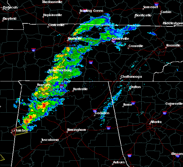 At 228 pm cdt, a severe thunderstorm was located near town creek, or 12 miles east of muscle shoals, moving northeast at 45 mph (radar indicated). Hazards include 60 mph wind gusts. Expect damage to roofs, siding, and trees. locations impacted include, rogersville, town creek, lexington, anderson, center star, kingtown, oliver, whitehead, ford city and red bank. A tornado watch remains in effect until 700 pm cdt for north central and northwestern alabama. At 228 pm cdt, a severe thunderstorm was located near town creek, or 12 miles east of muscle shoals, moving northeast at 45 mph (radar indicated). Hazards include 60 mph wind gusts. Expect damage to roofs, siding, and trees. locations impacted include, rogersville, town creek, lexington, anderson, center star, kingtown, oliver, whitehead, ford city and red bank. A tornado watch remains in effect until 700 pm cdt for north central and northwestern alabama.
|
| 3/14/2019 2:13 PM CDT |
 At 213 pm cdt, a severe thunderstorm was located near littleville, or near muscle shoals, moving northeast at 45 mph (radar indicated). Hazards include 60 mph wind gusts. expect damage to roofs, siding, and trees At 213 pm cdt, a severe thunderstorm was located near littleville, or near muscle shoals, moving northeast at 45 mph (radar indicated). Hazards include 60 mph wind gusts. expect damage to roofs, siding, and trees
|
| 3/9/2019 7:02 PM CDT |
 At 601 pm cst, a severe thunderstorm was located near underwood-petersville, or 8 miles north of florence, moving east at 55 mph (radar indicated). Hazards include 60 mph wind gusts. expect damage to roofs, siding, and trees At 601 pm cst, a severe thunderstorm was located near underwood-petersville, or 8 miles north of florence, moving east at 55 mph (radar indicated). Hazards include 60 mph wind gusts. expect damage to roofs, siding, and trees
|
| 12/31/2018 2:36 PM CST |
 At 236 pm cst, a severe thunderstorm was located over town creek, or 15 miles north of moulton, moving northeast at 40 mph (radar indicated). Hazards include 60 mph wind gusts. expect damage to roofs, siding, and trees At 236 pm cst, a severe thunderstorm was located over town creek, or 15 miles north of moulton, moving northeast at 40 mph (radar indicated). Hazards include 60 mph wind gusts. expect damage to roofs, siding, and trees
|
| 11/6/2018 12:44 AM CST |
 At 1243 am cst, severe thunderstorms were located along a line extending from 10 miles east of loretto to near town creek, moving east at 60 mph (radar indicated). Hazards include 60 mph wind gusts. Expect damage to roofs, siding, and trees. locations impacted include, rogersville, town creek, lexington, courtland, north courtland, anderson, lester, good springs, coxey and oliver. A tornado watch remains in effect until 600 am cst for north central and northwestern alabama, and middle tennessee. At 1243 am cst, severe thunderstorms were located along a line extending from 10 miles east of loretto to near town creek, moving east at 60 mph (radar indicated). Hazards include 60 mph wind gusts. Expect damage to roofs, siding, and trees. locations impacted include, rogersville, town creek, lexington, courtland, north courtland, anderson, lester, good springs, coxey and oliver. A tornado watch remains in effect until 600 am cst for north central and northwestern alabama, and middle tennessee.
|
| 11/6/2018 12:26 AM CST |
 At 1226 am cst, severe thunderstorms were located along a line extending from 7 miles southwest of loretto to near littleville, moving east at 60 mph (radar indicated). Hazards include 60 mph wind gusts. expect damage to roofs, siding, and trees At 1226 am cst, severe thunderstorms were located along a line extending from 7 miles southwest of loretto to near littleville, moving east at 60 mph (radar indicated). Hazards include 60 mph wind gusts. expect damage to roofs, siding, and trees
|
| 11/5/2018 11:45 PM CST |
 At 1145 pm cst, a severe thunderstorm was located near lexington, or 17 miles northeast of florence, moving east at 55 mph (radar indicated). Hazards include 60 mph wind gusts. expect damage to roofs, siding, and trees At 1145 pm cst, a severe thunderstorm was located near lexington, or 17 miles northeast of florence, moving east at 55 mph (radar indicated). Hazards include 60 mph wind gusts. expect damage to roofs, siding, and trees
|
| 11/5/2018 11:23 PM CST |
 At 1121 pm cst, a severe thunderstorm was located over underwood-petersville, or 7 miles north of florence, moving east at 60 mph (radar indicated). Hazards include 60 mph wind gusts. expect damage to roofs, siding, and trees At 1121 pm cst, a severe thunderstorm was located over underwood-petersville, or 7 miles north of florence, moving east at 60 mph (radar indicated). Hazards include 60 mph wind gusts. expect damage to roofs, siding, and trees
|
| 6/28/2018 3:06 PM CDT |
 The severe thunderstorm warning for southwestern madison, eastern lauderdale, limestone, northern morgan and northeastern lawrence counties will expire at 315 pm cdt, remember, a severe thunderstorm warning is still in effect for parts of limestone, morgan and lawrence counties. a severe thunderstorm watch remains in effect until 700 pm cdt for north central, northeastern and northwestern alabama, and middle tennessee. The severe thunderstorm warning for southwestern madison, eastern lauderdale, limestone, northern morgan and northeastern lawrence counties will expire at 315 pm cdt, remember, a severe thunderstorm warning is still in effect for parts of limestone, morgan and lawrence counties. a severe thunderstorm watch remains in effect until 700 pm cdt for north central, northeastern and northwestern alabama, and middle tennessee.
|
| 6/28/2018 2:24 PM CDT |
 At 224 pm cdt, a severe thunderstorm was located near rogersville, or 17 miles west of athens, moving southeast at 55 mph (radar indicated). Hazards include 60 mph wind gusts and nickel size hail. expect damage to roofs, siding, and trees At 224 pm cdt, a severe thunderstorm was located near rogersville, or 17 miles west of athens, moving southeast at 55 mph (radar indicated). Hazards include 60 mph wind gusts and nickel size hail. expect damage to roofs, siding, and trees
|
| 6/28/2018 1:51 PM CDT |
 At 150 pm cdt, severe thunderstorms were located along a line extending from near lynchburg to 6 miles northeast of harvest to 6 miles east of rogersville, moving southeast at 55 mph (radar indicated). Hazards include 70 mph wind gusts and penny size hail. Expect considerable tree damage. Damage is likely to mobile homes, roofs, and outbuildings. At 150 pm cdt, severe thunderstorms were located along a line extending from near lynchburg to 6 miles northeast of harvest to 6 miles east of rogersville, moving southeast at 55 mph (radar indicated). Hazards include 70 mph wind gusts and penny size hail. Expect considerable tree damage. Damage is likely to mobile homes, roofs, and outbuildings.
|
| 6/28/2018 1:31 PM CDT |
 At 131 pm cdt, a severe thunderstorm was located 7 miles south of pulaski, moving south at 40 mph (radar indicated). Hazards include 70 mph wind gusts and nickel size hail. Expect considerable tree damage. Damage is likely to mobile homes, roofs, and outbuildings. At 131 pm cdt, a severe thunderstorm was located 7 miles south of pulaski, moving south at 40 mph (radar indicated). Hazards include 70 mph wind gusts and nickel size hail. Expect considerable tree damage. Damage is likely to mobile homes, roofs, and outbuildings.
|
| 6/23/2018 11:05 AM CDT |
 At 1104 am cdt, severe thunderstorms were located along a line extending from 10 miles east of lexington to trinity, moving east at 50 mph (radar indicated). Hazards include 60 mph wind gusts. Expect damage to roofs, siding, and trees. Locations impacted include, decatur, madison, athens, trinity, rogersville, ardmore, tanner, harvest, hillsboro and elkmont. At 1104 am cdt, severe thunderstorms were located along a line extending from 10 miles east of lexington to trinity, moving east at 50 mph (radar indicated). Hazards include 60 mph wind gusts. Expect damage to roofs, siding, and trees. Locations impacted include, decatur, madison, athens, trinity, rogersville, ardmore, tanner, harvest, hillsboro and elkmont.
|
| 6/23/2018 10:47 AM CDT |
 At 1046 am cdt, severe thunderstorms were located along a line extending from 6 miles west of lexington to near courtland, moving east at 60 mph (radar indicated). Hazards include 60 mph wind gusts. expect damage to roofs, siding, and trees At 1046 am cdt, severe thunderstorms were located along a line extending from 6 miles west of lexington to near courtland, moving east at 60 mph (radar indicated). Hazards include 60 mph wind gusts. expect damage to roofs, siding, and trees
|
| 6/23/2018 10:22 AM CDT |
 At 1022 am cdt, severe thunderstorms were located along a line extending from 11 miles southeast of walnut grove to near brushy lake, moving east at 45 mph (radar indicated). Hazards include 60 mph wind gusts. expect damage to roofs, siding, and trees At 1022 am cdt, severe thunderstorms were located along a line extending from 11 miles southeast of walnut grove to near brushy lake, moving east at 45 mph (radar indicated). Hazards include 60 mph wind gusts. expect damage to roofs, siding, and trees
|
| 6/22/2018 5:14 PM CDT |
 At 513 pm cdt, a severe thunderstorm was located near muscle shoals, moving east at 35 mph (radar indicated). Hazards include 60 mph wind gusts and nickel size hail. expect damage to roofs, siding, and trees At 513 pm cdt, a severe thunderstorm was located near muscle shoals, moving east at 35 mph (radar indicated). Hazards include 60 mph wind gusts and nickel size hail. expect damage to roofs, siding, and trees
|
| 6/22/2018 4:55 PM CDT |
 At 455 pm cdt, a severe thunderstorm was located near rogersville, or 18 miles east of florence, moving east at 35 mph (radar indicated). Hazards include 60 mph wind gusts. expect damage to roofs, siding, and trees At 455 pm cdt, a severe thunderstorm was located near rogersville, or 18 miles east of florence, moving east at 35 mph (radar indicated). Hazards include 60 mph wind gusts. expect damage to roofs, siding, and trees
|
| 6/22/2018 4:53 PM CDT | Trees reported down in the elgin are in lauderdale county AL, 6.6 miles ESE of Rogersville, AL |
| 6/21/2018 7:45 PM CDT |
 The national weather service in huntsville alabama has issued a * severe thunderstorm warning for. central lauderdale county in northwestern alabama. colbert county in northwestern alabama. northeastern franklin county in northwestern alabama. Western lawrence county in northwestern alabama. The national weather service in huntsville alabama has issued a * severe thunderstorm warning for. central lauderdale county in northwestern alabama. colbert county in northwestern alabama. northeastern franklin county in northwestern alabama. Western lawrence county in northwestern alabama.
|
| 4/3/2018 10:11 PM CDT | Trees down in roadway along lee st. near rogersvill in lauderdale county AL, 0.3 miles NNE of Rogersville, AL |
| 4/3/2018 10:09 PM CDT |
 At 1008 pm cdt, severe thunderstorms were located along a line extending from 9 miles northeast of lexington to 8 miles northwest of brushy lake, moving east at 50 mph (radar indicated. radar indicated. spotters and emergency managers have reported trees down and power outages across colbert and lauderdale counties, specifically in killen, florence, vina, and waterloo. a 64 miles per hour gust was also recorded at muscle shoals airport earlier in the evening). Hazards include 60 mph wind gusts and penny size hail. Expect damage to roofs, siding, and trees. Locations impacted include, decatur, athens, hartselle, moulton, trinity, rogersville, ardmore, town creek, lexington and courtland. At 1008 pm cdt, severe thunderstorms were located along a line extending from 9 miles northeast of lexington to 8 miles northwest of brushy lake, moving east at 50 mph (radar indicated. radar indicated. spotters and emergency managers have reported trees down and power outages across colbert and lauderdale counties, specifically in killen, florence, vina, and waterloo. a 64 miles per hour gust was also recorded at muscle shoals airport earlier in the evening). Hazards include 60 mph wind gusts and penny size hail. Expect damage to roofs, siding, and trees. Locations impacted include, decatur, athens, hartselle, moulton, trinity, rogersville, ardmore, town creek, lexington and courtland.
|
| 4/3/2018 10:05 PM CDT |
 At 1003 pm cdt, severe thunderstorms were located along a line extending from near lexington to 3 miles east of phil campbell, moving east at 50 mph (emergency management. there have been numerous reports of downed trees and power lines across the shoals region. at 946 pm cdt, the muscle shoals airport reported a 62 mph wind gust with these storms). Hazards include 60 mph wind gusts. Expect damage to roofs, siding, and trees. Locations impacted include, moulton, rogersville, phil campbell, killen, town creek, lexington, leighton, courtland, north courtland and anderson. At 1003 pm cdt, severe thunderstorms were located along a line extending from near lexington to 3 miles east of phil campbell, moving east at 50 mph (emergency management. there have been numerous reports of downed trees and power lines across the shoals region. at 946 pm cdt, the muscle shoals airport reported a 62 mph wind gust with these storms). Hazards include 60 mph wind gusts. Expect damage to roofs, siding, and trees. Locations impacted include, moulton, rogersville, phil campbell, killen, town creek, lexington, leighton, courtland, north courtland and anderson.
|
| 4/3/2018 10:05 PM CDT |
 At 1002 pm cdt, severe thunderstorms were located along a line extending from near lexington to 7 miles north of ashridge, moving east at 50 mph (radar indicated. spotters and emergency managers have reported trees down and power outages across colbert and lauderdale counties, specifically in killen, florence, vina, and waterloo. a 54kt/62mph gust was also recorded at muscle shoals airport earlier in the evening). Hazards include 60 mph wind gusts and penny size hail. expect damage to roofs, siding, and trees At 1002 pm cdt, severe thunderstorms were located along a line extending from near lexington to 7 miles north of ashridge, moving east at 50 mph (radar indicated. spotters and emergency managers have reported trees down and power outages across colbert and lauderdale counties, specifically in killen, florence, vina, and waterloo. a 54kt/62mph gust was also recorded at muscle shoals airport earlier in the evening). Hazards include 60 mph wind gusts and penny size hail. expect damage to roofs, siding, and trees
|
| 4/3/2018 9:55 PM CDT |
 The tornado warning for southeastern lauderdale, east central colbert and northwestern lawrence counties will expire at 1000 pm cdt, the tornado threat has diminished and the tornado warning will expire at the top of the hour. however, damaging winds remain likely and a severe thunderstorm warning remains in effect for the area until 1015 pm cdt. a severe thunderstorm watch remains in effect until 100 am cdt for north central and northwestern alabama. The tornado warning for southeastern lauderdale, east central colbert and northwestern lawrence counties will expire at 1000 pm cdt, the tornado threat has diminished and the tornado warning will expire at the top of the hour. however, damaging winds remain likely and a severe thunderstorm warning remains in effect for the area until 1015 pm cdt. a severe thunderstorm watch remains in effect until 100 am cdt for north central and northwestern alabama.
|
| 4/3/2018 9:53 PM CDT |
 At 952 pm cdt, severe thunderstorms were located along a line extending from 6 miles southwest of loretto to near needmore, moving east at 50 mph (emergency management. at 946 pm cdt, a 62 mph gust was reported at the muscle shoals airport. at 949 pm cdt, trees were reported down in waterloo). Hazards include 60 mph wind gusts and penny size hail. Expect damage to roofs, siding, and trees. Locations impacted include, florence, muscle shoals, russellville, sheffield, tuscumbia, moulton, rogersville, phil campbell, killen and town creek. At 952 pm cdt, severe thunderstorms were located along a line extending from 6 miles southwest of loretto to near needmore, moving east at 50 mph (emergency management. at 946 pm cdt, a 62 mph gust was reported at the muscle shoals airport. at 949 pm cdt, trees were reported down in waterloo). Hazards include 60 mph wind gusts and penny size hail. Expect damage to roofs, siding, and trees. Locations impacted include, florence, muscle shoals, russellville, sheffield, tuscumbia, moulton, rogersville, phil campbell, killen and town creek.
|
| 4/3/2018 9:40 PM CDT |
 At 940 pm cdt, a severe thunderstorm capable of producing a tornado was located over muscle shoals, moving east at 55 mph (radar indicated rotation). Hazards include tornado. Flying debris will be dangerous to those caught without shelter. mobile homes will be damaged or destroyed. damage to roofs, windows, and vehicles will occur. Tree damage is likely. At 940 pm cdt, a severe thunderstorm capable of producing a tornado was located over muscle shoals, moving east at 55 mph (radar indicated rotation). Hazards include tornado. Flying debris will be dangerous to those caught without shelter. mobile homes will be damaged or destroyed. damage to roofs, windows, and vehicles will occur. Tree damage is likely.
|
| 4/3/2018 9:32 PM CDT |
 At 931 pm cdt, severe thunderstorms were located along a line extending from threet to near hodges, moving east at 50 mph (radar indicated). Hazards include 60 mph wind gusts and penny size hail. Expect damage to roofs, siding, and trees. Locations impacted include, florence, muscle shoals, russellville, sheffield, tuscumbia, moulton, rogersville, phil campbell, killen and town creek. At 931 pm cdt, severe thunderstorms were located along a line extending from threet to near hodges, moving east at 50 mph (radar indicated). Hazards include 60 mph wind gusts and penny size hail. Expect damage to roofs, siding, and trees. Locations impacted include, florence, muscle shoals, russellville, sheffield, tuscumbia, moulton, rogersville, phil campbell, killen and town creek.
|
| 4/3/2018 9:24 PM CDT |
 At 923 pm cdt, severe thunderstorms were located along a line extending from 11 miles east of walnut grove to 8 miles northwest of hackleburg, moving east at 50 mph (radar indicated. at 8:45pm trees were reported down on powerlines in booneville with these storms). Hazards include 60 mph wind gusts and penny size hail. expect damage to roofs, siding, and trees At 923 pm cdt, severe thunderstorms were located along a line extending from 11 miles east of walnut grove to 8 miles northwest of hackleburg, moving east at 50 mph (radar indicated. at 8:45pm trees were reported down on powerlines in booneville with these storms). Hazards include 60 mph wind gusts and penny size hail. expect damage to roofs, siding, and trees
|
| 3/19/2018 1:20 PM CDT |
 At 119 pm cdt, a severe thunderstorm was located near tuscumbia, moving east at 40 mph (radar indicated). Hazards include 60 mph wind gusts and quarter size hail. Hail damage to vehicles is expected. Expect wind damage to roofs, siding, and trees. At 119 pm cdt, a severe thunderstorm was located near tuscumbia, moving east at 40 mph (radar indicated). Hazards include 60 mph wind gusts and quarter size hail. Hail damage to vehicles is expected. Expect wind damage to roofs, siding, and trees.
|
| 2/25/2018 12:01 AM CST |
 At 1200 am cst, severe thunderstorms were located along a line extending from near lexington to tremont, moving east at 60 mph (radar indicated). Hazards include 60 mph wind gusts. Expect damage to roofs, siding, and trees. Locations impacted include, florence, muscle shoals, russellville, sheffield, tuscumbia, red bay, rogersville, killen, town creek and littleville. At 1200 am cst, severe thunderstorms were located along a line extending from near lexington to tremont, moving east at 60 mph (radar indicated). Hazards include 60 mph wind gusts. Expect damage to roofs, siding, and trees. Locations impacted include, florence, muscle shoals, russellville, sheffield, tuscumbia, red bay, rogersville, killen, town creek and littleville.
|
| 2/24/2018 11:36 PM CST |
 At 1135 pm cst, severe thunderstorms were located along a line extending from 6 miles northwest of underwood-petersville to near evergreen, moving northeast at 55 mph (radar indicated). Hazards include 60 mph wind gusts. expect damage to roofs, siding, and trees At 1135 pm cst, severe thunderstorms were located along a line extending from 6 miles northwest of underwood-petersville to near evergreen, moving northeast at 55 mph (radar indicated). Hazards include 60 mph wind gusts. expect damage to roofs, siding, and trees
|
| 11/18/2017 5:23 PM CST |
 At 522 pm cst, severe thunderstorms were located along a line extending from 11 miles east of lexington to near rogersville, moving east at 55 mph (radar indicated). Hazards include 60 mph wind gusts. expect damage to roofs, siding, and trees At 522 pm cst, severe thunderstorms were located along a line extending from 11 miles east of lexington to near rogersville, moving east at 55 mph (radar indicated). Hazards include 60 mph wind gusts. expect damage to roofs, siding, and trees
|
| 11/18/2017 5:07 PM CST |
 At 506 pm cst, severe thunderstorms were located along a line extending from near lexington to near leighton, moving east at 55 mph (radar indicated). Hazards include 60 mph wind gusts. expect damage to roofs, siding, and trees At 506 pm cst, severe thunderstorms were located along a line extending from near lexington to near leighton, moving east at 55 mph (radar indicated). Hazards include 60 mph wind gusts. expect damage to roofs, siding, and trees
|
| 7/6/2017 3:34 PM CDT |
 At 334 pm cdt, a severe thunderstorm was located near town creek, or 17 miles east of muscle shoals, moving east at 25 mph (radar indicated). Hazards include 60 mph wind gusts. expect damage to roofs, siding, and trees At 334 pm cdt, a severe thunderstorm was located near town creek, or 17 miles east of muscle shoals, moving east at 25 mph (radar indicated). Hazards include 60 mph wind gusts. expect damage to roofs, siding, and trees
|
| 6/23/2017 2:14 PM CDT | Ema reported power lines down across lakeview dr in rogersvill in lauderdale county AL, 3 miles N of Rogersville, AL |
| 6/23/2017 12:45 PM CDT | Ema reported a tree down across cr 70 south of us 72 in rogersvill in lauderdale county AL, 1.2 miles NNE of Rogersville, AL |
| 5/28/2017 1:02 AM CDT |
 At 102 am cdt, severe thunderstorms were located along a line extending from near lexington to near red bay, moving southeast at 60 mph (radar indicated). Hazards include 70 to 80 mph wind gusts and penny size hail. Expect considerable tree damage. Damage is likely to mobile homes, roofs, and outbuildings. At 102 am cdt, severe thunderstorms were located along a line extending from near lexington to near red bay, moving southeast at 60 mph (radar indicated). Hazards include 70 to 80 mph wind gusts and penny size hail. Expect considerable tree damage. Damage is likely to mobile homes, roofs, and outbuildings.
|
| 4/30/2017 2:05 PM CDT |
 At 205 pm cdt, severe thunderstorms were located along a line extending from 10 miles northeast of rogersville to near trinity, moving northeast at 50 mph (radar indicated). Hazards include 70 mph wind gusts. Expect considerable tree damage. damage is likely to mobile homes, roofs, and outbuildings. locations impacted include, decatur, madison, athens, trinity, rogersville, tanner, hillsboro, elkmont, anderson and lester. a tornado watch remains in effect until 700 pm cdt for north central and northwestern alabama. A tornado watch also remains in effect until 700 pm cdt for north central and northeastern alabama, and middle tennessee. At 205 pm cdt, severe thunderstorms were located along a line extending from 10 miles northeast of rogersville to near trinity, moving northeast at 50 mph (radar indicated). Hazards include 70 mph wind gusts. Expect considerable tree damage. damage is likely to mobile homes, roofs, and outbuildings. locations impacted include, decatur, madison, athens, trinity, rogersville, tanner, hillsboro, elkmont, anderson and lester. a tornado watch remains in effect until 700 pm cdt for north central and northwestern alabama. A tornado watch also remains in effect until 700 pm cdt for north central and northeastern alabama, and middle tennessee.
|
| 4/30/2017 1:56 PM CDT |
 At 156 pm cdt, a severe thunderstorm capable of producing a tornado was located near rogersville, or 14 miles west of athens, moving northeast at 50 mph (radar indicated rotation). Hazards include tornado. Flying debris will be dangerous to those caught without shelter. mobile homes will be damaged or destroyed. damage to roofs, windows, and vehicles will occur. tree damage is likely. This tornadic thunderstorm will remain over mainly rural areas of east central lauderdale and northwestern limestone counties, including the following locations: good springs, cartwright, coxey, oliver and mt rozell. At 156 pm cdt, a severe thunderstorm capable of producing a tornado was located near rogersville, or 14 miles west of athens, moving northeast at 50 mph (radar indicated rotation). Hazards include tornado. Flying debris will be dangerous to those caught without shelter. mobile homes will be damaged or destroyed. damage to roofs, windows, and vehicles will occur. tree damage is likely. This tornadic thunderstorm will remain over mainly rural areas of east central lauderdale and northwestern limestone counties, including the following locations: good springs, cartwright, coxey, oliver and mt rozell.
|
| 4/30/2017 1:38 PM CDT |
 At 138 pm cdt, severe thunderstorms were located along a line extending from near town creek to near brushy lake, moving northeast at 50 mph (radar indicated). Hazards include 70 mph wind gusts. Expect considerable tree damage. Damage is likely to mobile homes, roofs, and outbuildings. At 138 pm cdt, severe thunderstorms were located along a line extending from near town creek to near brushy lake, moving northeast at 50 mph (radar indicated). Hazards include 70 mph wind gusts. Expect considerable tree damage. Damage is likely to mobile homes, roofs, and outbuildings.
|
| 4/30/2017 1:28 PM CDT |
 At 128 pm cdt, severe thunderstorms were located along a line extending from 9 miles southwest of loretto to near leighton, moving northeast at 60 mph (radar indicated). Hazards include 70 mph wind gusts. Expect considerable tree damage. Damage is likely to mobile homes, roofs, and outbuildings. At 128 pm cdt, severe thunderstorms were located along a line extending from 9 miles southwest of loretto to near leighton, moving northeast at 60 mph (radar indicated). Hazards include 70 mph wind gusts. Expect considerable tree damage. Damage is likely to mobile homes, roofs, and outbuildings.
|
| 4/30/2017 1:16 PM CDT |
 At 115 pm cdt, severe thunderstorms were located along a line extending from 10 miles west of loretto to near littleville, moving northeast at 55 mph (emergency management. at 109 pm cdt, a tree was reported down near camp westmoreland in the florence area. at 113 pm cdt, a tree was reported down on a house along county road 8 near florence). Hazards include 70 mph wind gusts. Expect considerable tree damage. damage is likely to mobile homes, roofs, and outbuildings. locations impacted include, florence, muscle shoals, russellville, sheffield, tuscumbia, rogersville, killen, littleville, lexington and leighton. A tornado watch remains in effect until 700 pm cdt for north central and northwestern alabama. At 115 pm cdt, severe thunderstorms were located along a line extending from 10 miles west of loretto to near littleville, moving northeast at 55 mph (emergency management. at 109 pm cdt, a tree was reported down near camp westmoreland in the florence area. at 113 pm cdt, a tree was reported down on a house along county road 8 near florence). Hazards include 70 mph wind gusts. Expect considerable tree damage. damage is likely to mobile homes, roofs, and outbuildings. locations impacted include, florence, muscle shoals, russellville, sheffield, tuscumbia, rogersville, killen, littleville, lexington and leighton. A tornado watch remains in effect until 700 pm cdt for north central and northwestern alabama.
|
| 4/30/2017 12:51 PM CDT |
 At 1250 pm cdt, severe thunderstorms were located along a line extending from 8 miles west of underwood-petersville to near belgreen, moving northeast at 65 mph (radar indicated). Hazards include 70 mph wind gusts. Expect considerable tree damage. Damage is likely to mobile homes, roofs, and outbuildings. At 1250 pm cdt, severe thunderstorms were located along a line extending from 8 miles west of underwood-petersville to near belgreen, moving northeast at 65 mph (radar indicated). Hazards include 70 mph wind gusts. Expect considerable tree damage. Damage is likely to mobile homes, roofs, and outbuildings.
|
| 3/27/2017 9:23 PM CDT |
 The severe thunderstorm warning for lauderdale and northern colbert counties will expire at 930 pm cdt, the storms which prompted the warning have moved out of the area. therefore, the warning will be allowed to expire. The severe thunderstorm warning for lauderdale and northern colbert counties will expire at 930 pm cdt, the storms which prompted the warning have moved out of the area. therefore, the warning will be allowed to expire.
|
| 3/27/2017 8:54 PM CDT |
 At 854 pm cdt, severe thunderstorms were located along a line extending from near lexington to near underwood-petersville to 9 miles north of cherokee, moving southeast at 15 mph (radar indicated). Hazards include 60 mph wind gusts and quarter size hail. Hail damage to vehicles is expected. expect wind damage to roofs, siding, and trees. locations impacted include, florence, rogersville, killen, lexington, st. Florian, underwood-petersville, anderson, waterloo, wright and riverton. At 854 pm cdt, severe thunderstorms were located along a line extending from near lexington to near underwood-petersville to 9 miles north of cherokee, moving southeast at 15 mph (radar indicated). Hazards include 60 mph wind gusts and quarter size hail. Hail damage to vehicles is expected. expect wind damage to roofs, siding, and trees. locations impacted include, florence, rogersville, killen, lexington, st. Florian, underwood-petersville, anderson, waterloo, wright and riverton.
|
| 3/27/2017 8:31 PM CDT |
 At 831 pm cdt, severe thunderstorms were located along a line extending from 6 miles southwest of loretto to 8 miles northwest of underwood-petersville to near j p coleman state park, moving southeast at 15 mph (radar indicated). Hazards include 60 mph wind gusts and quarter size hail. Hail damage to vehicles is expected. Expect wind damage to roofs, siding, and trees. At 831 pm cdt, severe thunderstorms were located along a line extending from 6 miles southwest of loretto to 8 miles northwest of underwood-petersville to near j p coleman state park, moving southeast at 15 mph (radar indicated). Hazards include 60 mph wind gusts and quarter size hail. Hail damage to vehicles is expected. Expect wind damage to roofs, siding, and trees.
|
| 3/10/2017 12:39 AM CST |
 The severe thunderstorm warning for northwestern madison, lauderdale, limestone, colbert and northern lawrence counties will expire at 1245 am cst, the storms which prompted the warning have weakened below severe limits, and no longer pose an immediate threat to life or property. therefore, the warning will be allowed to expire. a severe thunderstorm warning remains in effect for eastern madison county, al. a severe thunderstorm watch remains in effect until 400 am cst for north central, northeastern and northwestern alabama, and middle tennessee. The severe thunderstorm warning for northwestern madison, lauderdale, limestone, colbert and northern lawrence counties will expire at 1245 am cst, the storms which prompted the warning have weakened below severe limits, and no longer pose an immediate threat to life or property. therefore, the warning will be allowed to expire. a severe thunderstorm warning remains in effect for eastern madison county, al. a severe thunderstorm watch remains in effect until 400 am cst for north central, northeastern and northwestern alabama, and middle tennessee.
|
| 3/10/2017 12:00 AM CST |
 At 1159 pm cst, severe thunderstorms were located along a line extending from near tanner to near cherokee, moving south-southeast at 40 mph (radar indicated). Hazards include 60 mph wind gusts and quarter size hail. Hail damage to vehicles is expected. expect wind damage to roofs, siding, and trees. Locations impacted include, northwestern huntsville, madison, florence, athens, muscle shoals, sheffield, tuscumbia, j p coleman state park, meridianville and hazel green. At 1159 pm cst, severe thunderstorms were located along a line extending from near tanner to near cherokee, moving south-southeast at 40 mph (radar indicated). Hazards include 60 mph wind gusts and quarter size hail. Hail damage to vehicles is expected. expect wind damage to roofs, siding, and trees. Locations impacted include, northwestern huntsville, madison, florence, athens, muscle shoals, sheffield, tuscumbia, j p coleman state park, meridianville and hazel green.
|
| 3/9/2017 11:50 PM CST |
 At 1149 pm cst, severe thunderstorms were located along a line extending from near ardmore to 8 miles southeast of walnut grove, moving southwest at 85 mph (radar indicated). Hazards include 60 mph wind gusts and quarter size hail. Hail damage to vehicles is expected. Expect wind damage to roofs, siding, and trees. At 1149 pm cst, severe thunderstorms were located along a line extending from near ardmore to 8 miles southeast of walnut grove, moving southwest at 85 mph (radar indicated). Hazards include 60 mph wind gusts and quarter size hail. Hail damage to vehicles is expected. Expect wind damage to roofs, siding, and trees.
|
| 3/1/2017 12:36 PM CST |
 The tornado warning for east central lauderdale and northwestern limestone counties will expire at 1245 pm cst, the storm which prompted the warning has weakened below severe limits, and no longer appears capable of producing a tornado. therefore, the warning will be allowed to expire. however small hail and gusty winds are still possible with this thunderstorm. a tornado watch remains in effect until 600 pm cst for north central and northwestern alabama, and middle tennessee. The tornado warning for east central lauderdale and northwestern limestone counties will expire at 1245 pm cst, the storm which prompted the warning has weakened below severe limits, and no longer appears capable of producing a tornado. therefore, the warning will be allowed to expire. however small hail and gusty winds are still possible with this thunderstorm. a tornado watch remains in effect until 600 pm cst for north central and northwestern alabama, and middle tennessee.
|
| 3/1/2017 12:23 PM CST |
 At 1223 pm cst, a severe thunderstorm capable of producing a tornado was located 7 miles northeast of rogersville, or 12 miles northwest of athens, moving east at 60 mph (radar indicated rotation). Hazards include tornado and golf ball size hail. Flying debris will be dangerous to those caught without shelter. mobile homes will be damaged or destroyed. damage to roofs, windows, and vehicles will occur. tree damage is likely. this dangerous storm will be near, athens around 1235 pm cst. Other locations impacted by this tornadic thunderstorm include cartwright, oliver, mt rozell, anderson and cairo. At 1223 pm cst, a severe thunderstorm capable of producing a tornado was located 7 miles northeast of rogersville, or 12 miles northwest of athens, moving east at 60 mph (radar indicated rotation). Hazards include tornado and golf ball size hail. Flying debris will be dangerous to those caught without shelter. mobile homes will be damaged or destroyed. damage to roofs, windows, and vehicles will occur. tree damage is likely. this dangerous storm will be near, athens around 1235 pm cst. Other locations impacted by this tornadic thunderstorm include cartwright, oliver, mt rozell, anderson and cairo.
|
| 3/1/2017 12:19 PM CST | Golf Ball sized hail reported 2.4 miles E of Rogersville, AL, . |
| 3/1/2017 12:10 PM CST |
 At 1210 pm cst, a severe thunderstorm capable of producing a tornado was located near rogersville, or 15 miles east of florence, moving east at 60 mph (radar indicated rotation). Hazards include tornado and golf ball size hail. Flying debris will be dangerous to those caught without shelter. mobile homes will be damaged or destroyed. damage to roofs, windows, and vehicles will occur. tree damage is likely. this dangerous storm will be near, rogersville around 1215 pm cst. athens around 1235 pm cst. Other locations impacted by this tornadic thunderstorm include cartwright, coxey, oliver, mt rozell and anderson. At 1210 pm cst, a severe thunderstorm capable of producing a tornado was located near rogersville, or 15 miles east of florence, moving east at 60 mph (radar indicated rotation). Hazards include tornado and golf ball size hail. Flying debris will be dangerous to those caught without shelter. mobile homes will be damaged or destroyed. damage to roofs, windows, and vehicles will occur. tree damage is likely. this dangerous storm will be near, rogersville around 1215 pm cst. athens around 1235 pm cst. Other locations impacted by this tornadic thunderstorm include cartwright, coxey, oliver, mt rozell and anderson.
|
| 3/1/2017 11:58 AM CST |
 At 1158 am cst, a severe thunderstorm was located over st. florian, or near florence, moving east at 55 mph (radar indicated). Hazards include golf ball size hail and 60 mph wind gusts. People and animals outdoors will be injured. expect hail damage to roofs, siding, windows, and vehicles. Expect wind damage to roofs, siding, and trees. At 1158 am cst, a severe thunderstorm was located over st. florian, or near florence, moving east at 55 mph (radar indicated). Hazards include golf ball size hail and 60 mph wind gusts. People and animals outdoors will be injured. expect hail damage to roofs, siding, windows, and vehicles. Expect wind damage to roofs, siding, and trees.
|
| 12/18/2016 12:08 AM CST |
 At 1208 am cst, a severe thunderstorm was located near st. florian, or 10 miles northeast of florence, moving east at 35 mph (radar indicated). Hazards include 60 mph wind gusts. expect damage to roofs, siding, and trees At 1208 am cst, a severe thunderstorm was located near st. florian, or 10 miles northeast of florence, moving east at 35 mph (radar indicated). Hazards include 60 mph wind gusts. expect damage to roofs, siding, and trees
|
| 11/29/2016 7:59 PM CST |
 At 759 pm cst, a severe thunderstorm was located over rogersville, or 17 miles west of athens, moving east at 55 mph (radar indicated). Hazards include 70 mph wind gusts and quarter size hail. Hail damage to vehicles is expected. expect considerable tree damage. Wind damage is also likely to mobile homes, roofs, and outbuildings. At 759 pm cst, a severe thunderstorm was located over rogersville, or 17 miles west of athens, moving east at 55 mph (radar indicated). Hazards include 70 mph wind gusts and quarter size hail. Hail damage to vehicles is expected. expect considerable tree damage. Wind damage is also likely to mobile homes, roofs, and outbuildings.
|
| 11/29/2016 7:31 PM CST |
 At 731 pm cst, a severe thunderstorm was located over leighton, or near muscle shoals, moving northeast at 55 mph (radar indicated). Hazards include 70 mph wind gusts and quarter size hail. Hail damage to vehicles is expected. expect considerable tree damage. Wind damage is also likely to mobile homes, roofs, and outbuildings. At 731 pm cst, a severe thunderstorm was located over leighton, or near muscle shoals, moving northeast at 55 mph (radar indicated). Hazards include 70 mph wind gusts and quarter size hail. Hail damage to vehicles is expected. expect considerable tree damage. Wind damage is also likely to mobile homes, roofs, and outbuildings.
|
| 6/15/2016 6:27 PM CDT |
 The severe thunderstorm warning for northern limestone, northeastern lawrence and eastern lauderdale counties will expire at 630 pm cdt, the storms which prompted the warning have weakened below severe limits, and no longer pose an immediate threat to life or property. therefore the warning will be allowed to expire. however gusty winds and heavy rain are still possible with these thunderstorms. The severe thunderstorm warning for northern limestone, northeastern lawrence and eastern lauderdale counties will expire at 630 pm cdt, the storms which prompted the warning have weakened below severe limits, and no longer pose an immediate threat to life or property. therefore the warning will be allowed to expire. however gusty winds and heavy rain are still possible with these thunderstorms.
|
| 6/15/2016 6:17 PM CDT | Large tree down on church street in lauderdale county AL, 0.8 miles ESE of Rogersville, AL |
| 6/15/2016 5:56 PM CDT |
 At 554 pm cdt, severe thunderstorms were located along a line extending from near pulaski to 9 miles north of underwood-petersville, moving southeast at 15 mph (emergency management officials reported two trees down in the green hill community at 546 pm). Hazards include 60 mph wind gusts and penny size hail. Expect damage to roofs. siding. and trees. Locations impacted include, athens, rogersville, killen, lexington, courtland, north courtland, hillsboro, elkmont, anderson and lester. At 554 pm cdt, severe thunderstorms were located along a line extending from near pulaski to 9 miles north of underwood-petersville, moving southeast at 15 mph (emergency management officials reported two trees down in the green hill community at 546 pm). Hazards include 60 mph wind gusts and penny size hail. Expect damage to roofs. siding. and trees. Locations impacted include, athens, rogersville, killen, lexington, courtland, north courtland, hillsboro, elkmont, anderson and lester.
|
| 6/15/2016 5:46 PM CDT |
 At 545 pm cdt, severe thunderstorms were located along a line extending from 7 miles north of pulaski to 9 miles south of collinwood, moving southeast at 15 mph (radar indicated). Hazards include 60 mph wind gusts and penny size hail. Expect damage to roofs. siding. And trees. At 545 pm cdt, severe thunderstorms were located along a line extending from 7 miles north of pulaski to 9 miles south of collinwood, moving southeast at 15 mph (radar indicated). Hazards include 60 mph wind gusts and penny size hail. Expect damage to roofs. siding. And trees.
|
| 5/12/2016 5:20 PM CDT |
 At 519 pm cdt, a severe thunderstorm was located 8 miles northwest of athens, moving east at 40 mph (radar indicated). Hazards include 60 mph wind gusts and penny size hail. Expect damage to roofs. siding. and trees. Locations impacted include, athens, rogersville, ardmore, tanner, elkmont, anderson, lester, mooresville, leggtown and good springs. At 519 pm cdt, a severe thunderstorm was located 8 miles northwest of athens, moving east at 40 mph (radar indicated). Hazards include 60 mph wind gusts and penny size hail. Expect damage to roofs. siding. and trees. Locations impacted include, athens, rogersville, ardmore, tanner, elkmont, anderson, lester, mooresville, leggtown and good springs.
|
| 5/12/2016 5:02 PM CDT |
 At 501 pm cdt, a severe thunderstorm was located near rogersville, moving east at 40 mph (radar indicated). Hazards include 60 mph wind gusts and penny size hail. Expect damage to roofs. siding. And trees. At 501 pm cdt, a severe thunderstorm was located near rogersville, moving east at 40 mph (radar indicated). Hazards include 60 mph wind gusts and penny size hail. Expect damage to roofs. siding. And trees.
|
| 4/30/2016 4:01 PM CDT |
 At 401 pm cdt, a severe thunderstorm was located 9 miles northwest of moulton, moving northeast at 35 mph (radar indicated). Hazards include 60 mph wind gusts and quarter size hail. Hail damage to vehicles is expected. Expect wind damage to roofs, siding, and trees. At 401 pm cdt, a severe thunderstorm was located 9 miles northwest of moulton, moving northeast at 35 mph (radar indicated). Hazards include 60 mph wind gusts and quarter size hail. Hail damage to vehicles is expected. Expect wind damage to roofs, siding, and trees.
|
| 8/22/2015 5:14 PM CDT | Power line and trees down across lee stree in lauderdale county AL, 0.8 miles ESE of Rogersville, AL |
| 8/22/2015 5:04 PM CDT |
 At 504 pm cdt, a severe thunderstorm was located near rogersville, or 18 miles east of muscle shoals, moving east at 30 mph (radar indicated). Hazards include 60 mph wind gusts and quarter size hail. Hail damage to vehicles is expected. Expect wind damage to roofs, siding and trees. At 504 pm cdt, a severe thunderstorm was located near rogersville, or 18 miles east of muscle shoals, moving east at 30 mph (radar indicated). Hazards include 60 mph wind gusts and quarter size hail. Hail damage to vehicles is expected. Expect wind damage to roofs, siding and trees.
|
| 8/22/2015 3:48 PM CDT | Power line down on rose street in lauderdale county AL, 0.8 miles ESE of Rogersville, AL |
| 8/22/2015 3:48 PM CDT | Sheriff reported trees and power lines down as well as a tree on a car north of highway 7 in lauderdale county AL, 1.8 miles ESE of Rogersville, AL |
| 8/22/2015 3:45 PM CDT |
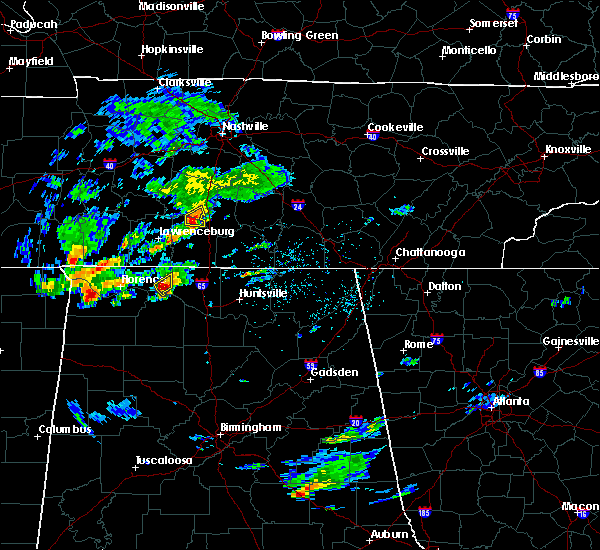 At 345 pm cdt, a severe thunderstorm was located over rogersville, or 18 miles west of athens, moving east at 15 mph (radar indicated). Hazards include 60 mph wind gusts and quarter size hail. Hail damage to vehicles is expected. expect wind damage to roofs, siding and trees. Locations impacted include, rogersville, anderson and oliver. At 345 pm cdt, a severe thunderstorm was located over rogersville, or 18 miles west of athens, moving east at 15 mph (radar indicated). Hazards include 60 mph wind gusts and quarter size hail. Hail damage to vehicles is expected. expect wind damage to roofs, siding and trees. Locations impacted include, rogersville, anderson and oliver.
|
| 8/22/2015 3:25 PM CDT | Shed blown over and multiple trees down in lauderdale county AL, 6 miles ESE of Rogersville, AL |
| 8/22/2015 3:23 PM CDT |
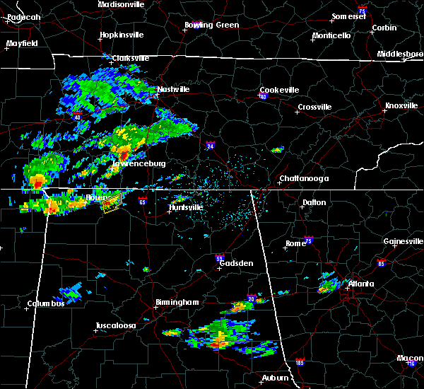 At 322 pm cdt, a severe thunderstorm was located near rogersville, or 15 miles east of muscle shoals, moving east at 15 mph (radar indicated). Hazards include 60 mph wind gusts and quarter size hail. Hail damage to vehicles is expected. Expect wind damage to roofs, siding and trees. At 322 pm cdt, a severe thunderstorm was located near rogersville, or 15 miles east of muscle shoals, moving east at 15 mph (radar indicated). Hazards include 60 mph wind gusts and quarter size hail. Hail damage to vehicles is expected. Expect wind damage to roofs, siding and trees.
|
| 7/29/2015 12:14 PM CDT | Thunderstorm winds knocked down 2-3 trees onto cr 70 and cr 26. time estimated by rada in lauderdale county AL, 3.3 miles WSW of Rogersville, AL |
| 7/20/2015 6:36 PM CDT |
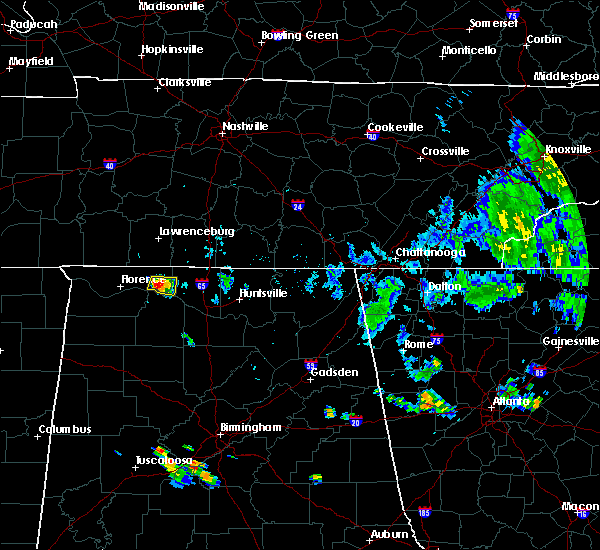 At 636 pm cdt, a severe thunderstorm was located over rogersville, or 19 miles west of athens, moving southeast at 10 mph (radar indicated). Hazards include 60 mph wind gusts and nickel size hail. Expect damage to roofs. siding and trees. Locations impacted include, rogersville, anderson, oliver, coxey, kingtown, elgin and whitehead. At 636 pm cdt, a severe thunderstorm was located over rogersville, or 19 miles west of athens, moving southeast at 10 mph (radar indicated). Hazards include 60 mph wind gusts and nickel size hail. Expect damage to roofs. siding and trees. Locations impacted include, rogersville, anderson, oliver, coxey, kingtown, elgin and whitehead.
|
| 7/20/2015 6:10 PM CDT |
 At 610 pm cdt, a severe thunderstorm was located near lexington, or 18 miles east of florence, moving east at 15 mph (radar indicated). Hazards include 60 mph wind gusts and nickel size hail. Expect damage to roofs. Siding and trees. At 610 pm cdt, a severe thunderstorm was located near lexington, or 18 miles east of florence, moving east at 15 mph (radar indicated). Hazards include 60 mph wind gusts and nickel size hail. Expect damage to roofs. Siding and trees.
|
| 7/20/2015 6:05 PM CDT |
 At 604 pm cdt, a severe thunderstorm was located near lexington, or 18 miles east of florence, moving east at 15 mph (radar indicated). Hazards include 60 mph wind gusts and penny size hail. Expect damage to roofs. siding and trees. Locations impacted include, rogersville, lexington, anderson, oliver, coxey, good springs, kingtown, cairo, mt rozell and whitehead. At 604 pm cdt, a severe thunderstorm was located near lexington, or 18 miles east of florence, moving east at 15 mph (radar indicated). Hazards include 60 mph wind gusts and penny size hail. Expect damage to roofs. siding and trees. Locations impacted include, rogersville, lexington, anderson, oliver, coxey, good springs, kingtown, cairo, mt rozell and whitehead.
|
| 7/20/2015 5:44 PM CDT |
 At 544 pm cdt, a severe thunderstorm was located near lexington, , moving southeast at 20 mph (radar indicated). Hazards include 60 mph wind gusts and penny size hail. Expect damage to roofs. Siding and trees. At 544 pm cdt, a severe thunderstorm was located near lexington, , moving southeast at 20 mph (radar indicated). Hazards include 60 mph wind gusts and penny size hail. Expect damage to roofs. Siding and trees.
|
| 7/14/2015 6:08 PM CDT |
 At 608 pm cdt, a severe thunderstorm was located over rogersville, or 18 miles west of athens, moving southeast at 45 mph (radar indicated). Hazards include 60 mph wind gusts. Expect damage to roofs. Siding and trees. At 608 pm cdt, a severe thunderstorm was located over rogersville, or 18 miles west of athens, moving southeast at 45 mph (radar indicated). Hazards include 60 mph wind gusts. Expect damage to roofs. Siding and trees.
|
| 3/31/2015 7:43 PM CDT | The national weather service in huntsville has issued a * severe thunderstorm warning for. east central colbert county in northwestern alabama. west central limestone county in north central alabama. northern lawrence county in northwestern alabama. Southeastern lauderdale county in northwestern alabama. |
| 6/7/2014 8:03 PM CDT | A sheriff deputy estimated winds around 70 mph just east of coxe in limestone county AL, 6.3 miles W of Rogersville, AL |
| 6/7/2014 7:50 PM CDT | A mobile home was reported damage in lauderdale county AL, 0.8 miles ESE of Rogersville, AL |
| 6/7/2014 7:43 PM CDT | A mobile home was damaged on cr 41 in lawrence county AL, 6.7 miles ENE of Rogersville, AL |
| 2/20/2014 9:00 PM CST | Seven untility poles reported down on highway 72 near coxe in limestone county AL, 5.9 miles WNW of Rogersville, AL |
| 2/20/2014 8:59 PM CST | Report of at least 3 to 4 trees down and power out. two of the trees were at least 18 inches in diameter. one of the trees was snapped off 10 feet from its trun in limestone county AL, 7 miles WSW of Rogersville, AL |
| 2/20/2014 8:52 PM CST | Significant damage reported at lucys branch resort and marina. boats were overt in limestone county AL, 4.5 miles NW of Rogersville, AL |
| 7/10/2013 10:30 PM CDT | Tree reported down near mclean drive close to joe wheeler park. this resulted in a minor traffic accident although no injuries were reported. tree size and type is unkn in lauderdale county AL, 3.1 miles ENE of Rogersville, AL |
| 6/17/2013 1:20 PM CDT | Four trees were reported blown down in yard. one tree was 15 to 18 inches in diamete in limestone county AL, 3.7 miles WNW of Rogersville, AL |
| 6/17/2013 1:20 PM CDT | Four trees were reported blown down in yard. one tree was 15 to 18 inches in diamete in limestone county AL, 4.8 miles WNW of Rogersville, AL |
| 6/17/2013 1:19 PM CDT | Power outages reported on lakeside estate road. powerlines reported down over a 18 wheeler in that are in limestone county AL, 6.2 miles W of Rogersville, AL |
| 3/18/2013 2:20 PM CDT | Trees blown down and blocking the road. intersection of cr 70/57 in lauderdale county AL, 2.8 miles W of Rogersville, AL |
| 1/30/2013 5:30 AM CST | Multiple trees down at cr 564 and cr 70 in lauderdale county AL, 1.7 miles W of Rogersville, AL |
| 1/30/2013 4:15 AM CST | Cumberland presbyterian church steeple blown off. time estimated by rada in lauderdale county AL, 0.7 miles ENE of Rogersville, AL |
| 7/1/2012 6:40 PM CDT | *** 1 inj *** a large tree fell on a camper trailer injuring one person inside. occurred on snake road near the forks of the river in limestone county. a set of porch p in limestone county AL, 4.6 miles WSW of Rogersville, AL |
| 7/1/2012 6:40 PM CDT | Power lines down and a few trees were snapped near snake road in limestone county AL, 4.6 miles WSW of Rogersville, AL |
| 3/31/2012 4:59 PM CDT | Quarter sized hail reported 5.2 miles S of Rogersville, AL, nickel to quarter size hail was reported. |
| 3/31/2012 4:52 PM CDT | Quarter sized hail reported 5.2 miles S of Rogersville, AL, nickel to quarter size hail was reported. |
| 3/31/2012 4:51 PM CDT | Golf Ball sized hail reported 5.3 miles S of Rogersville, AL, golfball size hail was reported. |
| 3/2/2012 3:00 PM CST | Golf Ball sized hail reported 6 miles ESE of Rogersville, AL, quarter size hail was reported. |
| 1/1/0001 12:00 AM | 15-20 trees down in joe wheeler state par in lauderdale county AL, 4.1 miles E of Rogersville, AL |
| 1/1/0001 12:00 AM | Trees in lauderdale county AL, 3.5 miles E of Rogersville, AL |
| 1/1/0001 12:00 AM | Trees were knocked down on henry road. time and location estimate in limestone county AL, 4 miles WNW of Rogersville, AL |
| 1/1/0001 12:00 AM | Trees and power lines down hwy 101/72 in lauderdale county AL, 6.6 miles ESE of Rogersville, AL |
| 1/1/0001 12:00 AM | Widespread wind damage and power outages. significant damage to a mobile hom in lauderdale county AL, 6.6 miles ESE of Rogersville, AL |
| 1/1/0001 12:00 AM | A large tree was blown down over highway 72 at the entrance of joe wheeler state park. wind gust to 69 mph was measure in lauderdale county AL, 2.4 miles E of Rogersville, AL |
| 1/1/0001 12:00 AM | Roof damage to mobile home near us 72 on sledge rd. other structural damage reported along with several power lines dow in limestone county AL, 8.1 miles WNW of Rogersville, AL |
| 1/1/0001 12:00 AM | Multiple trees down near hwy 7 in limestone county AL, 3.7 miles WNW of Rogersville, AL |
Hail Maps for Rogersville, AL


Connect with Interactive Hail Maps