

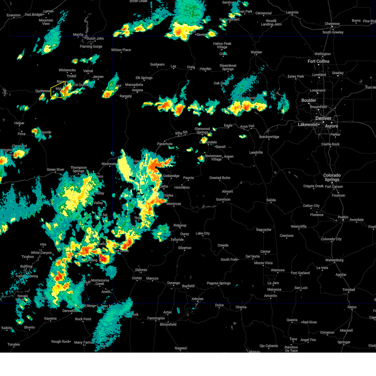
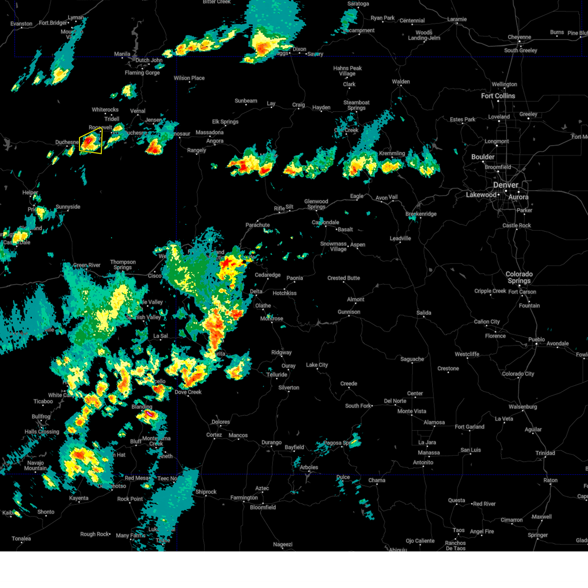
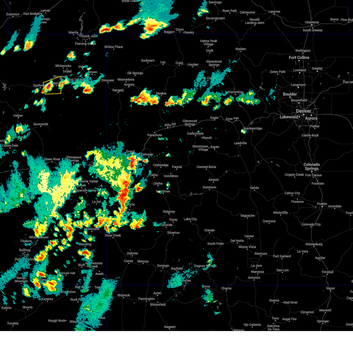
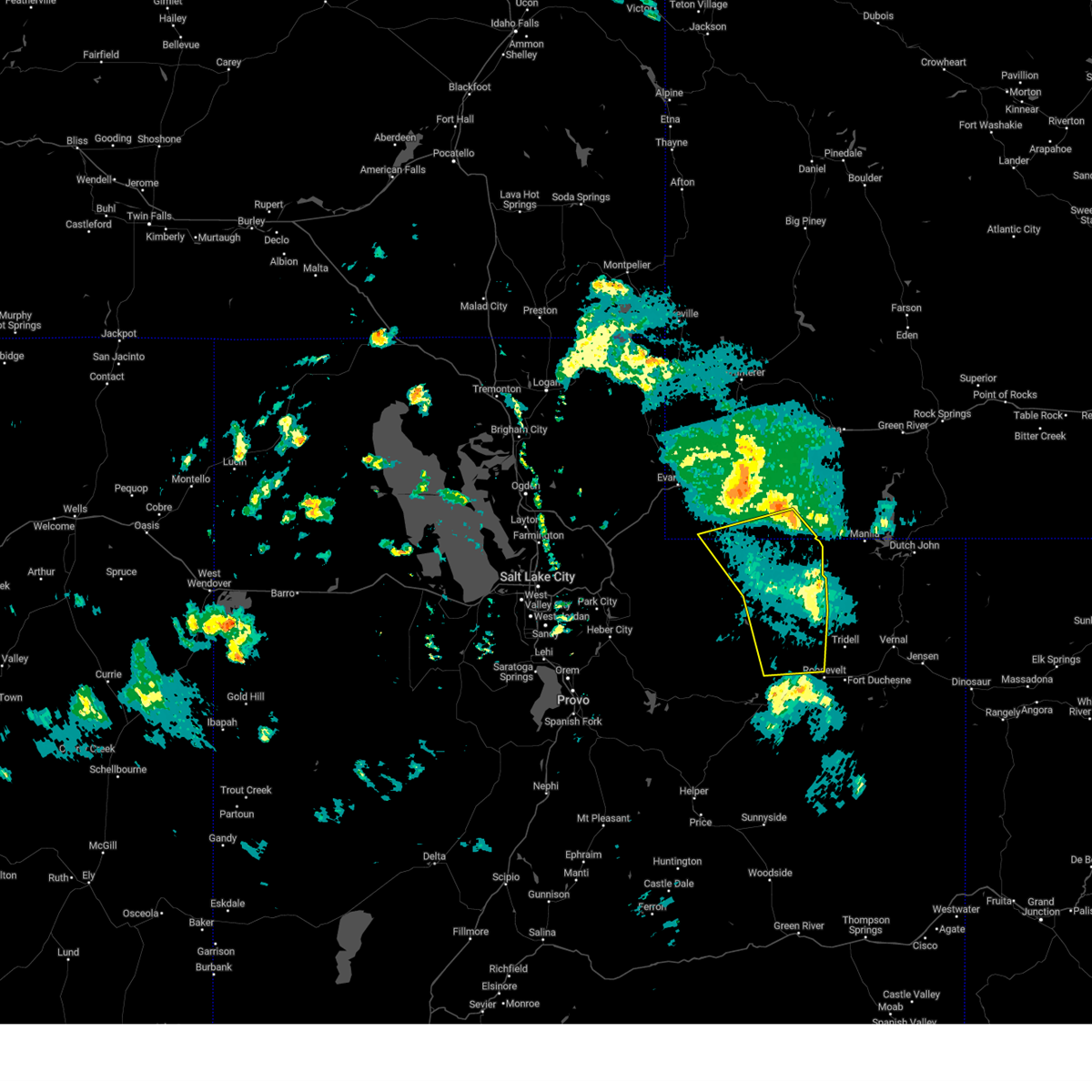
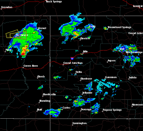
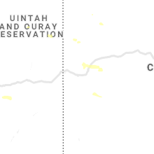
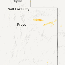
Hail Map for Roosevelt, UT
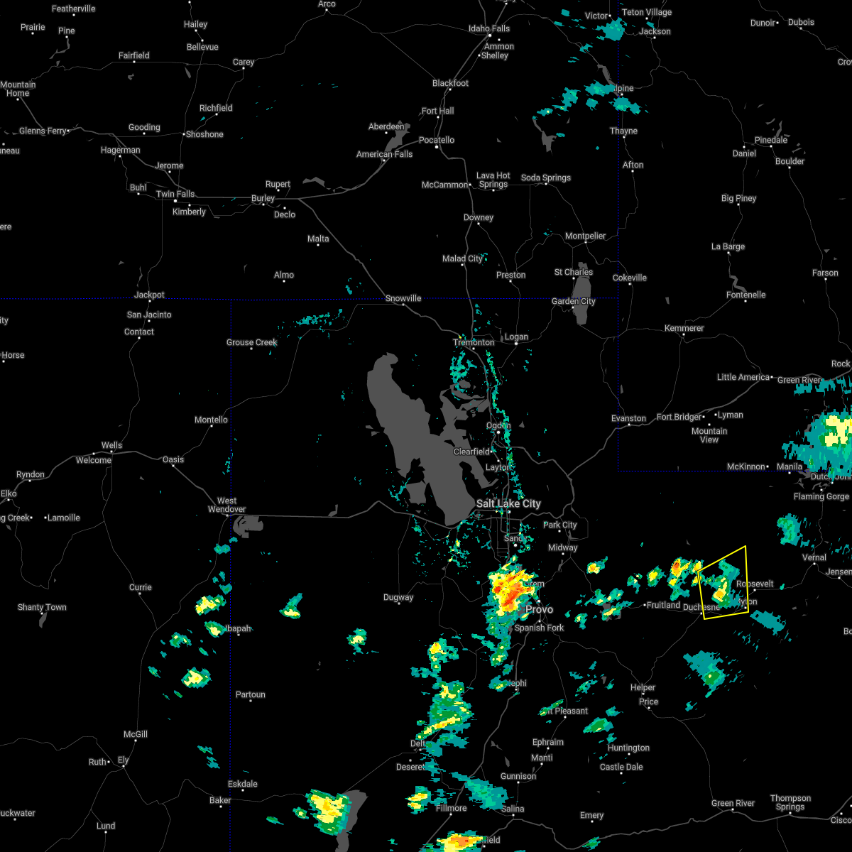
The Roosevelt, UT area has had 0 reports of on-the-ground hail by trained spotters, and has been under severe weather warnings 0 times during the past 12 months. Doppler radar has detected hail at or near Roosevelt, UT on 7 occasions.
| Name: | Roosevelt, UT |
| Where Located: | 64.4 miles NE of Price, UT |
| Map: | Google Map for Roosevelt, UT |
| Population: | 6046 |
| Housing Units: | 2067 |
| More Info: | Search Google for Roosevelt, UT |
0
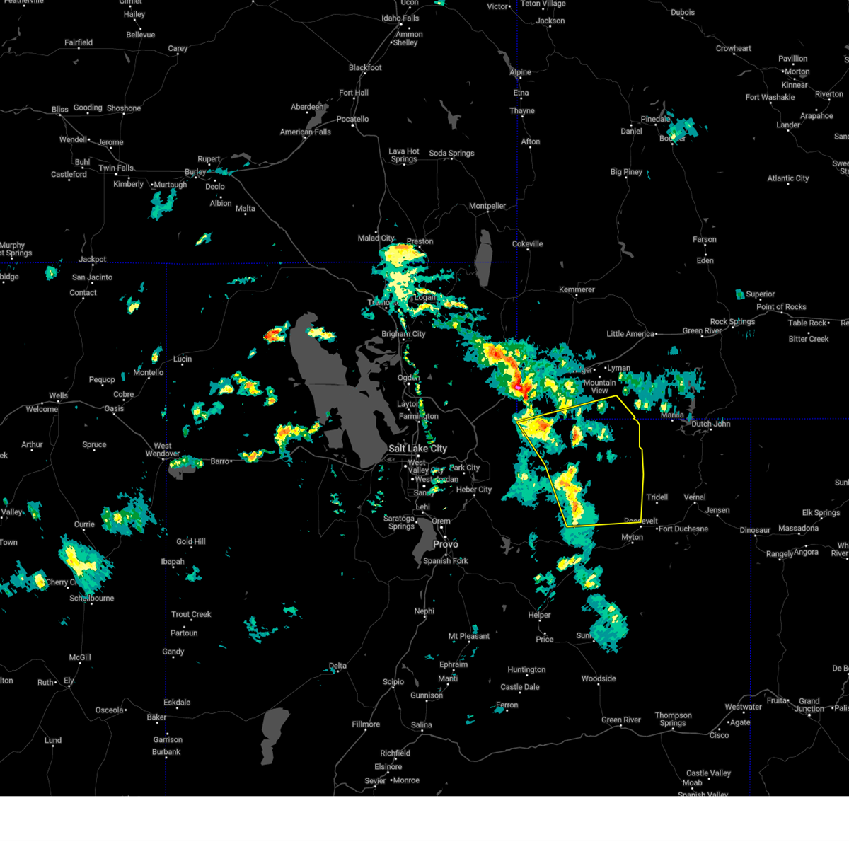
The Top Recent Hail Date for Roosevelt, UT is Thursday, June 27, 2024 (5th out of 7)

Hail and Wind Damage Spotted near Roosevelt, UT
| Date / Time | Report Details |
|---|---|
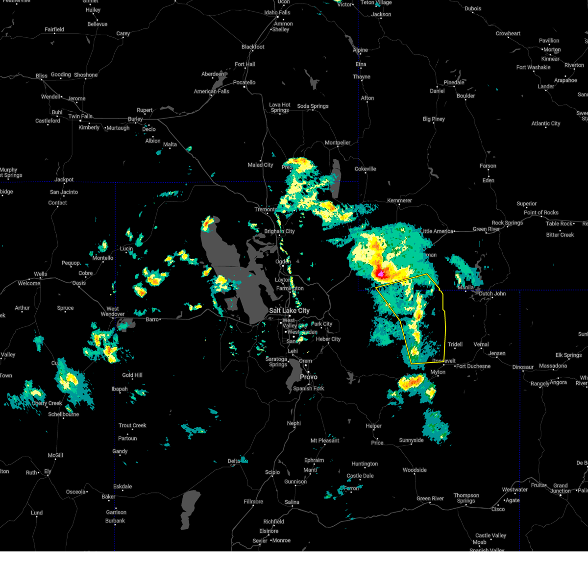
| 6/27/2024 4:55 PM MDT |
 The storm which prompted the warning has weakened below severe limits, continues to weaken, and will continue to exit the warned area through the end of the hour. therefore, the warning will be allowed to expire. however small hail, gusty winds and heavy rain are still possible with this thunderstorm. a severe thunderstorm watch remains in effect until 900 pm mdt for northern utah. The storm which prompted the warning has weakened below severe limits, continues to weaken, and will continue to exit the warned area through the end of the hour. therefore, the warning will be allowed to expire. however small hail, gusty winds and heavy rain are still possible with this thunderstorm. a severe thunderstorm watch remains in effect until 900 pm mdt for northern utah.
|
| 6/27/2024 4:41 PM MDT |
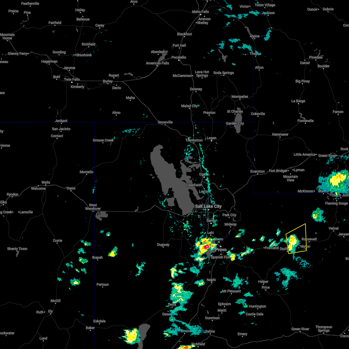
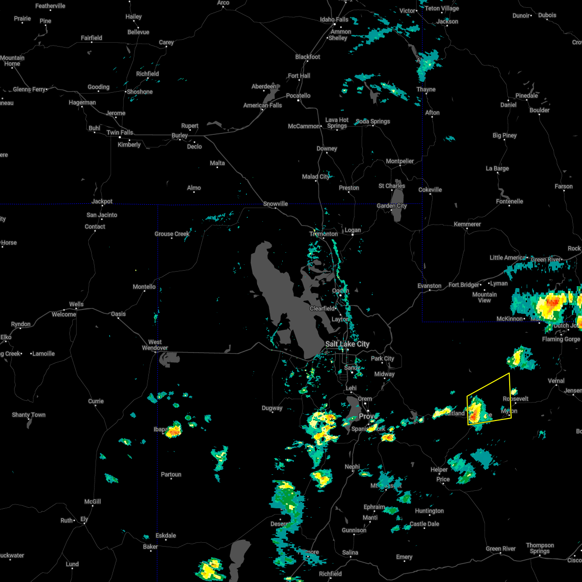
 At 440 pm mdt, a severe thunderstorm was located over myton, or 9 miles southwest of roosevelt, moving east at 30 mph (radar indicated). Hazards include 60 mph wind gusts and quarter size hail. Hail damage to vehicles is expected. expect wind damage to roofs, siding, and trees. locations impacted include, roosevelt, myton, arcadia, and bridgeland. This includes us route 40 between mile markers 95 and 115. At 440 pm mdt, a severe thunderstorm was located over myton, or 9 miles southwest of roosevelt, moving east at 30 mph (radar indicated). Hazards include 60 mph wind gusts and quarter size hail. Hail damage to vehicles is expected. expect wind damage to roofs, siding, and trees. locations impacted include, roosevelt, myton, arcadia, and bridgeland. This includes us route 40 between mile markers 95 and 115.
|
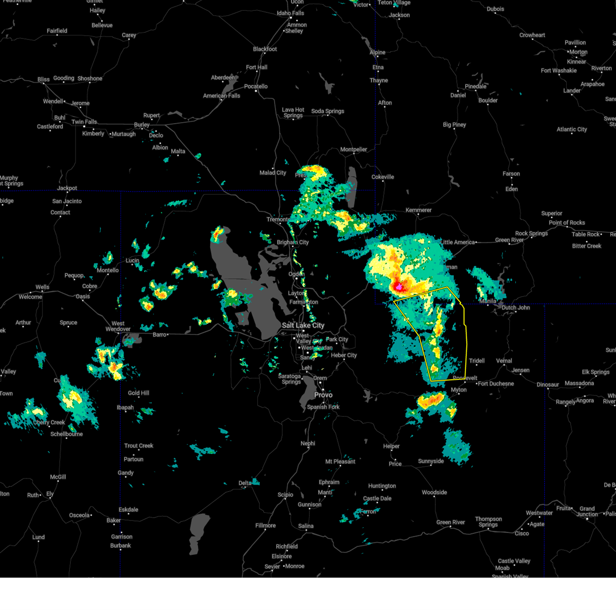
| 6/27/2024 4:24 PM MDT |
 Svrslc the national weather service in salt lake city has issued a * severe thunderstorm warning for, east central duchesne county in northern utah, * until 500 pm mdt. * at 424 pm mdt, a severe thunderstorm was located 8 miles east of duchesne, moving east at 30 mph (radar indicated). Hazards include 60 mph wind gusts and quarter size hail. Hail damage to vehicles is expected. Expect wind damage to roofs, siding, and trees. Svrslc the national weather service in salt lake city has issued a * severe thunderstorm warning for, east central duchesne county in northern utah, * until 500 pm mdt. * at 424 pm mdt, a severe thunderstorm was located 8 miles east of duchesne, moving east at 30 mph (radar indicated). Hazards include 60 mph wind gusts and quarter size hail. Hail damage to vehicles is expected. Expect wind damage to roofs, siding, and trees.
|
| 6/21/2024 3:35 PM MDT | Awos station k74v roosevelt airpor in duchesne county UT, 2.6 miles NE of Roosevelt, UT |
| 7/3/2023 7:41 PM MDT |
 The severe thunderstorm warning for northeastern duchesne, east central summit and southeastern uinta counties will expire at 745 pm mdt, the storms which prompted the warning have weakened below severe limits, and no longer pose an immediate threat to life or property. therefore, the warning will be allowed to expire. however gusty winds are still possible with these thunderstorms. The severe thunderstorm warning for northeastern duchesne, east central summit and southeastern uinta counties will expire at 745 pm mdt, the storms which prompted the warning have weakened below severe limits, and no longer pose an immediate threat to life or property. therefore, the warning will be allowed to expire. however gusty winds are still possible with these thunderstorms.
|
| 7/3/2023 7:25 PM MDT |
 At 725 pm mdt, severe thunderstorms were located along a line extending from 6 miles south of robertson to 13 miles southwest of lonetree to 14 miles northwest of roosevelt, moving east at 35 mph (radar indicated). Hazards include 60 mph wind gusts and penny size hail. Expect damage to roofs, siding, and trees. locations impacted include, roosevelt, lonetree, altamont, mountain home, neola, altonah, cedarview and kings peak. hail threat, radar indicated max hail size, 0. 75 in wind threat, radar indicated max wind gust, 60 mph. At 725 pm mdt, severe thunderstorms were located along a line extending from 6 miles south of robertson to 13 miles southwest of lonetree to 14 miles northwest of roosevelt, moving east at 35 mph (radar indicated). Hazards include 60 mph wind gusts and penny size hail. Expect damage to roofs, siding, and trees. locations impacted include, roosevelt, lonetree, altamont, mountain home, neola, altonah, cedarview and kings peak. hail threat, radar indicated max hail size, 0. 75 in wind threat, radar indicated max wind gust, 60 mph.
|
| 7/3/2023 6:59 PM MDT |
 At 658 pm mdt, severe thunderstorms were located along a line extending from 19 miles south of evanston to 9 miles northeast of mirror lake to 8 miles east of tabiona, moving east at 40 mph (radar indicated). Hazards include 60 mph wind gusts and penny size hail. expect damage to roofs, siding, and trees At 658 pm mdt, severe thunderstorms were located along a line extending from 19 miles south of evanston to 9 miles northeast of mirror lake to 8 miles east of tabiona, moving east at 40 mph (radar indicated). Hazards include 60 mph wind gusts and penny size hail. expect damage to roofs, siding, and trees
|
| 6/29/2022 2:23 PM MDT |
 The severe thunderstorm warning for east central duchesne county will expire at 230 pm mdt, the storm which prompted the warning has weakened below severe limits, and no longer poses an immediate threat to life or property. therefore, the warning will be allowed to expire. however gusty winds are still possible with this thunderstorm. to report severe weather, contact your nearest law enforcement agency. they will relay your report to the national weather service salt lake city. The severe thunderstorm warning for east central duchesne county will expire at 230 pm mdt, the storm which prompted the warning has weakened below severe limits, and no longer poses an immediate threat to life or property. therefore, the warning will be allowed to expire. however gusty winds are still possible with this thunderstorm. to report severe weather, contact your nearest law enforcement agency. they will relay your report to the national weather service salt lake city.
|
| 6/29/2022 2:11 PM MDT |
 At 210 pm mdt, a severe thunderstorm was located near duchesne, moving northeast at 25 mph (radar indicated). Hazards include 60 mph wind gusts and quarter size hail. Hail damage to vehicles is expected. expect wind damage to roofs, siding, and trees. locations impacted include, duchesne, myton, altamont, upalco, mountain home, arcadia, altonah, bridgeland, cedarview and neola. this includes the following highways, us route 40 between mile markers 88 and 110. utah route 35 near mile marker 62. hail threat, radar indicated max hail size, 1. 00 in wind threat, radar indicated max wind gust, 60 mph. At 210 pm mdt, a severe thunderstorm was located near duchesne, moving northeast at 25 mph (radar indicated). Hazards include 60 mph wind gusts and quarter size hail. Hail damage to vehicles is expected. expect wind damage to roofs, siding, and trees. locations impacted include, duchesne, myton, altamont, upalco, mountain home, arcadia, altonah, bridgeland, cedarview and neola. this includes the following highways, us route 40 between mile markers 88 and 110. utah route 35 near mile marker 62. hail threat, radar indicated max hail size, 1. 00 in wind threat, radar indicated max wind gust, 60 mph.
|
| 6/29/2022 1:55 PM MDT |
 At 155 pm mdt, a severe thunderstorm was located over starvation reservoir, or over duchesne, moving east at 25 mph (radar indicated). Hazards include 60 mph wind gusts and quarter size hail. Hail damage to vehicles is expected. Expect wind damage to roofs, siding, and trees. At 155 pm mdt, a severe thunderstorm was located over starvation reservoir, or over duchesne, moving east at 25 mph (radar indicated). Hazards include 60 mph wind gusts and quarter size hail. Hail damage to vehicles is expected. Expect wind damage to roofs, siding, and trees.
|
| 8/22/2018 5:26 PM MDT |
 The severe thunderstorm warning for east central duchesne county will expire at 530 pm mdt, the storm which prompted the warning has weakened below severe limits, and no longer poses an immediate threat to life or property. therefore, the warning will be allowed to expire. a severe thunderstorm watch remains in effect until 900 pm mdt for northern utah. The severe thunderstorm warning for east central duchesne county will expire at 530 pm mdt, the storm which prompted the warning has weakened below severe limits, and no longer poses an immediate threat to life or property. therefore, the warning will be allowed to expire. a severe thunderstorm watch remains in effect until 900 pm mdt for northern utah.
|
| 8/22/2018 5:05 PM MDT |
 At 504 pm mdt, a severe thunderstorm was located 13 miles northeast of duchesne, moving east at 35 mph (radar indicated). Hazards include 60 mph wind gusts and quarter size hail. Hail damage to vehicles is expected. Expect wind damage to roofs, siding, and trees. At 504 pm mdt, a severe thunderstorm was located 13 miles northeast of duchesne, moving east at 35 mph (radar indicated). Hazards include 60 mph wind gusts and quarter size hail. Hail damage to vehicles is expected. Expect wind damage to roofs, siding, and trees.
|
| 6/20/2017 8:35 PM MDT | Roosevelt sensor... k74 in duchesne county UT, 2.6 miles NE of Roosevelt, UT |
| 8/7/2016 6:53 PM MDT |
 The severe thunderstorm warning for east central duchesne county will expire at 700 pm mdt, the storm which prompted the warning has weakened below severe limits, and no longer poses an immediate threat to life or property. therefore the warning will be allowed to expire. however small hail and gusty winds are still possible with this thunderstorm, along with heavy rain. The severe thunderstorm warning for east central duchesne county will expire at 700 pm mdt, the storm which prompted the warning has weakened below severe limits, and no longer poses an immediate threat to life or property. therefore the warning will be allowed to expire. however small hail and gusty winds are still possible with this thunderstorm, along with heavy rain.
|
| 8/7/2016 6:45 PM MDT |
 At 643 pm mdt, doppler radar indicated a severe thunderstorm capable of producing quarter size hail and damaging winds in excess of 60 mph. this storm was located between altamont and duchesne, moving east at 35 mph towards upalco. locations impacted include, roosevelt, duchesne, myton, bridgeland, cedarview, arcadia, utahn and upalco. At 643 pm mdt, doppler radar indicated a severe thunderstorm capable of producing quarter size hail and damaging winds in excess of 60 mph. this storm was located between altamont and duchesne, moving east at 35 mph towards upalco. locations impacted include, roosevelt, duchesne, myton, bridgeland, cedarview, arcadia, utahn and upalco.
|
| 8/7/2016 6:28 PM MDT |
 At 627 pm mdt, doppler radar indicated a severe thunderstorm capable of producing large hail up to ping pong ball size and damaging winds in excess of 60 mph. this storm was located 9 miles southeast of tabiona, or 9 miles west of duchesne, and moving east at 35 mph. At 627 pm mdt, doppler radar indicated a severe thunderstorm capable of producing large hail up to ping pong ball size and damaging winds in excess of 60 mph. this storm was located 9 miles southeast of tabiona, or 9 miles west of duchesne, and moving east at 35 mph.
|
| 8/7/2016 12:45 PM MDT |
 At 1245 pm mdt, doppler radar indicated a severe thunderstorm capable of producing quarter size hail and damaging winds in excess of 60 mph. this storm was located near roosevelt, moving northeast at 25 mph. locations impacted include, roosevelt, cedarview and neola. At 1245 pm mdt, doppler radar indicated a severe thunderstorm capable of producing quarter size hail and damaging winds in excess of 60 mph. this storm was located near roosevelt, moving northeast at 25 mph. locations impacted include, roosevelt, cedarview and neola.
|
| 8/7/2016 12:33 PM MDT |
 At 1232 pm mdt, doppler radar indicated a severe thunderstorm capable of producing quarter size hail and damaging winds in excess of 60 mph. this storm was located 7 miles northwest of myton, or 8 miles west of roosevelt, and moving east northeast at 25 mph. At 1232 pm mdt, doppler radar indicated a severe thunderstorm capable of producing quarter size hail and damaging winds in excess of 60 mph. this storm was located 7 miles northwest of myton, or 8 miles west of roosevelt, and moving east northeast at 25 mph.
|
| 7/5/2013 8:59 PM MDT | Roosevelt awos in duchesne county UT, 0.6 miles WNW of Roosevelt, UT |
Hail Maps for Roosevelt, UT


Connect with Interactive Hail Maps