

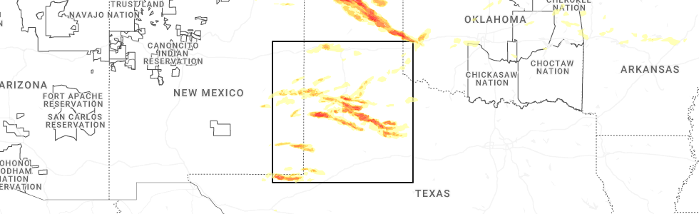
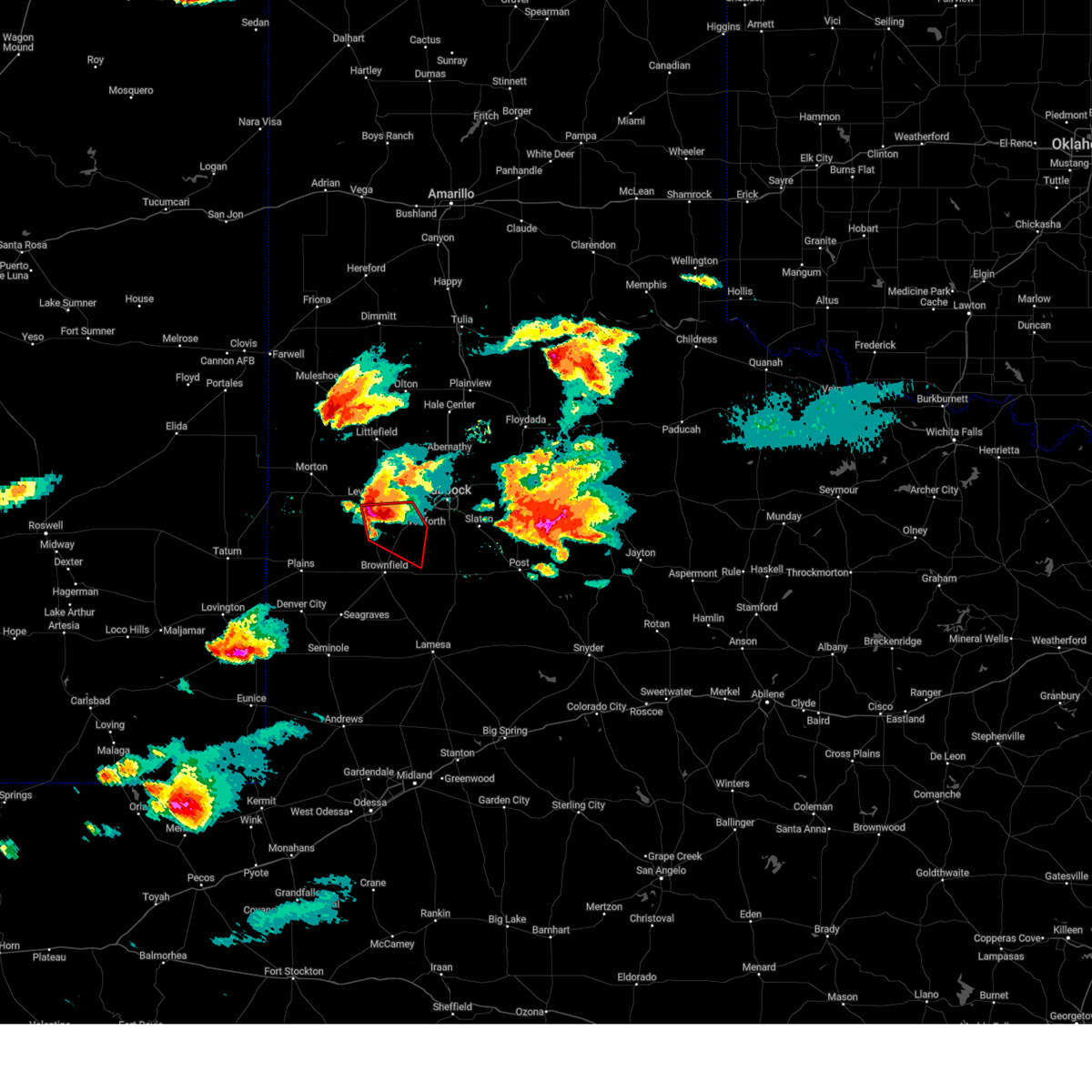
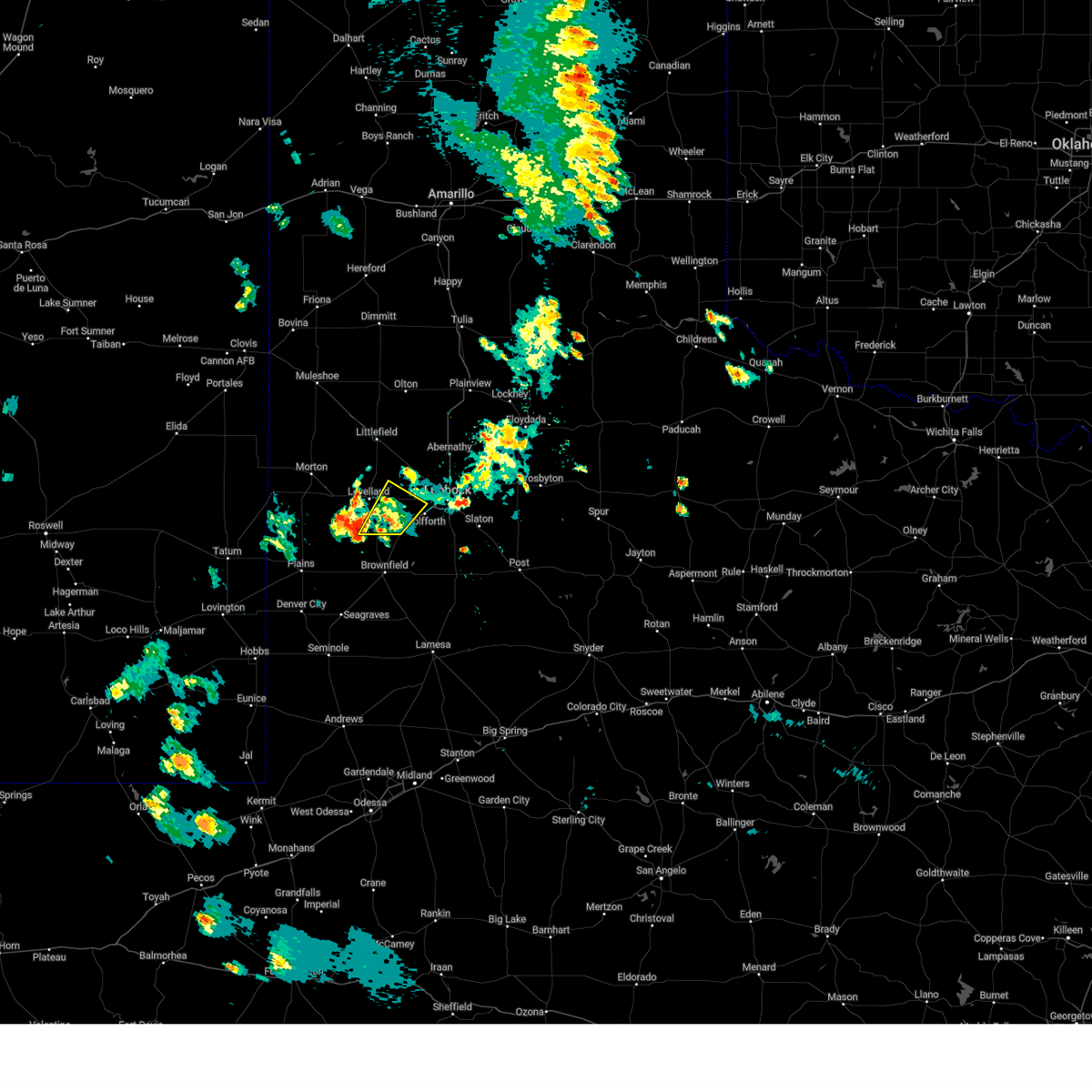
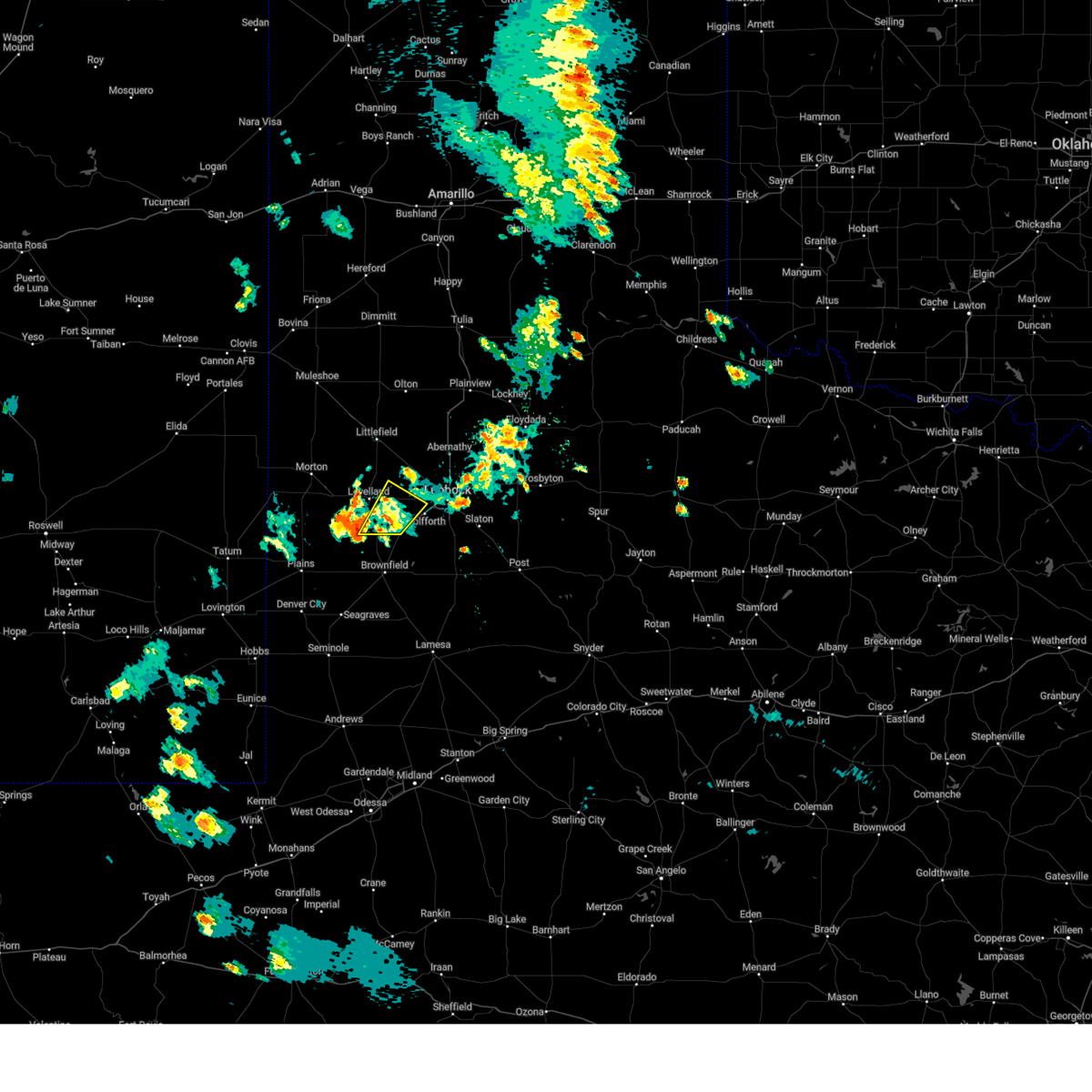
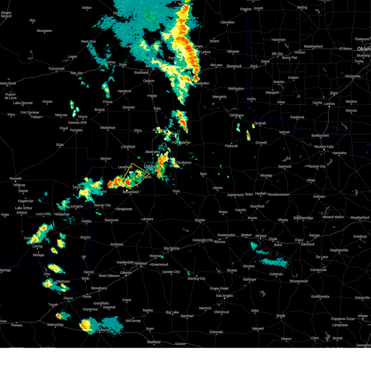
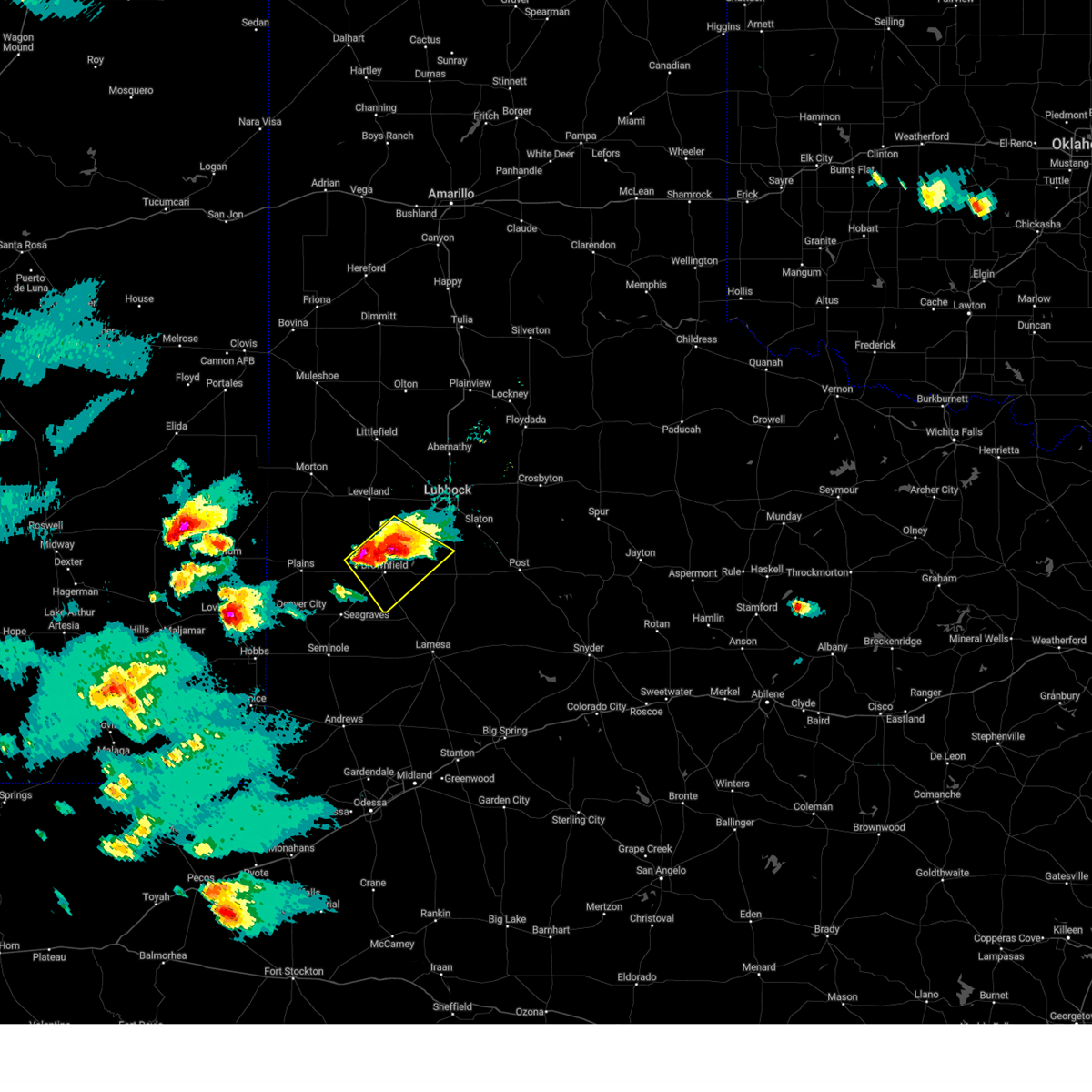
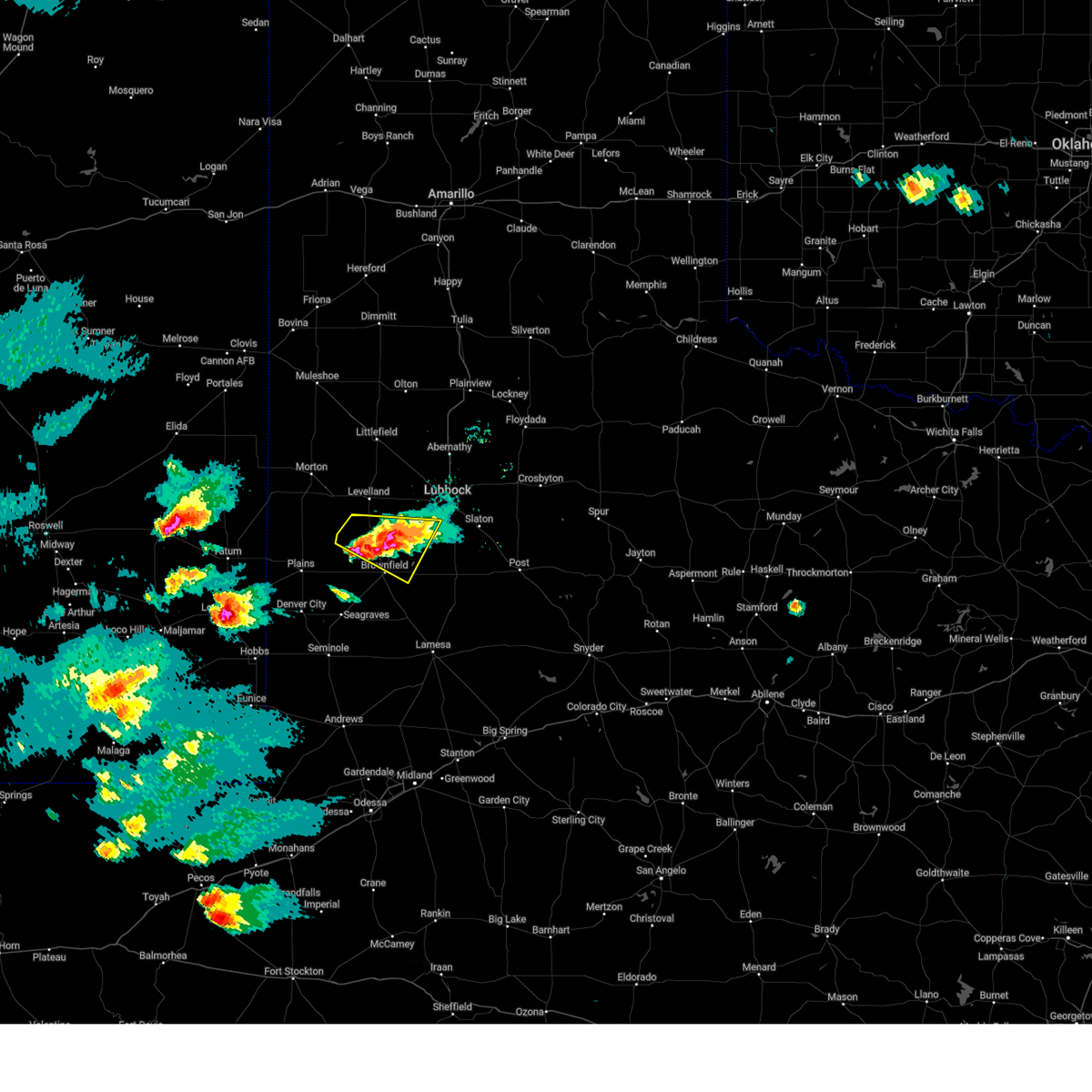
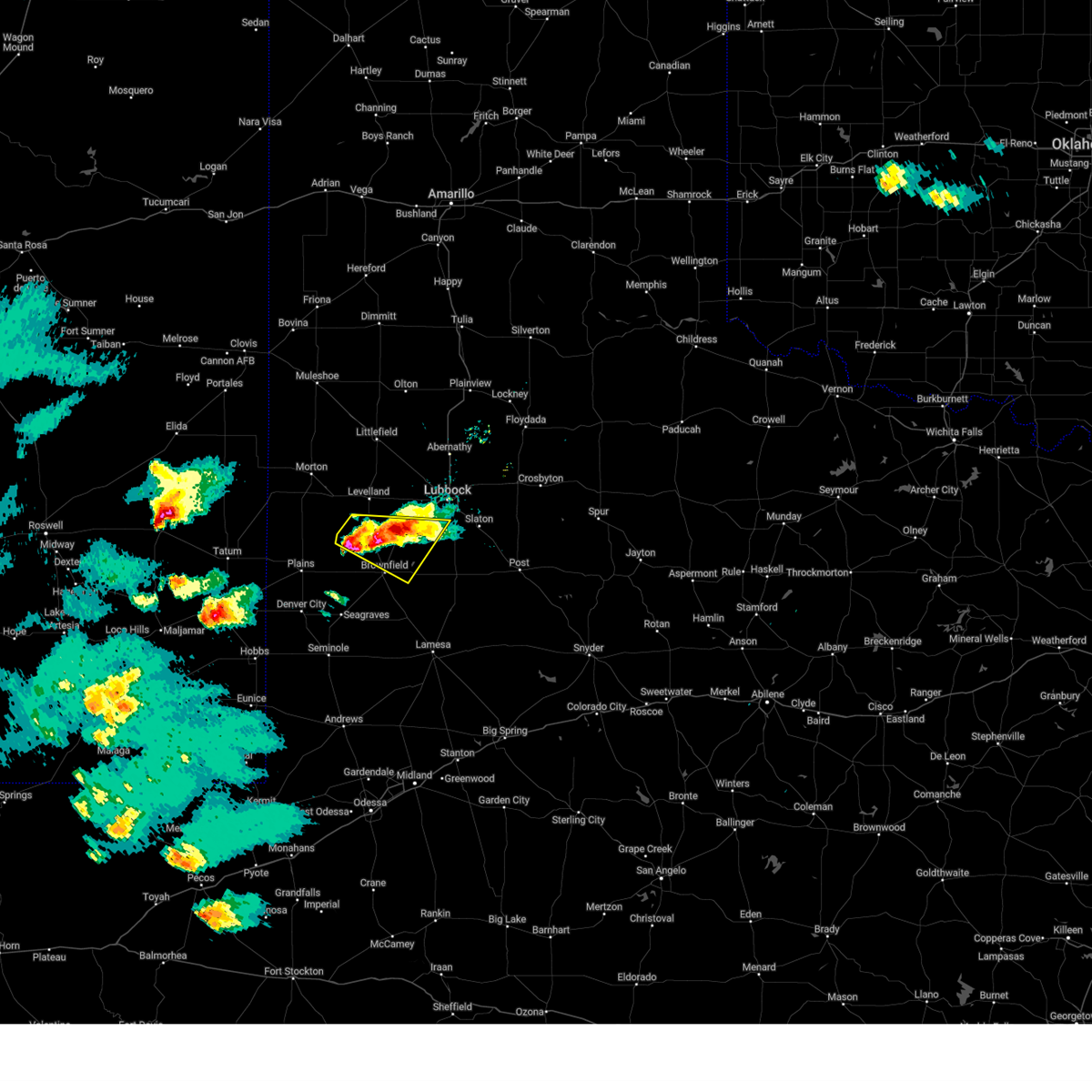
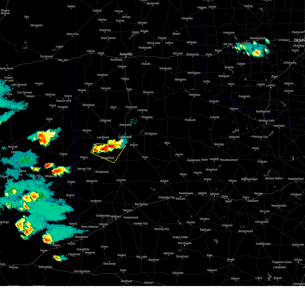
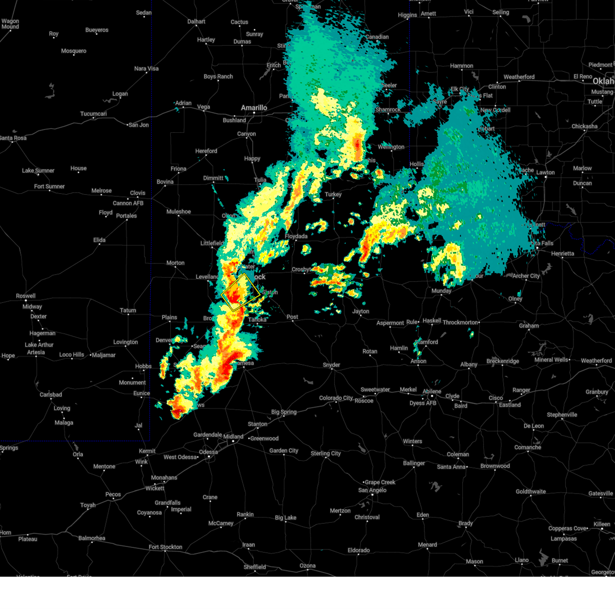
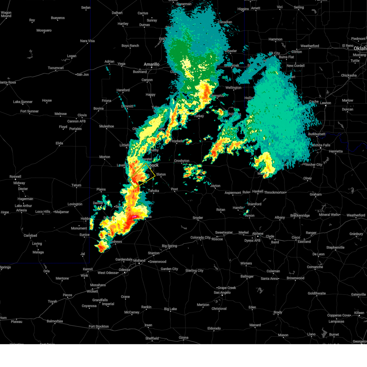
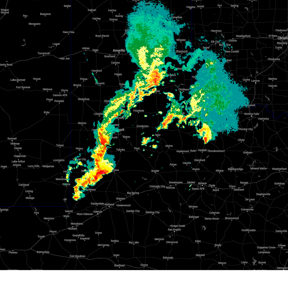
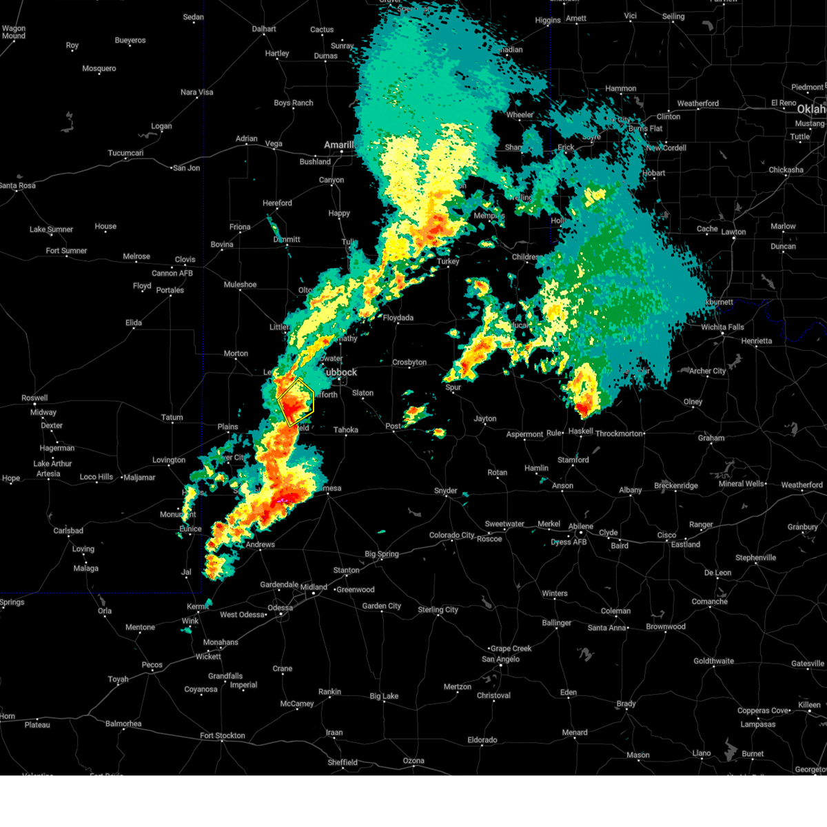
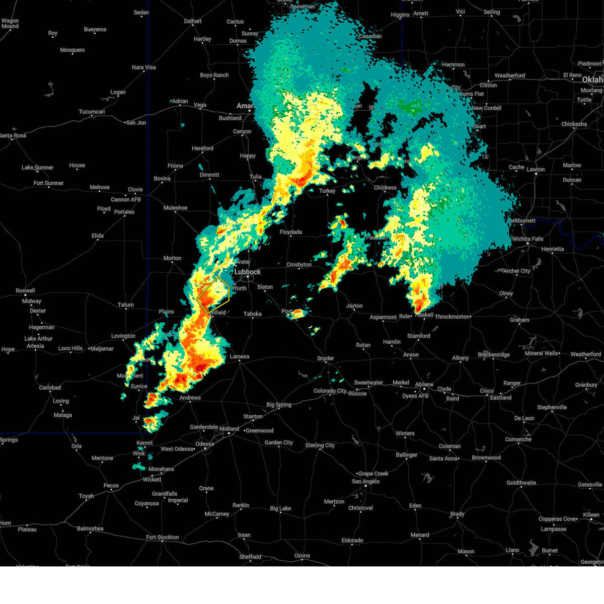
Hail Map for Ropesville, TX
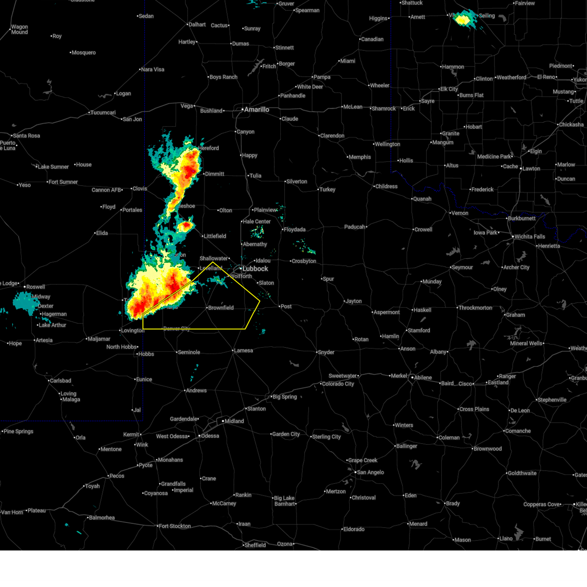
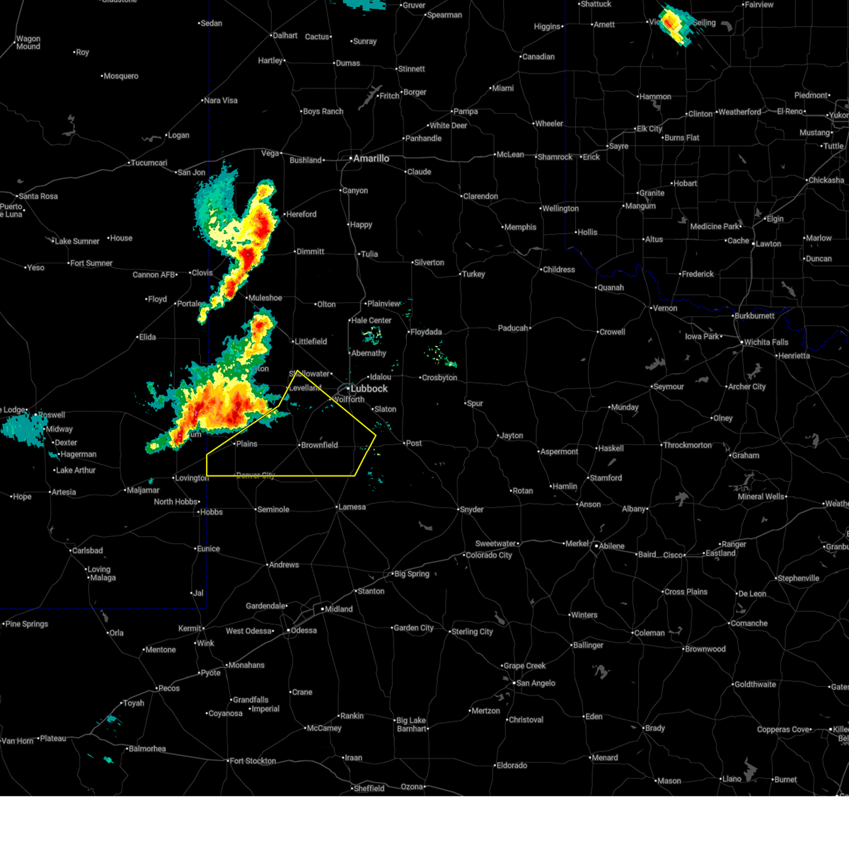
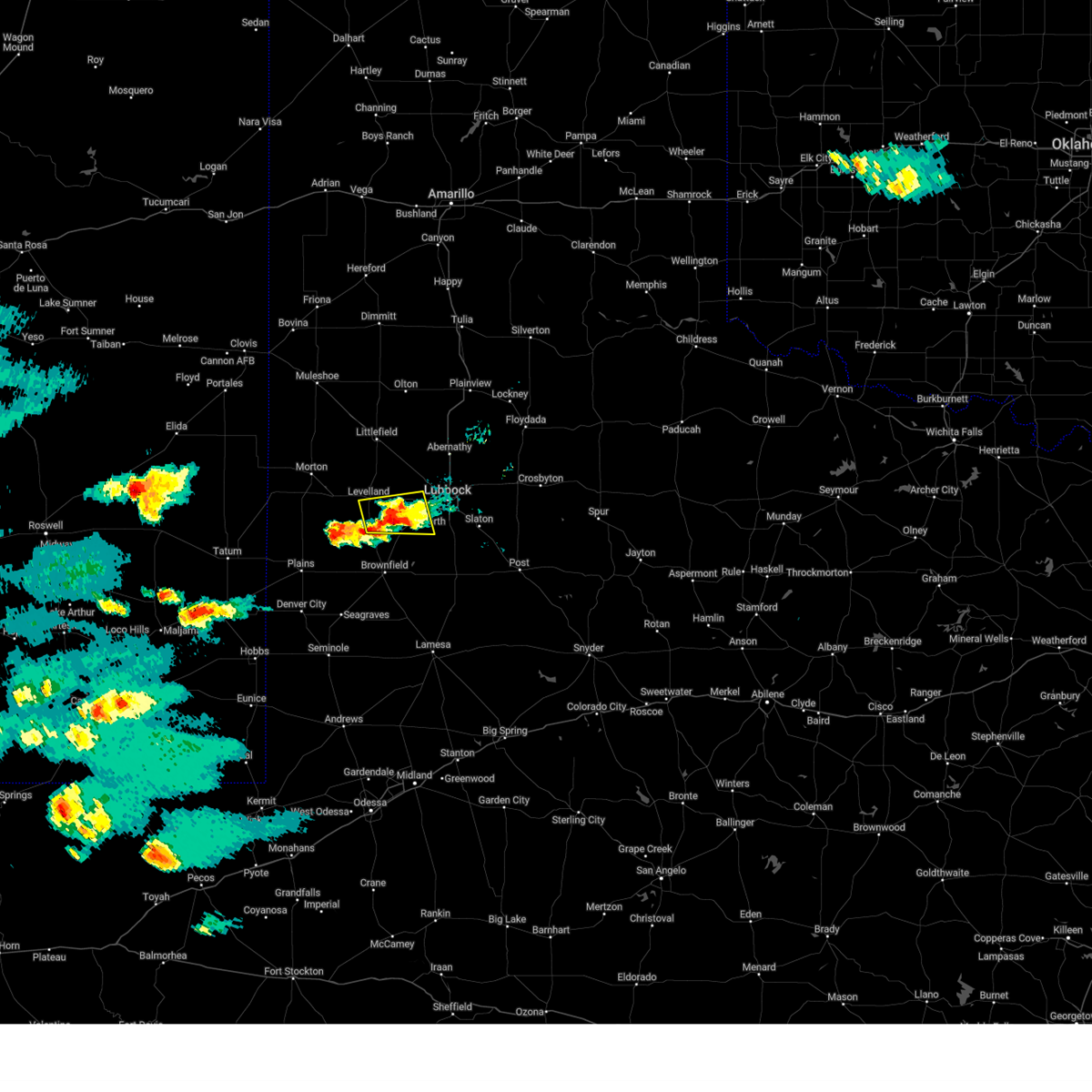
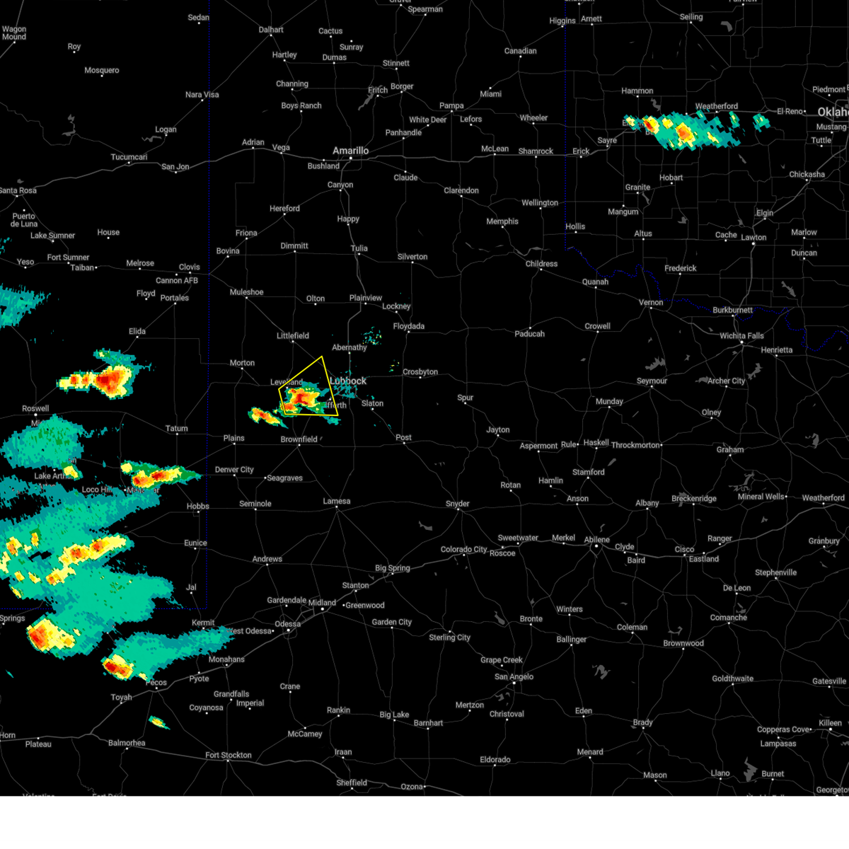
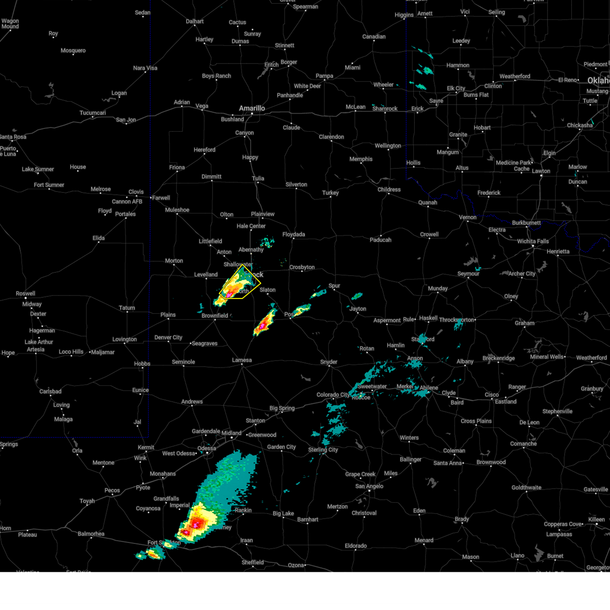
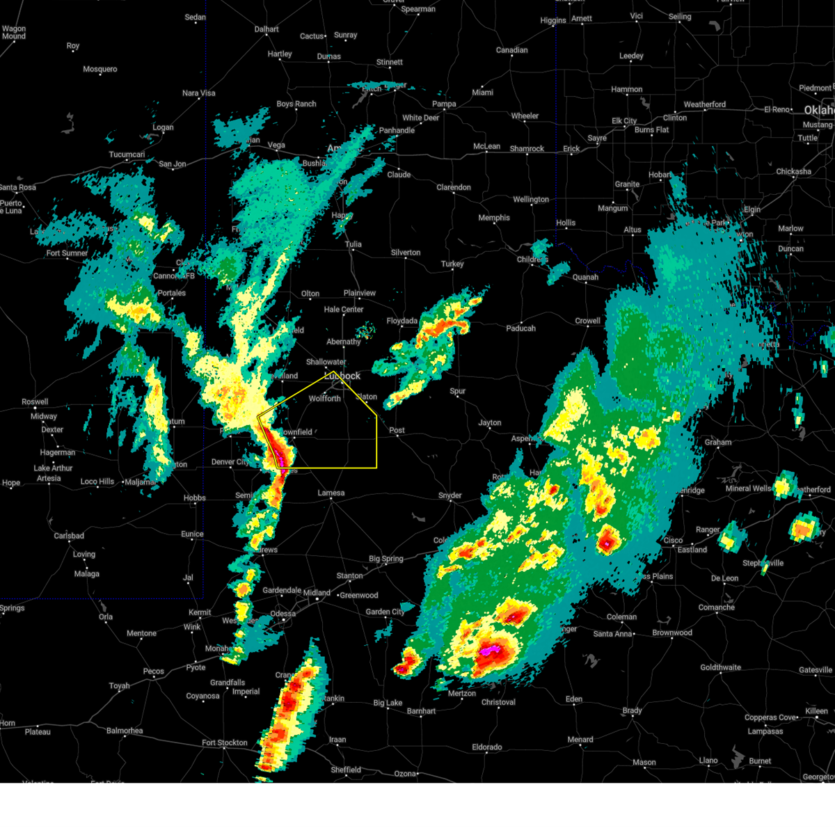
The Ropesville, TX area has had 20 reports of on-the-ground hail by trained spotters, and has been under severe weather warnings 31 times during the past 12 months. Doppler radar has detected hail at or near Ropesville, TX on 104 occasions, including 8 occasions during the past year.
| Name: | Ropesville, TX |
| Where Located: | 21.2 miles SW of Lubbock, TX |
| Map: | Google Map for Ropesville, TX |
| Population: | 434 |
| Housing Units: | 173 |
| More Info: | Search Google for Ropesville, TX |
1
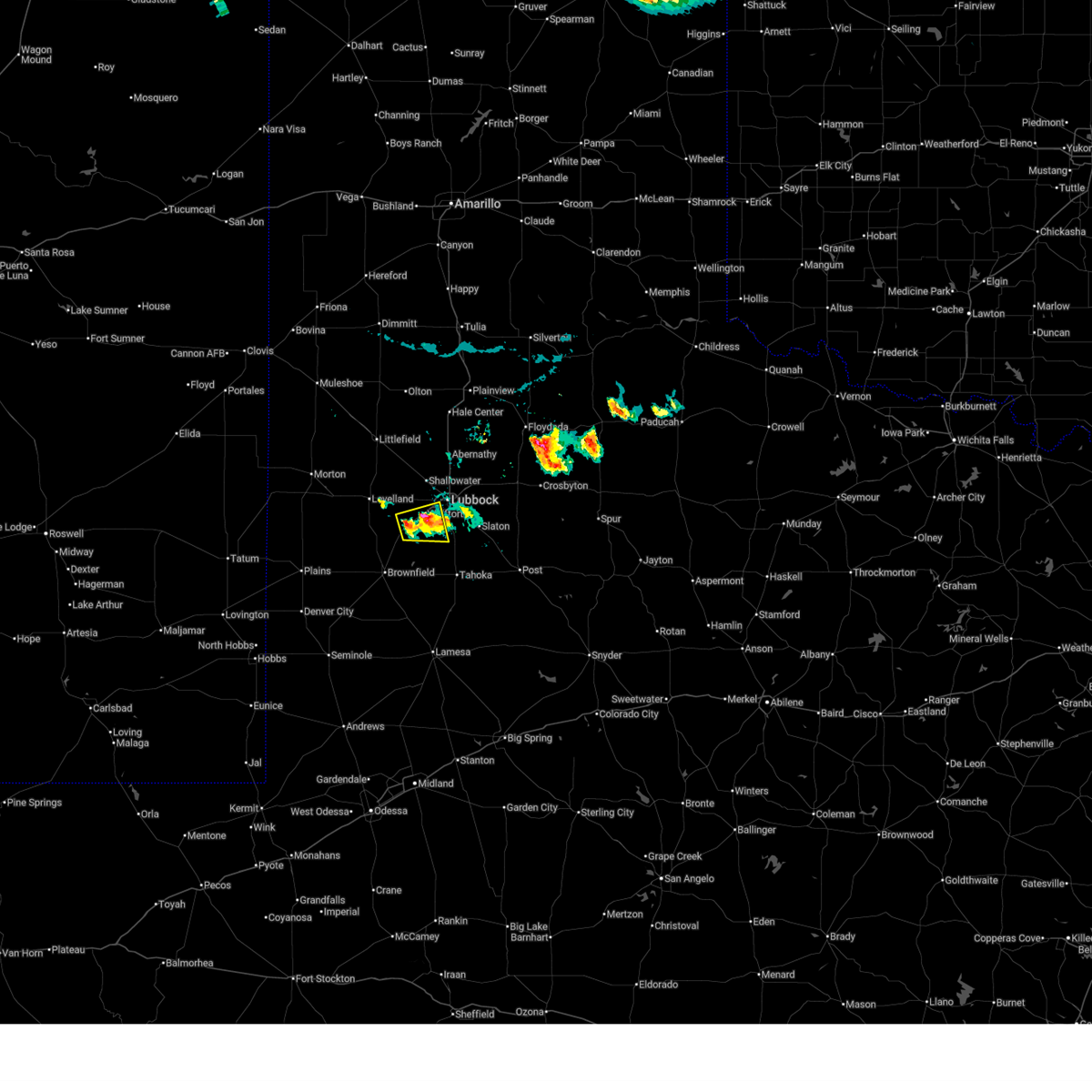
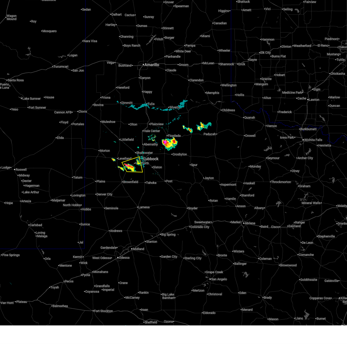
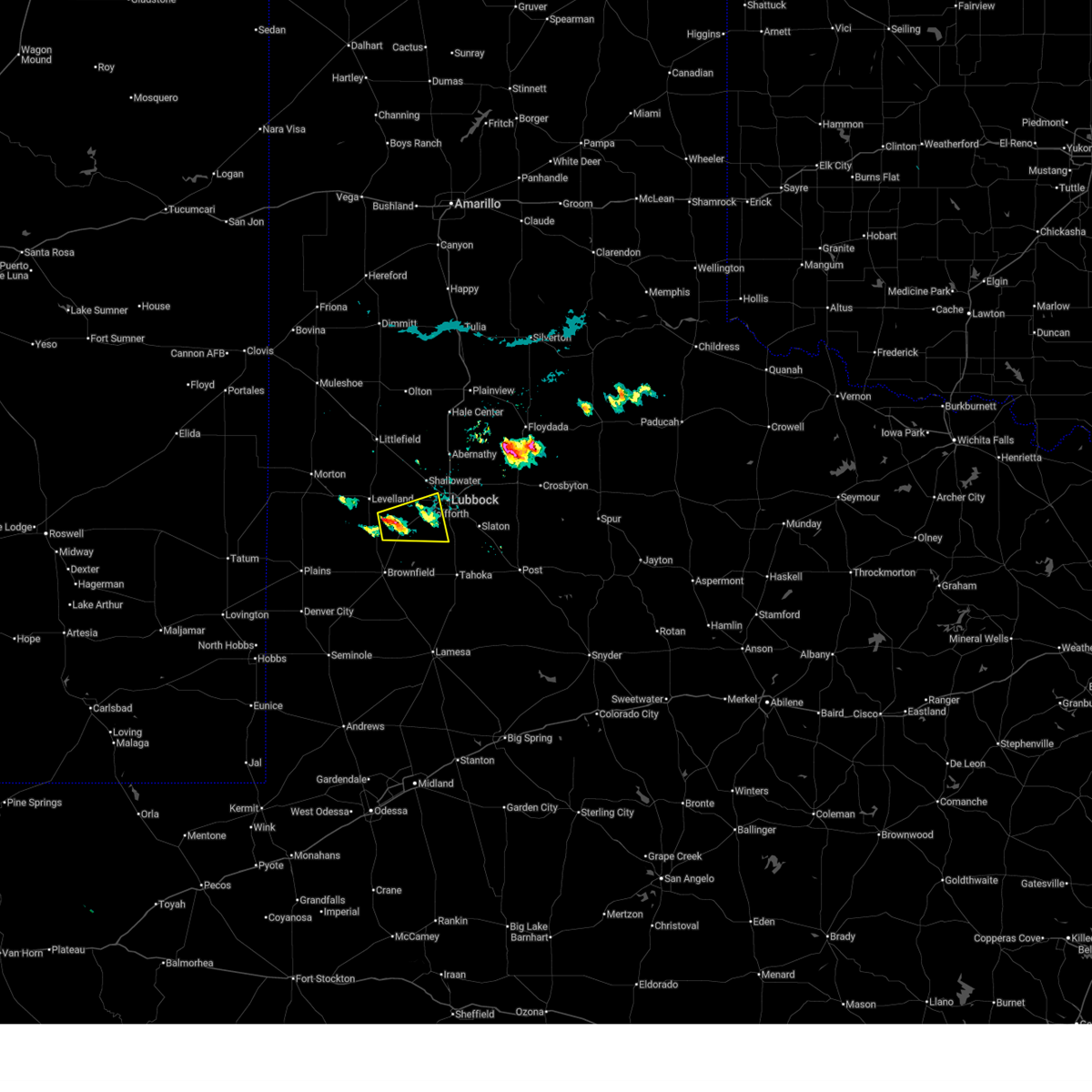
The Top Recent Hail Date for Ropesville, TX is Friday, June 6, 2025 (14th out of 104)
Hail and Wind Damage Spotted near Ropesville, TX
| Date / Time | Report Details |
|---|---|
| 7/14/2025 5:24 PM CDT | Quarter sized hail reported 6.3 miles SE of Ropesville, TX, accumulating hail up to a depth of two inches... with quarter size hail measured within the swath. vegetation shredded. |
| 6/17/2025 7:08 PM CDT |
 At 708 pm cdt, a severe thunderstorm was located near lubbock south plains mall, or 5 miles southwest of lubbock, moving east at 30 mph (radar indicated). Hazards include 60 mph wind gusts and quarter size hail. Hail damage to vehicles is expected. expect wind damage to roofs, siding, and trees. Locations impacted include, lubbock, wolfforth, lubbock south plains mall, slide, and ropesville. At 708 pm cdt, a severe thunderstorm was located near lubbock south plains mall, or 5 miles southwest of lubbock, moving east at 30 mph (radar indicated). Hazards include 60 mph wind gusts and quarter size hail. Hail damage to vehicles is expected. expect wind damage to roofs, siding, and trees. Locations impacted include, lubbock, wolfforth, lubbock south plains mall, slide, and ropesville.
|
| 6/17/2025 7:07 PM CDT |
 Svrlub the national weather service in lubbock texas has issued a * severe thunderstorm warning for, southwestern lubbock county in northwestern texas, northwestern lynn county in northwestern texas, northeastern terry county in northwestern texas, southeastern hockley county in northwestern texas, * until 745 pm cdt. * at 707 pm cdt, a severe thunderstorm was located near wolfforth, or 6 miles southwest of lubbock, moving east at 30 mph (radar indicated). Hazards include 60 mph wind gusts and quarter size hail. Hail damage to vehicles is expected. Expect wind damage to roofs, siding, and trees. Svrlub the national weather service in lubbock texas has issued a * severe thunderstorm warning for, southwestern lubbock county in northwestern texas, northwestern lynn county in northwestern texas, northeastern terry county in northwestern texas, southeastern hockley county in northwestern texas, * until 745 pm cdt. * at 707 pm cdt, a severe thunderstorm was located near wolfforth, or 6 miles southwest of lubbock, moving east at 30 mph (radar indicated). Hazards include 60 mph wind gusts and quarter size hail. Hail damage to vehicles is expected. Expect wind damage to roofs, siding, and trees.
|
| 6/17/2025 6:45 PM CDT |
 At 645 pm cdt, a severe thunderstorm was located 7 miles west of wolfforth, or 15 miles southwest of lubbock, moving east at 30 mph (radar indicated). Hazards include ping pong ball size hail and 60 mph wind gusts. People and animals outdoors will be injured. expect hail damage to roofs, siding, windows, and vehicles. expect wind damage to roofs, siding, and trees. Locations impacted include, lubbock, wolfforth, lubbock south plains mall, slide, reese center, and ropesville. At 645 pm cdt, a severe thunderstorm was located 7 miles west of wolfforth, or 15 miles southwest of lubbock, moving east at 30 mph (radar indicated). Hazards include ping pong ball size hail and 60 mph wind gusts. People and animals outdoors will be injured. expect hail damage to roofs, siding, windows, and vehicles. expect wind damage to roofs, siding, and trees. Locations impacted include, lubbock, wolfforth, lubbock south plains mall, slide, reese center, and ropesville.
|
| 6/17/2025 6:35 PM CDT |
 Svrlub the national weather service in lubbock texas has issued a * severe thunderstorm warning for, southwestern lubbock county in northwestern texas, northwestern lynn county in northwestern texas, northeastern terry county in northwestern texas, southeastern hockley county in northwestern texas, * until 715 pm cdt. * at 634 pm cdt, a severe thunderstorm was located 7 miles northeast of locketville, or 11 miles southeast of levelland, moving east at 30 mph (radar indicated). Hazards include 60 mph wind gusts and quarter size hail. Hail damage to vehicles is expected. Expect wind damage to roofs, siding, and trees. Svrlub the national weather service in lubbock texas has issued a * severe thunderstorm warning for, southwestern lubbock county in northwestern texas, northwestern lynn county in northwestern texas, northeastern terry county in northwestern texas, southeastern hockley county in northwestern texas, * until 715 pm cdt. * at 634 pm cdt, a severe thunderstorm was located 7 miles northeast of locketville, or 11 miles southeast of levelland, moving east at 30 mph (radar indicated). Hazards include 60 mph wind gusts and quarter size hail. Hail damage to vehicles is expected. Expect wind damage to roofs, siding, and trees.
|
| 6/13/2025 9:35 PM CDT |
 At 935 pm cdt, severe thunderstorms were located along a line extending from 7 miles southwest of reese center to 4 miles south of locketville to 8 miles west of denver city, moving southeast at 40 mph (radar indicated). Hazards include 70 mph wind gusts. Expect considerable tree damage. damage is likely to mobile homes, roofs, and outbuildings. Locations impacted include, lubbock, brownfield, denver city, tahoka, plains, wolfforth, o'donnell, new moore, tokio, locketville, slide, meadow, wilson, smyer, ropesville, new home, and wellman. At 935 pm cdt, severe thunderstorms were located along a line extending from 7 miles southwest of reese center to 4 miles south of locketville to 8 miles west of denver city, moving southeast at 40 mph (radar indicated). Hazards include 70 mph wind gusts. Expect considerable tree damage. damage is likely to mobile homes, roofs, and outbuildings. Locations impacted include, lubbock, brownfield, denver city, tahoka, plains, wolfforth, o'donnell, new moore, tokio, locketville, slide, meadow, wilson, smyer, ropesville, new home, and wellman.
|
| 6/13/2025 9:15 PM CDT |
 Svrlub the national weather service in lubbock texas has issued a * severe thunderstorm warning for, southwestern lubbock county in northwestern texas, lynn county in northwestern texas, terry county in northwestern texas, southeastern hockley county in northwestern texas, yoakum county in northwestern texas, * until 1015 pm cdt. * at 915 pm cdt, severe thunderstorms were located along a line extending from 6 miles southeast of whitharral to 5 miles southeast of sundown to 15 miles southeast of mcdonald, moving southeast at 40 mph (radar indicated). Hazards include 70 mph wind gusts. Expect considerable tree damage. Damage is likely to mobile homes, roofs, and outbuildings. Svrlub the national weather service in lubbock texas has issued a * severe thunderstorm warning for, southwestern lubbock county in northwestern texas, lynn county in northwestern texas, terry county in northwestern texas, southeastern hockley county in northwestern texas, yoakum county in northwestern texas, * until 1015 pm cdt. * at 915 pm cdt, severe thunderstorms were located along a line extending from 6 miles southeast of whitharral to 5 miles southeast of sundown to 15 miles southeast of mcdonald, moving southeast at 40 mph (radar indicated). Hazards include 70 mph wind gusts. Expect considerable tree damage. Damage is likely to mobile homes, roofs, and outbuildings.
|
| 6/6/2025 7:44 PM CDT |
 At 744 pm cdt, a severe thunderstorm capable of producing a tornado was located 10 miles west of slide, or 16 miles northeast of brownfield, moving east at 30 mph (weather spotters reported a funnel cloud). Hazards include tornado and two inch hail. Flying debris will be dangerous to those caught without shelter. mobile homes will be damaged or destroyed. damage to roofs, windows, and vehicles will occur. tree damage is likely. Locations impacted include, meadow and ropesville. At 744 pm cdt, a severe thunderstorm capable of producing a tornado was located 10 miles west of slide, or 16 miles northeast of brownfield, moving east at 30 mph (weather spotters reported a funnel cloud). Hazards include tornado and two inch hail. Flying debris will be dangerous to those caught without shelter. mobile homes will be damaged or destroyed. damage to roofs, windows, and vehicles will occur. tree damage is likely. Locations impacted include, meadow and ropesville.
|
| 6/6/2025 7:43 PM CDT | Hen Egg sized hail reported 3.2 miles W of Ropesville, TX |
| 6/6/2025 7:34 PM CDT |
 At 734 pm cdt, a confirmed tornado was located 7 miles east of locketville, or 15 miles north of brownfield, moving east at 30 mph (weather spotters confirmed tornado). Hazards include damaging tornado and two inch hail. Flying debris will be dangerous to those caught without shelter. mobile homes will be damaged or destroyed. damage to roofs, windows, and vehicles will occur. tree damage is likely. Locations impacted include, locketville, meadow, and ropesville. At 734 pm cdt, a confirmed tornado was located 7 miles east of locketville, or 15 miles north of brownfield, moving east at 30 mph (weather spotters confirmed tornado). Hazards include damaging tornado and two inch hail. Flying debris will be dangerous to those caught without shelter. mobile homes will be damaged or destroyed. damage to roofs, windows, and vehicles will occur. tree damage is likely. Locations impacted include, locketville, meadow, and ropesville.
|
| 6/6/2025 7:24 PM CDT |
 Torlub the national weather service in lubbock texas has issued a * tornado warning for, southwestern lubbock county in northwestern texas, northwestern lynn county in northwestern texas, northeastern terry county in northwestern texas, southeastern hockley county in northwestern texas, * until 800 pm cdt. * at 723 pm cdt, a confirmed tornado was located over locketville, or 13 miles south of levelland, moving east at 35 mph (weather spotters confirmed tornado). Hazards include damaging tornado. Flying debris will be dangerous to those caught without shelter. mobile homes will be damaged or destroyed. damage to roofs, windows, and vehicles will occur. tree damage is likely. This tornadic thunderstorm will remain over mainly rural areas of southwestern lubbock, northwestern lynn, northeastern terry and southeastern hockley counties, including the following locations, ropesville and meadow. Torlub the national weather service in lubbock texas has issued a * tornado warning for, southwestern lubbock county in northwestern texas, northwestern lynn county in northwestern texas, northeastern terry county in northwestern texas, southeastern hockley county in northwestern texas, * until 800 pm cdt. * at 723 pm cdt, a confirmed tornado was located over locketville, or 13 miles south of levelland, moving east at 35 mph (weather spotters confirmed tornado). Hazards include damaging tornado. Flying debris will be dangerous to those caught without shelter. mobile homes will be damaged or destroyed. damage to roofs, windows, and vehicles will occur. tree damage is likely. This tornadic thunderstorm will remain over mainly rural areas of southwestern lubbock, northwestern lynn, northeastern terry and southeastern hockley counties, including the following locations, ropesville and meadow.
|
| 6/2/2025 5:25 PM CDT |
 the severe thunderstorm warning has been cancelled and is no longer in effect the severe thunderstorm warning has been cancelled and is no longer in effect
|
| 6/2/2025 5:23 PM CDT |
 At 523 pm cdt, a severe thunderstorm was located 5 miles north of locketville, or 8 miles southeast of levelland, moving northeast at 20 mph (radar indicated). Hazards include 60 mph wind gusts and nickel size hail. Expect damage to roofs, siding, and trees. Locations impacted include, lubbock, levelland, reese center, smyer, ropesville, and opdyke west. At 523 pm cdt, a severe thunderstorm was located 5 miles north of locketville, or 8 miles southeast of levelland, moving northeast at 20 mph (radar indicated). Hazards include 60 mph wind gusts and nickel size hail. Expect damage to roofs, siding, and trees. Locations impacted include, lubbock, levelland, reese center, smyer, ropesville, and opdyke west.
|
| 6/2/2025 5:23 PM CDT |
 the severe thunderstorm warning has been cancelled and is no longer in effect the severe thunderstorm warning has been cancelled and is no longer in effect
|
| 6/2/2025 5:00 PM CDT |
 Svrlub the national weather service in lubbock texas has issued a * severe thunderstorm warning for, southwestern lubbock county in northwestern texas, northeastern terry county in northwestern texas, southeastern hockley county in northwestern texas, * until 600 pm cdt. * at 459 pm cdt, a severe thunderstorm was located over locketville, or 12 miles south of levelland, moving northeast at 25 mph (radar indicated). Hazards include 60 mph wind gusts and nickel size hail. expect damage to roofs, siding, and trees Svrlub the national weather service in lubbock texas has issued a * severe thunderstorm warning for, southwestern lubbock county in northwestern texas, northeastern terry county in northwestern texas, southeastern hockley county in northwestern texas, * until 600 pm cdt. * at 459 pm cdt, a severe thunderstorm was located over locketville, or 12 miles south of levelland, moving northeast at 25 mph (radar indicated). Hazards include 60 mph wind gusts and nickel size hail. expect damage to roofs, siding, and trees
|
| 5/29/2025 4:58 PM CDT |
 Svrlub the national weather service in lubbock texas has issued a * severe thunderstorm warning for, southwestern lubbock county in northwestern texas, northwestern lynn county in northwestern texas, terry county in northwestern texas, southeastern hockley county in northwestern texas, * until 545 pm cdt. * at 457 pm cdt, a severe thunderstorm was located 7 miles north of brownfield, moving southeast at 20 mph. this is a destructive storm for brownfield and meadow (radar indicated). Hazards include three inch hail and 60 mph wind gusts. People and animals outdoors will be severely injured. Expect shattered windows, extensive damage to roofs, siding, and vehicles. Svrlub the national weather service in lubbock texas has issued a * severe thunderstorm warning for, southwestern lubbock county in northwestern texas, northwestern lynn county in northwestern texas, terry county in northwestern texas, southeastern hockley county in northwestern texas, * until 545 pm cdt. * at 457 pm cdt, a severe thunderstorm was located 7 miles north of brownfield, moving southeast at 20 mph. this is a destructive storm for brownfield and meadow (radar indicated). Hazards include three inch hail and 60 mph wind gusts. People and animals outdoors will be severely injured. Expect shattered windows, extensive damage to roofs, siding, and vehicles.
|
| 5/29/2025 4:52 PM CDT |
 At 451 pm cdt, a severe thunderstorm was located 8 miles southeast of locketville, or 9 miles north of brownfield, moving southeast at 20 mph (radar indicated). Hazards include two inch hail and 60 mph wind gusts. People and animals outdoors will be injured. expect hail damage to roofs, siding, windows, and vehicles. expect wind damage to roofs, siding, and trees. Locations impacted include, brownfield, sundown, locketville, meadow, and ropesville. At 451 pm cdt, a severe thunderstorm was located 8 miles southeast of locketville, or 9 miles north of brownfield, moving southeast at 20 mph (radar indicated). Hazards include two inch hail and 60 mph wind gusts. People and animals outdoors will be injured. expect hail damage to roofs, siding, windows, and vehicles. expect wind damage to roofs, siding, and trees. Locations impacted include, brownfield, sundown, locketville, meadow, and ropesville.
|
| 5/29/2025 4:37 PM CDT |
 the severe thunderstorm warning has been cancelled and is no longer in effect the severe thunderstorm warning has been cancelled and is no longer in effect
|
| 5/29/2025 4:37 PM CDT |
 At 436 pm cdt, a severe thunderstorm was located near locketville, or 11 miles north of brownfield, moving east at 20 mph (radar indicated). Hazards include two inch hail and 60 mph wind gusts. People and animals outdoors will be injured. expect hail damage to roofs, siding, windows, and vehicles. expect wind damage to roofs, siding, and trees. Locations impacted include, brownfield, sundown, locketville, slide, meadow, and ropesville. At 436 pm cdt, a severe thunderstorm was located near locketville, or 11 miles north of brownfield, moving east at 20 mph (radar indicated). Hazards include two inch hail and 60 mph wind gusts. People and animals outdoors will be injured. expect hail damage to roofs, siding, windows, and vehicles. expect wind damage to roofs, siding, and trees. Locations impacted include, brownfield, sundown, locketville, slide, meadow, and ropesville.
|
| 5/29/2025 4:28 PM CDT | Quarter sized hail reported 2.1 miles E of Ropesville, TX, reported by nws trained weather spotter. |
| 5/29/2025 4:20 PM CDT |
 Svrlub the national weather service in lubbock texas has issued a * severe thunderstorm warning for, southwestern lubbock county in northwestern texas, northwestern lynn county in northwestern texas, northern terry county in northwestern texas, southern hockley county in northwestern texas, northeastern yoakum county in northwestern texas, * until 500 pm cdt. * at 418 pm cdt, a severe thunderstorm was located near locketville, or 14 miles south of levelland, moving southeast at 20 mph (radar indicated). Hazards include two inch hail and 60 mph wind gusts. People and animals outdoors will be injured. expect hail damage to roofs, siding, windows, and vehicles. Expect wind damage to roofs, siding, and trees. Svrlub the national weather service in lubbock texas has issued a * severe thunderstorm warning for, southwestern lubbock county in northwestern texas, northwestern lynn county in northwestern texas, northern terry county in northwestern texas, southern hockley county in northwestern texas, northeastern yoakum county in northwestern texas, * until 500 pm cdt. * at 418 pm cdt, a severe thunderstorm was located near locketville, or 14 miles south of levelland, moving southeast at 20 mph (radar indicated). Hazards include two inch hail and 60 mph wind gusts. People and animals outdoors will be injured. expect hail damage to roofs, siding, windows, and vehicles. Expect wind damage to roofs, siding, and trees.
|
| 5/29/2025 4:16 PM CDT | Ping Pong Ball sized hail reported 1.5 miles SE of Ropesville, TX, report from mping: ping pong ball (1.50 in.). |
| 5/29/2025 4:15 PM CDT | Ping Pong Ball sized hail reported 1.9 miles SE of Ropesville, TX, measured by the icechip experiment. |
| 5/29/2025 4:14 PM CDT | Quarter sized hail reported 1.5 miles SE of Ropesville, TX, report from mping: quarter (1.00 in.). |
| 5/29/2025 4:09 PM CDT |
 At 408 pm cdt, a severe thunderstorm was located 9 miles northeast of locketville, or 11 miles southeast of levelland, moving southeast at 20 mph (radar indicated). Hazards include 60 mph wind gusts and quarter size hail. Hail damage to vehicles is expected. expect wind damage to roofs, siding, and trees. Locations impacted include, levelland, wolfforth, reese center, smyer, ropesville, and opdyke west. At 408 pm cdt, a severe thunderstorm was located 9 miles northeast of locketville, or 11 miles southeast of levelland, moving southeast at 20 mph (radar indicated). Hazards include 60 mph wind gusts and quarter size hail. Hail damage to vehicles is expected. expect wind damage to roofs, siding, and trees. Locations impacted include, levelland, wolfforth, reese center, smyer, ropesville, and opdyke west.
|
| 5/29/2025 3:55 PM CDT |
 Svrlub the national weather service in lubbock texas has issued a * severe thunderstorm warning for, southwestern lubbock county in northwestern texas, eastern hockley county in northwestern texas, * until 430 pm cdt. * at 354 pm cdt, a severe thunderstorm was located 7 miles southeast of levelland, moving east at 20 mph (radar indicated). Hazards include 60 mph wind gusts and quarter size hail. Hail damage to vehicles is expected. Expect wind damage to roofs, siding, and trees. Svrlub the national weather service in lubbock texas has issued a * severe thunderstorm warning for, southwestern lubbock county in northwestern texas, eastern hockley county in northwestern texas, * until 430 pm cdt. * at 354 pm cdt, a severe thunderstorm was located 7 miles southeast of levelland, moving east at 20 mph (radar indicated). Hazards include 60 mph wind gusts and quarter size hail. Hail damage to vehicles is expected. Expect wind damage to roofs, siding, and trees.
|
| 4/29/2025 2:20 PM CDT |
 Svrlub the national weather service in lubbock texas has issued a * severe thunderstorm warning for, southwestern lubbock county in northwestern texas, southeastern hockley county in northwestern texas, * until 300 pm cdt. * at 219 pm cdt, a severe thunderstorm was located 7 miles southwest of wolfforth, or 14 miles southwest of lubbock, moving northeast at 20 mph (radar indicated). Hazards include 60 mph wind gusts and quarter size hail. Hail damage to vehicles is expected. Expect wind damage to roofs, siding, and trees. Svrlub the national weather service in lubbock texas has issued a * severe thunderstorm warning for, southwestern lubbock county in northwestern texas, southeastern hockley county in northwestern texas, * until 300 pm cdt. * at 219 pm cdt, a severe thunderstorm was located 7 miles southwest of wolfforth, or 14 miles southwest of lubbock, moving northeast at 20 mph (radar indicated). Hazards include 60 mph wind gusts and quarter size hail. Hail damage to vehicles is expected. Expect wind damage to roofs, siding, and trees.
|
| 4/19/2025 10:12 PM CDT | At 1011 pm cdt, severe thunderstorms were located along a line extending from 4 miles southwest of reese center to 9 miles northwest of tahoka to 3 miles west of o'donnell, moving east at 45 mph (radar indicated). Hazards include quarter size hail. penny size hail was reported in ropesville. Damage to vehicles is expected. Locations impacted include, grassland, new moore, lubbock south plains mall, wilson, ropesville, wolfforth, texas tech university, tahoka, slide, downtown lubbock, new home, o'donnell, lubbock, woodrow, lubbock science spectrum, and reese center. |
| 4/19/2025 10:06 PM CDT | Half Dollar sized hail reported 5 miles W of Ropesville, TX |
| 4/19/2025 10:05 PM CDT | At 1004 pm cdt, severe thunderstorms were located along a line extending from 9 miles southwest of reese center to 12 miles west of tahoka to 6 miles southeast of new moore, moving northeast at 40 mph (radar indicated). Hazards include quarter size hail. Damage to vehicles is expected. Locations impacted include, grassland, meadow, new moore, lubbock south plains mall, wilson, ropesville, wolfforth, texas tech university, tahoka, slide, downtown lubbock, new home, o'donnell, lubbock, woodrow, lubbock science spectrum, and reese center. |
| 4/19/2025 9:52 PM CDT | At 952 pm cdt, severe thunderstorms were located along a line extending from 3 miles northeast of locketville to 9 miles east of brownfield to 3 miles west of new moore, moving east at 50 mph (radar indicated). Hazards include 60 mph wind gusts and quarter size hail. Hail damage to vehicles is expected. expect wind damage to roofs, siding, and trees. Locations impacted include, grassland, meadow, new moore, lubbock south plains mall, wilson, ropesville, wolfforth, texas tech university, locketville, tahoka, slide, downtown lubbock, new home, o'donnell, lubbock, woodrow, lubbock science spectrum, and reese center. |
| 4/19/2025 9:41 PM CDT | At 941 pm cdt, severe thunderstorms were located along a line extending from 5 miles west of locketville to 4 miles southeast of brownfield to 4 miles northwest of welch, moving east at 50 mph (radar indicated). Hazards include 60 mph wind gusts and quarter size hail. Hail damage to vehicles is expected. expect wind damage to roofs, siding, and trees. Locations impacted include, grassland, meadow, new moore, lubbock south plains mall, wilson, ropesville, wolfforth, brownfield, texas tech university, locketville, tahoka, slide, downtown lubbock, new home, o'donnell, lubbock, woodrow, lubbock science spectrum, and reese center. |
| 4/19/2025 9:30 PM CDT |
 Svrlub the national weather service in lubbock texas has issued a * severe thunderstorm warning for, southwestern lubbock county in northwestern texas, lynn county in northwestern texas, terry county in northwestern texas, southeastern hockley county in northwestern texas, * until 1030 pm cdt. * at 929 pm cdt, severe thunderstorms were located along a line extending from 8 miles north of tokio to 7 miles southwest of brownfield to 11 miles east of seagraves airport, moving east at 50 mph (radar indicated). Hazards include 60 mph wind gusts and quarter size hail. Hail damage to vehicles is expected. Expect wind damage to roofs, siding, and trees. Svrlub the national weather service in lubbock texas has issued a * severe thunderstorm warning for, southwestern lubbock county in northwestern texas, lynn county in northwestern texas, terry county in northwestern texas, southeastern hockley county in northwestern texas, * until 1030 pm cdt. * at 929 pm cdt, severe thunderstorms were located along a line extending from 8 miles north of tokio to 7 miles southwest of brownfield to 11 miles east of seagraves airport, moving east at 50 mph (radar indicated). Hazards include 60 mph wind gusts and quarter size hail. Hail damage to vehicles is expected. Expect wind damage to roofs, siding, and trees.
|
| 11/2/2024 8:40 PM CDT |
 At 839 pm cdt, a severe thunderstorm was located 7 miles west of slide, or 15 miles southwest of lubbock, moving northeast at 25 mph (radar indicated). Hazards include 60 mph wind gusts and quarter size hail. Hail damage to vehicles is expected. expect wind damage to roofs, siding, and trees. Locations impacted include, lubbock, wolfforth, slide, lubbock south plains mall, woodrow, reese center, ropesville, and lubbock science spectrum. At 839 pm cdt, a severe thunderstorm was located 7 miles west of slide, or 15 miles southwest of lubbock, moving northeast at 25 mph (radar indicated). Hazards include 60 mph wind gusts and quarter size hail. Hail damage to vehicles is expected. expect wind damage to roofs, siding, and trees. Locations impacted include, lubbock, wolfforth, slide, lubbock south plains mall, woodrow, reese center, ropesville, and lubbock science spectrum.
|
| 11/2/2024 8:28 PM CDT |
 Svrlub the national weather service in lubbock texas has issued a * severe thunderstorm warning for, southwestern lubbock county in northwestern texas, northwestern lynn county in northwestern texas, northeastern terry county in northwestern texas, southeastern hockley county in northwestern texas, * until 915 pm cdt. * at 827 pm cdt, a severe thunderstorm was located 8 miles east of locketville, or 14 miles northeast of brownfield, moving northeast at 20 mph (radar indicated). Hazards include 60 mph wind gusts and quarter size hail. Hail damage to vehicles is expected. Expect wind damage to roofs, siding, and trees. Svrlub the national weather service in lubbock texas has issued a * severe thunderstorm warning for, southwestern lubbock county in northwestern texas, northwestern lynn county in northwestern texas, northeastern terry county in northwestern texas, southeastern hockley county in northwestern texas, * until 915 pm cdt. * at 827 pm cdt, a severe thunderstorm was located 8 miles east of locketville, or 14 miles northeast of brownfield, moving northeast at 20 mph (radar indicated). Hazards include 60 mph wind gusts and quarter size hail. Hail damage to vehicles is expected. Expect wind damage to roofs, siding, and trees.
|
| 11/2/2024 8:17 PM CDT |
 At 816 pm cdt, a severe thunderstorm was located 6 miles southeast of locketville, or 12 miles north of brownfield, moving east at 25 mph (radar indicated. at 814 pm quarter size hail was reported at meadow). Hazards include 60 mph wind gusts and half dollar size hail. Hail damage to vehicles is expected. expect wind damage to roofs, siding, and trees. Locations impacted include, locketville, meadow, and ropesville. At 816 pm cdt, a severe thunderstorm was located 6 miles southeast of locketville, or 12 miles north of brownfield, moving east at 25 mph (radar indicated. at 814 pm quarter size hail was reported at meadow). Hazards include 60 mph wind gusts and half dollar size hail. Hail damage to vehicles is expected. expect wind damage to roofs, siding, and trees. Locations impacted include, locketville, meadow, and ropesville.
|
| 11/2/2024 8:11 PM CDT |
 At 811 pm cdt, a severe thunderstorm was located over locketville, or 13 miles north of brownfield, moving northeast at 20 mph (radar indicated). Hazards include 60 mph wind gusts and half dollar size hail. Hail damage to vehicles is expected. expect wind damage to roofs, siding, and trees. Locations impacted include, locketville, meadow, and ropesville. At 811 pm cdt, a severe thunderstorm was located over locketville, or 13 miles north of brownfield, moving northeast at 20 mph (radar indicated). Hazards include 60 mph wind gusts and half dollar size hail. Hail damage to vehicles is expected. expect wind damage to roofs, siding, and trees. Locations impacted include, locketville, meadow, and ropesville.
|
| 11/2/2024 7:58 PM CDT |
 Svrlub the national weather service in lubbock texas has issued a * severe thunderstorm warning for, northeastern terry county in northwestern texas, southeastern hockley county in northwestern texas, * until 830 pm cdt. * at 758 pm cdt, a severe thunderstorm was located 4 miles south of locketville, or 11 miles north of brownfield, moving northeast at 20 mph (radar indicated). Hazards include 60 mph wind gusts and half dollar size hail. Hail damage to vehicles is expected. Expect wind damage to roofs, siding, and trees. Svrlub the national weather service in lubbock texas has issued a * severe thunderstorm warning for, northeastern terry county in northwestern texas, southeastern hockley county in northwestern texas, * until 830 pm cdt. * at 758 pm cdt, a severe thunderstorm was located 4 miles south of locketville, or 11 miles north of brownfield, moving northeast at 20 mph (radar indicated). Hazards include 60 mph wind gusts and half dollar size hail. Hail damage to vehicles is expected. Expect wind damage to roofs, siding, and trees.
|
| 7/7/2024 8:42 PM CDT | Quarter sized hail reported 2.1 miles E of Ropesville, TX, report from mping: quarter (1.00 in.). |
| 7/7/2024 7:01 PM CDT | Report from mping: 1-inch tree limbs broken; shingles blown of in hockley county TX, 2.1 miles E of Ropesville, TX |
| 7/4/2024 6:20 PM CDT |
 At 620 pm cdt, a severe thunderstorm was located 8 miles west of reese center, or 10 miles east of levelland, moving northeast at 15 mph (radar indicated). Hazards include 60 mph wind gusts and quarter size hail. Hail damage to vehicles is expected. expect wind damage to roofs, siding, and trees. Locations impacted include, levelland, smyer, ropesville, and opdyke west. At 620 pm cdt, a severe thunderstorm was located 8 miles west of reese center, or 10 miles east of levelland, moving northeast at 15 mph (radar indicated). Hazards include 60 mph wind gusts and quarter size hail. Hail damage to vehicles is expected. expect wind damage to roofs, siding, and trees. Locations impacted include, levelland, smyer, ropesville, and opdyke west.
|
| 7/4/2024 6:18 PM CDT |
 Svrlub the national weather service in lubbock texas has issued a * severe thunderstorm warning for, western lubbock county in northwestern texas, southeastern hockley county in northwestern texas, * until 715 pm cdt. * at 618 pm cdt, a severe thunderstorm was located 7 miles west of reese center, or 11 miles east of levelland, moving east at 20 mph (radar indicated). Hazards include 60 mph wind gusts and quarter size hail. Hail damage to vehicles is expected. Expect wind damage to roofs, siding, and trees. Svrlub the national weather service in lubbock texas has issued a * severe thunderstorm warning for, western lubbock county in northwestern texas, southeastern hockley county in northwestern texas, * until 715 pm cdt. * at 618 pm cdt, a severe thunderstorm was located 7 miles west of reese center, or 11 miles east of levelland, moving east at 20 mph (radar indicated). Hazards include 60 mph wind gusts and quarter size hail. Hail damage to vehicles is expected. Expect wind damage to roofs, siding, and trees.
|
| 7/4/2024 6:04 PM CDT |
 At 604 pm cdt, a severe thunderstorm was located 7 miles east of levelland, moving east at 25 mph (radar indicated). Hazards include 70 mph wind gusts and quarter size hail. Hail damage to vehicles is expected. expect considerable tree damage. wind damage is also likely to mobile homes, roofs, and outbuildings. Locations impacted include, levelland, whitharral, smyer, ropesville, and opdyke west. At 604 pm cdt, a severe thunderstorm was located 7 miles east of levelland, moving east at 25 mph (radar indicated). Hazards include 70 mph wind gusts and quarter size hail. Hail damage to vehicles is expected. expect considerable tree damage. wind damage is also likely to mobile homes, roofs, and outbuildings. Locations impacted include, levelland, whitharral, smyer, ropesville, and opdyke west.
|
| 7/4/2024 5:53 PM CDT |
 At 550 pm cdt, a severe thunderstorm was located 5 miles north of levelland, moving northeast at 15 mph. this is a destructive storm for hockley county (west texas mesonet. at 5:38 pm cdt a wind gust of 80 mph was recorded by the west texas mesonet in levelland). Hazards include 80 mph wind gusts and quarter size hail. Flying debris will be dangerous to those caught without shelter. mobile homes will be heavily damaged. expect considerable damage to roofs, windows, and vehicles. extensive tree damage and power outages are likely. Locations impacted include, levelland, sundown, whitharral, smyer, ropesville, and opdyke west. At 550 pm cdt, a severe thunderstorm was located 5 miles north of levelland, moving northeast at 15 mph. this is a destructive storm for hockley county (west texas mesonet. at 5:38 pm cdt a wind gust of 80 mph was recorded by the west texas mesonet in levelland). Hazards include 80 mph wind gusts and quarter size hail. Flying debris will be dangerous to those caught without shelter. mobile homes will be heavily damaged. expect considerable damage to roofs, windows, and vehicles. extensive tree damage and power outages are likely. Locations impacted include, levelland, sundown, whitharral, smyer, ropesville, and opdyke west.
|
| 7/4/2024 5:38 PM CDT |
 At 537 pm cdt, a severe thunderstorm was located 4 miles northwest of levelland, moving northeast at 15 mph (west texas mesonet). Hazards include 70 mph wind gusts and quarter size hail. Hail damage to vehicles is expected. expect considerable tree damage. wind damage is also likely to mobile homes, roofs, and outbuildings. Locations impacted include, levelland, sundown, whitharral, smyer, ropesville, and opdyke west. At 537 pm cdt, a severe thunderstorm was located 4 miles northwest of levelland, moving northeast at 15 mph (west texas mesonet). Hazards include 70 mph wind gusts and quarter size hail. Hail damage to vehicles is expected. expect considerable tree damage. wind damage is also likely to mobile homes, roofs, and outbuildings. Locations impacted include, levelland, sundown, whitharral, smyer, ropesville, and opdyke west.
|
| 7/4/2024 5:35 PM CDT |
 Svrlub the national weather service in lubbock texas has issued a * severe thunderstorm warning for, hockley county in northwestern texas, * until 630 pm cdt. * at 534 pm cdt, a severe thunderstorm was located 4 miles northwest of levelland, moving northeast at 15 mph (radar indicated). Hazards include 60 mph wind gusts and quarter size hail. Hail damage to vehicles is expected. Expect wind damage to roofs, siding, and trees. Svrlub the national weather service in lubbock texas has issued a * severe thunderstorm warning for, hockley county in northwestern texas, * until 630 pm cdt. * at 534 pm cdt, a severe thunderstorm was located 4 miles northwest of levelland, moving northeast at 15 mph (radar indicated). Hazards include 60 mph wind gusts and quarter size hail. Hail damage to vehicles is expected. Expect wind damage to roofs, siding, and trees.
|
| 6/15/2024 10:01 PM CDT |
 At 1001 pm cdt, a severe thunderstorm was located 7 miles northeast of brownfield, moving southeast at 15 mph (radar indicated). Hazards include 60 mph wind gusts and half dollar size hail. Hail damage to vehicles is expected. expect wind damage to roofs, siding, and trees. Locations impacted include, brownfield, meadow, and ropesville. At 1001 pm cdt, a severe thunderstorm was located 7 miles northeast of brownfield, moving southeast at 15 mph (radar indicated). Hazards include 60 mph wind gusts and half dollar size hail. Hail damage to vehicles is expected. expect wind damage to roofs, siding, and trees. Locations impacted include, brownfield, meadow, and ropesville.
|
| 6/15/2024 9:43 PM CDT |
 Svrlub the national weather service in lubbock texas has issued a * severe thunderstorm warning for, west central lynn county in northwestern texas, northeastern terry county in northwestern texas, south central hockley county in northwestern texas, * until 1030 pm cdt. * at 943 pm cdt, a severe thunderstorm was located 4 miles south of locketville, or 10 miles north of brownfield, moving southeast at 15 mph (radar indicated). Hazards include ping pong ball size hail and 60 mph wind gusts. People and animals outdoors will be injured. expect hail damage to roofs, siding, windows, and vehicles. Expect wind damage to roofs, siding, and trees. Svrlub the national weather service in lubbock texas has issued a * severe thunderstorm warning for, west central lynn county in northwestern texas, northeastern terry county in northwestern texas, south central hockley county in northwestern texas, * until 1030 pm cdt. * at 943 pm cdt, a severe thunderstorm was located 4 miles south of locketville, or 10 miles north of brownfield, moving southeast at 15 mph (radar indicated). Hazards include ping pong ball size hail and 60 mph wind gusts. People and animals outdoors will be injured. expect hail damage to roofs, siding, windows, and vehicles. Expect wind damage to roofs, siding, and trees.
|
| 6/15/2024 9:31 PM CDT |
 At 931 pm cdt, a severe thunderstorm was located near locketville, or 13 miles north of brownfield, moving southeast at 10 mph (radar indicated). Hazards include 60 mph wind gusts and half dollar size hail. Hail damage to vehicles is expected. expect wind damage to roofs, siding, and trees. Locations impacted include, locketville, meadow, and ropesville. At 931 pm cdt, a severe thunderstorm was located near locketville, or 13 miles north of brownfield, moving southeast at 10 mph (radar indicated). Hazards include 60 mph wind gusts and half dollar size hail. Hail damage to vehicles is expected. expect wind damage to roofs, siding, and trees. Locations impacted include, locketville, meadow, and ropesville.
|
| 6/15/2024 9:16 PM CDT |
 At 915 pm cdt, a severe thunderstorm was located over locketville, or 12 miles south of levelland, moving southeast at 15 mph (radar indicated). Hazards include 60 mph wind gusts and quarter size hail. Hail damage to vehicles is expected. expect wind damage to roofs, siding, and trees. Locations impacted include, locketville, meadow, and ropesville. At 915 pm cdt, a severe thunderstorm was located over locketville, or 12 miles south of levelland, moving southeast at 15 mph (radar indicated). Hazards include 60 mph wind gusts and quarter size hail. Hail damage to vehicles is expected. expect wind damage to roofs, siding, and trees. Locations impacted include, locketville, meadow, and ropesville.
|
| 6/15/2024 8:58 PM CDT |
 Svrlub the national weather service in lubbock texas has issued a * severe thunderstorm warning for, northeastern terry county in northwestern texas, southern hockley county in northwestern texas, * until 945 pm cdt. * at 858 pm cdt, a severe thunderstorm was located 4 miles northwest of locketville, or 9 miles south of levelland, moving southeast at 15 mph (radar indicated). Hazards include 60 mph wind gusts and quarter size hail. Hail damage to vehicles is expected. Expect wind damage to roofs, siding, and trees. Svrlub the national weather service in lubbock texas has issued a * severe thunderstorm warning for, northeastern terry county in northwestern texas, southern hockley county in northwestern texas, * until 945 pm cdt. * at 858 pm cdt, a severe thunderstorm was located 4 miles northwest of locketville, or 9 miles south of levelland, moving southeast at 15 mph (radar indicated). Hazards include 60 mph wind gusts and quarter size hail. Hail damage to vehicles is expected. Expect wind damage to roofs, siding, and trees.
|
| 6/15/2024 8:43 PM CDT |
 At 842 pm cdt, a severe thunderstorm was located 5 miles north of locketville, or 8 miles south of levelland, moving southeast at 15 mph (radar indicated). Hazards include 60 mph wind gusts and half dollar size hail. Hail damage to vehicles is expected. expect wind damage to roofs, siding, and trees. Locations impacted include, levelland, sundown, smyer, ropesville, and opdyke west. At 842 pm cdt, a severe thunderstorm was located 5 miles north of locketville, or 8 miles south of levelland, moving southeast at 15 mph (radar indicated). Hazards include 60 mph wind gusts and half dollar size hail. Hail damage to vehicles is expected. expect wind damage to roofs, siding, and trees. Locations impacted include, levelland, sundown, smyer, ropesville, and opdyke west.
|
| 6/15/2024 8:43 PM CDT |
 the severe thunderstorm warning has been cancelled and is no longer in effect the severe thunderstorm warning has been cancelled and is no longer in effect
|
| 6/15/2024 8:29 PM CDT |
 At 828 pm cdt, a severe thunderstorm was located 5 miles south of levelland, moving southeast at 20 mph. at 820 pm cdt, the west texas mesonet station near levellend gusted to 62 mph (west texas mesonet). Hazards include ping pong ball size hail and 60 mph wind gusts. People and animals outdoors will be injured. expect hail damage to roofs, siding, windows, and vehicles. expect wind damage to roofs, siding, and trees. Locations impacted include, levelland, sundown, smyer, whiteface, ropesville, and opdyke west. At 828 pm cdt, a severe thunderstorm was located 5 miles south of levelland, moving southeast at 20 mph. at 820 pm cdt, the west texas mesonet station near levellend gusted to 62 mph (west texas mesonet). Hazards include ping pong ball size hail and 60 mph wind gusts. People and animals outdoors will be injured. expect hail damage to roofs, siding, windows, and vehicles. expect wind damage to roofs, siding, and trees. Locations impacted include, levelland, sundown, smyer, whiteface, ropesville, and opdyke west.
|
| 6/15/2024 8:22 PM CDT |
 At 822 pm cdt, a severe thunderstorm was located 4 miles south of levelland, moving southeast at 15 mph (radar indicated). Hazards include ping pong ball size hail and 60 mph wind gusts. People and animals outdoors will be injured. expect hail damage to roofs, siding, windows, and vehicles. expect wind damage to roofs, siding, and trees. Locations impacted include, levelland, sundown, smyer, whiteface, ropesville, and opdyke west. At 822 pm cdt, a severe thunderstorm was located 4 miles south of levelland, moving southeast at 15 mph (radar indicated). Hazards include ping pong ball size hail and 60 mph wind gusts. People and animals outdoors will be injured. expect hail damage to roofs, siding, windows, and vehicles. expect wind damage to roofs, siding, and trees. Locations impacted include, levelland, sundown, smyer, whiteface, ropesville, and opdyke west.
|
| 6/15/2024 8:14 PM CDT |
 Svrlub the national weather service in lubbock texas has issued a * severe thunderstorm warning for, western lubbock county in northwestern texas, southeastern cochran county in northwestern texas, hockley county in northwestern texas, * until 900 pm cdt. * at 814 pm cdt, a severe thunderstorm was located over levelland, moving east at 15 mph (radar indicated). Hazards include 60 mph wind gusts and quarter size hail. Hail damage to vehicles is expected. Expect wind damage to roofs, siding, and trees. Svrlub the national weather service in lubbock texas has issued a * severe thunderstorm warning for, western lubbock county in northwestern texas, southeastern cochran county in northwestern texas, hockley county in northwestern texas, * until 900 pm cdt. * at 814 pm cdt, a severe thunderstorm was located over levelland, moving east at 15 mph (radar indicated). Hazards include 60 mph wind gusts and quarter size hail. Hail damage to vehicles is expected. Expect wind damage to roofs, siding, and trees.
|
| 5/31/2024 10:39 PM CDT |
 Svrlub the national weather service in lubbock texas has issued a * severe thunderstorm warning for, southern lubbock county in northwestern texas, lynn county in northwestern texas, western garza county in northwestern texas, northeastern terry county in northwestern texas, southwestern crosby county in northwestern texas, southeastern hockley county in northwestern texas, * until midnight cdt. * at 1038 pm cdt, a severe thunderstorm was located 6 miles south of woodrow, or 12 miles southwest of slaton, moving southeast at 35 mph. this is a destructive storm for southern lubbock county, new home, tahoka, and wilson (several west texas mesonet sites observed wind gusts to or above 80 mph). Hazards include 80 mph wind gusts and quarter size hail. Flying debris will be dangerous to those caught without shelter. mobile homes will be heavily damaged. expect considerable damage to roofs, windows, and vehicles. Extensive tree damage and power outages are likely. Svrlub the national weather service in lubbock texas has issued a * severe thunderstorm warning for, southern lubbock county in northwestern texas, lynn county in northwestern texas, western garza county in northwestern texas, northeastern terry county in northwestern texas, southwestern crosby county in northwestern texas, southeastern hockley county in northwestern texas, * until midnight cdt. * at 1038 pm cdt, a severe thunderstorm was located 6 miles south of woodrow, or 12 miles southwest of slaton, moving southeast at 35 mph. this is a destructive storm for southern lubbock county, new home, tahoka, and wilson (several west texas mesonet sites observed wind gusts to or above 80 mph). Hazards include 80 mph wind gusts and quarter size hail. Flying debris will be dangerous to those caught without shelter. mobile homes will be heavily damaged. expect considerable damage to roofs, windows, and vehicles. Extensive tree damage and power outages are likely.
|
| 5/31/2024 10:26 PM CDT |
 At 1025 pm cdt, a severe thunderstorm was located over slide, or 8 miles southwest of lubbock, moving southeast at 35 mph. this is a destructive storm for wolfforth, slide, woodrow, and new home (west texas mesonet in wolfforth measured a 78 mph wind gust). Hazards include 80 mph wind gusts and quarter size hail. Flying debris will be dangerous to those caught without shelter. mobile homes will be heavily damaged. expect considerable damage to roofs, windows, and vehicles. extensive tree damage and power outages are likely. Locations impacted include, lubbock, wolfforth, slide, woodrow, meadow, wilson, smyer, ropesville, and new home. At 1025 pm cdt, a severe thunderstorm was located over slide, or 8 miles southwest of lubbock, moving southeast at 35 mph. this is a destructive storm for wolfforth, slide, woodrow, and new home (west texas mesonet in wolfforth measured a 78 mph wind gust). Hazards include 80 mph wind gusts and quarter size hail. Flying debris will be dangerous to those caught without shelter. mobile homes will be heavily damaged. expect considerable damage to roofs, windows, and vehicles. extensive tree damage and power outages are likely. Locations impacted include, lubbock, wolfforth, slide, woodrow, meadow, wilson, smyer, ropesville, and new home.
|
| 5/31/2024 10:16 PM CDT |
 At 1016 pm cdt, a severe thunderstorm was located over wolfforth, or 9 miles southwest of lubbock, moving southeast at 35 mph. this is a destructive storm for wolfforth, ropesville, and meadow (west texas mesonet in reese center measured a gust to 81 mph). Hazards include 80 mph wind gusts and quarter size hail. Flying debris will be dangerous to those caught without shelter. mobile homes will be heavily damaged. expect considerable damage to roofs, windows, and vehicles. extensive tree damage and power outages are likely. Locations impacted include, lubbock, wolfforth, slide, woodrow, meadow, wilson, smyer, ropesville, and new home. At 1016 pm cdt, a severe thunderstorm was located over wolfforth, or 9 miles southwest of lubbock, moving southeast at 35 mph. this is a destructive storm for wolfforth, ropesville, and meadow (west texas mesonet in reese center measured a gust to 81 mph). Hazards include 80 mph wind gusts and quarter size hail. Flying debris will be dangerous to those caught without shelter. mobile homes will be heavily damaged. expect considerable damage to roofs, windows, and vehicles. extensive tree damage and power outages are likely. Locations impacted include, lubbock, wolfforth, slide, woodrow, meadow, wilson, smyer, ropesville, and new home.
|
| 5/31/2024 10:07 PM CDT |
 Svrlub the national weather service in lubbock texas has issued a * severe thunderstorm warning for, southwestern lubbock county in northwestern texas, northwestern lynn county in northwestern texas, northeastern terry county in northwestern texas, southeastern hockley county in northwestern texas, * until 1045 pm cdt. * at 1006 pm cdt, a severe thunderstorm was located 5 miles southwest of reese center, or 13 miles west of lubbock, moving southeast at 35 mph. this is a destructive storm for smyer, wolfforth, and ropesville (west texas mesonet in smyer gusted to 81 mph). Hazards include 80 mph wind gusts and quarter size hail. Flying debris will be dangerous to those caught without shelter. mobile homes will be heavily damaged. expect considerable damage to roofs, windows, and vehicles. Extensive tree damage and power outages are likely. Svrlub the national weather service in lubbock texas has issued a * severe thunderstorm warning for, southwestern lubbock county in northwestern texas, northwestern lynn county in northwestern texas, northeastern terry county in northwestern texas, southeastern hockley county in northwestern texas, * until 1045 pm cdt. * at 1006 pm cdt, a severe thunderstorm was located 5 miles southwest of reese center, or 13 miles west of lubbock, moving southeast at 35 mph. this is a destructive storm for smyer, wolfforth, and ropesville (west texas mesonet in smyer gusted to 81 mph). Hazards include 80 mph wind gusts and quarter size hail. Flying debris will be dangerous to those caught without shelter. mobile homes will be heavily damaged. expect considerable damage to roofs, windows, and vehicles. Extensive tree damage and power outages are likely.
|
| 5/31/2024 10:03 PM CDT |
 the severe thunderstorm warning has been cancelled and is no longer in effect the severe thunderstorm warning has been cancelled and is no longer in effect
|
| 5/31/2024 10:03 PM CDT |
 At 1003 pm cdt, a severe thunderstorm was located 6 miles southeast of levelland, moving southeast at 35 mph (radar indicated). Hazards include 70 mph wind gusts and quarter size hail. Hail damage to vehicles is expected. expect considerable tree damage. wind damage is also likely to mobile homes, roofs, and outbuildings. Locations impacted include, levelland, sundown, locketville, meadow, smyer, whiteface, ropesville, and opdyke west. At 1003 pm cdt, a severe thunderstorm was located 6 miles southeast of levelland, moving southeast at 35 mph (radar indicated). Hazards include 70 mph wind gusts and quarter size hail. Hail damage to vehicles is expected. expect considerable tree damage. wind damage is also likely to mobile homes, roofs, and outbuildings. Locations impacted include, levelland, sundown, locketville, meadow, smyer, whiteface, ropesville, and opdyke west.
|
| 5/31/2024 9:53 PM CDT |
 Svrlub the national weather service in lubbock texas has issued a * severe thunderstorm warning for, east central cochran county in northwestern texas, northern terry county in northwestern texas, hockley county in northwestern texas, * until 1100 pm cdt. * at 952 pm cdt, a severe thunderstorm was located 8 miles west of levelland, moving southeast at 25 mph (radar indicated). Hazards include 70 mph wind gusts and quarter size hail. Hail damage to vehicles is expected. expect considerable tree damage. Wind damage is also likely to mobile homes, roofs, and outbuildings. Svrlub the national weather service in lubbock texas has issued a * severe thunderstorm warning for, east central cochran county in northwestern texas, northern terry county in northwestern texas, hockley county in northwestern texas, * until 1100 pm cdt. * at 952 pm cdt, a severe thunderstorm was located 8 miles west of levelland, moving southeast at 25 mph (radar indicated). Hazards include 70 mph wind gusts and quarter size hail. Hail damage to vehicles is expected. expect considerable tree damage. Wind damage is also likely to mobile homes, roofs, and outbuildings.
|
| 5/30/2024 7:44 PM CDT |
 the severe thunderstorm warning has been cancelled and is no longer in effect the severe thunderstorm warning has been cancelled and is no longer in effect
|
| 5/30/2024 7:38 PM CDT |
 At 738 pm cdt, a severe thunderstorm was located 7 miles west of slide, or 15 miles southwest of lubbock, moving east at 35 mph (radar indicated). Hazards include 60 mph wind gusts and quarter size hail. Hail damage to vehicles is expected. expect wind damage to roofs, siding, and trees. Locations impacted include, lubbock, wolfforth, and ropesville. At 738 pm cdt, a severe thunderstorm was located 7 miles west of slide, or 15 miles southwest of lubbock, moving east at 35 mph (radar indicated). Hazards include 60 mph wind gusts and quarter size hail. Hail damage to vehicles is expected. expect wind damage to roofs, siding, and trees. Locations impacted include, lubbock, wolfforth, and ropesville.
|
| 5/30/2024 7:34 PM CDT |
 At 734 pm cdt, a severe thunderstorm was located 9 miles southwest of wolfforth, or 16 miles southwest of lubbock, moving east at 35 mph (radar indicated). Hazards include 60 mph wind gusts and quarter size hail. Hail damage to vehicles is expected. expect wind damage to roofs, siding, and trees. Locations impacted include, lubbock, wolfforth, reese center, and ropesville. At 734 pm cdt, a severe thunderstorm was located 9 miles southwest of wolfforth, or 16 miles southwest of lubbock, moving east at 35 mph (radar indicated). Hazards include 60 mph wind gusts and quarter size hail. Hail damage to vehicles is expected. expect wind damage to roofs, siding, and trees. Locations impacted include, lubbock, wolfforth, reese center, and ropesville.
|
| 5/30/2024 7:28 PM CDT |
 At 728 pm cdt, a severe thunderstorm was located 10 miles southwest of wolfforth, or 17 miles southeast of levelland, moving east at 35 mph (radar indicated). Hazards include 60 mph wind gusts and quarter size hail. Hail damage to vehicles is expected. expect wind damage to roofs, siding, and trees. Locations impacted include, lubbock, wolfforth, reese center, and ropesville. At 728 pm cdt, a severe thunderstorm was located 10 miles southwest of wolfforth, or 17 miles southeast of levelland, moving east at 35 mph (radar indicated). Hazards include 60 mph wind gusts and quarter size hail. Hail damage to vehicles is expected. expect wind damage to roofs, siding, and trees. Locations impacted include, lubbock, wolfforth, reese center, and ropesville.
|
| 5/30/2024 7:25 PM CDT |
 At 725 pm cdt, a severe thunderstorm was located 8 miles northeast of locketville, or 12 miles southeast of levelland, moving east at 30 mph (radar indicated). Hazards include 60 mph wind gusts and quarter size hail. Hail damage to vehicles is expected. expect wind damage to roofs, siding, and trees. Locations impacted include, lubbock, wolfforth, reese center, and ropesville. At 725 pm cdt, a severe thunderstorm was located 8 miles northeast of locketville, or 12 miles southeast of levelland, moving east at 30 mph (radar indicated). Hazards include 60 mph wind gusts and quarter size hail. Hail damage to vehicles is expected. expect wind damage to roofs, siding, and trees. Locations impacted include, lubbock, wolfforth, reese center, and ropesville.
|
| 5/30/2024 7:21 PM CDT |
 At 721 pm cdt, a severe thunderstorm was located 6 miles northeast of locketville, or 10 miles southeast of levelland, moving east at 25 mph (radar indicated). Hazards include 60 mph wind gusts and quarter size hail. Hail damage to vehicles is expected. expect wind damage to roofs, siding, and trees. Locations impacted include, lubbock, wolfforth, reese center, and ropesville. At 721 pm cdt, a severe thunderstorm was located 6 miles northeast of locketville, or 10 miles southeast of levelland, moving east at 25 mph (radar indicated). Hazards include 60 mph wind gusts and quarter size hail. Hail damage to vehicles is expected. expect wind damage to roofs, siding, and trees. Locations impacted include, lubbock, wolfforth, reese center, and ropesville.
|
| 5/30/2024 7:15 PM CDT |
 Svrlub the national weather service in lubbock texas has issued a * severe thunderstorm warning for, southwestern lubbock county in northwestern texas, northwestern lynn county in northwestern texas, southeastern hockley county in northwestern texas, * until 800 pm cdt. * at 715 pm cdt, a severe thunderstorm was located 5 miles north of locketville, or 8 miles southeast of levelland, moving east at 25 mph (radar indicated). Hazards include 60 mph wind gusts and quarter size hail. Hail damage to vehicles is expected. Expect wind damage to roofs, siding, and trees. Svrlub the national weather service in lubbock texas has issued a * severe thunderstorm warning for, southwestern lubbock county in northwestern texas, northwestern lynn county in northwestern texas, southeastern hockley county in northwestern texas, * until 800 pm cdt. * at 715 pm cdt, a severe thunderstorm was located 5 miles north of locketville, or 8 miles southeast of levelland, moving east at 25 mph (radar indicated). Hazards include 60 mph wind gusts and quarter size hail. Hail damage to vehicles is expected. Expect wind damage to roofs, siding, and trees.
|
| 5/29/2024 2:14 AM CDT |
 At 214 am cdt, a severe thunderstorm was located 8 miles west of slide, or 16 miles southwest of lubbock, moving southeast at 30 mph (radar indicated). Hazards include ping pong ball size hail and 60 mph wind gusts. People and animals outdoors will be injured. expect hail damage to roofs, siding, windows, and vehicles. expect wind damage to roofs, siding, and trees. Locations impacted include, wolfforth, meadow, and ropesville. At 214 am cdt, a severe thunderstorm was located 8 miles west of slide, or 16 miles southwest of lubbock, moving southeast at 30 mph (radar indicated). Hazards include ping pong ball size hail and 60 mph wind gusts. People and animals outdoors will be injured. expect hail damage to roofs, siding, windows, and vehicles. expect wind damage to roofs, siding, and trees. Locations impacted include, wolfforth, meadow, and ropesville.
|
| 5/29/2024 2:08 AM CDT |
 Svrlub the national weather service in lubbock texas has issued a * severe thunderstorm warning for, southwestern lubbock county in northwestern texas, lynn county in northwestern texas, northeastern terry county in northwestern texas, southeastern hockley county in northwestern texas, * until 315 am cdt. * at 207 am cdt, a severe thunderstorm was located 10 miles southwest of wolfforth, or 17 miles southwest of lubbock, moving southeast at 35 mph (radar indicated). Hazards include ping pong ball size hail and 60 mph wind gusts. People and animals outdoors will be injured. expect hail damage to roofs, siding, windows, and vehicles. Expect wind damage to roofs, siding, and trees. Svrlub the national weather service in lubbock texas has issued a * severe thunderstorm warning for, southwestern lubbock county in northwestern texas, lynn county in northwestern texas, northeastern terry county in northwestern texas, southeastern hockley county in northwestern texas, * until 315 am cdt. * at 207 am cdt, a severe thunderstorm was located 10 miles southwest of wolfforth, or 17 miles southwest of lubbock, moving southeast at 35 mph (radar indicated). Hazards include ping pong ball size hail and 60 mph wind gusts. People and animals outdoors will be injured. expect hail damage to roofs, siding, windows, and vehicles. Expect wind damage to roofs, siding, and trees.
|
| 5/29/2024 2:06 AM CDT | Quarter sized hail reported 2.1 miles E of Ropesville, TX |
| 5/29/2024 2:06 AM CDT |
 At 205 am cdt, a severe thunderstorm was located 10 miles southwest of wolfforth, or 16 miles southeast of levelland, moving southeast at 35 mph (radar indicated). Hazards include ping pong ball size hail and 60 mph wind gusts. People and animals outdoors will be injured. expect hail damage to roofs, siding, windows, and vehicles. expect wind damage to roofs, siding, and trees. Locations impacted include, lubbock, wolfforth, lubbock south plains mall, reese center, meadow, smyer, and ropesville. At 205 am cdt, a severe thunderstorm was located 10 miles southwest of wolfforth, or 16 miles southeast of levelland, moving southeast at 35 mph (radar indicated). Hazards include ping pong ball size hail and 60 mph wind gusts. People and animals outdoors will be injured. expect hail damage to roofs, siding, windows, and vehicles. expect wind damage to roofs, siding, and trees. Locations impacted include, lubbock, wolfforth, lubbock south plains mall, reese center, meadow, smyer, and ropesville.
|
| 5/29/2024 1:57 AM CDT |
 At 156 am cdt, a severe thunderstorm was located 7 miles northeast of locketville, or 11 miles southeast of levelland, moving southeast at 35 mph (radar indicated). Hazards include 70 mph wind gusts and ping pong ball size hail. People and animals outdoors will be injured. expect hail damage to roofs, siding, windows, and vehicles. expect considerable tree damage. wind damage is also likely to mobile homes, roofs, and outbuildings. Locations impacted include, lubbock, levelland, wolfforth, locketville, lubbock south plains mall, reese center, meadow, smyer, ropesville, and opdyke west. At 156 am cdt, a severe thunderstorm was located 7 miles northeast of locketville, or 11 miles southeast of levelland, moving southeast at 35 mph (radar indicated). Hazards include 70 mph wind gusts and ping pong ball size hail. People and animals outdoors will be injured. expect hail damage to roofs, siding, windows, and vehicles. expect considerable tree damage. wind damage is also likely to mobile homes, roofs, and outbuildings. Locations impacted include, lubbock, levelland, wolfforth, locketville, lubbock south plains mall, reese center, meadow, smyer, ropesville, and opdyke west.
|
| 5/29/2024 1:39 AM CDT |
 Svrlub the national weather service in lubbock texas has issued a * severe thunderstorm warning for, southwestern lubbock county in northwestern texas, northeastern terry county in northwestern texas, hockley county in northwestern texas, * until 230 am cdt. * at 138 am cdt, a severe thunderstorm was located over levelland, moving southeast at 30 mph (radar indicated). Hazards include 70 mph wind gusts and ping pong ball size hail. People and animals outdoors will be injured. expect hail damage to roofs, siding, windows, and vehicles. expect considerable tree damage. Wind damage is also likely to mobile homes, roofs, and outbuildings. Svrlub the national weather service in lubbock texas has issued a * severe thunderstorm warning for, southwestern lubbock county in northwestern texas, northeastern terry county in northwestern texas, hockley county in northwestern texas, * until 230 am cdt. * at 138 am cdt, a severe thunderstorm was located over levelland, moving southeast at 30 mph (radar indicated). Hazards include 70 mph wind gusts and ping pong ball size hail. People and animals outdoors will be injured. expect hail damage to roofs, siding, windows, and vehicles. expect considerable tree damage. Wind damage is also likely to mobile homes, roofs, and outbuildings.
|
| 5/28/2024 5:19 PM CDT |
 At 519 pm cdt, a severe thunderstorm was located 10 miles southeast of locketville, or 11 miles northeast of brownfield, moving southeast at 20 mph (trained weather spotters. half dollar to golf ball size hail was reported east of meadow). Hazards include golf ball size hail and 60 mph wind gusts. People and animals outdoors will be injured. expect hail damage to roofs, siding, windows, and vehicles. expect wind damage to roofs, siding, and trees. Locations impacted include, meadow and ropesville. At 519 pm cdt, a severe thunderstorm was located 10 miles southeast of locketville, or 11 miles northeast of brownfield, moving southeast at 20 mph (trained weather spotters. half dollar to golf ball size hail was reported east of meadow). Hazards include golf ball size hail and 60 mph wind gusts. People and animals outdoors will be injured. expect hail damage to roofs, siding, windows, and vehicles. expect wind damage to roofs, siding, and trees. Locations impacted include, meadow and ropesville.
|
| 5/28/2024 5:13 PM CDT |
 At 512 pm cdt, a severe thunderstorm was located 7 miles east of locketville, or 12 miles northeast of brownfield, moving east at 15 mph (trained weather spotters. half dollar to golf ball size hail was reported east of meadow). Hazards include golf ball size hail and 60 mph wind gusts. People and animals outdoors will be injured. expect hail damage to roofs, siding, windows, and vehicles. expect wind damage to roofs, siding, and trees. Locations impacted include, meadow and ropesville. At 512 pm cdt, a severe thunderstorm was located 7 miles east of locketville, or 12 miles northeast of brownfield, moving east at 15 mph (trained weather spotters. half dollar to golf ball size hail was reported east of meadow). Hazards include golf ball size hail and 60 mph wind gusts. People and animals outdoors will be injured. expect hail damage to roofs, siding, windows, and vehicles. expect wind damage to roofs, siding, and trees. Locations impacted include, meadow and ropesville.
|
| 5/28/2024 5:09 PM CDT |
 At 509 pm cdt, a severe thunderstorm was located 7 miles southeast of locketville, or 12 miles north of brownfield, moving east at 15 mph (radar indicated). Hazards include 60 mph wind gusts and half dollar size hail. Hail damage to vehicles is expected. expect wind damage to roofs, siding, and trees. Locations impacted include, meadow and ropesville. At 509 pm cdt, a severe thunderstorm was located 7 miles southeast of locketville, or 12 miles north of brownfield, moving east at 15 mph (radar indicated). Hazards include 60 mph wind gusts and half dollar size hail. Hail damage to vehicles is expected. expect wind damage to roofs, siding, and trees. Locations impacted include, meadow and ropesville.
|
| 5/28/2024 5:02 PM CDT |
 At 502 pm cdt, a severe thunderstorm was located 5 miles southeast of locketville, or 12 miles north of brownfield, moving east at 10 mph (radar indicated). Hazards include 60 mph wind gusts and half dollar size hail. Hail damage to vehicles is expected. expect wind damage to roofs, siding, and trees. Locations impacted include, locketville, meadow, and ropesville. At 502 pm cdt, a severe thunderstorm was located 5 miles southeast of locketville, or 12 miles north of brownfield, moving east at 10 mph (radar indicated). Hazards include 60 mph wind gusts and half dollar size hail. Hail damage to vehicles is expected. expect wind damage to roofs, siding, and trees. Locations impacted include, locketville, meadow, and ropesville.
|
| 5/28/2024 4:40 PM CDT |
 Svrlub the national weather service in lubbock texas has issued a * severe thunderstorm warning for, northeastern terry county in northwestern texas, southeastern hockley county in northwestern texas, * until 530 pm cdt. * at 440 pm cdt, a severe thunderstorm was located over locketville, or 13 miles north of brownfield, moving east at 15 mph (radar indicated). Hazards include golf ball size hail and 60 mph wind gusts. People and animals outdoors will be injured. expect hail damage to roofs, siding, windows, and vehicles. Expect wind damage to roofs, siding, and trees. Svrlub the national weather service in lubbock texas has issued a * severe thunderstorm warning for, northeastern terry county in northwestern texas, southeastern hockley county in northwestern texas, * until 530 pm cdt. * at 440 pm cdt, a severe thunderstorm was located over locketville, or 13 miles north of brownfield, moving east at 15 mph (radar indicated). Hazards include golf ball size hail and 60 mph wind gusts. People and animals outdoors will be injured. expect hail damage to roofs, siding, windows, and vehicles. Expect wind damage to roofs, siding, and trees.
|
| 5/28/2024 3:25 PM CDT |
 the severe thunderstorm warning has been cancelled and is no longer in effect the severe thunderstorm warning has been cancelled and is no longer in effect
|
| 5/28/2024 3:13 PM CDT |
 At 313 pm cdt, a severe thunderstorm was located over sundown, or 9 miles southwest of levelland, moving northeast at 25 mph (radar indicated). Hazards include 60 mph wind gusts and quarter size hail. Hail damage to vehicles is expected. expect wind damage to roofs, siding, and trees. Locations impacted include, levelland, sundown, locketville, ropesville, and opdyke west. At 313 pm cdt, a severe thunderstorm was located over sundown, or 9 miles southwest of levelland, moving northeast at 25 mph (radar indicated). Hazards include 60 mph wind gusts and quarter size hail. Hail damage to vehicles is expected. expect wind damage to roofs, siding, and trees. Locations impacted include, levelland, sundown, locketville, ropesville, and opdyke west.
|
| 5/28/2024 3:05 PM CDT |
 the severe thunderstorm warning has been cancelled and is no longer in effect the severe thunderstorm warning has been cancelled and is no longer in effect
|
| 5/28/2024 3:05 PM CDT |
 At 304 pm cdt, a severe thunderstorm was located over sundown, or 10 miles southwest of levelland, moving northeast at 25 mph (radar indicated). Hazards include golf ball size hail and 60 mph wind gusts. People and animals outdoors will be injured. expect hail damage to roofs, siding, windows, and vehicles. expect wind damage to roofs, siding, and trees. Locations impacted include, levelland, sundown, locketville, ropesville, and opdyke west. At 304 pm cdt, a severe thunderstorm was located over sundown, or 10 miles southwest of levelland, moving northeast at 25 mph (radar indicated). Hazards include golf ball size hail and 60 mph wind gusts. People and animals outdoors will be injured. expect hail damage to roofs, siding, windows, and vehicles. expect wind damage to roofs, siding, and trees. Locations impacted include, levelland, sundown, locketville, ropesville, and opdyke west.
|
| 5/28/2024 2:57 PM CDT |
 Svrlub the national weather service in lubbock texas has issued a * severe thunderstorm warning for, southeastern cochran county in northwestern texas, northwestern terry county in northwestern texas, hockley county in northwestern texas, northeastern yoakum county in northwestern texas, * until 400 pm cdt. * at 256 pm cdt, a severe thunderstorm was located near sundown, or 13 miles southwest of levelland, moving northeast at 25 mph (radar indicated). Hazards include golf ball size hail and 60 mph wind gusts. People and animals outdoors will be injured. expect hail damage to roofs, siding, windows, and vehicles. Expect wind damage to roofs, siding, and trees. Svrlub the national weather service in lubbock texas has issued a * severe thunderstorm warning for, southeastern cochran county in northwestern texas, northwestern terry county in northwestern texas, hockley county in northwestern texas, northeastern yoakum county in northwestern texas, * until 400 pm cdt. * at 256 pm cdt, a severe thunderstorm was located near sundown, or 13 miles southwest of levelland, moving northeast at 25 mph (radar indicated). Hazards include golf ball size hail and 60 mph wind gusts. People and animals outdoors will be injured. expect hail damage to roofs, siding, windows, and vehicles. Expect wind damage to roofs, siding, and trees.
|
| 5/16/2024 5:27 PM CDT |
 At 527 pm cdt, severe thunderstorms were located along a line extending from 6 miles northwest of whitharral to 4 miles south of sundown, moving east at 40 mph. earlier these storms produced a measured wind gust to 61 mph northwest of levelland (radar indicated). Hazards include 60 mph wind gusts. Expect damage to roofs, siding, and trees. Locations impacted include, levelland, anton, whitharral, smyer, ropesville, and opdyke west. At 527 pm cdt, severe thunderstorms were located along a line extending from 6 miles northwest of whitharral to 4 miles south of sundown, moving east at 40 mph. earlier these storms produced a measured wind gust to 61 mph northwest of levelland (radar indicated). Hazards include 60 mph wind gusts. Expect damage to roofs, siding, and trees. Locations impacted include, levelland, anton, whitharral, smyer, ropesville, and opdyke west.
|
| 5/16/2024 5:15 PM CDT |
 Svrlub the national weather service in lubbock texas has issued a * severe thunderstorm warning for, hockley county in northwestern texas, * until 600 pm cdt. * at 514 pm cdt, severe thunderstorms were located along a line extending from 7 miles southwest of littlefield to 7 miles northeast of tokio, moving east at 35 mph (radar indicated). Hazards include 60 mph wind gusts. expect damage to roofs, siding, and trees Svrlub the national weather service in lubbock texas has issued a * severe thunderstorm warning for, hockley county in northwestern texas, * until 600 pm cdt. * at 514 pm cdt, severe thunderstorms were located along a line extending from 7 miles southwest of littlefield to 7 miles northeast of tokio, moving east at 35 mph (radar indicated). Hazards include 60 mph wind gusts. expect damage to roofs, siding, and trees
|
| 5/1/2024 6:43 PM CDT | At 642 pm cdt, a severe thunderstorm was located near wolfforth, or 5 miles west of lubbock, moving north at 35 mph. at 6:31 pm, the west texas mesonet station near wolfforth reported a 69 mph wind gust (west texas mesonet). Hazards include 70 mph wind gusts and quarter size hail. Hail damage to vehicles is expected. expect considerable tree damage. wind damage is also likely to mobile homes, roofs, and outbuildings. this storm is producing also blowing dust that may cause visibility to drop to near zero at times. Locations impacted include, lubbock, wolfforth, shallowater, texas tech university, slide, downtown lubbock, lubbock south plains mall, reese center, smyer, new home, and lubbock science spectrum. |
| 5/1/2024 6:37 PM CDT | At 637 pm cdt, a severe thunderstorm was located over wolfforth, or 9 miles southwest of lubbock, moving north at 35 mph (west texas mesonet). Hazards include 60 mph wind gusts and quarter size hail. Hail damage to vehicles is expected. expect wind damage to roofs, siding, and trees. Locations impacted include, lubbock, wolfforth, shallowater, lubbock south plains mall, texas tech university, slide, downtown lubbock, reese center, meadow, smyer, ropesville, new home, and lubbock science spectrum. |
| 5/1/2024 6:27 PM CDT | At 627 pm cdt, a severe thunderstorm was located 8 miles west of slide, or 15 miles southwest of lubbock, moving north at 35 mph (radar indicated). Hazards include 60 mph wind gusts and quarter size hail. Hail damage to vehicles is expected. expect wind damage to roofs, siding, and trees. this storm is producing also blowing dust that may cause visibility to drop to near zero at times. Locations impacted include, lubbock, levelland, brownfield, wolfforth, shallowater, lubbock south plains mall, texas tech university, locketville, slide, downtown lubbock, reese center, meadow, smyer, ropesville, and new home. |
| 5/1/2024 6:15 PM CDT | Svrlub the national weather service in lubbock texas has issued a * severe thunderstorm warning for, southwestern lubbock county in northwestern texas, northwestern lynn county in northwestern texas, northeastern terry county in northwestern texas, southeastern hockley county in northwestern texas, * until 700 pm cdt. * at 615 pm cdt, a severe thunderstorm was located 9 miles southeast of locketville, or 11 miles northeast of brownfield, moving north at 30 mph (radar indicated). Hazards include ping pong ball size hail and 60 mph wind gusts. People and animals outdoors will be injured. expect hail damage to roofs, siding, windows, and vehicles. Expect wind damage to roofs, siding, and trees. |
| 7/13/2023 10:02 PM CDT |
 At 1002 pm cdt, severe thunderstorms were located along a line extending from 8 miles southeast of hale center to near idalou to 3 miles southwest of slide, moving east at 35 mph (radar indicated). Hazards include 60 mph wind gusts. Expect damage to roofs, siding, and trees. locations impacted include, lubbock, slaton, floydada, abernathy, hale center, wolfforth, shallowater, idalou, ralls, petersburg, lorenzo, ransom canyon, cotton center, lubbock south plains mall, slide, woodrow, reese center, cone, texas tech university, and lubbock international airport. hail threat, radar indicated max hail size, <. 75 in wind threat, radar indicated max wind gust, 60 mph. At 1002 pm cdt, severe thunderstorms were located along a line extending from 8 miles southeast of hale center to near idalou to 3 miles southwest of slide, moving east at 35 mph (radar indicated). Hazards include 60 mph wind gusts. Expect damage to roofs, siding, and trees. locations impacted include, lubbock, slaton, floydada, abernathy, hale center, wolfforth, shallowater, idalou, ralls, petersburg, lorenzo, ransom canyon, cotton center, lubbock south plains mall, slide, woodrow, reese center, cone, texas tech university, and lubbock international airport. hail threat, radar indicated max hail size, <. 75 in wind threat, radar indicated max wind gust, 60 mph.
|
| 7/13/2023 9:43 PM CDT | At 943 pm cdt, severe thunderstorms were located along a line extending from 4 miles southwest of hale center to lubbock international airport to 10 miles east of locketville, moving east at 30 mph (west texas mesonet. at 932 pm cdt, the west texas mesonet near shallowater measured a wind gust of 64 mph). Hazards include 60 mph wind gusts. Expect damage to roofs, siding, and trees. locations impacted include, lubbock, slaton, floydada, abernathy, hale center, wolfforth, shallowater, idalou, ralls, petersburg, lorenzo, ransom canyon, cotton center, lubbock south plains mall, slide, woodrow, reese center, cone, texas tech university, and lubbock international airport. hail threat, radar indicated max hail size, <. 75 in wind threat, radar indicated max wind gust, 60 mph. |
| 7/13/2023 9:38 PM CDT |
 At 937 pm cdt, severe thunderstorms were located along a line extending from 4 miles southwest of hale center to near lubbock international airport to 8 miles east of locketville, moving east at 30 mph (west texas mesonet. at 929 pm cdt, the west texas mesonet near shallowater measured a wind gust of 60 mph). Hazards include 60 mph wind gusts. expect damage to roofs, siding, and trees At 937 pm cdt, severe thunderstorms were located along a line extending from 4 miles southwest of hale center to near lubbock international airport to 8 miles east of locketville, moving east at 30 mph (west texas mesonet. at 929 pm cdt, the west texas mesonet near shallowater measured a wind gust of 60 mph). Hazards include 60 mph wind gusts. expect damage to roofs, siding, and trees
|
| 7/7/2023 7:15 PM CDT |
 At 715 pm cdt, severe thunderstorms were located along a line extending from 6 miles southwest of flomot to 3 miles south of ralls to 6 miles west of slide, moving southeast at 40 mph (radar indicated). Hazards include 60 mph wind gusts. Expect damage to roofs, siding, and trees. locations impacted include, lubbock, slaton, floydada, abernathy, crosbyton, matador, wolfforth, shallowater, idalou, ralls, lockney, petersburg, lorenzo, ransom canyon, dougherty, lubbock south plains mall, aiken, slide, northfield and woodrow. hail threat, radar indicated max hail size, <. 75 in wind threat, radar indicated max wind gust, 60 mph. At 715 pm cdt, severe thunderstorms were located along a line extending from 6 miles southwest of flomot to 3 miles south of ralls to 6 miles west of slide, moving southeast at 40 mph (radar indicated). Hazards include 60 mph wind gusts. Expect damage to roofs, siding, and trees. locations impacted include, lubbock, slaton, floydada, abernathy, crosbyton, matador, wolfforth, shallowater, idalou, ralls, lockney, petersburg, lorenzo, ransom canyon, dougherty, lubbock south plains mall, aiken, slide, northfield and woodrow. hail threat, radar indicated max hail size, <. 75 in wind threat, radar indicated max wind gust, 60 mph.
|
| 7/7/2023 7:00 PM CDT |
 At 700 pm cdt, severe thunderstorms were located along a line extending from 11 miles west of brice to 8 miles west of flomot to 3 miles north of cone to downtown lubbock, moving east at 60 mph (radar indicated). Hazards include 60 mph wind gusts. Expect damage to roofs, siding, and trees. locations impacted include, lubbock, plainview, levelland, slaton, tulia, floydada, abernathy, memphis, hale center, crosbyton, silverton, matador, turkey, caprock canyon state park, wolfforth, shallowater, idalou, ralls, lockney and sundown. hail threat, radar indicated max hail size, <. 75 in wind threat, radar indicated max wind gust, 60 mph. At 700 pm cdt, severe thunderstorms were located along a line extending from 11 miles west of brice to 8 miles west of flomot to 3 miles north of cone to downtown lubbock, moving east at 60 mph (radar indicated). Hazards include 60 mph wind gusts. Expect damage to roofs, siding, and trees. locations impacted include, lubbock, plainview, levelland, slaton, tulia, floydada, abernathy, memphis, hale center, crosbyton, silverton, matador, turkey, caprock canyon state park, wolfforth, shallowater, idalou, ralls, lockney and sundown. hail threat, radar indicated max hail size, <. 75 in wind threat, radar indicated max wind gust, 60 mph.
|
| 7/7/2023 6:31 PM CDT |
 At 631 pm cdt, severe thunderstorms were located along a line extending from 4 miles northwest of vigo park to 4 miles northwest of aiken to abernathy to 6 miles southeast of levelland, moving east at 60 mph (radar indicated). Hazards include 70 mph wind gusts. Expect considerable tree damage. Damage is likely to mobile homes, roofs, and outbuildings. At 631 pm cdt, severe thunderstorms were located along a line extending from 4 miles northwest of vigo park to 4 miles northwest of aiken to abernathy to 6 miles southeast of levelland, moving east at 60 mph (radar indicated). Hazards include 70 mph wind gusts. Expect considerable tree damage. Damage is likely to mobile homes, roofs, and outbuildings.
|
| 6/23/2023 6:02 PM CDT |
 At 602 pm cdt, a severe thunderstorm was located over lubbock south plains mall, or 4 miles west of lubbock, moving east at 20 mph (radar indicated). Hazards include golf ball size hail and 60 mph wind gusts. People and animals outdoors will be injured. expect hail damage to roofs, siding, windows, and vehicles. expect wind damage to roofs, siding, and trees. locations impacted include, lubbock, slaton, wolfforth, shallowater, idalou, ransom canyon, lubbock south plains mall, texas tech university, lubbock international airport, slide, downtown lubbock, woodrow, reese center, new deal, smyer, buffalo springs, ropesville and lubbock science spectrum. thunderstorm damage threat, considerable hail threat, radar indicated max hail size, 1. 75 in wind threat, radar indicated max wind gust, 60 mph. At 602 pm cdt, a severe thunderstorm was located over lubbock south plains mall, or 4 miles west of lubbock, moving east at 20 mph (radar indicated). Hazards include golf ball size hail and 60 mph wind gusts. People and animals outdoors will be injured. expect hail damage to roofs, siding, windows, and vehicles. expect wind damage to roofs, siding, and trees. locations impacted include, lubbock, slaton, wolfforth, shallowater, idalou, ransom canyon, lubbock south plains mall, texas tech university, lubbock international airport, slide, downtown lubbock, woodrow, reese center, new deal, smyer, buffalo springs, ropesville and lubbock science spectrum. thunderstorm damage threat, considerable hail threat, radar indicated max hail size, 1. 75 in wind threat, radar indicated max wind gust, 60 mph.
|
| 6/23/2023 5:54 PM CDT |
 At 554 pm cdt, a severe thunderstorm was located over wolfforth, or 6 miles west of lubbock, moving east at 20 mph (radar indicated). Hazards include 60 mph wind gusts and quarter size hail. Hail damage to vehicles is expected. expect wind damage to roofs, siding, and trees. locations impacted include, lubbock, slaton, wolfforth, shallowater, idalou, ransom canyon, lubbock south plains mall, texas tech university, lubbock international airport, slide, downtown lubbock, woodrow, reese center, new deal, smyer, buffalo springs, ropesville and lubbock science spectrum. hail threat, radar indicated max hail size, 1. 00 in wind threat, radar indicated max wind gust, 60 mph. At 554 pm cdt, a severe thunderstorm was located over wolfforth, or 6 miles west of lubbock, moving east at 20 mph (radar indicated). Hazards include 60 mph wind gusts and quarter size hail. Hail damage to vehicles is expected. expect wind damage to roofs, siding, and trees. locations impacted include, lubbock, slaton, wolfforth, shallowater, idalou, ransom canyon, lubbock south plains mall, texas tech university, lubbock international airport, slide, downtown lubbock, woodrow, reese center, new deal, smyer, buffalo springs, ropesville and lubbock science spectrum. hail threat, radar indicated max hail size, 1. 00 in wind threat, radar indicated max wind gust, 60 mph.
|
| 6/23/2023 5:37 PM CDT |
 At 536 pm cdt, a severe thunderstorm was located 7 miles southwest of reese center, or 13 miles east of levelland, moving east at 20 mph (radar indicated). Hazards include 60 mph wind gusts and half dollar size hail. Hail damage to vehicles is expected. Expect wind damage to roofs, siding, and trees. At 536 pm cdt, a severe thunderstorm was located 7 miles southwest of reese center, or 13 miles east of levelland, moving east at 20 mph (radar indicated). Hazards include 60 mph wind gusts and half dollar size hail. Hail damage to vehicles is expected. Expect wind damage to roofs, siding, and trees.
|
| 5/25/2023 1:09 AM CDT |
 At 108 am cdt, severe thunderstorms were located along a line extending from 5 miles north of locketville to near shallowater, moving south at 30 mph (west texas mesonet). Hazards include 60 mph wind gusts. Expect damage to roofs, siding, and trees. locations impacted include, lubbock, levelland, wolfforth, shallowater, lubbock south plains mall, texas tech university, locketville, slide, woodrow, reese center, meadow, smyer, ropesville, opdyke west and lubbock science spectrum. hail threat, radar indicated max hail size, <. 75 in wind threat, observed max wind gust, 60 mph. At 108 am cdt, severe thunderstorms were located along a line extending from 5 miles north of locketville to near shallowater, moving south at 30 mph (west texas mesonet). Hazards include 60 mph wind gusts. Expect damage to roofs, siding, and trees. locations impacted include, lubbock, levelland, wolfforth, shallowater, lubbock south plains mall, texas tech university, locketville, slide, woodrow, reese center, meadow, smyer, ropesville, opdyke west and lubbock science spectrum. hail threat, radar indicated max hail size, <. 75 in wind threat, observed max wind gust, 60 mph.
|
| 5/25/2023 12:57 AM CDT |
 At 1255 am cdt, severe thunderstorms were located along a line extending from 5 miles southeast of levelland to 4 miles northeast of shallowater, moving southeast at 30 mph. the west texas mesonet near anton recorded a 60 mph wind gust at 1248 am (west texas mesonet). Hazards include 70 mph wind gusts and penny size hail. Expect considerable tree damage. damage is likely to mobile homes, roofs, and outbuildings. locations impacted include, lubbock, levelland, wolfforth, shallowater, anton, spade, lubbock south plains mall, texas tech university, locketville, slide, whitharral, woodrow, reese center, meadow, smyer, ropesville, opdyke west and lubbock science spectrum. thunderstorm damage threat, considerable hail threat, radar indicated max hail size, 0. 75 in wind threat, observed max wind gust, 70 mph. At 1255 am cdt, severe thunderstorms were located along a line extending from 5 miles southeast of levelland to 4 miles northeast of shallowater, moving southeast at 30 mph. the west texas mesonet near anton recorded a 60 mph wind gust at 1248 am (west texas mesonet). Hazards include 70 mph wind gusts and penny size hail. Expect considerable tree damage. damage is likely to mobile homes, roofs, and outbuildings. locations impacted include, lubbock, levelland, wolfforth, shallowater, anton, spade, lubbock south plains mall, texas tech university, locketville, slide, whitharral, woodrow, reese center, meadow, smyer, ropesville, opdyke west and lubbock science spectrum. thunderstorm damage threat, considerable hail threat, radar indicated max hail size, 0. 75 in wind threat, observed max wind gust, 70 mph.
|
| 5/25/2023 12:38 AM CDT |
 At 1237 am cdt, severe thunderstorms were located along a line extending from 4 miles north of levelland to 5 miles northeast of anton, moving southeast at 35 mph (radar indicated). Hazards include 70 mph wind gusts and penny size hail. Expect considerable tree damage. Damage is likely to mobile homes, roofs, and outbuildings. At 1237 am cdt, severe thunderstorms were located along a line extending from 4 miles north of levelland to 5 miles northeast of anton, moving southeast at 35 mph (radar indicated). Hazards include 70 mph wind gusts and penny size hail. Expect considerable tree damage. Damage is likely to mobile homes, roofs, and outbuildings.
|
| 5/23/2023 6:23 PM CDT |
 At 623 pm cdt, a severe thunderstorm was located 6 miles southwest of wolfforth, or 13 miles southwest of lubbock, moving east at 15 mph (radar indicated). Hazards include 60 mph wind gusts and half dollar size hail. Hail damage to vehicles is expected. expect wind damage to roofs, siding, and trees. locations impacted include, lubbock, wolfforth, slide, woodrow, wilson, ropesville and new home. hail threat, radar indicated max hail size, 1. 25 in wind threat, radar indicated max wind gust, 60 mph. At 623 pm cdt, a severe thunderstorm was located 6 miles southwest of wolfforth, or 13 miles southwest of lubbock, moving east at 15 mph (radar indicated). Hazards include 60 mph wind gusts and half dollar size hail. Hail damage to vehicles is expected. expect wind damage to roofs, siding, and trees. locations impacted include, lubbock, wolfforth, slide, woodrow, wilson, ropesville and new home. hail threat, radar indicated max hail size, 1. 25 in wind threat, radar indicated max wind gust, 60 mph.
|
| 5/23/2023 6:21 PM CDT | Ping Pong Ball sized hail reported 1.9 miles SE of Ropesville, TX |
| 5/23/2023 6:15 PM CDT |
 At 615 pm cdt, a severe thunderstorm was located 7 miles southwest of wolfforth, or 14 miles southwest of lubbock, moving east at 15 mph (radar indicated). Hazards include ping pong ball size hail and 60 mph wind gusts. People and animals outdoors will be injured. expect hail damage to roofs, siding, windows, and vehicles. expect wind damage to roofs, siding, and trees. locations impacted include, lubbock, wolfforth, slide, woodrow, wilson, ropesville and new home. hail threat, radar indicated max hail size, 1. 50 in wind threat, radar indicated max wind gust, 60 mph. At 615 pm cdt, a severe thunderstorm was located 7 miles southwest of wolfforth, or 14 miles southwest of lubbock, moving east at 15 mph (radar indicated). Hazards include ping pong ball size hail and 60 mph wind gusts. People and animals outdoors will be injured. expect hail damage to roofs, siding, windows, and vehicles. expect wind damage to roofs, siding, and trees. locations impacted include, lubbock, wolfforth, slide, woodrow, wilson, ropesville and new home. hail threat, radar indicated max hail size, 1. 50 in wind threat, radar indicated max wind gust, 60 mph.
|
| 5/23/2023 6:00 PM CDT |
 At 600 pm cdt, a severe thunderstorm was located 7 miles southwest of wolfforth, or 14 miles southwest of lubbock, moving east at 15 mph (radar indicated). Hazards include 60 mph wind gusts and quarter size hail. Hail damage to vehicles is expected. Expect wind damage to roofs, siding, and trees. At 600 pm cdt, a severe thunderstorm was located 7 miles southwest of wolfforth, or 14 miles southwest of lubbock, moving east at 15 mph (radar indicated). Hazards include 60 mph wind gusts and quarter size hail. Hail damage to vehicles is expected. Expect wind damage to roofs, siding, and trees.
|
| 5/23/2023 6:00 PM CDT |
 At 559 pm cdt, a severe thunderstorm was located 7 miles southwest of wolfforth, or 14 miles southwest of lubbock, moving east at 15 mph (radar indicated). Hazards include 60 mph wind gusts and quarter size hail. Hail damage to vehicles is expected. Expect wind damage to roofs, siding, and trees. At 559 pm cdt, a severe thunderstorm was located 7 miles southwest of wolfforth, or 14 miles southwest of lubbock, moving east at 15 mph (radar indicated). Hazards include 60 mph wind gusts and quarter size hail. Hail damage to vehicles is expected. Expect wind damage to roofs, siding, and trees.
|
| 5/23/2023 5:39 PM CDT |
 At 539 pm cdt, a severe thunderstorm was located 9 miles northeast of locketville, or 14 miles southeast of levelland, moving southeast at 15 mph (radar indicated). Hazards include golf ball size hail and 60 mph wind gusts. People and animals outdoors will be injured. expect hail damage to roofs, siding, windows, and vehicles. expect wind damage to roofs, siding, and trees. locations impacted include, lubbock, wolfforth, slide, meadow and ropesville. thunderstorm damage threat, considerable hail threat, radar indicated max hail size, 1. 75 in wind threat, radar indicated max wind gust, 60 mph. At 539 pm cdt, a severe thunderstorm was located 9 miles northeast of locketville, or 14 miles southeast of levelland, moving southeast at 15 mph (radar indicated). Hazards include golf ball size hail and 60 mph wind gusts. People and animals outdoors will be injured. expect hail damage to roofs, siding, windows, and vehicles. expect wind damage to roofs, siding, and trees. locations impacted include, lubbock, wolfforth, slide, meadow and ropesville. thunderstorm damage threat, considerable hail threat, radar indicated max hail size, 1. 75 in wind threat, radar indicated max wind gust, 60 mph.
|
| 5/23/2023 5:24 PM CDT |
 At 523 pm cdt, a severe thunderstorm was located 7 miles northeast of locketville, or 10 miles southeast of levelland, moving southeast at 15 mph (radar indicated). Hazards include two inch hail and 60 mph wind gusts. People and animals outdoors will be injured. expect hail damage to roofs, siding, windows, and vehicles. expect wind damage to roofs, siding, and trees. locations impacted include, lubbock, wolfforth, slide, meadow and ropesville. thunderstorm damage threat, considerable hail threat, radar indicated max hail size, 2. 00 in wind threat, radar indicated max wind gust, 60 mph. At 523 pm cdt, a severe thunderstorm was located 7 miles northeast of locketville, or 10 miles southeast of levelland, moving southeast at 15 mph (radar indicated). Hazards include two inch hail and 60 mph wind gusts. People and animals outdoors will be injured. expect hail damage to roofs, siding, windows, and vehicles. expect wind damage to roofs, siding, and trees. locations impacted include, lubbock, wolfforth, slide, meadow and ropesville. thunderstorm damage threat, considerable hail threat, radar indicated max hail size, 2. 00 in wind threat, radar indicated max wind gust, 60 mph.
|
| 5/23/2023 5:15 PM CDT |
 At 515 pm cdt, a severe thunderstorm was located 7 miles north of locketville, or 7 miles southeast of levelland, moving southeast at 15 mph (radar indicated). Hazards include 60 mph wind gusts and quarter size hail. Hail damage to vehicles is expected. expect wind damage to roofs, siding, and trees. locations impacted include, lubbock, wolfforth, locketville, slide, meadow and ropesville. hail threat, radar indicated max hail size, 1. 00 in wind threat, radar indicated max wind gust, 60 mph. At 515 pm cdt, a severe thunderstorm was located 7 miles north of locketville, or 7 miles southeast of levelland, moving southeast at 15 mph (radar indicated). Hazards include 60 mph wind gusts and quarter size hail. Hail damage to vehicles is expected. expect wind damage to roofs, siding, and trees. locations impacted include, lubbock, wolfforth, locketville, slide, meadow and ropesville. hail threat, radar indicated max hail size, 1. 00 in wind threat, radar indicated max wind gust, 60 mph.
|
| 5/23/2023 4:59 PM CDT |
 At 459 pm cdt, a severe thunderstorm was located 5 miles north of locketville, or 8 miles south of levelland, moving southeast at 15 mph (radar indicated). Hazards include 60 mph wind gusts and quarter size hail. Hail damage to vehicles is expected. Expect wind damage to roofs, siding, and trees. At 459 pm cdt, a severe thunderstorm was located 5 miles north of locketville, or 8 miles south of levelland, moving southeast at 15 mph (radar indicated). Hazards include 60 mph wind gusts and quarter size hail. Hail damage to vehicles is expected. Expect wind damage to roofs, siding, and trees.
|
| 5/2/2023 9:20 PM CDT |
 The severe thunderstorm warning for northeastern terry and southeastern hockley counties will expire at 930 pm cdt, the storm which prompted the warning has weakened below severe limits, and no longer poses an immediate threat to life or property. therefore, the warning will be allowed to expire. however, gusty winds and heavy rain are still possible with this thunderstorm. The severe thunderstorm warning for northeastern terry and southeastern hockley counties will expire at 930 pm cdt, the storm which prompted the warning has weakened below severe limits, and no longer poses an immediate threat to life or property. therefore, the warning will be allowed to expire. however, gusty winds and heavy rain are still possible with this thunderstorm.
|
| 5/2/2023 9:03 PM CDT |
 At 903 pm cdt, a severe thunderstorm was located 5 miles north of locketville, or 9 miles southeast of levelland, moving northeast at 30 mph (radar indicated). Hazards include 60 mph wind gusts and nickel size hail. expect damage to roofs, siding, and trees At 903 pm cdt, a severe thunderstorm was located 5 miles north of locketville, or 9 miles southeast of levelland, moving northeast at 30 mph (radar indicated). Hazards include 60 mph wind gusts and nickel size hail. expect damage to roofs, siding, and trees
|
| 4/9/2023 7:47 PM CDT |
 At 747 pm cdt, severe thunderstorms were located along a line extending from woodrow to 3 miles north of slide to 7 miles southwest of wolfforth, moving southeast at 15 mph (radar indicated). Hazards include 60 mph wind gusts and quarter size hail. Hail damage to vehicles is expected. expect wind damage to roofs, siding, and trees. locations impacted include, lubbock, wolfforth, slide, lubbock south plains mall, woodrow, ropesville and lubbock science spectrum. hail threat, radar indicated max hail size, 1. 00 in wind threat, radar indicated max wind gust, 60 mph. At 747 pm cdt, severe thunderstorms were located along a line extending from woodrow to 3 miles north of slide to 7 miles southwest of wolfforth, moving southeast at 15 mph (radar indicated). Hazards include 60 mph wind gusts and quarter size hail. Hail damage to vehicles is expected. expect wind damage to roofs, siding, and trees. locations impacted include, lubbock, wolfforth, slide, lubbock south plains mall, woodrow, ropesville and lubbock science spectrum. hail threat, radar indicated max hail size, 1. 00 in wind threat, radar indicated max wind gust, 60 mph.
|
| 4/9/2023 7:38 PM CDT |
 At 737 pm cdt, severe thunderstorms were located along a line extending from 4 miles north of woodrow to wolfforth to 9 miles southwest of reese center, moving south at 30 mph (public. at 727 pm cdt, quarter size hail was observed in south lubbock). Hazards include 60 mph wind gusts and quarter size hail. Hail damage to vehicles is expected. expect wind damage to roofs, siding, and trees. locations impacted include, lubbock, wolfforth, slide, lubbock south plains mall, woodrow, ropesville and lubbock science spectrum. hail threat, observed max hail size, 1. 00 in wind threat, radar indicated max wind gust, 60 mph. At 737 pm cdt, severe thunderstorms were located along a line extending from 4 miles north of woodrow to wolfforth to 9 miles southwest of reese center, moving south at 30 mph (public. at 727 pm cdt, quarter size hail was observed in south lubbock). Hazards include 60 mph wind gusts and quarter size hail. Hail damage to vehicles is expected. expect wind damage to roofs, siding, and trees. locations impacted include, lubbock, wolfforth, slide, lubbock south plains mall, woodrow, ropesville and lubbock science spectrum. hail threat, observed max hail size, 1. 00 in wind threat, radar indicated max wind gust, 60 mph.
|
| 4/9/2023 7:29 PM CDT |
 At 728 pm cdt, severe thunderstorms were located along a line extending from 3 miles southeast of lubbock to near wolfforth to 6 miles southwest of reese center, moving southeast at 10 mph (trained weather spotters. at 725 pm cdt, quarter size hail was observed at multiple locations in lubbock). Hazards include 60 mph wind gusts and quarter size hail. Hail damage to vehicles is expected. Expect wind damage to roofs, siding, and trees. At 728 pm cdt, severe thunderstorms were located along a line extending from 3 miles southeast of lubbock to near wolfforth to 6 miles southwest of reese center, moving southeast at 10 mph (trained weather spotters. at 725 pm cdt, quarter size hail was observed at multiple locations in lubbock). Hazards include 60 mph wind gusts and quarter size hail. Hail damage to vehicles is expected. Expect wind damage to roofs, siding, and trees.
|
| 9/3/2022 2:43 PM CDT |
 The severe thunderstorm warning for southwestern lubbock, northwestern lynn, northeastern terry and southeastern hockley counties will expire at 245 pm cdt, the storm which prompted the warning has weakened below severe limits, and no longer poses an immediate threat to life or property. therefore, the warning will be allowed to expire. however gusty winds and heavy rain are still possible with this thunderstorm. The severe thunderstorm warning for southwestern lubbock, northwestern lynn, northeastern terry and southeastern hockley counties will expire at 245 pm cdt, the storm which prompted the warning has weakened below severe limits, and no longer poses an immediate threat to life or property. therefore, the warning will be allowed to expire. however gusty winds and heavy rain are still possible with this thunderstorm.
|
| 9/3/2022 2:29 PM CDT |
 At 229 pm cdt, a severe thunderstorm was located 5 miles west of slide, or 14 miles southwest of lubbock, moving southwest at 10 mph (radar indicated). Hazards include 70 mph wind gusts. Expect considerable tree damage. damage is likely to mobile homes, roofs, and outbuildings. locations impacted include, meadow, ropesville and new home. thunderstorm damage threat, considerable hail threat, radar indicated max hail size, <. 75 in wind threat, radar indicated max wind gust, 70 mph. At 229 pm cdt, a severe thunderstorm was located 5 miles west of slide, or 14 miles southwest of lubbock, moving southwest at 10 mph (radar indicated). Hazards include 70 mph wind gusts. Expect considerable tree damage. damage is likely to mobile homes, roofs, and outbuildings. locations impacted include, meadow, ropesville and new home. thunderstorm damage threat, considerable hail threat, radar indicated max hail size, <. 75 in wind threat, radar indicated max wind gust, 70 mph.
|
| 9/3/2022 2:22 PM CDT |
 At 220 pm cdt, a severe thunderstorm was located 4 miles west of slide, or 13 miles southwest of lubbock, moving southwest at 10 mph. this is a destructive storm for southwest lubbock county, southeastern hockley county, northwest lynn county, and northeastern terry county. (radar indicated). Hazards include 80 mph wind gusts. Flying debris will be dangerous to those caught without shelter. mobile homes will be heavily damaged. expect considerable damage to roofs, windows, and vehicles. extensive tree damage and power outages are likely. locations impacted include, slide, meadow, ropesville and new home. thunderstorm damage threat, destructive hail threat, radar indicated max hail size, <. 75 in wind threat, radar indicated max wind gust, 80 mph. At 220 pm cdt, a severe thunderstorm was located 4 miles west of slide, or 13 miles southwest of lubbock, moving southwest at 10 mph. this is a destructive storm for southwest lubbock county, southeastern hockley county, northwest lynn county, and northeastern terry county. (radar indicated). Hazards include 80 mph wind gusts. Flying debris will be dangerous to those caught without shelter. mobile homes will be heavily damaged. expect considerable damage to roofs, windows, and vehicles. extensive tree damage and power outages are likely. locations impacted include, slide, meadow, ropesville and new home. thunderstorm damage threat, destructive hail threat, radar indicated max hail size, <. 75 in wind threat, radar indicated max wind gust, 80 mph.
|
| 9/3/2022 2:18 PM CDT |
 At 217 pm cdt, a severe thunderstorm was located 4 miles west of slide, or 12 miles southwest of lubbock, moving southwest at 10 mph (radar indicated). Hazards include 60 mph wind gusts. expect damage to roofs, siding, and trees At 217 pm cdt, a severe thunderstorm was located 4 miles west of slide, or 12 miles southwest of lubbock, moving southwest at 10 mph (radar indicated). Hazards include 60 mph wind gusts. expect damage to roofs, siding, and trees
|
| 8/29/2022 6:53 PM CDT |
 At 651 pm cdt, a severe thunderstorm was located 6 miles south of wolfforth, or 13 miles southwest of lubbock, moving south at 15 mph. this storm has a history of producing severe wind gusts of 60 mph or greater (radar indicated). Hazards include 60 mph wind gusts. Expect damage to roofs, siding, and trees. locations impacted include, lubbock, wolfforth and ropesville. hail threat, radar indicated max hail size, <. 75 in wind threat, radar indicated max wind gust, 60 mph. At 651 pm cdt, a severe thunderstorm was located 6 miles south of wolfforth, or 13 miles southwest of lubbock, moving south at 15 mph. this storm has a history of producing severe wind gusts of 60 mph or greater (radar indicated). Hazards include 60 mph wind gusts. Expect damage to roofs, siding, and trees. locations impacted include, lubbock, wolfforth and ropesville. hail threat, radar indicated max hail size, <. 75 in wind threat, radar indicated max wind gust, 60 mph.
|
| 8/29/2022 6:33 PM CDT | Reported by west texas mesonet meteorologist in hockley county TX, 0.3 miles NW of Ropesville, TX |
| 8/29/2022 6:18 PM CDT |
 At 617 pm cdt, a severe thunderstorm was located 4 miles southwest of reese center, or 12 miles west of lubbock, moving southeast at 15 mph. at 610 pm, a gust to 68 mph was measured at reese center (west texas mesonet). Hazards include 70 mph wind gusts. Expect considerable tree damage. Damage is likely to mobile homes, roofs, and outbuildings. At 617 pm cdt, a severe thunderstorm was located 4 miles southwest of reese center, or 12 miles west of lubbock, moving southeast at 15 mph. at 610 pm, a gust to 68 mph was measured at reese center (west texas mesonet). Hazards include 70 mph wind gusts. Expect considerable tree damage. Damage is likely to mobile homes, roofs, and outbuildings.
|
| 5/24/2022 5:39 PM CDT |
 At 538 pm cdt, severe thunderstorms were located along a line extending from 5 miles west of new home, moving east at 35 mph (radar indicated). Hazards include 70 mph wind gusts and quarter size hail. Hail damage to vehicles is expected. expect considerable tree damage. wind damage is also likely to mobile homes, roofs, and outbuildings. Locations impacted include, lubbock, brownfield, slaton, wolfforth, ransom canyon, lubbock south plains mall, slide, woodrow, meadow, wilson, buffalo springs, ropesville, new home and lubbock science spectrum. At 538 pm cdt, severe thunderstorms were located along a line extending from 5 miles west of new home, moving east at 35 mph (radar indicated). Hazards include 70 mph wind gusts and quarter size hail. Hail damage to vehicles is expected. expect considerable tree damage. wind damage is also likely to mobile homes, roofs, and outbuildings. Locations impacted include, lubbock, brownfield, slaton, wolfforth, ransom canyon, lubbock south plains mall, slide, woodrow, meadow, wilson, buffalo springs, ropesville, new home and lubbock science spectrum.
|
| 5/24/2022 5:26 PM CDT |
 At 526 pm cdt, severe thunderstorms were located along a line extending from 4 miles northwest of woodrow to 5 miles west of brownfield, moving east at 35 mph (radar indicated). Hazards include 70 mph wind gusts and quarter size hail. Hail damage to vehicles is expected. expect considerable tree damage. wind damage is also likely to mobile homes, roofs, and outbuildings. locations impacted include, lubbock, brownfield, slaton, wolfforth, ransom canyon, lubbock south plains mall, locketville, slide, woodrow, meadow, wilson, buffalo springs, ropesville, new home and lubbock science spectrum. thunderstorm damage threat, considerable hail threat, radar indicated max hail size, 1. 00 in wind threat, radar indicated max wind gust, 70 mph. At 526 pm cdt, severe thunderstorms were located along a line extending from 4 miles northwest of woodrow to 5 miles west of brownfield, moving east at 35 mph (radar indicated). Hazards include 70 mph wind gusts and quarter size hail. Hail damage to vehicles is expected. expect considerable tree damage. wind damage is also likely to mobile homes, roofs, and outbuildings. locations impacted include, lubbock, brownfield, slaton, wolfforth, ransom canyon, lubbock south plains mall, locketville, slide, woodrow, meadow, wilson, buffalo springs, ropesville, new home and lubbock science spectrum. thunderstorm damage threat, considerable hail threat, radar indicated max hail size, 1. 00 in wind threat, radar indicated max wind gust, 70 mph.
|
| 5/24/2022 5:14 PM CDT |
 At 513 pm cdt, severe thunderstorms were located along a line extending from wolfforth to 6 miles east of tokio, moving east at 20 mph (radar indicated). Hazards include 70 mph wind gusts and quarter size hail. Hail damage to vehicles is expected. expect considerable tree damage. Wind damage is also likely to mobile homes, roofs, and outbuildings. At 513 pm cdt, severe thunderstorms were located along a line extending from wolfforth to 6 miles east of tokio, moving east at 20 mph (radar indicated). Hazards include 70 mph wind gusts and quarter size hail. Hail damage to vehicles is expected. expect considerable tree damage. Wind damage is also likely to mobile homes, roofs, and outbuildings.
|
| 5/24/2022 4:47 PM CDT |
 At 447 pm cdt, a severe thunderstorm was located 8 miles northeast of tokio, or 10 miles west of brownfield, moving east at 10 mph (radar indicated). Hazards include 60 mph wind gusts and quarter size hail. Hail damage to vehicles is expected. Expect wind damage to roofs, siding, and trees. At 447 pm cdt, a severe thunderstorm was located 8 miles northeast of tokio, or 10 miles west of brownfield, moving east at 10 mph (radar indicated). Hazards include 60 mph wind gusts and quarter size hail. Hail damage to vehicles is expected. Expect wind damage to roofs, siding, and trees.
|
| 5/16/2022 7:39 PM CDT |
 At 739 pm cdt, a severe thunderstorm was located 7 miles south of locketville, or 8 miles northwest of brownfield, moving northeast at 20 mph (radar indicated). Hazards include 60 mph wind gusts. Expect damage to roofs, siding, and trees. locations impacted include, levelland, brownfield, locketville, meadow, smyer, ropesville and opdyke west. hail threat, radar indicated max hail size, <. 75 in wind threat, radar indicated max wind gust, 60 mph. At 739 pm cdt, a severe thunderstorm was located 7 miles south of locketville, or 8 miles northwest of brownfield, moving northeast at 20 mph (radar indicated). Hazards include 60 mph wind gusts. Expect damage to roofs, siding, and trees. locations impacted include, levelland, brownfield, locketville, meadow, smyer, ropesville and opdyke west. hail threat, radar indicated max hail size, <. 75 in wind threat, radar indicated max wind gust, 60 mph.
|
| 5/16/2022 7:19 PM CDT |
 At 719 pm cdt, a severe thunderstorm was located 4 miles northeast of tokio, or 14 miles west of brownfield, moving northeast at 25 mph (radar indicated). Hazards include 60 mph wind gusts and penny size hail. Expect damage to roofs, siding, and trees. locations impacted include, levelland, brownfield, sundown, locketville, tokio, meadow, smyer, ropesville, wellman and opdyke west. hail threat, radar indicated max hail size, 0. 75 in wind threat, radar indicated max wind gust, 60 mph. At 719 pm cdt, a severe thunderstorm was located 4 miles northeast of tokio, or 14 miles west of brownfield, moving northeast at 25 mph (radar indicated). Hazards include 60 mph wind gusts and penny size hail. Expect damage to roofs, siding, and trees. locations impacted include, levelland, brownfield, sundown, locketville, tokio, meadow, smyer, ropesville, wellman and opdyke west. hail threat, radar indicated max hail size, 0. 75 in wind threat, radar indicated max wind gust, 60 mph.
|
| 5/16/2022 7:02 PM CDT |
 At 702 pm cdt, a severe thunderstorm was located over tokio, or 13 miles east of plains, moving northeast at 25 mph (radar indicated). Hazards include 60 mph wind gusts and penny size hail. expect damage to roofs, siding, and trees At 702 pm cdt, a severe thunderstorm was located over tokio, or 13 miles east of plains, moving northeast at 25 mph (radar indicated). Hazards include 60 mph wind gusts and penny size hail. expect damage to roofs, siding, and trees
|
| 5/10/2022 9:58 PM CDT |
 At 957 pm cdt, severe thunderstorms were located along a line extending from near floydada to 3 miles west of ralls to 3 miles southeast of downtown lubbock, moving east at 45 mph (west texas mesonet. at 948 pm cdt, the west texas mesonet at wolfforth measured a wind gust of 73 mph). Hazards include 70 mph wind gusts and penny size hail. Expect considerable tree damage. damage is likely to mobile homes, roofs, and outbuildings. locations impacted include, lubbock, slaton, floydada, abernathy, crosbyton, wolfforth, idalou, ralls, petersburg, lorenzo, ransom canyon, cone, lubbock south plains mall, lubbock international airport, texas tech university, slide, woodrow, new deal, and buffalo springs. thunderstorm damage threat, considerable hail threat, radar indicated max hail size, 0. 75 in wind threat, radar indicated max wind gust, 70 mph. At 957 pm cdt, severe thunderstorms were located along a line extending from near floydada to 3 miles west of ralls to 3 miles southeast of downtown lubbock, moving east at 45 mph (west texas mesonet. at 948 pm cdt, the west texas mesonet at wolfforth measured a wind gust of 73 mph). Hazards include 70 mph wind gusts and penny size hail. Expect considerable tree damage. damage is likely to mobile homes, roofs, and outbuildings. locations impacted include, lubbock, slaton, floydada, abernathy, crosbyton, wolfforth, idalou, ralls, petersburg, lorenzo, ransom canyon, cone, lubbock south plains mall, lubbock international airport, texas tech university, slide, woodrow, new deal, and buffalo springs. thunderstorm damage threat, considerable hail threat, radar indicated max hail size, 0. 75 in wind threat, radar indicated max wind gust, 70 mph.
|
| 5/10/2022 9:56 PM CDT |
 At 955 pm cdt, severe thunderstorms were located along a line extending from near floydada to 3 miles west of ralls to 3 miles southeast of downtown lubbock, moving east at 45 mph (west texas mesonet. at 950 pm cdt, the west texas mesonet at wolfforth measured a wind gust of 62 mph). Hazards include 60 mph wind gusts and penny size hail. Expect damage to roofs, siding, and trees. locations impacted include, lubbock, slaton, floydada, abernathy, crosbyton, wolfforth, idalou, ralls, petersburg, lorenzo, ransom canyon, cone, lubbock south plains mall, lubbock international airport, texas tech university, slide, woodrow, new deal, and buffalo springs. hail threat, radar indicated max hail size, 0. 75 in wind threat, radar indicated max wind gust, 60 mph. At 955 pm cdt, severe thunderstorms were located along a line extending from near floydada to 3 miles west of ralls to 3 miles southeast of downtown lubbock, moving east at 45 mph (west texas mesonet. at 950 pm cdt, the west texas mesonet at wolfforth measured a wind gust of 62 mph). Hazards include 60 mph wind gusts and penny size hail. Expect damage to roofs, siding, and trees. locations impacted include, lubbock, slaton, floydada, abernathy, crosbyton, wolfforth, idalou, ralls, petersburg, lorenzo, ransom canyon, cone, lubbock south plains mall, lubbock international airport, texas tech university, slide, woodrow, new deal, and buffalo springs. hail threat, radar indicated max hail size, 0. 75 in wind threat, radar indicated max wind gust, 60 mph.
|
| 5/10/2022 9:38 PM CDT |
 At 937 pm cdt, severe thunderstorms were located along a line extending from 4 miles northeast of petersburg to near idalou to wolfforth, moving east at 45 mph (west texas mesonet. at 930 pm cdt, the west texas mesonet in southeast lubbock measured a wind gust of 63 mph). Hazards include 70 mph wind gusts and penny size hail. Expect considerable tree damage. Damage is likely to mobile homes, roofs, and outbuildings. At 937 pm cdt, severe thunderstorms were located along a line extending from 4 miles northeast of petersburg to near idalou to wolfforth, moving east at 45 mph (west texas mesonet. at 930 pm cdt, the west texas mesonet in southeast lubbock measured a wind gust of 63 mph). Hazards include 70 mph wind gusts and penny size hail. Expect considerable tree damage. Damage is likely to mobile homes, roofs, and outbuildings.
|
| 5/10/2022 8:55 PM CDT |
 At 854 pm cdt, severe thunderstorms were located along a line extending from 7 miles west of abernathy to near lubbock south plains mall, moving northeast at 50 mph. at 843 pm, a wind gust to 59 mph was measured at the west texas mesonet at reese center. extensive blowing dust is also occurring along the leading edge of these storms (west texas mesonet). Hazards include 60 mph wind gusts. Expect damage to roofs, siding, and trees. locations impacted include, lubbock, plainview, abernathy, hale center, wolfforth, shallowater, idalou, petersburg, anton, cotton center, lubbock south plains mall, lubbock international airport, texas tech university, whitharral, downtown lubbock, reese center, new deal, smyer, ropesville and lubbock science spectrum. hail threat, radar indicated max hail size, <. 75 in wind threat, radar indicated max wind gust, 60 mph. At 854 pm cdt, severe thunderstorms were located along a line extending from 7 miles west of abernathy to near lubbock south plains mall, moving northeast at 50 mph. at 843 pm, a wind gust to 59 mph was measured at the west texas mesonet at reese center. extensive blowing dust is also occurring along the leading edge of these storms (west texas mesonet). Hazards include 60 mph wind gusts. Expect damage to roofs, siding, and trees. locations impacted include, lubbock, plainview, abernathy, hale center, wolfforth, shallowater, idalou, petersburg, anton, cotton center, lubbock south plains mall, lubbock international airport, texas tech university, whitharral, downtown lubbock, reese center, new deal, smyer, ropesville and lubbock science spectrum. hail threat, radar indicated max hail size, <. 75 in wind threat, radar indicated max wind gust, 60 mph.
|
| 5/10/2022 8:43 PM CDT |
 At 842 pm cdt, severe thunderstorms were located along a line extending from 3 miles northwest of anton to 7 miles west of wolfforth, moving northeast at 50 mph. this storms have a history of producing wind gusts around 60 mph (west texas mesonet). Hazards include 60 mph wind gusts. Expect damage to roofs, siding, and trees. locations impacted include, lubbock, plainview, abernathy, hale center, wolfforth, shallowater, idalou, petersburg, anton, cotton center, lubbock south plains mall, lubbock international airport, texas tech university, whitharral, downtown lubbock, reese center, new deal, smyer, ropesville and lubbock science spectrum. hail threat, radar indicated max hail size, <. 75 in wind threat, radar indicated max wind gust, 60 mph. At 842 pm cdt, severe thunderstorms were located along a line extending from 3 miles northwest of anton to 7 miles west of wolfforth, moving northeast at 50 mph. this storms have a history of producing wind gusts around 60 mph (west texas mesonet). Hazards include 60 mph wind gusts. Expect damage to roofs, siding, and trees. locations impacted include, lubbock, plainview, abernathy, hale center, wolfforth, shallowater, idalou, petersburg, anton, cotton center, lubbock south plains mall, lubbock international airport, texas tech university, whitharral, downtown lubbock, reese center, new deal, smyer, ropesville and lubbock science spectrum. hail threat, radar indicated max hail size, <. 75 in wind threat, radar indicated max wind gust, 60 mph.
|
| 5/10/2022 8:28 PM CDT |
 At 828 pm cdt, severe thunderstorms were located along a line extending from whitharral to near locketville, moving northeast at 50 mph. this line of storms has a history of producing wind gusts over 60 mph (west texas mesonet). Hazards include 70 mph wind gusts. Expect considerable tree damage. Damage is likely to mobile homes, roofs, and outbuildings. At 828 pm cdt, severe thunderstorms were located along a line extending from whitharral to near locketville, moving northeast at 50 mph. this line of storms has a history of producing wind gusts over 60 mph (west texas mesonet). Hazards include 70 mph wind gusts. Expect considerable tree damage. Damage is likely to mobile homes, roofs, and outbuildings.
|
| 5/10/2022 8:04 PM CDT |
 At 802 pm cdt, severe thunderstorms were located along a line extending from 7 miles west of sundown to 3 miles northwest of tokio, moving northeast at 40 mph. at 757 pm, a wind gust to 66 mph was measured at the west texas mesonet near sundown. extensive blowing dust with near zero visibilities are likely at times along the leading edge of these storms (radar indicated). Hazards include 70 mph wind gusts and quarter size hail. Hail damage to vehicles is expected. expect considerable tree damage. wind damage is also likely to mobile homes, roofs, and outbuildings. locations impacted include, levelland, sundown, locketville, tokio, meadow, ropesville and opdyke west. thunderstorm damage threat, considerable hail threat, radar indicated max hail size, 1. 00 in wind threat, radar indicated max wind gust, 70 mph. At 802 pm cdt, severe thunderstorms were located along a line extending from 7 miles west of sundown to 3 miles northwest of tokio, moving northeast at 40 mph. at 757 pm, a wind gust to 66 mph was measured at the west texas mesonet near sundown. extensive blowing dust with near zero visibilities are likely at times along the leading edge of these storms (radar indicated). Hazards include 70 mph wind gusts and quarter size hail. Hail damage to vehicles is expected. expect considerable tree damage. wind damage is also likely to mobile homes, roofs, and outbuildings. locations impacted include, levelland, sundown, locketville, tokio, meadow, ropesville and opdyke west. thunderstorm damage threat, considerable hail threat, radar indicated max hail size, 1. 00 in wind threat, radar indicated max wind gust, 70 mph.
|
| 5/10/2022 7:53 PM CDT |
 At 752 pm cdt, severe thunderstorms were located along a line extending from 15 miles north of plains to 6 miles west of tokio, moving northeast at 40 mph (radar indicated). Hazards include 70 mph wind gusts and quarter size hail. Hail damage to vehicles is expected. expect considerable tree damage. Wind damage is also likely to mobile homes, roofs, and outbuildings. At 752 pm cdt, severe thunderstorms were located along a line extending from 15 miles north of plains to 6 miles west of tokio, moving northeast at 40 mph (radar indicated). Hazards include 70 mph wind gusts and quarter size hail. Hail damage to vehicles is expected. expect considerable tree damage. Wind damage is also likely to mobile homes, roofs, and outbuildings.
|
| 5/1/2022 9:36 PM CDT |
 At 936 pm cdt, a severe thunderstorm was located 5 miles northeast of locketville, or 9 miles southeast of levelland, moving east at 30 mph (radar indicated). Hazards include 60 mph wind gusts. Expect damage to roofs, siding, and trees. locations impacted include, smyer and ropesville. hail threat, radar indicated max hail size, <. 75 in wind threat, radar indicated max wind gust, 60 mph. At 936 pm cdt, a severe thunderstorm was located 5 miles northeast of locketville, or 9 miles southeast of levelland, moving east at 30 mph (radar indicated). Hazards include 60 mph wind gusts. Expect damage to roofs, siding, and trees. locations impacted include, smyer and ropesville. hail threat, radar indicated max hail size, <. 75 in wind threat, radar indicated max wind gust, 60 mph.
|
| 5/1/2022 9:28 PM CDT |
 At 928 pm cdt, a severe thunderstorm was located 5 miles northwest of locketville, or 7 miles south of levelland, moving east at 30 mph (radar indicated). Hazards include 60 mph wind gusts. Expect damage to roofs, siding, and trees. locations impacted include, levelland, smyer and ropesville. hail threat, radar indicated max hail size, <. 75 in wind threat, radar indicated max wind gust, 60 mph. At 928 pm cdt, a severe thunderstorm was located 5 miles northwest of locketville, or 7 miles south of levelland, moving east at 30 mph (radar indicated). Hazards include 60 mph wind gusts. Expect damage to roofs, siding, and trees. locations impacted include, levelland, smyer and ropesville. hail threat, radar indicated max hail size, <. 75 in wind threat, radar indicated max wind gust, 60 mph.
|
| 5/1/2022 9:24 PM CDT |
 At 924 pm cdt, a severe thunderstorm was located 5 miles east of sundown, or 8 miles south of levelland, moving east at 25 mph (radar indicated). Hazards include 60 mph wind gusts. Expect damage to roofs, siding, and trees. locations impacted include, levelland, sundown, smyer and ropesville. hail threat, radar indicated max hail size, <. 75 in wind threat, radar indicated max wind gust, 60 mph. At 924 pm cdt, a severe thunderstorm was located 5 miles east of sundown, or 8 miles south of levelland, moving east at 25 mph (radar indicated). Hazards include 60 mph wind gusts. Expect damage to roofs, siding, and trees. locations impacted include, levelland, sundown, smyer and ropesville. hail threat, radar indicated max hail size, <. 75 in wind threat, radar indicated max wind gust, 60 mph.
|
| 5/1/2022 9:16 PM CDT |
 At 916 pm cdt, a severe thunderstorm was located 4 miles east of sundown, or 10 miles south of levelland, moving east at 30 mph (radar indicated). Hazards include 60 mph wind gusts and quarter size hail. Hail damage to vehicles is expected. expect wind damage to roofs, siding, and trees. locations impacted include, levelland, sundown, smyer and ropesville. hail threat, radar indicated max hail size, 1. 00 in wind threat, radar indicated max wind gust, 60 mph. At 916 pm cdt, a severe thunderstorm was located 4 miles east of sundown, or 10 miles south of levelland, moving east at 30 mph (radar indicated). Hazards include 60 mph wind gusts and quarter size hail. Hail damage to vehicles is expected. expect wind damage to roofs, siding, and trees. locations impacted include, levelland, sundown, smyer and ropesville. hail threat, radar indicated max hail size, 1. 00 in wind threat, radar indicated max wind gust, 60 mph.
|
| 5/1/2022 9:02 PM CDT |
 At 902 pm cdt, a severe thunderstorm was located over sundown, or 14 miles southwest of levelland, moving east at 30 mph (radar indicated). Hazards include 60 mph wind gusts and quarter size hail. Hail damage to vehicles is expected. Expect wind damage to roofs, siding, and trees. At 902 pm cdt, a severe thunderstorm was located over sundown, or 14 miles southwest of levelland, moving east at 30 mph (radar indicated). Hazards include 60 mph wind gusts and quarter size hail. Hail damage to vehicles is expected. Expect wind damage to roofs, siding, and trees.
|
| 5/1/2022 5:27 PM CDT |
 At 527 pm cdt, a severe thunderstorm was located near brownfield, moving northeast at 20 mph (radar indicated). Hazards include 60 mph wind gusts and quarter size hail. Hail damage to vehicles is expected. expect wind damage to roofs, siding, and trees. locations impacted include, lubbock, brownfield, wolfforth, slide, woodrow, meadow, ropesville, and new home. hail threat, radar indicated max hail size, 1. 00 in wind threat, radar indicated max wind gust, 60 mph. At 527 pm cdt, a severe thunderstorm was located near brownfield, moving northeast at 20 mph (radar indicated). Hazards include 60 mph wind gusts and quarter size hail. Hail damage to vehicles is expected. expect wind damage to roofs, siding, and trees. locations impacted include, lubbock, brownfield, wolfforth, slide, woodrow, meadow, ropesville, and new home. hail threat, radar indicated max hail size, 1. 00 in wind threat, radar indicated max wind gust, 60 mph.
|
| 5/1/2022 5:21 PM CDT |
 At 520 pm cdt, a severe thunderstorm was located 8 miles west of slide, or 15 miles southwest of lubbock, moving northeast at 35 mph. another storm was located 5 miles south-southeast of brownfield, moving northeast at 35 mph (radar indicated). Hazards include golf ball size hail and 60 mph wind gusts. People and animals outdoors will be injured. expect hail damage to roofs, siding, windows, and vehicles. expect wind damage to roofs, siding, and trees. locations impacted include, lubbock, brownfield, wolfforth, locketville, slide, woodrow, meadow, ropesville and new home. thunderstorm damage threat, considerable hail threat, radar indicated max hail size, 1. 75 in wind threat, radar indicated max wind gust, 60 mph. At 520 pm cdt, a severe thunderstorm was located 8 miles west of slide, or 15 miles southwest of lubbock, moving northeast at 35 mph. another storm was located 5 miles south-southeast of brownfield, moving northeast at 35 mph (radar indicated). Hazards include golf ball size hail and 60 mph wind gusts. People and animals outdoors will be injured. expect hail damage to roofs, siding, windows, and vehicles. expect wind damage to roofs, siding, and trees. locations impacted include, lubbock, brownfield, wolfforth, locketville, slide, woodrow, meadow, ropesville and new home. thunderstorm damage threat, considerable hail threat, radar indicated max hail size, 1. 75 in wind threat, radar indicated max wind gust, 60 mph.
|
| 5/1/2022 5:03 PM CDT |
 At 502 pm cdt, a severe thunderstorm was located 9 miles northeast of brownfield, moving northeast at 35 mph. another severe thunderstorm was located 2 miles northeast of wellman, moving northeast at 35 mph (radar indicated). Hazards include golf ball size hail and 60 mph wind gusts. People and animals outdoors will be injured. expect hail damage to roofs, siding, windows, and vehicles. Expect wind damage to roofs, siding, and trees. At 502 pm cdt, a severe thunderstorm was located 9 miles northeast of brownfield, moving northeast at 35 mph. another severe thunderstorm was located 2 miles northeast of wellman, moving northeast at 35 mph (radar indicated). Hazards include golf ball size hail and 60 mph wind gusts. People and animals outdoors will be injured. expect hail damage to roofs, siding, windows, and vehicles. Expect wind damage to roofs, siding, and trees.
|
| 9/2/2021 8:06 PM CDT |
 At 806 pm cdt, a severe thunderstorm was located over brownfield, moving north at 20 mph (radar indicated). Hazards include 70 mph wind gusts and quarter size hail. Hail damage to vehicles is expected. expect considerable tree damage. Wind damage is also likely to mobile homes, roofs, and outbuildings. At 806 pm cdt, a severe thunderstorm was located over brownfield, moving north at 20 mph (radar indicated). Hazards include 70 mph wind gusts and quarter size hail. Hail damage to vehicles is expected. expect considerable tree damage. Wind damage is also likely to mobile homes, roofs, and outbuildings.
|
| 6/26/2021 9:30 PM CDT |
 At 929 pm cdt, severe thunderstorms were located along a line extending from 3 miles southwest of wolfforth to 5 miles east of seagraves airport, moving east at 35 mph (golf ball size hail reported in abernathy at 917 pm cdt). Hazards include golf ball size hail and 70 mph wind gusts. People and animals outdoors will be injured. expect hail damage to roofs, siding, windows, and vehicles. expect considerable tree damage. wind damage is also likely to mobile homes, roofs, and outbuildings. Locations impacted include, lubbock, levelland, brownfield, slaton, abernathy, wolfforth, shallowater, idalou, anton, ransom canyon, new moore, lubbock south plains mall, locketville, slide, woodrow, reese center, lubbock international airport, texas tech university, downtown lubbock and new deal. At 929 pm cdt, severe thunderstorms were located along a line extending from 3 miles southwest of wolfforth to 5 miles east of seagraves airport, moving east at 35 mph (golf ball size hail reported in abernathy at 917 pm cdt). Hazards include golf ball size hail and 70 mph wind gusts. People and animals outdoors will be injured. expect hail damage to roofs, siding, windows, and vehicles. expect considerable tree damage. wind damage is also likely to mobile homes, roofs, and outbuildings. Locations impacted include, lubbock, levelland, brownfield, slaton, abernathy, wolfforth, shallowater, idalou, anton, ransom canyon, new moore, lubbock south plains mall, locketville, slide, woodrow, reese center, lubbock international airport, texas tech university, downtown lubbock and new deal.
|
| 6/26/2021 8:59 PM CDT |
 At 859 pm cdt, severe thunderstorms were located along a line extending from near levelland to 10 miles northeast of denver city, moving east at 35 mph (radar indicated). Hazards include 70 mph wind gusts and quarter size hail. Hail damage to vehicles is expected. expect considerable tree damage. Wind damage is also likely to mobile homes, roofs, and outbuildings. At 859 pm cdt, severe thunderstorms were located along a line extending from near levelland to 10 miles northeast of denver city, moving east at 35 mph (radar indicated). Hazards include 70 mph wind gusts and quarter size hail. Hail damage to vehicles is expected. expect considerable tree damage. Wind damage is also likely to mobile homes, roofs, and outbuildings.
|
| 6/2/2021 11:02 PM CDT |
 At 1101 pm cdt, severe thunderstorms were located along a line extending from near shallowater to near slide to 9 miles east of brownfield, moving east at 35 mph (radar indicated). Hazards include 60 mph wind gusts. Expect damage to roofs, siding, and trees. Locations impacted include, lubbock, brownfield, abernathy, wolfforth, shallowater, idalou, anton, lubbock south plains mall, lubbock international airport, texas tech university, locketville, slide, downtown lubbock, woodrow, reese center, new deal, meadow, smyer, buffalo springs and ropesville. At 1101 pm cdt, severe thunderstorms were located along a line extending from near shallowater to near slide to 9 miles east of brownfield, moving east at 35 mph (radar indicated). Hazards include 60 mph wind gusts. Expect damage to roofs, siding, and trees. Locations impacted include, lubbock, brownfield, abernathy, wolfforth, shallowater, idalou, anton, lubbock south plains mall, lubbock international airport, texas tech university, locketville, slide, downtown lubbock, woodrow, reese center, new deal, meadow, smyer, buffalo springs and ropesville.
|
| 6/2/2021 10:49 PM CDT |
 At 1049 pm cdt, severe thunderstorms were located along a line extending from 4 miles west of shallowater to 5 miles southwest of wolfforth to 3 miles northeast of brownfield, moving east at 40 mph (radar indicated). Hazards include 60 mph wind gusts. Expect damage to roofs, siding, and trees. Locations impacted include, lubbock, levelland, brownfield, abernathy, wolfforth, shallowater, idalou, sundown, anton, tokio, lubbock south plains mall, locketville, slide, woodrow, reese center, lubbock international airport, texas tech university, whitharral, downtown lubbock and new deal. At 1049 pm cdt, severe thunderstorms were located along a line extending from 4 miles west of shallowater to 5 miles southwest of wolfforth to 3 miles northeast of brownfield, moving east at 40 mph (radar indicated). Hazards include 60 mph wind gusts. Expect damage to roofs, siding, and trees. Locations impacted include, lubbock, levelland, brownfield, abernathy, wolfforth, shallowater, idalou, sundown, anton, tokio, lubbock south plains mall, locketville, slide, woodrow, reese center, lubbock international airport, texas tech university, whitharral, downtown lubbock and new deal.
|
| 6/2/2021 10:37 PM CDT |
 At 1036 pm cdt, severe thunderstorms were located along a line extending from 7 miles south of anton to 8 miles southeast of levelland to 5 miles northwest of brownfield, moving east at 35 mph. a texas tech university west texas mesonet measured a wind gust to 64 mph near levelland at 1029 pm cdt (texas tech university west texas mesonet). Hazards include 60 mph wind gusts. Expect damage to roofs, siding, and trees. Locations impacted include, lubbock, levelland, brownfield, abernathy, plains, wolfforth, shallowater, idalou, sundown, anton, tokio, lubbock south plains mall, locketville, slide, woodrow, reese center, lubbock international airport, texas tech university, whitharral and downtown lubbock. At 1036 pm cdt, severe thunderstorms were located along a line extending from 7 miles south of anton to 8 miles southeast of levelland to 5 miles northwest of brownfield, moving east at 35 mph. a texas tech university west texas mesonet measured a wind gust to 64 mph near levelland at 1029 pm cdt (texas tech university west texas mesonet). Hazards include 60 mph wind gusts. Expect damage to roofs, siding, and trees. Locations impacted include, lubbock, levelland, brownfield, abernathy, plains, wolfforth, shallowater, idalou, sundown, anton, tokio, lubbock south plains mall, locketville, slide, woodrow, reese center, lubbock international airport, texas tech university, whitharral and downtown lubbock.
|
| 6/2/2021 10:32 PM CDT |
 At 1032 pm cdt, severe thunderstorms were located along a line extending from 7 miles east of whitharral to 7 miles southeast of levelland to 6 miles northwest of brownfield, moving east at 35 mph (radar indicated). Hazards include 60 mph wind gusts. Expect damage to roofs, siding, and trees. Locations impacted include, lubbock, levelland, brownfield, abernathy, plains, wolfforth, shallowater, idalou, sundown, anton, tokio, lubbock south plains mall, locketville, slide, woodrow, reese center, lubbock international airport, texas tech university, whitharral and downtown lubbock. At 1032 pm cdt, severe thunderstorms were located along a line extending from 7 miles east of whitharral to 7 miles southeast of levelland to 6 miles northwest of brownfield, moving east at 35 mph (radar indicated). Hazards include 60 mph wind gusts. Expect damage to roofs, siding, and trees. Locations impacted include, lubbock, levelland, brownfield, abernathy, plains, wolfforth, shallowater, idalou, sundown, anton, tokio, lubbock south plains mall, locketville, slide, woodrow, reese center, lubbock international airport, texas tech university, whitharral and downtown lubbock.
|
| 6/2/2021 10:14 PM CDT |
 At 1014 pm cdt, severe thunderstorms were located along a line extending from 3 miles southwest of whitharral to 5 miles northeast of sundown to 3 miles northeast of tokio, moving east at 35 mph (radar indicated). Hazards include 60 mph wind gusts. expect damage to roofs, siding, and trees At 1014 pm cdt, severe thunderstorms were located along a line extending from 3 miles southwest of whitharral to 5 miles northeast of sundown to 3 miles northeast of tokio, moving east at 35 mph (radar indicated). Hazards include 60 mph wind gusts. expect damage to roofs, siding, and trees
|
| 5/17/2021 8:38 PM CDT | Quarter sized hail reported 9.6 miles E of Ropesville, TX |
| 5/17/2021 6:44 PM CDT |
 At 644 pm cdt, a severe thunderstorm was located over sundown, or 9 miles southwest of levelland, moving east at 20 mph (radar indicated). Hazards include 70 mph wind gusts and half dollar size hail. Hail damage to vehicles is expected. expect considerable tree damage. wind damage is also likely to mobile homes, roofs, and outbuildings. Locations impacted include, levelland, sundown, smyer, ropesville and opdyke west. At 644 pm cdt, a severe thunderstorm was located over sundown, or 9 miles southwest of levelland, moving east at 20 mph (radar indicated). Hazards include 70 mph wind gusts and half dollar size hail. Hail damage to vehicles is expected. expect considerable tree damage. wind damage is also likely to mobile homes, roofs, and outbuildings. Locations impacted include, levelland, sundown, smyer, ropesville and opdyke west.
|
| 5/17/2021 6:39 PM CDT |
 At 639 pm cdt, a severe thunderstorm was located over sundown, or 10 miles southwest of levelland, moving east at 20 mph (radar indicated). Hazards include 70 mph wind gusts and half dollar size hail. Hail damage to vehicles is expected. expect considerable tree damage. Wind damage is also likely to mobile homes, roofs, and outbuildings. At 639 pm cdt, a severe thunderstorm was located over sundown, or 10 miles southwest of levelland, moving east at 20 mph (radar indicated). Hazards include 70 mph wind gusts and half dollar size hail. Hail damage to vehicles is expected. expect considerable tree damage. Wind damage is also likely to mobile homes, roofs, and outbuildings.
|
| 5/15/2021 9:17 PM CDT |
 At 916 pm cdt, severe thunderstorms were located along a line extending from 4 miles east of spade to 6 miles northwest of shallowater to 3 miles north of wolfforth to 11 miles southeast of locketville to 3 miles northwest of welch, moving east at 20 mph (radar indicated). Hazards include 70 mph wind gusts and quarter size hail. Hail damage to vehicles is expected. expect considerable tree damage. wind damage is also likely to mobile homes, roofs, and outbuildings. Locations impacted include, lubbock, levelland, brownfield, slaton, abernathy, tahoka, wolfforth, shallowater, idalou, anton, ransom canyon, cotton center, new moore, spade, lubbock south plains mall, locketville, slide, woodrow, reese center and lubbock international airport. At 916 pm cdt, severe thunderstorms were located along a line extending from 4 miles east of spade to 6 miles northwest of shallowater to 3 miles north of wolfforth to 11 miles southeast of locketville to 3 miles northwest of welch, moving east at 20 mph (radar indicated). Hazards include 70 mph wind gusts and quarter size hail. Hail damage to vehicles is expected. expect considerable tree damage. wind damage is also likely to mobile homes, roofs, and outbuildings. Locations impacted include, lubbock, levelland, brownfield, slaton, abernathy, tahoka, wolfforth, shallowater, idalou, anton, ransom canyon, cotton center, new moore, spade, lubbock south plains mall, locketville, slide, woodrow, reese center and lubbock international airport.
|
| 5/15/2021 9:03 PM CDT |
 At 856 pm cdt, severe thunderstorms were located along a line extending from spade to 3 miles south of anton to 3 miles southwest of reese center to 6 miles southeast of locketville to 9 miles east of seagraves airport, moving east at 20 mph. a swath of enhanced winds near reese center will continue to move east into central lubbock county (radar indicated). Hazards include 70 mph wind gusts and quarter size hail. Hail damage to vehicles is expected. expect considerable tree damage. wind damage is also likely to mobile homes, roofs, and outbuildings. Locations impacted include, lubbock, levelland, brownfield, littlefield, slaton, denver city, abernathy, tahoka, wolfforth, shallowater, idalou, sundown, anton, ransom canyon, cotton center, new moore, spade, tokio, lubbock south plains mall and locketville. At 856 pm cdt, severe thunderstorms were located along a line extending from spade to 3 miles south of anton to 3 miles southwest of reese center to 6 miles southeast of locketville to 9 miles east of seagraves airport, moving east at 20 mph. a swath of enhanced winds near reese center will continue to move east into central lubbock county (radar indicated). Hazards include 70 mph wind gusts and quarter size hail. Hail damage to vehicles is expected. expect considerable tree damage. wind damage is also likely to mobile homes, roofs, and outbuildings. Locations impacted include, lubbock, levelland, brownfield, littlefield, slaton, denver city, abernathy, tahoka, wolfforth, shallowater, idalou, sundown, anton, ransom canyon, cotton center, new moore, spade, tokio, lubbock south plains mall and locketville.
|
| 5/15/2021 8:59 PM CDT |
 At 856 pm cdt, severe thunderstorms were located along a line extending from spade to 3 miles south of anton to 3 miles southwest of reese center to 6 miles southeast of locketville to 9 miles east of seagraves airport, moving east at 20 mph. a swath of enhanced winds near reese center will continue to move east into central lubbock county (radar indicated). Hazards include 70 mph wind gusts and quarter size hail. Hail damage to vehicles is expected. expect considerable tree damage. wind damage is also likely to mobile homes, roofs, and outbuildings. Locations impacted include, lubbock, levelland, brownfield, littlefield, slaton, denver city, abernathy, tahoka, wolfforth, shallowater, idalou, sundown, anton, ransom canyon, cotton center, new moore, spade, tokio, lubbock south plains mall and locketville. At 856 pm cdt, severe thunderstorms were located along a line extending from spade to 3 miles south of anton to 3 miles southwest of reese center to 6 miles southeast of locketville to 9 miles east of seagraves airport, moving east at 20 mph. a swath of enhanced winds near reese center will continue to move east into central lubbock county (radar indicated). Hazards include 70 mph wind gusts and quarter size hail. Hail damage to vehicles is expected. expect considerable tree damage. wind damage is also likely to mobile homes, roofs, and outbuildings. Locations impacted include, lubbock, levelland, brownfield, littlefield, slaton, denver city, abernathy, tahoka, wolfforth, shallowater, idalou, sundown, anton, ransom canyon, cotton center, new moore, spade, tokio, lubbock south plains mall and locketville.
|
| 5/15/2021 8:40 PM CDT |
 At 835 pm cdt, severe thunderstorms were located along a line extending from 6 miles west of littlefield to 6 miles west of whitharral to 9 miles west of reese center to 7 miles north of brownfield to 4 miles east of seagraves airport, moving east at 20 mph. a swath of enhanced winds just north of opdyke west will continue to move east into central hockley county (emergency management reported 1" sized hail in levelland). Hazards include 70 mph wind gusts and half dollar size hail. Hail damage to vehicles is expected. expect considerable tree damage. wind damage is also likely to mobile homes, roofs, and outbuildings. Locations impacted include, lubbock, levelland, brownfield, littlefield, slaton, denver city, abernathy, tahoka, plains, wolfforth, shallowater, idalou, sundown, anton, ransom canyon, cotton center, new moore, spade, tokio and lubbock south plains mall. At 835 pm cdt, severe thunderstorms were located along a line extending from 6 miles west of littlefield to 6 miles west of whitharral to 9 miles west of reese center to 7 miles north of brownfield to 4 miles east of seagraves airport, moving east at 20 mph. a swath of enhanced winds just north of opdyke west will continue to move east into central hockley county (emergency management reported 1" sized hail in levelland). Hazards include 70 mph wind gusts and half dollar size hail. Hail damage to vehicles is expected. expect considerable tree damage. wind damage is also likely to mobile homes, roofs, and outbuildings. Locations impacted include, lubbock, levelland, brownfield, littlefield, slaton, denver city, abernathy, tahoka, plains, wolfforth, shallowater, idalou, sundown, anton, ransom canyon, cotton center, new moore, spade, tokio and lubbock south plains mall.
|
| 5/15/2021 8:30 PM CDT |
 At 827 pm cdt, severe thunderstorms were located along a line extending from 6 miles northeast of pep to 9 miles west of whitharral to 7 miles east of levelland to 7 miles north of brownfield to seagraves airport, moving east at 20 mph (emergency management reported 1" sized hail in levelland). Hazards include 70 mph wind gusts and half dollar size hail. Hail damage to vehicles is expected. expect considerable tree damage. wind damage is also likely to mobile homes, roofs, and outbuildings. Locations impacted include, lubbock, levelland, brownfield, littlefield, slaton, denver city, abernathy, tahoka, plains, wolfforth, shallowater, idalou, sundown, anton, ransom canyon, cotton center, new moore, spade, tokio and lubbock south plains mall. At 827 pm cdt, severe thunderstorms were located along a line extending from 6 miles northeast of pep to 9 miles west of whitharral to 7 miles east of levelland to 7 miles north of brownfield to seagraves airport, moving east at 20 mph (emergency management reported 1" sized hail in levelland). Hazards include 70 mph wind gusts and half dollar size hail. Hail damage to vehicles is expected. expect considerable tree damage. wind damage is also likely to mobile homes, roofs, and outbuildings. Locations impacted include, lubbock, levelland, brownfield, littlefield, slaton, denver city, abernathy, tahoka, plains, wolfforth, shallowater, idalou, sundown, anton, ransom canyon, cotton center, new moore, spade, tokio and lubbock south plains mall.
|
| 5/15/2021 8:24 PM CDT |
 At 823 pm cdt, severe thunderstorms were located along a line extending from 6 miles northeast of pep to 9 miles west of whitharral to 6 miles east of levelland to 7 miles north of brownfield to seagraves airport, moving east at 20 mph (radar indicated). Hazards include 70 mph wind gusts and half dollar size hail. Hail damage to vehicles is expected. expect considerable tree damage. Wind damage is also likely to mobile homes, roofs, and outbuildings. At 823 pm cdt, severe thunderstorms were located along a line extending from 6 miles northeast of pep to 9 miles west of whitharral to 6 miles east of levelland to 7 miles north of brownfield to seagraves airport, moving east at 20 mph (radar indicated). Hazards include 70 mph wind gusts and half dollar size hail. Hail damage to vehicles is expected. expect considerable tree damage. Wind damage is also likely to mobile homes, roofs, and outbuildings.
|
| 5/15/2021 8:12 PM CDT |
 At 811 pm cdt, severe thunderstorms were located along a line extending from 4 miles southwest of pep to 5 miles north of sundown to 5 miles west of tokio to denver city, moving east at 35 mph (west texas mesonet. winds gusted to 60 mph at the plains mesonet). Hazards include 70 mph wind gusts and quarter size hail. Hail damage to vehicles is expected. expect considerable tree damage. wind damage is also likely to mobile homes, roofs, and outbuildings. Locations impacted include, levelland, brownfield, denver city, morton, sundown, anton, tokio, enochs, locketville, whitharral, pep, lehman, meadow, smyer, whiteface, ropesville, wellman and opdyke west. At 811 pm cdt, severe thunderstorms were located along a line extending from 4 miles southwest of pep to 5 miles north of sundown to 5 miles west of tokio to denver city, moving east at 35 mph (west texas mesonet. winds gusted to 60 mph at the plains mesonet). Hazards include 70 mph wind gusts and quarter size hail. Hail damage to vehicles is expected. expect considerable tree damage. wind damage is also likely to mobile homes, roofs, and outbuildings. Locations impacted include, levelland, brownfield, denver city, morton, sundown, anton, tokio, enochs, locketville, whitharral, pep, lehman, meadow, smyer, whiteface, ropesville, wellman and opdyke west.
|
| 5/15/2021 8:07 PM CDT |
 At 806 pm cdt, severe thunderstorms were located along a line extending from 6 miles southwest of pep to 7 miles north of sundown to 6 miles east of plains to 3 miles west of denver city, moving east at 35 mph (radar indicated). Hazards include 70 mph wind gusts and quarter size hail. Hail damage to vehicles is expected. expect considerable tree damage. wind damage is also likely to mobile homes, roofs, and outbuildings. Locations impacted include, levelland, brownfield, denver city, morton, sundown, anton, tokio, enochs, locketville, whitharral, pep, lehman, meadow, smyer, whiteface, ropesville, wellman and opdyke west. At 806 pm cdt, severe thunderstorms were located along a line extending from 6 miles southwest of pep to 7 miles north of sundown to 6 miles east of plains to 3 miles west of denver city, moving east at 35 mph (radar indicated). Hazards include 70 mph wind gusts and quarter size hail. Hail damage to vehicles is expected. expect considerable tree damage. wind damage is also likely to mobile homes, roofs, and outbuildings. Locations impacted include, levelland, brownfield, denver city, morton, sundown, anton, tokio, enochs, locketville, whitharral, pep, lehman, meadow, smyer, whiteface, ropesville, wellman and opdyke west.
|
| 5/15/2021 7:54 PM CDT |
 At 753 pm cdt, severe thunderstorms were located along a line extending from 5 miles northeast of morton to 8 miles southeast of lehman to near plains to 6 miles west of denver city, moving east at 30 mph (radar indicated). Hazards include golf ball size hail and 70 mph wind gusts. People and animals outdoors will be injured. expect hail damage to roofs, siding, windows, and vehicles. expect considerable tree damage. wind damage is also likely to mobile homes, roofs, and outbuildings. Locations impacted include, levelland, brownfield, denver city, morton, sundown, anton, tokio, enochs, locketville, whitharral, pep, lehman, meadow, smyer, whiteface, ropesville, wellman and opdyke west. At 753 pm cdt, severe thunderstorms were located along a line extending from 5 miles northeast of morton to 8 miles southeast of lehman to near plains to 6 miles west of denver city, moving east at 30 mph (radar indicated). Hazards include golf ball size hail and 70 mph wind gusts. People and animals outdoors will be injured. expect hail damage to roofs, siding, windows, and vehicles. expect considerable tree damage. wind damage is also likely to mobile homes, roofs, and outbuildings. Locations impacted include, levelland, brownfield, denver city, morton, sundown, anton, tokio, enochs, locketville, whitharral, pep, lehman, meadow, smyer, whiteface, ropesville, wellman and opdyke west.
|
| 5/15/2021 7:38 PM CDT |
 At 737 pm cdt, severe thunderstorms were located along a line extending from 4 miles southeast of maple to near denver city, moving east at 35 mph (radar indicated). Hazards include golf ball size hail and 70 mph wind gusts. People and animals outdoors will be injured. expect hail damage to roofs, siding, windows, and vehicles. expect considerable tree damage. Wind damage is also likely to mobile homes, roofs, and outbuildings. At 737 pm cdt, severe thunderstorms were located along a line extending from 4 miles southeast of maple to near denver city, moving east at 35 mph (radar indicated). Hazards include golf ball size hail and 70 mph wind gusts. People and animals outdoors will be injured. expect hail damage to roofs, siding, windows, and vehicles. expect considerable tree damage. Wind damage is also likely to mobile homes, roofs, and outbuildings.
|
| 5/7/2021 8:40 PM CDT |
 The severe thunderstorm warning for lubbock, northwestern lynn, southeastern cochran, southwestern floyd, terry, southern hockley, southeastern hale and yoakum counties will expire at 845 pm cdt, the storms which prompted the warning have weakened below severe limits, and no longer pose an immediate threat to life or property. therefore, the warning will be allowed to expire. however gusty winds, in excess of 50 mph, are still possible with these thunderstorms. The severe thunderstorm warning for lubbock, northwestern lynn, southeastern cochran, southwestern floyd, terry, southern hockley, southeastern hale and yoakum counties will expire at 845 pm cdt, the storms which prompted the warning have weakened below severe limits, and no longer pose an immediate threat to life or property. therefore, the warning will be allowed to expire. however gusty winds, in excess of 50 mph, are still possible with these thunderstorms.
|
| 5/7/2021 8:26 PM CDT |
 At 825 pm cdt, severe thunderstorms were located along a line extending from 6 miles southwest of petersburg to 5 miles northeast of seagraves airport, moving southeast at 35 mph (radar indicated). Hazards include 60 mph wind gusts. Expect damage to roofs, siding, and trees. Locations impacted include, lubbock, brownfield, denver city, abernathy, plains, wolfforth, shallowater, idalou, petersburg, tokio, locketville, slide, woodrow, reese center, lubbock international airport, texas tech university, new deal and meadow. At 825 pm cdt, severe thunderstorms were located along a line extending from 6 miles southwest of petersburg to 5 miles northeast of seagraves airport, moving southeast at 35 mph (radar indicated). Hazards include 60 mph wind gusts. Expect damage to roofs, siding, and trees. Locations impacted include, lubbock, brownfield, denver city, abernathy, plains, wolfforth, shallowater, idalou, petersburg, tokio, locketville, slide, woodrow, reese center, lubbock international airport, texas tech university, new deal and meadow.
|
| 5/7/2021 8:13 PM CDT |
 At 811 pm cdt, severe thunderstorms were located along a line extending from 3 miles northeast of abernathy to 6 miles north of seagraves airport, moving east at 35 mph (radar indicated. at 8 pm a 73 mph wind gust was measured by the levelland west texas mesonet located 4 miles south of town). Hazards include 70 mph wind gusts. Expect considerable tree damage. damage is likely to mobile homes, roofs, and outbuildings. Locations impacted include, lubbock, levelland, brownfield, denver city, abernathy, plains, wolfforth, shallowater, idalou, sundown, petersburg, anton, tokio, locketville, slide, woodrow, reese center, lubbock international airport and texas tech university. At 811 pm cdt, severe thunderstorms were located along a line extending from 3 miles northeast of abernathy to 6 miles north of seagraves airport, moving east at 35 mph (radar indicated. at 8 pm a 73 mph wind gust was measured by the levelland west texas mesonet located 4 miles south of town). Hazards include 70 mph wind gusts. Expect considerable tree damage. damage is likely to mobile homes, roofs, and outbuildings. Locations impacted include, lubbock, levelland, brownfield, denver city, abernathy, plains, wolfforth, shallowater, idalou, sundown, petersburg, anton, tokio, locketville, slide, woodrow, reese center, lubbock international airport and texas tech university.
|
| 5/7/2021 7:46 PM CDT |
 At 745 pm cdt, severe thunderstorms were located along a line extending from near spade to 6 miles south of plains, moving southeast at 35 mph (radar indicated). Hazards include 60 mph wind gusts. expect damage to roofs, siding, and trees At 745 pm cdt, severe thunderstorms were located along a line extending from near spade to 6 miles south of plains, moving southeast at 35 mph (radar indicated). Hazards include 60 mph wind gusts. expect damage to roofs, siding, and trees
|
| 5/7/2021 7:38 PM CDT |
 At 737 pm cdt, a severe thunderstorm was located 8 miles northeast of plains, moving east at 35 mph. additional thunderstorms capable of producing severe wind gusts extend through levelland and littlefield (radar indicated). Hazards include 60 mph wind gusts. Expect damage to roofs, siding, and trees. Locations impacted include, levelland, brownfield, littlefield, plains, sundown, anton, bronco, spade, tokio, locketville, whitharral, meadow, smyer, whiteface, ropesville and opdyke west. At 737 pm cdt, a severe thunderstorm was located 8 miles northeast of plains, moving east at 35 mph. additional thunderstorms capable of producing severe wind gusts extend through levelland and littlefield (radar indicated). Hazards include 60 mph wind gusts. Expect damage to roofs, siding, and trees. Locations impacted include, levelland, brownfield, littlefield, plains, sundown, anton, bronco, spade, tokio, locketville, whitharral, meadow, smyer, whiteface, ropesville and opdyke west.
|
| 5/7/2021 7:22 PM CDT |
 At 720 pm cdt, a severe thunderstorm was located 7 miles northeast of bronco, or 11 miles northwest of plains, moving east at 30 mph. additional thunderstorms capable of producing severe wind gusts stretched from olton to littlefield to whiteface, and were moving east at 30 mph (radar indicated). Hazards include 70 mph wind gusts and nickel size hail. Expect considerable tree damage. damage is likely to mobile homes, roofs, and outbuildings. Locations impacted include, levelland, brownfield, littlefield, olton, plains, sundown, anton, amherst, bronco, fieldton, spade, tokio, locketville, whitharral, pep, lehman, meadow, smyer, whiteface and ropesville. At 720 pm cdt, a severe thunderstorm was located 7 miles northeast of bronco, or 11 miles northwest of plains, moving east at 30 mph. additional thunderstorms capable of producing severe wind gusts stretched from olton to littlefield to whiteface, and were moving east at 30 mph (radar indicated). Hazards include 70 mph wind gusts and nickel size hail. Expect considerable tree damage. damage is likely to mobile homes, roofs, and outbuildings. Locations impacted include, levelland, brownfield, littlefield, olton, plains, sundown, anton, amherst, bronco, fieldton, spade, tokio, locketville, whitharral, pep, lehman, meadow, smyer, whiteface and ropesville.
|
| 5/7/2021 7:04 PM CDT |
 At 703 pm cdt, severe thunderstorms were located along a line extending from earth to 6 miles southeast of bronco, moving east at 30 mph (radar indicated. at 635 pm, the muleshoe west texas mesonet measured a 68 mph wind gust). Hazards include 70 mph wind gusts and penny size hail. Expect considerable tree damage. damage is likely to mobile homes, roofs, and outbuildings. Locations impacted include, levelland, brownfield, littlefield, olton, morton, plains, earth, sundown, anton, sudan, amherst, needmore, fieldton, spade, tokio, bledsoe, locketville, maple, bronco and enochs. At 703 pm cdt, severe thunderstorms were located along a line extending from earth to 6 miles southeast of bronco, moving east at 30 mph (radar indicated. at 635 pm, the muleshoe west texas mesonet measured a 68 mph wind gust). Hazards include 70 mph wind gusts and penny size hail. Expect considerable tree damage. damage is likely to mobile homes, roofs, and outbuildings. Locations impacted include, levelland, brownfield, littlefield, olton, morton, plains, earth, sundown, anton, sudan, amherst, needmore, fieldton, spade, tokio, bledsoe, locketville, maple, bronco and enochs.
|
| 5/7/2021 6:43 PM CDT |
 At 643 pm cdt, severe thunderstorms were located along a line extending from 4 miles east of muleshoe to 6 miles northeast of bronco, moving east at 35 mph (radar indicated). Hazards include 70 mph wind gusts and penny size hail. Expect considerable tree damage. Damage is likely to mobile homes, roofs, and outbuildings. At 643 pm cdt, severe thunderstorms were located along a line extending from 4 miles east of muleshoe to 6 miles northeast of bronco, moving east at 35 mph (radar indicated). Hazards include 70 mph wind gusts and penny size hail. Expect considerable tree damage. Damage is likely to mobile homes, roofs, and outbuildings.
|
| 8/11/2020 8:11 PM CDT |
 At 811 pm cdt, a severe thunderstorm was located 4 miles south of levelland, moving east at 15 mph (radar indicated). Hazards include 60 mph wind gusts and quarter size hail. Hail damage to vehicles is expected. expect wind damage to roofs, siding, and trees. Locations impacted include, levelland and ropesville. At 811 pm cdt, a severe thunderstorm was located 4 miles south of levelland, moving east at 15 mph (radar indicated). Hazards include 60 mph wind gusts and quarter size hail. Hail damage to vehicles is expected. expect wind damage to roofs, siding, and trees. Locations impacted include, levelland and ropesville.
|
| 8/11/2020 7:46 PM CDT |
 At 745 pm cdt, a severe thunderstorm was located 4 miles southwest of levelland, moving east at 20 mph (radar indicated). Hazards include 60 mph wind gusts and quarter size hail. Hail damage to vehicles is expected. Expect wind damage to roofs, siding, and trees. At 745 pm cdt, a severe thunderstorm was located 4 miles southwest of levelland, moving east at 20 mph (radar indicated). Hazards include 60 mph wind gusts and quarter size hail. Hail damage to vehicles is expected. Expect wind damage to roofs, siding, and trees.
|
| 6/23/2020 12:14 AM CDT |
 At 1212 am cdt, a line of severe thunderstorm was located across southern hockley and southern lubbock county with the strongest winds located near slide, or 11 miles south of lubbock and slowly moving south at around 15 mph (radar indicated. at 1205 am cdt, the west texas mesonet site 6 miles south southwest of wolfforth reported a wind gust to 68 mph). Hazards include 70 mph wind gusts. Expect considerable tree damage. damage is likely to mobile homes, roofs, and outbuildings. Locations impacted include, lubbock, levelland, slaton, wolfforth, shallowater, idalou, sundown, ransom canyon, lubbock south plains mall, lubbock international airport, texas tech university, slide, downtown lubbock, woodrow, reese center, new deal, smyer, buffalo springs, ropesville and opdyke west. At 1212 am cdt, a line of severe thunderstorm was located across southern hockley and southern lubbock county with the strongest winds located near slide, or 11 miles south of lubbock and slowly moving south at around 15 mph (radar indicated. at 1205 am cdt, the west texas mesonet site 6 miles south southwest of wolfforth reported a wind gust to 68 mph). Hazards include 70 mph wind gusts. Expect considerable tree damage. damage is likely to mobile homes, roofs, and outbuildings. Locations impacted include, lubbock, levelland, slaton, wolfforth, shallowater, idalou, sundown, ransom canyon, lubbock south plains mall, lubbock international airport, texas tech university, slide, downtown lubbock, woodrow, reese center, new deal, smyer, buffalo springs, ropesville and opdyke west.
|
| 6/23/2020 12:02 AM CDT |
 At 1159 pm cdt, the area of strongest winds associated with severe thunderstorms was located over woodrow, or 8 miles south of lubbock, moving south at 15 mph. other strong wind gusts between 60 to 70 mph continue to be reported at the smyer and levelland west texas mesonet stations (radar indicated). Hazards include 70 mph wind gusts. Expect considerable tree damage. damage is likely to mobile homes, roofs, and outbuildings. Locations impacted include, lubbock, levelland, slaton, abernathy, wolfforth, shallowater, idalou, sundown, anton, ransom canyon, lubbock south plains mall, slide, woodrow, reese center, lubbock international airport, texas tech university, whitharral, downtown lubbock, new deal and smyer. At 1159 pm cdt, the area of strongest winds associated with severe thunderstorms was located over woodrow, or 8 miles south of lubbock, moving south at 15 mph. other strong wind gusts between 60 to 70 mph continue to be reported at the smyer and levelland west texas mesonet stations (radar indicated). Hazards include 70 mph wind gusts. Expect considerable tree damage. damage is likely to mobile homes, roofs, and outbuildings. Locations impacted include, lubbock, levelland, slaton, abernathy, wolfforth, shallowater, idalou, sundown, anton, ransom canyon, lubbock south plains mall, slide, woodrow, reese center, lubbock international airport, texas tech university, whitharral, downtown lubbock, new deal and smyer.
|
| 6/22/2020 11:51 PM CDT |
 At 1150 pm cdt, a severe thunderstorm was located over reese center, or 11 miles northwest of lubbock, moving east at 25 mph. this is a very dangerous storm (radar indicated. at 1140 pm cdt, the west texas mesonet station near levelland reported a wind gust to 67 mph and at 1145 pm cdt, the mesonet station at smyer reported a wind gust to 71 mph). Hazards include 80 mph wind gusts. Flying debris will be dangerous to those caught without shelter. mobile homes will be heavily damaged. expect considerable damage to roofs, windows, and vehicles. extensive tree damage and power outages are likely. Locations impacted include, lubbock, levelland, slaton, abernathy, wolfforth, shallowater, idalou, sundown, anton, ransom canyon, lubbock south plains mall, slide, woodrow, reese center, lubbock international airport, texas tech university, whitharral, downtown lubbock, new deal and smyer. At 1150 pm cdt, a severe thunderstorm was located over reese center, or 11 miles northwest of lubbock, moving east at 25 mph. this is a very dangerous storm (radar indicated. at 1140 pm cdt, the west texas mesonet station near levelland reported a wind gust to 67 mph and at 1145 pm cdt, the mesonet station at smyer reported a wind gust to 71 mph). Hazards include 80 mph wind gusts. Flying debris will be dangerous to those caught without shelter. mobile homes will be heavily damaged. expect considerable damage to roofs, windows, and vehicles. extensive tree damage and power outages are likely. Locations impacted include, lubbock, levelland, slaton, abernathy, wolfforth, shallowater, idalou, sundown, anton, ransom canyon, lubbock south plains mall, slide, woodrow, reese center, lubbock international airport, texas tech university, whitharral, downtown lubbock, new deal and smyer.
|
| 6/22/2020 11:41 PM CDT |
 At 1140 pm cdt, a severe thunderstorm was located 6 miles northwest of reese center, or 14 miles northeast of levelland, moving southeast at 40 mph. this is a very dangerous storm (radar indicated). Hazards include 90 mph wind gusts. You are in a life-threatening situation. flying debris may be deadly to those caught without shelter. mobile homes will be heavily damaged or destroyed. homes and businesses will have substantial roof and window damage. expect extensive tree damage and power outages. Locations impacted include, lubbock, levelland, slaton, abernathy, wolfforth, shallowater, idalou, sundown, anton, ransom canyon, lubbock south plains mall, slide, woodrow, reese center, lubbock international airport, texas tech university, whitharral, downtown lubbock, new deal and smyer. At 1140 pm cdt, a severe thunderstorm was located 6 miles northwest of reese center, or 14 miles northeast of levelland, moving southeast at 40 mph. this is a very dangerous storm (radar indicated). Hazards include 90 mph wind gusts. You are in a life-threatening situation. flying debris may be deadly to those caught without shelter. mobile homes will be heavily damaged or destroyed. homes and businesses will have substantial roof and window damage. expect extensive tree damage and power outages. Locations impacted include, lubbock, levelland, slaton, abernathy, wolfforth, shallowater, idalou, sundown, anton, ransom canyon, lubbock south plains mall, slide, woodrow, reese center, lubbock international airport, texas tech university, whitharral, downtown lubbock, new deal and smyer.
|
| 6/22/2020 11:27 PM CDT |
 At 1125 pm cdt, a severe thunderstorm was located near whitharral, or 11 miles south of littlefield, moving east at 40 mph. this is a very dangerous storm (radar indicated). Hazards include 80 mph wind gusts. Flying debris will be dangerous to those caught without shelter. mobile homes will be heavily damaged. expect considerable damage to roofs, windows, and vehicles. Extensive tree damage and power outages are likely. At 1125 pm cdt, a severe thunderstorm was located near whitharral, or 11 miles south of littlefield, moving east at 40 mph. this is a very dangerous storm (radar indicated). Hazards include 80 mph wind gusts. Flying debris will be dangerous to those caught without shelter. mobile homes will be heavily damaged. expect considerable damage to roofs, windows, and vehicles. Extensive tree damage and power outages are likely.
|
| 6/17/2020 5:17 PM CDT |
 At 517 pm cdt, severe thunderstorms were located along a line extending from 3 miles north of earth to 9 miles southwest of locketville, moving east at 40 mph (radar indicated). Hazards include 70 mph wind gusts and nickel size hail. Expect considerable tree damage. damage is likely to mobile homes, roofs, and outbuildings. Locations impacted include, levelland, littlefield, olton, earth, anton, sudan, amherst, fieldton, spade, whitharral, pep, smyer, whiteface, ropesville, opdyke west and springlake. At 517 pm cdt, severe thunderstorms were located along a line extending from 3 miles north of earth to 9 miles southwest of locketville, moving east at 40 mph (radar indicated). Hazards include 70 mph wind gusts and nickel size hail. Expect considerable tree damage. damage is likely to mobile homes, roofs, and outbuildings. Locations impacted include, levelland, littlefield, olton, earth, anton, sudan, amherst, fieldton, spade, whitharral, pep, smyer, whiteface, ropesville, opdyke west and springlake.
|
| 6/17/2020 5:11 PM CDT |
 At 511 pm cdt, severe thunderstorms were located along a line extending from 3 miles northwest of earth to 9 miles northeast of tokio, moving east at 40 mph (radar indicated). Hazards include 70 mph wind gusts and penny size hail. Expect considerable tree damage. Damage is likely to mobile homes, roofs, and outbuildings. At 511 pm cdt, severe thunderstorms were located along a line extending from 3 miles northwest of earth to 9 miles northeast of tokio, moving east at 40 mph (radar indicated). Hazards include 70 mph wind gusts and penny size hail. Expect considerable tree damage. Damage is likely to mobile homes, roofs, and outbuildings.
|
| 6/4/2020 9:55 PM CDT |
 At 955 pm cdt, severe thunderstorms were located along a line extending from 6 miles northwest of tahoka to 8 miles southeast of locketville, moving south at 30 mph (radar indicated). Hazards include 70 mph wind gusts. Expect considerable tree damage. damage is likely to mobile homes, roofs, and outbuildings. Locations impacted include, brownfield, o`donnell, new moore, meadow, ropesville and new home. At 955 pm cdt, severe thunderstorms were located along a line extending from 6 miles northwest of tahoka to 8 miles southeast of locketville, moving south at 30 mph (radar indicated). Hazards include 70 mph wind gusts. Expect considerable tree damage. damage is likely to mobile homes, roofs, and outbuildings. Locations impacted include, brownfield, o`donnell, new moore, meadow, ropesville and new home.
|
| 6/4/2020 9:43 PM CDT |
 At 943 pm cdt, severe thunderstorms were located along a line extending from 9 miles south of slide to 6 miles north of locketville, moving south at 25 mph. these are very dangerous storms (radar indicated). Hazards include 80 mph wind gusts. Flying debris will be dangerous to those caught without shelter. mobile homes will be heavily damaged. expect considerable damage to roofs, windows, and vehicles. Extensive tree damage and power outages are likely. At 943 pm cdt, severe thunderstorms were located along a line extending from 9 miles south of slide to 6 miles north of locketville, moving south at 25 mph. these are very dangerous storms (radar indicated). Hazards include 80 mph wind gusts. Flying debris will be dangerous to those caught without shelter. mobile homes will be heavily damaged. expect considerable damage to roofs, windows, and vehicles. Extensive tree damage and power outages are likely.
|
| 5/24/2020 6:06 PM CDT | Quarter sized hail reported 7.9 miles SSW of Ropesville, TX |
| 5/24/2020 5:53 PM CDT |
 At 553 pm cdt, a severe thunderstorm was located near lubbock south plains mall, or 4 miles west of lubbock, moving northeast at 30 mph (radar indicated). Hazards include golf ball size hail and 70 mph wind gusts. People and animals outdoors will be injured. expect hail damage to roofs, siding, windows, and vehicles. expect considerable tree damage. wind damage is also likely to mobile homes, roofs, and outbuildings. Locations impacted include, lubbock, wolfforth, shallowater, anton, ransom canyon, lubbock south plains mall, texas tech university, lubbock international airport, slide, downtown lubbock, woodrow, reese center, new deal, smyer, ropesville and lubbock science spectrum. At 553 pm cdt, a severe thunderstorm was located near lubbock south plains mall, or 4 miles west of lubbock, moving northeast at 30 mph (radar indicated). Hazards include golf ball size hail and 70 mph wind gusts. People and animals outdoors will be injured. expect hail damage to roofs, siding, windows, and vehicles. expect considerable tree damage. wind damage is also likely to mobile homes, roofs, and outbuildings. Locations impacted include, lubbock, wolfforth, shallowater, anton, ransom canyon, lubbock south plains mall, texas tech university, lubbock international airport, slide, downtown lubbock, woodrow, reese center, new deal, smyer, ropesville and lubbock science spectrum.
|
| 5/24/2020 5:37 PM CDT |
 At 537 pm cdt, a severe thunderstorm was located over wolfforth, or 10 miles southwest of lubbock, moving northeast at 30 mph (radar indicated). Hazards include ping pong ball size hail and 60 mph wind gusts. People and animals outdoors will be injured. expect hail damage to roofs, siding, windows, and vehicles. expect wind damage to roofs, siding, and trees. Locations impacted include, lubbock, wolfforth, shallowater, anton, ransom canyon, lubbock south plains mall, texas tech university, lubbock international airport, slide, downtown lubbock, woodrow, reese center, new deal, smyer, ropesville and lubbock science spectrum. At 537 pm cdt, a severe thunderstorm was located over wolfforth, or 10 miles southwest of lubbock, moving northeast at 30 mph (radar indicated). Hazards include ping pong ball size hail and 60 mph wind gusts. People and animals outdoors will be injured. expect hail damage to roofs, siding, windows, and vehicles. expect wind damage to roofs, siding, and trees. Locations impacted include, lubbock, wolfforth, shallowater, anton, ransom canyon, lubbock south plains mall, texas tech university, lubbock international airport, slide, downtown lubbock, woodrow, reese center, new deal, smyer, ropesville and lubbock science spectrum.
|
| 5/24/2020 5:24 PM CDT |
 At 524 pm cdt, a severe thunderstorm was located 7 miles southwest of wolfforth, or 16 miles southwest of lubbock, moving northeast at 25 mph (radar indicated). Hazards include ping pong ball size hail and 60 mph wind gusts. People and animals outdoors will be injured. expect hail damage to roofs, siding, windows, and vehicles. Expect wind damage to roofs, siding, and trees. At 524 pm cdt, a severe thunderstorm was located 7 miles southwest of wolfforth, or 16 miles southwest of lubbock, moving northeast at 25 mph (radar indicated). Hazards include ping pong ball size hail and 60 mph wind gusts. People and animals outdoors will be injured. expect hail damage to roofs, siding, windows, and vehicles. Expect wind damage to roofs, siding, and trees.
|
| 5/23/2020 8:36 PM CDT |
 At 834 pm cdt, a severe thunderstorm was located 5 miles east of locketville, or 14 miles southeast of levelland, moving east at 20 mph (radar indicated). Hazards include 60 mph wind gusts and quarter size hail. Hail damage to vehicles is expected. Expect wind damage to roofs, siding, and trees. At 834 pm cdt, a severe thunderstorm was located 5 miles east of locketville, or 14 miles southeast of levelland, moving east at 20 mph (radar indicated). Hazards include 60 mph wind gusts and quarter size hail. Hail damage to vehicles is expected. Expect wind damage to roofs, siding, and trees.
|
| 5/23/2020 7:12 PM CDT |
 At 711 pm cdt, severe thunderstorms were located along a line extending from 7 miles southeast of locketville to 8 miles north of tahoka, moving north at 15 mph (radar indicated). Hazards include 60 mph wind gusts and quarter size hail. Hail damage to vehicles is expected. expect wind damage to roofs, siding, and trees. Locations impacted include, south lubbock, slaton, wolfforth, caprock, slide, woodrow, meadow, wilson, ropesville and new home. At 711 pm cdt, severe thunderstorms were located along a line extending from 7 miles southeast of locketville to 8 miles north of tahoka, moving north at 15 mph (radar indicated). Hazards include 60 mph wind gusts and quarter size hail. Hail damage to vehicles is expected. expect wind damage to roofs, siding, and trees. Locations impacted include, south lubbock, slaton, wolfforth, caprock, slide, woodrow, meadow, wilson, ropesville and new home.
|
| 5/23/2020 6:48 PM CDT |
 At 645 pm cdt, a severe thunderstorm was located 4 miles east of woodrow, or 7 miles west of slaton, moving northeast at 30 mph. a second severe thunderstorm was located 6 miles southeast of wolfforth with a third severe thunderstorm near meadow, all moving northeast around 30 mph (radar indicated). Hazards include 60 mph wind gusts and quarter size hail. Hail damage to vehicles is expected. expect wind damage to roofs, siding, and trees. Locations impacted include, lubbock, slaton, crosbyton, wolfforth, shallowater, idalou, ralls, lorenzo, ransom canyon, slide, woodrow, reese center, cone and texas tech university. At 645 pm cdt, a severe thunderstorm was located 4 miles east of woodrow, or 7 miles west of slaton, moving northeast at 30 mph. a second severe thunderstorm was located 6 miles southeast of wolfforth with a third severe thunderstorm near meadow, all moving northeast around 30 mph (radar indicated). Hazards include 60 mph wind gusts and quarter size hail. Hail damage to vehicles is expected. expect wind damage to roofs, siding, and trees. Locations impacted include, lubbock, slaton, crosbyton, wolfforth, shallowater, idalou, ralls, lorenzo, ransom canyon, slide, woodrow, reese center, cone and texas tech university.
|
| 5/23/2020 6:29 PM CDT |
 At 626 pm cdt, a severe thunderstorm was located near lubbock south plains mall, or 6 miles west of lubbock, moving northeast at 25 mph. a second severe storm was located near meadow and a third severe storm was 3 miles south of woodrow and a fourth severe storm was located 8 miles southeast of ralls, all moving northeast around 25 mph (radar indicated). Hazards include ping pong ball size hail and 60 mph wind gusts. People and animals outdoors will be injured. expect hail damage to roofs, siding, windows, and vehicles. Expect wind damage to roofs, siding, and trees. At 626 pm cdt, a severe thunderstorm was located near lubbock south plains mall, or 6 miles west of lubbock, moving northeast at 25 mph. a second severe storm was located near meadow and a third severe storm was 3 miles south of woodrow and a fourth severe storm was located 8 miles southeast of ralls, all moving northeast around 25 mph (radar indicated). Hazards include ping pong ball size hail and 60 mph wind gusts. People and animals outdoors will be injured. expect hail damage to roofs, siding, windows, and vehicles. Expect wind damage to roofs, siding, and trees.
|
| 5/13/2020 3:28 PM CDT |
 At 327 pm cdt, a severe thunderstorm was located 5 miles west of wolfforth, or 14 miles west of lubbock, moving northeast at 40 mph (radar indicated). Hazards include 60 mph wind gusts and quarter size hail. Hail damage to vehicles is expected. Expect wind damage to roofs, siding, and trees. At 327 pm cdt, a severe thunderstorm was located 5 miles west of wolfforth, or 14 miles west of lubbock, moving northeast at 40 mph (radar indicated). Hazards include 60 mph wind gusts and quarter size hail. Hail damage to vehicles is expected. Expect wind damage to roofs, siding, and trees.
|
| 5/11/2020 9:25 PM CDT |
 At 925 pm cdt, severe thunderstorms were located along a line extending from near lorenzo to 12 miles west of tahoka to 5 miles southeast of tokio, moving southeast at 40 mph (radar indicated). Hazards include golf ball size hail and 60 mph wind gusts. People and animals outdoors will be injured. expect hail damage to roofs, siding, windows, and vehicles. expect wind damage to roofs, siding, and trees. Locations impacted include, lubbock, brownfield, slaton, tahoka, wolfforth, idalou, sundown, lorenzo, ransom canyon, o`donnell, new moore, tokio, lubbock south plains mall, locketville, slide, woodrow, caprock, southland, texas tech university and lubbock international airport. At 925 pm cdt, severe thunderstorms were located along a line extending from near lorenzo to 12 miles west of tahoka to 5 miles southeast of tokio, moving southeast at 40 mph (radar indicated). Hazards include golf ball size hail and 60 mph wind gusts. People and animals outdoors will be injured. expect hail damage to roofs, siding, windows, and vehicles. expect wind damage to roofs, siding, and trees. Locations impacted include, lubbock, brownfield, slaton, tahoka, wolfforth, idalou, sundown, lorenzo, ransom canyon, o`donnell, new moore, tokio, lubbock south plains mall, locketville, slide, woodrow, caprock, southland, texas tech university and lubbock international airport.
|
| 5/11/2020 9:06 PM CDT |
 At 905 pm cdt, severe thunderstorms were located along a line extending from 3 miles southwest of petersburg to 11 miles west of slide to 6 miles northwest of tokio, moving southeast at 40 mph (radar indicated). Hazards include golf ball size hail and 60 mph wind gusts. People and animals outdoors will be injured. expect hail damage to roofs, siding, windows, and vehicles. expect wind damage to roofs, siding, and trees. Locations impacted include, lubbock, brownfield, slaton, abernathy, tahoka, wolfforth, shallowater, idalou, ralls, sundown, petersburg, lorenzo, ransom canyon, o`donnell, new moore, tokio, lubbock south plains mall, locketville, slide and woodrow. At 905 pm cdt, severe thunderstorms were located along a line extending from 3 miles southwest of petersburg to 11 miles west of slide to 6 miles northwest of tokio, moving southeast at 40 mph (radar indicated). Hazards include golf ball size hail and 60 mph wind gusts. People and animals outdoors will be injured. expect hail damage to roofs, siding, windows, and vehicles. expect wind damage to roofs, siding, and trees. Locations impacted include, lubbock, brownfield, slaton, abernathy, tahoka, wolfforth, shallowater, idalou, ralls, sundown, petersburg, lorenzo, ransom canyon, o`donnell, new moore, tokio, lubbock south plains mall, locketville, slide and woodrow.
|
| 5/11/2020 8:45 PM CDT |
 At 845 pm cdt, severe thunderstorms were located along a line extending from 5 miles southeast of hale center to 8 miles southeast of levelland to 15 miles north of plains, moving southeast at 40 mph (radar indicated). Hazards include golf ball size hail and 60 mph wind gusts. People and animals outdoors will be injured. expect hail damage to roofs, siding, windows, and vehicles. Expect wind damage to roofs, siding, and trees. At 845 pm cdt, severe thunderstorms were located along a line extending from 5 miles southeast of hale center to 8 miles southeast of levelland to 15 miles north of plains, moving southeast at 40 mph (radar indicated). Hazards include golf ball size hail and 60 mph wind gusts. People and animals outdoors will be injured. expect hail damage to roofs, siding, windows, and vehicles. Expect wind damage to roofs, siding, and trees.
|
| 3/17/2020 9:24 AM CDT |
 At 923 am cdt, severe thunderstorms were located along a line extending from 4 miles south of anton to 5 miles west of reese center to 8 miles southwest of wolfforth, moving east at 25 mph (radar indicated). Hazards include quarter size hail. damage to vehicles is expected At 923 am cdt, severe thunderstorms were located along a line extending from 4 miles south of anton to 5 miles west of reese center to 8 miles southwest of wolfforth, moving east at 25 mph (radar indicated). Hazards include quarter size hail. damage to vehicles is expected
|
| 3/17/2020 9:14 AM CDT |
 At 913 am cdt, a severe thunderstorm was located 9 miles west of reese center, or 10 miles east of levelland, moving east at 25 mph (radar indicated). Hazards include quarter size hail. Damage to vehicles is expected. Locations impacted include, levelland, whitharral, reese center, smyer, ropesville and opdyke west. At 913 am cdt, a severe thunderstorm was located 9 miles west of reese center, or 10 miles east of levelland, moving east at 25 mph (radar indicated). Hazards include quarter size hail. Damage to vehicles is expected. Locations impacted include, levelland, whitharral, reese center, smyer, ropesville and opdyke west.
|
| 3/17/2020 8:55 AM CDT |
 At 854 am cdt, a severe thunderstorm was located near levelland, moving east at 30 mph (trained weather spotters. at 853 am, 1 inch hail was reported 5 miles west of levelland). Hazards include quarter size hail. Damage to vehicles is expected. Locations impacted include, levelland, sundown, whitharral, reese center, smyer, ropesville and opdyke west. At 854 am cdt, a severe thunderstorm was located near levelland, moving east at 30 mph (trained weather spotters. at 853 am, 1 inch hail was reported 5 miles west of levelland). Hazards include quarter size hail. Damage to vehicles is expected. Locations impacted include, levelland, sundown, whitharral, reese center, smyer, ropesville and opdyke west.
|
| 3/17/2020 8:44 AM CDT |
 At 844 am cdt, a severe thunderstorm was located 4 miles southwest of levelland, moving east at 25 mph (radar indicated). Hazards include 60 mph wind gusts and quarter size hail. Hail damage to vehicles is expected. Expect wind damage to roofs, siding, and trees. At 844 am cdt, a severe thunderstorm was located 4 miles southwest of levelland, moving east at 25 mph (radar indicated). Hazards include 60 mph wind gusts and quarter size hail. Hail damage to vehicles is expected. Expect wind damage to roofs, siding, and trees.
|
| 10/8/2019 10:07 PM CDT |
 At 1006 pm cdt, severe thunderstorms were located along a line extending from 6 miles northeast of shallowater to 10 miles east of locketville, moving east at 40 mph (radar indicated). Hazards include 60 mph wind gusts. Expect damage to roofs, siding, and trees. Locations impacted include, west lubbock, wolfforth, shallowater, anton, locketville, slide, reese center, meadow, smyer, ropesville and new home. At 1006 pm cdt, severe thunderstorms were located along a line extending from 6 miles northeast of shallowater to 10 miles east of locketville, moving east at 40 mph (radar indicated). Hazards include 60 mph wind gusts. Expect damage to roofs, siding, and trees. Locations impacted include, west lubbock, wolfforth, shallowater, anton, locketville, slide, reese center, meadow, smyer, ropesville and new home.
|
| 10/8/2019 9:58 PM CDT |
 At 956 pm cdt, severe thunderstorms were located along a line extending from 4 miles east of anton to 3 miles southeast of locketville, moving east at 45 mph (radar indicated). Hazards include 60 mph wind gusts and quarter size hail. Hail damage to vehicles is expected. expect wind damage to roofs, siding, and trees. Locations impacted include, west lubbock, wolfforth, shallowater, anton, locketville, slide, whitharral, reese center, meadow, smyer, ropesville, new home and opdyke west. At 956 pm cdt, severe thunderstorms were located along a line extending from 4 miles east of anton to 3 miles southeast of locketville, moving east at 45 mph (radar indicated). Hazards include 60 mph wind gusts and quarter size hail. Hail damage to vehicles is expected. expect wind damage to roofs, siding, and trees. Locations impacted include, west lubbock, wolfforth, shallowater, anton, locketville, slide, whitharral, reese center, meadow, smyer, ropesville, new home and opdyke west.
|
| 10/8/2019 9:38 PM CDT |
 At 937 pm cdt, a severe thunderstorm was located over sundown, or 9 miles southwest of levelland, moving east at 35 mph (radar indicated). Hazards include 60 mph wind gusts and quarter size hail. Hail damage to vehicles is expected. Expect wind damage to roofs, siding, and trees. At 937 pm cdt, a severe thunderstorm was located over sundown, or 9 miles southwest of levelland, moving east at 35 mph (radar indicated). Hazards include 60 mph wind gusts and quarter size hail. Hail damage to vehicles is expected. Expect wind damage to roofs, siding, and trees.
|
| 9/29/2019 11:50 PM CDT |
 At 1147 pm cdt, a severe thunderstorm was located 4 miles west of lubbock international airport, or 6 miles north of lubbock, moving northeast at 40 mph (radar indicated. at 1135 pm, reese center west texas mesonet station reported a wind gust to 57 mph, and a wind gust to 56 mph was measured at the national weather service office at the science spectrum). Hazards include 70 mph wind gusts. Expect considerable tree damage. damage is likely to mobile homes, roofs, and outbuildings. Locations impacted include, lubbock, levelland, slaton, wolfforth, ransom canyon, lubbock south plains mall, texas tech university, slide, whitharral, downtown lubbock, woodrow, reese center, smyer, ropesville, new home, opdyke west and lubbock science spectrum. At 1147 pm cdt, a severe thunderstorm was located 4 miles west of lubbock international airport, or 6 miles north of lubbock, moving northeast at 40 mph (radar indicated. at 1135 pm, reese center west texas mesonet station reported a wind gust to 57 mph, and a wind gust to 56 mph was measured at the national weather service office at the science spectrum). Hazards include 70 mph wind gusts. Expect considerable tree damage. damage is likely to mobile homes, roofs, and outbuildings. Locations impacted include, lubbock, levelland, slaton, wolfforth, ransom canyon, lubbock south plains mall, texas tech university, slide, whitharral, downtown lubbock, woodrow, reese center, smyer, ropesville, new home, opdyke west and lubbock science spectrum.
|
| 9/29/2019 11:27 PM CDT |
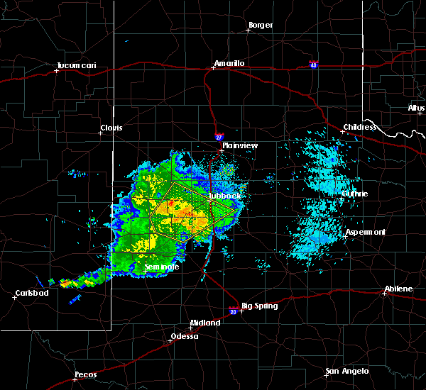 At 1127 pm cdt, the leading edge of strong winds from a severe thunderstorm was located near wolfforth, or 12 miles west of lubbock, moving northeast at 60 mph (radar indicated). Hazards include 70 mph wind gusts. Expect considerable tree damage. damage is likely to mobile homes, roofs, and outbuildings. Locations impacted include, lubbock, levelland, brownfield, slaton, wolfforth, sundown, ransom canyon, lubbock south plains mall, texas tech university, locketville, slide, whitharral, downtown lubbock, woodrow, reese center, meadow, smyer, ropesville, new home and opdyke west. At 1127 pm cdt, the leading edge of strong winds from a severe thunderstorm was located near wolfforth, or 12 miles west of lubbock, moving northeast at 60 mph (radar indicated). Hazards include 70 mph wind gusts. Expect considerable tree damage. damage is likely to mobile homes, roofs, and outbuildings. Locations impacted include, lubbock, levelland, brownfield, slaton, wolfforth, sundown, ransom canyon, lubbock south plains mall, texas tech university, locketville, slide, whitharral, downtown lubbock, woodrow, reese center, meadow, smyer, ropesville, new home and opdyke west.
|
| 9/29/2019 11:18 PM CDT |
 At 1116 pm cdt, a severe thunderstorm was located 6 miles south of locketville, or 8 miles north of brownfield, moving northeast at 40 mph (radar indicated. at 1105 pm, a wind gust of 58 mph was reported by the west texas mesonet station 2 miles south of brownfield). Hazards include 70 mph wind gusts. Expect considerable tree damage. damage is likely to mobile homes, roofs, and outbuildings. Locations impacted include, lubbock, levelland, brownfield, slaton, wolfforth, sundown, ransom canyon, lubbock south plains mall, texas tech university, locketville, slide, whitharral, downtown lubbock, woodrow, reese center, meadow, smyer, ropesville, new home and opdyke west. At 1116 pm cdt, a severe thunderstorm was located 6 miles south of locketville, or 8 miles north of brownfield, moving northeast at 40 mph (radar indicated. at 1105 pm, a wind gust of 58 mph was reported by the west texas mesonet station 2 miles south of brownfield). Hazards include 70 mph wind gusts. Expect considerable tree damage. damage is likely to mobile homes, roofs, and outbuildings. Locations impacted include, lubbock, levelland, brownfield, slaton, wolfforth, sundown, ransom canyon, lubbock south plains mall, texas tech university, locketville, slide, whitharral, downtown lubbock, woodrow, reese center, meadow, smyer, ropesville, new home and opdyke west.
|
| 9/29/2019 11:07 PM CDT |
 At 1106 pm cdt, a severe thunderstorm was located 6 miles northwest of brownfield, moving northeast at 40 mph (radar indicated). Hazards include 70 mph wind gusts. Expect considerable tree damage. Damage is likely to mobile homes, roofs, and outbuildings. At 1106 pm cdt, a severe thunderstorm was located 6 miles northwest of brownfield, moving northeast at 40 mph (radar indicated). Hazards include 70 mph wind gusts. Expect considerable tree damage. Damage is likely to mobile homes, roofs, and outbuildings.
|
| 8/18/2019 7:26 PM CDT |
 The national weather service in lubbock texas has issued a * severe thunderstorm warning for. hockley county in northwestern texas. until 815 pm cdt. At 725 pm cdt, a severe thunderstorm was located over levelland, moving east at 10 mph. The national weather service in lubbock texas has issued a * severe thunderstorm warning for. hockley county in northwestern texas. until 815 pm cdt. At 725 pm cdt, a severe thunderstorm was located over levelland, moving east at 10 mph.
|
| 7/6/2019 9:50 PM CDT |
 At 949 pm cdt, a severe thunderstorm was located 5 miles northeast of locketville, or 12 miles southeast of levelland, and is nearly stationary (radar indicated). Hazards include 60 mph wind gusts and quarter size hail. Hail damage to vehicles is expected. expect wind damage to roofs, siding, and trees. Locations impacted include, ropesville. At 949 pm cdt, a severe thunderstorm was located 5 miles northeast of locketville, or 12 miles southeast of levelland, and is nearly stationary (radar indicated). Hazards include 60 mph wind gusts and quarter size hail. Hail damage to vehicles is expected. expect wind damage to roofs, siding, and trees. Locations impacted include, ropesville.
|
| 7/6/2019 9:48 PM CDT |
 The national weather service in lubbock texas has issued a * severe thunderstorm warning for. northern terry county in northwestern texas. south central hockley county in northwestern texas. until 1045 pm cdt. At 948 pm cdt, a severe thunderstorm was located 5 miles southeast. The national weather service in lubbock texas has issued a * severe thunderstorm warning for. northern terry county in northwestern texas. south central hockley county in northwestern texas. until 1045 pm cdt. At 948 pm cdt, a severe thunderstorm was located 5 miles southeast.
|
| 7/6/2019 9:29 PM CDT |
 At 929 pm cdt, a severe thunderstorm was located 5 miles northeast of locketville, or 11 miles southeast of levelland, moving west at 15 mph (radar indicated). Hazards include 60 mph wind gusts and nickel size hail. Expect damage to roofs, siding, and trees. Locations impacted include, smyer and ropesville. At 929 pm cdt, a severe thunderstorm was located 5 miles northeast of locketville, or 11 miles southeast of levelland, moving west at 15 mph (radar indicated). Hazards include 60 mph wind gusts and nickel size hail. Expect damage to roofs, siding, and trees. Locations impacted include, smyer and ropesville.
|
| 7/6/2019 9:13 PM CDT |
 At 913 pm cdt, a severe thunderstorm was located 8 miles southwest of wolfforth, or 15 miles southeast of levelland, and is nearly stationary (radar indicated). Hazards include 60 mph wind gusts and nickel size hail. expect damage to roofs, siding, and trees At 913 pm cdt, a severe thunderstorm was located 8 miles southwest of wolfforth, or 15 miles southeast of levelland, and is nearly stationary (radar indicated). Hazards include 60 mph wind gusts and nickel size hail. expect damage to roofs, siding, and trees
|
| 6/18/2019 8:29 PM CDT |
 At 828 pm cdt, a severe thunderstorm was located 4 miles east of shallowater, or 6 miles north of lubbock, moving east at 25 mph (radar indicated). Hazards include ping pong ball size hail and 60 mph wind gusts. People and animals outdoors will be injured. expect hail damage to roofs, siding, windows, and vehicles. Expect wind damage to roofs, siding, and trees. At 828 pm cdt, a severe thunderstorm was located 4 miles east of shallowater, or 6 miles north of lubbock, moving east at 25 mph (radar indicated). Hazards include ping pong ball size hail and 60 mph wind gusts. People and animals outdoors will be injured. expect hail damage to roofs, siding, windows, and vehicles. Expect wind damage to roofs, siding, and trees.
|
| 6/17/2019 9:42 PM CDT |
 The severe thunderstorm warning for northwestern lynn, southwestern lubbock, northeastern terry and eastern hockley counties will expire at 945 pm cdt, the storm which prompted the warning has weakened below severe limits, and no longer poses an immediate threat to life or property. therefore, the warning will be allowed to expire. however gusty winds are still possible with this thunderstorm. a severe thunderstorm watch remains in effect until 1000 pm cdt for northwestern texas. The severe thunderstorm warning for northwestern lynn, southwestern lubbock, northeastern terry and eastern hockley counties will expire at 945 pm cdt, the storm which prompted the warning has weakened below severe limits, and no longer poses an immediate threat to life or property. therefore, the warning will be allowed to expire. however gusty winds are still possible with this thunderstorm. a severe thunderstorm watch remains in effect until 1000 pm cdt for northwestern texas.
|
| 6/17/2019 9:19 PM CDT |
 At 918 pm cdt, a severe thunderstorm was located 5 miles south of wolfforth, or 13 miles southwest of lubbock, moving northeast at 35 mph. the west texas mesonet station at wolfforth reported a gust to 64 mph at 915 pm (emergency management). Hazards include 70 mph wind gusts and quarter size hail. Hail damage to vehicles is expected. expect considerable tree damage. wind damage is also likely to mobile homes, roofs, and outbuildings. Locations impacted include, lubbock, levelland, wolfforth, shallowater, lubbock south plains mall, texas tech university, lubbock international airport, slide, whitharral, downtown lubbock, reese center, meadow, smyer, ropesville, opdyke west and lubbock science spectrum. At 918 pm cdt, a severe thunderstorm was located 5 miles south of wolfforth, or 13 miles southwest of lubbock, moving northeast at 35 mph. the west texas mesonet station at wolfforth reported a gust to 64 mph at 915 pm (emergency management). Hazards include 70 mph wind gusts and quarter size hail. Hail damage to vehicles is expected. expect considerable tree damage. wind damage is also likely to mobile homes, roofs, and outbuildings. Locations impacted include, lubbock, levelland, wolfforth, shallowater, lubbock south plains mall, texas tech university, lubbock international airport, slide, whitharral, downtown lubbock, reese center, meadow, smyer, ropesville, opdyke west and lubbock science spectrum.
|
| 6/17/2019 9:15 PM CDT |
 At 913 pm cdt, a severe thunderstorm was located 8 miles southwest of wolfforth, or 16 miles southwest of lubbock, moving northeast at 35 mph. residents of lubbock should prepare for strong to severe winds. this storm produced a wind gust to 59 mph at 905 pm (emergency management). Hazards include 60 mph wind gusts and quarter size hail. Hail damage to vehicles is expected. expect wind damage to roofs, siding, and trees. Locations impacted include, lubbock, levelland, wolfforth, shallowater, lubbock south plains mall, texas tech university, lubbock international airport, slide, whitharral, downtown lubbock, reese center, meadow, smyer, ropesville, opdyke west and lubbock science spectrum. At 913 pm cdt, a severe thunderstorm was located 8 miles southwest of wolfforth, or 16 miles southwest of lubbock, moving northeast at 35 mph. residents of lubbock should prepare for strong to severe winds. this storm produced a wind gust to 59 mph at 905 pm (emergency management). Hazards include 60 mph wind gusts and quarter size hail. Hail damage to vehicles is expected. expect wind damage to roofs, siding, and trees. Locations impacted include, lubbock, levelland, wolfforth, shallowater, lubbock south plains mall, texas tech university, lubbock international airport, slide, whitharral, downtown lubbock, reese center, meadow, smyer, ropesville, opdyke west and lubbock science spectrum.
|
| 6/17/2019 9:02 PM CDT |
 At 901 pm cdt, a severe thunderstorm was located 9 miles southeast of locketville, or 10 miles northeast of brownfield, moving northeast at 25 mph. this storm produced a wind gusts to 68 mph at brownfield. the area of peak winds is occurring in advance of the precipitation. at 9 pm the leading edge of the winds was located between wolfforth and ropesville (emergency management). Hazards include ping pong ball size hail and 60 mph wind gusts. People and animals outdoors will be injured. expect hail damage to roofs, siding, windows, and vehicles. expect wind damage to roofs, siding, and trees. Locations impacted include, lubbock, levelland, wolfforth, shallowater, lubbock south plains mall, texas tech university, lubbock international airport, locketville, slide, whitharral, downtown lubbock, reese center, meadow, smyer, ropesville, opdyke west and lubbock science spectrum. At 901 pm cdt, a severe thunderstorm was located 9 miles southeast of locketville, or 10 miles northeast of brownfield, moving northeast at 25 mph. this storm produced a wind gusts to 68 mph at brownfield. the area of peak winds is occurring in advance of the precipitation. at 9 pm the leading edge of the winds was located between wolfforth and ropesville (emergency management). Hazards include ping pong ball size hail and 60 mph wind gusts. People and animals outdoors will be injured. expect hail damage to roofs, siding, windows, and vehicles. expect wind damage to roofs, siding, and trees. Locations impacted include, lubbock, levelland, wolfforth, shallowater, lubbock south plains mall, texas tech university, lubbock international airport, locketville, slide, whitharral, downtown lubbock, reese center, meadow, smyer, ropesville, opdyke west and lubbock science spectrum.
|
| 6/17/2019 8:43 PM CDT |
 At 842 pm cdt, a severe thunderstorm was located near locketville, or 13 miles north of brownfield, moving north at 35 mph. a wind gust to 68 mph was recorded at brownfield at 835 pm (emergency management). Hazards include 70 mph wind gusts and ping pong ball size hail. People and animals outdoors will be injured. expect hail damage to roofs, siding, windows, and vehicles. expect considerable tree damage. Wind damage is also likely to mobile homes, roofs, and outbuildings. At 842 pm cdt, a severe thunderstorm was located near locketville, or 13 miles north of brownfield, moving north at 35 mph. a wind gust to 68 mph was recorded at brownfield at 835 pm (emergency management). Hazards include 70 mph wind gusts and ping pong ball size hail. People and animals outdoors will be injured. expect hail damage to roofs, siding, windows, and vehicles. expect considerable tree damage. Wind damage is also likely to mobile homes, roofs, and outbuildings.
|
| 6/5/2019 6:21 PM CDT |
 At 618 pm cdt, severe thunderstorms were located along a line extending from 5 miles north of cotton center to 4 miles north of shallowater to 7 miles west of slide, moving east at 30 mph (trained weather spotters. at 615 pm cdt, the wolfforth west texas mesonet site reported a wind gust to 61 mph ). Hazards include 70 mph wind gusts and penny size hail. Expect considerable tree damage. damage is likely to mobile homes, roofs, and outbuildings. Locations impacted include, lubbock, abernathy, hale center, olton, wolfforth, shallowater, anton, cotton center, fieldton, spade, lubbock south plains mall, locketville, halfway, slide, woodrow, reese center, texas tech university, lubbock international airport, downtown lubbock and new deal. At 618 pm cdt, severe thunderstorms were located along a line extending from 5 miles north of cotton center to 4 miles north of shallowater to 7 miles west of slide, moving east at 30 mph (trained weather spotters. at 615 pm cdt, the wolfforth west texas mesonet site reported a wind gust to 61 mph ). Hazards include 70 mph wind gusts and penny size hail. Expect considerable tree damage. damage is likely to mobile homes, roofs, and outbuildings. Locations impacted include, lubbock, abernathy, hale center, olton, wolfforth, shallowater, anton, cotton center, fieldton, spade, lubbock south plains mall, locketville, halfway, slide, woodrow, reese center, texas tech university, lubbock international airport, downtown lubbock and new deal.
|
| 6/5/2019 6:09 PM CDT |
 At 608 pm cdt, severe thunderstorms were located along a line extending from 4 miles northeast of fieldton to anton to 9 miles east of locketville, moving east at 20 mph (radar indicated). Hazards include 70 mph wind gusts. Expect considerable tree damage. damage is likely to mobile homes, roofs, and outbuildings. Locations impacted include, lubbock, levelland, littlefield, abernathy, hale center, olton, wolfforth, shallowater, anton, cotton center, fieldton, spade, lubbock south plains mall, locketville, halfway, slide, woodrow, reese center, texas tech university and lubbock international airport. At 608 pm cdt, severe thunderstorms were located along a line extending from 4 miles northeast of fieldton to anton to 9 miles east of locketville, moving east at 20 mph (radar indicated). Hazards include 70 mph wind gusts. Expect considerable tree damage. damage is likely to mobile homes, roofs, and outbuildings. Locations impacted include, lubbock, levelland, littlefield, abernathy, hale center, olton, wolfforth, shallowater, anton, cotton center, fieldton, spade, lubbock south plains mall, locketville, halfway, slide, woodrow, reese center, texas tech university and lubbock international airport.
|
| 6/5/2019 5:58 PM CDT |
 The severe thunderstorm warning for southern hockley county will expire at 600 pm cdt, the storm which prompted the warning has moved out of the area. therefore, the warning will be allowed to expire. however gusty winds and heavy rain are still possible with this thunderstorm. remember, a severe thunderstorm warning still remains in effect for eastern lamb and eastern hockley counties until 645 pm. The severe thunderstorm warning for southern hockley county will expire at 600 pm cdt, the storm which prompted the warning has moved out of the area. therefore, the warning will be allowed to expire. however gusty winds and heavy rain are still possible with this thunderstorm. remember, a severe thunderstorm warning still remains in effect for eastern lamb and eastern hockley counties until 645 pm.
|
| 6/5/2019 5:53 PM CDT |
 At 551 pm cdt, severe thunderstorms were located along a line extending from 3 miles northwest of fieldton to 4 miles west of anton to 4 miles northeast of locketville, moving east at 20 mph (radar indicated). Hazards include 70 mph wind gusts and quarter size hail. Hail damage to vehicles is expected. expect considerable tree damage. Wind damage is also likely to mobile homes, roofs, and outbuildings. At 551 pm cdt, severe thunderstorms were located along a line extending from 3 miles northwest of fieldton to 4 miles west of anton to 4 miles northeast of locketville, moving east at 20 mph (radar indicated). Hazards include 70 mph wind gusts and quarter size hail. Hail damage to vehicles is expected. expect considerable tree damage. Wind damage is also likely to mobile homes, roofs, and outbuildings.
|
| 6/5/2019 5:40 PM CDT |
 At 540 pm cdt, a severe thunderstorm was located over levelland, moving east at 30 mph (radar indicated). Hazards include 70 mph wind gusts and quarter size hail. Hail damage to vehicles is expected. expect considerable tree damage. Wind damage is also likely to mobile homes, roofs, and outbuildings. At 540 pm cdt, a severe thunderstorm was located over levelland, moving east at 30 mph (radar indicated). Hazards include 70 mph wind gusts and quarter size hail. Hail damage to vehicles is expected. expect considerable tree damage. Wind damage is also likely to mobile homes, roofs, and outbuildings.
|
| 5/24/2019 6:11 PM CDT |
 At 609 pm cdt, a severe thunderstorm was located near reese center, or 11 miles west of lubbock, moving northeast at 35 mph. very heavy rainfall is accompanying these storms. turn around, don`t drown! (radar indicated). Hazards include 60 mph wind gusts and quarter size hail. Hail damage to vehicles is expected. Expect wind damage to roofs, siding, and trees. At 609 pm cdt, a severe thunderstorm was located near reese center, or 11 miles west of lubbock, moving northeast at 35 mph. very heavy rainfall is accompanying these storms. turn around, don`t drown! (radar indicated). Hazards include 60 mph wind gusts and quarter size hail. Hail damage to vehicles is expected. Expect wind damage to roofs, siding, and trees.
|
| 5/24/2019 5:44 PM CDT |
 At 542 pm cdt, a severe thunderstorm was located 6 miles west of petersburg, or 9 miles northeast of abernathy, moving northeast at 45 mph. these storms are producing extremely heavy rainfall, which is worsening flooding conditions. do not drive around barricades. turn around, don`t drown! (radar indicated). Hazards include 60 mph wind gusts and quarter size hail. Hail damage to vehicles is expected. expect wind damage to roofs, siding, and trees. Locations impacted include, lubbock, abernathy, wolfforth, shallowater, petersburg, reese center, new deal, smyer and ropesville. At 542 pm cdt, a severe thunderstorm was located 6 miles west of petersburg, or 9 miles northeast of abernathy, moving northeast at 45 mph. these storms are producing extremely heavy rainfall, which is worsening flooding conditions. do not drive around barricades. turn around, don`t drown! (radar indicated). Hazards include 60 mph wind gusts and quarter size hail. Hail damage to vehicles is expected. expect wind damage to roofs, siding, and trees. Locations impacted include, lubbock, abernathy, wolfforth, shallowater, petersburg, reese center, new deal, smyer and ropesville.
|
| 5/24/2019 5:15 PM CDT |
 The national weather service in lubbock texas has issued a * severe thunderstorm warning for. northwestern lubbock county in northwestern texas. western floyd county in northwestern texas. southeastern hockley county in northwestern texas. Southern hale county in northwestern texas. The national weather service in lubbock texas has issued a * severe thunderstorm warning for. northwestern lubbock county in northwestern texas. western floyd county in northwestern texas. southeastern hockley county in northwestern texas. Southern hale county in northwestern texas.
|
| 5/24/2019 4:57 PM CDT |
 At 455 pm cdt, a severe thunderstorm was located near texas tech university, or 4 miles northwest of lubbock, moving northeast at 40 mph. at 449 pm, half-dollar sized hail was reported 1 mile north of wolfforth. also, very heavy rainfall will continue to worsen flooding. turn around, don`t drown (radar indicated). Hazards include 60 mph wind gusts and half dollar size hail. Hail damage to vehicles is expected. expect wind damage to roofs, siding, and trees. Locations impacted include, lubbock, abernathy, hale center, wolfforth, shallowater, lockney, cotton center, aiken, reese center, new deal, smyer and ropesville. At 455 pm cdt, a severe thunderstorm was located near texas tech university, or 4 miles northwest of lubbock, moving northeast at 40 mph. at 449 pm, half-dollar sized hail was reported 1 mile north of wolfforth. also, very heavy rainfall will continue to worsen flooding. turn around, don`t drown (radar indicated). Hazards include 60 mph wind gusts and half dollar size hail. Hail damage to vehicles is expected. expect wind damage to roofs, siding, and trees. Locations impacted include, lubbock, abernathy, hale center, wolfforth, shallowater, lockney, cotton center, aiken, reese center, new deal, smyer and ropesville.
|
| 5/24/2019 4:46 PM CDT |
 At 444 pm cdt, a severe thunderstorm was located over lubbock international airport, or 8 miles north of lubbock, moving northeast at 50 mph. torrential rainfall will continue to worsen flooding across the area. turn around, don`t drown! (radar indicated). Hazards include 60 mph wind gusts and quarter size hail. Hail damage to vehicles is expected. Expect wind damage to roofs, siding, and trees. At 444 pm cdt, a severe thunderstorm was located over lubbock international airport, or 8 miles north of lubbock, moving northeast at 50 mph. torrential rainfall will continue to worsen flooding across the area. turn around, don`t drown! (radar indicated). Hazards include 60 mph wind gusts and quarter size hail. Hail damage to vehicles is expected. Expect wind damage to roofs, siding, and trees.
|
| 5/24/2019 1:48 PM CDT |
 At 147 pm cdt, a severe thunderstorm was located 4 miles southwest of wolfforth, or 12 miles southwest of lubbock, moving northeast at 25 mph (radar indicated). Hazards include two inch hail and 70 mph wind gusts. People and animals outdoors will be injured. expect hail damage to roofs, siding, windows, and vehicles. expect considerable tree damage. wind damage is also likely to mobile homes, roofs, and outbuildings. Locations impacted include, lubbock, wolfforth, shallowater, texas tech university, slide, downtown lubbock, lubbock south plains mall, woodrow, reese center, meadow, ropesville and lubbock science spectrum. At 147 pm cdt, a severe thunderstorm was located 4 miles southwest of wolfforth, or 12 miles southwest of lubbock, moving northeast at 25 mph (radar indicated). Hazards include two inch hail and 70 mph wind gusts. People and animals outdoors will be injured. expect hail damage to roofs, siding, windows, and vehicles. expect considerable tree damage. wind damage is also likely to mobile homes, roofs, and outbuildings. Locations impacted include, lubbock, wolfforth, shallowater, texas tech university, slide, downtown lubbock, lubbock south plains mall, woodrow, reese center, meadow, ropesville and lubbock science spectrum.
|
| 5/24/2019 1:11 PM CDT |
 At 111 pm cdt, a severe thunderstorm was located 7 miles northeast of brownfield, moving northeast at 25 mph (radar indicated). Hazards include 60 mph wind gusts and half dollar size hail. Hail damage to vehicles is expected. Expect wind damage to roofs, siding, and trees. At 111 pm cdt, a severe thunderstorm was located 7 miles northeast of brownfield, moving northeast at 25 mph (radar indicated). Hazards include 60 mph wind gusts and half dollar size hail. Hail damage to vehicles is expected. Expect wind damage to roofs, siding, and trees.
|
| 5/23/2019 7:18 PM CDT |
 At 718 pm cdt, a severe thunderstorm was located near wolfforth, or 9 miles southwest of lubbock, moving northeast at 25 mph (trained weather spotters). Hazards include two inch hail and 60 mph wind gusts. People and animals outdoors will be injured. expect hail damage to roofs, siding, windows, and vehicles. expect wind damage to roofs, siding, and trees. Locations impacted include, lubbock, wolfforth, slide and ropesville. At 718 pm cdt, a severe thunderstorm was located near wolfforth, or 9 miles southwest of lubbock, moving northeast at 25 mph (trained weather spotters). Hazards include two inch hail and 60 mph wind gusts. People and animals outdoors will be injured. expect hail damage to roofs, siding, windows, and vehicles. expect wind damage to roofs, siding, and trees. Locations impacted include, lubbock, wolfforth, slide and ropesville.
|
| 5/23/2019 7:08 PM CDT |
 At 707 pm cdt, a severe thunderstorm was located 5 miles west of slide, or 13 miles southwest of lubbock, moving northeast at 25 mph (trained weather spotters. at 707 pm golfball size hail was reported 5 miles south of wolfforth). Hazards include two inch hail and 60 mph wind gusts. People and animals outdoors will be injured. expect hail damage to roofs, siding, windows, and vehicles. expect wind damage to roofs, siding, and trees. Locations impacted include, lubbock, wolfforth, slide and ropesville. At 707 pm cdt, a severe thunderstorm was located 5 miles west of slide, or 13 miles southwest of lubbock, moving northeast at 25 mph (trained weather spotters. at 707 pm golfball size hail was reported 5 miles south of wolfforth). Hazards include two inch hail and 60 mph wind gusts. People and animals outdoors will be injured. expect hail damage to roofs, siding, windows, and vehicles. expect wind damage to roofs, siding, and trees. Locations impacted include, lubbock, wolfforth, slide and ropesville.
|
| 5/23/2019 7:02 PM CDT |
 At 702 pm cdt, a severe thunderstorm was located 7 miles west of slide, or 16 miles southwest of lubbock, moving northeast at 25 mph (radar indicated). Hazards include two inch hail and 60 mph wind gusts. People and animals outdoors will be injured. expect hail damage to roofs, siding, windows, and vehicles. expect wind damage to roofs, siding, and trees. Locations impacted include, lubbock, wolfforth, slide, meadow and ropesville. At 702 pm cdt, a severe thunderstorm was located 7 miles west of slide, or 16 miles southwest of lubbock, moving northeast at 25 mph (radar indicated). Hazards include two inch hail and 60 mph wind gusts. People and animals outdoors will be injured. expect hail damage to roofs, siding, windows, and vehicles. expect wind damage to roofs, siding, and trees. Locations impacted include, lubbock, wolfforth, slide, meadow and ropesville.
|
| 5/23/2019 6:54 PM CDT |
 At 654 pm cdt, a severe thunderstorm was located 11 miles west of slide, or 15 miles northeast of brownfield, moving northeast at 25 mph (radar indicated). Hazards include ping pong ball size hail and 60 mph wind gusts. People and animals outdoors will be injured. expect hail damage to roofs, siding, windows, and vehicles. Expect wind damage to roofs, siding, and trees. At 654 pm cdt, a severe thunderstorm was located 11 miles west of slide, or 15 miles northeast of brownfield, moving northeast at 25 mph (radar indicated). Hazards include ping pong ball size hail and 60 mph wind gusts. People and animals outdoors will be injured. expect hail damage to roofs, siding, windows, and vehicles. Expect wind damage to roofs, siding, and trees.
|
| 5/23/2019 6:31 PM CDT |
 At 631 pm cdt, a severe thunderstorm was located over wolfforth, or 8 miles west of lubbock, moving east at 30 mph (radar indicated). Hazards include 70 mph wind gusts and half dollar size hail. Hail damage to vehicles is expected. expect considerable tree damage. wind damage is also likely to mobile homes, roofs, and outbuildings. Locations impacted include, lubbock, wolfforth, reese center, smyer and ropesville. At 631 pm cdt, a severe thunderstorm was located over wolfforth, or 8 miles west of lubbock, moving east at 30 mph (radar indicated). Hazards include 70 mph wind gusts and half dollar size hail. Hail damage to vehicles is expected. expect considerable tree damage. wind damage is also likely to mobile homes, roofs, and outbuildings. Locations impacted include, lubbock, wolfforth, reese center, smyer and ropesville.
|
| 5/23/2019 6:23 PM CDT |
 At 623 pm cdt, a severe thunderstorm was located near wolfforth, or 12 miles southwest of lubbock, moving northeast at 25 mph (radar indicated). Hazards include 70 mph wind gusts and half dollar size hail. Hail damage to vehicles is expected. expect considerable tree damage. wind damage is also likely to mobile homes, roofs, and outbuildings. Locations impacted include, lubbock, wolfforth, reese center, smyer and ropesville. At 623 pm cdt, a severe thunderstorm was located near wolfforth, or 12 miles southwest of lubbock, moving northeast at 25 mph (radar indicated). Hazards include 70 mph wind gusts and half dollar size hail. Hail damage to vehicles is expected. expect considerable tree damage. wind damage is also likely to mobile homes, roofs, and outbuildings. Locations impacted include, lubbock, wolfforth, reese center, smyer and ropesville.
|
| 5/23/2019 6:17 PM CDT |
 At 617 pm cdt, a severe thunderstorm was located 5 miles west of wolfforth, or 14 miles southwest of lubbock, moving northeast at 25 mph (radar indicated). Hazards include golf ball size hail and 70 mph wind gusts. People and animals outdoors will be injured. expect hail damage to roofs, siding, windows, and vehicles. expect considerable tree damage. wind damage is also likely to mobile homes, roofs, and outbuildings. Locations impacted include, lubbock, wolfforth, reese center, smyer and ropesville. At 617 pm cdt, a severe thunderstorm was located 5 miles west of wolfforth, or 14 miles southwest of lubbock, moving northeast at 25 mph (radar indicated). Hazards include golf ball size hail and 70 mph wind gusts. People and animals outdoors will be injured. expect hail damage to roofs, siding, windows, and vehicles. expect considerable tree damage. wind damage is also likely to mobile homes, roofs, and outbuildings. Locations impacted include, lubbock, wolfforth, reese center, smyer and ropesville.
|
| 5/23/2019 6:09 PM CDT |
 At 609 pm cdt, a severe thunderstorm was located 9 miles southwest of wolfforth, or 14 miles southeast of levelland, moving northeast at 25 mph (radar indicated). Hazards include golf ball size hail and 70 mph wind gusts. People and animals outdoors will be injured. expect hail damage to roofs, siding, windows, and vehicles. expect considerable tree damage. wind damage is also likely to mobile homes, roofs, and outbuildings. Locations impacted include, lubbock, wolfforth, reese center, smyer and ropesville. At 609 pm cdt, a severe thunderstorm was located 9 miles southwest of wolfforth, or 14 miles southeast of levelland, moving northeast at 25 mph (radar indicated). Hazards include golf ball size hail and 70 mph wind gusts. People and animals outdoors will be injured. expect hail damage to roofs, siding, windows, and vehicles. expect considerable tree damage. wind damage is also likely to mobile homes, roofs, and outbuildings. Locations impacted include, lubbock, wolfforth, reese center, smyer and ropesville.
|
| 5/23/2019 6:04 PM CDT |
 At 604 pm cdt, a severe thunderstorm was located 8 miles northeast of locketville, or 14 miles southeast of levelland, moving northeast at 25 mph (radar indicated). Hazards include 70 mph wind gusts and half dollar size hail. Hail damage to vehicles is expected. expect considerable tree damage. Wind damage is also likely to mobile homes, roofs, and outbuildings. At 604 pm cdt, a severe thunderstorm was located 8 miles northeast of locketville, or 14 miles southeast of levelland, moving northeast at 25 mph (radar indicated). Hazards include 70 mph wind gusts and half dollar size hail. Hail damage to vehicles is expected. expect considerable tree damage. Wind damage is also likely to mobile homes, roofs, and outbuildings.
|
| 5/23/2019 5:51 PM CDT |
 At 551 pm cdt, a severe thunderstorm was located 4 miles south of locketville, or 10 miles north of brownfield, moving northeast at 25 mph (radar indicated). Hazards include golf ball size hail and 70 mph wind gusts. People and animals outdoors will be injured. expect hail damage to roofs, siding, windows, and vehicles. expect considerable tree damage. wind damage is also likely to mobile homes, roofs, and outbuildings. Locations impacted include, brownfield, locketville, meadow and ropesville. At 551 pm cdt, a severe thunderstorm was located 4 miles south of locketville, or 10 miles north of brownfield, moving northeast at 25 mph (radar indicated). Hazards include golf ball size hail and 70 mph wind gusts. People and animals outdoors will be injured. expect hail damage to roofs, siding, windows, and vehicles. expect considerable tree damage. wind damage is also likely to mobile homes, roofs, and outbuildings. Locations impacted include, brownfield, locketville, meadow and ropesville.
|
| 5/23/2019 5:41 PM CDT |
 At 540 pm cdt, a severe thunderstorm was located 8 miles southwest of locketville, or 9 miles northwest of brownfield, moving northeast at 25 mph (radar indicated. at 538 pm a storm chaser reported a rotating wall cloud northwest of brownfield). Hazards include golf ball size hail and 70 mph wind gusts. People and animals outdoors will be injured. expect hail damage to roofs, siding, windows, and vehicles. expect considerable tree damage. wind damage is also likely to mobile homes, roofs, and outbuildings. Locations impacted include, brownfield, locketville, meadow and ropesville. At 540 pm cdt, a severe thunderstorm was located 8 miles southwest of locketville, or 9 miles northwest of brownfield, moving northeast at 25 mph (radar indicated. at 538 pm a storm chaser reported a rotating wall cloud northwest of brownfield). Hazards include golf ball size hail and 70 mph wind gusts. People and animals outdoors will be injured. expect hail damage to roofs, siding, windows, and vehicles. expect considerable tree damage. wind damage is also likely to mobile homes, roofs, and outbuildings. Locations impacted include, brownfield, locketville, meadow and ropesville.
|
| 5/23/2019 5:29 PM CDT |
 The national weather service in lubbock texas has issued a * severe thunderstorm warning for. northern terry county in northwestern texas. southeastern hockley county in northwestern texas. until 615 pm cdt. At 529 pm cdt, a severe thunderstorm was located 8 miles northeast. The national weather service in lubbock texas has issued a * severe thunderstorm warning for. northern terry county in northwestern texas. southeastern hockley county in northwestern texas. until 615 pm cdt. At 529 pm cdt, a severe thunderstorm was located 8 miles northeast.
|
| 5/9/2019 12:13 AM CDT |
 At 1213 am cdt, severe thunderstorms were located along a line extending from 3 miles east of fieldton, moving east at 25 mph (radar indicated). Hazards include golf ball size hail and 60 mph wind gusts. People and animals outdoors will be injured. expect hail damage to roofs, siding, windows and vehicles. expect wind damage to roofs, siding and trees. Locations impacted include, lubbock, plainview, slaton, abernathy, hale center and wolfforth. At 1213 am cdt, severe thunderstorms were located along a line extending from 3 miles east of fieldton, moving east at 25 mph (radar indicated). Hazards include golf ball size hail and 60 mph wind gusts. People and animals outdoors will be injured. expect hail damage to roofs, siding, windows and vehicles. expect wind damage to roofs, siding and trees. Locations impacted include, lubbock, plainview, slaton, abernathy, hale center and wolfforth.
|
| 5/9/2019 12:06 AM CDT |
 At 1205 am cdt, severe thunderstorms were located along a line extending from 12 miles northeast of littlefield to 7 miles east of locketville, moving east at 25 mph (radar indicated). Hazards include 60 mph wind gusts and quarter size hail. Hail damage to vehicles is expected. Expect wind damage to roofs, siding and trees. At 1205 am cdt, severe thunderstorms were located along a line extending from 12 miles northeast of littlefield to 7 miles east of locketville, moving east at 25 mph (radar indicated). Hazards include 60 mph wind gusts and quarter size hail. Hail damage to vehicles is expected. Expect wind damage to roofs, siding and trees.
|
| 5/7/2019 6:55 PM CDT |
 At 655 pm cdt, a severe thunderstorm was located 5 miles southwest of locketville, or 12 miles northwest of brownfield, moving northeast at 45 mph (radar indicated). Hazards include 60 mph wind gusts and half dollar size hail. Hail damage to vehicles is expected. expect wind damage to roofs, siding, and trees. Locations impacted include, levelland, sundown, locketville, meadow and ropesville. At 655 pm cdt, a severe thunderstorm was located 5 miles southwest of locketville, or 12 miles northwest of brownfield, moving northeast at 45 mph (radar indicated). Hazards include 60 mph wind gusts and half dollar size hail. Hail damage to vehicles is expected. expect wind damage to roofs, siding, and trees. Locations impacted include, levelland, sundown, locketville, meadow and ropesville.
|
| 5/7/2019 6:43 PM CDT |
 At 643 pm cdt, a severe thunderstorm was located 6 miles northeast of tokio, or 12 miles west of brownfield, moving northeast at 40 mph (radar indicated). Hazards include 60 mph wind gusts and half dollar size hail. Hail damage to vehicles is expected. Expect wind damage to roofs, siding, and trees. At 643 pm cdt, a severe thunderstorm was located 6 miles northeast of tokio, or 12 miles west of brownfield, moving northeast at 40 mph (radar indicated). Hazards include 60 mph wind gusts and half dollar size hail. Hail damage to vehicles is expected. Expect wind damage to roofs, siding, and trees.
|
| 5/7/2019 5:44 PM CDT |
 At 543 pm cdt, a severe thunderstorm was located 9 miles east of locketville, or 16 miles northeast of brownfield, moving northeast at 30 mph. another severe thunderstorm was located near reese center, also moving northeast at 30 mph (radar indicated). Hazards include 60 mph wind gusts and half dollar size hail. Hail damage to vehicles is expected. Expect wind damage to roofs, siding, and trees. At 543 pm cdt, a severe thunderstorm was located 9 miles east of locketville, or 16 miles northeast of brownfield, moving northeast at 30 mph. another severe thunderstorm was located near reese center, also moving northeast at 30 mph (radar indicated). Hazards include 60 mph wind gusts and half dollar size hail. Hail damage to vehicles is expected. Expect wind damage to roofs, siding, and trees.
|
| 5/7/2019 5:31 PM CDT |
 At 530 pm cdt, severe thunderstorms were located along a line extending from 7 miles southeast of locketville to wolfforth, moving north at 20 mph (radar indicated). Hazards include 60 mph wind gusts and quarter size hail. Hail damage to vehicles is expected. expect wind damage to roofs, siding, and trees. Locations impacted include, lubbock, wolfforth, slide, meadow and ropesville. At 530 pm cdt, severe thunderstorms were located along a line extending from 7 miles southeast of locketville to wolfforth, moving north at 20 mph (radar indicated). Hazards include 60 mph wind gusts and quarter size hail. Hail damage to vehicles is expected. expect wind damage to roofs, siding, and trees. Locations impacted include, lubbock, wolfforth, slide, meadow and ropesville.
|
| 5/7/2019 5:20 PM CDT |
 At 519 pm cdt, a severe thunderstorm was located 9 miles west of slide, or 16 miles northeast of brownfield, moving northeast at 15 mph (radar indicated). Hazards include 60 mph wind gusts and half dollar size hail. Hail damage to vehicles is expected. Expect wind damage to roofs, siding, and trees. At 519 pm cdt, a severe thunderstorm was located 9 miles west of slide, or 16 miles northeast of brownfield, moving northeast at 15 mph (radar indicated). Hazards include 60 mph wind gusts and half dollar size hail. Hail damage to vehicles is expected. Expect wind damage to roofs, siding, and trees.
|
| 5/7/2019 5:10 PM CDT |
 At 510 pm cdt, a severe thunderstorm was located 10 miles west of wolfforth, or 11 miles southeast of levelland, moving northeast at 15 mph (radar indicated). Hazards include 60 mph wind gusts and half dollar size hail. Hail damage to vehicles is expected. Expect wind damage to roofs, siding, and trees. At 510 pm cdt, a severe thunderstorm was located 10 miles west of wolfforth, or 11 miles southeast of levelland, moving northeast at 15 mph (radar indicated). Hazards include 60 mph wind gusts and half dollar size hail. Hail damage to vehicles is expected. Expect wind damage to roofs, siding, and trees.
|
| 5/7/2019 5:02 PM CDT |
 At 501 pm cdt, a severe thunderstorm was located 8 miles west of wolfforth, or 14 miles southeast of levelland, moving northeast at 25 mph (radar indicated). Hazards include 60 mph wind gusts and quarter size hail. Hail damage to vehicles is expected. expect wind damage to roofs, siding, and trees. Locations impacted include, lubbock, wolfforth, lubbock south plains mall, reese center, smyer, ropesville and lubbock science spectrum. At 501 pm cdt, a severe thunderstorm was located 8 miles west of wolfforth, or 14 miles southeast of levelland, moving northeast at 25 mph (radar indicated). Hazards include 60 mph wind gusts and quarter size hail. Hail damage to vehicles is expected. expect wind damage to roofs, siding, and trees. Locations impacted include, lubbock, wolfforth, lubbock south plains mall, reese center, smyer, ropesville and lubbock science spectrum.
|
| 5/7/2019 4:52 PM CDT |
 At 452 pm cdt, a severe thunderstorm was located 9 miles east of locketville, or 15 miles southeast of levelland, moving northeast at 25 mph (radar indicated. at 450 pm quarter size hail was reported in ropesville). Hazards include 60 mph wind gusts and quarter size hail. Hail damage to vehicles is expected. expect wind damage to roofs, siding, and trees. Locations impacted include, lubbock, wolfforth, locketville, lubbock south plains mall, reese center, smyer, ropesville and lubbock science spectrum. At 452 pm cdt, a severe thunderstorm was located 9 miles east of locketville, or 15 miles southeast of levelland, moving northeast at 25 mph (radar indicated. at 450 pm quarter size hail was reported in ropesville). Hazards include 60 mph wind gusts and quarter size hail. Hail damage to vehicles is expected. expect wind damage to roofs, siding, and trees. Locations impacted include, lubbock, wolfforth, locketville, lubbock south plains mall, reese center, smyer, ropesville and lubbock science spectrum.
|
| 5/7/2019 4:50 PM CDT | Quarter sized hail reported 0.3 miles NW of Ropesville, TX |
| 5/7/2019 4:50 PM CDT | Quarter sized hail reported 1 miles NNW of Ropesville, TX |
| 5/7/2019 4:40 PM CDT |
 At 440 pm cdt, a severe thunderstorm was located 6 miles east of locketville, or 14 miles north of brownfield, moving northeast at 25 mph (radar indicated). Hazards include 60 mph wind gusts and quarter size hail. Hail damage to vehicles is expected. Expect wind damage to roofs, siding, and trees. At 440 pm cdt, a severe thunderstorm was located 6 miles east of locketville, or 14 miles north of brownfield, moving northeast at 25 mph (radar indicated). Hazards include 60 mph wind gusts and quarter size hail. Hail damage to vehicles is expected. Expect wind damage to roofs, siding, and trees.
|
| 3/22/2019 9:21 PM CDT |
 At 920 pm cdt, a severe thunderstorm was located 9 miles west of wolfforth, or 12 miles southeast of levelland, moving east at 25 mph (radar indicated). Hazards include two inch hail and 60 mph wind gusts. People and animals outdoors will be injured. expect hail damage to roofs, siding, windows, and vehicles. Expect wind damage to roofs, siding, and trees. At 920 pm cdt, a severe thunderstorm was located 9 miles west of wolfforth, or 12 miles southeast of levelland, moving east at 25 mph (radar indicated). Hazards include two inch hail and 60 mph wind gusts. People and animals outdoors will be injured. expect hail damage to roofs, siding, windows, and vehicles. Expect wind damage to roofs, siding, and trees.
|
| 3/22/2019 9:13 PM CDT | Hen Egg sized hail reported 6 miles S of Ropesville, TX, observed south of smyer on fm 1585 |
| 10/5/2018 6:38 PM CDT |
 At 638 pm cdt, a severe thunderstorm was located 6 miles northwest of ropesville, moving northeast at 20 mph (radar indicated). Hazards include golf ball size hail and 60 mph wind gusts. People and animals outdoors will be injured. expect hail damage to roofs, siding, windows and vehicles. expect wind damage to roofs, siding and trees. Locations impacted include, lubbock, abernathy, wolfforth, shallowater, anton and reese center. At 638 pm cdt, a severe thunderstorm was located 6 miles northwest of ropesville, moving northeast at 20 mph (radar indicated). Hazards include golf ball size hail and 60 mph wind gusts. People and animals outdoors will be injured. expect hail damage to roofs, siding, windows and vehicles. expect wind damage to roofs, siding and trees. Locations impacted include, lubbock, abernathy, wolfforth, shallowater, anton and reese center.
|
| 10/5/2018 5:59 PM CDT |
 At 559 pm cdt, severe thunderstorms were located along a line extending from 7 miles northwest of reese center to locketville, moving northeast at 20 mph (radar indicated). Hazards include 60 mph wind gusts and quarter size hail. Hail damage to vehicles is expected. Expect wind damage to roofs, siding and trees. At 559 pm cdt, severe thunderstorms were located along a line extending from 7 miles northwest of reese center to locketville, moving northeast at 20 mph (radar indicated). Hazards include 60 mph wind gusts and quarter size hail. Hail damage to vehicles is expected. Expect wind damage to roofs, siding and trees.
|
| 8/22/2017 6:45 PM CDT |
 At 645 pm cdt, a severe thunderstorm was located 6 miles southeast of levelland, moving east at 25 mph (radar indicated). Hazards include 60 mph wind gusts and quarter size hail. Hail damage to vehicles is expected. Expect wind damage to roofs, siding and trees. At 645 pm cdt, a severe thunderstorm was located 6 miles southeast of levelland, moving east at 25 mph (radar indicated). Hazards include 60 mph wind gusts and quarter size hail. Hail damage to vehicles is expected. Expect wind damage to roofs, siding and trees.
|
| 8/7/2017 6:58 PM CDT |
 At 657 pm cdt, a severe thunderstorm was located near slide, or 14 miles southwest of lubbock, moving south at 25 mph (radar indicated). Hazards include 60 mph wind gusts. Expect damage to roofs, siding, and trees. Locations impacted include, slide, meadow, ropesville and new home. At 657 pm cdt, a severe thunderstorm was located near slide, or 14 miles southwest of lubbock, moving south at 25 mph (radar indicated). Hazards include 60 mph wind gusts. Expect damage to roofs, siding, and trees. Locations impacted include, slide, meadow, ropesville and new home.
|
| 8/7/2017 6:43 PM CDT |
 At 643 pm cdt, a severe thunderstorm was located over wolfforth, or 9 miles southwest of lubbock, moving south at 25 mph (radar indicated). Hazards include 60 mph wind gusts. expect damage to roofs, siding, and trees At 643 pm cdt, a severe thunderstorm was located over wolfforth, or 9 miles southwest of lubbock, moving south at 25 mph (radar indicated). Hazards include 60 mph wind gusts. expect damage to roofs, siding, and trees
|
| 7/4/2017 9:42 PM CDT |
 At 941 pm cdt, severe thunderstorms were located along a line extending from near idalou to near slide to 6 miles southwest of brownfield to near denver city, moving southeast at 30 mph (radar indicated). Hazards include 60 mph wind gusts and penny size hail. expect damage to roofs, siding, and trees At 941 pm cdt, severe thunderstorms were located along a line extending from near idalou to near slide to 6 miles southwest of brownfield to near denver city, moving southeast at 30 mph (radar indicated). Hazards include 60 mph wind gusts and penny size hail. expect damage to roofs, siding, and trees
|
| 7/4/2017 9:25 PM CDT |
 At 923 pm cdt, severe thunderstorms were located along a line extending from near aiken to near lubbock international airport to wolfforth to 9 miles northwest of brownfield to near bronco, moving south at 35 mph. the west texas mesonet station at aiken reported 67 mph at 910 pm (radar indicated). Hazards include 70 mph wind gusts. Expect considerable tree damage. damage is likely to mobile homes, roofs, and outbuildings. Locations impacted include, lubbock, plainview, levelland, brownfield, slaton, tulia, floydada, abernathy, hale center, plains, silverton, wolfforth, shallowater, idalou, ralls, lockney, sundown, petersburg, lorenzo and ransom canyon. At 923 pm cdt, severe thunderstorms were located along a line extending from near aiken to near lubbock international airport to wolfforth to 9 miles northwest of brownfield to near bronco, moving south at 35 mph. the west texas mesonet station at aiken reported 67 mph at 910 pm (radar indicated). Hazards include 70 mph wind gusts. Expect considerable tree damage. damage is likely to mobile homes, roofs, and outbuildings. Locations impacted include, lubbock, plainview, levelland, brownfield, slaton, tulia, floydada, abernathy, hale center, plains, silverton, wolfforth, shallowater, idalou, ralls, lockney, sundown, petersburg, lorenzo and ransom canyon.
|
| 7/4/2017 9:13 PM CDT |
 At 910 pm cdt, severe thunderstorms were located along a line extending from 7 miles south of claytonville to 7 miles southeast of abernathy to near reese center to 6 miles southwest of locketville to near bronco, moving southeast at 40 mph. the west texas mesonet station at sundown reported a wind gust to 64 mph and the station at levelland reported 58 mph, both at 905 pm. these are very dangerous storms (radar indicated). Hazards include 80 mph wind gusts. Flying debris will be dangerous to those caught without shelter. mobile homes will be heavily damaged. expect considerable damage to roofs, windows, and vehicles. extensive tree damage and power outages are likely. Locations impacted include, lubbock, plainview, levelland, brownfield, slaton, tulia, floydada, abernathy, hale center, plains, silverton, wolfforth, shallowater, idalou, ralls, lockney, sundown, petersburg, lorenzo and anton. At 910 pm cdt, severe thunderstorms were located along a line extending from 7 miles south of claytonville to 7 miles southeast of abernathy to near reese center to 6 miles southwest of locketville to near bronco, moving southeast at 40 mph. the west texas mesonet station at sundown reported a wind gust to 64 mph and the station at levelland reported 58 mph, both at 905 pm. these are very dangerous storms (radar indicated). Hazards include 80 mph wind gusts. Flying debris will be dangerous to those caught without shelter. mobile homes will be heavily damaged. expect considerable damage to roofs, windows, and vehicles. extensive tree damage and power outages are likely. Locations impacted include, lubbock, plainview, levelland, brownfield, slaton, tulia, floydada, abernathy, hale center, plains, silverton, wolfforth, shallowater, idalou, ralls, lockney, sundown, petersburg, lorenzo and anton.
|
| 7/4/2017 8:59 PM CDT |
 At 858 pm cdt, severe thunderstorms were located along a line extending from near claytonville to abernathy to near shallowater to sundown to 11 miles north of bronco, moving southeast at 40 mph. these are very dangerous storms (radar indicated). Hazards include 80 mph wind gusts. Flying debris will be dangerous to those caught without shelter. mobile homes will be heavily damaged. expect considerable damage to roofs, windows, and vehicles. Extensive tree damage and power outages are likely. At 858 pm cdt, severe thunderstorms were located along a line extending from near claytonville to abernathy to near shallowater to sundown to 11 miles north of bronco, moving southeast at 40 mph. these are very dangerous storms (radar indicated). Hazards include 80 mph wind gusts. Flying debris will be dangerous to those caught without shelter. mobile homes will be heavily damaged. expect considerable damage to roofs, windows, and vehicles. Extensive tree damage and power outages are likely.
|
| 7/4/2017 8:41 PM CDT |
 At 839 pm cdt, severe thunderstorms were located along a line extending from near tulia to near hale center to near spade to 8 miles southeast of pep to 6 miles east of bledsoe, moving southeast at 30 mph. at 830 pm, the west texas mesonet station at morton reported a wind gust to 58 mph and the station at olton reported a wind gust to 59 mph at 835 pm (radar indicated). Hazards include 70 mph wind gusts. Expect considerable tree damage. damage is likely to mobile homes, roofs, and outbuildings. Locations impacted include, lubbock, plainview, levelland, littlefield, tulia, abernathy, hale center, olton, morton, wolfforth, shallowater, sundown, petersburg, anton, kress, cotton center, fieldton, spade, claytonville and lubbock south plains mall. At 839 pm cdt, severe thunderstorms were located along a line extending from near tulia to near hale center to near spade to 8 miles southeast of pep to 6 miles east of bledsoe, moving southeast at 30 mph. at 830 pm, the west texas mesonet station at morton reported a wind gust to 58 mph and the station at olton reported a wind gust to 59 mph at 835 pm (radar indicated). Hazards include 70 mph wind gusts. Expect considerable tree damage. damage is likely to mobile homes, roofs, and outbuildings. Locations impacted include, lubbock, plainview, levelland, littlefield, tulia, abernathy, hale center, olton, morton, wolfforth, shallowater, sundown, petersburg, anton, kress, cotton center, fieldton, spade, claytonville and lubbock south plains mall.
|
| 7/4/2017 8:31 PM CDT |
 At 829 pm cdt, severe thunderstorms were located along a line extending from 8 miles west of tulia to near spade to pep to 7 miles south of maple, moving southeast at 30 mph (radar indicated). Hazards include 70 mph wind gusts. Expect considerable tree damage. Damage is likely to mobile homes, roofs, and outbuildings. At 829 pm cdt, severe thunderstorms were located along a line extending from 8 miles west of tulia to near spade to pep to 7 miles south of maple, moving southeast at 30 mph (radar indicated). Hazards include 70 mph wind gusts. Expect considerable tree damage. Damage is likely to mobile homes, roofs, and outbuildings.
|
| 7/3/2017 7:58 PM CDT |
 At 757 pm cdt, a severe thunderstorm was located over levelland, moving southeast at 15 mph (trained weather spotters). Hazards include quarter size hail. damage to vehicles is expected At 757 pm cdt, a severe thunderstorm was located over levelland, moving southeast at 15 mph (trained weather spotters). Hazards include quarter size hail. damage to vehicles is expected
|
| 7/1/2017 2:23 AM CDT |
 At 222 am cdt, a severe thunderstorm was located near lubbock, and moving east at 40 mph (radar indicated). Hazards include 70 mph wind gusts and quarter size hail. Hail damage to vehicles is expected. expect considerable tree damage. wind damage is also likely to mobile homes, roofs, and outbuildings. Locations impacted include, lubbock, tahoka, wolfforth, shallowater, idalou, lubbock south plains mall, texas tech university, lubbock international airport, slide, downtown lubbock, woodrow, reese center, new deal, ropesville, new home and lubbock science spectrum. At 222 am cdt, a severe thunderstorm was located near lubbock, and moving east at 40 mph (radar indicated). Hazards include 70 mph wind gusts and quarter size hail. Hail damage to vehicles is expected. expect considerable tree damage. wind damage is also likely to mobile homes, roofs, and outbuildings. Locations impacted include, lubbock, tahoka, wolfforth, shallowater, idalou, lubbock south plains mall, texas tech university, lubbock international airport, slide, downtown lubbock, woodrow, reese center, new deal, ropesville, new home and lubbock science spectrum.
|
| 7/1/2017 1:58 AM CDT |
 At 157 am cdt, a severe thunderstorm was located 9 miles northeast of locketville, or 12 miles southeast of levelland, moving east at 55 mph. this is a very dangerous storm (radar indicated). Hazards include 80 mph wind gusts and quarter size hail. Flying debris will be dangerous to those caught without shelter. mobile homes will be heavily damaged. expect considerable damage to roofs, windows, and vehicles. Extensive tree damage and power outages are likely. At 157 am cdt, a severe thunderstorm was located 9 miles northeast of locketville, or 12 miles southeast of levelland, moving east at 55 mph. this is a very dangerous storm (radar indicated). Hazards include 80 mph wind gusts and quarter size hail. Flying debris will be dangerous to those caught without shelter. mobile homes will be heavily damaged. expect considerable damage to roofs, windows, and vehicles. Extensive tree damage and power outages are likely.
|
| 6/15/2017 5:15 PM CDT |
 At 515 pm cdt, a severe thunderstorm was located 12 miles northeast of brownfield, moving south at 20 mph (radar indicated). Hazards include 70 mph wind gusts and quarter size hail. Hail damage to vehicles is expected. expect considerable tree damage. wind damage is also likely to mobile homes, roofs, and outbuildings. Locations impacted include, slide, meadow, wilson, ropesville and new home. At 515 pm cdt, a severe thunderstorm was located 12 miles northeast of brownfield, moving south at 20 mph (radar indicated). Hazards include 70 mph wind gusts and quarter size hail. Hail damage to vehicles is expected. expect considerable tree damage. wind damage is also likely to mobile homes, roofs, and outbuildings. Locations impacted include, slide, meadow, wilson, ropesville and new home.
|
| 6/15/2017 4:57 PM CDT |
 At 456 pm cdt, a severe thunderstorm was located 11 miles southwest of slide, or 15 miles northeast of brownfield, moving southeast at 25 mph. this storm has a history of producing wind damage (radar indicated). Hazards include 70 mph wind gusts and ping pong ball size hail. People and animals outdoors will be injured. expect hail damage to roofs, siding, windows, and vehicles. expect considerable tree damage. Wind damage is also likely to mobile homes, roofs, and outbuildings. At 456 pm cdt, a severe thunderstorm was located 11 miles southwest of slide, or 15 miles northeast of brownfield, moving southeast at 25 mph. this storm has a history of producing wind damage (radar indicated). Hazards include 70 mph wind gusts and ping pong ball size hail. People and animals outdoors will be injured. expect hail damage to roofs, siding, windows, and vehicles. expect considerable tree damage. Wind damage is also likely to mobile homes, roofs, and outbuildings.
|
| 6/15/2017 4:50 PM CDT |
 At 449 pm cdt, a severe thunderstorm was located 7 miles west of wolfforth, or 14 miles southeast of levelland, moving southeast at 15 mph. this storm has a history of producing wind gusts to 69 mph and creating wind damage (radar indicated). Hazards include 70 mph wind gusts and quarter size hail. Hail damage to vehicles is expected. expect considerable tree damage. wind damage is also likely to mobile homes, roofs, and outbuildings. Locations impacted include, smyer and ropesville. At 449 pm cdt, a severe thunderstorm was located 7 miles west of wolfforth, or 14 miles southeast of levelland, moving southeast at 15 mph. this storm has a history of producing wind gusts to 69 mph and creating wind damage (radar indicated). Hazards include 70 mph wind gusts and quarter size hail. Hail damage to vehicles is expected. expect considerable tree damage. wind damage is also likely to mobile homes, roofs, and outbuildings. Locations impacted include, smyer and ropesville.
|
| 6/15/2017 4:26 PM CDT |
 At 425 pm cdt, a severe thunderstorm was located near levelland, moving southeast at 10 mph. this storm has a history of producing 65 mph winds (radar indicated). Hazards include 70 mph wind gusts and quarter size hail. Hail damage to vehicles is expected. expect considerable tree damage. Wind damage is also likely to mobile homes, roofs, and outbuildings. At 425 pm cdt, a severe thunderstorm was located near levelland, moving southeast at 10 mph. this storm has a history of producing 65 mph winds (radar indicated). Hazards include 70 mph wind gusts and quarter size hail. Hail damage to vehicles is expected. expect considerable tree damage. Wind damage is also likely to mobile homes, roofs, and outbuildings.
|
| 3/28/2017 12:14 PM CDT |
 At 1214 pm cdt, a severe thunderstorm was located 7 miles southwest of wolfforth, or 16 miles southwest of lubbock, moving north at 25 mph (radar indicated). Hazards include 60 mph wind gusts and half dollar size hail. Hail damage to vehicles is expected. Expect wind damage to roofs, siding, and trees. At 1214 pm cdt, a severe thunderstorm was located 7 miles southwest of wolfforth, or 16 miles southwest of lubbock, moving north at 25 mph (radar indicated). Hazards include 60 mph wind gusts and half dollar size hail. Hail damage to vehicles is expected. Expect wind damage to roofs, siding, and trees.
|
| 1/1/2017 8:33 PM CST |
 At 832 pm cst, severe thunderstorms were located along a line extending from 7 miles northwest of levelland to 8 miles west of sundown to 7 miles west of brownfield, moving northeast at 45 mph. data indicate that terry county has the highest risk of severe winds with this activity (radar indicated). Hazards include 70 mph wind gusts. Expect considerable tree damage. damage is likely to mobile homes, roofs, and outbuildings. Locations impacted include, levelland, brownfield, sundown, anton, whitharral, locketville, tokio, meadow, smyer, whiteface, ropesville, wellman and opdyke west. At 832 pm cst, severe thunderstorms were located along a line extending from 7 miles northwest of levelland to 8 miles west of sundown to 7 miles west of brownfield, moving northeast at 45 mph. data indicate that terry county has the highest risk of severe winds with this activity (radar indicated). Hazards include 70 mph wind gusts. Expect considerable tree damage. damage is likely to mobile homes, roofs, and outbuildings. Locations impacted include, levelland, brownfield, sundown, anton, whitharral, locketville, tokio, meadow, smyer, whiteface, ropesville, wellman and opdyke west.
|
| 1/1/2017 8:18 PM CST |
 At 817 pm cst, severe thunderstorms were located along a line extending from 6 miles southeast of lehman to 11 miles north of plains to 8 miles south of tokio, moving northeast at 45 mph. an area of low level circulation was located about 10 miles southwest of sundown (radar indicated). Hazards include 70 mph wind gusts. Expect considerable tree damage. Damage is likely to mobile homes, roofs, and outbuildings. At 817 pm cst, severe thunderstorms were located along a line extending from 6 miles southeast of lehman to 11 miles north of plains to 8 miles south of tokio, moving northeast at 45 mph. an area of low level circulation was located about 10 miles southwest of sundown (radar indicated). Hazards include 70 mph wind gusts. Expect considerable tree damage. Damage is likely to mobile homes, roofs, and outbuildings.
|
| 6/11/2016 9:00 PM CDT |
 At 859 pm cdt, a severe thunderstorm was located 8 miles west of reese center, or 11 miles east of levelland, moving southeast at 25 mph (radar indicated). Hazards include 60 mph wind gusts and quarter size hail. Hail damage to vehicles is expected. Expect wind damage to roofs, siding and trees. At 859 pm cdt, a severe thunderstorm was located 8 miles west of reese center, or 11 miles east of levelland, moving southeast at 25 mph (radar indicated). Hazards include 60 mph wind gusts and quarter size hail. Hail damage to vehicles is expected. Expect wind damage to roofs, siding and trees.
|
| 6/12/2015 8:11 PM CDT |
 At 810 pm cdt, a severe thunderstorm was located 7 miles southwest of locketville, or 9 miles northwest of brownfield, moving east at 15 mph (radar indicated). Hazards include ping pong ball size hail and 60 mph wind gusts. People and animals outdoors will be injured. expect hail damage to roofs, siding, windows and vehicles. Expect wind damage to roofs, siding and trees. At 810 pm cdt, a severe thunderstorm was located 7 miles southwest of locketville, or 9 miles northwest of brownfield, moving east at 15 mph (radar indicated). Hazards include ping pong ball size hail and 60 mph wind gusts. People and animals outdoors will be injured. expect hail damage to roofs, siding, windows and vehicles. Expect wind damage to roofs, siding and trees.
|
| 6/12/2015 7:44 PM CDT |
 At 744 pm cdt, a severe thunderstorm was located 10 miles west of slide, or 16 miles northeast of brownfield, moving east at 15 mph. this storm has a history of producing baseball size hail and a funnel cloud. this is a very dangerous storm (radar indicated). Hazards include three inch hail and 70 mph wind gusts. People and animals outdoors will be severely injured. Expect shattered windows, extensive damage to roofs, siding and vehicles. At 744 pm cdt, a severe thunderstorm was located 10 miles west of slide, or 16 miles northeast of brownfield, moving east at 15 mph. this storm has a history of producing baseball size hail and a funnel cloud. this is a very dangerous storm (radar indicated). Hazards include three inch hail and 70 mph wind gusts. People and animals outdoors will be severely injured. Expect shattered windows, extensive damage to roofs, siding and vehicles.
|
| 6/12/2015 7:22 PM CDT |
 At 721 pm cdt, a severe thunderstorm was located near wolfforth, or 15 miles southwest of lubbock, moving east at 15 mph. this is a very dangerous storm (trained weather spotters. this storm has a history of producing baseball size hail which occurred 2 miles north northeast of ropesville at 710 pm cdt). Hazards include baseball size hail and 60 mph wind gusts. People and animals outdoors will be severely injured. expect shattered windows, extensive damage to roofs, siding and vehicles. locations impacted include, lubbock, wolfforth, woodrow, slide, meadow and ropesville. A tornado watch remains in effect until 1000 pm cdt for northwestern texas. At 721 pm cdt, a severe thunderstorm was located near wolfforth, or 15 miles southwest of lubbock, moving east at 15 mph. this is a very dangerous storm (trained weather spotters. this storm has a history of producing baseball size hail which occurred 2 miles north northeast of ropesville at 710 pm cdt). Hazards include baseball size hail and 60 mph wind gusts. People and animals outdoors will be severely injured. expect shattered windows, extensive damage to roofs, siding and vehicles. locations impacted include, lubbock, wolfforth, woodrow, slide, meadow and ropesville. A tornado watch remains in effect until 1000 pm cdt for northwestern texas.
|
| 6/12/2015 7:12 PM CDT |
 At 712 pm cdt, a severe thunderstorm was located 8 miles southwest of wolfforth, or 17 miles southwest of lubbock, moving east at 15 mph (radar indicated). Hazards include two inch hail and 60 mph wind gusts. People and animals outdoors will be injured. expect hail damage to roofs, siding, windows and vehicles. Expect wind damage to roofs, siding and trees. At 712 pm cdt, a severe thunderstorm was located 8 miles southwest of wolfforth, or 17 miles southwest of lubbock, moving east at 15 mph (radar indicated). Hazards include two inch hail and 60 mph wind gusts. People and animals outdoors will be injured. expect hail damage to roofs, siding, windows and vehicles. Expect wind damage to roofs, siding and trees.
|
| 6/12/2015 7:10 PM CDT | Baseball sized hail reported 2 miles SSW of Ropesville, TX, on highway 62 |
| 6/12/2015 7:06 PM CDT |
 A severe thunderstorm warning remains in effect until 715 pm cdt for southeastern hockley and southwestern lubbock counties. at 706 pm cdt. a severe thunderstorm was located near wolfforth. or 13 miles southwest of lubbock. moving east at 15 mph. hazard. two inch hail and 60 mph wind gusts. source. Radar indicated. A severe thunderstorm warning remains in effect until 715 pm cdt for southeastern hockley and southwestern lubbock counties. at 706 pm cdt. a severe thunderstorm was located near wolfforth. or 13 miles southwest of lubbock. moving east at 15 mph. hazard. two inch hail and 60 mph wind gusts. source. Radar indicated.
|
| 6/12/2015 7:00 PM CDT | Ping Pong Ball sized hail reported 4 miles SW of Ropesville, TX |
| 6/12/2015 6:57 PM CDT |
 At 657 pm cdt, a severe thunderstorm was located near wolfforth, or 15 miles southwest of lubbock, moving east at 20 mph (radar indicated). Hazards include two inch hail and 60 mph wind gusts. People and animals outdoors will be injured. expect hail damage to roofs, siding, windows and vehicles. expect wind damage to roofs, siding and trees. locations impacted include, lubbock, wolfforth, slide, reese center and ropesville. A tornado watch remains in effect until 1000 pm cdt for northwestern texas. At 657 pm cdt, a severe thunderstorm was located near wolfforth, or 15 miles southwest of lubbock, moving east at 20 mph (radar indicated). Hazards include two inch hail and 60 mph wind gusts. People and animals outdoors will be injured. expect hail damage to roofs, siding, windows and vehicles. expect wind damage to roofs, siding and trees. locations impacted include, lubbock, wolfforth, slide, reese center and ropesville. A tornado watch remains in effect until 1000 pm cdt for northwestern texas.
|
| 6/12/2015 6:52 PM CDT |
 At 652 pm cdt, a severe thunderstorm was located near wolfforth, or 15 miles southwest of lubbock, moving east at 15 mph (radar indicated). Hazards include two inch hail and 60 mph wind gusts. People and animals outdoors will be injured. expect hail damage to roofs, siding, windows and vehicles. expect wind damage to roofs, siding and trees. locations impacted include, lubbock, wolfforth, slide, reese center and ropesville. A tornado watch remains in effect until 1000 pm cdt for northwestern texas. At 652 pm cdt, a severe thunderstorm was located near wolfforth, or 15 miles southwest of lubbock, moving east at 15 mph (radar indicated). Hazards include two inch hail and 60 mph wind gusts. People and animals outdoors will be injured. expect hail damage to roofs, siding, windows and vehicles. expect wind damage to roofs, siding and trees. locations impacted include, lubbock, wolfforth, slide, reese center and ropesville. A tornado watch remains in effect until 1000 pm cdt for northwestern texas.
|
| 6/12/2015 6:45 PM CDT |
 At 644 pm cdt, a severe thunderstorm was located 8 miles southwest of wolfforth, or 15 miles southeast of levelland, moving east at 15 mph (radar indicated). Hazards include 60 mph wind gusts and half dollar size hail. Hail damage to vehicles is expected. Expect wind damage to roofs, siding and trees. At 644 pm cdt, a severe thunderstorm was located 8 miles southwest of wolfforth, or 15 miles southeast of levelland, moving east at 15 mph (radar indicated). Hazards include 60 mph wind gusts and half dollar size hail. Hail damage to vehicles is expected. Expect wind damage to roofs, siding and trees.
|
| 6/12/2015 6:26 PM CDT |
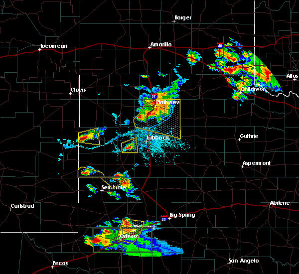 At 626 pm cdt, a severe thunderstorm was located 9 miles northeast of locketville, or 11 miles southeast of levelland, moving east at 15 mph (radar indicated). Hazards include ping pong size hail and 70 mph wind gusts. People and animals outdoors will be injured. expect hail damage to roofs, siding, windows and vehicles. expect considerable tree damage. wind damage is also likely to mobile homes, roofs and outbuildings. locations impacted include, reese center, smyer and ropesville. A tornado watch remains in effect until 1000 pm cdt for northwestern texas. At 626 pm cdt, a severe thunderstorm was located 9 miles northeast of locketville, or 11 miles southeast of levelland, moving east at 15 mph (radar indicated). Hazards include ping pong size hail and 70 mph wind gusts. People and animals outdoors will be injured. expect hail damage to roofs, siding, windows and vehicles. expect considerable tree damage. wind damage is also likely to mobile homes, roofs and outbuildings. locations impacted include, reese center, smyer and ropesville. A tornado watch remains in effect until 1000 pm cdt for northwestern texas.
|
| 6/12/2015 6:15 PM CDT |
 At 615 pm cdt, a severe thunderstorm was located near locketville, or 10 miles southeast of levelland, moving east at 15 mph (radar indicated). Hazards include 70 mph wind gusts and ping pong ball size hail. People and animals outdoors will be injured. expect hail damage to roofs, siding, windows and vehicles. expect considerable tree damage. Wind damage is also likely to mobile homes, roofs and outbuildings. At 615 pm cdt, a severe thunderstorm was located near locketville, or 10 miles southeast of levelland, moving east at 15 mph (radar indicated). Hazards include 70 mph wind gusts and ping pong ball size hail. People and animals outdoors will be injured. expect hail damage to roofs, siding, windows and vehicles. expect considerable tree damage. Wind damage is also likely to mobile homes, roofs and outbuildings.
|
| 6/12/2015 5:54 PM CDT |
 At 554 pm cdt, a severe thunderstorm was located near locketville, or 8 miles south of levelland, moving east at 15 mph (radar indicated). Hazards include ping pong size hail and 70 mph wind gusts. People and animals outdoors will be injured. expect hail damage to roofs, siding, windows and vehicles. expect considerable tree damage. wind damage is also likely to mobile homes, roofs and outbuildings. locations impacted include, locketville, meadow, smyer and ropesville. A tornado watch remains in effect until 1000 pm cdt for northwestern texas. At 554 pm cdt, a severe thunderstorm was located near locketville, or 8 miles south of levelland, moving east at 15 mph (radar indicated). Hazards include ping pong size hail and 70 mph wind gusts. People and animals outdoors will be injured. expect hail damage to roofs, siding, windows and vehicles. expect considerable tree damage. wind damage is also likely to mobile homes, roofs and outbuildings. locations impacted include, locketville, meadow, smyer and ropesville. A tornado watch remains in effect until 1000 pm cdt for northwestern texas.
|
| 6/12/2015 5:47 PM CDT |
 The national weather service in lubbock has issued a * severe thunderstorm warning for. southeastern hockley county in northwestern texas. northeastern terry county in northwestern texas. until 615 pm cdt * at 546 pm cdt. A severe thunderstorm was located near. The national weather service in lubbock has issued a * severe thunderstorm warning for. southeastern hockley county in northwestern texas. northeastern terry county in northwestern texas. until 615 pm cdt * at 546 pm cdt. A severe thunderstorm was located near.
|
| 5/29/2015 10:40 PM CDT | At 1039 pm cdt, severe thunderstorms were located along a line extending from 6 miles northwest of caprock to near brownfield, moving east at 45 mph (trained weather spotters). Hazards include 60 mph wind gusts and penny size hail. Expect damage to roofs. siding and trees. Locations impacted include, lubbock, levelland, slaton, wolfforth, idalou, ransom canyon, woodrow, slide, lubbock south plains mall, reese center, downtown lubbock, locketville, lubbock international airport, texas tech university, meadow, wilson, smyer, ropesville, new home and opdyke west. |
| 5/29/2015 10:30 PM CDT | At 1030 pm cdt, severe thunderstorms were located along a line extending from near ransom canyon to near brownfield, moving east at 30 mph (trained weather spotters). Hazards include quarter size hail and 60 mph wind gusts. Hail damage to vehicles is expected. expect wind damage to roofs, siding and trees. Locations impacted include, lubbock, levelland, slaton, wolfforth, idalou, sundown, ransom canyon, woodrow, slide, lubbock south plains mall, reese center, downtown lubbock, locketville, lubbock international airport, texas tech university, meadow, wilson, smyer, ropesville and new home. |
| 5/29/2015 10:11 PM CDT | At 1010 pm cdt, a line of severe thunderstorms was located near sundown to west lubbock, moving east southeast at 45 mph. a developing storm within this line in west lubbock will be nearly stationary for a time before moving southeast within the rest of the line (trained weather spotters). Hazards include 60 mph wind gusts and quarter size hail. Hail damage to vehicles is expected. Expect wind damage to roofs, siding and trees. |
| 5/29/2015 9:45 PM CDT | At 945 pm cdt, severe thunderstorms were located along a line extending from 9 miles southeast of morton to 9 miles northeast of plains to 6 miles north of higginbotham, moving southeast at 20 mph (radar indicated). Hazards include quarter size hail and 60 mph wind gusts. Hail damage to vehicles is expected. expect wind damage to roofs, siding and trees. Locations impacted include, levelland, brownfield, denver city, morton, plains, sundown, anton, whitharral, bledsoe, lehman, locketville, pep, tokio, bronco, meadow, smyer, whiteface, ropesville, wellman and opdyke west. |
| 5/29/2015 9:12 PM CDT | At 910 pm cdt, severe thunderstorms were located along a line extending from 8 miles southeast of bledsoe to near bronco to 6 miles south of lovington, moving southeast at 25 mph. portions of this line have had a history of producing tornadoes and large hail (radar indicated). Hazards include 60 mph wind gusts and quarter size hail. Hail damage to vehicles is expected. Expect wind damage to roofs, siding and trees. |
| 5/28/2015 6:47 PM CDT | At 647 pm cdt, a severe thunderstorm was located near brownfield, moving east at 25 mph (radar indicated). Hazards include half dollar size hail and 60 mph wind gusts. Hail damage to vehicles is expected. expect wind damage to roofs, siding and trees. locations impacted include, brownfield, meadow and ropesville. A tornado watch remains in effect until 800 pm cdt for northwestern texas. |
| 5/28/2015 6:31 PM CDT | At 631 pm cdt, a severe thunderstorm was located 8 miles northeast of tokio, or 12 miles northwest of brownfield, moving east at 30 mph (radar indicated). Hazards include 60 mph wind gusts and half dollar size hail. Hail damage to vehicles is expected. Expect wind damage to roofs, siding and trees. |
| 5/28/2015 5:19 PM CDT | At 518 pm cdt, a severe thunderstorm was located 9 miles north of plains, moving east at 20 mph (radar indicated). Hazards include half dollar size hail and 60 mph wind gusts. Hail damage to vehicles is expected. expect wind damage to roofs, siding and trees. locations impacted include, levelland, sundown, locketville, meadow, smyer, and whiteface. A tornado watch remains in effect until 800 pm cdt for northwestern texas. |
| 5/28/2015 5:03 PM CDT | At 503 pm cdt, a severe thunderstorm was located 8 miles north of plains, moving northeast at 30 mph (radar indicated). Hazards include 60 mph wind gusts and half dollar size hail. Hail damage to vehicles is expected. Expect wind damage to roofs, siding and trees. |
| 5/28/2015 2:54 PM CDT | At 253 pm cdt, a severe thunderstorm was located near levelland, moving northeast at 40 mph (radar indicated). Hazards include ping pong size hail and 60 mph wind gusts. People and animals outdoors will be injured. expect hail damage to roofs, siding, windows and vehicles. expect wind damage to roofs, siding and trees. locations impacted include, levelland, littlefield, abernathy, shallowater, sundown, anton, spade, whitharral, reese center, smyer, ropesville and opdyke west. A tornado watch remains in effect until 800 pm cdt for northwestern texas. |
| 5/28/2015 2:29 PM CDT | At 228 pm cdt, a severe thunderstorm was located 10 miles northwest of sundown, or 13 miles southeast of morton, moving northeast at 35 mph (radar indicated). Hazards include ping pong ball size hail and 60 mph wind gusts. People and animals outdoors will be injured. expect hail damage to roofs, siding, windows and vehicles. Expect wind damage to roofs, siding and trees. |
| 4/8/2015 7:18 PM CDT | A severe thunderstorm warning remains in effect until 745 pm cdt for eastern hockley. eastern terry. lubbock and lynn counties. at 714 pm cdt. a line of severe thunderstorms were located from near reese center to 5 miles west of o`donnell. moving east at 50 mph. hazard. 80 mph wind gusts and penny size hail. |
| 4/8/2015 7:08 PM CDT | The national weather service in lubbock has issued a * severe thunderstorm warning for. eastern hockley county in northwestern texas. terry county in northwestern texas. lubbock county in northwestern texas. Lynn county in northwestern texas. |
| 6/7/2014 9:19 PM CDT | Golf Ball sized hail reported 0.3 miles NW of Ropesville, TX |
| 8/15/2013 1:21 AM CDT | Wind speed was estimated to be at least 60 mph in hockley county TX, 5.7 miles SSE of Ropesville, TX |
| 6/5/2013 10:50 PM CDT | Five power poles snapped along highway 62. time estimate in hockley county TX, 4 miles SW of Ropesville, TX |
| 6/4/2012 6:05 PM CDT | Four utility poles snapped along us 62 82 in hockley county TX, 4 miles SW of Ropesville, TX |
| 4/29/2012 10:38 PM CDT | Quarter sized hail reported 1.2 miles NW of Ropesville, TX |
| 4/29/2012 10:04 PM CDT | Tennis Ball sized hail reported 4.9 miles W of Ropesville, TX, on 41 |
| 4/29/2012 9:00 PM CDT | Three power poles down west of u.s. 62 and 82 along foster r in hockley county TX, 1.8 miles SW of Ropesville, TX |
Hail Maps for Ropesville, TX


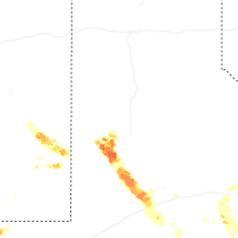

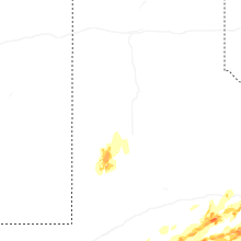


Connect with Interactive Hail Maps