

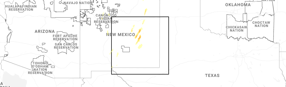
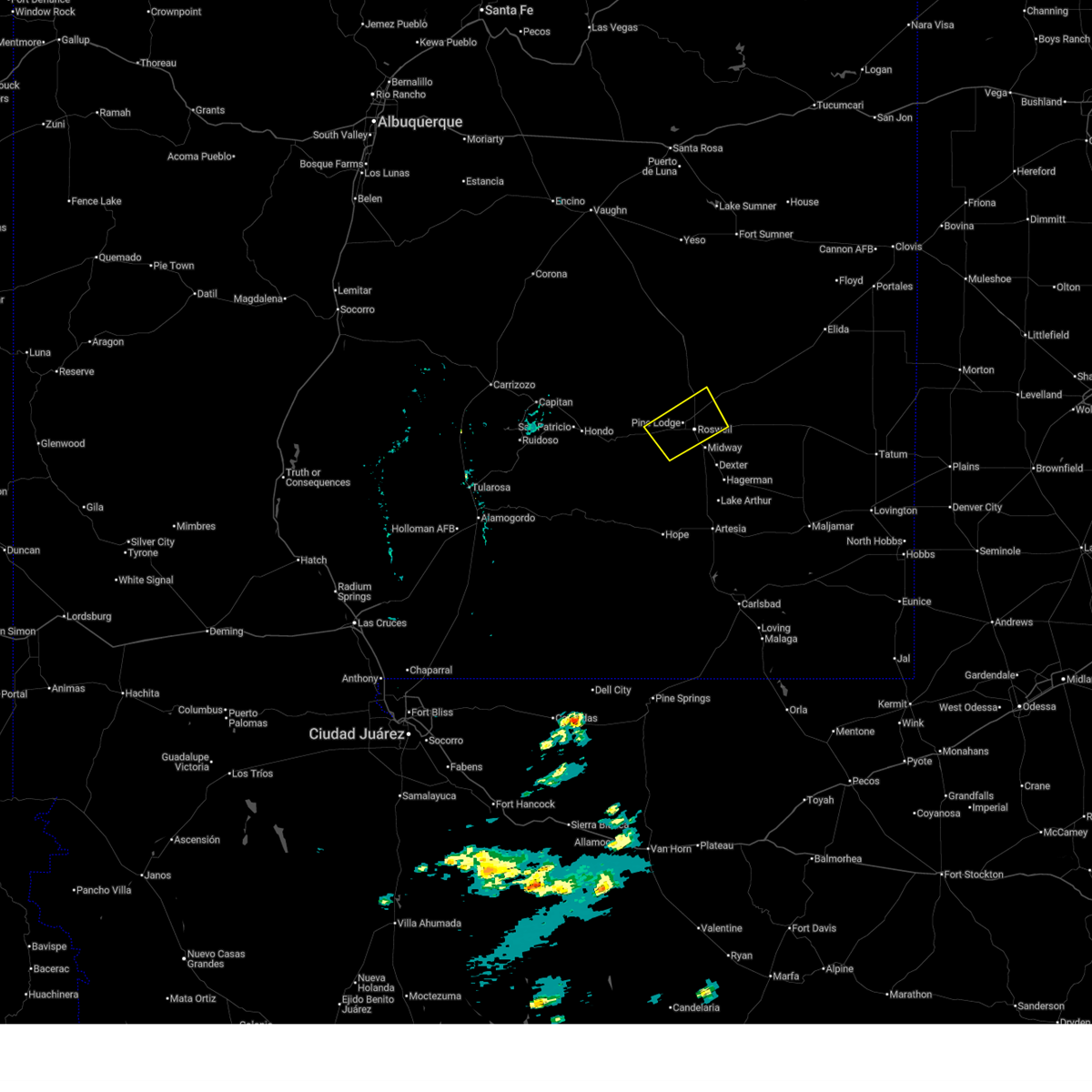
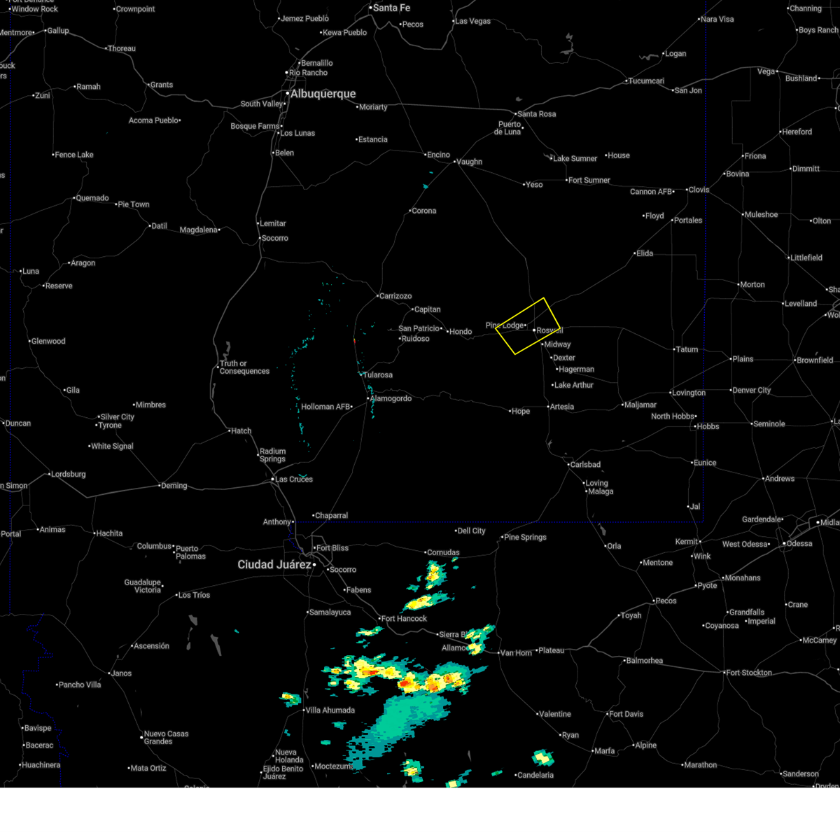
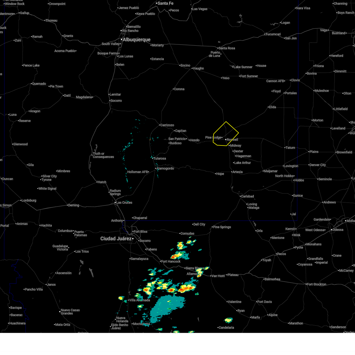
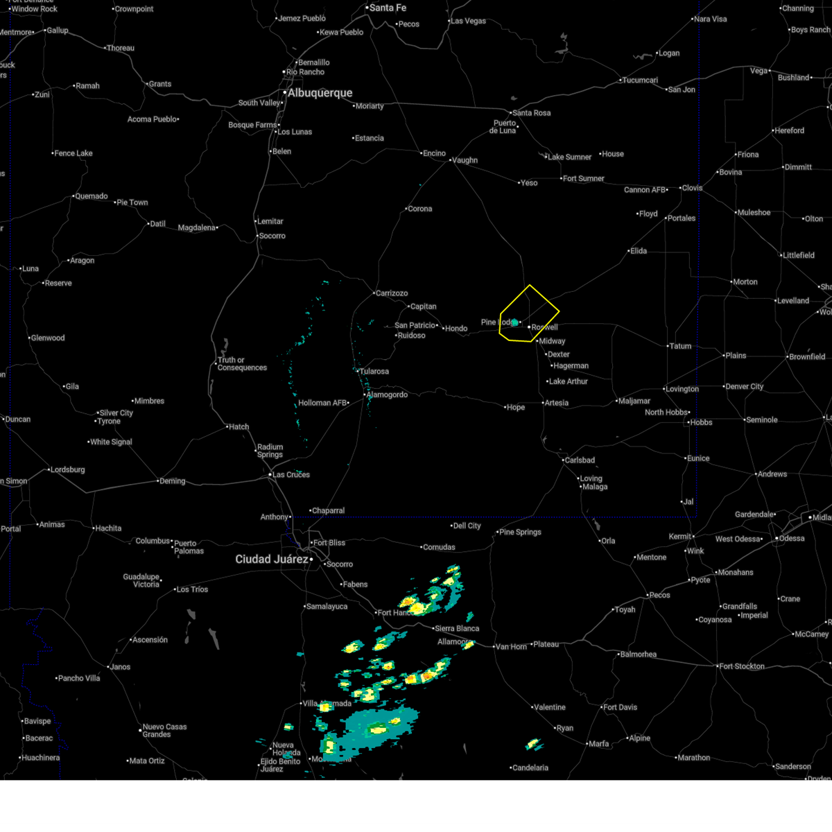
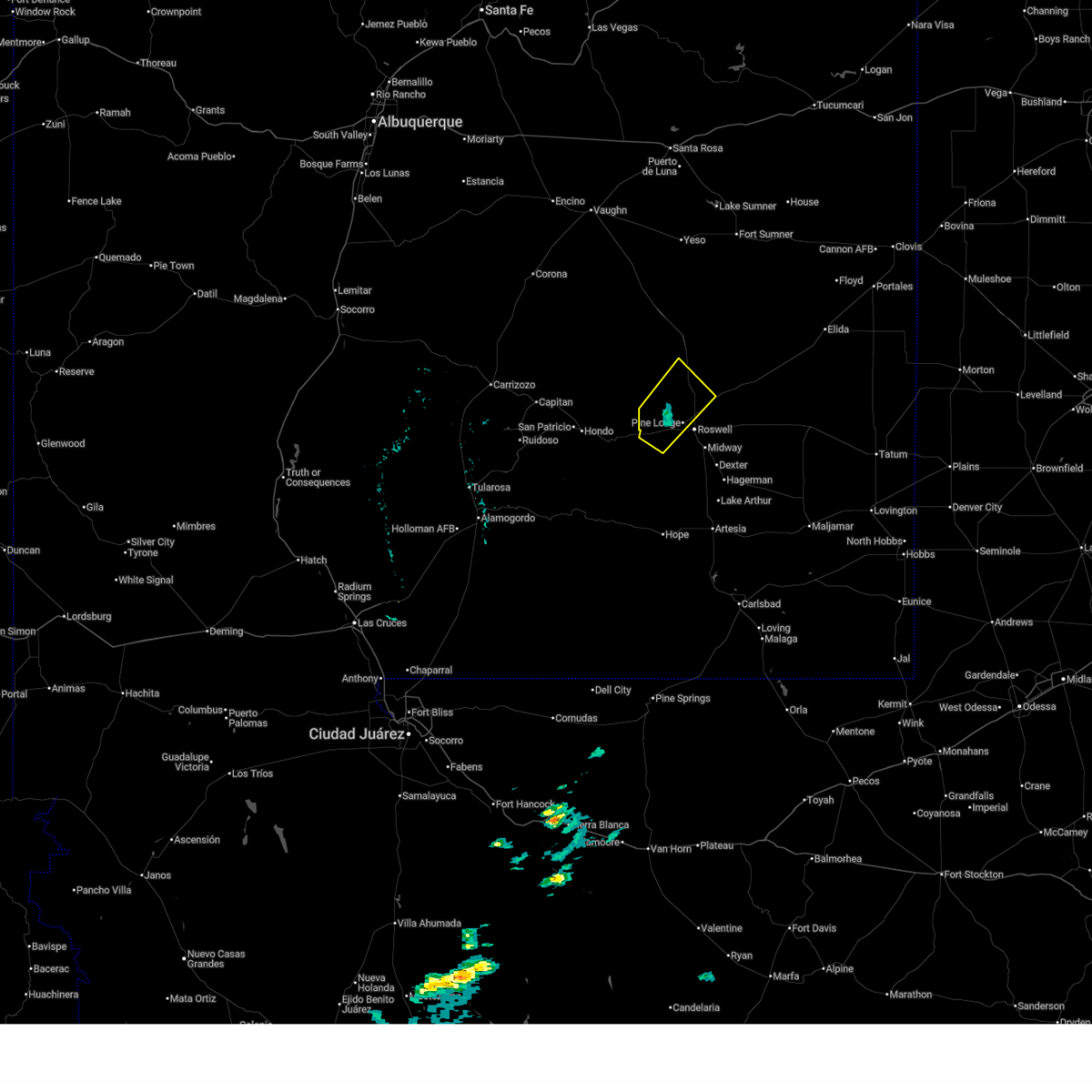
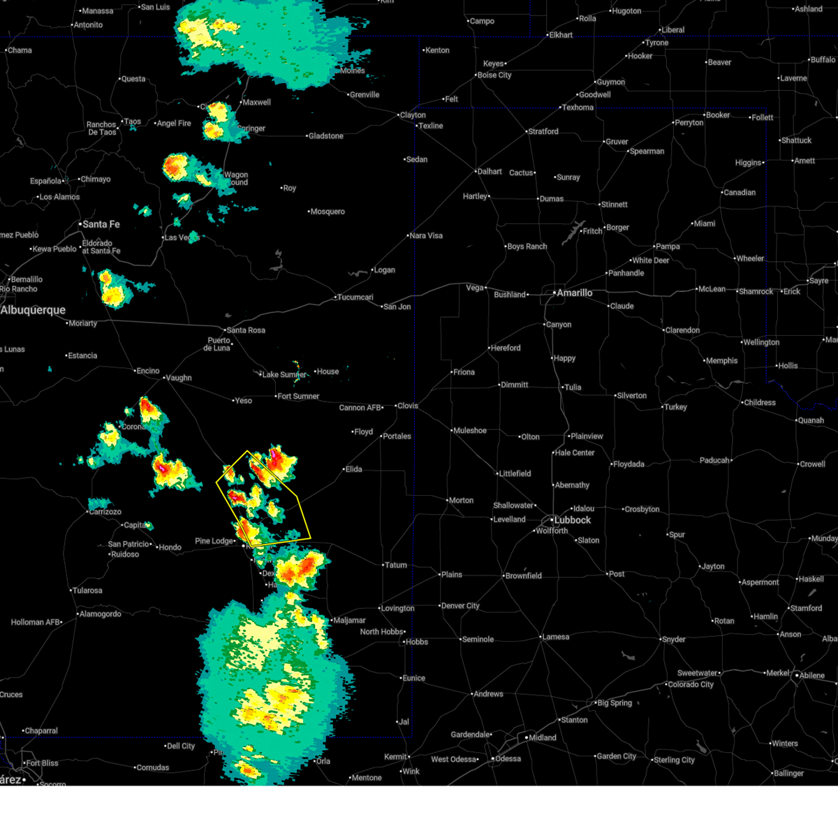
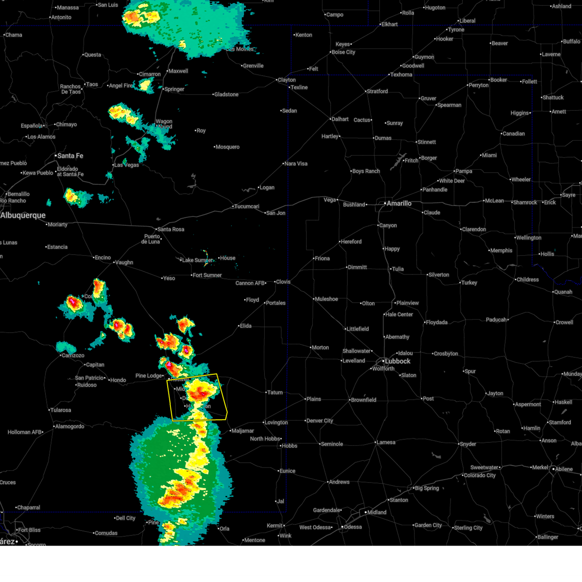
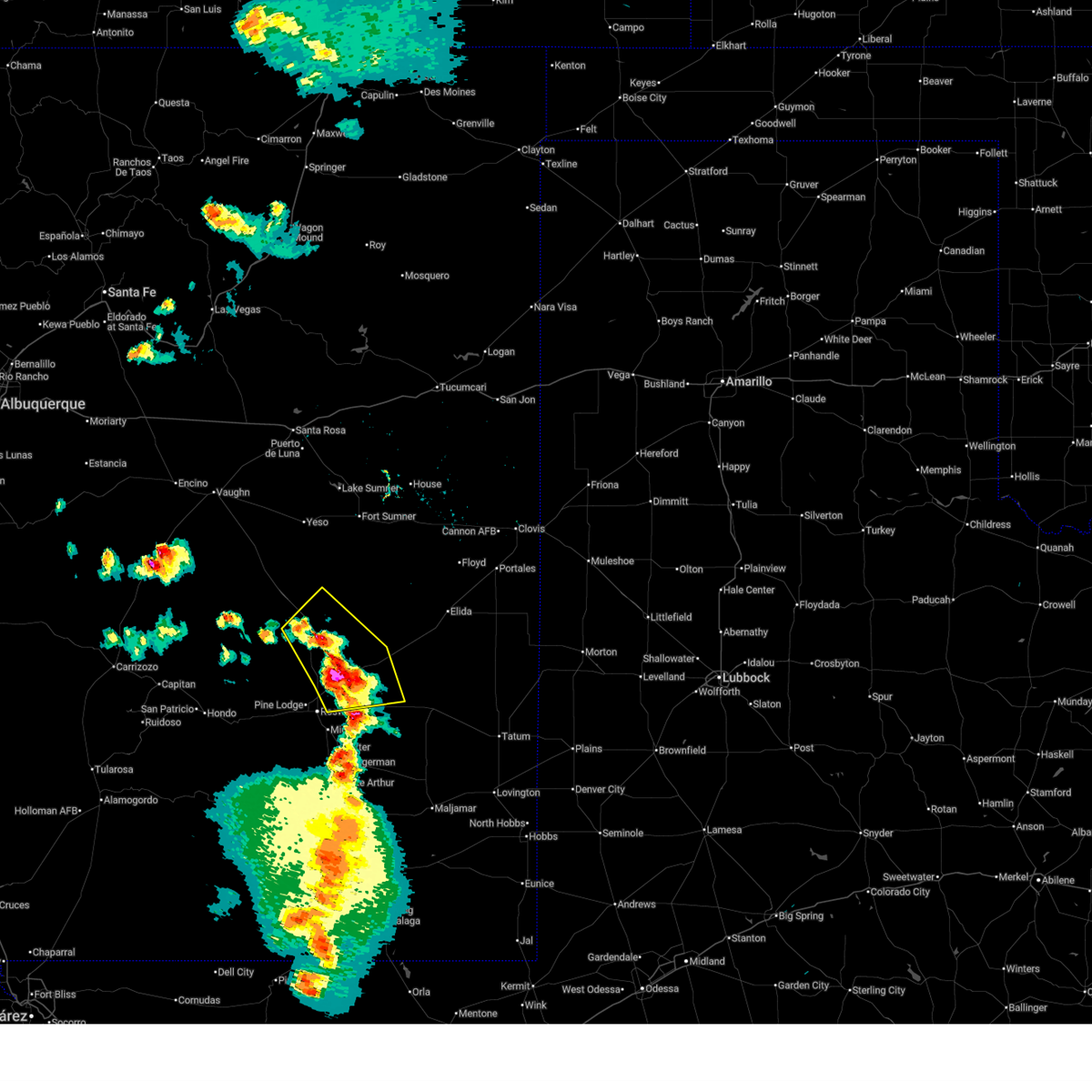
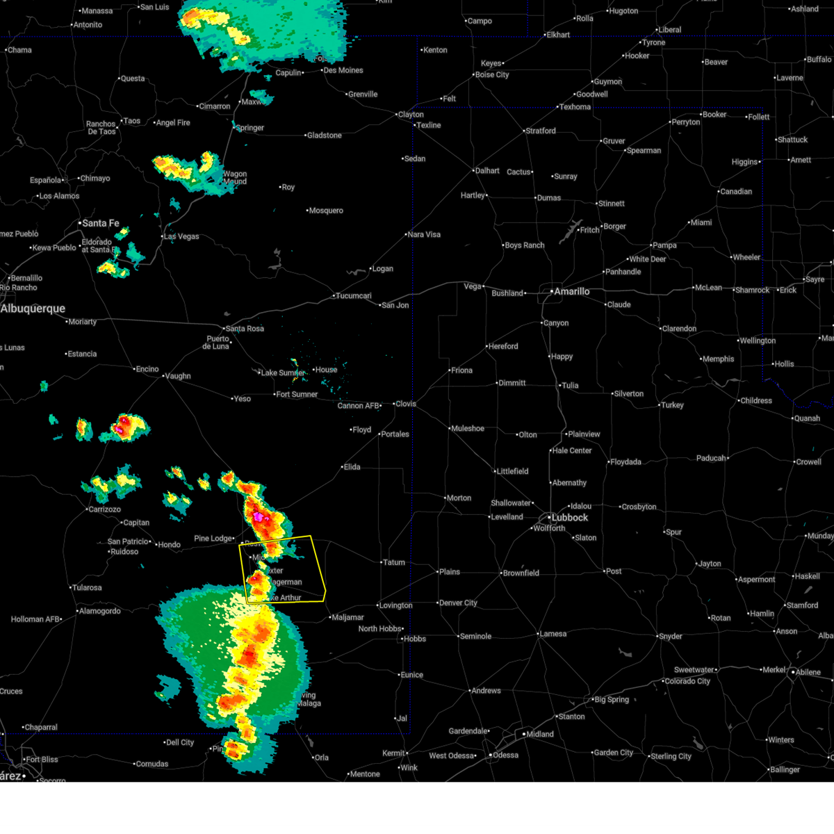
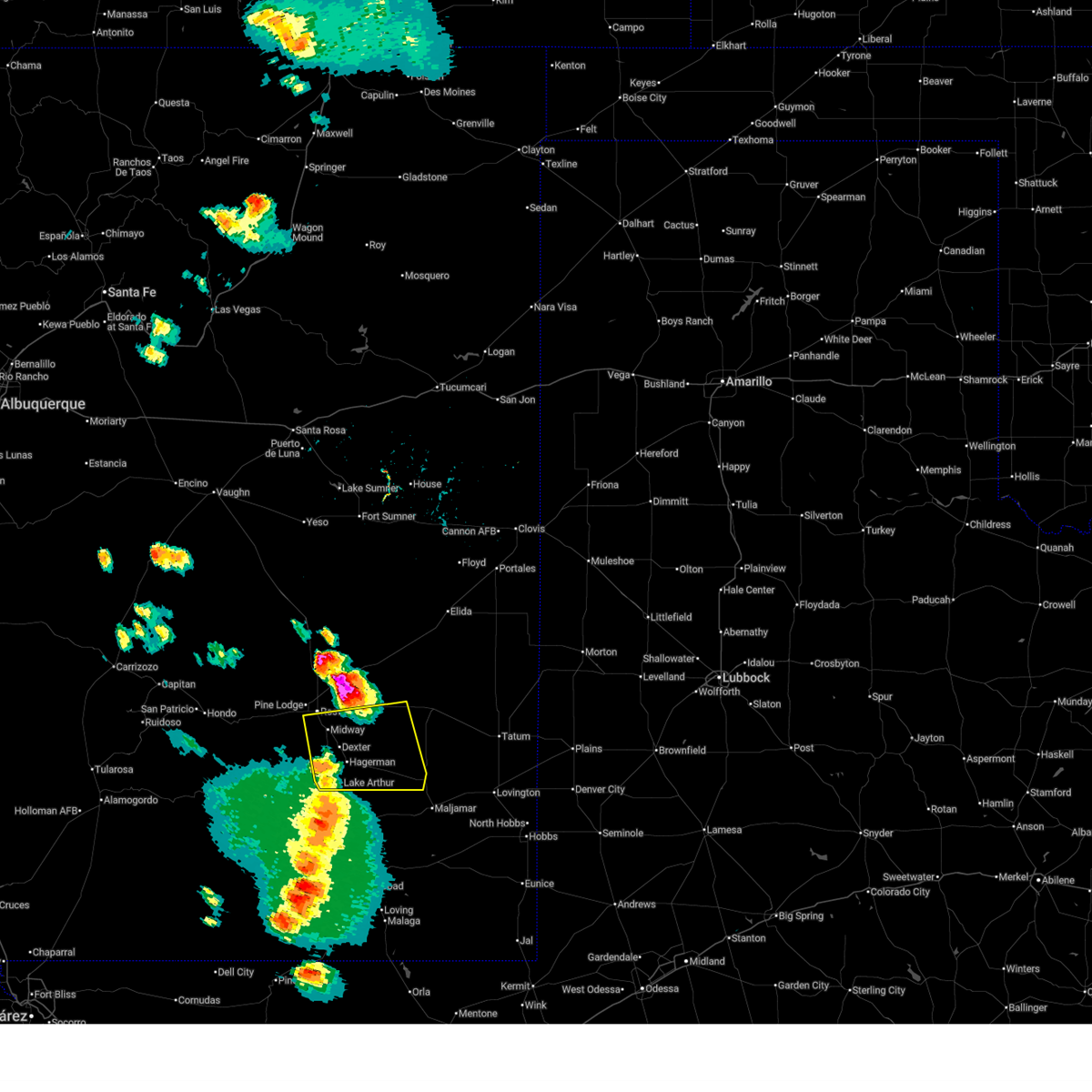
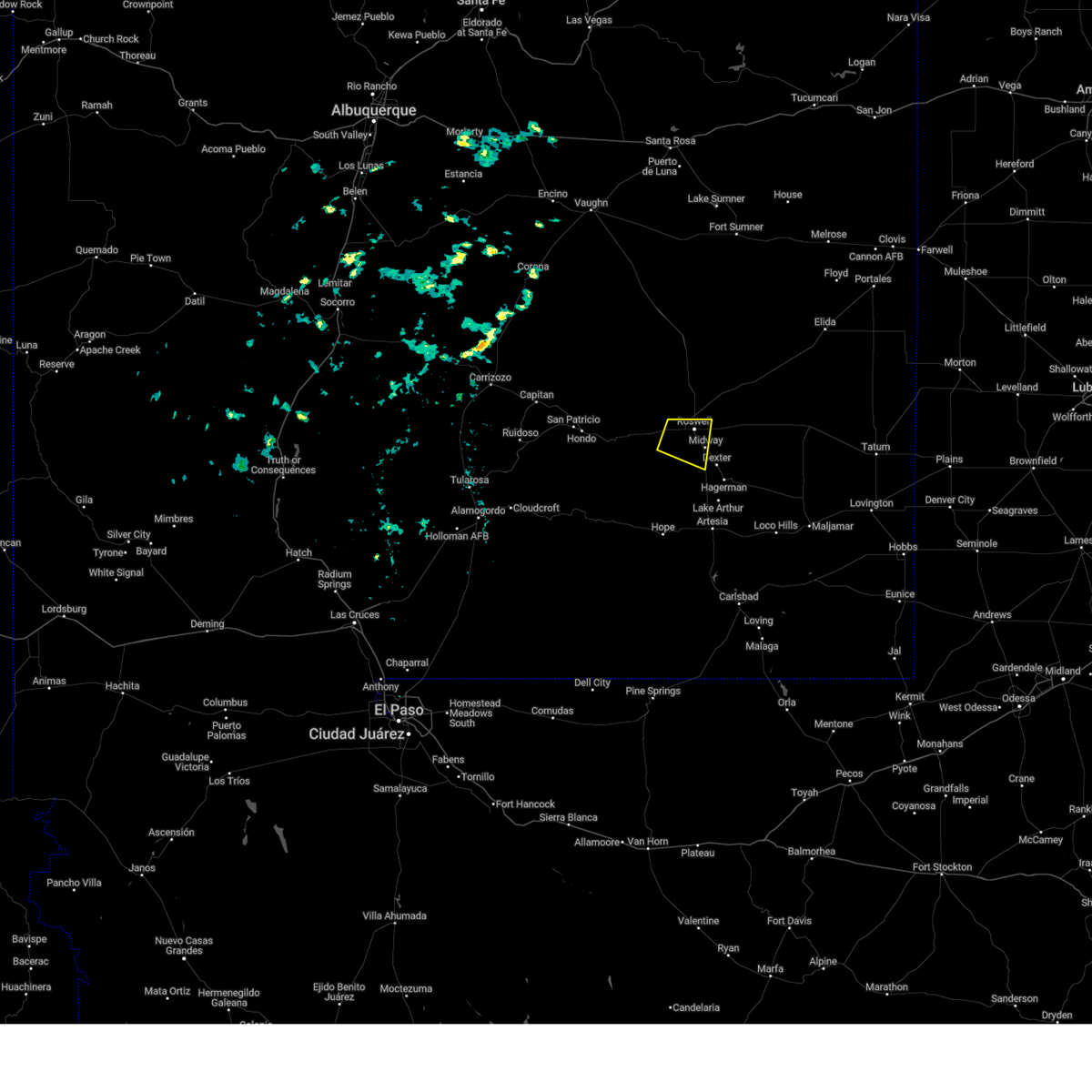
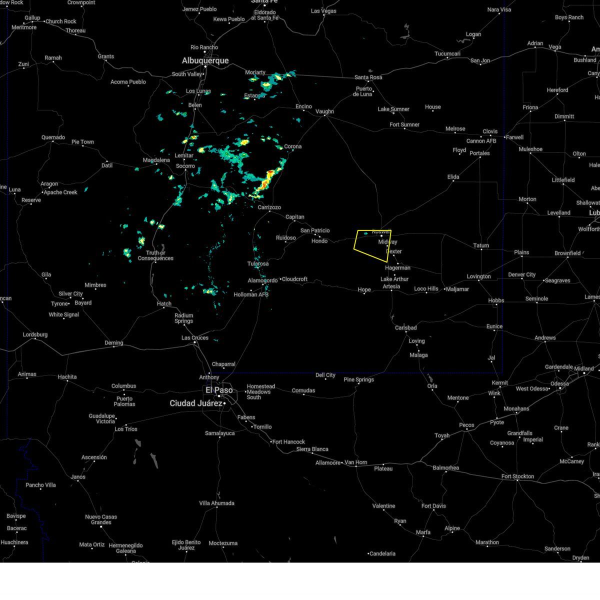
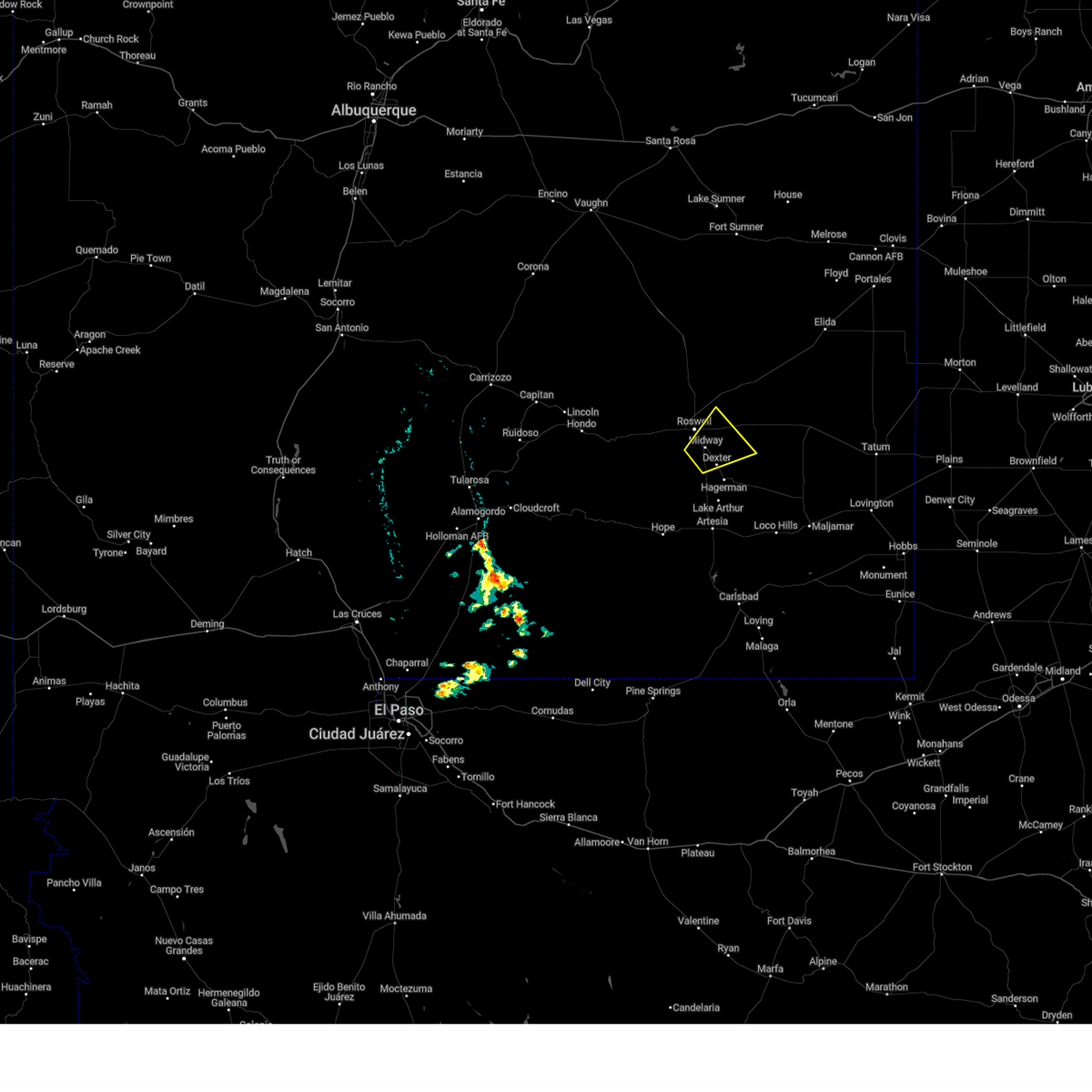
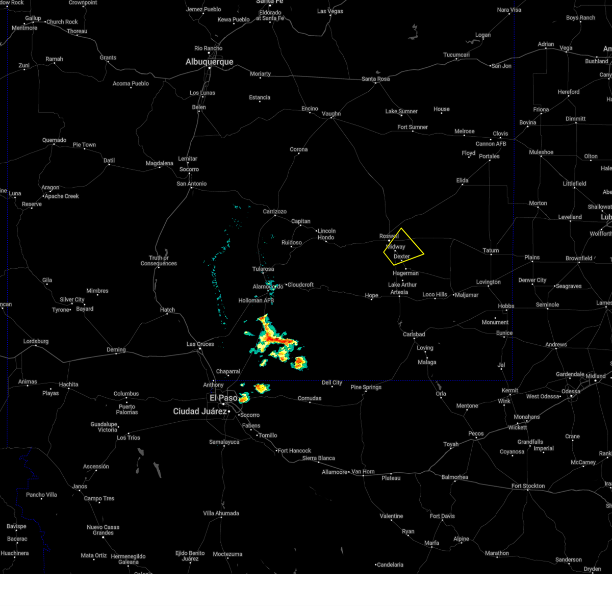
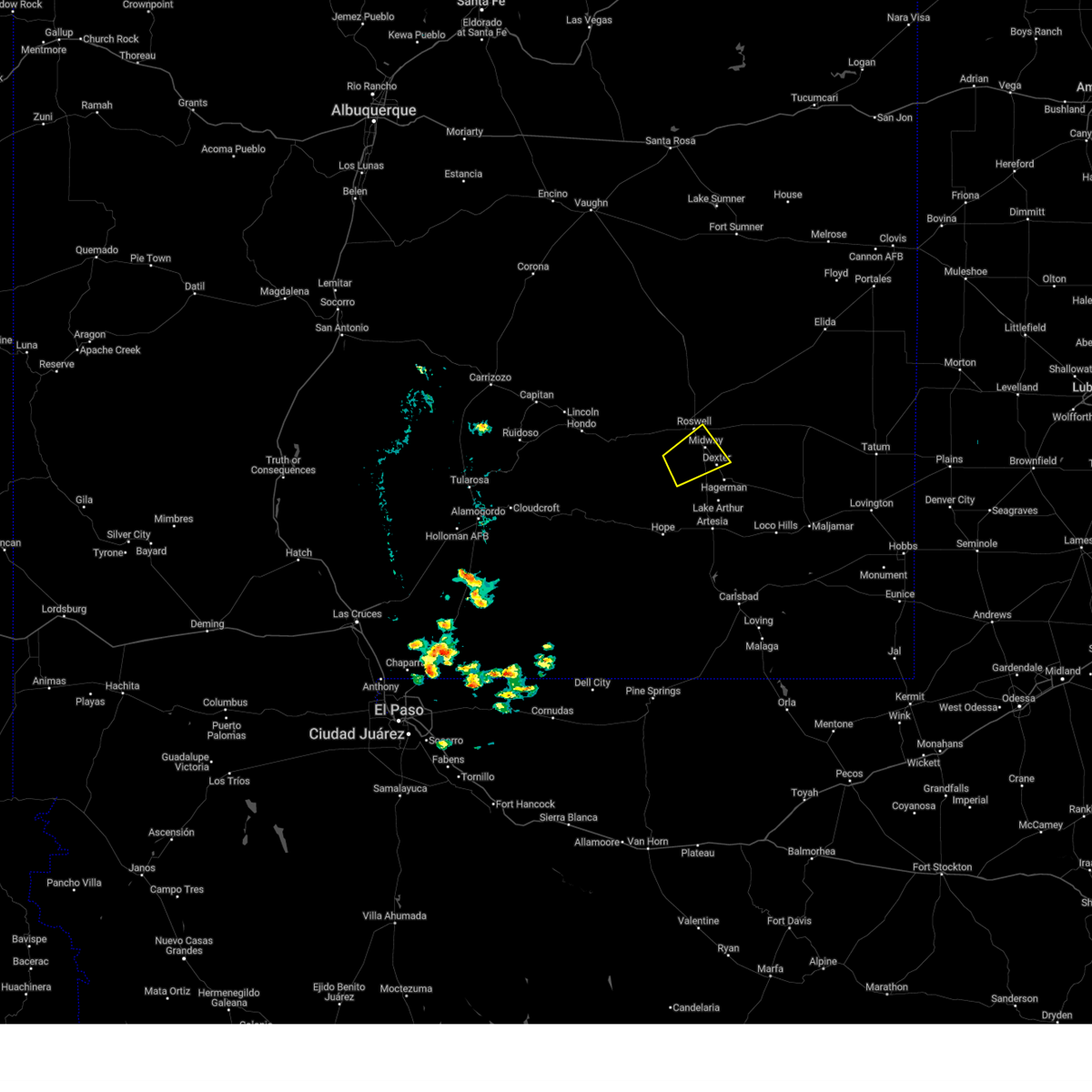
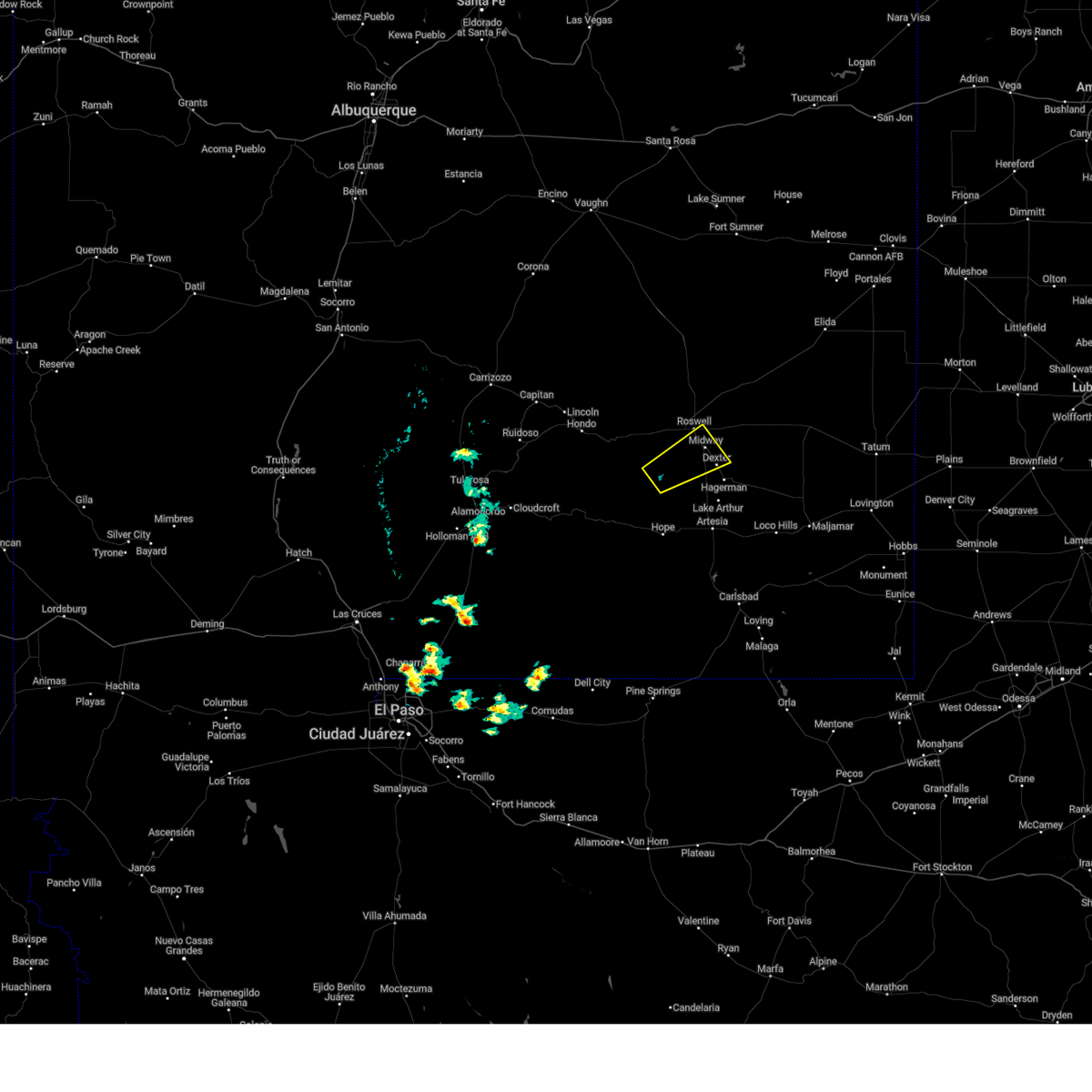
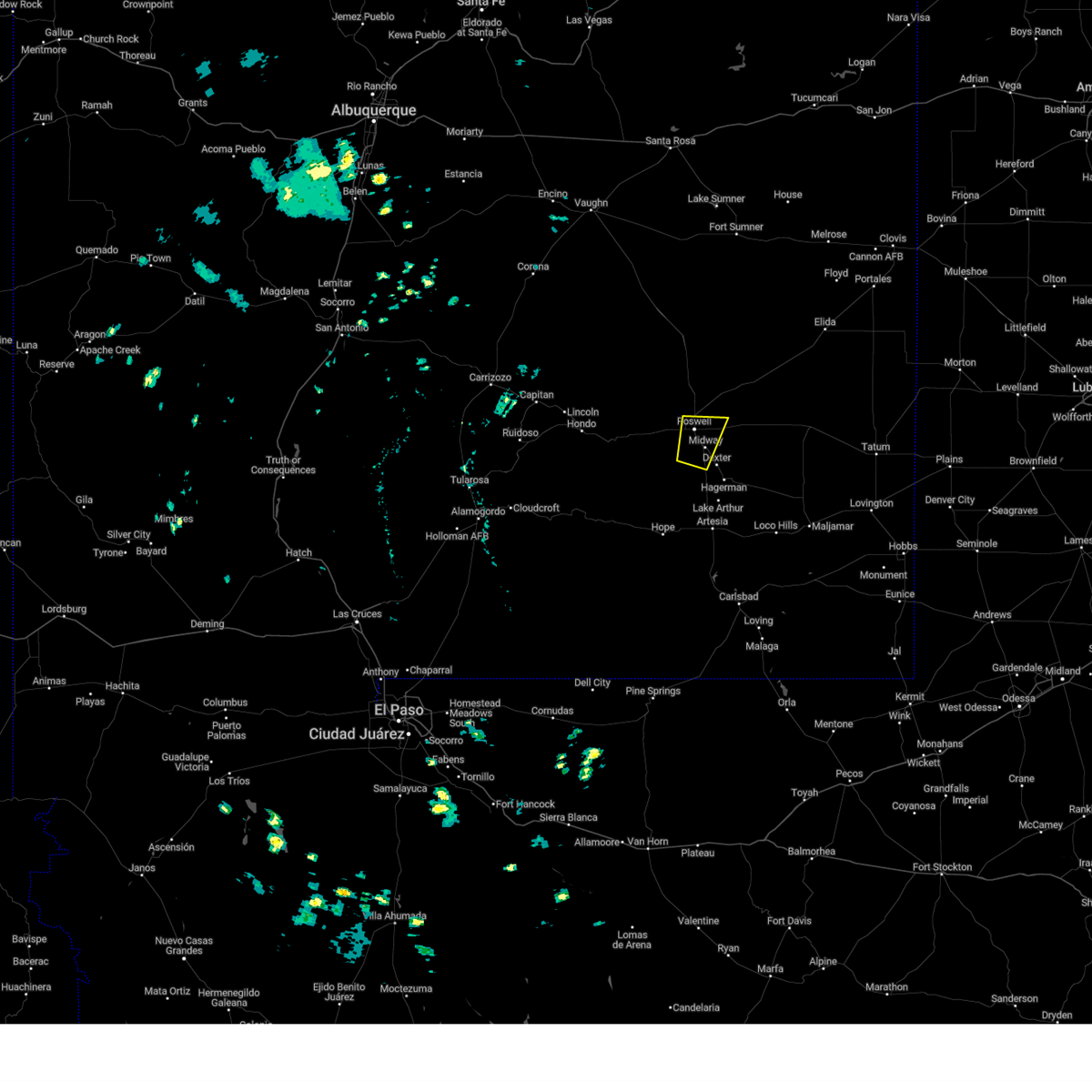
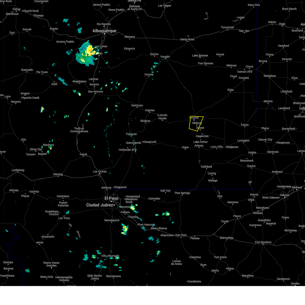
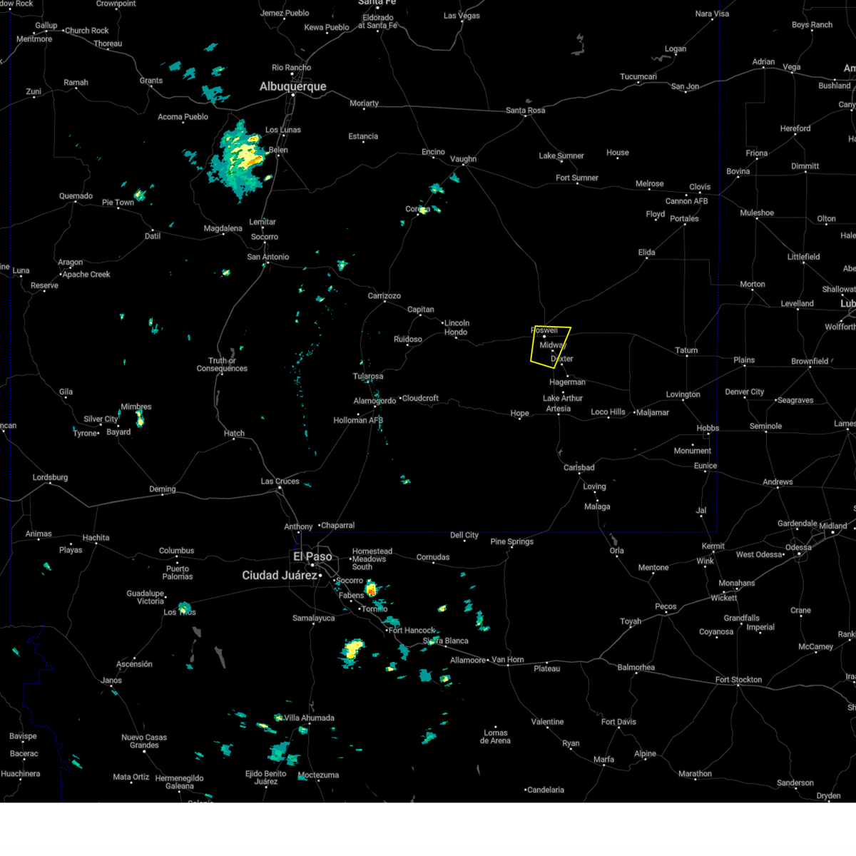
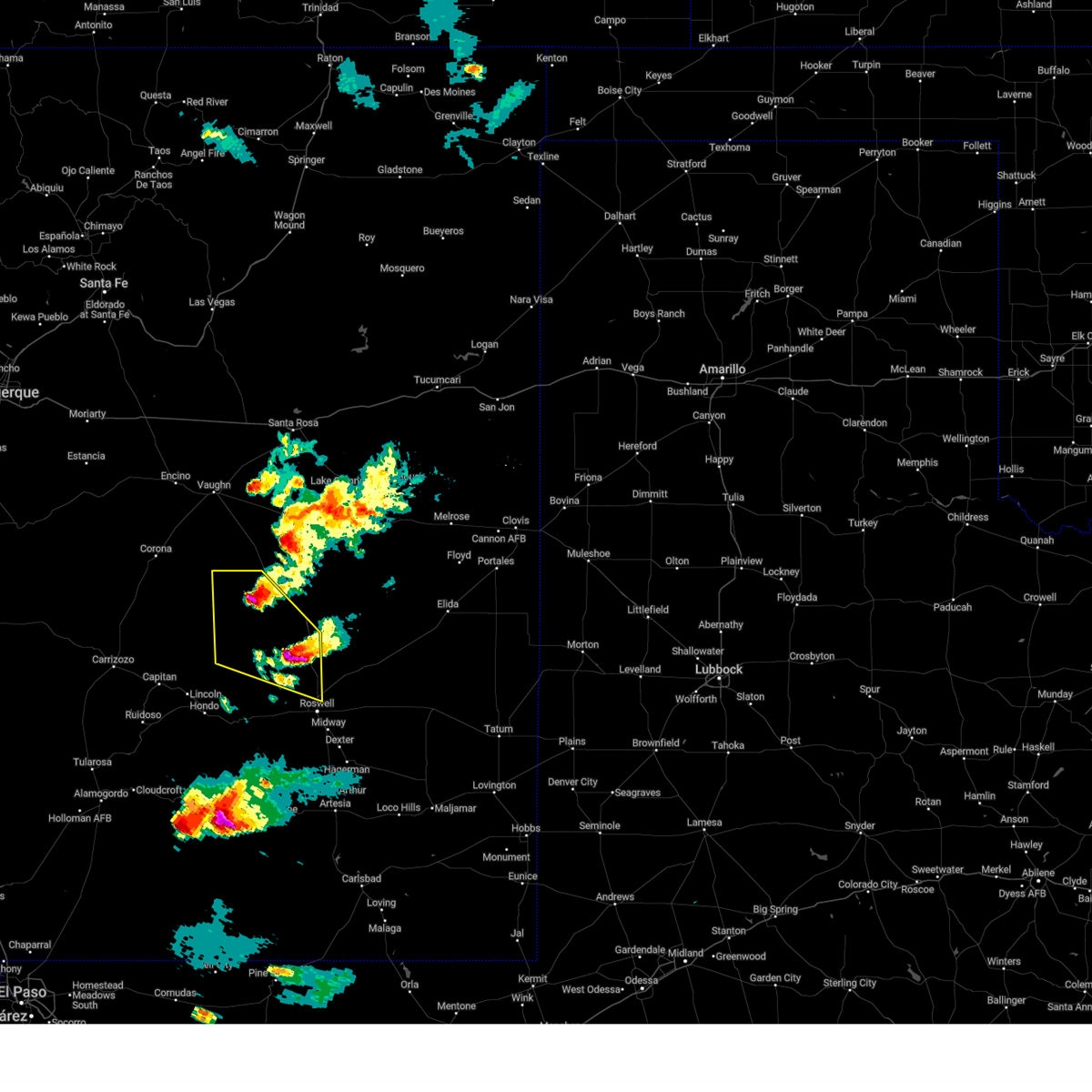
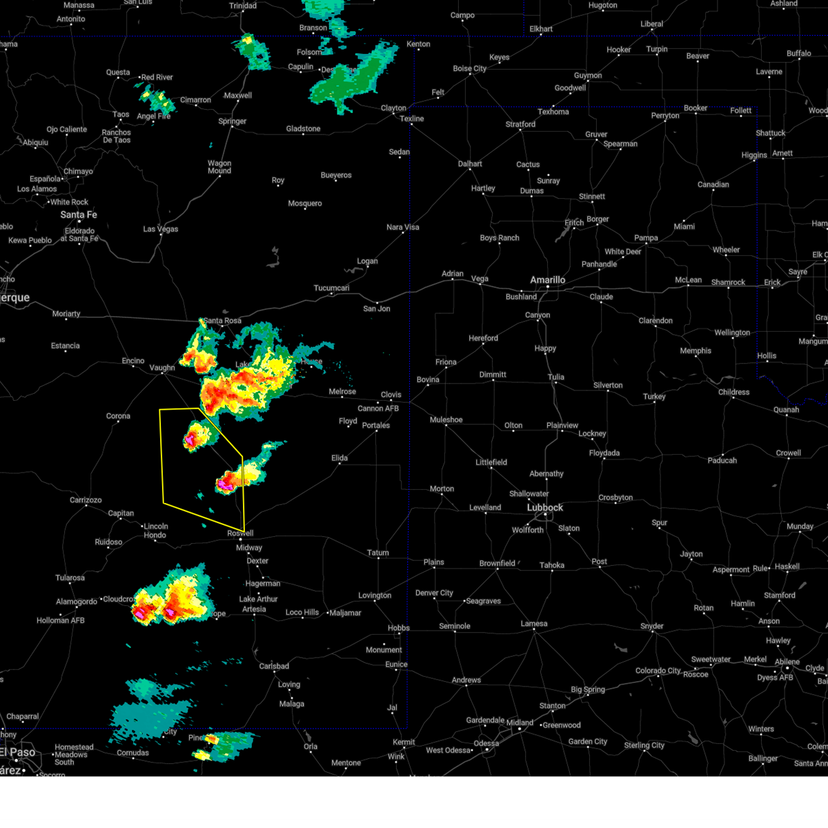
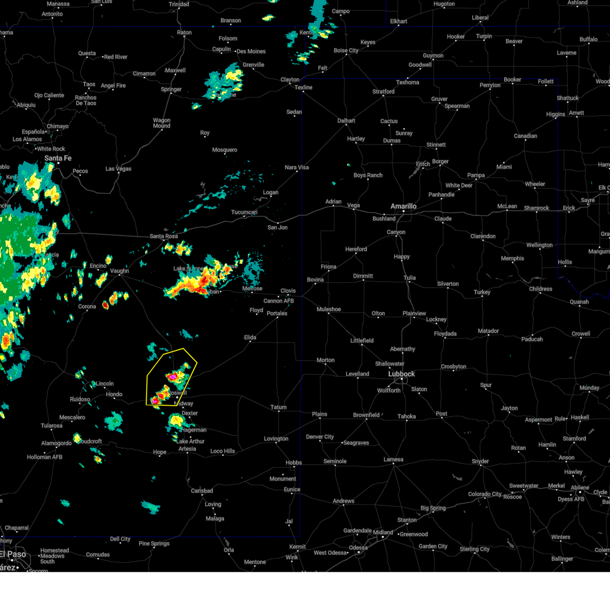
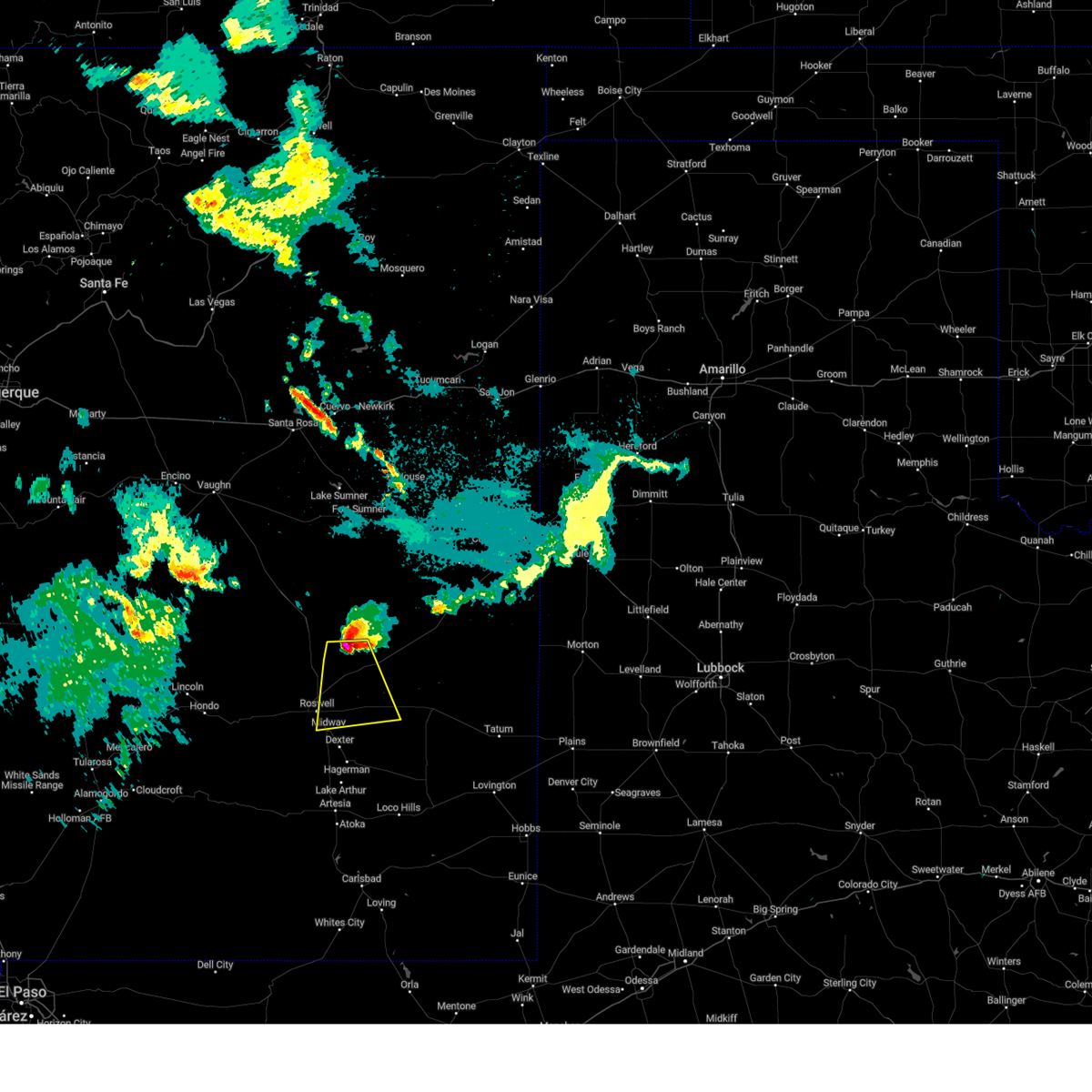
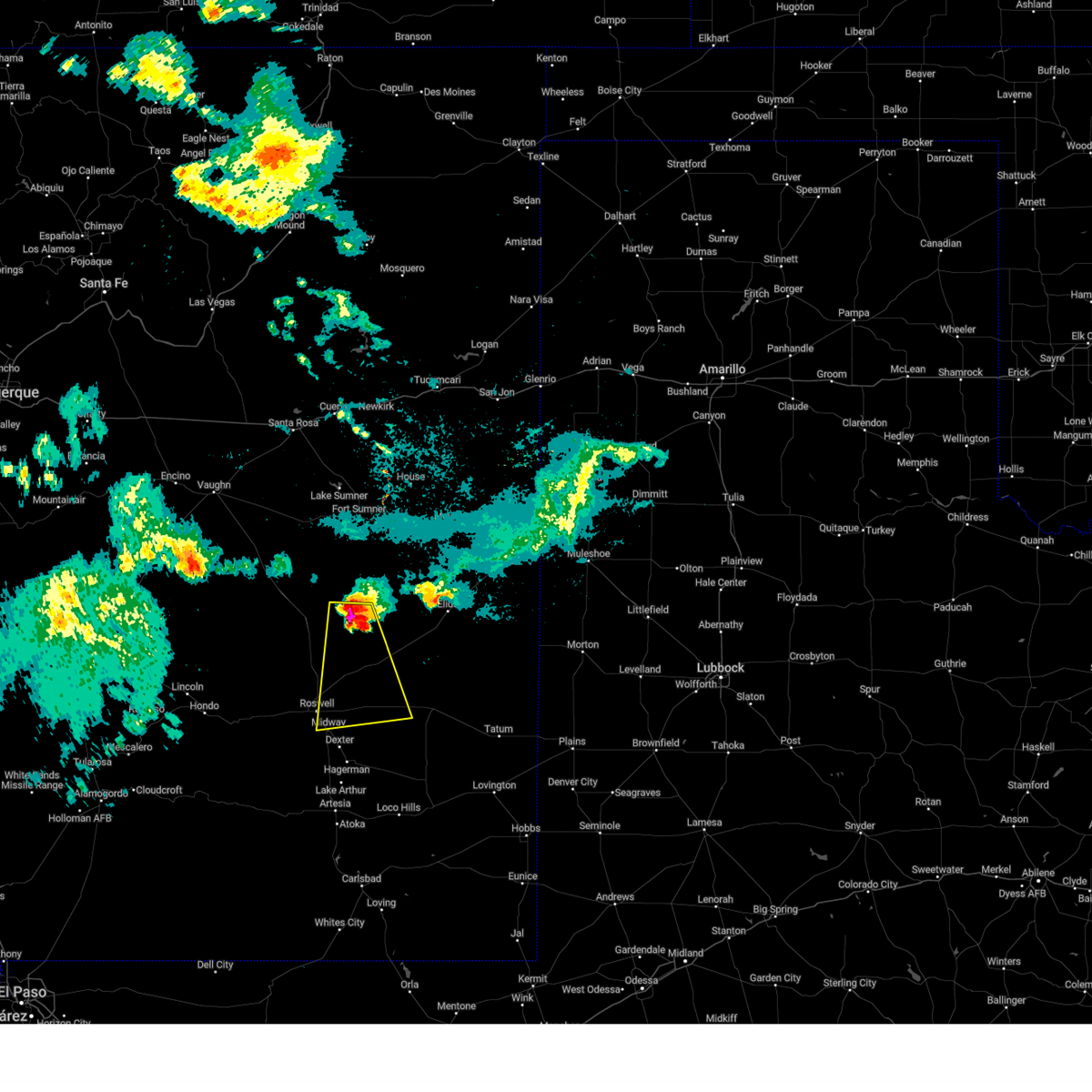
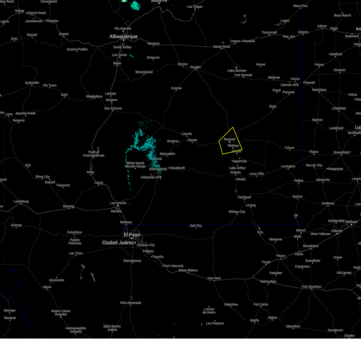
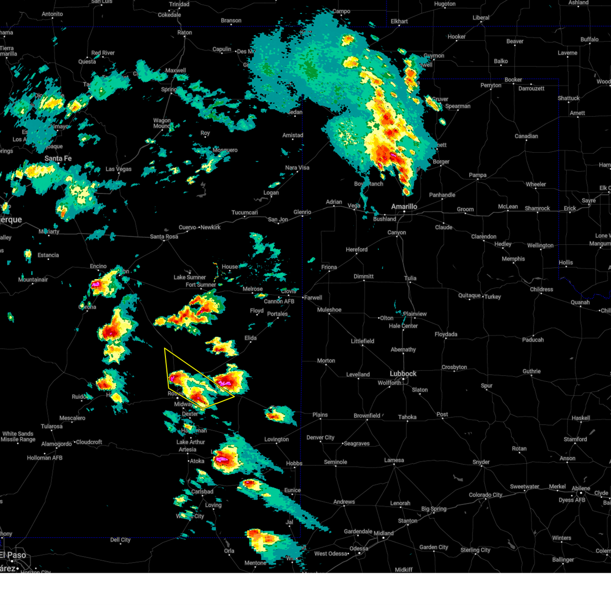
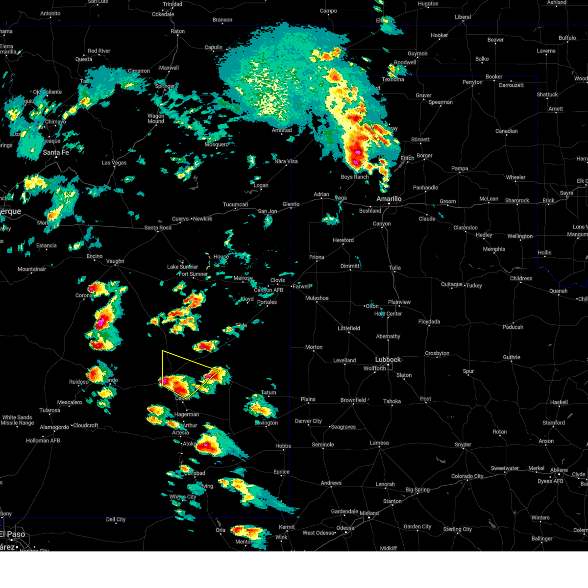
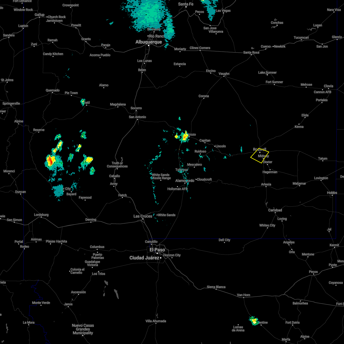
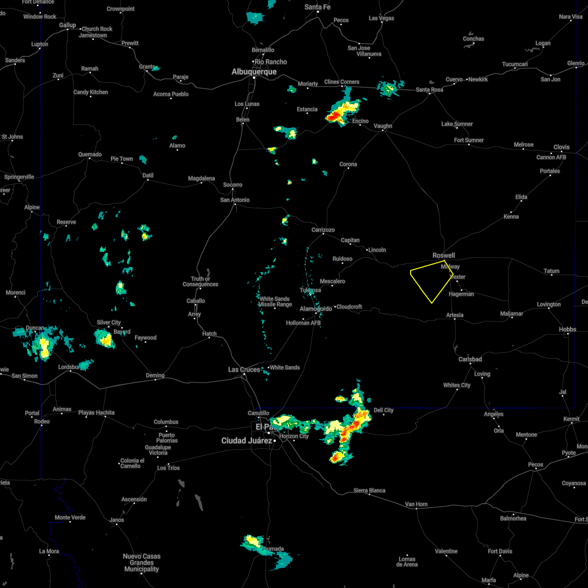
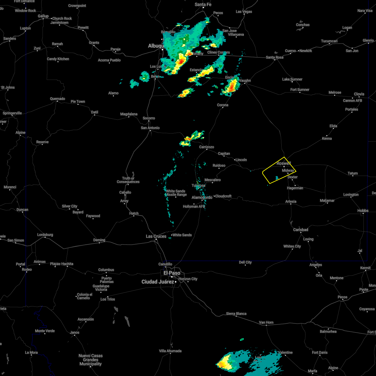
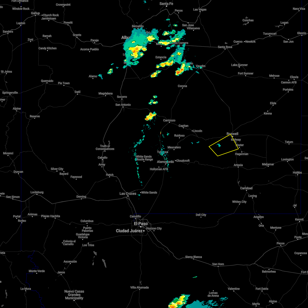
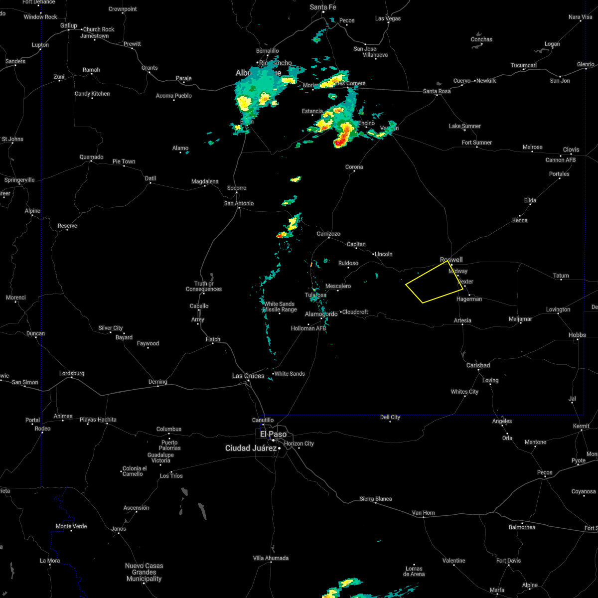
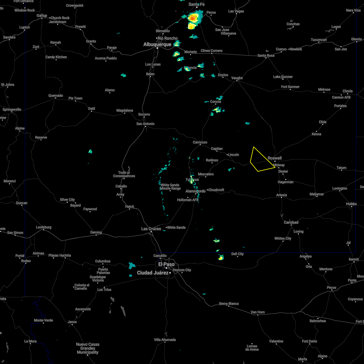
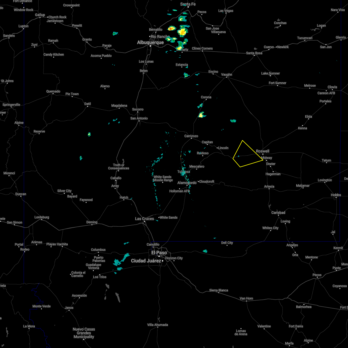
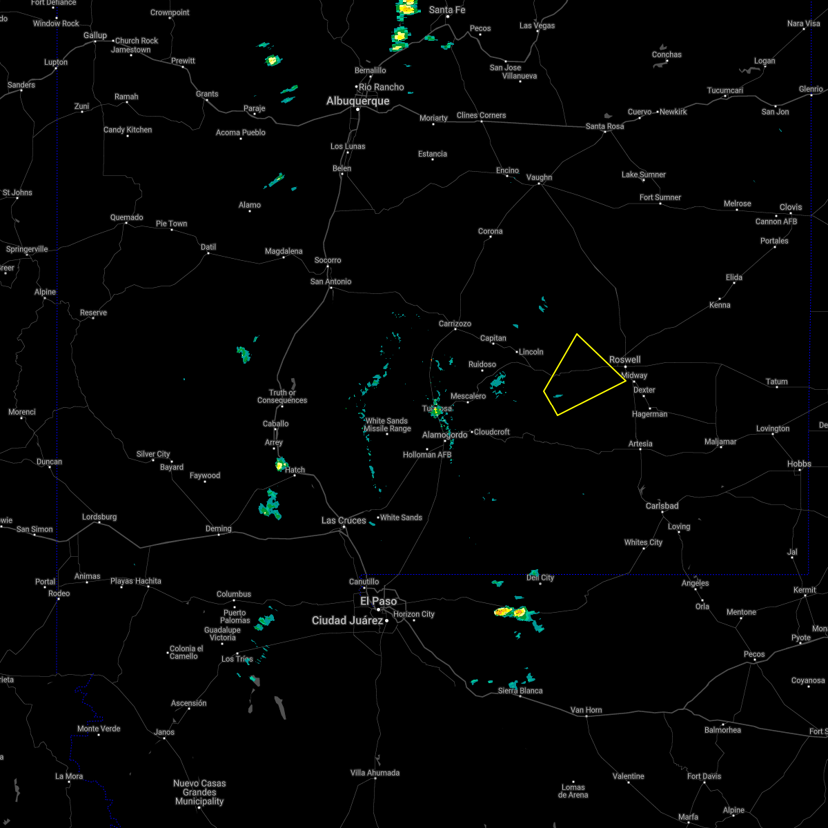
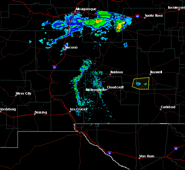
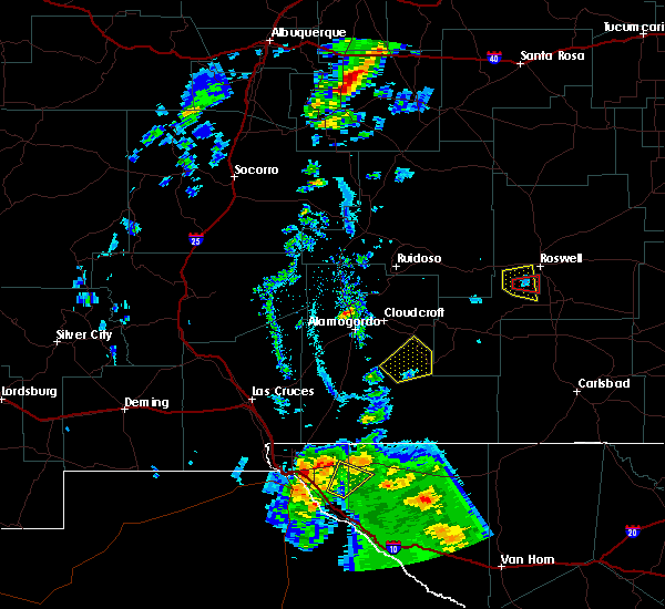
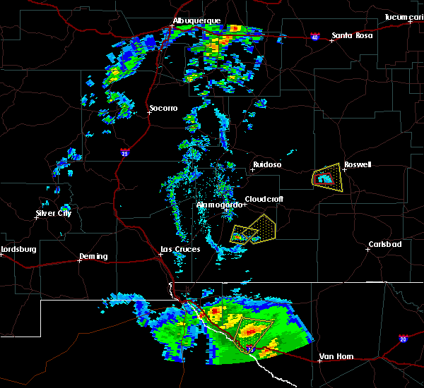
Hail Map for Roswell, NM
The Roswell, NM area has had 50 reports of on-the-ground hail by trained spotters, and has been under severe weather warnings 36 times during the past 12 months. Doppler radar has detected hail at or near Roswell, NM on 44 occasions, including 5 occasions during the past year.
| Name: | Roswell, NM |
| Where Located: | 0.6 miles S of Roswell, NM |
| Map: | Google Map for Roswell, NM |
| Population: | 48366 |
| Housing Units: | 19743 |
| More Info: | Search Google for Roswell, NM |
2
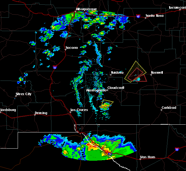
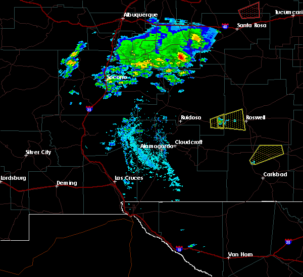
The Top Recent Hail Date for Roswell, NM is Saturday, October 19, 2024 (4th out of 44)
Hail and Wind Damage Spotted near Roswell, NM
| Date / Time | Report Details |
|---|---|
| 6/22/2025 7:40 PM MDT | Mesonet station tr724 roswell no. 1 portabl in chaves county NM, 35.7 miles WSW of Roswell, NM |
| 6/22/2025 6:17 PM MDT | Asos station krow roswell air cente in chaves county NM, 6.1 miles NNW of Roswell, NM |
| 6/22/2025 5:42 PM MDT |
 The severe thunderstorm warning that was previously in effect has been allowed to expire. however, heavy rain and flash flooding are still ongoing with this thunderstorm. The severe thunderstorm warning that was previously in effect has been allowed to expire. however, heavy rain and flash flooding are still ongoing with this thunderstorm.
|
| 6/22/2025 5:33 PM MDT |
 At 533 pm mdt, a severe thunderstorm was located 5 miles north of roswell, moving northeast at 10 mph (radar indicated). Hazards include 60 mph wind gusts and small hail. Expect damage to roofs, siding, and trees. locations impacted include, roswell and bitter lake wildlife refuge. this includes the following highways, highway 380 between mile markers 156 and 164, and near mile marker 166. Highway 285 between mile markers 104 and 123. At 533 pm mdt, a severe thunderstorm was located 5 miles north of roswell, moving northeast at 10 mph (radar indicated). Hazards include 60 mph wind gusts and small hail. Expect damage to roofs, siding, and trees. locations impacted include, roswell and bitter lake wildlife refuge. this includes the following highways, highway 380 between mile markers 156 and 164, and near mile marker 166. Highway 285 between mile markers 104 and 123.
|
| 6/22/2025 5:32 PM MDT | Utility poles blown down with arcing powerlines and electric service disrupted for resident in chaves county NM, 2.4 miles S of Roswell, NM |
| 6/22/2025 5:14 PM MDT |
 Svrabq the national weather service in albuquerque has issued a * severe thunderstorm warning for, central chaves county in southeastern new mexico, * until 545 pm mdt. * at 514 pm mdt, a severe thunderstorm was located near roswell, moving northeast at 10 mph (trained spotters reported). Hazards include 60 mph wind gusts and half dollar size hail. Hail damage to vehicles is expected. Expect wind damage to roofs, siding, and trees. Svrabq the national weather service in albuquerque has issued a * severe thunderstorm warning for, central chaves county in southeastern new mexico, * until 545 pm mdt. * at 514 pm mdt, a severe thunderstorm was located near roswell, moving northeast at 10 mph (trained spotters reported). Hazards include 60 mph wind gusts and half dollar size hail. Hail damage to vehicles is expected. Expect wind damage to roofs, siding, and trees.
|
| 6/22/2025 5:08 PM MDT | Quarter sized hail reported 4.9 miles SSE of Roswell, NM, lasted until 520 pm or so. |
| 6/22/2025 4:58 PM MDT | Utility poles blown down with arcing powerlines and electric service disrupted for resident in chaves county NM, 1.9 miles W of Roswell, NM |
| 6/22/2025 4:54 PM MDT |
 The storm which prompted the earlier warning has weakened. however, small hail, heavy rain, and gusty winds are still possible with this thunderstorm with some areas experiencing flash flooding. The storm which prompted the earlier warning has weakened. however, small hail, heavy rain, and gusty winds are still possible with this thunderstorm with some areas experiencing flash flooding.
|
| 6/22/2025 4:27 PM MDT |
 At 427 pm mdt, a severe thunderstorm was located 7 miles northwest of roswell, moving northeast at 10 mph (radar indicated). Hazards include 60 mph wind gusts and quarter size hail. Hail damage to vehicles is expected. expect wind damage to roofs, siding, and trees. locations impacted include, roswell and bitter lake wildlife refuge. this includes the following highways, highway 380 between mile markers 156 and 161. Highway 285 between mile markers 104 and 127. At 427 pm mdt, a severe thunderstorm was located 7 miles northwest of roswell, moving northeast at 10 mph (radar indicated). Hazards include 60 mph wind gusts and quarter size hail. Hail damage to vehicles is expected. expect wind damage to roofs, siding, and trees. locations impacted include, roswell and bitter lake wildlife refuge. this includes the following highways, highway 380 between mile markers 156 and 161. Highway 285 between mile markers 104 and 127.
|
| 6/22/2025 4:18 PM MDT |
 The severe thunderstorm warning that was previously in effect has been reissued for chaves county and is in effect until 500 pm mdt. please refer to that bulletin for the latest severe weather information. The severe thunderstorm warning that was previously in effect has been reissued for chaves county and is in effect until 500 pm mdt. please refer to that bulletin for the latest severe weather information.
|
| 6/22/2025 4:10 PM MDT |
 Svrabq the national weather service in albuquerque has issued a * severe thunderstorm warning for, central chaves county in southeastern new mexico, * until 500 pm mdt. * at 410 pm mdt, a severe thunderstorm was located 8 miles northwest of roswell, moving northeast at 10 mph (radar indicated). Hazards include 60 mph wind gusts and half dollar size hail. Hail damage to vehicles is expected. Expect wind damage to roofs, siding, and trees. Svrabq the national weather service in albuquerque has issued a * severe thunderstorm warning for, central chaves county in southeastern new mexico, * until 500 pm mdt. * at 410 pm mdt, a severe thunderstorm was located 8 miles northwest of roswell, moving northeast at 10 mph (radar indicated). Hazards include 60 mph wind gusts and half dollar size hail. Hail damage to vehicles is expected. Expect wind damage to roofs, siding, and trees.
|
| 6/22/2025 3:51 PM MDT |
 At 351 pm mdt, a severe thunderstorm was located 14 miles northwest of roswell, moving northeast at 15 mph (public reported at 339 pm mdt a public weather station reported a thunderstorm wind gust of 67 mph). Hazards include 70 mph wind gusts and quarter size hail. Hail damage to vehicles is expected. expect considerable tree damage. wind damage is also likely to mobile homes, roofs, and outbuildings. locations impacted include, northwestern roswell. This includes highway 285 between mile markers 116 and 134. At 351 pm mdt, a severe thunderstorm was located 14 miles northwest of roswell, moving northeast at 15 mph (public reported at 339 pm mdt a public weather station reported a thunderstorm wind gust of 67 mph). Hazards include 70 mph wind gusts and quarter size hail. Hail damage to vehicles is expected. expect considerable tree damage. wind damage is also likely to mobile homes, roofs, and outbuildings. locations impacted include, northwestern roswell. This includes highway 285 between mile markers 116 and 134.
|
| 6/22/2025 3:39 PM MDT | Apache hill in chaves county NM, 5.9 miles SE of Roswell, NM |
| 6/22/2025 3:39 PM MDT | Cotton roa in chaves county NM, 6.4 miles ESE of Roswell, NM |
| 6/22/2025 3:33 PM MDT |
 Svrabq the national weather service in albuquerque has issued a * severe thunderstorm warning for, north central chaves county in southeastern new mexico, * until 415 pm mdt. * at 333 pm mdt, a severe thunderstorm was located 13 miles northwest of roswell, moving northeast at 15 mph (radar indicated). Hazards include 60 mph wind gusts and quarter size hail. Hail damage to vehicles is expected. Expect wind damage to roofs, siding, and trees. Svrabq the national weather service in albuquerque has issued a * severe thunderstorm warning for, north central chaves county in southeastern new mexico, * until 415 pm mdt. * at 333 pm mdt, a severe thunderstorm was located 13 miles northwest of roswell, moving northeast at 15 mph (radar indicated). Hazards include 60 mph wind gusts and quarter size hail. Hail damage to vehicles is expected. Expect wind damage to roofs, siding, and trees.
|
| 6/15/2025 4:44 PM MDT |
 The storms which prompted the warning have weakened below severe limits, and no longer pose an immediate threat to life or property. therefore, the warning will be allowed to expire. however, small hail, gusty winds, and heavy rain are still possible with these thunderstorms. a severe thunderstorm warning still remains in effect for southern chaves county until 530 pm mdt. The storms which prompted the warning have weakened below severe limits, and no longer pose an immediate threat to life or property. therefore, the warning will be allowed to expire. however, small hail, gusty winds, and heavy rain are still possible with these thunderstorms. a severe thunderstorm warning still remains in effect for southern chaves county until 530 pm mdt.
|
| 6/15/2025 4:29 PM MDT |
 The severe thunderstorm warning that was previously in effect has been reissued for southern chaves county and is in effect until 530 pm mdt. please refer to that bulletin for the latest severe weather information. The severe thunderstorm warning that was previously in effect has been reissued for southern chaves county and is in effect until 530 pm mdt. please refer to that bulletin for the latest severe weather information.
|
| 6/15/2025 3:58 PM MDT |
 Svrabq the national weather service in albuquerque has issued a * severe thunderstorm warning for, south central de baca county in east central new mexico, north central chaves county in southeastern new mexico, * until 445 pm mdt. * at 358 pm mdt, severe thunderstorms were located along a line from 10 miles southeast of mesa to 9 miles northeast of bottomless lakes state park, moving northeast at 5 mph (radar indicated). Hazards include 60 mph wind gusts and half dollar size hail. Hail damage to vehicles is expected. Expect wind damage to roofs, siding, and trees. Svrabq the national weather service in albuquerque has issued a * severe thunderstorm warning for, south central de baca county in east central new mexico, north central chaves county in southeastern new mexico, * until 445 pm mdt. * at 358 pm mdt, severe thunderstorms were located along a line from 10 miles southeast of mesa to 9 miles northeast of bottomless lakes state park, moving northeast at 5 mph (radar indicated). Hazards include 60 mph wind gusts and half dollar size hail. Hail damage to vehicles is expected. Expect wind damage to roofs, siding, and trees.
|
| 6/15/2025 3:49 PM MDT |
 At 349 pm mdt, severe thunderstorms were located along a line from near dexter to 9 miles south of hagerman, moving east at 20 mph (radar indicated). Hazards include 70 mph wind gusts and small hail. Expect considerable tree damage. damage is likely to mobile homes, roofs, and outbuildings. locations impacted include, roswell, dexter, hagerman, bottomless lakes state park, lake arthur, greenfield and midway. this includes the following highways, highway 380 between mile markers 158 and 189. Highway 285 between mile markers 79 and 104. At 349 pm mdt, severe thunderstorms were located along a line from near dexter to 9 miles south of hagerman, moving east at 20 mph (radar indicated). Hazards include 70 mph wind gusts and small hail. Expect considerable tree damage. damage is likely to mobile homes, roofs, and outbuildings. locations impacted include, roswell, dexter, hagerman, bottomless lakes state park, lake arthur, greenfield and midway. this includes the following highways, highway 380 between mile markers 158 and 189. Highway 285 between mile markers 79 and 104.
|
| 6/15/2025 3:31 PM MDT |
 Svrabq the national weather service in albuquerque has issued a * severe thunderstorm warning for, central chaves county in southeastern new mexico, * until 430 pm mdt. * at 331 pm mdt, severe thunderstorms were located along a line from 9 miles south of roswell to 10 miles south of hagerman, moving east at 10 mph (radar indicated). Hazards include 70 mph wind gusts. Expect considerable tree damage. Damage is likely to mobile homes, roofs, and outbuildings. Svrabq the national weather service in albuquerque has issued a * severe thunderstorm warning for, central chaves county in southeastern new mexico, * until 430 pm mdt. * at 331 pm mdt, severe thunderstorms were located along a line from 9 miles south of roswell to 10 miles south of hagerman, moving east at 10 mph (radar indicated). Hazards include 70 mph wind gusts. Expect considerable tree damage. Damage is likely to mobile homes, roofs, and outbuildings.
|
| 6/15/2025 3:14 PM MDT | Outflow winds from nearby thunderstorms resulted in a 67 mph gust at the roswell air cente in chaves county NM, 6.1 miles NNW of Roswell, NM |
| 5/26/2025 6:48 PM MDT |
 the severe thunderstorm warning has been cancelled and is no longer in effect the severe thunderstorm warning has been cancelled and is no longer in effect
|
| 5/26/2025 6:35 PM MDT |
 At 635 pm mdt, a severe thunderstorm was located near roswell, moving southeast at 25 mph (radar indicated). Hazards include 60 mph wind gusts and quarter size hail. Hail damage to vehicles is expected. expect wind damage to roofs, siding, and trees. locations impacted include, roswell. this includes the following highways, highway 380 between mile markers 156 and 159. Highway 285 between mile markers 103 and 104. At 635 pm mdt, a severe thunderstorm was located near roswell, moving southeast at 25 mph (radar indicated). Hazards include 60 mph wind gusts and quarter size hail. Hail damage to vehicles is expected. expect wind damage to roofs, siding, and trees. locations impacted include, roswell. this includes the following highways, highway 380 between mile markers 156 and 159. Highway 285 between mile markers 103 and 104.
|
| 5/26/2025 6:25 PM MDT | Quarter sized hail reported 9.7 miles E of Roswell, NM |
| 5/26/2025 6:20 PM MDT | Ping Pong Ball sized hail reported 10.8 miles E of Roswell, NM |
| 5/26/2025 6:20 PM MDT |
 Svrabq the national weather service in albuquerque has issued a * severe thunderstorm warning for, central chaves county in southeastern new mexico, * until 700 pm mdt. * at 620 pm mdt, a severe thunderstorm was located 11 miles west of roswell, moving southeast at 20 mph (radar indicated). Hazards include 60 mph wind gusts and quarter size hail. Hail damage to vehicles is expected. Expect wind damage to roofs, siding, and trees. Svrabq the national weather service in albuquerque has issued a * severe thunderstorm warning for, central chaves county in southeastern new mexico, * until 700 pm mdt. * at 620 pm mdt, a severe thunderstorm was located 11 miles west of roswell, moving southeast at 20 mph (radar indicated). Hazards include 60 mph wind gusts and quarter size hail. Hail damage to vehicles is expected. Expect wind damage to roofs, siding, and trees.
|
| 5/6/2025 2:25 PM MDT | The storm which prompted the warning has weakened below severe limits, and no longer poses an immediate threat to life or property. therefore, the warning will be allowed to expire. however, small hail and gusty winds are still possible with this thunderstorm. to report severe weather, contact your nearest law enforcement agency. they will send your report to the national weather service office. |
| 5/6/2025 2:15 PM MDT | At 215 pm mdt, a severe thunderstorm was located near roswell, moving east at 25 mph (radar indicated). Hazards include 60 mph wind gusts and quarter size hail. Hail damage to vehicles is expected. expect wind damage to roofs, siding, and trees. locations impacted include, roswell and midway. this includes the following highways, highway 380 between mile markers 156 and 160. Highway 285 between mile markers 95 and 104. |
| 5/6/2025 2:12 PM MDT | At 212 pm mdt, a severe thunderstorm was located near roswell, moving east at 25 mph (radar indicated). Hazards include 60 mph wind gusts and quarter size hail. Hail damage to vehicles is expected. expect wind damage to roofs, siding, and trees. locations impacted include, roswell and midway. this includes the following highways, highway 380 between mile markers 156 and 160. Highway 285 between mile markers 93 and 104. |
| 5/6/2025 2:06 PM MDT | Quarter sized hail reported 2.7 miles SE of Roswell, NM |
| 5/6/2025 2:00 PM MDT | Ping Pong Ball sized hail reported 0.6 miles NE of Roswell, NM, mostly pea to nickel size hail a few blocks southwest of downtown roswell. a few stones to ping-pong size were noted. |
| 5/6/2025 1:58 PM MDT |
 At 158 pm mdt, a severe thunderstorm was located near roswell, moving east at 25 mph (radar indicated). Hazards include 60 mph wind gusts and quarter size hail. Hail damage to vehicles is expected. expect wind damage to roofs, siding, and trees. locations impacted include, roswell and midway. this includes the following highways, highway 380 between mile markers 156 and 160. Highway 285 between mile markers 93 and 104. At 158 pm mdt, a severe thunderstorm was located near roswell, moving east at 25 mph (radar indicated). Hazards include 60 mph wind gusts and quarter size hail. Hail damage to vehicles is expected. expect wind damage to roofs, siding, and trees. locations impacted include, roswell and midway. this includes the following highways, highway 380 between mile markers 156 and 160. Highway 285 between mile markers 93 and 104.
|
| 5/6/2025 1:40 PM MDT |
 Svrabq the national weather service in albuquerque has issued a * severe thunderstorm warning for, central chaves county in southeastern new mexico, * until 230 pm mdt. * at 140 pm mdt, a severe thunderstorm was located 12 miles west of roswell, moving east at 20 mph (radar indicated). Hazards include 60 mph wind gusts and quarter size hail. Hail damage to vehicles is expected. Expect wind damage to roofs, siding, and trees. Svrabq the national weather service in albuquerque has issued a * severe thunderstorm warning for, central chaves county in southeastern new mexico, * until 230 pm mdt. * at 140 pm mdt, a severe thunderstorm was located 12 miles west of roswell, moving east at 20 mph (radar indicated). Hazards include 60 mph wind gusts and quarter size hail. Hail damage to vehicles is expected. Expect wind damage to roofs, siding, and trees.
|
| 4/26/2025 6:05 PM MDT | Tennis Ball sized hail reported 16 miles SSW of Roswell, NM |
| 11/2/2024 2:44 AM MDT |
 the severe thunderstorm warning has been cancelled and is no longer in effect the severe thunderstorm warning has been cancelled and is no longer in effect
|
| 11/2/2024 2:30 AM MDT |
 At 230 am mdt, a severe thunderstorm was located 5 miles southwest of bottomless lakes state park, or 9 miles southeast of roswell, moving northeast at 15 mph (radar indicated). Hazards include 60 mph wind gusts and small hail. Expect damage to roofs, siding, and trees. locations impacted include, southeastern roswell, dexter, bottomless lakes state park, bitter lake wildlife refuge and midway. this includes the following highways, highway 380 between mile markers 157 and 169. Highway 285 between mile markers 92 and 104. At 230 am mdt, a severe thunderstorm was located 5 miles southwest of bottomless lakes state park, or 9 miles southeast of roswell, moving northeast at 15 mph (radar indicated). Hazards include 60 mph wind gusts and small hail. Expect damage to roofs, siding, and trees. locations impacted include, southeastern roswell, dexter, bottomless lakes state park, bitter lake wildlife refuge and midway. this includes the following highways, highway 380 between mile markers 157 and 169. Highway 285 between mile markers 92 and 104.
|
| 11/2/2024 2:12 AM MDT |
 Svrabq the national weather service in albuquerque has issued a * severe thunderstorm warning for, central chaves county in southeastern new mexico, * until 300 am mdt. * at 212 am mdt, a severe thunderstorm was located 7 miles northwest of dexter, or 9 miles south of roswell, moving northeast at 15 mph (radar indicated). Hazards include 60 mph wind gusts and half dollar size hail. Hail damage to vehicles is expected. Expect wind damage to roofs, siding, and trees. Svrabq the national weather service in albuquerque has issued a * severe thunderstorm warning for, central chaves county in southeastern new mexico, * until 300 am mdt. * at 212 am mdt, a severe thunderstorm was located 7 miles northwest of dexter, or 9 miles south of roswell, moving northeast at 15 mph (radar indicated). Hazards include 60 mph wind gusts and half dollar size hail. Hail damage to vehicles is expected. Expect wind damage to roofs, siding, and trees.
|
| 11/2/2024 2:12 AM MDT |
 The severe thunderstorm warning that was previously in effect has been reissued for south central chaves county and is in effect until 300 am mdt. please refer to that bulletin for the latest severe weather information. The severe thunderstorm warning that was previously in effect has been reissued for south central chaves county and is in effect until 300 am mdt. please refer to that bulletin for the latest severe weather information.
|
| 11/2/2024 1:51 AM MDT |
 At 151 am mdt, a severe thunderstorm was located 11 miles south of roswell, moving northeast at 25 mph (radar indicated). Hazards include ping pong ball size hail and 60 mph wind gusts. People and animals outdoors will be injured. expect hail damage to roofs, siding, windows, and vehicles. expect wind damage to roofs, siding, and trees. locations impacted include, roswell, dexter, midway and roswell correctional facility. this includes the following highways, highway 380 between mile markers 156 and 159. Highway 285 between mile markers 92 and 104. At 151 am mdt, a severe thunderstorm was located 11 miles south of roswell, moving northeast at 25 mph (radar indicated). Hazards include ping pong ball size hail and 60 mph wind gusts. People and animals outdoors will be injured. expect hail damage to roofs, siding, windows, and vehicles. expect wind damage to roofs, siding, and trees. locations impacted include, roswell, dexter, midway and roswell correctional facility. this includes the following highways, highway 380 between mile markers 156 and 159. Highway 285 between mile markers 92 and 104.
|
| 11/2/2024 1:29 AM MDT |
 Svrabq the national weather service in albuquerque has issued a * severe thunderstorm warning for, central chaves county in southeastern new mexico, * until 215 am mdt. * at 129 am mdt, a severe thunderstorm was located 18 miles southwest of roswell, moving northeast at 20 mph (radar indicated). Hazards include 60 mph wind gusts and half dollar size hail. Hail damage to vehicles is expected. Expect wind damage to roofs, siding, and trees. Svrabq the national weather service in albuquerque has issued a * severe thunderstorm warning for, central chaves county in southeastern new mexico, * until 215 am mdt. * at 129 am mdt, a severe thunderstorm was located 18 miles southwest of roswell, moving northeast at 20 mph (radar indicated). Hazards include 60 mph wind gusts and half dollar size hail. Hail damage to vehicles is expected. Expect wind damage to roofs, siding, and trees.
|
| 10/19/2024 7:43 PM MDT | Asos station krow roswell air center reports peak wind gust of 66 mp in chaves county NM, 6.1 miles NNW of Roswell, NM |
| 10/19/2024 7:20 PM MDT | Quarter sized hail reported 20.7 miles NE of Roswell, NM, quarter size hail reported at the burnt well guest ranch. |
| 10/19/2024 5:07 PM MDT | Ping Pong Ball sized hail reported 33.6 miles S of Roswell, NM |
| 9/21/2024 3:32 PM MDT | Hen Egg sized hail reported 30.1 miles S of Roswell, NM, storm chaser on social media reported 2 inch hail while driving along us hwy 285. |
| 8/22/2024 4:12 PM MDT |
 The storm which prompted the warning has weakened, and no longer poses an immediate threat to life or property. therefore, the warning will be allowed to expire. however, gusty winds are still possible with this thunderstorm. The storm which prompted the warning has weakened, and no longer poses an immediate threat to life or property. therefore, the warning will be allowed to expire. however, gusty winds are still possible with this thunderstorm.
|
| 8/22/2024 3:52 PM MDT |
 At 352 pm mdt, a severe thunderstorm was located near roswell, moving north at 15 mph (radar indicated). Hazards include 60 mph wind gusts. Expect damage to roofs, siding, and trees. locations impacted include, roswell, bitter lake wildlife refuge, and midway. this includes the following highways, highway 285 between mile markers 93 and 104. Highway 380 between mile markers 156 and 166. At 352 pm mdt, a severe thunderstorm was located near roswell, moving north at 15 mph (radar indicated). Hazards include 60 mph wind gusts. Expect damage to roofs, siding, and trees. locations impacted include, roswell, bitter lake wildlife refuge, and midway. this includes the following highways, highway 285 between mile markers 93 and 104. Highway 380 between mile markers 156 and 166.
|
| 8/22/2024 3:36 PM MDT |
 Svrabq the national weather service in albuquerque has issued a * severe thunderstorm warning for, central chaves county in southeastern new mexico, * until 415 pm mdt. * at 336 pm mdt, a severe thunderstorm was located over roswell, moving north at 15 mph (radar indicated). Hazards include 70 mph wind gusts. Expect considerable tree damage. Damage is likely to mobile homes, roofs, and outbuildings. Svrabq the national weather service in albuquerque has issued a * severe thunderstorm warning for, central chaves county in southeastern new mexico, * until 415 pm mdt. * at 336 pm mdt, a severe thunderstorm was located over roswell, moving north at 15 mph (radar indicated). Hazards include 70 mph wind gusts. Expect considerable tree damage. Damage is likely to mobile homes, roofs, and outbuildings.
|
| 8/22/2024 3:30 PM MDT | Asos station krow roswell air cente in chaves county NM, 6.1 miles NNW of Roswell, NM |
| 7/5/2024 8:56 PM MDT | The storms which prompted the warning have weakened below severe limits, and no longer pose an immediate threat to life or property. therefore, the warning will be allowed to expire. however, small hail, gusty winds and heavy rain are still possible with these thunderstorms. a severe thunderstorm watch remains in effect until 1100 pm mdt for central and southeastern new mexico. |
| 7/5/2024 8:39 PM MDT | At 838 pm mdt, severe thunderstorms were located along a line extending from 15 miles southwest of mesa to 15 miles northwest of roswell, moving south at 30 mph (radar indicated). Hazards include 60 mph wind gusts and quarter size hail. Hail damage to vehicles is expected. expect wind damage to roofs, siding, and trees. These severe thunderstorms will remain over mainly rural areas of east central lincoln and north central chaves counties. |
| 7/5/2024 8:39 PM MDT | the severe thunderstorm warning has been cancelled and is no longer in effect |
| 7/5/2024 8:19 PM MDT |
 At 818 pm mdt, severe thunderstorms were located along a line extending from 17 miles west of mesa to 20 miles northwest of bitter lake wildlife refuge, moving south at 25 mph (radar indicated). Hazards include golf ball size hail and 60 mph wind gusts. People and animals outdoors will be injured. expect hail damage to roofs, siding, windows, and vehicles. expect wind damage to roofs, siding, and trees. Locations impacted include, mesa. At 818 pm mdt, severe thunderstorms were located along a line extending from 17 miles west of mesa to 20 miles northwest of bitter lake wildlife refuge, moving south at 25 mph (radar indicated). Hazards include golf ball size hail and 60 mph wind gusts. People and animals outdoors will be injured. expect hail damage to roofs, siding, windows, and vehicles. expect wind damage to roofs, siding, and trees. Locations impacted include, mesa.
|
| 7/5/2024 7:58 PM MDT |
 Svrabq the national weather service in albuquerque has issued a * severe thunderstorm warning for, northeastern lincoln county in central new mexico, southwestern de baca county in east central new mexico, north central chaves county in southeastern new mexico, * until 900 pm mdt. * at 758 pm mdt, severe thunderstorms were located along a line extending from 9 miles southwest of ramon to 18 miles south of mesa, moving south at 25 mph (radar indicated). Hazards include golf ball size hail and 60 mph wind gusts. People and animals outdoors will be injured. expect hail damage to roofs, siding, windows, and vehicles. Expect wind damage to roofs, siding, and trees. Svrabq the national weather service in albuquerque has issued a * severe thunderstorm warning for, northeastern lincoln county in central new mexico, southwestern de baca county in east central new mexico, north central chaves county in southeastern new mexico, * until 900 pm mdt. * at 758 pm mdt, severe thunderstorms were located along a line extending from 9 miles southwest of ramon to 18 miles south of mesa, moving south at 25 mph (radar indicated). Hazards include golf ball size hail and 60 mph wind gusts. People and animals outdoors will be injured. expect hail damage to roofs, siding, windows, and vehicles. Expect wind damage to roofs, siding, and trees.
|
| 7/1/2024 4:15 PM MDT |
 Svrabq the national weather service in albuquerque has issued a * severe thunderstorm warning for, north central chaves county in southeastern new mexico, * until 500 pm mdt. * at 415 pm mdt, severe thunderstorms were located along a line extending from 13 miles northwest of bitter lake wildlife refuge to 15 miles west of roswell, moving northeast at 15 mph (radar indicated). Hazards include 60 mph wind gusts and half dollar size hail. Hail damage to vehicles is expected. Expect wind damage to roofs, siding, and trees. Svrabq the national weather service in albuquerque has issued a * severe thunderstorm warning for, north central chaves county in southeastern new mexico, * until 500 pm mdt. * at 415 pm mdt, severe thunderstorms were located along a line extending from 13 miles northwest of bitter lake wildlife refuge to 15 miles west of roswell, moving northeast at 15 mph (radar indicated). Hazards include 60 mph wind gusts and half dollar size hail. Hail damage to vehicles is expected. Expect wind damage to roofs, siding, and trees.
|
| 6/8/2024 3:54 PM MDT | Asos station krow roswell air cente in chaves county NM, 6.1 miles NNW of Roswell, NM |
| 6/8/2024 3:31 PM MDT | Asos station krow roswell air cente in chaves county NM, 6.1 miles NNW of Roswell, NM |
| 6/8/2024 3:30 PM MDT | Corrects previous tstm wnd gst report from 3 w midway. asos station krow roswell air cente in chaves county NM, 6.1 miles NNW of Roswell, NM |
| 9/30/2023 10:52 PM MDT | Asos station krow roswell air cente in chaves county NM, 6.1 miles NNW of Roswell, NM |
| 9/9/2023 6:55 PM MDT | Asos station krow roswell air cente in chaves county NM, 6.1 miles NNW of Roswell, NM |
| 9/9/2023 6:37 PM MDT | Mesonet station remn5 bitter lake wl refuge 14 nne (eight mile draw in chaves county NM, 21.7 miles SSW of Roswell, NM |
| 8/28/2023 9:35 PM MDT | Asos station krow roswell air cente in chaves county NM, 6.1 miles NNW of Roswell, NM |
| 7/21/2023 10:50 PM MDT |
 At 1050 pm mdt, a severe thunderstorm was located 15 miles west of elkins, or 26 miles northeast of roswell, moving south at 25 mph (radar indicated). Hazards include 60 mph wind gusts and quarter size hail. Hail damage to vehicles is expected. expect wind damage to roofs, siding, and trees. locations impacted include, eastern roswell, bitter lake wildlife refuge and bottomless lakes state park. this includes the following highways, highway 285 between mile markers 102 and 104. highway 380 between mile markers 156 and 185. hail threat, radar indicated max hail size, 1. 00 in wind threat, radar indicated max wind gust, 60 mph. At 1050 pm mdt, a severe thunderstorm was located 15 miles west of elkins, or 26 miles northeast of roswell, moving south at 25 mph (radar indicated). Hazards include 60 mph wind gusts and quarter size hail. Hail damage to vehicles is expected. expect wind damage to roofs, siding, and trees. locations impacted include, eastern roswell, bitter lake wildlife refuge and bottomless lakes state park. this includes the following highways, highway 285 between mile markers 102 and 104. highway 380 between mile markers 156 and 185. hail threat, radar indicated max hail size, 1. 00 in wind threat, radar indicated max wind gust, 60 mph.
|
| 7/21/2023 10:22 PM MDT |
 At 1022 pm mdt, a severe thunderstorm was located 18 miles northwest of elkins, or 37 miles north of roswell, moving south at 30 mph (radar indicated). Hazards include 60 mph wind gusts and half dollar size hail. Hail damage to vehicles is expected. Expect wind damage to roofs, siding, and trees. At 1022 pm mdt, a severe thunderstorm was located 18 miles northwest of elkins, or 37 miles north of roswell, moving south at 30 mph (radar indicated). Hazards include 60 mph wind gusts and half dollar size hail. Hail damage to vehicles is expected. Expect wind damage to roofs, siding, and trees.
|
| 7/7/2023 3:06 PM MDT |
 The severe thunderstorm warning for central chaves county will expire at 315 pm mdt, the storm which prompted the warning has weakened below severe limits, and no longer poses an immediate threat to life or property. therefore, the warning will be allowed to expire. however small hail, gusty winds and heavy rain are still possible with this thunderstorm. The severe thunderstorm warning for central chaves county will expire at 315 pm mdt, the storm which prompted the warning has weakened below severe limits, and no longer poses an immediate threat to life or property. therefore, the warning will be allowed to expire. however small hail, gusty winds and heavy rain are still possible with this thunderstorm.
|
| 7/7/2023 2:49 PM MDT |
 At 249 pm mdt, a severe thunderstorm was located 8 miles west of dexter, or 12 miles south of roswell, moving east at 20 mph (radar indicated). Hazards include 60 mph wind gusts and quarter size hail. Hail damage to vehicles is expected. expect wind damage to roofs, siding, and trees. locations impacted include, southern roswell, dexter, hagerman, bottomless lakes state park, greenfield, roswell correctional facility and midway. this includes the following highways, highway 285 between mile markers 88 and 104. highway 380 between mile markers 158 and 168. hail threat, radar indicated max hail size, 1. 00 in wind threat, radar indicated max wind gust, 60 mph. At 249 pm mdt, a severe thunderstorm was located 8 miles west of dexter, or 12 miles south of roswell, moving east at 20 mph (radar indicated). Hazards include 60 mph wind gusts and quarter size hail. Hail damage to vehicles is expected. expect wind damage to roofs, siding, and trees. locations impacted include, southern roswell, dexter, hagerman, bottomless lakes state park, greenfield, roswell correctional facility and midway. this includes the following highways, highway 285 between mile markers 88 and 104. highway 380 between mile markers 158 and 168. hail threat, radar indicated max hail size, 1. 00 in wind threat, radar indicated max wind gust, 60 mph.
|
| 7/7/2023 2:28 PM MDT |
 At 228 pm mdt, a severe thunderstorm was located 11 miles southwest of roswell, moving east at 20 mph (radar indicated). Hazards include 60 mph wind gusts and quarter size hail. Hail damage to vehicles is expected. Expect wind damage to roofs, siding, and trees. At 228 pm mdt, a severe thunderstorm was located 11 miles southwest of roswell, moving east at 20 mph (radar indicated). Hazards include 60 mph wind gusts and quarter size hail. Hail damage to vehicles is expected. Expect wind damage to roofs, siding, and trees.
|
| 6/1/2023 1:42 AM MDT |
 At 141 am mdt, a severe thunderstorm was located over roswell, moving northeast at 25 mph (radar indicated). Hazards include 60 mph wind gusts and quarter size hail. Hail damage to vehicles is expected. expect wind damage to roofs, siding, and trees. locations impacted include, roswell, bitter lake wildlife refuge, bottomless lakes state park and midway. this includes the following highways, highway 285 between mile markers 98 and 123. highway 380 between mile markers 156 and 165. hail threat, radar indicated max hail size, 1. 00 in wind threat, radar indicated max wind gust, 60 mph. At 141 am mdt, a severe thunderstorm was located over roswell, moving northeast at 25 mph (radar indicated). Hazards include 60 mph wind gusts and quarter size hail. Hail damage to vehicles is expected. expect wind damage to roofs, siding, and trees. locations impacted include, roswell, bitter lake wildlife refuge, bottomless lakes state park and midway. this includes the following highways, highway 285 between mile markers 98 and 123. highway 380 between mile markers 156 and 165. hail threat, radar indicated max hail size, 1. 00 in wind threat, radar indicated max wind gust, 60 mph.
|
| 6/1/2023 1:16 AM MDT |
 At 116 am mdt, a severe thunderstorm was located 12 miles southwest of roswell, moving northeast at 25 mph (radar indicated). Hazards include 60 mph wind gusts and quarter size hail. Hail damage to vehicles is expected. Expect wind damage to roofs, siding, and trees. At 116 am mdt, a severe thunderstorm was located 12 miles southwest of roswell, moving northeast at 25 mph (radar indicated). Hazards include 60 mph wind gusts and quarter size hail. Hail damage to vehicles is expected. Expect wind damage to roofs, siding, and trees.
|
| 5/31/2023 7:00 PM MDT | Ping Pong Ball sized hail reported 22.5 miles S of Roswell, NM |
| 5/31/2023 3:12 PM MDT |
 At 311 pm mdt, severe thunderstorms were located to both the southeast and northwest bitter lake wildlife refuge, or 11 miles north northeast of roswell, moving northeast at 25 mph (radar indicated). Hazards include 60 mph wind gusts and quarter size hail. Hail damage to vehicles is expected. Expect wind damage to roofs, siding, and trees. At 311 pm mdt, severe thunderstorms were located to both the southeast and northwest bitter lake wildlife refuge, or 11 miles north northeast of roswell, moving northeast at 25 mph (radar indicated). Hazards include 60 mph wind gusts and quarter size hail. Hail damage to vehicles is expected. Expect wind damage to roofs, siding, and trees.
|
| 5/31/2023 2:51 PM MDT |
 At 251 pm mdt, a severe thunderstorm was located near bitter lake wildlife refuge, or near roswell, moving northeast at 30 mph (trained weather spotters reported quarter sized hail near the roswell airport). Hazards include 60 mph wind gusts and quarter size hail. Hail damage to vehicles is expected. expect wind damage to roofs, siding, and trees. locations impacted include, roswell, bitter lake wildlife refuge, bottomless lakes state park and midway. this includes the following highways, highway 285 between mile markers 102 and 132. highway 380 between mile markers 156 and 181. hail threat, observed max hail size, 1. 00 in wind threat, radar indicated max wind gust, 60 mph. At 251 pm mdt, a severe thunderstorm was located near bitter lake wildlife refuge, or near roswell, moving northeast at 30 mph (trained weather spotters reported quarter sized hail near the roswell airport). Hazards include 60 mph wind gusts and quarter size hail. Hail damage to vehicles is expected. expect wind damage to roofs, siding, and trees. locations impacted include, roswell, bitter lake wildlife refuge, bottomless lakes state park and midway. this includes the following highways, highway 285 between mile markers 102 and 132. highway 380 between mile markers 156 and 181. hail threat, observed max hail size, 1. 00 in wind threat, radar indicated max wind gust, 60 mph.
|
| 5/31/2023 2:41 PM MDT | Quarter sized hail reported 5.9 miles N of Roswell, NM, social media report of estimated quarter size hail on twitter at the roswell airport. |
| 5/31/2023 2:31 PM MDT |
 At 230 pm mdt, a severe thunderstorm was located near roswell, moving northeast at 25 mph (radar indicated). Hazards include 60 mph wind gusts and quarter size hail. Hail damage to vehicles is expected. Expect wind damage to roofs, siding, and trees. At 230 pm mdt, a severe thunderstorm was located near roswell, moving northeast at 25 mph (radar indicated). Hazards include 60 mph wind gusts and quarter size hail. Hail damage to vehicles is expected. Expect wind damage to roofs, siding, and trees.
|
| 4/4/2023 10:53 AM MDT | Asos station krow roswell air cente in chaves county NM, 6.1 miles NNW of Roswell, NM |
| 9/13/2022 2:54 PM MDT | Asos station krow roswell air cente in chaves county NM, 6.1 miles NNW of Roswell, NM |
| 5/24/2022 2:40 PM MDT | Mesonet station tr724 roswell no. 1 portabl in chaves county NM, 35.7 miles WSW of Roswell, NM |
| 5/24/2022 2:24 PM MDT | Quarter sized hail reported 47.7 miles WSW of Roswell, NM |
| 5/24/2022 1:11 PM MDT | Quarter sized hail reported 35 miles S of Roswell, NM, along u.s. highway 285 at mile marker 144. |
| 7/11/2021 3:36 PM MDT |
 At 335 pm mdt, a severe thunderstorm was located 10 miles west of dexter, or 13 miles south of roswell, moving south at 20 mph (radar indicated). Hazards include 60 mph wind gusts and quarter size hail. Hail damage to vehicles is expected. expect wind damage to roofs, siding, and trees. locations impacted include, roswell and midway. this includes the following highways, highway 285 between mile markers 99 and 104. Highway 380 between mile markers 156 and 164. At 335 pm mdt, a severe thunderstorm was located 10 miles west of dexter, or 13 miles south of roswell, moving south at 20 mph (radar indicated). Hazards include 60 mph wind gusts and quarter size hail. Hail damage to vehicles is expected. expect wind damage to roofs, siding, and trees. locations impacted include, roswell and midway. this includes the following highways, highway 285 between mile markers 99 and 104. Highway 380 between mile markers 156 and 164.
|
| 7/11/2021 2:58 PM MDT |
 At 258 pm mdt, a severe thunderstorm was located over roswell, moving south at 20 mph (radar indicated). Hazards include 60 mph wind gusts and quarter size hail. Hail damage to vehicles is expected. Expect wind damage to roofs, siding, and trees. At 258 pm mdt, a severe thunderstorm was located over roswell, moving south at 20 mph (radar indicated). Hazards include 60 mph wind gusts and quarter size hail. Hail damage to vehicles is expected. Expect wind damage to roofs, siding, and trees.
|
| 7/11/2021 2:47 PM MDT | Quarter sized hail reported 1.2 miles NNE of Roswell, NM |
| 7/11/2021 2:43 PM MDT | Quarter sized hail reported 3.2 miles N of Roswell, NM, brasher and main |
| 7/11/2021 2:31 PM MDT |
 At 231 pm mdt, a severe thunderstorm was located over northeastern roswell, moving south at 15 mph (radar indicated). Hazards include ping pong ball size hail and 60 mph wind gusts. People and animals outdoors will be injured. expect hail damage to roofs, siding, windows, and vehicles. expect wind damage to roofs, siding, and trees. locations impacted include, roswell, bitter lake wildlife refuge and midway. this includes the following highways, highway 285 between mile markers 100 and 126. Highway 380 between mile markers 156 and 163. At 231 pm mdt, a severe thunderstorm was located over northeastern roswell, moving south at 15 mph (radar indicated). Hazards include ping pong ball size hail and 60 mph wind gusts. People and animals outdoors will be injured. expect hail damage to roofs, siding, windows, and vehicles. expect wind damage to roofs, siding, and trees. locations impacted include, roswell, bitter lake wildlife refuge and midway. this includes the following highways, highway 285 between mile markers 100 and 126. Highway 380 between mile markers 156 and 163.
|
| 7/11/2021 2:18 PM MDT | Golf Ball sized hail reported 1.2 miles NNE of Roswell, NM |
| 7/11/2021 2:08 PM MDT |
 At 208 pm mdt, a severe thunderstorm was located 7 miles west of bitter lake wildlife refuge, or 8 miles north of roswell, moving south at 15 mph (radar indicated). Hazards include 60 mph wind gusts and quarter size hail. Hail damage to vehicles is expected. Expect wind damage to roofs, siding, and trees. At 208 pm mdt, a severe thunderstorm was located 7 miles west of bitter lake wildlife refuge, or 8 miles north of roswell, moving south at 15 mph (radar indicated). Hazards include 60 mph wind gusts and quarter size hail. Hail damage to vehicles is expected. Expect wind damage to roofs, siding, and trees.
|
| 7/6/2021 4:45 PM MDT |
 At 445 pm mdt, a severe thunderstorm was located near roswell, moving southwest at 15 mph (radar indicated). Hazards include 60 mph wind gusts and quarter size hail. Hail damage to vehicles is expected. Expect wind damage to roofs, siding, and trees. At 445 pm mdt, a severe thunderstorm was located near roswell, moving southwest at 15 mph (radar indicated). Hazards include 60 mph wind gusts and quarter size hail. Hail damage to vehicles is expected. Expect wind damage to roofs, siding, and trees.
|
| 5/30/2021 5:39 PM MDT |
 The severe thunderstorm warning for central chaves county will expire at 545 pm mdt, the storm which prompted the warning has moved out of the warned area. therefore, the warning will be allowed to expire. a severe thunderstorm watch remains in effect until 800 pm mdt for southeastern new mexico. remember, a severe thunderstorm warning remains in effect for central chavez county in southeastern new mexico until 0630 pm. The severe thunderstorm warning for central chaves county will expire at 545 pm mdt, the storm which prompted the warning has moved out of the warned area. therefore, the warning will be allowed to expire. a severe thunderstorm watch remains in effect until 800 pm mdt for southeastern new mexico. remember, a severe thunderstorm warning remains in effect for central chavez county in southeastern new mexico until 0630 pm.
|
| 5/30/2021 5:17 PM MDT |
 At 517 pm mdt, a severe thunderstorm was located near dexter, or 12 miles south of roswell, moving east at 15 mph (radar indicated). Hazards include ping pong ball size hail and 60 mph wind gusts. People and animals outdoors will be injured. expect hail damage to roofs, siding, windows, and vehicles. expect wind damage to roofs, siding, and trees. locations impacted include, southern roswell, dexter, roswell correctional facility and midway. This includes highway 285 between mile markers 86 and 104. At 517 pm mdt, a severe thunderstorm was located near dexter, or 12 miles south of roswell, moving east at 15 mph (radar indicated). Hazards include ping pong ball size hail and 60 mph wind gusts. People and animals outdoors will be injured. expect hail damage to roofs, siding, windows, and vehicles. expect wind damage to roofs, siding, and trees. locations impacted include, southern roswell, dexter, roswell correctional facility and midway. This includes highway 285 between mile markers 86 and 104.
|
| 5/30/2021 4:45 PM MDT |
 At 444 pm mdt, a severe thunderstorm was located 12 miles south of roswell, moving east at 10 mph (trained weather spotters). Hazards include two inch hail and 60 mph wind gusts. People and animals outdoors will be injured. expect hail damage to roofs, siding, windows, and vehicles. Expect wind damage to roofs, siding, and trees. At 444 pm mdt, a severe thunderstorm was located 12 miles south of roswell, moving east at 10 mph (trained weather spotters). Hazards include two inch hail and 60 mph wind gusts. People and animals outdoors will be injured. expect hail damage to roofs, siding, windows, and vehicles. Expect wind damage to roofs, siding, and trees.
|
| 5/30/2021 4:21 PM MDT |
 At 419 pm mdt, a severe thunderstorm was located 7 miles west of roswell, moving northeast at 15 mph (radar indicated). Hazards include 60 mph wind gusts and half dollar size hail. Hail damage to vehicles is expected. expect wind damage to roofs, siding, and trees. locations impacted include, roswell, bottomless lakes state park and midway. this includes the following highways, highway 285 between mile markers 99 and 118. Highway 380 between mile markers 156 and 163. At 419 pm mdt, a severe thunderstorm was located 7 miles west of roswell, moving northeast at 15 mph (radar indicated). Hazards include 60 mph wind gusts and half dollar size hail. Hail damage to vehicles is expected. expect wind damage to roofs, siding, and trees. locations impacted include, roswell, bottomless lakes state park and midway. this includes the following highways, highway 285 between mile markers 99 and 118. Highway 380 between mile markers 156 and 163.
|
| 5/30/2021 3:59 PM MDT |
 The national weather service in albuquerque has issued a * severe thunderstorm warning for. central chaves county in southeastern new mexico. until 445 pm mdt. At 359 pm mdt, a severe thunderstorm was located 13 miles west of roswell, moving northeast at 15 mph. The national weather service in albuquerque has issued a * severe thunderstorm warning for. central chaves county in southeastern new mexico. until 445 pm mdt. At 359 pm mdt, a severe thunderstorm was located 13 miles west of roswell, moving northeast at 15 mph.
|
| 5/30/2021 3:48 PM MDT |
 At 347 pm mdt, a severe thunderstorm was located 13 miles west of roswell, moving northeast at 30 mph. this is a very dangerous storm (radar indicated). Hazards include baseball size hail and 60 mph wind gusts. People and animals outdoors will be severely injured. expect shattered windows, extensive damage to roofs, siding, and vehicles. locations impacted include, roswell and roswell correctional facility. This includes highway 285 between mile markers 92 and 99. At 347 pm mdt, a severe thunderstorm was located 13 miles west of roswell, moving northeast at 30 mph. this is a very dangerous storm (radar indicated). Hazards include baseball size hail and 60 mph wind gusts. People and animals outdoors will be severely injured. expect shattered windows, extensive damage to roofs, siding, and vehicles. locations impacted include, roswell and roswell correctional facility. This includes highway 285 between mile markers 92 and 99.
|
| 5/30/2021 3:33 PM MDT |
 At 332 pm mdt, a severe thunderstorm was located 20 miles southwest of roswell, moving northeast at 30 mph (radar indicated). Hazards include two inch hail and 60 mph wind gusts. People and animals outdoors will be injured. expect hail damage to roofs, siding, windows, and vehicles. Expect wind damage to roofs, siding, and trees. At 332 pm mdt, a severe thunderstorm was located 20 miles southwest of roswell, moving northeast at 30 mph (radar indicated). Hazards include two inch hail and 60 mph wind gusts. People and animals outdoors will be injured. expect hail damage to roofs, siding, windows, and vehicles. Expect wind damage to roofs, siding, and trees.
|
| 5/28/2021 6:40 PM MDT | Quarter sized hail reported 4.7 miles NNW of Roswell, NM, krow asos. |
| 5/28/2021 6:37 PM MDT |
 At 636 pm mdt, a severe thunderstorm was located 10 miles west of dexter, or 10 miles south of roswell, moving southeast at 20 mph (radar indicated). Hazards include golf ball size hail and 60 mph wind gusts. People and animals outdoors will be injured. expect hail damage to roofs, siding, windows, and vehicles. expect wind damage to roofs, siding, and trees. locations impacted include, southern roswell, dexter, greenfield, roswell correctional facility and midway. This includes highway 285 between mile markers 87 and 104. At 636 pm mdt, a severe thunderstorm was located 10 miles west of dexter, or 10 miles south of roswell, moving southeast at 20 mph (radar indicated). Hazards include golf ball size hail and 60 mph wind gusts. People and animals outdoors will be injured. expect hail damage to roofs, siding, windows, and vehicles. expect wind damage to roofs, siding, and trees. locations impacted include, southern roswell, dexter, greenfield, roswell correctional facility and midway. This includes highway 285 between mile markers 87 and 104.
|
| 5/28/2021 6:25 PM MDT | Quarter sized hail reported 7.4 miles E of Roswell, NM, partially covered highway 380. |
| 5/28/2021 6:14 PM MDT |
 At 613 pm mdt, a severe thunderstorm was located 10 miles southwest of roswell, moving southeast at 25 mph (radar indicated). Hazards include ping pong ball size hail and 60 mph wind gusts. People and animals outdoors will be injured. expect hail damage to roofs, siding, windows, and vehicles. expect wind damage to roofs, siding, and trees. locations impacted include, roswell, dexter, greenfield, roswell correctional facility and midway. This includes highway 285 between mile markers 87 and 104. At 613 pm mdt, a severe thunderstorm was located 10 miles southwest of roswell, moving southeast at 25 mph (radar indicated). Hazards include ping pong ball size hail and 60 mph wind gusts. People and animals outdoors will be injured. expect hail damage to roofs, siding, windows, and vehicles. expect wind damage to roofs, siding, and trees. locations impacted include, roswell, dexter, greenfield, roswell correctional facility and midway. This includes highway 285 between mile markers 87 and 104.
|
| 5/28/2021 6:04 PM MDT |
 At 604 pm mdt, a severe thunderstorm was located 14 miles west of roswell, moving southeast at 20 mph (radar indicated). Hazards include 60 mph wind gusts and half dollar size hail. Hail damage to vehicles is expected. Expect wind damage to roofs, siding, and trees. At 604 pm mdt, a severe thunderstorm was located 14 miles west of roswell, moving southeast at 20 mph (radar indicated). Hazards include 60 mph wind gusts and half dollar size hail. Hail damage to vehicles is expected. Expect wind damage to roofs, siding, and trees.
|
| 5/26/2021 6:11 PM MDT |
 The severe thunderstorm warning for central chaves county will expire at 615 pm mdt, the storm which prompted the warning has weakened below severe limits, and has exited the warned area. therefore, the warning will be allowed to expire. however gusty winds are still possible with this thunderstorm. The severe thunderstorm warning for central chaves county will expire at 615 pm mdt, the storm which prompted the warning has weakened below severe limits, and has exited the warned area. therefore, the warning will be allowed to expire. however gusty winds are still possible with this thunderstorm.
|
| 5/26/2021 5:54 PM MDT |
 At 552 pm mdt, a severe thunderstorm was located over roswell moving north at 35 mph (public). Hazards include 65 mph wind gusts. Expect damage to roofs, siding, and trees. locations impacted include, roswell, dexter, bitter lake wildlife refuge, bottomless lakes state park, greenfield and midway. this includes the following highways, highway 285 between mile markers 90 and 118. Highway 380 between mile markers 156 and 178. At 552 pm mdt, a severe thunderstorm was located over roswell moving north at 35 mph (public). Hazards include 65 mph wind gusts. Expect damage to roofs, siding, and trees. locations impacted include, roswell, dexter, bitter lake wildlife refuge, bottomless lakes state park, greenfield and midway. this includes the following highways, highway 285 between mile markers 90 and 118. Highway 380 between mile markers 156 and 178.
|
| 5/26/2021 5:45 PM MDT | 2nd and union sustained winds of 65 mph measured with hand held anemometer in chaves county NM, 0.5 miles SE of Roswell, NM |
| 5/26/2021 5:45 PM MDT | 2nd and union sustained winds of 65 mph measured with hand held anemometer in chaves county NM, 0.5 miles SE of Roswell, NM |
| 5/26/2021 5:41 PM MDT |
 The national weather service in albuquerque has issued a * severe thunderstorm warning for. central chaves county in southeastern new mexico. until 615 pm mdt. At 541 pm mdt, a severe thunderstorm was located over southeastern roswell, moving northeast at 30 mph. The national weather service in albuquerque has issued a * severe thunderstorm warning for. central chaves county in southeastern new mexico. until 615 pm mdt. At 541 pm mdt, a severe thunderstorm was located over southeastern roswell, moving northeast at 30 mph.
|
| 5/26/2021 5:38 PM MDT | Krow aso in chaves county NM, 4.7 miles NNW of Roswell, NM |
| 5/22/2021 5:54 PM MDT | Storm damage reported in chaves county NM, 25.1 miles NW of Roswell, NM |
| 5/22/2021 4:12 PM MDT |
 At 412 pm mdt, a severe thunderstorm was located 16 miles west of roswell, moving northeast at 20 mph (radar indicated). Hazards include 60 mph wind gusts and quarter size hail. Hail damage to vehicles is expected. expect wind damage to roofs, siding, and trees. Locations impacted include, southern roswell. At 412 pm mdt, a severe thunderstorm was located 16 miles west of roswell, moving northeast at 20 mph (radar indicated). Hazards include 60 mph wind gusts and quarter size hail. Hail damage to vehicles is expected. expect wind damage to roofs, siding, and trees. Locations impacted include, southern roswell.
|
| 5/22/2021 3:52 PM MDT |
 At 352 pm mdt, a severe thunderstorm was located 19 miles east of tinnie, or 21 miles west of roswell, moving northeast at 25 mph (radar indicated). Hazards include 60 mph wind gusts and quarter size hail. Hail damage to vehicles is expected. expect wind damage to roofs, siding, and trees. Locations impacted include, southern roswell and sunset. At 352 pm mdt, a severe thunderstorm was located 19 miles east of tinnie, or 21 miles west of roswell, moving northeast at 25 mph (radar indicated). Hazards include 60 mph wind gusts and quarter size hail. Hail damage to vehicles is expected. expect wind damage to roofs, siding, and trees. Locations impacted include, southern roswell and sunset.
|
| 5/22/2021 3:23 PM MDT |
 At 323 pm mdt, a severe thunderstorm was located 15 miles southeast of tinnie, or 32 miles northwest of hope, moving northeast at 20 mph (radar indicated). Hazards include 60 mph wind gusts and quarter size hail. Hail damage to vehicles is expected. Expect wind damage to roofs, siding, and trees. At 323 pm mdt, a severe thunderstorm was located 15 miles southeast of tinnie, or 32 miles northwest of hope, moving northeast at 20 mph (radar indicated). Hazards include 60 mph wind gusts and quarter size hail. Hail damage to vehicles is expected. Expect wind damage to roofs, siding, and trees.
|
| 5/14/2021 6:44 PM MDT |
 At 644 pm mdt, a severe thunderstorm was located 9 miles northwest of bitter lake wildlife refuge, or 13 miles north of roswell, moving northeast at 20 mph (radar indicated). Hazards include 60 mph wind gusts and quarter size hail. Hail damage to vehicles is expected. Expect wind damage to roofs, siding, and trees. At 644 pm mdt, a severe thunderstorm was located 9 miles northwest of bitter lake wildlife refuge, or 13 miles north of roswell, moving northeast at 20 mph (radar indicated). Hazards include 60 mph wind gusts and quarter size hail. Hail damage to vehicles is expected. Expect wind damage to roofs, siding, and trees.
|
| 5/14/2021 6:38 PM MDT | Krow aso in chaves county NM, 4.7 miles NNW of Roswell, NM |
| 9/1/2020 4:00 PM MDT | Krow aso in chaves county NM, 4.7 miles NNW of Roswell, NM |
| 9/1/2020 3:46 PM MDT | Krow aso in chaves county NM, 4.7 miles NNW of Roswell, NM |
| 8/21/2020 11:49 PM MDT | Krow aso in chaves county NM, 4.7 miles NNW of Roswell, NM |
| 8/2/2020 8:11 PM MDT | Krow aso in chaves county NM, 4.7 miles NNW of Roswell, NM |
| 7/24/2020 7:50 PM MDT | Tree fire caused by arcing power line in chaves county NM, 2.4 miles S of Roswell, NM |
| 7/24/2020 7:45 PM MDT | Trees down at richardson & college blv in chaves county NM, 1.7 miles S of Roswell, NM |
| 7/24/2020 7:43 PM MDT | Entire tree down near roswell pd at richardson ave and 2nd s in chaves county NM, 0.3 miles SSW of Roswell, NM |
| 7/24/2020 7:42 PM MDT | Power poles down at 2406 e hobson r in chaves county NM, 4.9 miles NNW of Roswell, NM |
| 7/24/2020 7:33 PM MDT | Asos station krow roswell air cente in chaves county NM, 6.1 miles NNW of Roswell, NM |
| 7/13/2020 8:05 PM MDT | Storm damage reported in chaves county NM, 13.4 miles ENE of Roswell, NM |
| 6/23/2020 7:37 PM MDT |
 At 737 pm mdt, severe thunderstorms were located along a line extending from 9 miles southeast of dunken to cottonwood, moving southeast at 50 mph (radar indicated). Hazards include 60 mph wind gusts. Expect damage to roofs, siding, and trees. locations impacted include, southern roswell, dexter, hagerman, lake arthur, elk, dunken, greenfield, roswell correctional facility and midway. this includes the following highways, highway 285 between mile markers 79 and 104. Highway 380 between mile markers 160 and 161. At 737 pm mdt, severe thunderstorms were located along a line extending from 9 miles southeast of dunken to cottonwood, moving southeast at 50 mph (radar indicated). Hazards include 60 mph wind gusts. Expect damage to roofs, siding, and trees. locations impacted include, southern roswell, dexter, hagerman, lake arthur, elk, dunken, greenfield, roswell correctional facility and midway. this includes the following highways, highway 285 between mile markers 79 and 104. Highway 380 between mile markers 160 and 161.
|
| 6/23/2020 7:08 PM MDT |
 At 708 pm mdt, severe thunderstorms were located along a line extending from near tinnie to 6 miles northwest of bitter lake wildlife refuge, moving southeast at 20 mph (radar indicated). Hazards include 60 mph wind gusts. expect damage to roofs, siding, and trees At 708 pm mdt, severe thunderstorms were located along a line extending from near tinnie to 6 miles northwest of bitter lake wildlife refuge, moving southeast at 20 mph (radar indicated). Hazards include 60 mph wind gusts. expect damage to roofs, siding, and trees
|
| 6/23/2020 6:57 PM MDT | Krow aso in chaves county NM, 4.7 miles NNW of Roswell, NM |
| 6/23/2020 6:45 PM MDT | Elevation 377 in chaves county NM, 27.5 miles SSW of Roswell, NM |
| 10/8/2019 3:27 PM MDT |
 At 327 pm mdt, a severe thunderstorm was located near roswell, moving east at 25 mph (radar indicated). Hazards include 60 mph wind gusts and half dollar size hail. Hail damage to vehicles is expected. Expect wind damage to roofs, siding, and trees. At 327 pm mdt, a severe thunderstorm was located near roswell, moving east at 25 mph (radar indicated). Hazards include 60 mph wind gusts and half dollar size hail. Hail damage to vehicles is expected. Expect wind damage to roofs, siding, and trees.
|
| 6/17/2019 4:58 PM MDT |
 At 455 pm mdt, a severe thunderstorm was located 21 miles north of hope, moving east at 15 mph. rotation has been detected within this storm. the potential exists for a funnel cloud or tornado to develop (radar indicated). Hazards include 60 mph wind gusts and quarter size hail. Hail damage to vehicles is expected. expect wind damage to roofs, siding, and trees. This severe thunderstorm will remain over mainly rural areas of central chaves county. At 455 pm mdt, a severe thunderstorm was located 21 miles north of hope, moving east at 15 mph. rotation has been detected within this storm. the potential exists for a funnel cloud or tornado to develop (radar indicated). Hazards include 60 mph wind gusts and quarter size hail. Hail damage to vehicles is expected. expect wind damage to roofs, siding, and trees. This severe thunderstorm will remain over mainly rural areas of central chaves county.
|
| 6/17/2019 4:41 PM MDT |
 At 440 pm mdt, a severe thunderstorm was located 23 miles northwest of hope, moving east southeast at 5 mph (radar indicated). Hazards include 60 mph wind gusts and quarter size hail. Hail damage to vehicles is expected. expect wind damage to roofs, siding, and trees. This severe thunderstorm will remain over mainly rural areas of southeastern lincoln and west central chaves counties. At 440 pm mdt, a severe thunderstorm was located 23 miles northwest of hope, moving east southeast at 5 mph (radar indicated). Hazards include 60 mph wind gusts and quarter size hail. Hail damage to vehicles is expected. expect wind damage to roofs, siding, and trees. This severe thunderstorm will remain over mainly rural areas of southeastern lincoln and west central chaves counties.
|
| 6/3/2019 5:36 PM MDT |
 At 535 pm mdt, a severe thunderstorm was located near roswell, moving east at 20 mph (trained weather spotters). Hazards include 60 mph wind gusts and half dollar size hail. Hail damage to vehicles is expected. expect wind damage to roofs, siding, and trees. locations impacted include, roswell, dexter, greenfield and midway. This includes highway 285 between mile markers 94 and 104. At 535 pm mdt, a severe thunderstorm was located near roswell, moving east at 20 mph (trained weather spotters). Hazards include 60 mph wind gusts and half dollar size hail. Hail damage to vehicles is expected. expect wind damage to roofs, siding, and trees. locations impacted include, roswell, dexter, greenfield and midway. This includes highway 285 between mile markers 94 and 104.
|
| 6/3/2019 5:28 PM MDT |
 At 528 pm mdt, a severe thunderstorm was located near roswell, moving east at 15 mph (trained weather spotters). Hazards include golf ball size hail and 70 mph wind gusts. People and animals outdoors will be injured. expect hail damage to roofs, siding, windows, and vehicles. expect considerable tree damage. wind damage is also likely to mobile homes, roofs, and outbuildings. locations impacted include, roswell, dexter, greenfield and midway. This includes highway 285 between mile markers 94 and 104. At 528 pm mdt, a severe thunderstorm was located near roswell, moving east at 15 mph (trained weather spotters). Hazards include golf ball size hail and 70 mph wind gusts. People and animals outdoors will be injured. expect hail damage to roofs, siding, windows, and vehicles. expect considerable tree damage. wind damage is also likely to mobile homes, roofs, and outbuildings. locations impacted include, roswell, dexter, greenfield and midway. This includes highway 285 between mile markers 94 and 104.
|
| 6/3/2019 5:15 PM MDT |
 At 515 pm mdt, a severe thunderstorm was located 7 miles southwest of roswell, moving east at 20 mph (trained weather spotters). Hazards include golf ball size hail and 70 mph wind gusts. People and animals outdoors will be injured. expect hail damage to roofs, siding, windows, and vehicles. expect considerable tree damage. Wind damage is also likely to mobile homes, roofs, and outbuildings. At 515 pm mdt, a severe thunderstorm was located 7 miles southwest of roswell, moving east at 20 mph (trained weather spotters). Hazards include golf ball size hail and 70 mph wind gusts. People and animals outdoors will be injured. expect hail damage to roofs, siding, windows, and vehicles. expect considerable tree damage. Wind damage is also likely to mobile homes, roofs, and outbuildings.
|
| 6/3/2019 5:05 PM MDT |
 At 505 pm mdt, a severe thunderstorm was located 10 miles southwest of roswell, moving east at 20 mph (radar indicated). Hazards include two inch hail and 70 mph wind gusts. People and animals outdoors will be injured. expect hail damage to roofs, siding, windows, and vehicles. expect considerable tree damage. wind damage is also likely to mobile homes, roofs, and outbuildings. This severe thunderstorm will remain over mainly rural areas of central chaves county. At 505 pm mdt, a severe thunderstorm was located 10 miles southwest of roswell, moving east at 20 mph (radar indicated). Hazards include two inch hail and 70 mph wind gusts. People and animals outdoors will be injured. expect hail damage to roofs, siding, windows, and vehicles. expect considerable tree damage. wind damage is also likely to mobile homes, roofs, and outbuildings. This severe thunderstorm will remain over mainly rural areas of central chaves county.
|
| 6/3/2019 4:59 PM MDT |
 The national weather service in albuquerque has issued a * tornado warning for. southwestern chaves county in southeastern new mexico. until 545 pm mdt. At 459 pm mdt, a severe thunderstorm capable of producing a tornado was located 11 miles southwest of roswell, moving east at 10 mph. The national weather service in albuquerque has issued a * tornado warning for. southwestern chaves county in southeastern new mexico. until 545 pm mdt. At 459 pm mdt, a severe thunderstorm capable of producing a tornado was located 11 miles southwest of roswell, moving east at 10 mph.
|
| 6/3/2019 4:43 PM MDT |
 At 442 pm mdt, a large and dangerous severe thunderstorm was located 15 miles southwest of roswell, moving east at 15 mph (radar indicated). Hazards include two inch hail and 70 mph wind gusts. People and animals outdoors will be injured. expect hail damage to roofs, siding, windows, and vehicles. expect considerable tree damage. wind damage is also likely to mobile homes, roofs, and outbuildings. Locations impacted include, western roswell. At 442 pm mdt, a large and dangerous severe thunderstorm was located 15 miles southwest of roswell, moving east at 15 mph (radar indicated). Hazards include two inch hail and 70 mph wind gusts. People and animals outdoors will be injured. expect hail damage to roofs, siding, windows, and vehicles. expect considerable tree damage. wind damage is also likely to mobile homes, roofs, and outbuildings. Locations impacted include, western roswell.
|
| 6/3/2019 4:14 PM MDT |
 At 412 pm mdt, a severe thunderstorm was located 21 miles west of roswell, moving east at 20 mph (radar indicated). Hazards include tennis ball size hail and 70 mph wind gusts. People and animals outdoors will be injured. expect hail damage to roofs, siding, windows, and vehicles. expect considerable tree damage. Wind damage is also likely to mobile homes, roofs, and outbuildings. At 412 pm mdt, a severe thunderstorm was located 21 miles west of roswell, moving east at 20 mph (radar indicated). Hazards include tennis ball size hail and 70 mph wind gusts. People and animals outdoors will be injured. expect hail damage to roofs, siding, windows, and vehicles. expect considerable tree damage. Wind damage is also likely to mobile homes, roofs, and outbuildings.
|
| 6/2/2019 4:43 PM MDT |
 The tornado warning for southwestern chaves county will expire at 445 pm mdt, the storm which prompted the warning has moved out of the area. therefore the warning will be allowed to expire. a severe thunderstorm watch remains in effect until 800 pm mdt for southeastern new mexico. The tornado warning for southwestern chaves county will expire at 445 pm mdt, the storm which prompted the warning has moved out of the area. therefore the warning will be allowed to expire. a severe thunderstorm watch remains in effect until 800 pm mdt for southeastern new mexico.
|
| 6/2/2019 4:23 PM MDT |
 At 423 pm mdt, a severe thunderstorm capable of producing a tornado was located 10 miles southwest of dexter, or 16 miles south of roswell, moving east at 30 mph (radar indicated rotation). Hazards include tornado and two inch hail. Flying debris will be dangerous to those caught without shelter. mobile homes will be damaged or destroyed. damage to roofs, windows, and vehicles will occur. tree damage is likely. this tornadic thunderstorm will remain over mainly rural areas of southwestern chaves county. This includes highway 285 between mile markers 82 and 100. At 423 pm mdt, a severe thunderstorm capable of producing a tornado was located 10 miles southwest of dexter, or 16 miles south of roswell, moving east at 30 mph (radar indicated rotation). Hazards include tornado and two inch hail. Flying debris will be dangerous to those caught without shelter. mobile homes will be damaged or destroyed. damage to roofs, windows, and vehicles will occur. tree damage is likely. this tornadic thunderstorm will remain over mainly rural areas of southwestern chaves county. This includes highway 285 between mile markers 82 and 100.
|
| 6/2/2019 4:07 PM MDT |
 At 407 pm mdt, a severe thunderstorm capable of producing a tornado was located 19 miles west of dexter, or 19 miles southwest of roswell, moving east at 25 mph (radar indicated rotation). Hazards include tornado and half dollar size hail. Flying debris will be dangerous to those caught without shelter. mobile homes will be damaged or destroyed. damage to roofs, windows, and vehicles will occur. tree damage is likely. this dangerous storm will be near, roswell correctional facility around 430 pm mdt. This includes highway 285 between mile markers 82 and 100. At 407 pm mdt, a severe thunderstorm capable of producing a tornado was located 19 miles west of dexter, or 19 miles southwest of roswell, moving east at 25 mph (radar indicated rotation). Hazards include tornado and half dollar size hail. Flying debris will be dangerous to those caught without shelter. mobile homes will be damaged or destroyed. damage to roofs, windows, and vehicles will occur. tree damage is likely. this dangerous storm will be near, roswell correctional facility around 430 pm mdt. This includes highway 285 between mile markers 82 and 100.
|
| 6/2/2019 4:00 PM MDT | Golf Ball sized hail reported 26 miles NE of Roswell, NM |
| 6/2/2019 3:45 PM MDT |
 At 345 pm mdt, a severe thunderstorm capable of producing a tornado was located 22 miles southwest of roswell, moving east at 25 mph (radar indicated rotation). Hazards include tornado and golf ball size hail. Flying debris will be dangerous to those caught without shelter. mobile homes will be damaged or destroyed. damage to roofs, windows, and vehicles will occur. tree damage is likely. this dangerous storm will be near, roswell correctional facility around 425 pm mdt. This includes highway 285 between mile markers 82 and 100. At 345 pm mdt, a severe thunderstorm capable of producing a tornado was located 22 miles southwest of roswell, moving east at 25 mph (radar indicated rotation). Hazards include tornado and golf ball size hail. Flying debris will be dangerous to those caught without shelter. mobile homes will be damaged or destroyed. damage to roofs, windows, and vehicles will occur. tree damage is likely. this dangerous storm will be near, roswell correctional facility around 425 pm mdt. This includes highway 285 between mile markers 82 and 100.
|
| 6/1/2019 4:45 PM MDT |
 At 445 pm mdt, a severe thunderstorm was located 15 miles west of roswell, moving east at 25 mph (radar indicated). Hazards include 60 mph wind gusts and quarter size hail. Hail damage to vehicles is expected. expect wind damage to roofs, siding, and trees. Locations impacted include, southwestern roswell. At 445 pm mdt, a severe thunderstorm was located 15 miles west of roswell, moving east at 25 mph (radar indicated). Hazards include 60 mph wind gusts and quarter size hail. Hail damage to vehicles is expected. expect wind damage to roofs, siding, and trees. Locations impacted include, southwestern roswell.
|
| 6/1/2019 4:36 PM MDT | Quarter sized hail reported 20.7 miles E of Roswell, NM |
| 6/1/2019 4:33 PM MDT |
 At 432 pm mdt, a severe thunderstorm was located 20 miles east of tinnie, or 20 miles west of roswell, moving east at 25 mph (radar indicated). Hazards include ping pong ball size hail and 60 mph wind gusts. People and animals outdoors will be injured. expect hail damage to roofs, siding, windows, and vehicles. Expect wind damage to roofs, siding, and trees. At 432 pm mdt, a severe thunderstorm was located 20 miles east of tinnie, or 20 miles west of roswell, moving east at 25 mph (radar indicated). Hazards include ping pong ball size hail and 60 mph wind gusts. People and animals outdoors will be injured. expect hail damage to roofs, siding, windows, and vehicles. Expect wind damage to roofs, siding, and trees.
|
| 4/26/2019 7:51 PM MDT |
 The severe thunderstorm warning for south central roosevelt and northeastern chaves counties will expire at 800 pm mdt, the storms which prompted the warning have weakened below severe limits, and no longer pose an immediate threat to life or property. therefore, the warning will be allowed to expire. The severe thunderstorm warning for south central roosevelt and northeastern chaves counties will expire at 800 pm mdt, the storms which prompted the warning have weakened below severe limits, and no longer pose an immediate threat to life or property. therefore, the warning will be allowed to expire.
|
| 4/26/2019 7:18 PM MDT |
 At 718 pm mdt, severe thunderstorms were located along a line extending from 12 miles northeast of bitter lake wildlife refuge to 10 miles west of dexter, moving east at 25 mph (radar indicated). Hazards include 60 mph wind gusts and quarter size hail. Hail damage to vehicles is expected. Expect wind damage to roofs, siding, and trees. At 718 pm mdt, severe thunderstorms were located along a line extending from 12 miles northeast of bitter lake wildlife refuge to 10 miles west of dexter, moving east at 25 mph (radar indicated). Hazards include 60 mph wind gusts and quarter size hail. Hail damage to vehicles is expected. Expect wind damage to roofs, siding, and trees.
|
| 4/26/2019 7:16 PM MDT |
 At 718 pm mdt, severe thunderstorms were located along a line extending from 12 miles northeast of bitter lake wildlife refuge to 10 miles west of dexter, moving east at 25 mph (radar indicated). Hazards include 60 mph wind gusts and quarter size hail. Hail damage to vehicles is expected. Expect wind damage to roofs, siding, and trees. At 718 pm mdt, severe thunderstorms were located along a line extending from 12 miles northeast of bitter lake wildlife refuge to 10 miles west of dexter, moving east at 25 mph (radar indicated). Hazards include 60 mph wind gusts and quarter size hail. Hail damage to vehicles is expected. Expect wind damage to roofs, siding, and trees.
|
| 4/26/2019 7:01 PM MDT |
 At 700 pm mdt, severe thunderstorms were located along a line extending from 20 miles north of bitter lake wildlife refuge to 6 miles west of dexter, moving east at 35 mph (radar indicated). Hazards include 60 mph wind gusts and quarter size hail. Hail damage to vehicles is expected. expect wind damage to roofs, siding, and trees. locations impacted include, roswell, dexter, hagerman, bitter lake wildlife refuge, bottomless lakes state park, greenfield, roswell correctional facility, midway and elkins. This includes highway 285 between mile markers 87 and 133. At 700 pm mdt, severe thunderstorms were located along a line extending from 20 miles north of bitter lake wildlife refuge to 6 miles west of dexter, moving east at 35 mph (radar indicated). Hazards include 60 mph wind gusts and quarter size hail. Hail damage to vehicles is expected. expect wind damage to roofs, siding, and trees. locations impacted include, roswell, dexter, hagerman, bitter lake wildlife refuge, bottomless lakes state park, greenfield, roswell correctional facility, midway and elkins. This includes highway 285 between mile markers 87 and 133.
|
| 4/26/2019 6:32 PM MDT |
 At 632 pm mdt, severe thunderstorms were located along a line extending from 13 miles south of mesa to 14 miles southwest of roswell, moving east at 40 mph (radar indicated). Hazards include 60 mph wind gusts and quarter size hail. Hail damage to vehicles is expected. Expect wind damage to roofs, siding, and trees. At 632 pm mdt, severe thunderstorms were located along a line extending from 13 miles south of mesa to 14 miles southwest of roswell, moving east at 40 mph (radar indicated). Hazards include 60 mph wind gusts and quarter size hail. Hail damage to vehicles is expected. Expect wind damage to roofs, siding, and trees.
|
| 10/6/2018 6:53 PM MDT |
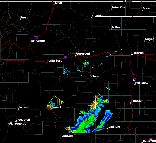 At 653 pm mdt, a severe thunderstorm was located near roswell, moving northeast at 25 mph (radar indicated). Hazards include 60 mph wind gusts and half dollar size hail. Hail damage to vehicles is expected. Expect wind damage to roofs, siding, and trees. At 653 pm mdt, a severe thunderstorm was located near roswell, moving northeast at 25 mph (radar indicated). Hazards include 60 mph wind gusts and half dollar size hail. Hail damage to vehicles is expected. Expect wind damage to roofs, siding, and trees.
|
| 6/3/2018 10:44 PM MDT | Krow aso in chaves county NM, 4.7 miles NNW of Roswell, NM |
| 5/23/2018 5:30 PM MDT | Quarter sized hail reported 47.7 miles WSW of Roswell, NM |
| 5/23/2018 4:45 PM MDT |
 At 445 pm mdt, severe thunderstorms were located along a line extending from 21 miles southeast of tinnie to 19 miles northeast of dunken to 7 miles north of hope, moving north at 35 mph (radar indicated). Hazards include 60 mph wind gusts and half dollar size hail. Hail damage to vehicles is expected. Expect wind damage to roofs, siding, and trees. At 445 pm mdt, severe thunderstorms were located along a line extending from 21 miles southeast of tinnie to 19 miles northeast of dunken to 7 miles north of hope, moving north at 35 mph (radar indicated). Hazards include 60 mph wind gusts and half dollar size hail. Hail damage to vehicles is expected. Expect wind damage to roofs, siding, and trees.
|
| 5/23/2018 4:35 PM MDT |
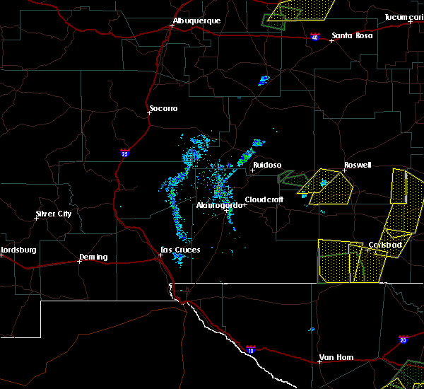 At 435 pm mdt, a severe thunderstorm was located 18 miles southwest of roswell, moving north at 15 mph (radar indicated). Hazards include 60 mph wind gusts and half dollar size hail. Hail damage to vehicles is expected. expect wind damage to roofs, siding, and trees. This severe thunderstorm will remain over mainly rural areas of southeastern lincoln and west central chaves counties. At 435 pm mdt, a severe thunderstorm was located 18 miles southwest of roswell, moving north at 15 mph (radar indicated). Hazards include 60 mph wind gusts and half dollar size hail. Hail damage to vehicles is expected. expect wind damage to roofs, siding, and trees. This severe thunderstorm will remain over mainly rural areas of southeastern lincoln and west central chaves counties.
|
| 5/23/2018 4:34 PM MDT |
 At 434 pm mdt, a severe thunderstorm was located 18 miles northwest of hope, moving northeast at 20 mph (radar indicated). Hazards include 60 mph wind gusts and half dollar size hail. Hail damage to vehicles is expected. expect wind damage to roofs, siding, and trees. locations impacted include, southern roswell and roswell correctional facility. This includes highway 285 between mile markers 87 and 96. At 434 pm mdt, a severe thunderstorm was located 18 miles northwest of hope, moving northeast at 20 mph (radar indicated). Hazards include 60 mph wind gusts and half dollar size hail. Hail damage to vehicles is expected. expect wind damage to roofs, siding, and trees. locations impacted include, southern roswell and roswell correctional facility. This includes highway 285 between mile markers 87 and 96.
|
| 5/23/2018 4:24 PM MDT |
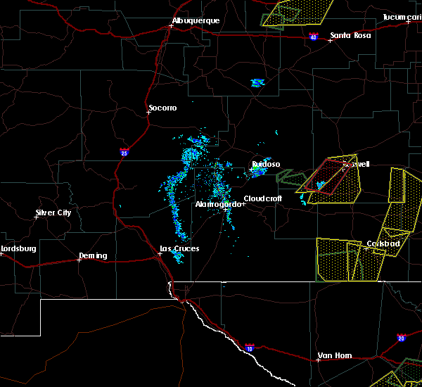 At 423 pm mdt, a severe thunderstorm was located 19 miles southwest of roswell, moving east at 20 mph (radar indicated). Hazards include ping pong ball size hail and 60 mph wind gusts. People and animals outdoors will be injured. expect hail damage to roofs, siding, windows, and vehicles. expect wind damage to roofs, siding, and trees. locations impacted include, northern roswell. This includes highway 285 between mile markers 116 and 118. At 423 pm mdt, a severe thunderstorm was located 19 miles southwest of roswell, moving east at 20 mph (radar indicated). Hazards include ping pong ball size hail and 60 mph wind gusts. People and animals outdoors will be injured. expect hail damage to roofs, siding, windows, and vehicles. expect wind damage to roofs, siding, and trees. locations impacted include, northern roswell. This includes highway 285 between mile markers 116 and 118.
|
| 5/23/2018 4:20 PM MDT |
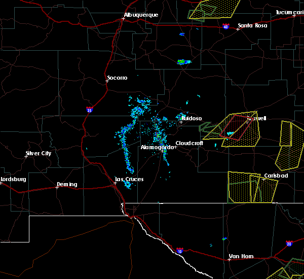 At 420 pm mdt, severe thunderstorms capable of producing tornadoes were located along a line extending from 10 miles west of roswell to 24 miles north of hope, moving northeast at 10 mph (radar indicated rotation). Hazards include tornado and ping pong ball size hail. Flying debris will be dangerous to those caught without shelter. mobile homes will be damaged or destroyed. damage to roofs, windows, and vehicles will occur. tree damage is likely. these tornadic storms will remain over mainly rural areas of southeastern lincoln and west central chaves counties. This includes highway 285 near mile marker 104. At 420 pm mdt, severe thunderstorms capable of producing tornadoes were located along a line extending from 10 miles west of roswell to 24 miles north of hope, moving northeast at 10 mph (radar indicated rotation). Hazards include tornado and ping pong ball size hail. Flying debris will be dangerous to those caught without shelter. mobile homes will be damaged or destroyed. damage to roofs, windows, and vehicles will occur. tree damage is likely. these tornadic storms will remain over mainly rural areas of southeastern lincoln and west central chaves counties. This includes highway 285 near mile marker 104.
|
| 5/23/2018 4:08 PM MDT |
 At 408 pm mdt, severe thunderstorms capable of producing a tornado were located along a line extending from 18 miles southeast of tinnie to 19 miles north of hope, moving northeast at 25 mph (radar indicated rotation). Hazards include tornado and ping pong ball size hail. Flying debris will be dangerous to those caught without shelter. mobile homes will be damaged or destroyed. damage to roofs, windows, and vehicles will occur. tree damage is likely. these dangerous storms will be near, roswell around 500 pm mdt. This includes highway 285 between mile markers 100 and 116. At 408 pm mdt, severe thunderstorms capable of producing a tornado were located along a line extending from 18 miles southeast of tinnie to 19 miles north of hope, moving northeast at 25 mph (radar indicated rotation). Hazards include tornado and ping pong ball size hail. Flying debris will be dangerous to those caught without shelter. mobile homes will be damaged or destroyed. damage to roofs, windows, and vehicles will occur. tree damage is likely. these dangerous storms will be near, roswell around 500 pm mdt. This includes highway 285 between mile markers 100 and 116.
|
| 5/23/2018 4:05 PM MDT | Golf Ball sized hail reported 10.1 miles ESE of Roswell, NM |
| 5/23/2018 3:47 PM MDT |
 At 347 pm mdt, severe thunderstorms were located along a line extending from 25 miles west of cottonwood to 12 miles north of hope, moving north at 20 mph (radar indicated). Hazards include 60 mph wind gusts and half dollar size hail. Hail damage to vehicles is expected. Expect wind damage to roofs, siding, and trees. At 347 pm mdt, severe thunderstorms were located along a line extending from 25 miles west of cottonwood to 12 miles north of hope, moving north at 20 mph (radar indicated). Hazards include 60 mph wind gusts and half dollar size hail. Hail damage to vehicles is expected. Expect wind damage to roofs, siding, and trees.
|
| 5/23/2018 3:44 PM MDT |
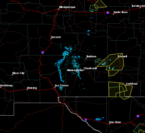 At 343 pm mdt, severe thunderstorms were located along a line extending from 18 miles west of roswell to 18 miles southeast of tinnie, moving east at 15 mph (radar indicated). Hazards include 70 mph wind gusts and ping pong ball size hail. People and animals outdoors will be injured. expect hail damage to roofs, siding, windows, and vehicles. expect considerable tree damage. Wind damage is also likely to mobile homes, roofs, and outbuildings. At 343 pm mdt, severe thunderstorms were located along a line extending from 18 miles west of roswell to 18 miles southeast of tinnie, moving east at 15 mph (radar indicated). Hazards include 70 mph wind gusts and ping pong ball size hail. People and animals outdoors will be injured. expect hail damage to roofs, siding, windows, and vehicles. expect considerable tree damage. Wind damage is also likely to mobile homes, roofs, and outbuildings.
|
| 5/23/2018 3:15 PM MDT |
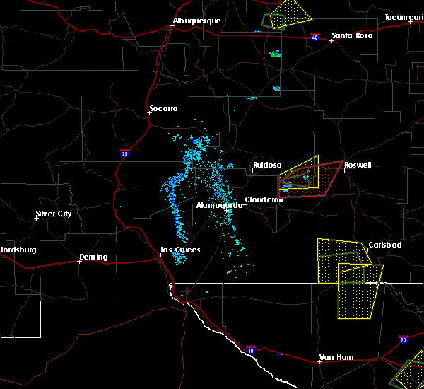 At 313 pm mdt, tornado producing storms were located along a line extending from 14 miles southeast of tinnie to 15 miles northeast of elk, moving east at 15 mph (at 307 pm mdt, storm chasers reported a tornado 6 miles south-southwest of picacho). Hazards include damaging tornado and two inch hail. Flying debris will be dangerous to those caught without shelter. mobile homes will be damaged or destroyed. damage to roofs, windows, and vehicles will occur. tree damage is likely. These tornadic storms will be near, sunset around 320 pm mdt. At 313 pm mdt, tornado producing storms were located along a line extending from 14 miles southeast of tinnie to 15 miles northeast of elk, moving east at 15 mph (at 307 pm mdt, storm chasers reported a tornado 6 miles south-southwest of picacho). Hazards include damaging tornado and two inch hail. Flying debris will be dangerous to those caught without shelter. mobile homes will be damaged or destroyed. damage to roofs, windows, and vehicles will occur. tree damage is likely. These tornadic storms will be near, sunset around 320 pm mdt.
|
| 5/23/2018 3:06 PM MDT |
 At 306 pm mdt, severe thunderstorms capable of producing a tornado were located along a line extending from 12 miles southeast of tinnie to 14 miles south of hondo, moving east at 15 mph (radar indicated rotation). Hazards include tornado and hail up to two inches in diameter. Flying debris will be dangerous to those caught without shelter. mobile homes will be damaged or destroyed. damage to roofs, windows, and vehicles will occur. tree damage is likely. These dangerous storms will be near, sunset around 310 pm mdt. At 306 pm mdt, severe thunderstorms capable of producing a tornado were located along a line extending from 12 miles southeast of tinnie to 14 miles south of hondo, moving east at 15 mph (radar indicated rotation). Hazards include tornado and hail up to two inches in diameter. Flying debris will be dangerous to those caught without shelter. mobile homes will be damaged or destroyed. damage to roofs, windows, and vehicles will occur. tree damage is likely. These dangerous storms will be near, sunset around 310 pm mdt.
|
| 5/22/2018 10:08 PM MDT | Ping Pong Ball sized hail reported 17.8 miles E of Roswell, NM |
| 5/22/2018 10:03 PM MDT | Hen Egg sized hail reported 26.4 miles SE of Roswell, NM |
| 5/22/2018 10:02 PM MDT | Hen Egg sized hail reported 26.4 miles SE of Roswell, NM |
| 5/22/2018 9:48 PM MDT | Half Dollar sized hail reported 26.9 miles SE of Roswell, NM |
| 5/22/2018 9:47 PM MDT | Half Dollar sized hail reported 26.9 miles SE of Roswell, NM |
| 5/22/2018 9:42 PM MDT |
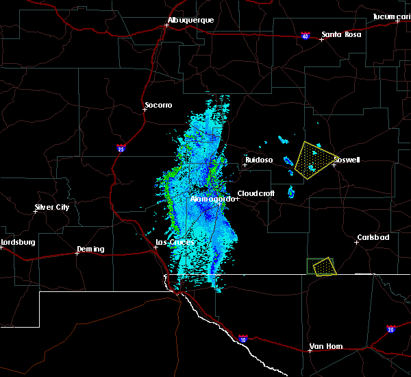 At 940 pm mdt, a severe thunderstorm was located 17 miles west of roswell, moving northeast at 10 mph. a second severe storm was located along state road 246 northwest of roswell (radar indicated). Hazards include 60 mph wind gusts and quarter size hail. Hail damage to vehicles is expected. expect wind damage to roofs, siding, and trees. locations impacted include, northwestern roswell. This includes highway 285 near mile marker 116. At 940 pm mdt, a severe thunderstorm was located 17 miles west of roswell, moving northeast at 10 mph. a second severe storm was located along state road 246 northwest of roswell (radar indicated). Hazards include 60 mph wind gusts and quarter size hail. Hail damage to vehicles is expected. expect wind damage to roofs, siding, and trees. locations impacted include, northwestern roswell. This includes highway 285 near mile marker 116.
|
| 5/22/2018 9:20 PM MDT |
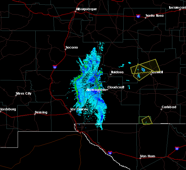 At 919 pm mdt, a severe thunderstorm was located 19 miles west of roswell, moving northeast at 15 mph (radar indicated). Hazards include 60 mph wind gusts and quarter size hail. Hail damage to vehicles is expected. Expect wind damage to roofs, siding, and trees. At 919 pm mdt, a severe thunderstorm was located 19 miles west of roswell, moving northeast at 15 mph (radar indicated). Hazards include 60 mph wind gusts and quarter size hail. Hail damage to vehicles is expected. Expect wind damage to roofs, siding, and trees.
|
| 5/22/2018 8:56 PM MDT |
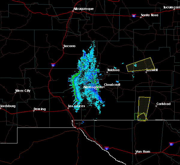 At 855 pm mdt, a severe thunderstorm was located 19 miles east of arabela, or 21 miles northwest of roswell, moving northeast at 15 mph (radar indicated). Hazards include 60 mph wind gusts and quarter size hail. Hail damage to vehicles is expected. expect wind damage to roofs, siding, and trees. locations impacted include, northern roswell and bitter lake wildlife refuge. This includes highway 285 between mile markers 116 and 133. At 855 pm mdt, a severe thunderstorm was located 19 miles east of arabela, or 21 miles northwest of roswell, moving northeast at 15 mph (radar indicated). Hazards include 60 mph wind gusts and quarter size hail. Hail damage to vehicles is expected. expect wind damage to roofs, siding, and trees. locations impacted include, northern roswell and bitter lake wildlife refuge. This includes highway 285 between mile markers 116 and 133.
|
| 5/22/2018 8:29 PM MDT |
 At 829 pm mdt, a severe thunderstorm was located 12 miles southeast of arabela, or 27 miles west of roswell, moving east at 35 mph (radar indicated). Hazards include 60 mph wind gusts and quarter size hail. Hail damage to vehicles is expected. Expect wind damage to roofs, siding, and trees. At 829 pm mdt, a severe thunderstorm was located 12 miles southeast of arabela, or 27 miles west of roswell, moving east at 35 mph (radar indicated). Hazards include 60 mph wind gusts and quarter size hail. Hail damage to vehicles is expected. Expect wind damage to roofs, siding, and trees.
|
| 5/21/2018 10:25 PM MDT |
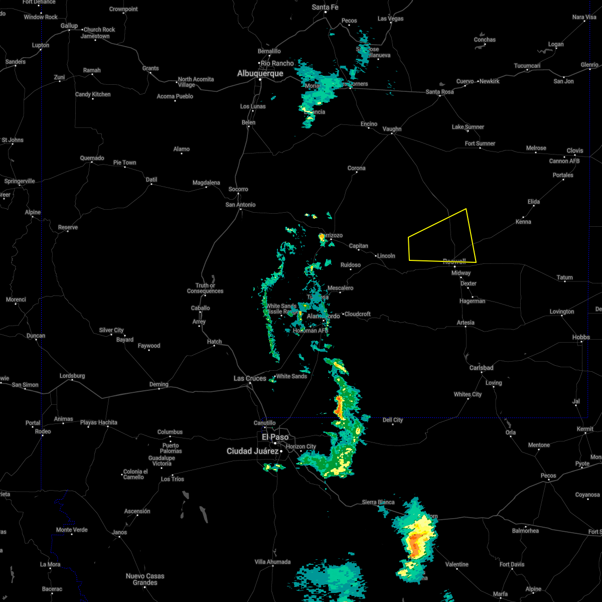 The severe thunderstorm warning for east central lincoln and north central chaves counties will expire at 1030 pm mdt, the storm which prompted the warning has weakened below severe limits, and no longer poses an immediate threat to life or property. therefore the warning will be allowed to expire. however small hail, gusty winds and heavy rain are still possible with this thunderstorm. this storm has the potential to reintensify. a severe thunderstorm watch remains in effect until 1100 pm mdt for central and southeastern new mexico. The severe thunderstorm warning for east central lincoln and north central chaves counties will expire at 1030 pm mdt, the storm which prompted the warning has weakened below severe limits, and no longer poses an immediate threat to life or property. therefore the warning will be allowed to expire. however small hail, gusty winds and heavy rain are still possible with this thunderstorm. this storm has the potential to reintensify. a severe thunderstorm watch remains in effect until 1100 pm mdt for central and southeastern new mexico.
|
| 5/21/2018 10:19 PM MDT |
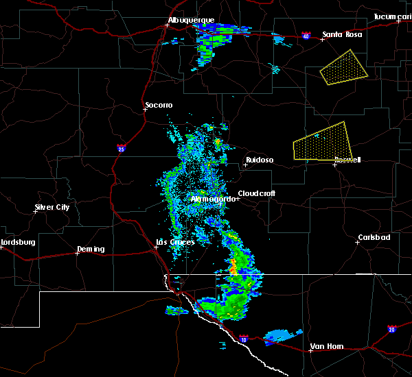 At 1018 pm mdt, a severe thunderstorm was located 12 miles northwest of bitter lake wildlife refuge, or 17 miles north of roswell, moving east at 40 mph (radar indicated). Hazards include 60 mph wind gusts and quarter size hail. Hail damage to vehicles is expected. expect wind damage to roofs, siding, and trees. locations impacted include, northern roswell and bitter lake wildlife refuge. This includes highway 285 between mile markers 116 and 141. At 1018 pm mdt, a severe thunderstorm was located 12 miles northwest of bitter lake wildlife refuge, or 17 miles north of roswell, moving east at 40 mph (radar indicated). Hazards include 60 mph wind gusts and quarter size hail. Hail damage to vehicles is expected. expect wind damage to roofs, siding, and trees. locations impacted include, northern roswell and bitter lake wildlife refuge. This includes highway 285 between mile markers 116 and 141.
|
| 5/21/2018 9:27 PM MDT |
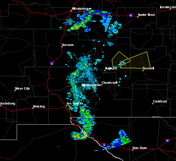 At 925 pm mdt, a severe thunderstorm was located near arabela, or 33 miles west of roswell, moving east at 40 mph (radar indicated). Hazards include 60 mph wind gusts and quarter size hail. Hail damage to vehicles is expected. expect wind damage to roofs, siding, and trees. Significant accumulations of hail are possible with this storm. At 925 pm mdt, a severe thunderstorm was located near arabela, or 33 miles west of roswell, moving east at 40 mph (radar indicated). Hazards include 60 mph wind gusts and quarter size hail. Hail damage to vehicles is expected. expect wind damage to roofs, siding, and trees. Significant accumulations of hail are possible with this storm.
|
| 9/25/2017 6:30 PM MDT |
 At 630 pm mdt, a severe thunderstorm was located 11 miles southwest of roswell, moving east at 15 mph (radar indicated). Hazards include 60 mph wind gusts and quarter size hail. Hail damage to vehicles is expected. Expect wind damage to roofs, siding, and trees. At 630 pm mdt, a severe thunderstorm was located 11 miles southwest of roswell, moving east at 15 mph (radar indicated). Hazards include 60 mph wind gusts and quarter size hail. Hail damage to vehicles is expected. Expect wind damage to roofs, siding, and trees.
|
| 9/17/2017 2:08 PM MDT |
 The severe thunderstorm warning for central chaves county will expire at 215 pm mdt, the storm which prompted the warning has weakened below severe limits, and no longer poses an immediate threat to life or property. therefore the warning will be allowed to expire. however small hail, gusty winds and heavy rain are still likely with this thunderstorm. The severe thunderstorm warning for central chaves county will expire at 215 pm mdt, the storm which prompted the warning has weakened below severe limits, and no longer poses an immediate threat to life or property. therefore the warning will be allowed to expire. however small hail, gusty winds and heavy rain are still likely with this thunderstorm.
|
| 9/17/2017 1:50 PM MDT |
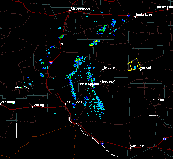 At 150 pm mdt, a severe thunderstorm was located 10 miles northwest of roswell, moving east at 20 mph (radar indicated). Hazards include 60 mph wind gusts and nickel size hail. Expect damage to roofs, siding, and trees. Locations impacted include, northwestern roswell. At 150 pm mdt, a severe thunderstorm was located 10 miles northwest of roswell, moving east at 20 mph (radar indicated). Hazards include 60 mph wind gusts and nickel size hail. Expect damage to roofs, siding, and trees. Locations impacted include, northwestern roswell.
|
| 9/17/2017 1:38 PM MDT |
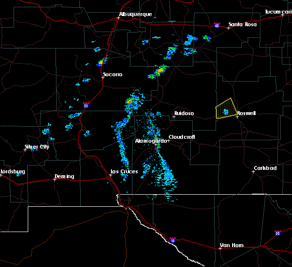 At 138 pm mdt, a severe thunderstorm was located 15 miles northwest of roswell, moving east at 20 mph (radar indicated). Hazards include 60 mph wind gusts and quarter size hail. Hail damage to vehicles is expected. expect wind damage to roofs, siding, and trees. Locations impacted include, northwestern roswell. At 138 pm mdt, a severe thunderstorm was located 15 miles northwest of roswell, moving east at 20 mph (radar indicated). Hazards include 60 mph wind gusts and quarter size hail. Hail damage to vehicles is expected. expect wind damage to roofs, siding, and trees. Locations impacted include, northwestern roswell.
|
| 9/17/2017 1:22 PM MDT |
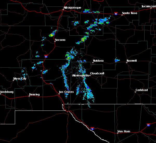 At 122 pm mdt, a severe thunderstorm was located 19 miles southeast of arabela, or 20 miles west of roswell, moving northeast at 20 mph (radar indicated). Hazards include 60 mph wind gusts and quarter size hail. Hail damage to vehicles is expected. Expect wind damage to roofs, siding, and trees. At 122 pm mdt, a severe thunderstorm was located 19 miles southeast of arabela, or 20 miles west of roswell, moving northeast at 20 mph (radar indicated). Hazards include 60 mph wind gusts and quarter size hail. Hail damage to vehicles is expected. Expect wind damage to roofs, siding, and trees.
|
| 6/4/2017 5:19 PM MDT | Storm damage reported in chaves county NM, 36.2 miles S of Roswell, NM |
| 5/22/2017 7:08 PM MDT | Half Dollar sized hail reported 25.5 miles WSW of Roswell, NM |
| 5/22/2017 7:02 PM MDT | Golf Ball sized hail reported 26.7 miles W of Roswell, NM |
| 5/22/2017 6:36 PM MDT | Hen Egg sized hail reported 19.9 miles SW of Roswell, NM, on highway 70 |
| 5/9/2017 11:10 PM MDT |
 At 1110 pm mdt, a severe thunderstorm was located 10 miles northwest of bitter lake wildlife refuge, or 12 miles north of roswell, moving north at 45 mph (radar indicated). Hazards include 60 mph wind gusts and half dollar size hail. Hail damage to vehicles is expected. expect wind damage to roofs, siding, and trees. locations impacted include, northern roswell and bitter lake wildlife refuge. This includes highway 285 between mile markers 116 and 137. At 1110 pm mdt, a severe thunderstorm was located 10 miles northwest of bitter lake wildlife refuge, or 12 miles north of roswell, moving north at 45 mph (radar indicated). Hazards include 60 mph wind gusts and half dollar size hail. Hail damage to vehicles is expected. expect wind damage to roofs, siding, and trees. locations impacted include, northern roswell and bitter lake wildlife refuge. This includes highway 285 between mile markers 116 and 137.
|
| 5/9/2017 11:03 PM MDT | Quarter sized hail reported 2.9 miles ESE of Roswell, NM |
| 5/9/2017 10:52 PM MDT |
 At 1052 pm mdt, a severe thunderstorm was located over roswell, moving north at 45 mph (radar indicated). Hazards include 60 mph wind gusts and half dollar size hail. Hail damage to vehicles is expected. Expect wind damage to roofs, siding, and trees. At 1052 pm mdt, a severe thunderstorm was located over roswell, moving north at 45 mph (radar indicated). Hazards include 60 mph wind gusts and half dollar size hail. Hail damage to vehicles is expected. Expect wind damage to roofs, siding, and trees.
|
| 5/9/2017 9:41 PM MDT |
 At 941 pm mdt, a severe thunderstorm was located 10 miles northwest of bitter lake wildlife refuge, or 15 miles north of roswell, moving north at 55 mph (radar indicated). Hazards include 60 mph wind gusts and quarter size hail. Hail damage to vehicles is expected. expect wind damage to roofs, siding, and trees. this severe thunderstorm will remain over mainly rural areas of central chaves county. this includes highway 285 between mile markers 116 and 131. A tornado watch remains in effect until 1000 pm mdt for southeastern new mexico. At 941 pm mdt, a severe thunderstorm was located 10 miles northwest of bitter lake wildlife refuge, or 15 miles north of roswell, moving north at 55 mph (radar indicated). Hazards include 60 mph wind gusts and quarter size hail. Hail damage to vehicles is expected. expect wind damage to roofs, siding, and trees. this severe thunderstorm will remain over mainly rural areas of central chaves county. this includes highway 285 between mile markers 116 and 131. A tornado watch remains in effect until 1000 pm mdt for southeastern new mexico.
|
| 5/9/2017 9:32 PM MDT |
 At 932 pm mdt, a severe thunderstorm was located 8 miles west of bitter lake wildlife refuge, or 8 miles north of roswell, moving north at 40 mph (radar indicated). Hazards include 60 mph wind gusts and half dollar size hail. Hail damage to vehicles is expected. expect wind damage to roofs, siding, and trees. locations impacted include, roswell and bitter lake wildlife refuge. this includes highway 285 between mile markers 104 and 131. A tornado watch remains in effect until 1000 pm mdt for southeastern new mexico. At 932 pm mdt, a severe thunderstorm was located 8 miles west of bitter lake wildlife refuge, or 8 miles north of roswell, moving north at 40 mph (radar indicated). Hazards include 60 mph wind gusts and half dollar size hail. Hail damage to vehicles is expected. expect wind damage to roofs, siding, and trees. locations impacted include, roswell and bitter lake wildlife refuge. this includes highway 285 between mile markers 104 and 131. A tornado watch remains in effect until 1000 pm mdt for southeastern new mexico.
|
| 5/9/2017 9:20 PM MDT | Half Dollar sized hail reported 1.2 miles NNE of Roswell, NM, ne roswell |
| 5/9/2017 9:14 PM MDT |
 At 914 pm mdt, a severe thunderstorm was located over roswell, moving northeast at 55 mph (radar indicated). Hazards include ping pong ball size hail and 60 mph wind gusts. People and animals outdoors will be injured. expect hail damage to roofs, siding, windows, and vehicles. Expect wind damage to roofs, siding, and trees. At 914 pm mdt, a severe thunderstorm was located over roswell, moving northeast at 55 mph (radar indicated). Hazards include ping pong ball size hail and 60 mph wind gusts. People and animals outdoors will be injured. expect hail damage to roofs, siding, windows, and vehicles. Expect wind damage to roofs, siding, and trees.
|
| 5/9/2017 8:55 PM MDT | Quarter sized hail reported 2.9 miles ESE of Roswell, NM, 1 hail on alameda in roswell. |
| 5/9/2017 8:46 PM MDT |
 At 846 pm mdt, a severe thunderstorm was located over northeastern roswell, moving northeast at 35 mph (radar indicated). Hazards include 70 mph wind gusts and ping pong ball size hail. People and animals outdoors will be injured. expect hail damage to roofs, siding, windows, and vehicles. expect considerable tree damage. wind damage is also likely to mobile homes, roofs, and outbuildings. locations impacted include, roswell, bitter lake wildlife refuge, roswell correctional facility and midway. this includes highway 285 between mile markers 98 and 131. A tornado watch remains in effect until 1000 pm mdt for southeastern new mexico. At 846 pm mdt, a severe thunderstorm was located over northeastern roswell, moving northeast at 35 mph (radar indicated). Hazards include 70 mph wind gusts and ping pong ball size hail. People and animals outdoors will be injured. expect hail damage to roofs, siding, windows, and vehicles. expect considerable tree damage. wind damage is also likely to mobile homes, roofs, and outbuildings. locations impacted include, roswell, bitter lake wildlife refuge, roswell correctional facility and midway. this includes highway 285 between mile markers 98 and 131. A tornado watch remains in effect until 1000 pm mdt for southeastern new mexico.
|
| 5/9/2017 8:45 PM MDT | Quarter sized hail reported 1.2 miles NNE of Roswell, NM, quarter size hail in roswell. grond is covered by hail. |
| 5/9/2017 8:45 PM MDT | Quarter sized hail reported 2.9 miles ESE of Roswell, NM, 1 hail at alameda and wyoming in roswell. |
| 5/9/2017 8:45 PM MDT | Golf Ball sized hail reported 1.9 miles NE of Roswell, NM, golfball size hail estimated in western roswell. |
| 5/9/2017 8:45 PM MDT | Ping Pong Ball sized hail reported 2.9 miles ESE of Roswell, NM, ping pong size hail reported at matthews and virginia in roswell. |
| 5/9/2017 8:36 PM MDT |
 At 836 pm mdt, a severe thunderstorm was located near roswell, moving north at 25 mph (radar indicated). Hazards include 60 mph wind gusts and half dollar size hail. Hail damage to vehicles is expected. expect wind damage to roofs, siding, and trees. locations impacted include, roswell, bitter lake wildlife refuge, roswell correctional facility and midway. this includes highway 285 between mile markers 98 and 131. A tornado watch remains in effect until 1000 pm mdt for southeastern new mexico. At 836 pm mdt, a severe thunderstorm was located near roswell, moving north at 25 mph (radar indicated). Hazards include 60 mph wind gusts and half dollar size hail. Hail damage to vehicles is expected. expect wind damage to roofs, siding, and trees. locations impacted include, roswell, bitter lake wildlife refuge, roswell correctional facility and midway. this includes highway 285 between mile markers 98 and 131. A tornado watch remains in effect until 1000 pm mdt for southeastern new mexico.
|
| 5/9/2017 8:12 PM MDT |
 At 812 pm mdt, a severe thunderstorm was located 13 miles southwest of roswell, moving north at 35 mph (radar indicated). Hazards include 60 mph wind gusts and half dollar size hail. Hail damage to vehicles is expected. Expect wind damage to roofs, siding, and trees. At 812 pm mdt, a severe thunderstorm was located 13 miles southwest of roswell, moving north at 35 mph (radar indicated). Hazards include 60 mph wind gusts and half dollar size hail. Hail damage to vehicles is expected. Expect wind damage to roofs, siding, and trees.
|
| 5/9/2017 2:44 PM MDT |
 At 243 pm mdt, a severe thunderstorm was located near bottomless lakes state park, or 8 miles southeast of roswell, moving north at 30 mph (radar indicated). Hazards include ping pong ball size hail and 60 mph wind gusts. People and animals outdoors will be injured. expect hail damage to roofs, siding, windows, and vehicles. expect wind damage to roofs, siding, and trees. locations impacted include, roswell, dexter, bitter lake wildlife refuge, bottomless lakes state park, greenfield and midway. this includes highway 285 between mile markers 94 and 124. A tornado watch remains in effect until 1000 pm mdt for southeastern new mexico. At 243 pm mdt, a severe thunderstorm was located near bottomless lakes state park, or 8 miles southeast of roswell, moving north at 30 mph (radar indicated). Hazards include ping pong ball size hail and 60 mph wind gusts. People and animals outdoors will be injured. expect hail damage to roofs, siding, windows, and vehicles. expect wind damage to roofs, siding, and trees. locations impacted include, roswell, dexter, bitter lake wildlife refuge, bottomless lakes state park, greenfield and midway. this includes highway 285 between mile markers 94 and 124. A tornado watch remains in effect until 1000 pm mdt for southeastern new mexico.
|
| 5/9/2017 2:24 PM MDT |
 At 223 pm mdt, a severe thunderstorm was located near dexter, or 15 miles south of roswell, moving north at 30 mph (radar indicated). Hazards include 60 mph wind gusts and half dollar size hail. Hail damage to vehicles is expected. Expect wind damage to roofs, siding, and trees. At 223 pm mdt, a severe thunderstorm was located near dexter, or 15 miles south of roswell, moving north at 30 mph (radar indicated). Hazards include 60 mph wind gusts and half dollar size hail. Hail damage to vehicles is expected. Expect wind damage to roofs, siding, and trees.
|
| 5/8/2017 8:12 PM MDT | Quarter sized hail reported 4.6 miles ENE of Roswell, NM, emergency manager reported nickel to quarter size hail |
| 5/8/2017 7:00 PM MDT |
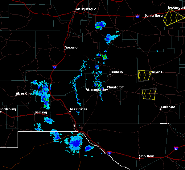 At 700 pm mdt, a severe thunderstorm was located 13 miles southwest of roswell, moving north at 35 mph (radar indicated). Hazards include 60 mph wind gusts and quarter size hail. Hail damage to vehicles is expected. expect wind damage to roofs, siding, and trees. Locations impacted include, roswell. At 700 pm mdt, a severe thunderstorm was located 13 miles southwest of roswell, moving north at 35 mph (radar indicated). Hazards include 60 mph wind gusts and quarter size hail. Hail damage to vehicles is expected. expect wind damage to roofs, siding, and trees. Locations impacted include, roswell.
|
| 5/8/2017 6:45 PM MDT |
 At 645 pm mdt, a severe thunderstorm was located 19 miles southwest of roswell, moving north at 35 mph (radar indicated). Hazards include 60 mph wind gusts and quarter size hail. Hail damage to vehicles is expected. Expect wind damage to roofs, siding, and trees. At 645 pm mdt, a severe thunderstorm was located 19 miles southwest of roswell, moving north at 35 mph (radar indicated). Hazards include 60 mph wind gusts and quarter size hail. Hail damage to vehicles is expected. Expect wind damage to roofs, siding, and trees.
|
| 5/8/2017 6:21 PM MDT |
 The severe thunderstorm warning for central chaves county will expire at 630 pm mdt, the storm which prompted the warning has weakened below severe limits, and no longer pose an immediate threat to life or property. therefore the warning will be allowed to expire. however small hail, gusty winds and heavy rain are still possible with this thunderstorm. a severe thunderstorm watch remains in effect until 1100 pm mdt for southeastern new mexico. The severe thunderstorm warning for central chaves county will expire at 630 pm mdt, the storm which prompted the warning has weakened below severe limits, and no longer pose an immediate threat to life or property. therefore the warning will be allowed to expire. however small hail, gusty winds and heavy rain are still possible with this thunderstorm. a severe thunderstorm watch remains in effect until 1100 pm mdt for southeastern new mexico.
|
| 5/8/2017 6:08 PM MDT |
 At 608 pm mdt, a severe thunderstorm was located 17 miles southwest of roswell, moving north at 30 mph (radar indicated). Hazards include 60 mph wind gusts and quarter size hail. Hail damage to vehicles is expected. expect wind damage to roofs, siding, and trees. locations impacted include, southern roswell and midway. This includes highway 285 between mile markers 99 and 104. At 608 pm mdt, a severe thunderstorm was located 17 miles southwest of roswell, moving north at 30 mph (radar indicated). Hazards include 60 mph wind gusts and quarter size hail. Hail damage to vehicles is expected. expect wind damage to roofs, siding, and trees. locations impacted include, southern roswell and midway. This includes highway 285 between mile markers 99 and 104.
|
| 5/8/2017 5:50 PM MDT |
 At 550 pm mdt, a severe thunderstorm was located 13 miles north of hope, moving north at 25 mph (radar indicated). Hazards include 60 mph wind gusts and half dollar size hail. Hail damage to vehicles is expected. Expect wind damage to roofs, siding, and trees. At 550 pm mdt, a severe thunderstorm was located 13 miles north of hope, moving north at 25 mph (radar indicated). Hazards include 60 mph wind gusts and half dollar size hail. Hail damage to vehicles is expected. Expect wind damage to roofs, siding, and trees.
|
| 5/7/2017 8:50 PM MDT | Krow aso in chaves county NM, 4.7 miles NNW of Roswell, NM |
| 4/12/2017 9:51 AM MDT |
 At 950 am mdt, a severe thunderstorm was located 7 miles southeast of roswell, moving northeast at 30 mph (radar indicated). Hazards include 60 mph wind gusts and half dollar size hail. Hail damage to vehicles is expected. expect wind damage to roofs, siding, and trees. locations impacted include, roswell, dexter, bottomless lakes state park, greenfield, roswell correctional facility and midway. This includes highway 285 between mile markers 89 and 104. At 950 am mdt, a severe thunderstorm was located 7 miles southeast of roswell, moving northeast at 30 mph (radar indicated). Hazards include 60 mph wind gusts and half dollar size hail. Hail damage to vehicles is expected. expect wind damage to roofs, siding, and trees. locations impacted include, roswell, dexter, bottomless lakes state park, greenfield, roswell correctional facility and midway. This includes highway 285 between mile markers 89 and 104.
|
| 4/12/2017 9:34 AM MDT |
 At 933 am mdt, a severe thunderstorm was located 10 miles south of roswell, moving northeast at 30 mph (radar indicated). Hazards include 60 mph wind gusts and half dollar size hail. Hail damage to vehicles is expected. expect wind damage to roofs, siding, and trees. locations impacted include, roswell, dexter, bottomless lakes state park, greenfield, roswell correctional facility and midway. This includes highway 285 between mile markers 89 and 104. At 933 am mdt, a severe thunderstorm was located 10 miles south of roswell, moving northeast at 30 mph (radar indicated). Hazards include 60 mph wind gusts and half dollar size hail. Hail damage to vehicles is expected. expect wind damage to roofs, siding, and trees. locations impacted include, roswell, dexter, bottomless lakes state park, greenfield, roswell correctional facility and midway. This includes highway 285 between mile markers 89 and 104.
|
| 4/12/2017 9:16 AM MDT |
 At 915 am mdt, a severe thunderstorm was located 16 miles southwest of roswell, moving northeast at 30 mph (radar indicated). Hazards include ping pong ball size hail and 60 mph wind gusts. People and animals outdoors will be injured. expect hail damage to roofs, siding, windows, and vehicles. Expect wind damage to roofs, siding, and trees. At 915 am mdt, a severe thunderstorm was located 16 miles southwest of roswell, moving northeast at 30 mph (radar indicated). Hazards include ping pong ball size hail and 60 mph wind gusts. People and animals outdoors will be injured. expect hail damage to roofs, siding, windows, and vehicles. Expect wind damage to roofs, siding, and trees.
|
| 4/12/2017 8:28 AM MDT |
 At 828 am mdt, a severe thunderstorm was located 7 miles southeast of roswell, moving northeast at 30 mph (radar indicated). Hazards include 60 mph wind gusts and quarter size hail. Hail damage to vehicles is expected. expect wind damage to roofs, siding, and trees. locations impacted include, roswell, dexter, bitter lake wildlife refuge, bottomless lakes state park, greenfield and midway. This includes highway 285 between mile markers 91 and 104. At 828 am mdt, a severe thunderstorm was located 7 miles southeast of roswell, moving northeast at 30 mph (radar indicated). Hazards include 60 mph wind gusts and quarter size hail. Hail damage to vehicles is expected. expect wind damage to roofs, siding, and trees. locations impacted include, roswell, dexter, bitter lake wildlife refuge, bottomless lakes state park, greenfield and midway. This includes highway 285 between mile markers 91 and 104.
|
| 4/12/2017 8:13 AM MDT |
 At 811 am mdt, a severe thunderstorm was located 9 miles south of roswell, moving northeast at 30 mph (radar indicated). Hazards include ping pong ball size hail and 60 mph wind gusts. People and animals outdoors will be injured. expect hail damage to roofs, siding, windows, and vehicles. Expect wind damage to roofs, siding, and trees. At 811 am mdt, a severe thunderstorm was located 9 miles south of roswell, moving northeast at 30 mph (radar indicated). Hazards include ping pong ball size hail and 60 mph wind gusts. People and animals outdoors will be injured. expect hail damage to roofs, siding, windows, and vehicles. Expect wind damage to roofs, siding, and trees.
|
| 11/6/2016 4:20 PM MDT | Quarter sized hail reported 14.1 miles SSE of Roswell, NM |
| 9/17/2016 1:48 PM MDT |
 At 148 pm mdt, a severe thunderstorm was located 15 miles southeast of picacho, or 25 miles southwest of roswell, moving northeast at 35 mph (radar indicated). Hazards include 60 mph wind gusts and half dollar size hail. Hail damage to vehicles is expected. Expect wind damage to roofs, siding, and trees. At 148 pm mdt, a severe thunderstorm was located 15 miles southeast of picacho, or 25 miles southwest of roswell, moving northeast at 35 mph (radar indicated). Hazards include 60 mph wind gusts and half dollar size hail. Hail damage to vehicles is expected. Expect wind damage to roofs, siding, and trees.
|
| 9/15/2016 5:19 PM MDT |
 At 519 pm mdt, a severe thunderstorm was located 22 miles southwest of roswell, moving northeast at 30 mph (radar indicated). Hazards include 60 mph wind gusts and half dollar size hail. Hail damage to vehicles is expected. Expect wind damage to roofs, siding, and trees. At 519 pm mdt, a severe thunderstorm was located 22 miles southwest of roswell, moving northeast at 30 mph (radar indicated). Hazards include 60 mph wind gusts and half dollar size hail. Hail damage to vehicles is expected. Expect wind damage to roofs, siding, and trees.
|
| 9/15/2016 3:00 PM MDT | Golf Ball sized hail reported 39.8 miles NE of Roswell, NM, golf ball size hail with a few funnel clouds. |
| 9/15/2016 2:26 PM MDT |
 At 225 pm mdt, a severe thunderstorm was located 16 miles northeast of picacho, or 21 miles west of roswell, moving east at 10 mph (radar indicated). Hazards include 60 mph wind gusts and quarter size hail. Hail damage to vehicles is expected. expect wind damage to roofs, siding, and trees. Locations impacted include, western roswell. At 225 pm mdt, a severe thunderstorm was located 16 miles northeast of picacho, or 21 miles west of roswell, moving east at 10 mph (radar indicated). Hazards include 60 mph wind gusts and quarter size hail. Hail damage to vehicles is expected. expect wind damage to roofs, siding, and trees. Locations impacted include, western roswell.
|
| 9/15/2016 2:00 PM MDT |
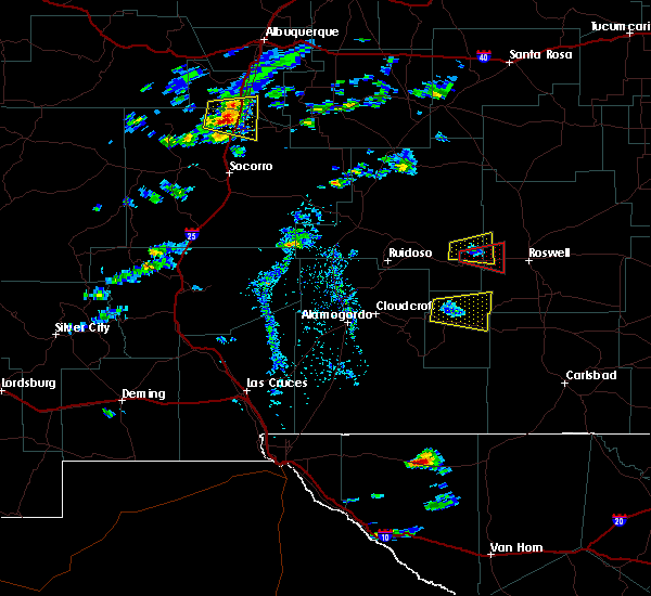 At 159 pm mdt, a severe thunderstorm was located 12 miles northeast of picacho, or 24 miles west of roswell, moving east at 25 mph. a tornado warning remains in effect for this storm (radar indicated). Hazards include 60 mph wind gusts and half dollar size hail. Hail damage to vehicles is expected. Expect wind damage to roofs, siding, and trees. At 159 pm mdt, a severe thunderstorm was located 12 miles northeast of picacho, or 24 miles west of roswell, moving east at 25 mph. a tornado warning remains in effect for this storm (radar indicated). Hazards include 60 mph wind gusts and half dollar size hail. Hail damage to vehicles is expected. Expect wind damage to roofs, siding, and trees.
|
| 8/24/2016 5:42 PM MDT | The severe thunderstorm warning for central chaves county will expire at 545 pm mdt, the storm which prompted the warning has weakened below severe limits, and no longer pose an immediate threat to life or property. therefore the warning will be allowed to expire. however heavy rain is still possible with this thunderstorm. |
| 8/24/2016 5:20 PM MDT |
 At 520 pm mdt, a severe thunderstorm was located 10 miles southwest of roswell, moving east at 25 mph (radar indicated). Hazards include 60 mph wind gusts and quarter size hail. Hail damage to vehicles is expected. expect wind damage to roofs, siding, and trees. locations impacted include, roswell, dexter, hagerman, bottomless lakes state park, lake arthur, roswell correctional facility, midway and greenfield. This includes highway 285 between mile markers 84 and 104. At 520 pm mdt, a severe thunderstorm was located 10 miles southwest of roswell, moving east at 25 mph (radar indicated). Hazards include 60 mph wind gusts and quarter size hail. Hail damage to vehicles is expected. expect wind damage to roofs, siding, and trees. locations impacted include, roswell, dexter, hagerman, bottomless lakes state park, lake arthur, roswell correctional facility, midway and greenfield. This includes highway 285 between mile markers 84 and 104.
|
| 8/24/2016 5:01 PM MDT |
 At 500 pm mdt, a severe thunderstorm was located 13 miles west of roswell, moving east at 40 mph (radar indicated). Hazards include 60 mph wind gusts and quarter size hail. Hail damage to vehicles is expected. Expect wind damage to roofs, siding, and trees. At 500 pm mdt, a severe thunderstorm was located 13 miles west of roswell, moving east at 40 mph (radar indicated). Hazards include 60 mph wind gusts and quarter size hail. Hail damage to vehicles is expected. Expect wind damage to roofs, siding, and trees.
|
| 8/24/2016 4:30 PM MDT |
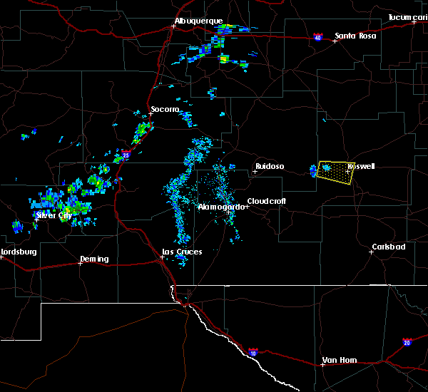 At 429 pm mdt, a severe thunderstorm was located 14 miles west of roswell, moving east at 10 mph. trained spotters have reported rotation with this storm (radar indicated). Hazards include 60 mph wind gusts and quarter size hail. Hail damage to vehicles is expected. expect wind damage to roofs, siding, and trees. locations impacted include, roswell. this includes highway 285 between mile markers 103 and 104. This also includes highway 380 between roswell and the lincoln county line. At 429 pm mdt, a severe thunderstorm was located 14 miles west of roswell, moving east at 10 mph. trained spotters have reported rotation with this storm (radar indicated). Hazards include 60 mph wind gusts and quarter size hail. Hail damage to vehicles is expected. expect wind damage to roofs, siding, and trees. locations impacted include, roswell. this includes highway 285 between mile markers 103 and 104. This also includes highway 380 between roswell and the lincoln county line.
|
| 8/24/2016 4:14 PM MDT |
 At 413 pm mdt, a severe thunderstorm was located 14 miles west of roswell, moving east at 15 mph (radar indicated). Hazards include 60 mph wind gusts and quarter size hail. Hail damage to vehicles is expected. Expect wind damage to roofs, siding, and trees. At 413 pm mdt, a severe thunderstorm was located 14 miles west of roswell, moving east at 15 mph (radar indicated). Hazards include 60 mph wind gusts and quarter size hail. Hail damage to vehicles is expected. Expect wind damage to roofs, siding, and trees.
|
| 8/24/2016 3:57 PM MDT |
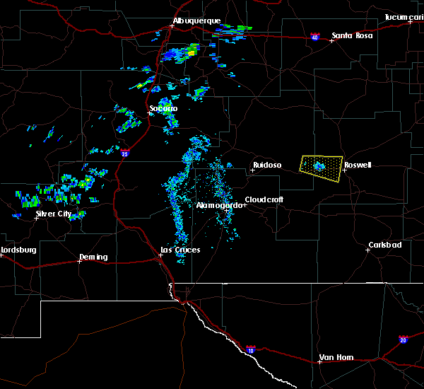 A severe thunderstorm warning remains in effect until 415 pm mdt for central chaves county. at 357 pm mdt. a severe thunderstorm was located 17 miles west of roswell. moving east at 20 mph. hazard. 60 mph wind gusts and quarter size hail. source. Radar indicated. A severe thunderstorm warning remains in effect until 415 pm mdt for central chaves county. at 357 pm mdt. a severe thunderstorm was located 17 miles west of roswell. moving east at 20 mph. hazard. 60 mph wind gusts and quarter size hail. source. Radar indicated.
|
| 8/24/2016 3:36 PM MDT |
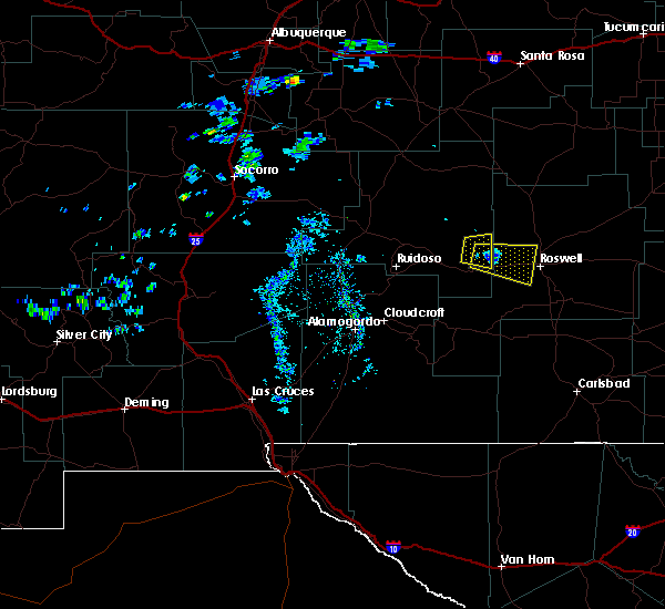 At 335 pm mdt, a severe thunderstorm was located 15 miles northeast of picacho, or 22 miles west of roswell, moving east at 15 mph (radar indicated). Hazards include 60 mph wind gusts and half dollar size hail. Hail damage to vehicles is expected. Expect wind damage to roofs, siding, and trees. At 335 pm mdt, a severe thunderstorm was located 15 miles northeast of picacho, or 22 miles west of roswell, moving east at 15 mph (radar indicated). Hazards include 60 mph wind gusts and half dollar size hail. Hail damage to vehicles is expected. Expect wind damage to roofs, siding, and trees.
|
| 10/21/2015 8:40 AM MDT | Half Dollar sized hail reported 20.3 miles S of Roswell, NM |
| 10/20/2015 7:10 PM MDT |
 At 710 pm mdt, severe thunderstorms were located along a line extending from 6 miles west of roswell to 18 miles west of dexter, moving northeast at 30 mph (radar indicated). Hazards include 60 mph wind gusts and quarter size hail. Hail damage to vehicles is expected. expect wind damage to roofs, siding and trees. locations impacted include, roswell, roswell correctional facility and midway. other locations affected include two rivers dam and roswell correctional facility. This includes highway 285 between mile markers 97 and 125. At 710 pm mdt, severe thunderstorms were located along a line extending from 6 miles west of roswell to 18 miles west of dexter, moving northeast at 30 mph (radar indicated). Hazards include 60 mph wind gusts and quarter size hail. Hail damage to vehicles is expected. expect wind damage to roofs, siding and trees. locations impacted include, roswell, roswell correctional facility and midway. other locations affected include two rivers dam and roswell correctional facility. This includes highway 285 between mile markers 97 and 125.
|
| 10/20/2015 6:48 PM MDT |
 At 647 pm mdt, two severe thunderstorms were located along a line extending from 11 miles west of roswell to 23 miles northwest of cottonwood, moving northeast at 30 mph (radar indicated). Hazards include quarter to half dollar size hail and 60 mph wind gusts. Hail damage to vehicles is expected. Expect wind damage to roofs, siding and trees. At 647 pm mdt, two severe thunderstorms were located along a line extending from 11 miles west of roswell to 23 miles northwest of cottonwood, moving northeast at 30 mph (radar indicated). Hazards include quarter to half dollar size hail and 60 mph wind gusts. Hail damage to vehicles is expected. Expect wind damage to roofs, siding and trees.
|
| 10/19/2015 4:38 PM MDT |
 The severe thunderstorm warning for central chaves county will expire at 445 pm mdt, the storm which prompted the warning has weakened below severe limits, and no longer pose an immediate threat to life or property. therefore the warning will be allowed to expire. however heavy rain is still possible with this thunderstorm. The severe thunderstorm warning for central chaves county will expire at 445 pm mdt, the storm which prompted the warning has weakened below severe limits, and no longer pose an immediate threat to life or property. therefore the warning will be allowed to expire. however heavy rain is still possible with this thunderstorm.
|
| 10/19/2015 4:21 PM MDT |
 At 420 pm mdt, a severe thunderstorm was located 6 miles northwest of roswell, moving northeast at 20 mph (radar indicated). Hazards include 60 mph wind gusts and quarter size hail. Hail damage to vehicles is expected. expect wind damage to roofs, siding and trees. locations impacted include, roswell and midway. This includes highway 285 between mile markers 101 and 104. At 420 pm mdt, a severe thunderstorm was located 6 miles northwest of roswell, moving northeast at 20 mph (radar indicated). Hazards include 60 mph wind gusts and quarter size hail. Hail damage to vehicles is expected. expect wind damage to roofs, siding and trees. locations impacted include, roswell and midway. This includes highway 285 between mile markers 101 and 104.
|
| 10/19/2015 4:04 PM MDT | Quarter sized hail reported 10.3 miles E of Roswell, NM |
| 10/19/2015 3:58 PM MDT |
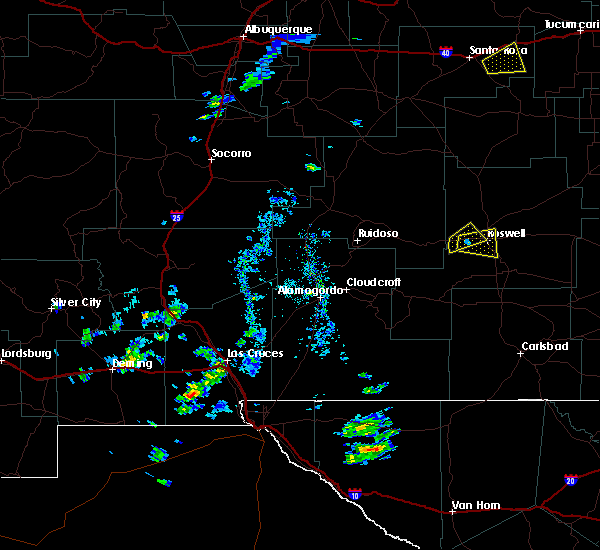 At 358 pm mdt, a severe thunderstorm was located 7 miles west of roswell, moving east at 20 mph (radar indicated). Hazards include half dollar size hail and 70 mph wind gusts. Hail damage to vehicles is expected. expect considerable tree damage. Wind damage is also likely to mobile homes, roofs and outbuildings. At 358 pm mdt, a severe thunderstorm was located 7 miles west of roswell, moving east at 20 mph (radar indicated). Hazards include half dollar size hail and 70 mph wind gusts. Hail damage to vehicles is expected. expect considerable tree damage. Wind damage is also likely to mobile homes, roofs and outbuildings.
|
| 10/19/2015 3:50 PM MDT |
 At 350 pm mdt, a severe thunderstorm was located 9 miles west of roswell, moving east at 20 mph (radar indicated). Hazards include 70 mph wind gusts and half dollar size hail. Hail damage to vehicles is expected. expect considerable tree damage. wind damage is also likely to mobile homes, roofs and outbuildings. Locations impacted include, northern roswell. At 350 pm mdt, a severe thunderstorm was located 9 miles west of roswell, moving east at 20 mph (radar indicated). Hazards include 70 mph wind gusts and half dollar size hail. Hail damage to vehicles is expected. expect considerable tree damage. wind damage is also likely to mobile homes, roofs and outbuildings. Locations impacted include, northern roswell.
|
| 10/19/2015 3:41 PM MDT | Quarter sized hail reported 9.7 miles E of Roswell, NM, hail lasted 5 to 10 minutes. |
| 10/19/2015 3:29 PM MDT |
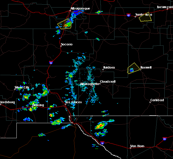 At 328 pm mdt, a severe thunderstorm was located 9 miles west of roswell, moving east at 25 mph (radar indicated). Hazards include 60 mph wind gusts and half dollar size hail. Hail damage to vehicles is expected. expect wind damage to roofs, siding and trees. Locations impacted include, northern roswell, and portions of highway 70 just east of the lincoln county line. At 328 pm mdt, a severe thunderstorm was located 9 miles west of roswell, moving east at 25 mph (radar indicated). Hazards include 60 mph wind gusts and half dollar size hail. Hail damage to vehicles is expected. expect wind damage to roofs, siding and trees. Locations impacted include, northern roswell, and portions of highway 70 just east of the lincoln county line.
|
| 10/19/2015 3:10 PM MDT |
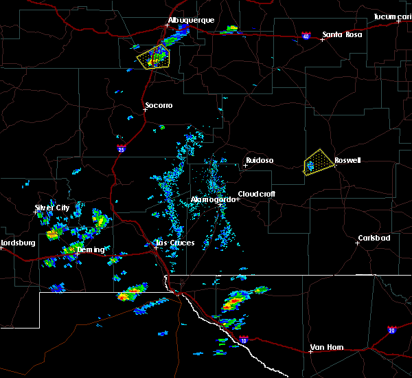 At 309 pm mdt, a severe thunderstorm was located 16 miles east of picacho, or 18 miles west of roswell, moving northeast at 25 mph (radar indicated). Hazards include quarter size hail and 60 mph wind gusts. Hail damage to vehicles is expected. Expect wind damage to roofs, siding and trees. At 309 pm mdt, a severe thunderstorm was located 16 miles east of picacho, or 18 miles west of roswell, moving northeast at 25 mph (radar indicated). Hazards include quarter size hail and 60 mph wind gusts. Hail damage to vehicles is expected. Expect wind damage to roofs, siding and trees.
|
| 9/23/2015 1:41 PM MDT |
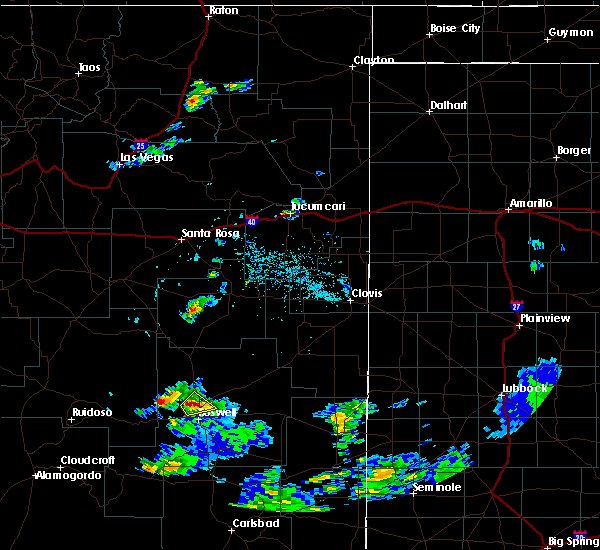 At 141 pm mdt, a severe thunderstorm was located 8 miles north of roswell, moving northeast at 35 mph (radar indicated). Hazards include 60 mph wind gusts and quarter size hail. Hail damage to vehicles is expected. expect wind damage to roofs, siding and trees. locations impacted include, northern roswell and bitter lake wildlife refuge. other locations affected include bitter lake wildlife refuge. This includes highway 285 between mile markers 116 and 124. At 141 pm mdt, a severe thunderstorm was located 8 miles north of roswell, moving northeast at 35 mph (radar indicated). Hazards include 60 mph wind gusts and quarter size hail. Hail damage to vehicles is expected. expect wind damage to roofs, siding and trees. locations impacted include, northern roswell and bitter lake wildlife refuge. other locations affected include bitter lake wildlife refuge. This includes highway 285 between mile markers 116 and 124.
|
| 9/23/2015 1:32 PM MDT | Quarter sized hail reported 4.5 miles ESE of Roswell, NM |
| 9/23/2015 1:25 PM MDT |
 At 125 pm mdt, a severe thunderstorm was located 7 miles northwest of roswell, moving northeast at 35 mph (radar indicated). Hazards include quarter size hail and 60 mph wind gusts. Hail damage to vehicles is expected. Expect wind damage to roofs, siding and trees. At 125 pm mdt, a severe thunderstorm was located 7 miles northwest of roswell, moving northeast at 35 mph (radar indicated). Hazards include quarter size hail and 60 mph wind gusts. Hail damage to vehicles is expected. Expect wind damage to roofs, siding and trees.
|
| 8/9/2015 3:27 PM MDT |
 At 326 pm mdt, a severe thunderstorm was located near bitter lake wildlife refuge, or 10 miles northeast of roswell, moving northeast at 25 mph (radar indicated). Hazards include 60 mph wind gusts and penny size hail. Expect damage to roofs. Siding and trees. At 326 pm mdt, a severe thunderstorm was located near bitter lake wildlife refuge, or 10 miles northeast of roswell, moving northeast at 25 mph (radar indicated). Hazards include 60 mph wind gusts and penny size hail. Expect damage to roofs. Siding and trees.
|
| 8/9/2015 3:07 PM MDT | Krow aso in chaves county NM, 4.7 miles NNW of Roswell, NM |
| 6/15/2015 7:25 PM MDT |
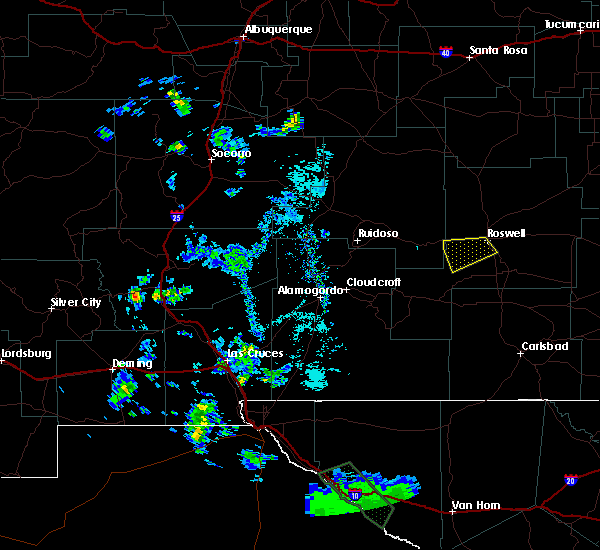 The severe thunderstorm warning for central chaves county will expire at 730 pm mdt, the storm which prompted the warning has weakened below severe limits, and no longer pose an immediate threat to life or property. therefore the warning will be allowed to expire. however small. The severe thunderstorm warning for central chaves county will expire at 730 pm mdt, the storm which prompted the warning has weakened below severe limits, and no longer pose an immediate threat to life or property. therefore the warning will be allowed to expire. however small.
|
| 6/15/2015 7:12 PM MDT |
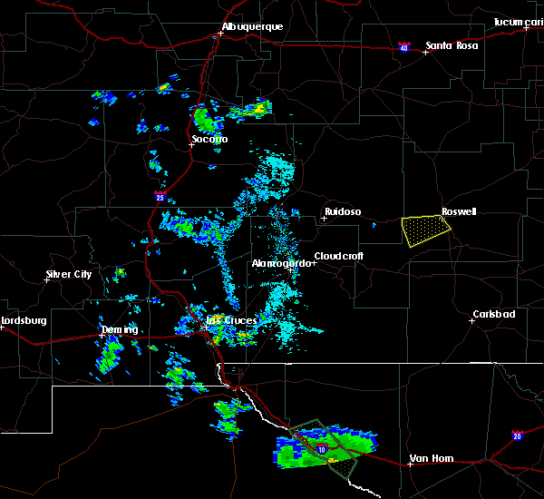 At 712 pm mdt, a severe thunderstorm was located over southern roswell, and is nearly stationary (radar indicated). Hazards include 60 mph wind gusts and quarter size hail. Hail damage to vehicles is expected. expect wind damage to roofs, siding and trees. locations impacted include, roswell and midway. other locations affected include two rivers dam. This includes highway 285 between mile markers 99 and 104. At 712 pm mdt, a severe thunderstorm was located over southern roswell, and is nearly stationary (radar indicated). Hazards include 60 mph wind gusts and quarter size hail. Hail damage to vehicles is expected. expect wind damage to roofs, siding and trees. locations impacted include, roswell and midway. other locations affected include two rivers dam. This includes highway 285 between mile markers 99 and 104.
|
| 6/15/2015 6:52 PM MDT |
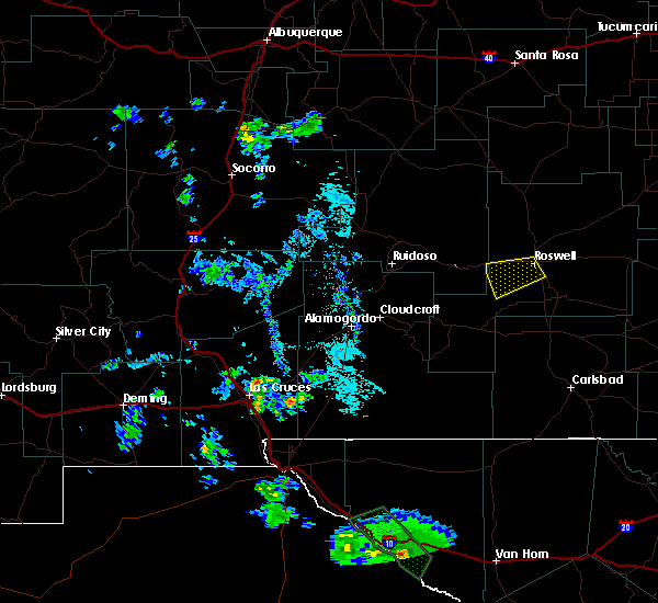 At 651 pm mdt, a severe thunderstorm was located near roswell, moving west at 20 mph (radar indicated). Hazards include quarter size hail and 60 mph wind gusts. Hail damage to vehicles is expected. Expect wind damage to roofs, siding and trees. At 651 pm mdt, a severe thunderstorm was located near roswell, moving west at 20 mph (radar indicated). Hazards include quarter size hail and 60 mph wind gusts. Hail damage to vehicles is expected. Expect wind damage to roofs, siding and trees.
|
| 6/14/2015 2:40 PM MDT | Krow aso in chaves county NM, 4.7 miles NNW of Roswell, NM |
| 5/28/2015 5:02 PM MDT | At 502 pm mdt, a severe thunderstorm was located 17 miles southeast of mesa, or 26 miles north of roswell, moving southeast at 20 mph (radar indicated). Hazards include quarter size hail and 60 mph wind gusts. Hail damage to vehicles is expected. Expect wind damage to roofs, siding and trees. |
| 9/24/2014 6:40 PM MDT | Golf Ball sized hail reported 8.7 miles SSW of Roswell, NM |
| 6/7/2014 8:20 PM MDT | Hen Egg sized hail reported 9.3 miles S of Roswell, NM |
| 5/24/2014 6:30 PM MDT | Quarter sized hail reported 41.9 miles SSE of Roswell, NM |
| 5/22/2014 4:15 PM MDT | 3 foot diameter tree snapped at base damaging car. no injurie in chaves county NM, 1.3 miles NW of Roswell, NM |
| 6/5/2013 7:37 PM MDT | Eight mile draw raw in chaves county NM, 21.7 miles SSW of Roswell, NM |
| 5/25/2013 4:37 PM MDT | Eight mile draw raw in chaves county NM, 21.7 miles SSW of Roswell, NM |
| 10/12/2012 7:00 PM MDT | Quarter sized hail reported 41.6 miles SW of Roswell, NM |
| 9/30/2012 5:43 PM MDT | Quarter sized hail reported 41.6 miles SW of Roswell, NM, hail lasted for 10 minutes. |
| 5/7/2012 3:30 PM MDT | Golf Ball sized hail reported 37.9 miles NE of Roswell, NM |
| 1/1/0001 12:00 AM | Krow aso in chaves county NM, 4.7 miles NNW of Roswell, NM |
| 1/1/0001 12:00 AM | Krow aso in chaves county NM, 4.7 miles NNW of Roswell, NM |
| 1/1/0001 12:00 AM | Krow aso in chaves county NM, 4.7 miles NNW of Roswell, NM |
| 1/1/0001 12:00 AM | Roof ripped off house in chaves county NM, 1.2 miles NNE of Roswell, NM |
Hail Maps for Roswell, NM
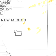
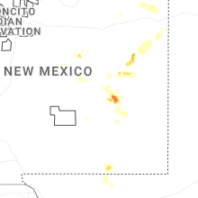
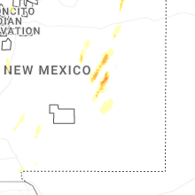


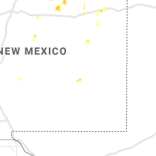


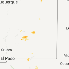


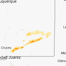


Connect with Interactive Hail Maps