

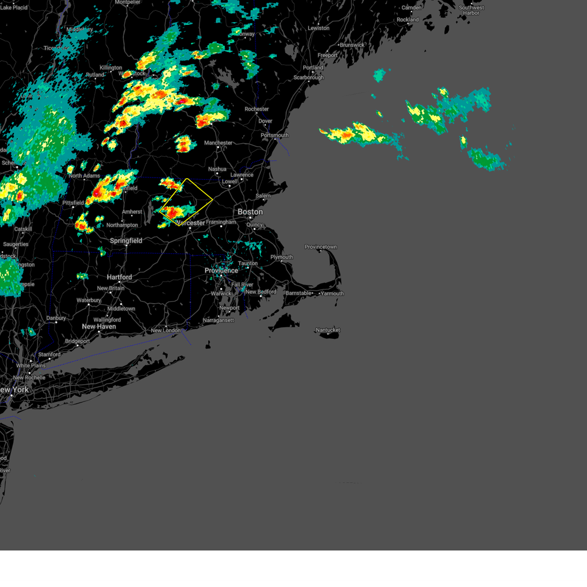
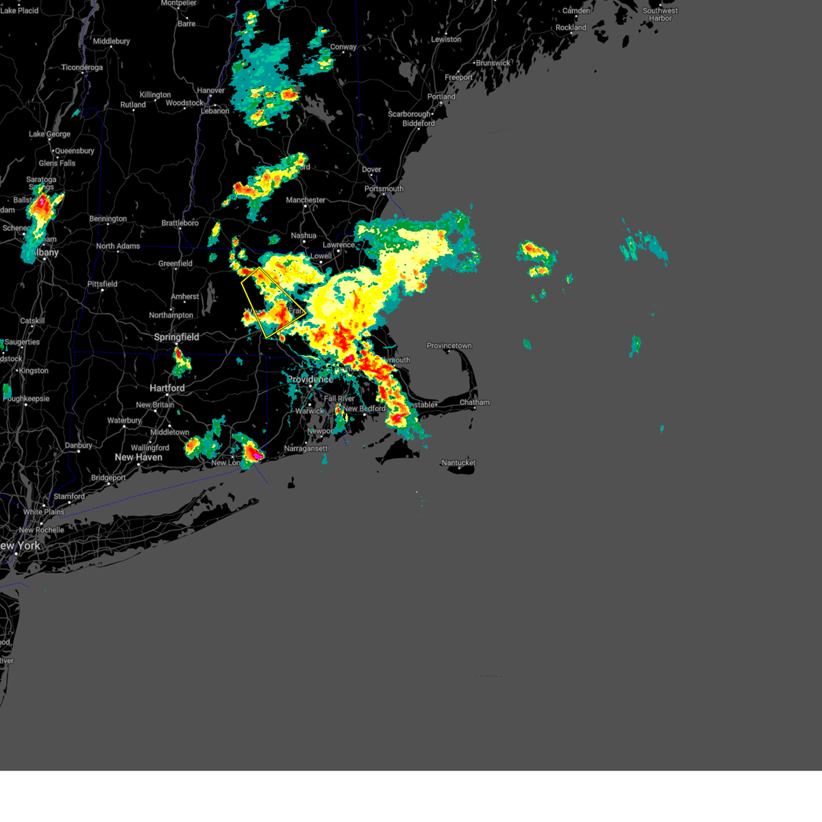
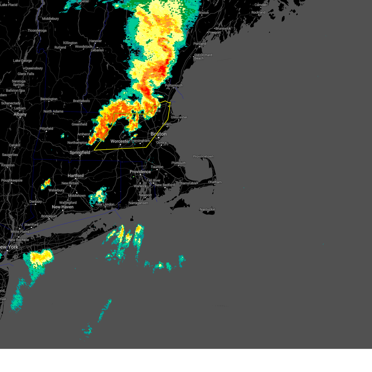
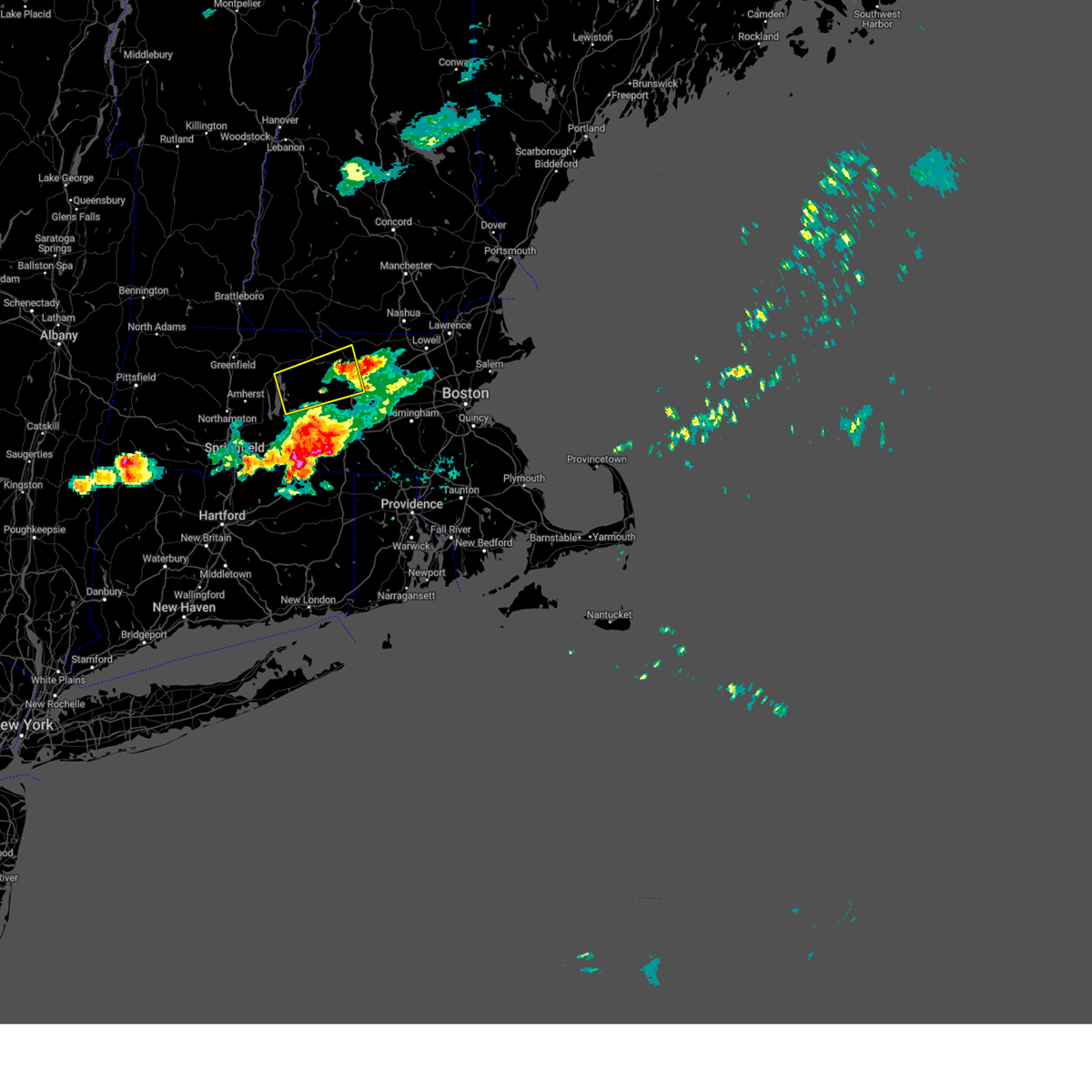
Hail Map for Rutland, MA
The Rutland, MA area has had 5 reports of on-the-ground hail by trained spotters, and has been under severe weather warnings 7 times during the past 12 months. Doppler radar has detected hail at or near Rutland, MA on 14 occasions, including 3 occasions during the past year.
| Name: | Rutland, MA |
| Where Located: | 46.5 miles NW of Providence, RI |
| Map: | Google Map for Rutland, MA |
| Population: | 2111 |
| Housing Units: | 910 |
| More Info: | Search Google for Rutland, MA |
2
The Top Recent Hail Date for Rutland, MA is Monday, August 26, 2024 (3rd out of 14)

Hail and Wind Damage Spotted near Rutland, MA
| Date / Time | Report Details |
|---|---|
| 6/6/2025 3:50 PM EDT | In rutland... a tree fell blocking half of east center road. report relayed via amateur radi in worcester county MA, 0.3 miles NW of Rutland, MA |
| 6/6/2025 3:38 PM EDT |
 Svrbox the national weather service in boston/norton has issued a * severe thunderstorm warning for, northern worcester county in central massachusetts, northwestern middlesex county in northeastern massachusetts, * until 430 pm edt. * at 338 pm edt, a severe thunderstorm was located over rutland, or 13 miles northwest of worcester, moving northeast at 20 mph (radar indicated). Hazards include 60 mph wind gusts and quarter size hail. Hail damage to vehicles is expected. Expect wind damage to trees and power lines. Svrbox the national weather service in boston/norton has issued a * severe thunderstorm warning for, northern worcester county in central massachusetts, northwestern middlesex county in northeastern massachusetts, * until 430 pm edt. * at 338 pm edt, a severe thunderstorm was located over rutland, or 13 miles northwest of worcester, moving northeast at 20 mph (radar indicated). Hazards include 60 mph wind gusts and quarter size hail. Hail damage to vehicles is expected. Expect wind damage to trees and power lines.
|
| 5/8/2025 7:07 PM EDT | The storm which prompted the warning has weakened below severe limits, and no longer poses an immediate threat to life or property. therefore, the warning will be allowed to expire. however heavy rain will accompany these storms. |
| 5/8/2025 6:30 PM EDT |
 Svrbox the national weather service in boston/norton has issued a * severe thunderstorm warning for, central worcester county in central massachusetts, eastern hampshire county in western massachusetts, * until 715 pm edt. * at 630 pm edt, a severe thunderstorm was located over west brookfield, or 17 miles west of worcester, moving northeast at 30 mph (radar indicated). Hazards include quarter size hail. damage to vehicles is expected Svrbox the national weather service in boston/norton has issued a * severe thunderstorm warning for, central worcester county in central massachusetts, eastern hampshire county in western massachusetts, * until 715 pm edt. * at 630 pm edt, a severe thunderstorm was located over west brookfield, or 17 miles west of worcester, moving northeast at 30 mph (radar indicated). Hazards include quarter size hail. damage to vehicles is expected
|
| 1/1/0001 12:00 AM | Tree and wires downed on damon rd. relayed by amateur radi in worcester county MA, 4.9 miles W of Rutland, MA |
| 5/3/2025 4:50 PM EDT | Trees reported down on wires in holden. time estimated by radar and relayed via amateur radi in worcester county MA, 5 miles WSW of Rutland, MA |
| 1/1/0001 12:00 AM | Tree down on turkey hill dr in paxton. relayed via amateur radio. time estimated by rada in worcester county MA, 2.3 miles N of Rutland, MA |
| 5/3/2025 4:41 PM EDT |
 Svrbox the national weather service in boston/norton has issued a * severe thunderstorm warning for, central worcester county in central massachusetts, central middlesex county in northeastern massachusetts, * until 530 pm edt. * at 441 pm edt, a severe thunderstorm was located over oakham, or 15 miles west of worcester, moving east at 55 mph (radar indicated). Hazards include 60 mph wind gusts and nickel size hail. expect damage to trees and power lines Svrbox the national weather service in boston/norton has issued a * severe thunderstorm warning for, central worcester county in central massachusetts, central middlesex county in northeastern massachusetts, * until 530 pm edt. * at 441 pm edt, a severe thunderstorm was located over oakham, or 15 miles west of worcester, moving east at 55 mph (radar indicated). Hazards include 60 mph wind gusts and nickel size hail. expect damage to trees and power lines
|
| 5/3/2025 4:40 PM EDT | 2 trees down near scott road. relayed via amateur radi in worcester county MA, 5 miles E of Rutland, MA |
| 8/26/2024 2:07 PM EDT | Quarter sized hail reported 0.3 miles NW of Rutland, MA, quarter sized hail in rutland. relayed via amateur radio. |
| 8/26/2024 1:45 PM EDT | Quarter sized hail reported 5 miles E of Rutland, MA |
| 8/26/2024 1:20 PM EDT |
 Svrbox the national weather service in boston/norton has issued a * severe thunderstorm warning for, central worcester county in central massachusetts, * until 200 pm edt. * at 119 pm edt, a severe thunderstorm was located over hubbardston, or 10 miles west of leominster, moving south at 15 mph (radar indicated). Hazards include 60 mph wind gusts and quarter size hail. Hail damage to vehicles is expected. Expect wind damage to trees and power lines. Svrbox the national weather service in boston/norton has issued a * severe thunderstorm warning for, central worcester county in central massachusetts, * until 200 pm edt. * at 119 pm edt, a severe thunderstorm was located over hubbardston, or 10 miles west of leominster, moving south at 15 mph (radar indicated). Hazards include 60 mph wind gusts and quarter size hail. Hail damage to vehicles is expected. Expect wind damage to trees and power lines.
|
| 8/15/2024 4:39 PM EDT |
 The storm which prompted the warning has weakened below severe limits, and no longer poses an immediate threat to life or property. therefore, the warning will be allowed to expire. The storm which prompted the warning has weakened below severe limits, and no longer poses an immediate threat to life or property. therefore, the warning will be allowed to expire.
|
| 8/15/2024 4:03 PM EDT |
 Svrbox the national weather service in boston/norton has issued a * severe thunderstorm warning for, eastern worcester county in central massachusetts, south central middlesex county in northeastern massachusetts, * until 445 pm edt. * at 403 pm edt, a severe thunderstorm was located over princeton, or near leominster, moving southeast at 30 mph (radar indicated). Hazards include 60 mph wind gusts and nickel size hail. expect damage to trees and power lines Svrbox the national weather service in boston/norton has issued a * severe thunderstorm warning for, eastern worcester county in central massachusetts, south central middlesex county in northeastern massachusetts, * until 445 pm edt. * at 403 pm edt, a severe thunderstorm was located over princeton, or near leominster, moving southeast at 30 mph (radar indicated). Hazards include 60 mph wind gusts and nickel size hail. expect damage to trees and power lines
|
| 7/17/2024 6:49 PM EDT |
 the severe thunderstorm warning has been cancelled and is no longer in effect the severe thunderstorm warning has been cancelled and is no longer in effect
|
| 7/17/2024 6:49 PM EDT |
 At 648 pm edt, severe thunderstorms were located along a line extending from near groton to shrewsbury to southbridge, moving east at 60 mph (radar indicated). Hazards include 60 mph wind gusts and penny size hail. Expect damage to roofs, siding, and trees. Locations impacted include, worcester, lowell, framingham, leominster, fitchburg, billerica, marlborough, shrewsbury, chelmsford, natick, dracut, westford, acton, hudson, westborough, concord, sudbury, holden, ashland, and hopkinton. At 648 pm edt, severe thunderstorms were located along a line extending from near groton to shrewsbury to southbridge, moving east at 60 mph (radar indicated). Hazards include 60 mph wind gusts and penny size hail. Expect damage to roofs, siding, and trees. Locations impacted include, worcester, lowell, framingham, leominster, fitchburg, billerica, marlborough, shrewsbury, chelmsford, natick, dracut, westford, acton, hudson, westborough, concord, sudbury, holden, ashland, and hopkinton.
|
| 7/17/2024 6:23 PM EDT | Svrbox the national weather service in boston/norton has issued a * severe thunderstorm warning for, worcester county in central massachusetts, central middlesex county in northeastern massachusetts, southeastern hampden county in western massachusetts, * until 730 pm edt. * at 622 pm edt, severe thunderstorms were located along a line extending from near ashburnham to spencer to near monson, moving east at 30 mph (radar indicated). Hazards include 60 mph wind gusts and penny size hail. expect damage to roofs, siding, and trees |
| 7/17/2024 5:55 PM EDT | At 555 pm edt, severe thunderstorms were located along a line extending from gardner to new braintree to monson, moving east at 40 mph (radar indicated). Hazards include 60 mph wind gusts and penny size hail. Expect damage to roofs, siding, and trees. Locations impacted include, worcester, springfield, chicopee, leominster, fitchburg, orange, ludlow, gardner, holden, southbridge, auburn, belchertown, wilbraham, oxford, charlton, palmer, spencer, athol, leicester, and winchendon. |
| 7/17/2024 5:46 PM EDT | At 545 pm edt, severe thunderstorms were located along a line extending from near templeton to hardwick to hampden, moving east at 45 mph (radar indicated). Hazards include 60 mph wind gusts and penny size hail. Expect damage to roofs, siding, and trees. Locations impacted include, worcester, springfield, chicopee, leominster, fitchburg, holyoke, amherst, orange, ludlow, gardner, south hadley, holden, southbridge, auburn, belchertown, wilbraham, oxford, charlton, palmer, and spencer. |
| 7/17/2024 5:26 PM EDT |
 Svrbox the national weather service in boston/norton has issued a * severe thunderstorm warning for, worcester county in central massachusetts, southeastern hampshire county in western massachusetts, eastern franklin county in western massachusetts, northeastern hampden county in western massachusetts, * until 630 pm edt. * at 525 pm edt, severe thunderstorms were located along a line extending from near erving to hadley to westfield, moving east at 55 mph (radar indicated). Hazards include 60 mph wind gusts and penny size hail. expect damage to roofs, siding, and trees Svrbox the national weather service in boston/norton has issued a * severe thunderstorm warning for, worcester county in central massachusetts, southeastern hampshire county in western massachusetts, eastern franklin county in western massachusetts, northeastern hampden county in western massachusetts, * until 630 pm edt. * at 525 pm edt, severe thunderstorms were located along a line extending from near erving to hadley to westfield, moving east at 55 mph (radar indicated). Hazards include 60 mph wind gusts and penny size hail. expect damage to roofs, siding, and trees
|
| 7/16/2024 8:51 PM EDT |
 At 851 pm edt, severe thunderstorms were located along a line extending from near nashua to ayer to near worcester, moving east at 55 mph (radar indicated). Hazards include 60 mph wind gusts. Expect damage to roofs, siding, and trees. Locations impacted include, boston, worcester, lowell, cambridge, lynn, newton, lawrence, somerville, framingham, haverhill, waltham, malden, medford, peabody, methuen, arlington, leominster, fitchburg, billerica, and marlborough. At 851 pm edt, severe thunderstorms were located along a line extending from near nashua to ayer to near worcester, moving east at 55 mph (radar indicated). Hazards include 60 mph wind gusts. Expect damage to roofs, siding, and trees. Locations impacted include, boston, worcester, lowell, cambridge, lynn, newton, lawrence, somerville, framingham, haverhill, waltham, malden, medford, peabody, methuen, arlington, leominster, fitchburg, billerica, and marlborough.
|
| 7/16/2024 8:51 PM EDT |
 the severe thunderstorm warning has been cancelled and is no longer in effect the severe thunderstorm warning has been cancelled and is no longer in effect
|
| 7/16/2024 8:32 PM EDT |
 Svrbox the national weather service in boston/norton has issued a * severe thunderstorm warning for, essex county in northeastern massachusetts, central worcester county in central massachusetts, north central norfolk county in eastern massachusetts, northwestern suffolk county in eastern massachusetts, eastern hampshire county in western massachusetts, middlesex county in northeastern massachusetts, northeastern hampden county in western massachusetts, * until 915 pm edt. * at 830 pm edt, severe thunderstorms were located along a line extending from greenville to westminster to west brookfield, moving east at 45 mph (radar indicated). Hazards include 60 mph wind gusts. expect damage to roofs, siding, and trees Svrbox the national weather service in boston/norton has issued a * severe thunderstorm warning for, essex county in northeastern massachusetts, central worcester county in central massachusetts, north central norfolk county in eastern massachusetts, northwestern suffolk county in eastern massachusetts, eastern hampshire county in western massachusetts, middlesex county in northeastern massachusetts, northeastern hampden county in western massachusetts, * until 915 pm edt. * at 830 pm edt, severe thunderstorms were located along a line extending from greenville to westminster to west brookfield, moving east at 45 mph (radar indicated). Hazards include 60 mph wind gusts. expect damage to roofs, siding, and trees
|
| 7/16/2024 7:21 PM EDT |
 Svrbox the national weather service in boston/norton has issued a * severe thunderstorm warning for, northern worcester county in central massachusetts, central hampshire county in western massachusetts, northwestern middlesex county in northeastern massachusetts, eastern franklin county in western massachusetts, * until 815 pm edt. * at 721 pm edt, severe thunderstorms were located along a line extending from near warwick to near wendell to whately, moving east at 45 mph (trained weather spotters). Hazards include 70 mph wind gusts. Expect considerable tree damage. Damage is likely to mobile homes, roofs, and outbuildings. Svrbox the national weather service in boston/norton has issued a * severe thunderstorm warning for, northern worcester county in central massachusetts, central hampshire county in western massachusetts, northwestern middlesex county in northeastern massachusetts, eastern franklin county in western massachusetts, * until 815 pm edt. * at 721 pm edt, severe thunderstorms were located along a line extending from near warwick to near wendell to whately, moving east at 45 mph (trained weather spotters). Hazards include 70 mph wind gusts. Expect considerable tree damage. Damage is likely to mobile homes, roofs, and outbuildings.
|
| 6/22/2024 3:35 PM EDT |
 At 334 pm edt, severe thunderstorms were located along a line extending from near rutland to near palmer to somers, moving east at 30 mph (radar indicated). Hazards include 60 mph wind gusts and penny size hail. Expect damage to roofs, siding, and trees. Locations impacted include, worcester, framingham, enfield, marlborough, shrewsbury, westborough, grafton, holden, webster, southbridge, ashland, auburn, east longmeadow, northbridge, ellington, hopkinton, belchertown, wilbraham, northborough, and oxford. At 334 pm edt, severe thunderstorms were located along a line extending from near rutland to near palmer to somers, moving east at 30 mph (radar indicated). Hazards include 60 mph wind gusts and penny size hail. Expect damage to roofs, siding, and trees. Locations impacted include, worcester, framingham, enfield, marlborough, shrewsbury, westborough, grafton, holden, webster, southbridge, ashland, auburn, east longmeadow, northbridge, ellington, hopkinton, belchertown, wilbraham, northborough, and oxford.
|
| 6/22/2024 3:35 PM EDT |
 the severe thunderstorm warning has been cancelled and is no longer in effect the severe thunderstorm warning has been cancelled and is no longer in effect
|
| 6/22/2024 3:22 PM EDT |
 Svrbox the national weather service in boston/norton has issued a * severe thunderstorm warning for, northern windham county in northern connecticut, northern tolland county in northern connecticut, northeastern hartford county in northern connecticut, southern worcester county in central massachusetts, southeastern hampshire county in western massachusetts, south central middlesex county in northeastern massachusetts, southeastern franklin county in western massachusetts, southeastern hampden county in western massachusetts, * until 415 pm edt. * at 321 pm edt, severe thunderstorms were located along a line extending from oakham to near ludlow to enfield, moving east at 30 mph (radar indicated). Hazards include 60 mph wind gusts and penny size hail. expect damage to roofs, siding, and trees Svrbox the national weather service in boston/norton has issued a * severe thunderstorm warning for, northern windham county in northern connecticut, northern tolland county in northern connecticut, northeastern hartford county in northern connecticut, southern worcester county in central massachusetts, southeastern hampshire county in western massachusetts, south central middlesex county in northeastern massachusetts, southeastern franklin county in western massachusetts, southeastern hampden county in western massachusetts, * until 415 pm edt. * at 321 pm edt, severe thunderstorms were located along a line extending from oakham to near ludlow to enfield, moving east at 30 mph (radar indicated). Hazards include 60 mph wind gusts and penny size hail. expect damage to roofs, siding, and trees
|
| 6/20/2024 8:51 PM EDT |
 the severe thunderstorm warning has been cancelled and is no longer in effect the severe thunderstorm warning has been cancelled and is no longer in effect
|
| 6/20/2024 8:46 PM EDT |
 At 845 pm edt, severe thunderstorms were located along a line extending from near framingham to near leicester to brookfield, moving southeast at 25 mph (radar indicated). Hazards include 60 mph wind gusts. Expect damage to roofs, siding, and trees. Locations impacted include, worcester, framingham, marlborough, shrewsbury, hudson, westborough, grafton, sudbury, holden, auburn, northborough, oxford, clinton, millbury, wayland, charlton, palmer, spencer, leicester, and ware. At 845 pm edt, severe thunderstorms were located along a line extending from near framingham to near leicester to brookfield, moving southeast at 25 mph (radar indicated). Hazards include 60 mph wind gusts. Expect damage to roofs, siding, and trees. Locations impacted include, worcester, framingham, marlborough, shrewsbury, hudson, westborough, grafton, sudbury, holden, auburn, northborough, oxford, clinton, millbury, wayland, charlton, palmer, spencer, leicester, and ware.
|
| 6/20/2024 8:46 PM EDT |
 the severe thunderstorm warning has been cancelled and is no longer in effect the severe thunderstorm warning has been cancelled and is no longer in effect
|
| 6/20/2024 8:26 PM EDT |
 At 826 pm edt, severe thunderstorms were located along a line extending from clinton to new braintree to south hadley, moving east at 40 mph (radar indicated). Hazards include 60 mph wind gusts. Expect damage to roofs, siding, and trees. Locations impacted include, worcester, framingham, leominster, holyoke, marlborough, amherst, shrewsbury, northampton, ludlow, hudson, westborough, grafton, sudbury, south hadley, holden, auburn, easthampton, belchertown, wilbraham, and northborough. At 826 pm edt, severe thunderstorms were located along a line extending from clinton to new braintree to south hadley, moving east at 40 mph (radar indicated). Hazards include 60 mph wind gusts. Expect damage to roofs, siding, and trees. Locations impacted include, worcester, framingham, leominster, holyoke, marlborough, amherst, shrewsbury, northampton, ludlow, hudson, westborough, grafton, sudbury, south hadley, holden, auburn, easthampton, belchertown, wilbraham, and northborough.
|
| 6/20/2024 8:10 PM EDT |
 Svrbox the national weather service in boston/norton has issued a * severe thunderstorm warning for, central worcester county in central massachusetts, southeastern hampshire county in western massachusetts, central middlesex county in northeastern massachusetts, southeastern franklin county in western massachusetts, northeastern hampden county in western massachusetts, * until 915 pm edt. * at 809 pm edt, severe thunderstorms were located along a line extending from near princeton to hardwick to near hadley, moving southeast at 20 mph (radar indicated). Hazards include 60 mph wind gusts. expect damage to roofs, siding, and trees Svrbox the national weather service in boston/norton has issued a * severe thunderstorm warning for, central worcester county in central massachusetts, southeastern hampshire county in western massachusetts, central middlesex county in northeastern massachusetts, southeastern franklin county in western massachusetts, northeastern hampden county in western massachusetts, * until 915 pm edt. * at 809 pm edt, severe thunderstorms were located along a line extending from near princeton to hardwick to near hadley, moving southeast at 20 mph (radar indicated). Hazards include 60 mph wind gusts. expect damage to roofs, siding, and trees
|
| 6/19/2024 6:20 PM EDT |
 the severe thunderstorm warning has been cancelled and is no longer in effect the severe thunderstorm warning has been cancelled and is no longer in effect
|
| 6/19/2024 6:08 PM EDT |
 At 608 pm edt, a severe thunderstorm was located over petersham, or 9 miles southeast of orange, moving south at 20 mph (radar indicated). Hazards include 60 mph wind gusts and nickel size hail. Expect damage to roofs, siding, and trees. Locations impacted include, belchertown, athol, ware, templeton, rutland, barre, hubbardston, hardwick, oakham, phillipston, pelham, petersham, new braintree, and new salem. At 608 pm edt, a severe thunderstorm was located over petersham, or 9 miles southeast of orange, moving south at 20 mph (radar indicated). Hazards include 60 mph wind gusts and nickel size hail. Expect damage to roofs, siding, and trees. Locations impacted include, belchertown, athol, ware, templeton, rutland, barre, hubbardston, hardwick, oakham, phillipston, pelham, petersham, new braintree, and new salem.
|
| 6/19/2024 5:52 PM EDT |
 Svrbox the national weather service in boston/norton has issued a * severe thunderstorm warning for, northwestern worcester county in central massachusetts, east central hampshire county in western massachusetts, southeastern franklin county in western massachusetts, * until 645 pm edt. * at 552 pm edt, a severe thunderstorm was located over athol, or near orange, moving south at 15 mph (radar indicated). Hazards include 60 mph wind gusts and nickel size hail. expect damage to roofs, siding, and trees Svrbox the national weather service in boston/norton has issued a * severe thunderstorm warning for, northwestern worcester county in central massachusetts, east central hampshire county in western massachusetts, southeastern franklin county in western massachusetts, * until 645 pm edt. * at 552 pm edt, a severe thunderstorm was located over athol, or near orange, moving south at 15 mph (radar indicated). Hazards include 60 mph wind gusts and nickel size hail. expect damage to roofs, siding, and trees
|
| 5/8/2024 4:29 PM EDT |
 the severe thunderstorm warning has been cancelled and is no longer in effect the severe thunderstorm warning has been cancelled and is no longer in effect
|
| 5/8/2024 4:03 PM EDT |
 the severe thunderstorm warning has been cancelled and is no longer in effect the severe thunderstorm warning has been cancelled and is no longer in effect
|
| 5/8/2024 4:03 PM EDT |
 At 403 pm edt, a severe thunderstorm was located near barre, or 12 miles southeast of orange, moving east at 30 mph (radar indicated). Hazards include 60 mph wind gusts and half dollar size hail. Hail damage to vehicles is expected. expect wind damage to roofs, siding, and trees. Locations impacted include, leominster, fitchburg, gardner, holden, athol, templeton, rutland, sterling, westminster, ashburnham, barre, hubbardston, princeton, ashby, hardwick, oakham, phillipston, petersham, new braintree, and new salem. At 403 pm edt, a severe thunderstorm was located near barre, or 12 miles southeast of orange, moving east at 30 mph (radar indicated). Hazards include 60 mph wind gusts and half dollar size hail. Hail damage to vehicles is expected. expect wind damage to roofs, siding, and trees. Locations impacted include, leominster, fitchburg, gardner, holden, athol, templeton, rutland, sterling, westminster, ashburnham, barre, hubbardston, princeton, ashby, hardwick, oakham, phillipston, petersham, new braintree, and new salem.
|
| 5/8/2024 3:44 PM EDT |
 Svrbox the national weather service in boston/norton has issued a * severe thunderstorm warning for, northwestern worcester county in central massachusetts, east central hampshire county in western massachusetts, northwestern middlesex county in northeastern massachusetts, southeastern franklin county in western massachusetts, * until 445 pm edt. * at 344 pm edt, a severe thunderstorm was located near new salem, or 9 miles east of amherst, moving east at 30 mph (radar indicated). Hazards include 60 mph wind gusts and half dollar size hail. Hail damage to vehicles is expected. Expect wind damage to roofs, siding, and trees. Svrbox the national weather service in boston/norton has issued a * severe thunderstorm warning for, northwestern worcester county in central massachusetts, east central hampshire county in western massachusetts, northwestern middlesex county in northeastern massachusetts, southeastern franklin county in western massachusetts, * until 445 pm edt. * at 344 pm edt, a severe thunderstorm was located near new salem, or 9 miles east of amherst, moving east at 30 mph (radar indicated). Hazards include 60 mph wind gusts and half dollar size hail. Hail damage to vehicles is expected. Expect wind damage to roofs, siding, and trees.
|
| 9/8/2023 7:10 PM EDT |
 At 710 pm edt, a severe thunderstorm was located over princeton, or near leominster, moving northeast at 50 mph (radar indicated). Hazards include 60 mph wind gusts and quarter size hail. Hail damage to vehicles is expected. Expect wind damage to roofs, siding, and trees. At 710 pm edt, a severe thunderstorm was located over princeton, or near leominster, moving northeast at 50 mph (radar indicated). Hazards include 60 mph wind gusts and quarter size hail. Hail damage to vehicles is expected. Expect wind damage to roofs, siding, and trees.
|
| 9/8/2023 7:06 PM EDT | Tree downed blocking intervale road by rte 68. time estimated from rada in worcester county MA, 4.8 miles SSE of Rutland, MA |
| 9/8/2023 2:10 PM EDT |
 At 210 pm edt, severe thunderstorms were located along a line extending from near rutland to near worcester to auburn to sutton to thompson, moving northeast at 40 mph (radar indicated). Hazards include 60 mph wind gusts and quarter size hail. Hail damage to vehicles is expected. expect wind damage to roofs, siding, and trees. locations impacted include, worcester, shrewsbury, grafton, holden, webster, auburn, northbridge, oxford, uxbridge, millbury, charlton, spencer, dudley, leicester, thompson, sutton, douglas, rutland, sterling, and west boylston. hail threat, radar indicated max hail size, 1. 00 in wind threat, radar indicated max wind gust, 60 mph. At 210 pm edt, severe thunderstorms were located along a line extending from near rutland to near worcester to auburn to sutton to thompson, moving northeast at 40 mph (radar indicated). Hazards include 60 mph wind gusts and quarter size hail. Hail damage to vehicles is expected. expect wind damage to roofs, siding, and trees. locations impacted include, worcester, shrewsbury, grafton, holden, webster, auburn, northbridge, oxford, uxbridge, millbury, charlton, spencer, dudley, leicester, thompson, sutton, douglas, rutland, sterling, and west boylston. hail threat, radar indicated max hail size, 1. 00 in wind threat, radar indicated max wind gust, 60 mph.
|
| 9/8/2023 1:58 PM EDT |
 At 158 pm edt, severe thunderstorms were located along a line extending from near rutland to charlton to dudley, moving northeast at 25 mph (radar indicated). Hazards include 60 mph wind gusts and quarter size hail. Hail damage to vehicles is expected. expect wind damage to roofs, siding, and trees. locations impacted include, worcester, shrewsbury, grafton, holden, webster, southbridge, auburn, northbridge, oxford, uxbridge, millbury, charlton, spencer, dudley, leicester, thompson, sturbridge, sutton, douglas, and rutland. hail threat, radar indicated max hail size, 1. 00 in wind threat, radar indicated max wind gust, 60 mph. At 158 pm edt, severe thunderstorms were located along a line extending from near rutland to charlton to dudley, moving northeast at 25 mph (radar indicated). Hazards include 60 mph wind gusts and quarter size hail. Hail damage to vehicles is expected. expect wind damage to roofs, siding, and trees. locations impacted include, worcester, shrewsbury, grafton, holden, webster, southbridge, auburn, northbridge, oxford, uxbridge, millbury, charlton, spencer, dudley, leicester, thompson, sturbridge, sutton, douglas, and rutland. hail threat, radar indicated max hail size, 1. 00 in wind threat, radar indicated max wind gust, 60 mph.
|
| 9/8/2023 1:46 PM EDT |
 At 146 pm edt, severe thunderstorms were located along a line extending from near north brookfield to southbridge to near woodstock, moving northeast at 30 mph (radar indicated). Hazards include 60 mph wind gusts and quarter size hail. Hail damage to vehicles is expected. expect wind damage to roofs, siding, and trees. locations impacted include, worcester, shrewsbury, grafton, holden, webster, southbridge, auburn, northbridge, oxford, uxbridge, millbury, charlton, stafford, spencer, dudley, leicester, thompson, sturbridge, sutton, and douglas. hail threat, radar indicated max hail size, 1. 00 in wind threat, radar indicated max wind gust, 60 mph. At 146 pm edt, severe thunderstorms were located along a line extending from near north brookfield to southbridge to near woodstock, moving northeast at 30 mph (radar indicated). Hazards include 60 mph wind gusts and quarter size hail. Hail damage to vehicles is expected. expect wind damage to roofs, siding, and trees. locations impacted include, worcester, shrewsbury, grafton, holden, webster, southbridge, auburn, northbridge, oxford, uxbridge, millbury, charlton, stafford, spencer, dudley, leicester, thompson, sturbridge, sutton, and douglas. hail threat, radar indicated max hail size, 1. 00 in wind threat, radar indicated max wind gust, 60 mph.
|
| 9/8/2023 1:27 PM EDT |
 At 127 pm edt, severe thunderstorms were located along a line extending from near brookfield to near union to ashford, moving northeast at 25 mph (radar indicated). Hazards include 60 mph wind gusts and quarter size hail. Hail damage to vehicles is expected. Expect wind damage to roofs, siding, and trees. At 127 pm edt, severe thunderstorms were located along a line extending from near brookfield to near union to ashford, moving northeast at 25 mph (radar indicated). Hazards include 60 mph wind gusts and quarter size hail. Hail damage to vehicles is expected. Expect wind damage to roofs, siding, and trees.
|
| 7/27/2023 4:29 PM EDT |
 At 428 pm edt, a severe thunderstorm was located over palmer, or 12 miles east of springfield, moving east at 35 mph (trained weather spotters have reported a history of wind damage with these storms). Hazards include 60 mph wind gusts and penny size hail. Expect damage to trees and power lines. locations impacted include, worcester, springfield, chicopee, enfield, westfield, holyoke, amherst, agawam, west springfield, ludlow, south hadley, holden, webster, southbridge, auburn, easthampton, longmeadow, suffield, east longmeadow and ellington. hail threat, radar indicated max hail size, 0. 75 in wind threat, observed max wind gust, 60 mph. At 428 pm edt, a severe thunderstorm was located over palmer, or 12 miles east of springfield, moving east at 35 mph (trained weather spotters have reported a history of wind damage with these storms). Hazards include 60 mph wind gusts and penny size hail. Expect damage to trees and power lines. locations impacted include, worcester, springfield, chicopee, enfield, westfield, holyoke, amherst, agawam, west springfield, ludlow, south hadley, holden, webster, southbridge, auburn, easthampton, longmeadow, suffield, east longmeadow and ellington. hail threat, radar indicated max hail size, 0. 75 in wind threat, observed max wind gust, 60 mph.
|
| 7/27/2023 4:19 PM EDT |
 At 417 pm edt, a severe thunderstorm was located over ludlow, or near springfield, moving east at 35 mph (trained weather spotters that these storms have resulted in wind damage. this is particularly true in the westfield area where the asos recorded a 66 mph wind gusts as the storms moved across the region). Hazards include 60 mph wind gusts and penny size hail. Expect damage to trees and power lines. locations impacted include, worcester, springfield, chicopee, enfield, westfield, holyoke, amherst, northampton, agawam, west springfield, ludlow, south hadley, holden, webster, southbridge, auburn, easthampton, longmeadow, suffield and east longmeadow. hail threat, radar indicated max hail size, 0. 75 in wind threat, observed max wind gust, 60 mph. At 417 pm edt, a severe thunderstorm was located over ludlow, or near springfield, moving east at 35 mph (trained weather spotters that these storms have resulted in wind damage. this is particularly true in the westfield area where the asos recorded a 66 mph wind gusts as the storms moved across the region). Hazards include 60 mph wind gusts and penny size hail. Expect damage to trees and power lines. locations impacted include, worcester, springfield, chicopee, enfield, westfield, holyoke, amherst, northampton, agawam, west springfield, ludlow, south hadley, holden, webster, southbridge, auburn, easthampton, longmeadow, suffield and east longmeadow. hail threat, radar indicated max hail size, 0. 75 in wind threat, observed max wind gust, 60 mph.
|
| 7/27/2023 4:03 PM EDT |
 At 400 pm edt, a severe thunderstorm was located over west springfield, moving east at 35 mph (the westfield asos just reported a wind gusts of 66 mph. these are dangerous storms that will produced wind damage). Hazards include 60 mph wind gusts and penny size hail. expect damage to trees and power lines At 400 pm edt, a severe thunderstorm was located over west springfield, moving east at 35 mph (the westfield asos just reported a wind gusts of 66 mph. these are dangerous storms that will produced wind damage). Hazards include 60 mph wind gusts and penny size hail. expect damage to trees and power lines
|
| 7/21/2023 9:49 PM EDT |
 At 949 pm edt, a severe thunderstorm was located over paxton, or near worcester, moving northeast at 20 mph (radar indicated). Hazards include 60 mph wind gusts and quarter size hail. Expect wind damage to trees and power lines. minor hail damage to vehicles is possible. locations impacted include, worcester, leominster, shrewsbury, westborough, holden, auburn, northborough, clinton, spencer, leicester, lancaster, rutland, sterling, west boylston, paxton, boylston, princeton, berlin and oakham. hail threat, radar indicated max hail size, 1. 00 in wind threat, radar indicated max wind gust, 60 mph. At 949 pm edt, a severe thunderstorm was located over paxton, or near worcester, moving northeast at 20 mph (radar indicated). Hazards include 60 mph wind gusts and quarter size hail. Expect wind damage to trees and power lines. minor hail damage to vehicles is possible. locations impacted include, worcester, leominster, shrewsbury, westborough, holden, auburn, northborough, clinton, spencer, leicester, lancaster, rutland, sterling, west boylston, paxton, boylston, princeton, berlin and oakham. hail threat, radar indicated max hail size, 1. 00 in wind threat, radar indicated max wind gust, 60 mph.
|
| 7/21/2023 9:27 PM EDT |
 At 927 pm edt, a severe thunderstorm was located over north brookfield, or 12 miles west of worcester, moving northeast at 20 mph (radar indicated). Hazards include 60 mph wind gusts and quarter size hail. Expect wind damage to trees and power lines. Minor hail damage to vehicles is possible. At 927 pm edt, a severe thunderstorm was located over north brookfield, or 12 miles west of worcester, moving northeast at 20 mph (radar indicated). Hazards include 60 mph wind gusts and quarter size hail. Expect wind damage to trees and power lines. Minor hail damage to vehicles is possible.
|
| 7/16/2023 10:16 AM EDT |
 At 1015 am edt, a severe thunderstorm was located over stafford, or 14 miles north of mansfield, moving northeast at 50 mph (radar indicated). Hazards include 60 mph wind gusts. expect damage to trees and power lines At 1015 am edt, a severe thunderstorm was located over stafford, or 14 miles north of mansfield, moving northeast at 50 mph (radar indicated). Hazards include 60 mph wind gusts. expect damage to trees and power lines
|
| 8/26/2022 3:28 PM EDT | The severe thunderstorm warning for east central worcester and south central middlesex counties will expire at 330 pm edt, the severe thunderstorm which prompted the warning has been covered by another warning. therefore, the warning will be allowed to expire. a severe thunderstorm watch remains in effect until 800 pm edt for central and northeastern massachusetts. |
| 8/26/2022 3:07 PM EDT | At 307 pm edt, a severe thunderstorm was located over boylston, or near shrewsbury, moving east at 50 mph (radar indicated). Hazards include 70 mph wind gusts and penny size hail. Expect considerable damage to trees and power lines. damage is likely to mobile homes and outbuildings. locations impacted include, worcester, framingham, marlborough, shrewsbury, hudson, westborough, grafton, sudbury, holden, ashland, auburn, hopkinton, northborough, clinton, holliston, millbury, spencer, leicester, maynard and southborough. thunderstorm damage threat, considerable hail threat, radar indicated max hail size, 0. 75 in wind threat, radar indicated max wind gust, 70 mph. |
| 8/26/2022 3:03 PM EDT | At 302 pm edt, a severe thunderstorm was located over princeton, or near leominster, moving east at 25 mph (radar indicated). Hazards include 60 mph wind gusts and quarter size hail. Expect wind damage to trees and power lines. Minor hail damage to vehicles is possible. |
| 8/26/2022 2:39 PM EDT | At 238 pm edt, a severe thunderstorm was located over west brookfield, or 17 miles west of worcester, moving east at 45 mph (radar indicated). Hazards include 60 mph wind gusts and penny size hail. Expect damage to trees and power lines. Locations impacted include, worcester, framingham, marlborough, shrewsbury, hudson, westborough, grafton, sudbury, holden, ashland, auburn, hopkinton, northborough, clinton, holliston, millbury, palmer, spencer, leicester and maynard. |
| 8/26/2022 2:28 PM EDT | At 228 pm edt, a severe thunderstorm was located over petersham, or 13 miles southeast of orange, moving east at 20 mph (radar indicated). Hazards include 60 mph wind gusts and quarter size hail. Expect wind damage to trees and power lines. Minor hail damage to vehicles is possible. |
| 8/26/2022 2:27 PM EDT | At 227 pm edt, a severe thunderstorm was located over ware, or 11 miles southeast of amherst, moving east at 50 mph (radar indicated). Hazards include 60 mph wind gusts and nickel size hail. expect damage to trees and power lines |
| 3/7/2022 10:24 PM EST |
 The severe thunderstorm warning for central worcester, southeastern hampshire, northwestern middlesex and southeastern hampden counties will expire at 1030 pm est, the storms which prompted the warning have moved out of the area. therefore, the warning will be allowed to expire. The severe thunderstorm warning for central worcester, southeastern hampshire, northwestern middlesex and southeastern hampden counties will expire at 1030 pm est, the storms which prompted the warning have moved out of the area. therefore, the warning will be allowed to expire.
|
| 3/7/2022 10:03 PM EST |
 At 1003 pm est, severe thunderstorms were located along a line extending from near raymond to near leominster to near monson, moving east at 75 mph (radar indicated). Hazards include 60 mph wind gusts. Expect damage to trees and power lines. locations impacted include, worcester, springfield, leominster, fitchburg, shrewsbury, westford, ludlow, holden, southbridge, auburn, longmeadow, east longmeadow, belchertown, wilbraham, oxford, clinton, charlton, palmer, spencer and pepperell. hail threat, radar indicated max hail size, <. 75 in wind threat, radar indicated max wind gust, 60 mph. At 1003 pm est, severe thunderstorms were located along a line extending from near raymond to near leominster to near monson, moving east at 75 mph (radar indicated). Hazards include 60 mph wind gusts. Expect damage to trees and power lines. locations impacted include, worcester, springfield, leominster, fitchburg, shrewsbury, westford, ludlow, holden, southbridge, auburn, longmeadow, east longmeadow, belchertown, wilbraham, oxford, clinton, charlton, palmer, spencer and pepperell. hail threat, radar indicated max hail size, <. 75 in wind threat, radar indicated max wind gust, 60 mph.
|
| 3/7/2022 9:23 PM EST |
 At 923 pm est, severe thunderstorms were located along a line extending from nelson to near whately to near norfolk, moving east at 75 mph (radar indicated). Hazards include 60 mph wind gusts. expect damage to trees and power lines At 923 pm est, severe thunderstorms were located along a line extending from nelson to near whately to near norfolk, moving east at 75 mph (radar indicated). Hazards include 60 mph wind gusts. expect damage to trees and power lines
|
| 9/15/2021 7:53 PM EDT |
 At 752 pm edt, a severe thunderstorm was located near hardwick, or 16 miles southeast of orange, moving northeast at 35 mph (radar indicated). Hazards include 60 mph wind gusts and penny size hail. expect damage to trees and power lines At 752 pm edt, a severe thunderstorm was located near hardwick, or 16 miles southeast of orange, moving northeast at 35 mph (radar indicated). Hazards include 60 mph wind gusts and penny size hail. expect damage to trees and power lines
|
| 8/12/2021 6:13 PM EDT |
 At 612 pm edt, severe thunderstorms were located along a line extending from spencer to near willington, moving east at 45 mph (radar indicated). Hazards include 60 mph wind gusts. expect damage to trees and power lines At 612 pm edt, severe thunderstorms were located along a line extending from spencer to near willington, moving east at 45 mph (radar indicated). Hazards include 60 mph wind gusts. expect damage to trees and power lines
|
| 7/27/2021 6:57 PM EDT |
 At 656 pm edt, severe thunderstorms were located along a line extending from ayer to auburn, moving east at 35 mph (trained weather spotters. multiple trees and powerlines been downed in worcester from these severe thunderstorms. in addition, a 52 mph wind gust was reported at worcester airport at 633 pm). Hazards include 60 mph wind gusts and quarter size hail. Expect wind damage to trees and power lines. minor hail damage to vehicles is possible. Locations impacted include, boston, worcester, cambridge, brockton, quincy, newton, somerville, framingham, waltham, malden, brookline, medford, weymouth, revere, arlington, everett, leominster, fitchburg, billerica and marlborough. At 656 pm edt, severe thunderstorms were located along a line extending from ayer to auburn, moving east at 35 mph (trained weather spotters. multiple trees and powerlines been downed in worcester from these severe thunderstorms. in addition, a 52 mph wind gust was reported at worcester airport at 633 pm). Hazards include 60 mph wind gusts and quarter size hail. Expect wind damage to trees and power lines. minor hail damage to vehicles is possible. Locations impacted include, boston, worcester, cambridge, brockton, quincy, newton, somerville, framingham, waltham, malden, brookline, medford, weymouth, revere, arlington, everett, leominster, fitchburg, billerica and marlborough.
|
| 7/27/2021 6:33 PM EDT |
 At 632 pm edt, severe thunderstorms were located along a line extending from near fitchburg to leicester, moving east at 40 mph (radar indicated). Hazards include 60 mph wind gusts and nickel size hail. expect damage to trees and power lines At 632 pm edt, severe thunderstorms were located along a line extending from near fitchburg to leicester, moving east at 40 mph (radar indicated). Hazards include 60 mph wind gusts and nickel size hail. expect damage to trees and power lines
|
| 7/14/2021 7:46 PM EDT |
 At 746 pm edt, a severe thunderstorm was located over ludlow, or near chicopee, moving east at 20 mph (radar indicated). Hazards include 60 mph wind gusts and penny size hail. expect damage to trees and power lines At 746 pm edt, a severe thunderstorm was located over ludlow, or near chicopee, moving east at 20 mph (radar indicated). Hazards include 60 mph wind gusts and penny size hail. expect damage to trees and power lines
|
| 7/7/2021 5:49 PM EDT |
 At 548 pm edt, a severe thunderstorm was located over north brookfield, or 13 miles west of worcester, moving east at 15 mph (radar indicated). Hazards include 60 mph wind gusts and nickel size hail. Expect damage to trees and power lines. Locations impacted include, worcester, holden, auburn, oxford, charlton, palmer, spencer, leicester, ware, sturbridge, rutland, warren, paxton, north brookfield, west brookfield, brimfield, princeton, brookfield, east brookfield and oakham. At 548 pm edt, a severe thunderstorm was located over north brookfield, or 13 miles west of worcester, moving east at 15 mph (radar indicated). Hazards include 60 mph wind gusts and nickel size hail. Expect damage to trees and power lines. Locations impacted include, worcester, holden, auburn, oxford, charlton, palmer, spencer, leicester, ware, sturbridge, rutland, warren, paxton, north brookfield, west brookfield, brimfield, princeton, brookfield, east brookfield and oakham.
|
| 7/7/2021 5:38 PM EDT |
 At 538 pm edt, a severe thunderstorm was located over west brookfield, or 15 miles west of worcester, moving east at 15 mph (radar indicated). Hazards include 60 mph wind gusts and quarter size hail. Expect wind damage to trees and power lines. minor hail damage to vehicles is possible. Locations impacted include, worcester, holden, auburn, oxford, charlton, palmer, spencer, leicester, ware, sturbridge, rutland, barre, warren, paxton, north brookfield, west brookfield, brimfield, princeton, brookfield and hardwick. At 538 pm edt, a severe thunderstorm was located over west brookfield, or 15 miles west of worcester, moving east at 15 mph (radar indicated). Hazards include 60 mph wind gusts and quarter size hail. Expect wind damage to trees and power lines. minor hail damage to vehicles is possible. Locations impacted include, worcester, holden, auburn, oxford, charlton, palmer, spencer, leicester, ware, sturbridge, rutland, barre, warren, paxton, north brookfield, west brookfield, brimfield, princeton, brookfield and hardwick.
|
| 7/7/2021 5:21 PM EDT |
 At 521 pm edt, a severe thunderstorm was located over west brookfield, or 18 miles southeast of amherst, moving east at 15 mph (radar indicated). Hazards include 60 mph wind gusts and quarter size hail. Expect wind damage to trees and power lines. Minor hail damage to vehicles is possible. At 521 pm edt, a severe thunderstorm was located over west brookfield, or 18 miles southeast of amherst, moving east at 15 mph (radar indicated). Hazards include 60 mph wind gusts and quarter size hail. Expect wind damage to trees and power lines. Minor hail damage to vehicles is possible.
|
| 7/6/2021 4:56 PM EDT |
 At 455 pm edt, a severe thunderstorm was located over west brookfield, or 17 miles west of worcester, moving east at 30 mph (radar indicated). Hazards include 60 mph wind gusts and penny size hail. Expect damage to trees and power lines. Locations impacted include, worcester, shrewsbury, grafton, holden, webster, southbridge, auburn, oxford, clinton, millbury, charlton, palmer, spencer, dudley, leicester, ware, sturbridge, sutton, monson and douglas. At 455 pm edt, a severe thunderstorm was located over west brookfield, or 17 miles west of worcester, moving east at 30 mph (radar indicated). Hazards include 60 mph wind gusts and penny size hail. Expect damage to trees and power lines. Locations impacted include, worcester, shrewsbury, grafton, holden, webster, southbridge, auburn, oxford, clinton, millbury, charlton, palmer, spencer, dudley, leicester, ware, sturbridge, sutton, monson and douglas.
|
| 7/6/2021 4:43 PM EDT |
 At 443 pm edt, a severe thunderstorm was located over belchertown, or 10 miles southeast of amherst, moving east at 35 mph (radar indicated). Hazards include 60 mph wind gusts and penny size hail. expect damage to trees and power lines At 443 pm edt, a severe thunderstorm was located over belchertown, or 10 miles southeast of amherst, moving east at 35 mph (radar indicated). Hazards include 60 mph wind gusts and penny size hail. expect damage to trees and power lines
|
| 7/6/2021 4:39 PM EDT |
 The severe thunderstorm warning for northwestern worcester, northeastern hampshire and east central franklin counties will expire at 445 pm edt, the storm which prompted the warning has weakened below severe limits, and no longer poses an immediate threat to life or property. therefore, the warning will be allowed to expire. however gusty winds and heavy rain are still possible with this thunderstorm. a severe thunderstorm watch remains in effect until 800 pm edt for western and central massachusetts. The severe thunderstorm warning for northwestern worcester, northeastern hampshire and east central franklin counties will expire at 445 pm edt, the storm which prompted the warning has weakened below severe limits, and no longer poses an immediate threat to life or property. therefore, the warning will be allowed to expire. however gusty winds and heavy rain are still possible with this thunderstorm. a severe thunderstorm watch remains in effect until 800 pm edt for western and central massachusetts.
|
| 7/6/2021 4:10 PM EDT |
 At 409 pm edt, a severe thunderstorm was located over petersham, or 10 miles southeast of orange, moving east at 15 mph (trained weather spotters. trees and powerline wires were downed in athol at 400 pm with this storm). Hazards include 60 mph wind gusts and quarter size hail. Expect wind damage to trees and power lines. minor hail damage to vehicles is possible. Locations impacted include, orange, gardner, athol, templeton, rutland, westminster, barre, paxton, hubbardston, princeton, hardwick, oakham, erving, shutesbury, phillipston, pelham, petersham, new braintree, new salem and wendell. At 409 pm edt, a severe thunderstorm was located over petersham, or 10 miles southeast of orange, moving east at 15 mph (trained weather spotters. trees and powerline wires were downed in athol at 400 pm with this storm). Hazards include 60 mph wind gusts and quarter size hail. Expect wind damage to trees and power lines. minor hail damage to vehicles is possible. Locations impacted include, orange, gardner, athol, templeton, rutland, westminster, barre, paxton, hubbardston, princeton, hardwick, oakham, erving, shutesbury, phillipston, pelham, petersham, new braintree, new salem and wendell.
|
| 7/6/2021 3:49 PM EDT |
 At 348 pm edt, a severe thunderstorm was located near new salem, or near orange, moving east at 15 mph (radar indicated). Hazards include 60 mph wind gusts and quarter size hail. Expect wind damage to trees and power lines. Minor hail damage to vehicles is possible. At 348 pm edt, a severe thunderstorm was located near new salem, or near orange, moving east at 15 mph (radar indicated). Hazards include 60 mph wind gusts and quarter size hail. Expect wind damage to trees and power lines. Minor hail damage to vehicles is possible.
|
| 6/30/2021 5:46 PM EDT |
 At 545 pm edt, a severe thunderstorm was located over holden, or near worcester, moving east at 25 mph (radar indicated). Hazards include 60 mph wind gusts. Expect damage to trees and power lines. Locations impacted include, worcester, framingham, marlborough, shrewsbury, milford, hudson, westborough, grafton, holden, auburn, hopkinton, northborough, clinton, millbury, spencer, leicester, southborough, rutland, sterling and west boylston. At 545 pm edt, a severe thunderstorm was located over holden, or near worcester, moving east at 25 mph (radar indicated). Hazards include 60 mph wind gusts. Expect damage to trees and power lines. Locations impacted include, worcester, framingham, marlborough, shrewsbury, milford, hudson, westborough, grafton, holden, auburn, hopkinton, northborough, clinton, millbury, spencer, leicester, southborough, rutland, sterling and west boylston.
|
| 6/30/2021 5:30 PM EDT | Large tree down north brookfield road in worcester county MA, 5 miles E of Rutland, MA |
| 6/30/2021 5:29 PM EDT |
 At 528 pm edt, a severe thunderstorm was located over oakham, or 10 miles west of worcester, moving east at 25 mph (radar indicated). Hazards include 60 mph wind gusts and penny size hail. expect damage to trees and power lines At 528 pm edt, a severe thunderstorm was located over oakham, or 10 miles west of worcester, moving east at 25 mph (radar indicated). Hazards include 60 mph wind gusts and penny size hail. expect damage to trees and power lines
|
| 5/26/2021 7:26 PM EDT |
 At 725 pm edt, severe thunderstorms were located along a line extending from lancaster to monson, moving east at 35 mph (trained weather spotters). Hazards include 60 mph wind gusts. Expect damage to trees and power lines. Locations impacted include, worcester, springfield, chicopee, westfield, leominster, holyoke, shrewsbury, west springfield, ludlow, south hadley, holden, southbridge, auburn, belchertown, wilbraham, northborough, oxford, clinton, millbury and charlton. At 725 pm edt, severe thunderstorms were located along a line extending from lancaster to monson, moving east at 35 mph (trained weather spotters). Hazards include 60 mph wind gusts. Expect damage to trees and power lines. Locations impacted include, worcester, springfield, chicopee, westfield, leominster, holyoke, shrewsbury, west springfield, ludlow, south hadley, holden, southbridge, auburn, belchertown, wilbraham, northborough, oxford, clinton, millbury and charlton.
|
| 5/26/2021 6:50 PM EDT |
 At 648 pm edt, severe thunderstorms were located along a line extending from hubbardston to near granby, moving east at 30 mph (trained weather spotters. at 640 pm edt trees down in pelham, ma on amherst and jones roads). Hazards include 60 mph wind gusts. Expect damage to trees and power lines. Locations impacted include, worcester, springfield, chicopee, westfield, leominster, holyoke, amherst, shrewsbury, northampton, west springfield, ludlow, south hadley, holden, southbridge, auburn, easthampton, belchertown, wilbraham, northborough and oxford. At 648 pm edt, severe thunderstorms were located along a line extending from hubbardston to near granby, moving east at 30 mph (trained weather spotters. at 640 pm edt trees down in pelham, ma on amherst and jones roads). Hazards include 60 mph wind gusts. Expect damage to trees and power lines. Locations impacted include, worcester, springfield, chicopee, westfield, leominster, holyoke, amherst, shrewsbury, northampton, west springfield, ludlow, south hadley, holden, southbridge, auburn, easthampton, belchertown, wilbraham, northborough and oxford.
|
| 5/26/2021 6:39 PM EDT |
 At 638 pm edt, severe thunderstorms were located along a line extending from near templeton to near south hadley, moving east at 30 mph (radar indicated). Hazards include 60 mph wind gusts. expect damage to trees and power lines At 638 pm edt, severe thunderstorms were located along a line extending from near templeton to near south hadley, moving east at 30 mph (radar indicated). Hazards include 60 mph wind gusts. expect damage to trees and power lines
|
| 11/15/2020 10:22 PM EST |
 At 1022 pm est, severe thunderstorms were located along a line extending from new ipswich to princeton to near woodstock, moving east at 50 mph (radar indicated). Hazards include 60 mph wind gusts. expect damage to trees and power lines At 1022 pm est, severe thunderstorms were located along a line extending from new ipswich to princeton to near woodstock, moving east at 50 mph (radar indicated). Hazards include 60 mph wind gusts. expect damage to trees and power lines
|
| 11/15/2020 9:45 PM EST |
 At 944 pm est, severe thunderstorms were located along a line extending from granby to east windsor to cromwell, moving east at 55 mph (radar indicated). Hazards include 60 mph wind gusts. expect damage to trees and power lines At 944 pm est, severe thunderstorms were located along a line extending from granby to east windsor to cromwell, moving east at 55 mph (radar indicated). Hazards include 60 mph wind gusts. expect damage to trees and power lines
|
| 10/7/2020 5:41 PM EDT |
 The severe thunderstorm warning for central worcester, southeastern hampshire, northwestern middlesex, southeastern franklin and northeastern hampden counties will expire at 545 pm edt, the storms which prompted the warning have moved out of the area. therefore, the warning will be allowed to expire. The severe thunderstorm warning for central worcester, southeastern hampshire, northwestern middlesex, southeastern franklin and northeastern hampden counties will expire at 545 pm edt, the storms which prompted the warning have moved out of the area. therefore, the warning will be allowed to expire.
|
| 10/7/2020 5:11 PM EDT |
 At 510 pm edt, severe thunderstorms were located along a line extending from royalston to petersham to near amherst, moving east at 50 mph (radar indicated). Hazards include 60 mph wind gusts. Expect damage to trees and power lines. Locations impacted include, worcester, leominster, fitchburg, shrewsbury, gardner, holden, belchertown, northborough, clinton, palmer, spencer, pepperell, leicester, groton, winchendon, lunenburg, ware, townsend, lancaster and templeton. At 510 pm edt, severe thunderstorms were located along a line extending from royalston to petersham to near amherst, moving east at 50 mph (radar indicated). Hazards include 60 mph wind gusts. Expect damage to trees and power lines. Locations impacted include, worcester, leominster, fitchburg, shrewsbury, gardner, holden, belchertown, northborough, clinton, palmer, spencer, pepperell, leicester, groton, winchendon, lunenburg, ware, townsend, lancaster and templeton.
|
| 10/7/2020 4:50 PM EDT |
 At 450 pm edt, severe thunderstorms were located along a line extending from near northfield to near sunderland to near williamsburg, moving east at 50 mph (radar indicated). Hazards include 60 mph wind gusts. expect damage to trees and power lines At 450 pm edt, severe thunderstorms were located along a line extending from near northfield to near sunderland to near williamsburg, moving east at 50 mph (radar indicated). Hazards include 60 mph wind gusts. expect damage to trees and power lines
|
| 8/25/2020 6:36 PM EDT |
 The severe thunderstorm warning for southwestern worcester and east central franklin counties will expire at 645 pm edt, the storm which prompted the warning has weakened below severe limits, and no longer poses an immediate threat to life or property. therefore, the warning will be allowed to expire. a severe thunderstorm watch remains in effect until 1000 pm edt for western and central massachusetts. The severe thunderstorm warning for southwestern worcester and east central franklin counties will expire at 645 pm edt, the storm which prompted the warning has weakened below severe limits, and no longer poses an immediate threat to life or property. therefore, the warning will be allowed to expire. a severe thunderstorm watch remains in effect until 1000 pm edt for western and central massachusetts.
|
| 8/25/2020 6:18 PM EDT |
 At 616 pm edt, a severe thunderstorm was located over new salem, or 7 miles south of orange, moving southeast at 40 mph. this storm downed trees and wires in gill (radar indicated). Hazards include 60 mph wind gusts and nickel size hail. Expect damage to trees and power lines. Locations impacted include, worcester, shrewsbury, orange, holden, auburn, oxford, charlton, spencer, athol, leicester, templeton, rutland, west boylston, barre, paxton, north brookfield, hubbardston, boylston, princeton and hardwick. At 616 pm edt, a severe thunderstorm was located over new salem, or 7 miles south of orange, moving southeast at 40 mph. this storm downed trees and wires in gill (radar indicated). Hazards include 60 mph wind gusts and nickel size hail. Expect damage to trees and power lines. Locations impacted include, worcester, shrewsbury, orange, holden, auburn, oxford, charlton, spencer, athol, leicester, templeton, rutland, west boylston, barre, paxton, north brookfield, hubbardston, boylston, princeton and hardwick.
|
| 8/25/2020 5:52 PM EDT |
 At 552 pm edt, a severe thunderstorm was located over gill, or over greenfield, moving southeast at 40 mph (radar indicated). Hazards include 60 mph wind gusts and nickel size hail. expect damage to trees and power lines At 552 pm edt, a severe thunderstorm was located over gill, or over greenfield, moving southeast at 40 mph (radar indicated). Hazards include 60 mph wind gusts and nickel size hail. expect damage to trees and power lines
|
| 8/23/2020 7:06 PM EDT |
 At 706 pm edt, a severe thunderstorm was located over palmer, or 13 miles southeast of amherst, moving east at 20 mph (radar indicated). Hazards include 60 mph wind gusts and quarter size hail. Expect wind damage to trees and power lines. minor hail damage to vehicles is possible. Locations impacted include, worcester, ludlow, holden, auburn, belchertown, wilbraham, oxford, millbury, charlton, palmer, spencer, leicester, ware, rutland, west boylston, granby, warren, paxton, north brookfield and west brookfield. At 706 pm edt, a severe thunderstorm was located over palmer, or 13 miles southeast of amherst, moving east at 20 mph (radar indicated). Hazards include 60 mph wind gusts and quarter size hail. Expect wind damage to trees and power lines. minor hail damage to vehicles is possible. Locations impacted include, worcester, ludlow, holden, auburn, belchertown, wilbraham, oxford, millbury, charlton, palmer, spencer, leicester, ware, rutland, west boylston, granby, warren, paxton, north brookfield and west brookfield.
|
| 8/23/2020 6:45 PM EDT |
 At 645 pm edt, a severe thunderstorm was located over oakham, or 15 miles west of worcester, moving east at 15 mph (radar indicated). Hazards include 60 mph wind gusts and quarter size hail. Expect wind damage to trees and power lines. minor hail damage to vehicles is possible. Locations impacted include, worcester, holden, belchertown, spencer, ware, rutland, west boylston, barre, paxton, north brookfield, hardwick, oakham, new braintree and new salem. At 645 pm edt, a severe thunderstorm was located over oakham, or 15 miles west of worcester, moving east at 15 mph (radar indicated). Hazards include 60 mph wind gusts and quarter size hail. Expect wind damage to trees and power lines. minor hail damage to vehicles is possible. Locations impacted include, worcester, holden, belchertown, spencer, ware, rutland, west boylston, barre, paxton, north brookfield, hardwick, oakham, new braintree and new salem.
|
| 8/23/2020 6:32 PM EDT |
 At 632 pm edt, a severe thunderstorm was located over granby, or near chicopee, moving east at 15 mph (radar indicated). Hazards include 60 mph wind gusts and quarter size hail. Expect wind damage to trees and power lines. Minor hail damage to vehicles is possible. At 632 pm edt, a severe thunderstorm was located over granby, or near chicopee, moving east at 15 mph (radar indicated). Hazards include 60 mph wind gusts and quarter size hail. Expect wind damage to trees and power lines. Minor hail damage to vehicles is possible.
|
| 8/23/2020 6:15 PM EDT |
 At 615 pm edt, a severe thunderstorm was located over petersham, or 12 miles south of orange, moving east at 15 mph (radar indicated). Hazards include ping pong ball size hail and 60 mph wind gusts. Expect wind damage to trees and power lines. Minor hail damage to vehicles is possible. At 615 pm edt, a severe thunderstorm was located over petersham, or 12 miles south of orange, moving east at 15 mph (radar indicated). Hazards include ping pong ball size hail and 60 mph wind gusts. Expect wind damage to trees and power lines. Minor hail damage to vehicles is possible.
|
| 8/23/2020 5:27 PM EDT |
 At 525 pm edt, a severe thunderstorm was located over worcester, moving east at 15 mph (trained weather spotters reported numerous reports of wind and tree damage across central and northeast massachusetts. at 520 pm the worcester airport had a measured wind gust to 62 mph! these storms have a history of wind damage, seek an indoor shelter immediately). Hazards include 60 mph wind gusts and quarter size hail. Expect wind damage to trees and power lines. minor hail damage to vehicles is possible. Locations impacted include, worcester, framingham, marlborough, shrewsbury, acton, hudson, westborough, grafton, holden, southbridge, ashland, auburn, northbridge, hopkinton, northborough, oxford, clinton, millbury, charlton and spencer. At 525 pm edt, a severe thunderstorm was located over worcester, moving east at 15 mph (trained weather spotters reported numerous reports of wind and tree damage across central and northeast massachusetts. at 520 pm the worcester airport had a measured wind gust to 62 mph! these storms have a history of wind damage, seek an indoor shelter immediately). Hazards include 60 mph wind gusts and quarter size hail. Expect wind damage to trees and power lines. minor hail damage to vehicles is possible. Locations impacted include, worcester, framingham, marlborough, shrewsbury, acton, hudson, westborough, grafton, holden, southbridge, ashland, auburn, northbridge, hopkinton, northborough, oxford, clinton, millbury, charlton and spencer.
|
| 8/23/2020 5:04 PM EDT |
 At 504 pm edt, a severe thunderstorm was located over princeton, or 9 miles southwest of leominster, moving east at 15 mph (radar indicated). Hazards include 60 mph wind gusts and quarter size hail. Expect wind damage to trees and power lines. minor hail damage to vehicles is possible. Locations impacted include, worcester, leominster, marlborough, shrewsbury, holden, northborough, clinton, spencer, lancaster, rutland, sterling, west boylston, westminster, shirley, harvard, barre, bolton, paxton, north brookfield and hubbardston. At 504 pm edt, a severe thunderstorm was located over princeton, or 9 miles southwest of leominster, moving east at 15 mph (radar indicated). Hazards include 60 mph wind gusts and quarter size hail. Expect wind damage to trees and power lines. minor hail damage to vehicles is possible. Locations impacted include, worcester, leominster, marlborough, shrewsbury, holden, northborough, clinton, spencer, lancaster, rutland, sterling, west boylston, westminster, shirley, harvard, barre, bolton, paxton, north brookfield and hubbardston.
|
| 8/23/2020 4:55 PM EDT |
 At 455 pm edt, a severe thunderstorm was located over paxton, or near worcester, moving east at 15 mph (radar indicated). Hazards include 60 mph wind gusts and quarter size hail. Expect wind damage to trees and power lines. Minor hail damage to vehicles is possible. At 455 pm edt, a severe thunderstorm was located over paxton, or near worcester, moving east at 15 mph (radar indicated). Hazards include 60 mph wind gusts and quarter size hail. Expect wind damage to trees and power lines. Minor hail damage to vehicles is possible.
|
| 8/23/2020 4:44 PM EDT |
 At 444 pm edt, a severe thunderstorm was located near rutland, or 13 miles southwest of leominster, moving east at 15 mph (radar indicated). Hazards include 60 mph wind gusts and quarter size hail. Expect wind damage to trees and power lines. Minor hail damage to vehicles is possible. At 444 pm edt, a severe thunderstorm was located near rutland, or 13 miles southwest of leominster, moving east at 15 mph (radar indicated). Hazards include 60 mph wind gusts and quarter size hail. Expect wind damage to trees and power lines. Minor hail damage to vehicles is possible.
|
| 8/10/2020 8:15 PM EDT | Tree down on campbell street in worcester county MA, 0.3 miles NW of Rutland, MA |
| 8/10/2020 6:30 PM EDT |
 At 629 pm edt, a severe thunderstorm was located over ware, or 12 miles southeast of amherst, moving east at 10 mph (radar indicated). Hazards include 60 mph wind gusts and quarter size hail. Expect wind damage to trees and power lines. Minor hail damage to vehicles is possible. At 629 pm edt, a severe thunderstorm was located over ware, or 12 miles southeast of amherst, moving east at 10 mph (radar indicated). Hazards include 60 mph wind gusts and quarter size hail. Expect wind damage to trees and power lines. Minor hail damage to vehicles is possible.
|
| 7/30/2020 12:41 AM EDT |
 At 1240 am edt, a severe thunderstorm was located over rutland, or 9 miles northwest of worcester, moving east at 40 mph (radar indicated). Hazards include 60 mph wind gusts and quarter size hail. Expect wind damage to trees and power lines. Minor hail damage to vehicles is possible. At 1240 am edt, a severe thunderstorm was located over rutland, or 9 miles northwest of worcester, moving east at 40 mph (radar indicated). Hazards include 60 mph wind gusts and quarter size hail. Expect wind damage to trees and power lines. Minor hail damage to vehicles is possible.
|
| 7/23/2020 2:57 PM EDT |
 At 257 pm edt, a severe thunderstorm was located near hardwick, or 11 miles east of amherst, moving east at 30 mph (public. at 252 pm a large downed tree was reported in belchertown). Hazards include 60 mph wind gusts and quarter size hail. Expect wind damage to trees and power lines. minor hail damage to vehicles is possible. Locations impacted include, amherst, ludlow, belchertown, palmer, spencer, leicester, ware, rutland, granby, barre, warren, paxton, north brookfield, hubbardston, west brookfield, princeton, brookfield, hardwick, east brookfield and oakham. At 257 pm edt, a severe thunderstorm was located near hardwick, or 11 miles east of amherst, moving east at 30 mph (public. at 252 pm a large downed tree was reported in belchertown). Hazards include 60 mph wind gusts and quarter size hail. Expect wind damage to trees and power lines. minor hail damage to vehicles is possible. Locations impacted include, amherst, ludlow, belchertown, palmer, spencer, leicester, ware, rutland, granby, barre, warren, paxton, north brookfield, hubbardston, west brookfield, princeton, brookfield, hardwick, east brookfield and oakham.
|
| 7/23/2020 2:33 PM EDT |
 At 233 pm edt, a severe thunderstorm was located near amherst, moving east at 30 mph (radar indicated). Hazards include 60 mph wind gusts and quarter size hail. Expect wind damage to trees and power lines. Minor hail damage to vehicles is possible. At 233 pm edt, a severe thunderstorm was located near amherst, moving east at 30 mph (radar indicated). Hazards include 60 mph wind gusts and quarter size hail. Expect wind damage to trees and power lines. Minor hail damage to vehicles is possible.
|
| 7/13/2020 7:06 PM EDT |
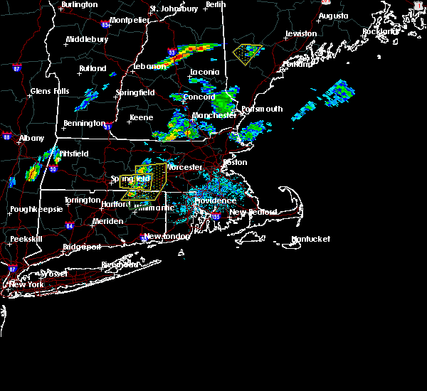 At 705 pm edt, severe thunderstorms were located along a line extending from new braintree to near brookfield to near stafford, moving east at 15 mph (radar indicated). Hazards include 60 mph wind gusts and quarter size hail. Expect wind damage to trees and power lines. Minor hail damage to vehicles is possible. At 705 pm edt, severe thunderstorms were located along a line extending from new braintree to near brookfield to near stafford, moving east at 15 mph (radar indicated). Hazards include 60 mph wind gusts and quarter size hail. Expect wind damage to trees and power lines. Minor hail damage to vehicles is possible.
|
| 7/2/2020 6:10 PM EDT | Trees down on wires on lincoln road in worcester county MA, 5 miles E of Rutland, MA |
| 6/6/2020 2:43 PM EDT |
 At 243 pm edt, a severe thunderstorm was located over charlton, or 10 miles southwest of worcester, moving east at 30 mph (radar indicated. trees were downed in west brookfield and monson from this storm). Hazards include 60 mph wind gusts and nickel size hail. Expect damage to trees and power lines. Locations impacted include, worcester, shrewsbury, grafton, holden, webster, southbridge, auburn, oxford, millbury, charlton, palmer, spencer, dudley, leicester, thompson, sturbridge, sutton, monson, douglas and rutland. At 243 pm edt, a severe thunderstorm was located over charlton, or 10 miles southwest of worcester, moving east at 30 mph (radar indicated. trees were downed in west brookfield and monson from this storm). Hazards include 60 mph wind gusts and nickel size hail. Expect damage to trees and power lines. Locations impacted include, worcester, shrewsbury, grafton, holden, webster, southbridge, auburn, oxford, millbury, charlton, palmer, spencer, dudley, leicester, thompson, sturbridge, sutton, monson, douglas and rutland.
|
| 6/6/2020 2:29 PM EDT |
 At 228 pm edt, a severe thunderstorm was located over brimfield, or 17 miles east of springfield, moving east at 25 mph (radar indicated. at 225 pm, a tree was downed in west brookfield). Hazards include 60 mph wind gusts and quarter size hail. Expect wind damage to trees and power lines. minor hail damage to vehicles is possible. Locations impacted include, worcester, shrewsbury, ludlow, grafton, holden, webster, southbridge, auburn, belchertown, wilbraham, oxford, millbury, charlton, palmer, spencer, dudley, leicester, ware, thompson and sturbridge. At 228 pm edt, a severe thunderstorm was located over brimfield, or 17 miles east of springfield, moving east at 25 mph (radar indicated. at 225 pm, a tree was downed in west brookfield). Hazards include 60 mph wind gusts and quarter size hail. Expect wind damage to trees and power lines. minor hail damage to vehicles is possible. Locations impacted include, worcester, shrewsbury, ludlow, grafton, holden, webster, southbridge, auburn, belchertown, wilbraham, oxford, millbury, charlton, palmer, spencer, dudley, leicester, ware, thompson and sturbridge.
|
| 6/6/2020 2:15 PM EDT |
 At 215 pm edt, a severe thunderstorm was located over palmer, or 11 miles east of springfield, moving east at 25 mph (radar indicated). Hazards include 60 mph wind gusts and quarter size hail. Expect wind damage to trees and power lines. Minor hail damage to vehicles is possible. At 215 pm edt, a severe thunderstorm was located over palmer, or 11 miles east of springfield, moving east at 25 mph (radar indicated). Hazards include 60 mph wind gusts and quarter size hail. Expect wind damage to trees and power lines. Minor hail damage to vehicles is possible.
|
| 5/15/2020 8:56 PM EDT |
 The severe thunderstorm warning for southwestern worcester, southeastern hampshire and southeastern hampden counties will expire at 900 pm edt, the storm which prompted the warning has moved out of the area. therefore, the warning will be allowed to expire. a tornado watch remains in effect until 1000 pm edt for western and central massachusetts. remember, a severe thunderstorm warning still remains in effect for southern worcester county until 915 pm. The severe thunderstorm warning for southwestern worcester, southeastern hampshire and southeastern hampden counties will expire at 900 pm edt, the storm which prompted the warning has moved out of the area. therefore, the warning will be allowed to expire. a tornado watch remains in effect until 1000 pm edt for western and central massachusetts. remember, a severe thunderstorm warning still remains in effect for southern worcester county until 915 pm.
|
| 5/15/2020 8:36 PM EDT |
 At 835 pm edt, a severe thunderstorm was located over brookfield, or 15 miles southwest of worcester, moving east at 45 mph (radar indicated. trees and powerlines have been reported downed in agawam and belchertown from these storms). Hazards include 60 mph wind gusts and quarter size hail. Expect wind damage to trees and power lines. minor hail damage to vehicles is possible. Locations impacted include, worcester, springfield, agawam, ludlow, holden, southbridge, auburn, longmeadow, east longmeadow, belchertown, wilbraham, oxford, charlton, palmer, spencer, dudley, leicester, ware, sturbridge and monson. At 835 pm edt, a severe thunderstorm was located over brookfield, or 15 miles southwest of worcester, moving east at 45 mph (radar indicated. trees and powerlines have been reported downed in agawam and belchertown from these storms). Hazards include 60 mph wind gusts and quarter size hail. Expect wind damage to trees and power lines. minor hail damage to vehicles is possible. Locations impacted include, worcester, springfield, agawam, ludlow, holden, southbridge, auburn, longmeadow, east longmeadow, belchertown, wilbraham, oxford, charlton, palmer, spencer, dudley, leicester, ware, sturbridge and monson.
|
| 5/15/2020 8:34 PM EDT |
 At 833 pm edt, severe thunderstorms were located along a line extending from barre to near west brookfield to hampden, moving east at 50 mph (radar indicated. at 817, trees and power lines were downed in belchertown). Hazards include 60 mph wind gusts and penny size hail. expect damage to trees and power lines At 833 pm edt, severe thunderstorms were located along a line extending from barre to near west brookfield to hampden, moving east at 50 mph (radar indicated. at 817, trees and power lines were downed in belchertown). Hazards include 60 mph wind gusts and penny size hail. expect damage to trees and power lines
|
| 5/15/2020 8:20 PM EDT |
 At 819 pm edt, a severe thunderstorm was located over townsend, or near fitchburg, moving east at 50 mph (radar indicated. multiple reports of trees and powerlines have been reported downed in northfield from these storms). Hazards include 60 mph wind gusts and quarter size hail. Expect wind damage to trees and power lines. minor hail damage to vehicles is possible. Locations impacted include, leominster, fitchburg, gardner, athol, pepperell, winchendon, lunenburg, townsend, templeton, rutland, westminster, ashburnham, barre, hubbardston, princeton, ashby, hardwick, oakham, shutesbury and phillipston. At 819 pm edt, a severe thunderstorm was located over townsend, or near fitchburg, moving east at 50 mph (radar indicated. multiple reports of trees and powerlines have been reported downed in northfield from these storms). Hazards include 60 mph wind gusts and quarter size hail. Expect wind damage to trees and power lines. minor hail damage to vehicles is possible. Locations impacted include, leominster, fitchburg, gardner, athol, pepperell, winchendon, lunenburg, townsend, templeton, rutland, westminster, ashburnham, barre, hubbardston, princeton, ashby, hardwick, oakham, shutesbury and phillipston.
|
| 5/15/2020 8:08 PM EDT |
 At 808 pm edt, a severe thunderstorm was located over townsend, or near fitchburg, moving east at 45 mph (radar indicated). Hazards include 60 mph wind gusts and quarter size hail. Expect wind damage to trees and power lines. Minor hail damage to vehicles is possible. At 808 pm edt, a severe thunderstorm was located over townsend, or near fitchburg, moving east at 45 mph (radar indicated). Hazards include 60 mph wind gusts and quarter size hail. Expect wind damage to trees and power lines. Minor hail damage to vehicles is possible.
|
| 5/15/2020 8:06 PM EDT |
 At 805 pm edt, a severe thunderstorm was located over granby, or near chicopee, moving east at 45 mph (radar indicated). Hazards include 60 mph wind gusts and quarter size hail. Expect wind damage to trees and power lines. Minor hail damage to vehicles is possible. At 805 pm edt, a severe thunderstorm was located over granby, or near chicopee, moving east at 45 mph (radar indicated). Hazards include 60 mph wind gusts and quarter size hail. Expect wind damage to trees and power lines. Minor hail damage to vehicles is possible.
|
| 5/15/2020 8:04 PM EDT |
 At 803 pm edt, a severe thunderstorm was located over ashburnham, or 8 miles west of fitchburg, moving east at 50 mph (radar indicated). Hazards include 60 mph wind gusts and quarter size hail. Expect wind damage to trees and power lines. minor hail damage to vehicles is possible. Locations impacted include, leominster, fitchburg, amherst, greenfield, orange, deerfield, gardner, athol, pepperell, winchendon, lunenburg, townsend, montague, templeton, rutland, westminster, ashburnham, barre, hadley and hubbardston. At 803 pm edt, a severe thunderstorm was located over ashburnham, or 8 miles west of fitchburg, moving east at 50 mph (radar indicated). Hazards include 60 mph wind gusts and quarter size hail. Expect wind damage to trees and power lines. minor hail damage to vehicles is possible. Locations impacted include, leominster, fitchburg, amherst, greenfield, orange, deerfield, gardner, athol, pepperell, winchendon, lunenburg, townsend, montague, templeton, rutland, westminster, ashburnham, barre, hadley and hubbardston.
|
| 5/15/2020 7:48 PM EDT |
 At 748 pm edt, a severe thunderstorm was located near royalston, or near orange, moving east at 50 mph (radar indicated). Hazards include 60 mph wind gusts and quarter size hail. Expect wind damage to trees and power lines. minor hail damage to vehicles is possible. Locations impacted include, leominster, fitchburg, amherst, greenfield, orange, deerfield, gardner, athol, pepperell, winchendon, lunenburg, townsend, montague, templeton, rutland, westminster, ashburnham, barre, hadley and hubbardston. At 748 pm edt, a severe thunderstorm was located near royalston, or near orange, moving east at 50 mph (radar indicated). Hazards include 60 mph wind gusts and quarter size hail. Expect wind damage to trees and power lines. minor hail damage to vehicles is possible. Locations impacted include, leominster, fitchburg, amherst, greenfield, orange, deerfield, gardner, athol, pepperell, winchendon, lunenburg, townsend, montague, templeton, rutland, westminster, ashburnham, barre, hadley and hubbardston.
|
| 5/15/2020 7:31 PM EDT |
 At 731 pm edt, a severe thunderstorm was located over gill, or near greenfield, moving east at 50 mph (radar indicated). Hazards include 60 mph wind gusts and quarter size hail. Expect wind damage to trees and power lines. Minor hail damage to vehicles is possible. At 731 pm edt, a severe thunderstorm was located over gill, or near greenfield, moving east at 50 mph (radar indicated). Hazards include 60 mph wind gusts and quarter size hail. Expect wind damage to trees and power lines. Minor hail damage to vehicles is possible.
|
| 5/11/2020 7:24 PM EDT |
 At 722 pm edt, a severe thunderstorm was located over east longmeadow, or near springfield, moving east at 40 mph (radar indicated). Hazards include 60 mph wind gusts and quarter size hail. Expect wind damage to trees and power lines. Minor hail damage to vehicles is possible. At 722 pm edt, a severe thunderstorm was located over east longmeadow, or near springfield, moving east at 40 mph (radar indicated). Hazards include 60 mph wind gusts and quarter size hail. Expect wind damage to trees and power lines. Minor hail damage to vehicles is possible.
|
| 12/30/2019 3:51 PM EST |
 At 350 pm est, a severe thunderstorm was located over granby, or near chicopee, moving northeast at 55 mph. quarter size hail was reported in westfield with this storm (radar indicated). Hazards include quarter size hail. Minor hail damage to vehicles is possible. Locations impacted include, chicopee, holyoke, amherst, ludlow, south hadley, belchertown, palmer, spencer, ware, rutland, granby, barre, hadley, warren, paxton, north brookfield, west brookfield, hardwick, oakham and pelham. At 350 pm est, a severe thunderstorm was located over granby, or near chicopee, moving northeast at 55 mph. quarter size hail was reported in westfield with this storm (radar indicated). Hazards include quarter size hail. Minor hail damage to vehicles is possible. Locations impacted include, chicopee, holyoke, amherst, ludlow, south hadley, belchertown, palmer, spencer, ware, rutland, granby, barre, hadley, warren, paxton, north brookfield, west brookfield, hardwick, oakham and pelham.
|
| 12/30/2019 3:39 PM EST |
 At 337 pm est, a severe thunderstorm was located over westfield, moving northeast at 55 mph. quarter size hail was observed in norfolk and hartland, ct and in southwick, ma (radar indicated). Hazards include quarter size hail. minor hail damage to vehicles is possible At 337 pm est, a severe thunderstorm was located over westfield, moving northeast at 55 mph. quarter size hail was observed in norfolk and hartland, ct and in southwick, ma (radar indicated). Hazards include quarter size hail. minor hail damage to vehicles is possible
|
| 8/19/2019 3:34 PM EDT |
 A severe thunderstorm warning remains in effect until 415 pm edt for central worcester and eastern hampshire counties. at 333 pm edt, a severe thunderstorm was located over hardwick, or 17 miles east of amherst, moving east at 25 mph. hazard. 60 mph wind gusts and quarter size hail. source. Radar indicated. A severe thunderstorm warning remains in effect until 415 pm edt for central worcester and eastern hampshire counties. at 333 pm edt, a severe thunderstorm was located over hardwick, or 17 miles east of amherst, moving east at 25 mph. hazard. 60 mph wind gusts and quarter size hail. source. Radar indicated.
|
| 8/19/2019 3:11 PM EDT |
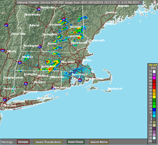 At 311 pm edt, a severe thunderstorm was located near pelham, or 8 miles east of amherst, moving east at 25 mph (radar indicated). Hazards include ping pong ball size hail and 60 mph wind gusts. Expect hail damage to roofs, siding, windows, and vehicles. Expect damage to trees and power lines. At 311 pm edt, a severe thunderstorm was located near pelham, or 8 miles east of amherst, moving east at 25 mph (radar indicated). Hazards include ping pong ball size hail and 60 mph wind gusts. Expect hail damage to roofs, siding, windows, and vehicles. Expect damage to trees and power lines.
|
| 8/19/2019 3:09 PM EDT |
 A severe thunderstorm warning remains in effect until 345 pm edt for central worcester county. at 306 pm edt, a severe thunderstorm was located over oakham, or 13 miles west of worcester, moving east at 30 mph. hazard. ping pong ball size hail and 60 mph wind gusts. source. Radar indicated. A severe thunderstorm warning remains in effect until 345 pm edt for central worcester county. at 306 pm edt, a severe thunderstorm was located over oakham, or 13 miles west of worcester, moving east at 30 mph. hazard. ping pong ball size hail and 60 mph wind gusts. source. Radar indicated.
|
| 8/19/2019 2:50 PM EDT |
 At 249 pm edt, a severe thunderstorm was located over ware, or 15 miles east of amherst, moving east at 30 mph (radar indicated). Hazards include ping pong ball size hail and 60 mph wind gusts. Expect hail damage to roofs, siding, windows, and vehicles. Expect damage to trees and power lines. At 249 pm edt, a severe thunderstorm was located over ware, or 15 miles east of amherst, moving east at 30 mph (radar indicated). Hazards include ping pong ball size hail and 60 mph wind gusts. Expect hail damage to roofs, siding, windows, and vehicles. Expect damage to trees and power lines.
|
| 8/8/2019 7:43 PM EDT |
 At 740 pm edt, a line of thunderstorms were sweeping east at 35 mph across central massachusetts. this line of storms is still producing damaging wind gusts. trained spotters continue to report wind damage with the latest reports out of new salem, ma (trained weather spotters). Hazards include 60 mph wind gusts. Expect damage to trees and power lines. Locations impacted include, worcester, leominster, fitchburg, shrewsbury, gardner, grafton, holden, auburn, oxford, clinton, millbury, charlton, spencer, athol, leicester, winchendon, lunenburg, sturbridge, lancaster and templeton. At 740 pm edt, a line of thunderstorms were sweeping east at 35 mph across central massachusetts. this line of storms is still producing damaging wind gusts. trained spotters continue to report wind damage with the latest reports out of new salem, ma (trained weather spotters). Hazards include 60 mph wind gusts. Expect damage to trees and power lines. Locations impacted include, worcester, leominster, fitchburg, shrewsbury, gardner, grafton, holden, auburn, oxford, clinton, millbury, charlton, spencer, athol, leicester, winchendon, lunenburg, sturbridge, lancaster and templeton.
|
| 8/8/2019 7:20 PM EDT |
 The national weather service in boston/norton has issued a * severe thunderstorm warning for. worcester county in central massachusetts. southeastern hampshire county in western massachusetts. northwestern middlesex county in northeastern massachusetts. Eastern franklin county in western massachusetts. The national weather service in boston/norton has issued a * severe thunderstorm warning for. worcester county in central massachusetts. southeastern hampshire county in western massachusetts. northwestern middlesex county in northeastern massachusetts. Eastern franklin county in western massachusetts.
|
| 7/31/2019 3:28 PM EDT | Trees down on glenwood and campbell streets in worcester county MA, 0.3 miles NW of Rutland, MA |
| 7/17/2019 4:52 PM EDT |
 The severe thunderstorm warning for central worcester and eastern hampshire counties will expire at 500 pm edt, the storm which prompted the warning has moved out of the area. therefore, the warning will be allowed to expire. a severe thunderstorm watch remains in effect until 1000 pm edt for western and central massachusetts. &&. The severe thunderstorm warning for central worcester and eastern hampshire counties will expire at 500 pm edt, the storm which prompted the warning has moved out of the area. therefore, the warning will be allowed to expire. a severe thunderstorm watch remains in effect until 1000 pm edt for western and central massachusetts. &&.
|
| 7/17/2019 4:31 PM EDT |
 At 431 pm edt, a severe thunderstorm was located over new braintree, or 15 miles west of worcester, moving east at 40 mph (radar indicated). Hazards include 60 mph wind gusts. Expect damage to trees and power lines. this severe storm will be near, rutland and oakham around 440 pm edt. paxton around 445 pm edt. worcester, holden and west boylston around 455 pm edt. Shrewsbury and boylston around 500 pm edt. At 431 pm edt, a severe thunderstorm was located over new braintree, or 15 miles west of worcester, moving east at 40 mph (radar indicated). Hazards include 60 mph wind gusts. Expect damage to trees and power lines. this severe storm will be near, rutland and oakham around 440 pm edt. paxton around 445 pm edt. worcester, holden and west boylston around 455 pm edt. Shrewsbury and boylston around 500 pm edt.
|
| 7/17/2019 4:29 PM EDT |
 At 429 pm edt, a severe thunderstorm was located over princeton, or 8 miles southwest of leominster, moving east at 40 mph (radar indicated). Hazards include 60 mph wind gusts. Expect damage to trees and power lines. this severe storm will be near, west boylston around 435 pm edt. leominster, sterling and boylston around 445 pm edt. clinton, lancaster and berlin around 450 pm edt. harvard and bolton around 455 pm edt. Hudson around 500 pm edt. At 429 pm edt, a severe thunderstorm was located over princeton, or 8 miles southwest of leominster, moving east at 40 mph (radar indicated). Hazards include 60 mph wind gusts. Expect damage to trees and power lines. this severe storm will be near, west boylston around 435 pm edt. leominster, sterling and boylston around 445 pm edt. clinton, lancaster and berlin around 450 pm edt. harvard and bolton around 455 pm edt. Hudson around 500 pm edt.
|
| 7/17/2019 4:14 PM EDT |
 At 413 pm edt, a severe thunderstorm was located near ware, or 10 miles east of amherst, moving east at 40 mph (radar indicated). Hazards include 60 mph wind gusts. Expect damage to trees and power lines. Locations impacted include, worcester, shrewsbury, ludlow, westborough, grafton, holden, auburn, belchertown, northborough, millbury, palmer, spencer, leicester, ware, rutland, west boylston, barre, warren, paxton and north brookfield. At 413 pm edt, a severe thunderstorm was located near ware, or 10 miles east of amherst, moving east at 40 mph (radar indicated). Hazards include 60 mph wind gusts. Expect damage to trees and power lines. Locations impacted include, worcester, shrewsbury, ludlow, westborough, grafton, holden, auburn, belchertown, northborough, millbury, palmer, spencer, leicester, ware, rutland, west boylston, barre, warren, paxton and north brookfield.
|
| 7/17/2019 4:12 PM EDT |
 At 412 pm edt, a severe thunderstorm was located over barre, or 14 miles southeast of orange, moving east at 40 mph (radar indicated). Hazards include 60 mph wind gusts. Expect damage to trees and power lines. this severe storm will be near, hubbardston around 425 pm edt. holden, west boylston and princeton around 435 pm edt. fitchburg and sterling around 440 pm edt. leominster, clinton and boylston around 445 pm edt. lancaster, harvard, bolton and berlin around 450 pm edt. Hudson and ayer around 455 pm edt. At 412 pm edt, a severe thunderstorm was located over barre, or 14 miles southeast of orange, moving east at 40 mph (radar indicated). Hazards include 60 mph wind gusts. Expect damage to trees and power lines. this severe storm will be near, hubbardston around 425 pm edt. holden, west boylston and princeton around 435 pm edt. fitchburg and sterling around 440 pm edt. leominster, clinton and boylston around 445 pm edt. lancaster, harvard, bolton and berlin around 450 pm edt. Hudson and ayer around 455 pm edt.
|
| 7/17/2019 4:03 PM EDT |
 At 403 pm edt, a severe thunderstorm was located near belchertown, or near amherst, moving east at 40 mph (radar indicated). Hazards include 60 mph wind gusts. expect damage to trees and power lines At 403 pm edt, a severe thunderstorm was located near belchertown, or near amherst, moving east at 40 mph (radar indicated). Hazards include 60 mph wind gusts. expect damage to trees and power lines
|
| 7/17/2019 3:56 PM EDT |
 At 355 pm edt, a severe thunderstorm was located over new salem, or 10 miles northeast of amherst, moving east at 40 mph (radar indicated). Hazards include 60 mph wind gusts. Expect damage to trees and power lines. this severe thunderstorm will be near, hardwick around 405 pm edt. petersham around 415 pm edt. barre around 420 pm edt. hubbardston around 425 pm edt. holden, west boylston and princeton around 435 pm edt. fitchburg around 440 pm edt. leominster, clinton, sterling and boylston around 445 pm edt. Lancaster, harvard, bolton and berlin around 450 pm edt. At 355 pm edt, a severe thunderstorm was located over new salem, or 10 miles northeast of amherst, moving east at 40 mph (radar indicated). Hazards include 60 mph wind gusts. Expect damage to trees and power lines. this severe thunderstorm will be near, hardwick around 405 pm edt. petersham around 415 pm edt. barre around 420 pm edt. hubbardston around 425 pm edt. holden, west boylston and princeton around 435 pm edt. fitchburg around 440 pm edt. leominster, clinton, sterling and boylston around 445 pm edt. Lancaster, harvard, bolton and berlin around 450 pm edt.
|
| 7/17/2019 2:33 PM EDT |
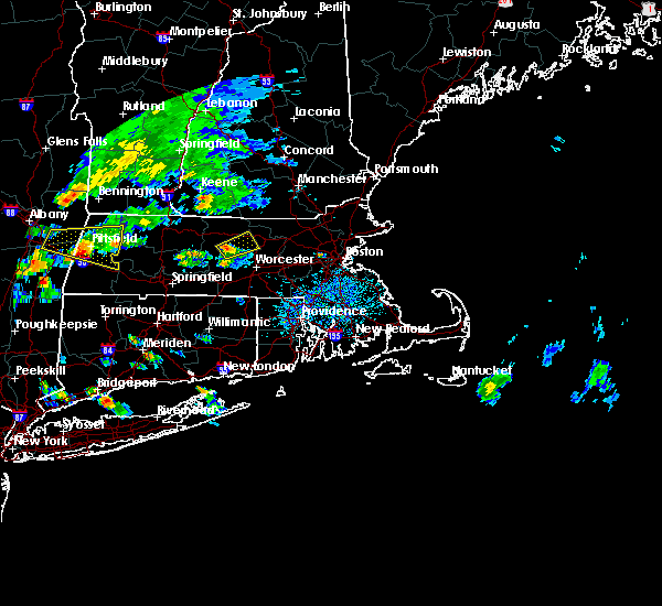 At 232 pm edt, a severe thunderstorm was located near rutland, or 15 miles northwest of worcester, moving northeast at 25 mph (radar indicated). Hazards include 60 mph wind gusts and nickel size hail. Expect damage to trees and power lines. this severe storm will be near, hubbardston around 245 pm edt. holden around 255 pm edt. Leominster, fitchburg, sterling and princeton around 300 pm edt. At 232 pm edt, a severe thunderstorm was located near rutland, or 15 miles northwest of worcester, moving northeast at 25 mph (radar indicated). Hazards include 60 mph wind gusts and nickel size hail. Expect damage to trees and power lines. this severe storm will be near, hubbardston around 245 pm edt. holden around 255 pm edt. Leominster, fitchburg, sterling and princeton around 300 pm edt.
|
| 7/17/2019 2:18 PM EDT |
 A severe thunderstorm warning remains in effect until 300 pm edt for northwestern worcester and eastern hampshire counties. at 217 pm edt, a severe thunderstorm was located near hardwick, or 17 miles southeast of orange, moving northeast at 25 mph. hazard. 60 mph wind gusts and quarter size hail. source. Radar indicated. A severe thunderstorm warning remains in effect until 300 pm edt for northwestern worcester and eastern hampshire counties. at 217 pm edt, a severe thunderstorm was located near hardwick, or 17 miles southeast of orange, moving northeast at 25 mph. hazard. 60 mph wind gusts and quarter size hail. source. Radar indicated.
|
| 7/17/2019 2:18 PM EDT |
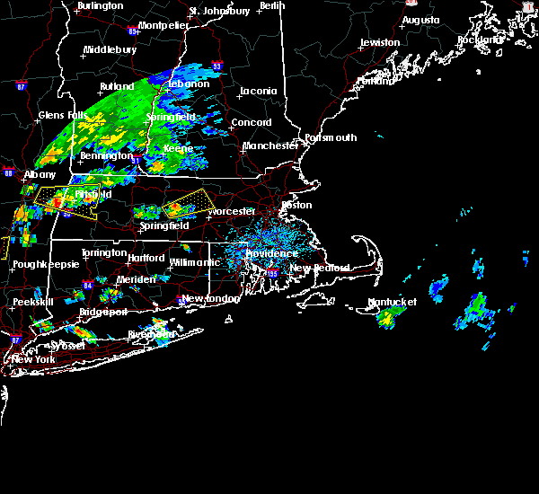 At 217 pm edt, a severe thunderstorm was located near hardwick, or 17 miles southeast of orange, moving northeast at 25 mph (radar indicated). Hazards include 60 mph wind gusts and quarter size hail. Expect damage to trees and power lines. this severe storm will be near, oakham around 230 pm edt. rutland and barre around 235 pm edt. paxton around 240 pm edt. hubbardston around 245 pm edt. holden and west boylston around 255 pm edt. Leominster, fitchburg, sterling and princeton around 300 pm edt. At 217 pm edt, a severe thunderstorm was located near hardwick, or 17 miles southeast of orange, moving northeast at 25 mph (radar indicated). Hazards include 60 mph wind gusts and quarter size hail. Expect damage to trees and power lines. this severe storm will be near, oakham around 230 pm edt. rutland and barre around 235 pm edt. paxton around 240 pm edt. hubbardston around 245 pm edt. holden and west boylston around 255 pm edt. Leominster, fitchburg, sterling and princeton around 300 pm edt.
|
| 7/17/2019 2:06 PM EDT |
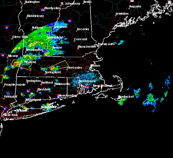 At 205 pm edt, a severe thunderstorm was located over hardwick, or 12 miles east of amherst, moving northeast at 25 mph (radar indicated). Hazards include 60 mph wind gusts and quarter size hail. Expect damage to trees and power lines. this severe thunderstorm will be near, west brookfield and hardwick around 215 pm edt. new braintree around 225 pm edt. rutland, barre, oakham and petersham around 235 pm edt. paxton and hubbardston around 245 pm edt. Fitchburg, holden, sterling, west boylston and princeton around 300 pm edt. At 205 pm edt, a severe thunderstorm was located over hardwick, or 12 miles east of amherst, moving northeast at 25 mph (radar indicated). Hazards include 60 mph wind gusts and quarter size hail. Expect damage to trees and power lines. this severe thunderstorm will be near, west brookfield and hardwick around 215 pm edt. new braintree around 225 pm edt. rutland, barre, oakham and petersham around 235 pm edt. paxton and hubbardston around 245 pm edt. Fitchburg, holden, sterling, west boylston and princeton around 300 pm edt.
|
| 7/6/2019 4:45 PM EDT |
 At 443 pm edt, severe thunderstorms were located along a line extending from littleton to near paxton, moving east at 25 mph. although they have weakened they were still capable of producing damaging wind gusts (radar indicated). Hazards include 60 mph wind gusts. Expect damage to trees and power lines. Locations impacted include, worcester, leominster, acton, holden, clinton, spencer, leicester, littleton, lancaster, rutland, sterling, west boylston, shirley, stow, harvard, boxborough, bolton, carlisle, paxton and north brookfield. At 443 pm edt, severe thunderstorms were located along a line extending from littleton to near paxton, moving east at 25 mph. although they have weakened they were still capable of producing damaging wind gusts (radar indicated). Hazards include 60 mph wind gusts. Expect damage to trees and power lines. Locations impacted include, worcester, leominster, acton, holden, clinton, spencer, leicester, littleton, lancaster, rutland, sterling, west boylston, shirley, stow, harvard, boxborough, bolton, carlisle, paxton and north brookfield.
|
| 7/6/2019 4:07 PM EDT |
 At 405 pm edt, severe thunderstorms were located along a line extending from shirley to near new braintree, moving east at 10 mph. these storms downed two trees in gardner (radar indicated). Hazards include 60 mph wind gusts. expect damage to trees and power lines At 405 pm edt, severe thunderstorms were located along a line extending from shirley to near new braintree, moving east at 10 mph. these storms downed two trees in gardner (radar indicated). Hazards include 60 mph wind gusts. expect damage to trees and power lines
|
| 6/30/2019 2:50 PM EDT |
 At 248 pm edt, a severe thunderstorm was located near barre, or 15 miles west of leominster, moving southeast at 25 mph. dime size hail was reported in phillipston with this storm. the storm still has potential to produce quarter size hail. wind gusts to 30 to 40 mph will accompany this storm (radar indicated). Hazards include quarter size hail. Damage to vehicles is possible. Locations impacted include, worcester, holden, spencer, leicester, rutland, west boylston, barre, paxton, north brookfield, hubbardston, princeton, oakham and new braintree. At 248 pm edt, a severe thunderstorm was located near barre, or 15 miles west of leominster, moving southeast at 25 mph. dime size hail was reported in phillipston with this storm. the storm still has potential to produce quarter size hail. wind gusts to 30 to 40 mph will accompany this storm (radar indicated). Hazards include quarter size hail. Damage to vehicles is possible. Locations impacted include, worcester, holden, spencer, leicester, rutland, west boylston, barre, paxton, north brookfield, hubbardston, princeton, oakham and new braintree.
|
| 6/30/2019 2:33 PM EDT |
 The national weather service in boston/norton has issued a * severe thunderstorm warning for. central worcester county in central massachusetts. until 330 pm edt. At 233 pm edt, a severe thunderstorm was located over phillipston, or 10 miles southeast of orange, moving southeast at 25 mph. The national weather service in boston/norton has issued a * severe thunderstorm warning for. central worcester county in central massachusetts. until 330 pm edt. At 233 pm edt, a severe thunderstorm was located over phillipston, or 10 miles southeast of orange, moving southeast at 25 mph.
|
| 6/29/2019 5:54 AM EDT |
 At 553 am edt, a severe thunderstorm was located over princeton, or near leominster, moving east at 30 mph (radar indicated). Hazards include 60 mph wind gusts and quarter size hail. Hail damage to vehicles is possible. Expect damage to trees and power lines. At 553 am edt, a severe thunderstorm was located over princeton, or near leominster, moving east at 30 mph (radar indicated). Hazards include 60 mph wind gusts and quarter size hail. Hail damage to vehicles is possible. Expect damage to trees and power lines.
|
| 8/17/2018 11:19 PM EDT |
 At 1118 pm edt, a severe thunderstorm was located over brimfield, or 19 miles east of springfield, moving northeast at 35 mph (radar indicated). Hazards include 60 mph wind gusts. Expect damage to trees and power lines. Locations impacted include, worcester, grafton, holden, southbridge, auburn, oxford, millbury, charlton, palmer, spencer, leicester, sturbridge, rutland, warren, paxton, north brookfield, west brookfield, brimfield, brookfield and holland. At 1118 pm edt, a severe thunderstorm was located over brimfield, or 19 miles east of springfield, moving northeast at 35 mph (radar indicated). Hazards include 60 mph wind gusts. Expect damage to trees and power lines. Locations impacted include, worcester, grafton, holden, southbridge, auburn, oxford, millbury, charlton, palmer, spencer, leicester, sturbridge, rutland, warren, paxton, north brookfield, west brookfield, brimfield, brookfield and holland.
|
| 8/17/2018 11:13 PM EDT |
 At 1113 pm edt, a severe thunderstorm was located over wales, or 17 miles east of springfield, moving northeast at 35 mph (radar indicated). Hazards include 60 mph wind gusts. expect damage to trees and power lines At 1113 pm edt, a severe thunderstorm was located over wales, or 17 miles east of springfield, moving northeast at 35 mph (radar indicated). Hazards include 60 mph wind gusts. expect damage to trees and power lines
|
| 8/8/2018 7:50 PM EDT |
 At 749 pm edt, a severe thunderstorm was located over lincoln, or near lexington, moving east at 40 mph (radar indicated). Hazards include 60 mph wind gusts. expect damage to trees and power lines At 749 pm edt, a severe thunderstorm was located over lincoln, or near lexington, moving east at 40 mph (radar indicated). Hazards include 60 mph wind gusts. expect damage to trees and power lines
|
| 8/2/2018 5:10 PM EDT |
 At 510 pm edt, a severe thunderstorm was located over palmer, or 15 miles east of springfield, moving northeast at 30 mph (radar indicated). Hazards include 60 mph wind gusts. Expect damage to trees and power lines. Locations impacted include, worcester, shrewsbury, ludlow, holden, belchertown, charlton, palmer, spencer, leicester, ware, sturbridge, monson, rutland, sterling, west boylston, westminster, barre, warren, paxton and north brookfield. At 510 pm edt, a severe thunderstorm was located over palmer, or 15 miles east of springfield, moving northeast at 30 mph (radar indicated). Hazards include 60 mph wind gusts. Expect damage to trees and power lines. Locations impacted include, worcester, shrewsbury, ludlow, holden, belchertown, charlton, palmer, spencer, leicester, ware, sturbridge, monson, rutland, sterling, west boylston, westminster, barre, warren, paxton and north brookfield.
|
| 8/2/2018 5:07 PM EDT |
 At 507 pm edt, a severe thunderstorm was located over palmer, or 13 miles east of springfield, moving northeast at 30 mph (radar indicated). Hazards include 60 mph wind gusts. expect damage to trees and power lines At 507 pm edt, a severe thunderstorm was located over palmer, or 13 miles east of springfield, moving northeast at 30 mph (radar indicated). Hazards include 60 mph wind gusts. expect damage to trees and power lines
|
| 7/17/2018 2:43 PM EDT |
 At 158 pm edt, a severe thunderstorm was located near ware, or 15 miles southeast of amherst, moving east at 30 mph (radar indicated). Hazards include 60 mph wind gusts. expect damage to trees and power lines At 158 pm edt, a severe thunderstorm was located near ware, or 15 miles southeast of amherst, moving east at 30 mph (radar indicated). Hazards include 60 mph wind gusts. expect damage to trees and power lines
|
| 7/17/2018 1:59 PM EDT |
 The national weather service in boston/norton has issued a * severe thunderstorm warning for. southwestern worcester county in central massachusetts. southeastern hampshire county in western massachusetts. southeastern franklin county in western massachusetts. East central hampden county in western massachusetts. The national weather service in boston/norton has issued a * severe thunderstorm warning for. southwestern worcester county in central massachusetts. southeastern hampshire county in western massachusetts. southeastern franklin county in western massachusetts. East central hampden county in western massachusetts.
|
| 8/22/2017 11:33 PM EDT |
 At 1132 pm edt, severe thunderstorms were located along a line extending from near rindge to granby, moving east at 35 mph (radar indicated). Hazards include 60 mph wind gusts. expect damage to trees and power lines along with torrential downpours and possibly localized flooding At 1132 pm edt, severe thunderstorms were located along a line extending from near rindge to granby, moving east at 35 mph (radar indicated). Hazards include 60 mph wind gusts. expect damage to trees and power lines along with torrential downpours and possibly localized flooding
|
| 8/2/2017 4:48 PM EDT |
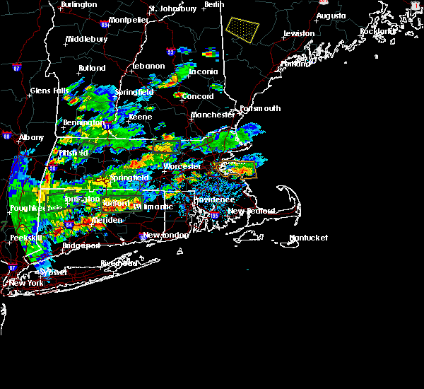 At 447 pm edt, a severe thunderstorm was located over hardwick, or 15 miles east of amherst, and is nearly stationary (radar indicated). Hazards include 60 mph wind gusts and quarter size hail. Hail damage to vehicles is possible. Expect damage to trees and power lines. At 447 pm edt, a severe thunderstorm was located over hardwick, or 15 miles east of amherst, and is nearly stationary (radar indicated). Hazards include 60 mph wind gusts and quarter size hail. Hail damage to vehicles is possible. Expect damage to trees and power lines.
|
| 8/2/2017 4:36 PM EDT |
 The severe thunderstorm warning for northwestern worcester county will expire at 445 pm edt, the storm which prompted the warning has weakened below severe limits, and no longer poses an immediate threat to life or property. therefore the warning will be allowed to expire. however heavy rain is still possible with this thunderstorm. The severe thunderstorm warning for northwestern worcester county will expire at 445 pm edt, the storm which prompted the warning has weakened below severe limits, and no longer poses an immediate threat to life or property. therefore the warning will be allowed to expire. however heavy rain is still possible with this thunderstorm.
|
| 8/2/2017 4:10 PM EDT | Wires down on high street at school street in worcester county MA, 0.3 miles NW of Rutland, MA |
| 8/2/2017 4:00 PM EDT |
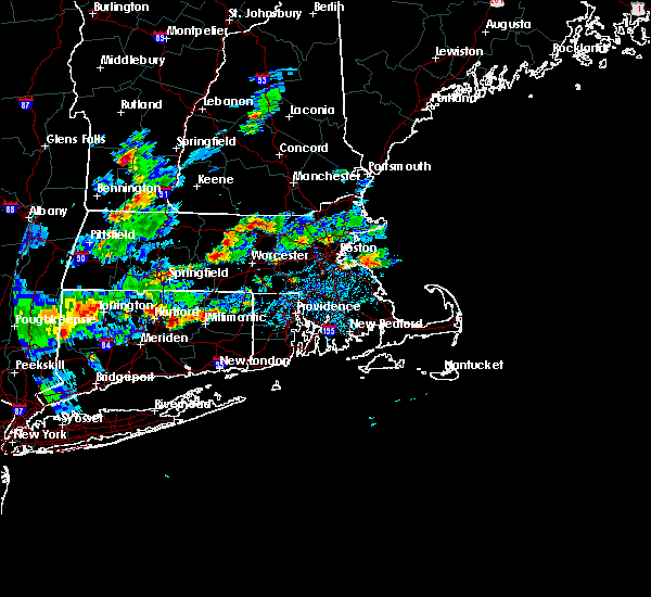 At 359 pm edt, a severe thunderstorm was located over new braintree, or 16 miles west of worcester, and is nearly stationary (radar indicated). Hazards include 60 mph wind gusts and quarter size hail. Hail damage to vehicles is possible. Expect damage to trees and power lines. At 359 pm edt, a severe thunderstorm was located over new braintree, or 16 miles west of worcester, and is nearly stationary (radar indicated). Hazards include 60 mph wind gusts and quarter size hail. Hail damage to vehicles is possible. Expect damage to trees and power lines.
|
| 6/27/2017 12:26 PM EDT |
 The severe thunderstorm warning for east central worcester county will expire at 430 pm edt, the storm which prompted the warning has weakened below severe limits, and no longer poses an immediate threat to life or property. therefore the warning will be allowed to expire. however small hail is still possible with this thunderstorm. The severe thunderstorm warning for east central worcester county will expire at 430 pm edt, the storm which prompted the warning has weakened below severe limits, and no longer poses an immediate threat to life or property. therefore the warning will be allowed to expire. however small hail is still possible with this thunderstorm.
|
| 6/27/2017 12:17 PM EDT |
 At 416 pm edt, a severe thunderstorm was located over west boylston, or near worcester, moving northeast at 30 mph (trained weather spotters have reported hail up to an inch in diameter). Hazards include 50 mph wind gusts and quarter size hail. Hail damage to vehicles is possible. expect damage to trees and power lines. Locations impacted include, worcester, leominster, marlborough, shrewsbury, hudson, westborough, holden, auburn, northborough, clinton, leicester, southborough, lancaster, rutland, sterling, west boylston, bolton, paxton, boylston and princeton. At 416 pm edt, a severe thunderstorm was located over west boylston, or near worcester, moving northeast at 30 mph (trained weather spotters have reported hail up to an inch in diameter). Hazards include 50 mph wind gusts and quarter size hail. Hail damage to vehicles is possible. expect damage to trees and power lines. Locations impacted include, worcester, leominster, marlborough, shrewsbury, hudson, westborough, holden, auburn, northborough, clinton, leicester, southborough, lancaster, rutland, sterling, west boylston, bolton, paxton, boylston and princeton.
|
| 6/27/2017 12:03 PM EDT |
 At 402 pm edt, a severe thunderstorm was located over paxton, or near worcester, moving northeast at 30 mph (trained weather spotters report hail up to one inch). Hazards include 60 mph wind gusts and quarter size hail. Hail damage to vehicles is possible. expect damage to trees and power lines. Locations impacted include, worcester, leominster, marlborough, shrewsbury, hudson, westborough, holden, auburn, northborough, clinton, charlton, spencer, leicester, southborough, lancaster, rutland, sterling, west boylston, bolton and paxton. At 402 pm edt, a severe thunderstorm was located over paxton, or near worcester, moving northeast at 30 mph (trained weather spotters report hail up to one inch). Hazards include 60 mph wind gusts and quarter size hail. Hail damage to vehicles is possible. expect damage to trees and power lines. Locations impacted include, worcester, leominster, marlborough, shrewsbury, hudson, westborough, holden, auburn, northborough, clinton, charlton, spencer, leicester, southborough, lancaster, rutland, sterling, west boylston, bolton and paxton.
|
| 6/27/2017 11:49 AM EDT |
 At 349 pm edt, a severe thunderstorm was located over east brookfield, or 11 miles west of worcester, moving northeast at 30 mph (radar indicated). Hazards include 60 mph wind gusts and quarter size hail. Hail damage to vehicles is possible. expect damage to trees and power lines. Locations impacted include, worcester, leominster, marlborough, shrewsbury, hudson, westborough, holden, auburn, northborough, clinton, charlton, spencer, leicester, southborough, sturbridge, lancaster, rutland, sterling, west boylston and warren. At 349 pm edt, a severe thunderstorm was located over east brookfield, or 11 miles west of worcester, moving northeast at 30 mph (radar indicated). Hazards include 60 mph wind gusts and quarter size hail. Hail damage to vehicles is possible. expect damage to trees and power lines. Locations impacted include, worcester, leominster, marlborough, shrewsbury, hudson, westborough, holden, auburn, northborough, clinton, charlton, spencer, leicester, southborough, sturbridge, lancaster, rutland, sterling, west boylston and warren.
|
| 6/27/2017 11:39 AM EDT |
 At 338 pm edt, a severe thunderstorm was located over brookfield, or 16 miles west of worcester, moving northeast at 30 mph (radar indicated). Hazards include quarter size hail. damage to vehicles is possible At 338 pm edt, a severe thunderstorm was located over brookfield, or 16 miles west of worcester, moving northeast at 30 mph (radar indicated). Hazards include quarter size hail. damage to vehicles is possible
|
| 5/18/2017 11:45 PM EDT |
 At 1144 pm edt, a severe thunderstorm was located over paxton, or near worcester, moving east at 35 mph (radar indicated). Hazards include 60 mph wind gusts. expect damage to trees and power lines At 1144 pm edt, a severe thunderstorm was located over paxton, or near worcester, moving east at 35 mph (radar indicated). Hazards include 60 mph wind gusts. expect damage to trees and power lines
|
| 5/18/2017 9:43 PM EDT |
 At 942 pm edt, a severe thunderstorm was located near templeton, or 10 miles east of orange, moving east at 55 mph (radar indicated). Hazards include 60 mph wind gusts. expect damage to trees and power lines At 942 pm edt, a severe thunderstorm was located near templeton, or 10 miles east of orange, moving east at 55 mph (radar indicated). Hazards include 60 mph wind gusts. expect damage to trees and power lines
|
| 9/11/2016 10:10 AM EDT |
 The severe thunderstorm warning for northwestern essex, southeastern hampshire, southeastern hampden, worcester and middlesex counties will expire at 1015 am edt, the storms which prompted the warning have moved out of the area. therefore, the warning will be allowed to expire. The severe thunderstorm warning for northwestern essex, southeastern hampshire, southeastern hampden, worcester and middlesex counties will expire at 1015 am edt, the storms which prompted the warning have moved out of the area. therefore, the warning will be allowed to expire.
|
| 9/11/2016 9:31 AM EDT | Trees and wires down on campbell street... pleasentdale road and lincoln road in worcester county MA, 0.3 miles NW of Rutland, MA |
| 9/11/2016 9:30 AM EDT | Trees down on multiple streets in worcester county MA, 5 miles E of Rutland, MA |
| 9/11/2016 9:23 AM EDT |
 At 922 am edt, severe thunderstorms were located along a line extending from near new boston to near westminster to north brookfield to west hartford, moving east at 45 mph (radar indicated). Hazards include 60 mph wind gusts. Expect damage to roofs. siding. And trees. At 922 am edt, severe thunderstorms were located along a line extending from near new boston to near westminster to north brookfield to west hartford, moving east at 45 mph (radar indicated). Hazards include 60 mph wind gusts. Expect damage to roofs. siding. And trees.
|
| 9/11/2016 8:49 AM EDT |
 At 848 am edt, severe thunderstorms were located along a line extending from near danbury to near windsor to near richmond to leverett to new hartford, moving northeast at 45 mph (radar indicated). Hazards include 60 mph wind gusts. Expect damage to roofs. siding. And trees. At 848 am edt, severe thunderstorms were located along a line extending from near danbury to near windsor to near richmond to leverett to new hartford, moving northeast at 45 mph (radar indicated). Hazards include 60 mph wind gusts. Expect damage to roofs. siding. And trees.
|
| 8/13/2016 10:30 PM EDT |
 At 1030 pm edt, severe thunderstorms were located along a line extending from near new braintree to brookfield to holland, moving east at 30 mph (radar indicated). Hazards include 60 mph wind gusts. Expect damage to roofs. siding. and trees. Locations impacted include, worcester, holden, webster, southbridge, auburn, oxford, millbury, charlton, spencer, dudley, leicester, ware, sturbridge, sutton, rutland, west boylston, warren, paxton, north brookfield and west brookfield. At 1030 pm edt, severe thunderstorms were located along a line extending from near new braintree to brookfield to holland, moving east at 30 mph (radar indicated). Hazards include 60 mph wind gusts. Expect damage to roofs. siding. and trees. Locations impacted include, worcester, holden, webster, southbridge, auburn, oxford, millbury, charlton, spencer, dudley, leicester, ware, sturbridge, sutton, rutland, west boylston, warren, paxton, north brookfield and west brookfield.
|
| 8/13/2016 10:29 PM EDT |
 At 1029 pm edt, a severe thunderstorm was located over hubbardston, or 10 miles southwest of fitchburg, moving east at 50 mph (radar indicated). Hazards include 60 mph wind gusts. Expect damage to roofs. siding. and trees. Locations impacted include, worcester, leominster, fitchburg, gardner, holden, spencer, pepperell, leicester, winchendon, lunenburg, townsend, templeton, rutland, sterling, west boylston, westminster, ashburnham, barre, brookline and paxton. At 1029 pm edt, a severe thunderstorm was located over hubbardston, or 10 miles southwest of fitchburg, moving east at 50 mph (radar indicated). Hazards include 60 mph wind gusts. Expect damage to roofs. siding. and trees. Locations impacted include, worcester, leominster, fitchburg, gardner, holden, spencer, pepperell, leicester, winchendon, lunenburg, townsend, templeton, rutland, sterling, west boylston, westminster, ashburnham, barre, brookline and paxton.
|
| 8/13/2016 10:15 PM EDT |
 At 1015 pm edt, severe thunderstorms were located along a line extending from hardwick to near warren to near stafford, moving east at 35 mph (radar indicated). Hazards include 60 mph wind gusts. Expect damage to roofs. siding. And trees. At 1015 pm edt, severe thunderstorms were located along a line extending from hardwick to near warren to near stafford, moving east at 35 mph (radar indicated). Hazards include 60 mph wind gusts. Expect damage to roofs. siding. And trees.
|
| 8/13/2016 10:07 PM EDT |
 At 1006 pm edt, a severe thunderstorm was located near wendell, or near orange, moving east at 50 mph (radar indicated). Hazards include 60 mph wind gusts. Expect damage to roofs. siding. And trees. At 1006 pm edt, a severe thunderstorm was located near wendell, or near orange, moving east at 50 mph (radar indicated). Hazards include 60 mph wind gusts. Expect damage to roofs. siding. And trees.
|
| 7/23/2016 8:06 PM EDT |
 The severe thunderstorm warning for hampshire, northern hampden, northwestern worcester and franklin counties will expire at 815 pm edt, the severe thunderstorm which prompted the warning has weakened. however, brief wind gusts to 45 mph from weakening showers may still result in a few downed trees and isolated power outages. a severe thunderstorm watch remains in effect until 1000 pm edt for western and central massachusetts. The severe thunderstorm warning for hampshire, northern hampden, northwestern worcester and franklin counties will expire at 815 pm edt, the severe thunderstorm which prompted the warning has weakened. however, brief wind gusts to 45 mph from weakening showers may still result in a few downed trees and isolated power outages. a severe thunderstorm watch remains in effect until 1000 pm edt for western and central massachusetts.
|
| 7/23/2016 7:15 PM EDT |
 At 713 pm edt, a line of severe thunderstorms with a history of damaging wind gusts will drop south into much of western massachusetts. the strongest winds may occur well out ahead of the thunderstorms (radar indicated). Hazards include 60 mph wind gusts. Expect damage to roofs. siding. And trees. At 713 pm edt, a line of severe thunderstorms with a history of damaging wind gusts will drop south into much of western massachusetts. the strongest winds may occur well out ahead of the thunderstorms (radar indicated). Hazards include 60 mph wind gusts. Expect damage to roofs. siding. And trees.
|
| 7/23/2016 7:06 PM EDT |
 At 704 pm edt, a cluster of severe thunderstorms was dropping south from far northern new hampshire. however, damaging wind gusts were occurring out of ahead the actual thunderstorms (trained weather spotters have reported wind damage in north central and northeast massachusetts). Hazards include 60 mph wind gusts. Expect damage to roofs. siding. And trees. At 704 pm edt, a cluster of severe thunderstorms was dropping south from far northern new hampshire. however, damaging wind gusts were occurring out of ahead the actual thunderstorms (trained weather spotters have reported wind damage in north central and northeast massachusetts). Hazards include 60 mph wind gusts. Expect damage to roofs. siding. And trees.
|
| 7/22/2016 7:39 PM EDT |
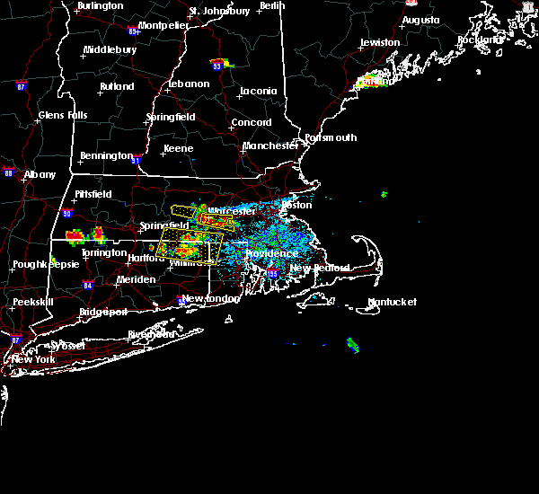 The severe thunderstorm warning for west central worcester county will expire at 745 pm edt, the severe thunderstorm which prompted the warning has moved out of the warned area. therefore, the warning will be allowed to expire. The severe thunderstorm warning for west central worcester county will expire at 745 pm edt, the severe thunderstorm which prompted the warning has moved out of the warned area. therefore, the warning will be allowed to expire.
|
| 7/22/2016 7:23 PM EDT |
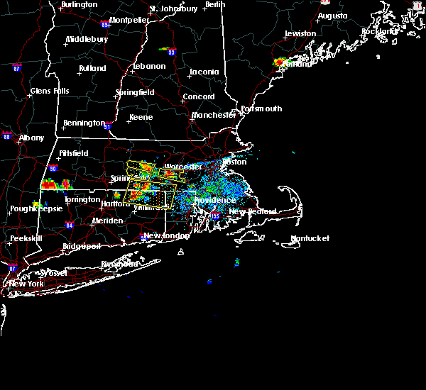 At 722 pm edt, a severe thunderstorm was located over oakham, or 15 miles northwest of worcester, moving east at 30 mph (radar indicated). Hazards include 60 mph wind gusts. Expect damage to roofs. siding. and trees. Locations impacted include, spencer, rutland, barre, paxton, north brookfield, hardwick, oakham and new braintree. At 722 pm edt, a severe thunderstorm was located over oakham, or 15 miles northwest of worcester, moving east at 30 mph (radar indicated). Hazards include 60 mph wind gusts. Expect damage to roofs. siding. and trees. Locations impacted include, spencer, rutland, barre, paxton, north brookfield, hardwick, oakham and new braintree.
|
| 7/22/2016 7:08 PM EDT |
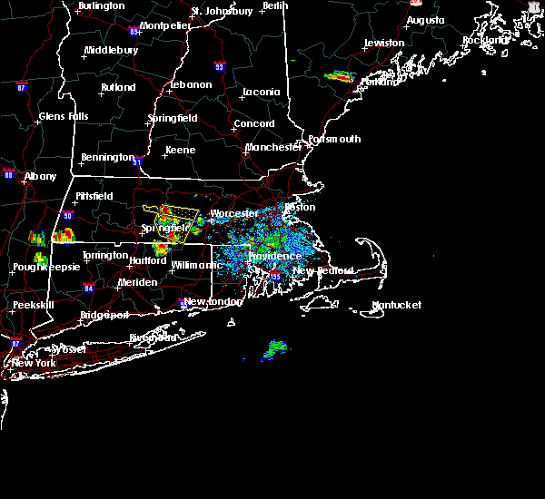 At 707 pm edt, a severe thunderstorm was located over hardwick, or 12 miles east of amherst, moving east at 25 mph (radar indicated). Hazards include 60 mph wind gusts and penny size hail. Expect damage to roofs. siding. and trees. Locations impacted include, spencer, rutland, barre, paxton, north brookfield, hardwick, oakham, petersham and new braintree. At 707 pm edt, a severe thunderstorm was located over hardwick, or 12 miles east of amherst, moving east at 25 mph (radar indicated). Hazards include 60 mph wind gusts and penny size hail. Expect damage to roofs. siding. and trees. Locations impacted include, spencer, rutland, barre, paxton, north brookfield, hardwick, oakham, petersham and new braintree.
|
| 7/22/2016 6:53 PM EDT |
 At 653 pm edt, a severe thunderstorm was located over pelham, or near amherst, moving east at 35 mph (radar indicated). Hazards include 60 mph wind gusts. Expect damage to roofs. siding. And trees. At 653 pm edt, a severe thunderstorm was located over pelham, or near amherst, moving east at 35 mph (radar indicated). Hazards include 60 mph wind gusts. Expect damage to roofs. siding. And trees.
|
| 2/25/2016 2:41 AM EST |
 The severe thunderstorm warning for central worcester and northwestern middlesex counties will expire at 245 am est, the storms which prompted the warning have moved out of the warned area. therefore the warning will be allowed to expire. The severe thunderstorm warning for central worcester and northwestern middlesex counties will expire at 245 am est, the storms which prompted the warning have moved out of the warned area. therefore the warning will be allowed to expire.
|
| 2/25/2016 2:22 AM EST |
 At 222 am est, doppler radar indicated a line of severe thunderstorms capable of producing destructive winds in excess of 70 mph. these storms were located along a line extending from near hopkinton to near milford to near ashby, moving northeast at 100 mph. locations impacted include, worcester, leominster, fitchburg, shrewsbury, grafton, holden, webster, southbridge, auburn, northborough, oxford, clinton, millbury, charlton, spencer, pepperell, dudley, leicester, groton and lunenburg. At 222 am est, doppler radar indicated a line of severe thunderstorms capable of producing destructive winds in excess of 70 mph. these storms were located along a line extending from near hopkinton to near milford to near ashby, moving northeast at 100 mph. locations impacted include, worcester, leominster, fitchburg, shrewsbury, grafton, holden, webster, southbridge, auburn, northborough, oxford, clinton, millbury, charlton, spencer, pepperell, dudley, leicester, groton and lunenburg.
|
| 2/25/2016 1:57 AM EST |
 At 156 am est, doppler radar indicated a line of severe thunderstorms capable of producing destructive winds in excess of 70 mph. these storms were located along a line extending from near gardner to near new braintree to near monson, and was moving northeast at 50 mph. At 156 am est, doppler radar indicated a line of severe thunderstorms capable of producing destructive winds in excess of 70 mph. these storms were located along a line extending from near gardner to near new braintree to near monson, and was moving northeast at 50 mph.
|
| 2/25/2016 12:58 AM EST |
 At 1258 am est, doppler radar indicated a severe thunderstorm capable of producing destructive winds in excess of 70 mph. this storm was located over east windsor, or near south windsor, and was moving northeast at 45 mph. At 1258 am est, doppler radar indicated a severe thunderstorm capable of producing destructive winds in excess of 70 mph. this storm was located over east windsor, or near south windsor, and was moving northeast at 45 mph.
|
| 2/24/2016 11:35 PM EST | Trees down on glenwood and wachusett stree in worcester county MA, 0.3 miles NW of Rutland, MA |
| 8/4/2015 3:24 PM EDT |
 At 323 pm edt, doppler radar indicated a severe thunderstorm capable of producing quarter size hail and damaging winds in excess of 60 mph. this storm was located over princeton, or 8 miles southwest of leominster, and was moving east at 30 mph. * some locations impacted include, worcester, framingham, waltham, leominster, fitchburg, billerica, marlborough, shrewsbury, chelmsford, natick, lexington, milford, burlington, wilmington, westford, acton, hudson, westborough, grafton and concord. At 323 pm edt, doppler radar indicated a severe thunderstorm capable of producing quarter size hail and damaging winds in excess of 60 mph. this storm was located over princeton, or 8 miles southwest of leominster, and was moving east at 30 mph. * some locations impacted include, worcester, framingham, waltham, leominster, fitchburg, billerica, marlborough, shrewsbury, chelmsford, natick, lexington, milford, burlington, wilmington, westford, acton, hudson, westborough, grafton and concord.
|
| 8/4/2015 3:20 PM EDT |
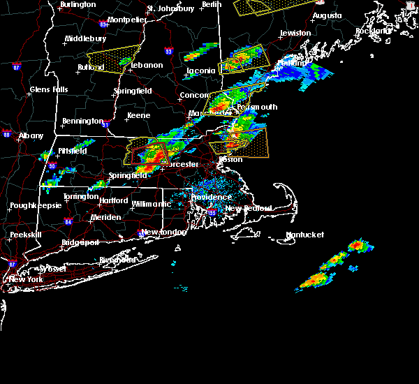 At 320 pm edt, doppler radar indicated a severe thunderstorm capable of producing quarter size hail and damaging winds in excess of 60 mph. this storm was located over sterling, or near leominster, moving east at 40 mph. locations impacted include, leominster, fitchburg, gardner, holden, winchendon, templeton, rutland, sterling, west boylston, westminster, ashburnham, barre, paxton, hubbardston, boylston, princeton, oakham and new braintree. At 320 pm edt, doppler radar indicated a severe thunderstorm capable of producing quarter size hail and damaging winds in excess of 60 mph. this storm was located over sterling, or near leominster, moving east at 40 mph. locations impacted include, leominster, fitchburg, gardner, holden, winchendon, templeton, rutland, sterling, west boylston, westminster, ashburnham, barre, paxton, hubbardston, boylston, princeton, oakham and new braintree.
|
| 8/4/2015 3:10 PM EDT | Quarter sized hail reported 0.6 miles SSW of Rutland, MA |
| 8/4/2015 3:03 PM EDT |
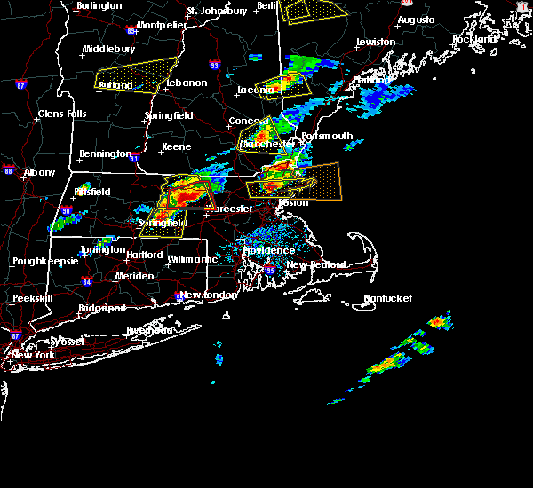 At 302 pm edt, doppler radar indicated a severe thunderstorm capable of producing quarter size hail and damaging winds in excess of 60 mph. this storm was located near barre, or 15 miles west of leominster, moving east at 35 mph. locations impacted include, leominster, fitchburg, orange, gardner, holden, athol, winchendon, ware, templeton, rutland, sterling, west boylston, westminster, ashburnham, rindge, barre, hubbardston, boylston, princeton and hardwick. At 302 pm edt, doppler radar indicated a severe thunderstorm capable of producing quarter size hail and damaging winds in excess of 60 mph. this storm was located near barre, or 15 miles west of leominster, moving east at 35 mph. locations impacted include, leominster, fitchburg, orange, gardner, holden, athol, winchendon, ware, templeton, rutland, sterling, west boylston, westminster, ashburnham, rindge, barre, hubbardston, boylston, princeton and hardwick.
|
| 8/4/2015 2:59 PM EDT | Quarter sized hail reported 0.6 miles SSW of Rutland, MA |
| 8/4/2015 2:56 PM EDT |
 At 255 pm edt, doppler radar indicated a severe thunderstorm capable of producing a tornado. this dangerous storm was located over petersham, or 12 miles southeast of orange, moving east at 35 mph. locations impacted include, leominster, fitchburg, gardner, holden, clinton, lunenburg, lancaster, templeton, rutland, sterling, west boylston, westminster, ashburnham, barre, paxton, hubbardston, boylston, princeton, ashby and hardwick. At 255 pm edt, doppler radar indicated a severe thunderstorm capable of producing a tornado. this dangerous storm was located over petersham, or 12 miles southeast of orange, moving east at 35 mph. locations impacted include, leominster, fitchburg, gardner, holden, clinton, lunenburg, lancaster, templeton, rutland, sterling, west boylston, westminster, ashburnham, barre, paxton, hubbardston, boylston, princeton, ashby and hardwick.
|
| 8/4/2015 2:39 PM EDT |
 At 239 pm edt, doppler radar indicated a severe thunderstorm capable of producing a tornado. this dangerous storm was located near new salem, or 9 miles east of amherst, and was moving east at 35 mph. * some locations impacted include, leominster, fitchburg, gardner, holden, clinton, athol, lunenburg, lancaster, templeton, rutland, sterling, west boylston, westminster, ashburnham, barre, paxton, hubbardston, boylston, princeton and ashby. At 239 pm edt, doppler radar indicated a severe thunderstorm capable of producing a tornado. this dangerous storm was located near new salem, or 9 miles east of amherst, and was moving east at 35 mph. * some locations impacted include, leominster, fitchburg, gardner, holden, clinton, athol, lunenburg, lancaster, templeton, rutland, sterling, west boylston, westminster, ashburnham, barre, paxton, hubbardston, boylston, princeton and ashby.
|
| 8/4/2015 2:25 PM EDT |
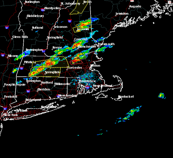 At 224 pm edt, doppler radar indicated a severe thunderstorm capable of producing quarter size hail and damaging winds in excess of 60 mph. this storm was located over shutesbury, or 7 miles northeast of amherst, and was moving east at 30 mph. * some locations impacted include, leominster, fitchburg, amherst, orange, gardner, holden, belchertown, athol, winchendon, ware, montague, templeton, rutland, sterling, west boylston, westminster, ashburnham, rindge, barre and hubbardston. At 224 pm edt, doppler radar indicated a severe thunderstorm capable of producing quarter size hail and damaging winds in excess of 60 mph. this storm was located over shutesbury, or 7 miles northeast of amherst, and was moving east at 30 mph. * some locations impacted include, leominster, fitchburg, amherst, orange, gardner, holden, belchertown, athol, winchendon, ware, montague, templeton, rutland, sterling, west boylston, westminster, ashburnham, rindge, barre and hubbardston.
|
| 6/23/2015 7:34 PM EDT |
 At 734 pm edt, doppler radar indicated a line of severe thunderstorms capable of producing damaging winds in excess of 60 mph. these storms were located along a line extending from near lancaster to near leominster to sterling to near princeton to near rutland, moving southeast at 30 mph. locations impacted include, leominster, fitchburg, westford, holden, clinton, lunenburg, littleton, lancaster, rutland, sterling, west boylston, ayer, westminster, shirley, harvard, boxborough, bolton, hubbardston, boylston and princeton. At 734 pm edt, doppler radar indicated a line of severe thunderstorms capable of producing damaging winds in excess of 60 mph. these storms were located along a line extending from near lancaster to near leominster to sterling to near princeton to near rutland, moving southeast at 30 mph. locations impacted include, leominster, fitchburg, westford, holden, clinton, lunenburg, littleton, lancaster, rutland, sterling, west boylston, ayer, westminster, shirley, harvard, boxborough, bolton, hubbardston, boylston and princeton.
|
| 6/23/2015 7:19 PM EDT |
 At 719 pm edt, doppler radar indicated a line of severe thunderstorms capable of producing damaging winds in excess of 60 mph. these storms were located along a line extending from lunenburg to leominster to near princeton to near hubbardston to near barre, moving east-southeast at 40 mph. locations impacted include, leominster, fitchburg, westford, gardner, holden, clinton, groton, lunenburg, townsend, littleton, lancaster, templeton, rutland, sterling, west boylston, ayer, westminster, shirley, harvard and ashburnham. At 719 pm edt, doppler radar indicated a line of severe thunderstorms capable of producing damaging winds in excess of 60 mph. these storms were located along a line extending from lunenburg to leominster to near princeton to near hubbardston to near barre, moving east-southeast at 40 mph. locations impacted include, leominster, fitchburg, westford, gardner, holden, clinton, groton, lunenburg, townsend, littleton, lancaster, templeton, rutland, sterling, west boylston, ayer, westminster, shirley, harvard and ashburnham.
|
| 6/23/2015 7:01 PM EDT |
 At 701 pm edt, doppler radar indicated a line of severe thunderstorms capable of producing damaging winds in excess of 60 mph. these storms were located along a line extending from near ashburnham to gardner to templeton to near phillipston to near athol, and was moving east at 40 mph. * some locations impacted include, leominster, fitchburg, orange, westford, gardner, holden, clinton, athol, groton, winchendon, lunenburg, townsend, littleton, lancaster, templeton, rutland, sterling, west boylston, ayer and westminster. At 701 pm edt, doppler radar indicated a line of severe thunderstorms capable of producing damaging winds in excess of 60 mph. these storms were located along a line extending from near ashburnham to gardner to templeton to near phillipston to near athol, and was moving east at 40 mph. * some locations impacted include, leominster, fitchburg, orange, westford, gardner, holden, clinton, athol, groton, winchendon, lunenburg, townsend, littleton, lancaster, templeton, rutland, sterling, west boylston, ayer and westminster.
|
| 6/9/2015 5:16 PM EDT |
 At 516 pm edt, doppler radar indicated a severe thunderstorm capable of producing damaging winds in excess of 60 mph. this storm was located over north brookfield, or 14 miles west of worcester, and was moving northeast at 45 mph. * some locations impacted include, worcester, leominster, shrewsbury, westborough, grafton, holden, auburn, northborough, oxford, clinton, millbury, charlton, spencer, leicester, sturbridge, lancaster, rutland, sterling, west boylston and warren. At 516 pm edt, doppler radar indicated a severe thunderstorm capable of producing damaging winds in excess of 60 mph. this storm was located over north brookfield, or 14 miles west of worcester, and was moving northeast at 45 mph. * some locations impacted include, worcester, leominster, shrewsbury, westborough, grafton, holden, auburn, northborough, oxford, clinton, millbury, charlton, spencer, leicester, sturbridge, lancaster, rutland, sterling, west boylston and warren.
|
| 5/28/2015 5:28 PM EDT | At 527 pm edt, doppler radar indicated a severe thunderstorm capable of producing damaging winds in excess of 60 mph. this storm was located over bolton, or near marlborough, moving east at 40 mph. locations impacted include, worcester, framingham, marlborough, shrewsbury, westford, acton, ludlow, hudson, westborough, grafton, sudbury, holden, ashland, auburn, hopkinton, belchertown, northborough, clinton, holliston and millbury. |
| 5/28/2015 5:15 PM EDT | At 514 pm edt, doppler radar indicated a severe thunderstorm capable of producing quarter size hail and damaging winds in excess of 60 mph. this storm was located over chelmsford, moving east at 40 mph. locations impacted include, worcester, framingham, chicopee, leominster, fitchburg, marlborough, shrewsbury, westford, acton, ludlow, hudson, westborough, grafton, sudbury, holden, ashland, auburn, hopkinton, belchertown and northborough. |
| 5/28/2015 4:48 PM EDT | At 448 pm edt, doppler radar indicated a severe thunderstorm capable of producing quarter size hail and damaging winds in excess of 60 mph. this storm was located over lunenburg, or near leominster, and was moving east at 40 mph. * some locations impacted include, worcester, framingham, chicopee, leominster, fitchburg, holyoke, marlborough, amherst, shrewsbury, westford, acton, ludlow, hudson, westborough, grafton, sudbury, south hadley, holden, ashland and auburn. |
| 5/28/2015 4:10 PM EDT | At 410 pm edt, doppler radar indicated a severe thunderstorm capable of producing quarter size hail and damaging winds in excess of 60 mph. this storm was located over amherst, and was moving east at 35 mph. * some locations impacted include, holden, belchertown, spencer, ware, rutland, barre, paxton, north brookfield, hubbardston, princeton, hardwick, oakham, pelham, petersham, new braintree and new salem. |
| 5/27/2015 6:27 PM EDT | At 626 pm edt, doppler radar indicated a line of severe thunderstorms capable of producing quarter size hail and damaging winds in excess of 60 mph. these storms were located along a line extending from shelburne to near westhampton, and was moving east at 55 mph. * some locations impacted include, fitchburg, holyoke, amherst, northampton, greenfield, orange, deerfield, gardner, south hadley, easthampton, belchertown, athol, winchendon, ware, montague, templeton, rutland, westminster, granby and ashburnham. |
| 5/30/2014 6:26 PM EDT | Quarter sized hail reported 3.2 miles NNW of Rutland, MA |
Hail Maps for Rutland, MA


Connect with Interactive Hail Maps