

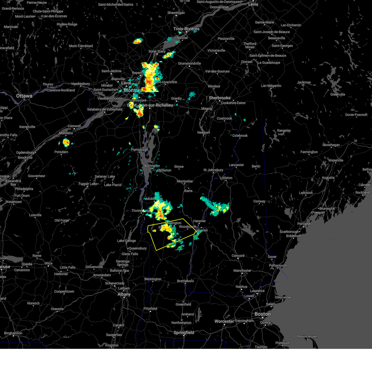
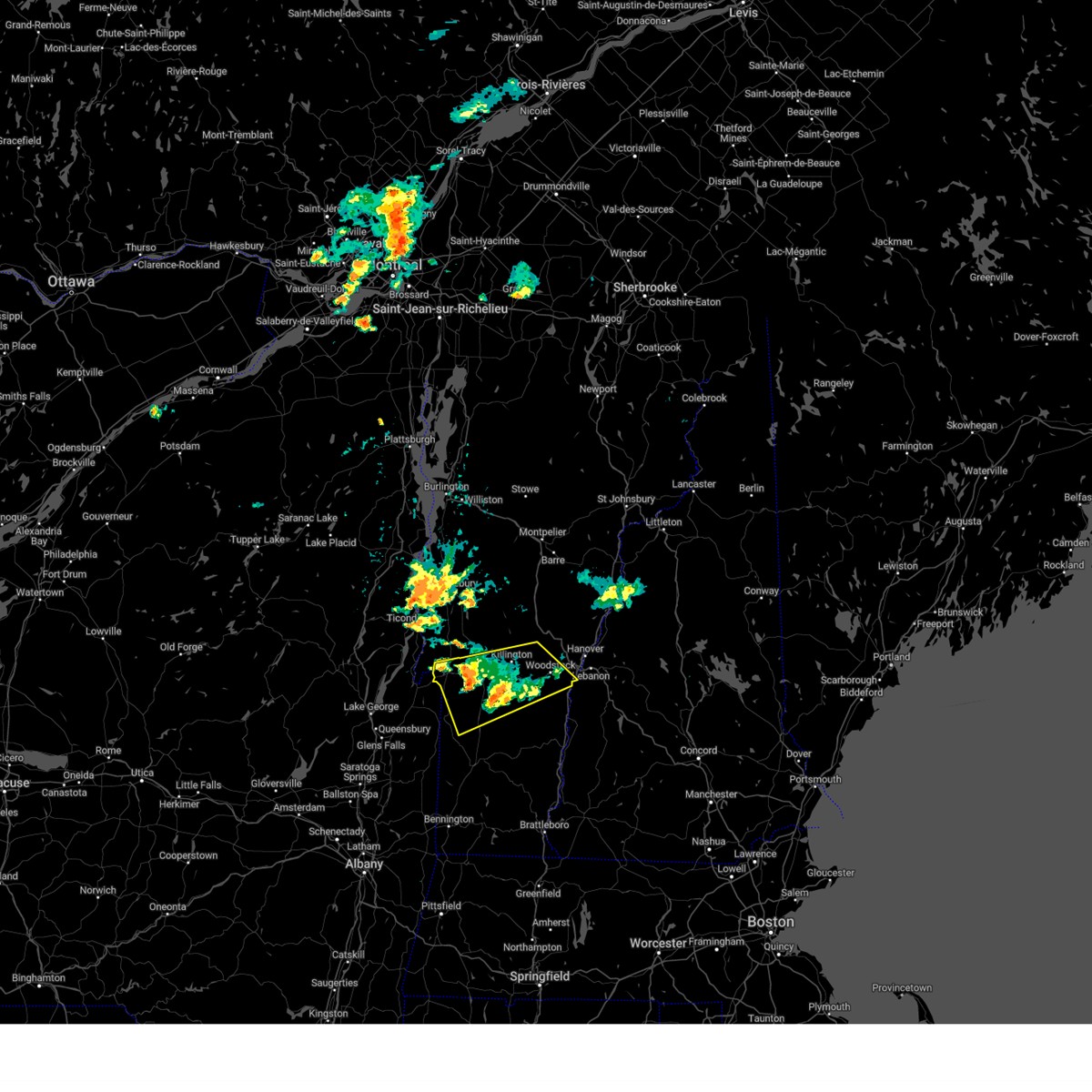
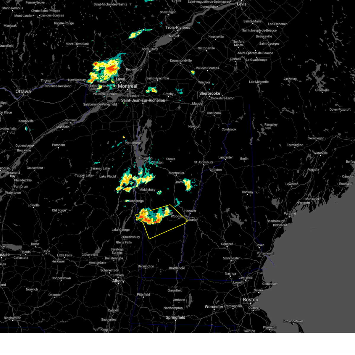
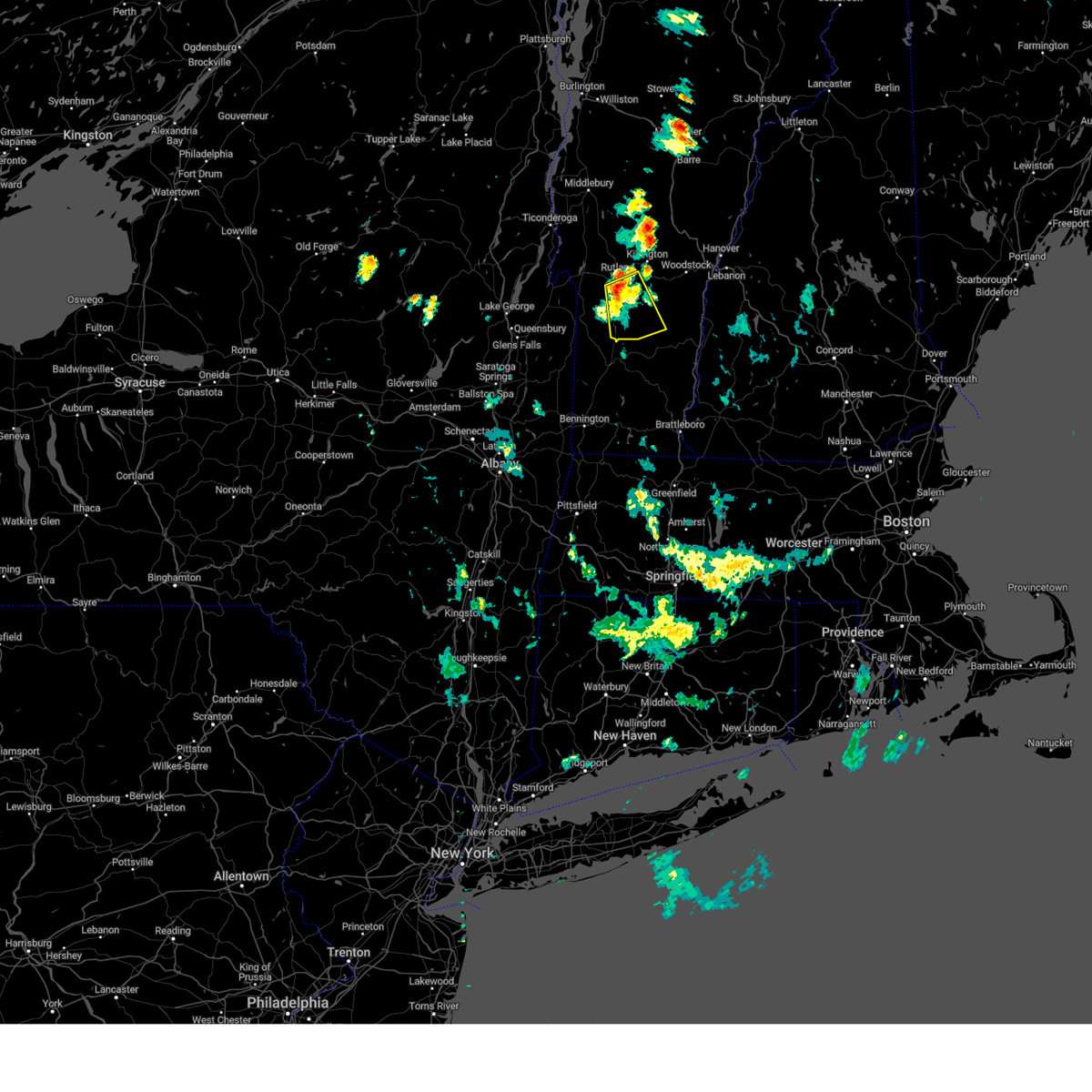
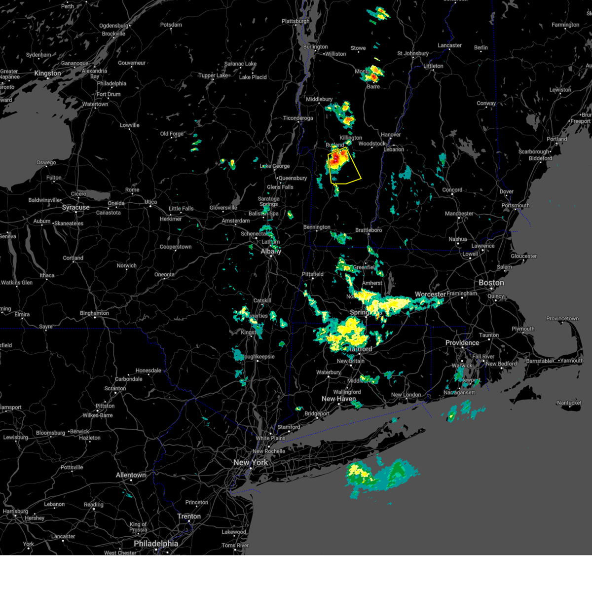
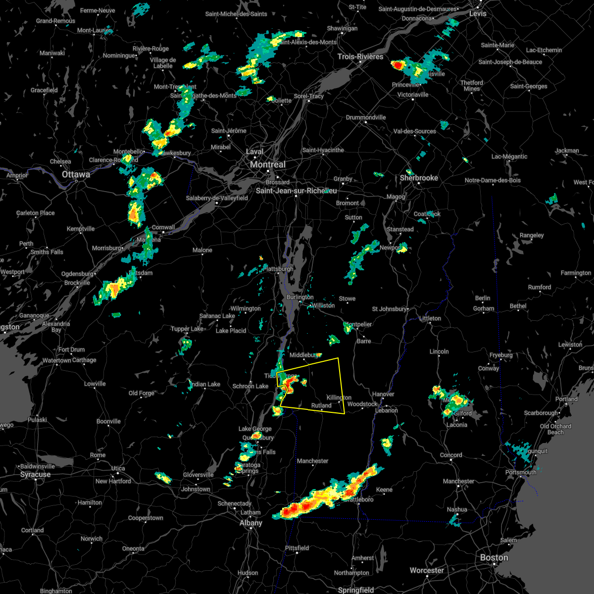
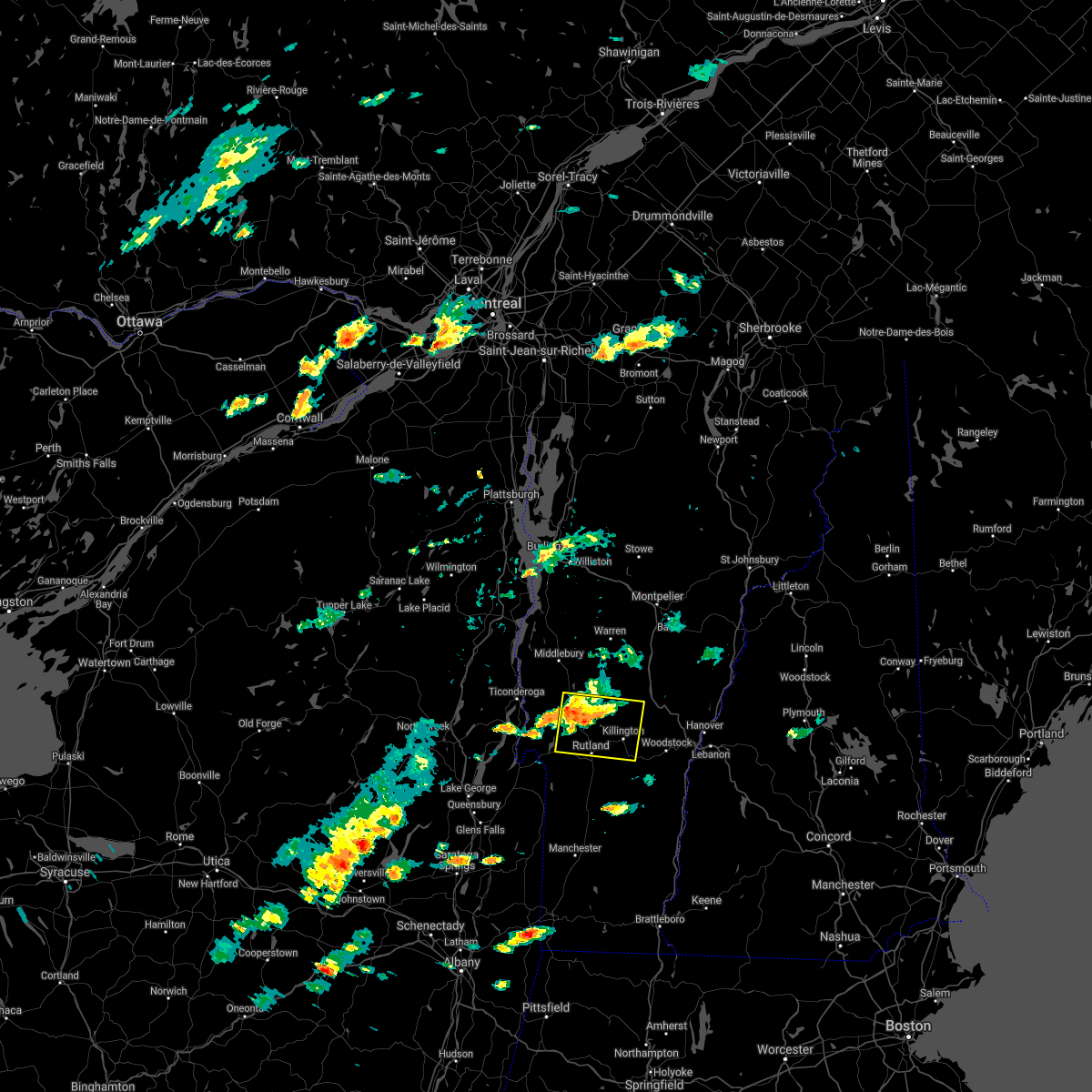
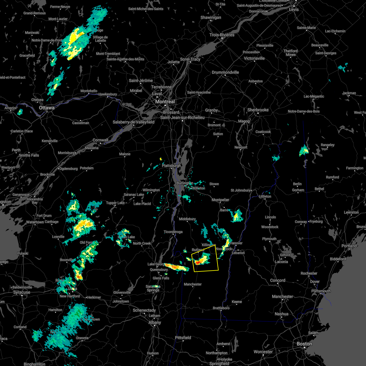
Hail Map for Rutland, VT
The Rutland, VT area has had 14 reports of on-the-ground hail by trained spotters, and has been under severe weather warnings 7 times during the past 12 months. Doppler radar has detected hail at or near Rutland, VT on 17 occasions, including 1 occasion during the past year.
| Name: | Rutland, VT |
| Where Located: | 61 miles S of Burlington, VT |
| Map: | Google Map for Rutland, VT |
| Population: | 16495 |
| Housing Units: | 8082 |
| More Info: | Search Google for Rutland, VT |
1
The Top Recent Hail Date for Rutland, VT is Sunday, August 4, 2024 (8th out of 17)

Hail and Wind Damage Spotted near Rutland, VT
| Date / Time | Report Details |
|---|---|
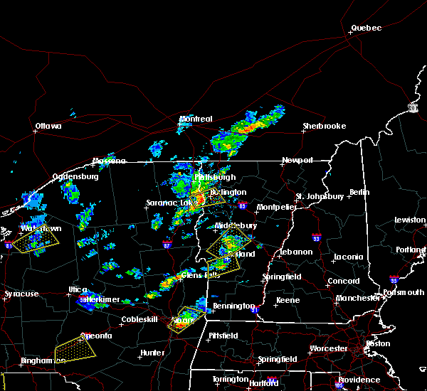
| 8/4/2024 7:57 PM EDT |
 The storm which prompted the warning has weakened below severe limits, and no longer poses an immediate threat to life or property. therefore, the warning will be allowed to expire. however, gusty winds and heavy rain are still possible with this thunderstorm. to report severe weather, contact your nearest law enforcement agency. they will relay your report to the national weather service burlington. The storm which prompted the warning has weakened below severe limits, and no longer poses an immediate threat to life or property. therefore, the warning will be allowed to expire. however, gusty winds and heavy rain are still possible with this thunderstorm. to report severe weather, contact your nearest law enforcement agency. they will relay your report to the national weather service burlington.
|
| 8/4/2024 7:33 PM EDT |
 At 733 pm edt, a severe thunderstorm was located over plymouth, moving east at 20 mph (radar indicated). Hazards include 60 mph wind gusts and quarter size hail. Minor hail damage to vehicles is possible. expect wind damage to trees and powerlines. locations impacted include, woodstock, rutland, castleton, hartland four corners, killington, rutland city, middletown springs, wallingford, mt. Holly, rutland - southern vermont airport, pomfret, poultney, plymouth, hartland, fair haven, clarendon, west rutland, ira, west castleton, and barnard. At 733 pm edt, a severe thunderstorm was located over plymouth, moving east at 20 mph (radar indicated). Hazards include 60 mph wind gusts and quarter size hail. Minor hail damage to vehicles is possible. expect wind damage to trees and powerlines. locations impacted include, woodstock, rutland, castleton, hartland four corners, killington, rutland city, middletown springs, wallingford, mt. Holly, rutland - southern vermont airport, pomfret, poultney, plymouth, hartland, fair haven, clarendon, west rutland, ira, west castleton, and barnard.
|
| 8/4/2024 7:10 PM EDT | Multiple reports of trees and power lines down across rutlan in rutland county VT, 0.3 miles WSW of Rutland, VT |
| 8/4/2024 6:59 PM EDT |
 Svrbtv the national weather service in burlington has issued a * severe thunderstorm warning for, rutland county in southern vermont, central windsor county in southern vermont, * until 800 pm edt. * at 659 pm edt, a severe thunderstorm was located over north clarendon, moving east at 20 mph (radar indicated). Hazards include 60 mph wind gusts and quarter size hail. Minor hail damage to vehicles is possible. Expect wind damage to trees and powerlines. Svrbtv the national weather service in burlington has issued a * severe thunderstorm warning for, rutland county in southern vermont, central windsor county in southern vermont, * until 800 pm edt. * at 659 pm edt, a severe thunderstorm was located over north clarendon, moving east at 20 mph (radar indicated). Hazards include 60 mph wind gusts and quarter size hail. Minor hail damage to vehicles is possible. Expect wind damage to trees and powerlines.
|
| 8/4/2024 6:50 PM EDT | Trees and power lines were blown down by the first round of storms that moves through rutlan in rutland county VT, 0.3 miles WSW of Rutland, VT |
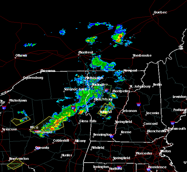
| 7/29/2024 6:22 PM EDT |
 The storm which prompted the warning has weakened below severe limits. therefore, the warning will be allowed to expire. however, torrential rain is still occurring with this thunderstorm. localized flooding is possible. The storm which prompted the warning has weakened below severe limits. therefore, the warning will be allowed to expire. however, torrential rain is still occurring with this thunderstorm. localized flooding is possible.
|
| 7/29/2024 6:04 PM EDT |
 At 604 pm edt, a severe thunderstorm was located over east clarendon, and is nearly stationary (radar indicated). Hazards include 60 mph wind gusts and quarter size hail. Minor hail damage to vehicles is possible. expect wind damage to trees and powerlines. locations impacted include, rutland, mount holly, ludlow, mount tabor, weston, shrewsbury, ludlow village, wallingford, mt. holly, mt. Tabor, rutland - southern vermont airport, clarendon, mendon, tinmouth, ira, danby, plymouth, andover, killington, and east clarendon. At 604 pm edt, a severe thunderstorm was located over east clarendon, and is nearly stationary (radar indicated). Hazards include 60 mph wind gusts and quarter size hail. Minor hail damage to vehicles is possible. expect wind damage to trees and powerlines. locations impacted include, rutland, mount holly, ludlow, mount tabor, weston, shrewsbury, ludlow village, wallingford, mt. holly, mt. Tabor, rutland - southern vermont airport, clarendon, mendon, tinmouth, ira, danby, plymouth, andover, killington, and east clarendon.
|
| 7/29/2024 5:50 PM EDT | Half Dollar sized hail reported 2.7 miles NNW of Rutland, VT |
| 7/29/2024 5:47 PM EDT |
 Svrbtv the national weather service in burlington has issued a * severe thunderstorm warning for, southeastern rutland county in southern vermont, southwestern windsor county in southern vermont, * until 630 pm edt. * at 547 pm edt, a severe thunderstorm was located over east clarendon, moving south at 5 mph (radar indicated). Hazards include 60 mph wind gusts and quarter size hail. Minor hail damage to vehicles is possible. Expect wind damage to trees and powerlines. Svrbtv the national weather service in burlington has issued a * severe thunderstorm warning for, southeastern rutland county in southern vermont, southwestern windsor county in southern vermont, * until 630 pm edt. * at 547 pm edt, a severe thunderstorm was located over east clarendon, moving south at 5 mph (radar indicated). Hazards include 60 mph wind gusts and quarter size hail. Minor hail damage to vehicles is possible. Expect wind damage to trees and powerlines.
|
| 7/16/2024 5:39 PM EDT |
 Svrbtv the national weather service in burlington has issued a * severe thunderstorm warning for, southeastern essex county in northern new york, west central orange county in central vermont, southern addison county in central vermont, rutland county in southern vermont, western windsor county in southern vermont, * until 630 pm edt. * at 539 pm edt, severe thunderstorms were located along a line extending from chipmans point to 8 miles south of west pawlet, moving east at 45 mph (radar indicated). Hazards include 70 mph wind gusts. Expect considerable tree damage. Damage is likely to mobile homes, roofs, and outbuildings. Svrbtv the national weather service in burlington has issued a * severe thunderstorm warning for, southeastern essex county in northern new york, west central orange county in central vermont, southern addison county in central vermont, rutland county in southern vermont, western windsor county in southern vermont, * until 630 pm edt. * at 539 pm edt, severe thunderstorms were located along a line extending from chipmans point to 8 miles south of west pawlet, moving east at 45 mph (radar indicated). Hazards include 70 mph wind gusts. Expect considerable tree damage. Damage is likely to mobile homes, roofs, and outbuildings.
|
| 6/20/2024 3:37 PM EDT |
 the severe thunderstorm warning has been cancelled and is no longer in effect the severe thunderstorm warning has been cancelled and is no longer in effect
|
| 6/20/2024 3:25 PM EDT |
 At 325 pm edt, a severe thunderstorm was located over west castleton, moving northeast at 25 mph (radar indicated). Hazards include 60 mph wind gusts and penny size hail. Expect damage to trees and powerlines. Locations impacted include, rutland, castleton, west castleton, hubbardton, poultney village, shrewsbury, rutland city, middletown springs, proctor, rutland - southern vermont airport, benson, poultney, chittenden, mendon, fair haven, clarendon, west rutland, pittsford, ira, and west haven. At 325 pm edt, a severe thunderstorm was located over west castleton, moving northeast at 25 mph (radar indicated). Hazards include 60 mph wind gusts and penny size hail. Expect damage to trees and powerlines. Locations impacted include, rutland, castleton, west castleton, hubbardton, poultney village, shrewsbury, rutland city, middletown springs, proctor, rutland - southern vermont airport, benson, poultney, chittenden, mendon, fair haven, clarendon, west rutland, pittsford, ira, and west haven.
|
| 6/20/2024 2:56 PM EDT |
 Svrbtv the national weather service in burlington has issued a * severe thunderstorm warning for, central rutland county in southern vermont, * until 400 pm edt. * at 255 pm edt, a severe thunderstorm was located near west haven, moving east at 25 mph (radar indicated). Hazards include 60 mph wind gusts and penny size hail. expect damage to trees and powerlines Svrbtv the national weather service in burlington has issued a * severe thunderstorm warning for, central rutland county in southern vermont, * until 400 pm edt. * at 255 pm edt, a severe thunderstorm was located near west haven, moving east at 25 mph (radar indicated). Hazards include 60 mph wind gusts and penny size hail. expect damage to trees and powerlines
|
| 8/12/2023 11:43 PM EDT |
 The severe thunderstorm warning for southeastern essex, southwestern addison, northwestern rutland and northwestern windsor counties will expire at 1145 pm edt, the storm which prompted the warning has weakened below severe limits, and no longer poses an immediate threat to life or property. therefore, the warning will be allowed to expire. however gusty winds and heavy rain are still possible with this thunderstorm. The severe thunderstorm warning for southeastern essex, southwestern addison, northwestern rutland and northwestern windsor counties will expire at 1145 pm edt, the storm which prompted the warning has weakened below severe limits, and no longer poses an immediate threat to life or property. therefore, the warning will be allowed to expire. however gusty winds and heavy rain are still possible with this thunderstorm.
|
| 8/12/2023 11:35 PM EDT |
 At 1135 pm edt, a severe thunderstorm was located near north chittenden, moving northeast at 40 mph (radar indicated). Hazards include 60 mph wind gusts and penny size hail. Expect damage to trees and powerlines. locations impacted include, rutland, castleton, west castleton, sudbury, hubbardton, shoreham, salisbury, rutland city, orwell, proctor, chittenden, brandon, leicester, west rutland, whiting, pittsford, goshen, ripton, mendon, and poultney. hail threat, radar indicated max hail size, 0. 75 in wind threat, radar indicated max wind gust, 60 mph. At 1135 pm edt, a severe thunderstorm was located near north chittenden, moving northeast at 40 mph (radar indicated). Hazards include 60 mph wind gusts and penny size hail. Expect damage to trees and powerlines. locations impacted include, rutland, castleton, west castleton, sudbury, hubbardton, shoreham, salisbury, rutland city, orwell, proctor, chittenden, brandon, leicester, west rutland, whiting, pittsford, goshen, ripton, mendon, and poultney. hail threat, radar indicated max hail size, 0. 75 in wind threat, radar indicated max wind gust, 60 mph.
|
| 8/12/2023 11:24 PM EDT |
 At 1124 pm edt, a severe thunderstorm was located over hubbardton, moving northeast at 35 mph (radar indicated). Hazards include 60 mph wind gusts and penny size hail. Expect damage to trees and powerlines. locations impacted include, rutland, castleton, sudbury, salisbury, rutland city, orwell, benson, chittenden, fair haven, west rutland, whiting, goshen, west castleton, hubbardton, shoreham, proctor, brandon, leicester, pittsford, and west haven. hail threat, radar indicated max hail size, 0. 75 in wind threat, radar indicated max wind gust, 60 mph. At 1124 pm edt, a severe thunderstorm was located over hubbardton, moving northeast at 35 mph (radar indicated). Hazards include 60 mph wind gusts and penny size hail. Expect damage to trees and powerlines. locations impacted include, rutland, castleton, sudbury, salisbury, rutland city, orwell, benson, chittenden, fair haven, west rutland, whiting, goshen, west castleton, hubbardton, shoreham, proctor, brandon, leicester, pittsford, and west haven. hail threat, radar indicated max hail size, 0. 75 in wind threat, radar indicated max wind gust, 60 mph.
|
| 8/12/2023 11:01 PM EDT |
 At 1101 pm edt, a severe thunderstorm was located over west haven, moving northeast at 40 mph (radar indicated). Hazards include 60 mph wind gusts and penny size hail. expect damage to trees and powerlines At 1101 pm edt, a severe thunderstorm was located over west haven, moving northeast at 40 mph (radar indicated). Hazards include 60 mph wind gusts and penny size hail. expect damage to trees and powerlines
|
| 8/4/2023 4:43 PM EDT |
 At 443 pm edt, a severe thunderstorm was located over east clarendon, moving east at 25 mph (radar indicated). Hazards include 60 mph wind gusts and quarter size hail. Minor hail damage to vehicles is possible. Expect wind damage to trees and powerlines. At 443 pm edt, a severe thunderstorm was located over east clarendon, moving east at 25 mph (radar indicated). Hazards include 60 mph wind gusts and quarter size hail. Minor hail damage to vehicles is possible. Expect wind damage to trees and powerlines.
|
| 8/4/2023 4:04 PM EDT | Quarter sized hail reported 4 miles SW of Rutland, VT, dime to quarter sized hail reported by the public. |
| 8/4/2023 3:49 PM EDT |
 At 349 pm edt, a severe thunderstorm was located over rutland city, moving east at 10 mph (radar indicated). Hazards include 60 mph wind gusts and quarter size hail. Minor hail damage to vehicles is possible. Expect wind damage to trees and powerlines. At 349 pm edt, a severe thunderstorm was located over rutland city, moving east at 10 mph (radar indicated). Hazards include 60 mph wind gusts and quarter size hail. Minor hail damage to vehicles is possible. Expect wind damage to trees and powerlines.
|
| 7/13/2023 7:22 PM EDT |
 At 722 pm edt, severe thunderstorms were located along a line extending from whiting to 13 miles south of west pawlet, moving east at 35 mph (radar indicated). Hazards include 60 mph wind gusts and quarter size hail. Minor hail damage to vehicles is possible. Expect wind damage to trees and powerlines. At 722 pm edt, severe thunderstorms were located along a line extending from whiting to 13 miles south of west pawlet, moving east at 35 mph (radar indicated). Hazards include 60 mph wind gusts and quarter size hail. Minor hail damage to vehicles is possible. Expect wind damage to trees and powerlines.
|
| 7/13/2023 7:03 PM EDT |
 At 703 pm edt, a severe thunderstorm was located near west rutland, moving east at 20 mph (radar indicated). Hazards include 60 mph wind gusts and quarter size hail. Minor hail damage to vehicles is possible. expect wind damage to trees and powerlines. locations impacted include, rutland, castleton, killington, rutland city, middletown springs, wallingford, mt. holly, mt. Tabor, rutland - southern vermont airport, poultney, chittenden, clarendon, west rutland, ira, wells, west castleton, pawlet, mount holly, hubbardton, and poultney village. At 703 pm edt, a severe thunderstorm was located near west rutland, moving east at 20 mph (radar indicated). Hazards include 60 mph wind gusts and quarter size hail. Minor hail damage to vehicles is possible. expect wind damage to trees and powerlines. locations impacted include, rutland, castleton, killington, rutland city, middletown springs, wallingford, mt. holly, mt. Tabor, rutland - southern vermont airport, poultney, chittenden, clarendon, west rutland, ira, wells, west castleton, pawlet, mount holly, hubbardton, and poultney village.
|
| 7/13/2023 6:35 PM EDT |
 At 634 pm edt, a severe thunderstorm was located over fair haven, moving east at 20 mph (radar indicated). Hazards include 60 mph wind gusts and quarter size hail. Minor hail damage to vehicles is possible. Expect wind damage to trees and powerlines. At 634 pm edt, a severe thunderstorm was located over fair haven, moving east at 20 mph (radar indicated). Hazards include 60 mph wind gusts and quarter size hail. Minor hail damage to vehicles is possible. Expect wind damage to trees and powerlines.
|
| 8/30/2022 4:58 PM EDT |
 The severe thunderstorm warning for eastern rutland and west central windsor counties will expire at 500 pm edt, the storm which prompted the warning has moved out of the area. therefore, the warning will be allowed to expire. however heavy rain is still possible with additional thunderstorms. The severe thunderstorm warning for eastern rutland and west central windsor counties will expire at 500 pm edt, the storm which prompted the warning has moved out of the area. therefore, the warning will be allowed to expire. however heavy rain is still possible with additional thunderstorms.
|
| 8/30/2022 4:17 PM EDT |
 At 416 pm edt, a severe thunderstorm was located over ira, moving northeast at 35 mph (radar indicated). Hazards include 60 mph wind gusts and nickel size hail. expect damage to trees and powerlines At 416 pm edt, a severe thunderstorm was located over ira, moving northeast at 35 mph (radar indicated). Hazards include 60 mph wind gusts and nickel size hail. expect damage to trees and powerlines
|
| 8/4/2022 5:23 PM EDT |
 At 523 pm edt, a severe thunderstorm was located over west pawlet, moving northeast at 30 mph (radar indicated). Hazards include 60 mph wind gusts and quarter size hail. Minor hail damage to vehicles is possible. Expect wind damage to trees and powerlines. At 523 pm edt, a severe thunderstorm was located over west pawlet, moving northeast at 30 mph (radar indicated). Hazards include 60 mph wind gusts and quarter size hail. Minor hail damage to vehicles is possible. Expect wind damage to trees and powerlines.
|
| 7/21/2022 5:45 PM EDT |
 At 544 pm edt, severe thunderstorms were located along a line extending from allis state park to south randolph to west bridgewater, moving east at 25 mph (radar indicated). Hazards include 60 mph wind gusts and quarter size hail. Minor hail damage to vehicles is possible. expect wind damage to trees and powerlines. locations impacted include, rutland, woodstock, braintree hill, bradford, killington, thetford hill state park, rutland city, pomfret, plymouth, thetford, hartland, fairlee, tunbridge, sharon, corinth corners, bridgewater, west windsor, hartland four corners, chelsea and bethel. hail threat, radar indicated max hail size, 1. 00 in wind threat, radar indicated max wind gust, 60 mph. At 544 pm edt, severe thunderstorms were located along a line extending from allis state park to south randolph to west bridgewater, moving east at 25 mph (radar indicated). Hazards include 60 mph wind gusts and quarter size hail. Minor hail damage to vehicles is possible. expect wind damage to trees and powerlines. locations impacted include, rutland, woodstock, braintree hill, bradford, killington, thetford hill state park, rutland city, pomfret, plymouth, thetford, hartland, fairlee, tunbridge, sharon, corinth corners, bridgewater, west windsor, hartland four corners, chelsea and bethel. hail threat, radar indicated max hail size, 1. 00 in wind threat, radar indicated max wind gust, 60 mph.
|
| 7/21/2022 5:36 PM EDT |
 At 536 pm edt, severe thunderstorms were located along a line extending from allis state park to south randolph to west bridgewater, moving east at 25 mph (radar indicated). Hazards include 60 mph wind gusts and quarter size hail. Minor hail damage to vehicles is possible. expect wind damage to trees and powerlines. locations impacted include, rutland, woodstock, braintree hill, bradford, killington, thetford hill state park, rutland city, pomfret, plymouth, thetford, hartland, west rutland, granville, fairlee, tunbridge, sharon, corinth corners, bridgewater, pittsfield and west windsor. hail threat, radar indicated max hail size, 1. 00 in wind threat, radar indicated max wind gust, 60 mph. At 536 pm edt, severe thunderstorms were located along a line extending from allis state park to south randolph to west bridgewater, moving east at 25 mph (radar indicated). Hazards include 60 mph wind gusts and quarter size hail. Minor hail damage to vehicles is possible. expect wind damage to trees and powerlines. locations impacted include, rutland, woodstock, braintree hill, bradford, killington, thetford hill state park, rutland city, pomfret, plymouth, thetford, hartland, west rutland, granville, fairlee, tunbridge, sharon, corinth corners, bridgewater, pittsfield and west windsor. hail threat, radar indicated max hail size, 1. 00 in wind threat, radar indicated max wind gust, 60 mph.
|
| 7/21/2022 5:23 PM EDT |
 The severe thunderstorm warning for western orange, southeastern addison, northern rutland and northwestern windsor counties will expire at 530 pm edt, the storm which prompted the warning has moved out of the area. therefore, the warning will be allowed to expire. a severe thunderstorm watch remains in effect until 800 pm edt for central and southern vermont. remember, a new severe thunderstorm warning has been issued for central and northern windsor county into orange county vermont. The severe thunderstorm warning for western orange, southeastern addison, northern rutland and northwestern windsor counties will expire at 530 pm edt, the storm which prompted the warning has moved out of the area. therefore, the warning will be allowed to expire. a severe thunderstorm watch remains in effect until 800 pm edt for central and southern vermont. remember, a new severe thunderstorm warning has been issued for central and northern windsor county into orange county vermont.
|
| 7/21/2022 5:19 PM EDT |
 At 519 pm edt, severe thunderstorms were located along a line extending from granville to rochester to north clarendon, moving east at 30 mph (radar indicated). Hazards include 60 mph wind gusts and quarter size hail. Minor hail damage to vehicles is possible. Expect wind damage to trees and powerlines. At 519 pm edt, severe thunderstorms were located along a line extending from granville to rochester to north clarendon, moving east at 30 mph (radar indicated). Hazards include 60 mph wind gusts and quarter size hail. Minor hail damage to vehicles is possible. Expect wind damage to trees and powerlines.
|
| 7/21/2022 5:02 PM EDT |
 At 502 pm edt, a severe thunderstorm was located over bradbury state park, moving east at 35 mph (radar indicated). Hazards include 60 mph wind gusts and quarter size hail. Minor hail damage to vehicles is possible. expect wind damage to trees and powerlines. locations impacted include, rutland, middlebury, castleton, sudbury, killington, salisbury, rutland city, rochester, chittenden, west rutland, granville, goshen, west castleton, hancock, hubbardton, ripton, proctor, brandon, mendon and leicester. hail threat, radar indicated max hail size, 1. 00 in wind threat, radar indicated max wind gust, 60 mph. At 502 pm edt, a severe thunderstorm was located over bradbury state park, moving east at 35 mph (radar indicated). Hazards include 60 mph wind gusts and quarter size hail. Minor hail damage to vehicles is possible. expect wind damage to trees and powerlines. locations impacted include, rutland, middlebury, castleton, sudbury, killington, salisbury, rutland city, rochester, chittenden, west rutland, granville, goshen, west castleton, hancock, hubbardton, ripton, proctor, brandon, mendon and leicester. hail threat, radar indicated max hail size, 1. 00 in wind threat, radar indicated max wind gust, 60 mph.
|
| 7/21/2022 4:55 PM EDT |
 At 454 pm edt, a severe thunderstorm was located over leicester junction, moving east at 35 mph (radar indicated). Hazards include 60 mph wind gusts and quarter size hail. Minor hail damage to vehicles is possible. expect wind damage to trees and powerlines. Locations impacted include, rutland, middlebury, castleton, sudbury, killington, salisbury, rutland city, orwell, rochester, benson, chittenden, west rutland, whiting, granville, goshen, west castleton, hancock, hubbardton, shoreham and ripton. At 454 pm edt, a severe thunderstorm was located over leicester junction, moving east at 35 mph (radar indicated). Hazards include 60 mph wind gusts and quarter size hail. Minor hail damage to vehicles is possible. expect wind damage to trees and powerlines. Locations impacted include, rutland, middlebury, castleton, sudbury, killington, salisbury, rutland city, orwell, rochester, benson, chittenden, west rutland, whiting, granville, goshen, west castleton, hancock, hubbardton, shoreham and ripton.
|
| 7/21/2022 4:43 PM EDT |
 At 443 pm edt, a severe thunderstorm was located over east shoreham, moving east at 35 mph (radar indicated). Hazards include 60 mph wind gusts and quarter size hail. Minor hail damage to vehicles is possible. expect wind damage to trees and powerlines. Locations impacted include, rutland, middlebury, castleton, sudbury, killington, salisbury, rutland city, orwell, rochester, benson, chittenden, west rutland, whiting, granville, goshen, west castleton, hancock, hubbardton, shoreham and ripton. At 443 pm edt, a severe thunderstorm was located over east shoreham, moving east at 35 mph (radar indicated). Hazards include 60 mph wind gusts and quarter size hail. Minor hail damage to vehicles is possible. expect wind damage to trees and powerlines. Locations impacted include, rutland, middlebury, castleton, sudbury, killington, salisbury, rutland city, orwell, rochester, benson, chittenden, west rutland, whiting, granville, goshen, west castleton, hancock, hubbardton, shoreham and ripton.
|
| 7/21/2022 4:27 PM EDT |
 At 427 pm edt, a severe thunderstorm was located over black point, moving east at 35 mph (radar indicated). Hazards include 60 mph wind gusts and quarter size hail. Minor hail damage to vehicles is possible. Expect wind damage to trees and powerlines. At 427 pm edt, a severe thunderstorm was located over black point, moving east at 35 mph (radar indicated). Hazards include 60 mph wind gusts and quarter size hail. Minor hail damage to vehicles is possible. Expect wind damage to trees and powerlines.
|
| 7/12/2022 3:15 PM EDT | Trees down in rutland county VT, 11.6 miles WSW of Rutland, VT |
| 7/12/2022 3:08 PM EDT | 4 trees and large limbs dow in rutland county VT, 1.9 miles N of Rutland, VT |
| 7/12/2022 3:02 PM EDT |
 At 301 pm edt, a severe thunderstorm was located over mendon, moving east at 45 mph (radar indicated). Hazards include 60 mph wind gusts and quarter size hail. Minor hail damage to vehicles is possible. expect wind damage to trees and powerlines. locations impacted include, rutland, stockbridge, chittenden, mendon, pittsfield, killington, proctor, pittsford, rutland city, brandon, goshen, rochester, bridgewater, bethel, east pittsford, giffords woods state forest park, north sherburne, north chittenden and gifford woods state park. hail threat, radar indicated max hail size, 1. 00 in wind threat, radar indicated max wind gust, 60 mph. At 301 pm edt, a severe thunderstorm was located over mendon, moving east at 45 mph (radar indicated). Hazards include 60 mph wind gusts and quarter size hail. Minor hail damage to vehicles is possible. expect wind damage to trees and powerlines. locations impacted include, rutland, stockbridge, chittenden, mendon, pittsfield, killington, proctor, pittsford, rutland city, brandon, goshen, rochester, bridgewater, bethel, east pittsford, giffords woods state forest park, north sherburne, north chittenden and gifford woods state park. hail threat, radar indicated max hail size, 1. 00 in wind threat, radar indicated max wind gust, 60 mph.
|
| 7/12/2022 3:01 PM EDT | Trees on wires in rutland county VT, 4 miles SW of Rutland, VT |
| 7/12/2022 2:58 PM EDT | 4 trees down on pittsford road in rutland county VT, 2.3 miles S of Rutland, VT |
| 7/12/2022 2:55 PM EDT |
 At 255 pm edt, a severe thunderstorm was located over middletown springs, moving east at 45 mph (radar indicated). Hazards include 60 mph wind gusts and penny size hail. expect damage to trees and powerlines At 255 pm edt, a severe thunderstorm was located over middletown springs, moving east at 45 mph (radar indicated). Hazards include 60 mph wind gusts and penny size hail. expect damage to trees and powerlines
|
| 7/12/2022 2:25 PM EDT |
 At 225 pm edt, a severe thunderstorm was located over benson landing, moving east at 50 mph (radar indicated). Hazards include 60 mph wind gusts. expect damage to trees and powerlines At 225 pm edt, a severe thunderstorm was located over benson landing, moving east at 50 mph (radar indicated). Hazards include 60 mph wind gusts. expect damage to trees and powerlines
|
| 9/15/2021 2:08 PM EDT |
 The severe thunderstorm warning for central rutland and central windsor counties will expire at 215 pm edt, the storm which prompted the warning has moved out of the area. therefore, the warning will be allowed to expire. a severe thunderstorm watch remains in effect until 800 pm edt for southern vermont. The severe thunderstorm warning for central rutland and central windsor counties will expire at 215 pm edt, the storm which prompted the warning has moved out of the area. therefore, the warning will be allowed to expire. a severe thunderstorm watch remains in effect until 800 pm edt for southern vermont.
|
| 9/15/2021 1:40 PM EDT |
 At 140 pm edt, a severe thunderstorm was located over east clarendon, moving east at 30 mph (radar indicated). Hazards include 60 mph wind gusts and quarter size hail. Minor hail damage to vehicles is possible. expect wind damage to trees and powerlines. locations impacted include, rutland, woodstock, killington, poultney village, tinmouth, shrewsbury, rutland city, middletown springs, lake st. catherine, rutland - southern vermont airport, poultney, plymouth, mendon, clarendon, ira, wells, reading, west rutland, wallingford and bridgewater. hail threat, radar indicated max hail size, 1. 00 in wind threat, radar indicated max wind gust, 60 mph. At 140 pm edt, a severe thunderstorm was located over east clarendon, moving east at 30 mph (radar indicated). Hazards include 60 mph wind gusts and quarter size hail. Minor hail damage to vehicles is possible. expect wind damage to trees and powerlines. locations impacted include, rutland, woodstock, killington, poultney village, tinmouth, shrewsbury, rutland city, middletown springs, lake st. catherine, rutland - southern vermont airport, poultney, plymouth, mendon, clarendon, ira, wells, reading, west rutland, wallingford and bridgewater. hail threat, radar indicated max hail size, 1. 00 in wind threat, radar indicated max wind gust, 60 mph.
|
| 9/15/2021 1:15 PM EDT |
 At 115 pm edt, a severe thunderstorm was located over middletown springs, moving northeast at 25 mph (radar indicated). Hazards include 60 mph wind gusts and quarter size hail. Minor hail damage to vehicles is possible. Expect wind damage to trees and powerlines. At 115 pm edt, a severe thunderstorm was located over middletown springs, moving northeast at 25 mph (radar indicated). Hazards include 60 mph wind gusts and quarter size hail. Minor hail damage to vehicles is possible. Expect wind damage to trees and powerlines.
|
| 9/8/2021 7:51 PM EDT |
 At 750 pm edt, a severe thunderstorm was located over tinmouth, moving northeast at 30 mph (radar indicated). Hazards include 60 mph wind gusts and penny size hail. expect damage to trees and powerlines At 750 pm edt, a severe thunderstorm was located over tinmouth, moving northeast at 30 mph (radar indicated). Hazards include 60 mph wind gusts and penny size hail. expect damage to trees and powerlines
|
| 7/27/2021 3:46 PM EDT |
 At 346 pm edt, a severe thunderstorm was located over chippenhook, moving east at 30 mph (radar indicated). Hazards include 60 mph wind gusts and penny size hail. expect damage to trees and powerlines At 346 pm edt, a severe thunderstorm was located over chippenhook, moving east at 30 mph (radar indicated). Hazards include 60 mph wind gusts and penny size hail. expect damage to trees and powerlines
|
| 6/30/2021 2:47 PM EDT |
 At 247 pm edt, a severe thunderstorm was located over south pomfret, moving east at 35 mph (radar indicated). Hazards include 60 mph wind gusts and half dollar size hail. Minor hail damage to vehicles is possible. expect wind damage to trees and powerlines. Locations impacted include, woodstock, rutland, white river junction, hartland four corners, killington, rutland city, pomfret, plymouth, hartland, chittenden, west rutland, barnard, windsor, woodstock village, quechee, stockbridge, proctor, brandon, bridgewater and mendon. At 247 pm edt, a severe thunderstorm was located over south pomfret, moving east at 35 mph (radar indicated). Hazards include 60 mph wind gusts and half dollar size hail. Minor hail damage to vehicles is possible. expect wind damage to trees and powerlines. Locations impacted include, woodstock, rutland, white river junction, hartland four corners, killington, rutland city, pomfret, plymouth, hartland, chittenden, west rutland, barnard, windsor, woodstock village, quechee, stockbridge, proctor, brandon, bridgewater and mendon.
|
| 6/30/2021 2:24 PM EDT |
 At 223 pm edt, a severe thunderstorm was located near chittenden, moving east at 30 mph (radar indicated). Hazards include 60 mph wind gusts and half dollar size hail. Minor hail damage to vehicles is possible. Expect wind damage to trees and powerlines. At 223 pm edt, a severe thunderstorm was located near chittenden, moving east at 30 mph (radar indicated). Hazards include 60 mph wind gusts and half dollar size hail. Minor hail damage to vehicles is possible. Expect wind damage to trees and powerlines.
|
| 6/30/2021 2:05 PM EDT |
 At 204 pm edt, a severe thunderstorm was located over hortonia, moving east at 35 mph (law enforcement). Hazards include ping pong ball size hail and 60 mph wind gusts. People and animals outdoors will be injured. expect hail damage to roofs, siding, windows, and vehicles. expect wind damage to trees and powerlines. locations impacted include, rutland, castleton, killington, rutland city, stockbridge, proctor, brandon, chittenden, mendon, leicester, pittsfield, west rutland, pittsford, goshen, hubbardton, bethel, sudbury, rochester, bridgewater and barnard. Law enforcement reported wind damage in the ticonderoga area around 130 pm. At 204 pm edt, a severe thunderstorm was located over hortonia, moving east at 35 mph (law enforcement). Hazards include ping pong ball size hail and 60 mph wind gusts. People and animals outdoors will be injured. expect hail damage to roofs, siding, windows, and vehicles. expect wind damage to trees and powerlines. locations impacted include, rutland, castleton, killington, rutland city, stockbridge, proctor, brandon, chittenden, mendon, leicester, pittsfield, west rutland, pittsford, goshen, hubbardton, bethel, sudbury, rochester, bridgewater and barnard. Law enforcement reported wind damage in the ticonderoga area around 130 pm.
|
| 6/30/2021 1:50 PM EDT |
 At 150 pm edt, a severe thunderstorm was located over orwell, moving east at 35 mph (radar indicated). Hazards include ping pong ball size hail and 60 mph wind gusts. People and animals outdoors will be injured. expect hail damage to roofs, siding, windows, and vehicles. expect wind damage to trees and powerlines. Locations impacted include, rutland, castleton, sudbury, killington, rutland city, benson, chittenden, west rutland, whiting, goshen, west castleton, hubbardton, stockbridge, proctor, brandon, mendon, leicester, pittsfield, pittsford and fair haven. At 150 pm edt, a severe thunderstorm was located over orwell, moving east at 35 mph (radar indicated). Hazards include ping pong ball size hail and 60 mph wind gusts. People and animals outdoors will be injured. expect hail damage to roofs, siding, windows, and vehicles. expect wind damage to trees and powerlines. Locations impacted include, rutland, castleton, sudbury, killington, rutland city, benson, chittenden, west rutland, whiting, goshen, west castleton, hubbardton, stockbridge, proctor, brandon, mendon, leicester, pittsfield, pittsford and fair haven.
|
| 6/30/2021 1:37 PM EDT |
 At 135 pm edt, a severe thunderstorm was located near fort ticonderoga in eastern essex county new york, moving east at 35 mph (radar indicated). Hazards include 60 mph wind gusts and quarter size hail. Minor hail damage to vehicles is possible. Expect wind damage to trees and powerlines. At 135 pm edt, a severe thunderstorm was located near fort ticonderoga in eastern essex county new york, moving east at 35 mph (radar indicated). Hazards include 60 mph wind gusts and quarter size hail. Minor hail damage to vehicles is possible. Expect wind damage to trees and powerlines.
|
| 6/21/2021 6:38 PM EDT |
 At 638 pm edt, a severe thunderstorm was located over east clarendon, moving east at 20 mph (radar indicated). Hazards include 60 mph wind gusts and quarter size hail. Minor hail damage to vehicles is possible. expect wind damage to trees and powerlines. locations impacted include, rutland, mount holly, ludlow, killington, tinmouth, shrewsbury, ludlow village, rutland city, wallingford, mt. Holly, rutland - southern vermont airport, plymouth, bridgewater, mendon, clarendon, ira, cavendish, west rutland, danby and mount tabor. At 638 pm edt, a severe thunderstorm was located over east clarendon, moving east at 20 mph (radar indicated). Hazards include 60 mph wind gusts and quarter size hail. Minor hail damage to vehicles is possible. expect wind damage to trees and powerlines. locations impacted include, rutland, mount holly, ludlow, killington, tinmouth, shrewsbury, ludlow village, rutland city, wallingford, mt. Holly, rutland - southern vermont airport, plymouth, bridgewater, mendon, clarendon, ira, cavendish, west rutland, danby and mount tabor.
|
| 6/21/2021 6:18 PM EDT |
 At 618 pm edt, a severe thunderstorm was located over tinmouth, moving east at 20 mph (radar indicated). Hazards include 60 mph wind gusts and quarter size hail. Minor hail damage to vehicles is possible. Expect wind damage to trees and powerlines. At 618 pm edt, a severe thunderstorm was located over tinmouth, moving east at 20 mph (radar indicated). Hazards include 60 mph wind gusts and quarter size hail. Minor hail damage to vehicles is possible. Expect wind damage to trees and powerlines.
|
| 6/21/2021 5:51 PM EDT |
 At 550 pm edt, a severe thunderstorm was located over east pittsford, moving east at 40 mph (radar indicated). Hazards include 60 mph wind gusts and quarter size hail. Minor hail damage to vehicles is possible. expect wind damage to trees and powerlines. Locations impacted include, rutland, woodstock, sudbury, killington, ludlow village, rutland city, wallingford, orwell, rutland - southern vermont airport, benson, plymouth, chittenden, west rutland, whiting, ira, west castleton, mount holly, poultney village, mount tabor and shrewsbury. At 550 pm edt, a severe thunderstorm was located over east pittsford, moving east at 40 mph (radar indicated). Hazards include 60 mph wind gusts and quarter size hail. Minor hail damage to vehicles is possible. expect wind damage to trees and powerlines. Locations impacted include, rutland, woodstock, sudbury, killington, ludlow village, rutland city, wallingford, orwell, rutland - southern vermont airport, benson, plymouth, chittenden, west rutland, whiting, ira, west castleton, mount holly, poultney village, mount tabor and shrewsbury.
|
| 6/21/2021 5:12 PM EDT |
 At 512 pm edt, a severe thunderstorm was located over west haven, moving east at 40 mph (radar indicated). Hazards include 60 mph wind gusts and quarter size hail. Minor hail damage to vehicles is possible. Expect wind damage to trees and powerlines. At 512 pm edt, a severe thunderstorm was located over west haven, moving east at 40 mph (radar indicated). Hazards include 60 mph wind gusts and quarter size hail. Minor hail damage to vehicles is possible. Expect wind damage to trees and powerlines.
|
| 8/24/2020 5:54 PM EDT |
 The severe thunderstorm warning for southwestern rutland county will expire at 600 pm edt, the storm which prompted the warning has weakened below severe limits, and no longer poses an immediate threat to life or property. therefore, the warning will be allowed to expire. however gusty winds and heavy rain are still possible with this thunderstorm. to report severe weather, contact your nearest law enforcement agency. they will relay your report to the national weather service burlington. The severe thunderstorm warning for southwestern rutland county will expire at 600 pm edt, the storm which prompted the warning has weakened below severe limits, and no longer poses an immediate threat to life or property. therefore, the warning will be allowed to expire. however gusty winds and heavy rain are still possible with this thunderstorm. to report severe weather, contact your nearest law enforcement agency. they will relay your report to the national weather service burlington.
|
| 8/24/2020 5:35 PM EDT |
 At 535 pm edt, a severe thunderstorm was located over middletown springs, moving southeast at 25 mph (radar indicated). Hazards include 60 mph wind gusts and quarter size hail. Minor hail damage to vehicles is possible. expect wind damage to trees and powerlines. locations impacted include, rutland, pawlet, poultney village, tinmouth, middletown springs, danby, lake st. Catherine, rutland - southern vermont airport, poultney, fair haven, clarendon, ira, west haven, wells, castleton, west rutland, wallingford, shrewsbury, east clarendon and hydeville. At 535 pm edt, a severe thunderstorm was located over middletown springs, moving southeast at 25 mph (radar indicated). Hazards include 60 mph wind gusts and quarter size hail. Minor hail damage to vehicles is possible. expect wind damage to trees and powerlines. locations impacted include, rutland, pawlet, poultney village, tinmouth, middletown springs, danby, lake st. Catherine, rutland - southern vermont airport, poultney, fair haven, clarendon, ira, west haven, wells, castleton, west rutland, wallingford, shrewsbury, east clarendon and hydeville.
|
| 8/24/2020 5:11 PM EDT |
 At 511 pm edt, a severe thunderstorm was located near poultney village, moving southeast at 25 mph (radar indicated). Hazards include 60 mph wind gusts and quarter size hail. Minor hail damage to vehicles is possible. Expect wind damage to trees and powerlines. At 511 pm edt, a severe thunderstorm was located near poultney village, moving southeast at 25 mph (radar indicated). Hazards include 60 mph wind gusts and quarter size hail. Minor hail damage to vehicles is possible. Expect wind damage to trees and powerlines.
|
| 7/8/2020 3:39 PM EDT |
 At 338 pm edt, a severe thunderstorm was located over poultney, moving southeast at 20 mph (law enforcement reported trees and powerlines down in poultney and 1.5 inch hail in fair haven). Hazards include 60 mph wind gusts and half dollar size hail. Minor hail damage to vehicles is possible. expect wind damage to trees and powerlines. locations impacted include, rutland, poultney village, tinmouth, rutland city, middletown springs, danby, lake st. Catherine, rutland - southern vermont airport, poultney, clarendon, west rutland, ira, wells, castleton, wallingford, shrewsbury, proctor, mendon, pawlet and east clarendon. At 338 pm edt, a severe thunderstorm was located over poultney, moving southeast at 20 mph (law enforcement reported trees and powerlines down in poultney and 1.5 inch hail in fair haven). Hazards include 60 mph wind gusts and half dollar size hail. Minor hail damage to vehicles is possible. expect wind damage to trees and powerlines. locations impacted include, rutland, poultney village, tinmouth, rutland city, middletown springs, danby, lake st. Catherine, rutland - southern vermont airport, poultney, clarendon, west rutland, ira, wells, castleton, wallingford, shrewsbury, proctor, mendon, pawlet and east clarendon.
|
| 7/8/2020 3:27 PM EDT |
 At 327 pm edt, a severe thunderstorm was located over hydeville, moving southeast at 20 mph (radar indicated). Hazards include 60 mph wind gusts and half dollar size hail. Minor hail damage to vehicles is possible. Expect wind damage to trees and powerlines. At 327 pm edt, a severe thunderstorm was located over hydeville, moving southeast at 20 mph (radar indicated). Hazards include 60 mph wind gusts and half dollar size hail. Minor hail damage to vehicles is possible. Expect wind damage to trees and powerlines.
|
| 5/29/2020 6:35 PM EDT |
 At 634 pm edt, a severe thunderstorm was located near poultney village, moving northeast at 45 mph (radar indicated). Hazards include 70 mph wind gusts. Expect considerable tree damage. Damage is likely to mobile homes, roofs, and outbuildings. At 634 pm edt, a severe thunderstorm was located near poultney village, moving northeast at 45 mph (radar indicated). Hazards include 70 mph wind gusts. Expect considerable tree damage. Damage is likely to mobile homes, roofs, and outbuildings.
|
| 5/29/2020 3:55 PM EDT |
 The severe thunderstorm warning for central rutland county will expire at 400 pm edt, the storm which prompted the warning has weakened below severe limits, and no longer poses an immediate threat to life or property. therefore, the warning will be allowed to expire. however gusty winds and heavy rain are still possible with this thunderstorm. a severe thunderstorm watch remains in effect until 900 pm edt for southern vermont. The severe thunderstorm warning for central rutland county will expire at 400 pm edt, the storm which prompted the warning has weakened below severe limits, and no longer poses an immediate threat to life or property. therefore, the warning will be allowed to expire. however gusty winds and heavy rain are still possible with this thunderstorm. a severe thunderstorm watch remains in effect until 900 pm edt for southern vermont.
|
| 5/29/2020 3:49 PM EDT |
 At 349 pm edt, a severe thunderstorm was located over chippenhook, moving northeast at 35 mph (radar indicated). Hazards include 60 mph wind gusts and quarter size hail. Minor hail damage to vehicles is possible. expect wind damage to trees and powerlines. Locations impacted include, rutland, rutland - southern vermont airport, clarendon, rutland city, middletown springs, ira, poultney, tinmouth, wells, west rutland, wallingford, proctor, shrewsbury, mendon, east clarendon, clarendon springs, north clarendon, chippenhook and center rutland. At 349 pm edt, a severe thunderstorm was located over chippenhook, moving northeast at 35 mph (radar indicated). Hazards include 60 mph wind gusts and quarter size hail. Minor hail damage to vehicles is possible. expect wind damage to trees and powerlines. Locations impacted include, rutland, rutland - southern vermont airport, clarendon, rutland city, middletown springs, ira, poultney, tinmouth, wells, west rutland, wallingford, proctor, shrewsbury, mendon, east clarendon, clarendon springs, north clarendon, chippenhook and center rutland.
|
| 5/29/2020 3:21 PM EDT |
 At 320 pm edt, a severe thunderstorm was located near west pawlet, moving northeast at 35 mph (radar indicated). Hazards include 60 mph wind gusts and quarter size hail. Minor hail damage to vehicles is possible. Expect wind damage to trees and powerlines. At 320 pm edt, a severe thunderstorm was located near west pawlet, moving northeast at 35 mph (radar indicated). Hazards include 60 mph wind gusts and quarter size hail. Minor hail damage to vehicles is possible. Expect wind damage to trees and powerlines.
|
| 8/17/2019 6:24 PM EDT |
 At 624 pm edt, severe thunderstorms were located along a line extending from near east hubbardton to near danby, moving northeast at 25 mph (radar indicated). Hazards include 60 mph wind gusts. expect damage to trees and powerlines At 624 pm edt, severe thunderstorms were located along a line extending from near east hubbardton to near danby, moving northeast at 25 mph (radar indicated). Hazards include 60 mph wind gusts. expect damage to trees and powerlines
|
| 6/20/2019 2:51 PM EDT |
 The severe thunderstorm warning for southeastern orange, southeastern rutland and windsor counties will expire at 300 pm edt, the storm which prompted the warning has weakened below severe limits, and no longer poses an immediate threat to life or property. therefore, the warning will be allowed to expire. however heavy rain is still possible with this thunderstorm. The severe thunderstorm warning for southeastern orange, southeastern rutland and windsor counties will expire at 300 pm edt, the storm which prompted the warning has weakened below severe limits, and no longer poses an immediate threat to life or property. therefore, the warning will be allowed to expire. however heavy rain is still possible with this thunderstorm.
|
| 6/20/2019 2:27 PM EDT |
 At 224 pm edt, a severe thunderstorm was located over west hartford, moving east at 45 mph (trees down and power outages were reported in the rutland area around 145 pm). Hazards include 60 mph wind gusts. Expect damage to trees and powerlines. Locations impacted include, rutland, woodstock, chester, killington, ludlow village, rutland city, wallingford, rutland - southern vermont airport, pomfret, plymouth, hartland, mount holly, sharon, shrewsbury, bridgewater, baltimore, west windsor, hartland four corners, cavendish and perkinsville village. At 224 pm edt, a severe thunderstorm was located over west hartford, moving east at 45 mph (trees down and power outages were reported in the rutland area around 145 pm). Hazards include 60 mph wind gusts. Expect damage to trees and powerlines. Locations impacted include, rutland, woodstock, chester, killington, ludlow village, rutland city, wallingford, rutland - southern vermont airport, pomfret, plymouth, hartland, mount holly, sharon, shrewsbury, bridgewater, baltimore, west windsor, hartland four corners, cavendish and perkinsville village.
|
| 6/20/2019 1:54 PM EDT |
 At 153 pm edt, a severe thunderstorm was located near north clarendon, moving east at 50 mph (radar indicated). Hazards include 60 mph wind gusts. expect damage to trees and powerlines At 153 pm edt, a severe thunderstorm was located near north clarendon, moving east at 50 mph (radar indicated). Hazards include 60 mph wind gusts. expect damage to trees and powerlines
|
| 6/20/2019 1:45 PM EDT | Tree on powerlin in rutland county VT, 4 miles SW of Rutland, VT |
| 6/20/2019 1:42 PM EDT | Tree down on forest street/no power in rutland county VT, 0.3 miles WSW of Rutland, VT |
| 6/20/2019 1:37 PM EDT |
 At 137 pm edt, a severe thunderstorm was located over ira, moving east at 45 mph (radar indicated). Hazards include 60 mph wind gusts. expect damage to trees and powerlines At 137 pm edt, a severe thunderstorm was located over ira, moving east at 45 mph (radar indicated). Hazards include 60 mph wind gusts. expect damage to trees and powerlines
|
| 9/6/2018 12:42 PM EDT |
 At 1222 pm edt, a severe thunderstorm was located over calvin coolidge state park, moving east at 40 mph (radar indicated). Hazards include 60 mph wind gusts and quarter size hail. Minor hail damage to vehicles is possible. expect wind damage to trees and powerlines. locations impacted include, woodstock, rutland, chester, hartland four corners, cavendish, killington, ludlow village, rutland city, perkinsville village, mt. Holly, rutland - southern vermont airport, plymouth, hartland, clarendon, west rutland, ira, windsor, woodstock village, mount holly and ludlow. At 1222 pm edt, a severe thunderstorm was located over calvin coolidge state park, moving east at 40 mph (radar indicated). Hazards include 60 mph wind gusts and quarter size hail. Minor hail damage to vehicles is possible. expect wind damage to trees and powerlines. locations impacted include, woodstock, rutland, chester, hartland four corners, cavendish, killington, ludlow village, rutland city, perkinsville village, mt. Holly, rutland - southern vermont airport, plymouth, hartland, clarendon, west rutland, ira, windsor, woodstock village, mount holly and ludlow.
|
| 9/6/2018 12:22 PM EDT |
 At 1222 pm edt, a severe thunderstorm was located over calvin coolidge state park, moving east at 40 mph (radar indicated). Hazards include 60 mph wind gusts and quarter size hail. Minor hail damage to vehicles is possible. expect wind damage to trees and powerlines. locations impacted include, woodstock, rutland, chester, hartland four corners, cavendish, killington, ludlow village, rutland city, perkinsville village, mt. Holly, rutland - southern vermont airport, plymouth, hartland, clarendon, west rutland, ira, windsor, woodstock village, mount holly and ludlow. At 1222 pm edt, a severe thunderstorm was located over calvin coolidge state park, moving east at 40 mph (radar indicated). Hazards include 60 mph wind gusts and quarter size hail. Minor hail damage to vehicles is possible. expect wind damage to trees and powerlines. locations impacted include, woodstock, rutland, chester, hartland four corners, cavendish, killington, ludlow village, rutland city, perkinsville village, mt. Holly, rutland - southern vermont airport, plymouth, hartland, clarendon, west rutland, ira, windsor, woodstock village, mount holly and ludlow.
|
| 9/6/2018 12:00 PM EDT | Tree down on avenue d. manhole covers dislodged by heavy rain runof in rutland county VT, 0.9 miles WNW of Rutland, VT |
| 9/6/2018 11:44 AM EDT |
 At 1144 am edt, a severe thunderstorm was located over bomoseen, moving east at 40 mph (radar indicated). Hazards include 60 mph wind gusts and quarter size hail. Minor hail damage to vehicles is possible. Expect wind damage to trees and powerlines. At 1144 am edt, a severe thunderstorm was located over bomoseen, moving east at 40 mph (radar indicated). Hazards include 60 mph wind gusts and quarter size hail. Minor hail damage to vehicles is possible. Expect wind damage to trees and powerlines.
|
| 8/4/2018 5:08 PM EDT |
 The severe thunderstorm warning for central rutland county will expire at 515 pm edt, the storm which prompted the warning has weakened below severe limits, and has exited the warned area. therefore, the warning will be allowed to expire. The severe thunderstorm warning for central rutland county will expire at 515 pm edt, the storm which prompted the warning has weakened below severe limits, and has exited the warned area. therefore, the warning will be allowed to expire.
|
| 8/4/2018 4:57 PM EDT |
 At 457 pm edt, a severe thunderstorm was located over castleton corners, moving southeast at 20 mph (radar indicated). Hazards include 60 mph wind gusts and quarter size hail. Minor hail damage to vehicles is possible. expect wind damage to trees and powerlines. locations impacted include, rutland, castleton, west castleton, poultney village, tinmouth, rutland city, middletown springs, lake st. Catherine, poultney, fair haven, clarendon, west rutland, ira, west haven, wells, proctor, mendon, pawlet, benson and hydeville. At 457 pm edt, a severe thunderstorm was located over castleton corners, moving southeast at 20 mph (radar indicated). Hazards include 60 mph wind gusts and quarter size hail. Minor hail damage to vehicles is possible. expect wind damage to trees and powerlines. locations impacted include, rutland, castleton, west castleton, poultney village, tinmouth, rutland city, middletown springs, lake st. Catherine, poultney, fair haven, clarendon, west rutland, ira, west haven, wells, proctor, mendon, pawlet, benson and hydeville.
|
| 8/4/2018 4:36 PM EDT |
 At 435 pm edt, a severe thunderstorm was located over fair haven, moving southeast at 30 mph (radar indicated). Hazards include 60 mph wind gusts and quarter size hail. Minor hail damage to vehicles is possible. expect wind damage to trees and powerlines. locations impacted include, rutland, castleton, west castleton, poultney village, tinmouth, rutland city, middletown springs, lake st. Catherine, poultney, fair haven, clarendon, west rutland, ira, west haven, wells, benson, proctor, hubbardton, mendon and pawlet. At 435 pm edt, a severe thunderstorm was located over fair haven, moving southeast at 30 mph (radar indicated). Hazards include 60 mph wind gusts and quarter size hail. Minor hail damage to vehicles is possible. expect wind damage to trees and powerlines. locations impacted include, rutland, castleton, west castleton, poultney village, tinmouth, rutland city, middletown springs, lake st. Catherine, poultney, fair haven, clarendon, west rutland, ira, west haven, wells, benson, proctor, hubbardton, mendon and pawlet.
|
| 8/4/2018 4:11 PM EDT |
 At 410 pm edt, a severe thunderstorm was located over benson landing, moving southeast at 20 mph (radar indicated). Hazards include 60 mph wind gusts and quarter size hail. Minor hail damage to vehicles is possible. Expect wind damage to trees and powerlines. At 410 pm edt, a severe thunderstorm was located over benson landing, moving southeast at 20 mph (radar indicated). Hazards include 60 mph wind gusts and quarter size hail. Minor hail damage to vehicles is possible. Expect wind damage to trees and powerlines.
|
| 7/10/2018 4:56 PM EDT |
 The severe thunderstorm warning for central rutland and central windsor counties will expire at 500 pm edt, the storm which prompted the warning has weakened below severe limits, and no longer poses an immediate threat to life or property. therefore, the warning will be allowed to expire. however heavy rain is still possible with this thunderstorm. to report severe weather, contact your nearest law enforcement agency. they will relay your report to the national weather service burlington. The severe thunderstorm warning for central rutland and central windsor counties will expire at 500 pm edt, the storm which prompted the warning has weakened below severe limits, and no longer poses an immediate threat to life or property. therefore, the warning will be allowed to expire. however heavy rain is still possible with this thunderstorm. to report severe weather, contact your nearest law enforcement agency. they will relay your report to the national weather service burlington.
|
| 7/10/2018 4:24 PM EDT |
 At 424 pm edt, a severe thunderstorm was located over north clarendon, moving east at 25 mph (radar indicated). Hazards include 60 mph wind gusts and nickel size hail. Expect damage to trees and powerlines. locations impacted include, woodstock, rutland, chester, castleton, cavendish, killington, ludlow village, rutland city, wallingford, mt. Holly, rutland - southern vermont airport, poultney, plymouth, clarendon, west rutland, ira, woodstock village, mount holly, ludlow and shrewsbury. At 424 pm edt, a severe thunderstorm was located over north clarendon, moving east at 25 mph (radar indicated). Hazards include 60 mph wind gusts and nickel size hail. Expect damage to trees and powerlines. locations impacted include, woodstock, rutland, chester, castleton, cavendish, killington, ludlow village, rutland city, wallingford, mt. Holly, rutland - southern vermont airport, poultney, plymouth, clarendon, west rutland, ira, woodstock village, mount holly, ludlow and shrewsbury.
|
| 7/10/2018 3:58 PM EDT |
 At 358 pm edt, a severe thunderstorm was located over west rutland, moving east at 30 mph (radar indicated). Hazards include 60 mph wind gusts and nickel size hail. expect damage to trees and powerlines At 358 pm edt, a severe thunderstorm was located over west rutland, moving east at 30 mph (radar indicated). Hazards include 60 mph wind gusts and nickel size hail. expect damage to trees and powerlines
|
| 6/13/2018 10:23 PM EDT |
 At 1023 pm edt, a severe thunderstorm was located over north chittenden, moving east at 40 mph (radar indicated). Hazards include 60 mph wind gusts and quarter size hail. Minor hail damage to vehicles is possible. expect wind damage to trees and powerlines. Locations impacted include, rutland, castleton, killington, rutland city, rutland - southern vermont airport, poultney, plymouth, chittenden, fair haven, clarendon, west rutland, ira, west castleton, hubbardton, poultney village, shrewsbury, stockbridge, proctor, brandon and mendon. At 1023 pm edt, a severe thunderstorm was located over north chittenden, moving east at 40 mph (radar indicated). Hazards include 60 mph wind gusts and quarter size hail. Minor hail damage to vehicles is possible. expect wind damage to trees and powerlines. Locations impacted include, rutland, castleton, killington, rutland city, rutland - southern vermont airport, poultney, plymouth, chittenden, fair haven, clarendon, west rutland, ira, west castleton, hubbardton, poultney village, shrewsbury, stockbridge, proctor, brandon and mendon.
|
| 6/13/2018 9:55 PM EDT |
 At 954 pm edt, a severe thunderstorm was located over benson landing, moving east at 35 mph (radar indicated). Hazards include 60 mph wind gusts and quarter size hail. Minor hail damage to vehicles is possible. Expect wind damage to trees and powerlines. At 954 pm edt, a severe thunderstorm was located over benson landing, moving east at 35 mph (radar indicated). Hazards include 60 mph wind gusts and quarter size hail. Minor hail damage to vehicles is possible. Expect wind damage to trees and powerlines.
|
| 5/4/2018 8:52 PM EDT |
 At 852 pm edt, severe thunderstorms were located along a line extending from near plainfield to south washington to near mendon, moving east at 55 mph (radar indicated). Hazards include 70 mph wind gusts and quarter size hail. Minor hail damage to vehicles is possible. expect considerable tree damage. wind damage is also likely to mobile homes, roofs, and outbuildings. locations impacted include, barre, rutland, woodstock, montpelier, middlebury, braintree hill, bradford, killington, salisbury, rutland city, waterbury village, websterville, pomfret, hartland, middlesex, marshfield, ira, fairlee, sharon and washington. A tornado watch remains in effect until 1000 pm edt for central, southern, northeastern and northwestern vermont. At 852 pm edt, severe thunderstorms were located along a line extending from near plainfield to south washington to near mendon, moving east at 55 mph (radar indicated). Hazards include 70 mph wind gusts and quarter size hail. Minor hail damage to vehicles is possible. expect considerable tree damage. wind damage is also likely to mobile homes, roofs, and outbuildings. locations impacted include, barre, rutland, woodstock, montpelier, middlebury, braintree hill, bradford, killington, salisbury, rutland city, waterbury village, websterville, pomfret, hartland, middlesex, marshfield, ira, fairlee, sharon and washington. A tornado watch remains in effect until 1000 pm edt for central, southern, northeastern and northwestern vermont.
|
| 5/4/2018 8:30 PM EDT |
 At 829 pm edt, severe thunderstorms were located along a line extending from north duxbury to near warren to fair haven, moving east at 50 mph (radar indicated). Hazards include 70 mph wind gusts and quarter size hail. Minor hail damage to vehicles is possible. expect considerable tree damage. wind damage is also likely to mobile homes, roofs, and outbuildings. locations impacted include, barre, rutland, woodstock, montpelier, middlebury, braintree hill, bradford, killington, salisbury, rutland city, waterbury village, websterville, pomfret, hartland, middlesex, marshfield, ira, fairlee, sharon and washington. A tornado watch remains in effect until 1000 pm edt for central, southern, northeastern and northwestern vermont. At 829 pm edt, severe thunderstorms were located along a line extending from north duxbury to near warren to fair haven, moving east at 50 mph (radar indicated). Hazards include 70 mph wind gusts and quarter size hail. Minor hail damage to vehicles is possible. expect considerable tree damage. wind damage is also likely to mobile homes, roofs, and outbuildings. locations impacted include, barre, rutland, woodstock, montpelier, middlebury, braintree hill, bradford, killington, salisbury, rutland city, waterbury village, websterville, pomfret, hartland, middlesex, marshfield, ira, fairlee, sharon and washington. A tornado watch remains in effect until 1000 pm edt for central, southern, northeastern and northwestern vermont.
|
| 5/4/2018 8:25 PM EDT |
 At 825 pm edt, severe thunderstorms were located along a line extending from near jonesville to south lincoln to near west haven, moving east at 50 mph (radar indicated). Hazards include 70 mph wind gusts and quarter size hail. Minor hail damage to vehicles is possible. expect considerable tree damage. Wind damage is also likely to mobile homes, roofs, and outbuildings. At 825 pm edt, severe thunderstorms were located along a line extending from near jonesville to south lincoln to near west haven, moving east at 50 mph (radar indicated). Hazards include 70 mph wind gusts and quarter size hail. Minor hail damage to vehicles is possible. expect considerable tree damage. Wind damage is also likely to mobile homes, roofs, and outbuildings.
|
| 9/5/2017 5:50 PM EDT |
 At 550 pm edt, severe thunderstorms were located along a line extending from near mount cushman state park to north sherburne to rutland - southern vermont airport, moving east at 45 mph (radar indicated). Hazards include 60 mph wind gusts and quarter size hail. Minor hail damage to vehicles is possible. expect wind damage to trees and powerlines. locations impacted include, rutland, castleton, braintree hill, killington, rutland city, middletown springs, mt. Holly, bethel, randolph, rutland - southern vermont airport, rochester, poultney, plymouth, chittenden, clarendon, west rutland, ira, goshen, barnard and hancock. At 550 pm edt, severe thunderstorms were located along a line extending from near mount cushman state park to north sherburne to rutland - southern vermont airport, moving east at 45 mph (radar indicated). Hazards include 60 mph wind gusts and quarter size hail. Minor hail damage to vehicles is possible. expect wind damage to trees and powerlines. locations impacted include, rutland, castleton, braintree hill, killington, rutland city, middletown springs, mt. Holly, bethel, randolph, rutland - southern vermont airport, rochester, poultney, plymouth, chittenden, clarendon, west rutland, ira, goshen, barnard and hancock.
|
| 9/5/2017 5:33 PM EDT |
 At 533 pm edt, severe thunderstorms were located along a line extending from goshen to proctor to lake st. catherine, moving east at 45 mph (radar indicated). Hazards include 60 mph wind gusts and quarter size hail. Minor hail damage to vehicles is possible. expect wind damage to trees and powerlines. locations impacted include, rutland, braintree hill, sudbury, killington, rutland city, orwell, rutland - southern vermont airport, benson, plymouth, chittenden, west rutland, whiting, ira, west castleton, hancock, poultney village, shrewsbury, lake st. Catherine, bridgewater and leicester. At 533 pm edt, severe thunderstorms were located along a line extending from goshen to proctor to lake st. catherine, moving east at 45 mph (radar indicated). Hazards include 60 mph wind gusts and quarter size hail. Minor hail damage to vehicles is possible. expect wind damage to trees and powerlines. locations impacted include, rutland, braintree hill, sudbury, killington, rutland city, orwell, rutland - southern vermont airport, benson, plymouth, chittenden, west rutland, whiting, ira, west castleton, hancock, poultney village, shrewsbury, lake st. Catherine, bridgewater and leicester.
|
| 9/5/2017 5:08 PM EDT |
 At 507 pm edt, severe thunderstorms were located along a line extending from chipman point to near west haven to 19 miles west of west pawlet, moving east at 25 mph (radar indicated). Hazards include 60 mph wind gusts and quarter size hail. Minor hail damage to vehicles is possible. Expect wind damage to trees and powerlines. At 507 pm edt, severe thunderstorms were located along a line extending from chipman point to near west haven to 19 miles west of west pawlet, moving east at 25 mph (radar indicated). Hazards include 60 mph wind gusts and quarter size hail. Minor hail damage to vehicles is possible. Expect wind damage to trees and powerlines.
|
| 7/17/2017 3:08 PM EDT |
 The severe thunderstorm warning for northeastern rutland and northwestern windsor counties will expire at 315 pm edt, the storm which prompted the warning has weakened below severe limits, and no longer pose an immediate threat to life or property. therefore the warning will be allowed to expire. however heavy rain is still possible with this thunderstorm. a severe thunderstorm watch remains in effect until 800 pm edt for central and southern vermont. The severe thunderstorm warning for northeastern rutland and northwestern windsor counties will expire at 315 pm edt, the storm which prompted the warning has weakened below severe limits, and no longer pose an immediate threat to life or property. therefore the warning will be allowed to expire. however heavy rain is still possible with this thunderstorm. a severe thunderstorm watch remains in effect until 800 pm edt for central and southern vermont.
|
| 7/17/2017 2:44 PM EDT |
 At 243 pm edt, a severe thunderstorm was located over north sherburne, moving northeast at 25 mph (radar indicated). Hazards include 60 mph wind gusts and quarter size hail. Minor hail damage to vehicles is possible. expect wind damage to trees and powerlines. Locations impacted include, rutland, barnard, killington, rutland city, bethel, stockbridge, rochester, chittenden, mendon, pittsfield, royalton, proctor, shrewsbury, bridgewater, pittsford, south sherburne, west bethel, giffords woods state forest park, north sherburne and silver lake state park. At 243 pm edt, a severe thunderstorm was located over north sherburne, moving northeast at 25 mph (radar indicated). Hazards include 60 mph wind gusts and quarter size hail. Minor hail damage to vehicles is possible. expect wind damage to trees and powerlines. Locations impacted include, rutland, barnard, killington, rutland city, bethel, stockbridge, rochester, chittenden, mendon, pittsfield, royalton, proctor, shrewsbury, bridgewater, pittsford, south sherburne, west bethel, giffords woods state forest park, north sherburne and silver lake state park.
|
| 7/17/2017 2:30 PM EDT | Quarter sized hail reported 11.4 miles SW of Rutland, VT, hail size of quarters along the killington/pittsfield town line along rt 100 |
| 7/17/2017 2:16 PM EDT |
 At 216 pm edt, a severe thunderstorm was located over north clarendon, moving northeast at 25 mph (radar indicated). Hazards include 60 mph wind gusts and quarter size hail. Minor hail damage to vehicles is possible. Expect wind damage to trees and powerlines. At 216 pm edt, a severe thunderstorm was located over north clarendon, moving northeast at 25 mph (radar indicated). Hazards include 60 mph wind gusts and quarter size hail. Minor hail damage to vehicles is possible. Expect wind damage to trees and powerlines.
|
| 7/1/2017 3:22 PM EDT |
 At 322 pm edt, a severe thunderstorm was located over wallingford, moving northeast at 25 mph (radar indicated). Hazards include 60 mph wind gusts and nickel size hail. Expect damage to trees and powerlines. locations impacted include, woodstock, rutland, cavendish, killington, ludlow village, wallingford, mt. holly, mt. Tabor, rutland - southern vermont airport, plymouth, clarendon, mount holly, ludlow, mount tabor, tinmouth, shrewsbury, danby, bridgewater, mendon and reading. At 322 pm edt, a severe thunderstorm was located over wallingford, moving northeast at 25 mph (radar indicated). Hazards include 60 mph wind gusts and nickel size hail. Expect damage to trees and powerlines. locations impacted include, woodstock, rutland, cavendish, killington, ludlow village, wallingford, mt. holly, mt. Tabor, rutland - southern vermont airport, plymouth, clarendon, mount holly, ludlow, mount tabor, tinmouth, shrewsbury, danby, bridgewater, mendon and reading.
|
| 7/1/2017 2:58 PM EDT |
 At 258 pm edt, a severe thunderstorm was located over pawlet, moving northeast at 25 mph (radar indicated). Hazards include 60 mph wind gusts and nickel size hail. expect damage to trees and powerlines At 258 pm edt, a severe thunderstorm was located over pawlet, moving northeast at 25 mph (radar indicated). Hazards include 60 mph wind gusts and nickel size hail. expect damage to trees and powerlines
|
| 6/27/2017 2:02 PM EDT |
 At 602 pm edt, severe thunderstorms were located along a line extending from near bridport to bond island to west castleton, moving east at 25 mph (radar indicated). Hazards include 60 mph wind gusts and quarter size hail. Minor hail damage to vehicles is possible. expect wind damage to trees and powerlines. Locations impacted include, middlebury, rutland, castleton, cornwall, sudbury, salisbury, orwell, chittenden, west rutland, whiting, goshen, west castleton, hancock, hubbardton, shoreham, ripton, proctor, brandon, mendon and leicester. At 602 pm edt, severe thunderstorms were located along a line extending from near bridport to bond island to west castleton, moving east at 25 mph (radar indicated). Hazards include 60 mph wind gusts and quarter size hail. Minor hail damage to vehicles is possible. expect wind damage to trees and powerlines. Locations impacted include, middlebury, rutland, castleton, cornwall, sudbury, salisbury, orwell, chittenden, west rutland, whiting, goshen, west castleton, hancock, hubbardton, shoreham, ripton, proctor, brandon, mendon and leicester.
|
| 6/27/2017 1:24 PM EDT |
 At 524 pm edt, severe thunderstorms were located along a line extending from near ironville to chilson to 7 miles west of west haven, moving east at 25 mph (radar indicated). Hazards include 60 mph wind gusts and quarter size hail. Minor hail damage to vehicles is possible. Expect wind damage to trees and powerlines. At 524 pm edt, severe thunderstorms were located along a line extending from near ironville to chilson to 7 miles west of west haven, moving east at 25 mph (radar indicated). Hazards include 60 mph wind gusts and quarter size hail. Minor hail damage to vehicles is possible. Expect wind damage to trees and powerlines.
|
| 5/31/2017 4:09 PM EDT |
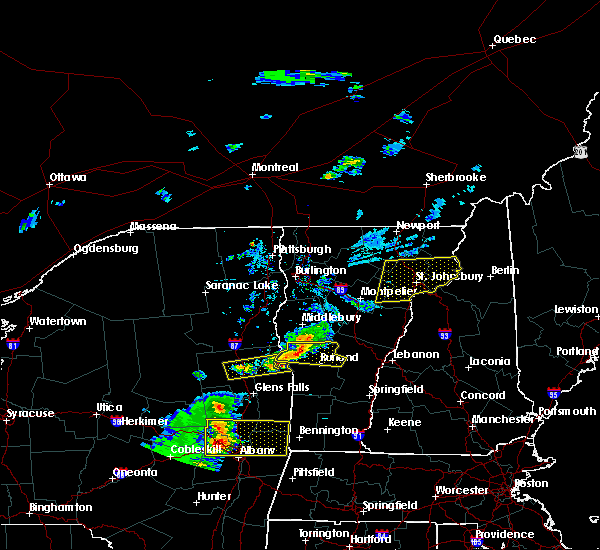 At 408 pm edt, a severe thunderstorm was located over hubbardton, moving east at 30 mph (radar indicated). Hazards include 60 mph wind gusts and quarter size hail. Minor hail damage to vehicles is possible. expect wind damage to trees and powerlines. Locations impacted include, rutland, castleton, west castleton, sudbury, hubbardton, killington, orwell, proctor, benson, brandon, chittenden, mendon, pittsfield, pittsford, rutland city, west rutland, west haven, fair haven, goshen and ira. At 408 pm edt, a severe thunderstorm was located over hubbardton, moving east at 30 mph (radar indicated). Hazards include 60 mph wind gusts and quarter size hail. Minor hail damage to vehicles is possible. expect wind damage to trees and powerlines. Locations impacted include, rutland, castleton, west castleton, sudbury, hubbardton, killington, orwell, proctor, benson, brandon, chittenden, mendon, pittsfield, pittsford, rutland city, west rutland, west haven, fair haven, goshen and ira.
|
| 5/31/2017 3:46 PM EDT |
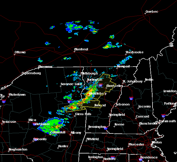 At 346 pm edt, a severe thunderstorm was located over benson bay, moving east at 25 mph (radar indicated). Hazards include 60 mph wind gusts and quarter size hail. Minor hail damage to vehicles is possible. Expect wind damage to trees and powerlines. At 346 pm edt, a severe thunderstorm was located over benson bay, moving east at 25 mph (radar indicated). Hazards include 60 mph wind gusts and quarter size hail. Minor hail damage to vehicles is possible. Expect wind damage to trees and powerlines.
|
| 5/18/2017 7:45 PM EDT |
 At 745 pm edt, a severe thunderstorm was located 7 miles west of west pawlet, moving east at 35 mph (radar indicated). Hazards include 60 mph wind gusts and quarter size hail. Minor hail damage to vehicles is possible. Expect wind damage to trees and powerlines. At 745 pm edt, a severe thunderstorm was located 7 miles west of west pawlet, moving east at 35 mph (radar indicated). Hazards include 60 mph wind gusts and quarter size hail. Minor hail damage to vehicles is possible. Expect wind damage to trees and powerlines.
|
| 8/13/2016 8:41 PM EDT |
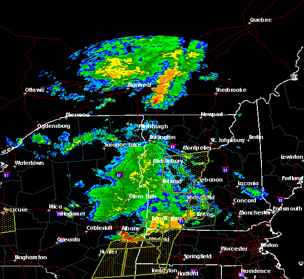 The severe thunderstorm warning for windsor, orange, southern washington, southeastern addison, south central caledonia and northeastern rutland counties will expire at 845 pm edt, the ling of storms which prompted the warning has weakened below severe limits, and no longer pose an immediate threat to life or property. therefore the warning will be allowed to expire. a severe thunderstorm watch remains in effect until 100 am edt for southern vermont. The severe thunderstorm warning for windsor, orange, southern washington, southeastern addison, south central caledonia and northeastern rutland counties will expire at 845 pm edt, the ling of storms which prompted the warning has weakened below severe limits, and no longer pose an immediate threat to life or property. therefore the warning will be allowed to expire. a severe thunderstorm watch remains in effect until 100 am edt for southern vermont.
|
| 8/13/2016 8:19 PM EDT |
 At 818 pm edt, severe thunderstorms were located along a line extending from roxbury to north shrewsbury vermont, moving east at 35 to 40 mph (radar indicated). Hazards include 60 mph wind gusts and quarter size hail. Hail damage to vehicles is expected. expect wind damage to roofs, siding, and trees. Locations impacted include, barre, chelsea, chittenden, orange, hartford, randolph, norwich, hartland, williamstown, berlin, bradford, royalton, clarendon, bethel, warren, sharon, corinth, brookfield, tunbridge and topsham. At 818 pm edt, severe thunderstorms were located along a line extending from roxbury to north shrewsbury vermont, moving east at 35 to 40 mph (radar indicated). Hazards include 60 mph wind gusts and quarter size hail. Hail damage to vehicles is expected. expect wind damage to roofs, siding, and trees. Locations impacted include, barre, chelsea, chittenden, orange, hartford, randolph, norwich, hartland, williamstown, berlin, bradford, royalton, clarendon, bethel, warren, sharon, corinth, brookfield, tunbridge and topsham.
|
| 8/13/2016 7:51 PM EDT |
 At 750 pm edt, severe thunderstorms were located along a line extending from new haven mills to east poultney, moving east at 35 mph (radar indicated). Hazards include 60 mph wind gusts and quarter size hail. Hail damage to vehicles is expected. Expect wind damage to roofs, siding, and trees. At 750 pm edt, severe thunderstorms were located along a line extending from new haven mills to east poultney, moving east at 35 mph (radar indicated). Hazards include 60 mph wind gusts and quarter size hail. Hail damage to vehicles is expected. Expect wind damage to roofs, siding, and trees.
|
| 7/23/2016 5:00 PM EDT | Trees down on post road in rutland county VT, 2.6 miles SSW of Rutland, VT |
| 7/23/2016 4:52 PM EDT | Trees down on cricket hill road in rutland county VT, 11 miles SW of Rutland, VT |
| 7/27/2014 6:40 PM EDT | Quarter sized hail reported 5.6 miles WSW of Rutland, VT, 1 inch hail covered ground. |
| 7/3/2014 6:40 PM EDT | Quarter sized hail reported 4 miles SW of Rutland, VT |
| 7/3/2014 6:36 PM EDT | Quarter sized hail reported 0.3 miles WSW of Rutland, VT |
| 7/3/2014 6:35 PM EDT | Branches down in rutland in rutland county VT, 1.6 miles S of Rutland, VT |
| 7/3/2014 6:35 PM EDT | Quarter sized hail reported 1.6 miles S of Rutland, VT |
| 7/3/2014 6:30 PM EDT | Ping Pong Ball sized hail reported 0.3 miles WSW of Rutland, VT |
| 7/3/2014 6:30 PM EDT | Large oak tree fell causing structural damage to a 3 story apartment building in rutland county VT, 0.3 miles WSW of Rutland, VT |
| 5/27/2014 4:56 PM EDT | Trees down in rutland in rutland county VT, 0.3 miles WSW of Rutland, VT |
| 5/27/2014 4:53 PM EDT | Golf Ball sized hail reported 0.3 miles WSW of Rutland, VT |
| 5/27/2014 4:48 PM EDT | Damage to price chopper in rutland county VT, 0.3 miles WSW of Rutland, VT |
| 5/27/2014 4:48 PM EDT | Golf Ball sized hail reported 1.3 miles ENE of Rutland, VT |
| 5/27/2014 4:40 PM EDT | Golf Ball sized hail reported 3.6 miles S of Rutland, VT, golf ball sized hail cedar avenue |
| 6/23/2013 6:06 PM EDT | Several trees downed in north clarendon per ham radio operato in rutland county VT, 2.7 miles NNW of Rutland, VT |
| 6/23/2013 6:06 PM EDT | Ham radio operator relayed multiple trees and utility poles downed in rutlan in rutland county VT, 0.3 miles WSW of Rutland, VT |
| 6/23/2013 6:05 PM EDT | Trees down near south street in rutland county VT, 0.3 miles WSW of Rutland, VT |
| 6/23/2013 5:55 PM EDT | Trees down along library avenue in rutland county VT, 0.3 miles WSW of Rutland, VT |
| 6/2/2013 1:59 PM EDT | Trees down in rutland county VT, 0.3 miles WSW of Rutland, VT |
| 6/2/2013 1:55 PM EDT | Trees wires down grove street in rutland county VT, 0.3 miles WSW of Rutland, VT |
| 5/29/2012 5:00 PM EDT | Quarter sized hail reported 2.7 miles NNW of Rutland, VT |
| 1/1/0001 12:00 AM | Numerous trees and power lines down in rutland county VT, 0.3 miles WSW of Rutland, VT |
| 1/1/0001 12:00 AM | Numerous trees and power lines down in rutland county VT, 0.3 miles WSW of Rutland, VT |
| 1/1/0001 12:00 AM | Quarter sized hail reported 10.1 miles WSW of Rutland, VT, quarter-sized hail |
| 1/1/0001 12:00 AM | Quarter sized hail reported 9.9 miles W of Rutland, VT, tree limbs down as well. |
| 1/1/0001 12:00 AM | Few trees down as well as powerlines along route 7 near route 103 and rutland state airport...winds estimated at 70 mp in rutland county VT, 4.2 miles NNW of Rutland, VT |
| 1/1/0001 12:00 AM | Few trees down along route 7 near route 103...winds estimated at 70 mp in rutland county VT, 4.2 miles NNW of Rutland, VT |
| 1/1/0001 12:00 AM | Few trees down as well as powerlines along route 7 near route 103 and rutland state airport...winds estimated at 70 mp in rutland county VT, 4.2 miles NNW of Rutland, VT |
| 1/1/0001 12:00 AM | Multiple trees down on state street in rutland county VT, 0.3 miles SE of Rutland, VT |
Hail Maps for Rutland, VT


Connect with Interactive Hail Maps