

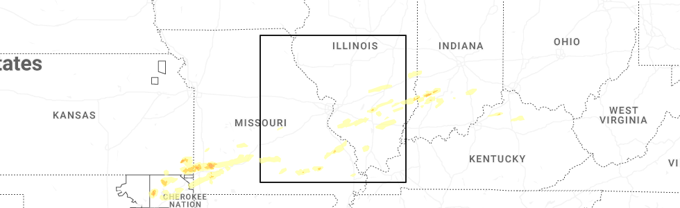
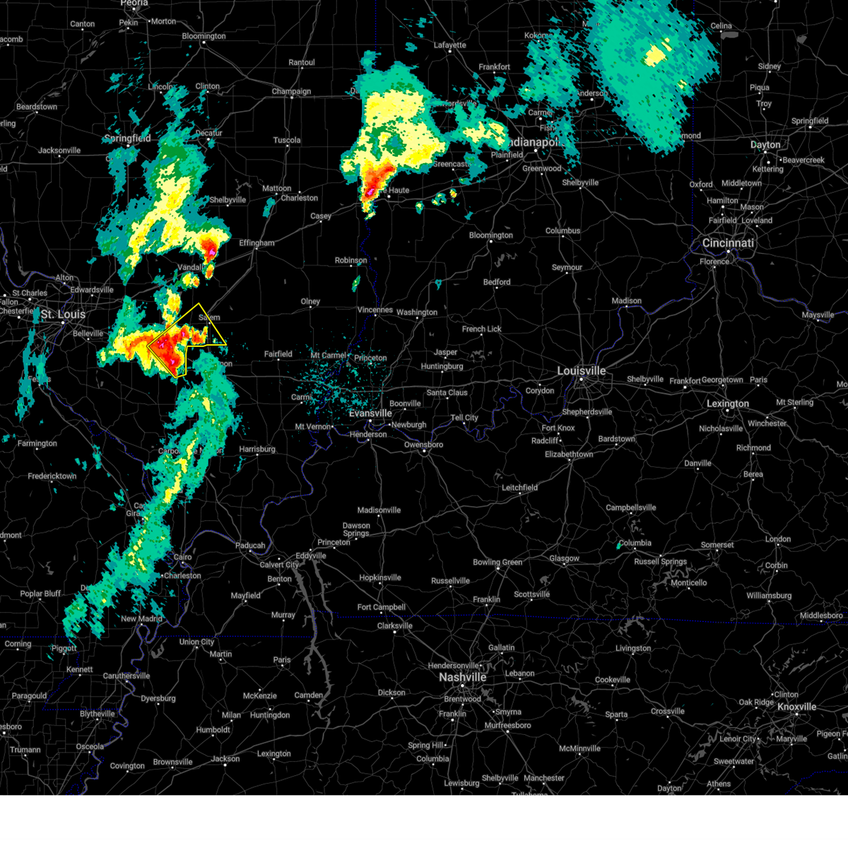
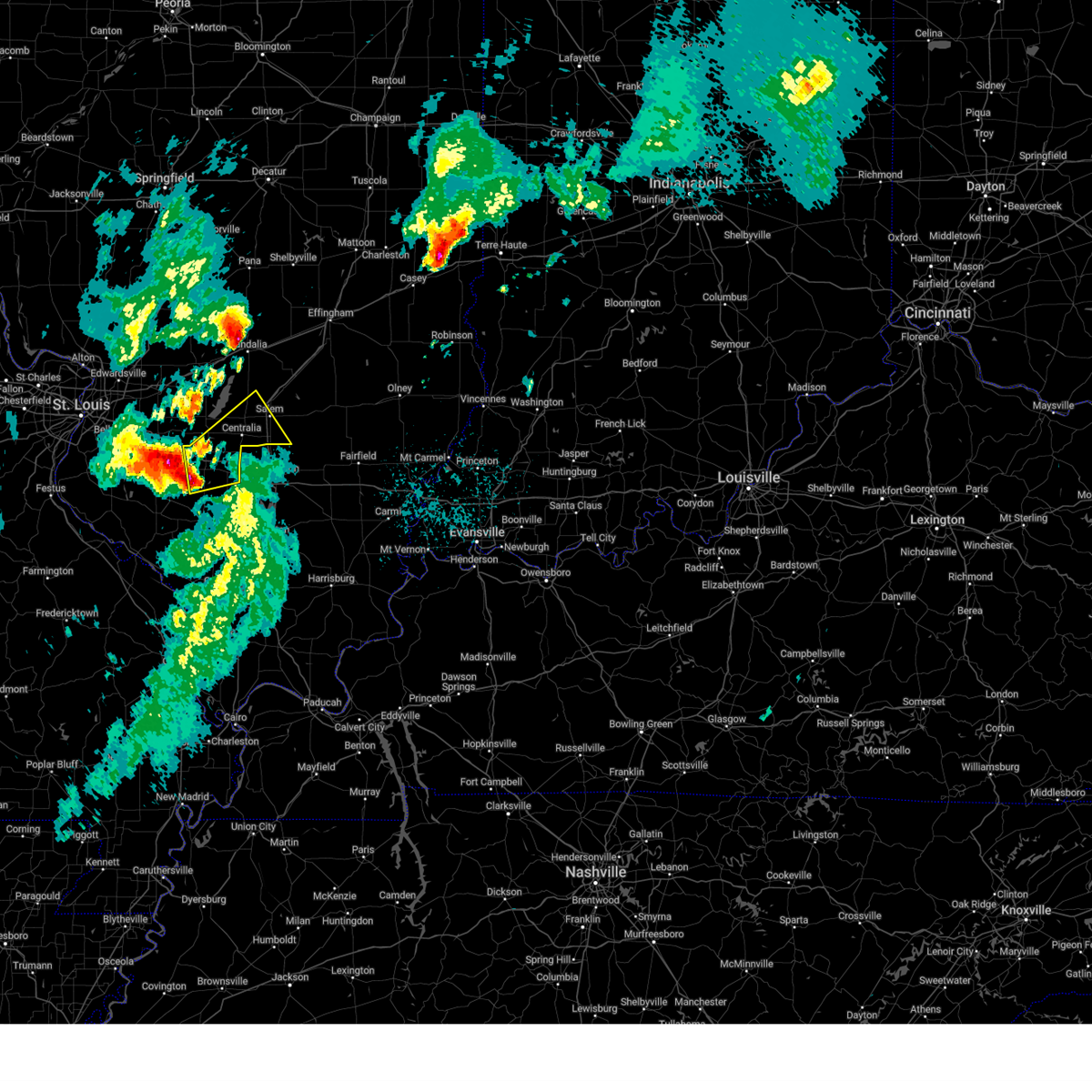
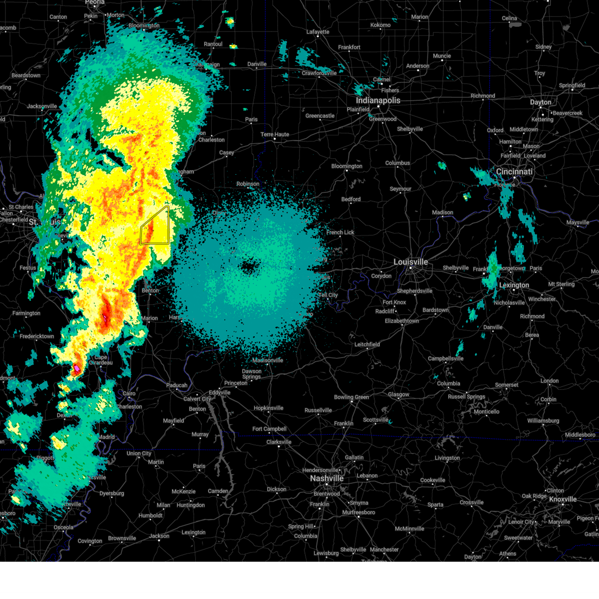
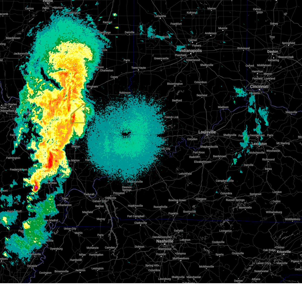
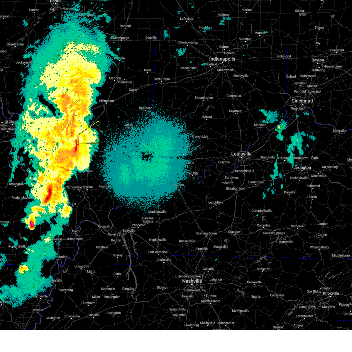
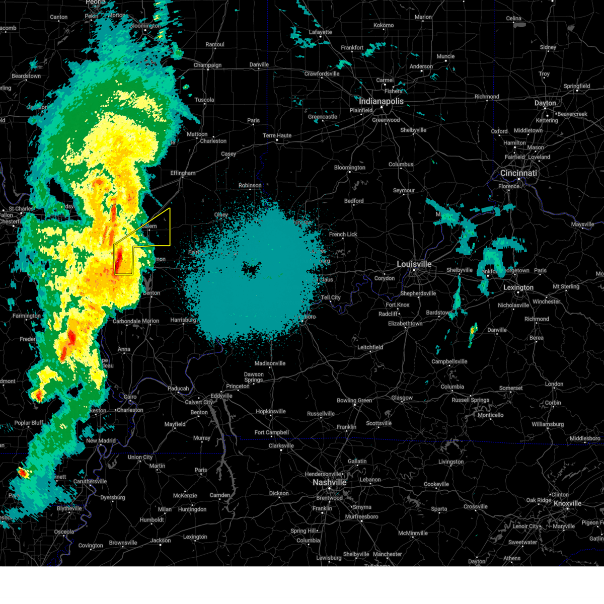
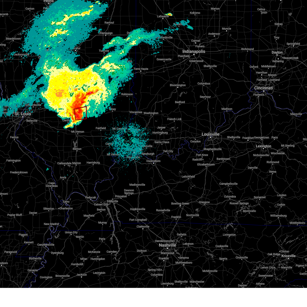
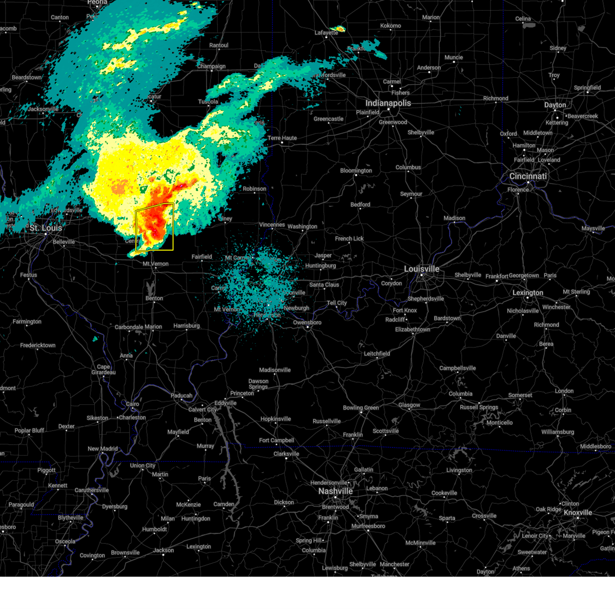
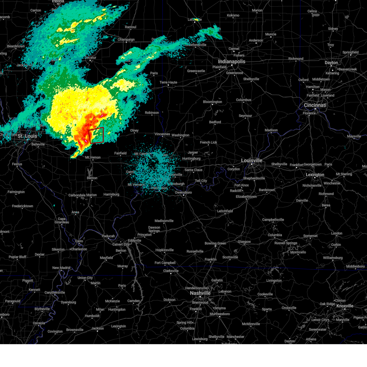
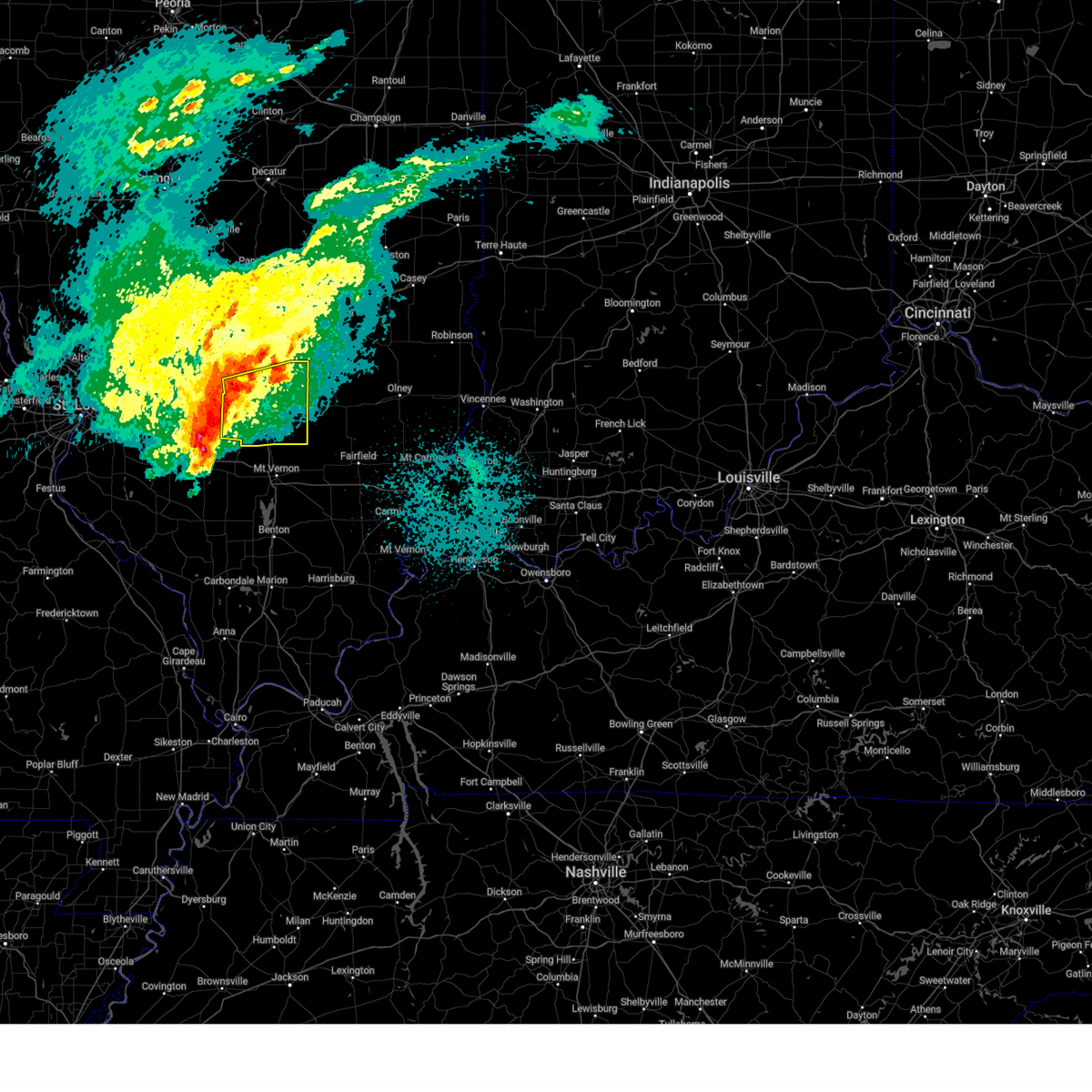
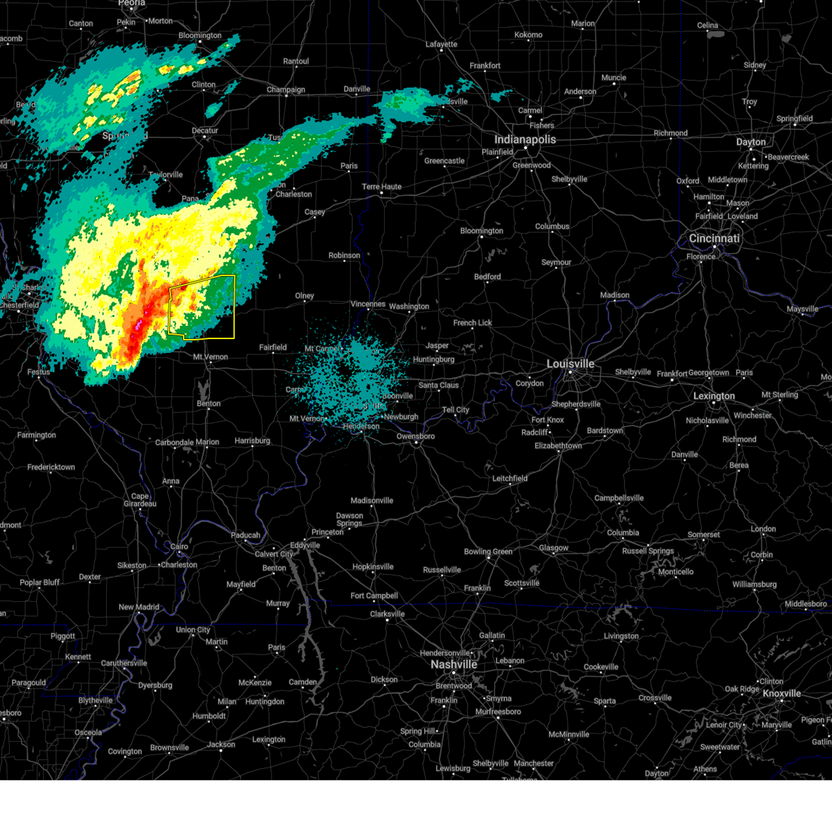
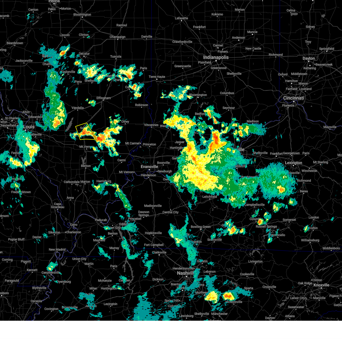
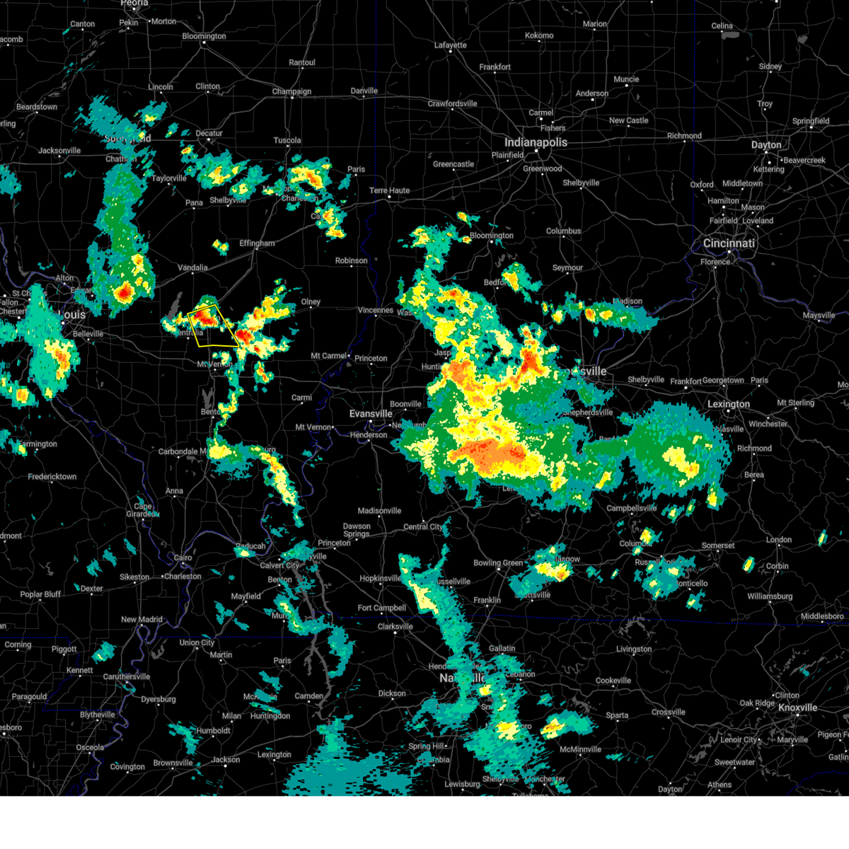
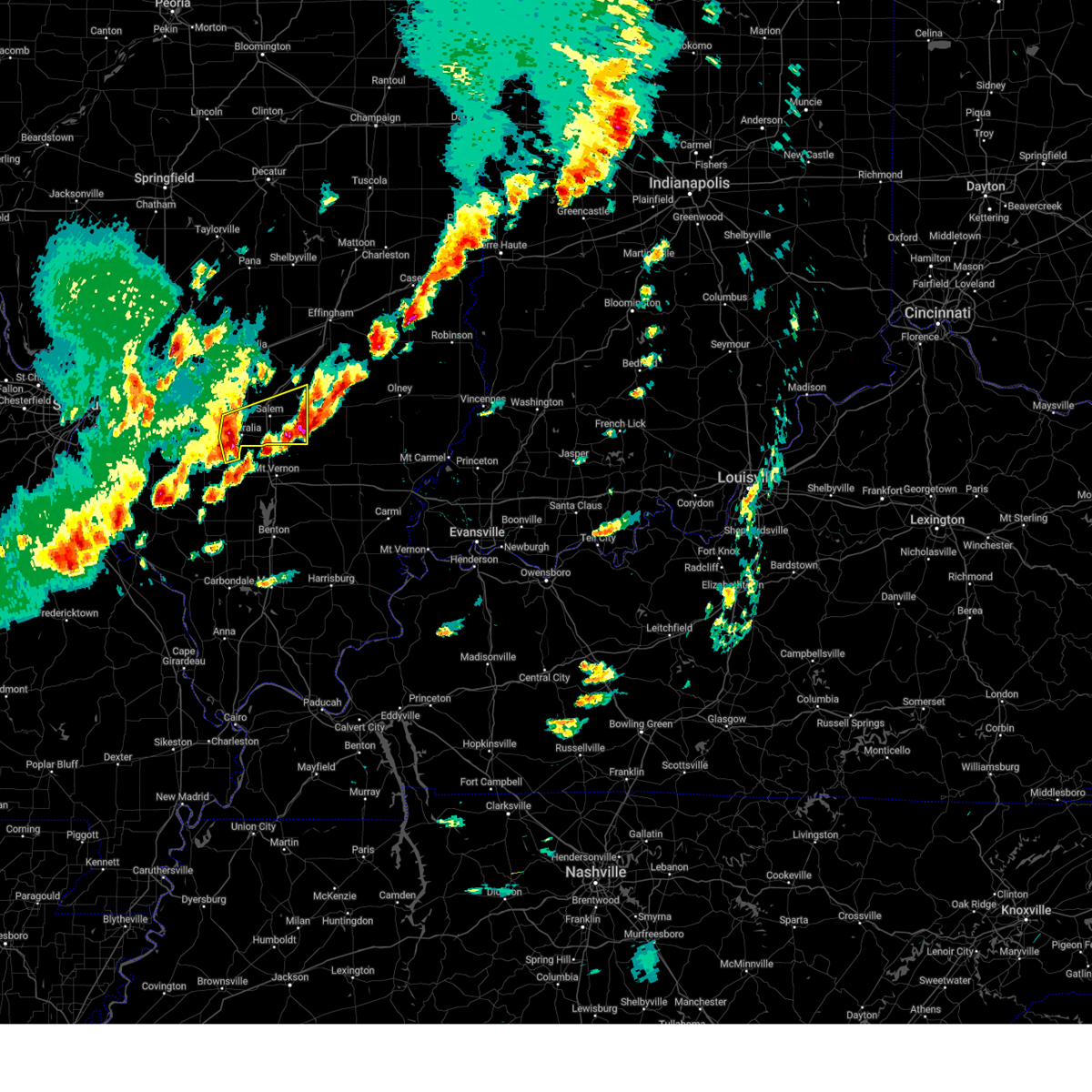
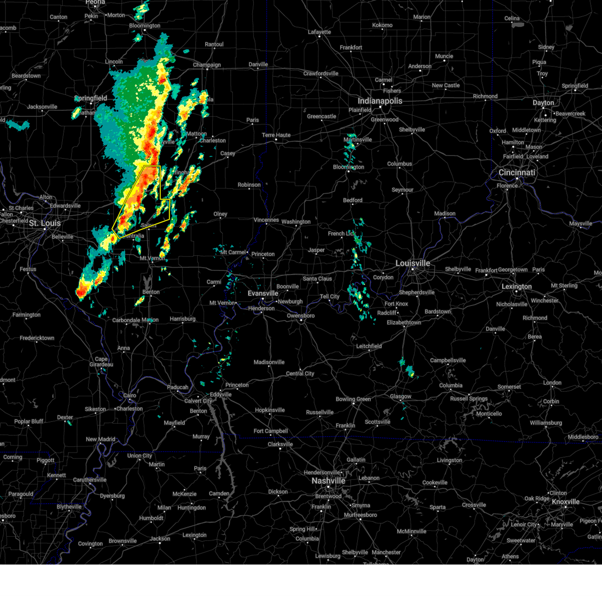
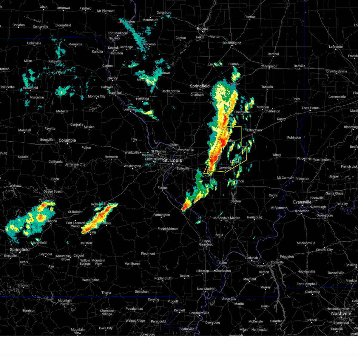
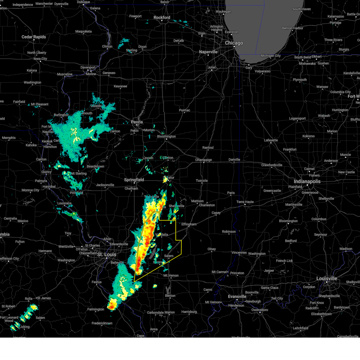
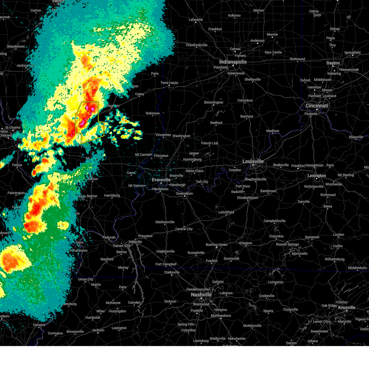
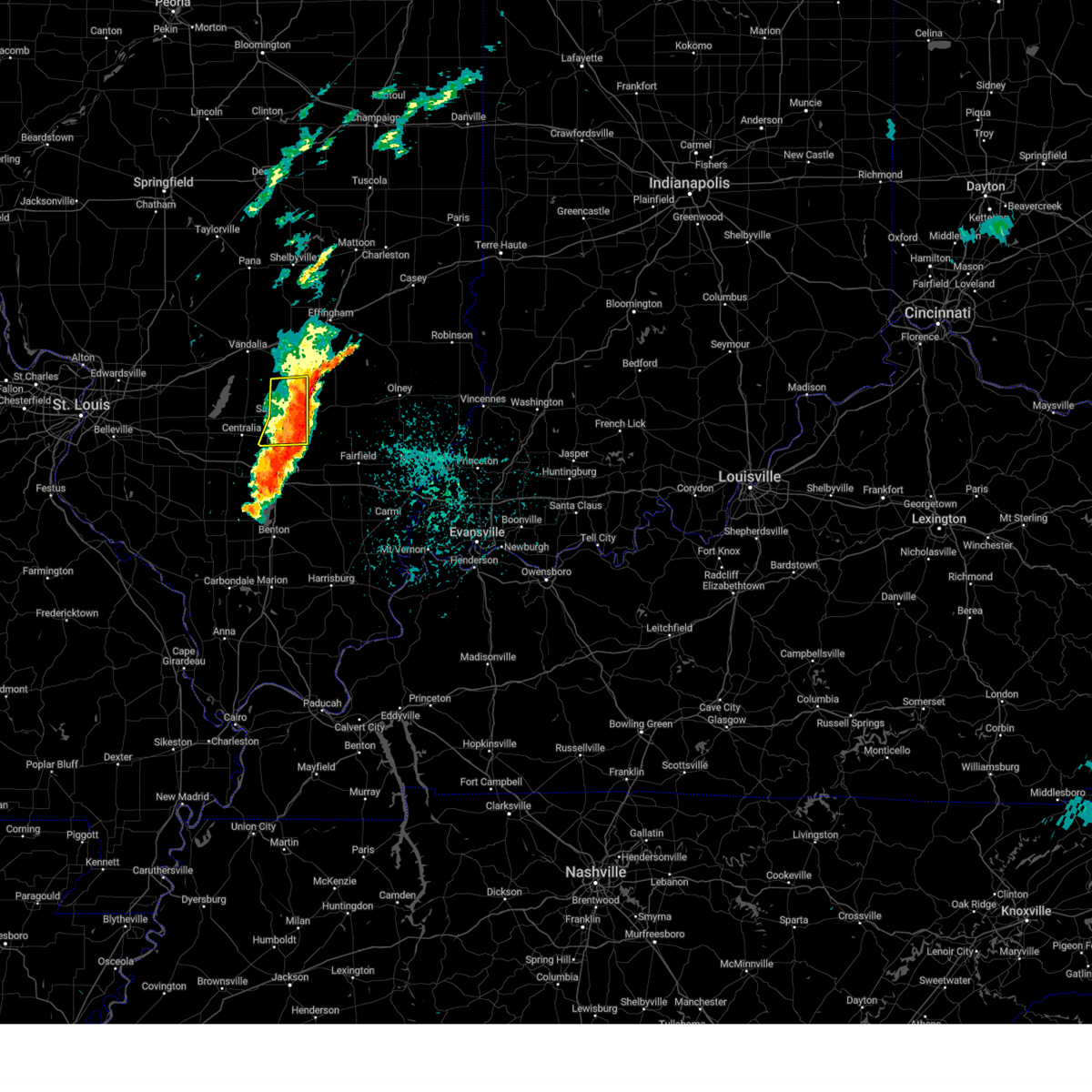
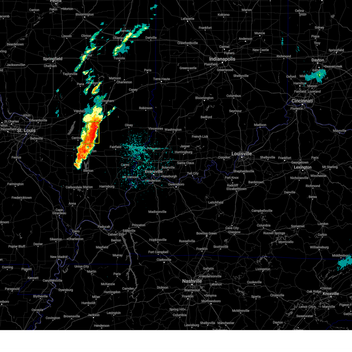
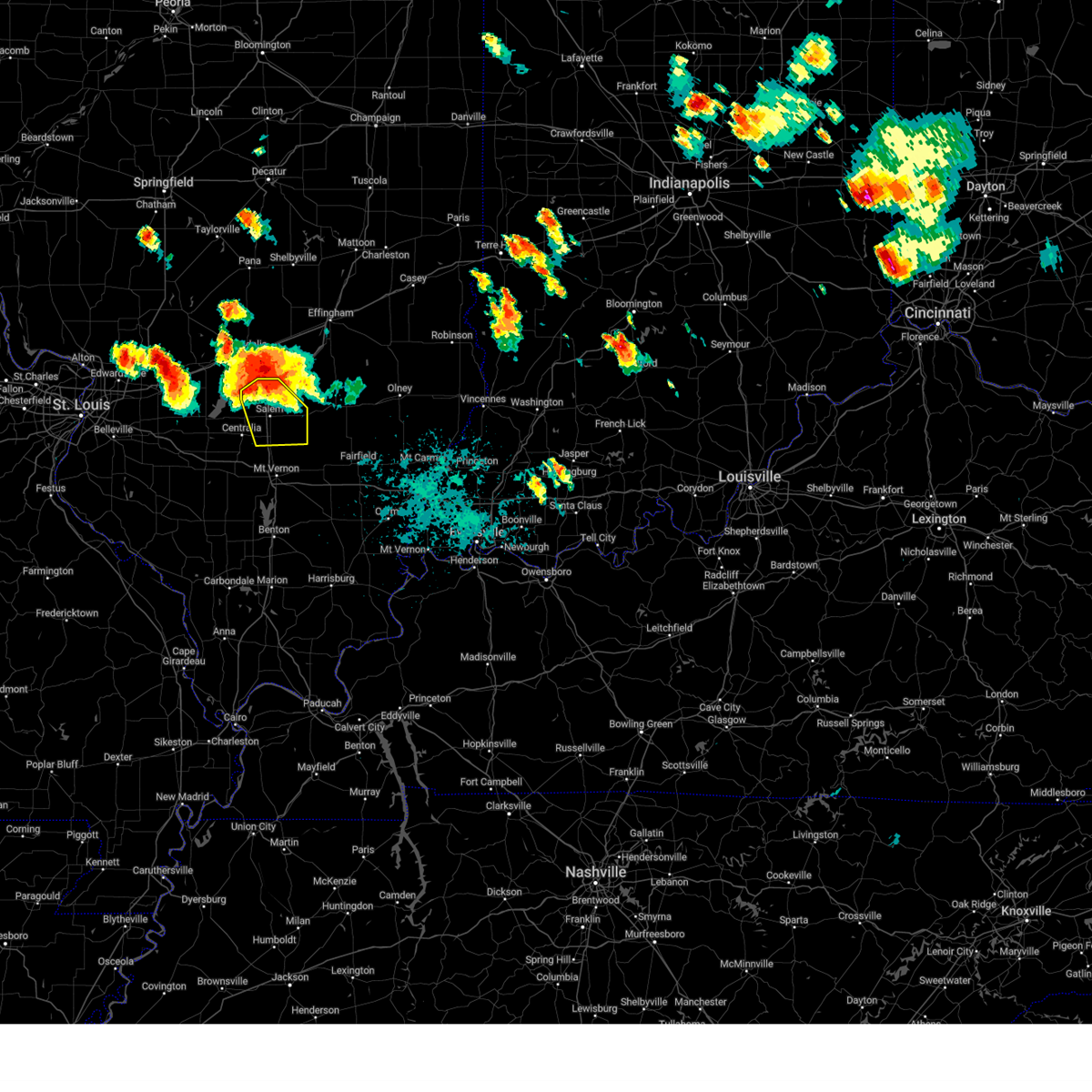
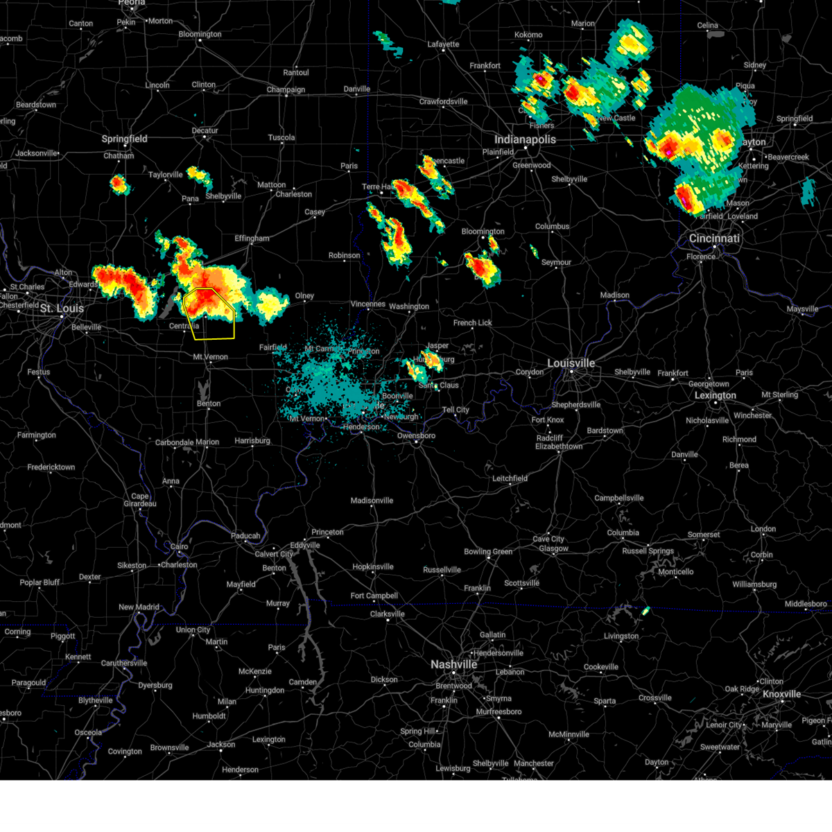
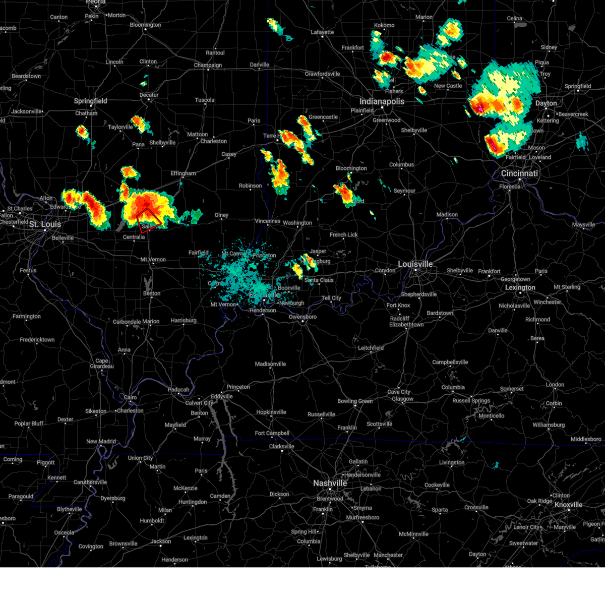
Hail Map for Salem, IL
The Salem, IL area has had 16 reports of on-the-ground hail by trained spotters, and has been under severe weather warnings 58 times during the past 12 months. Doppler radar has detected hail at or near Salem, IL on 97 occasions, including 5 occasions during the past year.
| Name: | Salem, IL |
| Where Located: | 67.2 miles E of Saint Louis, MO |
| Map: | Google Map for Salem, IL |
| Population: | 7485 |
| Housing Units: | 3431 |
| More Info: | Search Google for Salem, IL |
3
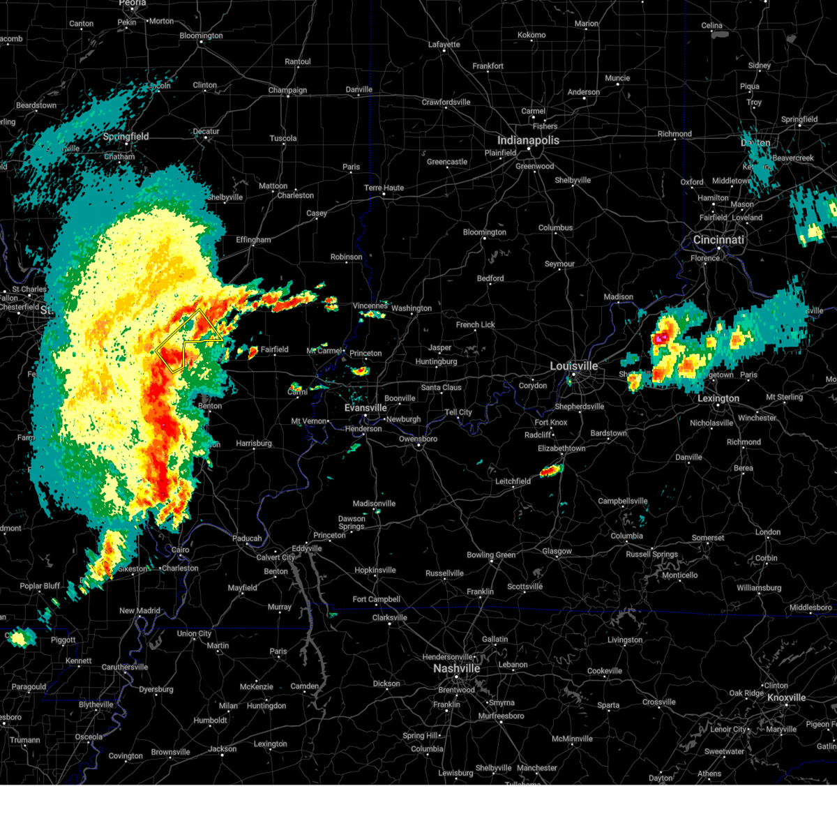
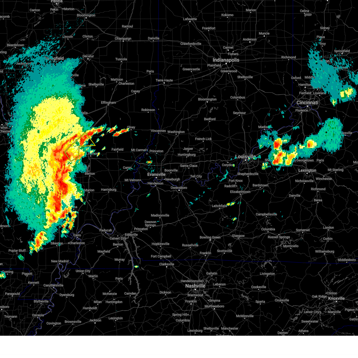
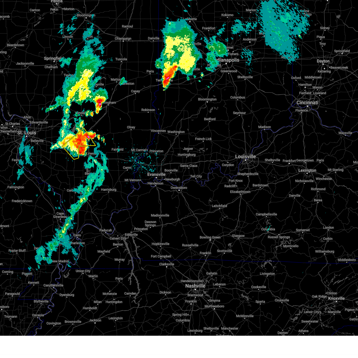
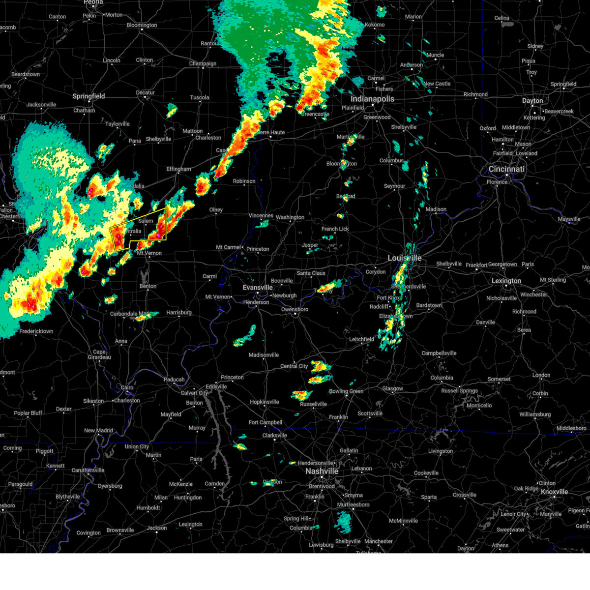
The Top Recent Hail Date for Salem, IL is Tuesday, April 29, 2025 (5th out of 97)
Hail and Wind Damage Spotted near Salem, IL
| Date / Time | Report Details |
|---|---|
| 4/29/2025 2:35 PM CDT | the severe thunderstorm warning has been cancelled and is no longer in effect |
| 4/29/2025 2:27 PM CDT | At 227 pm cdt, a severe thunderstorm was located near irvington, or 6 miles southeast of centralia, moving northeast at 30 mph (radar indicated). Hazards include 60 mph wind gusts and quarter size hail. Hail damage to vehicles is expected. expect wind damage to roofs, siding, and trees. locations impacted include, centralia, salem, sandoval, wamac, central city, odin, junction city, kell, walnut hill, selmaville and cartter. This includes interstate 57 in illinois between exits 109 and 116. |
| 4/29/2025 2:27 PM CDT | the severe thunderstorm warning has been cancelled and is no longer in effect |
| 4/29/2025 2:13 PM CDT |
 At 213 pm cdt, a severe thunderstorm was located over irvington, or 7 miles south of centralia, moving northeast at 30 mph (radar indicated). Hazards include 60 mph wind gusts and half dollar size hail. Hail damage to vehicles is expected. expect wind damage to roofs, siding, and trees. locations impacted include, centralia, salem, nashville, sandoval, wamac, central city, odin, irvington, ashley, beaucoup, hoyleton, junction city, richview, radom, kell, walnut hill, selmaville, huegely and cartter. this includes the following highways, interstate 64 in illinois between exits 50 and 61. Interstate 57 in illinois between exits 109 and 116. At 213 pm cdt, a severe thunderstorm was located over irvington, or 7 miles south of centralia, moving northeast at 30 mph (radar indicated). Hazards include 60 mph wind gusts and half dollar size hail. Hail damage to vehicles is expected. expect wind damage to roofs, siding, and trees. locations impacted include, centralia, salem, nashville, sandoval, wamac, central city, odin, irvington, ashley, beaucoup, hoyleton, junction city, richview, radom, kell, walnut hill, selmaville, huegely and cartter. this includes the following highways, interstate 64 in illinois between exits 50 and 61. Interstate 57 in illinois between exits 109 and 116.
|
| 4/29/2025 2:04 PM CDT |
 Svrlsx the national weather service in st louis has issued a * severe thunderstorm warning for, east central clinton county in south central illinois, southwestern marion county in south central illinois, eastern washington county in south central illinois, * until 245 pm cdt. * at 204 pm cdt, a severe thunderstorm was located near nashville, moving northeast at 45 mph (public reported half dollar sized hail). Hazards include 60 mph wind gusts and half dollar size hail. Hail damage to vehicles is expected. Expect wind damage to roofs, siding, and trees. Svrlsx the national weather service in st louis has issued a * severe thunderstorm warning for, east central clinton county in south central illinois, southwestern marion county in south central illinois, eastern washington county in south central illinois, * until 245 pm cdt. * at 204 pm cdt, a severe thunderstorm was located near nashville, moving northeast at 45 mph (public reported half dollar sized hail). Hazards include 60 mph wind gusts and half dollar size hail. Hail damage to vehicles is expected. Expect wind damage to roofs, siding, and trees.
|
| 4/29/2025 8:12 AM CDT | Storm damage reported in marion county IL, 0.9 miles SE of Salem, IL |
| 4/29/2025 8:03 AM CDT |
 the severe thunderstorm warning has been cancelled and is no longer in effect the severe thunderstorm warning has been cancelled and is no longer in effect
|
| 4/29/2025 7:51 AM CDT |
 At 751 am cdt, a severe thunderstorm was located near irvington, or 8 miles northeast of nashville, moving east at 55 mph (radar indicated). Hazards include 60 mph wind gusts and quarter size hail. Hail damage to vehicles is expected. expect wind damage to roofs, siding, and trees. locations impacted include, centralia, salem, nashville, sandoval, wamac, central city, odin, irvington, ashley, shattuc, fairman, tonti, beaucoup, hoyleton, hoffman, junction city, covington, richview, radom and kell. this includes the following highways, interstate 64 in illinois between exits 50 and 61. Interstate 57 in illinois between exits 109 and 116. At 751 am cdt, a severe thunderstorm was located near irvington, or 8 miles northeast of nashville, moving east at 55 mph (radar indicated). Hazards include 60 mph wind gusts and quarter size hail. Hail damage to vehicles is expected. expect wind damage to roofs, siding, and trees. locations impacted include, centralia, salem, nashville, sandoval, wamac, central city, odin, irvington, ashley, shattuc, fairman, tonti, beaucoup, hoyleton, hoffman, junction city, covington, richview, radom and kell. this includes the following highways, interstate 64 in illinois between exits 50 and 61. Interstate 57 in illinois between exits 109 and 116.
|
| 4/29/2025 7:34 AM CDT |
 Svrlsx the national weather service in st louis has issued a * severe thunderstorm warning for, southeastern clinton county in south central illinois, western marion county in south central illinois, eastern washington county in south central illinois, * until 815 am cdt. * at 734 am cdt, a severe thunderstorm was located near nashville, moving northeast at 60 mph (radar indicated). Hazards include 60 mph wind gusts and quarter size hail. Hail damage to vehicles is expected. Expect wind damage to roofs, siding, and trees. Svrlsx the national weather service in st louis has issued a * severe thunderstorm warning for, southeastern clinton county in south central illinois, western marion county in south central illinois, eastern washington county in south central illinois, * until 815 am cdt. * at 734 am cdt, a severe thunderstorm was located near nashville, moving northeast at 60 mph (radar indicated). Hazards include 60 mph wind gusts and quarter size hail. Hail damage to vehicles is expected. Expect wind damage to roofs, siding, and trees.
|
| 4/20/2025 9:47 PM CDT |
 the severe thunderstorm warning has been cancelled and is no longer in effect the severe thunderstorm warning has been cancelled and is no longer in effect
|
| 4/20/2025 9:37 PM CDT |
 At 937 pm cdt, a severe thunderstorm was located 6 miles south of salem, moving northeast at 50 mph (radar indicated). Hazards include 60 mph wind gusts and small hail. Expect damage to roofs, siding, and trees. locations impacted include, salem, omega, stephen forbes station, helm, tonti, iuka, alma, kell, brubaker, cartter and selmaville. This includes interstate 57 in illinois between exits 109 and 116. At 937 pm cdt, a severe thunderstorm was located 6 miles south of salem, moving northeast at 50 mph (radar indicated). Hazards include 60 mph wind gusts and small hail. Expect damage to roofs, siding, and trees. locations impacted include, salem, omega, stephen forbes station, helm, tonti, iuka, alma, kell, brubaker, cartter and selmaville. This includes interstate 57 in illinois between exits 109 and 116.
|
| 4/20/2025 9:27 PM CDT |
 the severe thunderstorm warning has been cancelled and is no longer in effect the severe thunderstorm warning has been cancelled and is no longer in effect
|
| 4/20/2025 9:27 PM CDT |
 At 927 pm cdt, a severe thunderstorm was located near centralia, moving northeast at 50 mph (radar indicated). Hazards include 60 mph wind gusts and small hail. Expect damage to roofs, siding, and trees. locations impacted include, centralia, salem, sandoval, wamac, central city, odin, kinmundy, omega, stephen forbes station, helm, tonti, iuka, junction city, alma, kell, walnut hill, cartter, brubaker and selmaville. This includes interstate 57 in illinois between exits 109 and 116. At 927 pm cdt, a severe thunderstorm was located near centralia, moving northeast at 50 mph (radar indicated). Hazards include 60 mph wind gusts and small hail. Expect damage to roofs, siding, and trees. locations impacted include, centralia, salem, sandoval, wamac, central city, odin, kinmundy, omega, stephen forbes station, helm, tonti, iuka, junction city, alma, kell, walnut hill, cartter, brubaker and selmaville. This includes interstate 57 in illinois between exits 109 and 116.
|
| 4/20/2025 9:12 PM CDT |
 Svrlsx the national weather service in st louis has issued a * severe thunderstorm warning for, east central clinton county in south central illinois, marion county in south central illinois, eastern washington county in south central illinois, * until 1015 pm cdt. * at 912 pm cdt, a severe thunderstorm was located near ashley, or 7 miles east of nashville, moving northeast at 50 mph (radar indicated). Hazards include 60 mph wind gusts and small hail. expect damage to roofs, siding, and trees Svrlsx the national weather service in st louis has issued a * severe thunderstorm warning for, east central clinton county in south central illinois, marion county in south central illinois, eastern washington county in south central illinois, * until 1015 pm cdt. * at 912 pm cdt, a severe thunderstorm was located near ashley, or 7 miles east of nashville, moving northeast at 50 mph (radar indicated). Hazards include 60 mph wind gusts and small hail. expect damage to roofs, siding, and trees
|
| 4/19/2025 2:49 AM CDT |
 the tornado warning has been cancelled and is no longer in effect the tornado warning has been cancelled and is no longer in effect
|
| 4/19/2025 2:39 AM CDT |
 At 239 am cdt, severe thunderstorms were located along a line from over farina to near helm, or along a line from 15 miles northeast of salem to 12 miles east of salem, moving east at 70 mph (radar indicated). Hazards include 70 mph wind gusts. Expect considerable tree damage. damage is likely to mobile homes, roofs, and outbuildings. locations impacted include, centralia, salem, sandoval, wamac, central city, odin, kinmundy, patoka, farina, omega, stephen forbes station, fairman, helm, tonti, la clede, iuka, junction city, st. peter, alma and kell. This includes interstate 57 in illinois between exits 109 and 135. At 239 am cdt, severe thunderstorms were located along a line from over farina to near helm, or along a line from 15 miles northeast of salem to 12 miles east of salem, moving east at 70 mph (radar indicated). Hazards include 70 mph wind gusts. Expect considerable tree damage. damage is likely to mobile homes, roofs, and outbuildings. locations impacted include, centralia, salem, sandoval, wamac, central city, odin, kinmundy, patoka, farina, omega, stephen forbes station, fairman, helm, tonti, la clede, iuka, junction city, st. peter, alma and kell. This includes interstate 57 in illinois between exits 109 and 135.
|
| 4/19/2025 2:39 AM CDT |
 the severe thunderstorm warning has been cancelled and is no longer in effect the severe thunderstorm warning has been cancelled and is no longer in effect
|
| 4/19/2025 2:35 AM CDT |
 Torlsx the national weather service in st louis has issued a * tornado warning for, northeastern marion county in south central illinois, * until 300 am cdt. * at 235 am cdt, a severe thunderstorm capable of producing a tornado was located 6 miles northeast of salem, moving northeast at 65 mph (radar indicated rotation). Hazards include tornado. Flying debris will be dangerous to those caught without shelter. mobile homes will be damaged or destroyed. damage to roofs, windows and vehicles will occur. Tree damage is likely. Torlsx the national weather service in st louis has issued a * tornado warning for, northeastern marion county in south central illinois, * until 300 am cdt. * at 235 am cdt, a severe thunderstorm capable of producing a tornado was located 6 miles northeast of salem, moving northeast at 65 mph (radar indicated rotation). Hazards include tornado. Flying debris will be dangerous to those caught without shelter. mobile homes will be damaged or destroyed. damage to roofs, windows and vehicles will occur. Tree damage is likely.
|
| 4/19/2025 2:30 AM CDT | Numerous trees and power lines down all over town. some trees blown onto homes. time estimate in marion county IL, 0.4 miles WNW of Salem, IL |
| 4/19/2025 2:21 AM CDT |
 At 221 am cdt, severe thunderstorms were located along a line from over fairman to over wamac, or along a line from 11 miles northwest of salem to near centralia, moving east at 70 mph (radar indicated). Hazards include 70 mph wind gusts. Expect considerable tree damage. damage is likely to mobile homes, roofs, and outbuildings. locations impacted include, centralia, salem, sandoval, wamac, central city, odin, kinmundy, irvington, patoka, farina, omega, fairman, stephen forbes station, shattuc, boulder, helm, tonti, la clede, hoffman and iuka. this includes the following state parks, carlyle lake recreational area. This includes interstate 57 in illinois between exits 109 and 135. At 221 am cdt, severe thunderstorms were located along a line from over fairman to over wamac, or along a line from 11 miles northwest of salem to near centralia, moving east at 70 mph (radar indicated). Hazards include 70 mph wind gusts. Expect considerable tree damage. damage is likely to mobile homes, roofs, and outbuildings. locations impacted include, centralia, salem, sandoval, wamac, central city, odin, kinmundy, irvington, patoka, farina, omega, fairman, stephen forbes station, shattuc, boulder, helm, tonti, la clede, hoffman and iuka. this includes the following state parks, carlyle lake recreational area. This includes interstate 57 in illinois between exits 109 and 135.
|
| 4/19/2025 2:16 AM CDT |
 Svrlsx the national weather service in st louis has issued a * severe thunderstorm warning for, northeastern clinton county in south central illinois, southern fayette county in south central illinois, marion county in south central illinois, * until 300 am cdt. * at 216 am cdt, severe thunderstorms were located along a line from near boulder to 6 miles west of irvington, or along a line from 8 miles east of carlyle to 9 miles southwest of centralia, moving east at 80 mph (radar indicated). Hazards include 60 mph wind gusts. expect damage to roofs, siding, and trees Svrlsx the national weather service in st louis has issued a * severe thunderstorm warning for, northeastern clinton county in south central illinois, southern fayette county in south central illinois, marion county in south central illinois, * until 300 am cdt. * at 216 am cdt, severe thunderstorms were located along a line from near boulder to 6 miles west of irvington, or along a line from 8 miles east of carlyle to 9 miles southwest of centralia, moving east at 80 mph (radar indicated). Hazards include 60 mph wind gusts. expect damage to roofs, siding, and trees
|
| 4/10/2025 6:04 PM CDT |
 the severe thunderstorm warning has been cancelled and is no longer in effect the severe thunderstorm warning has been cancelled and is no longer in effect
|
| 4/10/2025 5:47 PM CDT |
 Svrlsx the national weather service in st louis has issued a * severe thunderstorm warning for, marion county in south central illinois, * until 630 pm cdt. * at 547 pm cdt, a severe thunderstorm was located near odin, or near salem, moving southeast at 25 mph (radar indicated). Hazards include 60 mph wind gusts and quarter size hail. Hail damage to vehicles is expected. expect wind damage to roofs, siding, and trees. this severe thunderstorm will be near, odin and fairman around 550 pm cdt. salem around 555 pm cdt. other locations impacted by the severe thunderstorm include tonti, selmaville, cartter, walnut hill and kell. This includes interstate 57 in illinois between exits 109 and 116. Svrlsx the national weather service in st louis has issued a * severe thunderstorm warning for, marion county in south central illinois, * until 630 pm cdt. * at 547 pm cdt, a severe thunderstorm was located near odin, or near salem, moving southeast at 25 mph (radar indicated). Hazards include 60 mph wind gusts and quarter size hail. Hail damage to vehicles is expected. expect wind damage to roofs, siding, and trees. this severe thunderstorm will be near, odin and fairman around 550 pm cdt. salem around 555 pm cdt. other locations impacted by the severe thunderstorm include tonti, selmaville, cartter, walnut hill and kell. This includes interstate 57 in illinois between exits 109 and 116.
|
| 4/2/2025 6:56 PM CDT | At 656 pm cdt, a severe thunderstorm capable of producing a tornado was located near kell, or 12 miles south of salem, moving northeast at 60 mph (radar indicated rotation). Hazards include tornado. Flying debris will be dangerous to those caught without shelter. mobile homes will be damaged or destroyed. damage to roofs, windows and vehicles will occur. tree damage is likely. other locations impacted by the tornado include walnut hill, kell, cartter and iuka. This includes interstate 57 in illinois near exit 109. |
| 4/2/2025 6:48 PM CDT |
 Torlsx the national weather service in st louis has issued a * tornado warning for, eastern marion county in south central illinois, * until 730 pm cdt. * at 648 pm cdt, a severe thunderstorm capable of producing a tornado was located near woodlawn, or 13 miles southeast of centralia, moving northeast at 60 mph (radar indicated rotation). Hazards include tornado. Flying debris will be dangerous to those caught without shelter. mobile homes will be damaged or destroyed. damage to roofs, windows and vehicles will occur. tree damage is likely. other locations impacted by the tornado include walnut hill, kell, cartter and iuka. This includes interstate 57 in illinois near exit 109. Torlsx the national weather service in st louis has issued a * tornado warning for, eastern marion county in south central illinois, * until 730 pm cdt. * at 648 pm cdt, a severe thunderstorm capable of producing a tornado was located near woodlawn, or 13 miles southeast of centralia, moving northeast at 60 mph (radar indicated rotation). Hazards include tornado. Flying debris will be dangerous to those caught without shelter. mobile homes will be damaged or destroyed. damage to roofs, windows and vehicles will occur. tree damage is likely. other locations impacted by the tornado include walnut hill, kell, cartter and iuka. This includes interstate 57 in illinois near exit 109.
|
| 4/2/2025 6:06 PM CDT | At 606 pm cdt, severe thunderstorms capable of producing a tornado were located along a line from near farina to over omega, or along a line from 17 miles southeast of vandalia to 9 miles northeast of salem, moving northeast at 70 mph (radar indicated rotation). Hazards include tornado. Flying debris will be dangerous to those caught without shelter. mobile homes will be damaged or destroyed. damage to roofs, windows and vehicles will occur. tree damage is likely. locations impacted include, salem, kinmundy, farina, omega, stephen forbes station, iuka and brubaker. This includes interstate 57 in illinois near exit 127. |
| 4/2/2025 6:06 PM CDT | At 606 pm cdt, severe thunderstorms were located along a line from 15 miles east of wrights corner to 6 miles southeast of stephen forbes station, or along a line from 31 miles northeast of vandalia to 14 miles east of salem, moving northeast at 75 mph (radar indicated). Hazards include 60 mph wind gusts and quarter size hail. Hail damage to vehicles is expected. expect wind damage to roofs, siding, and trees. locations impacted include, salem, kinmundy, farina, omega, stephen forbes station, helm, la clede, iuka, st. peter, kell, brubaker, cartter, st. paul and loogootee. This includes interstate 57 in illinois near exit 109, and between exits 127 and 135. |
| 4/2/2025 5:54 PM CDT | At 554 pm cdt, severe thunderstorms capable of producing a tornado were located along a line from near salem to near salem, moving northeast at 70 mph (radar indicated rotation). Hazards include tornado. Flying debris will be dangerous to those caught without shelter. mobile homes will be damaged or destroyed. damage to roofs, windows and vehicles will occur. tree damage is likely. locations impacted include, centralia, salem, sandoval, wamac, central city, odin, kinmundy, patoka, farina, omega, fairman, stephen forbes station, tonti, iuka, junction city, alma, vernon, brubaker and selmaville. This includes interstate 57 in illinois between exits 116 and 127. |
| 4/2/2025 5:54 PM CDT | the tornado warning has been cancelled and is no longer in effect |
| 4/2/2025 5:54 PM CDT | the severe thunderstorm warning has been cancelled and is no longer in effect |
| 4/2/2025 5:54 PM CDT | At 554 pm cdt, severe thunderstorms were located along a line from near wrights corner to 7 miles south of salem, or along a line from 16 miles northeast of vandalia to 7 miles south of salem, moving northeast at 75 mph (radar indicated). Hazards include 60 mph wind gusts and quarter size hail. Hail damage to vehicles is expected. expect wind damage to roofs, siding, and trees. locations impacted include, centralia, salem, sandoval, wamac, central city, odin, kinmundy, patoka, farina, omega, stephen forbes station, fairman, helm, tonti, la clede, iuka, junction city, st. peter, alma and kell. This includes interstate 57 in illinois between exits 109 and 135. |
| 4/2/2025 5:48 PM CDT | the tornado warning has been cancelled and is no longer in effect |
| 4/2/2025 5:48 PM CDT | At 548 pm cdt, severe thunderstorms capable of producing a tornado were located along a line from over sandoval to near centralia, or along a line from 7 miles north of centralia to near centralia, moving northeast at 70 mph (radar indicated rotation). Hazards include tornado. Flying debris will be dangerous to those caught without shelter. mobile homes will be damaged or destroyed. damage to roofs, windows and vehicles will occur. tree damage is likely. locations impacted include, centralia, salem, sandoval, wamac, central city, odin, kinmundy, irvington, patoka, farina, omega, fairman, shattuc, boulder, stephen forbes station, tonti, iuka, junction city, alma and vernon. this includes the following state parks, carlyle lake recreational area. This includes interstate 57 in illinois between exits 116 and 127. |
| 4/2/2025 5:42 PM CDT | At 542 pm cdt, severe thunderstorms capable of producing a tornado were located along a line from over shattuc to over irvington, or along a line from 6 miles northwest of centralia to near centralia, moving northeast at 70 mph (radar indicated rotation). Hazards include tornado. Flying debris will be dangerous to those caught without shelter. mobile homes will be damaged or destroyed. damage to roofs, windows and vehicles will occur. tree damage is likely. locations impacted include, centralia, salem, sandoval, wamac, central city, odin, kinmundy, irvington, patoka, farina, omega, fairman, shattuc, boulder, stephen forbes station, tonti, hoyleton, iuka, junction city and alma. this includes the following state parks, carlyle lake recreational area. This includes interstate 57 in illinois between exits 116 and 127. |
| 4/2/2025 5:28 PM CDT | Torlsx the national weather service in st louis has issued a * tornado warning for, eastern clinton county in south central illinois, marion county in south central illinois, northern washington county in south central illinois, * until 615 pm cdt. * at 528 pm cdt, severe thunderstorms capable of producing a tornado were located along a line from near okawville to over nashville, or along a line from 9 miles northwest of nashville to over nashville, moving northeast at 70 mph (radar indicated rotation). Hazards include tornado. Flying debris will be dangerous to those caught without shelter. mobile homes will be damaged or destroyed. damage to roofs, windows and vehicles will occur. Tree damage is likely. |
| 4/2/2025 5:25 PM CDT |
 Svrlsx the national weather service in st louis has issued a * severe thunderstorm warning for, northeastern clinton county in south central illinois, southern fayette county in south central illinois, marion county in south central illinois, eastern washington county in south central illinois, * until 615 pm cdt. * at 525 pm cdt, severe thunderstorms were located along a line from over beaver creek to 9 miles southwest of nashville, or along a line from 7 miles south of greenville to 9 miles southwest of nashville, moving northeast at 75 mph (radar indicated). Hazards include 60 mph wind gusts and quarter size hail. Hail damage to vehicles is expected. Expect wind damage to roofs, siding, and trees. Svrlsx the national weather service in st louis has issued a * severe thunderstorm warning for, northeastern clinton county in south central illinois, southern fayette county in south central illinois, marion county in south central illinois, eastern washington county in south central illinois, * until 615 pm cdt. * at 525 pm cdt, severe thunderstorms were located along a line from over beaver creek to 9 miles southwest of nashville, or along a line from 7 miles south of greenville to 9 miles southwest of nashville, moving northeast at 75 mph (radar indicated). Hazards include 60 mph wind gusts and quarter size hail. Hail damage to vehicles is expected. Expect wind damage to roofs, siding, and trees.
|
| 3/30/2025 3:53 PM CDT | The storm which prompted the warning has moved out of the area. therefore, the warning will be allowed to expire. however, small hail and gusty winds are still possible with this thunderstorm. a tornado watch remains in effect until 1100 pm cdt sunday for a portion of south central illinois. |
| 3/30/2025 3:37 PM CDT | At 337 pm cdt, a severe thunderstorm was located 7 miles south of omega, or 7 miles east of salem, moving east at 50 mph (emergency management reported. hail up to the size of golf balls southeast of salem). Hazards include golf ball size hail and 60 mph wind gusts. People and animals outdoors will be injured. expect hail damage to roofs, siding, windows, and vehicles. expect wind damage to roofs, siding, and trees. locations impacted include, salem, omega, stephen forbes station, helm, tonti, iuka, alma, kell, brubaker and cartter. This includes interstate 57 in illinois between exits 109 and 116. |
| 3/30/2025 3:31 PM CDT | Golf Ball sized hail reported 4.1 miles NNW of Salem, IL, quarter to golf ball sized hail south and east of salem il. |
| 3/30/2025 3:28 PM CDT |
 At 328 pm cdt, a severe thunderstorm was located near salem, moving east at 50 mph (radar indicated). Hazards include 60 mph wind gusts and half dollar size hail. Hail damage to vehicles is expected. expect wind damage to roofs, siding, and trees. locations impacted include, centralia, salem, sandoval, wamac, central city, odin, omega, stephen forbes station, helm, tonti, iuka, junction city, alma, kell, walnut hill, cartter, selmaville and brubaker. This includes interstate 57 in illinois between exits 109 and 116. At 328 pm cdt, a severe thunderstorm was located near salem, moving east at 50 mph (radar indicated). Hazards include 60 mph wind gusts and half dollar size hail. Hail damage to vehicles is expected. expect wind damage to roofs, siding, and trees. locations impacted include, centralia, salem, sandoval, wamac, central city, odin, omega, stephen forbes station, helm, tonti, iuka, junction city, alma, kell, walnut hill, cartter, selmaville and brubaker. This includes interstate 57 in illinois between exits 109 and 116.
|
| 3/30/2025 3:28 PM CDT |
 the severe thunderstorm warning has been cancelled and is no longer in effect the severe thunderstorm warning has been cancelled and is no longer in effect
|
| 3/30/2025 3:18 PM CDT |
 At 318 pm cdt, a severe thunderstorm was located over centralia, moving east at 50 mph (radar indicated). Hazards include 60 mph wind gusts and half dollar size hail. Hail damage to vehicles is expected. expect wind damage to roofs, siding, and trees. locations impacted include, centralia, salem, sandoval, wamac, central city, odin, irvington, omega, shattuc, stephen forbes station, helm, tonti, hoffman, iuka, junction city, alma, kell, walnut hill, selmaville and cartter. This includes interstate 57 in illinois between exits 109 and 116. At 318 pm cdt, a severe thunderstorm was located over centralia, moving east at 50 mph (radar indicated). Hazards include 60 mph wind gusts and half dollar size hail. Hail damage to vehicles is expected. expect wind damage to roofs, siding, and trees. locations impacted include, centralia, salem, sandoval, wamac, central city, odin, irvington, omega, shattuc, stephen forbes station, helm, tonti, hoffman, iuka, junction city, alma, kell, walnut hill, selmaville and cartter. This includes interstate 57 in illinois between exits 109 and 116.
|
| 3/30/2025 3:11 PM CDT |
 Svrlsx the national weather service in st louis has issued a * severe thunderstorm warning for, east central clinton county in south central illinois, marion county in south central illinois, northeastern washington county in south central illinois, * until 400 pm cdt. * at 311 pm cdt, a severe thunderstorm was located near wamac, or 6 miles southwest of centralia, moving east at 50 mph. another severe storm was located south of iuka (radar indicated). Hazards include 60 mph wind gusts and half dollar size hail. Hail damage to vehicles is expected. Expect wind damage to roofs, siding, and trees. Svrlsx the national weather service in st louis has issued a * severe thunderstorm warning for, east central clinton county in south central illinois, marion county in south central illinois, northeastern washington county in south central illinois, * until 400 pm cdt. * at 311 pm cdt, a severe thunderstorm was located near wamac, or 6 miles southwest of centralia, moving east at 50 mph. another severe storm was located south of iuka (radar indicated). Hazards include 60 mph wind gusts and half dollar size hail. Hail damage to vehicles is expected. Expect wind damage to roofs, siding, and trees.
|
| 3/30/2025 2:53 PM CDT | Golf Ball sized hail reported 5.3 miles W of Salem, IL, picture of estimated golf ball sized hail east of salem. |
| 3/30/2025 2:44 PM CDT |
 Svrlsx the national weather service in st louis has issued a * severe thunderstorm warning for, southeastern marion county in south central illinois, * until 315 pm cdt. * at 244 pm cdt, a severe thunderstorm was located near salem, moving northeast at 65 mph (radar indicated). Hazards include 60 mph wind gusts and small hail. expect damage to roofs, siding, and trees Svrlsx the national weather service in st louis has issued a * severe thunderstorm warning for, southeastern marion county in south central illinois, * until 315 pm cdt. * at 244 pm cdt, a severe thunderstorm was located near salem, moving northeast at 65 mph (radar indicated). Hazards include 60 mph wind gusts and small hail. expect damage to roofs, siding, and trees
|
| 3/30/2025 12:56 PM CDT |
 The storms which prompted the warning have weakened below severe limits, and no longer pose an immediate threat to life or property. therefore, the warning will be allowed to expire. however, small hail and gusty winds are still possible with these thunderstorms. a tornado watch remains in effect until 700 pm cdt sunday for a portion of south central illinois. The storms which prompted the warning have weakened below severe limits, and no longer pose an immediate threat to life or property. therefore, the warning will be allowed to expire. however, small hail and gusty winds are still possible with these thunderstorms. a tornado watch remains in effect until 700 pm cdt sunday for a portion of south central illinois.
|
| 3/30/2025 12:47 PM CDT |
 At 1247 pm cdt, severe thunderstorms were located along a line from 19 miles north of wrights corner to over boulder, or along a line from 24 miles east of nokomis to 10 miles east of carlyle, moving northeast at 45 mph (radar indicated). Hazards include 60 mph wind gusts and quarter size hail. Hail damage to vehicles is expected. expect wind damage to roofs, siding, and trees. locations impacted include, salem, vandalia, carlyle, st. elmo, sandoval, odin, kinmundy, brownstown, patoka, tamalco, farina, omega, shobonier, fairman, boulder, stephen forbes station, shattuc, wrights corner, avena and tonti. this includes the following state parks, carlyle lake recreational area. this includes the following highways, interstate 70 in illinois between exits 61 and 76. Interstate 57 in illinois between exits 127 and 135. At 1247 pm cdt, severe thunderstorms were located along a line from 19 miles north of wrights corner to over boulder, or along a line from 24 miles east of nokomis to 10 miles east of carlyle, moving northeast at 45 mph (radar indicated). Hazards include 60 mph wind gusts and quarter size hail. Hail damage to vehicles is expected. expect wind damage to roofs, siding, and trees. locations impacted include, salem, vandalia, carlyle, st. elmo, sandoval, odin, kinmundy, brownstown, patoka, tamalco, farina, omega, shobonier, fairman, boulder, stephen forbes station, shattuc, wrights corner, avena and tonti. this includes the following state parks, carlyle lake recreational area. this includes the following highways, interstate 70 in illinois between exits 61 and 76. Interstate 57 in illinois between exits 127 and 135.
|
| 3/30/2025 12:30 PM CDT |
 the severe thunderstorm warning has been cancelled and is no longer in effect the severe thunderstorm warning has been cancelled and is no longer in effect
|
| 3/30/2025 12:30 PM CDT |
 At 1230 pm cdt, severe thunderstorms were located along a line from 16 miles north of ramsey to over carlyle, or along a line from 14 miles east of nokomis to over carlyle, moving northeast at 60 mph (radar indicated). Hazards include 60 mph wind gusts and quarter size hail. Hail damage to vehicles is expected. expect wind damage to roofs, siding, and trees. locations impacted include, centralia, salem, vandalia, carlyle, st. elmo, sandoval, wamac, central city, odin, beckemeyer, ramsey, kinmundy, brownstown, irvington, mulberry grove, patoka, tamalco, farina, omega and beaver creek. this includes the following state parks, ramsey lake state park and carlyle lake recreational area. this includes the following highways, interstate 70 in illinois between exits 52 and 76. Interstate 57 in illinois between exits 116 and 135. At 1230 pm cdt, severe thunderstorms were located along a line from 16 miles north of ramsey to over carlyle, or along a line from 14 miles east of nokomis to over carlyle, moving northeast at 60 mph (radar indicated). Hazards include 60 mph wind gusts and quarter size hail. Hail damage to vehicles is expected. expect wind damage to roofs, siding, and trees. locations impacted include, centralia, salem, vandalia, carlyle, st. elmo, sandoval, wamac, central city, odin, beckemeyer, ramsey, kinmundy, brownstown, irvington, mulberry grove, patoka, tamalco, farina, omega and beaver creek. this includes the following state parks, ramsey lake state park and carlyle lake recreational area. this includes the following highways, interstate 70 in illinois between exits 52 and 76. Interstate 57 in illinois between exits 116 and 135.
|
| 3/30/2025 12:17 PM CDT |
 Svrlsx the national weather service in st louis has issued a * severe thunderstorm warning for, bond county in south central illinois, clinton county in south central illinois, fayette county in south central illinois, marion county in south central illinois, southeastern montgomery county in south central illinois, northwestern washington county in south central illinois, * until 100 pm cdt. * at 1217 pm cdt, severe thunderstorms were located along a line from 7 miles northwest of ramsey to near okawville, or along a line from 7 miles southeast of nokomis to 9 miles south of breese, moving northeast at 60 mph (radar indicated). Hazards include 60 mph wind gusts and quarter size hail. Hail damage to vehicles is expected. Expect wind damage to roofs, siding, and trees. Svrlsx the national weather service in st louis has issued a * severe thunderstorm warning for, bond county in south central illinois, clinton county in south central illinois, fayette county in south central illinois, marion county in south central illinois, southeastern montgomery county in south central illinois, northwestern washington county in south central illinois, * until 100 pm cdt. * at 1217 pm cdt, severe thunderstorms were located along a line from 7 miles northwest of ramsey to near okawville, or along a line from 7 miles southeast of nokomis to 9 miles south of breese, moving northeast at 60 mph (radar indicated). Hazards include 60 mph wind gusts and quarter size hail. Hail damage to vehicles is expected. Expect wind damage to roofs, siding, and trees.
|
| 3/14/2025 11:35 PM CDT | Tree down on power lines with a minor fir in marion county IL, 0.7 miles SSW of Salem, IL |
| 3/14/2025 11:25 PM CDT |
 Svrlsx the national weather service in st louis has issued a * severe thunderstorm warning for, fayette county in south central illinois, northern marion county in south central illinois, * until 1215 am cdt. * at 1125 pm cdt, severe thunderstorms were located along a line from 10 miles northwest of wrights corner to near carlyle, or along a line from 18 miles east of nokomis to near carlyle, moving northeast at 60 mph (trained spotters reported. at 11:15 pm golf ball sized hail was reported in vandalia, il). Hazards include 70 mph wind gusts and ping pong ball size hail. People and animals outdoors will be injured. expect hail damage to roofs, siding, windows, and vehicles. expect considerable tree damage. Wind damage is also likely to mobile homes, roofs, and outbuildings. Svrlsx the national weather service in st louis has issued a * severe thunderstorm warning for, fayette county in south central illinois, northern marion county in south central illinois, * until 1215 am cdt. * at 1125 pm cdt, severe thunderstorms were located along a line from 10 miles northwest of wrights corner to near carlyle, or along a line from 18 miles east of nokomis to near carlyle, moving northeast at 60 mph (trained spotters reported. at 11:15 pm golf ball sized hail was reported in vandalia, il). Hazards include 70 mph wind gusts and ping pong ball size hail. People and animals outdoors will be injured. expect hail damage to roofs, siding, windows, and vehicles. expect considerable tree damage. Wind damage is also likely to mobile homes, roofs, and outbuildings.
|
| 8/1/2024 12:02 PM CDT |
 The storms which prompted the warning have moved out of the area. therefore, the warning has been allowed to expire. however, gusty winds are still possible with these thunderstorms. The storms which prompted the warning have moved out of the area. therefore, the warning has been allowed to expire. however, gusty winds are still possible with these thunderstorms.
|
| 8/1/2024 11:47 AM CDT |
 Svrlsx the national weather service in st louis has issued a * severe thunderstorm warning for, eastern marion county in south central illinois, * until noon cdt. * at 1146 am cdt, severe thunderstorms were located along a line extending from farina to near omega to 9 miles west of helm, moving east at 40 mph (radar indicated). Hazards include 60 mph wind gusts. expect damage to roofs, siding, and trees Svrlsx the national weather service in st louis has issued a * severe thunderstorm warning for, eastern marion county in south central illinois, * until noon cdt. * at 1146 am cdt, severe thunderstorms were located along a line extending from farina to near omega to 9 miles west of helm, moving east at 40 mph (radar indicated). Hazards include 60 mph wind gusts. expect damage to roofs, siding, and trees
|
| 7/29/2024 9:34 PM CDT |
 At 934 pm cdt, a severe thunderstorm was located over helm, moving southeast at 40 mph (radar indicated). Hazards include 60 mph wind gusts and quarter size hail. Hail damage to vehicles is expected. expect wind damage to roofs, siding, and trees. locations impacted include, salem, omega, helm, iuka, kell, and cartter. This includes interstate 57 in illinois near exit 109. At 934 pm cdt, a severe thunderstorm was located over helm, moving southeast at 40 mph (radar indicated). Hazards include 60 mph wind gusts and quarter size hail. Hail damage to vehicles is expected. expect wind damage to roofs, siding, and trees. locations impacted include, salem, omega, helm, iuka, kell, and cartter. This includes interstate 57 in illinois near exit 109.
|
| 7/29/2024 9:21 PM CDT |
 The tornado threat has diminished and the tornado warning has been cancelled. however, large hail and damaging winds remain likely and a severe thunderstorm warning remains in effect for the area. a severe thunderstorm watch remains in effect until 300 am cdt for south central illinois. The tornado threat has diminished and the tornado warning has been cancelled. however, large hail and damaging winds remain likely and a severe thunderstorm warning remains in effect for the area. a severe thunderstorm watch remains in effect until 300 am cdt for south central illinois.
|
| 7/29/2024 9:20 PM CDT | Strong winds all over town. power lines and traffic lights blown over. trees downed onto house in marion county IL, 0.4 miles WNW of Salem, IL |
| 7/29/2024 9:20 PM CDT |
 At 919 pm cdt, a severe thunderstorm was located over salem, moving southeast at 30 mph (emergency management. at 915 pm, emergency management reported wind damage in salem). Hazards include 60 mph wind gusts and quarter size hail. Hail damage to vehicles is expected. expect wind damage to roofs, siding, and trees. locations impacted include, salem, odin, kinmundy, omega, helm, tonti, iuka, alma, kell, cartter, brubaker, and selmaville. This includes interstate 57 in illinois between exits 109 and 127. At 919 pm cdt, a severe thunderstorm was located over salem, moving southeast at 30 mph (emergency management. at 915 pm, emergency management reported wind damage in salem). Hazards include 60 mph wind gusts and quarter size hail. Hail damage to vehicles is expected. expect wind damage to roofs, siding, and trees. locations impacted include, salem, odin, kinmundy, omega, helm, tonti, iuka, alma, kell, cartter, brubaker, and selmaville. This includes interstate 57 in illinois between exits 109 and 127.
|
| 7/29/2024 9:19 PM CDT | Business lost its roof on west side of town at intersection of us 50 and selmaville roa in marion county IL, 2.4 miles ENE of Salem, IL |
| 7/29/2024 9:17 PM CDT | Multiple reports on trees on houses and power lines dow in marion county IL, 0.4 miles WNW of Salem, IL |
| 7/29/2024 9:08 PM CDT |
 the severe thunderstorm warning has been cancelled and is no longer in effect the severe thunderstorm warning has been cancelled and is no longer in effect
|
| 7/29/2024 9:08 PM CDT |
 At 908 pm cdt, a severe thunderstorm was located near patoka, moving southeast at 35 mph (radar indicated). Hazards include 60 mph wind gusts and quarter size hail. Hail damage to vehicles is expected. expect wind damage to roofs, siding, and trees. locations impacted include, salem, odin, kinmundy, patoka, omega, fairman, helm, tonti, iuka, alma, kell, walnut hill, cartter, selmaville, and brubaker. This includes interstate 57 in illinois between exits 109 and 127. At 908 pm cdt, a severe thunderstorm was located near patoka, moving southeast at 35 mph (radar indicated). Hazards include 60 mph wind gusts and quarter size hail. Hail damage to vehicles is expected. expect wind damage to roofs, siding, and trees. locations impacted include, salem, odin, kinmundy, patoka, omega, fairman, helm, tonti, iuka, alma, kell, walnut hill, cartter, selmaville, and brubaker. This includes interstate 57 in illinois between exits 109 and 127.
|
| 7/29/2024 9:06 PM CDT |
 the tornado warning has been cancelled and is no longer in effect the tornado warning has been cancelled and is no longer in effect
|
| 7/29/2024 9:06 PM CDT |
 At 906 pm cdt, a severe thunderstorm capable of producing a tornado was located near patoka, moving southeast at 25 mph (radar indicated rotation). Hazards include tornado and quarter size hail. Flying debris will be dangerous to those caught without shelter. mobile homes will be damaged or destroyed. damage to roofs, windows, and vehicles will occur. tree damage is likely. this dangerous storm will be near, salem around 910 pm cdt. This includes interstate 57 in illinois near exit 127. At 906 pm cdt, a severe thunderstorm capable of producing a tornado was located near patoka, moving southeast at 25 mph (radar indicated rotation). Hazards include tornado and quarter size hail. Flying debris will be dangerous to those caught without shelter. mobile homes will be damaged or destroyed. damage to roofs, windows, and vehicles will occur. tree damage is likely. this dangerous storm will be near, salem around 910 pm cdt. This includes interstate 57 in illinois near exit 127.
|
| 7/29/2024 8:52 PM CDT | Torlsx the national weather service in st louis has issued a * tornado warning for, northwestern marion county in south central illinois, south central fayette county in south central illinois, * until 930 pm cdt. * at 852 pm cdt, a severe thunderstorm capable of producing a tornado was located near shobonier, moving southeast at 20 mph (radar indicated rotation). Hazards include tornado and quarter size hail. Flying debris will be dangerous to those caught without shelter. mobile homes will be damaged or destroyed. damage to roofs, windows, and vehicles will occur. tree damage is likely. this dangerous storm will be near, patoka around 855 pm cdt. other locations in the path of this tornadic thunderstorm include salem. This includes interstate 57 in illinois near exit 127. |
| 7/29/2024 8:44 PM CDT |
 Svrlsx the national weather service in st louis has issued a * severe thunderstorm warning for, northeastern clinton county in south central illinois, marion county in south central illinois, * until 945 pm cdt. * at 844 pm cdt, a severe thunderstorm was located over shobonier, moving south at 35 mph (radar indicated). Hazards include 60 mph wind gusts and quarter size hail. Hail damage to vehicles is expected. Expect wind damage to roofs, siding, and trees. Svrlsx the national weather service in st louis has issued a * severe thunderstorm warning for, northeastern clinton county in south central illinois, marion county in south central illinois, * until 945 pm cdt. * at 844 pm cdt, a severe thunderstorm was located over shobonier, moving south at 35 mph (radar indicated). Hazards include 60 mph wind gusts and quarter size hail. Hail damage to vehicles is expected. Expect wind damage to roofs, siding, and trees.
|
| 5/26/2024 7:39 PM CDT |
 The storm which prompted the warning has moved out of the area. therefore, the warning will be allowed to expire. a tornado watch remains in effect until 1100 pm cdt for south central illinois. The storm which prompted the warning has moved out of the area. therefore, the warning will be allowed to expire. a tornado watch remains in effect until 1100 pm cdt for south central illinois.
|
| 5/26/2024 7:35 PM CDT | Storm damage reported in marion county IL, 1.5 miles SSE of Salem, IL |
| 5/26/2024 7:35 PM CDT | Storm damage reported in marion county IL, 1.3 miles S of Salem, IL |
| 5/26/2024 7:25 PM CDT | Approximately 10 inch in diameter limb broken off and hanging on power line at the 400 block of south pearl street. photo from social media. time estimated from rada in marion county IL, 0.9 miles NNW of Salem, IL |
| 5/26/2024 7:25 PM CDT | 7 year old maple snapped at base at the 200 block of country club est. time estimated from rada in marion county IL, 2.3 miles NNW of Salem, IL |
| 5/26/2024 7:25 PM CDT | Tree snapped at base on allmon street at north college. photo from social media. time estimated from rada in marion county IL, 0.4 miles WNW of Salem, IL |
| 5/26/2024 7:23 PM CDT |
 At 723 pm cdt, a severe squall line capable of producing both tornadoes and extensive straight line wind damage was located near omega, moving east at 65 mph (radar indicated rotation). Hazards include tornado and quarter size hail. Flying debris will be dangerous to those caught without shelter. mobile homes will be damaged or destroyed. damage to roofs, windows, and vehicles will occur. tree damage is likely. this tornadic thunderstorm will remain over mainly rural areas of marion and southeastern fayette counties, including the following locations, st. peter, alma, iuka, la clede, loogootee, cartter, st. paul, brubaker, kell, and tonti. This includes interstate 57 in illinois between exits 109 and 135. At 723 pm cdt, a severe squall line capable of producing both tornadoes and extensive straight line wind damage was located near omega, moving east at 65 mph (radar indicated rotation). Hazards include tornado and quarter size hail. Flying debris will be dangerous to those caught without shelter. mobile homes will be damaged or destroyed. damage to roofs, windows, and vehicles will occur. tree damage is likely. this tornadic thunderstorm will remain over mainly rural areas of marion and southeastern fayette counties, including the following locations, st. peter, alma, iuka, la clede, loogootee, cartter, st. paul, brubaker, kell, and tonti. This includes interstate 57 in illinois between exits 109 and 135.
|
| 5/26/2024 7:22 PM CDT | 80 ft oak tree snapped at base on pine tree drive. photo from social media. time estimated from rada in marion county IL, 1.5 miles W of Salem, IL |
| 5/26/2024 7:22 PM CDT | Tree down over road at the corner of lester and south washington. photo from social media. time estimated from rada in marion county IL, 1.2 miles NW of Salem, IL |
| 5/26/2024 7:22 PM CDT | Tree over road on west porter at north walnut. photo from social media. time estimated from rada in marion county IL, 0.4 miles WNW of Salem, IL |
| 5/26/2024 7:22 PM CDT | Tree over road on west porter at north walnut. photo from social media. time estimated from rada in marion county IL, 0.4 miles WNW of Salem, IL |
| 5/26/2024 7:22 PM CDT | Tree snapped approximately half way up truck and lying on house. photo from social media. time estimated from rada in marion county IL, 0.9 miles W of Salem, IL |
| 5/26/2024 7:22 PM CDT | Tree snapped at base along north rotan street. photo from social media. time estimated from rada in marion county IL, 1.1 miles WSW of Salem, IL |
| 5/26/2024 7:22 PM CDT | Tree snapped about half way up truck on hickory grove. photo from social media. time estimated from rada in marion county IL, 1.6 miles SW of Salem, IL |
| 5/26/2024 7:22 PM CDT | Light pole on ground at carpenter drive. photo from social media. time estimated from rada in marion county IL, 1.5 miles ENE of Salem, IL |
| 5/26/2024 7:11 PM CDT |
 the tornado warning has been cancelled and is no longer in effect the tornado warning has been cancelled and is no longer in effect
|
| 5/26/2024 7:11 PM CDT |
 At 711 pm cdt, a severe squall line capable of producing both tornadoes and extensive straight line wind damage was located over salem, moving east at 65 mph (radar indicated rotation). Hazards include tornado and quarter size hail. Flying debris will be dangerous to those caught without shelter. mobile homes will be damaged or destroyed. damage to roofs, windows, and vehicles will occur. tree damage is likely. these dangerous storms will be near, salem around 715 pm cdt. This includes interstate 57 in illinois between exits 109 and 135. At 711 pm cdt, a severe squall line capable of producing both tornadoes and extensive straight line wind damage was located over salem, moving east at 65 mph (radar indicated rotation). Hazards include tornado and quarter size hail. Flying debris will be dangerous to those caught without shelter. mobile homes will be damaged or destroyed. damage to roofs, windows, and vehicles will occur. tree damage is likely. these dangerous storms will be near, salem around 715 pm cdt. This includes interstate 57 in illinois between exits 109 and 135.
|
| 5/26/2024 7:00 PM CDT |
 Torlsx the national weather service in st louis has issued a * tornado warning for, southeastern bond county in south central illinois, marion county in south central illinois, southern fayette county in south central illinois, * until 745 pm cdt. * at 659 pm cdt, severe thunderstorms capable of producing both tornadoes and extensive straight line wind damage were located near boulder, moving east at 65 mph (radar indicated rotation). Hazards include tornado and quarter size hail. Flying debris will be dangerous to those caught without shelter. mobile homes will be damaged or destroyed. damage to roofs, windows, and vehicles will occur. tree damage is likely. these dangerous storms will be near, sandoval, odin, and fairman around 705 pm cdt. salem around 710 pm cdt. this includes the following highways, interstate 70 in illinois near exit 52. Interstate 57 in illinois between exits 109 and 135. Torlsx the national weather service in st louis has issued a * tornado warning for, southeastern bond county in south central illinois, marion county in south central illinois, southern fayette county in south central illinois, * until 745 pm cdt. * at 659 pm cdt, severe thunderstorms capable of producing both tornadoes and extensive straight line wind damage were located near boulder, moving east at 65 mph (radar indicated rotation). Hazards include tornado and quarter size hail. Flying debris will be dangerous to those caught without shelter. mobile homes will be damaged or destroyed. damage to roofs, windows, and vehicles will occur. tree damage is likely. these dangerous storms will be near, sandoval, odin, and fairman around 705 pm cdt. salem around 710 pm cdt. this includes the following highways, interstate 70 in illinois near exit 52. Interstate 57 in illinois between exits 109 and 135.
|
| 5/8/2024 7:06 PM CDT |
 Svrlsx the national weather service in st louis has issued a * severe thunderstorm warning for, southern marion county in south central illinois, * until 745 pm cdt. * at 706 pm cdt, a severe thunderstorm was located near centralia, moving east at 50 mph (radar indicated). Hazards include 60 mph wind gusts. expect damage to roofs, siding, and trees Svrlsx the national weather service in st louis has issued a * severe thunderstorm warning for, southern marion county in south central illinois, * until 745 pm cdt. * at 706 pm cdt, a severe thunderstorm was located near centralia, moving east at 50 mph (radar indicated). Hazards include 60 mph wind gusts. expect damage to roofs, siding, and trees
|
| 4/18/2024 7:52 PM CDT |
 The storms which prompted the warning have moved out of the area. therefore, the warning will be allowed to expire. a severe thunderstorm watch remains in effect until 800 pm cdt for south central illinois. The storms which prompted the warning have moved out of the area. therefore, the warning will be allowed to expire. a severe thunderstorm watch remains in effect until 800 pm cdt for south central illinois.
|
| 4/18/2024 7:35 PM CDT | Tree limbs dow in marion county IL, 0.4 miles WNW of Salem, IL |
| 4/18/2024 7:35 PM CDT |
 At 735 pm cdt, severe thunderstorms capable of producing tornadoes were located along a line extending from near kinmundy to near salem to 10 miles southeast of odin, moving east at 50 mph (radar indicated rotation). Hazards include tornado. Flying debris will be dangerous to those caught without shelter. mobile homes will be damaged or destroyed. damage to roofs, windows, and vehicles will occur. tree damage is likely. locations impacted include, salem, odin, kinmundy, farina, omega, stephen forbes station, helm, tonti, iuka, alma, kell, cartter, selmaville, and brubaker. This includes interstate 57 in illinois between exits 109 and 127. At 735 pm cdt, severe thunderstorms capable of producing tornadoes were located along a line extending from near kinmundy to near salem to 10 miles southeast of odin, moving east at 50 mph (radar indicated rotation). Hazards include tornado. Flying debris will be dangerous to those caught without shelter. mobile homes will be damaged or destroyed. damage to roofs, windows, and vehicles will occur. tree damage is likely. locations impacted include, salem, odin, kinmundy, farina, omega, stephen forbes station, helm, tonti, iuka, alma, kell, cartter, selmaville, and brubaker. This includes interstate 57 in illinois between exits 109 and 127.
|
| 4/18/2024 7:27 PM CDT |
 At 726 pm cdt, severe thunderstorms capable of producing tornadoes were located along a line extending from near fairman to odin to near centralia, moving east at 55 mph (radar indicated rotation). Hazards include tornado. Flying debris will be dangerous to those caught without shelter. mobile homes will be damaged or destroyed. damage to roofs, windows, and vehicles will occur. tree damage is likely. locations impacted include, salem, kinmundy, farina, omega, stephen forbes station and helm. This includes interstate 57 in illinois between exits 109 and 127. At 726 pm cdt, severe thunderstorms capable of producing tornadoes were located along a line extending from near fairman to odin to near centralia, moving east at 55 mph (radar indicated rotation). Hazards include tornado. Flying debris will be dangerous to those caught without shelter. mobile homes will be damaged or destroyed. damage to roofs, windows, and vehicles will occur. tree damage is likely. locations impacted include, salem, kinmundy, farina, omega, stephen forbes station and helm. This includes interstate 57 in illinois between exits 109 and 127.
|
| 4/18/2024 7:27 PM CDT |
 the tornado warning has been cancelled and is no longer in effect the tornado warning has been cancelled and is no longer in effect
|
| 4/18/2024 7:05 PM CDT |
 Torlsx the national weather service in st louis has issued a * tornado warning for, northeastern clinton county in south central illinois, marion county in south central illinois, northeastern washington county in south central illinois, * until 800 pm cdt. * at 704 pm cdt, severe thunderstorms capable of producing a tornado were located along a line extending from near carlyle to near beckemeyer to near nashville, moving east at 50 mph (radar indicated rotation). Hazards include tornado. Flying debris will be dangerous to those caught without shelter. mobile homes will be damaged or destroyed. damage to roofs, windows, and vehicles will occur. tree damage is likely. these dangerous storms will be near, shattuc around 710 pm cdt. centralia, centralia, sandoval, wamac, central city, irvington, and boulder around 715 pm cdt. odin, patoka, and fairman around 720 pm cdt. other locations in the path of these tornadic storms include salem, kinmundy, omega, stephen forbes station, farina and helm. this includes the following highways, interstate 57 in illinois between exits 109 and 127. Interstate 64 in illinois near exit 61. Torlsx the national weather service in st louis has issued a * tornado warning for, northeastern clinton county in south central illinois, marion county in south central illinois, northeastern washington county in south central illinois, * until 800 pm cdt. * at 704 pm cdt, severe thunderstorms capable of producing a tornado were located along a line extending from near carlyle to near beckemeyer to near nashville, moving east at 50 mph (radar indicated rotation). Hazards include tornado. Flying debris will be dangerous to those caught without shelter. mobile homes will be damaged or destroyed. damage to roofs, windows, and vehicles will occur. tree damage is likely. these dangerous storms will be near, shattuc around 710 pm cdt. centralia, centralia, sandoval, wamac, central city, irvington, and boulder around 715 pm cdt. odin, patoka, and fairman around 720 pm cdt. other locations in the path of these tornadic storms include salem, kinmundy, omega, stephen forbes station, farina and helm. this includes the following highways, interstate 57 in illinois between exits 109 and 127. Interstate 64 in illinois near exit 61.
|
| 4/7/2024 6:28 PM CDT |
 the severe thunderstorm warning has been cancelled and is no longer in effect the severe thunderstorm warning has been cancelled and is no longer in effect
|
| 4/7/2024 6:28 PM CDT |
 At 627 pm cdt, severe thunderstorms were located along a line extending from farina to near omega to wamac, moving east at 35 mph (radar indicated). Hazards include 60 mph wind gusts and quarter size hail. Hail damage to vehicles is expected. expect wind damage to roofs, siding, and trees. locations impacted include, centralia, salem, wamac, central city, odin, kinmundy, farina, omega, stephen forbes station, helm, tonti, iuka, junction city, alma, kell, walnut hill, cartter, selmaville, and brubaker. This includes interstate 57 in illinois between exits 109 and 127. At 627 pm cdt, severe thunderstorms were located along a line extending from farina to near omega to wamac, moving east at 35 mph (radar indicated). Hazards include 60 mph wind gusts and quarter size hail. Hail damage to vehicles is expected. expect wind damage to roofs, siding, and trees. locations impacted include, centralia, salem, wamac, central city, odin, kinmundy, farina, omega, stephen forbes station, helm, tonti, iuka, junction city, alma, kell, walnut hill, cartter, selmaville, and brubaker. This includes interstate 57 in illinois between exits 109 and 127.
|
| 4/7/2024 6:17 PM CDT | Quarter sized hail reported 0.9 miles W of Salem, IL, social media report. time estimated on radar. |
| 4/7/2024 6:15 PM CDT |
 Svrlsx the national weather service in st louis has issued a * severe thunderstorm warning for, east central clinton county in south central illinois, marion county in south central illinois, northeastern washington county in south central illinois, * until 700 pm cdt. * at 615 pm cdt, severe thunderstorms were located along a line extending from near kinmundy to salem to near irvington, moving east at 35 mph (radar indicated). Hazards include 60 mph wind gusts and quarter size hail. Hail damage to vehicles is expected. Expect wind damage to roofs, siding, and trees. Svrlsx the national weather service in st louis has issued a * severe thunderstorm warning for, east central clinton county in south central illinois, marion county in south central illinois, northeastern washington county in south central illinois, * until 700 pm cdt. * at 615 pm cdt, severe thunderstorms were located along a line extending from near kinmundy to salem to near irvington, moving east at 35 mph (radar indicated). Hazards include 60 mph wind gusts and quarter size hail. Hail damage to vehicles is expected. Expect wind damage to roofs, siding, and trees.
|
| 4/7/2024 5:55 PM CDT |
 At 554 pm cdt, a severe thunderstorm was located over kinmundy, moving east at 35 mph (radar indicated). Hazards include 60 mph wind gusts and quarter size hail. Hail damage to vehicles is expected. expect wind damage to roofs, siding, and trees. locations impacted include, salem, centralia, sandoval, odin, kinmundy, patoka, farina, omega, fairman, boulder, stephen forbes station, shattuc, tonti, iuka, junction city, keyesport, alma, huey, selmaville, and brubaker. this also includes carlyle lake recreational area. This includes interstate 57 in illinois between exits 116 and 127. At 554 pm cdt, a severe thunderstorm was located over kinmundy, moving east at 35 mph (radar indicated). Hazards include 60 mph wind gusts and quarter size hail. Hail damage to vehicles is expected. expect wind damage to roofs, siding, and trees. locations impacted include, salem, centralia, sandoval, odin, kinmundy, patoka, farina, omega, fairman, boulder, stephen forbes station, shattuc, tonti, iuka, junction city, keyesport, alma, huey, selmaville, and brubaker. this also includes carlyle lake recreational area. This includes interstate 57 in illinois between exits 116 and 127.
|
| 4/7/2024 5:53 PM CDT | Quarter sized hail reported 5.5 miles S of Salem, IL, estimated half inch up to one inch hail. time estimated from radar. |
| 4/7/2024 5:48 PM CDT |
 At 548 pm cdt, severe thunderstorms were located along a line extending from near boulder to 6 miles southwest of shattuc to near okawville, moving east at 40 mph (radar indicated). Hazards include 60 mph wind gusts and quarter size hail. Hail damage to vehicles is expected. expect wind damage to roofs, siding, and trees. locations impacted include, centralia, salem, carlyle, nashville, okawville, sandoval, wamac, central city, odin, beckemeyer, irvington, shattuc, tonti, bartelso, hoyleton, johannisburg, hoffman, junction city, covington, and richview. this includes the following highways, interstate 57 in illinois near exit 116. Interstate 64 in illinois between exits 41 and 61. At 548 pm cdt, severe thunderstorms were located along a line extending from near boulder to 6 miles southwest of shattuc to near okawville, moving east at 40 mph (radar indicated). Hazards include 60 mph wind gusts and quarter size hail. Hail damage to vehicles is expected. expect wind damage to roofs, siding, and trees. locations impacted include, centralia, salem, carlyle, nashville, okawville, sandoval, wamac, central city, odin, beckemeyer, irvington, shattuc, tonti, bartelso, hoyleton, johannisburg, hoffman, junction city, covington, and richview. this includes the following highways, interstate 57 in illinois near exit 116. Interstate 64 in illinois between exits 41 and 61.
|
| 4/7/2024 5:40 PM CDT |
 At 539 pm cdt, a severe thunderstorm was located over fairman, moving east at 30 mph (radar indicated). Hazards include 60 mph wind gusts and quarter size hail. Hail damage to vehicles is expected. expect wind damage to roofs, siding, and trees. locations impacted include, salem, centralia, sandoval, odin, kinmundy, patoka, farina, omega, fairman, boulder, stephen forbes station, shattuc, tonti, iuka, junction city, keyesport, alma, huey, selmaville, and brubaker. this also includes carlyle lake recreational area. This includes interstate 57 in illinois between exits 116 and 127. At 539 pm cdt, a severe thunderstorm was located over fairman, moving east at 30 mph (radar indicated). Hazards include 60 mph wind gusts and quarter size hail. Hail damage to vehicles is expected. expect wind damage to roofs, siding, and trees. locations impacted include, salem, centralia, sandoval, odin, kinmundy, patoka, farina, omega, fairman, boulder, stephen forbes station, shattuc, tonti, iuka, junction city, keyesport, alma, huey, selmaville, and brubaker. this also includes carlyle lake recreational area. This includes interstate 57 in illinois between exits 116 and 127.
|
| 4/7/2024 5:33 PM CDT |
 Svrlsx the national weather service in st louis has issued a * severe thunderstorm warning for, eastern clinton county in south central illinois, southwestern marion county in south central illinois, northern washington county in south central illinois, * until 615 pm cdt. * at 532 pm cdt, a severe thunderstorm was located near beckemeyer, moving east at 40 mph (radar indicated). Hazards include 60 mph wind gusts and quarter size hail. Hail damage to vehicles is expected. Expect wind damage to roofs, siding, and trees. Svrlsx the national weather service in st louis has issued a * severe thunderstorm warning for, eastern clinton county in south central illinois, southwestern marion county in south central illinois, northern washington county in south central illinois, * until 615 pm cdt. * at 532 pm cdt, a severe thunderstorm was located near beckemeyer, moving east at 40 mph (radar indicated). Hazards include 60 mph wind gusts and quarter size hail. Hail damage to vehicles is expected. Expect wind damage to roofs, siding, and trees.
|
| 4/7/2024 5:20 PM CDT |
 Svrlsx the national weather service in st louis has issued a * severe thunderstorm warning for, northeastern clinton county in south central illinois, marion county in south central illinois, * until 615 pm cdt. * at 520 pm cdt, a severe thunderstorm was located near shattuc, moving east at 35 mph (radar indicated). Hazards include 60 mph wind gusts and half dollar size hail. Hail damage to vehicles is expected. Expect wind damage to roofs, siding, and trees. Svrlsx the national weather service in st louis has issued a * severe thunderstorm warning for, northeastern clinton county in south central illinois, marion county in south central illinois, * until 615 pm cdt. * at 520 pm cdt, a severe thunderstorm was located near shattuc, moving east at 35 mph (radar indicated). Hazards include 60 mph wind gusts and half dollar size hail. Hail damage to vehicles is expected. Expect wind damage to roofs, siding, and trees.
|
| 3/14/2024 7:57 PM CDT |
 The storm which prompted the warning has moved out of the area. therefore, the warning will be allowed to expire. however, gusty winds and heavy rain are still possible with this thunderstorm. a tornado watch remains in effect until 900 pm cdt for south central illinois. The storm which prompted the warning has moved out of the area. therefore, the warning will be allowed to expire. however, gusty winds and heavy rain are still possible with this thunderstorm. a tornado watch remains in effect until 900 pm cdt for south central illinois.
|
| 3/14/2024 7:31 PM CDT |
 Svrlsx the national weather service in st louis has issued a * severe thunderstorm warning for, southern marion county in south central illinois, * until 800 pm cdt. * at 731 pm cdt, a severe thunderstorm was located near centralia, moving east at 40 mph (radar indicated). Hazards include 60 mph wind gusts and quarter size hail. Hail damage to vehicles is expected. Expect wind damage to roofs, siding, and trees. Svrlsx the national weather service in st louis has issued a * severe thunderstorm warning for, southern marion county in south central illinois, * until 800 pm cdt. * at 731 pm cdt, a severe thunderstorm was located near centralia, moving east at 40 mph (radar indicated). Hazards include 60 mph wind gusts and quarter size hail. Hail damage to vehicles is expected. Expect wind damage to roofs, siding, and trees.
|
| 8/6/2023 9:47 PM CDT |
 At 947 pm cdt, a severe thunderstorm was located over salem, moving east at 35 mph (radar indicated). Hazards include 60 mph wind gusts and nickel size hail. Expect damage to roofs, siding, and trees. locations impacted include, salem, odin, omega, tonti, iuka, alma, cartter, brubaker, and selmaville. This includes interstate 57 in illinois between exits 116 and 127. At 947 pm cdt, a severe thunderstorm was located over salem, moving east at 35 mph (radar indicated). Hazards include 60 mph wind gusts and nickel size hail. Expect damage to roofs, siding, and trees. locations impacted include, salem, odin, omega, tonti, iuka, alma, cartter, brubaker, and selmaville. This includes interstate 57 in illinois between exits 116 and 127.
|
| 8/6/2023 9:23 PM CDT |
 At 923 pm cdt, a severe thunderstorm was located near boulder, moving east at 35 mph (radar indicated). Hazards include 60 mph wind gusts and nickel size hail. expect damage to roofs, siding, and trees At 923 pm cdt, a severe thunderstorm was located near boulder, moving east at 35 mph (radar indicated). Hazards include 60 mph wind gusts and nickel size hail. expect damage to roofs, siding, and trees
|
| 7/29/2023 5:45 PM CDT | Trees... limbs... and power lines dow in marion county IL, 0.4 miles WNW of Salem, IL |
| 7/29/2023 5:43 PM CDT |
 At 542 pm cdt, severe thunderstorms were located along a line extending from 6 miles northwest of vandalia to near fairman to rend lake area, moving east at 25 mph (radar indicated). Hazards include 60 mph wind gusts. Expect damage to roofs, siding, and trees. severe thunderstorms will be near, salem and vandalia around 550 pm cdt. brownstown around 555 pm cdt. this includes the following highways, interstate 70 in illinois between exits 61 and 68. interstate 57 in illinois between exits 109 and 135. hail threat, radar indicated max hail size, <. 75 in wind threat, radar indicated max wind gust, 60 mph. At 542 pm cdt, severe thunderstorms were located along a line extending from 6 miles northwest of vandalia to near fairman to rend lake area, moving east at 25 mph (radar indicated). Hazards include 60 mph wind gusts. Expect damage to roofs, siding, and trees. severe thunderstorms will be near, salem and vandalia around 550 pm cdt. brownstown around 555 pm cdt. this includes the following highways, interstate 70 in illinois between exits 61 and 68. interstate 57 in illinois between exits 109 and 135. hail threat, radar indicated max hail size, <. 75 in wind threat, radar indicated max wind gust, 60 mph.
|
| 7/29/2023 5:40 PM CDT | Trees down and unknown damage to home near state route 37 and england r in marion county IL, 5 miles N of Salem, IL |
| 7/29/2023 5:25 PM CDT |
 At 524 pm cdt, severe thunderstorms were located along a line extending from near mulberry grove to wamac to near du quoin, moving east at 40 mph (radar indicated). Hazards include 70 mph wind gusts and quarter size hail. Hail damage to vehicles is expected. expect considerable tree damage. wind damage is also likely to mobile homes, roofs, and outbuildings. these severe storms will be near, centralia, salem, vandalia, centralia, sandoval, wamac, central city, odin, irvington, and patoka around 530 pm cdt. other locations in the path of these severe thunderstorms include kinmundy, farina, omega, stephen forbes station and helm. this also includes carlyle lake recreational area. this includes the following highways, interstate 70 in illinois between exits 36 and 68. interstate 57 in illinois between exits 109 and 135. interstate 64 in illinois between exits 41 and 61. thunderstorm damage threat, considerable hail threat, radar indicated max hail size, 1. 00 in wind threat, radar indicated max wind gust, 70 mph. At 524 pm cdt, severe thunderstorms were located along a line extending from near mulberry grove to wamac to near du quoin, moving east at 40 mph (radar indicated). Hazards include 70 mph wind gusts and quarter size hail. Hail damage to vehicles is expected. expect considerable tree damage. wind damage is also likely to mobile homes, roofs, and outbuildings. these severe storms will be near, centralia, salem, vandalia, centralia, sandoval, wamac, central city, odin, irvington, and patoka around 530 pm cdt. other locations in the path of these severe thunderstorms include kinmundy, farina, omega, stephen forbes station and helm. this also includes carlyle lake recreational area. this includes the following highways, interstate 70 in illinois between exits 36 and 68. interstate 57 in illinois between exits 109 and 135. interstate 64 in illinois between exits 41 and 61. thunderstorm damage threat, considerable hail threat, radar indicated max hail size, 1. 00 in wind threat, radar indicated max wind gust, 70 mph.
|
| 7/29/2023 5:18 PM CDT |
 At 517 pm cdt, severe thunderstorms were located along a line extending from near mulberry grove to near wamac to near pinckneyville, moving east at 40 mph (radar indicated). Hazards include 70 mph wind gusts and quarter size hail. Hail damage to vehicles is expected. expect considerable tree damage. wind damage is also likely to mobile homes, roofs, and outbuildings. locations impacted include, centralia, centralia, sandoval, wamac, central city, irvington, mulberry grove, ashley, shattuc, boulder, odin, patoka, fairman, salem, vandalia, shobonier, kinmundy, farina, omega, stephen forbes station and helm. this also includes carlyle lake recreational area. this includes the following highways, interstate 70 in illinois between exits 24 and 68. interstate 55 in illinois near exit 37. interstate 57 in illinois between exits 109 and 135. interstate 64 in illinois between exits 34 and 61. thunderstorm damage threat, considerable hail threat, radar indicated max hail size, 1. 00 in wind threat, radar indicated max wind gust, 70 mph. At 517 pm cdt, severe thunderstorms were located along a line extending from near mulberry grove to near wamac to near pinckneyville, moving east at 40 mph (radar indicated). Hazards include 70 mph wind gusts and quarter size hail. Hail damage to vehicles is expected. expect considerable tree damage. wind damage is also likely to mobile homes, roofs, and outbuildings. locations impacted include, centralia, centralia, sandoval, wamac, central city, irvington, mulberry grove, ashley, shattuc, boulder, odin, patoka, fairman, salem, vandalia, shobonier, kinmundy, farina, omega, stephen forbes station and helm. this also includes carlyle lake recreational area. this includes the following highways, interstate 70 in illinois between exits 24 and 68. interstate 55 in illinois near exit 37. interstate 57 in illinois between exits 109 and 135. interstate 64 in illinois between exits 34 and 61. thunderstorm damage threat, considerable hail threat, radar indicated max hail size, 1. 00 in wind threat, radar indicated max wind gust, 70 mph.
|
| 7/29/2023 4:47 PM CDT |
 At 447 pm cdt, severe thunderstorms were located along a line extending from near alhambra to albers to near bremen, moving east at 40 mph (radar indicated). Hazards include 70 mph wind gusts and quarter size hail. Hail damage to vehicles is expected. expect considerable tree damage. wind damage is also likely to mobile homes, roofs, and outbuildings. severe thunderstorms will be near, breese, sparta, steeleville, aviston, okawville, st. rose, germantown, percy, coulterville, and tilden around 450 pm cdt. beckemeyer around 455 pm cdt. greenville, carlyle, nashville, beaver creek, and reno around 500 pm cdt. other locations in the path of these severe thunderstorms include tamalco, centralia, wamac, irvington, mulberry grove, shattuc, boulder, centralia, sandoval, central city, ashley, odin, patoka, fairman, salem and shobonier. this includes the following highways, interstate 70 in illinois between exits 24 and 68. interstate 55 in illinois near exit 37. interstate 57 in illinois between exits 109 and 135. interstate 64 in illinois between exits 34 and 61. interstate 55 in missouri between exits 141 and 154. this also includes hawn state park, felix valle house state park, and carlyle lake recreational area. thunderstorm damage threat, considerable hail threat, radar indicated max hail size, 1. 00 in wind threat, radar indicated max wind gust, 70 mph. At 447 pm cdt, severe thunderstorms were located along a line extending from near alhambra to albers to near bremen, moving east at 40 mph (radar indicated). Hazards include 70 mph wind gusts and quarter size hail. Hail damage to vehicles is expected. expect considerable tree damage. wind damage is also likely to mobile homes, roofs, and outbuildings. severe thunderstorms will be near, breese, sparta, steeleville, aviston, okawville, st. rose, germantown, percy, coulterville, and tilden around 450 pm cdt. beckemeyer around 455 pm cdt. greenville, carlyle, nashville, beaver creek, and reno around 500 pm cdt. other locations in the path of these severe thunderstorms include tamalco, centralia, wamac, irvington, mulberry grove, shattuc, boulder, centralia, sandoval, central city, ashley, odin, patoka, fairman, salem and shobonier. this includes the following highways, interstate 70 in illinois between exits 24 and 68. interstate 55 in illinois near exit 37. interstate 57 in illinois between exits 109 and 135. interstate 64 in illinois between exits 34 and 61. interstate 55 in missouri between exits 141 and 154. this also includes hawn state park, felix valle house state park, and carlyle lake recreational area. thunderstorm damage threat, considerable hail threat, radar indicated max hail size, 1. 00 in wind threat, radar indicated max wind gust, 70 mph.
|
| 7/1/2023 5:53 PM CDT |
 The severe thunderstorm warning for southeastern marion county will expire at 600 pm cdt, the storms which prompted the warning have moved out of the area. therefore, the warning will be allowed to expire. a severe thunderstorm watch remains in effect until 900 pm cdt for south central illinois. The severe thunderstorm warning for southeastern marion county will expire at 600 pm cdt, the storms which prompted the warning have moved out of the area. therefore, the warning will be allowed to expire. a severe thunderstorm watch remains in effect until 900 pm cdt for south central illinois.
|
| 7/1/2023 5:45 PM CDT | Multiple large trees blown over or snappe in marion county IL, 2.3 miles NNW of Salem, IL |
| 7/1/2023 5:39 PM CDT |
 At 538 pm cdt, severe thunderstorms were located along a line extending from 7 miles south of omega to 9 miles northwest of mcleansboro, moving east at 60 mph (radar indicated). Hazards include 60 mph wind gusts. Expect damage to roofs, siding, and trees. locations impacted include, helm. hail threat, radar indicated max hail size, <. 75 in wind threat, radar indicated max wind gust, 60 mph. At 538 pm cdt, severe thunderstorms were located along a line extending from 7 miles south of omega to 9 miles northwest of mcleansboro, moving east at 60 mph (radar indicated). Hazards include 60 mph wind gusts. Expect damage to roofs, siding, and trees. locations impacted include, helm. hail threat, radar indicated max hail size, <. 75 in wind threat, radar indicated max wind gust, 60 mph.
|
| 7/1/2023 5:13 PM CDT |
 At 513 pm cdt, severe thunderstorms were located along a line extending from near shattuc to near sesser, moving east at 60 mph (radar indicated). Hazards include 60 mph wind gusts. Expect damage to roofs, siding, and trees. severe thunderstorms will be near, centralia, centralia, wamac, and central city around 520 pm cdt. salem around 525 pm cdt. other locations in the path of these severe thunderstorms include helm. this includes interstate 57 in illinois near exit 109. hail threat, radar indicated max hail size, <. 75 in wind threat, radar indicated max wind gust, 60 mph. At 513 pm cdt, severe thunderstorms were located along a line extending from near shattuc to near sesser, moving east at 60 mph (radar indicated). Hazards include 60 mph wind gusts. Expect damage to roofs, siding, and trees. severe thunderstorms will be near, centralia, centralia, wamac, and central city around 520 pm cdt. salem around 525 pm cdt. other locations in the path of these severe thunderstorms include helm. this includes interstate 57 in illinois near exit 109. hail threat, radar indicated max hail size, <. 75 in wind threat, radar indicated max wind gust, 60 mph.
|
| 6/29/2023 2:41 PM CDT |
 The severe thunderstorm warning for southeastern marion county will expire at 245 pm cdt, the storm which prompted the warning has moved out of the area. therefore, the warning will be allowed to expire. a severe thunderstorm watch remains in effect until 500 pm cdt for south central illinois. The severe thunderstorm warning for southeastern marion county will expire at 245 pm cdt, the storm which prompted the warning has moved out of the area. therefore, the warning will be allowed to expire. a severe thunderstorm watch remains in effect until 500 pm cdt for south central illinois.
|
| 6/29/2023 2:29 PM CDT |
 At 229 pm cdt, a severe thunderstorm was located near helm, moving east at 50 mph (radar indicated). Hazards include 60 mph wind gusts and quarter size hail. Hail damage to vehicles is expected. expect wind damage to roofs, siding, and trees. locations impacted include, helm. This includes interstate 57 in illinois near exit 109. At 229 pm cdt, a severe thunderstorm was located near helm, moving east at 50 mph (radar indicated). Hazards include 60 mph wind gusts and quarter size hail. Hail damage to vehicles is expected. expect wind damage to roofs, siding, and trees. locations impacted include, helm. This includes interstate 57 in illinois near exit 109.
|
| 6/29/2023 2:13 PM CDT |
 The severe thunderstorm warning for east central clinton, marion and northeastern washington counties will expire at 215 pm cdt, the storms which prompted the warning have moved out of the area. therefore, the warning will be allowed to expire. a severe thunderstorm watch remains in effect until 500 pm cdt for south central illinois. remember, a severe thunderstorm warning still remains in effect for southern and western marion county, illinois until 245 pm cdt. The severe thunderstorm warning for east central clinton, marion and northeastern washington counties will expire at 215 pm cdt, the storms which prompted the warning have moved out of the area. therefore, the warning will be allowed to expire. a severe thunderstorm watch remains in effect until 500 pm cdt for south central illinois. remember, a severe thunderstorm warning still remains in effect for southern and western marion county, illinois until 245 pm cdt.
|
| 6/29/2023 2:12 PM CDT |
 At 212 pm cdt, severe thunderstorms were located along a line extending from xenia to near salem to near wamac, moving east at 35 mph (radar indicated). Hazards include 60 mph wind gusts and quarter size hail. Hail damage to vehicles is expected. expect wind damage to roofs, siding, and trees. severe thunderstorms will be near, helm around 215 pm cdt. This includes interstate 57 in illinois between exits 109 and 116. At 212 pm cdt, severe thunderstorms were located along a line extending from xenia to near salem to near wamac, moving east at 35 mph (radar indicated). Hazards include 60 mph wind gusts and quarter size hail. Hail damage to vehicles is expected. expect wind damage to roofs, siding, and trees. severe thunderstorms will be near, helm around 215 pm cdt. This includes interstate 57 in illinois between exits 109 and 116.
|
| 6/29/2023 2:03 PM CDT |
 At 202 pm cdt, severe thunderstorms were located along a line extending from xenia to near odin to near irvington, moving east at 40 mph (radar indicated). Hazards include 60 mph wind gusts and quarter size hail. Hail damage to vehicles is expected. expect wind damage to roofs, siding, and trees. locations impacted include, centralia, wamac, irvington and helm. This includes interstate 57 in illinois between exits 109 and 127. At 202 pm cdt, severe thunderstorms were located along a line extending from xenia to near odin to near irvington, moving east at 40 mph (radar indicated). Hazards include 60 mph wind gusts and quarter size hail. Hail damage to vehicles is expected. expect wind damage to roofs, siding, and trees. locations impacted include, centralia, wamac, irvington and helm. This includes interstate 57 in illinois between exits 109 and 127.
|
| 6/29/2023 1:43 PM CDT |
 At 143 pm cdt, severe thunderstorms were located along a line extending from farina to sandoval to carlyle, moving south at 25 mph (radar indicated). Hazards include 60 mph wind gusts and quarter size hail. Hail damage to vehicles is expected. expect wind damage to roofs, siding, and trees. severe thunderstorms will be near, centralia, salem, centralia, wamac, central city, odin, kinmundy, irvington, omega, and stephen forbes station around 150 pm cdt. This includes interstate 57 in illinois between exits 109 and 127. At 143 pm cdt, severe thunderstorms were located along a line extending from farina to sandoval to carlyle, moving south at 25 mph (radar indicated). Hazards include 60 mph wind gusts and quarter size hail. Hail damage to vehicles is expected. expect wind damage to roofs, siding, and trees. severe thunderstorms will be near, centralia, salem, centralia, wamac, central city, odin, kinmundy, irvington, omega, and stephen forbes station around 150 pm cdt. This includes interstate 57 in illinois between exits 109 and 127.
|
| 6/29/2023 1:31 PM CDT |
 At 131 pm cdt, severe thunderstorms were located along a line extending from near effingham to 6 miles northwest of farina to near tamalco, moving east at 55 mph (radar indicated). Hazards include 70 mph wind gusts and quarter size hail. Hail damage to vehicles is expected. expect considerable tree damage. wind damage is also likely to mobile homes, roofs, and outbuildings. locations impacted include, salem, vandalia, st. elmo, kinmundy, brownstown, mulberry grove, patoka, farina, omega, stephen forbes station, shobonier, avena, tonti, la clede, pittsburg, iuka, st. peter, alma, vernon, and loogootee. this includes the following highways, interstate 70 in illinois between exits 61 and 76. Interstate 57 in illinois between exits 127 and 135. At 131 pm cdt, severe thunderstorms were located along a line extending from near effingham to 6 miles northwest of farina to near tamalco, moving east at 55 mph (radar indicated). Hazards include 70 mph wind gusts and quarter size hail. Hail damage to vehicles is expected. expect considerable tree damage. wind damage is also likely to mobile homes, roofs, and outbuildings. locations impacted include, salem, vandalia, st. elmo, kinmundy, brownstown, mulberry grove, patoka, farina, omega, stephen forbes station, shobonier, avena, tonti, la clede, pittsburg, iuka, st. peter, alma, vernon, and loogootee. this includes the following highways, interstate 70 in illinois between exits 61 and 76. Interstate 57 in illinois between exits 127 and 135.
|
| 6/29/2023 1:15 PM CDT |
 At 114 pm cdt, severe thunderstorms were located along a line extending from near stewardson to near brownstown to near beaver creek, moving east at 60 mph (radar indicated). Hazards include 70 mph wind gusts and quarter size hail. Hail damage to vehicles is expected. expect considerable tree damage. wind damage is also likely to mobile homes, roofs, and outbuildings. locations impacted include, st. elmo, brownstown, tamalco, shobonier, patoka, farina, kinmundy, omega and stephen forbes station. this also includes ramsey lake state park. this includes the following highways, interstate 70 in illinois between exits 41 and 76. Interstate 57 in illinois between exits 127 and 135. At 114 pm cdt, severe thunderstorms were located along a line extending from near stewardson to near brownstown to near beaver creek, moving east at 60 mph (radar indicated). Hazards include 70 mph wind gusts and quarter size hail. Hail damage to vehicles is expected. expect considerable tree damage. wind damage is also likely to mobile homes, roofs, and outbuildings. locations impacted include, st. elmo, brownstown, tamalco, shobonier, patoka, farina, kinmundy, omega and stephen forbes station. this also includes ramsey lake state park. this includes the following highways, interstate 70 in illinois between exits 41 and 76. Interstate 57 in illinois between exits 127 and 135.
|
| 6/29/2023 12:53 PM CDT |
 At 1252 pm cdt, severe thunderstorms were located along a line extending from pana to coffeen to alhambra, moving east at 60 mph (at 1241 pm, broadcast media reported estimated wind gusts of 60 mph in litchfield, illinois). Hazards include 60 mph wind gusts and quarter size hail. Hail damage to vehicles is expected. expect wind damage to roofs, siding, and trees. severe thunderstorms will be near, van burensburg around 1255 pm cdt. greenville, ramsey, and woburn around 100 pm cdt. vandalia and mulberry grove around 105 pm cdt. wrights corner around 110 pm cdt. other locations in the path of these severe thunderstorms include st. elmo, brownstown, tamalco, shobonier, patoka, kinmundy, farina and salem. this includes the following highways, interstate 70 in illinois between exits 41 and 76. interstate 57 in illinois between exits 127 and 135. This also includes ramsey lake state park. At 1252 pm cdt, severe thunderstorms were located along a line extending from pana to coffeen to alhambra, moving east at 60 mph (at 1241 pm, broadcast media reported estimated wind gusts of 60 mph in litchfield, illinois). Hazards include 60 mph wind gusts and quarter size hail. Hail damage to vehicles is expected. expect wind damage to roofs, siding, and trees. severe thunderstorms will be near, van burensburg around 1255 pm cdt. greenville, ramsey, and woburn around 100 pm cdt. vandalia and mulberry grove around 105 pm cdt. wrights corner around 110 pm cdt. other locations in the path of these severe thunderstorms include st. elmo, brownstown, tamalco, shobonier, patoka, kinmundy, farina and salem. this includes the following highways, interstate 70 in illinois between exits 41 and 76. interstate 57 in illinois between exits 127 and 135. This also includes ramsey lake state park.
|
| 5/14/2023 8:03 PM CDT |
 At 803 pm cdt, a severe thunderstorm was located near salem, moving southeast at 10 mph (radar indicated). Hazards include 60 mph wind gusts and quarter size hail. Hail damage to vehicles is expected. expect wind damage to roofs, siding, and trees. locations impacted include, salem, tonti, iuka, alma, and brubaker. This includes interstate 57 in illinois between exits 116 and 127. At 803 pm cdt, a severe thunderstorm was located near salem, moving southeast at 10 mph (radar indicated). Hazards include 60 mph wind gusts and quarter size hail. Hail damage to vehicles is expected. expect wind damage to roofs, siding, and trees. locations impacted include, salem, tonti, iuka, alma, and brubaker. This includes interstate 57 in illinois between exits 116 and 127.
|
| 5/14/2023 7:42 PM CDT |
 At 741 pm cdt, a severe thunderstorm was located near salem, moving south at 20 mph (radar indicated). Hazards include 60 mph wind gusts and quarter size hail. Hail damage to vehicles is expected. expect wind damage to roofs, siding, and trees. locations impacted include, salem, odin, tonti, iuka, alma, vernon, brubaker, and selmaville. This includes interstate 57 in illinois between exits 116 and 127. At 741 pm cdt, a severe thunderstorm was located near salem, moving south at 20 mph (radar indicated). Hazards include 60 mph wind gusts and quarter size hail. Hail damage to vehicles is expected. expect wind damage to roofs, siding, and trees. locations impacted include, salem, odin, tonti, iuka, alma, vernon, brubaker, and selmaville. This includes interstate 57 in illinois between exits 116 and 127.
|
| 5/14/2023 7:28 PM CDT |
 At 728 pm cdt, a severe thunderstorm was located near patoka, moving south at 20 mph (radar indicated). Hazards include ping pong ball size hail and 60 mph wind gusts. People and animals outdoors will be injured. expect hail damage to roofs, siding, windows, and vehicles. Expect wind damage to roofs, siding, and trees. At 728 pm cdt, a severe thunderstorm was located near patoka, moving south at 20 mph (radar indicated). Hazards include ping pong ball size hail and 60 mph wind gusts. People and animals outdoors will be injured. expect hail damage to roofs, siding, windows, and vehicles. Expect wind damage to roofs, siding, and trees.
|
| 5/7/2023 4:02 PM CDT |
 At 401 pm cdt, a severe thunderstorm was located near salem, moving east at 20 mph (radar indicated). Hazards include 60 mph wind gusts and quarter size hail. Hail damage to vehicles is expected. Expect wind damage to roofs, siding, and trees. At 401 pm cdt, a severe thunderstorm was located near salem, moving east at 20 mph (radar indicated). Hazards include 60 mph wind gusts and quarter size hail. Hail damage to vehicles is expected. Expect wind damage to roofs, siding, and trees.
|
| 4/15/2023 8:20 PM CDT |
 The severe thunderstorm warning for eastern marion county will expire at 830 pm cdt, the storms which prompted the warning have weakened below severe limits, and no longer pose an immediate threat to life or property. therefore, the warning will be allowed to expire. a tornado watch remains in effect until 1000 pm cdt for south central illinois. The severe thunderstorm warning for eastern marion county will expire at 830 pm cdt, the storms which prompted the warning have weakened below severe limits, and no longer pose an immediate threat to life or property. therefore, the warning will be allowed to expire. a tornado watch remains in effect until 1000 pm cdt for south central illinois.
|
| 4/15/2023 8:17 PM CDT |
 At 817 pm cdt, severe thunderstorms were located along a line extending from near salem to near helm to 6 miles northwest of bluford, moving east at 45 mph (radar indicated). Hazards include 60 mph wind gusts. Expect damage to roofs, siding, and trees. locations impacted include, salem, kinmundy, omega, stephen forbes station, helm, tonti, iuka, alma, kell, and brubaker. hail threat, radar indicated max hail size, <. 75 in wind threat, radar indicated max wind gust, 60 mph. At 817 pm cdt, severe thunderstorms were located along a line extending from near salem to near helm to 6 miles northwest of bluford, moving east at 45 mph (radar indicated). Hazards include 60 mph wind gusts. Expect damage to roofs, siding, and trees. locations impacted include, salem, kinmundy, omega, stephen forbes station, helm, tonti, iuka, alma, kell, and brubaker. hail threat, radar indicated max hail size, <. 75 in wind threat, radar indicated max wind gust, 60 mph.
|
| 4/15/2023 8:10 PM CDT |
 At 810 pm cdt, severe thunderstorms were located along a line extending from near fairman to 8 miles south of salem to near mount vernon, moving east at 45 mph (radar indicated). Hazards include 60 mph wind gusts. Expect damage to roofs, siding, and trees. locations impacted include, salem, odin, kinmundy, patoka, farina, omega, fairman, stephen forbes station, helm, tonti, iuka, alma, kell, vernon, cartter, selmaville, and brubaker. this includes interstate 57 in illinois between exits 109 and 127. hail threat, radar indicated max hail size, <. 75 in wind threat, radar indicated max wind gust, 60 mph. At 810 pm cdt, severe thunderstorms were located along a line extending from near fairman to 8 miles south of salem to near mount vernon, moving east at 45 mph (radar indicated). Hazards include 60 mph wind gusts. Expect damage to roofs, siding, and trees. locations impacted include, salem, odin, kinmundy, patoka, farina, omega, fairman, stephen forbes station, helm, tonti, iuka, alma, kell, vernon, cartter, selmaville, and brubaker. this includes interstate 57 in illinois between exits 109 and 127. hail threat, radar indicated max hail size, <. 75 in wind threat, radar indicated max wind gust, 60 mph.
|
| 4/15/2023 8:03 PM CDT |
 At 802 pm cdt, severe thunderstorms were located along a line extending from near fairman to 6 miles southeast of centralia to near woodlawn, moving east at 45 mph (radar indicated). Hazards include 60 mph wind gusts and quarter size hail. Hail damage to vehicles is expected. expect wind damage to roofs, siding, and trees. these severe thunderstorms will remain over mainly rural areas of northeastern clinton and marion counties, including the following locations: alma, iuka, junction city, cartter, brubaker, kell, tonti, walnut hill, selmaville and vernon. this also includes carlyle lake recreational area. This includes interstate 57 in illinois between exits 109 and 127. At 802 pm cdt, severe thunderstorms were located along a line extending from near fairman to 6 miles southeast of centralia to near woodlawn, moving east at 45 mph (radar indicated). Hazards include 60 mph wind gusts and quarter size hail. Hail damage to vehicles is expected. expect wind damage to roofs, siding, and trees. these severe thunderstorms will remain over mainly rural areas of northeastern clinton and marion counties, including the following locations: alma, iuka, junction city, cartter, brubaker, kell, tonti, walnut hill, selmaville and vernon. this also includes carlyle lake recreational area. This includes interstate 57 in illinois between exits 109 and 127.
|
| 4/15/2023 7:47 PM CDT |
 At 746 pm cdt, severe thunderstorms were located along a line extending from carlyle to near irvington to near ashley, moving east at 45 mph (radar indicated). Hazards include 60 mph wind gusts and quarter size hail. Hail damage to vehicles is expected. Expect wind damage to roofs, siding, and trees. At 746 pm cdt, severe thunderstorms were located along a line extending from carlyle to near irvington to near ashley, moving east at 45 mph (radar indicated). Hazards include 60 mph wind gusts and quarter size hail. Hail damage to vehicles is expected. Expect wind damage to roofs, siding, and trees.
|
| 2/22/2023 3:37 PM CST |
 The severe thunderstorm warning for northwestern marion and southeastern fayette counties will expire at 345 pm cst, the storms which prompted the warning have moved out of the area. therefore, the warning will be allowed to expire. however gusty winds are still possible with these thunderstorms. a tornado watch remains in effect until 600 pm cst for south central illinois. The severe thunderstorm warning for northwestern marion and southeastern fayette counties will expire at 345 pm cst, the storms which prompted the warning have moved out of the area. therefore, the warning will be allowed to expire. however gusty winds are still possible with these thunderstorms. a tornado watch remains in effect until 600 pm cst for south central illinois.
|
| 2/22/2023 3:30 PM CST |
 At 329 pm cst, severe thunderstorms were located along a line extending from near wrights corner to near st. elmo to near farina, moving east at 55 mph (radar indicated). Hazards include 60 mph wind gusts. Expect damage to roofs, siding, and trees. locations impacted include, salem, odin, kinmundy, farina, omega, stephen forbes station, tonti, la clede, st. peter, alma, loogootee, st. james, st. paul, selmaville and brubaker. this includes interstate 57 in illinois between exits 116 and 135. hail threat, radar indicated max hail size, <. 75 in wind threat, radar indicated max wind gust, 60 mph. At 329 pm cst, severe thunderstorms were located along a line extending from near wrights corner to near st. elmo to near farina, moving east at 55 mph (radar indicated). Hazards include 60 mph wind gusts. Expect damage to roofs, siding, and trees. locations impacted include, salem, odin, kinmundy, farina, omega, stephen forbes station, tonti, la clede, st. peter, alma, loogootee, st. james, st. paul, selmaville and brubaker. this includes interstate 57 in illinois between exits 116 and 135. hail threat, radar indicated max hail size, <. 75 in wind threat, radar indicated max wind gust, 60 mph.
|
| 2/22/2023 3:19 PM CST |
 At 319 pm cst, severe thunderstorms were located along a line extending from near brownstown to 6 miles south of st. elmo to near kinmundy, moving east at 65 mph (radar indicated). Hazards include 60 mph wind gusts. Expect damage to roofs, siding, and trees. these severe thunderstorms will remain over mainly rural areas of northwestern marion and central fayette counties, including the following locations: st. peter, alma, la clede, loogootee, st. james, st. paul, avena, brubaker, tonti and selmaville. this includes the following highways, interstate 70 in illinois between exits 68 and 76. Interstate 57 in illinois between exits 116 and 135. At 319 pm cst, severe thunderstorms were located along a line extending from near brownstown to 6 miles south of st. elmo to near kinmundy, moving east at 65 mph (radar indicated). Hazards include 60 mph wind gusts. Expect damage to roofs, siding, and trees. these severe thunderstorms will remain over mainly rural areas of northwestern marion and central fayette counties, including the following locations: st. peter, alma, la clede, loogootee, st. james, st. paul, avena, brubaker, tonti and selmaville. this includes the following highways, interstate 70 in illinois between exits 68 and 76. Interstate 57 in illinois between exits 116 and 135.
|
| 2/22/2023 3:09 PM CST |
 At 309 pm cst, severe thunderstorms were located along a line extending from near vandalia to shobonier to fairman, moving east at 55 mph (radar indicated). Hazards include 60 mph wind gusts. Expect damage to roofs, siding, and trees. these severe thunderstorms will remain over mainly rural areas of northeastern clinton, marion and fayette counties, including the following locations: alma, la clede, loogootee, st. james, shafter, pittsburg, st. paul, avena, selmaville and vernon. this includes the following highways, interstate 70 in illinois between exits 61 and 76. Interstate 57 in illinois between exits 116 and 135. At 309 pm cst, severe thunderstorms were located along a line extending from near vandalia to shobonier to fairman, moving east at 55 mph (radar indicated). Hazards include 60 mph wind gusts. Expect damage to roofs, siding, and trees. these severe thunderstorms will remain over mainly rural areas of northeastern clinton, marion and fayette counties, including the following locations: alma, la clede, loogootee, st. james, shafter, pittsburg, st. paul, avena, selmaville and vernon. this includes the following highways, interstate 70 in illinois between exits 61 and 76. Interstate 57 in illinois between exits 116 and 135.
|
| 2/22/2023 2:51 PM CST |
 At 250 pm cst, severe thunderstorms were located along a line extending from near reno to near beaver creek to beckemeyer, moving east at 55 mph (radar indicated). Hazards include 60 mph wind gusts. Expect damage to roofs, siding, and trees. these severe thunderstorms will remain over mainly rural areas of northeastern clinton, eastern bond, marion, fayette and northeastern washington counties, including the following locations, alma, loogootee, huey, pittsburg, covington, selmaville, dudleyville, st. peter, brubaker and hagerstown. this includes the following highways, interstate 70 in illinois between exits 41 and 76. interstate 57 in illinois between exits 116 and 135. This also includes carlyle lake recreational area. At 250 pm cst, severe thunderstorms were located along a line extending from near reno to near beaver creek to beckemeyer, moving east at 55 mph (radar indicated). Hazards include 60 mph wind gusts. Expect damage to roofs, siding, and trees. these severe thunderstorms will remain over mainly rural areas of northeastern clinton, eastern bond, marion, fayette and northeastern washington counties, including the following locations, alma, loogootee, huey, pittsburg, covington, selmaville, dudleyville, st. peter, brubaker and hagerstown. this includes the following highways, interstate 70 in illinois between exits 41 and 76. interstate 57 in illinois between exits 116 and 135. This also includes carlyle lake recreational area.
|
| 8/3/2022 7:13 PM CDT |
 At 713 pm cdt, a severe thunderstorm was located near omega, moving east at 25 mph (radar indicated). Hazards include 60 mph wind gusts and penny size hail. Expect damage to roofs, siding, and trees. this severe thunderstorm will remain over mainly rural areas of eastern marion county, including the following locations, alma, iuka and brubaker. this includes interstate 57 in illinois between exits 116 and 127. hail threat, radar indicated max hail size, 0. 75 in wind threat, radar indicated max wind gust, 60 mph. At 713 pm cdt, a severe thunderstorm was located near omega, moving east at 25 mph (radar indicated). Hazards include 60 mph wind gusts and penny size hail. Expect damage to roofs, siding, and trees. this severe thunderstorm will remain over mainly rural areas of eastern marion county, including the following locations, alma, iuka and brubaker. this includes interstate 57 in illinois between exits 116 and 127. hail threat, radar indicated max hail size, 0. 75 in wind threat, radar indicated max wind gust, 60 mph.
|
| 8/3/2022 6:56 PM CDT |
 At 656 pm cdt, severe thunderstorms were located along a line extending from near farina to near fairman, moving east at 30 mph (radar indicated). Hazards include 60 mph wind gusts. Expect damage to roofs, siding, and trees. these severe thunderstorms will remain over areas of northern marion and southeastern fayette counties, including the following locations: st. peter, alma, la clede, junction city, brubaker, tonti and selmaville. this includes interstate 57 in illinois between exits 116 and 135. hail threat, radar indicated max hail size, <. 75 in wind threat, radar indicated max wind gust, 60 mph. At 656 pm cdt, severe thunderstorms were located along a line extending from near farina to near fairman, moving east at 30 mph (radar indicated). Hazards include 60 mph wind gusts. Expect damage to roofs, siding, and trees. these severe thunderstorms will remain over areas of northern marion and southeastern fayette counties, including the following locations: st. peter, alma, la clede, junction city, brubaker, tonti and selmaville. this includes interstate 57 in illinois between exits 116 and 135. hail threat, radar indicated max hail size, <. 75 in wind threat, radar indicated max wind gust, 60 mph.
|
| 8/3/2022 6:50 PM CDT |
 At 650 pm cdt, a severe thunderstorm was located near salem, moving east at 35 mph (radar indicated). Hazards include 60 mph wind gusts and penny size hail. Expect damage to roofs, siding, and trees. this severe thunderstorm will be near, kinmundy around 700 pm cdt. omega around 705 pm cdt. stephen forbes station around 710 pm cdt. this includes interstate 57 in illinois between exits 116 and 127. hail threat, radar indicated max hail size, 0. 75 in wind threat, radar indicated max wind gust, 60 mph. At 650 pm cdt, a severe thunderstorm was located near salem, moving east at 35 mph (radar indicated). Hazards include 60 mph wind gusts and penny size hail. Expect damage to roofs, siding, and trees. this severe thunderstorm will be near, kinmundy around 700 pm cdt. omega around 705 pm cdt. stephen forbes station around 710 pm cdt. this includes interstate 57 in illinois between exits 116 and 127. hail threat, radar indicated max hail size, 0. 75 in wind threat, radar indicated max wind gust, 60 mph.
|
| 8/3/2022 6:41 PM CDT |
 At 640 pm cdt, severe thunderstorms were located along a line extending from near st. elmo to boulder, moving east at 30 mph (radar indicated). Hazards include 60 mph wind gusts. Expect damage to roofs, siding, and trees. these severe thunderstorms will remain over areas of northeastern clinton, northern marion and southeastern fayette counties, including the following locations: alma, la clede, loogootee, st. james, huey, st. paul, avena, selmaville, vernon and st. peter. this also includes carlyle lake recreational area. this includes the following highways, interstate 70 in illinois near exit 76. interstate 57 in illinois between exits 116 and 135. hail threat, radar indicated max hail size, <. 75 in wind threat, radar indicated max wind gust, 60 mph. At 640 pm cdt, severe thunderstorms were located along a line extending from near st. elmo to boulder, moving east at 30 mph (radar indicated). Hazards include 60 mph wind gusts. Expect damage to roofs, siding, and trees. these severe thunderstorms will remain over areas of northeastern clinton, northern marion and southeastern fayette counties, including the following locations: alma, la clede, loogootee, st. james, huey, st. paul, avena, selmaville, vernon and st. peter. this also includes carlyle lake recreational area. this includes the following highways, interstate 70 in illinois near exit 76. interstate 57 in illinois between exits 116 and 135. hail threat, radar indicated max hail size, <. 75 in wind threat, radar indicated max wind gust, 60 mph.
|
| 8/3/2022 6:15 PM CDT |
 At 614 pm cdt, severe thunderstorms were located along a line extending from near brownstown to germantown, moving east at 35 mph (radar indicated). Hazards include 60 mph wind gusts. Expect damage to roofs, siding, and trees. these severe thunderstorms will remain over areas of clinton, southeastern bond, northwestern marion, central fayette and northeastern washington counties, including the following locations: bartelso, alma, la clede, loogootee, st. james, huey, hoffman, pittsburg, st. paul and avena. this includes the following highways, interstate 70 in illinois between exits 63 and 76. interstate 57 in illinois between exits 116 and 135. this also includes carlyle lake recreational area. hail threat, radar indicated max hail size, <. 75 in wind threat, observed max wind gust, 60 mph. At 614 pm cdt, severe thunderstorms were located along a line extending from near brownstown to germantown, moving east at 35 mph (radar indicated). Hazards include 60 mph wind gusts. Expect damage to roofs, siding, and trees. these severe thunderstorms will remain over areas of clinton, southeastern bond, northwestern marion, central fayette and northeastern washington counties, including the following locations: bartelso, alma, la clede, loogootee, st. james, huey, hoffman, pittsburg, st. paul and avena. this includes the following highways, interstate 70 in illinois between exits 63 and 76. interstate 57 in illinois between exits 116 and 135. this also includes carlyle lake recreational area. hail threat, radar indicated max hail size, <. 75 in wind threat, observed max wind gust, 60 mph.
|
| 7/24/2022 6:23 PM CDT |
 At 623 pm cdt, a severe thunderstorm was located 7 miles south of salem, moving east at 20 mph (radar indicated). Hazards include 60 mph wind gusts and quarter size hail. Hail damage to vehicles is expected. Expect wind damage to roofs, siding, and trees. At 623 pm cdt, a severe thunderstorm was located 7 miles south of salem, moving east at 20 mph (radar indicated). Hazards include 60 mph wind gusts and quarter size hail. Hail damage to vehicles is expected. Expect wind damage to roofs, siding, and trees.
|
| 7/24/2022 5:34 PM CDT |
 At 534 pm cdt, a severe thunderstorm was located near omega, moving east at 25 mph (radar indicated). Hazards include 60 mph wind gusts and half dollar size hail. Hail damage to vehicles is expected. expect wind damage to roofs, siding, and trees. Locations impacted include, salem, omega, stephen forbes station, iuka, alma and brubaker. At 534 pm cdt, a severe thunderstorm was located near omega, moving east at 25 mph (radar indicated). Hazards include 60 mph wind gusts and half dollar size hail. Hail damage to vehicles is expected. expect wind damage to roofs, siding, and trees. Locations impacted include, salem, omega, stephen forbes station, iuka, alma and brubaker.
|
| 7/24/2022 5:22 PM CDT |
 At 522 pm cdt, a severe thunderstorm was located near salem, moving east at 15 mph (radar indicated). Hazards include 60 mph wind gusts and half dollar size hail. Hail damage to vehicles is expected. expect wind damage to roofs, siding, and trees. Locations impacted include, salem, omega, stephen forbes station, tonti, iuka, alma and brubaker. At 522 pm cdt, a severe thunderstorm was located near salem, moving east at 15 mph (radar indicated). Hazards include 60 mph wind gusts and half dollar size hail. Hail damage to vehicles is expected. expect wind damage to roofs, siding, and trees. Locations impacted include, salem, omega, stephen forbes station, tonti, iuka, alma and brubaker.
|
| 7/24/2022 5:13 PM CDT |
 At 513 pm cdt, a severe thunderstorm was located near salem, moving east at 25 mph (radar indicated). Hazards include 60 mph wind gusts and quarter size hail. Hail damage to vehicles is expected. Expect wind damage to roofs, siding, and trees. At 513 pm cdt, a severe thunderstorm was located near salem, moving east at 25 mph (radar indicated). Hazards include 60 mph wind gusts and quarter size hail. Hail damage to vehicles is expected. Expect wind damage to roofs, siding, and trees.
|
| 7/8/2022 9:17 PM CDT |
 At 917 pm cdt, severe thunderstorms were located along a line extending from near iola to near omega to near central city, moving southeast at 50 mph (radar indicated). Hazards include 60 mph wind gusts. Expect damage to roofs, siding, and trees. locations impacted include, centralia, salem, sandoval, wamac, central city, odin, kinmundy, patoka, farina, omega, fairman, stephen forbes station, tonti, la clede, junction city, st. peter, alma, vernon, st. paul and selmaville. this includes interstate 57 in illinois between exits 116 and 135. hail threat, radar indicated max hail size, <. 75 in wind threat, radar indicated max wind gust, 60 mph. At 917 pm cdt, severe thunderstorms were located along a line extending from near iola to near omega to near central city, moving southeast at 50 mph (radar indicated). Hazards include 60 mph wind gusts. Expect damage to roofs, siding, and trees. locations impacted include, centralia, salem, sandoval, wamac, central city, odin, kinmundy, patoka, farina, omega, fairman, stephen forbes station, tonti, la clede, junction city, st. peter, alma, vernon, st. paul and selmaville. this includes interstate 57 in illinois between exits 116 and 135. hail threat, radar indicated max hail size, <. 75 in wind threat, radar indicated max wind gust, 60 mph.
|
| 7/8/2022 9:03 PM CDT |
 At 902 pm cdt, severe thunderstorms were located along a line extending from near farina to 6 miles southeast of patoka to near carlyle, moving southeast at 35 mph (radar indicated). Hazards include 60 mph wind gusts. Expect damage to roofs, siding, and trees. locations impacted include, salem, odin, farina, sandoval, centralia, wamac, central city, stephen forbes station and centralia. this also includes carlyle lake recreational area. this includes the following highways, interstate 70 in illinois near exit 76. interstate 57 in illinois between exits 116 and 135. hail threat, radar indicated max hail size, <. 75 in wind threat, radar indicated max wind gust, 60 mph. At 902 pm cdt, severe thunderstorms were located along a line extending from near farina to 6 miles southeast of patoka to near carlyle, moving southeast at 35 mph (radar indicated). Hazards include 60 mph wind gusts. Expect damage to roofs, siding, and trees. locations impacted include, salem, odin, farina, sandoval, centralia, wamac, central city, stephen forbes station and centralia. this also includes carlyle lake recreational area. this includes the following highways, interstate 70 in illinois near exit 76. interstate 57 in illinois between exits 116 and 135. hail threat, radar indicated max hail size, <. 75 in wind threat, radar indicated max wind gust, 60 mph.
|
| 7/8/2022 8:40 PM CDT |
 At 840 pm cdt, severe thunderstorms were located along a line extending from near brownstown to near shobonier to near beaver creek, moving southeast at 45 mph (radar indicated). Hazards include 60 mph wind gusts. Expect damage to roofs, siding, and trees. severe thunderstorms will be near, patoka around 850 pm cdt. fairman and boulder around 855 pm cdt. sandoval, odin, farina and shattuc around 900 pm cdt. other locations in the path of these severe thunderstorms include salem, kinmundy, centralia, wamac, central city, stephen forbes station, centralia and omega. this includes the following highways, interstate 70 in illinois between exits 41 and 45, and between exits 63 and 76. interstate 57 in illinois between exits 116 and 135. this also includes carlyle lake recreational area. hail threat, radar indicated max hail size, <. 75 in wind threat, radar indicated max wind gust, 60 mph. At 840 pm cdt, severe thunderstorms were located along a line extending from near brownstown to near shobonier to near beaver creek, moving southeast at 45 mph (radar indicated). Hazards include 60 mph wind gusts. Expect damage to roofs, siding, and trees. severe thunderstorms will be near, patoka around 850 pm cdt. fairman and boulder around 855 pm cdt. sandoval, odin, farina and shattuc around 900 pm cdt. other locations in the path of these severe thunderstorms include salem, kinmundy, centralia, wamac, central city, stephen forbes station, centralia and omega. this includes the following highways, interstate 70 in illinois between exits 41 and 45, and between exits 63 and 76. interstate 57 in illinois between exits 116 and 135. this also includes carlyle lake recreational area. hail threat, radar indicated max hail size, <. 75 in wind threat, radar indicated max wind gust, 60 mph.
|
| 6/17/2022 6:23 AM CDT |
 At 622 am cdt, severe thunderstorms were located along a line extending from st. elmo to near odin, moving east at 35 mph (radar indicated). Hazards include 60 mph wind gusts and penny size hail. Expect damage to roofs, siding, and trees. locations impacted include, centralia, salem, nashville, sandoval, wamac, central city, odin, kinmundy, lively grove, irvington, ashley, farina, omega, stephen forbes station, helm, posen, tonti, beaucoup, hoyleton and iuka. this includes the following highways, interstate 57 in illinois between exits 109 and 127. interstate 64 in illinois between exits 50 and 61. hail threat, radar indicated max hail size, 0. 75 in wind threat, radar indicated max wind gust, 60 mph. At 622 am cdt, severe thunderstorms were located along a line extending from st. elmo to near odin, moving east at 35 mph (radar indicated). Hazards include 60 mph wind gusts and penny size hail. Expect damage to roofs, siding, and trees. locations impacted include, centralia, salem, nashville, sandoval, wamac, central city, odin, kinmundy, lively grove, irvington, ashley, farina, omega, stephen forbes station, helm, posen, tonti, beaucoup, hoyleton and iuka. this includes the following highways, interstate 57 in illinois between exits 109 and 127. interstate 64 in illinois between exits 50 and 61. hail threat, radar indicated max hail size, 0. 75 in wind threat, radar indicated max wind gust, 60 mph.
|
| 6/17/2022 6:15 AM CDT |
 At 615 am cdt, severe thunderstorms were located along a line extending from near brownstown to near central city, moving east at 35 mph (radar indicated). Hazards include 60 mph wind gusts and penny size hail. Expect damage to roofs, siding, and trees. locations impacted include, centralia, salem, nashville, okawville, sandoval, wamac, central city, odin, kinmundy, lively grove, irvington, patoka, ashley, farina, omega, stephen forbes station, shobonier, boulder, shattuc and fairman. this also includes carlyle lake recreational area. this includes the following highways, interstate 57 in illinois between exits 109 and 135. interstate 64 in illinois between exits 41 and 61. hail threat, radar indicated max hail size, 0. 75 in wind threat, radar indicated max wind gust, 60 mph. At 615 am cdt, severe thunderstorms were located along a line extending from near brownstown to near central city, moving east at 35 mph (radar indicated). Hazards include 60 mph wind gusts and penny size hail. Expect damage to roofs, siding, and trees. locations impacted include, centralia, salem, nashville, okawville, sandoval, wamac, central city, odin, kinmundy, lively grove, irvington, patoka, ashley, farina, omega, stephen forbes station, shobonier, boulder, shattuc and fairman. this also includes carlyle lake recreational area. this includes the following highways, interstate 57 in illinois between exits 109 and 135. interstate 64 in illinois between exits 41 and 61. hail threat, radar indicated max hail size, 0. 75 in wind threat, radar indicated max wind gust, 60 mph.
|
| 6/17/2022 6:05 AM CDT |
 At 605 am cdt, severe thunderstorms were located along a line extending from near brownstown to near shattuc, moving east at 35 mph (trained weather spotters). Hazards include 70 mph wind gusts and nickel size hail. Expect considerable tree damage. damage is likely to mobile homes, roofs, and outbuildings. locations impacted include, brownstown, st. elmo, fairman, wrights corner, odin, salem and helm. this also includes carlyle lake recreational area. this includes the following highways, interstate 70 in illinois between exits 61 and 76. interstate 57 in illinois between exits 109 and 135. interstate 64 in illinois between exits 41 and 61. thunderstorm damage threat, considerable hail threat, radar indicated max hail size, 0. 88 in wind threat, radar indicated max wind gust, 70 mph. At 605 am cdt, severe thunderstorms were located along a line extending from near brownstown to near shattuc, moving east at 35 mph (trained weather spotters). Hazards include 70 mph wind gusts and nickel size hail. Expect considerable tree damage. damage is likely to mobile homes, roofs, and outbuildings. locations impacted include, brownstown, st. elmo, fairman, wrights corner, odin, salem and helm. this also includes carlyle lake recreational area. this includes the following highways, interstate 70 in illinois between exits 61 and 76. interstate 57 in illinois between exits 109 and 135. interstate 64 in illinois between exits 41 and 61. thunderstorm damage threat, considerable hail threat, radar indicated max hail size, 0. 88 in wind threat, radar indicated max wind gust, 70 mph.
|
| 6/17/2022 5:32 AM CDT |
 At 532 am cdt, severe thunderstorms were located along a line extending from near coffeen to aviston, moving east at 35 mph (trained weather spotters). Hazards include 70 mph wind gusts and nickel size hail. Expect considerable tree damage. damage is likely to mobile homes, roofs, and outbuildings. severe thunderstorms will be near, carlyle and beckemeyer around 550 am cdt. other locations in the path of these severe thunderstorms include ramsey, vandalia, brownstown, shattuc, centralia, sandoval, wamac, central city, fairman, wrights corner, st. elmo, odin and salem. this includes the following highways, interstate 70 in illinois between exits 61 and 76. interstate 57 in illinois between exits 109 and 135. interstate 64 in illinois between exits 34 and 61. this also includes ramsey lake state park and carlyle lake recreational area. thunderstorm damage threat, considerable hail threat, radar indicated max hail size, 0. 88 in wind threat, radar indicated max wind gust, 70 mph. At 532 am cdt, severe thunderstorms were located along a line extending from near coffeen to aviston, moving east at 35 mph (trained weather spotters). Hazards include 70 mph wind gusts and nickel size hail. Expect considerable tree damage. damage is likely to mobile homes, roofs, and outbuildings. severe thunderstorms will be near, carlyle and beckemeyer around 550 am cdt. other locations in the path of these severe thunderstorms include ramsey, vandalia, brownstown, shattuc, centralia, sandoval, wamac, central city, fairman, wrights corner, st. elmo, odin and salem. this includes the following highways, interstate 70 in illinois between exits 61 and 76. interstate 57 in illinois between exits 109 and 135. interstate 64 in illinois between exits 34 and 61. this also includes ramsey lake state park and carlyle lake recreational area. thunderstorm damage threat, considerable hail threat, radar indicated max hail size, 0. 88 in wind threat, radar indicated max wind gust, 70 mph.
|
| 5/19/2022 6:42 PM CDT |
 At 642 pm cdt, severe thunderstorms were located along a line extending from near kinmundy to 6 miles southwest of bluford, moving east at 45 mph (radar indicated). Hazards include 60 mph wind gusts. Expect damage to roofs, siding, and trees. locations impacted include, kinmundy, farina, omega and stephen forbes station. this also includes ramsey lake state park. this includes the following highways, interstate 70 in illinois between exits 61 and 76. Interstate 57 in illinois between exits 109 and 135. At 642 pm cdt, severe thunderstorms were located along a line extending from near kinmundy to 6 miles southwest of bluford, moving east at 45 mph (radar indicated). Hazards include 60 mph wind gusts. Expect damage to roofs, siding, and trees. locations impacted include, kinmundy, farina, omega and stephen forbes station. this also includes ramsey lake state park. this includes the following highways, interstate 70 in illinois between exits 61 and 76. Interstate 57 in illinois between exits 109 and 135.
|
| 5/19/2022 6:32 PM CDT |
 At 632 pm cdt, a severe thunderstorm capable of producing a tornado was located over centralia, moving northeast at 55 mph (radar indicated rotation). Hazards include tornado. Flying debris will be dangerous to those caught without shelter. mobile homes will be damaged or destroyed. damage to roofs, windows, and vehicles will occur. tree damage is likely. this dangerous storm will be near, salem around 645 pm cdt. other locations in the path of this tornadic thunderstorm include kinmundy, omega and stephen forbes station. This includes interstate 57 in illinois between exits 116 and 127. At 632 pm cdt, a severe thunderstorm capable of producing a tornado was located over centralia, moving northeast at 55 mph (radar indicated rotation). Hazards include tornado. Flying debris will be dangerous to those caught without shelter. mobile homes will be damaged or destroyed. damage to roofs, windows, and vehicles will occur. tree damage is likely. this dangerous storm will be near, salem around 645 pm cdt. other locations in the path of this tornadic thunderstorm include kinmundy, omega and stephen forbes station. This includes interstate 57 in illinois between exits 116 and 127.
|
| 5/19/2022 6:31 PM CDT | Medium tree limb down off a tree in salem. twitter repor in marion county IL, 0.4 miles WNW of Salem, IL |
| 5/19/2022 6:12 PM CDT |
 At 611 pm cdt, severe thunderstorms were located along a line extending from near tamalco to near tamaroa, moving east at 45 mph (radar indicated). Hazards include 60 mph wind gusts. Expect damage to roofs, siding, and trees. severe thunderstorms will be near, fairman around 625 pm cdt. patoka and shobonier around 630 pm cdt. other locations in the path of these severe thunderstorms include kinmundy, farina, omega and stephen forbes station. this includes the following highways, interstate 70 in illinois between exits 52 and 76. interstate 57 in illinois between exits 109 and 135. This also includes ramsey lake state park. At 611 pm cdt, severe thunderstorms were located along a line extending from near tamalco to near tamaroa, moving east at 45 mph (radar indicated). Hazards include 60 mph wind gusts. Expect damage to roofs, siding, and trees. severe thunderstorms will be near, fairman around 625 pm cdt. patoka and shobonier around 630 pm cdt. other locations in the path of these severe thunderstorms include kinmundy, farina, omega and stephen forbes station. this includes the following highways, interstate 70 in illinois between exits 52 and 76. interstate 57 in illinois between exits 109 and 135. This also includes ramsey lake state park.
|
| 10/24/2021 10:05 PM CDT |
 At 1005 pm cdt, a confirmed tornado was located near centralia, moving northeast at 50 mph (radar confirmed tornado). Hazards include damaging tornado. Flying debris will be dangerous to those caught without shelter. mobile homes will be damaged or destroyed. damage to roofs, windows, and vehicles will occur. tree damage is likely. locations impacted include, salem, omega and stephen forbes station. This includes interstate 57 in illinois between exits 109 and 116. At 1005 pm cdt, a confirmed tornado was located near centralia, moving northeast at 50 mph (radar confirmed tornado). Hazards include damaging tornado. Flying debris will be dangerous to those caught without shelter. mobile homes will be damaged or destroyed. damage to roofs, windows, and vehicles will occur. tree damage is likely. locations impacted include, salem, omega and stephen forbes station. This includes interstate 57 in illinois between exits 109 and 116.
|
| 10/24/2021 9:58 PM CDT |
 At 958 pm cdt, a severe thunderstorm capable of producing a tornado was located near wamac, moving northeast at 65 mph (radar indicated rotation). Hazards include tornado. Flying debris will be dangerous to those caught without shelter. mobile homes will be damaged or destroyed. damage to roofs, windows, and vehicles will occur. tree damage is likely. this dangerous storm will be near, salem around 1010 pm cdt. helm around 1015 pm cdt. other locations in the path of this tornadic thunderstorm include omega and stephen forbes station. this includes the following highways, interstate 57 in illinois between exits 109 and 116. Interstate 64 in illinois near exit 61. At 958 pm cdt, a severe thunderstorm capable of producing a tornado was located near wamac, moving northeast at 65 mph (radar indicated rotation). Hazards include tornado. Flying debris will be dangerous to those caught without shelter. mobile homes will be damaged or destroyed. damage to roofs, windows, and vehicles will occur. tree damage is likely. this dangerous storm will be near, salem around 1010 pm cdt. helm around 1015 pm cdt. other locations in the path of this tornadic thunderstorm include omega and stephen forbes station. this includes the following highways, interstate 57 in illinois between exits 109 and 116. Interstate 64 in illinois near exit 61.
|
| 7/10/2021 5:24 PM CDT |
 The severe thunderstorm warning for central marion county will expire at 530 pm cdt, the storms which prompted the warning have moved out of the area. therefore, the warning will be allowed to expire. however heavy rain is still possible with these thunderstorms. a severe thunderstorm watch remains in effect until 1000 pm cdt for south central illinois. The severe thunderstorm warning for central marion county will expire at 530 pm cdt, the storms which prompted the warning have moved out of the area. therefore, the warning will be allowed to expire. however heavy rain is still possible with these thunderstorms. a severe thunderstorm watch remains in effect until 1000 pm cdt for south central illinois.
|
| 7/10/2021 5:06 PM CDT |
 At 506 pm cdt, severe thunderstorms were located along a line extending from near kinmundy to 9 miles south of salem, moving east at 30 mph (radar indicated). Hazards include 60 mph wind gusts and penny size hail. Expect damage to roofs, siding, and trees. locations impacted include, salem, omega, stephen forbes station, helm, tonti, iuka, alma, kell, walnut hill, cartter, brubaker and selmaville. This includes interstate 57 in illinois between exits 109 and 127. At 506 pm cdt, severe thunderstorms were located along a line extending from near kinmundy to 9 miles south of salem, moving east at 30 mph (radar indicated). Hazards include 60 mph wind gusts and penny size hail. Expect damage to roofs, siding, and trees. locations impacted include, salem, omega, stephen forbes station, helm, tonti, iuka, alma, kell, walnut hill, cartter, brubaker and selmaville. This includes interstate 57 in illinois between exits 109 and 127.
|
| 7/10/2021 4:56 PM CDT |
 At 455 pm cdt, severe thunderstorms were located along a line extending from near salem to near percy, moving east at 25 mph (radar indicated). Hazards include 60 mph wind gusts and penny size hail. Expect damage to roofs, siding, and trees. locations impacted include, salem, omega and stephen forbes station. this includes the following highways, interstate 57 in illinois between exits 109 and 127. Interstate 64 in illinois between exits 50 and 61. At 455 pm cdt, severe thunderstorms were located along a line extending from near salem to near percy, moving east at 25 mph (radar indicated). Hazards include 60 mph wind gusts and penny size hail. Expect damage to roofs, siding, and trees. locations impacted include, salem, omega and stephen forbes station. this includes the following highways, interstate 57 in illinois between exits 109 and 127. Interstate 64 in illinois between exits 50 and 61.
|
| 7/10/2021 4:31 PM CDT |
 At 431 pm cdt, severe thunderstorms were located along a line extending from near patoka to near evansville, moving east at 25 mph (radar indicated). Hazards include 60 mph wind gusts and penny size hail. Expect damage to roofs, siding, and trees. severe thunderstorms will be near, sandoval, patoka and fairman around 435 pm cdt. odin around 445 pm cdt. other locations in the path of these severe thunderstorms include salem, steeleville, percy, kinmundy, omega and stephen forbes station. this includes the following highways, interstate 57 in illinois between exits 109 and 127. Interstate 64 in illinois between exits 50 and 61. At 431 pm cdt, severe thunderstorms were located along a line extending from near patoka to near evansville, moving east at 25 mph (radar indicated). Hazards include 60 mph wind gusts and penny size hail. Expect damage to roofs, siding, and trees. severe thunderstorms will be near, sandoval, patoka and fairman around 435 pm cdt. odin around 445 pm cdt. other locations in the path of these severe thunderstorms include salem, steeleville, percy, kinmundy, omega and stephen forbes station. this includes the following highways, interstate 57 in illinois between exits 109 and 127. Interstate 64 in illinois between exits 50 and 61.
|
| 7/10/2021 2:26 AM CDT |
 The severe thunderstorm warning for east central clinton, southern marion and washington counties will expire at 230 am cdt, the storms which prompted the warning have weakened below severe limits, and have exited the warned area. therefore, the warning will be allowed to expire. The severe thunderstorm warning for east central clinton, southern marion and washington counties will expire at 230 am cdt, the storms which prompted the warning have weakened below severe limits, and have exited the warned area. therefore, the warning will be allowed to expire.
|
| 7/10/2021 2:18 AM CDT |
 At 218 am cdt, severe thunderstorms were located along a line extending from salem to near woodlawn to near tamaroa, moving east at 55 mph (radar indicated). Hazards include 60 mph wind gusts. Expect damage to roofs, siding, and trees. locations impacted include, centralia, salem, nashville, sandoval, wamac, central city, odin, irvington, ashley, shattuc, helm, posen, beaucoup, hoyleton, hoffman, iuka, junction city, richview, oakdale and radom. this includes the following highways, interstate 57 in illinois between exits 109 and 116. Interstate 64 in illinois between exits 50 and 61. At 218 am cdt, severe thunderstorms were located along a line extending from salem to near woodlawn to near tamaroa, moving east at 55 mph (radar indicated). Hazards include 60 mph wind gusts. Expect damage to roofs, siding, and trees. locations impacted include, centralia, salem, nashville, sandoval, wamac, central city, odin, irvington, ashley, shattuc, helm, posen, beaucoup, hoyleton, hoffman, iuka, junction city, richview, oakdale and radom. this includes the following highways, interstate 57 in illinois between exits 109 and 116. Interstate 64 in illinois between exits 50 and 61.
|
| 7/10/2021 2:04 AM CDT |
 At 204 am cdt, severe thunderstorms were located along a line extending from near boulder to near nashville to 7 miles northwest of pinckneyville, moving east at 55 mph (radar indicated). Hazards include 60 mph wind gusts. Expect damage to roofs, siding, and trees. locations impacted include, centralia, sandoval, central city, irvington, odin, ashley, salem and helm. this includes the following highways, interstate 57 in illinois between exits 109 and 116. Interstate 64 in illinois between exits 41 and 61. At 204 am cdt, severe thunderstorms were located along a line extending from near boulder to near nashville to 7 miles northwest of pinckneyville, moving east at 55 mph (radar indicated). Hazards include 60 mph wind gusts. Expect damage to roofs, siding, and trees. locations impacted include, centralia, sandoval, central city, irvington, odin, ashley, salem and helm. this includes the following highways, interstate 57 in illinois between exits 109 and 116. Interstate 64 in illinois between exits 41 and 61.
|
| 7/10/2021 1:36 AM CDT |
 At 135 am cdt, severe thunderstorms were located along a line extending from near highland to near new memphis to near baldwin, moving east at 55 mph (trained weather spotters). Hazards include 70 mph wind gusts. Expect considerable tree damage. damage is likely to mobile homes, roofs, and outbuildings. severe thunderstorms will be near, st. rose, albers and jamestown around 140 am cdt. breese and okawville around 145 am cdt. carlyle, beckemeyer and tilden around 150 am cdt. other locations in the path of these severe thunderstorms include nashville, boulder, sandoval, central city, fairman, shattuc, centralia, odin, irvington, ashley, salem and helm. this includes the following highways, interstate 57 in illinois between exits 109 and 116. interstate 64 in illinois between exits 34 and 61. This also includes carlyle lake recreational area. At 135 am cdt, severe thunderstorms were located along a line extending from near highland to near new memphis to near baldwin, moving east at 55 mph (trained weather spotters). Hazards include 70 mph wind gusts. Expect considerable tree damage. damage is likely to mobile homes, roofs, and outbuildings. severe thunderstorms will be near, st. rose, albers and jamestown around 140 am cdt. breese and okawville around 145 am cdt. carlyle, beckemeyer and tilden around 150 am cdt. other locations in the path of these severe thunderstorms include nashville, boulder, sandoval, central city, fairman, shattuc, centralia, odin, irvington, ashley, salem and helm. this includes the following highways, interstate 57 in illinois between exits 109 and 116. interstate 64 in illinois between exits 34 and 61. This also includes carlyle lake recreational area.
|
| 6/19/2021 5:44 AM CDT |
 At 544 am cdt, a severe thunderstorm was located 7 miles west of helm, moving east at 40 mph (radar indicated). Hazards include 60 mph wind gusts and quarter size hail. Hail damage to vehicles is expected. expect wind damage to roofs, siding, and trees. this severe thunderstorm will be near, helm around 555 am cdt. This includes interstate 57 in illinois near exit 109. At 544 am cdt, a severe thunderstorm was located 7 miles west of helm, moving east at 40 mph (radar indicated). Hazards include 60 mph wind gusts and quarter size hail. Hail damage to vehicles is expected. expect wind damage to roofs, siding, and trees. this severe thunderstorm will be near, helm around 555 am cdt. This includes interstate 57 in illinois near exit 109.
|
| 5/27/2021 3:12 PM CDT |
 The severe thunderstorm warning for northeastern clinton, marion and southeastern fayette counties will expire at 315 pm cdt, the storms which prompted the warning have moved out of the area. therefore, the warning will be allowed to expire. however gusty winds and heavy rain are still possible with these thunderstorms. a severe thunderstorm watch remains in effect until 700 pm cdt for south central illinois. The severe thunderstorm warning for northeastern clinton, marion and southeastern fayette counties will expire at 315 pm cdt, the storms which prompted the warning have moved out of the area. therefore, the warning will be allowed to expire. however gusty winds and heavy rain are still possible with these thunderstorms. a severe thunderstorm watch remains in effect until 700 pm cdt for south central illinois.
|
| 5/27/2021 2:50 PM CDT |
 At 250 pm cdt, severe thunderstorms were located along a line extending from near edgewood to omega to near shattuc, moving east at 30 mph (radar indicated). Hazards include 60 mph wind gusts and nickel size hail. Expect damage to roofs, siding, and trees. locations impacted include, kinmundy, omega, stephen forbes station, centralia, odin and salem. this also includes carlyle lake recreational area. This includes interstate 57 in illinois between exits 109 and 135. At 250 pm cdt, severe thunderstorms were located along a line extending from near edgewood to omega to near shattuc, moving east at 30 mph (radar indicated). Hazards include 60 mph wind gusts and nickel size hail. Expect damage to roofs, siding, and trees. locations impacted include, kinmundy, omega, stephen forbes station, centralia, odin and salem. this also includes carlyle lake recreational area. This includes interstate 57 in illinois between exits 109 and 135.
|
| 5/27/2021 2:31 PM CDT |
 At 231 pm cdt, severe thunderstorms were located along a line extending from near brownstown to 6 miles west of kinmundy to near carlyle, moving east at 30 mph (radar indicated). Hazards include 60 mph wind gusts and nickel size hail. Expect damage to roofs, siding, and trees. severe thunderstorms will be near, kinmundy and boulder around 245 pm cdt. farina and omega around 250 pm cdt. other locations in the path of these severe thunderstorms include centralia, wamac, central city, stephen forbes station, sandoval, fairman, odin and salem. this includes the following highways, interstate 70 in illinois between exits 61 and 68. interstate 57 in illinois between exits 109 and 135. This also includes carlyle lake recreational area. At 231 pm cdt, severe thunderstorms were located along a line extending from near brownstown to 6 miles west of kinmundy to near carlyle, moving east at 30 mph (radar indicated). Hazards include 60 mph wind gusts and nickel size hail. Expect damage to roofs, siding, and trees. severe thunderstorms will be near, kinmundy and boulder around 245 pm cdt. farina and omega around 250 pm cdt. other locations in the path of these severe thunderstorms include centralia, wamac, central city, stephen forbes station, sandoval, fairman, odin and salem. this includes the following highways, interstate 70 in illinois between exits 61 and 68. interstate 57 in illinois between exits 109 and 135. This also includes carlyle lake recreational area.
|
| 5/6/2021 3:40 PM CDT |
 At 340 pm cdt, a severe thunderstorm was located near odin, moving southeast at 35 mph (radar indicated). Hazards include 60 mph wind gusts and quarter size hail. Hail damage to vehicles is expected. Expect wind damage to roofs, siding, and trees. At 340 pm cdt, a severe thunderstorm was located near odin, moving southeast at 35 mph (radar indicated). Hazards include 60 mph wind gusts and quarter size hail. Hail damage to vehicles is expected. Expect wind damage to roofs, siding, and trees.
|
| 3/27/2021 8:41 PM CDT |
 At 840 pm cdt, severe thunderstorms were located along a line extending from teutopolis to near iola to near mount vernon, moving east at 50 mph (radar indicated). Hazards include 60 mph wind gusts and quarter size hail. Hail damage to vehicles is expected. expect wind damage to roofs, siding, and trees. locations impacted include, centralia, salem, nashville, wamac, central city, odin, kinmundy, irvington, farina, omega, stephen forbes station, helm, tonti, la clede, beaucoup, hoyleton, iuka, junction city, st. peter and alma. this includes the following highways, interstate 57 in illinois between exits 109 and 135. Interstate 64 in illinois between exits 50 and 61. At 840 pm cdt, severe thunderstorms were located along a line extending from teutopolis to near iola to near mount vernon, moving east at 50 mph (radar indicated). Hazards include 60 mph wind gusts and quarter size hail. Hail damage to vehicles is expected. expect wind damage to roofs, siding, and trees. locations impacted include, centralia, salem, nashville, wamac, central city, odin, kinmundy, irvington, farina, omega, stephen forbes station, helm, tonti, la clede, beaucoup, hoyleton, iuka, junction city, st. peter and alma. this includes the following highways, interstate 57 in illinois between exits 109 and 135. Interstate 64 in illinois between exits 50 and 61.
|
| 3/27/2021 8:21 PM CDT |
 At 818 pm cdt, severe thunderstorms were located along a line extending from near altamont to 6 miles southwest of kinmundy to near ashley, moving east at 50 mph (radar indicated). Hazards include 60 mph wind gusts. expect damage to roofs, siding, and trees At 818 pm cdt, severe thunderstorms were located along a line extending from near altamont to 6 miles southwest of kinmundy to near ashley, moving east at 50 mph (radar indicated). Hazards include 60 mph wind gusts. expect damage to roofs, siding, and trees
|
| 3/27/2021 8:15 PM CDT |
 At 815 pm cdt, a severe thunderstorm capable of producing a tornado was located over central city, moving east at 50 mph (radar indicated rotation). Hazards include tornado and quarter size hail. Flying debris will be dangerous to those caught without shelter. mobile homes will be damaged or destroyed. damage to roofs, windows, and vehicles will occur. tree damage is likely. this dangerous storm will be near, odin around 820 pm cdt. salem around 830 pm cdt. other locations impacted by this tornadic thunderstorm include junction city, tonti, walnut hill, ferrin, hoffman and selmaville. This includes interstate 57 in illinois near exit 116. At 815 pm cdt, a severe thunderstorm capable of producing a tornado was located over central city, moving east at 50 mph (radar indicated rotation). Hazards include tornado and quarter size hail. Flying debris will be dangerous to those caught without shelter. mobile homes will be damaged or destroyed. damage to roofs, windows, and vehicles will occur. tree damage is likely. this dangerous storm will be near, odin around 820 pm cdt. salem around 830 pm cdt. other locations impacted by this tornadic thunderstorm include junction city, tonti, walnut hill, ferrin, hoffman and selmaville. This includes interstate 57 in illinois near exit 116.
|
| 3/27/2021 7:59 PM CDT |
 At 759 pm cdt, a severe thunderstorm capable of producing a tornado was located near beckemeyer, moving east at 50 mph (radar indicated rotation). Hazards include tornado and quarter size hail. Flying debris will be dangerous to those caught without shelter. mobile homes will be damaged or destroyed. damage to roofs, windows, and vehicles will occur. tree damage is likely. this dangerous storm will be near, shattuc around 810 pm cdt. centralia, sandoval, wamac and central city around 815 pm cdt. odin around 820 pm cdt. salem around 830 pm cdt. other locations impacted by this tornadic thunderstorm include bartelso, junction city, posey, huey, hoffman, tonti, walnut hill, ferrin and selmaville. This includes interstate 57 in illinois near exit 116. At 759 pm cdt, a severe thunderstorm capable of producing a tornado was located near beckemeyer, moving east at 50 mph (radar indicated rotation). Hazards include tornado and quarter size hail. Flying debris will be dangerous to those caught without shelter. mobile homes will be damaged or destroyed. damage to roofs, windows, and vehicles will occur. tree damage is likely. this dangerous storm will be near, shattuc around 810 pm cdt. centralia, sandoval, wamac and central city around 815 pm cdt. odin around 820 pm cdt. salem around 830 pm cdt. other locations impacted by this tornadic thunderstorm include bartelso, junction city, posey, huey, hoffman, tonti, walnut hill, ferrin and selmaville. This includes interstate 57 in illinois near exit 116.
|
| 7/15/2020 6:13 PM CDT |
 At 613 pm cdt, severe thunderstorms were located along a line extending from near cowden to near wamac, moving east at 50 mph (radar indicated). Hazards include 70 mph wind gusts. Expect considerable tree damage. damage is likely to mobile homes, roofs, and outbuildings. locations impacted include, centralia, salem, st. elmo, sandoval, wamac, central city, odin, kinmundy, brownstown, patoka, farina, omega, stephen forbes station, shobonier, fairman, wrights corner, helm, avena, tonti and la clede. this includes the following highways, interstate 70 in illinois between exits 68 and 76. Interstate 57 in illinois between exits 109 and 135. At 613 pm cdt, severe thunderstorms were located along a line extending from near cowden to near wamac, moving east at 50 mph (radar indicated). Hazards include 70 mph wind gusts. Expect considerable tree damage. damage is likely to mobile homes, roofs, and outbuildings. locations impacted include, centralia, salem, st. elmo, sandoval, wamac, central city, odin, kinmundy, brownstown, patoka, farina, omega, stephen forbes station, shobonier, fairman, wrights corner, helm, avena, tonti and la clede. this includes the following highways, interstate 70 in illinois between exits 68 and 76. Interstate 57 in illinois between exits 109 and 135.
|
| 7/15/2020 6:01 PM CDT |
 At 600 pm cdt, severe thunderstorms were located along a line extending from near ramsey to 8 miles north of nashville, moving east at 50 mph (radar indicated). Hazards include 70 mph wind gusts. Expect considerable tree damage. Damage is likely to mobile homes, roofs, and outbuildings. At 600 pm cdt, severe thunderstorms were located along a line extending from near ramsey to 8 miles north of nashville, moving east at 50 mph (radar indicated). Hazards include 70 mph wind gusts. Expect considerable tree damage. Damage is likely to mobile homes, roofs, and outbuildings.
|
| 5/28/2020 9:25 PM CDT |
 The severe thunderstorm warning for southeastern marion county will expire at 930 pm cdt, the storm which prompted the warning has weakened below severe limits, and no longer poses an immediate threat to life or property. therefore, the warning will be allowed to expire. however small hail, gusty winds and heavy rain are still possible with this thunderstorm. The severe thunderstorm warning for southeastern marion county will expire at 930 pm cdt, the storm which prompted the warning has weakened below severe limits, and no longer poses an immediate threat to life or property. therefore, the warning will be allowed to expire. however small hail, gusty winds and heavy rain are still possible with this thunderstorm.
|
| 5/28/2020 9:14 PM CDT |
 At 914 pm cdt, a severe thunderstorm was located near omega, moving east at 15 mph (radar indicated). Hazards include 60 mph wind gusts and quarter size hail. Hail damage to vehicles is expected. expect wind damage to roofs, siding, and trees. locations impacted include, salem, helm, iuka, kell and cartter. This includes interstate 57 in illinois near exit 109. At 914 pm cdt, a severe thunderstorm was located near omega, moving east at 15 mph (radar indicated). Hazards include 60 mph wind gusts and quarter size hail. Hail damage to vehicles is expected. expect wind damage to roofs, siding, and trees. locations impacted include, salem, helm, iuka, kell and cartter. This includes interstate 57 in illinois near exit 109.
|
| 5/28/2020 8:54 PM CDT |
 At 854 pm cdt, a severe thunderstorm was located 7 miles southeast of salem, moving east at 15 mph (radar indicated). Hazards include 60 mph wind gusts and quarter size hail. Hail damage to vehicles is expected. Expect wind damage to roofs, siding, and trees. At 854 pm cdt, a severe thunderstorm was located 7 miles southeast of salem, moving east at 15 mph (radar indicated). Hazards include 60 mph wind gusts and quarter size hail. Hail damage to vehicles is expected. Expect wind damage to roofs, siding, and trees.
|
| 4/8/2020 7:55 PM CDT |
 At 755 pm cdt, severe thunderstorms were located along a line extending from patoka to near boulder to breese, moving southeast at 35 mph (radar indicated). Hazards include 60 mph wind gusts and nickel size hail. expect damage to roofs, siding, and trees At 755 pm cdt, severe thunderstorms were located along a line extending from patoka to near boulder to breese, moving southeast at 35 mph (radar indicated). Hazards include 60 mph wind gusts and nickel size hail. expect damage to roofs, siding, and trees
|
| 11/27/2019 12:28 AM CST |
 The severe thunderstorm warning for southern marion county will expire at 1230 am cst, the storm which prompted the warning has weakened below severe limits, and no longer poses an immediate threat to life or property. therefore, the warning will be allowed to expire. however gusty winds are still possible with this thunderstorm. a tornado watch remains in effect until 300 am cst for south central illinois. The severe thunderstorm warning for southern marion county will expire at 1230 am cst, the storm which prompted the warning has weakened below severe limits, and no longer poses an immediate threat to life or property. therefore, the warning will be allowed to expire. however gusty winds are still possible with this thunderstorm. a tornado watch remains in effect until 300 am cst for south central illinois.
|
| 11/27/2019 12:19 AM CST |
 At 1219 am cst, a severe thunderstorm was located 7 miles northwest of helm, moving east at 35 mph (radar indicated). Hazards include 60 mph wind gusts. Expect damage to roofs, siding, and trees. locations impacted include, salem, centralia, sandoval, odin, omega, helm, iuka, junction city, kell, walnut hill, cartter and selmaville. This includes interstate 57 in illinois between exits 109 and 116. At 1219 am cst, a severe thunderstorm was located 7 miles northwest of helm, moving east at 35 mph (radar indicated). Hazards include 60 mph wind gusts. Expect damage to roofs, siding, and trees. locations impacted include, salem, centralia, sandoval, odin, omega, helm, iuka, junction city, kell, walnut hill, cartter and selmaville. This includes interstate 57 in illinois between exits 109 and 116.
|
| 11/27/2019 12:02 AM CST |
 At 1201 am cst, a severe thunderstorm was located near odin, moving east at 45 mph (radar indicated). Hazards include 60 mph wind gusts. expect damage to roofs, siding, and trees At 1201 am cst, a severe thunderstorm was located near odin, moving east at 45 mph (radar indicated). Hazards include 60 mph wind gusts. expect damage to roofs, siding, and trees
|
| 8/13/2019 3:58 AM CDT |
 At 358 am cdt, severe thunderstorms were located along a line extending from mulberry grove to near centralia, moving east at 35 mph (radar indicated). Hazards include 60 mph wind gusts and nickel size hail. Expect damage to roofs, siding, and trees. locations impacted include, salem, centralia, sandoval, odin, kinmundy, patoka, farina, omega, fairman, stephen forbes station, shobonier, helm, tonti, la clede, iuka, st. peter, alma, kell, vernon and cartter. This includes interstate 57 in illinois between exits 109 and 135. At 358 am cdt, severe thunderstorms were located along a line extending from mulberry grove to near centralia, moving east at 35 mph (radar indicated). Hazards include 60 mph wind gusts and nickel size hail. Expect damage to roofs, siding, and trees. locations impacted include, salem, centralia, sandoval, odin, kinmundy, patoka, farina, omega, fairman, stephen forbes station, shobonier, helm, tonti, la clede, iuka, st. peter, alma, kell, vernon and cartter. This includes interstate 57 in illinois between exits 109 and 135.
|
| 8/13/2019 3:44 AM CDT |
 At 328 am cdt, severe thunderstorms were located along a line extending from near reno to 8 miles south of beckemeyer, moving east at 35 mph (radar indicated). Hazards include 60 mph wind gusts and nickel size hail. expect damage to roofs, siding, and trees At 328 am cdt, severe thunderstorms were located along a line extending from near reno to 8 miles south of beckemeyer, moving east at 35 mph (radar indicated). Hazards include 60 mph wind gusts and nickel size hail. expect damage to roofs, siding, and trees
|
| 8/13/2019 3:28 AM CDT |
 At 328 am cdt, severe thunderstorms were located along a line extending from near reno to 8 miles south of beckemeyer, moving east at 35 mph (radar indicated). Hazards include 60 mph wind gusts and nickel size hail. expect damage to roofs, siding, and trees At 328 am cdt, severe thunderstorms were located along a line extending from near reno to 8 miles south of beckemeyer, moving east at 35 mph (radar indicated). Hazards include 60 mph wind gusts and nickel size hail. expect damage to roofs, siding, and trees
|
| 8/6/2019 4:51 PM CDT |
 The severe thunderstorm warning for southern marion county will expire at 500 pm cdt, the storm which prompted the warning has weakened below severe limits, and has exited the warned area. therefore, the warning will be allowed to expire. a severe thunderstorm watch remains in effect until 900 pm cdt for south central illinois. The severe thunderstorm warning for southern marion county will expire at 500 pm cdt, the storm which prompted the warning has weakened below severe limits, and has exited the warned area. therefore, the warning will be allowed to expire. a severe thunderstorm watch remains in effect until 900 pm cdt for south central illinois.
|
| 8/6/2019 4:36 PM CDT |
 At 436 pm cdt, a severe thunderstorm was located near salem, moving southeast at 30 mph (radar indicated). Hazards include 60 mph wind gusts and quarter size hail. Hail damage to vehicles is expected. expect wind damage to roofs, siding, and trees. locations impacted include, salem, odin, helm, iuka, kell, cartter and selmaville. This includes interstate 57 in illinois between exits 109 and 116. At 436 pm cdt, a severe thunderstorm was located near salem, moving southeast at 30 mph (radar indicated). Hazards include 60 mph wind gusts and quarter size hail. Hail damage to vehicles is expected. expect wind damage to roofs, siding, and trees. locations impacted include, salem, odin, helm, iuka, kell, cartter and selmaville. This includes interstate 57 in illinois between exits 109 and 116.
|
| 8/6/2019 4:25 PM CDT | Quarter sized hail reported 0.2 miles ENE of Salem, IL, several reports of one inch hail around town. via facebook post with picture. |
| 8/6/2019 4:21 PM CDT |
 At 421 pm cdt, a severe thunderstorm was located over salem, moving southeast at 30 mph (radar indicated). Hazards include 60 mph wind gusts and quarter size hail. Hail damage to vehicles is expected. expect wind damage to roofs, siding, and trees. locations impacted include, salem, odin, omega, stephen forbes station, helm, tonti, iuka, alma, kell, cartter, brubaker and selmaville. This includes interstate 57 in illinois between exits 109 and 116. At 421 pm cdt, a severe thunderstorm was located over salem, moving southeast at 30 mph (radar indicated). Hazards include 60 mph wind gusts and quarter size hail. Hail damage to vehicles is expected. expect wind damage to roofs, siding, and trees. locations impacted include, salem, odin, omega, stephen forbes station, helm, tonti, iuka, alma, kell, cartter, brubaker and selmaville. This includes interstate 57 in illinois between exits 109 and 116.
|
| 8/6/2019 4:04 PM CDT |
 At 404 pm cdt, a severe thunderstorm was located over patoka, moving southeast at 25 mph (radar indicated). Hazards include 60 mph wind gusts and quarter size hail. Hail damage to vehicles is expected. Expect wind damage to roofs, siding, and trees. At 404 pm cdt, a severe thunderstorm was located over patoka, moving southeast at 25 mph (radar indicated). Hazards include 60 mph wind gusts and quarter size hail. Hail damage to vehicles is expected. Expect wind damage to roofs, siding, and trees.
|
| 7/3/2019 6:21 PM CDT |
 At 620 pm cdt, a severe thunderstorm was located over odin, moving east at 5 mph (radar indicated). Hazards include 60 mph wind gusts and quarter size hail. Hail damage to vehicles is expected. expect wind damage to roofs, siding, and trees. locations impacted include, salem, centralia, sandoval, central city, odin, fairman, tonti, junction city, alma, cartter, brubaker and selmaville. This includes interstate 57 in illinois between exits 109 and 116. At 620 pm cdt, a severe thunderstorm was located over odin, moving east at 5 mph (radar indicated). Hazards include 60 mph wind gusts and quarter size hail. Hail damage to vehicles is expected. expect wind damage to roofs, siding, and trees. locations impacted include, salem, centralia, sandoval, central city, odin, fairman, tonti, junction city, alma, cartter, brubaker and selmaville. This includes interstate 57 in illinois between exits 109 and 116.
|
| 7/3/2019 5:53 PM CDT |
 At 553 pm cdt, a severe thunderstorm was located over odin, moving east at 5 mph (radar indicated). Hazards include 60 mph wind gusts and quarter size hail. Hail damage to vehicles is expected. Expect wind damage to roofs, siding, and trees. At 553 pm cdt, a severe thunderstorm was located over odin, moving east at 5 mph (radar indicated). Hazards include 60 mph wind gusts and quarter size hail. Hail damage to vehicles is expected. Expect wind damage to roofs, siding, and trees.
|
| 6/16/2019 3:18 PM CDT |
 At 317 pm cdt, a severe thunderstorm was located over odin, moving east at 25 mph (radar indicated). Hazards include 60 mph wind gusts and quarter size hail. Hail damage to vehicles is expected. expect wind damage to roofs, siding, and trees. locations impacted include, centralia, salem, sandoval, wamac, central city, odin, fairman, tonti, junction city and selmaville. This includes interstate 57 in illinois near exit 116. At 317 pm cdt, a severe thunderstorm was located over odin, moving east at 25 mph (radar indicated). Hazards include 60 mph wind gusts and quarter size hail. Hail damage to vehicles is expected. expect wind damage to roofs, siding, and trees. locations impacted include, centralia, salem, sandoval, wamac, central city, odin, fairman, tonti, junction city and selmaville. This includes interstate 57 in illinois near exit 116.
|
| 6/16/2019 3:04 PM CDT |
 At 304 pm cdt, a severe thunderstorm was located over shattuc, moving northeast at 20 mph (radar indicated). Hazards include 60 mph wind gusts and quarter size hail. Hail damage to vehicles is expected. expect wind damage to roofs, siding, and trees. locations impacted include, centralia, salem, sandoval, wamac, central city, odin, patoka, fairman, shattuc, tonti, hoffman, junction city, huey, selmaville and ferrin. This includes interstate 57 in illinois near exit 116. At 304 pm cdt, a severe thunderstorm was located over shattuc, moving northeast at 20 mph (radar indicated). Hazards include 60 mph wind gusts and quarter size hail. Hail damage to vehicles is expected. expect wind damage to roofs, siding, and trees. locations impacted include, centralia, salem, sandoval, wamac, central city, odin, patoka, fairman, shattuc, tonti, hoffman, junction city, huey, selmaville and ferrin. This includes interstate 57 in illinois near exit 116.
|
| 6/16/2019 2:46 PM CDT |
 At 245 pm cdt, a severe thunderstorm was located near carlyle, moving northeast at 20 mph (radar indicated). Hazards include 60 mph wind gusts and quarter size hail. Hail damage to vehicles is expected. Expect wind damage to roofs, siding, and trees. At 245 pm cdt, a severe thunderstorm was located near carlyle, moving northeast at 20 mph (radar indicated). Hazards include 60 mph wind gusts and quarter size hail. Hail damage to vehicles is expected. Expect wind damage to roofs, siding, and trees.
|
| 6/5/2019 3:39 PM CDT |
 The severe thunderstorm warning for central marion county will expire at 345 pm cdt, the storm which prompted the warning has weakened below severe limits, and no longer poses an immediate threat to life or property. therefore, the warning will be allowed to expire. a severe thunderstorm watch remains in effect until 1000 pm cdt for south central illinois. The severe thunderstorm warning for central marion county will expire at 345 pm cdt, the storm which prompted the warning has weakened below severe limits, and no longer poses an immediate threat to life or property. therefore, the warning will be allowed to expire. a severe thunderstorm watch remains in effect until 1000 pm cdt for south central illinois.
|
| 6/5/2019 3:33 PM CDT |
 At 332 pm cdt, a cluster of severe thunderstorms were located from near salem to helm. these storms are moving southeast at 15 mph (radar indicated). Hazards include 60 mph wind gusts and quarter size hail. Hail damage to vehicles is expected. expect wind damage to roofs, siding, and trees. locations impacted include, salem, odin, helm, tonti, iuka, brubaker and selmaville. This includes interstate 57 in illinois near exit 116. At 332 pm cdt, a cluster of severe thunderstorms were located from near salem to helm. these storms are moving southeast at 15 mph (radar indicated). Hazards include 60 mph wind gusts and quarter size hail. Hail damage to vehicles is expected. expect wind damage to roofs, siding, and trees. locations impacted include, salem, odin, helm, tonti, iuka, brubaker and selmaville. This includes interstate 57 in illinois near exit 116.
|
| 6/5/2019 3:11 PM CDT |
 At 311 pm cdt, a severe thunderstorm was located over salem, moving east at 15 mph (radar indicated). Hazards include 60 mph wind gusts and quarter size hail. Hail damage to vehicles is expected. expect wind damage to roofs, siding, and trees. locations impacted include, salem, odin, helm, tonti, iuka, brubaker and selmaville. This includes interstate 57 in illinois near exit 116. At 311 pm cdt, a severe thunderstorm was located over salem, moving east at 15 mph (radar indicated). Hazards include 60 mph wind gusts and quarter size hail. Hail damage to vehicles is expected. expect wind damage to roofs, siding, and trees. locations impacted include, salem, odin, helm, tonti, iuka, brubaker and selmaville. This includes interstate 57 in illinois near exit 116.
|
| 6/5/2019 2:52 PM CDT |
 At 252 pm cdt, a severe thunderstorm was located near fairman, moving southeast at 10 mph (radar indicated). Hazards include 60 mph wind gusts and quarter size hail. Hail damage to vehicles is expected. Expect wind damage to roofs, siding, and trees. At 252 pm cdt, a severe thunderstorm was located near fairman, moving southeast at 10 mph (radar indicated). Hazards include 60 mph wind gusts and quarter size hail. Hail damage to vehicles is expected. Expect wind damage to roofs, siding, and trees.
|
| 7/20/2018 12:53 AM CDT |
 The severe thunderstorm warning for central marion county will expire at 100 am cdt, the storms which prompted the warning have moved out of the area. therefore, the warning will be allowed to expire. however gusty winds are still possible with these thunderstorms. a severe thunderstorm watch remains in effect until 200 am cdt for south central illinois. to report severe weather, contact your nearest law enforcement agency. they will relay your report to the national weather service st louis. The severe thunderstorm warning for central marion county will expire at 100 am cdt, the storms which prompted the warning have moved out of the area. therefore, the warning will be allowed to expire. however gusty winds are still possible with these thunderstorms. a severe thunderstorm watch remains in effect until 200 am cdt for south central illinois. to report severe weather, contact your nearest law enforcement agency. they will relay your report to the national weather service st louis.
|
| 7/20/2018 12:39 AM CDT |
 At 1239 am cdt, severe thunderstorms were located along a line extending from near stephen forbes station to near omega to near salem, moving east at 45 mph (radar indicated). Hazards include 60 mph wind gusts and quarter size hail. Hail damage to vehicles is expected. expect wind damage to roofs, siding, and trees. locations impacted include, salem, odin, omega, stephen forbes station, tonti, iuka, alma, brubaker and selmaville. This includes interstate 57 in illinois near exit 116. At 1239 am cdt, severe thunderstorms were located along a line extending from near stephen forbes station to near omega to near salem, moving east at 45 mph (radar indicated). Hazards include 60 mph wind gusts and quarter size hail. Hail damage to vehicles is expected. expect wind damage to roofs, siding, and trees. locations impacted include, salem, odin, omega, stephen forbes station, tonti, iuka, alma, brubaker and selmaville. This includes interstate 57 in illinois near exit 116.
|
| 7/20/2018 12:21 AM CDT |
 At 1220 am cdt, severe thunderstorms were located along a line extending from near patoka to fairman, moving east at 30 mph (radar indicated). Hazards include 60 mph wind gusts. expect damage to roofs, siding, and trees At 1220 am cdt, severe thunderstorms were located along a line extending from near patoka to fairman, moving east at 30 mph (radar indicated). Hazards include 60 mph wind gusts. expect damage to roofs, siding, and trees
|
| 6/28/2018 6:28 PM CDT |
 At 628 pm cdt, severe thunderstorms were located along a line extending from near watson to near kinmundy to near okawville to cahokia, moving southeast at 60 mph (trained weather spotters. many trees and power lines have been reported down). Hazards include 60 mph wind gusts. Expect damage to roofs, siding, and trees. locations impacted include, st. louis, belleville, o`fallon, east st. louis, collinsville, fairview heights, cahokia, swansea, centralia, shiloh, highland, waterloo, columbia, salem, mascoutah, centreville, breese, lebanon, freeburg and caseyville. this also includes carlyle lake recreational area. this includes the following highways, interstate 57 in illinois between exits 116 and 135. Interstate 64 in illinois between exits 9 and 41. At 628 pm cdt, severe thunderstorms were located along a line extending from near watson to near kinmundy to near okawville to cahokia, moving southeast at 60 mph (trained weather spotters. many trees and power lines have been reported down). Hazards include 60 mph wind gusts. Expect damage to roofs, siding, and trees. locations impacted include, st. louis, belleville, o`fallon, east st. louis, collinsville, fairview heights, cahokia, swansea, centralia, shiloh, highland, waterloo, columbia, salem, mascoutah, centreville, breese, lebanon, freeburg and caseyville. this also includes carlyle lake recreational area. this includes the following highways, interstate 57 in illinois between exits 116 and 135. Interstate 64 in illinois between exits 9 and 41.
|
| 6/28/2018 6:25 PM CDT |
 A severe thunderstorm warning remains in effect until 645 pm cdt for clinton and southern bond counties in south central illinois. monroe county in southwestern illinois. northern washington county in south central illinois. southeastern madison county in southwestern illinois. marion and southern fayette counties in south central illinois. st. Clair county in southwestern illinois. A severe thunderstorm warning remains in effect until 645 pm cdt for clinton and southern bond counties in south central illinois. monroe county in southwestern illinois. northern washington county in south central illinois. southeastern madison county in southwestern illinois. marion and southern fayette counties in south central illinois. st. Clair county in southwestern illinois.
|
| 6/28/2018 6:21 PM CDT |
 At 621 pm cdt, severe thunderstorms were located along a line extending from near altamont to near new memphis to st. louis, moving southeast at 50 mph (trained weather spotters. numerous power lines and trees have been reported down with this line of storms). Hazards include 60 mph wind gusts. expect damage to roofs, siding, and trees At 621 pm cdt, severe thunderstorms were located along a line extending from near altamont to near new memphis to st. louis, moving southeast at 50 mph (trained weather spotters. numerous power lines and trees have been reported down with this line of storms). Hazards include 60 mph wind gusts. expect damage to roofs, siding, and trees
|
| 6/28/2018 6:06 PM CDT |
 A severe thunderstorm warning remains in effect until 645 pm cdt for bond county in south central illinois. monroe county in southwestern illinois. southeastern montgomery county in south central illinois. st. clair county in southwestern illinois. clinton and northern washington counties in south central illinois. southeastern madison county in southwestern illinois. Marion and. A severe thunderstorm warning remains in effect until 645 pm cdt for bond county in south central illinois. monroe county in southwestern illinois. southeastern montgomery county in south central illinois. st. clair county in southwestern illinois. clinton and northern washington counties in south central illinois. southeastern madison county in southwestern illinois. Marion and.
|
| 6/28/2018 6:06 PM CDT |
 At 605 pm cdt, severe thunderstorms were located along a line extending from 6 miles east of cowden to near mulberry grove to highland to st. louis, moving south at 35 mph (trained weather spotters. numerous trees and power lines have been reported down across the area). Hazards include 60 mph wind gusts. Expect damage to roofs, siding, and trees. locations impacted include, st. louis, chesterfield, belleville, university city, ballwin, granite city, o`fallon, kirkwood, maryland heights, east st. louis, collinsville, edwardsville, webster groves, ferguson, arnold, manchester, creve coeur, fairview heights, overland and clayton. this also includes scott joplin historic site, mastodon historic site, carlyle lake recreational area, and horseshoe lake state park. this includes the following highways, interstate 70 in illinois between exits 21 and 76. interstate 55 in illinois near exit 23. interstate 57 in illinois between exits 116 and 135. interstate 64 in illinois between exits 9 and 41. interstate 44 in missouri between exits 272 and 277. Interstate 55 in missouri between exits 187 and 191. At 605 pm cdt, severe thunderstorms were located along a line extending from 6 miles east of cowden to near mulberry grove to highland to st. louis, moving south at 35 mph (trained weather spotters. numerous trees and power lines have been reported down across the area). Hazards include 60 mph wind gusts. Expect damage to roofs, siding, and trees. locations impacted include, st. louis, chesterfield, belleville, university city, ballwin, granite city, o`fallon, kirkwood, maryland heights, east st. louis, collinsville, edwardsville, webster groves, ferguson, arnold, manchester, creve coeur, fairview heights, overland and clayton. this also includes scott joplin historic site, mastodon historic site, carlyle lake recreational area, and horseshoe lake state park. this includes the following highways, interstate 70 in illinois between exits 21 and 76. interstate 55 in illinois near exit 23. interstate 57 in illinois between exits 116 and 135. interstate 64 in illinois between exits 9 and 41. interstate 44 in missouri between exits 272 and 277. Interstate 55 in missouri between exits 187 and 191.
|
| 6/28/2018 5:22 PM CDT |
 At 521 pm cdt, severe thunderstorms were located along a line extending from near taylorville to witt to near carlinville to near orchard farms, moving southeast at 60 mph (trained weather spotters. numerous trees and power lines have been reported down when this line of storms moved through parts of missouri and illinois). Hazards include 60 mph wind gusts. expect damage to roofs, siding, and trees At 521 pm cdt, severe thunderstorms were located along a line extending from near taylorville to witt to near carlinville to near orchard farms, moving southeast at 60 mph (trained weather spotters. numerous trees and power lines have been reported down when this line of storms moved through parts of missouri and illinois). Hazards include 60 mph wind gusts. expect damage to roofs, siding, and trees
|
| 6/26/2018 6:15 AM CDT |
 At 615 am cdt, a severe thunderstorm was located over boulder, moving east at 20 mph (radar indicated). Hazards include quarter size hail. damage to vehicles is expected At 615 am cdt, a severe thunderstorm was located over boulder, moving east at 20 mph (radar indicated). Hazards include quarter size hail. damage to vehicles is expected
|
| 6/11/2018 8:32 PM CDT |
 At 832 pm cdt, severe thunderstorms were located along a line extending from near helm to 6 miles southeast of centralia, moving southeast at 30 mph (radar indicated). Hazards include 60 mph wind gusts and penny size hail. Expect damage to roofs, siding, and trees. locations impacted include, salem, centralia, odin, omega, helm, iuka, kell, walnut hill, cartter and selmaville. This includes interstate 57 in illinois between exits 109 and 116. At 832 pm cdt, severe thunderstorms were located along a line extending from near helm to 6 miles southeast of centralia, moving southeast at 30 mph (radar indicated). Hazards include 60 mph wind gusts and penny size hail. Expect damage to roofs, siding, and trees. locations impacted include, salem, centralia, odin, omega, helm, iuka, kell, walnut hill, cartter and selmaville. This includes interstate 57 in illinois between exits 109 and 116.
|
| 6/11/2018 8:25 PM CDT | Spotter reported 4 to 16 inch tree limbs down. time estimated from rada in marion county IL, 1.4 miles ESE of Salem, IL |
| 6/11/2018 8:18 PM CDT |
 At 818 pm cdt, severe thunderstorms were located along a line extending from near salem to near wamac, moving southeast at 35 mph (trained weather spotters). Hazards include 60 mph wind gusts and nickel size hail. Expect damage to roofs, siding, and trees. locations impacted include, centralia, salem, sandoval, wamac, central city, odin, irvington, omega, fairman, shattuc, helm, tonti, hoffman, iuka, junction city, kell, huey, walnut hill, cartter and selmaville. This includes interstate 57 in illinois between exits 109 and 116. At 818 pm cdt, severe thunderstorms were located along a line extending from near salem to near wamac, moving southeast at 35 mph (trained weather spotters). Hazards include 60 mph wind gusts and nickel size hail. Expect damage to roofs, siding, and trees. locations impacted include, centralia, salem, sandoval, wamac, central city, odin, irvington, omega, fairman, shattuc, helm, tonti, hoffman, iuka, junction city, kell, huey, walnut hill, cartter and selmaville. This includes interstate 57 in illinois between exits 109 and 116.
|
| 6/11/2018 7:58 PM CDT |
 At 758 pm cdt, severe thunderstorms were located along a line extending from near fairman to breese, moving southeast at 35 mph (trained weather spotters). Hazards include 60 mph wind gusts and nickel size hail. expect damage to roofs, siding, and trees At 758 pm cdt, severe thunderstorms were located along a line extending from near fairman to breese, moving southeast at 35 mph (trained weather spotters). Hazards include 60 mph wind gusts and nickel size hail. expect damage to roofs, siding, and trees
|
| 6/9/2018 12:47 PM CDT | Delayed report from a spotter near cartter il. a 1-3 foot diameter tree in a neighbor's front yard was knocked down by the winds. several tree limbs were also down in t in marion county IL, 6.7 miles NNW of Salem, IL |
| 6/9/2018 12:42 PM CDT |
 At 1242 pm cdt, a severe thunderstorm was located near salem, moving southeast at 20 mph (radar indicated). Hazards include 60 mph wind gusts and quarter size hail. Hail damage to vehicles is expected. Expect wind damage to roofs, siding, and trees. At 1242 pm cdt, a severe thunderstorm was located near salem, moving southeast at 20 mph (radar indicated). Hazards include 60 mph wind gusts and quarter size hail. Hail damage to vehicles is expected. Expect wind damage to roofs, siding, and trees.
|
| 5/31/2018 10:59 AM CDT |
 A severe thunderstorm warning remains in effect until 1115 am cdt for northern marion and southern fayette counties. at 1059 am cdt, severe thunderstorms were located along a line extending from vandalia to 6 miles southeast of salem, moving east at 35 mph. hazard. 60 mph wind gusts and quarter size hail. A severe thunderstorm warning remains in effect until 1115 am cdt for northern marion and southern fayette counties. at 1059 am cdt, severe thunderstorms were located along a line extending from vandalia to 6 miles southeast of salem, moving east at 35 mph. hazard. 60 mph wind gusts and quarter size hail.
|
| 5/31/2018 10:55 AM CDT | Trees down and tree fallen on hous in marion county IL, 0.9 miles W of Salem, IL |
| 5/31/2018 10:47 AM CDT |
 At 1047 am cdt, severe thunderstorms were located along a line extending from near mulberry grove to near salem, moving east at 35 mph (radar indicated). Hazards include 60 mph wind gusts and quarter size hail. Hail damage to vehicles is expected. expect wind damage to roofs, siding, and trees. locations impacted include, salem, vandalia, sandoval, odin, kinmundy, brownstown, patoka, farina, omega, stephen forbes station, shobonier, fairman, tonti, la clede, pittsburg, iuka, st. peter, alma, vernon and loogootee. this includes the following highways, interstate 70 in illinois between exits 61 and 68. Interstate 57 in illinois between exits 116 and 135. At 1047 am cdt, severe thunderstorms were located along a line extending from near mulberry grove to near salem, moving east at 35 mph (radar indicated). Hazards include 60 mph wind gusts and quarter size hail. Hail damage to vehicles is expected. expect wind damage to roofs, siding, and trees. locations impacted include, salem, vandalia, sandoval, odin, kinmundy, brownstown, patoka, farina, omega, stephen forbes station, shobonier, fairman, tonti, la clede, pittsburg, iuka, st. peter, alma, vernon and loogootee. this includes the following highways, interstate 70 in illinois between exits 61 and 68. Interstate 57 in illinois between exits 116 and 135.
|
| 5/31/2018 10:36 AM CDT |
 At 1036 am cdt, severe thunderstorms were located along a line extending from near mulberry grove to central city, moving east at 35 mph (radar indicated). Hazards include 60 mph wind gusts and quarter size hail. Hail damage to vehicles is expected. Expect wind damage to roofs, siding, and trees. At 1036 am cdt, severe thunderstorms were located along a line extending from near mulberry grove to central city, moving east at 35 mph (radar indicated). Hazards include 60 mph wind gusts and quarter size hail. Hail damage to vehicles is expected. Expect wind damage to roofs, siding, and trees.
|
| 5/14/2018 7:56 PM CDT |
 The severe thunderstorm warning for marion and central fayette counties will expire at 800 pm cdt, the storms which prompted the warning have weakened below severe limits, and have exited the warned area. therefore, the warning will be allowed to expire. however gusty winds are still possible with these thunderstorms. a severe thunderstorm watch remains in effect until 1000 pm cdt for south central illinois. The severe thunderstorm warning for marion and central fayette counties will expire at 800 pm cdt, the storms which prompted the warning have weakened below severe limits, and have exited the warned area. therefore, the warning will be allowed to expire. however gusty winds are still possible with these thunderstorms. a severe thunderstorm watch remains in effect until 1000 pm cdt for south central illinois.
|
| 5/14/2018 7:46 PM CDT |
 At 746 pm cdt, severe thunderstorms were located along a line extending from near shelbyville to near salem, moving east at 40 mph (radar indicated). Hazards include 60 mph wind gusts. Expect damage to roofs, siding, and trees. locations impacted include, centralia, salem, st. elmo, sandoval, wamac, central city, odin, kinmundy, brownstown, patoka, farina, omega, stephen forbes station, fairman, wrights corner, helm, avena, tonti, la clede and iuka. this includes the following highways, interstate 70 in illinois between exits 68 and 76. Interstate 57 in illinois between exits 109 and 135. At 746 pm cdt, severe thunderstorms were located along a line extending from near shelbyville to near salem, moving east at 40 mph (radar indicated). Hazards include 60 mph wind gusts. Expect damage to roofs, siding, and trees. locations impacted include, centralia, salem, st. elmo, sandoval, wamac, central city, odin, kinmundy, brownstown, patoka, farina, omega, stephen forbes station, fairman, wrights corner, helm, avena, tonti, la clede and iuka. this includes the following highways, interstate 70 in illinois between exits 68 and 76. Interstate 57 in illinois between exits 109 and 135.
|
| 5/14/2018 7:07 PM CDT |
 At 707 pm cdt, severe thunderstorms were located along a line extending from near nokomis to near beckemeyer, moving east at 40 mph (radar indicated). Hazards include 60 mph wind gusts. expect damage to roofs, siding, and trees At 707 pm cdt, severe thunderstorms were located along a line extending from near nokomis to near beckemeyer, moving east at 40 mph (radar indicated). Hazards include 60 mph wind gusts. expect damage to roofs, siding, and trees
|
| 7/23/2017 4:53 AM CDT |
 At 453 am cdt, severe thunderstorms were located along a line extending from near st. elmo to 10 miles north of mount vernon, moving east at 50 mph (radar indicated). Hazards include 70 mph wind gusts and penny size hail. Expect considerable tree damage. damage is likely to mobile homes, roofs, and outbuildings. locations impacted include, centralia, salem, vandalia, sandoval, wamac, central city, odin, kinmundy, brownstown, patoka, farina, omega, stephen forbes station, shobonier, fairman, helm, tonti, la clede, iuka and junction city. this includes the following highways, interstate 70 in illinois between exits 61 and 68. Interstate 57 in illinois between exits 109 and 135. At 453 am cdt, severe thunderstorms were located along a line extending from near st. elmo to 10 miles north of mount vernon, moving east at 50 mph (radar indicated). Hazards include 70 mph wind gusts and penny size hail. Expect considerable tree damage. damage is likely to mobile homes, roofs, and outbuildings. locations impacted include, centralia, salem, vandalia, sandoval, wamac, central city, odin, kinmundy, brownstown, patoka, farina, omega, stephen forbes station, shobonier, fairman, helm, tonti, la clede, iuka and junction city. this includes the following highways, interstate 70 in illinois between exits 61 and 68. Interstate 57 in illinois between exits 109 and 135.
|
| 7/23/2017 4:24 AM CDT |
 At 424 am cdt, severe thunderstorms were located along a line extending from near woburn to nashville, moving east at 35 mph (trained weather spotters). Hazards include 70 mph wind gusts and penny size hail. Expect considerable tree damage. Damage is likely to mobile homes, roofs, and outbuildings. At 424 am cdt, severe thunderstorms were located along a line extending from near woburn to nashville, moving east at 35 mph (trained weather spotters). Hazards include 70 mph wind gusts and penny size hail. Expect considerable tree damage. Damage is likely to mobile homes, roofs, and outbuildings.
|
| 4/29/2017 5:29 PM CDT |
 At 529 pm cdt, severe thunderstorms were located along a line extending from near ramsey to near mulberry grove to beckemeyer, moving east at 35 mph (radar indicated). Hazards include 60 mph wind gusts and quarter size hail. Hail damage to vehicles is expected. Expect wind damage to roofs, siding, and trees. At 529 pm cdt, severe thunderstorms were located along a line extending from near ramsey to near mulberry grove to beckemeyer, moving east at 35 mph (radar indicated). Hazards include 60 mph wind gusts and quarter size hail. Hail damage to vehicles is expected. Expect wind damage to roofs, siding, and trees.
|
| 4/26/2017 3:12 PM CDT |
 The severe thunderstorm warning for southeastern clinton. eastern washington and marion counties will expire at 315 pm cdt. the storm which prompted the warning has weakened below severe limits, and no longer poses an immediate threat to life or property. therefore, the warning will be allowed to expire. However gusty winds and heavy rain are still possible with this thunderstorm. The severe thunderstorm warning for southeastern clinton. eastern washington and marion counties will expire at 315 pm cdt. the storm which prompted the warning has weakened below severe limits, and no longer poses an immediate threat to life or property. therefore, the warning will be allowed to expire. However gusty winds and heavy rain are still possible with this thunderstorm.
|
| 4/26/2017 2:52 PM CDT |
 At 252 pm cdt, a severe thunderstorm was located over irvington, moving northeast at 50 mph (radar indicated). Hazards include 60 mph wind gusts. Expect damage to roofs, siding, and trees. locations impacted include, centralia, salem, nashville, sandoval, wamac, central city, odin, irvington, ashley, omega, stephen forbes station, helm, posen, tonti, beaucoup, hoyleton, hoffman, iuka, junction city and covington. this includes the following highways, interstate 57 in illinois between exits 109 and 116. Interstate 64 in illinois between exits 50 and 61. At 252 pm cdt, a severe thunderstorm was located over irvington, moving northeast at 50 mph (radar indicated). Hazards include 60 mph wind gusts. Expect damage to roofs, siding, and trees. locations impacted include, centralia, salem, nashville, sandoval, wamac, central city, odin, irvington, ashley, omega, stephen forbes station, helm, posen, tonti, beaucoup, hoyleton, hoffman, iuka, junction city and covington. this includes the following highways, interstate 57 in illinois between exits 109 and 116. Interstate 64 in illinois between exits 50 and 61.
|
| 4/26/2017 2:32 PM CDT |
 At 232 pm cdt, a severe thunderstorm was located near nashville, moving northeast at 50 mph (radar indicated). Hazards include 60 mph wind gusts. expect damage to roofs, siding, and trees At 232 pm cdt, a severe thunderstorm was located near nashville, moving northeast at 50 mph (radar indicated). Hazards include 60 mph wind gusts. expect damage to roofs, siding, and trees
|
| 3/7/2017 2:07 AM CST |
 At 206 am cst, severe thunderstorms were located along a line extending from odin to near ashley to 8 miles south of nashville, moving east at 50 mph (radar indicated). Hazards include 60 mph wind gusts and penny size hail. Expect damage to roofs, siding, and trees. locations impacted include, centralia, salem, nashville, sandoval, wamac, central city, odin, irvington, ashley, shattuc, posen, beaucoup, hoyleton, hoffman, junction city, richview, oakdale, radom, new minden and du bois. this includes the following highways, interstate 57 in illinois near exit 116. interstate 64 in illinois between exits 50 and 61. A tornado watch remains in effect until 400 am cst for south central illinois. At 206 am cst, severe thunderstorms were located along a line extending from odin to near ashley to 8 miles south of nashville, moving east at 50 mph (radar indicated). Hazards include 60 mph wind gusts and penny size hail. Expect damage to roofs, siding, and trees. locations impacted include, centralia, salem, nashville, sandoval, wamac, central city, odin, irvington, ashley, shattuc, posen, beaucoup, hoyleton, hoffman, junction city, richview, oakdale, radom, new minden and du bois. this includes the following highways, interstate 57 in illinois near exit 116. interstate 64 in illinois between exits 50 and 61. A tornado watch remains in effect until 400 am cst for south central illinois.
|
| 3/7/2017 1:54 AM CST |
 At 154 am cst, severe thunderstorms were located along a line extending from shattuc to near nashville to near coulterville, moving east at 45 mph (radar indicated). Hazards include 60 mph wind gusts and penny size hail. Expect damage to roofs, siding, and trees. locations impacted include, centralia, salem, breese, sparta, carlyle, nashville, marissa, okawville, sandoval, germantown, wamac, central city, odin, beckemeyer, coulterville, tilden, lively grove, irvington, ashley and baldwin. this includes the following highways, interstate 57 in illinois near exit 116. interstate 64 in illinois between exits 41 and 61. A tornado watch remains in effect until 400 am cst for south central and southwestern illinois. At 154 am cst, severe thunderstorms were located along a line extending from shattuc to near nashville to near coulterville, moving east at 45 mph (radar indicated). Hazards include 60 mph wind gusts and penny size hail. Expect damage to roofs, siding, and trees. locations impacted include, centralia, salem, breese, sparta, carlyle, nashville, marissa, okawville, sandoval, germantown, wamac, central city, odin, beckemeyer, coulterville, tilden, lively grove, irvington, ashley and baldwin. this includes the following highways, interstate 57 in illinois near exit 116. interstate 64 in illinois between exits 41 and 61. A tornado watch remains in effect until 400 am cst for south central and southwestern illinois.
|
| 3/7/2017 1:35 AM CST |
 At 134 am cst, severe thunderstorms were located along a line extending from aviston to near baldwin, moving east at 55 mph (trained weather spotters. trained spotters measured a 60 mph wind gust in mascoutah). Hazards include 60 mph wind gusts and penny size hail. expect damage to roofs, siding, and trees At 134 am cst, severe thunderstorms were located along a line extending from aviston to near baldwin, moving east at 55 mph (trained weather spotters. trained spotters measured a 60 mph wind gust in mascoutah). Hazards include 60 mph wind gusts and penny size hail. expect damage to roofs, siding, and trees
|
| 2/28/2017 7:41 PM CST |
 The severe thunderstorm warning for marion county will expire at 745 pm cst, the storm which prompted the warning has weakened below severe limits, and no longer poses an immediate threat to life or property. therefore, the warning will be allowed to expire. a tornado watch remains in effect until 900 pm cst for south central illinois. The severe thunderstorm warning for marion county will expire at 745 pm cst, the storm which prompted the warning has weakened below severe limits, and no longer poses an immediate threat to life or property. therefore, the warning will be allowed to expire. a tornado watch remains in effect until 900 pm cst for south central illinois.
|
| 2/28/2017 7:30 PM CST |
 At 728 pm cst, a severe thunderstorm was located near salem, moving east at 60 mph (trained weather spotters). Hazards include 60 mph wind gusts and quarter size hail. Hail damage to vehicles is expected. expect wind damage to roofs, siding, and trees. locations impacted include, centralia, salem, wamac, central city, odin, kinmundy, omega, stephen forbes station, helm, tonti, iuka, junction city, alma, kell, walnut hill, cartter, selmaville and brubaker. this includes interstate 57 in illinois between exits 109 and 127. A tornado watch remains in effect until 900 pm cst for south central illinois. At 728 pm cst, a severe thunderstorm was located near salem, moving east at 60 mph (trained weather spotters). Hazards include 60 mph wind gusts and quarter size hail. Hail damage to vehicles is expected. expect wind damage to roofs, siding, and trees. locations impacted include, centralia, salem, wamac, central city, odin, kinmundy, omega, stephen forbes station, helm, tonti, iuka, junction city, alma, kell, walnut hill, cartter, selmaville and brubaker. this includes interstate 57 in illinois between exits 109 and 127. A tornado watch remains in effect until 900 pm cst for south central illinois.
|
| 2/28/2017 7:17 PM CST |
 At 716 pm cst, severe thunderstorms were located along a line extending from near patoka to near centralia to near irvington, moving east at 50 mph (radar indicated). Hazards include 60 mph wind gusts and quarter size hail. Hail damage to vehicles is expected. expect wind damage to roofs, siding, and trees. locations impacted include, centralia, salem, sandoval, wamac, central city, odin, kinmundy, irvington, omega, stephen forbes station, fairman, shattuc, helm, tonti, hoyleton, hoffman, iuka, junction city, alma and richview. this includes the following highways, interstate 57 in illinois between exits 109 and 127. interstate 64 in illinois near exit 61. A tornado watch remains in effect until 900 pm cst for south central illinois. At 716 pm cst, severe thunderstorms were located along a line extending from near patoka to near centralia to near irvington, moving east at 50 mph (radar indicated). Hazards include 60 mph wind gusts and quarter size hail. Hail damage to vehicles is expected. expect wind damage to roofs, siding, and trees. locations impacted include, centralia, salem, sandoval, wamac, central city, odin, kinmundy, irvington, omega, stephen forbes station, fairman, shattuc, helm, tonti, hoyleton, hoffman, iuka, junction city, alma and richview. this includes the following highways, interstate 57 in illinois between exits 109 and 127. interstate 64 in illinois near exit 61. A tornado watch remains in effect until 900 pm cst for south central illinois.
|
| 2/28/2017 6:57 PM CST |
 At 656 pm cst, severe thunderstorms were located along a line extending from near carlyle to near nashville, moving northeast at 55 mph (radar indicated). Hazards include 70 mph wind gusts and quarter size hail. Hail damage to vehicles is expected. expect considerable tree damage. Wind damage is also likely to mobile homes, roofs, and outbuildings. At 656 pm cst, severe thunderstorms were located along a line extending from near carlyle to near nashville, moving northeast at 55 mph (radar indicated). Hazards include 70 mph wind gusts and quarter size hail. Hail damage to vehicles is expected. expect considerable tree damage. Wind damage is also likely to mobile homes, roofs, and outbuildings.
|
| 7/13/2016 5:11 PM CDT | The severe thunderstorm warning for southeastern montgomery. fayette and marion counties will expire at 515 pm cdt. the storms which prompted the warning have moved out of the area. therefore the warning will be allowed to expire. however gusty winds are still possible with these thunderstorms. A severe thunderstorm watch remains in effect until 900 pm cdt for. |
| 7/13/2016 4:58 PM CDT |
 At 458 pm cdt, severe thunderstorms were located along a line extending from near findlay to near bluford, moving east at 60 mph (trained weather spotters. this storm has a long history of damaging winds of 60 to 70 mph). Hazards include 70 mph wind gusts. Expect considerable tree damage. damage is likely to mobile homes, roofs, and outbuildings. locations impacted include, centralia, salem, vandalia, nokomis, st. elmo, sandoval, wamac, central city, odin, ramsey, witt, kinmundy, brownstown, patoka, farina, omega, stephen forbes station, fairman, wrights corner and helm. this also includes ramsey lake state park. this includes the following highways, interstate 70 in illinois between exits 61 and 76. Interstate 57 in illinois between exits 109 and 135. At 458 pm cdt, severe thunderstorms were located along a line extending from near findlay to near bluford, moving east at 60 mph (trained weather spotters. this storm has a long history of damaging winds of 60 to 70 mph). Hazards include 70 mph wind gusts. Expect considerable tree damage. damage is likely to mobile homes, roofs, and outbuildings. locations impacted include, centralia, salem, vandalia, nokomis, st. elmo, sandoval, wamac, central city, odin, ramsey, witt, kinmundy, brownstown, patoka, farina, omega, stephen forbes station, fairman, wrights corner and helm. this also includes ramsey lake state park. this includes the following highways, interstate 70 in illinois between exits 61 and 76. Interstate 57 in illinois between exits 109 and 135.
|
| 7/13/2016 4:50 PM CDT | Trees... power lines... and power poles dow in marion county IL, 0.4 miles WNW of Salem, IL |
| 7/13/2016 4:50 PM CDT | Trees down blocking england roa in marion county IL, 2.2 miles N of Salem, IL |
| 7/13/2016 4:47 PM CDT |
 At 445 pm cdt, severe thunderstorms were located along a line extending from near tower hill to near woodlawn, moving east at 60 mph (trained weather spotters. this storm has a long history of damaging winds of 60 to 70 mph). Hazards include 70 mph wind gusts. Expect considerable tree damage. damage is likely to mobile homes, roofs, and outbuildings. locations impacted include, centralia, salem, vandalia, greenville, carlyle, nashville, nokomis, st. elmo, sandoval, wamac, central city, odin, ramsey, witt, kinmundy, brownstown, coffeen, irvington, mulberry grove and patoka. this also includes ramsey lake state park and carlyle lake recreational area. this includes the following highways, interstate 70 in illinois between exits 45 and 76. interstate 57 in illinois between exits 109 and 135. Interstate 64 in illinois between exits 50 and 61. At 445 pm cdt, severe thunderstorms were located along a line extending from near tower hill to near woodlawn, moving east at 60 mph (trained weather spotters. this storm has a long history of damaging winds of 60 to 70 mph). Hazards include 70 mph wind gusts. Expect considerable tree damage. damage is likely to mobile homes, roofs, and outbuildings. locations impacted include, centralia, salem, vandalia, greenville, carlyle, nashville, nokomis, st. elmo, sandoval, wamac, central city, odin, ramsey, witt, kinmundy, brownstown, coffeen, irvington, mulberry grove and patoka. this also includes ramsey lake state park and carlyle lake recreational area. this includes the following highways, interstate 70 in illinois between exits 45 and 76. interstate 57 in illinois between exits 109 and 135. Interstate 64 in illinois between exits 50 and 61.
|
| 7/13/2016 4:20 PM CDT |
 At 420 pm cdt, severe thunderstorms were located along a line extending from morrisonville to 6 miles east of coulterville, moving east at 60 mph (trained weather spotters. numerous reports of wind damage and measured wind gusts of 60 to 70 mph). Hazards include 70 mph wind gusts. Expect considerable tree damage. Damage is likely to mobile homes, roofs, and outbuildings. At 420 pm cdt, severe thunderstorms were located along a line extending from morrisonville to 6 miles east of coulterville, moving east at 60 mph (trained weather spotters. numerous reports of wind damage and measured wind gusts of 60 to 70 mph). Hazards include 70 mph wind gusts. Expect considerable tree damage. Damage is likely to mobile homes, roofs, and outbuildings.
|
| 5/26/2016 8:44 AM CDT |
 At 844 am cdt, severe thunderstorms were located along a line extending from near kinmundy to near centralia, moving east at 20 mph (radar indicated). Hazards include 60 mph wind gusts and quarter size hail. Hail damage to vehicles is expected. Expect wind damage to roofs, siding, and trees. At 844 am cdt, severe thunderstorms were located along a line extending from near kinmundy to near centralia, moving east at 20 mph (radar indicated). Hazards include 60 mph wind gusts and quarter size hail. Hail damage to vehicles is expected. Expect wind damage to roofs, siding, and trees.
|
| 5/11/2016 3:43 PM CDT |
 At 342 pm cdt, a severe thunderstorm was located near omega, moving east at 55 mph (radar indicated). Hazards include 70 mph wind gusts and quarter size hail. this storm has a history of damaging winds. Hail damage to vehicles is expected. expect considerable tree damage. Wind damage is also likely to mobile homes, roofs, and outbuildings. At 342 pm cdt, a severe thunderstorm was located near omega, moving east at 55 mph (radar indicated). Hazards include 70 mph wind gusts and quarter size hail. this storm has a history of damaging winds. Hail damage to vehicles is expected. expect considerable tree damage. Wind damage is also likely to mobile homes, roofs, and outbuildings.
|
| 5/11/2016 3:38 PM CDT |
 At 338 pm cdt, a severe thunderstorm was located near omega, moving east at 35 mph (radar indicated). Hazards include 70 mph wind gusts and half dollar size hail. Hail damage to vehicles is expected. expect considerable tree damage. wind damage is also likely to mobile homes, roofs, and outbuildings. locations impacted include, centralia, salem, vandalia, sandoval, wamac, central city, odin, kinmundy, brownstown, patoka, farina, omega, stephen forbes station, fairman, helm, shobonier, avena, tonti, la clede and iuka. this includes the following highways, interstate 70 in illinois between exits 63 and 68. Interstate 57 in illinois between exits 109 and 135. At 338 pm cdt, a severe thunderstorm was located near omega, moving east at 35 mph (radar indicated). Hazards include 70 mph wind gusts and half dollar size hail. Hail damage to vehicles is expected. expect considerable tree damage. wind damage is also likely to mobile homes, roofs, and outbuildings. locations impacted include, centralia, salem, vandalia, sandoval, wamac, central city, odin, kinmundy, brownstown, patoka, farina, omega, stephen forbes station, fairman, helm, shobonier, avena, tonti, la clede and iuka. this includes the following highways, interstate 70 in illinois between exits 63 and 68. Interstate 57 in illinois between exits 109 and 135.
|
| 5/11/2016 3:22 PM CDT |
 At 322 pm cdt, a severe thunderstorm was located near salem, moving east at 50 mph (radar indicated). Hazards include 60 mph wind gusts and half dollar size hail. Hail damage to vehicles is expected. expect wind damage to roofs, siding, and trees. locations impacted include, centralia, salem, vandalia, sandoval, wamac, central city, odin, kinmundy, brownstown, patoka, farina, omega, stephen forbes station, fairman, helm, shobonier, avena, tonti, la clede and iuka. this includes the following highways, interstate 70 in illinois between exits 63 and 68. Interstate 57 in illinois between exits 109 and 135. At 322 pm cdt, a severe thunderstorm was located near salem, moving east at 50 mph (radar indicated). Hazards include 60 mph wind gusts and half dollar size hail. Hail damage to vehicles is expected. expect wind damage to roofs, siding, and trees. locations impacted include, centralia, salem, vandalia, sandoval, wamac, central city, odin, kinmundy, brownstown, patoka, farina, omega, stephen forbes station, fairman, helm, shobonier, avena, tonti, la clede and iuka. this includes the following highways, interstate 70 in illinois between exits 63 and 68. Interstate 57 in illinois between exits 109 and 135.
|
| 5/11/2016 3:02 PM CDT |
 At 302 pm cdt, a severe thunderstorm was located near boulder, moving east at 55 mph. this is a very dangerous storm (radar indicated). Hazards include 80 mph wind gusts and ping pong ball size hail. Flying debris will be dangerous to those caught without shelter. mobile homes will be heavily damaged. expect considerable damage to roofs, windows, and vehicles. Extensive tree damage and power outages are likely. At 302 pm cdt, a severe thunderstorm was located near boulder, moving east at 55 mph. this is a very dangerous storm (radar indicated). Hazards include 80 mph wind gusts and ping pong ball size hail. Flying debris will be dangerous to those caught without shelter. mobile homes will be heavily damaged. expect considerable damage to roofs, windows, and vehicles. Extensive tree damage and power outages are likely.
|
| 5/7/2016 5:57 PM CDT |
 At 557 pm cdt, severe thunderstorms were located along a line extending from iola to 6 miles southwest of helm, moving east at 55 mph (trained weather spotters). Hazards include 70 mph wind gusts. Expect considerable tree damage. damage is likely to mobile homes, roofs, and outbuildings. locations impacted include, salem, kinmundy, farina, omega, helm, stephen forbes station, iuka, alma, kell, brubaker and cartter. This includes interstate 57 in illinois near exit 109. At 557 pm cdt, severe thunderstorms were located along a line extending from iola to 6 miles southwest of helm, moving east at 55 mph (trained weather spotters). Hazards include 70 mph wind gusts. Expect considerable tree damage. damage is likely to mobile homes, roofs, and outbuildings. locations impacted include, salem, kinmundy, farina, omega, helm, stephen forbes station, iuka, alma, kell, brubaker and cartter. This includes interstate 57 in illinois near exit 109.
|
| 5/7/2016 5:45 PM CDT | Downed trees and power lines in marion county IL, 0.4 miles WNW of Salem, IL |
| 5/7/2016 5:27 PM CDT |
 At 527 pm cdt, severe thunderstorms were located along a line extending from shobonier to near carlyle, moving east at 55 mph (trained weather spotters). Hazards include 70 mph wind gusts. Expect considerable tree damage. Damage is likely to mobile homes, roofs, and outbuildings. At 527 pm cdt, severe thunderstorms were located along a line extending from shobonier to near carlyle, moving east at 55 mph (trained weather spotters). Hazards include 70 mph wind gusts. Expect considerable tree damage. Damage is likely to mobile homes, roofs, and outbuildings.
|
| 3/31/2016 3:50 PM CDT |
 At 350 pm cdt, a severe thunderstorm was located near salem, moving northeast at 60 mph (radar indicated). Hazards include 60 mph wind gusts and quarter size hail. Hail damage to vehicles is expected. expect wind damage to roofs, siding and trees. locations impacted include, salem, helm, iuka, kell, cartter and selmaville. This includes interstate 57 in illinois between exits 109 and 116. At 350 pm cdt, a severe thunderstorm was located near salem, moving northeast at 60 mph (radar indicated). Hazards include 60 mph wind gusts and quarter size hail. Hail damage to vehicles is expected. expect wind damage to roofs, siding and trees. locations impacted include, salem, helm, iuka, kell, cartter and selmaville. This includes interstate 57 in illinois between exits 109 and 116.
|
| 3/31/2016 3:31 PM CDT |
 At 331 pm cdt, a severe thunderstorm was located near central city, moving east at 35 mph (radar indicated). Hazards include 60 mph wind gusts and quarter size hail. Hail damage to vehicles is expected. Expect wind damage to roofs, siding and trees. At 331 pm cdt, a severe thunderstorm was located near central city, moving east at 35 mph (radar indicated). Hazards include 60 mph wind gusts and quarter size hail. Hail damage to vehicles is expected. Expect wind damage to roofs, siding and trees.
|
| 12/23/2015 11:54 AM CST | At 1152 am cst, severe thunderstorms were located along a line extending from near shobonier to 6 miles southeast of salem to 7 miles southeast of mount vernon, moving east at 65 mph (trained weather spotters report wind damage near carlyle). Hazards include 60 mph wind gusts. Expect damage to roofs. siding and trees. locations impacted include, salem, st. elmo, odin, kinmundy, patoka, farina, omega, fairman, helm, stephen forbes station, tonti, la clede, iuka, st. peter, alma, kell, vernon, selmaville, st. james and loogootee. this includes the following highways, interstate 70 in illinois near exit 76. interstate 57 in illinois between exits 109 and 135. A tornado watch remains in effect until 500 pm cst for south central illinois. |
| 12/23/2015 11:38 AM CST | At 1138 am cst, severe thunderstorms were located along a line extending from beaver creek to near irvington to near sesser, moving northeast at 65 mph (radar indicated). Hazards include 60 mph wind gusts. Expect damage to roofs. Siding and trees. |
| 7/13/2015 9:28 PM CDT |
 At 928 pm cdt, a severe thunderstorm was located 7 miles southeast of salem, moving southeast at 40 mph. tree damage was reported in the sandoval area (law enforcement). Hazards include 60 mph wind gusts. Expect damage to roofs. siding and trees. locations impacted include, salem, helm, iuka, kell, walnut hill, selmaville and cartter. This includes interstate 57 in illinois between exits 109 and 116. At 928 pm cdt, a severe thunderstorm was located 7 miles southeast of salem, moving southeast at 40 mph. tree damage was reported in the sandoval area (law enforcement). Hazards include 60 mph wind gusts. Expect damage to roofs. siding and trees. locations impacted include, salem, helm, iuka, kell, walnut hill, selmaville and cartter. This includes interstate 57 in illinois between exits 109 and 116.
|
| 7/13/2015 9:20 PM CDT | Numerous large limbs blown down on the south side of tow in marion county IL, 0.4 miles WNW of Salem, IL |
| 7/13/2015 8:54 PM CDT |
 At 853 pm cdt, a severe thunderstorm was located near boulder, moving southeast at 40 mph (trained weather spotters). Hazards include 60 mph wind gusts and quarter size hail. Hail damage to vehicles is expected. Expect wind damage to roofs, siding and trees. At 853 pm cdt, a severe thunderstorm was located near boulder, moving southeast at 40 mph (trained weather spotters). Hazards include 60 mph wind gusts and quarter size hail. Hail damage to vehicles is expected. Expect wind damage to roofs, siding and trees.
|
| 6/19/2015 12:30 PM CDT | Two barns destroye in marion county IL, 6.3 miles NW of Salem, IL |
| 5/24/2015 10:33 PM CDT | At 1031 pm cdt, severe thunderstorms were located along a line extending from hillsboro to carlyle, and moving northeast at 45 mph (radar indicated). Hazards include 60 mph wind gusts. Expect damage to roofs. siding and trees. locations impacted include, greenville, centralia, vandalia, salem, coffeen, woburn, tamalco, witt, shattuc, mulberry grove, boulder, central city, van burensburg, sandoval, fairman, odin, patoka, shobonier, ramsey and brownstown. this warning includes carlyle lake recreational area and ramsey lake state park. this warning also includes, interstate 70 in illinois from exit 30 to exit 76. Interstate 57 from exit 109 to exit 127. |
| 5/24/2015 10:15 PM CDT | At 1012 pm cdt, severe thunderstorms were located along a line extending from litchfield to 6 miles west of nashville, and moving northeast at 45 mph (radar indicated). Hazards include 60 mph wind gusts. Expect damage to roofs. Siding and trees. |
| 4/8/2015 1:34 PM CDT | A severe thunderstorm warning remains in effect for eastern marion county until 200 pm cdt. at 131 pm cdt. a severe thunderstorm was located 5 miles south of omega. and moving east at 30 mph. hazard. quarter size hail. source. trained weather spotters. Numerous reports of quarter size. |
| 4/8/2015 1:22 PM CDT | A severe thunderstorm warning remains in effect for marion county until 200 pm cdt. at 118 pm cdt. a severe thunderstorm was located near salem. and moving east at 30 mph. hazard. quarter size hail. source. Trained weather spotters reported quarter size hail in. |
| 4/8/2015 1:21 PM CDT | Quarter sized hail reported 0.4 miles WNW of Salem, IL |
| 4/8/2015 1:18 PM CDT | Quarter sized hail reported 0.4 miles WNW of Salem, IL, at intersection of i-57 and us 50...most were dime-sized...but the largest were the size of quarters. |
| 4/8/2015 1:13 PM CDT | Quarter sized hail reported 2.5 miles W of Salem, IL |
| 4/8/2015 1:13 PM CDT | The national weather service in st louis has issued a * severe thunderstorm warning for. marion county in south central illinois. until 200 pm cdt * at 110 pm cdt. a severe thunderstorm was located near odin. And moving east at 30 mph. |
| 9/10/2014 7:55 PM CDT | Tree blown down onto a house causing roof and wall damag in marion county IL, 0.4 miles WNW of Salem, IL |
| 7/7/2014 3:22 PM CDT | Quarter sized hail reported 2.7 miles ENE of Salem, IL |
| 11/17/2013 12:31 PM CST | Ping Pong Ball sized hail reported 0.4 miles WNW of Salem, IL |
| 11/17/2013 12:30 PM CST | Half Dollar sized hail reported 0.4 miles WNW of Salem, IL |
| 6/26/2013 3:37 PM CDT | Golf Ball sized hail reported 0.4 miles WNW of Salem, IL, hail was mostly half dollar sized...with some as large as golfball |
| 3/30/2012 5:11 PM CDT | Quarter sized hail reported 2.9 miles ESE of Salem, IL |
| 3/30/2012 5:11 PM CDT | Quarter sized hail reported 2.9 miles E of Salem, IL, lot of hail around quarter size |
| 1/1/0001 12:00 AM | Tree blown down on a house...no injurie in marion county IL, 0.4 miles WNW of Salem, IL |
| 1/1/0001 12:00 AM | Quarter sized hail reported 0.4 miles WNW of Salem, IL |
| 1/1/0001 12:00 AM | Quarter sized hail reported 2.2 miles N of Salem, IL |
| 1/1/0001 12:00 AM | Scattered trees and power lines down in marion county IL, 0.4 miles WNW of Salem, IL |
Hail Maps for Salem, IL


Connect with Interactive Hail Maps