

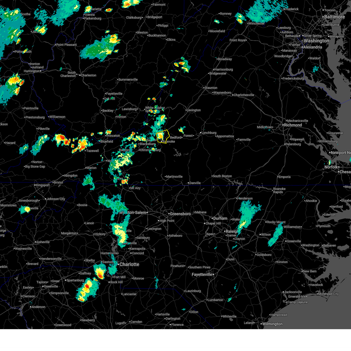
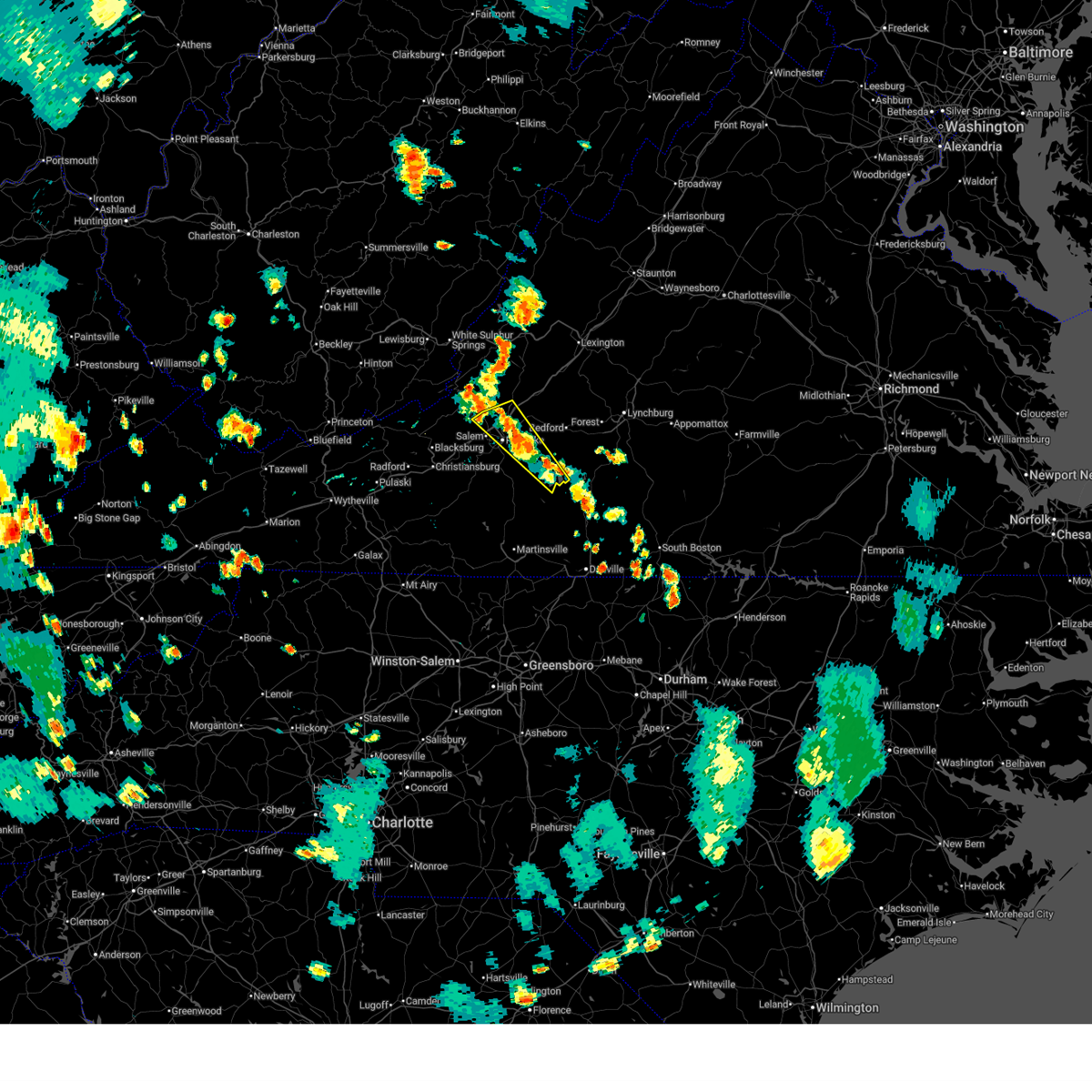
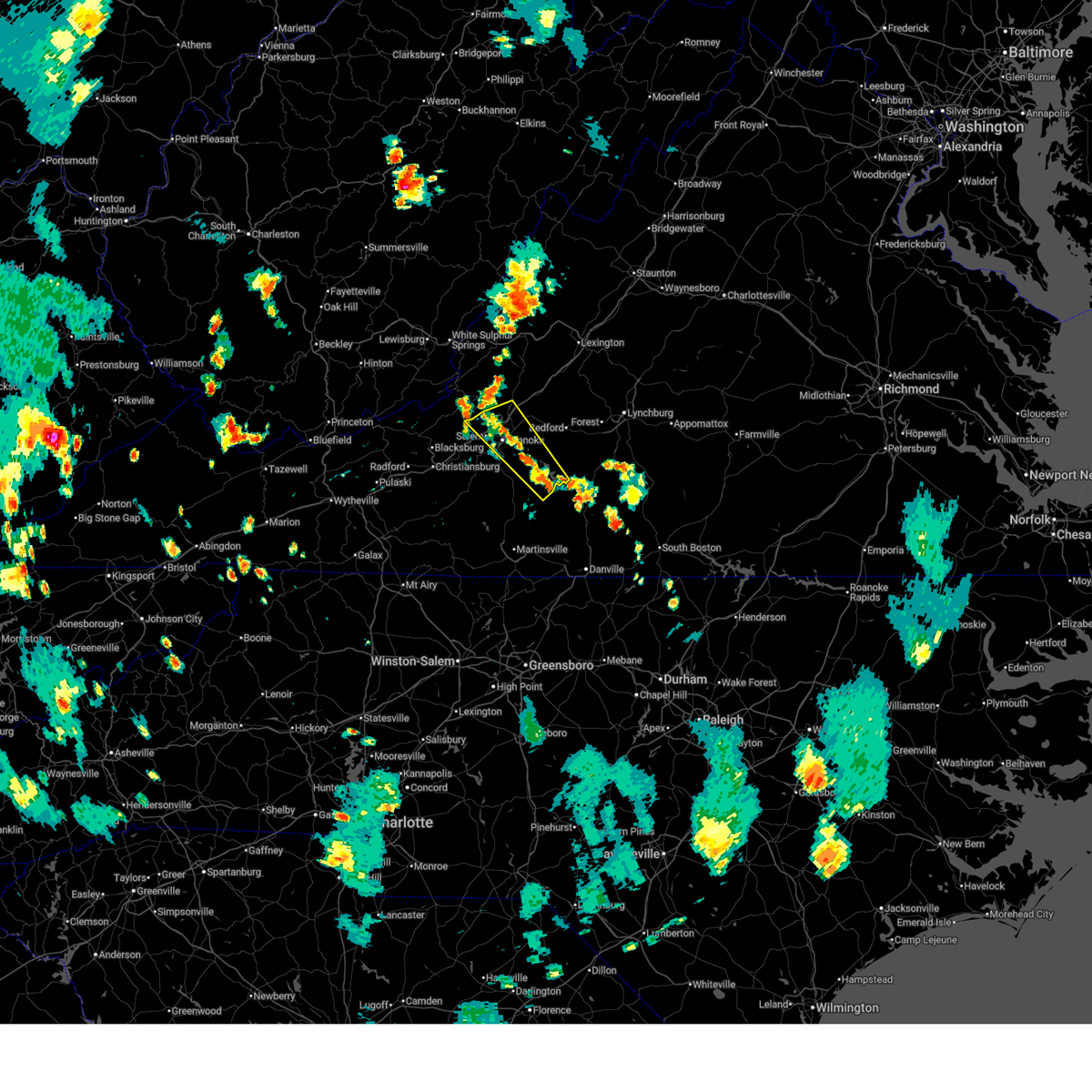
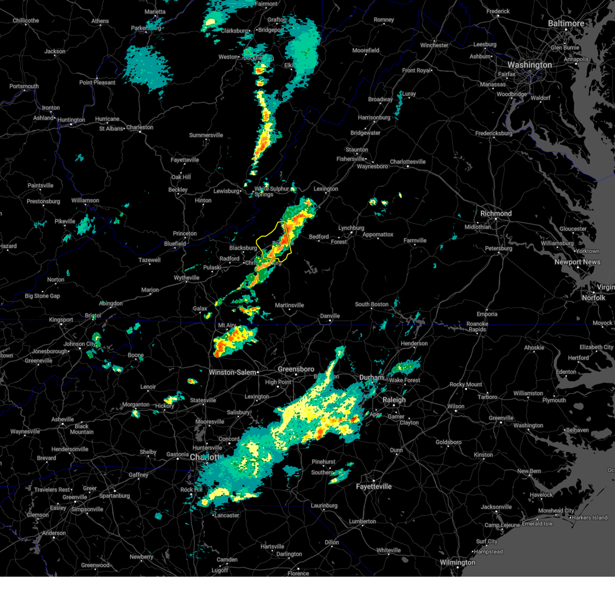
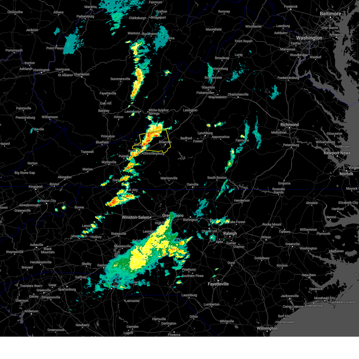
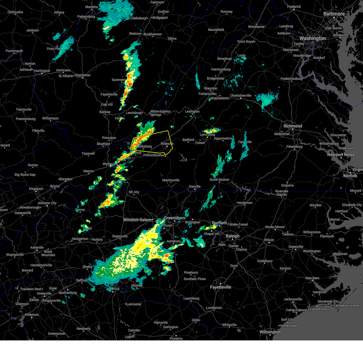
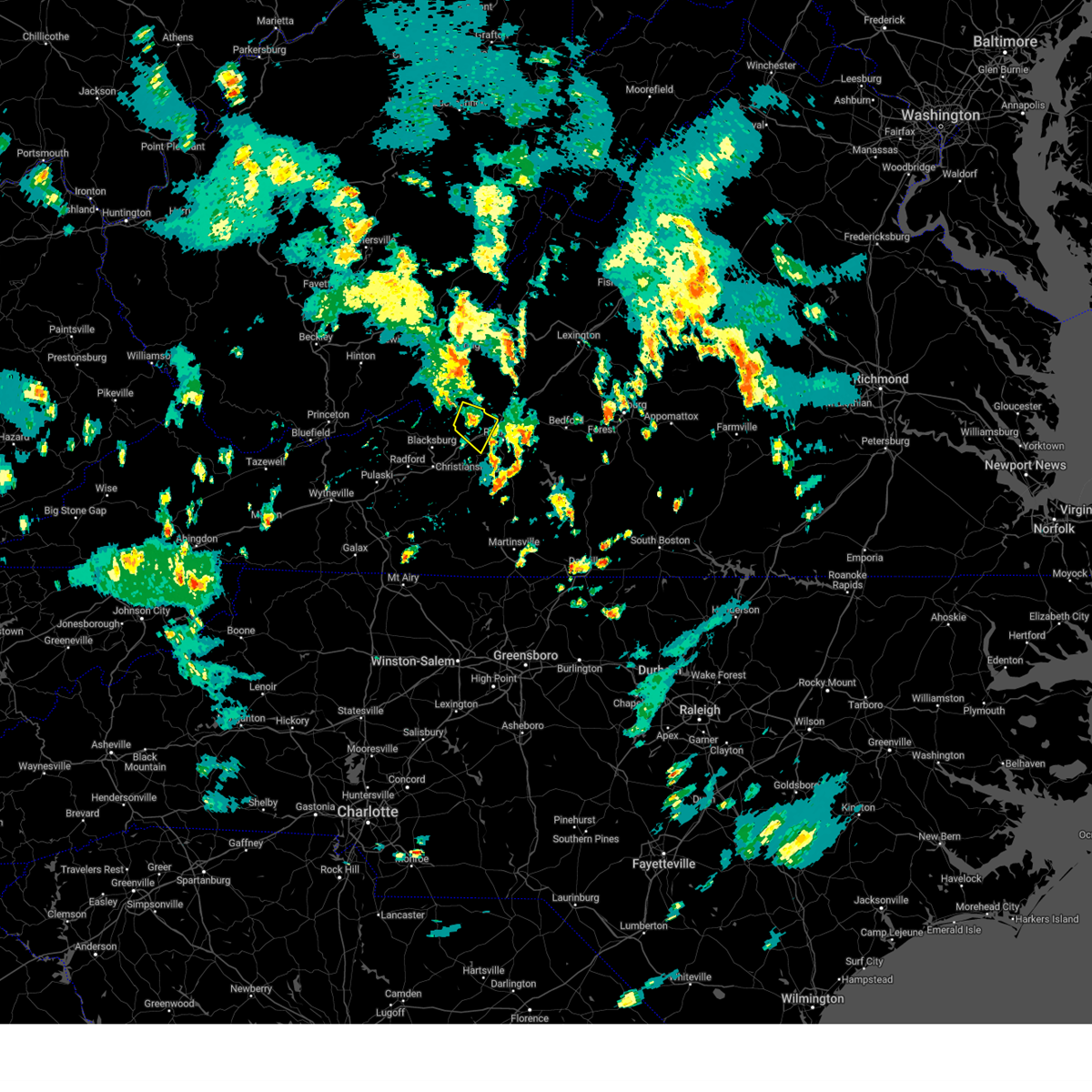
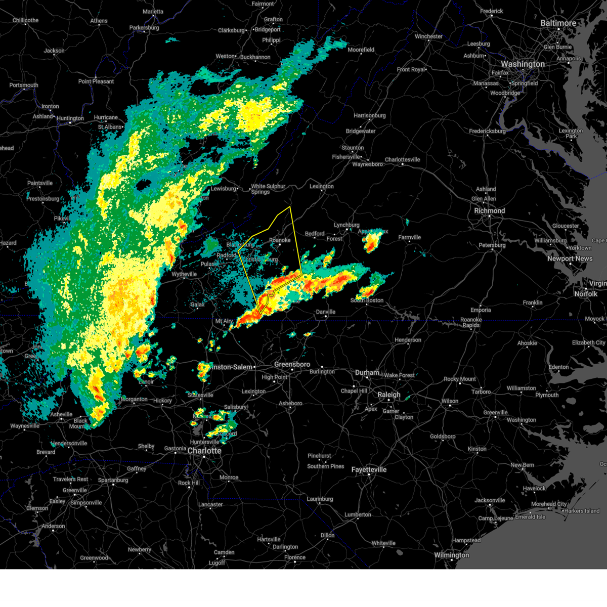
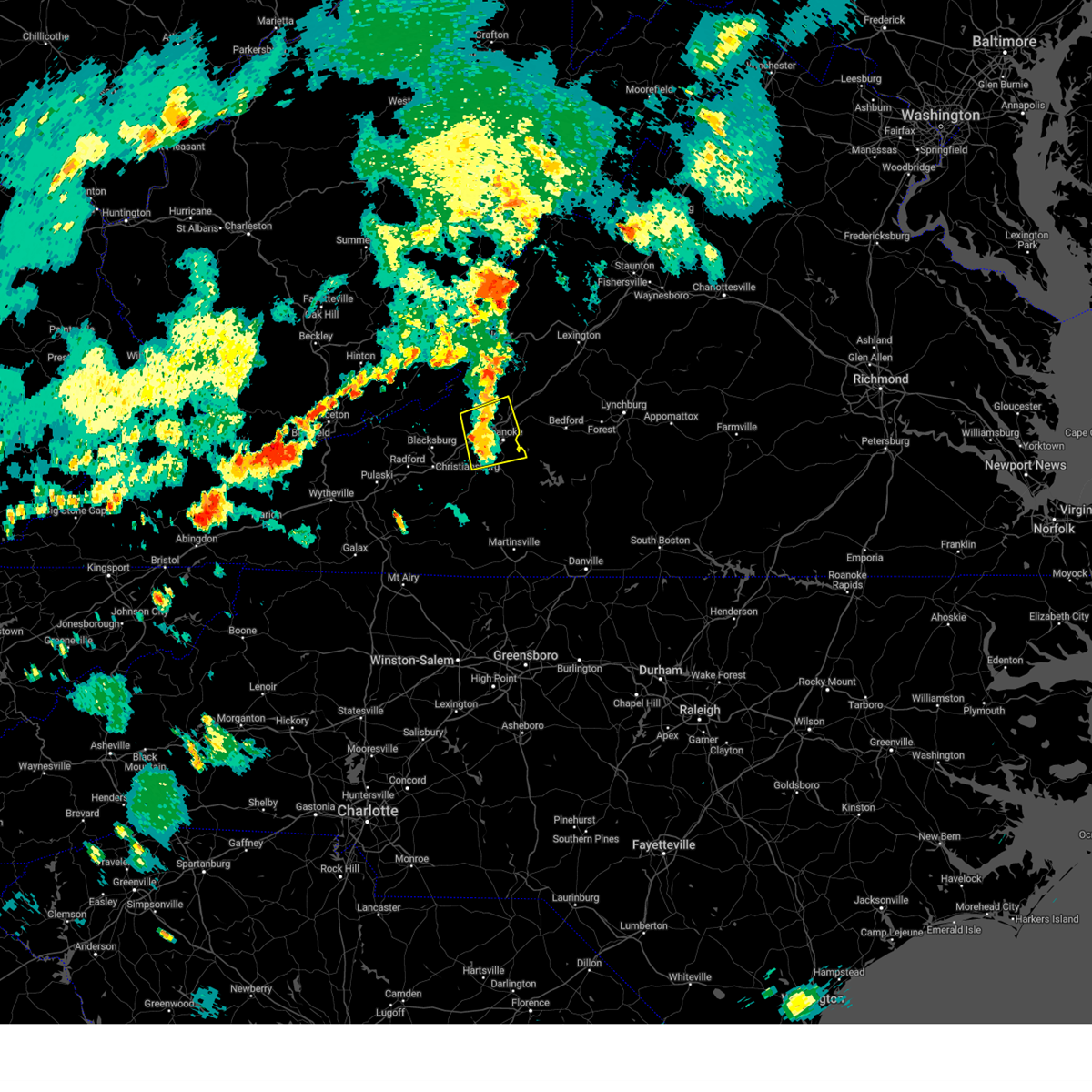
Hail Map for Salem, VA
The Salem, VA area has had 12 reports of on-the-ground hail by trained spotters, and has been under severe weather warnings 40 times during the past 12 months. Doppler radar has detected hail at or near Salem, VA on 55 occasions, including 3 occasions during the past year.
| Name: | Salem, VA |
| Where Located: | 6.4 miles W of Roanoke, VA |
| Map: | Google Map for Salem, VA |
| Population: | 24802 |
| Housing Units: | 10832 |
| More Info: | Search Google for Salem, VA |
0
The Top Recent Hail Date for Salem, VA is Saturday, June 28, 2025 (55th out of 55)
Hail and Wind Damage Spotted near Salem, VA
| Date / Time | Report Details |
|---|---|
| 7/9/2025 1:24 PM EDT | Thunderstorm winds blew down multiple trees along illinois avenu in city of salem county VA, 0.3 miles SW of Salem, VA |
| 7/9/2025 1:22 PM EDT |
 Svrrnk the national weather service in blacksburg has issued a * severe thunderstorm warning for, eastern roanoke county in west central virginia, the city of salem in west central virginia, the city of roanoke in west central virginia, central bedford county in south central virginia, southern botetourt county in west central virginia, * until 230 pm edt. * at 122 pm edt, severe thunderstorms were located along a line extending from near laymantown to near cave spring, moving east at 30 mph (radar indicated). Hazards include 60 mph wind gusts and quarter size hail. Hail damage to vehicles is expected. Expect wind damage to roofs, siding, and trees. Svrrnk the national weather service in blacksburg has issued a * severe thunderstorm warning for, eastern roanoke county in west central virginia, the city of salem in west central virginia, the city of roanoke in west central virginia, central bedford county in south central virginia, southern botetourt county in west central virginia, * until 230 pm edt. * at 122 pm edt, severe thunderstorms were located along a line extending from near laymantown to near cave spring, moving east at 30 mph (radar indicated). Hazards include 60 mph wind gusts and quarter size hail. Hail damage to vehicles is expected. Expect wind damage to roofs, siding, and trees.
|
| 7/8/2025 8:16 PM EDT |
 Svrrnk the national weather service in blacksburg has issued a * severe thunderstorm warning for, northeastern roanoke county in west central virginia, the city of salem in west central virginia, the city of roanoke in west central virginia, west central bedford county in south central virginia, southwestern botetourt county in west central virginia, * until 915 pm edt. * at 816 pm edt, a severe thunderstorm was located over roanoke, moving northeast at 15 mph (radar indicated). Hazards include 60 mph wind gusts and quarter size hail. Hail damage to vehicles is expected. Expect wind damage to roofs, siding, and trees. Svrrnk the national weather service in blacksburg has issued a * severe thunderstorm warning for, northeastern roanoke county in west central virginia, the city of salem in west central virginia, the city of roanoke in west central virginia, west central bedford county in south central virginia, southwestern botetourt county in west central virginia, * until 915 pm edt. * at 816 pm edt, a severe thunderstorm was located over roanoke, moving northeast at 15 mph (radar indicated). Hazards include 60 mph wind gusts and quarter size hail. Hail damage to vehicles is expected. Expect wind damage to roofs, siding, and trees.
|
| 7/1/2025 3:02 PM EDT |
 Svrrnk the national weather service in blacksburg has issued a * severe thunderstorm warning for, central roanoke county in west central virginia, the city of salem in west central virginia, the city of roanoke in west central virginia, northwestern bedford county in south central virginia, southern botetourt county in west central virginia, * until 400 pm edt. * at 302 pm edt, a severe thunderstorm was located over salem, moving northeast at 25 mph (radar indicated). Hazards include 60 mph wind gusts. expect damage to roofs, siding, and trees Svrrnk the national weather service in blacksburg has issued a * severe thunderstorm warning for, central roanoke county in west central virginia, the city of salem in west central virginia, the city of roanoke in west central virginia, northwestern bedford county in south central virginia, southern botetourt county in west central virginia, * until 400 pm edt. * at 302 pm edt, a severe thunderstorm was located over salem, moving northeast at 25 mph (radar indicated). Hazards include 60 mph wind gusts. expect damage to roofs, siding, and trees
|
| 6/28/2025 8:21 PM EDT |
 The storm which prompted the warning has weakened below severe limits, and no longer poses an immediate threat to life or property. therefore, the warning will be allowed to expire. however, gusty winds and heavy rain are still possible with this thunderstorm. The storm which prompted the warning has weakened below severe limits, and no longer poses an immediate threat to life or property. therefore, the warning will be allowed to expire. however, gusty winds and heavy rain are still possible with this thunderstorm.
|
| 6/28/2025 8:12 PM EDT |
 the severe thunderstorm warning has been cancelled and is no longer in effect the severe thunderstorm warning has been cancelled and is no longer in effect
|
| 6/28/2025 8:12 PM EDT |
 At 811 pm edt, a severe thunderstorm was located over hollins, or near roanoke, moving east at 10 mph (radar indicated). Hazards include 60 mph wind gusts. Expect damage to roofs, siding, and trees. Locations impacted include, roanoke, salem, vinton, troutville, nace, laymantown, and daleville. At 811 pm edt, a severe thunderstorm was located over hollins, or near roanoke, moving east at 10 mph (radar indicated). Hazards include 60 mph wind gusts. Expect damage to roofs, siding, and trees. Locations impacted include, roanoke, salem, vinton, troutville, nace, laymantown, and daleville.
|
| 6/28/2025 7:41 PM EDT |
 Svrrnk the national weather service in blacksburg has issued a * severe thunderstorm warning for, northeastern roanoke county in west central virginia, southeastern craig county in southwestern virginia, the city of salem in west central virginia, the city of roanoke in west central virginia, southwestern botetourt county in west central virginia, * until 830 pm edt. * at 741 pm edt, a severe thunderstorm was located near catawba, moving east at 15 mph (radar indicated). Hazards include 60 mph wind gusts. expect damage to roofs, siding, and trees Svrrnk the national weather service in blacksburg has issued a * severe thunderstorm warning for, northeastern roanoke county in west central virginia, southeastern craig county in southwestern virginia, the city of salem in west central virginia, the city of roanoke in west central virginia, southwestern botetourt county in west central virginia, * until 830 pm edt. * at 741 pm edt, a severe thunderstorm was located near catawba, moving east at 15 mph (radar indicated). Hazards include 60 mph wind gusts. expect damage to roofs, siding, and trees
|
| 6/27/2025 8:13 PM EDT |
 The storm which prompted the warning has moved out of the area. therefore, the warning will be allowed to expire. however, gusty winds are still possible with this thunderstorm. remember, a severe thunderstorm warning still remains in effect for western bedford and southern botetourt counties until 9:15 pm edt!. The storm which prompted the warning has moved out of the area. therefore, the warning will be allowed to expire. however, gusty winds are still possible with this thunderstorm. remember, a severe thunderstorm warning still remains in effect for western bedford and southern botetourt counties until 9:15 pm edt!.
|
| 6/27/2025 7:46 PM EDT |
 At 746 pm edt, a severe thunderstorm was located over vinton, moving northwest at 20 mph (radar indicated). Hazards include 60 mph wind gusts. Expect damage to roofs, siding, and trees. Locations impacted include, roanoke, salem, vinton, troutville, stewartsville, moneta, and catawba. At 746 pm edt, a severe thunderstorm was located over vinton, moving northwest at 20 mph (radar indicated). Hazards include 60 mph wind gusts. Expect damage to roofs, siding, and trees. Locations impacted include, roanoke, salem, vinton, troutville, stewartsville, moneta, and catawba.
|
| 6/27/2025 7:20 PM EDT |
 Svrrnk the national weather service in blacksburg has issued a * severe thunderstorm warning for, central roanoke county in west central virginia, the city of salem in west central virginia, the city of roanoke in west central virginia, southwestern bedford county in south central virginia, southwestern botetourt county in west central virginia, northeastern franklin county in west central virginia, * until 815 pm edt. * at 719 pm edt, a severe thunderstorm was located near northwest smith mountain lake, or near stewartsville, moving northwest at 20 mph (radar indicated). Hazards include 60 mph wind gusts and quarter size hail. Hail damage to vehicles is expected. Expect wind damage to roofs, siding, and trees. Svrrnk the national weather service in blacksburg has issued a * severe thunderstorm warning for, central roanoke county in west central virginia, the city of salem in west central virginia, the city of roanoke in west central virginia, southwestern bedford county in south central virginia, southwestern botetourt county in west central virginia, northeastern franklin county in west central virginia, * until 815 pm edt. * at 719 pm edt, a severe thunderstorm was located near northwest smith mountain lake, or near stewartsville, moving northwest at 20 mph (radar indicated). Hazards include 60 mph wind gusts and quarter size hail. Hail damage to vehicles is expected. Expect wind damage to roofs, siding, and trees.
|
| 5/30/2025 3:37 PM EDT |
 At 337 pm edt, a severe thunderstorm was located over cave spring, or over salem, moving east at 35 mph (radar indicated). Hazards include 60 mph wind gusts. Expect damage to roofs, siding, and trees. Locations impacted include, roanoke, salem, vinton, catawba, glenvar, daleville, and hollins. At 337 pm edt, a severe thunderstorm was located over cave spring, or over salem, moving east at 35 mph (radar indicated). Hazards include 60 mph wind gusts. Expect damage to roofs, siding, and trees. Locations impacted include, roanoke, salem, vinton, catawba, glenvar, daleville, and hollins.
|
| 5/30/2025 3:37 PM EDT |
 the severe thunderstorm warning has been cancelled and is no longer in effect the severe thunderstorm warning has been cancelled and is no longer in effect
|
| 5/30/2025 3:31 PM EDT | Multiple trees and large limbs down... along with powerlines. a car window was blown out and roof damage occurred to apartment balcony awnings... which were completely in city of salem county VA, 1.8 miles NW of Salem, VA |
| 5/30/2025 3:08 PM EDT |
 the severe thunderstorm warning has been cancelled and is no longer in effect the severe thunderstorm warning has been cancelled and is no longer in effect
|
| 5/30/2025 3:08 PM EDT |
 At 308 pm edt, a severe thunderstorm was located over mc donalds mill, or 7 miles northeast of blacksburg, moving east at 35 mph (radar indicated). Hazards include 60 mph wind gusts. Expect damage to roofs, siding, and trees. Locations impacted include, roanoke, blacksburg, salem, vinton, sinking creek, catawba, and shawsville. At 308 pm edt, a severe thunderstorm was located over mc donalds mill, or 7 miles northeast of blacksburg, moving east at 35 mph (radar indicated). Hazards include 60 mph wind gusts. Expect damage to roofs, siding, and trees. Locations impacted include, roanoke, blacksburg, salem, vinton, sinking creek, catawba, and shawsville.
|
| 5/30/2025 2:46 PM EDT |
 Svrrnk the national weather service in blacksburg has issued a * severe thunderstorm warning for, roanoke county in west central virginia, southeastern giles county in southwestern virginia, southern craig county in southwestern virginia, the city of salem in west central virginia, the city of roanoke in west central virginia, southwestern botetourt county in west central virginia, northern montgomery county in southwestern virginia, * until 345 pm edt. * at 246 pm edt, a severe thunderstorm was located over newport, moving east at 35 mph (radar indicated). Hazards include 60 mph wind gusts. expect damage to roofs, siding, and trees Svrrnk the national weather service in blacksburg has issued a * severe thunderstorm warning for, roanoke county in west central virginia, southeastern giles county in southwestern virginia, southern craig county in southwestern virginia, the city of salem in west central virginia, the city of roanoke in west central virginia, southwestern botetourt county in west central virginia, northern montgomery county in southwestern virginia, * until 345 pm edt. * at 246 pm edt, a severe thunderstorm was located over newport, moving east at 35 mph (radar indicated). Hazards include 60 mph wind gusts. expect damage to roofs, siding, and trees
|
| 5/16/2025 3:30 PM EDT |
 At 330 pm edt, a severe thunderstorm was located over crockett springs, or near shawsville, moving east at 50 mph (radar indicated). Hazards include 70 mph wind gusts and quarter size hail. Hail damage to vehicles is expected. expect considerable tree damage. wind damage is also likely to mobile homes, roofs, and outbuildings. Locations impacted include, roanoke, blacksburg, salem, christiansburg, vinton, rocky mount, and boones mill. At 330 pm edt, a severe thunderstorm was located over crockett springs, or near shawsville, moving east at 50 mph (radar indicated). Hazards include 70 mph wind gusts and quarter size hail. Hail damage to vehicles is expected. expect considerable tree damage. wind damage is also likely to mobile homes, roofs, and outbuildings. Locations impacted include, roanoke, blacksburg, salem, christiansburg, vinton, rocky mount, and boones mill.
|
| 5/16/2025 3:30 PM EDT |
 the severe thunderstorm warning has been cancelled and is no longer in effect the severe thunderstorm warning has been cancelled and is no longer in effect
|
| 5/16/2025 3:22 PM EDT |
 At 321 pm edt, a severe thunderstorm was located near christiansburg, moving east at 55 mph (mesonet observation). Hazards include 70 mph wind gusts and quarter size hail. Hail damage to vehicles is expected. expect considerable tree damage. wind damage is also likely to mobile homes, roofs, and outbuildings. Locations impacted include, roanoke, blacksburg, salem, christiansburg, radford, vinton, and rocky mount. At 321 pm edt, a severe thunderstorm was located near christiansburg, moving east at 55 mph (mesonet observation). Hazards include 70 mph wind gusts and quarter size hail. Hail damage to vehicles is expected. expect considerable tree damage. wind damage is also likely to mobile homes, roofs, and outbuildings. Locations impacted include, roanoke, blacksburg, salem, christiansburg, radford, vinton, and rocky mount.
|
| 5/16/2025 3:22 PM EDT |
 the severe thunderstorm warning has been cancelled and is no longer in effect the severe thunderstorm warning has been cancelled and is no longer in effect
|
| 5/16/2025 3:05 PM EDT |
 Svrrnk the national weather service in blacksburg has issued a * severe thunderstorm warning for, roanoke county in west central virginia, northeastern pulaski county in southwestern virginia, east central giles county in southwestern virginia, southern craig county in southwestern virginia, the city of radford in southwestern virginia, the city of salem in west central virginia, northern floyd county in southwestern virginia, the city of roanoke in west central virginia, west central bedford county in south central virginia, southwestern botetourt county in west central virginia, central franklin county in west central virginia, montgomery county in southwestern virginia, * until 400 pm edt. * at 305 pm edt, severe thunderstorms were located along a line extending from huffman to near christiansburg to near copper valley, moving east at 40 mph (radar indicated). Hazards include 60 mph wind gusts and quarter size hail. Hail damage to vehicles is expected. Expect wind damage to roofs, siding, and trees. Svrrnk the national weather service in blacksburg has issued a * severe thunderstorm warning for, roanoke county in west central virginia, northeastern pulaski county in southwestern virginia, east central giles county in southwestern virginia, southern craig county in southwestern virginia, the city of radford in southwestern virginia, the city of salem in west central virginia, northern floyd county in southwestern virginia, the city of roanoke in west central virginia, west central bedford county in south central virginia, southwestern botetourt county in west central virginia, central franklin county in west central virginia, montgomery county in southwestern virginia, * until 400 pm edt. * at 305 pm edt, severe thunderstorms were located along a line extending from huffman to near christiansburg to near copper valley, moving east at 40 mph (radar indicated). Hazards include 60 mph wind gusts and quarter size hail. Hail damage to vehicles is expected. Expect wind damage to roofs, siding, and trees.
|
| 5/13/2025 5:39 PM EDT |
 The storm which prompted the warning has weakened below severe limits, and no longer poses an immediate threat to life or property. therefore, the warning will be allowed to expire. The storm which prompted the warning has weakened below severe limits, and no longer poses an immediate threat to life or property. therefore, the warning will be allowed to expire.
|
| 5/13/2025 5:30 PM EDT |
 the severe thunderstorm warning has been cancelled and is no longer in effect the severe thunderstorm warning has been cancelled and is no longer in effect
|
| 5/13/2025 5:30 PM EDT |
 At 529 pm edt, a severe thunderstorm was located over glenvar, or near salem, moving north at 15 mph (radar indicated). Hazards include quarter size hail. Damage to vehicles is expected. Locations impacted include, salem, catawba, abbott, glenvar, and bradshaw. At 529 pm edt, a severe thunderstorm was located over glenvar, or near salem, moving north at 15 mph (radar indicated). Hazards include quarter size hail. Damage to vehicles is expected. Locations impacted include, salem, catawba, abbott, glenvar, and bradshaw.
|
| 5/13/2025 5:08 PM EDT |
 Svrrnk the national weather service in blacksburg has issued a * severe thunderstorm warning for, roanoke county in west central virginia, southeastern craig county in southwestern virginia, the city of salem in west central virginia, the northwestern city of roanoke in west central virginia, northeastern montgomery county in southwestern virginia, * until 545 pm edt. * at 507 pm edt, a severe thunderstorm was located over elliston-lafayette, or over shawsville, moving northeast at 15 mph (radar indicated). Hazards include quarter size hail. damage to vehicles is expected Svrrnk the national weather service in blacksburg has issued a * severe thunderstorm warning for, roanoke county in west central virginia, southeastern craig county in southwestern virginia, the city of salem in west central virginia, the northwestern city of roanoke in west central virginia, northeastern montgomery county in southwestern virginia, * until 545 pm edt. * at 507 pm edt, a severe thunderstorm was located over elliston-lafayette, or over shawsville, moving northeast at 15 mph (radar indicated). Hazards include quarter size hail. damage to vehicles is expected
|
| 9/26/2024 11:17 PM EDT |
 the tornado warning has been cancelled and is no longer in effect the tornado warning has been cancelled and is no longer in effect
|
| 9/26/2024 11:00 PM EDT |
 At 1100 pm edt, a severe thunderstorm capable of producing a tornado was located over boones mill, moving northwest at 25 mph (radar indicated rotation). Hazards include tornado. Flying debris will be dangerous to those caught without shelter. mobile homes will be damaged or destroyed. damage to roofs, windows, and vehicles will occur. tree damage is likely. Locations impacted include, roanoke, vinton, boones mill, poages mill, cave spring, and roanoke mountain. At 1100 pm edt, a severe thunderstorm capable of producing a tornado was located over boones mill, moving northwest at 25 mph (radar indicated rotation). Hazards include tornado. Flying debris will be dangerous to those caught without shelter. mobile homes will be damaged or destroyed. damage to roofs, windows, and vehicles will occur. tree damage is likely. Locations impacted include, roanoke, vinton, boones mill, poages mill, cave spring, and roanoke mountain.
|
| 9/26/2024 10:48 PM EDT |
 Torrnk the national weather service in blacksburg has issued a * tornado warning for, southeastern roanoke county in west central virginia, the city of roanoke in west central virginia, north central franklin county in west central virginia, * until 1130 pm edt. * at 1048 pm edt, a severe thunderstorm capable of producing a tornado was located over wirtz, or near rocky mount, moving northwest at 25 mph (radar indicated rotation). Hazards include tornado. Flying debris will be dangerous to those caught without shelter. mobile homes will be damaged or destroyed. damage to roofs, windows, and vehicles will occur. Tree damage is likely. Torrnk the national weather service in blacksburg has issued a * tornado warning for, southeastern roanoke county in west central virginia, the city of roanoke in west central virginia, north central franklin county in west central virginia, * until 1130 pm edt. * at 1048 pm edt, a severe thunderstorm capable of producing a tornado was located over wirtz, or near rocky mount, moving northwest at 25 mph (radar indicated rotation). Hazards include tornado. Flying debris will be dangerous to those caught without shelter. mobile homes will be damaged or destroyed. damage to roofs, windows, and vehicles will occur. Tree damage is likely.
|
| 9/25/2024 9:24 PM EDT |
 the severe thunderstorm warning has been cancelled and is no longer in effect the severe thunderstorm warning has been cancelled and is no longer in effect
|
| 9/25/2024 8:39 PM EDT |
 Svrrnk the national weather service in blacksburg has issued a * severe thunderstorm warning for, roanoke county in west central virginia, the city of salem in west central virginia, northeastern floyd county in southwestern virginia, the city of roanoke in west central virginia, west central bedford county in south central virginia, southwestern botetourt county in west central virginia, northeastern patrick county in southwestern virginia, franklin county in west central virginia, eastern montgomery county in southwestern virginia, * until 945 pm edt. * at 838 pm edt, severe thunderstorms were located along a line extending from near burnt chimney to near ferrum to endicott, moving north at 40 mph (radar indicated). Hazards include 60 mph wind gusts and quarter size hail. Hail damage to vehicles is expected. Expect wind damage to roofs, siding, and trees. Svrrnk the national weather service in blacksburg has issued a * severe thunderstorm warning for, roanoke county in west central virginia, the city of salem in west central virginia, northeastern floyd county in southwestern virginia, the city of roanoke in west central virginia, west central bedford county in south central virginia, southwestern botetourt county in west central virginia, northeastern patrick county in southwestern virginia, franklin county in west central virginia, eastern montgomery county in southwestern virginia, * until 945 pm edt. * at 838 pm edt, severe thunderstorms were located along a line extending from near burnt chimney to near ferrum to endicott, moving north at 40 mph (radar indicated). Hazards include 60 mph wind gusts and quarter size hail. Hail damage to vehicles is expected. Expect wind damage to roofs, siding, and trees.
|
| 8/31/2024 7:22 PM EDT |
 The storm which prompted the warning has weakened below severe limits, and no longer poses an immediate threat to life or property. therefore, the warning will be allowed to expire. The storm which prompted the warning has weakened below severe limits, and no longer poses an immediate threat to life or property. therefore, the warning will be allowed to expire.
|
| 8/31/2024 7:09 PM EDT |
 the severe thunderstorm warning has been cancelled and is no longer in effect the severe thunderstorm warning has been cancelled and is no longer in effect
|
| 8/31/2024 7:09 PM EDT |
 At 709 pm edt, a severe thunderstorm was located near childress, or near christiansburg, moving southeast at 20 mph (radar indicated). Hazards include 60 mph wind gusts. Expect damage to roofs, siding, and trees. locations impacted include, blacksburg, salem, christiansburg, radford, pilot, shawsville, and terrys fork. This includes the following location virginia tech. At 709 pm edt, a severe thunderstorm was located near childress, or near christiansburg, moving southeast at 20 mph (radar indicated). Hazards include 60 mph wind gusts. Expect damage to roofs, siding, and trees. locations impacted include, blacksburg, salem, christiansburg, radford, pilot, shawsville, and terrys fork. This includes the following location virginia tech.
|
| 8/31/2024 6:53 PM EDT |
 At 653 pm edt, a severe thunderstorm was located over prices fork, or over blacksburg, moving southeast at 15 mph (radar indicated). Hazards include 60 mph wind gusts. Expect damage to roofs, siding, and trees. locations impacted include, blacksburg, salem, christiansburg, radford, newport, pilot, and shawsville. This includes the following location virginia tech. At 653 pm edt, a severe thunderstorm was located over prices fork, or over blacksburg, moving southeast at 15 mph (radar indicated). Hazards include 60 mph wind gusts. Expect damage to roofs, siding, and trees. locations impacted include, blacksburg, salem, christiansburg, radford, newport, pilot, and shawsville. This includes the following location virginia tech.
|
| 8/31/2024 6:53 PM EDT |
 the severe thunderstorm warning has been cancelled and is no longer in effect the severe thunderstorm warning has been cancelled and is no longer in effect
|
| 8/31/2024 6:36 PM EDT |
 Svrrnk the national weather service in blacksburg has issued a * severe thunderstorm warning for, western roanoke county in west central virginia, northeastern pulaski county in southwestern virginia, eastern giles county in southwestern virginia, southwestern craig county in southwestern virginia, the city of radford in southwestern virginia, the west central city of salem in west central virginia, north central floyd county in southwestern virginia, montgomery county in southwestern virginia, southeastern monroe county in southeastern west virginia, * until 730 pm edt. * at 636 pm edt, a severe thunderstorm was located over prices fork, or over newport, moving southeast at 10 mph (radar indicated). Hazards include 60 mph wind gusts. expect damage to roofs, siding, and trees Svrrnk the national weather service in blacksburg has issued a * severe thunderstorm warning for, western roanoke county in west central virginia, northeastern pulaski county in southwestern virginia, eastern giles county in southwestern virginia, southwestern craig county in southwestern virginia, the city of radford in southwestern virginia, the west central city of salem in west central virginia, north central floyd county in southwestern virginia, montgomery county in southwestern virginia, southeastern monroe county in southeastern west virginia, * until 730 pm edt. * at 636 pm edt, a severe thunderstorm was located over prices fork, or over newport, moving southeast at 10 mph (radar indicated). Hazards include 60 mph wind gusts. expect damage to roofs, siding, and trees
|
| 8/31/2024 5:26 PM EDT |
 The storm which prompted the warning has moved out of the area. therefore, the warning will be allowed to expire. a severe thunderstorm watch remains in effect until 700 pm edt for south central, southwestern and west central virginia, and southeastern west virginia. remember, a severe thunderstorm warning still remains in effect for northern roanoke county and southern botetourt county. The storm which prompted the warning has moved out of the area. therefore, the warning will be allowed to expire. a severe thunderstorm watch remains in effect until 700 pm edt for south central, southwestern and west central virginia, and southeastern west virginia. remember, a severe thunderstorm warning still remains in effect for northern roanoke county and southern botetourt county.
|
| 8/31/2024 5:25 PM EDT |
 Svrrnk the national weather service in blacksburg has issued a * severe thunderstorm warning for, northeastern roanoke county in west central virginia, the northern city of roanoke in west central virginia, northwestern bedford county in south central virginia, southern botetourt county in west central virginia, * until 630 pm edt. * at 525 pm edt, a severe thunderstorm was located over hollins, or near roanoke, moving east at 20 mph (radar indicated). Hazards include 60 mph wind gusts. expect damage to roofs, siding, and trees Svrrnk the national weather service in blacksburg has issued a * severe thunderstorm warning for, northeastern roanoke county in west central virginia, the northern city of roanoke in west central virginia, northwestern bedford county in south central virginia, southern botetourt county in west central virginia, * until 630 pm edt. * at 525 pm edt, a severe thunderstorm was located over hollins, or near roanoke, moving east at 20 mph (radar indicated). Hazards include 60 mph wind gusts. expect damage to roofs, siding, and trees
|
| 8/31/2024 5:04 PM EDT |
 the severe thunderstorm warning has been cancelled and is no longer in effect the severe thunderstorm warning has been cancelled and is no longer in effect
|
| 8/31/2024 5:04 PM EDT |
 At 504 pm edt, a severe thunderstorm was located over salem, moving east at 10 mph (radar indicated). Hazards include 60 mph wind gusts. Expect damage to roofs, siding, and trees. locations impacted include, roanoke, salem, vinton, troutville, catawba, bent mountain, and hollins. This includes the following locations the salem fairgrounds and roanoke regional airport. At 504 pm edt, a severe thunderstorm was located over salem, moving east at 10 mph (radar indicated). Hazards include 60 mph wind gusts. Expect damage to roofs, siding, and trees. locations impacted include, roanoke, salem, vinton, troutville, catawba, bent mountain, and hollins. This includes the following locations the salem fairgrounds and roanoke regional airport.
|
| 8/31/2024 4:54 PM EDT | Tree down. time estimated from rada in roanoke county VA, 6.4 miles S of Salem, VA |
| 8/31/2024 4:35 PM EDT |
 Svrrnk the national weather service in blacksburg has issued a * severe thunderstorm warning for, roanoke county in west central virginia, southeastern craig county in southwestern virginia, the city of salem in west central virginia, the city of roanoke in west central virginia, southwestern botetourt county in west central virginia, northwestern franklin county in west central virginia, northeastern montgomery county in southwestern virginia, * until 530 pm edt. * at 435 pm edt, a severe thunderstorm was located over glenvar, or near salem, moving east at 10 mph (radar indicated). Hazards include 60 mph wind gusts and quarter size hail. Hail damage to vehicles is expected. Expect wind damage to roofs, siding, and trees. Svrrnk the national weather service in blacksburg has issued a * severe thunderstorm warning for, roanoke county in west central virginia, southeastern craig county in southwestern virginia, the city of salem in west central virginia, the city of roanoke in west central virginia, southwestern botetourt county in west central virginia, northwestern franklin county in west central virginia, northeastern montgomery county in southwestern virginia, * until 530 pm edt. * at 435 pm edt, a severe thunderstorm was located over glenvar, or near salem, moving east at 10 mph (radar indicated). Hazards include 60 mph wind gusts and quarter size hail. Hail damage to vehicles is expected. Expect wind damage to roofs, siding, and trees.
|
| 7/5/2024 5:30 PM EDT |
 The storm which prompted the warning has weakened below severe limits, and has exited the warned area. therefore, the warning has been allowed to expire. however, heavy rain is still possible with this thunderstorm. a severe thunderstorm watch remains in effect until 700 pm edt for southeastern west virginia. The storm which prompted the warning has weakened below severe limits, and has exited the warned area. therefore, the warning has been allowed to expire. however, heavy rain is still possible with this thunderstorm. a severe thunderstorm watch remains in effect until 700 pm edt for southeastern west virginia.
|
| 7/5/2024 5:12 PM EDT |
 At 512 pm edt, a severe thunderstorm was located near daleville, or near catawba, moving northeast at 30 mph (radar indicated). Hazards include 60 mph wind gusts. Expect damage to roofs, siding, and trees. locations impacted include, salem, buchanan, troutville, eagle rock, fincastle, lithia, and hollins. This includes the following location roanoke regional airport. At 512 pm edt, a severe thunderstorm was located near daleville, or near catawba, moving northeast at 30 mph (radar indicated). Hazards include 60 mph wind gusts. Expect damage to roofs, siding, and trees. locations impacted include, salem, buchanan, troutville, eagle rock, fincastle, lithia, and hollins. This includes the following location roanoke regional airport.
|
| 7/5/2024 5:12 PM EDT |
 the severe thunderstorm warning has been cancelled and is no longer in effect the severe thunderstorm warning has been cancelled and is no longer in effect
|
| 7/5/2024 5:10 PM EDT |
 The storm which prompted the warning has moved out of the area. therefore, the warning will be allowed to expire. The storm which prompted the warning has moved out of the area. therefore, the warning will be allowed to expire.
|
| 7/5/2024 5:01 PM EDT |
 the severe thunderstorm warning has been cancelled and is no longer in effect the severe thunderstorm warning has been cancelled and is no longer in effect
|
| 7/5/2024 5:01 PM EDT |
 At 500 pm edt, a severe thunderstorm was located over salem, moving northeast at 35 mph (radar indicated). Hazards include 60 mph wind gusts. Expect damage to roofs, siding, and trees. Locations impacted include, poages mill, cave spring, glenvar, bradshaw, and elliston-lafayette. At 500 pm edt, a severe thunderstorm was located over salem, moving northeast at 35 mph (radar indicated). Hazards include 60 mph wind gusts. Expect damage to roofs, siding, and trees. Locations impacted include, poages mill, cave spring, glenvar, bradshaw, and elliston-lafayette.
|
| 7/5/2024 4:46 PM EDT | Thunderstorm winds blew down at least one tree on harborwood roa in roanoke county VA, 3.6 miles ENE of Salem, VA |
| 7/5/2024 4:46 PM EDT |
 Svrrnk the national weather service in blacksburg has issued a * severe thunderstorm warning for, northern roanoke county in west central virginia, the city of salem in west central virginia, the northwestern part of the city of roanoke in west central virginia, northwestern bedford county in south central virginia, botetourt county in west central virginia, * until 530 pm edt. * at 446 pm edt, a severe thunderstorm was located over salem, moving northeast at 35 mph (radar indicated). Hazards include 60 mph wind gusts. expect damage to roofs, siding, and trees Svrrnk the national weather service in blacksburg has issued a * severe thunderstorm warning for, northern roanoke county in west central virginia, the city of salem in west central virginia, the northwestern part of the city of roanoke in west central virginia, northwestern bedford county in south central virginia, botetourt county in west central virginia, * until 530 pm edt. * at 446 pm edt, a severe thunderstorm was located over salem, moving northeast at 35 mph (radar indicated). Hazards include 60 mph wind gusts. expect damage to roofs, siding, and trees
|
| 7/5/2024 4:31 PM EDT |
 Svrrnk the national weather service in blacksburg has issued a * severe thunderstorm warning for, southern roanoke county in west central virginia, northeastern floyd county in southwestern virginia, eastern montgomery county in southwestern virginia, * until 515 pm edt. * at 431 pm edt, a severe thunderstorm was located over crockett springs, or near christiansburg, moving northeast at 35 mph (radar indicated). Hazards include 60 mph wind gusts. expect damage to roofs, siding, and trees Svrrnk the national weather service in blacksburg has issued a * severe thunderstorm warning for, southern roanoke county in west central virginia, northeastern floyd county in southwestern virginia, eastern montgomery county in southwestern virginia, * until 515 pm edt. * at 431 pm edt, a severe thunderstorm was located over crockett springs, or near christiansburg, moving northeast at 35 mph (radar indicated). Hazards include 60 mph wind gusts. expect damage to roofs, siding, and trees
|
| 5/26/2024 6:24 PM EDT |
 Svrrnk the national weather service in blacksburg has issued a * severe thunderstorm warning for, eastern roanoke county in west central virginia, campbell county in central virginia, the southeastern city of salem in west central virginia, northern pittsylvania county in south central virginia, the city of roanoke in west central virginia, bedford county in south central virginia, southeastern amherst county in central virginia, the city of lynchburg in central virginia, franklin county in west central virginia, * until 730 pm edt. * at 624 pm edt, severe thunderstorms were located along a line extending from hollins to near boones mill to endicott, moving east at 45 mph (radar indicated). Hazards include 60 mph wind gusts. expect damage to roofs, siding, and trees Svrrnk the national weather service in blacksburg has issued a * severe thunderstorm warning for, eastern roanoke county in west central virginia, campbell county in central virginia, the southeastern city of salem in west central virginia, northern pittsylvania county in south central virginia, the city of roanoke in west central virginia, bedford county in south central virginia, southeastern amherst county in central virginia, the city of lynchburg in central virginia, franklin county in west central virginia, * until 730 pm edt. * at 624 pm edt, severe thunderstorms were located along a line extending from hollins to near boones mill to endicott, moving east at 45 mph (radar indicated). Hazards include 60 mph wind gusts. expect damage to roofs, siding, and trees
|
| 5/26/2024 6:16 PM EDT | Thunderstorm winds blew down numerous trees along east riverside drive in salem. several structures were also damage in city of salem county VA, 1.2 miles NNW of Salem, VA |
| 5/26/2024 6:01 PM EDT |
 the severe thunderstorm warning has been cancelled and is no longer in effect the severe thunderstorm warning has been cancelled and is no longer in effect
|
| 5/26/2024 6:01 PM EDT |
 At 600 pm edt, severe thunderstorms were located along a line extending from maggie to near christiansburg to willis, moving east at 50 mph (radar indicated). Hazards include 70 mph wind gusts and quarter size hail. Hail damage to vehicles is expected. expect considerable tree damage. wind damage is also likely to mobile homes, roofs, and outbuildings. locations impacted include, roanoke, blacksburg, salem, christiansburg, radford, vinton, and rocky mount. This includes the following locations virginia tech, the salem fairgrounds, and roanoke regional airport. At 600 pm edt, severe thunderstorms were located along a line extending from maggie to near christiansburg to willis, moving east at 50 mph (radar indicated). Hazards include 70 mph wind gusts and quarter size hail. Hail damage to vehicles is expected. expect considerable tree damage. wind damage is also likely to mobile homes, roofs, and outbuildings. locations impacted include, roanoke, blacksburg, salem, christiansburg, radford, vinton, and rocky mount. This includes the following locations virginia tech, the salem fairgrounds, and roanoke regional airport.
|
| 5/26/2024 5:35 PM EDT |
 Svrrnk the national weather service in blacksburg has issued a * severe thunderstorm warning for, pulaski county in southwestern virginia, giles county in southwestern virginia, craig county in southwestern virginia, the city of radford in southwestern virginia, the city of salem in west central virginia, floyd county in southwestern virginia, northeastern carroll county in southwestern virginia, southwestern botetourt county in west central virginia, roanoke county in west central virginia, the city of roanoke in west central virginia, east central wythe county in southwestern virginia, western franklin county in west central virginia, montgomery county in southwestern virginia, * until 630 pm edt. * at 534 pm edt, severe thunderstorms were located along a line extending from pearisburg to near dublin to near ennice, moving east at 50 mph (radar indicated). Hazards include 70 mph wind gusts and quarter size hail. Hail damage to vehicles is expected. expect considerable tree damage. Wind damage is also likely to mobile homes, roofs, and outbuildings. Svrrnk the national weather service in blacksburg has issued a * severe thunderstorm warning for, pulaski county in southwestern virginia, giles county in southwestern virginia, craig county in southwestern virginia, the city of radford in southwestern virginia, the city of salem in west central virginia, floyd county in southwestern virginia, northeastern carroll county in southwestern virginia, southwestern botetourt county in west central virginia, roanoke county in west central virginia, the city of roanoke in west central virginia, east central wythe county in southwestern virginia, western franklin county in west central virginia, montgomery county in southwestern virginia, * until 630 pm edt. * at 534 pm edt, severe thunderstorms were located along a line extending from pearisburg to near dublin to near ennice, moving east at 50 mph (radar indicated). Hazards include 70 mph wind gusts and quarter size hail. Hail damage to vehicles is expected. expect considerable tree damage. Wind damage is also likely to mobile homes, roofs, and outbuildings.
|
| 5/22/2024 5:21 PM EDT |
 The storm which prompted the warning has weakened below severe limits, and no longer poses an immediate threat to life or property. therefore, the warning will be allowed to expire. The storm which prompted the warning has weakened below severe limits, and no longer poses an immediate threat to life or property. therefore, the warning will be allowed to expire.
|
| 5/22/2024 5:14 PM EDT | Quarter sized hail reported 5.8 miles S of Salem, VA, numerous hailstones at least the size of a quarter at watkins market on bradshaw road. |
| 5/22/2024 5:02 PM EDT | Quarter sized hail reported 7.3 miles SE of Salem, VA, a few quarter sized hailstones on blacksburg road. |
| 5/22/2024 5:01 PM EDT | A few trees were blown down about 3 miles southwest of us 311 along blacksburg roa in roanoke county VA, 7.3 miles SE of Salem, VA |
| 5/22/2024 5:01 PM EDT |
 At 500 pm edt, a severe thunderstorm was located near glenvar, or near catawba, moving northeast at 15 mph (radar indicated). Hazards include golf ball size hail and 60 mph wind gusts. People and animals outdoors will be injured. expect hail damage to roofs, siding, windows, and vehicles. expect wind damage to roofs, siding, and trees. locations impacted include, roanoke, salem, catawba, glenvar, bradshaw, cave spring, and hollins. This includes the following locations the salem fairgrounds and roanoke regional airport. At 500 pm edt, a severe thunderstorm was located near glenvar, or near catawba, moving northeast at 15 mph (radar indicated). Hazards include golf ball size hail and 60 mph wind gusts. People and animals outdoors will be injured. expect hail damage to roofs, siding, windows, and vehicles. expect wind damage to roofs, siding, and trees. locations impacted include, roanoke, salem, catawba, glenvar, bradshaw, cave spring, and hollins. This includes the following locations the salem fairgrounds and roanoke regional airport.
|
| 5/22/2024 4:54 PM EDT |
 At 454 pm edt, a severe thunderstorm was located near glenvar, or near catawba, moving northeast at 20 mph (radar indicated). Hazards include 60 mph wind gusts and half dollar size hail. Hail damage to vehicles is expected. expect wind damage to roofs, siding, and trees. locations impacted include, roanoke, salem, catawba, glenvar, bradshaw, cave spring, and hollins. This includes the following locations the salem fairgrounds and roanoke regional airport. At 454 pm edt, a severe thunderstorm was located near glenvar, or near catawba, moving northeast at 20 mph (radar indicated). Hazards include 60 mph wind gusts and half dollar size hail. Hail damage to vehicles is expected. expect wind damage to roofs, siding, and trees. locations impacted include, roanoke, salem, catawba, glenvar, bradshaw, cave spring, and hollins. This includes the following locations the salem fairgrounds and roanoke regional airport.
|
| 5/22/2024 4:54 PM EDT |
 the severe thunderstorm warning has been cancelled and is no longer in effect the severe thunderstorm warning has been cancelled and is no longer in effect
|
| 5/22/2024 4:36 PM EDT |
 Svrrnk the national weather service in blacksburg has issued a * severe thunderstorm warning for, northwestern roanoke county in west central virginia, the city of salem in west central virginia, the western city of roanoke in west central virginia, northeastern montgomery county in southwestern virginia, * until 530 pm edt. * at 436 pm edt, a severe thunderstorm was located near elliston-lafayette, or near shawsville, moving northeast at 15 mph (radar indicated). Hazards include 60 mph wind gusts and quarter size hail. Hail damage to vehicles is expected. Expect wind damage to roofs, siding, and trees. Svrrnk the national weather service in blacksburg has issued a * severe thunderstorm warning for, northwestern roanoke county in west central virginia, the city of salem in west central virginia, the western city of roanoke in west central virginia, northeastern montgomery county in southwestern virginia, * until 530 pm edt. * at 436 pm edt, a severe thunderstorm was located near elliston-lafayette, or near shawsville, moving northeast at 15 mph (radar indicated). Hazards include 60 mph wind gusts and quarter size hail. Hail damage to vehicles is expected. Expect wind damage to roofs, siding, and trees.
|
| 2/28/2024 1:55 PM EST |
 The storm which prompted the warning has weakened below severe limits, and no longer poses an immediate threat to life or property. therefore, the warning will be allowed to expire. The storm which prompted the warning has weakened below severe limits, and no longer poses an immediate threat to life or property. therefore, the warning will be allowed to expire.
|
| 2/28/2024 1:36 PM EST |
 At 135 pm est, a severe thunderstorm was located near glenvar, or near salem, moving east at 65 mph (radar indicated). Hazards include 60 mph wind gusts. Expect damage to roofs, siding, and trees. locations impacted include, roanoke, blacksburg, salem, christiansburg, vinton, boones mill, and shawsville. This includes the following locations virginia tech, the salem fairgrounds, and roanoke regional airport. At 135 pm est, a severe thunderstorm was located near glenvar, or near salem, moving east at 65 mph (radar indicated). Hazards include 60 mph wind gusts. Expect damage to roofs, siding, and trees. locations impacted include, roanoke, blacksburg, salem, christiansburg, vinton, boones mill, and shawsville. This includes the following locations virginia tech, the salem fairgrounds, and roanoke regional airport.
|
| 2/28/2024 1:12 PM EST |
 Svrrnk the national weather service in blacksburg has issued a * severe thunderstorm warning for, roanoke county in west central virginia, northeastern pulaski county in southwestern virginia, southeastern giles county in southwestern virginia, southwestern craig county in southwestern virginia, the city of radford in southwestern virginia, the city of salem in west central virginia, the city of roanoke in west central virginia, northwestern franklin county in west central virginia, montgomery county in southwestern virginia, * until 200 pm est. * at 112 pm est, a severe thunderstorm was located near mc coy, or near newport, moving east at 65 mph (radar indicated). Hazards include 60 mph wind gusts. expect damage to roofs, siding, and trees Svrrnk the national weather service in blacksburg has issued a * severe thunderstorm warning for, roanoke county in west central virginia, northeastern pulaski county in southwestern virginia, southeastern giles county in southwestern virginia, southwestern craig county in southwestern virginia, the city of radford in southwestern virginia, the city of salem in west central virginia, the city of roanoke in west central virginia, northwestern franklin county in west central virginia, montgomery county in southwestern virginia, * until 200 pm est. * at 112 pm est, a severe thunderstorm was located near mc coy, or near newport, moving east at 65 mph (radar indicated). Hazards include 60 mph wind gusts. expect damage to roofs, siding, and trees
|
| 9/7/2023 5:14 PM EDT |
 The severe thunderstorm warning for eastern roanoke, west central bedford, southwestern botetourt and north central franklin counties, the city of salem and the city of roanoke will expire at 515 pm edt, the storm which prompted the warning has weakened below severe limits, and no longer poses an immediate threat to life or property. therefore, the warning will be allowed to expire. The severe thunderstorm warning for eastern roanoke, west central bedford, southwestern botetourt and north central franklin counties, the city of salem and the city of roanoke will expire at 515 pm edt, the storm which prompted the warning has weakened below severe limits, and no longer poses an immediate threat to life or property. therefore, the warning will be allowed to expire.
|
| 9/7/2023 5:00 PM EDT |
 At 500 pm edt, a severe thunderstorm was located over cloverdale, or near vinton, moving northeast at 20 mph (radar indicated). Hazards include 60 mph wind gusts and quarter size hail. Hail damage to vehicles is expected. expect wind damage to roofs, siding, and trees. locations impacted include, roanoke, salem, vinton, troutville, stewartsville, hollins, and laymantown. this includes the following locations the salem fairgrounds and roanoke regional airport. hail threat, radar indicated max hail size, 1. 00 in wind threat, radar indicated max wind gust, 60 mph. At 500 pm edt, a severe thunderstorm was located over cloverdale, or near vinton, moving northeast at 20 mph (radar indicated). Hazards include 60 mph wind gusts and quarter size hail. Hail damage to vehicles is expected. expect wind damage to roofs, siding, and trees. locations impacted include, roanoke, salem, vinton, troutville, stewartsville, hollins, and laymantown. this includes the following locations the salem fairgrounds and roanoke regional airport. hail threat, radar indicated max hail size, 1. 00 in wind threat, radar indicated max wind gust, 60 mph.
|
| 9/7/2023 4:41 PM EDT | Thunderstorm winds blew down a tree into a power line on barnett road n in city of roanoke county VA, 2.1 miles WSW of Salem, VA |
| 9/7/2023 4:41 PM EDT |
 At 441 pm edt, a severe thunderstorm was located over salem, moving northeast at 15 mph (radar indicated). Hazards include 60 mph wind gusts and quarter size hail. Hail damage to vehicles is expected. expect wind damage to roofs, siding, and trees. locations impacted include, roanoke, salem, vinton, troutville, stewartsville, bent mountain, and hollins. this includes the following locations the salem fairgrounds and roanoke regional airport. hail threat, radar indicated max hail size, 1. 00 in wind threat, radar indicated max wind gust, 60 mph. At 441 pm edt, a severe thunderstorm was located over salem, moving northeast at 15 mph (radar indicated). Hazards include 60 mph wind gusts and quarter size hail. Hail damage to vehicles is expected. expect wind damage to roofs, siding, and trees. locations impacted include, roanoke, salem, vinton, troutville, stewartsville, bent mountain, and hollins. this includes the following locations the salem fairgrounds and roanoke regional airport. hail threat, radar indicated max hail size, 1. 00 in wind threat, radar indicated max wind gust, 60 mph.
|
| 9/7/2023 4:37 PM EDT | Tree down at intersection of electric road and greenridge road. time estimated from rada in city of salem county VA, 2.1 miles SW of Salem, VA |
| 9/7/2023 4:22 PM EDT |
 At 421 pm edt, a severe thunderstorm was located near glenvar, or near salem, moving northeast at 15 mph (radar indicated). Hazards include 60 mph wind gusts and quarter size hail. Hail damage to vehicles is expected. Expect wind damage to roofs, siding, and trees. At 421 pm edt, a severe thunderstorm was located near glenvar, or near salem, moving northeast at 15 mph (radar indicated). Hazards include 60 mph wind gusts and quarter size hail. Hail damage to vehicles is expected. Expect wind damage to roofs, siding, and trees.
|
| 7/28/2023 6:42 PM EDT |
 The severe thunderstorm warning for east central craig, floyd, northwestern bedford, carroll, northwestern henry, patrick and franklin counties and the city of galax will expire at 645 pm edt, the storms which prompted the warning have moved out of the area. therefore, the warning will be allowed to expire. a severe thunderstorm watch remains in effect until 1100 pm edt for southwestern and west central virginia, and southeastern west virginia. The severe thunderstorm warning for east central craig, floyd, northwestern bedford, carroll, northwestern henry, patrick and franklin counties and the city of galax will expire at 645 pm edt, the storms which prompted the warning have moved out of the area. therefore, the warning will be allowed to expire. a severe thunderstorm watch remains in effect until 1100 pm edt for southwestern and west central virginia, and southeastern west virginia.
|
| 7/28/2023 6:35 PM EDT |
 At 634 pm edt, severe thunderstorms were located along a line extending from near montvale to near ferrum to near charity to rocky knob recreation area, moving southwest at 10 mph (radar indicated). Hazards include 60 mph wind gusts. Expect damage to roofs, siding, and trees. locations impacted include, roanoke, salem, vinton, galax, bedford, rocky mount, and hillsville. this includes the following locations the salem fairgrounds, the national d-day memorial, and roanoke regional airport. hail threat, radar indicated max hail size, <. 75 in wind threat, radar indicated max wind gust, 60 mph. At 634 pm edt, severe thunderstorms were located along a line extending from near montvale to near ferrum to near charity to rocky knob recreation area, moving southwest at 10 mph (radar indicated). Hazards include 60 mph wind gusts. Expect damage to roofs, siding, and trees. locations impacted include, roanoke, salem, vinton, galax, bedford, rocky mount, and hillsville. this includes the following locations the salem fairgrounds, the national d-day memorial, and roanoke regional airport. hail threat, radar indicated max hail size, <. 75 in wind threat, radar indicated max wind gust, 60 mph.
|
| 7/28/2023 5:41 PM EDT |
 At 541 pm edt, severe thunderstorms were located along a line extending from near catawba to pilot to near grahams forge to near sugar grove, moving southeast at 25 mph (radar indicated). Hazards include 60 mph wind gusts. Expect damage to roofs, siding, and trees. locations impacted include, blacksburg, salem, christiansburg, radford, pulaski, wytheville, and marion. this includes the following location virginia tech. hail threat, radar indicated max hail size, <. 75 in wind threat, radar indicated max wind gust, 60 mph. At 541 pm edt, severe thunderstorms were located along a line extending from near catawba to pilot to near grahams forge to near sugar grove, moving southeast at 25 mph (radar indicated). Hazards include 60 mph wind gusts. Expect damage to roofs, siding, and trees. locations impacted include, blacksburg, salem, christiansburg, radford, pulaski, wytheville, and marion. this includes the following location virginia tech. hail threat, radar indicated max hail size, <. 75 in wind threat, radar indicated max wind gust, 60 mph.
|
| 7/28/2023 5:33 PM EDT |
 At 533 pm edt, severe thunderstorms were located along a line extending from new castle to near crockett springs to near claytor lake state park to allisonia, moving east at 50 mph (radar indicated). Hazards include 60 mph wind gusts. expect damage to roofs, siding, and trees At 533 pm edt, severe thunderstorms were located along a line extending from new castle to near crockett springs to near claytor lake state park to allisonia, moving east at 50 mph (radar indicated). Hazards include 60 mph wind gusts. expect damage to roofs, siding, and trees
|
| 7/28/2023 5:20 PM EDT |
 At 520 pm edt, severe thunderstorms were located along a line extending from sinking creek to radford to near wytheville to marion, moving southeast at 35 mph (radar indicated). Hazards include 60 mph wind gusts. Expect damage to roofs, siding, and trees. locations impacted include, blacksburg, salem, christiansburg, radford, pulaski, wytheville, and bland. this includes the following location virginia tech. hail threat, radar indicated max hail size, <. 75 in wind threat, radar indicated max wind gust, 60 mph. At 520 pm edt, severe thunderstorms were located along a line extending from sinking creek to radford to near wytheville to marion, moving southeast at 35 mph (radar indicated). Hazards include 60 mph wind gusts. Expect damage to roofs, siding, and trees. locations impacted include, blacksburg, salem, christiansburg, radford, pulaski, wytheville, and bland. this includes the following location virginia tech. hail threat, radar indicated max hail size, <. 75 in wind threat, radar indicated max wind gust, 60 mph.
|
| 7/28/2023 4:51 PM EDT |
 At 451 pm edt, severe thunderstorms were located along a line extending from wolfcreek to near narrows to suiter to near broadford, moving southeast at 45 mph (radar indicated). Hazards include 60 mph wind gusts. expect damage to roofs, siding, and trees At 451 pm edt, severe thunderstorms were located along a line extending from wolfcreek to near narrows to suiter to near broadford, moving southeast at 45 mph (radar indicated). Hazards include 60 mph wind gusts. expect damage to roofs, siding, and trees
|
| 7/23/2023 6:38 PM EDT |
 The severe thunderstorm warning for central roanoke , the city of salem and the western city of roanoke will expire at 645 pm edt, the storm which prompted the warning has weakened below severe limits, and no longer poses an immediate threat to life or property. therefore, the warning will be allowed to expire. however heavy rain is still possible with this thunderstorm. The severe thunderstorm warning for central roanoke , the city of salem and the western city of roanoke will expire at 645 pm edt, the storm which prompted the warning has weakened below severe limits, and no longer poses an immediate threat to life or property. therefore, the warning will be allowed to expire. however heavy rain is still possible with this thunderstorm.
|
| 7/23/2023 6:25 PM EDT |
 At 624 pm edt, a severe thunderstorm was located over vinton, moving east at 15 mph (radar indicated). Hazards include 60 mph wind gusts and quarter size hail. Hail damage to vehicles is expected. expect wind damage to roofs, siding, and trees. locations impacted include, roanoke, salem, hollins, and cave spring. this includes the following locations the salem fairgrounds and roanoke regional airport. hail threat, radar indicated max hail size, 1. 00 in wind threat, radar indicated max wind gust, 60 mph. At 624 pm edt, a severe thunderstorm was located over vinton, moving east at 15 mph (radar indicated). Hazards include 60 mph wind gusts and quarter size hail. Hail damage to vehicles is expected. expect wind damage to roofs, siding, and trees. locations impacted include, roanoke, salem, hollins, and cave spring. this includes the following locations the salem fairgrounds and roanoke regional airport. hail threat, radar indicated max hail size, 1. 00 in wind threat, radar indicated max wind gust, 60 mph.
|
| 7/23/2023 6:07 PM EDT |
 At 607 pm edt, a severe thunderstorm was located over roanoke, moving east at 10 mph (radar indicated). Hazards include 60 mph wind gusts and quarter size hail. Hail damage to vehicles is expected. expect wind damage to roofs, siding, and trees. locations impacted include, roanoke, salem, hollins, poages mill, cave spring, and glenvar. this includes the following locations the salem fairgrounds and roanoke regional airport. hail threat, radar indicated max hail size, 1. 00 in wind threat, radar indicated max wind gust, 60 mph. At 607 pm edt, a severe thunderstorm was located over roanoke, moving east at 10 mph (radar indicated). Hazards include 60 mph wind gusts and quarter size hail. Hail damage to vehicles is expected. expect wind damage to roofs, siding, and trees. locations impacted include, roanoke, salem, hollins, poages mill, cave spring, and glenvar. this includes the following locations the salem fairgrounds and roanoke regional airport. hail threat, radar indicated max hail size, 1. 00 in wind threat, radar indicated max wind gust, 60 mph.
|
| 7/23/2023 5:50 PM EDT |
 At 549 pm edt, a severe thunderstorm was located over salem, moving east at 10 mph (radar indicated). Hazards include 60 mph wind gusts and quarter size hail. Hail damage to vehicles is expected. Expect wind damage to roofs, siding, and trees. At 549 pm edt, a severe thunderstorm was located over salem, moving east at 10 mph (radar indicated). Hazards include 60 mph wind gusts and quarter size hail. Hail damage to vehicles is expected. Expect wind damage to roofs, siding, and trees.
|
| 7/17/2023 8:39 PM EDT |
 The severe thunderstorm warning for roanoke, southwestern botetourt and northwestern franklin counties, the city of salem and the city of roanoke will expire at 845 pm edt, the storms which prompted the warning have moved out of the area. therefore, the warning will be allowed to expire. The severe thunderstorm warning for roanoke, southwestern botetourt and northwestern franklin counties, the city of salem and the city of roanoke will expire at 845 pm edt, the storms which prompted the warning have moved out of the area. therefore, the warning will be allowed to expire.
|
| 7/17/2023 8:26 PM EDT |
 At 825 pm edt, severe thunderstorms were located along a line extending from near daleville to roanoke to near callaway, moving east at 30 mph (radar indicated). Hazards include 60 mph wind gusts. Expect damage to roofs, siding, and trees. locations impacted include, roanoke, salem, vinton, troutville, catawba, bent mountain, and fincastle. this includes the following locations the salem fairgrounds and roanoke regional airport. hail threat, radar indicated max hail size, <. 75 in wind threat, radar indicated max wind gust, 60 mph. At 825 pm edt, severe thunderstorms were located along a line extending from near daleville to roanoke to near callaway, moving east at 30 mph (radar indicated). Hazards include 60 mph wind gusts. Expect damage to roofs, siding, and trees. locations impacted include, roanoke, salem, vinton, troutville, catawba, bent mountain, and fincastle. this includes the following locations the salem fairgrounds and roanoke regional airport. hail threat, radar indicated max hail size, <. 75 in wind threat, radar indicated max wind gust, 60 mph.
|
| 7/17/2023 7:59 PM EDT |
 At 759 pm edt, severe thunderstorms were located along a line extending from near craig springs to near bradshaw to crockett springs, moving east at 30 mph (radar indicated). Hazards include 60 mph wind gusts. Expect damage to roofs, siding, and trees. locations impacted include, roanoke, salem, christiansburg, vinton, troutville, new castle, and pilot. this includes the following locations the salem fairgrounds and roanoke regional airport. hail threat, radar indicated max hail size, <. 75 in wind threat, radar indicated max wind gust, 60 mph. At 759 pm edt, severe thunderstorms were located along a line extending from near craig springs to near bradshaw to crockett springs, moving east at 30 mph (radar indicated). Hazards include 60 mph wind gusts. Expect damage to roofs, siding, and trees. locations impacted include, roanoke, salem, christiansburg, vinton, troutville, new castle, and pilot. this includes the following locations the salem fairgrounds and roanoke regional airport. hail threat, radar indicated max hail size, <. 75 in wind threat, radar indicated max wind gust, 60 mph.
|
| 7/17/2023 7:35 PM EDT |
 At 735 pm edt, severe thunderstorms were located along a line extending from waiteville to near blacksburg to radford, moving east at 30 mph (radar indicated). Hazards include 60 mph wind gusts. expect damage to roofs, siding, and trees At 735 pm edt, severe thunderstorms were located along a line extending from waiteville to near blacksburg to radford, moving east at 30 mph (radar indicated). Hazards include 60 mph wind gusts. expect damage to roofs, siding, and trees
|
| 7/14/2023 5:25 PM EDT |
 The severe thunderstorm warning for eastern roanoke, west central bedford, south central botetourt and north central franklin counties and the city of roanoke will expire at 530 pm edt, the storm which prompted the warning has weakened below severe limits, and no longer poses an immediate threat to life or property. therefore, the warning will be allowed to expire. however gusty winds and heavy rain are still possible with this thunderstorm. The severe thunderstorm warning for eastern roanoke, west central bedford, south central botetourt and north central franklin counties and the city of roanoke will expire at 530 pm edt, the storm which prompted the warning has weakened below severe limits, and no longer poses an immediate threat to life or property. therefore, the warning will be allowed to expire. however gusty winds and heavy rain are still possible with this thunderstorm.
|
| 7/14/2023 5:03 PM EDT |
 At 503 pm edt, a severe thunderstorm was located over vinton, moving southeast at 15 mph (radar indicated). Hazards include 60 mph wind gusts and quarter size hail. Hail damage to vehicles is expected. expect wind damage to roofs, siding, and trees. locations impacted include, roanoke, vinton, troutville, boones mill, stewartsville, montvale, and hollins. hail threat, radar indicated max hail size, 1. 00 in wind threat, radar indicated max wind gust, 60 mph. At 503 pm edt, a severe thunderstorm was located over vinton, moving southeast at 15 mph (radar indicated). Hazards include 60 mph wind gusts and quarter size hail. Hail damage to vehicles is expected. expect wind damage to roofs, siding, and trees. locations impacted include, roanoke, vinton, troutville, boones mill, stewartsville, montvale, and hollins. hail threat, radar indicated max hail size, 1. 00 in wind threat, radar indicated max wind gust, 60 mph.
|
| 7/14/2023 4:42 PM EDT |
 At 442 pm edt, a severe thunderstorm was located over hollins, or near roanoke, moving southeast at 20 mph (radar indicated). Hazards include 60 mph wind gusts and quarter size hail. Hail damage to vehicles is expected. Expect wind damage to roofs, siding, and trees. At 442 pm edt, a severe thunderstorm was located over hollins, or near roanoke, moving southeast at 20 mph (radar indicated). Hazards include 60 mph wind gusts and quarter size hail. Hail damage to vehicles is expected. Expect wind damage to roofs, siding, and trees.
|
| 7/13/2023 6:09 PM EDT |
 The severe thunderstorm warning for western roanoke, south central craig and northeastern montgomery counties will expire at 615 pm edt, the storm which prompted the warning has weakened below severe limits, and no longer poses an immediate threat to life or property. therefore, the warning will be allowed to expire. a severe thunderstorm watch remains in effect until 900 pm edt for southeastern west virginia. The severe thunderstorm warning for western roanoke, south central craig and northeastern montgomery counties will expire at 615 pm edt, the storm which prompted the warning has weakened below severe limits, and no longer poses an immediate threat to life or property. therefore, the warning will be allowed to expire. a severe thunderstorm watch remains in effect until 900 pm edt for southeastern west virginia.
|
| 7/13/2023 5:43 PM EDT |
 At 543 pm edt, a severe thunderstorm was located near mc donalds mill, or near blacksburg, moving east at 15 mph (radar indicated). Hazards include 60 mph wind gusts and quarter size hail. Hail damage to vehicles is expected. expect wind damage to roofs, siding, and trees. locations impacted include, blacksburg, shawsville, glenvar, mc donalds mill, elliston-lafayette, bradshaw, and elliston. hail threat, radar indicated max hail size, 1. 00 in wind threat, radar indicated max wind gust, 60 mph. At 543 pm edt, a severe thunderstorm was located near mc donalds mill, or near blacksburg, moving east at 15 mph (radar indicated). Hazards include 60 mph wind gusts and quarter size hail. Hail damage to vehicles is expected. expect wind damage to roofs, siding, and trees. locations impacted include, blacksburg, shawsville, glenvar, mc donalds mill, elliston-lafayette, bradshaw, and elliston. hail threat, radar indicated max hail size, 1. 00 in wind threat, radar indicated max wind gust, 60 mph.
|
| 7/13/2023 5:12 PM EDT |
 At 512 pm edt, a severe thunderstorm was located over blacksburg, moving east at 10 mph (radar indicated). Hazards include 60 mph wind gusts and quarter size hail. Hail damage to vehicles is expected. Expect wind damage to roofs, siding, and trees. At 512 pm edt, a severe thunderstorm was located over blacksburg, moving east at 10 mph (radar indicated). Hazards include 60 mph wind gusts and quarter size hail. Hail damage to vehicles is expected. Expect wind damage to roofs, siding, and trees.
|
| 8/18/2022 3:24 PM EDT | Thunderstorm winds blew down multiple trees that also took down power lines along the 2700 block of creekside driv in roanoke county VA, 2.8 miles ENE of Salem, VA |
| 8/9/2022 6:00 PM EDT | Tree across roa in roanoke county VA, 1.8 miles SSE of Salem, VA |
| 8/5/2022 6:24 PM EDT |
 At 624 pm edt, severe thunderstorms were located along a line extending from near springwood to near cave spring, moving east at 20 mph (radar indicated). Hazards include 60 mph wind gusts. expect damage to roofs, siding, and trees At 624 pm edt, severe thunderstorms were located along a line extending from near springwood to near cave spring, moving east at 20 mph (radar indicated). Hazards include 60 mph wind gusts. expect damage to roofs, siding, and trees
|
| 7/25/2022 1:52 PM EDT |
 The severe thunderstorm warning for western roanoke, northeastern pulaski, northeastern floyd and montgomery counties and the city of radford will expire at 200 pm edt, the storm which prompted the warning has moved out of the area. therefore, the warning will be allowed to expire. a severe thunderstorm watch remains in effect until 1000 pm edt for south central and west central virginia. remember, a severe thunderstorm warning still remains in effect for eastern montgomery, northern floyd, and southern roanoke counties until 230 pm edt. The severe thunderstorm warning for western roanoke, northeastern pulaski, northeastern floyd and montgomery counties and the city of radford will expire at 200 pm edt, the storm which prompted the warning has moved out of the area. therefore, the warning will be allowed to expire. a severe thunderstorm watch remains in effect until 1000 pm edt for south central and west central virginia. remember, a severe thunderstorm warning still remains in effect for eastern montgomery, northern floyd, and southern roanoke counties until 230 pm edt.
|
| 7/25/2022 1:41 PM EDT |
 At 139 pm edt, a severe thunderstorm was located over crockett springs, or near shawsville, moving east at 35 mph. this storm has a history of creating wind gusts in excess of 45 mph (radar indicated). Hazards include 60 mph wind gusts. expect damage to roofs, siding, and trees At 139 pm edt, a severe thunderstorm was located over crockett springs, or near shawsville, moving east at 35 mph. this storm has a history of creating wind gusts in excess of 45 mph (radar indicated). Hazards include 60 mph wind gusts. expect damage to roofs, siding, and trees
|
| 7/25/2022 1:29 PM EDT |
 At 127 pm edt, a severe thunderstorm was located over merrimac, or near blacksburg, moving east at 25 mph (radar indicated). Hazards include 60 mph wind gusts. a wind gust of 46 mph was measured at the virginia tech-montgomery executive airport. Expect damage to roofs, siding, and trees. locations impacted include, blacksburg, christiansburg, radford, pilot, copper hill, shawsville, and bent mountain. hail threat, radar indicated max hail size, <. 75 in wind threat, radar indicated max wind gust, 60 mph. At 127 pm edt, a severe thunderstorm was located over merrimac, or near blacksburg, moving east at 25 mph (radar indicated). Hazards include 60 mph wind gusts. a wind gust of 46 mph was measured at the virginia tech-montgomery executive airport. Expect damage to roofs, siding, and trees. locations impacted include, blacksburg, christiansburg, radford, pilot, copper hill, shawsville, and bent mountain. hail threat, radar indicated max hail size, <. 75 in wind threat, radar indicated max wind gust, 60 mph.
|
| 7/17/2022 3:11 PM EDT | One tree down due to thunderstorm winds along the 600 block of front avenu in city of salem county VA, 0.6 miles NE of Salem, VA |
| 7/17/2022 3:10 PM EDT | One tree down at the intersection of upland drive and franklin drive due to thunderstorm wind in city of salem county VA, 1.2 miles NNE of Salem, VA |
| 7/17/2022 3:06 PM EDT | One large tree down along the 3100 block of powell drive due to thunderstorm wind in roanoke county VA, 2.7 miles NE of Salem, VA |
| 7/17/2022 3:06 PM EDT |
 At 306 pm edt, a severe thunderstorm was located over salem, moving northeast at 10 mph (radar indicated). Hazards include 60 mph wind gusts and quarter size hail. Hail damage to vehicles is expected. Expect wind damage to roofs, siding, and trees. At 306 pm edt, a severe thunderstorm was located over salem, moving northeast at 10 mph (radar indicated). Hazards include 60 mph wind gusts and quarter size hail. Hail damage to vehicles is expected. Expect wind damage to roofs, siding, and trees.
|
| 7/12/2022 8:26 PM EDT |
 The severe thunderstorm warning for roanoke, northeastern pulaski, southeastern craig, southwestern rockbridge, southern botetourt and montgomery counties, the city of radford, the city of salem and the city of roanoke will expire at 830 pm edt, the storms which prompted the warning have moved out of the area. therefore, the warning will be allowed to expire. however gusty winds and heavy rain are still possible with these thunderstorms. a severe thunderstorm watch remains in effect until 1000 pm edt for central, south central, southwestern and west central virginia, and southeastern west virginia. The severe thunderstorm warning for roanoke, northeastern pulaski, southeastern craig, southwestern rockbridge, southern botetourt and montgomery counties, the city of radford, the city of salem and the city of roanoke will expire at 830 pm edt, the storms which prompted the warning have moved out of the area. therefore, the warning will be allowed to expire. however gusty winds and heavy rain are still possible with these thunderstorms. a severe thunderstorm watch remains in effect until 1000 pm edt for central, south central, southwestern and west central virginia, and southeastern west virginia.
|
| 7/12/2022 8:16 PM EDT |
 At 815 pm edt, severe thunderstorms were located along a line extending from near blue ridge to christiansburg, moving east at 35 mph (radar indicated). Hazards include 60 mph wind gusts and quarter size hail. Hail damage to vehicles is expected. expect wind damage to roofs, siding, and trees. locations impacted include, roanoke, blacksburg, salem, christiansburg, radford, vinton, and buchanan. hail threat, radar indicated max hail size, 1. 00 in wind threat, radar indicated max wind gust, 60 mph. At 815 pm edt, severe thunderstorms were located along a line extending from near blue ridge to christiansburg, moving east at 35 mph (radar indicated). Hazards include 60 mph wind gusts and quarter size hail. Hail damage to vehicles is expected. expect wind damage to roofs, siding, and trees. locations impacted include, roanoke, blacksburg, salem, christiansburg, radford, vinton, and buchanan. hail threat, radar indicated max hail size, 1. 00 in wind threat, radar indicated max wind gust, 60 mph.
|
| 7/12/2022 8:01 PM EDT | Tree down on woodlawn r in city of roanoke county VA, 2.1 miles WSW of Salem, VA |
| 7/12/2022 8:01 PM EDT |
 At 800 pm edt, severe thunderstorms were located along a line extending from near nace to walton, moving southeast at 30 mph (radar indicated). Hazards include 60 mph wind gusts and quarter size hail. Hail damage to vehicles is expected. expect wind damage to roofs, siding, and trees. locations impacted include, roanoke, blacksburg, salem, christiansburg, radford, pulaski, and vinton. hail threat, radar indicated max hail size, 1. 00 in wind threat, radar indicated max wind gust, 60 mph. At 800 pm edt, severe thunderstorms were located along a line extending from near nace to walton, moving southeast at 30 mph (radar indicated). Hazards include 60 mph wind gusts and quarter size hail. Hail damage to vehicles is expected. expect wind damage to roofs, siding, and trees. locations impacted include, roanoke, blacksburg, salem, christiansburg, radford, pulaski, and vinton. hail threat, radar indicated max hail size, 1. 00 in wind threat, radar indicated max wind gust, 60 mph.
|
| 7/12/2022 7:55 PM EDT | Few trees down along edgebrook r in roanoke county VA, 2.3 miles S of Salem, VA |
| 7/12/2022 7:55 PM EDT | Tree down on old catawba r in roanoke county VA, 6.6 miles SSE of Salem, VA |
| 7/12/2022 7:51 PM EDT | Tree down on catawba valley driv in roanoke county VA, 6.9 miles SSE of Salem, VA |
| 7/12/2022 7:29 PM EDT |
 At 729 pm edt, severe thunderstorms were located along a line extending from eagle rock to oakvale, moving southeast at 20 mph (radar indicated). Hazards include 60 mph wind gusts and quarter size hail. Hail damage to vehicles is expected. Expect wind damage to roofs, siding, and trees. At 729 pm edt, severe thunderstorms were located along a line extending from eagle rock to oakvale, moving southeast at 20 mph (radar indicated). Hazards include 60 mph wind gusts and quarter size hail. Hail damage to vehicles is expected. Expect wind damage to roofs, siding, and trees.
|
| 7/6/2022 8:24 PM EDT |
 At 824 pm edt, a severe thunderstorm was located over roanoke, moving southeast at 15 mph (radar indicated). Hazards include 60 mph wind gusts. Expect damage to roofs, siding, and trees. locations impacted include, roanoke, salem, vinton, troutville, stewartsville, montvale, and hollins. this includes the following locations the salem fairgrounds and roanoke regional airport. hail threat, radar indicated max hail size, <. 75 in wind threat, radar indicated max wind gust, 60 mph. At 824 pm edt, a severe thunderstorm was located over roanoke, moving southeast at 15 mph (radar indicated). Hazards include 60 mph wind gusts. Expect damage to roofs, siding, and trees. locations impacted include, roanoke, salem, vinton, troutville, stewartsville, montvale, and hollins. this includes the following locations the salem fairgrounds and roanoke regional airport. hail threat, radar indicated max hail size, <. 75 in wind threat, radar indicated max wind gust, 60 mph.
|
| 7/6/2022 8:13 PM EDT |
 At 813 pm edt, a severe thunderstorm was located over roanoke, moving southeast at 20 mph (radar indicated). Hazards include 60 mph wind gusts and nickel size hail. Expect damage to roofs, siding, and trees. locations impacted include, roanoke, salem, vinton, troutville, stewartsville, montvale, and catawba. this includes the following locations the salem fairgrounds and roanoke regional airport. hail threat, radar indicated max hail size, 0. 88 in wind threat, radar indicated max wind gust, 60 mph. At 813 pm edt, a severe thunderstorm was located over roanoke, moving southeast at 20 mph (radar indicated). Hazards include 60 mph wind gusts and nickel size hail. Expect damage to roofs, siding, and trees. locations impacted include, roanoke, salem, vinton, troutville, stewartsville, montvale, and catawba. this includes the following locations the salem fairgrounds and roanoke regional airport. hail threat, radar indicated max hail size, 0. 88 in wind threat, radar indicated max wind gust, 60 mph.
|
| 7/6/2022 7:46 PM EDT |
 At 746 pm edt, a severe thunderstorm was located over new castle, moving southeast at 15 mph (radar indicated). Hazards include 60 mph wind gusts and quarter size hail. Hail damage to vehicles is expected. Expect wind damage to roofs, siding, and trees. At 746 pm edt, a severe thunderstorm was located over new castle, moving southeast at 15 mph (radar indicated). Hazards include 60 mph wind gusts and quarter size hail. Hail damage to vehicles is expected. Expect wind damage to roofs, siding, and trees.
|
| 7/2/2022 3:58 PM EDT |
 At 358 pm edt, a severe thunderstorm was located over vinton, moving east at 15 mph (radar indicated). Hazards include 60 mph wind gusts and quarter size hail. Hail damage to vehicles is expected. expect wind damage to roofs, siding, and trees. locations impacted include, roanoke, vinton, boones mill, stewartsville, bent mountain, burnt chimney, and hollins. hail threat, radar indicated max hail size, 1. 00 in wind threat, radar indicated max wind gust, 60 mph. At 358 pm edt, a severe thunderstorm was located over vinton, moving east at 15 mph (radar indicated). Hazards include 60 mph wind gusts and quarter size hail. Hail damage to vehicles is expected. expect wind damage to roofs, siding, and trees. locations impacted include, roanoke, vinton, boones mill, stewartsville, bent mountain, burnt chimney, and hollins. hail threat, radar indicated max hail size, 1. 00 in wind threat, radar indicated max wind gust, 60 mph.
|
| 7/2/2022 3:39 PM EDT |
 At 338 pm edt, a severe thunderstorm was located over cave spring, or over roanoke, moving east at 15 mph (radar indicated). Hazards include 60 mph wind gusts and quarter size hail. Hail damage to vehicles is expected. Expect wind damage to roofs, siding, and trees. At 338 pm edt, a severe thunderstorm was located over cave spring, or over roanoke, moving east at 15 mph (radar indicated). Hazards include 60 mph wind gusts and quarter size hail. Hail damage to vehicles is expected. Expect wind damage to roofs, siding, and trees.
|
| 6/17/2022 4:15 PM EDT |
 At 413 pm edt, severe thunderstorms were located along a line extending from vesuvius to near wirtz to near indian valley, moving southeast at 50 mph (radar indicated). Hazards include 70 mph wind gusts. Expect considerable tree damage. Damage is likely to mobile homes, roofs, and outbuildings. At 413 pm edt, severe thunderstorms were located along a line extending from vesuvius to near wirtz to near indian valley, moving southeast at 50 mph (radar indicated). Hazards include 70 mph wind gusts. Expect considerable tree damage. Damage is likely to mobile homes, roofs, and outbuildings.
|
| 6/17/2022 1:48 AM EDT |
 At 147 am edt, a severe thunderstorm was located over huffman, or near newport, moving southeast at 30 mph (radar indicated). Hazards include 60 mph wind gusts. Expect damage to roofs, siding, and trees. locations impacted include, roanoke, blacksburg, salem, christiansburg, pembroke, boones mill, and newport. this includes the following locations virginia tech and the salem fairgrounds. hail threat, radar indicated max hail size, <. 75 in wind threat, radar indicated max wind gust, 60 mph. At 147 am edt, a severe thunderstorm was located over huffman, or near newport, moving southeast at 30 mph (radar indicated). Hazards include 60 mph wind gusts. Expect damage to roofs, siding, and trees. locations impacted include, roanoke, blacksburg, salem, christiansburg, pembroke, boones mill, and newport. this includes the following locations virginia tech and the salem fairgrounds. hail threat, radar indicated max hail size, <. 75 in wind threat, radar indicated max wind gust, 60 mph.
|
| 6/17/2022 1:37 AM EDT |
 The severe thunderstorm warning for eastern roanoke, west central bedford, southwestern botetourt and north central franklin counties and the city of roanoke will expire at 145 am edt, the storm which prompted the warning has weakened below severe limits, and has exited the warned area. therefore, the warning will be allowed to expire. however gusty winds and heavy rain are still possible with this thunderstorm. The severe thunderstorm warning for eastern roanoke, west central bedford, southwestern botetourt and north central franklin counties and the city of roanoke will expire at 145 am edt, the storm which prompted the warning has weakened below severe limits, and has exited the warned area. therefore, the warning will be allowed to expire. however gusty winds and heavy rain are still possible with this thunderstorm.
|
| 6/17/2022 1:23 AM EDT |
 At 123 am edt, a severe thunderstorm was located near northwest smith mountain lake, or near stewartsville, moving southeast at 30 mph (radar indicated). Hazards include 70 mph wind gusts and half dollar size hail. Hail damage to vehicles is expected. expect considerable tree damage. wind damage is also likely to mobile homes, roofs, and outbuildings. locations impacted include, roanoke, vinton, troutville, stewartsville, montvale, hollins, and northwest smith mountain lake. this includes the following location roanoke regional airport. thunderstorm damage threat, considerable hail threat, radar indicated max hail size, 1. 25 in wind threat, radar indicated max wind gust, 70 mph. At 123 am edt, a severe thunderstorm was located near northwest smith mountain lake, or near stewartsville, moving southeast at 30 mph (radar indicated). Hazards include 70 mph wind gusts and half dollar size hail. Hail damage to vehicles is expected. expect considerable tree damage. wind damage is also likely to mobile homes, roofs, and outbuildings. locations impacted include, roanoke, vinton, troutville, stewartsville, montvale, hollins, and northwest smith mountain lake. this includes the following location roanoke regional airport. thunderstorm damage threat, considerable hail threat, radar indicated max hail size, 1. 25 in wind threat, radar indicated max wind gust, 70 mph.
|
| 6/17/2022 1:00 AM EDT |
 At 100 am edt, a severe thunderstorm was located over catawba, moving southeast at 25 mph (radar indicated). Hazards include 60 mph wind gusts. expect damage to roofs, siding, and trees At 100 am edt, a severe thunderstorm was located over catawba, moving southeast at 25 mph (radar indicated). Hazards include 60 mph wind gusts. expect damage to roofs, siding, and trees
|
| 6/17/2022 12:52 AM EDT |
 At 1251 am edt, a severe thunderstorm was located near vinton, moving southeast at 15 mph (radar indicated). Hazards include 60 mph wind gusts and half dollar size hail. Hail damage to vehicles is expected. expect wind damage to roofs, siding, and trees. locations impacted include, roanoke, vinton, troutville, stewartsville, montvale, hollins, and northwest smith mountain lake. this includes the following location roanoke regional airport. hail threat, radar indicated max hail size, 1. 25 in wind threat, radar indicated max wind gust, 60 mph. At 1251 am edt, a severe thunderstorm was located near vinton, moving southeast at 15 mph (radar indicated). Hazards include 60 mph wind gusts and half dollar size hail. Hail damage to vehicles is expected. expect wind damage to roofs, siding, and trees. locations impacted include, roanoke, vinton, troutville, stewartsville, montvale, hollins, and northwest smith mountain lake. this includes the following location roanoke regional airport. hail threat, radar indicated max hail size, 1. 25 in wind threat, radar indicated max wind gust, 60 mph.
|
| 6/17/2022 12:38 AM EDT |
 At 1238 am edt, a severe thunderstorm was located over cloverdale, or near vinton, moving southeast at 20 mph (radar indicated). Hazards include 60 mph wind gusts and quarter size hail. Hail damage to vehicles is expected. Expect wind damage to roofs, siding, and trees. At 1238 am edt, a severe thunderstorm was located over cloverdale, or near vinton, moving southeast at 20 mph (radar indicated). Hazards include 60 mph wind gusts and quarter size hail. Hail damage to vehicles is expected. Expect wind damage to roofs, siding, and trees.
|
| 6/14/2022 12:36 AM EDT |
 The severe thunderstorm warning for roanoke, east central pulaski, southeastern craig, northeastern floyd, bedford, botetourt, franklin and montgomery counties, the city of radford, the city of salem and the city of roanoke will expire at 1245 am edt, the storms which prompted the warning have weakened below severe limits, and no longer pose an immediate threat to life or property. therefore, the warning will be allowed to expire. however gusty winds are still possible with these thunderstorms. The severe thunderstorm warning for roanoke, east central pulaski, southeastern craig, northeastern floyd, bedford, botetourt, franklin and montgomery counties, the city of radford, the city of salem and the city of roanoke will expire at 1245 am edt, the storms which prompted the warning have weakened below severe limits, and no longer pose an immediate threat to life or property. therefore, the warning will be allowed to expire. however gusty winds are still possible with these thunderstorms.
|
| 6/14/2022 12:15 AM EDT |
 At 1214 am edt, severe thunderstorms were located along a line extending from near bent mountain to fairfield, moving southeast at 45 mph (radar indicated). Hazards include 60 mph wind gusts. Expect damage to roofs, siding, and trees. locations impacted include, roanoke, blacksburg, salem, christiansburg, radford, vinton, and bedford. this includes the following locations virginia tech, the salem fairgrounds, the national d-day memorial, and roanoke regional airport. hail threat, radar indicated max hail size, <. 75 in wind threat, radar indicated max wind gust, 60 mph. At 1214 am edt, severe thunderstorms were located along a line extending from near bent mountain to fairfield, moving southeast at 45 mph (radar indicated). Hazards include 60 mph wind gusts. Expect damage to roofs, siding, and trees. locations impacted include, roanoke, blacksburg, salem, christiansburg, radford, vinton, and bedford. this includes the following locations virginia tech, the salem fairgrounds, the national d-day memorial, and roanoke regional airport. hail threat, radar indicated max hail size, <. 75 in wind threat, radar indicated max wind gust, 60 mph.
|
| 6/13/2022 11:55 PM EDT |
 At 1155 pm edt, severe thunderstorms were located along a line extending from near shawsville to goshen, moving southeast at 45 mph (radar indicated). Hazards include 60 mph wind gusts. Expect damage to roofs, siding, and trees. locations impacted include, roanoke, blacksburg, salem, christiansburg, radford, vinton, and lexington. this includes the following locations virginia tech, vmi, the salem fairgrounds, the national d-day memorial, and roanoke regional airport. hail threat, radar indicated max hail size, <. 75 in wind threat, radar indicated max wind gust, 60 mph. At 1155 pm edt, severe thunderstorms were located along a line extending from near shawsville to goshen, moving southeast at 45 mph (radar indicated). Hazards include 60 mph wind gusts. Expect damage to roofs, siding, and trees. locations impacted include, roanoke, blacksburg, salem, christiansburg, radford, vinton, and lexington. this includes the following locations virginia tech, vmi, the salem fairgrounds, the national d-day memorial, and roanoke regional airport. hail threat, radar indicated max hail size, <. 75 in wind threat, radar indicated max wind gust, 60 mph.
|
| 6/13/2022 11:41 PM EDT |
 At 1140 pm edt, severe thunderstorms were located along a line extending from blacksburg to near millboro, moving southeast at 40 mph (radar indicated). Hazards include 70 mph wind gusts. Expect considerable tree damage. Damage is likely to mobile homes, roofs, and outbuildings. At 1140 pm edt, severe thunderstorms were located along a line extending from blacksburg to near millboro, moving southeast at 40 mph (radar indicated). Hazards include 70 mph wind gusts. Expect considerable tree damage. Damage is likely to mobile homes, roofs, and outbuildings.
|
| 6/2/2022 8:32 PM EDT |
 At 831 pm edt, severe thunderstorms were located along a line extending from near cave spring to near poages mill to near glenvar, moving east at 25 mph (radar indicated). Hazards include 60 mph wind gusts. Expect damage to roofs, siding, and trees. locations impacted include, salem. this includes the following location the salem fairgrounds. hail threat, radar indicated max hail size, <. 75 in wind threat, radar indicated max wind gust, 60 mph. At 831 pm edt, severe thunderstorms were located along a line extending from near cave spring to near poages mill to near glenvar, moving east at 25 mph (radar indicated). Hazards include 60 mph wind gusts. Expect damage to roofs, siding, and trees. locations impacted include, salem. this includes the following location the salem fairgrounds. hail threat, radar indicated max hail size, <. 75 in wind threat, radar indicated max wind gust, 60 mph.
|
| 6/2/2022 8:25 PM EDT | Two trees down on peaceful drive just south of interstate 81 in the northwest corner of roanoke count in roanoke county VA, 7.6 miles ENE of Salem, VA |
| 6/2/2022 8:21 PM EDT |
 At 820 pm edt, severe thunderstorms were located along a line extending from near salem to glenvar to near elliston-lafayette, moving east at 25 mph (radar indicated). Hazards include 60 mph wind gusts. expect damage to roofs, siding, and trees At 820 pm edt, severe thunderstorms were located along a line extending from near salem to glenvar to near elliston-lafayette, moving east at 25 mph (radar indicated). Hazards include 60 mph wind gusts. expect damage to roofs, siding, and trees
|
| 5/27/2022 4:45 PM EDT |
 At 444 pm edt, a severe thunderstorm was located over laymantown, or near troutville, moving northeast at 35 mph (radar indicated). Hazards include 60 mph wind gusts and quarter size hail. Hail damage to vehicles is expected. Expect wind damage to roofs, siding, and trees. At 444 pm edt, a severe thunderstorm was located over laymantown, or near troutville, moving northeast at 35 mph (radar indicated). Hazards include 60 mph wind gusts and quarter size hail. Hail damage to vehicles is expected. Expect wind damage to roofs, siding, and trees.
|
| 8/13/2021 1:19 PM EDT |
 At 117 pm edt, a severe thunderstorm was located over salem, moving east at 20 mph (radar indicated. at 12:50 pm marble size hail was reported by broadcast media via a viewer in the glenvar area). Hazards include 60 mph wind gusts. Expect damage to roofs, siding, and trees. locations impacted include, roanoke, salem, vinton, troutville, glenvar, laymantown, and hollins. this includes the following locations the salem fairgrounds and roanoke regional airport. hail threat, radar indicated max hail size, <. 75 in wind threat, radar indicated max wind gust, 60 mph. At 117 pm edt, a severe thunderstorm was located over salem, moving east at 20 mph (radar indicated. at 12:50 pm marble size hail was reported by broadcast media via a viewer in the glenvar area). Hazards include 60 mph wind gusts. Expect damage to roofs, siding, and trees. locations impacted include, roanoke, salem, vinton, troutville, glenvar, laymantown, and hollins. this includes the following locations the salem fairgrounds and roanoke regional airport. hail threat, radar indicated max hail size, <. 75 in wind threat, radar indicated max wind gust, 60 mph.
|
| 8/13/2021 12:40 PM EDT | A tree was blown down by thunderstorm winds along stanley farm roa in roanoke county VA, 5.3 miles E of Salem, VA |
| 8/13/2021 12:40 PM EDT |
 At 1240 pm edt, a severe thunderstorm was located over glenvar, or near salem, moving east at 5 mph (radar indicated). Hazards include 60 mph wind gusts. expect damage to roofs, siding, and trees At 1240 pm edt, a severe thunderstorm was located over glenvar, or near salem, moving east at 5 mph (radar indicated). Hazards include 60 mph wind gusts. expect damage to roofs, siding, and trees
|
| 8/12/2021 1:42 PM EDT |
 At 141 pm edt, a severe thunderstorm was located over cave spring, or near roanoke, moving southeast at 15 mph (radar indicated). Hazards include 60 mph wind gusts. Expect damage to roofs, siding, and trees. locations impacted include, roanoke, salem, vinton, boones mill, stewartsville, bent mountain, and poages mill. this includes the following locations the salem fairgrounds and roanoke regional airport. hail threat, radar indicated max hail size, <. 75 in wind threat, radar indicated max wind gust, 60 mph. At 141 pm edt, a severe thunderstorm was located over cave spring, or near roanoke, moving southeast at 15 mph (radar indicated). Hazards include 60 mph wind gusts. Expect damage to roofs, siding, and trees. locations impacted include, roanoke, salem, vinton, boones mill, stewartsville, bent mountain, and poages mill. this includes the following locations the salem fairgrounds and roanoke regional airport. hail threat, radar indicated max hail size, <. 75 in wind threat, radar indicated max wind gust, 60 mph.
|
| 8/12/2021 1:17 PM EDT |
 At 117 pm edt, a severe thunderstorm was located near poages mill, or near salem, moving southeast at 15 mph (radar indicated). Hazards include 60 mph wind gusts. expect damage to roofs, siding, and trees At 117 pm edt, a severe thunderstorm was located near poages mill, or near salem, moving southeast at 15 mph (radar indicated). Hazards include 60 mph wind gusts. expect damage to roofs, siding, and trees
|
| 8/11/2021 3:08 PM EDT |
 The severe thunderstorm warning for eastern roanoke, west central bedford, southwestern botetourt and north central franklin counties, the city of salem and the city of roanoke will expire at 315 pm edt, the storm which prompted the warning has weakened below severe limits, and no longer poses an immediate threat to life or property. therefore, the warning will be allowed to expire. a severe thunderstorm watch remains in effect until 900 pm edt for central, south central, southwestern and west central virginia. The severe thunderstorm warning for eastern roanoke, west central bedford, southwestern botetourt and north central franklin counties, the city of salem and the city of roanoke will expire at 315 pm edt, the storm which prompted the warning has weakened below severe limits, and no longer poses an immediate threat to life or property. therefore, the warning will be allowed to expire. a severe thunderstorm watch remains in effect until 900 pm edt for central, south central, southwestern and west central virginia.
|
| 8/11/2021 2:39 PM EDT |
 At 239 pm edt, a severe thunderstorm was located over salem, moving east at 15 mph (radar indicated). Hazards include 60 mph wind gusts and quarter size hail. Hail damage to vehicles is expected. expect wind damage to roofs, siding, and trees. locations impacted include, roanoke, salem, vinton, troutville, stewartsville, montvale, and burnt chimney. this includes the following locations the salem fairgrounds and roanoke regional airport. hail threat, radar indicated max hail size, 1. 00 in wind threat, radar indicated max wind gust, 60 mph. At 239 pm edt, a severe thunderstorm was located over salem, moving east at 15 mph (radar indicated). Hazards include 60 mph wind gusts and quarter size hail. Hail damage to vehicles is expected. expect wind damage to roofs, siding, and trees. locations impacted include, roanoke, salem, vinton, troutville, stewartsville, montvale, and burnt chimney. this includes the following locations the salem fairgrounds and roanoke regional airport. hail threat, radar indicated max hail size, 1. 00 in wind threat, radar indicated max wind gust, 60 mph.
|
| 8/11/2021 2:27 PM EDT |
 At 227 pm edt, a severe thunderstorm was located over glenvar, or near salem, moving east at 15 mph (radar indicated). Hazards include 60 mph wind gusts and quarter size hail. Hail damage to vehicles is expected. expect wind damage to roofs, siding, and trees. locations impacted include, roanoke, salem, vinton, troutville, stewartsville, montvale, and catawba. this includes the following locations the salem fairgrounds and roanoke regional airport. hail threat, radar indicated max hail size, 1. 00 in wind threat, radar indicated max wind gust, 60 mph. At 227 pm edt, a severe thunderstorm was located over glenvar, or near salem, moving east at 15 mph (radar indicated). Hazards include 60 mph wind gusts and quarter size hail. Hail damage to vehicles is expected. expect wind damage to roofs, siding, and trees. locations impacted include, roanoke, salem, vinton, troutville, stewartsville, montvale, and catawba. this includes the following locations the salem fairgrounds and roanoke regional airport. hail threat, radar indicated max hail size, 1. 00 in wind threat, radar indicated max wind gust, 60 mph.
|
| 8/11/2021 2:16 PM EDT |
 At 216 pm edt, a severe thunderstorm was located over bradshaw, or 7 miles west of salem, moving east at 15 mph (radar indicated). Hazards include 60 mph wind gusts and quarter size hail. Hail damage to vehicles is expected. Expect wind damage to roofs, siding, and trees. At 216 pm edt, a severe thunderstorm was located over bradshaw, or 7 miles west of salem, moving east at 15 mph (radar indicated). Hazards include 60 mph wind gusts and quarter size hail. Hail damage to vehicles is expected. Expect wind damage to roofs, siding, and trees.
|
| 7/26/2021 7:24 PM EDT |
 At 722 pm edt, a severe thunderstorm was located near daleville and hollins, moving southwest at 15 mph (radar indicated). Hazards include 60 mph wind gusts. expect damage to roofs, siding, and trees At 722 pm edt, a severe thunderstorm was located near daleville and hollins, moving southwest at 15 mph (radar indicated). Hazards include 60 mph wind gusts. expect damage to roofs, siding, and trees
|
| 7/26/2021 2:42 PM EDT |
 At 233 pm edt, severe thunderstorms were located along a line extending from near nace to hollins to near salem, moving southeast at 25 mph (radar indicated). Hazards include 60 mph wind gusts. Expect damage to roofs, siding, and trees. locations impacted include, roanoke, salem, vinton, troutville, montvale, hollins, and nace. This includes the following locations the salem fairgrounds and roanoke regional airport. At 233 pm edt, severe thunderstorms were located along a line extending from near nace to hollins to near salem, moving southeast at 25 mph (radar indicated). Hazards include 60 mph wind gusts. Expect damage to roofs, siding, and trees. locations impacted include, roanoke, salem, vinton, troutville, montvale, hollins, and nace. This includes the following locations the salem fairgrounds and roanoke regional airport.
|
| 7/26/2021 2:34 PM EDT |
 At 233 pm edt, severe thunderstorms were located along a line extending from near nace to hollins to near salem, moving southeast at 25 mph (radar indicated). Hazards include 60 mph wind gusts. Expect damage to roofs, siding, and trees. locations impacted include, roanoke, salem, vinton, troutville, montvale, hollins, and nace. This includes the following locations the salem fairgrounds and roanoke regional airport. At 233 pm edt, severe thunderstorms were located along a line extending from near nace to hollins to near salem, moving southeast at 25 mph (radar indicated). Hazards include 60 mph wind gusts. Expect damage to roofs, siding, and trees. locations impacted include, roanoke, salem, vinton, troutville, montvale, hollins, and nace. This includes the following locations the salem fairgrounds and roanoke regional airport.
|
| 7/26/2021 2:20 PM EDT |
 At 219 pm edt, a severe thunderstorm was located near hollins, or near catawba, moving southeast at 25 mph (radar indicated). Hazards include 60 mph wind gusts. Expect damage to roofs, siding, and trees. locations impacted include, roanoke, salem, vinton, troutville, montvale, catawba, and hollins. This includes the following locations the salem fairgrounds and roanoke regional airport. At 219 pm edt, a severe thunderstorm was located near hollins, or near catawba, moving southeast at 25 mph (radar indicated). Hazards include 60 mph wind gusts. Expect damage to roofs, siding, and trees. locations impacted include, roanoke, salem, vinton, troutville, montvale, catawba, and hollins. This includes the following locations the salem fairgrounds and roanoke regional airport.
|
| 7/26/2021 2:07 PM EDT |
 At 205 pm edt, a severe thunderstorm was located over catawba, moving southeast at 40 mph (radar indicated). Hazards include 60 mph wind gusts. expect damage to roofs, siding, and trees At 205 pm edt, a severe thunderstorm was located over catawba, moving southeast at 40 mph (radar indicated). Hazards include 60 mph wind gusts. expect damage to roofs, siding, and trees
|
| 7/26/2021 2:07 PM EDT |
 At 206 pm edt, a severe thunderstorm was located near catawba, moving southeast at 40 mph (radar indicated). Hazards include 60 mph wind gusts. expect damage to roofs, siding, and trees At 206 pm edt, a severe thunderstorm was located near catawba, moving southeast at 40 mph (radar indicated). Hazards include 60 mph wind gusts. expect damage to roofs, siding, and trees
|
| 7/26/2021 1:07 PM EDT |
 At 107 pm edt, a severe thunderstorm was located near laymantown, or near vinton, moving southeast at 15 mph (radar indicated). Hazards include 60 mph wind gusts and quarter size hail. Hail damage to vehicles is expected. Expect wind damage to roofs, siding, and trees. At 107 pm edt, a severe thunderstorm was located near laymantown, or near vinton, moving southeast at 15 mph (radar indicated). Hazards include 60 mph wind gusts and quarter size hail. Hail damage to vehicles is expected. Expect wind damage to roofs, siding, and trees.
|
| 7/13/2021 3:14 PM EDT |
 At 314 pm edt, a severe thunderstorm was located over bradshaw, or 7 miles south of sinking creek, moving northeast at 20 mph (radar indicated). Hazards include 60 mph wind gusts and quarter size hail. Hail damage to vehicles is expected. Expect wind damage to roofs, siding, and trees. At 314 pm edt, a severe thunderstorm was located over bradshaw, or 7 miles south of sinking creek, moving northeast at 20 mph (radar indicated). Hazards include 60 mph wind gusts and quarter size hail. Hail damage to vehicles is expected. Expect wind damage to roofs, siding, and trees.
|
| 6/13/2021 9:07 PM EDT |
 The severe thunderstorm warning for roanoke, northwestern pittsylvania, southwestern bedford and central franklin counties, the city of salem and the city of roanoke will expire at 915 pm edt, the storms which prompted the warning have moved out of the area. therefore, the warning will be allowed to expire. a severe thunderstorm watch remains in effect until 1000 pm edt for southwestern virginia. when it is safe to do so, please send your reports of hail of any size, as well as reports of any wind damage, including downed trees or large limbs, to the national weather service by calling toll free at 1, 8 6 6, 2 1 5, 4 3 2 4. reports and pictures can also be shared on the national weather service blacksburg facebook page and on twitter. The severe thunderstorm warning for roanoke, northwestern pittsylvania, southwestern bedford and central franklin counties, the city of salem and the city of roanoke will expire at 915 pm edt, the storms which prompted the warning have moved out of the area. therefore, the warning will be allowed to expire. a severe thunderstorm watch remains in effect until 1000 pm edt for southwestern virginia. when it is safe to do so, please send your reports of hail of any size, as well as reports of any wind damage, including downed trees or large limbs, to the national weather service by calling toll free at 1, 8 6 6, 2 1 5, 4 3 2 4. reports and pictures can also be shared on the national weather service blacksburg facebook page and on twitter.
|
| 6/13/2021 8:44 PM EDT |
 At 843 pm edt, severe thunderstorms were located along a line extending from copper hill to near rocky mount to penhook, moving south at 25 mph (radar indicated). Hazards include 60 mph wind gusts. Expect damage to roofs, siding, and trees. locations impacted include, roanoke, salem, vinton, rocky mount, boones mill, bent mountain, and penhook. This includes the following location the salem fairgrounds. At 843 pm edt, severe thunderstorms were located along a line extending from copper hill to near rocky mount to penhook, moving south at 25 mph (radar indicated). Hazards include 60 mph wind gusts. Expect damage to roofs, siding, and trees. locations impacted include, roanoke, salem, vinton, rocky mount, boones mill, bent mountain, and penhook. This includes the following location the salem fairgrounds.
|
| 6/13/2021 8:13 PM EDT |
 The severe thunderstorm warning for central roanoke, west central campbell, southern bedford, southwestern botetourt and northeastern franklin counties, the city of salem and the city of roanoke will expire at 815 pm edt, the storms which prompted the warning have moved out of the northern portions of the warned area. therefore, the warning will be allowed to expire. remember, a new severe thunderstorm warning still remains in effect for roanoke county, the city of roanoke, the city of salem, northern franklin county, and southern bedford county. a severe thunderstorm watch remains in effect until 1000 pm edt for southwestern and west central virginia, and southeastern west virginia. when it is safe to do so, please send your reports of hail of any size, as well as reports of any wind damage, including downed trees or large limbs, to the national weather service by calling toll free at 1, 8 6 6, 2 1 5, 4 3 2 4. reports and pictures can also be shared on the national weather service blacksburg facebook page and on twitter. The severe thunderstorm warning for central roanoke, west central campbell, southern bedford, southwestern botetourt and northeastern franklin counties, the city of salem and the city of roanoke will expire at 815 pm edt, the storms which prompted the warning have moved out of the northern portions of the warned area. therefore, the warning will be allowed to expire. remember, a new severe thunderstorm warning still remains in effect for roanoke county, the city of roanoke, the city of salem, northern franklin county, and southern bedford county. a severe thunderstorm watch remains in effect until 1000 pm edt for southwestern and west central virginia, and southeastern west virginia. when it is safe to do so, please send your reports of hail of any size, as well as reports of any wind damage, including downed trees or large limbs, to the national weather service by calling toll free at 1, 8 6 6, 2 1 5, 4 3 2 4. reports and pictures can also be shared on the national weather service blacksburg facebook page and on twitter.
|
| 6/13/2021 8:09 PM EDT |
 At 809 pm edt, severe thunderstorms were located along a line extending from near salem to near burnt chimney to near moneta, moving south at 25 mph (radar indicated). Hazards include 60 mph wind gusts and quarter size hail. Hail damage to vehicles is expected. Expect wind damage to roofs, siding, and trees. At 809 pm edt, severe thunderstorms were located along a line extending from near salem to near burnt chimney to near moneta, moving south at 25 mph (radar indicated). Hazards include 60 mph wind gusts and quarter size hail. Hail damage to vehicles is expected. Expect wind damage to roofs, siding, and trees.
|
| 6/13/2021 7:55 PM EDT |
 At 755 pm edt, severe thunderstorms were located along a line extending from near evington to near moneta to near salem, moving south at 10 mph (radar indicated). Hazards include 60 mph wind gusts and quarter size hail. Hail damage to vehicles is expected. expect wind damage to roofs, siding, and trees. locations impacted include, roanoke, salem, vinton, bedford, altavista, stewartsville, and huddleston. This includes the following locations the salem fairgrounds, the national d-day memorial, and roanoke regional airport. At 755 pm edt, severe thunderstorms were located along a line extending from near evington to near moneta to near salem, moving south at 10 mph (radar indicated). Hazards include 60 mph wind gusts and quarter size hail. Hail damage to vehicles is expected. expect wind damage to roofs, siding, and trees. locations impacted include, roanoke, salem, vinton, bedford, altavista, stewartsville, and huddleston. This includes the following locations the salem fairgrounds, the national d-day memorial, and roanoke regional airport.
|
| 6/13/2021 7:13 PM EDT |
 At 712 pm edt, severe thunderstorms were located along a line extending from near boonsboro to thaxton to near catawba, moving south at 35 mph (radar indicated). Hazards include 60 mph wind gusts and quarter size hail. Hail damage to vehicles is expected. Expect wind damage to roofs, siding, and trees. At 712 pm edt, severe thunderstorms were located along a line extending from near boonsboro to thaxton to near catawba, moving south at 35 mph (radar indicated). Hazards include 60 mph wind gusts and quarter size hail. Hail damage to vehicles is expected. Expect wind damage to roofs, siding, and trees.
|
| 6/10/2021 2:18 PM EDT |
 At 217 pm edt, severe thunderstorms were located along a line extending from near fincastle to near vinton to near bent mountain, moving east at 15 mph (radar indicated). Hazards include 60 mph wind gusts and quarter size hail. Hail damage to vehicles is expected. expect wind damage to roofs, siding, and trees. locations impacted include, roanoke, vinton, bedford, buchanan, troutville, boones mill, and stewartsville. This includes the following locations the national d-day memorial and roanoke regional airport. At 217 pm edt, severe thunderstorms were located along a line extending from near fincastle to near vinton to near bent mountain, moving east at 15 mph (radar indicated). Hazards include 60 mph wind gusts and quarter size hail. Hail damage to vehicles is expected. expect wind damage to roofs, siding, and trees. locations impacted include, roanoke, vinton, bedford, buchanan, troutville, boones mill, and stewartsville. This includes the following locations the national d-day memorial and roanoke regional airport.
|
| 6/10/2021 1:53 PM EDT |
 At 152 pm edt, severe thunderstorms were located along a line extending from near oriskany to near roanoke to near copper hill, moving east at 15 mph (radar indicated). Hazards include 60 mph wind gusts and quarter size hail. Hail damage to vehicles is expected. Expect wind damage to roofs, siding, and trees. At 152 pm edt, severe thunderstorms were located along a line extending from near oriskany to near roanoke to near copper hill, moving east at 15 mph (radar indicated). Hazards include 60 mph wind gusts and quarter size hail. Hail damage to vehicles is expected. Expect wind damage to roofs, siding, and trees.
|
| 6/8/2021 5:44 PM EDT |
 At 543 pm edt, a severe thunderstorm was located over hollins, or over roanoke, moving east at 25 mph (radar indicated). Hazards include 60 mph wind gusts and quarter size hail. Hail damage to vehicles is expected. expect wind damage to roofs, siding, and trees. locations impacted include, roanoke, salem, vinton, catawba, glenvar, hollins, and poages mill. This includes the following locations the salem fairgrounds and roanoke regional airport. At 543 pm edt, a severe thunderstorm was located over hollins, or over roanoke, moving east at 25 mph (radar indicated). Hazards include 60 mph wind gusts and quarter size hail. Hail damage to vehicles is expected. expect wind damage to roofs, siding, and trees. locations impacted include, roanoke, salem, vinton, catawba, glenvar, hollins, and poages mill. This includes the following locations the salem fairgrounds and roanoke regional airport.
|
| 6/8/2021 5:30 PM EDT | Large limbs down on paint bank rd... blocking road. time estimate from rada in roanoke county VA, 3.6 miles E of Salem, VA |
| 6/8/2021 5:23 PM EDT |
 At 523 pm edt, a severe thunderstorm was located over salem, moving east at 25 mph (radar indicated). Hazards include 60 mph wind gusts and quarter size hail. Hail damage to vehicles is expected. expect wind damage to roofs, siding, and trees. locations impacted include, roanoke, salem, vinton, catawba, shawsville, mc donalds mill, and hollins. This includes the following locations the salem fairgrounds and roanoke regional airport. At 523 pm edt, a severe thunderstorm was located over salem, moving east at 25 mph (radar indicated). Hazards include 60 mph wind gusts and quarter size hail. Hail damage to vehicles is expected. expect wind damage to roofs, siding, and trees. locations impacted include, roanoke, salem, vinton, catawba, shawsville, mc donalds mill, and hollins. This includes the following locations the salem fairgrounds and roanoke regional airport.
|
| 6/8/2021 5:08 PM EDT |
 At 508 pm edt, a severe thunderstorm was located over elliston-lafayette, or near shawsville, moving east at 25 mph (radar indicated). Hazards include 60 mph wind gusts. expect damage to roofs, siding, and trees At 508 pm edt, a severe thunderstorm was located over elliston-lafayette, or near shawsville, moving east at 25 mph (radar indicated). Hazards include 60 mph wind gusts. expect damage to roofs, siding, and trees
|
| 5/4/2021 3:00 PM EDT | Spotter reports several large trees down blocking wildwood road near the food lion shopping center in the western part of salem cit in city of salem county VA, 2.5 miles E of Salem, VA |
| 5/4/2021 2:40 PM EDT |
 At 240 pm edt, a severe thunderstorm was located over cave spring, or near roanoke, moving northeast at 40 mph (radar indicated). Hazards include 60 mph wind gusts and quarter size hail. Hail damage to vehicles is expected. expect wind damage to roofs, siding, and trees. locations impacted include, roanoke, salem, vinton, troutville, boones mill, stewartsville, and moneta. This includes the following locations the salem fairgrounds and roanoke regional airport. At 240 pm edt, a severe thunderstorm was located over cave spring, or near roanoke, moving northeast at 40 mph (radar indicated). Hazards include 60 mph wind gusts and quarter size hail. Hail damage to vehicles is expected. expect wind damage to roofs, siding, and trees. locations impacted include, roanoke, salem, vinton, troutville, boones mill, stewartsville, and moneta. This includes the following locations the salem fairgrounds and roanoke regional airport.
|
| 5/4/2021 2:28 PM EDT | 30-50 foot tree snapped and felle in city of salem county VA, 3.1 miles E of Salem, VA |
| 5/4/2021 2:27 PM EDT | Multiple limbs and two trees were blown down along apperson drive near the american legio in city of salem county VA, 1.2 miles NNW of Salem, VA |
| 5/4/2021 2:25 PM EDT | Winds blew multiple limbs down along west riverside driv in city of salem county VA, 1.4 miles E of Salem, VA |
| 5/4/2021 2:23 PM EDT | 2 large trees down along us-460 in the dixie caverns are in roanoke county VA, 6.9 miles ENE of Salem, VA |
| 5/4/2021 2:22 PM EDT |
 At 222 pm edt, a severe thunderstorm was located over shawsville, moving northeast at 30 mph (radar indicated). Hazards include 60 mph wind gusts and quarter size hail. Hail damage to vehicles is expected. Expect wind damage to roofs, siding, and trees. At 222 pm edt, a severe thunderstorm was located over shawsville, moving northeast at 30 mph (radar indicated). Hazards include 60 mph wind gusts and quarter size hail. Hail damage to vehicles is expected. Expect wind damage to roofs, siding, and trees.
|
| 7/21/2020 3:22 PM EDT |
 At 322 pm edt, a severe thunderstorm was located over cave spring, or near boones mill, moving northeast at 15 mph (radar indicated). Hazards include 60 mph wind gusts and quarter size hail. Hail damage to vehicles is expected. Expect wind damage to roofs, siding, and trees. At 322 pm edt, a severe thunderstorm was located over cave spring, or near boones mill, moving northeast at 15 mph (radar indicated). Hazards include 60 mph wind gusts and quarter size hail. Hail damage to vehicles is expected. Expect wind damage to roofs, siding, and trees.
|
| 7/21/2020 1:50 PM EDT | Thunderstorm winds brought down two trees on catawba valley road. one tree on the 3700 block fell on a hom in roanoke county VA, 6.5 miles S of Salem, VA |
| 4/8/2020 4:25 PM EDT |
 At 424 pm edt, a severe thunderstorm was located near boones mill, moving southeast at 35 mph. another storm was located near cave spring, moving southeast at 35 mph (radar indicated). Hazards include 60 mph wind gusts and quarter size hail. Hail damage to vehicles is expected. expect wind damage to roofs, siding, and trees. locations impacted include, roanoke, salem, vinton, boones mill, copper hill, bent mountain, and check. This includes the following locations the salem fairgrounds and roanoke regional airport. At 424 pm edt, a severe thunderstorm was located near boones mill, moving southeast at 35 mph. another storm was located near cave spring, moving southeast at 35 mph (radar indicated). Hazards include 60 mph wind gusts and quarter size hail. Hail damage to vehicles is expected. expect wind damage to roofs, siding, and trees. locations impacted include, roanoke, salem, vinton, boones mill, copper hill, bent mountain, and check. This includes the following locations the salem fairgrounds and roanoke regional airport.
|
| 4/8/2020 4:02 PM EDT |
 At 402 pm edt, a severe thunderstorm was located over elliston-lafayette, or near shawsville, moving southeast at 35 mph (radar indicated). Hazards include ping pong ball size hail and 60 mph wind gusts. People and animals outdoors will be injured. expect hail damage to roofs, siding, windows, and vehicles. Expect wind damage to roofs, siding, and trees. At 402 pm edt, a severe thunderstorm was located over elliston-lafayette, or near shawsville, moving southeast at 35 mph (radar indicated). Hazards include ping pong ball size hail and 60 mph wind gusts. People and animals outdoors will be injured. expect hail damage to roofs, siding, windows, and vehicles. Expect wind damage to roofs, siding, and trees.
|
| 1/11/2020 10:14 PM EST |
 At 1013 pm est, severe thunderstorms were located along a line extending from natural bridge to near roanoke mountain, moving east at 60 mph (radar indicated). Hazards include 60 mph wind gusts. Expect damage to roofs, siding, and trees. locations impacted include, roanoke, salem, vinton, buchanan, troutville, stewartsville, and montvale. This includes the following locations the salem fairgrounds and roanoke regional airport. At 1013 pm est, severe thunderstorms were located along a line extending from natural bridge to near roanoke mountain, moving east at 60 mph (radar indicated). Hazards include 60 mph wind gusts. Expect damage to roofs, siding, and trees. locations impacted include, roanoke, salem, vinton, buchanan, troutville, stewartsville, and montvale. This includes the following locations the salem fairgrounds and roanoke regional airport.
|
| 1/11/2020 9:55 PM EST |
 At 954 pm est, severe thunderstorms were located along a line extending from near monterey to near sedalia, moving northeast at 60 mph (radar indicated). Hazards include 60 mph wind gusts. Expect damage to roofs, siding, and trees. locations impacted include, roanoke, salem, vinton, clifton forge, buchanan, troutville, and stewartsville. This includes the following locations the salem fairgrounds and roanoke regional airport. At 954 pm est, severe thunderstorms were located along a line extending from near monterey to near sedalia, moving northeast at 60 mph (radar indicated). Hazards include 60 mph wind gusts. Expect damage to roofs, siding, and trees. locations impacted include, roanoke, salem, vinton, clifton forge, buchanan, troutville, and stewartsville. This includes the following locations the salem fairgrounds and roanoke regional airport.
|
| 1/11/2020 9:36 PM EST |
 At 935 pm est, severe thunderstorms were located along a line extending from near cass scenic railroad to gala, moving northeast at 85 mph (radar indicated). Hazards include 60 mph wind gusts. Expect damage to roofs, siding, and trees. locations impacted include, blacksburg, christiansburg, radford, pulaski, dublin, pembroke, and new castle. This includes the following location virginia tech. At 935 pm est, severe thunderstorms were located along a line extending from near cass scenic railroad to gala, moving northeast at 85 mph (radar indicated). Hazards include 60 mph wind gusts. Expect damage to roofs, siding, and trees. locations impacted include, blacksburg, christiansburg, radford, pulaski, dublin, pembroke, and new castle. This includes the following location virginia tech.
|
| 1/11/2020 9:28 PM EST |
 At 927 pm est, severe thunderstorms were located along a line extending from near snowshoe to near oriskany, moving northeast at 85 mph (radar indicated). Hazards include 70 mph wind gusts. Expect considerable tree damage. damage is likely to mobile homes, roofs, and outbuildings. locations impacted include, blacksburg, christiansburg, radford, pulaski, covington, dublin, and pembroke. This includes the following location virginia tech. At 927 pm est, severe thunderstorms were located along a line extending from near snowshoe to near oriskany, moving northeast at 85 mph (radar indicated). Hazards include 70 mph wind gusts. Expect considerable tree damage. damage is likely to mobile homes, roofs, and outbuildings. locations impacted include, blacksburg, christiansburg, radford, pulaski, covington, dublin, and pembroke. This includes the following location virginia tech.
|
| 1/11/2020 9:26 PM EST |
 At 926 pm est, severe thunderstorms were located along a line extending from 7 miles east of marlinton to near vinton, moving northeast at 60 mph (radar indicated). Hazards include 60 mph wind gusts. expect damage to roofs, siding, and trees At 926 pm est, severe thunderstorms were located along a line extending from 7 miles east of marlinton to near vinton, moving northeast at 60 mph (radar indicated). Hazards include 60 mph wind gusts. expect damage to roofs, siding, and trees
|
| 1/11/2020 9:18 PM EST | Tree down along virginia highway 311 near the craig and roanoke county line. time estimated from rada in roanoke county VA, 7.7 miles SSE of Salem, VA |
| 1/11/2020 9:11 PM EST |
 At 911 pm est, severe thunderstorms were located along a line extending from near beartown state park to near glenvar, moving east at 50 mph (radar indicated). Hazards include 70 mph wind gusts. Expect considerable tree damage. damage is likely to mobile homes, roofs, and outbuildings. locations impacted include, blacksburg, christiansburg, radford, alleghany, pulaski, covington, and lewisburg. This includes the following locations virginia tech and the west virginia state fairgrounds. At 911 pm est, severe thunderstorms were located along a line extending from near beartown state park to near glenvar, moving east at 50 mph (radar indicated). Hazards include 70 mph wind gusts. Expect considerable tree damage. damage is likely to mobile homes, roofs, and outbuildings. locations impacted include, blacksburg, christiansburg, radford, alleghany, pulaski, covington, and lewisburg. This includes the following locations virginia tech and the west virginia state fairgrounds.
|
| 1/11/2020 9:06 PM EST | About half a dozen trees down across alleghany county... nc with a couple falling onto power lines. time estimated from rada in roanoke county VA, 7.7 miles SSE of Salem, VA |
| 1/11/2020 8:44 PM EST |
 At 844 pm est, severe thunderstorms were located along a line extending from near williamsburg to near copper valley, moving northeast at 85 mph (radar indicated). Hazards include 70 mph wind gusts. Expect considerable tree damage. Damage is likely to mobile homes, roofs, and outbuildings. At 844 pm est, severe thunderstorms were located along a line extending from near williamsburg to near copper valley, moving northeast at 85 mph (radar indicated). Hazards include 70 mph wind gusts. Expect considerable tree damage. Damage is likely to mobile homes, roofs, and outbuildings.
|
| 10/31/2019 5:21 PM EDT |
 At 429 pm edt, a severe thunderstorm was located over claytor lake state park, or near dublin, moving northeast at 60 mph (radar indicated). Hazards include 60 mph wind gusts. expect damage to roofs, siding, and trees At 429 pm edt, a severe thunderstorm was located over claytor lake state park, or near dublin, moving northeast at 60 mph (radar indicated). Hazards include 60 mph wind gusts. expect damage to roofs, siding, and trees
|
| 10/31/2019 4:30 PM EDT |
 At 429 pm edt, a severe thunderstorm was located over claytor lake state park, or near dublin, moving northeast at 60 mph (radar indicated). Hazards include 60 mph wind gusts. expect damage to roofs, siding, and trees At 429 pm edt, a severe thunderstorm was located over claytor lake state park, or near dublin, moving northeast at 60 mph (radar indicated). Hazards include 60 mph wind gusts. expect damage to roofs, siding, and trees
|
| 9/30/2019 4:38 PM EDT |
 At 438 pm edt, a severe thunderstorm was located over catawba, moving south at 15 mph (radar indicated). Hazards include 60 mph wind gusts and quarter size hail. Hail damage to vehicles is expected. expect wind damage to roofs, siding, and trees. locations impacted include, roanoke, salem, vinton, catawba, abbott, glenvar, and hollins. This includes the following locations the salem fairgrounds and roanoke regional airport. At 438 pm edt, a severe thunderstorm was located over catawba, moving south at 15 mph (radar indicated). Hazards include 60 mph wind gusts and quarter size hail. Hail damage to vehicles is expected. expect wind damage to roofs, siding, and trees. locations impacted include, roanoke, salem, vinton, catawba, abbott, glenvar, and hollins. This includes the following locations the salem fairgrounds and roanoke regional airport.
|
| 9/30/2019 4:08 PM EDT |
 At 408 pm edt, a severe thunderstorm was located over new castle, moving south at 15 mph (radar indicated). Hazards include 60 mph wind gusts and quarter size hail. Hail damage to vehicles is expected. Expect wind damage to roofs, siding, and trees. At 408 pm edt, a severe thunderstorm was located over new castle, moving south at 15 mph (radar indicated). Hazards include 60 mph wind gusts and quarter size hail. Hail damage to vehicles is expected. Expect wind damage to roofs, siding, and trees.
|
| 9/28/2019 2:29 PM EDT |
 At 229 pm edt, severe thunderstorms were located along a line extending from hollins to poages mill, moving southeast at 15 mph (radar indicated). Hazards include 60 mph wind gusts and quarter size hail. Hail damage to vehicles is expected. Expect wind damage to roofs, siding, and trees. At 229 pm edt, severe thunderstorms were located along a line extending from hollins to poages mill, moving southeast at 15 mph (radar indicated). Hazards include 60 mph wind gusts and quarter size hail. Hail damage to vehicles is expected. Expect wind damage to roofs, siding, and trees.
|
| 9/28/2019 2:19 PM EDT | Quarter sized hail reported 2.3 miles S of Salem, VA |
| 9/28/2019 2:00 PM EDT | Golf Ball sized hail reported 1 miles SSE of Salem, VA, image shared on social media of golf ball hail next to measuring stick. time estimated from radar. |
| 9/28/2019 1:56 PM EDT |
 At 155 pm edt, a severe thunderstorm was located near hollins, moving southeast at 10 mph (radar indicated). Hazards include 60 mph wind gusts and half dollar size hail. Hail damage to vehicles is expected. expect wind damage to roofs, siding, and trees. locations impacted include, roanoke, salem, vinton, catawba, and laymantown. This includes the following locations the salem fairgrounds and roanoke regional airport. At 155 pm edt, a severe thunderstorm was located near hollins, moving southeast at 10 mph (radar indicated). Hazards include 60 mph wind gusts and half dollar size hail. Hail damage to vehicles is expected. expect wind damage to roofs, siding, and trees. locations impacted include, roanoke, salem, vinton, catawba, and laymantown. This includes the following locations the salem fairgrounds and roanoke regional airport.
|
| 9/28/2019 1:41 PM EDT |
 At 141 pm edt, a severe thunderstorm was located over catawba, moving southeast at 10 mph (radar indicated). Hazards include 60 mph wind gusts and quarter size hail. Hail damage to vehicles is expected. Expect wind damage to roofs, siding, and trees. At 141 pm edt, a severe thunderstorm was located over catawba, moving southeast at 10 mph (radar indicated). Hazards include 60 mph wind gusts and quarter size hail. Hail damage to vehicles is expected. Expect wind damage to roofs, siding, and trees.
|
| 8/22/2019 2:30 PM EDT |
 At 230 pm edt, severe thunderstorms were located along a line extending from arcadia to vinton to near terrys fork, moving east at 25 mph (radar indicated). Hazards include 60 mph wind gusts. Expect damage to roofs, siding, and trees. locations impacted include, roanoke, salem, vinton, bedford, and rocky mount. This includes the following locations the salem fairgrounds, the national d-day memorial, and roanoke regional airport. At 230 pm edt, severe thunderstorms were located along a line extending from arcadia to vinton to near terrys fork, moving east at 25 mph (radar indicated). Hazards include 60 mph wind gusts. Expect damage to roofs, siding, and trees. locations impacted include, roanoke, salem, vinton, bedford, and rocky mount. This includes the following locations the salem fairgrounds, the national d-day memorial, and roanoke regional airport.
|
| 8/22/2019 1:48 PM EDT |
 At 148 pm edt, severe thunderstorms were located along a line extending from near oriskany to near glenvar to childress, moving east at 20 mph (radar indicated). Hazards include 60 mph wind gusts. expect damage to roofs, siding, and trees At 148 pm edt, severe thunderstorms were located along a line extending from near oriskany to near glenvar to childress, moving east at 20 mph (radar indicated). Hazards include 60 mph wind gusts. expect damage to roofs, siding, and trees
|
| 8/1/2019 4:42 PM EDT |
 At 442 pm edt, a severe thunderstorm was located over huffman, moving east at 15 mph (radar indicated). Hazards include 60 mph wind gusts and quarter size hail. Hail damage to vehicles is expected. expect wind damage to roofs, siding, and trees. locations impacted include, blacksburg, christiansburg, newport, mountain lake, and sinking creek. This includes the following location virginia tech. At 442 pm edt, a severe thunderstorm was located over huffman, moving east at 15 mph (radar indicated). Hazards include 60 mph wind gusts and quarter size hail. Hail damage to vehicles is expected. expect wind damage to roofs, siding, and trees. locations impacted include, blacksburg, christiansburg, newport, mountain lake, and sinking creek. This includes the following location virginia tech.
|
| 8/1/2019 4:28 PM EDT |
 At 428 pm edt, a severe thunderstorm was located near mc donalds mill, moving east at 10 mph (radar indicated). Hazards include 60 mph wind gusts and quarter size hail. Hail damage to vehicles is expected. Expect wind damage to roofs, siding, and trees. At 428 pm edt, a severe thunderstorm was located near mc donalds mill, moving east at 10 mph (radar indicated). Hazards include 60 mph wind gusts and quarter size hail. Hail damage to vehicles is expected. Expect wind damage to roofs, siding, and trees.
|
| 8/1/2019 3:58 PM EDT |
 At 348 pm edt, a severe thunderstorm was located near salem, moving east at 10 mph. this storm has a history of creating large, damaging hail (trained weather spotters). Hazards include ping pong ball size hail and 60 mph wind gusts. People and animals outdoors will be injured. expect hail damage to roofs, siding, windows, and vehicles. expect wind damage to roofs, siding, and trees. locations impacted include, roanoke, salem, vinton, catawba, and hollins. This includes the following locations the salem fairgrounds and roanoke regional airport. At 348 pm edt, a severe thunderstorm was located near salem, moving east at 10 mph. this storm has a history of creating large, damaging hail (trained weather spotters). Hazards include ping pong ball size hail and 60 mph wind gusts. People and animals outdoors will be injured. expect hail damage to roofs, siding, windows, and vehicles. expect wind damage to roofs, siding, and trees. locations impacted include, roanoke, salem, vinton, catawba, and hollins. This includes the following locations the salem fairgrounds and roanoke regional airport.
|
| 8/1/2019 3:49 PM EDT |
 At 335 pm edt, a severe thunderstorm was located over roanoke, moving northeast at 15 mph. up to half dollar size hail was reported near cave spring at 3:30 pm edt (public). Hazards include 60 mph wind gusts and half dollar size hail. Hail damage to vehicles is expected. expect wind damage to roofs, siding, and trees. locations impacted include, roanoke, salem, vinton, catawba, and hollins. This includes the following locations the salem fairgrounds and roanoke regional airport. At 335 pm edt, a severe thunderstorm was located over roanoke, moving northeast at 15 mph. up to half dollar size hail was reported near cave spring at 3:30 pm edt (public). Hazards include 60 mph wind gusts and half dollar size hail. Hail damage to vehicles is expected. expect wind damage to roofs, siding, and trees. locations impacted include, roanoke, salem, vinton, catawba, and hollins. This includes the following locations the salem fairgrounds and roanoke regional airport.
|
| 8/1/2019 3:37 PM EDT | Quarter sized hail reported 2.2 miles WNW of Salem, VA |
| 8/1/2019 3:36 PM EDT |
 At 335 pm edt, a severe thunderstorm was located over roanoke, moving northeast at 15 mph. up to half dollar size hail was reported near cave spring at 3:30 pm edt (public). Hazards include 60 mph wind gusts and half dollar size hail. Hail damage to vehicles is expected. expect wind damage to roofs, siding, and trees. locations impacted include, roanoke, salem, vinton, catawba, and hollins. This includes the following locations the salem fairgrounds and roanoke regional airport. At 335 pm edt, a severe thunderstorm was located over roanoke, moving northeast at 15 mph. up to half dollar size hail was reported near cave spring at 3:30 pm edt (public). Hazards include 60 mph wind gusts and half dollar size hail. Hail damage to vehicles is expected. expect wind damage to roofs, siding, and trees. locations impacted include, roanoke, salem, vinton, catawba, and hollins. This includes the following locations the salem fairgrounds and roanoke regional airport.
|
| 8/1/2019 3:03 PM EDT |
 The national weather service in blacksburg has issued a * severe thunderstorm warning for. roanoke county in west central virginia. the city of salem in west central virginia. the city of roanoke in west central virginia. Northwestern franklin county in west central virginia. The national weather service in blacksburg has issued a * severe thunderstorm warning for. roanoke county in west central virginia. the city of salem in west central virginia. the city of roanoke in west central virginia. Northwestern franklin county in west central virginia.
|
| 7/22/2019 4:43 PM EDT |
 The severe thunderstorm warning for roanoke , the city of salem and the city of roanoke will expire at 445 pm edt, the storms which prompted the warning have moved out of the area. therefore, the warning will be allowed to expire. however heavy rain is still possible with these thunderstorms. when it is safe to do so, please send your reports of hail of any size, as well as reports of any wind damage, including downed trees or large limbs, to the national weather service by calling toll free at 1, 8 6 6, 2 1 5, 4 3 2 4. reports and pictures can also be shared on the national weather service blacksburg facebook page and on twitter. The severe thunderstorm warning for roanoke , the city of salem and the city of roanoke will expire at 445 pm edt, the storms which prompted the warning have moved out of the area. therefore, the warning will be allowed to expire. however heavy rain is still possible with these thunderstorms. when it is safe to do so, please send your reports of hail of any size, as well as reports of any wind damage, including downed trees or large limbs, to the national weather service by calling toll free at 1, 8 6 6, 2 1 5, 4 3 2 4. reports and pictures can also be shared on the national weather service blacksburg facebook page and on twitter.
|
| 7/22/2019 4:23 PM EDT |
 At 422 pm edt, severe thunderstorms were located along a line extending from hollins to near boones mill, moving east at 35 mph (radar indicated). Hazards include 60 mph wind gusts. Expect damage to roofs, siding, and trees. locations impacted include, roanoke, salem, vinton, catawba, and bent mountain. This includes the following locations the salem fairgrounds and roanoke regional airport. At 422 pm edt, severe thunderstorms were located along a line extending from hollins to near boones mill, moving east at 35 mph (radar indicated). Hazards include 60 mph wind gusts. Expect damage to roofs, siding, and trees. locations impacted include, roanoke, salem, vinton, catawba, and bent mountain. This includes the following locations the salem fairgrounds and roanoke regional airport.
|
| 7/22/2019 4:13 PM EDT |
 At 413 pm edt, severe thunderstorms were located along a line extending from near abbott to near glenvar to terrys fork, moving northeast at 15 mph (radar indicated). Hazards include 60 mph wind gusts. Expect damage to roofs, siding, and trees. locations impacted include, roanoke, salem, vinton, boones mill, and copper hill. This includes the following locations the salem fairgrounds and roanoke regional airport. At 413 pm edt, severe thunderstorms were located along a line extending from near abbott to near glenvar to terrys fork, moving northeast at 15 mph (radar indicated). Hazards include 60 mph wind gusts. Expect damage to roofs, siding, and trees. locations impacted include, roanoke, salem, vinton, boones mill, and copper hill. This includes the following locations the salem fairgrounds and roanoke regional airport.
|
| 7/22/2019 3:49 PM EDT |
 At 348 pm edt, severe thunderstorms were located along a line extending from near sinking creek to near shawsville to near pilot, moving northeast at 15 mph (radar indicated). Hazards include 60 mph wind gusts. expect damage to roofs, siding, and trees At 348 pm edt, severe thunderstorms were located along a line extending from near sinking creek to near shawsville to near pilot, moving northeast at 15 mph (radar indicated). Hazards include 60 mph wind gusts. expect damage to roofs, siding, and trees
|
| 7/21/2019 2:22 PM EDT |
 The severe thunderstorm warning for western roanoke, southwestern craig and northeastern montgomery counties will expire at 230 pm edt, the storm which prompted the warning has weakened below severe limits, and no longer poses an immediate threat to life or property. therefore, the warning will be allowed to expire. however heavy rain is still possible with this thunderstorm. when it is safe to do so, please send your reports of hail of any size, as well as reports of any wind damage, including downed trees or large limbs, to the national weather service by calling toll free at 1, 8 6 6, 2 1 5, 4 3 2 4. reports and pictures can also be shared on the national weather service blacksburg facebook page and on twitter. The severe thunderstorm warning for western roanoke, southwestern craig and northeastern montgomery counties will expire at 230 pm edt, the storm which prompted the warning has weakened below severe limits, and no longer poses an immediate threat to life or property. therefore, the warning will be allowed to expire. however heavy rain is still possible with this thunderstorm. when it is safe to do so, please send your reports of hail of any size, as well as reports of any wind damage, including downed trees or large limbs, to the national weather service by calling toll free at 1, 8 6 6, 2 1 5, 4 3 2 4. reports and pictures can also be shared on the national weather service blacksburg facebook page and on twitter.
|
| 7/21/2019 2:13 PM EDT |
 At 213 pm edt, a severe thunderstorm was located over bradshaw, moving northeast at 15 mph (radar indicated). Hazards include 60 mph wind gusts. Expect damage to roofs, siding, and trees. Locations impacted include, christiansburg, shawsville, sinking creek, catawba, and abbott. At 213 pm edt, a severe thunderstorm was located over bradshaw, moving northeast at 15 mph (radar indicated). Hazards include 60 mph wind gusts. Expect damage to roofs, siding, and trees. Locations impacted include, christiansburg, shawsville, sinking creek, catawba, and abbott.
|
| 7/21/2019 2:00 PM EDT |
 At 200 pm edt, a severe thunderstorm was located over mc donalds mill, moving northeast at 15 mph (radar indicated). Hazards include 60 mph wind gusts. Expect damage to roofs, siding, and trees. Locations impacted include, blacksburg, christiansburg, shawsville, sinking creek, and catawba. At 200 pm edt, a severe thunderstorm was located over mc donalds mill, moving northeast at 15 mph (radar indicated). Hazards include 60 mph wind gusts. Expect damage to roofs, siding, and trees. Locations impacted include, blacksburg, christiansburg, shawsville, sinking creek, and catawba.
|
| 7/21/2019 1:54 PM EDT | Tree down on peaceful dr. time estimated from rada in roanoke county VA, 7.6 miles ENE of Salem, VA |
| 7/21/2019 1:53 PM EDT |
 The severe thunderstorm warning for northeastern roanoke, west central bedford and south central botetourt counties and the city of roanoke will expire at 200 pm edt, the storm which prompted the warning has moved out of the area. therefore, the warning will be allowed to expire. however gusty winds and heavy rain are still possible with this thunderstorm. when it is safe to do so, please send your reports of hail of any size, as well as reports of any wind damage, including downed trees or large limbs, to the national weather service by calling toll free at 1, 8 6 6, 2 1 5, 4 3 2 4. reports and pictures can also be shared on the national weather service blacksburg facebook page and on twitter. The severe thunderstorm warning for northeastern roanoke, west central bedford and south central botetourt counties and the city of roanoke will expire at 200 pm edt, the storm which prompted the warning has moved out of the area. therefore, the warning will be allowed to expire. however gusty winds and heavy rain are still possible with this thunderstorm. when it is safe to do so, please send your reports of hail of any size, as well as reports of any wind damage, including downed trees or large limbs, to the national weather service by calling toll free at 1, 8 6 6, 2 1 5, 4 3 2 4. reports and pictures can also be shared on the national weather service blacksburg facebook page and on twitter.
|
| 7/21/2019 1:47 PM EDT |
 At 147 pm edt, a severe thunderstorm was located over mc donalds mill, moving northeast at 15 mph (radar indicated). Hazards include 60 mph wind gusts. expect damage to roofs, siding, and trees At 147 pm edt, a severe thunderstorm was located over mc donalds mill, moving northeast at 15 mph (radar indicated). Hazards include 60 mph wind gusts. expect damage to roofs, siding, and trees
|
| 7/21/2019 1:33 PM EDT |
 At 131 pm edt, a severe thunderstorm was located over laymantown, moving northeast at 10 mph. a spotter reported tree damage with this storm around 1:30 pm edt in the area of hollins. nickel size hail has also been reported near the roanoke airport (trained weather spotters). Hazards include 60 mph wind gusts. Expect damage to roofs, siding, and trees. locations impacted include, roanoke, vinton, troutville, stewartsville, and montvale. This includes the following location roanoke regional airport. At 131 pm edt, a severe thunderstorm was located over laymantown, moving northeast at 10 mph. a spotter reported tree damage with this storm around 1:30 pm edt in the area of hollins. nickel size hail has also been reported near the roanoke airport (trained weather spotters). Hazards include 60 mph wind gusts. Expect damage to roofs, siding, and trees. locations impacted include, roanoke, vinton, troutville, stewartsville, and montvale. This includes the following location roanoke regional airport.
|
| 7/21/2019 1:21 PM EDT |
 At 120 pm edt, a severe thunderstorm was located over vinton, moving northeast at 10 mph (radar indicated). Hazards include 60 mph wind gusts. expect damage to roofs, siding, and trees At 120 pm edt, a severe thunderstorm was located over vinton, moving northeast at 10 mph (radar indicated). Hazards include 60 mph wind gusts. expect damage to roofs, siding, and trees
|
| 7/5/2019 5:44 PM EDT |
 At 542 pm edt, a severe thunderstorm was located near natural well, and is nearly stationary (radar indicated). Hazards include 60 mph wind gusts and quarter size hail. Hail damage to vehicles is expected. expect wind damage to roofs, siding, and trees. torrential rainfall is also occurring with this storm, and may cause localized flooding. locations impacted include, roanoke, salem, vinton, catawba, and glenvar. This includes the following locations the salem fairgrounds and roanoke regional airport. At 542 pm edt, a severe thunderstorm was located near natural well, and is nearly stationary (radar indicated). Hazards include 60 mph wind gusts and quarter size hail. Hail damage to vehicles is expected. expect wind damage to roofs, siding, and trees. torrential rainfall is also occurring with this storm, and may cause localized flooding. locations impacted include, roanoke, salem, vinton, catawba, and glenvar. This includes the following locations the salem fairgrounds and roanoke regional airport.
|
| 7/5/2019 5:17 PM EDT |
 At 517 pm edt, a severe thunderstorm was located over glenvar, moving east at 15 mph (radar indicated). Hazards include 60 mph wind gusts and quarter size hail. Hail damage to vehicles is expected. expect wind damage to roofs, siding, and trees. Torrential rainfall is also occurring with this storm, and may cause localized flooding. At 517 pm edt, a severe thunderstorm was located over glenvar, moving east at 15 mph (radar indicated). Hazards include 60 mph wind gusts and quarter size hail. Hail damage to vehicles is expected. expect wind damage to roofs, siding, and trees. Torrential rainfall is also occurring with this storm, and may cause localized flooding.
|
| 6/2/2019 7:22 PM EDT | 8-inch diameter tree branch down shenandoah rd in sale in city of salem county VA, 0.3 miles SW of Salem, VA |
| 5/31/2019 4:35 PM EDT | Half Dollar sized hail reported 4.3 miles ENE of Salem, VA, photo of up to half dollar size hail on social media in glenvar area. |
| 5/31/2019 4:30 PM EDT |
 At 430 pm edt, severe thunderstorms were located along a line extending from near paint bank to bradshaw, moving east at 40 mph (radar indicated). Hazards include 60 mph wind gusts and quarter size hail. Hail damage to vehicles is expected. expect wind damage to roofs, siding, and trees. locations impacted include, roanoke, salem, vinton, troutville, and new castle. This includes the following locations the salem fairgrounds and roanoke regional airport. At 430 pm edt, severe thunderstorms were located along a line extending from near paint bank to bradshaw, moving east at 40 mph (radar indicated). Hazards include 60 mph wind gusts and quarter size hail. Hail damage to vehicles is expected. expect wind damage to roofs, siding, and trees. locations impacted include, roanoke, salem, vinton, troutville, and new castle. This includes the following locations the salem fairgrounds and roanoke regional airport.
|
| 5/31/2019 4:14 PM EDT |
 At 414 pm edt, severe thunderstorms were located along a line extending from near gap mills to near mc donalds mill, moving east at 40 mph (radar indicated). Hazards include 60 mph wind gusts and quarter size hail. Hail damage to vehicles is expected. expect wind damage to roofs, siding, and trees. locations impacted include, roanoke, blacksburg, salem, vinton, and troutville. This includes the following locations virginia tech, the salem fairgrounds, and roanoke regional airport. At 414 pm edt, severe thunderstorms were located along a line extending from near gap mills to near mc donalds mill, moving east at 40 mph (radar indicated). Hazards include 60 mph wind gusts and quarter size hail. Hail damage to vehicles is expected. expect wind damage to roofs, siding, and trees. locations impacted include, roanoke, blacksburg, salem, vinton, and troutville. This includes the following locations virginia tech, the salem fairgrounds, and roanoke regional airport.
|
| 5/31/2019 3:45 PM EDT |
 At 345 pm edt, severe thunderstorms were located along a line extending from near zenith to walton, moving east at 40 mph (radar indicated). Hazards include 60 mph wind gusts and quarter size hail. Hail damage to vehicles is expected. Expect wind damage to roofs, siding, and trees. At 345 pm edt, severe thunderstorms were located along a line extending from near zenith to walton, moving east at 40 mph (radar indicated). Hazards include 60 mph wind gusts and quarter size hail. Hail damage to vehicles is expected. Expect wind damage to roofs, siding, and trees.
|
| 5/29/2019 5:05 PM EDT | 4 trees snapped off near the intersection of cleveland ave and thompson memorial driv in city of salem county VA, 1 miles SSW of Salem, VA |
| 5/29/2019 5:03 PM EDT | Large limb down on power line. time estimated by rada in roanoke county VA, 1.8 miles NE of Salem, VA |
| 5/26/2019 10:39 PM EDT |
 The severe thunderstorm warning for roanoke, southeastern pulaski, east central giles, southern craig, floyd, northeastern carroll and montgomery counties, the city of salem and the city of roanoke will expire at 1045 pm edt, the storms which prompted the warning have weakened below severe limits, and no longer pose an immediate threat to life or property. therefore, the warning will be allowed to expire. when it is safe to do so, please send your reports of hail of any size, as well as reports of any wind damage, including downed trees or large limbs, to the national weather service by calling toll free at 1, 8 6 6, 2 1 5, 4 3 2 4. reports and pictures can also be shared on the national weather service blacksburg facebook page and on twitter. The severe thunderstorm warning for roanoke, southeastern pulaski, east central giles, southern craig, floyd, northeastern carroll and montgomery counties, the city of salem and the city of roanoke will expire at 1045 pm edt, the storms which prompted the warning have weakened below severe limits, and no longer pose an immediate threat to life or property. therefore, the warning will be allowed to expire. when it is safe to do so, please send your reports of hail of any size, as well as reports of any wind damage, including downed trees or large limbs, to the national weather service by calling toll free at 1, 8 6 6, 2 1 5, 4 3 2 4. reports and pictures can also be shared on the national weather service blacksburg facebook page and on twitter.
|
| 5/26/2019 10:33 PM EDT |
 At 1032 pm edt, severe thunderstorms were located along a line extending from near new castle to catawba to crockett springs to near gladesboro, moving east at 55 mph (radar indicated). Hazards include 60 mph wind gusts. Expect damage to roofs, siding, and trees. locations impacted include, roanoke, blacksburg, salem, christiansburg, and vinton. This includes the following locations virginia tech, the salem fairgrounds, and roanoke regional airport. At 1032 pm edt, severe thunderstorms were located along a line extending from near new castle to catawba to crockett springs to near gladesboro, moving east at 55 mph (radar indicated). Hazards include 60 mph wind gusts. Expect damage to roofs, siding, and trees. locations impacted include, roanoke, blacksburg, salem, christiansburg, and vinton. This includes the following locations virginia tech, the salem fairgrounds, and roanoke regional airport.
|
| 5/26/2019 10:13 PM EDT |
 At 1012 pm edt, severe thunderstorms were located along a line extending from laurel branch to near maggie to fairlawn to near byllesby, moving east at 60 mph (radar indicated). Hazards include 60 mph wind gusts. expect damage to roofs, siding, and trees At 1012 pm edt, severe thunderstorms were located along a line extending from laurel branch to near maggie to fairlawn to near byllesby, moving east at 60 mph (radar indicated). Hazards include 60 mph wind gusts. expect damage to roofs, siding, and trees
|
| 4/14/2019 11:47 PM EDT |
 At 1147 pm edt, severe thunderstorms were located along a line extending from near glen wilton to near callaway, moving east at 40 mph (radar indicated). Hazards include 60 mph wind gusts. Expect damage to roofs, siding, and trees. locations impacted include, roanoke, salem, vinton, rocky mount, and clifton forge. this includes the following locations the salem fairgrounds and roanoke regional airport. A tornado watch remains in effect until 500 am edt for central, south central, southwestern and west central virginia. At 1147 pm edt, severe thunderstorms were located along a line extending from near glen wilton to near callaway, moving east at 40 mph (radar indicated). Hazards include 60 mph wind gusts. Expect damage to roofs, siding, and trees. locations impacted include, roanoke, salem, vinton, rocky mount, and clifton forge. this includes the following locations the salem fairgrounds and roanoke regional airport. A tornado watch remains in effect until 500 am edt for central, south central, southwestern and west central virginia.
|
| 4/14/2019 11:09 PM EDT |
 At 1108 pm edt, severe thunderstorms were located along a line extending from near jordan mines to near childress, moving east at 40 mph (radar indicated). Hazards include 60 mph wind gusts. expect damage to roofs, siding, and trees At 1108 pm edt, severe thunderstorms were located along a line extending from near jordan mines to near childress, moving east at 40 mph (radar indicated). Hazards include 60 mph wind gusts. expect damage to roofs, siding, and trees
|
| 4/14/2019 6:29 PM EDT |
 At 629 pm edt, a severe thunderstorm was located over roanoke mountain, moving northeast at 55 mph (radar indicated). Hazards include 60 mph wind gusts. expect damage to roofs, siding, and trees At 629 pm edt, a severe thunderstorm was located over roanoke mountain, moving northeast at 55 mph (radar indicated). Hazards include 60 mph wind gusts. expect damage to roofs, siding, and trees
|
| 4/8/2019 3:46 PM EDT |
 At 346 pm edt, severe thunderstorms were located along a line extending from near hollins to crockett springs, moving east at 40 mph (radar indicated). Hazards include 60 mph wind gusts and quarter size hail. Hail damage to vehicles is expected. expect wind damage to roofs, siding, and trees. locations impacted include, roanoke, salem, vinton, troutville, and boones mill. This includes the following locations the salem fairgrounds and roanoke regional airport. At 346 pm edt, severe thunderstorms were located along a line extending from near hollins to crockett springs, moving east at 40 mph (radar indicated). Hazards include 60 mph wind gusts and quarter size hail. Hail damage to vehicles is expected. expect wind damage to roofs, siding, and trees. locations impacted include, roanoke, salem, vinton, troutville, and boones mill. This includes the following locations the salem fairgrounds and roanoke regional airport.
|
| 4/8/2019 3:42 PM EDT |
 At 341 pm edt, severe thunderstorms were located along a line extending from salem to near terrys fork, moving east at 40 mph (radar indicated). Hazards include 60 mph wind gusts and quarter size hail. Hail damage to vehicles is expected. Expect wind damage to roofs, siding, and trees. At 341 pm edt, severe thunderstorms were located along a line extending from salem to near terrys fork, moving east at 40 mph (radar indicated). Hazards include 60 mph wind gusts and quarter size hail. Hail damage to vehicles is expected. Expect wind damage to roofs, siding, and trees.
|
| 4/8/2019 3:21 PM EDT |
 At 320 pm edt, severe thunderstorms were located along a line extending from near elliston-lafayette to copper valley, moving east at 40 mph (radar indicated). Hazards include 60 mph wind gusts and quarter size hail. Hail damage to vehicles is expected. Expect wind damage to roofs, siding, and trees. At 320 pm edt, severe thunderstorms were located along a line extending from near elliston-lafayette to copper valley, moving east at 40 mph (radar indicated). Hazards include 60 mph wind gusts and quarter size hail. Hail damage to vehicles is expected. Expect wind damage to roofs, siding, and trees.
|
| 8/12/2018 2:07 PM EDT |
 At 206 pm edt, a severe thunderstorm was located over elliston-lafayette, moving east at 20 mph (radar indicated). Hazards include 60 mph wind gusts and quarter size hail. Hail damage to vehicles is expected. Expect wind damage to roofs, siding, and trees. At 206 pm edt, a severe thunderstorm was located over elliston-lafayette, moving east at 20 mph (radar indicated). Hazards include 60 mph wind gusts and quarter size hail. Hail damage to vehicles is expected. Expect wind damage to roofs, siding, and trees.
|
| 8/7/2018 5:06 PM EDT |
 At 435 pm edt, a severe thunderstorm was located over bent mountain, moving east at 15 mph (radar indicated). Hazards include 60 mph wind gusts. Expect damage to roofs, siding, and trees. locations impacted include, roanoke, salem, vinton, rocky mount, and boones mill. This includes the following location the salem fairgrounds. At 435 pm edt, a severe thunderstorm was located over bent mountain, moving east at 15 mph (radar indicated). Hazards include 60 mph wind gusts. Expect damage to roofs, siding, and trees. locations impacted include, roanoke, salem, vinton, rocky mount, and boones mill. This includes the following location the salem fairgrounds.
|
| 8/7/2018 4:35 PM EDT |
 At 435 pm edt, a severe thunderstorm was located over bent mountain, moving east at 15 mph (radar indicated). Hazards include 60 mph wind gusts. Expect damage to roofs, siding, and trees. locations impacted include, roanoke, salem, vinton, rocky mount, and boones mill. This includes the following location the salem fairgrounds. At 435 pm edt, a severe thunderstorm was located over bent mountain, moving east at 15 mph (radar indicated). Hazards include 60 mph wind gusts. Expect damage to roofs, siding, and trees. locations impacted include, roanoke, salem, vinton, rocky mount, and boones mill. This includes the following location the salem fairgrounds.
|
| 8/7/2018 4:12 PM EDT |
 At 412 pm edt, a severe thunderstorm was located over elliston-lafayette, moving east at 15 mph (radar indicated). Hazards include 60 mph wind gusts and quarter size hail. Hail damage to vehicles is expected. Expect wind damage to roofs, siding, and trees. At 412 pm edt, a severe thunderstorm was located over elliston-lafayette, moving east at 15 mph (radar indicated). Hazards include 60 mph wind gusts and quarter size hail. Hail damage to vehicles is expected. Expect wind damage to roofs, siding, and trees.
|
| 7/15/2018 6:08 PM EDT |
 At 607 pm edt, a severe thunderstorm was located over bent mountain, moving northeast at 15 mph (radar indicated). Hazards include 60 mph wind gusts and quarter size hail. Hail damage to vehicles is expected. expect wind damage to roofs, siding, and trees. locations impacted include, roanoke, salem, vinton, bent mountain, and glenvar. This includes the following locations the salem fairgrounds and roanoke regional airport. At 607 pm edt, a severe thunderstorm was located over bent mountain, moving northeast at 15 mph (radar indicated). Hazards include 60 mph wind gusts and quarter size hail. Hail damage to vehicles is expected. expect wind damage to roofs, siding, and trees. locations impacted include, roanoke, salem, vinton, bent mountain, and glenvar. This includes the following locations the salem fairgrounds and roanoke regional airport.
|
| 7/15/2018 5:48 PM EDT |
 At 547 pm edt, a severe thunderstorm was located near bent mountain, moving northeast at 15 mph and will combine with another storm to the west of the city of salem (radar indicated). Hazards include 60 mph wind gusts and quarter size hail. Hail damage to vehicles is expected. Expect wind damage to roofs, siding, and trees. At 547 pm edt, a severe thunderstorm was located near bent mountain, moving northeast at 15 mph and will combine with another storm to the west of the city of salem (radar indicated). Hazards include 60 mph wind gusts and quarter size hail. Hail damage to vehicles is expected. Expect wind damage to roofs, siding, and trees.
|
| 7/6/2018 2:12 AM EDT |
 The severe thunderstorm warning for roanoke, the city of salem, and the city of roanoke will expire at 215 am edt, the storms which prompted the warning have weakened below severe limits, and no longer pose an immediate threat to life or property. therefore, the warning will be allowed to expire. however heavy rain is still possible with these thunderstorms, especially in the cave spring and southern parts of roanoke city for another 15-30 minutes. when it is safe to do so, please send your reports of hail of any size, as well as reports of any wind damage, including downed trees or large limbs, to the national weather service by calling toll free at 1, 8 6 6, 2 1 5, 4 3 2 4. reports and pictures can also be shared on the national weather service blacksburg facebook page and on twitter. The severe thunderstorm warning for roanoke, the city of salem, and the city of roanoke will expire at 215 am edt, the storms which prompted the warning have weakened below severe limits, and no longer pose an immediate threat to life or property. therefore, the warning will be allowed to expire. however heavy rain is still possible with these thunderstorms, especially in the cave spring and southern parts of roanoke city for another 15-30 minutes. when it is safe to do so, please send your reports of hail of any size, as well as reports of any wind damage, including downed trees or large limbs, to the national weather service by calling toll free at 1, 8 6 6, 2 1 5, 4 3 2 4. reports and pictures can also be shared on the national weather service blacksburg facebook page and on twitter.
|
| 7/6/2018 1:54 AM EDT |
 At 153 am edt, severe thunderstorms were located along a line extending from near roanoke to near bent mountain, and were drifting slowly southeast (radar indicated). Hazards include 60 mph wind gusts. Expect damage to roofs, siding, and trees. locations impacted include, roanoke, salem, vinton, bent mountain, and glenvar. This includes the following locations the salem fairgrounds and roanoke regional airport. At 153 am edt, severe thunderstorms were located along a line extending from near roanoke to near bent mountain, and were drifting slowly southeast (radar indicated). Hazards include 60 mph wind gusts. Expect damage to roofs, siding, and trees. locations impacted include, roanoke, salem, vinton, bent mountain, and glenvar. This includes the following locations the salem fairgrounds and roanoke regional airport.
|
| 7/6/2018 1:29 AM EDT |
 At 129 am edt, severe thunderstorms were located along a line extending from near catawba to elliston-lafayette, moving southeast at 10 mph (radar indicated). Hazards include 60 mph wind gusts. expect damage to roofs, siding, and trees At 129 am edt, severe thunderstorms were located along a line extending from near catawba to elliston-lafayette, moving southeast at 10 mph (radar indicated). Hazards include 60 mph wind gusts. expect damage to roofs, siding, and trees
|
| 6/22/2018 3:30 PM EDT | Large limbed snapped on tree off tennessee stree in city of salem county VA, 0.5 miles NNW of Salem, VA |
| 6/22/2018 3:30 PM EDT |
 At 329 pm edt, a severe thunderstorm was located over salem, moving east at 15 mph (radar indicated). Hazards include 60 mph wind gusts. Expect damage to roofs, siding, and trees. locations impacted include, roanoke, salem, and hollins. This includes the following locations the salem fairgrounds and roanoke regional airport. At 329 pm edt, a severe thunderstorm was located over salem, moving east at 15 mph (radar indicated). Hazards include 60 mph wind gusts. Expect damage to roofs, siding, and trees. locations impacted include, roanoke, salem, and hollins. This includes the following locations the salem fairgrounds and roanoke regional airport.
|
| 6/22/2018 3:22 PM EDT | One power line blown down by thunderstorm winds along shirley road in roanoke county VA, 2.2 miles ESE of Salem, VA |
| 6/22/2018 3:16 PM EDT | One tree blown down by thunderstorm winds along butt hollow road in city of salem county VA, 3.1 miles E of Salem, VA |
| 6/22/2018 3:14 PM EDT |
 At 313 pm edt, a severe thunderstorm was located over glenvar, moving east at 15 mph (radar indicated). Hazards include 60 mph wind gusts. expect damage to roofs, siding, and trees At 313 pm edt, a severe thunderstorm was located over glenvar, moving east at 15 mph (radar indicated). Hazards include 60 mph wind gusts. expect damage to roofs, siding, and trees
|
| 6/9/2018 6:05 PM EDT |
 The severe thunderstorm warning for eastern roanoke, east central craig, west central bedford and southwestern botetourt counties and the city of roanoke will expire at 615 pm edt, the storm which prompted the warning has weakened below severe limits, and no longer poses an immediate threat to life or property. therefore, the warning will be allowed to expire. however heavy rain is still possible with this thunderstorm. when it is safe to do so, please send your reports of hail of any size, as well as reports of any wind damage, including downed trees or large limbs, to the national weather service by calling toll free at 1, 8 6 6, 2 1 5, 4 3 2 4. reports and pictures can also be shared on the national weather service blacksburg facebook page and on twitter. The severe thunderstorm warning for eastern roanoke, east central craig, west central bedford and southwestern botetourt counties and the city of roanoke will expire at 615 pm edt, the storm which prompted the warning has weakened below severe limits, and no longer poses an immediate threat to life or property. therefore, the warning will be allowed to expire. however heavy rain is still possible with this thunderstorm. when it is safe to do so, please send your reports of hail of any size, as well as reports of any wind damage, including downed trees or large limbs, to the national weather service by calling toll free at 1, 8 6 6, 2 1 5, 4 3 2 4. reports and pictures can also be shared on the national weather service blacksburg facebook page and on twitter.
|
| 6/9/2018 5:30 PM EDT |
 At 529 pm edt, a severe thunderstorm was located near daleville, moving southeast at 10 mph (radar indicated). Hazards include 60 mph wind gusts and quarter size hail. Hail damage to vehicles is expected. expect wind damage to roofs, siding, and trees. locations impacted include, roanoke, vinton, troutville, new castle, and stewartsville. This includes the following location roanoke regional airport. At 529 pm edt, a severe thunderstorm was located near daleville, moving southeast at 10 mph (radar indicated). Hazards include 60 mph wind gusts and quarter size hail. Hail damage to vehicles is expected. expect wind damage to roofs, siding, and trees. locations impacted include, roanoke, vinton, troutville, new castle, and stewartsville. This includes the following location roanoke regional airport.
|
| 6/9/2018 5:15 PM EDT |
 At 515 pm edt, a severe thunderstorm was located near new castle, moving southeast at 15 mph (radar indicated). Hazards include 60 mph wind gusts and quarter size hail. Hail damage to vehicles is expected. Expect wind damage to roofs, siding, and trees. At 515 pm edt, a severe thunderstorm was located near new castle, moving southeast at 15 mph (radar indicated). Hazards include 60 mph wind gusts and quarter size hail. Hail damage to vehicles is expected. Expect wind damage to roofs, siding, and trees.
|
| 5/15/2018 4:10 PM EDT |
 The severe thunderstorm warning for northeastern roanoke, southwestern bedford, southwestern botetourt and northeastern franklin counties, the city of salem and the city of roanoke will expire at 415 pm edt, the storm which prompted the warning has weakened below severe limits, and no longer poses an immediate threat to life or property. therefore, the warning will be allowed to expire. however heavy rain is still possible with this thunderstorm. when it is safe to do so, please send your reports of hail of any size, as well as reports of any wind damage, including downed trees or large limbs, to the national weather service by calling toll free at 1, 8 6 6, 2 1 5, 4 3 2 4. reports and pictures can also be shared on the national weather service blacksburg facebook page and on twitter. The severe thunderstorm warning for northeastern roanoke, southwestern bedford, southwestern botetourt and northeastern franklin counties, the city of salem and the city of roanoke will expire at 415 pm edt, the storm which prompted the warning has weakened below severe limits, and no longer poses an immediate threat to life or property. therefore, the warning will be allowed to expire. however heavy rain is still possible with this thunderstorm. when it is safe to do so, please send your reports of hail of any size, as well as reports of any wind damage, including downed trees or large limbs, to the national weather service by calling toll free at 1, 8 6 6, 2 1 5, 4 3 2 4. reports and pictures can also be shared on the national weather service blacksburg facebook page and on twitter.
|
| 5/15/2018 3:45 PM EDT |
 At 343 pm edt, a severe thunderstorm was located near blue ridge, moving east at 15 mph (trained weather spotters). Hazards include quarter size hail. Damage to vehicles is expected. locations impacted include, roanoke, salem, vinton, bedford, and troutville. This includes the following locations the salem fairgrounds and roanoke regional airport. At 343 pm edt, a severe thunderstorm was located near blue ridge, moving east at 15 mph (trained weather spotters). Hazards include quarter size hail. Damage to vehicles is expected. locations impacted include, roanoke, salem, vinton, bedford, and troutville. This includes the following locations the salem fairgrounds and roanoke regional airport.
|
| 5/15/2018 3:11 PM EDT |
 At 311 pm edt, a severe thunderstorm was located over cloverdale, moving east at 15 mph (radar indicated). Hazards include 60 mph wind gusts and quarter size hail. Hail damage to vehicles is expected. Expect wind damage to roofs, siding, and trees. At 311 pm edt, a severe thunderstorm was located over cloverdale, moving east at 15 mph (radar indicated). Hazards include 60 mph wind gusts and quarter size hail. Hail damage to vehicles is expected. Expect wind damage to roofs, siding, and trees.
|
| 5/10/2018 4:09 PM EDT | One tree down. report from wdbj-t in roanoke county VA, 1.8 miles SSE of Salem, VA |
| 4/15/2018 5:39 PM EDT |
 At 539 pm edt, severe thunderstorms were located along a line extending from near cave spring to sydnorsville, moving north at 50 mph (radar indicated). Hazards include 60 mph wind gusts and quarter size hail. Hail damage to vehicles is expected. expect wind damage to roofs, siding, and trees. locations impacted include, roanoke, salem, martinsville, vinton, and bedford. this includes the following locations the martinsville speedway, the salem fairgrounds, the national d-day memorial, martinsville airport, and roanoke regional airport. A tornado watch remains in effect until 1100 pm edt for north central north carolina, and central, south central, southwestern and west central virginia. At 539 pm edt, severe thunderstorms were located along a line extending from near cave spring to sydnorsville, moving north at 50 mph (radar indicated). Hazards include 60 mph wind gusts and quarter size hail. Hail damage to vehicles is expected. expect wind damage to roofs, siding, and trees. locations impacted include, roanoke, salem, martinsville, vinton, and bedford. this includes the following locations the martinsville speedway, the salem fairgrounds, the national d-day memorial, martinsville airport, and roanoke regional airport. A tornado watch remains in effect until 1100 pm edt for north central north carolina, and central, south central, southwestern and west central virginia.
|
| 4/15/2018 5:28 PM EDT |
 At 528 pm edt, severe thunderstorms were located along a line extending from near bent mountain to figsboro, moving northeast at 50 mph (radar indicated). Hazards include 60 mph wind gusts and quarter size hail. Hail damage to vehicles is expected. expect wind damage to roofs, siding, and trees. locations impacted include, roanoke, salem, martinsville, vinton, and bedford. this includes the following locations the martinsville speedway, the salem fairgrounds, the national d-day memorial, martinsville airport, and roanoke regional airport. A tornado watch remains in effect until 1100 pm edt for north central north carolina, and central, south central, southwestern and west central virginia. At 528 pm edt, severe thunderstorms were located along a line extending from near bent mountain to figsboro, moving northeast at 50 mph (radar indicated). Hazards include 60 mph wind gusts and quarter size hail. Hail damage to vehicles is expected. expect wind damage to roofs, siding, and trees. locations impacted include, roanoke, salem, martinsville, vinton, and bedford. this includes the following locations the martinsville speedway, the salem fairgrounds, the national d-day memorial, martinsville airport, and roanoke regional airport. A tornado watch remains in effect until 1100 pm edt for north central north carolina, and central, south central, southwestern and west central virginia.
|
| 4/15/2018 5:12 PM EDT |
 At 511 pm edt, severe thunderstorms were located along a line extending from near endicott to near price, moving north at 60 mph (radar indicated). Hazards include 60 mph wind gusts and quarter size hail. Hail damage to vehicles is expected. Expect wind damage to roofs, siding, and trees. At 511 pm edt, severe thunderstorms were located along a line extending from near endicott to near price, moving north at 60 mph (radar indicated). Hazards include 60 mph wind gusts and quarter size hail. Hail damage to vehicles is expected. Expect wind damage to roofs, siding, and trees.
|
| 4/15/2018 4:54 PM EDT |
 The severe thunderstorm warning for western roanoke, craig, southwestern botetourt, montgomery and southeastern monroe counties will expire at 500 pm edt, the storm which prompted the warning has weakened below severe limits, and no longer poses an immediate threat to life or property. therefore the warning will be allowed to expire. a tornado watch remains in effect until 700 pm edt for southwestern virginia. a tornado watch also remains in effect until 1100 pm edt for central, south central, southwestern and west central virginia. when it is safe to do so, please send your reports of hail of any size, as well as reports of any wind damage, including downed trees or large limbs, to the national weather service by calling toll free at 1, 8 6 6, 2 1 5, 4 3 2 4. reports and pictures can also be shared on the national weather service blacksburg facebook page and on twitter. The severe thunderstorm warning for western roanoke, craig, southwestern botetourt, montgomery and southeastern monroe counties will expire at 500 pm edt, the storm which prompted the warning has weakened below severe limits, and no longer poses an immediate threat to life or property. therefore the warning will be allowed to expire. a tornado watch remains in effect until 700 pm edt for southwestern virginia. a tornado watch also remains in effect until 1100 pm edt for central, south central, southwestern and west central virginia. when it is safe to do so, please send your reports of hail of any size, as well as reports of any wind damage, including downed trees or large limbs, to the national weather service by calling toll free at 1, 8 6 6, 2 1 5, 4 3 2 4. reports and pictures can also be shared on the national weather service blacksburg facebook page and on twitter.
|
| 4/15/2018 4:33 PM EDT |
 At 432 pm edt, a severe thunderstorm was located over sinking creek, moving north at 60 mph (radar indicated). Hazards include 60 mph wind gusts and quarter size hail. Hail damage to vehicles is expected. expect wind damage to roofs, siding, and trees. locations impacted include, blacksburg, christiansburg, troutville, new castle, and pilot. this includes the following location virginia tech. a tornado watch remains in effect until 700 pm edt for southwestern virginia. A tornado watch also remains in effect until 1100 pm edt for central, south central, southwestern and west central virginia. At 432 pm edt, a severe thunderstorm was located over sinking creek, moving north at 60 mph (radar indicated). Hazards include 60 mph wind gusts and quarter size hail. Hail damage to vehicles is expected. expect wind damage to roofs, siding, and trees. locations impacted include, blacksburg, christiansburg, troutville, new castle, and pilot. this includes the following location virginia tech. a tornado watch remains in effect until 700 pm edt for southwestern virginia. A tornado watch also remains in effect until 1100 pm edt for central, south central, southwestern and west central virginia.
|
| 4/15/2018 3:57 PM EDT |
 At 356 pm edt, a severe thunderstorm was located near copper valley, moving north at 60 mph (radar indicated). Hazards include 60 mph wind gusts and quarter size hail. Hail damage to vehicles is expected. Expect wind damage to roofs, siding, and trees. At 356 pm edt, a severe thunderstorm was located near copper valley, moving north at 60 mph (radar indicated). Hazards include 60 mph wind gusts and quarter size hail. Hail damage to vehicles is expected. Expect wind damage to roofs, siding, and trees.
|
| 10/23/2017 7:40 PM EDT |
 At 740 pm edt, severe thunderstorms were located along a line extending from near hollins to near northwest smith mountain lake to near burnt chimney, moving northeast at 70 mph (radar indicated). Hazards include 60 mph wind gusts and quarter size hail. Hail damage to vehicles is expected. Expect wind damage to roofs, siding, and trees. At 740 pm edt, severe thunderstorms were located along a line extending from near hollins to near northwest smith mountain lake to near burnt chimney, moving northeast at 70 mph (radar indicated). Hazards include 60 mph wind gusts and quarter size hail. Hail damage to vehicles is expected. Expect wind damage to roofs, siding, and trees.
|
| 6/15/2017 6:52 PM EDT |
 The severe thunderstorm warning for eastern roanoke and the city of roanoke will expire at 700 pm edt, the storm which prompted the warning has weakened below severe limits, and is exited the warned area. therefore, the warning will be allowed to expire. when it is safe to do so, please send your reports of hail of any size, as well as reports of any wind damage, including downed trees or large limbs, to the national weather service by calling toll free at 1, 8 6 6, 2 1 5, 4 3 2 4. reports and pictures can also be shared on the national weather service blacksburg facebook page and on twitter. The severe thunderstorm warning for eastern roanoke and the city of roanoke will expire at 700 pm edt, the storm which prompted the warning has weakened below severe limits, and is exited the warned area. therefore, the warning will be allowed to expire. when it is safe to do so, please send your reports of hail of any size, as well as reports of any wind damage, including downed trees or large limbs, to the national weather service by calling toll free at 1, 8 6 6, 2 1 5, 4 3 2 4. reports and pictures can also be shared on the national weather service blacksburg facebook page and on twitter.
|
| 6/15/2017 6:30 PM EDT |
 At 630 pm edt, a severe thunderstorm was located over roanoke mountain, moving east at 15 mph (radar indicated). Hazards include 60 mph wind gusts and quarter size hail. Hail damage to vehicles is expected. expect wind damage to roofs, siding, and trees. Locations impacted include, roanoke, salem, vinton, hollins, and cave spring. At 630 pm edt, a severe thunderstorm was located over roanoke mountain, moving east at 15 mph (radar indicated). Hazards include 60 mph wind gusts and quarter size hail. Hail damage to vehicles is expected. expect wind damage to roofs, siding, and trees. Locations impacted include, roanoke, salem, vinton, hollins, and cave spring.
|
| 6/15/2017 6:07 PM EDT |
 At 539 pm edt, a severe thunderstorm was located over abbott, moving southeast at 20 mph (radar indicated). Hazards include 60 mph wind gusts and quarter size hail. Hail damage to vehicles is expected. expect wind damage to roofs, siding, and trees. Locations impacted include, new castle, catawba, and abbott. At 539 pm edt, a severe thunderstorm was located over abbott, moving southeast at 20 mph (radar indicated). Hazards include 60 mph wind gusts and quarter size hail. Hail damage to vehicles is expected. expect wind damage to roofs, siding, and trees. Locations impacted include, new castle, catawba, and abbott.
|
| 6/15/2017 5:48 PM EDT |
 At 545 pm edt, a two severe thunderstorms were located northwest and southeast of roanoke. these two strong storms will likely merge over the county and city of roanoke in the next hour (radar indicated). Hazards include 60 mph wind gusts and quarter size hail. Hail damage to vehicles is expected. Expect wind damage to roofs, siding, and trees. At 545 pm edt, a two severe thunderstorms were located northwest and southeast of roanoke. these two strong storms will likely merge over the county and city of roanoke in the next hour (radar indicated). Hazards include 60 mph wind gusts and quarter size hail. Hail damage to vehicles is expected. Expect wind damage to roofs, siding, and trees.
|
| 6/15/2017 5:39 PM EDT |
 At 539 pm edt, a severe thunderstorm was located over abbott, moving southeast at 20 mph (radar indicated). Hazards include 60 mph wind gusts and quarter size hail. Hail damage to vehicles is expected. expect wind damage to roofs, siding, and trees. Locations impacted include, new castle, catawba, and abbott. At 539 pm edt, a severe thunderstorm was located over abbott, moving southeast at 20 mph (radar indicated). Hazards include 60 mph wind gusts and quarter size hail. Hail damage to vehicles is expected. expect wind damage to roofs, siding, and trees. Locations impacted include, new castle, catawba, and abbott.
|
| 6/15/2017 5:28 PM EDT |
 At 528 pm edt, a severe thunderstorm was located near abbott, moving east at 15 mph (radar indicated). Hazards include 60 mph wind gusts and quarter size hail. Hail damage to vehicles is expected. Expect wind damage to roofs, siding, and trees. At 528 pm edt, a severe thunderstorm was located near abbott, moving east at 15 mph (radar indicated). Hazards include 60 mph wind gusts and quarter size hail. Hail damage to vehicles is expected. Expect wind damage to roofs, siding, and trees.
|
| 6/13/2017 3:00 PM EDT |
 At 300 pm edt, severe thunderstorms were located along a line extending from troutville to near blue ridge to near vinton, moving northeast at 30 mph (radar indicated). Hazards include 60 mph wind gusts. Expect damage to roofs, siding, and trees. Locations impacted include, roanoke, vinton, troutville, montvale, and stewartsville. At 300 pm edt, severe thunderstorms were located along a line extending from troutville to near blue ridge to near vinton, moving northeast at 30 mph (radar indicated). Hazards include 60 mph wind gusts. Expect damage to roofs, siding, and trees. Locations impacted include, roanoke, vinton, troutville, montvale, and stewartsville.
|
| 6/13/2017 2:36 PM EDT |
 At 236 pm edt, a severe thunderstorm was located over roanoke, moving northeast at 15 mph (radar indicated). Hazards include 60 mph wind gusts and quarter size hail. Hail damage to vehicles is expected. Expect wind damage to roofs, siding, and trees. At 236 pm edt, a severe thunderstorm was located over roanoke, moving northeast at 15 mph (radar indicated). Hazards include 60 mph wind gusts and quarter size hail. Hail damage to vehicles is expected. Expect wind damage to roofs, siding, and trees.
|
| 4/15/2017 2:28 PM EDT |
 The severe thunderstorm warning for northeastern roanoke, southwestern botetourt and west central bedford counties, the southeastern city of salem and the city of roanoke will expire at 230 pm edt, the storm which prompted the warning has weakened below severe limits, and no longer poses an immediate threat to life or property. therefore the warning will be allowed to expire. however small hail and gusty winds are still possible with this thunderstorm. when it is safe to do so, please send your reports of hail of any size, as well as reports of any wind damage, including downed trees or large limbs, to the national weather service by calling toll free at 1, 8 6 6, 2 1 5, 4 3 2 4. reports and pictures can also be shared on the national weather service blacksburg facebook page and on twitter. The severe thunderstorm warning for northeastern roanoke, southwestern botetourt and west central bedford counties, the southeastern city of salem and the city of roanoke will expire at 230 pm edt, the storm which prompted the warning has weakened below severe limits, and no longer poses an immediate threat to life or property. therefore the warning will be allowed to expire. however small hail and gusty winds are still possible with this thunderstorm. when it is safe to do so, please send your reports of hail of any size, as well as reports of any wind damage, including downed trees or large limbs, to the national weather service by calling toll free at 1, 8 6 6, 2 1 5, 4 3 2 4. reports and pictures can also be shared on the national weather service blacksburg facebook page and on twitter.
|
| 4/15/2017 2:13 PM EDT |
 At 212 pm edt, a severe thunderstorm was located near vinton, moving east at 25 mph (radar indicated). Hazards include 60 mph wind gusts and quarter size hail. hail up to nickel size has been reported by the general public in the city of salem. Hail damage to vehicles is expected. expect wind damage to roofs, siding, and trees. locations impacted include, roanoke, salem, vinton, montvale, and stewartsville. This includes the following location roanoke regional airport. At 212 pm edt, a severe thunderstorm was located near vinton, moving east at 25 mph (radar indicated). Hazards include 60 mph wind gusts and quarter size hail. hail up to nickel size has been reported by the general public in the city of salem. Hail damage to vehicles is expected. expect wind damage to roofs, siding, and trees. locations impacted include, roanoke, salem, vinton, montvale, and stewartsville. This includes the following location roanoke regional airport.
|
| 4/15/2017 1:51 PM EDT |
 At 151 pm edt, a severe thunderstorm was located over salem, moving east at 20 mph (radar indicated). Hazards include 60 mph wind gusts and quarter size hail. Hail damage to vehicles is expected. Expect wind damage to roofs, siding, and trees. At 151 pm edt, a severe thunderstorm was located over salem, moving east at 20 mph (radar indicated). Hazards include 60 mph wind gusts and quarter size hail. Hail damage to vehicles is expected. Expect wind damage to roofs, siding, and trees.
|
| 3/1/2017 12:22 PM EST |
 The severe thunderstorm warning for northwestern roanoke, southeastern craig, western botetourt and northeastern montgomery counties will expire at 1230 pm est, the storms which prompted the warning have moved out of the warned area. therefore, the warning will be allowed to expire. however heavy rain is still possible with these thunderstorms. a severe thunderstorm watch remains in effect until 500 pm est for central, south central, southwestern and west central virginia, and southeastern west virginia. when it is safe to do so, please send your reports of hail of any size, as well as reports of any wind damage, including downed trees or large limbs, to the national weather service by calling toll free at 1, 8 6 6, 2 1 5, 4 3 2 4. reports and pictures can also be shared on the national weather service blacksburg facebook page and on twitter. The severe thunderstorm warning for northwestern roanoke, southeastern craig, western botetourt and northeastern montgomery counties will expire at 1230 pm est, the storms which prompted the warning have moved out of the warned area. therefore, the warning will be allowed to expire. however heavy rain is still possible with these thunderstorms. a severe thunderstorm watch remains in effect until 500 pm est for central, south central, southwestern and west central virginia, and southeastern west virginia. when it is safe to do so, please send your reports of hail of any size, as well as reports of any wind damage, including downed trees or large limbs, to the national weather service by calling toll free at 1, 8 6 6, 2 1 5, 4 3 2 4. reports and pictures can also be shared on the national weather service blacksburg facebook page and on twitter.
|
| 3/1/2017 12:15 PM EST |
 At 1215 pm est, severe thunderstorms were located along a line extending from troutville to near bent mountain to near terrys fork, moving east at 60 mph (radar indicated). Hazards include 60 mph wind gusts. Expect damage to roofs, siding, and trees. locations impacted include, roanoke, salem, vinton, rocky mount, and floyd. This includes the following locations the salem fairgrounds and roanoke regional airport. At 1215 pm est, severe thunderstorms were located along a line extending from troutville to near bent mountain to near terrys fork, moving east at 60 mph (radar indicated). Hazards include 60 mph wind gusts. Expect damage to roofs, siding, and trees. locations impacted include, roanoke, salem, vinton, rocky mount, and floyd. This includes the following locations the salem fairgrounds and roanoke regional airport.
|
| 3/1/2017 12:08 PM EST | Tree estimated at 3-5 inch diameter blown down across malus drive near the high schoo in roanoke county VA, 5.4 miles ENE of Salem, VA |
| 3/1/2017 12:06 PM EST |
 At 1206 pm est, severe thunderstorms were located along a line extending from near fincastle to near new castle to near glenvar, moving east at 60 mph (radar indicated). Hazards include 60 mph wind gusts. Expect damage to roofs, siding, and trees. Locations impacted include, salem, catawba, eagle rock, shawsville, and fincastle. At 1206 pm est, severe thunderstorms were located along a line extending from near fincastle to near new castle to near glenvar, moving east at 60 mph (radar indicated). Hazards include 60 mph wind gusts. Expect damage to roofs, siding, and trees. Locations impacted include, salem, catawba, eagle rock, shawsville, and fincastle.
|
| 3/1/2017 12:00 PM EST |
 At 1159 am est, severe thunderstorms were located along a line extending from abbott to near christiansburg to graysontown, moving east at 60 mph (radar indicated). Hazards include 60 mph wind gusts. expect damage to roofs, siding, and trees At 1159 am est, severe thunderstorms were located along a line extending from abbott to near christiansburg to graysontown, moving east at 60 mph (radar indicated). Hazards include 60 mph wind gusts. expect damage to roofs, siding, and trees
|
| 3/1/2017 11:42 AM EST |
 At 1142 am est, severe thunderstorms were located along a line extending from paint bank to near waiteville to mountain lake, moving east at 65 mph (radar indicated). Hazards include 60 mph wind gusts. expect damage to roofs, siding, and trees At 1142 am est, severe thunderstorms were located along a line extending from paint bank to near waiteville to mountain lake, moving east at 65 mph (radar indicated). Hazards include 60 mph wind gusts. expect damage to roofs, siding, and trees
|
| 9/29/2016 5:18 PM EDT |
 At 518 pm edt, a severe thunderstorm was located over wirtz, moving northeast at 20 mph (radar indicated). Hazards include quarter size hail. damage to vehicles is expected At 518 pm edt, a severe thunderstorm was located over wirtz, moving northeast at 20 mph (radar indicated). Hazards include quarter size hail. damage to vehicles is expected
|
| 9/28/2016 4:47 PM EDT |
 At 446 pm edt, severe thunderstorms were located along a line extending from troutville to vinton to roanoke, moving east at 25 mph (radar indicated). Hazards include 60 mph wind gusts and quarter size hail. Hail damage to vehicles is expected. expect wind damage to roofs, siding, and trees. locations impacted include, roanoke, vinton, troutville, daleville, and cloverdale. This includes the following location roanoke regional airport. At 446 pm edt, severe thunderstorms were located along a line extending from troutville to vinton to roanoke, moving east at 25 mph (radar indicated). Hazards include 60 mph wind gusts and quarter size hail. Hail damage to vehicles is expected. expect wind damage to roofs, siding, and trees. locations impacted include, roanoke, vinton, troutville, daleville, and cloverdale. This includes the following location roanoke regional airport.
|
| 9/28/2016 4:08 PM EDT |
 At 407 pm edt, severe thunderstorms were located along a line extending from catawba to glenvar to elliston-lafayette, moving northeast at 25 mph (radar indicated). Hazards include 60 mph wind gusts and quarter size hail. Hail damage to vehicles is expected. Expect wind damage to roofs, siding, and trees. At 407 pm edt, severe thunderstorms were located along a line extending from catawba to glenvar to elliston-lafayette, moving northeast at 25 mph (radar indicated). Hazards include 60 mph wind gusts and quarter size hail. Hail damage to vehicles is expected. Expect wind damage to roofs, siding, and trees.
|
| 8/31/2016 5:53 PM EDT |
 The severe thunderstorm warning for roanoke , the city of salem and the city of roanoke will expire at 600 pm edt, the storm which prompted the warning has weakened below severe limits, and no longer poses an immediate threat to life or property. therefore the warning will be allowed to expire. however heavy rain is still possible with this thunderstorm. when it is safe to do so, please send your reports of hail of any size, as well as reports of any wind damage, including downed trees or large limbs, to the national weather service by calling toll free at 1, 8 6 6, 2 1 5, 4 3 2 4. reports and pictures can also be shared on the national weather service blacksburg facebook page and on twitter. The severe thunderstorm warning for roanoke , the city of salem and the city of roanoke will expire at 600 pm edt, the storm which prompted the warning has weakened below severe limits, and no longer poses an immediate threat to life or property. therefore the warning will be allowed to expire. however heavy rain is still possible with this thunderstorm. when it is safe to do so, please send your reports of hail of any size, as well as reports of any wind damage, including downed trees or large limbs, to the national weather service by calling toll free at 1, 8 6 6, 2 1 5, 4 3 2 4. reports and pictures can also be shared on the national weather service blacksburg facebook page and on twitter.
|
| 8/31/2016 5:28 PM EDT |
 At 525 pm edt, a severe thunderstorm was located over salem, moving northeast at 15 mph (radar indicated). Hazards include 60 mph wind gusts and quarter size hail. Hail damage to vehicles is expected. expect wind damage to roofs, siding, and trees. locations impacted include, roanoke, salem, vinton, bent mountain, and catawba. This includes the following locations the salem fairgrounds and roanoke regional airport. At 525 pm edt, a severe thunderstorm was located over salem, moving northeast at 15 mph (radar indicated). Hazards include 60 mph wind gusts and quarter size hail. Hail damage to vehicles is expected. expect wind damage to roofs, siding, and trees. locations impacted include, roanoke, salem, vinton, bent mountain, and catawba. This includes the following locations the salem fairgrounds and roanoke regional airport.
|
| 8/31/2016 5:13 PM EDT | Quarter sized hail reported 7.1 miles ENE of Salem, VA, ongoing at the time it was called in. |
| 8/31/2016 5:13 PM EDT |
 At 513 pm edt, a severe thunderstorm was located over glenvar, moving northeast at 15 mph (radar indicated). Hazards include 60 mph wind gusts and quarter size hail. Hail damage to vehicles is expected. Expect wind damage to roofs, siding, and trees. At 513 pm edt, a severe thunderstorm was located over glenvar, moving northeast at 15 mph (radar indicated). Hazards include 60 mph wind gusts and quarter size hail. Hail damage to vehicles is expected. Expect wind damage to roofs, siding, and trees.
|
| 7/31/2016 5:41 PM EDT |
 At 541 pm edt, a severe thunderstorm was located over roanoke, moving southeast at 15 mph (radar indicated). Hazards include 60 mph wind gusts. Expect damage to roofs. siding. and trees. locations impacted include, roanoke, vinton, troutville, stewartsville, and montvale. This includes the following location roanoke regional airport. At 541 pm edt, a severe thunderstorm was located over roanoke, moving southeast at 15 mph (radar indicated). Hazards include 60 mph wind gusts. Expect damage to roofs. siding. and trees. locations impacted include, roanoke, vinton, troutville, stewartsville, and montvale. This includes the following location roanoke regional airport.
|
| 7/31/2016 5:33 PM EDT |
 At 532 pm edt, a severe thunderstorm was located over roanoke, moving southeast at 15 mph (radar indicated). Hazards include 60 mph wind gusts. Expect damage to roofs. siding. And trees. At 532 pm edt, a severe thunderstorm was located over roanoke, moving southeast at 15 mph (radar indicated). Hazards include 60 mph wind gusts. Expect damage to roofs. siding. And trees.
|
| 7/28/2016 9:42 PM EDT |
 At 942 pm edt, severe thunderstorms were located along a line extending from new castle to near catawba to elliston-lafayette, moving east at 40 mph (radar indicated). Hazards include 60 mph wind gusts. Expect damage to roofs. siding. and trees. locations impacted include, roanoke, salem, vinton, troutville, and new castle. This includes the following locations the salem fairgrounds and roanoke regional airport. At 942 pm edt, severe thunderstorms were located along a line extending from new castle to near catawba to elliston-lafayette, moving east at 40 mph (radar indicated). Hazards include 60 mph wind gusts. Expect damage to roofs. siding. and trees. locations impacted include, roanoke, salem, vinton, troutville, and new castle. This includes the following locations the salem fairgrounds and roanoke regional airport.
|
| 7/28/2016 9:29 PM EDT |
 At 929 pm edt, severe thunderstorms were located along a line extending from near paint bank to near mc donalds mill to near christiansburg, moving east at 35 mph (radar indicated). Hazards include 60 mph wind gusts. Expect damage to roofs. siding. and trees. locations impacted include, roanoke, blacksburg, salem, christiansburg, and vinton. This includes the following locations virginia tech, the salem fairgrounds, and roanoke regional airport. At 929 pm edt, severe thunderstorms were located along a line extending from near paint bank to near mc donalds mill to near christiansburg, moving east at 35 mph (radar indicated). Hazards include 60 mph wind gusts. Expect damage to roofs. siding. and trees. locations impacted include, roanoke, blacksburg, salem, christiansburg, and vinton. This includes the following locations virginia tech, the salem fairgrounds, and roanoke regional airport.
|
| 7/28/2016 9:19 PM EDT |
 At 919 pm edt, severe thunderstorms were located along a line extending from moncove lake state park to near blacksburg to near walton, moving east at 35 mph (radar indicated). Hazards include 60 mph wind gusts. Expect damage to roofs. siding. And trees. At 919 pm edt, severe thunderstorms were located along a line extending from moncove lake state park to near blacksburg to near walton, moving east at 35 mph (radar indicated). Hazards include 60 mph wind gusts. Expect damage to roofs. siding. And trees.
|
| 7/27/2016 2:24 PM EDT |
 At 223 pm edt, a severe thunderstorm with a history of producing wind damage was located over cave spring, moving east at 20 mph (trained weather spotters). Hazards include 60 mph wind gusts and penny size hail. Expect damage to roofs. siding. and trees. locations impacted include, roanoke, salem, vinton, cave spring, and roanoke mountain. This includes the following location the salem fairgrounds. At 223 pm edt, a severe thunderstorm with a history of producing wind damage was located over cave spring, moving east at 20 mph (trained weather spotters). Hazards include 60 mph wind gusts and penny size hail. Expect damage to roofs. siding. and trees. locations impacted include, roanoke, salem, vinton, cave spring, and roanoke mountain. This includes the following location the salem fairgrounds.
|
| 7/27/2016 2:21 PM EDT | Roof ripped off a building on industrial driv in city of salem county VA, 0.4 miles SE of Salem, VA |
| 7/27/2016 2:10 PM EDT | Several trees down on west riverside drive near kingsmill driv in city of salem county VA, 2 miles ENE of Salem, VA |
| 7/27/2016 2:10 PM EDT |
 At 209 pm edt, a severe thunderstorm was located over salem, moving east at 20 mph (radar indicated). Hazards include 60 mph wind gusts. Expect damage to roofs. siding. And trees. At 209 pm edt, a severe thunderstorm was located over salem, moving east at 20 mph (radar indicated). Hazards include 60 mph wind gusts. Expect damage to roofs. siding. And trees.
|
| 7/27/2016 2:07 PM EDT | Several trees down on west riverside drive near kingsmill driv in city of salem county VA, 2 miles ENE of Salem, VA |
| 7/27/2016 2:07 PM EDT | Roof ripped off a building on industrial driv in city of salem county VA, 0.4 miles SE of Salem, VA |
| 7/27/2016 2:05 PM EDT | One tree down on malus drive in roanoke county VA, 4.7 miles E of Salem, VA |
| 7/25/2016 5:45 PM EDT | 5 to 6 inch live tree limb fell out of tree and crushed flower garde in roanoke county VA, 7.1 miles ENE of Salem, VA |
| 7/8/2016 5:05 PM EDT | Multiple large trees were blown down near the intersection of maggie lane and poor mountain roa in roanoke county VA, 6.6 miles NE of Salem, VA |
| 7/8/2016 5:05 PM EDT | 2 trees down in catawba. one fell on the house and damaged an ac uni in roanoke county VA, 7.4 miles SSE of Salem, VA |
| 7/8/2016 5:05 PM EDT | Two trees were blown down along with large limbs from several other tree in roanoke county VA, 6.7 miles SSW of Salem, VA |
| 7/8/2016 4:57 PM EDT |
 At 456 pm edt, severe thunderstorms were located along a line extending from jordan mines to near new castle to glenvar, moving east at 40 mph (radar indicated). Hazards include 60 mph wind gusts. Expect damage to roofs. siding. And trees. At 456 pm edt, severe thunderstorms were located along a line extending from jordan mines to near new castle to glenvar, moving east at 40 mph (radar indicated). Hazards include 60 mph wind gusts. Expect damage to roofs. siding. And trees.
|
| 7/4/2016 9:45 PM EDT |
 At 944 pm edt, severe thunderstorms were located along a line extending from near huffman to near parrott to near long spur, moving east at 40 mph (radar indicated). Hazards include 60 mph wind gusts. Expect damage to roofs. siding. and trees. locations impacted include, blacksburg, christiansburg, radford, shawsville, and catawba. This includes virginia tech. At 944 pm edt, severe thunderstorms were located along a line extending from near huffman to near parrott to near long spur, moving east at 40 mph (radar indicated). Hazards include 60 mph wind gusts. Expect damage to roofs. siding. and trees. locations impacted include, blacksburg, christiansburg, radford, shawsville, and catawba. This includes virginia tech.
|
| 7/4/2016 9:36 PM EDT |
 At 935 pm edt, severe thunderstorms were located along a line extending from mountain lake to near poplar hill to near long spur, moving east at 40 mph (radar indicated). Hazards include 60 mph wind gusts. Expect damage to roofs. siding. And trees. At 935 pm edt, severe thunderstorms were located along a line extending from mountain lake to near poplar hill to near long spur, moving east at 40 mph (radar indicated). Hazards include 60 mph wind gusts. Expect damage to roofs. siding. And trees.
|
| 6/23/2016 7:59 PM EDT |
 At 758 pm edt, severe thunderstorms were located along a line extending from near abbott to near huffman to near bane, moving southeast at 45 mph. other severe thunderstorms will be entering the warning area from near the princeton region (radar indicated). Hazards include 60 mph wind gusts. Expect damage to roofs. siding. and trees. locations impacted include, blacksburg, christiansburg, radford, pearisburg, and narrows. This includes virginia tech. At 758 pm edt, severe thunderstorms were located along a line extending from near abbott to near huffman to near bane, moving southeast at 45 mph. other severe thunderstorms will be entering the warning area from near the princeton region (radar indicated). Hazards include 60 mph wind gusts. Expect damage to roofs. siding. and trees. locations impacted include, blacksburg, christiansburg, radford, pearisburg, and narrows. This includes virginia tech.
|
| 6/23/2016 7:30 PM EDT |
 At 730 pm edt, severe thunderstorms were located along a line extending from near wayside to near peterstown to near athens, moving southeast at 45 mph (radar indicated). Hazards include 60 mph wind gusts. Expect damage to roofs. siding. And trees. At 730 pm edt, severe thunderstorms were located along a line extending from near wayside to near peterstown to near athens, moving southeast at 45 mph (radar indicated). Hazards include 60 mph wind gusts. Expect damage to roofs. siding. And trees.
|
| 6/23/2016 9:20 AM EDT |
 At 919 am edt, severe thunderstorms were located along a line extending from near peaks of otter summit to near montvale to bent mountain, moving southeast at 50 mph. the primary threat for continued wind damage at this time is primarily in eastern roanoke county (radar indicated). Hazards include 60 mph wind gusts. Expect damage to roofs. siding. and trees. locations impacted include, roanoke, salem, vinton, lexington, and buena vista. This includes the following locations vmi, the salem fairgrounds, and roanoke regional airport. At 919 am edt, severe thunderstorms were located along a line extending from near peaks of otter summit to near montvale to bent mountain, moving southeast at 50 mph. the primary threat for continued wind damage at this time is primarily in eastern roanoke county (radar indicated). Hazards include 60 mph wind gusts. Expect damage to roofs. siding. and trees. locations impacted include, roanoke, salem, vinton, lexington, and buena vista. This includes the following locations vmi, the salem fairgrounds, and roanoke regional airport.
|
| 6/23/2016 8:50 AM EDT |
 At 850 am edt, severe thunderstorms were located along a line extending from near nimrod hall to oriskany to maggie, moving southeast at 65 mph (radar indicated). Hazards include 60 mph wind gusts. Expect damage to roofs. siding. And trees. At 850 am edt, severe thunderstorms were located along a line extending from near nimrod hall to oriskany to maggie, moving southeast at 65 mph (radar indicated). Hazards include 60 mph wind gusts. Expect damage to roofs. siding. And trees.
|
| 6/16/2016 9:48 PM EDT |
 At 948 pm edt, severe thunderstorms were located along a line extending from near vinton to near bent mountain to near childress, moving southeast at 40 mph (radar indicated). Hazards include 60 mph wind gusts and quarter size hail. Hail damage to vehicles is expected. Expect wind damage to roofs, siding, and trees. At 948 pm edt, severe thunderstorms were located along a line extending from near vinton to near bent mountain to near childress, moving southeast at 40 mph (radar indicated). Hazards include 60 mph wind gusts and quarter size hail. Hail damage to vehicles is expected. Expect wind damage to roofs, siding, and trees.
|
| 6/15/2016 6:19 PM EDT |
 At 619 pm edt, severe thunderstorms were located along a line extending from near oriskany to hollins to poages mill, moving east at 35 mph (radar indicated). Hazards include 60 mph wind gusts and quarter size hail. Hail damage to vehicles is expected. expect wind damage to roofs, siding, and trees. locations impacted include, roanoke, salem, vinton, troutville, and new castle. This includes the salem fairgrounds and roanoke regional airport. At 619 pm edt, severe thunderstorms were located along a line extending from near oriskany to hollins to poages mill, moving east at 35 mph (radar indicated). Hazards include 60 mph wind gusts and quarter size hail. Hail damage to vehicles is expected. expect wind damage to roofs, siding, and trees. locations impacted include, roanoke, salem, vinton, troutville, and new castle. This includes the salem fairgrounds and roanoke regional airport.
|
| 6/15/2016 6:08 PM EDT |
 At 607 pm edt, severe thunderstorms were located along a line extending from near new castle to near catawba to near elliston- lafayette, moving east at 35 mph. minor wind damage to trees have been reported with this storm (radar indicated and spotter confirmed). Hazards include 60 mph wind gusts and quarter size hail. Hail damage to vehicles is expected. expect wind damage to roofs, siding, and trees. locations impacted include, roanoke, salem, vinton, troutville, and new castle. This includes the salem fairgrounds and roanoke regional airport. At 607 pm edt, severe thunderstorms were located along a line extending from near new castle to near catawba to near elliston- lafayette, moving east at 35 mph. minor wind damage to trees have been reported with this storm (radar indicated and spotter confirmed). Hazards include 60 mph wind gusts and quarter size hail. Hail damage to vehicles is expected. expect wind damage to roofs, siding, and trees. locations impacted include, roanoke, salem, vinton, troutville, and new castle. This includes the salem fairgrounds and roanoke regional airport.
|
| 6/15/2016 5:51 PM EDT |
 At 550 pm edt, severe thunderstorms were located along a line extending from near craig springs to near bradshaw to near shawsville, moving east at 35 mph (radar indicated). Hazards include 60 mph wind gusts and quarter size hail. Hail damage to vehicles is expected. Expect wind damage to roofs, siding, and trees. At 550 pm edt, severe thunderstorms were located along a line extending from near craig springs to near bradshaw to near shawsville, moving east at 35 mph (radar indicated). Hazards include 60 mph wind gusts and quarter size hail. Hail damage to vehicles is expected. Expect wind damage to roofs, siding, and trees.
|
| 5/12/2016 4:27 PM EDT | The severe thunderstorm warning for northeastern roanoke, southern botetourt and southwestern bedford counties, the city of salem and the city of roanoke will expire at 430 pm edt, the storm which prompted the warning has weakened below severe limits, and no longer poses an immediate threat to life or property. therefore the warning will be allowed to expire. however heavy rain is still possible with this thunderstorm. when it is safe to do so, please send your reports of hail of any size, as well as any reports of wind damage, including downed trees or large limbs, to the national weather service by calling toll free at 1, 8 6 6, 2 1 5, 4 3 2 4. reports and pictures can also be shared on the national weather service blacksburg facebook page and on twitter. |
| 5/12/2016 4:09 PM EDT |
 At 407 pm edt, a severe thunderstorm was located near vinton, moving east at 15 mph (radar indicated). Hazards include 60 mph wind gusts and quarter size hail. Hail damage to vehicles is expected. expect wind damage to roofs, siding, and trees. locations impacted include, roanoke, salem, vinton, troutville, and stewartsville. This includes the salem fairgrounds and roanoke regional airport. At 407 pm edt, a severe thunderstorm was located near vinton, moving east at 15 mph (radar indicated). Hazards include 60 mph wind gusts and quarter size hail. Hail damage to vehicles is expected. expect wind damage to roofs, siding, and trees. locations impacted include, roanoke, salem, vinton, troutville, and stewartsville. This includes the salem fairgrounds and roanoke regional airport.
|
| 5/12/2016 4:07 PM EDT |
 At 407 pm edt, a severe thunderstorm was located near vinton, moving east at 15 mph (radar indicated). Hazards include 60 mph wind gusts and quarter size hail. Hail damage to vehicles is expected. expect wind damage to roofs, siding, and trees. locations impacted include, roanoke, salem, vinton, troutville, and stewartsville. This includes the salem fairgrounds and roanoke regional airport. At 407 pm edt, a severe thunderstorm was located near vinton, moving east at 15 mph (radar indicated). Hazards include 60 mph wind gusts and quarter size hail. Hail damage to vehicles is expected. expect wind damage to roofs, siding, and trees. locations impacted include, roanoke, salem, vinton, troutville, and stewartsville. This includes the salem fairgrounds and roanoke regional airport.
|
| 5/12/2016 3:32 PM EDT |
 At 332 pm edt, a severe thunderstorm was located near hollins, moving east at 15 mph (radar indicated). Hazards include 60 mph wind gusts and quarter size hail. Hail damage to vehicles is expected. Expect wind damage to roofs, siding, and trees. At 332 pm edt, a severe thunderstorm was located near hollins, moving east at 15 mph (radar indicated). Hazards include 60 mph wind gusts and quarter size hail. Hail damage to vehicles is expected. Expect wind damage to roofs, siding, and trees.
|
| 5/11/2016 3:53 PM EDT |
 At 352 pm edt, a severe thunderstorm was located over vinton, moving southeast at 20 mph (radar indicated). Hazards include 60 mph wind gusts and quarter size hail. Hail damage to vehicles is expected. expect wind damage to roofs, siding, and trees. locations impacted include, roanoke, vinton, stewartsville, moneta, and goodview. This includes roanoke regional airport. At 352 pm edt, a severe thunderstorm was located over vinton, moving southeast at 20 mph (radar indicated). Hazards include 60 mph wind gusts and quarter size hail. Hail damage to vehicles is expected. expect wind damage to roofs, siding, and trees. locations impacted include, roanoke, vinton, stewartsville, moneta, and goodview. This includes roanoke regional airport.
|
| 5/11/2016 3:29 PM EDT |
 At 329 pm edt, a severe thunderstorm was located over hollins, moving southeast at 20 mph (radar indicated). Hazards include 60 mph wind gusts and quarter size hail. Hail damage to vehicles is expected. Expect wind damage to roofs, siding, and trees. At 329 pm edt, a severe thunderstorm was located over hollins, moving southeast at 20 mph (radar indicated). Hazards include 60 mph wind gusts and quarter size hail. Hail damage to vehicles is expected. Expect wind damage to roofs, siding, and trees.
|
| 2/24/2016 1:14 PM EST |
 At 114 pm est, severe thunderstorms were located along a line extending from glenvar to near endicott, moving east at 50 mph (radar indicated). Hazards include 60 mph wind gusts and quarter size hail. Hail damage to vehicles is expected. expect wind damage to roofs, siding, and trees. locations impacted include, blacksburg, salem, christiansburg, shawsville, and pilot. this includes virginia tech. A tornado watch remains in effect until 700 pm est for north central north carolina. At 114 pm est, severe thunderstorms were located along a line extending from glenvar to near endicott, moving east at 50 mph (radar indicated). Hazards include 60 mph wind gusts and quarter size hail. Hail damage to vehicles is expected. expect wind damage to roofs, siding, and trees. locations impacted include, blacksburg, salem, christiansburg, shawsville, and pilot. this includes virginia tech. A tornado watch remains in effect until 700 pm est for north central north carolina.
|
| 2/24/2016 12:57 PM EST |
 At 1257 pm est, severe thunderstorms were located along a line extending from prices fork to laurel fork, moving east at 15 mph (radar indicated). Hazards include 60 mph wind gusts and quarter size hail. Hail damage to vehicles is expected. Expect wind damage to roofs, siding, and trees. At 1257 pm est, severe thunderstorms were located along a line extending from prices fork to laurel fork, moving east at 15 mph (radar indicated). Hazards include 60 mph wind gusts and quarter size hail. Hail damage to vehicles is expected. Expect wind damage to roofs, siding, and trees.
|
| 9/4/2015 5:41 PM EDT |
 At 541 pm edt, a severe thunderstorm was located over copper hill, moving southwest at 35 mph (radar indicated). Hazards include 60 mph wind gusts and quarter size hail. Hail damage to vehicles is expected. expect wind damage to roofs, siding and trees. locations impacted include, roanoke, salem, christiansburg, floyd, and boones mill. This includes the salem fairgrounds. At 541 pm edt, a severe thunderstorm was located over copper hill, moving southwest at 35 mph (radar indicated). Hazards include 60 mph wind gusts and quarter size hail. Hail damage to vehicles is expected. expect wind damage to roofs, siding and trees. locations impacted include, roanoke, salem, christiansburg, floyd, and boones mill. This includes the salem fairgrounds.
|
| 9/4/2015 5:39 PM EDT |
 The severe thunderstorm warning for central roanoke, north central franklin, southern botetourt and northwestern bedford counties, the city of salem and the city of roanoke will expire at 545 pm edt, the storm which prompted the warning has moved out of the area. therefore the warning will be allowed to expire. when it is safe to do so, please send your reports of hail of any size, as well as any reports of wind damage, including downed trees or large limbs, to the national weather service by calling toll free at 1, 8 6 6, 2 1 5, 4 3 2 4. reports and pictures can also be shared on the national weather service blacksburg facebook page and on twitter. The severe thunderstorm warning for central roanoke, north central franklin, southern botetourt and northwestern bedford counties, the city of salem and the city of roanoke will expire at 545 pm edt, the storm which prompted the warning has moved out of the area. therefore the warning will be allowed to expire. when it is safe to do so, please send your reports of hail of any size, as well as any reports of wind damage, including downed trees or large limbs, to the national weather service by calling toll free at 1, 8 6 6, 2 1 5, 4 3 2 4. reports and pictures can also be shared on the national weather service blacksburg facebook page and on twitter.
|
| 9/4/2015 5:20 PM EDT |
 At 520 pm edt, a severe thunderstorm was located over laymantown, moving southwest at 30 mph (radar indicated). Hazards include 60 mph wind gusts and quarter size hail. Hail damage to vehicles is expected. expect wind damage to roofs, siding and trees. locations impacted include, roanoke, salem, vinton, buchanan, and troutville. This includes the salem fairgrounds and roanoke regional airport. At 520 pm edt, a severe thunderstorm was located over laymantown, moving southwest at 30 mph (radar indicated). Hazards include 60 mph wind gusts and quarter size hail. Hail damage to vehicles is expected. expect wind damage to roofs, siding and trees. locations impacted include, roanoke, salem, vinton, buchanan, and troutville. This includes the salem fairgrounds and roanoke regional airport.
|
| 9/4/2015 5:11 PM EDT |
 At 510 pm edt, a severe thunderstorm was located over blue ridge, moving southwest at 20 mph (radar indicated). Hazards include 60 mph wind gusts and quarter size hail. Hail damage to vehicles is expected. expect wind damage to roofs, siding and trees. locations impacted include, roanoke, salem, vinton, buchanan, and troutville. This includes the salem fairgrounds and roanoke regional airport. At 510 pm edt, a severe thunderstorm was located over blue ridge, moving southwest at 20 mph (radar indicated). Hazards include 60 mph wind gusts and quarter size hail. Hail damage to vehicles is expected. expect wind damage to roofs, siding and trees. locations impacted include, roanoke, salem, vinton, buchanan, and troutville. This includes the salem fairgrounds and roanoke regional airport.
|
| 9/4/2015 5:04 PM EDT |
 At 504 pm edt, a severe thunderstorm was located over cave spring, moving southwest at 30 mph (radar indicated). Hazards include 60 mph wind gusts and quarter size hail. Hail damage to vehicles is expected. Expect wind damage to roofs, siding and trees. At 504 pm edt, a severe thunderstorm was located over cave spring, moving southwest at 30 mph (radar indicated). Hazards include 60 mph wind gusts and quarter size hail. Hail damage to vehicles is expected. Expect wind damage to roofs, siding and trees.
|
| 9/4/2015 4:56 PM EDT |
 At 455 pm edt, a severe thunderstorm was located over lithia, moving southwest at 30 mph. a second thunderstorm was located over roanoke moving southwest at 25 mph (radar indicated). Hazards include 60 mph wind gusts and quarter size hail. Hail damage to vehicles is expected. expect wind damage to roofs, siding and trees. locations impacted include, roanoke, salem, vinton, buchanan, and troutville. This includes the salem fairgrounds and roanoke regional airport. At 455 pm edt, a severe thunderstorm was located over lithia, moving southwest at 30 mph. a second thunderstorm was located over roanoke moving southwest at 25 mph (radar indicated). Hazards include 60 mph wind gusts and quarter size hail. Hail damage to vehicles is expected. expect wind damage to roofs, siding and trees. locations impacted include, roanoke, salem, vinton, buchanan, and troutville. This includes the salem fairgrounds and roanoke regional airport.
|
| 9/4/2015 4:41 PM EDT |
 At 441 pm edt, a severe thunderstorm was located over buchanan, moving southwest at 30 mph (radar indicated). Hazards include 60 mph wind gusts and quarter size hail. Hail damage to vehicles is expected. Expect wind damage to roofs, siding and trees. At 441 pm edt, a severe thunderstorm was located over buchanan, moving southwest at 30 mph (radar indicated). Hazards include 60 mph wind gusts and quarter size hail. Hail damage to vehicles is expected. Expect wind damage to roofs, siding and trees.
|
| 8/11/2015 2:12 PM EDT |
 At 211 pm edt, a severe thunderstorm was located over vinton, moving east at 30 mph (radar indicated). Hazards include 60 mph wind gusts and penny size hail. Expect damage to roofs. siding and trees. locations impacted include, roanoke, vinton, bedford, stewartsville, and moneta. This includes the national d day memorial. At 211 pm edt, a severe thunderstorm was located over vinton, moving east at 30 mph (radar indicated). Hazards include 60 mph wind gusts and penny size hail. Expect damage to roofs. siding and trees. locations impacted include, roanoke, vinton, bedford, stewartsville, and moneta. This includes the national d day memorial.
|
| 8/11/2015 1:58 PM EDT |
 At 158 pm edt, a severe thunderstorm was located over roanoke, moving east at 30 mph (radar indicated). Hazards include 60 mph wind gusts and quarter size hail. Hail damage to vehicles is expected. Expect wind damage to roofs, siding and trees. At 158 pm edt, a severe thunderstorm was located over roanoke, moving east at 30 mph (radar indicated). Hazards include 60 mph wind gusts and quarter size hail. Hail damage to vehicles is expected. Expect wind damage to roofs, siding and trees.
|
| 8/11/2015 1:52 PM EDT | One tree down on green ridge road in roanoke county VA, 3.5 miles SSW of Salem, VA |
| 7/13/2015 7:50 PM EDT |
 At 750 pm edt, severe thunderstorms were located along a line extending from near hollins to bent mountain, moving east at 45 mph (radar indicated). Hazards include 60 mph wind gusts and quarter size hail. Hail damage to vehicles is expected. expect wind damage to roofs, siding and trees. locations impacted include, roanoke, salem, vinton, bent mountain, and salem city. This includes the salem fairgrounds and roanoke regional airport. At 750 pm edt, severe thunderstorms were located along a line extending from near hollins to bent mountain, moving east at 45 mph (radar indicated). Hazards include 60 mph wind gusts and quarter size hail. Hail damage to vehicles is expected. expect wind damage to roofs, siding and trees. locations impacted include, roanoke, salem, vinton, bent mountain, and salem city. This includes the salem fairgrounds and roanoke regional airport.
|
| 7/13/2015 7:30 PM EDT |
 At 728 pm edt, a line of severe thunderstorms extended from near catawba to elliston, moving east at 35 mph (radar indicated). Hazards include 60 mph wind gusts and quarter size hail. Hail damage to vehicles is expected. Expect wind damage to roofs, siding and trees. At 728 pm edt, a line of severe thunderstorms extended from near catawba to elliston, moving east at 35 mph (radar indicated). Hazards include 60 mph wind gusts and quarter size hail. Hail damage to vehicles is expected. Expect wind damage to roofs, siding and trees.
|
| 6/30/2015 11:00 PM EDT |
 A severe thunderstorm warning remains in effect until 1115 pm edt for northeastern roanoke. southwestern rockbridge. botetourt and northwestern bedford counties. the northeastern city of salem and the city of roanoke. at 1059 pm edt. Severe thunderstorms were located along a line extending from near oriskany to near daleville to near roanoke. A severe thunderstorm warning remains in effect until 1115 pm edt for northeastern roanoke. southwestern rockbridge. botetourt and northwestern bedford counties. the northeastern city of salem and the city of roanoke. at 1059 pm edt. Severe thunderstorms were located along a line extending from near oriskany to near daleville to near roanoke.
|
| 6/30/2015 10:49 PM EDT |
 At 1048 pm edt, severe thunderstorms were located along a line extending from near oriskany to near catawba to near glenvar, moving east at 45 mph (radar indicated). Hazards include 60 mph wind gusts and quarter size hail. Hail damage to vehicles is expected. expect wind damage to roofs, siding and trees. locations impacted include, roanoke, salem, vinton, buchanan, and troutville. This includes the salem fairgrounds and roanoke regional airport. At 1048 pm edt, severe thunderstorms were located along a line extending from near oriskany to near catawba to near glenvar, moving east at 45 mph (radar indicated). Hazards include 60 mph wind gusts and quarter size hail. Hail damage to vehicles is expected. expect wind damage to roofs, siding and trees. locations impacted include, roanoke, salem, vinton, buchanan, and troutville. This includes the salem fairgrounds and roanoke regional airport.
|
| 6/30/2015 10:22 PM EDT |
 At 1021 pm edt, severe thunderstorms were located along a line extending from near paint bank to near simmonsville to near blacksburg, moving east at 40 mph (radar indicated). Hazards include 60 mph wind gusts and quarter size hail. Hail damage to vehicles is expected. Expect wind damage to roofs, siding and trees. At 1021 pm edt, severe thunderstorms were located along a line extending from near paint bank to near simmonsville to near blacksburg, moving east at 40 mph (radar indicated). Hazards include 60 mph wind gusts and quarter size hail. Hail damage to vehicles is expected. Expect wind damage to roofs, siding and trees.
|
| 6/21/2015 6:07 PM EDT |
 The severe thunderstorm warning for roanoke, east central giles, northwestern franklin and central montgomery counties, the city of salem and the city of roanoke will expire at 615 pm edt, the storm which prompted the warning has moved out of the area. therefore the warning will be allowed to expire. a severe thunderstorm watch remains in effect until 800 pm edt for southwestern virginia and southeastern west virginia. when it is safe to do so, please send your reports of hail of any size, as well as any reports of wind damage, including downed trees or large limbs, to the national weather service by calling toll free at 1, 8 6 6, 2 1 5, 4 3 2 4. reports and pictures can also be shared on the national weather service blacksburg facebook page and on twitter. The severe thunderstorm warning for roanoke, east central giles, northwestern franklin and central montgomery counties, the city of salem and the city of roanoke will expire at 615 pm edt, the storm which prompted the warning has moved out of the area. therefore the warning will be allowed to expire. a severe thunderstorm watch remains in effect until 800 pm edt for southwestern virginia and southeastern west virginia. when it is safe to do so, please send your reports of hail of any size, as well as any reports of wind damage, including downed trees or large limbs, to the national weather service by calling toll free at 1, 8 6 6, 2 1 5, 4 3 2 4. reports and pictures can also be shared on the national weather service blacksburg facebook page and on twitter.
|
| 6/21/2015 5:37 PM EDT |
 At 536 pm edt, a severe thunderstorm was located over salem, moving east at 25 mph (radar indicated). Hazards include 60 mph wind gusts and quarter size hail. Hail damage to vehicles is expected. expect wind damage to roofs, siding and trees. locations impacted include, roanoke, blacksburg, salem, christiansburg, and vinton. This includes the following locations virginia tech, the salem fairgrounds, and roanoke regional airport. At 536 pm edt, a severe thunderstorm was located over salem, moving east at 25 mph (radar indicated). Hazards include 60 mph wind gusts and quarter size hail. Hail damage to vehicles is expected. expect wind damage to roofs, siding and trees. locations impacted include, roanoke, blacksburg, salem, christiansburg, and vinton. This includes the following locations virginia tech, the salem fairgrounds, and roanoke regional airport.
|
| 6/21/2015 5:14 PM EDT |
 At 514 pm edt, a severe thunderstorm was located over bradshaw, moving east at 25 mph (radar indicated). Hazards include 60 mph wind gusts and quarter size hail. Hail damage to vehicles is expected. Expect wind damage to roofs, siding and trees. At 514 pm edt, a severe thunderstorm was located over bradshaw, moving east at 25 mph (radar indicated). Hazards include 60 mph wind gusts and quarter size hail. Hail damage to vehicles is expected. Expect wind damage to roofs, siding and trees.
|
| 6/17/2015 4:28 PM EDT |
 At 428 pm edt, a severe thunderstorm was located over salem, moving southeast at 15 mph (radar indicated). Hazards include 60 mph wind gusts. Expect damage to roofs. Siding and trees. At 428 pm edt, a severe thunderstorm was located over salem, moving southeast at 15 mph (radar indicated). Hazards include 60 mph wind gusts. Expect damage to roofs. Siding and trees.
|
| 6/1/2015 2:13 PM EDT | At 213 pm edt, a severe thunderstorm was located over roanoke mountain, moving northeast at 25 mph (radar indicated). Hazards include 70 mph wind gusts. Expect considerable tree damage. Damage is likely to mobile homes, roofs and outbuildings. |
| 5/31/2015 6:35 PM EDT | One tree down at the intersection of wood haven and cove r in roanoke county VA, 3.5 miles SSW of Salem, VA |
| 5/13/2014 3:10 PM EDT | One tree down in salem. report via twitter. time estimate in city of salem county VA, 0.4 miles SE of Salem, VA |
| 6/19/2013 6:53 PM EDT | Three large tents were damage...one destroyed...at the salem civic center. no one was injure in city of salem county VA, 0.8 miles WSW of Salem, VA |
| 6/13/2013 2:30 PM EDT | Numerous trees down around the city. one tree on a house. one tree down on a car. power outages throughout the cit in city of salem county VA, 0.4 miles SE of Salem, VA |
| 6/13/2013 2:28 PM EDT | Tree down on marshall st in city of salem county VA, 0.4 miles SE of Salem, VA |
| 8/1/2012 6:38 PM EDT | Golf Ball sized hail reported 1.9 miles WNW of Salem, VA, golf ball size hail in east salem near the medical center |
| 8/1/2012 6:28 PM EDT | Quarter sized hail reported 1.6 miles SW of Salem, VA, quarter size hail on electric road |
| 6/29/2012 9:05 PM EDT | A couple trees were blown down near the intersection of electric road and interstate 8 in city of salem county VA, 2.7 miles SSW of Salem, VA |
| 6/29/2012 9:00 PM EDT | Winds estimated over 50 mph and signifcant tree damag in roanoke county VA, 7.4 miles SSE of Salem, VA |
| 6/29/2012 9:00 PM EDT | Tree blown on house on jackson driv in city of salem county VA, 3.1 miles E of Salem, VA |
| 6/22/2012 5:07 PM EDT | Large tree branch blocking butt hollow roa in city of salem county VA, 3.1 miles E of Salem, VA |
| 1/1/0001 12:00 AM | At salem civic cente in city of salem county VA, 0.9 miles WNW of Salem, VA |
| 1/1/0001 12:00 AM | Damaging thunderstorm winds blew two trees down and brought down many limbs...some up to eight inches in diameter...in the 400 block of high stree in city of salem county VA, 1 miles SSW of Salem, VA |
| 1/1/0001 12:00 AM | Marble size hail and several large limbs down on west 4th stree in city of salem county VA, 0.4 miles SE of Salem, VA |
| 9/2/2011 3:55 PM EDT | Quarter sized hail reported 1 miles SSW of Salem, VA, quarter size hail fell in the 400 block of high street. |
| 9/2/2011 3:39 PM EDT | Quarter sized hail reported 2 miles E of Salem, VA, quarter size hail covering the ground. |
| 1/1/0001 12:00 AM | Part of large sign blown out by the wind. also had dime sized hai in city of salem county VA, 2 miles E of Salem, VA |
| 1/1/0001 12:00 AM | Large branches down newport road. report via wdbj in roanoke county VA, 7.4 miles SSE of Salem, VA |
| 1/1/0001 12:00 AM | Quarter sized hail reported 1.6 miles SW of Salem, VA, quarter size hail and a tree down between routes 311 and 419 within salem virginia |
| 1/1/0001 12:00 AM | Tree down near va medical cente in city of roanoke county VA, 1.9 miles WNW of Salem, VA |
| 1/1/0001 12:00 AM | Trees down along 700 block in mason cov in roanoke county VA, 5.8 miles S of Salem, VA |
| 1/1/0001 12:00 AM | Two trees were blown down at salem city hall in city of salem county VA, 0.4 miles SE of Salem, VA |
| 1/1/0001 12:00 AM | The roof of a church located a block away from salem city hall was damaged by strong wind in city of salem county VA, 0.4 miles SE of Salem, VA |
Hail Maps for Salem, VA
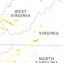


Connect with Interactive Hail Maps