

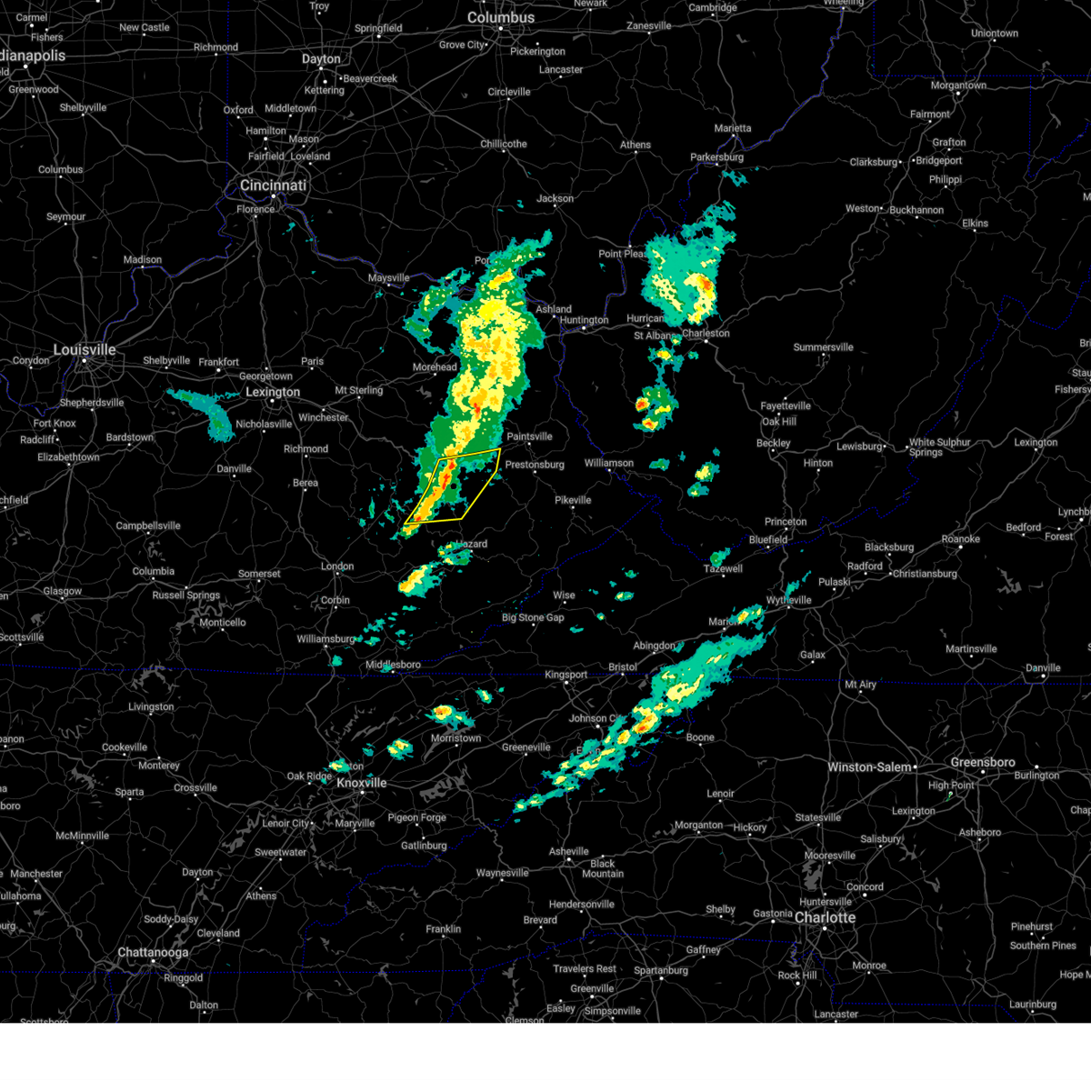
Hail Map for Salyersville, KY
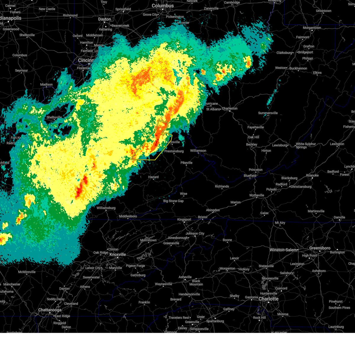
The Salyersville, KY area has had 15 reports of on-the-ground hail by trained spotters, and has been under severe weather warnings 50 times during the past 12 months. Doppler radar has detected hail at or near Salyersville, KY on 46 occasions, including 6 occasions during the past year.
| Name: | Salyersville, KY |
| Where Located: | 50.2 miles E of Irvine, KY |
| Map: | Google Map for Salyersville, KY |
| Population: | 1883 |
| Housing Units: | 857 |
| More Info: | Search Google for Salyersville, KY |
2
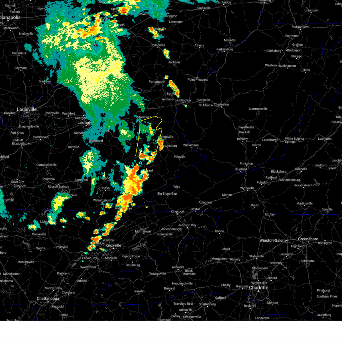
The Top Recent Hail Date for Salyersville, KY is Thursday, August 29, 2024 (6th out of 46)

Hail and Wind Damage Spotted near Salyersville, KY
| Date / Time | Report Details |
|---|---|
| 6/26/2025 3:41 PM EDT |
 The storm which prompted the warning has weakened below severe limits, and no longer poses an immediate threat to life or property. therefore, the warning will be allowed to expire. The storm which prompted the warning has weakened below severe limits, and no longer poses an immediate threat to life or property. therefore, the warning will be allowed to expire.
|
| 6/26/2025 3:31 PM EDT |
 At 331 pm edt, a severe thunderstorm was located over licksburg, or near salyersville, and is nearly stationary (radar indicated). Hazards include 60 mph wind gusts. Expect damage to roofs, siding, and trees. This severe storm will be near, salyersville around 335 pm edt. At 331 pm edt, a severe thunderstorm was located over licksburg, or near salyersville, and is nearly stationary (radar indicated). Hazards include 60 mph wind gusts. Expect damage to roofs, siding, and trees. This severe storm will be near, salyersville around 335 pm edt.
|
| 6/26/2025 3:21 PM EDT |
 Svrjkl the national weather service in jackson ky has issued a * severe thunderstorm warning for, northwestern magoffin county in southeastern kentucky, * until 345 pm edt. * at 321 pm edt, a severe thunderstorm was located over licksburg, or near salyersville, and is nearly stationary (radar indicated). Hazards include 60 mph wind gusts and penny size hail. Expect damage to roofs, siding, and trees. This severe thunderstorm will be near, salyersville around 325 pm edt. Svrjkl the national weather service in jackson ky has issued a * severe thunderstorm warning for, northwestern magoffin county in southeastern kentucky, * until 345 pm edt. * at 321 pm edt, a severe thunderstorm was located over licksburg, or near salyersville, and is nearly stationary (radar indicated). Hazards include 60 mph wind gusts and penny size hail. Expect damage to roofs, siding, and trees. This severe thunderstorm will be near, salyersville around 325 pm edt.
|
| 5/20/2025 10:46 PM EDT |
 the severe thunderstorm warning has been cancelled and is no longer in effect the severe thunderstorm warning has been cancelled and is no longer in effect
|
| 5/20/2025 10:46 PM EDT |
 At 1045 pm edt, severe thunderstorms were located along a line extending from moon to ballot to gapville to near elmrock, moving east at 55 mph (radar indicated). Hazards include 60 mph wind gusts. Expect damage to roofs, siding, and trees. Locations impacted include, paintsville, alvin, boldman, pikeville, warfield and oppy. At 1045 pm edt, severe thunderstorms were located along a line extending from moon to ballot to gapville to near elmrock, moving east at 55 mph (radar indicated). Hazards include 60 mph wind gusts. Expect damage to roofs, siding, and trees. Locations impacted include, paintsville, alvin, boldman, pikeville, warfield and oppy.
|
| 5/20/2025 10:35 PM EDT | A tree was blown down onto us 460 near the intersection with grape creek road. the event time is radar estimate in magoffin county KY, 5.6 miles ESE of Salyersville, KY |
| 5/20/2025 10:20 PM EDT | Svrjkl the national weather service in jackson ky has issued a * severe thunderstorm warning for, martin county in northeastern kentucky, morgan county in southeastern kentucky, johnson county in northeastern kentucky, northern perry county in southeastern kentucky, northern knott county in southeastern kentucky, floyd county in southeastern kentucky, breathitt county in southeastern kentucky, northwestern pike county in southeastern kentucky, magoffin county in southeastern kentucky, northeastern wolfe county in southeastern kentucky, * until 1115 pm edt. * at 1020 pm edt, severe thunderstorms were located along a line extending from pekin to lee city to haginsville to little, moving east at 45 mph (radar indicated). Hazards include 60 mph wind gusts. Expect damage to roofs, siding, and trees. severe thunderstorms will be near, west liberty around 1025 pm edt. salyersville around 1030 pm edt. mason around 1035 pm edt. crockett around 1040 pm edt. Other locations in the path of these severe thunderstorms include elna and paintsville. |
| 5/20/2025 4:43 PM EDT | The storms which prompted the warning have weakened below severe limits, and no longer pose an immediate threat to life or property. therefore, the warning will be allowed to expire. however, heavy rain is still possible with these thunderstorms. a tornado watch remains in effect until 800 pm edt for southeastern, northeastern and east central kentucky. to report severe weather, contact your nearest law enforcement agency. they will relay your report to the national weather service jackson ky. |
| 5/20/2025 4:32 PM EDT | At 431 pm edt, severe thunderstorms were located along a line extending from grayson lake state park to tella to tiptop, moving east at 25 mph (radar indicated). Hazards include 60 mph wind gusts and penny size hail. Expect damage to roofs, siding, and trees. Locations impacted include, salyersville, mason, haleburg, fredville, moon, oil springs, gifford, falcon, carver, logville, burning fork, and west royalton station. |
| 5/20/2025 4:21 PM EDT | At 420 pm edt, severe thunderstorms were located along a line extending from near stark to camp lewis, moving east at 30 mph (radar indicated). Hazards include 60 mph wind gusts and penny size hail. Expect damage to roofs, siding, and trees. Locations impacted include, salyersville, gapville, riceville, swamp branch and kerz. |
| 5/20/2025 4:21 PM EDT | the severe thunderstorm warning has been cancelled and is no longer in effect |
| 5/20/2025 4:00 PM EDT |
 Svrjkl the national weather service in jackson ky has issued a * severe thunderstorm warning for, morgan county in southeastern kentucky, western johnson county in northeastern kentucky, northwestern floyd county in southeastern kentucky, northeastern breathitt county in southeastern kentucky, magoffin county in southeastern kentucky, southeastern rowan county in east central kentucky, east central wolfe county in southeastern kentucky, elliott county in east central kentucky, * until 445 pm edt. * at 400 pm edt, severe thunderstorms were located along a line extending from vale to near keck, moving east at 30 mph (radar indicated). Hazards include 60 mph wind gusts and penny size hail. Expect damage to roofs, siding, and trees. severe thunderstorms will be near, west liberty around 405 pm edt. hendricks around 410 pm edt. salyersville around 415 pm edt. mason around 420 pm edt. Other locations in the path of these severe thunderstorms include elna and gapville. Svrjkl the national weather service in jackson ky has issued a * severe thunderstorm warning for, morgan county in southeastern kentucky, western johnson county in northeastern kentucky, northwestern floyd county in southeastern kentucky, northeastern breathitt county in southeastern kentucky, magoffin county in southeastern kentucky, southeastern rowan county in east central kentucky, east central wolfe county in southeastern kentucky, elliott county in east central kentucky, * until 445 pm edt. * at 400 pm edt, severe thunderstorms were located along a line extending from vale to near keck, moving east at 30 mph (radar indicated). Hazards include 60 mph wind gusts and penny size hail. Expect damage to roofs, siding, and trees. severe thunderstorms will be near, west liberty around 405 pm edt. hendricks around 410 pm edt. salyersville around 415 pm edt. mason around 420 pm edt. Other locations in the path of these severe thunderstorms include elna and gapville.
|
| 5/16/2025 11:26 PM EDT | The storms which prompted the warning have moved out of the area. therefore, the warning will be allowed to expire. however, gusty winds are still possible with these thunderstorms. a tornado watch remains in effect until 300 am edt for southeastern, northeastern and east central kentucky. to report severe weather, contact your nearest law enforcement agency. they will relay your report to the national weather service jackson ky. |
| 5/16/2025 11:12 PM EDT |
 the severe thunderstorm warning has been cancelled and is no longer in effect the severe thunderstorm warning has been cancelled and is no longer in effect
|
| 5/16/2025 11:12 PM EDT |
 At 1112 pm edt, severe thunderstorms were located along a line extending from near webbville to nippa to bradley, moving east at 65 mph (radar indicated). Hazards include 60 mph wind gusts and penny size hail. Expect damage to roofs, siding, and trees. Locations impacted include, paintsville and inez. At 1112 pm edt, severe thunderstorms were located along a line extending from near webbville to nippa to bradley, moving east at 65 mph (radar indicated). Hazards include 60 mph wind gusts and penny size hail. Expect damage to roofs, siding, and trees. Locations impacted include, paintsville and inez.
|
| 5/16/2025 10:54 PM EDT |
 The storms which prompted the warning have moved out of the area. therefore, the warning will be allowed to expire. a new warning was issued. a tornado watch remains in effect until 300 am edt for southeastern, northeastern and east central kentucky. The storms which prompted the warning have moved out of the area. therefore, the warning will be allowed to expire. a new warning was issued. a tornado watch remains in effect until 300 am edt for southeastern, northeastern and east central kentucky.
|
| 5/16/2025 10:54 PM EDT |
 Svrjkl the national weather service in jackson ky has issued a * severe thunderstorm warning for, northwestern martin county in northeastern kentucky, east central morgan county in southeastern kentucky, johnson county in northeastern kentucky, northwestern floyd county in southeastern kentucky, northeastern breathitt county in southeastern kentucky, magoffin county in southeastern kentucky, southeastern elliott county in east central kentucky, * until 1130 pm edt. * at 1053 pm edt, severe thunderstorms were located along a line extending from crockett to salyersville to haginsville, moving northeast at 65 mph (radar indicated). Hazards include 60 mph wind gusts and quarter size hail. Hail damage to vehicles is expected. expect wind damage to roofs, siding, and trees. severe thunderstorms will be near, paintsville around 1100 pm edt. perston estates around 1105 pm edt. buffalo around 1110 pm edt. Other locations in the path of these severe thunderstorms include tomahawk and prestonsburg. Svrjkl the national weather service in jackson ky has issued a * severe thunderstorm warning for, northwestern martin county in northeastern kentucky, east central morgan county in southeastern kentucky, johnson county in northeastern kentucky, northwestern floyd county in southeastern kentucky, northeastern breathitt county in southeastern kentucky, magoffin county in southeastern kentucky, southeastern elliott county in east central kentucky, * until 1130 pm edt. * at 1053 pm edt, severe thunderstorms were located along a line extending from crockett to salyersville to haginsville, moving northeast at 65 mph (radar indicated). Hazards include 60 mph wind gusts and quarter size hail. Hail damage to vehicles is expected. expect wind damage to roofs, siding, and trees. severe thunderstorms will be near, paintsville around 1100 pm edt. perston estates around 1105 pm edt. buffalo around 1110 pm edt. Other locations in the path of these severe thunderstorms include tomahawk and prestonsburg.
|
| 5/16/2025 10:40 PM EDT |
 At 1040 pm edt, severe thunderstorms were located along a line extending from licking river to shockey to canyon falls, moving east at 70 mph (radar indicated). Hazards include 70 mph wind gusts and quarter size hail. Hail damage to vehicles is expected. expect considerable tree damage. wind damage is also likely to mobile homes, roofs, and outbuildings. these severe storms will be near, west liberty around 1045 pm edt. Other locations in the path of these severe thunderstorms include salyersville and sikes. At 1040 pm edt, severe thunderstorms were located along a line extending from licking river to shockey to canyon falls, moving east at 70 mph (radar indicated). Hazards include 70 mph wind gusts and quarter size hail. Hail damage to vehicles is expected. expect considerable tree damage. wind damage is also likely to mobile homes, roofs, and outbuildings. these severe storms will be near, west liberty around 1045 pm edt. Other locations in the path of these severe thunderstorms include salyersville and sikes.
|
| 5/16/2025 10:25 PM EDT |
 Svrjkl the national weather service in jackson ky has issued a * severe thunderstorm warning for, eastern powell county in east central kentucky, morgan county in southeastern kentucky, southeastern estill county in east central kentucky, southern menifee county in east central kentucky, northwestern breathitt county in southeastern kentucky, magoffin county in southeastern kentucky, lee county in southeastern kentucky, wolfe county in southeastern kentucky, * until 1100 pm edt. * at 1025 pm edt, severe thunderstorms were located along a line extending from mariba to booth to near yellow rock, moving east at 70 mph (radar indicated). Hazards include 70 mph wind gusts and quarter size hail. Hail damage to vehicles is expected. expect considerable tree damage. wind damage is also likely to mobile homes, roofs, and outbuildings. severe thunderstorms will be near, beattyville around 1030 pm edt. west liberty around 1035 pm edt. jackson around 1040 pm edt. salyersville around 1045 pm edt. Other locations in the path of these severe thunderstorms include cyrus. Svrjkl the national weather service in jackson ky has issued a * severe thunderstorm warning for, eastern powell county in east central kentucky, morgan county in southeastern kentucky, southeastern estill county in east central kentucky, southern menifee county in east central kentucky, northwestern breathitt county in southeastern kentucky, magoffin county in southeastern kentucky, lee county in southeastern kentucky, wolfe county in southeastern kentucky, * until 1100 pm edt. * at 1025 pm edt, severe thunderstorms were located along a line extending from mariba to booth to near yellow rock, moving east at 70 mph (radar indicated). Hazards include 70 mph wind gusts and quarter size hail. Hail damage to vehicles is expected. expect considerable tree damage. wind damage is also likely to mobile homes, roofs, and outbuildings. severe thunderstorms will be near, beattyville around 1030 pm edt. west liberty around 1035 pm edt. jackson around 1040 pm edt. salyersville around 1045 pm edt. Other locations in the path of these severe thunderstorms include cyrus.
|
| 5/2/2025 7:08 PM EDT |
 Svrjkl the national weather service in jackson ky has issued a * severe thunderstorm warning for, northwestern martin county in northeastern kentucky, central morgan county in southeastern kentucky, johnson county in northeastern kentucky, northwestern floyd county in southeastern kentucky, northern magoffin county in southeastern kentucky, elliott county in east central kentucky, * until 745 pm edt. * at 708 pm edt, severe thunderstorms were located along a line extending from liberty road to plutarch to swamp branch, moving northeast at 35 mph (radar indicated). Hazards include 60 mph wind gusts and penny size hail. Expect damage to roofs, siding, and trees. severe thunderstorms will be near, win around 715 pm edt. stambaugh around 720 pm edt. sandy hook around 725 pm edt. Other locations in the path of these severe thunderstorms include culver. Svrjkl the national weather service in jackson ky has issued a * severe thunderstorm warning for, northwestern martin county in northeastern kentucky, central morgan county in southeastern kentucky, johnson county in northeastern kentucky, northwestern floyd county in southeastern kentucky, northern magoffin county in southeastern kentucky, elliott county in east central kentucky, * until 745 pm edt. * at 708 pm edt, severe thunderstorms were located along a line extending from liberty road to plutarch to swamp branch, moving northeast at 35 mph (radar indicated). Hazards include 60 mph wind gusts and penny size hail. Expect damage to roofs, siding, and trees. severe thunderstorms will be near, win around 715 pm edt. stambaugh around 720 pm edt. sandy hook around 725 pm edt. Other locations in the path of these severe thunderstorms include culver.
|
| 4/29/2025 9:09 PM EDT | A tree was reported to have been downed and blocking down and around road off of ky 30 and also south of exit 70 along the mountain parkway. the event time is radar est in magoffin county KY, 3.9 miles ENE of Salyersville, KY |
| 4/29/2025 8:42 PM EDT |
 At 842 pm edt, a severe thunderstorm was located over bethany, or 7 miles southeast of campton, moving east at 55 mph (radar indicated). Hazards include 70 mph wind gusts and penny size hail. Expect considerable tree damage. damage is likely to mobile homes, roofs, and outbuildings. this severe storm will be near, vancleve around 845 pm edt. mountain valley around 850 pm edt. eugene around 855 pm edt. Other locations in the path of this severe thunderstorm include fritz. At 842 pm edt, a severe thunderstorm was located over bethany, or 7 miles southeast of campton, moving east at 55 mph (radar indicated). Hazards include 70 mph wind gusts and penny size hail. Expect considerable tree damage. damage is likely to mobile homes, roofs, and outbuildings. this severe storm will be near, vancleve around 845 pm edt. mountain valley around 850 pm edt. eugene around 855 pm edt. Other locations in the path of this severe thunderstorm include fritz.
|
| 4/29/2025 8:37 PM EDT |
 Svrjkl the national weather service in jackson ky has issued a * severe thunderstorm warning for, northern breathitt county in southeastern kentucky, west central magoffin county in southeastern kentucky, northeastern lee county in southeastern kentucky, southern wolfe county in southeastern kentucky, * until 900 pm edt. * at 837 pm edt, a severe thunderstorm was located over flat, or near campton, moving east at 55 mph (radar indicated). Hazards include 60 mph wind gusts and penny size hail. Expect damage to roofs, siding, and trees. this severe thunderstorm will be near, vancleve around 840 pm edt. simpson around 845 pm edt. mountain valley around 850 pm edt. eugene around 855 pm edt. Other locations in the path of this severe thunderstorm include foraker. Svrjkl the national weather service in jackson ky has issued a * severe thunderstorm warning for, northern breathitt county in southeastern kentucky, west central magoffin county in southeastern kentucky, northeastern lee county in southeastern kentucky, southern wolfe county in southeastern kentucky, * until 900 pm edt. * at 837 pm edt, a severe thunderstorm was located over flat, or near campton, moving east at 55 mph (radar indicated). Hazards include 60 mph wind gusts and penny size hail. Expect damage to roofs, siding, and trees. this severe thunderstorm will be near, vancleve around 840 pm edt. simpson around 845 pm edt. mountain valley around 850 pm edt. eugene around 855 pm edt. Other locations in the path of this severe thunderstorm include foraker.
|
| 4/14/2025 7:57 PM EDT |
 The storm which prompted the warning has weakened below severe limits, and no longer poses an immediate threat to life or property. therefore, the warning will be allowed to expire. however, small hail and gusty winds are still possible with this thunderstorm. a severe thunderstorm watch remains in effect until 1100 pm edt for southeastern and northeastern kentucky. The storm which prompted the warning has weakened below severe limits, and no longer poses an immediate threat to life or property. therefore, the warning will be allowed to expire. however, small hail and gusty winds are still possible with this thunderstorm. a severe thunderstorm watch remains in effect until 1100 pm edt for southeastern and northeastern kentucky.
|
| 4/14/2025 7:49 PM EDT | Quarter sized hail reported 6.7 miles NE of Salyersville, KY, multiple social media videos of hail falling near stable branch road and ky-30. lots of smaller hail scattered on the ground... but there are also multiple quarter-size |
| 4/14/2025 7:46 PM EDT |
 the severe thunderstorm warning has been cancelled and is no longer in effect the severe thunderstorm warning has been cancelled and is no longer in effect
|
| 4/14/2025 7:46 PM EDT |
 At 746 pm edt, a severe thunderstorm was located over hendricks, or near salyersville, moving east at 55 mph (radar indicated). Hazards include 60 mph wind gusts and quarter size hail. Hail damage to vehicles is expected. expect wind damage to roofs, siding, and trees. Locations impacted include, lakesville and mashfork. At 746 pm edt, a severe thunderstorm was located over hendricks, or near salyersville, moving east at 55 mph (radar indicated). Hazards include 60 mph wind gusts and quarter size hail. Hail damage to vehicles is expected. expect wind damage to roofs, siding, and trees. Locations impacted include, lakesville and mashfork.
|
| 4/14/2025 7:24 PM EDT |
 Svrjkl the national weather service in jackson ky has issued a * severe thunderstorm warning for, southern morgan county in southeastern kentucky, northern breathitt county in southeastern kentucky, magoffin county in southeastern kentucky, northeastern lee county in southeastern kentucky, wolfe county in southeastern kentucky, * until 800 pm edt. * at 724 pm edt, a severe thunderstorm was located over mary, or near campton, moving east at 55 mph (radar indicated). Hazards include 60 mph wind gusts and quarter size hail. Hail damage to vehicles is expected. expect wind damage to roofs, siding, and trees. this severe thunderstorm will be near, rosefork around 730 pm edt. mountain valley around 735 pm edt. eugene around 740 pm edt. Other locations in the path of this severe thunderstorm include hendricks, carver and conley. Svrjkl the national weather service in jackson ky has issued a * severe thunderstorm warning for, southern morgan county in southeastern kentucky, northern breathitt county in southeastern kentucky, magoffin county in southeastern kentucky, northeastern lee county in southeastern kentucky, wolfe county in southeastern kentucky, * until 800 pm edt. * at 724 pm edt, a severe thunderstorm was located over mary, or near campton, moving east at 55 mph (radar indicated). Hazards include 60 mph wind gusts and quarter size hail. Hail damage to vehicles is expected. expect wind damage to roofs, siding, and trees. this severe thunderstorm will be near, rosefork around 730 pm edt. mountain valley around 735 pm edt. eugene around 740 pm edt. Other locations in the path of this severe thunderstorm include hendricks, carver and conley.
|
| 4/3/2025 5:12 AM EDT | The storm which prompted the warning has weakened below severe limits, and has exited the warned area. therefore, the warning will be allowed to expire. however, gusty winds and heavy rain are still possible with this thunderstorm. a tornado watch remains in effect until 700 am edt for southeastern and northeastern kentucky. to report severe weather, contact your nearest law enforcement agency. they will relay your report to the national weather service jackson ky. |
| 4/3/2025 4:47 AM EDT |
 The storms which prompted the warning have moved out of the area. therefore, the warning has been allowed to expire. however, gusty winds and heavy rain are still possible with these thunderstorms. a tornado watch remains in effect until 700 am edt for southeastern, northeastern and east central kentucky. to report severe weather, contact your nearest law enforcement agency. they will relay your report to the national weather service jackson ky. The storms which prompted the warning have moved out of the area. therefore, the warning has been allowed to expire. however, gusty winds and heavy rain are still possible with these thunderstorms. a tornado watch remains in effect until 700 am edt for southeastern, northeastern and east central kentucky. to report severe weather, contact your nearest law enforcement agency. they will relay your report to the national weather service jackson ky.
|
| 4/3/2025 4:46 AM EDT |
 Svrjkl the national weather service in jackson ky has issued a * severe thunderstorm warning for, martin county in northeastern kentucky, east central morgan county in southeastern kentucky, johnson county in northeastern kentucky, northeastern magoffin county in southeastern kentucky, * until 515 am edt. * at 446 am edt, a severe thunderstorm was located over galen, or near paintsville, moving east at 65 mph (radar indicated). Hazards include 60 mph wind gusts and quarter size hail. Hail damage to vehicles is expected. expect wind damage to roofs, siding, and trees. this severe thunderstorm will be near, whitehouse around 450 am edt. job around 455 am edt. Calf creek around 500 am edt. Svrjkl the national weather service in jackson ky has issued a * severe thunderstorm warning for, martin county in northeastern kentucky, east central morgan county in southeastern kentucky, johnson county in northeastern kentucky, northeastern magoffin county in southeastern kentucky, * until 515 am edt. * at 446 am edt, a severe thunderstorm was located over galen, or near paintsville, moving east at 65 mph (radar indicated). Hazards include 60 mph wind gusts and quarter size hail. Hail damage to vehicles is expected. expect wind damage to roofs, siding, and trees. this severe thunderstorm will be near, whitehouse around 450 am edt. job around 455 am edt. Calf creek around 500 am edt.
|
| 4/3/2025 4:35 AM EDT |
 At 434 am edt, severe thunderstorms were located along a line extending from near webbville to wheelersburg to rousseau, moving east at 65 mph (radar indicated). Hazards include 60 mph wind gusts and nickel size hail. Expect damage to roofs, siding, and trees. Locations impacted include, win and skaggs. At 434 am edt, severe thunderstorms were located along a line extending from near webbville to wheelersburg to rousseau, moving east at 65 mph (radar indicated). Hazards include 60 mph wind gusts and nickel size hail. Expect damage to roofs, siding, and trees. Locations impacted include, win and skaggs.
|
| 4/3/2025 4:35 AM EDT |
 the severe thunderstorm warning has been cancelled and is no longer in effect the severe thunderstorm warning has been cancelled and is no longer in effect
|
| 4/3/2025 4:12 AM EDT | Svrjkl the national weather service in jackson ky has issued a * severe thunderstorm warning for, morgan county in southeastern kentucky, northern owsley county in southeastern kentucky, northwestern johnson county in northeastern kentucky, southeastern menifee county in east central kentucky, northwestern breathitt county in southeastern kentucky, magoffin county in southeastern kentucky, eastern lee county in southeastern kentucky, southeastern rowan county in east central kentucky, wolfe county in southeastern kentucky, elliott county in east central kentucky, * until 445 am edt. * at 412 am edt, severe thunderstorms were located along a line extending from blairs mills to lexie to stay, moving east at 65 mph (radar indicated). Hazards include 60 mph wind gusts. Expect damage to roofs, siding, and trees. severe thunderstorms will be near, tallega around 415 am edt. harper around 420 am edt. mima around 425 am edt. win around 430 am edt. Other locations in the path of these severe thunderstorms include sip. |
| 3/31/2025 1:42 AM EDT |
 Svrjkl the national weather service in jackson ky has issued a * severe thunderstorm warning for, southwestern martin county in northeastern kentucky, southeastern johnson county in northeastern kentucky, northern knott county in southeastern kentucky, floyd county in southeastern kentucky, northeastern breathitt county in southeastern kentucky, northwestern pike county in southeastern kentucky, southeastern magoffin county in southeastern kentucky, * until 215 am edt. * at 141 am edt, severe thunderstorms were located along a line extending from conley to talcum, moving southeast at 65 mph (radar indicated). Hazards include 60 mph wind gusts. Expect damage to roofs, siding, and trees. severe thunderstorms will be near, dotson around 145 am edt. lancer around 150 am edt. alvin around 155 am edt. Mccombs around 200 am edt. Svrjkl the national weather service in jackson ky has issued a * severe thunderstorm warning for, southwestern martin county in northeastern kentucky, southeastern johnson county in northeastern kentucky, northern knott county in southeastern kentucky, floyd county in southeastern kentucky, northeastern breathitt county in southeastern kentucky, northwestern pike county in southeastern kentucky, southeastern magoffin county in southeastern kentucky, * until 215 am edt. * at 141 am edt, severe thunderstorms were located along a line extending from conley to talcum, moving southeast at 65 mph (radar indicated). Hazards include 60 mph wind gusts. Expect damage to roofs, siding, and trees. severe thunderstorms will be near, dotson around 145 am edt. lancer around 150 am edt. alvin around 155 am edt. Mccombs around 200 am edt.
|
| 3/31/2025 1:42 AM EDT |
 The storms which prompted the warning have moved out of the area. therefore, the warning will be allowed to expire. however, small hail and gusty winds are still possible with these thunderstorms. a severe thunderstorm watch remains in effect until 600 am edt for southeastern and northeastern kentucky. The storms which prompted the warning have moved out of the area. therefore, the warning will be allowed to expire. however, small hail and gusty winds are still possible with these thunderstorms. a severe thunderstorm watch remains in effect until 600 am edt for southeastern and northeastern kentucky.
|
| 3/31/2025 1:35 AM EDT |
 At 135 am edt, severe thunderstorms were located along a line extending from ophir to near foraker to noble, moving east at 30 mph (radar indicated). Hazards include 60 mph wind gusts and penny size hail. Expect damage to roofs, siding, and trees. these severe storms will be near, buck around 140 am edt. Other locations in the path of these severe thunderstorms include gapville. At 135 am edt, severe thunderstorms were located along a line extending from ophir to near foraker to noble, moving east at 30 mph (radar indicated). Hazards include 60 mph wind gusts and penny size hail. Expect damage to roofs, siding, and trees. these severe storms will be near, buck around 140 am edt. Other locations in the path of these severe thunderstorms include gapville.
|
| 3/31/2025 1:22 AM EDT |
 Svrjkl the national weather service in jackson ky has issued a * severe thunderstorm warning for, southeastern morgan county in southeastern kentucky, southwestern johnson county in northeastern kentucky, north central perry county in southeastern kentucky, northwestern knott county in southeastern kentucky, northwestern floyd county in southeastern kentucky, breathitt county in southeastern kentucky, magoffin county in southeastern kentucky, southeastern wolfe county in southeastern kentucky, * until 145 am edt. * at 122 am edt, severe thunderstorms were located along a line extending from bloomington to whick, moving east at 40 mph (radar indicated). Hazards include 60 mph wind gusts and penny size hail. Expect damage to roofs, siding, and trees. severe thunderstorms will be near, hendricks around 125 am edt. noble around 130 am edt. Buck around 135 am edt. Svrjkl the national weather service in jackson ky has issued a * severe thunderstorm warning for, southeastern morgan county in southeastern kentucky, southwestern johnson county in northeastern kentucky, north central perry county in southeastern kentucky, northwestern knott county in southeastern kentucky, northwestern floyd county in southeastern kentucky, breathitt county in southeastern kentucky, magoffin county in southeastern kentucky, southeastern wolfe county in southeastern kentucky, * until 145 am edt. * at 122 am edt, severe thunderstorms were located along a line extending from bloomington to whick, moving east at 40 mph (radar indicated). Hazards include 60 mph wind gusts and penny size hail. Expect damage to roofs, siding, and trees. severe thunderstorms will be near, hendricks around 125 am edt. noble around 130 am edt. Buck around 135 am edt.
|
| 12/31/2024 12:01 PM EST |
 the severe thunderstorm warning has been cancelled and is no longer in effect the severe thunderstorm warning has been cancelled and is no longer in effect
|
| 12/31/2024 11:53 AM EST |
 the severe thunderstorm warning has been cancelled and is no longer in effect the severe thunderstorm warning has been cancelled and is no longer in effect
|
| 12/31/2024 11:53 AM EST |
 At 1153 am est, severe thunderstorms were located along a line extending from gilmore to shockey to fivemile to chenowee to lucky fork, moving east at 45 mph (radar indicated). Hazards include 60 mph wind gusts and penny size hail. Expect damage to roofs, siding, and trees. Locations impacted include, jackson, salyersville, mason and falcon. At 1153 am est, severe thunderstorms were located along a line extending from gilmore to shockey to fivemile to chenowee to lucky fork, moving east at 45 mph (radar indicated). Hazards include 60 mph wind gusts and penny size hail. Expect damage to roofs, siding, and trees. Locations impacted include, jackson, salyersville, mason and falcon.
|
| 12/31/2024 11:36 AM EST |
 Svrjkl the national weather service in jackson ky has issued a * severe thunderstorm warning for, southern morgan county in southeastern kentucky, northern owsley county in southeastern kentucky, breathitt county in southeastern kentucky, west central magoffin county in southeastern kentucky, eastern lee county in southeastern kentucky, southern wolfe county in southeastern kentucky, * until 1215 pm est. * at 1136 am est, severe thunderstorms were located along a line extending from grannie to vada to near grass to booneville to blake, moving east at 50 mph (radar indicated). Hazards include 60 mph wind gusts and penny size hail. Expect damage to roofs, siding, and trees. severe thunderstorms will be near, booneville around 1140 am est. jackson around 1145 am est. mountain valley around 1150 am est. copland around 1155 am est. Other locations in the path of these severe thunderstorms include hendricks and salyersville. Svrjkl the national weather service in jackson ky has issued a * severe thunderstorm warning for, southern morgan county in southeastern kentucky, northern owsley county in southeastern kentucky, breathitt county in southeastern kentucky, west central magoffin county in southeastern kentucky, eastern lee county in southeastern kentucky, southern wolfe county in southeastern kentucky, * until 1215 pm est. * at 1136 am est, severe thunderstorms were located along a line extending from grannie to vada to near grass to booneville to blake, moving east at 50 mph (radar indicated). Hazards include 60 mph wind gusts and penny size hail. Expect damage to roofs, siding, and trees. severe thunderstorms will be near, booneville around 1140 am est. jackson around 1145 am est. mountain valley around 1150 am est. copland around 1155 am est. Other locations in the path of these severe thunderstorms include hendricks and salyersville.
|
| 8/1/2024 8:38 PM EDT |
 The storms which prompted the warning have weakened below severe limits, and have exited the warned area. therefore, the warning will be allowed to expire. a severe thunderstorm watch remains in effect until midnight edt for southeastern, northeastern and east central kentucky. The storms which prompted the warning have weakened below severe limits, and have exited the warned area. therefore, the warning will be allowed to expire. a severe thunderstorm watch remains in effect until midnight edt for southeastern, northeastern and east central kentucky.
|
| 8/1/2024 8:26 PM EDT |
 At 826 pm edt, severe thunderstorms were located along a line extending from near stark to elkfork to haginsville, moving east at 35 mph (radar indicated). Hazards include 60 mph wind gusts. Expect damage to roofs, siding, and trees. Locations impacted include, salyersville, mason, duco and ivyton. At 826 pm edt, severe thunderstorms were located along a line extending from near stark to elkfork to haginsville, moving east at 35 mph (radar indicated). Hazards include 60 mph wind gusts. Expect damage to roofs, siding, and trees. Locations impacted include, salyersville, mason, duco and ivyton.
|
| 8/1/2024 8:26 PM EDT |
 the severe thunderstorm warning has been cancelled and is no longer in effect the severe thunderstorm warning has been cancelled and is no longer in effect
|
| 8/1/2024 8:20 PM EDT | County dispatch reports tree blown down onto us-460 at the morgan/magoffin county line. event time estimate from rada in morgan county KY, 8.1 miles SE of Salyersville, KY |
| 8/1/2024 8:07 PM EDT |
 Svrjkl the national weather service in jackson ky has issued a * severe thunderstorm warning for, morgan county in southeastern kentucky, southeastern bath county in east central kentucky, northwestern johnson county in northeastern kentucky, eastern menifee county in east central kentucky, northern breathitt county in southeastern kentucky, magoffin county in southeastern kentucky, southeastern lee county in southeastern kentucky, east central fleming county in east central kentucky, rowan county in east central kentucky, wolfe county in southeastern kentucky, elliott county in east central kentucky, * until 845 pm edt. * at 807 pm edt, severe thunderstorms were located along a line extending from near waltz to dehart to athol, moving east at 35 mph (radar indicated). Hazards include 60 mph wind gusts. Expect damage to roofs, siding, and trees. severe thunderstorms will be near, west liberty around 810 pm edt. lewis around 815 pm edt. sandy hook around 820 pm edt. crockett around 825 pm edt. Other locations in the path of these severe thunderstorms include moon and hendricks. Svrjkl the national weather service in jackson ky has issued a * severe thunderstorm warning for, morgan county in southeastern kentucky, southeastern bath county in east central kentucky, northwestern johnson county in northeastern kentucky, eastern menifee county in east central kentucky, northern breathitt county in southeastern kentucky, magoffin county in southeastern kentucky, southeastern lee county in southeastern kentucky, east central fleming county in east central kentucky, rowan county in east central kentucky, wolfe county in southeastern kentucky, elliott county in east central kentucky, * until 845 pm edt. * at 807 pm edt, severe thunderstorms were located along a line extending from near waltz to dehart to athol, moving east at 35 mph (radar indicated). Hazards include 60 mph wind gusts. Expect damage to roofs, siding, and trees. severe thunderstorms will be near, west liberty around 810 pm edt. lewis around 815 pm edt. sandy hook around 820 pm edt. crockett around 825 pm edt. Other locations in the path of these severe thunderstorms include moon and hendricks.
|
| 7/5/2024 1:38 PM EDT |
 At 138 pm edt, severe thunderstorms were located along a line extending from mason to ivyton to dotson to near alphoretta to porter junction, moving east at 40 mph (radar indicated). Hazards include 60 mph wind gusts and penny size hail. Expect damage to roofs, siding, and trees. Locations impacted include, paintsville, prestonsburg, salyersville, mason, estill, martin, wayland, allen, fredville, oaklawn estates, hippo, and handshoe. At 138 pm edt, severe thunderstorms were located along a line extending from mason to ivyton to dotson to near alphoretta to porter junction, moving east at 40 mph (radar indicated). Hazards include 60 mph wind gusts and penny size hail. Expect damage to roofs, siding, and trees. Locations impacted include, paintsville, prestonsburg, salyersville, mason, estill, martin, wayland, allen, fredville, oaklawn estates, hippo, and handshoe.
|
| 7/5/2024 1:38 PM EDT |
 the severe thunderstorm warning has been cancelled and is no longer in effect the severe thunderstorm warning has been cancelled and is no longer in effect
|
| 7/5/2024 1:31 PM EDT |
 The storms which prompted the warning have moved out morgan, perry, and wolfe counties. therefore, the warning will be allowed to expire. a new downstream severe thunderstorm warning has been issued for portions of knott, breathitt, and magoffin counties. a severe thunderstorm watch remains in effect until 700 pm edt for southeastern and northeastern kentucky. remember, a severe thunderstorm warning still remains in effect for north central knott county, northeastern breathitt county and southern magoffin county until 215 pm edt. The storms which prompted the warning have moved out morgan, perry, and wolfe counties. therefore, the warning will be allowed to expire. a new downstream severe thunderstorm warning has been issued for portions of knott, breathitt, and magoffin counties. a severe thunderstorm watch remains in effect until 700 pm edt for southeastern and northeastern kentucky. remember, a severe thunderstorm warning still remains in effect for north central knott county, northeastern breathitt county and southern magoffin county until 215 pm edt.
|
| 7/5/2024 1:26 PM EDT |
 Svrjkl the national weather service in jackson ky has issued a * severe thunderstorm warning for, southwestern johnson county in northeastern kentucky, north central knott county in southeastern kentucky, floyd county in southeastern kentucky, northeastern breathitt county in southeastern kentucky, southern magoffin county in southeastern kentucky, * until 215 pm edt. * at 126 pm edt, severe thunderstorms were located along a line extending from cornelia to foraker to duco to gunlock to yellow mountain, moving east at 30 mph (radar indicated). Hazards include 60 mph wind gusts and penny size hail. Expect damage to roofs, siding, and trees. severe thunderstorms will be near, mason around 130 pm edt. salyersville around 135 pm edt. printer around 140 pm edt. prestonsburg around 145 pm edt. alvin around 150 pm edt. Denver around 155 pm edt. Svrjkl the national weather service in jackson ky has issued a * severe thunderstorm warning for, southwestern johnson county in northeastern kentucky, north central knott county in southeastern kentucky, floyd county in southeastern kentucky, northeastern breathitt county in southeastern kentucky, southern magoffin county in southeastern kentucky, * until 215 pm edt. * at 126 pm edt, severe thunderstorms were located along a line extending from cornelia to foraker to duco to gunlock to yellow mountain, moving east at 30 mph (radar indicated). Hazards include 60 mph wind gusts and penny size hail. Expect damage to roofs, siding, and trees. severe thunderstorms will be near, mason around 130 pm edt. salyersville around 135 pm edt. printer around 140 pm edt. prestonsburg around 145 pm edt. alvin around 150 pm edt. Denver around 155 pm edt.
|
| 7/5/2024 1:16 PM EDT |
 At 116 pm edt, severe thunderstorms were located along a line extending from taulbee to guage to daisydell to near buck, moving northeast at 40 mph (radar indicated). Hazards include 60 mph wind gusts. Expect damage to roofs, siding, and trees. these severe storms will be near, hendricks around 120 pm edt. Other locations in the path of these severe thunderstorms include salyersville, harper and cyrus. At 116 pm edt, severe thunderstorms were located along a line extending from taulbee to guage to daisydell to near buck, moving northeast at 40 mph (radar indicated). Hazards include 60 mph wind gusts. Expect damage to roofs, siding, and trees. these severe storms will be near, hendricks around 120 pm edt. Other locations in the path of these severe thunderstorms include salyersville, harper and cyrus.
|
| 7/5/2024 1:03 PM EDT |
 At 103 pm edt, severe thunderstorms were located along a line extending from paxton to hardshell to near dice, moving east at 35 mph (radar indicated). Hazards include 60 mph wind gusts. Expect damage to roofs, siding, and trees. Locations impacted include, jackson, salyersville, mason, simpson, lewis, buck, burkhart, vail, falcon, wonnie, burning fork, and noctor. At 103 pm edt, severe thunderstorms were located along a line extending from paxton to hardshell to near dice, moving east at 35 mph (radar indicated). Hazards include 60 mph wind gusts. Expect damage to roofs, siding, and trees. Locations impacted include, jackson, salyersville, mason, simpson, lewis, buck, burkhart, vail, falcon, wonnie, burning fork, and noctor.
|
| 7/5/2024 12:54 PM EDT |
 Svrjkl the national weather service in jackson ky has issued a * severe thunderstorm warning for, southeastern morgan county in southeastern kentucky, north central perry county in southeastern kentucky, northwestern knott county in southeastern kentucky, breathitt county in southeastern kentucky, magoffin county in southeastern kentucky, southeastern wolfe county in southeastern kentucky, * until 130 pm edt. * at 1253 pm edt, severe thunderstorms were located along a line extending from lane to little to krypton, moving northeast at 35 mph (radar indicated). Hazards include 60 mph wind gusts. expect damage to roofs, siding, and trees Svrjkl the national weather service in jackson ky has issued a * severe thunderstorm warning for, southeastern morgan county in southeastern kentucky, north central perry county in southeastern kentucky, northwestern knott county in southeastern kentucky, breathitt county in southeastern kentucky, magoffin county in southeastern kentucky, southeastern wolfe county in southeastern kentucky, * until 130 pm edt. * at 1253 pm edt, severe thunderstorms were located along a line extending from lane to little to krypton, moving northeast at 35 mph (radar indicated). Hazards include 60 mph wind gusts. expect damage to roofs, siding, and trees
|
| 6/26/2024 5:23 PM EDT |
 The storm which prompted the warning has weakened below severe limits, and no longer poses an immediate threat to life or property. therefore, the warning will be allowed to expire. however, gusty winds are still possible with this thunderstorm. a severe thunderstorm watch remains in effect until 1000 pm edt for southeastern and northeastern kentucky. The storm which prompted the warning has weakened below severe limits, and no longer poses an immediate threat to life or property. therefore, the warning will be allowed to expire. however, gusty winds are still possible with this thunderstorm. a severe thunderstorm watch remains in effect until 1000 pm edt for southeastern and northeastern kentucky.
|
| 6/26/2024 5:15 PM EDT |
 At 514 pm edt, a severe thunderstorm was located over gypsy, or 7 miles southeast of salyersville, moving east at 25 mph (radar indicated). Hazards include 60 mph wind gusts and penny size hail. Expect damage to roofs, siding, and trees. this severe storm will be near, dotson around 520 pm edt. Other locations in the path of this severe thunderstorm include blue river. At 514 pm edt, a severe thunderstorm was located over gypsy, or 7 miles southeast of salyersville, moving east at 25 mph (radar indicated). Hazards include 60 mph wind gusts and penny size hail. Expect damage to roofs, siding, and trees. this severe storm will be near, dotson around 520 pm edt. Other locations in the path of this severe thunderstorm include blue river.
|
| 6/26/2024 5:02 PM EDT |
 Svrjkl the national weather service in jackson ky has issued a * severe thunderstorm warning for, southwestern johnson county in northeastern kentucky, northwestern floyd county in southeastern kentucky, northeastern breathitt county in southeastern kentucky, central magoffin county in southeastern kentucky, * until 530 pm edt. * at 502 pm edt, a severe thunderstorm was located over carver station, or 7 miles south of salyersville, moving east at 25 mph (radar indicated). Hazards include 60 mph wind gusts and penny size hail. Expect damage to roofs, siding, and trees. this severe thunderstorm will be near, duco around 505 pm edt. gapville around 510 pm edt. ivyton around 515 pm edt. Other locations in the path of this severe thunderstorm include dotson. Svrjkl the national weather service in jackson ky has issued a * severe thunderstorm warning for, southwestern johnson county in northeastern kentucky, northwestern floyd county in southeastern kentucky, northeastern breathitt county in southeastern kentucky, central magoffin county in southeastern kentucky, * until 530 pm edt. * at 502 pm edt, a severe thunderstorm was located over carver station, or 7 miles south of salyersville, moving east at 25 mph (radar indicated). Hazards include 60 mph wind gusts and penny size hail. Expect damage to roofs, siding, and trees. this severe thunderstorm will be near, duco around 505 pm edt. gapville around 510 pm edt. ivyton around 515 pm edt. Other locations in the path of this severe thunderstorm include dotson.
|
| 5/27/2024 2:31 AM EDT |
 The storms which prompted the warning have weakened below severe limits, and no longer pose an immediate threat to life or property. therefore, the warning has been allowed to expire. however, small hail and gusty winds are still possible with these thunderstorms. a tornado watch remains in effect until 600 am edt for southeastern, northeastern and east central kentucky. The storms which prompted the warning have weakened below severe limits, and no longer pose an immediate threat to life or property. therefore, the warning has been allowed to expire. however, small hail and gusty winds are still possible with these thunderstorms. a tornado watch remains in effect until 600 am edt for southeastern, northeastern and east central kentucky.
|
| 5/27/2024 2:15 AM EDT |
 the severe thunderstorm warning has been cancelled and is no longer in effect the severe thunderstorm warning has been cancelled and is no longer in effect
|
| 5/27/2024 2:15 AM EDT |
 At 215 am edt, severe thunderstorms were located along a line extending from yocum to rosefork to curt, moving east at 55 mph (radar indicated). Hazards include 60 mph wind gusts. Expect damage to roofs, siding, and trees. Locations impacted include, west liberty, salyersville, isonville and gapville. At 215 am edt, severe thunderstorms were located along a line extending from yocum to rosefork to curt, moving east at 55 mph (radar indicated). Hazards include 60 mph wind gusts. Expect damage to roofs, siding, and trees. Locations impacted include, west liberty, salyersville, isonville and gapville.
|
| 5/27/2024 1:55 AM EDT |
 Svrjkl the national weather service in jackson ky has issued a * severe thunderstorm warning for, northern owsley county in southeastern kentucky, northeastern jackson county in southeastern kentucky, menifee county in east central kentucky, lee county in southeastern kentucky, southeastern rowan county in east central kentucky, wolfe county in southeastern kentucky, eastern powell county in east central kentucky, morgan county in southeastern kentucky, southeastern bath county in east central kentucky, southeastern estill county in east central kentucky, breathitt county in southeastern kentucky, magoffin county in southeastern kentucky, elliott county in east central kentucky, * until 230 am edt. * at 155 am edt, severe thunderstorms were located along a line extending from near rothwell to whisman to levi, moving east at 55 mph (radar indicated). Hazards include 60 mph wind gusts. Expect damage to roofs, siding, and trees. severe thunderstorms will be near, frenchburg around 200 am edt. jackson around 205 am edt. west liberty around 210 am edt. lewis around 215 am edt. Other locations in the path of these severe thunderstorms include steele and jeptha. Svrjkl the national weather service in jackson ky has issued a * severe thunderstorm warning for, northern owsley county in southeastern kentucky, northeastern jackson county in southeastern kentucky, menifee county in east central kentucky, lee county in southeastern kentucky, southeastern rowan county in east central kentucky, wolfe county in southeastern kentucky, eastern powell county in east central kentucky, morgan county in southeastern kentucky, southeastern bath county in east central kentucky, southeastern estill county in east central kentucky, breathitt county in southeastern kentucky, magoffin county in southeastern kentucky, elliott county in east central kentucky, * until 230 am edt. * at 155 am edt, severe thunderstorms were located along a line extending from near rothwell to whisman to levi, moving east at 55 mph (radar indicated). Hazards include 60 mph wind gusts. Expect damage to roofs, siding, and trees. severe thunderstorms will be near, frenchburg around 200 am edt. jackson around 205 am edt. west liberty around 210 am edt. lewis around 215 am edt. Other locations in the path of these severe thunderstorms include steele and jeptha.
|
| 5/26/2024 3:14 PM EDT |
 A severe thunderstorm watch remains in effect until 800 pm edt for southeastern kentucky. a severe thunderstorm watch also remains in effect until 900 pm edt for southeastern and northeastern kentucky. to report severe weather, contact your nearest law enforcement agency. they will relay your report to the national weather service jackson ky. A severe thunderstorm watch remains in effect until 800 pm edt for southeastern kentucky. a severe thunderstorm watch also remains in effect until 900 pm edt for southeastern and northeastern kentucky. to report severe weather, contact your nearest law enforcement agency. they will relay your report to the national weather service jackson ky.
|
| 5/26/2024 3:05 PM EDT | A tree was blown down along route 7/southeast licking river road south of salyersville. the event time is radar estimate in magoffin county KY, 5.2 miles NNW of Salyersville, KY |
| 5/26/2024 3:05 PM EDT |
 the severe thunderstorm warning has been cancelled and is no longer in effect the severe thunderstorm warning has been cancelled and is no longer in effect
|
| 5/26/2024 3:05 PM EDT |
 At 304 pm edt, severe thunderstorms were located along a line extending from hargis to carver station to soft shell to polly, moving east at 55 mph (radar indicated). Hazards include 70 mph wind gusts and nickel size hail. Expect considerable tree damage. damage is likely to mobile homes, roofs, and outbuildings. Locations impacted include, hazard, paintsville, prestonsburg, salyersville, hindman, mason, estill, bath, wheelwright, martin, pippa passes, and wayland. At 304 pm edt, severe thunderstorms were located along a line extending from hargis to carver station to soft shell to polly, moving east at 55 mph (radar indicated). Hazards include 70 mph wind gusts and nickel size hail. Expect considerable tree damage. damage is likely to mobile homes, roofs, and outbuildings. Locations impacted include, hazard, paintsville, prestonsburg, salyersville, hindman, mason, estill, bath, wheelwright, martin, pippa passes, and wayland.
|
| 5/26/2024 3:04 PM EDT | Trees were reported to have been blown down along mine fork road. the event time is radar estimate in magoffin county KY, 5 miles SW of Salyersville, KY |
| 5/26/2024 2:59 PM EDT | Trees were blown down along old lick creek road. the event time is radar estimate in magoffin county KY, 2.8 miles SSW of Salyersville, KY |
| 5/26/2024 2:58 PM EDT | A tree was blown down in the city of salyersville. the event time is radar estimate in magoffin county KY, 0.1 miles NW of Salyersville, KY |
| 5/26/2024 2:58 PM EDT |
 A severe thunderstorm watch remains in effect until 800 pm edt for southeastern and east central kentucky. a severe thunderstorm watch also remains in effect until 900 pm edt for southeastern and northeastern kentucky. to report severe weather, contact your nearest law enforcement agency. they will relay your report to the national weather service jackson ky. A severe thunderstorm watch remains in effect until 800 pm edt for southeastern and east central kentucky. a severe thunderstorm watch also remains in effect until 900 pm edt for southeastern and northeastern kentucky. to report severe weather, contact your nearest law enforcement agency. they will relay your report to the national weather service jackson ky.
|
| 5/26/2024 2:49 PM EDT | A tree was reported to have been blown down at the morgan/magoffin county line along us 460. the event time is radar estimate in magoffin county KY, 8.1 miles SE of Salyersville, KY |
| 5/26/2024 2:41 PM EDT |
 the severe thunderstorm warning has been cancelled and is no longer in effect the severe thunderstorm warning has been cancelled and is no longer in effect
|
| 5/26/2024 2:41 PM EDT |
 At 241 pm edt, severe thunderstorms were located along a line extending from holliday to keck to near krypton to daley, moving east at 55 mph (radar indicated). Hazards include 70 mph wind gusts and nickel size hail. Expect considerable tree damage. damage is likely to mobile homes, roofs, and outbuildings. Locations impacted include, hazard, mason, hindman, paintsville, estill and prestonsburg. At 241 pm edt, severe thunderstorms were located along a line extending from holliday to keck to near krypton to daley, moving east at 55 mph (radar indicated). Hazards include 70 mph wind gusts and nickel size hail. Expect considerable tree damage. damage is likely to mobile homes, roofs, and outbuildings. Locations impacted include, hazard, mason, hindman, paintsville, estill and prestonsburg.
|
| 5/26/2024 2:39 PM EDT |
 At 238 pm edt, severe thunderstorms were located along a line extending from near head of grassy to near sandy hook to matthew to burg, moving east at 35 mph (radar indicated). Hazards include 70 mph wind gusts and nickel size hail. Expect considerable tree damage. damage is likely to mobile homes, roofs, and outbuildings. Locations impacted include, salyersville, elna, conley, paintsville, perston estates and oaklawn estates. At 238 pm edt, severe thunderstorms were located along a line extending from near head of grassy to near sandy hook to matthew to burg, moving east at 35 mph (radar indicated). Hazards include 70 mph wind gusts and nickel size hail. Expect considerable tree damage. damage is likely to mobile homes, roofs, and outbuildings. Locations impacted include, salyersville, elna, conley, paintsville, perston estates and oaklawn estates.
|
| 5/26/2024 2:13 PM EDT |
 Svrjkl the national weather service in jackson ky has issued a * severe thunderstorm warning for, southwestern morgan county in southeastern kentucky, eastern owsley county in southeastern kentucky, southern johnson county in northeastern kentucky, northern leslie county in southeastern kentucky, perry county in southeastern kentucky, knott county in southeastern kentucky, floyd county in southeastern kentucky, breathitt county in southeastern kentucky, magoffin county in southeastern kentucky, eastern lee county in southeastern kentucky, wolfe county in southeastern kentucky, northeastern clay county in southeastern kentucky, * until 315 pm edt. * at 213 pm edt, severe thunderstorms were located along a line extending from stillwater to morris fork, moving east at 40 mph (radar indicated). Hazards include 70 mph wind gusts and nickel size hail. Expect considerable tree damage. damage is likely to mobile homes, roofs, and outbuildings. severe thunderstorms will be near, jackson around 220 pm edt. payton around 225 pm edt. caney around 230 pm edt. Other locations in the path of these severe thunderstorms include harper, salyersville and mason. Svrjkl the national weather service in jackson ky has issued a * severe thunderstorm warning for, southwestern morgan county in southeastern kentucky, eastern owsley county in southeastern kentucky, southern johnson county in northeastern kentucky, northern leslie county in southeastern kentucky, perry county in southeastern kentucky, knott county in southeastern kentucky, floyd county in southeastern kentucky, breathitt county in southeastern kentucky, magoffin county in southeastern kentucky, eastern lee county in southeastern kentucky, wolfe county in southeastern kentucky, northeastern clay county in southeastern kentucky, * until 315 pm edt. * at 213 pm edt, severe thunderstorms were located along a line extending from stillwater to morris fork, moving east at 40 mph (radar indicated). Hazards include 70 mph wind gusts and nickel size hail. Expect considerable tree damage. damage is likely to mobile homes, roofs, and outbuildings. severe thunderstorms will be near, jackson around 220 pm edt. payton around 225 pm edt. caney around 230 pm edt. Other locations in the path of these severe thunderstorms include harper, salyersville and mason.
|
| 5/26/2024 2:08 PM EDT |
 Svrjkl the national weather service in jackson ky has issued a * severe thunderstorm warning for, morgan county in southeastern kentucky, johnson county in northeastern kentucky, northern magoffin county in southeastern kentucky, rowan county in east central kentucky, northeastern wolfe county in southeastern kentucky, elliott county in east central kentucky, * until 300 pm edt. * at 208 pm edt, severe thunderstorms were located along a line extending from near waltz to maytown, moving east at 65 mph (radar indicated). Hazards include 70 mph wind gusts and nickel size hail. Expect considerable tree damage. damage is likely to mobile homes, roofs, and outbuildings. severe thunderstorms will be near, morehead around 215 pm edt. sandy hook around 220 pm edt. crockett around 225 pm edt. Other locations in the path of these severe thunderstorms include cyrus, paintsville and perston estates. Svrjkl the national weather service in jackson ky has issued a * severe thunderstorm warning for, morgan county in southeastern kentucky, johnson county in northeastern kentucky, northern magoffin county in southeastern kentucky, rowan county in east central kentucky, northeastern wolfe county in southeastern kentucky, elliott county in east central kentucky, * until 300 pm edt. * at 208 pm edt, severe thunderstorms were located along a line extending from near waltz to maytown, moving east at 65 mph (radar indicated). Hazards include 70 mph wind gusts and nickel size hail. Expect considerable tree damage. damage is likely to mobile homes, roofs, and outbuildings. severe thunderstorms will be near, morehead around 215 pm edt. sandy hook around 220 pm edt. crockett around 225 pm edt. Other locations in the path of these severe thunderstorms include cyrus, paintsville and perston estates.
|
| 4/11/2024 5:06 PM EDT |
 The storm which prompted the warning has moved out of the area. therefore, the warning will be allowed to expire. however, small hail and gusty winds are still possible with this thunderstorm. a tornado watch remains in effect until 900 pm edt for southeastern and northeastern kentucky. The storm which prompted the warning has moved out of the area. therefore, the warning will be allowed to expire. however, small hail and gusty winds are still possible with this thunderstorm. a tornado watch remains in effect until 900 pm edt for southeastern and northeastern kentucky.
|
| 4/11/2024 5:02 PM EDT |
 the severe thunderstorm warning has been cancelled and is no longer in effect the severe thunderstorm warning has been cancelled and is no longer in effect
|
| 4/11/2024 5:02 PM EDT |
 At 501 pm edt, a severe thunderstorm was located over perlie, or near salyersville, moving northeast at 35 mph (radar indicated). Hazards include 60 mph wind gusts and quarter size hail. Hail damage to vehicles is expected. expect wind damage to roofs, siding, and trees. This severe storm will be near, coon around 505 pm edt. At 501 pm edt, a severe thunderstorm was located over perlie, or near salyersville, moving northeast at 35 mph (radar indicated). Hazards include 60 mph wind gusts and quarter size hail. Hail damage to vehicles is expected. expect wind damage to roofs, siding, and trees. This severe storm will be near, coon around 505 pm edt.
|
| 4/11/2024 4:50 PM EDT |
 At 450 pm edt, a severe thunderstorm was located over lakesville, or over salyersville, moving northeast at 35 mph (radar indicated). Hazards include 60 mph wind gusts and quarter size hail. Hail damage to vehicles is expected. expect wind damage to roofs, siding, and trees. this severe storm will be near, salyersville around 455 pm edt. coon around 500 pm edt. Other locations in the path of this severe thunderstorm include niles. At 450 pm edt, a severe thunderstorm was located over lakesville, or over salyersville, moving northeast at 35 mph (radar indicated). Hazards include 60 mph wind gusts and quarter size hail. Hail damage to vehicles is expected. expect wind damage to roofs, siding, and trees. this severe storm will be near, salyersville around 455 pm edt. coon around 500 pm edt. Other locations in the path of this severe thunderstorm include niles.
|
| 4/11/2024 4:44 PM EDT |
 Svrjkl the national weather service in jackson ky has issued a * severe thunderstorm warning for, east central morgan county in southeastern kentucky, southwestern johnson county in northeastern kentucky, northeastern breathitt county in southeastern kentucky, magoffin county in southeastern kentucky, * until 515 pm edt. * at 444 pm edt, a severe thunderstorm was located over foraker, or near salyersville, moving northeast at 35 mph (radar indicated). Hazards include 60 mph wind gusts and quarter size hail. Hail damage to vehicles is expected. expect wind damage to roofs, siding, and trees. this severe thunderstorm will be near, salyersville around 450 pm edt. cyrus around 455 pm edt. coon around 500 pm edt. Other locations in the path of this severe thunderstorm include niles. Svrjkl the national weather service in jackson ky has issued a * severe thunderstorm warning for, east central morgan county in southeastern kentucky, southwestern johnson county in northeastern kentucky, northeastern breathitt county in southeastern kentucky, magoffin county in southeastern kentucky, * until 515 pm edt. * at 444 pm edt, a severe thunderstorm was located over foraker, or near salyersville, moving northeast at 35 mph (radar indicated). Hazards include 60 mph wind gusts and quarter size hail. Hail damage to vehicles is expected. expect wind damage to roofs, siding, and trees. this severe thunderstorm will be near, salyersville around 450 pm edt. cyrus around 455 pm edt. coon around 500 pm edt. Other locations in the path of this severe thunderstorm include niles.
|
| 4/2/2024 11:05 AM EDT |
 The storms which prompted the warning have moved out of the area. therefore, the warning has been allowed to expire. a tornado watch remains in effect until noon edt for southeastern kentucky. The storms which prompted the warning have moved out of the area. therefore, the warning has been allowed to expire. a tornado watch remains in effect until noon edt for southeastern kentucky.
|
| 4/2/2024 10:50 AM EDT |
 At 1049 am edt, severe thunderstorms were located along a line extending from chestnut to near carver, moving east at 50 mph (radar indicated). Hazards include 60 mph wind gusts. Expect damage to roofs, siding, and trees. these severe storms will be near, paintsville around 1050 am edt. Davella around 1055 am edt. At 1049 am edt, severe thunderstorms were located along a line extending from chestnut to near carver, moving east at 50 mph (radar indicated). Hazards include 60 mph wind gusts. Expect damage to roofs, siding, and trees. these severe storms will be near, paintsville around 1050 am edt. Davella around 1055 am edt.
|
| 4/2/2024 10:50 AM EDT |
 the severe thunderstorm warning has been cancelled and is no longer in effect the severe thunderstorm warning has been cancelled and is no longer in effect
|
| 4/2/2024 10:41 AM EDT |
 The storms which prompted the warning have moved out of the area. therefore, the warning will be allowed to expire. a tornado watch remains in effect until noon edt for southeastern and east central kentucky. to report severe weather, contact your nearest law enforcement agency. they will relay your report to the national weather service jackson ky. The storms which prompted the warning have moved out of the area. therefore, the warning will be allowed to expire. a tornado watch remains in effect until noon edt for southeastern and east central kentucky. to report severe weather, contact your nearest law enforcement agency. they will relay your report to the national weather service jackson ky.
|
| 4/2/2024 10:32 AM EDT |
 the severe thunderstorm warning has been cancelled and is no longer in effect the severe thunderstorm warning has been cancelled and is no longer in effect
|
| 4/2/2024 10:32 AM EDT |
 At 1031 am edt, severe thunderstorms were located along a line extending from barnrock to belknap, moving southeast at 45 mph (radar indicated). Hazards include 60 mph wind gusts. Expect damage to roofs, siding, and trees. Locations impacted include, simpson, lewis, haleburg, burkhart, moon, florress, lexie, bethanna, gifford, logville, wonnie, and kernie. At 1031 am edt, severe thunderstorms were located along a line extending from barnrock to belknap, moving southeast at 45 mph (radar indicated). Hazards include 60 mph wind gusts. Expect damage to roofs, siding, and trees. Locations impacted include, simpson, lewis, haleburg, burkhart, moon, florress, lexie, bethanna, gifford, logville, wonnie, and kernie.
|
| 4/2/2024 10:28 AM EDT |
 Svrjkl the national weather service in jackson ky has issued a * severe thunderstorm warning for, northwestern martin county in northeastern kentucky, southeastern morgan county in southeastern kentucky, johnson county in northeastern kentucky, northwestern floyd county in southeastern kentucky, northern magoffin county in southeastern kentucky, * until 1100 am edt. * at 1028 am edt, severe thunderstorms were located along a line extending from keaton to lee city, moving east at 50 mph (radar indicated). Hazards include 60 mph wind gusts. Expect damage to roofs, siding, and trees. severe thunderstorms will be near, salyersville around 1035 am edt. paintsville around 1040 am edt. perston estates around 1045 am edt. Tomahawk around 1050 am edt. Svrjkl the national weather service in jackson ky has issued a * severe thunderstorm warning for, northwestern martin county in northeastern kentucky, southeastern morgan county in southeastern kentucky, johnson county in northeastern kentucky, northwestern floyd county in southeastern kentucky, northern magoffin county in southeastern kentucky, * until 1100 am edt. * at 1028 am edt, severe thunderstorms were located along a line extending from keaton to lee city, moving east at 50 mph (radar indicated). Hazards include 60 mph wind gusts. Expect damage to roofs, siding, and trees. severe thunderstorms will be near, salyersville around 1035 am edt. paintsville around 1040 am edt. perston estates around 1045 am edt. Tomahawk around 1050 am edt.
|
| 4/2/2024 10:24 AM EDT |
 At 1023 am edt, severe thunderstorms were located along a line extending from rush to malaga, moving east at 70 mph (radar indicated). Hazards include 60 mph wind gusts. Expect damage to roofs, siding, and trees. Locations impacted include, lewis and hendricks. At 1023 am edt, severe thunderstorms were located along a line extending from rush to malaga, moving east at 70 mph (radar indicated). Hazards include 60 mph wind gusts. Expect damage to roofs, siding, and trees. Locations impacted include, lewis and hendricks.
|
| 4/2/2024 10:24 AM EDT |
 the severe thunderstorm warning has been cancelled and is no longer in effect the severe thunderstorm warning has been cancelled and is no longer in effect
|
| 4/2/2024 10:04 AM EDT |
 Svrjkl the national weather service in jackson ky has issued a * severe thunderstorm warning for, eastern powell county in east central kentucky, morgan county in southeastern kentucky, southeastern bath county in east central kentucky, east central estill county in east central kentucky, menifee county in east central kentucky, north central breathitt county in southeastern kentucky, northwestern magoffin county in southeastern kentucky, north central lee county in southeastern kentucky, southeastern rowan county in east central kentucky, wolfe county in southeastern kentucky, elliott county in east central kentucky, * until 1045 am edt. * at 1004 am edt, severe thunderstorms were located along a line extending from near olive hill to patsey, moving east at 75 mph (radar indicated). Hazards include 70 mph wind gusts. Expect considerable tree damage. damage is likely to mobile homes, roofs, and outbuildings. severe thunderstorms will be near, west liberty around 1010 am edt. simpson around 1015 am edt. harper around 1020 am edt. Hendricks around 1025 am edt. Svrjkl the national weather service in jackson ky has issued a * severe thunderstorm warning for, eastern powell county in east central kentucky, morgan county in southeastern kentucky, southeastern bath county in east central kentucky, east central estill county in east central kentucky, menifee county in east central kentucky, north central breathitt county in southeastern kentucky, northwestern magoffin county in southeastern kentucky, north central lee county in southeastern kentucky, southeastern rowan county in east central kentucky, wolfe county in southeastern kentucky, elliott county in east central kentucky, * until 1045 am edt. * at 1004 am edt, severe thunderstorms were located along a line extending from near olive hill to patsey, moving east at 75 mph (radar indicated). Hazards include 70 mph wind gusts. Expect considerable tree damage. damage is likely to mobile homes, roofs, and outbuildings. severe thunderstorms will be near, west liberty around 1010 am edt. simpson around 1015 am edt. harper around 1020 am edt. Hendricks around 1025 am edt.
|
| 3/6/2024 10:07 AM EST |
 Torjkl the national weather service in jackson ky has issued a * this is a test message. tornado warning for, montgomery county in east central kentucky, mccreary county in south central kentucky, rowan county in east central kentucky, morgan county in southeastern kentucky, bath county in east central kentucky, leslie county in southeastern kentucky, estill county in east central kentucky, pulaski county in south central kentucky, rockcastle county in south central kentucky, clay county in southeastern kentucky, elliott county in east central kentucky, wayne county in south central kentucky, harlan county in southeastern kentucky, knox county in southeastern kentucky, owsley county in southeastern kentucky, jackson county in southeastern kentucky, knott county in southeastern kentucky, floyd county in southeastern kentucky, whitley county in south central kentucky, menifee county in east central kentucky, lee county in southeastern kentucky, fleming county in east central kentucky, wolfe county in southeastern kentucky, powell county in east central kentucky, laurel county in south central kentucky, martin county in northeastern kentucky, bell county in southeastern kentucky, johnson county in northeastern kentucky, letcher county in southeastern kentucky, perry county in southeastern kentucky, breathitt county in southeastern kentucky, pike county in southeastern kentucky, magoffin county in southeastern kentucky, * this is a test message. until 1030 am est. * this is a test message. repeat, this is a test tornado warning message. there is no severe weather occuring at this time. this test warning message is part of the annual kentucky tornado drill. if this were an actual severe weather event, you would be given information about the hazard. the national weather service, kentucky emergency management angency, and the kentucky weather preparedness committee, encourges the use of this time to activate and review your severe weather safety plans. repeating, this has been a test tornado warning message for the 2024 kentucky tornado drill. this concludes the test. * this is a test message. Torjkl the national weather service in jackson ky has issued a * this is a test message. tornado warning for, montgomery county in east central kentucky, mccreary county in south central kentucky, rowan county in east central kentucky, morgan county in southeastern kentucky, bath county in east central kentucky, leslie county in southeastern kentucky, estill county in east central kentucky, pulaski county in south central kentucky, rockcastle county in south central kentucky, clay county in southeastern kentucky, elliott county in east central kentucky, wayne county in south central kentucky, harlan county in southeastern kentucky, knox county in southeastern kentucky, owsley county in southeastern kentucky, jackson county in southeastern kentucky, knott county in southeastern kentucky, floyd county in southeastern kentucky, whitley county in south central kentucky, menifee county in east central kentucky, lee county in southeastern kentucky, fleming county in east central kentucky, wolfe county in southeastern kentucky, powell county in east central kentucky, laurel county in south central kentucky, martin county in northeastern kentucky, bell county in southeastern kentucky, johnson county in northeastern kentucky, letcher county in southeastern kentucky, perry county in southeastern kentucky, breathitt county in southeastern kentucky, pike county in southeastern kentucky, magoffin county in southeastern kentucky, * this is a test message. until 1030 am est. * this is a test message. repeat, this is a test tornado warning message. there is no severe weather occuring at this time. this test warning message is part of the annual kentucky tornado drill. if this were an actual severe weather event, you would be given information about the hazard. the national weather service, kentucky emergency management angency, and the kentucky weather preparedness committee, encourges the use of this time to activate and review your severe weather safety plans. repeating, this has been a test tornado warning message for the 2024 kentucky tornado drill. this concludes the test. * this is a test message.
|
| 8/7/2023 3:19 PM EDT |
 At 318 pm edt, a severe thunderstorm was located over hendricks, or near salyersville, moving east at 45 mph (radar indicated). Hazards include 60 mph wind gusts and quarter size hail. Hail damage to vehicles is expected. expect wind damage to roofs, siding, and trees. this severe thunderstorm will be near, salyersville around 325 pm edt. ivyton around 330 pm edt. riceville around 335 pm edt. other locations in the path of this severe thunderstorm include leander and hagerhill. hail threat, radar indicated max hail size, 1. 00 in wind threat, radar indicated max wind gust, 60 mph. At 318 pm edt, a severe thunderstorm was located over hendricks, or near salyersville, moving east at 45 mph (radar indicated). Hazards include 60 mph wind gusts and quarter size hail. Hail damage to vehicles is expected. expect wind damage to roofs, siding, and trees. this severe thunderstorm will be near, salyersville around 325 pm edt. ivyton around 330 pm edt. riceville around 335 pm edt. other locations in the path of this severe thunderstorm include leander and hagerhill. hail threat, radar indicated max hail size, 1. 00 in wind threat, radar indicated max wind gust, 60 mph.
|
| 8/7/2023 1:55 PM EDT | Magoffin county dispatch reported a couple down trees near the 1640 block of johnson fork near salyersville. time estimated from rada in magoffin county KY, 8.3 miles E of Salyersville, KY |
| 8/7/2023 1:54 PM EDT | Trees down with one tree across state route 134. time estimated off of rada in magoffin county KY, 8.2 miles E of Salyersville, KY |
| 8/7/2023 1:51 PM EDT |
 At 151 pm edt, a severe thunderstorm was located over gifford, or near salyersville, moving east at 55 mph (radar indicated). Hazards include 60 mph wind gusts and quarter size hail. Hail damage to vehicles is expected. expect wind damage to roofs, siding, and trees. this severe thunderstorm will be near, salyersville around 155 pm edt. falcon around 200 pm edt. oil springs around 205 pm edt. staffordsville around 210 pm edt. Other locations in the path of this severe thunderstorm include paintsville and whitehouse. At 151 pm edt, a severe thunderstorm was located over gifford, or near salyersville, moving east at 55 mph (radar indicated). Hazards include 60 mph wind gusts and quarter size hail. Hail damage to vehicles is expected. expect wind damage to roofs, siding, and trees. this severe thunderstorm will be near, salyersville around 155 pm edt. falcon around 200 pm edt. oil springs around 205 pm edt. staffordsville around 210 pm edt. Other locations in the path of this severe thunderstorm include paintsville and whitehouse.
|
| 7/29/2023 8:21 AM EDT |
 The severe thunderstorm warning for southwestern morgan, southwestern johnson, northwestern floyd, northeastern breathitt, magoffin and northeastern wolfe counties will expire at 830 am edt, the storm which prompted the warning has weakened below severe limits, and no longer poses an immediate threat to life or property. therefore, the warning will be allowed to expire. however heavy rain is still possible with this thunderstorm. The severe thunderstorm warning for southwestern morgan, southwestern johnson, northwestern floyd, northeastern breathitt, magoffin and northeastern wolfe counties will expire at 830 am edt, the storm which prompted the warning has weakened below severe limits, and no longer poses an immediate threat to life or property. therefore, the warning will be allowed to expire. however heavy rain is still possible with this thunderstorm.
|
| 7/29/2023 8:14 AM EDT |
 At 813 am edt, a severe thunderstorm was located over ova, or near salyersville, moving east at 45 mph (radar indicated). Hazards include 60 mph wind gusts. Expect damage to roofs, siding, and trees. this severe storm will be near, mason around 820 am edt. other locations in the path of this severe thunderstorm include royalton, gypsy and brainard. hail threat, radar indicated max hail size, <. 75 in wind threat, radar indicated max wind gust, 60 mph. At 813 am edt, a severe thunderstorm was located over ova, or near salyersville, moving east at 45 mph (radar indicated). Hazards include 60 mph wind gusts. Expect damage to roofs, siding, and trees. this severe storm will be near, mason around 820 am edt. other locations in the path of this severe thunderstorm include royalton, gypsy and brainard. hail threat, radar indicated max hail size, <. 75 in wind threat, radar indicated max wind gust, 60 mph.
|
| 7/29/2023 8:00 AM EDT | At 800 am edt, a severe thunderstorm was located over helechawa, or 10 miles south of west liberty, moving east at 35 mph (radar indicated). Hazards include 60 mph wind gusts. Expect damage to roofs, siding, and trees. this severe thunderstorm will be near, burg around 805 am edt. epson around 810 am edt. ova around 815 am edt. hendricks around 820 am edt. other locations in the path of this severe thunderstorm include mason and marshallville. hail threat, radar indicated max hail size, <. 75 in wind threat, radar indicated max wind gust, 60 mph. |
| 7/18/2023 9:43 PM EDT |
 At 942 pm edt, a severe thunderstorm was located over foraker, or 9 miles southwest of salyersville, moving east at 50 mph (radar indicated). Hazards include 60 mph wind gusts. Expect damage to roofs, siding, and trees. locations impacted include, carver and gapville. hail threat, radar indicated max hail size, <. 75 in wind threat, radar indicated max wind gust, 60 mph. At 942 pm edt, a severe thunderstorm was located over foraker, or 9 miles southwest of salyersville, moving east at 50 mph (radar indicated). Hazards include 60 mph wind gusts. Expect damage to roofs, siding, and trees. locations impacted include, carver and gapville. hail threat, radar indicated max hail size, <. 75 in wind threat, radar indicated max wind gust, 60 mph.
|
| 7/18/2023 9:26 PM EDT |
 At 926 pm edt, a severe thunderstorm was located over fivemile, or over jackson, moving east at 50 mph (radar indicated). Hazards include 60 mph wind gusts. Expect damage to roofs, siding, and trees. this severe thunderstorm will be near, noctor around 930 pm edt. stevenson around 935 pm edt. cornelia around 940 pm edt. foraker around 945 pm edt. other locations in the path of this severe thunderstorm include mason and marshallville. hail threat, radar indicated max hail size, <. 75 in wind threat, radar indicated max wind gust, 60 mph. At 926 pm edt, a severe thunderstorm was located over fivemile, or over jackson, moving east at 50 mph (radar indicated). Hazards include 60 mph wind gusts. Expect damage to roofs, siding, and trees. this severe thunderstorm will be near, noctor around 930 pm edt. stevenson around 935 pm edt. cornelia around 940 pm edt. foraker around 945 pm edt. other locations in the path of this severe thunderstorm include mason and marshallville. hail threat, radar indicated max hail size, <. 75 in wind threat, radar indicated max wind gust, 60 mph.
|
| 7/18/2023 5:21 PM EDT |
 At 520 pm edt, a severe thunderstorm was located over gapville, or 9 miles southeast of salyersville, moving east at 40 mph (observed). Hazards include 60 mph wind gusts. expect damage to roofs, siding, and trees At 520 pm edt, a severe thunderstorm was located over gapville, or 9 miles southeast of salyersville, moving east at 40 mph (observed). Hazards include 60 mph wind gusts. expect damage to roofs, siding, and trees
|
| 7/18/2023 5:13 PM EDT | Tree down along se licking river rd and higgins branch r in magoffin county KY, 6.2 miles NNW of Salyersville, KY |
| 7/18/2023 5:10 PM EDT |
 At 509 pm edt, a severe thunderstorm was located over carver, or near salyersville, moving east at 40 mph (observed). Hazards include 70 mph wind gusts. Expect considerable tree damage. damage is likely to mobile homes, roofs, and outbuildings. this severe storm will be near, marshallville around 515 pm edt. gypsy around 520 pm edt. thunderstorm damage threat, considerable hail threat, radar indicated max hail size, <. 75 in wind threat, observed max wind gust, 70 mph. At 509 pm edt, a severe thunderstorm was located over carver, or near salyersville, moving east at 40 mph (observed). Hazards include 70 mph wind gusts. Expect considerable tree damage. damage is likely to mobile homes, roofs, and outbuildings. this severe storm will be near, marshallville around 515 pm edt. gypsy around 520 pm edt. thunderstorm damage threat, considerable hail threat, radar indicated max hail size, <. 75 in wind threat, observed max wind gust, 70 mph.
|
| 7/18/2023 4:48 PM EDT |
 At 447 pm edt, a severe thunderstorm was located over keck, or near jackson, moving east at 45 mph (radar indicated). Hazards include 70 mph wind gusts. Expect considerable tree damage. damage is likely to mobile homes, roofs, and outbuildings. this severe thunderstorm will be near, bays around 455 pm edt. cornelia around 500 pm edt. foraker around 505 pm edt. other locations in the path of this severe thunderstorm include mason and marshallville. thunderstorm damage threat, considerable hail threat, radar indicated max hail size, <. 75 in wind threat, radar indicated max wind gust, 70 mph. At 447 pm edt, a severe thunderstorm was located over keck, or near jackson, moving east at 45 mph (radar indicated). Hazards include 70 mph wind gusts. Expect considerable tree damage. damage is likely to mobile homes, roofs, and outbuildings. this severe thunderstorm will be near, bays around 455 pm edt. cornelia around 500 pm edt. foraker around 505 pm edt. other locations in the path of this severe thunderstorm include mason and marshallville. thunderstorm damage threat, considerable hail threat, radar indicated max hail size, <. 75 in wind threat, radar indicated max wind gust, 70 mph.
|
| 7/2/2023 6:45 PM EDT |
 At 644 pm edt, severe thunderstorms were located along a line extending from martha to whitehouse to lancer to blue river to carver, moving east at 55 mph (radar indicated). Hazards include 60 mph wind gusts. Expect damage to roofs, siding, and trees. locations impacted include, paintsville, prestonsburg, salyersville, mason, allen, burkhart, moon, oaklawn estates, lancer, falcon, whitehouse and wonnie. hail threat, radar indicated max hail size, <. 75 in wind threat, radar indicated max wind gust, 60 mph. At 644 pm edt, severe thunderstorms were located along a line extending from martha to whitehouse to lancer to blue river to carver, moving east at 55 mph (radar indicated). Hazards include 60 mph wind gusts. Expect damage to roofs, siding, and trees. locations impacted include, paintsville, prestonsburg, salyersville, mason, allen, burkhart, moon, oaklawn estates, lancer, falcon, whitehouse and wonnie. hail threat, radar indicated max hail size, <. 75 in wind threat, radar indicated max wind gust, 60 mph.
|
| 7/2/2023 6:28 PM EDT |
 At 627 pm edt, severe thunderstorms were located along a line extending from near crockett to mima to burning fork to guage to quicksand, moving east at 40 mph (radar indicated). Hazards include 60 mph wind gusts and penny size hail. Expect damage to roofs, siding, and trees. locations impacted include, riceville, dobson, waldo, paintsville and hueysville. hail threat, radar indicated max hail size, 0. 75 in wind threat, radar indicated max wind gust, 60 mph. At 627 pm edt, severe thunderstorms were located along a line extending from near crockett to mima to burning fork to guage to quicksand, moving east at 40 mph (radar indicated). Hazards include 60 mph wind gusts and penny size hail. Expect damage to roofs, siding, and trees. locations impacted include, riceville, dobson, waldo, paintsville and hueysville. hail threat, radar indicated max hail size, 0. 75 in wind threat, radar indicated max wind gust, 60 mph.
|
| 7/2/2023 6:20 PM EDT | 911 call center had a report of a tree down at the end of gifford rd at 460 n. time estimated by rada in magoffin county KY, 3.3 miles ESE of Salyersville, KY |
| 7/2/2023 6:11 PM EDT |
 At 610 pm edt, severe thunderstorms were located along a line extending from near blairs mills to lenox to lykins to moct to oakdale, moving east at 40 mph (radar indicated). Hazards include 60 mph wind gusts and nickel size hail. Expect damage to roofs, siding, and trees. severe thunderstorms will be near, elamton around 615 pm edt. jackson around 620 pm edt. mason around 625 pm edt. press around 630 pm edt. other locations in the path of these severe thunderstorms include keaton and waldo. hail threat, radar indicated max hail size, 0. 88 in wind threat, radar indicated max wind gust, 60 mph. At 610 pm edt, severe thunderstorms were located along a line extending from near blairs mills to lenox to lykins to moct to oakdale, moving east at 40 mph (radar indicated). Hazards include 60 mph wind gusts and nickel size hail. Expect damage to roofs, siding, and trees. severe thunderstorms will be near, elamton around 615 pm edt. jackson around 620 pm edt. mason around 625 pm edt. press around 630 pm edt. other locations in the path of these severe thunderstorms include keaton and waldo. hail threat, radar indicated max hail size, 0. 88 in wind threat, radar indicated max wind gust, 60 mph.
|
| 5/16/2023 4:53 PM EDT |
 At 453 pm edt, a severe thunderstorm was located over bradley, or near salyersville, moving east at 30 mph (radar indicated). Hazards include 60 mph wind gusts and quarter size hail. Hail damage to vehicles is expected. expect wind damage to roofs, siding, and trees. this severe storm will be near, riceville around 500 pm edt. Swamp branch around 505 pm edt. At 453 pm edt, a severe thunderstorm was located over bradley, or near salyersville, moving east at 30 mph (radar indicated). Hazards include 60 mph wind gusts and quarter size hail. Hail damage to vehicles is expected. expect wind damage to roofs, siding, and trees. this severe storm will be near, riceville around 500 pm edt. Swamp branch around 505 pm edt.
|
| 5/16/2023 4:41 PM EDT |
 At 440 pm edt, a severe thunderstorm was located over gullett, or near salyersville, moving east at 35 mph (radar indicated). Hazards include 60 mph wind gusts and quarter size hail. Hail damage to vehicles is expected. expect wind damage to roofs, siding, and trees. this severe storm will be near, salyersville around 445 pm edt. bradley around 450 pm edt. ivyton around 455 pm edt. Riceville around 500 pm edt. At 440 pm edt, a severe thunderstorm was located over gullett, or near salyersville, moving east at 35 mph (radar indicated). Hazards include 60 mph wind gusts and quarter size hail. Hail damage to vehicles is expected. expect wind damage to roofs, siding, and trees. this severe storm will be near, salyersville around 445 pm edt. bradley around 450 pm edt. ivyton around 455 pm edt. Riceville around 500 pm edt.
|
| 5/16/2023 4:27 PM EDT |
 At 427 pm edt, a severe thunderstorm was located over belknap, or 12 miles west of salyersville, moving east at 30 mph (radar indicated). Hazards include 60 mph wind gusts and quarter size hail. Hail damage to vehicles is expected. expect wind damage to roofs, siding, and trees. this severe thunderstorm will be near, epson around 435 pm edt. ova around 440 pm edt. gullett around 445 pm edt. lakesville around 450 pm edt. salyersville around 455 pm edt. Bradley around 500 pm edt. At 427 pm edt, a severe thunderstorm was located over belknap, or 12 miles west of salyersville, moving east at 30 mph (radar indicated). Hazards include 60 mph wind gusts and quarter size hail. Hail damage to vehicles is expected. expect wind damage to roofs, siding, and trees. this severe thunderstorm will be near, epson around 435 pm edt. ova around 440 pm edt. gullett around 445 pm edt. lakesville around 450 pm edt. salyersville around 455 pm edt. Bradley around 500 pm edt.
|
| 2/16/2023 5:40 PM EST |
 The severe thunderstorm warning for southern morgan, southeastern owsley, north central leslie, northwestern perry, breathitt, northwestern magoffin, southeastern wolfe and northeastern clay counties will expire at 545 pm est, the storms which prompted the warning have weakened below severe limits, and no longer pose an immediate threat to life or property. therefore, the warning will be allowed to expire. however heavy rain is still possible with these thunderstorms. The severe thunderstorm warning for southern morgan, southeastern owsley, north central leslie, northwestern perry, breathitt, northwestern magoffin, southeastern wolfe and northeastern clay counties will expire at 545 pm est, the storms which prompted the warning have weakened below severe limits, and no longer pose an immediate threat to life or property. therefore, the warning will be allowed to expire. however heavy rain is still possible with these thunderstorms.
|
| 2/16/2023 5:33 PM EST |
 At 533 pm est, severe thunderstorms were located along a line extending from paxton to near guerrant to valjean, moving east at 50 mph (radar indicated). Hazards include 60 mph wind gusts and penny size hail. Expect damage to roofs, siding, and trees. locations impacted include, simpson, press, fritz, daisydell and salyersville. hail threat, radar indicated max hail size, 0. 75 in wind threat, radar indicated max wind gust, 60 mph. At 533 pm est, severe thunderstorms were located along a line extending from paxton to near guerrant to valjean, moving east at 50 mph (radar indicated). Hazards include 60 mph wind gusts and penny size hail. Expect damage to roofs, siding, and trees. locations impacted include, simpson, press, fritz, daisydell and salyersville. hail threat, radar indicated max hail size, 0. 75 in wind threat, radar indicated max wind gust, 60 mph.
|
| 2/16/2023 5:13 PM EST |
 At 513 pm est, severe thunderstorms were located along a line extending from mount olive to scoville to sourwood, moving east at 50 mph (radar indicated). Hazards include 60 mph wind gusts and penny size hail. Expect damage to roofs, siding, and trees. severe thunderstorms will be near, fincastle around 520 pm est. flat around 525 pm est. hollonville around 530 pm est. other locations in the path of these severe thunderstorms include simpson, beech and dale. hail threat, radar indicated max hail size, 0. 75 in wind threat, radar indicated max wind gust, 60 mph. At 513 pm est, severe thunderstorms were located along a line extending from mount olive to scoville to sourwood, moving east at 50 mph (radar indicated). Hazards include 60 mph wind gusts and penny size hail. Expect damage to roofs, siding, and trees. severe thunderstorms will be near, fincastle around 520 pm est. flat around 525 pm est. hollonville around 530 pm est. other locations in the path of these severe thunderstorms include simpson, beech and dale. hail threat, radar indicated max hail size, 0. 75 in wind threat, radar indicated max wind gust, 60 mph.
|
| 10/12/2022 4:07 PM EDT |
 The severe thunderstorm warning for east central morgan, southwestern johnson and northern magoffin counties will expire at 415 pm edt, the storm which prompted the warning has moved out of the area. therefore, the warning will be allowed to expire. remember, a severe thunderstorm warning still remains in effect for portions of morgan, johnson and magoffin counties. The severe thunderstorm warning for east central morgan, southwestern johnson and northern magoffin counties will expire at 415 pm edt, the storm which prompted the warning has moved out of the area. therefore, the warning will be allowed to expire. remember, a severe thunderstorm warning still remains in effect for portions of morgan, johnson and magoffin counties.
|
| 10/12/2022 4:06 PM EDT |
 At 406 pm edt, a severe thunderstorm was located over hargis, or 8 miles northeast of salyersville, moving northeast at 35 mph (radar indicated). Hazards include 60 mph wind gusts and quarter size hail. Hail damage to vehicles is expected. expect wind damage to roofs, siding, and trees. this severe thunderstorm will be near, elna around 410 pm edt. kerz around 420 pm edt. Chandlerville around 425 pm edt. At 406 pm edt, a severe thunderstorm was located over hargis, or 8 miles northeast of salyersville, moving northeast at 35 mph (radar indicated). Hazards include 60 mph wind gusts and quarter size hail. Hail damage to vehicles is expected. expect wind damage to roofs, siding, and trees. this severe thunderstorm will be near, elna around 410 pm edt. kerz around 420 pm edt. Chandlerville around 425 pm edt.
|
| 10/12/2022 3:53 PM EDT |
 At 353 pm edt, a severe thunderstorm was located over licksburg, or near salyersville, moving northeast at 35 mph (radar indicated). Hazards include 60 mph wind gusts and quarter size hail. Hail damage to vehicles is expected. expect wind damage to roofs, siding, and trees. Locations impacted include, flat fork and minefork. At 353 pm edt, a severe thunderstorm was located over licksburg, or near salyersville, moving northeast at 35 mph (radar indicated). Hazards include 60 mph wind gusts and quarter size hail. Hail damage to vehicles is expected. expect wind damage to roofs, siding, and trees. Locations impacted include, flat fork and minefork.
|
| 10/12/2022 3:38 PM EDT |
 At 338 pm edt, a severe thunderstorm was located over netty, or 9 miles west of salyersville, moving northeast at 35 mph (radar indicated). Hazards include 60 mph wind gusts and quarter size hail. Hail damage to vehicles is expected. expect wind damage to roofs, siding, and trees. this severe thunderstorm will be near, patton around 345 pm edt. bloomington around 350 pm edt. plutarch around 355 pm edt. other locations in the path of this severe thunderstorm include ever and minefork. hail threat, radar indicated max hail size, 1. 00 in wind threat, radar indicated max wind gust, 60 mph. At 338 pm edt, a severe thunderstorm was located over netty, or 9 miles west of salyersville, moving northeast at 35 mph (radar indicated). Hazards include 60 mph wind gusts and quarter size hail. Hail damage to vehicles is expected. expect wind damage to roofs, siding, and trees. this severe thunderstorm will be near, patton around 345 pm edt. bloomington around 350 pm edt. plutarch around 355 pm edt. other locations in the path of this severe thunderstorm include ever and minefork. hail threat, radar indicated max hail size, 1. 00 in wind threat, radar indicated max wind gust, 60 mph.
|
| 7/23/2022 4:55 PM EDT |
 The severe thunderstorm warning for southern morgan and central magoffin counties will expire at 500 pm edt, the storm which prompted the warning has weakened below severe limits, and no longer poses an immediate threat to life or property. therefore, the warning will be allowed to expire. however gusty winds and heavy rain are still possible with this thunderstorm. The severe thunderstorm warning for southern morgan and central magoffin counties will expire at 500 pm edt, the storm which prompted the warning has weakened below severe limits, and no longer poses an immediate threat to life or property. therefore, the warning will be allowed to expire. however gusty winds and heavy rain are still possible with this thunderstorm.
|
| 7/23/2022 4:44 PM EDT |
 At 444 pm edt, a severe thunderstorm was located over kernie, or near salyersville, moving south at 10 mph (radar indicated). Hazards include 60 mph wind gusts and quarter size hail. Hail damage to vehicles is expected. expect wind damage to roofs, siding, and trees. this severe storm will be near, stella around 450 pm edt. ova around 455 pm edt. other locations in the path of this severe thunderstorm include seiltz, fritz and hendricks. hail threat, radar indicated max hail size, 1. 00 in wind threat, radar indicated max wind gust, 60 mph. At 444 pm edt, a severe thunderstorm was located over kernie, or near salyersville, moving south at 10 mph (radar indicated). Hazards include 60 mph wind gusts and quarter size hail. Hail damage to vehicles is expected. expect wind damage to roofs, siding, and trees. this severe storm will be near, stella around 450 pm edt. ova around 455 pm edt. other locations in the path of this severe thunderstorm include seiltz, fritz and hendricks. hail threat, radar indicated max hail size, 1. 00 in wind threat, radar indicated max wind gust, 60 mph.
|
| 7/23/2022 4:36 PM EDT |
 At 436 pm edt, a severe thunderstorm was located over bethanna, or near salyersville, moving south at 10 mph (radar indicated). Hazards include 60 mph wind gusts and quarter size hail. Hail damage to vehicles is expected. expect wind damage to roofs, siding, and trees. this severe thunderstorm will be near, kernie around 445 pm edt. stella around 450 pm edt. ova around 455 pm edt. other locations in the path of this severe thunderstorm include fritz. hail threat, radar indicated max hail size, 1. 00 in wind threat, radar indicated max wind gust, 60 mph. At 436 pm edt, a severe thunderstorm was located over bethanna, or near salyersville, moving south at 10 mph (radar indicated). Hazards include 60 mph wind gusts and quarter size hail. Hail damage to vehicles is expected. expect wind damage to roofs, siding, and trees. this severe thunderstorm will be near, kernie around 445 pm edt. stella around 450 pm edt. ova around 455 pm edt. other locations in the path of this severe thunderstorm include fritz. hail threat, radar indicated max hail size, 1. 00 in wind threat, radar indicated max wind gust, 60 mph.
|
| 7/5/2022 2:20 PM EDT |
 At 220 pm edt, severe thunderstorms were located along a line extending from near davisport to adele, moving southeast at 35 mph (radar indicated). Hazards include 60 mph wind gusts. expect damage to roofs, siding, and trees At 220 pm edt, severe thunderstorms were located along a line extending from near davisport to adele, moving southeast at 35 mph (radar indicated). Hazards include 60 mph wind gusts. expect damage to roofs, siding, and trees
|
| 6/22/2022 7:41 PM EDT |
 The severe thunderstorm warning for morgan, west central johnson, north central breathitt, magoffin and wolfe counties will expire at 745 pm edt, the storms which prompted the warning have weakened below severe limits, and no longer pose an immediate threat to life or property. therefore, the warning will be allowed to expire. a severe thunderstorm watch remains in effect until midnight edt for southeastern, northeastern and east central kentucky. The severe thunderstorm warning for morgan, west central johnson, north central breathitt, magoffin and wolfe counties will expire at 745 pm edt, the storms which prompted the warning have weakened below severe limits, and no longer pose an immediate threat to life or property. therefore, the warning will be allowed to expire. a severe thunderstorm watch remains in effect until midnight edt for southeastern, northeastern and east central kentucky.
|
| 6/22/2022 7:29 PM EDT |
 At 729 pm edt, severe thunderstorms were located along a line extending from dingus to gilmore, moving east at 40 mph (radar indicated). Hazards include 60 mph wind gusts. Expect damage to roofs, siding, and trees. these severe storms will be near, silverhill around 735 pm edt. win around 740 pm edt. other locations in the path of these severe thunderstorms include puncheon and foraker. hail threat, radar indicated max hail size, <. 75 in wind threat, radar indicated max wind gust, 60 mph. At 729 pm edt, severe thunderstorms were located along a line extending from dingus to gilmore, moving east at 40 mph (radar indicated). Hazards include 60 mph wind gusts. Expect damage to roofs, siding, and trees. these severe storms will be near, silverhill around 735 pm edt. win around 740 pm edt. other locations in the path of these severe thunderstorms include puncheon and foraker. hail threat, radar indicated max hail size, <. 75 in wind threat, radar indicated max wind gust, 60 mph.
|
| 6/22/2022 7:20 PM EDT |
 At 720 pm edt, severe thunderstorms were located along a line extending from lenox to trent, moving east at 40 mph (radar indicated). Hazards include 60 mph wind gusts. Expect damage to roofs, siding, and trees. severe thunderstorms will be near, elamton around 725 pm edt. silverhill around 730 pm edt. burkhart around 735 pm edt. dale around 740 pm edt. other locations in the path of these severe thunderstorms include eugene. hail threat, radar indicated max hail size, <. 75 in wind threat, radar indicated max wind gust, 60 mph. At 720 pm edt, severe thunderstorms were located along a line extending from lenox to trent, moving east at 40 mph (radar indicated). Hazards include 60 mph wind gusts. Expect damage to roofs, siding, and trees. severe thunderstorms will be near, elamton around 725 pm edt. silverhill around 730 pm edt. burkhart around 735 pm edt. dale around 740 pm edt. other locations in the path of these severe thunderstorms include eugene. hail threat, radar indicated max hail size, <. 75 in wind threat, radar indicated max wind gust, 60 mph.
|
| 6/17/2022 2:07 PM EDT |
 The severe thunderstorm warning for martin, johnson, north central perry, knott, floyd, central breathitt, northwestern pike and southeastern magoffin counties will expire at 215 pm edt, the storms which prompted the warning have moved out of the area. therefore, the warning will be allowed to expire. a severe thunderstorm watch remains in effect until 300 pm edt for southeastern and northeastern kentucky. remember, a severe thunderstorm warning still remains in effect for portions of letcher, floyd, martin and pike counties. The severe thunderstorm warning for martin, johnson, north central perry, knott, floyd, central breathitt, northwestern pike and southeastern magoffin counties will expire at 215 pm edt, the storms which prompted the warning have moved out of the area. therefore, the warning will be allowed to expire. a severe thunderstorm watch remains in effect until 300 pm edt for southeastern and northeastern kentucky. remember, a severe thunderstorm warning still remains in effect for portions of letcher, floyd, martin and pike counties.
|
| 6/17/2022 1:29 PM EDT |
 At 129 pm edt, severe thunderstorms were located along a line extending from near chandlerville to brainard to haddix, moving east at 35 mph (radar indicated). Hazards include 60 mph wind gusts and penny size hail. Expect damage to roofs, siding, and trees. severe thunderstorms will be near, dotson around 135 pm edt. dock around 140 pm edt. allen around 145 pm edt. other locations in the path of these severe thunderstorms include alvin, job and elmrock. hail threat, radar indicated max hail size, 0. 75 in wind threat, radar indicated max wind gust, 60 mph. At 129 pm edt, severe thunderstorms were located along a line extending from near chandlerville to brainard to haddix, moving east at 35 mph (radar indicated). Hazards include 60 mph wind gusts and penny size hail. Expect damage to roofs, siding, and trees. severe thunderstorms will be near, dotson around 135 pm edt. dock around 140 pm edt. allen around 145 pm edt. other locations in the path of these severe thunderstorms include alvin, job and elmrock. hail threat, radar indicated max hail size, 0. 75 in wind threat, radar indicated max wind gust, 60 mph.
|
| 6/17/2022 1:21 PM EDT | Trees were reported to have been blown down in the falcon communit in magoffin county KY, 4.3 miles SW of Salyersville, KY |
| 6/17/2022 1:21 PM EDT | Trees were reported to have been blown down near ky 7. the event time is radar estimate in magoffin county KY, 5.4 miles NNW of Salyersville, KY |
| 6/17/2022 1:16 PM EDT | Trees were reported to have been blown down in salyersville. the event time is radar estimate in magoffin county KY, 0.5 miles E of Salyersville, KY |
| 6/17/2022 1:13 PM EDT | Trees were reported to have been blown down. the event time is radar estimate in magoffin county KY, 6.4 miles SE of Salyersville, KY |
| 6/17/2022 1:12 PM EDT | Tree down on highway 30 near the magoffin and breathitt county line. time estimated from rada in magoffin county KY, 7.9 miles NE of Salyersville, KY |
| 6/17/2022 1:11 PM EDT | Trees were reported down in the grape creek area of magoffin county. the event time is radar estimate in magoffin county KY, 6.5 miles ESE of Salyersville, KY |
| 6/17/2022 1:08 PM EDT |
 At 108 pm edt, severe thunderstorms were located along a line extending from steele to portsmouth, moving southeast at 25 mph (radar indicated). Hazards include 60 mph wind gusts and penny size hail. Expect damage to roofs, siding, and trees. severe thunderstorms will be near, press around 115 pm edt. moon around 125 pm edt. other locations in the path of these severe thunderstorms include mima, buck, win and elmrock. hail threat, radar indicated max hail size, 0. 75 in wind threat, radar indicated max wind gust, 60 mph. At 108 pm edt, severe thunderstorms were located along a line extending from steele to portsmouth, moving southeast at 25 mph (radar indicated). Hazards include 60 mph wind gusts and penny size hail. Expect damage to roofs, siding, and trees. severe thunderstorms will be near, press around 115 pm edt. moon around 125 pm edt. other locations in the path of these severe thunderstorms include mima, buck, win and elmrock. hail threat, radar indicated max hail size, 0. 75 in wind threat, radar indicated max wind gust, 60 mph.
|
| 6/17/2022 1:03 PM EDT |
 At 103 pm edt, a severe thunderstorm was located over mashfork, or near salyersville, moving east at 30 mph (radar indicated). Hazards include 60 mph wind gusts and penny size hail. Expect damage to roofs, siding, and trees. this severe thunderstorm will be near, ballot around 110 pm edt. swamp branch around 115 pm edt. leander around 120 pm edt. other locations in the path of this severe thunderstorm include east point and prestonsburg. hail threat, radar indicated max hail size, 0. 75 in wind threat, radar indicated max wind gust, 60 mph. At 103 pm edt, a severe thunderstorm was located over mashfork, or near salyersville, moving east at 30 mph (radar indicated). Hazards include 60 mph wind gusts and penny size hail. Expect damage to roofs, siding, and trees. this severe thunderstorm will be near, ballot around 110 pm edt. swamp branch around 115 pm edt. leander around 120 pm edt. other locations in the path of this severe thunderstorm include east point and prestonsburg. hail threat, radar indicated max hail size, 0. 75 in wind threat, radar indicated max wind gust, 60 mph.
|
| 3/23/2022 3:51 PM EDT |
 The severe thunderstorm warning for central morgan, southwestern johnson, magoffin and east central wolfe counties will expire at 400 pm edt, the storm which prompted the warning has moved out of the area. therefore, the warning will be allowed to expire. a tornado watch remains in effect until 1000 pm edt for southeastern and northeastern kentucky. remember, a severe thunderstorm warning still remains in effect for portions of morgan county. The severe thunderstorm warning for central morgan, southwestern johnson, magoffin and east central wolfe counties will expire at 400 pm edt, the storm which prompted the warning has moved out of the area. therefore, the warning will be allowed to expire. a tornado watch remains in effect until 1000 pm edt for southeastern and northeastern kentucky. remember, a severe thunderstorm warning still remains in effect for portions of morgan county.
|
| 3/23/2022 3:41 PM EDT |
 At 341 pm edt, a severe thunderstorm was located over lacey, or 7 miles north of salyersville, moving northeast at 60 mph (radar indicated). Hazards include 60 mph wind gusts and quarter size hail. Hail damage to vehicles is expected. expect wind damage to roofs, siding, and trees. this severe thunderstorm will be near, elna around 345 pm edt. barnrock around 350 pm edt. Winifred around 355 pm edt. At 341 pm edt, a severe thunderstorm was located over lacey, or 7 miles north of salyersville, moving northeast at 60 mph (radar indicated). Hazards include 60 mph wind gusts and quarter size hail. Hail damage to vehicles is expected. expect wind damage to roofs, siding, and trees. this severe thunderstorm will be near, elna around 345 pm edt. barnrock around 350 pm edt. Winifred around 355 pm edt.
|
| 3/23/2022 3:33 PM EDT | Tree blown down on ky state route 3337 1.8 miles from ky state route 3 in magoffin county KY, 4 miles ENE of Salyersville, KY |
| 3/23/2022 3:31 PM EDT |
 At 331 pm edt, a severe thunderstorm was located over seiltz, or 8 miles southwest of salyersville, moving northeast at 45 mph (radar indicated). Hazards include ping pong ball size hail and 60 mph wind gusts. People and animals outdoors will be injured. expect hail damage to roofs, siding, windows, and vehicles. expect wind damage to roofs, siding, and trees. this severe storm will be near, stella around 335 pm edt. Other locations in the path of this severe thunderstorm include gifford, salyersville, flat fork and win. At 331 pm edt, a severe thunderstorm was located over seiltz, or 8 miles southwest of salyersville, moving northeast at 45 mph (radar indicated). Hazards include ping pong ball size hail and 60 mph wind gusts. People and animals outdoors will be injured. expect hail damage to roofs, siding, windows, and vehicles. expect wind damage to roofs, siding, and trees. this severe storm will be near, stella around 335 pm edt. Other locations in the path of this severe thunderstorm include gifford, salyersville, flat fork and win.
|
| 3/23/2022 3:18 PM EDT |
 At 317 pm edt, a severe thunderstorm was located over keck, or over jackson, moving northeast at 45 mph (radar indicated). Hazards include 60 mph wind gusts and quarter size hail. Hail damage to vehicles is expected. expect wind damage to roofs, siding, and trees. this severe thunderstorm will be near, mountain valley around 325 pm edt. dale around 330 pm edt. ova around 335 pm edt. Other locations in the path of this severe thunderstorm include gifford, salyersville and flat fork. At 317 pm edt, a severe thunderstorm was located over keck, or over jackson, moving northeast at 45 mph (radar indicated). Hazards include 60 mph wind gusts and quarter size hail. Hail damage to vehicles is expected. expect wind damage to roofs, siding, and trees. this severe thunderstorm will be near, mountain valley around 325 pm edt. dale around 330 pm edt. ova around 335 pm edt. Other locations in the path of this severe thunderstorm include gifford, salyersville and flat fork.
|
| 3/23/2022 2:42 PM EDT |
 At 241 pm edt, a severe thunderstorm was located over belknap, or 12 miles north of jackson, moving northeast at 45 mph (radar indicated). Hazards include 60 mph wind gusts and half dollar size hail. Hail damage to vehicles is expected. expect wind damage to roofs, siding, and trees. Locations impacted include, burg, lewis, williams and florress. At 241 pm edt, a severe thunderstorm was located over belknap, or 12 miles north of jackson, moving northeast at 45 mph (radar indicated). Hazards include 60 mph wind gusts and half dollar size hail. Hail damage to vehicles is expected. expect wind damage to roofs, siding, and trees. Locations impacted include, burg, lewis, williams and florress.
|
| 3/23/2022 2:22 PM EDT |
 At 221 pm edt, a severe thunderstorm was located over chenowee, or near jackson, moving northeast at 45 mph (radar indicated). Hazards include 60 mph wind gusts and half dollar size hail. Hail damage to vehicles is expected. expect wind damage to roofs, siding, and trees. this severe thunderstorm will be near, lawson around 225 pm edt. vancleve around 230 pm edt. simpson around 235 pm edt. rosefork around 240 pm edt. Other locations in the path of this severe thunderstorm include adele and lewis. At 221 pm edt, a severe thunderstorm was located over chenowee, or near jackson, moving northeast at 45 mph (radar indicated). Hazards include 60 mph wind gusts and half dollar size hail. Hail damage to vehicles is expected. expect wind damage to roofs, siding, and trees. this severe thunderstorm will be near, lawson around 225 pm edt. vancleve around 230 pm edt. simpson around 235 pm edt. rosefork around 240 pm edt. Other locations in the path of this severe thunderstorm include adele and lewis.
|
| 12/11/2021 7:57 AM EST | Trees were reported to have been blown down in the lick creek community. the time of the event is radar estimate in magoffin county KY, 2.9 miles SSE of Salyersville, KY |
| 12/11/2021 7:55 AM EST | Trees were reported to have been blown down in the middle fork of the licking river community. the time of the event is radar estimate in magoffin county KY, 3.8 miles E of Salyersville, KY |
| 7/11/2021 5:29 PM EDT |
 At 529 pm edt, a severe thunderstorm was located over conley station, or near salyersville, moving northeast at 45 mph (radar indicated). Hazards include 60 mph wind gusts. Expect damage to roofs, siding, and trees. this severe thunderstorm will be near, bradley around 535 pm edt. riceville around 540 pm edt. Leander around 545 pm edt. At 529 pm edt, a severe thunderstorm was located over conley station, or near salyersville, moving northeast at 45 mph (radar indicated). Hazards include 60 mph wind gusts. Expect damage to roofs, siding, and trees. this severe thunderstorm will be near, bradley around 535 pm edt. riceville around 540 pm edt. Leander around 545 pm edt.
|
| 7/10/2021 4:36 PM EDT |
 The severe thunderstorm warning for eastern morgan and northern magoffin counties will expire at 445 pm edt, the storm which prompted the warning has weakened below severe limits, and has exited the warned area. therefore, the warning will be allowed to expire. however gusty winds and heavy rain are still possible with this thunderstorm. The severe thunderstorm warning for eastern morgan and northern magoffin counties will expire at 445 pm edt, the storm which prompted the warning has weakened below severe limits, and has exited the warned area. therefore, the warning will be allowed to expire. however gusty winds and heavy rain are still possible with this thunderstorm.
|
| 7/10/2021 4:30 PM EDT |
 At 429 pm edt, a severe thunderstorm was located over licksburg, or over salyersville, moving east at 30 mph (radar indicated). Hazards include 60 mph wind gusts. Expect damage to roofs, siding, and trees. this severe storm will be near, mason around 435 pm edt. Other locations in the path of this severe thunderstorm include mashfork and conley. At 429 pm edt, a severe thunderstorm was located over licksburg, or over salyersville, moving east at 30 mph (radar indicated). Hazards include 60 mph wind gusts. Expect damage to roofs, siding, and trees. this severe storm will be near, mason around 435 pm edt. Other locations in the path of this severe thunderstorm include mashfork and conley.
|
| 7/10/2021 4:16 PM EDT |
 At 415 pm edt, a severe thunderstorm was located over matthew, or near west liberty, moving east at 30 mph (radar indicated). Hazards include 60 mph wind gusts and penny size hail. Expect damage to roofs, siding, and trees. this severe storm will be near, cisco around 420 pm edt. Other locations in the path of this severe thunderstorm include plutarch, flat fork and wheelersburg. At 415 pm edt, a severe thunderstorm was located over matthew, or near west liberty, moving east at 30 mph (radar indicated). Hazards include 60 mph wind gusts and penny size hail. Expect damage to roofs, siding, and trees. this severe storm will be near, cisco around 420 pm edt. Other locations in the path of this severe thunderstorm include plutarch, flat fork and wheelersburg.
|
| 7/10/2021 4:03 PM EDT |
 At 403 pm edt, a severe thunderstorm was located over panama, or near west liberty, moving east at 30 mph (radar indicated). Hazards include 60 mph wind gusts and quarter size hail. Hail damage to vehicles is expected. expect wind damage to roofs, siding, and trees. this severe thunderstorm will be near, white oak around 410 pm edt. williams around 415 pm edt. cisco around 420 pm edt. Other locations in the path of this severe thunderstorm include plutarch, coon and wheelersburg. At 403 pm edt, a severe thunderstorm was located over panama, or near west liberty, moving east at 30 mph (radar indicated). Hazards include 60 mph wind gusts and quarter size hail. Hail damage to vehicles is expected. expect wind damage to roofs, siding, and trees. this severe thunderstorm will be near, white oak around 410 pm edt. williams around 415 pm edt. cisco around 420 pm edt. Other locations in the path of this severe thunderstorm include plutarch, coon and wheelersburg.
|
| 6/19/2021 12:03 AM EDT |
 At 1202 am edt, a severe thunderstorm was located over ivyton, or near salyersville, moving southeast at 45 mph (radar indicated). Hazards include 60 mph wind gusts. Expect damage to roofs, siding, and trees. Locations impacted include, paintsville, salyersville, mason, oaklawn estates, fitz, oil springs, gifford, falcon, carver, whitehouse, burning fork and meally. At 1202 am edt, a severe thunderstorm was located over ivyton, or near salyersville, moving southeast at 45 mph (radar indicated). Hazards include 60 mph wind gusts. Expect damage to roofs, siding, and trees. Locations impacted include, paintsville, salyersville, mason, oaklawn estates, fitz, oil springs, gifford, falcon, carver, whitehouse, burning fork and meally.
|
| 6/18/2021 11:48 PM EDT |
 At 1147 pm edt, a severe thunderstorm was located over emma, or near salyersville, moving southeast at 45 mph (radar indicated). Hazards include 60 mph wind gusts. Expect damage to roofs, siding, and trees. Locations impacted include, mashfork, riceville and swamp branch. At 1147 pm edt, a severe thunderstorm was located over emma, or near salyersville, moving southeast at 45 mph (radar indicated). Hazards include 60 mph wind gusts. Expect damage to roofs, siding, and trees. Locations impacted include, mashfork, riceville and swamp branch.
|
| 6/18/2021 11:45 PM EDT | Large tree blown dow in magoffin county KY, 4 miles NW of Salyersville, KY |
| 6/18/2021 11:25 PM EDT |
 At 1125 pm edt, a severe thunderstorm was located over pomp, or near west liberty, moving southeast at 55 mph (radar indicated). Hazards include 60 mph wind gusts and penny size hail. Expect damage to roofs, siding, and trees. this severe thunderstorm will be near, lenox around 1130 pm edt. florress around 1135 pm edt. cisco around 1140 pm edt. perlie around 1145 pm edt. Other locations in the path of this severe thunderstorm include salyersville and ivyton. At 1125 pm edt, a severe thunderstorm was located over pomp, or near west liberty, moving southeast at 55 mph (radar indicated). Hazards include 60 mph wind gusts and penny size hail. Expect damage to roofs, siding, and trees. this severe thunderstorm will be near, lenox around 1130 pm edt. florress around 1135 pm edt. cisco around 1140 pm edt. perlie around 1145 pm edt. Other locations in the path of this severe thunderstorm include salyersville and ivyton.
|
| 4/8/2021 8:38 PM EDT |
 At 838 pm edt, a severe thunderstorm was located over ever, or near salyersville, moving northeast at 30 mph (radar indicated). Hazards include 60 mph wind gusts and quarter size hail. Hail damage to vehicles is expected. Expect wind damage to roofs, siding, and trees. At 838 pm edt, a severe thunderstorm was located over ever, or near salyersville, moving northeast at 30 mph (radar indicated). Hazards include 60 mph wind gusts and quarter size hail. Hail damage to vehicles is expected. Expect wind damage to roofs, siding, and trees.
|
| 7/20/2020 4:39 PM EDT |
 The severe thunderstorm warning for east central morgan, west central johnson and northeastern magoffin counties will expire at 445 pm edt, the storm which prompted the warning has weakened below severe limits, and has exited the warned area. therefore, the warning will be allowed to expire. The severe thunderstorm warning for east central morgan, west central johnson and northeastern magoffin counties will expire at 445 pm edt, the storm which prompted the warning has weakened below severe limits, and has exited the warned area. therefore, the warning will be allowed to expire.
|
| 7/20/2020 4:15 PM EDT |
 At 415 pm edt, a severe thunderstorm was located over logville, or 8 miles east of west liberty, moving east at 20 mph (radar indicated). Hazards include 60 mph wind gusts. Expect damage to roofs, siding, and trees. Locations impacted include, salyersville, malone, haleburg, brownlow, flat fork, florress, coon, falcon, logville, wonnie, hargis and cyrus. At 415 pm edt, a severe thunderstorm was located over logville, or 8 miles east of west liberty, moving east at 20 mph (radar indicated). Hazards include 60 mph wind gusts. Expect damage to roofs, siding, and trees. Locations impacted include, salyersville, malone, haleburg, brownlow, flat fork, florress, coon, falcon, logville, wonnie, hargis and cyrus.
|
| 7/20/2020 4:00 PM EDT |
 At 400 pm edt, a severe thunderstorm was located over cottle, or near west liberty, moving east at 20 mph (radar indicated). Hazards include 60 mph wind gusts. expect damage to roofs, siding, and trees At 400 pm edt, a severe thunderstorm was located over cottle, or near west liberty, moving east at 20 mph (radar indicated). Hazards include 60 mph wind gusts. expect damage to roofs, siding, and trees
|
| 7/12/2020 7:59 PM EDT | Trees blown down. time estimated from rada in magoffin county KY, 1.5 miles NNE of Salyersville, KY |
| 7/10/2020 1:27 PM EDT |
 The severe thunderstorm warning for northeastern owsley, breathitt, southwestern magoffin, southeastern lee and southeastern wolfe counties will expire at 130 pm edt, the storm which prompted the warning remains severe and new warning has been issued for parts of the wraned area. however, this storm has moved out of lee and owsley county. The severe thunderstorm warning for northeastern owsley, breathitt, southwestern magoffin, southeastern lee and southeastern wolfe counties will expire at 130 pm edt, the storm which prompted the warning remains severe and new warning has been issued for parts of the wraned area. however, this storm has moved out of lee and owsley county.
|
| 7/10/2020 1:06 PM EDT |
 At 106 pm edt, a severe thunderstorm was located over enoch, or near beattyville, moving east at 30 mph (radar indicated). Hazards include 60 mph wind gusts and penny size hail. expect damage to roofs, siding, and trees At 106 pm edt, a severe thunderstorm was located over enoch, or near beattyville, moving east at 30 mph (radar indicated). Hazards include 60 mph wind gusts and penny size hail. expect damage to roofs, siding, and trees
|
| 6/10/2020 8:31 PM EDT |
 At 831 pm edt, a severe thunderstorm was located over swamp branch, or 7 miles west of prestonsburg, moving east at 45 mph (radar indicated). Hazards include 60 mph wind gusts and penny size hail. Expect damage to roofs, siding, and trees. Locations impacted include, paintsville, prestonsburg, salyersville, mason, oaklawn estates, lancer, falcon, whitehouse, burning fork, collista, west van lear and west royalton station. At 831 pm edt, a severe thunderstorm was located over swamp branch, or 7 miles west of prestonsburg, moving east at 45 mph (radar indicated). Hazards include 60 mph wind gusts and penny size hail. Expect damage to roofs, siding, and trees. Locations impacted include, paintsville, prestonsburg, salyersville, mason, oaklawn estates, lancer, falcon, whitehouse, burning fork, collista, west van lear and west royalton station.
|
| 6/10/2020 8:17 PM EDT |
 At 817 pm edt, a severe thunderstorm was located over conley station, or near salyersville, moving east at 40 mph (radar indicated). Hazards include 60 mph wind gusts and penny size hail. expect damage to roofs, siding, and trees At 817 pm edt, a severe thunderstorm was located over conley station, or near salyersville, moving east at 40 mph (radar indicated). Hazards include 60 mph wind gusts and penny size hail. expect damage to roofs, siding, and trees
|
| 5/3/2020 7:55 PM EDT |
 The severe thunderstorm warning for southwestern martin, northwestern floyd and northeastern magoffin counties will expire at 800 pm edt, the storm which prompted the warning has weakened below severe limits, and has exited the warned area. therefore, the warning will be allowed to expire. however gusty winds and heavy rain are still possible with this thunderstorm. a severe thunderstorm watch remains in effect until 1100 pm edt for southeastern and northeastern kentucky. The severe thunderstorm warning for southwestern martin, northwestern floyd and northeastern magoffin counties will expire at 800 pm edt, the storm which prompted the warning has weakened below severe limits, and has exited the warned area. therefore, the warning will be allowed to expire. however gusty winds and heavy rain are still possible with this thunderstorm. a severe thunderstorm watch remains in effect until 1100 pm edt for southeastern and northeastern kentucky.
|
| 5/3/2020 7:35 PM EDT |
 At 734 pm edt, a severe thunderstorm was located over emma, or near salyersville, moving east at 30 mph (radar indicated). Hazards include 60 mph wind gusts and quarter size hail. Hail damage to vehicles is expected. expect wind damage to roofs, siding, and trees. Locations impacted include, paintsville, prestonsburg, salyersville, mason, warfield, oaklawn estates, davella, lancer, falcon, whitehouse, wonnie and burning fork. At 734 pm edt, a severe thunderstorm was located over emma, or near salyersville, moving east at 30 mph (radar indicated). Hazards include 60 mph wind gusts and quarter size hail. Hail damage to vehicles is expected. expect wind damage to roofs, siding, and trees. Locations impacted include, paintsville, prestonsburg, salyersville, mason, warfield, oaklawn estates, davella, lancer, falcon, whitehouse, wonnie and burning fork.
|
| 5/3/2020 7:14 PM EDT |
 At 714 pm edt, a severe thunderstorm was located over gordon ford, or over west liberty, moving east at 35 mph (radar indicated). Hazards include 60 mph wind gusts and quarter size hail. Hail damage to vehicles is expected. Expect wind damage to roofs, siding, and trees. At 714 pm edt, a severe thunderstorm was located over gordon ford, or over west liberty, moving east at 35 mph (radar indicated). Hazards include 60 mph wind gusts and quarter size hail. Hail damage to vehicles is expected. Expect wind damage to roofs, siding, and trees.
|
| 5/3/2020 6:51 PM EDT |
 At 651 pm edt, a severe thunderstorm was located over wellington, or 7 miles southeast of frenchburg, moving southeast at 40 mph (radar indicated). Hazards include 60 mph wind gusts and quarter size hail. Hail damage to vehicles is expected. Expect wind damage to roofs, siding, and trees. At 651 pm edt, a severe thunderstorm was located over wellington, or 7 miles southeast of frenchburg, moving southeast at 40 mph (radar indicated). Hazards include 60 mph wind gusts and quarter size hail. Hail damage to vehicles is expected. Expect wind damage to roofs, siding, and trees.
|
| 4/9/2020 12:55 AM EDT | Trees down and pea-sized hai in magoffin county KY, 0.9 miles NNE of Salyersville, KY |
| 4/8/2020 4:08 PM EDT |
 The severe thunderstorm warning for east central morgan, southwestern johnson and northeastern magoffin counties will expire at 415 pm edt, the storm which prompted the warning has weakened below severe limits, and has exited the warned area. therefore, the warning will be allowed to expire. a severe thunderstorm watch remains in effect until 800 pm edt for southeastern and northeastern kentucky. The severe thunderstorm warning for east central morgan, southwestern johnson and northeastern magoffin counties will expire at 415 pm edt, the storm which prompted the warning has weakened below severe limits, and has exited the warned area. therefore, the warning will be allowed to expire. a severe thunderstorm watch remains in effect until 800 pm edt for southeastern and northeastern kentucky.
|
| 4/8/2020 3:40 PM EDT |
 At 340 pm edt, a severe thunderstorm was located over logville, or 7 miles east of west liberty, moving southeast at 30 mph (radar indicated). Hazards include 60 mph wind gusts and half dollar size hail. Hail damage to vehicles is expected. Expect wind damage to roofs, siding, and trees. At 340 pm edt, a severe thunderstorm was located over logville, or 7 miles east of west liberty, moving southeast at 30 mph (radar indicated). Hazards include 60 mph wind gusts and half dollar size hail. Hail damage to vehicles is expected. Expect wind damage to roofs, siding, and trees.
|
| 12/29/2019 11:05 PM EST |
 At 1105 pm est, severe thunderstorms were located along a line extending from gullett to carver station to near vail, moving northeast at 55 mph (radar indicated). Hazards include 60 mph wind gusts. expect damage to roofs, siding, and trees At 1105 pm est, severe thunderstorms were located along a line extending from gullett to carver station to near vail, moving northeast at 55 mph (radar indicated). Hazards include 60 mph wind gusts. expect damage to roofs, siding, and trees
|
| 7/2/2019 5:50 PM EDT |
 The severe thunderstorm warning for east central morgan, western johnson and northeastern magoffin counties will expire at 600 pm edt, the storm which prompted the warning has weakened below severe limits, and no longer poses an immediate threat to life or property. therefore, the warning will be allowed to expire. however gusty winds are still possible with this thunderstorm. The severe thunderstorm warning for east central morgan, western johnson and northeastern magoffin counties will expire at 600 pm edt, the storm which prompted the warning has weakened below severe limits, and no longer poses an immediate threat to life or property. therefore, the warning will be allowed to expire. however gusty winds are still possible with this thunderstorm.
|
| 7/2/2019 5:45 PM EDT |
 At 545 pm edt, a severe thunderstorm was located over minefork, or 8 miles northeast of salyersville, moving east at 15 mph (radar indicated). Hazards include 60 mph wind gusts and penny size hail. Expect damage to roofs, siding, and trees. Locations impacted include, paintsville, salyersville, mason, haleburg, florress, fitz, oil springs, falcon, logville, wonnie, burning fork and collista. At 545 pm edt, a severe thunderstorm was located over minefork, or 8 miles northeast of salyersville, moving east at 15 mph (radar indicated). Hazards include 60 mph wind gusts and penny size hail. Expect damage to roofs, siding, and trees. Locations impacted include, paintsville, salyersville, mason, haleburg, florress, fitz, oil springs, falcon, logville, wonnie, burning fork and collista.
|
| 7/2/2019 5:28 PM EDT |
 At 527 pm edt, severe thunderstorms were located along a line extending from steele to dingus to brownlow to royalton, moving east at 15 mph (radar indicated). Hazards include 60 mph wind gusts and penny size hail. Expect damage to roofs, siding, and trees. Locations impacted include, paintsville, west liberty, salyersville, mason, moon, florress, lick branch, falcon, wonnie, burning fork, collista and west royalton station. At 527 pm edt, severe thunderstorms were located along a line extending from steele to dingus to brownlow to royalton, moving east at 15 mph (radar indicated). Hazards include 60 mph wind gusts and penny size hail. Expect damage to roofs, siding, and trees. Locations impacted include, paintsville, west liberty, salyersville, mason, moon, florress, lick branch, falcon, wonnie, burning fork, collista and west royalton station.
|
| 7/2/2019 5:27 PM EDT | Trees were reported to have been blown down along ky 201 in magoffin county KY, 2.1 miles SE of Salyersville, KY |
| 7/2/2019 5:14 PM EDT |
 At 514 pm edt, severe thunderstorms were located along a line extending from lenox to dingus to stringtown to tiptop, moving east at 15 mph (radar indicated). Hazards include 60 mph wind gusts and quarter size hail. Hail damage to vehicles is expected. Expect wind damage to roofs, siding, and trees. At 514 pm edt, severe thunderstorms were located along a line extending from lenox to dingus to stringtown to tiptop, moving east at 15 mph (radar indicated). Hazards include 60 mph wind gusts and quarter size hail. Hail damage to vehicles is expected. Expect wind damage to roofs, siding, and trees.
|
| 6/24/2019 5:33 PM EDT |
 At 532 pm edt, severe thunderstorms were located along a line extending from near hargis to bonanza to orchard, moving northeast at 50 mph (radar indicated). Hazards include 60 mph wind gusts. Expect damage to roofs, siding, and trees. Locations impacted include, paintsville, prestonsburg, salyersville, inez, martin, forest hills, warfield, allen, pilgrim, oaklawn estates, bammer and davella. At 532 pm edt, severe thunderstorms were located along a line extending from near hargis to bonanza to orchard, moving northeast at 50 mph (radar indicated). Hazards include 60 mph wind gusts. Expect damage to roofs, siding, and trees. Locations impacted include, paintsville, prestonsburg, salyersville, inez, martin, forest hills, warfield, allen, pilgrim, oaklawn estates, bammer and davella.
|
| 6/24/2019 5:26 PM EDT |
 The severe thunderstorm warning for northeastern breathitt and magoffin counties will expire at 530 pm edt, the storms which prompted the warning have moved out of the area. therefore, the warning will be allowed to expire. a severe thunderstorm watch remains in effect until 900 pm edt for southeastern and northeastern kentucky. remember, a tornado warning still remains in effect for northeastern breathitt and magoffin counties until 615 pm edt. The severe thunderstorm warning for northeastern breathitt and magoffin counties will expire at 530 pm edt, the storms which prompted the warning have moved out of the area. therefore, the warning will be allowed to expire. a severe thunderstorm watch remains in effect until 900 pm edt for southeastern and northeastern kentucky. remember, a tornado warning still remains in effect for northeastern breathitt and magoffin counties until 615 pm edt.
|
| 6/24/2019 5:18 PM EDT |
 At 517 pm edt, severe thunderstorms were located along a line extending from elsie to carver to decoy, moving east at 50 mph (radar indicated). Hazards include 60 mph wind gusts. expect damage to roofs, siding, and trees At 517 pm edt, severe thunderstorms were located along a line extending from elsie to carver to decoy, moving east at 50 mph (radar indicated). Hazards include 60 mph wind gusts. expect damage to roofs, siding, and trees
|
| 6/24/2019 5:14 PM EDT | Powerlines were reported to have been blown dow in magoffin county KY, 4.8 miles NE of Salyersville, KY |
| 6/24/2019 5:13 PM EDT |
 At 513 pm edt, severe thunderstorms were located along a line extending from holliday to near lunah, moving northeast at 45 mph (radar indicated). Hazards include 60 mph wind gusts. Expect damage to roofs, siding, and trees. Locations impacted include, salyersville, mason, haleburg, fredville, vail, bethanna, gifford, falcon, carver, daisydell, wonnie and burning fork. At 513 pm edt, severe thunderstorms were located along a line extending from holliday to near lunah, moving northeast at 45 mph (radar indicated). Hazards include 60 mph wind gusts. Expect damage to roofs, siding, and trees. Locations impacted include, salyersville, mason, haleburg, fredville, vail, bethanna, gifford, falcon, carver, daisydell, wonnie and burning fork.
|
| 6/24/2019 5:07 PM EDT |
 A severe thunderstorm warning remains in effect until 530 pm edt for central breathitt. magoffin and east central wolfe counties. at 506 pm edt, severe thunderstorms were located along a line extending from cannel city to near hardshell, moving northeast at 45 mph. hazard. 60 mph wind gusts. A severe thunderstorm warning remains in effect until 530 pm edt for central breathitt. magoffin and east central wolfe counties. at 506 pm edt, severe thunderstorms were located along a line extending from cannel city to near hardshell, moving northeast at 45 mph. hazard. 60 mph wind gusts.
|
| 6/24/2019 4:49 PM EDT |
 At 444 pm edt, severe thunderstorms were located along a line extending from mary to morris fork, moving northeast at 45 mph (radar indicated). Hazards include 60 mph wind gusts. expect damage to roofs, siding, and trees At 444 pm edt, severe thunderstorms were located along a line extending from mary to morris fork, moving northeast at 45 mph (radar indicated). Hazards include 60 mph wind gusts. expect damage to roofs, siding, and trees
|
| 6/24/2019 4:45 PM EDT |
 At 444 pm edt, severe thunderstorms were located along a line extending from mary to morris fork, moving northeast at 45 mph (radar indicated). Hazards include 60 mph wind gusts. expect damage to roofs, siding, and trees At 444 pm edt, severe thunderstorms were located along a line extending from mary to morris fork, moving northeast at 45 mph (radar indicated). Hazards include 60 mph wind gusts. expect damage to roofs, siding, and trees
|
| 6/23/2019 8:49 PM EDT |
 At 847 pm edt, a severe thunderstorm was located over bays, or 9 miles northeast of jackson, moving east at 40 mph (radar indicated). Hazards include 60 mph wind gusts. Expect damage to roofs, siding, and trees. Locations impacted include, jackson, salyersville, mason, fredville, puncheon, ordway, fritz, carver, cornelia, noctor, foraker and swampton. At 847 pm edt, a severe thunderstorm was located over bays, or 9 miles northeast of jackson, moving east at 40 mph (radar indicated). Hazards include 60 mph wind gusts. Expect damage to roofs, siding, and trees. Locations impacted include, jackson, salyersville, mason, fredville, puncheon, ordway, fritz, carver, cornelia, noctor, foraker and swampton.
|
| 6/23/2019 8:30 PM EDT |
 At 830 pm edt, a severe thunderstorm was located over frozen creek, or near jackson, moving east at 35 mph (radar indicated). Hazards include 60 mph wind gusts. expect damage to roofs, siding, and trees At 830 pm edt, a severe thunderstorm was located over frozen creek, or near jackson, moving east at 35 mph (radar indicated). Hazards include 60 mph wind gusts. expect damage to roofs, siding, and trees
|
| 6/17/2019 4:41 PM EDT |
 At 441 pm edt, a severe thunderstorm was located over ova, or west of salyersville, moving east at 25 mph (radar indicated). Hazards include 60 mph wind gusts. Expect damage to roofs, siding, and trees. Locations impacted include, salyersville, mason, bethanna, gifford, falcon, carver, wonnie, burning fork, kernie, west royalton station, grayfox and ever. At 441 pm edt, a severe thunderstorm was located over ova, or west of salyersville, moving east at 25 mph (radar indicated). Hazards include 60 mph wind gusts. Expect damage to roofs, siding, and trees. Locations impacted include, salyersville, mason, bethanna, gifford, falcon, carver, wonnie, burning fork, kernie, west royalton station, grayfox and ever.
|
| 6/17/2019 4:29 PM EDT |
 The national weather service in jackson ky has issued a * severe thunderstorm warning for. magoffin county in southeastern kentucky. until 515 pm edt. At 428 pm edt, a severe thunderstorm was located over burkhart, or 10 miles west of salyersville, moving east at 25 mph. The national weather service in jackson ky has issued a * severe thunderstorm warning for. magoffin county in southeastern kentucky. until 515 pm edt. At 428 pm edt, a severe thunderstorm was located over burkhart, or 10 miles west of salyersville, moving east at 25 mph.
|
| 6/16/2019 7:15 PM EDT | Quarter sized hail reported 0.1 miles NW of Salyersville, KY, quarter size hail reported through social media and relayed through broadcast media. |
| 6/5/2019 6:58 PM EDT |
 At 658 pm edt, a severe thunderstorm was located over dale, or 9 miles west of salyersville, moving east at 20 mph (radar indicated). Hazards include ping pong ball size hail and 60 mph wind gusts. People and animals outdoors will be injured. expect hail damage to roofs, siding, windows, and vehicles. Expect wind damage to roofs, siding, and trees. At 658 pm edt, a severe thunderstorm was located over dale, or 9 miles west of salyersville, moving east at 20 mph (radar indicated). Hazards include ping pong ball size hail and 60 mph wind gusts. People and animals outdoors will be injured. expect hail damage to roofs, siding, windows, and vehicles. Expect wind damage to roofs, siding, and trees.
|
| 6/5/2019 6:47 PM EDT |
 At 647 pm edt, a severe thunderstorm was located over hendricks, or near salyersville, moving east at 30 mph (radar indicated). Hazards include 60 mph wind gusts and half dollar size hail. Hail damage to vehicles is expected. expect wind damage to roofs, siding, and trees. Locations impacted include, salyersville, mason, rosefork, burkhart, puncheon, bethanna, gifford, fritz, cornelia, burning fork, kernie and foraker. At 647 pm edt, a severe thunderstorm was located over hendricks, or near salyersville, moving east at 30 mph (radar indicated). Hazards include 60 mph wind gusts and half dollar size hail. Hail damage to vehicles is expected. expect wind damage to roofs, siding, and trees. Locations impacted include, salyersville, mason, rosefork, burkhart, puncheon, bethanna, gifford, fritz, cornelia, burning fork, kernie and foraker.
|
| 6/5/2019 6:28 PM EDT |
 At 627 pm edt, a severe thunderstorm was located over belknap, or 12 miles west of salyersville, moving east at 30 mph (radar indicated). Hazards include 60 mph wind gusts and half dollar size hail. Hail damage to vehicles is expected. Expect wind damage to roofs, siding, and trees. At 627 pm edt, a severe thunderstorm was located over belknap, or 12 miles west of salyersville, moving east at 30 mph (radar indicated). Hazards include 60 mph wind gusts and half dollar size hail. Hail damage to vehicles is expected. Expect wind damage to roofs, siding, and trees.
|
| 5/29/2019 2:46 PM EDT | Multiple trees down along ky rt. 7 south of salyersville from the mason area to one mile south of ky rt. 40 in magoffin county KY, 2.2 miles NNW of Salyersville, KY |
| 5/29/2019 2:37 PM EDT | Trees down on cr 3384. road blocked in magoffin county KY, 2.9 miles SSW of Salyersville, KY |
| 5/29/2019 2:00 PM EDT |
 At 200 pm edt, severe thunderstorms were located along a line extending from near hargis to hendricks to saldee, moving southeast at 40 mph (radar indicated). Hazards include 60 mph wind gusts and quarter size hail. Hail damage to vehicles is expected. Expect wind damage to roofs, siding, and trees. At 200 pm edt, severe thunderstorms were located along a line extending from near hargis to hendricks to saldee, moving southeast at 40 mph (radar indicated). Hazards include 60 mph wind gusts and quarter size hail. Hail damage to vehicles is expected. Expect wind damage to roofs, siding, and trees.
|
| 5/29/2019 1:46 PM EDT |
 At 145 pm edt, severe thunderstorms were located along a line extending from orient to rock lick to chenowee, moving southeast at 30 mph (radar indicated). Hazards include 60 mph wind gusts and quarter size hail. Hail damage to vehicles is expected. expect wind damage to roofs, siding, and trees. Locations impacted include, paintsville, west liberty, jackson, salyersville, mason, simpson, lewis, oaklawn estates, florress, lick branch, falcon and noctor. At 145 pm edt, severe thunderstorms were located along a line extending from orient to rock lick to chenowee, moving southeast at 30 mph (radar indicated). Hazards include 60 mph wind gusts and quarter size hail. Hail damage to vehicles is expected. expect wind damage to roofs, siding, and trees. Locations impacted include, paintsville, west liberty, jackson, salyersville, mason, simpson, lewis, oaklawn estates, florress, lick branch, falcon and noctor.
|
| 5/29/2019 1:34 PM EDT |
 At 133 pm edt, severe thunderstorms were located along a line extending from florress to simpson to canyon falls, moving southeast at 30 mph (radar indicated). Hazards include 60 mph wind gusts and quarter size hail. Hail damage to vehicles is expected. Expect wind damage to roofs, siding, and trees. At 133 pm edt, severe thunderstorms were located along a line extending from florress to simpson to canyon falls, moving southeast at 30 mph (radar indicated). Hazards include 60 mph wind gusts and quarter size hail. Hail damage to vehicles is expected. Expect wind damage to roofs, siding, and trees.
|
| 4/4/2018 12:12 AM EDT |
 The severe thunderstorm warning for southwestern johnson, northwestern floyd, northeastern breathitt and magoffin counties will expire at 1215 am edt, the storm which prompted the warning has weakened below severe limits, and no longer poses an immediate threat to life or property. therefore the warning will be allowed to expire. a severe thunderstorm watch remains in effect until 300 am edt for southeastern and northeastern kentucky. The severe thunderstorm warning for southwestern johnson, northwestern floyd, northeastern breathitt and magoffin counties will expire at 1215 am edt, the storm which prompted the warning has weakened below severe limits, and no longer poses an immediate threat to life or property. therefore the warning will be allowed to expire. a severe thunderstorm watch remains in effect until 300 am edt for southeastern and northeastern kentucky.
|
| 4/4/2018 12:01 AM EDT |
 At 1200 am edt, a severe thunderstorm was located over conley station, or near salyersville, moving east at 45 mph (radar indicated). Hazards include 60 mph wind gusts. Expect damage to roofs, siding, and trees. Locations impacted include, paintsville, prestonsburg, salyersville, mason, fredville, fitz, oil springs, gifford, falcon, carver, burning fork, kernie, collista, dotson, west royalton station, carver station, blue river, swamp branch, riceville and cliff. At 1200 am edt, a severe thunderstorm was located over conley station, or near salyersville, moving east at 45 mph (radar indicated). Hazards include 60 mph wind gusts. Expect damage to roofs, siding, and trees. Locations impacted include, paintsville, prestonsburg, salyersville, mason, fredville, fitz, oil springs, gifford, falcon, carver, burning fork, kernie, collista, dotson, west royalton station, carver station, blue river, swamp branch, riceville and cliff.
|
| 4/3/2018 11:44 PM EDT |
 At 1144 pm edt, a severe thunderstorm was located over rock lick, or 7 miles northeast of jackson, moving east at 45 mph (radar indicated). Hazards include 60 mph wind gusts. expect damage to roofs, siding, and trees At 1144 pm edt, a severe thunderstorm was located over rock lick, or 7 miles northeast of jackson, moving east at 45 mph (radar indicated). Hazards include 60 mph wind gusts. expect damage to roofs, siding, and trees
|
| 4/3/2018 11:31 PM EDT |
 At 1131 pm edt, a severe thunderstorm was located over taulbee, or near jackson, moving east at 55 mph (radar indicated). Hazards include 60 mph wind gusts. Expect damage to roofs, siding, and trees. Locations impacted include, jackson, salyersville, mason, simpson, buck, burkhart, lexie, fillmore, cowcreek, burning fork, noctor, kernie, west royalton station, lerose, war creek, elkatawa, tallega, lane, sewell and haddix. At 1131 pm edt, a severe thunderstorm was located over taulbee, or near jackson, moving east at 55 mph (radar indicated). Hazards include 60 mph wind gusts. Expect damage to roofs, siding, and trees. Locations impacted include, jackson, salyersville, mason, simpson, buck, burkhart, lexie, fillmore, cowcreek, burning fork, noctor, kernie, west royalton station, lerose, war creek, elkatawa, tallega, lane, sewell and haddix.
|
| 4/3/2018 11:06 PM EDT |
 At 1106 pm edt, a severe thunderstorm was located over pebworth, or near beattyville, moving east at 50 mph (radar indicated). Hazards include 60 mph wind gusts. expect damage to roofs, siding, and trees At 1106 pm edt, a severe thunderstorm was located over pebworth, or near beattyville, moving east at 50 mph (radar indicated). Hazards include 60 mph wind gusts. expect damage to roofs, siding, and trees
|
| 3/17/2018 6:02 PM EDT | Quarter sized hail reported 9.9 miles N of Salyersville, KY |
| 6/23/2017 9:50 PM EDT | Trees down on hwy in magoffin county KY, 11.2 miles NNW of Salyersville, KY |
| 6/23/2017 9:42 PM EDT |
 At 925 pm edt, a severe thunderstorm was located over guage, or 9 miles northeast of jackson, moving southeast at 35 mph (radar indicated). Hazards include 60 mph wind gusts. expect damage to roofs, siding, and trees At 925 pm edt, a severe thunderstorm was located over guage, or 9 miles northeast of jackson, moving southeast at 35 mph (radar indicated). Hazards include 60 mph wind gusts. expect damage to roofs, siding, and trees
|
| 6/23/2017 9:25 PM EDT | Trees down on us 460 in magoffin county KY, 5.3 miles ESE of Salyersville, KY |
| 6/23/2017 9:25 PM EDT |
 At 925 pm edt, a severe thunderstorm was located over guage, or 9 miles northeast of jackson, moving southeast at 35 mph (radar indicated). Hazards include 60 mph wind gusts. expect damage to roofs, siding, and trees At 925 pm edt, a severe thunderstorm was located over guage, or 9 miles northeast of jackson, moving southeast at 35 mph (radar indicated). Hazards include 60 mph wind gusts. expect damage to roofs, siding, and trees
|
| 6/23/2017 9:15 PM EDT |
 At 915 pm edt, a severe thunderstorm was located over keck, or near jackson, moving southeast at 40 mph (radar indicated). Hazards include 60 mph wind gusts. Expect damage to roofs, siding, and trees. locations impacted include, jackson, salyersville, simpson, lewis, burkhart, bethanna, gifford, copebranch, wonnie, noctor, kernie, rock lick, vancleve, moct, wilhurst, elkatawa, inverness, bays, sewell and haddix. A tornado watch remains in effect until 1000 pm edt for southeastern kentucky. At 915 pm edt, a severe thunderstorm was located over keck, or near jackson, moving southeast at 40 mph (radar indicated). Hazards include 60 mph wind gusts. Expect damage to roofs, siding, and trees. locations impacted include, jackson, salyersville, simpson, lewis, burkhart, bethanna, gifford, copebranch, wonnie, noctor, kernie, rock lick, vancleve, moct, wilhurst, elkatawa, inverness, bays, sewell and haddix. A tornado watch remains in effect until 1000 pm edt for southeastern kentucky.
|
| 6/23/2017 9:08 PM EDT |
 At 908 pm edt, a severe thunderstorm was located over wilhurst, or near jackson, moving southeast at 35 mph (radar indicated). Hazards include 60 mph wind gusts. Expect damage to roofs, siding, and trees. locations impacted include, jackson, salyersville, simpson, lewis, burkhart, lexie, fillmore, wonnie, noctor, kernie, panama, war creek, elkatawa, tallega, lane, sewell, haddix, malaga, guage and lizzielane. A tornado watch remains in effect until 1000 pm edt for southeastern kentucky. At 908 pm edt, a severe thunderstorm was located over wilhurst, or near jackson, moving southeast at 35 mph (radar indicated). Hazards include 60 mph wind gusts. Expect damage to roofs, siding, and trees. locations impacted include, jackson, salyersville, simpson, lewis, burkhart, lexie, fillmore, wonnie, noctor, kernie, panama, war creek, elkatawa, tallega, lane, sewell, haddix, malaga, guage and lizzielane. A tornado watch remains in effect until 1000 pm edt for southeastern kentucky.
|
| 6/23/2017 8:51 PM EDT |
 At 851 pm edt, a severe thunderstorm was located over grannie, or near campton, moving southeast at 30 mph (radar indicated). Hazards include 60 mph wind gusts. expect damage to roofs, siding, and trees At 851 pm edt, a severe thunderstorm was located over grannie, or near campton, moving southeast at 30 mph (radar indicated). Hazards include 60 mph wind gusts. expect damage to roofs, siding, and trees
|
| 6/14/2017 3:57 PM EDT |
 The severe thunderstorm warning for northern breathitt, central magoffin and central wolfe counties will expire at 400 pm edt, the storms which prompted the warning have weakened below severe limits, and no longer pose an immediate threat to life or property. therefore the warning will be allowed to expire. however small hail, gusty winds and heavy rain are still possible with these thunderstorms. The severe thunderstorm warning for northern breathitt, central magoffin and central wolfe counties will expire at 400 pm edt, the storms which prompted the warning have weakened below severe limits, and no longer pose an immediate threat to life or property. therefore the warning will be allowed to expire. however small hail, gusty winds and heavy rain are still possible with these thunderstorms.
|
| 6/14/2017 3:44 PM EDT |
 At 343 pm edt, severe thunderstorms were located along a line extending from carver to dale to shockey to campton, moving southeast at 15 mph (radar indicated). Hazards include 60 mph wind gusts and quarter size hail. Hail damage to vehicles is expected. expect wind damage to roofs, siding, and trees. Locations impacted include, salyersville, campton, mason, simpson, burkhart, lexie, bethanna, gifford, pence, carver, kernie, rock lick, vancleve, west royalton station, carver station, moct, wilhurst, gosneyville, bays and lane. At 343 pm edt, severe thunderstorms were located along a line extending from carver to dale to shockey to campton, moving southeast at 15 mph (radar indicated). Hazards include 60 mph wind gusts and quarter size hail. Hail damage to vehicles is expected. expect wind damage to roofs, siding, and trees. Locations impacted include, salyersville, campton, mason, simpson, burkhart, lexie, bethanna, gifford, pence, carver, kernie, rock lick, vancleve, west royalton station, carver station, moct, wilhurst, gosneyville, bays and lane.
|
| 6/14/2017 3:16 PM EDT |
 At 316 pm edt, severe thunderstorms were located along a line extending from gullett to adele to lexie to near pine ridge, moving southeast at 15 mph (radar indicated). Hazards include 60 mph wind gusts and quarter size hail. Hail damage to vehicles is expected. Expect wind damage to roofs, siding, and trees. At 316 pm edt, severe thunderstorms were located along a line extending from gullett to adele to lexie to near pine ridge, moving southeast at 15 mph (radar indicated). Hazards include 60 mph wind gusts and quarter size hail. Hail damage to vehicles is expected. Expect wind damage to roofs, siding, and trees.
|
| 5/31/2017 3:35 PM EDT |
 At 335 pm edt, a severe thunderstorm was located over burning fork, or over salyersville, moving east at 25 mph (radar indicated). Hazards include 60 mph wind gusts and quarter size hail. Hail damage to vehicles is expected. Expect wind damage to roofs, siding, and trees. At 335 pm edt, a severe thunderstorm was located over burning fork, or over salyersville, moving east at 25 mph (radar indicated). Hazards include 60 mph wind gusts and quarter size hail. Hail damage to vehicles is expected. Expect wind damage to roofs, siding, and trees.
|
| 5/31/2017 3:25 PM EDT | Quarter sized hail reported 0.1 miles NW of Salyersville, KY |
| 5/27/2017 5:54 PM EDT |
 The severe thunderstorm warning for south central morgan, northwestern knott, central breathitt, magoffin and southeastern wolfe counties will expire at 600 pm edt, the storm which prompted the warning has weakened below severe limits, and no longer poses an immediate threat to life or property. therefore the warning will be allowed to expire. however gusty winds and heavy rain are still possible with this thunderstorm. a severe thunderstorm watch remains in effect until 1000 pm edt for southeastern and northeastern kentucky. to report severe weather, contact your nearest law enforcement agency. they will relay your report to the national weather service jackson ky. The severe thunderstorm warning for south central morgan, northwestern knott, central breathitt, magoffin and southeastern wolfe counties will expire at 600 pm edt, the storm which prompted the warning has weakened below severe limits, and no longer poses an immediate threat to life or property. therefore the warning will be allowed to expire. however gusty winds and heavy rain are still possible with this thunderstorm. a severe thunderstorm watch remains in effect until 1000 pm edt for southeastern and northeastern kentucky. to report severe weather, contact your nearest law enforcement agency. they will relay your report to the national weather service jackson ky.
|
| 5/27/2017 5:48 PM EDT |
 At 547 pm edt, a severe thunderstorm was located over foraker, or 9 miles southwest of salyersville, moving east at 30 mph (radar indicated). Hazards include 60 mph wind gusts and quarter size hail. Hail damage to vehicles is expected. expect wind damage to roofs, siding, and trees. Locations impacted include, jackson, salyersville, mason, simpson, burkhart, lexie, vail, handshoe, falcon, wonnie, burning fork, noctor, kernie, west royalton station, gapville, perlie, evanston, mid, sewell and haddix. At 547 pm edt, a severe thunderstorm was located over foraker, or 9 miles southwest of salyersville, moving east at 30 mph (radar indicated). Hazards include 60 mph wind gusts and quarter size hail. Hail damage to vehicles is expected. expect wind damage to roofs, siding, and trees. Locations impacted include, jackson, salyersville, mason, simpson, burkhart, lexie, vail, handshoe, falcon, wonnie, burning fork, noctor, kernie, west royalton station, gapville, perlie, evanston, mid, sewell and haddix.
|
| 5/27/2017 5:27 PM EDT |
 At 527 pm edt, a severe thunderstorm was located over haginsville, or near jackson, moving east at 30 mph (radar indicated). Hazards include 60 mph wind gusts and quarter size hail. Hail damage to vehicles is expected. Expect wind damage to roofs, siding, and trees. At 527 pm edt, a severe thunderstorm was located over haginsville, or near jackson, moving east at 30 mph (radar indicated). Hazards include 60 mph wind gusts and quarter size hail. Hail damage to vehicles is expected. Expect wind damage to roofs, siding, and trees.
|
| 5/20/2017 9:10 PM EDT | Trees down on 114 before floyd county lin in magoffin county KY, 6.6 miles WNW of Salyersville, KY |
| 5/20/2017 9:00 PM EDT | A tree was reported down near the intercection of ky 7 and long brach roa in magoffin county KY, 10.1 miles NNW of Salyersville, KY |
| 5/20/2017 8:57 PM EDT | A tree was reported to have been blown dow in magoffin county KY, 7.7 miles NNW of Salyersville, KY |
| 5/20/2017 8:49 PM EDT |
 At 849 pm edt, a severe thunderstorm was located over tiptop, or 10 miles south of salyersville, moving northeast at 20 mph (radar indicated). Hazards include 60 mph wind gusts and quarter size hail. Hail damage to vehicles is expected. Expect wind damage to roofs, siding, and trees. At 849 pm edt, a severe thunderstorm was located over tiptop, or 10 miles south of salyersville, moving northeast at 20 mph (radar indicated). Hazards include 60 mph wind gusts and quarter size hail. Hail damage to vehicles is expected. Expect wind damage to roofs, siding, and trees.
|
| 5/19/2017 10:31 PM EDT |
 At 1030 pm edt, severe thunderstorms were located along a line extending from hammond to bonanza to swampton to jackson, moving east at 25 mph (radar indicated). Hazards include 60 mph wind gusts and quarter size hail. Hail damage to vehicles is expected. Expect wind damage to roofs, siding, and trees. At 1030 pm edt, severe thunderstorms were located along a line extending from hammond to bonanza to swampton to jackson, moving east at 25 mph (radar indicated). Hazards include 60 mph wind gusts and quarter size hail. Hail damage to vehicles is expected. Expect wind damage to roofs, siding, and trees.
|
| 5/19/2017 10:18 PM EDT |
 At 1017 pm edt, a severe thunderstorm was located over dobson, or 7 miles southwest of paintsville, moving east at 30 mph (radar indicated). Hazards include 60 mph wind gusts and quarter size hail. Hail damage to vehicles is expected. expect wind damage to roofs, siding, and trees. Locations impacted include, paintsville, prestonsburg, salyersville, inez, mason, martin, allen, oaklawn estates, lancer, falcon, whitehouse, wonnie, burning fork, kernie, collista, west van lear, west royalton station, williamsport, blue river and redbush. At 1017 pm edt, a severe thunderstorm was located over dobson, or 7 miles southwest of paintsville, moving east at 30 mph (radar indicated). Hazards include 60 mph wind gusts and quarter size hail. Hail damage to vehicles is expected. expect wind damage to roofs, siding, and trees. Locations impacted include, paintsville, prestonsburg, salyersville, inez, mason, martin, allen, oaklawn estates, lancer, falcon, whitehouse, wonnie, burning fork, kernie, collista, west van lear, west royalton station, williamsport, blue river and redbush.
|
| 5/19/2017 10:05 PM EDT |
 At 1004 pm edt, a severe thunderstorm was located over mashfork, or near salyersville, moving east at 30 mph (radar indicated). Hazards include 60 mph wind gusts and half dollar size hail. Hail damage to vehicles is expected. expect wind damage to roofs, siding, and trees. Locations impacted include, paintsville, prestonsburg, salyersville, inez, mason, lewis, martin, allen, oaklawn estates, florress, lancer, falcon, whitehouse, wonnie, burning fork, kernie, collista, west van lear, west royalton station and panama. At 1004 pm edt, a severe thunderstorm was located over mashfork, or near salyersville, moving east at 30 mph (radar indicated). Hazards include 60 mph wind gusts and half dollar size hail. Hail damage to vehicles is expected. expect wind damage to roofs, siding, and trees. Locations impacted include, paintsville, prestonsburg, salyersville, inez, mason, lewis, martin, allen, oaklawn estates, florress, lancer, falcon, whitehouse, wonnie, burning fork, kernie, collista, west van lear, west royalton station and panama.
|
| 5/19/2017 9:46 PM EDT |
 At 946 pm edt, a severe thunderstorm was located over wonnie, or near salyersville, moving east at 30 mph (radar indicated). Hazards include 60 mph wind gusts and half dollar size hail. Hail damage to vehicles is expected. Expect wind damage to roofs, siding, and trees. At 946 pm edt, a severe thunderstorm was located over wonnie, or near salyersville, moving east at 30 mph (radar indicated). Hazards include 60 mph wind gusts and half dollar size hail. Hail damage to vehicles is expected. Expect wind damage to roofs, siding, and trees.
|
| 5/11/2017 4:49 PM EDT |
 At 448 pm edt, a severe thunderstorm was located over riceville, or 8 miles east of salyersville, moving southeast at 40 mph (radar indicated). Hazards include 60 mph wind gusts and penny size hail. Expect damage to roofs, siding, and trees. Locations impacted include, paintsville, prestonsburg, salyersville, mason, oaklawn estates, fitz, oil springs, falcon, burning fork, meally, collista, west van lear, dotson, west royalton station, blue river, buffalo, swamp branch, riceville, auxier and cliff. At 448 pm edt, a severe thunderstorm was located over riceville, or 8 miles east of salyersville, moving southeast at 40 mph (radar indicated). Hazards include 60 mph wind gusts and penny size hail. Expect damage to roofs, siding, and trees. Locations impacted include, paintsville, prestonsburg, salyersville, mason, oaklawn estates, fitz, oil springs, falcon, burning fork, meally, collista, west van lear, dotson, west royalton station, blue river, buffalo, swamp branch, riceville, auxier and cliff.
|
| 5/11/2017 4:30 PM EDT |
 At 429 pm edt, a severe thunderstorm was located over licksburg, or near salyersville, moving southeast at 40 mph (radar indicated). Hazards include 60 mph wind gusts and quarter size hail. Hail damage to vehicles is expected. expect wind damage to roofs, siding, and trees. Locations impacted include, paintsville, prestonsburg, salyersville, mason, haleburg, oaklawn estates, fitz, oil springs, bethanna, gifford, falcon, logville, wonnie, burning fork, kernie, meally, collista, west van lear, dotson and west royalton station. At 429 pm edt, a severe thunderstorm was located over licksburg, or near salyersville, moving southeast at 40 mph (radar indicated). Hazards include 60 mph wind gusts and quarter size hail. Hail damage to vehicles is expected. expect wind damage to roofs, siding, and trees. Locations impacted include, paintsville, prestonsburg, salyersville, mason, haleburg, oaklawn estates, fitz, oil springs, bethanna, gifford, falcon, logville, wonnie, burning fork, kernie, meally, collista, west van lear, dotson and west royalton station.
|
| 5/11/2017 4:19 PM EDT |
 At 418 pm edt, a severe thunderstorm was located over white oak, or near west liberty, moving southeast at 40 mph (radar indicated). Hazards include 60 mph wind gusts and quarter size hail. Hail damage to vehicles is expected. Expect wind damage to roofs, siding, and trees. At 418 pm edt, a severe thunderstorm was located over white oak, or near west liberty, moving southeast at 40 mph (radar indicated). Hazards include 60 mph wind gusts and quarter size hail. Hail damage to vehicles is expected. Expect wind damage to roofs, siding, and trees.
|
| 3/1/2017 9:40 AM EST |
 The severe thunderstorm warning for east central morgan, northwestern johnson, southeastern owsley, central breathitt, central magoffin and northern clay counties will expire at 945 am est, the storms which prompted the warning have moved out of the warned area. therefore, the warning will be allowed to expire. a severe thunderstorm watch remains in effect until 100 pm est for southeastern and northeastern kentucky. The severe thunderstorm warning for east central morgan, northwestern johnson, southeastern owsley, central breathitt, central magoffin and northern clay counties will expire at 945 am est, the storms which prompted the warning have moved out of the warned area. therefore, the warning will be allowed to expire. a severe thunderstorm watch remains in effect until 100 pm est for southeastern and northeastern kentucky.
|
| 3/1/2017 9:26 AM EST |
 At 925 am est, severe thunderstorms were located along a line extending from minefork to lunah to teges, moving east at 60 mph. these are very dangerous storms (radar indicated). Hazards include 90 mph wind gusts. You are in a life-threatening situation. flying debris may be deadly to those caught without shelter. mobile homes will be heavily damaged or destroyed. homes and businesses will have substantial roof and window damage. expect extensive tree damage and power outages. Locations impacted include, jackson, salyersville, mason, falcon, burning fork, noctor, kernie, west royalton station, ever, perlie, niles, sacker gap, plutarch, valjean, minefork, taff, haddix, arnett, guage and seiltz. At 925 am est, severe thunderstorms were located along a line extending from minefork to lunah to teges, moving east at 60 mph. these are very dangerous storms (radar indicated). Hazards include 90 mph wind gusts. You are in a life-threatening situation. flying debris may be deadly to those caught without shelter. mobile homes will be heavily damaged or destroyed. homes and businesses will have substantial roof and window damage. expect extensive tree damage and power outages. Locations impacted include, jackson, salyersville, mason, falcon, burning fork, noctor, kernie, west royalton station, ever, perlie, niles, sacker gap, plutarch, valjean, minefork, taff, haddix, arnett, guage and seiltz.
|
| 3/1/2017 9:14 AM EST | Large limbs were blown down. time is estimated from radar dat in breathitt county KY, 11.3 miles ENE of Salyersville, KY |
| 3/1/2017 9:07 AM EST |
 At 907 am est, severe thunderstorms were located along a line extending from liberty road to gentry to olin, moving east at 55 mph. these are very dangerous storms (radar indicated). Hazards include 90 mph wind gusts. You are in a life-threatening situation. flying debris may be deadly to those caught without shelter. mobile homes will be heavily damaged or destroyed. homes and businesses will have substantial roof and window damage. expect extensive tree damage and power outages. Locations impacted include, west liberty, jackson, salyersville, beattyville, mckee, campton, booneville, mason, simpson, henry, lewis, fincastle, turin, zag, travellers rest, florress, southfork, lick branch, cowcreek and shop branch. At 907 am est, severe thunderstorms were located along a line extending from liberty road to gentry to olin, moving east at 55 mph. these are very dangerous storms (radar indicated). Hazards include 90 mph wind gusts. You are in a life-threatening situation. flying debris may be deadly to those caught without shelter. mobile homes will be heavily damaged or destroyed. homes and businesses will have substantial roof and window damage. expect extensive tree damage and power outages. Locations impacted include, west liberty, jackson, salyersville, beattyville, mckee, campton, booneville, mason, simpson, henry, lewis, fincastle, turin, zag, travellers rest, florress, southfork, lick branch, cowcreek and shop branch.
|
| 3/1/2017 8:54 AM EST |
 At 854 am est, severe thunderstorms were located along a line extending from dan to mount olive to dudley station, moving east at 60 mph (radar indicated). Hazards include 60 mph wind gusts. expect damage to roofs, siding, and trees At 854 am est, severe thunderstorms were located along a line extending from dan to mount olive to dudley station, moving east at 60 mph (radar indicated). Hazards include 60 mph wind gusts. expect damage to roofs, siding, and trees
|
| 7/8/2016 1:50 PM EDT |
 The severe thunderstorm warning for northwestern knott, southwestern morgan, northeastern wolfe, magoffin, northeastern breathitt and west central floyd counties will expire at 200 pm edt, the storm which prompted the warning has weakened below severe limits, and no longer pose an immediate threat to life or property. therefore the warning will be allowed to expire. a severe thunderstorm watch remains in effect until 600 pm edt for southeastern kentucky. The severe thunderstorm warning for northwestern knott, southwestern morgan, northeastern wolfe, magoffin, northeastern breathitt and west central floyd counties will expire at 200 pm edt, the storm which prompted the warning has weakened below severe limits, and no longer pose an immediate threat to life or property. therefore the warning will be allowed to expire. a severe thunderstorm watch remains in effect until 600 pm edt for southeastern kentucky.
|
| 7/8/2016 1:34 PM EDT |
 At 134 pm edt, a severe thunderstorm was located over burkhart, or 11 miles northeast of jackson, moving southeast at 35 mph (radar indicated). Hazards include 60 mph wind gusts. Expect damage to roofs. siding. and trees. locations impacted include, salyersville, mason, simpson, lewis, malaga, cornelia, orchard, daisydell, gunlock, puncheon, hager, seiltz, marshallville, evanston, bethanna, gypsy, tiptop, swampton, gilmore and cutuno. this includes bert t. Combs mountain parkway between mile markers 49 and 76. At 134 pm edt, a severe thunderstorm was located over burkhart, or 11 miles northeast of jackson, moving southeast at 35 mph (radar indicated). Hazards include 60 mph wind gusts. Expect damage to roofs. siding. and trees. locations impacted include, salyersville, mason, simpson, lewis, malaga, cornelia, orchard, daisydell, gunlock, puncheon, hager, seiltz, marshallville, evanston, bethanna, gypsy, tiptop, swampton, gilmore and cutuno. this includes bert t. Combs mountain parkway between mile markers 49 and 76.
|
| 7/8/2016 1:19 PM EDT |
 At 117 pm edt, a severe thunderstorm was located over hazel green, or 9 miles northeast of campton, moving southeast at 50 mph (radar indicated). Hazards include 60 mph wind gusts. Expect damage to roofs. siding. And trees. At 117 pm edt, a severe thunderstorm was located over hazel green, or 9 miles northeast of campton, moving southeast at 50 mph (radar indicated). Hazards include 60 mph wind gusts. Expect damage to roofs. siding. And trees.
|
| 5/10/2016 8:10 PM EDT |
 At 809 pm edt, a severe thunderstorm was located over beech, or 12 miles south of jackson, moving northeast at 30 mph (radar indicated). Hazards include 60 mph wind gusts and quarter size hail. Hail damage to vehicles is expected. Expect wind damage to roofs, siding, and trees. At 809 pm edt, a severe thunderstorm was located over beech, or 12 miles south of jackson, moving northeast at 30 mph (radar indicated). Hazards include 60 mph wind gusts and quarter size hail. Hail damage to vehicles is expected. Expect wind damage to roofs, siding, and trees.
|
| 5/1/2016 7:25 PM EDT | The severe thunderstorm warning for west central martin, johnson and northern magoffin counties will expire at 730 pm edt, the storm which prompted the warning has weakened below severe limits, and no longer pose an immediate threat to life or property. therefore the warning will be allowed to expire. a severe thunderstorm watch remains in effect until 1100 pm edt for northeastern and southeastern kentucky. to report severe weather, contact your nearest law enforcement agency. they will relay your report to the national weather service jackson ky. |
| 5/1/2016 7:08 PM EDT |
 The severe thunderstorm warning for southeastern morgan and northern magoffin counties will expire at 715 pm edt, a cluster of severe thunderstorms continue, but are moving east of the current warning. a new warning has been issued to the east and this warning will be allowed to expire. a severe thunderstorm watch remains in effect until 1100 pm edt for northeastern and southeastern kentucky. to report severe weather, contact your nearest law enforcement agency. they will relay your report to the national weather service jackson ky. The severe thunderstorm warning for southeastern morgan and northern magoffin counties will expire at 715 pm edt, a cluster of severe thunderstorms continue, but are moving east of the current warning. a new warning has been issued to the east and this warning will be allowed to expire. a severe thunderstorm watch remains in effect until 1100 pm edt for northeastern and southeastern kentucky. to report severe weather, contact your nearest law enforcement agency. they will relay your report to the national weather service jackson ky.
|
| 5/1/2016 7:06 PM EDT | Quarter sized hail reported 3.9 miles W of Salyersville, KY |
| 5/1/2016 7:03 PM EDT |
 At 703 pm edt, a severe thunderstorm was located over ballot, or 7 miles northeast of salyersville, moving east at 25 mph (radar indicated). Hazards include 60 mph wind gusts and quarter size hail. Hail damage to vehicles is expected. Expect wind damage to roofs, siding, and trees. At 703 pm edt, a severe thunderstorm was located over ballot, or 7 miles northeast of salyersville, moving east at 25 mph (radar indicated). Hazards include 60 mph wind gusts and quarter size hail. Hail damage to vehicles is expected. Expect wind damage to roofs, siding, and trees.
|
| 5/1/2016 6:45 PM EDT |
 At 644 pm edt, a cluster of severe thunderstorms was located over sellars, or 9 miles south of west liberty, moving east at 25 mph (radar indicated). Hazards include 60 mph wind gusts and quarter size hail. Hail damage to vehicles is expected. Expect wind damage to roofs, siding, and trees. At 644 pm edt, a cluster of severe thunderstorms was located over sellars, or 9 miles south of west liberty, moving east at 25 mph (radar indicated). Hazards include 60 mph wind gusts and quarter size hail. Hail damage to vehicles is expected. Expect wind damage to roofs, siding, and trees.
|
| 5/1/2016 4:15 PM EDT | Quarter sized hail reported 0.6 miles W of Salyersville, KY |
| 5/1/2016 4:04 PM EDT |
 At 403 pm edt, a severe thunderstorm was located over conley, or near salyersville, moving east at 30 mph (radar indicated). Hazards include 60 mph wind gusts and quarter size hail. Hail damage to vehicles is expected. Expect wind damage to roofs, siding, and trees. At 403 pm edt, a severe thunderstorm was located over conley, or near salyersville, moving east at 30 mph (radar indicated). Hazards include 60 mph wind gusts and quarter size hail. Hail damage to vehicles is expected. Expect wind damage to roofs, siding, and trees.
|
| 5/1/2016 3:56 PM EDT |
 The severe thunderstorm warning for southwestern johnson and northeastern magoffin counties will expire at 400 pm edt, the storm which prompted the warning has weakened below severe limits, and no longer pose an immediate threat to life or property. therefore the warning will be allowed to expire. however small hail is still possible with this thunderstorm. to report severe weather, contact your nearest law enforcement agency. they will relay your report to the national weather service jackson ky. The severe thunderstorm warning for southwestern johnson and northeastern magoffin counties will expire at 400 pm edt, the storm which prompted the warning has weakened below severe limits, and no longer pose an immediate threat to life or property. therefore the warning will be allowed to expire. however small hail is still possible with this thunderstorm. to report severe weather, contact your nearest law enforcement agency. they will relay your report to the national weather service jackson ky.
|
| 5/1/2016 3:51 PM EDT |
 At 351 pm edt, a severe thunderstorm was located over conley, or near salyersville, moving east at 30 mph (radar indicated). Hazards include 60 mph wind gusts and quarter size hail. Hail damage to vehicles is expected. expect wind damage to roofs, siding, and trees. locations impacted include, salyersville, mason, brownlow, riceville, swamp branch, perlie, dobson, niles, bradley, falcon, stella, oil springs, ballot, elsie, mashfork, burning fork, conley, stringtown, licksburg and leatha. this includes bert t. Combs mountain parkway between mile markers 70 and 76. At 351 pm edt, a severe thunderstorm was located over conley, or near salyersville, moving east at 30 mph (radar indicated). Hazards include 60 mph wind gusts and quarter size hail. Hail damage to vehicles is expected. expect wind damage to roofs, siding, and trees. locations impacted include, salyersville, mason, brownlow, riceville, swamp branch, perlie, dobson, niles, bradley, falcon, stella, oil springs, ballot, elsie, mashfork, burning fork, conley, stringtown, licksburg and leatha. this includes bert t. Combs mountain parkway between mile markers 70 and 76.
|
| 5/1/2016 3:36 PM EDT |
 At 335 pm edt, a severe thunderstorm was located over gifford, or near salyersville, moving east at 30 mph (radar indicated). Hazards include 60 mph wind gusts and quarter size hail. Hail damage to vehicles is expected. Expect wind damage to roofs, siding, and trees. At 335 pm edt, a severe thunderstorm was located over gifford, or near salyersville, moving east at 30 mph (radar indicated). Hazards include 60 mph wind gusts and quarter size hail. Hail damage to vehicles is expected. Expect wind damage to roofs, siding, and trees.
|
| 3/14/2016 3:32 PM EDT |
 At 331 pm edt, severe thunderstorms were located along a line extending from matthew to ivyton to garret, moving northeast at 45 mph (radar indicated). Hazards include 60 mph wind gusts and penny size hail. Expect damage to roofs. siding. And trees. At 331 pm edt, severe thunderstorms were located along a line extending from matthew to ivyton to garret, moving northeast at 45 mph (radar indicated). Hazards include 60 mph wind gusts and penny size hail. Expect damage to roofs. siding. And trees.
|
| 7/14/2015 6:47 PM EDT |
 At 645 pm edt, severe thunderstorms were located along a line extending from 6 miles northwest of mount gay-shamrock to hode to hammond to kerz to ballot to kernie to murphyfork, moving southeast at 55 mph (radar indicated). Hazards include half dollar size hail and 70 mph wind gusts. Hail damage to vehicles is expected. expect considerable tree damage. Wind damage is also likely to mobile homes, roofs and outbuildings. At 645 pm edt, severe thunderstorms were located along a line extending from 6 miles northwest of mount gay-shamrock to hode to hammond to kerz to ballot to kernie to murphyfork, moving southeast at 55 mph (radar indicated). Hazards include half dollar size hail and 70 mph wind gusts. Hail damage to vehicles is expected. expect considerable tree damage. Wind damage is also likely to mobile homes, roofs and outbuildings.
|
| 7/14/2015 6:27 PM EDT |
 At 626 pm edt, severe thunderstorms were located along a line extending from near blaine to near culver to near isonville to near crockett to pomp to near big woods, moving southeast at 55 mph (radar indicated). Hazards include quarter size hail and 60 mph wind gusts. Hail damage to vehicles is expected. expect wind damage to roofs, siding and trees. locations impacted include, morehead, paintsville, west liberty, prestonsburg, salyersville, sandy hook, marshall, mason, henry, lewis, salt lick, brownlow, gordon ford, kerz, bruin, lenox, ballot, elsie, plutarch and liberty road. this includes the following highways, bert t. combs mountain parkway between mile markers 61 and 76. interstate 64 in eastern kentucky between mile markers 129 and 139. kentucky highway 3 in floyd county between mile markers 3 and 4. kentucky highway 3 in johnson county u. s. Highway 23 in johnson county between mile markers 0 and 16. At 626 pm edt, severe thunderstorms were located along a line extending from near blaine to near culver to near isonville to near crockett to pomp to near big woods, moving southeast at 55 mph (radar indicated). Hazards include quarter size hail and 60 mph wind gusts. Hail damage to vehicles is expected. expect wind damage to roofs, siding and trees. locations impacted include, morehead, paintsville, west liberty, prestonsburg, salyersville, sandy hook, marshall, mason, henry, lewis, salt lick, brownlow, gordon ford, kerz, bruin, lenox, ballot, elsie, plutarch and liberty road. this includes the following highways, bert t. combs mountain parkway between mile markers 61 and 76. interstate 64 in eastern kentucky between mile markers 129 and 139. kentucky highway 3 in floyd county between mile markers 3 and 4. kentucky highway 3 in johnson county u. s. Highway 23 in johnson county between mile markers 0 and 16.
|
| 7/14/2015 5:54 PM EDT |
 At 554 pm edt, severe thunderstorms were located along a line extending from olive hill to near head of grassy to near waltz to near cranston to grange city to sherburne, moving southeast at 55 mph (radar indicated). Hazards include quarter size hail and 60 mph wind gusts. Hail damage to vehicles is expected. Expect wind damage to roofs, siding and trees. At 554 pm edt, severe thunderstorms were located along a line extending from olive hill to near head of grassy to near waltz to near cranston to grange city to sherburne, moving southeast at 55 mph (radar indicated). Hazards include quarter size hail and 60 mph wind gusts. Hail damage to vehicles is expected. Expect wind damage to roofs, siding and trees.
|
| 7/13/2015 4:28 PM EDT |
 At 428 pm edt, severe thunderstorms were located along a line extending from 9 miles southwest of harts to threeforks to duco, moving east at 60 mph (radar indicated). Hazards include 60 mph wind gusts. Expect damage to roofs. siding and trees. locations impacted include, pikeville, paintsville, prestonsburg, salyersville, inez, mason, coal run village, martin, forest hills, warfield, allen, chloe, corn fork hollow, bradbury, threeforks, fishtrap lake, alphoretta, garden village, dicks creek and blue river. this includes the following highways, bert t. combs mountain parkway near mile marker 75. kentucky highway 3 in floyd county between mile markers 1 and 4. kentucky highway 3 in johnson county kentucky highway 3 in martin county between mile markers 1 and 9. kentucky highway 80 in floyd county between mile markers 7 and 14. u. s. highway 119 in pike county between mile markers 1 and 24. u. s. highway 23 in floyd county between mile markers 1 and 21. u. s. highway 23 in johnson county between mile markers 0 and 4. u. s. Highway 23 in pike county between mile markers 16 and 32. At 428 pm edt, severe thunderstorms were located along a line extending from 9 miles southwest of harts to threeforks to duco, moving east at 60 mph (radar indicated). Hazards include 60 mph wind gusts. Expect damage to roofs. siding and trees. locations impacted include, pikeville, paintsville, prestonsburg, salyersville, inez, mason, coal run village, martin, forest hills, warfield, allen, chloe, corn fork hollow, bradbury, threeforks, fishtrap lake, alphoretta, garden village, dicks creek and blue river. this includes the following highways, bert t. combs mountain parkway near mile marker 75. kentucky highway 3 in floyd county between mile markers 1 and 4. kentucky highway 3 in johnson county kentucky highway 3 in martin county between mile markers 1 and 9. kentucky highway 80 in floyd county between mile markers 7 and 14. u. s. highway 119 in pike county between mile markers 1 and 24. u. s. highway 23 in floyd county between mile markers 1 and 21. u. s. highway 23 in johnson county between mile markers 0 and 4. u. s. Highway 23 in pike county between mile markers 16 and 32.
|
| 7/13/2015 4:15 PM EDT | Downed tree in magoffin county KY, 5.4 miles NNW of Salyersville, KY |
| 7/13/2015 4:15 PM EDT |
 At 414 pm edt, severe thunderstorms were located along a line extending from near dunlow to bays, moving east at 55 mph (radar indicated). Hazards include 60 mph wind gusts. Expect damage to roofs. Siding and trees. At 414 pm edt, severe thunderstorms were located along a line extending from near dunlow to bays, moving east at 55 mph (radar indicated). Hazards include 60 mph wind gusts. Expect damage to roofs. Siding and trees.
|
| 7/13/2015 3:42 PM EDT |
 At 341 pm edt, severe thunderstorms were located along a line extending from near blaine to dehart to stanton, moving southeast at 55 mph (radar indicated). Hazards include 70 mph wind gusts and penny size hail. Expect considerable tree damage. Damage is likely to mobile homes, roofs and outbuildings. At 341 pm edt, severe thunderstorms were located along a line extending from near blaine to dehart to stanton, moving southeast at 55 mph (radar indicated). Hazards include 70 mph wind gusts and penny size hail. Expect considerable tree damage. Damage is likely to mobile homes, roofs and outbuildings.
|
| 7/13/2015 3:34 PM EDT |
 At 334 pm edt, severe thunderstorms were located along a line extending from near webbville to lytten to dan to clay city to near westbend, moving southeast at 55 mph (radar indicated). Hazards include 70 mph wind gusts and penny size hail. Expect considerable tree damage. damage is likely to mobile homes, roofs and outbuildings. locations impacted include, mount sterling, morehead, paintsville, west liberty, stanton, salyersville, owingsville, sandy hook, frenchburg, campton, marshall, mason, henry, lewis, jeffersonville, camargo, wellington, sharpsburg, salt lick and brownlow. this includes the following highways, bert t. combs mountain parkway between mile markers 24 and 76. interstate 64 in eastern kentucky between mile markers 105 and 148. u. s. Highway 23 in johnson county between mile markers 6 and 16. At 334 pm edt, severe thunderstorms were located along a line extending from near webbville to lytten to dan to clay city to near westbend, moving southeast at 55 mph (radar indicated). Hazards include 70 mph wind gusts and penny size hail. Expect considerable tree damage. damage is likely to mobile homes, roofs and outbuildings. locations impacted include, mount sterling, morehead, paintsville, west liberty, stanton, salyersville, owingsville, sandy hook, frenchburg, campton, marshall, mason, henry, lewis, jeffersonville, camargo, wellington, sharpsburg, salt lick and brownlow. this includes the following highways, bert t. combs mountain parkway between mile markers 24 and 76. interstate 64 in eastern kentucky between mile markers 105 and 148. u. s. Highway 23 in johnson county between mile markers 6 and 16.
|
| 7/13/2015 3:15 PM EDT |
 At 314 pm edt, severe thunderstorms were located along a line extending from olive hill to young springs to near mount sterling to grassy lick, moving southeast at 60 mph (radar indicated). Hazards include 60 mph wind gusts and penny size hail. Expect damage to roofs. Siding and trees. At 314 pm edt, severe thunderstorms were located along a line extending from olive hill to young springs to near mount sterling to grassy lick, moving southeast at 60 mph (radar indicated). Hazards include 60 mph wind gusts and penny size hail. Expect damage to roofs. Siding and trees.
|
| 7/10/2015 1:54 PM EDT |
 At 153 pm edt, severe thunderstorms were located along a line extending from near stark to isonville to dingus to harper, moving east at 50 mph (radar indicated). Hazards include 70 mph wind gusts. Expect considerable tree damage. damage is likely to mobile homes, roofs and outbuildings. locations impacted include, west liberty, salyersville, sandy hook, lewis, brownlow, gordon ford, williams, cisco, white oak, crockett, grayfox, elna, perlie, bethanna, mima, quod, ever, relief, bruin and lenox. this includes bert t. Combs mountain parkway near mile marker 58, and between mile markers 68 and 69. At 153 pm edt, severe thunderstorms were located along a line extending from near stark to isonville to dingus to harper, moving east at 50 mph (radar indicated). Hazards include 70 mph wind gusts. Expect considerable tree damage. damage is likely to mobile homes, roofs and outbuildings. locations impacted include, west liberty, salyersville, sandy hook, lewis, brownlow, gordon ford, williams, cisco, white oak, crockett, grayfox, elna, perlie, bethanna, mima, quod, ever, relief, bruin and lenox. this includes bert t. Combs mountain parkway near mile marker 58, and between mile markers 68 and 69.
|
| 7/10/2015 1:20 PM EDT |
 At 119 pm edt, severe thunderstorms were located along a line extending from farmers to yale to denniston to slade, moving east at 45 mph (radar indicated). Hazards include 70 mph wind gusts. Expect considerable tree damage. Damage is likely to mobile homes, roofs and outbuildings. At 119 pm edt, severe thunderstorms were located along a line extending from farmers to yale to denniston to slade, moving east at 45 mph (radar indicated). Hazards include 70 mph wind gusts. Expect considerable tree damage. Damage is likely to mobile homes, roofs and outbuildings.
|
| 7/9/2015 3:50 PM EDT | Several trees down on rt. 4 in magoffin county KY, 4.3 miles SW of Salyersville, KY |
| 7/9/2015 3:50 PM EDT | Several trees down on rt 46 in magoffin county KY, 3.4 miles W of Salyersville, KY |
| 7/9/2015 3:44 PM EDT | Trees down in salyersvill in magoffin county KY, 0.1 miles NW of Salyersville, KY |
| 7/9/2015 3:42 PM EDT | At magoffin pioneer village there was damage to the main stage structur in magoffin county KY, 0.1 miles NW of Salyersville, KY |
| 7/9/2015 3:42 PM EDT | At the junction of rt 30 and rt 460 a roof was blown off of a house and landed onto another hous in magoffin county KY, 1 miles E of Salyersville, KY |
| 7/9/2015 3:41 PM EDT |
 At 340 pm edt, a severe thunderstorm was located near salyersville, moving east at 55 mph (radar indicated). Hazards include 60 mph wind gusts. Expect damage to roofs. Siding and trees. At 340 pm edt, a severe thunderstorm was located near salyersville, moving east at 55 mph (radar indicated). Hazards include 60 mph wind gusts. Expect damage to roofs. Siding and trees.
|
| 7/9/2015 3:38 PM EDT |
 At 337 pm edt, a severe thunderstorm was located near salyersville, moving east at 55 mph (radar indicated). Hazards include 60 mph wind gusts. Expect damage to roofs. siding and trees. locations impacted include, west liberty, salyersville, mason, lewis, cornelia, gordon ford, williams, cisco, white oak, hager, seiltz, bethanna, cutuno, elsie, plutarch, liberty road, epson, holliday, kernie and sellars. this includes bert t. Combs mountain parkway between mile markers 59 and 76. At 337 pm edt, a severe thunderstorm was located near salyersville, moving east at 55 mph (radar indicated). Hazards include 60 mph wind gusts. Expect damage to roofs. siding and trees. locations impacted include, west liberty, salyersville, mason, lewis, cornelia, gordon ford, williams, cisco, white oak, hager, seiltz, bethanna, cutuno, elsie, plutarch, liberty road, epson, holliday, kernie and sellars. this includes bert t. Combs mountain parkway between mile markers 59 and 76.
|
| 7/9/2015 3:27 PM EDT |
 At 326 pm edt, a severe thunderstorm was located 11 miles south of west liberty, moving east at 55 mph (radar indicated). Hazards include 60 mph wind gusts. Expect damage to roofs. siding and trees. locations impacted include, west liberty, salyersville, campton, mason, simpson, lewis, cornelia, sewell, gordon ford, lane, white oak, seiltz, vancleve, bethanna, cutuno, elsie, plutarch, liberty road, murphyfork and epson. this includes bert t. Combs mountain parkway between mile markers 45 and 76. At 326 pm edt, a severe thunderstorm was located 11 miles south of west liberty, moving east at 55 mph (radar indicated). Hazards include 60 mph wind gusts. Expect damage to roofs. siding and trees. locations impacted include, west liberty, salyersville, campton, mason, simpson, lewis, cornelia, sewell, gordon ford, lane, white oak, seiltz, vancleve, bethanna, cutuno, elsie, plutarch, liberty road, murphyfork and epson. this includes bert t. Combs mountain parkway between mile markers 45 and 76.
|
| 7/9/2015 3:06 PM EDT |
 At 305 pm edt, a severe thunderstorm was located over rogers, or near campton, moving east at 50 mph (radar indicated). Hazards include 60 mph wind gusts. Expect damage to roofs. Siding and trees. At 305 pm edt, a severe thunderstorm was located over rogers, or near campton, moving east at 50 mph (radar indicated). Hazards include 60 mph wind gusts. Expect damage to roofs. Siding and trees.
|
| 7/9/2015 12:50 PM EDT | Tree down on rt. 1397 at crafts fork off of hwy 3 in magoffin county KY, 8.3 miles NE of Salyersville, KY |
| 6/29/2015 5:30 PM EDT | Several tree tops snapped out of trees and laying across hwy 460. large limbs blown out of tree in magoffin county KY, 6.4 miles SE of Salyersville, KY |
| 6/25/2015 7:39 PM EDT |
 The severe thunderstorm warning for southwestern johnson and east central magoffin counties will expire at 745 pm edt, the storm which prompted the warning has weakened below severe limits, and no longer pose an immediate threat to life or property. therefore the warning will be allowed to expire. a severe thunderstorm watch remains in effect until 200 am edt for eastern kentucky. The severe thunderstorm warning for southwestern johnson and east central magoffin counties will expire at 745 pm edt, the storm which prompted the warning has weakened below severe limits, and no longer pose an immediate threat to life or property. therefore the warning will be allowed to expire. a severe thunderstorm watch remains in effect until 200 am edt for eastern kentucky.
|
| 6/25/2015 7:36 PM EDT |
 At 736 pm edt, a severe thunderstorm was located 7 miles west of prestonsburg, moving southeast at 35 mph (radar indicated). Hazards include quarter size hail and 60 mph wind gusts. Hail damage to vehicles is expected. expect wind damage to roofs, siding and trees. Locations impacted include, salyersville, mason, west royalton station, skaggs, burning fork, riceville, royalton, swamp branch, conley station, conley, marshallville, gypsy, swampton, dobson, bradley, leander, patrick, sublett, lakesville and ivyton. At 736 pm edt, a severe thunderstorm was located 7 miles west of prestonsburg, moving southeast at 35 mph (radar indicated). Hazards include quarter size hail and 60 mph wind gusts. Hail damage to vehicles is expected. expect wind damage to roofs, siding and trees. Locations impacted include, salyersville, mason, west royalton station, skaggs, burning fork, riceville, royalton, swamp branch, conley station, conley, marshallville, gypsy, swampton, dobson, bradley, leander, patrick, sublett, lakesville and ivyton.
|
| 6/25/2015 7:18 PM EDT |
 At 717 pm edt, a severe thunderstorm was located over salyersville, moving southeast at 30 mph (radar indicated). Hazards include half dollar size hail and 60 mph wind gusts. Hail damage to vehicles is expected. expect wind damage to roofs, siding and trees. locations impacted include, salyersville, mason, brownlow, skaggs, riceville, swamp branch, cisco, perlie, marshallville, bethanna, gypsy, swampton, dobson, bradley, falcon, stella, wonnie, ballot, elsie and kernie. this includes bert t. Combs mountain parkway between mile markers 68 and 76. At 717 pm edt, a severe thunderstorm was located over salyersville, moving southeast at 30 mph (radar indicated). Hazards include half dollar size hail and 60 mph wind gusts. Hail damage to vehicles is expected. expect wind damage to roofs, siding and trees. locations impacted include, salyersville, mason, brownlow, skaggs, riceville, swamp branch, cisco, perlie, marshallville, bethanna, gypsy, swampton, dobson, bradley, falcon, stella, wonnie, ballot, elsie and kernie. this includes bert t. Combs mountain parkway between mile markers 68 and 76.
|
| 6/25/2015 6:59 PM EDT |
 At 658 pm edt, a severe thunderstorm was located over white oak, or near west liberty, moving southeast at 35 mph (radar indicated). Hazards include half dollar size hail and 60 mph wind gusts. Hail damage to vehicles is expected. Expect wind damage to roofs, siding and trees. At 658 pm edt, a severe thunderstorm was located over white oak, or near west liberty, moving southeast at 35 mph (radar indicated). Hazards include half dollar size hail and 60 mph wind gusts. Hail damage to vehicles is expected. Expect wind damage to roofs, siding and trees.
|
| 6/8/2015 1:55 PM EDT |
 At 154 pm edt, a severe thunderstorm was located over david, or 8 miles west of prestonsburg, moving east at 60 mph (radar indicated). Hazards include 60 mph wind gusts and penny size hail. Expect damage to roofs. Siding and trees. At 154 pm edt, a severe thunderstorm was located over david, or 8 miles west of prestonsburg, moving east at 60 mph (radar indicated). Hazards include 60 mph wind gusts and penny size hail. Expect damage to roofs. Siding and trees.
|
| 4/8/2015 10:12 PM EDT | The severe thunderstorm warning for central morgan and northwestern magoffin counties will expire at 1015 pm edt. the storm which prompted the warning has weakened below severe limits and exited the warned area. Therefore the warning will be allowed to expire. |
| 4/8/2015 9:59 PM EDT | A severe thunderstorm warning remains in effect until 1015 pm edt for central morgan and northwestern magoffin counties. at 958 pm edt. a severe thunderstorm was located over murphyfork. or 8 miles southwest of west liberty. moving east at 30 mph. hazard. quarter size hail and 60 mph wind gusts. source. Radar indicated. |
| 4/8/2015 9:32 PM EDT | The national weather service in jackson ky has issued a * severe thunderstorm warning for. central morgan county in southeastern kentucky. northeastern wolfe county in southeastern kentucky. northwestern magoffin county in southeastern kentucky. Until 1015 pm edt. |
| 4/7/2015 8:41 PM EDT | A tornado warning remains in effect until 915 pm edt for northern breathitt. southeastern wolfe and west central magoffin counties. at 840 pm edt. a severe thunderstorm capable of producing a tornado was located over wilhurst. or near jackson. moving east at 30 mph. hazard. tornado. source. Radar indicated rotation. |
| 4/7/2015 8:28 PM EDT | The national weather service in jackson ky has issued a * tornado warning for. northeastern lee county in southeastern kentucky. northern breathitt county in southeastern kentucky. southern wolfe county in southeastern kentucky. West central magoffin county in southeastern kentucky. |
| 10/7/2014 9:13 PM EDT | Quarter sized hail reported 4.8 miles S of Salyersville, KY |
| 6/10/2014 7:27 PM EDT | Numerous trees down on highways 460...867 and 4 in magoffin county KY, 0.1 miles NW of Salyersville, KY |
| 11/1/2013 2:20 AM EDT | Salyersville fire department working downed power lines downtown in magoffin county KY, 0.1 miles NW of Salyersville, KY |
| 9/12/2013 4:12 PM EDT | One tree down on kentucky in magoffin county KY, 6.7 miles NNW of Salyersville, KY |
| 9/12/2013 4:10 PM EDT | Numerous trees down on state route 163 in magoffin county KY, 6.4 miles N of Salyersville, KY |
| 8/31/2013 11:30 AM EDT | Large limbs down on highway 7 at royalto in magoffin county KY, 5.4 miles NNW of Salyersville, KY |
| 8/31/2013 11:18 AM EDT | Dispatch reports large limbs down on highway 13 in magoffin county KY, 5.3 miles ESE of Salyersville, KY |
| 6/9/2013 5:09 PM EDT | Quarter sized hail reported 6.1 miles SSW of Salyersville, KY |
| 6/9/2013 5:04 PM EDT | Numerous trees were blown down...with some of them landing on homes...power lines...and road in magoffin county KY, 6.1 miles SSW of Salyersville, KY |
| 5/21/2013 6:33 PM EDT | A tree was blown dow in magoffin county KY, 7.6 miles NE of Salyersville, KY |
| 7/24/2012 1:30 PM EDT | One tree down on highway 333 in magoffin county KY, 3 miles ENE of Salyersville, KY |
| 7/1/2012 8:48 PM EDT | Tree down on route 1081 just off of route 4 in magoffin county KY, 4.3 miles SW of Salyersville, KY |
| 5/1/2012 9:47 PM EDT | Quarter sized hail reported 5.4 miles NNW of Salyersville, KY, quarter size hail reported near royalton on ky 7. emergency crews reported wind gusts so strong the had to pull the car off of the road. |
| 5/1/2012 9:47 PM EDT | Quarter sized hail reported 0.6 miles W of Salyersville, KY, quarter sized hail and strong winds were reported. |
| 4/30/2012 10:45 PM EDT | Large tree down. caudill branch roa in magoffin county KY, 4.8 miles SW of Salyersville, KY |
| 1/1/0001 12:00 AM | Roofs blown off apartment building in magoffin county KY, 0.1 miles NW of Salyersville, KY |
| 3/2/2012 6:51 PM EST | Tennis Ball sized hail reported 9.8 miles E of Salyersville, KY, tennis ball sized hail was reported. |
| 1/1/0001 12:00 AM | Delivery driver reported numerous limbs down along the roads throughout the county...1 across hwy 30e near the breathitt/magoffin line was blocking the road and had to in breathitt county KY, 13.5 miles NNE of Salyersville, KY |
| 1/1/0001 12:00 AM | Delivery driver reported numerous limbs down along the roads throughout the county...1 across hwy 30e near the breathitt/magoffin line was blocking the road and had to in breathitt county KY, 10.2 miles NNE of Salyersville, KY |
| 1/1/0001 12:00 AM | Tree was blown down along the mountain parkwa in magoffin county KY, 1.5 miles NNE of Salyersville, KY |
| 1/1/0001 12:00 AM | Portion of roof was blown off of a mobile hom in magoffin county KY, 0.6 miles W of Salyersville, KY |
| 1/1/0001 12:00 AM | Tree was blown down along route 4 in magoffin county KY, 3.9 miles SW of Salyersville, KY |
| 1/1/0001 12:00 AM | A tree down on highway 460 wes in magoffin county KY, 1 miles E of Salyersville, KY |
| 1/1/0001 12:00 AM | Trees down between highway 460 and 4 in magoffin county KY, 3.4 miles S of Salyersville, KY |
| 5/23/2011 9:14 AM EDT | Golf Ball sized hail reported 8.4 miles ENE of Salyersville, KY |
| 1/1/0001 12:00 AM | Trees down in foraker along highway 3 in magoffin county KY, 7.6 miles NE of Salyersville, KY |
| 1/1/0001 12:00 AM | Quarter sized hail reported 7.6 miles NE of Salyersville, KY |
| 1/1/0001 12:00 AM | Tree fell on vehicle near post office at edna on hwy 460. driver injure in magoffin county KY, 6.8 miles SE of Salyersville, KY |
| 1/1/0001 12:00 AM | Magoffin county em reports a trailer was blown over off of rt 3334 near 108 in magoffin county KY, 3.6 miles SSW of Salyersville, KY |
| 1/1/0001 12:00 AM | Magoffin county em reports a trailer was blown over off of rt 3334 near hwy 108 in magoffin county KY, 3.6 miles SSW of Salyersville, KY |
| 1/1/0001 12:00 AM | Magoffin em reports a trailer was blown over off of rt 3334 near 1081 in magoffin county KY, 3.6 miles SSW of Salyersville, KY |
| 1/1/0001 12:00 AM | Trees down and debris in roadway were reported on ky1081 between mile markers 8 and in magoffin county KY, 5.3 miles SSW of Salyersville, KY |
| 1/1/0001 12:00 AM | Trees down and debris in the roadway were reported on ky 2019 between mile markers 1 and in magoffin county KY, 1.7 miles ESE of Salyersville, KY |
| 1/1/0001 12:00 AM | Trees and debris in the roadway were reported on ky 2022 between mile markers 0 and in magoffin county KY, 9.8 miles E of Salyersville, KY |
| 1/1/0001 12:00 AM | Quarter sized hail reported 8.6 miles NNW of Salyersville, KY |
| 1/1/0001 12:00 AM | Quarter sized hail reported 5.3 miles NE of Salyersville, KY, nickel to quarter size hail was falling near the junction of routes 30 and 1090. |
| 1/1/0001 12:00 AM | One trailer blow over within the city limits of salyersvill in magoffin county KY, 0.1 miles NW of Salyersville, KY |
| 1/1/0001 12:00 AM | One tree was blown down on ky highway 30. the time is based on radar estimat in breathitt county KY, 12 miles NNE of Salyersville, KY |
| 1/1/0001 12:00 AM | One double wide trailer was blown over and had roof blown off. one single wide trailer had most of its roof blown off. one large apple tree was uprooted. the damage hap in magoffin county KY, 4.3 miles E of Salyersville, KY |
| 1/1/0001 12:00 AM | Several large trees down or snapped along the mountain parkway near mile marker 6 in magoffin county KY, 6 miles E of Salyersville, KY |
Hail Maps for Salyersville, KY


Connect with Interactive Hail Maps