

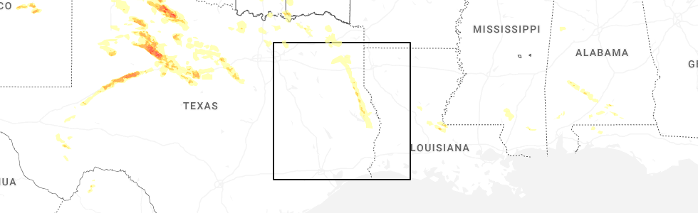
Hail Map for Sam Rayburn, TX
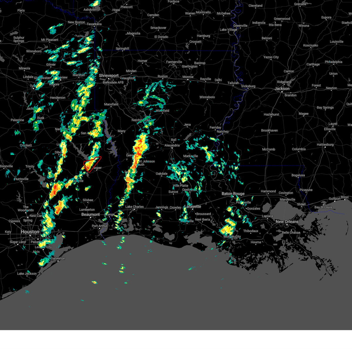
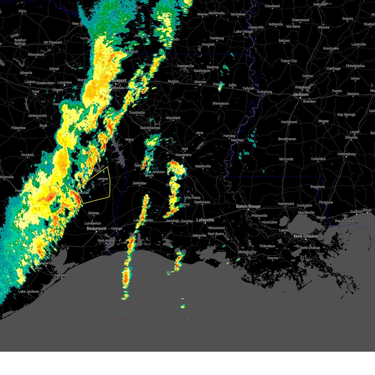
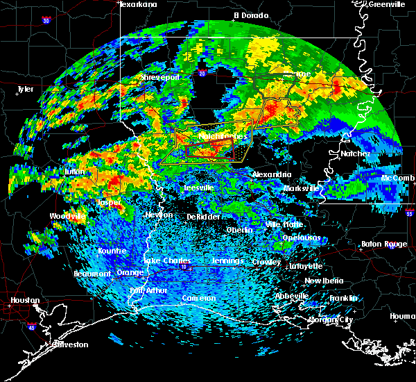
The Sam Rayburn, TX area has had 1 report of on-the-ground hail by trained spotters, and has been under severe weather warnings 27 times during the past 12 months. Doppler radar has detected hail at or near Sam Rayburn, TX on 72 occasions, including 4 occasions during the past year.
| Name: | Sam Rayburn, TX |
| Where Located: | 45.4 miles ESE of Lufkin, TX |
| Map: | Google Map for Sam Rayburn, TX |
| Population: | 1181 |
| Housing Units: | 942 |
| More Info: | Search Google for Sam Rayburn, TX |
1
The Top Recent Hail Date for Sam Rayburn, TX is Sunday, June 8, 2025 (29th out of 72)
Hail and Wind Damage Spotted near Sam Rayburn, TX
| Date / Time | Report Details |
|---|---|
| 6/8/2025 7:24 PM CDT | Svrlch the national weather service in lake charles has issued a * severe thunderstorm warning for, northwestern newton county in southeastern texas, northeastern jasper county in southeastern texas, * until 830 pm cdt. * at 723 pm cdt, a severe thunderstorm was located near pineland, or 14 miles northeast of ebenezer, moving south at 35 mph (radar indicated). Hazards include golf ball size hail and 60 mph wind gusts. People and animals outdoors will be injured. expect hail damage to roofs, siding, windows, and vehicles. Expect wind damage to roofs, siding, and trees. |
| 5/27/2025 12:09 AM CDT |
 Svrlch the national weather service in lake charles has issued a * severe thunderstorm warning for, northwestern tyler county in southeastern texas, northern jasper county in southeastern texas, * until 100 am cdt. * at 1209 am cdt, a severe thunderstorm was located 9 miles north of chester, moving northeast at 50 mph (radar indicated). Hazards include 60 mph wind gusts and penny size hail. expect damage to roofs, siding, and trees Svrlch the national weather service in lake charles has issued a * severe thunderstorm warning for, northwestern tyler county in southeastern texas, northern jasper county in southeastern texas, * until 100 am cdt. * at 1209 am cdt, a severe thunderstorm was located 9 miles north of chester, moving northeast at 50 mph (radar indicated). Hazards include 60 mph wind gusts and penny size hail. expect damage to roofs, siding, and trees
|
| 5/2/2025 1:00 PM CDT |
 At 100 pm cdt, a severe thunderstorm was located near ebenezer, moving northeast at 20 mph (radar indicated). Hazards include 60 mph wind gusts and quarter size hail. Hail damage to vehicles is expected. expect wind damage to roofs, siding, and trees. Locations impacted include, sam rayburn dam, browndell, and ebenezer. At 100 pm cdt, a severe thunderstorm was located near ebenezer, moving northeast at 20 mph (radar indicated). Hazards include 60 mph wind gusts and quarter size hail. Hail damage to vehicles is expected. expect wind damage to roofs, siding, and trees. Locations impacted include, sam rayburn dam, browndell, and ebenezer.
|
| 5/2/2025 12:48 PM CDT |
 Svrlch the national weather service in lake charles has issued a * severe thunderstorm warning for, northeastern jasper county in southeastern texas, * until 115 pm cdt. * at 1247 pm cdt, a severe thunderstorm was located 8 miles north of town bluff, moving northeast at 20 mph (radar indicated). Hazards include 60 mph wind gusts and quarter size hail. Hail damage to vehicles is expected. Expect wind damage to roofs, siding, and trees. Svrlch the national weather service in lake charles has issued a * severe thunderstorm warning for, northeastern jasper county in southeastern texas, * until 115 pm cdt. * at 1247 pm cdt, a severe thunderstorm was located 8 miles north of town bluff, moving northeast at 20 mph (radar indicated). Hazards include 60 mph wind gusts and quarter size hail. Hail damage to vehicles is expected. Expect wind damage to roofs, siding, and trees.
|
| 3/28/2025 8:31 PM CDT |
 the severe thunderstorm warning has been cancelled and is no longer in effect the severe thunderstorm warning has been cancelled and is no longer in effect
|
| 3/28/2025 8:21 PM CDT |
 At 820 pm cdt, a severe thunderstorm was located near jasper, moving northeast at 20 mph (radar indicated). Hazards include 60 mph wind gusts. Expect damage to roofs, siding, and trees. Locations impacted include, browndell. At 820 pm cdt, a severe thunderstorm was located near jasper, moving northeast at 20 mph (radar indicated). Hazards include 60 mph wind gusts. Expect damage to roofs, siding, and trees. Locations impacted include, browndell.
|
| 3/28/2025 7:52 PM CDT |
 Svrlch the national weather service in lake charles has issued a * severe thunderstorm warning for, northeastern jasper county in southeastern texas, * until 845 pm cdt. * at 751 pm cdt, a severe thunderstorm was located near jasper, moving northeast at 30 mph (radar indicated). Hazards include 60 mph wind gusts. expect damage to roofs, siding, and trees Svrlch the national weather service in lake charles has issued a * severe thunderstorm warning for, northeastern jasper county in southeastern texas, * until 845 pm cdt. * at 751 pm cdt, a severe thunderstorm was located near jasper, moving northeast at 30 mph (radar indicated). Hazards include 60 mph wind gusts. expect damage to roofs, siding, and trees
|
| 3/4/2025 10:16 AM CST |
 the severe thunderstorm warning has been cancelled and is no longer in effect the severe thunderstorm warning has been cancelled and is no longer in effect
|
| 3/4/2025 10:16 AM CST |
 At 1015 am cst, severe thunderstorms were located along a line extending from near pineland to 6 miles southwest of spurger, moving northeast at 70 mph (radar indicated). Hazards include 60 mph wind gusts. Expect damage to roofs, siding, and trees. locations impacted include, toledo bend dam, sam rayburn dam, ebenezer, farrsville, bleakwood, fred, magnolia springs, mayflower, mt. Union, wiergate, kirbyville, spurger, newton, jasper, jamestown, town bluff, roganville, burkeville, harrisburg, and browndell. At 1015 am cst, severe thunderstorms were located along a line extending from near pineland to 6 miles southwest of spurger, moving northeast at 70 mph (radar indicated). Hazards include 60 mph wind gusts. Expect damage to roofs, siding, and trees. locations impacted include, toledo bend dam, sam rayburn dam, ebenezer, farrsville, bleakwood, fred, magnolia springs, mayflower, mt. Union, wiergate, kirbyville, spurger, newton, jasper, jamestown, town bluff, roganville, burkeville, harrisburg, and browndell.
|
| 3/4/2025 9:59 AM CST |
 Svrlch the national weather service in lake charles has issued a * severe thunderstorm warning for, tyler county in southeastern texas, northwestern newton county in southeastern texas, northern hardin county in southeastern texas, jasper county in southeastern texas, * until 1045 am cst. * at 958 am cst, severe thunderstorms were located along a line extending from near ebenezer to near wildwood, moving northeast at 70 mph (radar indicated). Hazards include 60 mph wind gusts. expect damage to roofs, siding, and trees Svrlch the national weather service in lake charles has issued a * severe thunderstorm warning for, tyler county in southeastern texas, northwestern newton county in southeastern texas, northern hardin county in southeastern texas, jasper county in southeastern texas, * until 1045 am cst. * at 958 am cst, severe thunderstorms were located along a line extending from near ebenezer to near wildwood, moving northeast at 70 mph (radar indicated). Hazards include 60 mph wind gusts. expect damage to roofs, siding, and trees
|
| 11/18/2024 3:14 PM CST |
 The storm which prompted the warning has weakened below severe limits, and has exited the warned area. therefore, the warning will be allowed to expire. a tornado watch remains in effect until 800 pm cst for southeastern texas. The storm which prompted the warning has weakened below severe limits, and has exited the warned area. therefore, the warning will be allowed to expire. a tornado watch remains in effect until 800 pm cst for southeastern texas.
|
| 11/18/2024 3:00 PM CST |
 Torlch the national weather service in lake charles has issued a * tornado warning for, north central jasper county in southeastern texas, * until 315 pm cst. * at 300 pm cst, a severe thunderstorm capable of producing a tornado was located near ebenezer, moving northeast at 35 mph (radar indicated rotation). Hazards include tornado. Flying debris will be dangerous to those caught without shelter. mobile homes will be damaged or destroyed. damage to roofs, windows, and vehicles will occur. tree damage is likely. this dangerous storm will be near, browndell around 305 pm cst. Other locations impacted by this tornadic thunderstorm include sam rayburn dam. Torlch the national weather service in lake charles has issued a * tornado warning for, north central jasper county in southeastern texas, * until 315 pm cst. * at 300 pm cst, a severe thunderstorm capable of producing a tornado was located near ebenezer, moving northeast at 35 mph (radar indicated rotation). Hazards include tornado. Flying debris will be dangerous to those caught without shelter. mobile homes will be damaged or destroyed. damage to roofs, windows, and vehicles will occur. tree damage is likely. this dangerous storm will be near, browndell around 305 pm cst. Other locations impacted by this tornadic thunderstorm include sam rayburn dam.
|
| 11/18/2024 2:47 PM CST |
 At 246 pm cst, a severe thunderstorm capable of producing a tornado was located near town bluff, moving northeast at 40 mph (radar indicated rotation). Hazards include tornado. Flying debris will be dangerous to those caught without shelter. mobile homes will be damaged or destroyed. damage to roofs, windows, and vehicles will occur. tree damage is likely. this dangerous storm will be near, ebenezer around 250 pm cst. Other locations impacted by this tornadic thunderstorm include sam rayburn dam. At 246 pm cst, a severe thunderstorm capable of producing a tornado was located near town bluff, moving northeast at 40 mph (radar indicated rotation). Hazards include tornado. Flying debris will be dangerous to those caught without shelter. mobile homes will be damaged or destroyed. damage to roofs, windows, and vehicles will occur. tree damage is likely. this dangerous storm will be near, ebenezer around 250 pm cst. Other locations impacted by this tornadic thunderstorm include sam rayburn dam.
|
| 11/18/2024 2:47 PM CST |
 the tornado warning has been cancelled and is no longer in effect the tornado warning has been cancelled and is no longer in effect
|
| 11/18/2024 2:37 PM CST |
 Torlch the national weather service in lake charles has issued a * tornado warning for, northeastern tyler county in southeastern texas, north central jasper county in southeastern texas, * until 300 pm cst. * at 237 pm cst, a severe thunderstorm capable of producing a tornado was located near town bluff, moving northeast at 35 mph (radar indicated rotation). Hazards include tornado. Flying debris will be dangerous to those caught without shelter. mobile homes will be damaged or destroyed. damage to roofs, windows, and vehicles will occur. tree damage is likely. this dangerous storm will be near, ebenezer around 245 pm cst. Other locations impacted by this tornadic thunderstorm include sam rayburn dam. Torlch the national weather service in lake charles has issued a * tornado warning for, northeastern tyler county in southeastern texas, north central jasper county in southeastern texas, * until 300 pm cst. * at 237 pm cst, a severe thunderstorm capable of producing a tornado was located near town bluff, moving northeast at 35 mph (radar indicated rotation). Hazards include tornado. Flying debris will be dangerous to those caught without shelter. mobile homes will be damaged or destroyed. damage to roofs, windows, and vehicles will occur. tree damage is likely. this dangerous storm will be near, ebenezer around 245 pm cst. Other locations impacted by this tornadic thunderstorm include sam rayburn dam.
|
| 11/5/2024 8:41 AM CST |
 the severe thunderstorm warning has been cancelled and is no longer in effect the severe thunderstorm warning has been cancelled and is no longer in effect
|
| 11/5/2024 8:21 AM CST |
 At 820 am cst, severe thunderstorms were located along a line extending from 6 miles northeast of woodville to near fred, moving east at 35 mph (radar indicated). Hazards include 60 mph wind gusts. Expect damage to roofs, siding, and trees. locations impacted include, jasper, kirbyville, town bluff, browndell, spurger, roganville, magnolia springs, harrisburg, and mt. Union. At 820 am cst, severe thunderstorms were located along a line extending from 6 miles northeast of woodville to near fred, moving east at 35 mph (radar indicated). Hazards include 60 mph wind gusts. Expect damage to roofs, siding, and trees. locations impacted include, jasper, kirbyville, town bluff, browndell, spurger, roganville, magnolia springs, harrisburg, and mt. Union.
|
| 11/5/2024 8:07 AM CST |
 Svrlch the national weather service in lake charles has issued a * severe thunderstorm warning for, central tyler county in southeastern texas, northeastern jasper county in southeastern texas, * until 900 am cst. * at 807 am cst, severe thunderstorms were located along a line extending from woodville to near warren, moving northeast at 35 mph (radar indicated). Hazards include 60 mph wind gusts. expect damage to roofs, siding, and trees Svrlch the national weather service in lake charles has issued a * severe thunderstorm warning for, central tyler county in southeastern texas, northeastern jasper county in southeastern texas, * until 900 am cst. * at 807 am cst, severe thunderstorms were located along a line extending from woodville to near warren, moving northeast at 35 mph (radar indicated). Hazards include 60 mph wind gusts. expect damage to roofs, siding, and trees
|
| 7/8/2024 2:27 PM CDT |
 The tornado warning that was previously in effect has been reissued for jasper county and is in effect until 245 pm cdt. please refer to that bulletin for the latest severe weather information. a tornado watch remains in effect until 1000 pm cdt for southeastern texas. The tornado warning that was previously in effect has been reissued for jasper county and is in effect until 245 pm cdt. please refer to that bulletin for the latest severe weather information. a tornado watch remains in effect until 1000 pm cdt for southeastern texas.
|
| 7/8/2024 2:27 PM CDT |
 Torlch the national weather service in lake charles has issued a * tornado warning for, northwestern newton county in southeastern texas, northeastern jasper county in southeastern texas, * until 245 pm cdt. * at 226 pm cdt, a severe thunderstorm capable of producing a tornado was located near jasper, moving north at 65 mph (radar indicated rotation). Hazards include tornado. Flying debris will be dangerous to those caught without shelter. mobile homes will be damaged or destroyed. damage to roofs, windows, and vehicles will occur. tree damage is likely. This dangerous storm will be near, jasper, browndell, and harrisburg around 230 pm cdt. Torlch the national weather service in lake charles has issued a * tornado warning for, northwestern newton county in southeastern texas, northeastern jasper county in southeastern texas, * until 245 pm cdt. * at 226 pm cdt, a severe thunderstorm capable of producing a tornado was located near jasper, moving north at 65 mph (radar indicated rotation). Hazards include tornado. Flying debris will be dangerous to those caught without shelter. mobile homes will be damaged or destroyed. damage to roofs, windows, and vehicles will occur. tree damage is likely. This dangerous storm will be near, jasper, browndell, and harrisburg around 230 pm cdt.
|
| 7/8/2024 1:59 PM CDT |
 Torlch the national weather service in lake charles has issued a * tornado warning for, northwestern newton county in southeastern texas, northeastern jasper county in southeastern texas, * until 230 pm cdt. * at 159 pm cdt, a severe thunderstorm capable of producing a tornado was located near call, moving north at 40 mph (radar indicated rotation). Hazards include tornado. Flying debris will be dangerous to those caught without shelter. mobile homes will be damaged or destroyed. damage to roofs, windows, and vehicles will occur. tree damage is likely. this dangerous storm will be near, kirbyville, call, and mt. union around 205 pm cdt. magnolia springs around 210 pm cdt. roganville around 215 pm cdt. Other locations impacted by this tornadic thunderstorm include sam rayburn dam. Torlch the national weather service in lake charles has issued a * tornado warning for, northwestern newton county in southeastern texas, northeastern jasper county in southeastern texas, * until 230 pm cdt. * at 159 pm cdt, a severe thunderstorm capable of producing a tornado was located near call, moving north at 40 mph (radar indicated rotation). Hazards include tornado. Flying debris will be dangerous to those caught without shelter. mobile homes will be damaged or destroyed. damage to roofs, windows, and vehicles will occur. tree damage is likely. this dangerous storm will be near, kirbyville, call, and mt. union around 205 pm cdt. magnolia springs around 210 pm cdt. roganville around 215 pm cdt. Other locations impacted by this tornadic thunderstorm include sam rayburn dam.
|
| 7/8/2024 1:39 PM CDT |
 The storm which prompted the warning has moved out of the area. therefore, the warning will be allowed to expire. a tornado watch remains in effect until 1000 pm cdt for southeastern texas. The storm which prompted the warning has moved out of the area. therefore, the warning will be allowed to expire. a tornado watch remains in effect until 1000 pm cdt for southeastern texas.
|
| 7/8/2024 1:12 PM CDT |
 Torlch the national weather service in lake charles has issued a * tornado warning for, northeastern jasper county in southeastern texas, * until 145 pm cdt. * at 112 pm cdt, a severe thunderstorm capable of producing a tornado was located near magnolia springs, or near town bluff, moving north at 55 mph (radar indicated rotation). Hazards include tornado. Flying debris will be dangerous to those caught without shelter. mobile homes will be damaged or destroyed. damage to roofs, windows, and vehicles will occur. tree damage is likely. this dangerous storm will be near, jasper around 120 pm cdt. ebenezer around 125 pm cdt. Other locations impacted by this tornadic thunderstorm include sam rayburn dam. Torlch the national weather service in lake charles has issued a * tornado warning for, northeastern jasper county in southeastern texas, * until 145 pm cdt. * at 112 pm cdt, a severe thunderstorm capable of producing a tornado was located near magnolia springs, or near town bluff, moving north at 55 mph (radar indicated rotation). Hazards include tornado. Flying debris will be dangerous to those caught without shelter. mobile homes will be damaged or destroyed. damage to roofs, windows, and vehicles will occur. tree damage is likely. this dangerous storm will be near, jasper around 120 pm cdt. ebenezer around 125 pm cdt. Other locations impacted by this tornadic thunderstorm include sam rayburn dam.
|
| 7/8/2024 12:44 PM CDT |
 The storm which prompted the warning has moved out of the area. therefore, the warning will be allowed to expire. a tornado watch remains in effect until 1000 pm cdt for southeastern texas. The storm which prompted the warning has moved out of the area. therefore, the warning will be allowed to expire. a tornado watch remains in effect until 1000 pm cdt for southeastern texas.
|
| 7/8/2024 12:34 PM CDT |
 Torlch the national weather service in lake charles has issued a * tornado warning for, northeastern jasper county in southeastern texas, * until 1245 pm cdt. * at 1233 pm cdt, a severe thunderstorm capable of producing a tornado was located near browndell, or 9 miles north of jasper, moving north at 60 mph (radar indicated rotation). Hazards include tornado. Flying debris will be dangerous to those caught without shelter. mobile homes will be damaged or destroyed. damage to roofs, windows, and vehicles will occur. tree damage is likely. This dangerous storm will be near, browndell around 1240 pm cdt. Torlch the national weather service in lake charles has issued a * tornado warning for, northeastern jasper county in southeastern texas, * until 1245 pm cdt. * at 1233 pm cdt, a severe thunderstorm capable of producing a tornado was located near browndell, or 9 miles north of jasper, moving north at 60 mph (radar indicated rotation). Hazards include tornado. Flying debris will be dangerous to those caught without shelter. mobile homes will be damaged or destroyed. damage to roofs, windows, and vehicles will occur. tree damage is likely. This dangerous storm will be near, browndell around 1240 pm cdt.
|
| 7/8/2024 11:27 AM CDT |
 the tornado warning has been cancelled and is no longer in effect the tornado warning has been cancelled and is no longer in effect
|
| 7/8/2024 11:08 AM CDT |
 Torlch the national weather service in lake charles has issued a * tornado warning for, northeastern jasper county in southeastern texas, * until 1145 am cdt. * at 1108 am cdt, a tornado producing storm was located over jasper, moving north at 35 mph (radar confirmed tornado). Hazards include damaging tornado. Flying debris will be dangerous to those caught without shelter. mobile homes will be damaged or destroyed. damage to roofs, windows, and vehicles will occur. tree damage is likely. this tornadic storm will be near, jasper and ebenezer around 1115 am cdt. browndell around 1125 am cdt. Other locations impacted by this tornadic thunderstorm include sam rayburn dam. Torlch the national weather service in lake charles has issued a * tornado warning for, northeastern jasper county in southeastern texas, * until 1145 am cdt. * at 1108 am cdt, a tornado producing storm was located over jasper, moving north at 35 mph (radar confirmed tornado). Hazards include damaging tornado. Flying debris will be dangerous to those caught without shelter. mobile homes will be damaged or destroyed. damage to roofs, windows, and vehicles will occur. tree damage is likely. this tornadic storm will be near, jasper and ebenezer around 1115 am cdt. browndell around 1125 am cdt. Other locations impacted by this tornadic thunderstorm include sam rayburn dam.
|
| 5/30/2024 8:13 PM CDT |
 The storms which prompted the warning have moved out of the area. therefore, the warning will be allowed to expire. however gusty winds and heavy rain are still possible with these thunderstorms. a severe thunderstorm watch remains in effect until 1100 pm cdt for southeastern texas. The storms which prompted the warning have moved out of the area. therefore, the warning will be allowed to expire. however gusty winds and heavy rain are still possible with these thunderstorms. a severe thunderstorm watch remains in effect until 1100 pm cdt for southeastern texas.
|
| 5/30/2024 7:51 PM CDT |
 At 751 pm cdt, severe thunderstorms were located along a line extending from near browndell to 6 miles northeast of town bluff to 6 miles east of alabama-coushatta reservation, moving southeast at 30 mph (radar indicated). Hazards include 60 mph wind gusts and penny size hail. Expect damage to roofs, siding, and trees. locations impacted include, jasper, woodville, colmesneil, ebenezer, warren, town bluff, browndell, magnolia springs, mt. Union, spurger, ivanhoe, sam rayburn dam, and hillister. At 751 pm cdt, severe thunderstorms were located along a line extending from near browndell to 6 miles northeast of town bluff to 6 miles east of alabama-coushatta reservation, moving southeast at 30 mph (radar indicated). Hazards include 60 mph wind gusts and penny size hail. Expect damage to roofs, siding, and trees. locations impacted include, jasper, woodville, colmesneil, ebenezer, warren, town bluff, browndell, magnolia springs, mt. Union, spurger, ivanhoe, sam rayburn dam, and hillister.
|
| 5/30/2024 7:18 PM CDT |
 Svrlch the national weather service in lake charles has issued a * severe thunderstorm warning for, tyler county in southeastern texas, northern jasper county in southeastern texas, * until 815 pm cdt. * at 718 pm cdt, severe thunderstorms were located along a line extending from 12 miles southeast of etoile to 7 miles northeast of chester to 7 miles north of livingston, moving southeast at 25 mph (radar indicated). Hazards include 60 mph wind gusts and penny size hail. expect damage to roofs, siding, and trees Svrlch the national weather service in lake charles has issued a * severe thunderstorm warning for, tyler county in southeastern texas, northern jasper county in southeastern texas, * until 815 pm cdt. * at 718 pm cdt, severe thunderstorms were located along a line extending from 12 miles southeast of etoile to 7 miles northeast of chester to 7 miles north of livingston, moving southeast at 25 mph (radar indicated). Hazards include 60 mph wind gusts and penny size hail. expect damage to roofs, siding, and trees
|
| 5/28/2024 12:46 PM CDT |
 Svrlch the national weather service in lake charles has issued a * severe thunderstorm warning for, tyler county in southeastern texas, western hardin county in southeastern texas, northwestern jasper county in southeastern texas, * until 145 pm cdt. * at 1245 pm cdt, severe thunderstorms were located along a line extending from 6 miles northeast of corrigan to near goodrich, moving southeast at 30 mph (radar indicated). Hazards include 60 mph wind gusts and quarter size hail. Hail damage to vehicles is expected. Expect wind damage to roofs, siding, and trees. Svrlch the national weather service in lake charles has issued a * severe thunderstorm warning for, tyler county in southeastern texas, western hardin county in southeastern texas, northwestern jasper county in southeastern texas, * until 145 pm cdt. * at 1245 pm cdt, severe thunderstorms were located along a line extending from 6 miles northeast of corrigan to near goodrich, moving southeast at 30 mph (radar indicated). Hazards include 60 mph wind gusts and quarter size hail. Hail damage to vehicles is expected. Expect wind damage to roofs, siding, and trees.
|
| 5/28/2024 11:35 AM CDT |
 Svrlch the national weather service in lake charles has issued a * severe thunderstorm warning for, northwestern newton county in southeastern texas, northeastern jasper county in southeastern texas, * until 1215 pm cdt. * at 1135 am cdt, a severe thunderstorm was located near browndell, or 11 miles north of jasper, moving southeast at 15 mph (radar indicated). Hazards include quarter size hail. damage to vehicles is expected Svrlch the national weather service in lake charles has issued a * severe thunderstorm warning for, northwestern newton county in southeastern texas, northeastern jasper county in southeastern texas, * until 1215 pm cdt. * at 1135 am cdt, a severe thunderstorm was located near browndell, or 11 miles north of jasper, moving southeast at 15 mph (radar indicated). Hazards include quarter size hail. damage to vehicles is expected
|
| 5/16/2024 3:52 PM CDT |
 Svrlch the national weather service in lake charles has issued a * severe thunderstorm warning for, tyler county in southeastern texas, northwestern newton county in southeastern texas, northern jasper county in southeastern texas, * until 445 pm cdt. * at 352 pm cdt, a severe thunderstorm was located near woodville, moving northeast at 40 mph (radar indicated). Hazards include 60 mph wind gusts and quarter size hail. Hail damage to vehicles is expected. Expect wind damage to roofs, siding, and trees. Svrlch the national weather service in lake charles has issued a * severe thunderstorm warning for, tyler county in southeastern texas, northwestern newton county in southeastern texas, northern jasper county in southeastern texas, * until 445 pm cdt. * at 352 pm cdt, a severe thunderstorm was located near woodville, moving northeast at 40 mph (radar indicated). Hazards include 60 mph wind gusts and quarter size hail. Hail damage to vehicles is expected. Expect wind damage to roofs, siding, and trees.
|
| 5/9/2024 10:06 PM CDT |
 At 1005 pm cdt, a severe thunderstorm was located 7 miles southeast of rockland, moving east at 15 mph (radar indicated). Hazards include two inch hail and 60 mph wind gusts. People and animals outdoors will be injured. expect hail damage to roofs, siding, windows, and vehicles. expect wind damage to roofs, siding, and trees. Locations impacted include, colmesneil, rockland, ebenezer, town bluff, and sam rayburn dam. At 1005 pm cdt, a severe thunderstorm was located 7 miles southeast of rockland, moving east at 15 mph (radar indicated). Hazards include two inch hail and 60 mph wind gusts. People and animals outdoors will be injured. expect hail damage to roofs, siding, windows, and vehicles. expect wind damage to roofs, siding, and trees. Locations impacted include, colmesneil, rockland, ebenezer, town bluff, and sam rayburn dam.
|
| 5/9/2024 9:44 PM CDT |
 Svrlch the national weather service in lake charles has issued a * severe thunderstorm warning for, northeastern tyler county in southeastern texas, northwestern jasper county in southeastern texas, * until 1045 pm cdt. * at 944 pm cdt, a severe thunderstorm was located over rockland, moving east at 15 mph (radar indicated). Hazards include ping pong ball size hail and 60 mph wind gusts. People and animals outdoors will be injured. expect hail damage to roofs, siding, windows, and vehicles. Expect wind damage to roofs, siding, and trees. Svrlch the national weather service in lake charles has issued a * severe thunderstorm warning for, northeastern tyler county in southeastern texas, northwestern jasper county in southeastern texas, * until 1045 pm cdt. * at 944 pm cdt, a severe thunderstorm was located over rockland, moving east at 15 mph (radar indicated). Hazards include ping pong ball size hail and 60 mph wind gusts. People and animals outdoors will be injured. expect hail damage to roofs, siding, windows, and vehicles. Expect wind damage to roofs, siding, and trees.
|
| 4/29/2024 12:13 AM CDT |
 Svrlch the national weather service in lake charles has issued a * severe thunderstorm warning for, western vernon parish in west central louisiana, northeastern tyler county in southeastern texas, northern newton county in southeastern texas, northeastern jasper county in southeastern texas, * until 1245 am cdt. * at 1212 am cdt, severe thunderstorms were located along a line extending from near toledo bend dam to near jamestown to near magnolia springs, moving east at 35 mph (radar indicated). Hazards include 60 mph wind gusts and penny size hail. expect damage to roofs, siding, and trees Svrlch the national weather service in lake charles has issued a * severe thunderstorm warning for, western vernon parish in west central louisiana, northeastern tyler county in southeastern texas, northern newton county in southeastern texas, northeastern jasper county in southeastern texas, * until 1245 am cdt. * at 1212 am cdt, severe thunderstorms were located along a line extending from near toledo bend dam to near jamestown to near magnolia springs, moving east at 35 mph (radar indicated). Hazards include 60 mph wind gusts and penny size hail. expect damage to roofs, siding, and trees
|
| 4/28/2024 11:40 PM CDT |
 Svrlch the national weather service in lake charles has issued a * severe thunderstorm warning for, central tyler county in southeastern texas, northern newton county in southeastern texas, jasper county in southeastern texas, * until 1215 am cdt. * at 1140 pm cdt, severe thunderstorms were located along a line extending from near browndell to jasper to 7 miles east of warren, moving east at 35 mph (radar indicated). Hazards include 60 mph wind gusts and penny size hail. expect damage to roofs, siding, and trees Svrlch the national weather service in lake charles has issued a * severe thunderstorm warning for, central tyler county in southeastern texas, northern newton county in southeastern texas, jasper county in southeastern texas, * until 1215 am cdt. * at 1140 pm cdt, severe thunderstorms were located along a line extending from near browndell to jasper to 7 miles east of warren, moving east at 35 mph (radar indicated). Hazards include 60 mph wind gusts and penny size hail. expect damage to roofs, siding, and trees
|
| 4/28/2024 11:13 PM CDT |
 Svrlch the national weather service in lake charles has issued a * severe thunderstorm warning for, central tyler county in southeastern texas, northern jasper county in southeastern texas, * until 1145 pm cdt. * at 1113 pm cdt, severe thunderstorms were located along a line extending from 6 miles north of ebenezer to near woodville, moving east at 25 mph (radar indicated). Hazards include 60 mph wind gusts and quarter size hail. Hail damage to vehicles is expected. Expect wind damage to roofs, siding, and trees. Svrlch the national weather service in lake charles has issued a * severe thunderstorm warning for, central tyler county in southeastern texas, northern jasper county in southeastern texas, * until 1145 pm cdt. * at 1113 pm cdt, severe thunderstorms were located along a line extending from 6 miles north of ebenezer to near woodville, moving east at 25 mph (radar indicated). Hazards include 60 mph wind gusts and quarter size hail. Hail damage to vehicles is expected. Expect wind damage to roofs, siding, and trees.
|
| 4/28/2024 10:45 PM CDT |
 Svrlch the national weather service in lake charles has issued a * severe thunderstorm warning for, northwestern tyler county in southeastern texas, northwestern jasper county in southeastern texas, * until 1115 pm cdt. * at 1044 pm cdt, severe thunderstorms were located along a line extending from near rockland to near chester, moving east at 15 mph (radar indicated). Hazards include 60 mph wind gusts and penny size hail. expect damage to roofs, siding, and trees Svrlch the national weather service in lake charles has issued a * severe thunderstorm warning for, northwestern tyler county in southeastern texas, northwestern jasper county in southeastern texas, * until 1115 pm cdt. * at 1044 pm cdt, severe thunderstorms were located along a line extending from near rockland to near chester, moving east at 15 mph (radar indicated). Hazards include 60 mph wind gusts and penny size hail. expect damage to roofs, siding, and trees
|
| 12/9/2023 5:42 PM CST |
 At 542 pm cst, a severe thunderstorm was located near colmesneil, moving east at 30 mph (radar indicated). Hazards include quarter size hail. damage to vehicles is expected At 542 pm cst, a severe thunderstorm was located near colmesneil, moving east at 30 mph (radar indicated). Hazards include quarter size hail. damage to vehicles is expected
|
| 6/10/2023 3:12 PM CDT |
 The severe thunderstorm warning for northeastern jasper county will expire at 315 pm cdt, the storm which prompted the warning has moved out of the area. therefore, the warning will be allowed to expire. The severe thunderstorm warning for northeastern jasper county will expire at 315 pm cdt, the storm which prompted the warning has moved out of the area. therefore, the warning will be allowed to expire.
|
| 6/10/2023 2:58 PM CDT |
 At 257 pm cdt, a severe thunderstorm was located over ebenezer, and is nearly stationary (radar indicated). Hazards include 60 mph wind gusts and quarter size hail. Hail damage to vehicles is expected. expect wind damage to roofs, siding, and trees. locations impacted include, ebenezer and sam rayburn dam. hail threat, radar indicated max hail size, 1. 00 in wind threat, radar indicated max wind gust, 60 mph. At 257 pm cdt, a severe thunderstorm was located over ebenezer, and is nearly stationary (radar indicated). Hazards include 60 mph wind gusts and quarter size hail. Hail damage to vehicles is expected. expect wind damage to roofs, siding, and trees. locations impacted include, ebenezer and sam rayburn dam. hail threat, radar indicated max hail size, 1. 00 in wind threat, radar indicated max wind gust, 60 mph.
|
| 6/10/2023 2:40 PM CDT |
 At 240 pm cdt, a severe thunderstorm was located over ebenezer, and is nearly stationary (radar indicated). Hazards include 60 mph wind gusts and half dollar size hail. Hail damage to vehicles is expected. Expect wind damage to roofs, siding, and trees. At 240 pm cdt, a severe thunderstorm was located over ebenezer, and is nearly stationary (radar indicated). Hazards include 60 mph wind gusts and half dollar size hail. Hail damage to vehicles is expected. Expect wind damage to roofs, siding, and trees.
|
| 4/27/2023 12:33 AM CDT |
 At 1231 am cdt, severe thunderstorms were located along a line extending from near mayflower to near jamestown to near kirbyville, moving east at 45 mph (radar indicated). Hazards include 60 mph wind gusts and half dollar size hail. Hail damage to vehicles is expected. expect wind damage to roofs, siding, and trees. locations impacted include, jasper, newton, kirbyville, burkeville, browndell, farrsville, magnolia springs, mayflower, mt. union, jamestown, roganville, harrisburg, stringtown, bleakwood and wiergate. hail threat, radar indicated max hail size, 1. 25 in wind threat, radar indicated max wind gust, 60 mph. At 1231 am cdt, severe thunderstorms were located along a line extending from near mayflower to near jamestown to near kirbyville, moving east at 45 mph (radar indicated). Hazards include 60 mph wind gusts and half dollar size hail. Hail damage to vehicles is expected. expect wind damage to roofs, siding, and trees. locations impacted include, jasper, newton, kirbyville, burkeville, browndell, farrsville, magnolia springs, mayflower, mt. union, jamestown, roganville, harrisburg, stringtown, bleakwood and wiergate. hail threat, radar indicated max hail size, 1. 25 in wind threat, radar indicated max wind gust, 60 mph.
|
| 4/27/2023 12:19 AM CDT |
 At 1219 am cdt, severe thunderstorms were located along a line extending from near browndell to near jasper to magnolia springs, moving east at 45 mph (radar indicated). Hazards include 60 mph wind gusts and half dollar size hail. Hail damage to vehicles is expected. Expect wind damage to roofs, siding, and trees. At 1219 am cdt, severe thunderstorms were located along a line extending from near browndell to near jasper to magnolia springs, moving east at 45 mph (radar indicated). Hazards include 60 mph wind gusts and half dollar size hail. Hail damage to vehicles is expected. Expect wind damage to roofs, siding, and trees.
|
| 4/26/2023 11:56 PM CDT |
 At 1156 pm cdt, a severe thunderstorm was located near town bluff, moving east at 45 mph (radar indicated). Hazards include 70 mph wind gusts and ping pong ball size hail. People and animals outdoors will be injured. expect hail damage to roofs, siding, windows, and vehicles. expect considerable tree damage. wind damage is also likely to mobile homes, roofs, and outbuildings. locations impacted include, jasper, woodville, colmesneil, chester, ebenezer, town bluff, rockland, browndell, roganville and sam rayburn dam. thunderstorm damage threat, considerable hail threat, radar indicated max hail size, 1. 50 in wind threat, radar indicated max wind gust, 70 mph. At 1156 pm cdt, a severe thunderstorm was located near town bluff, moving east at 45 mph (radar indicated). Hazards include 70 mph wind gusts and ping pong ball size hail. People and animals outdoors will be injured. expect hail damage to roofs, siding, windows, and vehicles. expect considerable tree damage. wind damage is also likely to mobile homes, roofs, and outbuildings. locations impacted include, jasper, woodville, colmesneil, chester, ebenezer, town bluff, rockland, browndell, roganville and sam rayburn dam. thunderstorm damage threat, considerable hail threat, radar indicated max hail size, 1. 50 in wind threat, radar indicated max wind gust, 70 mph.
|
| 4/26/2023 11:30 PM CDT |
 At 1130 pm cdt, a severe thunderstorm was located near colmesneil, moving east at 50 mph (radar indicated). Hazards include golf ball size hail and 70 mph wind gusts. People and animals outdoors will be injured. expect hail damage to roofs, siding, windows, and vehicles. expect considerable tree damage. Wind damage is also likely to mobile homes, roofs, and outbuildings. At 1130 pm cdt, a severe thunderstorm was located near colmesneil, moving east at 50 mph (radar indicated). Hazards include golf ball size hail and 70 mph wind gusts. People and animals outdoors will be injured. expect hail damage to roofs, siding, windows, and vehicles. expect considerable tree damage. Wind damage is also likely to mobile homes, roofs, and outbuildings.
|
| 4/15/2023 8:54 PM CDT |
 At 854 pm cdt, a severe thunderstorm was located near ebenezer, moving east at 25 mph (radar indicated). Hazards include 60 mph wind gusts and quarter size hail. Hail damage to vehicles is expected. Expect wind damage to roofs, siding, and trees. At 854 pm cdt, a severe thunderstorm was located near ebenezer, moving east at 25 mph (radar indicated). Hazards include 60 mph wind gusts and quarter size hail. Hail damage to vehicles is expected. Expect wind damage to roofs, siding, and trees.
|
| 4/15/2023 8:20 PM CDT |
 The severe thunderstorm warning for northeastern jasper county will expire at 830 pm cdt, the storm which prompted the warning has weakened below severe limits, and no longer poses an immediate threat to life or property. therefore, the warning will be allowed to expire. however heavy rain is still possible with this thunderstorm. a severe thunderstorm watch remains in effect until midnight cdt for southeastern texas. The severe thunderstorm warning for northeastern jasper county will expire at 830 pm cdt, the storm which prompted the warning has weakened below severe limits, and no longer poses an immediate threat to life or property. therefore, the warning will be allowed to expire. however heavy rain is still possible with this thunderstorm. a severe thunderstorm watch remains in effect until midnight cdt for southeastern texas.
|
| 4/15/2023 8:17 PM CDT |
 At 817 pm cdt, a severe thunderstorm was located over browndell, or 12 miles northeast of ebenezer, moving northeast at 20 mph (radar indicated). Hazards include ping pong ball size hail and 60 mph wind gusts. People and animals outdoors will be injured. expect hail damage to roofs, siding, windows, and vehicles. Expect wind damage to roofs, siding, and trees. At 817 pm cdt, a severe thunderstorm was located over browndell, or 12 miles northeast of ebenezer, moving northeast at 20 mph (radar indicated). Hazards include ping pong ball size hail and 60 mph wind gusts. People and animals outdoors will be injured. expect hail damage to roofs, siding, windows, and vehicles. Expect wind damage to roofs, siding, and trees.
|
| 4/15/2023 8:02 PM CDT |
 At 802 pm cdt, a severe thunderstorm was located near ebenezer, moving southeast at 15 mph (radar indicated). Hazards include 60 mph wind gusts and half dollar size hail. Hail damage to vehicles is expected. expect wind damage to roofs, siding, and trees. locations impacted include, jasper, harrisburg and sam rayburn dam. hail threat, radar indicated max hail size, 1. 25 in wind threat, radar indicated max wind gust, 60 mph. At 802 pm cdt, a severe thunderstorm was located near ebenezer, moving southeast at 15 mph (radar indicated). Hazards include 60 mph wind gusts and half dollar size hail. Hail damage to vehicles is expected. expect wind damage to roofs, siding, and trees. locations impacted include, jasper, harrisburg and sam rayburn dam. hail threat, radar indicated max hail size, 1. 25 in wind threat, radar indicated max wind gust, 60 mph.
|
| 4/15/2023 7:58 PM CDT |
 At 758 pm cdt, a severe thunderstorm was located over ebenezer, moving southeast at 15 mph (radar indicated). Hazards include 60 mph wind gusts and half dollar size hail. Hail damage to vehicles is expected. Expect wind damage to roofs, siding, and trees. At 758 pm cdt, a severe thunderstorm was located over ebenezer, moving southeast at 15 mph (radar indicated). Hazards include 60 mph wind gusts and half dollar size hail. Hail damage to vehicles is expected. Expect wind damage to roofs, siding, and trees.
|
| 4/15/2023 7:28 PM CDT |
 At 728 pm cdt, a severe thunderstorm was located near ebenezer, moving east at 25 mph (radar indicated). Hazards include 60 mph wind gusts and quarter size hail. Hail damage to vehicles is expected. Expect wind damage to roofs, siding, and trees. At 728 pm cdt, a severe thunderstorm was located near ebenezer, moving east at 25 mph (radar indicated). Hazards include 60 mph wind gusts and quarter size hail. Hail damage to vehicles is expected. Expect wind damage to roofs, siding, and trees.
|
| 3/17/2023 12:56 AM CDT |
 At 1256 am cdt, severe thunderstorms were located along a line extending from 9 miles northwest of mayflower to browndell, moving southeast at 40 mph (radar indicated). Hazards include 60 mph wind gusts. expect damage to roofs, siding, and trees At 1256 am cdt, severe thunderstorms were located along a line extending from 9 miles northwest of mayflower to browndell, moving southeast at 40 mph (radar indicated). Hazards include 60 mph wind gusts. expect damage to roofs, siding, and trees
|
| 11/11/2022 4:19 PM CST |
 At 418 pm cst, a severe thunderstorm was located over ebenezer, moving east at 35 mph (radar indicated). Hazards include 60 mph wind gusts and quarter size hail. Hail damage to vehicles is expected. Expect wind damage to roofs, siding, and trees. At 418 pm cst, a severe thunderstorm was located over ebenezer, moving east at 35 mph (radar indicated). Hazards include 60 mph wind gusts and quarter size hail. Hail damage to vehicles is expected. Expect wind damage to roofs, siding, and trees.
|
| 1/9/2022 2:53 AM CST |
 At 253 am cst, a severe thunderstorm was located near ebenezer, moving northeast at 50 mph (radar indicated). Hazards include 60 mph wind gusts and penny size hail. Expect damage to roofs, siding, and trees. locations impacted include, ebenezer, browndell and sam rayburn dam. hail threat, radar indicated max hail size, 0. 75 in wind threat, radar indicated max wind gust, 60 mph. At 253 am cst, a severe thunderstorm was located near ebenezer, moving northeast at 50 mph (radar indicated). Hazards include 60 mph wind gusts and penny size hail. Expect damage to roofs, siding, and trees. locations impacted include, ebenezer, browndell and sam rayburn dam. hail threat, radar indicated max hail size, 0. 75 in wind threat, radar indicated max wind gust, 60 mph.
|
| 1/9/2022 2:29 AM CST |
 At 229 am cst, a severe thunderstorm was located near rockland, moving northeast at 50 mph (radar indicated). Hazards include 60 mph wind gusts and quarter size hail. Hail damage to vehicles is expected. Expect wind damage to roofs, siding, and trees. At 229 am cst, a severe thunderstorm was located near rockland, moving northeast at 50 mph (radar indicated). Hazards include 60 mph wind gusts and quarter size hail. Hail damage to vehicles is expected. Expect wind damage to roofs, siding, and trees.
|
| 5/11/2021 7:07 PM CDT |
 At 706 pm cdt, a severe thunderstorm was located near town bluff, moving east at 25 mph (radar indicated). Hazards include 60 mph wind gusts and quarter size hail. Hail damage to vehicles is expected. Expect wind damage to roofs, siding, and trees. At 706 pm cdt, a severe thunderstorm was located near town bluff, moving east at 25 mph (radar indicated). Hazards include 60 mph wind gusts and quarter size hail. Hail damage to vehicles is expected. Expect wind damage to roofs, siding, and trees.
|
| 5/9/2021 6:31 PM CDT |
 At 630 pm cdt, severe thunderstorms were located along a line extending from near rosevine to 9 miles west of pineland to 8 miles northwest of ebenezer to near rockland, moving east at 30 mph (radar indicated). Hazards include 60 mph wind gusts and quarter size hail. Hail damage to vehicles is expected. Expect wind damage to roofs, siding, and trees. At 630 pm cdt, severe thunderstorms were located along a line extending from near rosevine to 9 miles west of pineland to 8 miles northwest of ebenezer to near rockland, moving east at 30 mph (radar indicated). Hazards include 60 mph wind gusts and quarter size hail. Hail damage to vehicles is expected. Expect wind damage to roofs, siding, and trees.
|
| 4/23/2021 7:20 PM CDT |
 At 719 pm cdt, severe thunderstorms were located along a line extending from 7 miles west of town bluff to near wildwood, moving east at 35 mph (radar indicated). Hazards include 60 mph wind gusts and nickel size hail. Expect damage to roofs, siding, and trees. locations impacted include, jasper, kirbyville, kountze, ebenezer, fred, town bluff, browndell, caney head, magnolia springs, mt. Union, spurger, roganville, harrisburg and sam rayburn dam. At 719 pm cdt, severe thunderstorms were located along a line extending from 7 miles west of town bluff to near wildwood, moving east at 35 mph (radar indicated). Hazards include 60 mph wind gusts and nickel size hail. Expect damage to roofs, siding, and trees. locations impacted include, jasper, kirbyville, kountze, ebenezer, fred, town bluff, browndell, caney head, magnolia springs, mt. Union, spurger, roganville, harrisburg and sam rayburn dam.
|
| 4/23/2021 7:03 PM CDT |
 At 703 pm cdt, severe thunderstorms were located along a line extending from woodville to near wildwood, moving east at 35 mph (radar indicated). Hazards include 60 mph wind gusts and nickel size hail. Expect damage to roofs, siding, and trees. locations impacted include, jasper, woodville, kirbyville, kountze, colmesneil, ebenezer, fred, rockland, wildwood, warren, town bluff, browndell, caney head, honey island, magnolia springs, mt. Union, spurger, roganville, harrisburg and village mills. At 703 pm cdt, severe thunderstorms were located along a line extending from woodville to near wildwood, moving east at 35 mph (radar indicated). Hazards include 60 mph wind gusts and nickel size hail. Expect damage to roofs, siding, and trees. locations impacted include, jasper, woodville, kirbyville, kountze, colmesneil, ebenezer, fred, rockland, wildwood, warren, town bluff, browndell, caney head, honey island, magnolia springs, mt. Union, spurger, roganville, harrisburg and village mills.
|
| 4/23/2021 6:42 PM CDT |
 At 642 pm cdt, severe thunderstorms were located along a line extending from near alabama-coushatta reservation to near votaw, moving east at 35 mph (radar indicated). Hazards include 60 mph wind gusts and nickel size hail. expect damage to roofs, siding, and trees At 642 pm cdt, severe thunderstorms were located along a line extending from near alabama-coushatta reservation to near votaw, moving east at 35 mph (radar indicated). Hazards include 60 mph wind gusts and nickel size hail. expect damage to roofs, siding, and trees
|
| 4/23/2021 6:08 PM CDT |
 At 607 pm cdt, severe thunderstorms were located along a line extending from near harrisburg to near ebenezer, moving east at 30 mph (radar indicated). Hazards include 60 mph wind gusts and nickel size hail. expect damage to roofs, siding, and trees At 607 pm cdt, severe thunderstorms were located along a line extending from near harrisburg to near ebenezer, moving east at 30 mph (radar indicated). Hazards include 60 mph wind gusts and nickel size hail. expect damage to roofs, siding, and trees
|
| 4/23/2021 5:45 PM CDT |
 At 545 pm cdt, severe thunderstorms were located along a line extending from near macune to 7 miles south of ebenezer, moving east at 30 mph (radar indicated). Hazards include 60 mph wind gusts and nickel size hail. Expect damage to roofs, siding, and trees. Locations impacted include, jasper, colmesneil, rockland, ebenezer, browndell and sam rayburn dam. At 545 pm cdt, severe thunderstorms were located along a line extending from near macune to 7 miles south of ebenezer, moving east at 30 mph (radar indicated). Hazards include 60 mph wind gusts and nickel size hail. Expect damage to roofs, siding, and trees. Locations impacted include, jasper, colmesneil, rockland, ebenezer, browndell and sam rayburn dam.
|
| 4/23/2021 5:12 PM CDT |
 At 512 pm cdt, severe thunderstorms were located along a line extending from 12 miles southeast of etoile to woodville, moving northeast at 30 mph (radar indicated). Hazards include 60 mph wind gusts and penny size hail. expect damage to roofs, siding, and trees At 512 pm cdt, severe thunderstorms were located along a line extending from 12 miles southeast of etoile to woodville, moving northeast at 30 mph (radar indicated). Hazards include 60 mph wind gusts and penny size hail. expect damage to roofs, siding, and trees
|
| 4/10/2021 4:00 AM CDT |
 At 400 am cdt, a severe thunderstorm was located near mayflower, or 10 miles northwest of burkeville, moving southeast at 30 mph (radar indicated). Hazards include 60 mph wind gusts and quarter size hail. Hail damage to vehicles is expected. expect wind damage to roofs, siding, and trees. Locations impacted include, burkeville, browndell, jamestown, farrsville, harrisburg, mayflower and wiergate. At 400 am cdt, a severe thunderstorm was located near mayflower, or 10 miles northwest of burkeville, moving southeast at 30 mph (radar indicated). Hazards include 60 mph wind gusts and quarter size hail. Hail damage to vehicles is expected. expect wind damage to roofs, siding, and trees. Locations impacted include, burkeville, browndell, jamestown, farrsville, harrisburg, mayflower and wiergate.
|
| 4/10/2021 3:34 AM CDT |
 At 334 am cdt, a severe thunderstorm was located near pineland, or 14 miles northeast of ebenezer, moving southeast at 30 mph (radar indicated). Hazards include 60 mph wind gusts and quarter size hail. Hail damage to vehicles is expected. Expect wind damage to roofs, siding, and trees. At 334 am cdt, a severe thunderstorm was located near pineland, or 14 miles northeast of ebenezer, moving southeast at 30 mph (radar indicated). Hazards include 60 mph wind gusts and quarter size hail. Hail damage to vehicles is expected. Expect wind damage to roofs, siding, and trees.
|
| 4/10/2021 12:55 AM CDT |
 At 1255 am cdt, a severe thunderstorm was located over browndell, or 12 miles northeast of ebenezer, moving east at 40 mph (radar indicated). Hazards include 60 mph wind gusts and quarter size hail. Hail damage to vehicles is expected. Expect wind damage to roofs, siding, and trees. At 1255 am cdt, a severe thunderstorm was located over browndell, or 12 miles northeast of ebenezer, moving east at 40 mph (radar indicated). Hazards include 60 mph wind gusts and quarter size hail. Hail damage to vehicles is expected. Expect wind damage to roofs, siding, and trees.
|
| 4/7/2021 5:48 PM CDT |
 At 548 pm cdt, a severe thunderstorm was located near browndell, or 14 miles north of jasper, moving east at 35 mph (radar indicated). Hazards include 60 mph wind gusts and quarter size hail. Hail damage to vehicles is expected. expect wind damage to roofs, siding, and trees. Locations impacted include, ebenezer, browndell, harrisburg and sam rayburn dam. At 548 pm cdt, a severe thunderstorm was located near browndell, or 14 miles north of jasper, moving east at 35 mph (radar indicated). Hazards include 60 mph wind gusts and quarter size hail. Hail damage to vehicles is expected. expect wind damage to roofs, siding, and trees. Locations impacted include, ebenezer, browndell, harrisburg and sam rayburn dam.
|
| 4/7/2021 5:21 PM CDT |
 At 520 pm cdt, a severe thunderstorm was located 7 miles northwest of ebenezer, moving east at 35 mph (radar indicated). Hazards include 60 mph wind gusts and quarter size hail. Hail damage to vehicles is expected. Expect wind damage to roofs, siding, and trees. At 520 pm cdt, a severe thunderstorm was located 7 miles northwest of ebenezer, moving east at 35 mph (radar indicated). Hazards include 60 mph wind gusts and quarter size hail. Hail damage to vehicles is expected. Expect wind damage to roofs, siding, and trees.
|
| 5/28/2020 12:57 PM CDT |
 At 1257 pm cdt, a severe thunderstorm was located near rockland, moving east at 20 mph (radar indicated). Hazards include 60 mph wind gusts and quarter size hail. Hail damage to vehicles is expected. Expect wind damage to roofs, siding, and trees. At 1257 pm cdt, a severe thunderstorm was located near rockland, moving east at 20 mph (radar indicated). Hazards include 60 mph wind gusts and quarter size hail. Hail damage to vehicles is expected. Expect wind damage to roofs, siding, and trees.
|
| 4/29/2020 3:23 AM CDT |
 At 322 am cdt, severe thunderstorms were located along a line extending from 6 miles southeast of archie to 6 miles east of fort polk to near colmesneil, moving south at 45 mph (radar indicated). Hazards include 60 mph wind gusts and quarter size hail. Hail damage to vehicles is expected. expect wind damage to roofs, siding, and trees. locations impacted include, alexandria, pineville, de ridder, oakdale, jasper, leesville, marksville, woodville, newton, kirbyville, rosepine, glenmora, merryville, boyce, moreauville, anacoco, cheneyville, colmesneil, elizabeth and chester. This includes interstate 49 between mile markers 54 and 109. At 322 am cdt, severe thunderstorms were located along a line extending from 6 miles southeast of archie to 6 miles east of fort polk to near colmesneil, moving south at 45 mph (radar indicated). Hazards include 60 mph wind gusts and quarter size hail. Hail damage to vehicles is expected. expect wind damage to roofs, siding, and trees. locations impacted include, alexandria, pineville, de ridder, oakdale, jasper, leesville, marksville, woodville, newton, kirbyville, rosepine, glenmora, merryville, boyce, moreauville, anacoco, cheneyville, colmesneil, elizabeth and chester. This includes interstate 49 between mile markers 54 and 109.
|
| 4/29/2020 2:47 AM CDT |
 At 247 am cdt, severe thunderstorms were located along a line extending from near rosefield to near kurthwood to near huntington, moving south at 40 mph (radar indicated). Hazards include 60 mph wind gusts and quarter size hail. Hail damage to vehicles is expected. Expect wind damage to roofs, siding, and trees. At 247 am cdt, severe thunderstorms were located along a line extending from near rosefield to near kurthwood to near huntington, moving south at 40 mph (radar indicated). Hazards include 60 mph wind gusts and quarter size hail. Hail damage to vehicles is expected. Expect wind damage to roofs, siding, and trees.
|
| 4/22/2020 7:08 PM CDT |
 Tornado emergency for the city of jasper texas, the national weather service in lake charles has issued a * tornado warning for, northwestern newton county in southeastern texas, northeastern jasper county in southeastern texas, * until 730 pm cdt. * at 707 pm cdt, a confirmed large and destructive tornado was observed near jasper, moving east at 45 mph. tornado emergency for the city of jasper texas. this is a particularly dangerous situation. take cover now! (radar confirmed tornado). Hazards include deadly tornado. You are in a life-threatening situation. flying debris may be deadly to those caught without shelter. mobile homes will be destroyed. considerable damage to homes, businesses, and vehicles is likely and complete destruction is possible. the tornado will be near, jasper around 715 pm cdt. harrisburg around 725 pm cdt. jamestown and farrsville around 730 pm cdt. Other locations impacted by this tornadic thunderstorm include wiergate. Tornado emergency for the city of jasper texas, the national weather service in lake charles has issued a * tornado warning for, northwestern newton county in southeastern texas, northeastern jasper county in southeastern texas, * until 730 pm cdt. * at 707 pm cdt, a confirmed large and destructive tornado was observed near jasper, moving east at 45 mph. tornado emergency for the city of jasper texas. this is a particularly dangerous situation. take cover now! (radar confirmed tornado). Hazards include deadly tornado. You are in a life-threatening situation. flying debris may be deadly to those caught without shelter. mobile homes will be destroyed. considerable damage to homes, businesses, and vehicles is likely and complete destruction is possible. the tornado will be near, jasper around 715 pm cdt. harrisburg around 725 pm cdt. jamestown and farrsville around 730 pm cdt. Other locations impacted by this tornadic thunderstorm include wiergate.
|
| 4/22/2020 6:43 PM CDT |
 At 642 pm cdt, a confirmed large and extremely dangerous tornado was located over colmesneil, moving east at 40 mph. this is a particularly dangerous situation. take cover now! (radar confirmed tornado). Hazards include damaging tornado. You are in a life-threatening situation. flying debris may be deadly to those caught without shelter. mobile homes will be destroyed. considerable damage to homes, businesses, and vehicles is likely and complete destruction is possible. the tornado will be near, ebenezer around 705 pm cdt. jasper around 715 pm cdt. Other locations impacted by this tornadic thunderstorm include sam rayburn dam. At 642 pm cdt, a confirmed large and extremely dangerous tornado was located over colmesneil, moving east at 40 mph. this is a particularly dangerous situation. take cover now! (radar confirmed tornado). Hazards include damaging tornado. You are in a life-threatening situation. flying debris may be deadly to those caught without shelter. mobile homes will be destroyed. considerable damage to homes, businesses, and vehicles is likely and complete destruction is possible. the tornado will be near, ebenezer around 705 pm cdt. jasper around 715 pm cdt. Other locations impacted by this tornadic thunderstorm include sam rayburn dam.
|
| 4/19/2020 1:46 PM CDT |
 At 145 pm cdt, a severe thunderstorm was located near ebenezer, moving northeast at 55 mph (radar indicated). Hazards include ping pong ball size hail. People and animals outdoors will be injured. Expect damage to roofs, siding, windows, and vehicles. At 145 pm cdt, a severe thunderstorm was located near ebenezer, moving northeast at 55 mph (radar indicated). Hazards include ping pong ball size hail. People and animals outdoors will be injured. Expect damage to roofs, siding, windows, and vehicles.
|
| 4/19/2020 9:58 AM CDT |
 At 958 am cdt, a severe thunderstorm was located near harrisburg, or 13 miles northeast of jasper, moving northeast at 50 mph (radar indicated). Hazards include quarter size hail. damage to vehicles is expected At 958 am cdt, a severe thunderstorm was located near harrisburg, or 13 miles northeast of jasper, moving northeast at 50 mph (radar indicated). Hazards include quarter size hail. damage to vehicles is expected
|
| 4/19/2020 9:48 AM CDT |
 At 948 am cdt, a severe thunderstorm was located near ebenezer, moving northeast at 55 mph (radar indicated). Hazards include quarter size hail. Damage to vehicles is expected. Locations impacted include, jasper, colmesneil, toledo bend dam, ebenezer, town bluff, burkeville, browndell, farrsville, harrisburg, mayflower, sam rayburn dam and wiergate. At 948 am cdt, a severe thunderstorm was located near ebenezer, moving northeast at 55 mph (radar indicated). Hazards include quarter size hail. Damage to vehicles is expected. Locations impacted include, jasper, colmesneil, toledo bend dam, ebenezer, town bluff, burkeville, browndell, farrsville, harrisburg, mayflower, sam rayburn dam and wiergate.
|
| 4/19/2020 9:27 AM CDT |
 At 927 am cdt, a severe thunderstorm was located near woodville, moving northeast at 55 mph (radar indicated). Hazards include quarter size hail. damage to vehicles is expected At 927 am cdt, a severe thunderstorm was located near woodville, moving northeast at 55 mph (radar indicated). Hazards include quarter size hail. damage to vehicles is expected
|
| 1/11/2020 1:57 AM CST |
 At 155 am cst, severe thunderstorms were located along a line extending from near pineland to magnolia springs to near gilchrist, moving east at 35 mph (radar indicated. at 1:40 am cst a wind gust to 59 mph was reported by local media at pinewood, texas). Hazards include 60 mph wind gusts. Expect damage to roofs, siding, and trees. locations impacted include, beaumont, port arthur, lumberton, jasper, silsbee, kirbyville, kountze, sour lake, nome, evadale, town bluff, hamshire, fred, buna, bevil oaks, china, rose city, pine forest, browndell and lakeview. This includes interstate 10 in texas between mile markers 860 and 832. At 155 am cst, severe thunderstorms were located along a line extending from near pineland to magnolia springs to near gilchrist, moving east at 35 mph (radar indicated. at 1:40 am cst a wind gust to 59 mph was reported by local media at pinewood, texas). Hazards include 60 mph wind gusts. Expect damage to roofs, siding, and trees. locations impacted include, beaumont, port arthur, lumberton, jasper, silsbee, kirbyville, kountze, sour lake, nome, evadale, town bluff, hamshire, fred, buna, bevil oaks, china, rose city, pine forest, browndell and lakeview. This includes interstate 10 in texas between mile markers 860 and 832.
|
| 1/11/2020 1:31 AM CST |
 At 130 am cst, severe thunderstorms were located along a line extending from 9 miles west of pineland to near spurger to near crystal beach, moving east at 35 mph (radar indicated). Hazards include 60 mph wind gusts. expect damage to roofs, siding, and trees At 130 am cst, severe thunderstorms were located along a line extending from 9 miles west of pineland to near spurger to near crystal beach, moving east at 35 mph (radar indicated). Hazards include 60 mph wind gusts. expect damage to roofs, siding, and trees
|
| 10/21/2019 6:58 AM CDT |
 At 657 am cdt, a severe thunderstorm was located near browndell, or 12 miles north of jasper, moving east at 35 mph (radar indicated). Hazards include 60 mph wind gusts and penny size hail. Expect damage to roofs, siding, and trees. Locations impacted include, jasper, toledo bend dam, burkeville, browndell, farrsville, harrisburg, mayflower and wiergate. At 657 am cdt, a severe thunderstorm was located near browndell, or 12 miles north of jasper, moving east at 35 mph (radar indicated). Hazards include 60 mph wind gusts and penny size hail. Expect damage to roofs, siding, and trees. Locations impacted include, jasper, toledo bend dam, burkeville, browndell, farrsville, harrisburg, mayflower and wiergate.
|
| 10/21/2019 6:28 AM CDT |
 At 627 am cdt, a severe thunderstorm was located near ebenezer, moving east at 35 mph (radar indicated). Hazards include 60 mph wind gusts and penny size hail. expect damage to roofs, siding, and trees At 627 am cdt, a severe thunderstorm was located near ebenezer, moving east at 35 mph (radar indicated). Hazards include 60 mph wind gusts and penny size hail. expect damage to roofs, siding, and trees
|
| 5/19/2019 1:00 AM CDT |
 At 100 am cdt, a severe thunderstorm capable of producing a tornado was located near ebenezer, moving northeast at 30 mph (radar indicated rotation). Hazards include tornado. Flying debris will be dangerous to those caught without shelter. mobile homes will be damaged or destroyed. damage to roofs, windows, and vehicles will occur. tree damage is likely. Locations impacted include, browndell. At 100 am cdt, a severe thunderstorm capable of producing a tornado was located near ebenezer, moving northeast at 30 mph (radar indicated rotation). Hazards include tornado. Flying debris will be dangerous to those caught without shelter. mobile homes will be damaged or destroyed. damage to roofs, windows, and vehicles will occur. tree damage is likely. Locations impacted include, browndell.
|
| 5/19/2019 12:49 AM CDT |
 At 1249 am cdt, a severe thunderstorm capable of producing a tornado was located near ebenezer, moving northeast at 30 mph (radar indicated rotation). Hazards include tornado. Flying debris will be dangerous to those caught without shelter. mobile homes will be damaged or destroyed. damage to roofs, windows, and vehicles will occur. tree damage is likely. Locations impacted include, ebenezer, browndell and sam rayburn dam. At 1249 am cdt, a severe thunderstorm capable of producing a tornado was located near ebenezer, moving northeast at 30 mph (radar indicated rotation). Hazards include tornado. Flying debris will be dangerous to those caught without shelter. mobile homes will be damaged or destroyed. damage to roofs, windows, and vehicles will occur. tree damage is likely. Locations impacted include, ebenezer, browndell and sam rayburn dam.
|
| 5/19/2019 12:38 AM CDT |
 At 1238 am cdt, a severe thunderstorm capable of producing a tornado was located near rockland, moving northeast at 30 mph (radar indicated rotation). Hazards include tornado. Flying debris will be dangerous to those caught without shelter. mobile homes will be damaged or destroyed. damage to roofs, windows, and vehicles will occur. Tree damage is likely. At 1238 am cdt, a severe thunderstorm capable of producing a tornado was located near rockland, moving northeast at 30 mph (radar indicated rotation). Hazards include tornado. Flying debris will be dangerous to those caught without shelter. mobile homes will be damaged or destroyed. damage to roofs, windows, and vehicles will occur. Tree damage is likely.
|
| 5/9/2019 5:43 PM CDT | Tennis Ball sized hail reported 2.6 miles ENE of Sam Rayburn, TX, video of hail falling in a parking lot near sam rayburn. hail appears to be golf ball to tennis ball sized. |
| 5/9/2019 5:43 PM CDT |
 At 542 pm cdt, a severe thunderstorm was located near browndell, or 8 miles north of jasper, moving northeast at 25 mph (radar indicated). Hazards include golf ball size hail and 60 mph wind gusts. People and animals outdoors will be injured. expect hail damage to roofs, siding, windows, and vehicles. Expect wind damage to roofs, siding, and trees. At 542 pm cdt, a severe thunderstorm was located near browndell, or 8 miles north of jasper, moving northeast at 25 mph (radar indicated). Hazards include golf ball size hail and 60 mph wind gusts. People and animals outdoors will be injured. expect hail damage to roofs, siding, windows, and vehicles. Expect wind damage to roofs, siding, and trees.
|
| 5/9/2019 5:35 PM CDT |
 At 534 pm cdt, a severe thunderstorm was located near jasper, moving northeast at 20 mph (radar indicated). Hazards include two inch hail and 60 mph wind gusts. People and animals outdoors will be injured. expect hail damage to roofs, siding, windows, and vehicles. expect wind damage to roofs, siding, and trees. Locations impacted include, jasper, browndell and harrisburg. At 534 pm cdt, a severe thunderstorm was located near jasper, moving northeast at 20 mph (radar indicated). Hazards include two inch hail and 60 mph wind gusts. People and animals outdoors will be injured. expect hail damage to roofs, siding, windows, and vehicles. expect wind damage to roofs, siding, and trees. Locations impacted include, jasper, browndell and harrisburg.
|
| 5/9/2019 5:30 PM CDT |
 At 529 pm cdt, a severe thunderstorm was located near jasper, moving north at 25 mph (radar indicated). Hazards include two inch hail and 60 mph wind gusts. People and animals outdoors will be injured. expect hail damage to roofs, siding, windows, and vehicles. expect wind damage to roofs, siding, and trees. Locations impacted include, jasper, browndell and harrisburg. At 529 pm cdt, a severe thunderstorm was located near jasper, moving north at 25 mph (radar indicated). Hazards include two inch hail and 60 mph wind gusts. People and animals outdoors will be injured. expect hail damage to roofs, siding, windows, and vehicles. expect wind damage to roofs, siding, and trees. Locations impacted include, jasper, browndell and harrisburg.
|
| 5/9/2019 5:16 PM CDT |
 At 516 pm cdt, a severe thunderstorm was located near jasper, moving northeast at 20 mph (radar indicated). Hazards include two inch hail and 60 mph wind gusts. People and animals outdoors will be injured. expect hail damage to roofs, siding, windows, and vehicles. expect wind damage to roofs, siding, and trees. Locations impacted include, jasper, browndell, harrisburg and farrsville. At 516 pm cdt, a severe thunderstorm was located near jasper, moving northeast at 20 mph (radar indicated). Hazards include two inch hail and 60 mph wind gusts. People and animals outdoors will be injured. expect hail damage to roofs, siding, windows, and vehicles. expect wind damage to roofs, siding, and trees. Locations impacted include, jasper, browndell, harrisburg and farrsville.
|
| 5/9/2019 5:03 PM CDT |
 At 503 pm cdt, a severe thunderstorm was located near town bluff, moving northeast at 20 mph (radar indicated). Hazards include 60 mph wind gusts and quarter size hail. Hail damage to vehicles is expected. Expect wind damage to roofs, siding, and trees. At 503 pm cdt, a severe thunderstorm was located near town bluff, moving northeast at 20 mph (radar indicated). Hazards include 60 mph wind gusts and quarter size hail. Hail damage to vehicles is expected. Expect wind damage to roofs, siding, and trees.
|
| 5/8/2019 4:58 PM CDT |
 At 458 pm cdt, a severe thunderstorm capable of producing a tornado was located over jasper, moving northeast at 10 mph (radar indicated rotation). Hazards include tornado. Flying debris will be dangerous to those caught without shelter. mobile homes will be damaged or destroyed. damage to roofs, windows, and vehicles will occur. tree damage is likely. This dangerous storm will be near, browndell and harrisburg around 530 pm cdt. At 458 pm cdt, a severe thunderstorm capable of producing a tornado was located over jasper, moving northeast at 10 mph (radar indicated rotation). Hazards include tornado. Flying debris will be dangerous to those caught without shelter. mobile homes will be damaged or destroyed. damage to roofs, windows, and vehicles will occur. tree damage is likely. This dangerous storm will be near, browndell and harrisburg around 530 pm cdt.
|
| 4/13/2019 12:34 AM CDT |
 At 1234 am cdt, a severe thunderstorm was located over ebenezer, moving northeast at 25 mph (radar indicated). Hazards include quarter size hail. Damage to vehicles is expected. Locations impacted include, jasper, ebenezer, browndell and sam rayburn dam. At 1234 am cdt, a severe thunderstorm was located over ebenezer, moving northeast at 25 mph (radar indicated). Hazards include quarter size hail. Damage to vehicles is expected. Locations impacted include, jasper, ebenezer, browndell and sam rayburn dam.
|
| 4/12/2019 11:57 PM CDT |
 At 1157 pm cdt, a severe thunderstorm was located 7 miles southeast of colmesneil, moving northeast at 30 mph (radar indicated). Hazards include quarter size hail. Damage to vehicles is expected. Locations impacted include, jasper, woodville, ebenezer, browndell and sam rayburn dam. At 1157 pm cdt, a severe thunderstorm was located 7 miles southeast of colmesneil, moving northeast at 30 mph (radar indicated). Hazards include quarter size hail. Damage to vehicles is expected. Locations impacted include, jasper, woodville, ebenezer, browndell and sam rayburn dam.
|
| 4/12/2019 11:42 PM CDT |
 At 1142 pm cdt, a severe thunderstorm was located near woodville, moving northeast at 30 mph (radar indicated). Hazards include 60 mph wind gusts and quarter size hail. Hail damage to vehicles is expected. expect wind damage to roofs, siding, and trees. Locations impacted include, jasper, woodville, colmesneil, ebenezer, town bluff, rockland, browndell, ivanhoe, sam rayburn dam and hillister. At 1142 pm cdt, a severe thunderstorm was located near woodville, moving northeast at 30 mph (radar indicated). Hazards include 60 mph wind gusts and quarter size hail. Hail damage to vehicles is expected. expect wind damage to roofs, siding, and trees. Locations impacted include, jasper, woodville, colmesneil, ebenezer, town bluff, rockland, browndell, ivanhoe, sam rayburn dam and hillister.
|
| 4/12/2019 11:21 PM CDT |
 At 1120 pm cdt, severe thunderstorms were located along a line extending from 7 miles northwest of warren to near fred, moving north at 30 mph (radar indicated). Hazards include 60 mph wind gusts and quarter size hail. Hail damage to vehicles is expected. Expect wind damage to roofs, siding, and trees. At 1120 pm cdt, severe thunderstorms were located along a line extending from 7 miles northwest of warren to near fred, moving north at 30 mph (radar indicated). Hazards include 60 mph wind gusts and quarter size hail. Hail damage to vehicles is expected. Expect wind damage to roofs, siding, and trees.
|
| 4/7/2019 2:56 PM CDT |
 At 256 pm cdt, severe thunderstorms were located along a line extending from near ebenezer to near bon weir, moving northeast at 50 mph (radar indicated). Hazards include 60 mph wind gusts. expect damage to roofs, siding, and trees At 256 pm cdt, severe thunderstorms were located along a line extending from near ebenezer to near bon weir, moving northeast at 50 mph (radar indicated). Hazards include 60 mph wind gusts. expect damage to roofs, siding, and trees
|
| 4/6/2019 9:32 AM CDT |
 At 932 am cdt, severe thunderstorms were located along a line extending from 13 miles northwest of ebenezer to near rockland, moving northeast at 45 mph (radar indicated). Hazards include 60 mph wind gusts and quarter size hail. Hail damage to vehicles is expected. expect wind damage to roofs, siding, and trees. Locations impacted include, rockland, ebenezer and sam rayburn dam. At 932 am cdt, severe thunderstorms were located along a line extending from 13 miles northwest of ebenezer to near rockland, moving northeast at 45 mph (radar indicated). Hazards include 60 mph wind gusts and quarter size hail. Hail damage to vehicles is expected. expect wind damage to roofs, siding, and trees. Locations impacted include, rockland, ebenezer and sam rayburn dam.
|
| 4/6/2019 9:05 AM CDT |
 At 905 am cdt, severe thunderstorms were located along a line extending from 12 miles east of corrigan to near chester, moving northeast at 45 mph (radar indicated). Hazards include 60 mph wind gusts and quarter size hail. Hail damage to vehicles is expected. Expect wind damage to roofs, siding, and trees. At 905 am cdt, severe thunderstorms were located along a line extending from 12 miles east of corrigan to near chester, moving northeast at 45 mph (radar indicated). Hazards include 60 mph wind gusts and quarter size hail. Hail damage to vehicles is expected. Expect wind damage to roofs, siding, and trees.
|
| 4/4/2019 5:57 PM CDT |
 The severe thunderstorm warning for northern newton and northeastern jasper counties will expire at 600 pm cdt, the storms which prompted the warning have weakened below severe limits, and no longer pose an immediate threat to life or property. therefore, the warning will be allowed to expire. a severe thunderstorm watch remains in effect until midnight cdt for west central louisiana, and southeastern texas. to report severe weather, contact your nearest law enforcement agency. they will relay your report to the national weather service lake charles. The severe thunderstorm warning for northern newton and northeastern jasper counties will expire at 600 pm cdt, the storms which prompted the warning have weakened below severe limits, and no longer pose an immediate threat to life or property. therefore, the warning will be allowed to expire. a severe thunderstorm watch remains in effect until midnight cdt for west central louisiana, and southeastern texas. to report severe weather, contact your nearest law enforcement agency. they will relay your report to the national weather service lake charles.
|
| 4/4/2019 5:51 PM CDT |
 At 550 pm cdt, severe thunderstorms were located along a line extending from near jasper to near farrsville, moving east at 25 mph (radar indicated). Hazards include 60 mph wind gusts and quarter size hail. Hail damage to vehicles is expected. expect wind damage to roofs, siding, and trees. Locations impacted include, jasper, ebenezer, burkeville, jamestown, farrsville, harrisburg, sam rayburn dam and wiergate. At 550 pm cdt, severe thunderstorms were located along a line extending from near jasper to near farrsville, moving east at 25 mph (radar indicated). Hazards include 60 mph wind gusts and quarter size hail. Hail damage to vehicles is expected. expect wind damage to roofs, siding, and trees. Locations impacted include, jasper, ebenezer, burkeville, jamestown, farrsville, harrisburg, sam rayburn dam and wiergate.
|
| 4/4/2019 5:40 PM CDT |
 At 540 pm cdt, severe thunderstorms were located along a line extending from near ebenezer to near harrisburg, moving east at 25 mph (radar indicated). Hazards include 60 mph wind gusts and quarter size hail. Hail damage to vehicles is expected. expect wind damage to roofs, siding, and trees. Locations impacted include, jasper, ebenezer, burkeville, jamestown, farrsville, harrisburg, sam rayburn dam and wiergate. At 540 pm cdt, severe thunderstorms were located along a line extending from near ebenezer to near harrisburg, moving east at 25 mph (radar indicated). Hazards include 60 mph wind gusts and quarter size hail. Hail damage to vehicles is expected. expect wind damage to roofs, siding, and trees. Locations impacted include, jasper, ebenezer, burkeville, jamestown, farrsville, harrisburg, sam rayburn dam and wiergate.
|
| 4/4/2019 5:19 PM CDT |
 At 519 pm cdt, severe thunderstorms were located along a line extending from near ebenezer to near browndell, moving east at 25 mph (radar indicated). Hazards include 60 mph wind gusts and quarter size hail. Hail damage to vehicles is expected. Expect wind damage to roofs, siding, and trees. At 519 pm cdt, severe thunderstorms were located along a line extending from near ebenezer to near browndell, moving east at 25 mph (radar indicated). Hazards include 60 mph wind gusts and quarter size hail. Hail damage to vehicles is expected. Expect wind damage to roofs, siding, and trees.
|
| 7/31/2018 4:20 AM CDT |
 At 420 am cdt, a severe thunderstorm was located over harrisburg, or 8 miles northeast of jasper, moving southeast at 30 mph (radar indicated). Hazards include 60 mph wind gusts. expect damage to roofs, siding, and trees At 420 am cdt, a severe thunderstorm was located over harrisburg, or 8 miles northeast of jasper, moving southeast at 30 mph (radar indicated). Hazards include 60 mph wind gusts. expect damage to roofs, siding, and trees
|
| 6/10/2018 6:48 PM CDT |
 At 647 pm cdt, a severe thunderstorm capable of producing a tornado was located over browndell, or 11 miles northeast of ebenezer, moving east at 20 mph (radar indicated rotation). Hazards include tornado. Flying debris will be dangerous to those caught without shelter. mobile homes will be damaged or destroyed. damage to roofs, windows, and vehicles will occur. tree damage is likely. Locations impacted include, browndell. At 647 pm cdt, a severe thunderstorm capable of producing a tornado was located over browndell, or 11 miles northeast of ebenezer, moving east at 20 mph (radar indicated rotation). Hazards include tornado. Flying debris will be dangerous to those caught without shelter. mobile homes will be damaged or destroyed. damage to roofs, windows, and vehicles will occur. tree damage is likely. Locations impacted include, browndell.
|
| 6/10/2018 6:35 PM CDT |
 At 634 pm cdt, a severe thunderstorm capable of producing a tornado was located near browndell, or 8 miles northeast of ebenezer, moving east at 20 mph (radar indicated rotation). Hazards include tornado. Flying debris will be dangerous to those caught without shelter. mobile homes will be damaged or destroyed. damage to roofs, windows, and vehicles will occur. Tree damage is likely. At 634 pm cdt, a severe thunderstorm capable of producing a tornado was located near browndell, or 8 miles northeast of ebenezer, moving east at 20 mph (radar indicated rotation). Hazards include tornado. Flying debris will be dangerous to those caught without shelter. mobile homes will be damaged or destroyed. damage to roofs, windows, and vehicles will occur. Tree damage is likely.
|
| 4/6/2018 11:47 PM CDT |
 At 1147 pm cdt, severe thunderstorms were located along a line extending from 12 miles east of milam to 6 miles west of pineland to 6 miles southeast of huntington, moving southeast at 25 mph (radar indicated). Hazards include 60 mph wind gusts and quarter size hail. Hail damage to vehicles is expected. Expect wind damage to roofs, siding, and trees. At 1147 pm cdt, severe thunderstorms were located along a line extending from 12 miles east of milam to 6 miles west of pineland to 6 miles southeast of huntington, moving southeast at 25 mph (radar indicated). Hazards include 60 mph wind gusts and quarter size hail. Hail damage to vehicles is expected. Expect wind damage to roofs, siding, and trees.
|
| 4/3/2018 8:31 PM CDT |
 At 830 pm cdt, a severe thunderstorm was located over harrisburg, or 10 miles northeast of jasper, moving east at 40 mph (radar indicated). Hazards include 60 mph wind gusts. expect damage to roofs, siding, and trees At 830 pm cdt, a severe thunderstorm was located over harrisburg, or 10 miles northeast of jasper, moving east at 40 mph (radar indicated). Hazards include 60 mph wind gusts. expect damage to roofs, siding, and trees
|
| 4/3/2018 6:15 PM CDT |
 At 615 pm cdt, a severe thunderstorm was located near harrisburg, or near jasper, moving east at 35 mph (radar indicated). Hazards include 60 mph wind gusts and penny size hail. expect damage to roofs, siding, and trees At 615 pm cdt, a severe thunderstorm was located near harrisburg, or near jasper, moving east at 35 mph (radar indicated). Hazards include 60 mph wind gusts and penny size hail. expect damage to roofs, siding, and trees
|
| 3/18/2018 8:57 PM CDT |
 At 857 pm cdt, severe thunderstorms were located along a line extending from near browndell to near harrisburg to near jasper, moving east at 45 mph (radar indicated). Hazards include 60 mph wind gusts and quarter size hail. Hail damage to vehicles is expected. Expect wind damage to roofs, siding, and trees. At 857 pm cdt, severe thunderstorms were located along a line extending from near browndell to near harrisburg to near jasper, moving east at 45 mph (radar indicated). Hazards include 60 mph wind gusts and quarter size hail. Hail damage to vehicles is expected. Expect wind damage to roofs, siding, and trees.
|
| 3/18/2018 8:41 PM CDT |
 At 830 pm cdt, a severe thunderstorm was located near rockland, moving east at 45 mph (radar indicated). Hazards include 60 mph wind gusts and quarter size hail. Hail damage to vehicles is expected. expect wind damage to roofs, siding, and trees. Locations impacted include, jasper, rockland, ebenezer, browndell, harrisburg and sam rayburn dam. At 830 pm cdt, a severe thunderstorm was located near rockland, moving east at 45 mph (radar indicated). Hazards include 60 mph wind gusts and quarter size hail. Hail damage to vehicles is expected. expect wind damage to roofs, siding, and trees. Locations impacted include, jasper, rockland, ebenezer, browndell, harrisburg and sam rayburn dam.
|
| 3/18/2018 8:30 PM CDT |
 At 830 pm cdt, a severe thunderstorm was located near rockland, moving east at 45 mph (radar indicated). Hazards include 60 mph wind gusts and quarter size hail. Hail damage to vehicles is expected. expect wind damage to roofs, siding, and trees. Locations impacted include, jasper, rockland, ebenezer, browndell, harrisburg and sam rayburn dam. At 830 pm cdt, a severe thunderstorm was located near rockland, moving east at 45 mph (radar indicated). Hazards include 60 mph wind gusts and quarter size hail. Hail damage to vehicles is expected. expect wind damage to roofs, siding, and trees. Locations impacted include, jasper, rockland, ebenezer, browndell, harrisburg and sam rayburn dam.
|
| 3/18/2018 8:16 PM CDT |
 At 815 pm cdt, a severe thunderstorm was located near colmesneil, moving east at 45 mph (radar indicated). Hazards include 60 mph wind gusts and quarter size hail. Hail damage to vehicles is expected. Expect wind damage to roofs, siding, and trees. At 815 pm cdt, a severe thunderstorm was located near colmesneil, moving east at 45 mph (radar indicated). Hazards include 60 mph wind gusts and quarter size hail. Hail damage to vehicles is expected. Expect wind damage to roofs, siding, and trees.
|
| 5/3/2017 6:21 PM CDT |
 At 620 pm cdt, severe thunderstorms were located along a line extending from 6 miles southwest of hornbeck to near chester, moving southeast at 40 mph (radar indicated). Hazards include 60 mph wind gusts and quarter size hail. Hail damage to vehicles is expected. Expect wind damage to roofs, siding, and trees. At 620 pm cdt, severe thunderstorms were located along a line extending from 6 miles southwest of hornbeck to near chester, moving southeast at 40 mph (radar indicated). Hazards include 60 mph wind gusts and quarter size hail. Hail damage to vehicles is expected. Expect wind damage to roofs, siding, and trees.
|
| 4/26/2017 5:57 PM CDT |
 The national weather service in lake charles has issued a * severe thunderstorm warning for. western vernon parish in west central louisiana. southeastern tyler county in southeastern texas. newton county in southeastern texas. Northeastern jasper county in southeastern texas. The national weather service in lake charles has issued a * severe thunderstorm warning for. western vernon parish in west central louisiana. southeastern tyler county in southeastern texas. newton county in southeastern texas. Northeastern jasper county in southeastern texas.
|
| 4/26/2017 5:25 PM CDT |
 At 524 pm cdt, severe thunderstorms were located along a line extending from near ebenezer to near alabama-coushatta reservation, moving east at 40 mph (radar indicated). Hazards include 60 mph wind gusts and quarter size hail. Hail damage to vehicles is expected. Expect wind damage to roofs, siding, and trees. At 524 pm cdt, severe thunderstorms were located along a line extending from near ebenezer to near alabama-coushatta reservation, moving east at 40 mph (radar indicated). Hazards include 60 mph wind gusts and quarter size hail. Hail damage to vehicles is expected. Expect wind damage to roofs, siding, and trees.
|
| 4/26/2017 5:16 PM CDT |
 At 516 pm cdt, a severe thunderstorm was located near chester, moving east at 65 mph (radar indicated). Hazards include 60 mph wind gusts and quarter size hail. Hail damage to vehicles is expected. expect wind damage to roofs, siding, and trees. locations impacted include, chester, rockland, ebenezer and sam rayburn dam. A tornado watch remains in effect until 1100 pm cdt for southeastern texas. At 516 pm cdt, a severe thunderstorm was located near chester, moving east at 65 mph (radar indicated). Hazards include 60 mph wind gusts and quarter size hail. Hail damage to vehicles is expected. expect wind damage to roofs, siding, and trees. locations impacted include, chester, rockland, ebenezer and sam rayburn dam. A tornado watch remains in effect until 1100 pm cdt for southeastern texas.
|
| 4/26/2017 4:58 PM CDT |
 At 458 pm cdt, a severe thunderstorm was located 7 miles northwest of chester, moving east at 60 mph (radar indicated). Hazards include 60 mph wind gusts and quarter size hail. Hail damage to vehicles is expected. Expect wind damage to roofs, siding, and trees. At 458 pm cdt, a severe thunderstorm was located 7 miles northwest of chester, moving east at 60 mph (radar indicated). Hazards include 60 mph wind gusts and quarter size hail. Hail damage to vehicles is expected. Expect wind damage to roofs, siding, and trees.
|
| 4/2/2017 2:42 PM CDT |
 At 242 pm cdt, severe thunderstorms were located along a line extending from 6 miles west of toledo bend dam to near fred, moving east at 20 mph (radar indicated). Hazards include 70 mph wind gusts and quarter size hail. Hail damage to vehicles is expected. expect considerable tree damage. Wind damage is also likely to mobile homes, roofs, and outbuildings. At 242 pm cdt, severe thunderstorms were located along a line extending from 6 miles west of toledo bend dam to near fred, moving east at 20 mph (radar indicated). Hazards include 70 mph wind gusts and quarter size hail. Hail damage to vehicles is expected. expect considerable tree damage. Wind damage is also likely to mobile homes, roofs, and outbuildings.
|
| 3/24/2017 11:45 PM CDT |
 At 1145 pm cdt, severe thunderstorms were located along a line extending from near browndell to near magnolia springs, moving northeast at 50 mph (radar indicated). Hazards include 60 mph wind gusts. Expect damage to roofs, siding, and trees. locations impacted include, jasper, newton, toledo bend dam, ebenezer, town bluff, bon weir, burkeville, browndell, farrsville, magnolia springs, mayflower, mt. union, spurger, jamestown, roganville, harrisburg, stringtown, sam rayburn dam and wiergate. A tornado watch remains in effect until 400 am cdt for west central louisiana, and southeastern texas. At 1145 pm cdt, severe thunderstorms were located along a line extending from near browndell to near magnolia springs, moving northeast at 50 mph (radar indicated). Hazards include 60 mph wind gusts. Expect damage to roofs, siding, and trees. locations impacted include, jasper, newton, toledo bend dam, ebenezer, town bluff, bon weir, burkeville, browndell, farrsville, magnolia springs, mayflower, mt. union, spurger, jamestown, roganville, harrisburg, stringtown, sam rayburn dam and wiergate. A tornado watch remains in effect until 400 am cdt for west central louisiana, and southeastern texas.
|
| 3/24/2017 11:21 PM CDT |
 At 1120 pm cdt, severe thunderstorms were located along a line extending from 6 miles southwest of ebenezer to near warren, moving northeast at 45 mph (radar indicated). Hazards include 60 mph wind gusts. expect damage to roofs, siding, and trees At 1120 pm cdt, severe thunderstorms were located along a line extending from 6 miles southwest of ebenezer to near warren, moving northeast at 45 mph (radar indicated). Hazards include 60 mph wind gusts. expect damage to roofs, siding, and trees
|
| 3/24/2017 11:10 PM CDT |
 At 1109 pm cdt, a severe thunderstorm was located over ebenezer, moving northeast at 25 mph (radar indicated). Hazards include 60 mph wind gusts and quarter size hail. Hail damage to vehicles is expected. expect wind damage to roofs, siding, and trees. locations impacted include, ebenezer and sam rayburn dam. A tornado watch remains in effect until 400 am cdt for southeastern texas. At 1109 pm cdt, a severe thunderstorm was located over ebenezer, moving northeast at 25 mph (radar indicated). Hazards include 60 mph wind gusts and quarter size hail. Hail damage to vehicles is expected. expect wind damage to roofs, siding, and trees. locations impacted include, ebenezer and sam rayburn dam. A tornado watch remains in effect until 400 am cdt for southeastern texas.
|
| 3/24/2017 10:57 PM CDT |
 At 1057 pm cdt, a severe thunderstorm was located near rockland, moving northeast at 35 mph (radar indicated). Hazards include 60 mph wind gusts and half dollar size hail. Hail damage to vehicles is expected. Expect wind damage to roofs, siding, and trees. At 1057 pm cdt, a severe thunderstorm was located near rockland, moving northeast at 35 mph (radar indicated). Hazards include 60 mph wind gusts and half dollar size hail. Hail damage to vehicles is expected. Expect wind damage to roofs, siding, and trees.
|
| 1/2/2017 9:37 AM CST |
 The severe thunderstorm warning for northeastern jasper county will expire at 945 am cst, the severe thunderstorm which prompted the warning has moved out of the warned area. therefore the warning will be allowed to expire. a tornado watch remains in effect until 200 pm cst for southeastern texas. The severe thunderstorm warning for northeastern jasper county will expire at 945 am cst, the severe thunderstorm which prompted the warning has moved out of the warned area. therefore the warning will be allowed to expire. a tornado watch remains in effect until 200 pm cst for southeastern texas.
|
| 1/2/2017 9:23 AM CST |
 At 922 am cst, a severe thunderstorm was located near mayflower, or 10 miles northwest of burkeville, moving east at 35 mph (radar indicated). Hazards include 70 mph wind gusts. Expect considerable tree damage. damage is likely to mobile homes, roofs, and outbuildings. locations impacted include, jasper, browndell, harrisburg and sam rayburn dam. A tornado watch remains in effect until 200 pm cst for southeastern texas. At 922 am cst, a severe thunderstorm was located near mayflower, or 10 miles northwest of burkeville, moving east at 35 mph (radar indicated). Hazards include 70 mph wind gusts. Expect considerable tree damage. damage is likely to mobile homes, roofs, and outbuildings. locations impacted include, jasper, browndell, harrisburg and sam rayburn dam. A tornado watch remains in effect until 200 pm cst for southeastern texas.
|
| 1/2/2017 9:08 AM CST |
 At 908 am cst, a severe thunderstorm was located near browndell, or 10 miles north of jasper, moving east at 35 mph (radar indicated). Hazards include 70 mph wind gusts. Expect considerable tree damage. damage is likely to mobile homes, roofs, and outbuildings. locations impacted include, jasper, ebenezer, browndell, harrisburg and sam rayburn dam. A tornado watch remains in effect until 200 pm cst for southeastern texas. At 908 am cst, a severe thunderstorm was located near browndell, or 10 miles north of jasper, moving east at 35 mph (radar indicated). Hazards include 70 mph wind gusts. Expect considerable tree damage. damage is likely to mobile homes, roofs, and outbuildings. locations impacted include, jasper, ebenezer, browndell, harrisburg and sam rayburn dam. A tornado watch remains in effect until 200 pm cst for southeastern texas.
|
| 1/2/2017 9:03 AM CST |
 At 902 am cst, a severe thunderstorm was located near browndell, or 9 miles east of ebenezer, moving east at 65 mph (radar indicated). Hazards include 60 mph wind gusts. Expect damage to roofs, siding, and trees. locations impacted include, jasper, ebenezer, browndell, harrisburg and sam rayburn dam. A tornado watch remains in effect until 200 pm cst for southeastern texas. At 902 am cst, a severe thunderstorm was located near browndell, or 9 miles east of ebenezer, moving east at 65 mph (radar indicated). Hazards include 60 mph wind gusts. Expect damage to roofs, siding, and trees. locations impacted include, jasper, ebenezer, browndell, harrisburg and sam rayburn dam. A tornado watch remains in effect until 200 pm cst for southeastern texas.
|
| 1/2/2017 8:54 AM CST |
 At 854 am cst, a severe thunderstorm was located near ebenezer, moving east at 60 mph (radar indicated). Hazards include 60 mph wind gusts. Expect damage to roofs, siding, and trees. locations impacted include, jasper, rockland, ebenezer, browndell, harrisburg and sam rayburn dam. A tornado watch remains in effect until 200 pm cst for southeastern texas. At 854 am cst, a severe thunderstorm was located near ebenezer, moving east at 60 mph (radar indicated). Hazards include 60 mph wind gusts. Expect damage to roofs, siding, and trees. locations impacted include, jasper, rockland, ebenezer, browndell, harrisburg and sam rayburn dam. A tornado watch remains in effect until 200 pm cst for southeastern texas.
|
| 1/2/2017 8:40 AM CST |
 At 839 am cst, a severe thunderstorm was located over colmesneil, moving east at 35 mph (radar indicated). Hazards include 60 mph wind gusts. expect damage to roofs, siding, and trees At 839 am cst, a severe thunderstorm was located over colmesneil, moving east at 35 mph (radar indicated). Hazards include 60 mph wind gusts. expect damage to roofs, siding, and trees
|
| 1/2/2017 7:44 AM CST |
 At 743 am cst, a severe thunderstorm was located over town bluff, moving northeast at 40 mph (radar indicated). Hazards include 60 mph wind gusts and quarter size hail. Hail damage to vehicles is expected. expect wind damage to roofs, siding, and trees. locations impacted include, jasper, ebenezer and sam rayburn dam. A tornado watch remains in effect until 200 pm cst for southeastern texas. At 743 am cst, a severe thunderstorm was located over town bluff, moving northeast at 40 mph (radar indicated). Hazards include 60 mph wind gusts and quarter size hail. Hail damage to vehicles is expected. expect wind damage to roofs, siding, and trees. locations impacted include, jasper, ebenezer and sam rayburn dam. A tornado watch remains in effect until 200 pm cst for southeastern texas.
|
| 1/2/2017 7:25 AM CST |
 At 724 am cst, a severe thunderstorm was located near woodville, moving northeast at 40 mph (radar indicated). Hazards include 60 mph wind gusts and quarter size hail. Hail damage to vehicles is expected. Expect wind damage to roofs, siding, and trees. At 724 am cst, a severe thunderstorm was located near woodville, moving northeast at 40 mph (radar indicated). Hazards include 60 mph wind gusts and quarter size hail. Hail damage to vehicles is expected. Expect wind damage to roofs, siding, and trees.
|
| 6/18/2016 3:03 PM CDT |
 At 302 pm cdt, severe thunderstorms were located along a line extending from near rosevine to near mayflower, moving south at 35 mph (radar indicated). Hazards include 60 mph wind gusts. Expect damage to roofs. siding. And trees. At 302 pm cdt, severe thunderstorms were located along a line extending from near rosevine to near mayflower, moving south at 35 mph (radar indicated). Hazards include 60 mph wind gusts. Expect damage to roofs. siding. And trees.
|
| 5/27/2016 4:04 PM CDT |
 At 403 pm cdt, severe thunderstorms were located along a line extending from near burkeville to near devers, moving southeast at 15 mph (radar indicated). Hazards include 60 mph wind gusts and nickel size hail. Expect damage to roofs. siding. and trees. Locations impacted include, beaumont, lumberton, vidor, jasper, silsbee, newton, kirbyville, kountze, sour lake, thicket, fred, saratoga, bon weir, buna, burkeville, evadale, call, bevil oaks, china and rose city. At 403 pm cdt, severe thunderstorms were located along a line extending from near burkeville to near devers, moving southeast at 15 mph (radar indicated). Hazards include 60 mph wind gusts and nickel size hail. Expect damage to roofs. siding. and trees. Locations impacted include, beaumont, lumberton, vidor, jasper, silsbee, newton, kirbyville, kountze, sour lake, thicket, fred, saratoga, bon weir, buna, burkeville, evadale, call, bevil oaks, china and rose city.
|
| 5/27/2016 3:23 PM CDT |
 At 323 pm cdt, severe thunderstorms were located along a line extending from near mayflower to near daisetta, moving southeast at 15 mph (radar indicated). Hazards include 60 mph wind gusts. Expect damage to roofs. siding. And trees. At 323 pm cdt, severe thunderstorms were located along a line extending from near mayflower to near daisetta, moving southeast at 15 mph (radar indicated). Hazards include 60 mph wind gusts. Expect damage to roofs. siding. And trees.
|
| 5/27/2016 3:10 PM CDT |
 At 309 pm cdt, severe thunderstorms were located along a line extending from near harrisburg to warren, moving northeast at 25 mph (radar indicated). Hazards include 60 mph wind gusts and nickel size hail. Expect damage to roofs. siding. and trees. Locations impacted include, jasper, woodville, colmesneil, town bluff, ebenezer, burkeville, rockland, browndell, harrisburg, mayflower, farrsville, jamestown, ivanhoe, holly springs, wiergate, sam rayburn dam and hillister. At 309 pm cdt, severe thunderstorms were located along a line extending from near harrisburg to warren, moving northeast at 25 mph (radar indicated). Hazards include 60 mph wind gusts and nickel size hail. Expect damage to roofs. siding. and trees. Locations impacted include, jasper, woodville, colmesneil, town bluff, ebenezer, burkeville, rockland, browndell, harrisburg, mayflower, farrsville, jamestown, ivanhoe, holly springs, wiergate, sam rayburn dam and hillister.
|
| 5/27/2016 2:30 PM CDT |
 At 229 pm cdt, severe thunderstorms were located along a line extending from near harrisburg to 9 miles north of votaw, moving northeast at 30 mph (radar indicated). Hazards include 60 mph wind gusts and nickel size hail. Expect damage to roofs. siding. And trees. At 229 pm cdt, severe thunderstorms were located along a line extending from near harrisburg to 9 miles north of votaw, moving northeast at 30 mph (radar indicated). Hazards include 60 mph wind gusts and nickel size hail. Expect damage to roofs. siding. And trees.
|
| 5/27/2016 2:17 PM CDT |
 At 217 pm cdt, a severe thunderstorm was located near harrisburg, or 13 miles northwest of burkeville, moving east at 30 mph (radar indicated). Hazards include 60 mph wind gusts and nickel size hail. Expect damage to roofs. siding. and trees. Locations impacted include, browndell, harrisburg, farrsville and wiergate. At 217 pm cdt, a severe thunderstorm was located near harrisburg, or 13 miles northwest of burkeville, moving east at 30 mph (radar indicated). Hazards include 60 mph wind gusts and nickel size hail. Expect damage to roofs. siding. and trees. Locations impacted include, browndell, harrisburg, farrsville and wiergate.
|
| 5/27/2016 1:53 PM CDT |
 At 153 pm cdt, a severe thunderstorm was located near browndell, or 7 miles east of ebenezer, moving east at 30 mph (radar indicated). Hazards include 60 mph wind gusts and nickel size hail. Expect damage to roofs. siding. And trees. At 153 pm cdt, a severe thunderstorm was located near browndell, or 7 miles east of ebenezer, moving east at 30 mph (radar indicated). Hazards include 60 mph wind gusts and nickel size hail. Expect damage to roofs. siding. And trees.
|
| 4/27/2016 6:42 AM CDT |
 At 639 am cdt, severe thunderstorms were located along a line extending from hemphill to near jamestown to near kirbyville to 6 miles west of old salem to 6 miles southeast of buna to wrights settlement to near gist to near vidor to 6 miles east of high island, moving east at 45 mph (radar indicated). Hazards include 60 mph wind gusts and penny size hail. Expect damage to roofs. siding. and trees. Locations impacted include, beaumont, port arthur, orange, nederland, groves, port neches, lumberton, vidor, bridge city, jasper, silsbee, west orange, newton, kirbyville, nome, deweyville, fred, bon weir, hamshire and burkeville. At 639 am cdt, severe thunderstorms were located along a line extending from hemphill to near jamestown to near kirbyville to 6 miles west of old salem to 6 miles southeast of buna to wrights settlement to near gist to near vidor to 6 miles east of high island, moving east at 45 mph (radar indicated). Hazards include 60 mph wind gusts and penny size hail. Expect damage to roofs. siding. and trees. Locations impacted include, beaumont, port arthur, orange, nederland, groves, port neches, lumberton, vidor, bridge city, jasper, silsbee, west orange, newton, kirbyville, nome, deweyville, fred, bon weir, hamshire and burkeville.
|
| 4/27/2016 6:15 AM CDT |
 At 614 am cdt, severe thunderstorms were located along a line extending from 6 miles south of macune to 6 miles west of jasper to near spurger to caney head to 7 miles east of kountze to 8 miles northwest of evadale to silsbee to near lumberton to bevil oaks to near winnie to 7 miles southeast of anahuac, moving east at 45 mph (radar indicated). Hazards include 60 mph wind gusts. Expect damage to roofs. siding. And trees. At 614 am cdt, severe thunderstorms were located along a line extending from 6 miles south of macune to 6 miles west of jasper to near spurger to caney head to 7 miles east of kountze to 8 miles northwest of evadale to silsbee to near lumberton to bevil oaks to near winnie to 7 miles southeast of anahuac, moving east at 45 mph (radar indicated). Hazards include 60 mph wind gusts. Expect damage to roofs. siding. And trees.
|
| 3/17/2016 4:28 PM CDT |
 At 427 pm cdt, a severe thunderstorm was located near stringtown, or 7 miles east of burkeville, moving east at 20 mph (radar indicated). Hazards include 60 mph wind gusts and quarter size hail. Hail damage to vehicles is expected. Expect wind damage to roofs, siding and trees. At 427 pm cdt, a severe thunderstorm was located near stringtown, or 7 miles east of burkeville, moving east at 20 mph (radar indicated). Hazards include 60 mph wind gusts and quarter size hail. Hail damage to vehicles is expected. Expect wind damage to roofs, siding and trees.
|
| 3/8/2016 7:13 PM CST |
 At 712 pm cst, a severe thunderstorm capable of producing a tornado was located near browndell, or 7 miles east of ebenezer, moving northeast at 35 mph (radar indicated rotation). Hazards include tornado. Flying debris will be dangerous to those caught without shelter. mobile homes will be damaged or destroyed. damage to roofs, windows and vehicles will occur. tree damage is likely. this dangerous storm will be near, browndell around 720 pm cst. Other locations impacted by this tornadic thunderstorm include sam rayburn dam. At 712 pm cst, a severe thunderstorm capable of producing a tornado was located near browndell, or 7 miles east of ebenezer, moving northeast at 35 mph (radar indicated rotation). Hazards include tornado. Flying debris will be dangerous to those caught without shelter. mobile homes will be damaged or destroyed. damage to roofs, windows and vehicles will occur. tree damage is likely. this dangerous storm will be near, browndell around 720 pm cst. Other locations impacted by this tornadic thunderstorm include sam rayburn dam.
|
| 3/8/2016 7:02 PM CST |
 At 701 pm cst, a severe thunderstorm capable of producing a tornado was located near ebenezer, moving northeast at 25 mph (radar indicated rotation). Hazards include tornado. Flying debris will be dangerous to those caught without shelter. mobile homes will be damaged or destroyed. damage to roofs, windows and vehicles will occur. tree damage is likely. this dangerous storm will be near, browndell around 730 pm cst. Other locations impacted by this tornadic thunderstorm include sam rayburn dam. At 701 pm cst, a severe thunderstorm capable of producing a tornado was located near ebenezer, moving northeast at 25 mph (radar indicated rotation). Hazards include tornado. Flying debris will be dangerous to those caught without shelter. mobile homes will be damaged or destroyed. damage to roofs, windows and vehicles will occur. tree damage is likely. this dangerous storm will be near, browndell around 730 pm cst. Other locations impacted by this tornadic thunderstorm include sam rayburn dam.
|
| 8/24/2015 8:37 PM CDT |
 At 836 pm cdt, doppler radar indicated a severe thunderstorm capable of producing quarter size hail and damaging winds in excess of 60 mph. this storm was located near jamestown, or near jasper, and moving southeast at 20 mph. At 836 pm cdt, doppler radar indicated a severe thunderstorm capable of producing quarter size hail and damaging winds in excess of 60 mph. this storm was located near jamestown, or near jasper, and moving southeast at 20 mph.
|
| 5/27/2015 4:10 AM CDT | At 410 am cdt, trained weather spotters reported a line of severe thunderstorms producing quarter size hail and damaging winds in excess of 60 mph. these storms were located along a line extending from near ebenezer to near woodville to 10 miles northwest of warren, and moving southeast at 25 mph. |
| 5/25/2015 9:39 PM CDT | At 938 pm cdt, doppler radar indicated a line of severe thunderstorms capable of producing quarter size hail and damaging winds in excess of 60 mph. these storms were located along a line extending from toledo bend dam to near bon weir to 6 miles northwest of buna, moving east at 35 mph. locations impacted include, jasper, newton, kirbyville, call, toledo bend dam, bon weir, ebenezer, buna, burkeville, browndell, roganville, harrisburg, mt. union, magnolia springs, stringtown, mayflower, old salem, farrsville, trout creek and wrights settlement. a tornado watch remains in effect until 200 am cdt for southwestern louisiana and southeastern texas. |
| 5/25/2015 9:06 PM CDT | At 906 pm cdt, doppler radar indicated a line of severe thunderstorms capable of producing quarter size hail and damaging winds in excess of 60 mph. these storms were located along a line extending from near browndell to 7 miles west of call, and moving northeast at 35 mph. |
| 4/27/2015 6:18 AM CDT | At 617 am cdt, doppler radar indicated a line of severe thunderstorms capable of producing quarter size hail and damaging winds in excess of 60 mph. these storms were located along a line extending from near harrisburg to buna to bevil oaks, moving east at 50 mph. locations impacted include, beaumont, lumberton, jasper, silsbee, newton, kirbyville, deweyville, bon weir, buna, burkeville, evadale, call, toledo bend dam, mauriceville, pine forest, browndell, lakeview, roganville, gist and mayflower. a tornado watch remains in effect until 900 am cdt for southeastern texas. a tornado watch also remains in effect until 100 pm cdt for southwestern louisiana and southeastern texas. |
| 4/27/2015 5:53 AM CDT | At 553 am cdt, doppler radar indicated a line of severe thunderstorms capable of producing quarter size hail and damaging winds in excess of 60 mph. these storms were located along a line extending from ebenezer to near kountze to 6 miles east of daisetta, and moving east at 50 mph. |
| 4/27/2015 5:27 AM CDT | At 526 am cdt, doppler radar indicated a line of severe thunderstorms capable of producing quarter size hail and damaging winds in excess of 60 mph. these storms were located along a line extending from near chester to 7 miles southeast of alabama-coushatta reservation to near batson, moving east at 45 mph. locations impacted include, jasper, silsbee, woodville, kountze, colmesneil, chester, thicket, fred, saratoga, ebenezer, rockland, town bluff, warren, wildwood, browndell, votaw, village mills, caney head, spurger and mt. union. a tornado watch remains in effect until 900 am cdt for southeastern texas. |
| 4/27/2015 4:59 AM CDT | At 458 am cdt, doppler radar indicated a line of severe thunderstorms capable of producing quarter size hail and damaging winds in excess of 60 mph. these storms were located along a line extending from lufkin to near seven oaks to near kingwood, and moving east at 35 mph. |
Hail Maps for Sam Rayburn, TX


Connect with Interactive Hail Maps