

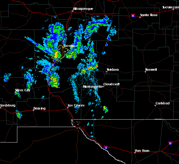
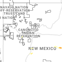
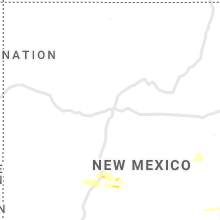
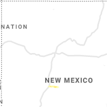
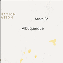
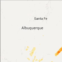
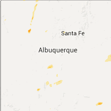
Hail Map for San Antonito, NM
The San Antonito, NM area has had 1 report of on-the-ground hail by trained spotters, and has been under severe weather warnings 9 times during the past 12 months. Doppler radar has detected hail at or near San Antonito, NM on 35 occasions, including 3 occasions during the past year.
| Name: | San Antonito, NM |
| Where Located: | 17.7 miles ENE of Albuquerque, NM |
| Map: | Google Map for San Antonito, NM |
| Population: | 985 |
| Housing Units: | 469 |
| More Info: | Search Google for San Antonito, NM |
5
The Top Recent Hail Date for San Antonito, NM is Saturday, July 12, 2025 (1st out of 35)
Hail and Wind Damage Spotted near San Antonito, NM
| Date / Time | Report Details |
|---|---|
| 7/12/2025 6:37 PM MDT |
 The storm which prompted the warning has weakened below severe limits, and has exited the warned area. therefore, the warning will be allowed to expire. however, small hail and gusty winds are still possible with this thunderstorm. The storm which prompted the warning has weakened below severe limits, and has exited the warned area. therefore, the warning will be allowed to expire. however, small hail and gusty winds are still possible with this thunderstorm.
|
| 7/12/2025 6:29 PM MDT |
 At 629 pm mdt, a severe thunderstorm was located over tijeras, or 14 miles east of albuquerque, moving south at 5 mph (public reported). Hazards include 60 mph wind gusts and half dollar size hail. Hail damage to vehicles is expected. expect wind damage to roofs, siding, and trees. locations impacted include, tijeras, cedar crest, sandia park, sedillo, canoncito in bernalillo county, san antonito and carnuel. This includes interstate 40 between mile markers 171 and 183. At 629 pm mdt, a severe thunderstorm was located over tijeras, or 14 miles east of albuquerque, moving south at 5 mph (public reported). Hazards include 60 mph wind gusts and half dollar size hail. Hail damage to vehicles is expected. expect wind damage to roofs, siding, and trees. locations impacted include, tijeras, cedar crest, sandia park, sedillo, canoncito in bernalillo county, san antonito and carnuel. This includes interstate 40 between mile markers 171 and 183.
|
| 7/12/2025 6:04 PM MDT |
 At 604 pm mdt, a severe thunderstorm was located over cedar crest, or 15 miles east of albuquerque, moving south at 5 mph (public reported). Hazards include golf ball size hail and 60 mph wind gusts. People and animals outdoors will be injured. expect hail damage to roofs, siding, windows, and vehicles. expect wind damage to roofs, siding, and trees. locations impacted include, tijeras, cedar crest, sandia park, sedillo, canoncito in bernalillo county, san antonito and carnuel. This includes interstate 40 between mile markers 171 and 183. At 604 pm mdt, a severe thunderstorm was located over cedar crest, or 15 miles east of albuquerque, moving south at 5 mph (public reported). Hazards include golf ball size hail and 60 mph wind gusts. People and animals outdoors will be injured. expect hail damage to roofs, siding, windows, and vehicles. expect wind damage to roofs, siding, and trees. locations impacted include, tijeras, cedar crest, sandia park, sedillo, canoncito in bernalillo county, san antonito and carnuel. This includes interstate 40 between mile markers 171 and 183.
|
| 7/12/2025 6:00 PM MDT |
 Svrabq the national weather service in albuquerque has issued a * severe thunderstorm warning for, bernalillo county in central new mexico, * until 645 pm mdt. * at 600 pm mdt, a severe thunderstorm was located over cedar crest, or 15 miles east of albuquerque, moving south at 5 mph (radar indicated). Hazards include 60 mph wind gusts and quarter size hail. Hail damage to vehicles is expected. Expect wind damage to roofs, siding, and trees. Svrabq the national weather service in albuquerque has issued a * severe thunderstorm warning for, bernalillo county in central new mexico, * until 645 pm mdt. * at 600 pm mdt, a severe thunderstorm was located over cedar crest, or 15 miles east of albuquerque, moving south at 5 mph (radar indicated). Hazards include 60 mph wind gusts and quarter size hail. Hail damage to vehicles is expected. Expect wind damage to roofs, siding, and trees.
|
| 6/13/2025 7:30 PM MDT | Mesonet station wsm12 stallion runway (wsmr in socorro county NM, 14.1 miles WNW of San Antonito, NM |
| 6/2/2025 3:20 PM MDT |
 the severe thunderstorm warning has been cancelled and is no longer in effect the severe thunderstorm warning has been cancelled and is no longer in effect
|
| 6/2/2025 3:11 PM MDT |
 At 311 pm mdt, a severe thunderstorm was located near sandia heights, or 9 miles east of albuquerque, moving east at 30 mph (radar indicated). Hazards include 60 mph wind gusts and small hail. Expect damage to roofs, siding, and trees. locations impacted include, northeastern albuquerque, corrales, edgewood, tijeras, sandia park, cedar crest, sandia heights, sedillo, north valley and canoncito in bernalillo county. this includes the following highways, interstate 40 between mile markers 164 and 183. Interstate 25 between mile markers 230 and 236. At 311 pm mdt, a severe thunderstorm was located near sandia heights, or 9 miles east of albuquerque, moving east at 30 mph (radar indicated). Hazards include 60 mph wind gusts and small hail. Expect damage to roofs, siding, and trees. locations impacted include, northeastern albuquerque, corrales, edgewood, tijeras, sandia park, cedar crest, sandia heights, sedillo, north valley and canoncito in bernalillo county. this includes the following highways, interstate 40 between mile markers 164 and 183. Interstate 25 between mile markers 230 and 236.
|
| 6/2/2025 2:48 PM MDT |
 Svrabq the national weather service in albuquerque has issued a * severe thunderstorm warning for, bernalillo county in central new mexico, southeastern sandoval county in north central new mexico, * until 330 pm mdt. * at 248 pm mdt, a severe thunderstorm was located over albuquerque, moving east at 35 mph (radar indicated). Hazards include 60 mph wind gusts and quarter size hail. Hail damage to vehicles is expected. Expect wind damage to roofs, siding, and trees. Svrabq the national weather service in albuquerque has issued a * severe thunderstorm warning for, bernalillo county in central new mexico, southeastern sandoval county in north central new mexico, * until 330 pm mdt. * at 248 pm mdt, a severe thunderstorm was located over albuquerque, moving east at 35 mph (radar indicated). Hazards include 60 mph wind gusts and quarter size hail. Hail damage to vehicles is expected. Expect wind damage to roofs, siding, and trees.
|
| 5/4/2025 7:13 PM MDT |
 At 713 pm mdt, a severe thunderstorm was located near golden, or 18 miles east of bernalillo, moving north at 25 mph (radar indicated). Hazards include quarter size hail. Damage to vehicles is expected. Locations impacted include, golden, madrid, cedar grove, los cerrillos and cerrillos hills state park. At 713 pm mdt, a severe thunderstorm was located near golden, or 18 miles east of bernalillo, moving north at 25 mph (radar indicated). Hazards include quarter size hail. Damage to vehicles is expected. Locations impacted include, golden, madrid, cedar grove, los cerrillos and cerrillos hills state park.
|
| 5/4/2025 6:58 PM MDT |
 Svrabq the national weather service in albuquerque has issued a * severe thunderstorm warning for, bernalillo county in central new mexico, southeastern sandoval county in north central new mexico, southwestern santa fe county in north central new mexico, * until 745 pm mdt. * at 658 pm mdt, a severe thunderstorm was located near sedillo, or 16 miles northwest of moriarty, moving north at 25 mph (radar indicated). Hazards include quarter size hail. damage to vehicles is expected Svrabq the national weather service in albuquerque has issued a * severe thunderstorm warning for, bernalillo county in central new mexico, southeastern sandoval county in north central new mexico, southwestern santa fe county in north central new mexico, * until 745 pm mdt. * at 658 pm mdt, a severe thunderstorm was located near sedillo, or 16 miles northwest of moriarty, moving north at 25 mph (radar indicated). Hazards include quarter size hail. damage to vehicles is expected
|
| 7/9/2024 3:58 PM MDT |
 The storm which prompted the warning has weakened below severe limits, and no longer poses an immediate threat to life or property. therefore, the warning will be allowed to expire. however, small hail is still possible with this thunderstorm. The storm which prompted the warning has weakened below severe limits, and no longer poses an immediate threat to life or property. therefore, the warning will be allowed to expire. however, small hail is still possible with this thunderstorm.
|
| 7/9/2024 3:57 PM MDT |
 The storm which prompted the warning has weakened below severe limits, and no longer poses an immediate threat to life or property. therefore, the warning will be allowed to expire. however, small hail is still possible with this thunderstorm. The storm which prompted the warning has weakened below severe limits, and no longer poses an immediate threat to life or property. therefore, the warning will be allowed to expire. however, small hail is still possible with this thunderstorm.
|
| 7/9/2024 3:32 PM MDT |
 Svrabq the national weather service in albuquerque has issued a * severe thunderstorm warning for, central socorro county in central new mexico, * until 400 pm mdt. * at 321 pm mdt, a severe thunderstorm was located 12 miles west of bosque del apache refuge, or 18 miles southwest of socorro, moving east at 20 mph (radar indicated). Hazards include 60 mph wind gusts and quarter size hail. Hail damage to vehicles is expected. Expect wind damage to roofs, siding, and trees. Svrabq the national weather service in albuquerque has issued a * severe thunderstorm warning for, central socorro county in central new mexico, * until 400 pm mdt. * at 321 pm mdt, a severe thunderstorm was located 12 miles west of bosque del apache refuge, or 18 miles southwest of socorro, moving east at 20 mph (radar indicated). Hazards include 60 mph wind gusts and quarter size hail. Hail damage to vehicles is expected. Expect wind damage to roofs, siding, and trees.
|
| 7/9/2024 3:21 PM MDT |
 Svrabq the national weather service in albuquerque has issued a * severe thunderstorm warning for, central socorro county in central new mexico, * until 400 pm mdt. * at 320 pm mdt, a severe thunderstorm was located 12 miles west of bosque del apache refuge, or 18 miles southwest of socorro, moving east at 20 mph (radar indicated). Hazards include 60 mph wind gusts and quarter size hail. Hail damage to vehicles is expected. Expect wind damage to roofs, siding, and trees. Svrabq the national weather service in albuquerque has issued a * severe thunderstorm warning for, central socorro county in central new mexico, * until 400 pm mdt. * at 320 pm mdt, a severe thunderstorm was located 12 miles west of bosque del apache refuge, or 18 miles southwest of socorro, moving east at 20 mph (radar indicated). Hazards include 60 mph wind gusts and quarter size hail. Hail damage to vehicles is expected. Expect wind damage to roofs, siding, and trees.
|
| 6/29/2024 9:32 PM MDT |
 The warning has been allowed to expire. however, heavy rain and flash flooding is still possible with this thunderstorm. The warning has been allowed to expire. however, heavy rain and flash flooding is still possible with this thunderstorm.
|
| 6/29/2024 9:05 PM MDT |
 At 904 pm mdt, a severe thunderstorm was located over eastern albuquerque, moving northeast at 15 mph (radar indicated). Hazards include 60 mph wind gusts and penny size hail. Expect damage to roofs, siding, and trees. Locations impacted include, eastern albuquerque, bernalillo, tijeras, cedar crest, sandia heights, sandia pueblo, sandia park, carnuel, san antonito, and canoncito in bernalillo county. At 904 pm mdt, a severe thunderstorm was located over eastern albuquerque, moving northeast at 15 mph (radar indicated). Hazards include 60 mph wind gusts and penny size hail. Expect damage to roofs, siding, and trees. Locations impacted include, eastern albuquerque, bernalillo, tijeras, cedar crest, sandia heights, sandia pueblo, sandia park, carnuel, san antonito, and canoncito in bernalillo county.
|
| 6/29/2024 8:26 PM MDT |
 Svrabq the national weather service in albuquerque has issued a * severe thunderstorm warning for, southern sandoval county in north central new mexico, bernalillo county in central new mexico, * until 930 pm mdt. * at 826 pm mdt, a severe thunderstorm was located over southeastern albuquerque, moving northeast at 15 mph (radar indicated). Hazards include 60 mph wind gusts and penny size hail. expect damage to roofs, siding, and trees Svrabq the national weather service in albuquerque has issued a * severe thunderstorm warning for, southern sandoval county in north central new mexico, bernalillo county in central new mexico, * until 930 pm mdt. * at 826 pm mdt, a severe thunderstorm was located over southeastern albuquerque, moving northeast at 15 mph (radar indicated). Hazards include 60 mph wind gusts and penny size hail. expect damage to roofs, siding, and trees
|
| 6/19/2024 2:19 PM MDT |
 At 219 pm mdt, a severe thunderstorm was located over edgewood, or 8 miles west of moriarty, moving north at 30 mph (radar indicated). Hazards include 60 mph wind gusts and quarter size hail. Hail damage to vehicles is expected. expect wind damage to roofs, siding, and trees. Locations impacted include, moriarty, edgewood, sedillo, and cedar grove. At 219 pm mdt, a severe thunderstorm was located over edgewood, or 8 miles west of moriarty, moving north at 30 mph (radar indicated). Hazards include 60 mph wind gusts and quarter size hail. Hail damage to vehicles is expected. expect wind damage to roofs, siding, and trees. Locations impacted include, moriarty, edgewood, sedillo, and cedar grove.
|
| 6/19/2024 2:09 PM MDT |
 Svrabq the national weather service in albuquerque has issued a * severe thunderstorm warning for, southeastern sandoval county in north central new mexico, southwestern santa fe county in north central new mexico, bernalillo county in central new mexico, northwestern torrance county in central new mexico, * until 245 pm mdt. * at 208 pm mdt, a severe thunderstorm was located near chilili, or 9 miles southwest of moriarty, moving north at 25 mph (radar indicated). Hazards include 60 mph wind gusts and quarter size hail. Hail damage to vehicles is expected. Expect wind damage to roofs, siding, and trees. Svrabq the national weather service in albuquerque has issued a * severe thunderstorm warning for, southeastern sandoval county in north central new mexico, southwestern santa fe county in north central new mexico, bernalillo county in central new mexico, northwestern torrance county in central new mexico, * until 245 pm mdt. * at 208 pm mdt, a severe thunderstorm was located near chilili, or 9 miles southwest of moriarty, moving north at 25 mph (radar indicated). Hazards include 60 mph wind gusts and quarter size hail. Hail damage to vehicles is expected. Expect wind damage to roofs, siding, and trees.
|
| 6/14/2024 6:27 PM MDT |
 The storm which prompted the warning has weakened below severe limits, and no longer poses an immediate threat to life or property. therefore, the warning will be allowed to expire. however, gusty winds are still possible with this thunderstorm. The storm which prompted the warning has weakened below severe limits, and no longer poses an immediate threat to life or property. therefore, the warning will be allowed to expire. however, gusty winds are still possible with this thunderstorm.
|
| 6/14/2024 6:02 PM MDT |
 At 559 pm mdt, a severe thunderstorm was located over san felipe pueblo, or 10 miles northeast of bernalillo, moving northeast at 35 mph. additional thunderstorms are moving into the albuquerque metro area from the southwest with a risk of more severe wind gusts (radar indicated). Hazards include 60 mph wind gusts. Expect damage to roofs, siding, and trees. Locations impacted include, albuquerque, rio rancho, bernalillo, corrales, los ranchos de albuquerque, tijeras, mariposa, san felipe pueblo, coronado state monument, and vista hills. At 559 pm mdt, a severe thunderstorm was located over san felipe pueblo, or 10 miles northeast of bernalillo, moving northeast at 35 mph. additional thunderstorms are moving into the albuquerque metro area from the southwest with a risk of more severe wind gusts (radar indicated). Hazards include 60 mph wind gusts. Expect damage to roofs, siding, and trees. Locations impacted include, albuquerque, rio rancho, bernalillo, corrales, los ranchos de albuquerque, tijeras, mariposa, san felipe pueblo, coronado state monument, and vista hills.
|
| 6/14/2024 5:24 PM MDT |
 Svrabq the national weather service in albuquerque has issued a * severe thunderstorm warning for, southeastern sandoval county in north central new mexico, bernalillo county in central new mexico, * until 630 pm mdt. * at 524 pm mdt, a severe thunderstorm was located over northern albuquerque, moving east at 55 mph (radar indicated). Hazards include 60 mph wind gusts. expect damage to roofs, siding, and trees Svrabq the national weather service in albuquerque has issued a * severe thunderstorm warning for, southeastern sandoval county in north central new mexico, bernalillo county in central new mexico, * until 630 pm mdt. * at 524 pm mdt, a severe thunderstorm was located over northern albuquerque, moving east at 55 mph (radar indicated). Hazards include 60 mph wind gusts. expect damage to roofs, siding, and trees
|
| 10/24/2023 2:40 PM MDT | Mesonet station wsm12 stallion runway (wsmr in socorro county NM, 14.1 miles WNW of San Antonito, NM |
| 9/26/2023 5:13 PM MDT |
 The severe thunderstorm warning for south central socorro county will expire at 515 pm mdt, the storm which prompted the warning has weakened below severe limits, and no longer poses an immediate threat to life or property. therefore, the warning will be allowed to expire. however, heavy rain is still possible with this thunderstorm, and some minor flooding may occur. The severe thunderstorm warning for south central socorro county will expire at 515 pm mdt, the storm which prompted the warning has weakened below severe limits, and no longer poses an immediate threat to life or property. therefore, the warning will be allowed to expire. however, heavy rain is still possible with this thunderstorm, and some minor flooding may occur.
|
| 9/26/2023 5:12 PM MDT |
 The severe thunderstorm warning for central socorro county will expire at 515 pm mdt, the storm which prompted the warning has weakened below severe limits, and no longer poses an immediate threat to life or property. therefore, the warning will be allowed to expire. however, heavy rain is still possible with this thunderstorm and some minor flooding may occur. The severe thunderstorm warning for central socorro county will expire at 515 pm mdt, the storm which prompted the warning has weakened below severe limits, and no longer poses an immediate threat to life or property. therefore, the warning will be allowed to expire. however, heavy rain is still possible with this thunderstorm and some minor flooding may occur.
|
| 9/26/2023 4:49 PM MDT |
 At 449 pm mdt, a severe thunderstorm was located 12 miles west of bosque del apache refuge, or 22 miles southwest of socorro, moving east at 15 mph (radar indicated). Hazards include 60 mph wind gusts and quarter size hail. Hail damage to vehicles is expected. expect wind damage to roofs, siding, and trees. locations impacted include, bosque del apache refuge. this includes interstate 25 between mile markers 120 and 137. hail threat, radar indicated max hail size, 1. 00 in wind threat, radar indicated max wind gust, 60 mph. At 449 pm mdt, a severe thunderstorm was located 12 miles west of bosque del apache refuge, or 22 miles southwest of socorro, moving east at 15 mph (radar indicated). Hazards include 60 mph wind gusts and quarter size hail. Hail damage to vehicles is expected. expect wind damage to roofs, siding, and trees. locations impacted include, bosque del apache refuge. this includes interstate 25 between mile markers 120 and 137. hail threat, radar indicated max hail size, 1. 00 in wind threat, radar indicated max wind gust, 60 mph.
|
| 9/26/2023 4:45 PM MDT |
 At 444 pm mdt, a severe thunderstorm was located 8 miles southwest of socorro, moving east at 10 mph (radar indicated). Hazards include 60 mph wind gusts and quarter size hail. Hail damage to vehicles is expected. Expect wind damage to roofs, siding, and trees. At 444 pm mdt, a severe thunderstorm was located 8 miles southwest of socorro, moving east at 10 mph (radar indicated). Hazards include 60 mph wind gusts and quarter size hail. Hail damage to vehicles is expected. Expect wind damage to roofs, siding, and trees.
|
| 9/26/2023 4:27 PM MDT |
 At 427 pm mdt, a severe thunderstorm was located 17 miles west of bosque del apache refuge, or 25 miles southwest of socorro, moving east at 10 mph (radar indicated). Hazards include 60 mph wind gusts and quarter size hail. Hail damage to vehicles is expected. Expect wind damage to roofs, siding, and trees. At 427 pm mdt, a severe thunderstorm was located 17 miles west of bosque del apache refuge, or 25 miles southwest of socorro, moving east at 10 mph (radar indicated). Hazards include 60 mph wind gusts and quarter size hail. Hail damage to vehicles is expected. Expect wind damage to roofs, siding, and trees.
|
| 9/18/2023 4:15 PM MDT |
 At 414 pm mdt, a severe thunderstorm was located over northeastern albuquerque, moving east at 25 mph (radar indicated). Hazards include 60 mph wind gusts and quarter size hail. Hail damage to vehicles is expected. expect wind damage to roofs, siding, and trees. locations impacted include, albuquerque, los ranchos de albuquerque, tijeras, cedar crest, sedillo, sandia heights, north valley, sandia park, alameda, and san antonito. this includes the following highways, interstate 40 between mile markers 157 and 167, and between mile markers 173 and 182. interstate 25 between mile markers 223 and 234. hail threat, radar indicated max hail size, 1. 00 in wind threat, radar indicated max wind gust, 60 mph. At 414 pm mdt, a severe thunderstorm was located over northeastern albuquerque, moving east at 25 mph (radar indicated). Hazards include 60 mph wind gusts and quarter size hail. Hail damage to vehicles is expected. expect wind damage to roofs, siding, and trees. locations impacted include, albuquerque, los ranchos de albuquerque, tijeras, cedar crest, sedillo, sandia heights, north valley, sandia park, alameda, and san antonito. this includes the following highways, interstate 40 between mile markers 157 and 167, and between mile markers 173 and 182. interstate 25 between mile markers 223 and 234. hail threat, radar indicated max hail size, 1. 00 in wind threat, radar indicated max wind gust, 60 mph.
|
| 9/18/2023 4:01 PM MDT |
 At 401 pm mdt, a severe thunderstorm was located over northwestern albuquerque, moving east at 25 mph (radar indicated). Hazards include 60 mph wind gusts and quarter size hail. Hail damage to vehicles is expected. Expect wind damage to roofs, siding, and trees. At 401 pm mdt, a severe thunderstorm was located over northwestern albuquerque, moving east at 25 mph (radar indicated). Hazards include 60 mph wind gusts and quarter size hail. Hail damage to vehicles is expected. Expect wind damage to roofs, siding, and trees.
|
| 6/6/2023 7:04 PM MDT |
 At 703 pm mdt, a severe thunderstorm was located 19 miles northeast of monticello, moving northeast at 20 mph (radar indicated). Hazards include ping pong ball size hail and 60 mph wind gusts. People and animals outdoors will be injured. expect hail damage to roofs, siding, windows, and vehicles. Expect wind damage to roofs, siding, and trees. At 703 pm mdt, a severe thunderstorm was located 19 miles northeast of monticello, moving northeast at 20 mph (radar indicated). Hazards include ping pong ball size hail and 60 mph wind gusts. People and animals outdoors will be injured. expect hail damage to roofs, siding, windows, and vehicles. Expect wind damage to roofs, siding, and trees.
|
| 5/26/2023 1:09 PM MDT |
 At 108 pm mdt, a severe thunderstorm was located over escabosa, or 15 miles southwest of moriarty, moving north at 15 mph (radar indicated). Hazards include 60 mph wind gusts and half dollar size hail. Hail damage to vehicles is expected. Expect wind damage to roofs, siding, and trees. At 108 pm mdt, a severe thunderstorm was located over escabosa, or 15 miles southwest of moriarty, moving north at 15 mph (radar indicated). Hazards include 60 mph wind gusts and half dollar size hail. Hail damage to vehicles is expected. Expect wind damage to roofs, siding, and trees.
|
| 5/19/2023 8:10 PM MDT |
 At 809 pm mdt, a severe thunderstorm was located 7 miles east of bosque del apache refuge, or 19 miles southeast of socorro, moving east at 25 mph (radar indicated). Hazards include 60 mph wind gusts and quarter size hail. Hail damage to vehicles is expected. expect wind damage to roofs, siding, and trees. locations impacted include, bosque del apache refuge. this includes the following highways, interstate 25 between mile markers 127 and 136. highway 380 between mile markers 4 and 20. hail threat, radar indicated max hail size, 1. 00 in wind threat, radar indicated max wind gust, 60 mph. At 809 pm mdt, a severe thunderstorm was located 7 miles east of bosque del apache refuge, or 19 miles southeast of socorro, moving east at 25 mph (radar indicated). Hazards include 60 mph wind gusts and quarter size hail. Hail damage to vehicles is expected. expect wind damage to roofs, siding, and trees. locations impacted include, bosque del apache refuge. this includes the following highways, interstate 25 between mile markers 127 and 136. highway 380 between mile markers 4 and 20. hail threat, radar indicated max hail size, 1. 00 in wind threat, radar indicated max wind gust, 60 mph.
|
| 5/19/2023 7:47 PM MDT |
 At 747 pm mdt, a severe thunderstorm was located over bosque del apache refuge, or 19 miles south of socorro, moving east at 25 mph (radar indicated). Hazards include 60 mph wind gusts and quarter size hail. Hail damage to vehicles is expected. Expect wind damage to roofs, siding, and trees. At 747 pm mdt, a severe thunderstorm was located over bosque del apache refuge, or 19 miles south of socorro, moving east at 25 mph (radar indicated). Hazards include 60 mph wind gusts and quarter size hail. Hail damage to vehicles is expected. Expect wind damage to roofs, siding, and trees.
|
| 8/15/2021 7:22 PM MDT |
 At 720 pm mdt, an outflow boundary racing southward from strong thunderstorms were located along a line extending from about 6 miles north of sandia park to near sandia pueblo to rio rancho to 10 miles west of northern meadows, moving south to souteast at 40 mph (radar indicated). Hazards include 60 mph wind gusts. expect damage to roofs, siding, and trees At 720 pm mdt, an outflow boundary racing southward from strong thunderstorms were located along a line extending from about 6 miles north of sandia park to near sandia pueblo to rio rancho to 10 miles west of northern meadows, moving south to souteast at 40 mph (radar indicated). Hazards include 60 mph wind gusts. expect damage to roofs, siding, and trees
|
| 7/12/2021 7:51 PM MDT |
 At 750 pm mdt, severe thunderstorms were located along a line extending from near cedar grove to 9 miles southeast of moriarty, moving southwest at 20 mph (radar indicated). Hazards include 60 mph wind gusts and quarter size hail. Hail damage to vehicles is expected. expect wind damage to roofs, siding, and trees. locations impacted include, edgewood, moriarty, tijeras, cedar crest, cedar grove, sedillo, chilili, mcintosh, escabosa and cedro. this includes interstate 40 between mile markers 172 and 205. Significant blowing dust has been observed with this storm. At 750 pm mdt, severe thunderstorms were located along a line extending from near cedar grove to 9 miles southeast of moriarty, moving southwest at 20 mph (radar indicated). Hazards include 60 mph wind gusts and quarter size hail. Hail damage to vehicles is expected. expect wind damage to roofs, siding, and trees. locations impacted include, edgewood, moriarty, tijeras, cedar crest, cedar grove, sedillo, chilili, mcintosh, escabosa and cedro. this includes interstate 40 between mile markers 172 and 205. Significant blowing dust has been observed with this storm.
|
| 7/12/2021 7:22 PM MDT |
 At 720 pm mdt, severe thunderstorms were located along a line extending from near stanley to 9 miles west of clines corners, moving southwest at 25 mph (radar and trained weather spotters). Hazards include 60 mph wind gusts and half dollar size hail. Hail damage to vehicles is expected. expect wind damage to roofs, siding, and trees. locations impacted include, edgewood, moriarty, estancia, tijeras, cedar crest, cedar grove, sedillo, chilili, mcintosh and stanley. a storm spotter in stanley observed quarter size hail with these storms at 717 pm mdt. This includes interstate 40 between mile markers 172 and 215. At 720 pm mdt, severe thunderstorms were located along a line extending from near stanley to 9 miles west of clines corners, moving southwest at 25 mph (radar and trained weather spotters). Hazards include 60 mph wind gusts and half dollar size hail. Hail damage to vehicles is expected. expect wind damage to roofs, siding, and trees. locations impacted include, edgewood, moriarty, estancia, tijeras, cedar crest, cedar grove, sedillo, chilili, mcintosh and stanley. a storm spotter in stanley observed quarter size hail with these storms at 717 pm mdt. This includes interstate 40 between mile markers 172 and 215.
|
| 7/12/2021 7:12 PM MDT |
 At 711 pm mdt, severe thunderstorms were located along a line extending from near stanley to 7 miles west of clines corners, moving southwest at 25 mph (radar indicated). Hazards include 60 mph wind gusts and quarter size hail. Hail damage to vehicles is expected. Expect wind damage to roofs, siding, and trees. At 711 pm mdt, severe thunderstorms were located along a line extending from near stanley to 7 miles west of clines corners, moving southwest at 25 mph (radar indicated). Hazards include 60 mph wind gusts and quarter size hail. Hail damage to vehicles is expected. Expect wind damage to roofs, siding, and trees.
|
| 2/13/2021 6:15 PM MST |
 At 614 pm mst, severe thunderstorms with snow and hail were located along a line extending from san felipe pueblo to albuquerque, moving east at 35 mph (public). Hazards include 60 mph wind gusts. Expect damage to roofs, siding, and trees. locations impacted include, albuquerque, rio rancho, corrales, bernalillo, los ranchos de albuquerque, santo domingo pueblo, tijeras, mariposa, san felipe pueblo and coronado state monument. this includes the following highways, interstate 40 between mile markers 151 and 168, and between mile markers 173 and 178. interstate 25 between mile markers 223 and 258. Highway 550 between mile markers 1 and 18. At 614 pm mst, severe thunderstorms with snow and hail were located along a line extending from san felipe pueblo to albuquerque, moving east at 35 mph (public). Hazards include 60 mph wind gusts. Expect damage to roofs, siding, and trees. locations impacted include, albuquerque, rio rancho, corrales, bernalillo, los ranchos de albuquerque, santo domingo pueblo, tijeras, mariposa, san felipe pueblo and coronado state monument. this includes the following highways, interstate 40 between mile markers 151 and 168, and between mile markers 173 and 178. interstate 25 between mile markers 223 and 258. Highway 550 between mile markers 1 and 18.
|
| 2/13/2021 6:00 PM MST |
 At 600 pm mst, severe thunderstorms were located along a line extending from 6 miles west of san felipe pueblo to albuquerque, moving northeast at 45 mph (radar indicated). Hazards include 60 mph wind gusts. expect damage to roofs, siding, and trees At 600 pm mst, severe thunderstorms were located along a line extending from 6 miles west of san felipe pueblo to albuquerque, moving northeast at 45 mph (radar indicated). Hazards include 60 mph wind gusts. expect damage to roofs, siding, and trees
|
| 8/3/2020 7:08 PM MDT |
 At 708 pm mdt, a severe thunderstorm was located near sedillo, or 14 miles west of moriarty, moving southeast at 10 mph (radar indicated). Hazards include 60 mph wind gusts and quarter size hail. Hail damage to vehicles is expected. Expect wind damage to roofs, siding, and trees. At 708 pm mdt, a severe thunderstorm was located near sedillo, or 14 miles west of moriarty, moving southeast at 10 mph (radar indicated). Hazards include 60 mph wind gusts and quarter size hail. Hail damage to vehicles is expected. Expect wind damage to roofs, siding, and trees.
|
| 8/3/2020 6:24 PM MDT |
 At 624 pm mdt, a severe thunderstorm was located over northeastern albuquerque, moving southeast at 20 mph (radar indicated). Hazards include 60 mph wind gusts and quarter size hail. Hail damage to vehicles is expected. expect wind damage to roofs, siding, and trees. locations impacted include, albuquerque, corrales, los ranchos de albuquerque, sandia heights, north valley, sandia park, alameda, carnuel, cedar crest and south valley. this includes the following highways, interstate 40 between mile markers 157 and 170. Interstate 25 between mile markers 221 and 235. At 624 pm mdt, a severe thunderstorm was located over northeastern albuquerque, moving southeast at 20 mph (radar indicated). Hazards include 60 mph wind gusts and quarter size hail. Hail damage to vehicles is expected. expect wind damage to roofs, siding, and trees. locations impacted include, albuquerque, corrales, los ranchos de albuquerque, sandia heights, north valley, sandia park, alameda, carnuel, cedar crest and south valley. this includes the following highways, interstate 40 between mile markers 157 and 170. Interstate 25 between mile markers 221 and 235.
|
| 8/3/2020 6:12 PM MDT |
 At 612 pm mdt, a severe thunderstorm was located over northern albuquerque, moving southeast at 20 mph (radar indicated). Hazards include 60 mph wind gusts and quarter size hail. Hail damage to vehicles is expected. Expect wind damage to roofs, siding, and trees. At 612 pm mdt, a severe thunderstorm was located over northern albuquerque, moving southeast at 20 mph (radar indicated). Hazards include 60 mph wind gusts and quarter size hail. Hail damage to vehicles is expected. Expect wind damage to roofs, siding, and trees.
|
| 7/31/2020 6:43 PM MDT |
 At 642 pm mdt, a severe thunderstorm was located over bosque farms, or near los lunas, moving south at 45 mph. a 64 mph wind gust has already been reported at the albuquerque sunport (radar indicated). Hazards include 70 mph wind gusts. Expect considerable tree damage. Damage is likely to mobile homes, roofs, and outbuildings. At 642 pm mdt, a severe thunderstorm was located over bosque farms, or near los lunas, moving south at 45 mph. a 64 mph wind gust has already been reported at the albuquerque sunport (radar indicated). Hazards include 70 mph wind gusts. Expect considerable tree damage. Damage is likely to mobile homes, roofs, and outbuildings.
|
| 7/31/2020 6:20 PM MDT |
 At 619 pm mdt, a severe thunderstorm was located over northeastern albuquerque, moving south at 35 mph (radar indicated). Hazards include 70 mph wind gusts. Expect considerable tree damage. damage is likely to mobile homes, roofs, and outbuildings. locations impacted include, albuquerque, rio rancho, valencia, los lunas, corrales, bernalillo, los ranchos de albuquerque, bosque farms, edgewood and peralta. this includes the following highways, interstate 40 between mile markers 143 and 193. interstate 25 between mile markers 201 and 253. Highway 550 between mile markers 1 and 10. At 619 pm mdt, a severe thunderstorm was located over northeastern albuquerque, moving south at 35 mph (radar indicated). Hazards include 70 mph wind gusts. Expect considerable tree damage. damage is likely to mobile homes, roofs, and outbuildings. locations impacted include, albuquerque, rio rancho, valencia, los lunas, corrales, bernalillo, los ranchos de albuquerque, bosque farms, edgewood and peralta. this includes the following highways, interstate 40 between mile markers 143 and 193. interstate 25 between mile markers 201 and 253. Highway 550 between mile markers 1 and 10.
|
| 7/31/2020 5:57 PM MDT |
 At 556 pm mdt, a severe thunderstorm was located over bernalillo, moving south at 40 mph (radar indicated). Hazards include 70 mph wind gusts. Expect considerable tree damage. Damage is likely to mobile homes, roofs, and outbuildings. At 556 pm mdt, a severe thunderstorm was located over bernalillo, moving south at 40 mph (radar indicated). Hazards include 70 mph wind gusts. Expect considerable tree damage. Damage is likely to mobile homes, roofs, and outbuildings.
|
| 10/8/2019 5:18 PM MDT |
 At 518 pm mdt, a severe thunderstorm was located near bosque del apache refuge, or 12 miles south of socorro, moving east at 25 mph (trained weather spotters). Hazards include 60 mph wind gusts and quarter size hail. Hail damage to vehicles is expected. Expect wind damage to roofs, siding, and trees. At 518 pm mdt, a severe thunderstorm was located near bosque del apache refuge, or 12 miles south of socorro, moving east at 25 mph (trained weather spotters). Hazards include 60 mph wind gusts and quarter size hail. Hail damage to vehicles is expected. Expect wind damage to roofs, siding, and trees.
|
| 10/8/2019 5:12 PM MDT | Quarter sized hail reported 1.1 miles WNW of San Antonito, NM |
| 10/8/2019 3:05 PM MDT |
 At 305 pm mdt, a severe thunderstorm was located 7 miles south of bosque del apache refuge, or 24 miles south of socorro, moving east at 20 mph (radar indicated). Hazards include 60 mph wind gusts and quarter size hail. Hail damage to vehicles is expected. expect wind damage to roofs, siding, and trees. locations impacted include, bosque del apache refuge. This includes interstate 25 between mile markers 127 and 136. At 305 pm mdt, a severe thunderstorm was located 7 miles south of bosque del apache refuge, or 24 miles south of socorro, moving east at 20 mph (radar indicated). Hazards include 60 mph wind gusts and quarter size hail. Hail damage to vehicles is expected. expect wind damage to roofs, siding, and trees. locations impacted include, bosque del apache refuge. This includes interstate 25 between mile markers 127 and 136.
|
| 10/8/2019 2:41 PM MDT |
 At 240 pm mdt, a severe thunderstorm was located 9 miles southwest of bosque del apache refuge, or 23 miles south of socorro, moving east at 20 mph (radar indicated). Hazards include 60 mph wind gusts and quarter size hail. Hail damage to vehicles is expected. Expect wind damage to roofs, siding, and trees. At 240 pm mdt, a severe thunderstorm was located 9 miles southwest of bosque del apache refuge, or 23 miles south of socorro, moving east at 20 mph (radar indicated). Hazards include 60 mph wind gusts and quarter size hail. Hail damage to vehicles is expected. Expect wind damage to roofs, siding, and trees.
|
| 10/8/2019 2:25 PM MDT |
 At 225 pm mdt, a severe thunderstorm was located 15 miles west of bosque del apache refuge, or 23 miles southwest of socorro, moving east at 20 mph (radar indicated). Hazards include 60 mph wind gusts and quarter size hail. Hail damage to vehicles is expected. expect wind damage to roofs, siding, and trees. this severe thunderstorm will remain over mainly rural areas of south central socorro county. This includes interstate 25 between mile markers 118 and 137. At 225 pm mdt, a severe thunderstorm was located 15 miles west of bosque del apache refuge, or 23 miles southwest of socorro, moving east at 20 mph (radar indicated). Hazards include 60 mph wind gusts and quarter size hail. Hail damage to vehicles is expected. expect wind damage to roofs, siding, and trees. this severe thunderstorm will remain over mainly rural areas of south central socorro county. This includes interstate 25 between mile markers 118 and 137.
|
| 10/8/2019 2:04 PM MDT |
 At 204 pm mdt, a severe thunderstorm was located 21 miles west of bosque del apache refuge, or 27 miles southwest of socorro, moving east at 20 mph (radar indicated). Hazards include 60 mph wind gusts and half dollar size hail. Hail damage to vehicles is expected. expect wind damage to roofs, siding, and trees. this severe thunderstorm will remain over mainly rural areas of southwestern socorro county. This includes interstate 25 between mile markers 117 and 137. At 204 pm mdt, a severe thunderstorm was located 21 miles west of bosque del apache refuge, or 27 miles southwest of socorro, moving east at 20 mph (radar indicated). Hazards include 60 mph wind gusts and half dollar size hail. Hail damage to vehicles is expected. expect wind damage to roofs, siding, and trees. this severe thunderstorm will remain over mainly rural areas of southwestern socorro county. This includes interstate 25 between mile markers 117 and 137.
|
| 10/4/2019 4:32 PM MDT |
 At 432 pm mdt, a severe thunderstorm was located 9 miles northeast of bosque del apache refuge, or 16 miles southeast of socorro, moving east at 30 mph (radar indicated). Hazards include ping pong ball size hail and 60 mph wind gusts. People and animals outdoors will be injured. expect hail damage to roofs, siding, windows, and vehicles. expect wind damage to roofs, siding, and trees. This severe thunderstorm will remain over mainly rural areas of central socorro county. At 432 pm mdt, a severe thunderstorm was located 9 miles northeast of bosque del apache refuge, or 16 miles southeast of socorro, moving east at 30 mph (radar indicated). Hazards include ping pong ball size hail and 60 mph wind gusts. People and animals outdoors will be injured. expect hail damage to roofs, siding, windows, and vehicles. expect wind damage to roofs, siding, and trees. This severe thunderstorm will remain over mainly rural areas of central socorro county.
|
| 10/4/2019 4:25 PM MDT |
 At 425 pm mdt, a severe thunderstorm was located near bosque del apache refuge, or 15 miles south of socorro, moving east at 30 mph (radar indicated). Hazards include 60 mph wind gusts and half dollar size hail. Hail damage to vehicles is expected. Expect wind damage to roofs, siding, and trees. At 425 pm mdt, a severe thunderstorm was located near bosque del apache refuge, or 15 miles south of socorro, moving east at 30 mph (radar indicated). Hazards include 60 mph wind gusts and half dollar size hail. Hail damage to vehicles is expected. Expect wind damage to roofs, siding, and trees.
|
| 6/13/2019 2:46 PM MDT |
 At 246 pm mdt, a severe thunderstorm was located 13 miles west of bosque del apache refuge, or 23 miles southwest of socorro, moving southeast at 15 mph (radar indicated). Hazards include ping pong ball size hail and 60 mph wind gusts. People and animals outdoors will be injured. expect hail damage to roofs, siding, windows, and vehicles. Expect wind damage to roofs, siding, and trees. At 246 pm mdt, a severe thunderstorm was located 13 miles west of bosque del apache refuge, or 23 miles southwest of socorro, moving southeast at 15 mph (radar indicated). Hazards include ping pong ball size hail and 60 mph wind gusts. People and animals outdoors will be injured. expect hail damage to roofs, siding, windows, and vehicles. Expect wind damage to roofs, siding, and trees.
|
| 6/2/2019 5:10 PM MDT |
 The severe thunderstorm warning for southeastern sandoval, southern santa fe, bernalillo and northwestern torrance counties will expire at 515 pm mdt, the storm which prompted the warning has weakened below severe limits, and has exited the warned area. therefore the warning will be allowed to expire. however gusty winds and heavy rain are still possible with this thunderstorm. a severe thunderstorm watch remains in effect until 800 pm mdt for central and north central new mexico. to report severe weather, contact your nearest law enforcement agency. they will relay your report to the national weather service albuquerque. The severe thunderstorm warning for southeastern sandoval, southern santa fe, bernalillo and northwestern torrance counties will expire at 515 pm mdt, the storm which prompted the warning has weakened below severe limits, and has exited the warned area. therefore the warning will be allowed to expire. however gusty winds and heavy rain are still possible with this thunderstorm. a severe thunderstorm watch remains in effect until 800 pm mdt for central and north central new mexico. to report severe weather, contact your nearest law enforcement agency. they will relay your report to the national weather service albuquerque.
|
| 6/2/2019 4:34 PM MDT |
 At 433 pm mdt, a severe thunderstorm was located over sedillo, or 15 miles northwest of moriarty, moving north at 30 mph (radar indicated). Hazards include ping pong ball size hail and 60 mph wind gusts. People and animals outdoors will be injured. expect hail damage to roofs, siding, windows, and vehicles. expect wind damage to roofs, siding, and trees. locations impacted include, edgewood, tijeras, cedar crest, madrid, cedar grove, sedillo, sandia park, galisteo, golden and cedro. this includes the following highways, interstate 40 between mile markers 175 and 192. Highway 285 between mile markers 276 and 279. At 433 pm mdt, a severe thunderstorm was located over sedillo, or 15 miles northwest of moriarty, moving north at 30 mph (radar indicated). Hazards include ping pong ball size hail and 60 mph wind gusts. People and animals outdoors will be injured. expect hail damage to roofs, siding, windows, and vehicles. expect wind damage to roofs, siding, and trees. locations impacted include, edgewood, tijeras, cedar crest, madrid, cedar grove, sedillo, sandia park, galisteo, golden and cedro. this includes the following highways, interstate 40 between mile markers 175 and 192. Highway 285 between mile markers 276 and 279.
|
| 6/2/2019 4:20 PM MDT |
 At 420 pm mdt, a severe thunderstorm was located near escabosa, or 13 miles west of moriarty, moving north at 30 mph (radar indicated). Hazards include 60 mph wind gusts and quarter size hail. Hail damage to vehicles is expected. Expect wind damage to roofs, siding, and trees. At 420 pm mdt, a severe thunderstorm was located near escabosa, or 13 miles west of moriarty, moving north at 30 mph (radar indicated). Hazards include 60 mph wind gusts and quarter size hail. Hail damage to vehicles is expected. Expect wind damage to roofs, siding, and trees.
|
| 8/22/2018 5:57 PM MDT |
 At 541 pm mdt, an outflow boundary associated with severe thunderstorms was located along a line extending from rio rancho to albuquerque to 10 miles northeast of meadow lake, moving northeast at 40 mph. this outflow boundary has already produced peak wind gusts of 55 mph at the double eagle ii airport (radar indicated). Hazards include 60 mph wind gusts. Expect damage to roofs, siding, and trees. very poor visibility due to blowing dust is expected. locations impacted include, albuquerque, rio rancho, los lunas, corrales, bernalillo, los ranchos de albuquerque, bosque farms, peralta, tijeras and coronado state monument. this includes the following highways, interstate 40 between mile markers 145 and 176. Interstate 25 between mile markers 204 and 244. At 541 pm mdt, an outflow boundary associated with severe thunderstorms was located along a line extending from rio rancho to albuquerque to 10 miles northeast of meadow lake, moving northeast at 40 mph. this outflow boundary has already produced peak wind gusts of 55 mph at the double eagle ii airport (radar indicated). Hazards include 60 mph wind gusts. Expect damage to roofs, siding, and trees. very poor visibility due to blowing dust is expected. locations impacted include, albuquerque, rio rancho, los lunas, corrales, bernalillo, los ranchos de albuquerque, bosque farms, peralta, tijeras and coronado state monument. this includes the following highways, interstate 40 between mile markers 145 and 176. Interstate 25 between mile markers 204 and 244.
|
| 8/22/2018 5:43 PM MDT |
 At 541 pm mdt, an outflow boundary associated with severe thunderstorms was located along a line extending from rio rancho to albuquerque to 10 miles northeast of meadow lake, moving northeast at 40 mph. this outflow boundary has already produced peak wind gusts of 55 mph at the double eagle ii airport (radar indicated). Hazards include 60 mph wind gusts. Expect damage to roofs, siding, and trees. very poor visibility due to blowing dust is expected. locations impacted include, albuquerque, rio rancho, los lunas, corrales, bernalillo, los ranchos de albuquerque, bosque farms, peralta, tijeras and coronado state monument. this includes the following highways, interstate 40 between mile markers 145 and 176. Interstate 25 between mile markers 204 and 244. At 541 pm mdt, an outflow boundary associated with severe thunderstorms was located along a line extending from rio rancho to albuquerque to 10 miles northeast of meadow lake, moving northeast at 40 mph. this outflow boundary has already produced peak wind gusts of 55 mph at the double eagle ii airport (radar indicated). Hazards include 60 mph wind gusts. Expect damage to roofs, siding, and trees. very poor visibility due to blowing dust is expected. locations impacted include, albuquerque, rio rancho, los lunas, corrales, bernalillo, los ranchos de albuquerque, bosque farms, peralta, tijeras and coronado state monument. this includes the following highways, interstate 40 between mile markers 145 and 176. Interstate 25 between mile markers 204 and 244.
|
| 8/22/2018 5:29 PM MDT |
 At 528 pm mdt, an outflow boundary from severe thunderstorms was located along a line extending from 6 miles west of cabezon to albuquerque to near bosque farms, moving northeast at 35 mph (radar indicated). Hazards include 60 mph wind gusts. Expect damage to roofs, siding, and trees. Very poor visibility from blowing dust is also expected. At 528 pm mdt, an outflow boundary from severe thunderstorms was located along a line extending from 6 miles west of cabezon to albuquerque to near bosque farms, moving northeast at 35 mph (radar indicated). Hazards include 60 mph wind gusts. Expect damage to roofs, siding, and trees. Very poor visibility from blowing dust is also expected.
|
| 7/30/2018 6:58 PM MDT |
 At 658 pm mdt, a severe thunderstorm was located near sandia heights, or 8 miles southeast of bernalillo, moving southeast at 15 mph (radar indicated). Hazards include 60 mph wind gusts and quarter size hail. Hail damage to vehicles is expected. expect wind damage to roofs, siding, and trees. locations impacted include, eastern albuquerque, sandia heights, sandia park, san antonito, canoncito in bernalillo county, cedar crest and carnuel. This includes interstate 40 near mile marker 168. At 658 pm mdt, a severe thunderstorm was located near sandia heights, or 8 miles southeast of bernalillo, moving southeast at 15 mph (radar indicated). Hazards include 60 mph wind gusts and quarter size hail. Hail damage to vehicles is expected. expect wind damage to roofs, siding, and trees. locations impacted include, eastern albuquerque, sandia heights, sandia park, san antonito, canoncito in bernalillo county, cedar crest and carnuel. This includes interstate 40 near mile marker 168.
|
| 7/30/2018 6:46 PM MDT |
 At 645 pm mdt, a severe thunderstorm was located near sandia heights, or near bernalillo, moving southeast at 20 mph (radar indicated). Hazards include 60 mph wind gusts and quarter size hail. Hail damage to vehicles is expected. expect wind damage to roofs, siding, and trees. locations impacted include, eastern albuquerque, bernalillo, sandia heights, sandia park, san antonito, canoncito in bernalillo county, cedar crest and carnuel. This includes the following highways, interstate 25 between mile markers 239 and 241. At 645 pm mdt, a severe thunderstorm was located near sandia heights, or near bernalillo, moving southeast at 20 mph (radar indicated). Hazards include 60 mph wind gusts and quarter size hail. Hail damage to vehicles is expected. expect wind damage to roofs, siding, and trees. locations impacted include, eastern albuquerque, bernalillo, sandia heights, sandia park, san antonito, canoncito in bernalillo county, cedar crest and carnuel. This includes the following highways, interstate 25 between mile markers 239 and 241.
|
| 7/30/2018 6:25 PM MDT |
 At 625 pm mdt, a severe thunderstorm was located over santa ana pueblo, or over bernalillo, moving southeast at 15 mph (radar indicated). Hazards include 60 mph wind gusts and quarter size hail. Hail damage to vehicles is expected. Expect wind damage to roofs, siding, and trees. At 625 pm mdt, a severe thunderstorm was located over santa ana pueblo, or over bernalillo, moving southeast at 15 mph (radar indicated). Hazards include 60 mph wind gusts and quarter size hail. Hail damage to vehicles is expected. Expect wind damage to roofs, siding, and trees.
|
| 6/3/2018 4:33 PM MDT |
 At 433 pm mdt, a severe thunderstorm was located 9 miles southeast of socorro, moving east at 25 mph (radar indicated). Hazards include 60 mph wind gusts and quarter size hail. Hail damage to vehicles is expected. expect wind damage to roofs, siding, and trees. locations impacted include, socorro, bosque del apache refuge, escondida, laborcita and luis lopez. This includes interstate 25 between mile markers 126 and 152. At 433 pm mdt, a severe thunderstorm was located 9 miles southeast of socorro, moving east at 25 mph (radar indicated). Hazards include 60 mph wind gusts and quarter size hail. Hail damage to vehicles is expected. expect wind damage to roofs, siding, and trees. locations impacted include, socorro, bosque del apache refuge, escondida, laborcita and luis lopez. This includes interstate 25 between mile markers 126 and 152.
|
| 6/3/2018 4:07 PM MDT |
 At 407 pm mdt, a severe thunderstorm was located 9 miles southwest of socorro, moving east at 30 mph (radar indicated). Hazards include 60 mph wind gusts and half dollar size hail. Hail damage to vehicles is expected. Expect wind damage to roofs, siding, and trees. At 407 pm mdt, a severe thunderstorm was located 9 miles southwest of socorro, moving east at 30 mph (radar indicated). Hazards include 60 mph wind gusts and half dollar size hail. Hail damage to vehicles is expected. Expect wind damage to roofs, siding, and trees.
|
| 5/21/2018 2:44 PM MDT |
 At 243 pm mdt, severe thunderstorms were located along a line extending from 12 miles northeast of marquez to sandia park, moving north at 35 mph (radar indicated). Hazards include 60 mph wind gusts and quarter size hail. Hail damage to vehicles is expected. Expect wind damage to roofs, siding, and trees. At 243 pm mdt, severe thunderstorms were located along a line extending from 12 miles northeast of marquez to sandia park, moving north at 35 mph (radar indicated). Hazards include 60 mph wind gusts and quarter size hail. Hail damage to vehicles is expected. Expect wind damage to roofs, siding, and trees.
|
| 9/30/2017 6:30 PM MDT |
 At 630 pm mdt, a severe thunderstorm was located near cedar grove, or 17 miles north of moriarty, moving east at 20 mph (radar indicated). Hazards include 60 mph wind gusts and quarter size hail. Hail damage to vehicles is expected. expect wind damage to roofs, siding, and trees. Locations impacted include, edgewood, cedar grove, golden and san antonito. At 630 pm mdt, a severe thunderstorm was located near cedar grove, or 17 miles north of moriarty, moving east at 20 mph (radar indicated). Hazards include 60 mph wind gusts and quarter size hail. Hail damage to vehicles is expected. expect wind damage to roofs, siding, and trees. Locations impacted include, edgewood, cedar grove, golden and san antonito.
|
| 9/30/2017 6:10 PM MDT |
 At 609 pm mdt, a severe thunderstorm was located near sandia pueblo, or near bernalillo, moving southeast at 20 mph. another severe thunderstorm was located near golden also moving southeast at 20 mph (radar indicated). Hazards include 60 mph wind gusts and quarter size hail. Hail damage to vehicles is expected. Expect wind damage to roofs, siding, and trees. At 609 pm mdt, a severe thunderstorm was located near sandia pueblo, or near bernalillo, moving southeast at 20 mph. another severe thunderstorm was located near golden also moving southeast at 20 mph (radar indicated). Hazards include 60 mph wind gusts and quarter size hail. Hail damage to vehicles is expected. Expect wind damage to roofs, siding, and trees.
|
| 6/27/2017 10:39 AM MDT |
 The severe thunderstorm warning for south central socorro county will expire at 445 pm mdt, the storm which prompted the warning has weakened below severe limits, and no longer pose an immediate threat to life or property. therefore the warning will be allowed to expire. however gusty winds and heavy rain are still possible with this thunderstorm. The severe thunderstorm warning for south central socorro county will expire at 445 pm mdt, the storm which prompted the warning has weakened below severe limits, and no longer pose an immediate threat to life or property. therefore the warning will be allowed to expire. however gusty winds and heavy rain are still possible with this thunderstorm.
|
| 6/27/2017 10:28 AM MDT |
 At 428 pm mdt, a severe thunderstorm was located near bosque del apache refuge, or 19 miles south of socorro, moving east at 15 mph (radar indicated). Hazards include 60 mph wind gusts and quarter size hail. Hail damage to vehicles is expected. expect wind damage to roofs, siding, and trees. Locations impacted include, bosque del apache refuge. At 428 pm mdt, a severe thunderstorm was located near bosque del apache refuge, or 19 miles south of socorro, moving east at 15 mph (radar indicated). Hazards include 60 mph wind gusts and quarter size hail. Hail damage to vehicles is expected. expect wind damage to roofs, siding, and trees. Locations impacted include, bosque del apache refuge.
|
| 6/27/2017 10:15 AM MDT |
 At 414 pm mdt, a severe thunderstorm was located over bosque del apache refuge, or 19 miles south of socorro, moving east at 15 mph (radar indicated). Hazards include 60 mph wind gusts and quarter size hail. Hail damage to vehicles is expected. Expect wind damage to roofs, siding, and trees. At 414 pm mdt, a severe thunderstorm was located over bosque del apache refuge, or 19 miles south of socorro, moving east at 15 mph (radar indicated). Hazards include 60 mph wind gusts and quarter size hail. Hail damage to vehicles is expected. Expect wind damage to roofs, siding, and trees.
|
| 6/26/2017 4:33 PM MDT |
 At 432 pm mdt, a severe thunderstorm was located over cedar grove, or 13 miles northwest of moriarty, moving southwest at 5 mph (trained weather spotters). Hazards include ping pong ball size hail. People and animals outdoors will be injured. expect damage to roofs, siding, windows, and vehicles. locations impacted include, edgewood, stanley, cedar grove and golden. This includes interstate 40 between mile markers 181 and 194. At 432 pm mdt, a severe thunderstorm was located over cedar grove, or 13 miles northwest of moriarty, moving southwest at 5 mph (trained weather spotters). Hazards include ping pong ball size hail. People and animals outdoors will be injured. expect damage to roofs, siding, windows, and vehicles. locations impacted include, edgewood, stanley, cedar grove and golden. This includes interstate 40 between mile markers 181 and 194.
|
| 6/26/2017 4:20 PM MDT |
 At 420 pm mdt, a severe thunderstorm was located over cedar grove, or 12 miles northwest of moriarty, and is nearly stationary (radar indicated). Hazards include 60 mph wind gusts and quarter size hail. Hail damage to vehicles is expected. Expect wind damage to roofs, siding, and trees. At 420 pm mdt, a severe thunderstorm was located over cedar grove, or 12 miles northwest of moriarty, and is nearly stationary (radar indicated). Hazards include 60 mph wind gusts and quarter size hail. Hail damage to vehicles is expected. Expect wind damage to roofs, siding, and trees.
|
| 6/24/2017 5:40 PM MDT | White sands missile range - stallion runwa in socorro county NM, 14.1 miles WNW of San Antonito, NM |
| 6/24/2017 4:25 PM MDT | White sands missile range - stallion runwa in socorro county NM, 14.1 miles WNW of San Antonito, NM |
| 6/6/2017 2:24 PM MDT |
 At 223 pm mdt, a severe thunderstorm was located near mariposa, or 8 miles northwest of bernalillo, moving southeast at 25 mph (radar indicated). Hazards include 60 mph wind gusts and quarter size hail. Hail damage to vehicles is expected. Expect wind damage to roofs, siding, and trees. At 223 pm mdt, a severe thunderstorm was located near mariposa, or 8 miles northwest of bernalillo, moving southeast at 25 mph (radar indicated). Hazards include 60 mph wind gusts and quarter size hail. Hail damage to vehicles is expected. Expect wind damage to roofs, siding, and trees.
|
| 10/9/2016 3:15 PM MDT |
 At 314 pm mdt, a severe thunderstorm was located over lemitar, or 9 miles north of socorro, moving southeast at 25 mph (radar indicated). Hazards include 60 mph wind gusts and quarter size hail. Hail damage to vehicles is expected. Expect wind damage to roofs, siding, and trees. At 314 pm mdt, a severe thunderstorm was located over lemitar, or 9 miles north of socorro, moving southeast at 25 mph (radar indicated). Hazards include 60 mph wind gusts and quarter size hail. Hail damage to vehicles is expected. Expect wind damage to roofs, siding, and trees.
|
| 6/1/2016 7:41 PM MDT | The severe thunderstorm warning for central bernalillo county will expire at 745 pm mdt, the storms which prompted the warning have weakened below severe limits, therefore the warning will be allowed to expire. however small hail, .gusty winds and heavy rain are still likely with these thunderstorms. |
| 6/1/2016 7:20 PM MDT |
 At 719 pm mdt, severe thunderstorms were located along a line extending from tijeras to albuquerque, moving south at 15 mph (radar indicated). Hazards include 60 mph wind gusts and dime to quarter size hail. Expect damage to roofs. siding. and trees. locations impacted include, albuquerque, southwestern rio rancho, corrales, los ranchos de albuquerque, tijeras, taylor ranch, paradise hills, ventana ranch, sandia heights and south valley. other locations affected include the following locations sandia peak ski area, cole spring picnic area, la cueva picnic area, rio grande nature center, and petroglyph national monument. this includes the following highways, interstate 40 between mile markers 150 and 177. Interstate 25 between mile markers 217 and 235. At 719 pm mdt, severe thunderstorms were located along a line extending from tijeras to albuquerque, moving south at 15 mph (radar indicated). Hazards include 60 mph wind gusts and dime to quarter size hail. Expect damage to roofs. siding. and trees. locations impacted include, albuquerque, southwestern rio rancho, corrales, los ranchos de albuquerque, tijeras, taylor ranch, paradise hills, ventana ranch, sandia heights and south valley. other locations affected include the following locations sandia peak ski area, cole spring picnic area, la cueva picnic area, rio grande nature center, and petroglyph national monument. this includes the following highways, interstate 40 between mile markers 150 and 177. Interstate 25 between mile markers 217 and 235.
|
| 6/1/2016 7:03 PM MDT |
 At 702 pm mdt, a severe thunderstorm was located over eastern albuquerque, moving south at 15 mph (radar indicated). Hazards include 60 mph wind gusts and dime to penny size hail. Expect damage to roofs. siding. And trees. At 702 pm mdt, a severe thunderstorm was located over eastern albuquerque, moving south at 15 mph (radar indicated). Hazards include 60 mph wind gusts and dime to penny size hail. Expect damage to roofs. siding. And trees.
|
| 10/21/2015 7:27 AM MDT |
 At 726 am mdt, severe thunderstorms were located along a line extending from 5 miles north of bosque del apache refuge to 14 miles south of bingham, moving northeast at 40 mph (radar indicated). Hazards include quarter size hail and 60 mph wind gusts. Hail damage to vehicles is expected. Expect wind damage to roofs, siding and trees. At 726 am mdt, severe thunderstorms were located along a line extending from 5 miles north of bosque del apache refuge to 14 miles south of bingham, moving northeast at 40 mph (radar indicated). Hazards include quarter size hail and 60 mph wind gusts. Hail damage to vehicles is expected. Expect wind damage to roofs, siding and trees.
|
| 10/21/2015 7:08 AM MDT |
 At 708 am mdt, a severe thunderstorm was located 18 miles southeast of bosque del apache refuge, or 32 miles southeast of socorro, moving north at 45 mph (radar indicated). Hazards include 60 mph wind gusts and quarter size hail. Hail damage to vehicles is expected. expect wind damage to roofs, siding and trees. locations impacted include, bosque del apache refuge, bingham and laborcita. This includes interstate 25 between mile markers 125 and 142. At 708 am mdt, a severe thunderstorm was located 18 miles southeast of bosque del apache refuge, or 32 miles southeast of socorro, moving north at 45 mph (radar indicated). Hazards include 60 mph wind gusts and quarter size hail. Hail damage to vehicles is expected. expect wind damage to roofs, siding and trees. locations impacted include, bosque del apache refuge, bingham and laborcita. This includes interstate 25 between mile markers 125 and 142.
|
| 10/21/2015 6:44 AM MDT |
 At 644 am mdt, a severe thunderstorm was located 17 miles south of bosque del apache refuge, or 35 miles south of socorro, moving northeast at 35 mph (radar indicated). Hazards include 60 mph wind gusts. Expect damage to roofs. Siding and trees. At 644 am mdt, a severe thunderstorm was located 17 miles south of bosque del apache refuge, or 35 miles south of socorro, moving northeast at 35 mph (radar indicated). Hazards include 60 mph wind gusts. Expect damage to roofs. Siding and trees.
|
| 10/21/2015 6:12 AM MDT | The severe thunderstorm warning for central socorro county will expire at 615 am mdt, the storm which prompted the warning has weakened below severe limits, and no longer pose an immediate threat to life or property. therefore the warning will be allowed to expire. however small hail and gusty winds are still possible with this thunderstorm. |
| 10/21/2015 5:55 AM MDT |
 At 555 am mdt, a severe thunderstorm was located 9 miles west of bosque del apache refuge, or 18 miles southwest of socorro, moving northeast at 30 mph (radar indicated). Hazards include golf ball size hail and 60 mph wind gusts. People and animals outdoors will be injured. expect hail damage to roofs, siding, windows and vehicles. expect wind damage to roofs, siding and trees. locations impacted include, socorro, escondida, bosque del apache refuge, luis lopez and laborcita. This includes interstate 25 between mile markers 121 and 152. At 555 am mdt, a severe thunderstorm was located 9 miles west of bosque del apache refuge, or 18 miles southwest of socorro, moving northeast at 30 mph (radar indicated). Hazards include golf ball size hail and 60 mph wind gusts. People and animals outdoors will be injured. expect hail damage to roofs, siding, windows and vehicles. expect wind damage to roofs, siding and trees. locations impacted include, socorro, escondida, bosque del apache refuge, luis lopez and laborcita. This includes interstate 25 between mile markers 121 and 152.
|
| 10/21/2015 5:32 AM MDT |
 At 532 am mdt, a severe thunderstorm was located 17 miles southwest of bosque del apache refuge, or 26 miles northeast of monticello, moving northeast at 35 mph (radar indicated). Hazards include quarter size hail and 60 mph wind gusts. Hail damage to vehicles is expected. Expect wind damage to roofs, siding and trees. At 532 am mdt, a severe thunderstorm was located 17 miles southwest of bosque del apache refuge, or 26 miles northeast of monticello, moving northeast at 35 mph (radar indicated). Hazards include quarter size hail and 60 mph wind gusts. Hail damage to vehicles is expected. Expect wind damage to roofs, siding and trees.
|
| 10/20/2015 12:10 PM MDT |
 At 1210 pm mdt, a severe thunderstorm was located 12 miles south of bosque del apache refuge, or 29 miles south of socorro, moving northeast at 35 mph (radar indicated). Hazards include ping pong ball size hail and 60 mph wind gusts. People and animals outdoors will be injured. expect hail damage to roofs, siding, windows and vehicles. expect wind damage to roofs, siding and trees. this severe thunderstorm will remain over mainly rural areas of south central socorro county, including the following locations, laborcita. This includes interstate 25 between mile markers 138 and 140. At 1210 pm mdt, a severe thunderstorm was located 12 miles south of bosque del apache refuge, or 29 miles south of socorro, moving northeast at 35 mph (radar indicated). Hazards include ping pong ball size hail and 60 mph wind gusts. People and animals outdoors will be injured. expect hail damage to roofs, siding, windows and vehicles. expect wind damage to roofs, siding and trees. this severe thunderstorm will remain over mainly rural areas of south central socorro county, including the following locations, laborcita. This includes interstate 25 between mile markers 138 and 140.
|
| 10/20/2015 11:56 AM MDT |
 At 1155 am mdt, a severe thunderstorm was located 20 miles south of bosque del apache refuge, or 32 miles northeast of truth or consequences, moving north at 40 mph (radar indicated). Hazards include quarter size hail and 60 mph wind gusts. Hail damage to vehicles is expected. Expect wind damage to roofs, siding and trees. At 1155 am mdt, a severe thunderstorm was located 20 miles south of bosque del apache refuge, or 32 miles northeast of truth or consequences, moving north at 40 mph (radar indicated). Hazards include quarter size hail and 60 mph wind gusts. Hail damage to vehicles is expected. Expect wind damage to roofs, siding and trees.
|
| 7/4/2015 4:55 PM MDT | White sands missile range - stallion runwa in socorro county NM, 14.1 miles WNW of San Antonito, NM |
| 1/1/0001 12:00 AM | White sands missile range - stallion runwa in socorro county NM, 14.1 miles WNW of San Antonito, NM |
| 1/1/0001 12:00 AM | Stallion rnwy - white snds mssle rnge in socorro county NM, 14.1 miles WNW of San Antonito, NM |
Hail Maps for San Antonito, NM


Connect with Interactive Hail Maps