

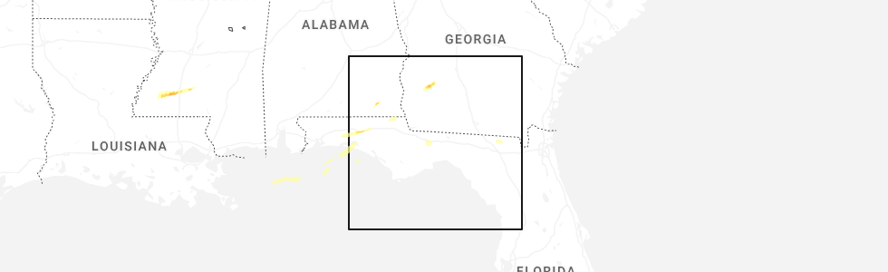
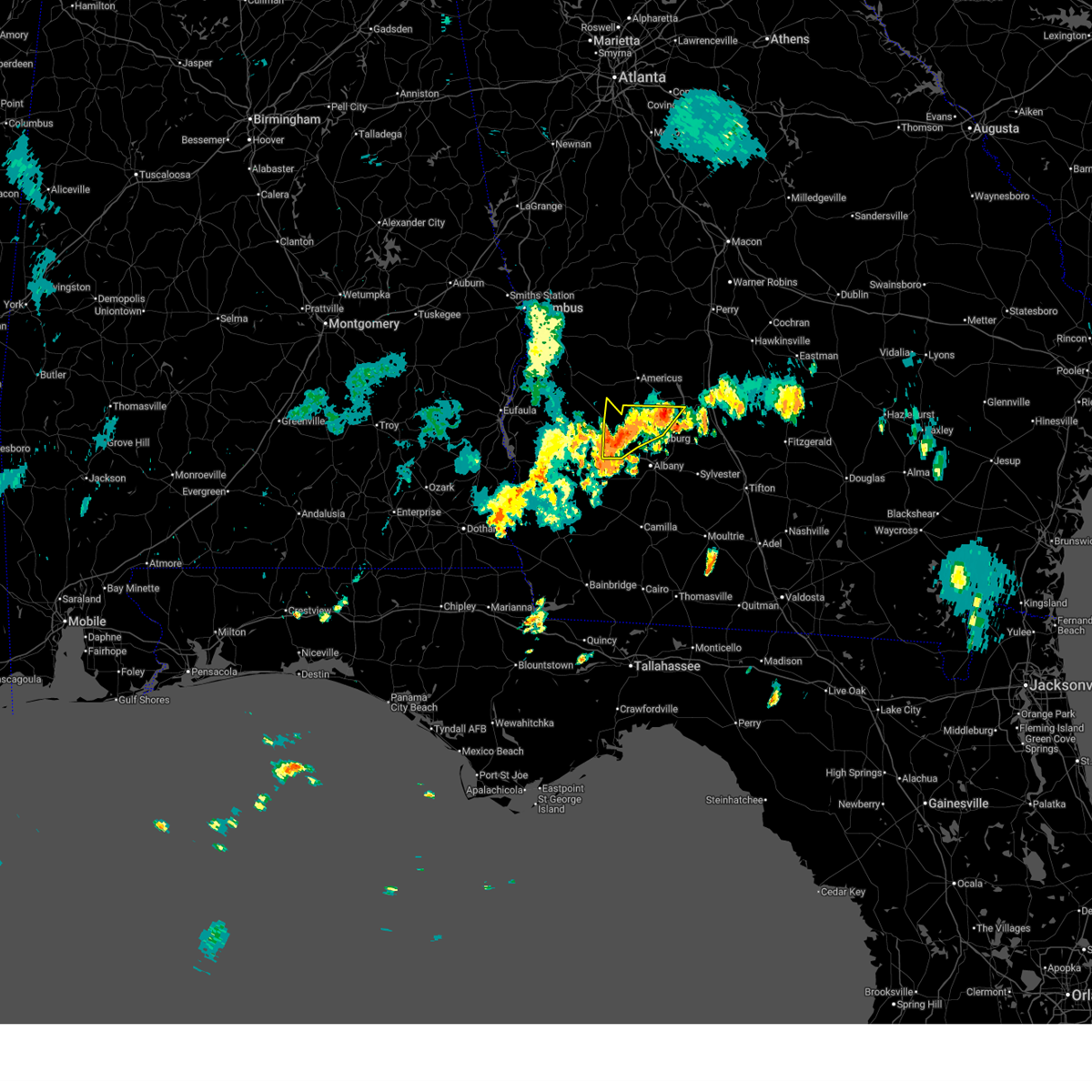
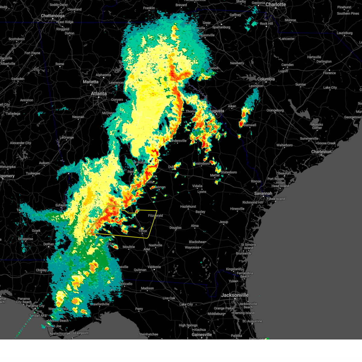
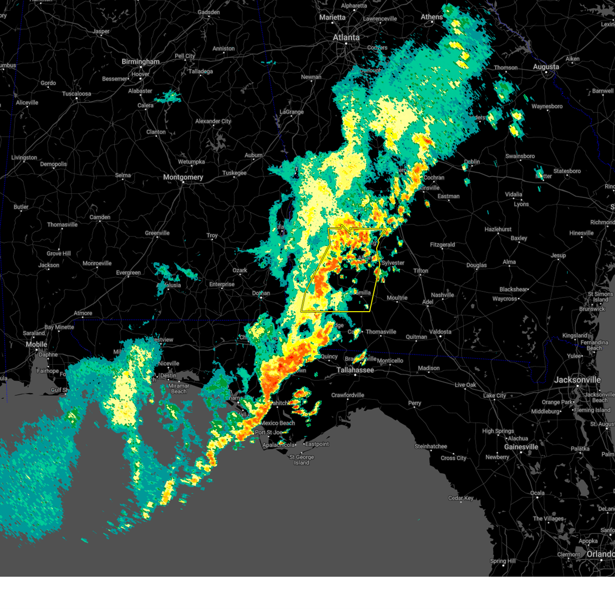
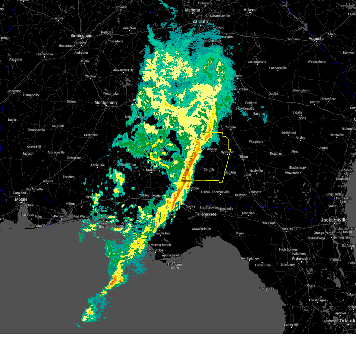
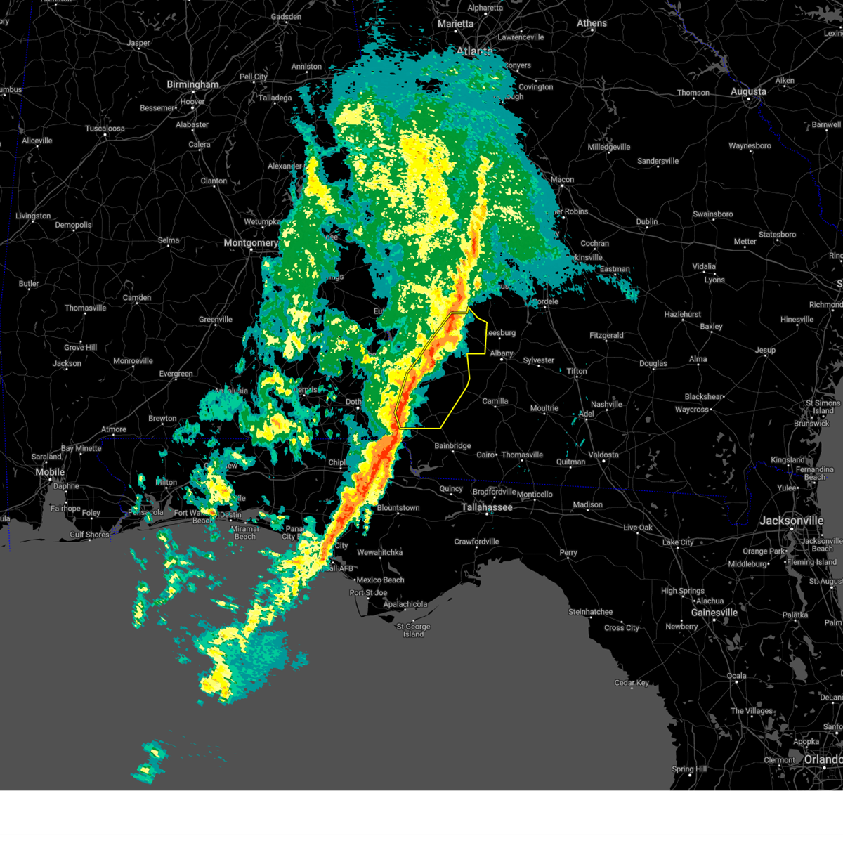
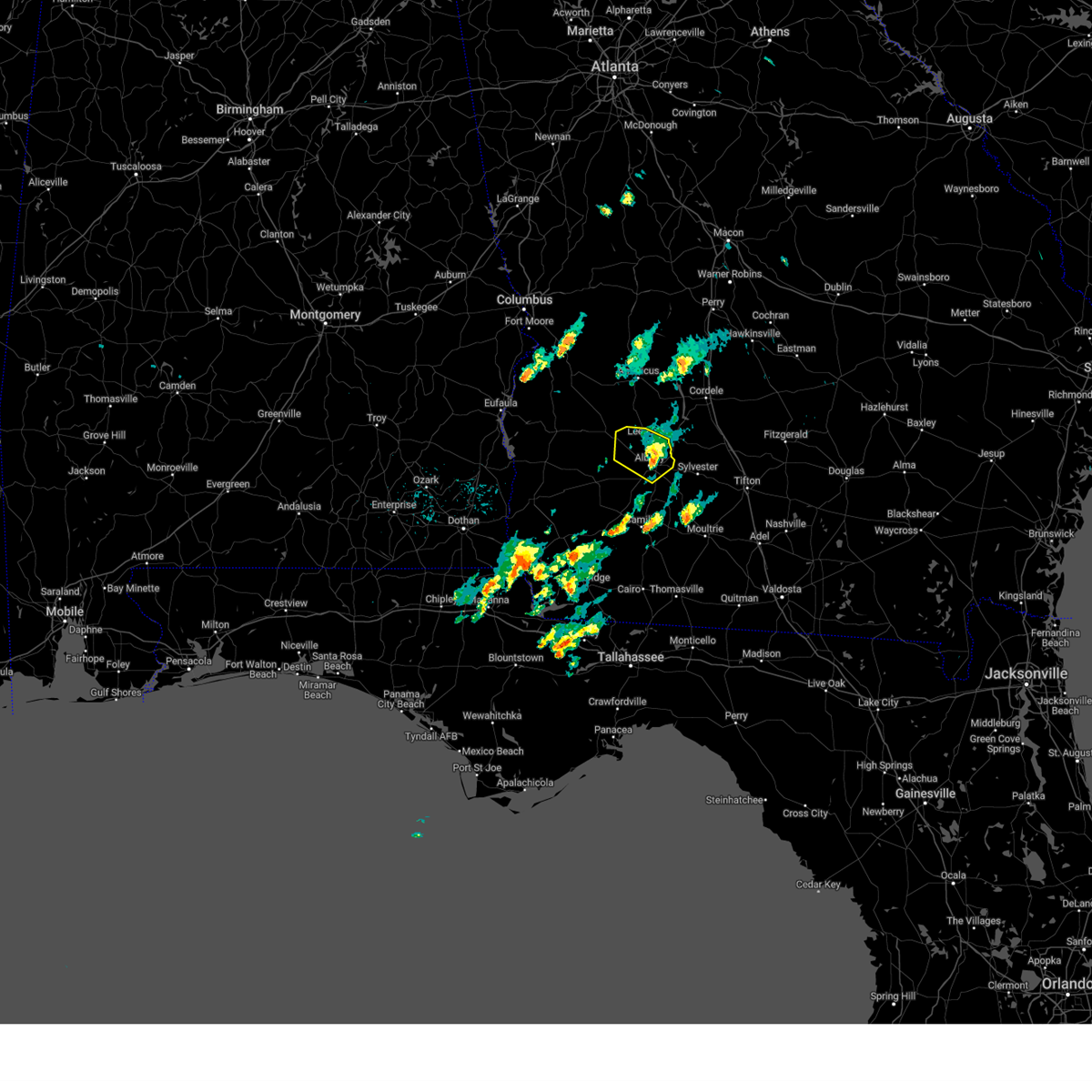
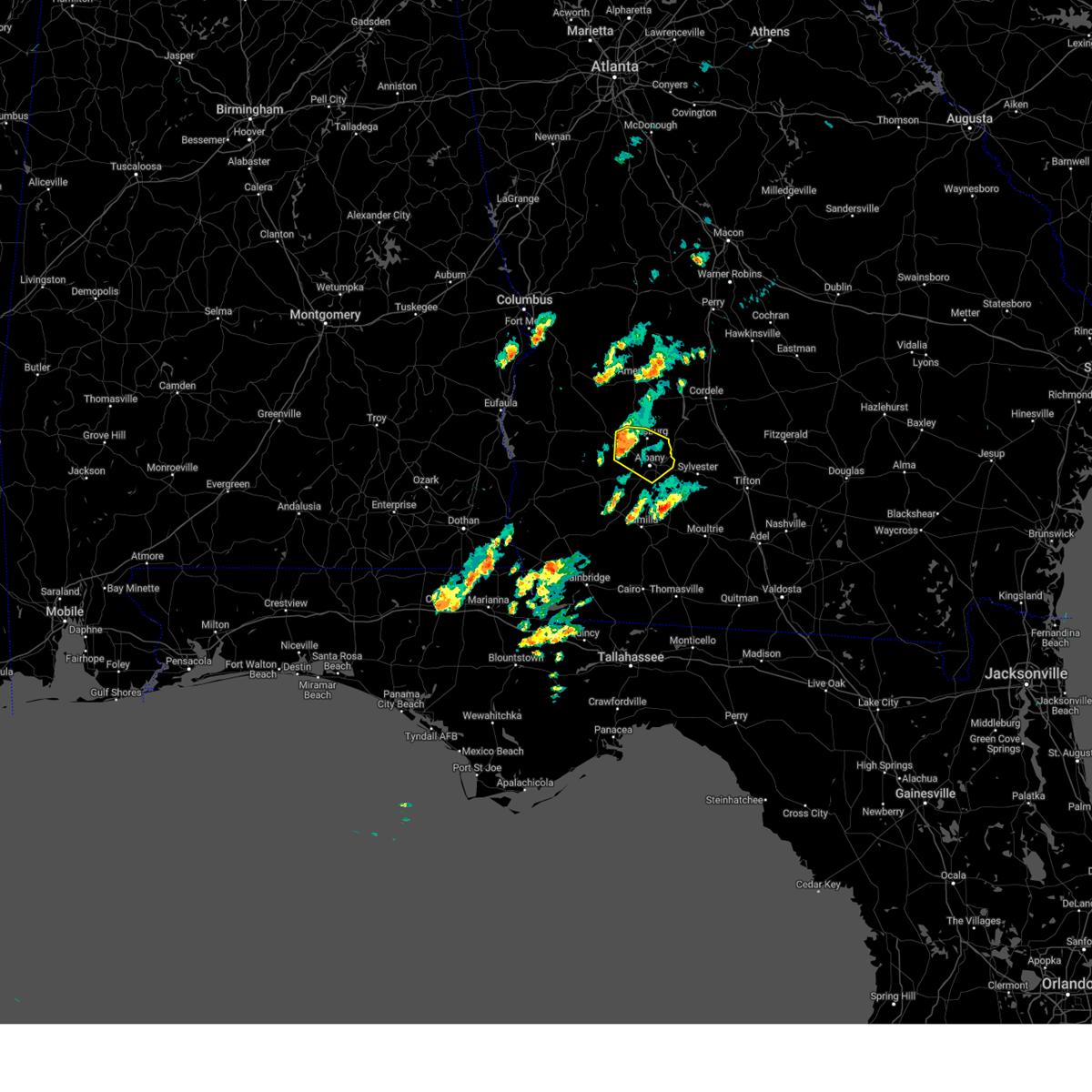
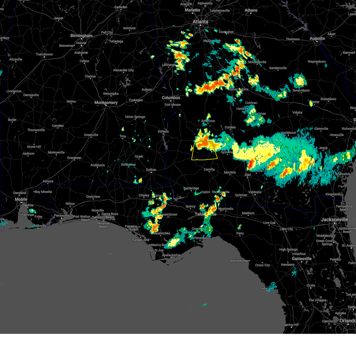
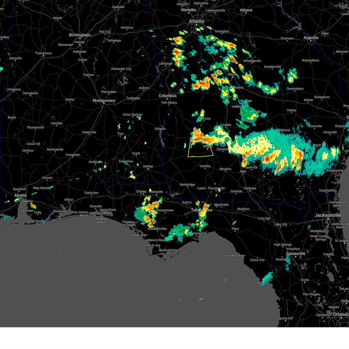
Hail Map for Sasser, GA
The Sasser, GA area has had 0 reports of on-the-ground hail by trained spotters, and has been under severe weather warnings 23 times during the past 12 months. Doppler radar has detected hail at or near Sasser, GA on 58 occasions, including 4 occasions during the past year.
| Name: | Sasser, GA |
| Where Located: | 88.3 miles N of Tallahassee, FL |
| Map: | Google Map for Sasser, GA |
| Population: | 279 |
| Housing Units: | 143 |
| More Info: | Search Google for Sasser, GA |
2
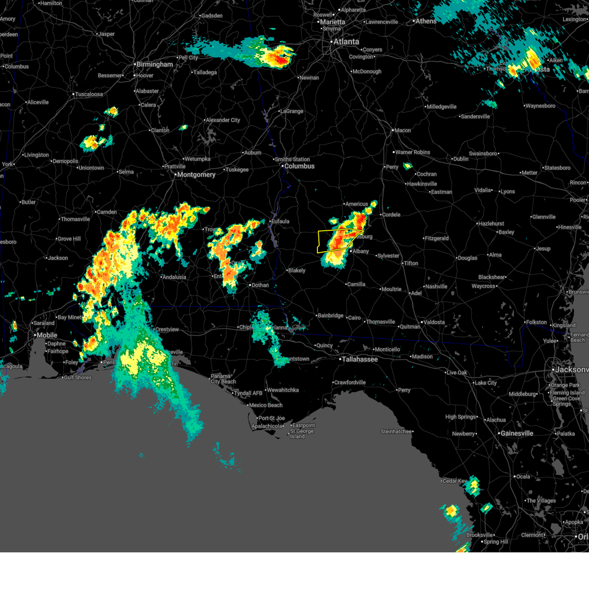
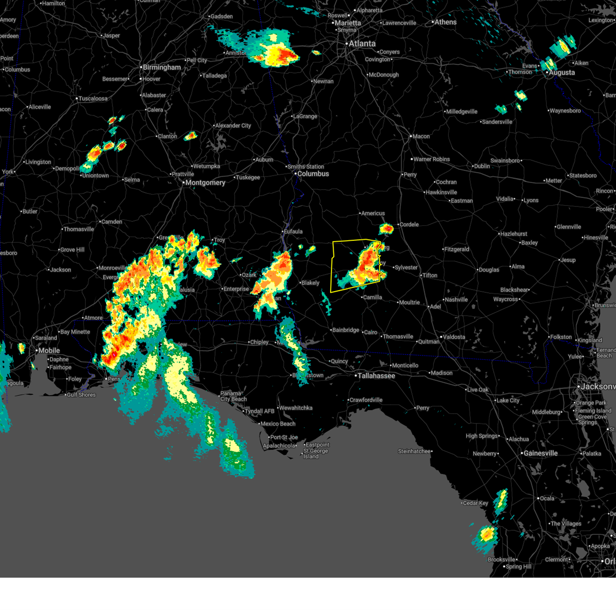
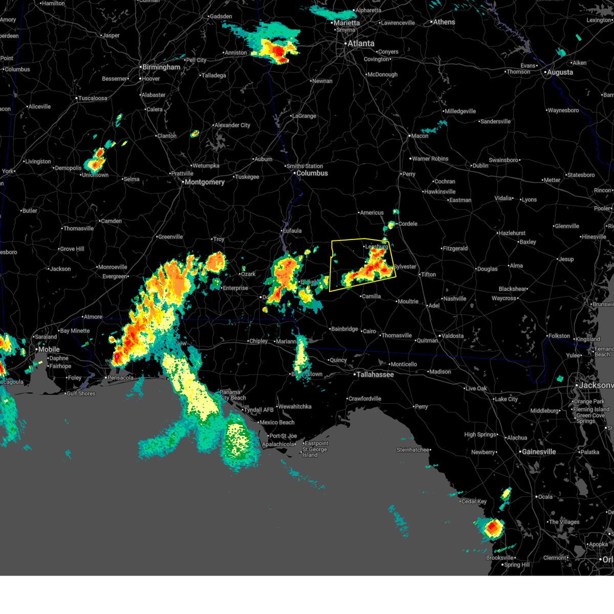
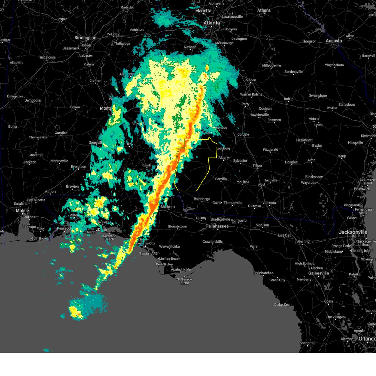
The Top Recent Hail Date for Sasser, GA is Sunday, March 9, 2025 (4th out of 58)
Hail and Wind Damage Spotted near Sasser, GA
| Date / Time | Report Details |
|---|---|
| 6/25/2025 10:06 PM EDT | Svrtae the national weather service in tallahassee has issued a * severe thunderstorm warning for, northern clay county in southwestern georgia, randolph county in southwestern georgia, quitman county in southwestern georgia, terrell county in southwestern georgia, * until 1130 pm edt. * at 1006 pm edt, a severe thunderstorm was located near dawson, moving west at 20 mph (radar indicated). Hazards include 60 mph wind gusts. expect damage to roofs, siding, and trees |
| 6/25/2025 9:56 PM EDT |
 the severe thunderstorm warning has been cancelled and is no longer in effect the severe thunderstorm warning has been cancelled and is no longer in effect
|
| 6/25/2025 9:56 PM EDT |
 At 956 pm edt, a severe thunderstorm was located near dawson, moving west at 20 mph (radar indicated). Hazards include 60 mph wind gusts. Expect damage to roofs, siding, and trees. Locations impacted include, dawson, leesburg, albany, sasser, forrester, bridges crossroad, palmyra, century, herod, jordan place, clarks mill, dawson municipal a/p, starksville, byne crossroads, graves, armena, chickasawhatchee, mossy dell, and doverel. At 956 pm edt, a severe thunderstorm was located near dawson, moving west at 20 mph (radar indicated). Hazards include 60 mph wind gusts. Expect damage to roofs, siding, and trees. Locations impacted include, dawson, leesburg, albany, sasser, forrester, bridges crossroad, palmyra, century, herod, jordan place, clarks mill, dawson municipal a/p, starksville, byne crossroads, graves, armena, chickasawhatchee, mossy dell, and doverel.
|
| 6/25/2025 9:24 PM EDT |
 the severe thunderstorm warning has been cancelled and is no longer in effect the severe thunderstorm warning has been cancelled and is no longer in effect
|
| 6/25/2025 9:24 PM EDT |
 At 924 pm edt, a severe thunderstorm was located near albany, moving west at 15 mph (radar indicated). Hazards include 60 mph wind gusts and quarter size hail. Hail damage to vehicles is expected. expect wind damage to roofs, siding, and trees. Locations impacted include, newton, dawson, leesburg, albany, putney, baconton, leary, east albany, marine corps logistics base, turner city, walker, sasser, radium springs, stocks, forrester, lockett crossing, south albany, southwest ga regional a/p, palmyra, and holt. At 924 pm edt, a severe thunderstorm was located near albany, moving west at 15 mph (radar indicated). Hazards include 60 mph wind gusts and quarter size hail. Hail damage to vehicles is expected. expect wind damage to roofs, siding, and trees. Locations impacted include, newton, dawson, leesburg, albany, putney, baconton, leary, east albany, marine corps logistics base, turner city, walker, sasser, radium springs, stocks, forrester, lockett crossing, south albany, southwest ga regional a/p, palmyra, and holt.
|
| 6/25/2025 8:53 PM EDT |
 Svrtae the national weather service in tallahassee has issued a * severe thunderstorm warning for, dougherty county in southwestern georgia, northeastern mitchell county in southwestern georgia, southern lee county in southwestern georgia, northern baker county in southwestern georgia, eastern calhoun county in southwestern georgia, southern terrell county in southwestern georgia, western worth county in south central georgia, * until 1015 pm edt. * at 853 pm edt, a severe thunderstorm was located over marine corps logistics base, or near putney, moving west at 20 mph (radar indicated). Hazards include 60 mph wind gusts and quarter size hail. Hail damage to vehicles is expected. Expect wind damage to roofs, siding, and trees. Svrtae the national weather service in tallahassee has issued a * severe thunderstorm warning for, dougherty county in southwestern georgia, northeastern mitchell county in southwestern georgia, southern lee county in southwestern georgia, northern baker county in southwestern georgia, eastern calhoun county in southwestern georgia, southern terrell county in southwestern georgia, western worth county in south central georgia, * until 1015 pm edt. * at 853 pm edt, a severe thunderstorm was located over marine corps logistics base, or near putney, moving west at 20 mph (radar indicated). Hazards include 60 mph wind gusts and quarter size hail. Hail damage to vehicles is expected. Expect wind damage to roofs, siding, and trees.
|
| 6/18/2025 8:23 PM EDT |
 Svrtae the national weather service in tallahassee has issued a * severe thunderstorm warning for, lee county in southwestern georgia, eastern terrell county in southwestern georgia, * until 915 pm edt. * at 822 pm edt, a severe thunderstorm was located near dawson, moving northeast at 35 mph (radar indicated). Hazards include 60 mph wind gusts and quarter size hail. Hail damage to vehicles is expected. Expect wind damage to roofs, siding, and trees. Svrtae the national weather service in tallahassee has issued a * severe thunderstorm warning for, lee county in southwestern georgia, eastern terrell county in southwestern georgia, * until 915 pm edt. * at 822 pm edt, a severe thunderstorm was located near dawson, moving northeast at 35 mph (radar indicated). Hazards include 60 mph wind gusts and quarter size hail. Hail damage to vehicles is expected. Expect wind damage to roofs, siding, and trees.
|
| 3/31/2025 2:54 PM EDT |
 Svrtae the national weather service in tallahassee has issued a * severe thunderstorm warning for, western irwin county in south central georgia, turner county in south central georgia, dougherty county in southwestern georgia, northeastern mitchell county in southwestern georgia, lee county in southwestern georgia, northeastern baker county in southwestern georgia, eastern calhoun county in southwestern georgia, tift county in south central georgia, southeastern terrell county in southwestern georgia, western ben hill county in south central georgia, worth county in south central georgia, * until 400 pm edt. * at 254 pm edt, severe thunderstorms were located along a line extending from 6 miles southeast of smithville to 9 miles west of albany to near leary, moving east at 45 mph (radar indicated). Hazards include 60 mph wind gusts. expect damage to roofs, siding, and trees Svrtae the national weather service in tallahassee has issued a * severe thunderstorm warning for, western irwin county in south central georgia, turner county in south central georgia, dougherty county in southwestern georgia, northeastern mitchell county in southwestern georgia, lee county in southwestern georgia, northeastern baker county in southwestern georgia, eastern calhoun county in southwestern georgia, tift county in south central georgia, southeastern terrell county in southwestern georgia, western ben hill county in south central georgia, worth county in south central georgia, * until 400 pm edt. * at 254 pm edt, severe thunderstorms were located along a line extending from 6 miles southeast of smithville to 9 miles west of albany to near leary, moving east at 45 mph (radar indicated). Hazards include 60 mph wind gusts. expect damage to roofs, siding, and trees
|
| 3/31/2025 2:37 PM EDT |
 At 236 pm edt, severe thunderstorms were located along a line extending from near smithville to near morgan to 6 miles east of donalsonville, moving east at 45 mph (radar indicated). Hazards include 60 mph wind gusts and penny size hail. Expect damage to roofs, siding, and trees. Locations impacted include, iveys mill, stocks, radium springs, smithville, parrott, dawson municipal a/p, lester, chambliss, neyami, greenough, chickasawhatchee, arlington, bellview, rowena, albany, hopeful, hoggard mill, walker, pecan city, and herod. At 236 pm edt, severe thunderstorms were located along a line extending from near smithville to near morgan to 6 miles east of donalsonville, moving east at 45 mph (radar indicated). Hazards include 60 mph wind gusts and penny size hail. Expect damage to roofs, siding, and trees. Locations impacted include, iveys mill, stocks, radium springs, smithville, parrott, dawson municipal a/p, lester, chambliss, neyami, greenough, chickasawhatchee, arlington, bellview, rowena, albany, hopeful, hoggard mill, walker, pecan city, and herod.
|
| 3/31/2025 2:37 PM EDT |
 the severe thunderstorm warning has been cancelled and is no longer in effect the severe thunderstorm warning has been cancelled and is no longer in effect
|
| 3/31/2025 1:58 PM EDT |
 Svrtae the national weather service in tallahassee has issued a * severe thunderstorm warning for, southeastern henry county in southeastern alabama, northeastern houston county in southeastern alabama, miller county in southwestern georgia, dougherty county in southwestern georgia, clay county in southwestern georgia, randolph county in southwestern georgia, mitchell county in southwestern georgia, lee county in southwestern georgia, baker county in southwestern georgia, calhoun county in southwestern georgia, early county in southwestern georgia, terrell county in southwestern georgia, * until 300 pm edt/200 pm cdt/. * at 158 pm edt/1258 pm cdt/, severe thunderstorms were located along a line extending from near cuthbert to 9 miles northwest of blakely to near cottonwood, moving east at 45 mph (radar indicated). Hazards include 60 mph wind gusts and penny size hail. expect damage to roofs, siding, and trees Svrtae the national weather service in tallahassee has issued a * severe thunderstorm warning for, southeastern henry county in southeastern alabama, northeastern houston county in southeastern alabama, miller county in southwestern georgia, dougherty county in southwestern georgia, clay county in southwestern georgia, randolph county in southwestern georgia, mitchell county in southwestern georgia, lee county in southwestern georgia, baker county in southwestern georgia, calhoun county in southwestern georgia, early county in southwestern georgia, terrell county in southwestern georgia, * until 300 pm edt/200 pm cdt/. * at 158 pm edt/1258 pm cdt/, severe thunderstorms were located along a line extending from near cuthbert to 9 miles northwest of blakely to near cottonwood, moving east at 45 mph (radar indicated). Hazards include 60 mph wind gusts and penny size hail. expect damage to roofs, siding, and trees
|
| 3/5/2025 3:14 AM EST |
 At 314 am est, severe thunderstorms were located along a line extending from near smithville to 6 miles southeast of colquitt, moving east at 40 mph (radar indicated). Hazards include 60 mph wind gusts. Expect damage to roofs, siding, and trees. Locations impacted include, iveys mill, stocks, radium springs, smithville, sylvester airport, anderson city, parkerville, dawson municipal a/p, lester, pritchetts, crestwood, neyami, greenough, chickasawhatchee, bellview, albany, vada, hopeful, hoggard mill, and walker. At 314 am est, severe thunderstorms were located along a line extending from near smithville to 6 miles southeast of colquitt, moving east at 40 mph (radar indicated). Hazards include 60 mph wind gusts. Expect damage to roofs, siding, and trees. Locations impacted include, iveys mill, stocks, radium springs, smithville, sylvester airport, anderson city, parkerville, dawson municipal a/p, lester, pritchetts, crestwood, neyami, greenough, chickasawhatchee, bellview, albany, vada, hopeful, hoggard mill, and walker.
|
| 3/5/2025 3:14 AM EST |
 the severe thunderstorm warning has been cancelled and is no longer in effect the severe thunderstorm warning has been cancelled and is no longer in effect
|
| 3/5/2025 2:53 AM EST |
 Svrtae the national weather service in tallahassee has issued a * severe thunderstorm warning for, miller county in southwestern georgia, dougherty county in southwestern georgia, southeastern randolph county in southwestern georgia, mitchell county in southwestern georgia, lee county in southwestern georgia, baker county in southwestern georgia, calhoun county in southwestern georgia, eastern early county in southwestern georgia, western colquitt county in south central georgia, terrell county in southwestern georgia, worth county in south central georgia, * until 430 am est. * at 253 am est, severe thunderstorms were located along a line extending from 8 miles north of dawson to near donalsonville, moving east at 40 mph (radar indicated). Hazards include 60 mph wind gusts. expect damage to roofs, siding, and trees Svrtae the national weather service in tallahassee has issued a * severe thunderstorm warning for, miller county in southwestern georgia, dougherty county in southwestern georgia, southeastern randolph county in southwestern georgia, mitchell county in southwestern georgia, lee county in southwestern georgia, baker county in southwestern georgia, calhoun county in southwestern georgia, eastern early county in southwestern georgia, western colquitt county in south central georgia, terrell county in southwestern georgia, worth county in south central georgia, * until 430 am est. * at 253 am est, severe thunderstorms were located along a line extending from 8 miles north of dawson to near donalsonville, moving east at 40 mph (radar indicated). Hazards include 60 mph wind gusts. expect damage to roofs, siding, and trees
|
| 3/5/2025 2:42 AM EST |
 At 242 am est, severe thunderstorms were located along a line extending from 7 miles southwest of plains to 7 miles northwest of donalsonville, moving east at 40 mph (radar indicated). Hazards include 60 mph wind gusts. Expect damage to roofs, siding, and trees. Locations impacted include, iveys mill, parksville, carnegie, parrott, bluffton, dawson municipal a/p, chambliss, suttons corner, chickasawhatchee, arlington, rowena, howards mill, herod, centerville, yeomans, blakely, graves, fountain bridge, goffs mill, and commissary hill. At 242 am est, severe thunderstorms were located along a line extending from 7 miles southwest of plains to 7 miles northwest of donalsonville, moving east at 40 mph (radar indicated). Hazards include 60 mph wind gusts. Expect damage to roofs, siding, and trees. Locations impacted include, iveys mill, parksville, carnegie, parrott, bluffton, dawson municipal a/p, chambliss, suttons corner, chickasawhatchee, arlington, rowena, howards mill, herod, centerville, yeomans, blakely, graves, fountain bridge, goffs mill, and commissary hill.
|
| 3/5/2025 2:15 AM EST |
 the severe thunderstorm warning has been cancelled and is no longer in effect the severe thunderstorm warning has been cancelled and is no longer in effect
|
| 3/5/2025 2:15 AM EST |
 At 215 am est, severe thunderstorms were located along a line extending from 9 miles south of lumpkin to near ashford, moving east at 50 mph (radar indicated). Hazards include 60 mph wind gusts. Expect damage to roofs, siding, and trees. Locations impacted include, iveys mill, parksville, carnegie, watson crossroads, parrott, bluffton, pecan, rock hill, dawson municipal a/p, bellville, chambliss, bethel, suttons corner, springvale, fort gaines-clay airport, chickasawhatchee, arlington, wades, rowena, and howards mill. At 215 am est, severe thunderstorms were located along a line extending from 9 miles south of lumpkin to near ashford, moving east at 50 mph (radar indicated). Hazards include 60 mph wind gusts. Expect damage to roofs, siding, and trees. Locations impacted include, iveys mill, parksville, carnegie, watson crossroads, parrott, bluffton, pecan, rock hill, dawson municipal a/p, bellville, chambliss, bethel, suttons corner, springvale, fort gaines-clay airport, chickasawhatchee, arlington, wades, rowena, and howards mill.
|
| 3/5/2025 1:30 AM EST |
 Svrtae the national weather service in tallahassee has issued a * severe thunderstorm warning for, miller county in southwestern georgia, clay county in southwestern georgia, randolph county in southwestern georgia, northwestern baker county in southwestern georgia, calhoun county in southwestern georgia, early county in southwestern georgia, quitman county in southwestern georgia, terrell county in southwestern georgia, * until 300 am est. * at 129 am est, severe thunderstorms were located along a line extending from near blue springs to near geneva, moving east at 45 mph (radar indicated). Hazards include 60 mph wind gusts. expect damage to roofs, siding, and trees Svrtae the national weather service in tallahassee has issued a * severe thunderstorm warning for, miller county in southwestern georgia, clay county in southwestern georgia, randolph county in southwestern georgia, northwestern baker county in southwestern georgia, calhoun county in southwestern georgia, early county in southwestern georgia, quitman county in southwestern georgia, terrell county in southwestern georgia, * until 300 am est. * at 129 am est, severe thunderstorms were located along a line extending from near blue springs to near geneva, moving east at 45 mph (radar indicated). Hazards include 60 mph wind gusts. expect damage to roofs, siding, and trees
|
| 2/16/2025 5:26 AM EST | Svrtae the national weather service in tallahassee has issued a * severe thunderstorm warning for, miller county in southwestern georgia, dougherty county in southwestern georgia, lee county in southwestern georgia, baker county in southwestern georgia, calhoun county in southwestern georgia, early county in southwestern georgia, terrell county in southwestern georgia, * until 700 am est. * at 526 am est, severe thunderstorms were located along a line extending from 10 miles southwest of lumpkin to hartford, moving east at 50 mph (radar indicated). Hazards include 60 mph wind gusts. expect damage to roofs, siding, and trees |
| 12/18/2024 7:03 PM EST |
 the severe thunderstorm warning has been cancelled and is no longer in effect the severe thunderstorm warning has been cancelled and is no longer in effect
|
| 12/18/2024 6:30 PM EST |
 Svrtae the national weather service in tallahassee has issued a * severe thunderstorm warning for, central dougherty county in southwestern georgia, southwestern lee county in southwestern georgia, southeastern terrell county in southwestern georgia, * until 715 pm est. * at 629 pm est, a severe thunderstorm was located 9 miles northwest of albany, moving southeast at 25 mph (radar indicated). Hazards include quarter size hail. damage to vehicles is expected Svrtae the national weather service in tallahassee has issued a * severe thunderstorm warning for, central dougherty county in southwestern georgia, southwestern lee county in southwestern georgia, southeastern terrell county in southwestern georgia, * until 715 pm est. * at 629 pm est, a severe thunderstorm was located 9 miles northwest of albany, moving southeast at 25 mph (radar indicated). Hazards include quarter size hail. damage to vehicles is expected
|
| 7/31/2024 5:08 PM EDT |
 At 507 pm edt, a severe thunderstorm was located 8 miles southeast of dawson, moving southeast at 20 mph (radar indicated). Hazards include 60 mph wind gusts and quarter size hail. Hail damage to vehicles is expected. expect wind damage to roofs, siding, and trees. Locations impacted include, leesburg, albany, putney, leary, east albany, turner city, marine corps logistics base, walker, sasser, radium springs, forrester, lockett crossing, south albany, southwest ga regional a/p, palmyra, holt, clarks mill, dawson municipal a/p, williamsburg, and chickasawhatchee. At 507 pm edt, a severe thunderstorm was located 8 miles southeast of dawson, moving southeast at 20 mph (radar indicated). Hazards include 60 mph wind gusts and quarter size hail. Hail damage to vehicles is expected. expect wind damage to roofs, siding, and trees. Locations impacted include, leesburg, albany, putney, leary, east albany, turner city, marine corps logistics base, walker, sasser, radium springs, forrester, lockett crossing, south albany, southwest ga regional a/p, palmyra, holt, clarks mill, dawson municipal a/p, williamsburg, and chickasawhatchee.
|
| 7/31/2024 5:02 PM EDT |
 Svrtae the national weather service in tallahassee has issued a * severe thunderstorm warning for, dougherty county in southwestern georgia, southwestern lee county in southwestern georgia, eastern calhoun county in southwestern georgia, southeastern terrell county in southwestern georgia, * until 545 pm edt. * at 501 pm edt, a severe thunderstorm was located near dawson, moving south at 20 mph (radar indicated). Hazards include 60 mph wind gusts and penny size hail. expect damage to roofs, siding, and trees Svrtae the national weather service in tallahassee has issued a * severe thunderstorm warning for, dougherty county in southwestern georgia, southwestern lee county in southwestern georgia, eastern calhoun county in southwestern georgia, southeastern terrell county in southwestern georgia, * until 545 pm edt. * at 501 pm edt, a severe thunderstorm was located near dawson, moving south at 20 mph (radar indicated). Hazards include 60 mph wind gusts and penny size hail. expect damage to roofs, siding, and trees
|
| 6/6/2024 2:50 PM EDT |
 The storm which prompted the warning has weakened below severe limits, and no longer poses an immediate threat to life or property. therefore, the warning will be allowed to expire. however, gusty winds are still possible with this thunderstorm. The storm which prompted the warning has weakened below severe limits, and no longer poses an immediate threat to life or property. therefore, the warning will be allowed to expire. however, gusty winds are still possible with this thunderstorm.
|
| 6/6/2024 2:32 PM EDT |
 At 232 pm edt, a severe thunderstorm was located over dawson, moving northeast at 35 mph (radar indicated). Hazards include 60 mph wind gusts. Expect damage to roofs, siding, and trees. Locations impacted include, dawson, leesburg, smithville, sasser, bronwood, bridges crossroad, herod, jordan place, dawson municipal a/p, starksville, byne crossroads, graves, scrutchins, olivers mill, neyami, chickasawhatchee, mossy dell, and armena. At 232 pm edt, a severe thunderstorm was located over dawson, moving northeast at 35 mph (radar indicated). Hazards include 60 mph wind gusts. Expect damage to roofs, siding, and trees. Locations impacted include, dawson, leesburg, smithville, sasser, bronwood, bridges crossroad, herod, jordan place, dawson municipal a/p, starksville, byne crossroads, graves, scrutchins, olivers mill, neyami, chickasawhatchee, mossy dell, and armena.
|
| 6/6/2024 2:32 PM EDT |
 the severe thunderstorm warning has been cancelled and is no longer in effect the severe thunderstorm warning has been cancelled and is no longer in effect
|
| 6/6/2024 2:20 PM EDT |
 Svrtae the national weather service in tallahassee has issued a * severe thunderstorm warning for, southeastern randolph county in southwestern georgia, western lee county in southwestern georgia, terrell county in southwestern georgia, * until 300 pm edt. * at 219 pm edt, a severe thunderstorm was located near dawson, moving northeast at 35 mph (radar indicated). Hazards include 60 mph wind gusts. expect damage to roofs, siding, and trees Svrtae the national weather service in tallahassee has issued a * severe thunderstorm warning for, southeastern randolph county in southwestern georgia, western lee county in southwestern georgia, terrell county in southwestern georgia, * until 300 pm edt. * at 219 pm edt, a severe thunderstorm was located near dawson, moving northeast at 35 mph (radar indicated). Hazards include 60 mph wind gusts. expect damage to roofs, siding, and trees
|
| 5/27/2024 6:35 PM EDT |
 The storm which prompted the warning has weakened below severe limits, and has exited the warned area. therefore, the warning will be allowed to expire. a severe thunderstorm watch remains in effect until 1000 pm edt for southwestern georgia. The storm which prompted the warning has weakened below severe limits, and has exited the warned area. therefore, the warning will be allowed to expire. a severe thunderstorm watch remains in effect until 1000 pm edt for southwestern georgia.
|
| 5/27/2024 6:09 PM EDT |
 At 609 pm edt, a severe thunderstorm was located near shellman, or 11 miles northeast of cuthbert, moving east at 35 mph (radar indicated). Hazards include 60 mph wind gusts and quarter size hail. Hail damage to vehicles is expected. expect wind damage to roofs, siding, and trees. Locations impacted include, dawson, leesburg, shellman, smithville, sasser, bronwood, parrott, carnegie, dawson municipal a/p, chambliss, olivers mill, neyami, martins crossroads, benevolence, wades, pachitla, bridges crossroad, white house, yeomans, and graves. At 609 pm edt, a severe thunderstorm was located near shellman, or 11 miles northeast of cuthbert, moving east at 35 mph (radar indicated). Hazards include 60 mph wind gusts and quarter size hail. Hail damage to vehicles is expected. expect wind damage to roofs, siding, and trees. Locations impacted include, dawson, leesburg, shellman, smithville, sasser, bronwood, parrott, carnegie, dawson municipal a/p, chambliss, olivers mill, neyami, martins crossroads, benevolence, wades, pachitla, bridges crossroad, white house, yeomans, and graves.
|
| 5/27/2024 6:09 PM EDT |
 the severe thunderstorm warning has been cancelled and is no longer in effect the severe thunderstorm warning has been cancelled and is no longer in effect
|
| 5/27/2024 5:43 PM EDT |
 At 542 pm edt, a severe thunderstorm was located near cuthbert, moving northeast at 30 mph (radar indicated). Hazards include 60 mph wind gusts and quarter size hail. Hail damage to vehicles is expected. expect wind damage to roofs, siding, and trees. Locations impacted include, dawson, cuthbert, leesburg, shellman, smithville, sasser, bronwood, parrott, carnegie, randolph co a/p, dawson municipal a/p, chambliss, olivers mill, neyami, morris, jones crossing, martins crossroads, bethel, benevolence, and springvale. At 542 pm edt, a severe thunderstorm was located near cuthbert, moving northeast at 30 mph (radar indicated). Hazards include 60 mph wind gusts and quarter size hail. Hail damage to vehicles is expected. expect wind damage to roofs, siding, and trees. Locations impacted include, dawson, cuthbert, leesburg, shellman, smithville, sasser, bronwood, parrott, carnegie, randolph co a/p, dawson municipal a/p, chambliss, olivers mill, neyami, morris, jones crossing, martins crossroads, bethel, benevolence, and springvale.
|
| 5/27/2024 5:43 PM EDT |
 the severe thunderstorm warning has been cancelled and is no longer in effect the severe thunderstorm warning has been cancelled and is no longer in effect
|
| 5/27/2024 5:12 PM EDT |
 Svrtae the national weather service in tallahassee has issued a * severe thunderstorm warning for, northeastern henry county in southeastern alabama, central clay county in southwestern georgia, randolph county in southwestern georgia, northwestern lee county in southwestern georgia, southeastern quitman county in southwestern georgia, terrell county in southwestern georgia, * until 645 pm edt/545 pm cdt/. * at 512 pm edt/412 pm cdt/, a severe thunderstorm was located over fort gaines, moving east at 35 mph (radar indicated). Hazards include 60 mph wind gusts and quarter size hail. Hail damage to vehicles is expected. Expect wind damage to roofs, siding, and trees. Svrtae the national weather service in tallahassee has issued a * severe thunderstorm warning for, northeastern henry county in southeastern alabama, central clay county in southwestern georgia, randolph county in southwestern georgia, northwestern lee county in southwestern georgia, southeastern quitman county in southwestern georgia, terrell county in southwestern georgia, * until 645 pm edt/545 pm cdt/. * at 512 pm edt/412 pm cdt/, a severe thunderstorm was located over fort gaines, moving east at 35 mph (radar indicated). Hazards include 60 mph wind gusts and quarter size hail. Hail damage to vehicles is expected. Expect wind damage to roofs, siding, and trees.
|
| 5/10/2024 12:47 AM EDT |
 Svrtae the national weather service in tallahassee has issued a * severe thunderstorm warning for, randolph county in southwestern georgia, western lee county in southwestern georgia, eastern quitman county in southwestern georgia, terrell county in southwestern georgia, * until 130 am edt. * at 1246 am edt, a severe thunderstorm was located 8 miles north of cuthbert, moving east at 35 mph (radar indicated). Hazards include 60 mph wind gusts and quarter size hail. Hail damage to vehicles is expected. Expect wind damage to roofs, siding, and trees. Svrtae the national weather service in tallahassee has issued a * severe thunderstorm warning for, randolph county in southwestern georgia, western lee county in southwestern georgia, eastern quitman county in southwestern georgia, terrell county in southwestern georgia, * until 130 am edt. * at 1246 am edt, a severe thunderstorm was located 8 miles north of cuthbert, moving east at 35 mph (radar indicated). Hazards include 60 mph wind gusts and quarter size hail. Hail damage to vehicles is expected. Expect wind damage to roofs, siding, and trees.
|
| 4/3/2024 4:13 AM EDT |
 At 413 am edt, severe thunderstorms were located along a line extending from 8 miles west of smithville to near fort gaines, moving east at 35 mph (radar indicated). Hazards include 60 mph wind gusts. Expect damage to roofs, siding, and trees. Locations impacted include, fort gaines, dawson, leesburg, cuthbert, albany, shellman, smithville, sasser, bronwood, parrott, bellville, bluffton, stocks, carnegie, watson crossroads, pecan, dawson municipal a/p, neyami, bethel, and suttons corner. At 413 am edt, severe thunderstorms were located along a line extending from 8 miles west of smithville to near fort gaines, moving east at 35 mph (radar indicated). Hazards include 60 mph wind gusts. Expect damage to roofs, siding, and trees. Locations impacted include, fort gaines, dawson, leesburg, cuthbert, albany, shellman, smithville, sasser, bronwood, parrott, bellville, bluffton, stocks, carnegie, watson crossroads, pecan, dawson municipal a/p, neyami, bethel, and suttons corner.
|
| 4/3/2024 3:48 AM EDT |
 At 348 am edt, a severe thunderstorm was located near cuthbert, moving east at 55 mph (radar indicated). Hazards include 60 mph wind gusts. Expect damage to roofs, siding, and trees. Locations impacted include, fort gaines, dawson, leesburg, cuthbert, albany, shellman, smithville, sasser, bronwood, parrott, bellville, bluffton, stocks, carnegie, watson crossroads, ricks place, pecan, dawson municipal a/p, chambliss, and neyami. At 348 am edt, a severe thunderstorm was located near cuthbert, moving east at 55 mph (radar indicated). Hazards include 60 mph wind gusts. Expect damage to roofs, siding, and trees. Locations impacted include, fort gaines, dawson, leesburg, cuthbert, albany, shellman, smithville, sasser, bronwood, parrott, bellville, bluffton, stocks, carnegie, watson crossroads, ricks place, pecan, dawson municipal a/p, chambliss, and neyami.
|
| 4/3/2024 3:48 AM EDT |
 the severe thunderstorm warning has been cancelled and is no longer in effect the severe thunderstorm warning has been cancelled and is no longer in effect
|
| 4/3/2024 3:14 AM EDT |
 Svrtae the national weather service in tallahassee has issued a * severe thunderstorm warning for, clay county in southwestern georgia, randolph county in southwestern georgia, lee county in southwestern georgia, quitman county in southwestern georgia, terrell county in southwestern georgia, * until 445 am edt. * at 314 am edt, severe thunderstorms were located along a line extending from 7 miles east of lakepoint resort state park to 7 miles northwest of abbeville, moving east at 55 mph (radar indicated). Hazards include 60 mph wind gusts. expect damage to roofs, siding, and trees Svrtae the national weather service in tallahassee has issued a * severe thunderstorm warning for, clay county in southwestern georgia, randolph county in southwestern georgia, lee county in southwestern georgia, quitman county in southwestern georgia, terrell county in southwestern georgia, * until 445 am edt. * at 314 am edt, severe thunderstorms were located along a line extending from 7 miles east of lakepoint resort state park to 7 miles northwest of abbeville, moving east at 55 mph (radar indicated). Hazards include 60 mph wind gusts. expect damage to roofs, siding, and trees
|
| 1/9/2024 10:11 AM EST |
 At 1011 am est, a severe thunderstorm capable of producing a tornado was located 7 miles south of dawson, moving northeast at 50 mph (radar indicated rotation). Hazards include tornado. Flying debris will be dangerous to those caught without shelter. mobile homes will be damaged or destroyed. damage to roofs, windows, and vehicles will occur. tree damage is likely. this dangerous storm will be near, leesburg around 1025 am est. Other locations impacted by this tornadic thunderstorm include chokee, stocks, forrester, palmyra, clarks mill, dawson municipal a/p, sasser, olivers mill, neyami, and chickasawhatchee. At 1011 am est, a severe thunderstorm capable of producing a tornado was located 7 miles south of dawson, moving northeast at 50 mph (radar indicated rotation). Hazards include tornado. Flying debris will be dangerous to those caught without shelter. mobile homes will be damaged or destroyed. damage to roofs, windows, and vehicles will occur. tree damage is likely. this dangerous storm will be near, leesburg around 1025 am est. Other locations impacted by this tornadic thunderstorm include chokee, stocks, forrester, palmyra, clarks mill, dawson municipal a/p, sasser, olivers mill, neyami, and chickasawhatchee.
|
| 1/9/2024 10:03 AM EST |
 At 1003 am est, severe thunderstorms were located along a line extending from near plains to 6 miles southeast of colquitt, moving east at 40 mph (radar indicated). Hazards include 70 mph wind gusts. Expect considerable tree damage. damage is likely to mobile homes, roofs, and outbuildings. Locations impacted include, colquitt, morgan, dawson, arlington, shellman, leary, douglasville, sasser, damascus, bronwood, parrott, babcock, iveys mill, holt, clarks mill, boykin, dawson municipal a/p, mimsville, aycock mill, and chambliss. At 1003 am est, severe thunderstorms were located along a line extending from near plains to 6 miles southeast of colquitt, moving east at 40 mph (radar indicated). Hazards include 70 mph wind gusts. Expect considerable tree damage. damage is likely to mobile homes, roofs, and outbuildings. Locations impacted include, colquitt, morgan, dawson, arlington, shellman, leary, douglasville, sasser, damascus, bronwood, parrott, babcock, iveys mill, holt, clarks mill, boykin, dawson municipal a/p, mimsville, aycock mill, and chambliss.
|
| 1/9/2024 9:25 AM EST |
 At 925 am est/825 am cst/, severe thunderstorms were located along a line extending from 8 miles south of lumpkin to 6 miles southeast of cottonwood, moving east at 30 mph (radar indicated). Hazards include 70 mph wind gusts. Expect considerable tree damage. damage is likely to mobile homes, roofs, and outbuildings. Locations impacted include, colquitt, cottonwood, fort gaines, morgan, blakely, dawson, cuthbert, ashford, edison, arlington, shellman, columbia, leary, douglasville, centerville, avon, gordon, sasser, damascus, and bronwood. At 925 am est/825 am cst/, severe thunderstorms were located along a line extending from 8 miles south of lumpkin to 6 miles southeast of cottonwood, moving east at 30 mph (radar indicated). Hazards include 70 mph wind gusts. Expect considerable tree damage. damage is likely to mobile homes, roofs, and outbuildings. Locations impacted include, colquitt, cottonwood, fort gaines, morgan, blakely, dawson, cuthbert, ashford, edison, arlington, shellman, columbia, leary, douglasville, centerville, avon, gordon, sasser, damascus, and bronwood.
|
| 1/9/2024 8:54 AM EST |
 At 854 am est/754 am cst/, severe thunderstorms were located along a line extending from 9 miles northeast of lakepoint resort state park to graceville, moving northeast at 65 mph (radar indicated). Hazards include 60 mph wind gusts. expect damage to roofs, siding, and trees At 854 am est/754 am cst/, severe thunderstorms were located along a line extending from 9 miles northeast of lakepoint resort state park to graceville, moving northeast at 65 mph (radar indicated). Hazards include 60 mph wind gusts. expect damage to roofs, siding, and trees
|
| 8/15/2023 5:17 PM EDT |
 At 517 pm edt, a severe thunderstorm was located 11 miles south of dawson, moving east at 20 mph (radar indicated). Hazards include 60 mph wind gusts. expect damage to roofs, siding, and trees At 517 pm edt, a severe thunderstorm was located 11 miles south of dawson, moving east at 20 mph (radar indicated). Hazards include 60 mph wind gusts. expect damage to roofs, siding, and trees
|
| 8/8/2023 4:34 PM EDT |
 At 434 pm edt, a severe thunderstorm was located near cuthbert, moving east at 55 mph (radar indicated). Hazards include 60 mph wind gusts. expect damage to roofs, siding, and trees At 434 pm edt, a severe thunderstorm was located near cuthbert, moving east at 55 mph (radar indicated). Hazards include 60 mph wind gusts. expect damage to roofs, siding, and trees
|
| 8/6/2023 9:42 PM EDT |
 At 941 pm edt, severe thunderstorms were located along a line extending from near leslie to 10 miles south of leary, moving east at 45 mph (radar indicated). Hazards include 60 mph wind gusts. Expect damage to roofs, siding, and trees. locations impacted include, newton, morgan, albany, leesburg, putney, camilla, baconton, leary, smithville, east albany, marine corps logistics base, turner city, walker, sale city, sasser, bronwood, iveys mill, stocks, radium springs and lester. hail threat, radar indicated max hail size, <. 75 in wind threat, radar indicated max wind gust, 60 mph. At 941 pm edt, severe thunderstorms were located along a line extending from near leslie to 10 miles south of leary, moving east at 45 mph (radar indicated). Hazards include 60 mph wind gusts. Expect damage to roofs, siding, and trees. locations impacted include, newton, morgan, albany, leesburg, putney, camilla, baconton, leary, smithville, east albany, marine corps logistics base, turner city, walker, sale city, sasser, bronwood, iveys mill, stocks, radium springs and lester. hail threat, radar indicated max hail size, <. 75 in wind threat, radar indicated max wind gust, 60 mph.
|
| 8/6/2023 8:52 PM EDT |
 At 851 pm edt, severe thunderstorms were located along a line extending from 9 miles northwest of cuthbert to near headland, moving southeast at 40 mph (radar indicated). Hazards include 60 mph wind gusts. expect damage to roofs, siding, and trees At 851 pm edt, severe thunderstorms were located along a line extending from 9 miles northwest of cuthbert to near headland, moving southeast at 40 mph (radar indicated). Hazards include 60 mph wind gusts. expect damage to roofs, siding, and trees
|
| 7/22/2023 12:22 PM EDT |
 At 1222 pm edt, a severe thunderstorm was located 10 miles west of albany, moving east at 25 mph (radar indicated). Hazards include 60 mph wind gusts and penny size hail. expect damage to roofs, siding, and trees At 1222 pm edt, a severe thunderstorm was located 10 miles west of albany, moving east at 25 mph (radar indicated). Hazards include 60 mph wind gusts and penny size hail. expect damage to roofs, siding, and trees
|
| 7/1/2023 8:12 PM EDT |
 At 812 pm edt, severe thunderstorms were located along a line extending from near weston to 7 miles northwest of baconton, moving southwest at 10 mph (radar indicated). Hazards include 60 mph wind gusts and nickel size hail. Expect damage to roofs, siding, and trees. locations impacted include, morgan, dawson, cuthbert, albany, edison, arlington, shellman, leary, walker, sasser, parrott, parksville, lockett crossing, carnegie, holt, randolph co a/p, clarks mill, dawson municipal a/p, aycock mill and chambliss. hail threat, radar indicated max hail size, 0. 88 in wind threat, radar indicated max wind gust, 60 mph. At 812 pm edt, severe thunderstorms were located along a line extending from near weston to 7 miles northwest of baconton, moving southwest at 10 mph (radar indicated). Hazards include 60 mph wind gusts and nickel size hail. Expect damage to roofs, siding, and trees. locations impacted include, morgan, dawson, cuthbert, albany, edison, arlington, shellman, leary, walker, sasser, parrott, parksville, lockett crossing, carnegie, holt, randolph co a/p, clarks mill, dawson municipal a/p, aycock mill and chambliss. hail threat, radar indicated max hail size, 0. 88 in wind threat, radar indicated max wind gust, 60 mph.
|
| 7/1/2023 7:53 PM EDT |
 At 753 pm edt, severe thunderstorms were located along a line extending from near weston to 6 miles south of albany, moving south at 10 mph (radar indicated). Hazards include 60 mph wind gusts and nickel size hail. expect damage to roofs, siding, and trees At 753 pm edt, severe thunderstorms were located along a line extending from near weston to 6 miles south of albany, moving south at 10 mph (radar indicated). Hazards include 60 mph wind gusts and nickel size hail. expect damage to roofs, siding, and trees
|
| 6/22/2023 5:19 PM EDT |
 At 518 pm edt, a severe thunderstorm was located 8 miles southwest of leesburg, moving northeast at 30 mph (radar indicated). Hazards include 60 mph wind gusts. Expect damage to roofs, siding, and trees. locations impacted include, leesburg, albany, warwick, sasser, chokee, forrester, palmyra, century, jordan place, starksville, byne crossroads, scrutchins, armena, neyami, philema, chickasawhatchee, mossy dell and oakfield. hail threat, radar indicated max hail size, <. 75 in wind threat, radar indicated max wind gust, 60 mph. At 518 pm edt, a severe thunderstorm was located 8 miles southwest of leesburg, moving northeast at 30 mph (radar indicated). Hazards include 60 mph wind gusts. Expect damage to roofs, siding, and trees. locations impacted include, leesburg, albany, warwick, sasser, chokee, forrester, palmyra, century, jordan place, starksville, byne crossroads, scrutchins, armena, neyami, philema, chickasawhatchee, mossy dell and oakfield. hail threat, radar indicated max hail size, <. 75 in wind threat, radar indicated max wind gust, 60 mph.
|
| 6/22/2023 5:07 PM EDT |
 At 507 pm edt, a severe thunderstorm was located 10 miles southeast of dawson, moving northeast at 25 mph (radar indicated). Hazards include 60 mph wind gusts. expect damage to roofs, siding, and trees At 507 pm edt, a severe thunderstorm was located 10 miles southeast of dawson, moving northeast at 25 mph (radar indicated). Hazards include 60 mph wind gusts. expect damage to roofs, siding, and trees
|
| 6/19/2023 8:00 AM EDT | At 759 am edt, severe thunderstorms were located along a line extending from near dawson to 6 miles southwest of leary to 7 miles southwest of arlington to 7 miles northwest of donalsonville, moving east at 45 mph (radar indicated). Hazards include 60 mph wind gusts. expect damage to roofs, siding, and trees |
| 6/15/2023 9:13 AM EDT |
 At 912 am edt, severe thunderstorms were located along a line extending from 8 miles south of lilly to near smithville to near shellman, moving east at 50 mph (radar indicated). Hazards include 60 mph wind gusts and quarter size hail. Hail damage to vehicles is expected. expect wind damage to roofs, siding, and trees. locations impacted include, dawson, leesburg, albany, smithville, warwick, sasser, bronwood, parrott, chokee, stocks, forrester, palmyra, clarks mill, dawson municipal a/p, chambliss, olivers mill, neyami, chickasawhatchee, bridges crossroad and century. hail threat, radar indicated max hail size, 1. 00 in wind threat, radar indicated max wind gust, 60 mph. At 912 am edt, severe thunderstorms were located along a line extending from 8 miles south of lilly to near smithville to near shellman, moving east at 50 mph (radar indicated). Hazards include 60 mph wind gusts and quarter size hail. Hail damage to vehicles is expected. expect wind damage to roofs, siding, and trees. locations impacted include, dawson, leesburg, albany, smithville, warwick, sasser, bronwood, parrott, chokee, stocks, forrester, palmyra, clarks mill, dawson municipal a/p, chambliss, olivers mill, neyami, chickasawhatchee, bridges crossroad and century. hail threat, radar indicated max hail size, 1. 00 in wind threat, radar indicated max wind gust, 60 mph.
|
| 6/15/2023 8:55 AM EDT |
 At 855 am edt, severe thunderstorms were located along a line extending from near americus to 7 miles southwest of plains to near cuthbert, moving southeast at 40 mph (radar indicated). Hazards include 60 mph wind gusts and quarter size hail. Hail damage to vehicles is expected. Expect wind damage to roofs, siding, and trees. At 855 am edt, severe thunderstorms were located along a line extending from near americus to 7 miles southwest of plains to near cuthbert, moving southeast at 40 mph (radar indicated). Hazards include 60 mph wind gusts and quarter size hail. Hail damage to vehicles is expected. Expect wind damage to roofs, siding, and trees.
|
| 6/14/2023 5:43 PM EDT |
 At 543 pm edt, a severe thunderstorm was located near cuthbert, moving southeast at 45 mph (radar indicated). Hazards include 60 mph wind gusts. expect damage to roofs, siding, and trees At 543 pm edt, a severe thunderstorm was located near cuthbert, moving southeast at 45 mph (radar indicated). Hazards include 60 mph wind gusts. expect damage to roofs, siding, and trees
|
| 6/14/2023 4:27 PM EDT |
 At 427 pm edt, a severe thunderstorm was located over cuthbert, moving east at 40 mph (radar indicated). Hazards include 60 mph wind gusts and half dollar size hail. Hail damage to vehicles is expected. Expect wind damage to roofs, siding, and trees. At 427 pm edt, a severe thunderstorm was located over cuthbert, moving east at 40 mph (radar indicated). Hazards include 60 mph wind gusts and half dollar size hail. Hail damage to vehicles is expected. Expect wind damage to roofs, siding, and trees.
|
| 6/14/2023 2:20 PM EDT |
 At 220 pm edt, a severe thunderstorm was located over dawson, moving east at 30 mph (radar indicated). Hazards include 60 mph wind gusts and penny size hail. Expect damage to roofs, siding, and trees. Locations impacted include, dawson, leesburg, albany, smithville, sasser, bronwood, forrester, bridges crossroad, palmyra, century, herod, jordan place, yeomans, dawson municipal a/p, starksville, byne crossroads, scrutchins, armena, olivers mill and neyami. At 220 pm edt, a severe thunderstorm was located over dawson, moving east at 30 mph (radar indicated). Hazards include 60 mph wind gusts and penny size hail. Expect damage to roofs, siding, and trees. Locations impacted include, dawson, leesburg, albany, smithville, sasser, bronwood, forrester, bridges crossroad, palmyra, century, herod, jordan place, yeomans, dawson municipal a/p, starksville, byne crossroads, scrutchins, armena, olivers mill and neyami.
|
| 6/14/2023 1:46 PM EDT |
 At 146 pm edt, a severe thunderstorm was located over shellman, or 8 miles east of cuthbert, moving east at 40 mph (radar indicated). Hazards include 60 mph wind gusts and half dollar size hail. Hail damage to vehicles is expected. Expect wind damage to roofs, siding, and trees. At 146 pm edt, a severe thunderstorm was located over shellman, or 8 miles east of cuthbert, moving east at 40 mph (radar indicated). Hazards include 60 mph wind gusts and half dollar size hail. Hail damage to vehicles is expected. Expect wind damage to roofs, siding, and trees.
|
| 6/13/2023 4:18 PM EDT |
 At 417 pm edt, a severe thunderstorm was located near leesburg, moving east at 55 mph (law enforcement. numerous trees were blown down in randolph county). Hazards include 70 mph wind gusts and quarter size hail. Hail damage to vehicles is expected. expect considerable tree damage. wind damage is also likely to mobile homes, roofs, and outbuildings. locations impacted include, dawson, leesburg, albany, putney, leary, smithville, east albany, marine corps logistics base, turner city, walker, sasser, bronwood, chokee, stocks, radium springs, forrester, lockett crossing, south albany, southwest ga regional a/p and palmyra. thunderstorm damage threat, considerable hail threat, radar indicated max hail size, 1. 00 in wind threat, observed max wind gust, 70 mph. At 417 pm edt, a severe thunderstorm was located near leesburg, moving east at 55 mph (law enforcement. numerous trees were blown down in randolph county). Hazards include 70 mph wind gusts and quarter size hail. Hail damage to vehicles is expected. expect considerable tree damage. wind damage is also likely to mobile homes, roofs, and outbuildings. locations impacted include, dawson, leesburg, albany, putney, leary, smithville, east albany, marine corps logistics base, turner city, walker, sasser, bronwood, chokee, stocks, radium springs, forrester, lockett crossing, south albany, southwest ga regional a/p and palmyra. thunderstorm damage threat, considerable hail threat, radar indicated max hail size, 1. 00 in wind threat, observed max wind gust, 70 mph.
|
| 6/13/2023 4:08 PM EDT |
 At 408 pm edt, a severe thunderstorm was located near dawson, moving east at 45 mph (law enforcement. numerous trees have been blown down in randolph county). Hazards include 60 mph wind gusts and quarter size hail. Hail damage to vehicles is expected. expect wind damage to roofs, siding, and trees. locations impacted include, morgan, albany, dawson, leesburg, putney, edison, arlington, shellman, leary, smithville, east albany, marine corps logistics base, turner city, walker, sasser, bronwood, parrott, stocks, radium springs and dawson municipal a/p. hail threat, radar indicated max hail size, 1. 00 in wind threat, observed max wind gust, 60 mph. At 408 pm edt, a severe thunderstorm was located near dawson, moving east at 45 mph (law enforcement. numerous trees have been blown down in randolph county). Hazards include 60 mph wind gusts and quarter size hail. Hail damage to vehicles is expected. expect wind damage to roofs, siding, and trees. locations impacted include, morgan, albany, dawson, leesburg, putney, edison, arlington, shellman, leary, smithville, east albany, marine corps logistics base, turner city, walker, sasser, bronwood, parrott, stocks, radium springs and dawson municipal a/p. hail threat, radar indicated max hail size, 1. 00 in wind threat, observed max wind gust, 60 mph.
|
| 6/13/2023 3:06 PM EDT |
 At 306 pm edt, a severe thunderstorm was located over richards crossroads, or 10 miles southwest of eufaula, moving east at 45 mph (radar indicated). Hazards include 60 mph wind gusts and quarter size hail. Hail damage to vehicles is expected. Expect wind damage to roofs, siding, and trees. At 306 pm edt, a severe thunderstorm was located over richards crossroads, or 10 miles southwest of eufaula, moving east at 45 mph (radar indicated). Hazards include 60 mph wind gusts and quarter size hail. Hail damage to vehicles is expected. Expect wind damage to roofs, siding, and trees.
|
| 6/12/2023 5:32 PM EDT |
 At 532 pm edt, severe thunderstorms were located along a line extending from near leesburg to 7 miles northeast of morgan, moving east at 35 mph (radar indicated). Hazards include 60 mph wind gusts and penny size hail. Expect damage to roofs, siding, and trees. locations impacted include, leesburg, albany, east albany, marine corps logistics base, turner city, walker, sasser, stocks, radium springs, forrester, lockett crossing, south albany, southwest ga regional a/p, palmyra, clarks mill, red rock, chickasawhatchee, century, herod and jordan place. hail threat, radar indicated max hail size, 0. 75 in wind threat, radar indicated max wind gust, 60 mph. At 532 pm edt, severe thunderstorms were located along a line extending from near leesburg to 7 miles northeast of morgan, moving east at 35 mph (radar indicated). Hazards include 60 mph wind gusts and penny size hail. Expect damage to roofs, siding, and trees. locations impacted include, leesburg, albany, east albany, marine corps logistics base, turner city, walker, sasser, stocks, radium springs, forrester, lockett crossing, south albany, southwest ga regional a/p, palmyra, clarks mill, red rock, chickasawhatchee, century, herod and jordan place. hail threat, radar indicated max hail size, 0. 75 in wind threat, radar indicated max wind gust, 60 mph.
|
| 6/12/2023 5:12 PM EDT |
 At 512 pm edt, severe thunderstorms were located along a line extending from 6 miles northwest of leesburg to 7 miles southeast of cuthbert, moving east at 35 mph (radar indicated). Hazards include 60 mph wind gusts and quarter size hail. Hail damage to vehicles is expected. Expect wind damage to roofs, siding, and trees. At 512 pm edt, severe thunderstorms were located along a line extending from 6 miles northwest of leesburg to 7 miles southeast of cuthbert, moving east at 35 mph (radar indicated). Hazards include 60 mph wind gusts and quarter size hail. Hail damage to vehicles is expected. Expect wind damage to roofs, siding, and trees.
|
| 6/12/2023 5:05 AM EDT |
 At 505 am edt, severe thunderstorms were located along a line extending from 7 miles northeast of leesburg to near albany to 7 miles northeast of leary, moving east at 40 mph (radar indicated). Hazards include 60 mph wind gusts. Expect damage to roofs, siding, and trees. locations impacted include, leesburg, albany, smithville, east albany, turner city, walker, sasser, bronwood, chokee, stocks, forrester, lockett crossing, south albany, palmyra, clarks mill, dawson municipal a/p, olivers mill, neyami, chickasawhatchee and bridges crossroad. hail threat, radar indicated max hail size, <. 75 in wind threat, radar indicated max wind gust, 60 mph. At 505 am edt, severe thunderstorms were located along a line extending from 7 miles northeast of leesburg to near albany to 7 miles northeast of leary, moving east at 40 mph (radar indicated). Hazards include 60 mph wind gusts. Expect damage to roofs, siding, and trees. locations impacted include, leesburg, albany, smithville, east albany, turner city, walker, sasser, bronwood, chokee, stocks, forrester, lockett crossing, south albany, palmyra, clarks mill, dawson municipal a/p, olivers mill, neyami, chickasawhatchee and bridges crossroad. hail threat, radar indicated max hail size, <. 75 in wind threat, radar indicated max wind gust, 60 mph.
|
| 6/12/2023 4:45 AM EDT |
 At 445 am edt, severe thunderstorms were located along a line extending from smithville to 6 miles southeast of dawson to 7 miles north of morgan, moving southeast at 40 mph (radar indicated). Hazards include 60 mph wind gusts. expect damage to roofs, siding, and trees At 445 am edt, severe thunderstorms were located along a line extending from smithville to 6 miles southeast of dawson to 7 miles north of morgan, moving southeast at 40 mph (radar indicated). Hazards include 60 mph wind gusts. expect damage to roofs, siding, and trees
|
| 4/26/2023 5:23 PM EDT |
 The severe thunderstorm warning for western dougherty, southwestern lee, northeastern calhoun and southern terrell counties in southwestern georgia will expire at 530 pm edt, the storm which prompted the warning has weakened below severe limits, and no longer poses an immediate threat to life or property. therefore, the warning will be allowed to expire. The severe thunderstorm warning for western dougherty, southwestern lee, northeastern calhoun and southern terrell counties in southwestern georgia will expire at 530 pm edt, the storm which prompted the warning has weakened below severe limits, and no longer poses an immediate threat to life or property. therefore, the warning will be allowed to expire.
|
| 4/26/2023 5:06 PM EDT |
 At 505 pm edt, a severe thunderstorm was located 7 miles south of dawson, moving southeast at 35 mph (radar indicated). Hazards include 60 mph wind gusts and half dollar size hail. Hail damage to vehicles is expected. expect wind damage to roofs, siding, and trees. locations impacted include, dawson, albany, walker, sasser, forrester, lockett crossing, bridges crossroad, south albany, southwest ga regional a/p, palmyra, herod, ducker, clarks mill, dawson municipal a/p, byne crossroads, armena, chickasawhatchee, doverel and graves. hail threat, radar indicated max hail size, 1. 25 in wind threat, radar indicated max wind gust, 60 mph. At 505 pm edt, a severe thunderstorm was located 7 miles south of dawson, moving southeast at 35 mph (radar indicated). Hazards include 60 mph wind gusts and half dollar size hail. Hail damage to vehicles is expected. expect wind damage to roofs, siding, and trees. locations impacted include, dawson, albany, walker, sasser, forrester, lockett crossing, bridges crossroad, south albany, southwest ga regional a/p, palmyra, herod, ducker, clarks mill, dawson municipal a/p, byne crossroads, armena, chickasawhatchee, doverel and graves. hail threat, radar indicated max hail size, 1. 25 in wind threat, radar indicated max wind gust, 60 mph.
|
| 4/26/2023 4:45 PM EDT |
 At 444 pm edt, a severe thunderstorm was located over shellman, or 8 miles west of dawson, moving southeast at 35 mph (radar indicated). Hazards include golf ball size hail and 60 mph wind gusts. People and animals outdoors will be injured. expect hail damage to roofs, siding, windows, and vehicles. Expect wind damage to roofs, siding, and trees. At 444 pm edt, a severe thunderstorm was located over shellman, or 8 miles west of dawson, moving southeast at 35 mph (radar indicated). Hazards include golf ball size hail and 60 mph wind gusts. People and animals outdoors will be injured. expect hail damage to roofs, siding, windows, and vehicles. Expect wind damage to roofs, siding, and trees.
|
| 1/12/2023 6:42 PM EST |
 At 642 pm est, a severe thunderstorm was located near morgan, moving east at 60 mph (radar indicated). Hazards include 70 mph wind gusts and quarter size hail. Hail damage to vehicles is expected. expect considerable tree damage. Wind damage is also likely to mobile homes, roofs, and outbuildings. At 642 pm est, a severe thunderstorm was located near morgan, moving east at 60 mph (radar indicated). Hazards include 70 mph wind gusts and quarter size hail. Hail damage to vehicles is expected. expect considerable tree damage. Wind damage is also likely to mobile homes, roofs, and outbuildings.
|
| 1/12/2023 5:47 PM EST |
 The national weather service in tallahassee has issued a * severe thunderstorm warning for. lee county in southwestern georgia. central terrell county in southwestern georgia. until 630 pm est. At 546 pm est, a severe thunderstorm was located near dawson,. The national weather service in tallahassee has issued a * severe thunderstorm warning for. lee county in southwestern georgia. central terrell county in southwestern georgia. until 630 pm est. At 546 pm est, a severe thunderstorm was located near dawson,.
|
| 1/12/2023 5:15 PM EST |
 At 515 pm est, a severe thunderstorm was located 7 miles northwest of cuthbert, moving east at 55 mph (radar indicated). Hazards include 60 mph wind gusts and quarter size hail. Hail damage to vehicles is expected. Expect wind damage to roofs, siding, and trees. At 515 pm est, a severe thunderstorm was located 7 miles northwest of cuthbert, moving east at 55 mph (radar indicated). Hazards include 60 mph wind gusts and quarter size hail. Hail damage to vehicles is expected. Expect wind damage to roofs, siding, and trees.
|
| 1/3/2023 7:10 PM EST |
 The severe thunderstorm warning for terrell county will expire at 715 pm est, the storm which prompted the warning has weakened below severe limits, and no longer poses an immediate threat to life or property. therefore, the warning will be allowed to expire. a tornado watch remains in effect until 900 pm est for southwestern georgia. The severe thunderstorm warning for terrell county will expire at 715 pm est, the storm which prompted the warning has weakened below severe limits, and no longer poses an immediate threat to life or property. therefore, the warning will be allowed to expire. a tornado watch remains in effect until 900 pm est for southwestern georgia.
|
| 1/3/2023 7:01 PM EST |
 At 701 pm est, a severe thunderstorm was located near dawson, moving northeast at 40 mph (radar indicated). Hazards include 60 mph wind gusts. Expect damage to roofs, siding, and trees. Locations impacted include, dawson, sasser, bronwood, parrott, bridges crossroad, herod, yeomans, dawson municipal a/p, graves, oakville, chickasawhatchee, doverel and olivers mill. At 701 pm est, a severe thunderstorm was located near dawson, moving northeast at 40 mph (radar indicated). Hazards include 60 mph wind gusts. Expect damage to roofs, siding, and trees. Locations impacted include, dawson, sasser, bronwood, parrott, bridges crossroad, herod, yeomans, dawson municipal a/p, graves, oakville, chickasawhatchee, doverel and olivers mill.
|
| 1/3/2023 6:21 PM EST |
 At 621 pm est, a severe thunderstorm was located 7 miles northwest of edison, or 8 miles south of cuthbert, moving northeast at 40 mph (radar indicated). Hazards include 60 mph wind gusts. expect damage to roofs, siding, and trees At 621 pm est, a severe thunderstorm was located 7 miles northwest of edison, or 8 miles south of cuthbert, moving northeast at 40 mph (radar indicated). Hazards include 60 mph wind gusts. expect damage to roofs, siding, and trees
|
| 8/10/2022 5:58 PM EDT |
 At 558 pm edt, severe thunderstorms were located along a line extending from near edison to near putney, moving northeast at 25 mph (radar indicated). Hazards include 60 mph wind gusts. expect damage to roofs, siding, and trees At 558 pm edt, severe thunderstorms were located along a line extending from near edison to near putney, moving northeast at 25 mph (radar indicated). Hazards include 60 mph wind gusts. expect damage to roofs, siding, and trees
|
| 6/15/2022 8:06 PM EDT |
 At 805 pm edt, a severe thunderstorm was located near dawson, moving west at 10 mph (radar indicated). Hazards include 60 mph wind gusts. Expect damage to roofs, siding, and trees. locations impacted include, dawson, sasser, bronwood, bridges crossroad, herod, yeomans, clarks mill, dawson municipal a/p, graves, oakville, olivers mill, chickasawhatchee and doverel. hail threat, radar indicated max hail size, <. 75 in wind threat, radar indicated max wind gust, 60 mph. At 805 pm edt, a severe thunderstorm was located near dawson, moving west at 10 mph (radar indicated). Hazards include 60 mph wind gusts. Expect damage to roofs, siding, and trees. locations impacted include, dawson, sasser, bronwood, bridges crossroad, herod, yeomans, clarks mill, dawson municipal a/p, graves, oakville, olivers mill, chickasawhatchee and doverel. hail threat, radar indicated max hail size, <. 75 in wind threat, radar indicated max wind gust, 60 mph.
|
| 6/15/2022 7:58 PM EDT |
 At 758 pm edt, a severe thunderstorm was located near leesburg, moving west at 10 mph (radar indicated). Hazards include 60 mph wind gusts. Expect damage to roofs, siding, and trees. locations impacted include, dawson, leesburg, sasser, bronwood, bridges crossroad, herod, jordan place, yeomans, clarks mill, dawson municipal a/p, byne crossroads, graves, armena, oakville, neyami, chickasawhatchee, doverel and olivers mill. hail threat, radar indicated max hail size, <. 75 in wind threat, radar indicated max wind gust, 60 mph. At 758 pm edt, a severe thunderstorm was located near leesburg, moving west at 10 mph (radar indicated). Hazards include 60 mph wind gusts. Expect damage to roofs, siding, and trees. locations impacted include, dawson, leesburg, sasser, bronwood, bridges crossroad, herod, jordan place, yeomans, clarks mill, dawson municipal a/p, byne crossroads, graves, armena, oakville, neyami, chickasawhatchee, doverel and olivers mill. hail threat, radar indicated max hail size, <. 75 in wind threat, radar indicated max wind gust, 60 mph.
|
| 6/15/2022 7:45 PM EDT |
 At 745 pm edt, a severe thunderstorm was located near leesburg, moving west at 15 mph (radar indicated). Hazards include 60 mph wind gusts and quarter size hail. Hail damage to vehicles is expected. expect wind damage to roofs, siding, and trees. locations impacted include, dawson, leesburg, sasser, bronwood, bridges crossroad, herod, jordan place, yeomans, clarks mill, dawson municipal a/p, starksville, byne crossroads, graves, scrutchins, armena, oakville, neyami, chickasawhatchee, doverel and olivers mill. hail threat, radar indicated max hail size, 1. 00 in wind threat, radar indicated max wind gust, 60 mph. At 745 pm edt, a severe thunderstorm was located near leesburg, moving west at 15 mph (radar indicated). Hazards include 60 mph wind gusts and quarter size hail. Hail damage to vehicles is expected. expect wind damage to roofs, siding, and trees. locations impacted include, dawson, leesburg, sasser, bronwood, bridges crossroad, herod, jordan place, yeomans, clarks mill, dawson municipal a/p, starksville, byne crossroads, graves, scrutchins, armena, oakville, neyami, chickasawhatchee, doverel and olivers mill. hail threat, radar indicated max hail size, 1. 00 in wind threat, radar indicated max wind gust, 60 mph.
|
| 6/15/2022 7:30 PM EDT |
 At 730 pm edt, a severe thunderstorm was located near leesburg, moving west at 10 mph (radar indicated). Hazards include 60 mph wind gusts and quarter size hail. Hail damage to vehicles is expected. Expect wind damage to roofs, siding, and trees. At 730 pm edt, a severe thunderstorm was located near leesburg, moving west at 10 mph (radar indicated). Hazards include 60 mph wind gusts and quarter size hail. Hail damage to vehicles is expected. Expect wind damage to roofs, siding, and trees.
|
| 5/22/2022 2:17 PM EDT |
 At 217 pm edt, severe thunderstorms were located along a line extending from near weston to 6 miles west of leesburg, moving northeast at 40 mph (radar indicated). Hazards include 60 mph wind gusts and penny size hail. expect damage to roofs, siding, and trees At 217 pm edt, severe thunderstorms were located along a line extending from near weston to 6 miles west of leesburg, moving northeast at 40 mph (radar indicated). Hazards include 60 mph wind gusts and penny size hail. expect damage to roofs, siding, and trees
|
| 5/22/2022 1:35 PM EDT |
 At 135 pm edt, severe thunderstorms were located along a line extending from near cuthbert to near leary, moving north at 40 mph (radar indicated). Hazards include 60 mph wind gusts and penny size hail. expect damage to roofs, siding, and trees At 135 pm edt, severe thunderstorms were located along a line extending from near cuthbert to near leary, moving north at 40 mph (radar indicated). Hazards include 60 mph wind gusts and penny size hail. expect damage to roofs, siding, and trees
|
| 5/6/2022 1:41 PM EDT |
 At 141 pm edt, severe thunderstorms were located along a line extending from dawson to 7 miles southwest of albany, moving northeast at 45 mph (radar indicated). Hazards include 60 mph wind gusts and quarter size hail. Hail damage to vehicles is expected. expect wind damage to roofs, siding, and trees. locations impacted include, dawson, leesburg, albany, ashburn, smithville, east albany, marine corps logistics base, turner city, walker, worth, sycamore, warwick, sasser, bronwood, chokee, stocks, radium springs, forrester, lockett crossing and south albany. hail threat, radar indicated max hail size, 1. 00 in wind threat, radar indicated max wind gust, 60 mph. At 141 pm edt, severe thunderstorms were located along a line extending from dawson to 7 miles southwest of albany, moving northeast at 45 mph (radar indicated). Hazards include 60 mph wind gusts and quarter size hail. Hail damage to vehicles is expected. expect wind damage to roofs, siding, and trees. locations impacted include, dawson, leesburg, albany, ashburn, smithville, east albany, marine corps logistics base, turner city, walker, worth, sycamore, warwick, sasser, bronwood, chokee, stocks, radium springs, forrester, lockett crossing and south albany. hail threat, radar indicated max hail size, 1. 00 in wind threat, radar indicated max wind gust, 60 mph.
|
| 5/6/2022 1:21 PM EDT |
 At 121 pm edt, severe thunderstorms were located along a line extending from 7 miles southwest of shellman to near leary, moving northeast at 45 mph (radar indicated). Hazards include 60 mph wind gusts and quarter size hail. Hail damage to vehicles is expected. Expect wind damage to roofs, siding, and trees. At 121 pm edt, severe thunderstorms were located along a line extending from 7 miles southwest of shellman to near leary, moving northeast at 45 mph (radar indicated). Hazards include 60 mph wind gusts and quarter size hail. Hail damage to vehicles is expected. Expect wind damage to roofs, siding, and trees.
|
| 4/6/2022 2:56 PM EDT |
 At 255 pm edt, a severe thunderstorm was located near shellman, or 8 miles east of cuthbert, moving east at 35 mph. at 245 pm edt the public reported quarter sized hailin cuthbert. larger hail remains possible in stronger parts of the storm (radar indicated). Hazards include golf ball size hail and 60 mph wind gusts. People and animals outdoors will be injured. expect hail damage to roofs, siding, windows, and vehicles. expect wind damage to roofs, siding, and trees. Locations impacted include, dawson, cuthbert, shellman, sasser, bronwood, parrott, pachitla, bridges crossroad, white house, herod, yeomans, dawson municipal a/p, graves, oakville, chambliss, brooksville, benevolence, chickasawhatchee, wades and doverel. At 255 pm edt, a severe thunderstorm was located near shellman, or 8 miles east of cuthbert, moving east at 35 mph. at 245 pm edt the public reported quarter sized hailin cuthbert. larger hail remains possible in stronger parts of the storm (radar indicated). Hazards include golf ball size hail and 60 mph wind gusts. People and animals outdoors will be injured. expect hail damage to roofs, siding, windows, and vehicles. expect wind damage to roofs, siding, and trees. Locations impacted include, dawson, cuthbert, shellman, sasser, bronwood, parrott, pachitla, bridges crossroad, white house, herod, yeomans, dawson municipal a/p, graves, oakville, chambliss, brooksville, benevolence, chickasawhatchee, wades and doverel.
|
| 4/6/2022 2:36 PM EDT |
 At 236 pm edt, a severe thunderstorm was located over cuthbert, moving northeast at 35 mph (radar indicated). Hazards include golf ball size hail and 60 mph wind gusts. People and animals outdoors will be injured. expect hail damage to roofs, siding, windows, and vehicles. Expect wind damage to roofs, siding, and trees. At 236 pm edt, a severe thunderstorm was located over cuthbert, moving northeast at 35 mph (radar indicated). Hazards include golf ball size hail and 60 mph wind gusts. People and animals outdoors will be injured. expect hail damage to roofs, siding, windows, and vehicles. Expect wind damage to roofs, siding, and trees.
|
| 4/6/2022 2:34 PM EDT |
 At 234 pm edt, a severe thunderstorm was located near dawson, moving northeast at 30 mph (radar indicated). Hazards include 60 mph wind gusts and quarter size hail. Hail damage to vehicles is expected. expect wind damage to roofs, siding, and trees. Locations impacted include, leesburg, smithville, sasser, bronwood, chokee, bridges crossroad, jordan place, starksville, scrutchins, oakville, olivers mill, neyami and yeomans. At 234 pm edt, a severe thunderstorm was located near dawson, moving northeast at 30 mph (radar indicated). Hazards include 60 mph wind gusts and quarter size hail. Hail damage to vehicles is expected. expect wind damage to roofs, siding, and trees. Locations impacted include, leesburg, smithville, sasser, bronwood, chokee, bridges crossroad, jordan place, starksville, scrutchins, oakville, olivers mill, neyami and yeomans.
|
| 4/6/2022 2:25 PM EDT |
 At 225 pm edt, a severe thunderstorm was located over dawson, moving northeast at 30 mph (radar indicated). Hazards include 60 mph wind gusts and nickel size hail. expect damage to roofs, siding, and trees At 225 pm edt, a severe thunderstorm was located over dawson, moving northeast at 30 mph (radar indicated). Hazards include 60 mph wind gusts and nickel size hail. expect damage to roofs, siding, and trees
|
| 4/5/2022 3:45 PM EDT |
 At 344 pm edt/244 pm cdt/, severe thunderstorms were located along a line extending from 8 miles southeast of hawkinsville to 7 miles west of newton, moving east at 90 mph (radar indicated). Hazards include 70 mph wind gusts. Expect considerable tree damage. damage is likely to mobile homes, roofs, and outbuildings. Locations impacted include, colquitt, morgan, donalsonville, leesburg, albany, arlington, leary, walker, douglasville, iron city, sasser, damascus, jakin, iveys mill, crosby, donaldsonville a/p, neyami, rowena, howards mill and scrutchins. At 344 pm edt/244 pm cdt/, severe thunderstorms were located along a line extending from 8 miles southeast of hawkinsville to 7 miles west of newton, moving east at 90 mph (radar indicated). Hazards include 70 mph wind gusts. Expect considerable tree damage. damage is likely to mobile homes, roofs, and outbuildings. Locations impacted include, colquitt, morgan, donalsonville, leesburg, albany, arlington, leary, walker, douglasville, iron city, sasser, damascus, jakin, iveys mill, crosby, donaldsonville a/p, neyami, rowena, howards mill and scrutchins.
|
| 4/5/2022 3:29 PM EDT |
 At 328 pm edt/228 pm cdt/, severe thunderstorms were located along a line extending from near vienna to 6 miles west of colquitt, moving east at 90 mph (radar indicated). Hazards include up to 70 mph wind gusts. Expect considerable tree damage. damage is likely to mobile homes, roofs, and outbuildings. Locations impacted include, colquitt, morgan, donalsonville, leesburg, dawson, blakely, albany, edison, arlington, leary, smithville, walker, douglasville, centerville, gordon, iron city, sasser, damascus, jakin and iveys mill. At 328 pm edt/228 pm cdt/, severe thunderstorms were located along a line extending from near vienna to 6 miles west of colquitt, moving east at 90 mph (radar indicated). Hazards include up to 70 mph wind gusts. Expect considerable tree damage. damage is likely to mobile homes, roofs, and outbuildings. Locations impacted include, colquitt, morgan, donalsonville, leesburg, dawson, blakely, albany, edison, arlington, leary, smithville, walker, douglasville, centerville, gordon, iron city, sasser, damascus, jakin and iveys mill.
|
| 4/5/2022 3:07 PM EDT |
 At 307 pm edt/207 pm cdt/, severe thunderstorms were located along a line extending from near smithville to cottonwood, moving east at 95 mph (radar indicated). Hazards include 60 mph wind gusts. expect damage to roofs, siding, and trees At 307 pm edt/207 pm cdt/, severe thunderstorms were located along a line extending from near smithville to cottonwood, moving east at 95 mph (radar indicated). Hazards include 60 mph wind gusts. expect damage to roofs, siding, and trees
|
| 12/30/2021 5:52 PM EST |
 The severe thunderstorm warning for northwestern dougherty, northeastern calhoun and southern terrell counties in southwestern georgia will expire at 600 pm est, the storm which prompted the warning has weakened below severe limits, and no longer poses an immediate threat to life or property. therefore, the warning will be allowed to expire. The severe thunderstorm warning for northwestern dougherty, northeastern calhoun and southern terrell counties in southwestern georgia will expire at 600 pm est, the storm which prompted the warning has weakened below severe limits, and no longer poses an immediate threat to life or property. therefore, the warning will be allowed to expire.
|
| 12/30/2021 5:43 PM EST |
 At 543 pm est, a severe thunderstorm was located 9 miles southeast of dawson, moving east at 40 mph (radar indicated). Hazards include 60 mph wind gusts. Expect damage to roofs, siding, and trees. locations impacted include, sasser, clarks mill, dawson municipal a/p, herod, chickasawhatchee and doverel. hail threat, radar indicated max hail size, <. 75 in wind threat, radar indicated max wind gust, 60 mph. At 543 pm est, a severe thunderstorm was located 9 miles southeast of dawson, moving east at 40 mph (radar indicated). Hazards include 60 mph wind gusts. Expect damage to roofs, siding, and trees. locations impacted include, sasser, clarks mill, dawson municipal a/p, herod, chickasawhatchee and doverel. hail threat, radar indicated max hail size, <. 75 in wind threat, radar indicated max wind gust, 60 mph.
|
| 12/30/2021 5:28 PM EST |
 At 528 pm est, a severe thunderstorm was located 8 miles southeast of shellman, or 9 miles northeast of morgan, moving east at 40 mph (radar indicated). Hazards include 60 mph wind gusts and penny size hail. Expect damage to roofs, siding, and trees. Locations impacted include, walker, sasser, clarks mill, dawson municipal a/p, aycock mill, herod, chickasawhatchee and doverel. At 528 pm est, a severe thunderstorm was located 8 miles southeast of shellman, or 9 miles northeast of morgan, moving east at 40 mph (radar indicated). Hazards include 60 mph wind gusts and penny size hail. Expect damage to roofs, siding, and trees. Locations impacted include, walker, sasser, clarks mill, dawson municipal a/p, aycock mill, herod, chickasawhatchee and doverel.
|
| 12/30/2021 5:09 PM EST |
 At 508 pm est, a severe thunderstorm was located 7 miles south of cuthbert, moving east at 40 mph (radar indicated). Hazards include 60 mph wind gusts and quarter size hail. Hail damage to vehicles is expected. Expect wind damage to roofs, siding, and trees. At 508 pm est, a severe thunderstorm was located 7 miles south of cuthbert, moving east at 40 mph (radar indicated). Hazards include 60 mph wind gusts and quarter size hail. Hail damage to vehicles is expected. Expect wind damage to roofs, siding, and trees.
|
| 5/4/2021 9:44 PM EDT |
 At 944 pm edt, a severe thunderstorm was located over dawson, moving east at 45 mph (radar indicated). Hazards include 60 mph wind gusts. expect damage to roofs, siding, and trees At 944 pm edt, a severe thunderstorm was located over dawson, moving east at 45 mph (radar indicated). Hazards include 60 mph wind gusts. expect damage to roofs, siding, and trees
|
| 4/24/2021 8:37 PM EDT |
 At 837 pm edt/737 pm cdt/, a severe thunderstorm was located near fort gaines, moving east at 60 mph (radar indicated). Hazards include 60 mph wind gusts. expect damage to roofs, siding, and trees At 837 pm edt/737 pm cdt/, a severe thunderstorm was located near fort gaines, moving east at 60 mph (radar indicated). Hazards include 60 mph wind gusts. expect damage to roofs, siding, and trees
|
| 4/24/2021 7:38 PM EDT |
 At 737 pm edt, a severe thunderstorm was located near morgan, moving east at 55 mph (radar indicated). Hazards include 60 mph wind gusts and half dollar size hail. Hail damage to vehicles is expected. Expect wind damage to roofs, siding, and trees. At 737 pm edt, a severe thunderstorm was located near morgan, moving east at 55 mph (radar indicated). Hazards include 60 mph wind gusts and half dollar size hail. Hail damage to vehicles is expected. Expect wind damage to roofs, siding, and trees.
|
| 4/24/2021 8:40 AM EDT |
 At 839 am edt, severe thunderstorms were located along a line extending from 6 miles southwest of richards crossroads to 7 miles north of graceville, moving east at 60 mph (radar indicated). Hazards include 70 mph wind gusts. Expect considerable tree damage. Damage is likely to mobile homes, roofs, and outbuildings. At 839 am edt, severe thunderstorms were located along a line extending from 6 miles southwest of richards crossroads to 7 miles north of graceville, moving east at 60 mph (radar indicated). Hazards include 70 mph wind gusts. Expect considerable tree damage. Damage is likely to mobile homes, roofs, and outbuildings.
|
| 3/18/2021 8:46 AM EDT |
 At 846 am edt, severe thunderstorms were located along a line extending from 7 miles southeast of weston to near newton, moving northeast at 40 mph (radar indicated). Hazards include 60 mph wind gusts. Expect damage to roofs, siding, and trees. Locations impacted include, newton, morgan, dawson, shellman, leary, sasser, bronwood, parrott, holt, clarks mill, dawson municipal a/p, aycock mill, chambliss, olivers mill, chickasawhatchee, milford, bridges crossroad, herod, ducker and cordrays mill. At 846 am edt, severe thunderstorms were located along a line extending from 7 miles southeast of weston to near newton, moving northeast at 40 mph (radar indicated). Hazards include 60 mph wind gusts. Expect damage to roofs, siding, and trees. Locations impacted include, newton, morgan, dawson, shellman, leary, sasser, bronwood, parrott, holt, clarks mill, dawson municipal a/p, aycock mill, chambliss, olivers mill, chickasawhatchee, milford, bridges crossroad, herod, ducker and cordrays mill.
|
| 3/18/2021 8:28 AM EDT |
 At 828 am edt, severe thunderstorms were located along a line extending from 7 miles southwest of weston to 10 miles south of leary, moving east at 30 mph (radar indicated). Hazards include 60 mph wind gusts. Expect damage to roofs, siding, and trees. Locations impacted include, newton, morgan, dawson, shellman, leary, sasser, bronwood, parrott, iveys mill, holt, clarks mill, dawson municipal a/p, aycock mill, chambliss, olivers mill, martins crossroads, benevolence, chickasawhatchee, wades and pachitla. At 828 am edt, severe thunderstorms were located along a line extending from 7 miles southwest of weston to 10 miles south of leary, moving east at 30 mph (radar indicated). Hazards include 60 mph wind gusts. Expect damage to roofs, siding, and trees. Locations impacted include, newton, morgan, dawson, shellman, leary, sasser, bronwood, parrott, iveys mill, holt, clarks mill, dawson municipal a/p, aycock mill, chambliss, olivers mill, martins crossroads, benevolence, chickasawhatchee, wades and pachitla.
|
| 3/18/2021 7:56 AM EDT |
 At 756 am edt, severe thunderstorms were located along a line extending from 8 miles west of cuthbert to near arlington, moving northeast at 60 mph (radar indicated). Hazards include 60 mph wind gusts. Expect damage to roofs, siding, and trees. Locations impacted include, newton, morgan, dawson, cuthbert, edison, arlington, shellman, leary, douglasville, sasser, damascus, bronwood, parrott, bellville, bluffton, iveys mill, parksville, carnegie, dawson municipal a/p and chambliss. At 756 am edt, severe thunderstorms were located along a line extending from 8 miles west of cuthbert to near arlington, moving northeast at 60 mph (radar indicated). Hazards include 60 mph wind gusts. Expect damage to roofs, siding, and trees. Locations impacted include, newton, morgan, dawson, cuthbert, edison, arlington, shellman, leary, douglasville, sasser, damascus, bronwood, parrott, bellville, bluffton, iveys mill, parksville, carnegie, dawson municipal a/p and chambliss.
|
| 2/15/2021 4:53 PM EST |
 At 453 pm est, severe thunderstorms were located along a line extending from leary to near bainbridge, moving northeast at 50 mph (radar indicated). Hazards include 60 mph wind gusts and penny size hail. Expect damage to roofs, siding, and trees. Locations impacted include, newton, morgan, albany, dawson, leesburg, pelham, putney, camilla, baconton, leary, east albany, marine corps logistics base, turner city, smithville, walker, sale city, sasser, bronwood, iveys mill and stocks. At 453 pm est, severe thunderstorms were located along a line extending from leary to near bainbridge, moving northeast at 50 mph (radar indicated). Hazards include 60 mph wind gusts and penny size hail. Expect damage to roofs, siding, and trees. Locations impacted include, newton, morgan, albany, dawson, leesburg, pelham, putney, camilla, baconton, leary, east albany, marine corps logistics base, turner city, smithville, walker, sale city, sasser, bronwood, iveys mill and stocks.
|
| 2/15/2021 4:52 PM EST |
 At 452 pm est, severe thunderstorms were located along a line extending from leary to near bainbridge, moving northeast at 50 mph (radar indicated). Hazards include 60 mph wind gusts and penny size hail. expect damage to roofs, siding, and trees At 452 pm est, severe thunderstorms were located along a line extending from leary to near bainbridge, moving northeast at 50 mph (radar indicated). Hazards include 60 mph wind gusts and penny size hail. expect damage to roofs, siding, and trees
|
| 8/18/2020 9:53 PM EDT |
 At 953 pm edt, severe thunderstorms were located along a line extending from 8 miles west of albany to 7 miles southeast of putney, moving east at 5 mph (radar indicated). Hazards include 60 mph wind gusts and penny size hail. expect damage to roofs, siding, and trees At 953 pm edt, severe thunderstorms were located along a line extending from 8 miles west of albany to 7 miles southeast of putney, moving east at 5 mph (radar indicated). Hazards include 60 mph wind gusts and penny size hail. expect damage to roofs, siding, and trees
|
| 7/1/2020 2:06 PM EDT |
 The severe thunderstorm warning for central dougherty, east central randolph, lee, terrell and northwestern worth counties will expire at 215 pm edt, the storm which prompted the warning has weakened below severe limits, and no longer poses an immediate threat to life or property. therefore, the warning will be allowed to expire. however gusty winds are still possible with this thunderstorm. The severe thunderstorm warning for central dougherty, east central randolph, lee, terrell and northwestern worth counties will expire at 215 pm edt, the storm which prompted the warning has weakened below severe limits, and no longer poses an immediate threat to life or property. therefore, the warning will be allowed to expire. however gusty winds are still possible with this thunderstorm.
|
| 7/1/2020 1:44 PM EDT |
 At 144 pm edt, a severe thunderstorm was located over dawson, moving east at 35 mph (radar indicated). Hazards include 60 mph wind gusts. Expect damage to roofs, siding, and trees. Locations impacted include, dawson, leesburg, albany, smithville, east albany, turner city, marine corps logistics base, sasser, bronwood, parrott, chokee, stocks, radium springs, forrester, lockett crossing, south albany, southwest ga regional a/p, palmyra, clarks mill and dawson municipal a/p. At 144 pm edt, a severe thunderstorm was located over dawson, moving east at 35 mph (radar indicated). Hazards include 60 mph wind gusts. Expect damage to roofs, siding, and trees. Locations impacted include, dawson, leesburg, albany, smithville, east albany, turner city, marine corps logistics base, sasser, bronwood, parrott, chokee, stocks, radium springs, forrester, lockett crossing, south albany, southwest ga regional a/p, palmyra, clarks mill and dawson municipal a/p.
|
| 7/1/2020 1:27 PM EDT |
 At 127 pm edt, a severe thunderstorm was located over shellman, or 8 miles west of dawson, moving east at 35 mph (radar indicated). Hazards include 60 mph wind gusts and penny size hail. expect damage to roofs, siding, and trees At 127 pm edt, a severe thunderstorm was located over shellman, or 8 miles west of dawson, moving east at 35 mph (radar indicated). Hazards include 60 mph wind gusts and penny size hail. expect damage to roofs, siding, and trees
|
| 6/25/2020 7:50 PM EDT |
 At 750 pm edt, a severe thunderstorm was located 8 miles southwest of leesburg, moving east at 40 mph (radar indicated). Hazards include 60 mph wind gusts. Expect damage to roofs, siding, and trees. Locations impacted include, leesburg, albany, putney, east albany, marine corps logistics base, turner city, walker, sasser, stocks, radium springs, forrester, lockett crossing, south albany, southwest ga regional a/p, palmyra, century, pecan city, jordan place, ducker and starksville. At 750 pm edt, a severe thunderstorm was located 8 miles southwest of leesburg, moving east at 40 mph (radar indicated). Hazards include 60 mph wind gusts. Expect damage to roofs, siding, and trees. Locations impacted include, leesburg, albany, putney, east albany, marine corps logistics base, turner city, walker, sasser, stocks, radium springs, forrester, lockett crossing, south albany, southwest ga regional a/p, palmyra, century, pecan city, jordan place, ducker and starksville.
|
| 6/25/2020 7:28 PM EDT |
 At 727 pm edt, doppler radar indicated a severe thunderstorm capable of producing destructive winds in excess of 70 mph. this storm was located 8 miles southeast of shellman, or 8 miles northeast of morgan, and moving east at 40 mph. penny size hail may also accompany the damaging winds. At 727 pm edt, doppler radar indicated a severe thunderstorm capable of producing destructive winds in excess of 70 mph. this storm was located 8 miles southeast of shellman, or 8 miles northeast of morgan, and moving east at 40 mph. penny size hail may also accompany the damaging winds.
|
| 6/25/2020 7:13 PM EDT |
 At 713 pm edt, a severe thunderstorm was located near shellman, or 9 miles north of morgan, moving east at 30 mph (radar indicated). Hazards include 70 mph wind gusts and penny size hail. Expect considerable tree damage. damage is likely to mobile homes, roofs, and outbuildings. Locations impacted include, morgan, dawson, cuthbert, edison, shellman, walker, sasser, carnegie, clarks mill, dawson municipal a/p, aycock mill, martins crossroads, chickasawhatchee, pachitla, moye, herod, ducker, cordrays mill, yeomans and graves. At 713 pm edt, a severe thunderstorm was located near shellman, or 9 miles north of morgan, moving east at 30 mph (radar indicated). Hazards include 70 mph wind gusts and penny size hail. Expect considerable tree damage. damage is likely to mobile homes, roofs, and outbuildings. Locations impacted include, morgan, dawson, cuthbert, edison, shellman, walker, sasser, carnegie, clarks mill, dawson municipal a/p, aycock mill, martins crossroads, chickasawhatchee, pachitla, moye, herod, ducker, cordrays mill, yeomans and graves.
|
| 6/25/2020 6:51 PM EDT |
 At 650 pm edt, a severe thunderstorm was located near cuthbert, moving east at 45 mph (radar indicated). Hazards include 70 mph wind gusts and penny size hail. Expect considerable tree damage. Damage is likely to mobile homes, roofs, and outbuildings. At 650 pm edt, a severe thunderstorm was located near cuthbert, moving east at 45 mph (radar indicated). Hazards include 70 mph wind gusts and penny size hail. Expect considerable tree damage. Damage is likely to mobile homes, roofs, and outbuildings.
|
| 6/24/2020 4:01 PM EDT |
 At 401 pm edt, a severe thunderstorm was located near shellman, or 10 miles southwest of dawson, moving east at 35 mph (radar indicated). Hazards include 60 mph wind gusts and quarter size hail. Hail damage to vehicles is expected. Expect wind damage to roofs, siding, and trees. At 401 pm edt, a severe thunderstorm was located near shellman, or 10 miles southwest of dawson, moving east at 35 mph (radar indicated). Hazards include 60 mph wind gusts and quarter size hail. Hail damage to vehicles is expected. Expect wind damage to roofs, siding, and trees.
|
| 6/24/2020 3:02 PM EDT |
 At 302 pm edt, a severe thunderstorm was located 7 miles west of albany, moving northeast at 35 mph (radar indicated). Hazards include 60 mph wind gusts and penny size hail. Expect damage to roofs, siding, and trees. Locations impacted include, albany, walker, sasser, lockett crossing, armena, holt, ducker and chickasawhatchee. At 302 pm edt, a severe thunderstorm was located 7 miles west of albany, moving northeast at 35 mph (radar indicated). Hazards include 60 mph wind gusts and penny size hail. Expect damage to roofs, siding, and trees. Locations impacted include, albany, walker, sasser, lockett crossing, armena, holt, ducker and chickasawhatchee.
|
| 6/24/2020 2:40 PM EDT |
 At 239 pm edt, a severe thunderstorm was located over leary, or near morgan, moving northeast at 35 mph (radar indicated). Hazards include 60 mph wind gusts and penny size hail. expect damage to roofs, siding, and trees At 239 pm edt, a severe thunderstorm was located over leary, or near morgan, moving northeast at 35 mph (radar indicated). Hazards include 60 mph wind gusts and penny size hail. expect damage to roofs, siding, and trees
|
| 6/22/2020 6:24 PM EDT |
 At 624 pm edt, severe thunderstorms were located along a line extending from 8 miles southeast of dawson to newton, moving northeast at 35 mph (radar indicated). Hazards include 60 mph wind gusts. expect damage to roofs, siding, and trees At 624 pm edt, severe thunderstorms were located along a line extending from 8 miles southeast of dawson to newton, moving northeast at 35 mph (radar indicated). Hazards include 60 mph wind gusts. expect damage to roofs, siding, and trees
|
| 4/20/2020 1:38 AM EDT |
 At 138 am edt, severe thunderstorms were located along a line extending from near plains to 8 miles east of leary to 7 miles west of newton, moving east at 50 mph (radar indicated). Hazards include 70 mph wind gusts. Expect considerable tree damage. Damage is likely to mobile homes, roofs, and outbuildings. At 138 am edt, severe thunderstorms were located along a line extending from near plains to 8 miles east of leary to 7 miles west of newton, moving east at 50 mph (radar indicated). Hazards include 70 mph wind gusts. Expect considerable tree damage. Damage is likely to mobile homes, roofs, and outbuildings.
|
| 4/20/2020 1:05 AM EDT |
 At 105 am edt, severe thunderstorms were located along a line extending from near lumpkin to 6 miles west of edison to near blakely, moving east at 50 mph (radar indicated). Hazards include 70 mph wind gusts. Expect considerable tree damage. Damage is likely to mobile homes, roofs, and outbuildings. At 105 am edt, severe thunderstorms were located along a line extending from near lumpkin to 6 miles west of edison to near blakely, moving east at 50 mph (radar indicated). Hazards include 70 mph wind gusts. Expect considerable tree damage. Damage is likely to mobile homes, roofs, and outbuildings.
|
| 4/13/2020 3:42 AM EDT |
 At 342 am edt, a severe thunderstorm was located near cuthbert, moving east at 55 mph (radar indicated). Hazards include 60 mph wind gusts. expect damage to roofs, siding, and trees At 342 am edt, a severe thunderstorm was located near cuthbert, moving east at 55 mph (radar indicated). Hazards include 60 mph wind gusts. expect damage to roofs, siding, and trees
|
| 4/13/2020 2:13 AM EDT |
 At 213 am edt, a severe thunderstorm was located over georgetown, moving east at 50 mph (radar indicated). Hazards include 60 mph wind gusts. expect damage to roofs, siding, and trees At 213 am edt, a severe thunderstorm was located over georgetown, moving east at 50 mph (radar indicated). Hazards include 60 mph wind gusts. expect damage to roofs, siding, and trees
|
| 3/31/2020 1:43 PM EDT |
 At 143 pm edt, severe thunderstorms were located along a line extending from leslie to 7 miles north of colquitt to 10 miles southeast of ashford, moving east at 70 mph (radar indicated). Hazards include 60 mph wind gusts. expect damage to roofs, siding, and trees At 143 pm edt, severe thunderstorms were located along a line extending from leslie to 7 miles north of colquitt to 10 miles southeast of ashford, moving east at 70 mph (radar indicated). Hazards include 60 mph wind gusts. expect damage to roofs, siding, and trees
|
| 3/31/2020 1:31 PM EDT |
 At 131 pm edt/1231 pm cdt/, severe thunderstorms were located along a line extending from 8 miles south of plains to morgan to near ashford, moving east at 55 mph (radar indicated). Hazards include 60 mph wind gusts. Expect damage to roofs, siding, and trees. Locations impacted include, colquitt, cottonwood, morgan, blakely, dawson, dothan, donalsonville, geneva, hartford, taylor, ashford, slocomb, cowarts, edison, arlington, webb, shellman, columbia, leary and smithville. At 131 pm edt/1231 pm cdt/, severe thunderstorms were located along a line extending from 8 miles south of plains to morgan to near ashford, moving east at 55 mph (radar indicated). Hazards include 60 mph wind gusts. Expect damage to roofs, siding, and trees. Locations impacted include, colquitt, cottonwood, morgan, blakely, dawson, dothan, donalsonville, geneva, hartford, taylor, ashford, slocomb, cowarts, edison, arlington, webb, shellman, columbia, leary and smithville.
|
| 3/31/2020 1:05 PM EDT |
 At 105 pm edt/1205 pm cdt/, severe thunderstorms were located along a line extending from 8 miles north of cuthbert to 8 miles north of blakely to near taylor, moving east at 55 mph (radar indicated). Hazards include 60 mph wind gusts. expect damage to roofs, siding, and trees At 105 pm edt/1205 pm cdt/, severe thunderstorms were located along a line extending from 8 miles north of cuthbert to 8 miles north of blakely to near taylor, moving east at 55 mph (radar indicated). Hazards include 60 mph wind gusts. expect damage to roofs, siding, and trees
|
| 3/4/2020 9:29 AM EST |
 At 929 am est, severe thunderstorms were located along a line extending from 11 miles west of smithville to near dawson to near morgan, moving east at 55 mph (radar indicated). Hazards include 60 mph wind gusts and nickel size hail. expect damage to roofs, siding, and trees At 929 am est, severe thunderstorms were located along a line extending from 11 miles west of smithville to near dawson to near morgan, moving east at 55 mph (radar indicated). Hazards include 60 mph wind gusts and nickel size hail. expect damage to roofs, siding, and trees
|
| 2/6/2020 3:20 PM EST |
 At 320 pm est, a severe thunderstorm was located near leary, or 11 miles east of morgan, moving northeast at 70 mph (radar indicated). Hazards include 60 mph wind gusts. expect damage to roofs, siding, and trees At 320 pm est, a severe thunderstorm was located near leary, or 11 miles east of morgan, moving northeast at 70 mph (radar indicated). Hazards include 60 mph wind gusts. expect damage to roofs, siding, and trees
|
| 1/11/2020 7:24 PM EST |
 At 723 pm est, severe thunderstorms were located along a line extending from near americus to 9 miles south of dawson, moving east at 50 mph (radar indicated). Hazards include 60 mph wind gusts. Expect damage to roofs, siding, and trees. Locations impacted include, dawson, leesburg, albany, smithville, sasser, bronwood, parrott, forrester, palmyra, clarks mill, dawson municipal a/p, chambliss, olivers mill, neyami, chickasawhatchee, bridges crossroad, century, herod, jordan place and yeomans. At 723 pm est, severe thunderstorms were located along a line extending from near americus to 9 miles south of dawson, moving east at 50 mph (radar indicated). Hazards include 60 mph wind gusts. Expect damage to roofs, siding, and trees. Locations impacted include, dawson, leesburg, albany, smithville, sasser, bronwood, parrott, forrester, palmyra, clarks mill, dawson municipal a/p, chambliss, olivers mill, neyami, chickasawhatchee, bridges crossroad, century, herod, jordan place and yeomans.
|
| 1/11/2020 7:06 PM EST |
 At 706 pm est, severe thunderstorms were located along a line extending from 6 miles southwest of plains to near edison, moving east at 25 mph (radar indicated). Hazards include 60 mph wind gusts. Expect damage to roofs, siding, and trees. Locations impacted include, dawson, leesburg, albany, shellman, smithville, sasser, bronwood, parrott, forrester, palmyra, clarks mill, dawson municipal a/p, chambliss, olivers mill, neyami, martins crossroads, chickasawhatchee, pachitla, bridges crossroad and century. At 706 pm est, severe thunderstorms were located along a line extending from 6 miles southwest of plains to near edison, moving east at 25 mph (radar indicated). Hazards include 60 mph wind gusts. Expect damage to roofs, siding, and trees. Locations impacted include, dawson, leesburg, albany, shellman, smithville, sasser, bronwood, parrott, forrester, palmyra, clarks mill, dawson municipal a/p, chambliss, olivers mill, neyami, martins crossroads, chickasawhatchee, pachitla, bridges crossroad and century.
|
| 1/11/2020 6:34 PM EST |
 At 634 pm est, severe thunderstorms were located along a line extending from near weston to near fort gaines, moving east at 45 mph (radar indicated). Hazards include 60 mph wind gusts. expect damage to roofs, siding, and trees At 634 pm est, severe thunderstorms were located along a line extending from near weston to near fort gaines, moving east at 45 mph (radar indicated). Hazards include 60 mph wind gusts. expect damage to roofs, siding, and trees
|
| 7/18/2019 5:45 PM EDT |
 At 545 pm edt, a severe thunderstorm was located 7 miles southwest of leesburg, moving southeast at 35 mph (radar indicated). Hazards include 60 mph wind gusts and nickel size hail. expect damage to roofs, siding, and trees At 545 pm edt, a severe thunderstorm was located 7 miles southwest of leesburg, moving southeast at 35 mph (radar indicated). Hazards include 60 mph wind gusts and nickel size hail. expect damage to roofs, siding, and trees
|
| 7/18/2019 5:31 PM EDT |
 At 530 pm edt, severe thunderstorms were located along a line extending from near cuthbert to near leesburg, moving south at 20 mph (radar indicated). Hazards include 60 mph wind gusts and penny size hail. Expect damage to roofs, siding, and trees. Locations impacted include, morgan, dawson, leesburg, cuthbert, albany, edison, shellman, sasser, bronwood, bluffton, forrester, parksville, carnegie, palmyra, randolph co a/p, clarks mill, dawson municipal a/p, aycock mill, neyami and martins crossroads. At 530 pm edt, severe thunderstorms were located along a line extending from near cuthbert to near leesburg, moving south at 20 mph (radar indicated). Hazards include 60 mph wind gusts and penny size hail. Expect damage to roofs, siding, and trees. Locations impacted include, morgan, dawson, leesburg, cuthbert, albany, edison, shellman, sasser, bronwood, bluffton, forrester, parksville, carnegie, palmyra, randolph co a/p, clarks mill, dawson municipal a/p, aycock mill, neyami and martins crossroads.
|
| 7/18/2019 5:15 PM EDT |
 At 515 pm edt, severe thunderstorms were located along a line extending from near cuthbert to 6 miles northwest of leesburg, moving south at 25 mph (radar indicated). Hazards include 60 mph wind gusts and quarter size hail. Hail damage to vehicles is expected. Expect wind damage to roofs, siding, and trees. At 515 pm edt, severe thunderstorms were located along a line extending from near cuthbert to 6 miles northwest of leesburg, moving south at 25 mph (radar indicated). Hazards include 60 mph wind gusts and quarter size hail. Hail damage to vehicles is expected. Expect wind damage to roofs, siding, and trees.
|
| 6/20/2019 5:20 PM EDT |
 At 519 pm edt, a severe thunderstorm was located near dawson, moving east at 45 mph (radar indicated). Hazards include 60 mph wind gusts and penny size hail. Expect damage to roofs, siding, and trees. Locations impacted include, dawson, leesburg, smithville, sasser, bronwood, parrott, dawson municipal a/p, bridges crossroad, oakville, olivers mill, jordan place and yeomans. At 519 pm edt, a severe thunderstorm was located near dawson, moving east at 45 mph (radar indicated). Hazards include 60 mph wind gusts and penny size hail. Expect damage to roofs, siding, and trees. Locations impacted include, dawson, leesburg, smithville, sasser, bronwood, parrott, dawson municipal a/p, bridges crossroad, oakville, olivers mill, jordan place and yeomans.
|
| 6/20/2019 4:55 PM EDT |
 At 455 pm edt, a severe thunderstorm was located near shellman, or near cuthbert, moving east at 45 mph (radar indicated). Hazards include 60 mph wind gusts and quarter size hail. Hail damage to vehicles is expected. Expect wind damage to roofs, siding, and trees. At 455 pm edt, a severe thunderstorm was located near shellman, or near cuthbert, moving east at 45 mph (radar indicated). Hazards include 60 mph wind gusts and quarter size hail. Hail damage to vehicles is expected. Expect wind damage to roofs, siding, and trees.
|
| 5/12/2019 12:42 PM EDT |
 At 1241 pm edt, severe thunderstorms were located along a line extending from 7 miles south of shellman to 9 miles west of newton to near bainbridge, moving east at 45 mph (radar indicated). Hazards include 60 mph wind gusts and penny size hail. expect damage to roofs, siding, and trees At 1241 pm edt, severe thunderstorms were located along a line extending from 7 miles south of shellman to 9 miles west of newton to near bainbridge, moving east at 45 mph (radar indicated). Hazards include 60 mph wind gusts and penny size hail. expect damage to roofs, siding, and trees
|
| 4/19/2019 8:39 AM EDT |
 At 839 am edt, severe thunderstorms were located along a line extending from near americus to 6 miles northeast of turner city, moving north at 75 mph (radar indicated). Hazards include 60 mph wind gusts. Expect damage to roofs, siding, and trees. locations impacted include, albany, dawson, leesburg, putney, baconton, smithville, east albany, marine corps logistics base, turner city, walker, sale city, sasser, bronwood, stocks, radium springs, dawson municipal a/p, lester, crestwood, neyami and greenough. A tornado watch remains in effect until 1100 am edt for south central and southwestern georgia. At 839 am edt, severe thunderstorms were located along a line extending from near americus to 6 miles northeast of turner city, moving north at 75 mph (radar indicated). Hazards include 60 mph wind gusts. Expect damage to roofs, siding, and trees. locations impacted include, albany, dawson, leesburg, putney, baconton, smithville, east albany, marine corps logistics base, turner city, walker, sale city, sasser, bronwood, stocks, radium springs, dawson municipal a/p, lester, crestwood, neyami and greenough. A tornado watch remains in effect until 1100 am edt for south central and southwestern georgia.
|
| 4/19/2019 8:14 AM EDT |
 At 813 am edt, severe thunderstorms were located along a line extending from near dawson to camilla, moving north at 75 mph (radar indicated). Hazards include 60 mph wind gusts. expect damage to roofs, siding, and trees At 813 am edt, severe thunderstorms were located along a line extending from near dawson to camilla, moving north at 75 mph (radar indicated). Hazards include 60 mph wind gusts. expect damage to roofs, siding, and trees
|
| 4/14/2019 12:25 PM EDT |
 At 1225 pm edt, severe thunderstorms were located along a line extending from near smithville to near leesburg to 6 miles west of albany, moving east at 50 mph (radar indicated). Hazards include 60 mph wind gusts. Expect damage to roofs, siding, and trees. locations impacted include, leesburg, smithville, sasser, bronwood, chokee, bridges crossroad, jordan place, starksville, byne crossroads, scrutchins, armena, olivers mill, neyami and mossy dell. A tornado watch remains in effect until 400 pm edt for south central and southwestern georgia. At 1225 pm edt, severe thunderstorms were located along a line extending from near smithville to near leesburg to 6 miles west of albany, moving east at 50 mph (radar indicated). Hazards include 60 mph wind gusts. Expect damage to roofs, siding, and trees. locations impacted include, leesburg, smithville, sasser, bronwood, chokee, bridges crossroad, jordan place, starksville, byne crossroads, scrutchins, armena, olivers mill, neyami and mossy dell. A tornado watch remains in effect until 400 pm edt for south central and southwestern georgia.
|
| 4/14/2019 11:58 AM EDT |
 At 1158 am edt, severe thunderstorms were located along a line extending from near shellman to near leary to 12 miles west of newton, moving northeast at 50 mph (radar indicated). Hazards include 60 mph wind gusts. expect damage to roofs, siding, and trees At 1158 am edt, severe thunderstorms were located along a line extending from near shellman to near leary to 12 miles west of newton, moving northeast at 50 mph (radar indicated). Hazards include 60 mph wind gusts. expect damage to roofs, siding, and trees
|
| 4/14/2019 11:21 AM EDT |
 At 1121 am edt, severe thunderstorms were located along a line extending from near blakely to 8 miles southwest of arlington to 11 miles east of columbia, moving northeast at 45 mph (radar indicated). Hazards include 60 mph wind gusts. expect damage to roofs, siding, and trees At 1121 am edt, severe thunderstorms were located along a line extending from near blakely to 8 miles southwest of arlington to 11 miles east of columbia, moving northeast at 45 mph (radar indicated). Hazards include 60 mph wind gusts. expect damage to roofs, siding, and trees
|
| 3/3/2019 6:27 PM EST |
 At 627 pm est/527 pm cst/, severe thunderstorms were located along a line extending from near arabi to 11 miles west of donalsonville, moving east at 60 mph (radar indicated). Hazards include 60 mph wind gusts. expect damage to roofs, siding, and trees At 627 pm est/527 pm cst/, severe thunderstorms were located along a line extending from near arabi to 11 miles west of donalsonville, moving east at 60 mph (radar indicated). Hazards include 60 mph wind gusts. expect damage to roofs, siding, and trees
|
| 3/3/2019 5:52 PM EST |
 At 552 pm est, severe thunderstorms were located along a line extending from 6 miles southeast of plains to 6 miles southeast of cuthbert, moving east at 60 mph (radar indicated). Hazards include 60 mph wind gusts. expect damage to roofs, siding, and trees At 552 pm est, severe thunderstorms were located along a line extending from 6 miles southeast of plains to 6 miles southeast of cuthbert, moving east at 60 mph (radar indicated). Hazards include 60 mph wind gusts. expect damage to roofs, siding, and trees
|
| 3/3/2019 3:25 PM EST |
 At 324 pm est, a severe thunderstorm was located 10 miles south of dawson, moving northeast at 35 mph (radar indicated). Hazards include 60 mph wind gusts and quarter size hail. Hail damage to vehicles is expected. Expect wind damage to roofs, siding, and trees. At 324 pm est, a severe thunderstorm was located 10 miles south of dawson, moving northeast at 35 mph (radar indicated). Hazards include 60 mph wind gusts and quarter size hail. Hail damage to vehicles is expected. Expect wind damage to roofs, siding, and trees.
|
| 3/3/2019 2:12 PM EST |
 At 212 pm est, a severe thunderstorm capable of producing a tornado was located near dawson, moving northeast at 40 mph (radar indicated rotation). Hazards include tornado. Flying debris will be dangerous to those caught without shelter. mobile homes will be damaged or destroyed. damage to roofs, windows, and vehicles will occur. tree damage is likely. This tornadic thunderstorm will remain over mainly rural areas of terrell county, including the following locations, clarks mill, dawson municipal a/p, sasser, bridges crossroad, herod, chickasawhatchee, doverel, bronwood, graves and olivers mill. At 212 pm est, a severe thunderstorm capable of producing a tornado was located near dawson, moving northeast at 40 mph (radar indicated rotation). Hazards include tornado. Flying debris will be dangerous to those caught without shelter. mobile homes will be damaged or destroyed. damage to roofs, windows, and vehicles will occur. tree damage is likely. This tornadic thunderstorm will remain over mainly rural areas of terrell county, including the following locations, clarks mill, dawson municipal a/p, sasser, bridges crossroad, herod, chickasawhatchee, doverel, bronwood, graves and olivers mill.
|
| 1/19/2019 8:19 PM EST |
 At 819 pm est, severe thunderstorms were located along a line extending from 8 miles south of plains to edison, moving east at 30 mph (radar indicated). Hazards include 60 mph wind gusts. Expect damage to roofs, siding, and trees. locations impacted include, morgan, dawson, leesburg, albany, edison, shellman, leary, smithville, walker, sasser, bronwood, parrott, holt, clarks mill, dawson municipal a/p, aycock mill, chambliss, olivers mill, neyami and martins crossroads. A tornado watch remains in effect until midnight est for southwestern georgia. At 819 pm est, severe thunderstorms were located along a line extending from 8 miles south of plains to edison, moving east at 30 mph (radar indicated). Hazards include 60 mph wind gusts. Expect damage to roofs, siding, and trees. locations impacted include, morgan, dawson, leesburg, albany, edison, shellman, leary, smithville, walker, sasser, bronwood, parrott, holt, clarks mill, dawson municipal a/p, aycock mill, chambliss, olivers mill, neyami and martins crossroads. A tornado watch remains in effect until midnight est for southwestern georgia.
|
| 1/19/2019 7:55 PM EST |
 At 755 pm est, severe thunderstorms were located along a line extending from near weston to 6 miles southeast of fort gaines, moving northeast at 25 mph (radar indicated). Hazards include 60 mph wind gusts. expect damage to roofs, siding, and trees At 755 pm est, severe thunderstorms were located along a line extending from near weston to 6 miles southeast of fort gaines, moving northeast at 25 mph (radar indicated). Hazards include 60 mph wind gusts. expect damage to roofs, siding, and trees
|
| 12/2/2018 4:01 AM EST |
 At 401 am est, a severe thunderstorm was located near leary, or near morgan, moving east at 40 mph (radar indicated). Hazards include 60 mph wind gusts. expect damage to roofs, siding, and trees At 401 am est, a severe thunderstorm was located near leary, or near morgan, moving east at 40 mph (radar indicated). Hazards include 60 mph wind gusts. expect damage to roofs, siding, and trees
|
| 12/2/2018 12:56 AM EST |
 The severe thunderstorm warning for western dougherty, southwestern lee, northwestern baker, eastern calhoun and southeastern terrell counties in southwestern georgia will expire at 100 am est, the storm which prompted the warning has weakened below severe limits, and no longer poses an immediate threat to life or property. therefore, the warning will be allowed to expire. a tornado watch remains in effect until 200 am est for southwestern georgia. The severe thunderstorm warning for western dougherty, southwestern lee, northwestern baker, eastern calhoun and southeastern terrell counties in southwestern georgia will expire at 100 am est, the storm which prompted the warning has weakened below severe limits, and no longer poses an immediate threat to life or property. therefore, the warning will be allowed to expire. a tornado watch remains in effect until 200 am est for southwestern georgia.
|
| 12/2/2018 12:23 AM EST |
 At 1223 am est, a severe thunderstorm was located near leary, or near morgan, moving east at 30 mph (radar indicated). Hazards include 60 mph wind gusts and quarter size hail. Hail damage to vehicles is expected. Expect wind damage to roofs, siding, and trees. At 1223 am est, a severe thunderstorm was located near leary, or near morgan, moving east at 30 mph (radar indicated). Hazards include 60 mph wind gusts and quarter size hail. Hail damage to vehicles is expected. Expect wind damage to roofs, siding, and trees.
|
| 8/31/2018 6:34 PM EDT |
 At 633 pm edt, severe thunderstorms were located along a line extending from near turner city to 11 miles northeast of colquitt, moving northwest at 40 mph (radar indicated). Hazards include 60 mph wind gusts. expect damage to roofs, siding, and trees At 633 pm edt, severe thunderstorms were located along a line extending from near turner city to 11 miles northeast of colquitt, moving northwest at 40 mph (radar indicated). Hazards include 60 mph wind gusts. expect damage to roofs, siding, and trees
|
| 7/22/2018 5:12 PM EDT |
 At 512 pm edt, a severe thunderstorm was located near leesburg, moving east at 40 mph (radar indicated). Hazards include 70 mph wind gusts and ping pong ball size hail. People and animals outdoors will be injured. expect hail damage to roofs, siding, windows, and vehicles. expect considerable tree damage. wind damage is also likely to mobile homes, roofs, and outbuildings. Locations impacted include, dawson, leesburg, albany, putney, baconton, east albany, marine corps logistics base, turner city, walker, sasser, bronwood, stocks, radium springs, forrester, lockett crossing, south albany, southwest ga regional a/p, palmyra, clarks mill and dawson municipal a/p. At 512 pm edt, a severe thunderstorm was located near leesburg, moving east at 40 mph (radar indicated). Hazards include 70 mph wind gusts and ping pong ball size hail. People and animals outdoors will be injured. expect hail damage to roofs, siding, windows, and vehicles. expect considerable tree damage. wind damage is also likely to mobile homes, roofs, and outbuildings. Locations impacted include, dawson, leesburg, albany, putney, baconton, east albany, marine corps logistics base, turner city, walker, sasser, bronwood, stocks, radium springs, forrester, lockett crossing, south albany, southwest ga regional a/p, palmyra, clarks mill and dawson municipal a/p.
|
| 7/22/2018 4:51 PM EDT |
 At 451 pm edt, doppler radar indicated a severe thunderstorm capable of producing quarter size hail and damaging winds in excess of 60 mph. this storm was located near dawson, and moving southeast at 45 mph. At 451 pm edt, doppler radar indicated a severe thunderstorm capable of producing quarter size hail and damaging winds in excess of 60 mph. this storm was located near dawson, and moving southeast at 45 mph.
|
| 7/21/2018 9:47 PM EDT |
 At 946 pm edt, a severe thunderstorm was located 8 miles north of leary, or 8 miles northeast of morgan, moving southeast at 30 mph (radar indicated). Hazards include 60 mph wind gusts and penny size hail. Expect damage to roofs, siding, and trees. Locations impacted include, albany, sasser, clarks mill, armena, herod, chickasawhatchee, doverel and dawson municipal a/p. At 946 pm edt, a severe thunderstorm was located 8 miles north of leary, or 8 miles northeast of morgan, moving southeast at 30 mph (radar indicated). Hazards include 60 mph wind gusts and penny size hail. Expect damage to roofs, siding, and trees. Locations impacted include, albany, sasser, clarks mill, armena, herod, chickasawhatchee, doverel and dawson municipal a/p.
|
| 7/21/2018 9:31 PM EDT |
 At 931 pm edt, a severe thunderstorm was located near dawson, moving southeast at 25 mph (radar indicated). Hazards include 60 mph wind gusts and quarter size hail. Hail damage to vehicles is expected. expect wind damage to roofs, siding, and trees. Locations impacted include, dawson, albany, shellman, sasser, bridges crossroad, herod, yeomans, clarks mill, dawson municipal a/p, graves, armena, chickasawhatchee and doverel. At 931 pm edt, a severe thunderstorm was located near dawson, moving southeast at 25 mph (radar indicated). Hazards include 60 mph wind gusts and quarter size hail. Hail damage to vehicles is expected. expect wind damage to roofs, siding, and trees. Locations impacted include, dawson, albany, shellman, sasser, bridges crossroad, herod, yeomans, clarks mill, dawson municipal a/p, graves, armena, chickasawhatchee and doverel.
|
| 7/21/2018 9:09 PM EDT |
 At 909 pm edt, a severe thunderstorm was located near dawson, moving southeast at 25 mph (radar indicated). Hazards include 60 mph wind gusts and quarter size hail. Hail damage to vehicles is expected. Expect wind damage to roofs, siding, and trees. At 909 pm edt, a severe thunderstorm was located near dawson, moving southeast at 25 mph (radar indicated). Hazards include 60 mph wind gusts and quarter size hail. Hail damage to vehicles is expected. Expect wind damage to roofs, siding, and trees.
|
| 7/21/2018 11:12 AM EDT |
 At 1111 am edt, a severe thunderstorm was located near dawson, moving south at 30 mph (radar indicated). Hazards include 60 mph wind gusts and quarter size hail. Hail damage to vehicles is expected. Expect wind damage to roofs, siding, and trees. At 1111 am edt, a severe thunderstorm was located near dawson, moving south at 30 mph (radar indicated). Hazards include 60 mph wind gusts and quarter size hail. Hail damage to vehicles is expected. Expect wind damage to roofs, siding, and trees.
|
| 3/19/2018 4:36 PM EDT |
 At 436 pm edt, a severe thunderstorm was located 9 miles south of dawson, moving northeast at 35 mph (radar indicated). Hazards include golf ball size hail and 60 mph wind gusts. People and animals outdoors will be injured. expect hail damage to roofs, siding, windows, and vehicles. Expect wind damage to roofs, siding, and trees. At 436 pm edt, a severe thunderstorm was located 9 miles south of dawson, moving northeast at 35 mph (radar indicated). Hazards include golf ball size hail and 60 mph wind gusts. People and animals outdoors will be injured. expect hail damage to roofs, siding, windows, and vehicles. Expect wind damage to roofs, siding, and trees.
|
| 8/30/2017 2:52 PM EDT |
 At 252 pm edt, a severe thunderstorm was located 10 miles southeast of dawson, moving northeast at 40 mph (radar indicated). Hazards include 60 mph wind gusts. expect damage to roofs, siding, and trees At 252 pm edt, a severe thunderstorm was located 10 miles southeast of dawson, moving northeast at 40 mph (radar indicated). Hazards include 60 mph wind gusts. expect damage to roofs, siding, and trees
|
| 8/30/2017 2:46 PM EDT |
 At 246 pm edt, a severe thunderstorm was located near smithville, or 8 miles northeast of dawson, moving northeast at 35 mph (radar indicated). Hazards include 60 mph wind gusts. Expect damage to roofs, siding, and trees. Locations impacted include, dawson, albany, smithville, walker, sasser, bronwood, parrott, lockett crossing, bridges crossroad, herod, ducker, yeomans, clarks mill, dawson municipal a/p, graves, armena, oakville, chambliss, olivers mill and chickasawhatchee. At 246 pm edt, a severe thunderstorm was located near smithville, or 8 miles northeast of dawson, moving northeast at 35 mph (radar indicated). Hazards include 60 mph wind gusts. Expect damage to roofs, siding, and trees. Locations impacted include, dawson, albany, smithville, walker, sasser, bronwood, parrott, lockett crossing, bridges crossroad, herod, ducker, yeomans, clarks mill, dawson municipal a/p, graves, armena, oakville, chambliss, olivers mill and chickasawhatchee.
|
| 8/30/2017 2:34 PM EDT |
 At 234 pm edt, a severe thunderstorm was located over dawson, moving northeast at 45 mph (radar indicated). Hazards include 60 mph wind gusts. Expect damage to roofs, siding, and trees. Locations impacted include, dawson, albany, shellman, leary, smithville, walker, sasser, bronwood, parrott, lockett crossing, holt, clarks mill, dawson municipal a/p, aycock mill, chambliss, olivers mill, martins crossroads, benevolence, chickasawhatchee and wades. At 234 pm edt, a severe thunderstorm was located over dawson, moving northeast at 45 mph (radar indicated). Hazards include 60 mph wind gusts. Expect damage to roofs, siding, and trees. Locations impacted include, dawson, albany, shellman, leary, smithville, walker, sasser, bronwood, parrott, lockett crossing, holt, clarks mill, dawson municipal a/p, aycock mill, chambliss, olivers mill, martins crossroads, benevolence, chickasawhatchee and wades.
|
| 8/30/2017 2:10 PM EDT |
 At 209 pm edt, a severe thunderstorm was located over edison, or 8 miles northwest of morgan, moving northeast at 45 mph (radar indicated). Hazards include 60 mph wind gusts. expect damage to roofs, siding, and trees At 209 pm edt, a severe thunderstorm was located over edison, or 8 miles northwest of morgan, moving northeast at 45 mph (radar indicated). Hazards include 60 mph wind gusts. expect damage to roofs, siding, and trees
|
| 7/16/2017 3:08 PM EDT |
 The severe thunderstorm warning for lee, eastern terrell and northwestern worth counties will expire at 315 pm edt, the storms which prompted the warning have weakened below severe limits, and no longer pose an immediate threat to life or property. therefore the warning will be allowed to expire. to report severe weather, contact your nearest law enforcement agency. they will relay your report to the national weather service tallahassee. The severe thunderstorm warning for lee, eastern terrell and northwestern worth counties will expire at 315 pm edt, the storms which prompted the warning have weakened below severe limits, and no longer pose an immediate threat to life or property. therefore the warning will be allowed to expire. to report severe weather, contact your nearest law enforcement agency. they will relay your report to the national weather service tallahassee.
|
| 7/16/2017 2:41 PM EDT |
 At 241 pm edt, severe thunderstorms were located along a line extending from dawson to 6 miles north of sylvester, moving northeast at 20 mph (radar indicated). Hazards include 60 mph wind gusts. Expect damage to roofs, siding, and trees. Locations impacted include, dawson, leesburg, albany, smithville, warwick, sasser, bronwood, chokee, stocks, forrester, dawson municipal a/p, olivers mill, neyami, chickasawhatchee, bridges crossroad, century, herod, jordan place, yeomans and starksville. At 241 pm edt, severe thunderstorms were located along a line extending from dawson to 6 miles north of sylvester, moving northeast at 20 mph (radar indicated). Hazards include 60 mph wind gusts. Expect damage to roofs, siding, and trees. Locations impacted include, dawson, leesburg, albany, smithville, warwick, sasser, bronwood, chokee, stocks, forrester, dawson municipal a/p, olivers mill, neyami, chickasawhatchee, bridges crossroad, century, herod, jordan place, yeomans and starksville.
|
| 7/16/2017 2:14 PM EDT |
 At 214 pm edt, a severe thunderstorm was located near albany, moving north at 20 mph (radar indicated). Hazards include 60 mph wind gusts. expect damage to roofs, siding, and trees At 214 pm edt, a severe thunderstorm was located near albany, moving north at 20 mph (radar indicated). Hazards include 60 mph wind gusts. expect damage to roofs, siding, and trees
|
| 7/8/2017 4:50 PM EDT |
 At 450 pm edt, a severe thunderstorm was located 8 miles southeast of dawson, moving east at 30 mph (radar indicated). Hazards include 60 mph wind gusts and quarter size hail. Hail damage to vehicles is expected. Expect wind damage to roofs, siding, and trees. At 450 pm edt, a severe thunderstorm was located 8 miles southeast of dawson, moving east at 30 mph (radar indicated). Hazards include 60 mph wind gusts and quarter size hail. Hail damage to vehicles is expected. Expect wind damage to roofs, siding, and trees.
|
| 5/13/2017 10:36 AM EDT |
 At 1035 am edt, a severe thunderstorm was located near leesburg, moving east at 35 mph (radar indicated). Hazards include 60 mph wind gusts and penny size hail. expect damage to roofs, siding, and trees At 1035 am edt, a severe thunderstorm was located near leesburg, moving east at 35 mph (radar indicated). Hazards include 60 mph wind gusts and penny size hail. expect damage to roofs, siding, and trees
|
| 1/22/2017 3:51 PM EST |
 The severe thunderstorm warning for lee, southeastern calhoun, northwestern baker, southeastern terrell and east central early counties in southwestern georgia, northwestern worth county in south central georgia and northwestern dougherty counties in southwestern georgia will expire at 400 pm est, the storm which prompted the warning has moved out of the area. therefore the warning will be allowed to expire. a tornado watch remains in effect until 800 pm est for south central and southwestern georgia. The severe thunderstorm warning for lee, southeastern calhoun, northwestern baker, southeastern terrell and east central early counties in southwestern georgia, northwestern worth county in south central georgia and northwestern dougherty counties in southwestern georgia will expire at 400 pm est, the storm which prompted the warning has moved out of the area. therefore the warning will be allowed to expire. a tornado watch remains in effect until 800 pm est for south central and southwestern georgia.
|
| 1/22/2017 3:08 PM EST |
 At 307 pm est, a severe thunderstorm was located near leary, or 9 miles southeast of morgan, moving northeast at 70 mph (radar indicated). Hazards include 70 mph wind gusts and nickel size hail. Expect considerable tree damage. Damage is likely to mobile homes, roofs, and outbuildings. At 307 pm est, a severe thunderstorm was located near leary, or 9 miles southeast of morgan, moving northeast at 70 mph (radar indicated). Hazards include 70 mph wind gusts and nickel size hail. Expect considerable tree damage. Damage is likely to mobile homes, roofs, and outbuildings.
|
| 1/22/2017 2:51 PM EST |
 At 251 pm est, a confirmed tornado was located 9 miles southeast of cuthbert, moving northeast at 50 mph (radar confirmed tornado). Hazards include damaging tornado and quarter size hail. Flying debris will be dangerous to those caught without shelter. mobile homes will be damaged or destroyed. damage to roofs, windows, and vehicles will occur. tree damage is likely. this tornado will be near, shellman around 300 pm est. dawson around 310 pm est. Other locations impacted by this tornadic thunderstorm include dawson municipal a/p, aycock mill, bronwood, yeomans, shivers mill, graves, herod, randolph co a/p, goffs mill and olivers mill. At 251 pm est, a confirmed tornado was located 9 miles southeast of cuthbert, moving northeast at 50 mph (radar confirmed tornado). Hazards include damaging tornado and quarter size hail. Flying debris will be dangerous to those caught without shelter. mobile homes will be damaged or destroyed. damage to roofs, windows, and vehicles will occur. tree damage is likely. this tornado will be near, shellman around 300 pm est. dawson around 310 pm est. Other locations impacted by this tornadic thunderstorm include dawson municipal a/p, aycock mill, bronwood, yeomans, shivers mill, graves, herod, randolph co a/p, goffs mill and olivers mill.
|
| 1/22/2017 2:42 PM EST |
 At 242 pm est, a tornado producing storm was located near edison, or 12 miles south of cuthbert, moving northeast at 50 mph (radar confirmed tornado). Hazards include damaging tornado and quarter size hail. Flying debris will be dangerous to those caught without shelter. mobile homes will be damaged or destroyed. damage to roofs, windows, and vehicles will occur. tree damage is likely. this tornadic storm will be near, edison around 245 pm est. shellman around 300 pm est. dawson around 310 pm est. Other locations impacted by this tornadic thunderstorm include dawson municipal a/p, suttons corner, bluffton, cordrays mill, moye, yeomans, clarks mill, shivers mill, herod and olivers mill. At 242 pm est, a tornado producing storm was located near edison, or 12 miles south of cuthbert, moving northeast at 50 mph (radar confirmed tornado). Hazards include damaging tornado and quarter size hail. Flying debris will be dangerous to those caught without shelter. mobile homes will be damaged or destroyed. damage to roofs, windows, and vehicles will occur. tree damage is likely. this tornadic storm will be near, edison around 245 pm est. shellman around 300 pm est. dawson around 310 pm est. Other locations impacted by this tornadic thunderstorm include dawson municipal a/p, suttons corner, bluffton, cordrays mill, moye, yeomans, clarks mill, shivers mill, herod and olivers mill.
|
| 1/22/2017 12:16 AM EST |
 At 1216 am est, severe thunderstorms were located along a line extending from near dawson to leary, moving northeast at 45 mph (radar indicated). Hazards include 60 mph wind gusts and quarter size hail. Hail damage to vehicles is expected. expect wind damage to roofs, siding, and trees. locations impacted include, dawson, albany, leary, smithville, walker, sasser, bronwood, parrott, dawson municipal a/p, yeomans, clarks mill, graves, herod, olivers mill, chambliss, ducker, holt, bermuda, doverel and oakville. A tornado watch remains in effect until 400 am est for southwestern georgia. At 1216 am est, severe thunderstorms were located along a line extending from near dawson to leary, moving northeast at 45 mph (radar indicated). Hazards include 60 mph wind gusts and quarter size hail. Hail damage to vehicles is expected. expect wind damage to roofs, siding, and trees. locations impacted include, dawson, albany, leary, smithville, walker, sasser, bronwood, parrott, dawson municipal a/p, yeomans, clarks mill, graves, herod, olivers mill, chambliss, ducker, holt, bermuda, doverel and oakville. A tornado watch remains in effect until 400 am est for southwestern georgia.
|
| 1/21/2017 11:59 PM EST |
 At 1158 pm est, severe thunderstorms were located along a line extending from near cuthbert to arlington, moving east at 50 mph (radar indicated). Hazards include 60 mph wind gusts and quarter size hail. Hail damage to vehicles is expected. expect wind damage to roofs, siding, and trees. locations impacted include, morgan, dawson, cuthbert, albany, edison, arlington, shellman, leary, smithville, walker, sasser, bronwood, parrott, dawson municipal a/p, cordrays mill, moye, yeomans, rowena, parksville and clarks mill. A tornado watch remains in effect until 400 am est for southwestern georgia. At 1158 pm est, severe thunderstorms were located along a line extending from near cuthbert to arlington, moving east at 50 mph (radar indicated). Hazards include 60 mph wind gusts and quarter size hail. Hail damage to vehicles is expected. expect wind damage to roofs, siding, and trees. locations impacted include, morgan, dawson, cuthbert, albany, edison, arlington, shellman, leary, smithville, walker, sasser, bronwood, parrott, dawson municipal a/p, cordrays mill, moye, yeomans, rowena, parksville and clarks mill. A tornado watch remains in effect until 400 am est for southwestern georgia.
|
| 1/21/2017 11:44 PM EST |
 At 1144 pm est, severe thunderstorms were located along a line extending from 8 miles northeast of fort gaines to near blakely, moving northeast at 45 mph (radar indicated). Hazards include 60 mph wind gusts and quarter size hail. Hail damage to vehicles is expected. Expect wind damage to roofs, siding, and trees. At 1144 pm est, severe thunderstorms were located along a line extending from 8 miles northeast of fort gaines to near blakely, moving northeast at 45 mph (radar indicated). Hazards include 60 mph wind gusts and quarter size hail. Hail damage to vehicles is expected. Expect wind damage to roofs, siding, and trees.
|
| 1/21/2017 12:07 PM EST |
 At 1207 pm est, severe thunderstorms were located along a line extending from smithville to near arlington, moving east at 75 mph (radar indicated). Hazards include 60 mph wind gusts. expect damage to roofs, siding, and trees At 1207 pm est, severe thunderstorms were located along a line extending from smithville to near arlington, moving east at 75 mph (radar indicated). Hazards include 60 mph wind gusts. expect damage to roofs, siding, and trees
|
| 1/2/2017 9:46 PM EST |
 At 946 pm est, a severe thunderstorm was located near morgan, moving east at 45 mph (radar indicated). Hazards include 60 mph wind gusts. Expect damage to roofs, siding, and trees. locations impacted include, dawson, cuthbert, edison, shellman, sasser, bronwood, dawson municipal a/p, aycock mill, cordrays mill, yeomans, clarks mill, shivers mill, graves, herod, goffs mill, doverel, oakville, chickasawhatchee, pachitla and white house. A tornado watch remains in effect until 1100 pm est for southwestern georgia. At 946 pm est, a severe thunderstorm was located near morgan, moving east at 45 mph (radar indicated). Hazards include 60 mph wind gusts. Expect damage to roofs, siding, and trees. locations impacted include, dawson, cuthbert, edison, shellman, sasser, bronwood, dawson municipal a/p, aycock mill, cordrays mill, yeomans, clarks mill, shivers mill, graves, herod, goffs mill, doverel, oakville, chickasawhatchee, pachitla and white house. A tornado watch remains in effect until 1100 pm est for southwestern georgia.
|
| 1/2/2017 9:26 PM EST |
 At 926 pm est, a severe thunderstorm was located 9 miles southeast of fort gaines, moving east at 45 mph (radar indicated). Hazards include 60 mph wind gusts. expect damage to roofs, siding, and trees At 926 pm est, a severe thunderstorm was located 9 miles southeast of fort gaines, moving east at 45 mph (radar indicated). Hazards include 60 mph wind gusts. expect damage to roofs, siding, and trees
|
| 7/19/2016 4:05 PM EDT |
 The severe thunderstorm warning for terrell, lee and randolph counties will expire at 415 pm edt, the storms which prompted the warning have weakened below severe limits, and no longer pose an immediate threat to life or property. therefore, the warning will be allowed to expire. to report severe weather, contact your nearest law enforcement agency. they will relay your report to the national weather service tallahassee. The severe thunderstorm warning for terrell, lee and randolph counties will expire at 415 pm edt, the storms which prompted the warning have weakened below severe limits, and no longer pose an immediate threat to life or property. therefore, the warning will be allowed to expire. to report severe weather, contact your nearest law enforcement agency. they will relay your report to the national weather service tallahassee.
|
| 7/19/2016 3:38 PM EDT |
 At 338 pm edt, severe thunderstorms were located along a line extending from near cuthbert to 7 miles south of desoto, moving southeast at 20 mph (radar indicated). Hazards include 60 mph wind gusts. Expect damage to roofs. siding. and trees. Locations impacted include, cuthbert, dawson, leesburg, albany, shellman, smithville, sasser, bronwood, dawson municipal a/p, forrester, yeomans, springvale, clarks mill, starksville, shivers mill, herod, mossy dell, wades, palmyra and doverel. At 338 pm edt, severe thunderstorms were located along a line extending from near cuthbert to 7 miles south of desoto, moving southeast at 20 mph (radar indicated). Hazards include 60 mph wind gusts. Expect damage to roofs. siding. and trees. Locations impacted include, cuthbert, dawson, leesburg, albany, shellman, smithville, sasser, bronwood, dawson municipal a/p, forrester, yeomans, springvale, clarks mill, starksville, shivers mill, herod, mossy dell, wades, palmyra and doverel.
|
| 7/19/2016 3:25 PM EDT |
 At 325 pm edt, severe thunderstorms were located along a line extending from 7 miles northwest of cuthbert to 6 miles southeast of smithville, moving south at 25 mph (radar indicated). Hazards include 60 mph wind gusts. Expect damage to roofs. siding. And trees. At 325 pm edt, severe thunderstorms were located along a line extending from 7 miles northwest of cuthbert to 6 miles southeast of smithville, moving south at 25 mph (radar indicated). Hazards include 60 mph wind gusts. Expect damage to roofs. siding. And trees.
|
| 7/10/2016 4:28 PM EDT |
 At 427 pm edt, a severe thunderstorm was located over dawson, moving northeast at 25 mph (radar indicated). Hazards include 60 mph wind gusts and penny size hail. Expect damage to roofs. siding. And trees. At 427 pm edt, a severe thunderstorm was located over dawson, moving northeast at 25 mph (radar indicated). Hazards include 60 mph wind gusts and penny size hail. Expect damage to roofs. siding. And trees.
|
| 7/10/2016 3:48 PM EDT |
 At 348 pm edt, severe thunderstorms were located along a line extending from near cuthbert to near edison to near arlington, moving northeast at 35 mph (radar indicated). Hazards include 60 mph wind gusts. Expect damage to roofs. siding. And trees. At 348 pm edt, severe thunderstorms were located along a line extending from near cuthbert to near edison to near arlington, moving northeast at 35 mph (radar indicated). Hazards include 60 mph wind gusts. Expect damage to roofs. siding. And trees.
|
| 6/25/2016 5:10 PM EDT |
 At 510 pm edt, a severe thunderstorm was located near leesburg, moving west at 10 mph (radar indicated). Hazards include 60 mph wind gusts and quarter size hail. Hail damage to vehicles is expected. Expect wind damage to roofs, siding, and trees. At 510 pm edt, a severe thunderstorm was located near leesburg, moving west at 10 mph (radar indicated). Hazards include 60 mph wind gusts and quarter size hail. Hail damage to vehicles is expected. Expect wind damage to roofs, siding, and trees.
|
| 6/17/2016 8:12 PM EDT |
 At 812 pm edt/712 pm cdt/, severe thunderstorms were located along a line extending from 8 miles south of lumpkin to 7 miles west of samson, moving southeast at 50 mph (radar indicated). Hazards include 70 mph wind gusts and quarter size hail. Hail damage to vehicles is expected. expect considerable tree damage. Wind damage is also likely to mobile homes, roofs, and outbuildings. At 812 pm edt/712 pm cdt/, severe thunderstorms were located along a line extending from 8 miles south of lumpkin to 7 miles west of samson, moving southeast at 50 mph (radar indicated). Hazards include 70 mph wind gusts and quarter size hail. Hail damage to vehicles is expected. expect considerable tree damage. Wind damage is also likely to mobile homes, roofs, and outbuildings.
|
| 6/17/2016 7:00 PM EDT |
 At 700 pm edt, a severe thunderstorm was located over shellman, or 10 miles west of dawson, moving east at 20 mph (radar indicated). Hazards include 60 mph wind gusts and quarter size hail. Hail damage to vehicles is expected. Expect wind damage to roofs, siding, and trees. At 700 pm edt, a severe thunderstorm was located over shellman, or 10 miles west of dawson, moving east at 20 mph (radar indicated). Hazards include 60 mph wind gusts and quarter size hail. Hail damage to vehicles is expected. Expect wind damage to roofs, siding, and trees.
|
| 2/24/2016 1:10 AM EST |
 At 109 am est, severe thunderstorms were located along a line extending from near smithville to 6 miles southwest of albany to 9 miles west of newton, moving east at 45 mph (radar indicated). Hazards include 70 mph wind gusts and penny size hail. Expect considerable tree damage. Damage is likely to mobile homes, roofs and outbuildings. At 109 am est, severe thunderstorms were located along a line extending from near smithville to 6 miles southwest of albany to 9 miles west of newton, moving east at 45 mph (radar indicated). Hazards include 70 mph wind gusts and penny size hail. Expect considerable tree damage. Damage is likely to mobile homes, roofs and outbuildings.
|
| 2/24/2016 1:01 AM EST |
 At 100 am est, a severe thunderstorm capable of producing a tornado was located near dawson, moving northeast at 35 mph (radar indicated rotation). Hazards include tornado. Flying debris will be dangerous to those caught without shelter. mobile homes will be damaged or destroyed. damage to roofs, windows and vehicles will occur. tree damage is likely. this dangerous storm will be near, leesburg around 120 am est. Other locations impacted by this tornadic thunderstorm include neyami, jordan place, chickasawhatchee, chokee, starksville, herod, armena, sasser, scrutchins and bridges crossroad. At 100 am est, a severe thunderstorm capable of producing a tornado was located near dawson, moving northeast at 35 mph (radar indicated rotation). Hazards include tornado. Flying debris will be dangerous to those caught without shelter. mobile homes will be damaged or destroyed. damage to roofs, windows and vehicles will occur. tree damage is likely. this dangerous storm will be near, leesburg around 120 am est. Other locations impacted by this tornadic thunderstorm include neyami, jordan place, chickasawhatchee, chokee, starksville, herod, armena, sasser, scrutchins and bridges crossroad.
|
| 2/24/2016 12:52 AM EST |
 At 1252 am est, a severe thunderstorm capable of producing a tornado was located 10 miles south of dawson, moving northeast at 55 mph (radar indicated rotation). Hazards include tornado. Flying debris will be dangerous to those caught without shelter. mobile homes will be damaged or destroyed. damage to roofs, windows and vehicles will occur. tree damage is likely. this dangerous storm will be near, leesburg around 110 am est. Other locations impacted by this tornadic thunderstorm include neyami, oak hill, chokee, oakfield, clarks mill, starksville, herod, mossy dell, century and jordan place. At 1252 am est, a severe thunderstorm capable of producing a tornado was located 10 miles south of dawson, moving northeast at 55 mph (radar indicated rotation). Hazards include tornado. Flying debris will be dangerous to those caught without shelter. mobile homes will be damaged or destroyed. damage to roofs, windows and vehicles will occur. tree damage is likely. this dangerous storm will be near, leesburg around 110 am est. Other locations impacted by this tornadic thunderstorm include neyami, oak hill, chokee, oakfield, clarks mill, starksville, herod, mossy dell, century and jordan place.
|
| 2/24/2016 12:50 AM EST |
 At 1250 am est, a severe thunderstorm was located 7 miles southeast of dawson, moving northeast at 55 mph (radar indicated). Hazards include 70 mph wind gusts. Expect considerable tree damage. Damage is likely to mobile homes, roofs and outbuildings. At 1250 am est, a severe thunderstorm was located 7 miles southeast of dawson, moving northeast at 55 mph (radar indicated). Hazards include 70 mph wind gusts. Expect considerable tree damage. Damage is likely to mobile homes, roofs and outbuildings.
|
| 2/15/2016 9:16 PM EST |
 At 915 pm est /815 pm cst/, severe thunderstorms were located along a line extending from near dawson to 11 miles south of donalsonville, moving east at 40 mph (radar indicated). Hazards include 60 mph wind gusts. Expect damage to roofs. siding and trees. locations impacted include, colquitt, morgan, donalsonville, dawson, edison, arlington, shellman, leary, douglasville, centerville, iron city, sasser, damascus, bronwood, parrott, jakin, dawson municipal a/p, cuba, cordrays mill and oak hill. a tornado watch remains in effect until 1000 pm est/900 pm cst/ for southeastern alabama and central florida. A tornado watch also remains in effect until 100 am est/midnight cst/ for southwestern georgia. At 915 pm est /815 pm cst/, severe thunderstorms were located along a line extending from near dawson to 11 miles south of donalsonville, moving east at 40 mph (radar indicated). Hazards include 60 mph wind gusts. Expect damage to roofs. siding and trees. locations impacted include, colquitt, morgan, donalsonville, dawson, edison, arlington, shellman, leary, douglasville, centerville, iron city, sasser, damascus, bronwood, parrott, jakin, dawson municipal a/p, cuba, cordrays mill and oak hill. a tornado watch remains in effect until 1000 pm est/900 pm cst/ for southeastern alabama and central florida. A tornado watch also remains in effect until 100 am est/midnight cst/ for southwestern georgia.
|
| 2/15/2016 8:36 PM EST |
 At 835 pm est /735 pm cst/, severe thunderstorms were located along a line extending from 10 miles southwest of lumpkin to near cottonwood, moving east at 40 mph (radar indicated). Hazards include 60 mph wind gusts. Expect damage to roofs. Siding and trees. At 835 pm est /735 pm cst/, severe thunderstorms were located along a line extending from 10 miles southwest of lumpkin to near cottonwood, moving east at 40 mph (radar indicated). Hazards include 60 mph wind gusts. Expect damage to roofs. Siding and trees.
|
| 11/2/2015 12:47 PM EST |
 The national weather service in tallahassee has issued a * tornado warning for. western dougherty county in southwestern georgia. northeastern calhoun county in southwestern georgia. southeastern terrell county in southwestern georgia. Until 115 pm est. The national weather service in tallahassee has issued a * tornado warning for. western dougherty county in southwestern georgia. northeastern calhoun county in southwestern georgia. southeastern terrell county in southwestern georgia. Until 115 pm est.
|
| 7/22/2015 4:32 PM EDT |
 At 431 pm edt, the national weather service has detected a severe thunderstorm capable of producing quarter size hail and damaging winds in excess of 60 mph. this storm was located near shellman, or near dawson, and moving southeast at 15 mph. At 431 pm edt, the national weather service has detected a severe thunderstorm capable of producing quarter size hail and damaging winds in excess of 60 mph. this storm was located near shellman, or near dawson, and moving southeast at 15 mph.
|
| 7/19/2015 5:55 PM EDT |
 At 555 pm edt, the national weather service has detected a line of severe thunderstorms capable of producing damaging winds in excess of 60 mph. these storms were located along a line extending from near leslie to near shellman, and moving east at 40 mph. At 555 pm edt, the national weather service has detected a line of severe thunderstorms capable of producing damaging winds in excess of 60 mph. these storms were located along a line extending from near leslie to near shellman, and moving east at 40 mph.
|
| 7/15/2015 10:24 PM EDT |
 The severe thunderstorm warning for terrell, northwestern worth and lee counties will expire at 1030 pm edt, the storms which prompted the warning have weakened below severe limits, and no longer poses an immediate threat to life or property. therefore the warning will be allowed to expire. to report severe weather, contact your nearest law enforcement agency. they will relay your report to the national weather service tallahassee. The severe thunderstorm warning for terrell, northwestern worth and lee counties will expire at 1030 pm edt, the storms which prompted the warning have weakened below severe limits, and no longer poses an immediate threat to life or property. therefore the warning will be allowed to expire. to report severe weather, contact your nearest law enforcement agency. they will relay your report to the national weather service tallahassee.
|
| 7/15/2015 9:27 PM EDT |
 At 927 pm edt, the national weather service has detected a line of severe thunderstorms capable of producing damaging winds in excess of 60 mph. these storms were located along a line extending from 7 miles north of shellman to 6 miles south of de soto, and moving southeast at 30 mph. At 927 pm edt, the national weather service has detected a line of severe thunderstorms capable of producing damaging winds in excess of 60 mph. these storms were located along a line extending from 7 miles north of shellman to 6 miles south of de soto, and moving southeast at 30 mph.
|
| 7/15/2015 4:47 PM EDT |
 At 447 pm edt, doppler radar indicated a line of severe thunderstorms capable of producing damaging winds in excess of 60 mph. these storms were located along a line extending from near shellman to 6 miles west of arabi, moving southeast at 30 mph. locations impacted include, cuthbert, leesburg, dawson, albany, shellman, warwick, sasser, bronwood, dawson municipal a/p, forrester, springvale, starksville, shivers mill, herod, wades, palmyra, peterson hill, carnegie, philema and fountain bridge. At 447 pm edt, doppler radar indicated a line of severe thunderstorms capable of producing damaging winds in excess of 60 mph. these storms were located along a line extending from near shellman to 6 miles west of arabi, moving southeast at 30 mph. locations impacted include, cuthbert, leesburg, dawson, albany, shellman, warwick, sasser, bronwood, dawson municipal a/p, forrester, springvale, starksville, shivers mill, herod, wades, palmyra, peterson hill, carnegie, philema and fountain bridge.
|
| 7/15/2015 4:20 PM EDT |
 At 419 pm edt, the national weather service has detected a line of severe thunderstorms capable of producing damaging winds in excess of 60 mph. these storms were located along a line extending from 6 miles northwest of shellman to near desoto, and moving southeast at 35 mph. At 419 pm edt, the national weather service has detected a line of severe thunderstorms capable of producing damaging winds in excess of 60 mph. these storms were located along a line extending from 6 miles northwest of shellman to near desoto, and moving southeast at 35 mph.
|
| 7/13/2015 5:00 PM EDT | Pine tree fell on a power line on armena road...likely due to outflow winds from storm to the nort in lee county GA, 4.8 miles WSW of Sasser, GA |
| 6/30/2015 3:32 PM EDT |
 At 332 pm edt, the national weather service has detected a line of severe thunderstorms capable of producing damaging winds in excess of 60 mph. these storms were located along a line extending from smithville to 7 miles southeast of shellman, and moving east at 50 mph. At 332 pm edt, the national weather service has detected a line of severe thunderstorms capable of producing damaging winds in excess of 60 mph. these storms were located along a line extending from smithville to 7 miles southeast of shellman, and moving east at 50 mph.
|
| 6/18/2015 7:23 PM EDT | At 723 pm edt, the national weather service has detected a severe thunderstorm capable of producing damaging winds in excess of 60 mph. this storm was located near dawson, and moving north at 20 mph. |
| 6/17/2015 8:40 PM EDT | Trees down on sasser-herod road in terrell county GA, 1.4 miles ENE of Sasser, GA |
| 6/17/2015 8:20 PM EDT |
 At 819 pm edt, doppler radar indicated a line of severe thunderstorms capable of producing quarter size hail and damaging winds in excess of 60 mph. these storms were located along a line extending from near putney to near dawson, moving northwest at 20 mph. locations impacted include, albany, putney, leesburg, marine corps logistics base, turner city, east albany, walker, sasser, forrester, pecan city, palmyra, radium springs, ducker, southwest ga regional a/p, century, south albany, chickasawhatchee, lockett crossing, oakland and stocks. At 819 pm edt, doppler radar indicated a line of severe thunderstorms capable of producing quarter size hail and damaging winds in excess of 60 mph. these storms were located along a line extending from near putney to near dawson, moving northwest at 20 mph. locations impacted include, albany, putney, leesburg, marine corps logistics base, turner city, east albany, walker, sasser, forrester, pecan city, palmyra, radium springs, ducker, southwest ga regional a/p, century, south albany, chickasawhatchee, lockett crossing, oakland and stocks.
|
| 6/17/2015 7:51 PM EDT |
 At 751 pm edt, the national weather service has detected a line of severe thunderstorms capable of producing quarter size hail and damaging winds in excess of 60 mph. these storms were located along a line extending from near marine corps logistics base to near baconton, and moving northwest at 10 mph. At 751 pm edt, the national weather service has detected a line of severe thunderstorms capable of producing quarter size hail and damaging winds in excess of 60 mph. these storms were located along a line extending from near marine corps logistics base to near baconton, and moving northwest at 10 mph.
|
| 5/31/2015 4:57 PM EDT | At 457 pm edt, doppler radar indicated a severe thunderstorm capable of producing damaging winds in excess of 60 mph. this storm was located over dawson, moving north at 15 mph. locations impacted include, dawson, sasser, bronwood, parrott, dawson municipal a/p, yeomans, pleasant hill, graves, herod, chambliss, doverel, oakville, chickasawhatchee and bridges crossroad. |
| 5/31/2015 4:38 PM EDT | At 438 pm edt, doppler radar indicated a severe thunderstorm capable of producing quarter size hail and damaging winds in excess of 60 mph. this storm was located over dawson, moving north at 20 mph. locations impacted include, dawson, sasser, bronwood, parrott, dawson municipal a/p, yeomans, pleasant hill, clarks mill, graves, herod, chambliss, doverel, oakville, chickasawhatchee and bridges crossroad. |
| 5/31/2015 4:33 PM EDT | At 432 pm edt, the national weather service has detected a severe thunderstorm capable of producing damaging winds in excess of 60 mph. this storm was located near dawson, and moving north at 20 mph. |
| 4/25/2015 6:40 PM EDT | Power line down along sellers road in terrell county GA, 2.1 miles SSE of Sasser, GA |
| 4/25/2015 6:27 PM EDT | At 625 pm edt, the national weather service has detected a severe thunderstorm capable of producing quarter size hail and damaging winds in excess of 60 mph. this storm was located near shellman, or 7 miles southwest of dawson, and moving east at 40 mph. there were reports of trees down in cuthbert from this storm. |
| 4/19/2015 11:18 AM EDT | A tornado warning remains in effect until 1130 am edt for northeastern calhoun and terrell counties in southwestern georgia. at 1117 am edt. doppler radar indicated a severe thunderstorm capable of producing a tornado. this dangerous storm was located 7 miles north of dawson. moving northeast at 40 mph. Locations impacted include. |
| 4/19/2015 11:01 AM EDT | A tornado warning remains in effect until 1130 am edt for northeastern calhoun. terrell and randolph counties in southwestern georgia. at 1100 am edt. doppler radar indicated a severe thunderstorm capable of producing a tornado. this dangerous storm was located near shellman. or 9 miles west of dawson. Moving northeast at 40 mph. |
| 4/19/2015 10:47 AM EDT | The national weather service in tallahassee has issued a * tornado warning for. eastern clay county in southwestern georgia. northern calhoun county in southwestern georgia. southeastern quitman county in southwestern georgia. Terrell county in southwestern georgia. |
| 6/27/2013 10:57 PM EDT | Trees down on sasser road in lee county GA, 4 miles WNW of Sasser, GA |
| 6/27/2013 10:50 PM EDT | Media relayed a viewer report of a tree down on highway 32 close to the lee county line with a lot of debris and limbs in the roa in terrell county GA, 4 miles SW of Sasser, GA |
Hail Maps for Sasser, GA
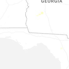
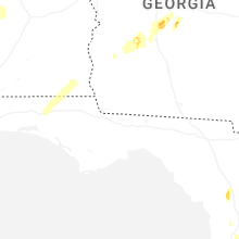
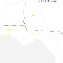


Connect with Interactive Hail Maps