

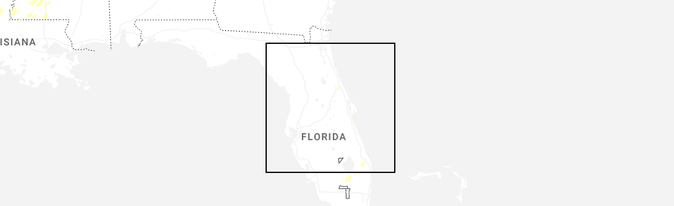
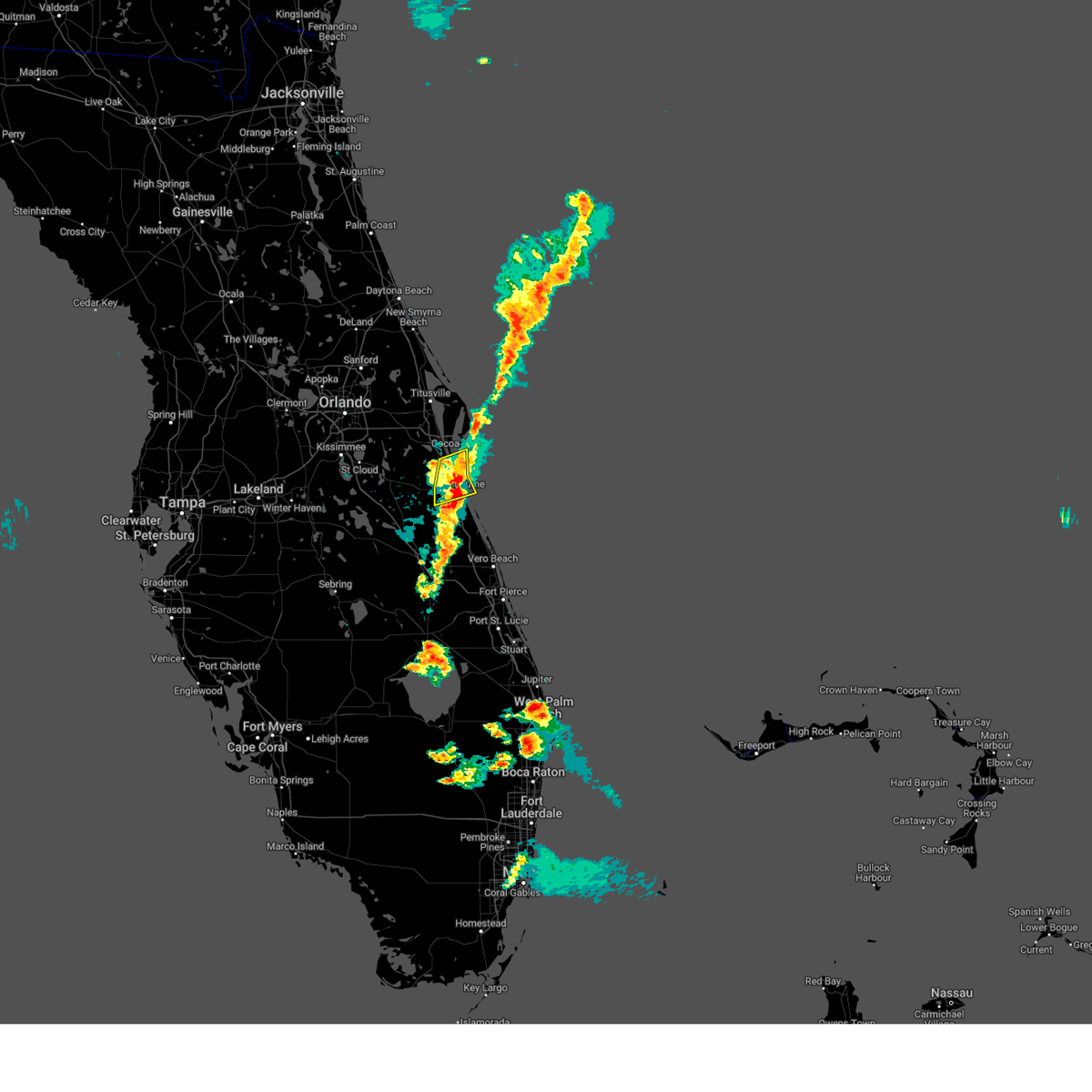
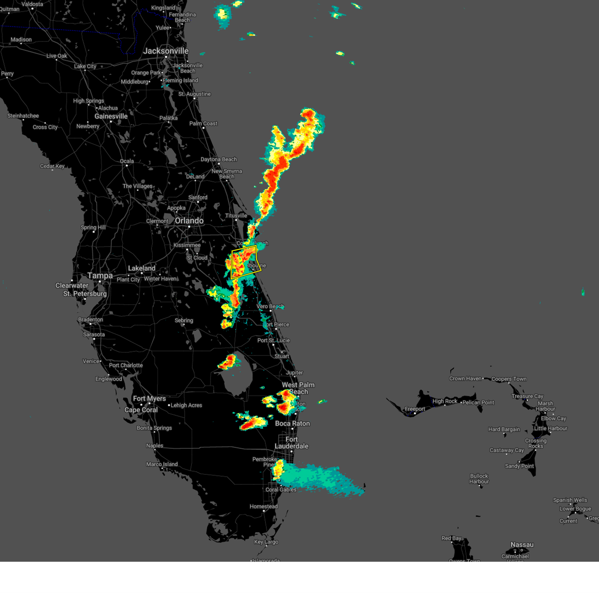
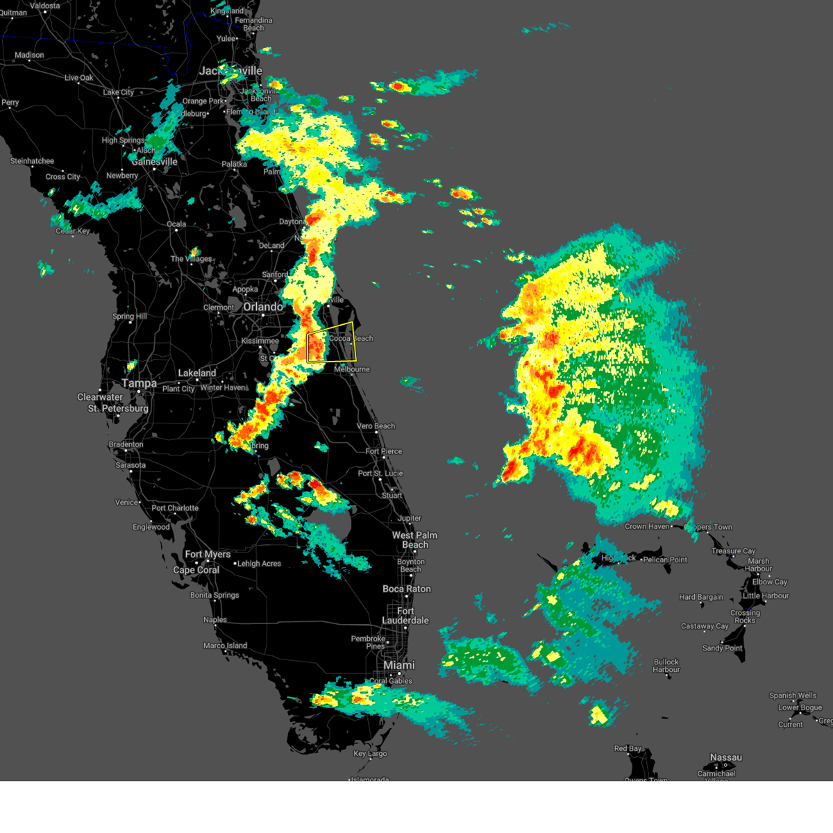
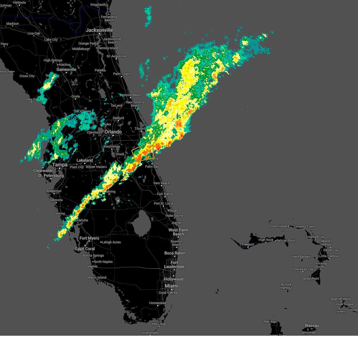
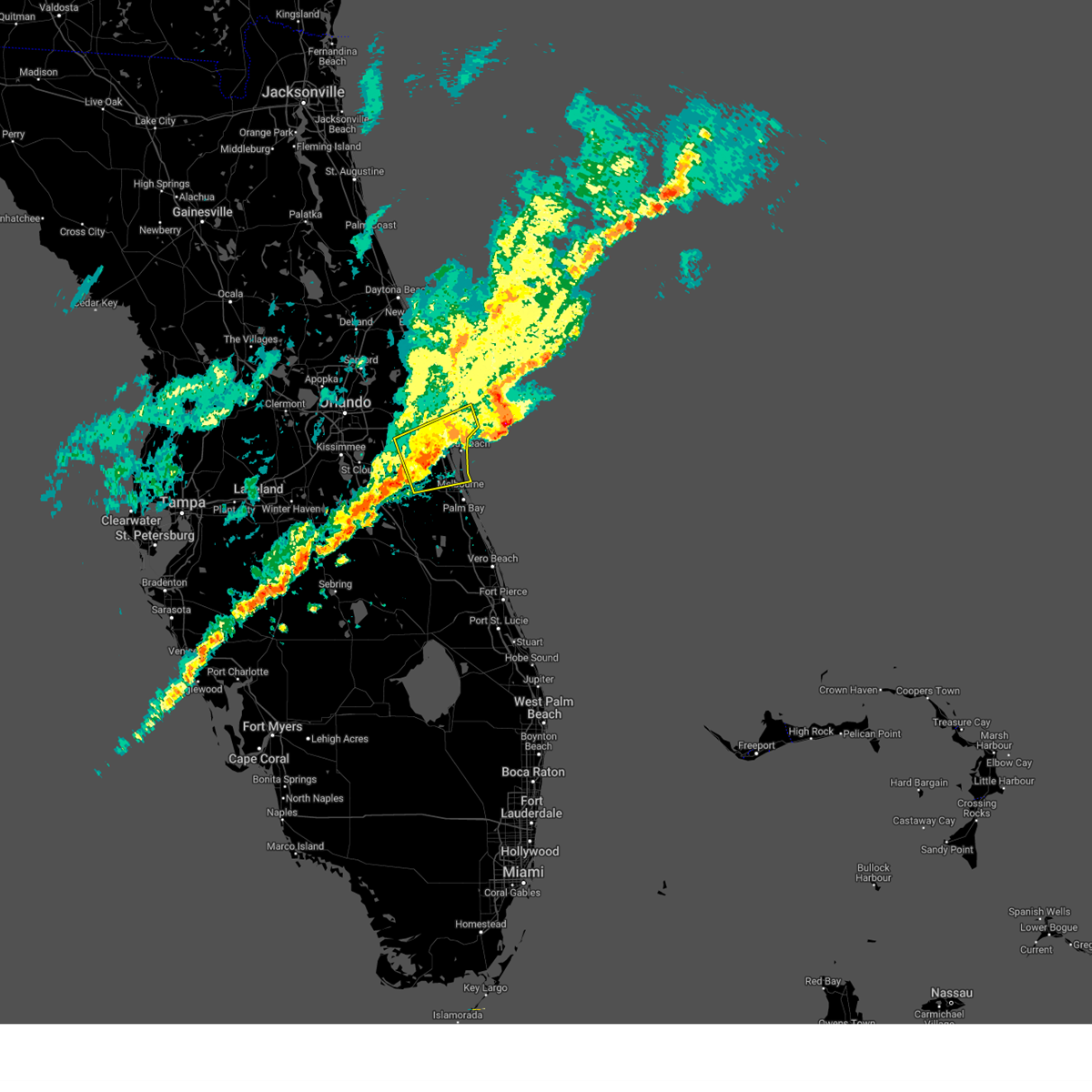
Hail Map for Satellite Beach, FL
The Satellite Beach, FL area has had 5 reports of on-the-ground hail by trained spotters, and has been under severe weather warnings 16 times during the past 12 months. Doppler radar has detected hail at or near Satellite Beach, FL on 32 occasions, including 1 occasion during the past year.
| Name: | Satellite Beach, FL |
| Where Located: | 53.3 miles ESE of Orlando, FL |
| Map: | Google Map for Satellite Beach, FL |
| Population: | 10109 |
| Housing Units: | 4953 |
| More Info: | Search Google for Satellite Beach, FL |
1
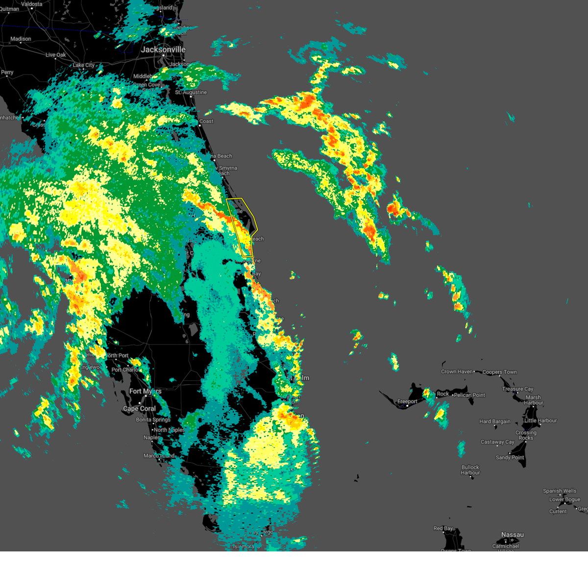
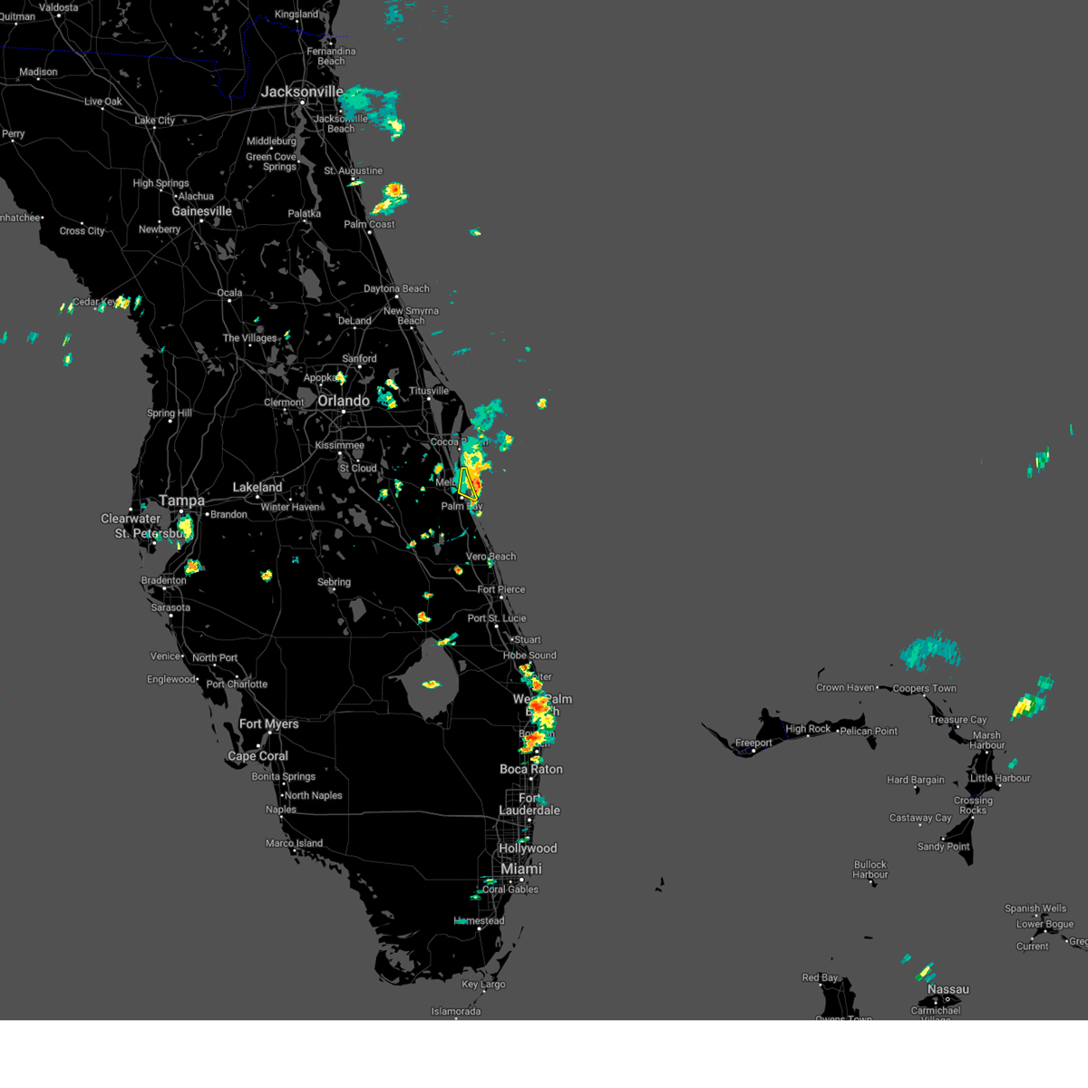
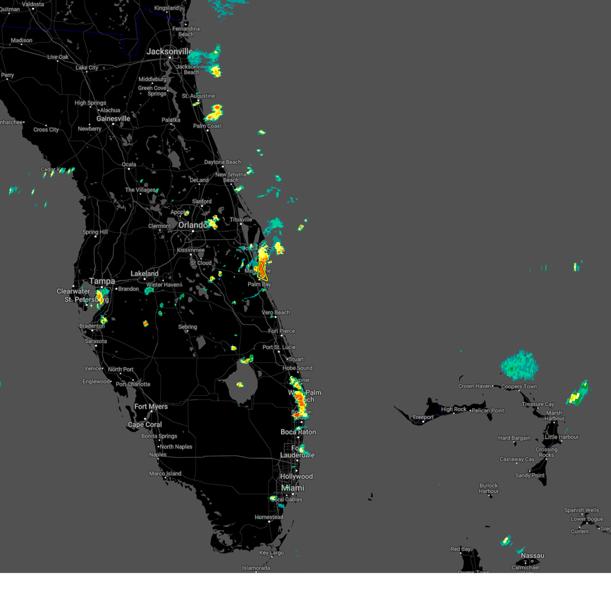
The Top Recent Hail Date for Satellite Beach, FL is Monday, May 26, 2025 (9th out of 32)
Hail and Wind Damage Spotted near Satellite Beach, FL
| Date / Time | Report Details |
|---|---|
| 5/25/2025 1:38 PM EDT |
 Svrmlb the national weather service in melbourne has issued a * severe thunderstorm warning for, southeastern brevard county in east central florida, * until 230 pm edt. * at 138 pm edt, a severe thunderstorm was located over melbourne, and is nearly stationary (radar indicated). Hazards include 60 mph wind gusts and quarter size hail. Hail damage to vehicles is expected. Expect wind damage to roofs, siding, and trees. Svrmlb the national weather service in melbourne has issued a * severe thunderstorm warning for, southeastern brevard county in east central florida, * until 230 pm edt. * at 138 pm edt, a severe thunderstorm was located over melbourne, and is nearly stationary (radar indicated). Hazards include 60 mph wind gusts and quarter size hail. Hail damage to vehicles is expected. Expect wind damage to roofs, siding, and trees.
|
| 5/6/2025 4:46 PM EDT | Svrmlb the national weather service in melbourne has issued a * severe thunderstorm warning for, southeastern brevard county in east central florida, * until 515 pm edt. * at 446 pm edt, a severe thunderstorm was located over camp holly fish camp, moving east at 15 mph (radar indicated). Hazards include 60 mph wind gusts and quarter size hail. Hail damage to vehicles is expected. Expect wind damage to roofs, siding, and trees. |
| 3/31/2025 8:42 PM EDT |
 The storm which prompted the warning has moved out of the area. therefore, the warning will be allowed to expire. to report severe weather, contact your nearest law enforcement agency. they will relay your report to the national weather service melbourne. The storm which prompted the warning has moved out of the area. therefore, the warning will be allowed to expire. to report severe weather, contact your nearest law enforcement agency. they will relay your report to the national weather service melbourne.
|
| 3/31/2025 8:34 PM EDT |
 At 833 pm edt, a severe thunderstorm was located near indialantic, moving east at 25 mph (radar indicated). Hazards include 60 mph wind gusts and penny size hail. Expect damage to roofs, siding, and trees. Locations impacted include, eau gallie, indialantic, melbourne airport, melbourne beach, and satellite beach. At 833 pm edt, a severe thunderstorm was located near indialantic, moving east at 25 mph (radar indicated). Hazards include 60 mph wind gusts and penny size hail. Expect damage to roofs, siding, and trees. Locations impacted include, eau gallie, indialantic, melbourne airport, melbourne beach, and satellite beach.
|
| 3/31/2025 8:25 PM EDT |
 At 825 pm edt, a severe thunderstorm was located over indialantic, moving east at 25 mph (radar indicated. a 61 mph wind gust was observed at melbourne international airport with this storm!). Hazards include 70 mph wind gusts and nickel size hail. Expect considerable tree damage. damage is likely to mobile homes, roofs, and outbuildings. Locations impacted include, eau gallie, indialantic, melbourne airport, space coast stadium, and melbourne beach. At 825 pm edt, a severe thunderstorm was located over indialantic, moving east at 25 mph (radar indicated. a 61 mph wind gust was observed at melbourne international airport with this storm!). Hazards include 70 mph wind gusts and nickel size hail. Expect considerable tree damage. damage is likely to mobile homes, roofs, and outbuildings. Locations impacted include, eau gallie, indialantic, melbourne airport, space coast stadium, and melbourne beach.
|
| 3/31/2025 8:23 PM EDT |
 At 822 pm edt, a severe thunderstorm was located over indialantic, moving east at 25 mph (radar indicated. a wind gust to 61 mph was just observed at melbourne international airport). Hazards include 60 mph wind gusts and nickel size hail. Expect damage to roofs, siding, and trees. Locations impacted include, eau gallie, indialantic, melbourne airport, space coast stadium, and melbourne beach. At 822 pm edt, a severe thunderstorm was located over indialantic, moving east at 25 mph (radar indicated. a wind gust to 61 mph was just observed at melbourne international airport). Hazards include 60 mph wind gusts and nickel size hail. Expect damage to roofs, siding, and trees. Locations impacted include, eau gallie, indialantic, melbourne airport, space coast stadium, and melbourne beach.
|
| 3/31/2025 8:10 PM EDT |
 Svrmlb the national weather service in melbourne has issued a * severe thunderstorm warning for, southern brevard county in east central florida, * until 845 pm edt. * at 809 pm edt, a severe thunderstorm was located over south patrick shores, or over patrick air force base, moving east at 25 mph (radar indicated). Hazards include 60 mph wind gusts and nickel size hail. expect damage to roofs, siding, and trees Svrmlb the national weather service in melbourne has issued a * severe thunderstorm warning for, southern brevard county in east central florida, * until 845 pm edt. * at 809 pm edt, a severe thunderstorm was located over south patrick shores, or over patrick air force base, moving east at 25 mph (radar indicated). Hazards include 60 mph wind gusts and nickel size hail. expect damage to roofs, siding, and trees
|
| 3/30/2025 7:24 PM EDT | The storm which prompted the warning has weakened below severe limits, and no longer poses an immediate threat to life or property. therefore, the warning will be allowed to expire. however gusty winds are still possible with this thunderstorm. |
| 3/30/2025 7:04 PM EDT |
 Svrmlb the national weather service in melbourne has issued a * severe thunderstorm warning for, central brevard county in east central florida, southeastern orange county in east central florida, northeastern osceola county in east central florida, * until 730 pm edt. * at 703 pm edt, a severe thunderstorm was located near lone cabbage fish camp, moving east at 35 mph (radar indicated). Hazards include 60 mph wind gusts. expect damage to roofs, siding, and trees Svrmlb the national weather service in melbourne has issued a * severe thunderstorm warning for, central brevard county in east central florida, southeastern orange county in east central florida, northeastern osceola county in east central florida, * until 730 pm edt. * at 703 pm edt, a severe thunderstorm was located near lone cabbage fish camp, moving east at 35 mph (radar indicated). Hazards include 60 mph wind gusts. expect damage to roofs, siding, and trees
|
| 1/19/2025 2:28 PM EST |
 the severe thunderstorm warning has been cancelled and is no longer in effect the severe thunderstorm warning has been cancelled and is no longer in effect
|
| 1/19/2025 2:28 PM EST |
 At 227 pm est, a severe thunderstorm was located near patrick air force base, moving east at 35 mph (radar indicated). Hazards include 60 mph wind gusts and penny size hail. Expect damage to roofs, siding, and trees. Locations impacted include, melbourne, rockledge, cocoa, cocoa beach, and satellite beach. At 227 pm est, a severe thunderstorm was located near patrick air force base, moving east at 35 mph (radar indicated). Hazards include 60 mph wind gusts and penny size hail. Expect damage to roofs, siding, and trees. Locations impacted include, melbourne, rockledge, cocoa, cocoa beach, and satellite beach.
|
| 1/19/2025 2:00 PM EST |
 Svrmlb the national weather service in melbourne has issued a * severe thunderstorm warning for, central brevard county in east central florida, southeastern orange county in east central florida, northeastern osceola county in east central florida, * until 245 pm est. * at 200 pm est, a severe thunderstorm was located near viera, or near rockledge, moving east at 35 mph (radar indicated). Hazards include 60 mph wind gusts and penny size hail. expect damage to roofs, siding, and trees Svrmlb the national weather service in melbourne has issued a * severe thunderstorm warning for, central brevard county in east central florida, southeastern orange county in east central florida, northeastern osceola county in east central florida, * until 245 pm est. * at 200 pm est, a severe thunderstorm was located near viera, or near rockledge, moving east at 35 mph (radar indicated). Hazards include 60 mph wind gusts and penny size hail. expect damage to roofs, siding, and trees
|
| 10/9/2024 5:44 PM EDT |
 The storm which prompted the warning has weakened below severe limits, and no longer appears capable of producing a tornado. therefore, the warning will be allowed to expire. a tornado watch remains in effect until 900 pm edt for east central florida. The storm which prompted the warning has weakened below severe limits, and no longer appears capable of producing a tornado. therefore, the warning will be allowed to expire. a tornado watch remains in effect until 900 pm edt for east central florida.
|
| 10/9/2024 5:26 PM EDT |
 Tormlb the national weather service in melbourne has issued a * tornado warning for, central brevard county in east central florida, * until 545 pm edt. * at 525 pm edt, a severe thunderstorm capable of producing a tornado was located near patrick air force base, moving northwest at 40 mph (radar indicated rotation). Hazards include tornado. Flying debris will be dangerous to those caught without shelter. mobile homes will be damaged or destroyed. damage to roofs, windows, and vehicles will occur. tree damage is likely. this dangerous storm will be near, rockledge, cocoa beach, and satellite beach around 530 pm edt. cocoa and viera around 540 pm edt. Other locations impacted by this tornadic thunderstorm include space coast stadium. Tormlb the national weather service in melbourne has issued a * tornado warning for, central brevard county in east central florida, * until 545 pm edt. * at 525 pm edt, a severe thunderstorm capable of producing a tornado was located near patrick air force base, moving northwest at 40 mph (radar indicated rotation). Hazards include tornado. Flying debris will be dangerous to those caught without shelter. mobile homes will be damaged or destroyed. damage to roofs, windows, and vehicles will occur. tree damage is likely. this dangerous storm will be near, rockledge, cocoa beach, and satellite beach around 530 pm edt. cocoa and viera around 540 pm edt. Other locations impacted by this tornadic thunderstorm include space coast stadium.
|
| 8/4/2024 7:27 PM EDT |
 At 727 pm edt, a severe thunderstorm was located over jetty park, or over port canaveral, moving north at 30 mph (radar indicated). Hazards include 60 mph wind gusts. Expect damage to roofs, siding, and trees. Locations impacted include, melbourne, titusville, rockledge, cocoa, and cocoa beach. At 727 pm edt, a severe thunderstorm was located over jetty park, or over port canaveral, moving north at 30 mph (radar indicated). Hazards include 60 mph wind gusts. Expect damage to roofs, siding, and trees. Locations impacted include, melbourne, titusville, rockledge, cocoa, and cocoa beach.
|
| 8/4/2024 7:02 PM EDT |
 Svrmlb the national weather service in melbourne has issued a * severe thunderstorm warning for, northeastern brevard county in east central florida, * until 745 pm edt. * at 702 pm edt, a severe thunderstorm was located over south patrick shores, or over satellite beach, moving north at 30 mph (radar indicated). Hazards include 60 mph wind gusts. expect damage to roofs, siding, and trees Svrmlb the national weather service in melbourne has issued a * severe thunderstorm warning for, northeastern brevard county in east central florida, * until 745 pm edt. * at 702 pm edt, a severe thunderstorm was located over south patrick shores, or over satellite beach, moving north at 30 mph (radar indicated). Hazards include 60 mph wind gusts. expect damage to roofs, siding, and trees
|
| 6/27/2024 6:30 PM EDT |
 the severe thunderstorm warning has been cancelled and is no longer in effect the severe thunderstorm warning has been cancelled and is no longer in effect
|
| 6/27/2024 6:17 PM EDT |
 At 617 pm edt, a severe thunderstorm was located over indialantic, moving east at 15 mph (radar indicated). Hazards include 60 mph wind gusts. Expect damage to roofs, siding, and trees. Locations impacted include, palm bay, melbourne, satellite beach, indialantic, and indian harbour beach. At 617 pm edt, a severe thunderstorm was located over indialantic, moving east at 15 mph (radar indicated). Hazards include 60 mph wind gusts. Expect damage to roofs, siding, and trees. Locations impacted include, palm bay, melbourne, satellite beach, indialantic, and indian harbour beach.
|
| 6/27/2024 5:57 PM EDT |
 Svrmlb the national weather service in melbourne has issued a * severe thunderstorm warning for, east central brevard county in east central florida, * until 645 pm edt. * at 557 pm edt, a severe thunderstorm was located over melbourne, moving east at 15 mph (radar indicated). Hazards include 60 mph wind gusts and penny size hail. expect damage to roofs, siding, and trees Svrmlb the national weather service in melbourne has issued a * severe thunderstorm warning for, east central brevard county in east central florida, * until 645 pm edt. * at 557 pm edt, a severe thunderstorm was located over melbourne, moving east at 15 mph (radar indicated). Hazards include 60 mph wind gusts and penny size hail. expect damage to roofs, siding, and trees
|
| 4/11/2024 4:18 PM EDT |
 the severe thunderstorm warning has been cancelled and is no longer in effect the severe thunderstorm warning has been cancelled and is no longer in effect
|
| 4/11/2024 4:00 PM EDT |
 Svrmlb the national weather service in melbourne has issued a * severe thunderstorm warning for, central brevard county in east central florida, * until 430 pm edt. * at 359 pm edt, a severe thunderstorm was located near suntree, or 7 miles north of camp holly fish camp, moving east at 40 mph (radar indicated). Hazards include 60 mph wind gusts. expect damage to roofs, siding, and trees Svrmlb the national weather service in melbourne has issued a * severe thunderstorm warning for, central brevard county in east central florida, * until 430 pm edt. * at 359 pm edt, a severe thunderstorm was located near suntree, or 7 miles north of camp holly fish camp, moving east at 40 mph (radar indicated). Hazards include 60 mph wind gusts. expect damage to roofs, siding, and trees
|
| 2/4/2024 9:04 PM EST |
 At 902 pm est, severe thunderstorms were located along a line extending from klondike beach to titusville airport to near viera, moving northeast at 40 mph (radar indicated). Hazards include 60 mph wind gusts and quarter size hail. Hail damage to vehicles is expected. expect wind damage to roofs, siding, and trees. locations impacted include, melbourne, titusville, rockledge, cocoa, and cocoa beach. hail threat, radar indicated max hail size, 1. 00 in wind threat, radar indicated max wind gust, 60 mph. At 902 pm est, severe thunderstorms were located along a line extending from klondike beach to titusville airport to near viera, moving northeast at 40 mph (radar indicated). Hazards include 60 mph wind gusts and quarter size hail. Hail damage to vehicles is expected. expect wind damage to roofs, siding, and trees. locations impacted include, melbourne, titusville, rockledge, cocoa, and cocoa beach. hail threat, radar indicated max hail size, 1. 00 in wind threat, radar indicated max wind gust, 60 mph.
|
| 2/4/2024 8:44 PM EST |
 At 844 pm est, severe thunderstorms were located along a line extending from near mims to near canaveral groves to 7 miles east of holopaw, moving northeast at 40 mph (radar indicated). Hazards include 60 mph wind gusts and quarter size hail. Hail damage to vehicles is expected. Expect wind damage to roofs, siding, and trees. At 844 pm est, severe thunderstorms were located along a line extending from near mims to near canaveral groves to 7 miles east of holopaw, moving northeast at 40 mph (radar indicated). Hazards include 60 mph wind gusts and quarter size hail. Hail damage to vehicles is expected. Expect wind damage to roofs, siding, and trees.
|
| 1/9/2024 7:56 PM EST |
 At 756 pm est, a severe thunderstorm was located over melbourne beach, or over indialantic, moving east at 60 mph (radar indicated). Hazards include 60 mph wind gusts. expect damage to roofs, siding, and trees At 756 pm est, a severe thunderstorm was located over melbourne beach, or over indialantic, moving east at 60 mph (radar indicated). Hazards include 60 mph wind gusts. expect damage to roofs, siding, and trees
|
| 1/9/2024 7:43 PM EST |
 At 743 pm est, severe thunderstorms were located along a line extending from near camp holly fish camp to near basinger, moving northeast at 45 mph (radar indicated). Hazards include 60 mph wind gusts. Expect damage to roofs, siding, and trees. Locations impacted include, palm bay, melbourne, satellite beach, fellsmere, and malabar. At 743 pm est, severe thunderstorms were located along a line extending from near camp holly fish camp to near basinger, moving northeast at 45 mph (radar indicated). Hazards include 60 mph wind gusts. Expect damage to roofs, siding, and trees. Locations impacted include, palm bay, melbourne, satellite beach, fellsmere, and malabar.
|
| 1/9/2024 7:12 PM EST |
 At 711 pm est, severe thunderstorms were located along a line extending from 7 miles north of lake marian to near lake istokpoga, moving northeast at 60 mph (radar indicated). Hazards include 60 mph wind gusts. expect damage to roofs, siding, and trees At 711 pm est, severe thunderstorms were located along a line extending from 7 miles north of lake marian to near lake istokpoga, moving northeast at 60 mph (radar indicated). Hazards include 60 mph wind gusts. expect damage to roofs, siding, and trees
|
| 9/20/2023 6:27 PM EDT |
 The severe thunderstorm warning for central brevard county will expire at 630 pm edt, the storm which prompted the warning has weakened below severe limits, and no longer poses an immediate threat to life or property. therefore, the warning will be allowed to expire. however gusty winds and heavy rain are still possible with this thunderstorm. The severe thunderstorm warning for central brevard county will expire at 630 pm edt, the storm which prompted the warning has weakened below severe limits, and no longer poses an immediate threat to life or property. therefore, the warning will be allowed to expire. however gusty winds and heavy rain are still possible with this thunderstorm.
|
| 9/20/2023 6:18 PM EDT |
 At 618 pm edt, a severe thunderstorm was located over melbourne, moving southwest at 20 mph (radar indicated). Hazards include 60 mph wind gusts. Expect damage to roofs, siding, and trees. locations impacted include, melbourne, satellite beach, west melbourne, indian harbour beach, and south patrick shores. hail threat, radar indicated max hail size, <. 75 in wind threat, radar indicated max wind gust, 60 mph. At 618 pm edt, a severe thunderstorm was located over melbourne, moving southwest at 20 mph (radar indicated). Hazards include 60 mph wind gusts. Expect damage to roofs, siding, and trees. locations impacted include, melbourne, satellite beach, west melbourne, indian harbour beach, and south patrick shores. hail threat, radar indicated max hail size, <. 75 in wind threat, radar indicated max wind gust, 60 mph.
|
| 9/20/2023 6:05 PM EDT | Tempest station dorset ln reports wind gust to 58 mph from a thunderstorm. delayed repor in brevard county FL, 1.6 miles S of Satellite Beach, FL |
| 9/20/2023 6:05 PM EDT |
 At 605 pm edt, a severe thunderstorm was located over indian harbour beach, or over satellite beach, moving southwest at 25 mph (radar indicated). Hazards include 60 mph wind gusts. Expect damage to roofs, siding, and trees. locations impacted include, palm bay, melbourne, satellite beach, indialantic, and camp holly fish camp. hail threat, radar indicated max hail size, <. 75 in wind threat, radar indicated max wind gust, 60 mph. At 605 pm edt, a severe thunderstorm was located over indian harbour beach, or over satellite beach, moving southwest at 25 mph (radar indicated). Hazards include 60 mph wind gusts. Expect damage to roofs, siding, and trees. locations impacted include, palm bay, melbourne, satellite beach, indialantic, and camp holly fish camp. hail threat, radar indicated max hail size, <. 75 in wind threat, radar indicated max wind gust, 60 mph.
|
| 9/20/2023 5:55 PM EDT |
 At 555 pm edt, a severe thunderstorm was located over south patrick shores, or over patrick air force base, moving southwest at 15 mph (radar indicated). Hazards include 60 mph wind gusts. expect damage to roofs, siding, and trees At 555 pm edt, a severe thunderstorm was located over south patrick shores, or over patrick air force base, moving southwest at 15 mph (radar indicated). Hazards include 60 mph wind gusts. expect damage to roofs, siding, and trees
|
| 9/8/2023 2:31 PM EDT |
 At 231 pm edt, a severe thunderstorm was located over melbourne, moving east at 15 mph (radar indicated). Hazards include 60 mph wind gusts and penny size hail. Expect damage to roofs, siding, and trees. locations impacted include, melbourne, satellite beach, indialantic, merritt island, and west melbourne. hail threat, radar indicated max hail size, 0. 75 in wind threat, radar indicated max wind gust, 60 mph. At 231 pm edt, a severe thunderstorm was located over melbourne, moving east at 15 mph (radar indicated). Hazards include 60 mph wind gusts and penny size hail. Expect damage to roofs, siding, and trees. locations impacted include, melbourne, satellite beach, indialantic, merritt island, and west melbourne. hail threat, radar indicated max hail size, 0. 75 in wind threat, radar indicated max wind gust, 60 mph.
|
| 9/8/2023 2:08 PM EDT |
 At 208 pm edt, a severe thunderstorm was located over suntree, or near rockledge, moving east at 15 mph (radar indicated). Hazards include 60 mph wind gusts and quarter size hail. Hail damage to vehicles is expected. Expect wind damage to roofs, siding, and trees. At 208 pm edt, a severe thunderstorm was located over suntree, or near rockledge, moving east at 15 mph (radar indicated). Hazards include 60 mph wind gusts and quarter size hail. Hail damage to vehicles is expected. Expect wind damage to roofs, siding, and trees.
|
| 8/29/2023 5:52 PM EDT |
 The severe thunderstorm warning for southern brevard and northeastern osceola counties will expire at 600 pm edt, the storm which prompted the warning has moved out of the area. therefore, the warning will be allowed to expire. The severe thunderstorm warning for southern brevard and northeastern osceola counties will expire at 600 pm edt, the storm which prompted the warning has moved out of the area. therefore, the warning will be allowed to expire.
|
| 8/29/2023 5:15 PM EDT |
 At 515 pm edt, a severe thunderstorm was located over west melbourne, or near melbourne, moving north at 25 mph (radar indicated). Hazards include 60 mph wind gusts. expect damage to roofs, siding, and trees At 515 pm edt, a severe thunderstorm was located over west melbourne, or near melbourne, moving north at 25 mph (radar indicated). Hazards include 60 mph wind gusts. expect damage to roofs, siding, and trees
|
| 7/31/2023 4:48 PM EDT |
 At 448 pm edt, severe thunderstorms were located along a line extending from titusville to palm bay moving east at 25 mph (radar indicated). Hazards include 60 mph wind gusts. Expect damage to roofs, siding, and trees. locations impacted include, palm bay, melbourne, titusville, rockledge, and cocoa. hail threat, radar indicated max hail size, <. 75 in wind threat, radar indicated max wind gust, 60 mph. At 448 pm edt, severe thunderstorms were located along a line extending from titusville to palm bay moving east at 25 mph (radar indicated). Hazards include 60 mph wind gusts. Expect damage to roofs, siding, and trees. locations impacted include, palm bay, melbourne, titusville, rockledge, and cocoa. hail threat, radar indicated max hail size, <. 75 in wind threat, radar indicated max wind gust, 60 mph.
|
| 7/31/2023 4:23 PM EDT |
 At 422 pm edt, severe thunderstorms were located along a line extending from titusville to near camp holly fish camp, moving east at 30 mph (radar indicated). Hazards include 60 mph wind gusts. expect damage to roofs, siding, and trees At 422 pm edt, severe thunderstorms were located along a line extending from titusville to near camp holly fish camp, moving east at 30 mph (radar indicated). Hazards include 60 mph wind gusts. expect damage to roofs, siding, and trees
|
| 7/23/2023 4:03 PM EDT |
 At 402 pm edt, a severe thunderstorm was located over melbourne, moving northeast at 25 mph (public). Hazards include 60 mph wind gusts. Expect damage to roofs, siding, and trees. locations impacted include, palm bay, melbourne, satellite beach, malabar, indialantic, camp holly fish camp, patrick air force base, merritt island, west melbourne, indian harbour beach, melbourne beach, south patrick shores, palm shores, melbourne village, eau gallie, melbourne airport, june park and spessard holland park. hail threat, radar indicated max hail size, <. 75 in wind threat, radar indicated max wind gust, 60 mph. At 402 pm edt, a severe thunderstorm was located over melbourne, moving northeast at 25 mph (public). Hazards include 60 mph wind gusts. Expect damage to roofs, siding, and trees. locations impacted include, palm bay, melbourne, satellite beach, malabar, indialantic, camp holly fish camp, patrick air force base, merritt island, west melbourne, indian harbour beach, melbourne beach, south patrick shores, palm shores, melbourne village, eau gallie, melbourne airport, june park and spessard holland park. hail threat, radar indicated max hail size, <. 75 in wind threat, radar indicated max wind gust, 60 mph.
|
| 7/23/2023 3:43 PM EDT |
 At 343 pm edt, a severe thunderstorm was located over camp holly fish camp, moving northeast at 25 mph (radar indicated). Hazards include 60 mph wind gusts. expect damage to roofs, siding, and trees At 343 pm edt, a severe thunderstorm was located over camp holly fish camp, moving northeast at 25 mph (radar indicated). Hazards include 60 mph wind gusts. expect damage to roofs, siding, and trees
|
| 7/6/2023 6:17 PM EDT |
 At 617 pm edt, a severe thunderstorm was located near camp holly fish camp, moving east at 15 mph (radar indicated). Hazards include 60 mph wind gusts and quarter size hail. Hail damage to vehicles is expected. expect wind damage to roofs, siding, and trees. locations impacted include, palm bay, melbourne, rockledge, cocoa beach and satellite beach. hail threat, radar indicated max hail size, 1. 00 in wind threat, radar indicated max wind gust, 60 mph. At 617 pm edt, a severe thunderstorm was located near camp holly fish camp, moving east at 15 mph (radar indicated). Hazards include 60 mph wind gusts and quarter size hail. Hail damage to vehicles is expected. expect wind damage to roofs, siding, and trees. locations impacted include, palm bay, melbourne, rockledge, cocoa beach and satellite beach. hail threat, radar indicated max hail size, 1. 00 in wind threat, radar indicated max wind gust, 60 mph.
|
| 7/6/2023 6:07 PM EDT |
 At 606 pm edt, a severe thunderstorm was located near camp holly fish camp, moving east at 20 mph (radar indicated). Hazards include 60 mph wind gusts and quarter size hail. Hail damage to vehicles is expected. Expect wind damage to roofs, siding, and trees. At 606 pm edt, a severe thunderstorm was located near camp holly fish camp, moving east at 20 mph (radar indicated). Hazards include 60 mph wind gusts and quarter size hail. Hail damage to vehicles is expected. Expect wind damage to roofs, siding, and trees.
|
| 6/23/2023 6:23 PM EDT |
 At 623 pm edt, a severe thunderstorm was located near camp holly fish camp, moving northeast at 25 mph (radar indicated). Hazards include 60 mph wind gusts and quarter size hail. Hail damage to vehicles is expected. Expect wind damage to roofs, siding, and trees. At 623 pm edt, a severe thunderstorm was located near camp holly fish camp, moving northeast at 25 mph (radar indicated). Hazards include 60 mph wind gusts and quarter size hail. Hail damage to vehicles is expected. Expect wind damage to roofs, siding, and trees.
|
| 6/20/2023 1:41 PM EDT |
 The severe thunderstorm warning for southern brevard and northeastern osceola counties will expire at 145 pm edt, the storm which prompted the warning has weakened below severe limits, and no longer poses an immediate threat to life or property. therefore, the warning will be allowed to expire. however gusty winds are still possible with this thunderstorm. The severe thunderstorm warning for southern brevard and northeastern osceola counties will expire at 145 pm edt, the storm which prompted the warning has weakened below severe limits, and no longer poses an immediate threat to life or property. therefore, the warning will be allowed to expire. however gusty winds are still possible with this thunderstorm.
|
| 6/20/2023 1:03 PM EDT |
 At 103 pm edt, a severe thunderstorm was located near camp holly fish camp, moving northeast at 35 mph (radar indicated). Hazards include 60 mph wind gusts. expect damage to roofs, siding, and trees At 103 pm edt, a severe thunderstorm was located near camp holly fish camp, moving northeast at 35 mph (radar indicated). Hazards include 60 mph wind gusts. expect damage to roofs, siding, and trees
|
| 6/19/2023 9:42 PM EDT |
 At 940 pm edt, severe thunderstorms were located along a line extending from near sharpes to near lone cabbage fish camp to kenansville, moving east at 35 mph (radar indicated). Hazards include 70 mph wind gusts and quarter size hail. Hail damage to vehicles is expected. expect considerable tree damage. Wind damage is also likely to mobile homes, roofs, and outbuildings. At 940 pm edt, severe thunderstorms were located along a line extending from near sharpes to near lone cabbage fish camp to kenansville, moving east at 35 mph (radar indicated). Hazards include 70 mph wind gusts and quarter size hail. Hail damage to vehicles is expected. expect considerable tree damage. Wind damage is also likely to mobile homes, roofs, and outbuildings.
|
| 6/17/2023 12:08 PM EDT |
 At 1207 pm edt, a severe thunderstorm was located 7 miles northwest of fellsmere, moving northeast at 35 mph (radar indicated). Hazards include 60 mph wind gusts. Expect damage to roofs, siding, and trees. Locations impacted include, palm bay, melbourne, sebastian, satellite beach and fellsmere. At 1207 pm edt, a severe thunderstorm was located 7 miles northwest of fellsmere, moving northeast at 35 mph (radar indicated). Hazards include 60 mph wind gusts. Expect damage to roofs, siding, and trees. Locations impacted include, palm bay, melbourne, sebastian, satellite beach and fellsmere.
|
| 6/17/2023 11:54 AM EDT |
 At 1153 am edt, a severe thunderstorm was located over blue cypress lake, moving northeast at 35 mph (radar indicated). Hazards include 60 mph wind gusts. expect damage to roofs, siding, and trees At 1153 am edt, a severe thunderstorm was located over blue cypress lake, moving northeast at 35 mph (radar indicated). Hazards include 60 mph wind gusts. expect damage to roofs, siding, and trees
|
| 6/17/2023 11:34 AM EDT |
 At 1133 am edt, a severe thunderstorm was located along i-95 from viera to the saint johns parkway moving east at 25 mph (radar indicated). Hazards include 60 mph wind gusts. Expect damage to roofs, siding, and trees. locations impacted include, palm bay, west melbourne, rockledge. hail threat, radar indicated max hail size, <. 75 in wind threat, radar indicated max wind gust, 60 mph. At 1133 am edt, a severe thunderstorm was located along i-95 from viera to the saint johns parkway moving east at 25 mph (radar indicated). Hazards include 60 mph wind gusts. Expect damage to roofs, siding, and trees. locations impacted include, palm bay, west melbourne, rockledge. hail threat, radar indicated max hail size, <. 75 in wind threat, radar indicated max wind gust, 60 mph.
|
| 6/17/2023 11:21 AM EDT |
 At 1121 am edt, a severe thunderstorm was located near camp holly fish camp, moving east at 25 mph (radar indicated). Hazards include 60 mph wind gusts. expect damage to roofs, siding, and trees At 1121 am edt, a severe thunderstorm was located near camp holly fish camp, moving east at 25 mph (radar indicated). Hazards include 60 mph wind gusts. expect damage to roofs, siding, and trees
|
| 6/16/2023 4:11 PM EDT |
 At 409 pm edt, a severe thunderstorm was located near camp holly fish camp, moving east at 40 mph (radar indicated). Hazards include 60 mph wind gusts. expect damage to roofs, siding, and trees At 409 pm edt, a severe thunderstorm was located near camp holly fish camp, moving east at 40 mph (radar indicated). Hazards include 60 mph wind gusts. expect damage to roofs, siding, and trees
|
| 6/7/2023 5:20 PM EDT | Trained spotter reports possible tornado damage near skylark blvd and south patrick dr. extending east to flamingo dr. damage to carports and roofs of multiple homes. a in brevard county FL, 2.3 miles S of Satellite Beach, FL |
| 6/7/2023 5:17 PM EDT |
 At 517 pm edt, a severe thunderstorm capable of producing a tornado was located over south patrick shores, or over patrick air force base, moving east at 15 mph (radar indicated rotation). Hazards include tornado. Flying debris will be dangerous to those caught without shelter. mobile homes will be damaged or destroyed. damage to roofs, windows, and vehicles will occur. tree damage is likely. This tornadic thunderstorm will remain over mainly rural areas of central brevard county. At 517 pm edt, a severe thunderstorm capable of producing a tornado was located over south patrick shores, or over patrick air force base, moving east at 15 mph (radar indicated rotation). Hazards include tornado. Flying debris will be dangerous to those caught without shelter. mobile homes will be damaged or destroyed. damage to roofs, windows, and vehicles will occur. tree damage is likely. This tornadic thunderstorm will remain over mainly rural areas of central brevard county.
|
| 6/7/2023 5:15 PM EDT |
 At 515 pm edt, severe thunderstorms were located along a line extending from 7 miles northeast of port canaveral to near patrick air force base to near melbourne, moving east at 15 mph (radar indicated). Hazards include 60 mph wind gusts and quarter size hail. Hail damage to vehicles is expected. Expect wind damage to roofs, siding, and trees. At 515 pm edt, severe thunderstorms were located along a line extending from 7 miles northeast of port canaveral to near patrick air force base to near melbourne, moving east at 15 mph (radar indicated). Hazards include 60 mph wind gusts and quarter size hail. Hail damage to vehicles is expected. Expect wind damage to roofs, siding, and trees.
|
| 4/30/2023 7:55 AM EDT |
 The severe thunderstorm warning for northern brevard, southeastern orange and northeastern osceola counties will expire at 800 am edt, the storm which prompted the warning has weakened below severe limits, and has exited the warned area. therefore, the warning will be allowed to expire. a tornado watch remains in effect until 200 pm edt for east central florida. The severe thunderstorm warning for northern brevard, southeastern orange and northeastern osceola counties will expire at 800 am edt, the storm which prompted the warning has weakened below severe limits, and has exited the warned area. therefore, the warning will be allowed to expire. a tornado watch remains in effect until 200 pm edt for east central florida.
|
| 4/30/2023 7:39 AM EDT |
 At 738 am edt, a severe thunderstorm was located near port canaveral, moving northeast at 65 mph (radar indicated). Hazards include 60 mph wind gusts and penny size hail. Expect damage to roofs, siding, and trees. Locations impacted include, melbourne, titusville, rockledge, cocoa and cocoa beach. At 738 am edt, a severe thunderstorm was located near port canaveral, moving northeast at 65 mph (radar indicated). Hazards include 60 mph wind gusts and penny size hail. Expect damage to roofs, siding, and trees. Locations impacted include, melbourne, titusville, rockledge, cocoa and cocoa beach.
|
| 4/30/2023 7:11 AM EDT |
 At 711 am edt, a severe thunderstorm was located near holopaw, moving northeast at 65 mph (radar indicated). Hazards include 60 mph wind gusts and penny size hail. expect damage to roofs, siding, and trees At 711 am edt, a severe thunderstorm was located near holopaw, moving northeast at 65 mph (radar indicated). Hazards include 60 mph wind gusts and penny size hail. expect damage to roofs, siding, and trees
|
| 4/27/2023 11:43 PM EDT |
 At 1142 pm edt, severe thunderstorms were located along a line extending from 13 miles northeast of port canaveral to near indialantic to near blue cypress lake, moving east at 50mph (radar indicated). Hazards include 60 mph wind gusts. expect damage to roofs, siding, and trees At 1142 pm edt, severe thunderstorms were located along a line extending from 13 miles northeast of port canaveral to near indialantic to near blue cypress lake, moving east at 50mph (radar indicated). Hazards include 60 mph wind gusts. expect damage to roofs, siding, and trees
|
| 4/27/2023 11:40 PM EDT |
 At 1140 pm edt, severe thunderstorms were located along a line extending from 13 miles northeast of port canaveral to indialantic to near blue cypress lake, moving northeast at 80 mph (radar indicated). Hazards include 60 mph wind gusts. expect damage to roofs, siding, and trees At 1140 pm edt, severe thunderstorms were located along a line extending from 13 miles northeast of port canaveral to indialantic to near blue cypress lake, moving northeast at 80 mph (radar indicated). Hazards include 60 mph wind gusts. expect damage to roofs, siding, and trees
|
| 4/26/2023 3:27 PM EDT |
 At 326 pm edt, a severe thunderstorm was located over camp holly fish camp, moving southeast at 15 mph (radar indicated). Hazards include golf ball size hail and 60 mph wind gusts. People and animals outdoors will be injured. expect hail damage to roofs, siding, windows, and vehicles. expect wind damage to roofs, siding, and trees. locations impacted include, palm bay, melbourne, satellite beach, malabar and indialantic. thunderstorm damage threat, considerable hail threat, radar indicated max hail size, 1. 75 in wind threat, radar indicated max wind gust, 60 mph. At 326 pm edt, a severe thunderstorm was located over camp holly fish camp, moving southeast at 15 mph (radar indicated). Hazards include golf ball size hail and 60 mph wind gusts. People and animals outdoors will be injured. expect hail damage to roofs, siding, windows, and vehicles. expect wind damage to roofs, siding, and trees. locations impacted include, palm bay, melbourne, satellite beach, malabar and indialantic. thunderstorm damage threat, considerable hail threat, radar indicated max hail size, 1. 75 in wind threat, radar indicated max wind gust, 60 mph.
|
| 4/26/2023 3:12 PM EDT |
 At 311 pm edt, a severe thunderstorm was located near suntree, or near camp holly fish camp, moving southeast at 30 mph (radar indicated). Hazards include golf ball size hail and 60 mph wind gusts. People and animals outdoors will be injured. expect hail damage to roofs, siding, windows, and vehicles. expect wind damage to roofs, siding, and trees. locations impacted include, palm bay, melbourne, satellite beach, malabar and indialantic. thunderstorm damage threat, considerable hail threat, radar indicated max hail size, 1. 75 in wind threat, radar indicated max wind gust, 60 mph. At 311 pm edt, a severe thunderstorm was located near suntree, or near camp holly fish camp, moving southeast at 30 mph (radar indicated). Hazards include golf ball size hail and 60 mph wind gusts. People and animals outdoors will be injured. expect hail damage to roofs, siding, windows, and vehicles. expect wind damage to roofs, siding, and trees. locations impacted include, palm bay, melbourne, satellite beach, malabar and indialantic. thunderstorm damage threat, considerable hail threat, radar indicated max hail size, 1. 75 in wind threat, radar indicated max wind gust, 60 mph.
|
| 4/26/2023 2:57 PM EDT |
 At 257 pm edt, a severe thunderstorm was located near viera, or near rockledge, moving southeast at 15 mph (radar indicated). Hazards include 60 mph wind gusts and quarter size hail. Hail damage to vehicles is expected. Expect wind damage to roofs, siding, and trees. At 257 pm edt, a severe thunderstorm was located near viera, or near rockledge, moving southeast at 15 mph (radar indicated). Hazards include 60 mph wind gusts and quarter size hail. Hail damage to vehicles is expected. Expect wind damage to roofs, siding, and trees.
|
| 7/19/2022 5:21 PM EDT |
 At 521 pm edt, a severe thunderstorm was located over melbourne, moving east at 20 mph (radar indicated). Hazards include 60 mph wind gusts and penny size hail. expect damage to roofs, siding, and trees At 521 pm edt, a severe thunderstorm was located over melbourne, moving east at 20 mph (radar indicated). Hazards include 60 mph wind gusts and penny size hail. expect damage to roofs, siding, and trees
|
| 6/10/2022 3:21 PM EDT |
 The severe thunderstorm warning for southeastern brevard county will expire at 330 pm edt, the storm which prompted the warning has weakened below severe limits, and no longer poses an immediate threat to life or property. therefore, the warning will be allowed to expire. however gusty winds are still possible with this thunderstorm. The severe thunderstorm warning for southeastern brevard county will expire at 330 pm edt, the storm which prompted the warning has weakened below severe limits, and no longer poses an immediate threat to life or property. therefore, the warning will be allowed to expire. however gusty winds are still possible with this thunderstorm.
|
| 6/10/2022 3:13 PM EDT |
 At 313 pm edt, a severe thunderstorm was located over melbourne, moving northeast at 30 mph (radar indicated). Hazards include 60 mph wind gusts and penny size hail. Expect damage to roofs, siding, and trees. locations impacted include, palm bay, melbourne, satellite beach, indialantic and camp holly fish camp. hail threat, radar indicated max hail size, 0. 75 in wind threat, radar indicated max wind gust, 60 mph. At 313 pm edt, a severe thunderstorm was located over melbourne, moving northeast at 30 mph (radar indicated). Hazards include 60 mph wind gusts and penny size hail. Expect damage to roofs, siding, and trees. locations impacted include, palm bay, melbourne, satellite beach, indialantic and camp holly fish camp. hail threat, radar indicated max hail size, 0. 75 in wind threat, radar indicated max wind gust, 60 mph.
|
| 6/10/2022 2:57 PM EDT |
 At 257 pm edt, a severe thunderstorm was located near camp holly fish camp, moving northeast at 25 mph (radar indicated). Hazards include 60 mph wind gusts and penny size hail. expect damage to roofs, siding, and trees At 257 pm edt, a severe thunderstorm was located near camp holly fish camp, moving northeast at 25 mph (radar indicated). Hazards include 60 mph wind gusts and penny size hail. expect damage to roofs, siding, and trees
|
| 5/27/2022 7:39 PM EDT |
 At 739 pm edt, a severe thunderstorm was located over indian harbour beach, or over satellite beach, moving northeast at 20 mph (radar indicated). Hazards include 60 mph wind gusts and quarter size hail. Hail damage to vehicles is expected. Expect wind damage to roofs, siding, and trees. At 739 pm edt, a severe thunderstorm was located over indian harbour beach, or over satellite beach, moving northeast at 20 mph (radar indicated). Hazards include 60 mph wind gusts and quarter size hail. Hail damage to vehicles is expected. Expect wind damage to roofs, siding, and trees.
|
| 3/16/2022 4:20 PM EDT | Quarter sized hail reported 1.6 miles SSE of Satellite Beach, FL, public reports quarter sized hail in satellite beach. |
| 3/16/2022 4:16 PM EDT |
 At 416 pm edt, a severe thunderstorm was located over south patrick shores, or near satellite beach, moving east at 25 mph (radar indicated). Hazards include 60 mph wind gusts and quarter size hail. Hail damage to vehicles is expected. expect wind damage to roofs, siding, and trees. locations impacted include, palm bay, melbourne, rockledge, cocoa beach and satellite beach. hail threat, radar indicated max hail size, 1. 00 in wind threat, radar indicated max wind gust, 60 mph. At 416 pm edt, a severe thunderstorm was located over south patrick shores, or near satellite beach, moving east at 25 mph (radar indicated). Hazards include 60 mph wind gusts and quarter size hail. Hail damage to vehicles is expected. expect wind damage to roofs, siding, and trees. locations impacted include, palm bay, melbourne, rockledge, cocoa beach and satellite beach. hail threat, radar indicated max hail size, 1. 00 in wind threat, radar indicated max wind gust, 60 mph.
|
| 3/16/2022 3:55 PM EDT |
 At 354 pm edt, a severe thunderstorm was located 7 miles northwest of camp holly fish camp, moving east at 40 mph (radar indicated). Hazards include 70 mph wind gusts and quarter size hail. Hail damage to vehicles is expected. expect considerable tree damage. wind damage is also likely to mobile homes, roofs, and outbuildings. locations impacted include, palm bay, melbourne, rockledge, cocoa beach and satellite beach. thunderstorm damage threat, considerable hail threat, radar indicated max hail size, 1. 00 in wind threat, radar indicated max wind gust, 70 mph. At 354 pm edt, a severe thunderstorm was located 7 miles northwest of camp holly fish camp, moving east at 40 mph (radar indicated). Hazards include 70 mph wind gusts and quarter size hail. Hail damage to vehicles is expected. expect considerable tree damage. wind damage is also likely to mobile homes, roofs, and outbuildings. locations impacted include, palm bay, melbourne, rockledge, cocoa beach and satellite beach. thunderstorm damage threat, considerable hail threat, radar indicated max hail size, 1. 00 in wind threat, radar indicated max wind gust, 70 mph.
|
| 3/16/2022 3:39 PM EDT |
 At 339 pm edt, a severe thunderstorm was located near holopaw, moving east at 35 mph (radar indicated). Hazards include 60 mph wind gusts and quarter size hail. Hail damage to vehicles is expected. Expect wind damage to roofs, siding, and trees. At 339 pm edt, a severe thunderstorm was located near holopaw, moving east at 35 mph (radar indicated). Hazards include 60 mph wind gusts and quarter size hail. Hail damage to vehicles is expected. Expect wind damage to roofs, siding, and trees.
|
| 8/2/2021 4:06 PM EDT |
 The severe thunderstorm warning for central brevard county will expire at 415 pm edt, the storm which prompted the warning has weakened below severe limits, and no longer poses an immediate threat to life or property. therefore, the warning will be allowed to expire. however gusty winds and heavy rain are still possible with this thunderstorm. The severe thunderstorm warning for central brevard county will expire at 415 pm edt, the storm which prompted the warning has weakened below severe limits, and no longer poses an immediate threat to life or property. therefore, the warning will be allowed to expire. however gusty winds and heavy rain are still possible with this thunderstorm.
|
| 8/2/2021 3:30 PM EDT |
 At 329 pm edt, a severe thunderstorm was located near rockledge, moving east at 20 mph (radar indicated). Hazards include 60 mph wind gusts. expect damage to roofs, siding, and trees At 329 pm edt, a severe thunderstorm was located near rockledge, moving east at 20 mph (radar indicated). Hazards include 60 mph wind gusts. expect damage to roofs, siding, and trees
|
| 6/13/2021 3:13 PM EDT |
 The severe thunderstorm warning for central brevard county will expire at 315 pm edt, the storm which prompted the warning has weakened below severe limits, and has exited the warned area. therefore, the warning will be allowed to expire. however heavy rain is still possible with this thunderstorm. The severe thunderstorm warning for central brevard county will expire at 315 pm edt, the storm which prompted the warning has weakened below severe limits, and has exited the warned area. therefore, the warning will be allowed to expire. however heavy rain is still possible with this thunderstorm.
|
| 6/13/2021 2:35 PM EDT |
 At 234 pm edt, a severe thunderstorm was located over rockledge, moving east at 20 mph (radar indicated). Hazards include 60 mph wind gusts. expect damage to roofs, siding, and trees At 234 pm edt, a severe thunderstorm was located over rockledge, moving east at 20 mph (radar indicated). Hazards include 60 mph wind gusts. expect damage to roofs, siding, and trees
|
| 6/12/2021 4:52 PM EDT |
 The severe thunderstorm warning for east central brevard county will expire at 500 pm edt, the storm which prompted the warning has weakened below severe limits, and has exited the warned area. therefore, the warning will be allowed to expire. however gusty winds and heavy rain are still possible with this thunderstorm. The severe thunderstorm warning for east central brevard county will expire at 500 pm edt, the storm which prompted the warning has weakened below severe limits, and has exited the warned area. therefore, the warning will be allowed to expire. however gusty winds and heavy rain are still possible with this thunderstorm.
|
| 6/12/2021 4:30 PM EDT |
 At 430 pm edt, a severe thunderstorm was located over west melbourne, or over melbourne, moving east at 20 mph (radar indicated). Hazards include 60 mph wind gusts. expect damage to roofs, siding, and trees At 430 pm edt, a severe thunderstorm was located over west melbourne, or over melbourne, moving east at 20 mph (radar indicated). Hazards include 60 mph wind gusts. expect damage to roofs, siding, and trees
|
| 8/18/2020 4:52 PM EDT |
 At 452 pm edt, a severe thunderstorm was located from over patrick air force base to indian harbour beach, moving east at 15 mph (radar indicated). Hazards include 60 mph wind gusts. Expect damage to roofs, siding, and trees. Locations impacted include, melbourne, rockledge, cocoa beach, satellite beach and cape canaveral. At 452 pm edt, a severe thunderstorm was located from over patrick air force base to indian harbour beach, moving east at 15 mph (radar indicated). Hazards include 60 mph wind gusts. Expect damage to roofs, siding, and trees. Locations impacted include, melbourne, rockledge, cocoa beach, satellite beach and cape canaveral.
|
| 8/18/2020 4:43 PM EDT |
 At 443 pm edt, a severe thunderstorm was located over suntree, or over patrick air force base, moving east at 15 mph (radar indicated). Hazards include 60 mph wind gusts and nickel size hail. expect damage to roofs, siding, and trees At 443 pm edt, a severe thunderstorm was located over suntree, or over patrick air force base, moving east at 15 mph (radar indicated). Hazards include 60 mph wind gusts and nickel size hail. expect damage to roofs, siding, and trees
|
| 4/24/2020 8:14 AM EDT |
 At 812 am edt, a line of strong to severe thunderstorms were located from near suntree to patrick air force base, moving east at 35 mph. these storms are crossing over interstate 95 between mile markers 180 and 191 (radar indicated). Hazards include 60 mph wind gusts. Expect damage to roofs, siding, and trees. Locations impacted include, palm bay, melbourne, rockledge, cocoa beach and satellite beach. At 812 am edt, a line of strong to severe thunderstorms were located from near suntree to patrick air force base, moving east at 35 mph. these storms are crossing over interstate 95 between mile markers 180 and 191 (radar indicated). Hazards include 60 mph wind gusts. Expect damage to roofs, siding, and trees. Locations impacted include, palm bay, melbourne, rockledge, cocoa beach and satellite beach.
|
| 4/24/2020 8:00 AM EDT |
 At 759 am edt, a severe thunderstorm was located near suntree, or 7 miles north of camp holly fish camp, moving northeast at 35 mph. this storm will cross interstate 95 between mile markers 185 and 195 (radar indicated). Hazards include 70 mph wind gusts. Expect considerable tree damage. damage is likely to mobile homes, roofs, and outbuildings. Locations impacted include, palm bay, melbourne, rockledge, cocoa beach and satellite beach. At 759 am edt, a severe thunderstorm was located near suntree, or 7 miles north of camp holly fish camp, moving northeast at 35 mph. this storm will cross interstate 95 between mile markers 185 and 195 (radar indicated). Hazards include 70 mph wind gusts. Expect considerable tree damage. damage is likely to mobile homes, roofs, and outbuildings. Locations impacted include, palm bay, melbourne, rockledge, cocoa beach and satellite beach.
|
| 4/24/2020 7:55 AM EDT |
 At 754 am edt, a severe thunderstorm was located near camp holly fish camp, moving northeast at 45 mph. this storm is located in a line of strong to severe storms stretching from forever florida to cocoa beach (radar indicated). Hazards include 70 mph wind gusts. Expect considerable tree damage. damage is likely to mobile homes, roofs, and outbuildings. Locations impacted include, palm bay, melbourne, rockledge, cocoa beach and satellite beach. At 754 am edt, a severe thunderstorm was located near camp holly fish camp, moving northeast at 45 mph. this storm is located in a line of strong to severe storms stretching from forever florida to cocoa beach (radar indicated). Hazards include 70 mph wind gusts. Expect considerable tree damage. damage is likely to mobile homes, roofs, and outbuildings. Locations impacted include, palm bay, melbourne, rockledge, cocoa beach and satellite beach.
|
| 4/24/2020 7:41 AM EDT |
 At 740 am edt, a line of strong to severe thunderstorms were located from cocoa beach to just west of melbourne, moving northeast at 35 mph (radar indicated). Hazards include 60 mph wind gusts. expect damage to roofs, siding, and trees At 740 am edt, a line of strong to severe thunderstorms were located from cocoa beach to just west of melbourne, moving northeast at 35 mph (radar indicated). Hazards include 60 mph wind gusts. expect damage to roofs, siding, and trees
|
| 2/7/2020 2:21 AM EST |
 The severe thunderstorm warning for southeastern brevard county will expire at 230 am est, the storm which prompted the warning has weakened below severe limits, and no longer poses an immediate threat to life or property. therefore, the warning will be allowed to expire. however gusty winds are still possible with this thunderstorm. a tornado watch remains in effect until 300 am est for east central florida. The severe thunderstorm warning for southeastern brevard county will expire at 230 am est, the storm which prompted the warning has weakened below severe limits, and no longer poses an immediate threat to life or property. therefore, the warning will be allowed to expire. however gusty winds are still possible with this thunderstorm. a tornado watch remains in effect until 300 am est for east central florida.
|
| 2/7/2020 1:45 AM EST |
 At 145 am est, a severe thunderstorm was located over west melbourne, or over melbourne, moving east at 45 mph (radar indicated). Hazards include 60 mph wind gusts. expect damage to roofs, siding, and trees At 145 am est, a severe thunderstorm was located over west melbourne, or over melbourne, moving east at 45 mph (radar indicated). Hazards include 60 mph wind gusts. expect damage to roofs, siding, and trees
|
| 6/12/2019 3:09 PM EDT |
 At 308 pm edt, severe thunderstorms were located along a line extending from 6 miles northwest of port canaveral to near west melbourne, moving northeast at 30 mph (radar indicated). Hazards include 70 mph wind gusts and nickel size hail. Expect considerable tree damage. damage is likely to mobile homes, roofs, and outbuildings. Locations impacted include, palm bay, melbourne, rockledge, cocoa and cocoa beach. At 308 pm edt, severe thunderstorms were located along a line extending from 6 miles northwest of port canaveral to near west melbourne, moving northeast at 30 mph (radar indicated). Hazards include 70 mph wind gusts and nickel size hail. Expect considerable tree damage. damage is likely to mobile homes, roofs, and outbuildings. Locations impacted include, palm bay, melbourne, rockledge, cocoa and cocoa beach.
|
| 6/12/2019 3:01 PM EDT |
 At 300 pm edt, severe thunderstorms were located along a line extending from 6 miles northeast of sharpes to near camp holly fish camp, moving northeast at 30 mph (radar indicated). Hazards include 70 mph wind gusts and nickel size hail. Expect considerable tree damage. damage is likely to mobile homes, roofs, and outbuildings. Locations impacted include, palm bay, palm shores, melbourne, rockledge, cocoa and cocoa beach. At 300 pm edt, severe thunderstorms were located along a line extending from 6 miles northeast of sharpes to near camp holly fish camp, moving northeast at 30 mph (radar indicated). Hazards include 70 mph wind gusts and nickel size hail. Expect considerable tree damage. damage is likely to mobile homes, roofs, and outbuildings. Locations impacted include, palm bay, palm shores, melbourne, rockledge, cocoa and cocoa beach.
|
| 6/12/2019 2:43 PM EDT |
 At 243 pm edt, a line of severe thunderstorms from near lone cabbage fish camp to deer park was moving northeast at 30 mph (radar indicated). Hazards include 60 mph wind gusts and nickel size hail. expect damage to roofs, siding, and trees At 243 pm edt, a line of severe thunderstorms from near lone cabbage fish camp to deer park was moving northeast at 30 mph (radar indicated). Hazards include 60 mph wind gusts and nickel size hail. expect damage to roofs, siding, and trees
|
| 5/5/2019 3:01 PM EDT |
 At 301 pm edt, a severe thunderstorm was located near west melbourne, or near malabar, moving northeast at 30 mph (radar indicated). Hazards include 60 mph wind gusts. Expect damage to roofs, siding, and trees. Locations impacted include, palm bay, melbourne, satellite beach, malabar and indialantic. At 301 pm edt, a severe thunderstorm was located near west melbourne, or near malabar, moving northeast at 30 mph (radar indicated). Hazards include 60 mph wind gusts. Expect damage to roofs, siding, and trees. Locations impacted include, palm bay, melbourne, satellite beach, malabar and indialantic.
|
| 5/5/2019 2:51 PM EDT |
 At 250 pm edt, a severe thunderstorm was located over palm bay, moving northeast at 30 mph (radar indicated). Hazards include 60 mph wind gusts. Expect damage to roofs, siding, and trees. Locations impacted include, palm bay, melbourne, satellite beach, malabar and indialantic. At 250 pm edt, a severe thunderstorm was located over palm bay, moving northeast at 30 mph (radar indicated). Hazards include 60 mph wind gusts. Expect damage to roofs, siding, and trees. Locations impacted include, palm bay, melbourne, satellite beach, malabar and indialantic.
|
| 5/5/2019 2:42 PM EDT |
 At 242 pm edt, a severe thunderstorm was located near palm bay, moving northeast at 30 mph (radar indicated). Hazards include 60 mph wind gusts. expect damage to roofs, siding, and trees At 242 pm edt, a severe thunderstorm was located near palm bay, moving northeast at 30 mph (radar indicated). Hazards include 60 mph wind gusts. expect damage to roofs, siding, and trees
|
| 5/4/2019 5:45 PM EDT |
 At 544 pm edt, a severe thunderstorm was located over patrick air force base, moving east at 15 mph. at 542 pm edt a wind gust of 59 mph was recorded in south cocoa beach (radar indicated). Hazards include 60 mph wind gusts. Expect damage to roofs, siding, and trees. Locations impacted include, melbourne, rockledge, cocoa, cocoa beach and satellite beach. At 544 pm edt, a severe thunderstorm was located over patrick air force base, moving east at 15 mph. at 542 pm edt a wind gust of 59 mph was recorded in south cocoa beach (radar indicated). Hazards include 60 mph wind gusts. Expect damage to roofs, siding, and trees. Locations impacted include, melbourne, rockledge, cocoa, cocoa beach and satellite beach.
|
| 5/4/2019 5:32 PM EDT |
 At 532 pm edt, a severe thunderstorm was located over suntree, or near patrick air force base, moving east at 15 mph (radar indicated). Hazards include 60 mph wind gusts. expect damage to roofs, siding, and trees At 532 pm edt, a severe thunderstorm was located over suntree, or near patrick air force base, moving east at 15 mph (radar indicated). Hazards include 60 mph wind gusts. expect damage to roofs, siding, and trees
|
| 3/27/2019 10:11 AM EDT |
 At 1011 am edt, a severe thunderstorm was located over rockledge, moving southeast at 15 mph (radar indicated). Hazards include 60 mph wind gusts and quarter size hail. Hail damage to vehicles is expected. Expect wind damage to roofs, siding, and trees. At 1011 am edt, a severe thunderstorm was located over rockledge, moving southeast at 15 mph (radar indicated). Hazards include 60 mph wind gusts and quarter size hail. Hail damage to vehicles is expected. Expect wind damage to roofs, siding, and trees.
|
| 3/27/2019 9:54 AM EDT | Quarter sized hail reported 1.9 miles N of Satellite Beach, FL |
| 3/27/2019 9:51 AM EDT | Golf Ball sized hail reported 0.5 miles NNW of Satellite Beach, FL |
| 3/27/2019 9:45 AM EDT | Quarter sized hail reported 1.2 miles N of Satellite Beach, FL, correction to earlier report. near 1753 a1a satellite beach. |
| 3/27/2019 9:45 AM EDT |
 At 944 am edt, a severe thunderstorm was located over over satellite beach, moving southeast at 20 mph (radar indicated). Hazards include quarter size hail. damage to vehicles is expected At 944 am edt, a severe thunderstorm was located over over satellite beach, moving southeast at 20 mph (radar indicated). Hazards include quarter size hail. damage to vehicles is expected
|
| 3/27/2019 9:40 AM EDT | Quarter sized hail reported 1.3 miles NNE of Satellite Beach, FL, hail along south tropical trail in merritt island... estimated up to quarter size or slightly larger.occurred starting at 940 am for 10 to 15 minutes. |
| 3/27/2019 8:59 AM EDT |
 At 859 am edt, a severe thunderstorm was located over cocoa, moving southeast at 15 mph (radar indicated). Hazards include ping pong ball size hail and 60 mph wind gusts. People and animals outdoors will be injured. expect hail damage to roofs, siding, windows, and vehicles. expect wind damage to roofs, siding, and trees. Locations impacted include, melbourne, rockledge, cocoa, cocoa beach and satellite beach. At 859 am edt, a severe thunderstorm was located over cocoa, moving southeast at 15 mph (radar indicated). Hazards include ping pong ball size hail and 60 mph wind gusts. People and animals outdoors will be injured. expect hail damage to roofs, siding, windows, and vehicles. expect wind damage to roofs, siding, and trees. Locations impacted include, melbourne, rockledge, cocoa, cocoa beach and satellite beach.
|
| 3/27/2019 8:45 AM EDT |
 At 845 am edt, a severe thunderstorm was located over sharpes, moving southeast at 15 mph (radar indicated). Hazards include half dollar size hail. damage to vehicles is expected At 845 am edt, a severe thunderstorm was located over sharpes, moving southeast at 15 mph (radar indicated). Hazards include half dollar size hail. damage to vehicles is expected
|
| 6/8/2018 7:09 PM EDT |
 The severe thunderstorm warning for north-central brevard county will expire at 715 pm edt, the storms which prompted the warning have moved out of the area. therefore, the warning will be allowed to expire. however gusty winds and heavy rain are still possible with these thunderstorms as they push off the coast where a special marine warning continues. The severe thunderstorm warning for north-central brevard county will expire at 715 pm edt, the storms which prompted the warning have moved out of the area. therefore, the warning will be allowed to expire. however gusty winds and heavy rain are still possible with these thunderstorms as they push off the coast where a special marine warning continues.
|
| 6/8/2018 6:41 PM EDT |
 At 641 pm edt, severe thunderstorms were located along a line extending from merritt island wildlife refuge to 9 miles northeast of port canaveral to viera, moving east at 20 mph (radar indicated). Hazards include 60 mph wind gusts. expect damage to roofs, siding, and trees At 641 pm edt, severe thunderstorms were located along a line extending from merritt island wildlife refuge to 9 miles northeast of port canaveral to viera, moving east at 20 mph (radar indicated). Hazards include 60 mph wind gusts. expect damage to roofs, siding, and trees
|
| 6/8/2018 6:35 PM EDT |
 At 634 pm edt, a severe thunderstorm was located over melbourne beach, moving east at 45 mph (radar indicated). Hazards include 60 mph wind gusts. Expect damage to roofs, siding, and trees. Locations impacted include, palm bay, melbourne, satellite beach, malabar and indialantic. At 634 pm edt, a severe thunderstorm was located over melbourne beach, moving east at 45 mph (radar indicated). Hazards include 60 mph wind gusts. Expect damage to roofs, siding, and trees. Locations impacted include, palm bay, melbourne, satellite beach, malabar and indialantic.
|
| 6/8/2018 6:12 PM EDT |
 At 611 pm edt, a severe thunderstorm was located near camp holly fish camp, moving east at 45 mph. this storm has the potential of producing damaging wind gusts (radar indicated). Hazards include 60 mph wind gusts. expect damage to roofs, siding, and trees At 611 pm edt, a severe thunderstorm was located near camp holly fish camp, moving east at 45 mph. this storm has the potential of producing damaging wind gusts (radar indicated). Hazards include 60 mph wind gusts. expect damage to roofs, siding, and trees
|
| 6/7/2018 7:35 PM EDT |
 At 735 pm edt, a severe thunderstorm was located over cocoa, moving southeast at 20 mph (radar indicated). Hazards include 60 mph wind gusts. expect damage to roofs, siding, and trees At 735 pm edt, a severe thunderstorm was located over cocoa, moving southeast at 20 mph (radar indicated). Hazards include 60 mph wind gusts. expect damage to roofs, siding, and trees
|
| 6/5/2018 3:51 PM EDT |
 At 351 pm edt, severe thunderstorms were located along a line extending from 7 miles southwest of lone cabbage fish camp to near camp holly fish camp, moving east at 30 mph (radar indicated). Hazards include 60 mph wind gusts and quarter size hail. Hail damage to vehicles is expected. Expect wind damage to roofs, siding, and trees. At 351 pm edt, severe thunderstorms were located along a line extending from 7 miles southwest of lone cabbage fish camp to near camp holly fish camp, moving east at 30 mph (radar indicated). Hazards include 60 mph wind gusts and quarter size hail. Hail damage to vehicles is expected. Expect wind damage to roofs, siding, and trees.
|
| 9/10/2017 9:01 PM EDT |
 At 900 pm edt, a severe thunderstorm capable of producing a tornado was located near satellite beach, moving northwest at 80 mph (radar indicated rotation). Hazards include tornado. Flying debris will be dangerous to those caught without shelter. mobile homes will be damaged or destroyed. damage to roofs, windows, and vehicles will occur. Tree damage is likely. At 900 pm edt, a severe thunderstorm capable of producing a tornado was located near satellite beach, moving northwest at 80 mph (radar indicated rotation). Hazards include tornado. Flying debris will be dangerous to those caught without shelter. mobile homes will be damaged or destroyed. damage to roofs, windows, and vehicles will occur. Tree damage is likely.
|
| 9/10/2017 8:40 PM EDT |
 At 839 pm edt, a severe thunderstorm capable of producing a tornado was located over melbourne, moving northwest at 75 mph (radar indicated rotation). Hazards include tornado. Flying debris will be dangerous to those caught without shelter. mobile homes will be damaged or destroyed. damage to roofs, windows, and vehicles will occur. Tree damage is likely. At 839 pm edt, a severe thunderstorm capable of producing a tornado was located over melbourne, moving northwest at 75 mph (radar indicated rotation). Hazards include tornado. Flying debris will be dangerous to those caught without shelter. mobile homes will be damaged or destroyed. damage to roofs, windows, and vehicles will occur. Tree damage is likely.
|
| 9/10/2017 5:52 PM EDT |
 At 552 pm edt, a severe thunderstorm capable of producing a tornado was located over sebastian inlet, moving northwest at 60 mph (radar indicated rotation). Hazards include tornado. Flying debris will be dangerous to those caught without shelter. mobile homes will be damaged or destroyed. damage to roofs, windows, and vehicles will occur. Tree damage is likely. At 552 pm edt, a severe thunderstorm capable of producing a tornado was located over sebastian inlet, moving northwest at 60 mph (radar indicated rotation). Hazards include tornado. Flying debris will be dangerous to those caught without shelter. mobile homes will be damaged or destroyed. damage to roofs, windows, and vehicles will occur. Tree damage is likely.
|
| 9/10/2017 3:38 PM EDT |
 The tornado warning for central brevard county will expire at 345 pm edt, the storm which prompted the warning has weakened below severe limits, and no longer appears capable of producing a tornado. therefore the warning will be allowed to expire. however strong winds and heavy rain are still expected as hurricane irma lifts north. a tornado watch remains in effect until midnight edt for east central florida. The tornado warning for central brevard county will expire at 345 pm edt, the storm which prompted the warning has weakened below severe limits, and no longer appears capable of producing a tornado. therefore the warning will be allowed to expire. however strong winds and heavy rain are still expected as hurricane irma lifts north. a tornado watch remains in effect until midnight edt for east central florida.
|
| 9/10/2017 3:15 PM EDT |
 At 314 pm edt, a severe thunderstorm capable of producing a tornado was located over patrick air force base, moving northwest at 40 mph (radar indicated rotation). Hazards include tornado. Flying debris will be dangerous to those caught without shelter. mobile homes will be damaged or destroyed. damage to roofs, windows, and vehicles will occur. tree damage is likely. this dangerous storm will be near, viera around 320 pm edt. rockledge and cocoa around 330 pm edt. lone cabbage fish camp and canaveral groves around 340 pm edt. Other locations impacted by this tornadic thunderstorm include pineda. At 314 pm edt, a severe thunderstorm capable of producing a tornado was located over patrick air force base, moving northwest at 40 mph (radar indicated rotation). Hazards include tornado. Flying debris will be dangerous to those caught without shelter. mobile homes will be damaged or destroyed. damage to roofs, windows, and vehicles will occur. tree damage is likely. this dangerous storm will be near, viera around 320 pm edt. rockledge and cocoa around 330 pm edt. lone cabbage fish camp and canaveral groves around 340 pm edt. Other locations impacted by this tornadic thunderstorm include pineda.
|
| 9/10/2017 2:59 PM EDT |
 At 257 pm edt, a severe thunderstorm capable of producing a tornado was located near port canaveral, moving west at 35 mph. another tornadic waterspout was 12 miles southeast of patrick air force base, moving northwest at 40 mph (radar indicated rotation). Hazards include tornado. Flying debris will be dangerous to those caught without shelter. mobile homes will be damaged or destroyed. damage to roofs, windows, and vehicles will occur. tree damage is likely. This tornadic thunderstorm will remain over mainly rural areas of brevard county, including the following locations: eau gallie. At 257 pm edt, a severe thunderstorm capable of producing a tornado was located near port canaveral, moving west at 35 mph. another tornadic waterspout was 12 miles southeast of patrick air force base, moving northwest at 40 mph (radar indicated rotation). Hazards include tornado. Flying debris will be dangerous to those caught without shelter. mobile homes will be damaged or destroyed. damage to roofs, windows, and vehicles will occur. tree damage is likely. This tornadic thunderstorm will remain over mainly rural areas of brevard county, including the following locations: eau gallie.
|
| 9/10/2017 2:37 PM EDT |
 At 236 pm edt, a severe thunderstorm capable of producing a tornado was located 8 miles east of port canaveral, moving northwest at 40 mph. additional rotating cells offshore central and southern brevard will race onshore and will be capable of producing a tornado (radar indicated rotation). Hazards include tornado. Flying debris will be dangerous to those caught without shelter. mobile homes will be damaged or destroyed. damage to roofs, windows, and vehicles will occur. tree damage is likely. This dangerous storm will be near, titusville around 310 pm edt. At 236 pm edt, a severe thunderstorm capable of producing a tornado was located 8 miles east of port canaveral, moving northwest at 40 mph. additional rotating cells offshore central and southern brevard will race onshore and will be capable of producing a tornado (radar indicated rotation). Hazards include tornado. Flying debris will be dangerous to those caught without shelter. mobile homes will be damaged or destroyed. damage to roofs, windows, and vehicles will occur. tree damage is likely. This dangerous storm will be near, titusville around 310 pm edt.
|
| 9/10/2017 11:26 AM EDT |
 At 1124 am edt, a severe thunderstorm capable of producing a tornado approaching indialantic, moving west at 50 mph (radar indicated rotation). Hazards include tornado. Flying debris will be dangerous to those caught without shelter. mobile homes will be damaged or destroyed. damage to roofs, windows, and vehicles will occur. tree damage is likely. this dangerous storm will be near, satellite beach and melbourne around 1130 am edt. suntree around 1135 am edt. Other locations impacted by this tornadic thunderstorm include eau gallie. At 1124 am edt, a severe thunderstorm capable of producing a tornado approaching indialantic, moving west at 50 mph (radar indicated rotation). Hazards include tornado. Flying debris will be dangerous to those caught without shelter. mobile homes will be damaged or destroyed. damage to roofs, windows, and vehicles will occur. tree damage is likely. this dangerous storm will be near, satellite beach and melbourne around 1130 am edt. suntree around 1135 am edt. Other locations impacted by this tornadic thunderstorm include eau gallie.
|
| 9/10/2017 11:12 AM EDT |
 At 1110 am edt, a severe thunderstorm capable of producing a tornado was located 11 miles east of melbourne beach, or 11 miles east of indialantic, moving west at 35 mph (radar indicated rotation). Hazards include tornado. Flying debris will be dangerous to those caught without shelter. mobile homes will be damaged or destroyed. damage to roofs, windows, and vehicles will occur. tree damage is likely. this dangerous storm will be near, melbourne, indialantic and melbourne beach around 1130 am edt. west melbourne and indian harbour beach and suntree around 1140 am edt. camp holly fish camp around 1150 am edt. Other locations impacted by this tornadic thunderstorm include melbourne village. At 1110 am edt, a severe thunderstorm capable of producing a tornado was located 11 miles east of melbourne beach, or 11 miles east of indialantic, moving west at 35 mph (radar indicated rotation). Hazards include tornado. Flying debris will be dangerous to those caught without shelter. mobile homes will be damaged or destroyed. damage to roofs, windows, and vehicles will occur. tree damage is likely. this dangerous storm will be near, melbourne, indialantic and melbourne beach around 1130 am edt. west melbourne and indian harbour beach and suntree around 1140 am edt. camp holly fish camp around 1150 am edt. Other locations impacted by this tornadic thunderstorm include melbourne village.
|
| 9/10/2017 9:37 AM EDT |
 The tornado warning for southern brevard county will expire at 945 am edt, the storm which prompted the warning has weakened below severe limits, and no longer appears capable of producing a tornado. therefore the warning will be allowed to expire. however heavy rain and strong winds will continue as hurricane irma lifts north from the florida keys. a tornado watch remains in effect until noon edt for florida. The tornado warning for southern brevard county will expire at 945 am edt, the storm which prompted the warning has weakened below severe limits, and no longer appears capable of producing a tornado. therefore the warning will be allowed to expire. however heavy rain and strong winds will continue as hurricane irma lifts north from the florida keys. a tornado watch remains in effect until noon edt for florida.
|
| 9/10/2017 9:19 AM EDT |
 At 918 am edt, a severe thunderstorm capable of producing a tornado was located over melbourne beach, or over indialantic, moving west at 35 mph (radar indicated rotation). Hazards include tornado. Flying debris will be dangerous to those caught without shelter. mobile homes will be damaged or destroyed. damage to roofs, windows, and vehicles will occur. tree damage is likely. this dangerous storm will be near, palm bay and malabar around 920 am edt. west melbourne around 930 am edt. camp holly fish camp around 940 am edt. Other locations impacted by this tornadic thunderstorm include melbourne village. At 918 am edt, a severe thunderstorm capable of producing a tornado was located over melbourne beach, or over indialantic, moving west at 35 mph (radar indicated rotation). Hazards include tornado. Flying debris will be dangerous to those caught without shelter. mobile homes will be damaged or destroyed. damage to roofs, windows, and vehicles will occur. tree damage is likely. this dangerous storm will be near, palm bay and malabar around 920 am edt. west melbourne around 930 am edt. camp holly fish camp around 940 am edt. Other locations impacted by this tornadic thunderstorm include melbourne village.
|
| 7/22/2017 3:49 PM EDT |
 At 348 pm edt, a severe thunderstorm was located over melbourne, moving east at 15 mph (radar indicated). Hazards include 60 mph wind gusts. Expect damage to roofs, siding, and trees. Locations impacted include, palm bay, melbourne, rockledge, cocoa beach and satellite beach. At 348 pm edt, a severe thunderstorm was located over melbourne, moving east at 15 mph (radar indicated). Hazards include 60 mph wind gusts. Expect damage to roofs, siding, and trees. Locations impacted include, palm bay, melbourne, rockledge, cocoa beach and satellite beach.
|
| 7/22/2017 3:35 PM EDT |
 At 334 pm edt, a severe thunderstorm was located over west melbourne, or near melbourne, moving east at 15 mph (radar indicated). Hazards include 60 mph wind gusts. expect damage to roofs, siding, and trees At 334 pm edt, a severe thunderstorm was located over west melbourne, or near melbourne, moving east at 15 mph (radar indicated). Hazards include 60 mph wind gusts. expect damage to roofs, siding, and trees
|
| 5/24/2017 5:33 PM EDT |
 At 508 pm edt, national weather service meteorologists were tracking severe thunderstorms from titusville to melbourne, moving northeast at 55 mph. these storms will continue to move northeast at around 50 mph (radar indicated). Hazards include 60 mph wind gusts. Expect damage to roofs, siding, and trees. Locations impacted include, melbourne, titusville, rockledge and cocoa. At 508 pm edt, national weather service meteorologists were tracking severe thunderstorms from titusville to melbourne, moving northeast at 55 mph. these storms will continue to move northeast at around 50 mph (radar indicated). Hazards include 60 mph wind gusts. Expect damage to roofs, siding, and trees. Locations impacted include, melbourne, titusville, rockledge and cocoa.
|
| 5/24/2017 5:11 PM EDT |
 At 508 pm edt, national weather service meteorologists were tracking severe thunderstorms from titusville to melbourne, moving northeast at 55 mph. these storms will continue to move northeast at around 50 mph (radar indicated). Hazards include 60 mph wind gusts. Expect damage to roofs, siding, and trees. Locations impacted include, melbourne, titusville, rockledge and cocoa. At 508 pm edt, national weather service meteorologists were tracking severe thunderstorms from titusville to melbourne, moving northeast at 55 mph. these storms will continue to move northeast at around 50 mph (radar indicated). Hazards include 60 mph wind gusts. Expect damage to roofs, siding, and trees. Locations impacted include, melbourne, titusville, rockledge and cocoa.
|
| 5/24/2017 4:55 PM EDT |
 At 454 pm edt, national weather service meteorologists were tracking severe thunderstorms over eastern osceola and extreme southeastern orange counties, moving northeast at 55 mph. another severe thunderstorm was located over palm bay moving north at 55 mph (radar indicated). Hazards include 60 mph wind gusts. expect damage to roofs, siding, and trees At 454 pm edt, national weather service meteorologists were tracking severe thunderstorms over eastern osceola and extreme southeastern orange counties, moving northeast at 55 mph. another severe thunderstorm was located over palm bay moving north at 55 mph (radar indicated). Hazards include 60 mph wind gusts. expect damage to roofs, siding, and trees
|
| 2/15/2017 5:49 PM EST |
 At 549 pm est, a severe thunderstorm was located near lone cabbage fish camp, moving east at 50 mph (radar indicated). Hazards include 60 mph wind gusts and penny size hail. Expect damage to roofs, siding, and trees. Locations impacted include, melbourne, rockledge, cocoa, cocoa beach and satellite beach. At 549 pm est, a severe thunderstorm was located near lone cabbage fish camp, moving east at 50 mph (radar indicated). Hazards include 60 mph wind gusts and penny size hail. Expect damage to roofs, siding, and trees. Locations impacted include, melbourne, rockledge, cocoa, cocoa beach and satellite beach.
|
| 2/15/2017 5:30 PM EST |
 At 529 pm est, a severe thunderstorm was located 8 miles northeast of harmony, or 10 miles north of holopaw, moving east at 50 mph (radar indicated). Hazards include 60 mph wind gusts and nickel size hail. expect damage to roofs, siding, and trees At 529 pm est, a severe thunderstorm was located 8 miles northeast of harmony, or 10 miles north of holopaw, moving east at 50 mph (radar indicated). Hazards include 60 mph wind gusts and nickel size hail. expect damage to roofs, siding, and trees
|
| 1/22/2017 10:19 PM EST |
 At 1018 pm est, a severe thunderstorm capable of producing a tornado was located very near melbourne and suntree, moving northeast at 55 mph (radar indicated rotation). Hazards include tornado and quarter size hail. Flying debris will be dangerous to those caught without shelter. mobile homes will be damaged or destroyed. damage to roofs, windows, and vehicles will occur. tree damage is likely. this dangerous storm will be near, patrick air force base and suntree around 1020 pm est. cocoa beach around 1030 pm est. Other locations impacted by this tornadic thunderstorm include melbourne airport. At 1018 pm est, a severe thunderstorm capable of producing a tornado was located very near melbourne and suntree, moving northeast at 55 mph (radar indicated rotation). Hazards include tornado and quarter size hail. Flying debris will be dangerous to those caught without shelter. mobile homes will be damaged or destroyed. damage to roofs, windows, and vehicles will occur. tree damage is likely. this dangerous storm will be near, patrick air force base and suntree around 1020 pm est. cocoa beach around 1030 pm est. Other locations impacted by this tornadic thunderstorm include melbourne airport.
|
| 1/22/2017 10:07 PM EST |
 At 1007 pm est, a severe thunderstorm capable of producing a tornado was located near camp holly fish camp, moving northeast at 55 mph (radar indicated rotation). Hazards include tornado and quarter size hail. Flying debris will be dangerous to those caught without shelter. mobile homes will be damaged or destroyed. damage to roofs, windows, and vehicles will occur. tree damage is likely. this dangerous storm will be near, melbourne, suntree and viera around 1020 pm est. cocoa beach and patrick air force base around 1030 pm est. Other locations impacted by this tornadic thunderstorm include melbourne airport. At 1007 pm est, a severe thunderstorm capable of producing a tornado was located near camp holly fish camp, moving northeast at 55 mph (radar indicated rotation). Hazards include tornado and quarter size hail. Flying debris will be dangerous to those caught without shelter. mobile homes will be damaged or destroyed. damage to roofs, windows, and vehicles will occur. tree damage is likely. this dangerous storm will be near, melbourne, suntree and viera around 1020 pm est. cocoa beach and patrick air force base around 1030 pm est. Other locations impacted by this tornadic thunderstorm include melbourne airport.
|
| 1/22/2017 9:58 PM EST |
 At 957 pm est, a severe thunderstorm was located 7 miles southeast of holopaw, moving northeast at 55 mph (radar indicated). Hazards include 70 mph wind gusts and nickel size hail. Expect considerable tree damage. Damage is likely to mobile homes, roofs, and outbuildings. At 957 pm est, a severe thunderstorm was located 7 miles southeast of holopaw, moving northeast at 55 mph (radar indicated). Hazards include 70 mph wind gusts and nickel size hail. Expect considerable tree damage. Damage is likely to mobile homes, roofs, and outbuildings.
|
| 1/22/2017 9:10 PM EST |
 At 909 pm est, a severe thunderstorm was located near holopaw, moving northeast at 55 mph (radar indicated). Hazards include 70 mph wind gusts. Expect considerable tree damage. Damage is likely to mobile homes, roofs, and outbuildings. At 909 pm est, a severe thunderstorm was located near holopaw, moving northeast at 55 mph (radar indicated). Hazards include 70 mph wind gusts. Expect considerable tree damage. Damage is likely to mobile homes, roofs, and outbuildings.
|
| 8/9/2016 4:59 PM EDT |
 At 459 pm edt, a severe thunderstorm was located over camp holly fish camp, moving northeast at 45 mph (radar indicated). Hazards include 60 mph wind gusts. Expect damage to roofs. siding. And trees. At 459 pm edt, a severe thunderstorm was located over camp holly fish camp, moving northeast at 45 mph (radar indicated). Hazards include 60 mph wind gusts. Expect damage to roofs. siding. And trees.
|
| 3/25/2016 3:59 PM EDT |
 At 356 pm edt, severe thunderstorms were located along a line extending from rockledge to near suntree, moving east at 55 mph. other strong storms are developing farther south from west of camp holly to west of palm bay (radar indicated). Hazards include 60 mph wind gusts and penny size hail. Expect damage to roofs. siding. and trees. Locations impacted include, palm bay, melbourne, rockledge, cocoa and cocoa beach. At 356 pm edt, severe thunderstorms were located along a line extending from rockledge to near suntree, moving east at 55 mph. other strong storms are developing farther south from west of camp holly to west of palm bay (radar indicated). Hazards include 60 mph wind gusts and penny size hail. Expect damage to roofs. siding. and trees. Locations impacted include, palm bay, melbourne, rockledge, cocoa and cocoa beach.
|
| 3/25/2016 3:43 PM EDT |
 At 342 pm edt, severe thunderstorms were located along a line extending from near lone cabbage fish camp to 8 miles east of holopaw, moving east at 55 mph (radar indicated). Hazards include 60 mph wind gusts and quarter size hail. Hail damage to vehicles is expected. expect wind damage to roofs, siding, and trees. Locations impacted include, palm bay, melbourne, rockledge, cocoa and cocoa beach. At 342 pm edt, severe thunderstorms were located along a line extending from near lone cabbage fish camp to 8 miles east of holopaw, moving east at 55 mph (radar indicated). Hazards include 60 mph wind gusts and quarter size hail. Hail damage to vehicles is expected. expect wind damage to roofs, siding, and trees. Locations impacted include, palm bay, melbourne, rockledge, cocoa and cocoa beach.
|
| 3/25/2016 3:20 PM EDT |
 At 317 pm edt, the band of severe thunderstorms had expanded southward along a line extending from near harmony to 8 miles west of holopaw to 6 miles northwest of lake kissimmee, moving east at near 60 mph (radar indicated). Hazards include 60 mph wind gusts and quarter size hail. Hail damage to vehicles is expected. Expect wind damage to roofs, siding, and trees. At 317 pm edt, the band of severe thunderstorms had expanded southward along a line extending from near harmony to 8 miles west of holopaw to 6 miles northwest of lake kissimmee, moving east at near 60 mph (radar indicated). Hazards include 60 mph wind gusts and quarter size hail. Hail damage to vehicles is expected. Expect wind damage to roofs, siding, and trees.
|
| 2/16/2016 5:38 AM EST |
 The severe thunderstorm warning for southeastern brevard county will expire at 545 am est, the storms which prompted the warning have weakened below severe limits, and have exited the warned area. therefore the warning will be allowed to expire. however gusty winds and heavy rain are still possible with these thunderstorms. a tornado watch remains in effect until 800 am est for east central florida. The severe thunderstorm warning for southeastern brevard county will expire at 545 am est, the storms which prompted the warning have weakened below severe limits, and have exited the warned area. therefore the warning will be allowed to expire. however gusty winds and heavy rain are still possible with these thunderstorms. a tornado watch remains in effect until 800 am est for east central florida.
|
| 2/16/2016 5:05 AM EST |
 At 504 am est, severe thunderstorms were located along a line extending from near cocoa beach to 8 miles northwest of fellsmere, moving east at 45 mph (radar indicated). Hazards include 60 mph wind gusts and quarter size hail. Hail damage to vehicles is expected. expect wind damage to roofs, siding, and trees. locations impacted include, palm bay, melbourne, rockledge, cocoa beach and satellite beach. A tornado watch remains in effect until 800 am est for east central florida. At 504 am est, severe thunderstorms were located along a line extending from near cocoa beach to 8 miles northwest of fellsmere, moving east at 45 mph (radar indicated). Hazards include 60 mph wind gusts and quarter size hail. Hail damage to vehicles is expected. expect wind damage to roofs, siding, and trees. locations impacted include, palm bay, melbourne, rockledge, cocoa beach and satellite beach. A tornado watch remains in effect until 800 am est for east central florida.
|
| 2/16/2016 4:51 AM EST |
 At 449 am est, a severe thunderstorm was located over viera, or near rockledge, moving northeast at 45 mph. additional storms with severe wind gusts possible farther south across southern brevard county (radar indicated). Hazards include 60 mph wind gusts and quarter size hail. Hail damage to vehicles is expected. expect wind damage to roofs, siding, and trees. locations impacted include, palm bay, melbourne, rockledge, cocoa beach and satellite beach. A tornado watch remains in effect until 800 am est for east central florida. At 449 am est, a severe thunderstorm was located over viera, or near rockledge, moving northeast at 45 mph. additional storms with severe wind gusts possible farther south across southern brevard county (radar indicated). Hazards include 60 mph wind gusts and quarter size hail. Hail damage to vehicles is expected. expect wind damage to roofs, siding, and trees. locations impacted include, palm bay, melbourne, rockledge, cocoa beach and satellite beach. A tornado watch remains in effect until 800 am est for east central florida.
|
| 2/16/2016 4:40 AM EST |
 At 439 am est, a severe thunderstorm was located 10 miles northwest of camp holly fish camp, moving northeast at 45 mph (radar indicated). Hazards include 60 mph wind gusts and quarter size hail. Hail damage to vehicles is expected. Expect wind damage to roofs, siding, and trees. At 439 am est, a severe thunderstorm was located 10 miles northwest of camp holly fish camp, moving northeast at 45 mph (radar indicated). Hazards include 60 mph wind gusts and quarter size hail. Hail damage to vehicles is expected. Expect wind damage to roofs, siding, and trees.
|
| 1/17/2016 4:46 AM EST |
 At 446 am est, a severe thunderstorm was located 8 miles south of playalinda beach, moving northeast at 60 mph (radar indicated). Hazards include 60 mph wind gusts. Expect damage to roofs. siding and trees. locations impacted include, titusville, rockledge, cocoa, cocoa beach and cape canaveral. A tornado watch remains in effect until 800 am est for central florida. At 446 am est, a severe thunderstorm was located 8 miles south of playalinda beach, moving northeast at 60 mph (radar indicated). Hazards include 60 mph wind gusts. Expect damage to roofs. siding and trees. locations impacted include, titusville, rockledge, cocoa, cocoa beach and cape canaveral. A tornado watch remains in effect until 800 am est for central florida.
|
| 1/17/2016 4:30 AM EST |
 At 430 am est, a severe thunderstorm was located near viera, or near rockledge, moving northeast at 60 mph (radar indicated). Hazards include 60 mph wind gusts. Expect damage to roofs. Siding and trees. At 430 am est, a severe thunderstorm was located near viera, or near rockledge, moving northeast at 60 mph (radar indicated). Hazards include 60 mph wind gusts. Expect damage to roofs. Siding and trees.
|
| 9/8/2015 4:23 PM EDT |
 At 423 pm edt, doppler radar indicated a severe thunderstorm capable of producing damaging winds in excess of 60 mph. this storm was located over suntree, moving northeast at 15 mph. At 423 pm edt, doppler radar indicated a severe thunderstorm capable of producing damaging winds in excess of 60 mph. this storm was located over suntree, moving northeast at 15 mph.
|
| 7/2/2015 6:07 PM EDT |
 At 605 pm edt, doppler radar indicated a line of severe thunderstorms capable of producing damaging winds in excess of 60 mph. these storms were located along a line extending from 6 miles northeast of port canaveral to near camp holly fish camp, moving east at 10 mph. nickel size hail may also accompany the damaging winds. several reports of winds to near 50 mph have been received around cape cananveral. locations impacted include, palm bay, melbourne, rockledge, cocoa and cocoa beach. At 605 pm edt, doppler radar indicated a line of severe thunderstorms capable of producing damaging winds in excess of 60 mph. these storms were located along a line extending from 6 miles northeast of port canaveral to near camp holly fish camp, moving east at 10 mph. nickel size hail may also accompany the damaging winds. several reports of winds to near 50 mph have been received around cape cananveral. locations impacted include, palm bay, melbourne, rockledge, cocoa and cocoa beach.
|
| 7/2/2015 5:31 PM EDT |
 At 530 pm edt, doppler radar indicated a developing line of severe thunderstorms capable of producing damaging winds in excess of 60 mph. these storms were located along a line extending from near titusville airport to near camp holly fish camp to melbourne, and moving east at 15 mph. nickel size hail may also accompany the damaging winds. At 530 pm edt, doppler radar indicated a developing line of severe thunderstorms capable of producing damaging winds in excess of 60 mph. these storms were located along a line extending from near titusville airport to near camp holly fish camp to melbourne, and moving east at 15 mph. nickel size hail may also accompany the damaging winds.
|
| 6/10/2015 3:20 PM EDT |
 At 319 pm edt, doppler radar indicated a line of severe thunderstorms capable of producing damaging winds in excess of 60 mph. these storms were located along a line extending from near scottsmoor to 9 miles southwest of lone cabbage fish camp, and moving east at 25 mph. At 319 pm edt, doppler radar indicated a line of severe thunderstorms capable of producing damaging winds in excess of 60 mph. these storms were located along a line extending from near scottsmoor to 9 miles southwest of lone cabbage fish camp, and moving east at 25 mph.
|
| 3/26/2015 4:46 PM EDT | A severe thunderstorm warning remains in effect until 530 pm edt for southeastern brevard county. at 444 pm edt. doppler radar indicated a line of severe thunderstorms capable of producing quarter size hail and damaging winds in excess of 60 mph. These storms were located along a line extending from 7 miles southwest of camp holly fish camp to near palm. |
| 3/26/2015 4:25 PM EDT | The national weather service in melbourne has issued a * severe thunderstorm warning for. southeastern brevard county in florida. northwestern indian river county in east central florida. until 530 pm edt * at 425 pm edt. Doppler radar indicated a severe thunderstorm. |
Hail Maps for Satellite Beach, FL


Connect with Interactive Hail Maps