

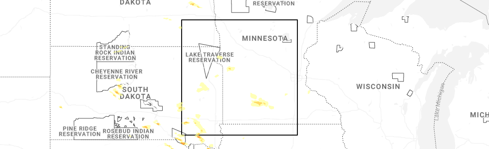
Hail Map for Seaforth, MN
The Seaforth, MN area has had 0 reports of on-the-ground hail by trained spotters, and has been under severe weather warnings 12 times during the past 12 months. Doppler radar has detected hail at or near Seaforth, MN on 58 occasions, including 2 occasions during the past year.
| Name: | Seaforth, MN |
| Where Located: | 37.9 miles SSE of Montevideo, MN |
| Map: | Google Map for Seaforth, MN |
| Population: | 86 |
| Housing Units: | 38 |
| More Info: | Search Google for Seaforth, MN |
0
The Top Recent Hail Date for Seaforth, MN is Monday, July 7, 2025 (58th out of 58)
Hail and Wind Damage Spotted near Seaforth, MN
| Date / Time | Report Details |
|---|---|
| 6/28/2025 11:41 PM CDT |
 The storms which prompted the warning have moved out of the area. therefore, the warning will be allowed to expire. however, heavy rain is still possible with these thunderstorms. a tornado watch remains in effect until 100 am cdt for portions of central and southwest minnesota. The storms which prompted the warning have moved out of the area. therefore, the warning will be allowed to expire. however, heavy rain is still possible with these thunderstorms. a tornado watch remains in effect until 100 am cdt for portions of central and southwest minnesota.
|
| 6/28/2025 11:34 PM CDT |
 At 1134 pm cdt, severe thunderstorms were located along a line from near stewart to near lamberton, or along a line from 10 miles southwest of hutchinson to 20 miles southwest of redwood falls, moving east at 45 mph (radar indicated). Hazards include 60 mph wind gusts and small hail. Expect damage to roofs, siding, and trees. Locations impacted include, redwood falls, fairfax, hector, morgan, buffalo lake, wabasso, franklin, morton, lakeside, vesta, milroy, lucan, clements and seaforth. At 1134 pm cdt, severe thunderstorms were located along a line from near stewart to near lamberton, or along a line from 10 miles southwest of hutchinson to 20 miles southwest of redwood falls, moving east at 45 mph (radar indicated). Hazards include 60 mph wind gusts and small hail. Expect damage to roofs, siding, and trees. Locations impacted include, redwood falls, fairfax, hector, morgan, buffalo lake, wabasso, franklin, morton, lakeside, vesta, milroy, lucan, clements and seaforth.
|
| 6/28/2025 11:21 PM CDT |
 At 1121 pm cdt, severe thunderstorms were located along a line from 5 miles north of hector to 7 miles north of walnut grove, or along a line from 17 miles west of hutchinson to 24 miles southwest of redwood falls, moving east at 45 mph (radar indicated). Hazards include 60 mph wind gusts and small hail. Expect damage to roofs, siding, and trees. Locations impacted include, redwood falls, fairfax, hector, bird island, morgan, buffalo lake, wabasso, franklin, morton, lakeside, vesta, milroy, lucan, clements, seaforth, delhi, redwood falls airport and north redwood. At 1121 pm cdt, severe thunderstorms were located along a line from 5 miles north of hector to 7 miles north of walnut grove, or along a line from 17 miles west of hutchinson to 24 miles southwest of redwood falls, moving east at 45 mph (radar indicated). Hazards include 60 mph wind gusts and small hail. Expect damage to roofs, siding, and trees. Locations impacted include, redwood falls, fairfax, hector, bird island, morgan, buffalo lake, wabasso, franklin, morton, lakeside, vesta, milroy, lucan, clements, seaforth, delhi, redwood falls airport and north redwood.
|
| 6/28/2025 11:21 PM CDT |
 the severe thunderstorm warning has been cancelled and is no longer in effect the severe thunderstorm warning has been cancelled and is no longer in effect
|
| 6/28/2025 11:03 PM CDT |
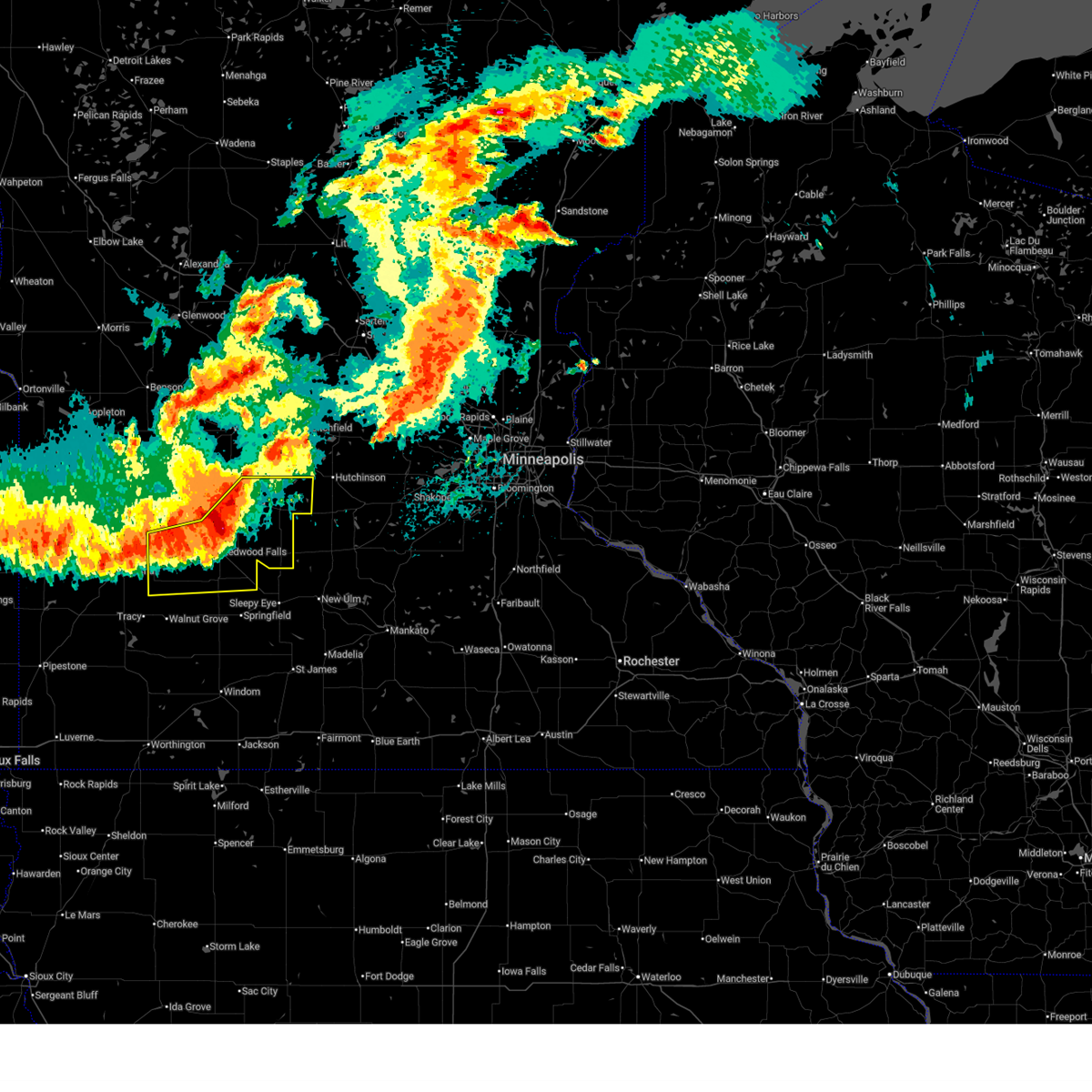 At 1103 pm cdt, severe thunderstorms were located along a line from 7 miles northeast of bird island to 8 miles west of wabasso, or along a line from 22 miles west of hutchinson to 17 miles southwest of redwood falls, moving east at 50 mph (radar indicated). Hazards include 60 mph wind gusts and small hail. Expect damage to roofs, siding, and trees. Locations impacted include, redwood falls, olivia, fairfax, hector, bird island, morgan, buffalo lake, wabasso, franklin, morton, echo, danube, lakeside, belview, vesta, milroy, lucan, clements, seaforth and delhi. At 1103 pm cdt, severe thunderstorms were located along a line from 7 miles northeast of bird island to 8 miles west of wabasso, or along a line from 22 miles west of hutchinson to 17 miles southwest of redwood falls, moving east at 50 mph (radar indicated). Hazards include 60 mph wind gusts and small hail. Expect damage to roofs, siding, and trees. Locations impacted include, redwood falls, olivia, fairfax, hector, bird island, morgan, buffalo lake, wabasso, franklin, morton, echo, danube, lakeside, belview, vesta, milroy, lucan, clements, seaforth and delhi.
|
| 6/28/2025 10:48 PM CDT |
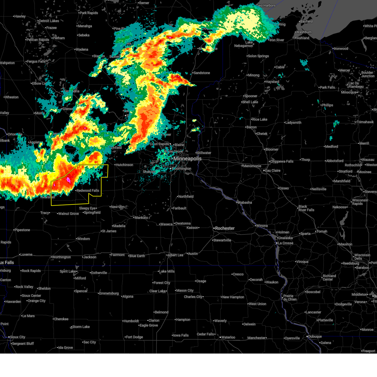 Svrmpx the national weather service in the twin cities has issued a * severe thunderstorm warning for, renville county in central minnesota, redwood county in southwestern minnesota, southeastern yellow medicine county in west central minnesota, * until 1145 pm cdt. * at 1048 pm cdt, severe thunderstorms were located along a line from 6 miles north of bird island to 12 miles southwest of hanley falls, or along a line from 20 miles south of willmar to 29 miles south of montevideo, moving east at 45 mph (radar indicated). Hazards include 60 mph wind gusts and half dollar size hail. Hail damage to vehicles is expected. Expect wind damage to roofs, siding, and trees. Svrmpx the national weather service in the twin cities has issued a * severe thunderstorm warning for, renville county in central minnesota, redwood county in southwestern minnesota, southeastern yellow medicine county in west central minnesota, * until 1145 pm cdt. * at 1048 pm cdt, severe thunderstorms were located along a line from 6 miles north of bird island to 12 miles southwest of hanley falls, or along a line from 20 miles south of willmar to 29 miles south of montevideo, moving east at 45 mph (radar indicated). Hazards include 60 mph wind gusts and half dollar size hail. Hail damage to vehicles is expected. Expect wind damage to roofs, siding, and trees.
|
| 7/15/2024 4:38 AM CDT |
 the severe thunderstorm warning has been cancelled and is no longer in effect the severe thunderstorm warning has been cancelled and is no longer in effect
|
| 7/15/2024 4:38 AM CDT |
 At 438 am cdt, a severe thunderstorm was located near sacred heart, or 15 miles northwest of redwood falls, moving southeast at 45 mph (radar indicated). Hazards include ping pong ball size hail and 60 mph wind gusts. People and animals outdoors will be injured. expect hail damage to roofs, siding, windows, and vehicles. expect wind damage to roofs, siding, and trees. Locations impacted include, sacred heart, echo, belview, seaforth, delhi, and upper sioux agency state park. At 438 am cdt, a severe thunderstorm was located near sacred heart, or 15 miles northwest of redwood falls, moving southeast at 45 mph (radar indicated). Hazards include ping pong ball size hail and 60 mph wind gusts. People and animals outdoors will be injured. expect hail damage to roofs, siding, windows, and vehicles. expect wind damage to roofs, siding, and trees. Locations impacted include, sacred heart, echo, belview, seaforth, delhi, and upper sioux agency state park.
|
| 7/15/2024 4:18 AM CDT |
 Svrmpx the national weather service in the twin cities has issued a * severe thunderstorm warning for, south central chippewa county in west central minnesota, north central redwood county in southwestern minnesota, eastern yellow medicine county in west central minnesota, northwestern renville county in central minnesota, * until 500 am cdt. * at 417 am cdt, a severe thunderstorm was located over granite falls, or 11 miles southeast of montevideo, moving southeast at 45 mph (radar indicated). Hazards include ping pong ball size hail and 60 mph wind gusts. People and animals outdoors will be injured. expect hail damage to roofs, siding, windows, and vehicles. Expect wind damage to roofs, siding, and trees. Svrmpx the national weather service in the twin cities has issued a * severe thunderstorm warning for, south central chippewa county in west central minnesota, north central redwood county in southwestern minnesota, eastern yellow medicine county in west central minnesota, northwestern renville county in central minnesota, * until 500 am cdt. * at 417 am cdt, a severe thunderstorm was located over granite falls, or 11 miles southeast of montevideo, moving southeast at 45 mph (radar indicated). Hazards include ping pong ball size hail and 60 mph wind gusts. People and animals outdoors will be injured. expect hail damage to roofs, siding, windows, and vehicles. Expect wind damage to roofs, siding, and trees.
|
| 7/13/2024 7:57 AM CDT |
 At 757 am cdt, a severe thunderstorm was located over wood lake, or 19 miles northeast of marshall, moving southeast at 20 mph (radar indicated). Hazards include ping pong ball size hail and 60 mph wind gusts. People and animals outdoors will be injured. expect hail damage to roofs, siding, windows, and vehicles. expect wind damage to roofs, siding, and trees. Locations impacted include, echo. At 757 am cdt, a severe thunderstorm was located over wood lake, or 19 miles northeast of marshall, moving southeast at 20 mph (radar indicated). Hazards include ping pong ball size hail and 60 mph wind gusts. People and animals outdoors will be injured. expect hail damage to roofs, siding, windows, and vehicles. expect wind damage to roofs, siding, and trees. Locations impacted include, echo.
|
| 7/13/2024 7:57 AM CDT |
 the severe thunderstorm warning has been cancelled and is no longer in effect the severe thunderstorm warning has been cancelled and is no longer in effect
|
| 7/13/2024 7:25 AM CDT |
 Svrmpx the national weather service in the twin cities has issued a * severe thunderstorm warning for, northwestern redwood county in southwestern minnesota, eastern yellow medicine county in west central minnesota, west central renville county in central minnesota, * until 815 am cdt. * at 725 am cdt, a severe thunderstorm was located near hanley falls, or 16 miles south of montevideo, moving southeast at 20 mph (radar indicated). Hazards include ping pong ball size hail and 60 mph wind gusts. People and animals outdoors will be injured. expect hail damage to roofs, siding, windows, and vehicles. expect wind damage to roofs, siding, and trees. this severe thunderstorm will be near, hanley falls around 730 am cdt. wood lake around 735 am cdt. Other locations in the path of this severe thunderstorm include echo. Svrmpx the national weather service in the twin cities has issued a * severe thunderstorm warning for, northwestern redwood county in southwestern minnesota, eastern yellow medicine county in west central minnesota, west central renville county in central minnesota, * until 815 am cdt. * at 725 am cdt, a severe thunderstorm was located near hanley falls, or 16 miles south of montevideo, moving southeast at 20 mph (radar indicated). Hazards include ping pong ball size hail and 60 mph wind gusts. People and animals outdoors will be injured. expect hail damage to roofs, siding, windows, and vehicles. expect wind damage to roofs, siding, and trees. this severe thunderstorm will be near, hanley falls around 730 am cdt. wood lake around 735 am cdt. Other locations in the path of this severe thunderstorm include echo.
|
| 9/29/2023 6:15 PM CDT |
 At 615 pm cdt, a severe thunderstorm was located near redwood falls, moving east at 45 mph (radar indicated). Hazards include ping pong ball size hail and 60 mph wind gusts. People and animals outdoors will be injured. expect hail damage to roofs, siding, windows, and vehicles. Expect wind damage to roofs, siding, and trees. At 615 pm cdt, a severe thunderstorm was located near redwood falls, moving east at 45 mph (radar indicated). Hazards include ping pong ball size hail and 60 mph wind gusts. People and animals outdoors will be injured. expect hail damage to roofs, siding, windows, and vehicles. Expect wind damage to roofs, siding, and trees.
|
| 8/18/2022 3:40 PM CDT |
 At 340 pm cdt, a severe thunderstorm was located 9 miles south of echo, or 16 miles west of redwood falls, moving east at 20 mph (radar indicated). Hazards include 60 mph wind gusts and quarter size hail. Hail damage to vehicles is expected. expect wind damage to roofs, siding, and trees. locations impacted include, vesta, milroy, lucan and seaforth. hail threat, radar indicated max hail size, 1. 00 in wind threat, radar indicated max wind gust, 60 mph. At 340 pm cdt, a severe thunderstorm was located 9 miles south of echo, or 16 miles west of redwood falls, moving east at 20 mph (radar indicated). Hazards include 60 mph wind gusts and quarter size hail. Hail damage to vehicles is expected. expect wind damage to roofs, siding, and trees. locations impacted include, vesta, milroy, lucan and seaforth. hail threat, radar indicated max hail size, 1. 00 in wind threat, radar indicated max wind gust, 60 mph.
|
| 8/18/2022 3:16 PM CDT |
 At 315 pm cdt, a severe thunderstorm was located 8 miles east of marshall, slowly moving east at 20 mph (radar indicated). Hazards include 60 mph wind gusts and quarter size hail. Hail damage to vehicles is expected. expect wind damage to roofs, siding, and trees. this severe thunderstorm will remain over mainly rural areas of west central redwood county, including the following locations, seaforth, vesta, lucan and milroy. hail threat, radar indicated max hail size, 1. 00 in wind threat, radar indicated max wind gust, 60 mph. At 315 pm cdt, a severe thunderstorm was located 8 miles east of marshall, slowly moving east at 20 mph (radar indicated). Hazards include 60 mph wind gusts and quarter size hail. Hail damage to vehicles is expected. expect wind damage to roofs, siding, and trees. this severe thunderstorm will remain over mainly rural areas of west central redwood county, including the following locations, seaforth, vesta, lucan and milroy. hail threat, radar indicated max hail size, 1. 00 in wind threat, radar indicated max wind gust, 60 mph.
|
| 8/2/2022 10:46 PM CDT |
 At 1046 pm cdt, severe thunderstorms were located along a line extending from near clara city to 6 miles southeast of renville to near lamberton, moving east at 70 mph (radar indicated). Hazards include 70 mph wind gusts. Expect considerable tree damage. damage is likely to mobile homes, roofs, and outbuildings. locations impacted include, redwood falls, granite falls, olivia, renville, morgan, lamberton, wabasso, sacred heart, franklin, wood lake, morton and echo. thunderstorm damage threat, considerable hail threat, radar indicated max hail size, <. 75 in wind threat, radar indicated max wind gust, 70 mph. At 1046 pm cdt, severe thunderstorms were located along a line extending from near clara city to 6 miles southeast of renville to near lamberton, moving east at 70 mph (radar indicated). Hazards include 70 mph wind gusts. Expect considerable tree damage. damage is likely to mobile homes, roofs, and outbuildings. locations impacted include, redwood falls, granite falls, olivia, renville, morgan, lamberton, wabasso, sacred heart, franklin, wood lake, morton and echo. thunderstorm damage threat, considerable hail threat, radar indicated max hail size, <. 75 in wind threat, radar indicated max wind gust, 70 mph.
|
| 8/2/2022 10:29 PM CDT |
 At 1029 pm cdt, severe thunderstorms were located along a line extending from 5 miles southeast of montevideo to wood lake to 8 miles north of walnut grove, moving east at 60 mph (radar indicated). Hazards include 70 mph wind gusts. Expect considerable tree damage. damage is likely to mobile homes, roofs, and outbuildings. locations impacted include, echo, wabasso, sacred heart, maynard, clara city, renville, redwood falls, olivia, morgan, morton and franklin. thunderstorm damage threat, considerable hail threat, radar indicated max hail size, <. 75 in wind threat, radar indicated max wind gust, 70 mph. At 1029 pm cdt, severe thunderstorms were located along a line extending from 5 miles southeast of montevideo to wood lake to 8 miles north of walnut grove, moving east at 60 mph (radar indicated). Hazards include 70 mph wind gusts. Expect considerable tree damage. damage is likely to mobile homes, roofs, and outbuildings. locations impacted include, echo, wabasso, sacred heart, maynard, clara city, renville, redwood falls, olivia, morgan, morton and franklin. thunderstorm damage threat, considerable hail threat, radar indicated max hail size, <. 75 in wind threat, radar indicated max wind gust, 70 mph.
|
| 8/2/2022 10:13 PM CDT |
 At 1012 pm cdt, severe thunderstorms were located along a line extending from near boyd to 6 miles northeast of ghent to 7 miles northwest of tracy, moving east at 60 mph (radar indicated). Hazards include 70 mph wind gusts. a 74 mph gust was reported at marshall airport. Expect considerable tree damage. damage is likely to mobile homes, roofs, and outbuildings. severe thunderstorms will be near, clarkfield around 1020 pm cdt. montevideo, wood lake and hanley falls around 1025 pm cdt. granite falls and echo around 1030 pm cdt. wabasso, sacred heart and maynard around 1035 pm cdt. clara city around 1040 pm cdt. redwood falls and renville around 1045 pm cdt. thunderstorm damage threat, considerable hail threat, radar indicated max hail size, <. 75 in wind threat, observed max wind gust, 70 mph. At 1012 pm cdt, severe thunderstorms were located along a line extending from near boyd to 6 miles northeast of ghent to 7 miles northwest of tracy, moving east at 60 mph (radar indicated). Hazards include 70 mph wind gusts. a 74 mph gust was reported at marshall airport. Expect considerable tree damage. damage is likely to mobile homes, roofs, and outbuildings. severe thunderstorms will be near, clarkfield around 1020 pm cdt. montevideo, wood lake and hanley falls around 1025 pm cdt. granite falls and echo around 1030 pm cdt. wabasso, sacred heart and maynard around 1035 pm cdt. clara city around 1040 pm cdt. redwood falls and renville around 1045 pm cdt. thunderstorm damage threat, considerable hail threat, radar indicated max hail size, <. 75 in wind threat, observed max wind gust, 70 mph.
|
| 6/20/2022 10:10 PM CDT |
 The severe thunderstorm warning for central redwood, southwestern kandiyohi and northwestern renville counties will expire at 1015 pm cdt, the storms which prompted the warning have weakened below severe limits, and have exited the warned area. therefore, the warning will be allowed to expire. a severe thunderstorm watch remains in effect until 400 am cdt for south central, central, southwestern and west central minnesota. to report severe weather, contact your nearest law enforcement agency. they will relay your report to the national weather service the twin cities. The severe thunderstorm warning for central redwood, southwestern kandiyohi and northwestern renville counties will expire at 1015 pm cdt, the storms which prompted the warning have weakened below severe limits, and have exited the warned area. therefore, the warning will be allowed to expire. a severe thunderstorm watch remains in effect until 400 am cdt for south central, central, southwestern and west central minnesota. to report severe weather, contact your nearest law enforcement agency. they will relay your report to the national weather service the twin cities.
|
| 6/20/2022 10:00 PM CDT |
 At 1000 pm cdt, severe thunderstorms were located along a line extending from 5 miles south of prinsburg to 6 miles southeast of renville to 5 miles west of wabasso to near lamberton, moving northeast at 50 mph (radar indicated). Hazards include 60 mph wind gusts. Expect damage to roofs, siding, and trees. locations impacted include, redwood falls, olivia, renville, walnut grove, lamberton, wabasso, sacred heart, prinsburg, danube, belview, sanborn and lucan. hail threat, radar indicated max hail size, <. 75 in wind threat, radar indicated max wind gust, 60 mph. At 1000 pm cdt, severe thunderstorms were located along a line extending from 5 miles south of prinsburg to 6 miles southeast of renville to 5 miles west of wabasso to near lamberton, moving northeast at 50 mph (radar indicated). Hazards include 60 mph wind gusts. Expect damage to roofs, siding, and trees. locations impacted include, redwood falls, olivia, renville, walnut grove, lamberton, wabasso, sacred heart, prinsburg, danube, belview, sanborn and lucan. hail threat, radar indicated max hail size, <. 75 in wind threat, radar indicated max wind gust, 60 mph.
|
| 6/20/2022 9:47 PM CDT |
 At 947 pm cdt, severe thunderstorms were located along a line extending from sacred heart to 5 miles east of echo to 13 miles west of wabasso to walnut grove, moving northeast at 45 mph (radar indicated). Hazards include 60 mph wind gusts. Expect damage to roofs, siding, and trees. these severe storms will be near, renville and sacred heart around 955 pm cdt. prinsburg around 1005 pm cdt. wabasso around 1010 pm cdt. redwood falls and olivia around 1015 pm cdt. other locations impacted by these severe thunderstorms include bechyn, seaforth, delhi, lucan, revere, redwood falls airport, blomkest, minnesota falls, sanborn and belview. hail threat, radar indicated max hail size, <. 75 in wind threat, radar indicated max wind gust, 60 mph. At 947 pm cdt, severe thunderstorms were located along a line extending from sacred heart to 5 miles east of echo to 13 miles west of wabasso to walnut grove, moving northeast at 45 mph (radar indicated). Hazards include 60 mph wind gusts. Expect damage to roofs, siding, and trees. these severe storms will be near, renville and sacred heart around 955 pm cdt. prinsburg around 1005 pm cdt. wabasso around 1010 pm cdt. redwood falls and olivia around 1015 pm cdt. other locations impacted by these severe thunderstorms include bechyn, seaforth, delhi, lucan, revere, redwood falls airport, blomkest, minnesota falls, sanborn and belview. hail threat, radar indicated max hail size, <. 75 in wind threat, radar indicated max wind gust, 60 mph.
|
| 6/20/2022 9:25 PM CDT |
 At 924 pm cdt, severe thunderstorms were located along a line extending from 5 miles southeast of montevideo to 7 miles east of marshall to 6 miles northeast of balaton to near chandler, moving northeast at 50 mph (radar indicated. at 921 pm, a 58 mph gust was measured at granite falls airport). Hazards include 60 mph wind gusts. Expect damage to roofs, siding, and trees. severe thunderstorms will be near, montevideo around 930 pm cdt. maynard around 935 pm cdt. clara city and echo around 940 pm cdt. raymond and sacred heart around 950 pm cdt. walnut grove around 955 pm cdt. renville around 1000 pm cdt. willmar, redwood falls, olivia and lamberton around 1005 pm cdt. wabasso around 1015 pm cdt. other locations impacted by these severe thunderstorms include bechyn, seaforth, asbury, delhi, lucan, willmar airport, revere, redwood falls airport, blomkest and montevideo airport. hail threat, radar indicated max hail size, <. 75 in wind threat, observed max wind gust, 60 mph. At 924 pm cdt, severe thunderstorms were located along a line extending from 5 miles southeast of montevideo to 7 miles east of marshall to 6 miles northeast of balaton to near chandler, moving northeast at 50 mph (radar indicated. at 921 pm, a 58 mph gust was measured at granite falls airport). Hazards include 60 mph wind gusts. Expect damage to roofs, siding, and trees. severe thunderstorms will be near, montevideo around 930 pm cdt. maynard around 935 pm cdt. clara city and echo around 940 pm cdt. raymond and sacred heart around 950 pm cdt. walnut grove around 955 pm cdt. renville around 1000 pm cdt. willmar, redwood falls, olivia and lamberton around 1005 pm cdt. wabasso around 1015 pm cdt. other locations impacted by these severe thunderstorms include bechyn, seaforth, asbury, delhi, lucan, willmar airport, revere, redwood falls airport, blomkest and montevideo airport. hail threat, radar indicated max hail size, <. 75 in wind threat, observed max wind gust, 60 mph.
|
| 5/30/2022 5:15 PM CDT |
 At 514 pm cdt, severe thunderstorms were located along a line extending from renville to 7 miles west of redwood falls to near wabasso, moving northeast at 35 mph (radar indicated). Hazards include 60 mph wind gusts and nickel size hail. Expect damage to roofs, siding, and trees. Locations impacted include, renville, redwood falls, olivia and morton. At 514 pm cdt, severe thunderstorms were located along a line extending from renville to 7 miles west of redwood falls to near wabasso, moving northeast at 35 mph (radar indicated). Hazards include 60 mph wind gusts and nickel size hail. Expect damage to roofs, siding, and trees. Locations impacted include, renville, redwood falls, olivia and morton.
|
| 5/30/2022 4:58 PM CDT |
 At 458 pm cdt, severe thunderstorms were located along a line extending from 5 miles northeast of echo to 8 miles northwest of wabasso to 5 miles northeast of walnut grove, moving northeast at 35 mph (radar indicated). Hazards include 60 mph wind gusts and nickel size hail. Expect damage to roofs, siding, and trees. severe thunderstorms will be near, sacred heart around 505 pm cdt. echo around 510 pm cdt. renville around 515 pm cdt. Other locations in the path of these severe thunderstorms include redwood falls, olivia and morton. At 458 pm cdt, severe thunderstorms were located along a line extending from 5 miles northeast of echo to 8 miles northwest of wabasso to 5 miles northeast of walnut grove, moving northeast at 35 mph (radar indicated). Hazards include 60 mph wind gusts and nickel size hail. Expect damage to roofs, siding, and trees. severe thunderstorms will be near, sacred heart around 505 pm cdt. echo around 510 pm cdt. renville around 515 pm cdt. Other locations in the path of these severe thunderstorms include redwood falls, olivia and morton.
|
| 5/30/2022 4:47 PM CDT |
 At 447 pm cdt, severe thunderstorms were located along a line extending from 5 miles southeast of granite falls to echo to 9 miles west of wabasso, moving northeast at 70 mph (radar indicated). Hazards include 70 mph wind gusts and nickel size hail. Expect considerable tree damage. damage is likely to mobile homes, roofs, and outbuildings. Locations impacted include, renville, walnut grove, wabasso, sacred heart, wood lake, echo, minnesota falls, belview, vesta, milroy, lucan and revere. At 447 pm cdt, severe thunderstorms were located along a line extending from 5 miles southeast of granite falls to echo to 9 miles west of wabasso, moving northeast at 70 mph (radar indicated). Hazards include 70 mph wind gusts and nickel size hail. Expect considerable tree damage. damage is likely to mobile homes, roofs, and outbuildings. Locations impacted include, renville, walnut grove, wabasso, sacred heart, wood lake, echo, minnesota falls, belview, vesta, milroy, lucan and revere.
|
| 5/30/2022 4:30 PM CDT |
 At 430 pm cdt, severe thunderstorms were located along a line extending from 7 miles south of cottonwood to 11 miles east of marshall to near tracy, moving northeast at 70 mph (radar indicated). Hazards include 70 mph wind gusts and nickel size hail. Expect considerable tree damage. damage is likely to mobile homes, roofs, and outbuildings. Locations impacted include, wood lake, echo, sacred heart and renville. At 430 pm cdt, severe thunderstorms were located along a line extending from 7 miles south of cottonwood to 11 miles east of marshall to near tracy, moving northeast at 70 mph (radar indicated). Hazards include 70 mph wind gusts and nickel size hail. Expect considerable tree damage. damage is likely to mobile homes, roofs, and outbuildings. Locations impacted include, wood lake, echo, sacred heart and renville.
|
| 5/30/2022 4:18 PM CDT |
 At 417 pm cdt, severe thunderstorms were located along a line extending from 6 miles south of marshall to near tracy to near slayton, moving northeast at 70 mph (radar indicated). Hazards include 70 mph wind gusts and nickel size hail. Expect considerable tree damage. damage is likely to mobile homes, roofs, and outbuildings. severe thunderstorms will be near, walnut grove and wood lake around 435 pm cdt. Other locations in the path of these severe thunderstorms include echo, sacred heart and renville. At 417 pm cdt, severe thunderstorms were located along a line extending from 6 miles south of marshall to near tracy to near slayton, moving northeast at 70 mph (radar indicated). Hazards include 70 mph wind gusts and nickel size hail. Expect considerable tree damage. damage is likely to mobile homes, roofs, and outbuildings. severe thunderstorms will be near, walnut grove and wood lake around 435 pm cdt. Other locations in the path of these severe thunderstorms include echo, sacred heart and renville.
|
| 5/30/2022 3:29 AM CDT |
 At 329 am cdt, severe thunderstorms were located along a line extending from 7 miles southwest of echo to near jackson in jackson county, moving northeast at 60 mph (radar indicated). Hazards include 60 mph wind gusts. Expect damage to roofs, siding, and trees. locations impacted include, redwood falls, st. James, sleepy eye, springfield, sherburn, truman, morgan, lamberton, trimont, wabasso, welcome and butterfield. At 329 am cdt, severe thunderstorms were located along a line extending from 7 miles southwest of echo to near jackson in jackson county, moving northeast at 60 mph (radar indicated). Hazards include 60 mph wind gusts. Expect damage to roofs, siding, and trees. locations impacted include, redwood falls, st. James, sleepy eye, springfield, sherburn, truman, morgan, lamberton, trimont, wabasso, welcome and butterfield.
|
| 5/30/2022 3:02 AM CDT |
 At 301 am cdt, severe thunderstorms were located along a line extending from near camden state park to round lake, moving northeast at 60 mph (radar indicated). Hazards include 70 mph wind gusts. Expect considerable tree damage. Damage is likely to mobile homes, roofs, and outbuildings. At 301 am cdt, severe thunderstorms were located along a line extending from near camden state park to round lake, moving northeast at 60 mph (radar indicated). Hazards include 70 mph wind gusts. Expect considerable tree damage. Damage is likely to mobile homes, roofs, and outbuildings.
|
| 5/29/2022 5:36 AM CDT |
 At 536 am cdt, a severe thunderstorm was located over tracy, or 18 miles southeast of marshall, moving northeast at 55 mph (radar indicated). Hazards include 60 mph wind gusts and quarter size hail. Hail damage to vehicles is expected. expect wind damage to roofs, siding, and trees. this severe thunderstorm will be near, walnut grove around 540 am cdt. Wabasso around 555 am cdt. At 536 am cdt, a severe thunderstorm was located over tracy, or 18 miles southeast of marshall, moving northeast at 55 mph (radar indicated). Hazards include 60 mph wind gusts and quarter size hail. Hail damage to vehicles is expected. expect wind damage to roofs, siding, and trees. this severe thunderstorm will be near, walnut grove around 540 am cdt. Wabasso around 555 am cdt.
|
| 5/12/2022 9:23 PM CDT |
 The severe thunderstorm warning for northern redwood and yellow medicine counties will expire at 930 pm cdt, the storm which prompted the warning has weakened below severe limits, and no longer poses an immediate threat to life or property. therefore, the warning will be allowed to expire. however gusty winds and heavy rain are still possible with this thunderstorm. a tornado watch remains in effect until midnight cdt for central, southwestern and west central minnesota. The severe thunderstorm warning for northern redwood and yellow medicine counties will expire at 930 pm cdt, the storm which prompted the warning has weakened below severe limits, and no longer poses an immediate threat to life or property. therefore, the warning will be allowed to expire. however gusty winds and heavy rain are still possible with this thunderstorm. a tornado watch remains in effect until midnight cdt for central, southwestern and west central minnesota.
|
| 5/12/2022 8:54 PM CDT |
 At 853 pm cdt, a severe thunderstorm was located near ghent, or near marshall, moving northeast at 60 mph (radar indicated). Hazards include 60 mph wind gusts and quarter size hail. Hail damage to vehicles is expected. Expect wind damage to roofs, siding, and trees. At 853 pm cdt, a severe thunderstorm was located near ghent, or near marshall, moving northeast at 60 mph (radar indicated). Hazards include 60 mph wind gusts and quarter size hail. Hail damage to vehicles is expected. Expect wind damage to roofs, siding, and trees.
|
| 5/12/2022 6:20 PM CDT |
 At 620 pm cdt, severe thunderstorms were located along a line extending from near echo to near storden to near spirit lake, moving northeast at 70 mph (radar indicated). Hazards include 70 mph wind gusts. Expect considerable tree damage. damage is likely to mobile homes, roofs, and outbuildings. these severe storms will be near, echo around 625 pm cdt. sacred heart around 630 pm cdt. renville and comfrey around 635 pm cdt. springfield around 640 pm cdt. sherburn around 645 pm cdt. sleepy eye and trimont around 650 pm cdt. truman around 700 pm cdt. lewisville around 705 pm cdt. thunderstorm damage threat, considerable hail threat, radar indicated max hail size, <. 75 in wind threat, radar indicated max wind gust, 70 mph. At 620 pm cdt, severe thunderstorms were located along a line extending from near echo to near storden to near spirit lake, moving northeast at 70 mph (radar indicated). Hazards include 70 mph wind gusts. Expect considerable tree damage. damage is likely to mobile homes, roofs, and outbuildings. these severe storms will be near, echo around 625 pm cdt. sacred heart around 630 pm cdt. renville and comfrey around 635 pm cdt. springfield around 640 pm cdt. sherburn around 645 pm cdt. sleepy eye and trimont around 650 pm cdt. truman around 700 pm cdt. lewisville around 705 pm cdt. thunderstorm damage threat, considerable hail threat, radar indicated max hail size, <. 75 in wind threat, radar indicated max wind gust, 70 mph.
|
| 5/12/2022 6:02 PM CDT |
 At 602 pm cdt, severe thunderstorms were located along a line extending from near camden state park to 5 miles south of fulda to 6 miles southeast of ocheyedan, moving northeast at 75 mph (radar indicated). Hazards include 70 mph wind gusts and quarter size hail. Hail damage to vehicles is expected. expect considerable tree damage. wind damage is also likely to mobile homes, roofs, and outbuildings. severe thunderstorms will be near, wood lake and echo around 625 pm cdt. springfield, sherburn, sacred heart and comfrey around 635 pm cdt. renville and trimont around 640 pm cdt. sleepy eye and olivia around 645 pm cdt. new ulm, truman and lewisville around 655 pm cdt. madelia around 700 pm cdt. thunderstorm damage threat, considerable hail threat, radar indicated max hail size, 1. 00 in wind threat, radar indicated max wind gust, 70 mph. At 602 pm cdt, severe thunderstorms were located along a line extending from near camden state park to 5 miles south of fulda to 6 miles southeast of ocheyedan, moving northeast at 75 mph (radar indicated). Hazards include 70 mph wind gusts and quarter size hail. Hail damage to vehicles is expected. expect considerable tree damage. wind damage is also likely to mobile homes, roofs, and outbuildings. severe thunderstorms will be near, wood lake and echo around 625 pm cdt. springfield, sherburn, sacred heart and comfrey around 635 pm cdt. renville and trimont around 640 pm cdt. sleepy eye and olivia around 645 pm cdt. new ulm, truman and lewisville around 655 pm cdt. madelia around 700 pm cdt. thunderstorm damage threat, considerable hail threat, radar indicated max hail size, 1. 00 in wind threat, radar indicated max wind gust, 70 mph.
|
| 5/11/2022 6:34 PM CDT |
 At 633 pm cdt, severe thunderstorms were located along a line extending from 6 miles north of redwood falls to 8 miles west of hanska, moving northeast at 45 mph (radar indicated). Hazards include 70 mph wind gusts and quarter size hail. Hail damage to vehicles is expected. expect considerable tree damage. wind damage is also likely to mobile homes, roofs, and outbuildings. Locations impacted include, new ulm, redwood falls, sleepy eye, springfield, morgan, wabasso, franklin, morton, comfrey, sanborn, clements and seaforth. At 633 pm cdt, severe thunderstorms were located along a line extending from 6 miles north of redwood falls to 8 miles west of hanska, moving northeast at 45 mph (radar indicated). Hazards include 70 mph wind gusts and quarter size hail. Hail damage to vehicles is expected. expect considerable tree damage. wind damage is also likely to mobile homes, roofs, and outbuildings. Locations impacted include, new ulm, redwood falls, sleepy eye, springfield, morgan, wabasso, franklin, morton, comfrey, sanborn, clements and seaforth.
|
| 5/11/2022 6:21 PM CDT |
 At 621 pm cdt, severe thunderstorms were located along a line extending from 7 miles north of wabasso to near butterfield, moving northeast at 25 mph (radar indicated). Hazards include 70 mph wind gusts and quarter size hail. Hail damage to vehicles is expected. expect considerable tree damage. wind damage is also likely to mobile homes, roofs, and outbuildings. Locations impacted include, new ulm, redwood falls, sleepy eye, springfield, morgan, lamberton, wabasso, franklin, morton, comfrey, sanborn and lucan. At 621 pm cdt, severe thunderstorms were located along a line extending from 7 miles north of wabasso to near butterfield, moving northeast at 25 mph (radar indicated). Hazards include 70 mph wind gusts and quarter size hail. Hail damage to vehicles is expected. expect considerable tree damage. wind damage is also likely to mobile homes, roofs, and outbuildings. Locations impacted include, new ulm, redwood falls, sleepy eye, springfield, morgan, lamberton, wabasso, franklin, morton, comfrey, sanborn and lucan.
|
| 5/11/2022 6:04 PM CDT |
 At 604 pm cdt, severe thunderstorms were located along a line extending from 8 miles west of wabasso to mountain lake, moving northeast at 45 mph (radar indicated). Hazards include 60 mph wind gusts and quarter size hail. Hail damage to vehicles is expected. expect wind damage to roofs, siding, and trees. Locations impacted include, comfrey, redwood falls and new ulm. At 604 pm cdt, severe thunderstorms were located along a line extending from 8 miles west of wabasso to mountain lake, moving northeast at 45 mph (radar indicated). Hazards include 60 mph wind gusts and quarter size hail. Hail damage to vehicles is expected. expect wind damage to roofs, siding, and trees. Locations impacted include, comfrey, redwood falls and new ulm.
|
| 5/11/2022 5:55 PM CDT |
 At 555 pm cdt, severe thunderstorms were located along a line extending from tracy to near lakefield, moving northeast at 25 mph (radar indicated). Hazards include 60 mph wind gusts and quarter size hail. Hail damage to vehicles is expected. expect wind damage to roofs, siding, and trees. severe thunderstorms will be near, walnut grove around 610 pm cdt. other locations in the path of these severe thunderstorms include wabasso and redwood falls. hail threat, radar indicated max hail size, 1. 00 in wind threat, radar indicated max wind gust, 60 mph. At 555 pm cdt, severe thunderstorms were located along a line extending from tracy to near lakefield, moving northeast at 25 mph (radar indicated). Hazards include 60 mph wind gusts and quarter size hail. Hail damage to vehicles is expected. expect wind damage to roofs, siding, and trees. severe thunderstorms will be near, walnut grove around 610 pm cdt. other locations in the path of these severe thunderstorms include wabasso and redwood falls. hail threat, radar indicated max hail size, 1. 00 in wind threat, radar indicated max wind gust, 60 mph.
|
| 4/12/2022 7:55 PM CDT |
 At 754 pm cdt, a severe thunderstorm was located 9 miles northwest of wabasso, or 14 miles west of redwood falls, moving northeast at 60 mph (radar indicated). Hazards include 60 mph wind gusts and quarter size hail. Hail damage to vehicles is expected. expect wind damage to roofs, siding, and trees. locations impacted include, redwood falls, echo, belview, vesta, milroy, lucan, seaforth, delhi, north redwood and redwood falls airport. hail threat, radar indicated max hail size, 1. 00 in wind threat, radar indicated max wind gust, 60 mph. At 754 pm cdt, a severe thunderstorm was located 9 miles northwest of wabasso, or 14 miles west of redwood falls, moving northeast at 60 mph (radar indicated). Hazards include 60 mph wind gusts and quarter size hail. Hail damage to vehicles is expected. expect wind damage to roofs, siding, and trees. locations impacted include, redwood falls, echo, belview, vesta, milroy, lucan, seaforth, delhi, north redwood and redwood falls airport. hail threat, radar indicated max hail size, 1. 00 in wind threat, radar indicated max wind gust, 60 mph.
|
| 4/12/2022 7:39 PM CDT |
 At 739 pm cdt, a severe thunderstorm was located 6 miles north of tracy, or 11 miles southeast of marshall, moving northeast at 60 mph (radar indicated). Hazards include 60 mph wind gusts and quarter size hail. Hail damage to vehicles is expected. Expect wind damage to roofs, siding, and trees. At 739 pm cdt, a severe thunderstorm was located 6 miles north of tracy, or 11 miles southeast of marshall, moving northeast at 60 mph (radar indicated). Hazards include 60 mph wind gusts and quarter size hail. Hail damage to vehicles is expected. Expect wind damage to roofs, siding, and trees.
|
| 9/17/2021 1:29 AM CDT |
 At 128 am cdt, a severe thunderstorm was located 6 miles southeast of wabasso, or 15 miles south of redwood falls, moving northeast at 60 mph (radar indicated). Hazards include 60 mph wind gusts. Expect damage to roofs, siding, and trees. this severe thunderstorm will be near, morgan around 145 am cdt. other locations in the path of this severe thunderstorm include franklin. hail threat, radar indicated max hail size, <. 75 in wind threat, radar indicated max wind gust, 60 mph. At 128 am cdt, a severe thunderstorm was located 6 miles southeast of wabasso, or 15 miles south of redwood falls, moving northeast at 60 mph (radar indicated). Hazards include 60 mph wind gusts. Expect damage to roofs, siding, and trees. this severe thunderstorm will be near, morgan around 145 am cdt. other locations in the path of this severe thunderstorm include franklin. hail threat, radar indicated max hail size, <. 75 in wind threat, radar indicated max wind gust, 60 mph.
|
| 8/28/2021 7:40 PM CDT |
 At 740 pm cdt, a severe thunderstorm was located near tracy, or 17 miles northeast of slayton, moving northeast at 35 mph (radar indicated). Hazards include 60 mph wind gusts and half dollar size hail. Hail damage to vehicles is expected. expect wind damage to roofs, siding, and trees. this severe thunderstorm will be near, walnut grove around 750 pm cdt. other locations in the path of this severe thunderstorm include lamberton and wabasso. hail threat, radar indicated max hail size, 1. 25 in wind threat, radar indicated max wind gust, 60 mph. At 740 pm cdt, a severe thunderstorm was located near tracy, or 17 miles northeast of slayton, moving northeast at 35 mph (radar indicated). Hazards include 60 mph wind gusts and half dollar size hail. Hail damage to vehicles is expected. expect wind damage to roofs, siding, and trees. this severe thunderstorm will be near, walnut grove around 750 pm cdt. other locations in the path of this severe thunderstorm include lamberton and wabasso. hail threat, radar indicated max hail size, 1. 25 in wind threat, radar indicated max wind gust, 60 mph.
|
| 8/28/2021 6:31 PM CDT |
 At 630 pm cdt, severe thunderstorms were located along a line extending from near wabasso to near comfrey, moving east at 55 mph (radar indicated). Hazards include 70 mph wind gusts. Expect considerable tree damage. damage is likely to mobile homes, roofs, and outbuildings. Locations impacted include, comfrey, morgan, franklin, hanska and new ulm. At 630 pm cdt, severe thunderstorms were located along a line extending from near wabasso to near comfrey, moving east at 55 mph (radar indicated). Hazards include 70 mph wind gusts. Expect considerable tree damage. damage is likely to mobile homes, roofs, and outbuildings. Locations impacted include, comfrey, morgan, franklin, hanska and new ulm.
|
| 8/28/2021 6:06 PM CDT |
 At 605 pm cdt, severe thunderstorms were located along a line extending from near tracy to 6 miles southeast of storden, moving northeast at 55 mph (radar indicated). Hazards include 70 mph wind gusts. Expect considerable tree damage. damage is likely to mobile homes, roofs, and outbuildings. severe thunderstorms will be near, wabasso around 625 pm cdt. Other locations in the path of these severe thunderstorms include comfrey, redwood falls, morgan, franklin, morton, hanska and new ulm. At 605 pm cdt, severe thunderstorms were located along a line extending from near tracy to 6 miles southeast of storden, moving northeast at 55 mph (radar indicated). Hazards include 70 mph wind gusts. Expect considerable tree damage. damage is likely to mobile homes, roofs, and outbuildings. severe thunderstorms will be near, wabasso around 625 pm cdt. Other locations in the path of these severe thunderstorms include comfrey, redwood falls, morgan, franklin, morton, hanska and new ulm.
|
| 8/28/2020 3:36 AM CDT |
 At 336 am cdt, severe thunderstorms were located along a line extending from near murdock to near renville to near redwood falls to near wabasso, moving east at 65 mph (radar indicated). Hazards include 60 mph wind gusts and quarter size hail. Hail damage to vehicles is expected. expect wind damage to roofs, siding, and trees. these severe storms will be near, morton around 340 am cdt. bird island around 345 am cdt. morgan and franklin around 350 am cdt. willmar and hector around 355 am cdt. fairfax around 400 am cdt. Other locations impacted by these severe thunderstorms include bechyn, seaforth, delhi, clements, lucan, willmar airport, revere, redwood falls airport, thorpe and cobden. At 336 am cdt, severe thunderstorms were located along a line extending from near murdock to near renville to near redwood falls to near wabasso, moving east at 65 mph (radar indicated). Hazards include 60 mph wind gusts and quarter size hail. Hail damage to vehicles is expected. expect wind damage to roofs, siding, and trees. these severe storms will be near, morton around 340 am cdt. bird island around 345 am cdt. morgan and franklin around 350 am cdt. willmar and hector around 355 am cdt. fairfax around 400 am cdt. Other locations impacted by these severe thunderstorms include bechyn, seaforth, delhi, clements, lucan, willmar airport, revere, redwood falls airport, thorpe and cobden.
|
| 8/28/2020 3:23 AM CDT |
 At 322 am cdt, severe thunderstorms were located along a line extending from 7 miles north of watson to near granite falls to near echo to 7 miles north of walnut grove, moving east at 65 mph (radar indicated). Hazards include 60 mph wind gusts. Expect damage to roofs, siding, and trees. these severe storms will be near, wabasso around 330 am cdt. redwood falls, renville and prinsburg around 335 am cdt. morton and murdock around 340 am cdt. kerkhoven around 345 am cdt. morgan and franklin around 350 am cdt. willmar and hector around 355 am cdt. fairfax around 400 am cdt. Other locations impacted by these severe thunderstorms include bechyn, seaforth, asbury, delhi, clements, willmar airport, revere, blomkest, lake lillian and belview. At 322 am cdt, severe thunderstorms were located along a line extending from 7 miles north of watson to near granite falls to near echo to 7 miles north of walnut grove, moving east at 65 mph (radar indicated). Hazards include 60 mph wind gusts. Expect damage to roofs, siding, and trees. these severe storms will be near, wabasso around 330 am cdt. redwood falls, renville and prinsburg around 335 am cdt. morton and murdock around 340 am cdt. kerkhoven around 345 am cdt. morgan and franklin around 350 am cdt. willmar and hector around 355 am cdt. fairfax around 400 am cdt. Other locations impacted by these severe thunderstorms include bechyn, seaforth, asbury, delhi, clements, willmar airport, revere, blomkest, lake lillian and belview.
|
| 8/28/2020 2:58 AM CDT |
 At 258 am cdt, severe thunderstorms were located along a line extending from near madison to near clarkfield to ghent to near balaton, moving east at 65 mph (radar indicated). Hazards include 60 mph wind gusts. Expect damage to roofs, siding, and trees. severe thunderstorms will be near, clarkfield around 305 am cdt. dawson and hanley falls around 310 am cdt. granite falls, wood lake and milan around 315 am cdt. walnut grove, maynard, echo and watson around 320 am cdt. sacred heart around 325 am cdt. redwood falls, renville and wabasso around 330 am cdt. prinsburg around 335 am cdt. olivia, morton and murdock around 340 am cdt. other locations impacted by these severe thunderstorms include bechyn, seaforth, asbury, delhi, clements, willmar airport, revere, blomkest, lake lillian and belview. This includes prairies edge casino resort and jackpot junction casino. At 258 am cdt, severe thunderstorms were located along a line extending from near madison to near clarkfield to ghent to near balaton, moving east at 65 mph (radar indicated). Hazards include 60 mph wind gusts. Expect damage to roofs, siding, and trees. severe thunderstorms will be near, clarkfield around 305 am cdt. dawson and hanley falls around 310 am cdt. granite falls, wood lake and milan around 315 am cdt. walnut grove, maynard, echo and watson around 320 am cdt. sacred heart around 325 am cdt. redwood falls, renville and wabasso around 330 am cdt. prinsburg around 335 am cdt. olivia, morton and murdock around 340 am cdt. other locations impacted by these severe thunderstorms include bechyn, seaforth, asbury, delhi, clements, willmar airport, revere, blomkest, lake lillian and belview. This includes prairies edge casino resort and jackpot junction casino.
|
| 8/8/2020 1:14 PM CDT |
 At 113 pm cdt, a severe thunderstorm was located near marshall, moving southeast at 50 mph. wind gusts up to 70 mph have been reported previously with this storm (radar indicated). Hazards include 70 mph wind gusts. Expect considerable tree damage. Damage is likely to mobile homes, roofs, and outbuildings. At 113 pm cdt, a severe thunderstorm was located near marshall, moving southeast at 50 mph. wind gusts up to 70 mph have been reported previously with this storm (radar indicated). Hazards include 70 mph wind gusts. Expect considerable tree damage. Damage is likely to mobile homes, roofs, and outbuildings.
|
| 7/12/2019 11:42 AM CDT |
 The severe thunderstorm warning for northwestern redwood and southeastern yellow medicine counties will expire at 1145 am cdt, the storm which prompted the warning has weakened below severe limits, and has exited the warned area. therefore, the warning will be allowed to expire. however small hail is still possible with this thunderstorm. to report severe weather, contact your nearest law enforcement agency. they will relay your report to the national weather service the twin cities. The severe thunderstorm warning for northwestern redwood and southeastern yellow medicine counties will expire at 1145 am cdt, the storm which prompted the warning has weakened below severe limits, and has exited the warned area. therefore, the warning will be allowed to expire. however small hail is still possible with this thunderstorm. to report severe weather, contact your nearest law enforcement agency. they will relay your report to the national weather service the twin cities.
|
| 7/12/2019 11:36 AM CDT |
 At 1136 am cdt, a severe thunderstorm was located 7 miles southeast of echo, or 9 miles west of redwood falls, moving east at 50 mph (radar indicated). Hazards include quarter size hail. Damage to vehicles is expected. Locations impacted include, echo, belview, vesta, seaforth and delhi. At 1136 am cdt, a severe thunderstorm was located 7 miles southeast of echo, or 9 miles west of redwood falls, moving east at 50 mph (radar indicated). Hazards include quarter size hail. Damage to vehicles is expected. Locations impacted include, echo, belview, vesta, seaforth and delhi.
|
| 7/12/2019 11:15 AM CDT |
 The national weather service in the twin cities has issued a * severe thunderstorm warning for. northwestern redwood county in southwestern minnesota. southeastern yellow medicine county in west central minnesota. until 1145 am cdt. At 1115 am cdt, a severe thunderstorm was located over cottonwood,. The national weather service in the twin cities has issued a * severe thunderstorm warning for. northwestern redwood county in southwestern minnesota. southeastern yellow medicine county in west central minnesota. until 1145 am cdt. At 1115 am cdt, a severe thunderstorm was located over cottonwood,.
|
| 7/1/2019 3:07 AM CDT |
 At 307 am cdt, a severe thunderstorm was located near olivia, or 12 miles north of redwood falls, moving east at 55 mph (radar indicated). Hazards include 60 mph wind gusts and penny size hail. Expect damage to roofs, siding, and trees. Locations impacted include, redwood falls, renville, lamberton, wabasso, sanborn, lucan, clements, seaforth, wanda, delhi, north redwood and redwood falls airport. At 307 am cdt, a severe thunderstorm was located near olivia, or 12 miles north of redwood falls, moving east at 55 mph (radar indicated). Hazards include 60 mph wind gusts and penny size hail. Expect damage to roofs, siding, and trees. Locations impacted include, redwood falls, renville, lamberton, wabasso, sanborn, lucan, clements, seaforth, wanda, delhi, north redwood and redwood falls airport.
|
| 7/1/2019 2:42 AM CDT |
 At 242 am cdt, a severe thunderstorm was located over wood lake, or 17 miles northeast of marshall, moving east at 55 mph (radar indicated). Hazards include 60 mph wind gusts and penny size hail. expect damage to roofs, siding, and trees At 242 am cdt, a severe thunderstorm was located over wood lake, or 17 miles northeast of marshall, moving east at 55 mph (radar indicated). Hazards include 60 mph wind gusts and penny size hail. expect damage to roofs, siding, and trees
|
| 6/30/2019 10:44 PM CDT |
 At 1044 pm cdt, severe thunderstorms were located along a line extending from near bird island to near morton to near wabasso, moving east at 55 mph (radar indicated). Hazards include 60 mph wind gusts. Expect damage to roofs, siding, and trees. these severe storms will be near, bird island and franklin around 1050 pm cdt. hector around 1055 pm cdt. morgan around 1105 pm cdt. Other locations impacted by these severe thunderstorms include bechyn, seaforth, delhi, clements, lucan, revere, redwood falls airport, sanborn, danube and north redwood. At 1044 pm cdt, severe thunderstorms were located along a line extending from near bird island to near morton to near wabasso, moving east at 55 mph (radar indicated). Hazards include 60 mph wind gusts. Expect damage to roofs, siding, and trees. these severe storms will be near, bird island and franklin around 1050 pm cdt. hector around 1055 pm cdt. morgan around 1105 pm cdt. Other locations impacted by these severe thunderstorms include bechyn, seaforth, delhi, clements, lucan, revere, redwood falls airport, sanborn, danube and north redwood.
|
| 6/30/2019 10:29 PM CDT |
 At 1028 pm cdt, severe thunderstorms were located along a line extending from near renville to 8 miles south of echo to 7 miles north of walnut grove, moving east at 50 mph (radar indicated). Hazards include 60 mph wind gusts. Expect damage to roofs, siding, and trees. severe thunderstorms will be near, renville around 1035 pm cdt. olivia around 1040 pm cdt. redwood falls, bird island and lamberton around 1045 pm cdt. morton around 1050 pm cdt. morgan and franklin around 1055 pm cdt. hector around 1100 pm cdt. other locations impacted by these severe thunderstorms include bechyn, seaforth, delhi, clements, lucan, revere, redwood falls airport, sanborn, belview and milroy. This includes jackpot junction casino. At 1028 pm cdt, severe thunderstorms were located along a line extending from near renville to 8 miles south of echo to 7 miles north of walnut grove, moving east at 50 mph (radar indicated). Hazards include 60 mph wind gusts. Expect damage to roofs, siding, and trees. severe thunderstorms will be near, renville around 1035 pm cdt. olivia around 1040 pm cdt. redwood falls, bird island and lamberton around 1045 pm cdt. morton around 1050 pm cdt. morgan and franklin around 1055 pm cdt. hector around 1100 pm cdt. other locations impacted by these severe thunderstorms include bechyn, seaforth, delhi, clements, lucan, revere, redwood falls airport, sanborn, belview and milroy. This includes jackpot junction casino.
|
| 6/30/2019 7:58 PM CDT |
 At 757 pm cdt, a severe thunderstorm was located over wood lake, or 19 miles northeast of marshall, moving east at 20 mph (radar indicated). Hazards include ping pong ball size hail and 60 mph wind gusts. People and animals outdoors will be injured. expect hail damage to roofs, siding, windows, and vehicles. Expect wind damage to roofs, siding, and trees. At 757 pm cdt, a severe thunderstorm was located over wood lake, or 19 miles northeast of marshall, moving east at 20 mph (radar indicated). Hazards include ping pong ball size hail and 60 mph wind gusts. People and animals outdoors will be injured. expect hail damage to roofs, siding, windows, and vehicles. Expect wind damage to roofs, siding, and trees.
|
| 6/4/2019 4:53 PM CDT |
 At 453 pm cdt, a severe thunderstorm was located over echo, or 16 miles northwest of redwood falls, moving southeast at 25 mph (radar indicated). Hazards include 60 mph wind gusts and quarter size hail. Hail damage to vehicles is expected. Expect wind damage to roofs, siding, and trees. At 453 pm cdt, a severe thunderstorm was located over echo, or 16 miles northwest of redwood falls, moving southeast at 25 mph (radar indicated). Hazards include 60 mph wind gusts and quarter size hail. Hail damage to vehicles is expected. Expect wind damage to roofs, siding, and trees.
|
| 7/3/2018 1:19 AM CDT |
 At 118 am cdt, severe thunderstorms were located along a line extending from near seaforth to near lucan, moving northeast at 20 mph (radar indicated). Hazards include half dollar size hail. Damage to vehicles is expected. Locations impacted include, wabasso, vesta, lucan and seaforth. At 118 am cdt, severe thunderstorms were located along a line extending from near seaforth to near lucan, moving northeast at 20 mph (radar indicated). Hazards include half dollar size hail. Damage to vehicles is expected. Locations impacted include, wabasso, vesta, lucan and seaforth.
|
| 7/3/2018 12:48 AM CDT |
 At 1247 am cdt, severe thunderstorms were located along a line extending from 6 miles southeast of cottonwood to near tracy, moving northeast at 25 mph (radar indicated). Hazards include half dollar size hail. damage to vehicles is expected At 1247 am cdt, severe thunderstorms were located along a line extending from 6 miles southeast of cottonwood to near tracy, moving northeast at 25 mph (radar indicated). Hazards include half dollar size hail. damage to vehicles is expected
|
| 5/29/2018 1:57 PM CDT |
 At 157 pm cdt, a severe thunderstorm was located over echo, or 17 miles northwest of redwood falls, moving north at 15 mph (radar indicated). Hazards include 60 mph wind gusts and quarter size hail. Hail damage to vehicles is expected. expect wind damage to roofs, siding, and trees. this severe storm will be near, sacred heart around 215 pm cdt. Other locations impacted by this severe thunderstorm include granite falls airport, seaforth, vesta and belview. At 157 pm cdt, a severe thunderstorm was located over echo, or 17 miles northwest of redwood falls, moving north at 15 mph (radar indicated). Hazards include 60 mph wind gusts and quarter size hail. Hail damage to vehicles is expected. expect wind damage to roofs, siding, and trees. this severe storm will be near, sacred heart around 215 pm cdt. Other locations impacted by this severe thunderstorm include granite falls airport, seaforth, vesta and belview.
|
| 5/29/2018 1:36 PM CDT |
 At 135 pm cdt, a severe thunderstorm was located near echo, or 17 miles west of redwood falls, moving north at 30 mph (radar indicated). Hazards include 60 mph wind gusts and quarter size hail. Hail damage to vehicles is expected. expect wind damage to roofs, siding, and trees. this severe storm will be near, echo around 140 pm cdt. wood lake around 145 pm cdt. sacred heart around 205 pm cdt. Other locations impacted by this severe thunderstorm include granite falls airport, seaforth, vesta and belview. At 135 pm cdt, a severe thunderstorm was located near echo, or 17 miles west of redwood falls, moving north at 30 mph (radar indicated). Hazards include 60 mph wind gusts and quarter size hail. Hail damage to vehicles is expected. expect wind damage to roofs, siding, and trees. this severe storm will be near, echo around 140 pm cdt. wood lake around 145 pm cdt. sacred heart around 205 pm cdt. Other locations impacted by this severe thunderstorm include granite falls airport, seaforth, vesta and belview.
|
| 5/29/2018 1:26 PM CDT |
 At 126 pm cdt, a severe thunderstorm was located over vesta, or 16 miles east of marshall, moving north at 25 mph (radar indicated). Hazards include 60 mph wind gusts and quarter size hail. Hail damage to vehicles is expected. expect wind damage to roofs, siding, and trees. this severe thunderstorm will be near, wood lake and echo around 145 pm cdt. sacred heart around 210 pm cdt. other locations impacted by this severe thunderstorm include granite falls airport, seaforth, vesta and belview. this includes u. s. highway 212 between mile markers 53 and 65. This includes prairies edge casino resort. At 126 pm cdt, a severe thunderstorm was located over vesta, or 16 miles east of marshall, moving north at 25 mph (radar indicated). Hazards include 60 mph wind gusts and quarter size hail. Hail damage to vehicles is expected. expect wind damage to roofs, siding, and trees. this severe thunderstorm will be near, wood lake and echo around 145 pm cdt. sacred heart around 210 pm cdt. other locations impacted by this severe thunderstorm include granite falls airport, seaforth, vesta and belview. this includes u. s. highway 212 between mile markers 53 and 65. This includes prairies edge casino resort.
|
| 7/19/2017 2:06 PM CDT |
 At 205 pm cdt, a severe thunderstorm was located near tracy, or 13 miles southeast of marshall, moving east at 50 mph (radar indicated). Hazards include 60 mph wind gusts and quarter size hail. Hail damage to vehicles is expected. expect wind damage to roofs, siding, and trees. this severe thunderstorm will be near, walnut grove around 215 pm cdt. lamberton around 230 pm cdt. Other locations impacted by this severe thunderstorm include seaforth, lucan, milroy, wanda, revere and sanborn. At 205 pm cdt, a severe thunderstorm was located near tracy, or 13 miles southeast of marshall, moving east at 50 mph (radar indicated). Hazards include 60 mph wind gusts and quarter size hail. Hail damage to vehicles is expected. expect wind damage to roofs, siding, and trees. this severe thunderstorm will be near, walnut grove around 215 pm cdt. lamberton around 230 pm cdt. Other locations impacted by this severe thunderstorm include seaforth, lucan, milroy, wanda, revere and sanborn.
|
| 6/11/2017 6:43 AM CDT |
 At 643 am cdt, severe thunderstorms were located along a line extending from near granite falls to near marshall, moving east at 55 mph (trained weather spotters). Hazards include 70 mph wind gusts and quarter size hail. Hail damage to vehicles is expected. expect considerable tree damage. wind damage is also likely to mobile homes, roofs, and outbuildings. these severe storms will be near, sacred heart around 700 am cdt. Other locations impacted by these severe thunderstorms include granite falls airport, seaforth, delhi, belview, milroy, vesta, spellman lake and minnesota falls. At 643 am cdt, severe thunderstorms were located along a line extending from near granite falls to near marshall, moving east at 55 mph (trained weather spotters). Hazards include 70 mph wind gusts and quarter size hail. Hail damage to vehicles is expected. expect considerable tree damage. wind damage is also likely to mobile homes, roofs, and outbuildings. these severe storms will be near, sacred heart around 700 am cdt. Other locations impacted by these severe thunderstorms include granite falls airport, seaforth, delhi, belview, milroy, vesta, spellman lake and minnesota falls.
|
| 6/11/2017 6:27 AM CDT |
 At 627 am cdt, severe thunderstorms were located along a line extending from boyd to near camden state park, moving east at 50 mph (radar indicated). Hazards include 70 mph wind gusts and quarter size hail. Hail damage to vehicles is expected. expect considerable tree damage. wind damage is also likely to mobile homes, roofs, and outbuildings. severe thunderstorms will be near, sacred heart around 700 am cdt. other locations impacted by these severe thunderstorms include granite falls airport, seaforth, delhi, belview, milroy, vesta, spellman lake and minnesota falls. this includes the following highways, u. s. highway 212 between mile markers 53 and 64. u. s. Highway 59 between mile markers 87 and 92. At 627 am cdt, severe thunderstorms were located along a line extending from boyd to near camden state park, moving east at 50 mph (radar indicated). Hazards include 70 mph wind gusts and quarter size hail. Hail damage to vehicles is expected. expect considerable tree damage. wind damage is also likely to mobile homes, roofs, and outbuildings. severe thunderstorms will be near, sacred heart around 700 am cdt. other locations impacted by these severe thunderstorms include granite falls airport, seaforth, delhi, belview, milroy, vesta, spellman lake and minnesota falls. this includes the following highways, u. s. highway 212 between mile markers 53 and 64. u. s. Highway 59 between mile markers 87 and 92.
|
| 8/18/2016 1:43 PM CDT |
 At 142 pm cdt, a severe thunderstorm was located over seaforth, or 9 miles southwest of redwood falls, moving east at 35 mph (radar indicated). Hazards include 60 mph wind gusts and quarter size hail. Hail damage to vehicles is expected. Expect wind damage to roofs, siding, and trees. At 142 pm cdt, a severe thunderstorm was located over seaforth, or 9 miles southwest of redwood falls, moving east at 35 mph (radar indicated). Hazards include 60 mph wind gusts and quarter size hail. Hail damage to vehicles is expected. Expect wind damage to roofs, siding, and trees.
|
| 8/4/2016 6:10 AM CDT |
 At 609 am cdt, severe thunderstorms were located along a line extending from near granite falls airport to vesta to near revere, moving east at 50 mph (radar indicated). Hazards include 60 mph wind gusts and quarter size hail. Hail damage to vehicles is expected. expect wind damage to roofs, siding, and trees. severe thunderstorms will be near, wabasso and sacred heart around 620 am cdt. redwood falls and renville around 625 am cdt. olivia, morgan and morton around 635 am cdt. bird island and franklin around 640 am cdt. fairfax around 650 am cdt. Hector around 655 am cdt. At 609 am cdt, severe thunderstorms were located along a line extending from near granite falls airport to vesta to near revere, moving east at 50 mph (radar indicated). Hazards include 60 mph wind gusts and quarter size hail. Hail damage to vehicles is expected. expect wind damage to roofs, siding, and trees. severe thunderstorms will be near, wabasso and sacred heart around 620 am cdt. redwood falls and renville around 625 am cdt. olivia, morgan and morton around 635 am cdt. bird island and franklin around 640 am cdt. fairfax around 650 am cdt. Hector around 655 am cdt.
|
| 7/16/2016 9:53 PM CDT |
 At 952 pm cdt, severe thunderstorms were located along a line extending from milroy to near wabasso to new ulm airport to near lafayette, moving southeast at 35 mph (radar indicated). Hazards include 60 mph wind gusts and half dollar size hail. Hail damage to vehicles is expected. expect wind damage to roofs, siding, and trees. these severe storms will be near, new ulm and lafayette around 1000 pm cdt. Other locations impacted by these severe thunderstorms include wanda, clements, cobden, new ulm airport, klossner, essig, evan, st george, milroy and lucan. At 952 pm cdt, severe thunderstorms were located along a line extending from milroy to near wabasso to new ulm airport to near lafayette, moving southeast at 35 mph (radar indicated). Hazards include 60 mph wind gusts and half dollar size hail. Hail damage to vehicles is expected. expect wind damage to roofs, siding, and trees. these severe storms will be near, new ulm and lafayette around 1000 pm cdt. Other locations impacted by these severe thunderstorms include wanda, clements, cobden, new ulm airport, klossner, essig, evan, st george, milroy and lucan.
|
| 7/16/2016 9:40 PM CDT |
 At 940 pm cdt, severe thunderstorms were located along a line extending from near marshall to near wabasso to near essig to near st george, moving southeast at 30 mph (radar indicated). Hazards include 60 mph wind gusts and half dollar size hail. Hail damage to vehicles is expected. expect wind damage to roofs, siding, and trees. these severe storms will be near, lafayette around 950 pm cdt. new ulm around 955 pm cdt. Other locations impacted by these severe thunderstorms include wanda, cobden, new ulm airport, vesta, klossner, essig, evan, milroy, seaforth and clements. At 940 pm cdt, severe thunderstorms were located along a line extending from near marshall to near wabasso to near essig to near st george, moving southeast at 30 mph (radar indicated). Hazards include 60 mph wind gusts and half dollar size hail. Hail damage to vehicles is expected. expect wind damage to roofs, siding, and trees. these severe storms will be near, lafayette around 950 pm cdt. new ulm around 955 pm cdt. Other locations impacted by these severe thunderstorms include wanda, cobden, new ulm airport, vesta, klossner, essig, evan, milroy, seaforth and clements.
|
| 7/16/2016 9:12 PM CDT |
 At 911 pm cdt, severe thunderstorms were located along a line extending from near milroy to near morgan to near fairfax, moving east at 40 mph (radar indicated). Hazards include 60 mph wind gusts and quarter size hail. Hail damage to vehicles is expected. expect wind damage to roofs, siding, and trees. severe thunderstorms will be near, morgan around 915 pm cdt. wabasso around 935 pm cdt. lafayette around 940 pm cdt. new ulm around 945 pm cdt. sleepy eye around 1010 pm cdt. Other locations impacted by these severe thunderstorms include wanda, cobden, new ulm airport, vesta, klossner, essig, evan, milroy, seaforth and clements. At 911 pm cdt, severe thunderstorms were located along a line extending from near milroy to near morgan to near fairfax, moving east at 40 mph (radar indicated). Hazards include 60 mph wind gusts and quarter size hail. Hail damage to vehicles is expected. expect wind damage to roofs, siding, and trees. severe thunderstorms will be near, morgan around 915 pm cdt. wabasso around 935 pm cdt. lafayette around 940 pm cdt. new ulm around 945 pm cdt. sleepy eye around 1010 pm cdt. Other locations impacted by these severe thunderstorms include wanda, cobden, new ulm airport, vesta, klossner, essig, evan, milroy, seaforth and clements.
|
| 7/17/2015 11:29 PM CDT |
 At 1129 pm cdt, severe thunderstorms were located along a line extending from hutchinson airport to near fernando to near clements, moving east at 45 mph (radar indicated). Hazards include 60 mph wind gusts and penny size hail. Expect damage to roofs. siding and trees. these severe storms will be near, hutchinson, gibbon and stewart around 1135 pm cdt. glencoe, sleepy eye, gaylord, lester prairie and winthrop around 1145 pm cdt. other locations impacted by these severe thunderstorms include cobden, lake marion regional park, vesta, fernando, evan, delhi, seaforth, clements, sumter and biscay. this includes the following highways, u. s. highway 14 between mile markers 81 and 85. u. s. highway 212 between mile markers 81 and 127. u. s. Highway 71 between mile markers 62 and 91. At 1129 pm cdt, severe thunderstorms were located along a line extending from hutchinson airport to near fernando to near clements, moving east at 45 mph (radar indicated). Hazards include 60 mph wind gusts and penny size hail. Expect damage to roofs. siding and trees. these severe storms will be near, hutchinson, gibbon and stewart around 1135 pm cdt. glencoe, sleepy eye, gaylord, lester prairie and winthrop around 1145 pm cdt. other locations impacted by these severe thunderstorms include cobden, lake marion regional park, vesta, fernando, evan, delhi, seaforth, clements, sumter and biscay. this includes the following highways, u. s. highway 14 between mile markers 81 and 85. u. s. highway 212 between mile markers 81 and 127. u. s. Highway 71 between mile markers 62 and 91.
|
| 7/17/2015 11:03 PM CDT |
 At 1102 pm cdt, severe thunderstorms were located along a line extending from near bird island to near bechyn to vesta, moving east at 40 mph (radar indicated). Hazards include 60 mph wind gusts and penny size hail. Expect damage to roofs. siding and trees. severe thunderstorms will be near, morton around 1110 pm cdt. hector and franklin around 1115 pm cdt. buffalo lake around 1120 pm cdt. redwood falls around 1125 pm cdt. fairfax and stewart around 1130 pm cdt. morgan, gibbon and brownton around 1140 pm cdt. glencoe, winthrop and lafayette around 1145 pm cdt. other locations impacted by these severe thunderstorms include cobden, lake marion regional park, vesta, fernando, evan, delhi, seaforth, clements, sumter and biscay. this includes the following highways, u. s. highway 14 between mile markers 81 and 85. u. s. highway 212 between mile markers 76 and 127. u. s. Highway 71 between mile markers 62 and 97. At 1102 pm cdt, severe thunderstorms were located along a line extending from near bird island to near bechyn to vesta, moving east at 40 mph (radar indicated). Hazards include 60 mph wind gusts and penny size hail. Expect damage to roofs. siding and trees. severe thunderstorms will be near, morton around 1110 pm cdt. hector and franklin around 1115 pm cdt. buffalo lake around 1120 pm cdt. redwood falls around 1125 pm cdt. fairfax and stewart around 1130 pm cdt. morgan, gibbon and brownton around 1140 pm cdt. glencoe, winthrop and lafayette around 1145 pm cdt. other locations impacted by these severe thunderstorms include cobden, lake marion regional park, vesta, fernando, evan, delhi, seaforth, clements, sumter and biscay. this includes the following highways, u. s. highway 14 between mile markers 81 and 85. u. s. highway 212 between mile markers 76 and 127. u. s. Highway 71 between mile markers 62 and 97.
|
| 6/20/2015 4:16 AM CDT |
 At 416 am cdt, severe thunderstorms were located along a line extending from near echo to near sanborn, moving east at 60 mph (radar indicated). Hazards include 60 mph wind gusts and quarter size hail. Hail damage to vehicles is expected. expect wind damage to roofs, siding and trees. these severe storms will be near, springfield around 425 am cdt. Other locations impacted by these severe thunderstorms include wanda, revere, vesta, delhi, milroy, seaforth, clements, north redwood, belview and redwood falls airport. At 416 am cdt, severe thunderstorms were located along a line extending from near echo to near sanborn, moving east at 60 mph (radar indicated). Hazards include 60 mph wind gusts and quarter size hail. Hail damage to vehicles is expected. expect wind damage to roofs, siding and trees. these severe storms will be near, springfield around 425 am cdt. Other locations impacted by these severe thunderstorms include wanda, revere, vesta, delhi, milroy, seaforth, clements, north redwood, belview and redwood falls airport.
|
| 6/20/2015 3:59 AM CDT |
 At 358 am cdt, severe thunderstorms were located along a line extending from near ghent to near wilmont, moving east at 70 mph (radar indicated). Hazards include 60 mph wind gusts and quarter size hail. Hail damage to vehicles is expected. expect wind damage to roofs, siding and trees. severe thunderstorms will be near, wood lake around 410 am cdt. echo around 415 am cdt. redwood falls around 430 am cdt. morton around 435 am cdt. franklin around 440 am cdt. Other locations impacted by these severe thunderstorms include wanda, revere, vesta, delhi, milroy, seaforth, clements, north redwood, belview and redwood falls airport. At 358 am cdt, severe thunderstorms were located along a line extending from near ghent to near wilmont, moving east at 70 mph (radar indicated). Hazards include 60 mph wind gusts and quarter size hail. Hail damage to vehicles is expected. expect wind damage to roofs, siding and trees. severe thunderstorms will be near, wood lake around 410 am cdt. echo around 415 am cdt. redwood falls around 430 am cdt. morton around 435 am cdt. franklin around 440 am cdt. Other locations impacted by these severe thunderstorms include wanda, revere, vesta, delhi, milroy, seaforth, clements, north redwood, belview and redwood falls airport.
|
Hail Maps for Seaforth, MN


Connect with Interactive Hail Maps