

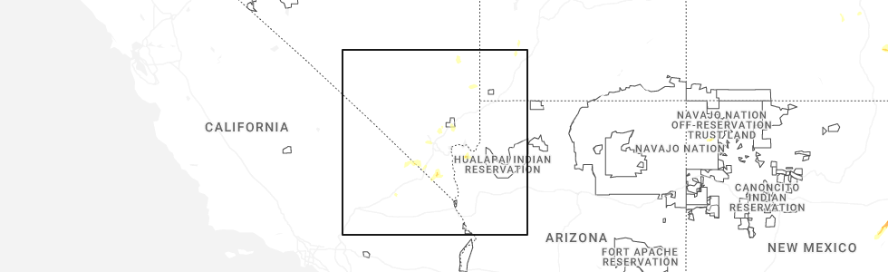
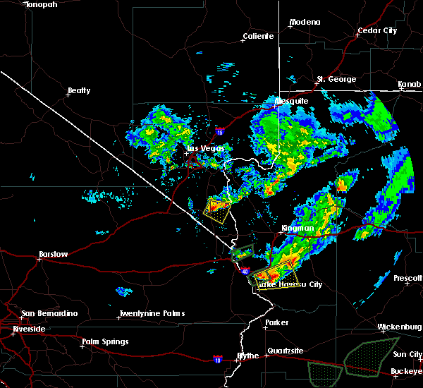
Hail Map for Searchlight, NV
The Searchlight, NV area has had 1 report of on-the-ground hail by trained spotters, and has been under severe weather warnings 5 times during the past 12 months. Doppler radar has detected hail at or near Searchlight, NV on 13 occasions, including 1 occasion during the past year.
| Name: | Searchlight, NV |
| Where Located: | 49.2 miles SSE of Las Vegas, NV |
| Map: | Google Map for Searchlight, NV |
| Population: | 539 |
| Housing Units: | 461 |
| More Info: | Search Google for Searchlight, NV |
0
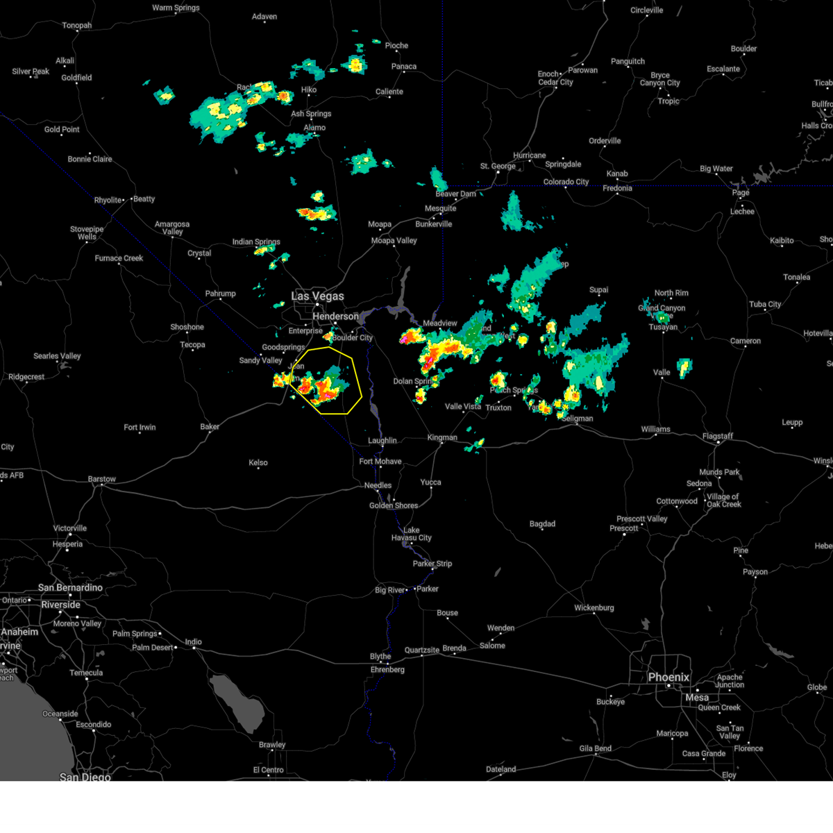
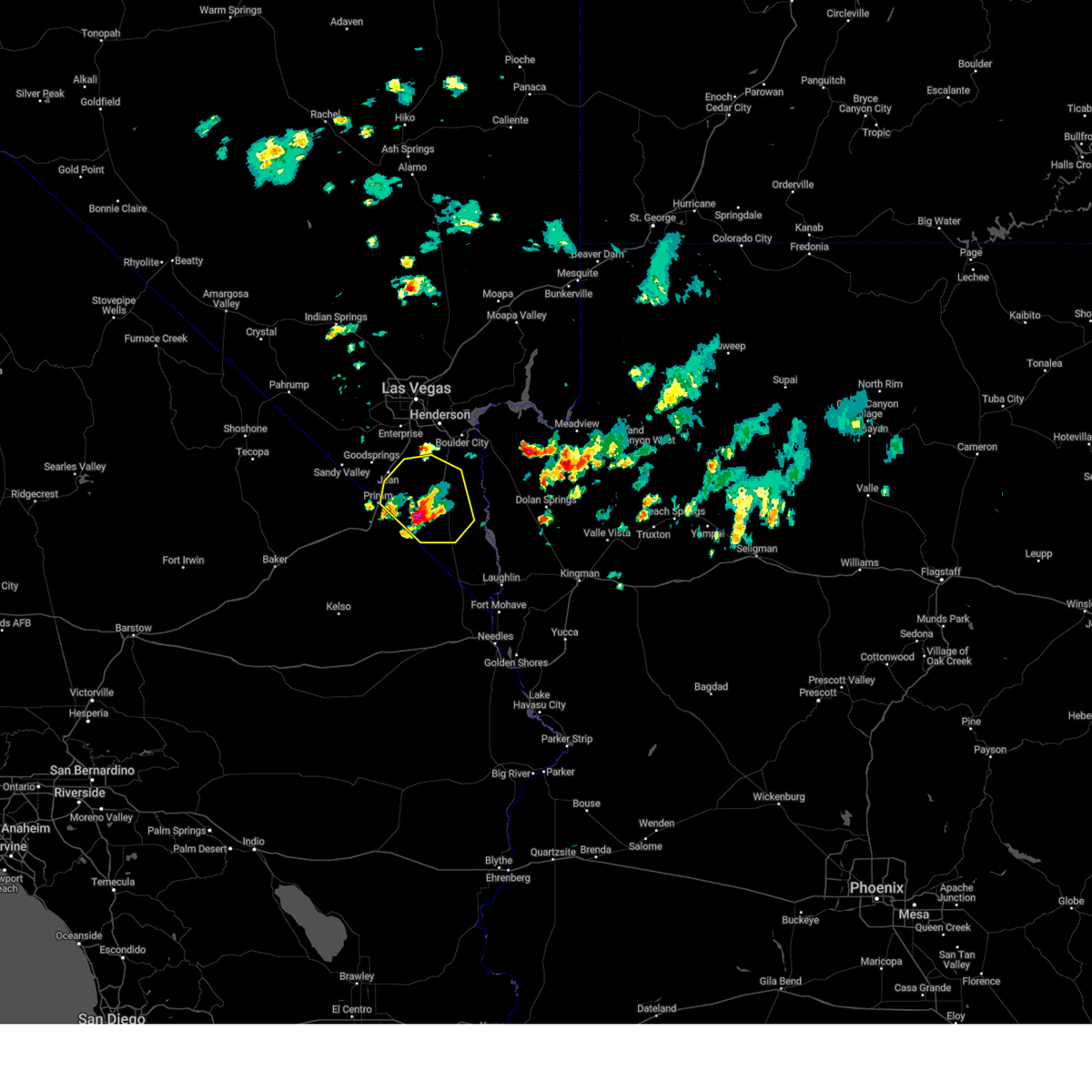
The Top Recent Hail Date for Searchlight, NV is Thursday, June 5, 2025 (13th out of 13)
Hail and Wind Damage Spotted near Searchlight, NV
| Date / Time | Report Details |
|---|---|
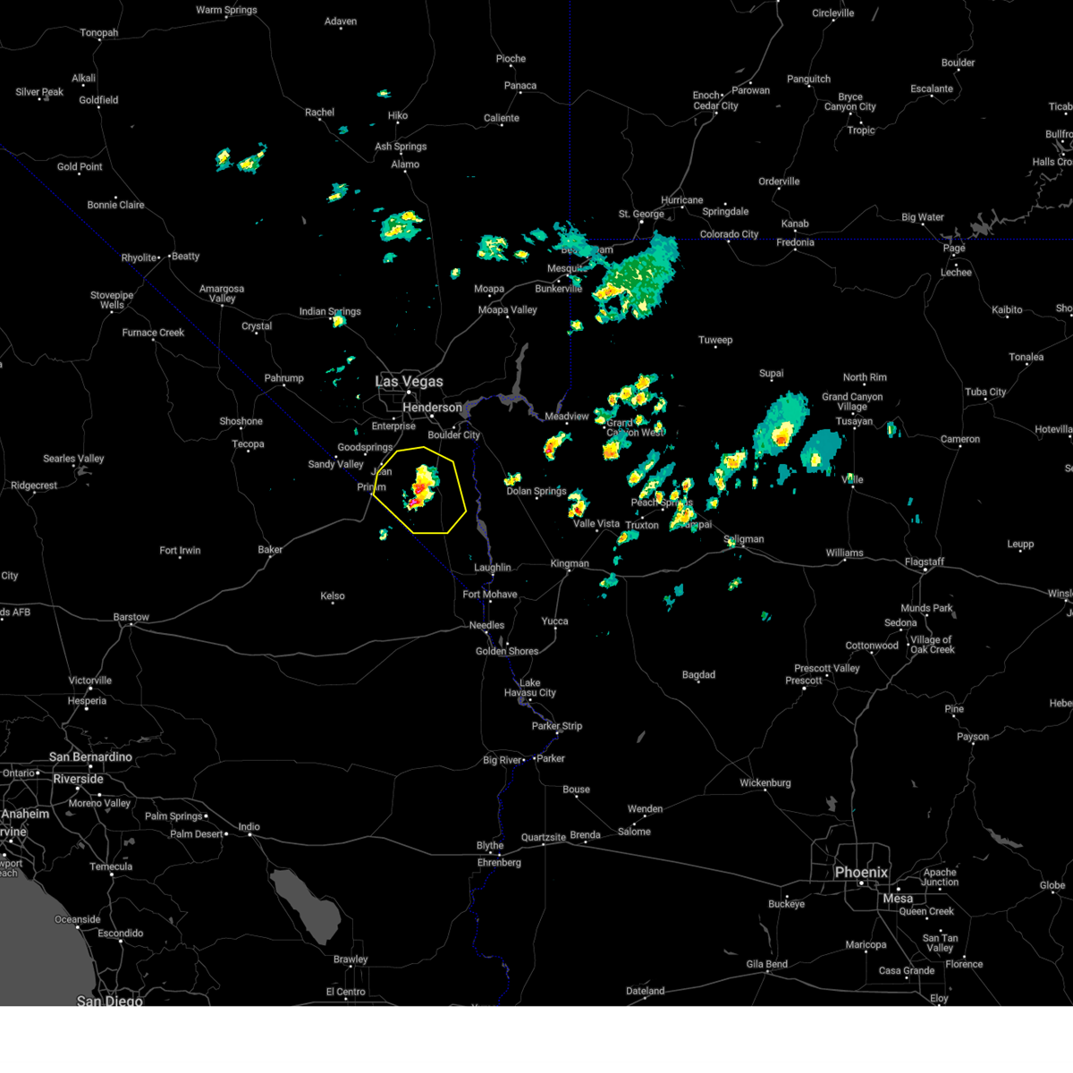
| 6/5/2025 1:12 PM PDT |
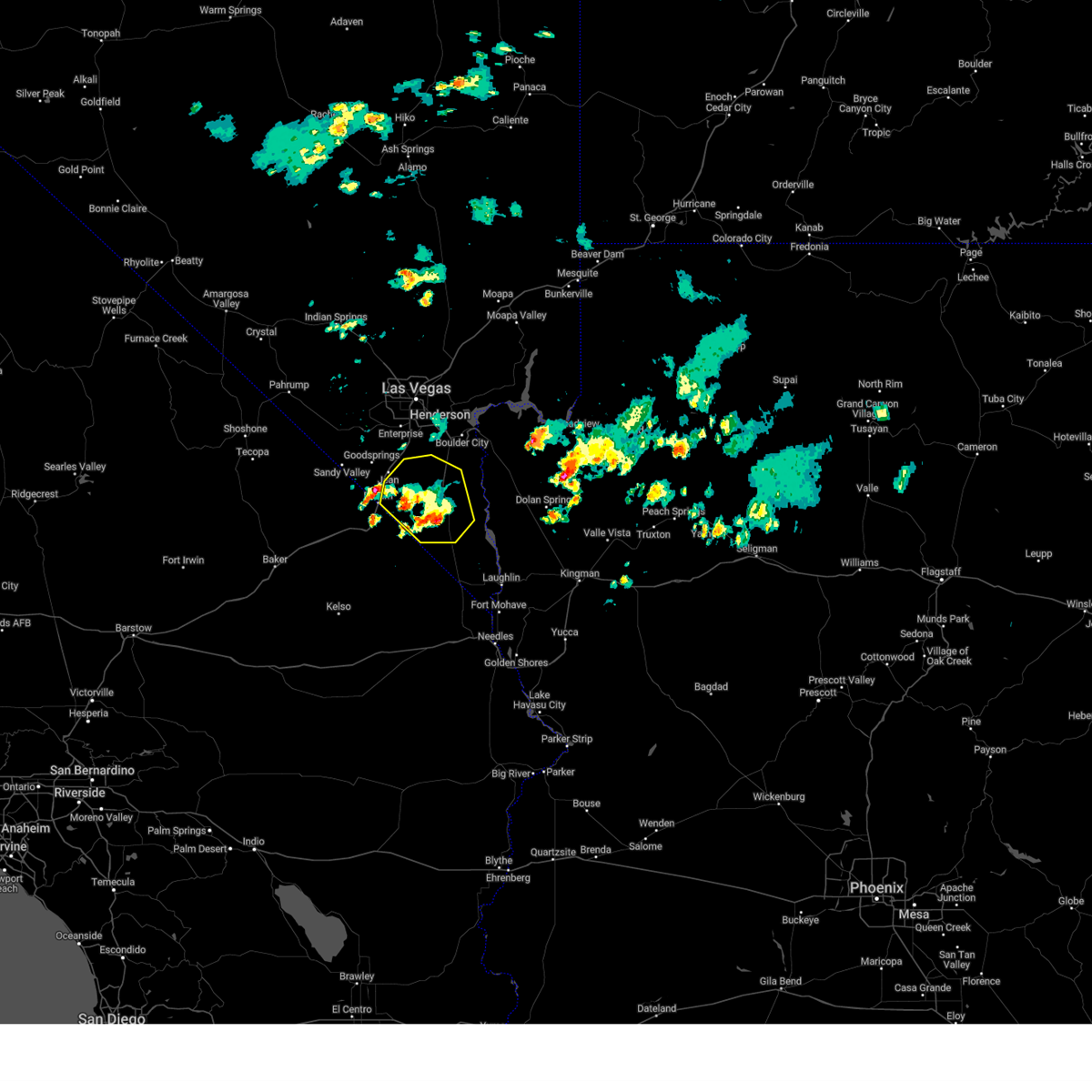 The storm which prompted the warning has weakened, and no longer poses an immediate threat to life or property. therefore, the warning will be allowed to expire. pea-sized hail was noted along nipton road, also known as state route 164, also known as joshua tree highway, around 1:08 pm. The storm which prompted the warning has weakened, and no longer poses an immediate threat to life or property. therefore, the warning will be allowed to expire. pea-sized hail was noted along nipton road, also known as state route 164, also known as joshua tree highway, around 1:08 pm.
|
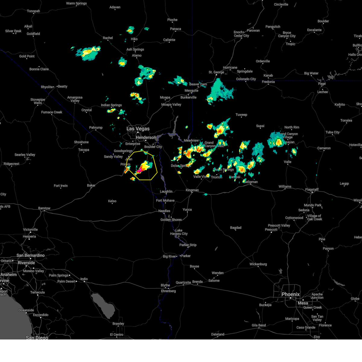
| 6/5/2025 12:37 PM PDT |
 At 1237 pm pdt, a severe thunderstorm was located 13 miles north of cottonwood cove campground, or 14 miles northeast of searchlight, moving east at 10 mph (radar indicated). Hazards include 60 mph wind gusts and quarter size hail. Hail damage to vehicles is expected. expect wind damage to roofs and trees. Locations impacted include, searchlight and nipton road mile marker 3. At 1237 pm pdt, a severe thunderstorm was located 13 miles north of cottonwood cove campground, or 14 miles northeast of searchlight, moving east at 10 mph (radar indicated). Hazards include 60 mph wind gusts and quarter size hail. Hail damage to vehicles is expected. expect wind damage to roofs and trees. Locations impacted include, searchlight and nipton road mile marker 3.
|
| 6/5/2025 12:15 PM PDT |
 Svrvef the national weather service in las vegas has issued a * severe thunderstorm warning for, south central clark county in southern nevada, * until 115 pm pdt. * at 1215 pm pdt, a severe thunderstorm was located 11 miles north of searchlight, moving east at 10 mph (radar indicated). Hazards include 60 mph wind gusts and quarter size hail. Hail damage to vehicles is expected. Expect wind damage to roofs and trees. Svrvef the national weather service in las vegas has issued a * severe thunderstorm warning for, south central clark county in southern nevada, * until 115 pm pdt. * at 1215 pm pdt, a severe thunderstorm was located 11 miles north of searchlight, moving east at 10 mph (radar indicated). Hazards include 60 mph wind gusts and quarter size hail. Hail damage to vehicles is expected. Expect wind damage to roofs and trees.
|
| 6/5/2025 11:49 AM PDT |
 At 1148 am pdt, a severe thunderstorm was located 9 miles north of searchlight, moving east at 10 mph (radar indicated). Hazards include 60 mph wind gusts. Expect damage to roofs and trees. Locations impacted include, searchlight and nipton road mile marker 3. At 1148 am pdt, a severe thunderstorm was located 9 miles north of searchlight, moving east at 10 mph (radar indicated). Hazards include 60 mph wind gusts. Expect damage to roofs and trees. Locations impacted include, searchlight and nipton road mile marker 3.
|
| 6/5/2025 11:09 AM PDT |
 Svrvef the national weather service in las vegas has issued a * severe thunderstorm warning for, south central clark county in southern nevada, * until 1215 pm pdt. * at 1108 am pdt, a severe thunderstorm was located 8 miles northeast of nipton road mile marker 3, or 10 miles northwest of searchlight, moving east at 10 mph (radar indicated). Hazards include 60 mph wind gusts. expect damage to roofs and trees Svrvef the national weather service in las vegas has issued a * severe thunderstorm warning for, south central clark county in southern nevada, * until 1215 pm pdt. * at 1108 am pdt, a severe thunderstorm was located 8 miles northeast of nipton road mile marker 3, or 10 miles northwest of searchlight, moving east at 10 mph (radar indicated). Hazards include 60 mph wind gusts. expect damage to roofs and trees
|
| 8/10/2024 6:33 PM PDT | Moore upr observation site gusted to 60 mph with thunderstorm activity overhea in san bernardino county CA, 20.2 miles ENE of Searchlight, NV |
| 7/22/2024 2:02 PM PDT | Moore sensor measured 78 mph gust at 1402 as well as 72 mph gusts between 1406 and 1413 and 67 mph gusts at 1416 from a nearby thunderstor in san bernardino county CA, 20.2 miles ENE of Searchlight, NV |
| 9/1/2023 5:09 PM PDT | Union pacific sensor in moore measured a thunderstorm related wind gust of 59 mp in san bernardino county CA, 20.2 miles ENE of Searchlight, NV |
| 7/28/2022 11:02 PM PDT | Moore upr station reports gust to 68 mph with thunderstorm activit in san bernardino county CA, 20.2 miles ENE of Searchlight, NV |
| 7/28/2022 10:58 PM PDT |
 At 1054 pm pdt/1054 pm mst/, a cluster of severe thunderstorms were located along a line extending from mountain pass, to 10 miles north of searchlight, to golden valley. these storms were moving generally south-southwest at 35 mph (radar indicated). Hazards include 60 mph wind gusts. Possible wind damage to roofs and trees, power lines and periods of blowing dust near dry lake beds. locations impacted include, bullhead city, laughlin, searchlight, cima, katherine landing, primm, needles, mountain pass, oatman, mid hills campground, nipton, mojave ranch estates, mohave valley, cottonwood cove campground, big bend rec area, golden valley, mesquite creek, nipton and ivanpah roads, cottonwood cove and nipton road mile marker 3. this includes the following highways, interstate 15 in california between mile markers 146 and 186. interstate 15 in nevada between mile markers 1 and 9. hail threat, radar indicated max hail size, <. 75 in wind threat, observed max wind gust, 60 mph. At 1054 pm pdt/1054 pm mst/, a cluster of severe thunderstorms were located along a line extending from mountain pass, to 10 miles north of searchlight, to golden valley. these storms were moving generally south-southwest at 35 mph (radar indicated). Hazards include 60 mph wind gusts. Possible wind damage to roofs and trees, power lines and periods of blowing dust near dry lake beds. locations impacted include, bullhead city, laughlin, searchlight, cima, katherine landing, primm, needles, mountain pass, oatman, mid hills campground, nipton, mojave ranch estates, mohave valley, cottonwood cove campground, big bend rec area, golden valley, mesquite creek, nipton and ivanpah roads, cottonwood cove and nipton road mile marker 3. this includes the following highways, interstate 15 in california between mile markers 146 and 186. interstate 15 in nevada between mile markers 1 and 9. hail threat, radar indicated max hail size, <. 75 in wind threat, observed max wind gust, 60 mph.
|
| 7/28/2022 10:18 PM PDT |
 At 1013 pm pdt/1013 pm mst/, a cluster of severe thunderstorms was located along a line extending from sandy valley to the highway 93 corridor in arizona northwest of kingman. these storms were moving southwest at 30 mph (radar indicated). Hazards include 60 mph wind gusts and hail up to penny size. expect wind damage to roofs and trees, power lines and periods of blowing dust with the high winds At 1013 pm pdt/1013 pm mst/, a cluster of severe thunderstorms was located along a line extending from sandy valley to the highway 93 corridor in arizona northwest of kingman. these storms were moving southwest at 30 mph (radar indicated). Hazards include 60 mph wind gusts and hail up to penny size. expect wind damage to roofs and trees, power lines and periods of blowing dust with the high winds
|
| 6/22/2022 3:53 PM PDT | Wind gust to 69mph measured in moore... c in san bernardino county CA, 20 miles ENE of Searchlight, NV |
| 8/13/2021 2:16 PM PDT | Peak wind gust of 61 mph reported at 216 pm and 221 pm with a thunderstorm near moore... ca. sustained winds with the observations were 61 mph from the wnw and 33 mph f in san bernardino county CA, 20.2 miles ENE of Searchlight, NV |
| 8/1/2021 10:59 AM PDT |
 At 1059 am pdt, a severe thunderstorm was located near searchlight, moving southeast at 10 mph (radar indicated). Hazards include 60 mph wind gusts. expect damage to roofs and trees At 1059 am pdt, a severe thunderstorm was located near searchlight, moving southeast at 10 mph (radar indicated). Hazards include 60 mph wind gusts. expect damage to roofs and trees
|
| 7/25/2021 9:53 PM PDT |
 The severe thunderstorm warning for western mohave, western clark and southeastern nye counties will expire at 1000 pm pdt/1000 pm mst/, the storms which prompted the warning continue to move southwest through far southern clark county and southern nye county. additional, severe thunderstorm warnings will be issued. gusty winds are still possible with these thunderstorms. The severe thunderstorm warning for western mohave, western clark and southeastern nye counties will expire at 1000 pm pdt/1000 pm mst/, the storms which prompted the warning continue to move southwest through far southern clark county and southern nye county. additional, severe thunderstorm warnings will be issued. gusty winds are still possible with these thunderstorms.
|
| 7/25/2021 9:32 PM PDT |
 At 930 pm pdt/930 pm mst/, severe thunderstorms were located along a line extending from near cottonwood cove campground to near goodsprings to 6 miles west of indian springs, moving south at 35 mph (radar indicated). Hazards include 70 mph wind gusts. Expect considerable tree damage. damage is likely to mobile homes, roofs, and outbuildings. locations impacted include, henderson, pahrump, laughlin, rainbow canyon, mountains edge, blue diamond, southern highlands, jean, mt. charleston, red rock canyon, enterprise, searchlight, primm, spring mountains, mercury, summerlin, spring valley, paradise, kyle canyon campground and fletcher view campground. This includes interstate 15 in nevada between mile markers 1 and 25. At 930 pm pdt/930 pm mst/, severe thunderstorms were located along a line extending from near cottonwood cove campground to near goodsprings to 6 miles west of indian springs, moving south at 35 mph (radar indicated). Hazards include 70 mph wind gusts. Expect considerable tree damage. damage is likely to mobile homes, roofs, and outbuildings. locations impacted include, henderson, pahrump, laughlin, rainbow canyon, mountains edge, blue diamond, southern highlands, jean, mt. charleston, red rock canyon, enterprise, searchlight, primm, spring mountains, mercury, summerlin, spring valley, paradise, kyle canyon campground and fletcher view campground. This includes interstate 15 in nevada between mile markers 1 and 25.
|
| 7/25/2021 8:59 PM PDT |
 At 857 pm pdt/857 pm mst/, severe thunderstorms were located along a line extending from 13 miles north of cottonwood cove campground to spring valley to 15 miles north of indian springs, moving south at 35 mph (radar indicated). Hazards include 70 mph wind gusts. Expect considerable tree damage. Damage is likely to mobile homes, roofs, and outbuildings. At 857 pm pdt/857 pm mst/, severe thunderstorms were located along a line extending from 13 miles north of cottonwood cove campground to spring valley to 15 miles north of indian springs, moving south at 35 mph (radar indicated). Hazards include 70 mph wind gusts. Expect considerable tree damage. Damage is likely to mobile homes, roofs, and outbuildings.
|
| 7/25/2021 6:36 PM MST |
 At 635 pm pdt/635 pm mst/, severe thunderstorms were located along a line extending from 13 miles south of hoover dam to 7 miles north of cottonwood cove campground to near big bend rec area, moving west (radar indicated). Hazards include 60 mph wind gusts. Expect damage to roofs and trees. Locations impacted include, bullhead city, laughlin, katherine landing, searchlight, cottonwood cove, cottonwood cove campground, big bend rec area, cal-nev-ari, dolan springs and golden valley. At 635 pm pdt/635 pm mst/, severe thunderstorms were located along a line extending from 13 miles south of hoover dam to 7 miles north of cottonwood cove campground to near big bend rec area, moving west (radar indicated). Hazards include 60 mph wind gusts. Expect damage to roofs and trees. Locations impacted include, bullhead city, laughlin, katherine landing, searchlight, cottonwood cove, cottonwood cove campground, big bend rec area, cal-nev-ari, dolan springs and golden valley.
|
| 7/25/2021 6:01 PM MST |
 At 559 pm pdt/559 pm mst/, severe thunderstorms were located along a line extending from 16 miles southeast of grand canyon ranch to 13 miles northeast of packsaddle campground to near hualapai mountain park, moving west at 25 mph (radar indicated). Hazards include 40 to 60 mph wind gusts. This storm will produce sudden wind gusts over the colorado river from laughlin to willow beach which could exceed 40 mph. Possible damage to roofs and trees as well. At 559 pm pdt/559 pm mst/, severe thunderstorms were located along a line extending from 16 miles southeast of grand canyon ranch to 13 miles northeast of packsaddle campground to near hualapai mountain park, moving west at 25 mph (radar indicated). Hazards include 40 to 60 mph wind gusts. This storm will produce sudden wind gusts over the colorado river from laughlin to willow beach which could exceed 40 mph. Possible damage to roofs and trees as well.
|
| 4/12/2020 4:36 PM MST |
 The severe thunderstorm warning for west central mohave and south central clark counties will expire at 445 pm pdt/445 pm mst/, the storm which prompted the warning has weakened below severe limits, and no longer poses an immediate threat to life or property. therefore, the warning will be allowed to expire. however small hail, gusty winds and heavy rain are still ocurring with this thunderstorm. The severe thunderstorm warning for west central mohave and south central clark counties will expire at 445 pm pdt/445 pm mst/, the storm which prompted the warning has weakened below severe limits, and no longer poses an immediate threat to life or property. therefore, the warning will be allowed to expire. however small hail, gusty winds and heavy rain are still ocurring with this thunderstorm.
|
| 4/12/2020 4:23 PM MST |
 At 422 pm pdt/422 pm mst/, a severe thunderstorm was located 13 miles north of cottonwood cove campground, or 20 miles northeast of searchlight, moving southeast at 25 mph (radar indicated). Hazards include 60 mph wind gusts. Expect damage to roofs and trees. Locations impacted include, cottonwood cove and cottonwood cove campground, nelson, state route 165, and highway 93. At 422 pm pdt/422 pm mst/, a severe thunderstorm was located 13 miles north of cottonwood cove campground, or 20 miles northeast of searchlight, moving southeast at 25 mph (radar indicated). Hazards include 60 mph wind gusts. Expect damage to roofs and trees. Locations impacted include, cottonwood cove and cottonwood cove campground, nelson, state route 165, and highway 93.
|
| 4/12/2020 3:59 PM MST |
 At 358 pm pdt/358 pm mst/, a severe thunderstorm was located 15 miles south of boulder city, moving southeast at 25 mph (radar indicated). Hazards include 60 mph wind gusts. expect damage to roofs and trees At 358 pm pdt/358 pm mst/, a severe thunderstorm was located 15 miles south of boulder city, moving southeast at 25 mph (radar indicated). Hazards include 60 mph wind gusts. expect damage to roofs and trees
|
| 9/23/2019 6:52 PM PDT |
 The severe thunderstorm warning for southern clark county will expire at 700 pm pdt, the storm which prompted the warning has weakened below severe limits, and no longer poses an immediate threat to life or property. therefore, the warning will be allowed to expire. however small hail is still possible with this thunderstorm. a severe thunderstorm watch remains in effect until 800 pm pdt for northwestern arizona. The severe thunderstorm warning for southern clark county will expire at 700 pm pdt, the storm which prompted the warning has weakened below severe limits, and no longer poses an immediate threat to life or property. therefore, the warning will be allowed to expire. however small hail is still possible with this thunderstorm. a severe thunderstorm watch remains in effect until 800 pm pdt for northwestern arizona.
|
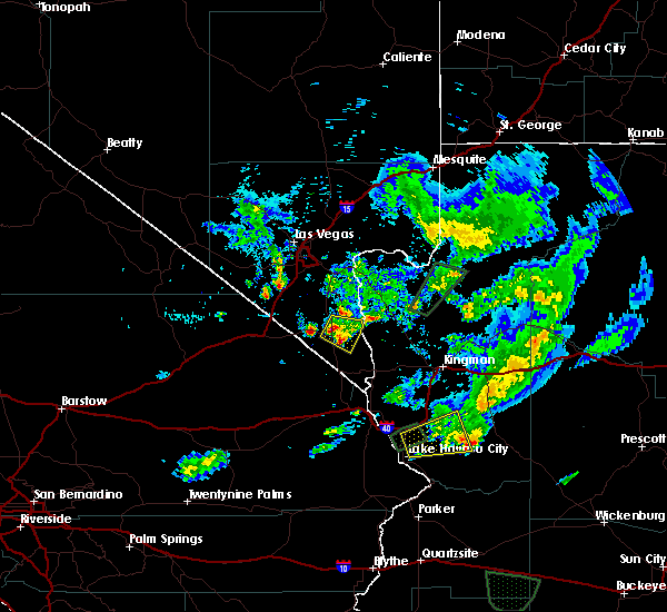
| 9/23/2019 6:21 PM PDT |
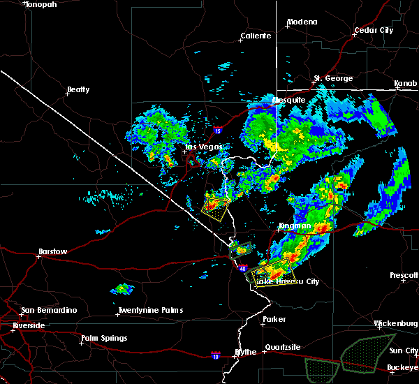 At 619 pm pdt, a severe thunderstorm was located near searchlight, moving east at 5 mph. upgraded hail size to mention up to golf-ball size hail (radar indicated). Hazards include golf ball size hail. People and animals outdoors will be injured. expect damage to roofs, windows, and vehicles. Locations impacted include, searchlight, cottonwood cove and cottonwood cove campground. At 619 pm pdt, a severe thunderstorm was located near searchlight, moving east at 5 mph. upgraded hail size to mention up to golf-ball size hail (radar indicated). Hazards include golf ball size hail. People and animals outdoors will be injured. expect damage to roofs, windows, and vehicles. Locations impacted include, searchlight, cottonwood cove and cottonwood cove campground.
|
| 9/23/2019 6:15 PM PDT | Golf Ball sized hail reported 0.6 miles SSE of Searchlight, NV, estimated golf ball sized hail reported by gentleman driving through storm north of searchlight on highway 95. time estimated from radar. |
| 9/23/2019 6:03 PM PDT |
 At 602 pm pdt, a severe thunderstorm was located near searchlight, moving southeast at 5 mph (radar indicated). Hazards include quarter size hail. damage to vehicles is expected At 602 pm pdt, a severe thunderstorm was located near searchlight, moving southeast at 5 mph (radar indicated). Hazards include quarter size hail. damage to vehicles is expected
|
| 8/16/2018 4:49 PM PDT |
 At 448 pm pdt/448 pm mst/, a severe thunderstorm was located near cal-nev-ari, or 8 miles north of katherine landing, and is nearly stationary (radar indicated). Hazards include 60 mph wind gusts and quarter size hail. Hail damage to vehicles is expected. expect wind damage to roofs and trees. strong winds can create hazardous boating conditions on lake mohave. Locations impacted include, searchlight, katherine landing, cottonwood cove, cottonwood cove campground and cal-nev-ari. At 448 pm pdt/448 pm mst/, a severe thunderstorm was located near cal-nev-ari, or 8 miles north of katherine landing, and is nearly stationary (radar indicated). Hazards include 60 mph wind gusts and quarter size hail. Hail damage to vehicles is expected. expect wind damage to roofs and trees. strong winds can create hazardous boating conditions on lake mohave. Locations impacted include, searchlight, katherine landing, cottonwood cove, cottonwood cove campground and cal-nev-ari.
|
| 8/16/2018 4:17 PM PDT |
 At 416 pm pdt/416 pm mst/, a severe thunderstorm was located 7 miles northeast of cal-nev-ari, or 8 miles southeast of searchlight, moving south at 5 mph (radar indicated). Hazards include 60 mph wind gusts and quarter size hail. Hail damage to vehicles is expected. Expect wind damage to roofs and trees. At 416 pm pdt/416 pm mst/, a severe thunderstorm was located 7 miles northeast of cal-nev-ari, or 8 miles southeast of searchlight, moving south at 5 mph (radar indicated). Hazards include 60 mph wind gusts and quarter size hail. Hail damage to vehicles is expected. Expect wind damage to roofs and trees.
|
| 7/18/2017 5:55 PM PDT | Storm damage reported in clark county NV, 1.6 miles NNE of Searchlight, NV |
| 7/18/2017 5:50 PM PDT | Power lines down reported at cottonwood cove... n in clark county NV, 12.6 miles W of Searchlight, NV |
| 4/3/2017 2:45 PM PDT | Cottonwood cove automated weather station reported a peak wind gust of 64 mp in clark county NV, 12.6 miles W of Searchlight, NV |
| 6/30/2016 5:32 PM PDT |
 At 530 pm pdt/530 pm mst/, doppler radar indicated a severe thunderstorm capable of producing damaging winds in excess of 60 mph. this storm was located near cottonwood cove, or 14 miles east of searchlight, moving southeast at 15 mph. another severe storm was located near cal-nev-ari, moving southeast at 20 mph. locations impacted include, bullhead city, laughlin, katherine landing, searchlight, cal-nev-ari, cottonwood cove and cottonwood cove campground. At 530 pm pdt/530 pm mst/, doppler radar indicated a severe thunderstorm capable of producing damaging winds in excess of 60 mph. this storm was located near cottonwood cove, or 14 miles east of searchlight, moving southeast at 15 mph. another severe storm was located near cal-nev-ari, moving southeast at 20 mph. locations impacted include, bullhead city, laughlin, katherine landing, searchlight, cal-nev-ari, cottonwood cove and cottonwood cove campground.
|
| 6/30/2016 5:15 PM PDT | Hads automated station /ccpn2 in clark county NV, 12.6 miles W of Searchlight, NV |
| 6/30/2016 4:52 PM PDT |
 At 450 pm pdt/450 pm mst/, doppler radar indicated a severe thunderstorm capable of producing damaging winds in excess of 60 mph. this storm was located over searchlight, and moving southeast at 25 mph. At 450 pm pdt/450 pm mst/, doppler radar indicated a severe thunderstorm capable of producing damaging winds in excess of 60 mph. this storm was located over searchlight, and moving southeast at 25 mph.
|
| 8/7/2015 1:34 PM PDT |
 At 133 pm pdt /133 pm mst/, doppler radar indicated a severe thunderstorm capable of producing quarter size hail and destructive winds in excess of 70 mph. this storm was located over highway 95 11 miles north of searchlight, and moving northeast at 20 mph. At 133 pm pdt /133 pm mst/, doppler radar indicated a severe thunderstorm capable of producing quarter size hail and destructive winds in excess of 70 mph. this storm was located over highway 95 11 miles north of searchlight, and moving northeast at 20 mph.
|
Hail Maps for Searchlight, NV


Connect with Interactive Hail Maps