

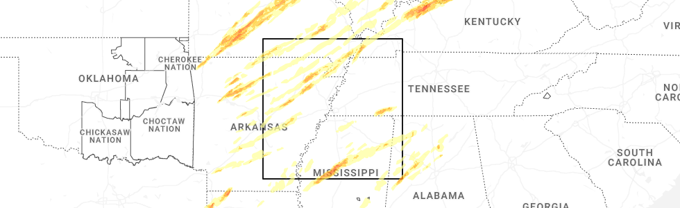
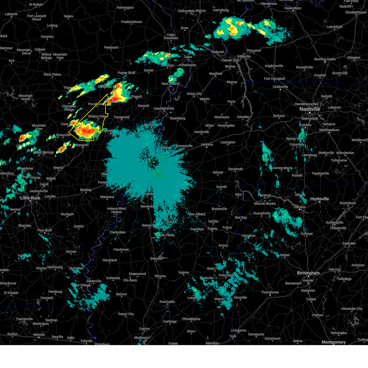
Hail Map for Sedgwick, AR
The Sedgwick, AR area has had 1 report of on-the-ground hail by trained spotters, and has been under severe weather warnings 32 times during the past 12 months. Doppler radar has detected hail at or near Sedgwick, AR on 60 occasions, including 7 occasions during the past year.
| Name: | Sedgwick, AR |
| Where Located: | 73.2 miles NW of Memphis, TN |
| Map: | Google Map for Sedgwick, AR |
| Population: | 152 |
| Housing Units: | 79 |
| More Info: | Search Google for Sedgwick, AR |
3
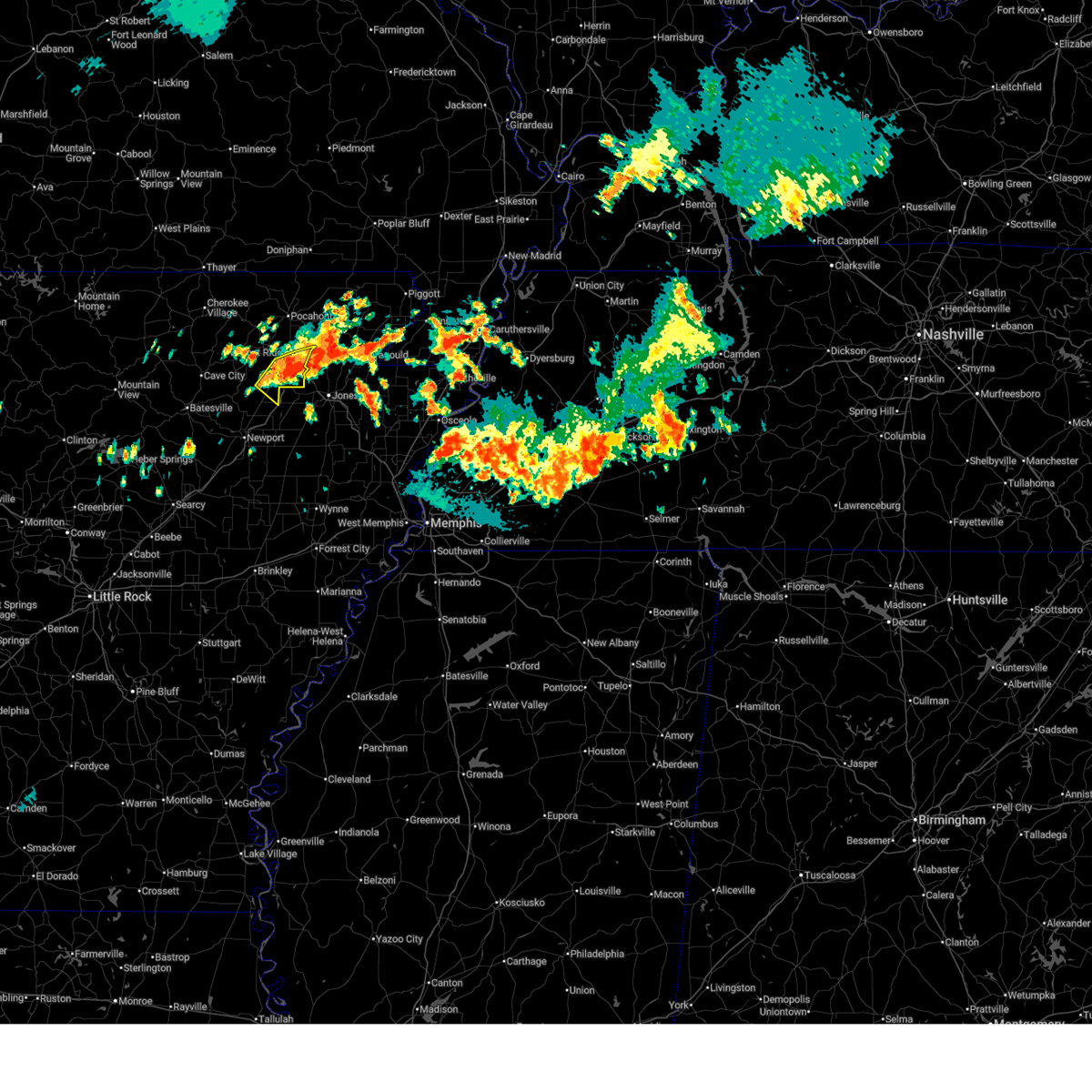
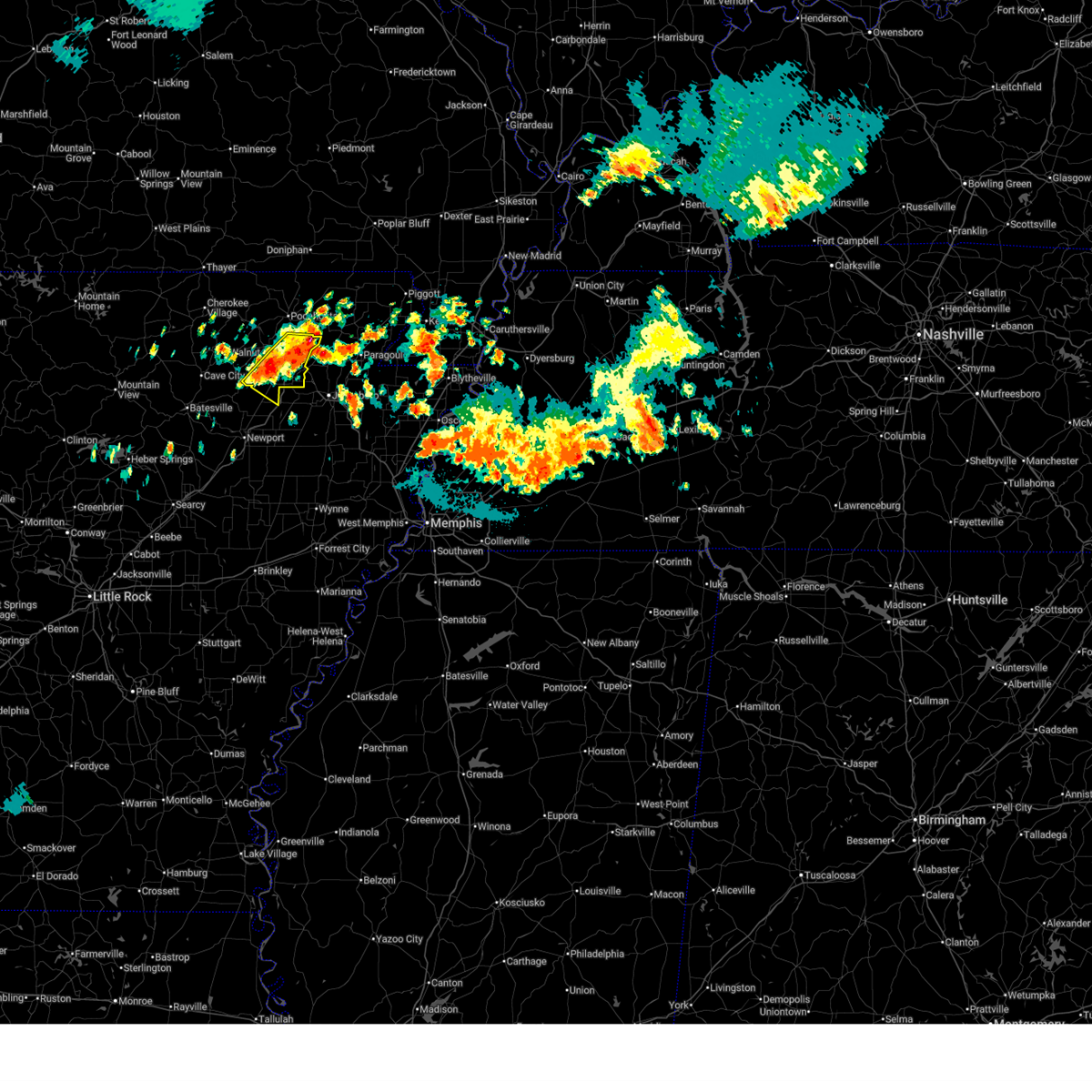
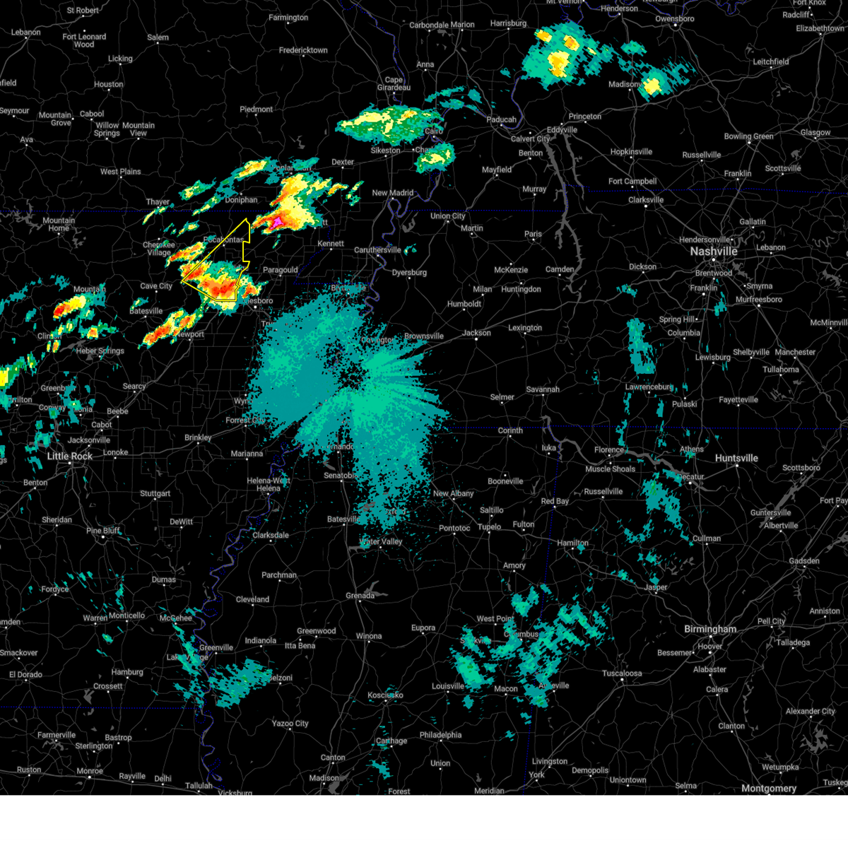
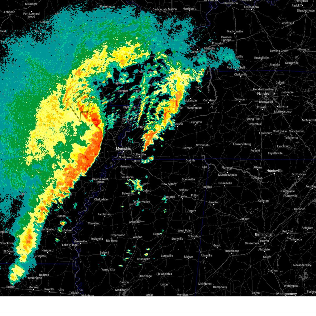
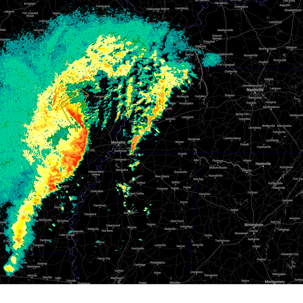
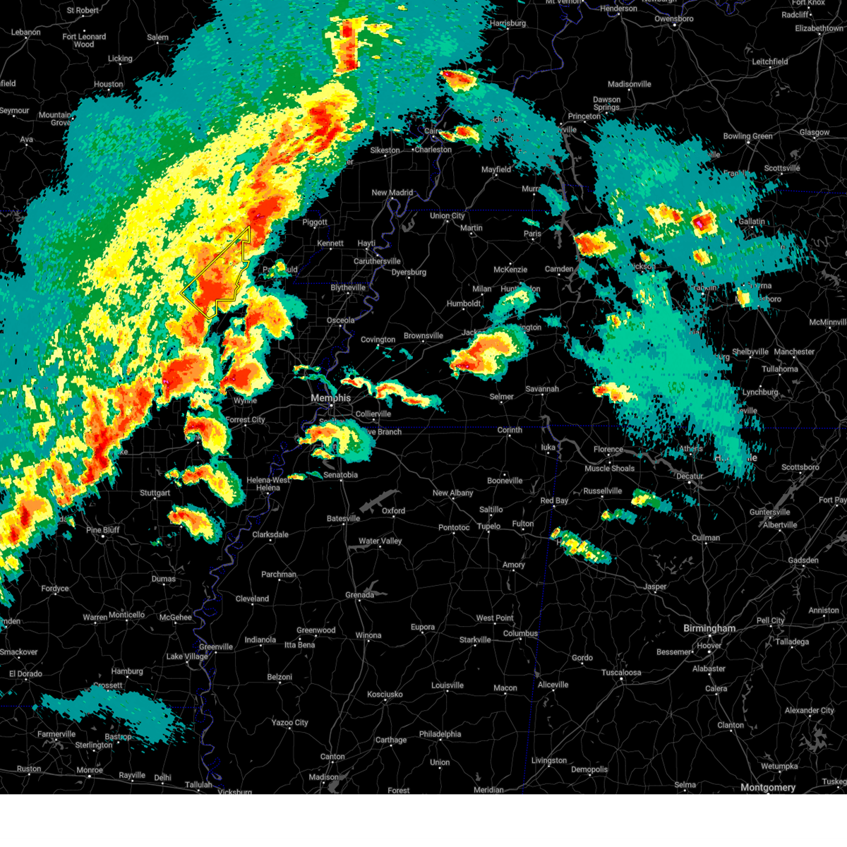
The Top Recent Hail Date for Sedgwick, AR is Friday, March 14, 2025 (5th out of 60)
Hail and Wind Damage Spotted near Sedgwick, AR
| Date / Time | Report Details |
|---|---|
| 6/19/2025 1:41 AM CDT |
 the severe thunderstorm warning has been cancelled and is no longer in effect the severe thunderstorm warning has been cancelled and is no longer in effect
|
| 6/19/2025 1:41 AM CDT |
 At 141 am cdt, severe thunderstorms were located along a line extending from near o'kean to near fontaine to near alicia, moving east at 35 mph (radar indicated). Hazards include 60 mph wind gusts and quarter size hail. Hail damage to vehicles is expected. expect wind damage to roofs, siding, and trees. Locations impacted include, walnut ridge, hoxie, alicia, minturn, sedgwick, clover bend, calvin, strangers home, coffman, arbor grove,. At 141 am cdt, severe thunderstorms were located along a line extending from near o'kean to near fontaine to near alicia, moving east at 35 mph (radar indicated). Hazards include 60 mph wind gusts and quarter size hail. Hail damage to vehicles is expected. expect wind damage to roofs, siding, and trees. Locations impacted include, walnut ridge, hoxie, alicia, minturn, sedgwick, clover bend, calvin, strangers home, coffman, arbor grove,.
|
| 6/19/2025 1:31 AM CDT |
 At 131 am cdt, severe thunderstorms were located along a line extending from near o'kean to near fontaine to near alicia, moving east at 35 mph (radar indicated). Hazards include 60 mph wind gusts and quarter size hail. Hail damage to vehicles is expected. expect wind damage to roofs, siding, and trees. Locations impacted include, walnut ridge, hoxie, swifton, college city, portia, alicia, minturn, sedgwick, strangers home, whiskerville, giles spur, lauratown, clover bend, calvin, dicus, coffman, lesterville, arbor grove,. At 131 am cdt, severe thunderstorms were located along a line extending from near o'kean to near fontaine to near alicia, moving east at 35 mph (radar indicated). Hazards include 60 mph wind gusts and quarter size hail. Hail damage to vehicles is expected. expect wind damage to roofs, siding, and trees. Locations impacted include, walnut ridge, hoxie, swifton, college city, portia, alicia, minturn, sedgwick, strangers home, whiskerville, giles spur, lauratown, clover bend, calvin, dicus, coffman, lesterville, arbor grove,.
|
| 6/19/2025 1:31 AM CDT |
 the severe thunderstorm warning has been cancelled and is no longer in effect the severe thunderstorm warning has been cancelled and is no longer in effect
|
| 6/19/2025 1:13 AM CDT |
 Svrlzk the national weather service in little rock has issued a * severe thunderstorm warning for, southeastern randolph county in eastern arkansas, northeastern jackson county in eastern arkansas, lawrence county in eastern arkansas, southeastern sharp county in north central arkansas, * until 200 am cdt. * at 113 am cdt, severe thunderstorms were located along a line extending from near college city to near portia to near strawberry, moving southeast at 35 mph (radar indicated). Hazards include 60 mph wind gusts and quarter size hail. Hail damage to vehicles is expected. Expect wind damage to roofs, siding, and trees. Svrlzk the national weather service in little rock has issued a * severe thunderstorm warning for, southeastern randolph county in eastern arkansas, northeastern jackson county in eastern arkansas, lawrence county in eastern arkansas, southeastern sharp county in north central arkansas, * until 200 am cdt. * at 113 am cdt, severe thunderstorms were located along a line extending from near college city to near portia to near strawberry, moving southeast at 35 mph (radar indicated). Hazards include 60 mph wind gusts and quarter size hail. Hail damage to vehicles is expected. Expect wind damage to roofs, siding, and trees.
|
| 5/16/2025 4:30 AM CDT |
 At 429 am cdt, a severe thunderstorm was located near minturn, or near hoxie, moving northeast at 55 mph (radar indicated). Hazards include 60 mph wind gusts and quarter size hail. Hail damage to vehicles is expected. expect wind damage to roofs, siding, and trees. Locations impacted include, walnut ridge, pocahontas, whiskerville, o'kean, lynn, giles spur, shannon, black rock, engelberg, dicus, elnora, powhatan historic state park, biggers, minturn, college city, lake charles state park, hoxie, portia, eaton, lauratown,. At 429 am cdt, a severe thunderstorm was located near minturn, or near hoxie, moving northeast at 55 mph (radar indicated). Hazards include 60 mph wind gusts and quarter size hail. Hail damage to vehicles is expected. expect wind damage to roofs, siding, and trees. Locations impacted include, walnut ridge, pocahontas, whiskerville, o'kean, lynn, giles spur, shannon, black rock, engelberg, dicus, elnora, powhatan historic state park, biggers, minturn, college city, lake charles state park, hoxie, portia, eaton, lauratown,.
|
| 5/16/2025 4:30 AM CDT |
 the severe thunderstorm warning has been cancelled and is no longer in effect the severe thunderstorm warning has been cancelled and is no longer in effect
|
| 5/16/2025 4:16 AM CDT |
 At 416 am cdt, a severe thunderstorm was located over alicia, or 13 miles south of lake charles state park, moving northeast at 65 mph (radar indicated). Hazards include 60 mph wind gusts and quarter size hail. Hail damage to vehicles is expected. expect wind damage to roofs, siding, and trees. Locations impacted include, walnut ridge, charlotte, strangers home, pocahontas, whiskerville, o'kean, lynn, giles spur, shannon, black rock, engelberg, dicus, elnora, strawberry, powhatan historic state park, kenyon, elgin, biggers, minturn, cord,. At 416 am cdt, a severe thunderstorm was located over alicia, or 13 miles south of lake charles state park, moving northeast at 65 mph (radar indicated). Hazards include 60 mph wind gusts and quarter size hail. Hail damage to vehicles is expected. expect wind damage to roofs, siding, and trees. Locations impacted include, walnut ridge, charlotte, strangers home, pocahontas, whiskerville, o'kean, lynn, giles spur, shannon, black rock, engelberg, dicus, elnora, strawberry, powhatan historic state park, kenyon, elgin, biggers, minturn, cord,.
|
| 5/16/2025 4:04 AM CDT |
 At 403 am cdt, a severe thunderstorm was located over newark, or 9 miles east of batesville, moving northeast at 60 mph. another severe thunderstorm was located just northeast of pocahontas, also moving northeast at 60 mph (radar indicated). Hazards include 60 mph wind gusts and quarter size hail. Hail damage to vehicles is expected. expect wind damage to roofs, siding, and trees. Locations impacted include, charlotte, strangers home, whiskerville, salado, smithville, lynn, shannon, moorefield, black rock, dicus, elnora, strawberry, biggers, minturn, cord, aetna, college city, lake charles state park, gainesboro, tuckerman,. At 403 am cdt, a severe thunderstorm was located over newark, or 9 miles east of batesville, moving northeast at 60 mph. another severe thunderstorm was located just northeast of pocahontas, also moving northeast at 60 mph (radar indicated). Hazards include 60 mph wind gusts and quarter size hail. Hail damage to vehicles is expected. expect wind damage to roofs, siding, and trees. Locations impacted include, charlotte, strangers home, whiskerville, salado, smithville, lynn, shannon, moorefield, black rock, dicus, elnora, strawberry, biggers, minturn, cord, aetna, college city, lake charles state park, gainesboro, tuckerman,.
|
| 5/16/2025 4:04 AM CDT |
 the severe thunderstorm warning has been cancelled and is no longer in effect the severe thunderstorm warning has been cancelled and is no longer in effect
|
| 5/16/2025 3:54 AM CDT |
 Svrlzk the national weather service in little rock has issued a * severe thunderstorm warning for, independence county in north central arkansas, southeastern randolph county in eastern arkansas, northeastern jackson county in eastern arkansas, northeastern cleburne county in north central arkansas, north central white county in central arkansas, lawrence county in eastern arkansas, southeastern sharp county in north central arkansas, * until 445 am cdt. * at 354 am cdt, a severe thunderstorm was located over southside in independence county, or near batesville, moving northeast at 55 mph (radar indicated). Hazards include 60 mph wind gusts and quarter size hail. Hail damage to vehicles is expected. Expect wind damage to roofs, siding, and trees. Svrlzk the national weather service in little rock has issued a * severe thunderstorm warning for, independence county in north central arkansas, southeastern randolph county in eastern arkansas, northeastern jackson county in eastern arkansas, northeastern cleburne county in north central arkansas, north central white county in central arkansas, lawrence county in eastern arkansas, southeastern sharp county in north central arkansas, * until 445 am cdt. * at 354 am cdt, a severe thunderstorm was located over southside in independence county, or near batesville, moving northeast at 55 mph (radar indicated). Hazards include 60 mph wind gusts and quarter size hail. Hail damage to vehicles is expected. Expect wind damage to roofs, siding, and trees.
|
| 5/1/2025 7:43 PM CDT | At 743 pm cdt, a severe thunderstorm was located near bono, moving southeast at 15 mph (radar indicated). Hazards include 60 mph wind gusts and quarter size hail. Hail damage to vehicles is expected. expect wind damage to roofs, siding, and trees. This severe thunderstorm will remain over mainly rural areas of southeastern lawrence county. |
| 5/1/2025 7:32 PM CDT |
 Svrlzk the national weather service in little rock has issued a * severe thunderstorm warning for, southeastern lawrence county in eastern arkansas, * until 800 pm cdt. * at 731 pm cdt, a severe thunderstorm was located near egypt, or near bono, moving southeast at 15 mph (radar indicated). Hazards include 60 mph wind gusts and quarter size hail. Hail damage to vehicles is expected. Expect wind damage to roofs, siding, and trees. Svrlzk the national weather service in little rock has issued a * severe thunderstorm warning for, southeastern lawrence county in eastern arkansas, * until 800 pm cdt. * at 731 pm cdt, a severe thunderstorm was located near egypt, or near bono, moving southeast at 15 mph (radar indicated). Hazards include 60 mph wind gusts and quarter size hail. Hail damage to vehicles is expected. Expect wind damage to roofs, siding, and trees.
|
| 4/5/2025 1:08 PM CDT |
 The storms which prompted the warning have moved out of the area. therefore, the warning will be allowed to expire. however gusty winds are still possible with these thunderstorms. a tornado watch remains in effect until 700 pm cdt for eastern arkansas. to report severe weather, contact your nearest law enforcement agency. they will relay your report to the national weather service little rock. The storms which prompted the warning have moved out of the area. therefore, the warning will be allowed to expire. however gusty winds are still possible with these thunderstorms. a tornado watch remains in effect until 700 pm cdt for eastern arkansas. to report severe weather, contact your nearest law enforcement agency. they will relay your report to the national weather service little rock.
|
| 4/5/2025 1:00 PM CDT |
 the severe thunderstorm warning has been cancelled and is no longer in effect the severe thunderstorm warning has been cancelled and is no longer in effect
|
| 4/5/2025 1:00 PM CDT |
 At 100 pm cdt, severe thunderstorms were located along a line extending from minturn to near jonesboro, moving northeast at 55 mph (radar indicated). Hazards include 60 mph wind gusts and penny size hail. Expect damage to roofs, siding, and trees. Locations impacted include, walnut ridge, strangers home, whiskerville, lynn, giles spur, shannon, black rock, dicus, elnora, powhatan historic state park, minturn, college city, lake charles state park, hoxie, portia, eaton, lauratown, sedgwick, clover bend, calvin,. At 100 pm cdt, severe thunderstorms were located along a line extending from minturn to near jonesboro, moving northeast at 55 mph (radar indicated). Hazards include 60 mph wind gusts and penny size hail. Expect damage to roofs, siding, and trees. Locations impacted include, walnut ridge, strangers home, whiskerville, lynn, giles spur, shannon, black rock, dicus, elnora, powhatan historic state park, minturn, college city, lake charles state park, hoxie, portia, eaton, lauratown, sedgwick, clover bend, calvin,.
|
| 4/5/2025 12:41 PM CDT |
 the severe thunderstorm warning has been cancelled and is no longer in effect the severe thunderstorm warning has been cancelled and is no longer in effect
|
| 4/5/2025 12:41 PM CDT |
 At 1240 pm cdt, severe thunderstorms were located along a line extending from 6 miles southeast of strawberry to near waldenburg to near vanndale, moving northeast at 55 mph (radar indicated). Hazards include 60 mph wind gusts and quarter size hail. Hail damage to vehicles is expected. expect wind damage to roofs, siding, and trees. Locations impacted include, walnut ridge, newport, strangers home, whiskerville, stegall, algoa, lynn, giles spur, amagon, shannon, grubbs, black rock, dicus, elnora, strawberry, powhatan historic state park, kenyon, elgin, balch, minturn,. At 1240 pm cdt, severe thunderstorms were located along a line extending from 6 miles southeast of strawberry to near waldenburg to near vanndale, moving northeast at 55 mph (radar indicated). Hazards include 60 mph wind gusts and quarter size hail. Hail damage to vehicles is expected. expect wind damage to roofs, siding, and trees. Locations impacted include, walnut ridge, newport, strangers home, whiskerville, stegall, algoa, lynn, giles spur, amagon, shannon, grubbs, black rock, dicus, elnora, strawberry, powhatan historic state park, kenyon, elgin, balch, minturn,.
|
| 4/5/2025 12:28 PM CDT |
 Svrlzk the national weather service in little rock has issued a * severe thunderstorm warning for, northeastern woodruff county in eastern arkansas, eastern independence county in north central arkansas, southeastern randolph county in eastern arkansas, jackson county in eastern arkansas, lawrence county in eastern arkansas, south central sharp county in north central arkansas, * until 115 pm cdt. * at 1228 pm cdt, severe thunderstorms were located along a line extending from 7 miles northeast of newark to near mcfadden to near fair oaks, moving northeast at 55 mph (radar indicated). Hazards include 70 mph wind gusts and quarter size hail. Hail damage to vehicles is expected. expect considerable tree damage. Wind damage is also likely to mobile homes, roofs, and outbuildings. Svrlzk the national weather service in little rock has issued a * severe thunderstorm warning for, northeastern woodruff county in eastern arkansas, eastern independence county in north central arkansas, southeastern randolph county in eastern arkansas, jackson county in eastern arkansas, lawrence county in eastern arkansas, south central sharp county in north central arkansas, * until 115 pm cdt. * at 1228 pm cdt, severe thunderstorms were located along a line extending from 7 miles northeast of newark to near mcfadden to near fair oaks, moving northeast at 55 mph (radar indicated). Hazards include 70 mph wind gusts and quarter size hail. Hail damage to vehicles is expected. expect considerable tree damage. Wind damage is also likely to mobile homes, roofs, and outbuildings.
|
| 4/2/2025 6:50 PM CDT | The storm which prompted the warning has moved out of the area. therefore, the warning will be allowed to expire. a tornado watch remains in effect until midnight cdt for eastern and north central arkansas. |
| 4/2/2025 6:37 PM CDT | the tornado warning has been cancelled and is no longer in effect |
| 4/2/2025 6:32 PM CDT | Torlzk the national weather service in little rock has issued a * tornado warning for, southeastern randolph county in eastern arkansas, east central lawrence county in eastern arkansas, * until 715 pm cdt. * at 632 pm cdt, a severe thunderstorm capable of producing a tornado was located near fontaine, or near walnut ridge, moving northeast at 60 mph (radar indicated rotation). Hazards include tornado. Flying debris will be dangerous to those caught without shelter. mobile homes will be damaged or destroyed. damage to roofs, windows, and vehicles will occur. Tree damage is likely. |
| 4/2/2025 6:21 PM CDT |
 Svrlzk the national weather service in little rock has issued a * severe thunderstorm warning for, northeastern independence county in north central arkansas, southeastern randolph county in eastern arkansas, northeastern jackson county in eastern arkansas, lawrence county in eastern arkansas, * until 700 pm cdt. * at 620 pm cdt, a severe thunderstorm was located over alicia, or 13 miles south of lake charles state park, moving northeast at 55 mph (radar indicated). Hazards include 60 mph wind gusts and quarter size hail. Hail damage to vehicles is expected. Expect wind damage to roofs, siding, and trees. Svrlzk the national weather service in little rock has issued a * severe thunderstorm warning for, northeastern independence county in north central arkansas, southeastern randolph county in eastern arkansas, northeastern jackson county in eastern arkansas, lawrence county in eastern arkansas, * until 700 pm cdt. * at 620 pm cdt, a severe thunderstorm was located over alicia, or 13 miles south of lake charles state park, moving northeast at 55 mph (radar indicated). Hazards include 60 mph wind gusts and quarter size hail. Hail damage to vehicles is expected. Expect wind damage to roofs, siding, and trees.
|
| 4/2/2025 5:38 PM CDT | Svrlzk the national weather service in little rock has issued a * severe thunderstorm warning for, randolph county in eastern arkansas, lawrence county in eastern arkansas, eastern sharp county in north central arkansas, * until 630 pm cdt. * at 538 pm cdt, severe thunderstorms were located along a line extending from near ravenden springs to near annieville to near lynn, moving east at 45 mph (radar indicated). Hazards include 60 mph wind gusts. expect damage to roofs, siding, and trees |
| 3/30/2025 7:11 PM CDT | The severe thunderstorm which prompted the warning has moved out of the warned area. therefore, the warning will be allowed to expire. a tornado watch remains in effect until 1100 pm cdt for eastern arkansas. |
| 3/30/2025 6:53 PM CDT | the severe thunderstorm warning has been cancelled and is no longer in effect |
| 3/30/2025 6:53 PM CDT | At 653 pm cdt, a severe thunderstorm was located near alicia, or 12 miles south of hoxie, moving east at 35 mph (radar indicated). Hazards include 60 mph wind gusts and quarter size hail. Hail damage to vehicles is expected. expect wind damage to roofs, siding, and trees. Locations impacted include, sedgwick, calvin, alicia, strangers home, whiskerville, hoxie, minturn, walnut ridge,. |
| 3/30/2025 6:34 PM CDT | Svrlzk the national weather service in little rock has issued a * severe thunderstorm warning for, northeastern independence county in north central arkansas, northeastern jackson county in eastern arkansas, southern lawrence county in eastern arkansas, * until 715 pm cdt. * at 633 pm cdt, a severe thunderstorm was located near strawberry, or 12 miles southwest of lake charles state park, moving east at 50 mph. this is a destructive storm for large hail in southern lawrence county and damaging winds across much of eastern lawrence county (radar indicated). Hazards include baseball size hail and 70 mph wind gusts. People and animals outdoors will be severely injured. Expect shattered windows, extensive damage to roofs, siding, and vehicles. |
| 3/15/2025 12:02 AM CDT | Torlzk the national weather service in little rock has issued a * tornado warning for, southeastern lawrence county in eastern arkansas, * until 1215 am cdt. * at 1202 am cdt, a severe thunderstorm capable of producing a tornado was located near bono, moving northeast at 40 mph (radar indicated rotation). Hazards include tornado and quarter size hail. Flying debris will be dangerous to those caught without shelter. mobile homes will be damaged or destroyed. damage to roofs, windows, and vehicles will occur. Tree damage is likely. |
| 7/16/2024 8:37 PM CDT |
 the severe thunderstorm warning has been cancelled and is no longer in effect the severe thunderstorm warning has been cancelled and is no longer in effect
|
| 7/16/2024 8:37 PM CDT |
 At 836 pm cdt, severe thunderstorms were located along a line extending from near lynn to near alicia to near tuckerman to near newark, moving southeast at 35 mph (radar indicated). Hazards include 60 mph wind gusts and penny size hail. Expect damage to roofs, siding, and trees. Locations impacted include, newport, hoxie, lake charles state park, tuckerman, diaz, newark, swifton, grubbs, strawberry, lynn, magness, alicia, minturn, sulphur rock, campbell station, sedgwick, smithville, strangers home, kenyon, elgin,. At 836 pm cdt, severe thunderstorms were located along a line extending from near lynn to near alicia to near tuckerman to near newark, moving southeast at 35 mph (radar indicated). Hazards include 60 mph wind gusts and penny size hail. Expect damage to roofs, siding, and trees. Locations impacted include, newport, hoxie, lake charles state park, tuckerman, diaz, newark, swifton, grubbs, strawberry, lynn, magness, alicia, minturn, sulphur rock, campbell station, sedgwick, smithville, strangers home, kenyon, elgin,.
|
| 7/16/2024 8:10 PM CDT |
 Svrlzk the national weather service in little rock has issued a * severe thunderstorm warning for, northern independence county in north central arkansas, northeastern jackson county in eastern arkansas, southern lawrence county in eastern arkansas, southeastern sharp county in north central arkansas, * until 900 pm cdt. * at 810 pm cdt, severe thunderstorms were located along a line extending from 11 miles east of sidney to near strawberry to 7 miles southeast of cave city to near batesville, moving east at 45 mph (radar indicated). Hazards include 60 mph wind gusts and penny size hail. expect damage to roofs, siding, and trees Svrlzk the national weather service in little rock has issued a * severe thunderstorm warning for, northern independence county in north central arkansas, northeastern jackson county in eastern arkansas, southern lawrence county in eastern arkansas, southeastern sharp county in north central arkansas, * until 900 pm cdt. * at 810 pm cdt, severe thunderstorms were located along a line extending from 11 miles east of sidney to near strawberry to 7 miles southeast of cave city to near batesville, moving east at 45 mph (radar indicated). Hazards include 60 mph wind gusts and penny size hail. expect damage to roofs, siding, and trees
|
| 5/26/2024 6:36 AM CDT |
 the severe thunderstorm warning has been cancelled and is no longer in effect the severe thunderstorm warning has been cancelled and is no longer in effect
|
| 5/26/2024 6:28 AM CDT |
 At 628 am cdt, a severe thunderstorm was located 8 miles northwest of strawberry, or 13 miles west of lake charles state park, moving east at 75 mph (radar indicated). Hazards include 60 mph wind gusts and quarter size hail. Hail damage to vehicles is expected. expect wind damage to roofs, siding, and trees. Locations impacted include, walnut ridge, hoxie, lake charles state park, portia, lynn, alicia, minturn, sedgwick, smithville, powhatan, center, strangers home, poughkeepsie, eaton, lauratown, clover bend, nelsonville, calvin, coffman, driftwood,. At 628 am cdt, a severe thunderstorm was located 8 miles northwest of strawberry, or 13 miles west of lake charles state park, moving east at 75 mph (radar indicated). Hazards include 60 mph wind gusts and quarter size hail. Hail damage to vehicles is expected. expect wind damage to roofs, siding, and trees. Locations impacted include, walnut ridge, hoxie, lake charles state park, portia, lynn, alicia, minturn, sedgwick, smithville, powhatan, center, strangers home, poughkeepsie, eaton, lauratown, clover bend, nelsonville, calvin, coffman, driftwood,.
|
| 5/26/2024 6:28 AM CDT |
 the severe thunderstorm warning has been cancelled and is no longer in effect the severe thunderstorm warning has been cancelled and is no longer in effect
|
| 5/26/2024 6:10 AM CDT |
 Svrlzk the national weather service in little rock has issued a * severe thunderstorm warning for, northeastern independence county in north central arkansas, northeastern izard county in north central arkansas, northeastern jackson county in eastern arkansas, lawrence county in eastern arkansas, southern sharp county in north central arkansas, * until 700 am cdt. * at 610 am cdt, a severe thunderstorm was located near franklin, or 9 miles northeast of melbourne, moving east at 60 mph (radar indicated). Hazards include 60 mph wind gusts and quarter size hail. Hail damage to vehicles is expected. Expect wind damage to roofs, siding, and trees. Svrlzk the national weather service in little rock has issued a * severe thunderstorm warning for, northeastern independence county in north central arkansas, northeastern izard county in north central arkansas, northeastern jackson county in eastern arkansas, lawrence county in eastern arkansas, southern sharp county in north central arkansas, * until 700 am cdt. * at 610 am cdt, a severe thunderstorm was located near franklin, or 9 miles northeast of melbourne, moving east at 60 mph (radar indicated). Hazards include 60 mph wind gusts and quarter size hail. Hail damage to vehicles is expected. Expect wind damage to roofs, siding, and trees.
|
| 1/12/2024 12:32 AM CST |
 At 1232 am cst, a severe thunderstorm was located near weiner, or 16 miles east of newport, moving northeast at 55 mph (radar indicated). Hazards include 60 mph wind gusts and quarter size hail. Hail damage to vehicles is expected. expect wind damage to roofs, siding, and trees. locations impacted include, newport, tuckerman, swifton, grubbs, algoa, bradford, sedgwick, amagon, weldon, balch, blackville, shoffner, ingleside, stegall, erwin, possum grape, hail threat, radar indicated max hail size, 1. 00 in wind threat, radar indicated max wind gust, 60 mph. At 1232 am cst, a severe thunderstorm was located near weiner, or 16 miles east of newport, moving northeast at 55 mph (radar indicated). Hazards include 60 mph wind gusts and quarter size hail. Hail damage to vehicles is expected. expect wind damage to roofs, siding, and trees. locations impacted include, newport, tuckerman, swifton, grubbs, algoa, bradford, sedgwick, amagon, weldon, balch, blackville, shoffner, ingleside, stegall, erwin, possum grape, hail threat, radar indicated max hail size, 1. 00 in wind threat, radar indicated max wind gust, 60 mph.
|
| 1/12/2024 12:28 AM CST |
 At 1228 am cst, a severe thunderstorm was located over grubbs, or 12 miles east of newport, moving northeast at 55 mph (radar indicated). Hazards include 60 mph wind gusts and quarter size hail. Hail damage to vehicles is expected. expect wind damage to roofs, siding, and trees. locations impacted include, newport, augusta, bald knob, judsonia, tuckerman, swifton, grubbs, russell, tupelo, algoa, mcfadden, bradford, sedgwick, beedeville, amagon, weldon, balch, blackville, shoffner, stegall, hail threat, radar indicated max hail size, 1. 00 in wind threat, radar indicated max wind gust, 60 mph. At 1228 am cst, a severe thunderstorm was located over grubbs, or 12 miles east of newport, moving northeast at 55 mph (radar indicated). Hazards include 60 mph wind gusts and quarter size hail. Hail damage to vehicles is expected. expect wind damage to roofs, siding, and trees. locations impacted include, newport, augusta, bald knob, judsonia, tuckerman, swifton, grubbs, russell, tupelo, algoa, mcfadden, bradford, sedgwick, beedeville, amagon, weldon, balch, blackville, shoffner, stegall, hail threat, radar indicated max hail size, 1. 00 in wind threat, radar indicated max wind gust, 60 mph.
|
| 1/12/2024 12:18 AM CST |
 At 1218 am cst, a severe thunderstorm was located near newport, moving east at 60 mph (radar indicated). Hazards include 60 mph wind gusts and quarter size hail. Hail damage to vehicles is expected. expect wind damage to roofs, siding, and trees. locations impacted include, newport, augusta, bald knob, judsonia, tuckerman, diaz, newark, swifton, grubbs, russell, jacksonport, tupelo, algoa, mcfadden, bradford, campbell station, sedgwick, beedeville, amagon, weldon, hail threat, radar indicated max hail size, 1. 00 in wind threat, radar indicated max wind gust, 60 mph. At 1218 am cst, a severe thunderstorm was located near newport, moving east at 60 mph (radar indicated). Hazards include 60 mph wind gusts and quarter size hail. Hail damage to vehicles is expected. expect wind damage to roofs, siding, and trees. locations impacted include, newport, augusta, bald knob, judsonia, tuckerman, diaz, newark, swifton, grubbs, russell, jacksonport, tupelo, algoa, mcfadden, bradford, campbell station, sedgwick, beedeville, amagon, weldon, hail threat, radar indicated max hail size, 1. 00 in wind threat, radar indicated max wind gust, 60 mph.
|
| 1/11/2024 11:59 PM CST |
 At 1159 pm cst, a severe thunderstorm was located near pleasant plains, or 18 miles southwest of newport, moving east at 55 mph (radar indicated). Hazards include 60 mph wind gusts and quarter size hail. Hail damage to vehicles is expected. Expect wind damage to roofs, siding, and trees. At 1159 pm cst, a severe thunderstorm was located near pleasant plains, or 18 miles southwest of newport, moving east at 55 mph (radar indicated). Hazards include 60 mph wind gusts and quarter size hail. Hail damage to vehicles is expected. Expect wind damage to roofs, siding, and trees.
|
| 8/9/2023 9:44 PM CDT |
 At 944 pm cdt, a severe thunderstorm was located over fontaine, or 7 miles northwest of bono, moving southeast at 55 mph (radar indicated). Hazards include 70 mph wind gusts and half dollar size hail. Hail damage to vehicles is expected. expect considerable tree damage. Wind damage is also likely to mobile homes, roofs, and outbuildings. At 944 pm cdt, a severe thunderstorm was located over fontaine, or 7 miles northwest of bono, moving southeast at 55 mph (radar indicated). Hazards include 70 mph wind gusts and half dollar size hail. Hail damage to vehicles is expected. expect considerable tree damage. Wind damage is also likely to mobile homes, roofs, and outbuildings.
|
| 8/9/2023 9:07 PM CDT |
 At 906 pm cdt, a severe thunderstorm was located near annieville, or near lake charles state park, moving southeast at 55 mph (radar indicated). Hazards include 70 mph wind gusts and quarter size hail. Hail damage to vehicles is possible. expect considerable tree damage. Wind damage is also likely to mobile homes, roofs, and outbuildings. At 906 pm cdt, a severe thunderstorm was located near annieville, or near lake charles state park, moving southeast at 55 mph (radar indicated). Hazards include 70 mph wind gusts and quarter size hail. Hail damage to vehicles is possible. expect considerable tree damage. Wind damage is also likely to mobile homes, roofs, and outbuildings.
|
| 7/18/2023 4:46 PM CDT |
 At 445 pm cdt, severe thunderstorms were located along a line extending from near brookland to near alicia, moving southeast at 45 mph (law enforcement). Hazards include 60 mph wind gusts and quarter size hail. Hail damage to vehicles is expected. expect wind damage to roofs, siding, and trees. wind damage has been reported near alicia, ar. locations impacted include, hoxie, alicia, minturn, sedgwick, lauratown, clover bend, calvin, strangers home, coffman, arbor grove, hail threat, radar indicated max hail size, 1. 00 in wind threat, observed max wind gust, 60 mph. At 445 pm cdt, severe thunderstorms were located along a line extending from near brookland to near alicia, moving southeast at 45 mph (law enforcement). Hazards include 60 mph wind gusts and quarter size hail. Hail damage to vehicles is expected. expect wind damage to roofs, siding, and trees. wind damage has been reported near alicia, ar. locations impacted include, hoxie, alicia, minturn, sedgwick, lauratown, clover bend, calvin, strangers home, coffman, arbor grove, hail threat, radar indicated max hail size, 1. 00 in wind threat, observed max wind gust, 60 mph.
|
| 7/18/2023 4:35 PM CDT |
 At 434 pm cdt, severe thunderstorms were located along a line extending from 6 miles northwest of walcott to lynn, moving southeast at 35 mph (radar indicated). Hazards include 60 mph wind gusts and quarter size hail. Hail damage to vehicles is expected. expect wind damage to roofs, siding, and trees. locations impacted include, walnut ridge, hoxie, black rock, lake charles state park, college city, portia, strawberry, lynn, alicia, minturn, sedgwick, smithville, powhatan, strangers home, whiskerville, giles spur, dicus, eaton, lauratown, clover bend, hail threat, radar indicated max hail size, 1. 00 in wind threat, radar indicated max wind gust, 60 mph. At 434 pm cdt, severe thunderstorms were located along a line extending from 6 miles northwest of walcott to lynn, moving southeast at 35 mph (radar indicated). Hazards include 60 mph wind gusts and quarter size hail. Hail damage to vehicles is expected. expect wind damage to roofs, siding, and trees. locations impacted include, walnut ridge, hoxie, black rock, lake charles state park, college city, portia, strawberry, lynn, alicia, minturn, sedgwick, smithville, powhatan, strangers home, whiskerville, giles spur, dicus, eaton, lauratown, clover bend, hail threat, radar indicated max hail size, 1. 00 in wind threat, radar indicated max wind gust, 60 mph.
|
| 7/18/2023 4:24 PM CDT |
 At 424 pm cdt, severe thunderstorms were located along a line extending from near o`kean to near strawberry, moving east at 35 mph (radar indicated). Hazards include 60 mph wind gusts and quarter size hail. Hail damage to vehicles is expected. expect wind damage to roofs, siding, and trees. locations impacted include, walnut ridge, hoxie, black rock, lake charles state park, imboden, college city, portia, strawberry, lynn, o`kean, alicia, minturn, annieville, sedgwick, smithville, powhatan, strangers home, whiskerville, giles spur, dicus, hail threat, radar indicated max hail size, 1. 00 in wind threat, radar indicated max wind gust, 60 mph. At 424 pm cdt, severe thunderstorms were located along a line extending from near o`kean to near strawberry, moving east at 35 mph (radar indicated). Hazards include 60 mph wind gusts and quarter size hail. Hail damage to vehicles is expected. expect wind damage to roofs, siding, and trees. locations impacted include, walnut ridge, hoxie, black rock, lake charles state park, imboden, college city, portia, strawberry, lynn, o`kean, alicia, minturn, annieville, sedgwick, smithville, powhatan, strangers home, whiskerville, giles spur, dicus, hail threat, radar indicated max hail size, 1. 00 in wind threat, radar indicated max wind gust, 60 mph.
|
| 7/18/2023 4:12 PM CDT |
 At 411 pm cdt, severe thunderstorms were located along a line extending from near college city to 9 miles northeast of sidney, moving east at 35 mph (radar indicated). Hazards include 60 mph wind gusts and quarter size hail. Hail damage to vehicles is expected. Expect wind damage to roofs, siding, and trees. At 411 pm cdt, severe thunderstorms were located along a line extending from near college city to 9 miles northeast of sidney, moving east at 35 mph (radar indicated). Hazards include 60 mph wind gusts and quarter size hail. Hail damage to vehicles is expected. Expect wind damage to roofs, siding, and trees.
|
| 7/4/2023 7:01 PM CDT |
 At 701 pm cdt, a severe thunderstorm was located over college city, or near walnut ridge, moving south at 30 mph (radar indicated). Hazards include 60 mph wind gusts and quarter size hail. Hail damage to vehicles is expected. expect wind damage to roofs, siding, and trees. locations impacted include, pocahontas, walnut ridge, hoxie, college city, o`kean, sedgwick, whiskerville, giles spur, shannon, dicus, fender, elnora, manson, lesterville, hail threat, radar indicated max hail size, 1. 00 in wind threat, radar indicated max wind gust, 60 mph. At 701 pm cdt, a severe thunderstorm was located over college city, or near walnut ridge, moving south at 30 mph (radar indicated). Hazards include 60 mph wind gusts and quarter size hail. Hail damage to vehicles is expected. expect wind damage to roofs, siding, and trees. locations impacted include, pocahontas, walnut ridge, hoxie, college city, o`kean, sedgwick, whiskerville, giles spur, shannon, dicus, fender, elnora, manson, lesterville, hail threat, radar indicated max hail size, 1. 00 in wind threat, radar indicated max wind gust, 60 mph.
|
| 7/4/2023 6:56 PM CDT |
 At 656 pm cdt, a severe thunderstorm was located near college city, or near pocahontas, moving south at 30 mph (radar indicated). Hazards include 60 mph wind gusts and quarter size hail. Hail damage to vehicles is expected. expect wind damage to roofs, siding, and trees. locations impacted include, pocahontas, walnut ridge, hoxie, black rock, college city, portia, o`kean, minturn, sedgwick, whiskerville, giles spur, shannon, birdell, dicus, fender, elnora, sharum, manson, lesterville, arbor grove, hail threat, radar indicated max hail size, 1. 00 in wind threat, radar indicated max wind gust, 60 mph. At 656 pm cdt, a severe thunderstorm was located near college city, or near pocahontas, moving south at 30 mph (radar indicated). Hazards include 60 mph wind gusts and quarter size hail. Hail damage to vehicles is expected. expect wind damage to roofs, siding, and trees. locations impacted include, pocahontas, walnut ridge, hoxie, black rock, college city, portia, o`kean, minturn, sedgwick, whiskerville, giles spur, shannon, birdell, dicus, fender, elnora, sharum, manson, lesterville, arbor grove, hail threat, radar indicated max hail size, 1. 00 in wind threat, radar indicated max wind gust, 60 mph.
|
| 7/4/2023 6:43 PM CDT |
 At 643 pm cdt, a severe thunderstorm was located over pocahontas, moving south at 30 mph (radar indicated). Hazards include 60 mph wind gusts and quarter size hail. Hail damage to vehicles is expected. Expect wind damage to roofs, siding, and trees. At 643 pm cdt, a severe thunderstorm was located over pocahontas, moving south at 30 mph (radar indicated). Hazards include 60 mph wind gusts and quarter size hail. Hail damage to vehicles is expected. Expect wind damage to roofs, siding, and trees.
|
| 6/25/2023 5:24 PM CDT |
 At 523 pm cdt, a severe thunderstorm was located over alicia, or 10 miles south of lake charles state park, moving east at 50 mph. this is a destructive storm for alicia and swifton (radar indicated). Hazards include three inch hail and 70 mph wind gusts. People and animals outdoors will be severely injured. expect shattered windows, extensive damage to roofs, siding, and vehicles. locations impacted include, walnut ridge, hoxie, black rock, lake charles state park, tuckerman, swifton, college city, portia, grubbs, strawberry, lynn, alicia, minturn, sedgwick, powhatan, strangers home, whiskerville, giles spur, dicus, kenyon, thunderstorm damage threat, destructive hail threat, radar indicated max hail size, 3. 00 in wind threat, radar indicated max wind gust, 70 mph. At 523 pm cdt, a severe thunderstorm was located over alicia, or 10 miles south of lake charles state park, moving east at 50 mph. this is a destructive storm for alicia and swifton (radar indicated). Hazards include three inch hail and 70 mph wind gusts. People and animals outdoors will be severely injured. expect shattered windows, extensive damage to roofs, siding, and vehicles. locations impacted include, walnut ridge, hoxie, black rock, lake charles state park, tuckerman, swifton, college city, portia, grubbs, strawberry, lynn, alicia, minturn, sedgwick, powhatan, strangers home, whiskerville, giles spur, dicus, kenyon, thunderstorm damage threat, destructive hail threat, radar indicated max hail size, 3. 00 in wind threat, radar indicated max wind gust, 70 mph.
|
| 6/25/2023 5:06 PM CDT |
 At 505 pm cdt, a severe thunderstorm was located near strawberry, or 16 miles southwest of lake charles state park, moving east at 45 mph. this is a destructive storm for strawberry, aetna, and alicia (radar indicated). Hazards include three inch hail and 70 mph wind gusts. People and animals outdoors will be severely injured. expect shattered windows, extensive damage to roofs, siding, and vehicles. locations impacted include, batesville, walnut ridge, hoxie, black rock, lake charles state park, tuckerman, newark, swifton, college city, portia, grubbs, strawberry, lynn, moorefield, alicia, minturn, sulphur rock, sedgwick, powhatan, aetna, thunderstorm damage threat, destructive hail threat, radar indicated max hail size, 3. 00 in wind threat, radar indicated max wind gust, 70 mph. At 505 pm cdt, a severe thunderstorm was located near strawberry, or 16 miles southwest of lake charles state park, moving east at 45 mph. this is a destructive storm for strawberry, aetna, and alicia (radar indicated). Hazards include three inch hail and 70 mph wind gusts. People and animals outdoors will be severely injured. expect shattered windows, extensive damage to roofs, siding, and vehicles. locations impacted include, batesville, walnut ridge, hoxie, black rock, lake charles state park, tuckerman, newark, swifton, college city, portia, grubbs, strawberry, lynn, moorefield, alicia, minturn, sulphur rock, sedgwick, powhatan, aetna, thunderstorm damage threat, destructive hail threat, radar indicated max hail size, 3. 00 in wind threat, radar indicated max wind gust, 70 mph.
|
| 6/25/2023 4:57 PM CDT |
 At 457 pm cdt, a severe thunderstorm was located near cave city, or 12 miles northeast of batesville, moving east at 50 mph. this is a destructive storm for cave city (radar indicated). Hazards include baseball size hail and 70 mph wind gusts. People and animals outdoors will be severely injured. expect shattered windows, extensive damage to roofs, siding, and vehicles. locations impacted include, batesville, walnut ridge, hoxie, black rock, lake charles state park, cave city, tuckerman, newark, swifton, college city, portia, grubbs, strawberry, lynn, magness, moorefield, alicia, minturn, southside in independence count, sulphur rock, thunderstorm damage threat, destructive hail threat, radar indicated max hail size, 2. 75 in wind threat, radar indicated max wind gust, 70 mph. At 457 pm cdt, a severe thunderstorm was located near cave city, or 12 miles northeast of batesville, moving east at 50 mph. this is a destructive storm for cave city (radar indicated). Hazards include baseball size hail and 70 mph wind gusts. People and animals outdoors will be severely injured. expect shattered windows, extensive damage to roofs, siding, and vehicles. locations impacted include, batesville, walnut ridge, hoxie, black rock, lake charles state park, cave city, tuckerman, newark, swifton, college city, portia, grubbs, strawberry, lynn, magness, moorefield, alicia, minturn, southside in independence count, sulphur rock, thunderstorm damage threat, destructive hail threat, radar indicated max hail size, 2. 75 in wind threat, radar indicated max wind gust, 70 mph.
|
| 6/25/2023 4:41 PM CDT |
 At 440 pm cdt, a severe thunderstorm was located near mount pleasant, or 9 miles north of batesville, moving east at 45 mph. this is a destructive storm for cave city (radar indicated). Hazards include baseball size hail and 70 mph wind gusts. People and animals outdoors will be severely injured. Expect shattered windows, extensive damage to roofs, siding, and vehicles. At 440 pm cdt, a severe thunderstorm was located near mount pleasant, or 9 miles north of batesville, moving east at 45 mph. this is a destructive storm for cave city (radar indicated). Hazards include baseball size hail and 70 mph wind gusts. People and animals outdoors will be severely injured. Expect shattered windows, extensive damage to roofs, siding, and vehicles.
|
| 4/15/2023 7:14 PM CDT |
 At 714 pm cdt, severe thunderstorms were located along a line extending from college city to near fontaine to near cash, moving east at 40 mph (radar indicated). Hazards include 60 mph wind gusts. expect damage to roofs, siding, and trees At 714 pm cdt, severe thunderstorms were located along a line extending from college city to near fontaine to near cash, moving east at 40 mph (radar indicated). Hazards include 60 mph wind gusts. expect damage to roofs, siding, and trees
|
| 4/15/2023 7:05 PM CDT |
 At 705 pm cdt, severe thunderstorms were located along a line extending from walnut ridge to near cash to near algoa, moving east at 45 mph. this line of thunderstorms has a history of producing 60 mph wind gusts (radar indicated). Hazards include 60 mph wind gusts. Expect damage to roofs, siding, and trees. locations impacted include, newport, walnut ridge, hoxie, black rock, lake charles state park, tuckerman, diaz, swifton, college city, portia, grubbs, lynn, oil trough, jacksonport, tupelo, alicia, minturn, algoa, steprock, bradford, hail threat, radar indicated max hail size, <. 75 in wind threat, radar indicated max wind gust, 60 mph. At 705 pm cdt, severe thunderstorms were located along a line extending from walnut ridge to near cash to near algoa, moving east at 45 mph. this line of thunderstorms has a history of producing 60 mph wind gusts (radar indicated). Hazards include 60 mph wind gusts. Expect damage to roofs, siding, and trees. locations impacted include, newport, walnut ridge, hoxie, black rock, lake charles state park, tuckerman, diaz, swifton, college city, portia, grubbs, lynn, oil trough, jacksonport, tupelo, alicia, minturn, algoa, steprock, bradford, hail threat, radar indicated max hail size, <. 75 in wind threat, radar indicated max wind gust, 60 mph.
|
| 4/15/2023 6:56 PM CDT |
 At 655 pm cdt, severe thunderstorms were located along a line extending from portia to near cash to 9 miles northwest of tupelo, moving east at 45 mph. this storm recently produced a 57 knot wind gust at the newport observation site in jackson county (radar indicated). Hazards include 60 mph wind gusts. Expect damage to roofs, siding, and trees. locations impacted include, newport, walnut ridge, hoxie, black rock, lake charles state park, tuckerman, diaz, newark, swifton, pangburn, college city, portia, grubbs, pleasant plains, strawberry, lynn, oil trough, jacksonport, magness, tupelo, hail threat, radar indicated max hail size, <. 75 in wind threat, observed max wind gust, 60 mph. At 655 pm cdt, severe thunderstorms were located along a line extending from portia to near cash to 9 miles northwest of tupelo, moving east at 45 mph. this storm recently produced a 57 knot wind gust at the newport observation site in jackson county (radar indicated). Hazards include 60 mph wind gusts. Expect damage to roofs, siding, and trees. locations impacted include, newport, walnut ridge, hoxie, black rock, lake charles state park, tuckerman, diaz, newark, swifton, pangburn, college city, portia, grubbs, pleasant plains, strawberry, lynn, oil trough, jacksonport, magness, tupelo, hail threat, radar indicated max hail size, <. 75 in wind threat, observed max wind gust, 60 mph.
|
| 4/15/2023 6:40 PM CDT |
 At 640 pm cdt, severe thunderstorms were located along a line extending from near lake charles state park to near tuckerman to 9 miles north of russell, moving east at 45 mph (radar indicated). Hazards include 60 mph wind gusts. Expect damage to roofs, siding, and trees. locations impacted include, batesville, newport, heber springs, walnut ridge, hoxie, black rock, lake charles state park, cave city, tuckerman, diaz, newark, swifton, pangburn, college city, portia, grubbs, pleasant plains, strawberry, lynn, oil trough, hail threat, radar indicated max hail size, <. 75 in wind threat, radar indicated max wind gust, 60 mph. At 640 pm cdt, severe thunderstorms were located along a line extending from near lake charles state park to near tuckerman to 9 miles north of russell, moving east at 45 mph (radar indicated). Hazards include 60 mph wind gusts. Expect damage to roofs, siding, and trees. locations impacted include, batesville, newport, heber springs, walnut ridge, hoxie, black rock, lake charles state park, cave city, tuckerman, diaz, newark, swifton, pangburn, college city, portia, grubbs, pleasant plains, strawberry, lynn, oil trough, hail threat, radar indicated max hail size, <. 75 in wind threat, radar indicated max wind gust, 60 mph.
|
| 4/15/2023 6:26 PM CDT |
 At 625 pm cdt, severe thunderstorms were located along a line extending from 7 miles northwest of strawberry to near newark to near steprock, moving east at 45 mph (radar indicated). Hazards include 60 mph wind gusts and quarter size hail. Hail damage to vehicles is expected. Expect wind damage to roofs, siding, and trees. At 625 pm cdt, severe thunderstorms were located along a line extending from 7 miles northwest of strawberry to near newark to near steprock, moving east at 45 mph (radar indicated). Hazards include 60 mph wind gusts and quarter size hail. Hail damage to vehicles is expected. Expect wind damage to roofs, siding, and trees.
|
| 10/12/2022 11:48 AM CDT |
 At 1148 am cdt, a severe thunderstorm was located over minturn, or near hoxie, moving east at 50 mph (radar indicated). Hazards include 60 mph wind gusts and quarter size hail. Hail damage to vehicles is expected. expect wind damage to roofs, siding, and trees. locations impacted include, walnut ridge, hoxie, minturn, sedgwick, calvin, dicus, whiskerville, coffman, giles spur, arbor grove, hail threat, radar indicated max hail size, 1. 00 in wind threat, radar indicated max wind gust, 60 mph. At 1148 am cdt, a severe thunderstorm was located over minturn, or near hoxie, moving east at 50 mph (radar indicated). Hazards include 60 mph wind gusts and quarter size hail. Hail damage to vehicles is expected. expect wind damage to roofs, siding, and trees. locations impacted include, walnut ridge, hoxie, minturn, sedgwick, calvin, dicus, whiskerville, coffman, giles spur, arbor grove, hail threat, radar indicated max hail size, 1. 00 in wind threat, radar indicated max wind gust, 60 mph.
|
| 10/12/2022 11:28 AM CDT |
 At 1127 am cdt, a severe thunderstorm was located near lynn, or 9 miles southwest of lake charles state park, moving east at 50 mph (radar indicated). Hazards include 60 mph wind gusts and quarter size hail. Hail damage to vehicles is expected. Expect wind damage to roofs, siding, and trees. At 1127 am cdt, a severe thunderstorm was located near lynn, or 9 miles southwest of lake charles state park, moving east at 50 mph (radar indicated). Hazards include 60 mph wind gusts and quarter size hail. Hail damage to vehicles is expected. Expect wind damage to roofs, siding, and trees.
|
| 5/21/2022 6:30 PM CDT |
 At 629 pm cdt, severe thunderstorms were located along a line extending from 6 miles north of maynard to near beech grove to egypt, moving east at 70 mph (radar indicated). Hazards include 60 mph wind gusts and quarter size hail. Hail damage to vehicles is expected. Expect wind damage to roofs, siding, and trees. At 629 pm cdt, severe thunderstorms were located along a line extending from 6 miles north of maynard to near beech grove to egypt, moving east at 70 mph (radar indicated). Hazards include 60 mph wind gusts and quarter size hail. Hail damage to vehicles is expected. Expect wind damage to roofs, siding, and trees.
|
| 5/21/2022 5:44 PM CDT |
 At 544 pm cdt, severe thunderstorms were located along a line extending from near thayer to 8 miles southeast of highland in sharp county to near cave city, moving east at 45 mph (radar indicated). Hazards include 70 mph wind gusts and quarter size hail. Hail damage to vehicles is expected. expect considerable tree damage. Wind damage is also likely to mobile homes, roofs, and outbuildings. At 544 pm cdt, severe thunderstorms were located along a line extending from near thayer to 8 miles southeast of highland in sharp county to near cave city, moving east at 45 mph (radar indicated). Hazards include 70 mph wind gusts and quarter size hail. Hail damage to vehicles is expected. expect considerable tree damage. Wind damage is also likely to mobile homes, roofs, and outbuildings.
|
| 4/15/2022 8:14 PM CDT |
 At 813 pm cdt, a confirmed large and destructive tornado was located over walnut ridge, moving east at 45 mph. tornado emergency for walnut ridge and sedgwick. this is a particularly dangerous situation. take cover now! (law enforcement confirmed tornado). Hazards include deadly tornado. You are in a life-threatening situation. flying debris may be deadly to those caught without shelter. mobile homes will be destroyed. considerable damage to homes, businesses, and vehicles is likely and complete destruction is possible. Locations impacted include, walnut ridge, hoxie, black rock, college city, portia, o`kean, minturn, sedgwick, whiskerville, giles spur, shannon, lauratown, clover bend, calvin, dicus, fender, elnora, coffman, manson, lesterville, this includes us highway 67 between mile markers 110 and 121. At 813 pm cdt, a confirmed large and destructive tornado was located over walnut ridge, moving east at 45 mph. tornado emergency for walnut ridge and sedgwick. this is a particularly dangerous situation. take cover now! (law enforcement confirmed tornado). Hazards include deadly tornado. You are in a life-threatening situation. flying debris may be deadly to those caught without shelter. mobile homes will be destroyed. considerable damage to homes, businesses, and vehicles is likely and complete destruction is possible. Locations impacted include, walnut ridge, hoxie, black rock, college city, portia, o`kean, minturn, sedgwick, whiskerville, giles spur, shannon, lauratown, clover bend, calvin, dicus, fender, elnora, coffman, manson, lesterville, this includes us highway 67 between mile markers 110 and 121.
|
| 4/15/2022 8:01 PM CDT |
 At 759 pm cdt, a confirmed large and destructive tornado was located over black rock, moving east at 45 mph. tornado emergency for black rock and walnut ridge. this is a particularly dangerous situation. take cover now! (law enforcement confirmed tornado). Hazards include deadly tornado. You are in a life-threatening situation. flying debris may be deadly to those caught without shelter. mobile homes will be destroyed. considerable damage to homes, businesses, and vehicles is likely and complete destruction is possible. Locations impacted include, walnut ridge, hoxie, black rock, lake charles state park, imboden, college city, portia, lynn, o`kean, alicia, minturn, annieville, sedgwick, smithville, powhatan, strangers home, whiskerville, giles spur, shannon, birdell, this includes us highway 67 between mile markers 109 and 121. At 759 pm cdt, a confirmed large and destructive tornado was located over black rock, moving east at 45 mph. tornado emergency for black rock and walnut ridge. this is a particularly dangerous situation. take cover now! (law enforcement confirmed tornado). Hazards include deadly tornado. You are in a life-threatening situation. flying debris may be deadly to those caught without shelter. mobile homes will be destroyed. considerable damage to homes, businesses, and vehicles is likely and complete destruction is possible. Locations impacted include, walnut ridge, hoxie, black rock, lake charles state park, imboden, college city, portia, lynn, o`kean, alicia, minturn, annieville, sedgwick, smithville, powhatan, strangers home, whiskerville, giles spur, shannon, birdell, this includes us highway 67 between mile markers 109 and 121.
|
| 4/15/2022 7:45 PM CDT |
 Tornado emergency for imboden, black rock and walnut ridge, the national weather service in little rock has issued a * tornado warning for, southeastern randolph county in eastern arkansas, northeastern jackson county in eastern arkansas, lawrence county in eastern arkansas, east central sharp county in north central arkansas, * until 830 pm cdt. * at 743 pm cdt, a confirmed large and destructive tornado was observed near ravenden, or 14 miles east of cherokee village, moving east at 45 mph. tornado emergency for imboden, black rock and walnut ridge. this is a particularly dangerous situation. take cover now! (weather spotters confirmed tornado). Hazards include deadly tornado. You are in a life-threatening situation. flying debris may be deadly to those caught without shelter. mobile homes will be destroyed. Considerable damage to homes, businesses, and vehicles is likely and complete destruction is possible. Tornado emergency for imboden, black rock and walnut ridge, the national weather service in little rock has issued a * tornado warning for, southeastern randolph county in eastern arkansas, northeastern jackson county in eastern arkansas, lawrence county in eastern arkansas, east central sharp county in north central arkansas, * until 830 pm cdt. * at 743 pm cdt, a confirmed large and destructive tornado was observed near ravenden, or 14 miles east of cherokee village, moving east at 45 mph. tornado emergency for imboden, black rock and walnut ridge. this is a particularly dangerous situation. take cover now! (weather spotters confirmed tornado). Hazards include deadly tornado. You are in a life-threatening situation. flying debris may be deadly to those caught without shelter. mobile homes will be destroyed. Considerable damage to homes, businesses, and vehicles is likely and complete destruction is possible.
|
| 3/6/2022 4:20 PM CST |
 The tornado warning for southeastern lawrence county will expire at 430 pm cst, the storm which prompted the warning has weakened below severe limits, and no longer appears capable of producing a tornado. therefore, the warning will be allowed to expire. a tornado watch remains in effect until 800 pm cst for eastern arkansas. The tornado warning for southeastern lawrence county will expire at 430 pm cst, the storm which prompted the warning has weakened below severe limits, and no longer appears capable of producing a tornado. therefore, the warning will be allowed to expire. a tornado watch remains in effect until 800 pm cst for eastern arkansas.
|
| 3/6/2022 4:06 PM CST |
 At 406 pm cst, a confirmed tornado was located over cash, or 9 miles southwest of bono, moving northeast at 50 mph (weather spotters confirmed tornado). Hazards include damaging tornado. Flying debris will be dangerous to those caught without shelter. mobile homes will be damaged or destroyed. damage to roofs, windows, and vehicles will occur. Tree damage is likely. At 406 pm cst, a confirmed tornado was located over cash, or 9 miles southwest of bono, moving northeast at 50 mph (weather spotters confirmed tornado). Hazards include damaging tornado. Flying debris will be dangerous to those caught without shelter. mobile homes will be damaged or destroyed. damage to roofs, windows, and vehicles will occur. Tree damage is likely.
|
| 5/4/2021 1:28 AM CDT |
 At 127 am cdt, severe thunderstorms were located along a line extending from near strawberry to 8 miles east of pleasant plains, moving east at 50 mph (radar indicated). Hazards include 60 mph wind gusts and quarter size hail. Hail damage to vehicles is expected. expect wind damage to roofs, siding, and trees. Locations impacted include, batesville, newport, hoxie, cave city, tuckerman, diaz, newark, swifton, grubbs, pleasant plains, strawberry, lynn, oil trough, jacksonport, magness, moorefield, alicia, minturn, algoa, salado, this includes us highway 67 between mile markers 71 and 101, and between mile markers 109 and 120. At 127 am cdt, severe thunderstorms were located along a line extending from near strawberry to 8 miles east of pleasant plains, moving east at 50 mph (radar indicated). Hazards include 60 mph wind gusts and quarter size hail. Hail damage to vehicles is expected. expect wind damage to roofs, siding, and trees. Locations impacted include, batesville, newport, hoxie, cave city, tuckerman, diaz, newark, swifton, grubbs, pleasant plains, strawberry, lynn, oil trough, jacksonport, magness, moorefield, alicia, minturn, algoa, salado, this includes us highway 67 between mile markers 71 and 101, and between mile markers 109 and 120.
|
| 5/4/2021 1:06 AM CDT |
 At 106 am cdt, severe thunderstorms were located along a line extending from 7 miles east of cushman to near pangburn, moving east at 50 mph (radar indicated). Hazards include 60 mph wind gusts and quarter size hail. Hail damage to vehicles is expected. Expect wind damage to roofs, siding, and trees. At 106 am cdt, severe thunderstorms were located along a line extending from 7 miles east of cushman to near pangburn, moving east at 50 mph (radar indicated). Hazards include 60 mph wind gusts and quarter size hail. Hail damage to vehicles is expected. Expect wind damage to roofs, siding, and trees.
|
| 3/27/2021 7:57 PM CDT |
 At 757 pm cdt, a severe thunderstorm was located near minturn, or 8 miles south of hoxie, moving northeast at 45 mph (radar indicated). Hazards include 60 mph wind gusts and quarter size hail. Hail damage to vehicles is expected. Expect wind damage to roofs, siding, and trees. At 757 pm cdt, a severe thunderstorm was located near minturn, or 8 miles south of hoxie, moving northeast at 45 mph (radar indicated). Hazards include 60 mph wind gusts and quarter size hail. Hail damage to vehicles is expected. Expect wind damage to roofs, siding, and trees.
|
| 3/27/2021 7:45 PM CDT |
 At 745 pm cdt, a severe thunderstorm was located over swifton, or 15 miles northeast of newport, moving northeast at 40 mph (radar indicated). Hazards include 60 mph wind gusts and half dollar size hail. Hail damage to vehicles is expected. expect wind damage to roofs, siding, and trees. Locations impacted include, hoxie, lake charles state park, swifton, alicia, minturn, sedgwick, lauratown, clover bend, calvin, strangers home, coffman, arbor grove, this includes us highway 67 near mile marker 101, and between mile markers 109 and 118. At 745 pm cdt, a severe thunderstorm was located over swifton, or 15 miles northeast of newport, moving northeast at 40 mph (radar indicated). Hazards include 60 mph wind gusts and half dollar size hail. Hail damage to vehicles is expected. expect wind damage to roofs, siding, and trees. Locations impacted include, hoxie, lake charles state park, swifton, alicia, minturn, sedgwick, lauratown, clover bend, calvin, strangers home, coffman, arbor grove, this includes us highway 67 near mile marker 101, and between mile markers 109 and 118.
|
| 3/27/2021 7:36 PM CDT |
 At 736 pm cdt, a severe thunderstorm was located over tuckerman, or 8 miles north of newport, moving northeast at 35 mph (radar indicated). Hazards include ping pong ball size hail and 60 mph wind gusts. People and animals outdoors will be injured. expect hail damage to roofs, siding, windows, and vehicles. expect wind damage to roofs, siding, and trees. Locations impacted include, hoxie, lake charles state park, tuckerman, swifton, alicia, minturn, sedgwick, strangers home, eaton, lauratown, clover bend, calvin, coffman, kenyon, arbor grove, this includes us highway 67 between mile markers 92 and 101, and between mile markers 109 and 118. At 736 pm cdt, a severe thunderstorm was located over tuckerman, or 8 miles north of newport, moving northeast at 35 mph (radar indicated). Hazards include ping pong ball size hail and 60 mph wind gusts. People and animals outdoors will be injured. expect hail damage to roofs, siding, windows, and vehicles. expect wind damage to roofs, siding, and trees. Locations impacted include, hoxie, lake charles state park, tuckerman, swifton, alicia, minturn, sedgwick, strangers home, eaton, lauratown, clover bend, calvin, coffman, kenyon, arbor grove, this includes us highway 67 between mile markers 92 and 101, and between mile markers 109 and 118.
|
| 3/27/2021 7:22 PM CDT |
 At 722 pm cdt, a severe thunderstorm was located over diaz, or over newport, moving northeast at 35 mph (radar indicated). Hazards include 60 mph wind gusts and quarter size hail. Hail damage to vehicles is expected. Expect wind damage to roofs, siding, and trees. At 722 pm cdt, a severe thunderstorm was located over diaz, or over newport, moving northeast at 35 mph (radar indicated). Hazards include 60 mph wind gusts and quarter size hail. Hail damage to vehicles is expected. Expect wind damage to roofs, siding, and trees.
|
| 8/29/2020 3:13 PM CDT |
 At 313 pm cdt, a severe thunderstorm was located over alicia, or 11 miles south of hoxie, moving southeast at 25 mph (radar indicated). Hazards include 60 mph wind gusts and quarter size hail. Hail damage to vehicles is expected. expect wind damage to roofs, siding, and trees. Locations impacted include, hoxie, tuckerman, swifton, grubbs, alicia, minturn, sedgwick, strangers home, lauratown, clover bend, calvin, coffman, kenyon, elgin, arbor grove, this includes us highway 67 between mile markers 90 and 101, and between mile markers 109 and 119. At 313 pm cdt, a severe thunderstorm was located over alicia, or 11 miles south of hoxie, moving southeast at 25 mph (radar indicated). Hazards include 60 mph wind gusts and quarter size hail. Hail damage to vehicles is expected. expect wind damage to roofs, siding, and trees. Locations impacted include, hoxie, tuckerman, swifton, grubbs, alicia, minturn, sedgwick, strangers home, lauratown, clover bend, calvin, coffman, kenyon, elgin, arbor grove, this includes us highway 67 between mile markers 90 and 101, and between mile markers 109 and 119.
|
| 8/29/2020 2:59 PM CDT |
 At 258 pm cdt, a severe thunderstorm was located near swifton, or 14 miles south of lake charles state park, moving east at 15 mph (radar indicated). Hazards include 60 mph wind gusts and quarter size hail. Hail damage to vehicles is expected. expect wind damage to roofs, siding, and trees. Locations impacted include, hoxie, lake charles state park, tuckerman, swifton, portia, grubbs, lynn, alicia, minturn, sedgwick, powhatan, strangers home, eaton, lauratown, clover bend, calvin, dowdy, coffman, kenyon, elgin, this includes us highway 67 between mile markers 91 and 101, and between mile markers 109 and 120. At 258 pm cdt, a severe thunderstorm was located near swifton, or 14 miles south of lake charles state park, moving east at 15 mph (radar indicated). Hazards include 60 mph wind gusts and quarter size hail. Hail damage to vehicles is expected. expect wind damage to roofs, siding, and trees. Locations impacted include, hoxie, lake charles state park, tuckerman, swifton, portia, grubbs, lynn, alicia, minturn, sedgwick, powhatan, strangers home, eaton, lauratown, clover bend, calvin, dowdy, coffman, kenyon, elgin, this includes us highway 67 between mile markers 91 and 101, and between mile markers 109 and 120.
|
| 8/29/2020 2:43 PM CDT |
 At 242 pm cdt, a severe thunderstorm was located near strawberry, or 15 miles southwest of lake charles state park, moving east at 15 mph (radar indicated). Hazards include 60 mph wind gusts and quarter size hail. Hail damage to vehicles is expected. Expect wind damage to roofs, siding, and trees. At 242 pm cdt, a severe thunderstorm was located near strawberry, or 15 miles southwest of lake charles state park, moving east at 15 mph (radar indicated). Hazards include 60 mph wind gusts and quarter size hail. Hail damage to vehicles is expected. Expect wind damage to roofs, siding, and trees.
|
| 8/27/2020 8:52 PM CDT |
 At 852 pm cdt, a severe thunderstorm capable of producing a tornado was located over minturn, or near hoxie, moving northwest at 55 mph (radar indicated rotation). Hazards include tornado. Flying debris will be dangerous to those caught without shelter. mobile homes will be damaged or destroyed. damage to roofs, windows, and vehicles will occur. Tree damage is likely. At 852 pm cdt, a severe thunderstorm capable of producing a tornado was located over minturn, or near hoxie, moving northwest at 55 mph (radar indicated rotation). Hazards include tornado. Flying debris will be dangerous to those caught without shelter. mobile homes will be damaged or destroyed. damage to roofs, windows, and vehicles will occur. Tree damage is likely.
|
| 5/4/2020 2:45 PM CDT |
 At 245 pm cdt, a severe thunderstorm was located over cash, or 9 miles southwest of bono, moving east at 50 mph (public). Hazards include golf ball size hail and 60 mph wind gusts. People and animals outdoors will be injured. expect hail damage to roofs, siding, windows, and vehicles. expect wind damage to roofs, siding, and trees. this severe thunderstorm will remain over mainly rural areas of southeastern lawrence county. This includes us highway 67 between mile markers 109 and 115. At 245 pm cdt, a severe thunderstorm was located over cash, or 9 miles southwest of bono, moving east at 50 mph (public). Hazards include golf ball size hail and 60 mph wind gusts. People and animals outdoors will be injured. expect hail damage to roofs, siding, windows, and vehicles. expect wind damage to roofs, siding, and trees. this severe thunderstorm will remain over mainly rural areas of southeastern lawrence county. This includes us highway 67 between mile markers 109 and 115.
|
| 5/4/2020 2:42 PM CDT |
 At 241 pm cdt, a severe thunderstorm was located near egypt, or 12 miles southwest of bono, moving east at 50 mph. golf ball size hail has been reported with this storm near swifton! (public). Hazards include golf ball size hail and 60 mph wind gusts. People and animals outdoors will be injured. expect hail damage to roofs, siding, windows, and vehicles. expect wind damage to roofs, siding, and trees. Locations impacted include, alicia, minturn, calvin, this includes us highway 67 between mile markers 96 and 100, and between mile markers 109 and 114. At 241 pm cdt, a severe thunderstorm was located near egypt, or 12 miles southwest of bono, moving east at 50 mph. golf ball size hail has been reported with this storm near swifton! (public). Hazards include golf ball size hail and 60 mph wind gusts. People and animals outdoors will be injured. expect hail damage to roofs, siding, windows, and vehicles. expect wind damage to roofs, siding, and trees. Locations impacted include, alicia, minturn, calvin, this includes us highway 67 between mile markers 96 and 100, and between mile markers 109 and 114.
|
| 5/4/2020 2:36 PM CDT |
 At 235 pm cdt, a severe thunderstorm was located over swifton, or 15 miles southwest of hoxie, moving east at 50 mph. golf ball size hail has been reported with this storm near swifton! (public). Hazards include golf ball size hail and 60 mph wind gusts. People and animals outdoors will be injured. expect hail damage to roofs, siding, windows, and vehicles. expect wind damage to roofs, siding, and trees. Locations impacted include, tuckerman, swifton, alicia, minturn, calvin, strangers home, kenyon, this includes us highway 67 between mile markers 96 and 100, and between mile markers 109 and 114. At 235 pm cdt, a severe thunderstorm was located over swifton, or 15 miles southwest of hoxie, moving east at 50 mph. golf ball size hail has been reported with this storm near swifton! (public). Hazards include golf ball size hail and 60 mph wind gusts. People and animals outdoors will be injured. expect hail damage to roofs, siding, windows, and vehicles. expect wind damage to roofs, siding, and trees. Locations impacted include, tuckerman, swifton, alicia, minturn, calvin, strangers home, kenyon, this includes us highway 67 between mile markers 96 and 100, and between mile markers 109 and 114.
|
| 5/4/2020 2:31 PM CDT |
 At 230 pm cdt, a severe thunderstorm was located near swifton, or 15 miles south of lake charles state park, moving east at 50 mph (radar indicated). Hazards include ping pong ball size hail and 60 mph wind gusts. People and animals outdoors will be injured. expect hail damage to roofs, siding, windows, and vehicles. expect wind damage to roofs, siding, and trees. Locations impacted include, tuckerman, swifton, alicia, minturn, calvin, strangers home, kenyon, this includes us highway 67 between mile markers 96 and 100, and between mile markers 109 and 114. At 230 pm cdt, a severe thunderstorm was located near swifton, or 15 miles south of lake charles state park, moving east at 50 mph (radar indicated). Hazards include ping pong ball size hail and 60 mph wind gusts. People and animals outdoors will be injured. expect hail damage to roofs, siding, windows, and vehicles. expect wind damage to roofs, siding, and trees. Locations impacted include, tuckerman, swifton, alicia, minturn, calvin, strangers home, kenyon, this includes us highway 67 between mile markers 96 and 100, and between mile markers 109 and 114.
|
| 5/4/2020 2:24 PM CDT |
 At 224 pm cdt, a severe thunderstorm was located near swifton, or 15 miles south of lake charles state park, moving east at 50 mph (radar indicated). Hazards include 60 mph wind gusts and quarter size hail. Hail damage to vehicles is expected. expect wind damage to roofs, siding, and trees. Locations impacted include, tuckerman, swifton, strawberry, alicia, minturn, calvin, strangers home, dowdy, kenyon, driftwood, cord, elgin, this includes us highway 67 between mile markers 96 and 100, and between mile markers 109 and 114. At 224 pm cdt, a severe thunderstorm was located near swifton, or 15 miles south of lake charles state park, moving east at 50 mph (radar indicated). Hazards include 60 mph wind gusts and quarter size hail. Hail damage to vehicles is expected. expect wind damage to roofs, siding, and trees. Locations impacted include, tuckerman, swifton, strawberry, alicia, minturn, calvin, strangers home, dowdy, kenyon, driftwood, cord, elgin, this includes us highway 67 between mile markers 96 and 100, and between mile markers 109 and 114.
|
| 5/4/2020 2:10 PM CDT |
 At 209 pm cdt, a severe thunderstorm was located near cave city, or 14 miles northeast of batesville, moving east at 50 mph. quarter size hail has been reported with this storm (public). Hazards include 60 mph wind gusts and quarter size hail. Hail damage to vehicles is expected. Expect wind damage to roofs, siding, and trees. At 209 pm cdt, a severe thunderstorm was located near cave city, or 14 miles northeast of batesville, moving east at 50 mph. quarter size hail has been reported with this storm (public). Hazards include 60 mph wind gusts and quarter size hail. Hail damage to vehicles is expected. Expect wind damage to roofs, siding, and trees.
|
| 5/3/2020 2:12 PM CDT |
 The severe thunderstorm warning for northeastern jackson and southeastern lawrence counties will expire at 215 pm cdt, the storm which prompted the warning has moved out of the area. therefore, the warning will be allowed to expire. a severe thunderstorm watch remains in effect until 600 pm cdt for eastern arkansas. The severe thunderstorm warning for northeastern jackson and southeastern lawrence counties will expire at 215 pm cdt, the storm which prompted the warning has moved out of the area. therefore, the warning will be allowed to expire. a severe thunderstorm watch remains in effect until 600 pm cdt for eastern arkansas.
|
| 5/3/2020 1:37 PM CDT |
 At 137 pm cdt, a severe thunderstorm was located over hoxie, moving southeast at 50 mph (radar indicated). Hazards include 60 mph wind gusts and quarter size hail. Hail damage to vehicles is expected. Expect wind damage to roofs, siding, and trees. At 137 pm cdt, a severe thunderstorm was located over hoxie, moving southeast at 50 mph (radar indicated). Hazards include 60 mph wind gusts and quarter size hail. Hail damage to vehicles is expected. Expect wind damage to roofs, siding, and trees.
|
| 4/20/2020 6:00 PM CDT |
 At 558 pm cdt, a severe thunderstorm was located 4 miles northwest of college city, or 3 miles southwest of pocahontas, moving southeast at 35 mph. hail may cover the ground in places (radar indicated). Hazards include quarter size hail. Damage to vehicles is expected. Locations impacted include, pocahontas, walnut ridge, hoxie, college city, o`kean, sedgwick, whiskerville, giles spur, shannon, birdell, dicus, fender, elnora, sharum, manson, lesterville, davidsonville historic state pa, this includes us highway 67 between mile markers 120 and 121. At 558 pm cdt, a severe thunderstorm was located 4 miles northwest of college city, or 3 miles southwest of pocahontas, moving southeast at 35 mph. hail may cover the ground in places (radar indicated). Hazards include quarter size hail. Damage to vehicles is expected. Locations impacted include, pocahontas, walnut ridge, hoxie, college city, o`kean, sedgwick, whiskerville, giles spur, shannon, birdell, dicus, fender, elnora, sharum, manson, lesterville, davidsonville historic state pa, this includes us highway 67 between mile markers 120 and 121.
|
| 4/20/2020 5:41 PM CDT |
 At 540 pm cdt, a severe thunderstorm was located near ravenden springs, or 11 miles west of pocahontas, moving southeast at 35 mph. hail may cover the ground in places (radar indicated). Hazards include quarter size hail. damage to vehicles is expected At 540 pm cdt, a severe thunderstorm was located near ravenden springs, or 11 miles west of pocahontas, moving southeast at 35 mph. hail may cover the ground in places (radar indicated). Hazards include quarter size hail. damage to vehicles is expected
|
| 3/28/2020 4:35 PM CDT |
 At 434 pm cdt, a severe thunderstorm was located over hoxie, moving northeast at 65 mph (radar indicated). Hazards include 60 mph wind gusts and quarter size hail. Hail damage to vehicles is expected. expect wind damage to roofs, siding, and trees. Locations impacted include, walnut ridge, hoxie, black rock, college city, portia, minturn, sedgwick, whiskerville, giles spur, lauratown, clover bend, dicus, coffman, arbor grove, this includes us highway 67 between mile markers 112 and 121. At 434 pm cdt, a severe thunderstorm was located over hoxie, moving northeast at 65 mph (radar indicated). Hazards include 60 mph wind gusts and quarter size hail. Hail damage to vehicles is expected. expect wind damage to roofs, siding, and trees. Locations impacted include, walnut ridge, hoxie, black rock, college city, portia, minturn, sedgwick, whiskerville, giles spur, lauratown, clover bend, dicus, coffman, arbor grove, this includes us highway 67 between mile markers 112 and 121.
|
| 3/28/2020 3:55 PM CDT |
 At 355 pm cdt, a severe thunderstorm was located near newark, or 10 miles northwest of newport, moving northeast at 60 mph (radar indicated). Hazards include 60 mph wind gusts and quarter size hail. Hail damage to vehicles is expected. Expect wind damage to roofs, siding, and trees. At 355 pm cdt, a severe thunderstorm was located near newark, or 10 miles northwest of newport, moving northeast at 60 mph (radar indicated). Hazards include 60 mph wind gusts and quarter size hail. Hail damage to vehicles is expected. Expect wind damage to roofs, siding, and trees.
|
| 3/19/2020 10:49 PM CDT |
 At 1049 pm cdt, a severe thunderstorm was located over lake charles state park, moving east at 35 mph (radar indicated). Hazards include 60 mph wind gusts and penny size hail. Expect damage to roofs, siding, and trees. Locations impacted include, walnut ridge, hoxie, black rock, lake charles state park, college city, portia, lynn, o`kean, minturn, sedgwick, powhatan, whiskerville, giles spur, eaton, lauratown, clover bend, dicus, fender, elnora, coffman, this includes us highway 67 between mile markers 115 and 121. At 1049 pm cdt, a severe thunderstorm was located over lake charles state park, moving east at 35 mph (radar indicated). Hazards include 60 mph wind gusts and penny size hail. Expect damage to roofs, siding, and trees. Locations impacted include, walnut ridge, hoxie, black rock, lake charles state park, college city, portia, lynn, o`kean, minturn, sedgwick, powhatan, whiskerville, giles spur, eaton, lauratown, clover bend, dicus, fender, elnora, coffman, this includes us highway 67 between mile markers 115 and 121.
|
| 3/19/2020 10:36 PM CDT |
 At 1035 pm cdt, a severe thunderstorm was located over lynn, or 7 miles southwest of lake charles state park, moving east at 45 mph (radar indicated). Hazards include 60 mph wind gusts and penny size hail. Expect damage to roofs, siding, and trees. Locations impacted include, walnut ridge, hoxie, black rock, lake charles state park, college city, portia, strawberry, lynn, o`kean, alicia, minturn, sedgwick, smithville, powhatan, strangers home, whiskerville, giles spur, dicus, elnora, eaton, this includes us highway 67 between mile markers 109 and 121. At 1035 pm cdt, a severe thunderstorm was located over lynn, or 7 miles southwest of lake charles state park, moving east at 45 mph (radar indicated). Hazards include 60 mph wind gusts and penny size hail. Expect damage to roofs, siding, and trees. Locations impacted include, walnut ridge, hoxie, black rock, lake charles state park, college city, portia, strawberry, lynn, o`kean, alicia, minturn, sedgwick, smithville, powhatan, strangers home, whiskerville, giles spur, dicus, elnora, eaton, this includes us highway 67 between mile markers 109 and 121.
|
| 3/19/2020 10:26 PM CDT |
 At 1026 pm cdt, a severe thunderstorm was located over strawberry, or 11 miles southwest of lake charles state park, moving east at 40 mph (radar indicated). Hazards include 60 mph wind gusts and penny size hail. expect damage to roofs, siding, and trees At 1026 pm cdt, a severe thunderstorm was located over strawberry, or 11 miles southwest of lake charles state park, moving east at 40 mph (radar indicated). Hazards include 60 mph wind gusts and penny size hail. expect damage to roofs, siding, and trees
|
| 1/11/2020 12:28 AM CST |
 The severe thunderstorm warning for southeastern independence, randolph, northeastern jackson and southeastern lawrence counties will expire at 1230 am cst, the storms which prompted the warning have weakened below severe limits, and no longer pose an immediate threat to life or property. therefore, the warning will be allowed to expire. however gusty winds and heavy rain are still possible with these thunderstorms. a tornado watch remains in effect until 600 am cst for eastern and north central arkansas. The severe thunderstorm warning for southeastern independence, randolph, northeastern jackson and southeastern lawrence counties will expire at 1230 am cst, the storms which prompted the warning have weakened below severe limits, and no longer pose an immediate threat to life or property. therefore, the warning will be allowed to expire. however gusty winds and heavy rain are still possible with these thunderstorms. a tornado watch remains in effect until 600 am cst for eastern and north central arkansas.
|
| 1/11/2020 12:21 AM CST |
 At 1221 am cst, severe thunderstorms were located along a line extending from near maynard to near o`kean to minturn to diaz, moving east at 55 mph (radar indicated). Hazards include 60 mph wind gusts. Expect damage to roofs, siding, and trees. Locations impacted include, newport, pocahontas, walnut ridge, hoxie, black rock, lake charles state park, tuckerman, diaz, swifton, reyno, college city, portia, maynard, grubbs, biggers, oil trough, jacksonport, o`kean, alicia, minturn, this includes us highway 67 between mile markers 85 and 101, and between mile markers 109 and 121. At 1221 am cst, severe thunderstorms were located along a line extending from near maynard to near o`kean to minturn to diaz, moving east at 55 mph (radar indicated). Hazards include 60 mph wind gusts. Expect damage to roofs, siding, and trees. Locations impacted include, newport, pocahontas, walnut ridge, hoxie, black rock, lake charles state park, tuckerman, diaz, swifton, reyno, college city, portia, maynard, grubbs, biggers, oil trough, jacksonport, o`kean, alicia, minturn, this includes us highway 67 between mile markers 85 and 101, and between mile markers 109 and 121.
|
| 1/10/2020 11:30 PM CST |
 At 1130 pm cst, severe thunderstorms were located along a line extending from 11 miles northwest of dalton to near ravenden to near strawberry to near southside in independence county, moving east at 25 mph (radar indicated). Hazards include 60 mph wind gusts. expect damage to roofs, siding, and trees At 1130 pm cst, severe thunderstorms were located along a line extending from 11 miles northwest of dalton to near ravenden to near strawberry to near southside in independence county, moving east at 25 mph (radar indicated). Hazards include 60 mph wind gusts. expect damage to roofs, siding, and trees
|
| 9/25/2019 4:53 PM CDT |
 At 453 pm cdt, severe thunderstorms were located along a line extending from hoxie to near egypt to near strawberry, moving southeast at 35 mph (radar indicated). Hazards include 70 mph wind gusts and quarter size hail. Hail damage to vehicles is expected. expect considerable tree damage. wind damage is also likely to mobile homes, roofs, and outbuildings. Locations impacted include, walnut ridge, hoxie, black rock, lake charles state park, cave city, swifton, college city, portia, strawberry, lynn, alicia, minturn, sedgwick, powhatan, aetna, strangers home, whiskerville, calamine, giles spur, dicus, this includes us highway 67 between mile markers 96 and 100, and between mile markers 109 and 121. At 453 pm cdt, severe thunderstorms were located along a line extending from hoxie to near egypt to near strawberry, moving southeast at 35 mph (radar indicated). Hazards include 70 mph wind gusts and quarter size hail. Hail damage to vehicles is expected. expect considerable tree damage. wind damage is also likely to mobile homes, roofs, and outbuildings. Locations impacted include, walnut ridge, hoxie, black rock, lake charles state park, cave city, swifton, college city, portia, strawberry, lynn, alicia, minturn, sedgwick, powhatan, aetna, strangers home, whiskerville, calamine, giles spur, dicus, this includes us highway 67 between mile markers 96 and 100, and between mile markers 109 and 121.
|
| 9/25/2019 4:38 PM CDT |
 At 438 pm cdt, severe thunderstorms were located along a line extending from near portia to near alicia to near strawberry, moving southeast at 35 mph (radar indicated). Hazards include 70 mph wind gusts and penny size hail. Expect considerable tree damage. damage is likely to mobile homes, roofs, and outbuildings. Locations impacted include, walnut ridge, hoxie, black rock, lake charles state park, cave city, swifton, college city, portia, strawberry, lynn, o`kean, alicia, minturn, sedgwick, smithville, powhatan, aetna, strangers home, whiskerville, calamine, this includes us highway 67 between mile markers 96 and 100, and between mile markers 109 and 121. At 438 pm cdt, severe thunderstorms were located along a line extending from near portia to near alicia to near strawberry, moving southeast at 35 mph (radar indicated). Hazards include 70 mph wind gusts and penny size hail. Expect considerable tree damage. damage is likely to mobile homes, roofs, and outbuildings. Locations impacted include, walnut ridge, hoxie, black rock, lake charles state park, cave city, swifton, college city, portia, strawberry, lynn, o`kean, alicia, minturn, sedgwick, smithville, powhatan, aetna, strangers home, whiskerville, calamine, this includes us highway 67 between mile markers 96 and 100, and between mile markers 109 and 121.
|
| 9/25/2019 4:26 PM CDT |
 At 426 pm cdt, severe thunderstorms were located along a line extending from near black rock to near lake charles state park to near strawberry, moving east at 30 mph (radar indicated). Hazards include 60 mph wind gusts and nickel size hail. expect damage to roofs, siding, and trees At 426 pm cdt, severe thunderstorms were located along a line extending from near black rock to near lake charles state park to near strawberry, moving east at 30 mph (radar indicated). Hazards include 60 mph wind gusts and nickel size hail. expect damage to roofs, siding, and trees
|
| 8/27/2019 2:22 AM CDT |
 At 221 am cdt, severe thunderstorms were located along a line extending from near walcott to 6 miles southeast of strawberry to near cushman, moving southeast at 45 mph (radar indicated). Hazards include 60 mph wind gusts. Expect damage to roofs, siding, and trees. Locations impacted include, batesville, newport, walnut ridge, hoxie, melbourne, ash flat, black rock, lake charles state park, horseshoe bend, cave city, tuckerman, diaz, newark, highland in sharp county, swifton, imboden, oxford, college city, cushman, portia, this includes us highway 67 between mile markers 81 and 101, and between mile markers 109 and 121. At 221 am cdt, severe thunderstorms were located along a line extending from near walcott to 6 miles southeast of strawberry to near cushman, moving southeast at 45 mph (radar indicated). Hazards include 60 mph wind gusts. Expect damage to roofs, siding, and trees. Locations impacted include, batesville, newport, walnut ridge, hoxie, melbourne, ash flat, black rock, lake charles state park, horseshoe bend, cave city, tuckerman, diaz, newark, highland in sharp county, swifton, imboden, oxford, college city, cushman, portia, this includes us highway 67 between mile markers 81 and 101, and between mile markers 109 and 121.
|
| 8/27/2019 1:55 AM CDT |
 At 155 am cdt, severe thunderstorms were located along a line extending from near pocahontas to 8 miles north of cave city to lacrosse, moving southeast at 50 mph (radar indicated). Hazards include 60 mph wind gusts. expect damage to roofs, siding, and trees At 155 am cdt, severe thunderstorms were located along a line extending from near pocahontas to 8 miles north of cave city to lacrosse, moving southeast at 50 mph (radar indicated). Hazards include 60 mph wind gusts. expect damage to roofs, siding, and trees
|
| 6/23/2019 2:32 PM CDT |
 At 231 pm cdt, severe thunderstorms were located along a line extending from near success to o`kean to near minturn, moving east at 35 mph (radar indicated). Hazards include 60 mph wind gusts. Expect damage to roofs, siding, and trees. Locations impacted include, pocahontas, walnut ridge, hoxie, black rock, college city, portia, o`kean, minturn, sedgwick, whiskerville, giles spur, shannon, lauratown, clover bend, dicus, fender, elnora, coffman, manson, lesterville, this includes us highway 67 between mile markers 114 and 121. At 231 pm cdt, severe thunderstorms were located along a line extending from near success to o`kean to near minturn, moving east at 35 mph (radar indicated). Hazards include 60 mph wind gusts. Expect damage to roofs, siding, and trees. Locations impacted include, pocahontas, walnut ridge, hoxie, black rock, college city, portia, o`kean, minturn, sedgwick, whiskerville, giles spur, shannon, lauratown, clover bend, dicus, fender, elnora, coffman, manson, lesterville, this includes us highway 67 between mile markers 114 and 121.
|
| 6/23/2019 1:59 PM CDT |
 The national weather service in little rock has issued a * severe thunderstorm warning for. southeastern randolph county in eastern arkansas. lawrence county in eastern arkansas. southeastern sharp county in north central arkansas. Until 245 pm cdt. The national weather service in little rock has issued a * severe thunderstorm warning for. southeastern randolph county in eastern arkansas. lawrence county in eastern arkansas. southeastern sharp county in north central arkansas. Until 245 pm cdt.
|
| 5/29/2019 5:56 AM CDT |
 At 556 am cdt, severe thunderstorms were located along a line extending from mount pleasant to near pangburn, moving east at 45 mph (radar indicated). Hazards include 60 mph wind gusts and quarter size hail. Hail damage to vehicles is expected. Expect wind damage to roofs, siding, and trees. At 556 am cdt, severe thunderstorms were located along a line extending from mount pleasant to near pangburn, moving east at 45 mph (radar indicated). Hazards include 60 mph wind gusts and quarter size hail. Hail damage to vehicles is expected. Expect wind damage to roofs, siding, and trees.
|
| 5/2/2019 3:06 PM CDT |
 The tornado warning for northeastern jackson and southeastern lawrence counties will expire at 315 pm cdt, the storm which prompted the warning has weakened below severe limits, and no longer appears capable of producing a tornado. therefore, the warning will be allowed to expire. however heavy rain is still possible with this thunderstorm. a tornado watch remains in effect until 700 pm cdt for eastern arkansas. The tornado warning for northeastern jackson and southeastern lawrence counties will expire at 315 pm cdt, the storm which prompted the warning has weakened below severe limits, and no longer appears capable of producing a tornado. therefore, the warning will be allowed to expire. however heavy rain is still possible with this thunderstorm. a tornado watch remains in effect until 700 pm cdt for eastern arkansas.
|
| 5/2/2019 2:50 PM CDT |
 At 250 pm cdt, law enforcement confirmed a tornado was located near swifton, or 14 miles west of bono, moving northeast at 20 mph (law enforcement confirmed tornado). Hazards include damaging tornado. Flying debris will be dangerous to those caught without shelter. mobile homes will be damaged or destroyed. damage to roofs, windows, and vehicles will occur. tree damage is likely. Locations impacted include, alicia, minturn, sedgwick, calvin, this includes us highway 67 between mile markers 99 and 100, and between mile markers 109 and 117. At 250 pm cdt, law enforcement confirmed a tornado was located near swifton, or 14 miles west of bono, moving northeast at 20 mph (law enforcement confirmed tornado). Hazards include damaging tornado. Flying debris will be dangerous to those caught without shelter. mobile homes will be damaged or destroyed. damage to roofs, windows, and vehicles will occur. tree damage is likely. Locations impacted include, alicia, minturn, sedgwick, calvin, this includes us highway 67 between mile markers 99 and 100, and between mile markers 109 and 117.
|
| 5/2/2019 2:36 PM CDT |
 At 236 pm cdt, a severe thunderstorm capable of producing a tornado was located near swifton, or 13 miles northeast of newport, moving northeast at 20 mph (radar indicated rotation). Hazards include tornado. Flying debris will be dangerous to those caught without shelter. mobile homes will be damaged or destroyed. damage to roofs, windows, and vehicles will occur. Tree damage is likely. At 236 pm cdt, a severe thunderstorm capable of producing a tornado was located near swifton, or 13 miles northeast of newport, moving northeast at 20 mph (radar indicated rotation). Hazards include tornado. Flying debris will be dangerous to those caught without shelter. mobile homes will be damaged or destroyed. damage to roofs, windows, and vehicles will occur. Tree damage is likely.
|
| 3/9/2019 10:13 AM CST |
 At 1013 am cst, a severe thunderstorm was located near alicia, or 8 miles south of lake charles state park, moving northeast at 70 mph (radar indicated). Hazards include 60 mph wind gusts. expect damage to roofs, siding, and trees At 1013 am cst, a severe thunderstorm was located near alicia, or 8 miles south of lake charles state park, moving northeast at 70 mph (radar indicated). Hazards include 60 mph wind gusts. expect damage to roofs, siding, and trees
|
| 12/1/2018 2:19 AM CST |
 At 217 am cst, severe thunderstorms were located along a line extending from 8 miles northwest of dalton to near ravenden springs to annieville to 8 miles southwest of strawberry, moving east at 50 mph (radar indicated). Hazards include 70 mph wind gusts. Expect considerable tree damage. damage is likely to mobile homes, roofs, and outbuildings. locations impacted include, pocahontas, walnut ridge, hoxie, black rock, lake charles state park, swifton, imboden, ravenden, reyno, college city, portia, maynard, biggers, strawberry, lynn, o`kean, moorefield, alicia, ravenden springs, minturn, this includes us highway 67 between mile markers 109 and 121. A tornado watch remains in effect until 800 am cst for eastern and north central arkansas. At 217 am cst, severe thunderstorms were located along a line extending from 8 miles northwest of dalton to near ravenden springs to annieville to 8 miles southwest of strawberry, moving east at 50 mph (radar indicated). Hazards include 70 mph wind gusts. Expect considerable tree damage. damage is likely to mobile homes, roofs, and outbuildings. locations impacted include, pocahontas, walnut ridge, hoxie, black rock, lake charles state park, swifton, imboden, ravenden, reyno, college city, portia, maynard, biggers, strawberry, lynn, o`kean, moorefield, alicia, ravenden springs, minturn, this includes us highway 67 between mile markers 109 and 121. A tornado watch remains in effect until 800 am cst for eastern and north central arkansas.
|
| 12/1/2018 2:07 AM CST |
 At 207 am cst, severe thunderstorms were located along a line extending from near mammoth spring to 7 miles southeast of hardy to 7 miles west of annieville to near moorefield, moving northeast at 65 mph (radar indicated). Hazards include 60 mph wind gusts. expect damage to roofs, siding, and trees At 207 am cst, severe thunderstorms were located along a line extending from near mammoth spring to 7 miles southeast of hardy to 7 miles west of annieville to near moorefield, moving northeast at 65 mph (radar indicated). Hazards include 60 mph wind gusts. expect damage to roofs, siding, and trees
|
| 6/29/2018 12:11 AM CDT |
 The severe thunderstorm warning for craighead, poinsett and southeastern lawrence counties will expire at 1215 am cdt, the storm which prompted the warning has weakened below severe limits, and no longer poses an immediate threat to life or property. therefore, the warning will be allowed to expire. however gusty winds are still possible with this thunderstorm. a severe thunderstorm watch remains in effect until 100 am cdt for eastern arkansas. The severe thunderstorm warning for craighead, poinsett and southeastern lawrence counties will expire at 1215 am cdt, the storm which prompted the warning has weakened below severe limits, and no longer poses an immediate threat to life or property. therefore, the warning will be allowed to expire. however gusty winds are still possible with this thunderstorm. a severe thunderstorm watch remains in effect until 100 am cdt for eastern arkansas.
|
| 6/28/2018 11:50 PM CDT |
 The severe thunderstorm warning for southwestern greene and central lawrence counties will expire at midnight cdt, the storm which prompted the warning has moved out of the area. therefore, the warning will be allowed to expire. however gusty winds are still possible with this thunderstorm. a severe thunderstorm watch remains in effect until 100 am cdt for eastern arkansas, and southeastern missouri. The severe thunderstorm warning for southwestern greene and central lawrence counties will expire at midnight cdt, the storm which prompted the warning has moved out of the area. therefore, the warning will be allowed to expire. however gusty winds are still possible with this thunderstorm. a severe thunderstorm watch remains in effect until 100 am cdt for eastern arkansas, and southeastern missouri.
|
| 6/28/2018 11:49 PM CDT |
 At 1149 pm cdt, a severe thunderstorm was located near harrisburg, moving southwest at 55 mph (radar indicated). Hazards include 60 mph wind gusts. Expect damage to roofs, siding, and trees. Locations impacted include, jonesboro, trumann, marked tree, harrisburg, bono, lake city, lepanto, bay, brookland, monette, caraway, tyronza, weiner, cash, egypt, minturn, waldenburg, greenfield, black oak and fisher. At 1149 pm cdt, a severe thunderstorm was located near harrisburg, moving southwest at 55 mph (radar indicated). Hazards include 60 mph wind gusts. Expect damage to roofs, siding, and trees. Locations impacted include, jonesboro, trumann, marked tree, harrisburg, bono, lake city, lepanto, bay, brookland, monette, caraway, tyronza, weiner, cash, egypt, minturn, waldenburg, greenfield, black oak and fisher.
|
| 6/28/2018 11:39 PM CDT |
 At 1139 pm cdt, a severe thunderstorm was located over bono, moving southwest at 35 mph (radar indicated). Hazards include 60 mph wind gusts and quarter size hail. Hail damage to vehicles is expected. expect wind damage to roofs, siding, and trees. Locations impacted include, paragould, walnut ridge, hoxie, black rock, crowleys ridge state park, lake frierson state park, college city, portia, minturn, walcott, fontaine, sedgwick, powhatan, whiskerville, giles spur, dicus, light, bethel, finch and lorado. At 1139 pm cdt, a severe thunderstorm was located over bono, moving southwest at 35 mph (radar indicated). Hazards include 60 mph wind gusts and quarter size hail. Hail damage to vehicles is expected. expect wind damage to roofs, siding, and trees. Locations impacted include, paragould, walnut ridge, hoxie, black rock, crowleys ridge state park, lake frierson state park, college city, portia, minturn, walcott, fontaine, sedgwick, powhatan, whiskerville, giles spur, dicus, light, bethel, finch and lorado.
|
| 6/28/2018 11:38 PM CDT |
 At 1138 pm cdt, a severe thunderstorm was located near greenfield, or near harrisburg, moving southwest at 55 mph (radar indicated). Hazards include 60 mph wind gusts. Expect damage to roofs, siding, and trees. Locations impacted include, jonesboro, paragould, trumann, walnut ridge, hoxie, marked tree, harrisburg, bono, lake city, lepanto, bay, brookland, monette, caraway, tyronza, black rock, lake charles state park, crowleys ridge state park, lake frierson state park and weiner. At 1138 pm cdt, a severe thunderstorm was located near greenfield, or near harrisburg, moving southwest at 55 mph (radar indicated). Hazards include 60 mph wind gusts. Expect damage to roofs, siding, and trees. Locations impacted include, jonesboro, paragould, trumann, walnut ridge, hoxie, marked tree, harrisburg, bono, lake city, lepanto, bay, brookland, monette, caraway, tyronza, black rock, lake charles state park, crowleys ridge state park, lake frierson state park and weiner.
|
| 6/28/2018 11:37 PM CDT |
 At 1137 pm cdt, a severe thunderstorm was located over bono, moving southwest at 35 mph (radar indicated). Hazards include 60 mph wind gusts and quarter size hail. Hail damage to vehicles is expected. expect wind damage to roofs, siding, and trees. Locations impacted include, paragould, walnut ridge, hoxie, black rock, crowleys ridge state park, lake frierson state park, imboden, college city, portia, o`kean, minturn, evening star, walcott, fontaine, sedgwick, powhatan, whiskerville, giles spur, case and dicus. At 1137 pm cdt, a severe thunderstorm was located over bono, moving southwest at 35 mph (radar indicated). Hazards include 60 mph wind gusts and quarter size hail. Hail damage to vehicles is expected. expect wind damage to roofs, siding, and trees. Locations impacted include, paragould, walnut ridge, hoxie, black rock, crowleys ridge state park, lake frierson state park, imboden, college city, portia, o`kean, minturn, evening star, walcott, fontaine, sedgwick, powhatan, whiskerville, giles spur, case and dicus.
|
| 6/28/2018 11:33 PM CDT |
 At 1133 pm cdt, a severe thunderstorm was located over fontaine, or near bono, moving southwest at 35 mph (radar indicated). Hazards include 60 mph wind gusts and quarter size hail. Hail damage to vehicles is expected. expect wind damage to roofs, siding, and trees. Locations impacted include, paragould, pocahontas, walnut ridge, hoxie, black rock, crowleys ridge state park, lake frierson state park, imboden, ravenden, college city, portia, o`kean, ravenden springs, minturn, evening star, dalton, walcott, attica, fontaine and sedgwick. At 1133 pm cdt, a severe thunderstorm was located over fontaine, or near bono, moving southwest at 35 mph (radar indicated). Hazards include 60 mph wind gusts and quarter size hail. Hail damage to vehicles is expected. expect wind damage to roofs, siding, and trees. Locations impacted include, paragould, pocahontas, walnut ridge, hoxie, black rock, crowleys ridge state park, lake frierson state park, imboden, ravenden, college city, portia, o`kean, ravenden springs, minturn, evening star, dalton, walcott, attica, fontaine and sedgwick.
|
| 6/28/2018 11:24 PM CDT |
 At 1124 pm cdt, a severe thunderstorm was located near bay, moving southwest at 55 mph (radar indicated). Hazards include 60 mph wind gusts. expect damage to roofs, siding, and trees At 1124 pm cdt, a severe thunderstorm was located near bay, moving southwest at 55 mph (radar indicated). Hazards include 60 mph wind gusts. expect damage to roofs, siding, and trees
|
| 6/28/2018 10:54 PM CDT |
 At 1054 pm cdt, a severe thunderstorm was located over lafe, or near marmaduke, moving southwest at 50 mph (radar indicated). Hazards include 60 mph wind gusts and quarter size hail. Hail damage to vehicles is expected. Expect wind damage to roofs, siding, and trees. At 1054 pm cdt, a severe thunderstorm was located over lafe, or near marmaduke, moving southwest at 50 mph (radar indicated). Hazards include 60 mph wind gusts and quarter size hail. Hail damage to vehicles is expected. Expect wind damage to roofs, siding, and trees.
|
| 6/24/2018 6:26 AM CDT |
 The severe thunderstorm warning for western craighead and southeastern lawrence counties will expire at 630 am cdt, the storms which prompted the warning have weakened below severe limits, and no longer pose an immediate threat to life or property. therefore, the warning will be allowed to expire. however heavy rain is still possible with these thunderstorms. The severe thunderstorm warning for western craighead and southeastern lawrence counties will expire at 630 am cdt, the storms which prompted the warning have weakened below severe limits, and no longer pose an immediate threat to life or property. therefore, the warning will be allowed to expire. however heavy rain is still possible with these thunderstorms.
|
| 6/24/2018 6:07 AM CDT |
 At 607 am cdt, severe thunderstorms were located along a line extending from near egypt to near jonesboro, moving north at 20 mph (radar indicated). Hazards include 60 mph wind gusts. Expect damage to roofs, siding, and trees. Locations impacted include, jonesboro, hoxie, bono, brookland, cash, egypt, minturn, sedgwick, hergett, apt, herman, valley view, dryden, farrville, dorothy, risher, winesburg, gilkerson, otwell and cary. At 607 am cdt, severe thunderstorms were located along a line extending from near egypt to near jonesboro, moving north at 20 mph (radar indicated). Hazards include 60 mph wind gusts. Expect damage to roofs, siding, and trees. Locations impacted include, jonesboro, hoxie, bono, brookland, cash, egypt, minturn, sedgwick, hergett, apt, herman, valley view, dryden, farrville, dorothy, risher, winesburg, gilkerson, otwell and cary.
|
| 6/24/2018 5:40 AM CDT |
 At 539 am cdt, severe thunderstorms were located along a line extending from 6 miles southwest of cash to near greenfield, moving north at 20 mph (radar indicated). Hazards include 60 mph wind gusts. expect damage to roofs, siding, and trees At 539 am cdt, severe thunderstorms were located along a line extending from 6 miles southwest of cash to near greenfield, moving north at 20 mph (radar indicated). Hazards include 60 mph wind gusts. expect damage to roofs, siding, and trees
|
| 6/2/2018 9:51 PM CDT |
 The severe thunderstorm warning for western greene and lawrence counties will expire at 1000 pm cdt, the storms which prompted the warning have weakened below severe limits, and have exited the warned area. therefore, the warning will be allowed to expire. however heavy rain is still possible with these thunderstorms. a severe thunderstorm watch remains in effect until midnight cdt for eastern arkansas. The severe thunderstorm warning for western greene and lawrence counties will expire at 1000 pm cdt, the storms which prompted the warning have weakened below severe limits, and have exited the warned area. therefore, the warning will be allowed to expire. however heavy rain is still possible with these thunderstorms. a severe thunderstorm watch remains in effect until midnight cdt for eastern arkansas.
|
| 6/2/2018 9:44 PM CDT |
 At 942 pm cdt, severe thunderstorms were located along a line extending from beech grove to near minturn, moving southeast at 40 mph (radar indicated). Hazards include 45 to 60 mph wind gusts. Expect damage to tree limbs. Locations impacted include, walnut ridge, hoxie, black rock, lake charles state park, college city, portia, lynn, minturn, annieville, fontaine, sedgwick, smithville, powhatan, whiskerville, giles spur, dicus, light, faulknerville, eaton and lauratown. At 942 pm cdt, severe thunderstorms were located along a line extending from beech grove to near minturn, moving southeast at 40 mph (radar indicated). Hazards include 45 to 60 mph wind gusts. Expect damage to tree limbs. Locations impacted include, walnut ridge, hoxie, black rock, lake charles state park, college city, portia, lynn, minturn, annieville, fontaine, sedgwick, smithville, powhatan, whiskerville, giles spur, dicus, light, faulknerville, eaton and lauratown.
|
| 6/2/2018 9:19 PM CDT |
 At 919 pm cdt, severe thunderstorms were located along a line extending from near biggers to near lynn, moving southeast at 30 mph (radar indicated). Hazards include 60 mph wind gusts and quarter size hail. Hail damage to vehicles is expected. expect wind damage to roofs, siding, and trees. Locations impacted include, pocahontas, walnut ridge, hoxie, black rock, lake charles state park, imboden, ravenden, college city, portia, biggers, lynn, o`kean, ravenden springs, delaplaine, minturn, annieville, attica, fontaine, sedgwick and smithville. At 919 pm cdt, severe thunderstorms were located along a line extending from near biggers to near lynn, moving southeast at 30 mph (radar indicated). Hazards include 60 mph wind gusts and quarter size hail. Hail damage to vehicles is expected. expect wind damage to roofs, siding, and trees. Locations impacted include, pocahontas, walnut ridge, hoxie, black rock, lake charles state park, imboden, ravenden, college city, portia, biggers, lynn, o`kean, ravenden springs, delaplaine, minturn, annieville, attica, fontaine, sedgwick and smithville.
|
| 6/1/2018 12:13 AM CDT |
 At 1213 am cdt, severe thunderstorms were located along a line extending from near oak grove heights to near fontaine to near strawberry, moving southeast at 45 mph (radar indicated). Hazards include 60 mph wind gusts. expect damage to roofs, siding, and trees At 1213 am cdt, severe thunderstorms were located along a line extending from near oak grove heights to near fontaine to near strawberry, moving southeast at 45 mph (radar indicated). Hazards include 60 mph wind gusts. expect damage to roofs, siding, and trees
|
| 5/31/2018 11:05 PM CDT |
 At 1104 pm cdt, severe thunderstorms were located along a line extending from near peach orchard to lake charles state park, moving southeast at 25 mph (radar indicated). Hazards include 60 mph wind gusts. expect damage to roofs, siding, and trees At 1104 pm cdt, severe thunderstorms were located along a line extending from near peach orchard to lake charles state park, moving southeast at 25 mph (radar indicated). Hazards include 60 mph wind gusts. expect damage to roofs, siding, and trees
|
| 5/20/2018 2:43 PM CDT |
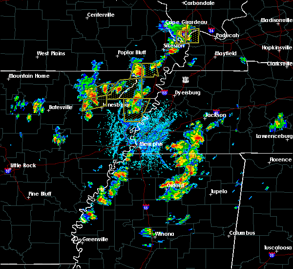 At 242 pm cdt, a severe thunderstorm was located near fontaine, or near bono, and is nearly stationary (radar indicated). Hazards include 60 mph wind gusts and quarter size hail. Hail damage to vehicles is expected. expect wind damage to roofs, siding, and trees. a breif tornado is possible near fontaine and along the greene and craighead county lines over the next 15 minutes. Locations impacted include, jonesboro, bono, crowleys ridge state park, lake frierson state park, cash, egypt, fontaine, walcott, sedgwick, herman, dryden, dorothy, winesburg, lanieve, finch, lorado, herndon and crowley`s ridge state park. At 242 pm cdt, a severe thunderstorm was located near fontaine, or near bono, and is nearly stationary (radar indicated). Hazards include 60 mph wind gusts and quarter size hail. Hail damage to vehicles is expected. expect wind damage to roofs, siding, and trees. a breif tornado is possible near fontaine and along the greene and craighead county lines over the next 15 minutes. Locations impacted include, jonesboro, bono, crowleys ridge state park, lake frierson state park, cash, egypt, fontaine, walcott, sedgwick, herman, dryden, dorothy, winesburg, lanieve, finch, lorado, herndon and crowley`s ridge state park.
|
| 5/20/2018 2:30 PM CDT |
 At 229 pm cdt, a severe thunderstorm was located near fontaine, or near bono, moving east at 10 mph (radar indicated). Hazards include 60 mph wind gusts and quarter size hail. Hail damage to vehicles is expected. expect wind damage to roofs, siding, and trees. A brief tornado is possible near sedgwick and fontaine over the next 15 minutes. At 229 pm cdt, a severe thunderstorm was located near fontaine, or near bono, moving east at 10 mph (radar indicated). Hazards include 60 mph wind gusts and quarter size hail. Hail damage to vehicles is expected. expect wind damage to roofs, siding, and trees. A brief tornado is possible near sedgwick and fontaine over the next 15 minutes.
|
| 5/20/2018 2:24 PM CDT |
 At 223 pm cdt, a severe thunderstorm producing a tornado was located north of egypt, or northwest of bono, moving east at 10 mph (radar indicated rotation). Hazards include tornado. Flying debris will be dangerous to those caught without shelter. mobile homes will be damaged or destroyed. damage to roofs, windows, and vehicles will occur. tree damage is likely. Locations impacted include, sedgwick. At 223 pm cdt, a severe thunderstorm producing a tornado was located north of egypt, or northwest of bono, moving east at 10 mph (radar indicated rotation). Hazards include tornado. Flying debris will be dangerous to those caught without shelter. mobile homes will be damaged or destroyed. damage to roofs, windows, and vehicles will occur. tree damage is likely. Locations impacted include, sedgwick.
|
| 5/20/2018 2:13 PM CDT |
 At 213 pm cdt, a severe thunderstorm producing a tornado was located near egypt, or 7 miles south of hoxie, moving east at 10 mph (radar indicated rotation). Hazards include tornado. Flying debris will be dangerous to those caught without shelter. mobile homes will be damaged or destroyed. damage to roofs, windows, and vehicles will occur. Tree damage is likely. At 213 pm cdt, a severe thunderstorm producing a tornado was located near egypt, or 7 miles south of hoxie, moving east at 10 mph (radar indicated rotation). Hazards include tornado. Flying debris will be dangerous to those caught without shelter. mobile homes will be damaged or destroyed. damage to roofs, windows, and vehicles will occur. Tree damage is likely.
|
| 5/20/2018 2:05 PM CDT |
 At 205 pm cdt, a severe thunderstorm was located over minturn, or near hoxie, moving east at 25 mph (radar indicated). Hazards include 60 mph wind gusts and half dollar size hail. Hail damage to vehicles is expected. Expect wind damage to roofs, siding, and trees. At 205 pm cdt, a severe thunderstorm was located over minturn, or near hoxie, moving east at 25 mph (radar indicated). Hazards include 60 mph wind gusts and half dollar size hail. Hail damage to vehicles is expected. Expect wind damage to roofs, siding, and trees.
|
| 4/13/2018 10:57 PM CDT |
 At 1056 pm cdt, a severe thunderstorm was located over swifton, or 13 miles northeast of newport, moving east at 45 mph (radar indicated). Hazards include 60 mph wind gusts and quarter size hail. Hail damage to vehicles is expected. Expect wind damage to roofs, siding, and trees. At 1056 pm cdt, a severe thunderstorm was located over swifton, or 13 miles northeast of newport, moving east at 45 mph (radar indicated). Hazards include 60 mph wind gusts and quarter size hail. Hail damage to vehicles is expected. Expect wind damage to roofs, siding, and trees.
|
| 4/3/2018 5:20 PM CDT |
 At 520 pm cdt, a severe thunderstorm producing a tornado was located over fontaine, or near lake frierson state park, moving east at 65 mph (radar indicated rotation). Hazards include tornado and quarter size hail. Flying debris will be dangerous to those caught without shelter. mobile homes will be damaged or destroyed. damage to roofs, windows, and vehicles will occur. Tree damage is likely. At 520 pm cdt, a severe thunderstorm producing a tornado was located over fontaine, or near lake frierson state park, moving east at 65 mph (radar indicated rotation). Hazards include tornado and quarter size hail. Flying debris will be dangerous to those caught without shelter. mobile homes will be damaged or destroyed. damage to roofs, windows, and vehicles will occur. Tree damage is likely.
|
| 4/3/2018 5:10 PM CDT |
 At 509 pm cdt, a severe thunderstorm was located over hoxie, moving east at 65 mph (public). Hazards include 60 mph wind gusts and quarter size hail. Hail damage to vehicles is expected. Expect wind damage to roofs, siding, and trees. At 509 pm cdt, a severe thunderstorm was located over hoxie, moving east at 65 mph (public). Hazards include 60 mph wind gusts and quarter size hail. Hail damage to vehicles is expected. Expect wind damage to roofs, siding, and trees.
|
| 4/3/2018 4:30 PM CDT |
 At 430 pm cdt, a severe thunderstorm was located near cave city, or 16 miles south of ash flat, moving east at 50 mph (trained weather spotters). Hazards include golf ball size hail and 60 mph wind gusts. People and animals outdoors will be injured. expect hail damage to roofs, siding, windows, and vehicles. expect wind damage to roofs, siding, and trees. locations impacted include, walnut ridge, hoxie, black rock, lake charles state park, college city, portia, strawberry, lynn, alicia, minturn, annieville, sedgwick, smithville, powhatan, strangers home, giles spur, dicus, eaton, lauratown and clover bend. A tornado watch remains in effect until 800 pm cdt for eastern arkansas. At 430 pm cdt, a severe thunderstorm was located near cave city, or 16 miles south of ash flat, moving east at 50 mph (trained weather spotters). Hazards include golf ball size hail and 60 mph wind gusts. People and animals outdoors will be injured. expect hail damage to roofs, siding, windows, and vehicles. expect wind damage to roofs, siding, and trees. locations impacted include, walnut ridge, hoxie, black rock, lake charles state park, college city, portia, strawberry, lynn, alicia, minturn, annieville, sedgwick, smithville, powhatan, strangers home, giles spur, dicus, eaton, lauratown and clover bend. A tornado watch remains in effect until 800 pm cdt for eastern arkansas.
|
| 4/3/2018 4:24 PM CDT |
 At 424 pm cdt, a severe thunderstorm was located near sidney, or 15 miles south of ash flat, moving east at 50 mph (radar indicated). Hazards include golf ball size hail and 60 mph wind gusts. People and animals outdoors will be injured. expect hail damage to roofs, siding, windows, and vehicles. Expect wind damage to roofs, siding, and trees. At 424 pm cdt, a severe thunderstorm was located near sidney, or 15 miles south of ash flat, moving east at 50 mph (radar indicated). Hazards include golf ball size hail and 60 mph wind gusts. People and animals outdoors will be injured. expect hail damage to roofs, siding, windows, and vehicles. Expect wind damage to roofs, siding, and trees.
|
| 2/24/2018 5:15 PM CST |
 At 515 pm cst, a severe thunderstorm producing a tornado was located near minturn, or near hoxie, moving northeast at 35 mph (radar indicated rotation). Hazards include tornado. Flying debris will be dangerous to those caught without shelter. mobile homes will be damaged or destroyed. damage to roofs, windows, and vehicles will occur. Tree damage is likely. At 515 pm cst, a severe thunderstorm producing a tornado was located near minturn, or near hoxie, moving northeast at 35 mph (radar indicated rotation). Hazards include tornado. Flying debris will be dangerous to those caught without shelter. mobile homes will be damaged or destroyed. damage to roofs, windows, and vehicles will occur. Tree damage is likely.
|
| 2/24/2018 4:33 PM CST |
 At 433 pm cst, a severe thunderstorm was located over newark, or 11 miles northwest of newport, moving northeast at 65 mph (radar indicated). Hazards include 60 mph wind gusts. expect damage to roofs, siding, and trees At 433 pm cst, a severe thunderstorm was located over newark, or 11 miles northwest of newport, moving northeast at 65 mph (radar indicated). Hazards include 60 mph wind gusts. expect damage to roofs, siding, and trees
|
| 6/23/2017 4:52 PM CDT |
 The severe thunderstorm warning for western greene, southeastern randolph, western craighead and southeastern lawrence counties will expire at 500 pm cdt, the storms which prompted the warning have moved out of the area. therefore the warning will be allowed to expire. a severe thunderstorm watch remains in effect until 900 pm cdt for eastern arkansas. The severe thunderstorm warning for western greene, southeastern randolph, western craighead and southeastern lawrence counties will expire at 500 pm cdt, the storms which prompted the warning have moved out of the area. therefore the warning will be allowed to expire. a severe thunderstorm watch remains in effect until 900 pm cdt for eastern arkansas.
|
| 6/23/2017 4:23 PM CDT |
 At 423 pm cdt, severe thunderstorms were located along a line extending from near delaplaine to near alicia, moving east at 25 mph (radar indicated). Hazards include 60 mph wind gusts. Expect damage to roofs, siding, and trees. Locations impacted include, jonesboro, paragould, walnut ridge, hoxie, bono, crowleys ridge state park, lake frierson state park, oak grove heights, lafe, college city, cash, o`kean, alicia, delaplaine, egypt, minturn, evening star, beech grove, walcott and fontaine. At 423 pm cdt, severe thunderstorms were located along a line extending from near delaplaine to near alicia, moving east at 25 mph (radar indicated). Hazards include 60 mph wind gusts. Expect damage to roofs, siding, and trees. Locations impacted include, jonesboro, paragould, walnut ridge, hoxie, bono, crowleys ridge state park, lake frierson state park, oak grove heights, lafe, college city, cash, o`kean, alicia, delaplaine, egypt, minturn, evening star, beech grove, walcott and fontaine.
|
| 6/23/2017 4:08 PM CDT |
 At 408 pm cdt, severe thunderstorms were located along a line extending from near pocahontas to near alicia, moving east at 25 mph (radar indicated). Hazards include 60 mph wind gusts. expect damage to roofs, siding, and trees At 408 pm cdt, severe thunderstorms were located along a line extending from near pocahontas to near alicia, moving east at 25 mph (radar indicated). Hazards include 60 mph wind gusts. expect damage to roofs, siding, and trees
|
| 5/27/2017 9:38 PM CDT |
 At 937 pm cdt, severe thunderstorms were located along a line extending from pollard to near brookland to near swifton, moving southeast at 35 mph (radar indicated). Hazards include 70 mph wind gusts and quarter size hail. Hail damage to vehicles is expected. expect considerable tree damage. Wind damage is also likely to mobile homes, roofs, and outbuildings. At 937 pm cdt, severe thunderstorms were located along a line extending from pollard to near brookland to near swifton, moving southeast at 35 mph (radar indicated). Hazards include 70 mph wind gusts and quarter size hail. Hail damage to vehicles is expected. expect considerable tree damage. Wind damage is also likely to mobile homes, roofs, and outbuildings.
|
| 5/27/2017 9:25 PM CDT |
 At 925 pm cdt, severe thunderstorms were located along a line extending from mcdougal to near walcott to near strawberry, moving east at 60 mph (radar indicated). Hazards include 70 mph wind gusts. Expect considerable tree damage. damage is likely to mobile homes, roofs, and outbuildings. locations impacted include, jonesboro, paragould, kennett, pocahontas, walnut ridge, piggott, corning, hoxie, bono, lake city, leachville, campbell, rector, senath, brookland, monette, marmaduke, black rock, lake charles state park and chalk bluff natural area. A tornado watch remains in effect until 200 am cdt for eastern arkansas, and southeastern missouri. At 925 pm cdt, severe thunderstorms were located along a line extending from mcdougal to near walcott to near strawberry, moving east at 60 mph (radar indicated). Hazards include 70 mph wind gusts. Expect considerable tree damage. damage is likely to mobile homes, roofs, and outbuildings. locations impacted include, jonesboro, paragould, kennett, pocahontas, walnut ridge, piggott, corning, hoxie, bono, lake city, leachville, campbell, rector, senath, brookland, monette, marmaduke, black rock, lake charles state park and chalk bluff natural area. A tornado watch remains in effect until 200 am cdt for eastern arkansas, and southeastern missouri.
|
| 5/27/2017 9:06 PM CDT |
 At 906 pm cdt, severe thunderstorms were located along a line extending from near doniphan to near pocahontas to near sidney, moving southeast at 60 mph (radar indicated). Hazards include 70 mph wind gusts. Expect considerable tree damage. Damage is likely to mobile homes, roofs, and outbuildings. At 906 pm cdt, severe thunderstorms were located along a line extending from near doniphan to near pocahontas to near sidney, moving southeast at 60 mph (radar indicated). Hazards include 70 mph wind gusts. Expect considerable tree damage. Damage is likely to mobile homes, roofs, and outbuildings.
|
| 5/27/2017 8:49 PM CDT |
 At 847 pm cdt, severe thunderstorms were located along a line extending from 7 miles southeast of handy to 7 miles southeast of hardy to near oxford, moving southeast at 65 mph. trees were blown down and quarter size hail were reported near thayer, mo with these thunderstorms (emergency management). Hazards include 70 mph wind gusts and quarter size hail. Hail damage to vehicles is expected. expect considerable tree damage. wind damage is also likely to mobile homes, roofs, and outbuildings. locations impacted include, pocahontas, walnut ridge, corning, hoxie, black rock, lake charles state park, imboden, ravenden, reyno, college city, portia, maynard, biggers, strawberry, lynn, o`kean, success, peach orchard, ravenden springs and delaplaine. A tornado watch remains in effect until 200 am cdt for eastern arkansas. At 847 pm cdt, severe thunderstorms were located along a line extending from 7 miles southeast of handy to 7 miles southeast of hardy to near oxford, moving southeast at 65 mph. trees were blown down and quarter size hail were reported near thayer, mo with these thunderstorms (emergency management). Hazards include 70 mph wind gusts and quarter size hail. Hail damage to vehicles is expected. expect considerable tree damage. wind damage is also likely to mobile homes, roofs, and outbuildings. locations impacted include, pocahontas, walnut ridge, corning, hoxie, black rock, lake charles state park, imboden, ravenden, reyno, college city, portia, maynard, biggers, strawberry, lynn, o`kean, success, peach orchard, ravenden springs and delaplaine. A tornado watch remains in effect until 200 am cdt for eastern arkansas.
|
| 5/27/2017 8:24 PM CDT |
 At 824 pm cdt, severe thunderstorms were located along a line extending from 9 miles northeast of alton to near mammoth spring to viola, moving southeast at 65 mph (radar indicated). Hazards include 70 mph wind gusts and quarter size hail. Hail damage to vehicles is expected. expect considerable tree damage. Wind damage is also likely to mobile homes, roofs, and outbuildings. At 824 pm cdt, severe thunderstorms were located along a line extending from 9 miles northeast of alton to near mammoth spring to viola, moving southeast at 65 mph (radar indicated). Hazards include 70 mph wind gusts and quarter size hail. Hail damage to vehicles is expected. expect considerable tree damage. Wind damage is also likely to mobile homes, roofs, and outbuildings.
|
| 5/27/2017 6:04 AM CDT |
 At 604 am cdt, severe thunderstorms were located along a line extending from near walcott to near bono, moving east at 45 mph (radar indicated). Hazards include 60 mph wind gusts and half dollar size hail. Hail damage to vehicles is expected. expect wind damage to roofs, siding, and trees. Locations impacted include, jonesboro, bono, crowleys ridge state park, lake frierson state park, cash, o`kean, egypt, walcott, fontaine, sedgwick, whiskerville, valley view, dorothy, winesburg, light, lanieve, finch, lorado, herndon and faulknerville. At 604 am cdt, severe thunderstorms were located along a line extending from near walcott to near bono, moving east at 45 mph (radar indicated). Hazards include 60 mph wind gusts and half dollar size hail. Hail damage to vehicles is expected. expect wind damage to roofs, siding, and trees. Locations impacted include, jonesboro, bono, crowleys ridge state park, lake frierson state park, cash, o`kean, egypt, walcott, fontaine, sedgwick, whiskerville, valley view, dorothy, winesburg, light, lanieve, finch, lorado, herndon and faulknerville.
|
| 5/27/2017 5:45 AM CDT |
 At 545 am cdt, severe thunderstorms were located along a line extending from near walnut ridge to near alicia, moving east at 45 mph (radar indicated). Hazards include 60 mph wind gusts and quarter size hail. Hail damage to vehicles is expected. expect wind damage to roofs, siding, and trees. Locations impacted include, jonesboro, paragould, walnut ridge, hoxie, bono, black rock, crowleys ridge state park, lake frierson state park, college city, portia, cash, o`kean, alicia, egypt, minturn, walcott, fontaine, sedgwick, strangers home and whiskerville. At 545 am cdt, severe thunderstorms were located along a line extending from near walnut ridge to near alicia, moving east at 45 mph (radar indicated). Hazards include 60 mph wind gusts and quarter size hail. Hail damage to vehicles is expected. expect wind damage to roofs, siding, and trees. Locations impacted include, jonesboro, paragould, walnut ridge, hoxie, bono, black rock, crowleys ridge state park, lake frierson state park, college city, portia, cash, o`kean, alicia, egypt, minturn, walcott, fontaine, sedgwick, strangers home and whiskerville.
|
| 5/27/2017 5:29 AM CDT |
 At 529 am cdt, severe thunderstorms were located along a line extending from near annieville to 6 miles south of strawberry, moving east at 45 mph (radar indicated). Hazards include 60 mph wind gusts and quarter size hail. Hail damage to vehicles is expected. Expect wind damage to roofs, siding, and trees. At 529 am cdt, severe thunderstorms were located along a line extending from near annieville to 6 miles south of strawberry, moving east at 45 mph (radar indicated). Hazards include 60 mph wind gusts and quarter size hail. Hail damage to vehicles is expected. Expect wind damage to roofs, siding, and trees.
|
| 5/19/2017 5:57 PM CDT |
 At 557 pm cdt, a severe thunderstorm was located near walcott, or near lake frierson state park, moving north at 30 mph (radar indicated). Hazards include 60 mph wind gusts and quarter size hail. Hail damage to vehicles is expected. expect wind damage to roofs, siding, and trees. Locations impacted include, paragould, walnut ridge, hoxie, black rock, crowleys ridge state park, lake frierson state park, portia, alicia, minturn, walcott, fontaine, sedgwick, powhatan, strangers home, dicus, light, lanieve, finch, lorado and faulknerville. At 557 pm cdt, a severe thunderstorm was located near walcott, or near lake frierson state park, moving north at 30 mph (radar indicated). Hazards include 60 mph wind gusts and quarter size hail. Hail damage to vehicles is expected. expect wind damage to roofs, siding, and trees. Locations impacted include, paragould, walnut ridge, hoxie, black rock, crowleys ridge state park, lake frierson state park, portia, alicia, minturn, walcott, fontaine, sedgwick, powhatan, strangers home, dicus, light, lanieve, finch, lorado and faulknerville.
|
| 5/19/2017 5:46 PM CDT |
 At 546 pm cdt, a severe thunderstorm was located over lake frierson state park, moving northeast at 45 mph (radar indicated). Hazards include 60 mph wind gusts and quarter size hail. Hail damage to vehicles is expected. expect wind damage to roofs, siding, and trees. Locations impacted include, jonesboro, paragould, walnut ridge, hoxie, bono, black rock, crowleys ridge state park, lake frierson state park, portia, cash, alicia, egypt, minturn, walcott, fontaine, sedgwick, powhatan, strangers home, valley view and dorothy. At 546 pm cdt, a severe thunderstorm was located over lake frierson state park, moving northeast at 45 mph (radar indicated). Hazards include 60 mph wind gusts and quarter size hail. Hail damage to vehicles is expected. expect wind damage to roofs, siding, and trees. Locations impacted include, jonesboro, paragould, walnut ridge, hoxie, bono, black rock, crowleys ridge state park, lake frierson state park, portia, cash, alicia, egypt, minturn, walcott, fontaine, sedgwick, powhatan, strangers home, valley view and dorothy.
|
| 5/19/2017 5:30 PM CDT |
 At 530 pm cdt, a severe thunderstorm was located near cash, or 14 miles southwest of bono, moving north at 30 mph (radar indicated). Hazards include 60 mph wind gusts and quarter size hail. Hail damage to vehicles is expected. Expect wind damage to roofs, siding, and trees. At 530 pm cdt, a severe thunderstorm was located near cash, or 14 miles southwest of bono, moving north at 30 mph (radar indicated). Hazards include 60 mph wind gusts and quarter size hail. Hail damage to vehicles is expected. Expect wind damage to roofs, siding, and trees.
|
| 4/30/2017 1:25 AM CDT |
 At 124 am cdt, severe thunderstorms were located along a line extending from 8 miles west of budapest to near biggers, moving northeast at 55 mph (radar indicated). Hazards include 60 mph wind gusts and quarter size hail. Hail damage to vehicles is expected. expect wind damage to roofs, siding, and trees. locations impacted include, jonesboro, paragould, piggott, corning, bono, marmaduke, chalk bluff natural area, crowleys ridge state park, lake frierson state park, oak grove heights, lafe, reyno, maynard, biggers, cash, knobel, st. Francis, pollard, o`kean and mcdougal. At 124 am cdt, severe thunderstorms were located along a line extending from 8 miles west of budapest to near biggers, moving northeast at 55 mph (radar indicated). Hazards include 60 mph wind gusts and quarter size hail. Hail damage to vehicles is expected. expect wind damage to roofs, siding, and trees. locations impacted include, jonesboro, paragould, piggott, corning, bono, marmaduke, chalk bluff natural area, crowleys ridge state park, lake frierson state park, oak grove heights, lafe, reyno, maynard, biggers, cash, knobel, st. Francis, pollard, o`kean and mcdougal.
|
| 4/30/2017 1:00 AM CDT |
 At 1259 am cdt, a severe thunderstorm producing a tornado was located near hoxie, moving northeast at 25 mph (radar indicated rotation). Hazards include tornado. Flying debris will be dangerous to those caught without shelter. mobile homes will be damaged or destroyed. damage to roofs, windows, and vehicles will occur. tree damage is likely. this dangerous storm will be near, walnut ridge and fontaine around 115 am cdt. o`kean around 135 am cdt. Other locations impacted by this tornadic thunderstorm include sedgwick, whiskerville, light, walnut corner, giles spur, faulknerville and case. At 1259 am cdt, a severe thunderstorm producing a tornado was located near hoxie, moving northeast at 25 mph (radar indicated rotation). Hazards include tornado. Flying debris will be dangerous to those caught without shelter. mobile homes will be damaged or destroyed. damage to roofs, windows, and vehicles will occur. tree damage is likely. this dangerous storm will be near, walnut ridge and fontaine around 115 am cdt. o`kean around 135 am cdt. Other locations impacted by this tornadic thunderstorm include sedgwick, whiskerville, light, walnut corner, giles spur, faulknerville and case.
|
| 4/30/2017 12:52 AM CDT |
 At 1252 am cdt, severe thunderstorms were located along a line extending from near attica to near minturn, moving northeast at 55 mph (radar indicated). Hazards include 60 mph wind gusts and quarter size hail. Hail damage to vehicles is expected. Expect wind damage to roofs, siding, and trees. At 1252 am cdt, severe thunderstorms were located along a line extending from near attica to near minturn, moving northeast at 55 mph (radar indicated). Hazards include 60 mph wind gusts and quarter size hail. Hail damage to vehicles is expected. Expect wind damage to roofs, siding, and trees.
|
| 4/30/2017 12:41 AM CDT |
 At 1241 am cdt, a severe thunderstorm was located over hoxie, moving northeast at 40 mph (radar indicated). Hazards include 60 mph wind gusts and quarter size hail. Hail damage to vehicles is expected. expect wind damage to roofs, siding, and trees. Locations impacted include, pocahontas, walnut ridge, corning, hoxie, black rock, lake charles state park, reyno, college city, portia, maynard, biggers, knobel, o`kean, success, peach orchard, alicia, delaplaine, minturn, datto and evening star. At 1241 am cdt, a severe thunderstorm was located over hoxie, moving northeast at 40 mph (radar indicated). Hazards include 60 mph wind gusts and quarter size hail. Hail damage to vehicles is expected. expect wind damage to roofs, siding, and trees. Locations impacted include, pocahontas, walnut ridge, corning, hoxie, black rock, lake charles state park, reyno, college city, portia, maynard, biggers, knobel, o`kean, success, peach orchard, alicia, delaplaine, minturn, datto and evening star.
|
| 4/30/2017 12:24 AM CDT |
 At 1223 am cdt, a severe thunderstorm was located near alicia, or 7 miles south of lake charles state park, moving northeast at 45 mph (radar indicated). Hazards include 60 mph wind gusts and quarter size hail. Hail damage to vehicles is expected. Expect wind damage to roofs, siding, and trees. At 1223 am cdt, a severe thunderstorm was located near alicia, or 7 miles south of lake charles state park, moving northeast at 45 mph (radar indicated). Hazards include 60 mph wind gusts and quarter size hail. Hail damage to vehicles is expected. Expect wind damage to roofs, siding, and trees.
|
| 3/25/2017 1:08 AM CDT |
 At 107 am cdt, a severe thunderstorm was located over bono, moving northeast at 60 mph (radar indicated). Hazards include 60 mph wind gusts. expect damage to roofs, siding, and trees At 107 am cdt, a severe thunderstorm was located over bono, moving northeast at 60 mph (radar indicated). Hazards include 60 mph wind gusts. expect damage to roofs, siding, and trees
|
| 3/25/2017 12:56 AM CDT |
 At 1256 am cdt, a severe thunderstorm was located over hoxie, moving northeast at 50 mph (radar indicated). Hazards include 60 mph wind gusts. Expect damage to roofs, siding, and trees. Locations impacted include, walnut ridge, hoxie, black rock, portia, alicia, minturn, sedgwick, lauratown, clover bend, calvin, dicus, coffman and arbor grove. At 1256 am cdt, a severe thunderstorm was located over hoxie, moving northeast at 50 mph (radar indicated). Hazards include 60 mph wind gusts. Expect damage to roofs, siding, and trees. Locations impacted include, walnut ridge, hoxie, black rock, portia, alicia, minturn, sedgwick, lauratown, clover bend, calvin, dicus, coffman and arbor grove.
|
| 3/25/2017 12:24 AM CDT |
 At 1224 am cdt, a severe thunderstorm was located 7 miles northeast of newark, or 12 miles northwest of newport, moving northeast at 40 mph (radar indicated). Hazards include 60 mph wind gusts. expect damage to roofs, siding, and trees At 1224 am cdt, a severe thunderstorm was located 7 miles northeast of newark, or 12 miles northwest of newport, moving northeast at 40 mph (radar indicated). Hazards include 60 mph wind gusts. expect damage to roofs, siding, and trees
|
| 3/7/2017 2:19 AM CST |
 At 218 am cst, a severe thunderstorm was located near annieville, or 9 miles northwest of lake charles state park, moving northeast at 50 mph (radar indicated). Hazards include 60 mph wind gusts and quarter size hail. Hail damage to vehicles is expected. Expect wind damage to roofs, siding, and trees. At 218 am cst, a severe thunderstorm was located near annieville, or 9 miles northwest of lake charles state park, moving northeast at 50 mph (radar indicated). Hazards include 60 mph wind gusts and quarter size hail. Hail damage to vehicles is expected. Expect wind damage to roofs, siding, and trees.
|
| 3/1/2017 3:30 AM CST |
 At 330 am cst, severe thunderstorms were located along a line extending from near gatewood to near college city to 6 miles north of grubbs, moving east at 70 mph (radar indicated). Hazards include 60 mph wind gusts. Expect damage to roofs, siding, and trees. locations impacted include, pocahontas, walnut ridge, hoxie, black rock, lake charles state park, imboden, ravenden, reyno, college city, portia, maynard, biggers, lynn, o`kean, alicia, ravenden springs, minturn, annieville, dalton and attica. A tornado watch remains in effect until 800 am cst for eastern arkansas. At 330 am cst, severe thunderstorms were located along a line extending from near gatewood to near college city to 6 miles north of grubbs, moving east at 70 mph (radar indicated). Hazards include 60 mph wind gusts. Expect damage to roofs, siding, and trees. locations impacted include, pocahontas, walnut ridge, hoxie, black rock, lake charles state park, imboden, ravenden, reyno, college city, portia, maynard, biggers, lynn, o`kean, alicia, ravenden springs, minturn, annieville, dalton and attica. A tornado watch remains in effect until 800 am cst for eastern arkansas.
|
| 3/1/2017 3:06 AM CST |
 At 306 am cst, severe thunderstorms were located along a line extending from near mammoth spring state park to 6 miles southeast of pleasant plains, moving east at 70 mph (radar indicated). Hazards include 60 mph wind gusts. expect damage to roofs, siding, and trees At 306 am cst, severe thunderstorms were located along a line extending from near mammoth spring state park to 6 miles southeast of pleasant plains, moving east at 70 mph (radar indicated). Hazards include 60 mph wind gusts. expect damage to roofs, siding, and trees
|
| 2/7/2017 3:37 AM CST |
 At 336 am cst, a severe thunderstorm was located over alicia, or 11 miles south of lake charles state park, moving east at 60 mph (radar indicated). Hazards include 60 mph wind gusts and quarter size hail. Hail damage to vehicles is expected. Expect wind damage to roofs, siding, and trees. At 336 am cst, a severe thunderstorm was located over alicia, or 11 miles south of lake charles state park, moving east at 60 mph (radar indicated). Hazards include 60 mph wind gusts and quarter size hail. Hail damage to vehicles is expected. Expect wind damage to roofs, siding, and trees.
|
| 9/18/2016 5:47 PM CDT |
 At 546 pm cdt, a severe thunderstorm was located near walcott, or near crowleys ridge state park, moving southeast at 30 mph (radar indicated). Hazards include 60 mph wind gusts and quarter size hail. Hail damage to vehicles is expected. Expect wind damage to roofs, siding, and trees. At 546 pm cdt, a severe thunderstorm was located near walcott, or near crowleys ridge state park, moving southeast at 30 mph (radar indicated). Hazards include 60 mph wind gusts and quarter size hail. Hail damage to vehicles is expected. Expect wind damage to roofs, siding, and trees.
|
| 7/8/2016 4:10 PM CDT |
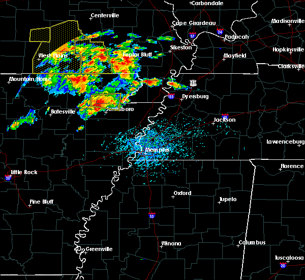 At 409 pm cdt, a severe thunderstorm was located over fontaine, or near bono, moving east at 15 mph (radar indicated). Hazards include 60 mph wind gusts and half dollar size hail. Hail damage to vehicles is expected. Expect wind damage to roofs, siding, and trees. At 409 pm cdt, a severe thunderstorm was located over fontaine, or near bono, moving east at 15 mph (radar indicated). Hazards include 60 mph wind gusts and half dollar size hail. Hail damage to vehicles is expected. Expect wind damage to roofs, siding, and trees.
|
| 7/8/2016 3:34 PM CDT |
 At 334 pm cdt, a severe thunderstorm was located near fontaine, or near walnut ridge, moving east at 15 mph (radar indicated). Hazards include 60 mph wind gusts and quarter size hail. Hail damage to vehicles is expected. Expect wind damage to roofs, siding, and trees. At 334 pm cdt, a severe thunderstorm was located near fontaine, or near walnut ridge, moving east at 15 mph (radar indicated). Hazards include 60 mph wind gusts and quarter size hail. Hail damage to vehicles is expected. Expect wind damage to roofs, siding, and trees.
|
| 7/8/2016 3:05 PM CDT |
 At 305 pm cdt, a severe thunderstorm was located over portia, or near black rock, moving east at 35 mph (radar indicated). Hazards include 60 mph wind gusts and quarter size hail. Hail damage to vehicles is expected. expect wind damage to roofs, siding, and trees. Locations impacted include, pocahontas, walnut ridge, hoxie, black rock, lake charles state park, imboden, ravenden, college city, portia, o`kean, minturn, annieville, sedgwick, smithville, powhatan, giles spur, whiskerville, coffman, lauratown and eaton. At 305 pm cdt, a severe thunderstorm was located over portia, or near black rock, moving east at 35 mph (radar indicated). Hazards include 60 mph wind gusts and quarter size hail. Hail damage to vehicles is expected. expect wind damage to roofs, siding, and trees. Locations impacted include, pocahontas, walnut ridge, hoxie, black rock, lake charles state park, imboden, ravenden, college city, portia, o`kean, minturn, annieville, sedgwick, smithville, powhatan, giles spur, whiskerville, coffman, lauratown and eaton.
|
| 7/8/2016 2:42 PM CDT |
 At 242 pm cdt, a severe thunderstorm was located near annieville, or 11 miles northwest of lake charles state park, moving southeast at 15 mph (radar indicated). Hazards include 60 mph wind gusts and quarter size hail. Hail damage to vehicles is expected. Expect wind damage to roofs, siding, and trees. At 242 pm cdt, a severe thunderstorm was located near annieville, or 11 miles northwest of lake charles state park, moving southeast at 15 mph (radar indicated). Hazards include 60 mph wind gusts and quarter size hail. Hail damage to vehicles is expected. Expect wind damage to roofs, siding, and trees.
|
| 6/15/2016 5:42 PM CDT |
 At 541 pm cdt, a severe thunderstorm was located over minturn, or near hoxie, moving east at 35 mph (radar indicated). Hazards include 60 mph wind gusts and quarter size hail. Hail damage to vehicles is expected. Expect wind damage to roofs, siding, and trees. At 541 pm cdt, a severe thunderstorm was located over minturn, or near hoxie, moving east at 35 mph (radar indicated). Hazards include 60 mph wind gusts and quarter size hail. Hail damage to vehicles is expected. Expect wind damage to roofs, siding, and trees.
|
| 5/1/2016 1:28 AM CDT |
 At 128 am cdt, a severe thunderstorm was located near lake charles state park, moving northeast at 40 mph (radar indicated). Hazards include quarter size hail. Damage to vehicles is possible. Locations impacted include, walnut ridge, hoxie, college city, portia, alicia, minturn, sedgwick, strangers home, calvin, clover bend, dicus, coffman, arbor grove and lauratown. At 128 am cdt, a severe thunderstorm was located near lake charles state park, moving northeast at 40 mph (radar indicated). Hazards include quarter size hail. Damage to vehicles is possible. Locations impacted include, walnut ridge, hoxie, college city, portia, alicia, minturn, sedgwick, strangers home, calvin, clover bend, dicus, coffman, arbor grove and lauratown.
|
| 5/1/2016 1:10 AM CDT |
 At 109 am cdt, a severe thunderstorm was located over strawberry, or 12 miles southwest of lake charles state park, moving northeast at 40 mph (radar indicated). Hazards include quarter size hail. damage to vehicles is possible At 109 am cdt, a severe thunderstorm was located over strawberry, or 12 miles southwest of lake charles state park, moving northeast at 40 mph (radar indicated). Hazards include quarter size hail. damage to vehicles is possible
|
| 12/23/2015 12:53 PM CST | At 1253 pm cst, a severe thunderstorm was located near walcott, or near crowleys ridge state park, moving northeast at 70 mph (radar indicated). Hazards include 60 mph wind gusts and quarter size hail. Hail damage to vehicles is expected. expect wind damage to roofs, siding and trees. this severe thunderstorm will remain over mainly rural areas of central craighead, greene, northwestern poinsett and southeastern lawrence counties, including the following locations, herman, herndon, stanford, goobertown, walnut corner, pitts, dryden, faulknerville, bethel and lanieve. A tornado watch remains in effect until 500 pm cst for eastern arkansas and southeastern missouri. |
| 12/23/2015 12:41 PM CST | A severe thunderstorm warning remains in effect until 100 pm cst for western craighead. greene. northwestern poinsett and southeastern lawrence counties. at 1241 pm cst. a severe thunderstorm was located near bono. moving northeast at 70 mph. hazard. 60 mph wind gusts and quarter size hail. |
| 12/23/2015 12:36 PM CST | At 1235 pm cst, a severe thunderstorm was located over egypt, or 7 miles west of bono, moving northeast at 70 mph (radar indicated). Hazards include 60 mph wind gusts. Expect damage to roofs. siding and trees. this severe thunderstorm will be near, bono around 1240 pm cst. lake frierson state park and fontaine around 1245 pm cst. crowleys ridge state park and walcott around 1250 pm cst. evening star around 1255 pm cst. paragould, oak grove heights and beech grove around 100 pm cst. other locations impacted by this severe thunderstorm include herman, herndon, calvin, stanford, goobertown, walnut corner, pitts, dryden, faulknerville and bethel. A tornado watch remains in effect until 500 pm cst for eastern arkansas and southeastern missouri. |
| 7/14/2015 3:04 PM CDT |
 At 302 pm cdt, a severe thunderstorm was located near trumann, moving southeast at 65 mph. this is a very dangerous storm (trained weather spotters. report from amateur radio operator of 80 miles a hour). Hazards include 80 mph wind gusts. Flying debris will be dangerous to those caught without shelter. mobile homes will be heavily damaged. expect considerable damage to roofs, windows and vehicles. extensive tree damage and power outages are likely. Locations impacted include, jonesboro, paragould, wynne, osceola, trumann, manila, marked tree, earle, harrisburg, bono, lake city, leachville, lepanto, bay, brookland, monette, caraway, parkin, wilson and tyronza. At 302 pm cdt, a severe thunderstorm was located near trumann, moving southeast at 65 mph. this is a very dangerous storm (trained weather spotters. report from amateur radio operator of 80 miles a hour). Hazards include 80 mph wind gusts. Flying debris will be dangerous to those caught without shelter. mobile homes will be heavily damaged. expect considerable damage to roofs, windows and vehicles. extensive tree damage and power outages are likely. Locations impacted include, jonesboro, paragould, wynne, osceola, trumann, manila, marked tree, earle, harrisburg, bono, lake city, leachville, lepanto, bay, brookland, monette, caraway, parkin, wilson and tyronza.
|
| 7/14/2015 2:48 PM CDT |
 At 247 pm cdt, a severe thunderstorm was located near brookland, moving southeast at 60 mph (trained weather spotters. walnut ridge airport reports 66 mph). Hazards include 70 mph wind gusts and quarter size hail. Hail damage to vehicles is expected. expect considerable tree damage. wind damage is also likely to mobile homes, roofs and outbuildings. Locations impacted include, jonesboro, paragould, pocahontas, walnut ridge, hoxie, bono, lake city, bay, brookland, monette, black rock, lake charles state park, lake frierson state park, crowleys ridge state park, oak grove heights, weiner, lafe, reyno, college city and portia. At 247 pm cdt, a severe thunderstorm was located near brookland, moving southeast at 60 mph (trained weather spotters. walnut ridge airport reports 66 mph). Hazards include 70 mph wind gusts and quarter size hail. Hail damage to vehicles is expected. expect considerable tree damage. wind damage is also likely to mobile homes, roofs and outbuildings. Locations impacted include, jonesboro, paragould, pocahontas, walnut ridge, hoxie, bono, lake city, bay, brookland, monette, black rock, lake charles state park, lake frierson state park, crowleys ridge state park, oak grove heights, weiner, lafe, reyno, college city and portia.
|
| 7/14/2015 2:45 PM CDT |
 At 243 pm cdt, a severe thunderstorm was located near lake frierson state park, moving southeast at 65 mph (trained weather spotters. winds measured near 70 mph). Hazards include 70 mph wind gusts. Expect considerable tree damage. Damage is likely to mobile homes, roofs and outbuildings. At 243 pm cdt, a severe thunderstorm was located near lake frierson state park, moving southeast at 65 mph (trained weather spotters. winds measured near 70 mph). Hazards include 70 mph wind gusts. Expect considerable tree damage. Damage is likely to mobile homes, roofs and outbuildings.
|
| 7/14/2015 2:28 PM CDT |
 At 227 pm cdt, a severe thunderstorm was located near fontaine, or near walnut ridge, moving southeast at 60 mph (trained weather spotters). Hazards include 70 mph wind gusts and quarter size hail. Hail damage to vehicles is expected. expect considerable tree damage. wind damage is also likely to mobile homes, roofs and outbuildings. Locations impacted include, jonesboro, paragould, pocahontas, walnut ridge, hoxie, bono, lake city, bay, brookland, monette, black rock, lake charles state park, lake frierson state park, crowleys ridge state park, oak grove heights, weiner, imboden, ravenden, lafe and reyno. At 227 pm cdt, a severe thunderstorm was located near fontaine, or near walnut ridge, moving southeast at 60 mph (trained weather spotters). Hazards include 70 mph wind gusts and quarter size hail. Hail damage to vehicles is expected. expect considerable tree damage. wind damage is also likely to mobile homes, roofs and outbuildings. Locations impacted include, jonesboro, paragould, pocahontas, walnut ridge, hoxie, bono, lake city, bay, brookland, monette, black rock, lake charles state park, lake frierson state park, crowleys ridge state park, oak grove heights, weiner, imboden, ravenden, lafe and reyno.
|
| 7/14/2015 2:17 PM CDT |
 At 216 pm cdt, a severe thunderstorm was located near college city, or near pocahontas, moving southeast at 60 mph (trained weather spotters). Hazards include 60 mph wind gusts and quarter size hail. Hail damage to vehicles is expected. Expect wind damage to roofs, siding and trees. At 216 pm cdt, a severe thunderstorm was located near college city, or near pocahontas, moving southeast at 60 mph (trained weather spotters). Hazards include 60 mph wind gusts and quarter size hail. Hail damage to vehicles is expected. Expect wind damage to roofs, siding and trees.
|
| 7/8/2015 9:09 PM CDT |
 The severe thunderstorm warning for eastern randolph, northwestern greene, northwestern clay and southeastern lawrence counties will expire at 915 pm cdt, the storm which prompted the warning has weakened below severe limits and exited the warned area. therefore the warning will be allowed to expire. The severe thunderstorm warning for eastern randolph, northwestern greene, northwestern clay and southeastern lawrence counties will expire at 915 pm cdt, the storm which prompted the warning has weakened below severe limits and exited the warned area. therefore the warning will be allowed to expire.
|
| 7/8/2015 8:53 PM CDT |
 At 853 pm cdt, a severe thunderstorm was located 9 miles northeast of success, or 10 miles north of corning, and is nearly stationary (radar indicated). Hazards include 60 mph wind gusts. Expect damage to roofs. siding and trees. Locations impacted include, pocahontas, walnut ridge, corning, hoxie, reyno, college city, biggers, knobel, o`kean, success, peach orchard, alicia, delaplaine, minturn, datto, sedgwick, giles spur, strangers home, calvin and whiskerville. At 853 pm cdt, a severe thunderstorm was located 9 miles northeast of success, or 10 miles north of corning, and is nearly stationary (radar indicated). Hazards include 60 mph wind gusts. Expect damage to roofs. siding and trees. Locations impacted include, pocahontas, walnut ridge, corning, hoxie, reyno, college city, biggers, knobel, o`kean, success, peach orchard, alicia, delaplaine, minturn, datto, sedgwick, giles spur, strangers home, calvin and whiskerville.
|
| 7/8/2015 8:18 PM CDT |
 At 818 pm cdt, a severe thunderstorm was located over attica, or near pocahontas, moving northeast at 50 mph (radar indicated). Hazards include 60 mph wind gusts and penny size hail. Expect damage to roofs. Siding and trees. At 818 pm cdt, a severe thunderstorm was located over attica, or near pocahontas, moving northeast at 50 mph (radar indicated). Hazards include 60 mph wind gusts and penny size hail. Expect damage to roofs. Siding and trees.
|
| 6/26/2015 3:37 PM CDT | At 337 pm cdt, a severe thunderstorm was located near bono, moving east at 40 mph (radar indicated). Hazards include 60 mph wind gusts and quarter size hail. Hail damage to vehicles is expected. expect wind damage to roofs, siding and trees. Locations impacted include, jonesboro, paragould, bono, lake city, bay, brookland, monette, lake frierson state park, cash, egypt, fontaine, sedgwick, herman, herndon, goobertown, dryden, bethel, lanieve, otwell and poplar ridge. |
| 6/26/2015 3:15 PM CDT | At 315 pm cdt, a severe thunderstorm was located near minturn, or 7 miles south of hoxie, moving southeast at 40 mph (radar indicated). Hazards include 60 mph wind gusts and quarter size hail. Hail damage to vehicles is expected. Expect wind damage to roofs, siding and trees. |
| 6/26/2015 3:10 PM CDT | At 310 pm cdt, a severe thunderstorm was located over minturn, or 7 miles southeast of lake charles state park, moving east at 15 mph (radar indicated). Hazards include 60 mph wind gusts. Expect damage to roofs. siding and trees. Locations impacted include, walnut ridge, hoxie, black rock, lake charles state park, college city, portia, lynn, alicia, minturn, sedgwick, powhatan, giles spur, strangers home, calvin, eaton, clover bend, dicus, whiskerville, coffman and driftwood. |
| 6/26/2015 2:47 PM CDT | At 247 pm cdt, a severe thunderstorm was located near lynn, or near lake charles state park, moving east at 15 mph (radar indicated). Hazards include 60 mph wind gusts. Expect damage to roofs. Siding and trees. |
| 6/5/2015 7:11 PM CDT | The severe thunderstorm warning for craighead, southern greene, northern poinsett and lawrence counties will expire at 715 pm cdt, the storm which prompted the warning has weakened below severe limits, and no longer pose an immediate threat to life or property. therefore the warning will be allowed to expire. a severe thunderstorm watch remains in effect until 100 am cdt for eastern arkansas. |
| 6/5/2015 6:58 PM CDT | At 657 pm cdt, a severe thunderstorm was located near bay, moving southeast at 30 mph (trained weather spotters). Hazards include 60 mph wind gusts and penny size hail. Expect damage to roofs. siding and trees. Locations impacted include, jonesboro, paragould, trumann, walnut ridge, hoxie, bono, lake city, lepanto, bay, brookland, monette, caraway, lake charles state park, lake frierson state park, crowleys ridge state park, oak grove heights, portia, cash, strawberry and lynn. |
| 6/5/2015 6:32 PM CDT | At 631 pm cdt, a severe thunderstorm was located near lake frierson state park, moving southeast at 30 mph (trained weather spotters). Hazards include 60 mph wind gusts and penny size hail. Expect damage to roofs. Siding and trees. |
| 6/5/2015 6:28 PM CDT | At 628 pm cdt, a severe thunderstorm was located near fontaine, or near lake frierson state park, moving southeast at 20 mph (public). Hazards include 60 mph wind gusts and quarter size hail. Hail damage to vehicles is expected. expect wind damage to roofs, siding and trees. Locations impacted include, jonesboro, paragould, walnut ridge, hoxie, bono, brookland, marmaduke, black rock, lake charles state park, lake frierson state park, crowleys ridge state park, oak grove heights, lafe, college city, portia, cash, strawberry, lynn, o`kean and alicia. |
| 6/5/2015 6:05 PM CDT | At 605 pm cdt, a severe thunderstorm was located over college city, or near walnut ridge, moving southeast at 20 mph (public). Hazards include 60 mph wind gusts and half dollar size hail. Hail damage to vehicles is expected. Expect wind damage to roofs, siding and trees. |
| 5/24/2015 6:14 PM CDT | At 614 pm cdt, a severe thunderstorm was located 7 miles northwest of waldenburg, or 18 miles west of harrisburg, moving north at 55 mph (radar indicated). Hazards include 60 mph wind gusts and penny size hail. Expect damage to roofs. Siding and trees. |
| 4/9/2015 9:45 PM CDT | The national weather service in memphis has issued a * severe thunderstorm warning for. craighead county in eastern arkansas. southern greene county in eastern arkansas. poinsett county in eastern arkansas. Southeastern lawrence county in eastern arkansas. |
| 4/9/2015 9:45 PM CDT | The national weather service in memphis has issued a * severe thunderstorm warning for. craighead county in eastern arkansas. southern greene county in eastern arkansas. poinsett county in eastern arkansas. Southeastern lawrence county in eastern arkansas. |
| 4/9/2015 7:05 PM CDT | The national weather service in memphis has issued a * severe thunderstorm warning for. lawrence county in eastern arkansas. until 745 pm cdt * at 705 pm cdt. a severe thunderstorm was located near strawberry. Or 17 miles southwest of lake charles state park. |
| 4/9/2015 6:45 PM CDT | A severe thunderstorm warning remains in effect until 700 pm cdt for northeastern craighead. western greene and southeastern lawrence counties. at 645 pm cdt. a severe thunderstorm was located over lake frierson state park. moving northeast at 55 mph. hazard. 60 mph wind gusts and quarter size hail. |
| 4/9/2015 6:38 PM CDT | A severe thunderstorm warning remains in effect until 700 pm cdt for northern craighead. western greene and southeastern lawrence counties. at 638 pm cdt. a severe thunderstorm was located near bono. moving northeast at 55 mph. hazard. 60 mph wind gusts and quarter size hail. |
| 4/9/2015 6:32 PM CDT | Ping Pong Ball sized hail reported 3.4 miles NE of Sedgwick, AR, mostly quarter size hail with a few ping-pong ball sized hail. |
| 4/9/2015 6:21 PM CDT | The national weather service in memphis has issued a * severe thunderstorm warning for. northern craighead county in eastern arkansas. western greene county in eastern arkansas. southeastern lawrence county in eastern arkansas. Until 700 pm cdt. |
Hail Maps for Sedgwick, AR
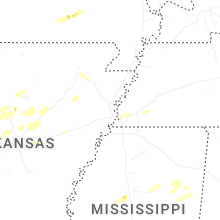
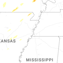


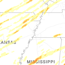


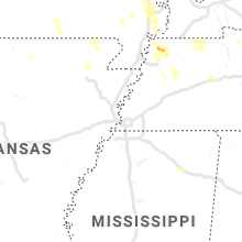


Connect with Interactive Hail Maps