

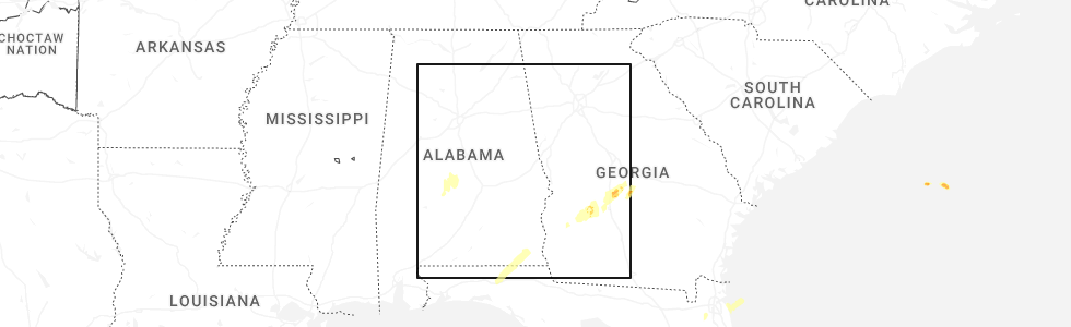
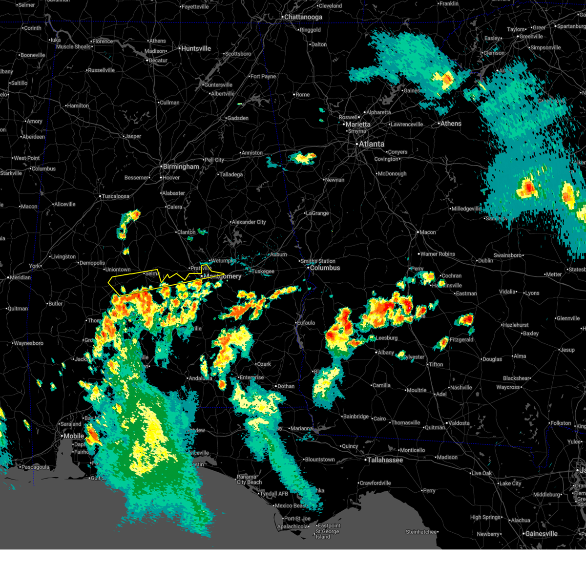
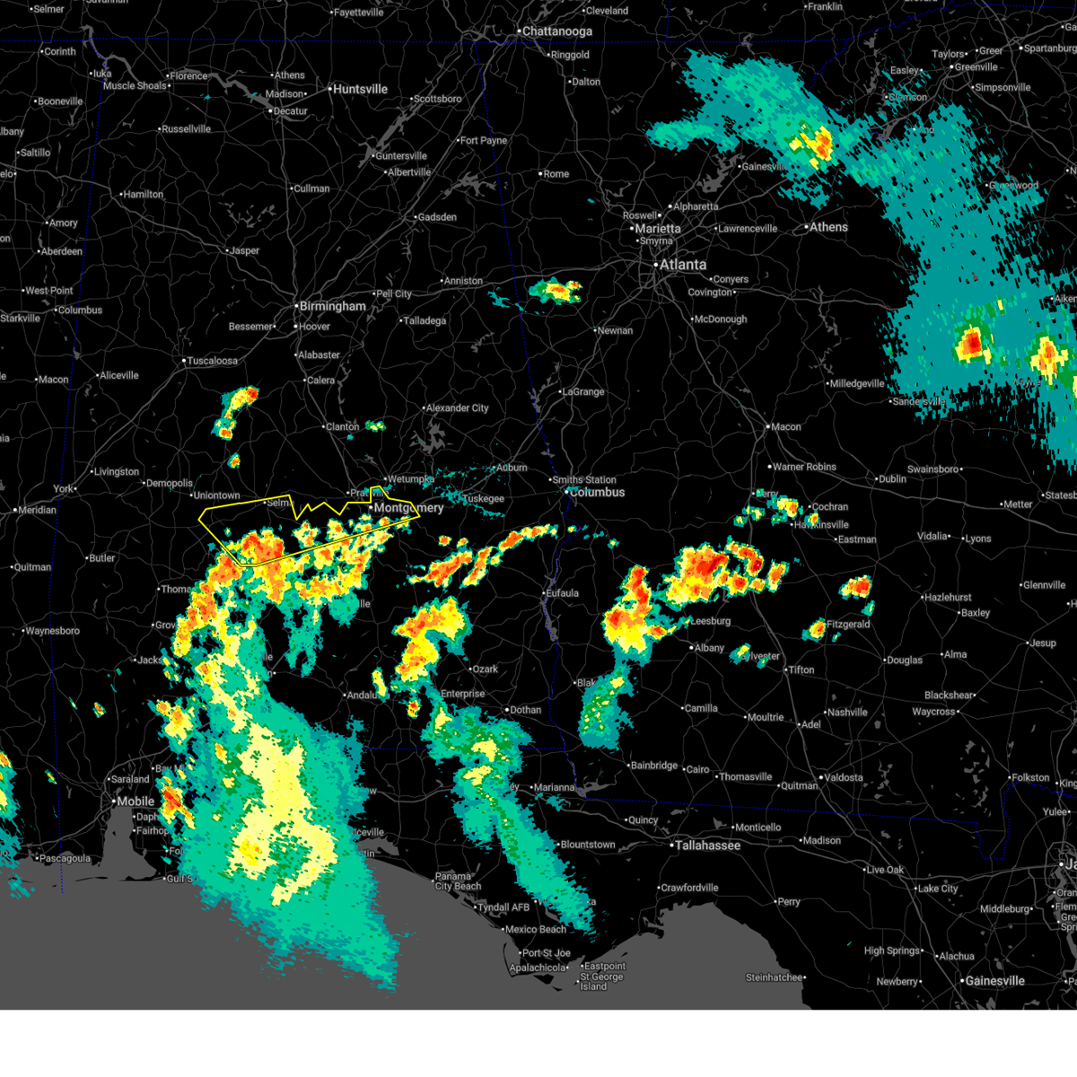
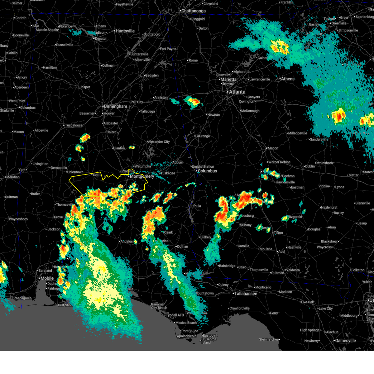
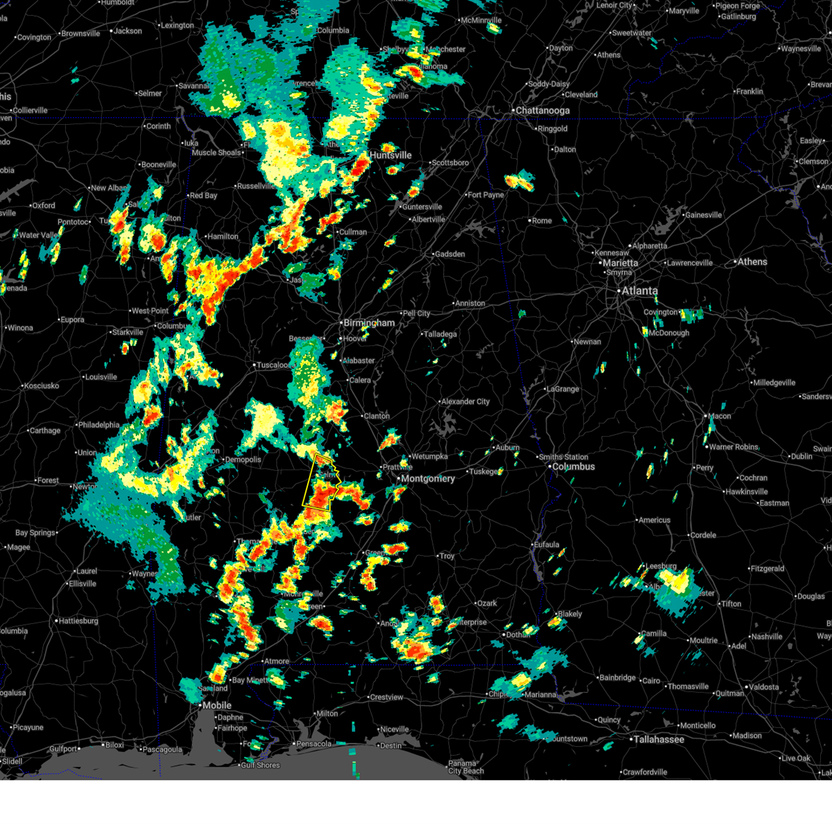
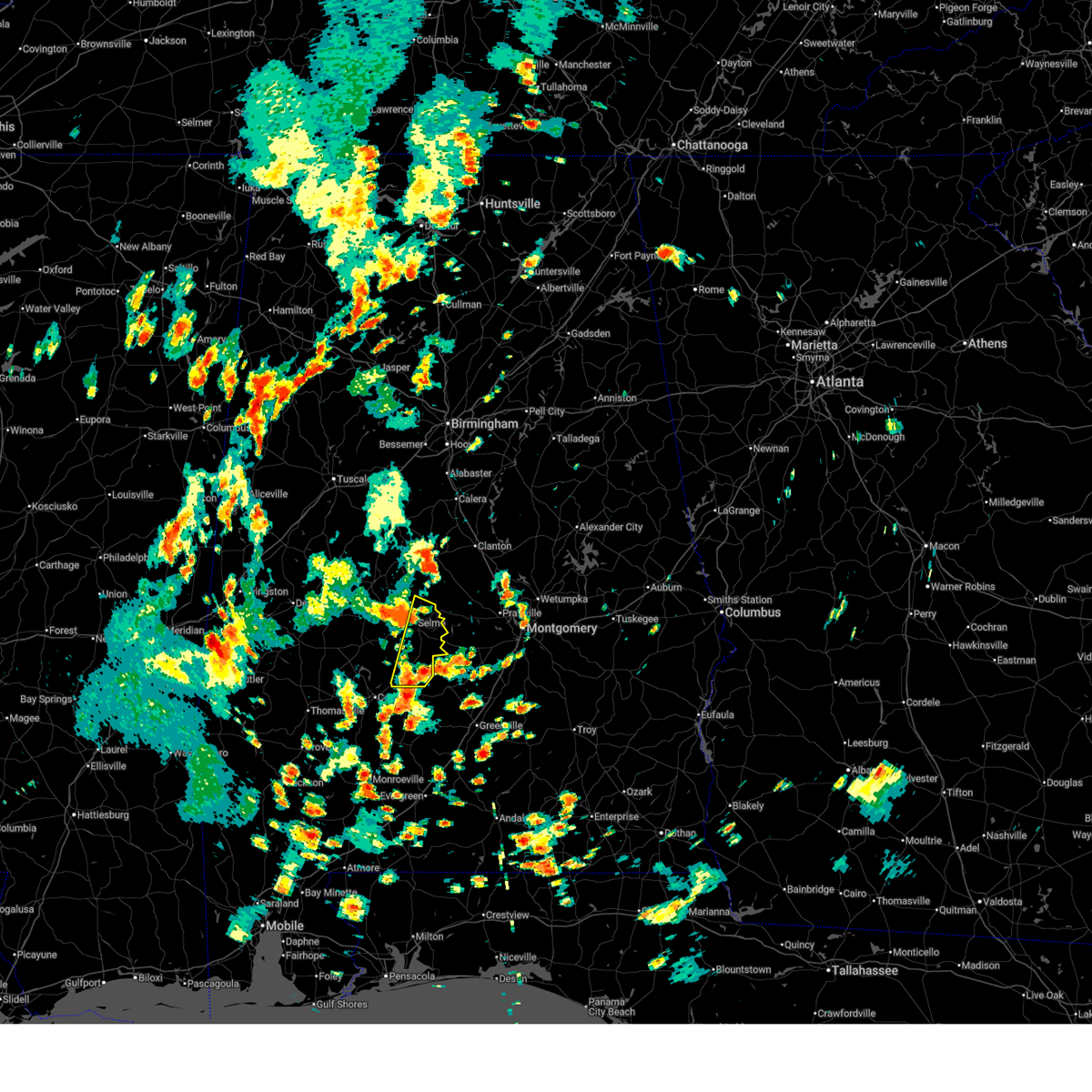
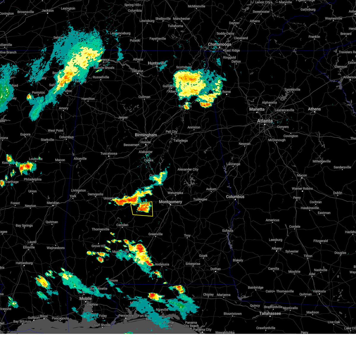
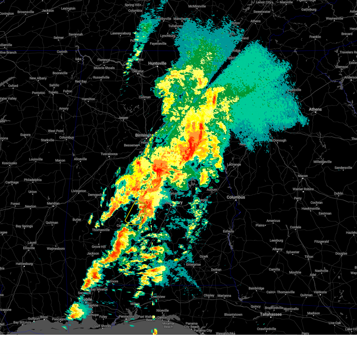
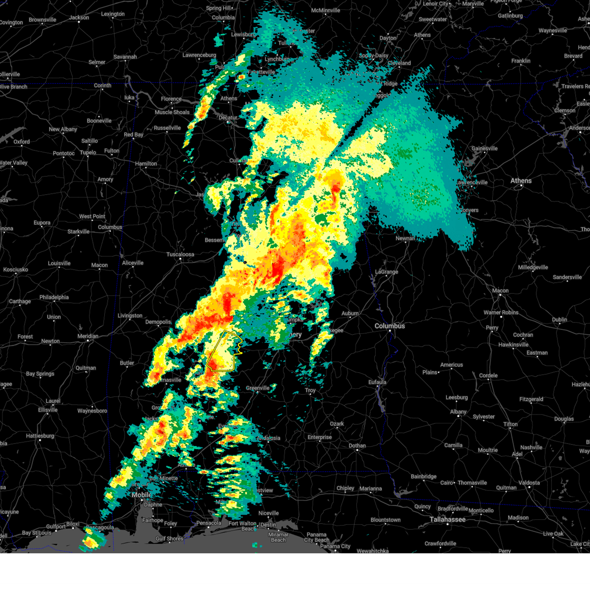
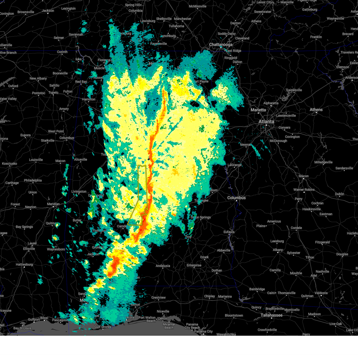
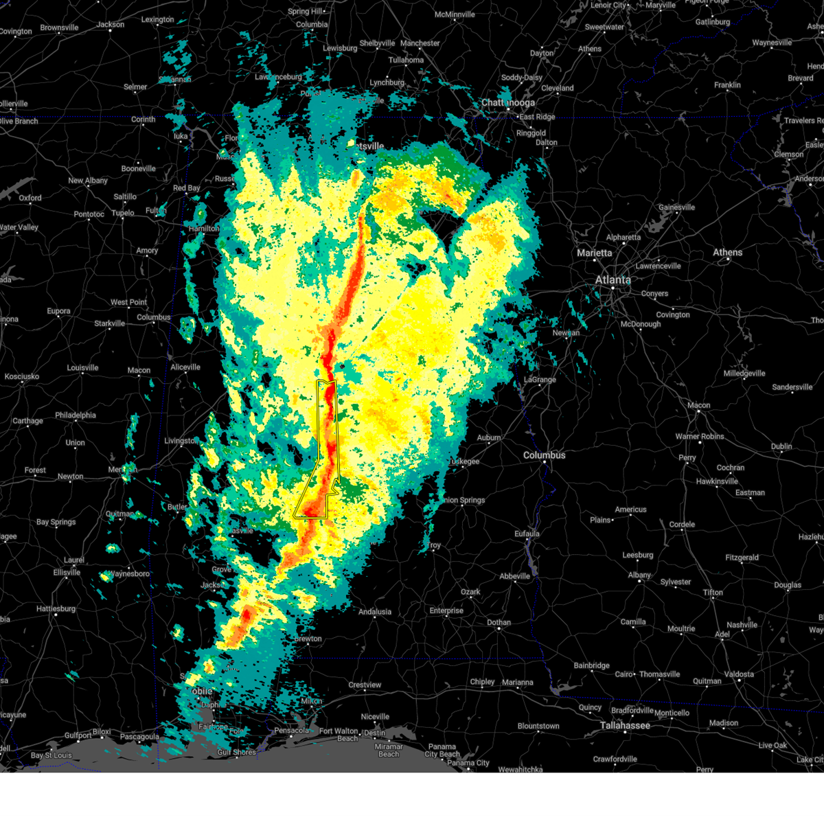
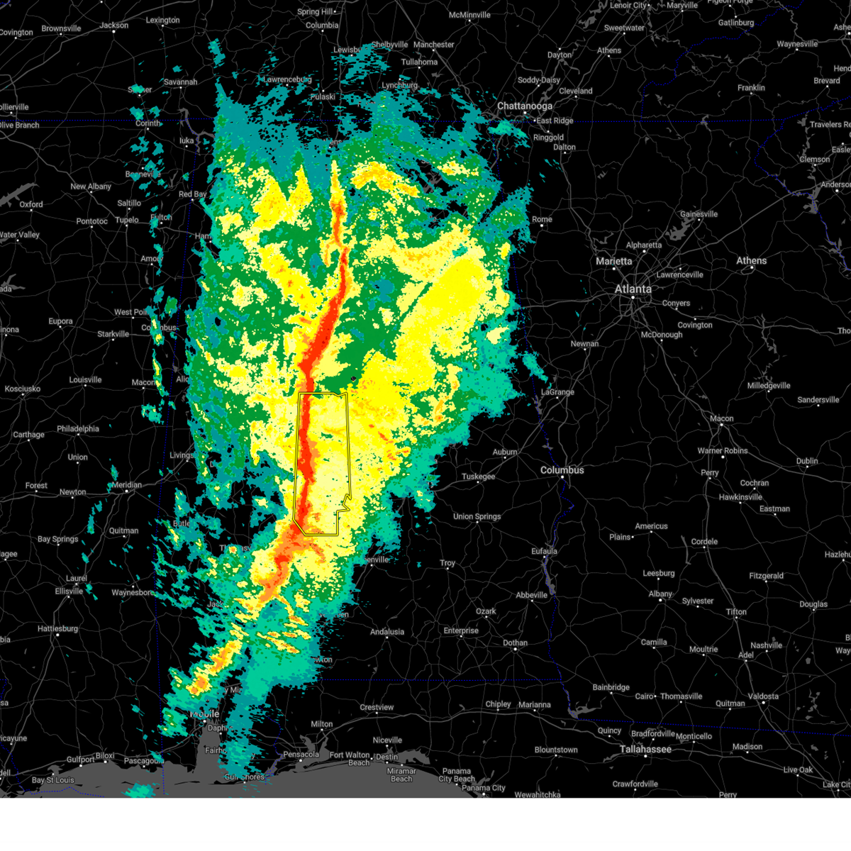
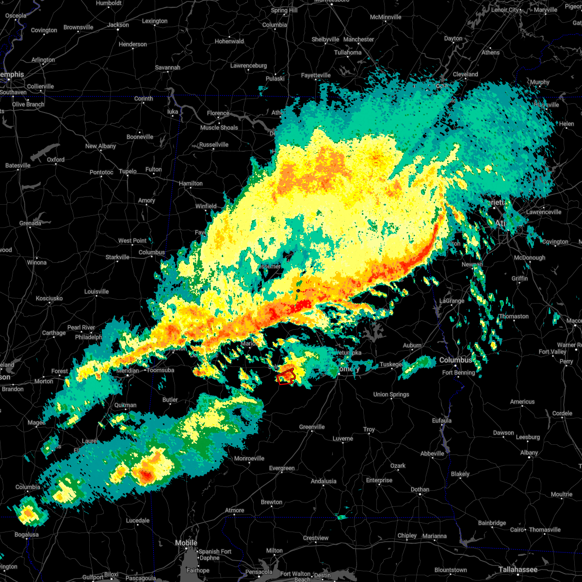
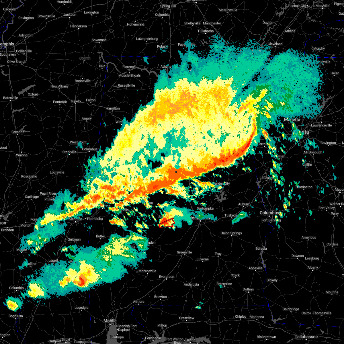
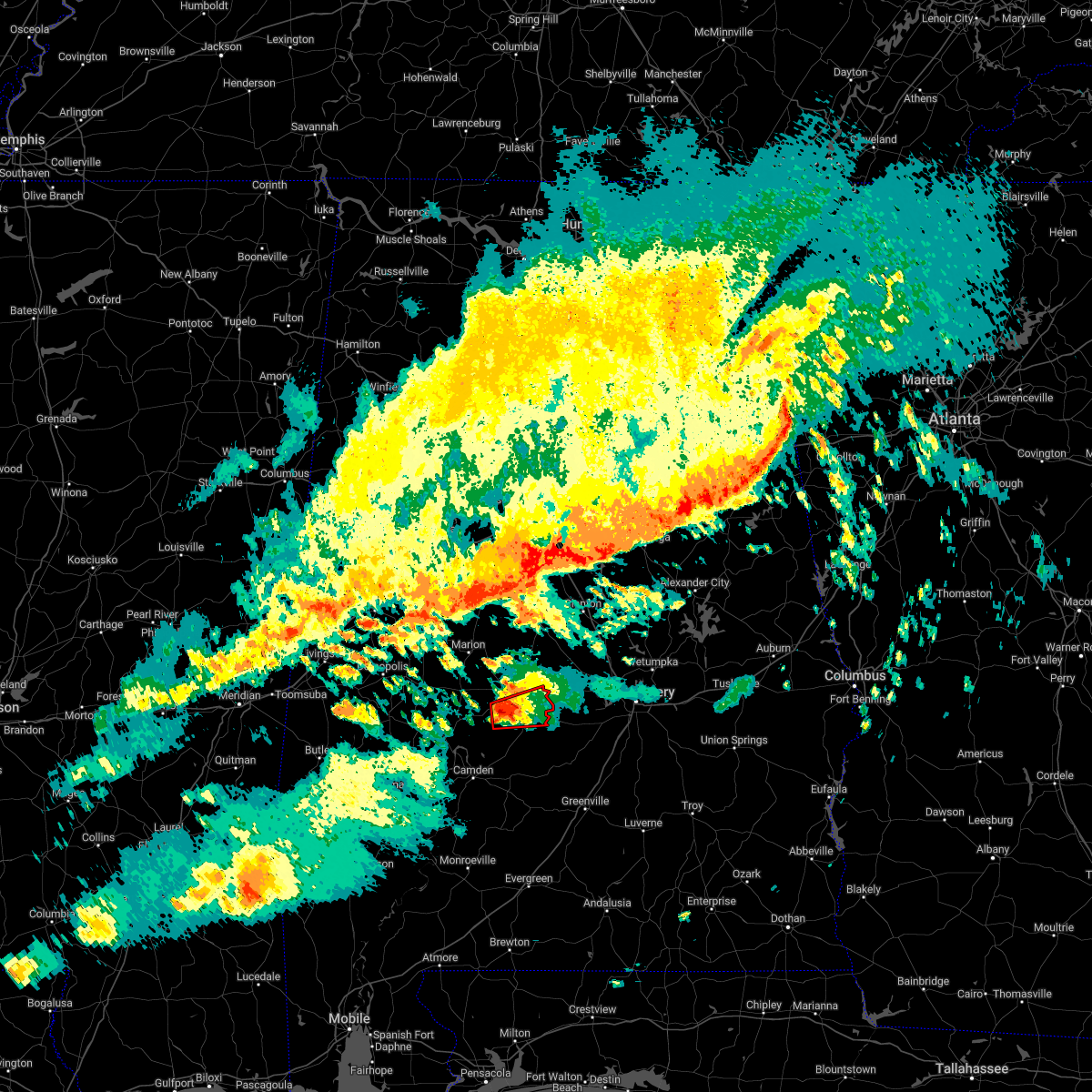
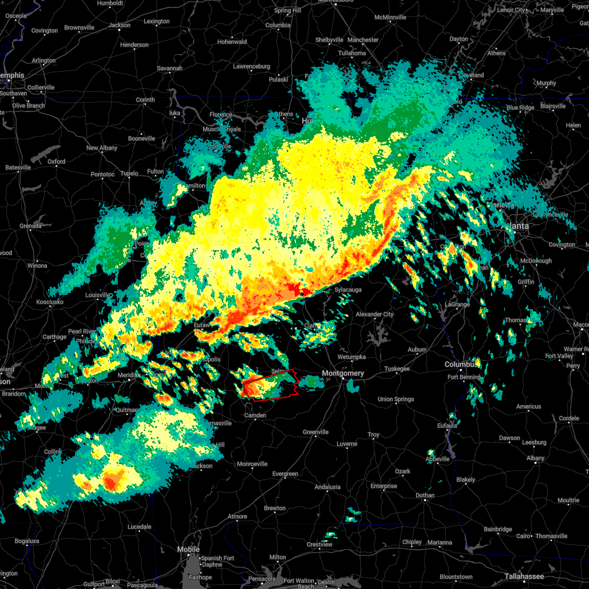
Hail Map for Selmont-West Selmont, AL
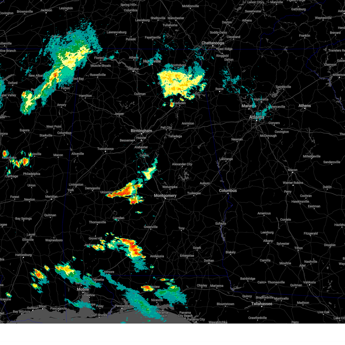
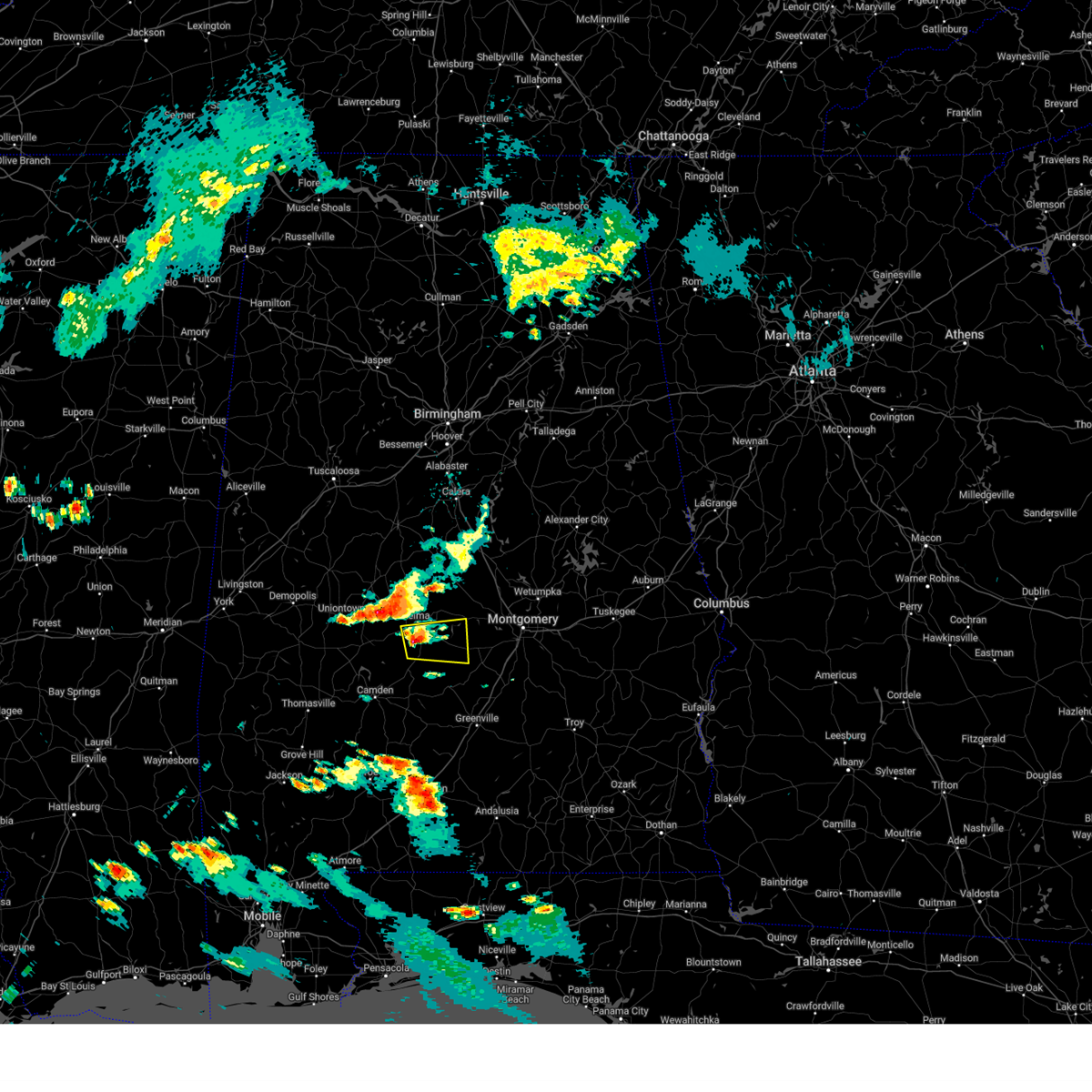
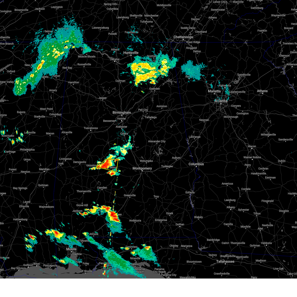
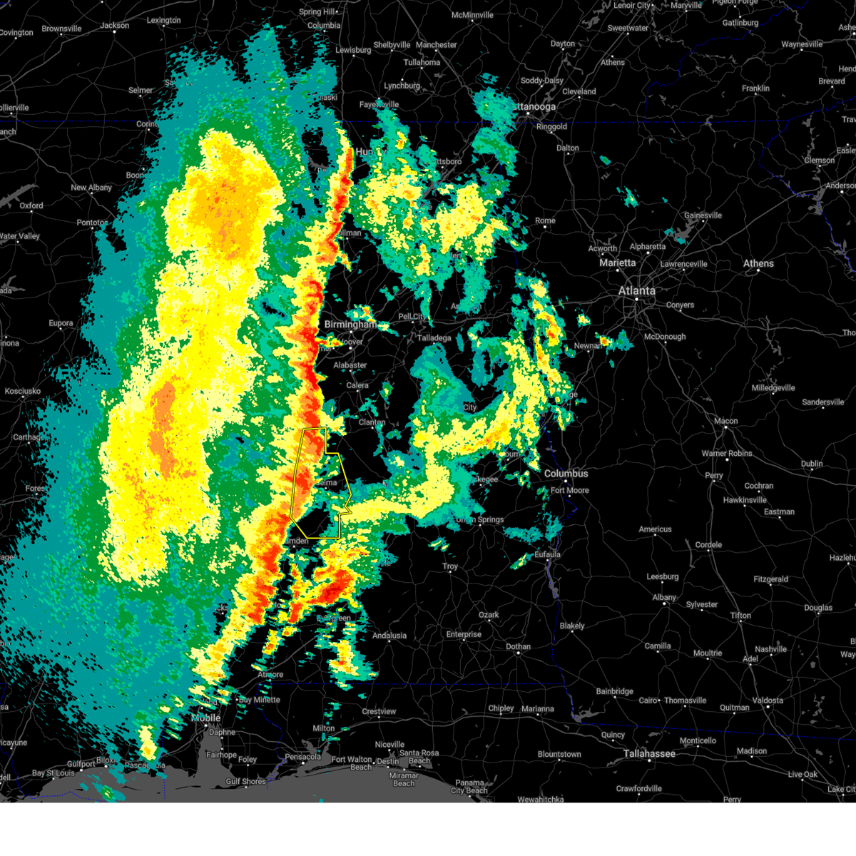
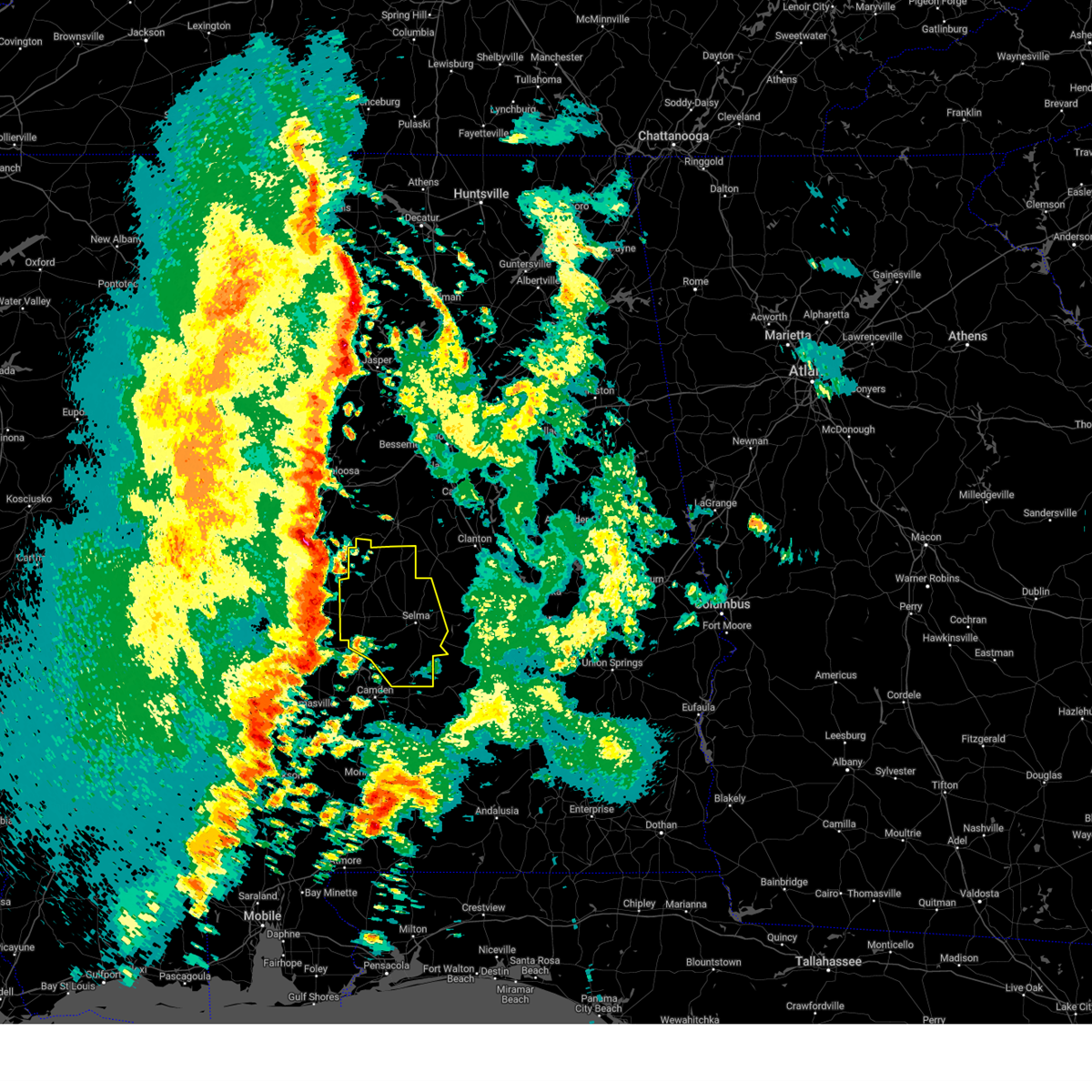
The Selmont-West Selmont, AL area has had 1 report of on-the-ground hail by trained spotters, and has been under severe weather warnings 41 times during the past 12 months. Doppler radar has detected hail at or near Selmont-West Selmont, AL on 55 occasions, including 4 occasions during the past year.
| Name: | Selmont-West Selmont, AL |
| Where Located: | 31.6 miles NNE of Camden, AL |
| Map: | Google Map for Selmont-West Selmont, AL |
| Population: | 2671 |
| Housing Units: | 1320 |
| More Info: | Search Google for Selmont-West Selmont, AL |
3
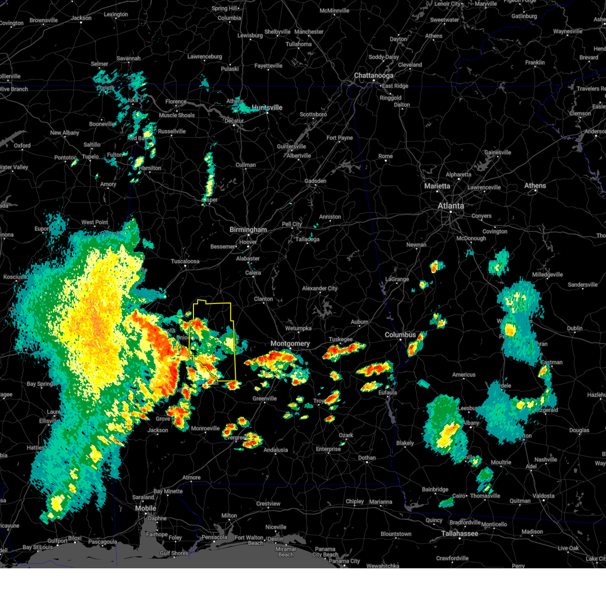
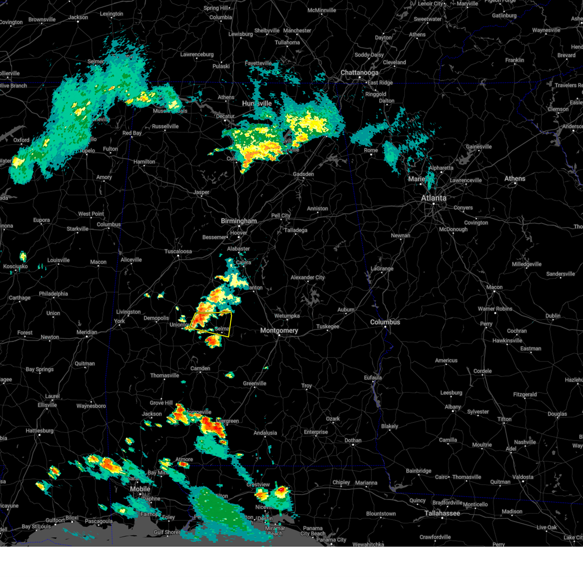
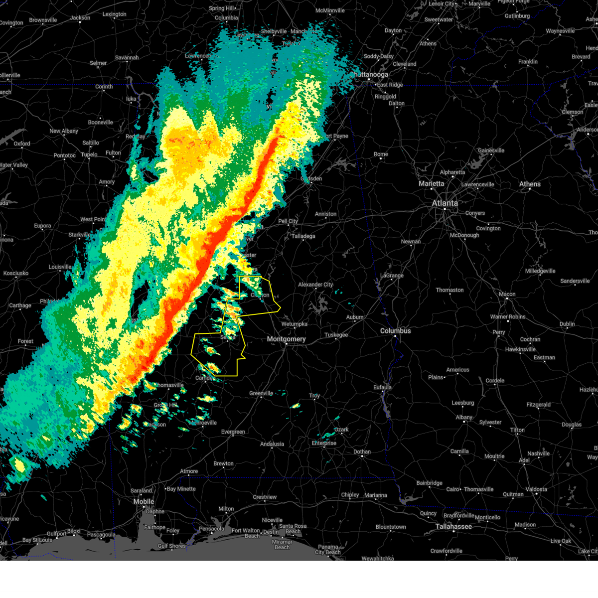
The Top Recent Hail Date for Selmont-West Selmont, AL is Saturday, May 10, 2025 (6th out of 55)
Hail and Wind Damage Spotted near Selmont-West Selmont, AL
| Date / Time | Report Details |
|---|---|
| 7/1/2025 5:12 PM CDT | At 511 pm cdt, severe thunderstorms were located along a line extending from near paul m grist state park to tyler to near dannelly reservoir, moving east at 20 mph (radar indicated). Hazards include 60 mph wind gusts. Expect damage to roofs, siding, and trees. Locations impacted include, selma, valley grande, selmont-west selmont, belknap, gardner island, paul m grist state park, tyler, dallas lake, memorial stadium, burnsville, dannelly reservoir, summerfield, craig field aiport, valley creek junction, selma drag strip, edmund pettus bridge, selma university, and barrett creek. |
| 7/1/2025 5:01 PM CDT |
 At 500 pm cdt, severe thunderstorms were located along a line extending from paul m grist state park to near selmont-west selmont to near dannelly reservoir, moving southeast at 20 mph (radar indicated). Hazards include 60 mph wind gusts. Expect damage to roofs, siding, and trees. Locations impacted include, selma, valley grande, selmont-west selmont, gardner island, tyler, old cahaba park, dallas county horse arena, belknap, paul m grist state park, dallas lake, memorial stadium, burnsville, potter station, dannelly reservoir, hazen, craig field aiport, valley creek junction, plantersville, selma drag strip, and barrett creek. At 500 pm cdt, severe thunderstorms were located along a line extending from paul m grist state park to near selmont-west selmont to near dannelly reservoir, moving southeast at 20 mph (radar indicated). Hazards include 60 mph wind gusts. Expect damage to roofs, siding, and trees. Locations impacted include, selma, valley grande, selmont-west selmont, gardner island, tyler, old cahaba park, dallas county horse arena, belknap, paul m grist state park, dallas lake, memorial stadium, burnsville, potter station, dannelly reservoir, hazen, craig field aiport, valley creek junction, plantersville, selma drag strip, and barrett creek.
|
| 7/1/2025 4:46 PM CDT |
 Svrbmx the national weather service in birmingham has issued a * severe thunderstorm warning for, dallas county in south central alabama, * until 545 pm cdt. * at 446 pm cdt, severe thunderstorms were located along a line extending from near paul m grist state park to dallas county horse arena to near dannelly reservoir, moving southeast at 15 mph (radar indicated). Hazards include 60 mph wind gusts. expect damage to roofs, siding, and trees Svrbmx the national weather service in birmingham has issued a * severe thunderstorm warning for, dallas county in south central alabama, * until 545 pm cdt. * at 446 pm cdt, severe thunderstorms were located along a line extending from near paul m grist state park to dallas county horse arena to near dannelly reservoir, moving southeast at 15 mph (radar indicated). Hazards include 60 mph wind gusts. expect damage to roofs, siding, and trees
|
| 6/25/2025 10:00 PM CDT |
 Svrbmx the national weather service in birmingham has issued a * severe thunderstorm warning for, autauga county in central alabama, southwestern elmore county in east central alabama, central dallas county in south central alabama, * until 1045 pm cdt. * at 959 pm cdt, severe thunderstorms were located along a line extending from bob woodruff lake to mulberry to near orrville, moving northwest at 25 mph (radar indicated). Hazards include 60 mph wind gusts. expect damage to roofs, siding, and trees Svrbmx the national weather service in birmingham has issued a * severe thunderstorm warning for, autauga county in central alabama, southwestern elmore county in east central alabama, central dallas county in south central alabama, * until 1045 pm cdt. * at 959 pm cdt, severe thunderstorms were located along a line extending from bob woodruff lake to mulberry to near orrville, moving northwest at 25 mph (radar indicated). Hazards include 60 mph wind gusts. expect damage to roofs, siding, and trees
|
| 6/25/2025 9:51 PM CDT |
 At 950 pm cdt, severe thunderstorms were located along a line extending from near emerald mountain to near orrville, moving northwest at 20 mph (radar indicated). Hazards include 60 mph wind gusts. Expect damage to roofs, siding, and trees. Locations impacted include, northern montgomery, selma, selmont-west selmont, coosada, white hall, orrville, benton, montgomery zoo, boylston, bogue chitto, gardner island, bob woodruff lake, tyler, central mills, old cahaba park, maxwell air force base, dallas county horse arena, lagoon park, hunter, and alabama state university. At 950 pm cdt, severe thunderstorms were located along a line extending from near emerald mountain to near orrville, moving northwest at 20 mph (radar indicated). Hazards include 60 mph wind gusts. Expect damage to roofs, siding, and trees. Locations impacted include, northern montgomery, selma, selmont-west selmont, coosada, white hall, orrville, benton, montgomery zoo, boylston, bogue chitto, gardner island, bob woodruff lake, tyler, central mills, old cahaba park, maxwell air force base, dallas county horse arena, lagoon park, hunter, and alabama state university.
|
| 6/25/2025 9:38 PM CDT |
 At 938 pm cdt, severe thunderstorms were located along a line extending from montgomery to near dannelly reservoir, moving northwest at 30 mph (radar indicated). Hazards include 60 mph wind gusts. Expect damage to roofs, siding, and trees. Locations impacted include, montgomery, selma, mosses, hayneville, selmont-west selmont, pike road, coosada, white hall, gordonville, orrville, lowndesboro, benton, hyundai motors of alabama, bogue chitto, auburn university in montgomery, tyler, woodcrest, dannelly reservoir, waugh, and lagoon park. At 938 pm cdt, severe thunderstorms were located along a line extending from montgomery to near dannelly reservoir, moving northwest at 30 mph (radar indicated). Hazards include 60 mph wind gusts. Expect damage to roofs, siding, and trees. Locations impacted include, montgomery, selma, mosses, hayneville, selmont-west selmont, pike road, coosada, white hall, gordonville, orrville, lowndesboro, benton, hyundai motors of alabama, bogue chitto, auburn university in montgomery, tyler, woodcrest, dannelly reservoir, waugh, and lagoon park.
|
| 6/25/2025 9:20 PM CDT |
 Svrbmx the national weather service in birmingham has issued a * severe thunderstorm warning for, lowndes county in south central alabama, dallas county in south central alabama, montgomery county in south central alabama, * until 1015 pm cdt. * at 920 pm cdt, severe thunderstorms were located along a line extending from pike road to 8 miles southeast of dannelly reservoir, moving northwest at 25 mph (radar indicated). Hazards include 60 mph wind gusts. expect damage to roofs, siding, and trees Svrbmx the national weather service in birmingham has issued a * severe thunderstorm warning for, lowndes county in south central alabama, dallas county in south central alabama, montgomery county in south central alabama, * until 1015 pm cdt. * at 920 pm cdt, severe thunderstorms were located along a line extending from pike road to 8 miles southeast of dannelly reservoir, moving northwest at 25 mph (radar indicated). Hazards include 60 mph wind gusts. expect damage to roofs, siding, and trees
|
| 6/13/2025 3:12 PM CDT |
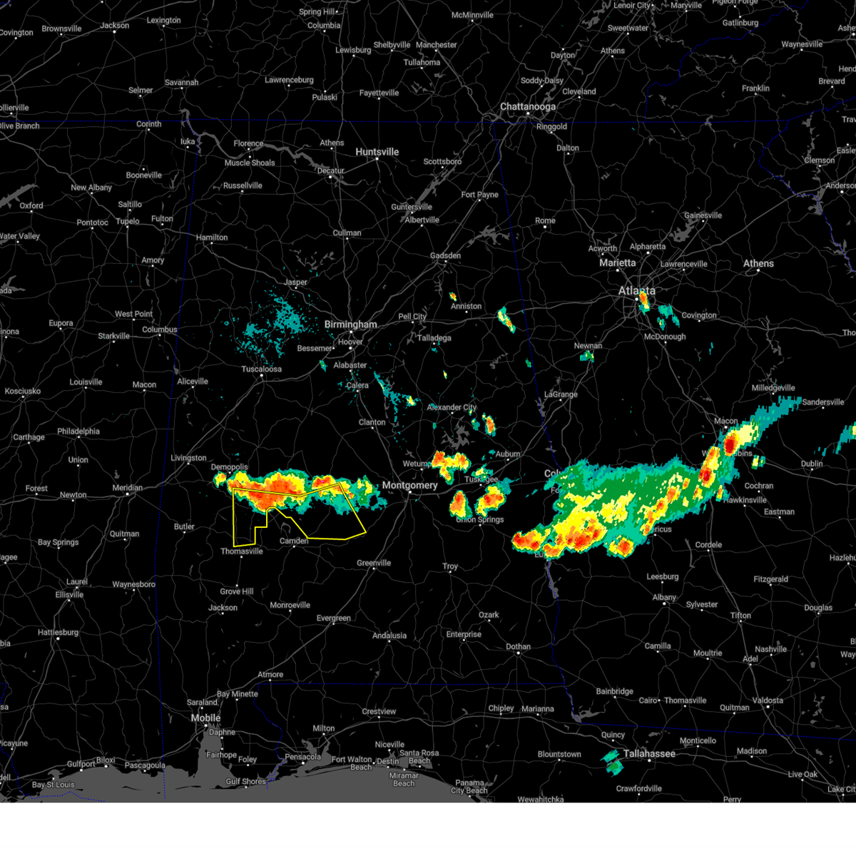
 At 312 pm cdt, a severe thunderstorm was located near dallas lake, or 8 miles south of selmont-west selmont, moving north at 25 mph (radar indicated). Hazards include 60 mph wind gusts and quarter size hail. Hail damage to vehicles is expected. expect wind damage to roofs, siding, and trees. Locations impacted include, selma, valley grande, selmont-west selmont, belknap, gardner island, tyler, dallas lake, old cahaba park, memorial stadium, burnsville, dallas county horse arena, dannelly reservoir, craig field aiport, selma drag strip, edmund pettus bridge, and selma university. At 312 pm cdt, a severe thunderstorm was located near dallas lake, or 8 miles south of selmont-west selmont, moving north at 25 mph (radar indicated). Hazards include 60 mph wind gusts and quarter size hail. Hail damage to vehicles is expected. expect wind damage to roofs, siding, and trees. Locations impacted include, selma, valley grande, selmont-west selmont, belknap, gardner island, tyler, dallas lake, old cahaba park, memorial stadium, burnsville, dallas county horse arena, dannelly reservoir, craig field aiport, selma drag strip, edmund pettus bridge, and selma university.
|
| 6/13/2025 2:53 PM CDT |
 Svrbmx the national weather service in birmingham has issued a * severe thunderstorm warning for, southeastern dallas county in south central alabama, * until 330 pm cdt. * at 253 pm cdt, a severe thunderstorm was located near belknap, or 16 miles south of selmont-west selmont, moving north at 25 mph (radar indicated). Hazards include 60 mph wind gusts and half dollar size hail. Hail damage to vehicles is expected. Expect wind damage to roofs, siding, and trees. Svrbmx the national weather service in birmingham has issued a * severe thunderstorm warning for, southeastern dallas county in south central alabama, * until 330 pm cdt. * at 253 pm cdt, a severe thunderstorm was located near belknap, or 16 miles south of selmont-west selmont, moving north at 25 mph (radar indicated). Hazards include 60 mph wind gusts and half dollar size hail. Hail damage to vehicles is expected. Expect wind damage to roofs, siding, and trees.
|
| 5/26/2025 6:14 PM CDT |
 the severe thunderstorm warning has been cancelled and is no longer in effect the severe thunderstorm warning has been cancelled and is no longer in effect
|
| 5/26/2025 5:55 PM CDT | A few trees were downed around dallas county... including highway 66 at cr 1... cr 4 at cr 85... cr 222... along highway 22... and along highway 4 in dallas county AL, 12.7 miles N of Selmont-West Selmont, AL |
| 5/26/2025 5:34 PM CDT |
 Svrbmx the national weather service in birmingham has issued a * severe thunderstorm warning for, perry county in central alabama, dallas county in south central alabama, * until 630 pm cdt. * at 534 pm cdt, severe thunderstorms were located along a line extending from near arcola to dayton to near vineland, moving east at 35 mph (radar indicated). Hazards include 60 mph wind gusts and quarter size hail. Hail damage to vehicles is expected. Expect wind damage to roofs, siding, and trees. Svrbmx the national weather service in birmingham has issued a * severe thunderstorm warning for, perry county in central alabama, dallas county in south central alabama, * until 630 pm cdt. * at 534 pm cdt, severe thunderstorms were located along a line extending from near arcola to dayton to near vineland, moving east at 35 mph (radar indicated). Hazards include 60 mph wind gusts and quarter size hail. Hail damage to vehicles is expected. Expect wind damage to roofs, siding, and trees.
|
| 5/24/2025 3:16 PM CDT |
 the severe thunderstorm warning has been cancelled and is no longer in effect the severe thunderstorm warning has been cancelled and is no longer in effect
|
| 5/24/2025 2:54 PM CDT |
 Svrbmx the national weather service in birmingham has issued a * severe thunderstorm warning for, east central perry county in central alabama, central dallas county in south central alabama, * until 345 pm cdt. * at 254 pm cdt, a severe thunderstorm was located near bogue chitto, or 13 miles west of selma, moving southeast at 15 mph (radar indicated). Hazards include 60 mph wind gusts and quarter size hail. Hail damage to vehicles is expected. Expect wind damage to roofs, siding, and trees. Svrbmx the national weather service in birmingham has issued a * severe thunderstorm warning for, east central perry county in central alabama, central dallas county in south central alabama, * until 345 pm cdt. * at 254 pm cdt, a severe thunderstorm was located near bogue chitto, or 13 miles west of selma, moving southeast at 15 mph (radar indicated). Hazards include 60 mph wind gusts and quarter size hail. Hail damage to vehicles is expected. Expect wind damage to roofs, siding, and trees.
|
| 5/24/2025 2:48 PM CDT |
 At 248 pm cdt, a severe thunderstorm was located over tyler, or 7 miles southeast of selmont-west selmont, moving east at 15 mph (radar indicated). Hazards include 60 mph wind gusts and quarter size hail. Hail damage to vehicles is expected. expect wind damage to roofs, siding, and trees. locations impacted include, selma, mosses, selmont-west selmont, white hall, benton, belknap, tyler, dallas lake, old cahaba park, dallas county horse arena, skyharbor airport, robert f. Henry lock and dam, craig field aiport, and selma drag strip. At 248 pm cdt, a severe thunderstorm was located over tyler, or 7 miles southeast of selmont-west selmont, moving east at 15 mph (radar indicated). Hazards include 60 mph wind gusts and quarter size hail. Hail damage to vehicles is expected. expect wind damage to roofs, siding, and trees. locations impacted include, selma, mosses, selmont-west selmont, white hall, benton, belknap, tyler, dallas lake, old cahaba park, dallas county horse arena, skyharbor airport, robert f. Henry lock and dam, craig field aiport, and selma drag strip.
|
| 5/24/2025 2:31 PM CDT |
 At 231 pm cdt, a severe thunderstorm was located near potter station, or 7 miles west of valley grande, moving east at 20 mph (radar indicated). Hazards include 60 mph wind gusts and quarter size hail. Hail damage to vehicles is expected. expect wind damage to roofs, siding, and trees. Locations impacted include, selma, valley grande, selmont-west selmont, paul m grist state park, memorial stadium, marion junction, dallas county horse arena, potter station, summerfield, valley creek junction, suttle, edmund pettus bridge, selma university, and barrett creek. At 231 pm cdt, a severe thunderstorm was located near potter station, or 7 miles west of valley grande, moving east at 20 mph (radar indicated). Hazards include 60 mph wind gusts and quarter size hail. Hail damage to vehicles is expected. expect wind damage to roofs, siding, and trees. Locations impacted include, selma, valley grande, selmont-west selmont, paul m grist state park, memorial stadium, marion junction, dallas county horse arena, potter station, summerfield, valley creek junction, suttle, edmund pettus bridge, selma university, and barrett creek.
|
| 5/24/2025 2:25 PM CDT |
 Svrbmx the national weather service in birmingham has issued a * severe thunderstorm warning for, southwestern autauga county in central alabama, northwestern lowndes county in south central alabama, east central dallas county in south central alabama, * until 315 pm cdt. * at 225 pm cdt, a severe thunderstorm was located near selmont-west selmont, moving east at 15 mph (radar indicated). Hazards include 60 mph wind gusts and quarter size hail. Hail damage to vehicles is expected. Expect wind damage to roofs, siding, and trees. Svrbmx the national weather service in birmingham has issued a * severe thunderstorm warning for, southwestern autauga county in central alabama, northwestern lowndes county in south central alabama, east central dallas county in south central alabama, * until 315 pm cdt. * at 225 pm cdt, a severe thunderstorm was located near selmont-west selmont, moving east at 15 mph (radar indicated). Hazards include 60 mph wind gusts and quarter size hail. Hail damage to vehicles is expected. Expect wind damage to roofs, siding, and trees.
|
| 5/24/2025 2:20 PM CDT |
 At 219 pm cdt, a severe thunderstorm was located 7 miles northwest of potter station, or 10 miles northwest of selma, moving east at 20 mph (radar indicated). Hazards include 60 mph wind gusts and quarter size hail. Hail damage to vehicles is expected. expect wind damage to roofs, siding, and trees. Locations impacted include, selma, valley grande, selmont-west selmont, vaiden, paul m grist state park, memorial stadium, marion junction, dallas county horse arena, potter station, radford, summerfield, valley creek junction, suttle, edmund pettus bridge, selma university, vaiden field airport, and barrett creek. At 219 pm cdt, a severe thunderstorm was located 7 miles northwest of potter station, or 10 miles northwest of selma, moving east at 20 mph (radar indicated). Hazards include 60 mph wind gusts and quarter size hail. Hail damage to vehicles is expected. expect wind damage to roofs, siding, and trees. Locations impacted include, selma, valley grande, selmont-west selmont, vaiden, paul m grist state park, memorial stadium, marion junction, dallas county horse arena, potter station, radford, summerfield, valley creek junction, suttle, edmund pettus bridge, selma university, vaiden field airport, and barrett creek.
|
| 5/24/2025 2:00 PM CDT |
 Svrbmx the national weather service in birmingham has issued a * severe thunderstorm warning for, central perry county in central alabama, central dallas county in south central alabama, * until 245 pm cdt. * at 200 pm cdt, a severe thunderstorm was located near vaiden, or 7 miles south of marion, moving east at 20 mph (radar indicated). Hazards include 60 mph wind gusts and quarter size hail. Hail damage to vehicles is expected. Expect wind damage to roofs, siding, and trees. Svrbmx the national weather service in birmingham has issued a * severe thunderstorm warning for, central perry county in central alabama, central dallas county in south central alabama, * until 245 pm cdt. * at 200 pm cdt, a severe thunderstorm was located near vaiden, or 7 miles south of marion, moving east at 20 mph (radar indicated). Hazards include 60 mph wind gusts and quarter size hail. Hail damage to vehicles is expected. Expect wind damage to roofs, siding, and trees.
|
| 5/10/2025 5:41 PM CDT |
 Svrbmx the national weather service in birmingham has issued a * severe thunderstorm warning for, western autauga county in central alabama, northeastern dallas county in south central alabama, * until 645 pm cdt. * at 540 pm cdt, a severe thunderstorm was located near gardner island, or near selmont-west selmont, moving northeast at 20 mph (radar indicated). Hazards include 60 mph wind gusts and quarter size hail. Hail damage to vehicles is expected. Expect wind damage to roofs, siding, and trees. Svrbmx the national weather service in birmingham has issued a * severe thunderstorm warning for, western autauga county in central alabama, northeastern dallas county in south central alabama, * until 645 pm cdt. * at 540 pm cdt, a severe thunderstorm was located near gardner island, or near selmont-west selmont, moving northeast at 20 mph (radar indicated). Hazards include 60 mph wind gusts and quarter size hail. Hail damage to vehicles is expected. Expect wind damage to roofs, siding, and trees.
|
| 4/6/2025 10:26 AM CDT |
 the tornado warning has been cancelled and is no longer in effect the tornado warning has been cancelled and is no longer in effect
|
| 4/6/2025 10:12 AM CDT |
 Torbmx the national weather service in birmingham has issued a * tornado warning for, central autauga county in central alabama, northwestern lowndes county in south central alabama, southeastern dallas county in south central alabama, * until 1045 am cdt. * at 1012 am cdt, a severe thunderstorm capable of producing a tornado was located near tyler, or 7 miles southeast of selmont-west selmont, moving northeast at 60 mph (radar indicated rotation). Hazards include tornado. Flying debris will be dangerous to those caught without shelter. mobile homes will be damaged or destroyed. damage to roofs, windows, and vehicles will occur. Tree damage is likely. Torbmx the national weather service in birmingham has issued a * tornado warning for, central autauga county in central alabama, northwestern lowndes county in south central alabama, southeastern dallas county in south central alabama, * until 1045 am cdt. * at 1012 am cdt, a severe thunderstorm capable of producing a tornado was located near tyler, or 7 miles southeast of selmont-west selmont, moving northeast at 60 mph (radar indicated rotation). Hazards include tornado. Flying debris will be dangerous to those caught without shelter. mobile homes will be damaged or destroyed. damage to roofs, windows, and vehicles will occur. Tree damage is likely.
|
| 3/15/2025 9:30 PM CDT |
 the severe thunderstorm warning has been cancelled and is no longer in effect the severe thunderstorm warning has been cancelled and is no longer in effect
|
| 3/15/2025 9:01 PM CDT |
 Svrbmx the national weather service in birmingham has issued a * severe thunderstorm warning for, southeastern dallas county in south central alabama, * until 945 pm cdt. * at 900 pm cdt, a severe thunderstorm was located 7 miles southeast of dannelly reservoir, or 11 miles northeast of camden, moving northeast at 60 mph (radar indicated). Hazards include 60 mph wind gusts and quarter size hail. Hail damage to vehicles is expected. Expect wind damage to roofs, siding, and trees. Svrbmx the national weather service in birmingham has issued a * severe thunderstorm warning for, southeastern dallas county in south central alabama, * until 945 pm cdt. * at 900 pm cdt, a severe thunderstorm was located 7 miles southeast of dannelly reservoir, or 11 miles northeast of camden, moving northeast at 60 mph (radar indicated). Hazards include 60 mph wind gusts and quarter size hail. Hail damage to vehicles is expected. Expect wind damage to roofs, siding, and trees.
|
| 3/4/2025 9:22 PM CST |
 the severe thunderstorm warning has been cancelled and is no longer in effect the severe thunderstorm warning has been cancelled and is no longer in effect
|
| 3/4/2025 9:10 PM CST |
 the severe thunderstorm warning has been cancelled and is no longer in effect the severe thunderstorm warning has been cancelled and is no longer in effect
|
| 3/4/2025 9:10 PM CST |
 At 909 pm cst, severe thunderstorms were located along a line extending from near university of montevallo to gardner island to 9 miles south of belknap, moving east at 35 mph (radar indicated). Hazards include 60 mph wind gusts. Expect damage to roofs, siding, and trees. Locations impacted include, stanton, gardner island, carlowville, parnell, tyler, minter, craig field aiport, valley creek junction, plantersville, selma drag strip, barrett creek, randolph, selmont-west selmont, lawley, belknap, maplesville, ashby, tilden, brierfield ironworks park, and dallas lake. At 909 pm cst, severe thunderstorms were located along a line extending from near university of montevallo to gardner island to 9 miles south of belknap, moving east at 35 mph (radar indicated). Hazards include 60 mph wind gusts. Expect damage to roofs, siding, and trees. Locations impacted include, stanton, gardner island, carlowville, parnell, tyler, minter, craig field aiport, valley creek junction, plantersville, selma drag strip, barrett creek, randolph, selmont-west selmont, lawley, belknap, maplesville, ashby, tilden, brierfield ironworks park, and dallas lake.
|
| 3/4/2025 8:49 PM CST |
 At 849 pm cst, severe thunderstorms were located along a line extending from 6 miles southeast of west blocton to near dallas lake, moving east at 40 mph (radar indicated). Hazards include 60 mph wind gusts. Expect damage to roofs, siding, and trees. Locations impacted include, stanton, carlowville, parnell, tyler, selma, craig field aiport, bibb county airport, plantersville, dannelly reservoir, randolph, selmont-west selmont, valley grande, brierfield ironworks park, whites bluff, paul m grist state park, brent, dallas lake, talladega national forest, suttle, and oakmulgee. At 849 pm cst, severe thunderstorms were located along a line extending from 6 miles southeast of west blocton to near dallas lake, moving east at 40 mph (radar indicated). Hazards include 60 mph wind gusts. Expect damage to roofs, siding, and trees. Locations impacted include, stanton, carlowville, parnell, tyler, selma, craig field aiport, bibb county airport, plantersville, dannelly reservoir, randolph, selmont-west selmont, valley grande, brierfield ironworks park, whites bluff, paul m grist state park, brent, dallas lake, talladega national forest, suttle, and oakmulgee.
|
| 3/4/2025 8:33 PM CST |
 At 833 pm cst, severe thunderstorms were located along a line extending from near eoline to 7 miles southwest of orrville, moving east at 30 mph (radar indicated). Hazards include 60 mph wind gusts. Expect damage to roofs, siding, and trees. Locations impacted include, bogue chitto, vaiden, stanton, carlowville, parnell, safford, tyler, selma, craig field aiport, bibb county airport, plantersville, dannelly reservoir, harmon, randolph, selmont-west selmont, judson college, valley grande, brierfield ironworks park, whites bluff, and paul m grist state park. At 833 pm cst, severe thunderstorms were located along a line extending from near eoline to 7 miles southwest of orrville, moving east at 30 mph (radar indicated). Hazards include 60 mph wind gusts. Expect damage to roofs, siding, and trees. Locations impacted include, bogue chitto, vaiden, stanton, carlowville, parnell, safford, tyler, selma, craig field aiport, bibb county airport, plantersville, dannelly reservoir, harmon, randolph, selmont-west selmont, judson college, valley grande, brierfield ironworks park, whites bluff, and paul m grist state park.
|
| 3/4/2025 8:33 PM CST |
 the severe thunderstorm warning has been cancelled and is no longer in effect the severe thunderstorm warning has been cancelled and is no longer in effect
|
| 3/4/2025 8:19 PM CST |
 Svrbmx the national weather service in birmingham has issued a * severe thunderstorm warning for, western autauga county in central alabama, western chilton county in central alabama, south central tuscaloosa county in west central alabama, perry county in central alabama, northeastern hale county in west central alabama, bibb county in central alabama, dallas county in south central alabama, * until 945 pm cst. * at 819 pm cst, severe thunderstorms were located along a line extending from near newbern to near pine hill, moving northeast at 35 mph (radar indicated). Hazards include 60 mph wind gusts. expect damage to roofs, siding, and trees Svrbmx the national weather service in birmingham has issued a * severe thunderstorm warning for, western autauga county in central alabama, western chilton county in central alabama, south central tuscaloosa county in west central alabama, perry county in central alabama, northeastern hale county in west central alabama, bibb county in central alabama, dallas county in south central alabama, * until 945 pm cst. * at 819 pm cst, severe thunderstorms were located along a line extending from near newbern to near pine hill, moving northeast at 35 mph (radar indicated). Hazards include 60 mph wind gusts. expect damage to roofs, siding, and trees
|
| 2/16/2025 1:44 AM CST |
 At 144 am cst, severe thunderstorms were located along a line extending from near strickland crossroads to 7 miles south of belknap, moving east at 65 mph (radar indicated). Hazards include 70 mph wind gusts. Expect considerable tree damage. damage is likely to mobile homes, roofs, and outbuildings. Locations impacted include, selma, calera, clanton, valley grande, jemison, selmont-west selmont, thorsby, maplesville, orrville, gap of the mountain, parnell, tyler, dannelly reservoir, verbena, mitchell lake, paul m grist state park, dallas lake, memorial stadium, burnsville, and potter station. At 144 am cst, severe thunderstorms were located along a line extending from near strickland crossroads to 7 miles south of belknap, moving east at 65 mph (radar indicated). Hazards include 70 mph wind gusts. Expect considerable tree damage. damage is likely to mobile homes, roofs, and outbuildings. Locations impacted include, selma, calera, clanton, valley grande, jemison, selmont-west selmont, thorsby, maplesville, orrville, gap of the mountain, parnell, tyler, dannelly reservoir, verbena, mitchell lake, paul m grist state park, dallas lake, memorial stadium, burnsville, and potter station.
|
| 2/16/2025 1:06 AM CST |
 Svrbmx the national weather service in birmingham has issued a * severe thunderstorm warning for, chilton county in central alabama, dallas county in south central alabama, * until 215 am cst. * at 106 am cst, severe thunderstorms were located along a line extending from near west blocton to near wayne, moving east at 65 mph (radar indicated). Hazards include 70 mph wind gusts. Expect considerable tree damage. Damage is likely to mobile homes, roofs, and outbuildings. Svrbmx the national weather service in birmingham has issued a * severe thunderstorm warning for, chilton county in central alabama, dallas county in south central alabama, * until 215 am cst. * at 106 am cst, severe thunderstorms were located along a line extending from near west blocton to near wayne, moving east at 65 mph (radar indicated). Hazards include 70 mph wind gusts. Expect considerable tree damage. Damage is likely to mobile homes, roofs, and outbuildings.
|
| 12/28/2024 11:23 PM CST |
 At 1123 pm cst, severe thunderstorms were located along a line extending from near west blocton to paul m grist state park to near dallas lake, moving east at 60 mph (radar indicated). Hazards include 60 mph wind gusts. Expect damage to roofs, siding, and trees. Locations impacted include, selma, valley grande, selmont-west selmont, orrville, gardner island, tyler, old cahaba park, dannelly reservoir, dallas county horse arena, belknap, paul m grist state park, dallas lake, memorial stadium, burnsville, potter station, radford, carlowville, hazen, minter, and craig field aiport. At 1123 pm cst, severe thunderstorms were located along a line extending from near west blocton to paul m grist state park to near dallas lake, moving east at 60 mph (radar indicated). Hazards include 60 mph wind gusts. Expect damage to roofs, siding, and trees. Locations impacted include, selma, valley grande, selmont-west selmont, orrville, gardner island, tyler, old cahaba park, dannelly reservoir, dallas county horse arena, belknap, paul m grist state park, dallas lake, memorial stadium, burnsville, potter station, radford, carlowville, hazen, minter, and craig field aiport.
|
| 12/28/2024 10:32 PM CST |
 Svrbmx the national weather service in birmingham has issued a * severe thunderstorm warning for, perry county in central alabama, dallas county in south central alabama, * until 1145 pm cst. * at 1031 pm cst, severe thunderstorms were located along a line extending from near moundville to faunsdale to magnolia, moving east at 45 mph (radar indicated). Hazards include 60 mph wind gusts. expect damage to roofs, siding, and trees Svrbmx the national weather service in birmingham has issued a * severe thunderstorm warning for, perry county in central alabama, dallas county in south central alabama, * until 1145 pm cst. * at 1031 pm cst, severe thunderstorms were located along a line extending from near moundville to faunsdale to magnolia, moving east at 45 mph (radar indicated). Hazards include 60 mph wind gusts. expect damage to roofs, siding, and trees
|
| 8/18/2024 6:31 PM CDT |
 At 631 pm cdt, severe thunderstorms were located along a line extending from near tyler to 7 miles northwest of dannelly reservoir to near freddie jones field, moving south at 30 mph (radar indicated). Hazards include 60 mph wind gusts and quarter size hail. Hail damage to vehicles is expected. expect wind damage to roofs, siding, and trees. Locations impacted include, selma, linden, selmont-west selmont, thomaston, gordonville, orrville, dayton, tyler, consul, central mills, old cahaba park, surginer, dannelly reservoir, dallas county horse arena, freddie jones field, belknap, magnolia, dallas lake, wayne, and memorial stadium. At 631 pm cdt, severe thunderstorms were located along a line extending from near tyler to 7 miles northwest of dannelly reservoir to near freddie jones field, moving south at 30 mph (radar indicated). Hazards include 60 mph wind gusts and quarter size hail. Hail damage to vehicles is expected. expect wind damage to roofs, siding, and trees. Locations impacted include, selma, linden, selmont-west selmont, thomaston, gordonville, orrville, dayton, tyler, consul, central mills, old cahaba park, surginer, dannelly reservoir, dallas county horse arena, freddie jones field, belknap, magnolia, dallas lake, wayne, and memorial stadium.
|
| 8/18/2024 6:12 PM CDT |
 At 612 pm cdt, severe thunderstorms were located along a line extending from near gardner island to near demopolis, moving south at 25 mph (radar indicated). Hazards include 60 mph wind gusts and quarter size hail. Hail damage to vehicles is expected. expect wind damage to roofs, siding, and trees. Locations impacted include, selma, demopolis, valley grande, uniontown, selmont-west selmont, orrville, newbern, faunsdale, bogue chitto, vaiden, arcola, old cahaba park, dallas county horse arena, memorial stadium, marion junction, potter station, radford, old spring hill, gallion, and hazen. At 612 pm cdt, severe thunderstorms were located along a line extending from near gardner island to near demopolis, moving south at 25 mph (radar indicated). Hazards include 60 mph wind gusts and quarter size hail. Hail damage to vehicles is expected. expect wind damage to roofs, siding, and trees. Locations impacted include, selma, demopolis, valley grande, uniontown, selmont-west selmont, orrville, newbern, faunsdale, bogue chitto, vaiden, arcola, old cahaba park, dallas county horse arena, memorial stadium, marion junction, potter station, radford, old spring hill, gallion, and hazen.
|
| 8/18/2024 6:12 PM CDT |
 the severe thunderstorm warning has been cancelled and is no longer in effect the severe thunderstorm warning has been cancelled and is no longer in effect
|
| 8/18/2024 6:03 PM CDT |
 Svrbmx the national weather service in birmingham has issued a * severe thunderstorm warning for, eastern marengo county in southwestern alabama, southwestern perry county in central alabama, southwestern lowndes county in south central alabama, dallas county in south central alabama, * until 700 pm cdt. * at 603 pm cdt, severe thunderstorms were located along a line extending from valley grande to near bogue chitto to near demopolis, moving south at 30 mph (radar indicated). Hazards include 60 mph wind gusts and quarter size hail. Hail damage to vehicles is expected. Expect wind damage to roofs, siding, and trees. Svrbmx the national weather service in birmingham has issued a * severe thunderstorm warning for, eastern marengo county in southwestern alabama, southwestern perry county in central alabama, southwestern lowndes county in south central alabama, dallas county in south central alabama, * until 700 pm cdt. * at 603 pm cdt, severe thunderstorms were located along a line extending from valley grande to near bogue chitto to near demopolis, moving south at 30 mph (radar indicated). Hazards include 60 mph wind gusts and quarter size hail. Hail damage to vehicles is expected. Expect wind damage to roofs, siding, and trees.
|
| 8/18/2024 5:43 PM CDT |
 the severe thunderstorm warning has been cancelled and is no longer in effect the severe thunderstorm warning has been cancelled and is no longer in effect
|
| 8/18/2024 5:43 PM CDT |
 At 543 pm cdt, severe thunderstorms were located along a line extending from near plecher to duffys bend, moving southeast at 20 mph (radar indicated). Hazards include 60 mph wind gusts and quarter size hail. Hail damage to vehicles is expected. expect wind damage to roofs, siding, and trees. Locations impacted include, selma, demopolis, valley grande, marion, greensboro, uniontown, selmont-west selmont, autaugaville, orrville, newbern, faunsdale, dayton, bogue chitto, vaiden, parnell, mulberry, paul m grist state park, memorial stadium, burnsville, and potter station. At 543 pm cdt, severe thunderstorms were located along a line extending from near plecher to duffys bend, moving southeast at 20 mph (radar indicated). Hazards include 60 mph wind gusts and quarter size hail. Hail damage to vehicles is expected. expect wind damage to roofs, siding, and trees. Locations impacted include, selma, demopolis, valley grande, marion, greensboro, uniontown, selmont-west selmont, autaugaville, orrville, newbern, faunsdale, dayton, bogue chitto, vaiden, parnell, mulberry, paul m grist state park, memorial stadium, burnsville, and potter station.
|
| 8/18/2024 5:22 PM CDT | Svrbmx the national weather service in birmingham has issued a * severe thunderstorm warning for, autauga county in central alabama, southwestern chilton county in central alabama, northeastern marengo county in southwestern alabama, perry county in central alabama, southeastern greene county in west central alabama, hale county in west central alabama, central dallas county in south central alabama, * until 630 pm cdt. * at 522 pm cdt, severe thunderstorms were located along a line extending from near maplesville to walden quarters, moving southeast at 20 mph (radar indicated). Hazards include 60 mph wind gusts and quarter size hail. Hail damage to vehicles is expected. Expect wind damage to roofs, siding, and trees. |
| 6/5/2024 8:01 PM CDT |
 the severe thunderstorm warning has been cancelled and is no longer in effect the severe thunderstorm warning has been cancelled and is no longer in effect
|
| 6/5/2024 7:17 PM CDT |
 Svrbmx the national weather service in birmingham has issued a * severe thunderstorm warning for, east central marengo county in southwestern alabama, perry county in central alabama, southern bibb county in central alabama, central dallas county in south central alabama, * until 815 pm cdt. * at 717 pm cdt, severe thunderstorms were located along a line extending from 6 miles southeast of moundville to near newbern to 6 miles east of magnolia, moving northeast at 45 mph (radar indicated). Hazards include 60 mph wind gusts. expect damage to roofs, siding, and trees Svrbmx the national weather service in birmingham has issued a * severe thunderstorm warning for, east central marengo county in southwestern alabama, perry county in central alabama, southern bibb county in central alabama, central dallas county in south central alabama, * until 815 pm cdt. * at 717 pm cdt, severe thunderstorms were located along a line extending from 6 miles southeast of moundville to near newbern to 6 miles east of magnolia, moving northeast at 45 mph (radar indicated). Hazards include 60 mph wind gusts. expect damage to roofs, siding, and trees
|
| 6/16/2023 9:01 PM CDT |
 At 901 pm cdt, severe thunderstorms were located along a line extending from near old cahaba park to near dannelly reservoir to 10 miles northwest of camden, moving southeast at 65 mph (radar indicated). Hazards include 60 mph wind gusts and penny size hail. Expect damage to roofs, siding, and trees. locations impacted include, selma, selmont-west selmont, orrville, belknap, dallas lake, old cahaba park, memorial stadium, dannelly reservoir, dallas county horse arena, skyharbor airport, tilden, whites bluff, carlowville, hazen, minter, craig field aiport, selma drag strip, edmund pettus bridge, selma university and crumptonia. hail threat, radar indicated max hail size, 0. 75 in wind threat, radar indicated max wind gust, 60 mph. At 901 pm cdt, severe thunderstorms were located along a line extending from near old cahaba park to near dannelly reservoir to 10 miles northwest of camden, moving southeast at 65 mph (radar indicated). Hazards include 60 mph wind gusts and penny size hail. Expect damage to roofs, siding, and trees. locations impacted include, selma, selmont-west selmont, orrville, belknap, dallas lake, old cahaba park, memorial stadium, dannelly reservoir, dallas county horse arena, skyharbor airport, tilden, whites bluff, carlowville, hazen, minter, craig field aiport, selma drag strip, edmund pettus bridge, selma university and crumptonia. hail threat, radar indicated max hail size, 0. 75 in wind threat, radar indicated max wind gust, 60 mph.
|
| 6/16/2023 8:52 PM CDT |
 At 852 pm cdt, severe thunderstorms were located along a line extending from dallas county horse arena to 7 miles northeast of vineland to near butler, moving southeast at 30 mph (radar indicated). Hazards include 60 mph wind gusts and quarter size hail. Hail damage to vehicles is expected. expect wind damage to roofs, siding, and trees. locations impacted include, selma, selmont-west selmont, sweet water, orrville, nanafalia, consul, central mills, old cahaba park, surginer, dannelly reservoir, dallas county horse arena, putnam, belknap, magnolia, dallas lake, wayne, memorial stadium, miller, dixons mill and potter station. hail threat, radar indicated max hail size, 1. 00 in wind threat, radar indicated max wind gust, 60 mph. At 852 pm cdt, severe thunderstorms were located along a line extending from dallas county horse arena to 7 miles northeast of vineland to near butler, moving southeast at 30 mph (radar indicated). Hazards include 60 mph wind gusts and quarter size hail. Hail damage to vehicles is expected. expect wind damage to roofs, siding, and trees. locations impacted include, selma, selmont-west selmont, sweet water, orrville, nanafalia, consul, central mills, old cahaba park, surginer, dannelly reservoir, dallas county horse arena, putnam, belknap, magnolia, dallas lake, wayne, memorial stadium, miller, dixons mill and potter station. hail threat, radar indicated max hail size, 1. 00 in wind threat, radar indicated max wind gust, 60 mph.
|
| 6/16/2023 8:35 PM CDT |
 At 835 pm cdt, severe thunderstorms were located along a line extending from near potter station to near magnolia to near lisman, moving southeast at 50 mph (radar indicated). Hazards include 60 mph wind gusts and quarter size hail. Hail damage to vehicles is expected. expect wind damage to roofs, siding, and trees. locations impacted include, selma, selmont-west selmont, thomaston, sweet water, orrville, bogue chitto, nanafalia, consul, central mills, old cahaba park, surginer, dannelly reservoir, dallas county horse arena, putnam, belknap, magnolia, dallas lake, wayne, memorial stadium and miller. hail threat, radar indicated max hail size, 1. 00 in wind threat, radar indicated max wind gust, 60 mph. At 835 pm cdt, severe thunderstorms were located along a line extending from near potter station to near magnolia to near lisman, moving southeast at 50 mph (radar indicated). Hazards include 60 mph wind gusts and quarter size hail. Hail damage to vehicles is expected. expect wind damage to roofs, siding, and trees. locations impacted include, selma, selmont-west selmont, thomaston, sweet water, orrville, bogue chitto, nanafalia, consul, central mills, old cahaba park, surginer, dannelly reservoir, dallas county horse arena, putnam, belknap, magnolia, dallas lake, wayne, memorial stadium and miller. hail threat, radar indicated max hail size, 1. 00 in wind threat, radar indicated max wind gust, 60 mph.
|
| 6/16/2023 8:25 PM CDT |
 At 825 pm cdt, severe thunderstorms were located along a line extending from near marion junction to freddie jones field to near increase, moving southeast at 35 mph (radar indicated). Hazards include 60 mph wind gusts and quarter size hail. Hail damage to vehicles is expected. expect wind damage to roofs, siding, and trees. locations impacted include, selma, selmont-west selmont, thomaston, sweet water, orrville, bogue chitto, nanafalia, consul, central mills, old cahaba park, surginer, dannelly reservoir, dallas county horse arena, putnam, belknap, magnolia, dallas lake, wayne, memorial stadium and miller. hail threat, radar indicated max hail size, 1. 00 in wind threat, radar indicated max wind gust, 60 mph. At 825 pm cdt, severe thunderstorms were located along a line extending from near marion junction to freddie jones field to near increase, moving southeast at 35 mph (radar indicated). Hazards include 60 mph wind gusts and quarter size hail. Hail damage to vehicles is expected. expect wind damage to roofs, siding, and trees. locations impacted include, selma, selmont-west selmont, thomaston, sweet water, orrville, bogue chitto, nanafalia, consul, central mills, old cahaba park, surginer, dannelly reservoir, dallas county horse arena, putnam, belknap, magnolia, dallas lake, wayne, memorial stadium and miller. hail threat, radar indicated max hail size, 1. 00 in wind threat, radar indicated max wind gust, 60 mph.
|
| 6/16/2023 8:09 PM CDT |
 At 808 pm cdt, severe thunderstorms were located along a line extending from near vaiden to near chickasaw state park to near marion, moving southeast at 30 mph (radar indicated). Hazards include 60 mph wind gusts and quarter size hail. Hail damage to vehicles is expected. Expect wind damage to roofs, siding, and trees. At 808 pm cdt, severe thunderstorms were located along a line extending from near vaiden to near chickasaw state park to near marion, moving southeast at 30 mph (radar indicated). Hazards include 60 mph wind gusts and quarter size hail. Hail damage to vehicles is expected. Expect wind damage to roofs, siding, and trees.
|
| 6/14/2023 5:02 PM CDT |
 At 502 pm cdt, severe thunderstorms were located along a line extending from gardner island to near dallas lake to near nanafalia, moving east at 55 mph (radar indicated). Hazards include 70 mph wind gusts and quarter size hail. Hail damage to vehicles is expected. expect considerable tree damage. wind damage is also likely to mobile homes, roofs, and outbuildings. locations impacted include, selma, selmont-west selmont, thomaston, sweet water, orrville, gardner island, nanafalia, tyler, consul, central mills, old cahaba park, surginer, dannelly reservoir, dallas county horse arena, putnam, belknap, magnolia, dallas lake, wayne and memorial stadium. thunderstorm damage threat, considerable hail threat, radar indicated max hail size, 1. 00 in wind threat, radar indicated max wind gust, 70 mph. At 502 pm cdt, severe thunderstorms were located along a line extending from gardner island to near dallas lake to near nanafalia, moving east at 55 mph (radar indicated). Hazards include 70 mph wind gusts and quarter size hail. Hail damage to vehicles is expected. expect considerable tree damage. wind damage is also likely to mobile homes, roofs, and outbuildings. locations impacted include, selma, selmont-west selmont, thomaston, sweet water, orrville, gardner island, nanafalia, tyler, consul, central mills, old cahaba park, surginer, dannelly reservoir, dallas county horse arena, putnam, belknap, magnolia, dallas lake, wayne and memorial stadium. thunderstorm damage threat, considerable hail threat, radar indicated max hail size, 1. 00 in wind threat, radar indicated max wind gust, 70 mph.
|
| 6/14/2023 4:54 PM CDT |
 At 454 pm cdt, severe thunderstorms were located along a line extending from near burnsville to 7 miles southeast of central mills to near sweet water, moving east at 55 mph (radar indicated). Hazards include 70 mph wind gusts and quarter size hail. Hail damage to vehicles is expected. expect considerable tree damage. wind damage is also likely to mobile homes, roofs, and outbuildings. locations impacted include, selma, linden, uniontown, selmont-west selmont, thomaston, sweet water, orrville, myrtlewood, faunsdale, dayton, bogue chitto, vaiden, nanafalia, tyler, consul, dannelly reservoir, magnolia, dallas lake, wayne and memorial stadium. thunderstorm damage threat, considerable hail threat, radar indicated max hail size, 1. 00 in wind threat, radar indicated max wind gust, 70 mph. At 454 pm cdt, severe thunderstorms were located along a line extending from near burnsville to 7 miles southeast of central mills to near sweet water, moving east at 55 mph (radar indicated). Hazards include 70 mph wind gusts and quarter size hail. Hail damage to vehicles is expected. expect considerable tree damage. wind damage is also likely to mobile homes, roofs, and outbuildings. locations impacted include, selma, linden, uniontown, selmont-west selmont, thomaston, sweet water, orrville, myrtlewood, faunsdale, dayton, bogue chitto, vaiden, nanafalia, tyler, consul, dannelly reservoir, magnolia, dallas lake, wayne and memorial stadium. thunderstorm damage threat, considerable hail threat, radar indicated max hail size, 1. 00 in wind threat, radar indicated max wind gust, 70 mph.
|
| 6/14/2023 4:34 PM CDT |
 At 434 pm cdt, severe thunderstorms were located along a line extending from near vaiden to near thomaston to pennington, moving east at 65 mph (radar indicated). Hazards include 70 mph wind gusts and quarter size hail. Hail damage to vehicles is expected. expect considerable tree damage. Wind damage is also likely to mobile homes, roofs, and outbuildings. At 434 pm cdt, severe thunderstorms were located along a line extending from near vaiden to near thomaston to pennington, moving east at 65 mph (radar indicated). Hazards include 70 mph wind gusts and quarter size hail. Hail damage to vehicles is expected. expect considerable tree damage. Wind damage is also likely to mobile homes, roofs, and outbuildings.
|
| 6/14/2023 3:31 PM CDT |
 At 331 pm cdt, a severe thunderstorm was located over tyler, or 7 miles east of selmont-west selmont, moving east at 45 mph (radar indicated). Hazards include 70 mph wind gusts and quarter size hail. Hail damage to vehicles is expected. expect considerable tree damage. Wind damage is also likely to mobile homes, roofs, and outbuildings. At 331 pm cdt, a severe thunderstorm was located over tyler, or 7 miles east of selmont-west selmont, moving east at 45 mph (radar indicated). Hazards include 70 mph wind gusts and quarter size hail. Hail damage to vehicles is expected. expect considerable tree damage. Wind damage is also likely to mobile homes, roofs, and outbuildings.
|
| 6/14/2023 3:20 PM CDT |
 At 320 pm cdt, a severe thunderstorm was located over dallas county horse arena, or over selma, moving east at 45 mph (radar indicated). Hazards include golf ball size hail and 70 mph wind gusts. People and animals outdoors will be injured. expect hail damage to roofs, siding, windows, and vehicles. expect considerable tree damage. wind damage is also likely to mobile homes, roofs, and outbuildings. locations impacted include, selma, valley grande, selmont-west selmont, orrville, bogue chitto, gardner island, tyler, dallas lake, old cahaba park, memorial stadium, burnsville, dallas county horse arena, potter station, belknap, skyharbor airport, summerfield, hazen, craig field aiport, selma drag strip and edmund pettus bridge. thunderstorm damage threat, considerable hail threat, radar indicated max hail size, 1. 75 in wind threat, radar indicated max wind gust, 70 mph. At 320 pm cdt, a severe thunderstorm was located over dallas county horse arena, or over selma, moving east at 45 mph (radar indicated). Hazards include golf ball size hail and 70 mph wind gusts. People and animals outdoors will be injured. expect hail damage to roofs, siding, windows, and vehicles. expect considerable tree damage. wind damage is also likely to mobile homes, roofs, and outbuildings. locations impacted include, selma, valley grande, selmont-west selmont, orrville, bogue chitto, gardner island, tyler, dallas lake, old cahaba park, memorial stadium, burnsville, dallas county horse arena, potter station, belknap, skyharbor airport, summerfield, hazen, craig field aiport, selma drag strip and edmund pettus bridge. thunderstorm damage threat, considerable hail threat, radar indicated max hail size, 1. 75 in wind threat, radar indicated max wind gust, 70 mph.
|
| 6/14/2023 3:19 PM CDT |
 At 319 pm cdt, a severe thunderstorm was located over dallas county horse arena, or near selma, moving east at 50 mph (radar indicated). Hazards include golf ball size hail and 70 mph wind gusts. People and animals outdoors will be injured. expect hail damage to roofs, siding, windows, and vehicles. expect considerable tree damage. wind damage is also likely to mobile homes, roofs, and outbuildings. locations impacted include, selma, valley grande, selmont-west selmont, gardner island, tyler, memorial stadium, burnsville, dallas county horse arena, potter station, skyharbor airport, summerfield, craig field aiport, selma drag strip, edmund pettus bridge, selma university and barrett creek. thunderstorm damage threat, considerable hail threat, radar indicated max hail size, 1. 75 in wind threat, radar indicated max wind gust, 70 mph. At 319 pm cdt, a severe thunderstorm was located over dallas county horse arena, or near selma, moving east at 50 mph (radar indicated). Hazards include golf ball size hail and 70 mph wind gusts. People and animals outdoors will be injured. expect hail damage to roofs, siding, windows, and vehicles. expect considerable tree damage. wind damage is also likely to mobile homes, roofs, and outbuildings. locations impacted include, selma, valley grande, selmont-west selmont, gardner island, tyler, memorial stadium, burnsville, dallas county horse arena, potter station, skyharbor airport, summerfield, craig field aiport, selma drag strip, edmund pettus bridge, selma university and barrett creek. thunderstorm damage threat, considerable hail threat, radar indicated max hail size, 1. 75 in wind threat, radar indicated max wind gust, 70 mph.
|
| 6/14/2023 3:15 PM CDT |
 At 314 pm cdt, a severe thunderstorm was located over potter station, or near selma, moving southeast at 45 mph. this is a destructive storm for selma (radar indicated). Hazards include baseball size hail and 70 mph wind gusts. People and animals outdoors will be severely injured. expect shattered windows, extensive damage to roofs, siding, and vehicles. locations impacted include, selma, valley grande, selmont-west selmont, orrville, bogue chitto, gardner island, tyler, old cahaba park, memorial stadium, marion junction, burnsville, dallas county horse arena, potter station, dallas lake, skyharbor airport, summerfield, hazen, craig field aiport, selma drag strip and suttle. thunderstorm damage threat, destructive hail threat, radar indicated max hail size, 2. 75 in wind threat, radar indicated max wind gust, 70 mph. At 314 pm cdt, a severe thunderstorm was located over potter station, or near selma, moving southeast at 45 mph. this is a destructive storm for selma (radar indicated). Hazards include baseball size hail and 70 mph wind gusts. People and animals outdoors will be severely injured. expect shattered windows, extensive damage to roofs, siding, and vehicles. locations impacted include, selma, valley grande, selmont-west selmont, orrville, bogue chitto, gardner island, tyler, old cahaba park, memorial stadium, marion junction, burnsville, dallas county horse arena, potter station, dallas lake, skyharbor airport, summerfield, hazen, craig field aiport, selma drag strip and suttle. thunderstorm damage threat, destructive hail threat, radar indicated max hail size, 2. 75 in wind threat, radar indicated max wind gust, 70 mph.
|
| 6/14/2023 3:12 PM CDT |
 At 312 pm cdt, a severe thunderstorm was located over potter station, or 7 miles west of selma, moving east at 50 mph (radar indicated). Hazards include tennis ball size hail and 70 mph wind gusts. People and animals outdoors will be injured. expect hail damage to roofs, siding, windows, and vehicles. expect considerable tree damage. wind damage is also likely to mobile homes, roofs, and outbuildings. locations impacted include, selma, valley grande, selmont-west selmont, gardner island, tyler, memorial stadium, marion junction, burnsville, dallas county horse arena, potter station, skyharbor airport, summerfield, craig field aiport, selma drag strip, suttle, edmund pettus bridge, selma university and barrett creek. thunderstorm damage threat, considerable hail threat, radar indicated max hail size, 2. 50 in wind threat, radar indicated max wind gust, 70 mph. At 312 pm cdt, a severe thunderstorm was located over potter station, or 7 miles west of selma, moving east at 50 mph (radar indicated). Hazards include tennis ball size hail and 70 mph wind gusts. People and animals outdoors will be injured. expect hail damage to roofs, siding, windows, and vehicles. expect considerable tree damage. wind damage is also likely to mobile homes, roofs, and outbuildings. locations impacted include, selma, valley grande, selmont-west selmont, gardner island, tyler, memorial stadium, marion junction, burnsville, dallas county horse arena, potter station, skyharbor airport, summerfield, craig field aiport, selma drag strip, suttle, edmund pettus bridge, selma university and barrett creek. thunderstorm damage threat, considerable hail threat, radar indicated max hail size, 2. 50 in wind threat, radar indicated max wind gust, 70 mph.
|
| 6/14/2023 3:00 PM CDT |
 At 300 pm cdt, a severe thunderstorm was located near marion junction, or 9 miles south of marion, moving east at 45 mph (radar indicated). Hazards include 70 mph wind gusts and quarter size hail. Hail damage to vehicles is expected. expect considerable tree damage. wind damage is also likely to mobile homes, roofs, and outbuildings. locations impacted include, selma, valley grande, marion, selmont-west selmont, vaiden, gardner island, tyler, memorial stadium, marion junction, burnsville, dallas county horse arena, potter station, skyharbor airport, judson college, radford, summerfield, craig field aiport, selma drag strip, suttle and edmund pettus bridge. thunderstorm damage threat, considerable hail threat, radar indicated max hail size, 1. 00 in wind threat, radar indicated max wind gust, 70 mph. At 300 pm cdt, a severe thunderstorm was located near marion junction, or 9 miles south of marion, moving east at 45 mph (radar indicated). Hazards include 70 mph wind gusts and quarter size hail. Hail damage to vehicles is expected. expect considerable tree damage. wind damage is also likely to mobile homes, roofs, and outbuildings. locations impacted include, selma, valley grande, marion, selmont-west selmont, vaiden, gardner island, tyler, memorial stadium, marion junction, burnsville, dallas county horse arena, potter station, skyharbor airport, judson college, radford, summerfield, craig field aiport, selma drag strip, suttle and edmund pettus bridge. thunderstorm damage threat, considerable hail threat, radar indicated max hail size, 1. 00 in wind threat, radar indicated max wind gust, 70 mph.
|
| 6/14/2023 2:58 PM CDT |
 At 257 pm cdt, a severe thunderstorm was located near vaiden, or 9 miles south of marion, moving southeast at 45 mph. this is a destructive storm for hamburg, marion junction, and selma (radar indicated). Hazards include baseball size hail and 70 mph wind gusts. People and animals outdoors will be severely injured. Expect shattered windows, extensive damage to roofs, siding, and vehicles. At 257 pm cdt, a severe thunderstorm was located near vaiden, or 9 miles south of marion, moving southeast at 45 mph. this is a destructive storm for hamburg, marion junction, and selma (radar indicated). Hazards include baseball size hail and 70 mph wind gusts. People and animals outdoors will be severely injured. Expect shattered windows, extensive damage to roofs, siding, and vehicles.
|
| 6/14/2023 2:38 PM CDT |
 At 238 pm cdt, a severe thunderstorm was located over newbern, or 8 miles southeast of greensboro, moving east at 50 mph (radar indicated). Hazards include 60 mph wind gusts and quarter size hail. Hail damage to vehicles is expected. Expect wind damage to roofs, siding, and trees. At 238 pm cdt, a severe thunderstorm was located over newbern, or 8 miles southeast of greensboro, moving east at 50 mph (radar indicated). Hazards include 60 mph wind gusts and quarter size hail. Hail damage to vehicles is expected. Expect wind damage to roofs, siding, and trees.
|
| 3/26/2023 9:07 PM CDT |
 At 905 pm cdt, severe thunderstorms were located along a line extending from dallas county horse arena to 9 miles northwest of pine apple, moving east at 50 mph (radar indicated). Hazards include 60 mph wind gusts and penny size hail. Expect damage to roofs, siding, and trees. Locations impacted include, selma, selmont-west selmont, belknap, gardner island, tyler, dallas lake, old cahaba park, memorial stadium, burnsville, dallas county horse arena, potter station, dannelly reservoir, skyharbor airport, tilden, whites bluff, carlowville, minter, craig field aiport, selma drag strip and edmund pettus bridge. At 905 pm cdt, severe thunderstorms were located along a line extending from dallas county horse arena to 9 miles northwest of pine apple, moving east at 50 mph (radar indicated). Hazards include 60 mph wind gusts and penny size hail. Expect damage to roofs, siding, and trees. Locations impacted include, selma, selmont-west selmont, belknap, gardner island, tyler, dallas lake, old cahaba park, memorial stadium, burnsville, dallas county horse arena, potter station, dannelly reservoir, skyharbor airport, tilden, whites bluff, carlowville, minter, craig field aiport, selma drag strip and edmund pettus bridge.
|
| 3/26/2023 8:46 PM CDT |
 At 846 pm cdt, severe thunderstorms were located along a line extending from near bogue chitto to near camden, moving east at 50 mph (radar indicated). Hazards include 60 mph wind gusts and penny size hail. expect damage to roofs, siding, and trees At 846 pm cdt, severe thunderstorms were located along a line extending from near bogue chitto to near camden, moving east at 50 mph (radar indicated). Hazards include 60 mph wind gusts and penny size hail. expect damage to roofs, siding, and trees
|
| 1/12/2023 12:19 PM CST |
 At 1219 pm cst, a confirmed large and extremely dangerous tornado was located over dallas county horse arena, or over selma, moving east at 40 mph. this is a particularly dangerous situation. take cover now! (radar confirmed tornado). Hazards include damaging tornado. You are in a life-threatening situation. flying debris may be deadly to those caught without shelter. mobile homes will be destroyed. considerable damage to homes, businesses, and vehicles is likely and complete destruction is possible. Locations impacted include, selma, selmont-west selmont, memorial stadium, gardner island, burnsville, dallas county horse arena, potter station, selma drag strip, skyharbor airport, edmund pettus bridge, selma university and craig field aiport. At 1219 pm cst, a confirmed large and extremely dangerous tornado was located over dallas county horse arena, or over selma, moving east at 40 mph. this is a particularly dangerous situation. take cover now! (radar confirmed tornado). Hazards include damaging tornado. You are in a life-threatening situation. flying debris may be deadly to those caught without shelter. mobile homes will be destroyed. considerable damage to homes, businesses, and vehicles is likely and complete destruction is possible. Locations impacted include, selma, selmont-west selmont, memorial stadium, gardner island, burnsville, dallas county horse arena, potter station, selma drag strip, skyharbor airport, edmund pettus bridge, selma university and craig field aiport.
|
| 1/12/2023 12:15 PM CST |
 At 1215 pm cst, a confirmed tornado was located over dallas county horse arena, or near selma, moving northeast at 55 mph (radar confirmed tornado). Hazards include damaging tornado and golf ball size hail. Flying debris will be dangerous to those caught without shelter. mobile homes will be damaged or destroyed. damage to roofs, windows, and vehicles will occur. tree damage is likely. Locations impacted include, selma, selmont-west selmont, gardner island, old cahaba park, memorial stadium, burnsville, dallas county horse arena, potter station, skyharbor airport, craig field aiport, selma drag strip, edmund pettus bridge and selma university. At 1215 pm cst, a confirmed tornado was located over dallas county horse arena, or near selma, moving northeast at 55 mph (radar confirmed tornado). Hazards include damaging tornado and golf ball size hail. Flying debris will be dangerous to those caught without shelter. mobile homes will be damaged or destroyed. damage to roofs, windows, and vehicles will occur. tree damage is likely. Locations impacted include, selma, selmont-west selmont, gardner island, old cahaba park, memorial stadium, burnsville, dallas county horse arena, potter station, skyharbor airport, craig field aiport, selma drag strip, edmund pettus bridge and selma university.
|
| 1/12/2023 12:12 PM CST |
 At 1212 pm cst, a severe thunderstorm capable of producing a tornado was located near dallas county horse arena, or near selma, moving northeast at 55 mph (radar indicated rotation). Hazards include tornado and golf ball size hail. Flying debris will be dangerous to those caught without shelter. mobile homes will be damaged or destroyed. damage to roofs, windows, and vehicles will occur. tree damage is likely. Locations impacted include, selma, selmont-west selmont, gardner island, old cahaba park, memorial stadium, burnsville, dallas county horse arena, potter station, skyharbor airport, craig field aiport, selma drag strip, edmund pettus bridge and selma university. At 1212 pm cst, a severe thunderstorm capable of producing a tornado was located near dallas county horse arena, or near selma, moving northeast at 55 mph (radar indicated rotation). Hazards include tornado and golf ball size hail. Flying debris will be dangerous to those caught without shelter. mobile homes will be damaged or destroyed. damage to roofs, windows, and vehicles will occur. tree damage is likely. Locations impacted include, selma, selmont-west selmont, gardner island, old cahaba park, memorial stadium, burnsville, dallas county horse arena, potter station, skyharbor airport, craig field aiport, selma drag strip, edmund pettus bridge and selma university.
|
| 1/12/2023 12:04 PM CST |
 At 1204 pm cst, a severe thunderstorm capable of producing a tornado was located over orrville, or 13 miles southwest of selma, moving northeast at 50 mph (radar indicated rotation). Hazards include tornado and golf ball size hail. Flying debris will be dangerous to those caught without shelter. mobile homes will be damaged or destroyed. damage to roofs, windows, and vehicles will occur. tree damage is likely. Locations impacted include, selma, selmont-west selmont, orrville, gardner island, old cahaba park, memorial stadium, burnsville, dallas county horse arena, potter station, skyharbor airport, hazen, craig field aiport, selma drag strip, edmund pettus bridge and selma university. At 1204 pm cst, a severe thunderstorm capable of producing a tornado was located over orrville, or 13 miles southwest of selma, moving northeast at 50 mph (radar indicated rotation). Hazards include tornado and golf ball size hail. Flying debris will be dangerous to those caught without shelter. mobile homes will be damaged or destroyed. damage to roofs, windows, and vehicles will occur. tree damage is likely. Locations impacted include, selma, selmont-west selmont, orrville, gardner island, old cahaba park, memorial stadium, burnsville, dallas county horse arena, potter station, skyharbor airport, hazen, craig field aiport, selma drag strip, edmund pettus bridge and selma university.
|
| 1/12/2023 11:53 AM CST |
 At 1152 am cst, a severe thunderstorm capable of producing a tornado was located near central mills, or 14 miles southeast of uniontown, moving east at 50 mph (radar indicated rotation). Hazards include tornado and golf ball size hail. Flying debris will be dangerous to those caught without shelter. mobile homes will be damaged or destroyed. damage to roofs, windows, and vehicles will occur. tree damage is likely. Locations impacted include, selma, selmont-west selmont, orrville, bogue chitto, gardner island, tyler, central mills, old cahaba park, memorial stadium, burnsville, dallas county horse arena, potter station, skyharbor airport, whites bluff, safford, hazen, craig field aiport, selma drag strip, edmund pettus bridge and selma university. At 1152 am cst, a severe thunderstorm capable of producing a tornado was located near central mills, or 14 miles southeast of uniontown, moving east at 50 mph (radar indicated rotation). Hazards include tornado and golf ball size hail. Flying debris will be dangerous to those caught without shelter. mobile homes will be damaged or destroyed. damage to roofs, windows, and vehicles will occur. tree damage is likely. Locations impacted include, selma, selmont-west selmont, orrville, bogue chitto, gardner island, tyler, central mills, old cahaba park, memorial stadium, burnsville, dallas county horse arena, potter station, skyharbor airport, whites bluff, safford, hazen, craig field aiport, selma drag strip, edmund pettus bridge and selma university.
|
| 1/12/2023 11:32 AM CST |
 At 1131 am cst, a severe thunderstorm capable of producing a tornado was located over magnolia, or 11 miles southeast of linden, moving east at 50 mph (radar indicated rotation). Hazards include tornado and golf ball size hail. Flying debris will be dangerous to those caught without shelter. mobile homes will be damaged or destroyed. damage to roofs, windows, and vehicles will occur. Tree damage is likely. At 1131 am cst, a severe thunderstorm capable of producing a tornado was located over magnolia, or 11 miles southeast of linden, moving east at 50 mph (radar indicated rotation). Hazards include tornado and golf ball size hail. Flying debris will be dangerous to those caught without shelter. mobile homes will be damaged or destroyed. damage to roofs, windows, and vehicles will occur. Tree damage is likely.
|
| 1/4/2023 2:00 AM CST |
 At 200 am cst, a severe thunderstorm was located near tyler, or 10 miles southeast of selmont-west selmont, moving east at 50 mph (radar indicated). Hazards include 60 mph wind gusts and penny size hail. Expect damage to roofs, siding, and trees. locations impacted include, selma, selmont-west selmont, belknap, gardner island, tyler, dallas lake, old cahaba park, memorial stadium, burnsville, dallas county horse arena, dannelly reservoir, skyharbor airport, carlowville, minter, craig field aiport, selma drag strip and edmund pettus bridge. hail threat, radar indicated max hail size, 0. 75 in wind threat, radar indicated max wind gust, 60 mph. At 200 am cst, a severe thunderstorm was located near tyler, or 10 miles southeast of selmont-west selmont, moving east at 50 mph (radar indicated). Hazards include 60 mph wind gusts and penny size hail. Expect damage to roofs, siding, and trees. locations impacted include, selma, selmont-west selmont, belknap, gardner island, tyler, dallas lake, old cahaba park, memorial stadium, burnsville, dallas county horse arena, dannelly reservoir, skyharbor airport, carlowville, minter, craig field aiport, selma drag strip and edmund pettus bridge. hail threat, radar indicated max hail size, 0. 75 in wind threat, radar indicated max wind gust, 60 mph.
|
| 1/4/2023 1:41 AM CST |
 At 141 am cst, a severe thunderstorm was located near dannelly reservoir, or 15 miles northeast of camden, moving east at 50 mph (radar indicated). Hazards include 60 mph wind gusts and penny size hail. expect damage to roofs, siding, and trees At 141 am cst, a severe thunderstorm was located near dannelly reservoir, or 15 miles northeast of camden, moving east at 50 mph (radar indicated). Hazards include 60 mph wind gusts and penny size hail. expect damage to roofs, siding, and trees
|
| 11/30/2022 2:42 AM CST |
 The tornado warning for east central dallas county will expire at 245 am cst, the storm which prompted the warning has moved out of the area. therefore, the warning will be allowed to expire. a tornado watch remains in effect until 600 am cst for central and south central alabama. The tornado warning for east central dallas county will expire at 245 am cst, the storm which prompted the warning has moved out of the area. therefore, the warning will be allowed to expire. a tornado watch remains in effect until 600 am cst for central and south central alabama.
|
| 11/30/2022 2:27 AM CST |
 At 227 am cst, a severe thunderstorm capable of producing a tornado was located over tyler, or near selmont-west selmont, moving east at 45 mph (radar indicated rotation). Hazards include tornado. Flying debris will be dangerous to those caught without shelter. mobile homes will be damaged or destroyed. damage to roofs, windows, and vehicles will occur. tree damage is likely. Locations impacted include, selmont-west selmont, tyler, selma drag strip and craig field aiport. At 227 am cst, a severe thunderstorm capable of producing a tornado was located over tyler, or near selmont-west selmont, moving east at 45 mph (radar indicated rotation). Hazards include tornado. Flying debris will be dangerous to those caught without shelter. mobile homes will be damaged or destroyed. damage to roofs, windows, and vehicles will occur. tree damage is likely. Locations impacted include, selmont-west selmont, tyler, selma drag strip and craig field aiport.
|
| 11/30/2022 2:22 AM CST |
 At 222 am cst, a severe thunderstorm capable of producing a tornado was located near selmont-west selmont, moving east at 50 mph (radar indicated rotation). Hazards include tornado. Flying debris will be dangerous to those caught without shelter. mobile homes will be damaged or destroyed. damage to roofs, windows, and vehicles will occur. tree damage is likely. Locations impacted include, selmont-west selmont, tyler, selma drag strip and craig field aiport. At 222 am cst, a severe thunderstorm capable of producing a tornado was located near selmont-west selmont, moving east at 50 mph (radar indicated rotation). Hazards include tornado. Flying debris will be dangerous to those caught without shelter. mobile homes will be damaged or destroyed. damage to roofs, windows, and vehicles will occur. tree damage is likely. Locations impacted include, selmont-west selmont, tyler, selma drag strip and craig field aiport.
|
| 11/30/2022 2:15 AM CST |
 At 215 am cst, a severe thunderstorm capable of producing a tornado was located over old cahaba park, or near selmont-west selmont, moving east at 50 mph (radar indicated rotation). Hazards include tornado. Flying debris will be dangerous to those caught without shelter. mobile homes will be damaged or destroyed. damage to roofs, windows, and vehicles will occur. tree damage is likely. Locations impacted include, selma, selmont-west selmont, old cahaba park, memorial stadium, gardner island, dallas county horse arena, tyler, selma drag strip, skyharbor airport, edmund pettus bridge and craig field aiport. At 215 am cst, a severe thunderstorm capable of producing a tornado was located over old cahaba park, or near selmont-west selmont, moving east at 50 mph (radar indicated rotation). Hazards include tornado. Flying debris will be dangerous to those caught without shelter. mobile homes will be damaged or destroyed. damage to roofs, windows, and vehicles will occur. tree damage is likely. Locations impacted include, selma, selmont-west selmont, old cahaba park, memorial stadium, gardner island, dallas county horse arena, tyler, selma drag strip, skyharbor airport, edmund pettus bridge and craig field aiport.
|
| 11/30/2022 1:57 AM CST |
 At 157 am cst, a severe thunderstorm capable of producing a tornado was located near orrville, or 16 miles southeast of uniontown, moving east at 50 mph (radar indicated rotation). Hazards include tornado. Flying debris will be dangerous to those caught without shelter. mobile homes will be damaged or destroyed. damage to roofs, windows, and vehicles will occur. Tree damage is likely. At 157 am cst, a severe thunderstorm capable of producing a tornado was located near orrville, or 16 miles southeast of uniontown, moving east at 50 mph (radar indicated rotation). Hazards include tornado. Flying debris will be dangerous to those caught without shelter. mobile homes will be damaged or destroyed. damage to roofs, windows, and vehicles will occur. Tree damage is likely.
|
| 7/21/2022 8:25 PM CDT |
 At 825 pm cdt, severe thunderstorms were located along a line extending from hunter to orrville to near york, moving south at 25 mph (radar indicated). Hazards include 60 mph wind gusts and quarter size hail. Hail damage to vehicles is expected. expect wind damage to roofs, siding, and trees. locations impacted include, prattville, selma, demopolis, livingston, york, linden, uniontown, cuba, selmont-west selmont, jefferson, autaugaville, thomaston, sweet water, orrville, myrtlewood, faunsdale, dayton, bogue chitto, nanafalia and tyler. hail threat, radar indicated max hail size, 1. 00 in wind threat, radar indicated max wind gust, 60 mph. At 825 pm cdt, severe thunderstorms were located along a line extending from hunter to orrville to near york, moving south at 25 mph (radar indicated). Hazards include 60 mph wind gusts and quarter size hail. Hail damage to vehicles is expected. expect wind damage to roofs, siding, and trees. locations impacted include, prattville, selma, demopolis, livingston, york, linden, uniontown, cuba, selmont-west selmont, jefferson, autaugaville, thomaston, sweet water, orrville, myrtlewood, faunsdale, dayton, bogue chitto, nanafalia and tyler. hail threat, radar indicated max hail size, 1. 00 in wind threat, radar indicated max wind gust, 60 mph.
|
| 7/21/2022 8:24 PM CDT |
 At 824 pm cdt, severe thunderstorms were located along a line extending from near hunter to near orrville to york, moving east at 45 mph (radar indicated). Hazards include 60 mph wind gusts and quarter size hail. Hail damage to vehicles is expected. expect wind damage to roofs, siding, and trees. locations impacted include, prattville, selma, demopolis, livingston, york, linden, uniontown, cuba, selmont-west selmont, jefferson, autaugaville, thomaston, sweet water, orrville, myrtlewood, faunsdale, dayton, bogue chitto, nanafalia and tyler. hail threat, radar indicated max hail size, 1. 00 in wind threat, radar indicated max wind gust, 60 mph. At 824 pm cdt, severe thunderstorms were located along a line extending from near hunter to near orrville to york, moving east at 45 mph (radar indicated). Hazards include 60 mph wind gusts and quarter size hail. Hail damage to vehicles is expected. expect wind damage to roofs, siding, and trees. locations impacted include, prattville, selma, demopolis, livingston, york, linden, uniontown, cuba, selmont-west selmont, jefferson, autaugaville, thomaston, sweet water, orrville, myrtlewood, faunsdale, dayton, bogue chitto, nanafalia and tyler. hail threat, radar indicated max hail size, 1. 00 in wind threat, radar indicated max wind gust, 60 mph.
|
| 7/21/2022 8:05 PM CDT |
 At 805 pm cdt, severe thunderstorms were located along a line extending from near autauga county airport to near dayton to near cuba, moving south at 25 mph (radar indicated). Hazards include 60 mph wind gusts and quarter size hail. Hail damage to vehicles is expected. expect wind damage to roofs, siding, and trees. locations impacted include, prattville, selma, millbrook, demopolis, livingston, york, linden, uniontown, cuba, selmont-west selmont, jefferson, autaugaville, thomaston, sweet water, orrville, myrtlewood, faunsdale, dayton, bogue chitto and nanafalia. hail threat, radar indicated max hail size, 1. 00 in wind threat, radar indicated max wind gust, 60 mph. At 805 pm cdt, severe thunderstorms were located along a line extending from near autauga county airport to near dayton to near cuba, moving south at 25 mph (radar indicated). Hazards include 60 mph wind gusts and quarter size hail. Hail damage to vehicles is expected. expect wind damage to roofs, siding, and trees. locations impacted include, prattville, selma, millbrook, demopolis, livingston, york, linden, uniontown, cuba, selmont-west selmont, jefferson, autaugaville, thomaston, sweet water, orrville, myrtlewood, faunsdale, dayton, bogue chitto and nanafalia. hail threat, radar indicated max hail size, 1. 00 in wind threat, radar indicated max wind gust, 60 mph.
|
| 7/21/2022 7:51 PM CDT |
 At 750 pm cdt, severe thunderstorms were located along a line extending from near autauga county airport to near dayton to near boyd, moving south at 35 mph (radar indicated). Hazards include 60 mph wind gusts and quarter size hail. Hail damage to vehicles is expected. Expect wind damage to roofs, siding, and trees. At 750 pm cdt, severe thunderstorms were located along a line extending from near autauga county airport to near dayton to near boyd, moving south at 35 mph (radar indicated). Hazards include 60 mph wind gusts and quarter size hail. Hail damage to vehicles is expected. Expect wind damage to roofs, siding, and trees.
|
| 7/21/2022 7:39 PM CDT |
 At 739 pm cdt, severe thunderstorms were located along a line extending from near still waters resort to emerald mountain to near paul m grist state park to central mills, moving south at 20 mph (radar indicated). Hazards include 60 mph wind gusts and penny size hail. Expect damage to roofs, siding, and trees. locations impacted include, prattville, selma, millbrook, wetumpka, tallassee, valley grande, selmont-west selmont, elmore, coosada, deatsville, eclectic, autaugaville, orrville, billingsley, martin dam, bogue chitto, santuck, tyler, autauga county airport and dannelly reservoir. hail threat, radar indicated max hail size, 0. 75 in wind threat, radar indicated max wind gust, 60 mph. At 739 pm cdt, severe thunderstorms were located along a line extending from near still waters resort to emerald mountain to near paul m grist state park to central mills, moving south at 20 mph (radar indicated). Hazards include 60 mph wind gusts and penny size hail. Expect damage to roofs, siding, and trees. locations impacted include, prattville, selma, millbrook, wetumpka, tallassee, valley grande, selmont-west selmont, elmore, coosada, deatsville, eclectic, autaugaville, orrville, billingsley, martin dam, bogue chitto, santuck, tyler, autauga county airport and dannelly reservoir. hail threat, radar indicated max hail size, 0. 75 in wind threat, radar indicated max wind gust, 60 mph.
|
| 7/21/2022 7:34 PM CDT |
 At 733 pm cdt, severe thunderstorms were located along a line extending from near still waters resort to near blue ridge to valley grande to near uniontown, moving south at 45 mph (radar indicated). Hazards include 60 mph wind gusts and penny size hail. Expect damage to roofs, siding, and trees. locations impacted include, prattville, selma, millbrook, wetumpka, tallassee, valley grande, selmont-west selmont, elmore, coosada, deatsville, eclectic, autaugaville, orrville, billingsley, martin dam, bogue chitto, santuck, vaiden, tyler and autauga county airport. hail threat, radar indicated max hail size, 0. 75 in wind threat, radar indicated max wind gust, 60 mph. At 733 pm cdt, severe thunderstorms were located along a line extending from near still waters resort to near blue ridge to valley grande to near uniontown, moving south at 45 mph (radar indicated). Hazards include 60 mph wind gusts and penny size hail. Expect damage to roofs, siding, and trees. locations impacted include, prattville, selma, millbrook, wetumpka, tallassee, valley grande, selmont-west selmont, elmore, coosada, deatsville, eclectic, autaugaville, orrville, billingsley, martin dam, bogue chitto, santuck, vaiden, tyler and autauga county airport. hail threat, radar indicated max hail size, 0. 75 in wind threat, radar indicated max wind gust, 60 mph.
|
| 7/21/2022 7:07 PM CDT |
 At 707 pm cdt, severe thunderstorms were located along a line extending from hillabee creek to speed to 6 miles south of talladega national forest to near uniontown, moving south at 30 mph (radar indicated). Hazards include 60 mph wind gusts and penny size hail. Expect damage to roofs, siding, and trees. locations impacted include, prattville, selma, alexander city, millbrook, wetumpka, tallassee, valley grande, selmont-west selmont, elmore, coosada, deatsville, eclectic, autaugaville, jacksons` gap, orrville, billingsley, martin dam, bogue chitto, santuck and vaiden. hail threat, radar indicated max hail size, 0. 75 in wind threat, radar indicated max wind gust, 60 mph. At 707 pm cdt, severe thunderstorms were located along a line extending from hillabee creek to speed to 6 miles south of talladega national forest to near uniontown, moving south at 30 mph (radar indicated). Hazards include 60 mph wind gusts and penny size hail. Expect damage to roofs, siding, and trees. locations impacted include, prattville, selma, alexander city, millbrook, wetumpka, tallassee, valley grande, selmont-west selmont, elmore, coosada, deatsville, eclectic, autaugaville, jacksons` gap, orrville, billingsley, martin dam, bogue chitto, santuck and vaiden. hail threat, radar indicated max hail size, 0. 75 in wind threat, radar indicated max wind gust, 60 mph.
|
| 7/21/2022 6:53 PM CDT |
 At 652 pm cdt, severe thunderstorms were located along a line extending from 8 miles west of goldville to near pentonville to near talladega national forest to near newbern, moving south at 45 mph (radar indicated). Hazards include 60 mph wind gusts and penny size hail. expect damage to roofs, siding, and trees At 652 pm cdt, severe thunderstorms were located along a line extending from 8 miles west of goldville to near pentonville to near talladega national forest to near newbern, moving south at 45 mph (radar indicated). Hazards include 60 mph wind gusts and penny size hail. expect damage to roofs, siding, and trees
|
| 7/21/2022 6:52 PM CDT |
 At 652 pm cdt, severe thunderstorms were located along a line extending from 8 miles west of goldville to near pentonville to near talladega national forest to near newbern, moving south at 45 mph (radar indicated). Hazards include 60 mph wind gusts and penny size hail. expect damage to roofs, siding, and trees At 652 pm cdt, severe thunderstorms were located along a line extending from 8 miles west of goldville to near pentonville to near talladega national forest to near newbern, moving south at 45 mph (radar indicated). Hazards include 60 mph wind gusts and penny size hail. expect damage to roofs, siding, and trees
|
| 6/25/2022 3:14 PM CDT |
 At 314 pm cdt, a severe thunderstorm was located near paul m grist state park, or near valley grande, moving south at 15 mph (radar indicated). Hazards include 60 mph wind gusts and quarter size hail. Hail damage to vehicles is expected. Expect wind damage to roofs, siding, and trees. At 314 pm cdt, a severe thunderstorm was located near paul m grist state park, or near valley grande, moving south at 15 mph (radar indicated). Hazards include 60 mph wind gusts and quarter size hail. Hail damage to vehicles is expected. Expect wind damage to roofs, siding, and trees.
|
| 6/17/2022 6:35 PM CDT |
 At 634 pm cdt, a severe thunderstorm was located near burnsville, or near selma, moving southeast at 20 mph (radar indicated). Hazards include 60 mph wind gusts and quarter size hail. Hail damage to vehicles is expected. Expect wind damage to roofs, siding, and trees. At 634 pm cdt, a severe thunderstorm was located near burnsville, or near selma, moving southeast at 20 mph (radar indicated). Hazards include 60 mph wind gusts and quarter size hail. Hail damage to vehicles is expected. Expect wind damage to roofs, siding, and trees.
|
| 6/15/2022 10:00 PM CDT |
 At 959 pm cdt, severe thunderstorms were located along a line extending from near thorsby to near white hall to near logan, moving west at 40 mph (radar indicated). Hazards include 60 mph wind gusts. expect damage to roofs, siding, and trees At 959 pm cdt, severe thunderstorms were located along a line extending from near thorsby to near white hall to near logan, moving west at 40 mph (radar indicated). Hazards include 60 mph wind gusts. expect damage to roofs, siding, and trees
|
| 6/15/2022 4:47 PM CDT |
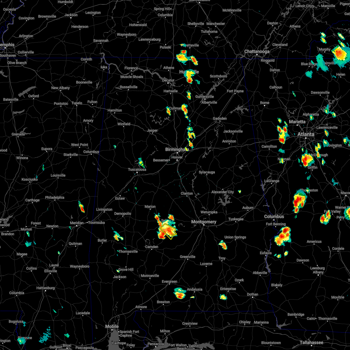 At 447 pm cdt, a severe thunderstorm was located near tyler, or 8 miles southeast of selmont-west selmont, moving west at 5 mph (radar indicated). Hazards include 60 mph wind gusts. Expect damage to roofs, siding, and trees. locations impacted include, selma, selmont-west selmont, old cahaba park, tyler, selma drag strip and craig field aiport. hail threat, radar indicated max hail size, <. 75 in wind threat, radar indicated max wind gust, 60 mph. At 447 pm cdt, a severe thunderstorm was located near tyler, or 8 miles southeast of selmont-west selmont, moving west at 5 mph (radar indicated). Hazards include 60 mph wind gusts. Expect damage to roofs, siding, and trees. locations impacted include, selma, selmont-west selmont, old cahaba park, tyler, selma drag strip and craig field aiport. hail threat, radar indicated max hail size, <. 75 in wind threat, radar indicated max wind gust, 60 mph.
|
| 6/15/2022 4:32 PM CDT |
 At 431 pm cdt, a severe thunderstorm was located near tyler, or 9 miles southeast of selmont-west selmont, moving southwest at 5 mph (radar indicated). Hazards include 60 mph wind gusts and penny size hail. a 60 mph wind gust was recently recorded at the selma airport. Expect damage to roofs, siding, and trees. locations impacted include, selma, selmont-west selmont, white hall, benton, old cahaba park, tyler, selma drag strip, collirene, edmund pettus bridge and craig field aiport. hail threat, radar indicated max hail size, 0. 75 in wind threat, radar indicated max wind gust, 60 mph. At 431 pm cdt, a severe thunderstorm was located near tyler, or 9 miles southeast of selmont-west selmont, moving southwest at 5 mph (radar indicated). Hazards include 60 mph wind gusts and penny size hail. a 60 mph wind gust was recently recorded at the selma airport. Expect damage to roofs, siding, and trees. locations impacted include, selma, selmont-west selmont, white hall, benton, old cahaba park, tyler, selma drag strip, collirene, edmund pettus bridge and craig field aiport. hail threat, radar indicated max hail size, 0. 75 in wind threat, radar indicated max wind gust, 60 mph.
|
| 6/15/2022 4:22 PM CDT |
 At 422 pm cdt, a severe thunderstorm was located over tyler, or 9 miles southeast of selmont-west selmont, moving southwest at 5 mph (radar indicated). Hazards include 60 mph wind gusts and penny size hail. expect damage to roofs, siding, and trees At 422 pm cdt, a severe thunderstorm was located over tyler, or 9 miles southeast of selmont-west selmont, moving southwest at 5 mph (radar indicated). Hazards include 60 mph wind gusts and penny size hail. expect damage to roofs, siding, and trees
|
| 4/13/2022 10:52 PM CDT |
 At 1051 pm cdt, severe thunderstorms were located along a line extending from near parnell to near potter station to near selmont-west selmont to 7 miles southeast of dannelly reservoir, moving east at 45 mph (radar indicated). Hazards include 70 mph wind gusts and penny size hail. Expect considerable tree damage. damage is likely to mobile homes, roofs, and outbuildings. Locations impacted include, selma, valley grande, selmont-west selmont, orrville, gardner island, tyler, old cahaba park, dannelly reservoir, dallas county horse arena, belknap, paul m grist state park, dallas lake, memorial stadium, burnsville, potter station, carlowville, hazen, minter, craig field aiport and valley creek junction. At 1051 pm cdt, severe thunderstorms were located along a line extending from near parnell to near potter station to near selmont-west selmont to 7 miles southeast of dannelly reservoir, moving east at 45 mph (radar indicated). Hazards include 70 mph wind gusts and penny size hail. Expect considerable tree damage. damage is likely to mobile homes, roofs, and outbuildings. Locations impacted include, selma, valley grande, selmont-west selmont, orrville, gardner island, tyler, old cahaba park, dannelly reservoir, dallas county horse arena, belknap, paul m grist state park, dallas lake, memorial stadium, burnsville, potter station, carlowville, hazen, minter, craig field aiport and valley creek junction.
|
| 4/13/2022 10:12 PM CDT |
 At 1012 pm cdt, severe thunderstorms were located along a line extending from 7 miles northeast of newbern to near uniontown to shawnee, moving east at 65 mph (radar indicated). Hazards include 70 mph wind gusts and penny size hail. Expect considerable tree damage. Damage is likely to mobile homes, roofs, and outbuildings. At 1012 pm cdt, severe thunderstorms were located along a line extending from 7 miles northeast of newbern to near uniontown to shawnee, moving east at 65 mph (radar indicated). Hazards include 70 mph wind gusts and penny size hail. Expect considerable tree damage. Damage is likely to mobile homes, roofs, and outbuildings.
|
| 4/6/2022 2:44 PM CDT |
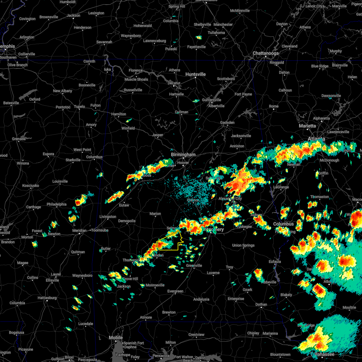 At 244 pm cdt, a severe thunderstorm was located over dannelly reservoir, or 14 miles north of camden, moving east at 25 mph (radar indicated). Hazards include 60 mph wind gusts and quarter size hail. Hail damage to vehicles is expected. Expect wind damage to roofs, siding, and trees. At 244 pm cdt, a severe thunderstorm was located over dannelly reservoir, or 14 miles north of camden, moving east at 25 mph (radar indicated). Hazards include 60 mph wind gusts and quarter size hail. Hail damage to vehicles is expected. Expect wind damage to roofs, siding, and trees.
|
| 4/5/2022 6:21 AM CDT |
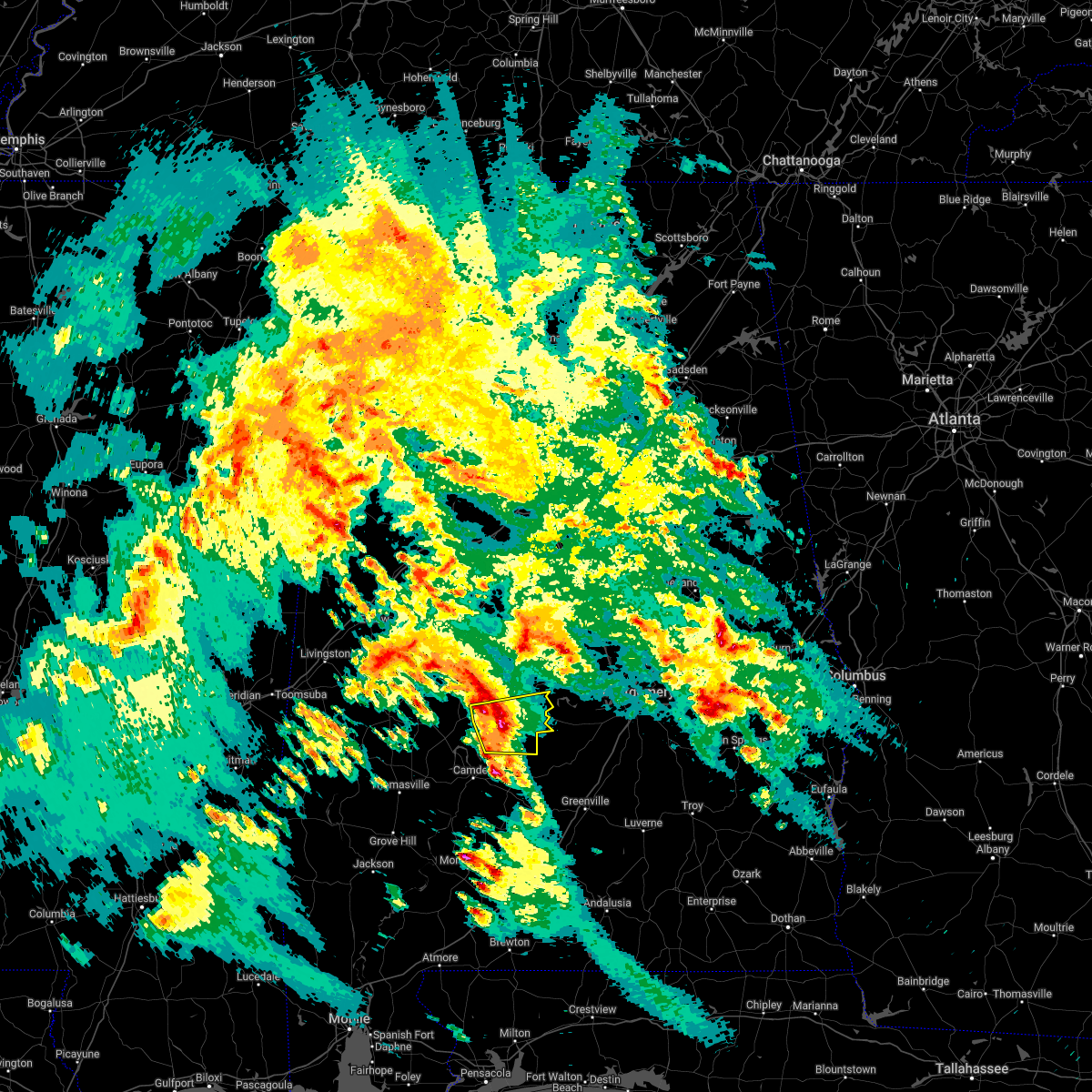 At 621 am cdt, a severe thunderstorm was located near dannelly reservoir, or 13 miles southwest of selmont-west selmont, moving east at 45 mph (radar indicated). Hazards include 60 mph wind gusts and nickel size hail. Expect damage to roofs, siding, and trees. locations impacted include, selma, selmont-west selmont, orrville, belknap, tyler, dallas lake, old cahaba park, dannelly reservoir, dallas county horse arena, skyharbor airport, whites bluff, hazen, craig field aiport and selma drag strip. hail threat, radar indicated max hail size, 0. 88 in wind threat, radar indicated max wind gust, 60 mph. At 621 am cdt, a severe thunderstorm was located near dannelly reservoir, or 13 miles southwest of selmont-west selmont, moving east at 45 mph (radar indicated). Hazards include 60 mph wind gusts and nickel size hail. Expect damage to roofs, siding, and trees. locations impacted include, selma, selmont-west selmont, orrville, belknap, tyler, dallas lake, old cahaba park, dannelly reservoir, dallas county horse arena, skyharbor airport, whites bluff, hazen, craig field aiport and selma drag strip. hail threat, radar indicated max hail size, 0. 88 in wind threat, radar indicated max wind gust, 60 mph.
|
| 4/5/2022 5:58 AM CDT |
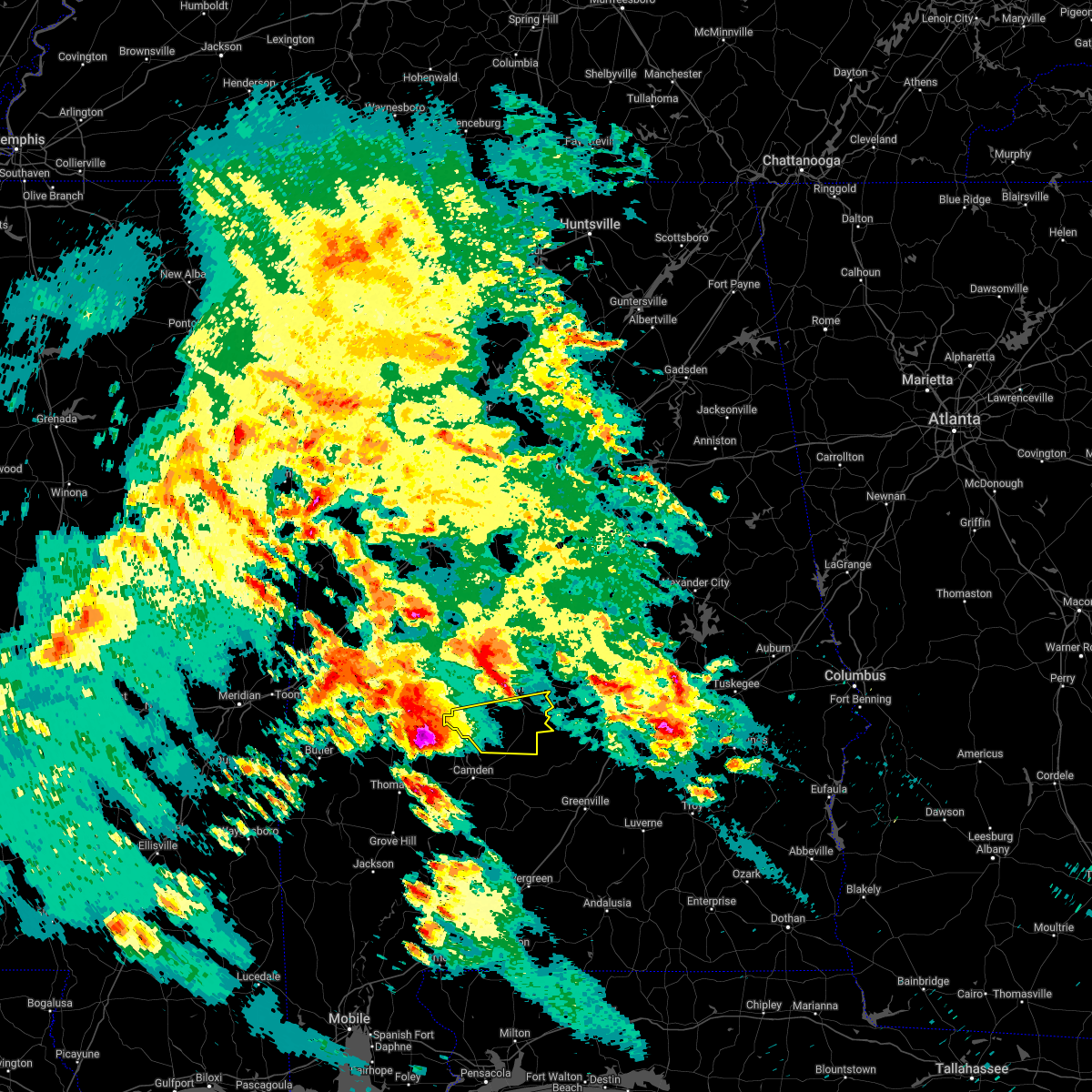 At 558 am cdt, a severe thunderstorm was located near consul, or 16 miles south of uniontown, moving east at 45 mph (radar indicated). Hazards include two inch hail and 60 mph wind gusts. People and animals outdoors will be injured. expect hail damage to roofs, siding, windows, and vehicles. Expect wind damage to roofs, siding, and trees. At 558 am cdt, a severe thunderstorm was located near consul, or 16 miles south of uniontown, moving east at 45 mph (radar indicated). Hazards include two inch hail and 60 mph wind gusts. People and animals outdoors will be injured. expect hail damage to roofs, siding, windows, and vehicles. Expect wind damage to roofs, siding, and trees.
|
| 2/3/2022 3:51 PM CST |
 At 350 pm cst, a severe thunderstorm capable of producing a tornado was located near tyler, or 7 miles southeast of selmont-west selmont, moving northeast at 40 mph (radar indicated rotation). Hazards include tornado. Flying debris will be dangerous to those caught without shelter. mobile homes will be damaged or destroyed. damage to roofs, windows, and vehicles will occur. Tree damage is likely. At 350 pm cst, a severe thunderstorm capable of producing a tornado was located near tyler, or 7 miles southeast of selmont-west selmont, moving northeast at 40 mph (radar indicated rotation). Hazards include tornado. Flying debris will be dangerous to those caught without shelter. mobile homes will be damaged or destroyed. damage to roofs, windows, and vehicles will occur. Tree damage is likely.
|
| 5/4/2021 5:45 PM CDT |
 At 545 pm cdt, severe thunderstorms were located along a line extending from near calera to 9 miles southeast of dannelly reservoir, moving east at 55 mph (radar indicated). Hazards include 60 mph wind gusts. Expect damage to roofs, siding, and trees. Locations impacted include, selma, valley grande, selmont-west selmont, orrville, bogue chitto, gardner island, parnell, tyler, central mills, old cahaba park, dannelly reservoir, dallas county horse arena, belknap, paul m grist state park, dallas lake, memorial stadium, marion junction, burnsville, potter station and stanton. At 545 pm cdt, severe thunderstorms were located along a line extending from near calera to 9 miles southeast of dannelly reservoir, moving east at 55 mph (radar indicated). Hazards include 60 mph wind gusts. Expect damage to roofs, siding, and trees. Locations impacted include, selma, valley grande, selmont-west selmont, orrville, bogue chitto, gardner island, parnell, tyler, central mills, old cahaba park, dannelly reservoir, dallas county horse arena, belknap, paul m grist state park, dallas lake, memorial stadium, marion junction, burnsville, potter station and stanton.
|
| 5/4/2021 5:17 PM CDT |
 At 517 pm cdt, severe thunderstorms were located along a line extending from near brent to pine hill, moving east at 55 mph (radar indicated). Hazards include 60 mph wind gusts. wind damage has been reported with this line of storms. Expect damage to roofs, siding, and trees. Locations impacted include, selma, brent, valley grande, marion, centreville, uniontown, selmont-west selmont, maplesville, orrville, newbern, bogue chitto, vaiden, parnell, tyler, dannelly reservoir, paul m grist state park, low gap, mertz, dallas lake and talladega national forest. At 517 pm cdt, severe thunderstorms were located along a line extending from near brent to pine hill, moving east at 55 mph (radar indicated). Hazards include 60 mph wind gusts. wind damage has been reported with this line of storms. Expect damage to roofs, siding, and trees. Locations impacted include, selma, brent, valley grande, marion, centreville, uniontown, selmont-west selmont, maplesville, orrville, newbern, bogue chitto, vaiden, parnell, tyler, dannelly reservoir, paul m grist state park, low gap, mertz, dallas lake and talladega national forest.
|
| 5/4/2021 5:00 PM CDT |
 At 500 pm cdt, severe thunderstorms were located along a line extending from near low gap to near dixons mill, moving east at 55 mph (radar indicated). Hazards include 60 mph wind gusts. wind damage has been reported with this line of storms. expect damage to roofs, siding, and trees At 500 pm cdt, severe thunderstorms were located along a line extending from near low gap to near dixons mill, moving east at 55 mph (radar indicated). Hazards include 60 mph wind gusts. wind damage has been reported with this line of storms. expect damage to roofs, siding, and trees
|
| 3/17/2021 7:14 PM CDT |
 At 713 pm cdt, a severe thunderstorm capable of producing a tornado was located over selma, moving northeast at 35 mph (radar indicated rotation). Hazards include tornado. Flying debris will be dangerous to those caught without shelter. mobile homes will be damaged or destroyed. damage to roofs, windows, and vehicles will occur. tree damage is likely. Locations impacted include, selma, selmont-west selmont, memorial stadium, gardner island, burnsville, edmund pettus bridge and selma university. At 713 pm cdt, a severe thunderstorm capable of producing a tornado was located over selma, moving northeast at 35 mph (radar indicated rotation). Hazards include tornado. Flying debris will be dangerous to those caught without shelter. mobile homes will be damaged or destroyed. damage to roofs, windows, and vehicles will occur. tree damage is likely. Locations impacted include, selma, selmont-west selmont, memorial stadium, gardner island, burnsville, edmund pettus bridge and selma university.
|
| 3/17/2021 7:03 PM CDT |
 At 702 pm cdt, a severe thunderstorm capable of producing a tornado was located over dallas county horse arena, or near selmont-west selmont, moving northeast at 35 mph (radar indicated rotation). Hazards include tornado. Flying debris will be dangerous to those caught without shelter. mobile homes will be damaged or destroyed. damage to roofs, windows, and vehicles will occur. tree damage is likely. Locations impacted include, selma, valley grande, selmont-west selmont, memorial stadium, gardner island, burnsville, dallas county horse arena, selma drag strip, skyharbor airport, edmund pettus bridge and selma university. At 702 pm cdt, a severe thunderstorm capable of producing a tornado was located over dallas county horse arena, or near selmont-west selmont, moving northeast at 35 mph (radar indicated rotation). Hazards include tornado. Flying debris will be dangerous to those caught without shelter. mobile homes will be damaged or destroyed. damage to roofs, windows, and vehicles will occur. tree damage is likely. Locations impacted include, selma, valley grande, selmont-west selmont, memorial stadium, gardner island, burnsville, dallas county horse arena, selma drag strip, skyharbor airport, edmund pettus bridge and selma university.
|
| 3/17/2021 6:54 PM CDT |
 At 653 pm cdt, a severe thunderstorm capable of producing a tornado was located over old cahaba park, or 9 miles southwest of selmont-west selmont, moving northeast at 30 mph (radar indicated rotation). Hazards include tornado. Flying debris will be dangerous to those caught without shelter. mobile homes will be damaged or destroyed. damage to roofs, windows, and vehicles will occur. tree damage is likely. Locations impacted include, selma, valley grande, selmont-west selmont, gardner island, old cahaba park, memorial stadium, burnsville, dallas county horse arena, skyharbor airport, hazen, craig field aiport, selma drag strip, edmund pettus bridge and selma university. At 653 pm cdt, a severe thunderstorm capable of producing a tornado was located over old cahaba park, or 9 miles southwest of selmont-west selmont, moving northeast at 30 mph (radar indicated rotation). Hazards include tornado. Flying debris will be dangerous to those caught without shelter. mobile homes will be damaged or destroyed. damage to roofs, windows, and vehicles will occur. tree damage is likely. Locations impacted include, selma, valley grande, selmont-west selmont, gardner island, old cahaba park, memorial stadium, burnsville, dallas county horse arena, skyharbor airport, hazen, craig field aiport, selma drag strip, edmund pettus bridge and selma university.
|
| 3/17/2021 6:48 PM CDT |
 At 648 pm cdt, a severe thunderstorm capable of producing a tornado was located near old cahaba park, or 11 miles southwest of selmont-west selmont, moving northeast at 30 mph (radar indicated rotation). Hazards include tornado. Flying debris will be dangerous to those caught without shelter. mobile homes will be damaged or destroyed. damage to roofs, windows, and vehicles will occur. Tree damage is likely. At 648 pm cdt, a severe thunderstorm capable of producing a tornado was located near old cahaba park, or 11 miles southwest of selmont-west selmont, moving northeast at 30 mph (radar indicated rotation). Hazards include tornado. Flying debris will be dangerous to those caught without shelter. mobile homes will be damaged or destroyed. damage to roofs, windows, and vehicles will occur. Tree damage is likely.
|
| 3/17/2021 4:25 PM CDT |
 At 425 pm cdt, a severe thunderstorm capable of producing a tornado was located over selma, moving northeast at 30 mph (radar indicated rotation). Hazards include tornado. Flying debris will be dangerous to those caught without shelter. mobile homes will be damaged or destroyed. damage to roofs, windows, and vehicles will occur. tree damage is likely. Locations impacted include, selma, valley grande, selmont-west selmont, memorial stadium, burnsville, dallas county horse arena, potter station, summerfield, valley creek junction, plantersville, edmund pettus bridge, selma university and barrett creek. At 425 pm cdt, a severe thunderstorm capable of producing a tornado was located over selma, moving northeast at 30 mph (radar indicated rotation). Hazards include tornado. Flying debris will be dangerous to those caught without shelter. mobile homes will be damaged or destroyed. damage to roofs, windows, and vehicles will occur. tree damage is likely. Locations impacted include, selma, valley grande, selmont-west selmont, memorial stadium, burnsville, dallas county horse arena, potter station, summerfield, valley creek junction, plantersville, edmund pettus bridge, selma university and barrett creek.
|
| 3/17/2021 4:12 PM CDT |
 At 412 pm cdt, a severe thunderstorm capable of producing a tornado was located over old cahaba park, or near selmont-west selmont, moving northeast at 35 mph (radar indicated rotation). Hazards include tornado. Flying debris will be dangerous to those caught without shelter. mobile homes will be damaged or destroyed. damage to roofs, windows, and vehicles will occur. Tree damage is likely. At 412 pm cdt, a severe thunderstorm capable of producing a tornado was located over old cahaba park, or near selmont-west selmont, moving northeast at 35 mph (radar indicated rotation). Hazards include tornado. Flying debris will be dangerous to those caught without shelter. mobile homes will be damaged or destroyed. damage to roofs, windows, and vehicles will occur. Tree damage is likely.
|
| 3/17/2021 12:31 PM CDT |
 At 1231 pm cdt, a severe thunderstorm capable of producing a tornado was located over selma, moving northeast at 30 mph (radar indicated rotation). Hazards include tornado. Flying debris will be dangerous to those caught without shelter. mobile homes will be damaged or destroyed. damage to roofs, windows, and vehicles will occur. tree damage is likely. Locations impacted include, selma, selmont-west selmont, memorial stadium, gardner island, burnsville, edmund pettus bridge and selma university. At 1231 pm cdt, a severe thunderstorm capable of producing a tornado was located over selma, moving northeast at 30 mph (radar indicated rotation). Hazards include tornado. Flying debris will be dangerous to those caught without shelter. mobile homes will be damaged or destroyed. damage to roofs, windows, and vehicles will occur. tree damage is likely. Locations impacted include, selma, selmont-west selmont, memorial stadium, gardner island, burnsville, edmund pettus bridge and selma university.
|
| 3/17/2021 12:22 PM CDT |
 At 1221 pm cdt, a severe thunderstorm capable of producing a tornado was located over selmont-west selmont, moving northeast at 30 mph (radar indicated rotation). Hazards include tornado. Flying debris will be dangerous to those caught without shelter. mobile homes will be damaged or destroyed. damage to roofs, windows, and vehicles will occur. tree damage is likely. Locations impacted include, selma, selmont-west selmont, memorial stadium, gardner island, burnsville, dallas county horse arena, selma drag strip, skyharbor airport, edmund pettus bridge, selma university and craig field aiport. At 1221 pm cdt, a severe thunderstorm capable of producing a tornado was located over selmont-west selmont, moving northeast at 30 mph (radar indicated rotation). Hazards include tornado. Flying debris will be dangerous to those caught without shelter. mobile homes will be damaged or destroyed. damage to roofs, windows, and vehicles will occur. tree damage is likely. Locations impacted include, selma, selmont-west selmont, memorial stadium, gardner island, burnsville, dallas county horse arena, selma drag strip, skyharbor airport, edmund pettus bridge, selma university and craig field aiport.
|
| 3/17/2021 12:13 PM CDT |
 At 1212 pm cdt, a severe thunderstorm capable of producing a tornado was located over old cahaba park, or near selmont-west selmont, moving northeast at 35 mph (radar indicated rotation). Hazards include tornado. Flying debris will be dangerous to those caught without shelter. mobile homes will be damaged or destroyed. damage to roofs, windows, and vehicles will occur. Tree damage is likely. At 1212 pm cdt, a severe thunderstorm capable of producing a tornado was located over old cahaba park, or near selmont-west selmont, moving northeast at 35 mph (radar indicated rotation). Hazards include tornado. Flying debris will be dangerous to those caught without shelter. mobile homes will be damaged or destroyed. damage to roofs, windows, and vehicles will occur. Tree damage is likely.
|
| 4/12/2020 10:16 PM CDT |
 At 1016 pm cdt, a severe thunderstorm was located over old cahaba park, or 7 miles southwest of selmont-west selmont, moving east at 60 mph (radar indicated). Hazards include 60 mph wind gusts. Expect damage to roofs, siding, and trees. Locations impacted include, selma, selmont-west selmont, orrville, belknap, gardner island, tyler, dallas lake, old cahaba park, memorial stadium, dannelly reservoir, burnsville, dallas county horse arena, potter station, skyharbor airport, tilden, whites bluff, carlowville, hazen, minter and craig field aiport. At 1016 pm cdt, a severe thunderstorm was located over old cahaba park, or 7 miles southwest of selmont-west selmont, moving east at 60 mph (radar indicated). Hazards include 60 mph wind gusts. Expect damage to roofs, siding, and trees. Locations impacted include, selma, selmont-west selmont, orrville, belknap, gardner island, tyler, dallas lake, old cahaba park, memorial stadium, dannelly reservoir, burnsville, dallas county horse arena, potter station, skyharbor airport, tilden, whites bluff, carlowville, hazen, minter and craig field aiport.
|
| 4/12/2020 10:02 PM CDT |
 At 1001 pm cdt, a severe thunderstorm was located 7 miles southeast of central mills, or 15 miles north of camden, moving northeast at 55 mph (radar indicated). Hazards include 60 mph wind gusts and penny size hail. expect damage to roofs, siding, and trees At 1001 pm cdt, a severe thunderstorm was located 7 miles southeast of central mills, or 15 miles north of camden, moving northeast at 55 mph (radar indicated). Hazards include 60 mph wind gusts and penny size hail. expect damage to roofs, siding, and trees
|
| 3/3/2020 6:43 AM CST |
 At 643 am cst, severe thunderstorms were located along a line extending from 9 miles east of heiberger to near marion junction, moving southeast at 40 mph (radar indicated). Hazards include 60 mph wind gusts and quarter size hail. Hail damage to vehicles is expected. Expect wind damage to roofs, siding, and trees. At 643 am cst, severe thunderstorms were located along a line extending from 9 miles east of heiberger to near marion junction, moving southeast at 40 mph (radar indicated). Hazards include 60 mph wind gusts and quarter size hail. Hail damage to vehicles is expected. Expect wind damage to roofs, siding, and trees.
|
| 2/6/2020 2:50 AM CST |
 At 249 am cst, a severe thunderstorm capable of producing a tornado was located near dallas lake, or 14 miles south of selmont-west selmont, moving northeast at 55 mph (radar indicated rotation). Hazards include tornado. Flying debris will be dangerous to those caught without shelter. mobile homes will be damaged or destroyed. damage to roofs, windows, and vehicles will occur. Tree damage is likely. At 249 am cst, a severe thunderstorm capable of producing a tornado was located near dallas lake, or 14 miles south of selmont-west selmont, moving northeast at 55 mph (radar indicated rotation). Hazards include tornado. Flying debris will be dangerous to those caught without shelter. mobile homes will be damaged or destroyed. damage to roofs, windows, and vehicles will occur. Tree damage is likely.
|
| 1/11/2020 1:32 PM CST |
 At 132 pm cst, severe thunderstorms were located along a line extending from near plecher to 7 miles southeast of dannelly reservoir, moving east at 45 mph (radar indicated). Hazards include 60 mph wind gusts. Expect damage to roofs, siding, and trees. Locations impacted include, selma, valley grande, selmont-west selmont, belknap, gardner island, tyler, dallas lake, old cahaba park, memorial stadium, dannelly reservoir, burnsville, dallas county horse arena, skyharbor airport, tilden, carlowville, minter, craig field aiport, valley creek junction, plantersville and selma drag strip. At 132 pm cst, severe thunderstorms were located along a line extending from near plecher to 7 miles southeast of dannelly reservoir, moving east at 45 mph (radar indicated). Hazards include 60 mph wind gusts. Expect damage to roofs, siding, and trees. Locations impacted include, selma, valley grande, selmont-west selmont, belknap, gardner island, tyler, dallas lake, old cahaba park, memorial stadium, dannelly reservoir, burnsville, dallas county horse arena, skyharbor airport, tilden, carlowville, minter, craig field aiport, valley creek junction, plantersville and selma drag strip.
|
| 1/11/2020 1:02 PM CST |
 At 102 pm cst, severe thunderstorms were located along a line extending from 6 miles east of marion to near pine hill, moving northeast at 55 mph (radar indicated). Hazards include 60 mph wind gusts. Expect damage to roofs, siding, and trees. Locations impacted include, selma, valley grande, selmont-west selmont, orrville, bogue chitto, gardner island, tyler, central mills, old cahaba park, dannelly reservoir, dallas county horse arena, belknap, paul m grist state park, dallas lake, memorial stadium, marion junction, burnsville, potter station, carlowville and safford. At 102 pm cst, severe thunderstorms were located along a line extending from 6 miles east of marion to near pine hill, moving northeast at 55 mph (radar indicated). Hazards include 60 mph wind gusts. Expect damage to roofs, siding, and trees. Locations impacted include, selma, valley grande, selmont-west selmont, orrville, bogue chitto, gardner island, tyler, central mills, old cahaba park, dannelly reservoir, dallas county horse arena, belknap, paul m grist state park, dallas lake, memorial stadium, marion junction, burnsville, potter station, carlowville and safford.
|
| 1/11/2020 12:47 PM CST |
 At 1247 pm cst, severe thunderstorms were located along a line extending from near uniontown to shawnee, moving east at 35 mph (radar indicated). Hazards include 60 mph wind gusts. expect damage to roofs, siding, and trees At 1247 pm cst, severe thunderstorms were located along a line extending from near uniontown to shawnee, moving east at 35 mph (radar indicated). Hazards include 60 mph wind gusts. expect damage to roofs, siding, and trees
|
| 6/7/2019 12:09 PM CDT |
 At 1156 am cdt, severe thunderstorms were located along a line extending from near valley grande to near selmont-west selmont to near belknap to 11 miles south of dallas lake, moving east at 35 mph (radar indicated). Hazards include 60 mph wind gusts. Expect damage to roofs, siding, and trees. Locations impacted include, selma, valley grande, selmont-west selmont, belknap, gardner island, tyler, memorial stadium, burnsville, tilden, carlowville, summerfield, minter, craig field aiport, selma drag strip, edmund pettus bridge, selma university, barrett creek and valley creek junction. At 1156 am cdt, severe thunderstorms were located along a line extending from near valley grande to near selmont-west selmont to near belknap to 11 miles south of dallas lake, moving east at 35 mph (radar indicated). Hazards include 60 mph wind gusts. Expect damage to roofs, siding, and trees. Locations impacted include, selma, valley grande, selmont-west selmont, belknap, gardner island, tyler, memorial stadium, burnsville, tilden, carlowville, summerfield, minter, craig field aiport, selma drag strip, edmund pettus bridge, selma university, barrett creek and valley creek junction.
|
| 6/7/2019 11:57 AM CDT |
 At 1156 am cdt, severe thunderstorms were located along a line extending from near valley grande to near selmont-west selmont to near belknap to 11 miles south of dallas lake, moving east at 35 mph (radar indicated). Hazards include 60 mph wind gusts. Expect damage to roofs, siding, and trees. Locations impacted include, selma, valley grande, selmont-west selmont, belknap, gardner island, tyler, memorial stadium, burnsville, tilden, carlowville, summerfield, minter, craig field aiport, selma drag strip, edmund pettus bridge, selma university, barrett creek and valley creek junction. At 1156 am cdt, severe thunderstorms were located along a line extending from near valley grande to near selmont-west selmont to near belknap to 11 miles south of dallas lake, moving east at 35 mph (radar indicated). Hazards include 60 mph wind gusts. Expect damage to roofs, siding, and trees. Locations impacted include, selma, valley grande, selmont-west selmont, belknap, gardner island, tyler, memorial stadium, burnsville, tilden, carlowville, summerfield, minter, craig field aiport, selma drag strip, edmund pettus bridge, selma university, barrett creek and valley creek junction.
|
| 6/7/2019 11:51 AM CDT |
 At 1150 am cdt, severe thunderstorms were located along a line extending from near potter station to near selmont-west selmont to near belknap to 11 miles southeast of dannelly reservoir, moving east at 45 mph (radar indicated). Hazards include 60 mph wind gusts. expect damage to roofs, siding, and trees At 1150 am cdt, severe thunderstorms were located along a line extending from near potter station to near selmont-west selmont to near belknap to 11 miles southeast of dannelly reservoir, moving east at 45 mph (radar indicated). Hazards include 60 mph wind gusts. expect damage to roofs, siding, and trees
|
| 5/4/2019 4:13 PM CDT |
 At 413 pm cdt, severe thunderstorms were located along a line extending from old cahaba park to 6 miles southeast of belknap, moving northeast at 45 mph (radar indicated). Hazards include 60 mph wind gusts. Expect damage to roofs, siding, and trees. Locations impacted include, selma, selmont-west selmont, dallas lake, belknap, gardner island, burnsville, tyler, selma drag strip and craig field aiport. At 413 pm cdt, severe thunderstorms were located along a line extending from old cahaba park to 6 miles southeast of belknap, moving northeast at 45 mph (radar indicated). Hazards include 60 mph wind gusts. Expect damage to roofs, siding, and trees. Locations impacted include, selma, selmont-west selmont, dallas lake, belknap, gardner island, burnsville, tyler, selma drag strip and craig field aiport.
|
| 5/4/2019 4:05 PM CDT |
 At 405 pm cdt, severe thunderstorms were located along a line extending from 6 miles northeast of dannelly reservoir to 7 miles south of belknap, moving northeast at 45 mph (radar indicated). Hazards include 60 mph wind gusts. Expect damage to roofs, siding, and trees. Locations impacted include, selma, selmont-west selmont, dallas lake, belknap, gardner island, burnsville, tyler, dannelly reservoir, selma drag strip and craig field aiport. At 405 pm cdt, severe thunderstorms were located along a line extending from 6 miles northeast of dannelly reservoir to 7 miles south of belknap, moving northeast at 45 mph (radar indicated). Hazards include 60 mph wind gusts. Expect damage to roofs, siding, and trees. Locations impacted include, selma, selmont-west selmont, dallas lake, belknap, gardner island, burnsville, tyler, dannelly reservoir, selma drag strip and craig field aiport.
|
| 5/4/2019 3:53 PM CDT |
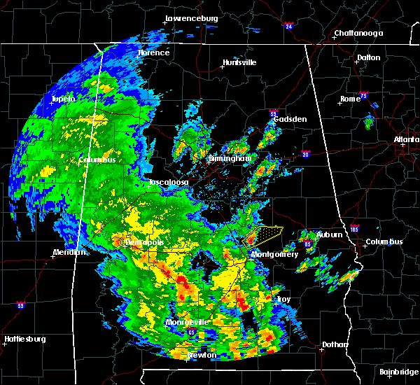 At 353 pm cdt, a severe thunderstorm was located near dannelly reservoir, or 13 miles northeast of camden, moving northeast at 45 mph (radar indicated). Hazards include 60 mph wind gusts. expect damage to roofs, siding, and trees At 353 pm cdt, a severe thunderstorm was located near dannelly reservoir, or 13 miles northeast of camden, moving northeast at 45 mph (radar indicated). Hazards include 60 mph wind gusts. expect damage to roofs, siding, and trees
|
| 3/25/2019 6:34 PM CDT |
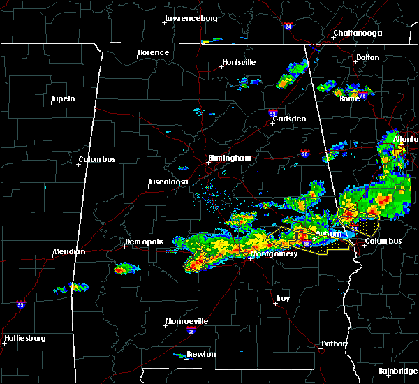 At 634 pm cdt, severe thunderstorms were located along a line extending from near gardner island to tyler to near belknap, moving east at 45 mph (radar indicated). Hazards include 60 mph wind gusts. Expect damage to roofs, siding, and trees. Locations impacted include, gardner island, tyler, selma drag strip and craig field aiport. At 634 pm cdt, severe thunderstorms were located along a line extending from near gardner island to tyler to near belknap, moving east at 45 mph (radar indicated). Hazards include 60 mph wind gusts. Expect damage to roofs, siding, and trees. Locations impacted include, gardner island, tyler, selma drag strip and craig field aiport.
|
| 3/25/2019 6:33 PM CDT | Trees down near county road 130 and al highway 4 in dallas county AL, 7.3 miles N of Selmont-West Selmont, AL |
| 3/25/2019 6:25 PM CDT |
 At 625 pm cdt, severe thunderstorms were located along a line extending from near selma to selmont-west selmont to near old cahaba park, moving east at 45 mph (radar indicated). Hazards include 60 mph wind gusts. Expect damage to roofs, siding, and trees. Locations impacted include, selma, selmont-west selmont, old cahaba park, memorial stadium, gardner island, dallas county horse arena, tyler, selma drag strip, edmund pettus bridge, selma university and craig field aiport. At 625 pm cdt, severe thunderstorms were located along a line extending from near selma to selmont-west selmont to near old cahaba park, moving east at 45 mph (radar indicated). Hazards include 60 mph wind gusts. Expect damage to roofs, siding, and trees. Locations impacted include, selma, selmont-west selmont, old cahaba park, memorial stadium, gardner island, dallas county horse arena, tyler, selma drag strip, edmund pettus bridge, selma university and craig field aiport.
|
| 3/25/2019 6:17 PM CDT |
 At 616 pm cdt, severe thunderstorms were located along a line extending from 8 miles northwest of dallas county horse arena to near potter station to near orrville, moving east at 45 mph (radar indicated). Hazards include 60 mph wind gusts. Expect damage to roofs, siding, and trees. Locations impacted include, selma, selmont-west selmont, orrville, gardner island, tyler, old cahaba park, memorial stadium, dallas county horse arena, potter station, skyharbor airport, hazen, craig field aiport, selma drag strip, edmund pettus bridge and selma university. At 616 pm cdt, severe thunderstorms were located along a line extending from 8 miles northwest of dallas county horse arena to near potter station to near orrville, moving east at 45 mph (radar indicated). Hazards include 60 mph wind gusts. Expect damage to roofs, siding, and trees. Locations impacted include, selma, selmont-west selmont, orrville, gardner island, tyler, old cahaba park, memorial stadium, dallas county horse arena, potter station, skyharbor airport, hazen, craig field aiport, selma drag strip, edmund pettus bridge and selma university.
|
| 3/25/2019 6:11 PM CDT |
 At 611 pm cdt, severe thunderstorms were located along a line extending from 7 miles northeast of marion junction to near potter station to near bogue chitto, moving east at 40 mph (radar indicated). Hazards include 60 mph wind gusts. Expect damage to roofs, siding, and trees. Locations impacted include, selma, selmont-west selmont, orrville, bogue chitto, gardner island, tyler, old cahaba park, memorial stadium, burnsville, dallas county horse arena, potter station, skyharbor airport, hazen, craig field aiport, selma drag strip, edmund pettus bridge and selma university. At 611 pm cdt, severe thunderstorms were located along a line extending from 7 miles northeast of marion junction to near potter station to near bogue chitto, moving east at 40 mph (radar indicated). Hazards include 60 mph wind gusts. Expect damage to roofs, siding, and trees. Locations impacted include, selma, selmont-west selmont, orrville, bogue chitto, gardner island, tyler, old cahaba park, memorial stadium, burnsville, dallas county horse arena, potter station, skyharbor airport, hazen, craig field aiport, selma drag strip, edmund pettus bridge and selma university.
|
| 3/25/2019 6:01 PM CDT |
 At 601 pm cdt, severe thunderstorms were located along a line extending from near vaiden to near bogue chitto, moving east at 45 mph (radar indicated). Hazards include 60 mph wind gusts. expect damage to roofs, siding, and trees At 601 pm cdt, severe thunderstorms were located along a line extending from near vaiden to near bogue chitto, moving east at 45 mph (radar indicated). Hazards include 60 mph wind gusts. expect damage to roofs, siding, and trees
|
| 3/25/2019 5:47 PM CDT |
 At 546 pm cdt, a severe thunderstorm was located near valley grande, moving southeast at 45 mph (radar indicated). Hazards include 60 mph wind gusts and penny size hail. expect damage to roofs, siding, and trees At 546 pm cdt, a severe thunderstorm was located near valley grande, moving southeast at 45 mph (radar indicated). Hazards include 60 mph wind gusts and penny size hail. expect damage to roofs, siding, and trees
|
| 3/14/2019 7:50 PM CDT |
 At 750 pm cdt, a severe thunderstorm capable of producing a tornado was located near bogue chitto, or 13 miles west of selma, moving east at 35 mph (radar indicated rotation). Hazards include tornado. Flying debris will be dangerous to those caught without shelter. mobile homes will be damaged or destroyed. damage to roofs, windows, and vehicles will occur. tree damage is likely. Locations impacted include, selma, selmont-west selmont, memorial stadium, marion junction, dallas county horse arena, potter station and suttle. At 750 pm cdt, a severe thunderstorm capable of producing a tornado was located near bogue chitto, or 13 miles west of selma, moving east at 35 mph (radar indicated rotation). Hazards include tornado. Flying debris will be dangerous to those caught without shelter. mobile homes will be damaged or destroyed. damage to roofs, windows, and vehicles will occur. tree damage is likely. Locations impacted include, selma, selmont-west selmont, memorial stadium, marion junction, dallas county horse arena, potter station and suttle.
|
| 3/14/2019 7:39 PM CDT |
 At 739 pm cdt, a severe thunderstorm capable of producing a tornado was located near bogue chitto, or 10 miles southeast of uniontown, moving east at 35 mph (radar indicated rotation). Hazards include tornado. Flying debris will be dangerous to those caught without shelter. mobile homes will be damaged or destroyed. damage to roofs, windows, and vehicles will occur. tree damage is likely. Locations impacted include, selma, selmont-west selmont, memorial stadium, bogue chitto, marion junction, dallas county horse arena, potter station, suttle, skyharbor airport, radford and hazen. At 739 pm cdt, a severe thunderstorm capable of producing a tornado was located near bogue chitto, or 10 miles southeast of uniontown, moving east at 35 mph (radar indicated rotation). Hazards include tornado. Flying debris will be dangerous to those caught without shelter. mobile homes will be damaged or destroyed. damage to roofs, windows, and vehicles will occur. tree damage is likely. Locations impacted include, selma, selmont-west selmont, memorial stadium, bogue chitto, marion junction, dallas county horse arena, potter station, suttle, skyharbor airport, radford and hazen.
|
| 3/14/2019 7:26 PM CDT |
 At 726 pm cdt, a severe thunderstorm capable of producing a tornado was located near central mills, or near uniontown, moving east at 30 mph (radar indicated rotation). Hazards include tornado. Flying debris will be dangerous to those caught without shelter. mobile homes will be damaged or destroyed. damage to roofs, windows, and vehicles will occur. tree damage is likely. Locations impacted include, selma, selmont-west selmont, memorial stadium, bogue chitto, marion junction, dallas county horse arena, potter station, suttle, skyharbor airport, radford and hazen. At 726 pm cdt, a severe thunderstorm capable of producing a tornado was located near central mills, or near uniontown, moving east at 30 mph (radar indicated rotation). Hazards include tornado. Flying debris will be dangerous to those caught without shelter. mobile homes will be damaged or destroyed. damage to roofs, windows, and vehicles will occur. tree damage is likely. Locations impacted include, selma, selmont-west selmont, memorial stadium, bogue chitto, marion junction, dallas county horse arena, potter station, suttle, skyharbor airport, radford and hazen.
|
| 3/14/2019 7:15 PM CDT |
 At 714 pm cdt, a severe thunderstorm capable of producing a tornado was located near consul, or 7 miles south of uniontown, moving east at 35 mph (radar indicated rotation). Hazards include tornado. Flying debris will be dangerous to those caught without shelter. mobile homes will be damaged or destroyed. damage to roofs, windows, and vehicles will occur. Tree damage is likely. At 714 pm cdt, a severe thunderstorm capable of producing a tornado was located near consul, or 7 miles south of uniontown, moving east at 35 mph (radar indicated rotation). Hazards include tornado. Flying debris will be dangerous to those caught without shelter. mobile homes will be damaged or destroyed. damage to roofs, windows, and vehicles will occur. Tree damage is likely.
|
| 1/19/2019 1:46 PM CST |
 At 146 pm cst, a severe thunderstorm capable of producing a tornado was located over tyler, or near selmont-west selmont, moving northeast at 55 mph (radar indicated rotation). Hazards include tornado. Flying debris will be dangerous to those caught without shelter. mobile homes will be damaged or destroyed. damage to roofs, windows, and vehicles will occur. Tree damage is likely. At 146 pm cst, a severe thunderstorm capable of producing a tornado was located over tyler, or near selmont-west selmont, moving northeast at 55 mph (radar indicated rotation). Hazards include tornado. Flying debris will be dangerous to those caught without shelter. mobile homes will be damaged or destroyed. damage to roofs, windows, and vehicles will occur. Tree damage is likely.
|
| 6/28/2018 4:56 PM CDT |
 At 456 pm cdt, severe thunderstorms were located along a line extending from near newbern to near dublin, moving south at 40 mph (radar indicated). Hazards include 60 mph wind gusts. expect damage to roofs, siding, and trees At 456 pm cdt, severe thunderstorms were located along a line extending from near newbern to near dublin, moving south at 40 mph (radar indicated). Hazards include 60 mph wind gusts. expect damage to roofs, siding, and trees
|
| 6/28/2018 4:48 PM CDT |
 At 447 pm cdt, severe thunderstorms were located along a line extending from near moundville to burnsville to near pintlala, moving south at 40 mph (radar indicated). Hazards include 60 mph wind gusts and penny size hail. Expect damage to roofs, siding, and trees. Locations impacted include, southwestern montgomery, selma, valley grande, marion, mosses, hayneville, selmont-west selmont, autaugaville, white hall, lowndesboro, benton, hyundai motors of alabama, gardner island, tyler, heiberger, davenport, pintlala, mulberry, paul m grist state park and hope hull. At 447 pm cdt, severe thunderstorms were located along a line extending from near moundville to burnsville to near pintlala, moving south at 40 mph (radar indicated). Hazards include 60 mph wind gusts and penny size hail. Expect damage to roofs, siding, and trees. Locations impacted include, southwestern montgomery, selma, valley grande, marion, mosses, hayneville, selmont-west selmont, autaugaville, white hall, lowndesboro, benton, hyundai motors of alabama, gardner island, tyler, heiberger, davenport, pintlala, mulberry, paul m grist state park and hope hull.
|
| 6/28/2018 4:27 PM CDT |
 At 427 pm cdt, severe thunderstorms were located along a line extending from tuscaloosa regional airport to near parnell to montgomery, moving south at 40 mph (radar indicated). Hazards include 60 mph wind gusts and penny size hail. expect damage to roofs, siding, and trees At 427 pm cdt, severe thunderstorms were located along a line extending from tuscaloosa regional airport to near parnell to montgomery, moving south at 40 mph (radar indicated). Hazards include 60 mph wind gusts and penny size hail. expect damage to roofs, siding, and trees
|
| 6/28/2018 4:02 PM CDT |
 At 402 pm cdt, severe thunderstorms were located along a line extending from near low gap to brent to near lawley, moving southwest at 45 mph (radar indicated). Hazards include 60 to 70 mph wind gusts. Expect considerable tree damage. Damage is likely to mobile homes, roofs, and outbuildings. At 402 pm cdt, severe thunderstorms were located along a line extending from near low gap to brent to near lawley, moving southwest at 45 mph (radar indicated). Hazards include 60 to 70 mph wind gusts. Expect considerable tree damage. Damage is likely to mobile homes, roofs, and outbuildings.
|
| 1/22/2017 11:57 AM CST |
 At 1156 am cst, severe thunderstorms were located along a line extending from near parnell to mulberry to near tyler to 12 miles south of gordonville to 7 miles northwest of i65 and al 106, moving northeast at 60 mph (radar indicated). Hazards include 60 mph wind gusts and quarter size hail. Hail damage to vehicles is expected. Expect wind damage to roofs, siding, and trees. At 1156 am cst, severe thunderstorms were located along a line extending from near parnell to mulberry to near tyler to 12 miles south of gordonville to 7 miles northwest of i65 and al 106, moving northeast at 60 mph (radar indicated). Hazards include 60 mph wind gusts and quarter size hail. Hail damage to vehicles is expected. Expect wind damage to roofs, siding, and trees.
|
| 1/21/2017 6:45 AM CST | Tree down across car in sardis... al. time estimated by rada in dallas county AL, 6.6 miles N of Selmont-West Selmont, AL |
| 6/17/2016 4:59 PM CDT |
 At 458 pm cdt, severe thunderstorms were located along a line extending from near deatsville to benton to near sweet water, moving southeast at 30 mph (radar indicated). Hazards include 60 mph wind gusts. Expect damage to roofs. siding. and trees. Locations impacted include, prattville, millbrook, deatsville, autaugaville, thomaston, sweet water, orrville, benton, dixons mill, wayne, central mills, putnam, dallas lake, nanafalia, magnolia, old cahaba park, surginer, autauga county airport, vineland and dannelly reservoir. At 458 pm cdt, severe thunderstorms were located along a line extending from near deatsville to benton to near sweet water, moving southeast at 30 mph (radar indicated). Hazards include 60 mph wind gusts. Expect damage to roofs. siding. and trees. Locations impacted include, prattville, millbrook, deatsville, autaugaville, thomaston, sweet water, orrville, benton, dixons mill, wayne, central mills, putnam, dallas lake, nanafalia, magnolia, old cahaba park, surginer, autauga county airport, vineland and dannelly reservoir.
|
| 6/17/2016 4:45 PM CDT |
 At 445 pm cdt, severe thunderstorms were located along a line extending from near marbury to near tyler to myrtlewood, moving south at 40 mph (radar indicated). Hazards include 60 mph wind gusts. Expect damage to roofs. siding. and trees. Locations impacted include, prattville, selma, millbrook, linden, selmont-west selmont, deatsville, autaugaville, thomaston, sweet water, orrville, myrtlewood, dayton, benton, bogue chitto, memorial stadium, vida junction, marbury, dallas county horse arena, dallas lake and magnolia. At 445 pm cdt, severe thunderstorms were located along a line extending from near marbury to near tyler to myrtlewood, moving south at 40 mph (radar indicated). Hazards include 60 mph wind gusts. Expect damage to roofs. siding. and trees. Locations impacted include, prattville, selma, millbrook, linden, selmont-west selmont, deatsville, autaugaville, thomaston, sweet water, orrville, myrtlewood, dayton, benton, bogue chitto, memorial stadium, vida junction, marbury, dallas county horse arena, dallas lake and magnolia.
|
| 6/17/2016 4:28 PM CDT |
 At 428 pm cdt, severe thunderstorms were located along a line extending from near higgins ferry park to selma to 7 miles south of coatopa, moving southeast at 45 mph (radar indicated). Hazards include 60 mph wind gusts. Expect damage to roofs. siding. and trees. Locations impacted include, prattville, selma, millbrook, demopolis, valley grande, linden, uniontown, selmont-west selmont, jefferson, deatsville, autaugaville, thomaston, sweet water, orrville, billingsley, myrtlewood, faunsdale, dayton, benton and bogue chitto. At 428 pm cdt, severe thunderstorms were located along a line extending from near higgins ferry park to selma to 7 miles south of coatopa, moving southeast at 45 mph (radar indicated). Hazards include 60 mph wind gusts. Expect damage to roofs. siding. and trees. Locations impacted include, prattville, selma, millbrook, demopolis, valley grande, linden, uniontown, selmont-west selmont, jefferson, deatsville, autaugaville, thomaston, sweet water, orrville, billingsley, myrtlewood, faunsdale, dayton, benton and bogue chitto.
|
| 6/17/2016 4:09 PM CDT |
 At 409 pm cdt, severe thunderstorms were located along a line extending from near calera to near marion to near tishabee, moving south at 25 mph (radar indicated). Hazards include 60 mph wind gusts. Expect damage to roofs. siding. And trees. At 409 pm cdt, severe thunderstorms were located along a line extending from near calera to near marion to near tishabee, moving south at 25 mph (radar indicated). Hazards include 60 mph wind gusts. Expect damage to roofs. siding. And trees.
|
| 4/6/2016 10:11 PM CDT |
 At 1011 pm cdt, a severe thunderstorm was located near dallas lake, or 8 miles south of selmont-west selmont, moving southeast at 40 mph (radar indicated). Hazards include 60 mph wind gusts and quarter size hail. Hail damage to vehicles is expected. Expect wind damage to roofs, siding, and trees. At 1011 pm cdt, a severe thunderstorm was located near dallas lake, or 8 miles south of selmont-west selmont, moving southeast at 40 mph (radar indicated). Hazards include 60 mph wind gusts and quarter size hail. Hail damage to vehicles is expected. Expect wind damage to roofs, siding, and trees.
|
| 3/1/2016 7:19 PM CST |
 At 719 pm cst, severe thunderstorms were located along a line extending from near belknap to near gardner island to near booth, moving east at 50 mph (radar indicated). Hazards include 60 mph wind gusts and quarter size hail. Hail damage to vehicles is expected. expect wind damage to roofs, siding and trees. locations impacted include, prattville, selma, millbrook, mosses, hayneville, selmont-west selmont, deatsville, autaugaville, white hall, gordonville, billingsley, lowndesboro, benton, memorial stadium, burnsville, vida junction, dallas county horse arena, dallas lake, old cahaba park and autauga county airport. This includes interstate 65 mile marker 158 and near mile marker 186. At 719 pm cst, severe thunderstorms were located along a line extending from near belknap to near gardner island to near booth, moving east at 50 mph (radar indicated). Hazards include 60 mph wind gusts and quarter size hail. Hail damage to vehicles is expected. expect wind damage to roofs, siding and trees. locations impacted include, prattville, selma, millbrook, mosses, hayneville, selmont-west selmont, deatsville, autaugaville, white hall, gordonville, billingsley, lowndesboro, benton, memorial stadium, burnsville, vida junction, dallas county horse arena, dallas lake, old cahaba park and autauga county airport. This includes interstate 65 mile marker 158 and near mile marker 186.
|
| 3/1/2016 7:02 PM CST |
 At 701 pm cst, severe thunderstorms were located along a line extending from five points to near burnsville, moving east at 50 mph (radar indicated). Hazards include 60 mph wind gusts and quarter size hail. Hail damage to vehicles is expected. Expect wind damage to roofs, siding and trees. At 701 pm cst, severe thunderstorms were located along a line extending from five points to near burnsville, moving east at 50 mph (radar indicated). Hazards include 60 mph wind gusts and quarter size hail. Hail damage to vehicles is expected. Expect wind damage to roofs, siding and trees.
|
| 2/23/2016 8:45 PM CST |
 At 845 pm cst, severe thunderstorms were located along a line extending from burnsville to 6 miles east of belknap, moving northeast at 50 mph (radar indicated). Hazards include 60 mph wind gusts. Expect damage to roofs. Siding and trees. At 845 pm cst, severe thunderstorms were located along a line extending from burnsville to 6 miles east of belknap, moving northeast at 50 mph (radar indicated). Hazards include 60 mph wind gusts. Expect damage to roofs. Siding and trees.
|
| 2/23/2016 8:34 PM CST |
 At 834 pm cst, a severe thunderstorm was located near old cahaba park, or near selmont-west selmont, moving northeast at 60 mph (radar indicated). Hazards include 60 mph wind gusts. Expect damage to roofs. siding and trees. locations impacted include, selma, valley grande, selmont-west selmont, old cahaba park, memorial stadium, burnsville, gardner island, belknap, dallas county horse arena, tyler, dallas lake, selma drag strip, valley creek junction, barrett creek, skyharbor airport, craig field aiport, edmund pettus bridge and selma university. A tornado watch remains in effect until midnight cst for southern alabama. At 834 pm cst, a severe thunderstorm was located near old cahaba park, or near selmont-west selmont, moving northeast at 60 mph (radar indicated). Hazards include 60 mph wind gusts. Expect damage to roofs. siding and trees. locations impacted include, selma, valley grande, selmont-west selmont, old cahaba park, memorial stadium, burnsville, gardner island, belknap, dallas county horse arena, tyler, dallas lake, selma drag strip, valley creek junction, barrett creek, skyharbor airport, craig field aiport, edmund pettus bridge and selma university. A tornado watch remains in effect until midnight cst for southern alabama.
|
| 2/23/2016 8:14 PM CST |
 At 813 pm cst, severe thunderstorms were located along a line extending from near potter station to near old cahaba park to near camden, moving northeast at 45 mph (radar indicated). Hazards include 60 mph wind gusts and penny size hail. Expect damage to roofs. siding and trees. locations impacted include, selma, valley grande, selmont-west selmont, orrville, memorial stadium, burnsville, paul m grist state park, dallas county horse arena, dallas lake, old cahaba park, dannelly reservoir, gardner island, belknap, tyler, potter station, valley creek junction, barrett creek, skyharbor airport, whites bluff and carlowville. A tornado watch remains in effect until midnight cst for southern alabama. At 813 pm cst, severe thunderstorms were located along a line extending from near potter station to near old cahaba park to near camden, moving northeast at 45 mph (radar indicated). Hazards include 60 mph wind gusts and penny size hail. Expect damage to roofs. siding and trees. locations impacted include, selma, valley grande, selmont-west selmont, orrville, memorial stadium, burnsville, paul m grist state park, dallas county horse arena, dallas lake, old cahaba park, dannelly reservoir, gardner island, belknap, tyler, potter station, valley creek junction, barrett creek, skyharbor airport, whites bluff and carlowville. A tornado watch remains in effect until midnight cst for southern alabama.
|
| 2/23/2016 8:05 PM CST |
 At 805 pm cst, severe thunderstorms were located along a line extending from near heiberger to near orrville to near yellow bluff, moving northeast at 50 mph (radar indicated). Hazards include 70 mph wind gusts and quarter size hail. Hail damage to vehicles is expected. expect considerable tree damage. wind damage is also likely to mobile homes, roofs and outbuildings. locations impacted include, selma, valley grande, marion, selmont-west selmont, orrville, bogue chitto, memorial stadium, burnsville, paul m grist state park, dallas county horse arena, dallas lake, heiberger, old cahaba park, dannelly reservoir, gardner island, belknap, tyler, potter station, valley creek junction and sprott. A tornado watch remains in effect until midnight cst for southern alabama. At 805 pm cst, severe thunderstorms were located along a line extending from near heiberger to near orrville to near yellow bluff, moving northeast at 50 mph (radar indicated). Hazards include 70 mph wind gusts and quarter size hail. Hail damage to vehicles is expected. expect considerable tree damage. wind damage is also likely to mobile homes, roofs and outbuildings. locations impacted include, selma, valley grande, marion, selmont-west selmont, orrville, bogue chitto, memorial stadium, burnsville, paul m grist state park, dallas county horse arena, dallas lake, heiberger, old cahaba park, dannelly reservoir, gardner island, belknap, tyler, potter station, valley creek junction and sprott. A tornado watch remains in effect until midnight cst for southern alabama.
|
| 2/23/2016 7:56 PM CST |
 At 756 pm cst, severe thunderstorms were located along a line extending from 6 miles northwest of marion to near orrville to 7 miles south of yellow bluff, moving northeast at 40 mph (radar indicated). Hazards include 70 mph wind gusts and quarter size hail. Hail damage to vehicles is expected. expect considerable tree damage. wind damage is also likely to mobile homes, roofs and outbuildings. locations impacted include, selma, valley grande, marion, selmont-west selmont, orrville, bogue chitto, memorial stadium, burnsville, marion junction, vaiden, paul m grist state park, central mills, dallas county horse arena, dallas lake, heiberger, old cahaba park, dannelly reservoir, gardner island, belknap and tyler. A tornado watch remains in effect until midnight cst for southwestern alabama. At 756 pm cst, severe thunderstorms were located along a line extending from 6 miles northwest of marion to near orrville to 7 miles south of yellow bluff, moving northeast at 40 mph (radar indicated). Hazards include 70 mph wind gusts and quarter size hail. Hail damage to vehicles is expected. expect considerable tree damage. wind damage is also likely to mobile homes, roofs and outbuildings. locations impacted include, selma, valley grande, marion, selmont-west selmont, orrville, bogue chitto, memorial stadium, burnsville, marion junction, vaiden, paul m grist state park, central mills, dallas county horse arena, dallas lake, heiberger, old cahaba park, dannelly reservoir, gardner island, belknap and tyler. A tornado watch remains in effect until midnight cst for southwestern alabama.
|
| 2/23/2016 7:39 PM CST |
 At 739 pm cst, severe thunderstorms were located along a line extending from near newbern to central mills to near yellow bluff, moving northeast at 50 mph (radar indicated). Hazards include 70 mph wind gusts and quarter size hail. Hail damage to vehicles is expected. expect considerable tree damage. Wind damage is also likely to mobile homes, roofs and outbuildings. At 739 pm cst, severe thunderstorms were located along a line extending from near newbern to central mills to near yellow bluff, moving northeast at 50 mph (radar indicated). Hazards include 70 mph wind gusts and quarter size hail. Hail damage to vehicles is expected. expect considerable tree damage. Wind damage is also likely to mobile homes, roofs and outbuildings.
|
| 2/15/2016 5:02 PM CST |
 At 502 pm cst, severe thunderstorms were located along a line extending from near centreville to 8 miles southwest of belknap, moving east at 45 mph (radar indicated). Hazards include 60 mph wind gusts. Expect damage to roofs. siding and trees. locations impacted include, selma, valley grande, centreville, selmont-west selmont, brierfield ironworks park, memorial stadium, burnsville, talladega national forest, ashby, paul m grist state park, dallas county horse arena, dallas lake, old cahaba park, gardner island, belknap, lawley, tyler, potter station, dannelly reservoir and randolph. A tornado watch remains in effect until 900 pm cst for southern alabama. At 502 pm cst, severe thunderstorms were located along a line extending from near centreville to 8 miles southwest of belknap, moving east at 45 mph (radar indicated). Hazards include 60 mph wind gusts. Expect damage to roofs. siding and trees. locations impacted include, selma, valley grande, centreville, selmont-west selmont, brierfield ironworks park, memorial stadium, burnsville, talladega national forest, ashby, paul m grist state park, dallas county horse arena, dallas lake, old cahaba park, gardner island, belknap, lawley, tyler, potter station, dannelly reservoir and randolph. A tornado watch remains in effect until 900 pm cst for southern alabama.
|
| 2/15/2016 4:45 PM CST |
 At 445 pm cst, severe thunderstorms were located along a line extending from near centreville to 7 miles east of catherine, moving east at 55 mph (radar indicated). Hazards include 60 mph wind gusts. Expect damage to roofs. siding and trees. locations impacted include, selma, brent, valley grande, marion, centreville, selmont-west selmont, orrville, bogue chitto, brierfield ironworks park, memorial stadium, talladega national forest, ashby, vaiden, paul m grist state park, dallas county horse arena, dallas lake, heiberger, old cahaba park, dannelly reservoir and gardner island. A tornado watch remains in effect until 900 pm cst for southern alabama. At 445 pm cst, severe thunderstorms were located along a line extending from near centreville to 7 miles east of catherine, moving east at 55 mph (radar indicated). Hazards include 60 mph wind gusts. Expect damage to roofs. siding and trees. locations impacted include, selma, brent, valley grande, marion, centreville, selmont-west selmont, orrville, bogue chitto, brierfield ironworks park, memorial stadium, talladega national forest, ashby, vaiden, paul m grist state park, dallas county horse arena, dallas lake, heiberger, old cahaba park, dannelly reservoir and gardner island. A tornado watch remains in effect until 900 pm cst for southern alabama.
|
| 2/15/2016 4:27 PM CST |
 At 427 pm cst, severe thunderstorms were located along a line extending from 8 miles northeast of greensboro to near shawnee, moving east at 50 mph (radar indicated). Hazards include 60 mph wind gusts. Expect damage to roofs. Siding and trees. At 427 pm cst, severe thunderstorms were located along a line extending from 8 miles northeast of greensboro to near shawnee, moving east at 50 mph (radar indicated). Hazards include 60 mph wind gusts. Expect damage to roofs. Siding and trees.
|
| 4/10/2015 3:14 PM CDT | A severe thunderstorm warning remains in effect until 330 pm cdt for east central dallas county. at 314 pm cdt. a severe thunderstorm was located near gardner island. or near selmont-west selmont. moving east at 30 mph. hazard. 60 mph wind gusts and quarter size hail. source. Radar indicated. |
| 4/10/2015 2:59 PM CDT | The national weather service in birmingham has issued a * severe thunderstorm warning for. east central dallas county in south central alabama. until 330 pm cdt * at 258 pm cdt. a severe thunderstorm was located over selma. Moving east at 30 mph. |
| 12/10/2012 10:36 AM CST | Trees were reported down on county road 6 in dallas county AL, 7.5 miles NNW of Selmont-West Selmont, AL |
| 12/10/2012 10:30 AM CST | Several trees down at the intersection of county road 62 and county road 3 in dallas county AL, 7.5 miles NNW of Selmont-West Selmont, AL |
| 4/5/2012 6:32 PM CDT | Golf Ball sized hail reported 10 miles N of Selmont-West Selmont, AL, golf ball sized hail reported south of sardis |
| 1/1/0001 12:00 AM | Trees down on old montgomery roa in dallas county AL, 0.4 miles S of Selmont-West Selmont, AL |
Hail Maps for Selmont-West Selmont, AL


Connect with Interactive Hail Maps