

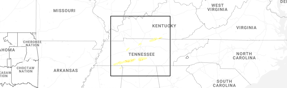
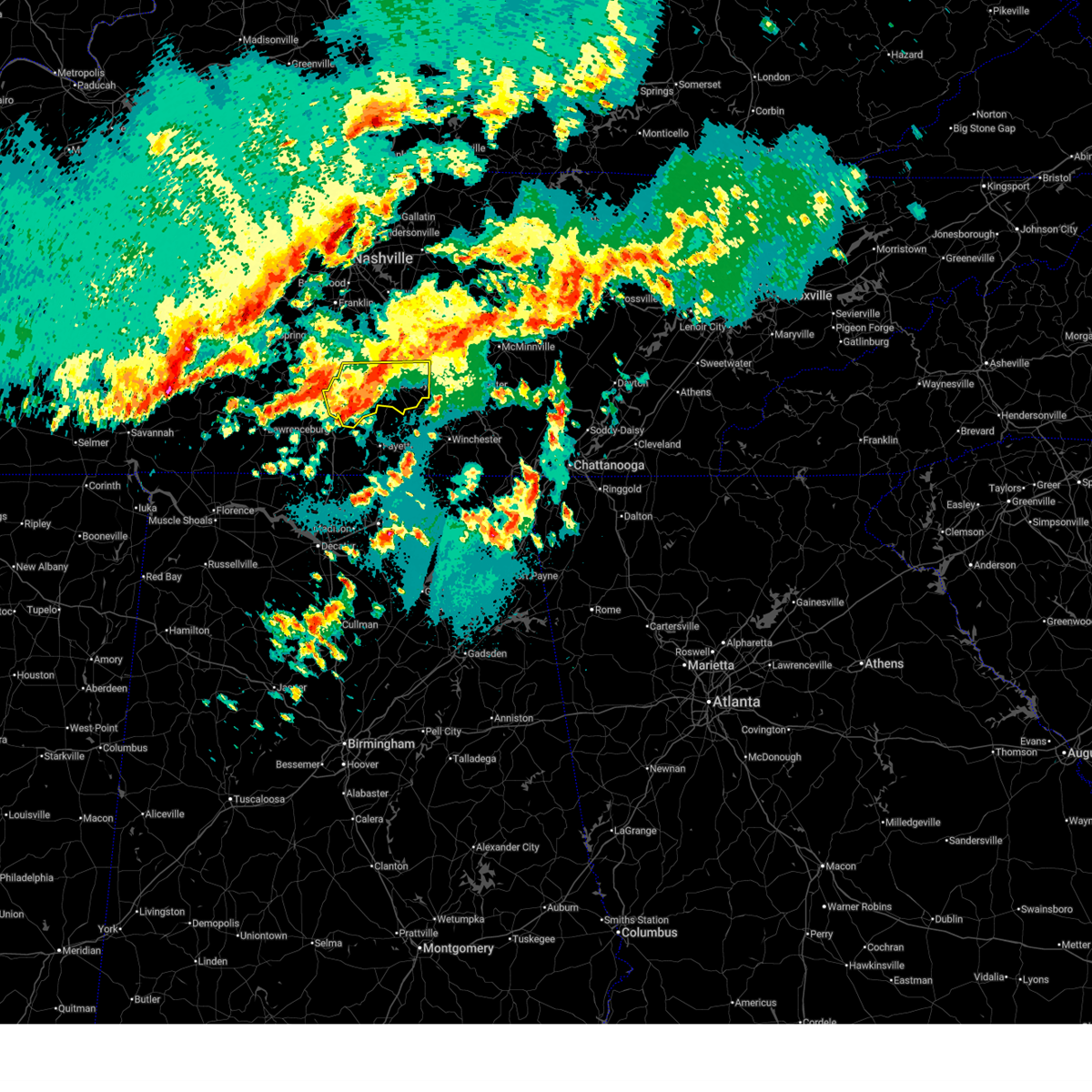
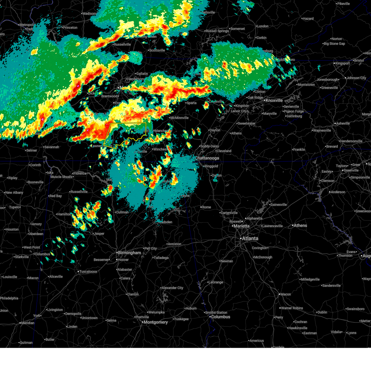
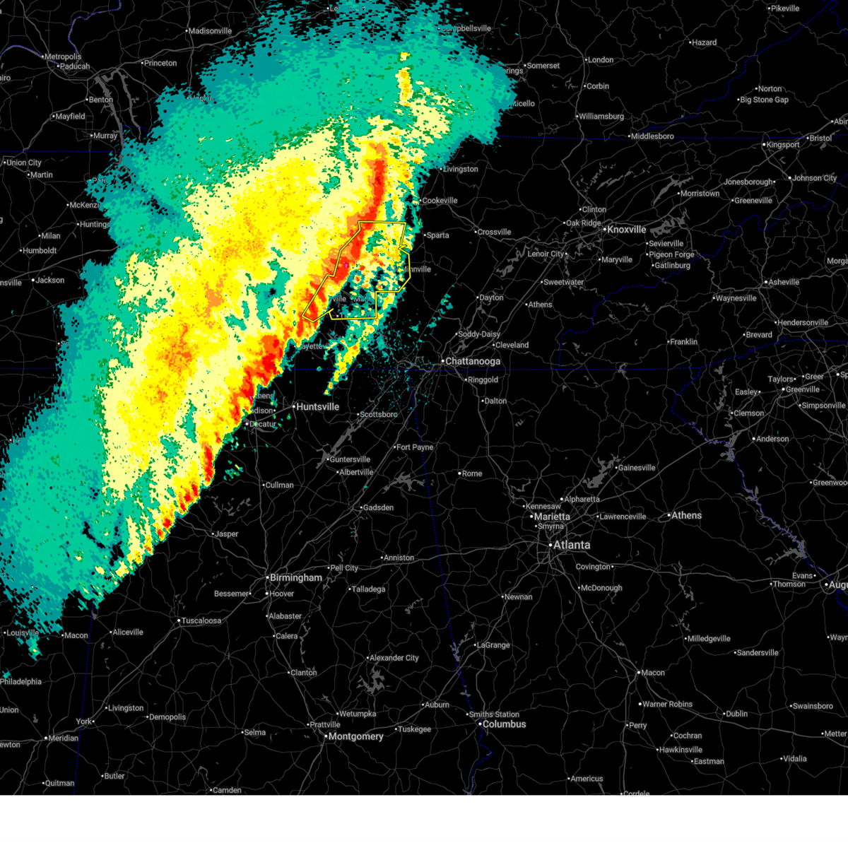
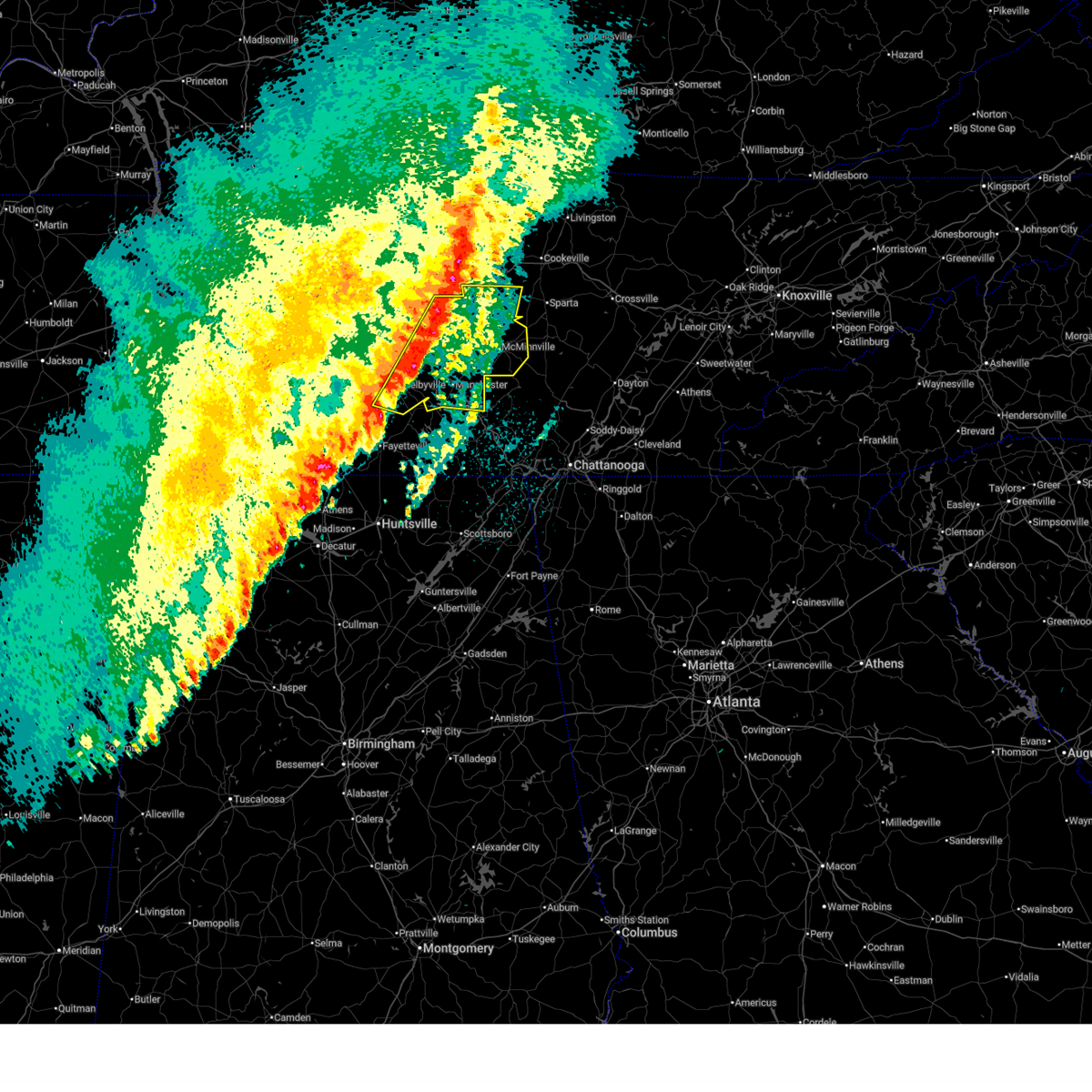
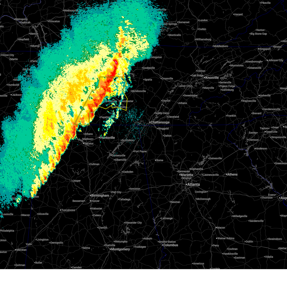
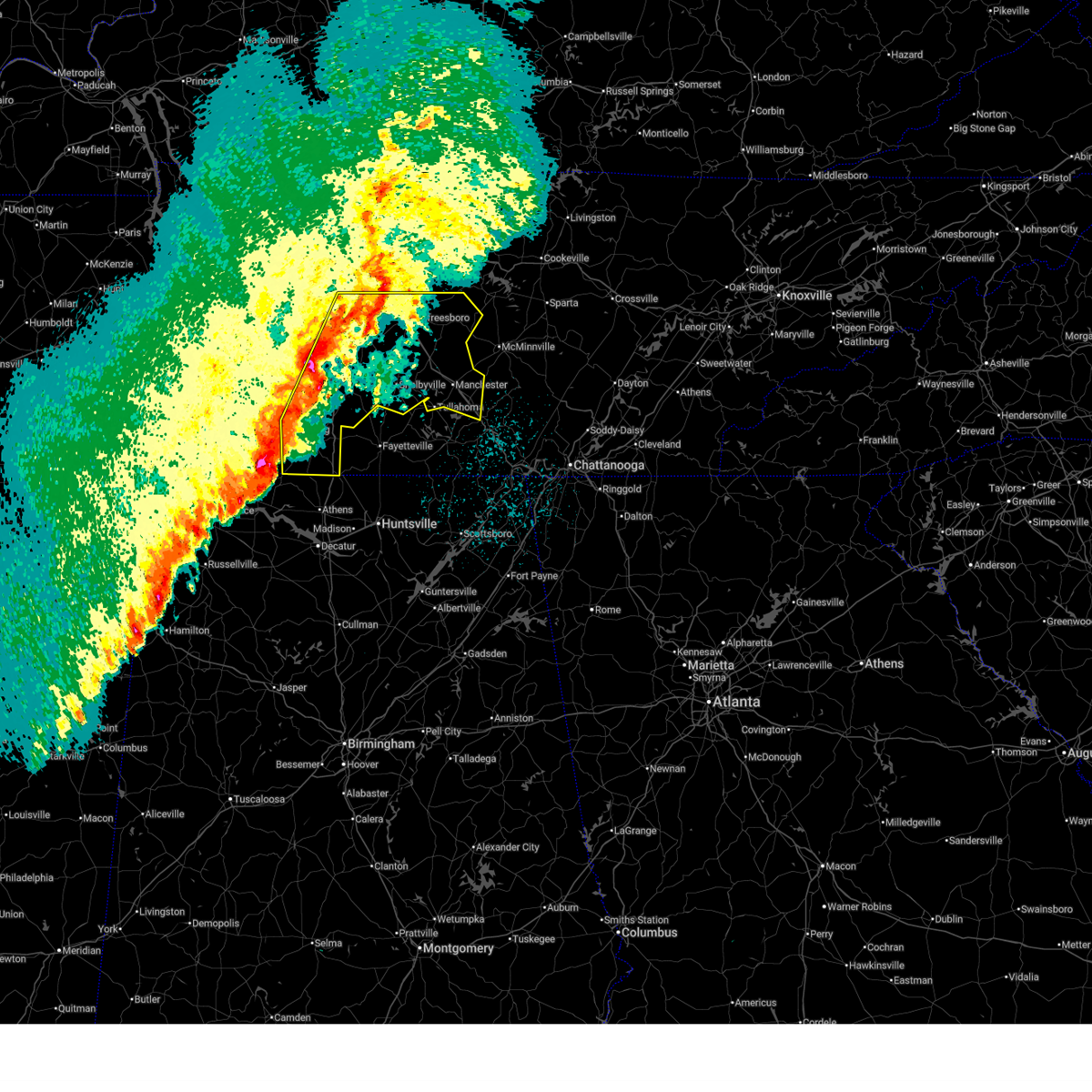
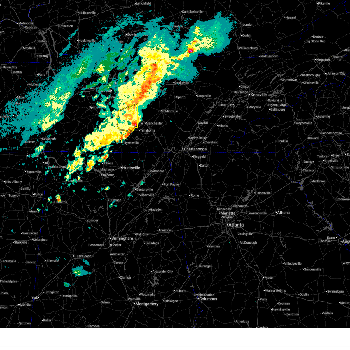
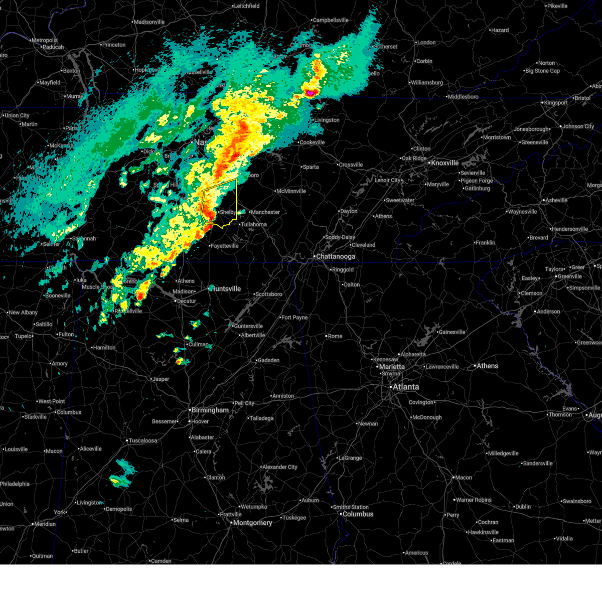
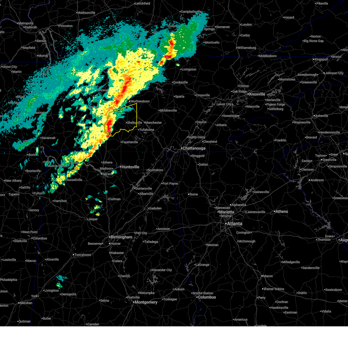
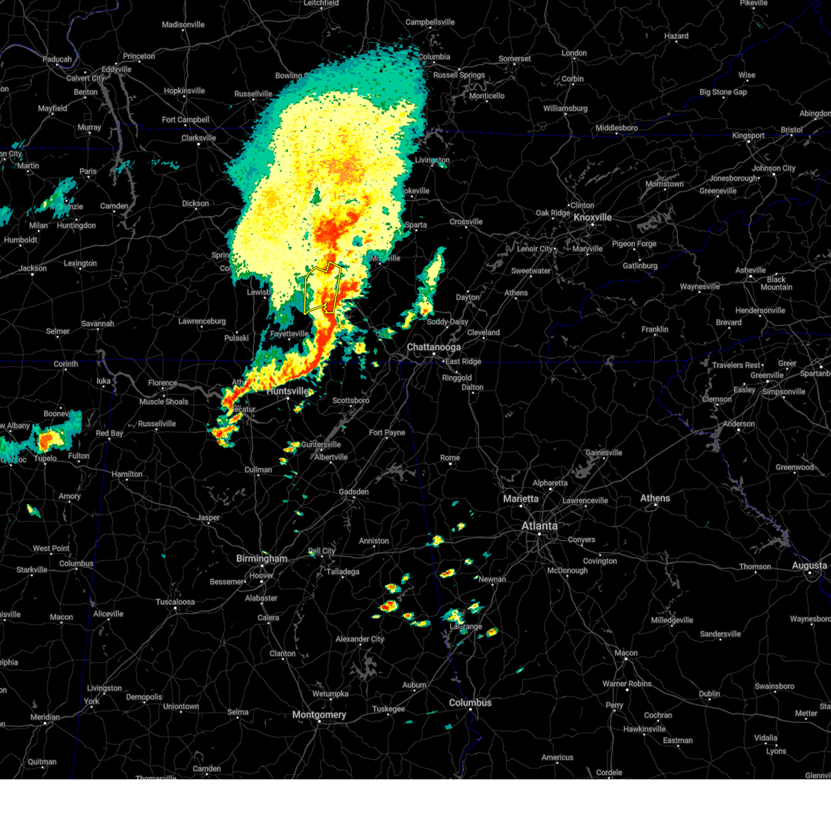
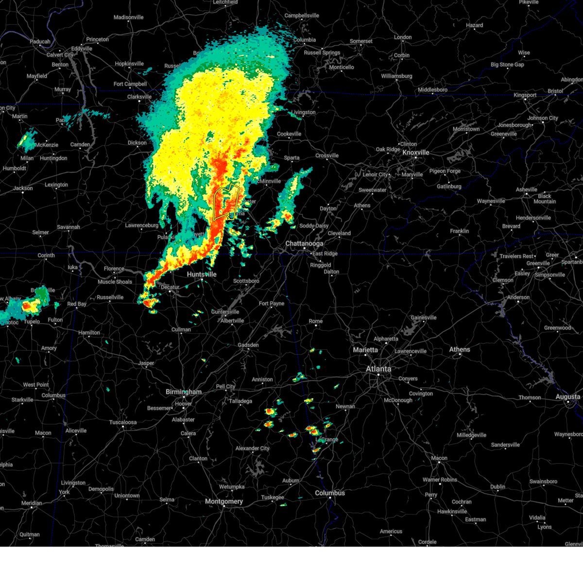
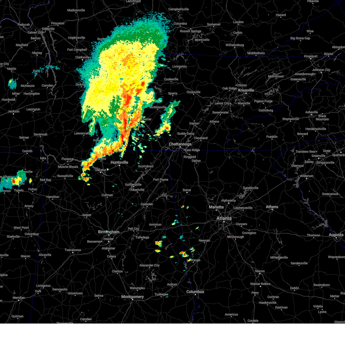
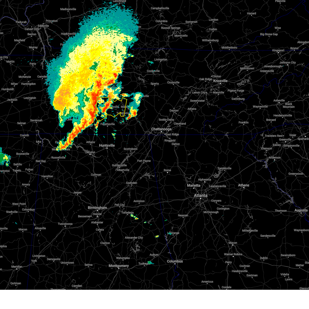
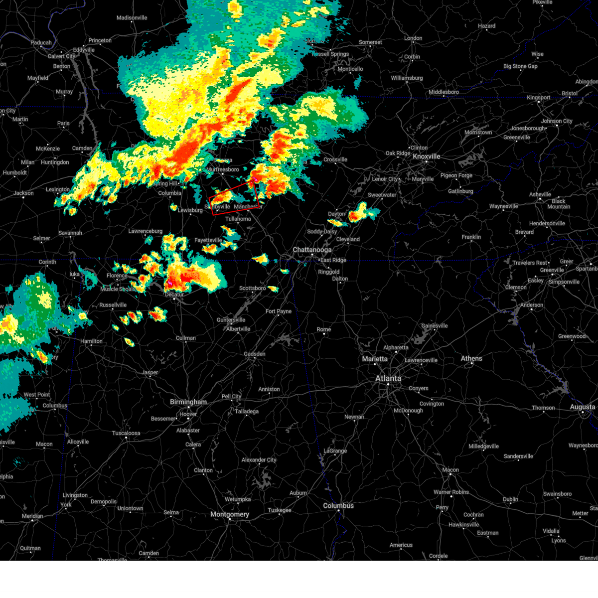
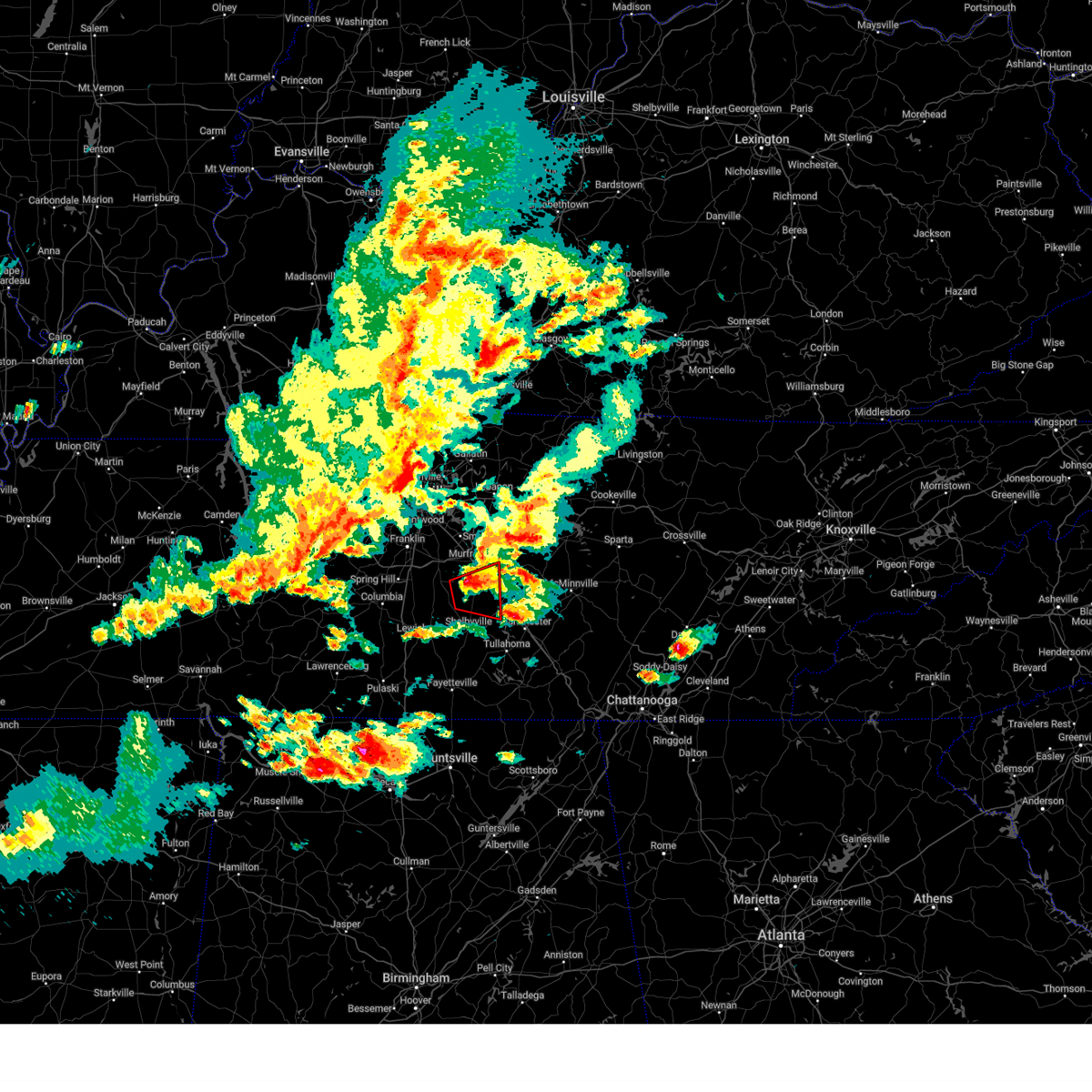
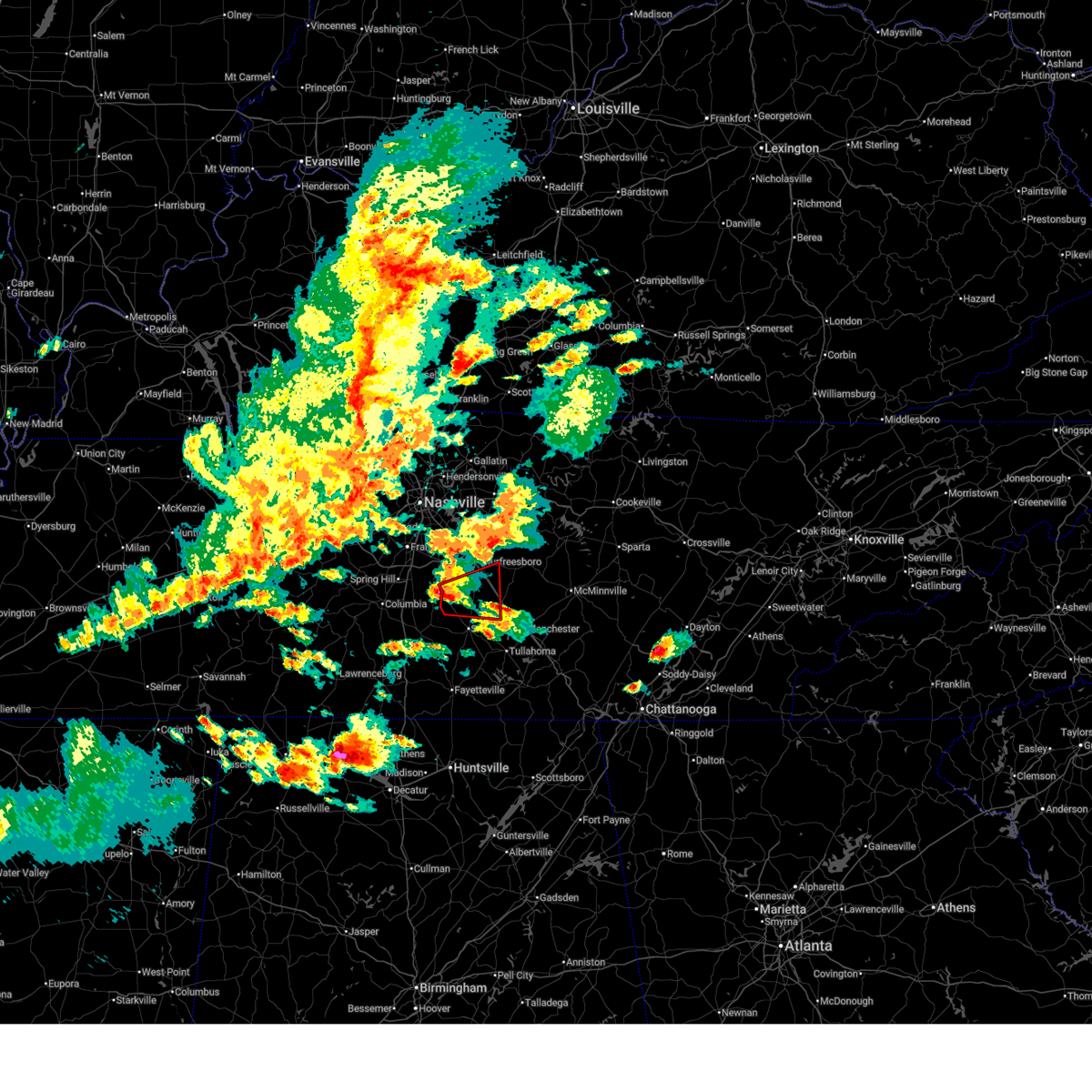
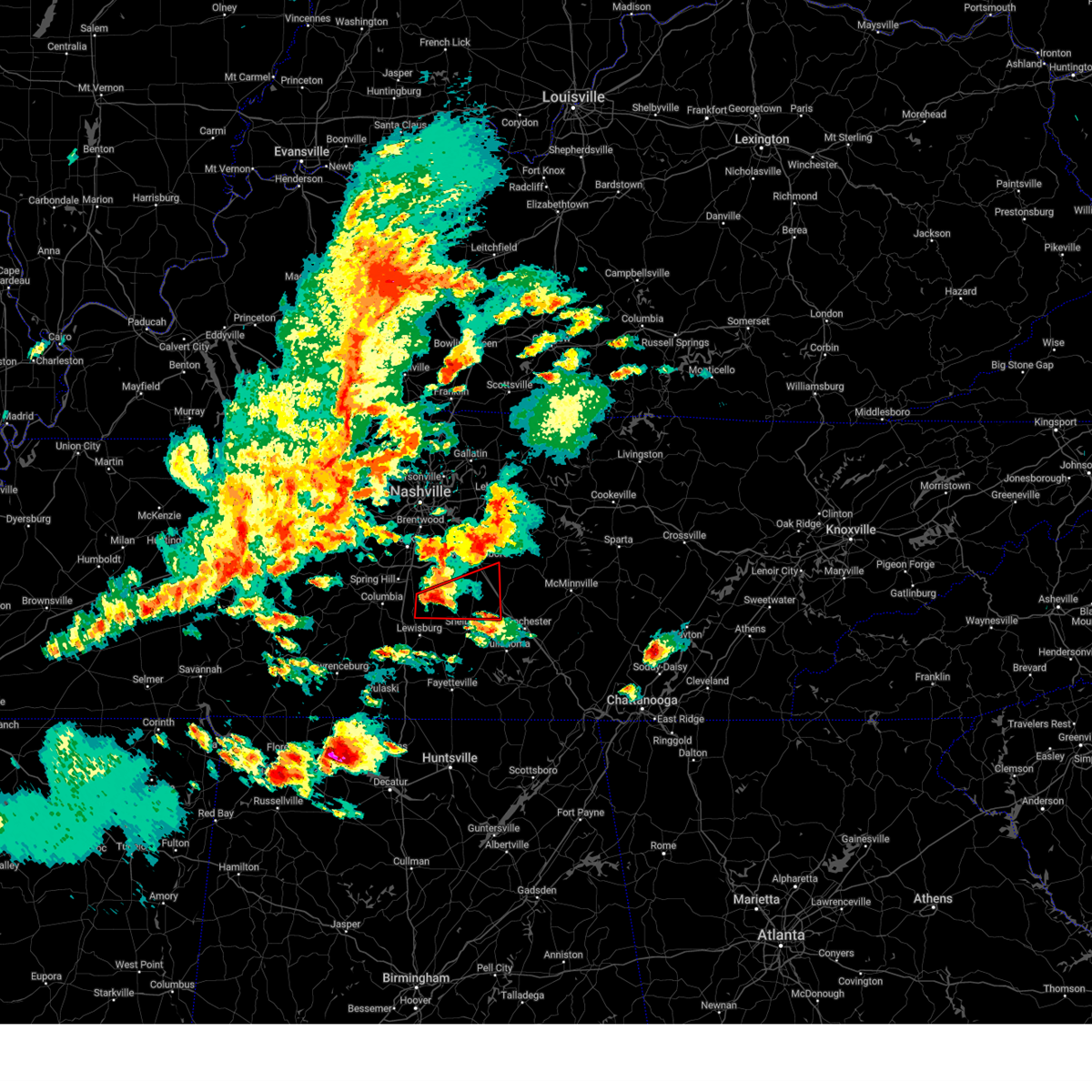
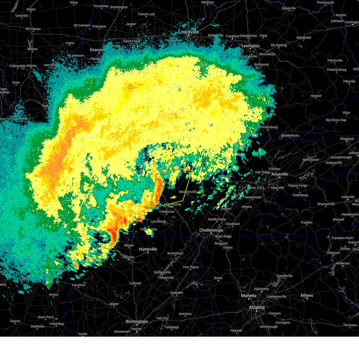
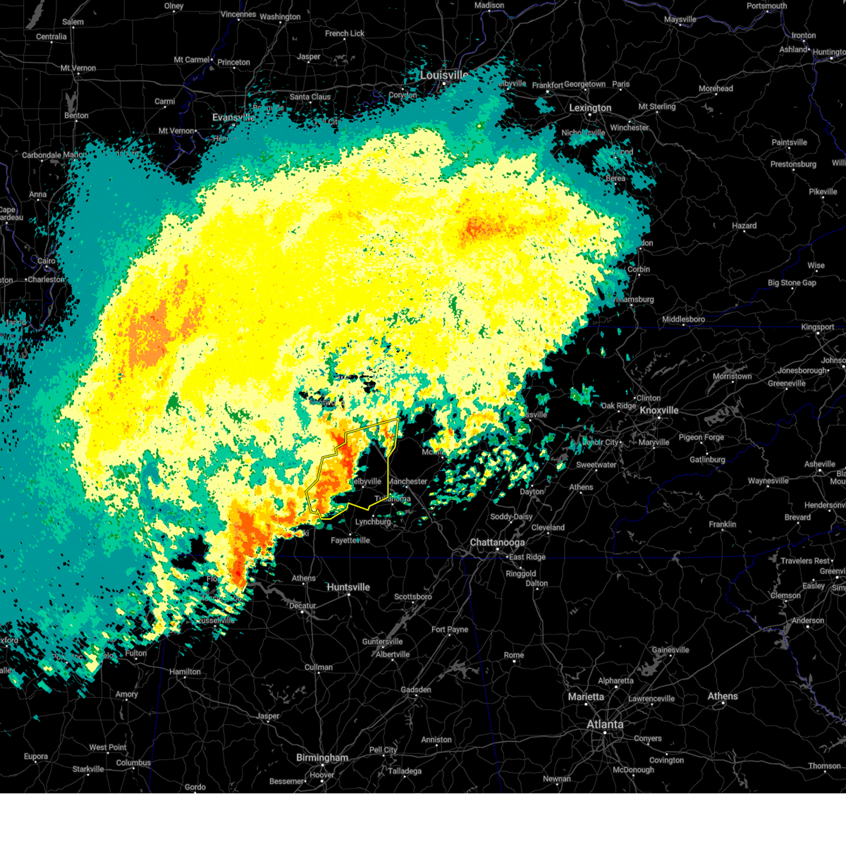
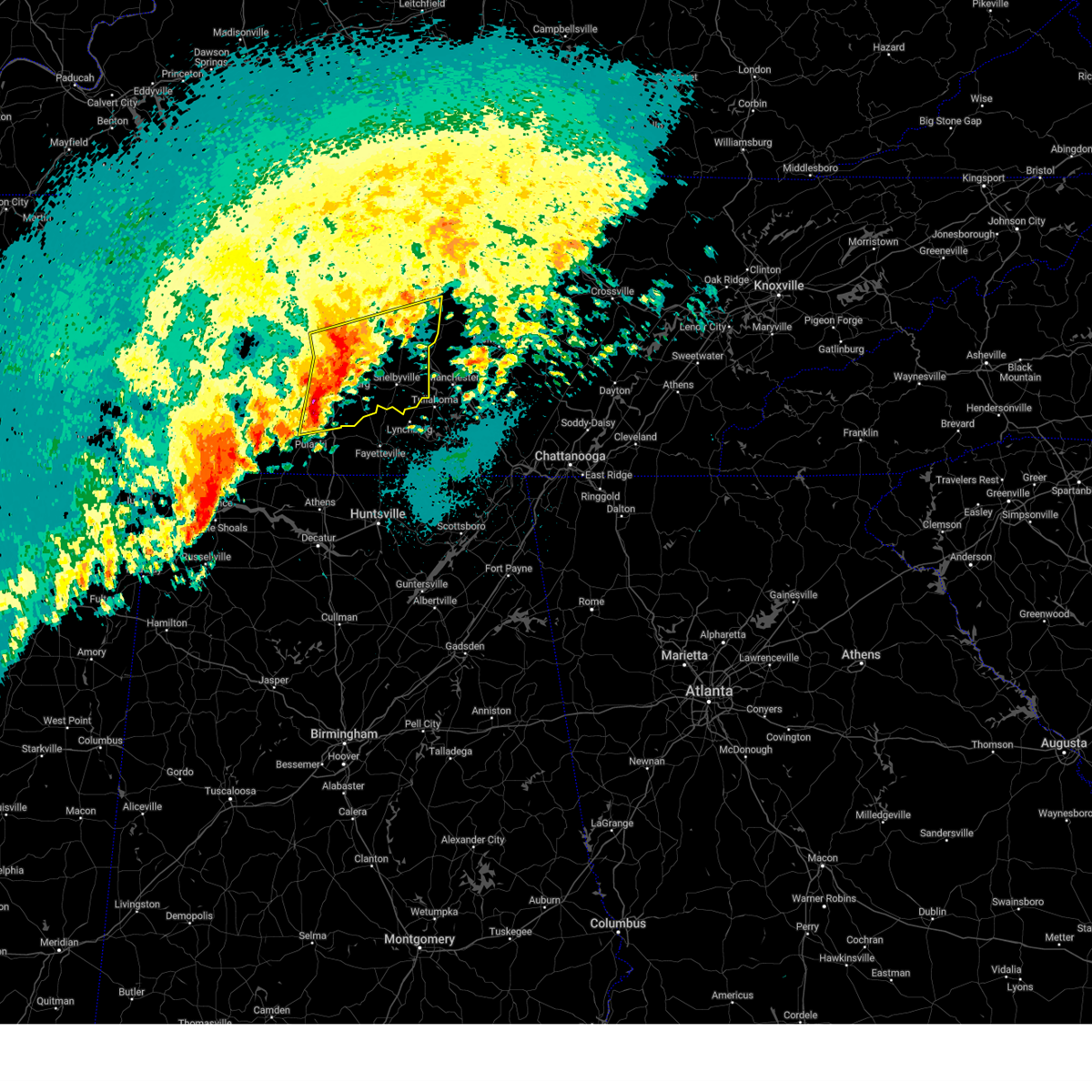
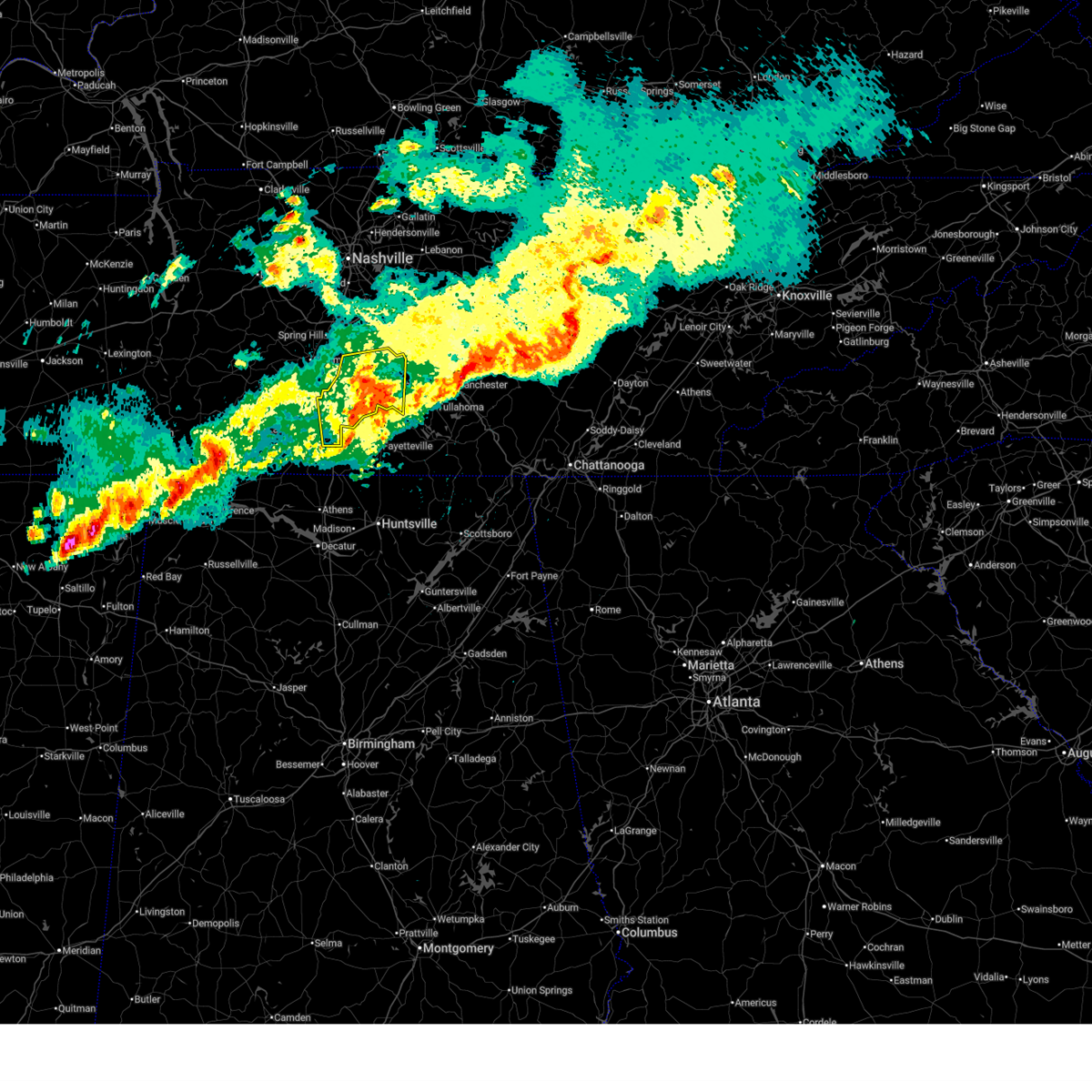
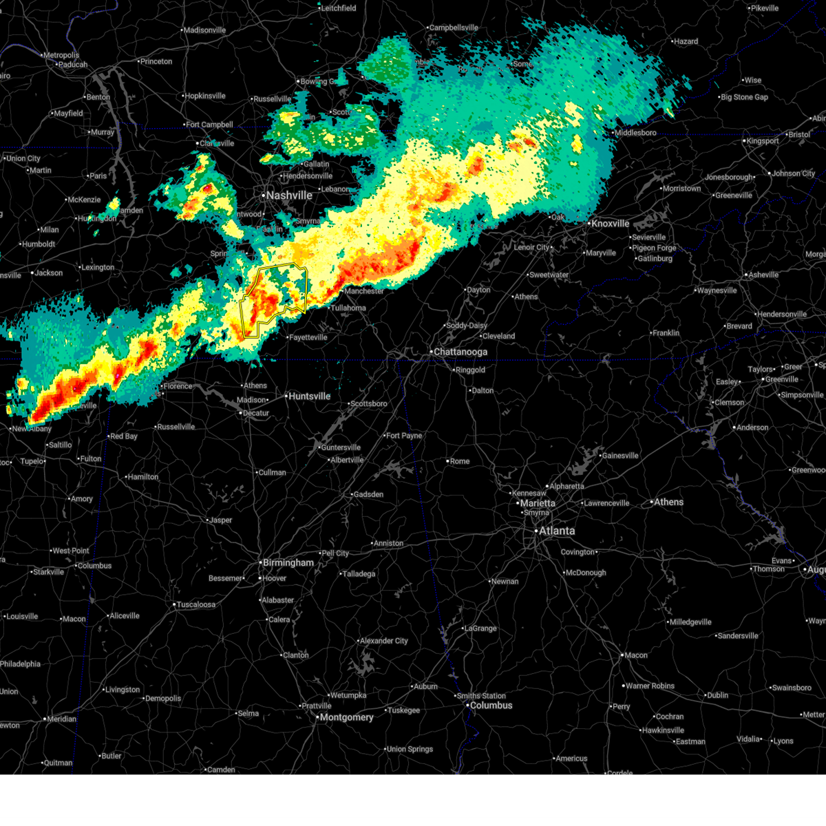
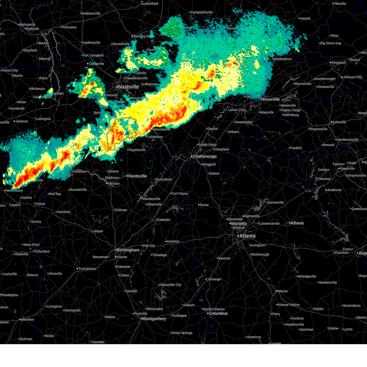
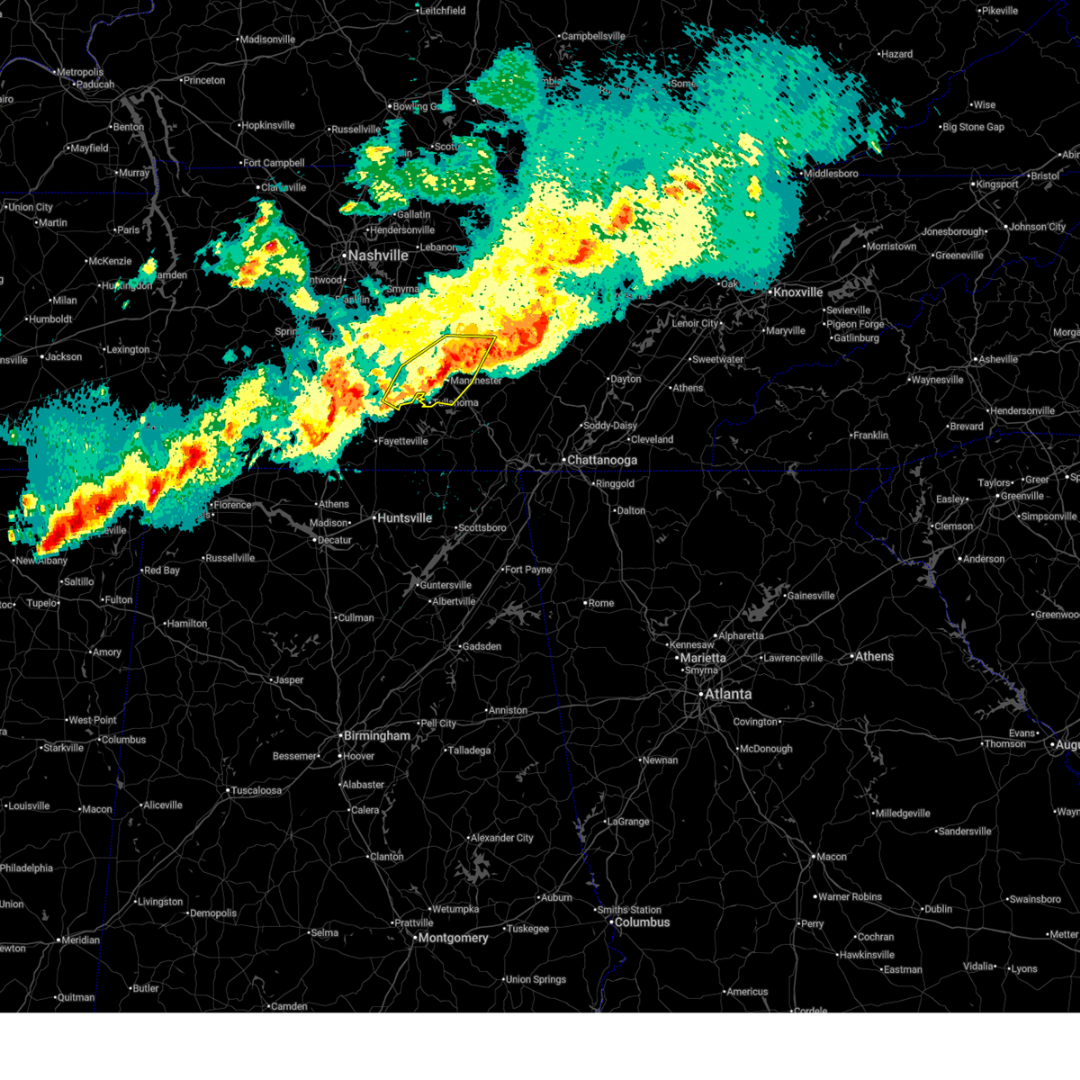
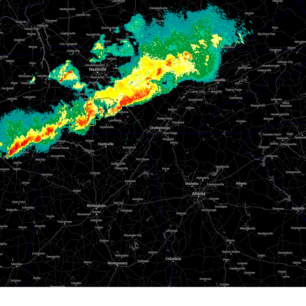
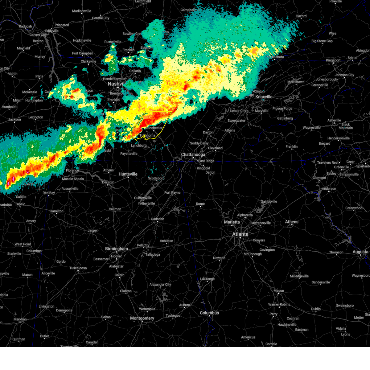
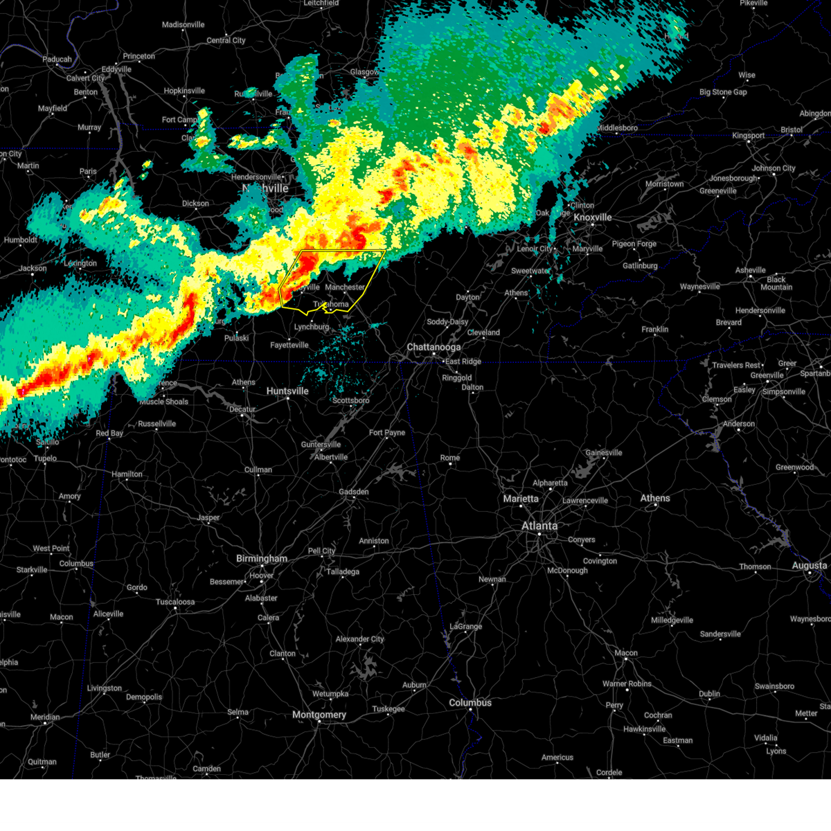
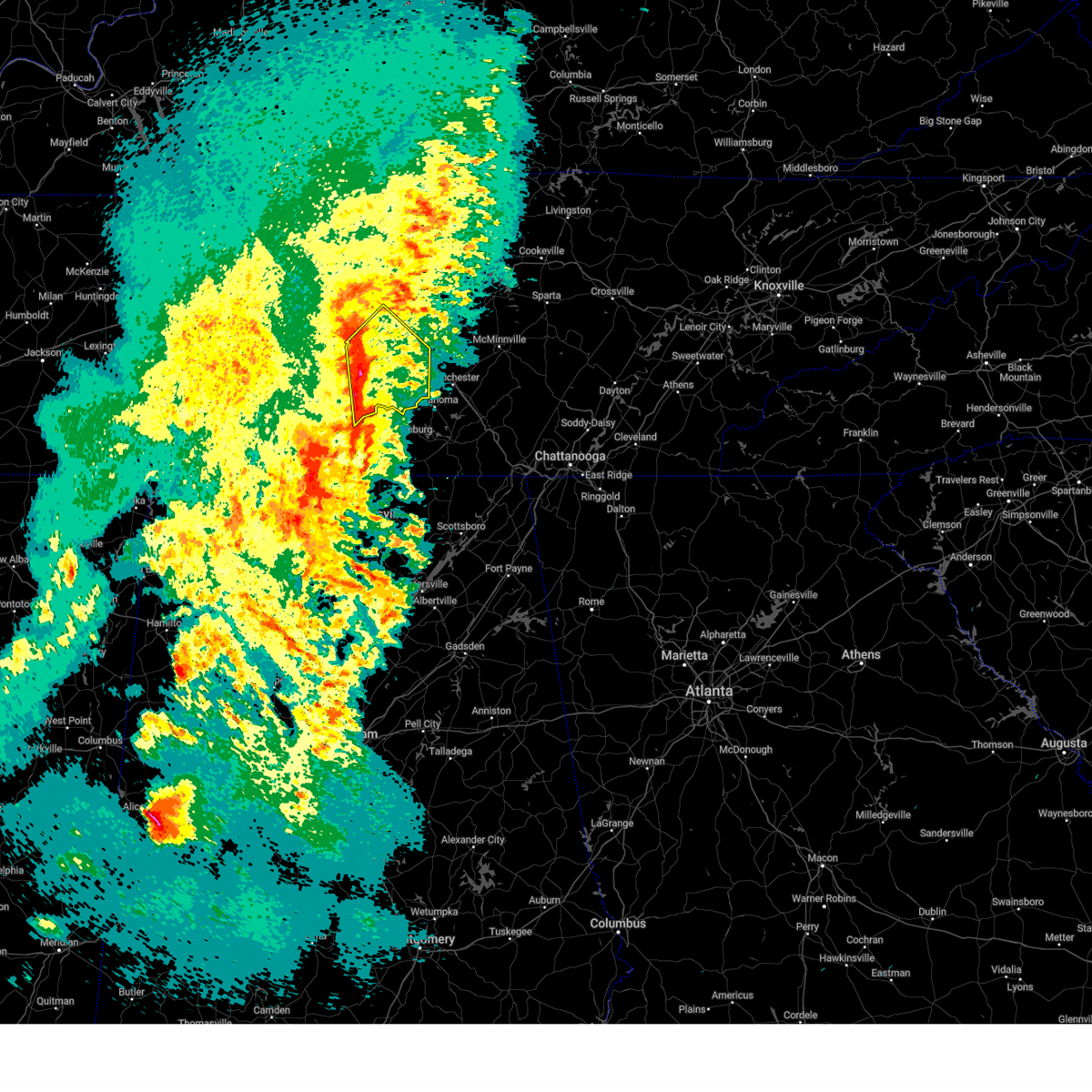
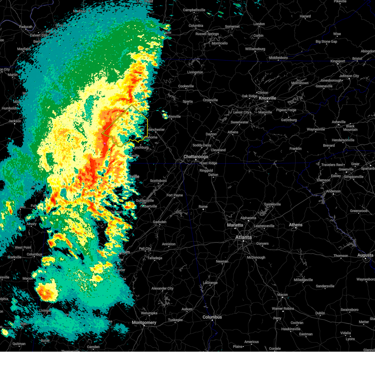
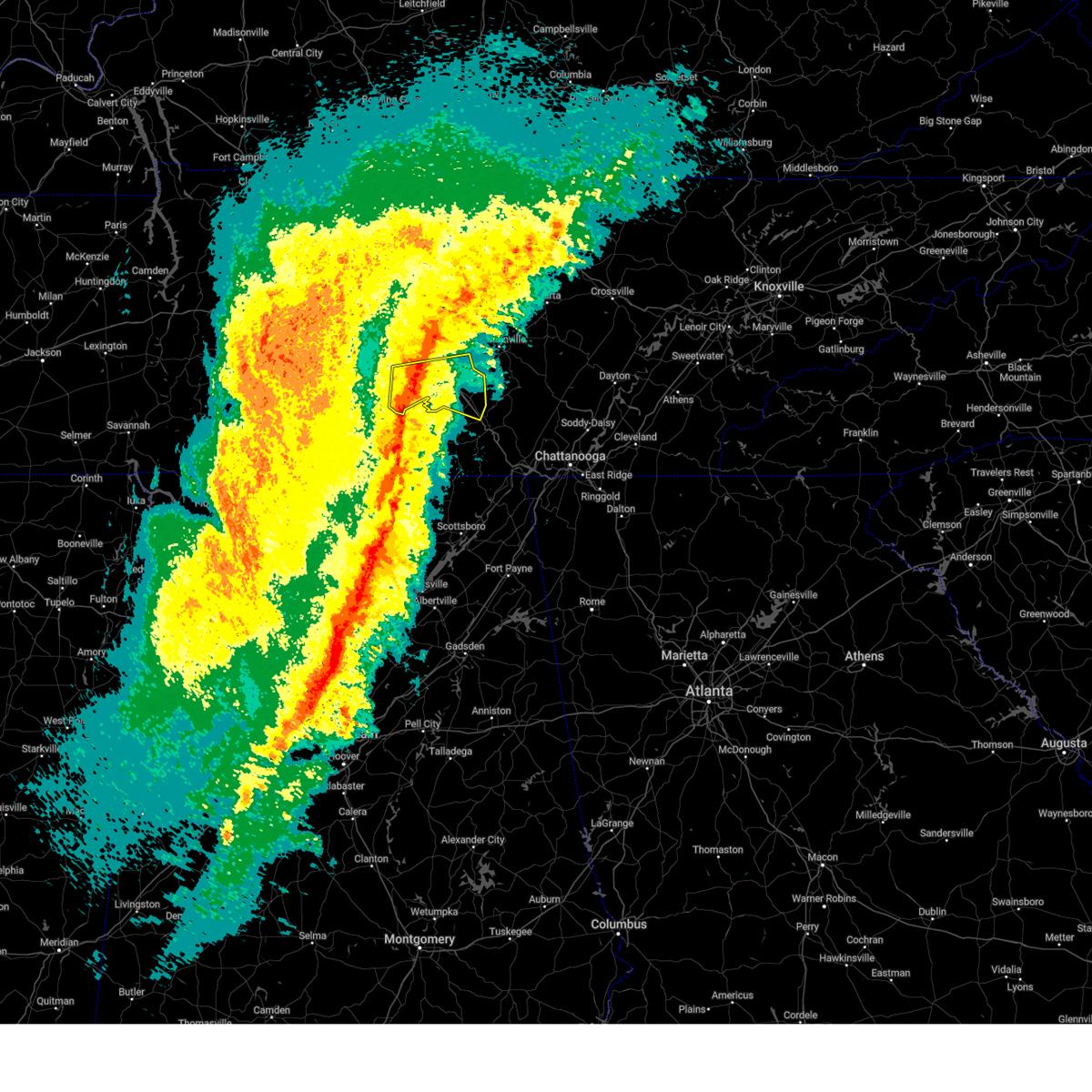
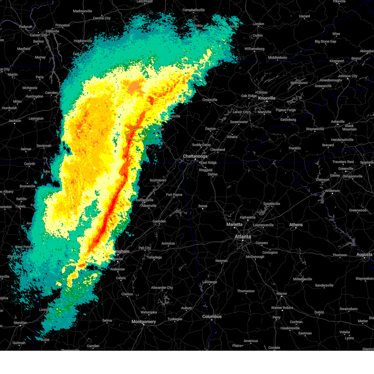
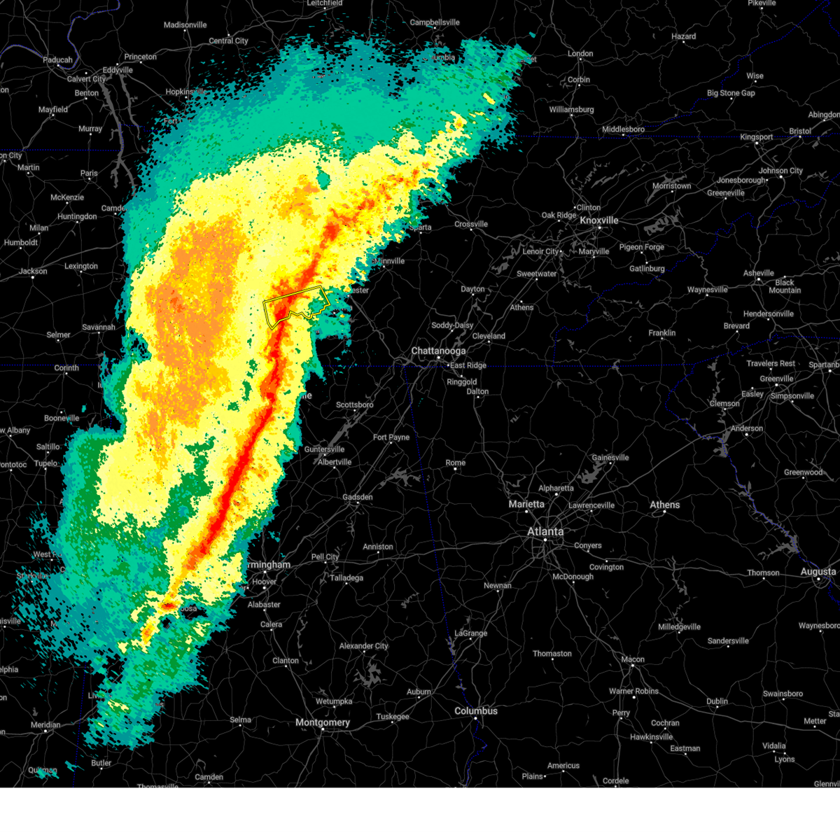
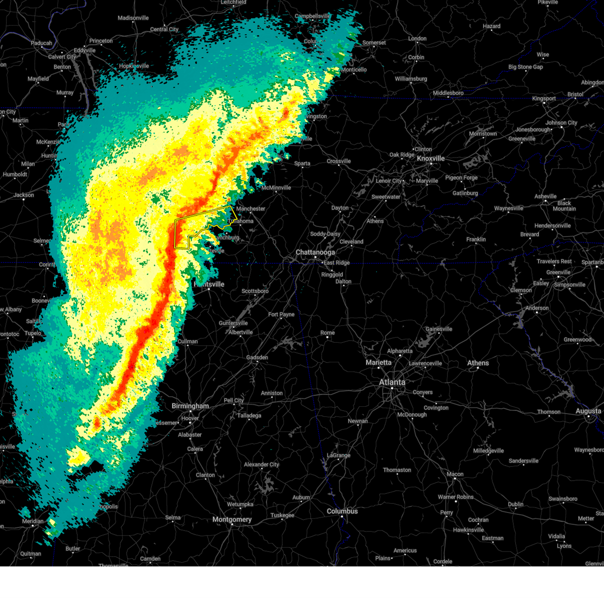
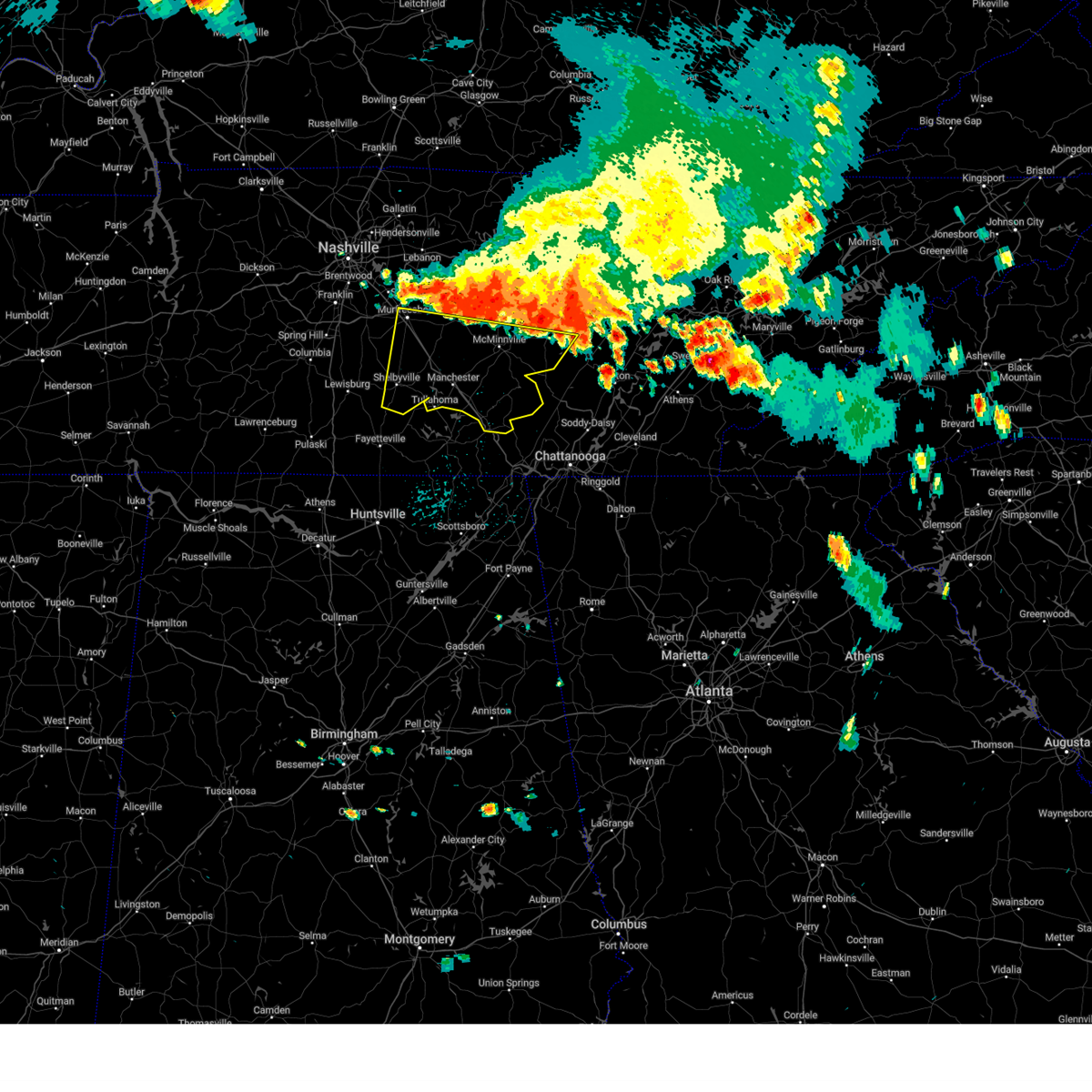
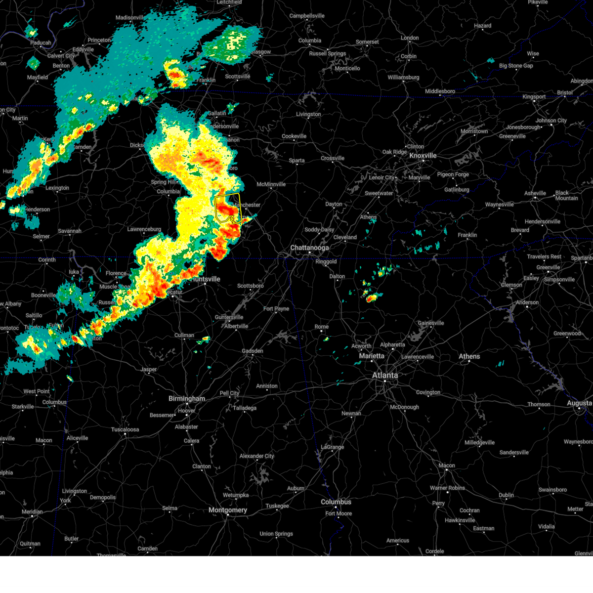
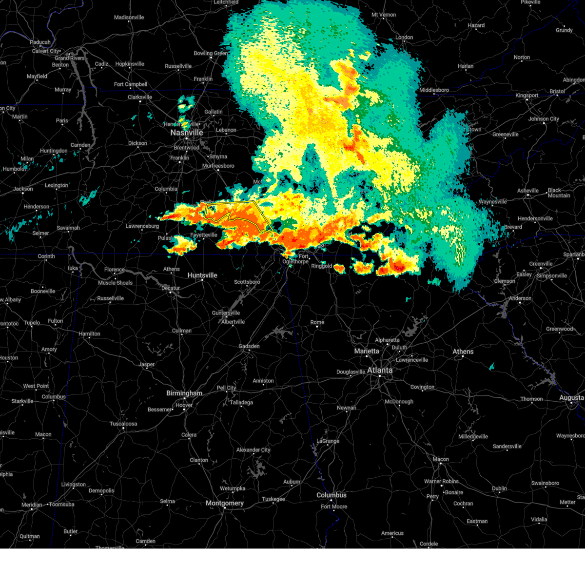
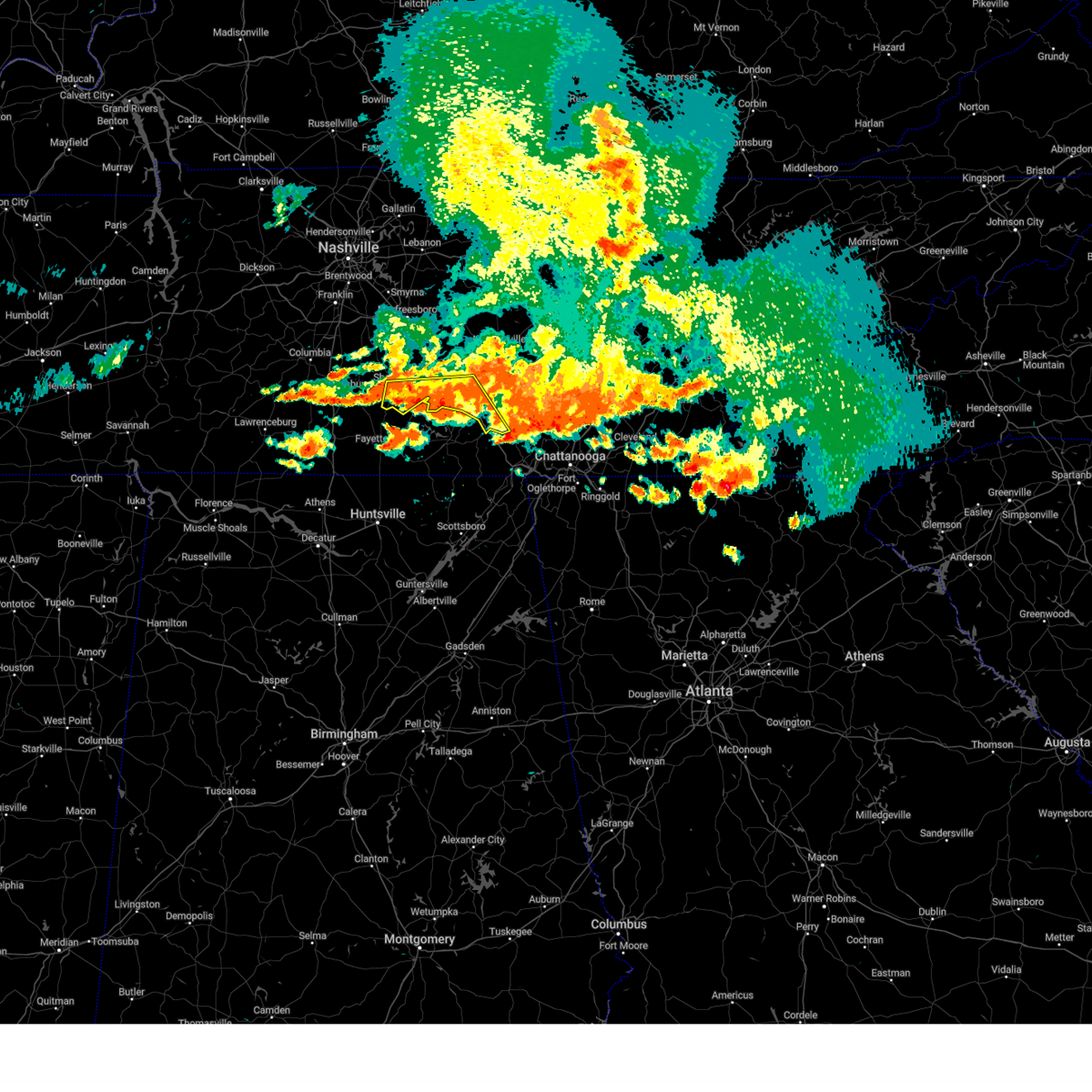
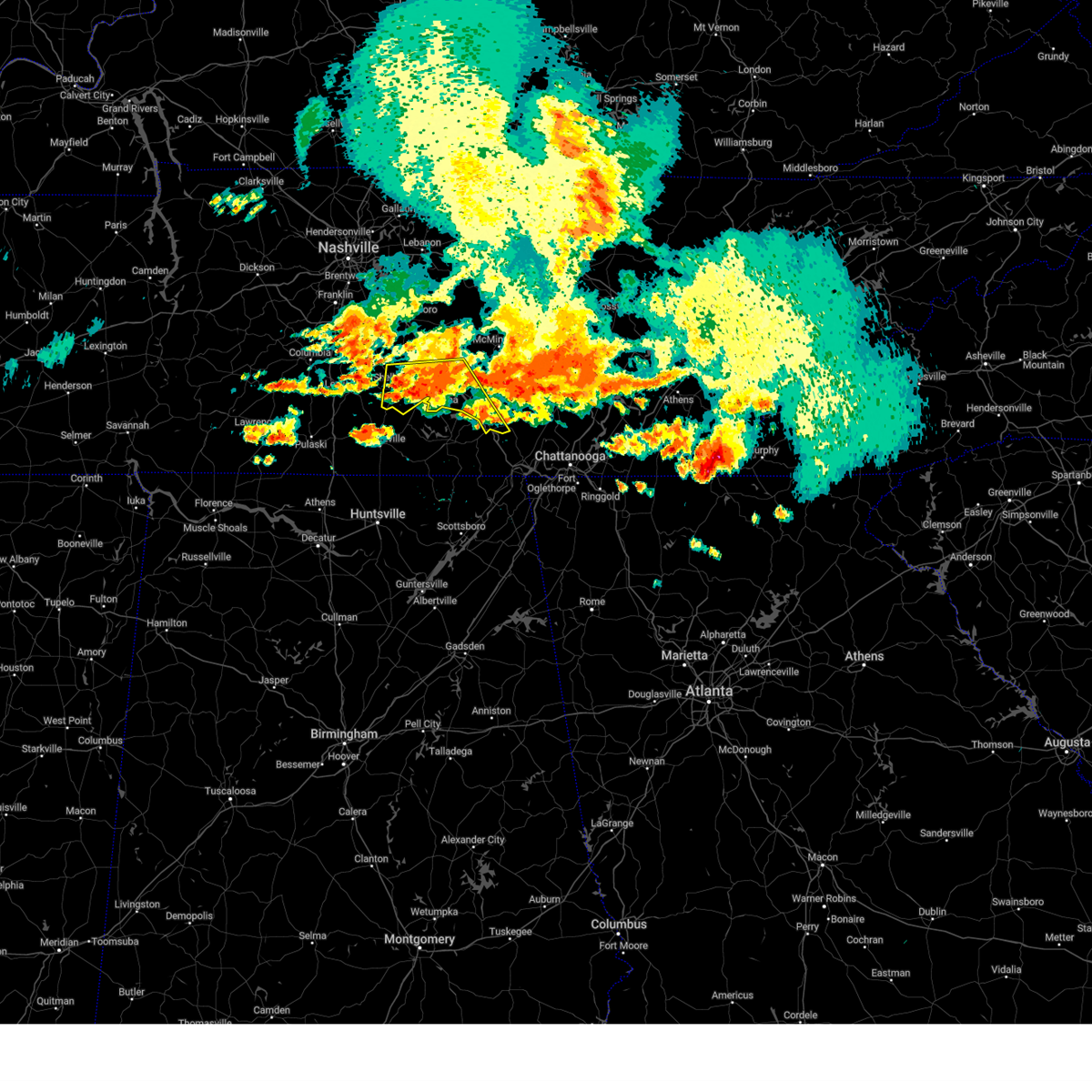
Hail Map for Shelbyville, TN
The Shelbyville, TN area has had 8 reports of on-the-ground hail by trained spotters, and has been under severe weather warnings 15 times during the past 12 months. Doppler radar has detected hail at or near Shelbyville, TN on 63 occasions, including 1 occasion during the past year.
| Name: | Shelbyville, TN |
| Where Located: | 49.9 miles SSE of Nashville, TN |
| Map: | Google Map for Shelbyville, TN |
| Population: | 20335 |
| Housing Units: | 8181 |
| More Info: | Search Google for Shelbyville, TN |
1
The Top Recent Hail Date for Shelbyville, TN is Wednesday, March 11, 2026 (11th out of 63)
Hail and Wind Damage Spotted near Shelbyville, TN
| Date / Time | Report Details |
|---|---|
| 6/9/2026 5:41 PM CDT |
 Svrohx the national weather service in nashville has issued a * severe thunderstorm warning for, southeastern rutherford county in middle tennessee, warren county in middle tennessee, coffee county in middle tennessee, eastern bedford county in middle tennessee, northwestern grundy county in middle tennessee, southern cannon county in middle tennessee, * until 645 pm cdt. * at 541 pm cdt, a severe thunderstorm was located 7 miles southwest of woodbury, moving southeast at 40 mph (radar indicated). Hazards include 70 mph wind gusts. Expect considerable tree damage. Damage is likely to mobile homes, roofs, and outbuildings. Svrohx the national weather service in nashville has issued a * severe thunderstorm warning for, southeastern rutherford county in middle tennessee, warren county in middle tennessee, coffee county in middle tennessee, eastern bedford county in middle tennessee, northwestern grundy county in middle tennessee, southern cannon county in middle tennessee, * until 645 pm cdt. * at 541 pm cdt, a severe thunderstorm was located 7 miles southwest of woodbury, moving southeast at 40 mph (radar indicated). Hazards include 70 mph wind gusts. Expect considerable tree damage. Damage is likely to mobile homes, roofs, and outbuildings.
|
| 4/28/2026 3:46 AM CDT |
 At 346 am cdt, a severe thunderstorm was located 8 miles southwest of petersburg, or 12 miles northwest of fayetteville, moving east at 60 mph (radar indicated). Hazards include 60 mph wind gusts and penny size hail. Expect damage to roofs, siding, and trees. locations impacted include, shelbyville, lewisburg, pulaski, ardmore, cornersville, elkton, minor hill, lynnville, belfast, goodspring, frankewing, prospect, and farmington. This includes interstate 65 between mile markers 1 and 35. At 346 am cdt, a severe thunderstorm was located 8 miles southwest of petersburg, or 12 miles northwest of fayetteville, moving east at 60 mph (radar indicated). Hazards include 60 mph wind gusts and penny size hail. Expect damage to roofs, siding, and trees. locations impacted include, shelbyville, lewisburg, pulaski, ardmore, cornersville, elkton, minor hill, lynnville, belfast, goodspring, frankewing, prospect, and farmington. This includes interstate 65 between mile markers 1 and 35.
|
| 4/28/2026 3:16 AM CDT |
 Svrohx the national weather service in nashville has issued a * severe thunderstorm warning for, eastern lewis county in middle tennessee, southeastern wayne county in middle tennessee, marshall county in middle tennessee, lawrence county in middle tennessee, southern maury county in middle tennessee, giles county in middle tennessee, southwestern bedford county in middle tennessee, * until 400 am cdt. * at 316 am cdt, a severe thunderstorm was located near lawrenceburg, moving east at 60 mph (radar indicated). Hazards include 60 mph wind gusts and penny size hail. expect damage to roofs, siding, and trees Svrohx the national weather service in nashville has issued a * severe thunderstorm warning for, eastern lewis county in middle tennessee, southeastern wayne county in middle tennessee, marshall county in middle tennessee, lawrence county in middle tennessee, southern maury county in middle tennessee, giles county in middle tennessee, southwestern bedford county in middle tennessee, * until 400 am cdt. * at 316 am cdt, a severe thunderstorm was located near lawrenceburg, moving east at 60 mph (radar indicated). Hazards include 60 mph wind gusts and penny size hail. expect damage to roofs, siding, and trees
|
| 4/28/2026 2:37 AM CDT |
 At 237 am cdt, a severe thunderstorm was located near shelbyville, moving east at 50 mph (radar indicated). Hazards include 60 mph wind gusts and penny size hail. Expect damage to roofs, siding, and trees. locations impacted include, shelbyville, lewisburg, cornersville, wartrace, bell buckle, normandy, belfast, deason, raus, and farmington. this includes the following highways, interstate 65 between mile markers 23 and 36. Interstate 24 near mile marker 98. At 237 am cdt, a severe thunderstorm was located near shelbyville, moving east at 50 mph (radar indicated). Hazards include 60 mph wind gusts and penny size hail. Expect damage to roofs, siding, and trees. locations impacted include, shelbyville, lewisburg, cornersville, wartrace, bell buckle, normandy, belfast, deason, raus, and farmington. this includes the following highways, interstate 65 between mile markers 23 and 36. Interstate 24 near mile marker 98.
|
| 4/28/2026 2:06 AM CDT |
 Svrohx the national weather service in nashville has issued a * severe thunderstorm warning for, marshall county in middle tennessee, southeastern maury county in middle tennessee, northeastern giles county in middle tennessee, bedford county in middle tennessee, * until 300 am cdt. * at 206 am cdt, a severe thunderstorm was located 7 miles west of lewisburg, moving east at 50 mph (radar indicated). Hazards include 70 mph wind gusts and penny size hail. Expect considerable tree damage. Damage is likely to mobile homes, roofs, and outbuildings. Svrohx the national weather service in nashville has issued a * severe thunderstorm warning for, marshall county in middle tennessee, southeastern maury county in middle tennessee, northeastern giles county in middle tennessee, bedford county in middle tennessee, * until 300 am cdt. * at 206 am cdt, a severe thunderstorm was located 7 miles west of lewisburg, moving east at 50 mph (radar indicated). Hazards include 70 mph wind gusts and penny size hail. Expect considerable tree damage. Damage is likely to mobile homes, roofs, and outbuildings.
|
| 3/16/2026 12:00 AM CDT |
 At 1159 pm cdt, severe thunderstorms were located along a line extending from near smithville to 7 miles west of lynchburg, moving east at 40 mph (radar indicated). Hazards include 60 mph wind gusts. Expect damage to roofs, siding, and trees. locations impacted include, shelbyville, mcminnville, manchester, smithville, woodbury, tullahoma, morrison, wartrace, bell buckle, dowelltown, liberty, centertown, normandy, viola, rock island state park, beechgrove, raus, summitville, hillsboro, and bradyville. This includes interstate 24 between mile markers 96 and 123. At 1159 pm cdt, severe thunderstorms were located along a line extending from near smithville to 7 miles west of lynchburg, moving east at 40 mph (radar indicated). Hazards include 60 mph wind gusts. Expect damage to roofs, siding, and trees. locations impacted include, shelbyville, mcminnville, manchester, smithville, woodbury, tullahoma, morrison, wartrace, bell buckle, dowelltown, liberty, centertown, normandy, viola, rock island state park, beechgrove, raus, summitville, hillsboro, and bradyville. This includes interstate 24 between mile markers 96 and 123.
|
| 3/16/2026 12:00 AM CDT |
 the severe thunderstorm warning has been cancelled and is no longer in effect the severe thunderstorm warning has been cancelled and is no longer in effect
|
| 3/15/2026 11:43 PM CDT |
 Svrohx the national weather service in nashville has issued a * severe thunderstorm warning for, de kalb county in middle tennessee, southeastern rutherford county in middle tennessee, warren county in middle tennessee, coffee county in middle tennessee, bedford county in middle tennessee, cannon county in middle tennessee, * until 1245 am cdt. * at 1142 pm cdt, severe thunderstorms were located along a line extending from 7 miles southeast of watertown to near petersburg, moving east at 40 mph (radar indicated). Hazards include 70 mph wind gusts. Expect considerable tree damage. Damage is likely to mobile homes, roofs, and outbuildings. Svrohx the national weather service in nashville has issued a * severe thunderstorm warning for, de kalb county in middle tennessee, southeastern rutherford county in middle tennessee, warren county in middle tennessee, coffee county in middle tennessee, bedford county in middle tennessee, cannon county in middle tennessee, * until 1245 am cdt. * at 1142 pm cdt, severe thunderstorms were located along a line extending from 7 miles southeast of watertown to near petersburg, moving east at 40 mph (radar indicated). Hazards include 70 mph wind gusts. Expect considerable tree damage. Damage is likely to mobile homes, roofs, and outbuildings.
|
| 3/15/2026 11:33 PM CDT |
 the severe thunderstorm warning has been cancelled and is no longer in effect the severe thunderstorm warning has been cancelled and is no longer in effect
|
| 3/15/2026 11:33 PM CDT |
 At 1133 pm cdt, severe thunderstorms were located along a line extending from 8 miles east of walterhill to ardmore, moving east at 50 mph (radar indicated). Hazards include 70 mph wind gusts. Expect considerable tree damage. damage is likely to mobile homes, roofs, and outbuildings. locations impacted include, murfreesboro, shelbyville, lewisburg, manchester, pulaski, woodbury, smyrna, tullahoma, walterhill, chapel hill, ardmore, cornersville, morrison, wartrace, eagleville, elkton, minor hill, bell buckle, auburntown, and normandy. this includes the following highways, interstate 65 between mile markers 1 and 36. interstate 24 between mile markers 67 and 127. Interstate 840 between mile markers 46 and 60. At 1133 pm cdt, severe thunderstorms were located along a line extending from 8 miles east of walterhill to ardmore, moving east at 50 mph (radar indicated). Hazards include 70 mph wind gusts. Expect considerable tree damage. damage is likely to mobile homes, roofs, and outbuildings. locations impacted include, murfreesboro, shelbyville, lewisburg, manchester, pulaski, woodbury, smyrna, tullahoma, walterhill, chapel hill, ardmore, cornersville, morrison, wartrace, eagleville, elkton, minor hill, bell buckle, auburntown, and normandy. this includes the following highways, interstate 65 between mile markers 1 and 36. interstate 24 between mile markers 67 and 127. Interstate 840 between mile markers 46 and 60.
|
| 3/15/2026 11:03 PM CDT |
 Svrohx the national weather service in nashville has issued a * severe thunderstorm warning for, marshall county in middle tennessee, rutherford county in middle tennessee, eastern maury county in middle tennessee, eastern williamson county in middle tennessee, coffee county in middle tennessee, giles county in middle tennessee, southeastern wilson county in middle tennessee, bedford county in middle tennessee, cannon county in middle tennessee, * until 1145 pm cdt. * at 1103 pm cdt, severe thunderstorms were located along a line extending from near nolensville to 8 miles northeast of rogersville, moving east at 75 mph (radar indicated). Hazards include 70 mph wind gusts. Expect considerable tree damage. Damage is likely to mobile homes, roofs, and outbuildings. Svrohx the national weather service in nashville has issued a * severe thunderstorm warning for, marshall county in middle tennessee, rutherford county in middle tennessee, eastern maury county in middle tennessee, eastern williamson county in middle tennessee, coffee county in middle tennessee, giles county in middle tennessee, southeastern wilson county in middle tennessee, bedford county in middle tennessee, cannon county in middle tennessee, * until 1145 pm cdt. * at 1103 pm cdt, severe thunderstorms were located along a line extending from near nolensville to 8 miles northeast of rogersville, moving east at 75 mph (radar indicated). Hazards include 70 mph wind gusts. Expect considerable tree damage. Damage is likely to mobile homes, roofs, and outbuildings.
|
| 3/11/2026 4:05 PM CDT |
 the severe thunderstorm warning has been cancelled and is no longer in effect the severe thunderstorm warning has been cancelled and is no longer in effect
|
| 3/11/2026 3:42 PM CDT |
 the severe thunderstorm warning has been cancelled and is no longer in effect the severe thunderstorm warning has been cancelled and is no longer in effect
|
| 3/11/2026 3:42 PM CDT |
 At 341 pm cdt, a severe thunderstorm was located 8 miles east of lewisburg, moving east at 35 mph (radar indicated). Hazards include 60 mph wind gusts and quarter size hail. Hail damage to vehicles is expected. expect wind damage to roofs, siding, and trees. locations impacted include, shelbyville, wartrace, bell buckle, normandy, rover, christiana, deason, raus, unionville, and fosterville. This includes interstate 24 between mile markers 85 and 95. At 341 pm cdt, a severe thunderstorm was located 8 miles east of lewisburg, moving east at 35 mph (radar indicated). Hazards include 60 mph wind gusts and quarter size hail. Hail damage to vehicles is expected. expect wind damage to roofs, siding, and trees. locations impacted include, shelbyville, wartrace, bell buckle, normandy, rover, christiana, deason, raus, unionville, and fosterville. This includes interstate 24 between mile markers 85 and 95.
|
| 3/11/2026 3:37 PM CDT | Trees uprooted onto a fence on sinking creek road in sw bedford county. time estimated from rada in bedford county TN, 10.2 miles NE of Shelbyville, TN |
| 3/11/2026 3:35 PM CDT | A couple trees dow in bedford county TN, 10.2 miles NE of Shelbyville, TN |
| 3/11/2026 3:24 PM CDT |
 Svrohx the national weather service in nashville has issued a * severe thunderstorm warning for, marshall county in middle tennessee, southern rutherford county in middle tennessee, bedford county in middle tennessee, * until 430 pm cdt. * at 322 pm cdt, a severe thunderstorm was located near lewisburg, moving east at 35 mph (radar indicated). Hazards include 60 mph wind gusts and quarter size hail. Hail damage to vehicles is expected. Expect wind damage to roofs, siding, and trees. Svrohx the national weather service in nashville has issued a * severe thunderstorm warning for, marshall county in middle tennessee, southern rutherford county in middle tennessee, bedford county in middle tennessee, * until 430 pm cdt. * at 322 pm cdt, a severe thunderstorm was located near lewisburg, moving east at 35 mph (radar indicated). Hazards include 60 mph wind gusts and quarter size hail. Hail damage to vehicles is expected. Expect wind damage to roofs, siding, and trees.
|
| 6/7/2025 2:45 PM CDT | Tspotter report of powerlines and poles down near the intersection of wartrace pike and lingon drive in shelbyville. time is radar estimate in bedford county TN, 2.4 miles WNW of Shelbyville, TN |
| 5/25/2025 4:11 PM CDT |
 The storms which prompted the warning have moved out of the area. therefore, the warning will be allowed to expire. a severe thunderstorm watch remains in effect until 1100 pm cdt for middle tennessee. The storms which prompted the warning have moved out of the area. therefore, the warning will be allowed to expire. a severe thunderstorm watch remains in effect until 1100 pm cdt for middle tennessee.
|
| 5/25/2025 4:01 PM CDT |
 At 400 pm cdt, severe thunderstorms were located along a line extending from 13 miles south of murfreesboro to near lynchburg, moving east at 45 mph (radar indicated). Hazards include 60 mph wind gusts. Expect damage to roofs, siding, and trees. locations impacted include, shelbyville, tullahoma, wartrace, bell buckle, normandy, beechgrove, and raus. This includes interstate 24 between mile markers 97 and 106. At 400 pm cdt, severe thunderstorms were located along a line extending from 13 miles south of murfreesboro to near lynchburg, moving east at 45 mph (radar indicated). Hazards include 60 mph wind gusts. Expect damage to roofs, siding, and trees. locations impacted include, shelbyville, tullahoma, wartrace, bell buckle, normandy, beechgrove, and raus. This includes interstate 24 between mile markers 97 and 106.
|
| 5/25/2025 3:55 PM CDT | Large tree reported down near new herman road and george reagor roa in bedford county TN, 8.7 miles NNW of Shelbyville, TN |
| 5/25/2025 3:44 PM CDT |
 the severe thunderstorm warning has been cancelled and is no longer in effect the severe thunderstorm warning has been cancelled and is no longer in effect
|
| 5/25/2025 3:44 PM CDT |
 At 344 pm cdt, severe thunderstorms were located along a line extending from 12 miles north of shelbyville to 6 miles north of fayetteville, moving east at 45 mph (radar indicated). Hazards include 60 mph wind gusts. Expect damage to roofs, siding, and trees. locations impacted include, shelbyville, tullahoma, wartrace, bell buckle, normandy, rover, deason, beechgrove, raus, and unionville. This includes interstate 24 between mile markers 97 and 106. At 344 pm cdt, severe thunderstorms were located along a line extending from 12 miles north of shelbyville to 6 miles north of fayetteville, moving east at 45 mph (radar indicated). Hazards include 60 mph wind gusts. Expect damage to roofs, siding, and trees. locations impacted include, shelbyville, tullahoma, wartrace, bell buckle, normandy, rover, deason, beechgrove, raus, and unionville. This includes interstate 24 between mile markers 97 and 106.
|
| 5/25/2025 3:24 PM CDT |
 Svrohx the national weather service in nashville has issued a * severe thunderstorm warning for, marshall county in middle tennessee, western coffee county in middle tennessee, bedford county in middle tennessee, * until 415 pm cdt. * at 323 pm cdt, severe thunderstorms were located along a line extending from 9 miles east of spring hill to 11 miles southwest of petersburg, moving east at 45 mph (radar indicated). Hazards include 60 mph wind gusts. expect damage to roofs, siding, and trees Svrohx the national weather service in nashville has issued a * severe thunderstorm warning for, marshall county in middle tennessee, western coffee county in middle tennessee, bedford county in middle tennessee, * until 415 pm cdt. * at 323 pm cdt, severe thunderstorms were located along a line extending from 9 miles east of spring hill to 11 miles southwest of petersburg, moving east at 45 mph (radar indicated). Hazards include 60 mph wind gusts. expect damage to roofs, siding, and trees
|
| 5/20/2025 6:24 PM CDT |
 Torohx the national weather service in nashville has issued a * tornado warning for, southeastern rutherford county in middle tennessee, northern coffee county in middle tennessee, central bedford county in middle tennessee, southwestern cannon county in middle tennessee, * until 715 pm cdt. * at 624 pm cdt, a severe thunderstorm capable of producing a tornado was located over shelbyville, moving east at 40 mph (radar indicated rotation). Hazards include tornado and quarter size hail. Flying debris will be dangerous to those caught without shelter. mobile homes will be damaged or destroyed. damage to roofs, windows, and vehicles will occur. Tree damage is likely. Torohx the national weather service in nashville has issued a * tornado warning for, southeastern rutherford county in middle tennessee, northern coffee county in middle tennessee, central bedford county in middle tennessee, southwestern cannon county in middle tennessee, * until 715 pm cdt. * at 624 pm cdt, a severe thunderstorm capable of producing a tornado was located over shelbyville, moving east at 40 mph (radar indicated rotation). Hazards include tornado and quarter size hail. Flying debris will be dangerous to those caught without shelter. mobile homes will be damaged or destroyed. damage to roofs, windows, and vehicles will occur. Tree damage is likely.
|
| 5/20/2025 5:46 PM CDT |
 At 546 pm cdt, a severe thunderstorm capable of producing a tornado was located 10 miles north of shelbyville, moving east at 45 mph (radar indicated rotation). Hazards include tornado and tennis ball size hail. Flying debris will be dangerous to those caught without shelter. mobile homes will be damaged or destroyed. damage to roofs, windows, and vehicles will occur. tree damage is likely. Locations impacted include, christiana, deason, bell buckle, fosterville, rockvale, and murfreesboro. At 546 pm cdt, a severe thunderstorm capable of producing a tornado was located 10 miles north of shelbyville, moving east at 45 mph (radar indicated rotation). Hazards include tornado and tennis ball size hail. Flying debris will be dangerous to those caught without shelter. mobile homes will be damaged or destroyed. damage to roofs, windows, and vehicles will occur. tree damage is likely. Locations impacted include, christiana, deason, bell buckle, fosterville, rockvale, and murfreesboro.
|
| 5/20/2025 5:40 PM CDT |
 At 540 pm cdt, a severe thunderstorm capable of producing a tornado was located 10 miles northwest of shelbyville, moving east at 40 mph (radar indicated rotation). Hazards include tornado and ping pong ball size hail. Flying debris will be dangerous to those caught without shelter. mobile homes will be damaged or destroyed. damage to roofs, windows, and vehicles will occur. tree damage is likely. Locations impacted include, rover, christiana, deason, bell buckle, rockvale, unionville, fosterville, and murfreesboro. At 540 pm cdt, a severe thunderstorm capable of producing a tornado was located 10 miles northwest of shelbyville, moving east at 40 mph (radar indicated rotation). Hazards include tornado and ping pong ball size hail. Flying debris will be dangerous to those caught without shelter. mobile homes will be damaged or destroyed. damage to roofs, windows, and vehicles will occur. tree damage is likely. Locations impacted include, rover, christiana, deason, bell buckle, rockvale, unionville, fosterville, and murfreesboro.
|
| 5/20/2025 5:40 PM CDT |
 the tornado warning has been cancelled and is no longer in effect the tornado warning has been cancelled and is no longer in effect
|
| 5/20/2025 5:23 PM CDT |
 Torohx the national weather service in nashville has issued a * tornado warning for, northeastern marshall county in middle tennessee, southern rutherford county in middle tennessee, northern bedford county in middle tennessee, * until 600 pm cdt. * at 523 pm cdt, a severe thunderstorm capable of producing a tornado was located 9 miles north of lewisburg, moving east at 50 mph (radar indicated rotation). Hazards include tornado and half dollar size hail. Flying debris will be dangerous to those caught without shelter. mobile homes will be damaged or destroyed. damage to roofs, windows, and vehicles will occur. Tree damage is likely. Torohx the national weather service in nashville has issued a * tornado warning for, northeastern marshall county in middle tennessee, southern rutherford county in middle tennessee, northern bedford county in middle tennessee, * until 600 pm cdt. * at 523 pm cdt, a severe thunderstorm capable of producing a tornado was located 9 miles north of lewisburg, moving east at 50 mph (radar indicated rotation). Hazards include tornado and half dollar size hail. Flying debris will be dangerous to those caught without shelter. mobile homes will be damaged or destroyed. damage to roofs, windows, and vehicles will occur. Tree damage is likely.
|
| 5/2/2025 1:41 PM CDT | Quarter sized hail reported 9 miles SE of Shelbyville, TN, photo received of quarter size hail reported between unionville and deason. |
| 4/10/2025 5:57 PM CDT |
 At 557 pm cdt, a severe thunderstorm was located near murfreesboro, moving east at 30 mph (radar indicated). Hazards include 60 mph wind gusts. Expect damage to roofs, siding, and trees. locations impacted include, lascassas, christiana, murfreesboro, bell buckle, fosterville, chapel hill, rover, eagleville, deason, rockvale, unionville, wartrace, smyrna, and walterhill. this includes the following highways, interstate 24 between mile markers 67 and 96. Interstate 840 between mile markers 46 and 58. At 557 pm cdt, a severe thunderstorm was located near murfreesboro, moving east at 30 mph (radar indicated). Hazards include 60 mph wind gusts. Expect damage to roofs, siding, and trees. locations impacted include, lascassas, christiana, murfreesboro, bell buckle, fosterville, chapel hill, rover, eagleville, deason, rockvale, unionville, wartrace, smyrna, and walterhill. this includes the following highways, interstate 24 between mile markers 67 and 96. Interstate 840 between mile markers 46 and 58.
|
| 4/10/2025 5:57 PM CDT |
 the severe thunderstorm warning has been cancelled and is no longer in effect the severe thunderstorm warning has been cancelled and is no longer in effect
|
| 4/10/2025 5:52 PM CDT |
 Svrohx the national weather service in nashville has issued a * severe thunderstorm warning for, southwestern de kalb county in middle tennessee, southeastern rutherford county in middle tennessee, western warren county in middle tennessee, coffee county in middle tennessee, bedford county in middle tennessee, cannon county in middle tennessee, * until 645 pm cdt. * at 551 pm cdt, severe thunderstorms were located along a line extending from near walterhill to near petersburg, moving east at 25 mph (radar indicated). Hazards include 60 mph wind gusts. expect damage to roofs, siding, and trees Svrohx the national weather service in nashville has issued a * severe thunderstorm warning for, southwestern de kalb county in middle tennessee, southeastern rutherford county in middle tennessee, western warren county in middle tennessee, coffee county in middle tennessee, bedford county in middle tennessee, cannon county in middle tennessee, * until 645 pm cdt. * at 551 pm cdt, severe thunderstorms were located along a line extending from near walterhill to near petersburg, moving east at 25 mph (radar indicated). Hazards include 60 mph wind gusts. expect damage to roofs, siding, and trees
|
| 4/10/2025 5:29 PM CDT |
 Svrohx the national weather service in nashville has issued a * severe thunderstorm warning for, northeastern marshall county in middle tennessee, rutherford county in middle tennessee, northeastern maury county in middle tennessee, eastern williamson county in middle tennessee, northern bedford county in middle tennessee, * until 615 pm cdt. * at 529 pm cdt, a severe thunderstorm was located near franklin, moving east at 30 mph (radar indicated). Hazards include 60 mph wind gusts. expect damage to roofs, siding, and trees Svrohx the national weather service in nashville has issued a * severe thunderstorm warning for, northeastern marshall county in middle tennessee, rutherford county in middle tennessee, northeastern maury county in middle tennessee, eastern williamson county in middle tennessee, northern bedford county in middle tennessee, * until 615 pm cdt. * at 529 pm cdt, a severe thunderstorm was located near franklin, moving east at 30 mph (radar indicated). Hazards include 60 mph wind gusts. expect damage to roofs, siding, and trees
|
| 4/5/2025 11:08 PM CDT |
 Svrohx the national weather service in nashville has issued a * severe thunderstorm warning for, de kalb county in middle tennessee, eastern rutherford county in middle tennessee, western warren county in middle tennessee, northern coffee county in middle tennessee, southeastern wilson county in middle tennessee, northeastern bedford county in middle tennessee, cannon county in middle tennessee, * until 1215 am cdt. * at 1108 pm cdt, severe thunderstorms were located along a line extending from near walterhill to near shelbyville, moving northeast at 40 mph (radar indicated). Hazards include 60 mph wind gusts and penny size hail. expect damage to roofs, siding, and trees Svrohx the national weather service in nashville has issued a * severe thunderstorm warning for, de kalb county in middle tennessee, eastern rutherford county in middle tennessee, western warren county in middle tennessee, northern coffee county in middle tennessee, southeastern wilson county in middle tennessee, northeastern bedford county in middle tennessee, cannon county in middle tennessee, * until 1215 am cdt. * at 1108 pm cdt, severe thunderstorms were located along a line extending from near walterhill to near shelbyville, moving northeast at 40 mph (radar indicated). Hazards include 60 mph wind gusts and penny size hail. expect damage to roofs, siding, and trees
|
| 4/5/2025 10:44 PM CDT |
 the severe thunderstorm warning has been cancelled and is no longer in effect the severe thunderstorm warning has been cancelled and is no longer in effect
|
| 4/5/2025 10:44 PM CDT |
 At 1044 pm cdt, severe thunderstorms were located along a line extending from 9 miles southwest of murfreesboro to 6 miles south of lewisburg, moving northeast at 55 mph (radar indicated). Hazards include 60 mph wind gusts and penny size hail. Expect damage to roofs, siding, and trees. locations impacted include, lascassas, christiana, murfreesboro, bell buckle, raus, lewisburg, fosterville, chapel hill, rover, belfast, eagleville, petersburg, deason, rockvale, shelbyville, cornersville, normandy, farmington, milton, and unionville. this includes the following highways, interstate 65 between mile markers 23 and 35. interstate 24 between mile markers 75 and 95. Interstate 840 between mile markers 45 and 53. At 1044 pm cdt, severe thunderstorms were located along a line extending from 9 miles southwest of murfreesboro to 6 miles south of lewisburg, moving northeast at 55 mph (radar indicated). Hazards include 60 mph wind gusts and penny size hail. Expect damage to roofs, siding, and trees. locations impacted include, lascassas, christiana, murfreesboro, bell buckle, raus, lewisburg, fosterville, chapel hill, rover, belfast, eagleville, petersburg, deason, rockvale, shelbyville, cornersville, normandy, farmington, milton, and unionville. this includes the following highways, interstate 65 between mile markers 23 and 35. interstate 24 between mile markers 75 and 95. Interstate 840 between mile markers 45 and 53.
|
| 4/5/2025 10:27 PM CDT |
 Svrohx the national weather service in nashville has issued a * severe thunderstorm warning for, marshall county in middle tennessee, rutherford county in middle tennessee, eastern maury county in middle tennessee, southeastern williamson county in middle tennessee, northeastern giles county in middle tennessee, bedford county in middle tennessee, * until 1115 pm cdt. * at 1027 pm cdt, severe thunderstorms were located along a line extending from 7 miles southeast of spring hill to 8 miles northeast of pulaski, moving northeast at 55 mph (radar indicated). Hazards include 60 mph wind gusts and quarter size hail. Hail damage to vehicles is expected. Expect wind damage to roofs, siding, and trees. Svrohx the national weather service in nashville has issued a * severe thunderstorm warning for, marshall county in middle tennessee, rutherford county in middle tennessee, eastern maury county in middle tennessee, southeastern williamson county in middle tennessee, northeastern giles county in middle tennessee, bedford county in middle tennessee, * until 1115 pm cdt. * at 1027 pm cdt, severe thunderstorms were located along a line extending from 7 miles southeast of spring hill to 8 miles northeast of pulaski, moving northeast at 55 mph (radar indicated). Hazards include 60 mph wind gusts and quarter size hail. Hail damage to vehicles is expected. Expect wind damage to roofs, siding, and trees.
|
| 3/31/2025 2:04 AM CDT |
 the severe thunderstorm warning has been cancelled and is no longer in effect the severe thunderstorm warning has been cancelled and is no longer in effect
|
| 3/31/2025 1:47 AM CDT |
 At 146 am cdt, severe thunderstorms were located along a line extending from 10 miles southeast of spring hill to 11 miles east of pulaski, moving east at 45 mph (radar indicated). Hazards include 60 mph wind gusts and penny size hail. Expect damage to roofs, siding, and trees. locations impacted include, belfast, deason, frankewing, shelbyville, cornersville, farmington, lewisburg, unionville, and chapel hill. This includes interstate 65 between mile markers 11 and 34. At 146 am cdt, severe thunderstorms were located along a line extending from 10 miles southeast of spring hill to 11 miles east of pulaski, moving east at 45 mph (radar indicated). Hazards include 60 mph wind gusts and penny size hail. Expect damage to roofs, siding, and trees. locations impacted include, belfast, deason, frankewing, shelbyville, cornersville, farmington, lewisburg, unionville, and chapel hill. This includes interstate 65 between mile markers 11 and 34.
|
| 3/31/2025 1:47 AM CDT |
 the severe thunderstorm warning has been cancelled and is no longer in effect the severe thunderstorm warning has been cancelled and is no longer in effect
|
| 3/31/2025 1:45 AM CDT |
 At 145 am cdt, severe thunderstorms were located along a line extending from 10 miles west of mcminnville to lynchburg, moving east at 30 mph (radar indicated). Hazards include 60 mph wind gusts and quarter size hail. Hail damage to vehicles is expected. expect wind damage to roofs, siding, and trees. locations impacted include, morrison, tullahoma, beechgrove, raus, summitville, manchester, normandy, wartrace, centertown, shelbyville, bell buckle, mcminnville, and arnold afb. This includes interstate 24 between mile markers 96 and 118. At 145 am cdt, severe thunderstorms were located along a line extending from 10 miles west of mcminnville to lynchburg, moving east at 30 mph (radar indicated). Hazards include 60 mph wind gusts and quarter size hail. Hail damage to vehicles is expected. expect wind damage to roofs, siding, and trees. locations impacted include, morrison, tullahoma, beechgrove, raus, summitville, manchester, normandy, wartrace, centertown, shelbyville, bell buckle, mcminnville, and arnold afb. This includes interstate 24 between mile markers 96 and 118.
|
| 3/31/2025 1:45 AM CDT |
 the severe thunderstorm warning has been cancelled and is no longer in effect the severe thunderstorm warning has been cancelled and is no longer in effect
|
| 3/31/2025 1:35 AM CDT |
 Svrohx the national weather service in nashville has issued a * severe thunderstorm warning for, marshall county in middle tennessee, southeastern maury county in middle tennessee, northeastern giles county in middle tennessee, bedford county in middle tennessee, * until 215 am cdt. * at 135 am cdt, severe thunderstorms were located along a line extending from 6 miles east of columbia to near pulaski, moving east at 45 mph (radar indicated). Hazards include 60 mph wind gusts and penny size hail. expect damage to roofs, siding, and trees Svrohx the national weather service in nashville has issued a * severe thunderstorm warning for, marshall county in middle tennessee, southeastern maury county in middle tennessee, northeastern giles county in middle tennessee, bedford county in middle tennessee, * until 215 am cdt. * at 135 am cdt, severe thunderstorms were located along a line extending from 6 miles east of columbia to near pulaski, moving east at 45 mph (radar indicated). Hazards include 60 mph wind gusts and penny size hail. expect damage to roofs, siding, and trees
|
| 3/31/2025 1:20 AM CDT |
 At 120 am cdt, severe thunderstorms were located along a line extending from 10 miles southwest of woodbury to near petersburg, moving east at 30 mph (radar indicated). Hazards include 60 mph wind gusts and quarter size hail. Hail damage to vehicles is expected. expect wind damage to roofs, siding, and trees. locations impacted include, morrison, centertown, bell buckle, tullahoma, beechgrove, raus, summitville, manchester, bradyville, shelbyville, normandy, wartrace, mcminnville, and arnold afb. This includes interstate 24 between mile markers 91 and 118. At 120 am cdt, severe thunderstorms were located along a line extending from 10 miles southwest of woodbury to near petersburg, moving east at 30 mph (radar indicated). Hazards include 60 mph wind gusts and quarter size hail. Hail damage to vehicles is expected. expect wind damage to roofs, siding, and trees. locations impacted include, morrison, centertown, bell buckle, tullahoma, beechgrove, raus, summitville, manchester, bradyville, shelbyville, normandy, wartrace, mcminnville, and arnold afb. This includes interstate 24 between mile markers 91 and 118.
|
| 3/31/2025 1:05 AM CDT |
 Svrohx the national weather service in nashville has issued a * severe thunderstorm warning for, southeastern rutherford county in middle tennessee, western warren county in middle tennessee, coffee county in middle tennessee, bedford county in middle tennessee, southern cannon county in middle tennessee, * until 200 am cdt. * at 105 am cdt, severe thunderstorms were located along a line extending from 13 miles southeast of murfreesboro to near petersburg, moving east at 30 mph (radar indicated). Hazards include 60 mph wind gusts and penny size hail. expect damage to roofs, siding, and trees Svrohx the national weather service in nashville has issued a * severe thunderstorm warning for, southeastern rutherford county in middle tennessee, western warren county in middle tennessee, coffee county in middle tennessee, bedford county in middle tennessee, southern cannon county in middle tennessee, * until 200 am cdt. * at 105 am cdt, severe thunderstorms were located along a line extending from 13 miles southeast of murfreesboro to near petersburg, moving east at 30 mph (radar indicated). Hazards include 60 mph wind gusts and penny size hail. expect damage to roofs, siding, and trees
|
| 3/15/2025 3:15 PM CDT |
 At 315 pm cdt, severe thunderstorms were located along a line extending from 13 miles south of nolensville to near petersburg, moving east at 55 mph (radar indicated). Hazards include 60 mph wind gusts and penny size hail. Expect damage to roofs, siding, and trees. locations impacted include, christiana, bell buckle, raus, fosterville, chapel hill, rover, belfast, eagleville, deason, rockvale, shelbyville, normandy, farmington, unionville, wartrace, lewisburg, and murfreesboro. this includes the following highways, interstate 24 between mile markers 85 and 97. Interstate 840 between mile markers 44 and 51. At 315 pm cdt, severe thunderstorms were located along a line extending from 13 miles south of nolensville to near petersburg, moving east at 55 mph (radar indicated). Hazards include 60 mph wind gusts and penny size hail. Expect damage to roofs, siding, and trees. locations impacted include, christiana, bell buckle, raus, fosterville, chapel hill, rover, belfast, eagleville, deason, rockvale, shelbyville, normandy, farmington, unionville, wartrace, lewisburg, and murfreesboro. this includes the following highways, interstate 24 between mile markers 85 and 97. Interstate 840 between mile markers 44 and 51.
|
| 3/15/2025 3:15 PM CDT |
 the severe thunderstorm warning has been cancelled and is no longer in effect the severe thunderstorm warning has been cancelled and is no longer in effect
|
| 3/15/2025 2:55 PM CDT |
 Svrohx the national weather service in nashville has issued a * severe thunderstorm warning for, marshall county in middle tennessee, southwestern rutherford county in middle tennessee, southeastern maury county in middle tennessee, southeastern williamson county in middle tennessee, bedford county in middle tennessee, * until 345 pm cdt. * at 255 pm cdt, severe thunderstorms were located along a line extending from 6 miles east of columbia to 8 miles northeast of pulaski, moving northeast at 70 mph (radar indicated). Hazards include 60 mph wind gusts and penny size hail. expect damage to roofs, siding, and trees Svrohx the national weather service in nashville has issued a * severe thunderstorm warning for, marshall county in middle tennessee, southwestern rutherford county in middle tennessee, southeastern maury county in middle tennessee, southeastern williamson county in middle tennessee, bedford county in middle tennessee, * until 345 pm cdt. * at 255 pm cdt, severe thunderstorms were located along a line extending from 6 miles east of columbia to 8 miles northeast of pulaski, moving northeast at 70 mph (radar indicated). Hazards include 60 mph wind gusts and penny size hail. expect damage to roofs, siding, and trees
|
| 2/16/2025 12:39 AM CST |
 Svrohx the national weather service in nashville has issued a * severe thunderstorm warning for, coffee county in middle tennessee, southeastern bedford county in middle tennessee, * until 115 am cst. * at 1239 am cst, a severe thunderstorm was located 7 miles east of shelbyville, moving east at 50 mph (radar indicated). Hazards include 60 mph wind gusts. expect damage to roofs, siding, and trees Svrohx the national weather service in nashville has issued a * severe thunderstorm warning for, coffee county in middle tennessee, southeastern bedford county in middle tennessee, * until 115 am cst. * at 1239 am cst, a severe thunderstorm was located 7 miles east of shelbyville, moving east at 50 mph (radar indicated). Hazards include 60 mph wind gusts. expect damage to roofs, siding, and trees
|
| 2/16/2025 12:30 AM CST |
 At 1230 am cst, a severe thunderstorm was located 7 miles south of shelbyville, moving east at 55 mph (radar indicated). Hazards include 60 mph wind gusts. Expect damage to roofs, siding, and trees. Locations impacted include, shelbyville, wartrace, and raus. At 1230 am cst, a severe thunderstorm was located 7 miles south of shelbyville, moving east at 55 mph (radar indicated). Hazards include 60 mph wind gusts. Expect damage to roofs, siding, and trees. Locations impacted include, shelbyville, wartrace, and raus.
|
| 2/16/2025 12:30 AM CST |
 the severe thunderstorm warning has been cancelled and is no longer in effect the severe thunderstorm warning has been cancelled and is no longer in effect
|
| 2/16/2025 12:19 AM CST |
 At 1219 am cst, a severe thunderstorm was located over petersburg, or 11 miles southeast of lewisburg, moving east at 55 mph (radar indicated). Hazards include 60 mph wind gusts. Expect damage to roofs, siding, and trees. Locations impacted include, shelbyville, lewisburg, wartrace, belfast, and raus. At 1219 am cst, a severe thunderstorm was located over petersburg, or 11 miles southeast of lewisburg, moving east at 55 mph (radar indicated). Hazards include 60 mph wind gusts. Expect damage to roofs, siding, and trees. Locations impacted include, shelbyville, lewisburg, wartrace, belfast, and raus.
|
| 2/16/2025 12:19 AM CST |
 the severe thunderstorm warning has been cancelled and is no longer in effect the severe thunderstorm warning has been cancelled and is no longer in effect
|
| 2/16/2025 12:05 AM CST |
 Svrohx the national weather service in nashville has issued a * severe thunderstorm warning for, southern marshall county in middle tennessee, northeastern giles county in middle tennessee, southern bedford county in middle tennessee, * until 1245 am cst. * at 1205 am cst, a severe thunderstorm was located 11 miles northeast of pulaski, moving east at 55 mph (radar indicated). Hazards include 60 mph wind gusts. expect damage to roofs, siding, and trees Svrohx the national weather service in nashville has issued a * severe thunderstorm warning for, southern marshall county in middle tennessee, northeastern giles county in middle tennessee, southern bedford county in middle tennessee, * until 1245 am cst. * at 1205 am cst, a severe thunderstorm was located 11 miles northeast of pulaski, moving east at 55 mph (radar indicated). Hazards include 60 mph wind gusts. expect damage to roofs, siding, and trees
|
| 7/30/2024 4:10 PM CDT |
 Svrohx the national weather service in nashville has issued a * severe thunderstorm warning for, southeastern rutherford county in middle tennessee, van buren county in middle tennessee, warren county in middle tennessee, coffee county in middle tennessee, bedford county in middle tennessee, grundy county in middle tennessee, cannon county in middle tennessee, * until 515 pm cdt. * at 409 pm cdt, severe thunderstorms were located along a line extending from murfreesboro to spencer, moving south at 30 mph (radar indicated). Hazards include 60 mph wind gusts and quarter size hail. Hail damage to vehicles is expected. Expect wind damage to roofs, siding, and trees. Svrohx the national weather service in nashville has issued a * severe thunderstorm warning for, southeastern rutherford county in middle tennessee, van buren county in middle tennessee, warren county in middle tennessee, coffee county in middle tennessee, bedford county in middle tennessee, grundy county in middle tennessee, cannon county in middle tennessee, * until 515 pm cdt. * at 409 pm cdt, severe thunderstorms were located along a line extending from murfreesboro to spencer, moving south at 30 mph (radar indicated). Hazards include 60 mph wind gusts and quarter size hail. Hail damage to vehicles is expected. Expect wind damage to roofs, siding, and trees.
|
| 5/22/2024 6:27 PM CDT |
 The storm which prompted the warning has weakened below severe limits, and no longer poses an immediate threat to life or property. therefore, the warning will be allowed to expire. however, gusty winds and heavy rain are still possible with this thunderstorm. a severe thunderstorm watch remains in effect until 1000 pm cdt for middle tennessee. The storm which prompted the warning has weakened below severe limits, and no longer poses an immediate threat to life or property. therefore, the warning will be allowed to expire. however, gusty winds and heavy rain are still possible with this thunderstorm. a severe thunderstorm watch remains in effect until 1000 pm cdt for middle tennessee.
|
| 5/22/2024 6:13 PM CDT |
 At 612 pm cdt, a severe thunderstorm was located 7 miles northeast of petersburg, or 9 miles southwest of shelbyville, moving east at 50 mph (radar indicated). Hazards include 60 mph wind gusts and penny size hail. Expect damage to roofs, siding, and trees. Locations impacted include, shelbyville, lewisburg, petersburg, wartrace, bell buckle, normandy, belfast, deason, farmington, and raus. At 612 pm cdt, a severe thunderstorm was located 7 miles northeast of petersburg, or 9 miles southwest of shelbyville, moving east at 50 mph (radar indicated). Hazards include 60 mph wind gusts and penny size hail. Expect damage to roofs, siding, and trees. Locations impacted include, shelbyville, lewisburg, petersburg, wartrace, bell buckle, normandy, belfast, deason, farmington, and raus.
|
| 5/22/2024 5:59 PM CDT |
 the severe thunderstorm warning has been cancelled and is no longer in effect the severe thunderstorm warning has been cancelled and is no longer in effect
|
| 5/22/2024 5:59 PM CDT |
 At 559 pm cdt, a severe thunderstorm was located near lewisburg, moving east at 50 mph (radar indicated). Hazards include 60 mph wind gusts and penny size hail. Expect damage to roofs, siding, and trees. locations impacted include, shelbyville, lewisburg, petersburg, cornersville, wartrace, bell buckle, normandy, belfast, deason, farmington, unionville, and raus. This includes interstate 65 between mile markers 23 and 36. At 559 pm cdt, a severe thunderstorm was located near lewisburg, moving east at 50 mph (radar indicated). Hazards include 60 mph wind gusts and penny size hail. Expect damage to roofs, siding, and trees. locations impacted include, shelbyville, lewisburg, petersburg, cornersville, wartrace, bell buckle, normandy, belfast, deason, farmington, unionville, and raus. This includes interstate 65 between mile markers 23 and 36.
|
| 5/22/2024 5:48 PM CDT |
 Svrohx the national weather service in nashville has issued a * severe thunderstorm warning for, marshall county in middle tennessee, southeastern maury county in middle tennessee, northeastern giles county in middle tennessee, bedford county in middle tennessee, * until 630 pm cdt. * at 548 pm cdt, a severe thunderstorm was located 10 miles southwest of lewisburg, moving east at 55 mph (radar indicated). Hazards include 60 mph wind gusts and penny size hail. expect damage to roofs, siding, and trees Svrohx the national weather service in nashville has issued a * severe thunderstorm warning for, marshall county in middle tennessee, southeastern maury county in middle tennessee, northeastern giles county in middle tennessee, bedford county in middle tennessee, * until 630 pm cdt. * at 548 pm cdt, a severe thunderstorm was located 10 miles southwest of lewisburg, moving east at 55 mph (radar indicated). Hazards include 60 mph wind gusts and penny size hail. expect damage to roofs, siding, and trees
|
| 5/14/2024 5:41 PM CDT |
 At 541 pm cdt, severe thunderstorms were located along a line extending from 6 miles northeast of shelbyville to 13 miles west of manchester to near tullahoma, moving east at 45 mph (radar indicated). Hazards include 60 mph wind gusts. Expect damage to roofs, siding, and trees. locations impacted include, shelbyville, tullahoma, wartrace, bell buckle, normandy, deason, beechgrove, raus, and arnold afb. This includes interstate 24 between mile markers 97 and 105. At 541 pm cdt, severe thunderstorms were located along a line extending from 6 miles northeast of shelbyville to 13 miles west of manchester to near tullahoma, moving east at 45 mph (radar indicated). Hazards include 60 mph wind gusts. Expect damage to roofs, siding, and trees. locations impacted include, shelbyville, tullahoma, wartrace, bell buckle, normandy, deason, beechgrove, raus, and arnold afb. This includes interstate 24 between mile markers 97 and 105.
|
| 5/14/2024 5:41 PM CDT |
 the severe thunderstorm warning has been cancelled and is no longer in effect the severe thunderstorm warning has been cancelled and is no longer in effect
|
| 5/14/2024 5:13 PM CDT |
 Svrohx the national weather service in nashville has issued a * severe thunderstorm warning for, northeastern marshall county in middle tennessee, southern rutherford county in middle tennessee, western coffee county in middle tennessee, bedford county in middle tennessee, * until 600 pm cdt. * at 513 pm cdt, severe thunderstorms were located along a line extending from 13 miles east of spring hill to near shelbyville to near petersburg, moving east at 45 mph (radar indicated). Hazards include 60 mph wind gusts. expect damage to roofs, siding, and trees Svrohx the national weather service in nashville has issued a * severe thunderstorm warning for, northeastern marshall county in middle tennessee, southern rutherford county in middle tennessee, western coffee county in middle tennessee, bedford county in middle tennessee, * until 600 pm cdt. * at 513 pm cdt, severe thunderstorms were located along a line extending from 13 miles east of spring hill to near shelbyville to near petersburg, moving east at 45 mph (radar indicated). Hazards include 60 mph wind gusts. expect damage to roofs, siding, and trees
|
| 5/14/2024 4:49 PM CDT |
 Svrohx the national weather service in nashville has issued a * severe thunderstorm warning for, marshall county in middle tennessee, southwestern rutherford county in middle tennessee, eastern maury county in middle tennessee, eastern williamson county in middle tennessee, bedford county in middle tennessee, * until 515 pm cdt. * at 449 pm cdt, severe thunderstorms were located along a line extending from near thompson's station to 8 miles west of petersburg, moving northeast at 45 mph (radar indicated). Hazards include 60 mph wind gusts and penny size hail. expect damage to roofs, siding, and trees Svrohx the national weather service in nashville has issued a * severe thunderstorm warning for, marshall county in middle tennessee, southwestern rutherford county in middle tennessee, eastern maury county in middle tennessee, eastern williamson county in middle tennessee, bedford county in middle tennessee, * until 515 pm cdt. * at 449 pm cdt, severe thunderstorms were located along a line extending from near thompson's station to 8 miles west of petersburg, moving northeast at 45 mph (radar indicated). Hazards include 60 mph wind gusts and penny size hail. expect damage to roofs, siding, and trees
|
| 5/8/2024 8:14 PM CDT |
 At 814 pm cdt, a severe thunderstorm was located near manchester, moving east at 45 mph (trained weather spotters). Hazards include golf ball size hail and 60 mph wind gusts. People and animals outdoors will be injured. expect hail damage to roofs, siding, windows, and vehicles. expect wind damage to roofs, siding, and trees. locations impacted include, shelbyville, mcminnville, manchester, tullahoma, altamont, coalmont, morrison, wartrace, bell buckle, normandy, viola, beechgrove, raus, summitville, deason, and hillsboro. This includes interstate 24 between mile markers 97 and 123. At 814 pm cdt, a severe thunderstorm was located near manchester, moving east at 45 mph (trained weather spotters). Hazards include golf ball size hail and 60 mph wind gusts. People and animals outdoors will be injured. expect hail damage to roofs, siding, windows, and vehicles. expect wind damage to roofs, siding, and trees. locations impacted include, shelbyville, mcminnville, manchester, tullahoma, altamont, coalmont, morrison, wartrace, bell buckle, normandy, viola, beechgrove, raus, summitville, deason, and hillsboro. This includes interstate 24 between mile markers 97 and 123.
|
| 5/8/2024 8:07 PM CDT |
 Svrohx the national weather service in nashville has issued a * severe thunderstorm warning for, southwestern warren county in middle tennessee, coffee county in middle tennessee, eastern bedford county in middle tennessee, northwestern grundy county in middle tennessee, * until 845 pm cdt. * at 807 pm cdt, a severe thunderstorm was located 9 miles north of tullahoma, or 10 miles east of shelbyville, moving east at 45 mph (radar indicated). Hazards include 60 mph wind gusts and half dollar size hail. Hail damage to vehicles is expected. Expect wind damage to roofs, siding, and trees. Svrohx the national weather service in nashville has issued a * severe thunderstorm warning for, southwestern warren county in middle tennessee, coffee county in middle tennessee, eastern bedford county in middle tennessee, northwestern grundy county in middle tennessee, * until 845 pm cdt. * at 807 pm cdt, a severe thunderstorm was located 9 miles north of tullahoma, or 10 miles east of shelbyville, moving east at 45 mph (radar indicated). Hazards include 60 mph wind gusts and half dollar size hail. Hail damage to vehicles is expected. Expect wind damage to roofs, siding, and trees.
|
| 5/8/2024 7:52 PM CDT |
 the tornado warning has been cancelled and is no longer in effect the tornado warning has been cancelled and is no longer in effect
|
| 5/8/2024 7:52 PM CDT |
 At 752 pm cdt, a severe thunderstorm capable of producing a tornado was located 7 miles east of shelbyville, moving east at 30 mph (radar indicated rotation). Hazards include tornado and quarter size hail. Flying debris will be dangerous to those caught without shelter. mobile homes will be damaged or destroyed. damage to roofs, windows, and vehicles will occur. tree damage is likely. this dangerous storm will be near, manchester around 805 pm cdt. other locations impacted by this tornadic thunderstorm include beechgrove, normandy, morrison, bell buckle, wartrace, and summitville. This includes interstate 24 between mile markers 96 and 115. At 752 pm cdt, a severe thunderstorm capable of producing a tornado was located 7 miles east of shelbyville, moving east at 30 mph (radar indicated rotation). Hazards include tornado and quarter size hail. Flying debris will be dangerous to those caught without shelter. mobile homes will be damaged or destroyed. damage to roofs, windows, and vehicles will occur. tree damage is likely. this dangerous storm will be near, manchester around 805 pm cdt. other locations impacted by this tornadic thunderstorm include beechgrove, normandy, morrison, bell buckle, wartrace, and summitville. This includes interstate 24 between mile markers 96 and 115.
|
| 5/8/2024 7:38 PM CDT |
 Torohx the national weather service in nashville has issued a * tornado warning for, southeastern rutherford county in middle tennessee, southwestern warren county in middle tennessee, coffee county in middle tennessee, northeastern bedford county in middle tennessee, southwestern cannon county in middle tennessee, * until 815 pm cdt. * at 737 pm cdt, a severe thunderstorm capable of producing a tornado was located over shelbyville, moving east at 50 mph (radar indicated rotation). Hazards include tornado and half dollar size hail. Flying debris will be dangerous to those caught without shelter. mobile homes will be damaged or destroyed. damage to roofs, windows, and vehicles will occur. tree damage is likely. this dangerous storm will be near, manchester around 755 pm cdt. other locations impacted by this tornadic thunderstorm include deason, morrison, bell buckle, beechgrove, fosterville, wartrace, summitville, and normandy. This includes interstate 24 between mile markers 91 and 115. Torohx the national weather service in nashville has issued a * tornado warning for, southeastern rutherford county in middle tennessee, southwestern warren county in middle tennessee, coffee county in middle tennessee, northeastern bedford county in middle tennessee, southwestern cannon county in middle tennessee, * until 815 pm cdt. * at 737 pm cdt, a severe thunderstorm capable of producing a tornado was located over shelbyville, moving east at 50 mph (radar indicated rotation). Hazards include tornado and half dollar size hail. Flying debris will be dangerous to those caught without shelter. mobile homes will be damaged or destroyed. damage to roofs, windows, and vehicles will occur. tree damage is likely. this dangerous storm will be near, manchester around 755 pm cdt. other locations impacted by this tornadic thunderstorm include deason, morrison, bell buckle, beechgrove, fosterville, wartrace, summitville, and normandy. This includes interstate 24 between mile markers 91 and 115.
|
| 5/8/2024 7:21 PM CDT |
 At 721 pm cdt, a severe thunderstorm capable of producing a tornado was located 10 miles northeast of lewisburg, moving east at 30 mph (radar indicated rotation). Hazards include tornado and half dollar size hail. Flying debris will be dangerous to those caught without shelter. mobile homes will be damaged or destroyed. damage to roofs, windows, and vehicles will occur. tree damage is likely. this dangerous storm will be near, shelbyville around 730 pm cdt. Other locations impacted by this tornadic thunderstorm include deason, farmington, unionville, fosterville, chapel hill, and bell buckle. At 721 pm cdt, a severe thunderstorm capable of producing a tornado was located 10 miles northeast of lewisburg, moving east at 30 mph (radar indicated rotation). Hazards include tornado and half dollar size hail. Flying debris will be dangerous to those caught without shelter. mobile homes will be damaged or destroyed. damage to roofs, windows, and vehicles will occur. tree damage is likely. this dangerous storm will be near, shelbyville around 730 pm cdt. Other locations impacted by this tornadic thunderstorm include deason, farmington, unionville, fosterville, chapel hill, and bell buckle.
|
| 5/8/2024 7:08 PM CDT |
 Torohx the national weather service in nashville has issued a * tornado warning for, central marshall county in middle tennessee, south central rutherford county in middle tennessee, northwestern bedford county in middle tennessee, * until 745 pm cdt. * at 708 pm cdt, a severe thunderstorm capable of producing a tornado was located near lewisburg, moving east at 30 mph (radar indicated rotation). Hazards include tornado and half dollar size hail. Flying debris will be dangerous to those caught without shelter. mobile homes will be damaged or destroyed. damage to roofs, windows, and vehicles will occur. tree damage is likely. this dangerous storm will be near, shelbyville around 735 pm cdt. Other locations impacted by this tornadic thunderstorm include deason, farmington, unionville, fosterville, chapel hill, and bell buckle. Torohx the national weather service in nashville has issued a * tornado warning for, central marshall county in middle tennessee, south central rutherford county in middle tennessee, northwestern bedford county in middle tennessee, * until 745 pm cdt. * at 708 pm cdt, a severe thunderstorm capable of producing a tornado was located near lewisburg, moving east at 30 mph (radar indicated rotation). Hazards include tornado and half dollar size hail. Flying debris will be dangerous to those caught without shelter. mobile homes will be damaged or destroyed. damage to roofs, windows, and vehicles will occur. tree damage is likely. this dangerous storm will be near, shelbyville around 735 pm cdt. Other locations impacted by this tornadic thunderstorm include deason, farmington, unionville, fosterville, chapel hill, and bell buckle.
|
| 5/8/2024 7:00 PM CDT |
 Svrohx the national weather service in nashville has issued a * severe thunderstorm warning for, central marshall county in middle tennessee, south central rutherford county in middle tennessee, southeastern maury county in middle tennessee, bedford county in middle tennessee, * until 745 pm cdt. * at 700 pm cdt, a severe thunderstorm was located near lewisburg, moving east at 30 mph (radar indicated). Hazards include 60 mph wind gusts and quarter size hail. Hail damage to vehicles is expected. Expect wind damage to roofs, siding, and trees. Svrohx the national weather service in nashville has issued a * severe thunderstorm warning for, central marshall county in middle tennessee, south central rutherford county in middle tennessee, southeastern maury county in middle tennessee, bedford county in middle tennessee, * until 745 pm cdt. * at 700 pm cdt, a severe thunderstorm was located near lewisburg, moving east at 30 mph (radar indicated). Hazards include 60 mph wind gusts and quarter size hail. Hail damage to vehicles is expected. Expect wind damage to roofs, siding, and trees.
|
| 5/8/2024 5:57 PM CDT | Photo received of tree down with damage to fence on either side. time is radar estimated. possible tornado damag in bedford county TN, 1.2 miles S of Shelbyville, TN |
| 8/12/2023 12:51 PM CDT |
 At 1250 pm cdt, severe thunderstorms were located along a line extending from centertown to petersburg, moving east at 50 mph (radar indicated). Hazards include 60 mph wind gusts. Expect damage to roofs, siding, and trees. locations impacted include, shelbyville, mcminnville, manchester, tullahoma, monteagle, altamont, morrison, wartrace, normandy, viola, beechgrove, raus, summitville, hillsboro, pelham and arnold afb. this includes interstate 24 between mile markers 97 and 131. hail threat, radar indicated max hail size, <. 75 in wind threat, radar indicated max wind gust, 60 mph. At 1250 pm cdt, severe thunderstorms were located along a line extending from centertown to petersburg, moving east at 50 mph (radar indicated). Hazards include 60 mph wind gusts. Expect damage to roofs, siding, and trees. locations impacted include, shelbyville, mcminnville, manchester, tullahoma, monteagle, altamont, morrison, wartrace, normandy, viola, beechgrove, raus, summitville, hillsboro, pelham and arnold afb. this includes interstate 24 between mile markers 97 and 131. hail threat, radar indicated max hail size, <. 75 in wind threat, radar indicated max wind gust, 60 mph.
|
| 8/12/2023 12:45 PM CDT | Tspotter report of tree down across horse mountain roa in bedford county TN, 4.2 miles SW of Shelbyville, TN |
| 8/12/2023 12:29 PM CDT |
 At 1228 pm cdt, severe thunderstorms were located along a line extending from murfreesboro to near lewisburg, moving east at 50 mph (radar indicated). Hazards include 60 mph wind gusts. expect damage to roofs, siding, and trees At 1228 pm cdt, severe thunderstorms were located along a line extending from murfreesboro to near lewisburg, moving east at 50 mph (radar indicated). Hazards include 60 mph wind gusts. expect damage to roofs, siding, and trees
|
| 8/12/2023 12:12 PM CDT |
 At 1211 pm cdt, severe thunderstorms were located along a line extending from 9 miles west of murfreesboro to 6 miles west of lewisburg, moving east at 45 mph (radar indicated). Hazards include 60 mph wind gusts. Expect damage to roofs, siding, and trees. locations impacted include, murfreesboro, columbia, shelbyville, lewisburg, spring hill, chapel hill, eagleville, christiana, culleoka, i-65 east of columbia, triune, fosterville, rover, belfast, deason, rockvale, farmington and unionville. this includes the following highways, interstate 65 between mile markers 29 and 51. interstate 24 between mile markers 81 and 90. interstate 840 between mile markers 35 and 44. hail threat, radar indicated max hail size, <. 75 in wind threat, radar indicated max wind gust, 60 mph. At 1211 pm cdt, severe thunderstorms were located along a line extending from 9 miles west of murfreesboro to 6 miles west of lewisburg, moving east at 45 mph (radar indicated). Hazards include 60 mph wind gusts. Expect damage to roofs, siding, and trees. locations impacted include, murfreesboro, columbia, shelbyville, lewisburg, spring hill, chapel hill, eagleville, christiana, culleoka, i-65 east of columbia, triune, fosterville, rover, belfast, deason, rockvale, farmington and unionville. this includes the following highways, interstate 65 between mile markers 29 and 51. interstate 24 between mile markers 81 and 90. interstate 840 between mile markers 35 and 44. hail threat, radar indicated max hail size, <. 75 in wind threat, radar indicated max wind gust, 60 mph.
|
| 8/12/2023 11:56 AM CDT |
 At 1155 am cdt, severe thunderstorms were located along a line extending from franklin to mount pleasant, moving east at 45 mph (radar indicated). Hazards include 60 mph wind gusts. expect damage to roofs, siding, and trees At 1155 am cdt, severe thunderstorms were located along a line extending from franklin to mount pleasant, moving east at 45 mph (radar indicated). Hazards include 60 mph wind gusts. expect damage to roofs, siding, and trees
|
| 8/7/2023 11:37 AM CDT |
 At 1137 am cdt, a severe thunderstorm was located 12 miles northeast of shelbyville, moving east at 55 mph (radar indicated). Hazards include 60 mph wind gusts and penny size hail. expect damage to roofs, siding, and trees At 1137 am cdt, a severe thunderstorm was located 12 miles northeast of shelbyville, moving east at 55 mph (radar indicated). Hazards include 60 mph wind gusts and penny size hail. expect damage to roofs, siding, and trees
|
| 7/20/2023 3:25 PM CDT |
 The severe thunderstorm warning for southern marshall, southeastern maury, northern giles and southwestern bedford counties will expire at 330 pm cdt, the storms which prompted the warning have weakened below severe limits, and no longer pose an immediate threat to life or property. therefore, the warning will be allowed to expire. however gusty winds and heavy rain are still possible with these thunderstorms. a severe thunderstorm watch remains in effect until 700 pm cdt for middle tennessee. The severe thunderstorm warning for southern marshall, southeastern maury, northern giles and southwestern bedford counties will expire at 330 pm cdt, the storms which prompted the warning have weakened below severe limits, and no longer pose an immediate threat to life or property. therefore, the warning will be allowed to expire. however gusty winds and heavy rain are still possible with these thunderstorms. a severe thunderstorm watch remains in effect until 700 pm cdt for middle tennessee.
|
| 7/20/2023 3:09 PM CDT |
 At 309 pm cdt, severe thunderstorms were located along a line extending from 11 miles north of pulaski to 8 miles east of petersburg, moving southeast at 35 mph (radar indicated). Hazards include 60 mph wind gusts and nickel size hail. Expect damage to roofs, siding, and trees. locations impacted include, lewisburg, pulaski, cornersville, lynnville and belfast. this includes interstate 65 between mile markers 15 and 34. hail threat, radar indicated max hail size, 0. 88 in wind threat, radar indicated max wind gust, 60 mph. At 309 pm cdt, severe thunderstorms were located along a line extending from 11 miles north of pulaski to 8 miles east of petersburg, moving southeast at 35 mph (radar indicated). Hazards include 60 mph wind gusts and nickel size hail. Expect damage to roofs, siding, and trees. locations impacted include, lewisburg, pulaski, cornersville, lynnville and belfast. this includes interstate 65 between mile markers 15 and 34. hail threat, radar indicated max hail size, 0. 88 in wind threat, radar indicated max wind gust, 60 mph.
|
| 7/20/2023 3:08 PM CDT |
 The severe thunderstorm warning for southern coffee, southeastern bedford and southwestern grundy counties will expire at 315 pm cdt, the storm which prompted the warning has weakened below severe limits, and no longer poses an immediate threat to life or property. therefore, the warning will be allowed to expire. however gusty winds and heavy rain are still possible with this thunderstorm. a severe thunderstorm watch remains in effect until 700 pm cdt for middle tennessee. The severe thunderstorm warning for southern coffee, southeastern bedford and southwestern grundy counties will expire at 315 pm cdt, the storm which prompted the warning has weakened below severe limits, and no longer poses an immediate threat to life or property. therefore, the warning will be allowed to expire. however gusty winds and heavy rain are still possible with this thunderstorm. a severe thunderstorm watch remains in effect until 700 pm cdt for middle tennessee.
|
| 7/20/2023 2:55 PM CDT |
 At 254 pm cdt, severe thunderstorms were located along a line extending from 10 miles east of summertown to 6 miles northeast of petersburg, moving southeast at 35 mph (radar indicated). Hazards include 60 mph wind gusts and nickel size hail. expect damage to roofs, siding, and trees At 254 pm cdt, severe thunderstorms were located along a line extending from 10 miles east of summertown to 6 miles northeast of petersburg, moving southeast at 35 mph (radar indicated). Hazards include 60 mph wind gusts and nickel size hail. expect damage to roofs, siding, and trees
|
| 7/20/2023 2:51 PM CDT |
 At 250 pm cdt, a severe thunderstorm was located near manchester, moving southeast at 35 mph (radar indicated). Hazards include 60 mph wind gusts and nickel size hail. Expect damage to roofs, siding, and trees. locations impacted include, shelbyville, manchester, tullahoma, tracy city, monteagle, normandy, hillsboro, pelham, raus, arnold afb and fiery gizzard state park. this includes interstate 24 between mile markers 108 and 134. hail threat, radar indicated max hail size, 0. 88 in wind threat, radar indicated max wind gust, 60 mph. At 250 pm cdt, a severe thunderstorm was located near manchester, moving southeast at 35 mph (radar indicated). Hazards include 60 mph wind gusts and nickel size hail. Expect damage to roofs, siding, and trees. locations impacted include, shelbyville, manchester, tullahoma, tracy city, monteagle, normandy, hillsboro, pelham, raus, arnold afb and fiery gizzard state park. this includes interstate 24 between mile markers 108 and 134. hail threat, radar indicated max hail size, 0. 88 in wind threat, radar indicated max wind gust, 60 mph.
|
| 7/20/2023 2:43 PM CDT | Twitter photos received of the roof blown off of life style staffing office as well as a large tree blown down in the parking lot. time is radar estimate in bedford county TN, 0.6 miles WNW of Shelbyville, TN |
| 7/20/2023 2:42 PM CDT | Photo received via twitter of large tree down off of anthony lane in shelbyville. time is radar estimate in bedford county TN, 1.9 miles WNW of Shelbyville, TN |
| 7/20/2023 2:30 PM CDT |
 At 229 pm cdt, a severe thunderstorm was located over manchester, moving southeast at 50 mph (radar indicated). Hazards include 60 mph wind gusts and quarter size hail. Hail damage to vehicles is expected. Expect wind damage to roofs, siding, and trees. At 229 pm cdt, a severe thunderstorm was located over manchester, moving southeast at 50 mph (radar indicated). Hazards include 60 mph wind gusts and quarter size hail. Hail damage to vehicles is expected. Expect wind damage to roofs, siding, and trees.
|
| 7/18/2023 4:56 PM CDT |
 At 456 pm cdt, severe thunderstorms were located along a line extending from 7 miles south of murfreesboro to 13 miles west of ardmore, moving southeast at 50 mph (radar indicated). Hazards include 60 mph wind gusts and penny size hail. expect damage to roofs, siding, and trees At 456 pm cdt, severe thunderstorms were located along a line extending from 7 miles south of murfreesboro to 13 miles west of ardmore, moving southeast at 50 mph (radar indicated). Hazards include 60 mph wind gusts and penny size hail. expect damage to roofs, siding, and trees
|
| 7/18/2023 4:41 PM CDT |
 At 440 pm cdt, severe thunderstorms were located along a line extending from near murfreesboro to 14 miles southeast of spring hill to 11 miles north of pulaski, moving southeast at 50 mph (radar indicated). Hazards include 60 mph wind gusts and penny size hail. Expect damage to roofs, siding, and trees. locations impacted include, murfreesboro, franklin, columbia, shelbyville, lewisburg, smyrna, brentwood, la vergne, spring hill, nolensville, thompson`s station, petersburg, chapel hill, cornersville, wartrace, eagleville, bell buckle, culleoka, fosterville and triune. this includes the following highways, interstate 65 between mile markers 23 and 64. interstate 24 between mile markers 64 and 95. interstate 840 between mile markers 29 and 58. hail threat, radar indicated max hail size, 0. 75 in wind threat, radar indicated max wind gust, 60 mph. At 440 pm cdt, severe thunderstorms were located along a line extending from near murfreesboro to 14 miles southeast of spring hill to 11 miles north of pulaski, moving southeast at 50 mph (radar indicated). Hazards include 60 mph wind gusts and penny size hail. Expect damage to roofs, siding, and trees. locations impacted include, murfreesboro, franklin, columbia, shelbyville, lewisburg, smyrna, brentwood, la vergne, spring hill, nolensville, thompson`s station, petersburg, chapel hill, cornersville, wartrace, eagleville, bell buckle, culleoka, fosterville and triune. this includes the following highways, interstate 65 between mile markers 23 and 64. interstate 24 between mile markers 64 and 95. interstate 840 between mile markers 29 and 58. hail threat, radar indicated max hail size, 0. 75 in wind threat, radar indicated max wind gust, 60 mph.
|
| 7/18/2023 4:27 PM CDT |
 At 427 pm cdt, severe thunderstorms were located along a line extending from near la vergne to 7 miles east of spring hill to near mount pleasant, moving southeast at 45 mph (radar indicated). Hazards include 60 mph wind gusts and penny size hail. Expect damage to roofs, siding, and trees. locations impacted include, murfreesboro, franklin, columbia, shelbyville, lewisburg, nashville, smyrna, brentwood, la vergne, spring hill, nolensville, forest hills, mount pleasant, oak hill, belle meade, thompson`s station, petersburg, antioch, walterhill and chapel hill. this includes the following highways, interstate 40 between mile markers 206 and 217. interstate 65 between mile markers 23 and 88. interstate 24 between mile markers 44 and 95. interstate 840 between mile markers 22 and 61. hail threat, radar indicated max hail size, 0. 75 in wind threat, radar indicated max wind gust, 60 mph. At 427 pm cdt, severe thunderstorms were located along a line extending from near la vergne to 7 miles east of spring hill to near mount pleasant, moving southeast at 45 mph (radar indicated). Hazards include 60 mph wind gusts and penny size hail. Expect damage to roofs, siding, and trees. locations impacted include, murfreesboro, franklin, columbia, shelbyville, lewisburg, nashville, smyrna, brentwood, la vergne, spring hill, nolensville, forest hills, mount pleasant, oak hill, belle meade, thompson`s station, petersburg, antioch, walterhill and chapel hill. this includes the following highways, interstate 40 between mile markers 206 and 217. interstate 65 between mile markers 23 and 88. interstate 24 between mile markers 44 and 95. interstate 840 between mile markers 22 and 61. hail threat, radar indicated max hail size, 0. 75 in wind threat, radar indicated max wind gust, 60 mph.
|
| 7/18/2023 4:11 PM CDT |
 At 411 pm cdt, severe thunderstorms were located along a line extending from near nashville to near franklin to 6 miles northwest of mount pleasant, moving southeast at 45 mph (radar indicated). Hazards include 60 mph wind gusts and penny size hail. expect damage to roofs, siding, and trees At 411 pm cdt, severe thunderstorms were located along a line extending from near nashville to near franklin to 6 miles northwest of mount pleasant, moving southeast at 45 mph (radar indicated). Hazards include 60 mph wind gusts and penny size hail. expect damage to roofs, siding, and trees
|
| 6/29/2023 2:33 PM CDT |
 At 232 pm cdt, a severe thunderstorm was located 8 miles northwest of lynchburg, moving south at 45 mph (radar indicated). Hazards include 60 mph wind gusts. Expect damage to roofs, siding, and trees. locations impacted include, shelbyville, wartrace, bell buckle, normandy, raus and deason. hail threat, radar indicated max hail size, <. 75 in wind threat, radar indicated max wind gust, 60 mph. At 232 pm cdt, a severe thunderstorm was located 8 miles northwest of lynchburg, moving south at 45 mph (radar indicated). Hazards include 60 mph wind gusts. Expect damage to roofs, siding, and trees. locations impacted include, shelbyville, wartrace, bell buckle, normandy, raus and deason. hail threat, radar indicated max hail size, <. 75 in wind threat, radar indicated max wind gust, 60 mph.
|
| 6/29/2023 2:20 PM CDT | Tspotter reports of a few trees blown down in shelbyville including one on mac stree in bedford county TN, 0.6 miles WNW of Shelbyville, TN |
| 6/29/2023 2:11 PM CDT |
 At 210 pm cdt, a severe thunderstorm was located 7 miles northwest of shelbyville, moving south at 45 mph (radar indicated). Hazards include 60 mph wind gusts. expect damage to roofs, siding, and trees At 210 pm cdt, a severe thunderstorm was located 7 miles northwest of shelbyville, moving south at 45 mph (radar indicated). Hazards include 60 mph wind gusts. expect damage to roofs, siding, and trees
|
| 6/29/2023 1:56 PM CDT |
 At 155 pm cdt, severe thunderstorms were located along a line extending from 13 miles east of spring hill to 8 miles southwest of murfreesboro to 10 miles southeast of walterhill, moving southeast at 40 mph (radar indicated). Hazards include 60 mph wind gusts. expect damage to roofs, siding, and trees At 155 pm cdt, severe thunderstorms were located along a line extending from 13 miles east of spring hill to 8 miles southwest of murfreesboro to 10 miles southeast of walterhill, moving southeast at 40 mph (radar indicated). Hazards include 60 mph wind gusts. expect damage to roofs, siding, and trees
|
| 6/25/2023 2:26 PM CDT |
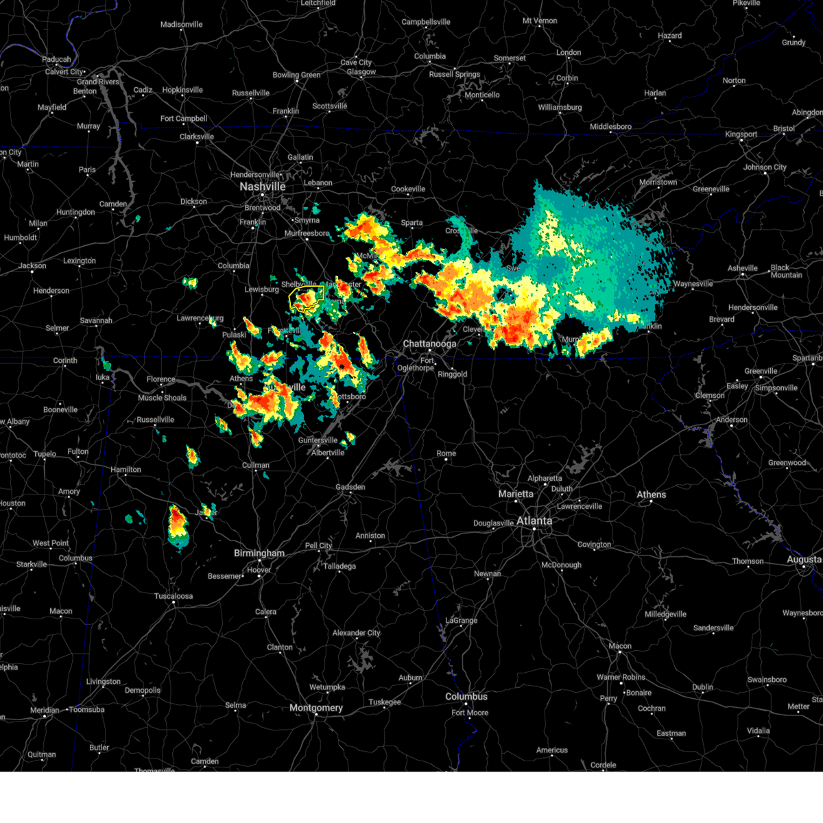 The severe thunderstorm warning for southeastern bedford county will expire at 230 pm cdt, the storm which prompted the warning has weakened below severe limits, and no longer poses an immediate threat to life or property. therefore, the warning will be allowed to expire. however small hail and gusty winds are still possible with this thunderstorm. a severe thunderstorm watch remains in effect until 600 pm cdt for middle tennessee. The severe thunderstorm warning for southeastern bedford county will expire at 230 pm cdt, the storm which prompted the warning has weakened below severe limits, and no longer poses an immediate threat to life or property. therefore, the warning will be allowed to expire. however small hail and gusty winds are still possible with this thunderstorm. a severe thunderstorm watch remains in effect until 600 pm cdt for middle tennessee.
|
| 6/25/2023 2:19 PM CDT |
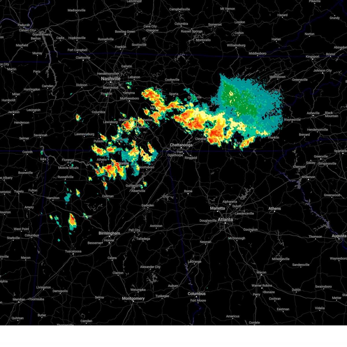 At 218 pm cdt, a severe thunderstorm was located near shelbyville, moving east at 20 mph (radar indicated). Hazards include 60 mph wind gusts and quarter size hail. Hail damage to vehicles is expected. expect wind damage to roofs, siding, and trees. locations impacted include, shelbyville, normandy and raus. hail threat, radar indicated max hail size, 1. 00 in wind threat, radar indicated max wind gust, 60 mph. At 218 pm cdt, a severe thunderstorm was located near shelbyville, moving east at 20 mph (radar indicated). Hazards include 60 mph wind gusts and quarter size hail. Hail damage to vehicles is expected. expect wind damage to roofs, siding, and trees. locations impacted include, shelbyville, normandy and raus. hail threat, radar indicated max hail size, 1. 00 in wind threat, radar indicated max wind gust, 60 mph.
|
| 6/25/2023 2:04 PM CDT |
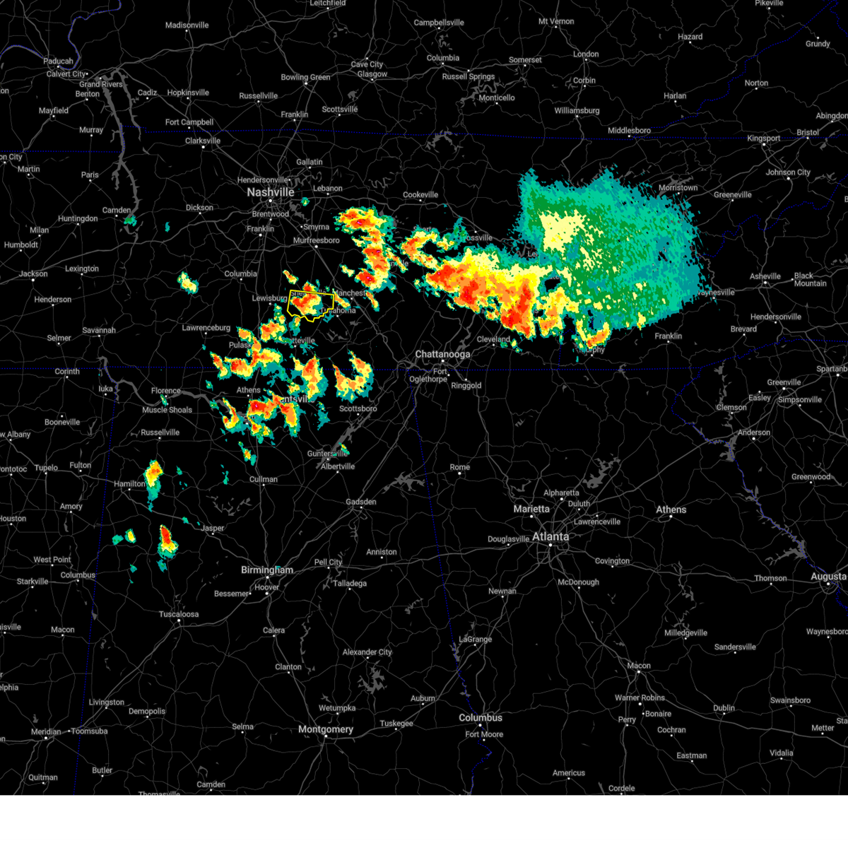 At 203 pm cdt, a severe thunderstorm was located near shelbyville, moving east at 20 mph (radar indicated). Hazards include 60 mph wind gusts and quarter size hail. Hail damage to vehicles is expected. expect wind damage to roofs, siding, and trees. locations impacted include, shelbyville, normandy and raus. hail threat, radar indicated max hail size, 1. 00 in wind threat, radar indicated max wind gust, 60 mph. At 203 pm cdt, a severe thunderstorm was located near shelbyville, moving east at 20 mph (radar indicated). Hazards include 60 mph wind gusts and quarter size hail. Hail damage to vehicles is expected. expect wind damage to roofs, siding, and trees. locations impacted include, shelbyville, normandy and raus. hail threat, radar indicated max hail size, 1. 00 in wind threat, radar indicated max wind gust, 60 mph.
|
| 6/25/2023 1:50 PM CDT |
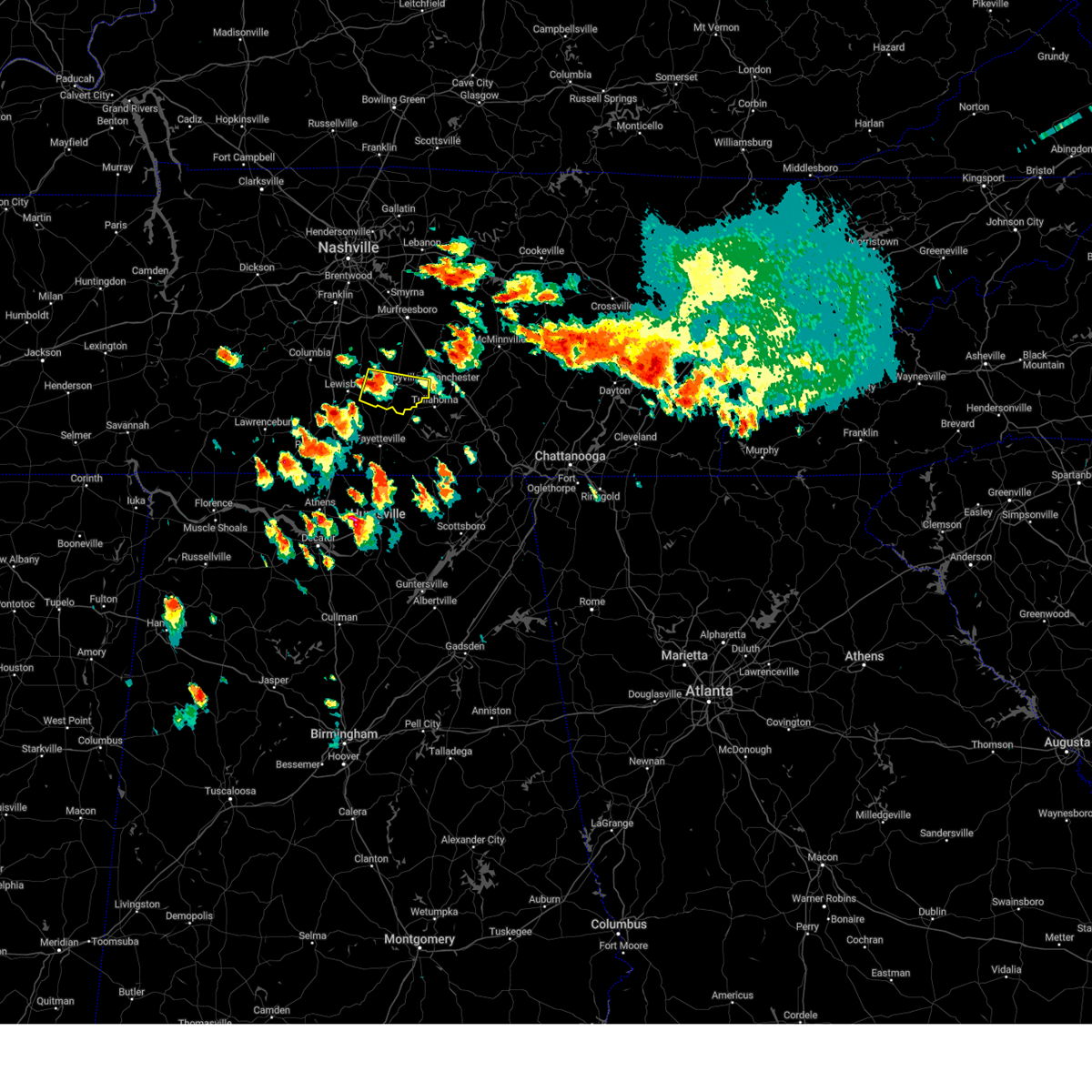 At 150 pm cdt, a severe thunderstorm was located 8 miles west of shelbyville, moving east at 20 mph (radar indicated). Hazards include 60 mph wind gusts and quarter size hail. Hail damage to vehicles is expected. Expect wind damage to roofs, siding, and trees. At 150 pm cdt, a severe thunderstorm was located 8 miles west of shelbyville, moving east at 20 mph (radar indicated). Hazards include 60 mph wind gusts and quarter size hail. Hail damage to vehicles is expected. Expect wind damage to roofs, siding, and trees.
|
| 4/28/2023 3:55 AM CDT |
 At 354 am cdt, a severe thunderstorm was located 9 miles northwest of shelbyville, moving east at 10 mph (radar indicated). Hazards include 60 mph wind gusts and quarter size hail. Hail damage to vehicles is expected. expect wind damage to roofs, siding, and trees. locations impacted include, shelbyville, chapel hill, wartrace, bell buckle, deason and unionville. hail threat, radar indicated max hail size, 1. 00 in wind threat, radar indicated max wind gust, 60 mph. At 354 am cdt, a severe thunderstorm was located 9 miles northwest of shelbyville, moving east at 10 mph (radar indicated). Hazards include 60 mph wind gusts and quarter size hail. Hail damage to vehicles is expected. expect wind damage to roofs, siding, and trees. locations impacted include, shelbyville, chapel hill, wartrace, bell buckle, deason and unionville. hail threat, radar indicated max hail size, 1. 00 in wind threat, radar indicated max wind gust, 60 mph.
|
| 4/28/2023 3:37 AM CDT |
 At 336 am cdt, a severe thunderstorm was located 9 miles northeast of lewisburg, moving east at 35 mph (radar indicated). Hazards include 60 mph wind gusts and quarter size hail. Hail damage to vehicles is expected. Expect wind damage to roofs, siding, and trees. At 336 am cdt, a severe thunderstorm was located 9 miles northeast of lewisburg, moving east at 35 mph (radar indicated). Hazards include 60 mph wind gusts and quarter size hail. Hail damage to vehicles is expected. Expect wind damage to roofs, siding, and trees.
|
| 4/1/2023 1:39 AM CDT | Tree reportedly fell through house on troupe roa in bedford county TN, 3.1 miles ESE of Shelbyville, TN |
| 3/3/2023 11:56 AM CST |
 At 1156 am cst, severe thunderstorms were located along a line extending from 8 miles east of murfreesboro to 14 miles southwest of woodbury to 9 miles east of shelbyville, moving northeast at 65 mph (radar indicated). Hazards include 70 mph wind gusts. Expect considerable tree damage. Damage is likely to mobile homes, roofs, and outbuildings. At 1156 am cst, severe thunderstorms were located along a line extending from 8 miles east of murfreesboro to 14 miles southwest of woodbury to 9 miles east of shelbyville, moving northeast at 65 mph (radar indicated). Hazards include 70 mph wind gusts. Expect considerable tree damage. Damage is likely to mobile homes, roofs, and outbuildings.
|
| 3/3/2023 11:41 AM CST |
 At 1141 am cst, severe thunderstorms were located along a line extending from 12 miles southwest of murfreesboro to near shelbyville, moving northeast at 75 mph (radar indicated). Hazards include 70 mph wind gusts. Expect considerable tree damage. damage is likely to mobile homes, roofs, and outbuildings. locations impacted include, murfreesboro, shelbyville, woodbury, wartrace, bell buckle, auburntown, christiana, beechgrove, fosterville, deason, bradyville, milton, unionville and readyville. this includes interstate 24 between mile markers 81 and 103. thunderstorm damage threat, considerable hail threat, radar indicated max hail size, <. 75 in wind threat, radar indicated max wind gust, 70 mph. At 1141 am cst, severe thunderstorms were located along a line extending from 12 miles southwest of murfreesboro to near shelbyville, moving northeast at 75 mph (radar indicated). Hazards include 70 mph wind gusts. Expect considerable tree damage. damage is likely to mobile homes, roofs, and outbuildings. locations impacted include, murfreesboro, shelbyville, woodbury, wartrace, bell buckle, auburntown, christiana, beechgrove, fosterville, deason, bradyville, milton, unionville and readyville. this includes interstate 24 between mile markers 81 and 103. thunderstorm damage threat, considerable hail threat, radar indicated max hail size, <. 75 in wind threat, radar indicated max wind gust, 70 mph.
|
| 3/3/2023 11:26 AM CST |
 At 1125 am cst, severe thunderstorms were located along a line extending from 6 miles northeast of lewisburg to 6 miles southwest of petersburg, moving northeast at 75 mph (radar indicated). Hazards include 70 mph wind gusts. Expect considerable tree damage. Damage is likely to mobile homes, roofs, and outbuildings. At 1125 am cst, severe thunderstorms were located along a line extending from 6 miles northeast of lewisburg to 6 miles southwest of petersburg, moving northeast at 75 mph (radar indicated). Hazards include 70 mph wind gusts. Expect considerable tree damage. Damage is likely to mobile homes, roofs, and outbuildings.
|
| 2/16/2023 5:23 PM CST |
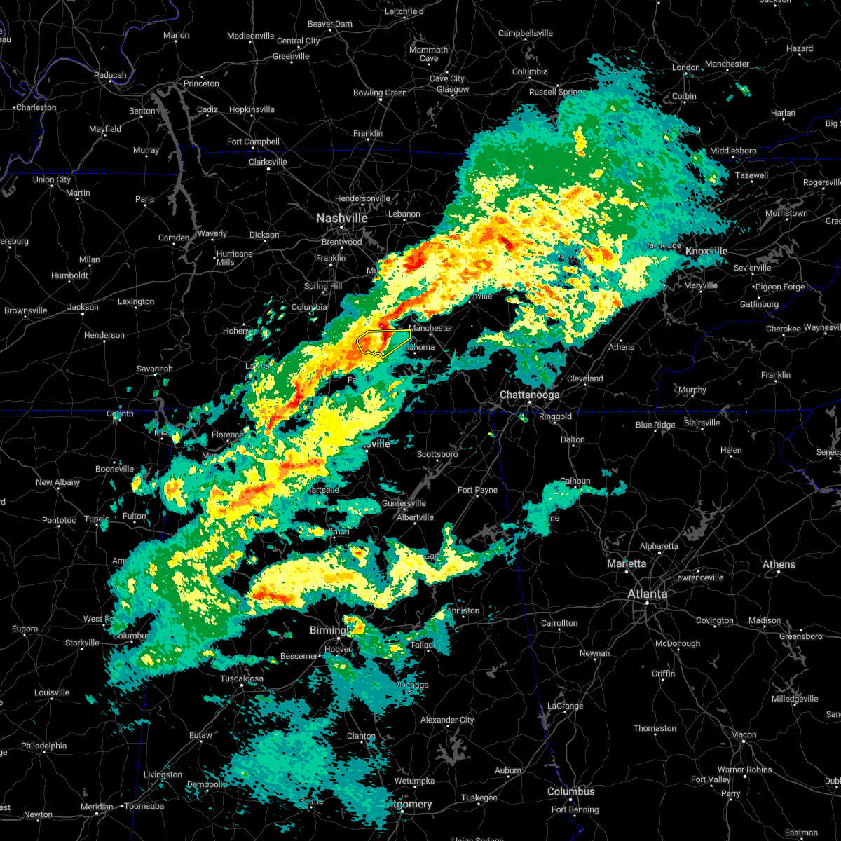 At 522 pm cst, severe thunderstorms were located along a line extending from near shelbyville to 11 miles southwest of petersburg, moving east at 40 mph (radar indicated). Hazards include 60 mph wind gusts and half dollar size hail. Hail damage to vehicles is expected. expect wind damage to roofs, siding, and trees. locations impacted include, shelbyville and normandy. hail threat, radar indicated max hail size, 1. 25 in wind threat, radar indicated max wind gust, 60 mph. At 522 pm cst, severe thunderstorms were located along a line extending from near shelbyville to 11 miles southwest of petersburg, moving east at 40 mph (radar indicated). Hazards include 60 mph wind gusts and half dollar size hail. Hail damage to vehicles is expected. expect wind damage to roofs, siding, and trees. locations impacted include, shelbyville and normandy. hail threat, radar indicated max hail size, 1. 25 in wind threat, radar indicated max wind gust, 60 mph.
|
| 2/16/2023 5:18 PM CST |
 At 517 pm cst, a severe thunderstorm was located over shelbyville, moving northeast at 55 mph (radar indicated). Hazards include 60 mph wind gusts and half dollar size hail. Hail damage to vehicles is expected. Expect wind damage to roofs, siding, and trees. At 517 pm cst, a severe thunderstorm was located over shelbyville, moving northeast at 55 mph (radar indicated). Hazards include 60 mph wind gusts and half dollar size hail. Hail damage to vehicles is expected. Expect wind damage to roofs, siding, and trees.
|
| 2/16/2023 5:15 PM CST | Quarter sized hail reported 0.6 miles WNW of Shelbyville, TN, numerous reports of hail up to quarter size in shelbyville. |
| 2/16/2023 5:00 PM CST | Three power poles were broken with power lines down on highway 64 in the bedford communit in bedford county TN, 7 miles ENE of Shelbyville, TN |
| 2/16/2023 4:56 PM CST |
 At 456 pm cst, severe thunderstorms were located along a line extending from 6 miles north of petersburg to near pulaski, moving east at 40 mph (radar indicated). Hazards include 60 mph wind gusts and half dollar size hail. Hail damage to vehicles is expected. Expect wind damage to roofs, siding, and trees. At 456 pm cst, severe thunderstorms were located along a line extending from 6 miles north of petersburg to near pulaski, moving east at 40 mph (radar indicated). Hazards include 60 mph wind gusts and half dollar size hail. Hail damage to vehicles is expected. Expect wind damage to roofs, siding, and trees.
|
| 7/12/2022 9:04 PM CDT |
 At 904 pm cdt, severe thunderstorms were located along a line extending from 6 miles west of shelbyville to 10 miles west of lewisburg, moving southeast at 10 mph (radar indicated). Hazards include 60 mph wind gusts and quarter size hail. Hail damage to vehicles is expected. expect wind damage to roofs, siding, and trees. locations impacted include, shelbyville, lewisburg, pulaski, chapel hill, cornersville, lynnville, belfast, frankewing, culleoka, raus, farmington and unionville. this includes interstate 65 between mile markers 14 and 42. hail threat, radar indicated max hail size, 1. 00 in wind threat, radar indicated max wind gust, 60 mph. At 904 pm cdt, severe thunderstorms were located along a line extending from 6 miles west of shelbyville to 10 miles west of lewisburg, moving southeast at 10 mph (radar indicated). Hazards include 60 mph wind gusts and quarter size hail. Hail damage to vehicles is expected. expect wind damage to roofs, siding, and trees. locations impacted include, shelbyville, lewisburg, pulaski, chapel hill, cornersville, lynnville, belfast, frankewing, culleoka, raus, farmington and unionville. this includes interstate 65 between mile markers 14 and 42. hail threat, radar indicated max hail size, 1. 00 in wind threat, radar indicated max wind gust, 60 mph.
|
| 7/12/2022 8:42 PM CDT | Twitter report... large tree down on minkslide road. time estimated via rada in bedford county TN, 5.4 miles SSW of Shelbyville, TN |
| 7/12/2022 8:33 PM CDT |
 At 832 pm cdt, severe thunderstorms were located along a line extending from lynnville to shelbyville, moving southeast at 10 mph (radar indicated. at 820 pm cdt...teacup size hail was reported in marshall county with these storms). Hazards include 60 mph wind gusts and quarter size hail. Hail damage to vehicles is expected. Expect wind damage to roofs, siding, and trees. At 832 pm cdt, severe thunderstorms were located along a line extending from lynnville to shelbyville, moving southeast at 10 mph (radar indicated. at 820 pm cdt...teacup size hail was reported in marshall county with these storms). Hazards include 60 mph wind gusts and quarter size hail. Hail damage to vehicles is expected. Expect wind damage to roofs, siding, and trees.
|
| 7/12/2022 8:20 PM CDT |
 At 819 pm cdt, severe thunderstorms were located along a line extending from 10 miles northwest of manchester to chapel hill, moving southeast at 10 mph (public. at 815 pm cdt...quarter size hail was reported in chapel hill with these storms). Hazards include ping pong ball size hail and 60 mph wind gusts. People and animals outdoors will be injured. expect hail damage to roofs, siding, windows, and vehicles. expect wind damage to roofs, siding, and trees. locations impacted include, shelbyville, manchester, tullahoma, chapel hill, wartrace, eagleville, bell buckle, normandy, christiana, beechgrove, raus, fosterville, summitville, rover, belfast, deason, hillsboro, bradyville, farmington and unionville. this includes interstate 24 between mile markers 87 and 127. hail threat, observed max hail size, 1. 50 in wind threat, radar indicated max wind gust, 60 mph. At 819 pm cdt, severe thunderstorms were located along a line extending from 10 miles northwest of manchester to chapel hill, moving southeast at 10 mph (public. at 815 pm cdt...quarter size hail was reported in chapel hill with these storms). Hazards include ping pong ball size hail and 60 mph wind gusts. People and animals outdoors will be injured. expect hail damage to roofs, siding, windows, and vehicles. expect wind damage to roofs, siding, and trees. locations impacted include, shelbyville, manchester, tullahoma, chapel hill, wartrace, eagleville, bell buckle, normandy, christiana, beechgrove, raus, fosterville, summitville, rover, belfast, deason, hillsboro, bradyville, farmington and unionville. this includes interstate 24 between mile markers 87 and 127. hail threat, observed max hail size, 1. 50 in wind threat, radar indicated max wind gust, 60 mph.
|
| 7/12/2022 8:03 PM CDT |
 At 802 pm cdt, severe thunderstorms were located along a line extending from chapel hill to bell buckle, moving southeast at 20 mph (radar indicated). Hazards include golf ball size hail and 60 mph wind gusts. People and animals outdoors will be injured. expect hail damage to roofs, siding, windows, and vehicles. expect wind damage to roofs, siding, and trees. locations impacted include, shelbyville, manchester, tullahoma, chapel hill, wartrace, eagleville, bell buckle, normandy, christiana, beechgrove, raus, fosterville, summitville, rover, belfast, deason, hillsboro, bradyville, farmington and unionville. this includes interstate 24 between mile markers 87 and 127. thunderstorm damage threat, considerable hail threat, radar indicated max hail size, 1. 75 in wind threat, radar indicated max wind gust, 60 mph. At 802 pm cdt, severe thunderstorms were located along a line extending from chapel hill to bell buckle, moving southeast at 20 mph (radar indicated). Hazards include golf ball size hail and 60 mph wind gusts. People and animals outdoors will be injured. expect hail damage to roofs, siding, windows, and vehicles. expect wind damage to roofs, siding, and trees. locations impacted include, shelbyville, manchester, tullahoma, chapel hill, wartrace, eagleville, bell buckle, normandy, christiana, beechgrove, raus, fosterville, summitville, rover, belfast, deason, hillsboro, bradyville, farmington and unionville. this includes interstate 24 between mile markers 87 and 127. thunderstorm damage threat, considerable hail threat, radar indicated max hail size, 1. 75 in wind threat, radar indicated max wind gust, 60 mph.
|
| 7/12/2022 7:51 PM CDT |
 At 751 pm cdt, severe thunderstorms were located along a line extending from chapel hill to bell buckle, moving southeast at 25 mph (radar indicated). Hazards include 60 mph wind gusts and half dollar size hail. Hail damage to vehicles is expected. Expect wind damage to roofs, siding, and trees. At 751 pm cdt, severe thunderstorms were located along a line extending from chapel hill to bell buckle, moving southeast at 25 mph (radar indicated). Hazards include 60 mph wind gusts and half dollar size hail. Hail damage to vehicles is expected. Expect wind damage to roofs, siding, and trees.
|
| 7/12/2022 7:42 PM CDT |
 At 741 pm cdt, severe thunderstorms were located along a line extending from rover to near bradyville, moving southeast at 10 mph (trained weather spotters. these storms have a history of producing damaging winds to trees and hail up to quarter size in rutherford county). Hazards include 60 mph wind gusts and quarter size hail. Hail damage to vehicles is expected. expect wind damage to roofs, siding, and trees. locations impacted include, murfreesboro, shelbyville, mcminnville, woodbury, chapel hill, wartrace, eagleville, bell buckle, centertown, christiana, beechgrove, fosterville, rover, deason, rockvale, bradyville, unionville and readyville. this includes interstate 24 between mile markers 81 and 103. hail threat, radar indicated max hail size, 1. 00 in wind threat, radar indicated max wind gust, 60 mph. At 741 pm cdt, severe thunderstorms were located along a line extending from rover to near bradyville, moving southeast at 10 mph (trained weather spotters. these storms have a history of producing damaging winds to trees and hail up to quarter size in rutherford county). Hazards include 60 mph wind gusts and quarter size hail. Hail damage to vehicles is expected. expect wind damage to roofs, siding, and trees. locations impacted include, murfreesboro, shelbyville, mcminnville, woodbury, chapel hill, wartrace, eagleville, bell buckle, centertown, christiana, beechgrove, fosterville, rover, deason, rockvale, bradyville, unionville and readyville. this includes interstate 24 between mile markers 81 and 103. hail threat, radar indicated max hail size, 1. 00 in wind threat, radar indicated max wind gust, 60 mph.
|
| 7/12/2022 7:15 PM CDT |
 At 715 pm cdt, severe thunderstorms were located along a line extending from chapel hill to woodbury, moving southeast at 15 mph (radar indicated). Hazards include 60 mph wind gusts and quarter size hail. Hail damage to vehicles is expected. Expect wind damage to roofs, siding, and trees. At 715 pm cdt, severe thunderstorms were located along a line extending from chapel hill to woodbury, moving southeast at 15 mph (radar indicated). Hazards include 60 mph wind gusts and quarter size hail. Hail damage to vehicles is expected. Expect wind damage to roofs, siding, and trees.
|
| 7/9/2022 4:05 AM CDT |
 The severe thunderstorm warning for southern de kalb, southeastern rutherford, warren, coffee, eastern bedford and cannon counties will expire at 415 am cdt, the storms which prompted the warning have weakened below severe limits, and no longer pose an immediate threat to life or property. therefore, the warning will be allowed to expire. however gusty winds are still possible with these thunderstorms. The severe thunderstorm warning for southern de kalb, southeastern rutherford, warren, coffee, eastern bedford and cannon counties will expire at 415 am cdt, the storms which prompted the warning have weakened below severe limits, and no longer pose an immediate threat to life or property. therefore, the warning will be allowed to expire. however gusty winds are still possible with these thunderstorms.
|
| 7/9/2022 3:53 AM CDT |
 At 352 am cdt, severe thunderstorms were located along a line extending from near mcminnville to near manchester to near shelbyville, moving south at 55 mph (radar indicated). Hazards include 60 mph wind gusts. Expect damage to roofs, siding, and trees. locations impacted include, murfreesboro, shelbyville, mcminnville, manchester, smithville, woodbury, morrison, wartrace, bell buckle, centertown, normandy, christiana, beechgrove, raus, fosterville, summitville, deason, rockvale, bradyville and readyville. this includes interstate 24 between mile markers 81 and 114. hail threat, radar indicated max hail size, <. 75 in wind threat, radar indicated max wind gust, 60 mph. At 352 am cdt, severe thunderstorms were located along a line extending from near mcminnville to near manchester to near shelbyville, moving south at 55 mph (radar indicated). Hazards include 60 mph wind gusts. Expect damage to roofs, siding, and trees. locations impacted include, murfreesboro, shelbyville, mcminnville, manchester, smithville, woodbury, morrison, wartrace, bell buckle, centertown, normandy, christiana, beechgrove, raus, fosterville, summitville, deason, rockvale, bradyville and readyville. this includes interstate 24 between mile markers 81 and 114. hail threat, radar indicated max hail size, <. 75 in wind threat, radar indicated max wind gust, 60 mph.
|
| 7/9/2022 3:25 AM CDT |
 At 325 am cdt, severe thunderstorms were located along a line extending from near smithville to 10 miles southwest of murfreesboro, moving south at 45 mph (radar indicated). Hazards include 60 mph wind gusts. expect damage to roofs, siding, and trees At 325 am cdt, severe thunderstorms were located along a line extending from near smithville to 10 miles southwest of murfreesboro, moving south at 45 mph (radar indicated). Hazards include 60 mph wind gusts. expect damage to roofs, siding, and trees
|
| 7/7/2022 4:40 PM CDT | Public report of a large tree down at the bedford county board of education building on madison st in shelbyvill in bedford county TN, 0.6 miles WNW of Shelbyville, TN |
| 7/7/2022 4:30 PM CDT | Public report of two large trees down near a home at the corner of union street and woodmont drive in shelbyvill in bedford county TN, 1.3 miles ESE of Shelbyville, TN |
| 7/7/2022 4:30 PM CDT | Public report of a tree snapped in the front yard of a home in the union station subdivision on the nw side of shelbyville... t in bedford county TN, 2.6 miles ESE of Shelbyville, TN |
| 7/7/2022 4:24 PM CDT | Public report of a tree down on midland road in north-central bedford count in bedford county TN, 4.7 miles S of Shelbyville, TN |
| 6/17/2022 10:56 AM CDT |
 At 1056 am cdt, severe thunderstorms were located along a line extending from 8 miles northeast of walterhill to near murfreesboro to 11 miles south of nolensville, moving southeast at 40 mph (radar indicated). Hazards include 60 mph wind gusts and quarter size hail. Hail damage to vehicles is expected. Expect wind damage to roofs, siding, and trees. At 1056 am cdt, severe thunderstorms were located along a line extending from 8 miles northeast of walterhill to near murfreesboro to 11 miles south of nolensville, moving southeast at 40 mph (radar indicated). Hazards include 60 mph wind gusts and quarter size hail. Hail damage to vehicles is expected. Expect wind damage to roofs, siding, and trees.
|
| 6/7/2022 4:35 AM CDT |
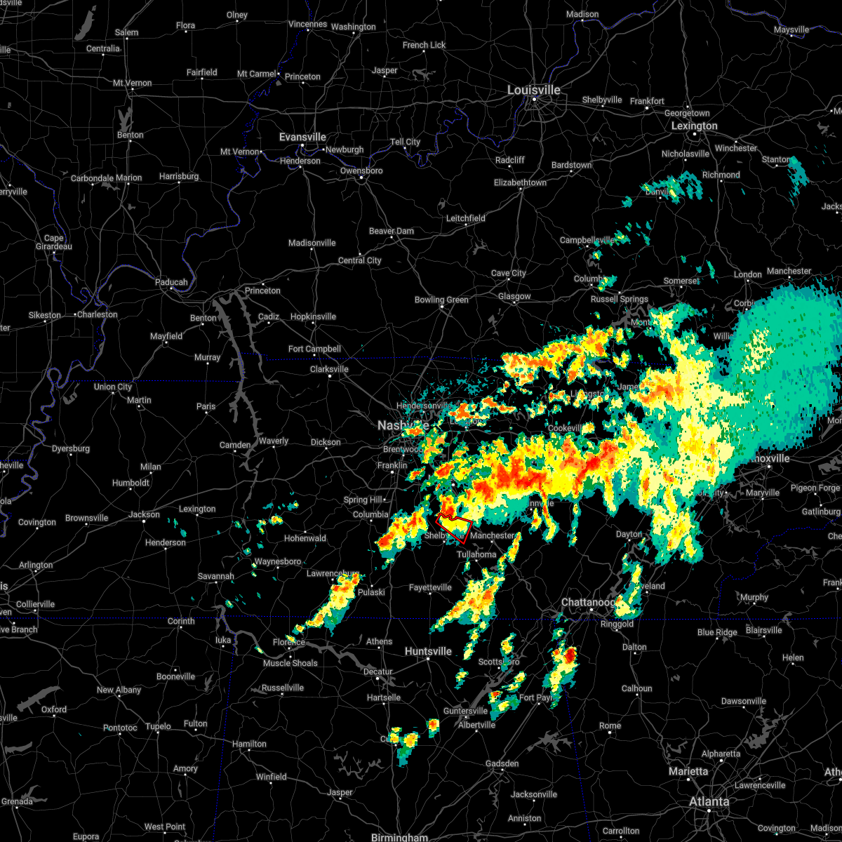 At 434 am cdt, a severe thunderstorm capable of producing a tornado was located 8 miles north of shelbyville, moving southeast at 30 mph (radar indicated rotation). Hazards include tornado. Flying debris will be dangerous to those caught without shelter. mobile homes will be damaged or destroyed. damage to roofs, windows, and vehicles will occur. tree damage is likely. this tornadic thunderstorm will remain over mainly rural areas of northeastern bedford county, including the following locations, deason, bell buckle and wartrace. This includes interstate 24 near mile marker 98. At 434 am cdt, a severe thunderstorm capable of producing a tornado was located 8 miles north of shelbyville, moving southeast at 30 mph (radar indicated rotation). Hazards include tornado. Flying debris will be dangerous to those caught without shelter. mobile homes will be damaged or destroyed. damage to roofs, windows, and vehicles will occur. tree damage is likely. this tornadic thunderstorm will remain over mainly rural areas of northeastern bedford county, including the following locations, deason, bell buckle and wartrace. This includes interstate 24 near mile marker 98.
|
| 4/13/2022 8:27 PM CDT |
 At 826 pm cdt, severe thunderstorms were located along a line extending from 8 miles southwest of watertown to 11 miles southeast of murfreesboro to near lynchburg, moving east at 55 mph (radar indicated). Hazards include 70 mph wind gusts. Expect considerable tree damage. Damage is likely to mobile homes, roofs, and outbuildings. At 826 pm cdt, severe thunderstorms were located along a line extending from 8 miles southwest of watertown to 11 miles southeast of murfreesboro to near lynchburg, moving east at 55 mph (radar indicated). Hazards include 70 mph wind gusts. Expect considerable tree damage. Damage is likely to mobile homes, roofs, and outbuildings.
|
| 4/13/2022 8:22 PM CDT |
 At 822 pm cdt, severe thunderstorms were located along a line extending from 10 miles southeast of murfreesboro to 8 miles northwest of hazel green, moving east at 60 mph (radar indicated). Hazards include 70 mph wind gusts. Expect considerable tree damage. damage is likely to mobile homes, roofs, and outbuildings. locations impacted include, shelbyville, manchester, tullahoma, wartrace, bell buckle, normandy, christiana, deason, bradyville, beechgrove, raus and fosterville. this includes interstate 24 between mile markers 87 and 111. thunderstorm damage threat, considerable hail threat, radar indicated max hail size, <. 75 in wind threat, radar indicated max wind gust, 70 mph. At 822 pm cdt, severe thunderstorms were located along a line extending from 10 miles southeast of murfreesboro to 8 miles northwest of hazel green, moving east at 60 mph (radar indicated). Hazards include 70 mph wind gusts. Expect considerable tree damage. damage is likely to mobile homes, roofs, and outbuildings. locations impacted include, shelbyville, manchester, tullahoma, wartrace, bell buckle, normandy, christiana, deason, bradyville, beechgrove, raus and fosterville. this includes interstate 24 between mile markers 87 and 111. thunderstorm damage threat, considerable hail threat, radar indicated max hail size, <. 75 in wind threat, radar indicated max wind gust, 70 mph.
|
| 4/13/2022 8:20 PM CDT | Scattered trees down across bedford count in bedford county TN, 0.6 miles WNW of Shelbyville, TN |
| 4/13/2022 8:16 PM CDT |
 At 815 pm cdt, severe thunderstorms were located along a line extending from 9 miles south of murfreesboro to near ardmore, moving east at 60 mph (radar indicated). Hazards include 70 mph wind gusts. Expect considerable tree damage. damage is likely to mobile homes, roofs, and outbuildings. locations impacted include, shelbyville, lewisburg, manchester, pulaski, tullahoma, chapel hill, ardmore, cornersville, wartrace, eagleville, elkton, bell buckle, normandy, beechgrove, raus, fosterville, rover, belfast, frankewing and bradyville. this includes the following highways, interstate 65 between mile markers 1 and 25. interstate 24 between mile markers 87 and 111. thunderstorm damage threat, considerable hail threat, radar indicated max hail size, <. 75 in wind threat, radar indicated max wind gust, 70 mph. At 815 pm cdt, severe thunderstorms were located along a line extending from 9 miles south of murfreesboro to near ardmore, moving east at 60 mph (radar indicated). Hazards include 70 mph wind gusts. Expect considerable tree damage. damage is likely to mobile homes, roofs, and outbuildings. locations impacted include, shelbyville, lewisburg, manchester, pulaski, tullahoma, chapel hill, ardmore, cornersville, wartrace, eagleville, elkton, bell buckle, normandy, beechgrove, raus, fosterville, rover, belfast, frankewing and bradyville. this includes the following highways, interstate 65 between mile markers 1 and 25. interstate 24 between mile markers 87 and 111. thunderstorm damage threat, considerable hail threat, radar indicated max hail size, <. 75 in wind threat, radar indicated max wind gust, 70 mph.
|
| 4/13/2022 7:54 PM CDT |
 At 753 pm cdt, severe thunderstorms were located along a line extending from 7 miles east of spring hill to 13 miles east of lexington, moving east at 60 mph (radar indicated). Hazards include 70 mph wind gusts. Expect considerable tree damage. Damage is likely to mobile homes, roofs, and outbuildings. At 753 pm cdt, severe thunderstorms were located along a line extending from 7 miles east of spring hill to 13 miles east of lexington, moving east at 60 mph (radar indicated). Hazards include 70 mph wind gusts. Expect considerable tree damage. Damage is likely to mobile homes, roofs, and outbuildings.
|
| 2/17/2022 5:06 PM CST |
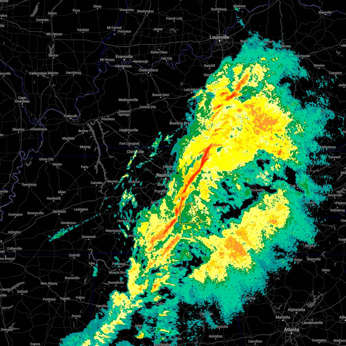 At 506 pm cst, a severe thunderstorm was located 8 miles northeast of shelbyville, moving east at 60 mph (radar indicated). Hazards include 60 mph wind gusts. Expect damage to roofs, siding, and trees. locations impacted include, shelbyville, wartrace, bell buckle, christiana, deason, beechgrove and fosterville. this includes interstate 24 between mile markers 85 and 108. hail threat, radar indicated max hail size, <. 75 in wind threat, radar indicated max wind gust, 60 mph. At 506 pm cst, a severe thunderstorm was located 8 miles northeast of shelbyville, moving east at 60 mph (radar indicated). Hazards include 60 mph wind gusts. Expect damage to roofs, siding, and trees. locations impacted include, shelbyville, wartrace, bell buckle, christiana, deason, beechgrove and fosterville. this includes interstate 24 between mile markers 85 and 108. hail threat, radar indicated max hail size, <. 75 in wind threat, radar indicated max wind gust, 60 mph.
|
| 2/17/2022 5:05 PM CST | Awos station ksyi shelbyville bomar fiel in bedford county TN, 4.8 miles SSW of Shelbyville, TN |
| 2/17/2022 4:53 PM CST |
 At 453 pm cst, a severe thunderstorm was located 10 miles northwest of shelbyville, moving east at 60 mph (radar indicated). Hazards include 60 mph wind gusts. expect damage to roofs, siding, and trees At 453 pm cst, a severe thunderstorm was located 10 miles northwest of shelbyville, moving east at 60 mph (radar indicated). Hazards include 60 mph wind gusts. expect damage to roofs, siding, and trees
|
| 1/1/2022 2:53 PM CST |
 At 253 pm cst, a severe thunderstorm was located near shelbyville, moving northeast at 40 mph (radar indicated). Hazards include 60 mph wind gusts. expect damage to roofs, siding, and trees At 253 pm cst, a severe thunderstorm was located near shelbyville, moving northeast at 40 mph (radar indicated). Hazards include 60 mph wind gusts. expect damage to roofs, siding, and trees
|
| 12/6/2021 7:40 AM CST |
 At 739 am cst, a severe thunderstorm capable of producing a tornado was located near tullahoma, or 8 miles southeast of shelbyville, moving east at 55 mph (radar indicated rotation). Hazards include tornado. Flying debris will be dangerous to those caught without shelter. mobile homes will be damaged or destroyed. damage to roofs, windows, and vehicles will occur. tree damage is likely. this dangerous storm will be near, tullahoma around 745 am cst. manchester around 755 am cst. other locations impacted by this tornadic thunderstorm include normandy, raus, hillsboro and arnold afb. This includes interstate 24 between mile markers 107 and 124. At 739 am cst, a severe thunderstorm capable of producing a tornado was located near tullahoma, or 8 miles southeast of shelbyville, moving east at 55 mph (radar indicated rotation). Hazards include tornado. Flying debris will be dangerous to those caught without shelter. mobile homes will be damaged or destroyed. damage to roofs, windows, and vehicles will occur. tree damage is likely. this dangerous storm will be near, tullahoma around 745 am cst. manchester around 755 am cst. other locations impacted by this tornadic thunderstorm include normandy, raus, hillsboro and arnold afb. This includes interstate 24 between mile markers 107 and 124.
|
| 12/6/2021 7:37 AM CST |
 At 736 am cst, a severe thunderstorm was located near shelbyville, moving east at 50 mph (radar indicated). Hazards include 60 mph wind gusts. Expect damage to roofs, siding, and trees. locations impacted include, shelbyville, tullahoma, wartrace, normandy, raus and arnold afb. this includes interstate 24 between mile markers 104 and 105. hail threat, radar indicated max hail size, <. 75 in wind threat, radar indicated max wind gust, 60 mph. At 736 am cst, a severe thunderstorm was located near shelbyville, moving east at 50 mph (radar indicated). Hazards include 60 mph wind gusts. Expect damage to roofs, siding, and trees. locations impacted include, shelbyville, tullahoma, wartrace, normandy, raus and arnold afb. this includes interstate 24 between mile markers 104 and 105. hail threat, radar indicated max hail size, <. 75 in wind threat, radar indicated max wind gust, 60 mph.
|
| 12/6/2021 7:21 AM CST |
 At 721 am cst, a severe thunderstorm was located near lewisburg, moving east at 50 mph (radar indicated). Hazards include 60 mph wind gusts. expect damage to roofs, siding, and trees At 721 am cst, a severe thunderstorm was located near lewisburg, moving east at 50 mph (radar indicated). Hazards include 60 mph wind gusts. expect damage to roofs, siding, and trees
|
| 7/31/2021 11:55 PM CDT |
 At 1154 pm cdt, severe thunderstorms were located along a line extending from centertown to near lynchburg, moving east at 45 mph (radar indicated). Hazards include 60 mph wind gusts. expect damage to roofs, siding, and trees At 1154 pm cdt, severe thunderstorms were located along a line extending from centertown to near lynchburg, moving east at 45 mph (radar indicated). Hazards include 60 mph wind gusts. expect damage to roofs, siding, and trees
|
| 7/31/2021 11:37 PM CDT | Large tree down on belmont avenue in bedford county TN, 1 miles NNW of Shelbyville, TN |
| 7/31/2021 11:26 PM CDT |
 At 1125 pm cdt, severe thunderstorms were located along a line extending from near murfreesboro to near shelbyville to cornersville, moving southeast at 45 mph (radar indicated). Hazards include 60 mph wind gusts. expect damage to roofs, siding, and trees At 1125 pm cdt, severe thunderstorms were located along a line extending from near murfreesboro to near shelbyville to cornersville, moving southeast at 45 mph (radar indicated). Hazards include 60 mph wind gusts. expect damage to roofs, siding, and trees
|
| 7/31/2021 11:17 PM CDT |
 At 1116 pm cdt, severe thunderstorms were located along a line extending from smyrna to near lewisburg, moving southeast at 50 mph (radar indicated). Hazards include 60 mph wind gusts. Expect damage to roofs, siding, and trees. locations impacted include, murfreesboro, shelbyville, lewisburg, smyrna, chapel hill, wartrace, eagleville, bell buckle, christiana, fosterville, rover, belfast, deason, rockvale, farmington and unionville. this includes the following highways, interstate 65 between mile markers 32 and 39. interstate 24 between mile markers 69 and 94. Interstate 840 between mile markers 46 and 55. At 1116 pm cdt, severe thunderstorms were located along a line extending from smyrna to near lewisburg, moving southeast at 50 mph (radar indicated). Hazards include 60 mph wind gusts. Expect damage to roofs, siding, and trees. locations impacted include, murfreesboro, shelbyville, lewisburg, smyrna, chapel hill, wartrace, eagleville, bell buckle, christiana, fosterville, rover, belfast, deason, rockvale, farmington and unionville. this includes the following highways, interstate 65 between mile markers 32 and 39. interstate 24 between mile markers 69 and 94. Interstate 840 between mile markers 46 and 55.
|
| 7/31/2021 10:52 PM CDT |
 At 1052 pm cdt, severe thunderstorms were located along a line extending from near brentwood to near columbia, moving southeast at 50 mph (radar indicated). Hazards include 60 mph wind gusts. expect damage to roofs, siding, and trees At 1052 pm cdt, severe thunderstorms were located along a line extending from near brentwood to near columbia, moving southeast at 50 mph (radar indicated). Hazards include 60 mph wind gusts. expect damage to roofs, siding, and trees
|
| 6/12/2021 3:58 PM CDT | Large tree uprooted on alton avenue in shelbyville in bedford county TN, 0.6 miles WNW of Shelbyville, TN |
| 6/12/2021 3:58 PM CDT | Trees down on powerlines at morton street and colloredo boulevar in bedford county TN, 0.7 miles SW of Shelbyville, TN |
| 6/12/2021 3:58 PM CDT | Trees down on powerlines at morton street and colloredo boulevar in bedford county TN, 0.5 miles S of Shelbyville, TN |
| 5/6/2021 6:28 PM CDT | A couple trees down in the flat creek are in bedford county TN, 1.7 miles NNE of Shelbyville, TN |
| 5/6/2021 6:27 PM CDT |
 At 626 pm cdt, severe thunderstorms were located along a line extending from 10 miles southeast of murfreesboro to near fayetteville, moving east at 50 mph (radar indicated). Hazards include 60 mph wind gusts. expect damage to roofs, siding, and trees At 626 pm cdt, severe thunderstorms were located along a line extending from 10 miles southeast of murfreesboro to near fayetteville, moving east at 50 mph (radar indicated). Hazards include 60 mph wind gusts. expect damage to roofs, siding, and trees
|
| 5/6/2021 6:02 PM CDT |
 At 601 pm cdt, severe thunderstorms were located along a line extending from 14 miles south of nolensville to 13 miles northeast of rogersville, moving east at 50 mph (radar indicated). Hazards include 60 mph wind gusts. Expect damage to roofs, siding, and trees. locations impacted include, shelbyville, lewisburg, pulaski, chapel hill, ardmore, cornersville, eagleville, elkton, minor hill, bell buckle, lynnville, christiana, fosterville, rover, belfast, goodspring, deason, frankewing, rockvale and prospect. this includes the following highways, interstate 65 between mile markers 1 and 39. Interstate 24 between mile markers 86 and 91. At 601 pm cdt, severe thunderstorms were located along a line extending from 14 miles south of nolensville to 13 miles northeast of rogersville, moving east at 50 mph (radar indicated). Hazards include 60 mph wind gusts. Expect damage to roofs, siding, and trees. locations impacted include, shelbyville, lewisburg, pulaski, chapel hill, ardmore, cornersville, eagleville, elkton, minor hill, bell buckle, lynnville, christiana, fosterville, rover, belfast, goodspring, deason, frankewing, rockvale and prospect. this includes the following highways, interstate 65 between mile markers 1 and 39. Interstate 24 between mile markers 86 and 91.
|
| 5/6/2021 5:45 PM CDT |
 At 545 pm cdt, severe thunderstorms were located along a line extending from near thompson`s station to near lexington, moving east at 50 mph (radar indicated). Hazards include 60 mph wind gusts. expect damage to roofs, siding, and trees At 545 pm cdt, severe thunderstorms were located along a line extending from near thompson`s station to near lexington, moving east at 50 mph (radar indicated). Hazards include 60 mph wind gusts. expect damage to roofs, siding, and trees
|
| 5/4/2021 7:35 AM CDT |
 At 735 am cdt, severe thunderstorms were located along a line extending from 6 miles west of woodbury to 6 miles south of shelbyville, moving east at 60 mph (radar indicated). Hazards include 60 mph wind gusts. expect damage to roofs, siding, and trees At 735 am cdt, severe thunderstorms were located along a line extending from 6 miles west of woodbury to 6 miles south of shelbyville, moving east at 60 mph (radar indicated). Hazards include 60 mph wind gusts. expect damage to roofs, siding, and trees
|
| 3/28/2021 2:22 AM CDT |
 At 221 am cdt, severe thunderstorms were located along a line extending from 8 miles west of shelbyville to 8 miles west of ardmore, moving east at 35 mph (radar indicated). Hazards include 60 mph wind gusts. Expect damage to roofs, siding, and trees. locations impacted include, shelbyville, lewisburg, pulaski, ardmore, wartrace, elkton, minor hill, belfast, frankewing and prospect. This includes interstate 65 between mile markers 1 and 21. At 221 am cdt, severe thunderstorms were located along a line extending from 8 miles west of shelbyville to 8 miles west of ardmore, moving east at 35 mph (radar indicated). Hazards include 60 mph wind gusts. Expect damage to roofs, siding, and trees. locations impacted include, shelbyville, lewisburg, pulaski, ardmore, wartrace, elkton, minor hill, belfast, frankewing and prospect. This includes interstate 65 between mile markers 1 and 21.
|
| 3/28/2021 1:54 AM CDT |
 At 153 am cdt, severe thunderstorms were located along a line extending from near lewisburg to 6 miles northeast of lexington, moving east at 35 mph (radar indicated). Hazards include 60 mph wind gusts. expect damage to roofs, siding, and trees At 153 am cdt, severe thunderstorms were located along a line extending from near lewisburg to 6 miles northeast of lexington, moving east at 35 mph (radar indicated). Hazards include 60 mph wind gusts. expect damage to roofs, siding, and trees
|
| 3/28/2021 1:25 AM CDT |
 The national weather service in nashville has issued a * severe thunderstorm warning for. marshall county in middle tennessee. southern rutherford county in middle tennessee. east central lawrence county in middle tennessee. Southeastern maury county in middle tennessee. The national weather service in nashville has issued a * severe thunderstorm warning for. marshall county in middle tennessee. southern rutherford county in middle tennessee. east central lawrence county in middle tennessee. Southeastern maury county in middle tennessee.
|
| 3/25/2021 8:55 PM CDT |
 At 854 pm cdt, a severe thunderstorm was located 8 miles west of shelbyville, moving east at 45 mph (radar indicated). Hazards include 60 mph wind gusts. Expect damage to roofs, siding, and trees. locations impacted include, shelbyville, lewisburg, cornersville, wartrace, bell buckle, belfast, deason, farmington, unionville and fosterville. This includes interstate 65 between mile markers 26 and 30. At 854 pm cdt, a severe thunderstorm was located 8 miles west of shelbyville, moving east at 45 mph (radar indicated). Hazards include 60 mph wind gusts. Expect damage to roofs, siding, and trees. locations impacted include, shelbyville, lewisburg, cornersville, wartrace, bell buckle, belfast, deason, farmington, unionville and fosterville. This includes interstate 65 between mile markers 26 and 30.
|
| 3/25/2021 8:41 PM CDT |
 At 840 pm cdt, a severe thunderstorm was located over lewisburg, moving east at 45 mph (radar indicated). Hazards include 60 mph wind gusts and penny size hail. expect damage to roofs, siding, and trees At 840 pm cdt, a severe thunderstorm was located over lewisburg, moving east at 45 mph (radar indicated). Hazards include 60 mph wind gusts and penny size hail. expect damage to roofs, siding, and trees
|
| 7/21/2020 7:01 PM CDT | Trees and power lines on the corner of horseshoe dr and vine s in bedford county TN, 0.8 miles SE of Shelbyville, TN |
| 7/21/2020 7:01 PM CDT | A tree split and fell on a home on ridgeway av in bedford county TN, 0.2 miles NNE of Shelbyville, TN |
| 5/4/2020 9:30 PM CDT | Several trees down on womack ridge rd. time estimated by rada in moore county TN, 11.6 miles NNW of Shelbyville, TN |
| 5/3/2020 5:25 PM CDT |
 The severe thunderstorm warning for southeastern marshall, southeastern rutherford, east central giles and central bedford counties will expire at 530 pm cdt, the storms which prompted the warning have moved out of the area. therefore, the warning will be allowed to expire. a severe thunderstorm watch remains in effect until 800 pm cdt for middle tennessee. The severe thunderstorm warning for southeastern marshall, southeastern rutherford, east central giles and central bedford counties will expire at 530 pm cdt, the storms which prompted the warning have moved out of the area. therefore, the warning will be allowed to expire. a severe thunderstorm watch remains in effect until 800 pm cdt for middle tennessee.
|
| 5/3/2020 5:14 PM CDT |
 At 514 pm cdt, severe thunderstorms were located along a line extending from 12 miles northeast of shelbyville to 7 miles west of lynchburg to 8 miles northwest of hazel green, moving southeast at 60 mph (radar indicated). Hazards include 70 mph wind gusts and penny size hail. Expect considerable tree damage. damage is likely to mobile homes, roofs, and outbuildings. locations impacted include, shelbyville, wartrace, bell buckle, christiana, deason, fosterville and belfast. this includes the following highways, interstate 65 between mile markers 17 and 21. Interstate 24 between mile markers 86 and 92. At 514 pm cdt, severe thunderstorms were located along a line extending from 12 miles northeast of shelbyville to 7 miles west of lynchburg to 8 miles northwest of hazel green, moving southeast at 60 mph (radar indicated). Hazards include 70 mph wind gusts and penny size hail. Expect considerable tree damage. damage is likely to mobile homes, roofs, and outbuildings. locations impacted include, shelbyville, wartrace, bell buckle, christiana, deason, fosterville and belfast. this includes the following highways, interstate 65 between mile markers 17 and 21. Interstate 24 between mile markers 86 and 92.
|
| 5/3/2020 5:06 PM CDT |
 At 506 pm cdt, severe thunderstorms were located along a line extending from 10 miles south of murfreesboro to near shelbyville to 9 miles west of fayetteville, moving southeast at 70 mph (radar indicated). Hazards include 70 mph wind gusts and penny size hail. Expect considerable tree damage. Damage is likely to mobile homes, roofs, and outbuildings. At 506 pm cdt, severe thunderstorms were located along a line extending from 10 miles south of murfreesboro to near shelbyville to 9 miles west of fayetteville, moving southeast at 70 mph (radar indicated). Hazards include 70 mph wind gusts and penny size hail. Expect considerable tree damage. Damage is likely to mobile homes, roofs, and outbuildings.
|
| 5/3/2020 5:02 PM CDT | Roof blown off title max store on madison street in bedford county TN, 0.6 miles WNW of Shelbyville, TN |
| 5/3/2020 5:01 PM CDT |
 At 501 pm cdt, severe thunderstorms were located along a line extending from 10 miles south of murfreesboro to near petersburg to 10 miles north of ardmore, moving southeast at 60 mph (radar indicated). Hazards include 70 mph wind gusts and penny size hail. Expect considerable tree damage. damage is likely to mobile homes, roofs, and outbuildings. Locations impacted include, shelbyville, lewisburg, chapel hill, cornersville, wartrace, eagleville, bell buckle, lynnville, christiana, fosterville, rover, belfast, deason, rockvale, farmington and unionville. At 501 pm cdt, severe thunderstorms were located along a line extending from 10 miles south of murfreesboro to near petersburg to 10 miles north of ardmore, moving southeast at 60 mph (radar indicated). Hazards include 70 mph wind gusts and penny size hail. Expect considerable tree damage. damage is likely to mobile homes, roofs, and outbuildings. Locations impacted include, shelbyville, lewisburg, chapel hill, cornersville, wartrace, eagleville, bell buckle, lynnville, christiana, fosterville, rover, belfast, deason, rockvale, farmington and unionville.
|
| 5/3/2020 4:41 PM CDT |
 At 440 pm cdt, severe thunderstorms were located along a line extending from near nolensville to near columbia to 10 miles northwest of pulaski, moving southeast at 60 mph (radar indicated). Hazards include 60 mph wind gusts and penny size hail. expect damage to roofs, siding, and trees At 440 pm cdt, severe thunderstorms were located along a line extending from near nolensville to near columbia to 10 miles northwest of pulaski, moving southeast at 60 mph (radar indicated). Hazards include 60 mph wind gusts and penny size hail. expect damage to roofs, siding, and trees
|
| 3/29/2020 1:46 AM CDT |
 At 145 am cdt, severe thunderstorms were located along a line extending from 10 miles southeast of murfreesboro to 7 miles northwest of lynchburg, moving northeast at 70 mph (radar indicated). Hazards include 60 mph wind gusts. Expect damage to roofs, siding, and trees. locations impacted include, shelbyville, manchester, woodbury, tullahoma, morrison, wartrace, bell buckle, centertown, normandy, christiana, beechgrove, raus, fosterville, summitville, deason, bradyville and readyville. This includes interstate 24 between mile markers 85 and 117. At 145 am cdt, severe thunderstorms were located along a line extending from 10 miles southeast of murfreesboro to 7 miles northwest of lynchburg, moving northeast at 70 mph (radar indicated). Hazards include 60 mph wind gusts. Expect damage to roofs, siding, and trees. locations impacted include, shelbyville, manchester, woodbury, tullahoma, morrison, wartrace, bell buckle, centertown, normandy, christiana, beechgrove, raus, fosterville, summitville, deason, bradyville and readyville. This includes interstate 24 between mile markers 85 and 117.
|
| 3/29/2020 1:35 AM CDT | Trees and power lines down on highway 6 in bedford county TN, 3.6 miles NE of Shelbyville, TN |
| 3/29/2020 1:32 AM CDT |
 At 132 am cdt, severe thunderstorms were located along a line extending from 11 miles north of shelbyville to near petersburg, moving northeast at 70 mph (radar indicated). Hazards include 60 mph wind gusts. expect damage to roofs, siding, and trees At 132 am cdt, severe thunderstorms were located along a line extending from 11 miles north of shelbyville to near petersburg, moving northeast at 70 mph (radar indicated). Hazards include 60 mph wind gusts. expect damage to roofs, siding, and trees
|
| 2/5/2020 6:51 PM CST | 58 mph wind gust reported by shelbyville asos in bedford county TN, 2.6 miles SSW of Shelbyville, TN |
| 2/5/2020 6:51 PM CST | Tree down on apartment building on landers street in bedford county TN, 0.6 miles WNW of Shelbyville, TN |
| 2/5/2020 6:50 PM CST | Power poles snapped and trees down on frank martin road in bedford county TN, 5.5 miles SSE of Shelbyville, TN |
| 2/5/2020 6:50 PM CST |
 At 650 pm cst, severe thunderstorms were located along a line extending from near shelbyville to near fayetteville, moving east at 65 mph (radar indicated). Hazards include 60 mph wind gusts. Expect damage to roofs, siding, and trees. Locations impacted include, shelbyville, wartrace, normandy and raus. At 650 pm cst, severe thunderstorms were located along a line extending from near shelbyville to near fayetteville, moving east at 65 mph (radar indicated). Hazards include 60 mph wind gusts. Expect damage to roofs, siding, and trees. Locations impacted include, shelbyville, wartrace, normandy and raus.
|
| 2/5/2020 6:49 PM CST |
 At 649 pm cst, a severe thunderstorm capable of producing a tornado was located 7 miles southwest of shelbyville, moving east at 55 mph (radar indicated rotation). Hazards include tornado. Flying debris will be dangerous to those caught without shelter. mobile homes will be damaged or destroyed. damage to roofs, windows, and vehicles will occur. tree damage is likely. this dangerous storm will be near, shelbyville around 655 pm cst. Other locations impacted by this tornadic thunderstorm include raus. At 649 pm cst, a severe thunderstorm capable of producing a tornado was located 7 miles southwest of shelbyville, moving east at 55 mph (radar indicated rotation). Hazards include tornado. Flying debris will be dangerous to those caught without shelter. mobile homes will be damaged or destroyed. damage to roofs, windows, and vehicles will occur. tree damage is likely. this dangerous storm will be near, shelbyville around 655 pm cst. Other locations impacted by this tornadic thunderstorm include raus.
|
| 2/5/2020 6:48 PM CST |
 At 647 pm cst, a severe thunderstorm capable of producing a tornado was located near shelbyville, moving east at 60 mph (radar indicated rotation). Hazards include tornado. Flying debris will be dangerous to those caught without shelter. mobile homes will be damaged or destroyed. damage to roofs, windows, and vehicles will occur. tree damage is likely. this tornadic thunderstorm will remain over mainly rural areas of southeastern rutherford, northwestern coffee and central bedford counties, including the following locations, beechgrove, deason, bell buckle, fosterville and wartrace. This includes interstate 24 between mile markers 91 and 106. At 647 pm cst, a severe thunderstorm capable of producing a tornado was located near shelbyville, moving east at 60 mph (radar indicated rotation). Hazards include tornado. Flying debris will be dangerous to those caught without shelter. mobile homes will be damaged or destroyed. damage to roofs, windows, and vehicles will occur. tree damage is likely. this tornadic thunderstorm will remain over mainly rural areas of southeastern rutherford, northwestern coffee and central bedford counties, including the following locations, beechgrove, deason, bell buckle, fosterville and wartrace. This includes interstate 24 between mile markers 91 and 106.
|
| 2/5/2020 6:34 PM CST |
 At 634 pm cst, a severe thunderstorm capable of producing a tornado was located near lewisburg, moving east at 55 mph (radar indicated rotation). Hazards include tornado. Flying debris will be dangerous to those caught without shelter. mobile homes will be damaged or destroyed. damage to roofs, windows, and vehicles will occur. tree damage is likely. this dangerous storm will be near, shelbyville around 655 pm cst. other locations impacted by this tornadic thunderstorm include cornersville, belfast and raus. This includes interstate 65 near mile marker 31. At 634 pm cst, a severe thunderstorm capable of producing a tornado was located near lewisburg, moving east at 55 mph (radar indicated rotation). Hazards include tornado. Flying debris will be dangerous to those caught without shelter. mobile homes will be damaged or destroyed. damage to roofs, windows, and vehicles will occur. tree damage is likely. this dangerous storm will be near, shelbyville around 655 pm cst. other locations impacted by this tornadic thunderstorm include cornersville, belfast and raus. This includes interstate 65 near mile marker 31.
|
| 2/5/2020 6:26 PM CST |
 At 625 pm cst, severe thunderstorms were located along a line extending from 8 miles west of lewisburg to 11 miles west of ardmore, moving east at 65 mph (radar indicated). Hazards include 60 mph wind gusts. expect damage to roofs, siding, and trees At 625 pm cst, severe thunderstorms were located along a line extending from 8 miles west of lewisburg to 11 miles west of ardmore, moving east at 65 mph (radar indicated). Hazards include 60 mph wind gusts. expect damage to roofs, siding, and trees
|
| 12/16/2019 6:16 PM CST | Trees reported down on thompson creek roa in moore county TN, 11.4 miles NW of Shelbyville, TN |
| 12/16/2019 6:03 PM CST |
 At 602 pm cst, a severe thunderstorm was located 7 miles southwest of shelbyville, moving east at 50 mph (radar indicated). Hazards include 60 mph wind gusts and penny size hail. Expect damage to roofs, siding, and trees. Locations impacted include, shelbyville, wartrace, normandy and raus. At 602 pm cst, a severe thunderstorm was located 7 miles southwest of shelbyville, moving east at 50 mph (radar indicated). Hazards include 60 mph wind gusts and penny size hail. Expect damage to roofs, siding, and trees. Locations impacted include, shelbyville, wartrace, normandy and raus.
|
| 12/16/2019 5:46 PM CST |
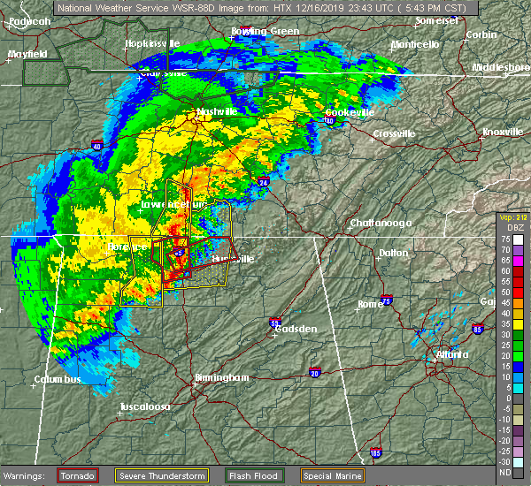 At 545 pm cst, a severe thunderstorm was located near lewisburg, moving east at 50 mph (radar indicated). Hazards include 60 mph wind gusts and penny size hail. expect damage to roofs, siding, and trees At 545 pm cst, a severe thunderstorm was located near lewisburg, moving east at 50 mph (radar indicated). Hazards include 60 mph wind gusts and penny size hail. expect damage to roofs, siding, and trees
|
| 9/10/2019 5:44 PM CDT | Trees were knocked down on riddle road. time estimated by rada in moore county TN, 11.3 miles NNW of Shelbyville, TN |
| 9/10/2019 5:43 PM CDT | A power pole was broken on blackburn hollow road. trees were knocked down on rutledge road. time estimated by rada in moore county TN, 11.6 miles NNW of Shelbyville, TN |
| 8/13/2019 6:22 PM CDT | Trees reported down over camp roa in bedford county TN, 8.6 miles E of Shelbyville, TN |
| 8/13/2019 6:19 PM CDT |
 The national weather service in nashville has issued a * severe thunderstorm warning for. eastern marshall county in middle tennessee. bedford county in middle tennessee. until 700 pm cdt. At 618 pm cdt, a severe thunderstorm was located near lewisburg,. The national weather service in nashville has issued a * severe thunderstorm warning for. eastern marshall county in middle tennessee. bedford county in middle tennessee. until 700 pm cdt. At 618 pm cdt, a severe thunderstorm was located near lewisburg,.
|
| 8/13/2019 5:52 PM CDT | Measured wind gust from shelbyville asos of 51 kts / 59 mph at 5:52 p in bedford county TN, 4.8 miles SSW of Shelbyville, TN |
| 8/13/2019 5:52 PM CDT | Measured wind gust from shelbyville asos of 51 kts at 5:52 p in bedford county TN, 0.6 miles WNW of Shelbyville, TN |
| 8/13/2019 5:46 PM CDT | Report of roof blown off of trailer on old nashville dirt roa in bedford county TN, 6.9 miles SSE of Shelbyville, TN |
| 8/13/2019 5:46 PM CDT |
 At 546 pm cdt, a severe thunderstorm was located 9 miles northwest of shelbyville, moving east at 30 mph (radar indicated). Hazards include 60 mph wind gusts and nickel size hail. Expect damage to roofs, siding, and trees. Locations impacted include, shelbyville, rover, deason, unionville and fosterville. At 546 pm cdt, a severe thunderstorm was located 9 miles northwest of shelbyville, moving east at 30 mph (radar indicated). Hazards include 60 mph wind gusts and nickel size hail. Expect damage to roofs, siding, and trees. Locations impacted include, shelbyville, rover, deason, unionville and fosterville.
|
| 8/13/2019 5:23 PM CDT |
 At 522 pm cdt, a severe thunderstorm was located 12 miles southeast of spring hill, or 15 miles north of lewisburg, moving east at 30 mph (radar indicated). Hazards include 60 mph wind gusts and nickel size hail. expect damage to roofs, siding, and trees At 522 pm cdt, a severe thunderstorm was located 12 miles southeast of spring hill, or 15 miles north of lewisburg, moving east at 30 mph (radar indicated). Hazards include 60 mph wind gusts and nickel size hail. expect damage to roofs, siding, and trees
|
| 8/6/2019 9:56 PM CDT |
 At 956 pm cdt, severe thunderstorms were located along a line extending from 6 miles northeast of manchester to petersburg, moving southeast at 35 mph (radar indicated). Hazards include 60 mph wind gusts. Expect damage to roofs, siding, and trees. locations impacted include, shelbyville, lewisburg, manchester, tullahoma, chapel hill, wartrace, bell buckle, normandy, beechgrove, raus, rover, belfast, deason, hillsboro, farmington and unionville. This includes interstate 24 between mile markers 97 and 127. At 956 pm cdt, severe thunderstorms were located along a line extending from 6 miles northeast of manchester to petersburg, moving southeast at 35 mph (radar indicated). Hazards include 60 mph wind gusts. Expect damage to roofs, siding, and trees. locations impacted include, shelbyville, lewisburg, manchester, tullahoma, chapel hill, wartrace, bell buckle, normandy, beechgrove, raus, rover, belfast, deason, hillsboro, farmington and unionville. This includes interstate 24 between mile markers 97 and 127.
|
| 8/6/2019 9:43 PM CDT |
 The national weather service in nashville has issued a * severe thunderstorm warning for. marshall county in middle tennessee. southern rutherford county in middle tennessee. coffee county in middle tennessee. Bedford county in middle tennessee. The national weather service in nashville has issued a * severe thunderstorm warning for. marshall county in middle tennessee. southern rutherford county in middle tennessee. coffee county in middle tennessee. Bedford county in middle tennessee.
|
| 8/6/2019 9:07 PM CDT |
 At 907 pm cdt, severe thunderstorms were located along a line extending from 8 miles northwest of woodbury to 6 miles east of spring hill, moving southeast at 40 mph (radar indicated). Hazards include 60 mph wind gusts. expect damage to roofs, siding, and trees At 907 pm cdt, severe thunderstorms were located along a line extending from 8 miles northwest of woodbury to 6 miles east of spring hill, moving southeast at 40 mph (radar indicated). Hazards include 60 mph wind gusts. expect damage to roofs, siding, and trees
|
| 6/21/2019 9:02 PM CDT |
 At 902 pm cdt, severe thunderstorms were located along a line extending from 9 miles southeast of woodbury to near shelbyville, moving southeast at 45 mph (radar indicated). Hazards include 70 mph wind gusts and penny size hail. Expect considerable tree damage. damage is likely to mobile homes, roofs, and outbuildings. locations impacted include, shelbyville, manchester, tullahoma, morrison, wartrace, bell buckle, normandy, christiana, beechgrove, raus, fosterville, summitville, deason, bradyville and unionville. This includes interstate 24 between mile markers 82 and 112. At 902 pm cdt, severe thunderstorms were located along a line extending from 9 miles southeast of woodbury to near shelbyville, moving southeast at 45 mph (radar indicated). Hazards include 70 mph wind gusts and penny size hail. Expect considerable tree damage. damage is likely to mobile homes, roofs, and outbuildings. locations impacted include, shelbyville, manchester, tullahoma, morrison, wartrace, bell buckle, normandy, christiana, beechgrove, raus, fosterville, summitville, deason, bradyville and unionville. This includes interstate 24 between mile markers 82 and 112.
|
| 6/21/2019 8:44 PM CDT | Numerous trees down county wid in bedford county TN, 0.6 miles WNW of Shelbyville, TN |
| 6/21/2019 8:41 PM CDT |
 At 841 pm cdt, severe thunderstorms were located along a line extending from woodbury to lewisburg, moving southeast at 45 mph (radar indicated). Hazards include 70 mph wind gusts and penny size hail. Expect considerable tree damage. Damage is likely to mobile homes, roofs, and outbuildings. At 841 pm cdt, severe thunderstorms were located along a line extending from woodbury to lewisburg, moving southeast at 45 mph (radar indicated). Hazards include 70 mph wind gusts and penny size hail. Expect considerable tree damage. Damage is likely to mobile homes, roofs, and outbuildings.
|
| 6/19/2019 9:19 PM CDT |
 At 919 pm cdt, severe thunderstorms were located along a line extending from 6 miles southeast of smithville to near mcminnville to near shelbyville, moving east at 35 mph (trained weather spotters). Hazards include 60 mph wind gusts and penny size hail. Expect damage to roofs, siding, and trees. locations impacted include, shelbyville, mcminnville, manchester, smithville, morrison, wartrace, bell buckle, centertown, viola, christiana, rock island state park, beechgrove, fosterville, summitville and deason. This includes interstate 24 between mile markers 90 and 111. At 919 pm cdt, severe thunderstorms were located along a line extending from 6 miles southeast of smithville to near mcminnville to near shelbyville, moving east at 35 mph (trained weather spotters). Hazards include 60 mph wind gusts and penny size hail. Expect damage to roofs, siding, and trees. locations impacted include, shelbyville, mcminnville, manchester, smithville, morrison, wartrace, bell buckle, centertown, viola, christiana, rock island state park, beechgrove, fosterville, summitville and deason. This includes interstate 24 between mile markers 90 and 111.
|
| 6/19/2019 9:10 PM CDT | Trees reportedly down on unionville deason road in bedford county TN, 7.5 miles S of Shelbyville, TN |
| 6/19/2019 8:56 PM CDT |
 At 855 pm cdt, severe thunderstorms were located along a line extending from liberty to near woodbury to unionville, moving east at 35 mph (trained weather spotters. at 850 pm cdt...numerous trees and power lines were reportedly blown down with these storms across rutherford county). Hazards include 60 mph wind gusts and quarter size hail. Hail damage to vehicles is expected. Expect wind damage to roofs, siding, and trees. At 855 pm cdt, severe thunderstorms were located along a line extending from liberty to near woodbury to unionville, moving east at 35 mph (trained weather spotters. at 850 pm cdt...numerous trees and power lines were reportedly blown down with these storms across rutherford county). Hazards include 60 mph wind gusts and quarter size hail. Hail damage to vehicles is expected. Expect wind damage to roofs, siding, and trees.
|
| 12/31/2018 3:29 PM CST | Photo of downed tree on hwy 41a. time estimated via rada in bedford county TN, 1.3 miles ESE of Shelbyville, TN |
| 12/31/2018 3:06 PM CST |
 The severe thunderstorm warning for marshall, southwestern rutherford, southeastern maury, southeastern williamson, eastern giles and western bedford counties will expire at 315 pm cst, the storms which prompted the warning have weakened below severe limits, and no longer pose an immediate threat to life or property. therefore, the warning will be allowed to expire. however heavy rain is still possible with these thunderstorms. a tornado watch remains in effect until 700 pm cst for middle tennessee. The severe thunderstorm warning for marshall, southwestern rutherford, southeastern maury, southeastern williamson, eastern giles and western bedford counties will expire at 315 pm cst, the storms which prompted the warning have weakened below severe limits, and no longer pose an immediate threat to life or property. therefore, the warning will be allowed to expire. however heavy rain is still possible with these thunderstorms. a tornado watch remains in effect until 700 pm cst for middle tennessee.
|
| 12/31/2018 2:52 PM CST |
 At 251 pm cst, severe thunderstorms were located along a line extending from 6 miles southeast of nolensville to 9 miles north of ardmore, moving east at 55 mph (radar indicated). Hazards include 60 mph wind gusts. Expect damage to roofs, siding, and trees. Locations impacted include, murfreesboro, lewisburg, pulaski, chapel hill, ardmore, cornersville, eagleville, elkton, i-65 east of columbia, triune, rover, belfast, frankewing, rockvale, prospect, farmington and unionville. At 251 pm cst, severe thunderstorms were located along a line extending from 6 miles southeast of nolensville to 9 miles north of ardmore, moving east at 55 mph (radar indicated). Hazards include 60 mph wind gusts. Expect damage to roofs, siding, and trees. Locations impacted include, murfreesboro, lewisburg, pulaski, chapel hill, ardmore, cornersville, eagleville, elkton, i-65 east of columbia, triune, rover, belfast, frankewing, rockvale, prospect, farmington and unionville.
|
| 12/31/2018 2:32 PM CST |
 At 231 pm cst, severe thunderstorms were located along a line extending from thompson`s station to 9 miles southwest of pulaski, moving east at 55 mph (radar indicated). Hazards include 60 mph wind gusts. expect damage to roofs, siding, and trees At 231 pm cst, severe thunderstorms were located along a line extending from thompson`s station to 9 miles southwest of pulaski, moving east at 55 mph (radar indicated). Hazards include 60 mph wind gusts. expect damage to roofs, siding, and trees
|
| 11/6/2018 12:47 AM CST |
 At 1247 am cst, a severe thunderstorm was located over shelbyville, moving east at 65 mph (radar indicated). Hazards include 60 mph wind gusts. expect damage to roofs, siding, and trees At 1247 am cst, a severe thunderstorm was located over shelbyville, moving east at 65 mph (radar indicated). Hazards include 60 mph wind gusts. expect damage to roofs, siding, and trees
|
| 11/6/2018 12:17 AM CST |
 At 1217 am cst, a severe thunderstorm was located 9 miles northwest of shelbyville, moving northeast at 50 mph (radar indicated). Hazards include 60 mph wind gusts. Expect damage to roofs, siding, and trees. locations impacted include, shelbyville, lewisburg, wartrace, bell buckle, belfast, christiana, deason, farmington, unionville and fosterville. A tornado watch remains in effect until 300 am cst for middle tennessee. At 1217 am cst, a severe thunderstorm was located 9 miles northwest of shelbyville, moving northeast at 50 mph (radar indicated). Hazards include 60 mph wind gusts. Expect damage to roofs, siding, and trees. locations impacted include, shelbyville, lewisburg, wartrace, bell buckle, belfast, christiana, deason, farmington, unionville and fosterville. A tornado watch remains in effect until 300 am cst for middle tennessee.
|
| 11/5/2018 11:56 PM CST |
 At 1156 pm cst, a severe thunderstorm was located over lewisburg, moving northeast at 45 mph (radar indicated). Hazards include 60 mph wind gusts. expect damage to roofs, siding, and trees At 1156 pm cst, a severe thunderstorm was located over lewisburg, moving northeast at 45 mph (radar indicated). Hazards include 60 mph wind gusts. expect damage to roofs, siding, and trees
|
| 6/28/2018 11:39 AM CDT |
 At 1139 am cdt, severe thunderstorms were located along a line extending from near fayetteville to near culleoka, moving south at 35 mph (radar indicated). Hazards include 60 mph wind gusts and nickel size hail. Expect damage to roofs, siding, and trees. locations impacted include, shelbyville, lewisburg, ardmore, cornersville, elkton, belfast, frankewing and farmington. This includes interstate 65 between mile markers 1 and 45. At 1139 am cdt, severe thunderstorms were located along a line extending from near fayetteville to near culleoka, moving south at 35 mph (radar indicated). Hazards include 60 mph wind gusts and nickel size hail. Expect damage to roofs, siding, and trees. locations impacted include, shelbyville, lewisburg, ardmore, cornersville, elkton, belfast, frankewing and farmington. This includes interstate 65 between mile markers 1 and 45.
|
| 6/28/2018 11:14 AM CDT |
 At 1113 am cdt, a severe thunderstorm was located near lewisburg, moving south at 40 mph (radar indicated). Hazards include 70 mph wind gusts and quarter size hail. Hail damage to vehicles is expected. expect considerable tree damage. wind damage is also likely to mobile homes, roofs, and outbuildings. locations impacted include, lewisburg, chapel hill, ardmore, cornersville, elkton, belfast, frankewing and farmington. This includes interstate 65 between mile markers 1 and 45. At 1113 am cdt, a severe thunderstorm was located near lewisburg, moving south at 40 mph (radar indicated). Hazards include 70 mph wind gusts and quarter size hail. Hail damage to vehicles is expected. expect considerable tree damage. wind damage is also likely to mobile homes, roofs, and outbuildings. locations impacted include, lewisburg, chapel hill, ardmore, cornersville, elkton, belfast, frankewing and farmington. This includes interstate 65 between mile markers 1 and 45.
|
| 6/28/2018 10:55 AM CDT |
 At 1054 am cdt, a severe thunderstorm was located near lewisburg, moving southeast at 40 mph (radar indicated). Hazards include 70 mph wind gusts and quarter size hail. Hail damage to vehicles is expected. expect considerable tree damage. Wind damage is also likely to mobile homes, roofs, and outbuildings. At 1054 am cdt, a severe thunderstorm was located near lewisburg, moving southeast at 40 mph (radar indicated). Hazards include 70 mph wind gusts and quarter size hail. Hail damage to vehicles is expected. expect considerable tree damage. Wind damage is also likely to mobile homes, roofs, and outbuildings.
|
| 6/22/2018 1:25 PM CDT | Trees down on gaither r in bedford county TN, 0.6 miles WNW of Shelbyville, TN |
| 6/22/2018 1:02 PM CDT |
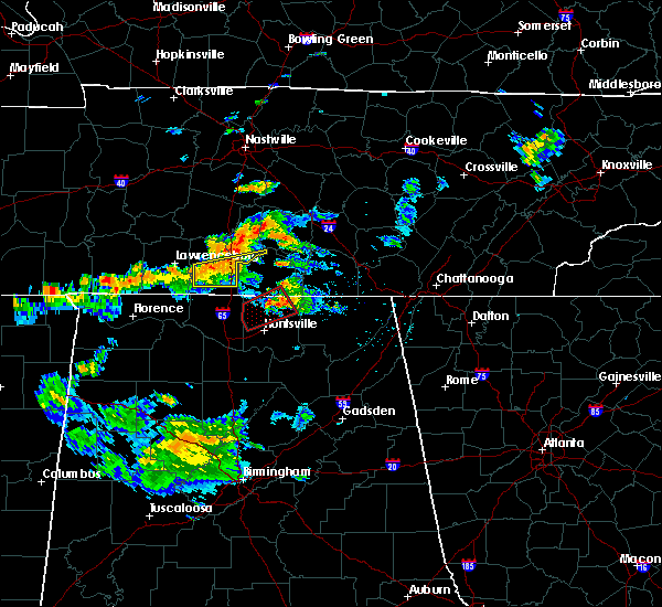 At 102 pm cdt, a severe thunderstorm was located 9 miles southwest of lewisburg, moving east at 30 mph (radar indicated). Hazards include 60 mph wind gusts. expect damage to roofs, siding, and trees At 102 pm cdt, a severe thunderstorm was located 9 miles southwest of lewisburg, moving east at 30 mph (radar indicated). Hazards include 60 mph wind gusts. expect damage to roofs, siding, and trees
|
| 9/19/2017 5:23 PM CDT |
 At 523 pm cdt, a severe thunderstorm was located near lewisburg, moving south at 15 mph (radar indicated). Hazards include 70 mph wind gusts and quarter size hail. Hail damage to vehicles is expected. expect considerable tree damage. wind damage is also likely to mobile homes, roofs, and outbuildings. Locations impacted include, shelbyville, lewisburg, chapel hill, cornersville, belfast, farmington and unionville. At 523 pm cdt, a severe thunderstorm was located near lewisburg, moving south at 15 mph (radar indicated). Hazards include 70 mph wind gusts and quarter size hail. Hail damage to vehicles is expected. expect considerable tree damage. wind damage is also likely to mobile homes, roofs, and outbuildings. Locations impacted include, shelbyville, lewisburg, chapel hill, cornersville, belfast, farmington and unionville.
|
| 9/19/2017 4:55 PM CDT |
 At 455 pm cdt, a severe thunderstorm was located 11 miles north of lewisburg, moving south at 15 mph (radar indicated). Hazards include 70 mph wind gusts and quarter size hail. Hail damage to vehicles is expected. expect considerable tree damage. Wind damage is also likely to mobile homes, roofs, and outbuildings. At 455 pm cdt, a severe thunderstorm was located 11 miles north of lewisburg, moving south at 15 mph (radar indicated). Hazards include 70 mph wind gusts and quarter size hail. Hail damage to vehicles is expected. expect considerable tree damage. Wind damage is also likely to mobile homes, roofs, and outbuildings.
|
| 8/31/2017 10:58 PM CDT |
 At 1058 pm cdt, a severe thunderstorm was located near shelbyville, moving north at 50 mph (radar indicated). Hazards include 60 mph wind gusts. expect damage to roofs, siding, and trees At 1058 pm cdt, a severe thunderstorm was located near shelbyville, moving north at 50 mph (radar indicated). Hazards include 60 mph wind gusts. expect damage to roofs, siding, and trees
|
| 8/31/2017 10:54 PM CDT |
 At 1054 pm cdt, a severe thunderstorm was located 7 miles north of shelbyville, moving north at 50 mph (radar indicated). Hazards include 60 mph wind gusts. Expect damage to roofs, siding, and trees. Locations impacted include, shelbyville, wartrace, bell buckle, deason and beechgrove. At 1054 pm cdt, a severe thunderstorm was located 7 miles north of shelbyville, moving north at 50 mph (radar indicated). Hazards include 60 mph wind gusts. Expect damage to roofs, siding, and trees. Locations impacted include, shelbyville, wartrace, bell buckle, deason and beechgrove.
|
| 8/31/2017 10:34 PM CDT |
 At 1033 pm cdt, a severe thunderstorm was located 7 miles northwest of lynchburg, moving north at 50 mph (radar indicated). Hazards include 60 mph wind gusts. expect damage to roofs, siding, and trees At 1033 pm cdt, a severe thunderstorm was located 7 miles northwest of lynchburg, moving north at 50 mph (radar indicated). Hazards include 60 mph wind gusts. expect damage to roofs, siding, and trees
|
| 5/27/2017 9:42 PM CDT |
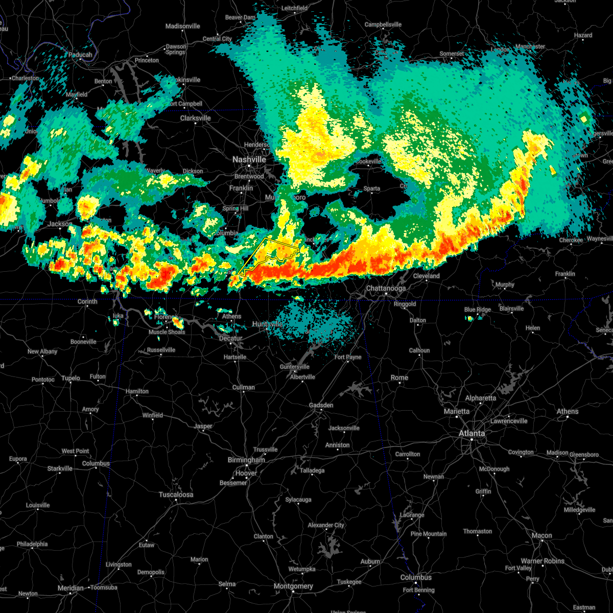 The severe thunderstorm warning for southeastern marshall, east central giles and southern bedford counties will expire at 945 pm cdt, the storm which prompted the warning has weakened below severe limits, and has exited the warned area. therefore the warning will be allowed to expire. however gusty winds are still possible with this thunderstorm. a severe thunderstorm watch remains in effect until midnight cdt for middle tennessee. The severe thunderstorm warning for southeastern marshall, east central giles and southern bedford counties will expire at 945 pm cdt, the storm which prompted the warning has weakened below severe limits, and has exited the warned area. therefore the warning will be allowed to expire. however gusty winds are still possible with this thunderstorm. a severe thunderstorm watch remains in effect until midnight cdt for middle tennessee.
|
| 5/27/2017 9:37 PM CDT |
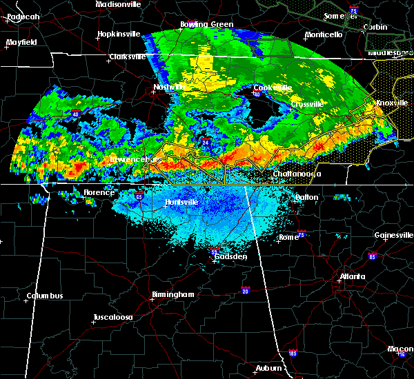 At 937 pm cdt, a severe thunderstorm was located near petersburg, or 11 miles south of lewisburg, moving east at 45 mph (radar indicated). Hazards include 70 mph wind gusts and quarter size hail. Hail damage to vehicles is expected. expect considerable tree damage. wind damage is also likely to mobile homes, roofs, and outbuildings. Locations impacted include, shelbyville, belfast and raus. At 937 pm cdt, a severe thunderstorm was located near petersburg, or 11 miles south of lewisburg, moving east at 45 mph (radar indicated). Hazards include 70 mph wind gusts and quarter size hail. Hail damage to vehicles is expected. expect considerable tree damage. wind damage is also likely to mobile homes, roofs, and outbuildings. Locations impacted include, shelbyville, belfast and raus.
|
| 5/27/2017 9:25 PM CDT | Tree down on shelbyville highway just north of the lincoln county lin in bedford county TN, 6.6 miles NNE of Shelbyville, TN |
| 5/27/2017 9:17 PM CDT |
 At 917 pm cdt, a severe thunderstorm was located 12 miles north of lewisburg, moving east at 40 mph (radar indicated). Hazards include 70 mph wind gusts and quarter size hail. Hail damage to vehicles is expected. expect considerable tree damage. Wind damage is also likely to mobile homes, roofs, and outbuildings. At 917 pm cdt, a severe thunderstorm was located 12 miles north of lewisburg, moving east at 40 mph (radar indicated). Hazards include 70 mph wind gusts and quarter size hail. Hail damage to vehicles is expected. expect considerable tree damage. Wind damage is also likely to mobile homes, roofs, and outbuildings.
|
| 5/27/2017 9:14 PM CDT |
 At 913 pm cdt, a severe thunderstorm was located near lewisburg, moving southeast at 60 mph (radar indicated). Hazards include 70 mph wind gusts and quarter size hail. Hail damage to vehicles is expected. expect considerable tree damage. Wind damage is also likely to mobile homes, roofs, and outbuildings. At 913 pm cdt, a severe thunderstorm was located near lewisburg, moving southeast at 60 mph (radar indicated). Hazards include 70 mph wind gusts and quarter size hail. Hail damage to vehicles is expected. expect considerable tree damage. Wind damage is also likely to mobile homes, roofs, and outbuildings.
|
| 4/30/2017 3:26 PM CDT |
 At 326 pm cdt, severe thunderstorms were located along a line extending from eagleville to near shelbyville to near huntland, moving northeast at 55 mph (radar indicated). Hazards include 60 mph wind gusts. expect damage to roofs, siding, and trees At 326 pm cdt, severe thunderstorms were located along a line extending from eagleville to near shelbyville to near huntland, moving northeast at 55 mph (radar indicated). Hazards include 60 mph wind gusts. expect damage to roofs, siding, and trees
|
| 4/30/2017 3:19 PM CDT |
 At 319 pm cdt, severe thunderstorms were located along a line extending from nolensville to near shelbyville to huntland, moving northeast at 50 mph (radar indicated). Hazards include 60 mph wind gusts. Expect damage to roofs, siding, and trees. locations impacted include, shelbyville, chapel hill, wartrace, bell buckle, normandy, rover, deason, raus, farmington, unionville and beechgrove. A tornado watch remains in effect until 700 pm cdt for middle tennessee. At 319 pm cdt, severe thunderstorms were located along a line extending from nolensville to near shelbyville to huntland, moving northeast at 50 mph (radar indicated). Hazards include 60 mph wind gusts. Expect damage to roofs, siding, and trees. locations impacted include, shelbyville, chapel hill, wartrace, bell buckle, normandy, rover, deason, raus, farmington, unionville and beechgrove. A tornado watch remains in effect until 700 pm cdt for middle tennessee.
|
| 4/30/2017 3:01 PM CDT |
 At 300 pm cdt, severe thunderstorms were located along a line extending from chapel hill to near petersburg to near hazel green, moving northeast at 50 mph (radar indicated). Hazards include 60 mph wind gusts. expect damage to roofs, siding, and trees At 300 pm cdt, severe thunderstorms were located along a line extending from chapel hill to near petersburg to near hazel green, moving northeast at 50 mph (radar indicated). Hazards include 60 mph wind gusts. expect damage to roofs, siding, and trees
|
| 4/21/2017 4:02 PM CDT |
 At 402 pm cdt, a severe thunderstorm capable of producing a tornado was located near shelbyville, moving northeast at 25 mph (radar indicated rotation). Hazards include tornado and quarter size hail. Flying debris will be dangerous to those caught without shelter. mobile homes will be damaged or destroyed. damage to roofs, windows, and vehicles will occur. Tree damage is likely. At 402 pm cdt, a severe thunderstorm capable of producing a tornado was located near shelbyville, moving northeast at 25 mph (radar indicated rotation). Hazards include tornado and quarter size hail. Flying debris will be dangerous to those caught without shelter. mobile homes will be damaged or destroyed. damage to roofs, windows, and vehicles will occur. Tree damage is likely.
|
| 4/21/2017 3:56 PM CDT |
 At 356 pm cdt, a severe thunderstorm was located near shelbyville, moving northeast at 25 mph (radar indicated). Hazards include 60 mph wind gusts and quarter size hail. Hail damage to vehicles is expected. Expect wind damage to roofs, siding, and trees. At 356 pm cdt, a severe thunderstorm was located near shelbyville, moving northeast at 25 mph (radar indicated). Hazards include 60 mph wind gusts and quarter size hail. Hail damage to vehicles is expected. Expect wind damage to roofs, siding, and trees.
|
| 4/21/2017 3:51 PM CDT |
 At 350 pm cdt, a severe thunderstorm was located near shelbyville, moving northeast at 25 mph (radar indicated). Hazards include 60 mph wind gusts. Expect damage to roofs, siding, and trees. Locations impacted include, shelbyville, bell buckle, christiana, deason, unionville and fosterville. At 350 pm cdt, a severe thunderstorm was located near shelbyville, moving northeast at 25 mph (radar indicated). Hazards include 60 mph wind gusts. Expect damage to roofs, siding, and trees. Locations impacted include, shelbyville, bell buckle, christiana, deason, unionville and fosterville.
|
| 4/21/2017 3:50 PM CDT | Image of roof damage to a commercial structur in bedford county TN, 0.6 miles WNW of Shelbyville, TN |
| 4/21/2017 3:49 PM CDT | Images of roof damage to a mote in bedford county TN, 0.6 miles WNW of Shelbyville, TN |
| 4/21/2017 3:48 PM CDT | Image of a large tree limb downed on courtland drive in bedford county TN, 0.5 miles S of Shelbyville, TN |
| 4/21/2017 3:36 PM CDT |
 At 336 pm cdt, a severe thunderstorm was located 7 miles west of shelbyville, moving northeast at 20 mph (radar indicated). Hazards include 60 mph wind gusts. expect damage to roofs, siding, and trees At 336 pm cdt, a severe thunderstorm was located 7 miles west of shelbyville, moving northeast at 20 mph (radar indicated). Hazards include 60 mph wind gusts. expect damage to roofs, siding, and trees
|
| 4/21/2017 1:36 PM CDT |
 At 136 pm cdt, a severe thunderstorm was located 12 miles north of shelbyville, moving northeast at 30 mph (radar indicated). Hazards include 60 mph wind gusts and quarter size hail. Hail damage to vehicles is expected. Expect wind damage to roofs, siding, and trees. At 136 pm cdt, a severe thunderstorm was located 12 miles north of shelbyville, moving northeast at 30 mph (radar indicated). Hazards include 60 mph wind gusts and quarter size hail. Hail damage to vehicles is expected. Expect wind damage to roofs, siding, and trees.
|
| 4/5/2017 4:02 PM CDT |
 At 401 pm cdt, a severe thunderstorm was located near lynchburg, moving northeast at 40 mph (trained weather spotters). Hazards include 60 mph wind gusts and half dollar size hail. Hail damage to vehicles is expected. expect wind damage to roofs, siding, and trees. locations impacted include, shelbyville, manchester, tullahoma, wartrace, bell buckle, normandy, beechgrove and raus. A tornado watch remains in effect until 900 pm cdt for middle tennessee. At 401 pm cdt, a severe thunderstorm was located near lynchburg, moving northeast at 40 mph (trained weather spotters). Hazards include 60 mph wind gusts and half dollar size hail. Hail damage to vehicles is expected. expect wind damage to roofs, siding, and trees. locations impacted include, shelbyville, manchester, tullahoma, wartrace, bell buckle, normandy, beechgrove and raus. A tornado watch remains in effect until 900 pm cdt for middle tennessee.
|
| 4/5/2017 3:59 PM CDT | Roof blown off house and barn destroye in bedford county TN, 5.1 miles NNE of Shelbyville, TN |
| 4/5/2017 3:55 PM CDT | Trees reported down in the county with scattered power outages. time estimated based on rada in bedford county TN, 0.6 miles WNW of Shelbyville, TN |
| 4/5/2017 3:51 PM CDT |
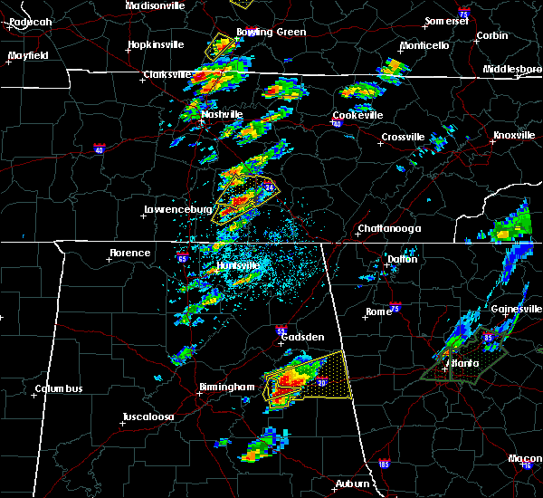 At 350 pm cdt, a severe thunderstorm was located near petersburg, or 9 miles north of fayetteville, moving northeast at 25 mph (radar indicated). Hazards include 60 mph wind gusts and quarter size hail. Hail damage to vehicles is expected. Expect wind damage to roofs, siding, and trees. At 350 pm cdt, a severe thunderstorm was located near petersburg, or 9 miles north of fayetteville, moving northeast at 25 mph (radar indicated). Hazards include 60 mph wind gusts and quarter size hail. Hail damage to vehicles is expected. Expect wind damage to roofs, siding, and trees.
|
| 4/5/2017 3:50 PM CDT | Trees reported down in the county with scattered power outages. time estimated based on rada in bedford county TN, 0.6 miles WNW of Shelbyville, TN |
| 3/21/2017 4:30 PM CDT |
 At 430 pm cdt, a severe thunderstorm was located 9 miles southeast of spring hill, or 13 miles east of columbia, moving east at 45 mph (radar indicated). Hazards include 60 mph wind gusts and quarter size hail. Hail damage to vehicles is expected. Expect wind damage to roofs, siding, and trees. At 430 pm cdt, a severe thunderstorm was located 9 miles southeast of spring hill, or 13 miles east of columbia, moving east at 45 mph (radar indicated). Hazards include 60 mph wind gusts and quarter size hail. Hail damage to vehicles is expected. Expect wind damage to roofs, siding, and trees.
|
| 3/21/2017 4:20 PM CDT |
 At 419 pm cdt, severe thunderstorms were located along a line extending from 7 miles southeast of spring hill to 6 miles southwest of pulaski, moving southeast at 50 mph (radar indicated). Hazards include 60 mph wind gusts and quarter size hail. Hail damage to vehicles is expected. Expect wind damage to roofs, siding, and trees. At 419 pm cdt, severe thunderstorms were located along a line extending from 7 miles southeast of spring hill to 6 miles southwest of pulaski, moving southeast at 50 mph (radar indicated). Hazards include 60 mph wind gusts and quarter size hail. Hail damage to vehicles is expected. Expect wind damage to roofs, siding, and trees.
|
| 3/21/2017 3:45 PM CDT |
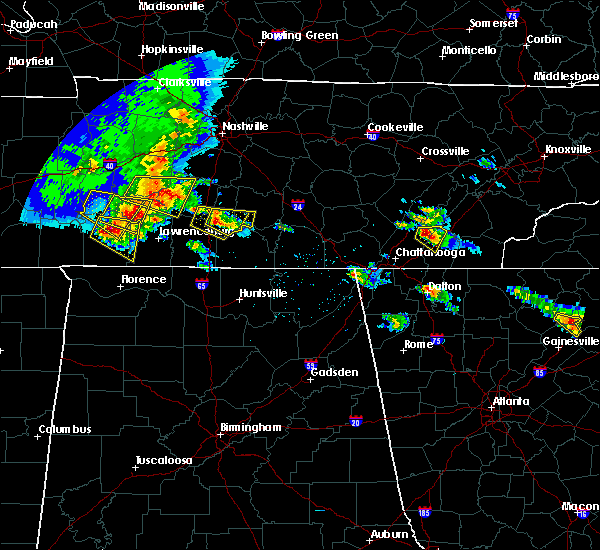 At 345 pm cdt, a severe thunderstorm was located near lewisburg, moving east at 30 mph (radar indicated). Hazards include 60 mph wind gusts and quarter size hail. Hail damage to vehicles is expected. expect wind damage to roofs, siding, and trees. Locations impacted include, shelbyville, lewisburg, cornersville, belfast and farmington. At 345 pm cdt, a severe thunderstorm was located near lewisburg, moving east at 30 mph (radar indicated). Hazards include 60 mph wind gusts and quarter size hail. Hail damage to vehicles is expected. expect wind damage to roofs, siding, and trees. Locations impacted include, shelbyville, lewisburg, cornersville, belfast and farmington.
|
| 3/21/2017 3:26 PM CDT |
 At 326 pm cdt, a severe thunderstorm was located near lewisburg, moving east at 30 mph (radar indicated). Hazards include 60 mph wind gusts and quarter size hail. Hail damage to vehicles is expected. Expect wind damage to roofs, siding, and trees. At 326 pm cdt, a severe thunderstorm was located near lewisburg, moving east at 30 mph (radar indicated). Hazards include 60 mph wind gusts and quarter size hail. Hail damage to vehicles is expected. Expect wind damage to roofs, siding, and trees.
|
| 3/9/2017 11:56 PM CST |
 At 1155 pm cst, a severe thunderstorm was located near tullahoma, or near lynchburg, moving east at 55 mph (radar indicated). Hazards include 60 mph wind gusts. expect damage to roofs, siding, and trees At 1155 pm cst, a severe thunderstorm was located near tullahoma, or near lynchburg, moving east at 55 mph (radar indicated). Hazards include 60 mph wind gusts. expect damage to roofs, siding, and trees
|
| 3/9/2017 11:55 PM CST |
 At 1155 pm cst, a severe thunderstorm capable of producing a tornado was located near tullahoma, or near lynchburg, moving east at 55 mph (radar indicated rotation). Hazards include tornado. Flying debris will be dangerous to those caught without shelter. mobile homes will be damaged or destroyed. damage to roofs, windows, and vehicles will occur. tree damage is likely. Locations impacted include, shelbyville, normandy and raus. At 1155 pm cst, a severe thunderstorm capable of producing a tornado was located near tullahoma, or near lynchburg, moving east at 55 mph (radar indicated rotation). Hazards include tornado. Flying debris will be dangerous to those caught without shelter. mobile homes will be damaged or destroyed. damage to roofs, windows, and vehicles will occur. tree damage is likely. Locations impacted include, shelbyville, normandy and raus.
|
| 3/9/2017 11:47 PM CST |
 At 1147 pm cst, a severe thunderstorm was located near woodbury, moving east at 50 mph (radar indicated). Hazards include 60 mph wind gusts. Expect damage to roofs, siding, and trees. Locations impacted include, shelbyville, manchester, smithville, woodbury, wartrace, bell buckle, dowelltown, liberty, auburntown, centertown, beechgrove, fosterville, summitville, deason, bradyville, readyville and milton. At 1147 pm cst, a severe thunderstorm was located near woodbury, moving east at 50 mph (radar indicated). Hazards include 60 mph wind gusts. Expect damage to roofs, siding, and trees. Locations impacted include, shelbyville, manchester, smithville, woodbury, wartrace, bell buckle, dowelltown, liberty, auburntown, centertown, beechgrove, fosterville, summitville, deason, bradyville, readyville and milton.
|
| 3/9/2017 11:44 PM CST |
 At 1144 pm cst, a severe thunderstorm capable of producing a tornado was located 7 miles south of shelbyville, moving east at 55 mph (radar indicated rotation). Hazards include tornado. Flying debris will be dangerous to those caught without shelter. mobile homes will be damaged or destroyed. damage to roofs, windows, and vehicles will occur. tree damage is likely. This tornadic thunderstorm will remain over mainly rural areas of southeastern bedford county, including the following locations: normandy and raus. At 1144 pm cst, a severe thunderstorm capable of producing a tornado was located 7 miles south of shelbyville, moving east at 55 mph (radar indicated rotation). Hazards include tornado. Flying debris will be dangerous to those caught without shelter. mobile homes will be damaged or destroyed. damage to roofs, windows, and vehicles will occur. tree damage is likely. This tornadic thunderstorm will remain over mainly rural areas of southeastern bedford county, including the following locations: normandy and raus.
|
| 3/9/2017 11:42 PM CST | 911 reported lots of damage in the center of the county. a parked tractor trailer was flipped and roof damage. time estimated via rada in bedford county TN, 5.6 miles ENE of Shelbyville, TN |
| 3/9/2017 11:39 PM CST |
 At 1139 pm cst, a severe thunderstorm capable of producing a tornado was located near petersburg, or 10 miles southwest of shelbyville, moving east at 55 mph (radar indicated rotation). Hazards include tornado. Flying debris will be dangerous to those caught without shelter. mobile homes will be damaged or destroyed. damage to roofs, windows, and vehicles will occur. tree damage is likely. Locations impacted include, shelbyville and belfast. At 1139 pm cst, a severe thunderstorm capable of producing a tornado was located near petersburg, or 10 miles southwest of shelbyville, moving east at 55 mph (radar indicated rotation). Hazards include tornado. Flying debris will be dangerous to those caught without shelter. mobile homes will be damaged or destroyed. damage to roofs, windows, and vehicles will occur. tree damage is likely. Locations impacted include, shelbyville and belfast.
|
| 3/9/2017 11:36 PM CST | Beford ema reported semi and trailer overturned at walmart distribution center. also several trees down in area and across highwa in bedford county TN, 4.6 miles S of Shelbyville, TN |
| 3/9/2017 11:33 PM CST |
 At 1133 pm cst, a severe thunderstorm was located over murfreesboro, moving east at 50 mph (radar indicated). Hazards include 60 mph wind gusts. expect damage to roofs, siding, and trees At 1133 pm cst, a severe thunderstorm was located over murfreesboro, moving east at 50 mph (radar indicated). Hazards include 60 mph wind gusts. expect damage to roofs, siding, and trees
|
| 3/9/2017 11:31 PM CST |
 At 1131 pm cst, a severe thunderstorm capable of producing a tornado was located near lewisburg, moving east at 55 mph (radar indicated rotation). Hazards include tornado. Flying debris will be dangerous to those caught without shelter. mobile homes will be damaged or destroyed. damage to roofs, windows, and vehicles will occur. tree damage is likely. This tornadic thunderstorm will remain over mainly rural areas of southeastern marshall and southwestern bedford counties, including the following locations: farmington and belfast. At 1131 pm cst, a severe thunderstorm capable of producing a tornado was located near lewisburg, moving east at 55 mph (radar indicated rotation). Hazards include tornado. Flying debris will be dangerous to those caught without shelter. mobile homes will be damaged or destroyed. damage to roofs, windows, and vehicles will occur. tree damage is likely. This tornadic thunderstorm will remain over mainly rural areas of southeastern marshall and southwestern bedford counties, including the following locations: farmington and belfast.
|
| 12/18/2016 1:20 AM CST |
 At 120 am cst, a severe thunderstorm capable of producing a tornado was located 9 miles east of shelbyville, moving northeast at 65 mph (radar indicated rotation). Hazards include tornado. Flying debris will be dangerous to those caught without shelter. mobile homes will be damaged or destroyed. damage to roofs, windows, and vehicles will occur. tree damage is likely. this dangerous storm will be near, manchester around 130 am cst. mcminnville around 145 am cst. Other locations impacted by this tornadic thunderstorm include raus, summitville, morrison, wartrace, normandy, beechgrove, centertown, viola and bell buckle. At 120 am cst, a severe thunderstorm capable of producing a tornado was located 9 miles east of shelbyville, moving northeast at 65 mph (radar indicated rotation). Hazards include tornado. Flying debris will be dangerous to those caught without shelter. mobile homes will be damaged or destroyed. damage to roofs, windows, and vehicles will occur. tree damage is likely. this dangerous storm will be near, manchester around 130 am cst. mcminnville around 145 am cst. Other locations impacted by this tornadic thunderstorm include raus, summitville, morrison, wartrace, normandy, beechgrove, centertown, viola and bell buckle.
|
| 12/18/2016 1:15 AM CST |
 At 115 am cst, a severe thunderstorm was located near shelbyville, moving northeast at 60 mph (radar indicated). Hazards include 60 mph wind gusts. Expect damage to roofs, siding, and trees. locations impacted include, shelbyville, lewisburg, manchester, wartrace, bell buckle, normandy, summitville, christiana, belfast, bradyville, farmington, raus, fosterville, deason and beechgrove. A tornado watch remains in effect until 300 am cst for middle tennessee. At 115 am cst, a severe thunderstorm was located near shelbyville, moving northeast at 60 mph (radar indicated). Hazards include 60 mph wind gusts. Expect damage to roofs, siding, and trees. locations impacted include, shelbyville, lewisburg, manchester, wartrace, bell buckle, normandy, summitville, christiana, belfast, bradyville, farmington, raus, fosterville, deason and beechgrove. A tornado watch remains in effect until 300 am cst for middle tennessee.
|
| 12/18/2016 12:59 AM CST |
 At 1258 am cst, a severe thunderstorm was located near lewisburg, moving northeast at 70 mph. another cell was located southwest of chapel hill (radar indicated). Hazards include 60 mph wind gusts. expect damage to roofs, siding, and trees At 1258 am cst, a severe thunderstorm was located near lewisburg, moving northeast at 70 mph. another cell was located southwest of chapel hill (radar indicated). Hazards include 60 mph wind gusts. expect damage to roofs, siding, and trees
|
| 12/18/2016 12:52 AM CST |
 At 1250 am cst, a severe thunderstorm was located near lewisburg, moving northeast at 70 mph (radar indicated). Hazards include 60 mph wind gusts. Expect damage to roofs, siding, and trees. locations impacted include, shelbyville, lewisburg, chapel hill, cornersville, wartrace, eagleville, bell buckle, lynnville, christiana, belfast, farmington, raus, unionville, fosterville, rockvale, deason and rover. A tornado watch remains in effect until 300 am cst for middle tennessee. At 1250 am cst, a severe thunderstorm was located near lewisburg, moving northeast at 70 mph (radar indicated). Hazards include 60 mph wind gusts. Expect damage to roofs, siding, and trees. locations impacted include, shelbyville, lewisburg, chapel hill, cornersville, wartrace, eagleville, bell buckle, lynnville, christiana, belfast, farmington, raus, unionville, fosterville, rockvale, deason and rover. A tornado watch remains in effect until 300 am cst for middle tennessee.
|
| 12/18/2016 12:51 AM CST | Trees down on 41a and pinkston road in bedford county TN, 3.4 miles SE of Shelbyville, TN |
| 12/18/2016 12:38 AM CST |
 At 1237 am cst, a severe thunderstorm was located near pulaski, moving northeast at 70 mph. another cell was located near lynnville moving northeast at 70 mph (radar indicated). Hazards include 60 mph wind gusts. expect damage to roofs, siding, and trees At 1237 am cst, a severe thunderstorm was located near pulaski, moving northeast at 70 mph. another cell was located near lynnville moving northeast at 70 mph (radar indicated). Hazards include 60 mph wind gusts. expect damage to roofs, siding, and trees
|
| 9/10/2016 5:45 PM CDT | Trees down at us 41a and highway 64 in eastern shelbyville in bedford county TN, 3.5 miles WNW of Shelbyville, TN |
| 9/10/2016 5:45 PM CDT | Several trees reported blown down across bedford county...including at highway 270 and halls mill...normandy road...and highway 41a south. power lines also down on lync in bedford county TN, 0.6 miles WNW of Shelbyville, TN |
| 7/23/2016 5:47 PM CDT | Several reports of power outages from severe thunderstorm in shelbyvill in bedford county TN, 0.6 miles WNW of Shelbyville, TN |
| 7/23/2016 5:47 PM CDT | Several reports of power outages from severe thunderstorm in shelbyvill in bedford county TN, 0.6 miles WNW of Shelbyville, TN |
| 7/23/2016 5:39 PM CDT |
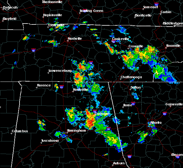 At 539 pm cdt, a severe thunderstorm was located over shelbyville, and is nearly stationary (radar indicated). Hazards include 60 mph wind gusts and penny size hail. Expect damage to roofs. siding. And trees. At 539 pm cdt, a severe thunderstorm was located over shelbyville, and is nearly stationary (radar indicated). Hazards include 60 mph wind gusts and penny size hail. Expect damage to roofs. siding. And trees.
|
| 7/8/2016 10:25 PM CDT |
 At 1024 pm cdt, severe thunderstorms were located along a line extending from 10 miles northeast of manchester to near lynchburg, moving east at 40 mph (radar indicated). Hazards include 60 mph wind gusts and penny size hail. Expect damage to roofs. siding. and trees. locations impacted include, shelbyville, manchester, tullahoma, tracy city, monteagle, coalmont, wartrace, normandy, raus, pelham, hillsboro, beechgrove, arnold afb and fiery gizzard s. P At 1024 pm cdt, severe thunderstorms were located along a line extending from 10 miles northeast of manchester to near lynchburg, moving east at 40 mph (radar indicated). Hazards include 60 mph wind gusts and penny size hail. Expect damage to roofs. siding. and trees. locations impacted include, shelbyville, manchester, tullahoma, tracy city, monteagle, coalmont, wartrace, normandy, raus, pelham, hillsboro, beechgrove, arnold afb and fiery gizzard s. P
|
| 7/8/2016 10:00 PM CDT |
 At 959 pm cdt, severe thunderstorms were located along a line extending from 14 miles northwest of manchester to near petersburg, moving east at 40 mph (radar indicated). Hazards include 60 mph wind gusts and penny size hail. Expect damage to roofs. siding. And trees. At 959 pm cdt, severe thunderstorms were located along a line extending from 14 miles northwest of manchester to near petersburg, moving east at 40 mph (radar indicated). Hazards include 60 mph wind gusts and penny size hail. Expect damage to roofs. siding. And trees.
|
| 7/8/2016 9:31 PM CDT |
 At 931 pm cdt, severe thunderstorms were located along a line extending from near murfreesboro to near petersburg, moving east at 45 mph (radar indicated). Hazards include 70 mph wind gusts and penny size hail. Expect considerable tree damage. Damage is likely to mobile homes, roofs, and outbuildings. At 931 pm cdt, severe thunderstorms were located along a line extending from near murfreesboro to near petersburg, moving east at 45 mph (radar indicated). Hazards include 70 mph wind gusts and penny size hail. Expect considerable tree damage. Damage is likely to mobile homes, roofs, and outbuildings.
|
| 7/7/2016 7:18 AM CDT |
 At 718 am cdt, a severe thunderstorm was located 11 miles northeast of shelbyville, moving southeast at 45 mph (radar indicated). Hazards include 60 mph wind gusts. Expect damage to roofs. siding. And trees. At 718 am cdt, a severe thunderstorm was located 11 miles northeast of shelbyville, moving southeast at 45 mph (radar indicated). Hazards include 60 mph wind gusts. Expect damage to roofs. siding. And trees.
|
| 7/7/2016 7:07 AM CDT |
 At 707 am cdt, a severe thunderstorm was located 12 miles north of shelbyville, moving southeast at 40 mph (radar indicated). Hazards include 60 mph wind gusts. Expect damage to roofs. siding. and trees. Locations impacted include, murfreesboro, bell buckle, unionville, fosterville, christiana, rockvale and deason. At 707 am cdt, a severe thunderstorm was located 12 miles north of shelbyville, moving southeast at 40 mph (radar indicated). Hazards include 60 mph wind gusts. Expect damage to roofs. siding. and trees. Locations impacted include, murfreesboro, bell buckle, unionville, fosterville, christiana, rockvale and deason.
|
| 7/7/2016 6:55 AM CDT |
 At 655 am cdt, a severe thunderstorm was located 12 miles southwest of murfreesboro, moving east at 40 mph (radar indicated). Hazards include 60 mph wind gusts. Expect damage to roofs. siding. And trees. At 655 am cdt, a severe thunderstorm was located 12 miles southwest of murfreesboro, moving east at 40 mph (radar indicated). Hazards include 60 mph wind gusts. Expect damage to roofs. siding. And trees.
|
| 7/6/2016 5:44 PM CDT |
 At 543 pm cdt, severe thunderstorms were located along a line extending from bell buckle to interstate 65, moving southeast at 30 mph (radar indicated). Hazards include 60 mph wind gusts and penny size hail. Expect damage to roofs. siding. and trees. Locations impacted include, shelbyville, spring hill, chapel hill, wartrace, eagleville, bell buckle, unionville, fosterville, rockvale, farmington, deason and rover. At 543 pm cdt, severe thunderstorms were located along a line extending from bell buckle to interstate 65, moving southeast at 30 mph (radar indicated). Hazards include 60 mph wind gusts and penny size hail. Expect damage to roofs. siding. and trees. Locations impacted include, shelbyville, spring hill, chapel hill, wartrace, eagleville, bell buckle, unionville, fosterville, rockvale, farmington, deason and rover.
|
| 7/6/2016 5:23 PM CDT |
 At 523 pm cdt, severe thunderstorms were located along a line extending from near eagleville to near columbia, moving southeast at 35 mph (radar indicated). Hazards include 60 mph wind gusts and penny size hail. Expect damage to roofs. siding. And trees. At 523 pm cdt, severe thunderstorms were located along a line extending from near eagleville to near columbia, moving southeast at 35 mph (radar indicated). Hazards include 60 mph wind gusts and penny size hail. Expect damage to roofs. siding. And trees.
|
| 6/28/2016 6:17 PM CDT |
 At 616 pm cdt, a severe thunderstorm was located 14 miles northeast of lewisburg, moving south at 40 mph (radar indicated). Hazards include 60 mph wind gusts. Expect damage to roofs. siding. and trees. Locations impacted include, shelbyville, lewisburg, chapel hill, unionville, farmington, deason and rover. At 616 pm cdt, a severe thunderstorm was located 14 miles northeast of lewisburg, moving south at 40 mph (radar indicated). Hazards include 60 mph wind gusts. Expect damage to roofs. siding. and trees. Locations impacted include, shelbyville, lewisburg, chapel hill, unionville, farmington, deason and rover.
|
| 6/28/2016 6:06 PM CDT |
 At 606 pm cdt, a severe thunderstorm was located 14 miles south of nolensville, or 16 miles southeast of franklin, moving south at 20 mph (radar indicated). Hazards include 60 mph wind gusts. Expect damage to roofs. siding. and trees. Locations impacted include, shelbyville, lewisburg, chapel hill, eagleville, unionville, rockvale, farmington, deason and rover. At 606 pm cdt, a severe thunderstorm was located 14 miles south of nolensville, or 16 miles southeast of franklin, moving south at 20 mph (radar indicated). Hazards include 60 mph wind gusts. Expect damage to roofs. siding. and trees. Locations impacted include, shelbyville, lewisburg, chapel hill, eagleville, unionville, rockvale, farmington, deason and rover.
|
| 6/28/2016 5:53 PM CDT |
 At 553 pm cdt, a severe thunderstorm was located 10 miles south of nolensville, or 12 miles southeast of franklin, moving south at 40 mph (radar indicated). Hazards include 60 mph wind gusts and penny size hail. Expect damage to roofs. siding. And trees. At 553 pm cdt, a severe thunderstorm was located 10 miles south of nolensville, or 12 miles southeast of franklin, moving south at 40 mph (radar indicated). Hazards include 60 mph wind gusts and penny size hail. Expect damage to roofs. siding. And trees.
|
| 6/15/2016 5:40 PM CDT | Numerous trees down across the county in bedford county TN, 0.6 miles WNW of Shelbyville, TN |
| 6/15/2016 5:39 PM CDT |
 At 539 pm cdt, severe thunderstorms were located along a line extending from 7 miles southeast of shelbyville to 9 miles south of lewisburg, moving southeast at 55 mph (radar indicated). Hazards include 60 mph wind gusts. Expect damage to roofs. siding. And trees. At 539 pm cdt, severe thunderstorms were located along a line extending from 7 miles southeast of shelbyville to 9 miles south of lewisburg, moving southeast at 55 mph (radar indicated). Hazards include 60 mph wind gusts. Expect damage to roofs. siding. And trees.
|
| 6/15/2016 5:27 PM CDT |
 At 527 pm cdt, severe thunderstorms were located along a line extending from 9 miles southeast of woodbury to 10 miles northwest of manchester to shelbyville, moving southeast at 40 mph (radar indicated). Hazards include 60 mph wind gusts. Expect damage to roofs. siding. And trees. At 527 pm cdt, severe thunderstorms were located along a line extending from 9 miles southeast of woodbury to 10 miles northwest of manchester to shelbyville, moving southeast at 40 mph (radar indicated). Hazards include 60 mph wind gusts. Expect damage to roofs. siding. And trees.
|
| 6/15/2016 5:18 PM CDT |
 At 518 pm cdt, severe thunderstorms were located along a line extending from near shelbyville to near lewisburg, moving south at 45 mph (radar indicated). Hazards include 60 mph wind gusts. Expect damage to roofs. siding. And trees. At 518 pm cdt, severe thunderstorms were located along a line extending from near shelbyville to near lewisburg, moving south at 45 mph (radar indicated). Hazards include 60 mph wind gusts. Expect damage to roofs. siding. And trees.
|
| 6/15/2016 5:12 PM CDT |
 At 511 pm cdt, severe thunderstorms were located along a line extending from 8 miles northeast of woodbury to 14 miles southeast of murfreesboro to 9 miles northwest of shelbyville, moving southeast at 35 mph (radar indicated). Hazards include 60 mph wind gusts. Expect damage to roofs. siding. and trees. Locations impacted include, murfreesboro, shelbyville, mcminnville, manchester, woodbury, morrison, wartrace, eagleville, bell buckle, auburntown, centertown, normandy, summitville, unionville, fosterville, readyville, beechgrove, deason, christiana and bradyville. At 511 pm cdt, severe thunderstorms were located along a line extending from 8 miles northeast of woodbury to 14 miles southeast of murfreesboro to 9 miles northwest of shelbyville, moving southeast at 35 mph (radar indicated). Hazards include 60 mph wind gusts. Expect damage to roofs. siding. and trees. Locations impacted include, murfreesboro, shelbyville, mcminnville, manchester, woodbury, morrison, wartrace, eagleville, bell buckle, auburntown, centertown, normandy, summitville, unionville, fosterville, readyville, beechgrove, deason, christiana and bradyville.
|
| 6/15/2016 4:53 PM CDT |
 At 452 pm cdt, severe thunderstorms were located along a line extending from near watertown to 6 miles east of murfreesboro to 13 miles east of spring hill, moving southeast at 45 mph (radar indicated). Hazards include 60 mph wind gusts. Expect damage to roofs. siding. And trees. At 452 pm cdt, severe thunderstorms were located along a line extending from near watertown to 6 miles east of murfreesboro to 13 miles east of spring hill, moving southeast at 45 mph (radar indicated). Hazards include 60 mph wind gusts. Expect damage to roofs. siding. And trees.
|
| 3/31/2016 6:34 PM CDT |
 At 633 pm cdt, a severe thunderstorm was located 12 miles northeast of shelbyville, moving east at 45 mph (radar indicated). Hazards include 60 mph wind gusts and quarter size hail. Hail damage to vehicles is expected. expect wind damage to roofs, siding, and trees. locations impacted include, shelbyville, wartrace, bell buckle, unionville, fosterville, christiana, deason and rover. A tornado watch remains in effect until 100 am cdt for central tennessee. At 633 pm cdt, a severe thunderstorm was located 12 miles northeast of shelbyville, moving east at 45 mph (radar indicated). Hazards include 60 mph wind gusts and quarter size hail. Hail damage to vehicles is expected. expect wind damage to roofs, siding, and trees. locations impacted include, shelbyville, wartrace, bell buckle, unionville, fosterville, christiana, deason and rover. A tornado watch remains in effect until 100 am cdt for central tennessee.
|
| 3/31/2016 6:06 PM CDT |
 At 606 pm cdt, a severe thunderstorm was located 12 miles northeast of lewisburg, moving east at 45 mph (radar indicated). Hazards include 60 mph wind gusts and quarter size hail. Hail damage to vehicles is expected. Expect wind damage to roofs, siding, and trees. At 606 pm cdt, a severe thunderstorm was located 12 miles northeast of lewisburg, moving east at 45 mph (radar indicated). Hazards include 60 mph wind gusts and quarter size hail. Hail damage to vehicles is expected. Expect wind damage to roofs, siding, and trees.
|
| 8/22/2015 4:46 PM CDT |
 At 445 pm cdt, a severe thunderstorm was located near petersburg, or 10 miles southwest of shelbyville, moving east at 20 mph (radar indicated). Hazards include 60 mph wind gusts and quarter size hail. Hail damage to vehicles is expected. expect wind damage to roofs, siding and trees. Locations impacted include, shelbyville and raus. At 445 pm cdt, a severe thunderstorm was located near petersburg, or 10 miles southwest of shelbyville, moving east at 20 mph (radar indicated). Hazards include 60 mph wind gusts and quarter size hail. Hail damage to vehicles is expected. expect wind damage to roofs, siding and trees. Locations impacted include, shelbyville and raus.
|
| 8/22/2015 4:33 PM CDT |
 At 432 pm cdt, a severe thunderstorm was located near petersburg, or 9 miles southeast of lewisburg, moving east at 25 mph (radar indicated). Hazards include 60 mph wind gusts and quarter size hail. Hail damage to vehicles is expected. expect wind damage to roofs, siding and trees. Locations impacted include, shelbyville, lewisburg, petersburg, wartrace, belfast, farmington and raus. At 432 pm cdt, a severe thunderstorm was located near petersburg, or 9 miles southeast of lewisburg, moving east at 25 mph (radar indicated). Hazards include 60 mph wind gusts and quarter size hail. Hail damage to vehicles is expected. expect wind damage to roofs, siding and trees. Locations impacted include, shelbyville, lewisburg, petersburg, wartrace, belfast, farmington and raus.
|
| 8/22/2015 4:24 PM CDT |
 At 423 pm cdt, a severe thunderstorm was located near petersburg, or near lewisburg, moving east at 25 mph (radar indicated). Hazards include 60 mph wind gusts and quarter size hail. Hail damage to vehicles is expected. Expect wind damage to roofs, siding and trees. At 423 pm cdt, a severe thunderstorm was located near petersburg, or near lewisburg, moving east at 25 mph (radar indicated). Hazards include 60 mph wind gusts and quarter size hail. Hail damage to vehicles is expected. Expect wind damage to roofs, siding and trees.
|
| 7/14/2015 4:47 PM CDT |
 At 447 pm cdt, a severe thunderstorm was located near petersburg, or 8 miles southeast of lewisburg, moving southeast at 30 mph (radar indicated). Hazards include 60 mph wind gusts. Expect damage to roofs. siding and trees. Locations impacted include, shelbyville, lewisburg, cornersville, farmington and belfast. At 447 pm cdt, a severe thunderstorm was located near petersburg, or 8 miles southeast of lewisburg, moving southeast at 30 mph (radar indicated). Hazards include 60 mph wind gusts. Expect damage to roofs. siding and trees. Locations impacted include, shelbyville, lewisburg, cornersville, farmington and belfast.
|
| 7/14/2015 4:26 PM CDT |
 At 426 pm cdt, a severe thunderstorm was located over lewisburg, moving southeast at 30 mph (radar indicated). Hazards include 60 mph wind gusts. Expect damage to roofs. siding and trees. This severe thunderstorm will remain over mainly rural areas of marshall, southwestern bedford, southeastern maury and northeastern giles counties, including the following locations, cornersville, farmington, culleoka, belfast and chapel hill. At 426 pm cdt, a severe thunderstorm was located over lewisburg, moving southeast at 30 mph (radar indicated). Hazards include 60 mph wind gusts. Expect damage to roofs. siding and trees. This severe thunderstorm will remain over mainly rural areas of marshall, southwestern bedford, southeastern maury and northeastern giles counties, including the following locations, cornersville, farmington, culleoka, belfast and chapel hill.
|
| 7/1/2015 1:43 PM CDT |
 At 142 pm cdt, a severe thunderstorm was located near tullahoma, or 8 miles north of lynchburg, moving southeast at 45 mph (radar indicated). Hazards include 60 mph wind gusts. Expect damage to roofs. siding and trees. Locations impacted include, shelbyville, wartrace, normandy and raus. At 142 pm cdt, a severe thunderstorm was located near tullahoma, or 8 miles north of lynchburg, moving southeast at 45 mph (radar indicated). Hazards include 60 mph wind gusts. Expect damage to roofs. siding and trees. Locations impacted include, shelbyville, wartrace, normandy and raus.
|
| 7/1/2015 1:30 PM CDT | Two trees down. one tree was on collier ave and the other tree was 1 mile south of the shelbyville municipal airpor in bedford county TN, 0.7 miles SW of Shelbyville, TN |
| 7/1/2015 1:27 PM CDT |
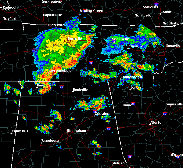 At 127 pm cdt, a severe thunderstorm was located over shelbyville, moving southeast at 40 mph (radar indicated). Hazards include 60 mph wind gusts. Expect damage to roofs. siding and trees. This severe thunderstorm will remain over mainly rural areas of bedford county, including the following locations, raus, wartrace, normandy and deason. At 127 pm cdt, a severe thunderstorm was located over shelbyville, moving southeast at 40 mph (radar indicated). Hazards include 60 mph wind gusts. Expect damage to roofs. siding and trees. This severe thunderstorm will remain over mainly rural areas of bedford county, including the following locations, raus, wartrace, normandy and deason.
|
| 6/23/2015 11:08 PM CDT |
 At 1108 pm cdt, a severe thunderstorm was located near shelbyville, moving south at 20 mph (radar indicated). Hazards include 60 mph wind gusts and quarter size hail. Hail damage to vehicles is expected. expect wind damage to roofs, siding and trees. This severe thunderstorm will remain over mainly rural areas of southwestern bedford county, including the following locations, raus. At 1108 pm cdt, a severe thunderstorm was located near shelbyville, moving south at 20 mph (radar indicated). Hazards include 60 mph wind gusts and quarter size hail. Hail damage to vehicles is expected. expect wind damage to roofs, siding and trees. This severe thunderstorm will remain over mainly rural areas of southwestern bedford county, including the following locations, raus.
|
| 6/1/2015 2:51 PM CDT | At 248 pm cdt, a severe thunderstorm was located 8 miles west of shelbyville, and moving northeast at 20 mph (radar indicated). Hazards include 60 mph wind gusts and nickel size hail. Expect damage to roofs. siding and trees. The severe thunderstorm will be near, shelbyville around 300 pm cdt. |
| 6/1/2015 2:36 PM CDT | At 234 pm cdt, a severe thunderstorm was located 7 miles east of lewisburg, and moving northeast at 20 mph (radar indicated). Hazards include 60 mph wind gusts and nickel size hail. Expect damage to roofs. siding and trees. The severe thunderstorm will be near, shelbyville around 300 pm cdt. |
| 6/9/2014 10:03 PM CDT | Large tree limbs down at residence on goose creek road in bedford county TN, 7.3 miles NNW of Shelbyville, TN |
| 2/20/2014 9:35 PM CST | Tree and power lines down on east lane street in bedford county TN, 0.6 miles WNW of Shelbyville, TN |
| 2/20/2014 9:30 PM CST | Large tree blocking comstock road in bedford county TN, 3.3 miles ENE of Shelbyville, TN |
| 12/21/2013 10:59 PM CST | Tree on house at central avenu in bedford county TN, 0.6 miles WNW of Shelbyville, TN |
| 7/10/2013 8:20 PM CDT | Tree blown down in 3300 block of highway 231 in bedford county TN, 8.3 miles NNE of Shelbyville, TN |
| 6/10/2013 4:10 PM CDT | Nws storm survey concluded that damage along minkslide rd and hwy 82 was due to a microburst. dozens of large trees uprooted with smaller limbs snapped and small trees in bedford county TN, 6.6 miles SSW of Shelbyville, TN |
| 6/10/2013 3:28 PM CDT | Trees and power lines down. minor barn damage in same are in bedford county TN, 6.6 miles SSW of Shelbyville, TN |
| 10/1/2012 1:30 PM CDT | Bedford county emergency management and the shelbyville times-gazette reported wind damage from a possible tornado across western shelbyville. numerous trees were blown in bedford county TN, 1.7 miles E of Shelbyville, TN |
| 3/31/2012 5:35 PM CDT | Trees and power lines were knocked down on highway 129 near the bedford county line. time estimated by rada in moore county TN, 11.9 miles N of Shelbyville, TN |
| 3/2/2012 6:45 PM CST | Golf Ball sized hail reported 7.7 miles NE of Shelbyville, TN, golfball hail reported between the communities of pleasant grove and richmond,8 miles southwest of shelbyville. |
| 3/2/2012 6:03 PM CST | Golf Ball sized hail reported 0.6 miles WNW of Shelbyville, TN, amateur radio operator reported golf ball sized hail in shelbyville. |
| 1/1/0001 12:00 AM | Half Dollar sized hail reported 5.8 miles NW of Shelbyville, TN, emergency management reported large hail 5 miles southeast of shelbyville. |
| 1/1/0001 12:00 AM | Golf Ball sized hail reported 1.2 miles E of Shelbyville, TN, public reported hail up to golfball size near shelbyville. time and location estimated based on radar. |
| 1/1/0001 12:00 AM | Trees down on cars and wall of building blown down in bedford county TN, 0.7 miles SW of Shelbyville, TN |
| 1/1/0001 12:00 AM | Extensive damage to a house occurred on depot street as an eighteen inch tree fell onto i in bedford county TN, 4.8 miles SSE of Shelbyville, TN |
| 1/1/0001 12:00 AM | Several trees were downed across the count in bedford county TN, 0.6 miles WNW of Shelbyville, TN |
| 6/18/2011 1:18 PM CDT | Ping Pong Ball sized hail reported 0.6 miles WNW of Shelbyville, TN |
| 1/1/0001 12:00 AM | Quarter sized hail reported 0.6 miles WNW of Shelbyville, TN |
Hail Maps for Shelbyville, TN


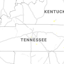


Connect with Interactive Hail Maps